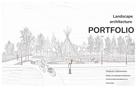
Masterplan
This project aims to establish a clear and engaging connection between Jefferies Park, the proposed transit line station, and 12th Street SE by developing a new and accessible network system.
The proposed pathways strengthen connectivity for both residents and visitors, allowing easy access throughout Inglewood and Ramsay.
Ramsay is a residential neighborhood located in southeast Calgary, bordered by the Elbow River, Macleod Trail, Stampede Grounds, and the Scotiabank Saddledome, and adjacent to the historic Inglewood area.
One of Inglewood’s key challenges is balancing heritage preservation with increasing urban density. As Calgary’s oldest neighborhood, it’s essential to retain its historic character while embracing new development that revitalizes the community and supports local businesses.
Master Plan
https://naturespath.com/blogs/posts/woonerf-the-dutch-solution-to-city-planning
https://www.blogto.com/city/2011/05/what_a_woonerf_might_look_like_in_toronto/
woonerf street
Woonerf Activation
-Creating an inviting space for indigenous people
-Creating a safe path for bike and walking
-Using lighting design to active the space
-Utilizing high-quality materials
-Native landscaping
-Community table
-Play areas
Woonerf street
Designing an intimate space for gathering
02 URBAN ACUPUNCTURE
Team: Alima Pal, Deepali Dang, Garima Chaudhary, Joshua Bateman, Madiha Mehdi, Mona Meschi, Pranshul Dangwal, Shabnam Seifhamedan
Reimagining a formerly industrial site
The Master Plan redefines a traditionally car-centric area in Calgary into a unique, pedestrian-focused area that connect Calgarians to the past, celebrates the present, and builds the foundations for a socially, ecologically, and economically flourishing future. The major transformation on the site is burying Deerfoot Trail between Memorial Drive and 17th Avenue to transform the feeling, flow, and connectivity across the area. Burying Deerfoot helps unleash the potential of the canal for a one-of-a-kind living experience in Calgary: canal-side living.
Location: Calgary, Alberta
Studio: Urban Design Studio under professor Fabian Neuhaus, Sven Kohlschmidt, Hal Eagletail
Term: Spring 2022
Team: Alima Pal, Deepali Dang, Garima Chaudhary, Joshua Bateman, Madiha Mehdi, Mona Meschi, Pranshul Dangwal, Shabnam Seifhamedan
A sports and recreation hub, cultural hub and food hub helps diversify the choice of activities that will result in people accessing the space throughout the day and more eyes on the street. Mobility hubs across the site allow for those who have not yet transitioned away from vehicles to park on the edges and walk into the community. The former spur lines that shaped the northern area are adaptively reused as pedestrian and bicycle greenways. A Food Forest south of Memorial Drive democratizes access to fresh, native plants that bear fruits by offering free foraging for anyone in the area. The housing along Barlow Trail stretching south-north will be taller apartments, creating a sense of enclosure on either side of the street and framing a more pedestrian-positive space.
The Master Plan redefines a traditionally car-centric area in Calgary into a unique, pedestrian-focused area that connect Calgarians to the past, celebrates the present, and builds the foundations for a socially, ecologically, and economically flourishing future. The major transformation on the site is burying Deerfoot Trail between Memorial Drive and 17th Avenue to transform the feeling, flow, and
connectivity across the area. Burying Deerfoot helps unleash the potential of the canal for a one-of-a-kind living experience in Calgary: canal-side living. A sports and recreation hub, cultural hub and food hub helps diversify the choice of activities that will result in people accessing the space throughout the day and more eyes on the street. Mobility hubs across the site allow for those who have not
LET’S PARK YYC aims to convert underutilized parking lots to temporary installations with uses that engage people of all ages. The design of the lots is modular, and can be arranged in different ways using the same elements, making it easy to adjust in a variety of spaces. The intervention took place over a period of two days and covered two parking lots, one attached to a gelato place and cafe, and the other an LRT station parking lot. The elements include giant jenga, tire seating, tire planters, pinwheels, see-saw, mini foosball table and ring toss.
All elements can be arranged for a diverse suite of activities
This master plan reimagines a formerly car-dominated area of Calgary into a pedestrianoriented, inclusive urban landscape that connects Calgarians to the past, embraces the present, and fosters a resilient future. The key transformation involves burying Deerfoot Trail between Memorial Drive and 17th Avenue to improve spatial flow and pedestrian connectivity. This intervention unlocks the potential of canal-side living and activates the area with a sports hub, cultural hub, and food hub, encouraging activity throughout the day and enhancing street safety.
Mobility hubs along the site enable visitors to park on the periphery and enter the community by foot. Former rail spur lines are repurposed as green pedestrian and bike corridors, while a Food Forest near Memorial Drive provides public access to native, edible
Crescent park
In this site planning project, we were tasked with placing three programmatic elements a café, a public washroom, and a viewing tower on the crest of a bluff with spectacular views of the city and the mountains. Rather than focusing on the architecture of the buildings themselves, the goal was to explore and design the spatial relationships created by their arrangement.The project emphasizes pedestrian accessibility and creates a hierarchy of open spaces with distinct views and experiences. Circulation paths are carefully planned to maximize both function and aesthetic value, while the building placements activate and define a series of public gathering areas along the slope.
Site Isometric