LIFE CYCLE COST ANALYSIS OF BEACH
RESTORATION: RINCÓN, PR TESTBED
Project Number: R/75-1-14
Year 3 – Final Report
Period of Performance: February 2015 – May 2018 (3 years)
Date: May 23, 2018
Contact information:
Principal Investigator:
Luis D. Aponte-Bermúdez, Ph.D., P.E. Professor
Department of Civil Engineering and Surveying University of Puerto Rico Mayagüez Email: luisd.aponte@upr.edu Tel. (787) 832-4040 x6337 Cell (787) 217-2957
Co-Principal Investigator:
Miguel F. Canals Silander, Ph.D. Associate Professor
Department of Engineering Sciences and Materials University of Puerto Rico Mayagüez Email: miguelf.canals@upr.edu
I. Executive Summary
The town of Rincón is located in the northwest corner of Puerto Rico and has a current population of about 15,000. Like other US American beach communities, Rincón's local economy thrives on the condition of its beaches and has been driven primarily by the tourist industry since the late 1950s. Its beachfront hotels and the variety of small beaches along its shoreline are crucial to its prosperity. This project was intended to provide information to private and public planners to make the best decisions in coastal zone management for the area. The research performed involved analysis and manipulation of GIS data from the USGS, CRIM, USACE, GME, PRPB, and DRNA. The alternatives available to mitigate economic losses related to coastal erosion are managed retreat, armoring, and beach nourishment. The USGS study prepared by Thieler et al. (2007) provides historical data of shoreline position for the region from 1936 to 2006. The database of the Center for Municipal Income Revenue Collection (CRIM, by its acronym in Spanish), includes parcel and property values and was used herein to estimate the present value of oceanfront properties. A LiDAR Digital Elevation Model (DEM) provided by USACE (2016) was used to determine the required sand volume for beach nourishment. The proposed beach nourishment consists of a beach berm that extends up to 35 meters (115 ft), in the most critical areas, and is 1 meter above the mean sea level where the proposed site begins at Rincón Public Beach and ends in Córcega (Barrero), which corresponds to a length of about 4.5 km. Rincón’s CRIM database consists of 8,166 properties for the entire municipality of which 613 properties along Rincón's shoreline are considered first oceanfront, also known as oceanfront properties by its geographical location. The CRIM’s database provides a property appraisal value adjusted to the year 1958 (Coa & Rodríguez, 2010). Of these only 2,738 parcels contain data regarding sales including amount value and transaction date. CRIM’s data was used to establish an interest growth rate, which was bounded by statistical data analysis, to determine the most likely value of oceanfront properties located along the proposed site. The lower bound of proposed interest growth rate corresponds to the 25% quantile of all the available parcels with sales information. Similarly, the mid-bound correspond to the 50% quantile and the upper bound corresponding to the 75% quantile when considering the property parcels within one kilometer from the shoreline. For this case, the interest growth rate ranges from 4.66%, 5.70%, and 6.85%, respectively. In the beach nourishment site, there are 532 parcels with a total value amount that adds up to $7,510,124 dated to 1958 in the CRIM's database, using
engineering economics this amount was adjusted to the year 2017. Respectively, the adjusted property value for the year 2017 ranges from $111, $198, and $375 million. Using ArcGIS, the required sand volume was calculated to be approximately 825,508 cubic meters (1,079,724 cubic yards). It should be noted that this is the required volume assuming that the granulometry of the sand matches the existing site conditions. Rojas (2016) conducted granulometry sand analysis of Bajo Blanco Sand Shoal as a potential borrow site to conduct a beach nourishment project in Rincón, and also conducted an analysis using “Dean’s overfill factor” which suggests that an additional 50 – 70% of sand would be needed for the success of the design for the beach profile. The findings of Rojas (2016) suggest that the sand volume need will be around 1,320,813 cubic meters (1,727,558 cubic yard). The area of Bajo Blanco is approximately 380,000 square meters. Therefore, an excavation up to four meters would be the minimum necessary dredge depth. However, there is no information regarding the condition and quality of the sand of the Bajo Blanco sand deposit at those dredge depths. In the US east coast typical unitary cost ranges from $13 to $20 per cubic meter of sand, taking into consideration these unitary costs, a preliminary cost to conduct the proposed beach nourishment in Rincón ranges from $17.2 to $26.4 million. Further cost analysis is needed, given that the mobilization cost of the equipment to the island might drive up the costs and that the bathymetric conditions have changed drastically since the passage of hurricane María (2017). In addition to beach nourishment and considering that armoring the coast will be possible after beach nourishment is completed a hybrid alternative to mitigate damage to the coastal properties was considered that would require armoring the coastline (e.g., sheet piles) at an estimated unitary cost of $6,561 per meter ($2,000 per ft), which represents an estimated amount of $29.6 million. Since the economic impact of the total beach loss was out of the scope of this research study, a conservative benefit-cost analysis was assessed considering the benefit as the value of oceanfront properties plus its taxable municipal property income, and the cost of the associated value to implement a solution (i.e., the first alternative considers only beach nourishment, and the second alternative is a hybrid solution of beach nourishment + armoring). In general, a benefit-cost ratio for the first alternative ranges from 4 to 14, and from 2 to 7 for the second alternative. In conclusion, the findings of this research justify actions to carry out a beach nourishment project in Rincón's most eroded beaches since the benefit-cost ratios presented are larger than one for both alternatives. The findings presented in
Page 4 of 24
this report will assist local and federal governments to develop and implement mitigation alternatives to the long- and short-term coastal erosion problem in Rincón.
A. Objectives: How they were accomplished
The objective of the proposed project was to determine the viability of beach nourishment along Rincón’s west-facing coastline to mitigate the effects of long and short-term effects coastal erosion under projected sea level change scenarios and storm events. Detailed information on coastal properties and sand volume requirements were compiled and analyzed as part of this study. The objectives of the research work were accomplished by performing GIS data analysis of the CRIM’s property appraisal database, USACE LiDAR bathymetry of 2016, historical aerial images of Rincón shoreline from Thieler et al. (2006), aerial images captured in September 2016 as part of this research work, and field work to perform field assessments of oceanfront properties along the coastline that were affected by swell events caused by hurricane Matthew (2016), hurricane María (2017), and North Atlantic winter storm swells. A methodology was developed and implemented to determine the value of coastal properties, and sand volume needs from a proposed design berm developed taking into consideration the shoreline positions from 1936 to 2016.
B. Advancements in the Field
The findings obtained during this research work will help local and federal government agencies to determine and evaluate alternatives to mitigate the long- and short-term erosion problem in Rincón. The developed methodology as part of the research work involved the use of CRIM’s database to estimate the value of coastal properties and could be used to evaluate other coastal municipalities in Puerto Rico that are vulnerable to coastal erosion. Also, the use of the USACE 2016 bathymetry LiDAR data to determine sand volume needs for beach nourishment projects could be used for any of the northern coastal municipalities in Puerto Rico. The work conducted herein had an emphasis on the west-facing shoreline where coastal erosion is an actual problem that was exacerbated by past hurricanes Matthew (2016) and María (2017) and had caused the loss of various properties along this shoreline (e.g., three apartment building in Córcega and various residential houses). At present, Rincón’s coastal infrastructure was the most affected among the coastal municipalities in Puerto Rico after the passage of hurricane María. The functionality of Rincón beaches along the west-facing shorelines has been interrupted by
Page 5 of 24
underwater debris and significant sand loss caused by hurricane María which has affected the local economy primarily driven by its tourism.
C. Problems encountered
Fortunately, the events of hurricanes Matthew (2016), María (2017) and various northeastern winter storm swells no represented a problem to conduct this research work. Although, such events represent a challenge for municipal, local and the federal government agencies to pursue viable solution alternatives for the coastal erosion problem; and these events validate the need for the present research work.
D. PI’s supported
A breakdown of UPRM funds provided matching funds to cover PI’s salary are presented in
Table A-1. Aponte and Canals dedicated 0.66 and 0.18 man-month, respectively, to the project during the first two years for a total UPRM matching fund of $21,690.82, including fringe benefits.
Table A-1. PI’s matching fund's calculation
E. Student’s Supported
The graduate student Francisco J. Villafañe Rosa (Email: francisco.villafane@upr.edu) received total salary compensation of $25,600.00 for his role of graduate research assistant on this project from SG funding from February 2015 to May 2017.
F. Thesis
Francisco presented his oral thesis exam regarding the degree of Master Science in Civil Engineering on January 10, 2018, at the Department of Civil Engineering and Surveying at the University of Puerto Rico Mayagüez.
Bibliography
Villafañe-Rosa, F. (2018). Análisis de costo de las alternativas para mitigar daños a la infraestructura costera de Rincón, Puerto Rico. M.S. University of Puerto Rico Mayagüez.
G. Presentations
1. Poster: Presented at CariCOOS General Assembly 2016 celebrated at Puerto Rico Convention Center on April 27-28, 2016 in San Juan, PR.
Title: Analysis of Shoreline Changes in Rincón, Puerto Rico: Impacts to Oceanfront Infrastructure
Authors: Francisco J. Villafañe, Luis D. Aponte-Bermúdez, Miguel Canals
2. Presentation: At the American Shore & Beach Preservation Association Conference: “Lighting the Way for the Coastal Future” on October 25-28, 2016 in Long Branch, NJ.
Title: Life Cycle Cost Analysis of Beach Erosion Alternatives at Rincón, PR
Authors: Francisco J. Villafañe, Luis D. Aponte-Bermúdez, Miguel Canals
3. Presentation: At the conference, Lessons Learned and Best Practices: Resilience of Coastal Infrastructure on March 8-9, 2017 at the College of Engineers and Surveyors of Puerto Rico in Hato Rey, PR
Title: Coastal Erosion Impact on Rincón Infrastructure
Authors: Luis D. Aponte-Bermúdez, Francisco J. Villafañe, Miguel Canals
Page 7 of 24
4. Poster presented at CariCOOS General Assembly 2017 celebrated at Hotel Rincón Beach Resort on April 28, 2017, in Añasco, PR
Title: Analysis of Shoreline Changes in Rincón, Puerto Rico: Impacts to Oceanfront
Infrastructure
Authors: Francisco J. Villafañe, Luis D. Aponte-Bermúdez, Miguel Canals
5. Presentation at Conference: Let’s think about Rincón’s resiliency to natural coastal events
Celebrated on December 11, 2017, at Hotel Cofresí in Rincón, PR.
Title: Coastal Erosion Impact to Rincón’s Infrastructure and Cost Analysis of Mitigation Alternatives
Authors: Luis D. Aponte-Bermúdez, Francisco J. Villafañe, Miguel Canals, and Jonathan Muñoz, Ph.D.
6. Poster presented at MEGA VIERNES CIVIL 2018 celebrated on April 6, 2018 at Puerto Rico Convention Center in San Juan, PR.
Title: Cost analysis of the alternatives to mitigate damage to the coastal infrastructure of Rincón, Puerto Rico
Authors: Francisco J. Villafañe Rosa, Luis D. Aponte Bermúdez, Miguel Canals
H. Publications
1. Aponte-Bermúdez, L., Villafañe-Rosa, F., Canals, M., Muñoz-Barreto, J. and Díaz, E. (2017). Impacto de la erosión costera a la infraestructura de Rincón. Dimensión, Revista del Colegio de Ingeniero y Agrimensores de Puerto Rico, [online] (Año 31, Vol. 1), pp.23-29. Available at: http://www.ciapr.net/templates/CIAPR/Dimension/03dimA31v1.pdf [Accessed 16 Apr. 2018].
I. Source of Matching Funds
Matching funds were provided by UPRM as release time for the PI’s to conduct the research work as indicated in Table A-1 in section D.
J. Follow-up funds
Follow-up funds for project title: Puerto Rico Beach Recovery Post-María 2017: Erosion Assessment, Control, and Management Agency: US Department of Interior, US Fish and Wildlife Service, Cooperative Ecosystem Studies Units
PI: Dr. Luis D. Aponte-Bermúdez; Co-PI’s Ernesto L. Díaz, MS, MEM; Miguel CanalsSilander, Ph.D , Jonathan Muñoz-Barreto, Patricia Chardon, Ph.D
Start date: March 15, 2018, to August 13, 2018
Award Amount: $78,000.00
K. Time and Effort breakdown
The total amount of time dedicated to the project by the PI’s, Dr. Aponte and Dr. Canals, is presented in Table A-1, which represents a total 214.5 hours, and 58.5 hours, of man/hours by each PI, respectively.
L. Research Impacts/Accomplishments (4R’s):
The work conducted under the University of Puerto Rico Mayaguez Campus Sea Grant Program, project number R/75-1-14 titled LIFE CYCLE COST ANALYSIS OF BEACH
RESTORATION: RINCÓN, PR TESTBED, provides a preliminary benefit-cost ratio analysis to conduct a beach nourishment project on the west shoreline of the Municipality of Rincón, Puerto Rico. Long- and short-term coastal erosion is at present the primary risk to human-made coastal infrastructure and natural habitat ecosystems in the region. Sea Grant seeks to address this issue in support of municipal, state and federal government agencies. The passage of hurricane Maria (2017) had devastated most of Rincón’s coastal infrastructure triggering a shortfall to the local tourism economy that validates the need for the conducted research work. This project had served to establish two essential milestones towards finding a feasible solution to the problem employing the property parcel inventory of the Center for Municipal Income Revenue Collection (CRIM, by its acronym in Spanish) and the bathymetry of January 2016 provided by the US Army Corp of Engineers. The first milestone consisted in developing a framework to relate the CRIM property parcel costs, which are base to the year 1958, to the present, and second to estimate a preliminary sand volume need to conduct a beach nourishment project. These two milestones were crucial to establishing a benefit-cost ratio in support to municipal, state and federal government agencies which are responsible for seeking and evaluating feasible solutions to the problem. Information about Rincón coastal infrastructure was collected for the project duration from February 2015 to December 2017 during site visits using unmanned aerial vehicles (UAVs) and site visit using traditional photography at ground level The preliminary results reveal that beach nourishment is a viable alternative with an average benefit-cost ratio of four. The finding of this research work will aid decision makers at municipal and state government levels to seek Federal Governments Aids to mitigate the long- and short-term coastal erosion problem in Rincón in support to benefit the local economy and restore beach natural habitats ecosystems. Such reconstruction efforts are vital to the local community since Rincón sandy beaches are the number one attraction for the tourism industry.
Page 9 of 24
II. Final Report Narrative
A. A brief state of the problem
The Coastal Engineering Manual (United States, 2006) defines coastal erosion as the carrying away of beach material by wave action, tidal currents, littoral currents, or wind. Coastal erosion or beach loss is a natural hazard process in which the coast retreats and is mainly caused by variable beach dynamics and human activities. This process occurs over different time scales on the short- and long-term. Typically, massive storms generate strong waves and currents causing short-term effects while sea level rise or tectonic plate movement causes long-term changes. As indicated by (Thieler, Rodríguez, & Himmelstoss, 2007) "the historical trend of erosion along much of the Rincón coast indicates that future sea level rise will likely result in a continuation of, or perhaps increase in, the rate of coastal erosion" (p. 7). Therefore, a solution to mitigate such problems needs to be developed for current and future generations. Thieler et al. (2007) work on the Rincón historical shoreline changes is summarized in four distinct reaches (A, B, C, and D) based on observed erosion rates; Figure 1 illustrates the location of Thieler's reaches. Where longterm erosion affects all of them, reach A and D are stable to slowly eroding beach sand; short-term erosion caused by massive storms or wave events coming from the south or west affects reaches B and C.

Capobianco et al. (2002) propose that after the failure of "hard" for protecting sandy beaches a feasible and environmentally-friendly alternative to mitigate beach erosion is beach nourishment, in which sand is delivered to eroded beaches on a timely schedule in order to mitigate the short- and long-term loss of sand beach. Another mitigation action against coastal erosion involves the use of hard structures measures (i.e., seawalls, groins, and bulkheads) to control cross-shore or alongshore sediment transport in order to retain beach material.
According to (NOAA Office of Ocean and Coastal Resource Management), nowadays coastal erosion is driven by “large storms, flooding, strong wave action, sea level rise, and human activities” is the principal cause of private and public property loss. Coastal engineers and scientists have learned that adding sand in the right quantities with an adequately engineered beach nourishment program can make a beach last for a very long time. Beach nourishment is being considered as a mitigating measure of coastal erosion for the municipalities of San Juan and Rincón.
Figure 1. Rincón reaches (A, B, C, and D) areas studied by Thieler et al. (2007)
The work by Thieler et al. (2007) presents the morphological changes of the Rincón coastline over the past eight decades. Also, the data collected during this investigation evidence the effect of short-term erosion caused by massive storms Matthew (2016) and Maria (2017) along Rincón’s west shoreline. To mitigate the long- and short-term erosion an adequately engineered beach nourishment plan requires:
• To develop a detailed coastal property/structure inventory
• To determine the total loss in dollar amount caused by coastal erosion
• The development of a benefit-cost ratio for beach nourishment
The conducted research filled essential information gaps using Rincón as a testbed site. The development of a methodology for local beach evaluation and cost-effectiveness analysis of beach nourishment practices in our region serve as a foundation for future beach restoration projects along Puerto Rico coastlines, as well as to develop badly needed local expertise given potential sea level change scenarios.
In Figure 2 and Figure 3 is presented the historical aerial images of Rincón for the sectors of Balnerario Publico and Córcega, respectively, showing the property parcel boundaries in yellow lines Figures a) and b) obtained from (Thieler et al. 2006) show the estimated location of the shoreline in 1936 (line color aqua) and 1987 (line color orange) and Figures c) shows the estimated position of the shoreline from the aerial images collected during this research in September 2016.
11 of 24
Figure 2. Aerial Images of Rincón at Balneario Publico: a) 1936 – aqua line; b) 1987 – orange line; & c) 2016 red line.
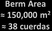
Figure 4 shows in yellow hatch the estimated long-term beach berm loss by comparing the shoreline position of 1936 to 2016. The estimated total loss area is approximate of 150,000 square meters (≈ 38 cuerdas).
12 of 24
Figure 3. Aerial Images of Rincón at Córcega: a) 1936 – aqua line; b) 1987 – orange line; & c) 2016 red line.
Figure 4 Estimated berm area loss since 1936 to 2016 in Rincón west shoreline measured from Balneario Publico to the Barrero sector.
B. Methods - GIS data collection, manipulation, and analysis
Rincón CRIM database – The Center for Municipal Income Revenue Collection (CRIM, by its acronym in Spanish) provided the digital parcel database known as Catastrao Digital de Puerto Rico for the Municipality of Rincón as shown in Figure 5. The property parcels are identified by color by its proximity to the shoreline, in yellow are identified the property parcels within 30 m from the shoreline, in green the within 1km from the shoreline and the rest in magenta.
An analysis was conducted to determine an appropriate growth rate to adjust the CRIM property value dated to the year 1958 to the year (2017) using engineering economics. The database consists of 10,097 parcels with the following attributes:
• NUM_CATASTRO – Parcel cadastral number of eleven digits (###-###-###-##), there are 9,231 parcels with cadastral number and 866 with empty data
• LAND – Land value in US dollars of the parcel, there are 2,026 parcels with the NULL value and 782 with $0 value
• STRUCTURE – Structure value in US dollars, there are 2,026 parcels with the NULL value and 2,514 with $0 value
• MACHINERY – Equipment value in US dollars, there are 2,026 parcels with the NULL value and 8,029 with $0 value
• TOTALVAL – Total parcel value in US dollars, this value is the sum of LAND + STRUCTURE + MACHINERY, there are 2,026 parcels with the NULL value and 220 with $0 value
Page 13 of 24
Figure 5. CRIM Parcel database for the Municipality of Rincón, PR
• EXEMP – Negative value in US dollars of a tax exemption, there are 2,026 parcels with the NULL value and 7,952 with $0 value
• EXON – Negative value in US dollars of exoneration value of which the maximum value is $15,000, there are 2,026 parcels with the NULL value and 5,024 with $0 value
• TAXABLE – Taxable amount per parcel, this value is the sum of TOTALVAL + EXEMP + EXON, there are 2,026 parcels with the NULL value and 2,628 with $0 value
• SALESAMT – Amount of sales value in US dollars, there are 2,026 parcels with a NULL value, 4,754 with $0, and 435 with values ranging from $1 to $100, the difference has values greater than $100
• SALESDTTM – Date of the recorded sales amount (SALESAMT) in format month/day/year (MM/DD/YYY), there are 5,660 parcels with a NULL value
Figure 6. Flowchart of the Methodology used to determine the growth rate interest rate of the CRIM database
Applying engineering economics the interest growth rate was calculated for each property parcel with TOTALVAL, SALESAMT, and SALESDTTM information, following the methodology presented in Figure 6 flowchart. Table 1 summarizes the statistics of the calculated interest growth rate considering three cases, which are 1) All properties in the entire municipality, 2) properties within 1 km from the shoreline, and 3) oceanfront (waterfront) properties.
Table 1. Statistics of interest growth rate i (%)
In summary, a proposed range of the interest growth rate (i), bounded the statistical data analysis, will be used to determine the most likely value of oceanfront properties along the proposed site (from the Balneario to Barrero sector) to carried out the beach nourishment project. The proposed interest growth rate lower bound corresponding to the 25 % quantile of all the
Page 14 of 24
available parcels, and the upper bound correspond to the 75% quantile when considering the properties within 1 km from the shoreline, for this case the values range is 4.66% and 6.85%, respectively. The preliminary beach nourishment site extends from Balneario to Córcega, in this region, there are 532 parcels with TOTALVAL information that add up to $7,529,566.00 dated to 1958. Using engineering economic this amount is adjusted to the year, 2017, considering that n is the number of years between the two, which in this case is 59 year. Equation 1 is used then to adjust the total property values to the year 2017 Table 2 summarizes the calculation considering the interest growth rate range. The properties considered for the calculation summarized in Table 2-2 are shown in Figure 7 in yellow.

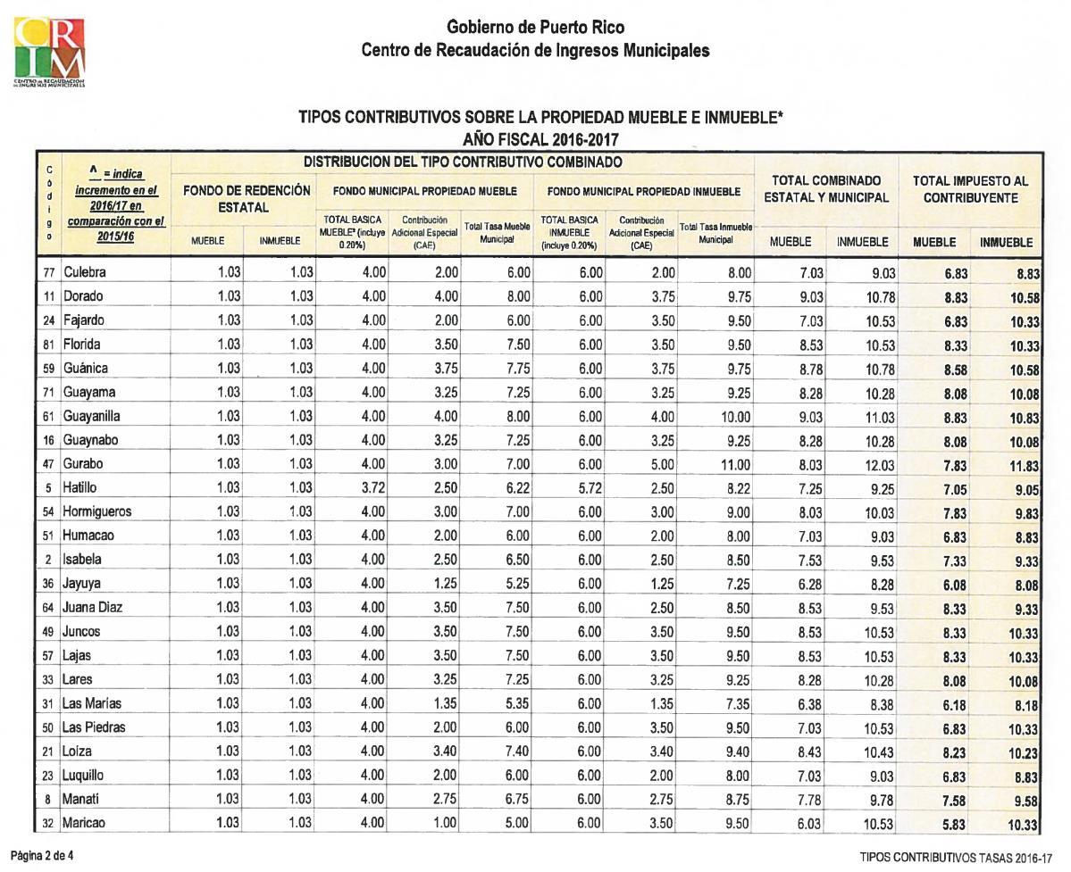
Property tax revenue – The property tax was calculated using the TAXABLE field of the CRIM’s database multiplied by its taxable percentage rate (“Tasa Contributiva” in Spanish) as indicated in equation 2. The taxable percentage rate was obtained from the published values by the CRIM office known as Tasa Contributiva: Impuestos sobre la Propiedad Mueble e Inmueble (CRIM, 2016c). In Figure 8 is shown a portion of the table of Taxable percentage rate for
Page 15 of 24
Table 2. Adjusted total property value considering oceanfront properties in the study site
Figure 7 Property parcel identified in the project study area
Municipalities some Municipalities. Using the CRIM database provided by the agency on November 16, 2016, the sum of the TAXABLE oceanfront properties located in the proposed area to conduct the beach nourishment the valued adds up to $4,670,804.00 when considering a “Tasa Contributiva” of 8.83% the property tax is estimated to $384,286.00. Therefore the total estimated loss is estimated as the total value (Eq. 1) plus the taxable value (Eq. 2). Although the taxable value is small compared to the adjusted total value of the property to 2017 (0.1% to 0.3%), it is relevant to mention that this represents a significant amount of income for the Municipality of Rincon.
USACE LiDAR Digital Elevation Model (January 2017) – In collaboration with the USACE Dr. Miguel Canals obtained a hard drive with the LiDAR data of Puerto Rico collected by the Corps. The data extends from the west coast at Ricón thru north to Fajardo. The data is in a cloud point format, and it contains the raw data and GeoTiff files at 1 m resolution of the raw data and a bare earth terrain model. The raw digital elevation model was used to determine the required volume for a design berm of 35 m that extend from the shore to the sea from the delimited 2016 shoreline but limited with Thieler et al. 1936 shoreline. Using ArcGIS and
Page 16 of 24
Figure 8. CRIM Taxable percentage rate for Municipalities
considering that the new beach berm will be 1 m above the mean sea level with a slope of 5%, the required sand volume is approximately 825,508 m3 (1,079,724 yd3) Rojas (2016) conducted granulometry sand analysis of Bajo Blanco sand shoal as a potential borrow site to conduct a beach nourishment project in Rincón. Rojas (2016) using Dean’s overfill factor which suggests that an additional 50 – 70% of sand would be needed for the success of the design beach profile. The findings of Rojas (2016) suggest that the sand volume need will range from 1,238,262 to 1,403,364 m3 (1,619,586 to 1,835,531 yd3).
C. Results and Findings
Beach nourishment cost – In the US east coast typical unitary cost ranges from $13 to $20 per cubic meter of sand, taking into consideration these unitary costs, a preliminary cost to conduct the proposed beach nourishment in Rincón ranges from $16 to $28 million.
Benefit-cost-ratio (BCR) – A preliminary BCR considering oceanfront properties total value adjusted to 2017 plus its taxable values as benefit and beach nourishment cost an estimated BCR range from 4 to 23.3 considering the lower and upper bounds of the total property value and nourishment construction cost respectively. Considering the 50 % quantile value of the properties to the beach nourishment cost the BCR lies between 4.2 and 21.9.
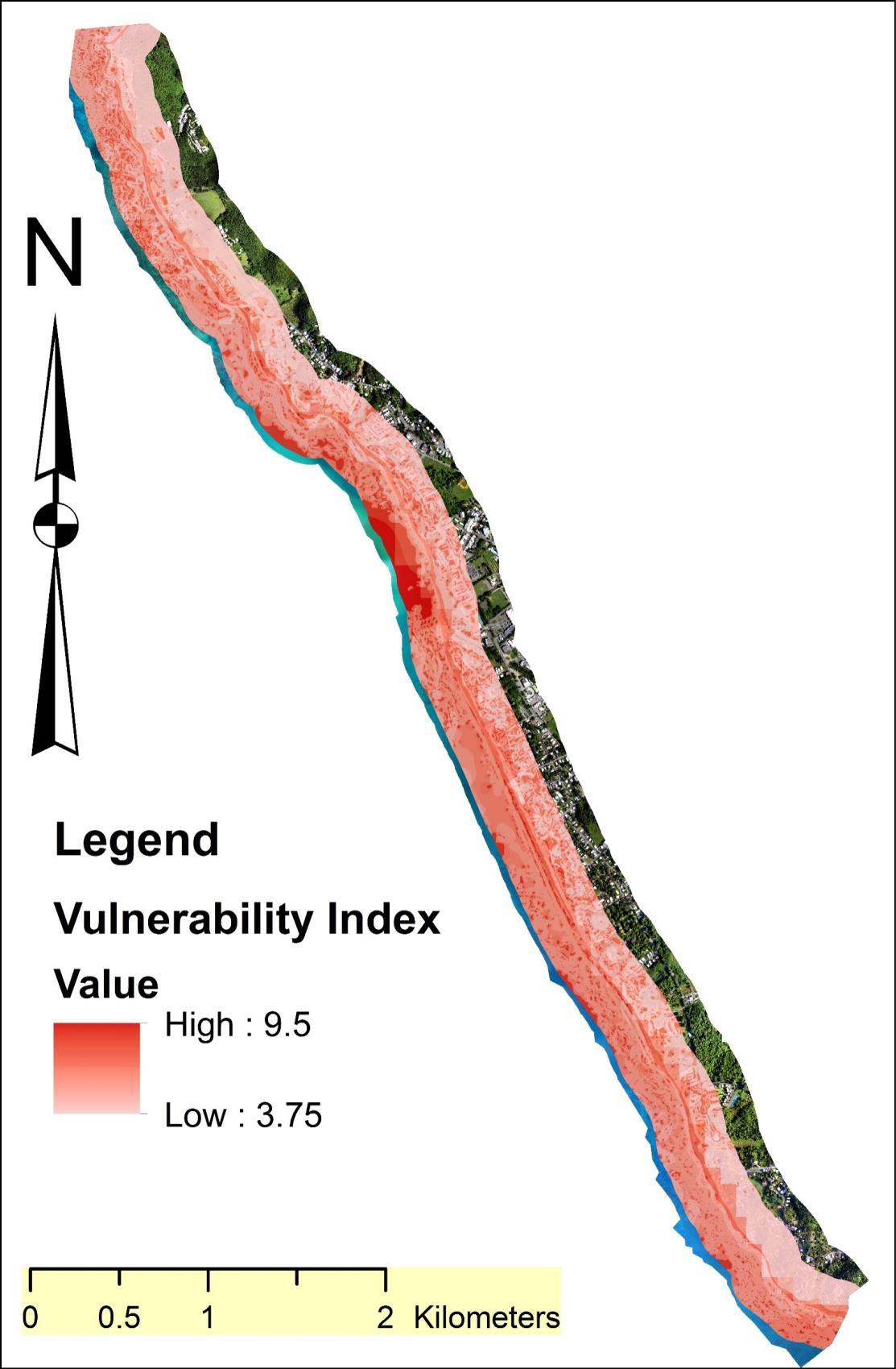
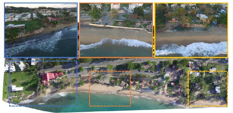
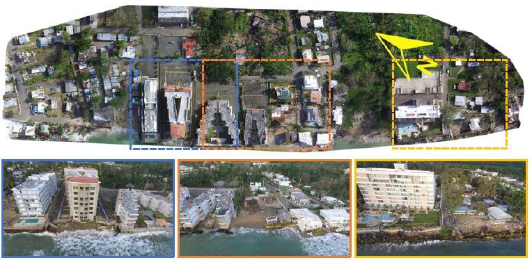
Coastal Vulnerability Index (CVI) – A preliminary CVI of beach erosion has been developed for the Rincón shoreline. The CVI value ranges from 0 to 1, where a value near to 1 indicates that the vulnerability of beach erosion is very likely (high) and lower values indicate that beach erosion is unlikely (low). Using ArcGIS Spatial analysis, a CVI data layer was calculated. The data used in the analysis was 1) FEMA Flood Insurance Rate Map (FIRM), 2) PR storm surge developed by CariCOOS1 , 3) coastal benthic zones (natural protection), 4) terrain slope (from USACE 2016 LiDAR), and 5) historical erosion rates for the region determined by (Thieler et al., 2007). Figure 9 presents the preliminary CVI map for the west side region of Rincón. The CVI layer is presented using a red color ramp, where the intense colors indicate that coastal erosion risk is high in the region and the light color indicates a low risk. The coastal barriers illustrated in Figure 10 have been delimited along the west side of the Rincón shoreline via field campaign and using the aerial images produced by GEM in September 2017. It can be noted that the region more affected by the storm surge caused by past hurricanes Matthew (2016) and Maria (2017) were at locations in which “hard structures” are found or location in which the structures are to close of the shoreline. The shoreline protection is classified as sand, reinforced concrete (sea walls), local (local man made hard structures) and sheet pile As expected in that location where “hard structures” exist, or the coastal infrastructure is to close to the shoreline position catastrophic failure of structures was produced by the powerful storm surge caused by hurricane Maria (2017) (Pash, Penny, & Berg, 2018). In Figure 11 thru 13 shows aerial images of Rincón shoreline after hurricane Maria at el Balneario Publico, Cofresí-Stella, and Córcega regions. The damage caused by the storm surge have compromised many residential structures and residential apartment complex due to the scouring of the foundation material. In such location, retreat is already taking place considering that it no possible to repair some of the affected structures
1 CariCOOS Storm-surge catalogue map http://www.caricoos.org/map/storm-surge
Page 17 of 24
Final report (Aponte & Canals) Page 18 of 24
Figure 9. Preliminary Coastal Vulnerability Index fro Rincón shoreline
Page 19 of 24
Figure 10. Classification of shoreline protection structures located from the Balneario Publico de Rincon to Barrero sector.
Figure 11. Aerial images after Maria at Balneario Publico de Rincón captured on December 7, 2017
Life Cycle Cost Analysis of Beach Restoration: Rincón, PR Testbed Yr.3
Final report (Aponte & Canals)
20 of 24
Figure 12. Aerial images after Maria at Cofresí-Stella sectors in Rincón, PR captured on December 7, 2017
Figure 13. Aerial images after Maria at Córcega Rincón, PR captured on December 7, 2017
D. Objectives accomplished
Our milestones timetable as presented in the original proposal is as follows:
StudentSelection
Developmentof detailedGISinventory of coastal structures(ReachB, C, A &D)
Developmentof vulnerability index of coastal structures
Developmentof the frameworktodetermine the total lossdue tocoastal erosion
Developmentof benefit-costratioforbeach nourishment
Presentin AUGOceanSciences2016
ASBPA 24-28OCT-2016
Publicationinpeer-reviewedjournal
As presented in the table above all task have been completed except the publication in a peerreviewed journal, an advance draft copy for publication is in progress an is expected to sent to publication during summer 2018.
E. Discussion of project impacts and products
A summary of the GIS data used and generated as a result of the research activities is presented as follow:
Available GIS data
1) Aerial images of Puerto Rico of 2007 source USACE
2) Aerial images of Puerto Rico of 2010 source Puerto Rico Planning Board
3) Rincón property appraisal data source Puerto Rico CRIM office
4) USACE LiDAR digital elevation model (DEM) dated January 2017
5) Digital catalog from the USGS Thieler et al. Rincón Shoreline study Generated GIS data
6) Fieldwork documenting coastal infrastructure along Rincón shoreline using the YUMA and student iPhone (Georeferenced photographs) – A Google Earth file (.kmz format) file will be provided with thumbnails of the field photos conducted in the following dates
• August 21, 2015
• February 26, 2016
• March 2, 2016
7) Aerial Images of Rincón west shoreline obtained by subcontractor Global Matrix Engineering, Inc.(GEM) on September 2017 – In Appendix A has included the report of the control points established by (GEM).
8) Digital elevation model (DEM) developed by subcontractor GEM using the aerial images of September 2017
9) Assessment aerial images (using student’s UAV-drone)
• October 6, 2016 – After hurricane Matthew
• October 8, 2016
• October 15, 2016
• January 27, 2017 – Aerial images for Revista Dimension article
• October 7, 2017 – After hurricane Maria
• November 22, 2017
• December 6, 2017
• December 7, 2017
•
In addition, the methodology developed to adjust the CRIM property value to the present can be used to evaluate other potential sites in Puerto Rico that are vulnerable to coastal erosion (i.e., Ocean Park, San Juan, Isabela, Santa Isabel, Punta Santiago, El Mani Mayaguez, among others)
F. Recommendations
The devastation caused by hurricane Maria on Rincón shoreline validated the need to conduct a beach nourishment project in the west shoreline of Rincón in order to mitigate the impact of future hurricanes and the adverse effects of the long-term erosion in the region. Such project will qualify under the Water Resources Development Act of 1986 (WRDA ’86) and its latest amendment in 2016, which is a legislative landmark of major significance (Hillyer, 1996) to authorizing numerous shore protection projects for study and construction. Section 103 established hurricane and storm damage reduction (HSDR) (“Section 103 Hurricane and Storm Damage Reduction,” n.d.) indicates that:
“This authority allows USACE to assist in the protection of public infrastructure on small beaches against erosion and damages caused by natural storm-driven waves and currents. Typical projects include protecting utilities, roadways, and other public infrastructure systems. The maximum federal limit is $10 million per project.”
Therefore, it is recommended that the Municipality of Rincon in coordination with local and federal authorities seek such funding to mitigate the coastal erosion that is currently affecting the lifestyle of the people of Rincon causing and shortfall to the local tourism economy. Considering possible budget limitations, a beach nourishment project might be feasible to be conducted for a portion from Quebrada Ramos to Playa los Almendros.
Also, more conclusive studies need to be carried out in order to have a better estimate of the sand volume needed considering that field conditions had changed significantly after hurricane Maria. In addition, other alternatives such as submerge shoreline protection mechanism (i.e., Submerged offshore reefs or low-crested structures (Mahalingaiah, Tayade, Gokhale, & Kudale, 2015) should be considered in combination to the beach nourishment in order to provide a mitigation alternative with a longer usable life.
Page 22 of 24
Cycle Cost Analysis of Beach Restoration: Rincón, PR Testbed Yr.3
G. Bibliography
Aponte, L., Villafañe, F., Canals, M., Muñoz, J., y Díaz, E. (2016). Impacto de la erosión costera a la infraestructura de Rincón, Puerto Rico. Revista Dimensión Del CIAPR. Extraído de http://www.ciapr.net/templates/CIAPR/Dimension/03dimA31v1.pdf
Capobianco, M., Hanson, H., Larson, M., Steetzel, H., Stive, M., Chatelus, Y., … Karambas, T. (2002). Nourishment design and evaluation: Applicability of model concepts (Vol. 47). https://doi.org/10.1016/S0378-3839(02)00123-0
Cao-Alvira, J. J., y Rodríguez-Rodríguez, R. J. (2010). Análisis Comprensivo de la Incidencia Contributiva del Impuesto sobre la Propiedad Inmueble en Puerto Rico (p. 6). Quest for Global Competitiveness. Extraído de http://quest.uprrp.edu/Quest_files/ProceedingsQ7/Concurrent_session_I/Analisis_comprensivo_de_l a_incidencia_contributiva_del_impuesto_sobre_la_propiedad_inmueble_en_pr.pdf CRIM. (2016a). Catastro Digital de Puerto Rico. Extraído de https://www.satasgis.crimpr.net/catastrodigital/ CRIM. (2016b). Guía rápida del Portal del Catastro Digital Retrieved from http://www.satasgis.crimpr.net/cdprhelp/docs/GuiaRapida_PCD.pdf CRIM. (2016c). Tipo Contributivos 2016-2017. Extraído de https://www.crimpr.net/crimdnn/Portals/0/archivos/Tipos Contributivos 2016-2017.pdf CRIM. (2017). Preguntas frecuentes del CRIM. Extraído de https://www.crimpr.net/crimdnn/eses/Preguntas/Catastro-Digital-de-Puerto-Rico
Hillyer, T. M. (1996). Shoreline Protection and Beach Erosion Control Study. Final Report: An Analysis of the U.S. Army Corps of Engineers Shore Protection Program: Fort Belvoir, VA: Defense Technical Information Center. https://doi.org/10.21236/ADA343641
Mahalingaiah, A. V., Tayade, B. R., Gokhale, N. V., & Kudale, M. D. (2015). Hydraulic Model Studies for the Design of Submerged Offshore Reefs for the Coastal Protection Measures. Procedia Engineering, 116, 350–357. https://doi.org/10.1016/j.proeng.2015.08.298
Pash, R., Penny, A., & Berg, R. (2018). National Hurricane Center Tropical Cyclone Report Hurricane Maria (AL152017). National Hurricane Center. Retrieved from https://www.nhc.noaa.gov/data/tcr/AL152017_Maria.pdf
Section 103 Hurricane and Storm Damage Reduction. (n.d.). Retrieved May 23, 2018, from http://www.saj.usace.army.mil/Sect103HurricaneandStormDamageReduction/ Rodríguez, C. (2016). Fotogrametría de la costa de Rincón, Puerto Rico. Global Matrix Engineering, Inc. Rojas, C. (2016). Evaluation of the Bajo Blanco sand shoal as a beach nourishment borrow site for eroding beaches at Rincón , Puerto Rico. University of Puerto Rico-Mayaguez, Mayaguez, PR. Thieler, R. E., Rodríguez, R. W., & Himmelstoss, E. a. (2007). Historical Shoreline Changes at Rincón , Puerto Rico , 1936-2006. Extraído de https://cmgds.marine.usgs.gov/publications/of20071017/ofr2007-1017.pdf
United States. (2006). Coastal engineering manual. Washington D.C., USA: US Army Corp of Engineers. Retrieved from http://app.knovel.com/web/toc.v/cid:kpCEM0000P
Final report (Aponte & Canals) Page 23 of 24
Appendix A
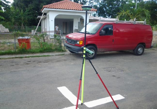
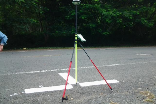
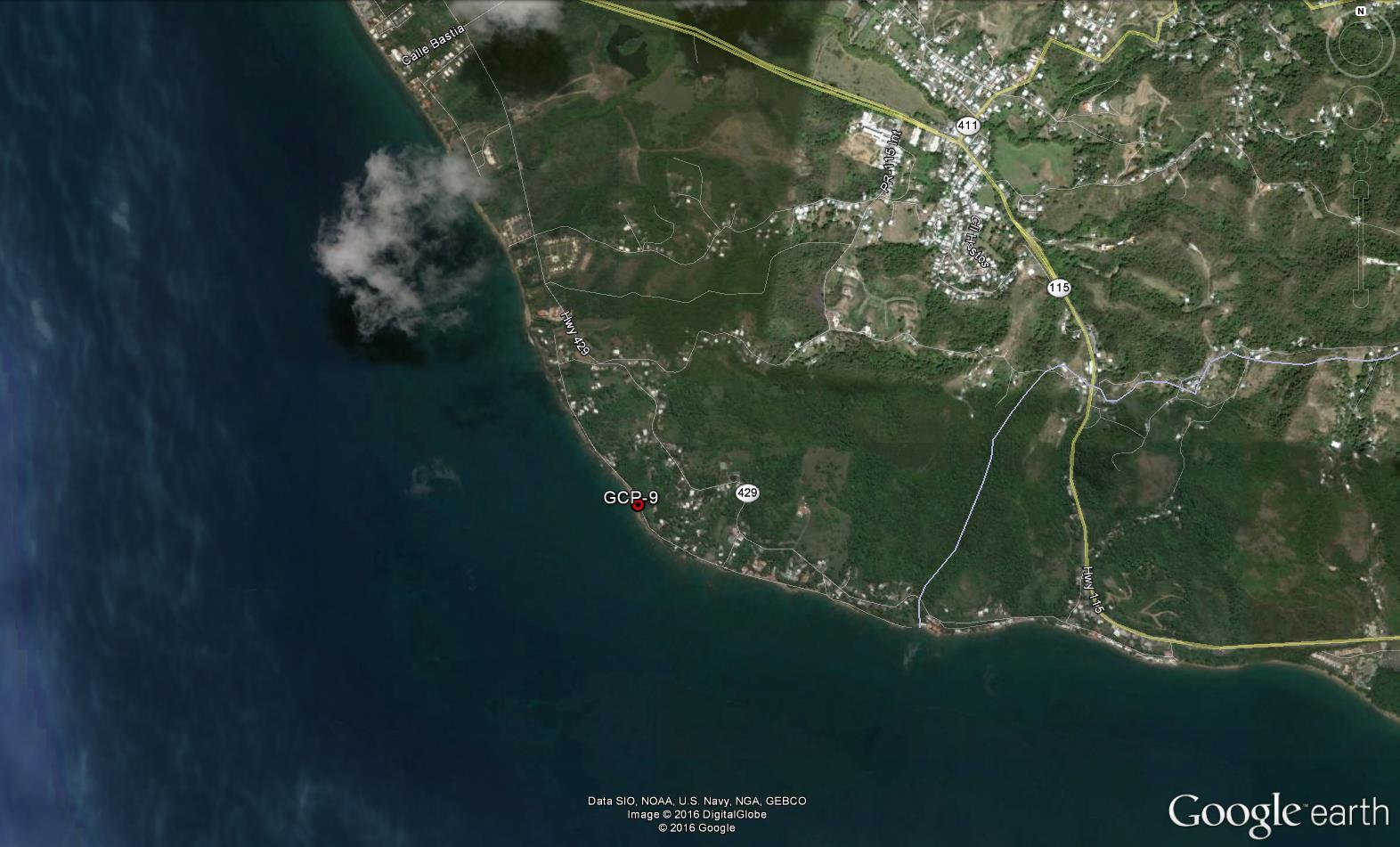
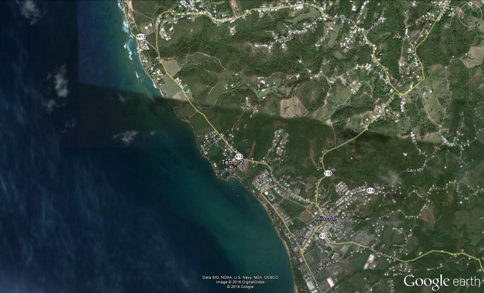
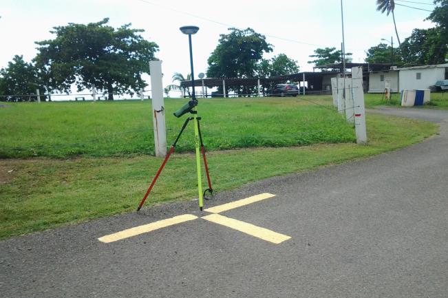
During September 17-18, 2016 the company Global Matrix Engineering, Inc. (GME) conducted fieldwork to collect aerial images of Rincón west shoreline using Unmanned Aerial Vehicles (UAV). The final data products provided by GME included a georeferenced and geo-rectified orthomosaic photo with a resolution of 10.53 cm/pixel and a digital elevation model. In this appendix is included the report of the thirteen control points establish by GME to carry out the fieldwork.
Page 24 of 24
Calle 6 SO No. 1833
Urb. Villa Magna
San Juan, Puerto Rico 00921
Email: carlos.rodriguez@globalmatrixeng.com
Ofic: 809-533-8959
Cel: 829-645-9190
DESCRIPCION: PUNTO DE CONTROL LOCALIZADO AL EXTREMO NORTE DE LA CARRETERA 4413. PUNTO LOCALIZADO SOBRE ASFALTO CON CLAVO DE ACERO IDENTIFICADO CON UNA FOTO TARJETA.
FOTO
MAPA DE LOCALIZACION:
Calle 6 SO No. 1833
Urb. Villa Magna
San Juan, Puerto Rico 00921
Email: carlos.rodriguez@globalmatrixeng.com
Ofic: 809-533-8959
Cel: 829-645-9190
DESCRIPCION:
MAPA DE LOCALIZACION:
Calle 6 SO No. 1833
Urb. Villa Magna
San Juan, Puerto Rico 00921
Email: carlos.rodriguez@globalmatrixeng.com
Ofic: 809-533-8959
Cel: 829-645-9190
DESCRIPCION:
MAPA DE LOCALIZACION:
Calle 6 SO No. 1833
Urb. Villa Magna
San Juan, Puerto Rico 00921
Email: carlos.rodriguez@globalmatrixeng.com
Ofic: 809-533-8959
Cel: 829-645-9190
MAPA DE LOCALIZACION:
Calle 6 SO No. 1833
Urb. Villa Magna
San Juan, Puerto Rico 00921
Email: carlos.rodriguez@globalmatrixeng.com
Ofic: 809-533-8959
Cel: 829-645-9190
MAPA DE LOCALIZACION:
Calle 6 SO No. 1833
Urb. Villa Magna
San Juan, Puerto Rico 00921
Email: carlos.rodriguez@globalmatrixeng.com
Ofic: 809-533-8959
Cel: 829-645-9190
MAPA DE LOCALIZACION:
Calle 6 SO No. 1833
Urb. Villa Magna
San Juan, Puerto Rico 00921
Email: carlos.rodriguez@globalmatrixeng.com
Ofic: 809-533-8959
Cel: 829-645-9190
DESCRIPCION:
MAPA DE LOCALIZACION:
Calle 6 SO No. 1833
Urb. Villa Magna
San Juan, Puerto Rico 00921
Email: carlos.rodriguez@globalmatrixeng.com
Ofic: 809-533-8959
Cel: 829-645-9190
MAPA DE LOCALIZACION:
Calle 6 SO No. 1833
Urb. Villa Magna
San Juan, Puerto Rico 00921
Email: carlos.rodriguez@globalmatrixeng.com
Ofic: 809-533-8959
Cel: 829-645-9190
MAPA DE LOCALIZACION:
Calle 6 SO No. 1833
Urb. Villa Magna
San Juan, Puerto Rico 00921
Email: carlos.rodriguez@globalmatrixeng.com
Ofic: 809-533-8959
Cel: 829-645-9190
FOTO
MAPA DE LOCALIZACION:
Calle 6 SO No. 1833
Urb. Villa Magna
San Juan, Puerto Rico 00921
Email: carlos.rodriguez@globalmatrixeng.com
Ofic: 809-533-8959
Cel: 829-645-9190
DESCRIPCION: PUNTO DE CONTROL LOCALIZADO AL EXTREMO NORTE DE LA CARRETERA 4413. PUNTO LOCALIZADO SOBRE CONCRETO CON CLAVO DE ACERO IDENTIFICADO CON UNA FOTO TARJETA.
FOTO
MAPA DE LOCALIZACION:
Calle 6 SO No. 1833
Urb. Villa Magna
San Juan, Puerto Rico 00921
Email: carlos.rodriguez@globalmatrixeng.com
Ofic: 809-533-8959
Cel: 829-645-9190
DESCRIPCION:
MAPA DE LOCALIZACION:
Calle 6 SO No. 1833
Urb. Villa Magna
San Juan, Puerto Rico 00921
Email: carlos.rodriguez@globalmatrixeng.com
Ofic: 809-533-8959
Cel: 829-645-9190
FOTO
FOTO
MAPA DE LOCALIZACION:


