
• Navigation – map/compass
• Walking poles (for the uphill parts)
• Phone
• Notepad/pen
• Gas stove, gas canister, lighter, pot, spoon
• Hydration system (for drinking and cooking)
• Compressible padded jacket
Note that I cannot bring the gas canister on the flight to Glasgow, so I needed to buy one when I get there.
Wearing
• Boots (and socks)
• Trek pants (water resistant)
• Thermal base
• Fleece
The Trip
I departed Thursday April 4, on the 10.00 flight to Glasgow. After checking in to my Glasgow hotel, I go to Tiso on Buchanan Street to buy gas, then go back to hotel and do final packing, before putting the duffel bag in the luggage room and going to eat.
Fun fact: the train to Bridge of Orchy splits in two at Ardlui. The front half goes to Oban, while the rear half goes on to Mallaig (via Bridge of Orchy, and Fortwilliam (and, for Harry Potter fans, beyond Fortwilliam is the Glenfinnan Viaduct). So you need to make sure you’re seated in the right part!
Breakfast at 07.00 on Friday April 5, before heading to Queen Street station for the 08.22 train to Bridge of Orchy. Arrives 10.45; on trail by 11.00
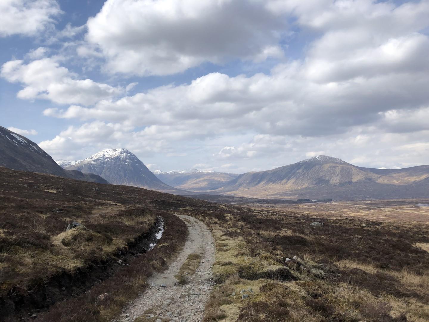
On the trail Day 1 I’ve allowed 6 hours to get to Kingshouse, walking at a steady pace, with breaks. The weather is nice – cloudy, but with some sunny spells, and great visibility. The wind from the east is a little nippy (as it skirts over the snowy mountaintops), but I’ll warm up nicely as I walk.
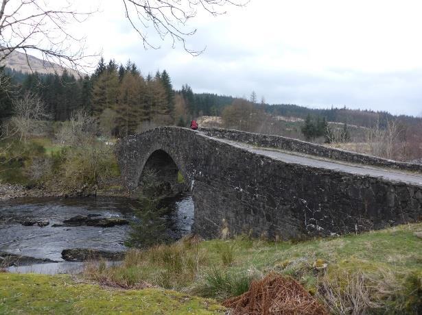
Fun fact: the train line runs along part of the west coast of Loch Lomond, which is the largest lake on the island of Great Britain by surface area (Lough Ness is bigger by total volume). It is a long, narrow, spectacularly beautiful lake.
The West Highland Way (from this point) mostly follows what were originally traditional droving trails, but which became military “roads” in the 17th century – so it is fairly easy to follow. Having said that, the waymarking is much less frequent than anybody that’s done one of the Irish long distance trails would be used to, and in many cases there are no waymarks at path junctions, so it is necessary to keep an eye on your map; also, the “road” is largely made up of gravel and cobbles, which can make for hard going underfoot.
After about an hour, the trail enters Rannoch Moor. This is a 130km2 conservation area of open moorland, gently rising and falling. It has vast expansive views, but at first sight looks bleak! The moor is very remote; at the half-way point of the journey to Kingshouse, at the delightfully named Lochan Mhic Peadair Ruaidh, you are more than an hour from the nearest road (and safety) in any direction.
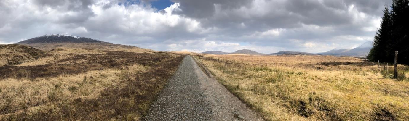
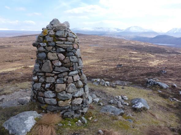
The trail skirts around Meall a’ Bhùiridh (1108m) on whose slopes the Glencoe Ski Centre is situated. As it does so, at the trail’s highest point, it meets the Peter Fleming Memorial Cairn (brother to Ian Fleming, of James Bond fame). From here you need to have your camera batteries ready as the view opens up to Stob Dearg (reputedly Scotland’s most photographed mountain) and the entrance to Glen Coe.
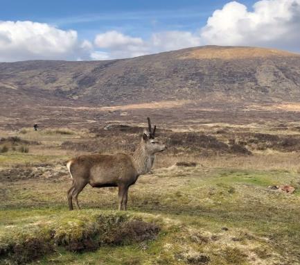
I’ve made very good time, arriving at Kingshouse after just under five hours. So I get the pick of the wild camping spots, on a nice flat dry area beside a bend in the river. I can have dinner, and head into the Kings House Hotel for some rehydration. While I am pitching my tent, a deer wanders by, no more than 3 metres away –completely unfazed by human presence.
On the trail Day 2 Day 2 awakens to (previously un-forecast, but then this is Scotland) sleet, and ice on my tent. It will be raining for the rest of the day. Makes for some moody photos of Stob Dearg and the mouth of Glen Coe, which includes the Devil’s Staircase, which I must scale on my way to Kinlochleven. I have allowed 5 hours walking time for this leg.
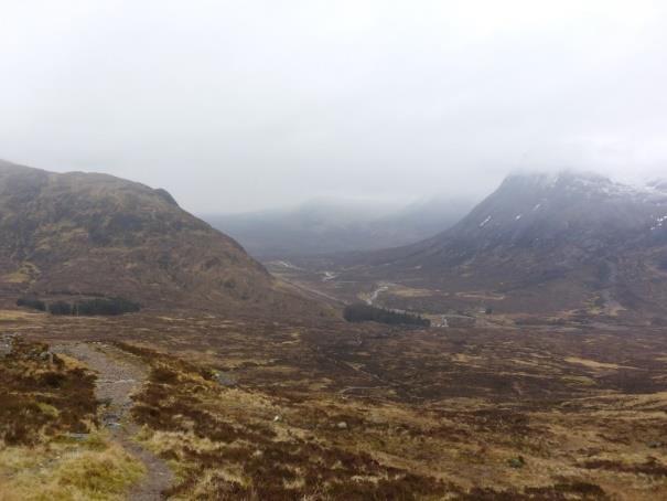
Fun fact: the Kings House Hotel is so called because it was originally built to house the British (King’s) Army during the subjugation of the Scottish highlands after the Jacobite uprising of 1745. It is said to be one of the oldest Inns in Scotland
It is something of a slog up the Devil’s Staircase (topping out at 548m), but the views are incredible. When I get to the top, I make a side excursion to the summit of Stob Mhic Mhartuin (707m), in the forlorn hope of getting a nice view into Glencoe. All I get is views into the clouds, which make no sign of dissipating, so I head back to the trail. This is one of only two occasions in the trip that I actually need to use my compass.
The descent into Kinlochleven is long, but through pretty mountain and forest. You get a splendid view of the reservoir that is Loch Eilde Mor. Think Glenealo above Glendalough on steroids. The final walk into Kinlochleven is one of those places where you need to keep the map handy, as the path zigzags and intersects with other forest paths, in a large absence of waymarkers.
Kinlochleven is full of polite signs asking you not to wildcamp, so I’ve chosen to rent a pitch next to the Macdonald hotel. This gives me access to a drying room (which means I can wash some clothes, dry my boots, etc) and a shower, and also to the Bothy Bar. Today I am much
Fun fact: The dam at Lock Eilde Mor was built by Irish labourers in the 19th century, to provide hydro-electric power for an aluminium smelter in Kinlochleven. Direct access to hydropower meant that Kinlochleven was the first village in the UK to have all of its houses connected to the electricity grid.
closer to my forecast walking time, coming in just under the five hours. I still get the pick of the camping spots though! I make dinner, and retire to the bar for rehydration.
On the trail Day 3
Day 3 is milder, and (mercifully) dryer than day 2. I have planned for 7 hours walking today, so giving myself a margin of safety (I need to be on the 17.37 train to Glasgow), I need to be on the trail before 09.00. I have booked a cooked breakfast in the hotel (Smoked Salmon and Scrambled egg!), so I’m up early, packed, and sitting at breakfast by 07.15. I’ve donated the rest of my gas (I’ve only used it three times) to the (small) pile of spare gas cannisters in the laundry room, for whoever needs it. I’m on the trail by 08.00.
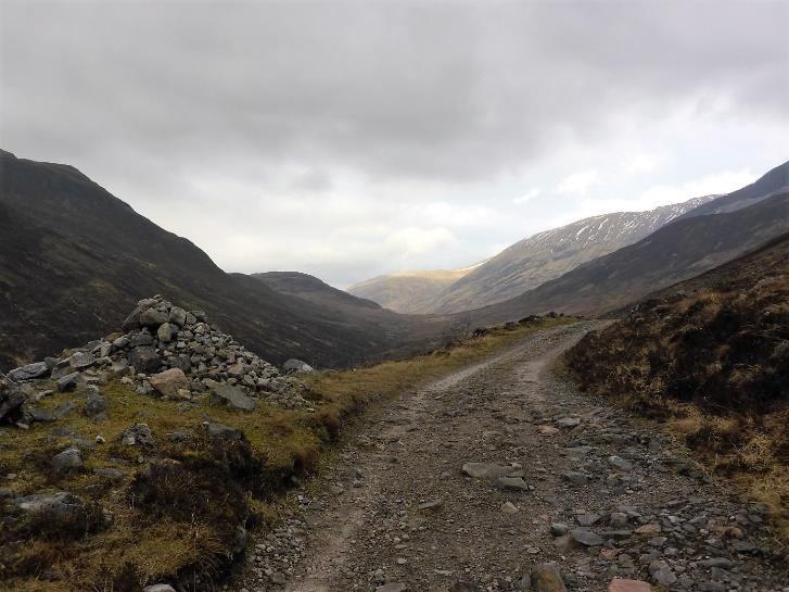
The first part of the trail is uphill, for about 90 minutes, through natural forest, towards Larraigmor Pass. This is a proper mountain pass (it is a route to somewhere), topping out at 350m, with the Mamores (900-1000m) to the north and Lochaber (700-800m) to the south. It is breathtaking (literally and figuratively). Rounding Meall a’ Chaorainn (910m) gives the first views of Ben Nevis (well, it would, if the top half wasn’t swathed in cloud!).
At about the 9km point (NN 100 657) the trail branches away from the old military road, and the track is more mountain trail (and more like what we are used to in Ireland), which is much nicer underfoot than the gravel/cobbles of the military road. There is a lot of up and down along this section (which explains why my recorded height gain of 848m is so much more than my forecast gain of 450m!).
The forest from NN1065 to NN1270 on the map is now essentially missing, having been felled, which makes the scenery somewhat desolate along this section. This makes a good backdrop for the fact that the glen here is the route taken by the surviving members of the Campbell Clan as they fled their rout at the battle of Inverlochy.
Where the trail meets Glen Nevis, there is a 2000yo Iron Age fort (ruin) “Dundeardail” which is well worth a look (for the cost of a 1k, 100m side excursion). From the fort the view into Glen Nevis and onto Ben Nevis is spectacular.
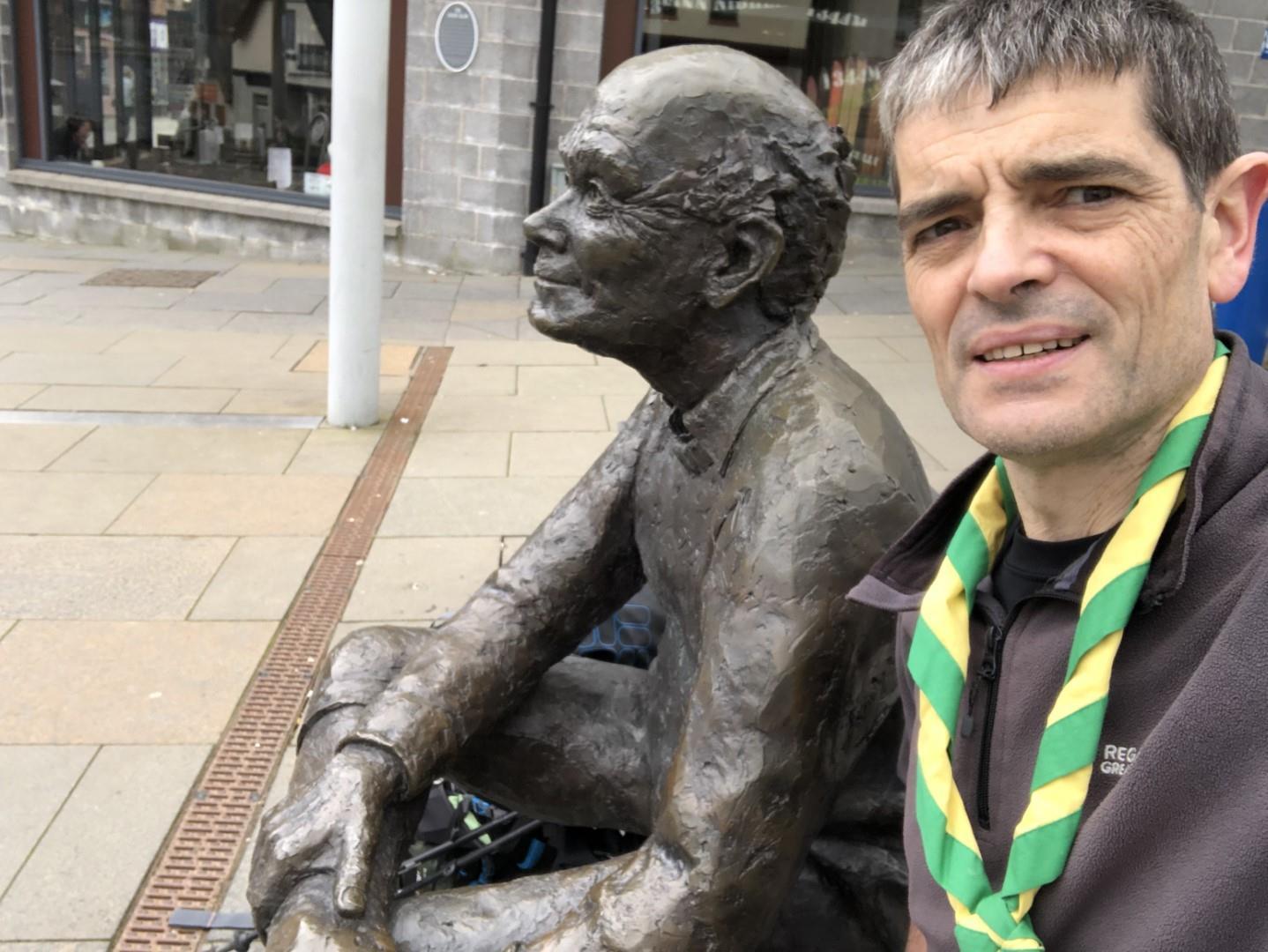
From here, the route down into Fortwilliam is familiar (mucky) forest road. The route into Fortwilliam takes you past the “original end” of the West Highland Way. The current end is at the end of the main street, where you are greeted by a statue of an elderly gentleman sitting down rubbing his sore feet! I sit beside him, and rub mine.
Fun fact: the Glen Nevis visitor centre (the starting point for many a trek up Ben Nevis) has a scale model of what the Dundeardail Fort may originally have looked like, made from lego!
Almost to my surprise, I have arrived in Fortwilliam in just 6 hours and 20 minutes (despite the additional height gain), so I head for a coffee shop where I can sit out the wait for my train.
Total stats (recorded via Viewranger):
• Walking time: 15 hours and 54 minutes; Walking distance: 60km; Height gain: 2032m
Fun fact: the trainline from Fortwilliam back to Glasgow goes through Corrour, which as well as finding fame in the film “trainspotting” is the UK’s highest mainline railway station at 408m (yes, the railway station on Snowdown is higher, but it’s not on a main line). It is also completely remote – the nearest public road is a 16km hike away. The station is mainly used by hikers.
Additional Notes:
• The trail while good, and waymarked, is not as frequently waymarked as Irish ones, and some junctions are conspicuous by their lack of waymarks. Generally, the “obvious” route is the correct one, but not always, so you need to keep your map to hand.
• The weather is very changeable, so keep that in mind. When I got on the train in Glasgow on Friday morning, there was no forecast of rain on Saturday …
On Reflection
• I could have left the cooking gear at home. There are plenty of places to eat, though obviously this would cost more. Anyway, in the spirit of it being a camping expedition, I brought cooking gear and food, and cooked (most of) my own meals.
• I could probably have brought my lighter, 2-season, sleeping bag, and saved a little room and weight. Having said that, the unexpected cold weather on Saturday morning was a wake-up call (literally and figuratively).
• I own a pair of “all-day rainpants” (waterproof and breathable), and these would have been much more comfortable on Saturday in the rain, though perhaps not in the dryer weather of Friday and Sunday.
• I’ve lost a fair bit of weight over the last two years, and the strap of my trekking rucksack (which is lightweight) is no longer tight enough around my hips. Mm – need to think about that one.
What did it all cost?
Make
your own choices!
Flights to Glasgow (including baggage)
Hotel in Glasgow (2 nights B&B)
Airport bus (return)
Train from Glasgow to Bridge of Orchy
Train from Fortwilliam to Glasgow
Tentpitch at Kinlochleven
Breakfast at Kinlochleven
Gas (you can’t bring it on the flight)
Carparking at Dublin Airport
€200
€110
€16
€29
€23
€11.50
€11.50
€6.50
€39
Total €446.50
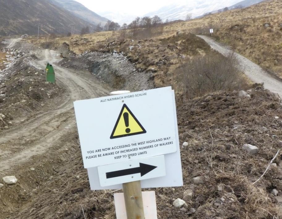
Turns out there’s a speed limit on the West Highland Way. Must keep that in mind!