COLLECTION OF WORKS
| Ryan Liu |
Soft Skills
• Independence and Self-efficacy
• Flexibility and Adaptiveness
• Time Management
• Problem Solving
Drawing
• Critical thinking
• Organization
• Creativity
• Detail oriented
• Photoshop, Krita, digital drawing, photo editing
• Rhino 3D, Autodesk Revit, SketchUp, V-ray, D5
• Technical drafting, hand drafting, sketching
• Pencil, ink, watercolours, analog mediums
Design
• Adobe Illustrator, graphic design
• Adobe Lightroom, photography
• Adobe InDesign, process documentation, layout
• Laser cutting, 3D printing, CNC model construction
Other
• Adobe After Effects, Premiere Pro, Lightworks
• Microsoft Suite, Google Suite
• Social media management, Instagram, YouTube
Bachelor of Architectural Studies (BAS)
University of Waterloo, Cambridge, ON Honours Co-op Program
OSSD + AU.VA Diploma
Unionville High School, Markham, ON
Arts Unionville Visual Arts Program
Graduated with honors >90%
| Ongoing | 2023

BDP Quadrangle Excellence in Digital Design and Fabrication Award
University of Waterloo
Selected project uses digital fabrication tools to demonstrates high technical skill, aesthetic composition, and ambition in the field
First in Class
University of Waterloo (1A, 1B)
Awarded to the student with the highest academic standing in class
Project Review
University of Waterloo
Projects selected for annual exhibition based on high quality of work
Outstanding Design Work
University of Waterloo
Energy+Design Award
University of Waterloo
Awarded for the best energy-related design
Dean’s Honours list
University of Waterloo
President’s Scholarship of Distinction
University of Waterloo
Entrance average 95% or above
McPhie Family Architecture Scholarship
University of Waterloo
Awarded for exceptional entry portfolio and academic performance
Hi there, I’m Ryan.
I’m a 3rd year undergraduate student studying architecture at the University of Waterloo in Canada.
Having grown up with a background in visual arts since high school, architecture to me has always been the medium I favored the most. It influences us on every level of life, and it’s through that ability to physically shape our experiences, our communities, and ultimately our entire livelihoods that draws me towards architecture as such an incredibly versatile and important medium.
Below is a brief collection of works completed throughout my educational and professional career, each with their own unique set of opportunities and lessons learned. I pride myself in being flexible and open to new learning experiences, no matter the subject. I believe in being well-rounded and staying open to experimentation, learning new things, and taking on a challenge with every new project I face.
It’s my firm belief that architecture should be designed for people, with the ways that they experience and interact with the world in mind, and that’s something I always try to strive for in the work that I do.
Thank you for your time and consideration, I do truly appreciate it.
Sincerely,

GROWING MARLEE-GLENCAIRN
O2 Design, Toronto, ON
NORTH MAPLE REGIONAL PARK
O2 Design, Toronto, ON
BIRCH COVE - DATA VIS.
O2 Design, Toronto, ON
LAKE MINNEWANKA - DATA VIS.
O2 Design, Toronto, ON
VICTORIA GREEN INFRA. ILLUSTRATION
O2 Design, Toronto, ON
HAMILTON CITY-WIDE DESIGN STANDARDS
City of Hamilton, ON
GALT. ISSUE 6 - NOISE
galt. publication, Cambridge, ON.
GALT. ISSUE 5 - SEEDS
galt. publication, Cambridge, ON.
QUALITY OF MURBS IN WATERLOO REGION
University of Waterloo, Cambridge, ON.
F_RMLAB DESIGN AND FABRICATION
University of Waterloo, Cambridge, ON.
BRIDGE EVENT ASSISTANT
University of Waterloo, Cambridge, ON
MURAL DESIGN PROJECT LEAD
KINGDOM Canada + Unionville High School, Markham, ON.
VOLUNTEER BANNER DESIGNER
City of Markham, ON.
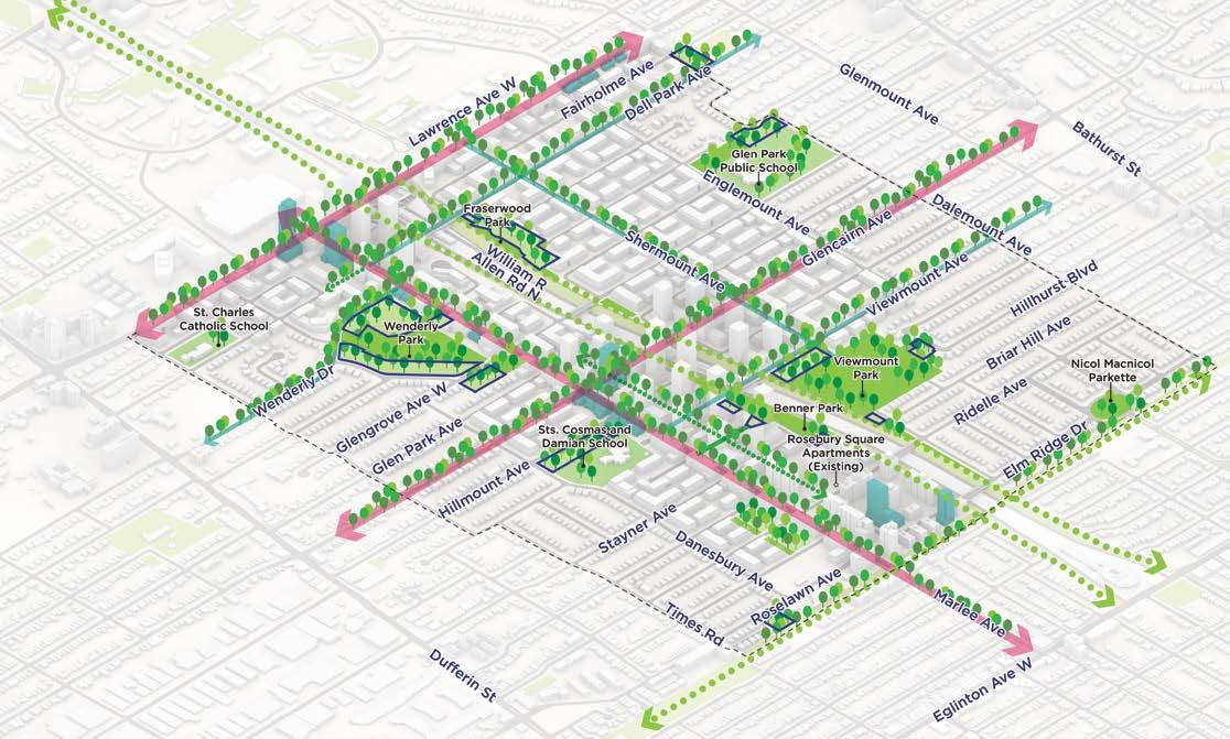
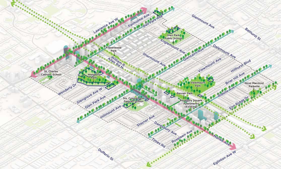
CLIENT: City of Toronto
LOCATION: Toronto, ON
PROGRAM: Growth and Intensification Study
Phase 2: Options Analysis
SCOPE: Urban Design
Master Planning
Presentation Graphics
SOFTWARE: Adobe Illustrator
Adobe Photoshop
Adobe Indesign
Rhino8
Grasshopper
Excel
ArcGIS
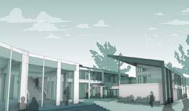
| 2025 | O2 Design
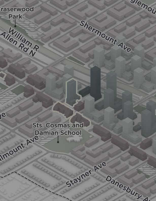
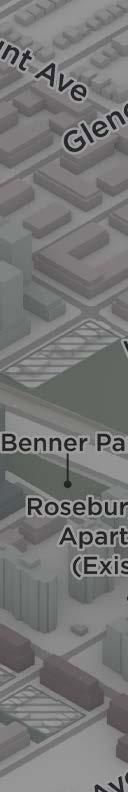
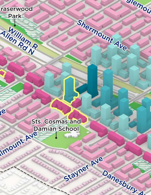
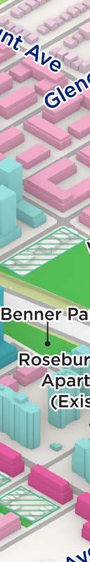
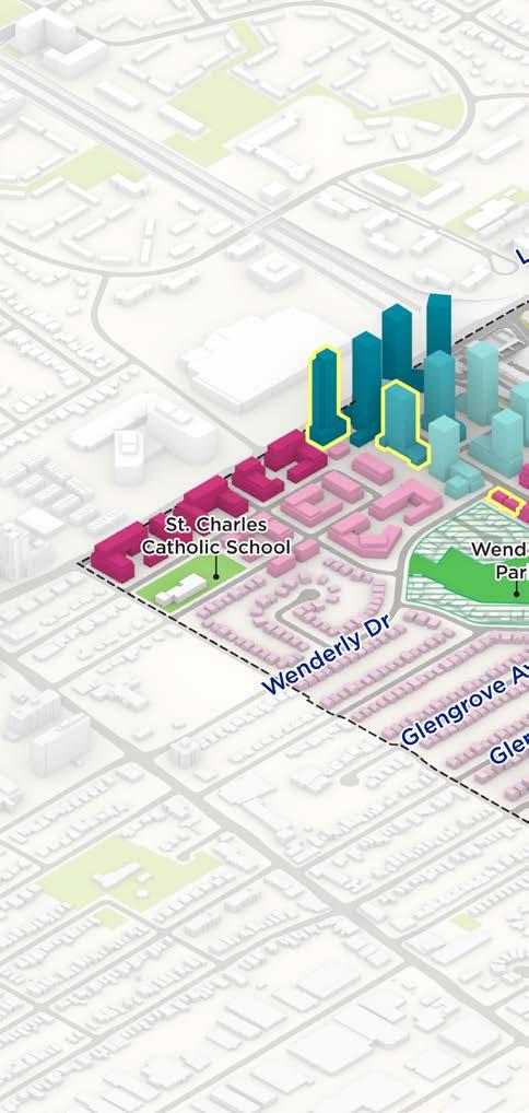
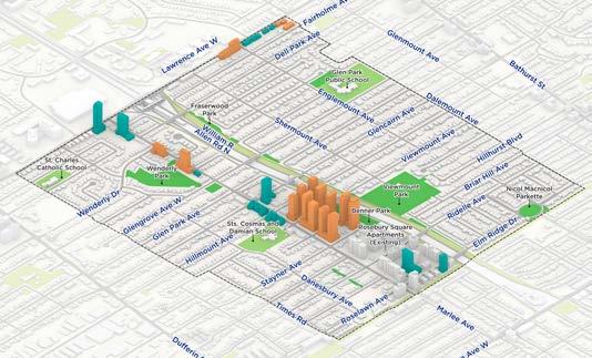
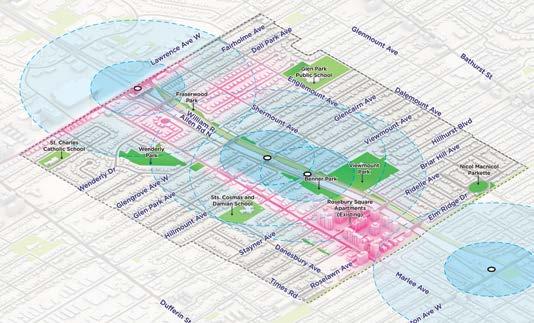
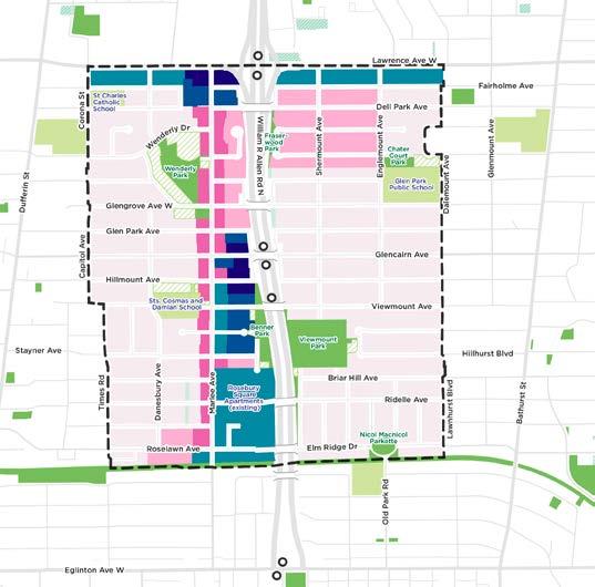
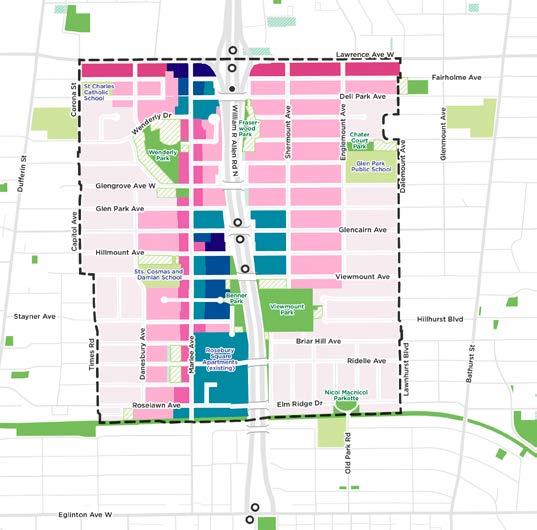
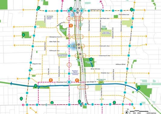
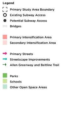
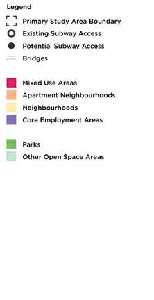
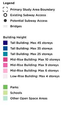
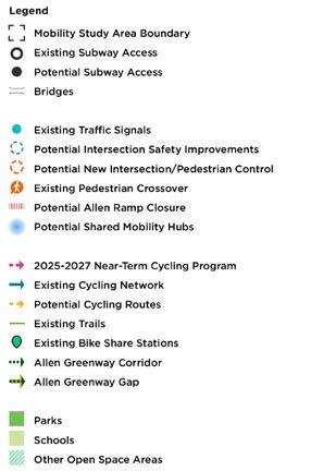
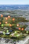
The City is studying the area around Glencairn Subway Station and Marlee Avenue to guide growth, align with provincial density requirements around transit stations, and provide for a resilient and inclusive complete community. My role on this project was focused primarily around comparing metrics between our two proposed design options and creating numerous plan and axonometric drawings that highlight key design elements reflected in the options. These drawings were later refined for use in several public presentations and stakeholder meetings.
More information about the project can be found here: https://www.toronto.ca/city-government/planning-development/planningstudies-initiatives/growing-glencairn/
While working on this project, I helped run several Grasshopper scripts in Rhino to calculate and compare metrics from our two proposed design options, such as tree canopy coverage, sunshadow coverage, residential and retail GCA, and proposed parkland expansion areas. These values were then exported and sorted in an Excel sheet and later used to score each option according to an evaluation matrix based on five principles.
• A Vibrant Community with Access to Daily Needs
• A Welcoming and Connected Public Realm
• A Safe, Accessible and Well-Connected Mobility Network
• A Range of Housing Types and Forms
• A Green and climate-resilient neighbourhood
I made frequent changes to both the 3D Rhino models; adding bridges and subway stations, highlighting existing park and school boundaries for better visual clarity, and adjusting the colours of each built form typology to remain consistent with the site plans overall. Using these updated massing models as a base, I created several 2D and 3D diagrams for TAC, CAC, and various other presentations used during public engagement events and community meetings.
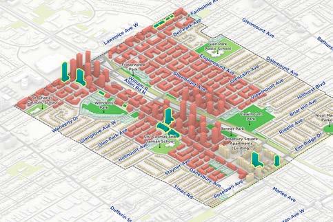
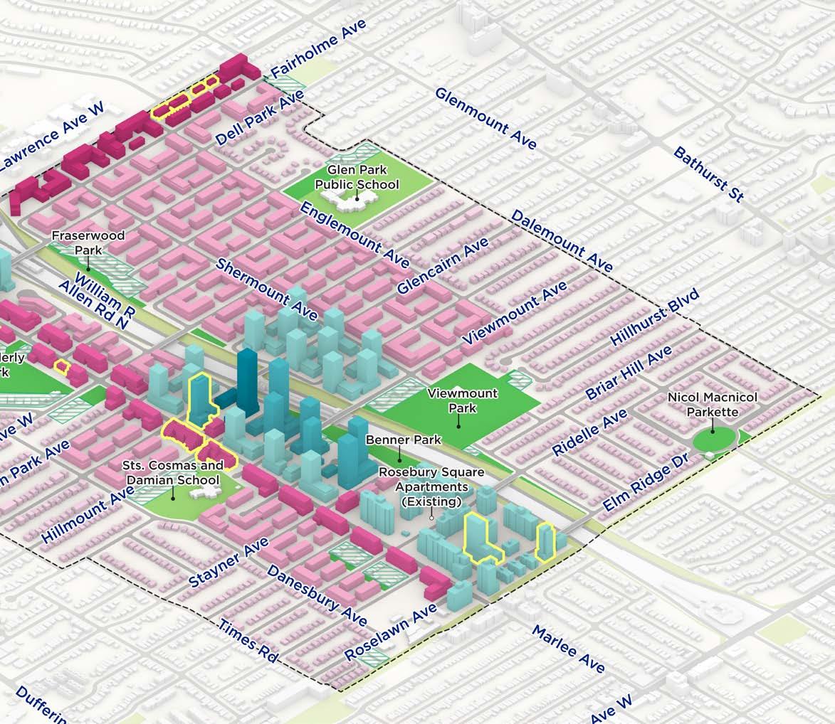

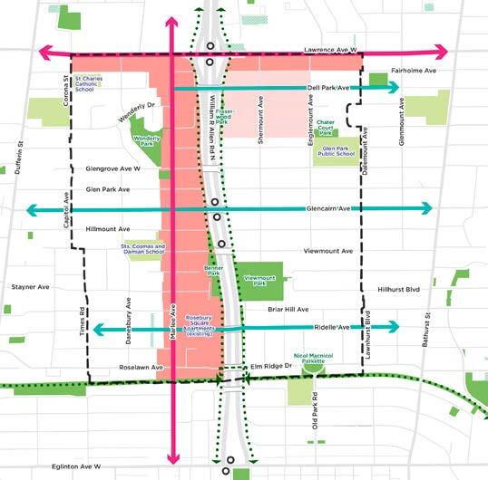
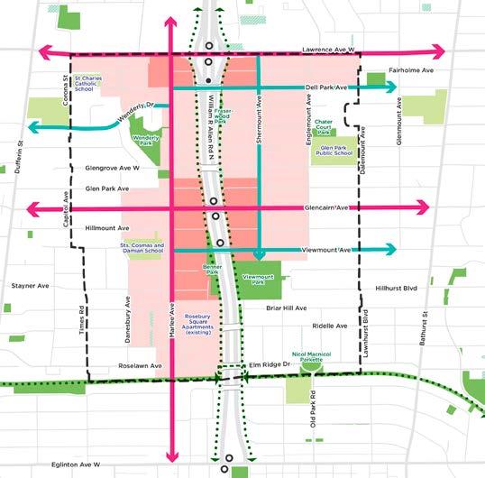
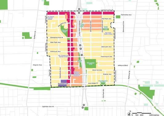
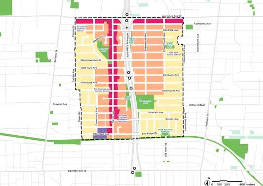
Option 1 focuses intensification on two continuous, connected corridors along two existing avenues, Marlee Avenue and Lawrence Avenue West, proposing more density along main movement corridors to support greater pedestrian activity and overall community function.
Option 2 focuses intensification around two nodes anchored by subway stations at Lawrence West and Glencairn, proposing greater mid-rise intensity and more density centered around the existing subway stations.
The diagrams were designed to show several individual aspects of each option, including but not limited to;
• Built form
• Land use
• Urban structure
• Public realm
• Mobility
• Shadow impacts
• Tree canopy retention
• Parks and other open spaces
• Streetscape improvements and primary corridors
• Proximity to transit stations
• Development activity
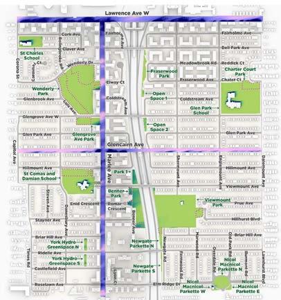
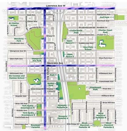
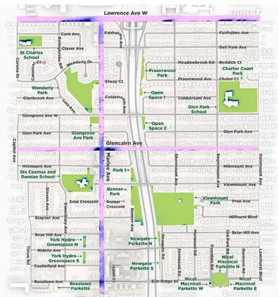


Using a Grasshopper script created by a fellow member of the project team, I assisted with creating plans to show changes in sun and shadow patterns according to the proposed intensification in each option. As this was repeated several times throughout our evaluation, I made additional refinements to the script over time to refine my workflow, while learning several new things about Grasshopper in the process.
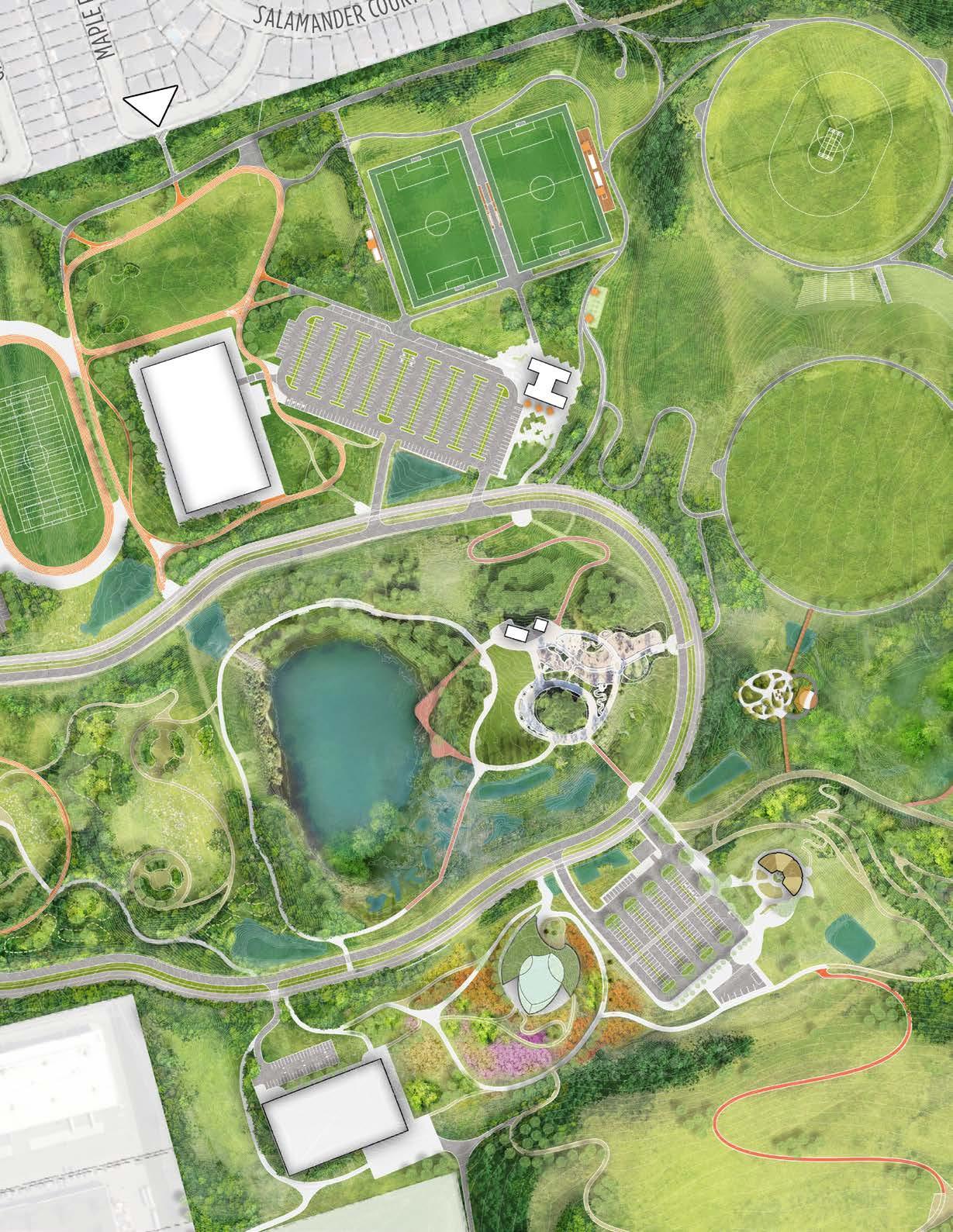
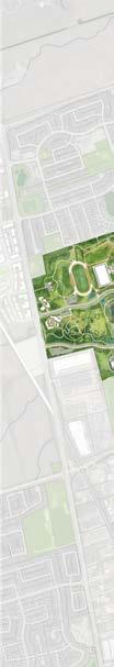
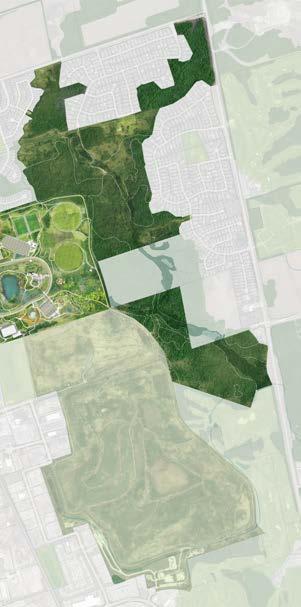
CLIENT: City of Vaughan
LOCATION: 11085 Keele St., Vaughan, ON
PROGRAM: Regional Park Master Plan
SCOPE: Landscape Architecture
Master Planning
SOFTWARE: Adobe Photoshop
Adobe InDesign
Adobe Illustrator
Rhino8
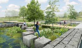
| 2025 | O2 Design
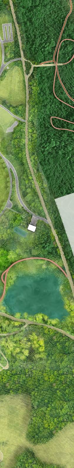
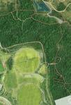
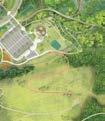
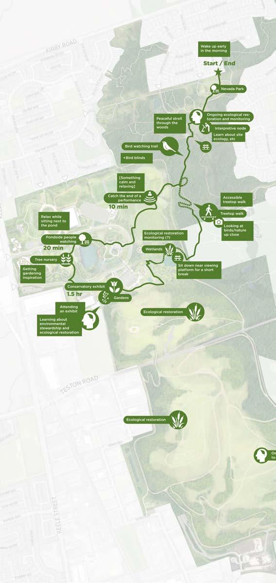
North Maple Regional Park (NMRP) is Vaughan’s most ambitious park development to date with a vision to transform 900 acres of former open space and former landfills into a signature park and legacy project for future generations. O2 has been working on the final mater plan for the park designed to foster opportunities to restore the natural environment, engage the community, and provide a place for active living.
More information about the project can be found here: https://www.vaughan.ca/about-city-vaughan/projects-and-initiatives/ community-projects/north-maple-regional-park-nmrp
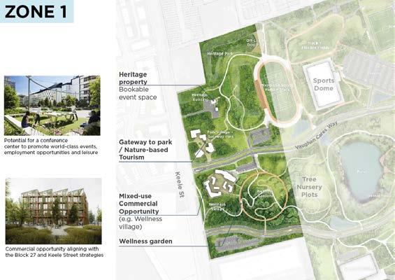
The main structure of the park can be split into 4 main
• Zone 1 contains an existing heritage property and reserved for public-private partnerships. Proposed centre and gardens, spa, recreational facility, creative other commercial opportunities depending on the
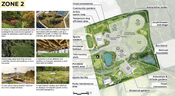
• Zone 2 consists of the main park, featuring many for active recreation, as well as several pavilions and
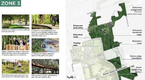
• Zone 3 refers to the areas north and east of Zone with various existing and proposed trail paths throughout. NMRP to existing parks and parkettes in the neighbourhood providing convenient access to the park for local residents.
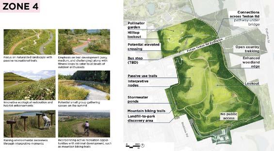
• Zone 4 is where the old Keele Valley Landfill was located. closed and the site is being actively restored to a naturalized with several recreational trails, picnic areas, and lookout
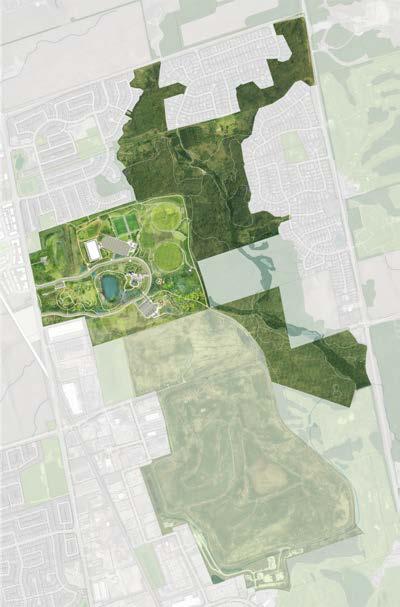
main zones:
is currently being Proposed uses include a wellness creative cultural hub, or the feasibility of the site. activity areas and places and ecological amenities.
2, and features woodlots throughout. It also connects neighbourhood to the north, residents.
located. It has since been naturalized landscape lookout points.
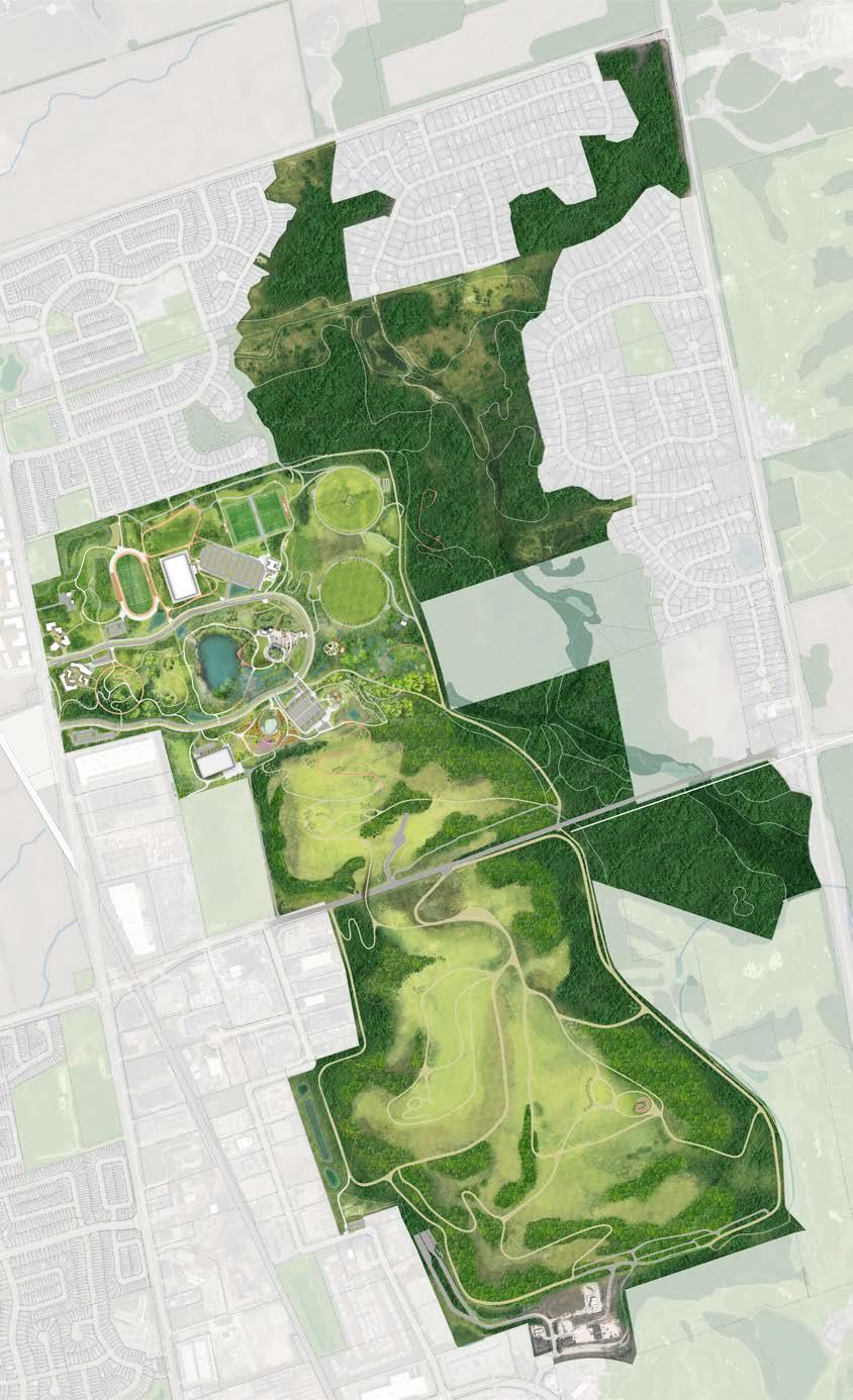


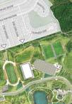


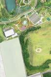


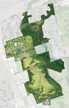


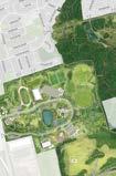


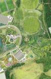


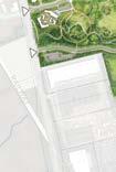


My role for this project was to take the digital models and CAD linework provided by other project members and create a rendered site plan in Photoshop. The goal was for the plant to later serve as a base for various presentations and engagement materials, such as for a community advisory hikeshop booklet and throughout the main master plan document designed to showcase many of the park’s various amenities and unique features.
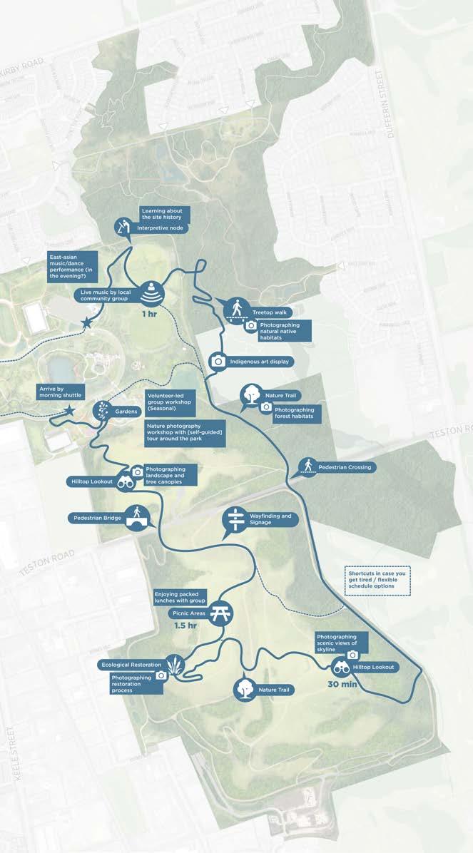
The park is designed to reflect 3 main principles; Restore, Engage, and Play.
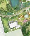
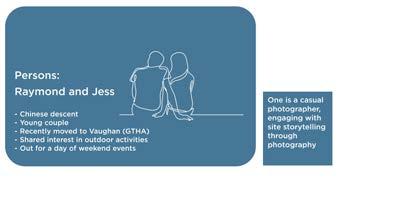
A typical day at the park for a couple. The several pathways throughout the park allow visitors to observe a diverse range of ecosystems with many spots to rest, observe, and learn more about the park’s history and day-to-day activities. A self-guided tour takes them across the entire site. Hikeshop booklet
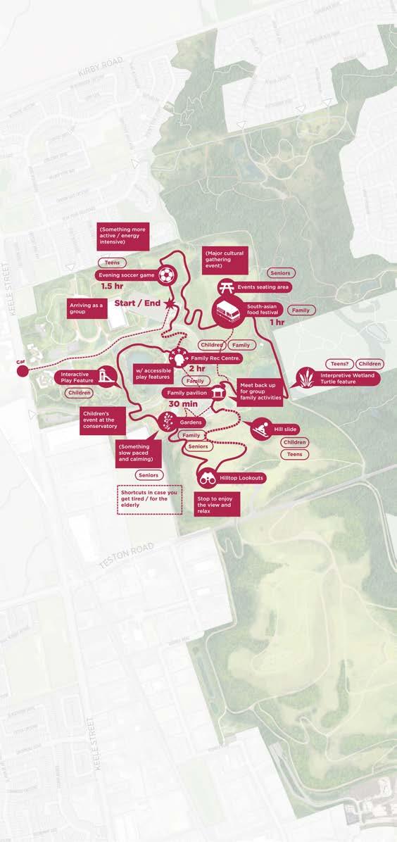
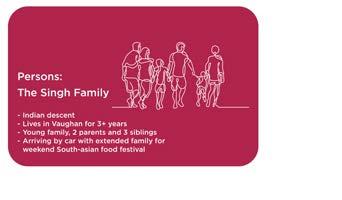
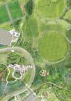
A typical day at the park for a large family. There are several different activities on site for various ages and activity levels, allowing each person to find something to do that fits their abilities. Afterwards the family can regroup at one of several pavilions or meet up at the events lawn.
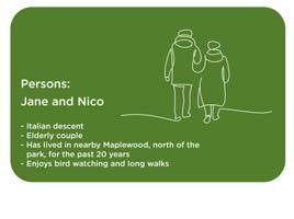
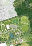
A typical day at the park for an elderly couple. Entering from the north, they can stroll though the forests and treetop walkway before making their way to the conservatory for breakfast. Afterwards a stroll around the central lake allows for some people-watching as they make their way back home.
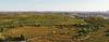
2025 | Data Visualization
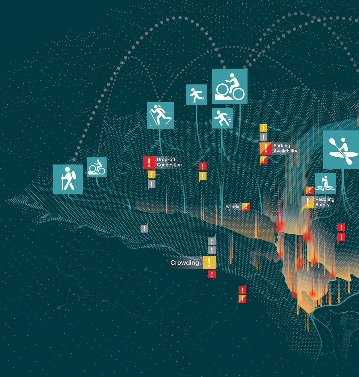
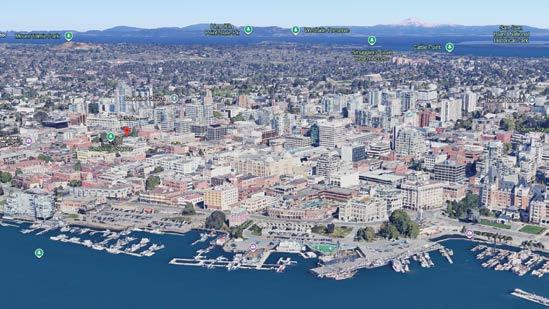
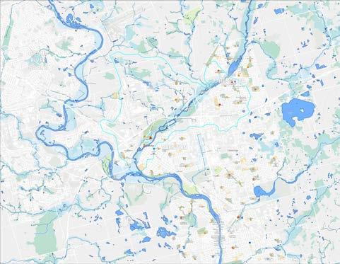
With the increasing popularity of the Lake Minnewanka retained O2 to complete this study to better understand of spaces and infrastructure, and what options could The graphic above provides a visual overview on challenges, and connections between popular areas

Minnewanka Area in Banff National Park, Parks Canada understand patterns of visitor use, physical capacity could best address current and future challenges. on the date collected, representing key activities, areas within the site.
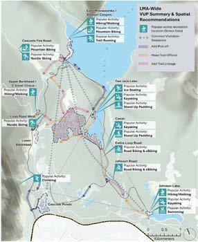
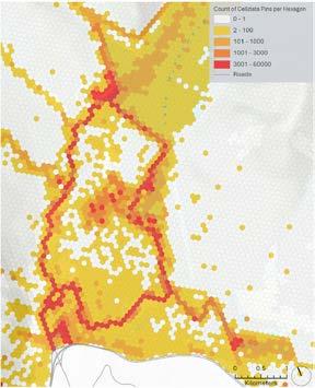
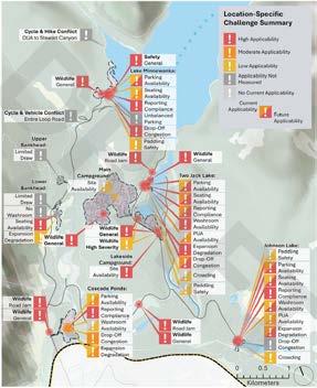
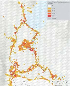
LOCATION: Lake Minnewanka, Banff, AB
PROGRAM: Visitor Use Patterns Report (2023-2024)
SCOPE: Data Visualization and Marketing Graphics
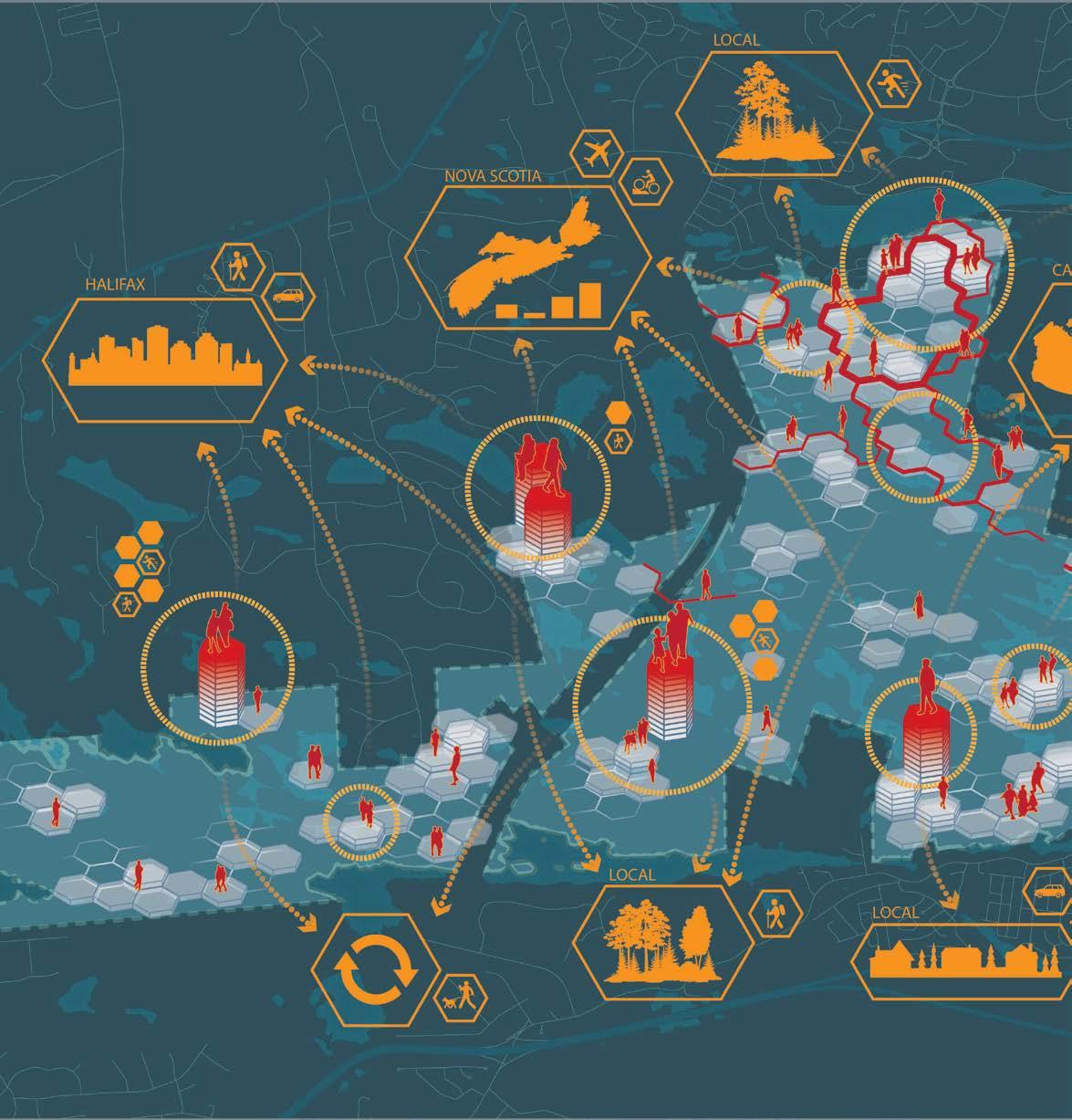
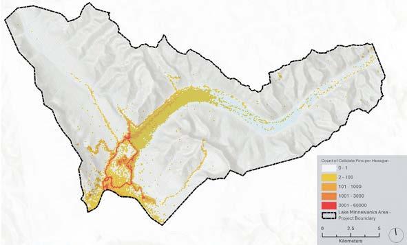
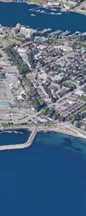
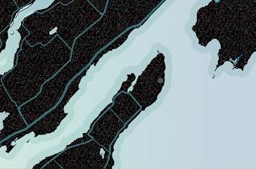
The Blue Mountain Birch Cove Lakes Wilderness Area to Halifax’s urban core. The study area is currently site for the National Urban Park Program. The graphic cellular data to record visitor activity and frequency, and building visitor profiles to understand how the
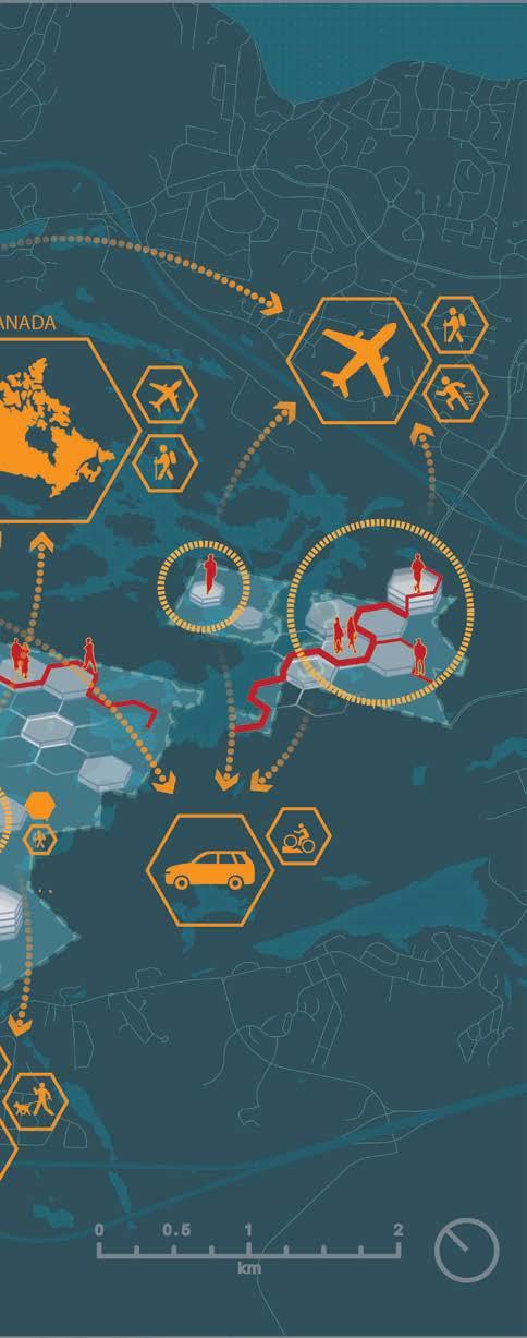
Area is a valuable asset located in close proximity currently seeing nearby development, and is a candidate graphic above represents how we used aggregated frequency, identifying potential hotspots for investment the site is being used.
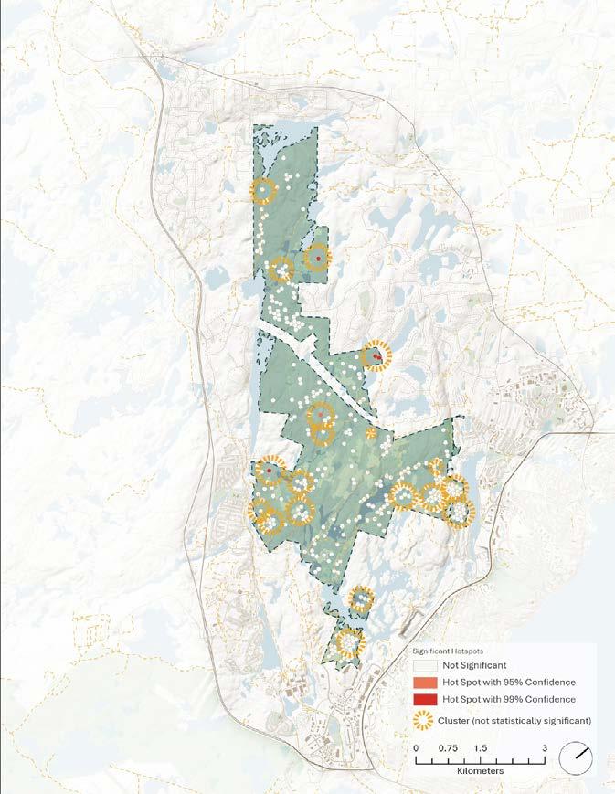
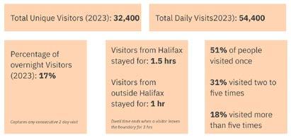
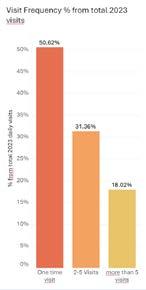
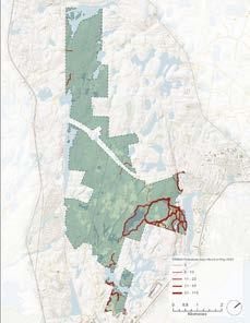
LOCATION: Blue Mountain, Halifax, NS
PROGRAM: Impact and Visitation Study (2024-Current)
SCOPE: Data Visualization and Marketing Graphics
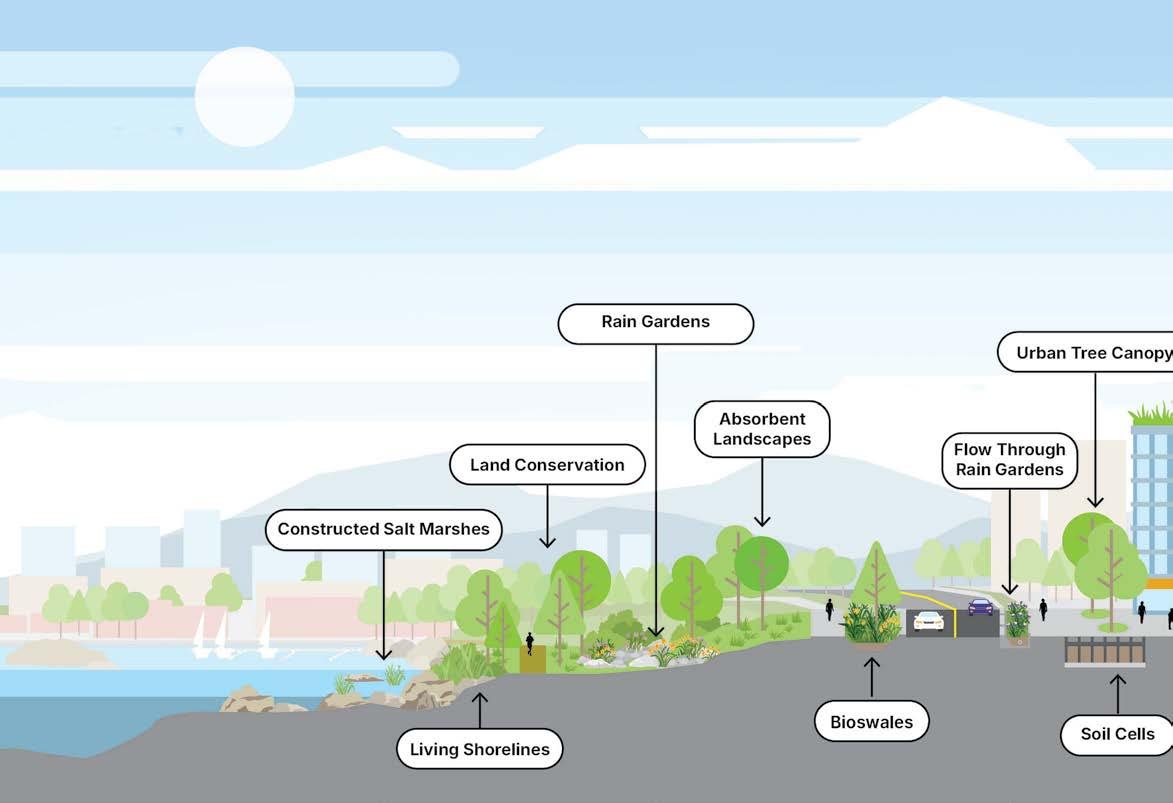
The graphic above illustrates several types of green into the city of Victoria. The drawing was done entirely similar urban and natural typologies that would typically
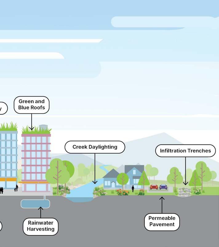
green infrastructure and how they can be incorporated entirely in Adobe Illustrator and is designed to reflect typically be seen in Victoria.
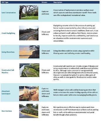
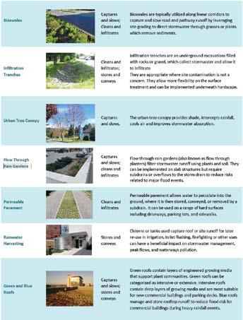
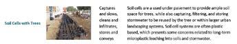
LOCATION: Victoria, BC
PROGRAM: Green infrastructure guidelines
SCOPE: DIgital Illustration
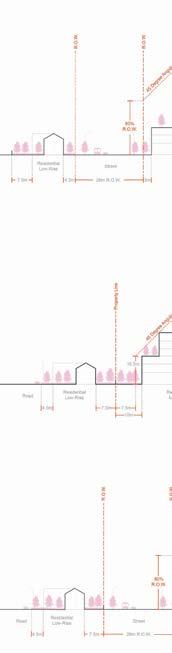
The Hamilton City-Wide Design Standards is a design within the city. Using an earlier draft of the standards and illustrations to act as examples that represent achieved. Examples of the guidelines include setback different properties, mixed use buildings, public realm,
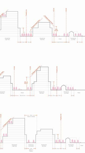
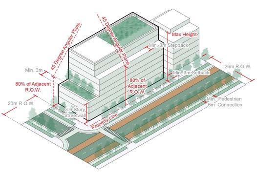
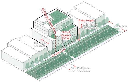
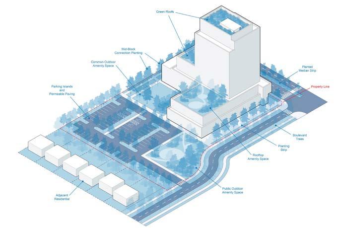
design framework applicable to new development standards as a reference, I created several diagrams represent how several of the new design standards can be setback distances, grading, landscaping, interface with realm, and more.
LOCATION: Hamilton, ON
PROGRAM: Urban Design guidelines
SCOPE: DIgital Illustration Adobe Illustrator
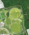
AQUA REC. PARK
Water Plaza Park
CREEKSIDE LAW SCHOOL
Law School
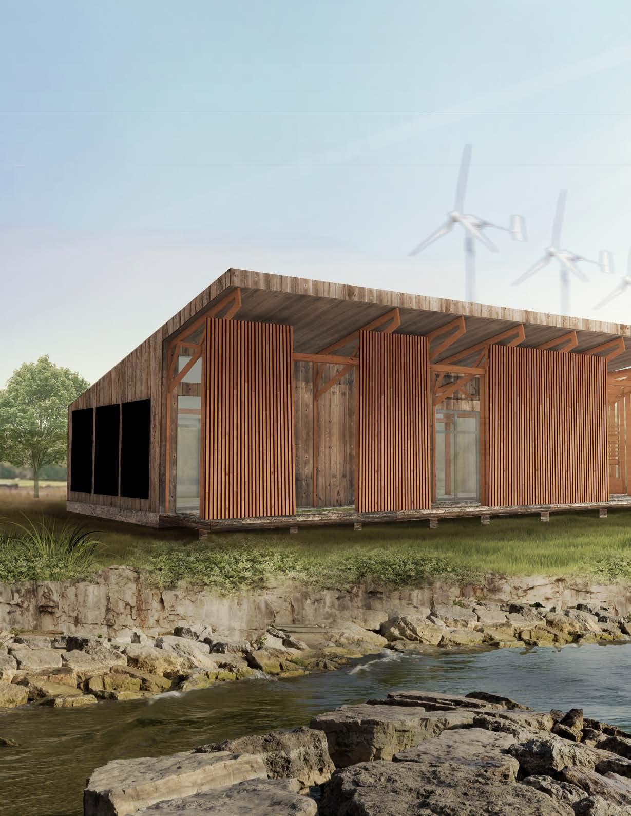
CRAFTWORKS PASSIVE HOUSE
Passive House
CERULEAN SHORES
Pedestrian Bridge
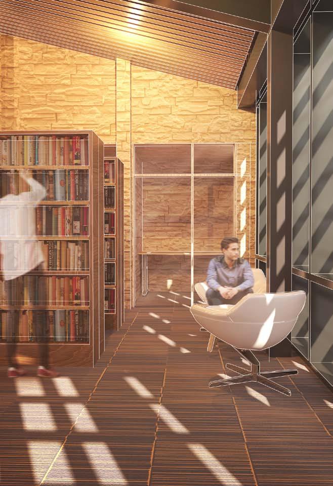
TRI-PEAKS LIBRARY
Public Library
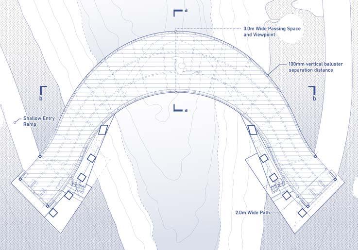
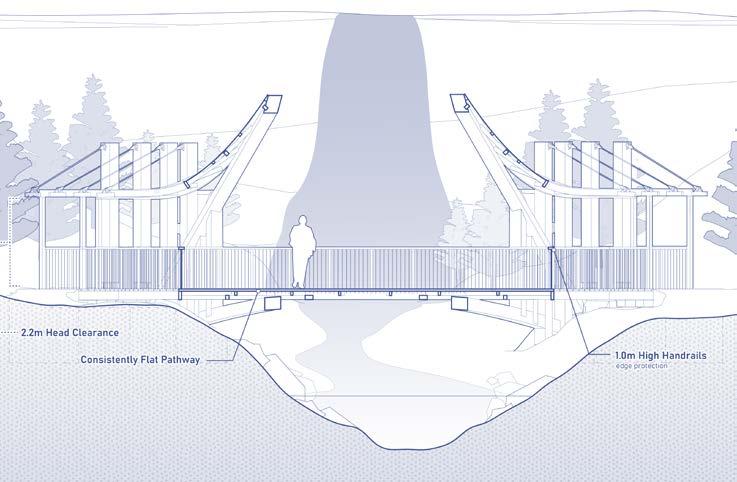
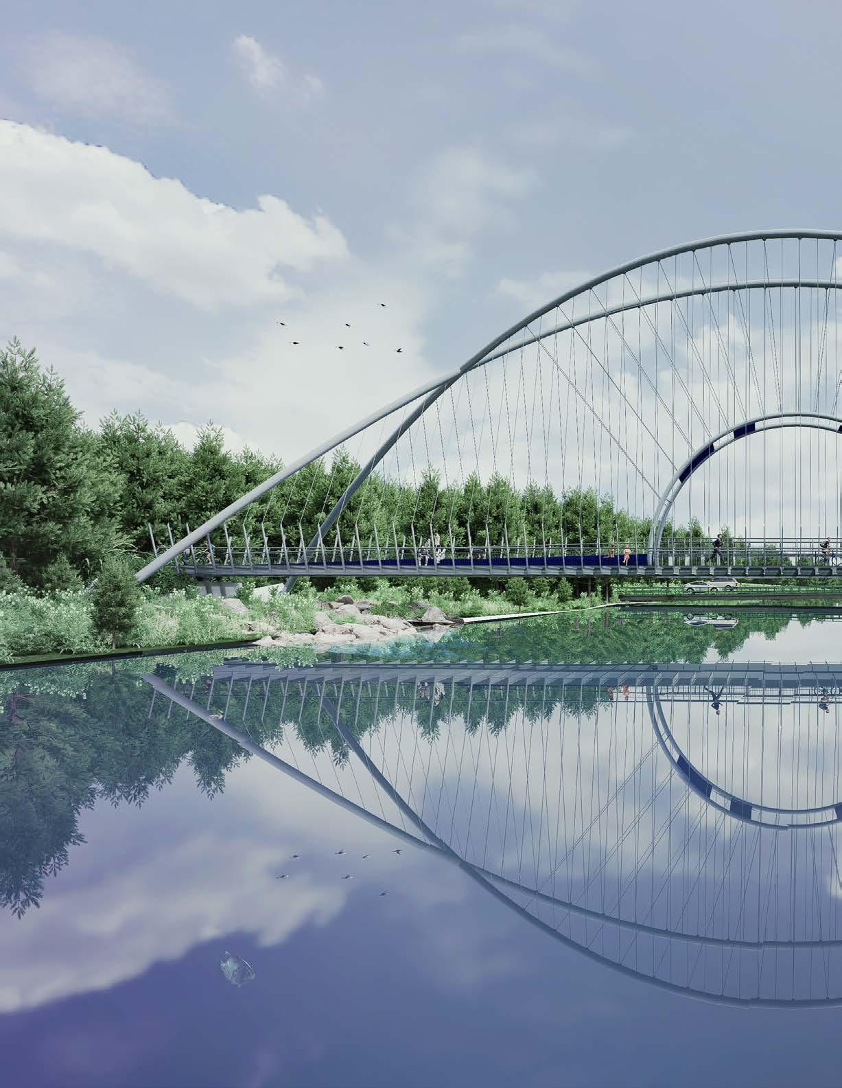
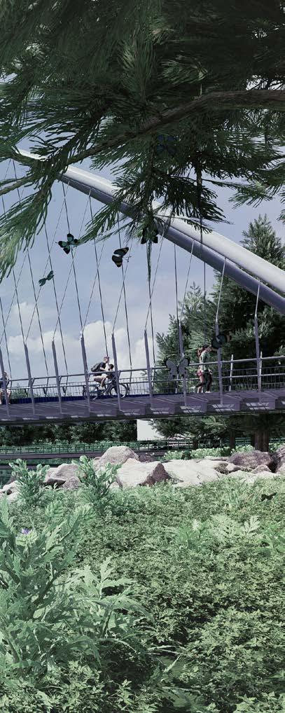
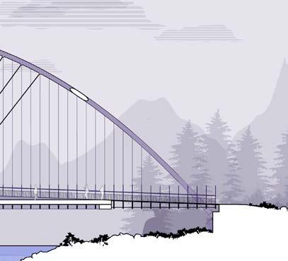
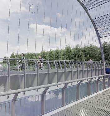
THE RIBBON BRIDGE
Pedestrian Bridge
THE GLASS ABODE
Residential Housing
NATURAL HISTORY MUSEUM, LONDON
Laser Cut Model
THE CAPYBARA CHAIR
CNC Model
NEZAMEYA
Laser Cut Model
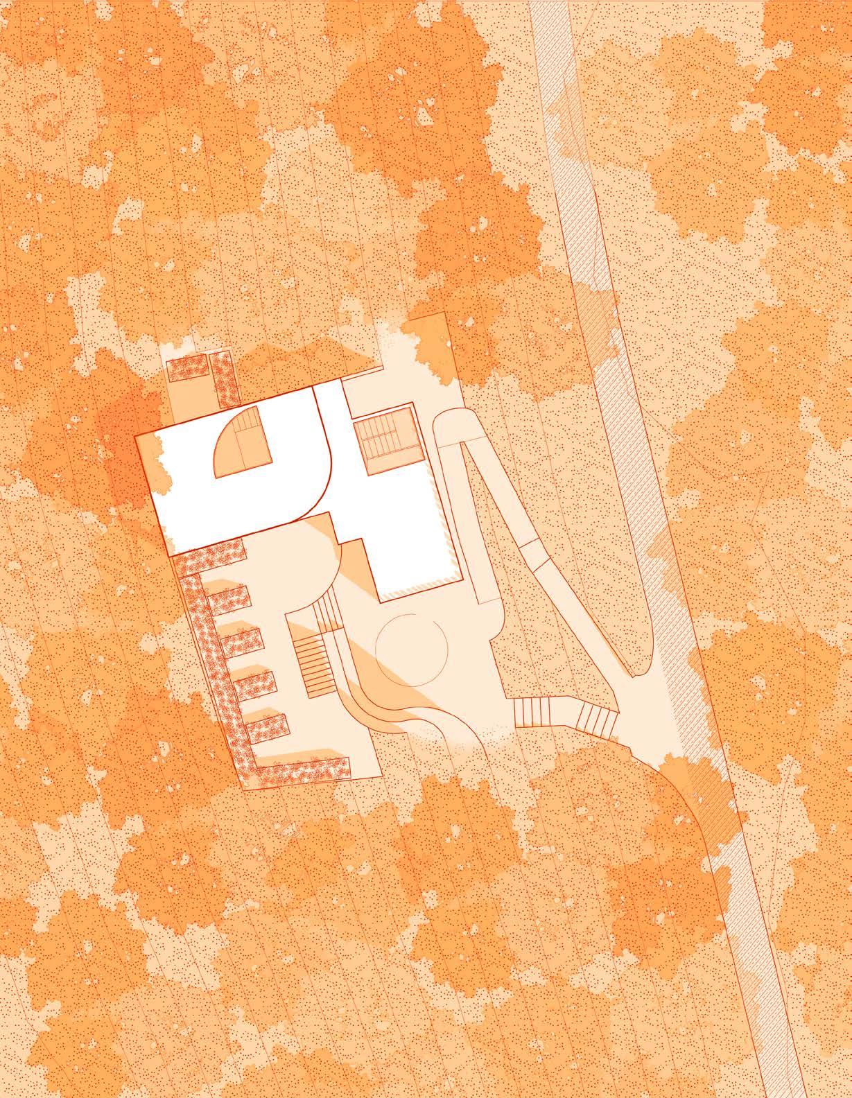
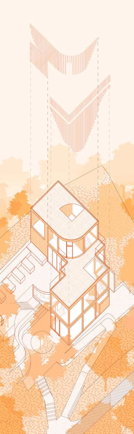
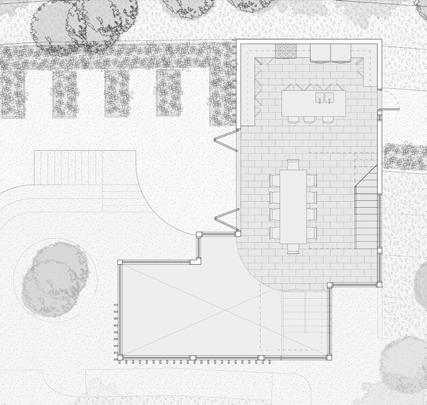
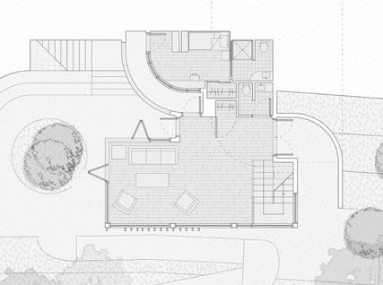
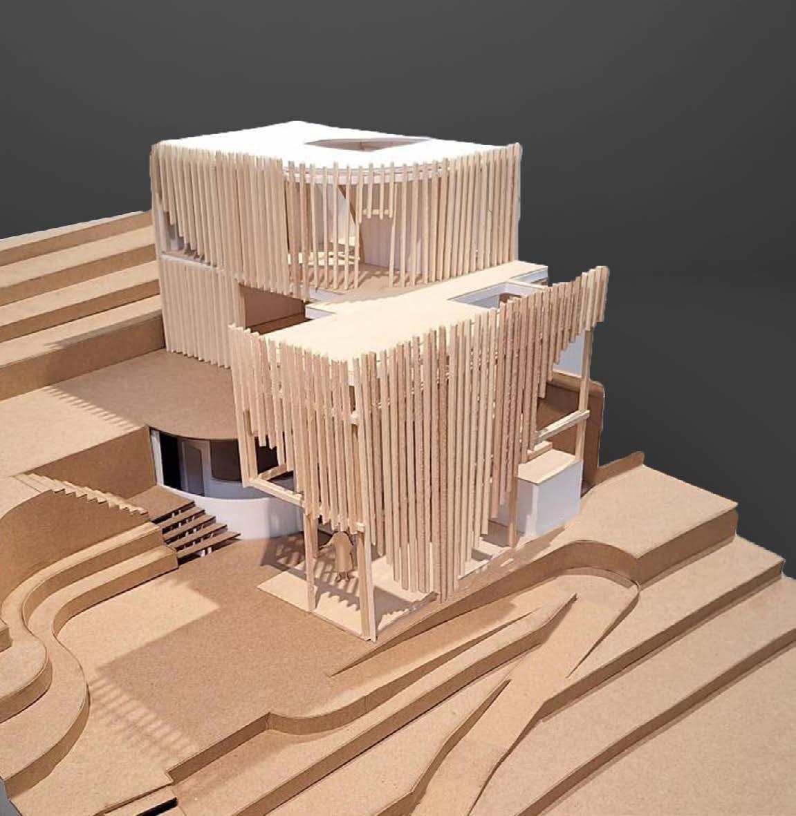
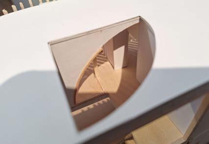
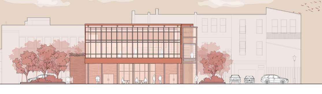
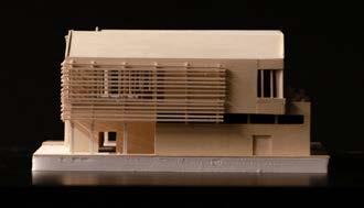
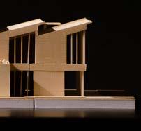
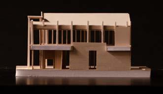
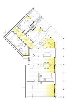
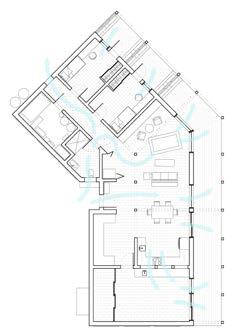
LOCATION: Cambridge, Ontario, Canada
43°22’19.7”N 80°19’26.1”W
PROGRAM: Residential Housing
SCOPE: Design Studio
SOFTWARE: Adobe Illustrator
Adobe Photoshop
Adobe Indesign
Rhino7 Krita
| 2023 | Arch 192 Studio Project
| Selected for Project Reviews 2025
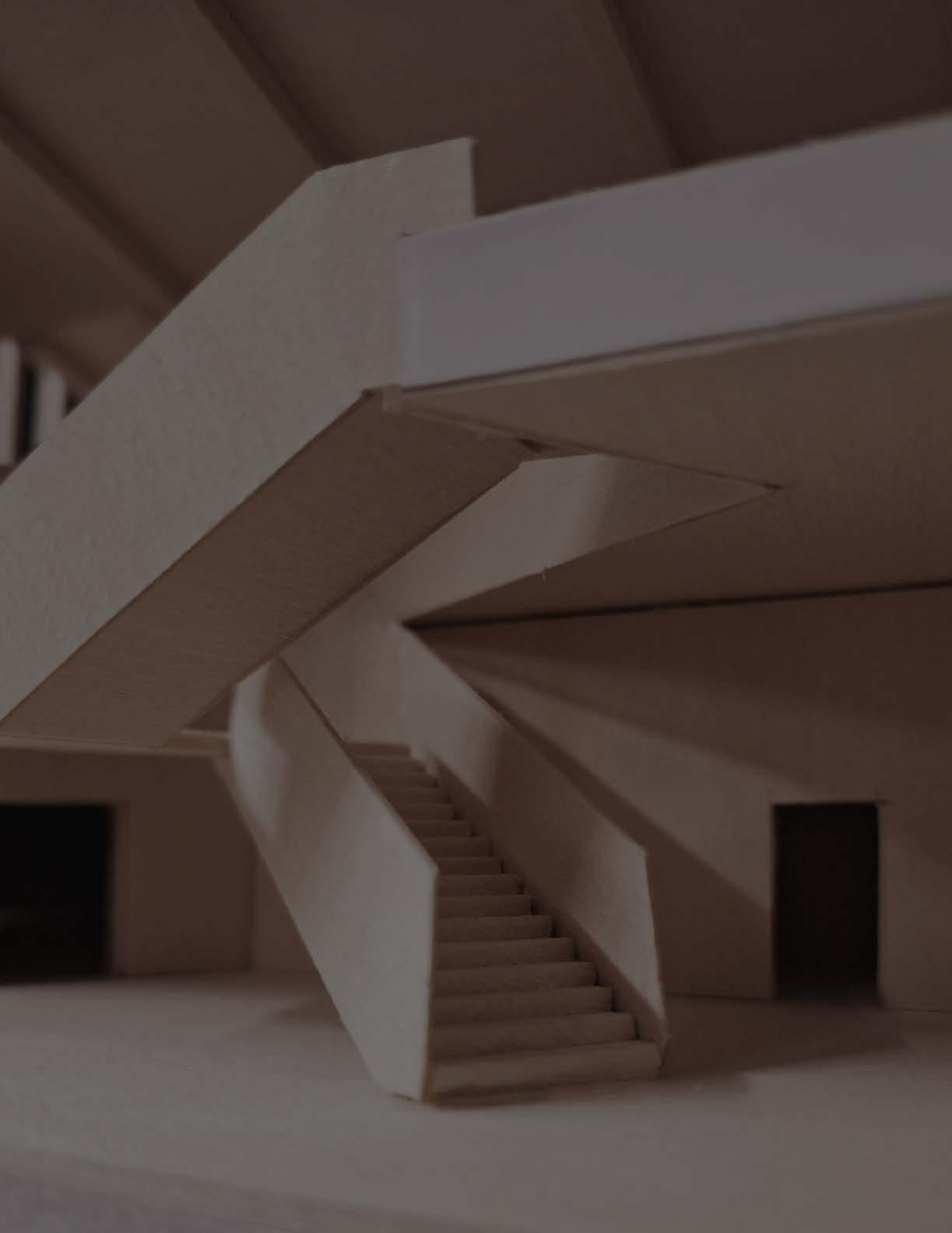
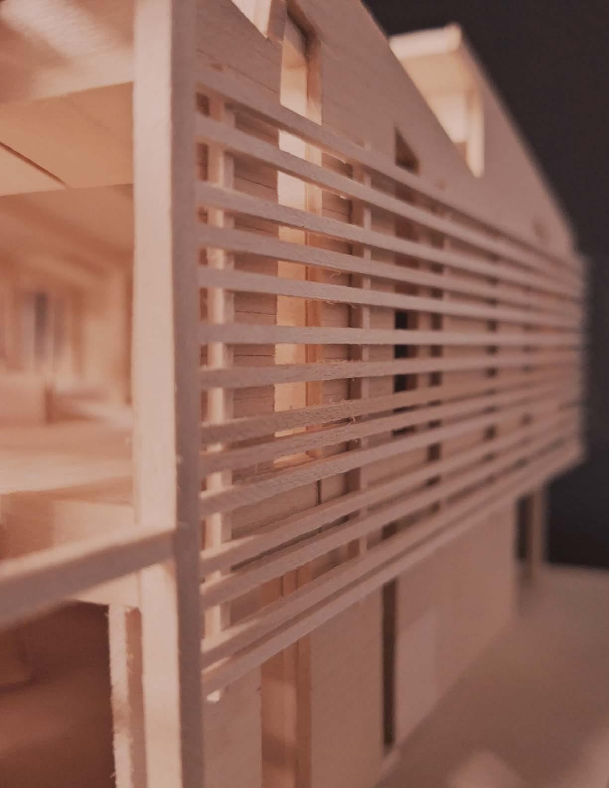
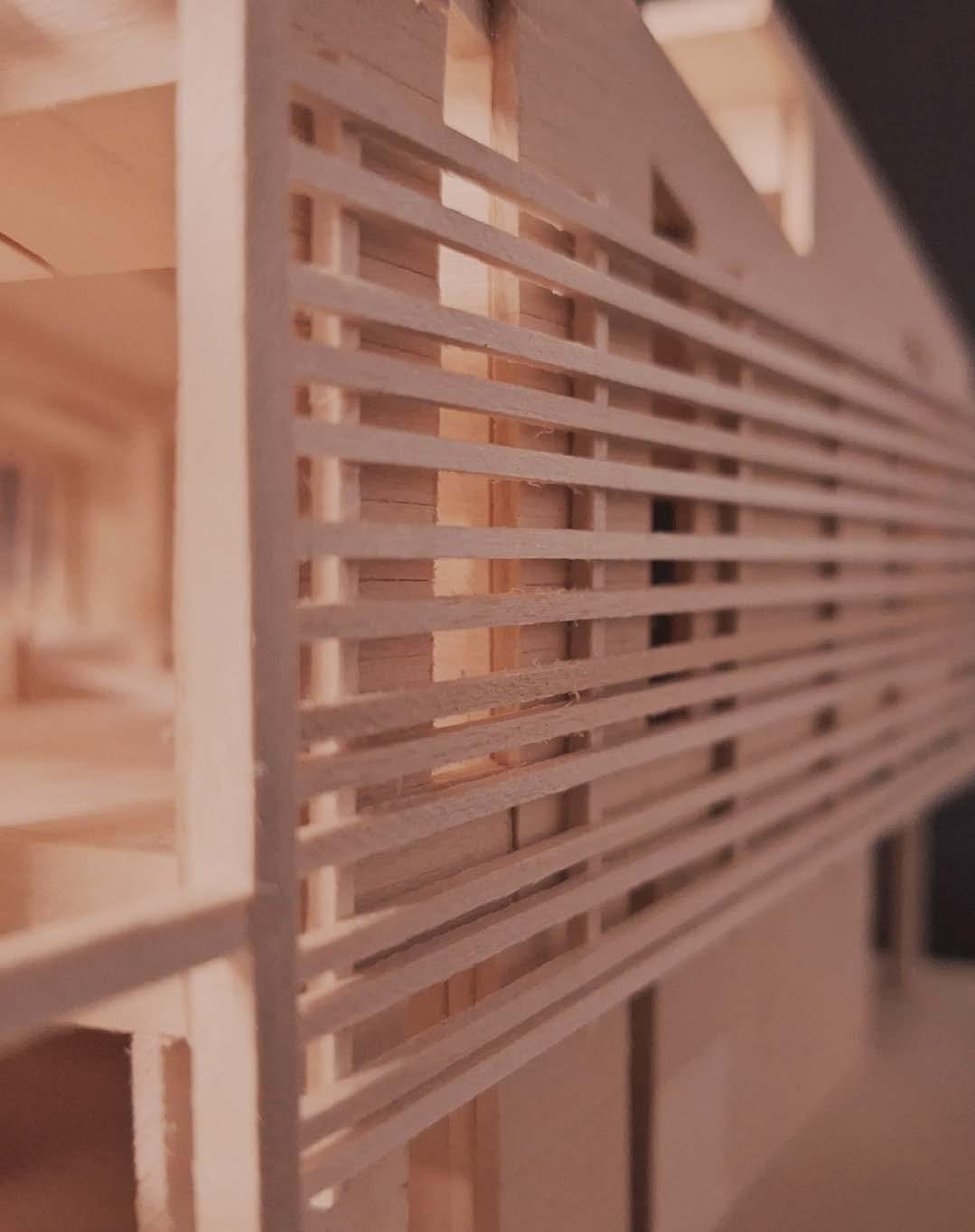
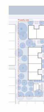
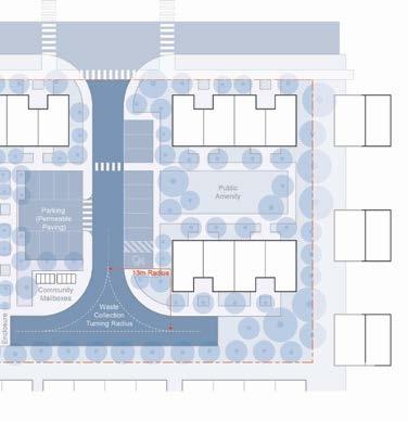
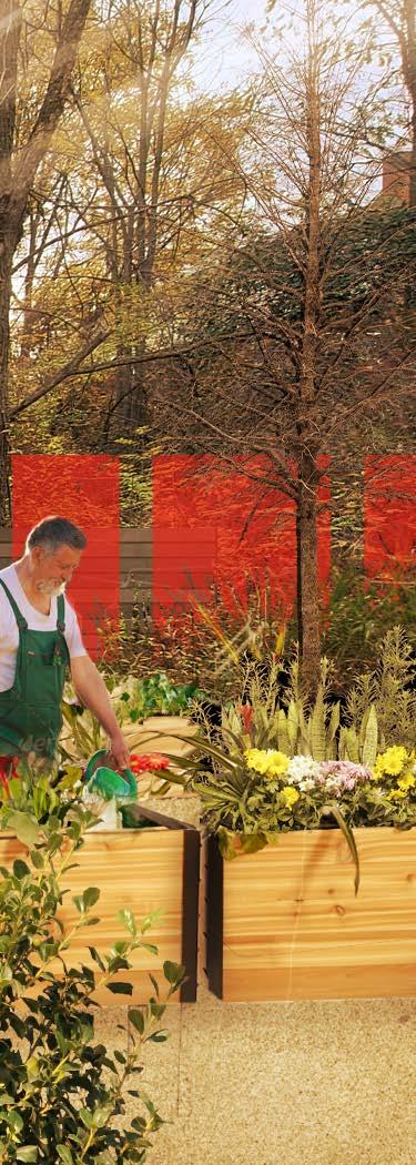
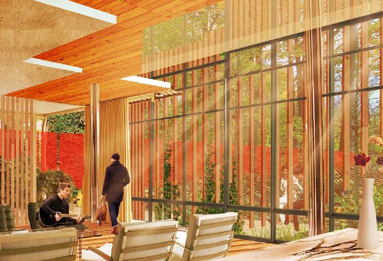
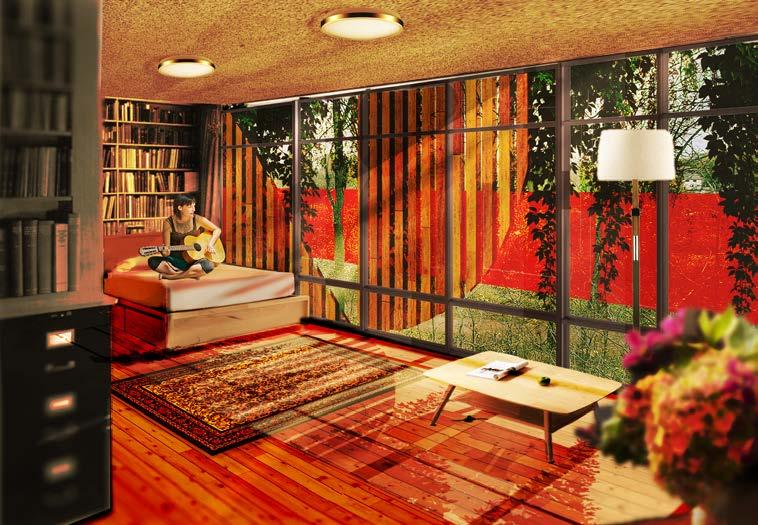
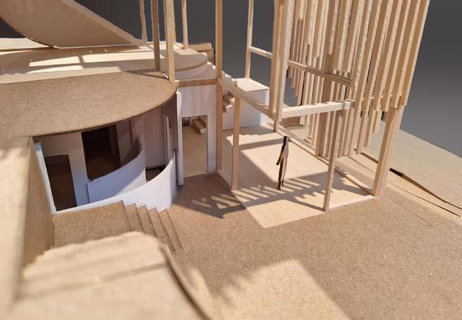
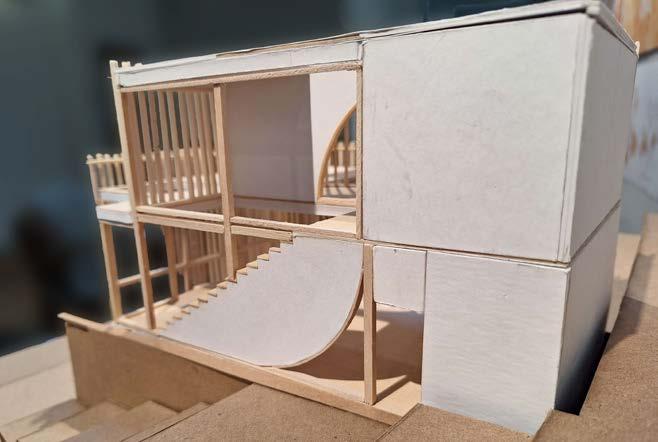
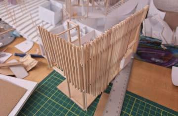
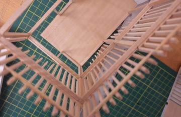
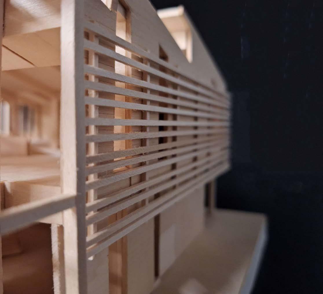
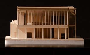
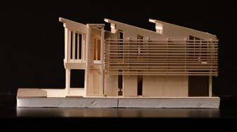
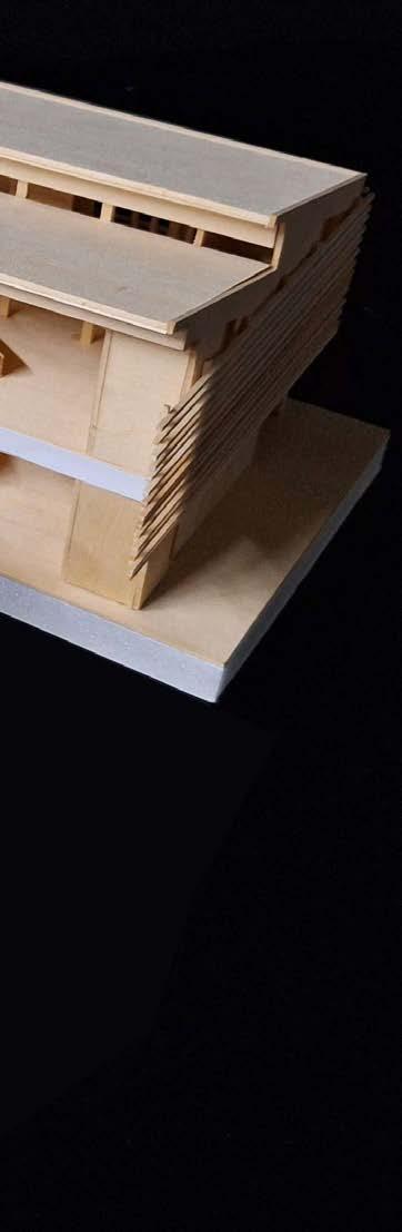
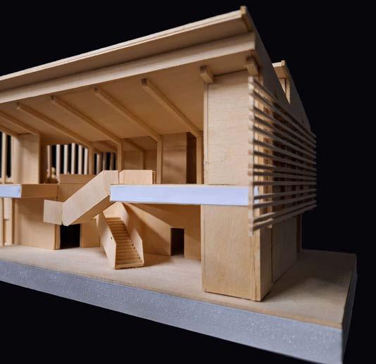
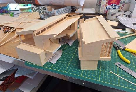
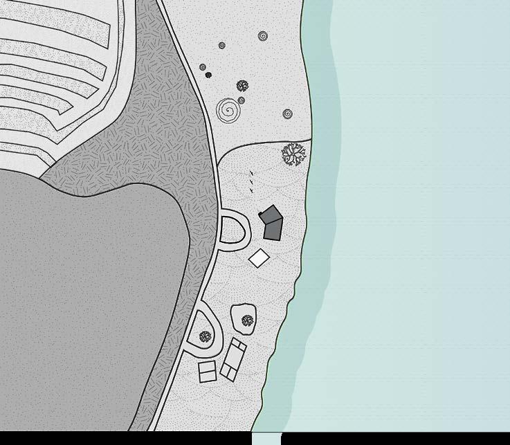
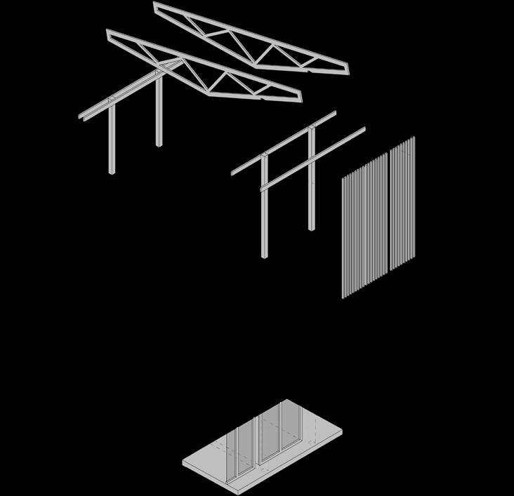
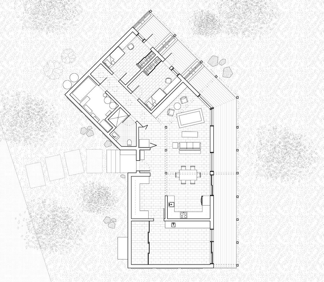
Built into the slope of an existing park, this project is designed to house a single resident and a temporary guest, while also facilitating enough space to host larger gatherings in collaboration with the CKCKW (Community Kitchen Co-operative Kitchener-Waterloo). By limiting the building’s massing to a selection of basic shapes and curves, the negative spaces formed by the generously sized windows accentuate the impression that the structure becomes embedded within its site.
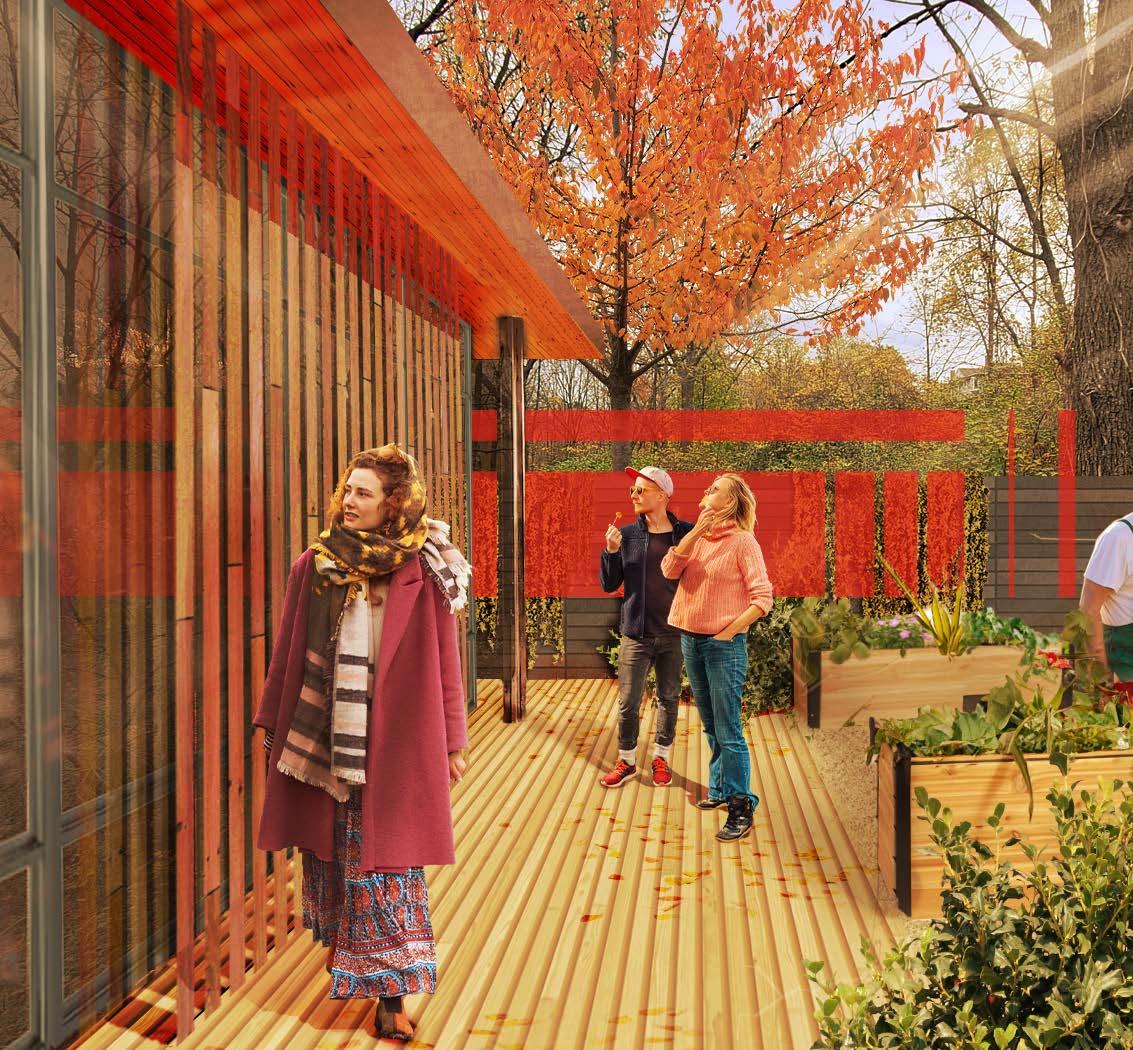
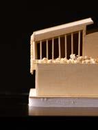
Located at Riverbluffs Park in Cambridge, Ontario, the verticality and angled slope of the site presented an immediate challenge for conventional buildings. This made it clear that creating a multi-story residence with ample fenestration on the east facade would take full advantage of these views provided by the selected site and its topography. To prevent excessive heat gain, wood shading screens were added to select faces of the building, the geometry of which was designed to reflect the geometries present throughout the house.
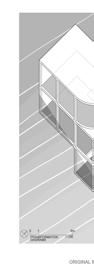
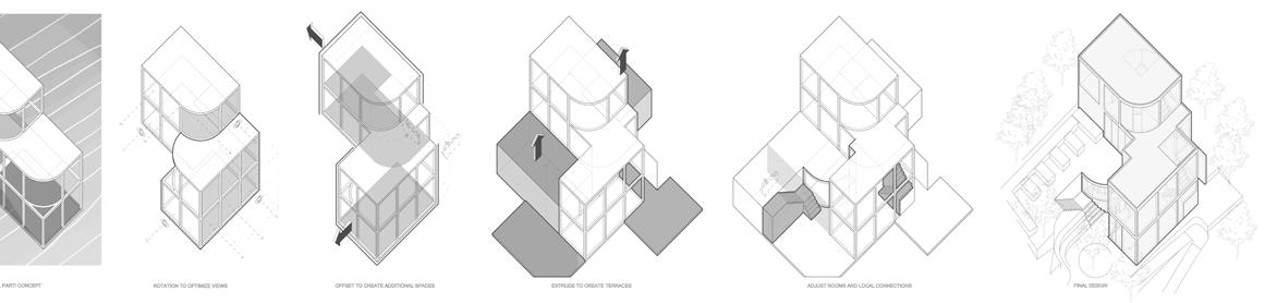
Axonometric Diagram of Site and Screen assembly
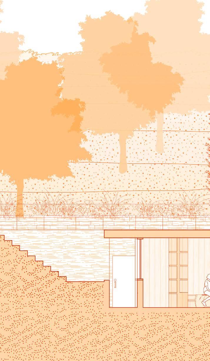
The presence of a pollinator preserve east of the main walking pathway prevented any development in that region, however the flat stretch of land did have the benefit of providing a mostly unobstructed view towards the river should the observer be elevated above the tree canopy and surrounding shrubbery.
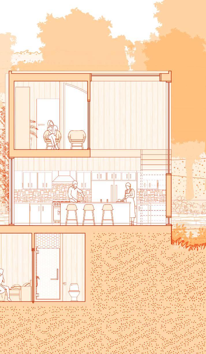
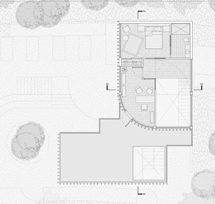
1st, 2nd, and 3rd floors
Due to the topography, most of the guest bedroom is embedded into the hill itself to create a cozy feeling while giving the guest more privacy away from the louder and more active parts of the house.
The building has 3 floors. The main floor contains the living room, guest bedroom and the main points of entry into the house. The 2nd floor contains the kitchen and dining room with access to an elevated patio. The 3rd floor contains the primary bedroom, office quarters, and access to a rooftop balcony.
Although not pictured, each floor can be lifted to reveal interior partitions.
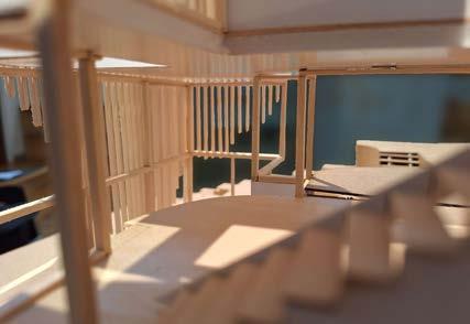
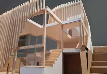
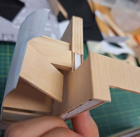
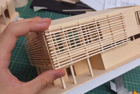
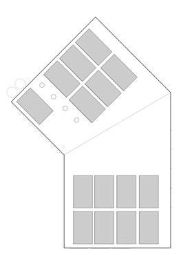
Assorted model photographs, taken from various angles
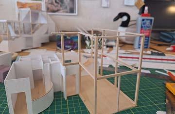
Assorted progress photographs
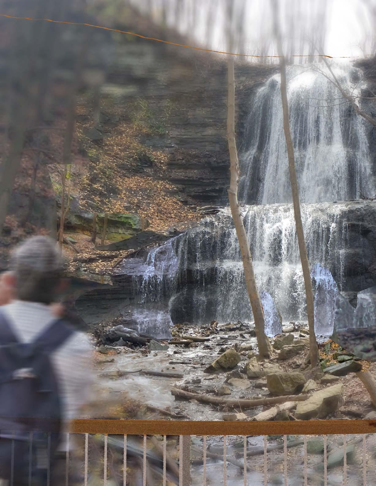
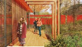
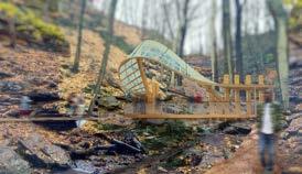
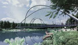
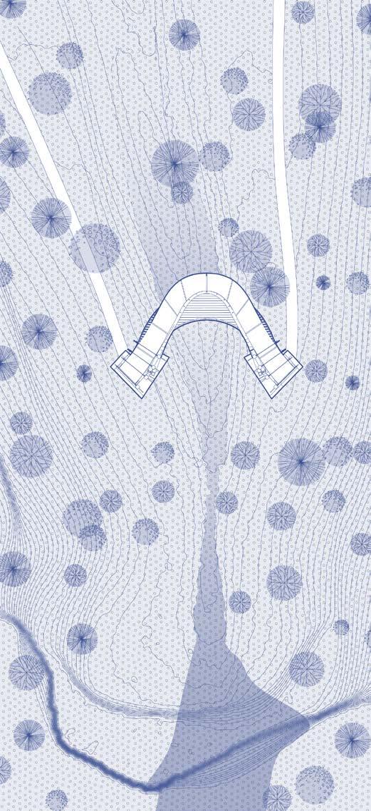
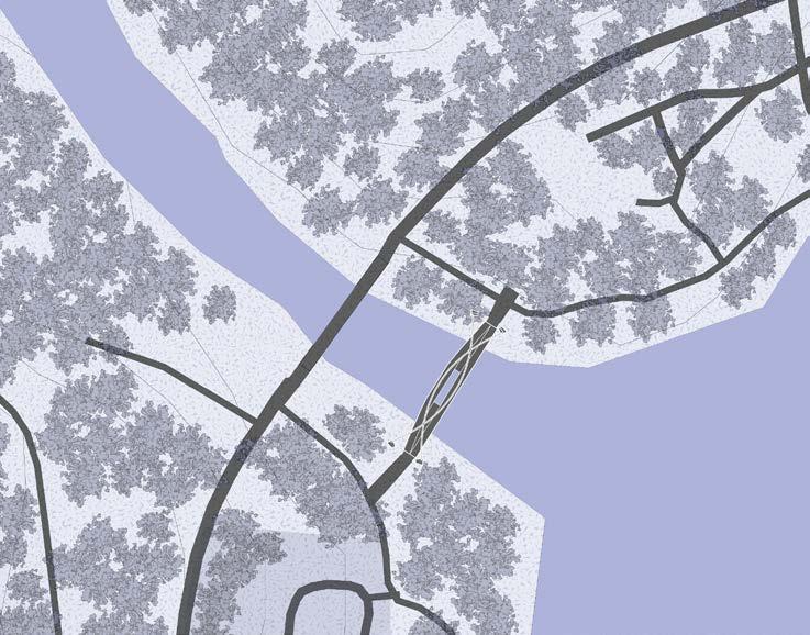
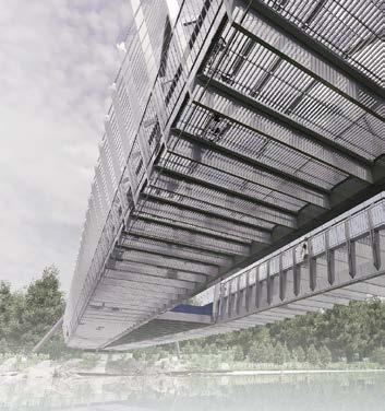
LOCATION: Hamilton, Ontario, Canada
43°14’18.9”N 79°58’22.9”W
PROGRAM: Pedestrian Bridge
SCOPE: Design Studio
SOFTWARE: Adobe Illustrator
Adobe Photoshop
Adobe Indesign
Rhino7
| 2024 | Arch 193 Studio Project
| In collaboration with Yukyoung Kim
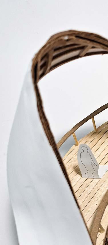
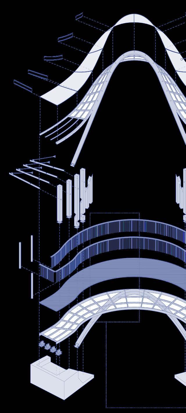
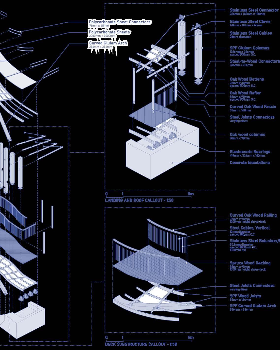
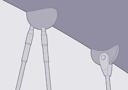
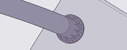
Designed as a replacement for the previous bridge at Sherman Falls, Ontario, the Ribbon Bridge uses large sweeping curves as a representation of the waterfall’s natural flow downstream, while directing the viewer’s gaze across the bridge itself. The main form and structure of the bridge rests on two large glued laminated timber arches designed to suspend the canopy above the deck without blocking viewing angles from either side of the waterfall.
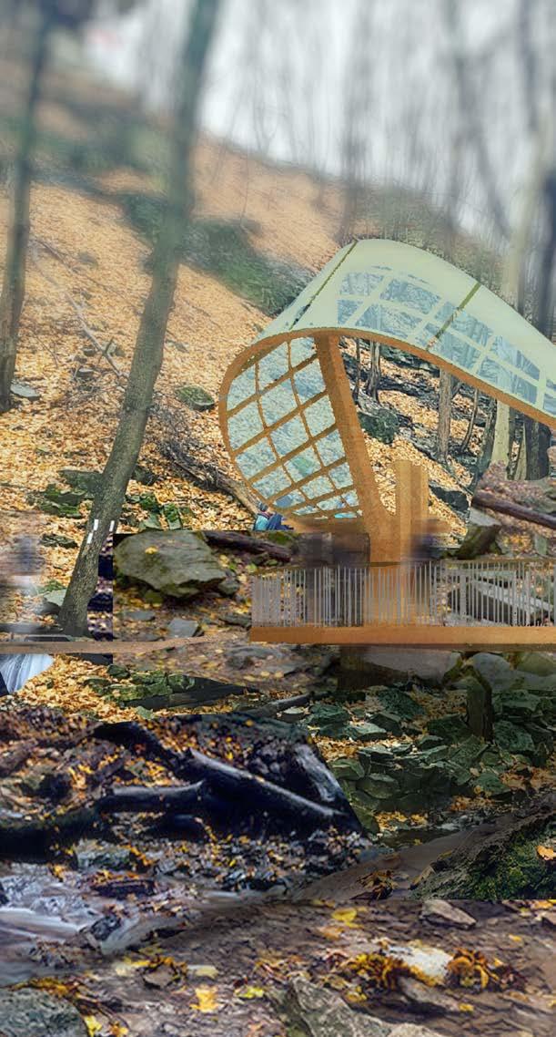
To ensure that both the views towards and away from the waterfall remain unobstructed, the entire roof was attached to massive timber arches, thus keeping it suspended above the deck while minimizing the presence of vertical beams.
The roofing material is made from curved polycarbonate sheets, chosen for its translucent appearance, durability, low maintenance, resistance to rain and snow, ease of assembly, and lightweight properties. The light blue tint reminiscent of flowing water.
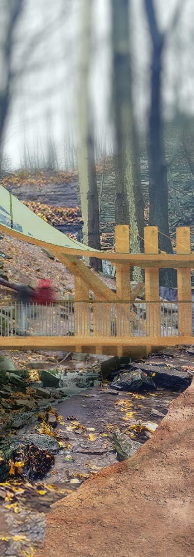
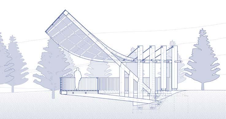
The main structure of the bridge is made predominantly from glulam beams and arches. It was decided early on that the use of such a material would allow us to create the curved movements that were desired for this project, while the natural texture of the exposed wood structure would blend in more cohesively with the forested site and its surroundings in contrast to something more aggressive like steel.
LOCATION: Cambridge, Ontario, Canada
43°21’34.5”N 80°18’51.7”W
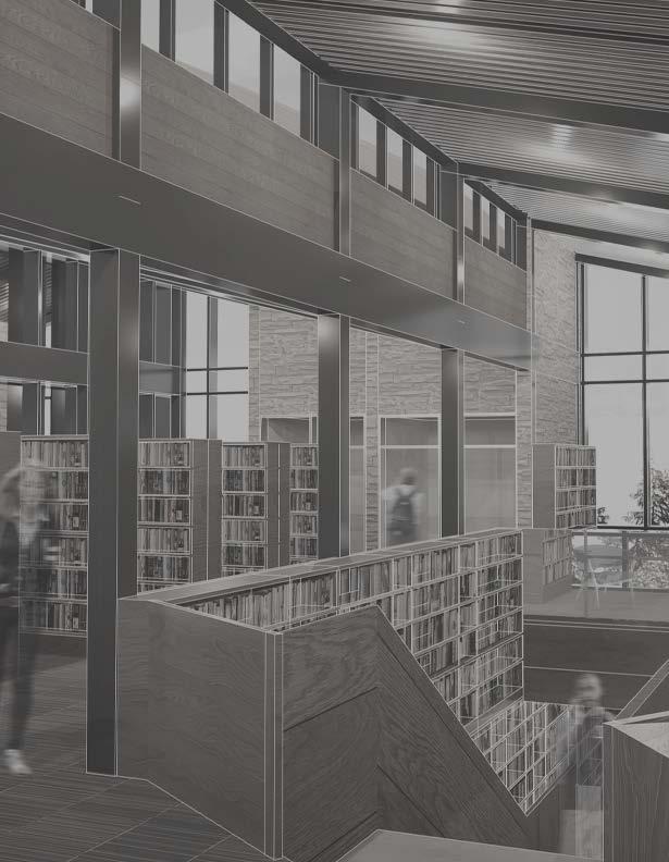
PROGRAM: Public Library
SCOPE: Design Studio
SOFTWARE: Adobe Illustrator
Adobe Photoshop
Adobe Indesign
Rhino7
VRay
| 2024 | ARCH 193 Studio Project
| Awarded for Outstanding Design Work (1B) | Selected for Project Reviews 2025
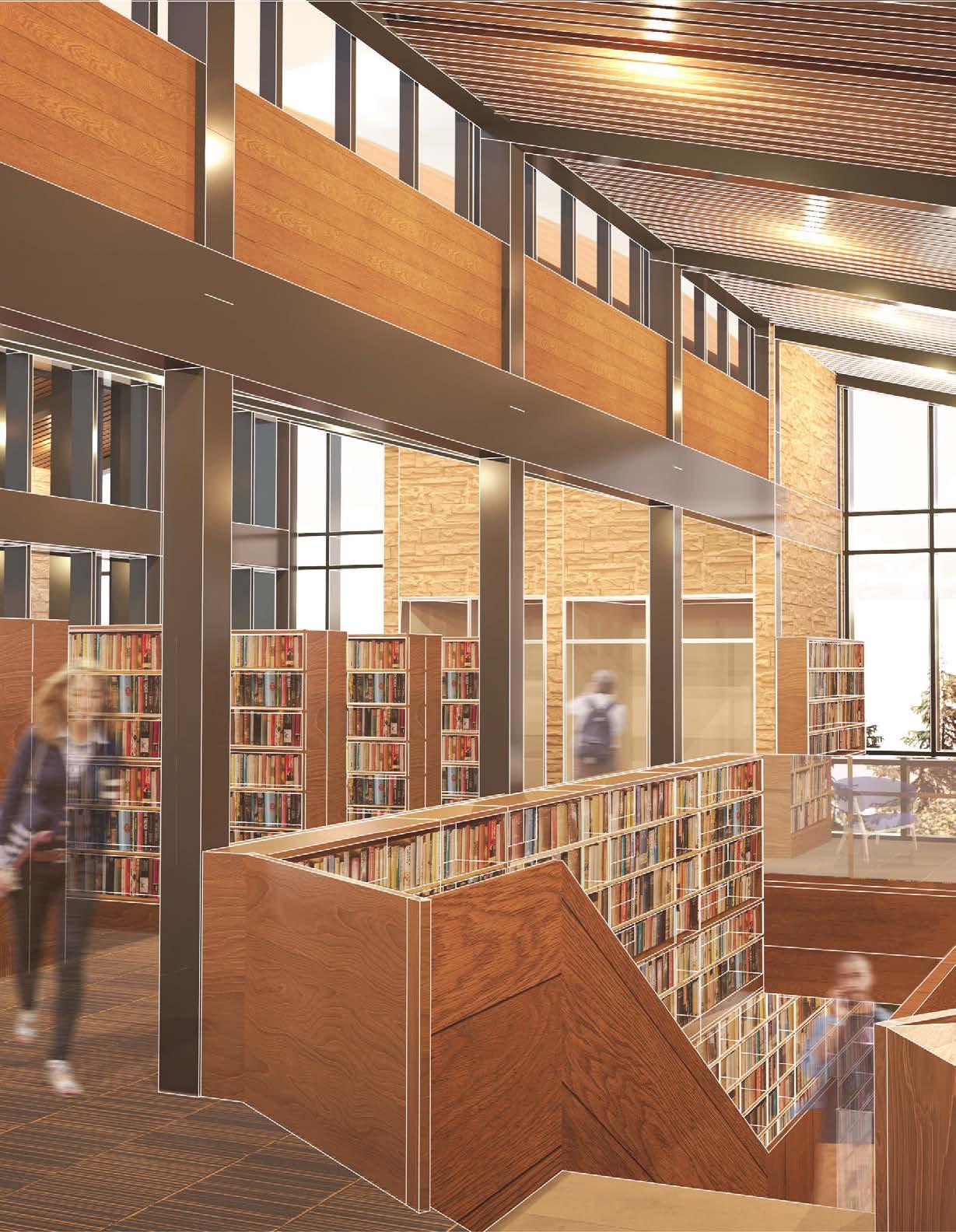
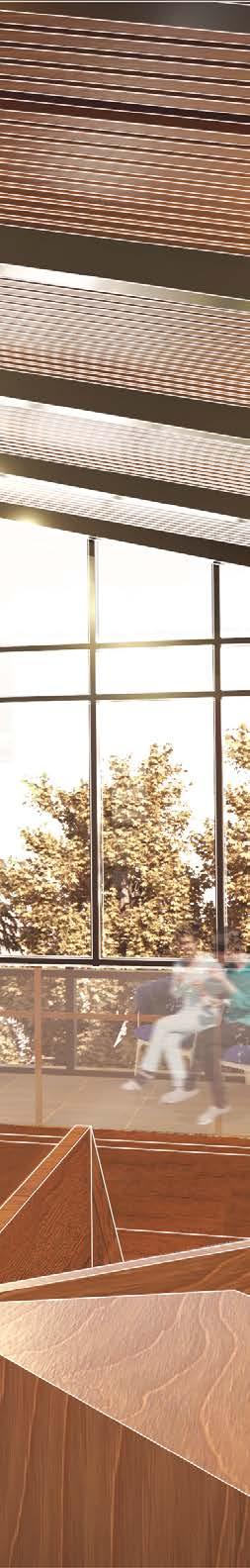
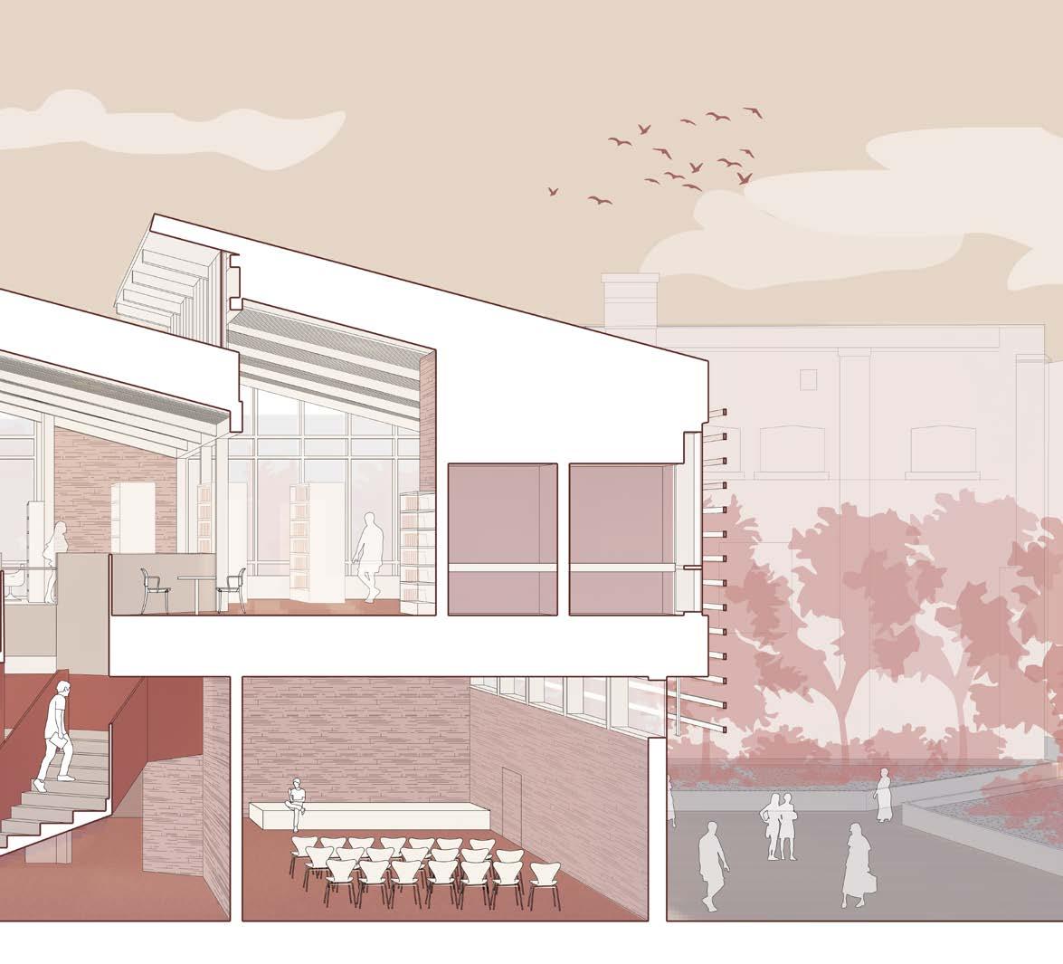
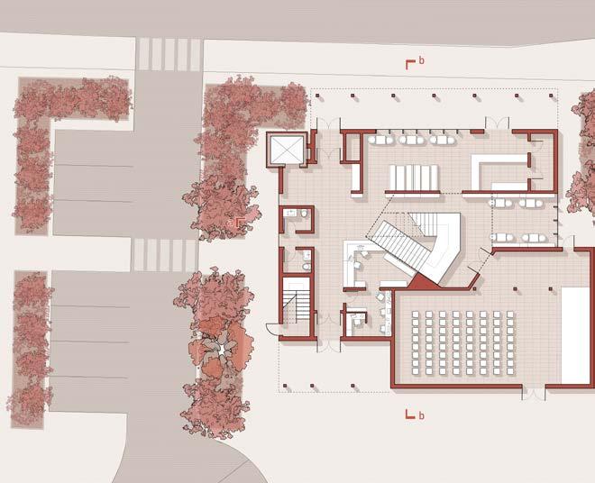
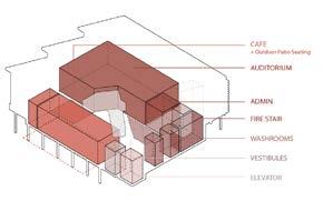
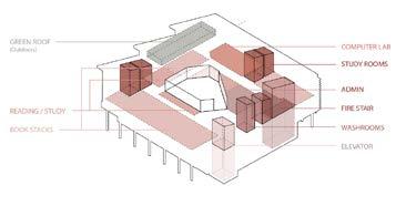
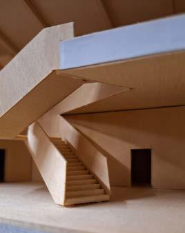
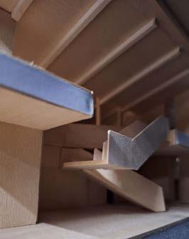
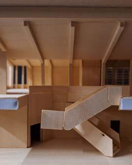
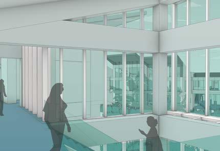
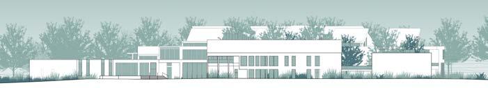
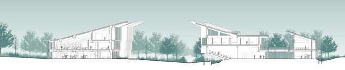
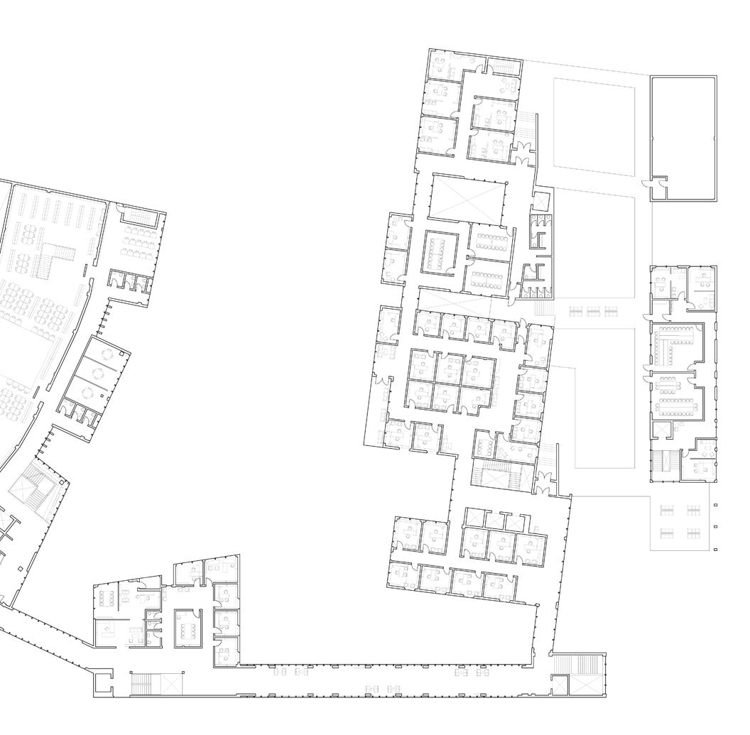
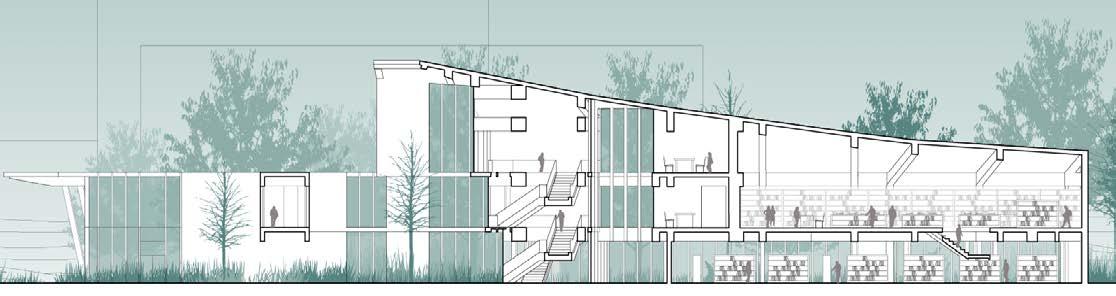
Constructed on an infill parking lot in Cambridge, Ontario, this library is designed to connect the surrounding networks of alleyways and sidewalks while the building itself serves a multitude of programs fit for the contemporary era. The ground floor includes a book cafe and auditorium space that integrates itself with the main lobby, while the library itself is elevated to the 2nd floor, focused on the open space formed in the center of the building and structure provided by the large sawtooth roof and exposed steel framing.
Sectional Perspective
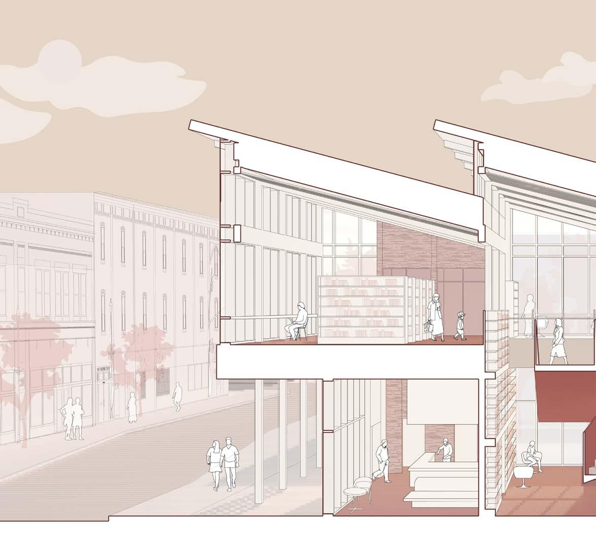
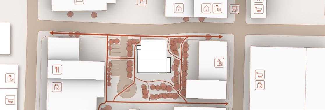
The site’s position in the downtown region puts it near a multitude of shops and services nearby, making it accessible from 4 different directions in addition to access from the main road to the north. Therefore, it became clear that the design of a future library should exist not only as a standalone building, but act as a mediator between these existing pathways and services.
The program of the library is separated distinctly into two floors; The ground floor contains more high-traffic spaces such as the café and auditorium along with two entrance vestibules, while the 2nd floor is reserved for study and reading, among other quiet activities.
1:250 x longs sec perspec x
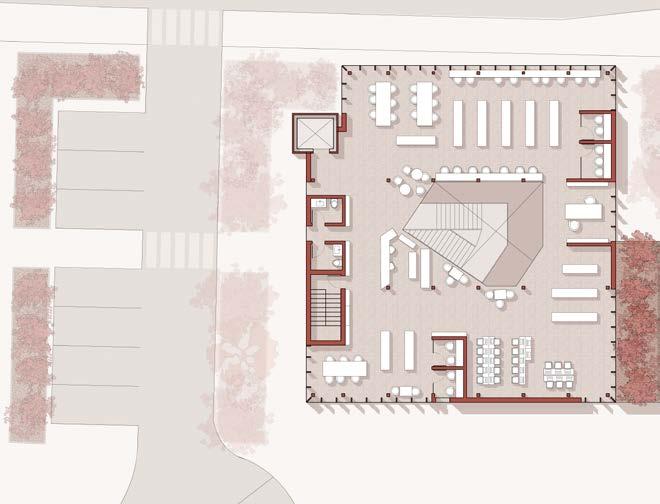
To further create a sense of inter-connection between levels, an opening was created in the center of the 2nd floor to facilitate a physical and visual connection.
The café opens into the ground floor atrium space, acting as additional seating where users are encouraged to grab a light snack to go along with their reading, and vice versa, or simply to provide more seating during peak hours.


Assorted model photographs, taken from various angles
Assorted model photos above and below, images show the sectional view of the north half of the model and elevations from each direction. The alternate page shows a sectional view into the south half of the model and other detail shots.
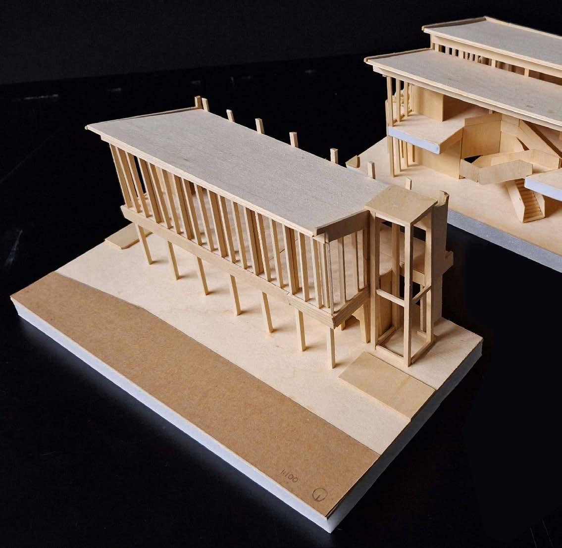


It should be noted that the final presentation model bears some interesting elements, such as a uniform wood profile, textured exterior, and the fact that it’s a sectional model, which can be cleanly opened and put together with ease. Due to this addition feature, extra attention was taken to express the detail in the feature stair and maintain the alignment of each joist.
(Constructed at a 1:100 scale)
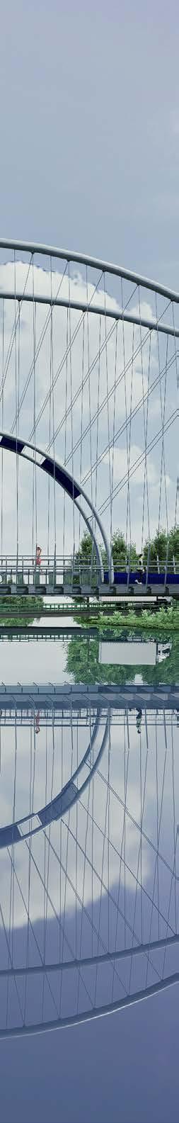
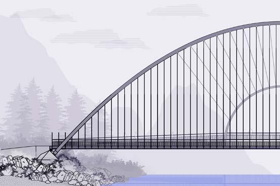
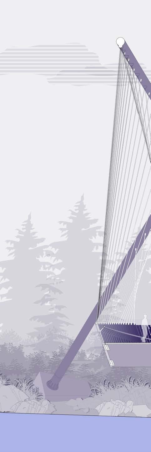
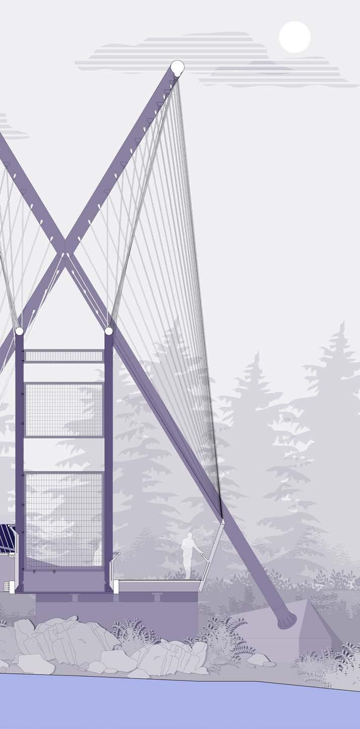
LOCATION: Jasper, Alberta, Canada
52°43’40.4”N 117°38’36.6”W
PROGRAM: Pedestrian Bridge
SCOPE: Competition Entry
Steel design
SOFTWARE: Adobe Illustrator
Adobe Photoshop
Adobe Indesign
Rhino7
D5 Render
| 2024 | CISC Competition Entry
| In collaboration with Morgan Li
| Supervised by Terri Meyer Boake and Isabel Ochoa
Located at the north end of Maligne Lake in Jasper, Alberta, this site within Jasper National Park offers visitors a wide choice of outdoor activities, including multiple hiking trails, a boat house for kayak rentals, and a small tour guide office with plenty of parking. The waters of the lake and river are crystal clear and the calmness of the waters perfectly reflects the Canadian Rockies sitting in the background.
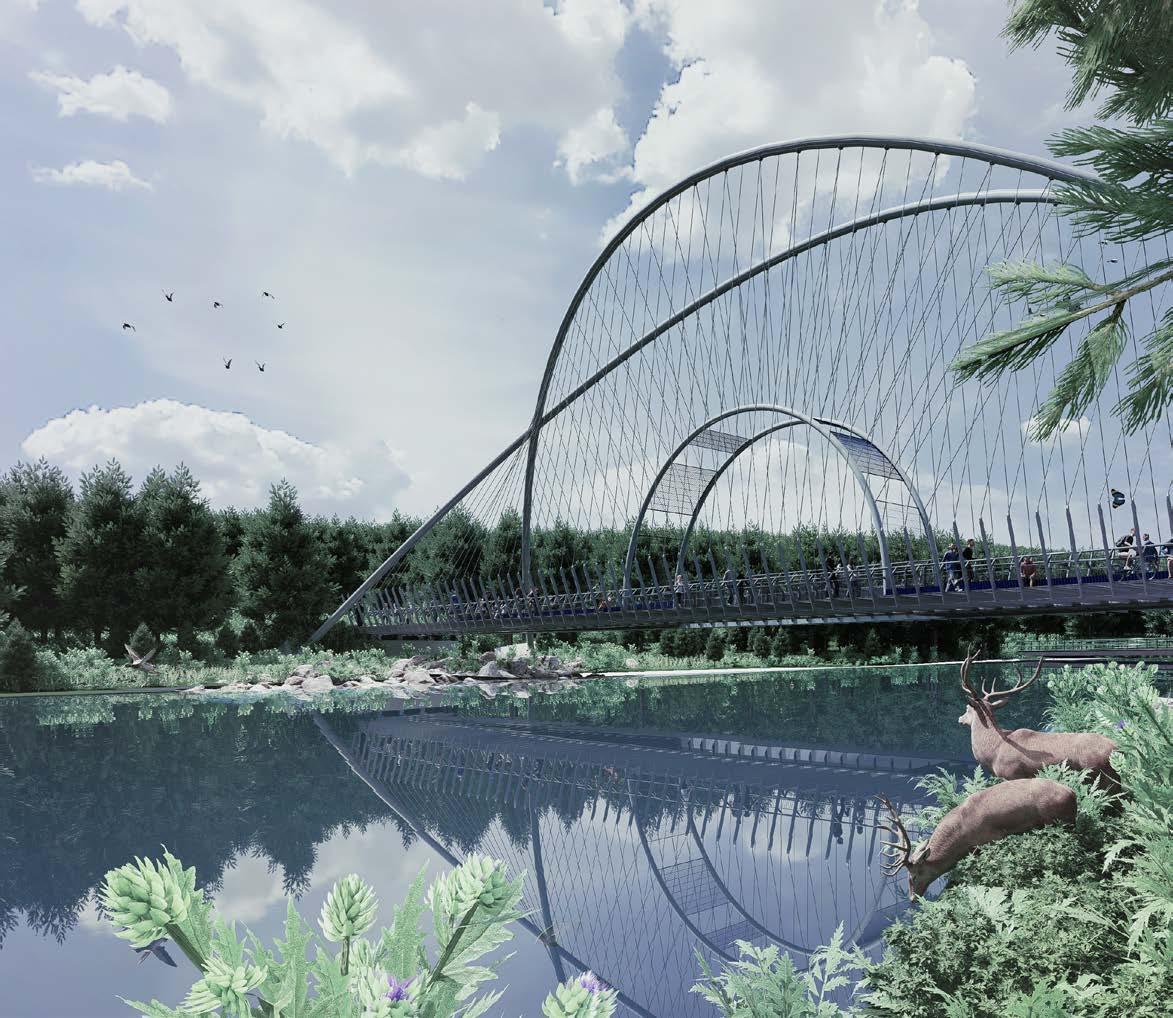
Despite the beauty of the lake and river, the current concrete bridge that exists for people was designed mainly for road traffic and lacks proper pedestrian infrastructure. Therefore, Cerulean Shores is designed to fulfill both needs, to improve pedestrian access between the adjacent hiking trails on opposite sides of the river while also providing a unique crossing experience for its users.
To further enhance the experience of viewing the crystalclear waters of the river, the center of the bridge features a clear opening where users can view directly down into the water below.
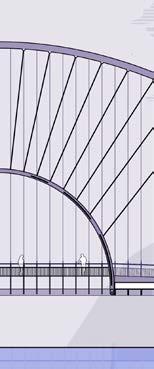
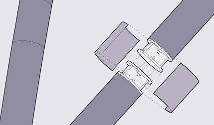
The use of large overhead arches and smaller arches connected to the center of the bridge act as connection points for additional tension cables.
Elevated platforms allow for additional circulation paths and improved viewing angles, as well as places to rest and enjoy the views.
Overhead steel arches (HSS tubes, 500mm diameter)
Steel cables (Connects to middle arches, 30mm diameter)
Interior steel arches and seating platform (HSS tubes, 300mm diameter) (HSS welded steel sheets)
Steel cables (Connects to cross bracing/ balusters, 30mm diameter)
Deck (Steel grate footpath)
Foundation and substructure (Railing, cross bracing, beams, joists, balusters, brackets)
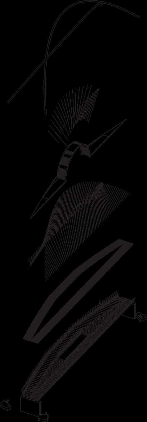
Structural Axonometric
longs
sec perspec x
1:250 x
1:100 white

LOCATION: Prince Edward County, Ontario, Canada
44°05’40.2”N 76°50’38.3”W
PROGRAM: Passive House
SCOPE: Environmental Building Design
SOFTWARE: Adobe Illustrator
Adobe Photoshop
Adobe Indesign
Rhino7
Climate Consultant 6.0
| 2024 | Arch 126 Project
| Awarded the Energy+Design Award | In collaboration with Saban Alford
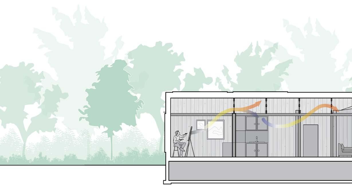
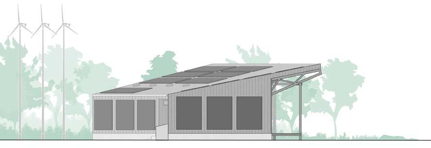
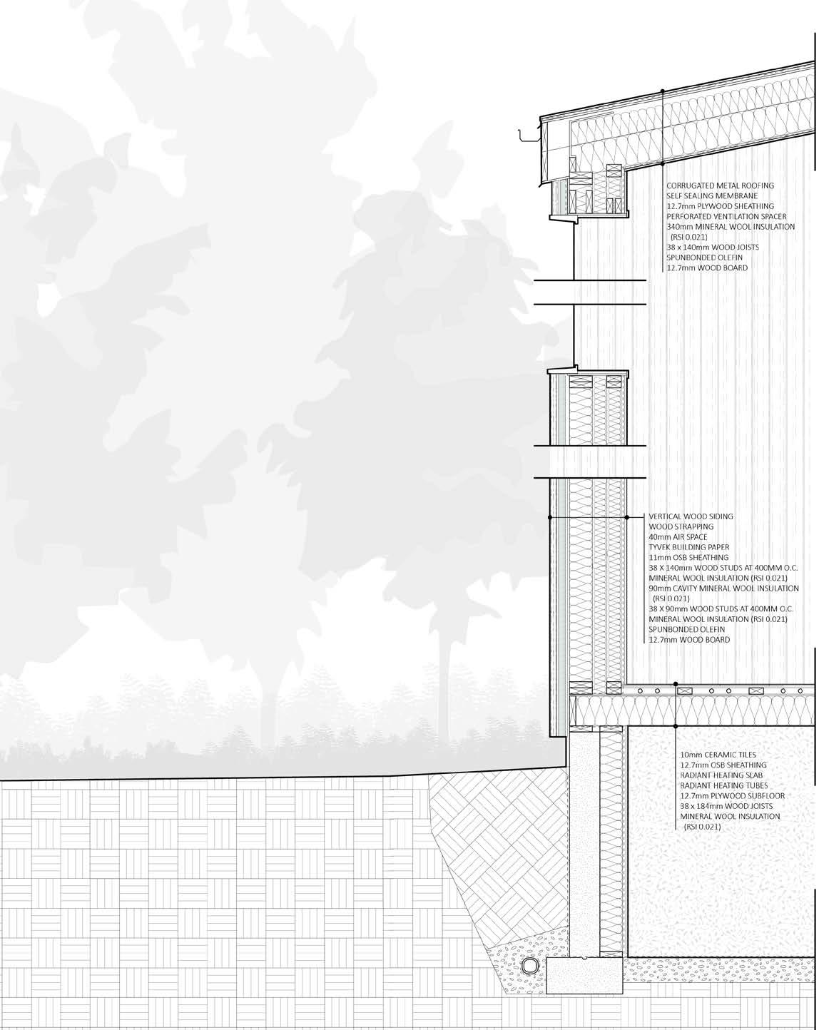
Free from the distractions of everyday life, Craftwork offers a temporary home for two artists in residence on the far eastern point of Prince Edward County, Ontario. With breathtaking waterfront views into the entrance to the Bay of Quinte, our artists can breathe easy knowing Craftwork was built as environmentally consciously as possible, allowing them to focus on creation, collaboration, and innovation during their 6 month residencies.
Rendering of Exterior
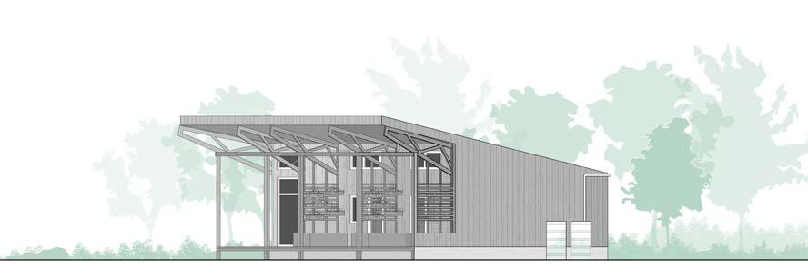
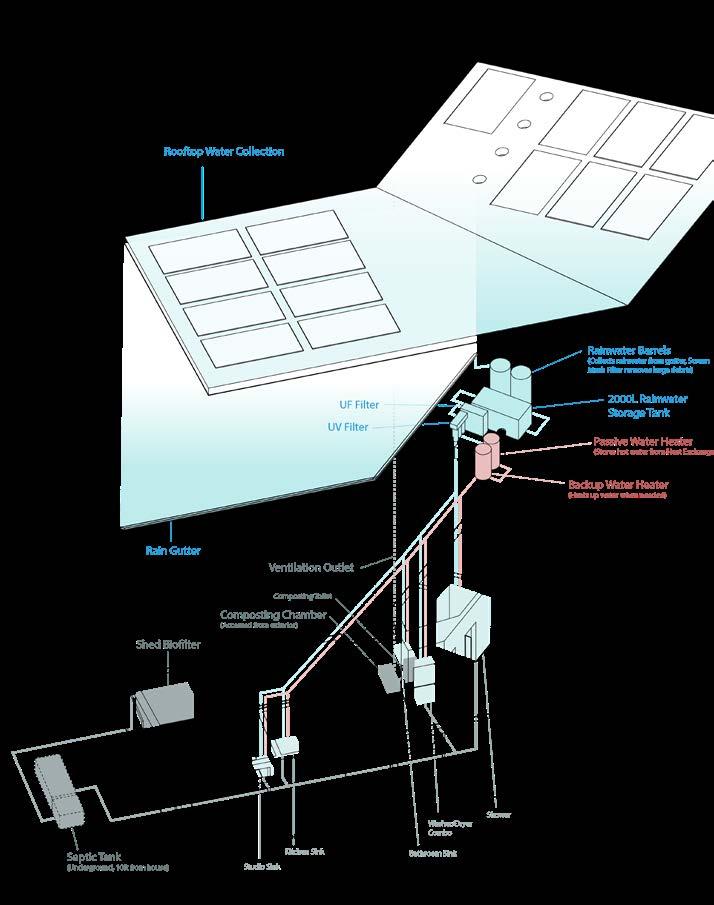
Re-purposed wood and metal from nearby abandoned barns is used throughout Craftwork, paying homage to the Southern Ontario countryside while also using as little new materials as possible. Furthering the goal of the lowest possible carbon footprint, sustainable systems, and strategies such as, among others, rainwater collection, purification, and wind turbines, run throughout Craftwork, allowing for complete off grid, comfortable living.
By focusing on using materials from second-hand markets, such as locally sourced or reused wood, corrugated steel roofing, and ceramic floor tiles from local vendors, much of the building can be salvaged or reused during its end life. Even the mineral wool insulation can be recycled indefinitely with an incredibly low carbon footprint.
The main floor contains a kitchen, living room, pantry, artists studio, two bedrooms, and a shared washroom. Each bedroom also has its own semi-private patio space with vertical wall planters acting as partitions, while also providing each resident with their own personal space to grow small crops.
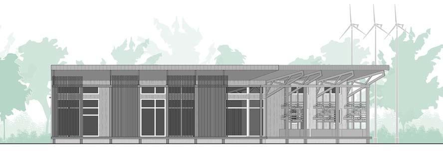
A raised porch and setback from the waterline mitigates risk of flood damage.
Solar hot water panels can be seen on the roof and south facing walls, thus maximizing heat absorption from year round sunlight.
1 2500 w
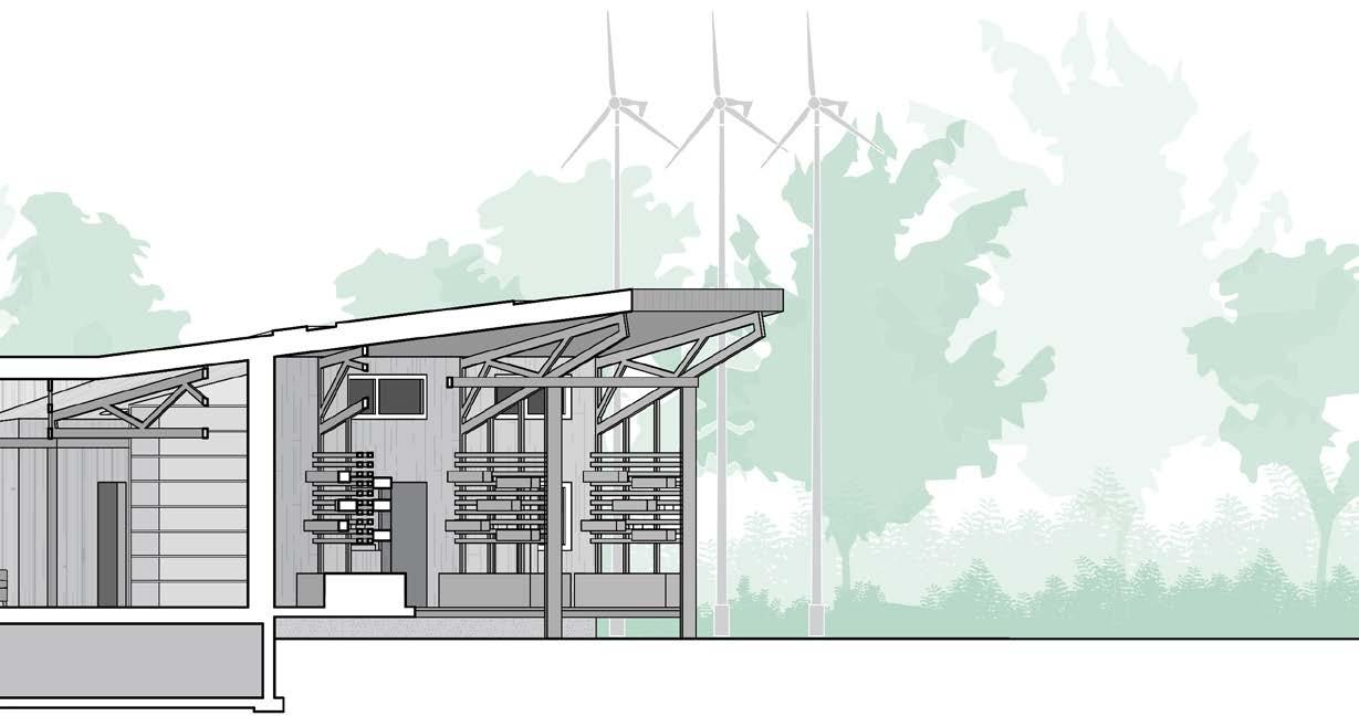
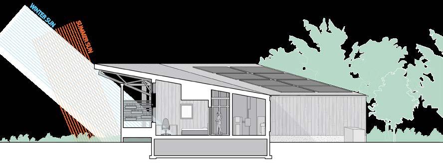
Each bedroom also has its own semi-private patio space with vertical wall planters acting as partitions and space to grow small crops.
Large overhangs and wooden screens block summer sunlight from entering the east face of the building, preventing additional heat from entering the building while letting in ample amounts of natural sunlight.
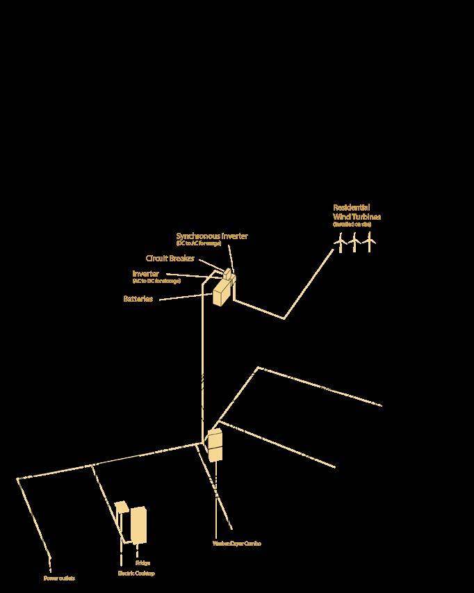
System Axonometric - Electrical Distribution
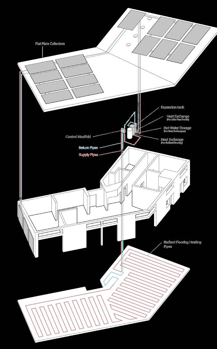
System Axonometric - Heating
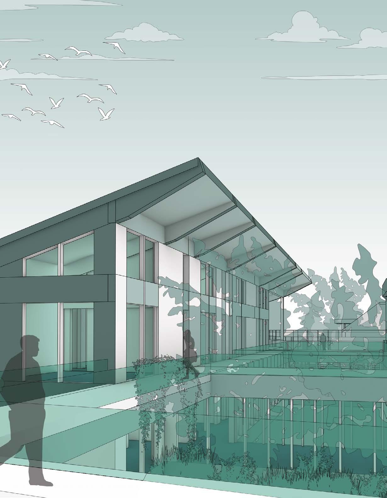
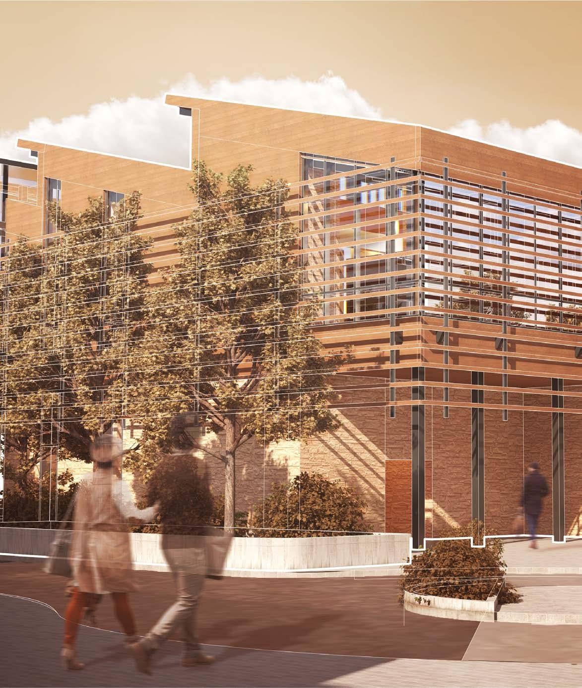
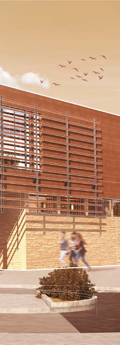
LOCATION: Waterloo, Ontario, Canada 43°28’20.0”N 80°32’41.3”W
PROGRAM: Law School
SCOPE: Design Studio
SOFTWARE: Adobe Illustrator
Adobe Photoshop
Adobe Indesign Rhino7
| 2024 | Arch 292 Studio Project
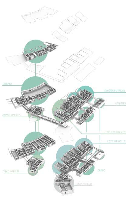
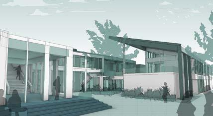
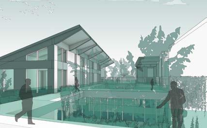
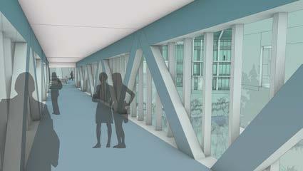
The Creekside Law School was designed with 3 main principles in mind; Transparency, Flexibility, and Ecology, under the pretense that where learning can and should occur anywhere, especially outside the classroom. This law school attempts to dismantle this preconception with the profession, whereby instead of a large singular building, the law school is split into multiple smaller segmented buildings, each able to function semi-autonomously while still remaining interconnected to the rest of the “campus” with a series of indoor and outdoor walkways.
Rendering of Exterior
The school is designed to actively engage with both the law students and the wider public/student community thanks to its 3 main courtyards, each with a slightly varying program and function. Should any professor wish to teach outside of the classroom, the library’s 2nd floor is also designed to function as an alternative teaching space given the quiet and contained environment it provides.
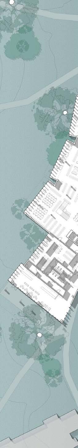
IF THE LAW IS SOMETHING THAT AFFECTS ALL OF US, WHY CAN’T WE ALL HAVE AN EFFECT ON THE LAW?
There’s also a pathway which goes below the lecture halls and along the creek into an open outdoor foyeresque space. The building’s design allows it to follow the contours of the river, while additional planted beds, stormwater ditches, and sloped roofs allow for the management of excess rainwater and prevent flooding.

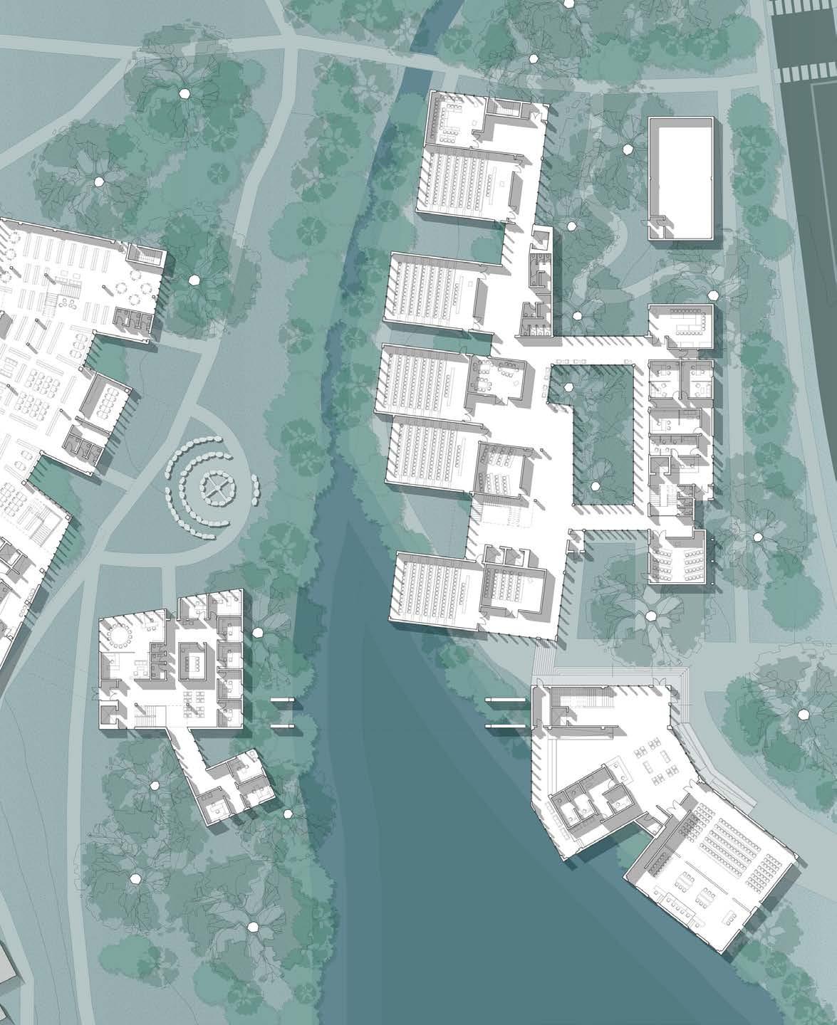
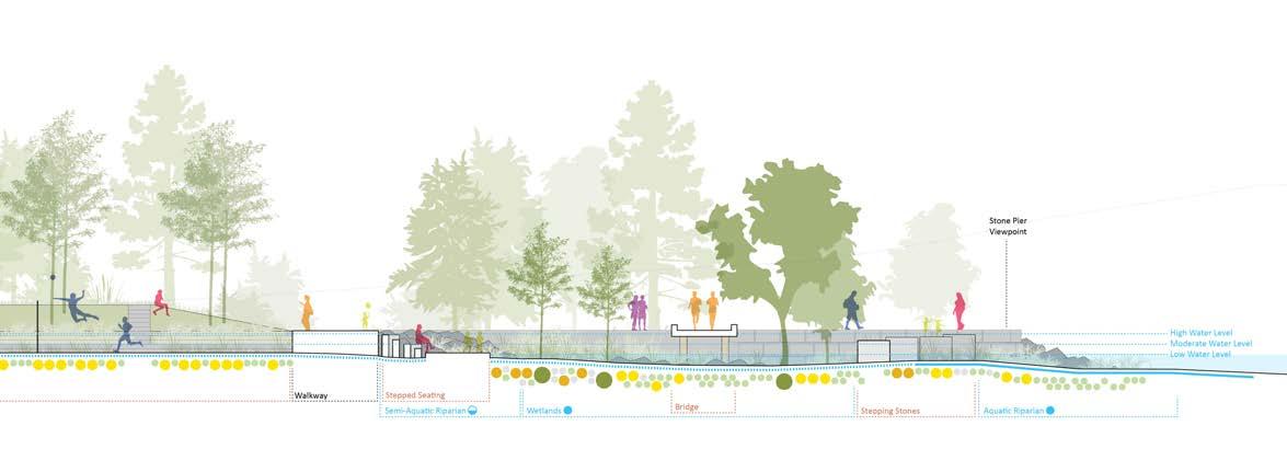
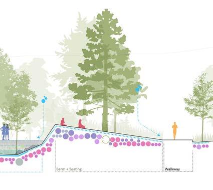
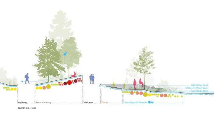
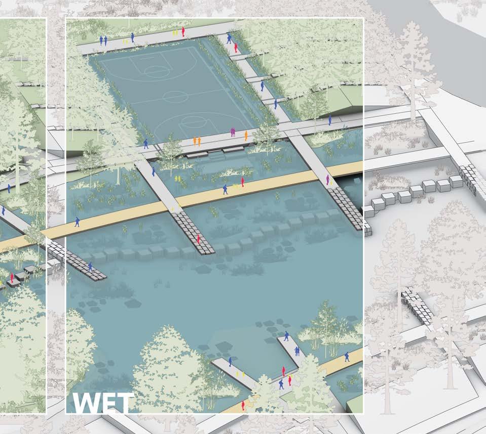
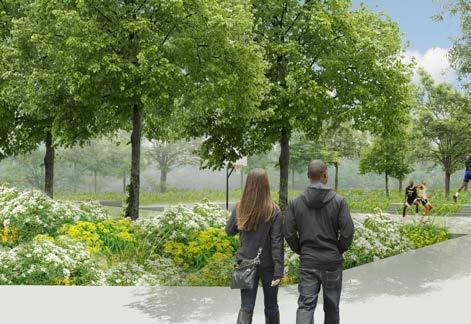
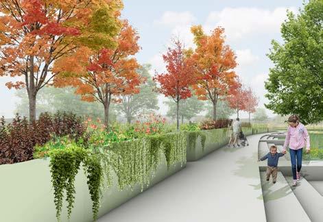
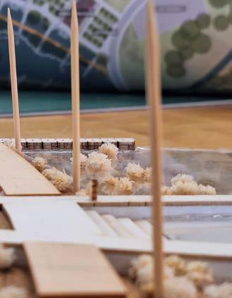
LOCATION: Prince Edward County, Ontario, Canada 43°24’12.0”N 80°21’44.0”W
PROGRAM: Water Plaza Park
SCOPE: Landscape Design Studio
SOFTWARE: Adobe Illustrator
Adobe Photoshop
Adobe Indesign
Rhino7 Grasshopper
ArcGIS
| 2025 | Arch 293 Studio Project
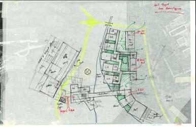
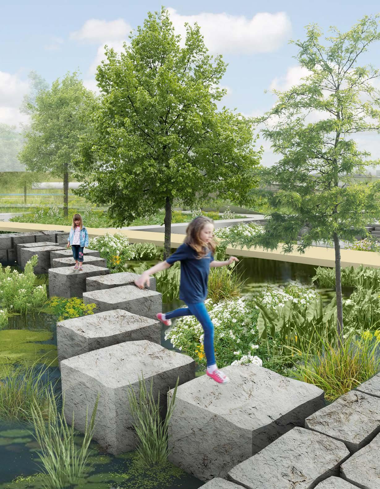
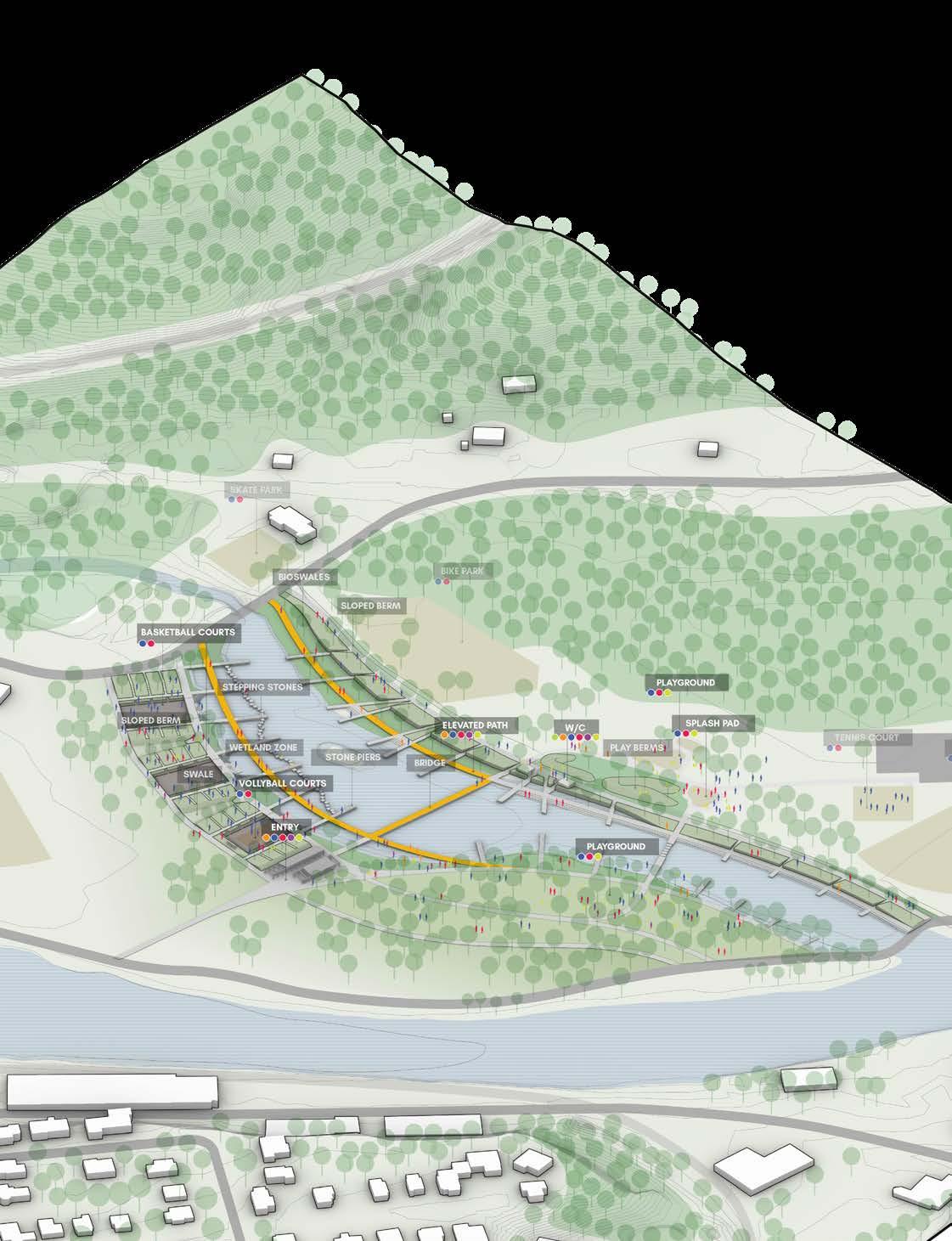
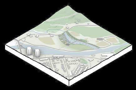
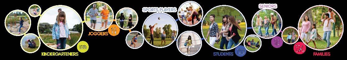
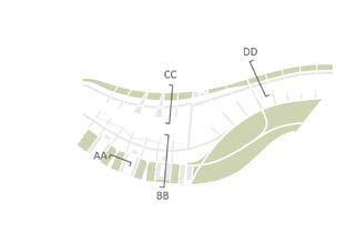
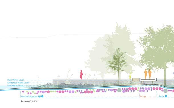
While bioswales, wetlands, and water plazas are well known for their use in natural water management systems, they also represent underutilized sources of potential recreation thanks to the environments they create and the different ways they use water to create unique interactions and spaces. This project shows how several of these design strategies can be incorporated into something as simple as the edge of a small lake, so that over time, it can gradually be converted into a high-activity zone for recreation, ecology, and water management.
Rendering of Exterior
WE
Everyone loves a good splash pad on a hot summer day, but let’s be honest, most of us would think twice before taking a dip in the pond. So instead of going to the water, what if we imagine new ways to bring the water closer to us?
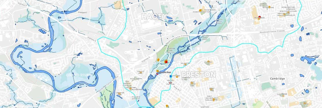
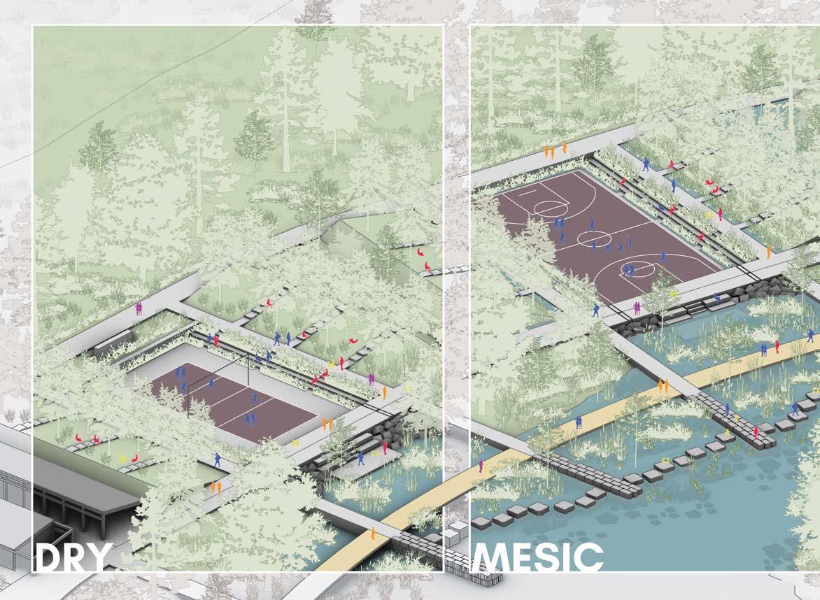
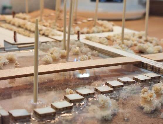
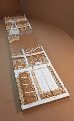
Aqua Rec. Park takes an existing portion of Riverside Park in Cambridge and transforms it into a versatile and adaptable landscape with several opportunities for active and passive recreation near the water. Given the site’s vulnerability to flooding, a water-based design was created to enhance the existing artificial pond, allowing it to retain more stormwater and prevent damage to existing facilities. In fact, this design goes one step further as to add additional amenities such as walkways, steps, and water plazas with dynamic programs that change according to the water level, allowing them to be used year-round.
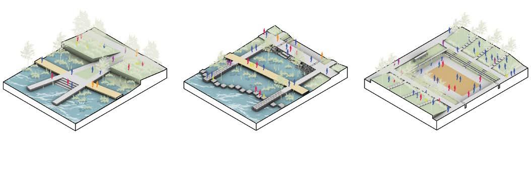
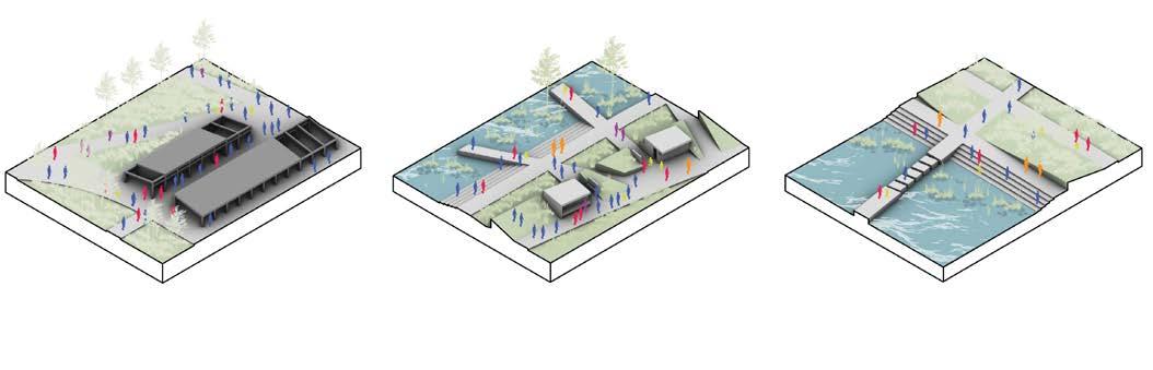
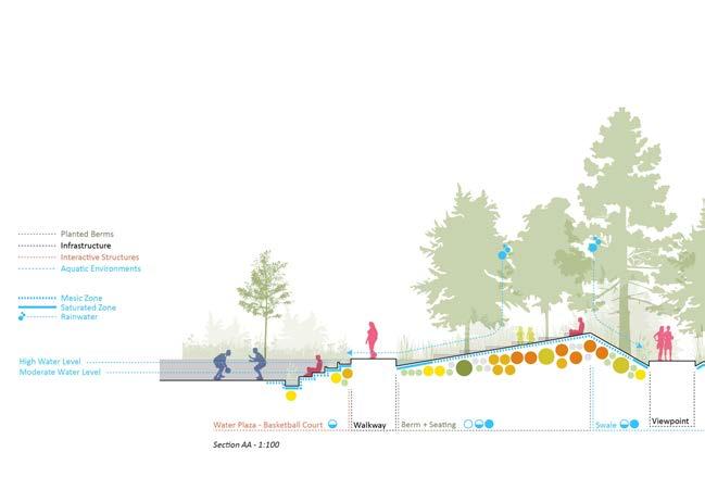
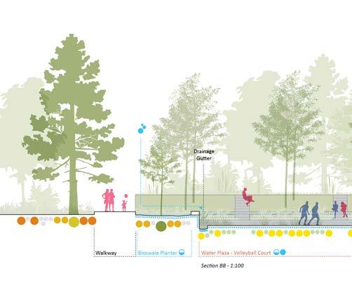
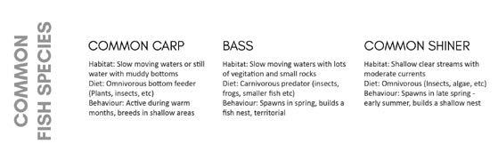
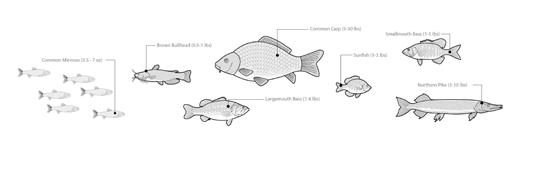

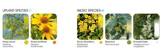
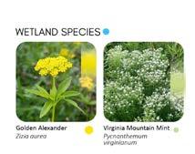
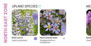
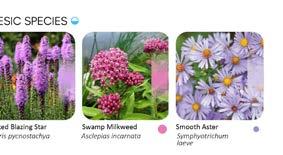
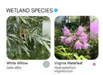
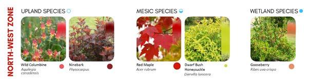
The project incorporates a wide range of plant species, each planted in accordance to their colour and water tolerance. For instance, wet and mesic species are planted at lower levels, within the water plaza sports courts, in bioswales, and various other areas which receive the most amount of water. Colours were also selected to match the program of each area of the park, such as yellow for the active recreation sites to the south and purple for the more passive and relaxing regions to the north.
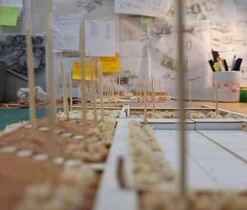
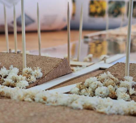
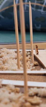
photos
| 2024 | Arch 225 Project
| Selected for Project Reviews 2025
| In collaboration with Morgan Li, Sarah Li, and Ethan Liu
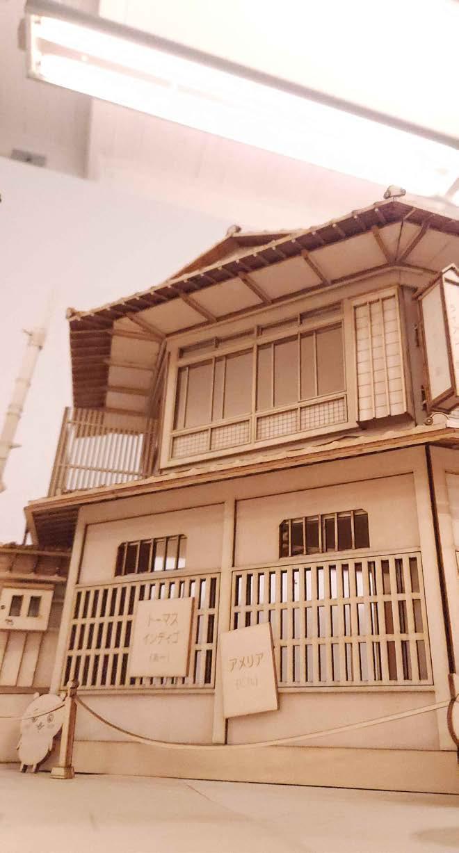
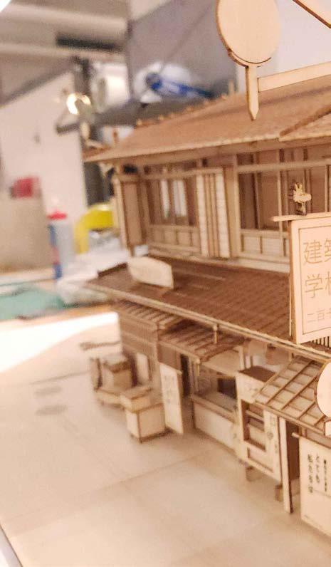
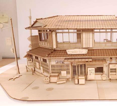
A detailed 1:24 replica of a wooden building in Kyoto, currently used as pitched roof, operable windows, and a fully modeled interior including street model measures 80cm x 50cm x 38cm. Each piece was modelled digitally
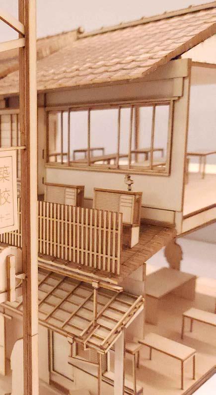
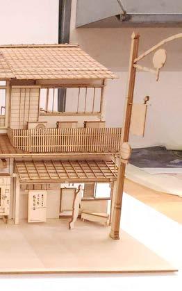
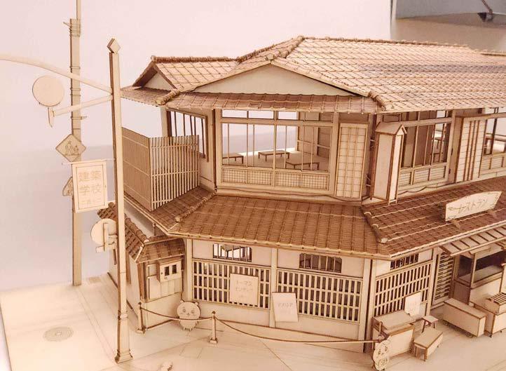
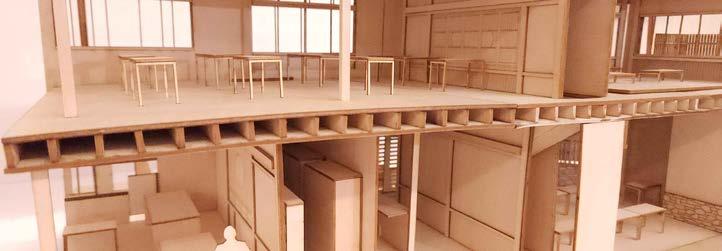
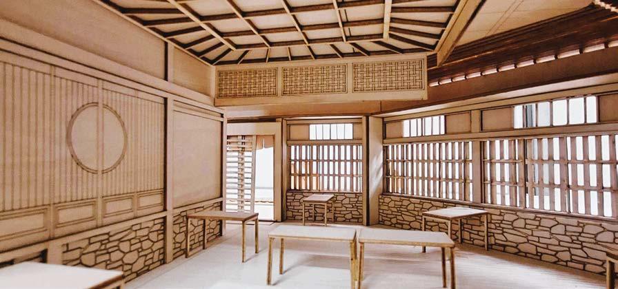
LOCATION: Kyoto, Japan
SCOPE: Replica model
a restaurant. It’s a 2-story corner building with a street furniture and lampposts. The entire size of the in Rhino and laser cut onto basswood.
Digital fabrication
Laser cutting
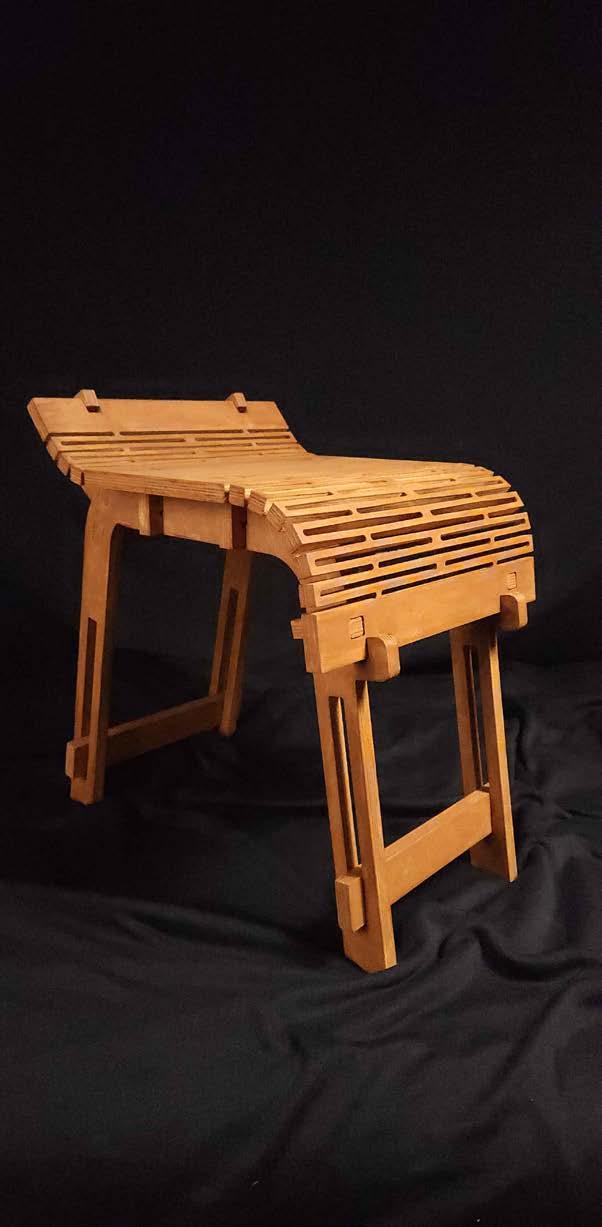
| 2024 | Arch 225 Project
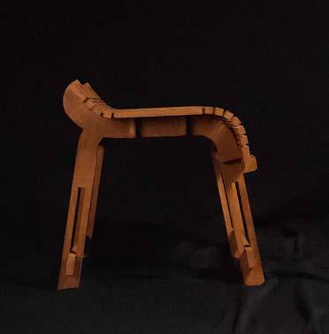


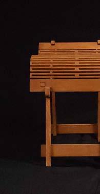
| In collaboration with Morgan Li, Sarah Li, and Ethan
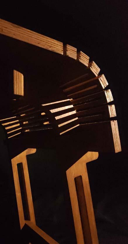
This chair was created using a single sheet of 3/4” with the goal of creating an ergonomic chair using the CNC router, all joints that make up the seat are place without the need for screws or bolts.
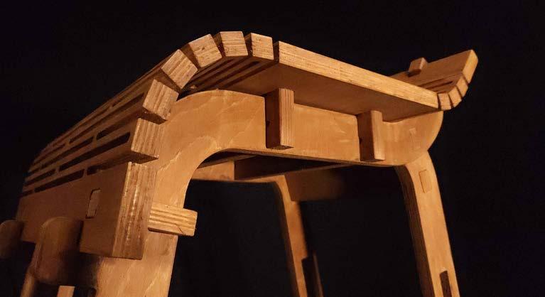
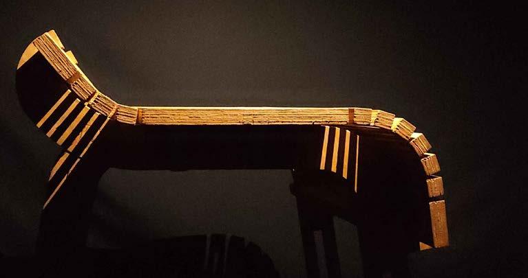
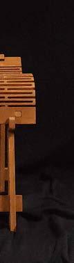
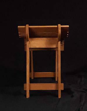
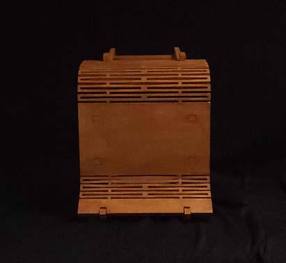
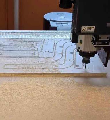
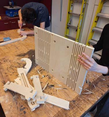
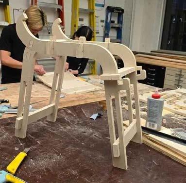
3/4” Baltic Birch plywood measuring 2ft by 4ft long, kerf cutting techniques Thanks to the precision of are friction fitting to remain stable after sliding into
PROGRAM: Chair
SCOPE: Digital fabrication
router
Kerf cutting
| In collaboration with Ben Cheah and Eric Huang
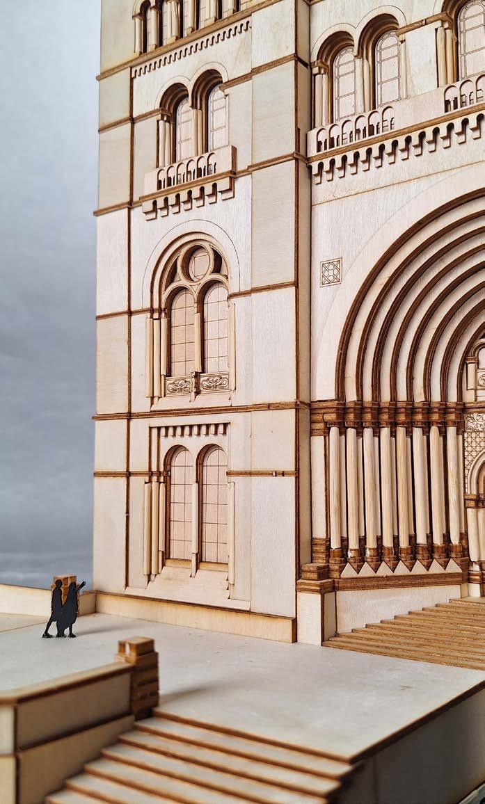
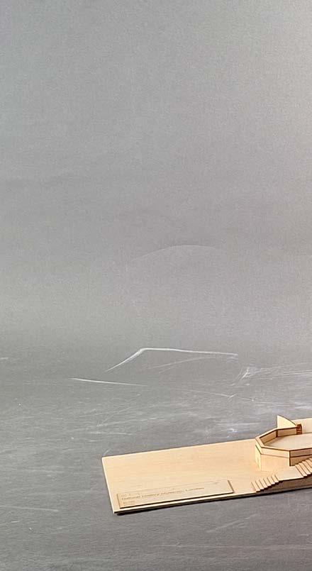
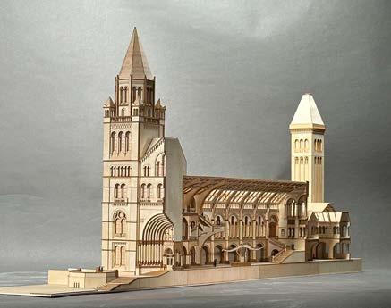
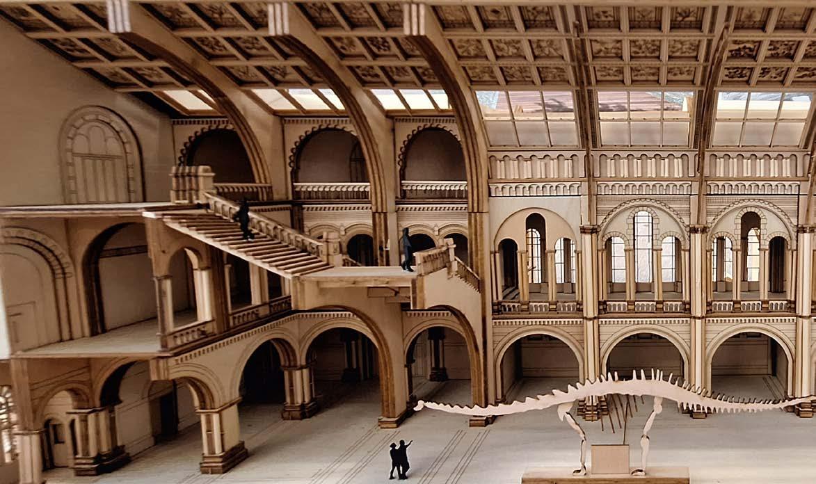
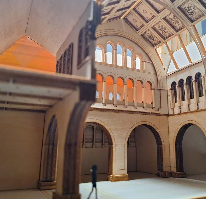
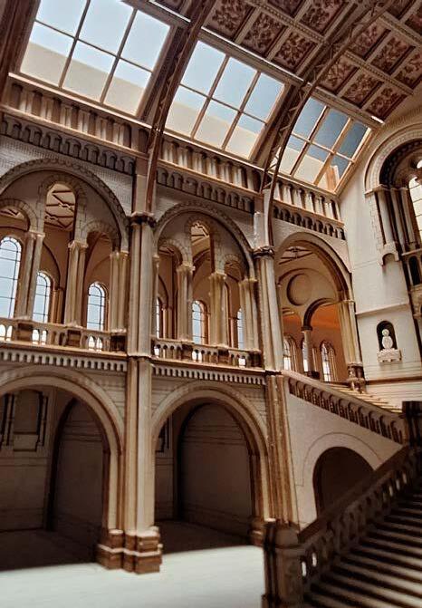
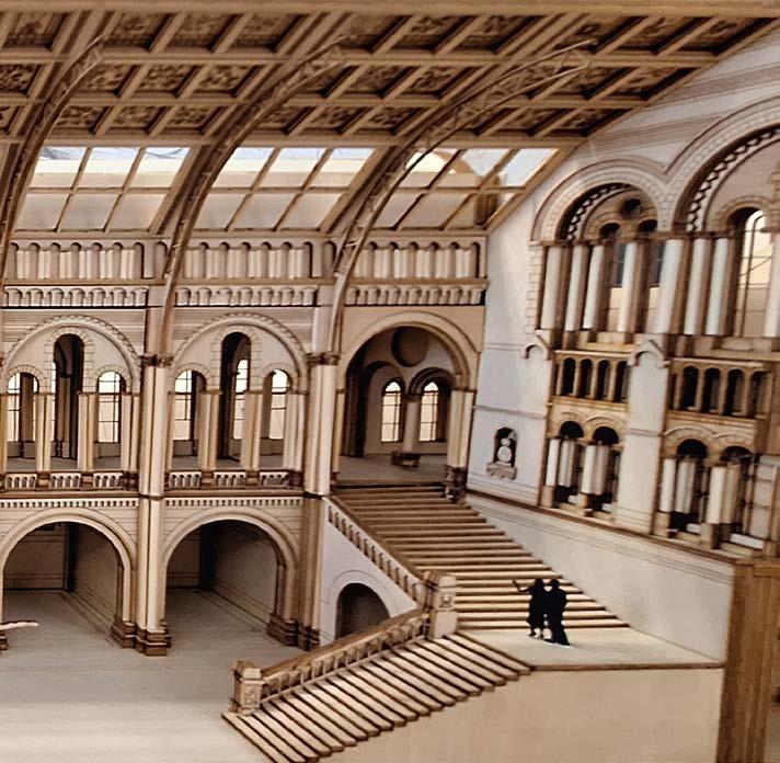
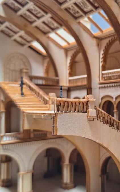
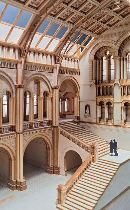
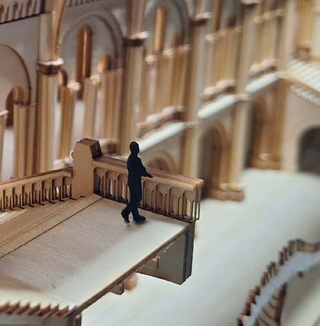
An extremely detailed 1:150 model of the Natural the lack of annotated drawings and numerous undocumented project, we managed to complete most of the modelling every rooftop tile and animal casting with painstaking
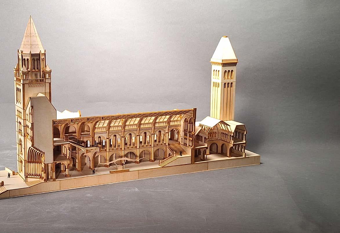
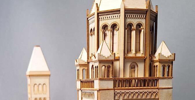
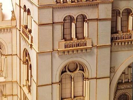
LOCATION: London, UK
History Museum in London, circa 1881. Although undocumented renovations added difficulty to the modelling to our best judgement, accurately replicate painstaking detail.
SCOPE: Replica model
Digital fabrication
Laser cutting
Thank