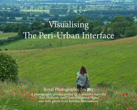
Visualising The Peri-Urban Interface
Royal Photographic Society
A photographic project created by a collective from the East Midlands and Central Regional Hubs and their guests from Benelux International
Visualising The Peri-Urban Interface
Royal Photographic Society A photographic project created by a collective from the East Midlands and Central Regional Hubs and their guests from Benelux International
Foreword Professor Kathryn Moore
Director of the West Midlands National Park Lab, Birmingham City University
UNESCO defines peri-urban areas as zones of transition from rural to urban land uses, located between the outer limits of urban and regional centres and the rural environment. The boundaries of peri-urban areas are porous and transitory as urban development extends into rural and industrial land.
regional design decisions and increase awareness of the capacity of landscape to help meet the 2030 UN Sustainable Development Goals. Based on a new idea of landscape, by comparing and contrasting a broad range of scales and contexts, our case studies are bringing a much-needed fresh perspective to tired, outdated and ineffective practices.
Peri-urban is of course a moving concept. Growth of our settlements, towns and cities will create new edges. Landscape We are helping to address an evident deep-seated need for new ideas and a new approach, particularly in context of the is affected by this change. deepening climate emergency and food security. We are being A recent survey of 10 regions with more than 10 million instrumental in transforming the identity and ambitions of inhabitants reveals “the quality of metropolitan landscapes is a regions in a way that prioritises quality of life, environment blind spot for many regional economic strategies” (Rotterdam, and landscape as economic investments, engendering civic 2016), resulting in “policies that are degrading the living world pride and hope for future generations. on a scale that threatens all of our futures” (Raworth, 2017). Our work at Birmingham City University is redressing this I applaud the Royal Photographic Society collective in their problem by helping to re-conceptualise and transform regions endeavour to create this visual survey of edges that matter to by realising new, holistic and integrated approaches to urban them, in the hope that it will introduce a wide audience to and rural development and change, to underpin strategic these special and often overlooked places.
References Merten Nefs and Vereniging Deltametropool (Rotterdam (2016). Blind spot : metropolitan landscape in the global battle for talent. Rotterdam: Deltametropolis Association. Raworth, K. (2017). Doughnut economics : seven ways to think like a 21st-century economist. London: Random House Business Books.
Unless stated the individual photographers retain the copyright and moral right to their work Text is as supplied by the individual photographers or authors Photography by various photographers, as listed Book Published and Designed by Stewart and Shona Wall Publisher: https://artona.co.uk/ The Former Firestation 8 Mill Lane Caistor Lincolnshire LN7 6UA Published December 2021 All rights reserved. No part of this work may be reproduced or used in any form or by any means- graphic, electronic, or mechanical including photocopying or information storage and retrieval systems- without written permission from the author.
Royal Photographic Society Photographers A photographic project created by a collective from the East Midlands and Central Regional Hubs and their guests from Benelux International David Baxter Margaret Beardsmore LRPS André Bergmans Malc Brown ARPS Nicky Callis MA ARPS Ange Edwards ARPS Anthony Fisher Howard Fisher LRPS CPAGB & Jackie Fisher Richard Hall BA(Hons) FRPS Pamela Harridine Glynis Harrison LRPS Robert Herringshaw ARPS Andy Houghton Steff Hutchinson MA ARPS Sue Hutton ARPS Wendy Irwin ARPS Armando Jongejan FRPS Andrew King
Robert Lavers ARPS Ellie Lilly Nick Linnett John Marris LRPS Sue McGilveray Mervyn Mitchell MA ARPS Carol Olerud FRPS Peter Roworth FRPS Paul Schot ARPS Philip Singleton ARPS Wendy Stanton Andy Thorpe ARPS David Travis ARPS Brian Vollar LRPS Stewart Wall MA ARPS Tim Walter LRPS Heather Nelson & Mark Wheeler FRPS Michelle Yates MA ARPS
Introduction Stewart Wall MA ARPS
Regional Organiser RPS East Midlands and Central Region ‘Visualising The Peri-Urban Interface’ began life at a zoom meeting
in 2020, between myself and two other regional organisers, Rhys Jones of RPS South Wales, and Rolf Kraehenbuehl of RPS North Wales. I am the regional organiser of RPS East Midlands and Central. Rhys and I were keen to create a project open to all RPS regions and groups, as Rhys was keen to initiate a sort of ‘bursary scheme for everyone’ to help them create a body of work and an exhibition. The idea to organise a project was to raise awareness of that desire. Rolf told us about a project he was looking to organise that looked at frontiers/the peri-urban, and this book is the response of the RPS East Midlands and Central Regions and the Benelux International to that project. ‘Zoom meetings’ became the new normal in 2020, as most of us stayed indoors in isolation because of the Covid-19 pandemic. We started the project in August 2021 when people were looking to get out again. All the photographers were asked to work locally and safely to photograph land known as ‘peri-urban’ and then they forwarded their work to me. My wife Shona, a former newspaper reporter and sub editor, helped to produce this book. Some photographers sent in images and words, while others sent in whole page designs. We tried to accomodate their wishes where possible, but felt it was also important to create a cohesive look. This included incorporating background images and black frames around images.
In total, 38 photographers participated in the project, including two husband and wife teams, and they all met pre-determined deadlines. This is not the first time I have facilitated a project like this, and for me, the appeal is watching how a group of photographers respond to the same subject. Their many different approaches demonstrates much about the innovative thinking process. Though widely scorned by academics, Wikipedia remains a universal everyday resource. It defines ‘peri-urban’ as follows: “Peri-urbanisation” relates to those processes of dispersive urban growth that create hybrid landscapes of fragmented urban and rural characteristics.” This is elaborated by academics, Bartels, Bruns and Simon, who described their work on the peri-urban as:“A situated study of uneven peri-urbanisation that resist further dividing Marxist and Situated (Urban) Political Ecology. We conceptualise uneven peri-urbanisation as a process in which access to the resources mobilised for peri-urban developments, such as water or land, is rendered uneven” (Bartels, Bruns and Simon, 2020). As you look through the book I hope you are amazed at how the group of 38 photographers visualised the concept of the periurban, and that you enjoy looking at our photographs. Bartels, L.E., Bruns, A. and Simon, D. (2020). Towards Situated Analyses of Uneven Peri‐ Urbanisation: An (Urban) Political Ecology Perspective. Antipode, 52(5), pp.1237–1258.
David Baxter Stamford Bypass: urban edge The A1 Bypass of Stamford was built 60 years ago. The green space protecting the nearby residential area is gradually being developed, with an earthbank topped with fencing acting as a barrier.
2010 A1 South & Western Stamford showing greenfield site
2017 A1 North with site development
2019 New peri-urban frontier under construction-2
2021 Two areas developed -The third area destined for more housing was planted with wheat
2021 Earthbank and fencing protect the housing
2021 The new peri-urban frontier
2021 No Mans Land between the fencing
2021 Beyond the frontier is extensive countryside
2021 New tree planting on the frontier
2021 Edge of the barrier-2
2021 The bank and fence barrier overpowers the housing
The barrier forms the frontier
2021 The next phase of the building will cover the wheat field
2021 The temporary frontier
2021 You must not cross the urban edge!
2021 The skyline view of Stamford is now of encroaching development
Margaret Beardsmore
LRPS
Ravenhill Park, Staffordshire Ravenhill Park is situated in Brereton, Staffordshire. The park was once a 74-acre farm on the outskirts of Brereton, which was bought by the Council and eventually opened as Ravenhill Recreation Ground in 1954. Since then it has been improved by the addition of playing fields, football pitches, athletic grounds and adventure playground. Over the years it has become surrounded by housing developments and provides a much needed green ‘breathing space’ for the community. In recent years community groups have come together to help maintain and improve the park. My images show a snapshot of work done in 2021 to prepare the park for the school holidays, as structured holiday activities for children were being planned. My interpretation of the peri-urban is to show how green spaces are often cherished and improved by local volunteers. I have anonymised the images to highlight the different ages and genders of the volunteers.
Ravenhill Park
Litter picking
‘the youngest volunteer’
Planting trees
Painting woodland activities
Repainting the park benches
Making a Memorial area
Accurate measuring for the Memorial area
Painting bug houses
Gathering bug house sticks and vegetation
Bug house quality control
Making a woodland walk
Bringing more wood chippings for the woodland walk
Levelling the woodland walk
Ravenhill Park woodland
André Bergmans Windmills in the Dutch landscape The quality of the direct environment of a windmill (the windmill biotope) is always under threat of urbanisation. In my photo documentary I describe Dutch windmills that often used to be in the open landscape but now are in an environment affected by ongoing urbanisation.
The Pale Death
The Stork
The Mix
(various Dutch Windmills affected by urbanisation)
Malc Brown ARPS Thurlby Thurlby, a village on the extreme edge of the Fens in South Lincolnshire, is almost totally encircled by farming, livestock and agriculture, including two Sites of Special Scientific Interest, a wetland and wood. Peri-urbanisation here, is broadly diversification within this activity both past and present, e.g., trees for Christmas and Miscanthus grass for bio-fuel.
Nicky Callis MA ARPS Peri-urban, where urban meets rural and the positive impact rural gives to its urban neighbour. When this project was first discussed, my thoughts automatically led to Kingsthorpe Meadows in Northamptonshire, a place I discovered during the first lockdown in 2020. Kingsthorpe Meadows was purchased in 2009 by the local community, for the local people to enjoy. This space, alive with nature, is where flora and fauna settle naturally alongside urban and industrial landscapes. The National Cycle Path continues, crossing from The Brampton Valley Way over the A5199 into Kingsthorpe, and past Kingsthorpe Meadows. The cycle path runs along the border of the expanding Buckton Fields housing estate, which now is almost a part of Kingsthorpe.A mainline trainline runs alongside the edge of the Meadows, bordering the rural area of the neighbouring community. My research follows the cycle path, the growth of the local housing development, through the Meadows and over the trainline, taking in the people that make use of the area. It incorporates the space and transition that this frontier, of urban meets rural, creates.
Created by the community for the community
Ange Edwards Case study: John Ellis Ltd. Impact of environmental and human interventions on a derelict frontier industrial landscape
A glimpse of the fabric and style of the original building
The ravages of human intervention as nature tries to intervene
Heartbreaking!
Tension …decay v environmental regeneration. Which will prevail?
Anthony Fisher I have lived for 67 years on the Derbyshire/Nottinghamshire border. The landscape is in constant state of flux, constantly changing and evolving. The new industries erode and even destroy the environment especially with deregulation. However, I constantly observe nature, be it natural or people-constructed, searching for a perception of what was. The countryside and the urban are not natural. They have evolved for centuries. The pace has accelerated since the Industrial Revolution. What I see now probably won’t be the same soon. Maybe soon it will have concrete poured over it, and built on. For the “now moment” we enter the twilight zone.
Revelopment: Ripley, Derbyshire
Hollington, Derbyshire
Jackie Fisher & Howard Fisher LRPS CPAGB Nottingham City Airport development area
Nottingham Airport was opened by Nottingham City Council as the second municipal airfield in the UK in 1929. It was situated on Tollerton Lane, Tollerton, in a rural setting five miles outside Nottingham, on land bought by the Council from Sir Albert Ball, the father of the World War One air ace, Albert Ball, VC. The airport hosted commercial airlines flying both internally in the UK and to the Continent but in the early 1930s a lack of investment saw it gradually lose the commercial work and become an airfield used only by flying clubs. For a few years Rolls-Royce Ltd. used it for testing purposes before moving to a military airfield at Hucknall which was more secure for their secret military work. In 1938 the Air Ministry leased some parts of the airfield for the erection of hangars for aircraft repair and assembly and for facilities for an RAF Elementary Training School for aircrew. When the Second World War started the airfield was taken over for military purposes. As well as the work on aircraft it was used as a subsidiary to RAF Newton as a training airfield for aircrew because, unlike Newton, it had been given hard runways in the late 1930s and was suitable for use in wet conditions and for night flying training. When the airfield was decommissioned by the Government in the 1950s it was purchased by private companies which used it for flying services and flying clubs. Some commercial purposes were established using the ex-military hangars. In recent years the old hangars were demolished and replaced with modern ones and larger units for commercial use. In the past few years a new private hospital has been built on the site by Spire Health. However, the airfield is still used for private aviation purposes whilst these developments take place as well as flying training on light aircraft and helicopters. It still remains in a rural setting with only three large houses on Tollerton Lane opposite the entrance and a mobile home site where one of the military hangars was situated. Rushcliffe Borough Council, in accordance with Government requirements, has had to find land for new home building within the borough. One such site is at Tollerton adjacent to the airport. Consequently, outline planning consent has been given for a large number of houses to be built on land around the airfield. Phase one of this development will be built almost completely surrounding the airfield and a possible phase two will swallow up the airfield which will cease to exist. There is a fear in the light aircraft community that even phase one will have a big impact on the use of the airfield for flying purposes because of houses being situated right up to the boundary of the airfield. Our project has been to record the airfield and the land on which housing will be built to record the shift from a rural to an urban setting which will totally change the complexity of the area.
1
2
3
4
5
6
7
8
9
10 Captions
1 The entrance to the airport. The unit in the background is built on the site of a WW2 hangar.
7 These fields looking towards Nottingham will be built on.
2 The Spire Hospital built on part of the airfield.
8 The houses on this western part of the development will be under the airfield flight path, how will the residents react to the noise?
3 The northern boundary of the housing development is the Grantham canal.
9 Three large 1930s built houses will be surrounded by the new development.
4 These fields alongside the canal, looking towards the airport, will be built on.
10 This pill box behind the control tower carries a memorial to men killed in an air crash in WW2. Behind is the clubhouse of the Sherwood Flying Club whose adjacent hangar was erected shortly after the airfield first opened.
5 The airfield is surrounded by a ring of WW2 pill boxes, some of which are listed structures and unique to this airfield. Will they be retained in the development? 6 The mobile home site will be surrounded by new housing.
11 The memorial plaque on the pill box shown in 10. Will it survive when the airfield is built on? Will it be moved elsewhere?
Richard Hall BA(hons) FRPS Exploring and maintaining the peri-urban Caythorpe and Frieston are conjoined Lincoln Cliff villages situated eight miles north of Grantham and consist of around 500 households. The villages are rural, and the gardens at the edges of the settlement largely border farmland. To the west on the other side of A607 is a recycling centre on the site of the former Caythorpe railway station. The railway was opened in 1867 to transport locally mined iron ore. Beeching closed the railway station and line in 1965, and the former rail line to the north of the station is now a permissive right of way. In 2011 the district council encouraged a Walking for Health group to start in Caythorpe. The Lincolnshire Cooperative Society now sponsors the group. The group meets every Monday at the village playing fields and walks for between 60 and 90 minutes. Pre-pandemic, the numbers of walkers averaged 30-40, although, on resumption, the numbers have reduced to 20-25 per week. The group is split into the Striders, Strollers and Stragglers. They cover up to 30 different routes and distances to cater for the abilities of the walking group. Walkers are free to decide which of the groups is for them, and each group features two trained walk leaders. One of the walk leaders is Emeritus Professor Gordon Grant, who specialises in cognitive disability. Gordon has published well over 100 papers in his career, three of which cover the physical and mental benefits of walking for health. He strongly advocates its importance. An important by-product of the group is the exercise of public access rights over the footpaths, bridleways and permissive rights of way surrounding the village. The group generally has good relations with local landowners. It communicates problems with access and maintenance of stiles to Lincolnshire County Council, which is ultimately responsible for maintaining open access for the public.
Towards the recycling centre
Back towards the village
Love Lane
Typical village boundary
Towards the recycling centre
Tight formation
Back markers
The Striders group
Pamela Harridine : Welcome to Evesham A journey into the peri-urban area of the A46 bypass
The journey starts at the southern entrance to Evesham, where the football ground holds back further housing development.
Vale Business Park - the local area once famous for its fruit and veg, now remembered in the names of the roads.
Previously a nursery, growing and selling Christmas trees, awaiting development into a lorry park
Hotel, restaurant, service station and drive throughs, bordering the edge of town to the north
The Valley - Evesham Country Park The final frontier Once a small farm shop, but with each change of name, further developments ...
Glynis Harrison LRPS The edgelands of Smith’s Wood in the West Midlands Smith’s Wood forms part of the huge Chelmsley Wood housing estate build of the late 1960s early 1970s to rehouse families living in the ancient, squalid housing of Birmingham. With clean, warm homes and modern shops and transport close by, it was the cutting edge of modernity. The edge of Smith’s Wood, where I live, is bounded by Auckland Drive, a main access road for the estate. Alongside is the Collector Road (A452) and then the M6 Motorway. One would think that the road noise is unbearable, but the Council has built a bank which not only forms a sound barrier for Smith’s Wood, but also provides a lovely, green area for walkers and families to use for picnics and exercise. I call this area the Ridge. The Ridge stretches the whole length of Auckland Drive and also contains a cycle path. There are some rights of way from Auckland Drive across the Collector Road and over the M6, which are much used by the locals. They lead to rural fields that are actually in Coleshill, Warwickshire. Within minutes we have left the West Midlands and are now in Warwickshire! How lucky we are to have these rights of way that provide walking access to the countryside in no time at all. However, in the distance is yet another motorway, the M42. It might seem shocking to have these huge roads on our doorstep, but they form necessary transport links for food and the requisites of modern living in today’s UK, including visiting friends and relatives. From Smith’s Wood one can be on a motorway within ten minutes of leaving home! Together, the M6 and M42 form an edgeland island of fields before you reach the town of Coleshill. On one of my walks, I discovered an unusual building that intrigued me. It looked almost like the top of a castle peeking over the trees, but it couldn’t be! A little bit of online research showed that it is Coleshill Manor, now called Coleshill Manor Office Campus, where office space can be leased. What an interesting edgeland we have! Not only that, I discovered that plans have been passed for huge national memorial called the Eternal Wall of Answered Prayer https://www.eternalwall.org.uk/about-us and next to it, a Surf Park! Yes, you read correctly, a Surf Park is coming to our edgeland island just across from Smith’s Wood! https://www.birminghamupdates.com/plans-unveiledfor-25.../ This area certainly will be springing to life in the next few years. Visitors will not realise they are on the edge of what was the largest housing estate build in Europe in the 1960s-70s! I can’t finish without mentioning another major transport link being constructed that will cut through the edgelands. This is the famous, or infamous, High Speed 2 (HS2) rail link which will initially connect Birmingham and London. Whether you like these major transport links or not, they are so necessary for modern life. I know our planners take considerable efforts to protect our green areas but we have to consider the country’s needs as a whole. However, there will always be peri-urban edgelands in one form or another. It comes with having a vibrant, ever-changing and demanding population!
Robert Herringshaw ARPS Reframing the new peri-urban: Shipston on Stour, Warwickshire
In his treatise ‘A Topographical Dictionary of England for 1848‘, Samuel Lewis drew particular attention to Shipston-on-Stour, as being a town of great importance. Significant because of its Sheep Market and for the facility of being able to wash wool in the River Stour. Simply, ‘Sheepstown‘. In the post-medieval period, coaching inns in the Market Square were also a popular resting place for travellers on the road from Stratford-upon-Avon to Oxford and beyond. They are still popular today. ‘Shipston’, as it is known locally, sits in a bowl. The town itself is situated alongside the London Road and the River Stour and is said to be ‘the Gateway to the Cotswold Fringe.’ Sitting on edge of the rim of the bowl to the north west, was once a factory site belonging to IMI Norgren. A company decision in the noughties to relocate to Europe saw its demise as a manufacturing base. Setting aside the loss of employment, aesthetically its demolition seemed now to be no great loss. However inevitably with the demolition, came planning applications for housing on the brownfield site. After several minor skirmishes and a referendum, permission was eventually granted. As one inquiry pointed out, the visual impact would probably be an improvement, even though the proposed location was technically outside of the settlement boundary; a delicate balance. However it would appear that this was just the precedent that developers (collectively) were hoping for. Planning applications for adjacent sites on the eastern fringes of the bowl were quickly sought. All received planning approval for housing, and seemingly, all according to the Shipston-on-Stour Neighbourhood Plan. Whilst there would appear to have been a degree of control, has a new peri-urban interface been reframed or engineered in Shipston? In one quarter, the attractive sounding ‘Herdwick Gate’ and ‘Herdwick Fold’ emerged, no doubt the products of marketing gurus. Why wouldn’t you choose to live there? The developers appear to have ‘ticked all the boxes’, all in line with the Shipston-on-Stour Neighbourhood Plan. But inevitably there are the critics. Contained within, https://www.stratford.gov.uk/doc/208321 “The town has expanded outwards, the built area has encroached upon the slopes, to the point where the ‘bowl like’ setting has arguably been compromised.” And further, perhaps a word of caution, “Certainly it is hard to identify locations for further upslope development that would not harm the character and setting of the town.” And a word of regret, “The poor design and materials of some peripheral buildings has not helped as they are widely visible”. One is left to make one’s own judgement.
Bland Grove
Cotswold Fringe
Not a chimney pot too high
Children’s playground
Gateway from the peri-urban to the urban extention
The Horseshoe
Sheep Street
Shipston Bridge
Sheep in shop window
Stone sheep
Norgren Crescent
Andy Houghton The urban fringe around Sleaford contains several renewable energy generation facilities. But what is the visual impact of these sites, and the accompanying power distribution network, upon the peri-urban landscape, and to what extent does this complement or contradict their broader environmental benefits?
Steff Hutchinson MA ARPS Old Town ways As you travel through the town by road, you might miss them, but those who live in the Old Town area of Leamington Spa, are very aware of the three routes that bisect the town from east to west: the river, the canal and the railway. Each brings a ribbon of countryside into the town along its banks and embankments, but each also brings its own character. The river is no natural watercourse, but was artificially widened in the 1860s, creating a carefully curated corridor of nature reserves and parks through the town’s centre to promote leisure and recreation. The railway sneaked into the south-east edge of the town in 1852, arriving through a cutting but then rising austere, haughty and inaccessible, leaving the townspeople to go about their lives beneath its many archways and bridges. The canal, though, was the first to arrive in its current form, in 1799. It was, and remains, a workaday place, running past both the familiar and the forgotten, a pathway to work, shops, the pub and home.
Sue Hutton ARPS The changing boundary of Shepshed The M1 motorway marks the eastern boundary of Shepshed, and has transformed the town into a dormitory suburb serving Loughborough, Leicester, Derby and Nottingham. New housing has more than doubled the population and removed rural amenity. The contractors have not provided new services such as schools or health centres. Flooding and noise pollution remain a concern.
Looking west from Tickow Lane, 9th June 2013
The same view, 17th August 2021
Poppies looking north from old railway line, 2nd July 2017
The same view, 17th August 2021. Same tree as in 2017
Tickow Lane marks the western boundary of Shepshed
Motorway fence
This estate lies right beside the motorway. Noise pollution from the M1 is very loud. Fence protection seems very flimsy.
Proximity to Fence
Flooding risk Built on a flood plain Collapsed gabion in watercourse Vegetation congested watercourse (Left page)
Flooding and drainage Housing just above brook. Flooding cuts off a main access road out of town Soil is heavy clay that retains moisture All new estates have holding ponds often outside front doors (Right page)
Wendy Irwin ARPS Along our rivers and canals there are many industrial buildings which give a glimpse of the past. Strips of land and water join countryside to our urban sprawl. Often nature is taking over spilling through spaces which once were windows and doors. Images show the ever-encroaching greenery, softening the edges and adding textures to make a “looking through rose tinted glasses” image.
There is a website linked to the Biennial https://www.britishceramicsbiennial.com.
Armando Jongejan FRPS Großarl - Austria
The ski areas in Austria are well known by winter sports enthusiasts. During the summer months some lifts and cable cars are open for hikers and bikers. The unused facilities between the villages in the valley and the top lift stations makes a surreal impression.
Andrew King The A38 runs past the city of Derby and the peri urban Markeaton Park, which itself leads into the wider Derbyshire countryside. Where park meets roadway, and meets urban living, is a roundabout at the centre of a colossal highways infrastructure project that will have a lasting and hugely disruptive impact on the park and its surroundings. Plans to widen the A38 to increase traffic flow will result in the removal of habitat for wildlife and trees as old as 300 years. Throughout this project I focused on the immediate border of the A38 itself at Markeaton Park and its overpass footbridge. These images document the parts of the park and city that immediately face it. Rolling grass, beautiful hidden wildlife and dystopian abandonment of compulsory purchased homes.
Markeaton Park from below the footbridge leading to the city of Derby
Markeaton Park from above the footbridge over the A38
Markeaton Park from the footbridge over the A38
Footbridge over the A38 linking the urban area of the city of Derby to Markeaton Park
Both sides of the A38 are home to hidden wildlife and water
Either side provides tranquillity that almost makes you forget there is a busy dual carriageway mere yards away
Campaigners to stop the works have marked the at risk trees with red ribbons and banners to raise awareness and highlight how much will be felled
Houses now abandoned under compulsory purchase order sit boarded up, creating a sense of dystopia next to such a thriving parkland and busy entryway into the city
Robert Lavers ARPS Wellesbourne Mountford Airfield Opened in 1941 on former farmland outside the South Warwickshire village of Wellesbourne, for RAF Bomber Command it was from 1948 the home of the RAF School of Photography until returned to the original owners in 1964. Currently in use over a reduced area as a private airfield with flying schools it is also home to Avro Vulcan bomber XM655, a wartime museum, a café and a weekly market. Plans to redevelop the site threatened to close these businesses and volunteer groups until legal action secured their leases and the local council initiated compulsory purchase proceedings. This has led to a Memorandum of Understanding requiring the owners to maintain the site but also allow release of parts of the site for other uses.
The recent events mean that businesses have been reluctant to invest in building improvements so carry on in semidilapidated structures, with the Coronavirus pandemic adding to their woes. The sense here is that a skirmish has been won but that the battle is far from over with the uncertainty blighting the site for the foreseeable future.
Ellie Lilly Soil to table For my take on peri-urban I have focused on the pockets of rural spaces within the urban environment. With this as my remit I have focussed upon community gardens, allotment spaces and a food bank, who donated food and cook to feed the community. My contribution is called, “Soil to table”. These spaces offer so much more than food though, and aid wellbeing by; enabling people to connect with each other, be physically active, learn new skills, give to others and enjoy the present moments.
Nestled on the edge of Walsall town, next to the electric works, a patch of land lies, home of Borneo Allotments, a space which is a real urban oasis. What strikes you here is the real sense of passion for what they do; caring for the environment, nature and each other. A real sense of ‘being a part of a village’ is how one member described it. Nothing is wasted here; the fully equipped kitchen is a vital part of residents’ meetings and also used for hosting external meetings and get togethers. The kitchen is furnished with donated units, which would have gone to landfill, and is equipped with glasses, crockery etc. that was intercepted at the tip. There are compost areas, of differing stages of composting, which is all used. Some waste fruit and vegetables donated for compost, if still in good quality condition, are rescued at this stage. Whilst I was there we enjoyed a lunch of foods produced on site but also a delicious
cake which included strawberry jam made from strawberries that were destined for the compost heap. During lockdown Borneo took in locals’ brown bin waste, and accepted donations for doing so. These funds were put to use buying a table and chairs, made from recycled bottles to adorn the bee garden. The bee garden is a beautiful nature space, created from the hard work of clearing an area, once used by the railways. Now a nature pond sits there and the trees have reached the correct height for the next stage: the shrubs and undergrowth areas to develop, creating a haven for insects, which sadly are in dire decline. There is a desperate need for these to increase in this country. The centre contributes greatly to the community, not only for those with plots, who benefit from the products they produce, wellbeing and support from each other, but to the wider community in charity raising events, and products supplied for the community.
Nick Linnett Red Hill Circle & Watermead Way Red Hill Circle and Watermead Way form part of the Leicester ring road and are literally on the edge of Leicester - a few steps and you are in the country. The ring road ploughs its way around the city, carrying thousands of cars every day. I have been photographing at the edgelands of this concrete river, where the urban and the natural worlds meet.
John Marris LRPS For my interpretation of ‘Peri Urban’, I turn to yesteryear around my home of Scunthorpe. In the west, The King George V Bridge, also known as Keadby Bridge,takes the A18 over the river Trent. The bridge opened in 1916 and was the largest of it’s type in Europe. The lifting section weighs 3000tons. The electric power was provided by a diesel generator which was replaced when Keadby power station came on stream in the 1950’s. The image of the overgrown stone work is the eastern pier of the original rail swing bridge. On the eastern edge of the town is the large and dominant steel works which is surrounded by old open cast ore mines now utilised as trading estates, allotments or, in this case, filled with water and being reclaimed by nature. This image shows a modern blast furnace in the background. The stone wall marks the parapet of a bridge over the rail tracks which carried the iron ore under the A18 to the furnaces. Travelling further east along the A18, there is a dual carriageway built to divert traffic away from Motlash Hill. The first part of the old road is now a lay-by and truck stop. The route climbs up Ravensthorpe Hill to a field where, when I were a lad, I saw sheep grazing, but now stands a foreign financed solar farm. Crossing the dual carriageway we come to the notorious Motlash Hill where nature is trying to reclaim the road.
Sue McGilveray A Gateway to the Peak Ashbourne is a small town with a population of around 9200, situated in South Derbyshire at the southern edge of the Peak District National Park. As such it is a ‘gateway to the Peak’ but this also limits the growth of the town in a northerly and north westerly direction. To the south west, development is curtailed by the presence of a ‘bypass’. A number of new housing estates have been or are in the process of being built, especially towards the east of the town, but there are still some ‘green fingers’ that protrude in towards the town centre itself. To the south east of the town, there is a large industrial estate which fringes a disused airfield where more housing is in the process of being developed. To the north lies the sewage works, allotments, a cemetery and out of town shopping in the form of a small Aldi supermarket, with a view of the Peak District hills behind.
Mervyn Mitchell MA ARPS Walking through Sharphill Wood Sharphill Wood is the closest patch of countryside to Nottingham City Centre. It is located on a ridge above Trent Bridge and West Bridgford, a place where walkers (plus dogs) have been hiking and enjoying wide views across Nottingham and Nottinghamshire for many years. Formerly known as Sharps Wood in 1774, it has been the central fixture in the surrounding greenbelt, however since 1993 locals became aware that Sharphill Wood and the greenbelt surrounding it were under threat. Today that threat has come to fruition, but through the campaigning of local residents the wood has been spared and classified as a wildlife reserve. However, a housing development and infrastructure are underconstruction on the eastern edge of the wood and future development is planned on the northern edge. The tranquility of walking in the country, with a 360 degree hilltop view of surrounding countryside has been diminished. As one glimpses through the foliage you now see the urbanisation taking place; houses, construction equipment, roads and cars, which spoil the serenity and feeling of escape previously experienced. My photographs are a collection of images which illustrate this encroachment, countryside views from the wood and details within the wood that have caught my eye.
Carol Olerud FRPS The Nedereindseplas The Nedereindseplas is now a recreational area between the cities of IJsselstein and Nieuwegein in the Province of Utrecht. It is used for recreation such as walking, running, cycling, (artificial) skiing and dog walking. It is located next to farmland, highway and residential areas. Fishing is also permitted but swimming is forbidden. It began as a sand mine in 1932 for the building of the Highway A2 and later also for the development of the City of Nieuwegein in the 1970s. It became known as the ‘Put van Weber’ a dumping ground for building rubbish. However, it became an illegal dumping ground for chemicals, hospital refuse, including radioactive materials, barrels and human rubbish. Plans were made in the 1990s to create a large (water) recreational area here, to clean up the now water filled ‘lakes’. A swimming and water-skiing area was developed but shut down within years. The water is poisonous. It is 30m deep. It’s been renamed to the Nedereindseplas, coming from an old road nearby of the same name and has become a lovely nature area. Birds, ducks, swans and possibly fish (can’t eat) populate the area. It’s very pretty and is on the border of farming land. Cows graze in summer in the stretched out straight fields close by. Recreational activities bring many people here and the view of farming land on the western edge suggest a large sense of space. It’s also a shortcut between the two cities for cyclists or scooters etc. My photos aim to show the use of the Nedereindseplas today as a recreational area and a peaceful place to walk around where you feel nature is close by. The hustle and bustle of the nearby cities seems far away.
Peter Roworth FRPS Space Invaders: Plants of the peri-urban landscape Plants that colonise the peri-urban landscape are opportunists; most are prolific seeders that can establish quickly on any available ground in this ever-changing interface environment. Native and alien species can be found, with seeds spread by the wind, by birds and animals, and on the wheels and tracks of vehicles. Many require just the smallest of gaps in hard surfaces, growing in cracks in tarmac and concrete; others take advantage of bare or abandoned ground and can flourish for a number of years until their sites are developed. Some are scramblers taking full advantage of the temporary support of security fencing or heaps of rubble. All exist in a chaotic state of abandonment in semi-natural or artificial habitats, away from the control of man.
Common Ragwort
Bristly Oxtongue
Biting Stonecrop
Prickly Sowthistle
Goldenrod and Buddleia
Buddleia
Great Willowherb
Herb Robert
Teasel
Common Mallow
Field Bindweed
Hedge Bindweed
Hogweed and Common Knapweed
Traveller’s Joy
Paul Schot ARPS Amersfoort Foodcourt Amersfoort Foodcourt, named after the city, is situated well outside the centre, separated from the suburbs by the dominant A28 motorway, and on what until recently was a rural landscape. The grass immediately near the buildings is manicured, with remnants of the peri-urban environment still visible. Lorries pass en route to the co-located warehouses.
Philip Singleton ARPS A zone of transition My practice has long been enthralled with the in-between. The context of peri-urban is thus worthy of exploration because it is that shifting place of uncertainty, a zone of transition. I have chosen to focus on infrastructure and its divisive impact on place. My local motorway is the object of my gaze – a human-made edge.
I am torn by the perversity of driving on holiday down the M5, yet lamenting its impact on the places in the Midlands where I walk, cycle and perambulate along with my dog, taking photographs. Motorways carve up the earth and facilitate high speed movement - a sign of economic success that creates a destruction all of its own.
The M5 is captured here with only a hint of the traffic. The scale and width of the carriageways are familiar, yet the scars are palpable. Edges made by this landscape intersect. Bridges magnify the crossing points that were once lazy lanes.
A street terminated, dominated by a once new edge; the viaduct. No continuum, instead a strident structure. Dead end. Your gaze may leave you with an imagination of the rush, the noise, the invisible haze bearing the pollutants. Relentless.
This edge. No peace. No light. No air. Disappointment
Wendy Stanton Sharphill Wood: Victim of peri-urban development Sharphill Wood is an area of countryside, close to Nottingham City Centre, which was surrounded by agricultural land, bordering the A52 and the A606, on the edge of Edwalton and West Bridgford. The artist Hilda Smart, who lived on Boundary Road, captured the serenity and beauty of the woods in this painting ‘Late Snow in Sharphill Wood’ from the 1920s. Formerly greenbelt land, repeated proposals for large scale housing developments and associated fast food outlets, have been approved despite years of protests. My images reflect the passion of the residents to preserve this area of natural beauty and the impact of the development over a period of 13 years. I should like to acknowledge Chris and David Turner and Sara Dellar who gave permission for me to include early photographs, and to Rod Jones who has been instrumental in establishing 9 Rights of Way on, and through, Sharphill Wood.
Photographs of the wood, surrounded by agricultural land and showing the proximity of Sharphill to Nottingham 2007
The wood is valued for recreation and the promotion of good mental health, which has proved particularly important during the Covid lockdown Summer 2021
Keep out!
People protest
Builders move in
The peri-urban vanishes
Andy Thorpe ARPS A456: Hagley Road/Manor Way (Halesowen Bypass) The three mile section of the A456, between M5 junction 3 and where the boundary between Worcestershire and the West Midlands crosses it, forms a distinct boundary between urban Halesowen to the north and the countryside to the south. There are however some land uses immediately to the south of the road whose viability probably relies on their proximity to the nearby urban area. The existence of some may pre-date the road, but further development in this periurban area is unlikely due to its designation as Greenbelt; the road forming a convenient boundary to start this from. Any extension of the urban area across the road would however be severed by it; severance already being an issue for some of the land uses shown here due to high traffic speeds and few convenient crossing points.
1. A456 Looking west from M5 Junction 3
2. Shell Service Station
3. The Black Horse public house
4. Halesowen St John Ambulance
5. Entrance to Halesowen Athletic & Cycling Club
6. Halesowen Athletic & Cycling Club track
7. Somers Sports & Social Club
8. Doggy Daycare
9. Entrance to Halesowen Golf Range
10. Halesowen Golf Range
11. Woodview House Care Home
12. The Green Nursery
13. Office building
14. Causey Farm Road and WM/Worcestershire Boundary
15. Abbott Road and West Midlands/Worcestershire Boundary
16. A456 Looking East from WM/Worcestershire Boundary
David Travis ARPS The canal system Many parts of the canal system are left in a state of decay, putting it at risk of gentrification and development. By demonstrating how they connect us to nature, I hope my photographs raise awareness of the importance of canals both to wildlife and to our mental and physical health.
Brian Vollar LRPS East Midlands Gateway Five years ago, it was mostly green space and farmland on the edge of Castle Donington and close to Kegworth; within easy reach of the large urban conurbations of Derby and Nottingham. With astonishing speed, many millions of pounds of private investment and with central government support the site has been transformed into one of the largest logistics distribution centres in Europe. Whilst much of the site is completed with major companies now operating there, including Amazon, Nestle, XPO Logistics and DHL, some of the land is still available or under construction. My set of images record the current state of development of the site and explore its impact on the environment and public space.
Stewart Wall MA ARPS Hazel & the Lions on the Waterhills The Waterhills is an ancient piece of land on the edge of the urban build of Caistor, near where I live. It is managed, so that local farmers and residents can graze their horses and cows on it. People from miles around travel to walk on it, for pleasure, exercise and enjoyment. Historians tell us that locals once got their water from the many fresh water springs on it, and that the Romans used it as a natural defence for the fort they built in Caistor. The area is now under threat from developers, as the new Local Neighbourhood Plan opened the door to a planning application to build houses on the land. But my project for this publication is not about the politics, or history, it is about today. It is about a young person called Hazel who has teamed up with members of the local Lions group to develop a community allotment on the Waterhills. She is also being helped by Pam and Alastair, and other members of the Rock Foundation, which is based in an old coaching inn on Waterhills. The Rock Foundation is a front-line charitable organisation that has created a new provision for young people and adults with learning disabilities and those who are disadvantaged. As Hazel and the Lions develop the community allotment, they investigate how best to grow things in our backyards, or in this case on Waterhills, our local strip of peri-urban fringe. My interest is to observe the social cohesion of a resilient community that is brought together by an interest in growing what humans need to survive. I would argue that in the case of Hazel and the Lions on Waterhills, it is healthy toil to tend the land and create fresh food provision that enhances mental wellbeing.
Tim Walter LRPS From quarries to conservation in Shropshire The development of new housing and infrastructure is progressively enlarging the town of Bridgnorth and creating demand for sand and gravel from land that had been in agricultural use. The land is now being quarried and will next be managed for its environmental and amenity value.
#just1pic #dailyphotowalk #therapeuticphotography #behaviouralactivation #lockdownexercise #dailywalk #mindfulphotography #mentalwellbeing #staypresent #creativementalhealth #getoutside #dailyphoto #photographiethérapeutique
Heather Nelson & Mark Wheeler FRPS Walking locally away from urban centres reduces risk of Covid-19 contamination and increases opportunity for exposure to nature. To create just one picture on a phone becomes a focus for a walk, looking carefully in the present reduces anxiety. Mark & Heather posted images on Instagram to encourage others @phototherapymark. The Insta syntax is reminiscent of the colour prints from Kodak 126 cartridge film, once the gateway drug for photographers.
#getoutside #dailyphoto #photographiethérapeu tique
#just1pic #dailyphotowalk #therapeuticphotography #behaviouralactivation #lockdownexer
#getoutside #dailyphoto #photographiethérapeutique #mentalh
#mentalhealth #staypresent #creativementalhealth
rcise #dailywalk #mindfulphotography #mentalwellbeing #staypresent #creativementalhealth
health #wellbeingphotography #photographyforwellbeing
#getoutside #dailyphoto #photographiethérapeu tique
#just1pic #dailyphotowalk #therapeuticphotography #behaviouralactivation #lockdownexer
#getoutside #dailyphoto #photographiethérapeutique #mentalh
#mentalhealth #staypresent #creativementalhealth
rcise #dailywalk #mindfulphotography #mentalwellbeing #staypresent #creativementalhealth
health #wellbeingphotography #photographyforwellbeing
Michelle Yates MA ARPS This project explores the peri-urban landscape in relation to Thoresby Colliery, Nottinghamshire, which currently has a new housing estate on its former land. A disused railway features within the photographs that are of the colliery’s former railway. Each photograph is taken through the process of phone photography in black and white to enhance detail over coloured imagery.
David Baxter
Margaret Beardsmore LRPS
André Bergmans
Malc Brown ARPS
Nicky Callis MA ARPS
Ange Edwards ARPS
Anthony Fisher
Howard Fisher LRPS CPAGB & Jackie Fisher
Richard Hall BA (hons) FRPS
Pamela Harridine
Glynis Harrison LRPS
Robert Herringshaw ARPS
Andy Houghton
Steff Hutchinson MA ARPS
Sue Hutton ARPS
Wendy Irwin ARPS
Armando Jongejan FRPS
Andrew King
Robert Lavers ARPS
Ellie Lilly
Nick Linnett
John Marris LRPS
Sue McGilveray
Mervyn Mitchell MA ARPS
Carol Olerud FRPS
Peter Roworth FRPS
Paul Schot ARPS
Philip Singleton ARPS
Wendy Stanton
Andy Thorpe ARPS
David Travis ARPS
Brian Vollar LRPS
Stewart Wall MA ARPS
Tim Walter LRPS
Heather Nelson & Mark Wheeler FRPS
Michelle Yates MA ARPS