The Royal Photographic Society, RPS Landscape Group and the Editor accept no liability for any misuse or breach of copyright by a contributor. The views expressed in this magazine do not necessarily reflect the policies of the Royal Photographic Society or of the Landscape group.
Printed on behalf of The
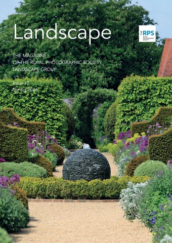
Landscape
Issue 17 - Spring 2026
Regulars
4. Welcome from the Editor
48. Webb Watch
Stunning images from the Webb Telescope - the ultimate landscape.
62. Inspiration
Watch, follow, read and listen – some ideas to keep your landscape photography fresh.
Professional Photographers
12. The Five PIllars of Meaningful Landscape Photography
Bradley Carr introduces us to his philosophy of landscape photography.
18. The Human Landscape
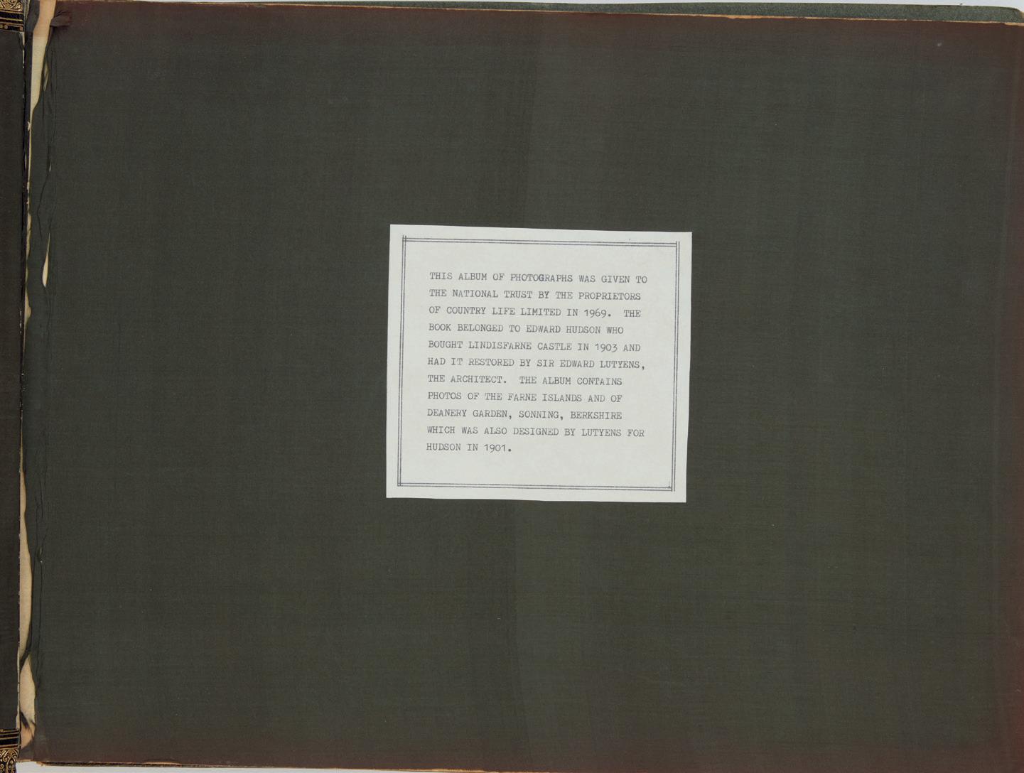
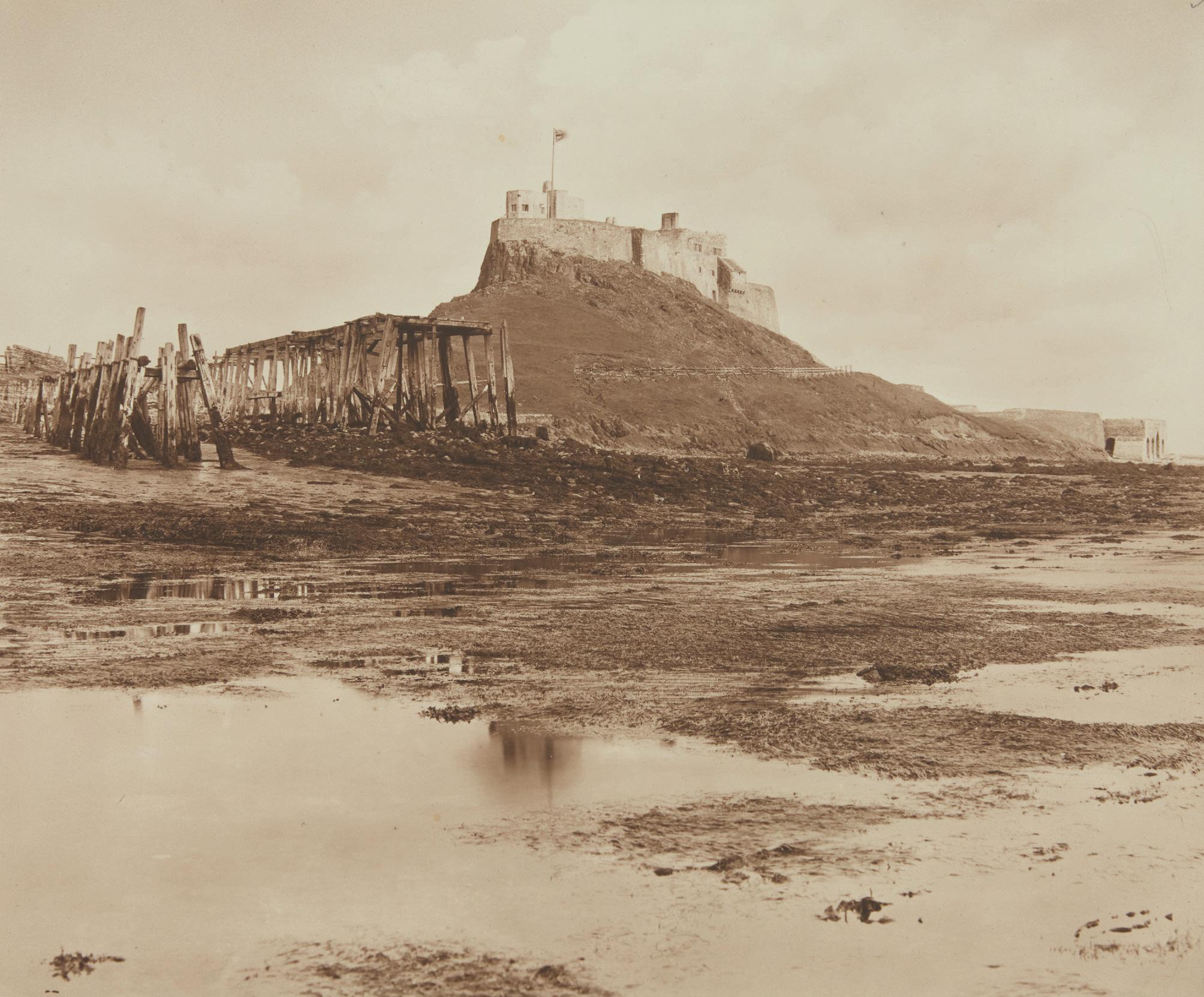
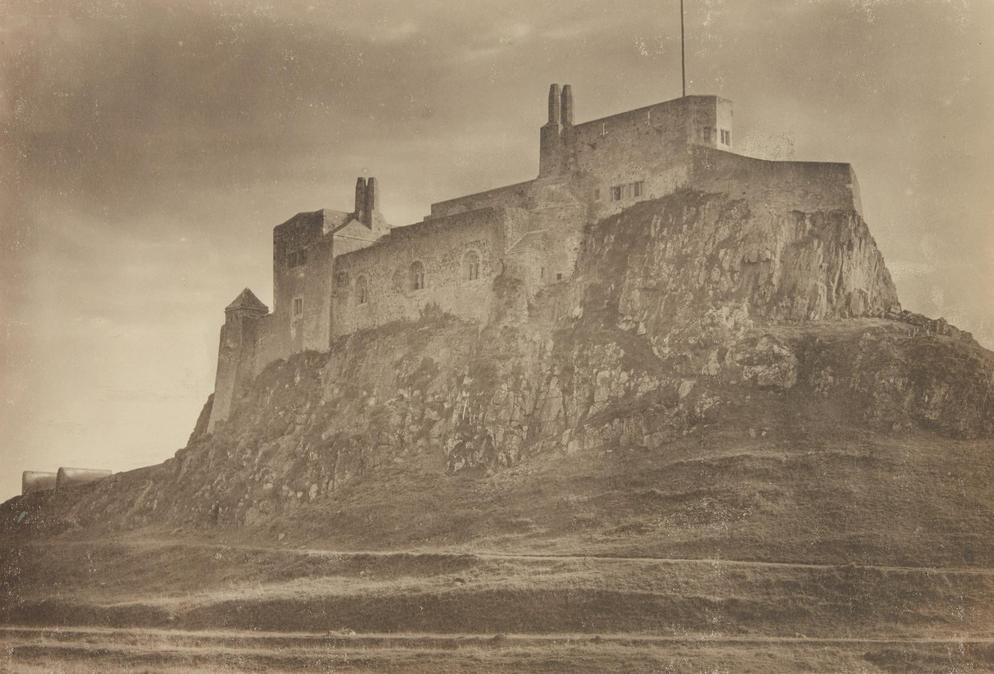
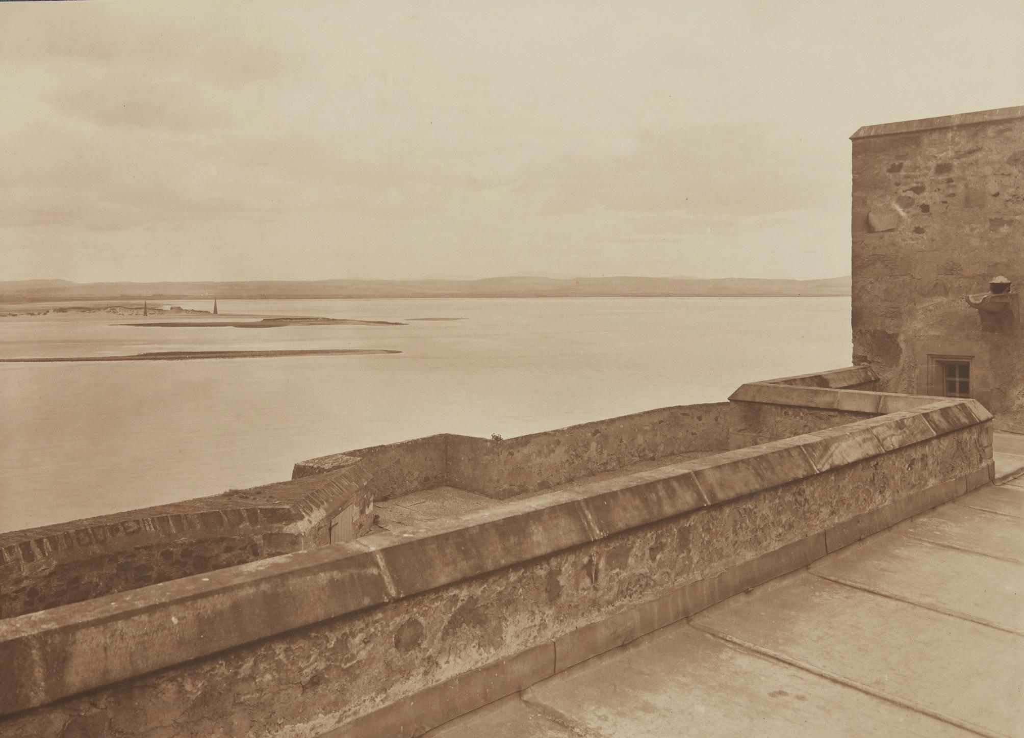
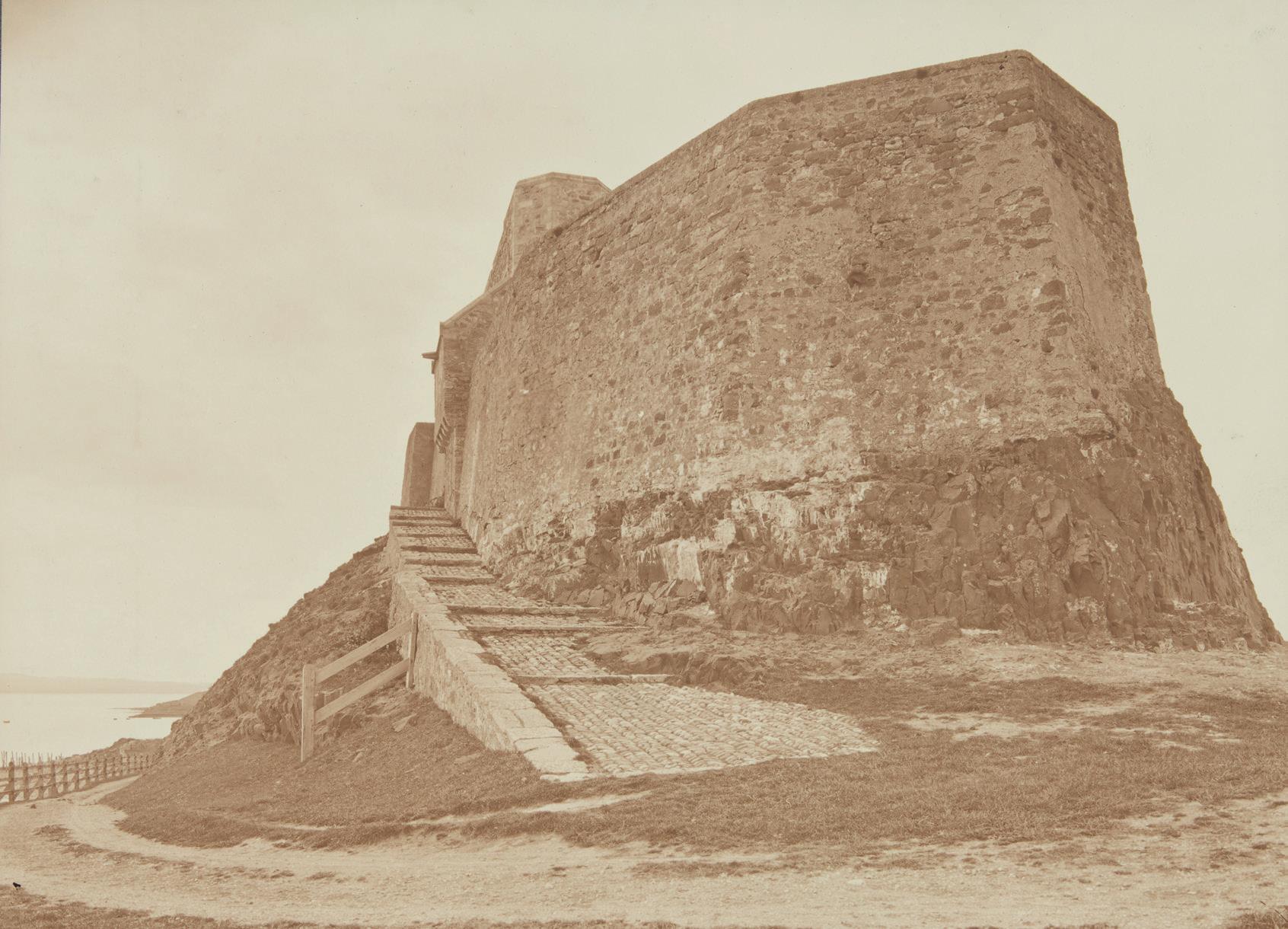
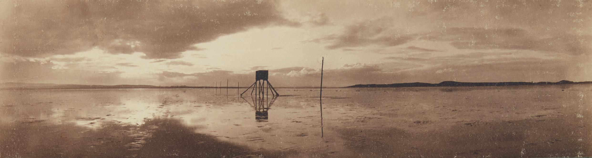
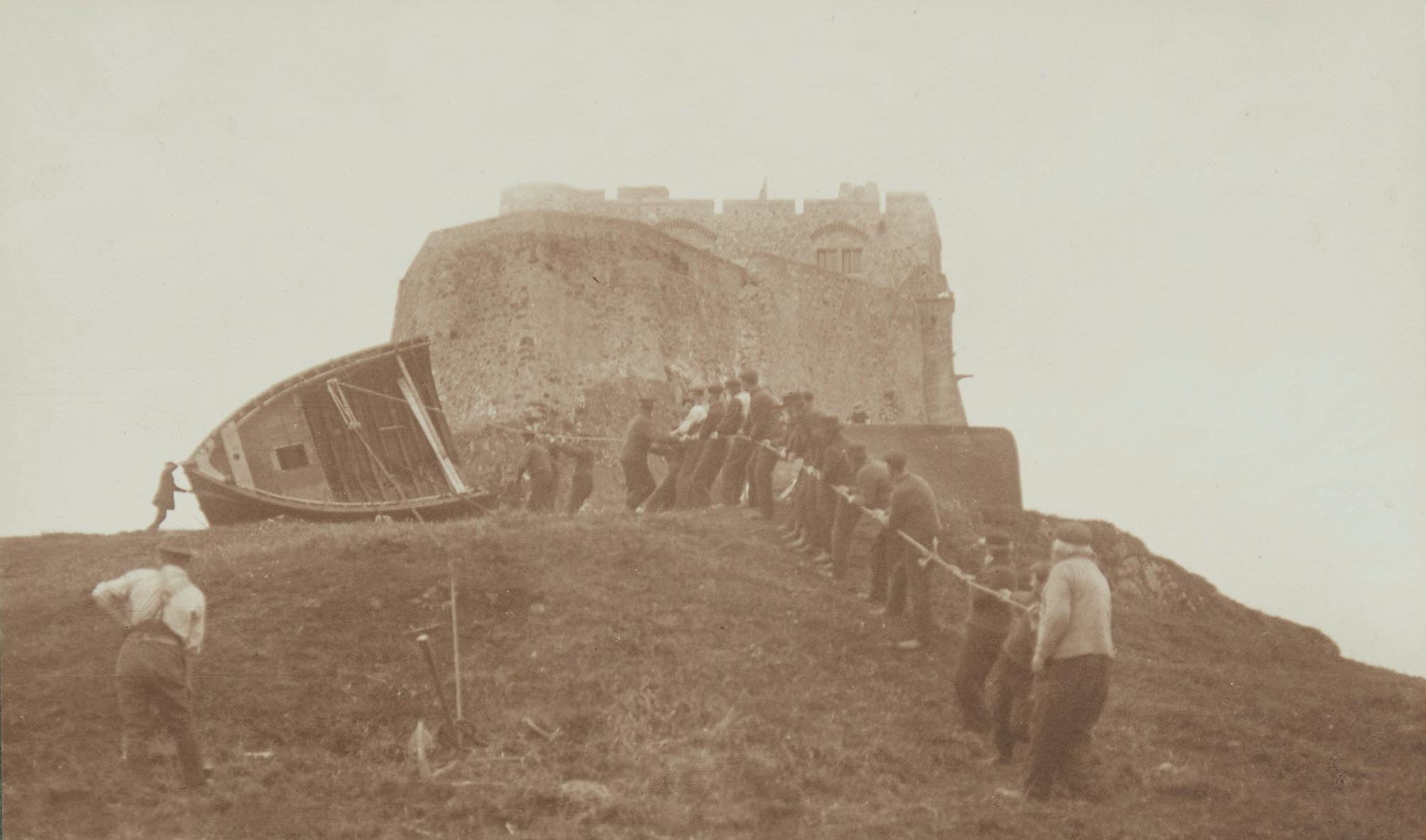
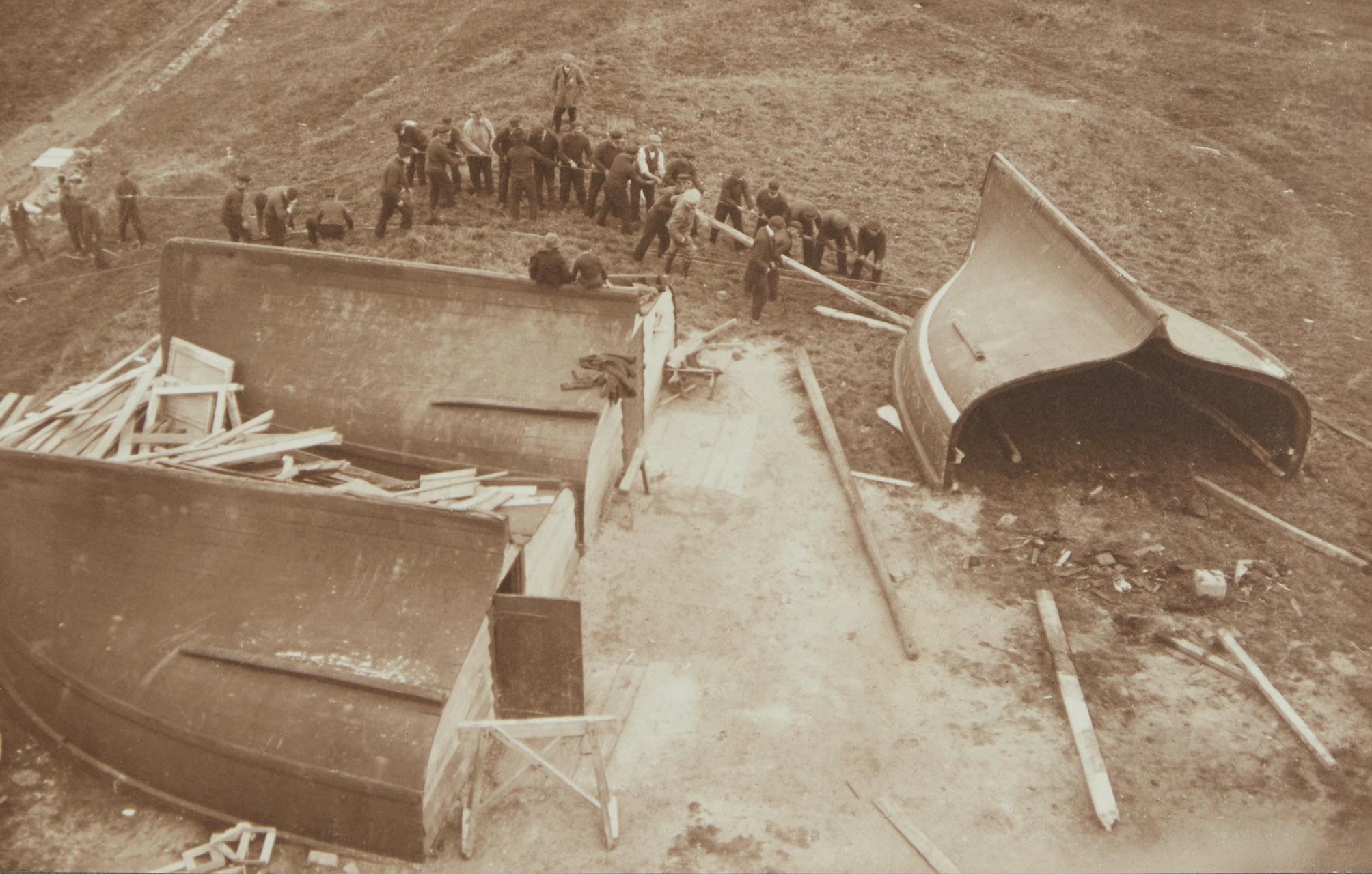
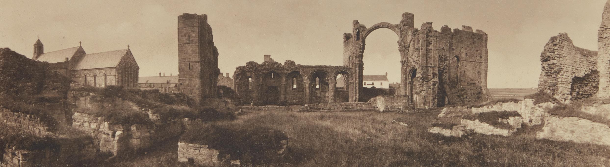
An unknown photographer from around 1906 was amongst the first to document the conversion of the ruined castle at Lindisfarne to a country house.
24. The Preparation Page
Paul Gallagher FRPS describes the art of celebrating simplicity in processing.
28. The Altered Landscape
In the second of our series on the impact of humanity on the planet, New Zealand photographer, Michael Hall, looks at glacial melt in the Arctic and elsewhere.
50. An Alternative View
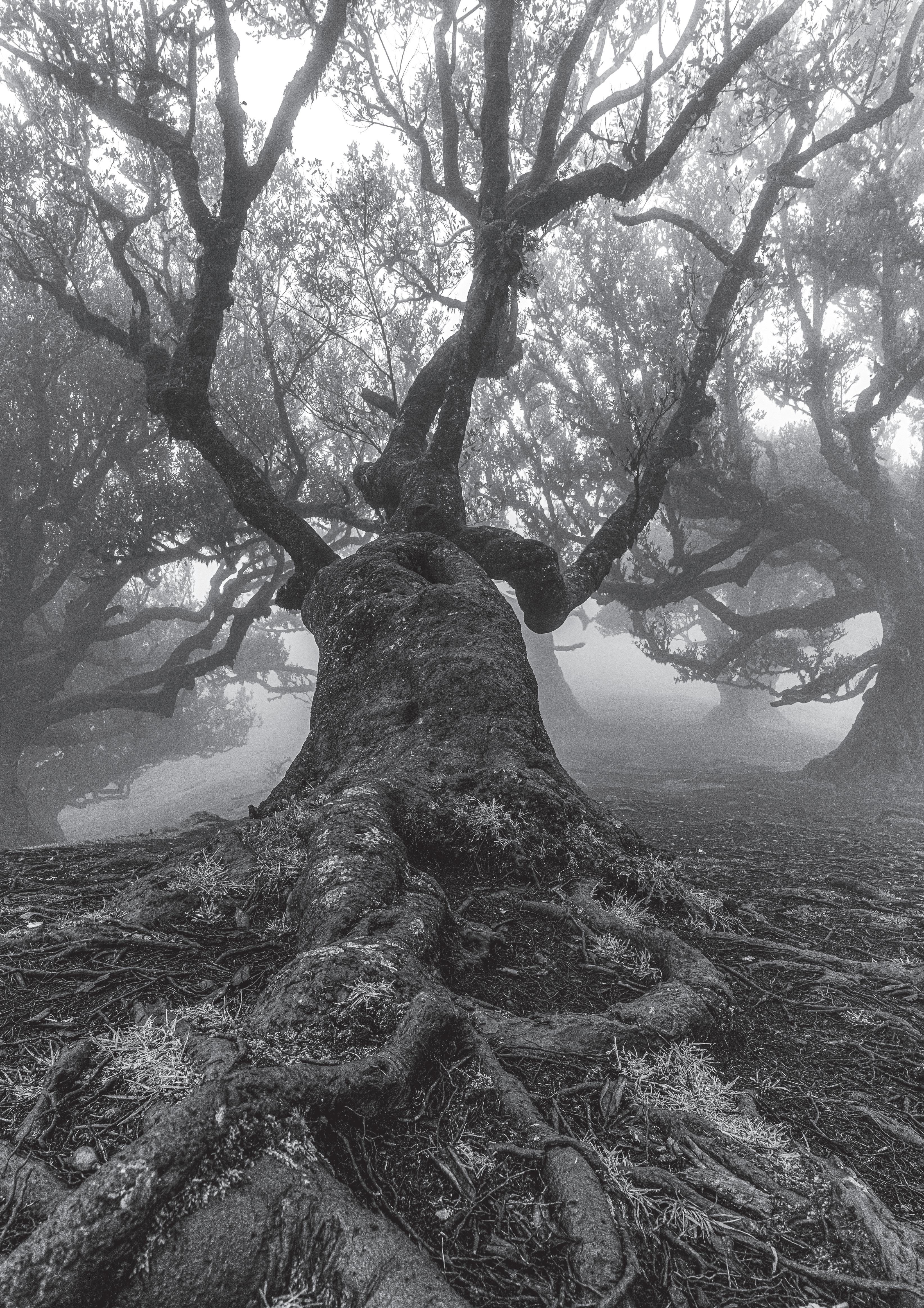
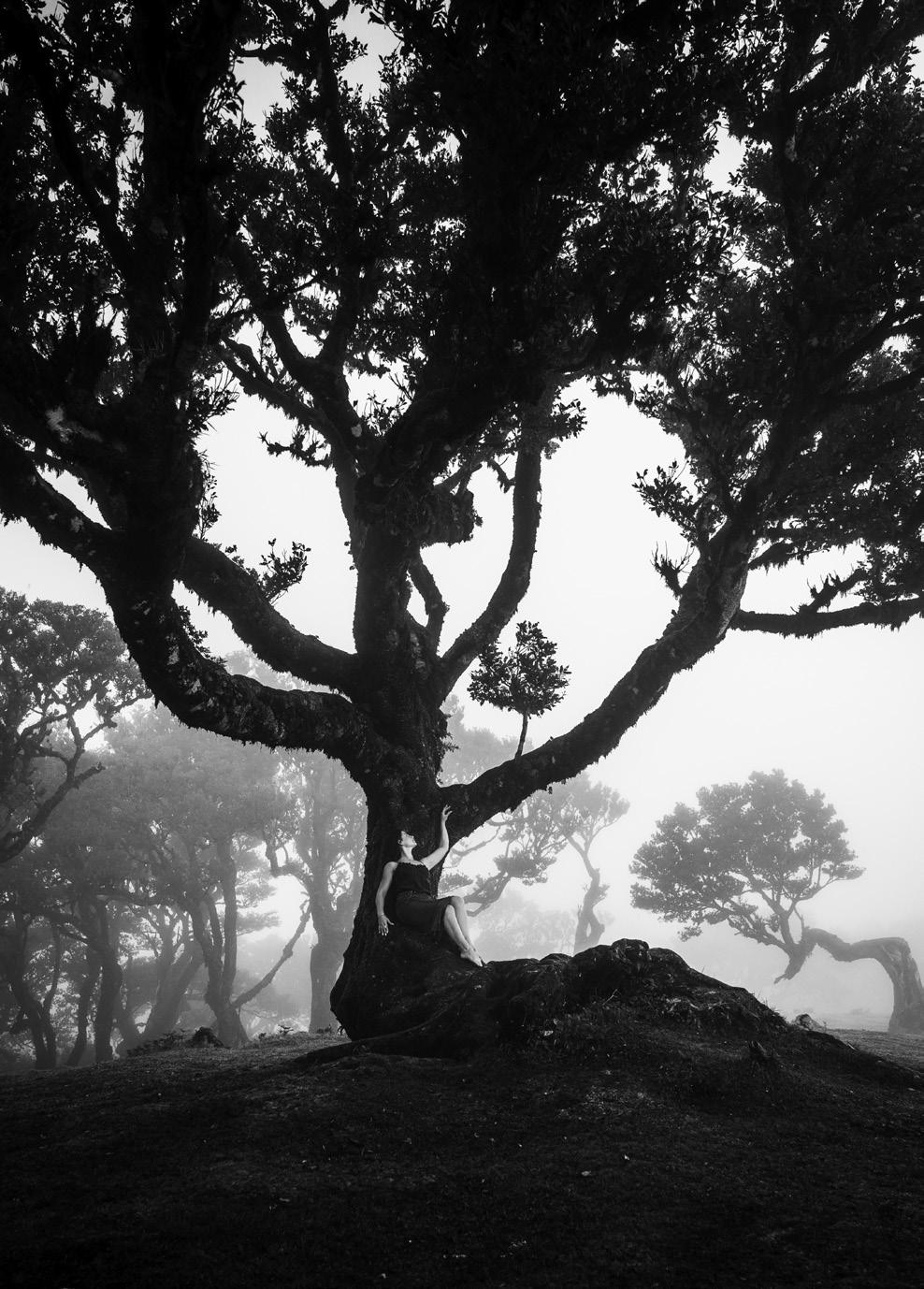
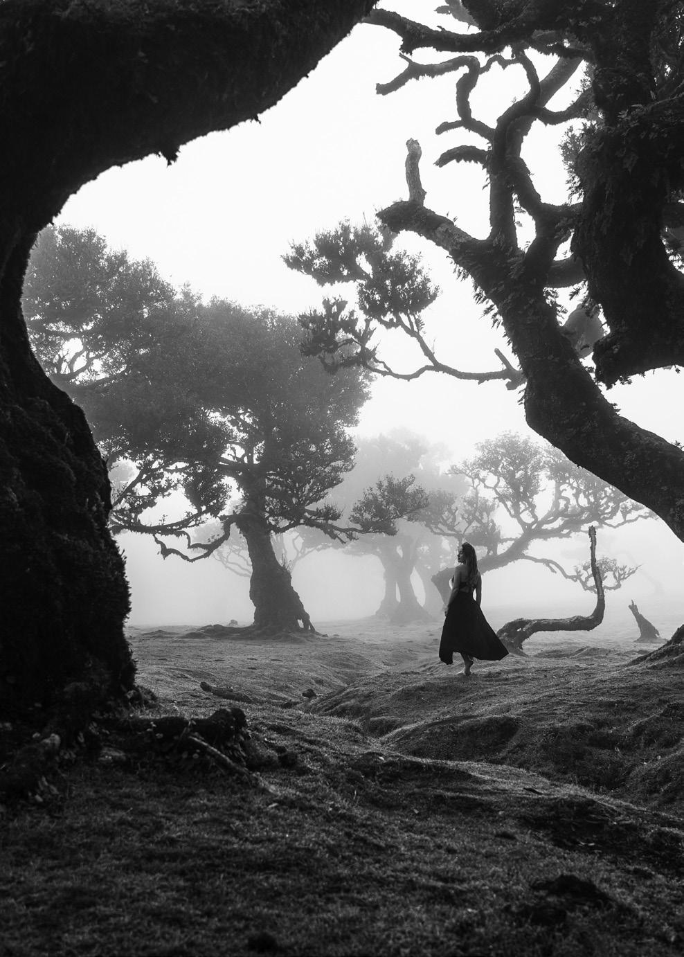
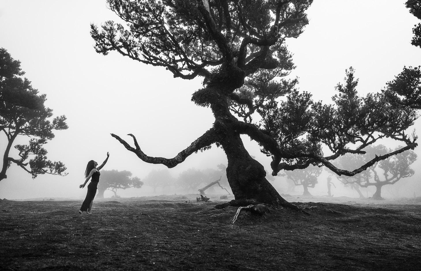
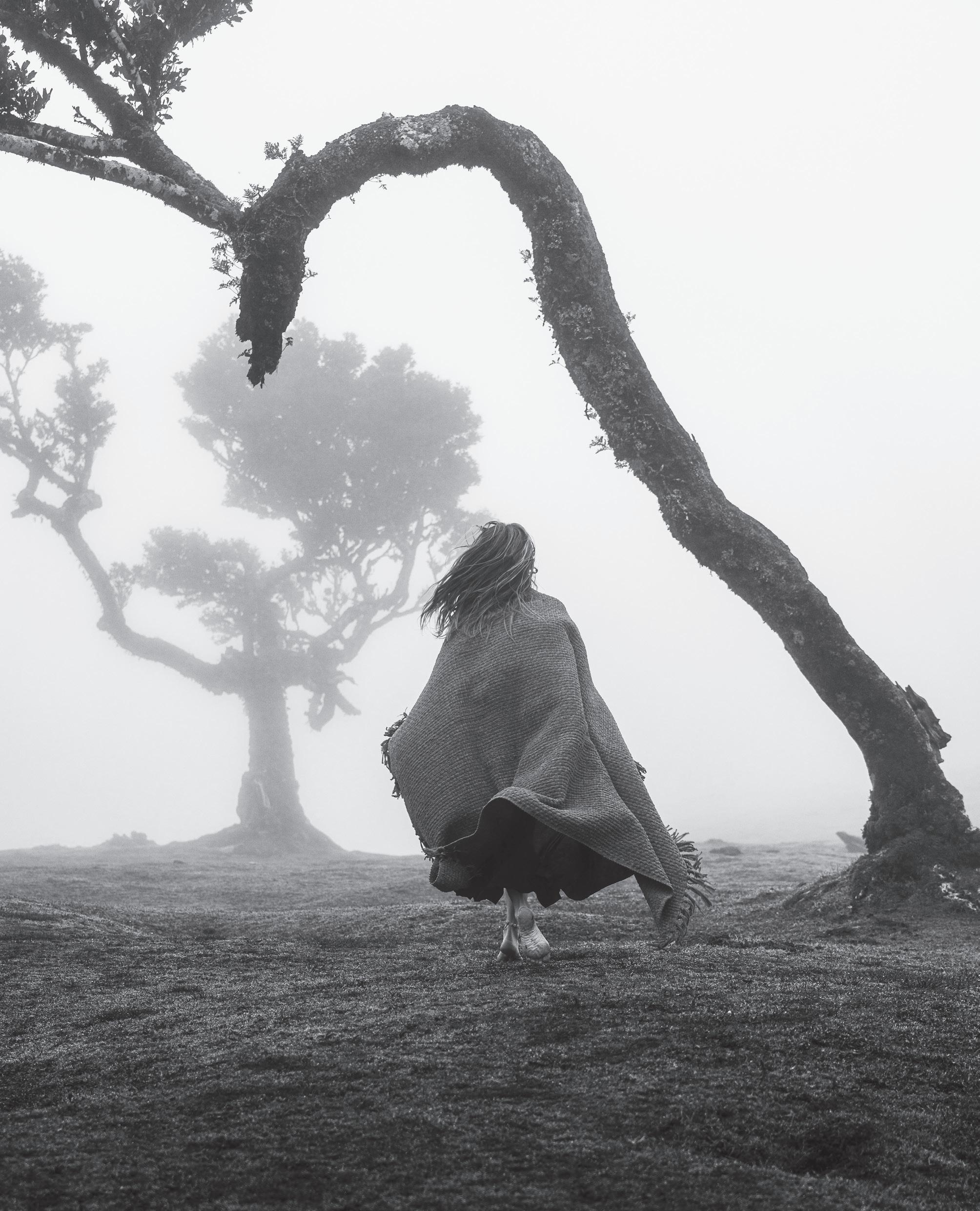
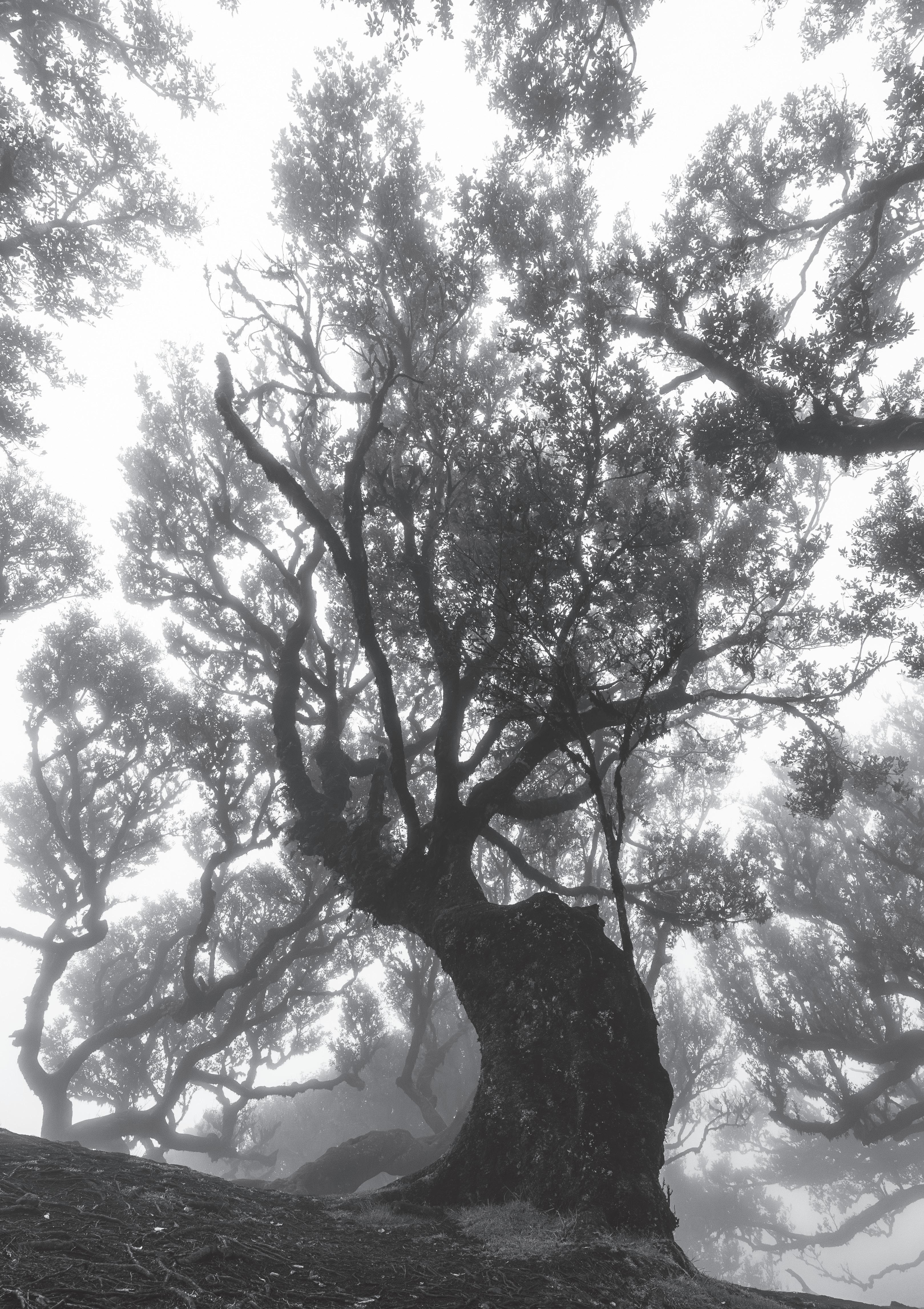
American photographer, Jason Martin, gives us an ethereal meander through the Fanal Forest of Madeira.
Member Contributions
6. Where in the World? I
Steve Hartley LRPS tells us about his critique group’s trip to the West Coast of Ireland.
34. Trench Warfare
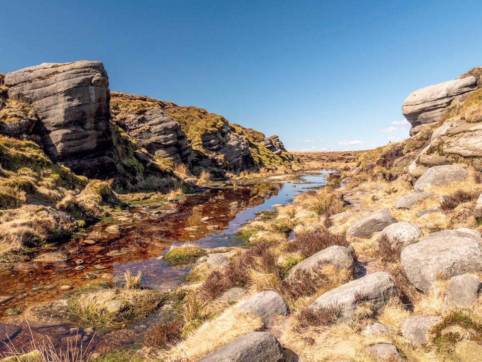
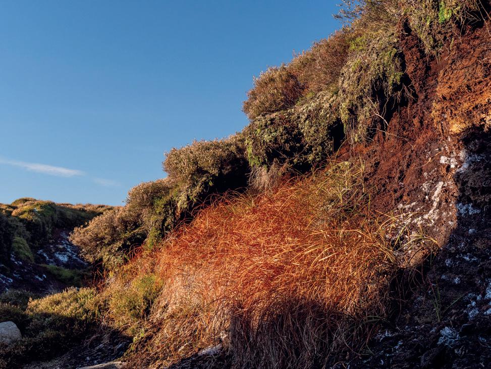
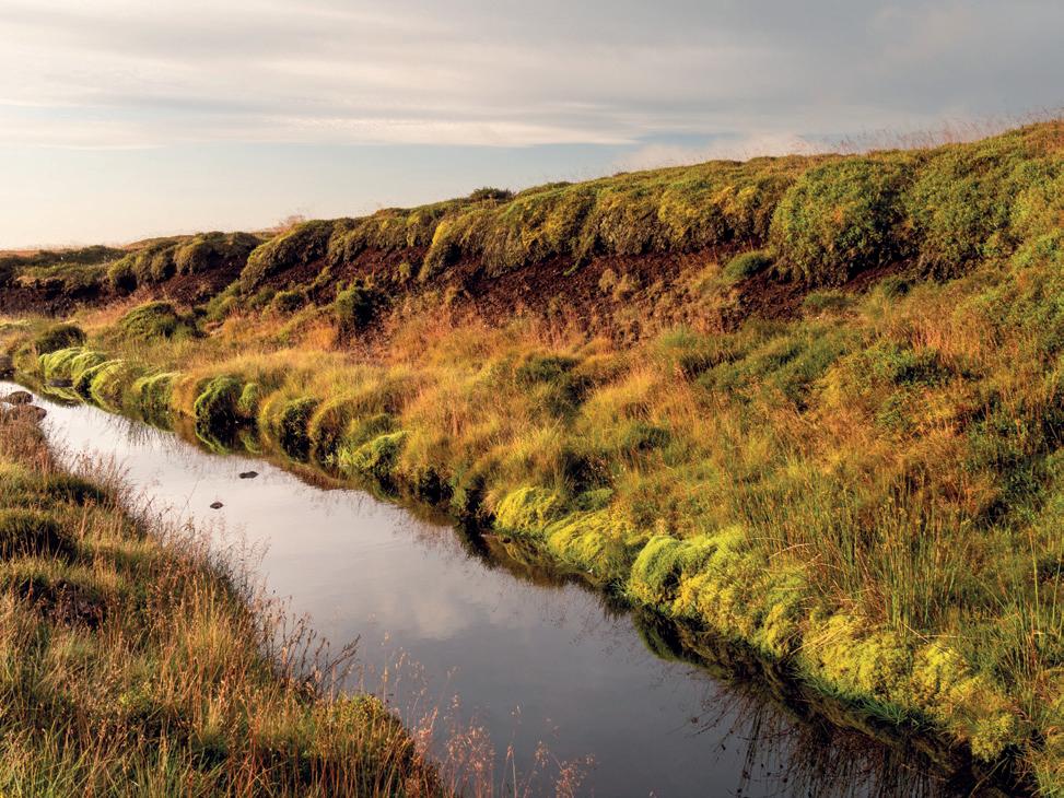
Pia Tommes LRPS (with words by David Haigh) describes the peat trenches of Kinder Scout in the Peak District National Park.
40. Monthly Competition Winners
The 12 winning photographs from the Landscape Group monthly competition of 2025. Thomas Heaton gives us his best of the best.
56. Where in the World? II
Martyn Bennett LRPS takes us to a wet summer in New Zealand’s South Island.
Welcome from the Editor
Welcome to the Spring 2026 edition of the RPS Landscape Group magazine. After what has been a long and exceedingly wet winter (for our majority of UK readers at least), I hope that this lands on your doorstep as you start to contemplate cheerier climes in the months ahead.
Spring is the edition where we feature our monthly winners. We are delighted to have secured Thomas Heaton, a good friend of the Landscape Group, to pick our ‘best of the best’ and that person will receive a copy of one of his books.
This feels like quite a personal edition for me. Our piece on the Human Landscape looks at Lindisfarne or Holy Island and the history of the collaboration between two men – Edward Hudson and Edwin Lutyens - and an organisation, the National Trust (NT). I raise my hand to being Lutyens’ granddaughter and permission to use these photographs came about as a result of a visit as a guest of the NT rather than as a regular punter.
Also personal was the inclusion of Jason Martin’s wonderful photographs of the Fanal Forest of Madeira in the Alternative View section. Jason is a near-neighbour of mine in Upstate New York and we frequently fall over each other at events where we both might have our cameras out. I first saw these photographs at a one-man exhibition last autumn, printed to huge scale and beautifully hung. I knew I had to have them in the magazine. For me, they qualify as alternative; partly because of the inclusion of a figure in some of the images and partly because of their treatment, which is completely ethereal. They make me want to head to Madeira as soon as I can and I hope you will love them as much as I do.
Besides these indulgences on my part and the monthlies, we have a magazine packed with good stuff.
We are taken from the West Coast of Ireland to New Zealand; we have a look at the peat trenches in the Peak National Park and Brad Carr introduces us to his theories on the Five Pillars of Meaningful Landscape Photography. Our Altered Landscape series continues with a look at glacial melt in the arctic and elsewhere and our Webb Watch series comes to an end with a look at the Helix Nebula and Pismis 24. Finally, Paul Gallagher FRPS, in our Post Processing Page, picks up the wonderful BW tones of Jason Martin and looks at producing a black and white image in a celebration of simplicity.
All in all, a packed edition that I hope you will enjoy as much as I hope you’ll enjoy reading its one-off companion magazine in celebration of the tenth anniversary of the Landscape Group. As ever, my heartfelt thanks go out to Gaynor Davies ARPS and Paul Cayton LRPS. Without their fabulous and constructive help as Assistant Editor and Publication Manager, I could not have managed to achieve what you are now reading.
Finally, may I respectfully implore you to look for, and respond to, calls for article entries and standalone photographs, both for this publication and also for our newsletter. These might come via the newsletter or on our Facebook page. The responses to each call seldom number more than a handful and there is always an element of “the usual suspects” – you know who you are and I’m always grateful to you but I can’t always use only you. Our group numbers 1200 talented photographers and I look forward to a rush of suggestions and images – I hope too numerous to use all of them – for our Autumn magazine which I will start working on later this summer.
Candia Peterson ARPS Magazine Editor
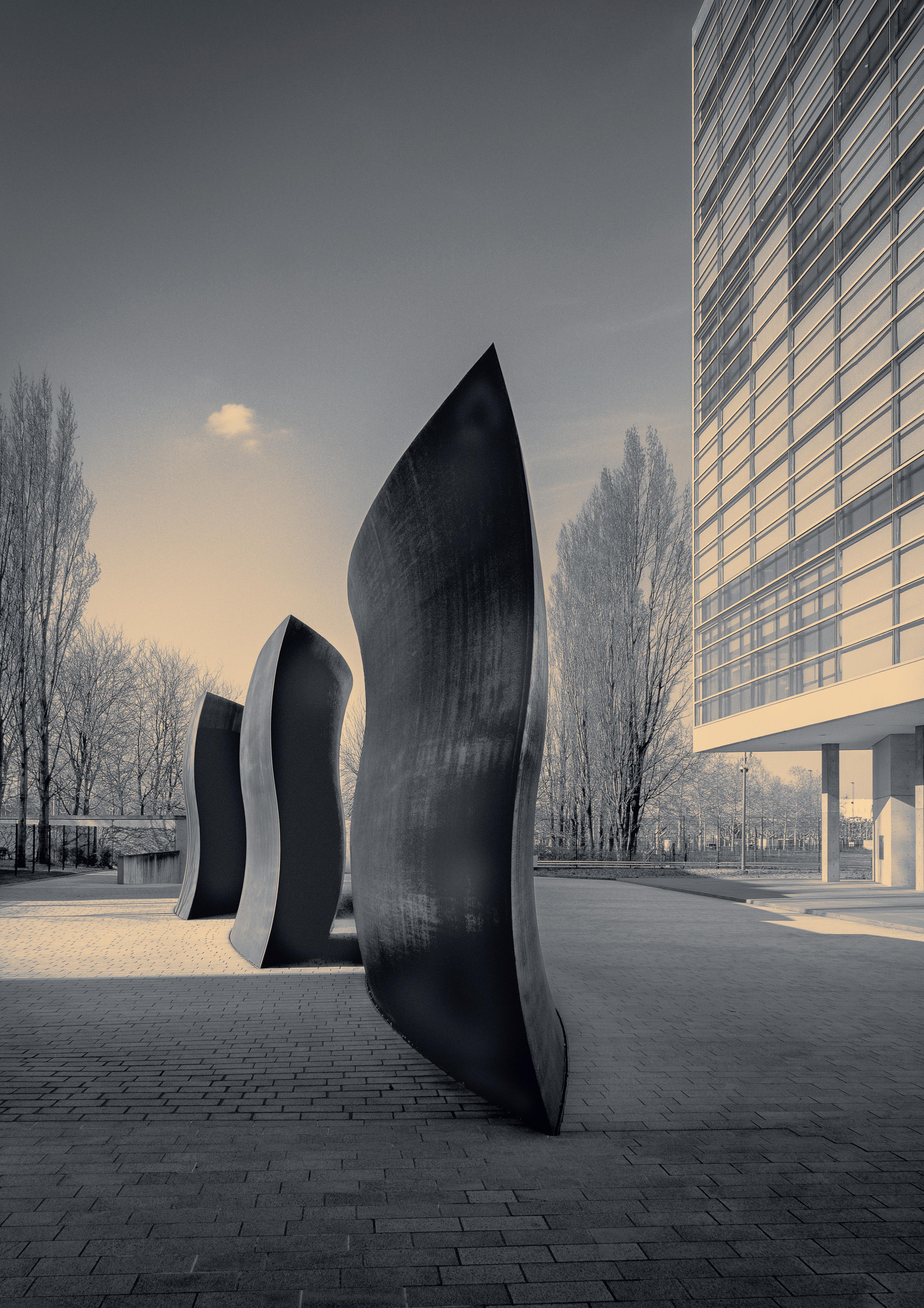
Flowing Space by Lukas Wagner LRPS
Where in the World? I
Steve Hartley LRPS
Steve Hartley LRPS explains how a group of four virtual friends from a Landscape Group Critique circle found themselves on the Dingle Peninsular in Western Ireland. With contributions from Sean Kitson LRPS, David Muiry ARPS and David Travis ARPS.
rps.org/groups/landscape/what-we-do/circles-page/
This is the story of how being a member of an e-critique circle resulted in four photographers spending a working week in Dingle, Ireland. It wasn’t a workshop, not even a Landscape Group Member-Led Event; just four virtual friends going out to make images as best they could.
So how do you get from critiquing images at home on the computer to standing on an exposed headland on the Wild Atlantic Way waiting for the sun to set and the sky to colour up? First of all, I lead on one of the Landscape Group’s e-Critique Circles and
one of our Circle, Sean Kitson, lives on the west coast of Ireland and shares his images from the area on a regular basis. One month, another member shared an image from the west coast and it started chatter about wanting to be there; always a sign that an image has made an impact. Having been on a short break to the Peak District with some friends from a different Circle, I asked Sean if he would be willing to act as a local guide if a number of our Circle were to visit the Emerald Isle. To my delight, he agreed so I opened up the suggestion to the rest of the
Circle. Inevitably, some were not able to fit in a trip due to existing commitments but four did put up their hands so it looked like a trip might be on.
On Sean’s advice, we chose to visit the Dingle peninsula in February so that sunrise and sunset times were not too extreme. The peninsula has a good number of coastal locations, all within a relatively small area and Dingle town has a good range of hotels and holiday accommodation options, not to mention plenty of dining out venues. We decided to hire a
Photographer at work
From Circle to Dingle
holiday house with four ensuite rooms. That allowed us to be up and away for sunrise without being tied to a hotel breakfast timetable. That worked out really well and was very reasonably priced (in February). RyanAir flights from Birmingham and Manchester were also good value, even with the ‘optional extras’, like a seat and hold luggage. David Muiry decided to drive and take the ferry to enable him to explore more of Ireland on the way. Sean agreed to do airport pick-ups and ‘taxi’ service so no car hire costs were incurred. Shortly before the trip, one of our members had an urgent medical issue and had to pull out. David Travis, the Landscape Group Circle Co-ordinator, volunteered to take up the spare place so the
cost of the accommodation was not lost.
So, the gang of four arrived in Dingle on a Monday, sadly too late to get out for a sunset shoot but in plenty of time for a hearty meal in a local hotel. Whilst we had all met virtually via Zoom previously, only David Travis and I had met in person before so the first night’s meal was a great opportunity to get to know each other a little better. Sean also explained his plan for our first full day on the peninsula; a whistlestop tour of the locations to get our bearings and plan for the coming days. The weather was ‘mixed’, which is pretty standard for the west coast, especially in February, but that made for some exciting changes of light,
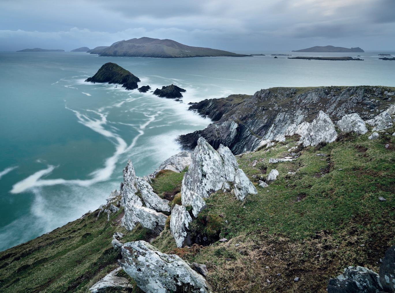
rainbows, etc. Having a number of days to work with meant there was no pressure to bag ‘the killer shot’ on visiting a location for the first time. Indeed, we climbed Dunmore Head three times before the sunset obliged with some colour and clouds that did not snuff out the light. Without going through the complete ‘order of service’, here is a synopsis of our tour of the Dingle Peninsula.
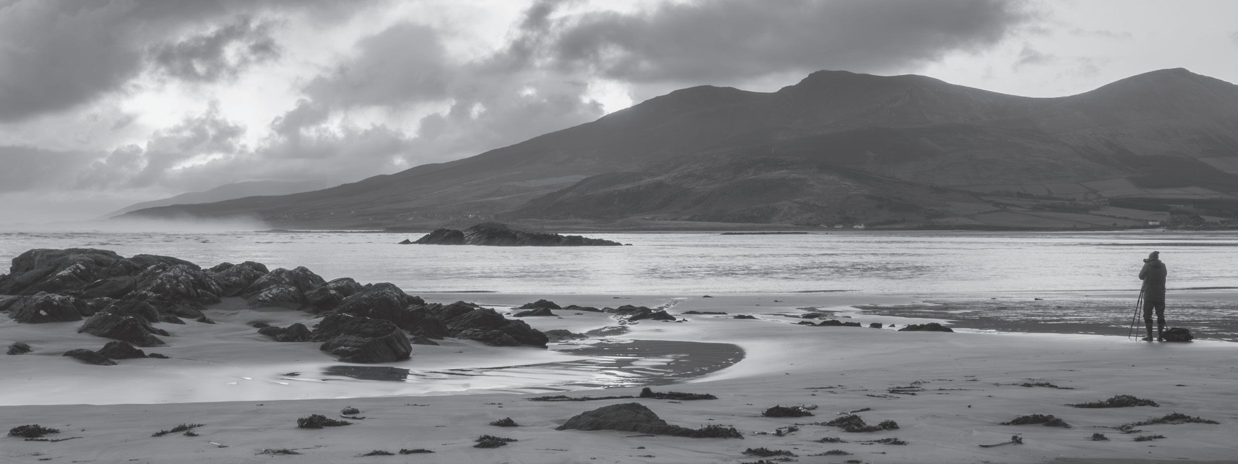
Cappagh Beach was our first stop each morning. At low tide there is a wide expanse of sand with interesting rock formations all surrounded by impressive hills that catch the morning light and provide an amazing backdrop. The light on our third visit was particularly delightful.
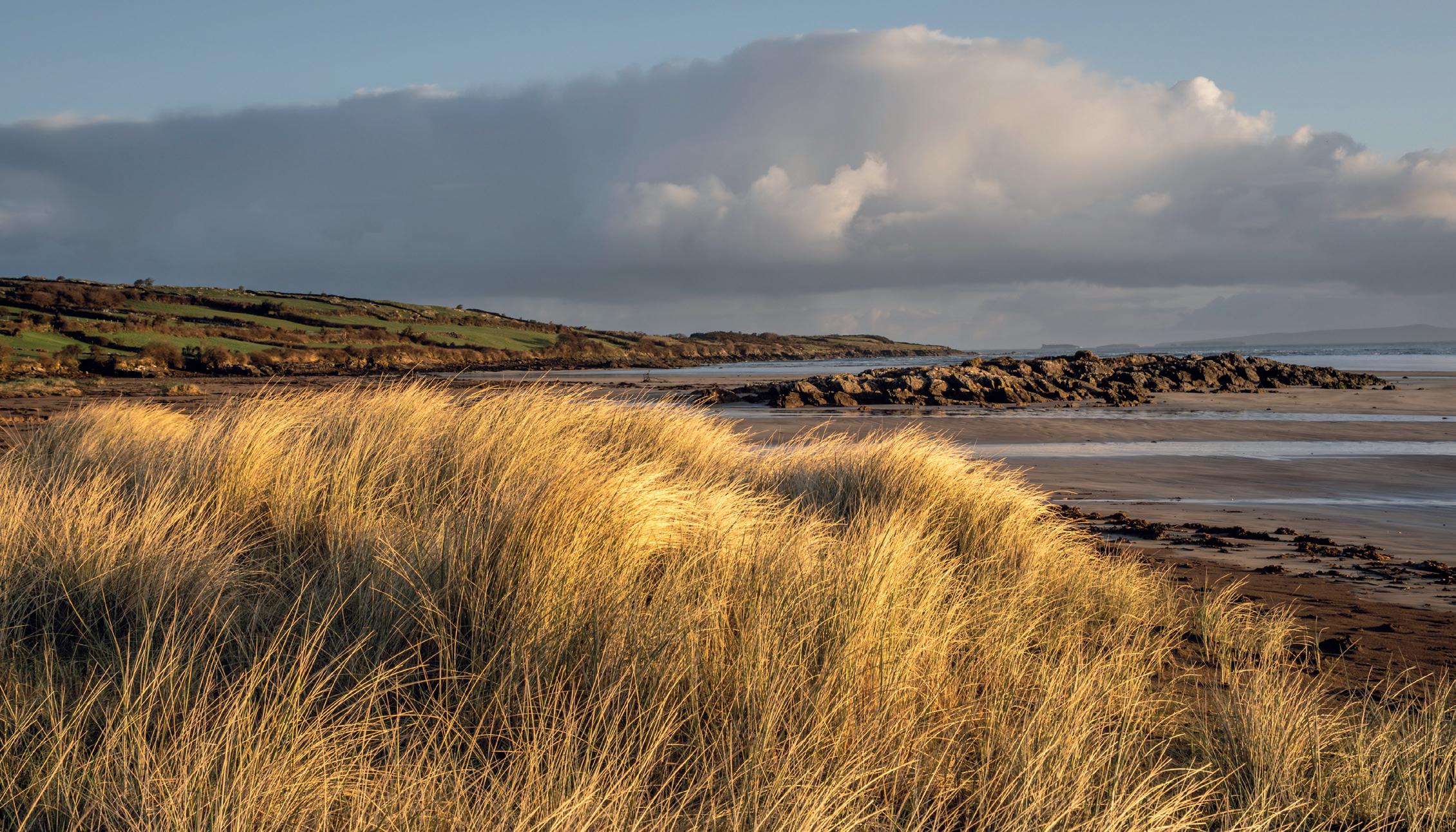
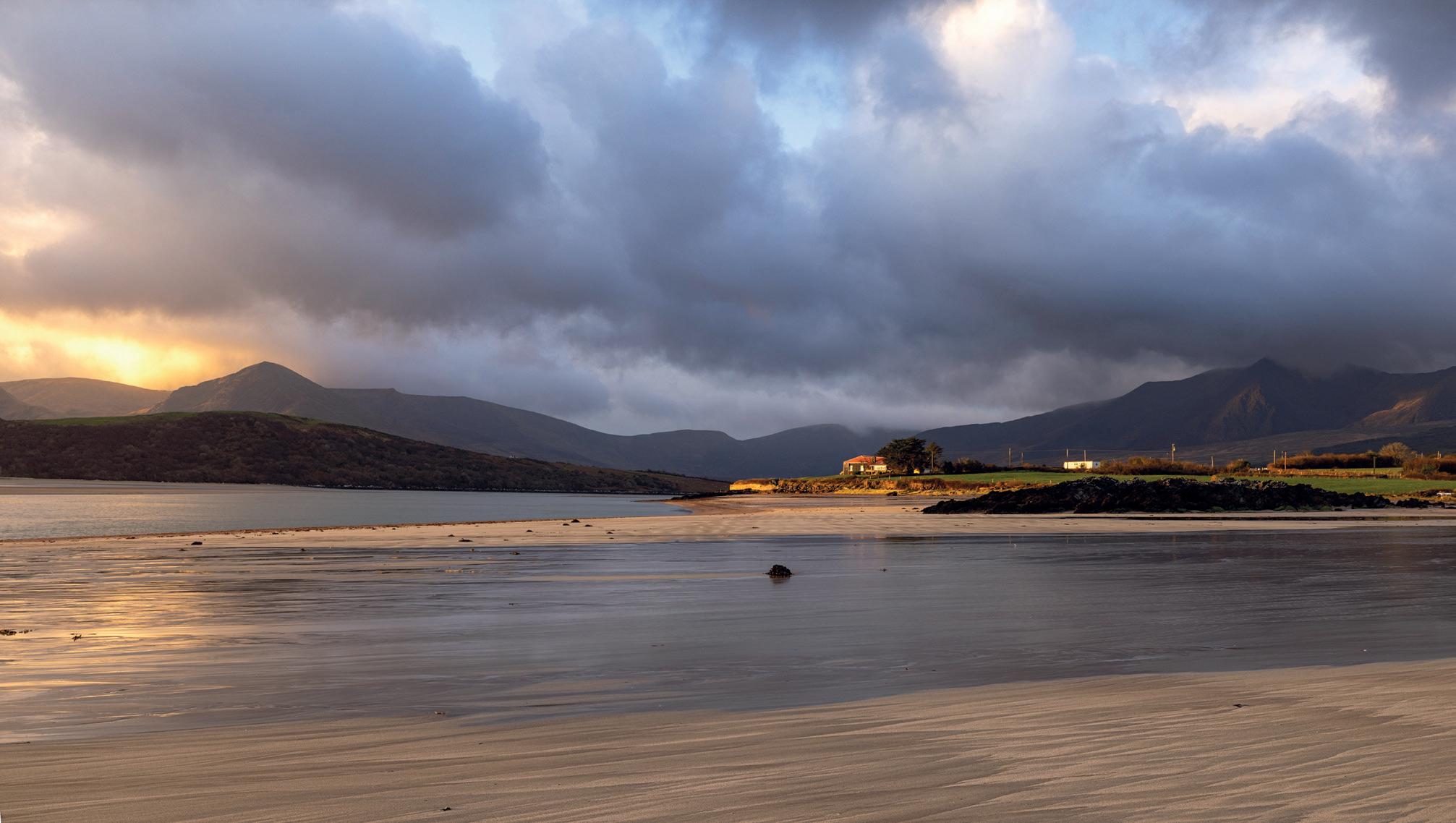
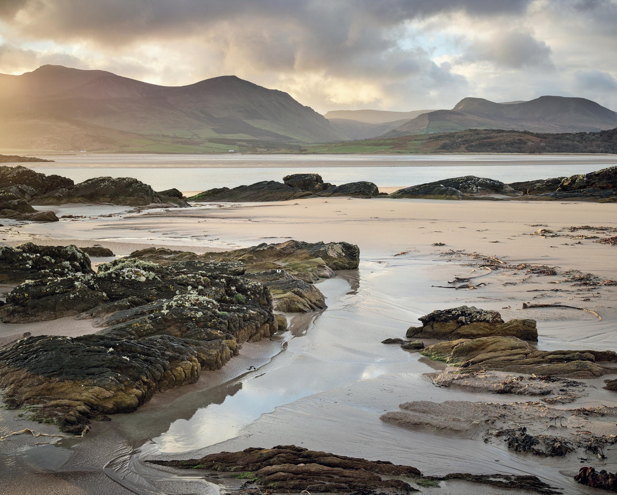
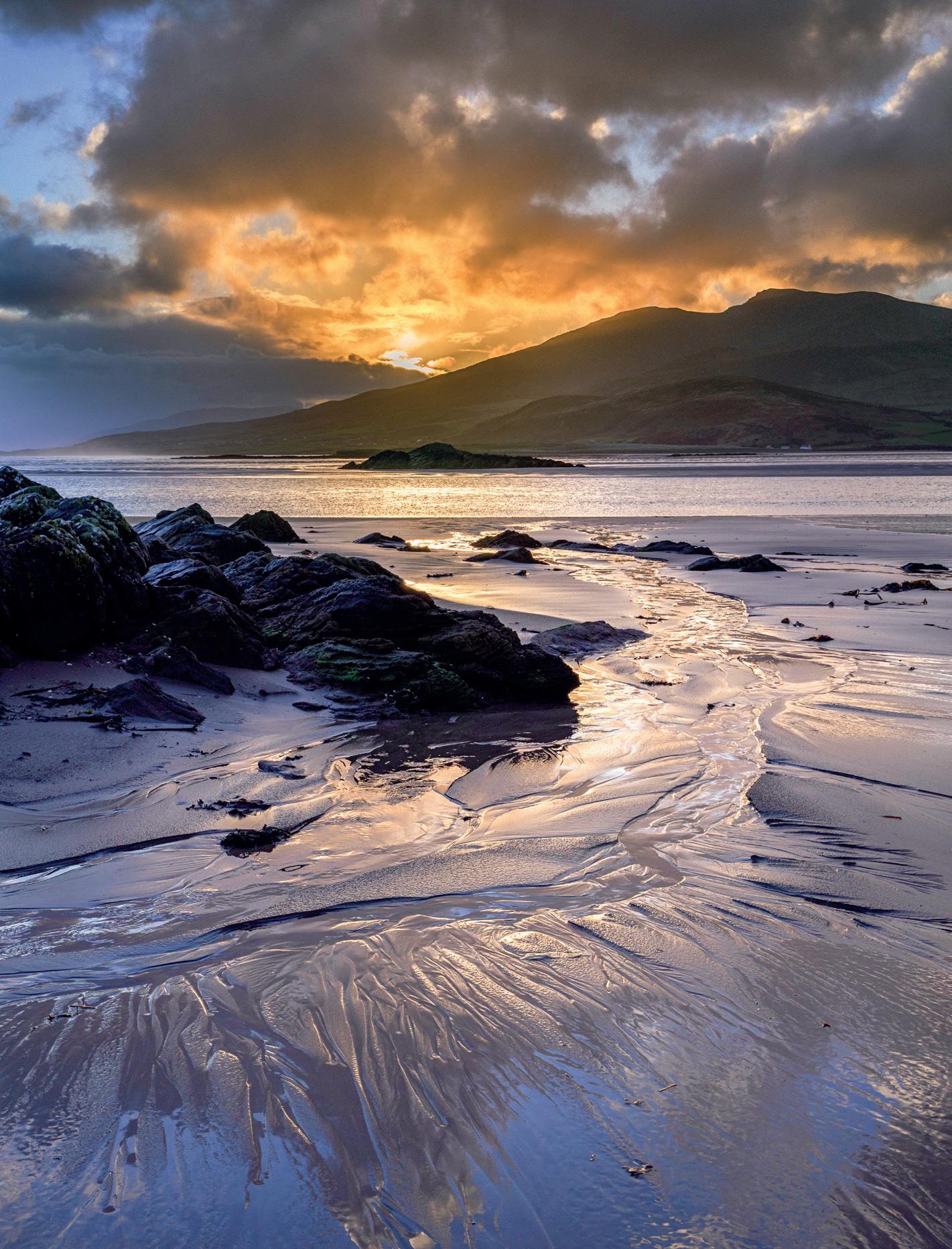
The following four images are from Cappagh Beach, one from each of the group.
Cappagh Beach Grasses by Steve Hartley LRPS
Cappagh Beach 2 by Sean Kitson LRPS
Cappagh Beach Dawn by David Muiry ARPS
The previous four images, all from the same place, illustrate really well how different photographers see different things, despite being in the same place at the same time; something I never cease to be amazed by! Tra Fhormaoileach is another beach that goes on for miles and has terrific ripples in the sand that hold just enough water to give superb reflections of the sky and/or the surrounding hills. The Slea Head Road is one of those drives that everyone should do at least once in their life. The scenery is spectacular with lots of places to pull over and no end of stunning views out to the Blasket Islands. There is a great pullin above Coumeenoole Beach looking out along Dunmore Head. This was the scene of the breaking of an unbreakable umbrella and a tripod being
abandoned. The tripod was recovered but the umbrella was trashed by some truly intense gusts of wind that literally came from nowhere.
The sign near the parking place by Coumeenoole Beach says it is a Star Wars filming location and, when you walk up onto Dunmore Head, you can see why the location scouts would have picked it out. There were no Jedi present on our visit but it was an amazing place.
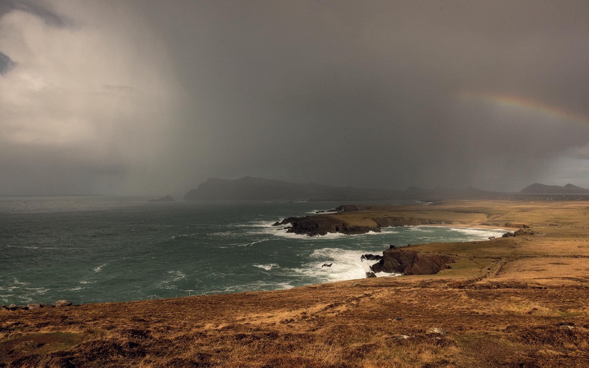
Clogher Head was the scene of one of the most dramatic changes in light and weather we saw. Over the course of about 10 minutes, a pure blue sky day turned into night with the most intense rainbow on the point of the change. Truly magical
to experience, never mind to photograph.
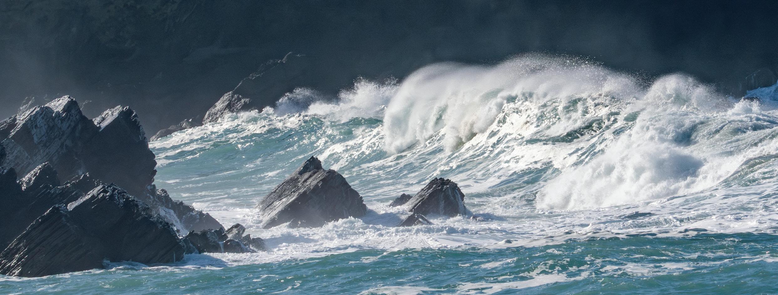
Clogher Strand is a small beach, reminiscent of many a Cornish cove with rolling translucent waves and spectacular explosions of seawater when they crash against the rocks, all quite hypnotic. No wonder the signs say ‘No swimming’!
Ballydavid Head takes a bit of a walk to get to and the ground is very wet, with some very ‘fragrant’ mud, courtesy of the herd of sheep that live there. There are lots of craggy rocks providing foreground interest as you look out towards the Three Sisters hills on the opposite side of the bay. We traversed the Conor Pass every day and experienced some lovely light on one of the stops
Cappagh Beach Sunrise by David Travis ARPS
at the pass summit car park; on others you could barely see your hand in front of your face! Kinard beach, or Tra Chathail, has some incredible rock formations, colourful pebbles that would not look out of place on Harris and an iconic sea stack. The days we visited had some very highcontrast light but that was ideal for capturing some lively wave action. We also visited locations at Fermoyle Beach, Dunquin Pier,
the Blasket Centre, Minard Castle and more but either the light was wrong or the changeable weather changed for the worse, meaning there were places we just did not get to.
Was the trip a success? On the last night we reflected on our time on Dingle and we all concluded that it had been a great experience. The accommodation was good, the company was most congenial,
the local food was good and the changeable weather was as good as we could have asked for. Whilst a Monday to Friday photo week allowed us to revisit places and chase the light, it did not allow us to exhaust the potential of the Dingle peninsula; it is always good to leave feeling there is more to be done. This is not sponsored but if you want to learn more about the area, I would recommend getting a copy
The Blasket Islands from Dunmore Head at Dusk by David Muiry ARPS
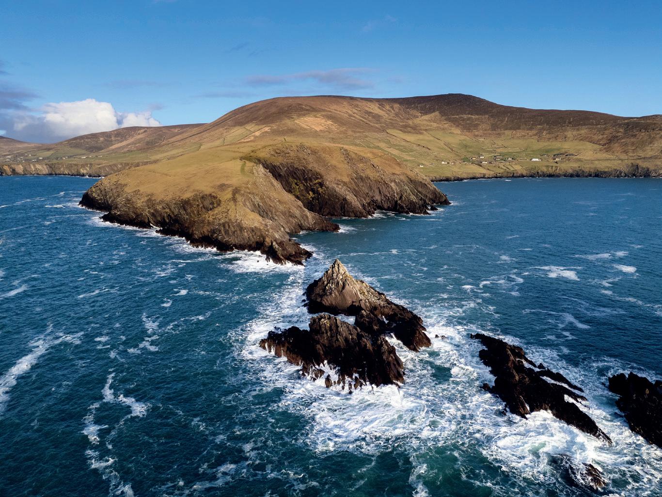
Dunmore Island by Drone by David Travis ARPS
of Darren J Spoonley’s guide to Dingle; it is excellent. Just use your favourite search engine to find it. His (free) guide to Landscape Photography is also full of good advice, by the way.
In case anyone is interested in equipment, we did see some moments of intense ‘gear envy’. David Muiry shoots with a technical camera and has a kit bag that some of us could barely
lift. The image quality from the medium format digital back is incredible and two of the party were fighting the urge to ‘go large’, especially when David showed us some of his lovely A3 prints during a rain break back at the accommodation. However, the images in this article were shot on a range of formats from micro four-thirds, a wee drone camera, a full-frame sensor and a medium format digital back.
I hope the results illustrate that the gear is only one part of the game and it is the photographer working with the camera that makes an image. I hope you found this short article of interest and it has inspired you to make a trip to a location you have always wanted to photograph.
Four Seasons in One Day Hour by Sean Kitson LRPS
Clogher Waves and Rocks by Steve Hartley LRPS
Five Pillars of Meaningful Landscape Photography
TM
Brad Carr
In an attempt to cut through the billions of photographs produced every year, Brad Carr has put together a theory of landscape photography that seeks originality through an understanding of “self” and his five pillars of meaningful landscape photography.
Instagram: @bradcarrphotos
Substack: findinglightjournal.substack.com/
Introduction
My approach to landscape photography may seem unusual. I use the camera not simply to document the world, but as a tool for self-inquiry, spiritual growth, and healing. I create at the intersection of creativity and personal development, striving to become a better, more authentic version of myself with each passing year.
I call photography my creative practice rather than a hobby or profession. This practice evolved from a previous life as an aspiring bodybuilder and
personal trainer. Many of the principles I learned under the barbell — discipline, consistency, patience, persistence — now underpin my artistic process. Just as strength is built through repetition, creative depth is built through daily devotion.
In earlier essays such as A Dance Between Thought & Being, Doing the Reps, and Learning to See Again, I explored the fundamental question: Why create at all? My evolving answer is this: I create to become more of my true self — the self that exists beyond conditioning, beyond limiting beliefs, beyond imitation.
Five Pillars of Meaningful Landscape Photography
My pursuit of so-called “original” work mirrors this inner search for authenticity. In photography, originality means stripping away preconceptions, dissolving projections, and resisting — as far as possible — the imitation of images absorbed from magazines and social media. True originality may be impossible in a world where billions of photographs are taken daily. Yet the purpose lies not in achieving originality, but in pursuing it.
Over five years of workshops, mentoring, and conversations with fellow photographers, a philosophical framework gradually revealed itself — one that shifts landscape photography from a purely technical craft toward a deeply self-expressive art form. I call it The Five Pillars of Meaningful Landscape Photography:
• Connection
• Intention
• Observation
• Attention
• Reflection
This is not a technical method. It is a way of being. Its aim is not merely to create better photographs, but to cultivate a more meaningful life.
The Foundation: Presence
Before the five pillars comes a foundation: Presence. Presence is the ability to be fully here. Not thinking about the previous location. Not anticipating the next shot. Not imitating a favourite photographer. Not mentally editing before the image is made. Presence is meeting this landscape, in this moment, with full awareness and an open heart.
Many photographers operate on autopilot. We research locations, arrive with expectations, immediately identify “the shot,” and begin setting up before our spirit has caught up with our body. Our awareness remains scattered between past and future.
When photographs are made without presence, they may be technically flawless — perfect compositions,
correct depth of field, adherence to the “rules.” Yet they often lack emotional depth. They fail to awaken something within the viewer.
Presence invites intuition to lead. It allows feeling to guide form. Without it, the rest of the pillars cannot stand.
Pillar One: Connection
Connection deepens as presence deepens. Connection means placing experience above outcome — above social media validation, competition scores, or external approval. The true reward is who we become by walking the creative path.
To connect is to walk the landscape in humility, in surrender, in service to something larger than the self. It requires placing the ego aside and remembering that photography is not about taking from the landscape, but participating in it.
When we prioritise connection, our photographs become less about performance and more about relationship — with nature, with ourselves, and ultimately with others.
Pillar Two: Intention
Intention brings consciousness to creativity.
It asks: What story am I trying to tell? Why am I framing this image?
Without intention, a photograph may simply follow formula or record a beautiful scene. There is nothing inherently wrong with that. Not everyone seeks meaning in their work at all times. But when we aim to create images that resonate more deeply, intention becomes essential.
Intention requires clarity and purpose — qualities often dulled in a world full of distraction. It is easier to scroll or consume than to sit quietly and examine why we are drawn to a place or what we truly wish to express.
Yet when we do the inner work of clarifying intention, our images begin to carry weight. They communicate something personal. They move from being merely “good” to becoming interesting — perhaps even meaningful.
Silent Waters - Eryri, Snowdonia
Pillar Three: Observation
Observation is a meditative state of listening.
It is the art of sensing what the landscape is offering in this moment. We might ask:
• What is the light doing now?
• How might it change?
• What makes this place unique?
• What subtle details reveal themselves with time and patience?
Observation applies equally to our inner landscape. Many of us have become disconnected from our feelings, conditioned to live primarily in our minds. Yet meaningful photography requires embodiment. It requires feeling.
To “feel” a photograph is to become aware of what is happening inside your body — tension, softness, expansion, stillness. These sensations inform creative decisions more deeply than intellectual analysis alone.
When we allow ourselves to feel fully — to breathe deeply, engage the senses, and honour emotional experience — our images begin to carry that energy. The outer landscape becomes a mirror for the inner one. Photography becomes a process of expression and release.
Pillar Four: Attention
If observation is receptive, attention is active.
Having witnessed the landscape with openness, we now direct focused mental energy toward translating experience into form. Attention involves choice:
• What to include or exclude
• Where to stand
• How high to set the tripod
• Which focal length or aperture best supports the story
This is where technical knowledge plays its role — not as the master, but as the servant of intention.
A New Dawn - Eryri, Snowdonia
You might say that intention and observation give birth to attention. It is the bridge between feeling and form.
With practice, attention becomes intuitive. Technical decisions begin to happen almost automatically. When we know ourselves, our vision, and our purpose, the mind can quieten. The creative process flows more naturally, guided by embodied awareness rather than overthinking.
Pillar Five: Reflection
Reflection completes the cycle.
In a culture driven by distraction and escape, true reflection has become rare. We consume, scroll, and move on. Yet growth requires integration.
Reflection means examining our photographs and experiences without harsh judgment. It means asking:
• What was I trying to express?
• Did the image communicate that?
• What did I learn about myself in the process?
Through disciplined reflection — often supported by writing — we deepen understanding. We extract wisdom from experience. We identify patterns. We clarify intention for the future.
One of the defining human capacities is the ability to reflect consciously on the past. When done constructively and compassionately, reflection accelerates creative and personal growth.
First Dance - Welshpool, mid-Wales
Conclusion
The Five Pillars of Meaningful Landscape Photography form a living framework — one that evolves as you evolve. They are not rigid steps, but guiding principles to carry into your creative life.
At their core, they encourage:
• Experience over outcome
• Process over praise
• Presence over distraction
• Connection over ego
• Purpose over imitation
Yes, this philosophy may lead to more meaningful photographs. But more importantly, it cultivates a more meaningful life — one in which we
are grounded in our bodies, attentive to our surroundings, intentional in our actions, and reflective in our growth.
Landscape photography then becomes more than image-making. It becomes practice. Discipline. Devotion. A path of becoming.
And perhaps that is the true art.
If you would like to learn more, you can download the 45-page guide for free at: www.bradwcarr.com/ five-pillars-of-meaningful-landscape-photography.
You can also find me on social media to stay up to date with my creative mission to educate and inspire 1,000,000 people along my way:
Brad’s website is www.bradcarrphotography.co.uk. He is running a pro-led event through the Landscape Group, a three-part workshop in Snowdonia this autumn. Scan the QR code for details and booking.
Unwavering - Eryri, Snowdonia
The Human Landscape
Candia Peterson ARPS
Editor Candia Peterson describes her connection to Lindisfarne and the discovery of an album dating back to 1906 of early photos of the iconic Holy Island during a visit with Landscape Chair Colin Balfour LRPS and Secretary Viv Cotton ARPS.
Lindisfarne – A celebration of architecture and landscape
Lindisfarne Castle, perched dramatically on a basalt outcrop on Holy Island off the coast of Northumberland, is one of the most evocative historic houses in Britain and has been a mecca for photographers since the early days of the craft. Its story weaves together medieval conflict, Edwardian architectural imagination and twentieth-century heritage conservation. Central to that story are: Sir Edwin Lutyens OM, one of Britain’s most celebrated architects; Edward Hudson, founder of Country Life Magazine and, finally, the National Trust, the organisation that has cared for the castle since the mid-twentieth century. Together, they shaped the building’s transformation from a Tudor fort into a romantic, yet rigorously designed, country retreat and, finally, into a carefully preserved public monument.
Last year, just before the Landscape Group conference in Edinburgh, Group Chair Colin Balfour,
Secretary Viv Cotton and I made a small pilgrimage to Holy Island. I must declare a personal interest, in that Sir Edwin Lutyens was my grandfather and I have the privilege of ease of access into many of his buildings. We were delighted to get a private visit to the castle in which we were looked after by Nick Lewis, Collections & House Manager and keeper of the building for the National Trust. Towards the end of our visit, Nick very kindly showed us the original photograph albums made by Edward Hudson. There and then, I knew I wanted to find a space for some of the photographs in our magazine. It has taken a little while but, with the generous co-operation of the National Trust, I’m very pleased to be able to share them with our members as a slightly unconventional interpretation of The Human Landscape.
Whilst Holy Island or Lindisfarne was one of the most important sites of early English Christianity, first settled in the mid seventh century, the origins of Lindisfarne Castle lie in the sixteenth century, a period of political and military tension between
A short history of Lindisfarne (Holy Island)
England and Scotland. Built around 1550 using stone from the nearby ruins of Lindisfarne Priory, the structure was designed as a fort to guard the strategically important harbour. Its compact form, thick walls and commanding views across the North Sea reflected its defensive purpose. However, as border conflicts diminished and military technology advanced, the castle’s strategic value declined. By the nineteenth century, it was largely abandoned and romanticised as a picturesque ruin, admired more for its dramatic silhouette than for any practical function.
The castle’s fortunes changed dramatically in 1901 when it was purchased by Edward Hudson, the wealthy founder of Country Life magazine. Hudson
envisioned transforming the austere fort into a refined holiday home that would harmonise with its rugged surroundings. For this ambitious project, he turned to Edwin Lutyens, who was then emerging as a leading figure in British architecture. Lutyens was renowned for his ability to blend traditional forms with subtle modernity and Lindisfarne offered him a unique opportunity to work within the constraints of an ancient structure. The relationship between Lutyens and Hudson went far beyond the castle, with Lutyens designing two other houses as well as the Country Life HQ in London and Hudson being one of his biggest sponsors, publishing everything he built in the magazine and vociferously promoting his work to the “unlanded gentry” of Edwardian society.
Lutyens approached the castle not as a restorer seeking to return it to a single historical moment but, rather, as a creative interpreter. He retained the essential mass and defensive character of the exterior, respecting its historic presence against the skyline. Inside, however, he reimagined the spaces with ingenuity and sensitivity. He transformed cramped military quarters into a sequence of intimate, yet dignified, domestic rooms.
One of the most celebrated interiors is the great hall, which Lutyens reshaped into a warm and inviting living space. He introduced large windows to frame sweeping views of the sea and landscape, turning what had once been a place of defence into one of contemplation. The interplay between light, stone and carefully crafted woodwork creates an atmosphere that is both austere and comfortable. Lutyens’s design philosophy at Lindisfarne exemplifies his broader architectural approach; a deep respect for historical context, combined with imaginative reinterpretation.
Lutyens also brought in Gertrude Jekyll, his frequent collaborator and one of the most influential garden designers of the era. Although the castle sits on a rocky crag with little space for conventional gardens, Jekyll designed the nearby walled garden, transforming it into a sheltered oasis of colour and structure. The garden provided a cultivated counterpoint to the wild coastal setting and complemented Lutyens’ architectural vision.
After Edward Hudson’s death, Lindisfarne Castle passed through private hands before being given to the National Trust in 1944. This transfer marked a new chapter in the building’s life. The National Trust, founded in 1895 to preserve places of historic interest and natural beauty, assumed responsibility for maintaining both the architectural integrity of Lutyens’s interventions and the earlier Tudor fabric. The Trust’s stewardship reflects evolving attitudes toward conservation. Rather than privileging one period over another, it recognises the castle as a layered monument, significant both as a sixteenthcentury fort and as an early twentieth-century architectural masterpiece.
Today, the National Trust manages Lindisfarne Castle as a major heritage attraction. Visitors must cross a tidal causeway to reach Holy Island, reinforcing the sense of pilgrimage and isolation that has characterised the site for centuries. Inside the castle, the Trust has carefully preserved Lutyens’ interiors, from bespoke furniture to subtle decorative details. Conservation efforts address the challenges posed by the harsh coastal climate, including salt-laden winds and shifting moisture levels, which threaten both stone and timber.
Interpretation plays a crucial role in the Trust’s work at Lindisfarne. Exhibitions and guided tours explore the building’s multiple identities; military stronghold, Edwardian retreat and public heritage site. By presenting these layers together, the Trust encourages visitors to appreciate the dynamic nature of historic buildings.
In many ways, Lindisfarne Castle embodies the ideals that underpin the National Trust’s mission. It represents the preservation of architectural innovation, the celebration of landscape and the democratisation of access to places once reserved for the privileged few. Lutyens’ sensitive transformation ensured that the castle retained its romantic power while gaining a new lease of life. The National Trust’s custodianship has safeguarded that vision, allowing contemporary audiences to
experience both the rugged drama of the Tudor fort and the refined artistry of Edwardian design. Through this ongoing partnership between past and present, Lindisfarne Castle continues to stand as a testament to the enduring value of thoughtful conservation and creative adaptation.
Paul Gallagher takes us through processing a black & white image, embracing only the simplest of methods.
One of the aspects of teaching image editing that saddens me is that many photographers have been led astray. Whether it is the influence of YouTube videos or what is shared in camera clubs I am not certain but, what I have discovered, is that most common approaches to the practice are often far more over-complicated than they need be.
The relationship between the histogram and the first basic adjustment sliders in Lightroom or Adobe Camera Raw seem to be overlooked
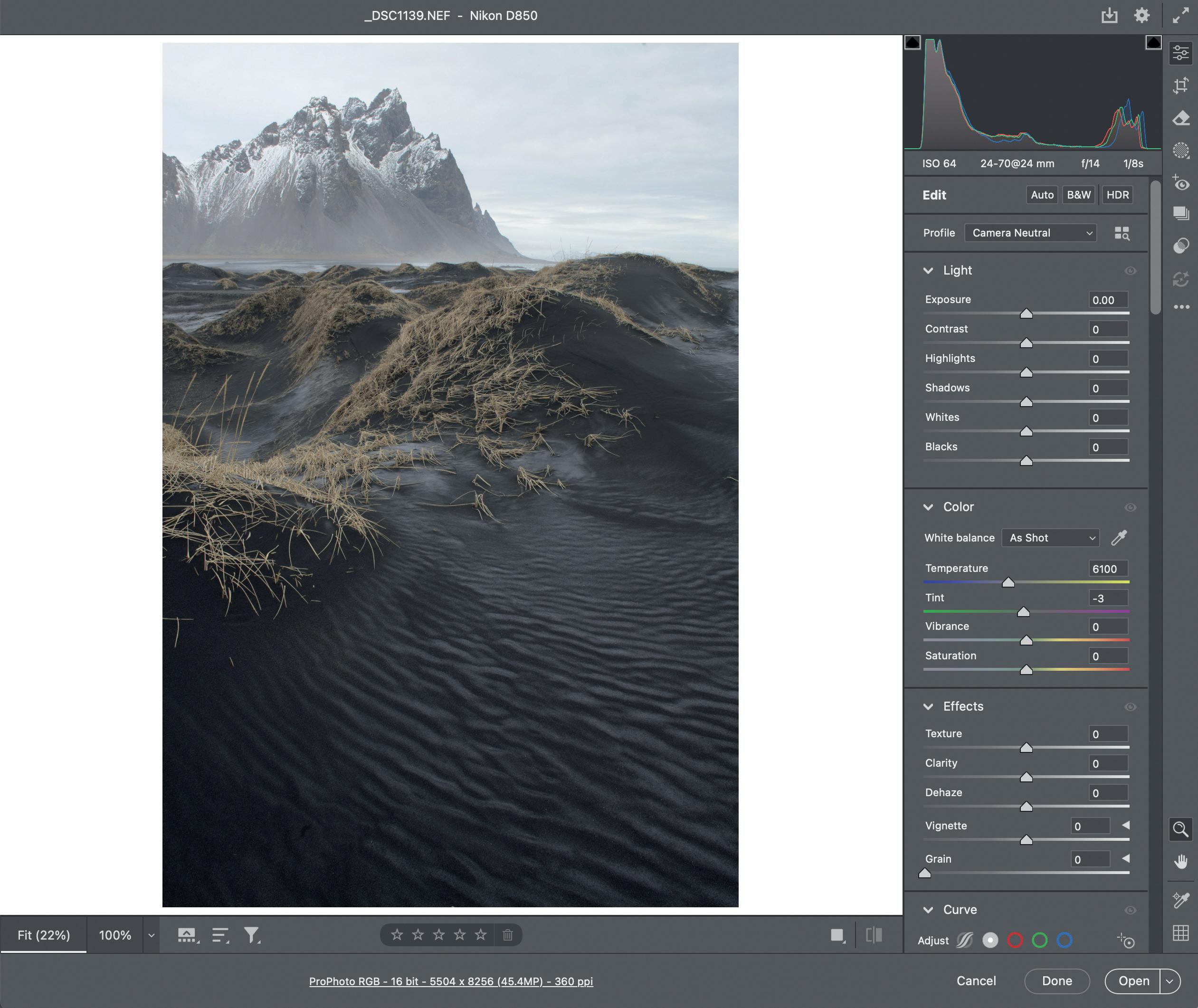
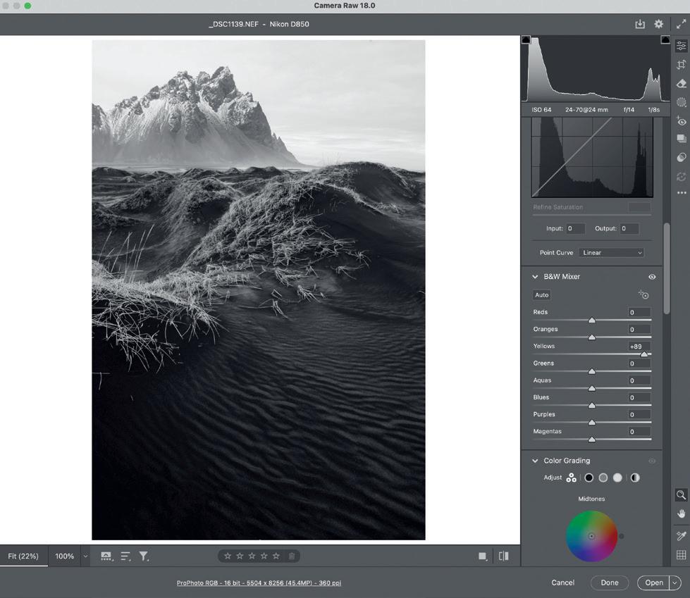
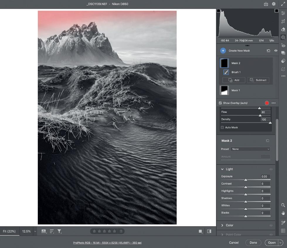
and certainly underexplored. When I spent many years in darkrooms, it was seldom a complicated process and often involved using pieces of wire with different shapes attached to the end to dodge or lighten and sheets of card with holes cut out of them to burn or darken. Even to this day, I try to maintain a simple approach to enable my mind to enjoy and explore the image before me evolving and flourishing, whilst employing the simplest of sliders and the brush tool to create masks for localised adjustments. (Fig 1)
Celebrating Simplicity
The image I have chosen to explore was taken on the south coast of Iceland at the amazing coastal location of Stokksness, looking towards the beautifully dramatic mountain of Vestrahorn, on a bitterly cold winter morning. As we often find, the raw image file is exposed with no clipping and the focus is pin sharp but the image looks flat and pretty lifeless; a far cry from the drama I experienced being there. (Fig 2)
South Iceland is almost a monochrome landscape so I decided when I was making the exposure that it was to be completed as a black and white portrait of the landscape. With that in mind, my first decision was to convert the image into black and white. The only real colour slider I had at my disposal in B&W Mixer was yellow as it was the only colour in the scene so I used this to lighten the yellows of the grasses in the foreground so that they stood out from the black sands. (Fig 3)
Fig 2
Fig 3
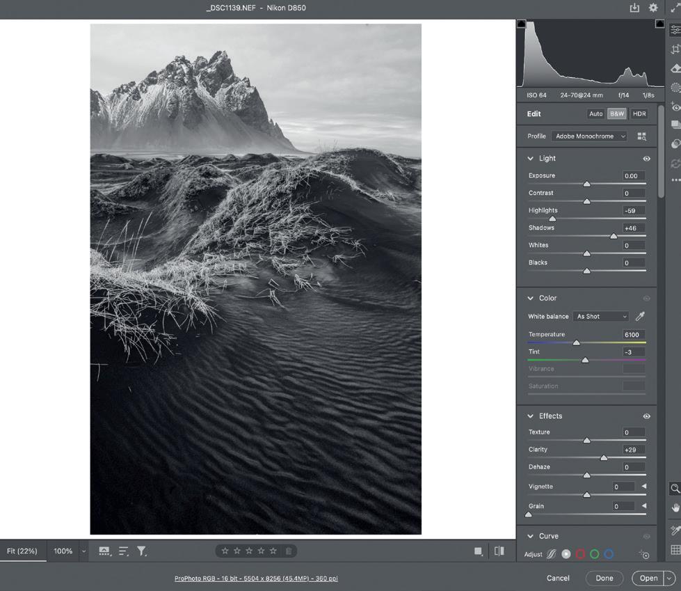
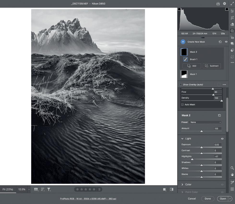
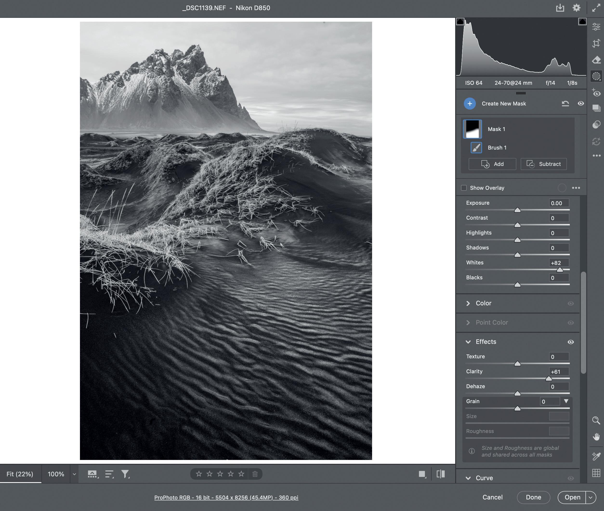
Now that I had entered the wonderful world of black and white I wanted to edge closer to achieving the tones I saw when I was there making the exposure. Firstly, the tonal relationship between the sky and the foreground black sand was present but incredibly muted in the raw file when converted to monochrome. I then used the highlights slider to reintroduce texture and tone into the sky and the shadow slider to bring out some very important detail in the black sand. Having suppressed highlights and brightened shadows, I then deployed clarity to widen the tonality even more.
(Fig 4 & Fig 5)
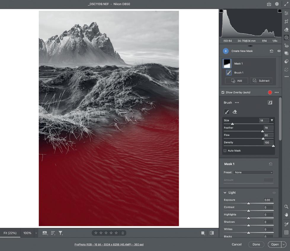
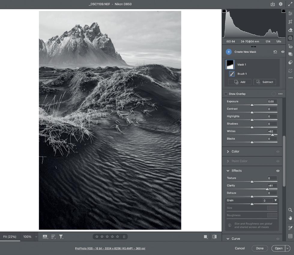
The evolution of the image was now making progress and I had expended the use of global adjustments at this stage using the basic sliders so now it was time to make some simple brush masks. My first mask was applied to the dark sands in the foreground. What cannot be seen in the raw file is that overnight, as the temperatures dropped, the moisture in the sand created white ice crystals that had pushed their way to the surface, beautifully depicting the wind ripples on the sand’s surface. Having brushed the mask over the area, I chose the white slider so it would pick the brightest of pixels in that area, the ice crystals, and lighten them. I followed on from this by adding clarity to the masked area to further separate the mid tones.
(Fig 6 and Fig 7)
Fig 4
Fig 5
Fig 6
Fig 7
Next, I decided that the upper left side of the sky was still a little bright and lacking texture so I brushed in a small mask and lowered the highlights, giving more balance to the sky. (Fig 8)
Given that the image now displayed all the textures in the ice crystals and black sand and the sky was full of rich mid tones, all that was left for me to do was set the final black and white points to ensure the image had a full tonal range from black to white.
If we now look back at the original file it looked rather lifeless and was a far cry from what I had previsualised when making the exposure. I could have made the entire process far more complicated with making selections of the sky and mountain and applying more intricate adjustments in the sand but images seldom need this. If the global sliders are used to their full potential, then little is left needing masks and selections and the resulting image tones sit together comfortably as one.
Paul Gallagher and Michael Pilkington FRPS run a series of intensive image editing courses online. These can be found at www.aspect2i.co.uk/tours-and-workshops/ category/learn-from-the-experts.
Paul’s website is: www.paulgallagher.co.uk/
Fig 8
The Altered Landscape
Michael Hall
In the second of our series on the impact of humanity on the landscape, acclaimed New Zealand photographer, Michael Hall, shares with us his views and images on the speed at which glaciers in the High North and elsewhere are melting.
www.michaelhall.net
In street photography, it is the decisive moment that matters most. In landscape photography, however, timing takes on a different meaning. Weather, time of day and, perhaps, just as importantly, time of year become critical. The farther one travels from the tropics, the more dramatic the seasonal shifts. In the polar regions, it could be argued
that everything depends on the seasons.
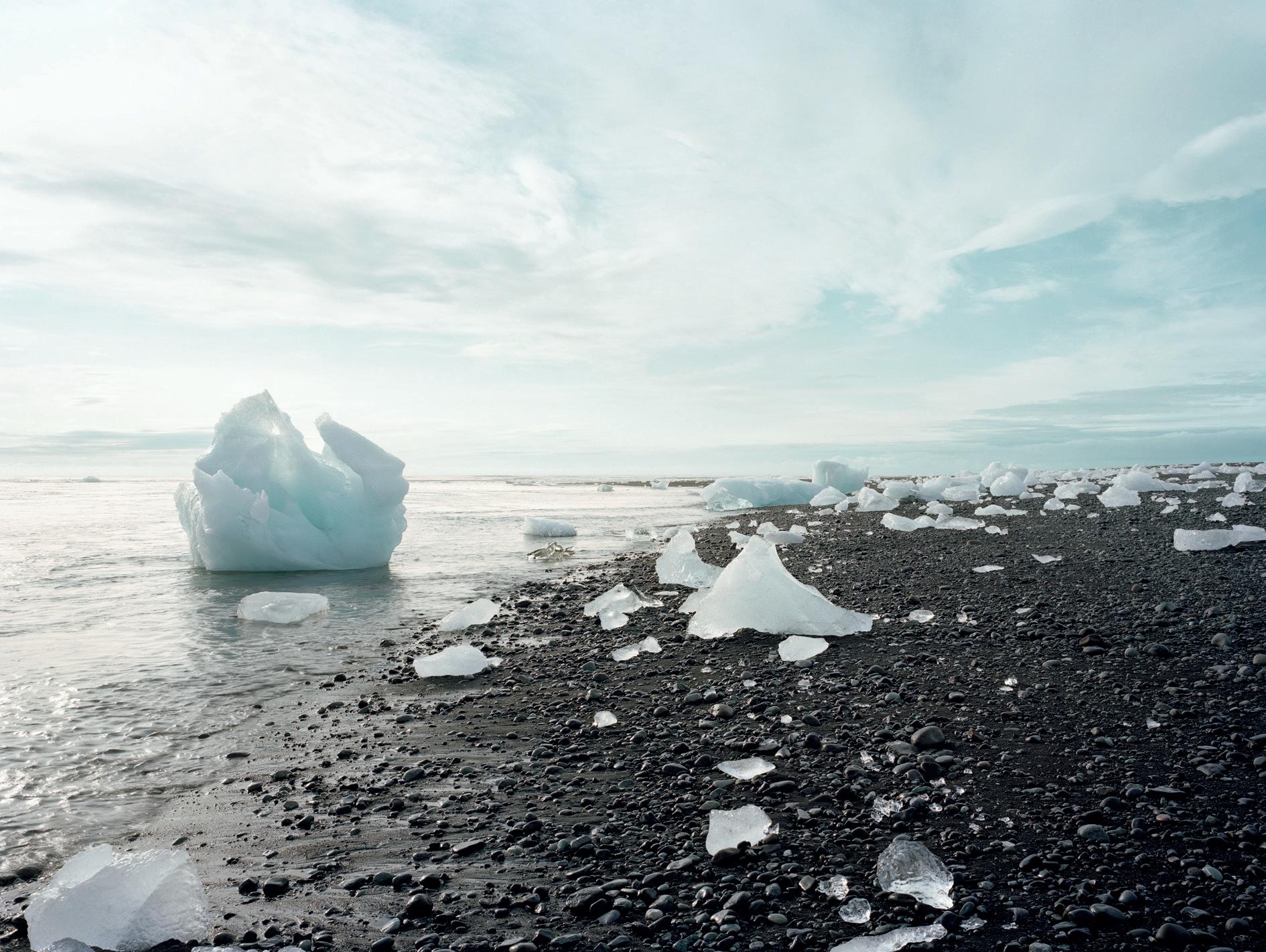
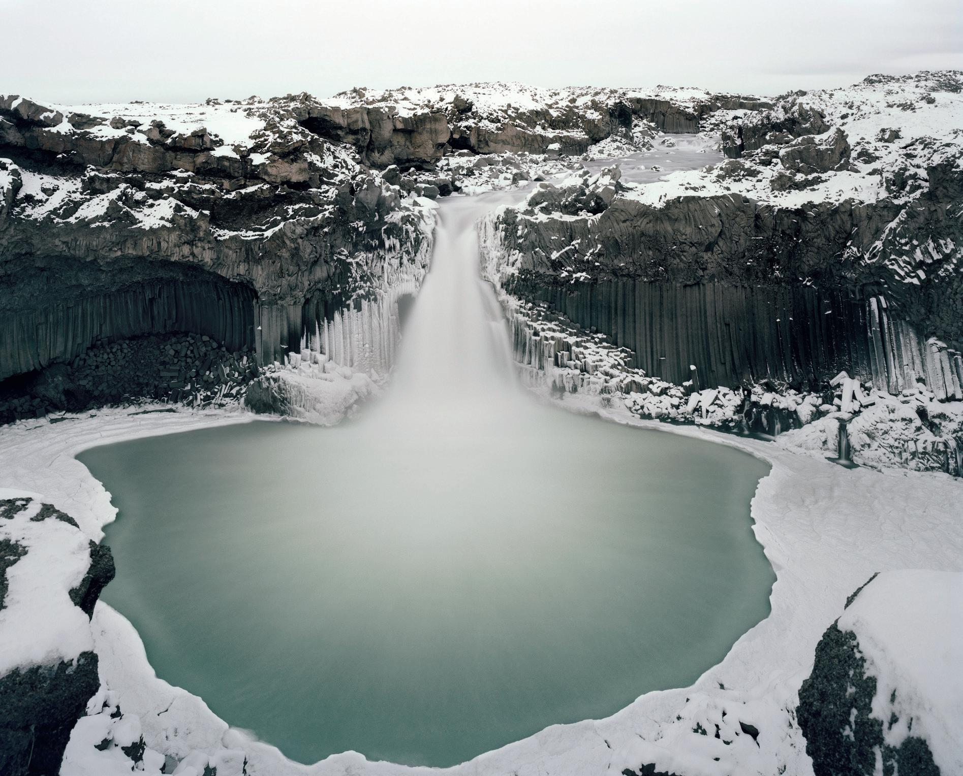
It was more by luck than careful planning that I found myself in Iceland at precisely the right time, at the onset of winter. The waterfalls were just beginning to freeze and the air was cool enough for large shards of ice to settle on the black volcanic beaches
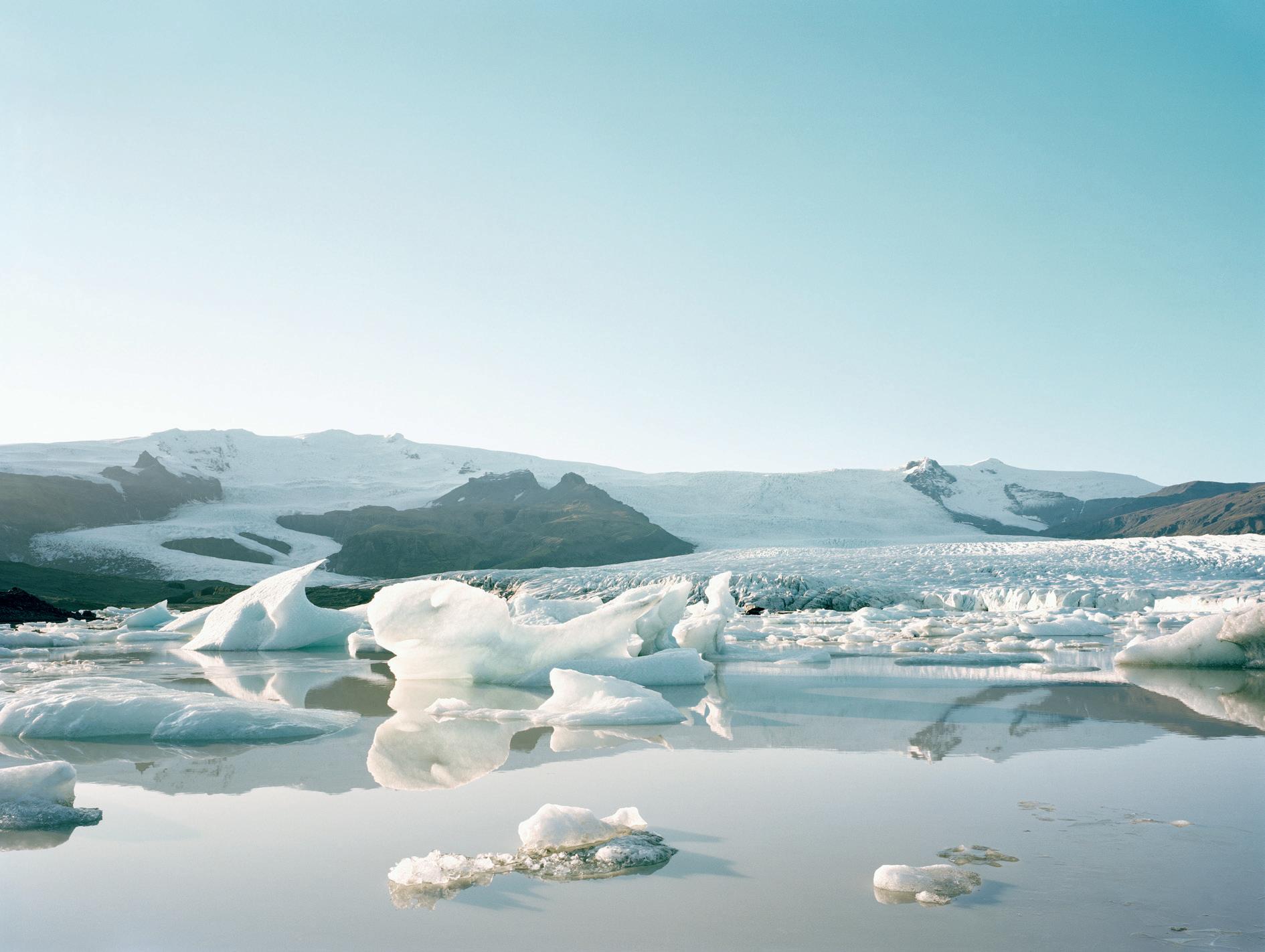
of Jökulsárlón. These fragments, ancient ice calved from the Vatnajökull glacier, briefly came to rest before being reclaimed by the ocean currents. The 8,100 sq. km Vatnajökull ice cap is the largest ice cap in Europe by volume. The 300 or so glaciers that cover more than ten percent of Iceland are losing, on average, 11 billion tonnes of ice per year.
Jökulsárlón, Iceland.
Ice-Melt
My experience in Greenland, however, was somewhat different. The sky was cloudless - featureless and uninspiring. The sun brought near-tropical warmth and, for most of the endless day, the light was harsh and flat. There was a brief twilight glow on either side of what almost – but never quite – became a sunset. The light was postcard-pretty but it was not what I had come for. Not only had I chosen to visit in midsummer, a miscalculation on my part but, more crucially, I had also arrived a decade or two too late.
I was fortunate to have been invited aboard a polar expedition vessel as the ship’s photographer, lecturing alongside a small team of climatologists and glaciologists. Many of them had spent years studying the very glaciers on our itinerary, developing an intimate understanding of landscapes that are now changing before our eyes. The Arctic landscape is changing; it has changed. The climate scientists and glaciologists aboard the expedition ship - many of them seasoned experts - spoke of landscapes they had once known, places that will never be seen again, at least not by human eyes.
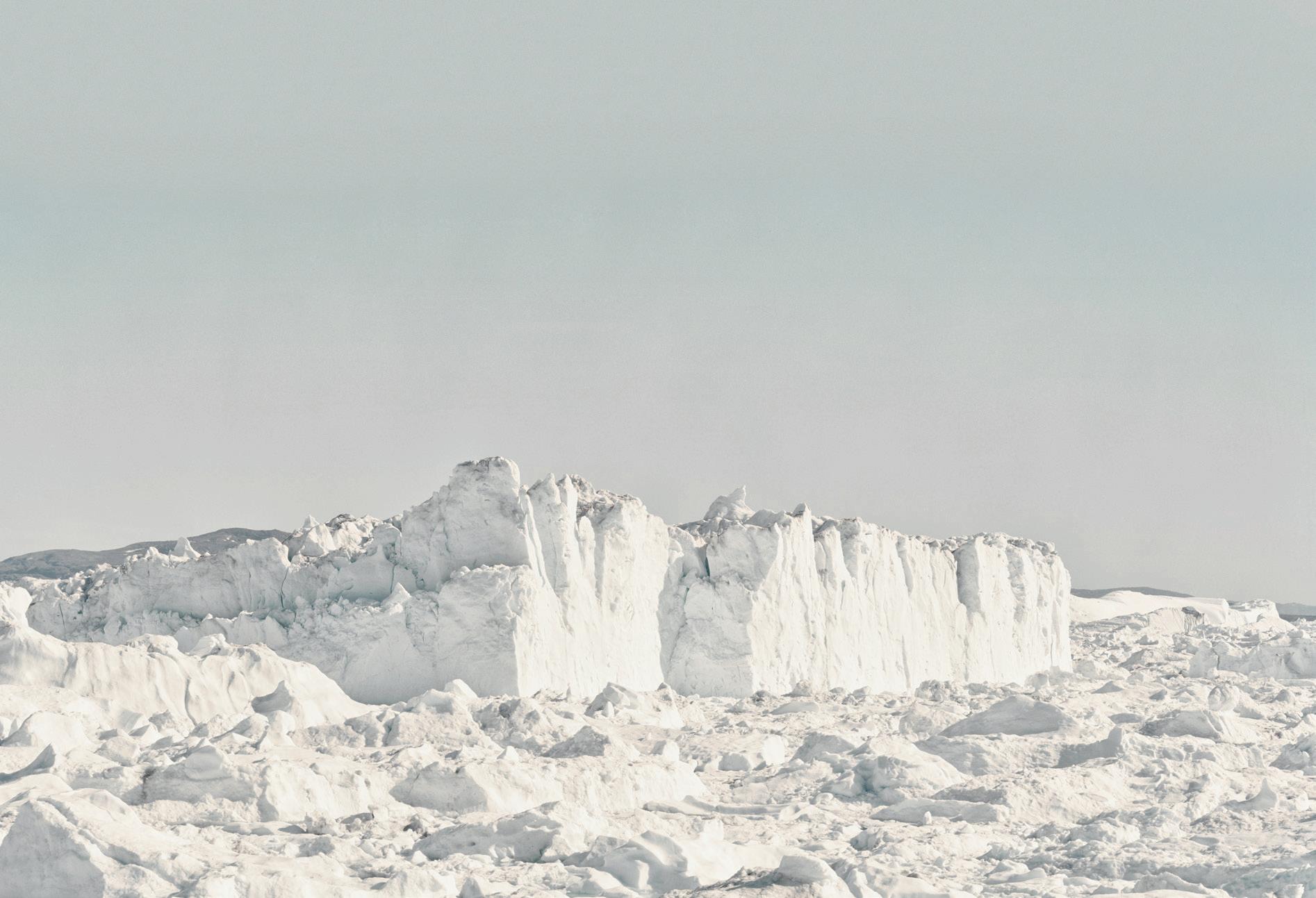
Ilulissat is a coastal town in western Greenland. It is known for the Ilulissat Icefjord and for huge icebergs. Disko Bay, the Greenland Ice Sheet, is the second largest body of ice in the world, covering approximately 80% of the island’s surface (about 1.7 million square kilometres). It is currently losing mass at an accelerating rate, with studies indicating it is melting six to seven times faster today than in the 1980s.
Jökulsárlón, Iceland. Ice ends up on the black volcanic beaches on the southern shore of Iceland.
Iceland.
While most people are aware that the Arctic ice cap is shrinking, fewer realise that the immense icebergs carved from Greenland’s glaciers are diminishing as well. Not so long ago, these icebergs rose like cathedrals, their vast spires piercing the sky. Greenlandic accounts and Western records from the past 150 years describe ice formations
that emerged after the retreat of the Vatnajökull
on a scale that is now almost unimaginable. One report from 1890 tells of icebergs reaching heights of 121 metres. That landscape, always temporary by nature, has now been lost. Today’s icebergs, though sometimes still immense, are different in character. Where once they towered like frozen architecture, they now more
often resemble whales; rounded, subdued and comparatively uninspiring. The great cathedrallike forms of only a few decades ago would take months before eventually capsizing, transforming into those softer shapes. That transformation still occurs but the monumental beginnings are increasingly rare.
Jökulsárlón,
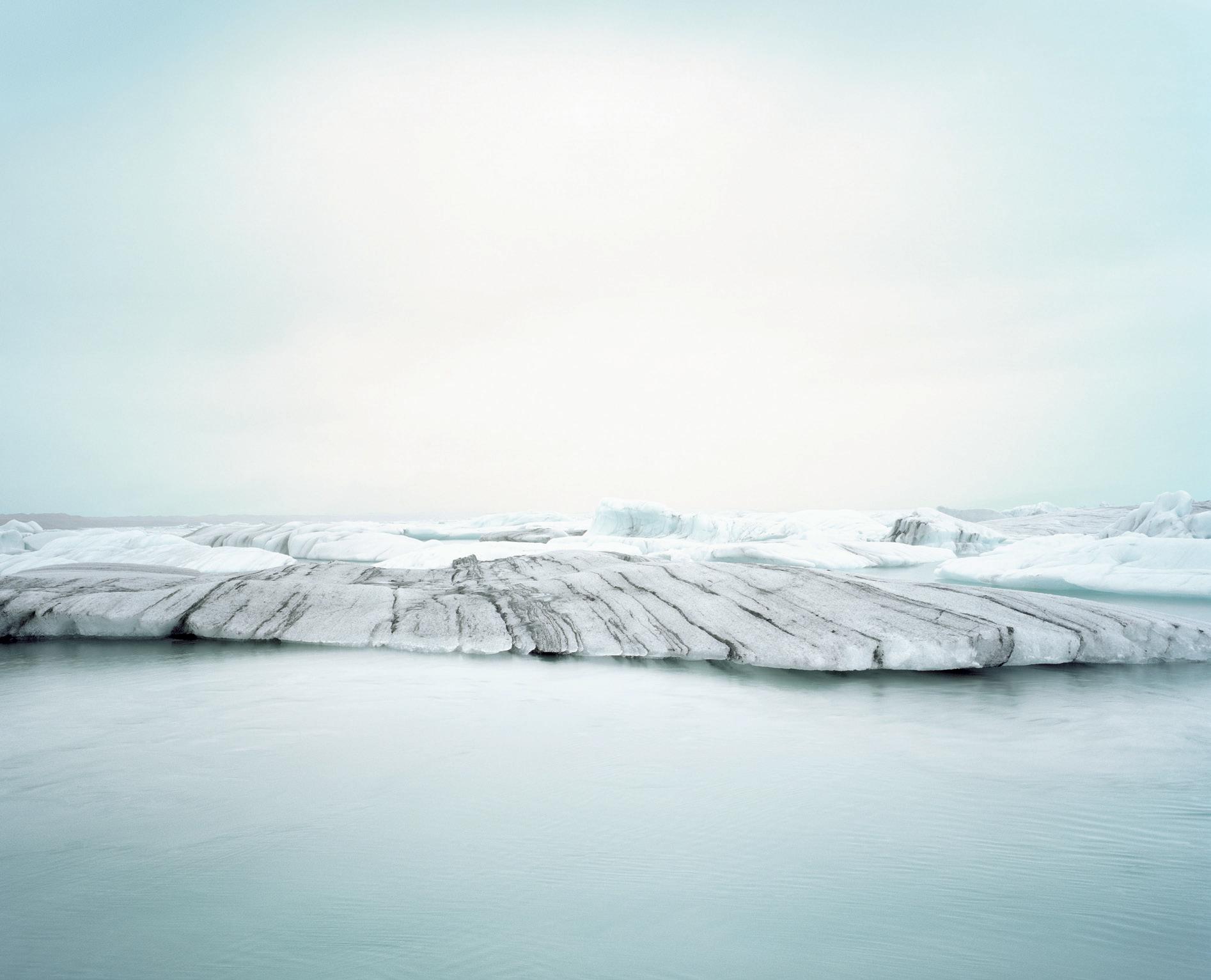
Striated ice
glacier.
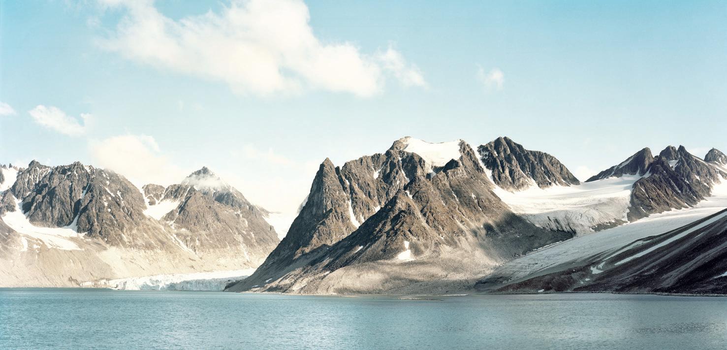
Magdalenefjord, Svalbard which lies within 600 nautical miles from the North Pole.
Aldeyjarfoss, Iceland starting to freeze over in early winter.
Ilulissat, Greenland
The Arctic holds not only scientific importance but also profound visual power. Global attention has long focused on its melting ice. What I had not fully appreciated before undertaking this work was just how much natural beauty we are losing along with it.
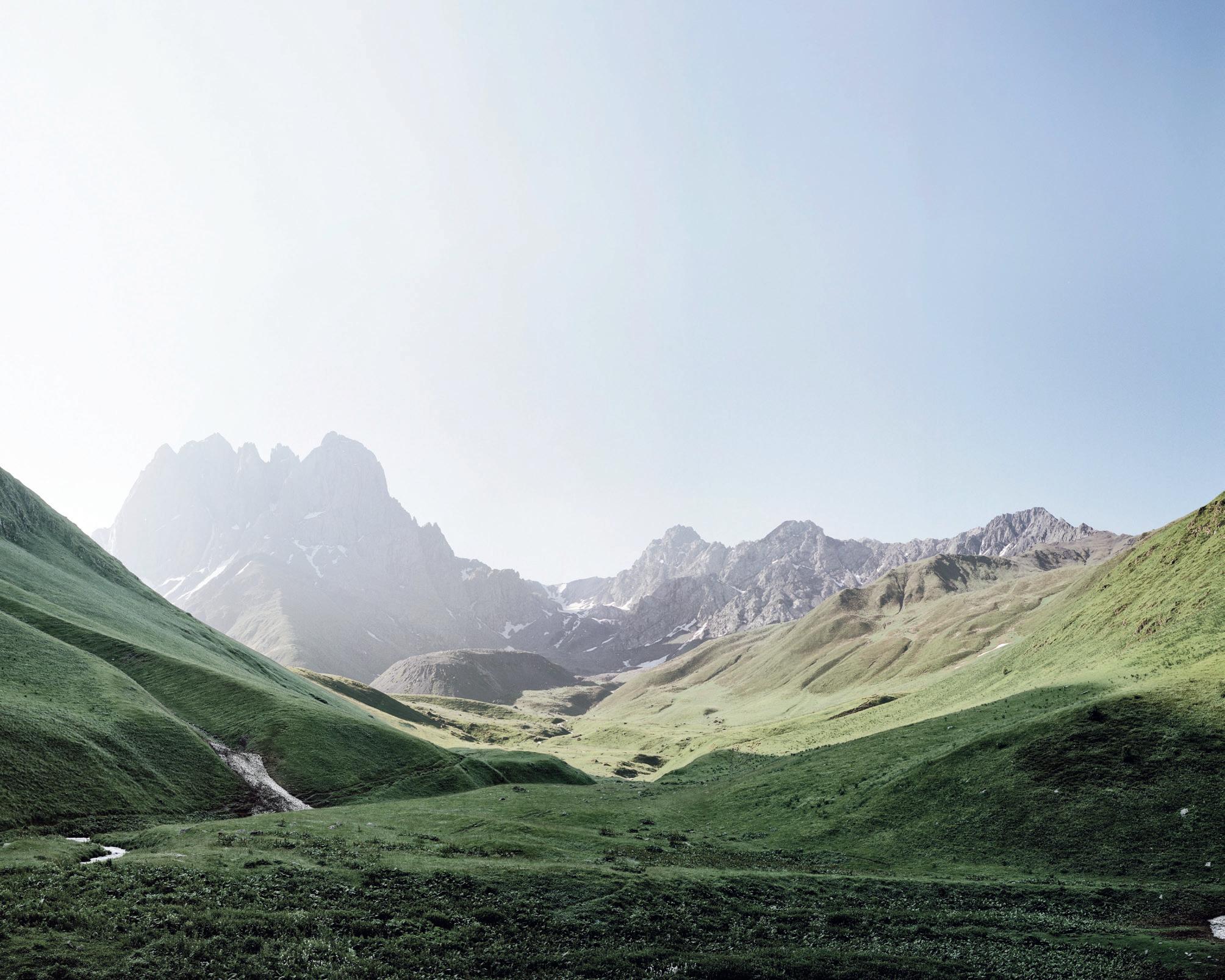
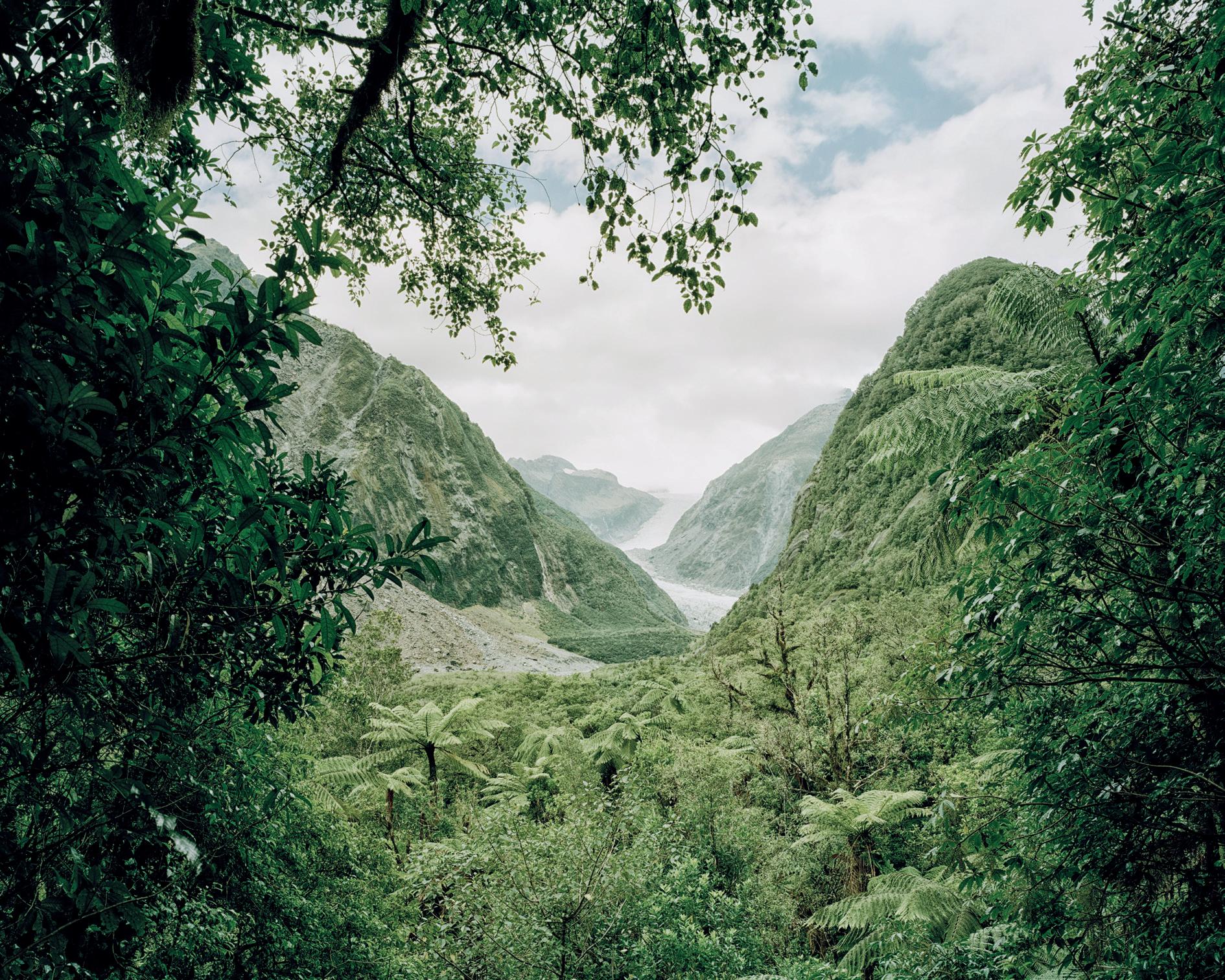
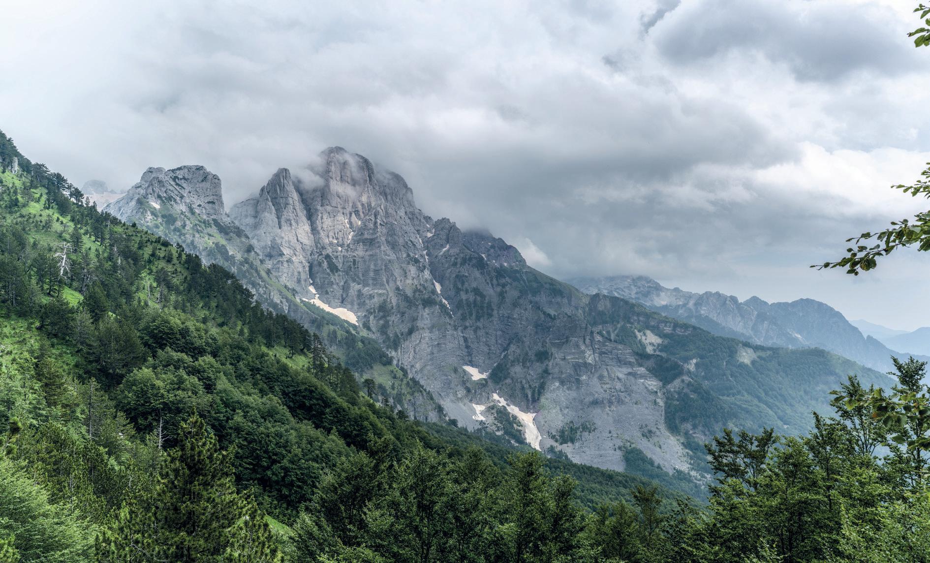
Much of my photography centres on the northern polar regions, particularly Greenland, and the glacial melt arc stretching through Iceland and Svalbard. However, I have included in this series of images one from the Southern Caucasus in Georgia, where summer ice is fast becoming a
thing of the past, another from Northern Albania and another from my home country of New Zealand, where the crisis of the North is being echoed in the South.
We are losing our ancient ice at an alarming rate. The warming of the planet is happening faster and more dramatically in the cryosphere (the term given to the regions of our globe which are covered in ice and snow) than anywhere else on Earth. The Guardian Online reports that sea-ice coverage in the Arctic has shrunk by nearly a third since
1979. Researchers now fear that new threats to climate stability are about to be unleashed in the Arctic.
From the outset of my wider photographic project on The Altered Landscape, I knew that ice-melt would form a central chapter in my broader body of work on climate change. As I began mapping out the project, exploring both the causes and consequences of a warming planet, I have come to believe how essential it is to tell this story.
Southern Caucasus, Republic of Georgia. Summer ice is fast becoming a thing of the past in these high altitude peaks of the Southern Caucasus mountains.
Franz Josef Glacier, South Island, New Zealand.
Theth National Park, Northern Albania.
Trench Warfare
Photos by Pia Thommes LRPS Words by
David Haigh
Pia and David introduce us to the landscape of Kinder Scout, where a strategic mix of ancient peat accumulations and the rills created by the water running through it have created a most unusual landscape that alters with the seasons.
Mention the word “Trenches” and one could be forgiven for immediately thinking of the horror and squalid life endured by the many thousands of unfortunate soldiers posted to Ypres, The Somme, Passchendaele or countless other battlefields of the Western Front during the First World War. However, there are other trenches, much closer to home, that bear closer inspection and, whilst sharing many of the attributes of their infamous namesakes, offer an altogether safer and more fascinating landscape well worth exploration by those brave enough to venture into them.
The setting for this most unlikely of battlefields is Kinder Scout in the Peak District National Park. The summit of Kinder Scout, the highest hill in the Peak District, is at 636 metres elevation and surrounding the summit lies the truly vast Kinder Plateau. This plateau of undulating and very rough heather upland and moor is approximately triangular and measures some 10 x 7 x 4 kilometres on its Northeastern, Southern and Western aspects respectively, some 15 square kilometres in total area. Most of the plateau lies above the 600 metre contour line and it’s cold and wet up here, very wet.
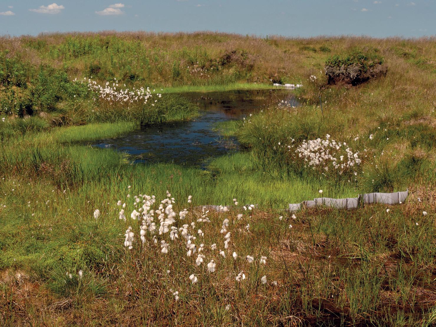
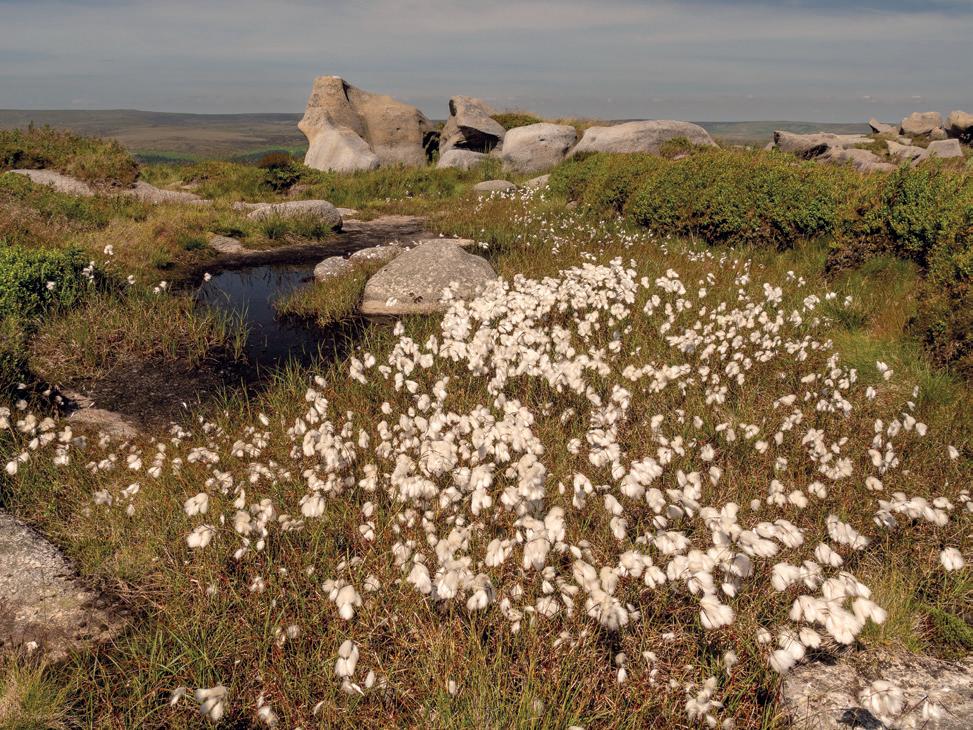
A deep cotton grass pond collected behind a corrugated plastic dam.
This combination of cool temperature and seemingly constant rain means that the vegetation doesn’t decay completely but, instead, over thousands of years this partial decay has formed a deep layer of blanket peat bog, in places up to 4 or 5 metres deep! This is one of the most spectacular and extensive areas of blanket bog anywhere in the UK, a vitally important ecosystem storing vast quantities of carbon dioxide and acting as a giant sponge-like reservoir, slowly releasing water into upland streams all year round.
It is thanks to this constant slow release of water that Kinder Scout has developed its own fascinating set of trenches or gullies; “Peat Groughs” to use the correct terminology. These channels formed naturally as water drained from the peat layer and can be anything up to 5 metres deep, with widths varying from tens of centimetres to several metres. On the main plateau, five substantial drainage systems have evolved, each of which eventually tumbles from the rim of the plateau. To the west runs the main Kinder River, carving its way between the massive Gritstone outcrops of the Kinder Gates before ending at the impressive and well-known
waterfall, the Kinder Downfall. To the north runs the Fair Brook stream. To the northeast, Blackden Brook plummets into a deep gorge as it leaves the plateau edge. Grindsbrook flows southeast to descend a chaotic boulder slope into an equally spectacular gorge and, to the south, the Crowden Brook stream descends a series of waterfalls and cascades. These main streams are fed by water from hundreds of smaller peat groughs, which crisscross the landscape, intersecting and combining to increase the flow of water into each of the main drainage basins.
Visit the plateau on a lazy day in summer and the call of the curlew is hauntingly beautiful, the grouse cackle explosively when disturbed, the cotton grass shimmers in the breeze, the heather’s sweet perfume rises from the blanket of purple and the view stretches panoramically from horizon to horizon. However, when thick clouds and heavy driving rain blanket and buffet the hill, pinpoint accuracy in map-and-compass navigation is required to get from A to B and route-finding across the inner plateau can be a nightmare of truly horrific proportions. Then the peat trenches loom out of the mist,
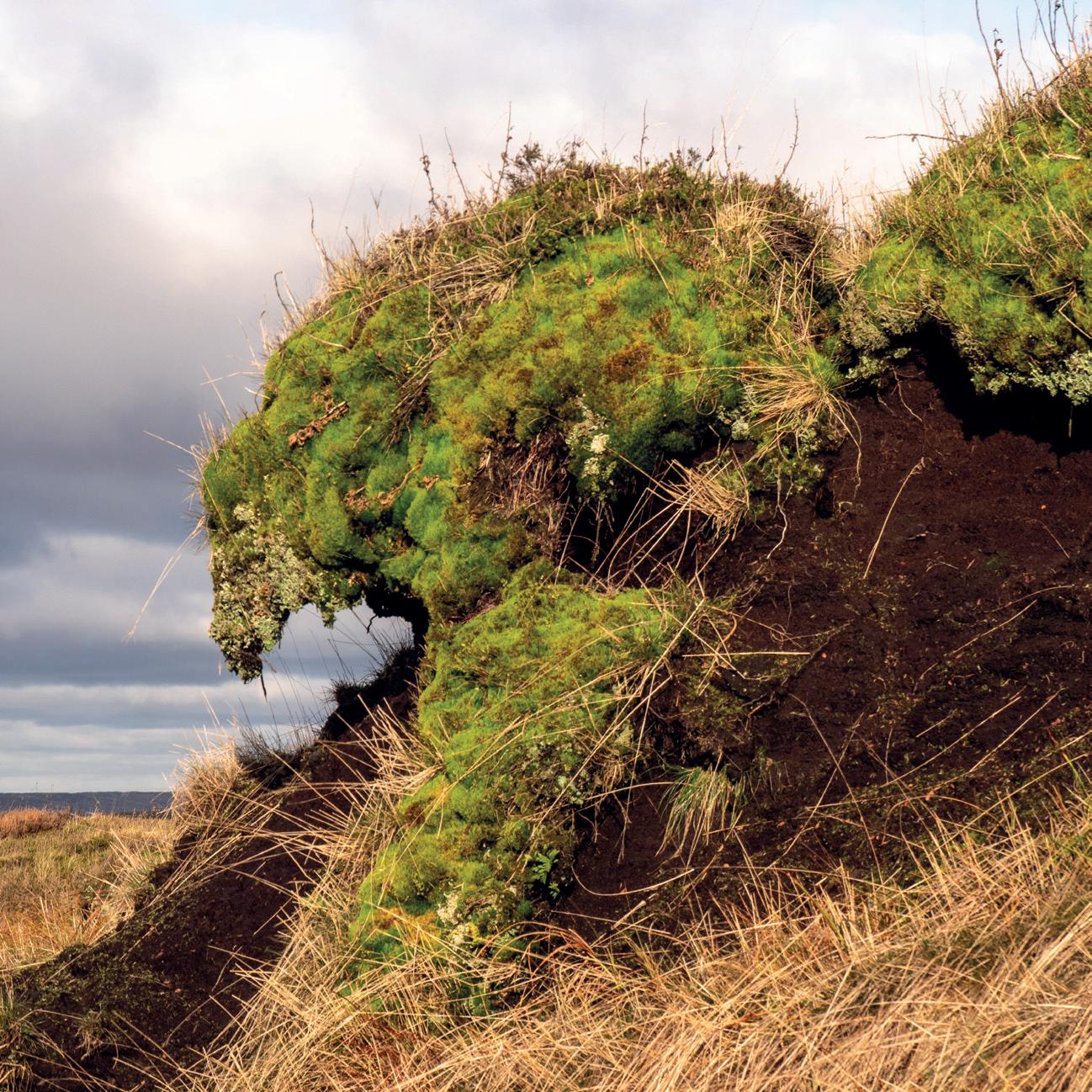
Overhanging peat covered in moss and lichens is reminiscent of pictures made by Arcimboldo.
presenting an endless succession of deep, steep sided, wet, muddy and seemingly impregnable obstacles, each determined to thwart all onward progress. Sinking into the bog whilst traversing the Kinder Plateau is commonplace and definitely not to be underestimated. Ankle depth presents no real problem other than the risk of leaving a boot behind; knee depth will often require the assistance of a friendly tug, whereas thigh depth or worse (!) will require an almost herculean effort to escape from the bog’s very powerful suction. This is the stuff of countless epic tales recounted late into the night in local hostelries! The analogy of Kinder’s bogs with the squalor of the First World War battlefield is not lost; Trench Warfare indeed!
Yet, paradoxically, these very same trenches can be the walker’s best friend. The bottoms of many gullies offer solid and reasonably clean, albeit often wet (splashy), conditions that allow speedy progress across the plateau. Key to navigation here is the realisation that, irrespective of which gully is being followed, all gullies in any particular drainage system will eventually converge into the main stream. Navigation from one drainage watershed to another
can thus be accomplished relatively quickly and with minimal fuss by those who have intimate knowledge of the topography of the hill. Choose the correct trench to follow and progress is easy; choose the wrong one and it can be a very different story! Over the last decade we have spent countless hours exploring this most bizarre of landscapes. Today, armed with our knowledge of the trench network, we can very easily cross the “No Man’s Land” of the inner plateau north to south or east to west, almost without being seen as we disappear into one deep gully and reappear from another gully hundreds of metres away!
Walking along the bottom of these hidden trenches provides a fascinating insight into the composition of this almost subterranean world. The bedrock of the plateau is gritstone. Normally, only seen at the edges of the plateau, where it affords a series of crags and strange shaped rock outcrops, the gritstone is also seen in many of the deeper gullies, where the water erosion has cut completely through the peat layer, leaving exposed and steep-sided peat banks that tower well above head height, sometimes giving a real sense of claustrophobia and
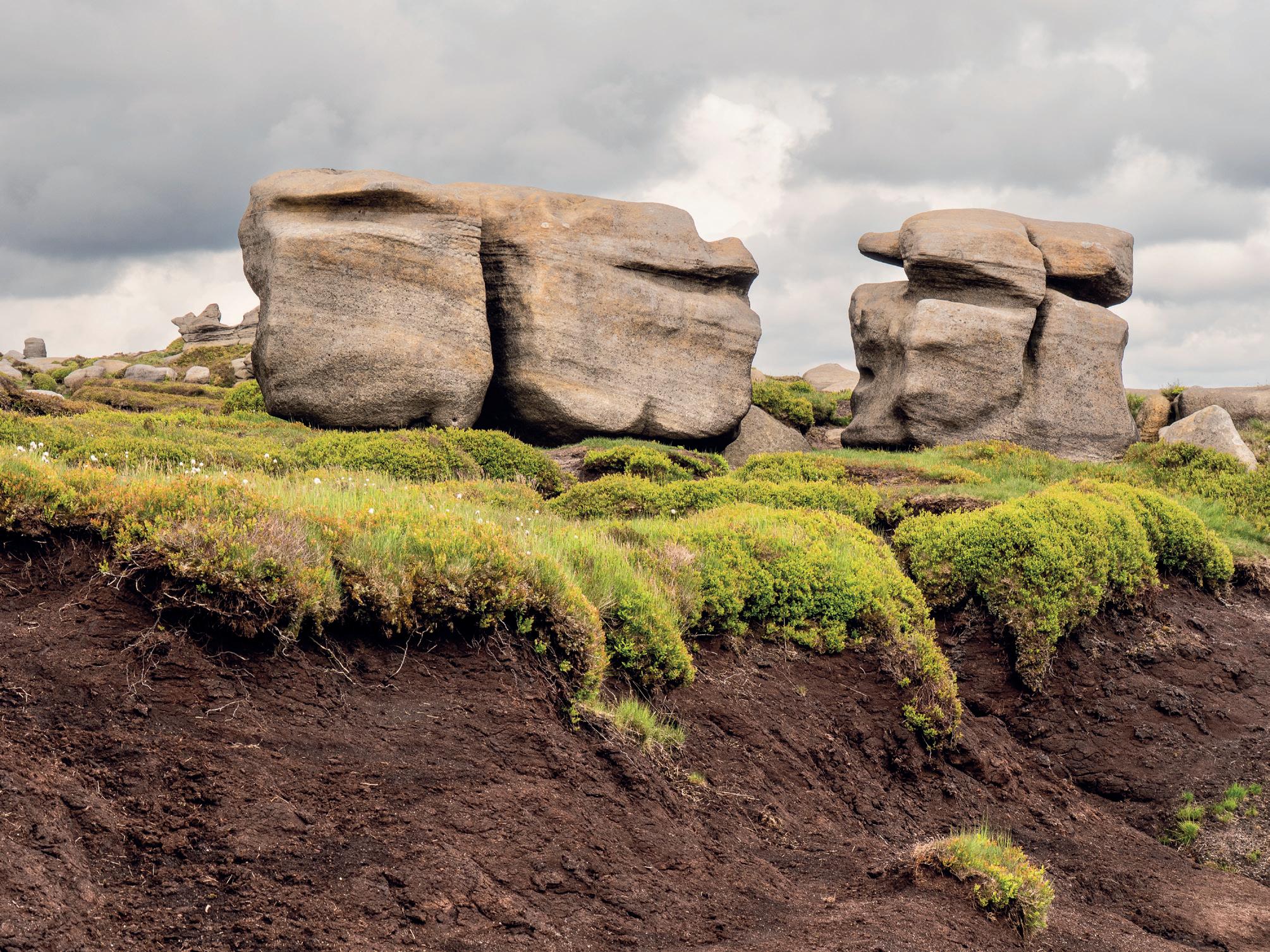
The “Woolpacks” sit on top of a thick peat layer.
disorientation as they weave their contorted waterworn meanders. The peat slopes contain fibrous remnants of the previous vegetation, whilst at the top of the slope, mats of more recent vegetation hang like curtains, undermined by the eroding peat. The peat ranges in colour from light brown to jet black, changing with the extent of water saturation. Huge water-sculptured gritstone boulders lie halfsubmerged in the banks of the channels, remnants of a time before the peat evolved. In places, there are also peat caves, where water has eroded an underground route from the surface of a gully to reemerge at the base of the peat layer on contact with the impenetrable gritstone. Usually, such caves are transient features made of relatively small channels but, very occasionally, larger ones more than 1 metre diameter can be found. They are notoriously prone to sudden collapse and should not be entered.
Exposed peat slopes erode very easily and, in places, have also suffered the pressure of thousands of pairs of boots, a problem worsened by modern smartphone users all downloading and religiously following the same poorly thought-out GPS routes across the plateau. When wet, the disturbed areas quickly turn into a deep black morass; when dry, the slightest wind blows away the peat dust in a pseudo-Saharan sandstorm. It is estimated that the blanket bog naturally increases in depth at a rate of approximately 1 millimetre per year, so the 4 or 5
metres depth of the peat on the plateau represents at least 4000-5000 years of deposits. It is thus very sobering to see how quickly human activity is destroying this most fragile of landscapes.
Water erosion of the peat layer is also a serious issue. Not only does this denude the plateau of peat but sediment washing into the local reservoirs turns the water brown and causes major filtration and sedimentation problems for the water company. To combat this, the National Trust, the Moors for the Future project team and the Water Authority have now dammed many of the peat gullies on the plateau. Historically, dams were built either with timber or ugly plastic shuttering but, more recently, and more environmentally sympathetically, with stone ballast. The peat sediment collects in ponds behind these dams, in effect re-modelling the peat layer in the process. Over time, these areas are colonised by new vegetation and the peat is stabilised but, in newly dammed areas, large and sometimes deep lakes form – an often-impenetrable aquatic barrier to further inhibit the progress of the walker!
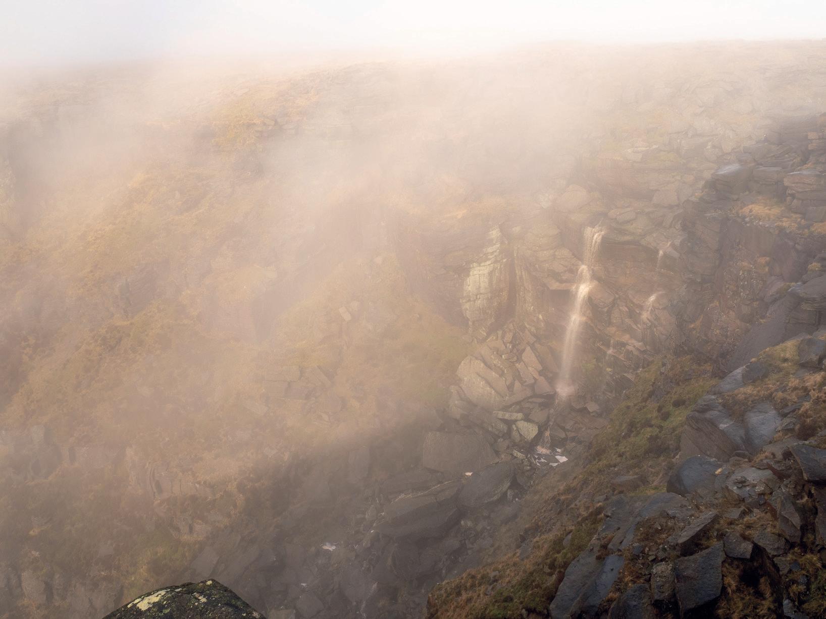
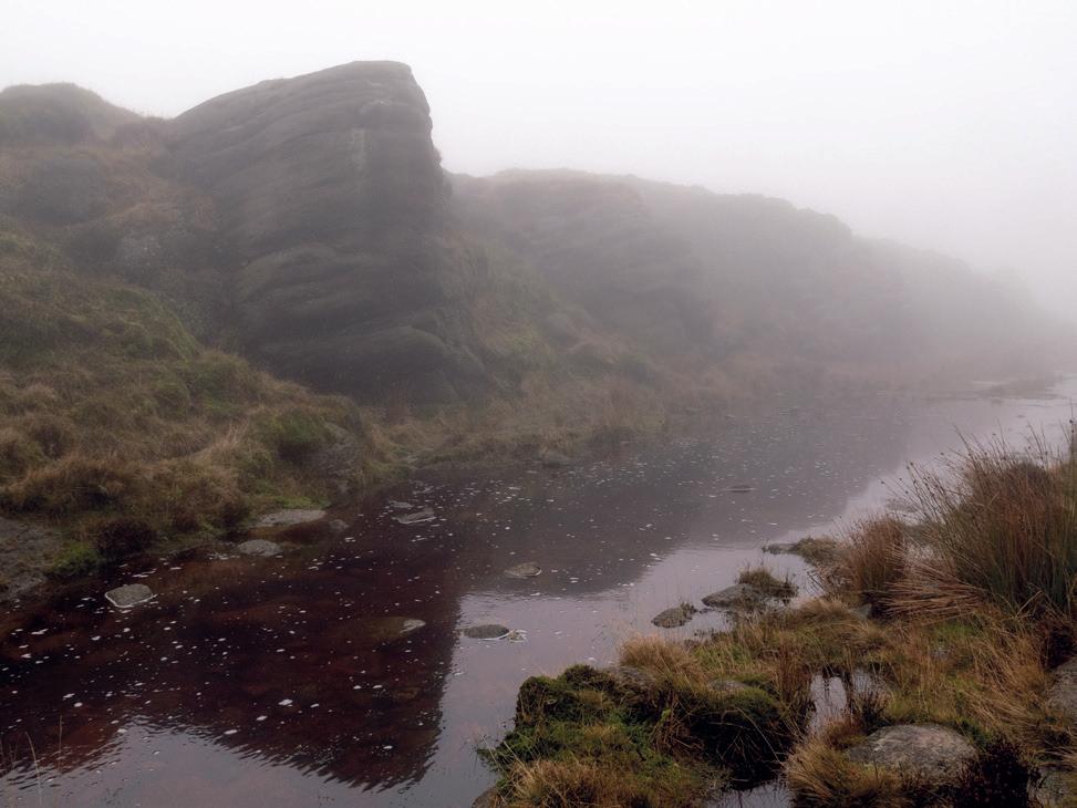
At the Kinder Downfall, the Kinder River plummets from the edge of the plateau in mist.
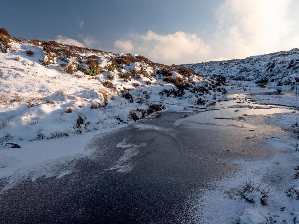
Visiting the plateau in winter presents its own series of logistical challenges. Sometimes heavy snow blankets the hill, obscuring all but the deepest gullies. Here, there is a very real danger of falling through crusted snow into the deep chasms lurking below. Several years ago, David found himself suddenly and unexpectedly stuck neck deep in snow, feet dangling above the ground, having partially broken through into a deep and unseen underlying gully. Beware! On a more positive note, sub-zero temperatures make the peat freeze solid, making normally squalid areas delightfully simple to cross, though crampons are then advisable to afford traction on the vast sheets of ice and permafrostlike hardened ground. More interestingly still, walking in the gullies in blizzard conditions gives the most unusual monochrome vistas, the black peat contrasting vividly with the all-encompassing greywhite spindrift of the snow and leaden sky, broken
only by the flash of the Mountain Hare in its winter coat darting across the landscape. Alternatively, perhaps the winter visitor will be fortunate enough to explore the plateau on a day when cloud inversion blankets the surrounding valleys, leaving the plateau seemingly suspended like an island in the sky, ethereal and majestic, adding further magic to this very special and most unusual of landscapes.
In summary, the interior of the Kinder Plateau is a truly fascinating and magical place, well worth a visit. Here is the perfect opportunity for peace and total solitude, far away from the countless hordes that process, seemingly endlessly, along the paths around the circumference of the plateau. However, be prepared and take careful note of the cautions offered above as crossing the plateau can be timeconsuming. This really is not the place to get caught out in bad weather or fading light!
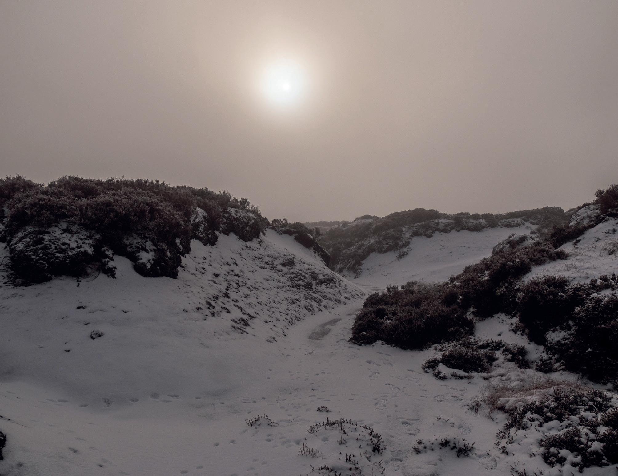
Pseudo-monochrome photography: Exploring the trenches on a hazy winter’s day.
Cotton grass pond at the edge of the Kinder plateau.
Vivid green moss at the bank of the Grindsbrook River.
Competition Winners 2025
Overall Winner of 2025
Congratulations Mark Sims ARPS - Overall Winner.
Many thanks to fotoVue as sponsor of the RPS Monthly Group Competition throughout 2025, with each winner receiving a fotoVUE photo-location guidebook of their choice.
This year, we have asked great friend of the Landscape Group and legendary landscape photographer, Thomas Heaton, to judge the overall winner, who will receive a signed copy of one of Thomas’s books.
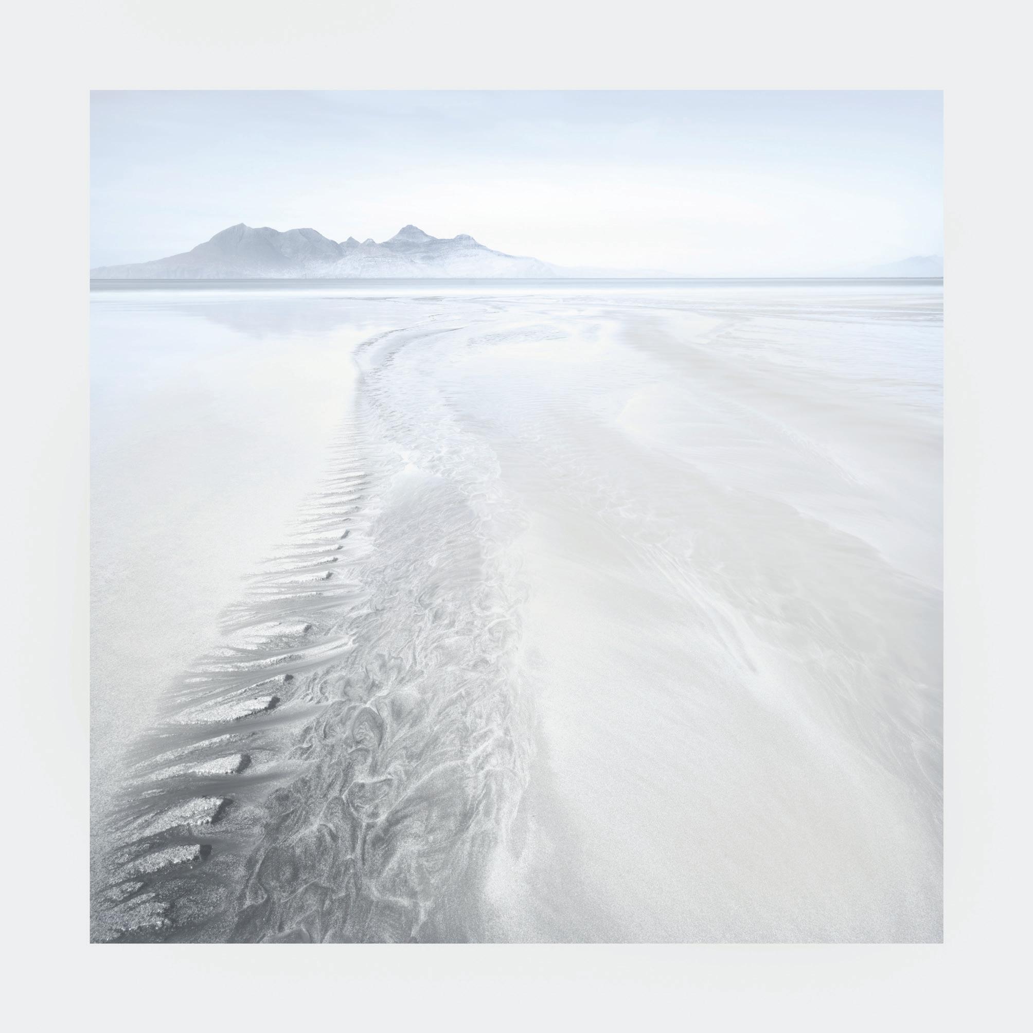
Winning Image: May: Towards the Isle of Rum by Mark Sims ARPS
“Mark’s image of a secluded beach stretching out towards the Isle of Rum was a stand-out photograph amongst some incredibly tough competition. After having spent several days with the final 12 images, this photograph sat quietly in the group and, slowly, the quality began to shine through. Mark’s choice of a 1:1 aspect ratio supports the subject matter well. This, along with the post processing style, results in a beautiful painterly-like image that whispers rather than shouts. Mark’s use of negative space on the right hand side gives a sense of calm and, at the same time, offers the viewer a feeling of expansiveness that expands well beyond the frame”.
Thomas Heatons’s website is: https://thomasheaton.co.uk
His YouTube Channel (scan the QR code to visit) has over 600,000 followers and has almost 700 videos covering all aspects of landscape photography.
January: Spittal Beach by Mike Lloyd FRPS
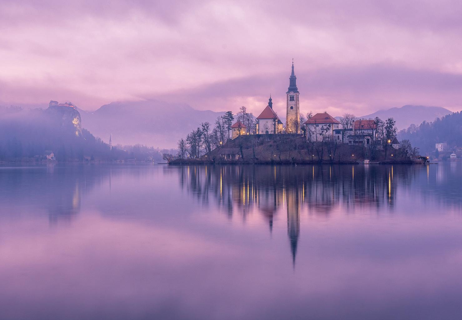
February: Lake Bled Dawn by Mark Hetherington ARPS
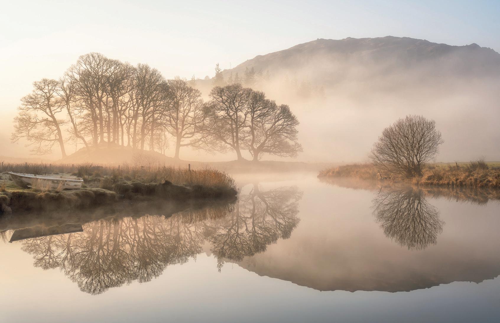
March: Brathay Calm by Mark Hetherington ARPS
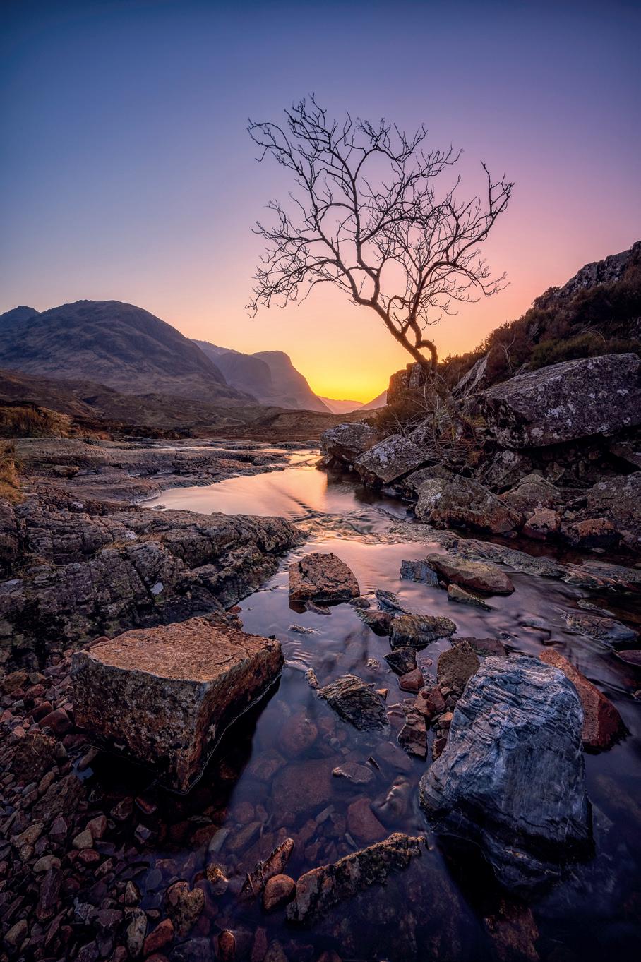
April: Glencoe Last Light by Mark Hetherington ARPS
May: Towards the Isle of Rum by Mark Sims ARPS (Overall Winner)
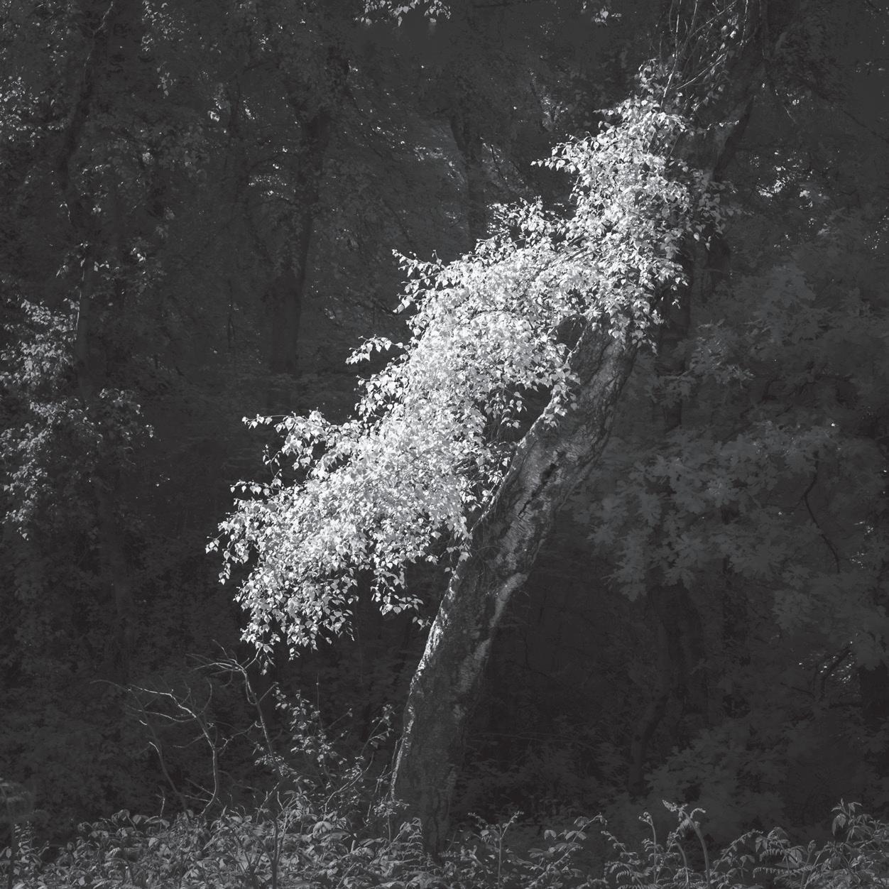
June: Leaning by Martin Tomes LRPS
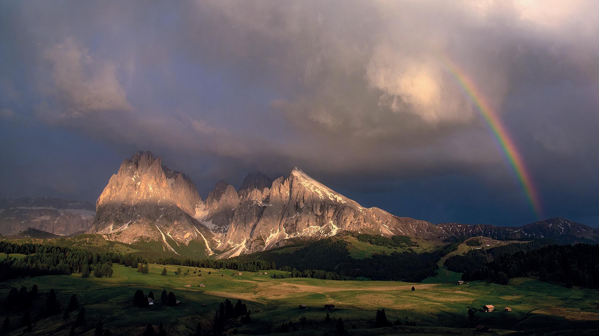
July: Storm Light Alpe di Suisi by Jeremy Fraser-Mitchell LRPS
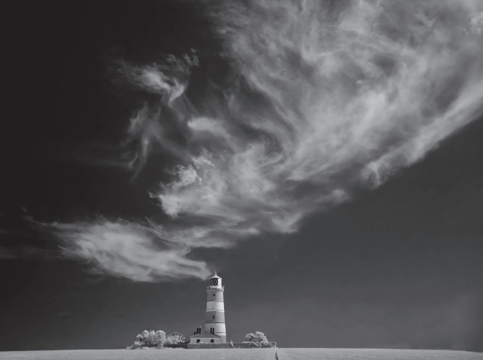
August: Smokin’ Lighthouse by Derek Winsor LRPS
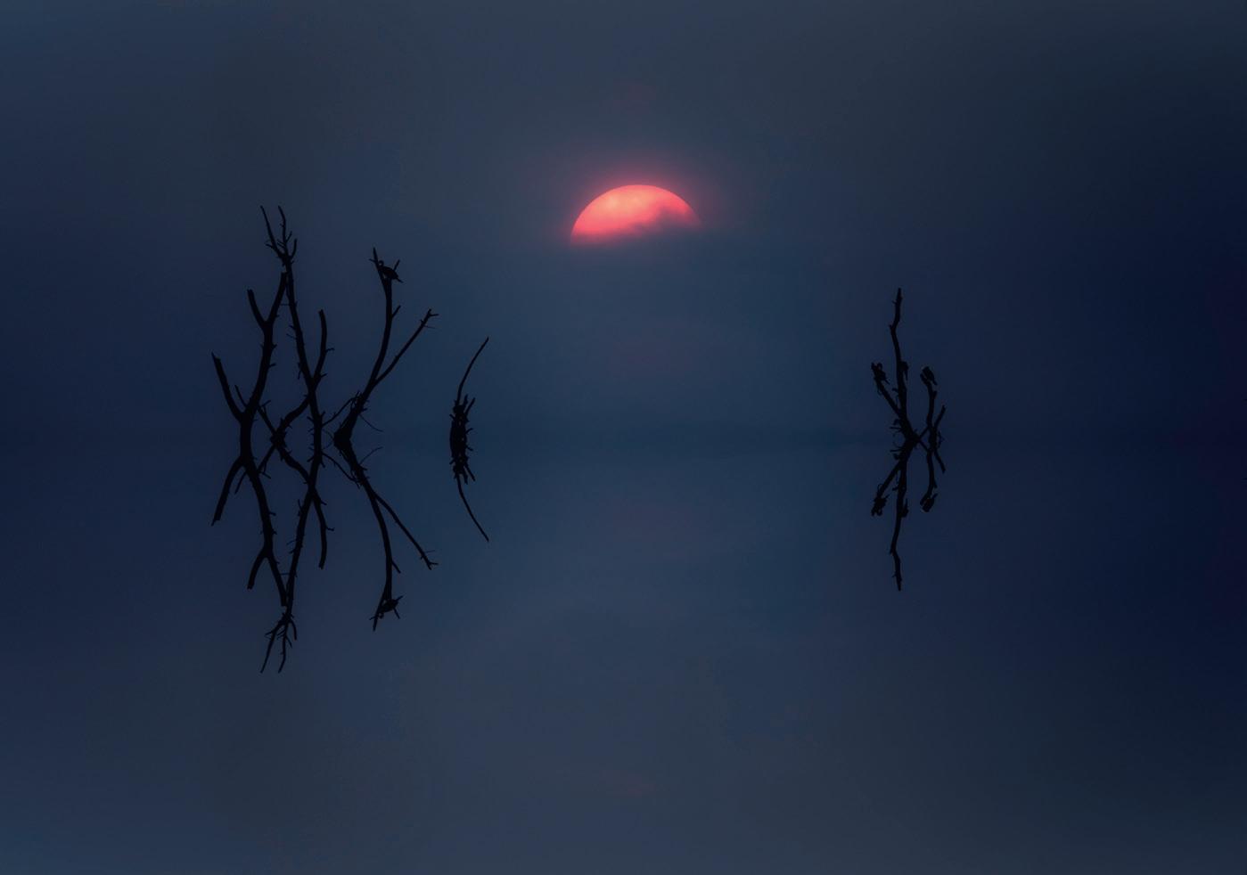
September: Lake Nakuru, Kenya by Ashok Viswanathan
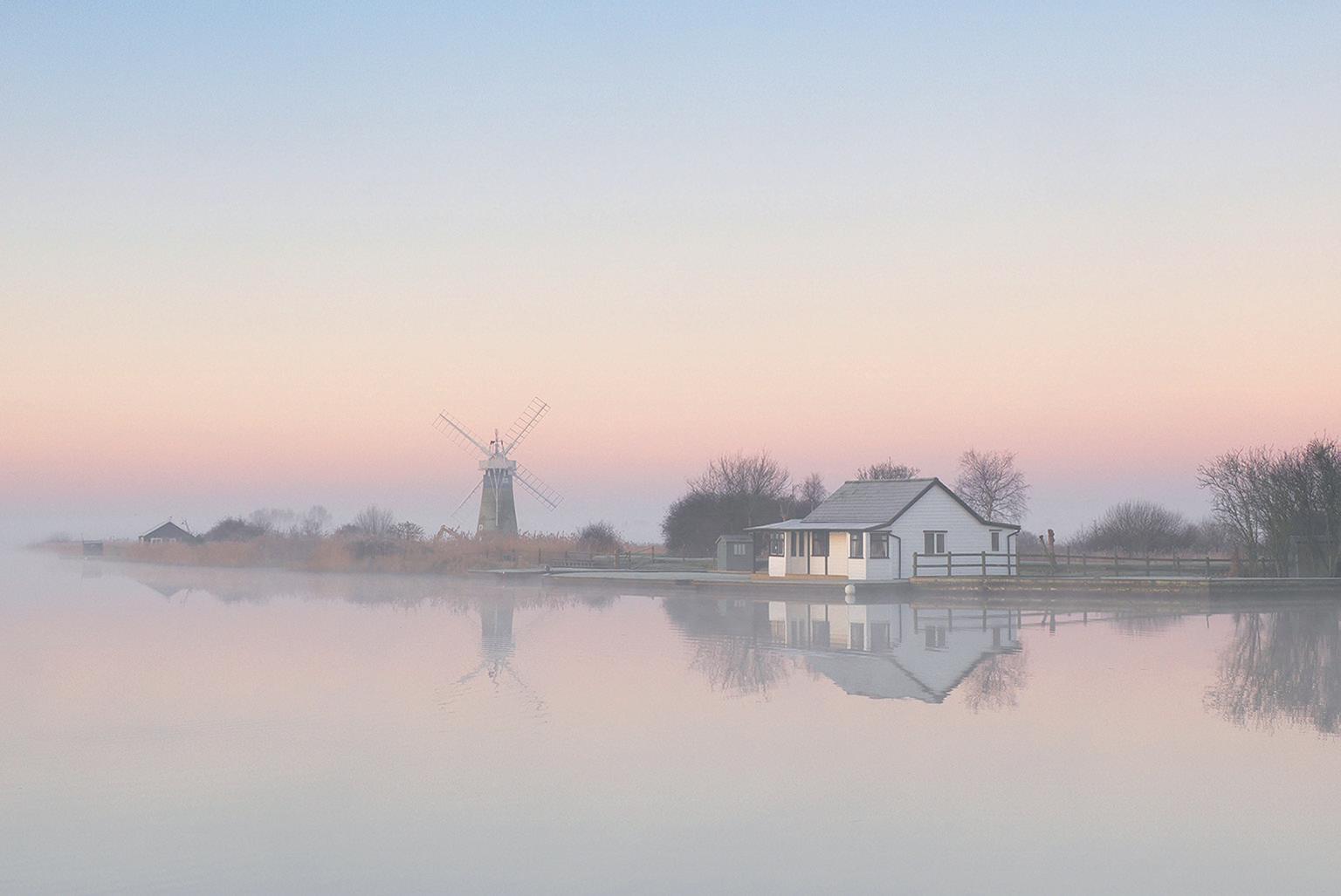
October: Thurne Sunrise by Jeremy Fraser-Mitchell LRPS
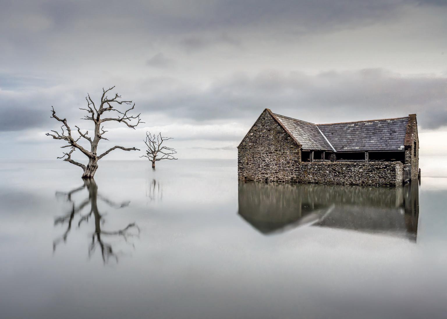
November: When the Flood Comes by Mike Murphy
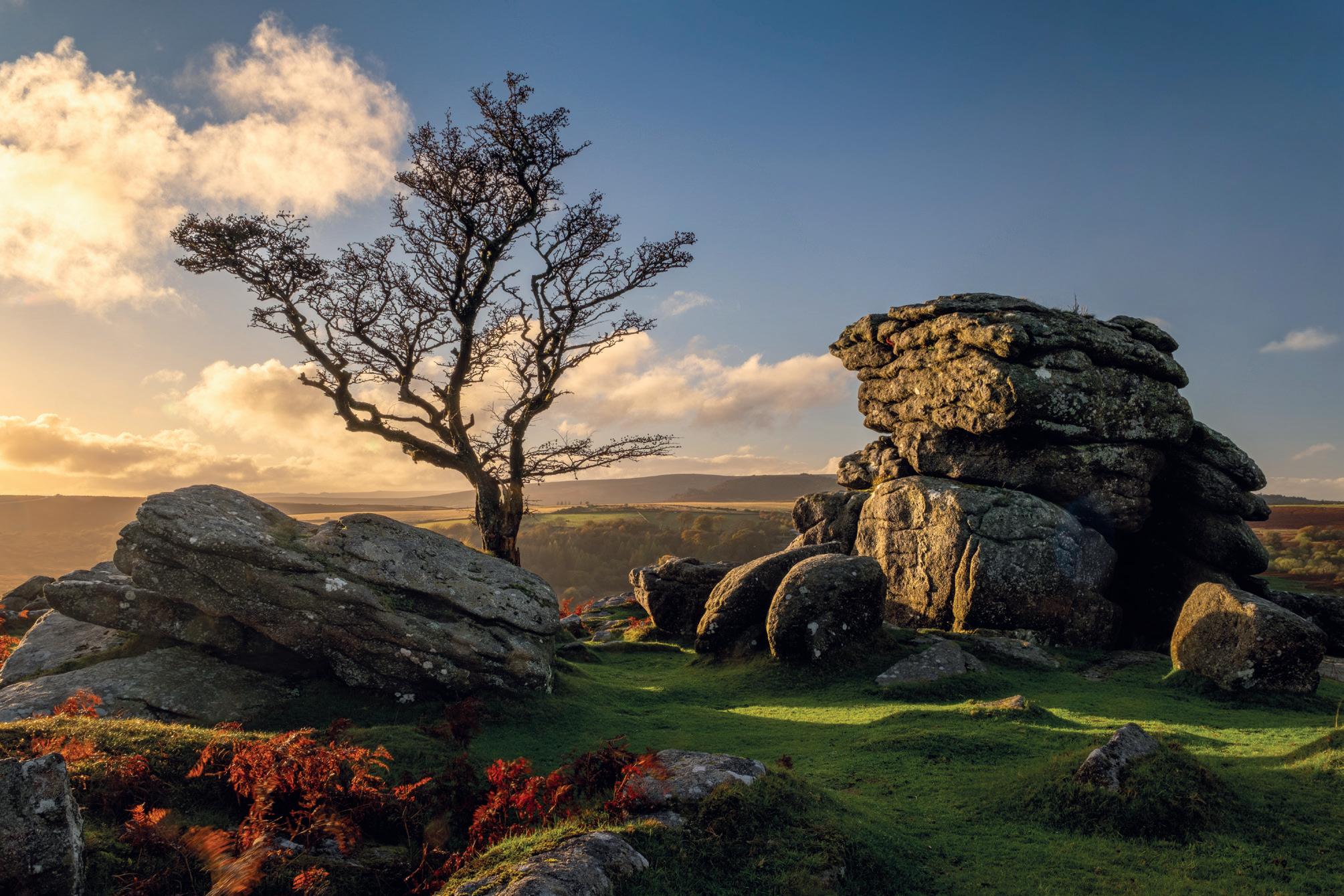
December: Dartmoor Sunset by Mathew Lodge LRPS
January
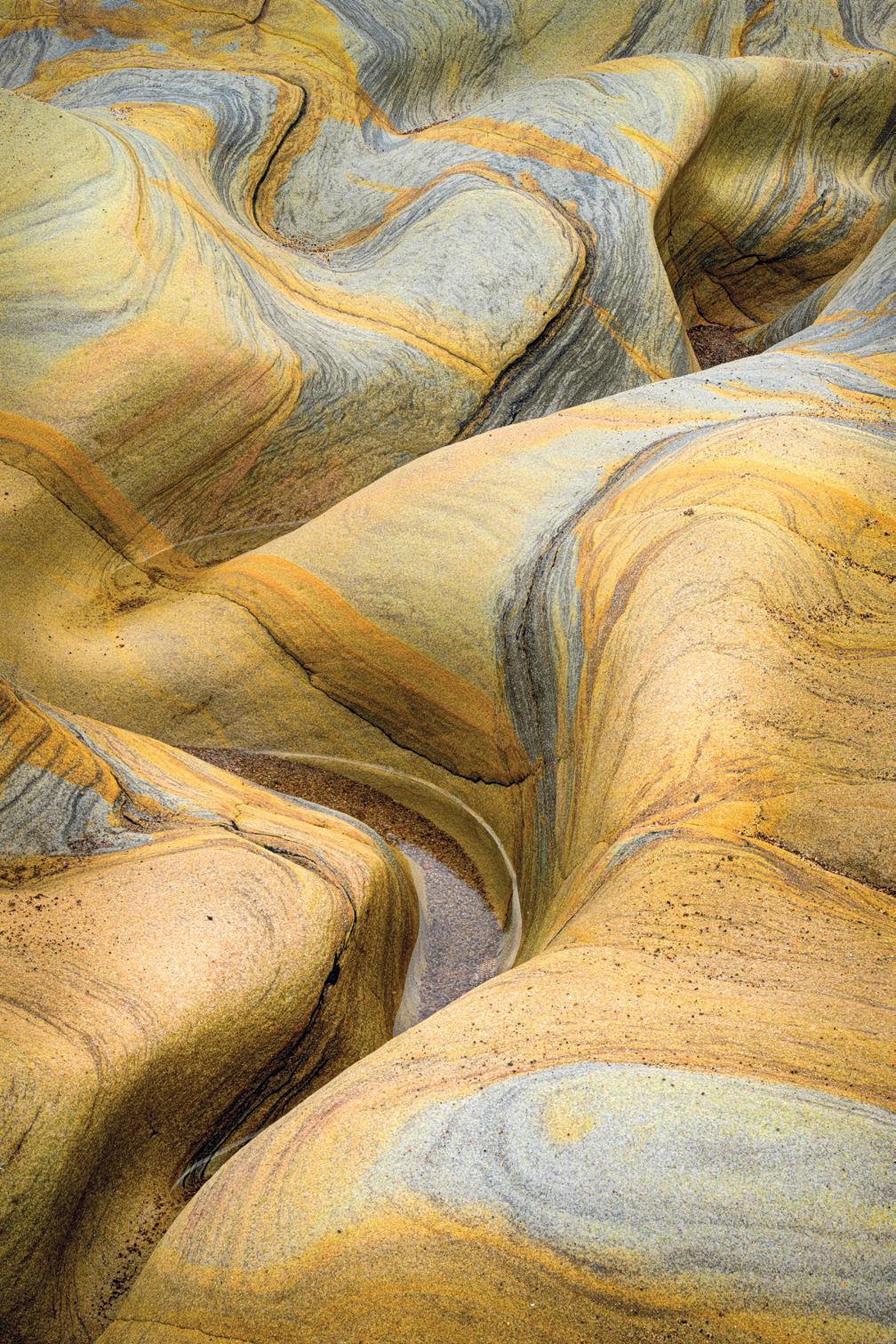
Spittal Beach by Mike Lloyd FRPS
I took this picture on Spittal Beach near Berwick upon Tweed, Northumberland. There are areas of rocks on the beach with wonderful colours, albeit usually covered in seaweed. However, I managed to find a clear area and found a composition that demonstrated the wonderful palette of colours. I took the photograph with a 105mm macro lens on a tripod and focus stacked 20 images.
February Lake Bled Dawn by Mark Hetherington ARPS
Slovenia’s Lake Bled is a photographer’s dream, especially at dawn. On this particular morning, soft predawn colours painted the sky, while mist drifted across the water and distant mountains, creating a tranquil and peaceful scene. Witnessing the lake’s quiet magic was truly memorable.
March
Brathay Calm by Mark Hetherington ARPS
The river Brathay near Ambleside is renowned for its misty landscapes as, often, the mist hangs over the water. On this morning, my patience was rewarded as gentle light broke through the fog, transforming the landscape into an ethereal canvas. The serenity of the moment was deeply rewarding.
April
Glencoe Last Light by Mark Hetherington ARPS
Glencoe’s dramatic valley offers endless inspiration for photographers. As this day drew to a close, the final rays of sunlight illuminated this iconic lone tree and the River Coe, casting a soft, lingering glow. Capturing this iconic scene felt like the perfect conclusion to a wonderful day.
Overall Winner
May
Towards the Isle of Rum
by Mark Sims ARPS
I was fortunate to spend a week on the Isle of Eigg in April 2025 with a small group, participating in a photographic workshop. Close to our accommodation was the Bay of Laig, which offered numerous opportunities for compositions featuring the Isle of Rum and the wonderful patterns and features in the sand as foreground interest. Despite some challenging light (i.e. clear skies for several days!) I came away with several pleasing images from this location alone.
June
Leaning by Martin Tomes LRPS
I had my camera converted to infrared (IR) and realised I was clueless about how to use it so I went to a workshop. My major discoveries were that IR woodland was about finding shapes and that IR images don’t have to have a jet black sky and whiter-thanwhite leaves. It was the angle of the subject and lack of other distractions which attracted me to this scene.
This image was taken on a workshop in the Dolomites. We were in position for the sunset when a brief rainstorm passed over. We got a little bit wet but it was worth it.
July
Storm Alpe di Suisi by Jeremy Fraser-Mitchell ARPS
August
This image of Happisburgh lighthouse was made late in the afternoon on a clear, sunny day in July 2025, using an infrared-converted Olympus camera. I watched clouds approaching from the west and, as they reached the lighthouse, I was amazed to see them apparently drawn to the tip of the structure.
September
This image was taken while on holiday in Kenya. I was on a small, low motorboat and was cruising the lake to see the birds and to take some landscape photographs. At one time, this area had live trees that died when they flooded the area to make a lake. Today, the tree trunks and branches are resting places for birds and make a nice subject for photographers. I got a few very nice images from that boat trip.
Lake Nakuru, Kenya by Ashok Viswanathan
Smok’n Lighthouse by Derek Winsor LRPS
I was due to join a camera club outing to the Norfolk Broads for a few days. Most people decided to meet around lunchtime but I had checked the weather forecast and conditions looked perfect for sunrise, clear and frosty, so I didn’t bother going to bed that night and set off about 3am! Fortunately, I was able to check in to the hotel afterwards and grab a couple of hours sleep before meeting the others later.
November
Captured at dawn on Porlock Marsh, Somerset, during a rare extreme high tide that briefly covered the marshland, the light and conditions were near-perfect for an image I had sought for many years. Getting into a shooting position sometimes required walking or standing in over a foot of water while it was still semi-dark. The overall feeling of wonder, calm and remoteness at that particular hour and location was a truly moving experience.
When the Flood Comes by Mike Murphy
October
Thurne Sunrise by Jeremy Fraser-Mitchell LRPS
After a day of relentless rain, the light felt like a quiet reward for persevering. The low sun broke through the retreating clouds and poured warm gold across the stones and grass, giving the moor a sense of calm. The solitary tree and weathered rocks feel steadfast, as they’ve endured countless storms like the one that just passed.
December
Dartmoor Sunset by Mathew Lodge LRPS
Webb Watch
Candia Peterson ARPS
This is the sixth and final edition of Webb Watch. Although the Webb Telescope website continues to awe and delight with the wonders of the universe, we know when it is time to put a good thing to bed and move on to pastures new.
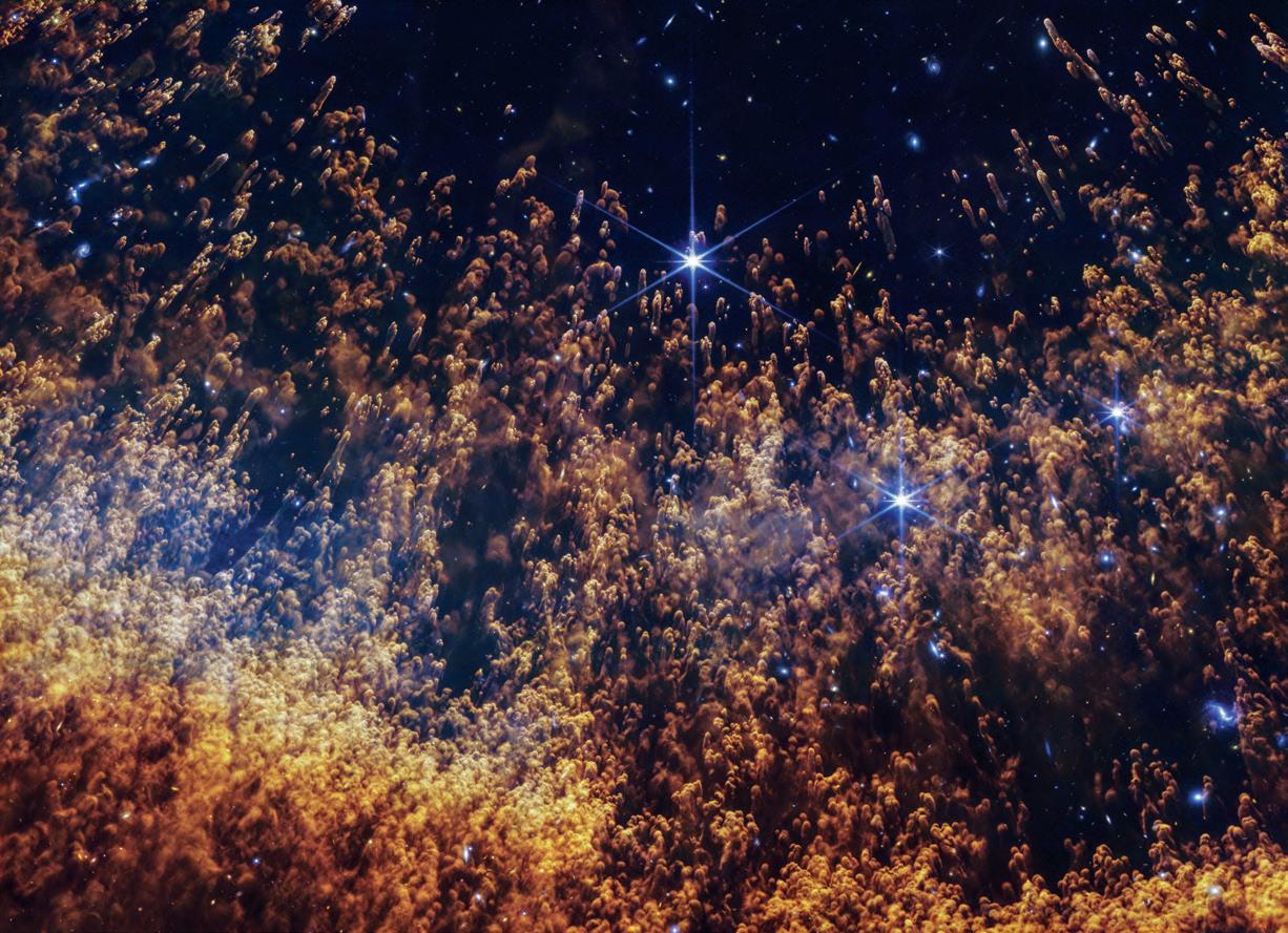
In this edition, we look at The Helix Nebula and Pismis 24. Both are great examples of how images captured in deep space can mirror images on Earth; the former evokes a star-lit forest in Autumn and the latter, a rugged mountain scene. For an excellent read on how the images are created from start to finish, scan this QR code or go to this weblink: webbtelescope.org
In the image from Webb’s NIRCam (Near-Infrared Camera), pillars that look like comets with extended tails trace the circumference of the inner region of an expanding shell of gas. Here, blistering winds of fastmoving hot gas from the dying star are crashing into slower moving colder shells of dust and
gas that were shed earlier in its life, sculpting the nebula’s remarkable structure.
A blazing white dwarf, the leftover core of the dying star, lies right at the heart of the nebula, out of the frame of the Webb image. Its intense radiation lights up the surrounding gas, creating a
rainbow of features: hot ionized gas closest to the white dwarf, cooler molecular hydrogen farther out, and protective pockets where more complex molecules can begin to form within dust clouds. This interaction is vital, as it’s the raw material from which new planets may one day form in other star systems.
In Webb’s image of the Helix Nebula, color represents the temperature and chemistry. A touch of a blue hue marks the hottest gas in this field, energized by intense ultraviolet light from the white dwarf. Farther out, the gas cools into the yellow regions where hydrogen atoms join into molecules. At the outer edges, the reddish tones trace the coolest material, where gas begins to thin and dust can take shape. Together, the colors show the star’s final breath transforming into the raw ingredients for new worlds, adding to the wealth of knowledge gained from Webb about the origin of planets.
Helix Nebula
Image; NASA, ESA, CSA, STScI; Image Processing: Alyssa Pagan (STScI)
Helix Nebula and Pismis 24
Image; Credit: X-ray: NASA/CXC/Penn State/G. Garmire; Infrared: NASA, ESA, CSA, and STScI; Image Processing: NASA/CXC/SAO/L. Frattare and NSA/ESA/CSA/STScI/A. Pagan
Pismis 24
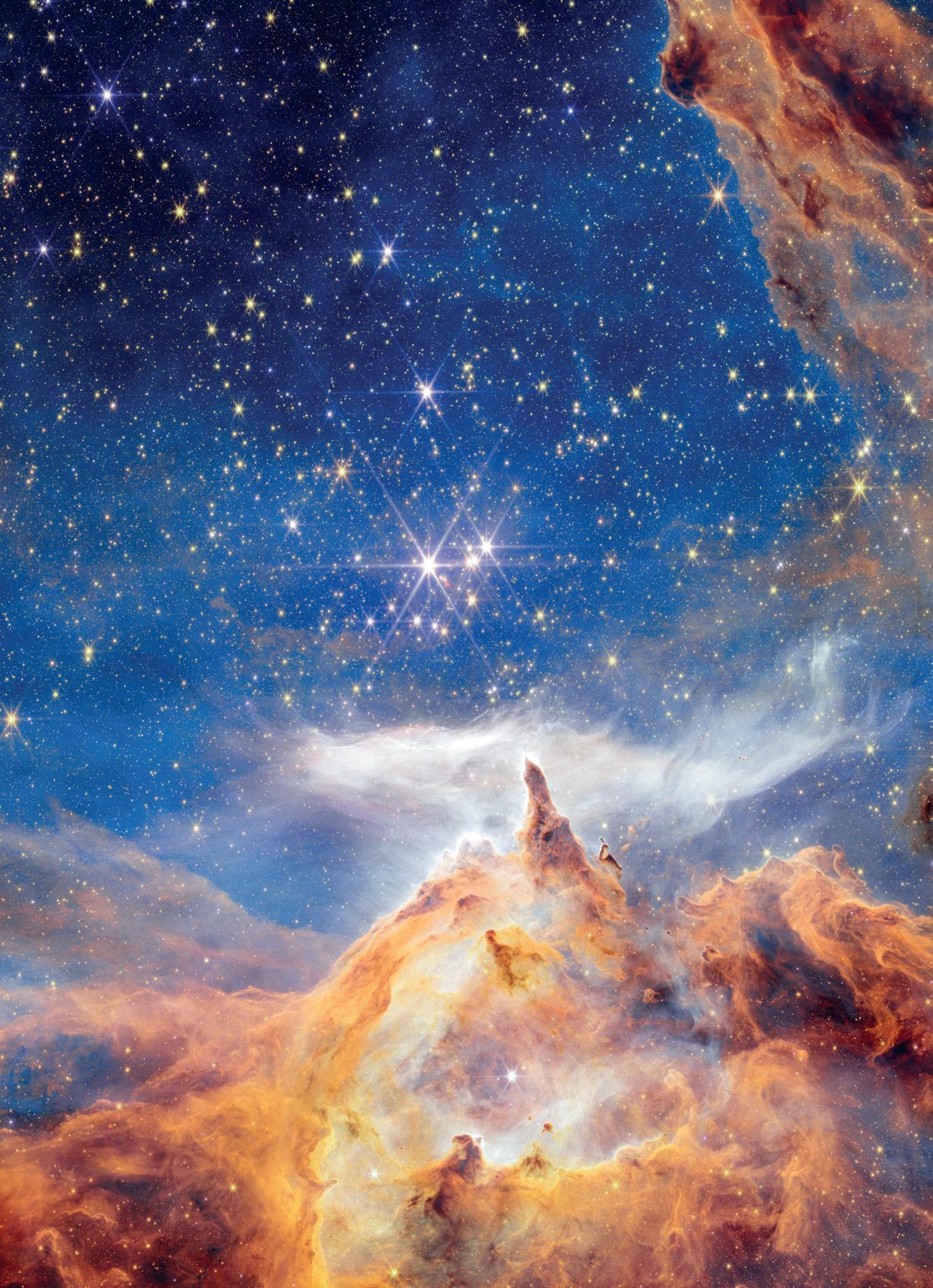
This sparkling scene of star birth was captured by the NASA/ESA/CSA James Webb Space Telescope. What appears to be a craggy, starlit mountaintop kissed by wispy clouds is actually a cosmic dustscape being eaten away by the blistering winds and radiation of nearby, massive, infant stars.
Called Pismis 24, this young star cluster resides in the core of the nearby Lobster Nebula, approximately 5,500 light-years from Earth in the constellation Scorpius. Home to a vibrant stellar nursery and one of the closest sites of massive star birth, Pismis 24 provides rare insight into large and massive stars. This region is one of the best places to explore the properties of hot young stars and how they evolve.
An Alternative View
Jason Martin
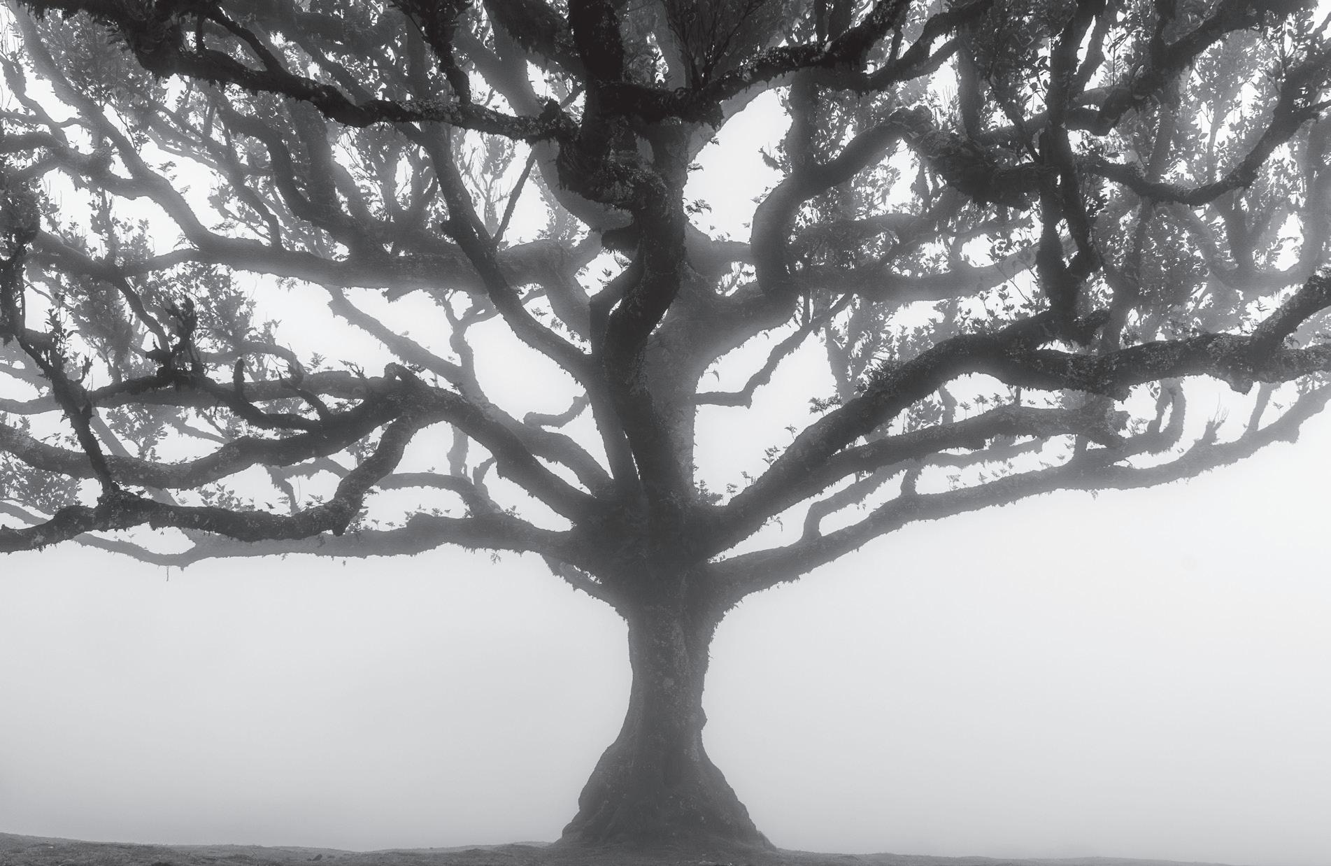
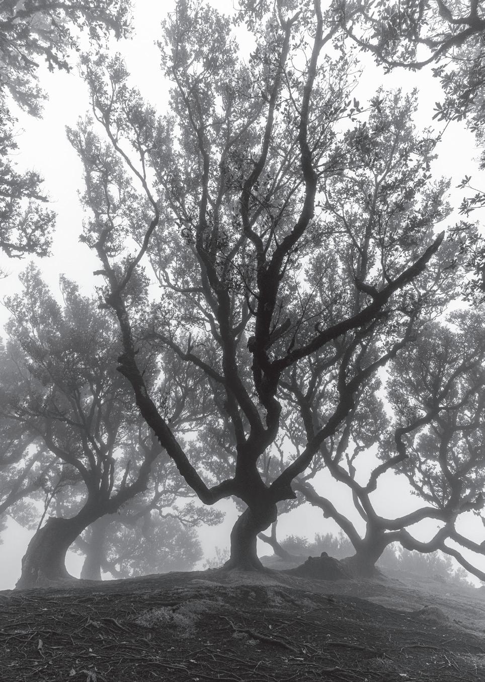
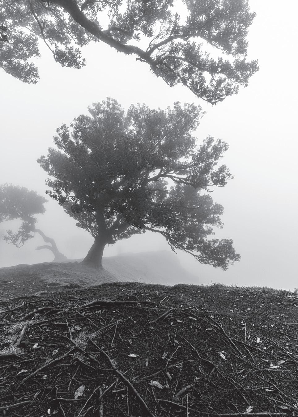
American photographer Jason Martin went on a pilgrimage to the Fanal Forest on the Island of Madeira. His interpretation of the ancient trees of the forest, combined with the serendipity of meeting some models happy to interact with both trees and his lens, has produced an extraordinary portfolio of truly alternative images.
Jason Martin’s photography can be found at www.omnoculus.com
I started by asking Jason about his background, early life and journey into photography.
“I grew up in Allentown, Pennsylvania, which was and is, a part of the “Rust Belt”. I moved to New York City when I was 20 and spent most of the next 20 years there, though I did spend one year in Stockholm. Since 2019, I’ve been living in the Catskills.
“When I was about 10 years old, I got a plastic LeClic camera, which was this tiny thing aimed towards children and which took 110 cartridge film. I remember spending a lot of time pointing it at sunsets and not understanding why the colours didn’t come out in print the way I saw them with my eyes. When I moved to New York and decided to concentrate on a creative career focused on design,
my dad gave me his old Minolta SRT–101. That was my first “serious” camera and I carried it with me everywhere.
“I got a BFA in communication design from Pratt in Brooklyn and I had a great introduction to photography through that program. At least at the time, Pratt had an amazing cross disciplinary approach to the visual arts. Design, image-making, photography, illustration, sculpture – these things all work together as a form of communication and expression. When I arrived at Pratt, I was very focused on things like typography and layout. By the time I left, I found myself getting into the visual arts in every way I could.
“Since then, I’ve been mostly self-taught, picking up little classes and workshops where I can.”
Wanting More
We moved on to talking about Jason’s specific interests in photography.
“I found myself most drawn to anything that involves people. And that doesn’t mean just human figures or portraiture, although that certainly weighs in. Anything showing the impact of people on the world, the things that we do and whether we interact with each other. Photography is an amazing mirror that the species can hold up to look at itself; what it does intentionally often ends up being unintentional.”
I was interested to know what took him to Madeira. Was it specifically to photograph the Fanal Forest or was it a happy accident that he discovered when he was there?
“I absolutely went to Madeira because of the Fanal Forest. It had been on my list of dream places to photograph for years.
“I got my chance to visit Fanal when the wonderful photographer Richard Cavalleri (www. richardcavalleri.com) let me know that he would be visiting there and had already scouted out the territory; I leapt at the opportunity to join him. We spent a week on Madeira traveling all over. But, at every opportunity, I tried to redirect us back to Fanal. We ended up being in the forest for three days over the course of the week.”
I was interested to know how the use of models came about and whether he had fixed ideas about how to shoot the trees of Fanal before he got there.
“I went to Fanal with a distinctive idea in my head of what I wanted to do but that idea certainly evolved once I was there and got to walk around the territory for myself and to feel it. In a sense, what I was trying to do was to create portraits of the trees, both in a tightly focused kind of way and in their context. I had done a series of similar shots of old steel facilities where I grew up and I wanted to find a natural version of that. They have such amazing character.
“While we were in the forest, on the second day, we came across these two women on vacation, who were also models and just happened to be wandering through the forest at the same time we were. We asked if we could work with them and shoot them in the forest and they were happy to oblige. It was one of those happy accidents that would’ve been difficult to plan but presented itself at exactly the right time. It wasn’t what we were there to do but it was an amazing opportunity.
“Having the models to work with not only changed the tenor of the shoot on that day but it also shifted the final work.”
Finally, I ended our interview by asking Jason where next for him in his photographic journey?
“I don’t know if this question was meant as being deeply reflective but it really is. I’m currently living in the hills, trying to build a photo studio, trying to practice the art of photography as much as I can, trying to become the photographer that I want to
be but that’s this messy, amorphous target that is difficult to understand, much less hit. I want to shoot more. I want to shoot everything. Every time I see a photograph that I love that I didn’t shoot, I want to have shot it. I want to stay here and shoot, I want to travel and shoot, I want to go to Scotland and shoot, I want to go to China and shoot. It’s a confusing time.”
Where in the World? II
Martyn Bennett LRPS
Martyn Bennett LRPS spent part of our recent northern winter in New Zealand’s South Island. Here he talks about his trip in what was a very “English” wet summer.
New Zealand has been on my ‘bucket list’ for a holiday for many years. So, when my daughter who lives in Australia announced that she was planning a holiday in the South Island, I didn’t take much persuading.
Because of its geological history, the South Island offers spectacular scenery, from the snow topped mountains, fjords and lakes in the west, across the plains to the Canterbury region and Christchurch. The South Island is dominated by the Alpine Fault, a major plate boundary between the Pacific and Australian plates that has uplifted the Southern Alps. Intense glaciation has carved deep, U-shaped valleys and lakes. The eastern side features sedimentary basins and alluvial plains. Earthquakes are still a major hazard, the latest being in 2010 and 2011 in Christchurch. There has also been volcanic activity on the Banks Peninsula, resulting in the deep-water harbours of Akaroa and Lyttelton, near Christchurch.
The summer weather can resemble Englandtemperatures between 15C and 25C, with quite a bit of rain. Some may be disappointed with the frequent low cloud obscuring mountains but, for me, it offered the opportunity for more interesting photography.
Leaving Heathrow late on 2nd January, I arrived in Christchurch on the 5th, after a 30-hour journey! And then flew down to Queenstown to meet my daughter.
Limited space only allows me to show a few tasters of what this magnificent island has to offer.
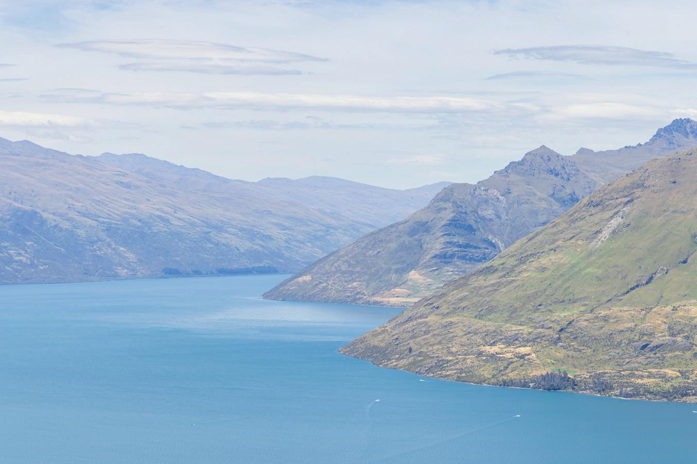
Queenstown is the tourist centre of the mountain region on the shore of Lake Wakatipu. In summer it offers plenty of ‘exciting tourist experiences’ - not all to my liking! We did join many other tourists for the gondola up to Bob’s Peak to take in the spectacular views of the dramatic mountains dropping straight into the vivid blue lake water.
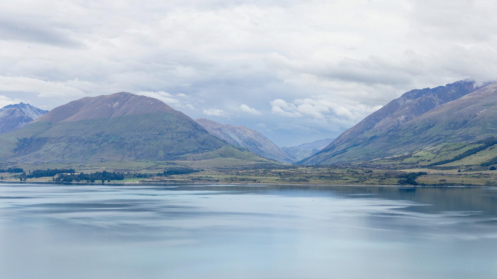
Lake Glenorchry from Bob’s Peak
New Zealand South Island
Bennett’s Bluff
Glenorchy is a small settlement at the northern tip of Lake Wakatipu, reached by a road with stunning views along its length. One of the best viewpoints is Bennett’s Bluff - a must stop for me!
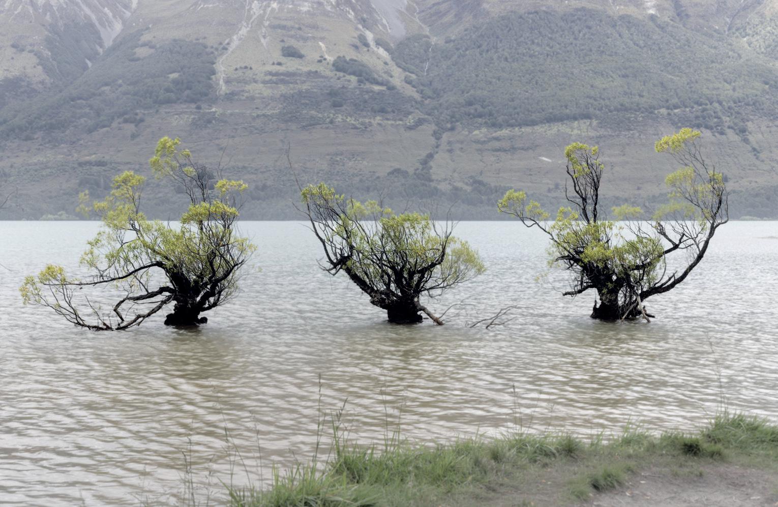
Glenorchy was originally founded as a village of sheep farmers and miners in the late 1800s. And many of the original ‘shacks’ are still standing - very rustic. It is also famous for featuring in films like The Lord of the Rings. On the lakeside are 3 willow trees growing out of the water, with the backdrop of the mountains behind.
Willow Trees in Glenorchy
Te Anau, a couple of hours drive from Queenstown, is a quiet town at the southern end of Lake Te Anau and the gateway to the Fiordland National Park. Driving north up the lake leads to the famous
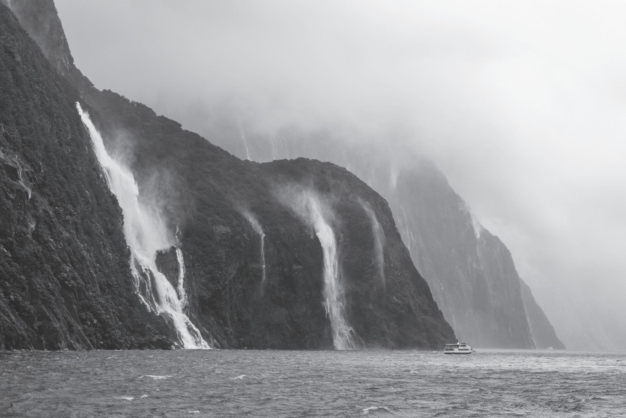
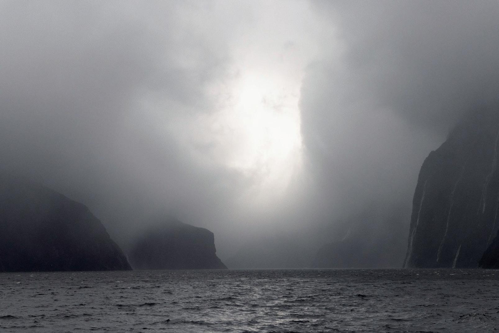
Milford Sound. A rather exciting, very wet, windy boat ride, with low clouds obscuring the tops of the cliffs and hundreds of torrential waterfalls cascading down, was an amazing photo opportunity.
Milford Sound
Milford Sound in the rain
From Te
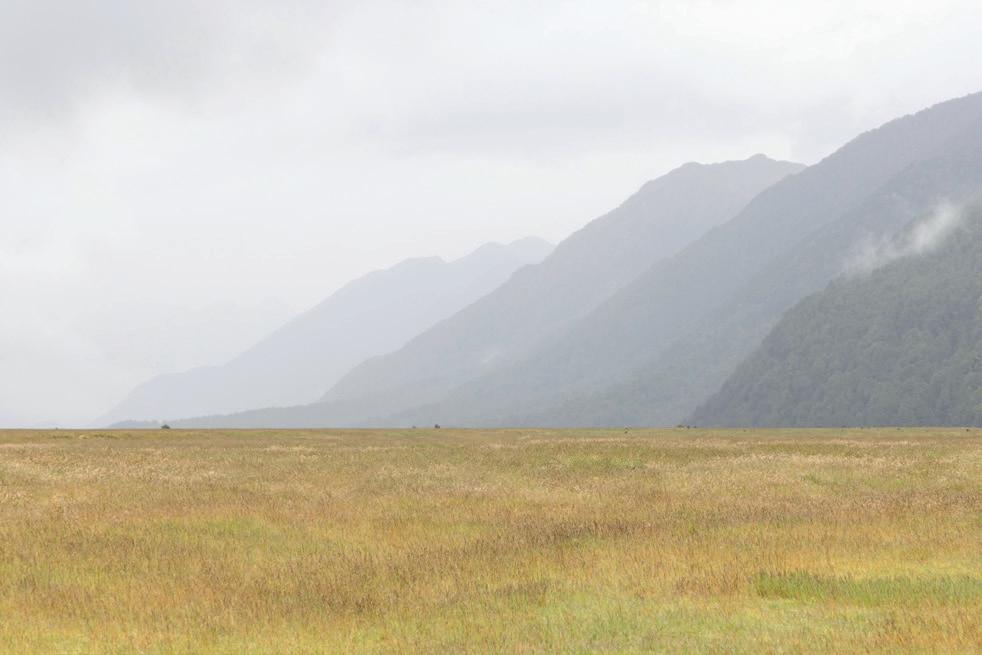
we travelled back north to Wanaka with views of the mountains across fields.
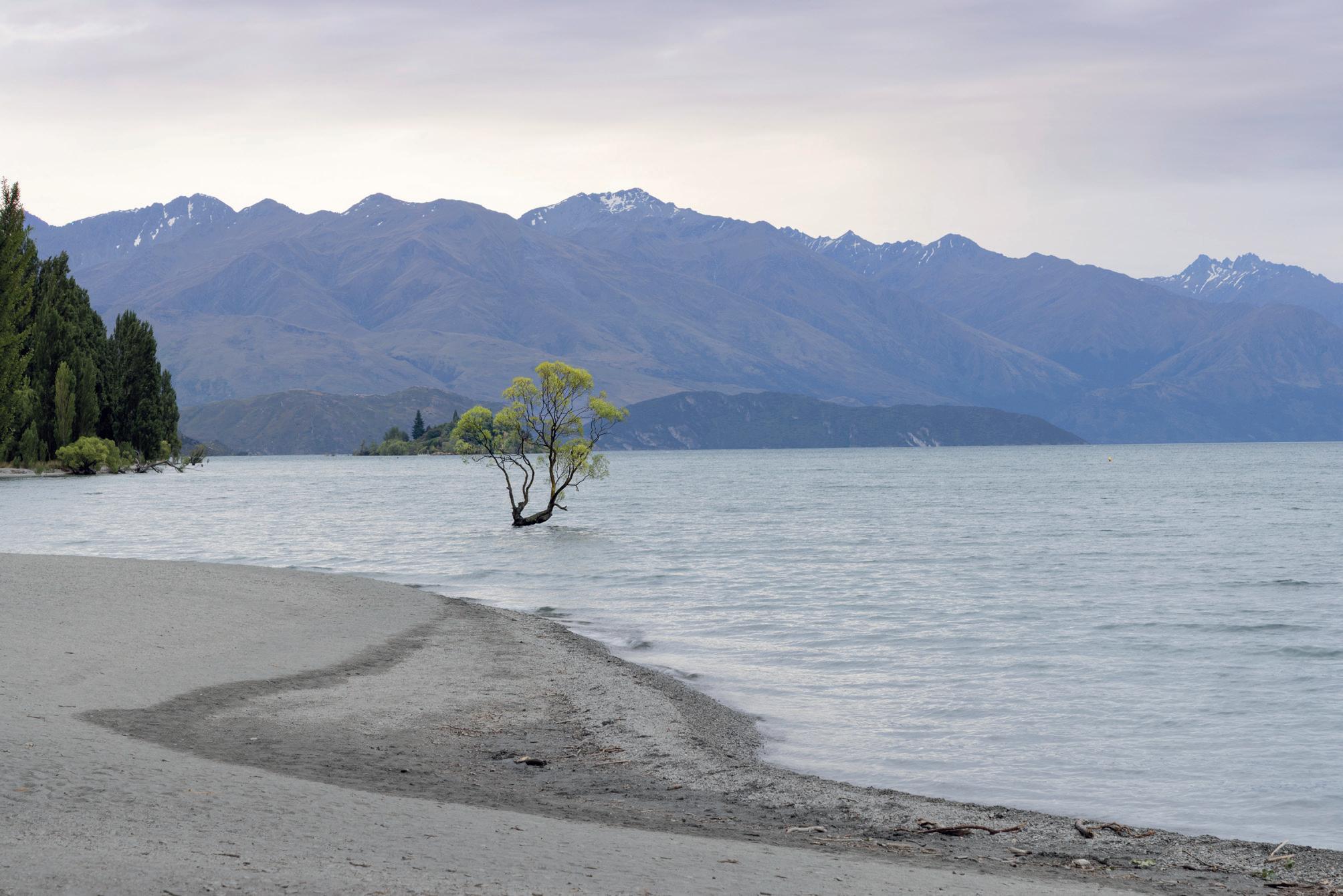
Wanaka is a summer and winter resort town on the southern end of Lake Wanaka: Quieter than Queenstown, it has some excellent restaurants and bars. There are plenty of hikes and boat trips up the lake to some of the islands with interesting histories and, of course, there is the much-photographed ‘Wanaka tree’ growing out of the lake (although I did wait until nearly dark for the crowds to disperse so I could get a rather different viewpoint!)
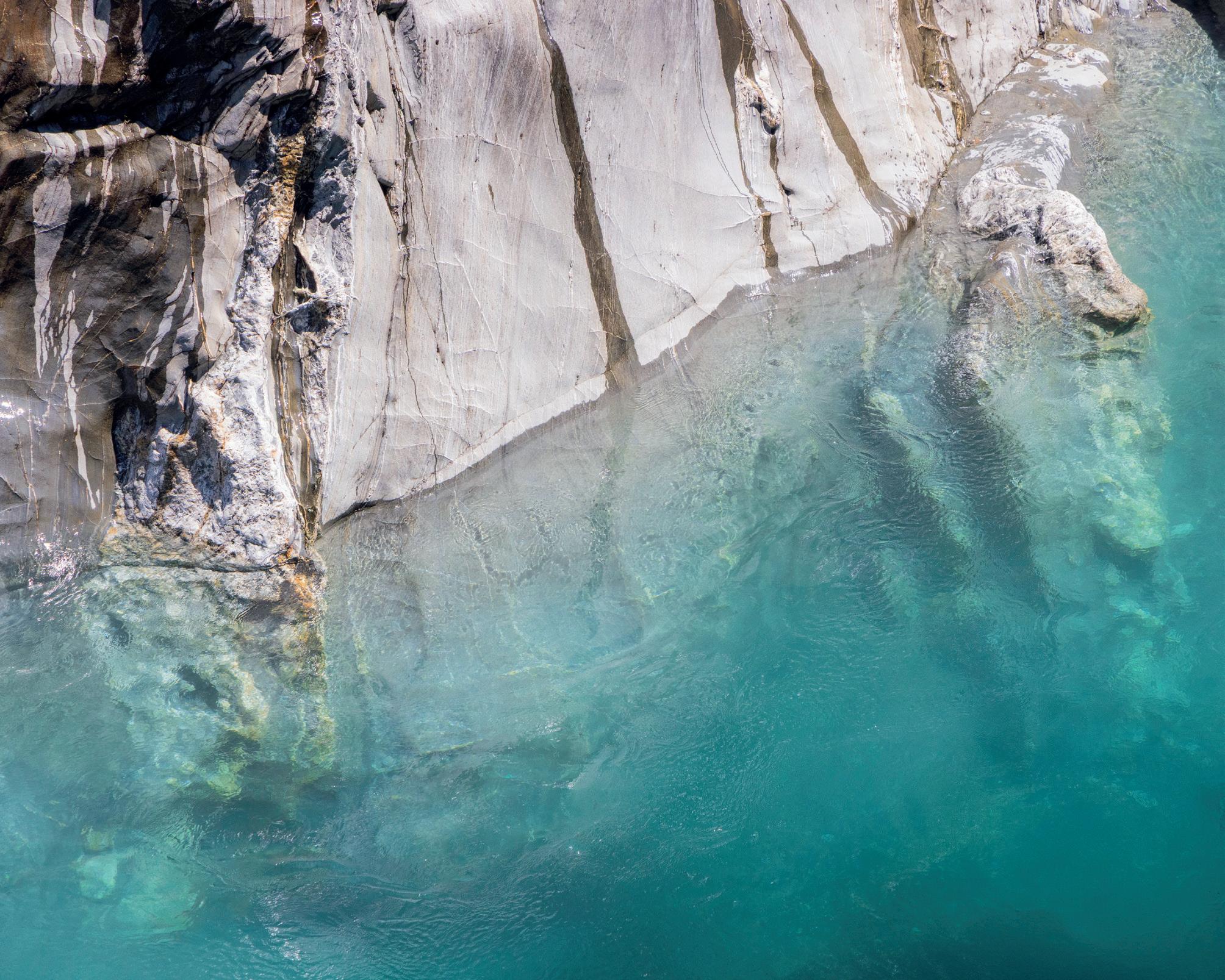
North of Wanaka, in the Mount Aspiring National Park, are the iconic ‘Blue Pools’, accessible by a walk through a forest and a swing bridge across the Makarora River. The water is really blue and extremely clear, coming from glacial meltwater and arriving through a narrow gorge. The water is very chilly but that didn’t deter the adventurous!
Anau
Mountains and clouds, Te Anau
The Wanaka Tree
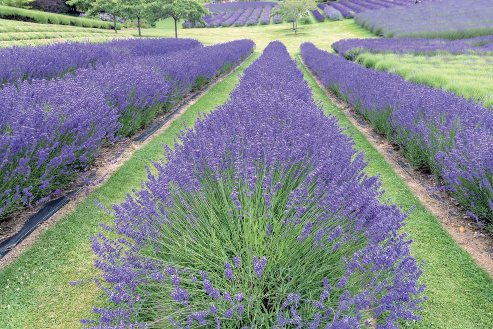
On exiting Wanaka to start the journey back to Christchurch, there was a beautiful lavender farm. The area is famous for its lavender and this farm was awash with lines of the flowering shrubs.
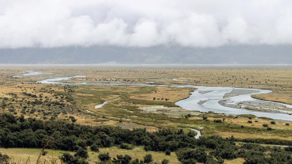
Twizel is a town between Wanaka and Christchurch, founded in 1968 to house the workers for the local hydroelectric schemes. Now, its main industry is tourism. From Twizel there is a route north, up the west side of Lake Pukaki to Mount Cook. Very low cloud and rain meant that the mountain was almost completely obscured but there were some great views of the Tasman River winding towards the northern tip of the Lake.
Blue Pools, Wanaka
Tasman River, Mount Cook, Twizel
Lavender Farm, Wanaka
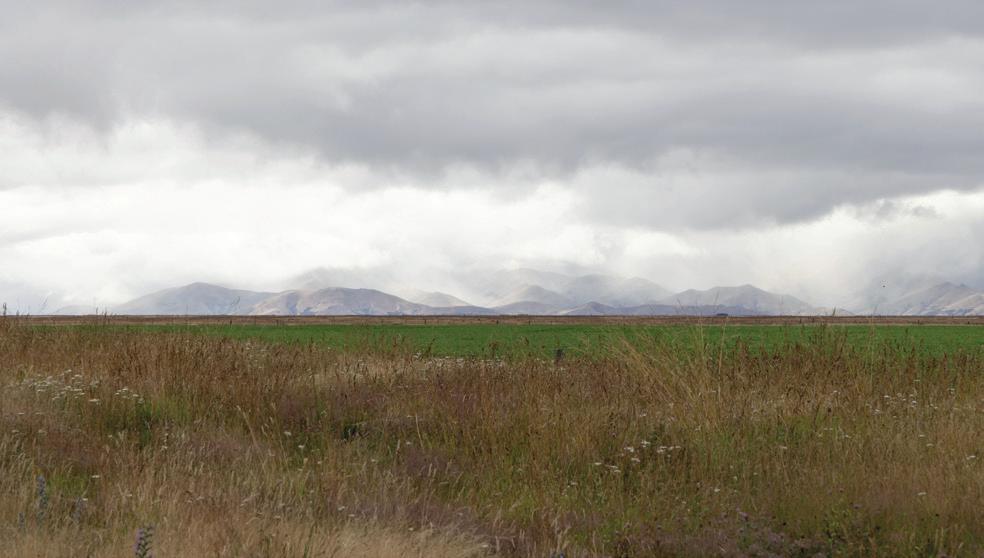
From Twizel, the route to Christchurch took us across the alluvial Canterbury Plains; rolling hills with the mountains in the background looking north and west.
Canterbury Plains between Twizel and Christchurch
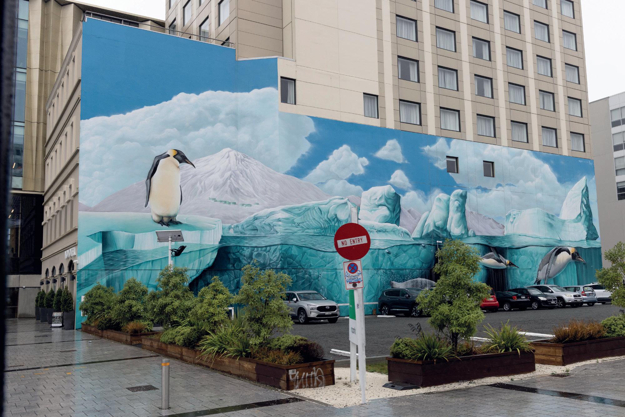
Christchurch is also famous for its trams - restored vehicles from when the tramway was the major form of public transport. It is a great way to see the city, especially when it’s raining hard! Amazing murals now adorn many walls amongst car parks, shops and businesses.
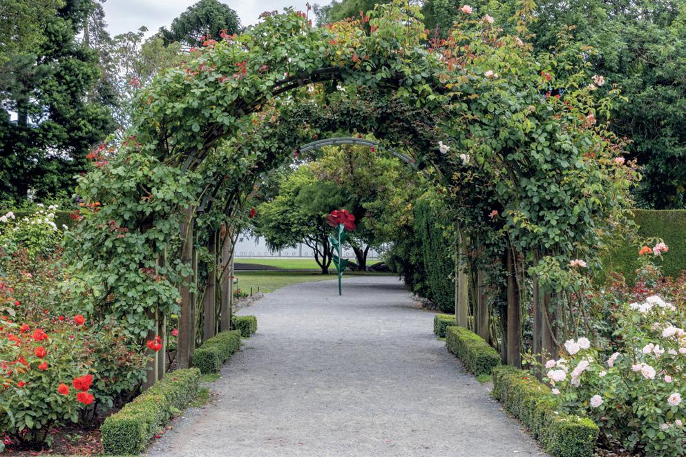
The Botanic Gardens in the centre of the city is a worthwhile visit with lovely walks through curated gardens, woodlands and ponds - a peaceful haven.
≠I hope I’ve been able to give a flavour of the South Island of New Zealand. Apart from the variety of stunning photogenic scenery, I was struck by how friendly people are - nothing is too inconvenient. The restaurants are varied and very good - especially the breakfasts which set one up for the day! Certainly, a place I want to revisit and explore more.
Botanic Gardens, Christchurch
Antarctic car park, Christchurch
Inspiration
Wherever we are in our photographic journey, there is always room to learn, discover and take inspiration from the work of others. Here are a few ideas.
Buy these books:
Arboreal Essays
In our Spring 2025 edition (Issue 15), we ran two articles about the legend that is Hugh Milsom. Hugh’s latest book, “Arboreal Essays”, contains some sublime tree photography and is published this year. It can be purchased through his website: hughmilsomlandscapes.weebly.com/books.html or scan the QR code opposite.
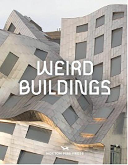
Weird Buildings by Hoxton Mini Press
A great anthology of approximately 200 buildings, all of which push the boundaries of weird and wonderful, from the fluid forms of Zaha Hadid’s mountaintop museum, to a whimsical teapot-shaped service station. Whilst it could do with a location index, it is great fun to flick through and potentially, a useful tool to check out when planning a trip.
Follow on Instagram:
Five Instagrammers from around the world:
@mstevens4 – Adelaide-based Mark Stevens is an architectural photographer worth following. @bakerdezine – More architecture from LA-based Leslie Baker. @peraphotogallery – This photographer from San Francisco produces a fusion of landscape and street. @ig_baoli – A Turkish account containing some outstanding black and white landscapes. @dorasomosi.studio – Dora is a Hungarian photographer producing beautiful blue toned landscapes.
Check out this website: www.conversationswithartists.com
An interesting rabbit hole down which to fall if you are interested in contemporary artists in many different media.
Get the App:
For Sony users or if you don’t happen to have a camera with you, Image Blender is a great multiple exposure tool for you. With loads of blending modes and the ability to blend an infinite number of images from your camera roll, this is a great addition to the iPhoneography armoury.