ROSIE NALLE
LANDSCAPE
ARCHITECTURE
PORTFOLIO
EXPERIENCE
STYLIST Freelance
2022-present
CARPENTER’S ASSISTANT Clipper, LLC.
2020 - 2021, Saunderstown, RI
MANAGER Hearth Restaurant
2016 - 2020
INTERN Chin’s Push Gallery
2016, Los Angeles, CA
EDITORIAL ASSISTANT Microcosm Publishing
2015, Portland, OR
INTERN Textile Arts Center
2014, New York, NY
EDUCATION
TYLER SCHOOL OF ART AND ARCHITECTURE
Master of Landscape Architecture, 2022 - present
Vice President, Society for Ecological Restoration
Member, American Society of Landscape Architecture
Tyler Faculty Scholarship Recipient
BENNINGTON COLLEGE
Bachelor of Liberal Arts, 2012 - 2016
Sculpture and Social Practice concentration
Brockway Faculty Scholarship Recipient
Editor in Chief, The Silo Literary Magazine
Board member, The Student Endowment for the Arts
SKILLS
Adobe Creative Suite: Photoshop, Illustrator, InDesign
AutoCad
ArcGis Pro
Sketchup
CONTENTS
1 Sister Forests third semester, woodland studio page 2
2 The 25th Street Viaduct second semester, design studio II page 12
Sister Forests
woodland studio
third semester, fall 2024
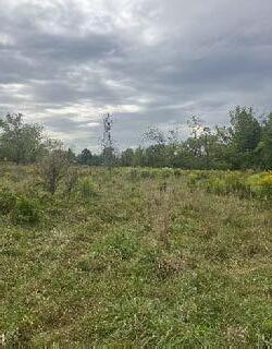
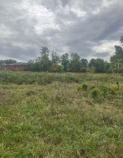
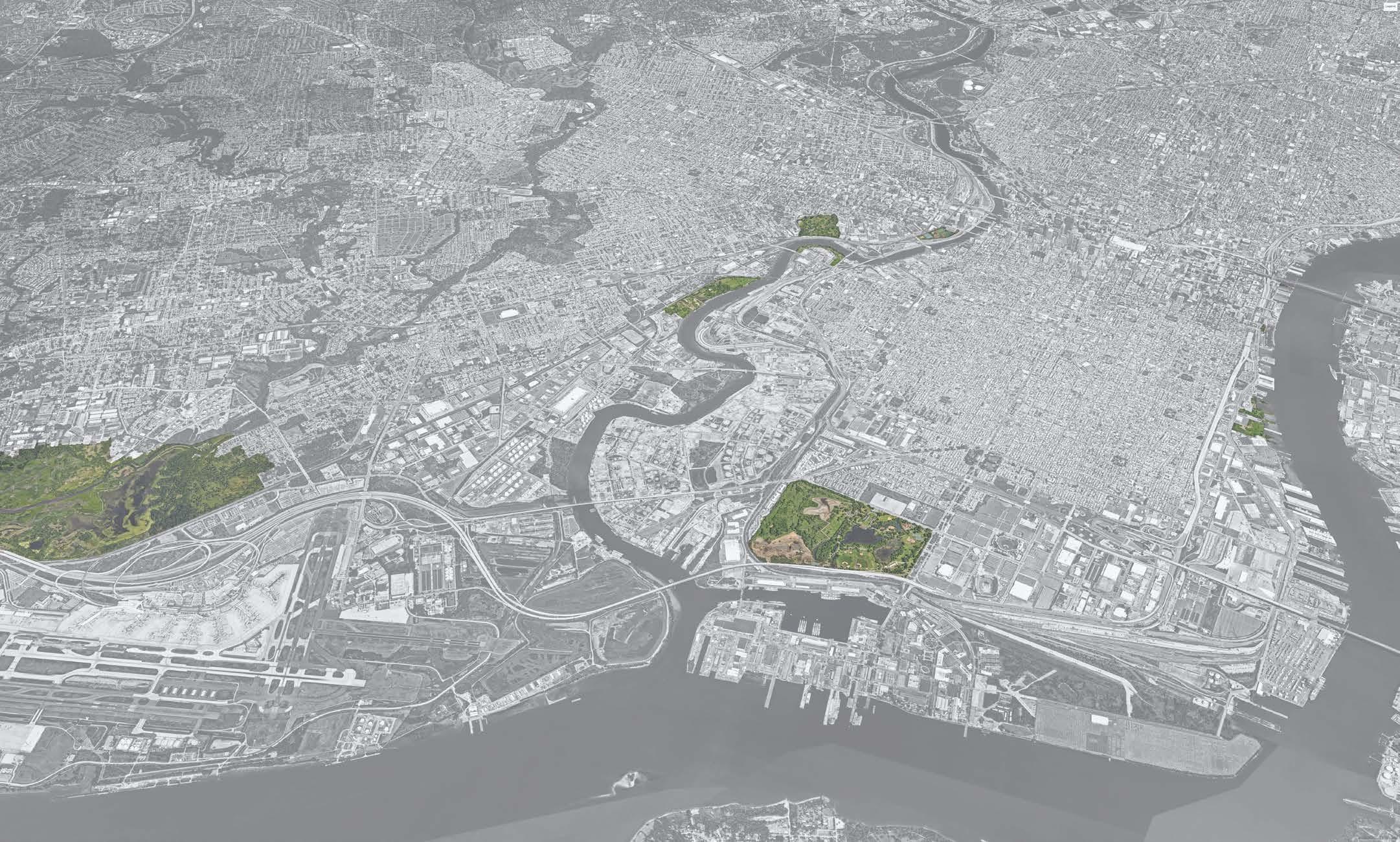
Our task in the Woodland Studio was focused on the Miyawaki method of planting a forest - sometimes called a “microforest,” the method involves planting native trees in a dense pattern, often done in smaller plots. We were asked to design sister microforests, one on the Temple Ambler campus, and one in Philadelphia. Looking at an aerial map of the region, the hydrologic connection between the two sites becomes clear, but the dense vegetation around the water fades as the rivers approach the city and pavement takes over, disrupting the connection the story that these riparian corridors tell about the land and its history. My goal for the project was to use dense, single species plantings as a type of wayfinding, creating a visual cue that brings people as active participants into the story of the watershed.
Temple Ambler
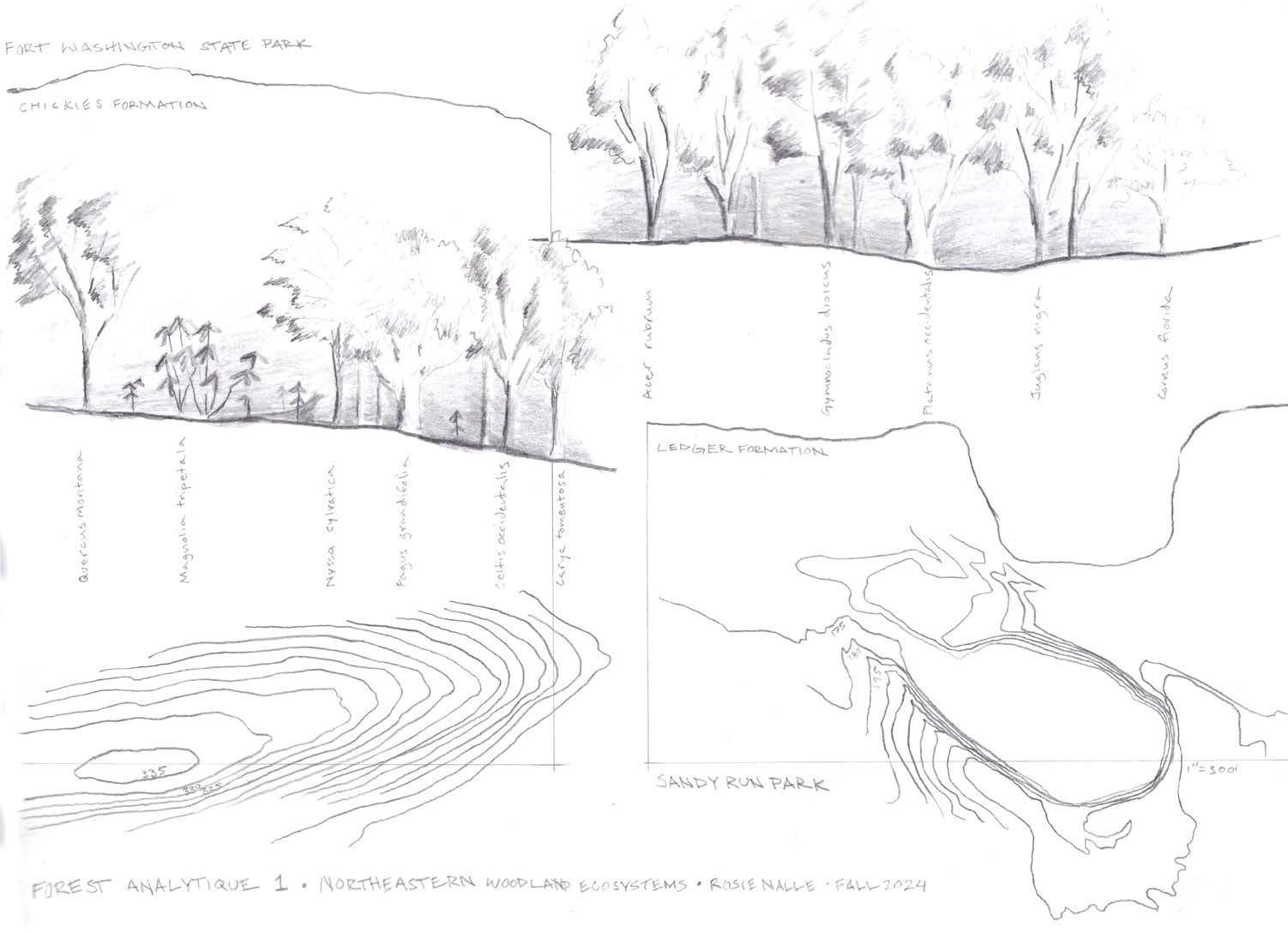
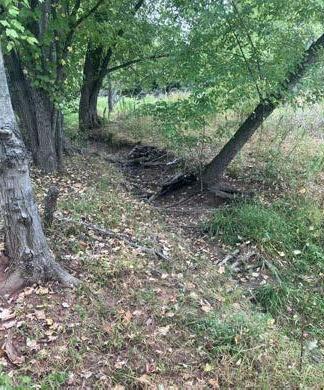
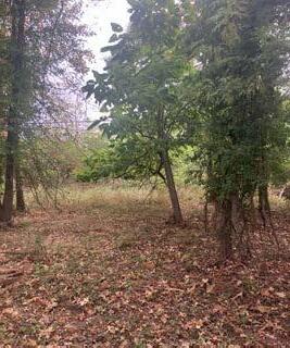
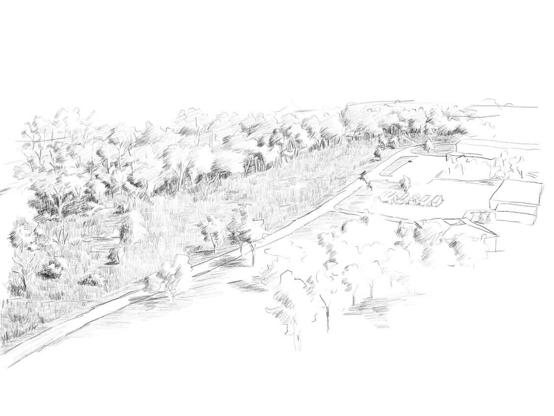
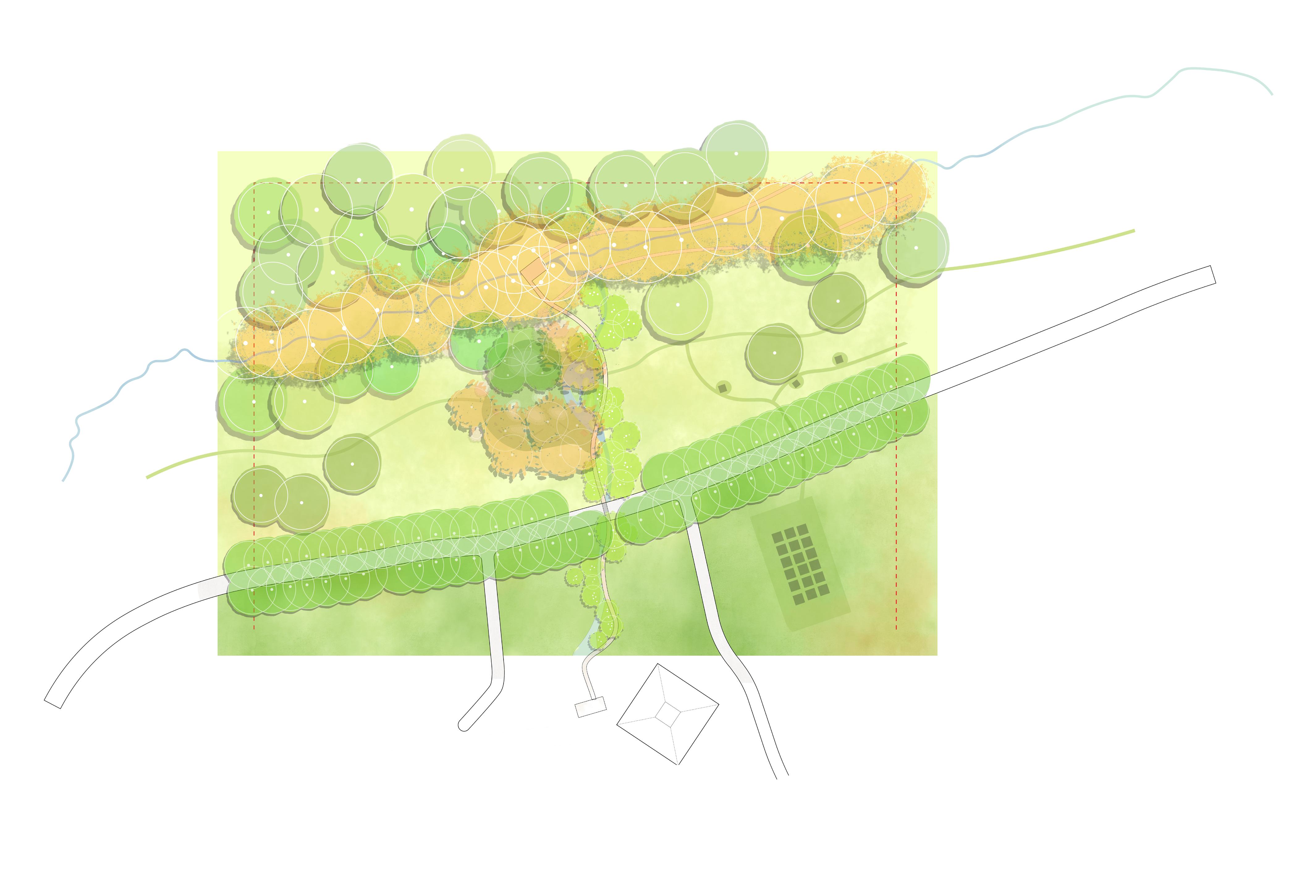
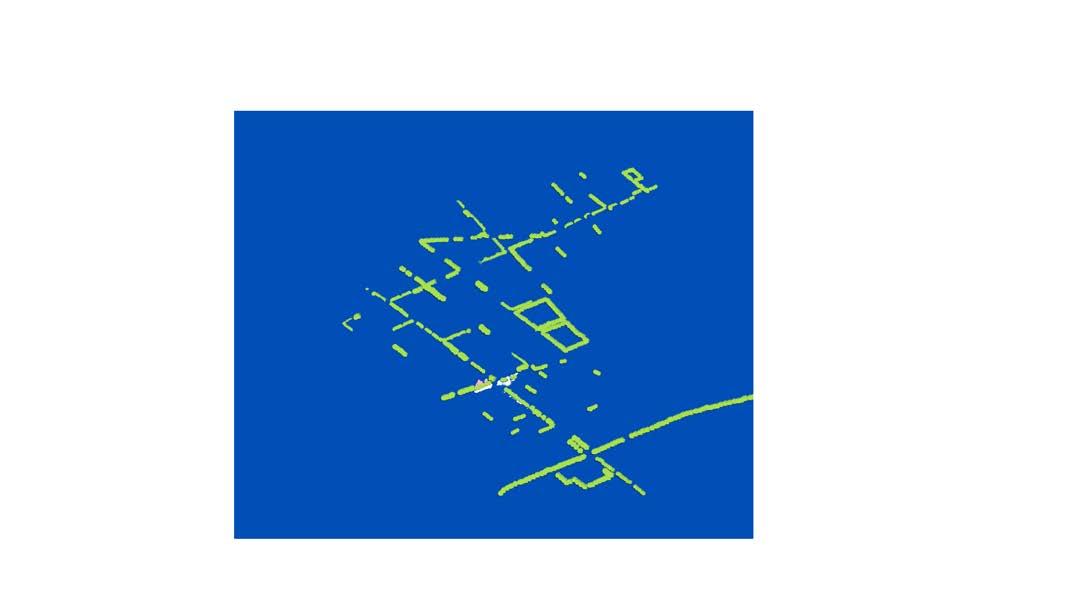
EXISTING CONDITIONS: analysis of campus
Temple Ambler Miyawaki: Follow the Path of Water
The project in Ambler focuses on connecting local children to the campus. The plan has two parts: a proposed woodland trail system connected to two adjacent schools that highlights the movement of water across campus, and a children’s garden in the meadow between the Child and Infant lab and the currently inaccessible Rose Valley creek.
woodland studio: ambler miyawaki
collage following the path of water between widener hall, rose valley creek, and tannery run
Rose Valley Creek Tannery Run
Maple Glen Elementary School
Our Lady Of Mercy Catholic School
watersheds & adjacent schools
+HP +HP
Widener Hall - Infant And Child Research Lab
Rose Valley CreekWatershed
TanneryRunWatershed
Woodland Trail Proposal
Single-species microforests will be planted along the paths connecting the schools to the creeks, and a dense sycamore allée follows Rose Valley Creek, making the micro-watersheds that run through the campus visible from a distance.
Widener Hall - Infant And Child Research Lab
Our Lady Of Mercy Catholic School
Maple Glen Elementary School
Proposed Rose Valley Children’s Garden
Rose Valley Creek
TanneryRun
Blackgum Path
River Birch Path
Loop Drive Willow Oak Allee
Rose Valley Creek
Sycamore Allée
woodland studio: ambler miyawaki
Combined
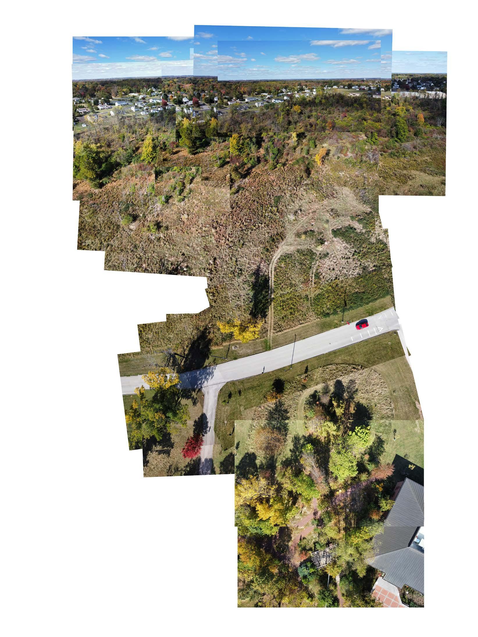
EXISTING CONDITIONS: birds eye drawing and drone collage of the site for the rose valley children’s garden
woodland studio: ambler miyawaki
Widener HallInfant And Child Research Lab
Existing Wetland Garden
Site For Proposed Rose Valley Children’s Garden
Rose Valley Children’s Garden
The final design seeks to leverage the research being done at the Ambler Field Station, the existing programs engaging the local community with the campus, and the unused space between the wetland garden and Rose Valley Creek to create a space for neighborhood children and young adults that integrates research, community, and play
WILLOWOAKALLEE
Sycamore Circle
Paw Paw Path
Bald Cypress Grove
Swamp Oak Circle
Adventure Play Area
Wetland Garden
MEADOW BOARDWALKTO
Wetland Garden
Oak Circle
Adventure Play Area
woodland studio: ambler miyawaki NTS
section showing the play area, wetland garden, boardwalk, and meadow
PLAY AREA
WETLAND GARDEN PATH
Philadelphia Miyawaki: Finding the Hidden Stream
The Philadelphia Miyawaki Forest uses historic creeks and existing topography as a method to reconnect residents to the hydrology of the city. The project begins with street tree microforests planted along sites with built-in stewards – namely schools and churches, before spreading to include commercial areas and existing parks. The planting in front of residential houses will emerge organically, with microforests of different scales popping up across the watershed over years and decades. By demonstrating the various cycles of forest growth, a pattern of living systems emerges. A healthy, ever growing urban canopy creates a connection to the future, the reference to the historic hydrology connects residents to the past, and community stewardship of forests fosters an investment in the present.
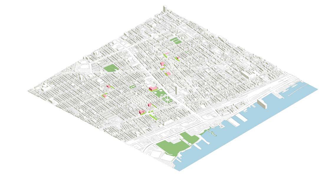
MOYAMENSINGKIL CREEK & WATERSHED
8 woodland studio: philadelphia miyawaki
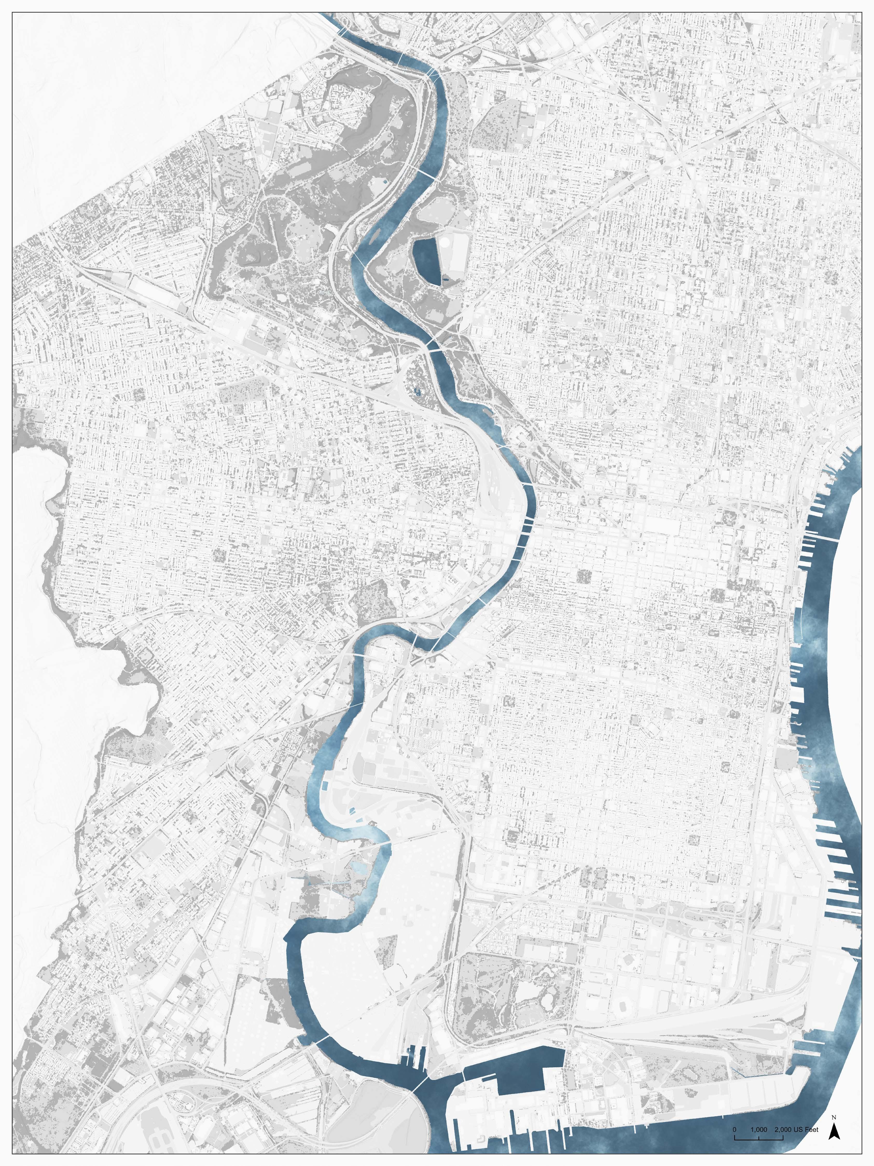
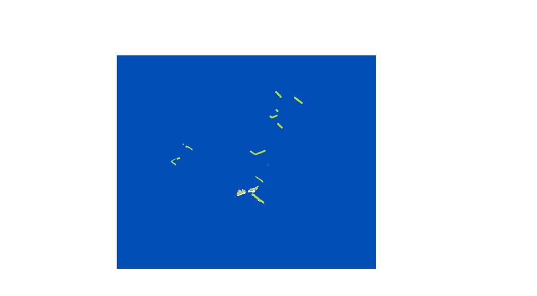
map of historic/buried streams of philadelphia, and detail showing existing topography
SURFACEHYDROLOGY TRANSPORTATION
LANDUSE
FLOODPLAIN&BURIEDCREEK
EXISTING CONDITIONS: analysis and context map of the moyamensingkil watershed
studio: philadelphia miyawaki
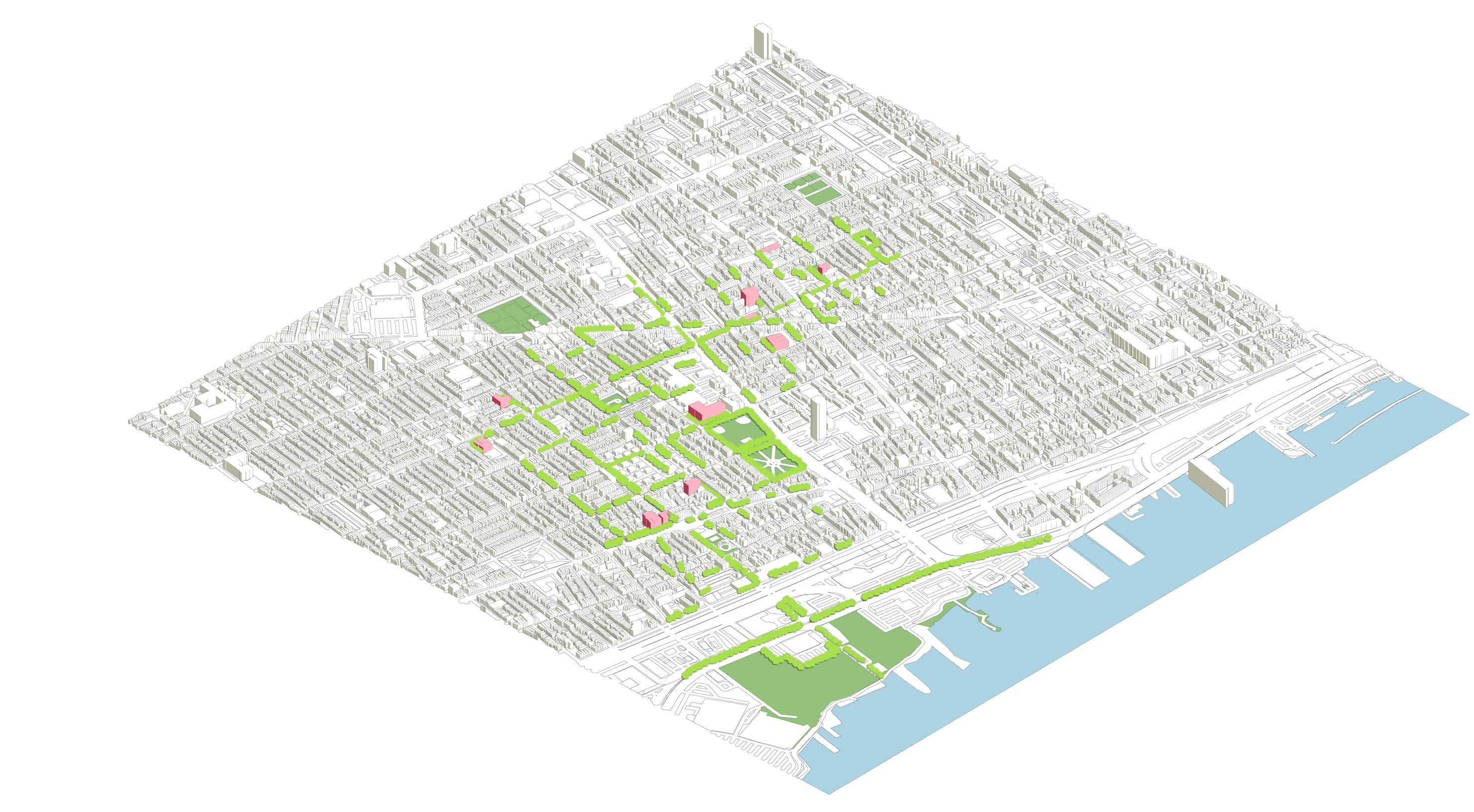
PhaseIIIContinuedResidentialBuy-In
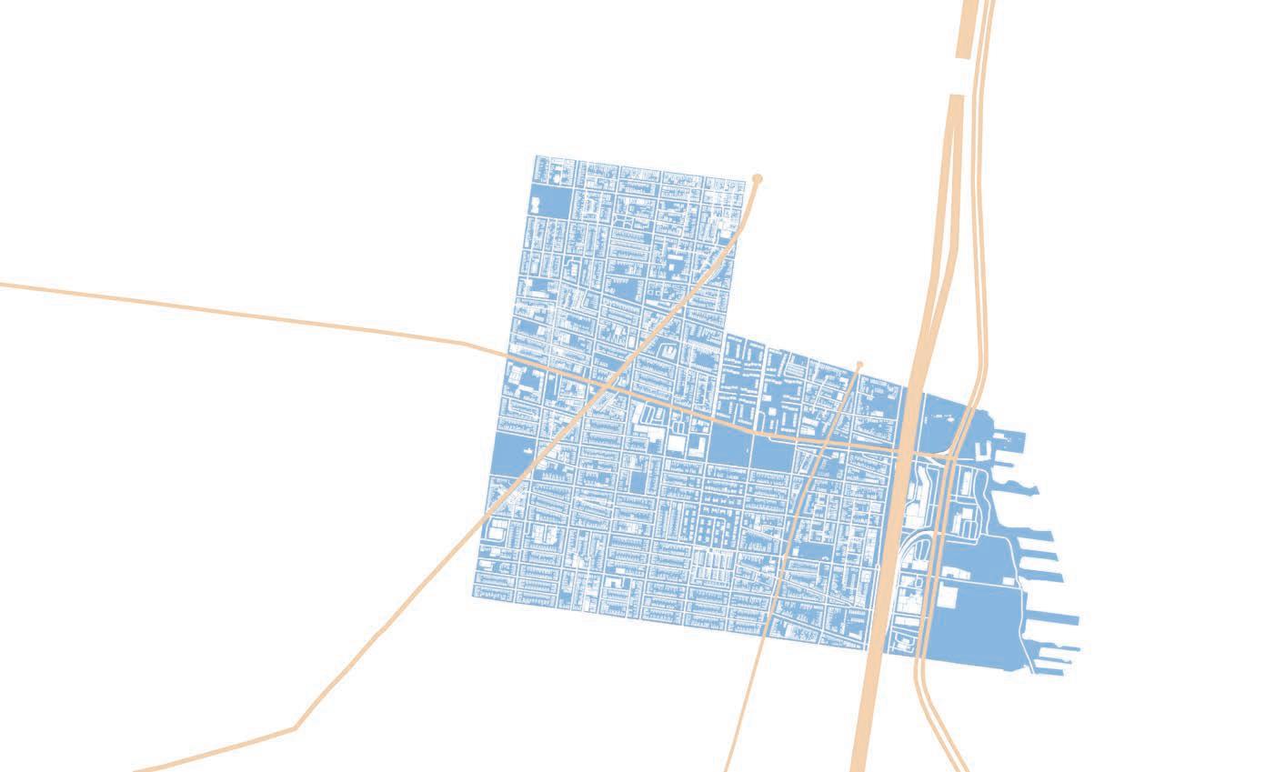
three phases of urban forest plantings, and the microforest connected to the kirkbride school, a typical example of a school and residential block
PhaseISchools,Churches,CommunityCenters
10 woodland studio: philadelphia miyawaki
Kirkbride School
7th Street
Moyamensingkil Creek Urban Forestry Plan
woodland studio: philadelphia miyawaki
perspective of planting outside Kirkbride School
The 25th Street
design studio II second semester, spring 2024
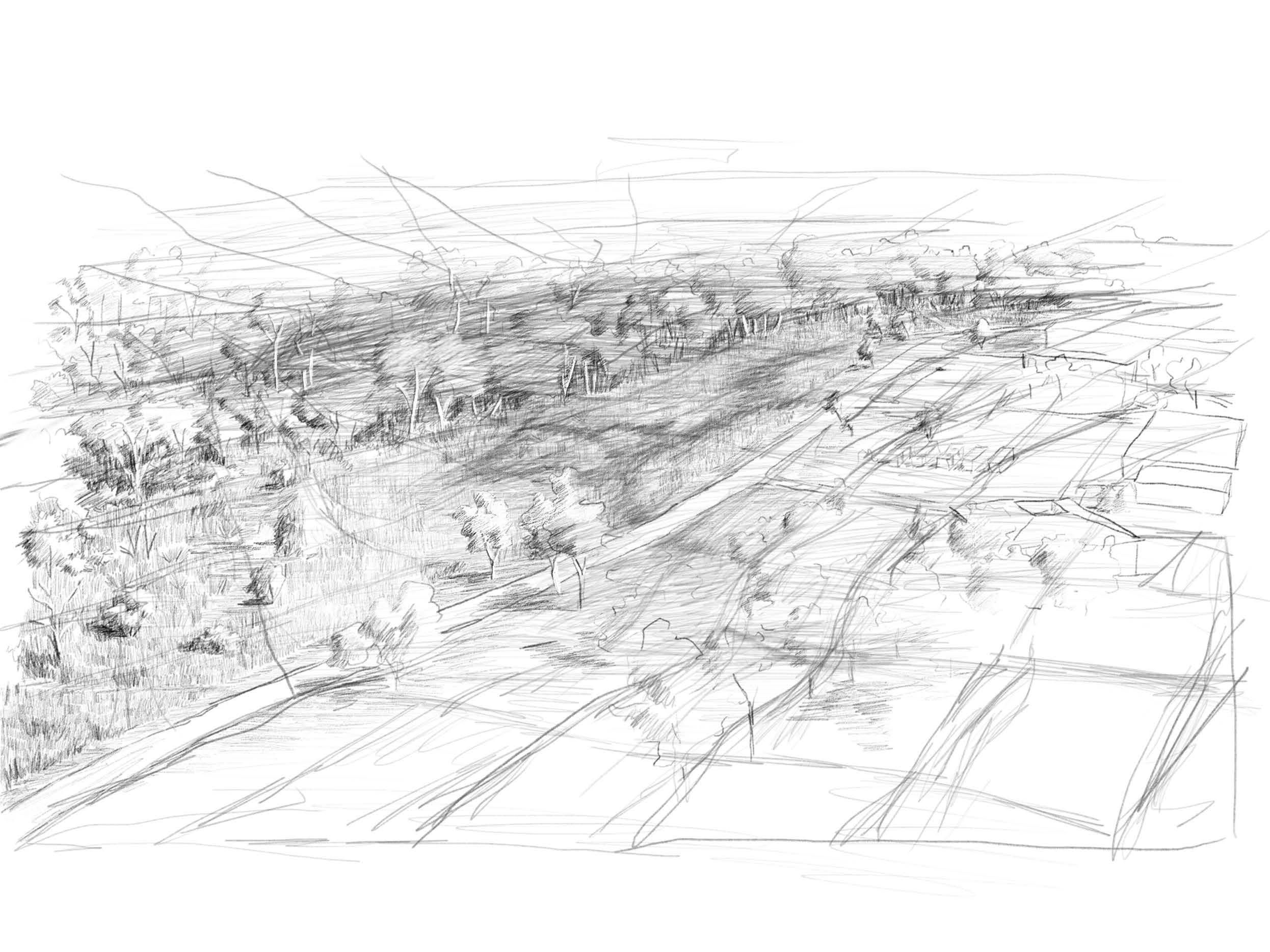
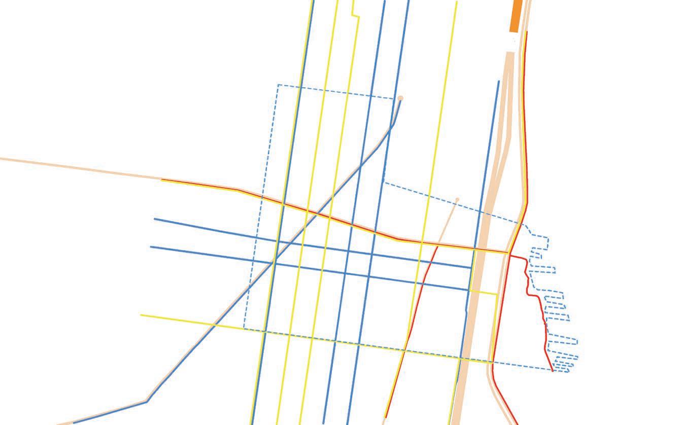
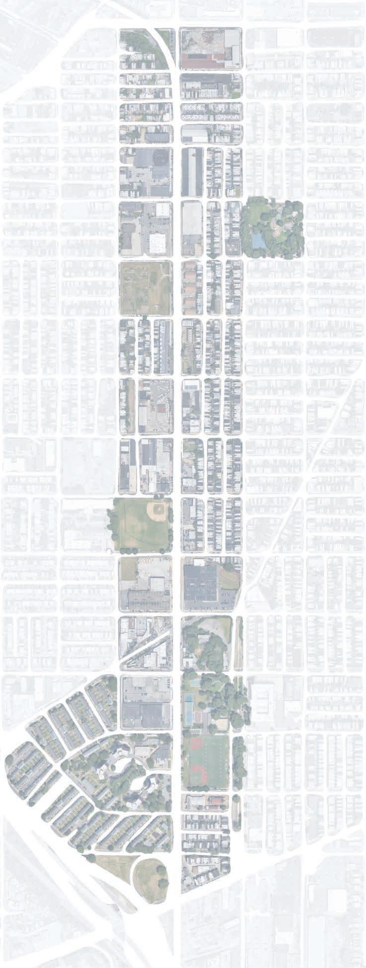
In our second semester studio, we were asked to look at the 25th street viaduct in Philadelphia and develop a plan that benefited the corridor and the adjacent neighborhoods. The elevated CSX rail passing over 25th street currently acts as a barrier, cutting off residents to the west of it from the rest of the city. The 25th St. Corridor Master Plan seeks to reposition 25th St. as a multimodal transit artery, prioritizing public transit, and pedestrian and cyclist safety. The proposed rail will connect the residents of surrounding neighborhoods to resources around the city - parks, medical care, and places of employment. An elevated pedestrian walkway and bike lanes will run directly underneath. Through the purchase and conversion of a series of vacant lots along the corridor, a network of green spaces and community hubs will emerge, creating a vibrant and active corridor.
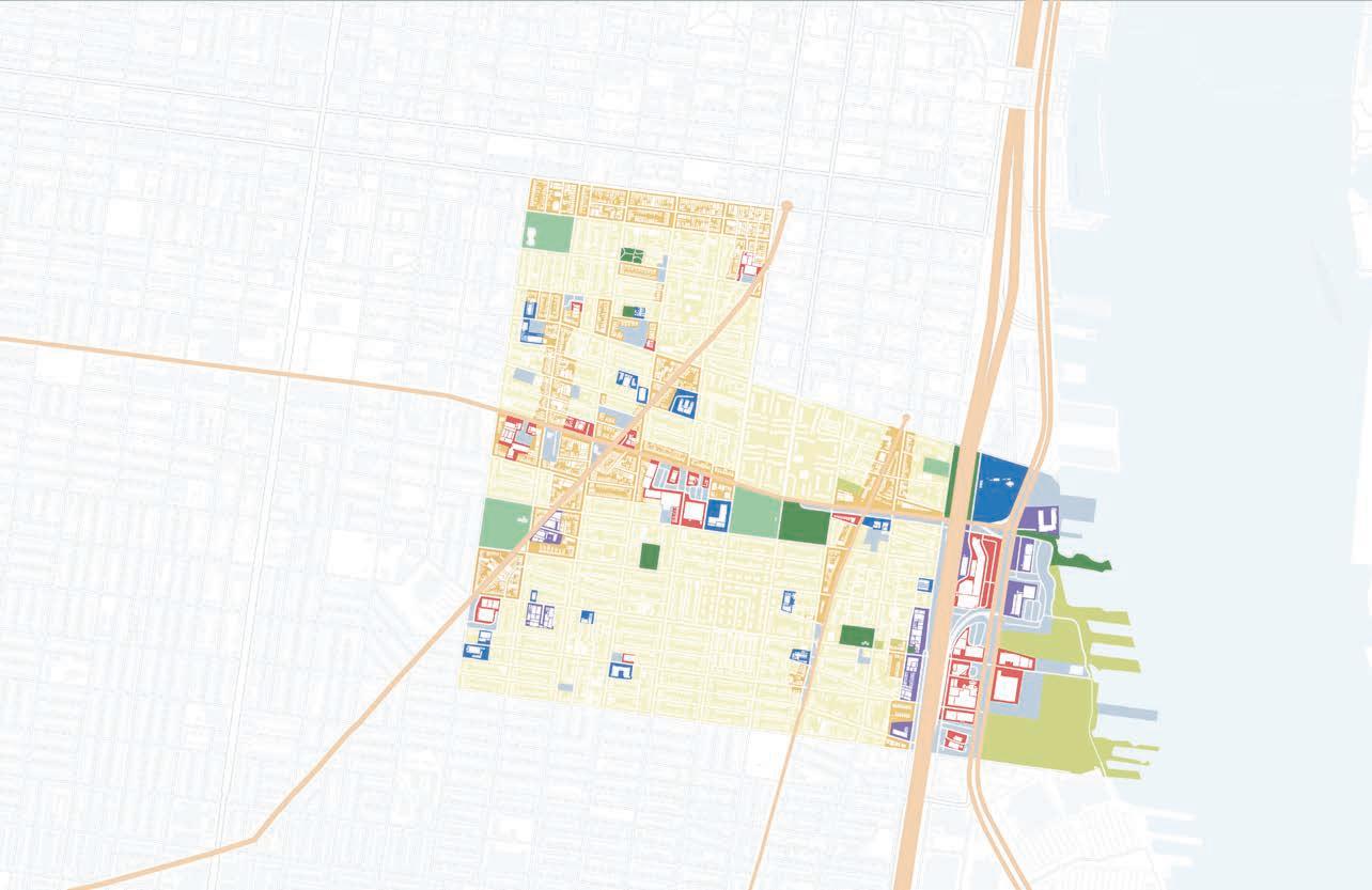
major grocery stores
parks
Viaduct
EXISTING CONDITIONS: critical distances: white circle shows a ten minute walk to resource, red line is the 25th street viaduct
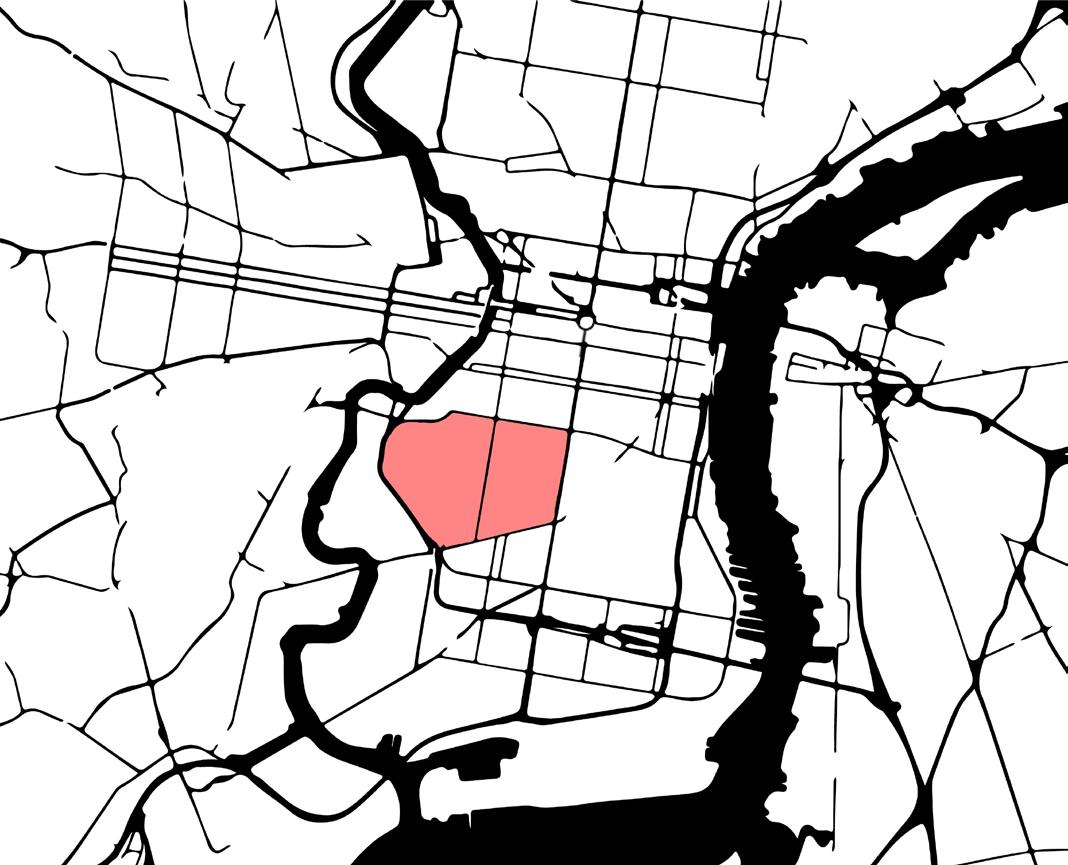
map of philadelphia highlighting neighborhoods of study
PROPOSEDPHILADELPHIASOUTHLINE
GOALS:
CONNECTION: Create a corridor that knits together the fabric of the neighborhoods to the east and west of the viaduct
SAFETY: Prioritize the pedestrian experience with improved sight lines, legible signage, and adequate lighting
PLAY: Encourage opportunities for play and recreation all along the corridor, creating a route that parents feel comfortable letting their kids take to school, and places where people of all generations can find community and meaning
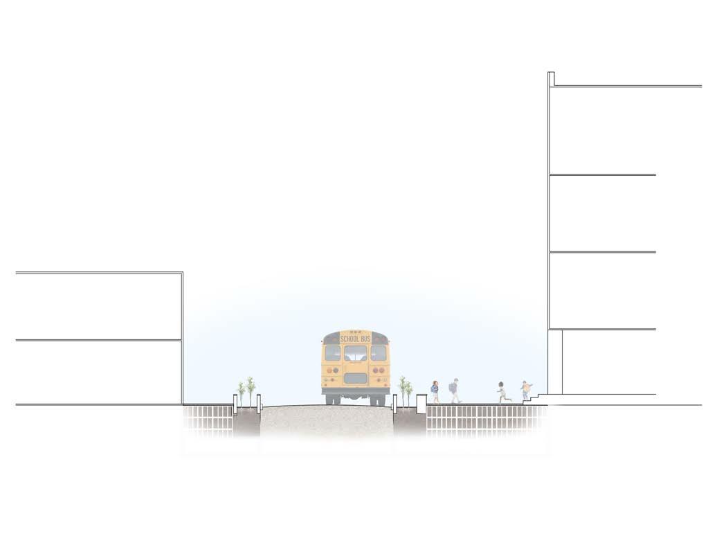
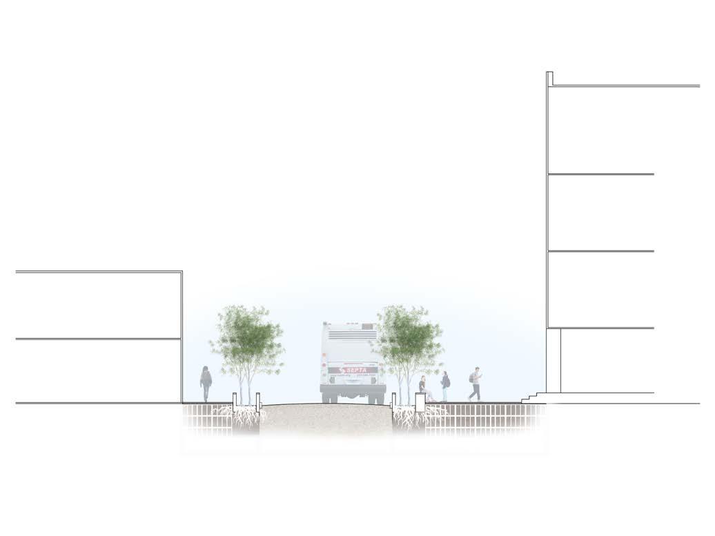
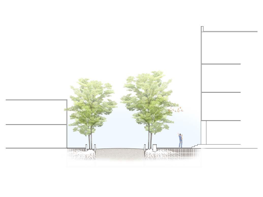
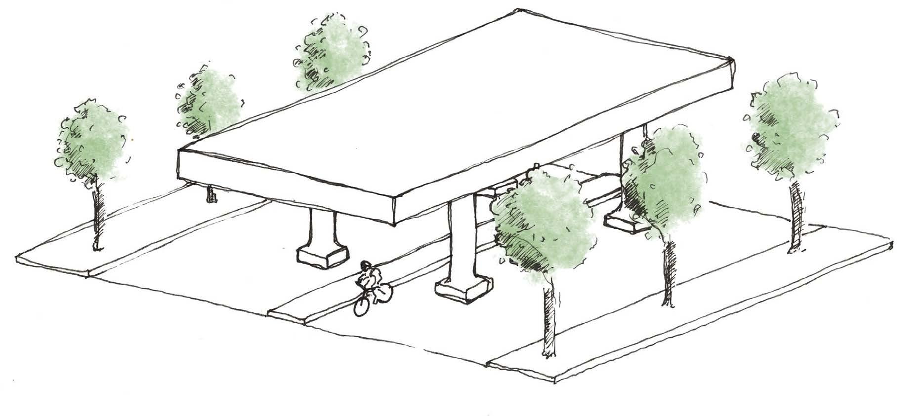
UNDER THE VIADUCT
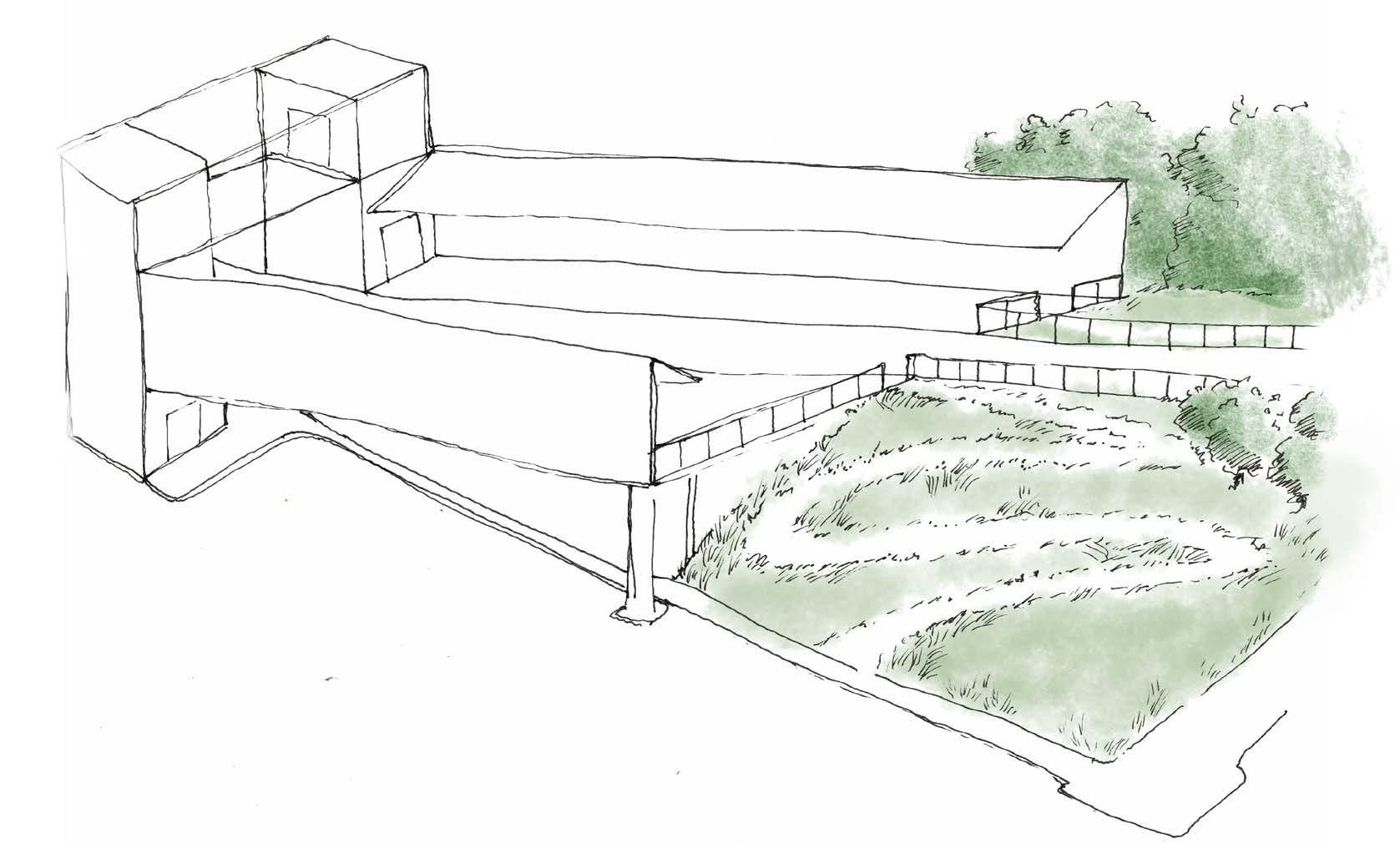
A typical section under the viaduct. The wings have been removed, allowing more light to filter under. A raised pedestrian walkway runs through the center, flanked by protected bike lanes on either side. Water from the viaduct is routed into permeable basins along the edges, allowing water to filter through slowly before rejoining the rest of the sewage system.
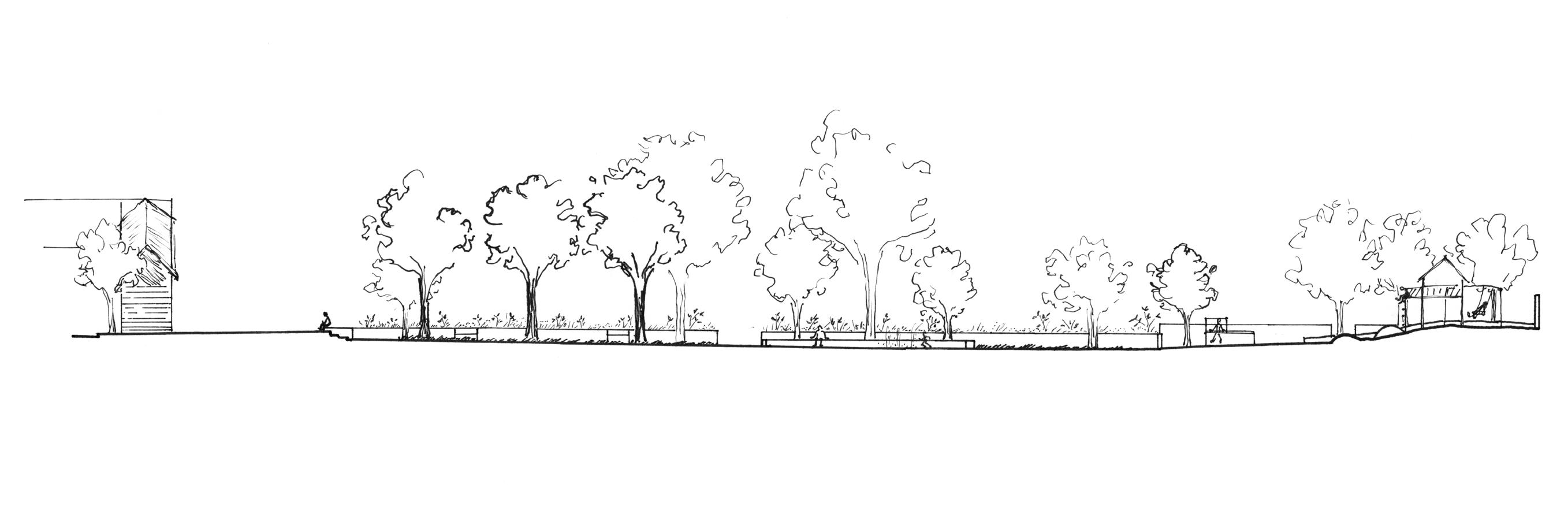
WASHINGTON-ELLSWORTH STATION
Washington-Ellsworth station acts as the gateway to the neighborhood, with a meadow walkway leading up the platform, and Ellsworth Park directly accross the street
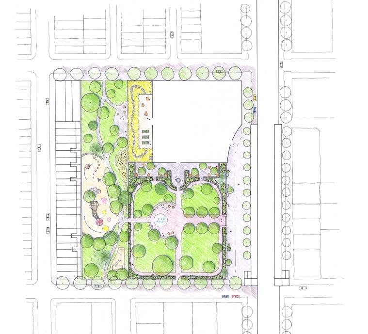
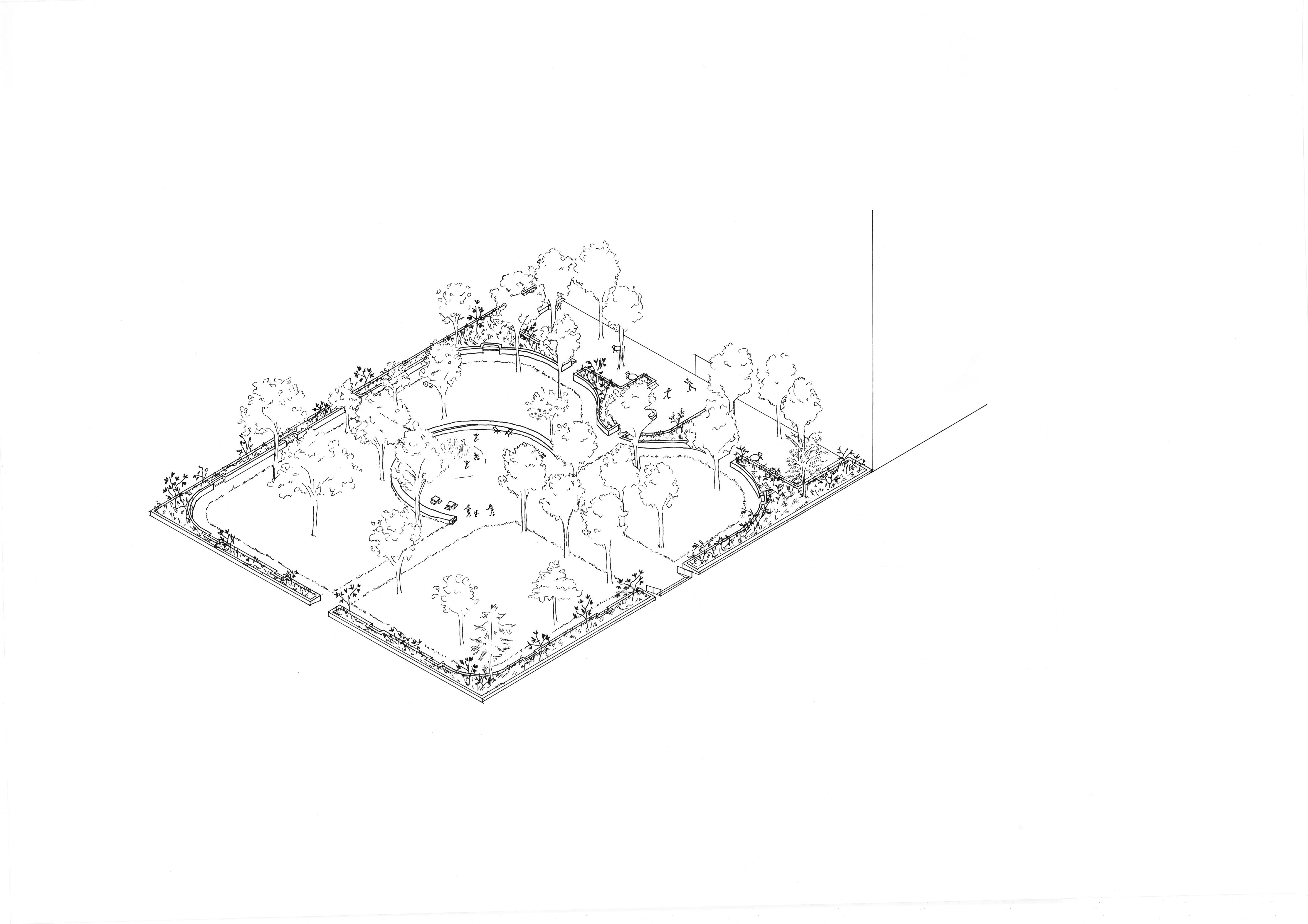
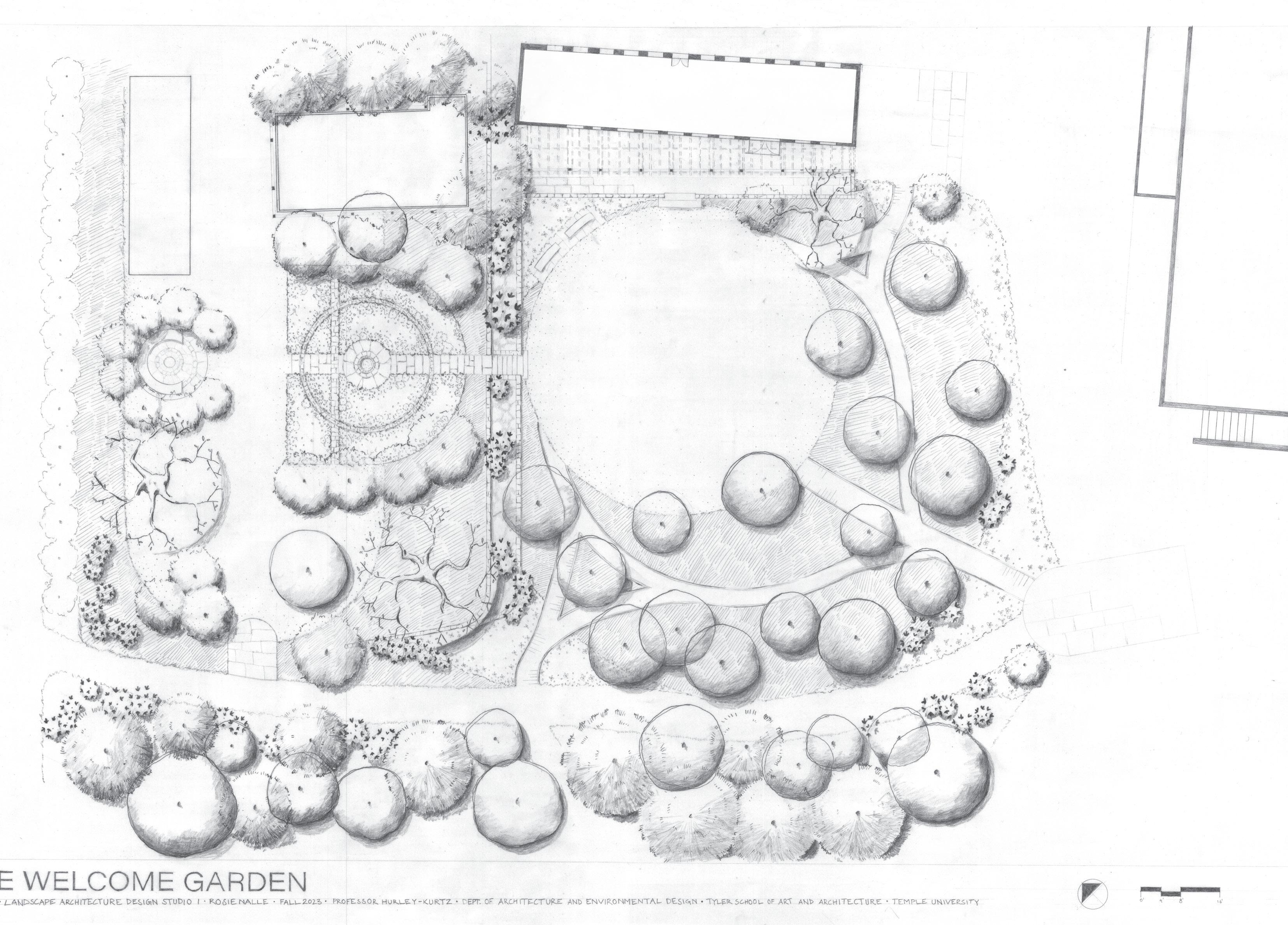
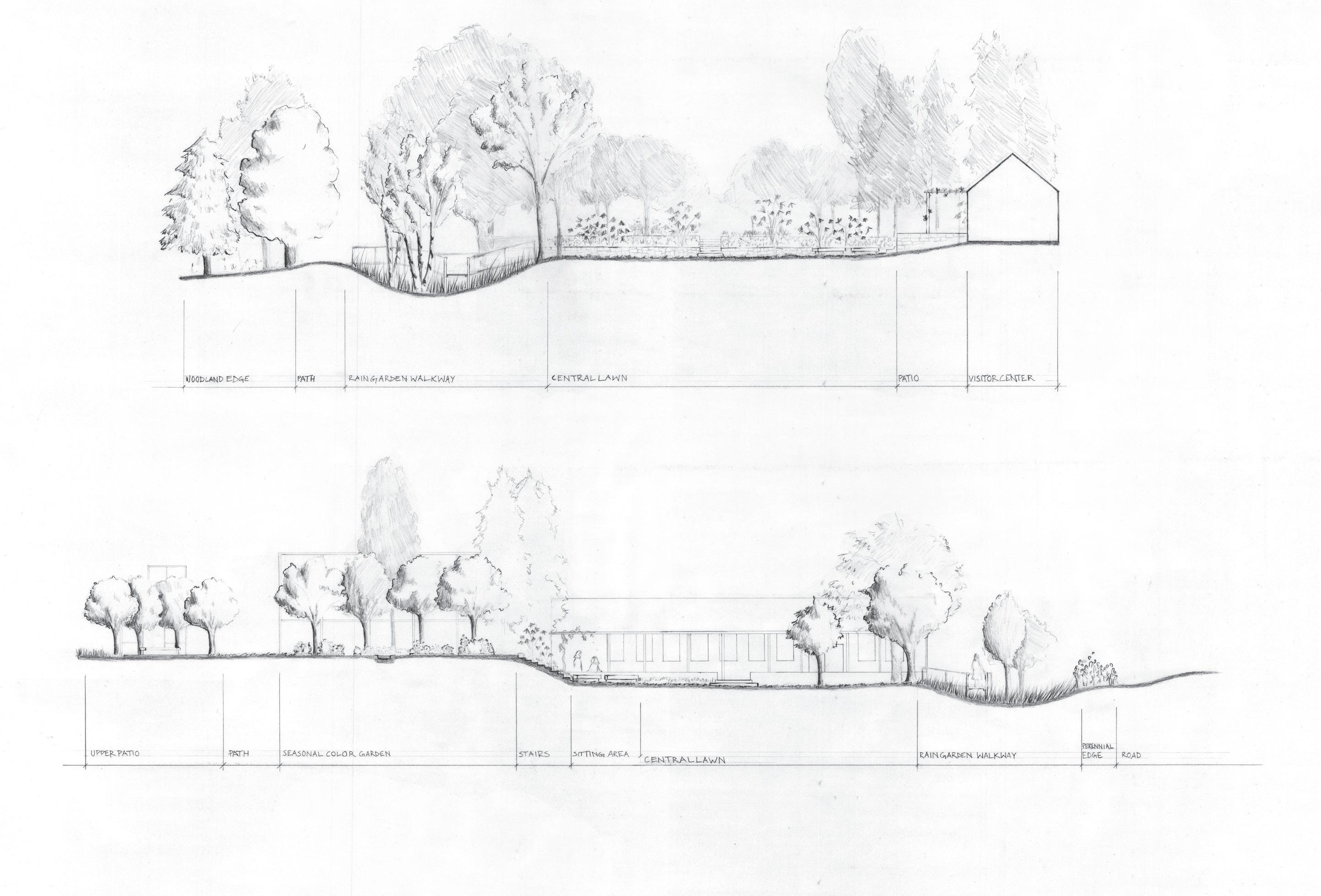
Welcome Garden design studio I first semester, fall 2023
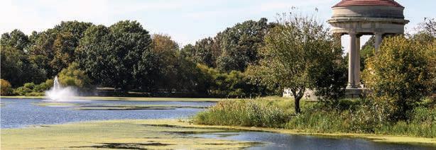
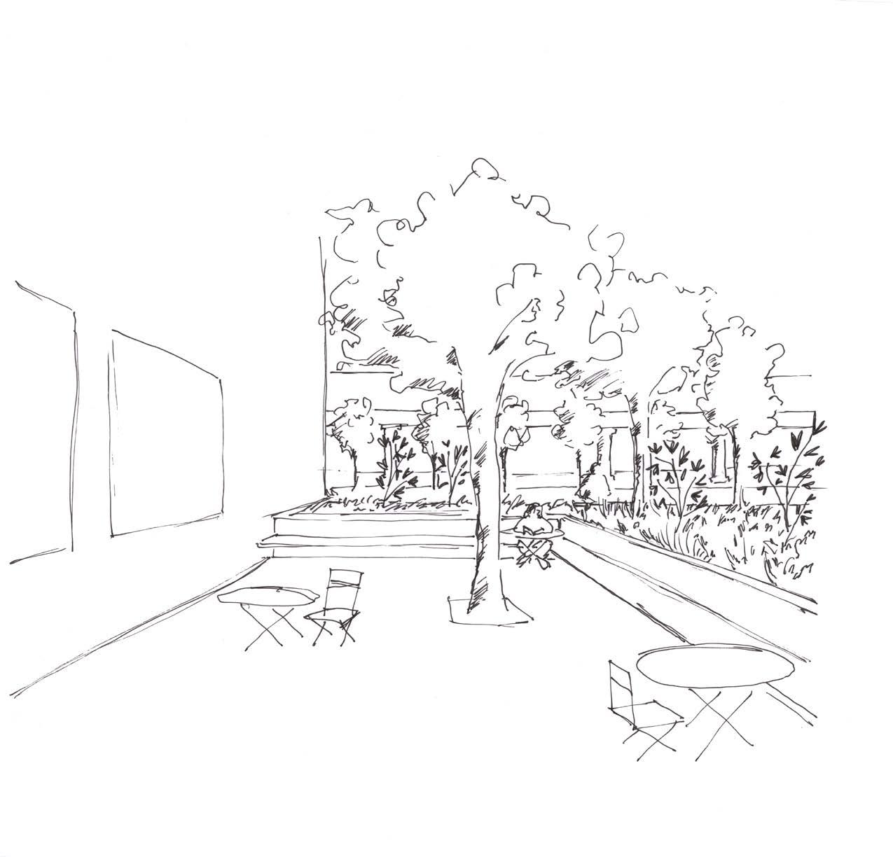
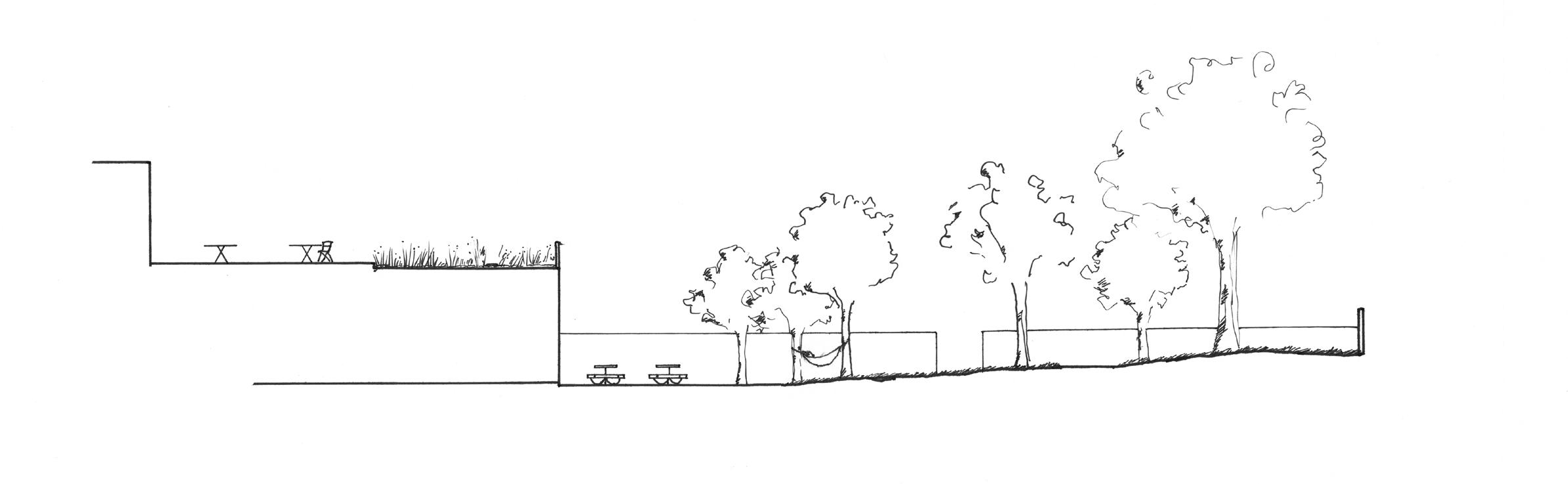
The Welcome Garden acts as a gateway to the Temple Ambler campus, framing the existing visitor center. A raised boardwalk passes over a large rain garden, and the central lawn offers enough space to accommodate events. The formal garden in the upper level will be planted with native perennials, framed by a grove of flowering dogwoods.
section aa
section bb
4
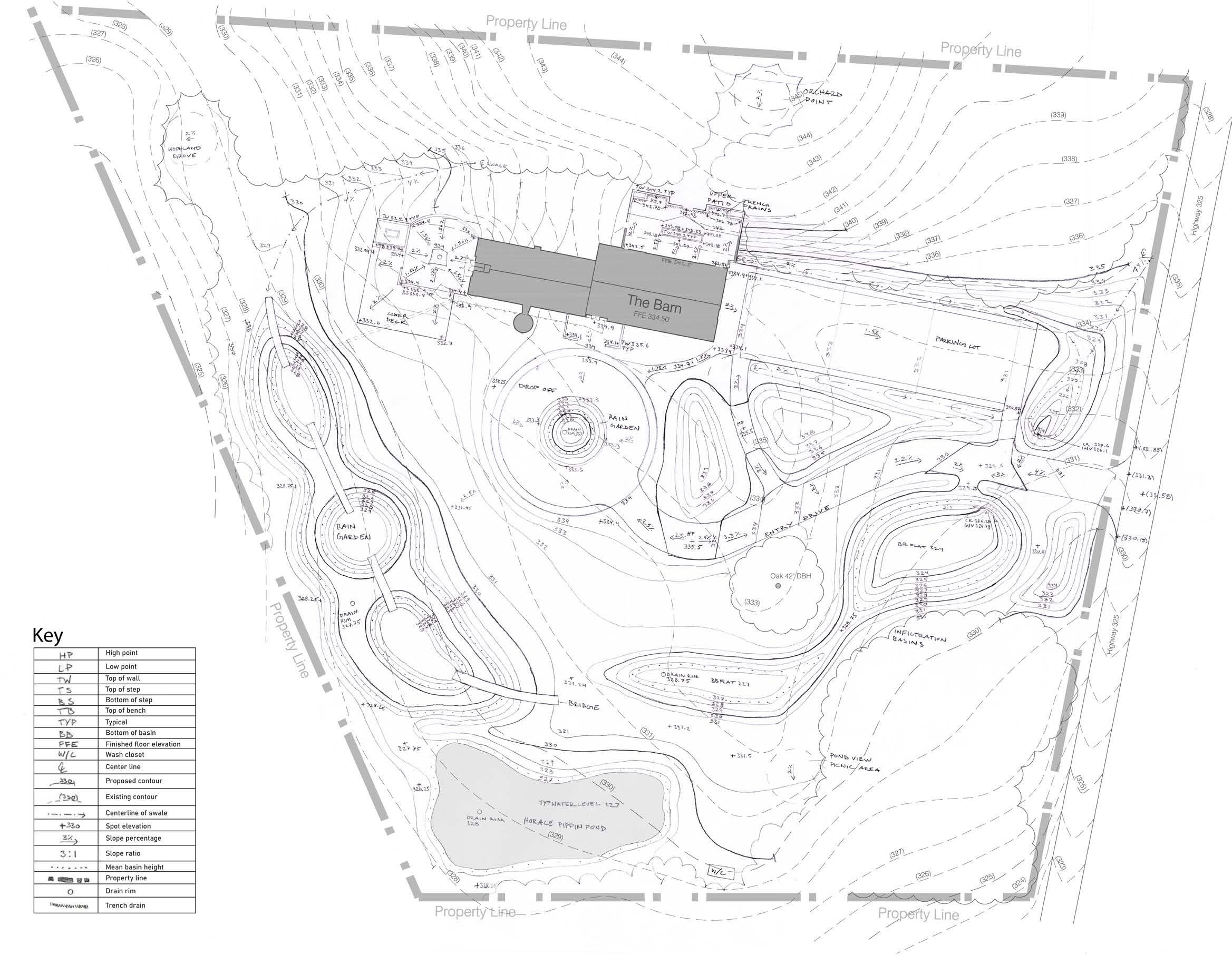
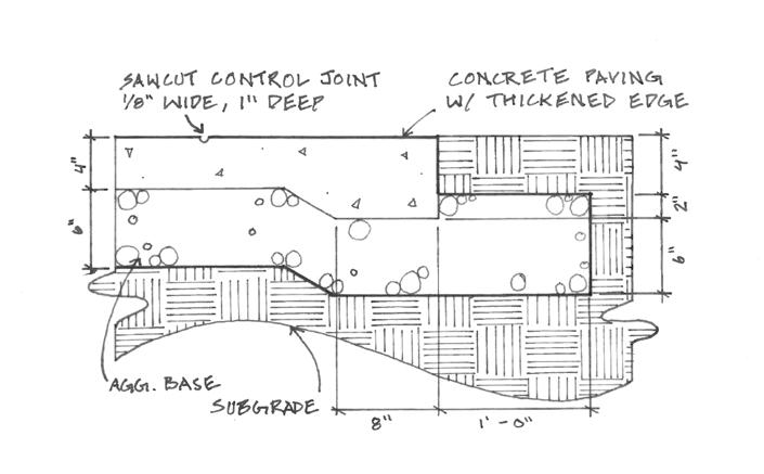
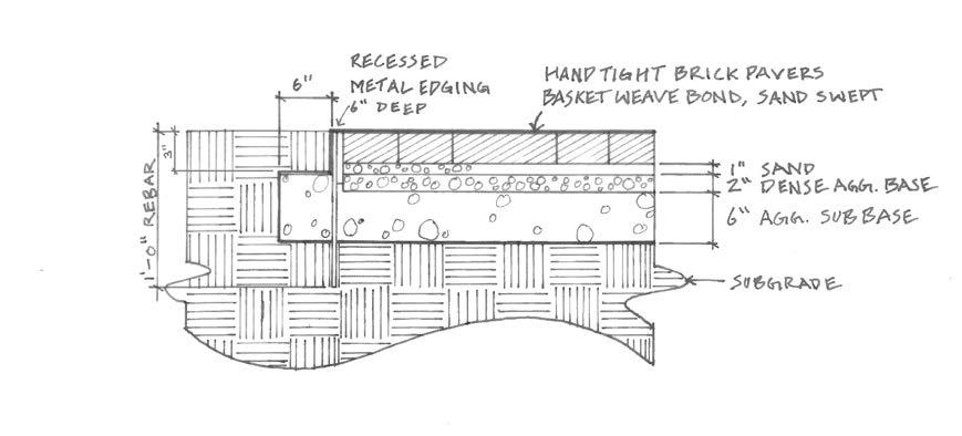
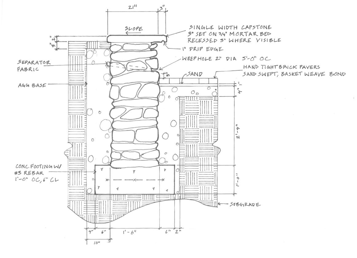
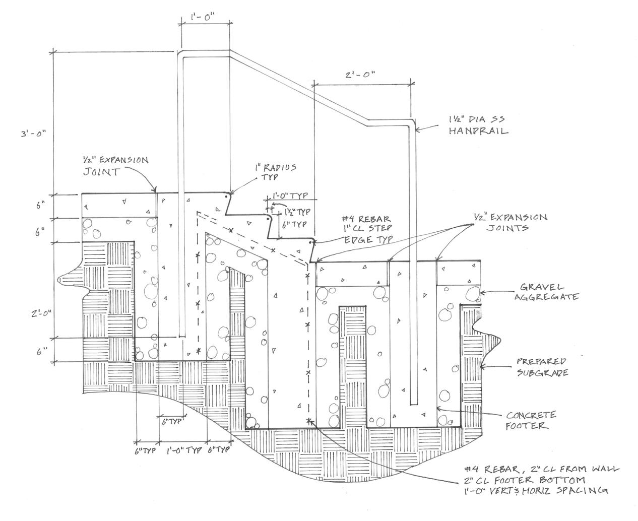
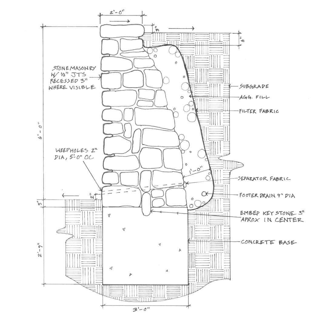
Ousider Art Museum: Grading Plan & Construction Details
engineering II second semester, spring 2023
In our second engineering class, we made grading plans for a sculpture park. In my design, the water is conveyed to a series of step pools and to an interactive rain garden. Construction details show how the hardscaped elements will come together