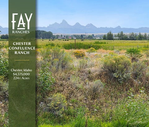
CHESTER CONFLUENCE RANCH
Chester, Idaho $4,375,000 224± Acres
INTRODUCTION Two rivers meet here. The Fall River falls out of the southwest corner of Yellowstone, runs sixty-four± miles through timber and farm country, and gives itself up to the Henry’s Fork at Chester. Chester Confluence Ranch holds the ground where that happens. The Henry’s Fork needs no introduction to anyone who fishes. What is worth knowing is how this particular water behaves. The river swings through a long bend along the property, and the volume the Fall River adds changes its character below the meeting point. Riffles and deep runs replace the slower flats upstream. Rainbows share the water with heavy browns. Boats come off the river at the Chester launch and go back in below the dam for the run down toward St. Anthony, which makes this one of the better-known stretches on the lower river. The dam carries its own history. The Bureau of Reclamation built the Chester diversion in 1938 to serve irrigators in the valley. In 2014, Fall River Rural Electric Cooperative brought it online as a hydroelectric facility, and a fish ladder funded by the Henry’s Fork Foundation, Trout Unlimited, and the Greater Yellowstone Coalition opened upstream passage for the first time since the structure went in. Trout now move as far up as Ashton and into the Fall River itself. Back from the river, two large ponds hold ducks and geese through the fall. Trumpeter swans work the open water in the cold months. Sandhill cranes feed the wet ground in the shoulder seasons. The Chester Wetlands unit of the Sand Creek Wildlife Management Area covers 762± acres of wetland along this same stretch of the Henry’s Fork, and the birds pay no attention to property lines. Moose browse the willow bottoms. Whitetail hold in the cottonwoods. Two hundred twenty-four± acres. Two rivers. One of the best addresses in eastern Idaho.
Chester Confluence Ranch | Chester, Idaho
1
QUICK FACTS • • • • • • • • • • • •
2
Approximately 224± deeded acres Frontage at the confluence of the Fall River and the Henry’s Fork Long river bend with over a mile of frontage on moving water Two large ponds providing waterfowl habitat Blue-ribbon wild trout fishery holding rainbow, brown, and cutthroat trout Native mountain whitefish throughout the reach Chester Dam public boat launch at the property Fish ladder at Chester Dam opens passage upstream to Ashton Dam Chester Wetlands unit of Sand Creek WMA along the same reach Waterfowl corridor for ducks, geese, trumpeter swans, and sandhill cranes Habitat for moose, whitetail, and elk Year-round river access
www.fayranches.com | 800.238.8616 | info@fayranches.com
Chester Confluence Ranch | Chester, Idaho
3
4
www.fayranches.com | 800.238.8616 | info@fayranches.com
Chester Confluence Ranch | Chester, Idaho
5
6
www.fayranches.com | 800.238.8616 | info@fayranches.com
SCENIC VISTAS The Teton Range stands to the east. From the open ground on the property, the view runs uninterrupted across the Henry’s Fork drainage to the mountains, and it changes with the hour and the season. There are a number of places in eastern Idaho with a Teton view. Very few of them come with two rivers running through the ground beneath it.
Chester Confluence Ranch | Chester, Idaho
7
RECREATION The St. Anthony Sand Dunes sit just west of town. The Bureau of Land Management describes the area as 10,600± acres of clear, shifting, white quartz sand, with dunes running up to 400’ high, and riders come from across the west for it. Egin Lakes offers camping and the main access point. Half the area falls inside the Sand Mountain Wilderness Study Area, where travel is on foot or horseback. The same dune country holds one of the larger wintering elk herds in the country, which is why the ground around it stays productive.
St. Anthony Sand Dunes 8
www.fayranches.com | 800.238.8616 | info@fayranches.com
HUNTING | WILDLIFE The property sits adjacent to the Chester Dam, directly across the Henry’s Fork from the Chester Wetlands unit of the Sand Creek Wildlife Management Area, where 762± acres of wetland provide nesting and migration habitat for waterfowl and other waterbirds. Ducks and geese work that corridor through the fall, trumpeter swans hold on open water into winter, and sandhill cranes pass through in the shoulder seasons. Moose and whitetail stay in the willow and cottonwood year-round. Elk drop down as snow pushes them. The Sand Creek Dunes and winter range have long produced heavy mule deer bucks. Unit 60A.
Photos not taken on property
FISHING The Henry’s Fork earns its reputation on this reach. The river swings through a long bend along the property, and the volume the Fall River adds changes how the water fishes below the confluence. Riffles and deep runs replace the slower flats upstream. Rainbows share the water with heavy browns. Boats pull out at the Chester launch and go back in below the dam for the run toward St. Anthony. A fish ladder installed with the hydro project now moves trout upstream as far as Ashton and into the Fall River. Chester Confluence Ranch | Chester, Idaho
9
10
www.fayranches.com | 800.238.8616 | info@fayranches.com
Chester Confluence Ranch | Chester, Idaho
11
AREA HISTORY The river carries the name of Andrew Henry, who came up the Snake in 1810 with the Missouri Fur Company and built Fort Henry a few miles south of present-day St. Anthony. It was the first American fur post west of the Continental Divide. He abandoned it the following spring. Irrigation reshaped the valley a century later, and the Bureau of Reclamation built the Chester diversion in 1938 to move water to farms downstream. In 2014, Fall River Rural Electric Cooperative brought the structure online as a hydroelectric facility and added the fish ladder that opened the river above it.
Grand Prismatic 12
Grand Targhee Recreation www.fayranches.com | 800.238.8616 | info@fayranches.com
Yellowstone National Park
NEARBY AT TR ACTION S & ACTIVITIES Yellowstone National Park sits an hour and a quarter north by way of Island Park, entering at the West Yellowstone gate. Upper and Lower Mesa Falls lie half an hour northeast on the Mesa Falls Scenic Byway. The St. Anthony Sand Dunes are thirty minutes west, with Egin Lakes providing the main access. Green Canyon Hot Springs is a half hour south toward Newdale. Grand Targhee Resort is an hour and fifteen minutes east over the Teton Basin, with lift-served skiing in winter and mountain biking through the summer. Chester Confluence Ranch | Chester, Idaho
13
LOCATION
AIRPORT SERVICES
Chester sits in Fremont County, between St. Anthony and Ashton in the upper Snake River valley. This is farm country, where potato and grain ground runs to the base of the Tetons and the Henry’s Fork cuts through the middle of it. St. Anthony handles the day-to-day, with a grocery, a hardware store, and the county offices. Ashton, twenty minutes upriver, serves as the jumping-off point for Island Park and Yellowstone. Rexburg is thirty minutes south and Idaho Falls an hour. The country stays working and quiet, and the mountains are never out of sight.
Idaho Falls Regional Airport is the main commercial option, roughly fifty minutes southwest, with daily service through Salt Lake City, Denver, and Seattle. Madison County Airport in Rexburg lies twenty-five minutes south and handles general aviation with a paved runway. Driggs-Reed Memorial Airport sits about an hour east over the Teton Basin and takes larger private aircraft, serving much of the Jackson Hole traffic. Jackson Hole Airport is two hours east, and Bozeman Yellowstone International is roughly two and a half hours north. West Yellowstone Airport runs seasonal commercial service in the summer months.
GET TING THERE From Idaho Falls, take U.S. 20 north past Rexburg and St. Anthony toward Ashton. Roughly six miles beyond St. Anthony, turn left on Ora Street, the U.S. 20 Frontage Road. Go 0.3± miles and turn left on E 800 N / E River Road. After 0.7± miles, turn right on N 2830 E and continue 1.4± miles to the Chester Dam. The property is on the right at the dam.
14
www.fayranches.com | 800.238.8616 | info@fayranches.com
Chester Confluence Ranch | Chester, Idaho
15
16
www.fayranches.com | 800.238.8616 | info@fayranches.com
Chester Confluence Ranch | Chester, Idaho
17
MINER AL RIGHTS All mineral rights appurtenant to the property and owned by the seller will convey to the buyer at closing. Mineral rights are not guaranteed. It is suggested that the buyer conduct a mineral search with a title company.
CON SERVATION | STEWARDSHIP Each of us at Fay Ranches loves the land and wants to see it remain a productive agricultural ground and a quality fish and wildlife habitat. Through promoting thoughtful land stewardship, Fay Ranches has guided owners toward a legacy of conserving wide-open spaces, enhancing and creating fisheries and wildlife habitats, and implementing sustainable agricultural operations. Fay Ranches is proud to say that since our company began in 1992, our clients’ conservation ethics and land-use practices have significantly enhanced our work landscape.
18
www.fayranches.com | 800.238.8616 | info@fayranches.com
Chester Confluence Ranch | Chester, Idaho
19
SUMMARY Two hundred twenty-four± acres at the meeting of the Fall River and the Henry’s Fork, with frontage running a long bend of blue-ribbon trout water. Rainbows and heavy browns hold the runs below the confluence, and a fish ladder at the dam has opened the river above it. Two large ponds and the wetland corridor across the water pull ducks, geese, trumpeter swans, and cranes through every fall. Moose and whitetail stay in the willow and cottonwood. The Tetons stand to the east, the sand dunes to the west, and Yellowstone is an hour and a quarter up the road.
20
www.fayranches.com | 800.238.8616 | info@fayranches.com
Chester Confluence Ranch | Chester, Idaho
21
CONTACT PRICE $4,375,000
TERMS Cash Conventional Financing 1031 Exchange
22
Please contact Curtis Ferney at (208) 709-0001 | cferney@ fayranches.com to schedule a showing. This is an exclusive listing. An agent from Fay Ranches, Inc. must be present at all showings, unless otherwise noted or other arrangements are made. To view other properties we have listed, please visit our web page at www. fayranches.com.
NOTICE Offer is subject to errors, omissions, prior sale, change or withdrawal without notice, and approval of purchase by owner. Information regarding land classification, carrying capacities, maps, etc., is intended only as a general guideline and has been provided by the owners and other sources deemed reliable, but the accuracy cannot be guaranteed. Prospective purchasers are encouraged to research the information to their own satisfaction.
www.fayranches.com | 800.238.8616 | info@fayranches.com
24
25
Scan the QR code to learn more.