

Real Estate begins with property, but it doesn’t end there. Our mission is to create lifelong relationships. We believe that working hard at something you love to do, with people you trust, is one of the greatest experiences in life
We offer extensive real estate knowledge and unsurpassed experience as one of the area’s top team of brokers with more than 50 years of experience. Well known in the industry for professionalism and loyalty, we have built a solid reputation for putting our clients goals first while bringing a highly personalized approach to each and every transaction

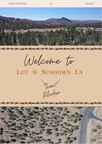
E L C O M E T O
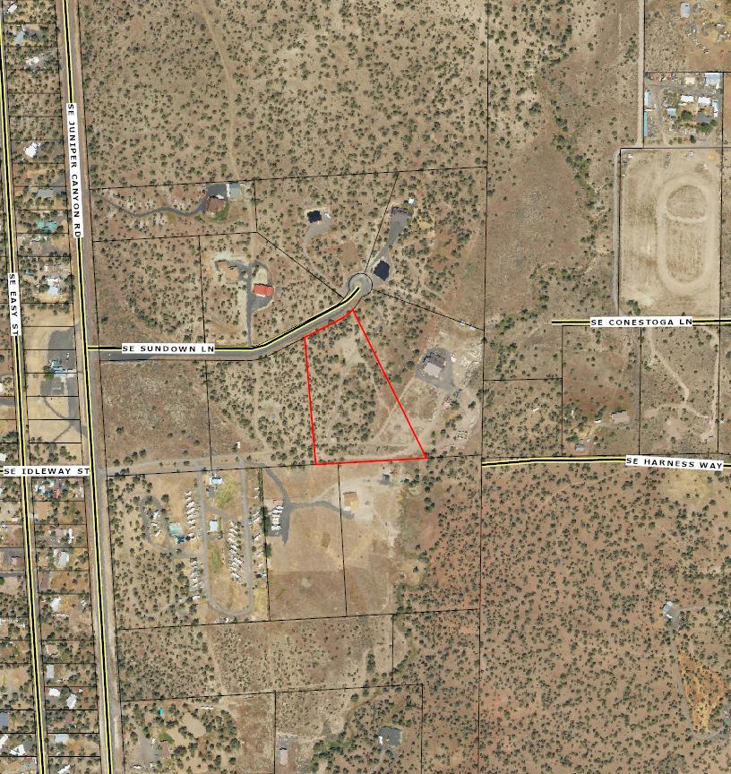
L O T 6 S U N D O W N
L A N E
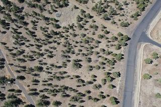
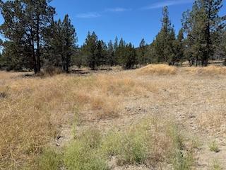
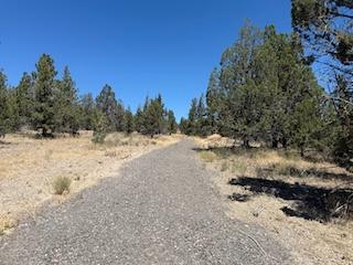
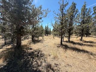
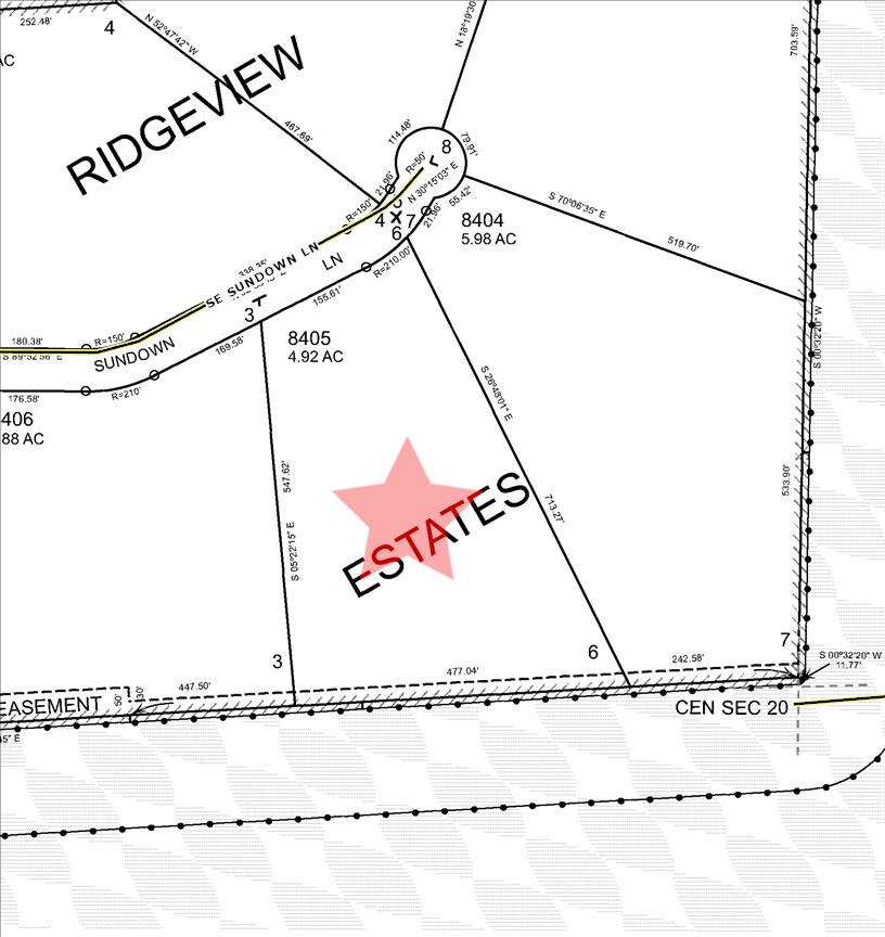
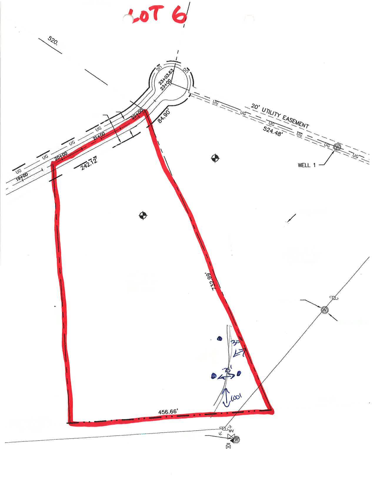
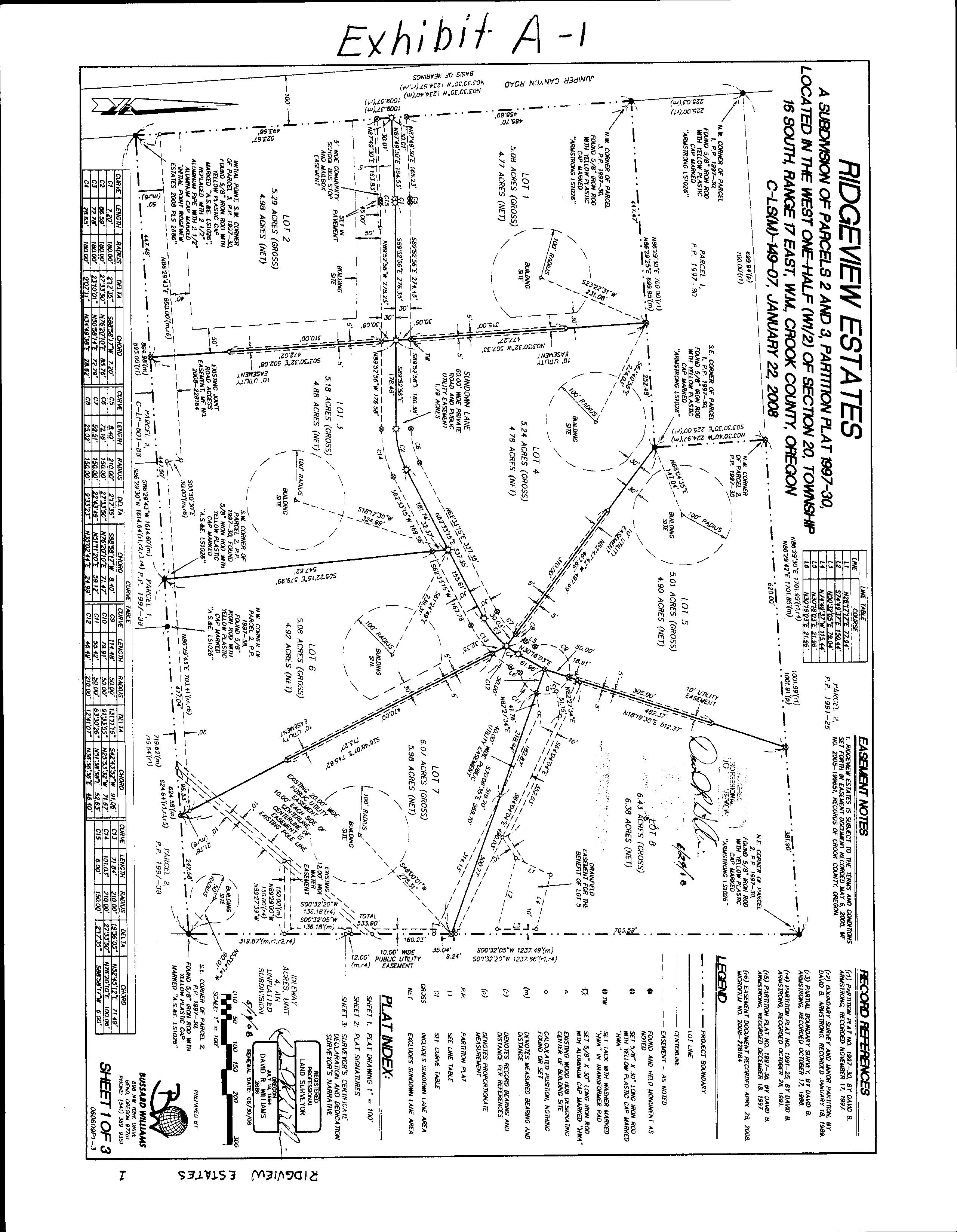
4.92 Acres Parcel Shared Well Perc Test On File
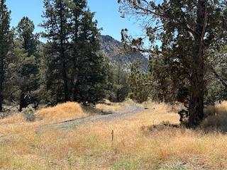
B U I L D Y O U R D R E A M H O M E O N T H I S J U S T
U N D E R 5 - A C R E B U I L D A B L E L O T I N A Q U I E T C U L - D E -
S A C W I T H A P A V E D R O A D A N D B E A U T I F U L V I E W S O F M O U N T A I N S A N D R O C K
O U T C R O P P I N G S . L O C A T E D
O N L Y A F E W M I L E S F R O M P R I N E V I L L E R E S E R V O I R A N D A C R O S S F R O M
R I C H I E S , I T ' S T H E P E R F E C T
B A L A N C E O F P R I V A C Y A N D
C O N V E N I E N C E . A S H A R E D W E L L A N D C I S T E R N A R E
A L R E A D Y I N P L A C E , A N D A L L U N D E R G R O U N D
U T I L I T I E S , I N C L U D I N G W A T E R L I N E S T O T H E
S H A R E D W E L L , A R E A T T H E
R O A D A N D A P P R O V E D F O R A S T A N D A R D S E P T I C M A K I N G Y O U R B U I L D
P R O C E S S S M O O T H E R .
D O N ' T M I S S T H I S C H A N C E
T O C R E A T E Y O U R O W N
C E N T R A L O R E G O N
G E T A W A Y
P H O T O G A L L E R Y
P H O T O G A L L E R Y
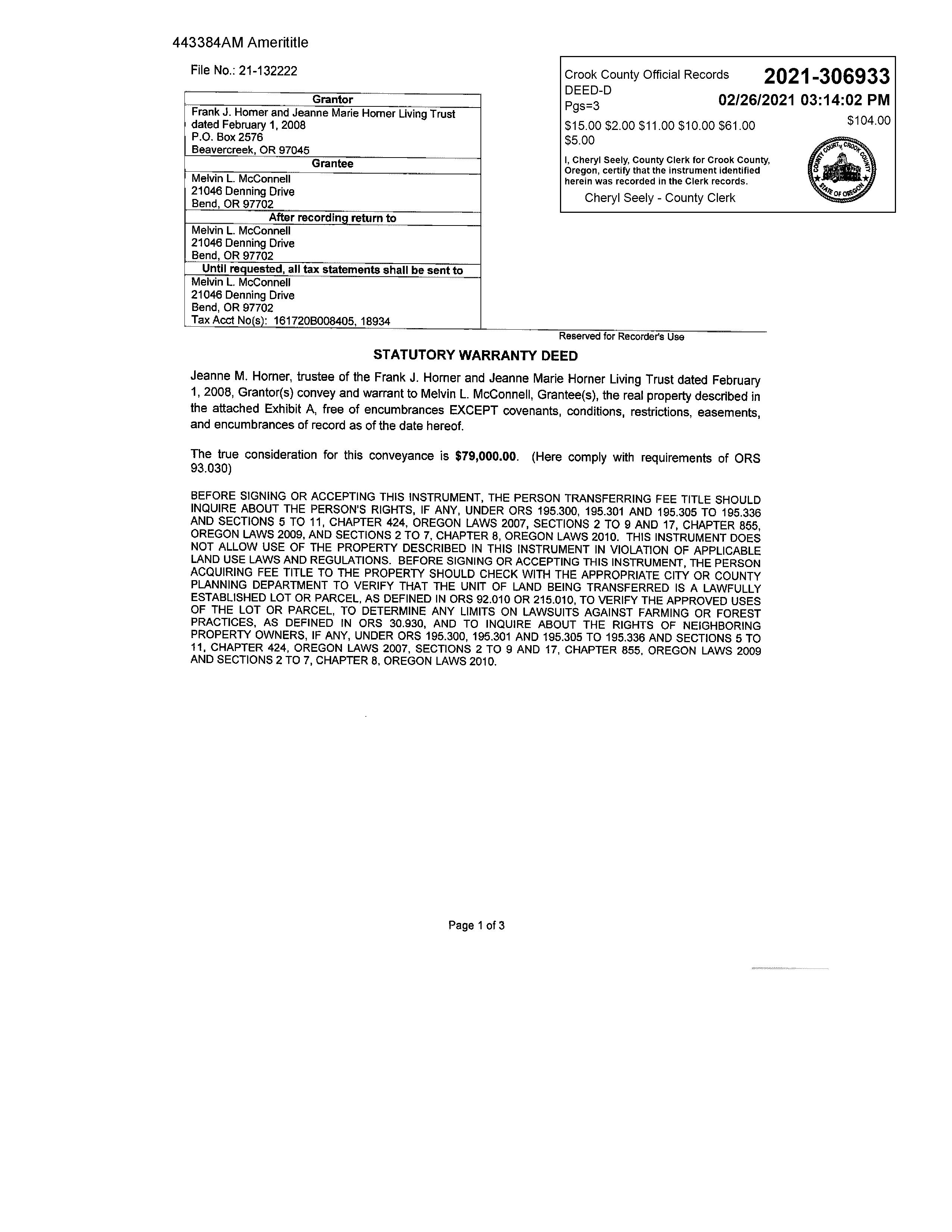
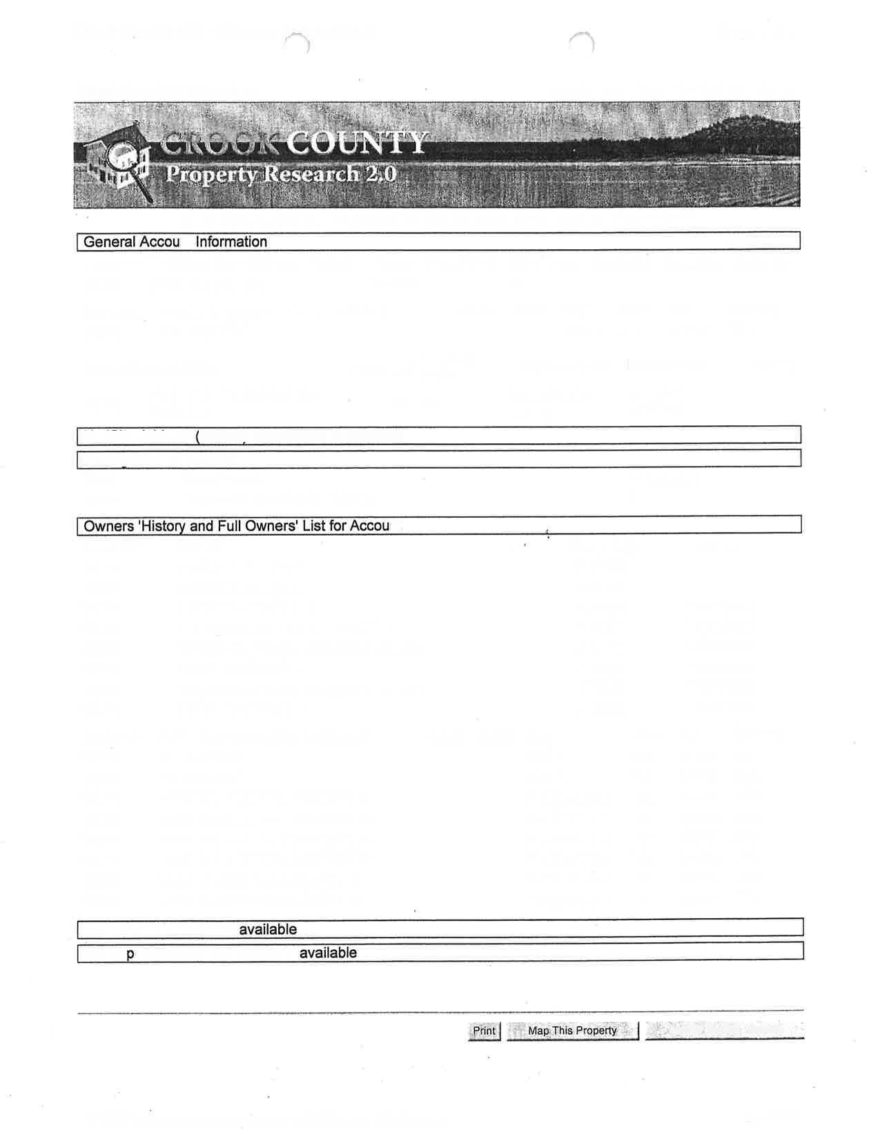
Parcel #: 18934
Tax Lot: 161720B008405

Owner: McConnell Melvin L, Trustee
CoOwner: Site: OR 97754
Mail: 21046 Denning Dr Bend OR 97702
Land Use: 100 - Res Unimp
Std Land Use: 8001 - Residential-Vacant Land
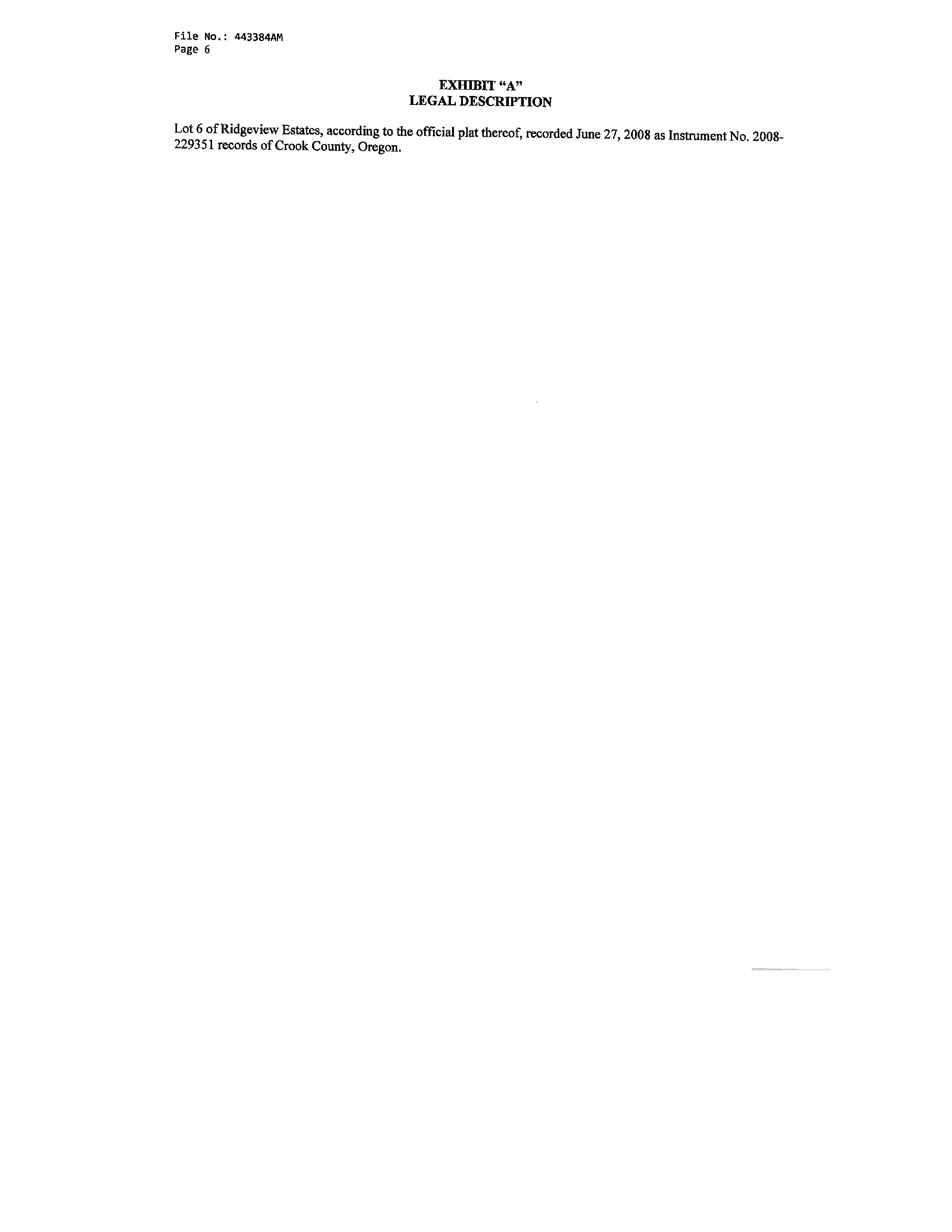
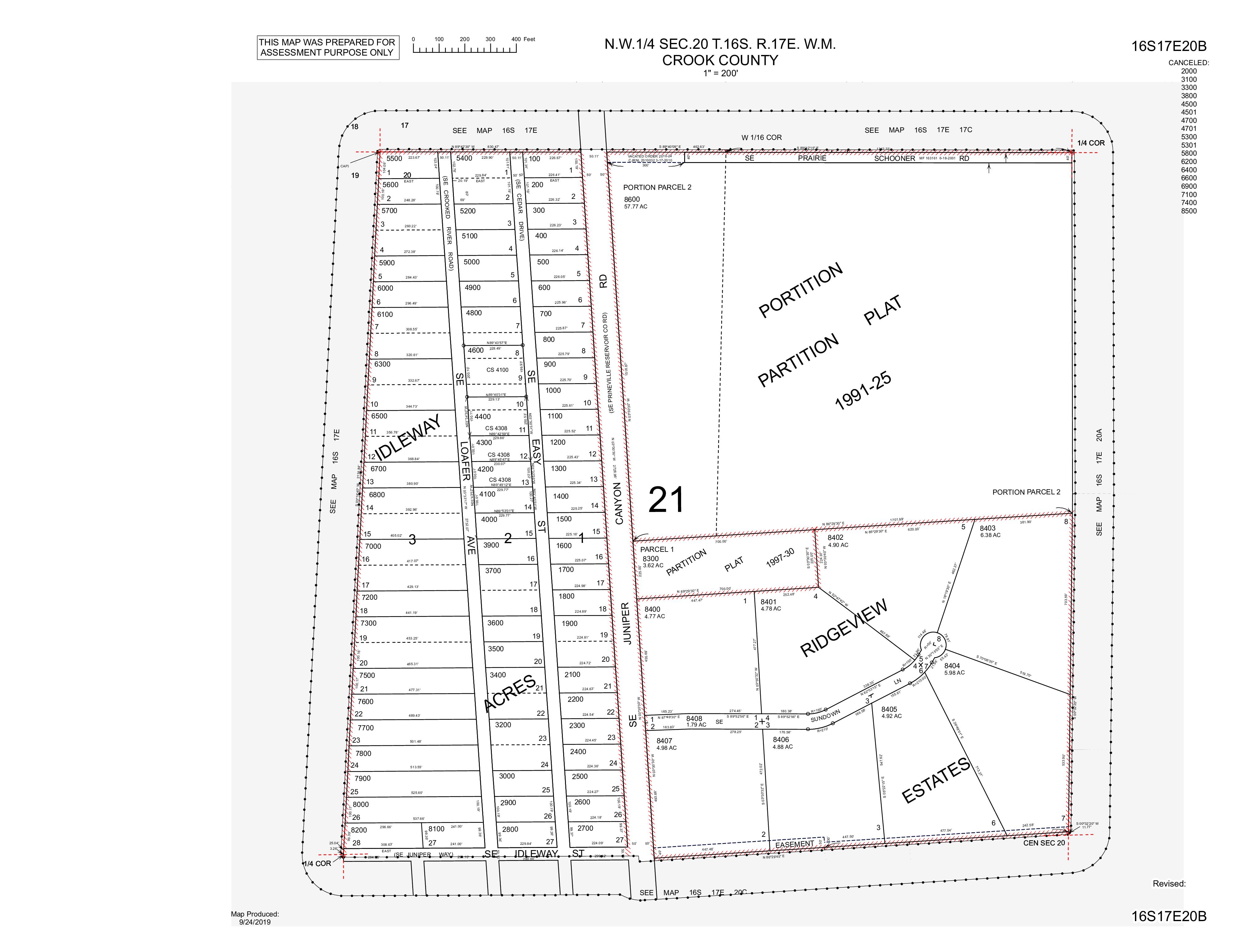
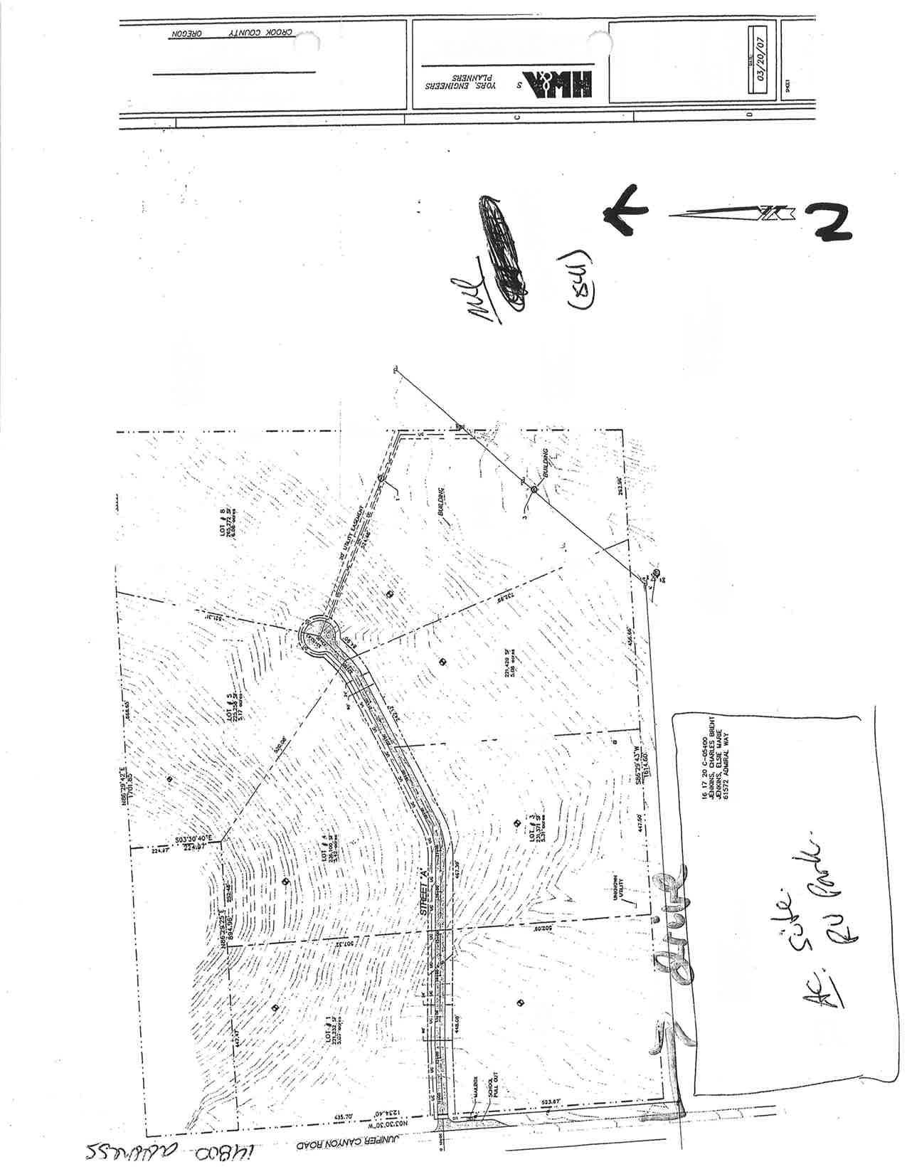
Legal: RIDGEVIEW ESTATES Lot: 6, Township: 16S, Range: 17E, Section: 20
Twn/Rng/Sec: T:16S R:17E S:20 Q:NW QQ:
Market Total: $97,150.00
Market Land: $97,150.00
Market Impr:
Assessment Year: 2024
Assessed Total: $67,120.00
Exemption:
Taxes: $819.70
Levy Code: 0021
Levy Rate: 12 2124
Sale Date: 02/26/2021
Sale Amount: $79,000.00
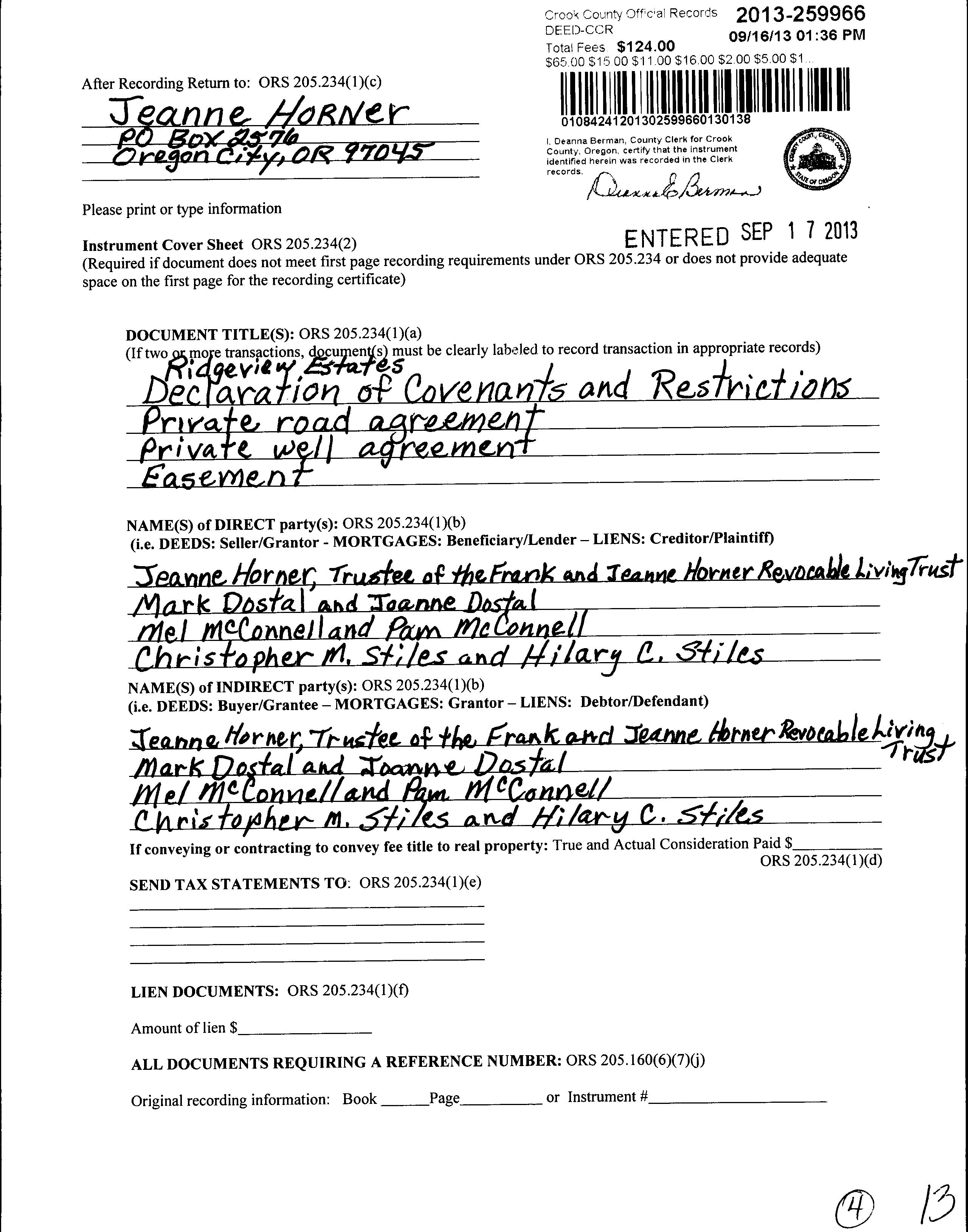
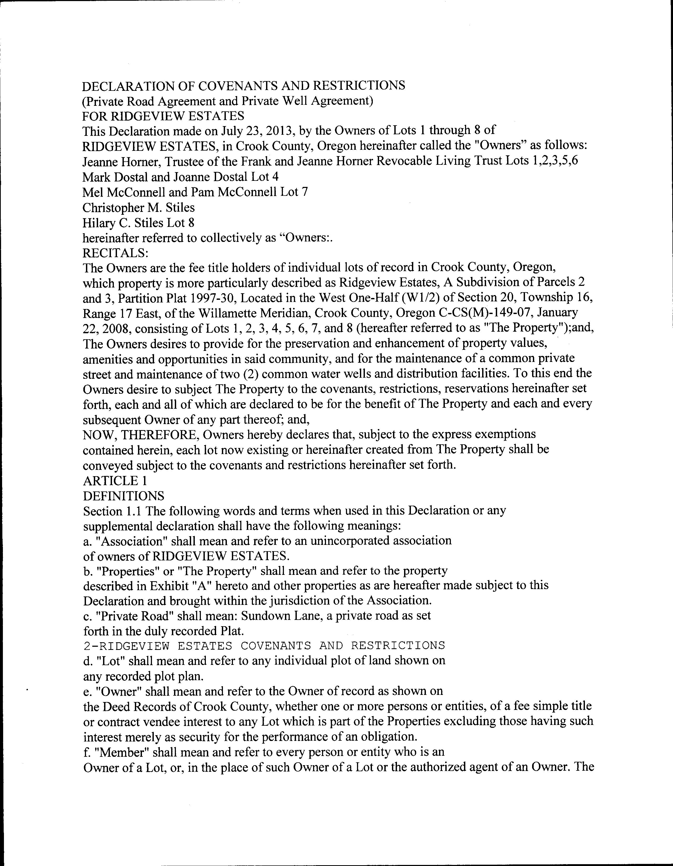
Document #: 306933
Deed Type: Warranty Deed
Loan Amount: $72,000 00
Lender: RANK J HORNER REVOCABLE LIVING TRUST
Loan Type: Purchase Money Mortgage
Interest Type:
Title Co: AMERITITLE
Year Built: Eff Year Built: Bedrooms: Bathrooms: # of Stories: Total SqFt: Floor 1 SqFt: Floor 2 SqFt: Basement SqFt: Lot size: 4 92 Acres(214,315 SqFt)
Garage SqFt: Garage Type: AC: Pool:
Heat Source: Fireplace: Bldg Condition: Neighborhood: Lot: 6
Block:
Plat/Subdiv: Ridgeview Estates
Zoning: RRM5 - Recreational Residential School Dist: Crook County Census: 2000 - 950402
Recreation:
Map 161720-B0-08405
Code - Tax ID 0021 - 18934
Legal Descr RIDGEVIEW ESTATES
Tax Status Assessable Account Status Active
Subtype NORMAL Lot - 6
Mailing MCCONNELL MELVIN L, TRUSTEE 21046 DENNING DR BEND OR 97702-2434
Property Class 100
RMV Class 100 MA 05 SA 00 NH 133
Deed Reference # See Record
Sales Date/Price See Record Appraiser
Site Situs Address City
Value Summary
Account #
Map
Owner 18934 161720B0 08405
MCCONNELL MELVIN L, TRUSTEE 21046 DENNING DR BEND OR 97702-2434
Name
OWNER MELVIN L MCCONNELL TRUST OWNER
OWNER MCCONNELL, MELVIN L OWNER AS TRUSTEE
OWNER
MELVIN L MCCONNELL TRUST TRUSTEE
MCCONNELL, MELVIN L
M A P S

Sentry Dynamics, Inc and its customers make no representations, warranties or conditions, express or implied, as to the accuracy or completeness of information contained in this report
Parcel ID: 18934
Site Address:
Sentry Dynamics, Inc and its customers make no representations, warranties or conditions, express or implied, as to the accuracy or completeness of information contained in this report

ParcelID: 18934
Tax Account #: 161720B008405 , OR 97754
This map/plat is being furnished as an aid in locating the herein described land in relation to adjoining streets, natural boundaries and other land, and is not a survey of the land depicted. Except to the extent a policy of title insurance is expressly modified by endorsement, if any, the company does not insure dimensions, distances, location of easements, acreage or other matters shown thereon.
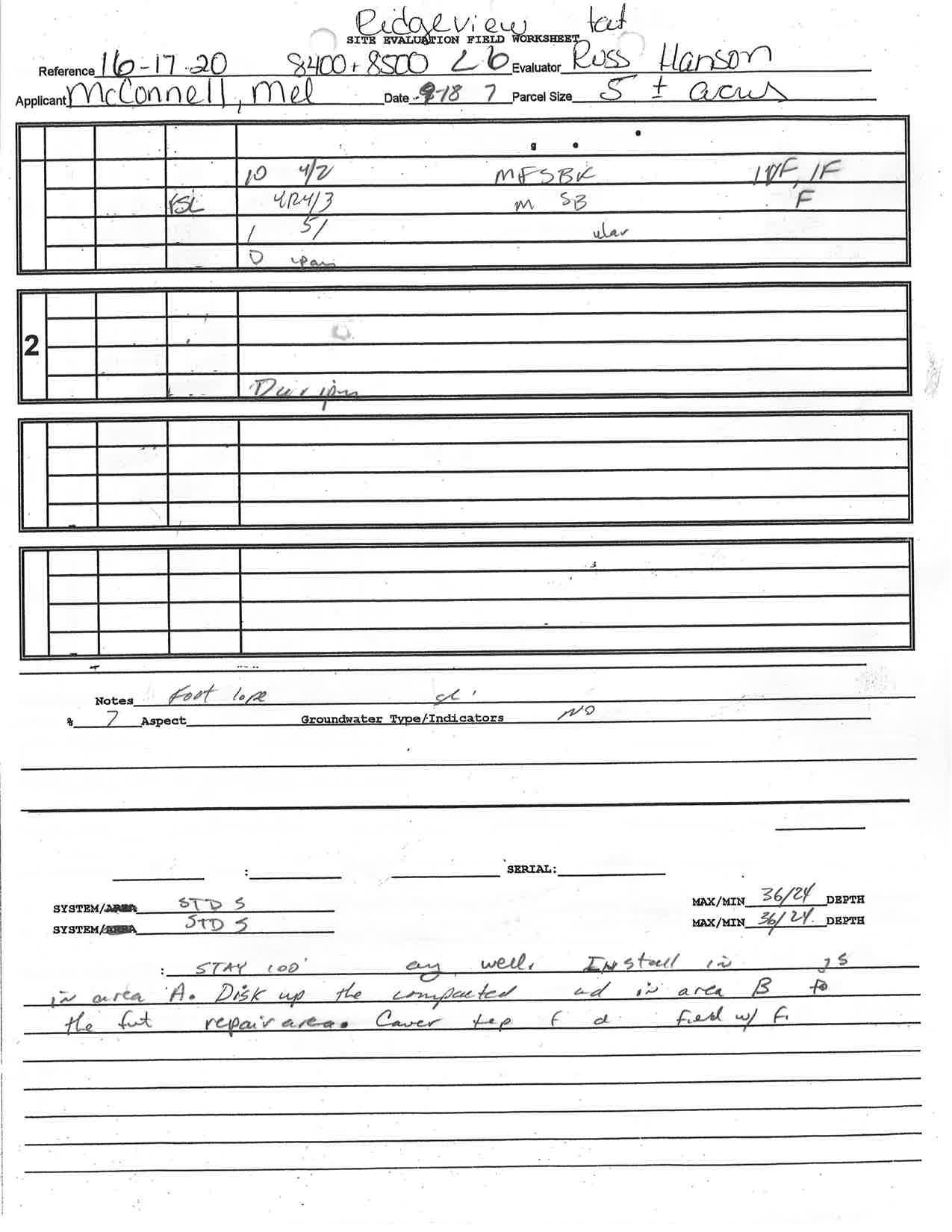
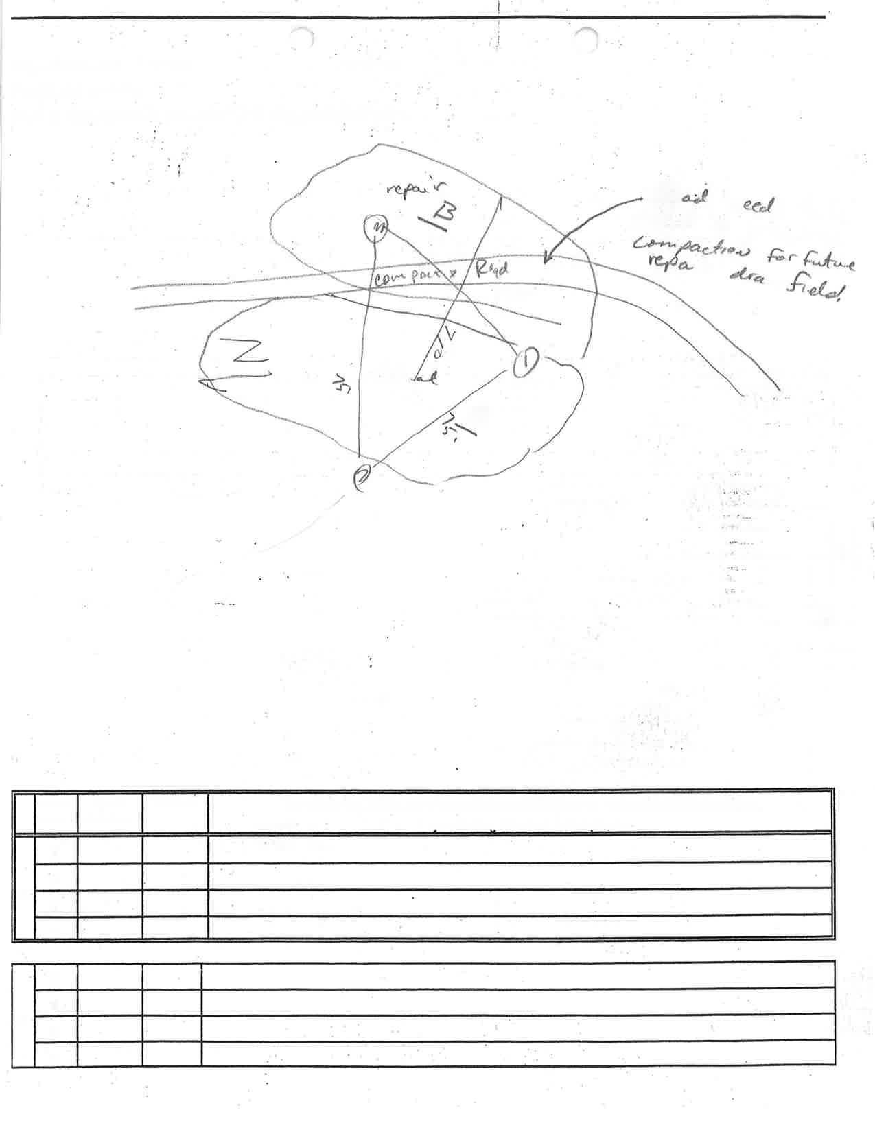
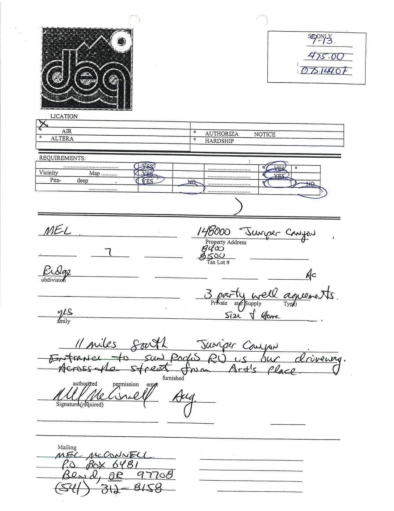
E P T I C I N F O & D E Q I N S P E C T I O N R E P O


I M O N I A L S
A N T T
L E A R N M O R E ?