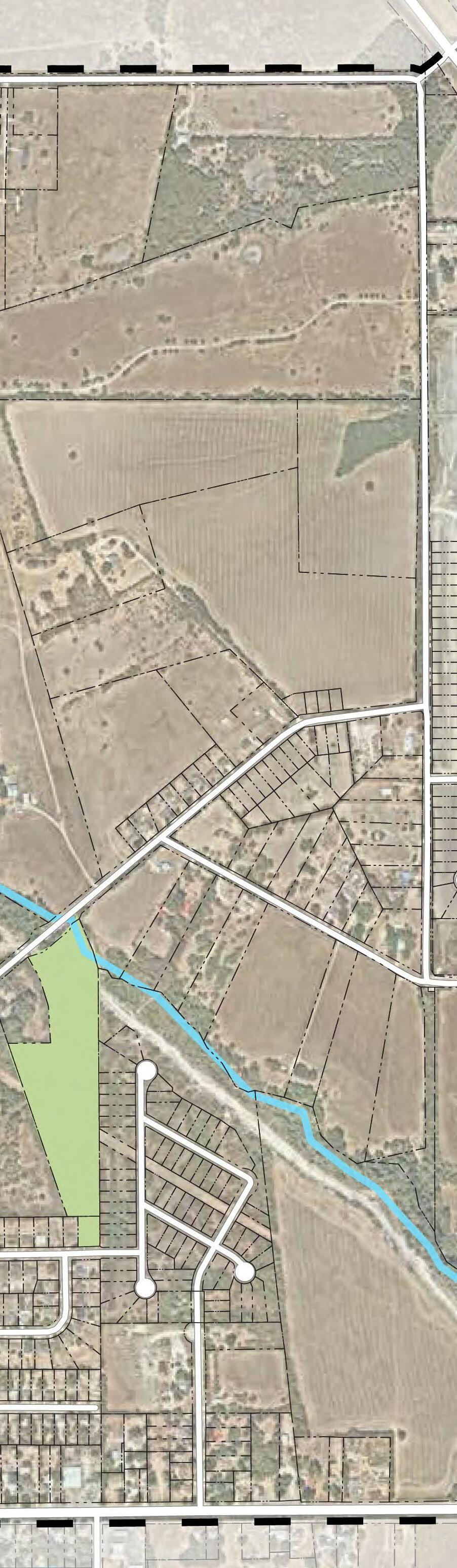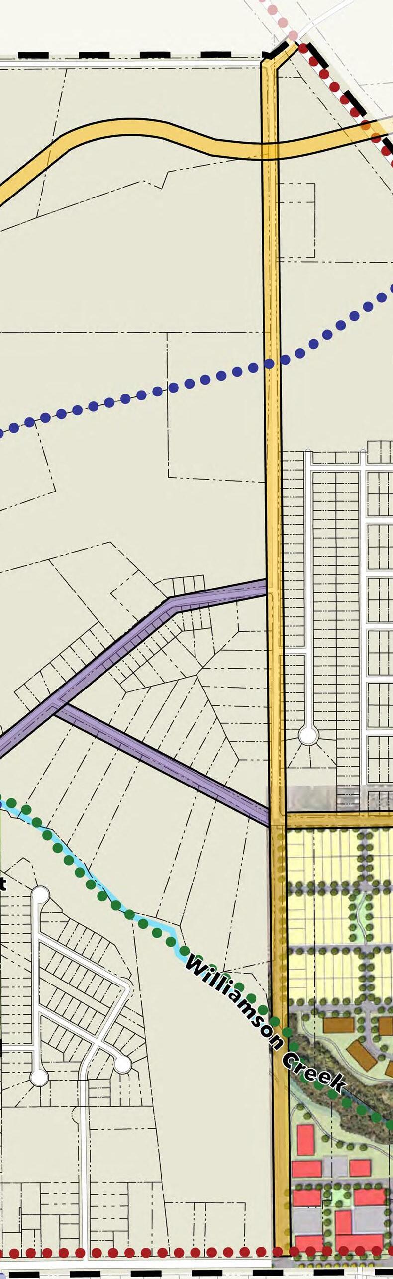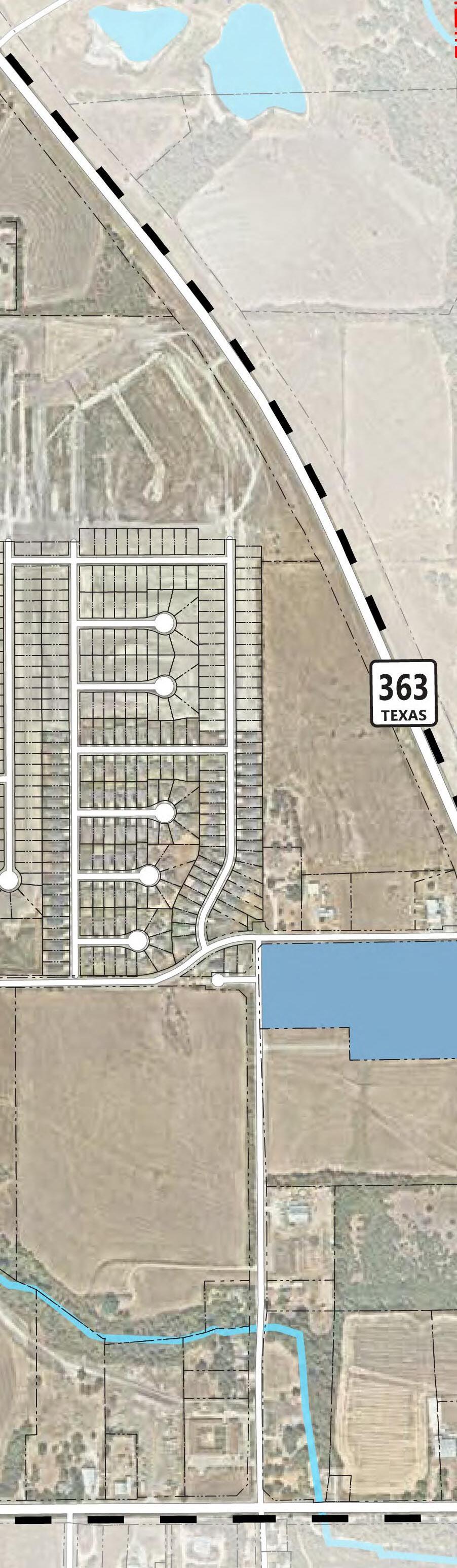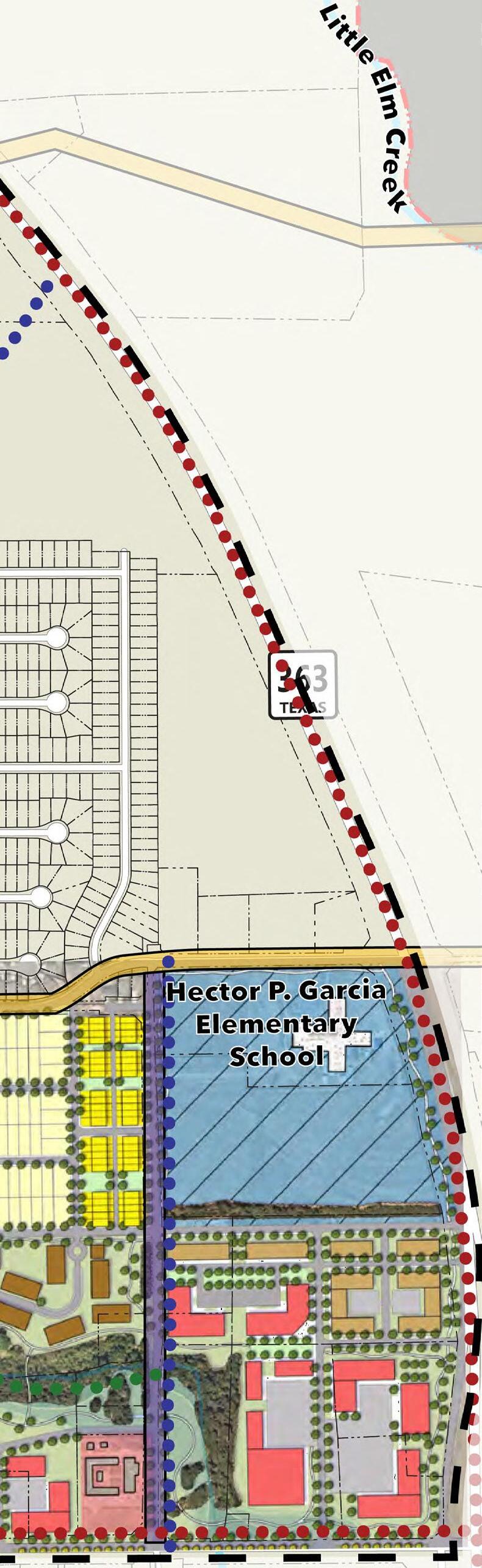
Neighborhood District EAST DOWNS
Introduction
East Downs Neighborhood
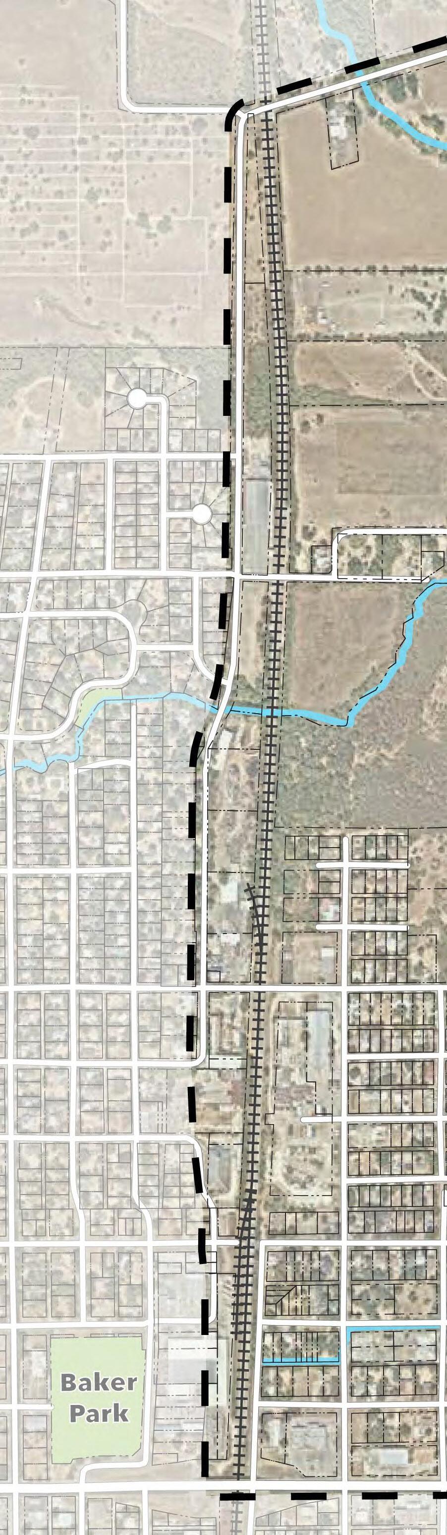
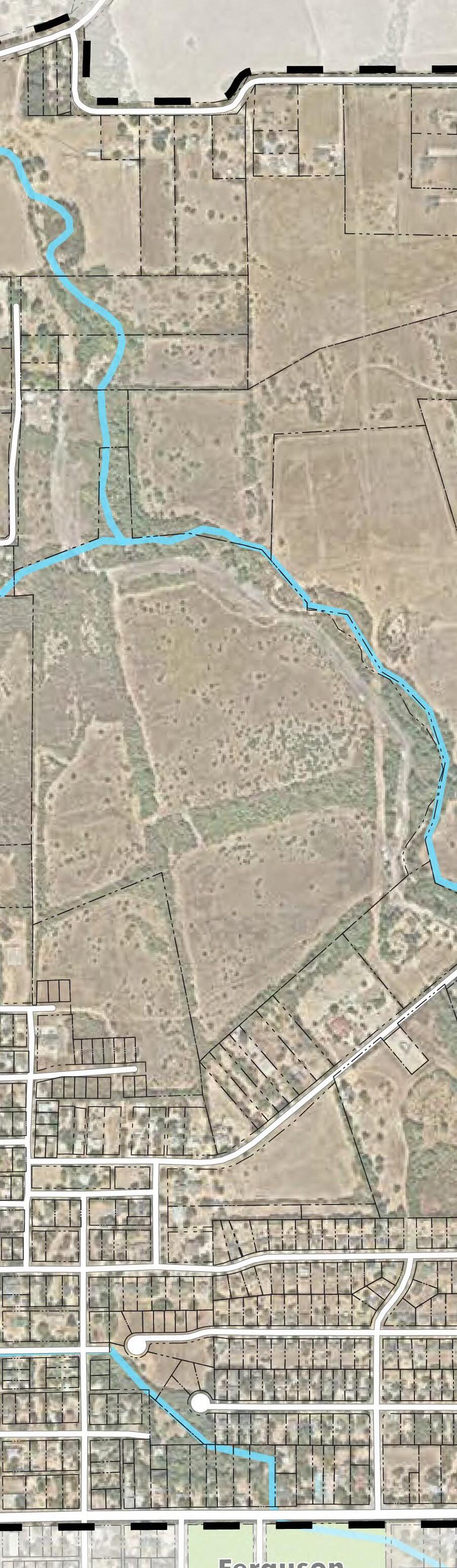
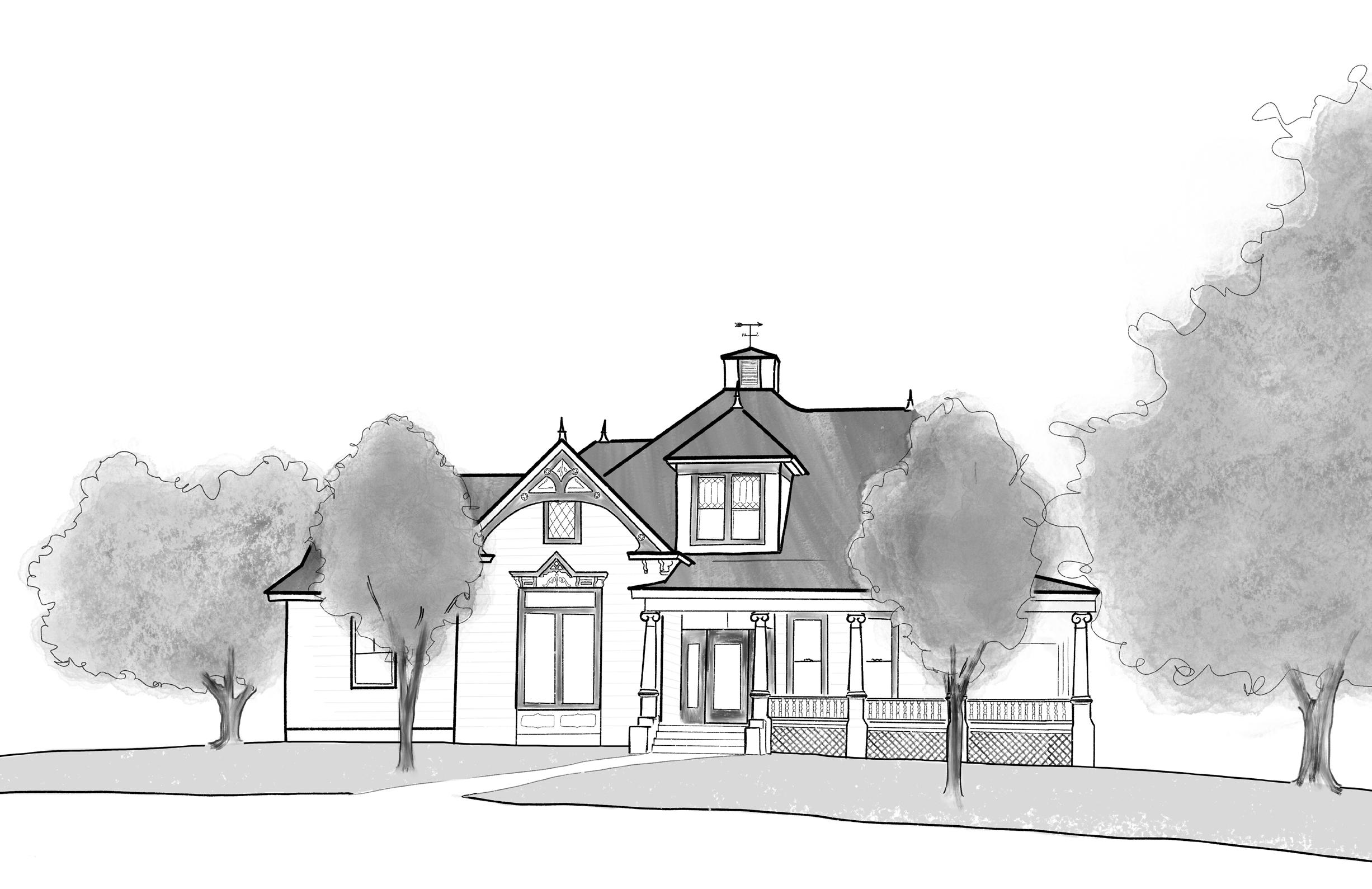
The East Downs Neighborhood District is a vibrant and rooted community known for wide open spaces, rich history, and close-knit atmosphere. Located in a prime area that blends residences and urban farms with accessibility to local amenities, East Downs offers a variety of housing options, resourceful neighbors, and room to grow. Its residents enjoy a unique blend of suburban tranquility and urban convenience, with easy access to schools, shops, and Downtown attractions. The district is also known for its strong sense of community, with an active Neighborhood Coalition that fosters connection among neighbors. Whether you’re a long-time resident or new to the area, East Downs offers an inclusive environment for all.
PURPOSE
The City of Temple is dedicated to fostering cohesive, distinct, vibrant, safe, and attractive neighborhoods where citizens feel a sense of pride and engagement with their community. These objectives will be accomplished through the work of the City’s Neighborhood Team.
Through a process of collaboration and communication, the City’s Neighborhood Team will strive to ensure continued improvements to Temple’s neighborhoods, as well as access to a wide variety of housing types that are safe, accessible, and affordable.
MISSION
Working alongside residents in each neighborhood, our mission is to identify neighborhood concerns, values, visions, and goals. Through this process, the City will develop long-range plans for each Neighborhood Planning District to include:
• City led Capital Improvement Projects
• Private Investment & Economic Development Opportunities
• Community Development Block Grant Projects
A strong emphasis will be placed on improving the quality of life in each neighborhood while increasing access to affordable housing
PLANNING BACKGROUND
The East Downs Neighborhood is one of twenty-four planning districts within the City of Temple. Each district plan has a similar planning process intended to complement the City’s Comprehensive Plan with a more focused effort at the neighborhood level. This plan looks at the existing conditions and engages residents to derive genuine information and direction from the neighborhood. While using best practices for planning, the results of each plan define specific recommendations that are unique to each district.
The Story
EAST DOWNS NEIGHBORHOOD IS...
FORGOTTEN
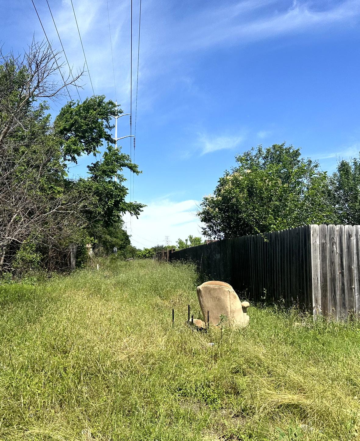
The East Downs neighborhood has often been overlooked within Temple. Although, with its strong character and promising assets, East Downs is well-positioned for renewal. While some areas reflect deferred maintenance, these conditions present a meaningful opportunity to reinvest, restore pride, and reimagine the neighborhood as one of Temple’s most welcoming and vibrant places to call home.
POSSIBILITIES
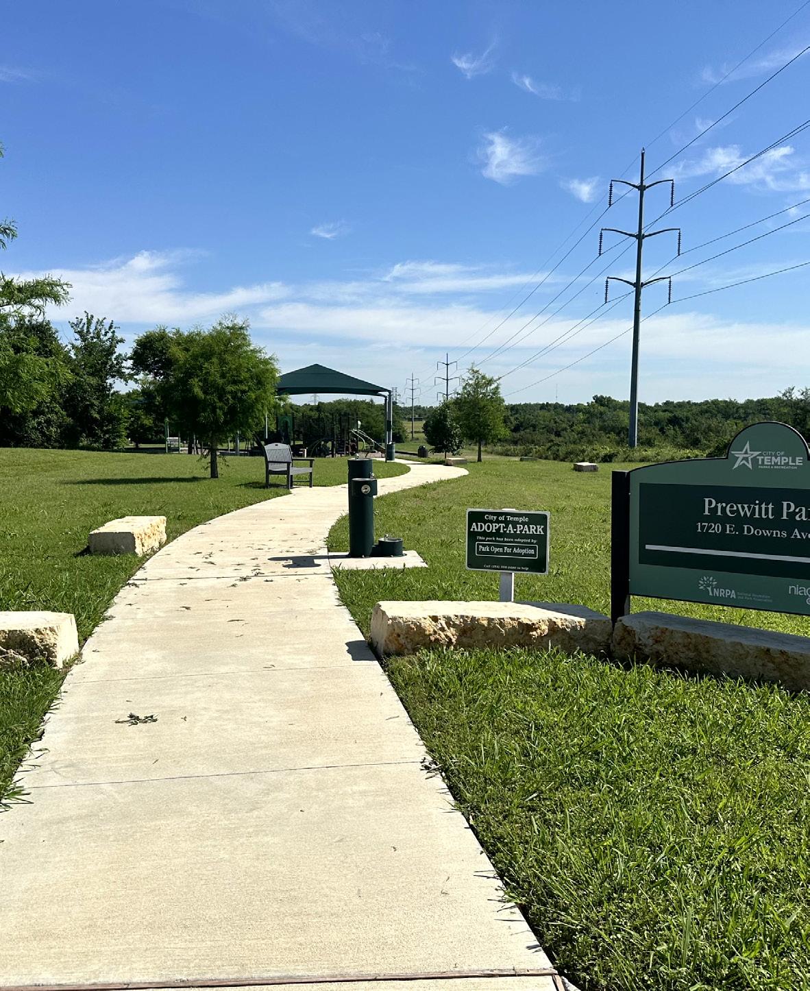
East Downs has a strong history with many natural resources that provide opportunities for growth. Promise for East Downs can be found within the existing parkland, beautiful pasture land, the Williams Creek corridor, and emerging residential developments. By utilizing these opportunities, it is possible to make the neighborhood into a vibrant part of Temple.
ADJACENT
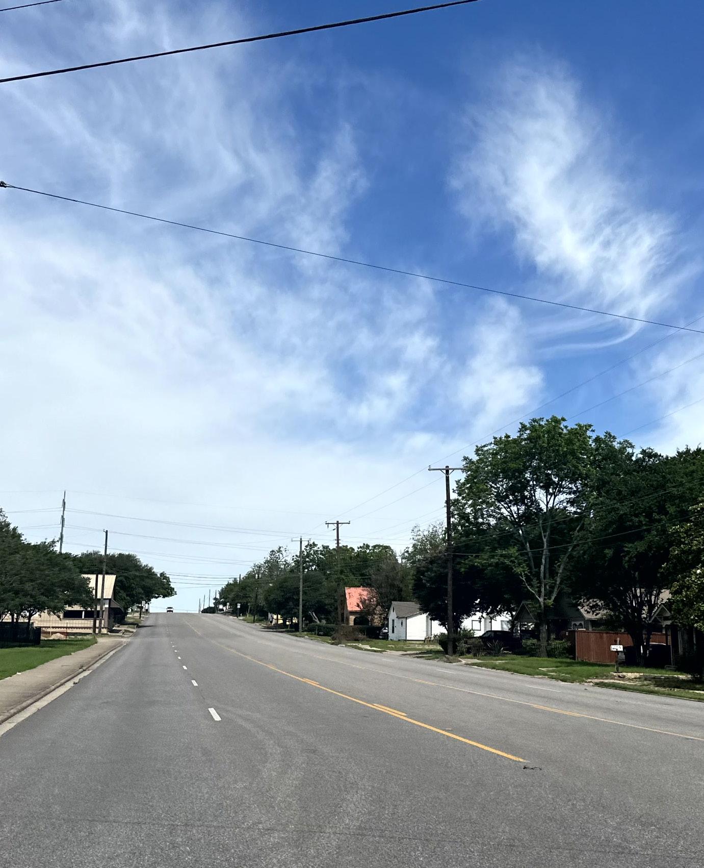
East Downs’ location within Temple is one of its biggest assets. Downtown is within easy reach for neighborhood residents, whether by a short walk or a quick drive. Plentiful park acreage is nearby, and the neighborhood’s eastern boundary is the Outer Loop. The Outer Loop, combined with the continued growth and reinvestment in Downtown, will provide convenient access to the City’s major activity nodes.
DIVERSE
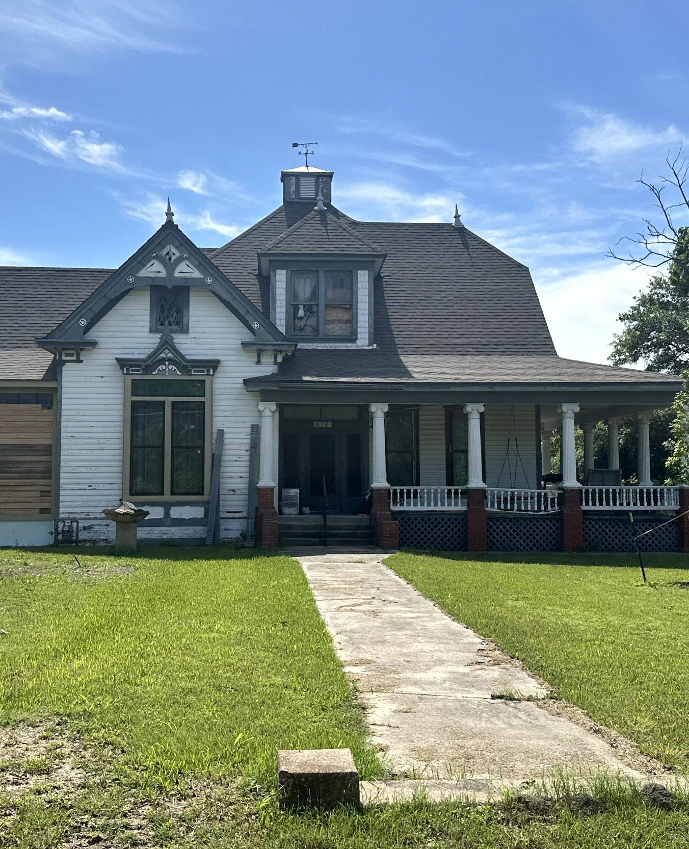
The East Downs Neighborhood has a relatively high homeownership rate compared to other Downtown Temple neighborhoods. In addition, the neighborhood’s racial and ethnic makeup is very diverse. The strength in homeownership and the neighborhood’s diversity set the stage for growth as a vibrant cultural contributor to the Temple community.

INVIGORATE PRIORITIZE


SAFEGUARD
LEVERAGE ADVANTAGES
• Utilize the Williams Creek corridor to establish a linear park to act as a bridge between old East Downs and the new development to the northeast.
• Take advantage of the proximity to Downtown Temple and Wilson Park to promote East Downs as a desirable place to live.
• Encourage access management along the Outer Loop to preserve high-functioning connectivity for the neighborhood.
IMPROVE INFRASTRUCTURE
• Prioritize sidewalks and street reconstruction to improve road and pedestrian safety within the plan area.
• Coordinate and prioritize water and sewer upgrades to better serve neighborhood residents. Additionally, consider the impacts of improved water and sewer infrastructure for future infill southwest of Williams Creek.
GROW COMMUNITY
• Continue City engagement with neighborhood residents and community groups to strengthen the relationships between the residents of East Downs and the City of Temple. Transparency and communication efforts about upcoming projects and infrastructure are critical for enhancing the bond between the City and the neighborhood.
• Promote increased police patrols and crime prevention measures to make the neighborhood safer for children and families. Specifically, attention should be given to the impacts of vagrancy, which deters families from freely experiencing the neighborhood.
STRATEGIC CONSIDERATIONS
This planning effort is intended to complement the focus areas and initiatives laid forth in Temple By Design, the 2020 Comprehensive Master Plan. The strategic considerations identified above highlight critical features of the plan area that are intended to help guide unique recommendations for the East Downs Neighborhood. The resulting recommendations will be compiled into an Action Plan, which reference and support Comprehensive Plan Initiatives. This planning effort consists of a public engagement and visioning process to determine recommendations that ultimately lead to corresponding capital improvement projects.
Community Input & Background
DEMOGRAPHIC PROFILE
A look into the demographics helps to frame the characteristics of the plan area’s population. This information guides recommendations for policies and changes to the built environment. This information is derived from the American Community Survey 2017-2021 5-year using Esri’s Community Analyst software that aggregates multiple block groups that make up the plan area. This gives us the most accurate information for the defined area and helps tell the story of the plan area demographics.
Total Population 1,832
Population by Age Cohort

Race and Ethnicity






$45,782


to
to
to 1969
to 1959
to 1949





DEMOGRAPHIC TAKEAWAYS
The following are a few summary conclusions derived from reviewing the demographics within the plan area:
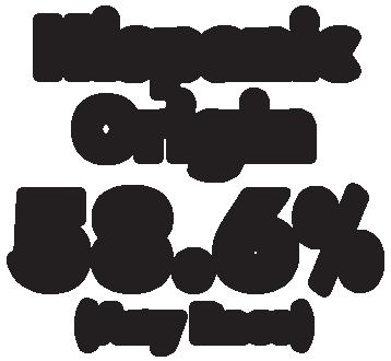
• Residents of the East Downs Neighborhood are comprised of diverse racial and ethnic backgrounds with 56.7% identifying as White, 24.4% as Black, 18.9% as two or more races, and 58.6% of Hispanic Origin
• The largest age cohort is 15 to 19 years of age with the next two largest age cohorts being those under the age of 5 years old and those between the ages of 35 and 39
• Median household income is around $45,000 a year with nearly a quarter of households living below the poverty line. This can partially be explained by 18% of the neighborhood workforce having less than a high school level of educational attainment

• The East Downs Neighborhood consists of a diverse workforce. The industries employing the most residents of East Downs include Construction, Retail Trade, Manufacturing, and Arts/Entertainment/Recreation/Accommodations/ Food Service
• The large majority of housing in East Downs was constructed between 1970 and 2019. Interestingly, no new construction homes were reported from 2020 to 2021
• More than 60% of East Downs residents own their homes, leaving more than a third of the housing stock composed of rental housing
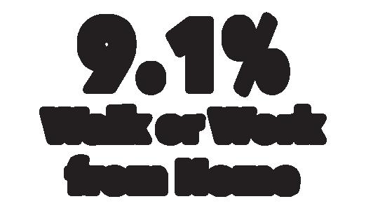
• While 9.1% of households walk or work from home, 90.9% of residents commute via personal vehicle. Of the total households that use a personal vehicle to commute, more than half have two or more vehicles
PUBLIC ENGAGEMENT
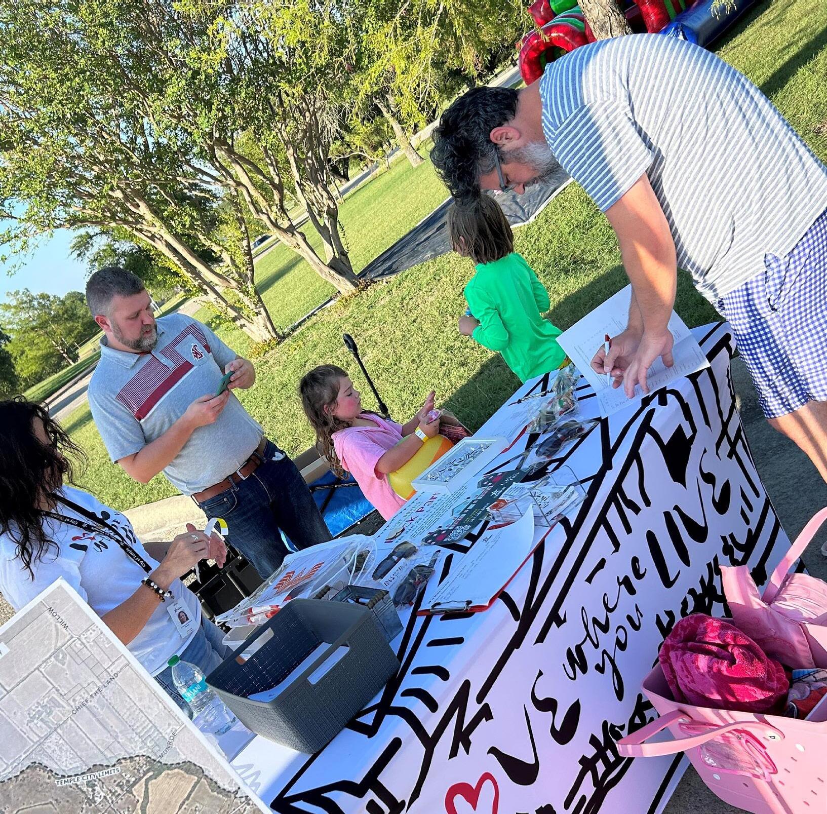
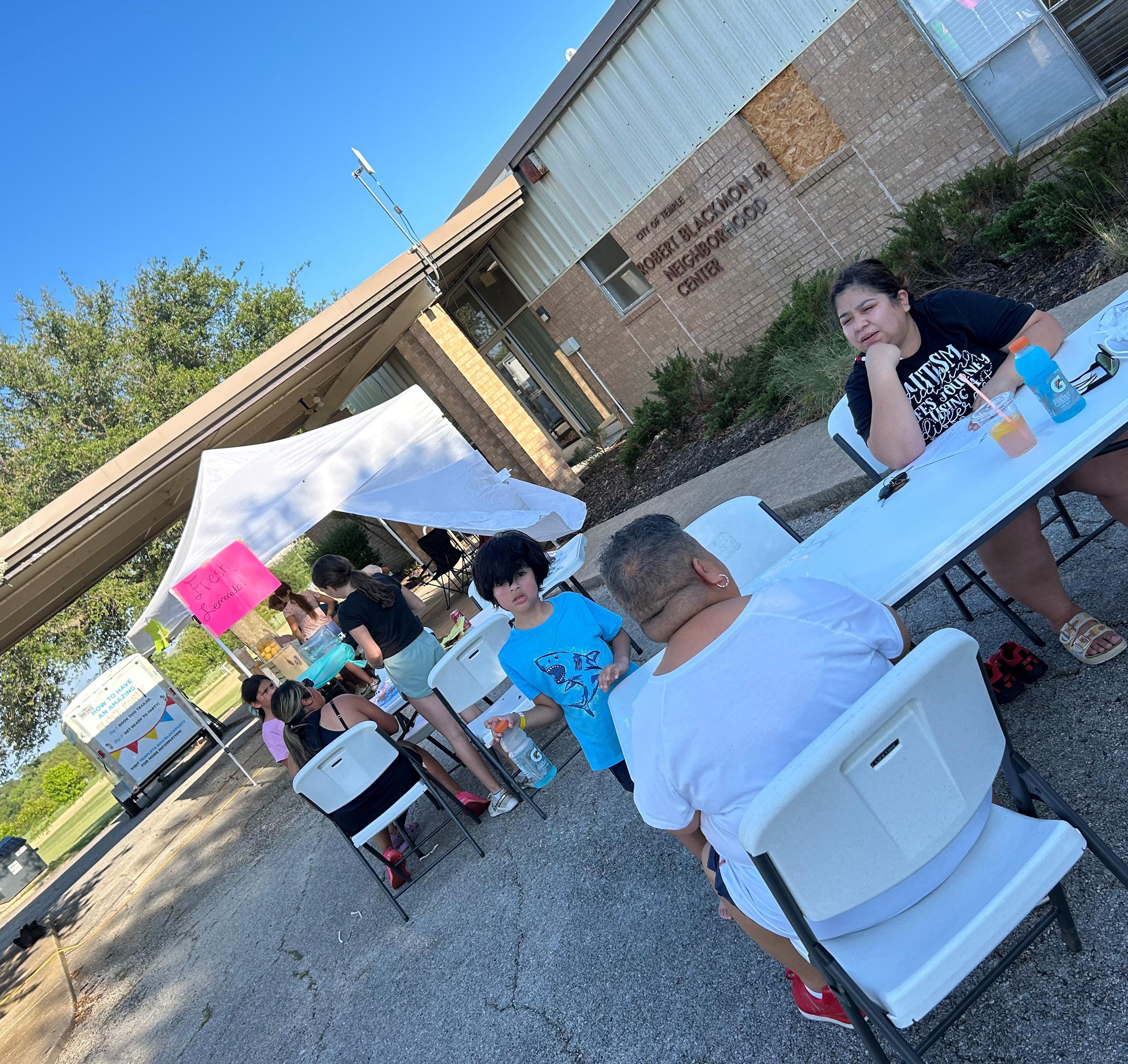
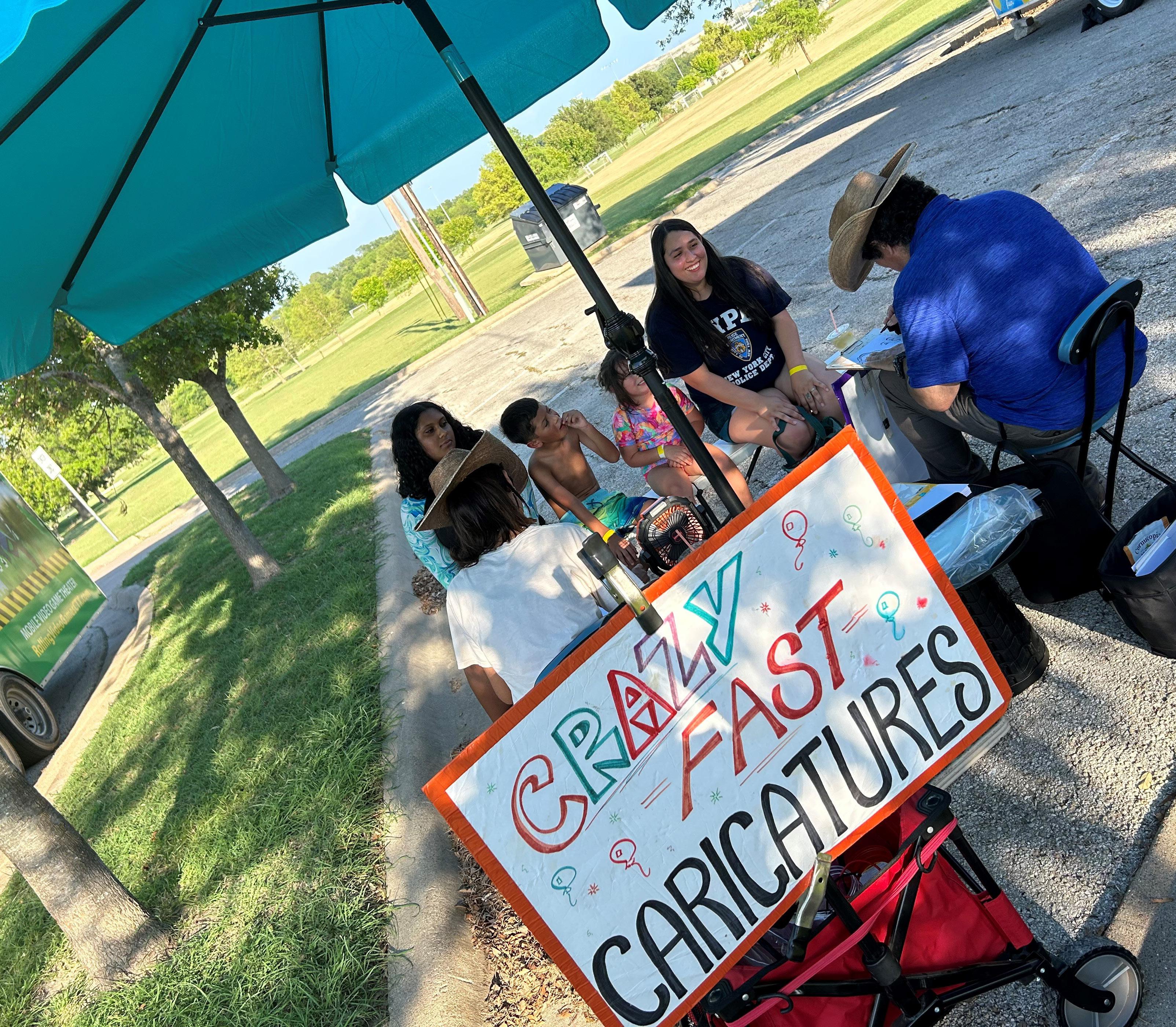
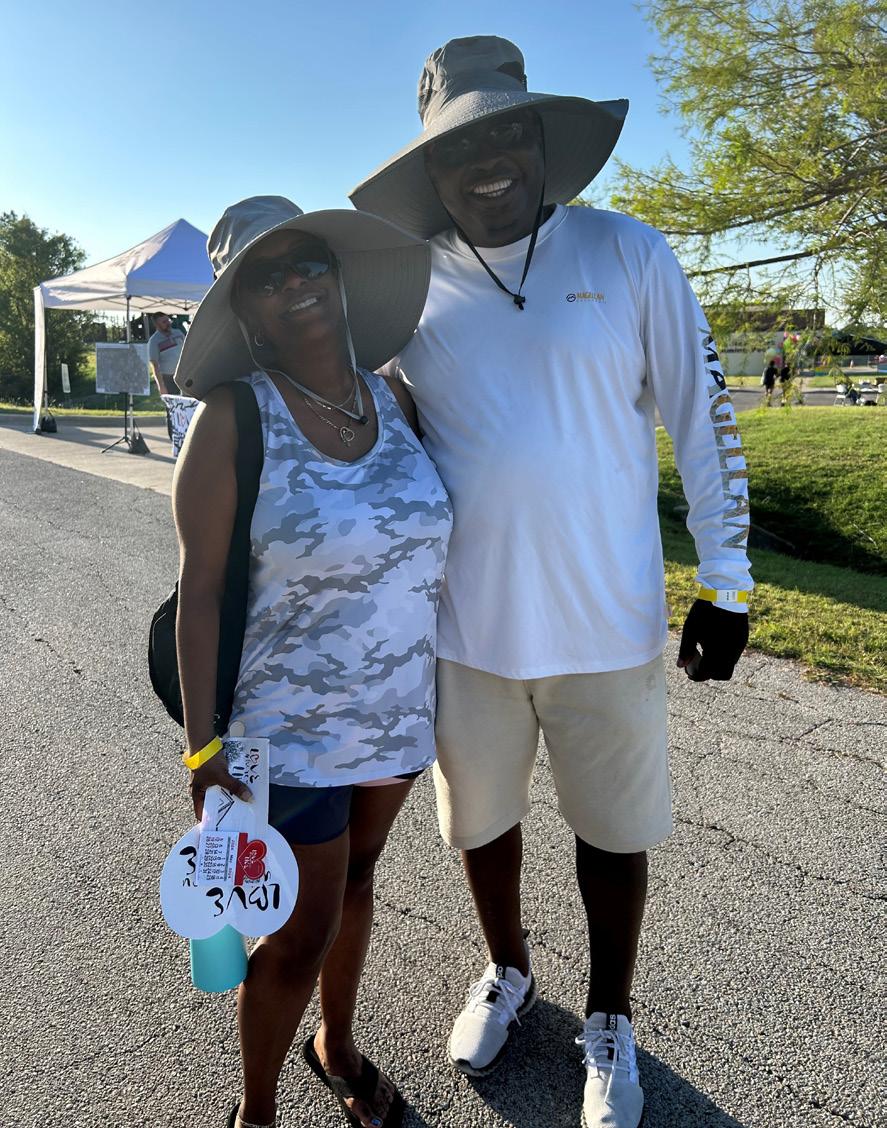
The Neighborhood Planning Team was challenged to develop a community engagement method so that crucial feedback could be gathered from the residents of the East Downs Neighborhood. The City staff conducted events to engage plan area residents and inform them about the planning effort. As part of that outreach, residents were invited to a public open house where input was solicited, and were also invited to participate in a longer online survey. The results of the outreach efforts are highlighted on the following pages.
What is the biggest strength of the plan area?
What
weakness of the plan area?



































Rate the following land uses on their importance to the East Downs Neighborhood District (1–Unimportant, 5 – Most Important).





Rank your preference of the following safety measures.











Rate the following on City Performance (1–Very Unsatisfied, 5 – Very Satisfied).



Rate the following on Importance (1–Very Unimportant, 5 – Very Important).



The HOP will be implementing public transportation with point to point, curbside transportation. When this service is available, will this be a transportation choice for you or your household?
PUBLIC SURVEY TAKEAWAYS
The following are a few summary conclusions derived from reviewing the online survey responses:
• Survey respondents stated that the biggest strengths of the East Downs Neighborhood are its people, neighbors, parks, and location. While the biggest weakness of the plan area is its crime, sidewalks, streets, and housing conditions
• Survey respondents ranked walking as a significant alternative to personal vehicle trips within Temple. Sidewalks and streetlights were identified as the transportation improvements the neighborhood would like to see the most. Street conditions and sidewalks/ trails were ranked by survey responses as the worst-performing element of the neighborhood, while their importance to the neighborhood was ranked the highest
• Revitalizing existing housing was identified by survey respondents as the biggest housing need for the neighborhood. This sentiment is further supported by survey respondents identifying vacant and substandard buildings as the most significant code compliance issue
• Survey respondents identified restaurants and grocery stores as the missing businesses and services from the East Downs Neighborhood
• New park space, improved regional trail connections, enhanced connections to Prewitt Park, and opportunities for community gardens were viewed by survey respondents similarly as additional parks and open space elements within the neighborhood
JAN FEB APRIL MAY
AUGUST
FEBRUARY
APRIL
SEPT
OCT
DEC
JUNE
FEB
MAY
JUNE
JULY
Page Intentionally Left Blank
Inventory & Analysis




























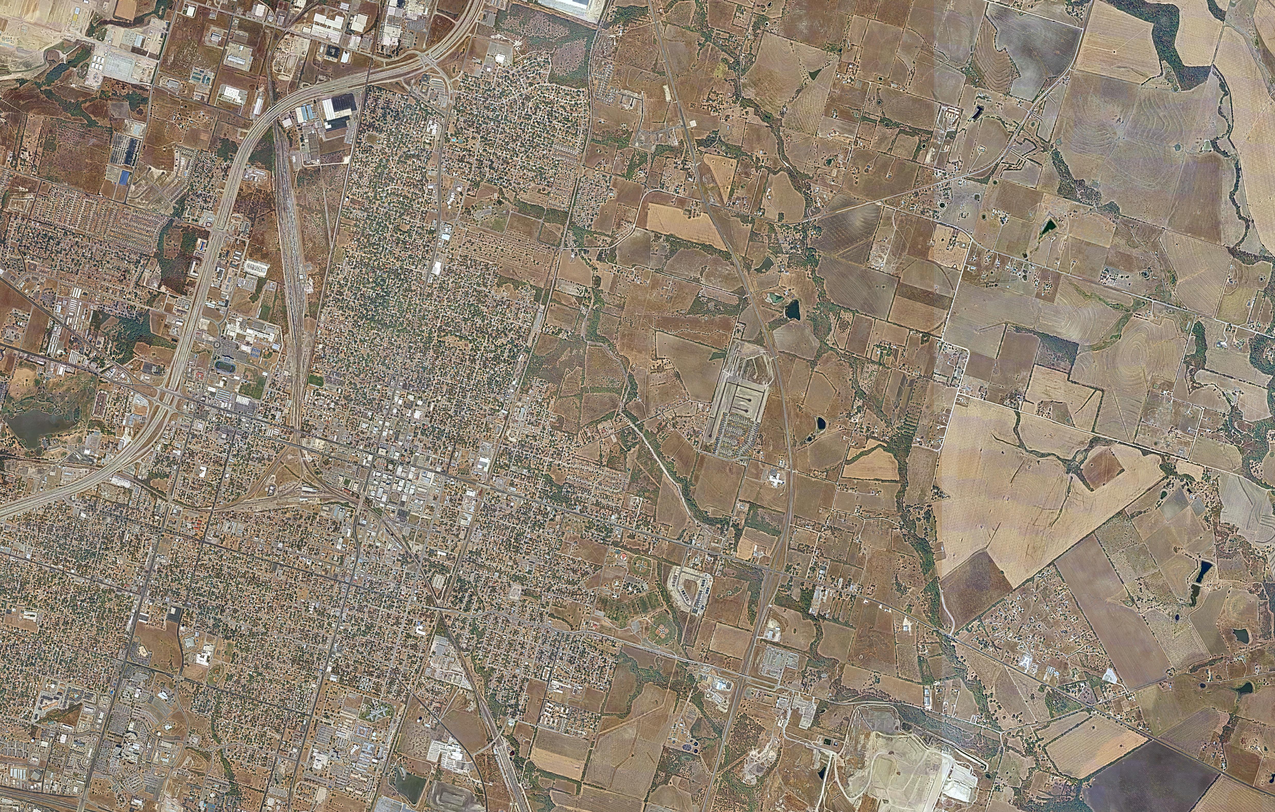

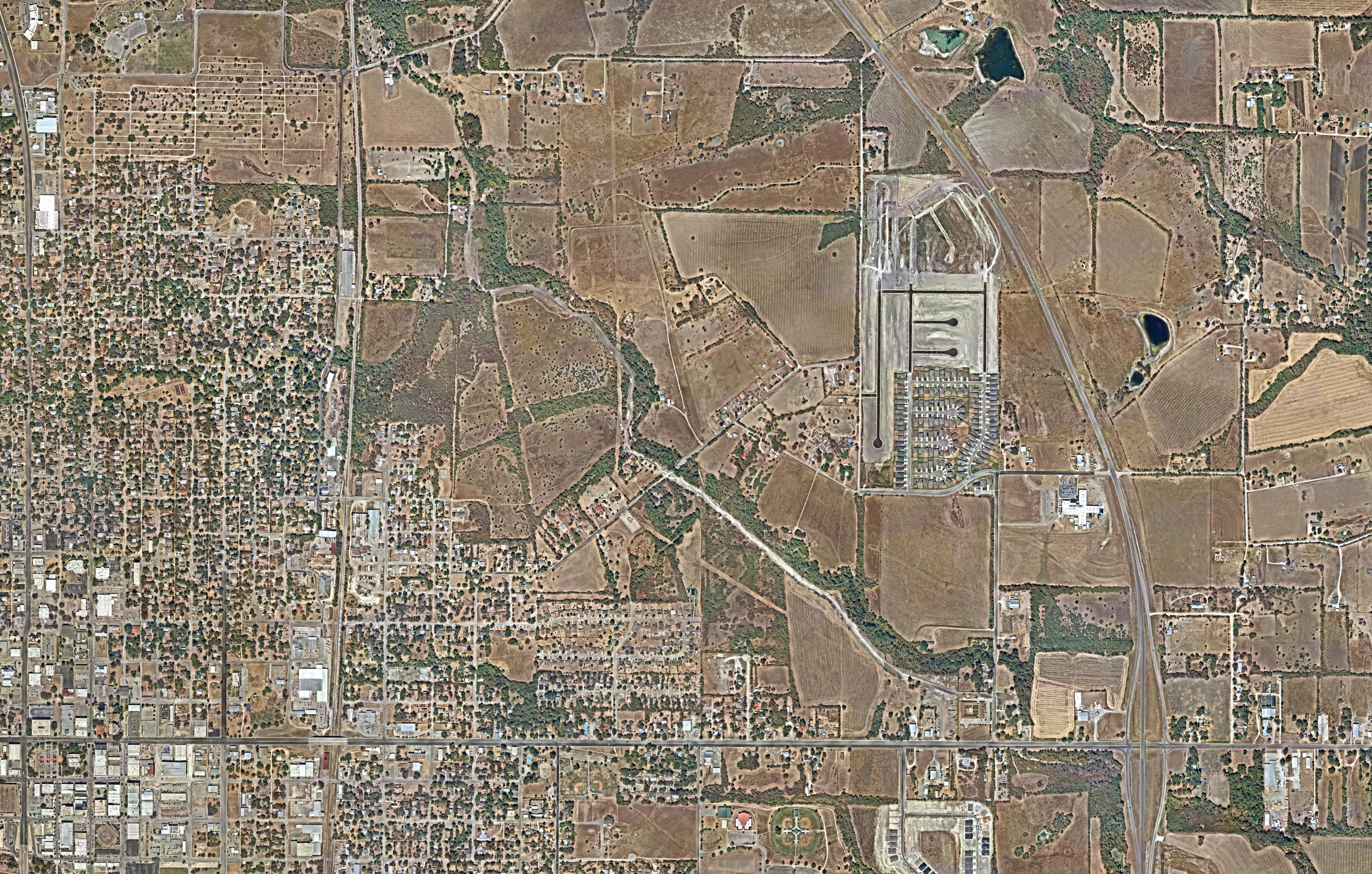
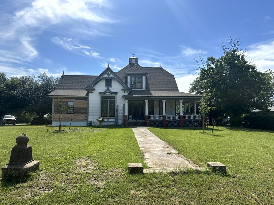
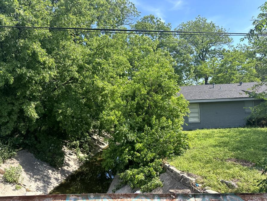
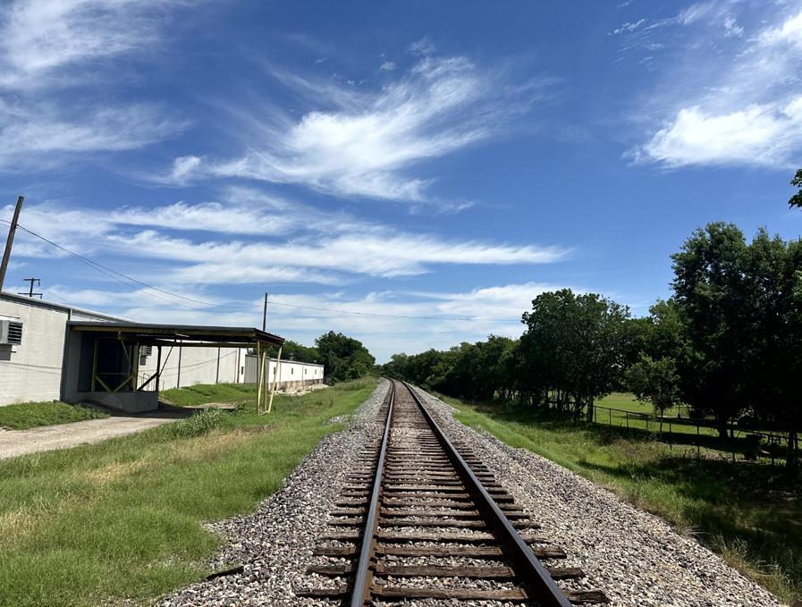
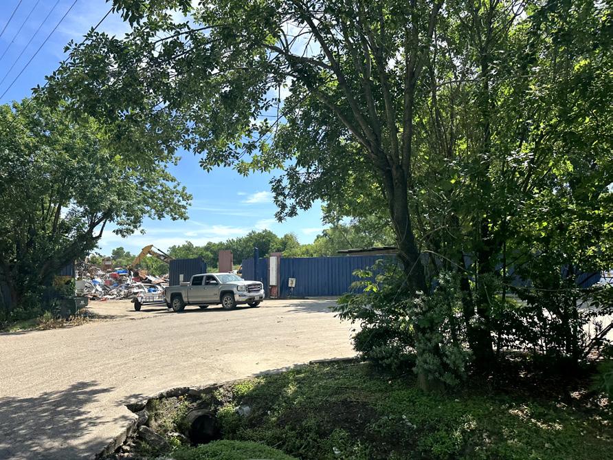
PHOTO INVENTORY
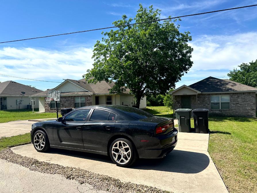
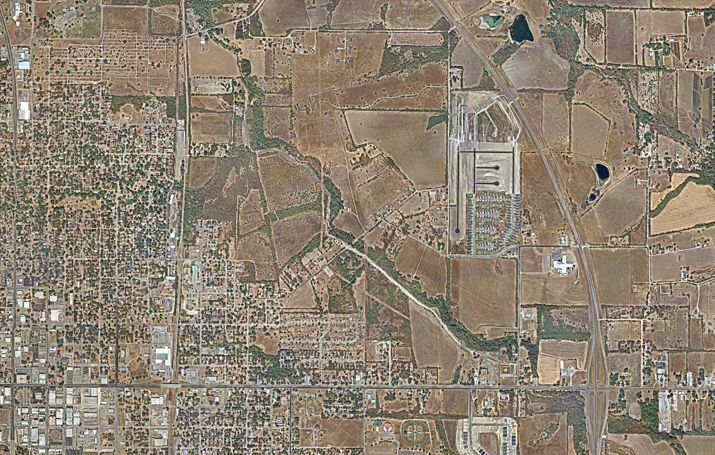
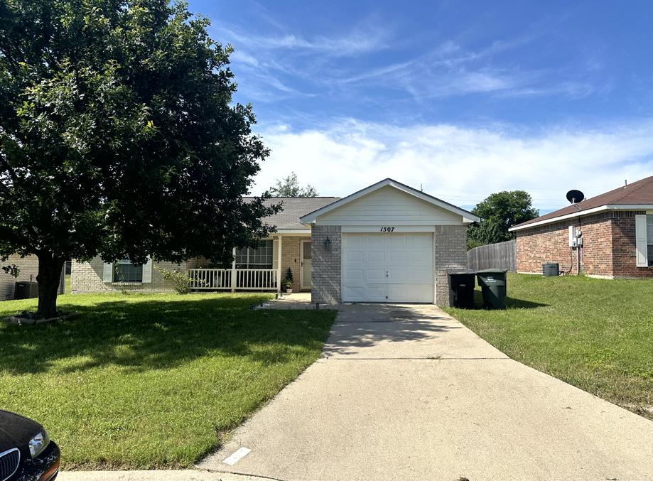
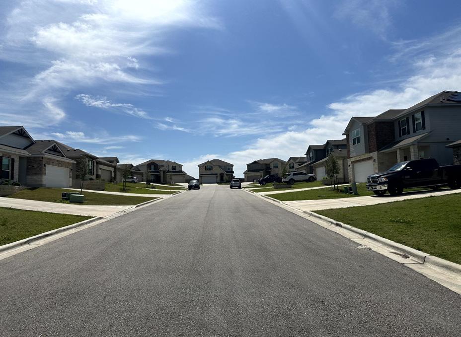
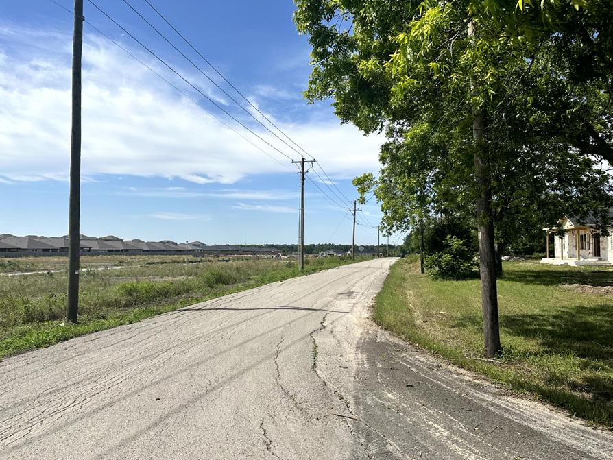
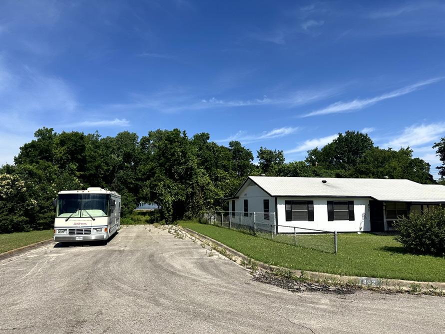
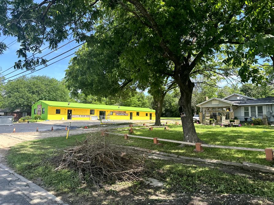
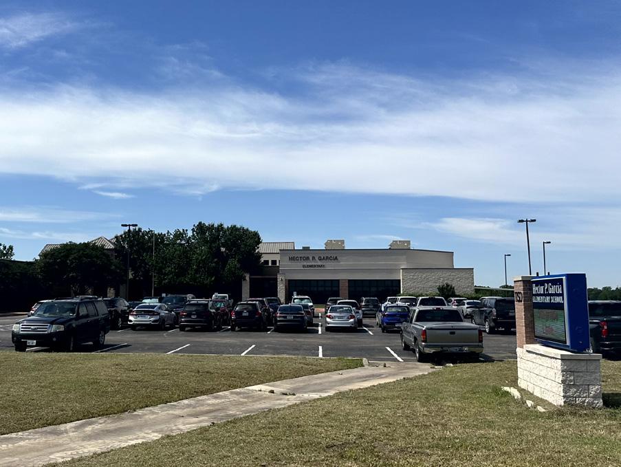
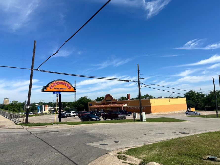
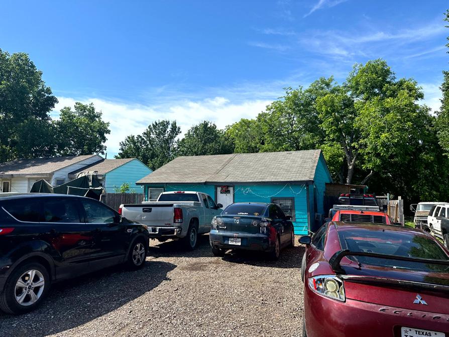
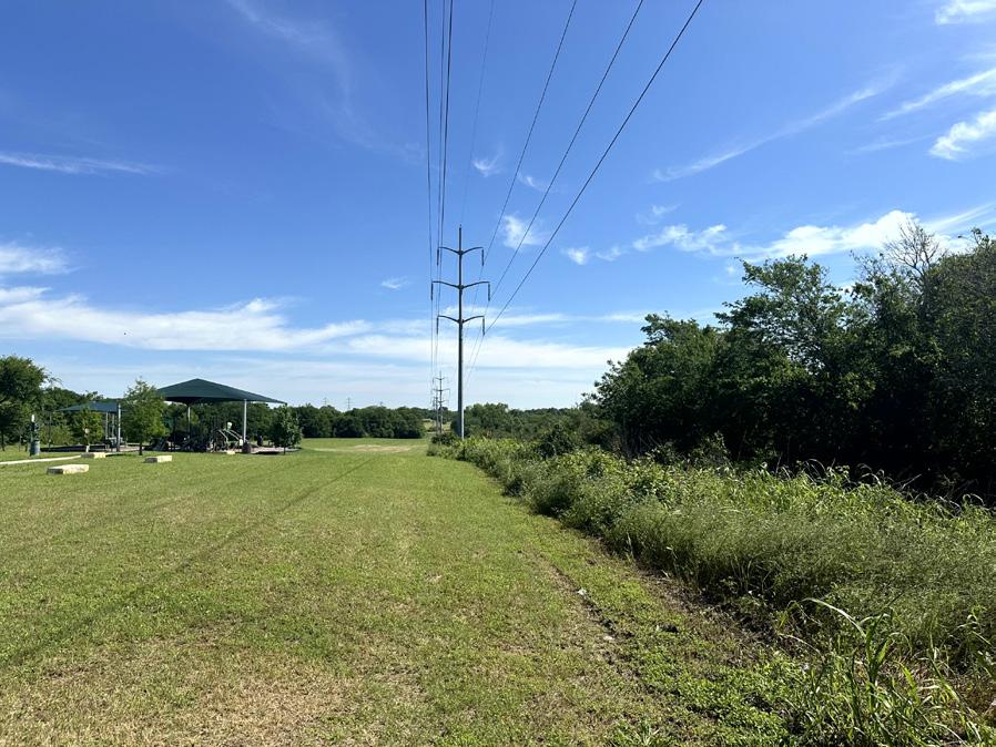
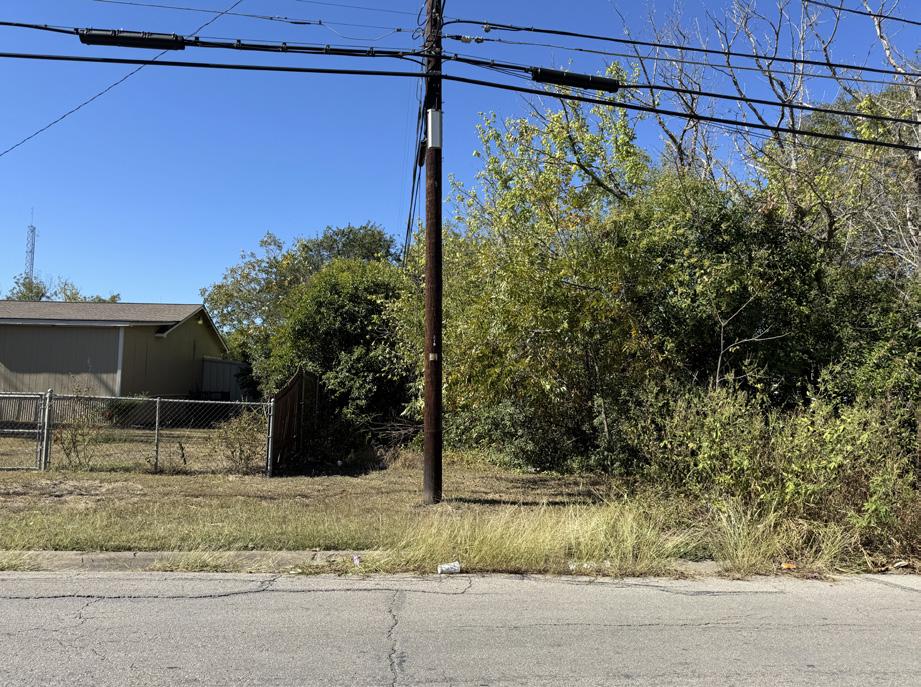
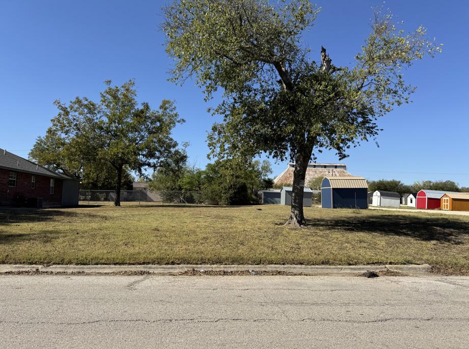
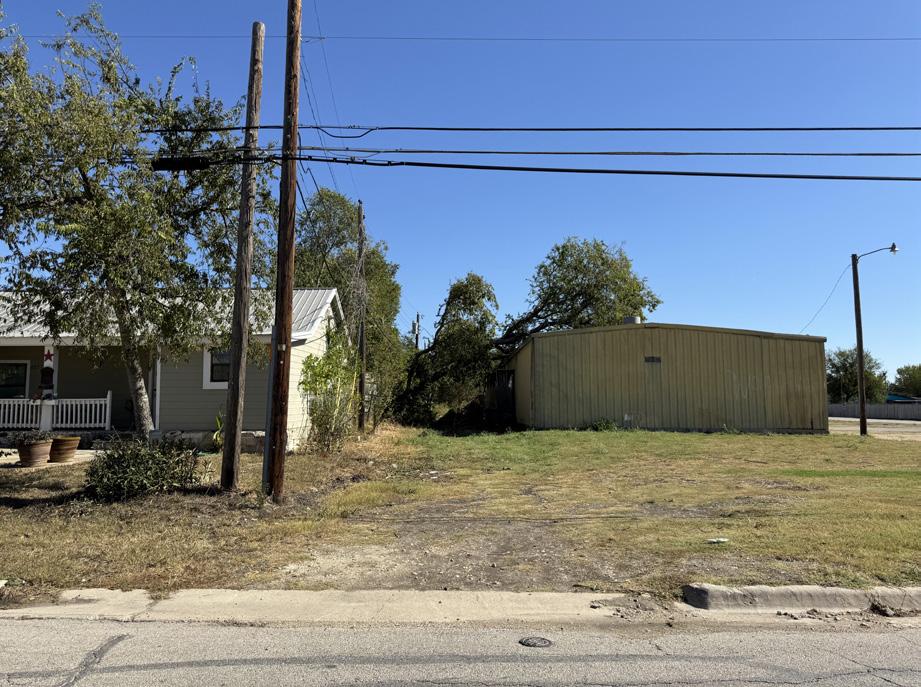
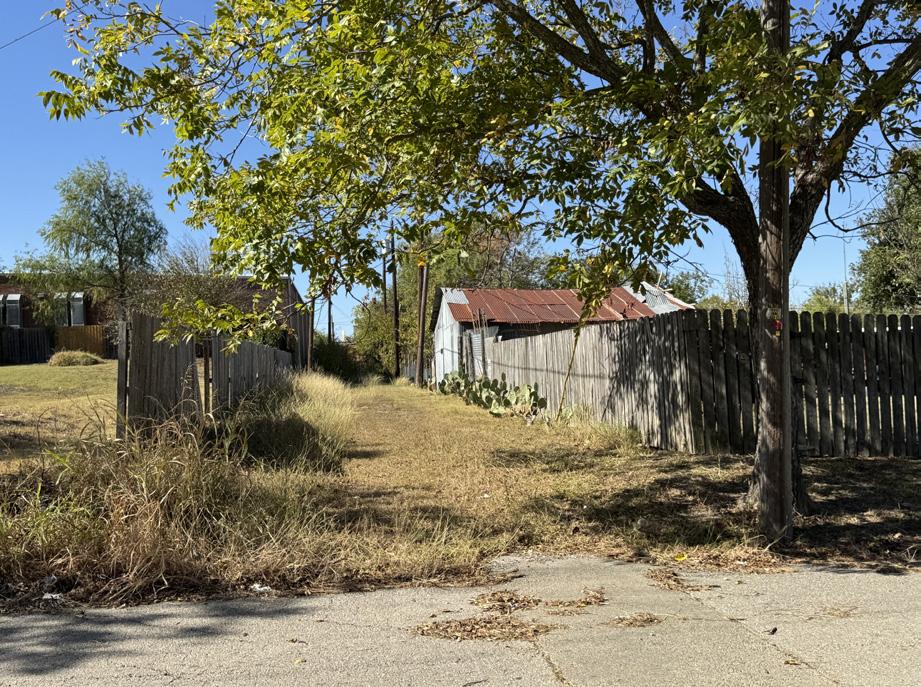
The images displayed on the right are taken from the East Downs Neighborhood plan area. These images assist in providing context to the character of the neighborhood’s built environment. Images were selected to show neighborhood assets, concerns, opportunities, conditions, and other points of interest.





SUPPLEMENTAL IMAGES
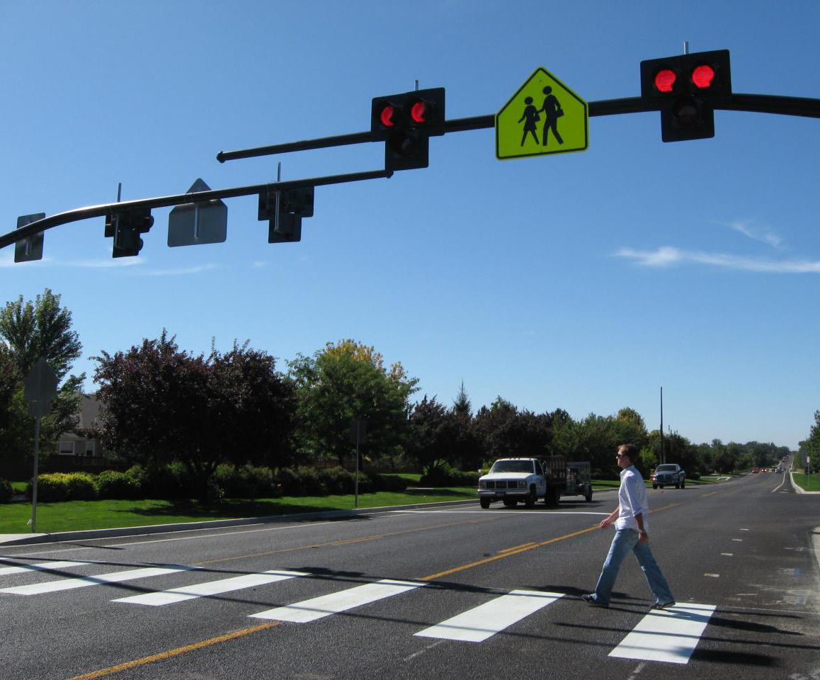
24th and Adams Intersection Crossing
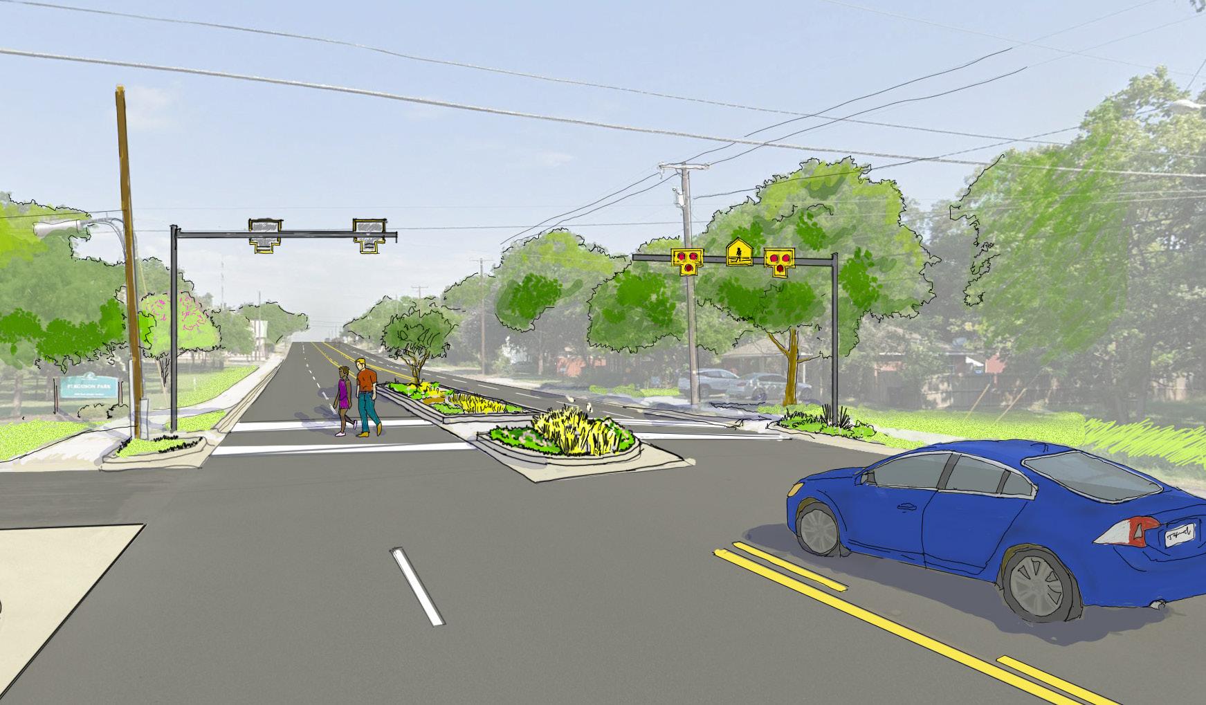
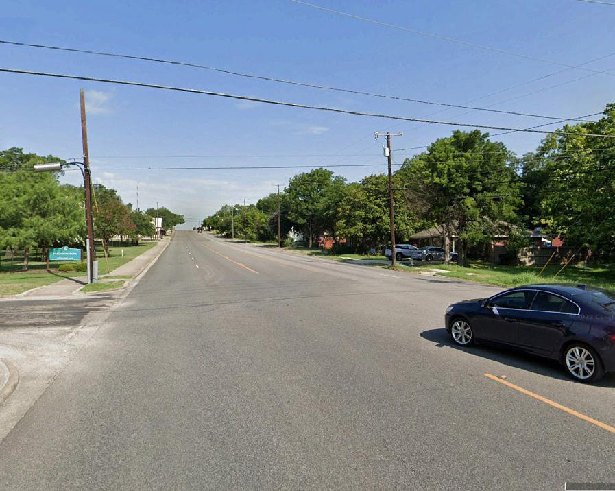
Adams Avenue is a major arterial with significant vehicular traffic acting as a barrier between the East Downs Neighborhood and Ferguson Park. Ferguson Park is a destination that is walkable for many of the residents in the East Downs Neighborhood, and, as such, a safe pedestrian crossing is warranted along Adams Avenue. This analysis sketch shows how that crossing may take shape.
Overall Takeaways:
• Landscaping, striping, and signage should be included in the intersection enhancement to communicate to vehicles the presence of pedestrians
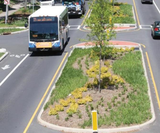
• A pedestrian refuge should be incorporated into any crossing of Adams Avenue
• A Hawk Beacon or other pedestrian-activated signalization should be incorporated into the pedestrian crossing
Prewitt Park Trail
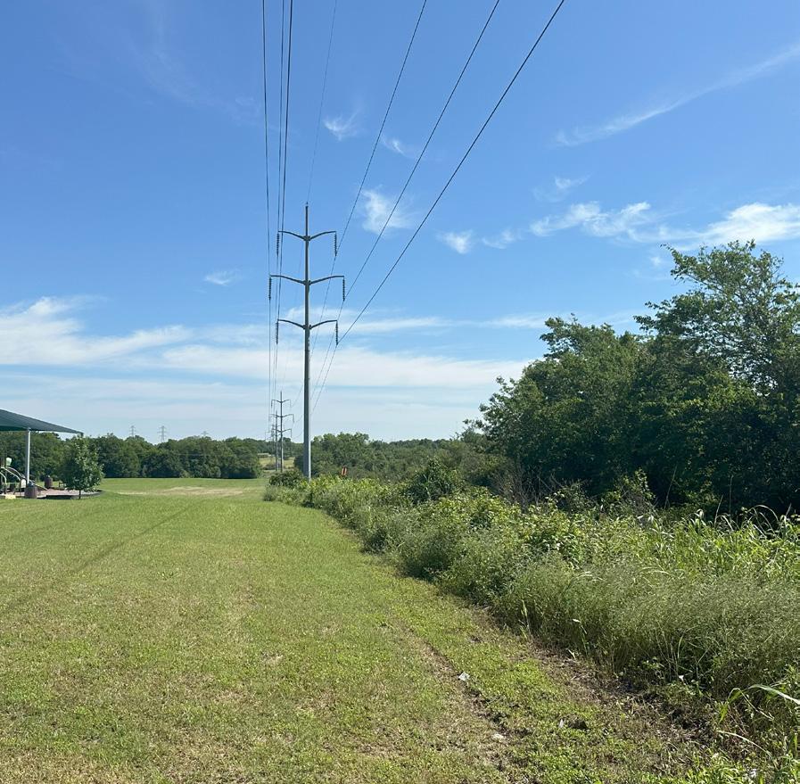
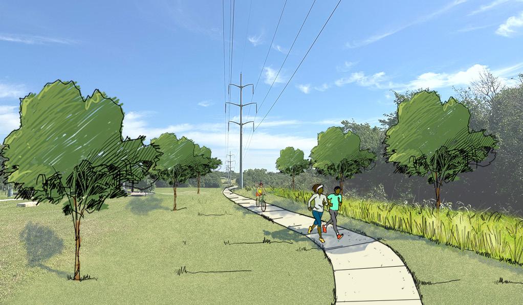
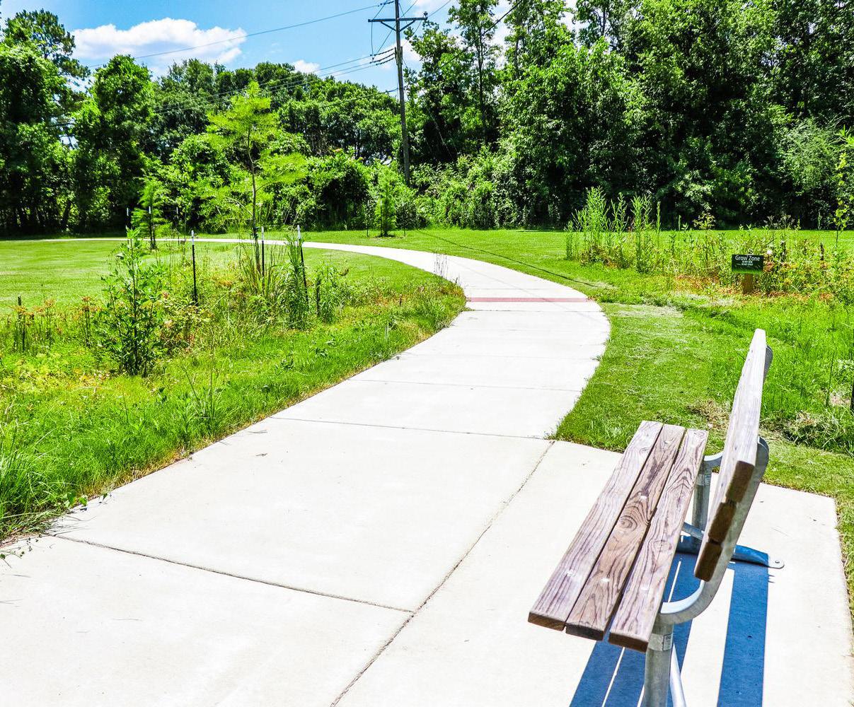
Adding a trail facility along the overhead utility corridor will help improve access to the park, as the Prewitt Park boundary extends north to French Avenue. This trail should be laid out to provide access to the future linear park and trail along Williamson Creek. This trail facility may be part of an inner park trail that creates a loop for users to exercise.
SUPPLEMENTAL IMAGES
Overall Takeaways:
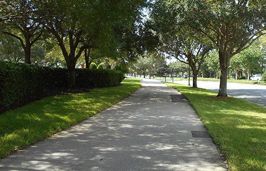
• Trail width should be set at 8’ to appropriately accommodate trail usage
• Tree plantings should complement the trail. Tree plantings may need to be set back further to avoid conflict with overhead utilities
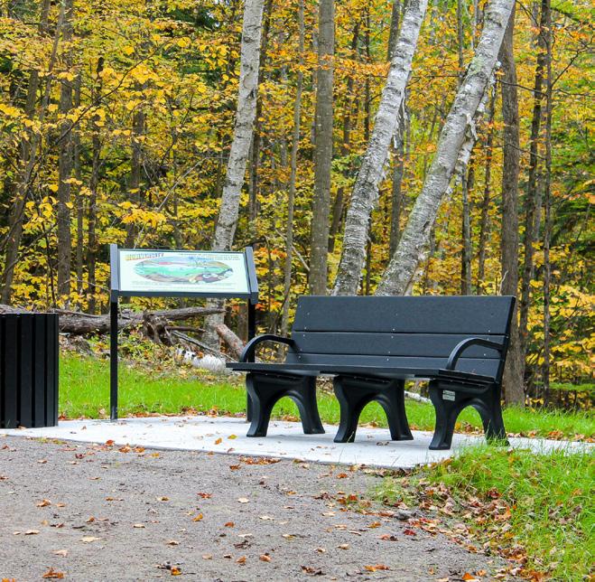
• Wayfinding signage, mile markers, benches/seating, pedestrian lighting, crosswalks, and waste receptacles should all be included as supplemental elements to support the trail facility
• A mowing strip should be on both sides of the trail paving to make sure the trail surface is highly visible and clear of debris
Concept & Planning
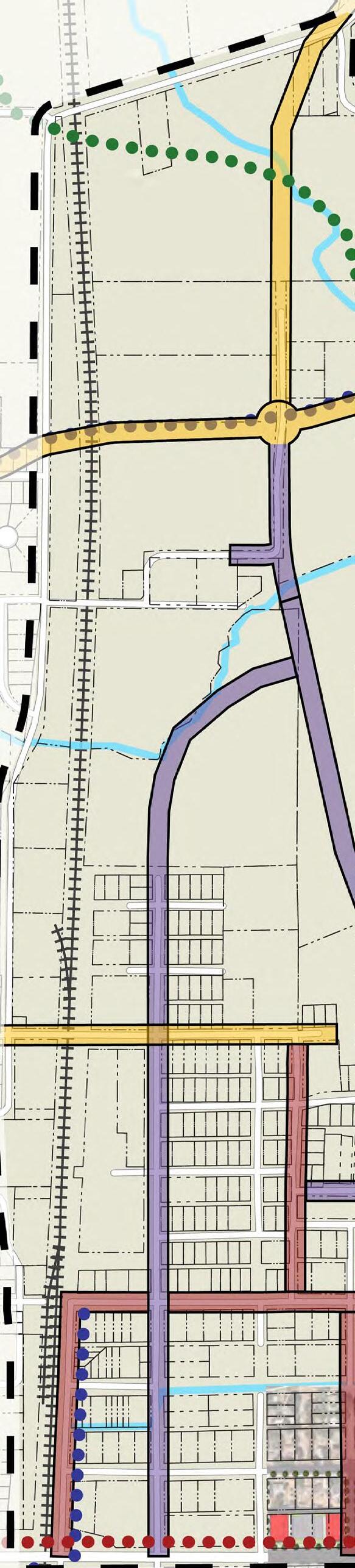
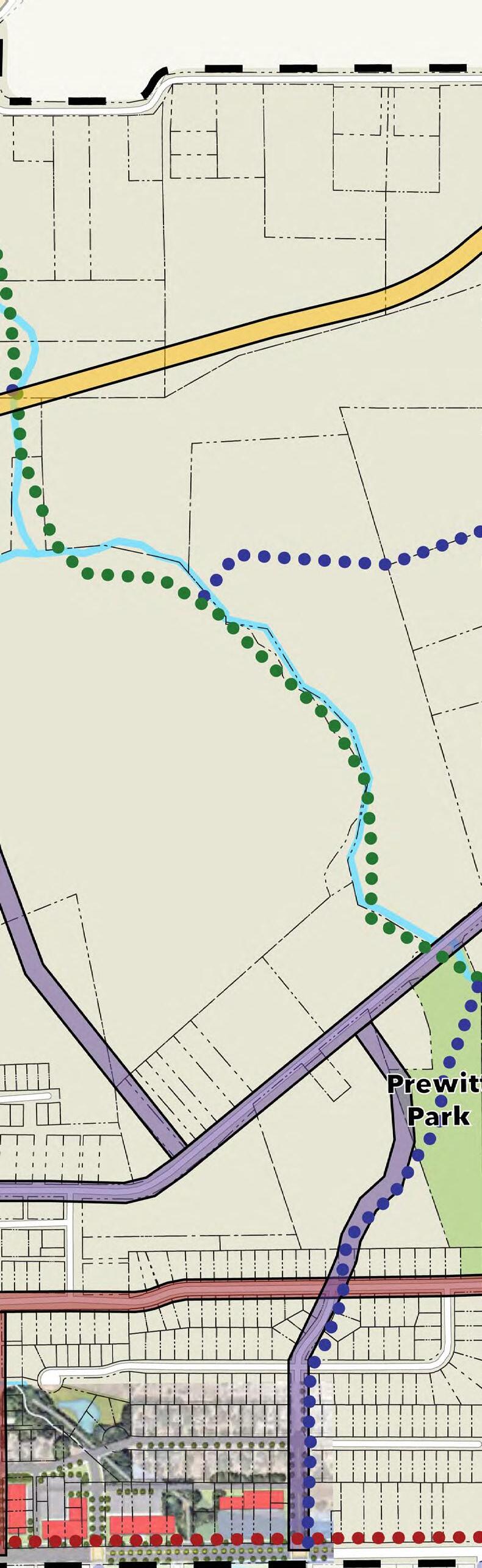
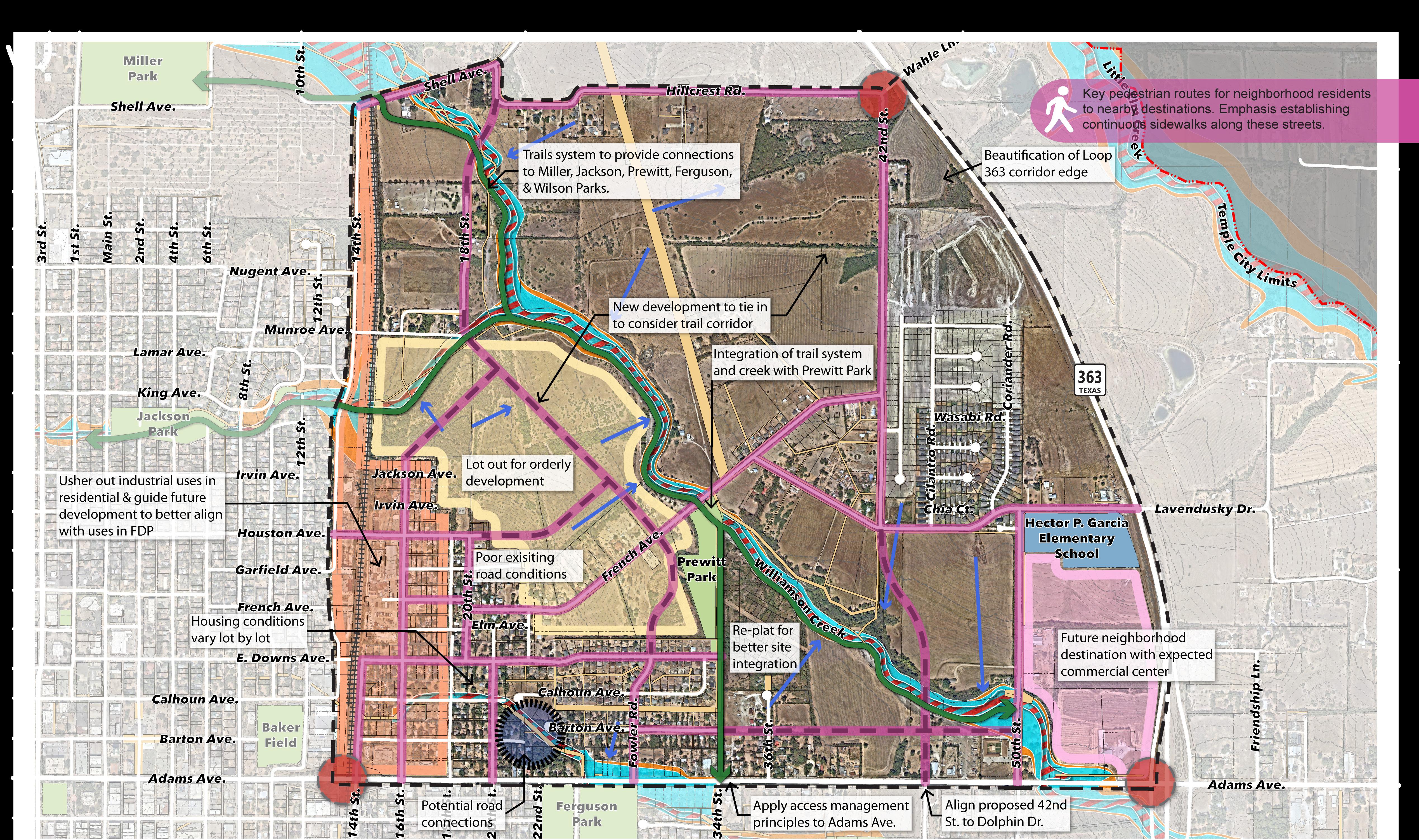
This exhibit builds upon the direction of Temple’s Comprehensive Plan in refining the Major Thoroughfare Plan (MTP) to meet the needs of the East Downs Neighborhood. The following are the key takeaways:
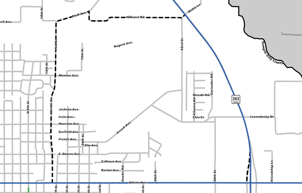
• Barton Ave. should be upgraded to a neighborhood collector. The street should be connected and extended so that it travels from 14th St. to 50th St..
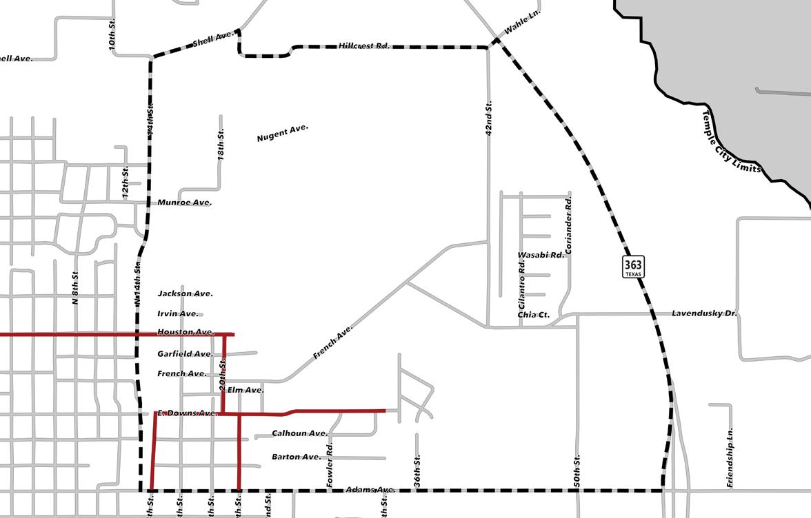
• 14th St.,16th St., 20th St., and East Downs are designated with the plan classification pedestrian connector. Sidewalks construction and maintenance should be a priority along these streets.
• Ensure that pedestrian connectors 16th St. and Houston Ave. are extended to connect to the future Fowler Rd. extension.
• All proposed roadway alignments are subject to change based on site conditions, property owners, and future development.
There are recommended additions to the Parks and Trails Master Plan from this planning exercise. This plan recommends that there will be additional routes based on the new road alignments with Nugent Ave., Fowler Rd., and 18th St. Additionally, there should be a significant effort to ensure that a linear park encompasses much of the Williamson Creek Corridor. This linear park would be home to the Greenway Trail identified in the Parks and Trails Master Plan.
ADAMS AVENUE
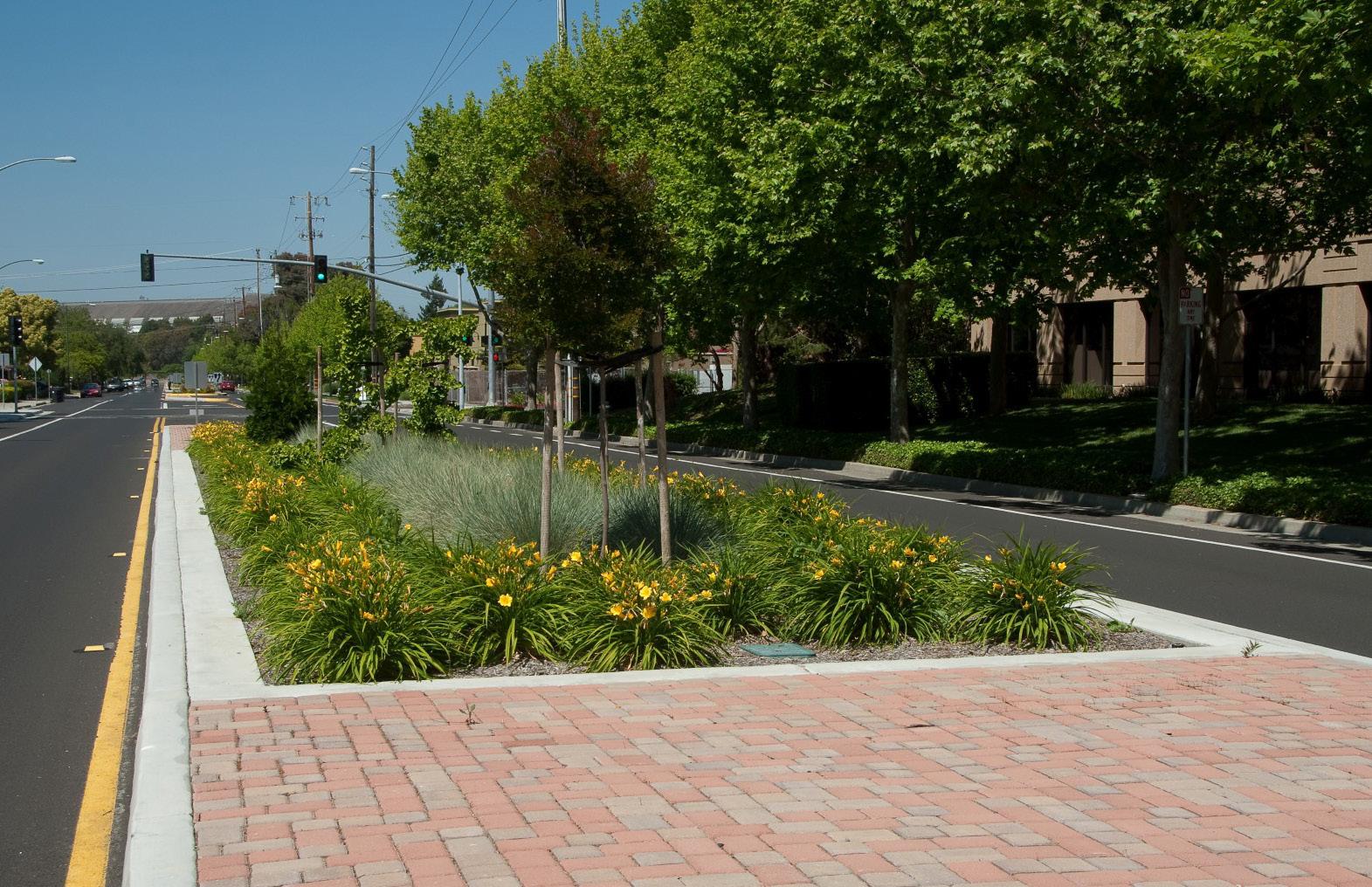
Adams Avenue is a major arterial on the southernmost boundary of the plan area. This is a TxDOT facility with four travel lanes and one turn lane. This street provides connections to I-35, Downtown, and H.K. Dodgen Loop. The City’s focus should be on implementing access management principles to better control traffic flow and reduce conflict points. The City should also prioritize constructing pedestrian infrastructure in the form of side-paths along the corridor.





Key Characteristics:
• Total of 4 travel lanes to accommodate traffic
• 14 ft tree-lined median that doubles as a turn lane where applicable
• To ensure a safe pedestrian environment, 8 ft side-paths with a 12 ft landscape buffer are recommended

CHARACTER IMAGERY


NUGENT AVENUE
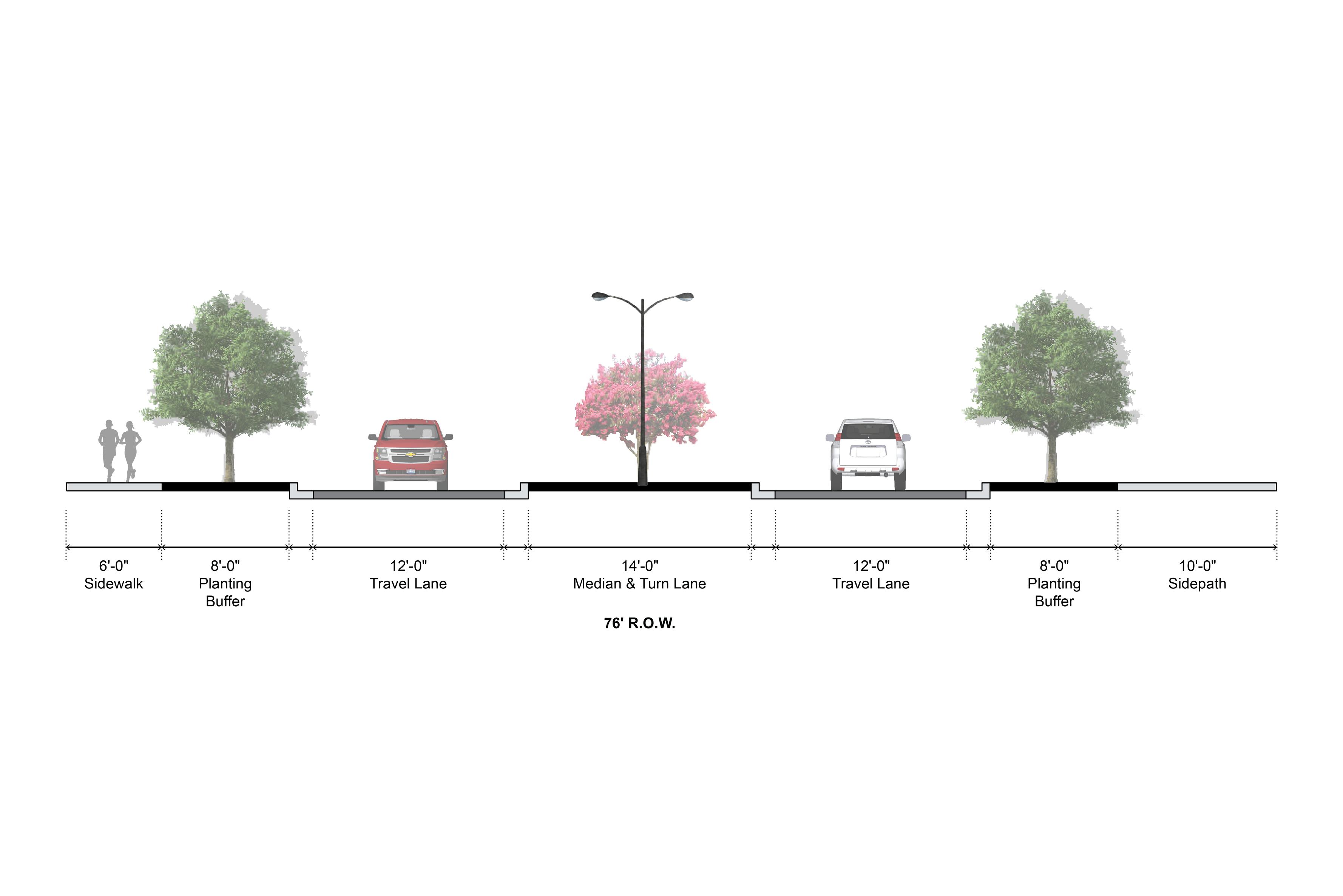
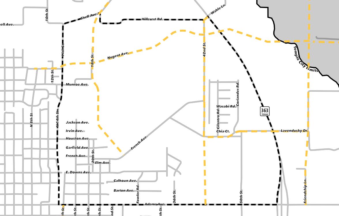
Nugent Avenue is an important, proposed community collector that extends across the railroad, connecting East Downs and Jackson Park with H.K. Dodgen Loop. Community Collectors function as key corridors that connect arterial streets with local and minor collector roads, accommodating moderate traffic volumes while providing access to surrounding neighborhoods and community destinations. Streets in this classification must balance efficient vehicular movement with a safe and comfortable pedestrian environment.
Key Characteristics:
• Two 12 ft travel lanes
• 14 ft tree-lined median that doubles as a turn lane where applicable
• Continuous 6 ft sidewalks and 10 ft sidepaths buffered from traffic by 8 ft landscape buffers
Proposed
CHARACTER IMAGERY
42ND STREET
The importance of 42nd St. will only grow as more subdivisions are constructed within the neighborhood. The Thoroughfare Plan calls for 42nd St. to be extended to Adams Ave. This extension is key to improving connectivity through the East Downs Neighborhood by connecting the proposed Nugent Ave., Hillcrest Rd., and H.K. Dodgen Loop to Adams Ave. Improvements to the road will include the widening of the travel lanes, the addition of a turn lane, curb/gutter, landscape buffers, and sidewalks on both sides of the road. These enhancements will enable the road to more effectively handle anticipated increases in traffic and improve pedestrian access in the area.
Existing


A) Proposed
B) Proposed
• South of French Ave, to Adams Ave, the sidepath will be along the back of the curb


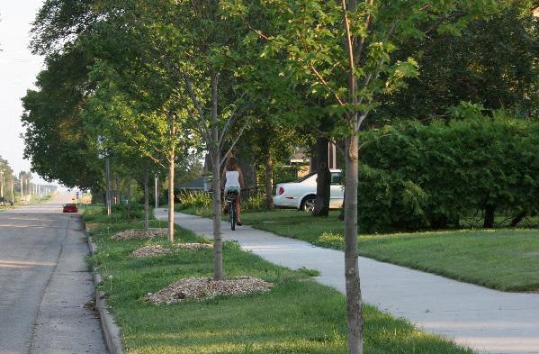
Key Characteristics:
• Enhance the road by widening the travel lanes and adding a curb/gutter
• Addition of a turn lane to improve traffic flow by separating turning vehicles from the rest of traffic
• Improve pedestrian access by constructing 5 ft sidewalks with 8 ft landscape buffer
CHARACTER IMAGERY
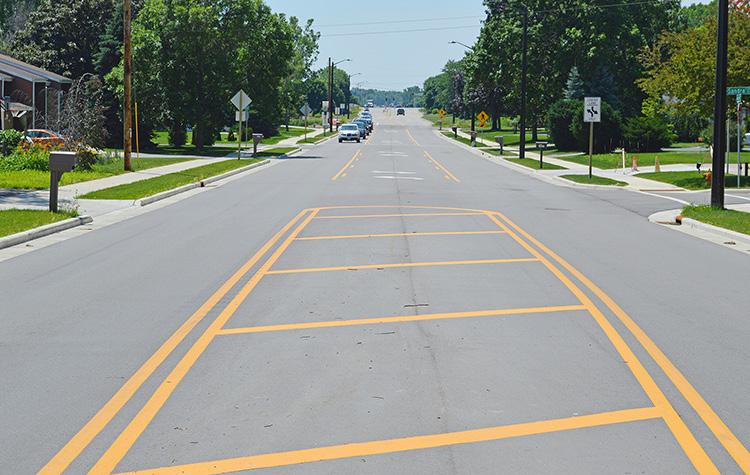
18TH STREET & NEW COMMUNITY COLLECTOR
The proposed improvements to 18th Street and the new community collector are intended to strengthen north–south connectivity within the East Downs Neighborhood. As additional subdivisions are developed, these roadways will play an increasingly vital role in the area’s transportation network. The extension is critical to neighborhood connectivity, linking the proposed Nugent Ave and Hillcrest Rd to Adams Ave. Because these roads are designed to accommodate higher traffic volumes, driveway access should be limited to allow for efficient and uninterrupted travel. The Community Collector south of Nugent Avenue may be developed to Neighborhood Collector standards in order to respect the character of the surrounding Neighborhood Conservation District, provided that no driveways abut or access the roadway.
Key Characteristics:
• Bury overhead utility
• Remove the median and reduce travel lanes from 14 ft to 12 ft
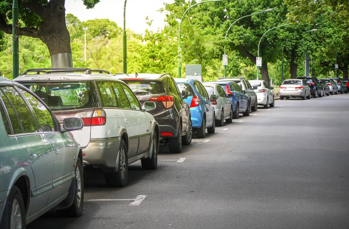
• Add 8 ft parallel parking on both sides for increased parking efficiency
• To ensure a safe pedestrian environment, 5 ft sidewalks with a 8 ft landscape buffer are recommended

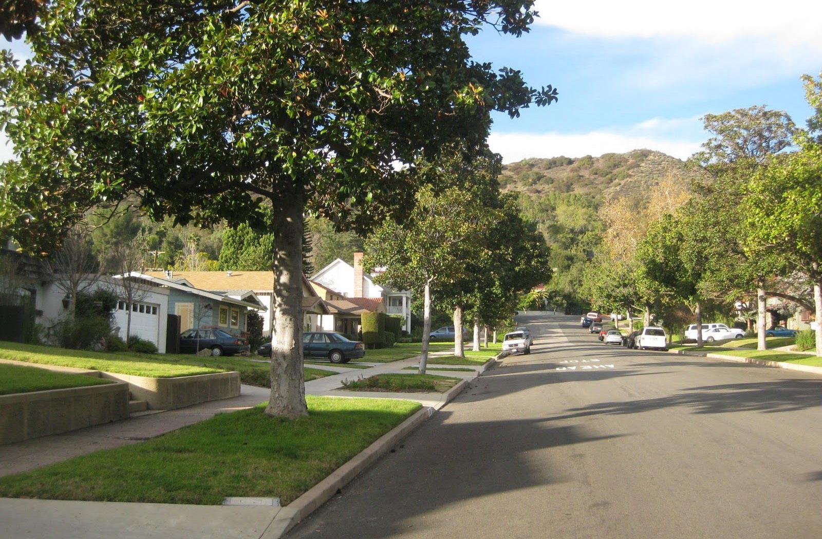
CHARACTER IMAGERY
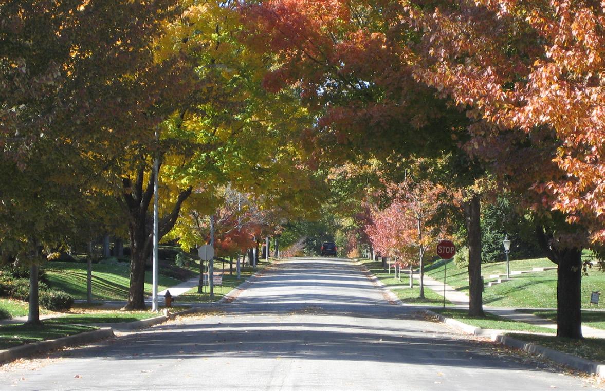
NEW COMMUNITY COLLECTOR
Proposed
50TH STREET
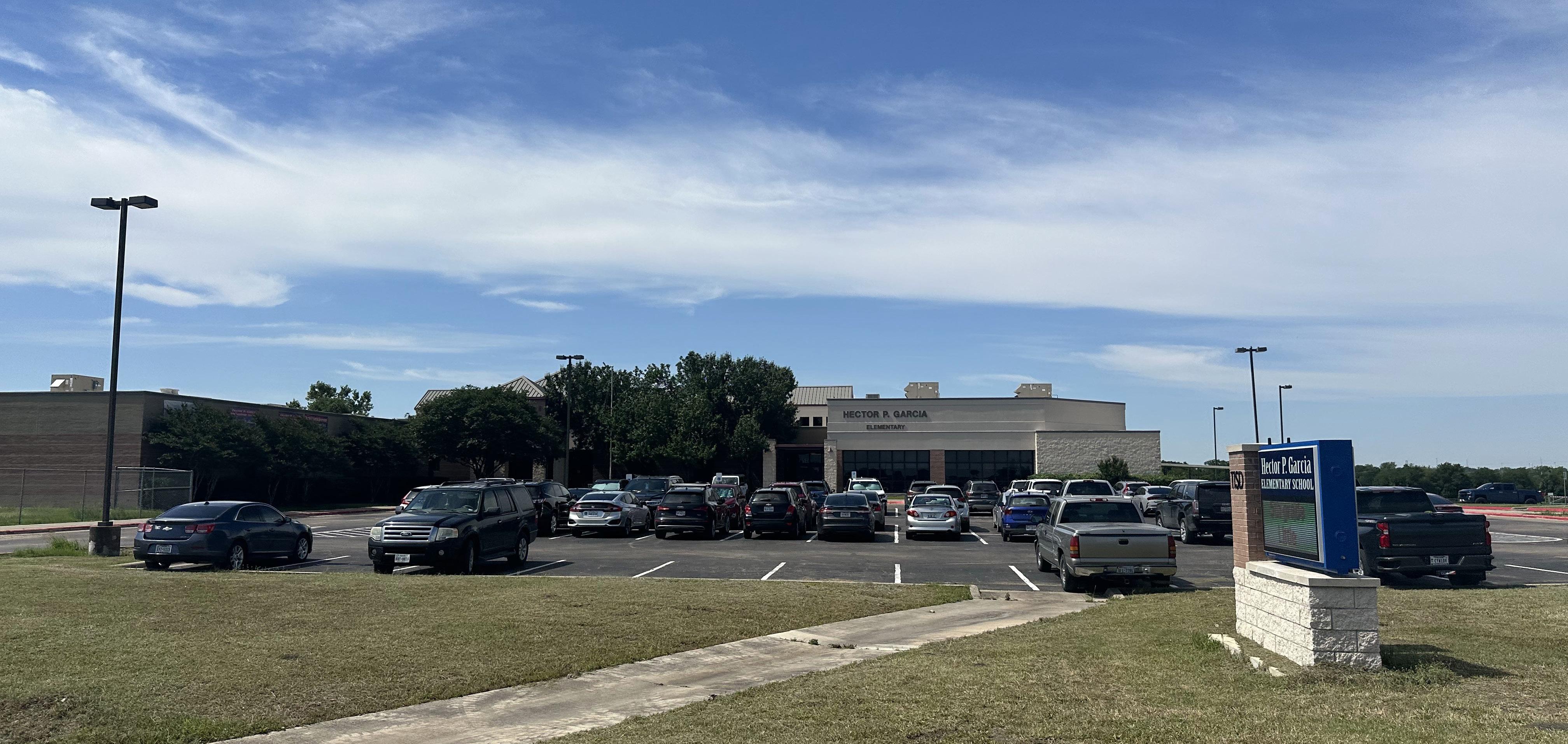
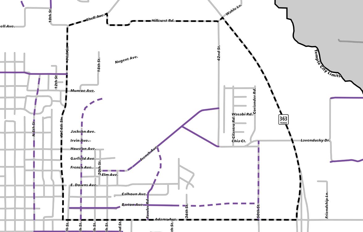
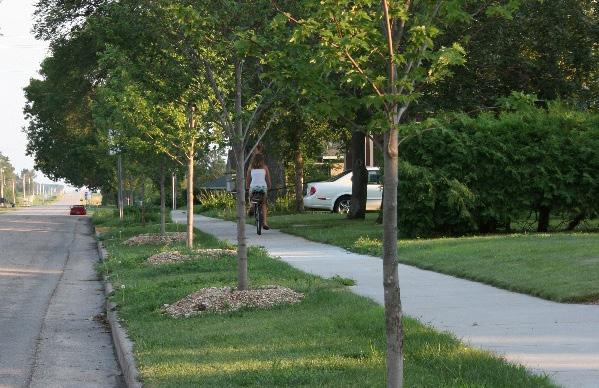
50th St. is an essential connection in the East Downs Neighborhood to Adams Ave. It serves an important connection to Hector P. Garcia Elementary School and will also connect the future growth of commercial mixed-use and residential growth. Reducing the width of the travel lanes from 16 ft to 12 ft with the addition of a dedicated lane to parallel parking will improve efficiency of the road. The addition of a sidewalk and a side-path on the Hector P. Garcia side of the road will contribute to creating a safe, walkable route to the school.


Key Characteristics:
• Reduction of travel lane width and the addition of parallel parking for efficiency
• Sidewalk and side-path to improve pedestrian access to Hector P. Garcia Elementary School
• Increasing the width of the landscape buffers to evoke a safe walking environment
CHARACTER IMAGERY
BARTON AVENUE
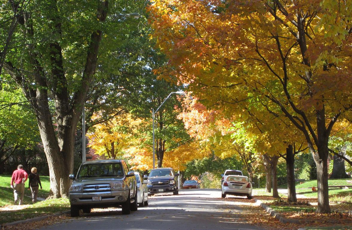
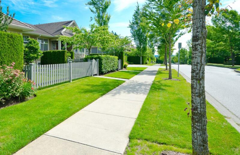
Extending Barton Ave. to 50th St. provides an opportunity for a more continuous East-West route through the neighborhood. The extension of this road can help reduce the residents’ reliance on Adams Ave. to travel within the East Downs Neighborhood. In addition to the extension to 50th St., closing the gap of Barton Ave. between 20th St. and Fowler Rd. will improve connectivity throughout the neighborhood.
Existing

Key Characteristics:
• Add parallel parking to both sides of the road
• Reduce landscape buffers to accommodate other street elements



CHARACTER IMAGERY
BARTON
16TH STREET
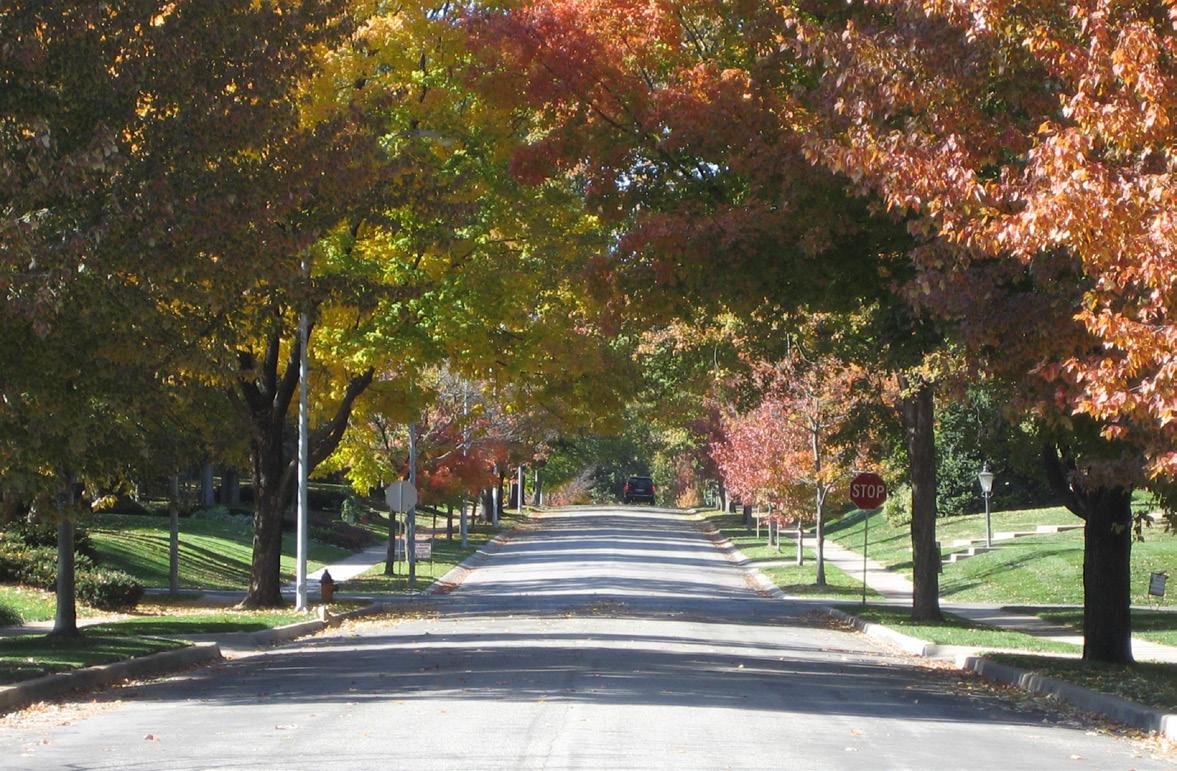
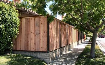
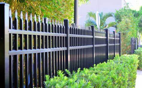
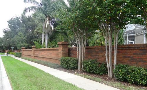
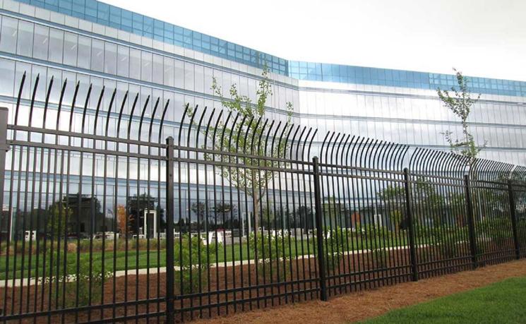
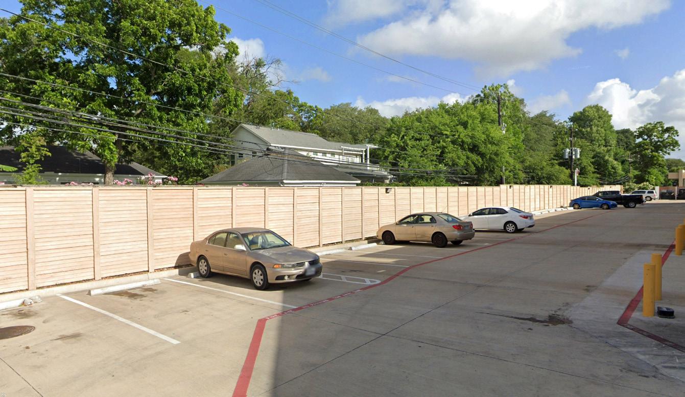
The growth of infill neighborhoods with East Downs makes the extension of 16th Street an important north/south neighborhood collector. 16th St. serves to connect the future Nugent Ave. to Adams Ave. The road runs beside industrial development that should be screened from view by decorative, opaque fencing with gates that control access from the sites onto 16th St. Continuous sidewalks should be buffered by landscaping to provide a safe and pleasing atmosphere. On-street parking should be added for better parking along the thoroughfare.
Key Characteristics:
• Bury overhead utility
• Reduce travel lanes from 14 ft to 12 ft
• Add 8 ft parallel parking on both sides for increased parking efficiency
• To ensure a safe pedestrian environment, 5 ft sidewalks with a 8 ft landscape buffer are recommended

CHARACTER IMAGERY
FOWLER ROAD
The proposed extension of Fowler Road is essential to improving north-south connectivity through the East Downs Neighborhood. This extension intersects French Avenue, that connects with 18th Street, to provide a connection to the northern end of the plan area. This community collector is key to promoting structured and orderly growth of the land in the future.
Key Characteristics:
• Planted medians are recommended to enhance character of entry road into the neighborhood
• Travel lanes should be 14 ft to enhance character and provide efficient connection
• To ensure a safe pedestrian environment, 4 ft sidewalks with a 6 ft landscape buffer are recommended


CHARACTER IMAGERY
FOWLER ROAD
PEDESTRIAN CONNECTOR
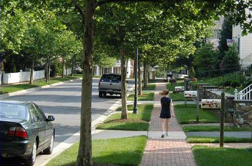
The pedestrian connectors are a network of roads running through the neighborhood’s residential core. These roads connect users to the arterial and collector streets within the plan area. Pedestrian safety can be improved by placing a sidewalk on one side of the road as well as adding a landscape buffer to separate pedestrians from traffic. To improve vehicle traffic, widen the travel lanes from 11 ft to 12 ft. Parking should be limited to one side of the road to limit conflict within the travel lanes.


Key Characteristics:
• Widen travel lanes by 1 ft
• Bury overhead utilities to improve the aesthetic of the streetscape
• Construct a sidewalk on one side of the road
• Include a 4 ft landscape buffer to provide more protection to pedestrians
• Limit parking to one side
CHARACTER IMAGERY




The larger context area of the Temple Thoroughfare and intersection recommendations, informed by Vehicles Per Day (VPD) estimates, provides a fuller picture of traffic connectivity and movement in and out of East Downs. The VPD analysis is based on parcel-level trip generation, reflecting the density of trips within the project’s focus areas and their distribution across the surrounding roadway network. VPDs are derived from estimates of future residential and commercial development capacity of individual parcels, based on zoning, FLUM designation, and existing development.
Key Takeaways:
• Many of these alignments are existing and will require more ROW such as Lavendusky, and 18th Street.
• Adequate spacing is provided for signals along TX 363, however if TX 363 is moved to limited access later on, not all crossings are expected to be granted interchanges
• Nugent Avenue may become the most traveled roadway with an estimated 15,000 VPD, the same volume a Adams Avenue.
• Hillcrest would remain a local road and tie into the intersection at Nugent and 42nd Street
• These thoroughfare alignments may be adjusted to best suit the needs of onsite conditions and development needs. However, the intent of spacing, classifications, and organization should be adhered to as closely as possible.
THOROUGHFARE & INTERSECTION RECOMMENDATIONS
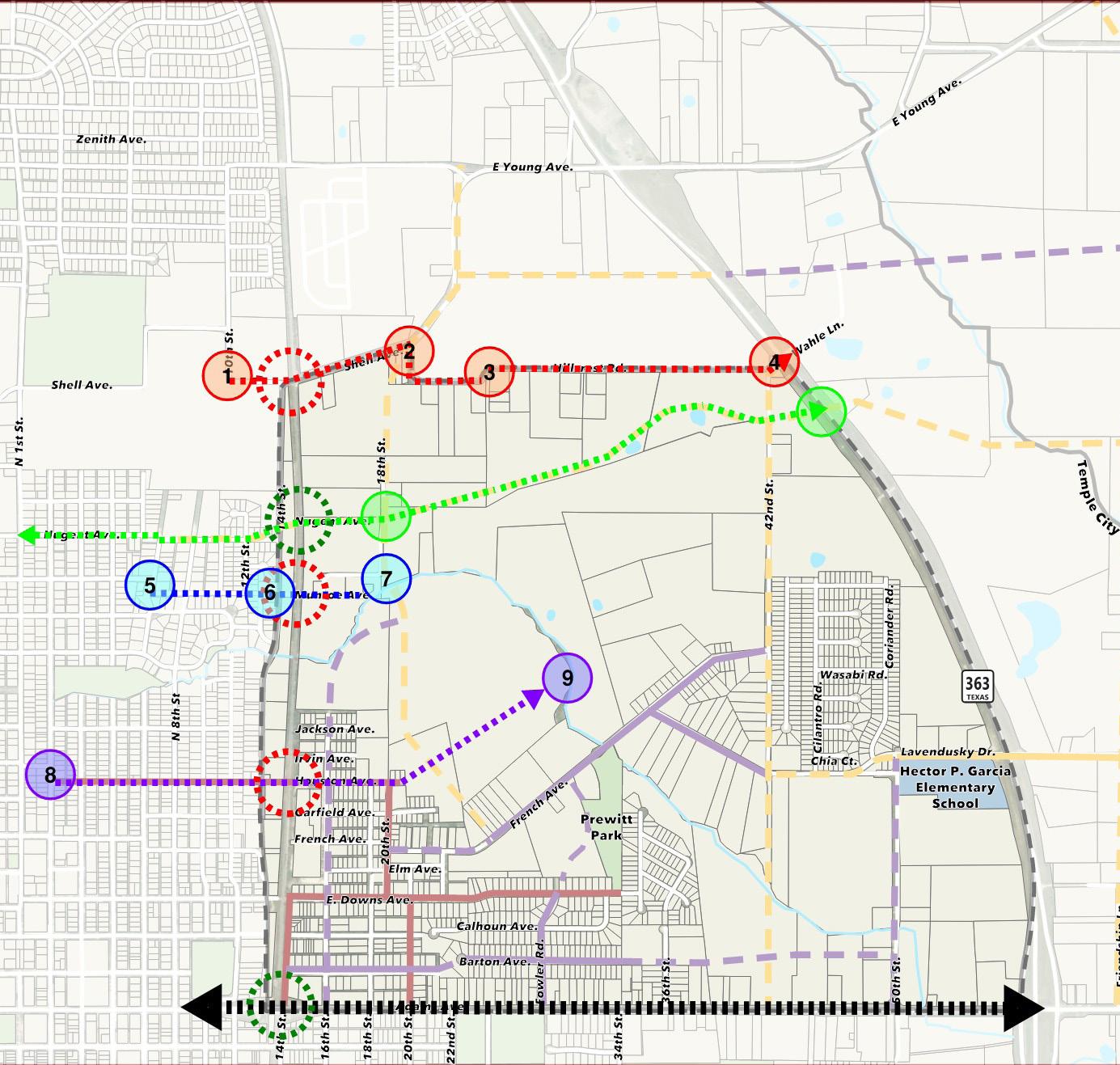
At a broader scale, the traffic analysis on page 41, illustrates the regional role of the East Downs neighborhood and the importance of cross-connectivity across the rail line, where limited crossings concentrate traffic onto a small number of routes. Nugent Avenue functions as the primary community collector providing neighborhood access across the rail line, while East Adams Avenue serves as a major arterial accommodating higher regional traffic volumes. East Young Avenue transitions in function at the railroad, operating as a community collector on the east side and a neighborhood collector on the west. Together, these corridors connect East Downs to the larger Temple network.
EAST / WEST CONNECTIVITY
Establishing Nugent Avenue as a continuous east-west connection is critical to improving mobility, restoring connectivity lost with the closure of Shell Drive, and supporting anticipated growth within the East Downs Plan Area. As new development occurs, Nugent Avenue will provide a direct link between the eastern and western portions of the plan area while improving access to Loop 363 and strengthening the overall transportation network. The crossing design, whether at-grade or grade-separated, should be evaluated based on cost, right-of-way impacts, and long-term transportation benefits.
Limitations of Existing Railroad Crossings: Hillcrest Road
1. Lack of connectivity to N 3rd Street
EAST DOWNS EAST-WEST CONNECTIVITY ANALYSIS
The Nugent Avenue extension is shown conceptually to preserve a future eastwest connection necessary to support neighborhood connectivity, mobility, and emergency access within the East Downs area. The alignment shown in the Neighborhood Plan is intended to guide future transportation planning and does not represent a final design or construction project. Should the project advance in the future, additional engineering analysis, environmental evaluation, and public engagement should be conducted to inform the final design and implementation approach. Future design efforts should consider context-sensitive solutions that balance transportation needs with adjacent neighborhood character, safety, access, landscaping, pedestrian and bicycle accommodations, and other measures intended to minimize impacts to surrounding properties and residents.



2. Existing intersection of Shell Ave and Hillcrest Rd presents safety challenges
3. Jog in Hillcrest Rd creates an unsafe route for the volume of future traffic
4. Existing intersection with the Loop presents safety challenges Munroe Ave
5. Jog in Munroe Ave creates unsafe route for the volume of future traffic
6. The railroad crossing is in poor condition
7. Floodplain/River crossing would be required in addition to road intersection correction required for Munroe Ave and proposed 18th Street extension Houston Ave
8. Jog creates indirect route for proper E-W connection of Houston Ave
9. Floodplain/River crossing would be required in addition to road intersection correction required for Houston Ave & proposed 18th Street extension Munroe Ave Hillcrest Rd Houston Ave
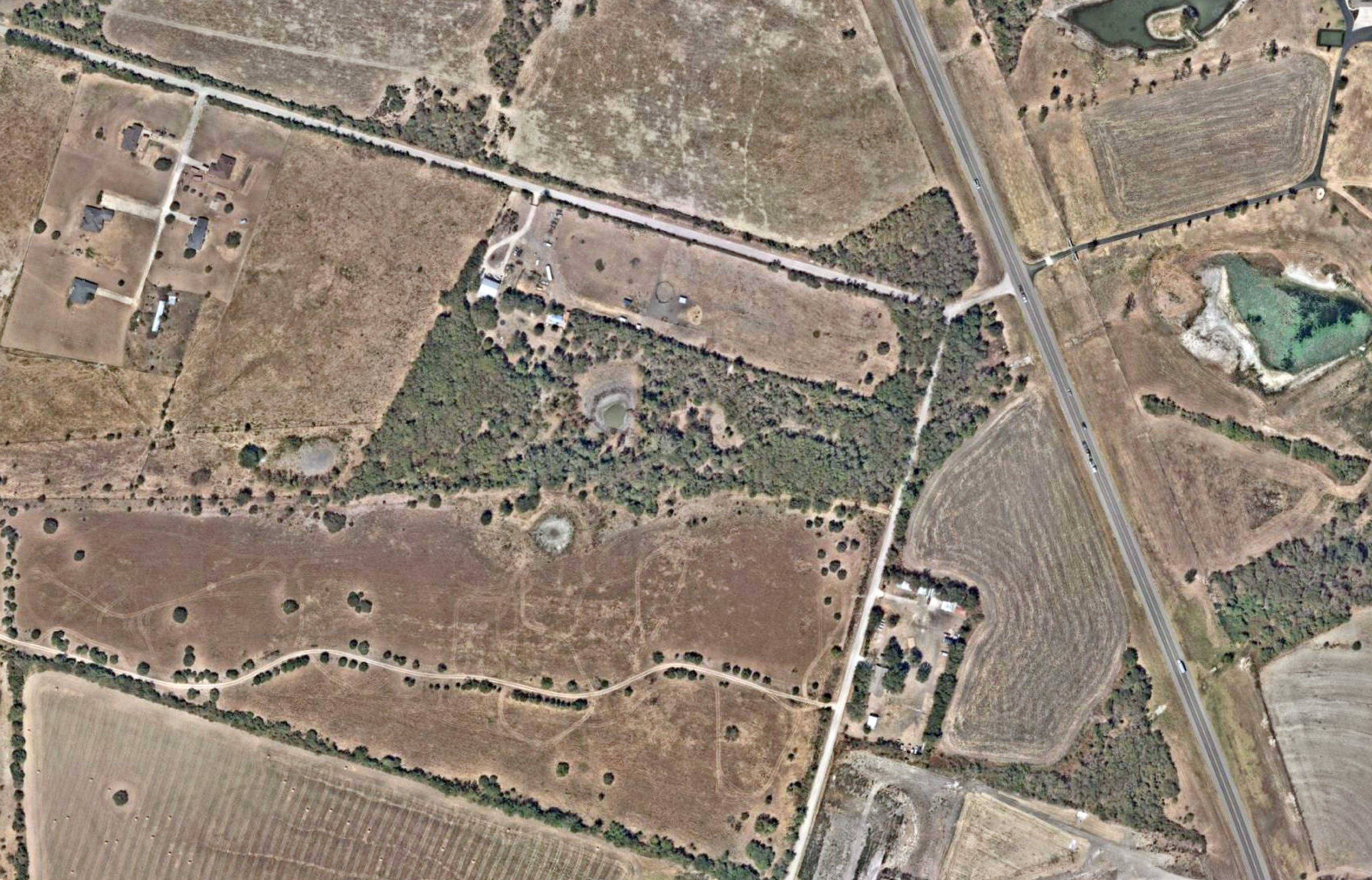
The current intersection of Hillcrest Road and 42nd Street is one of the only points of ingress and egress from East Downs to H.K. Dodgen Loop. As part of Phase 1, the Hillcrest Road and 42nd Street intersection is planned to be improved to accommodate larger traffic volumes and integration with the Loop. Currently, conditions of this intersection are not appropriate for an increase in traffic volumes. The absence of signs or lights directing traffic flow creates conflict points, and the road widths are inadequate for smooth two-way traffic.
Future Hillcrest Rd. Connection to H.K. Dodgen Loop
The location of the Hillcrest Road and 42nd Street intersection doesn’t allow for proper distance from H.K. Dodgen Loop for sufficient traffic queuing, which will only be exacerbated upon the TXDOT expansion of the Loop. As Nugent Avenue is developed and connects into the Loop, the Hillcrest Road connection will be abandoned, allowing Nugent Avenue to become the primary connection into the Loop.
FUTURE NUGENT AVENUE & 42ND STREET REALIGNMENT
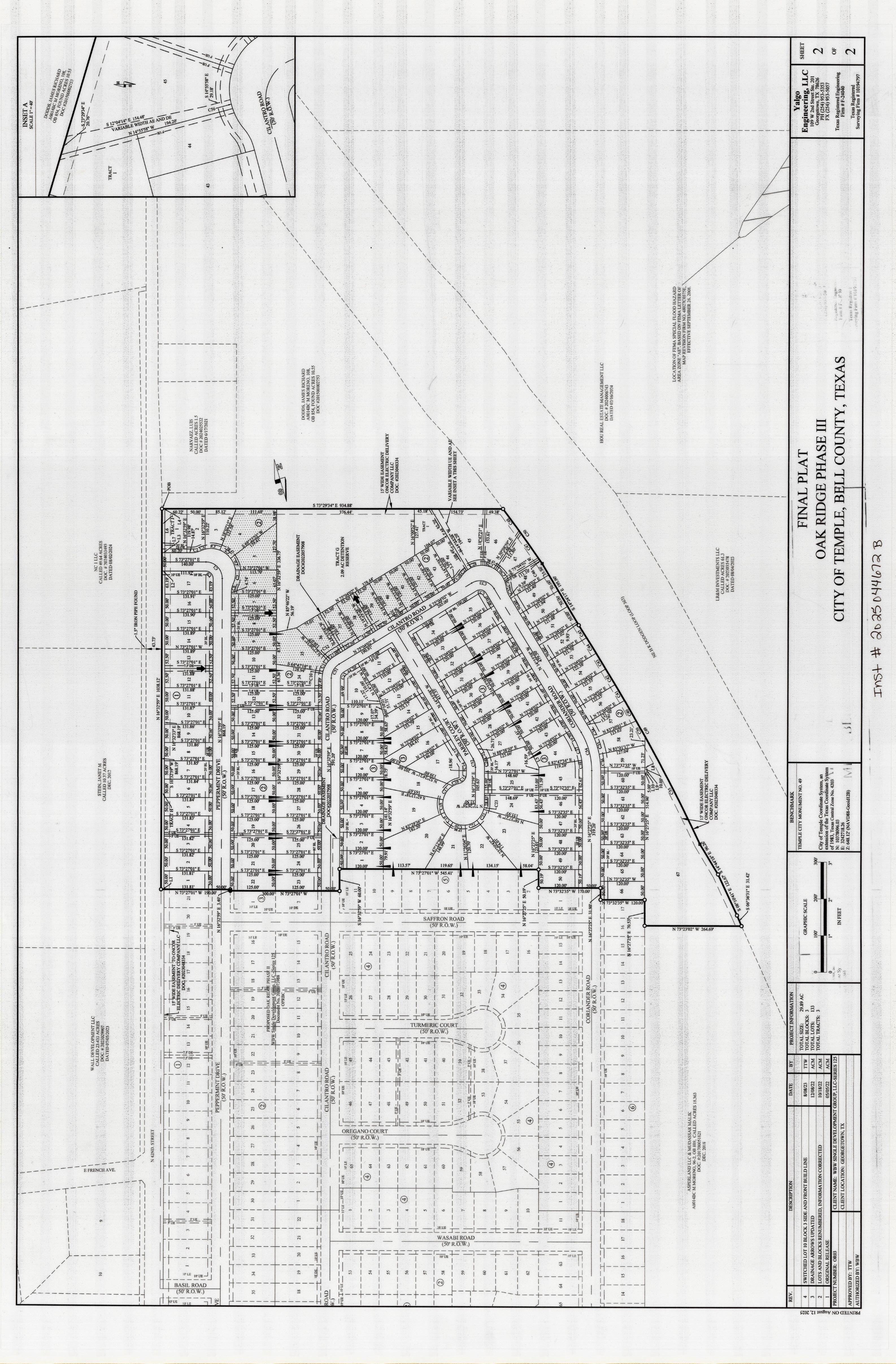
The phase 1 development of the Hillcrest and 42nd intersection, with the connection to H.K. Dodgen Loop, is planned to become obselete when the future Nugent and 42nd intersection is developed and becomes the primary connection to the Loop.

ELEMENTS
East Adams Avenue is a major arterial that serves many vehicles, connecting downtown, I-35, and the airport. This street houses several abutting businesses and attributes to the character of Temple. Identifying possible conflict points between vehicles and pedestrians will help improve all users’ function, safety, and experience.
• East Adams Avenue has a significant number of driveways
• There are multiple driveways per block and driveway spacing is inconsistent
• Driveway widths vary
• Limited application of shared driveways
• There are not many sidewalk connections along the north side of East Adams Avenue
• Frequently interrupted by driveways
• Paving condition of sidewalks is poor
• Sidewalks are narrow and provide little to no buffer from the street’s vehicular traffic
• Parking lots lack structure and often encompass areas along the street frontage that should be available for sidewalk and landscape buffers
• Parking lot configurations have some shared parking opportunities
• A uniform application is absent from the corridor
• Streetscape enhancements can help encourage a safer and more comfortable pedestrian environment
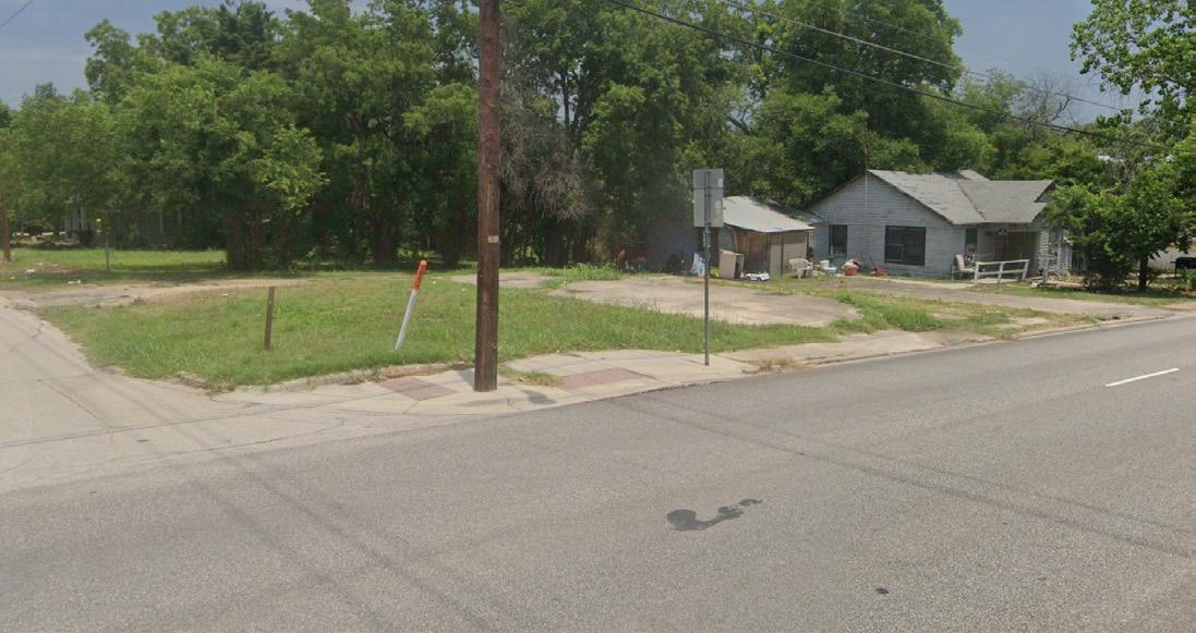
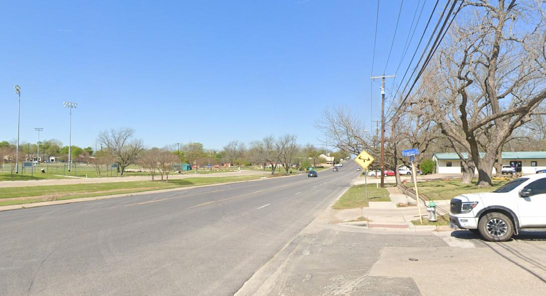
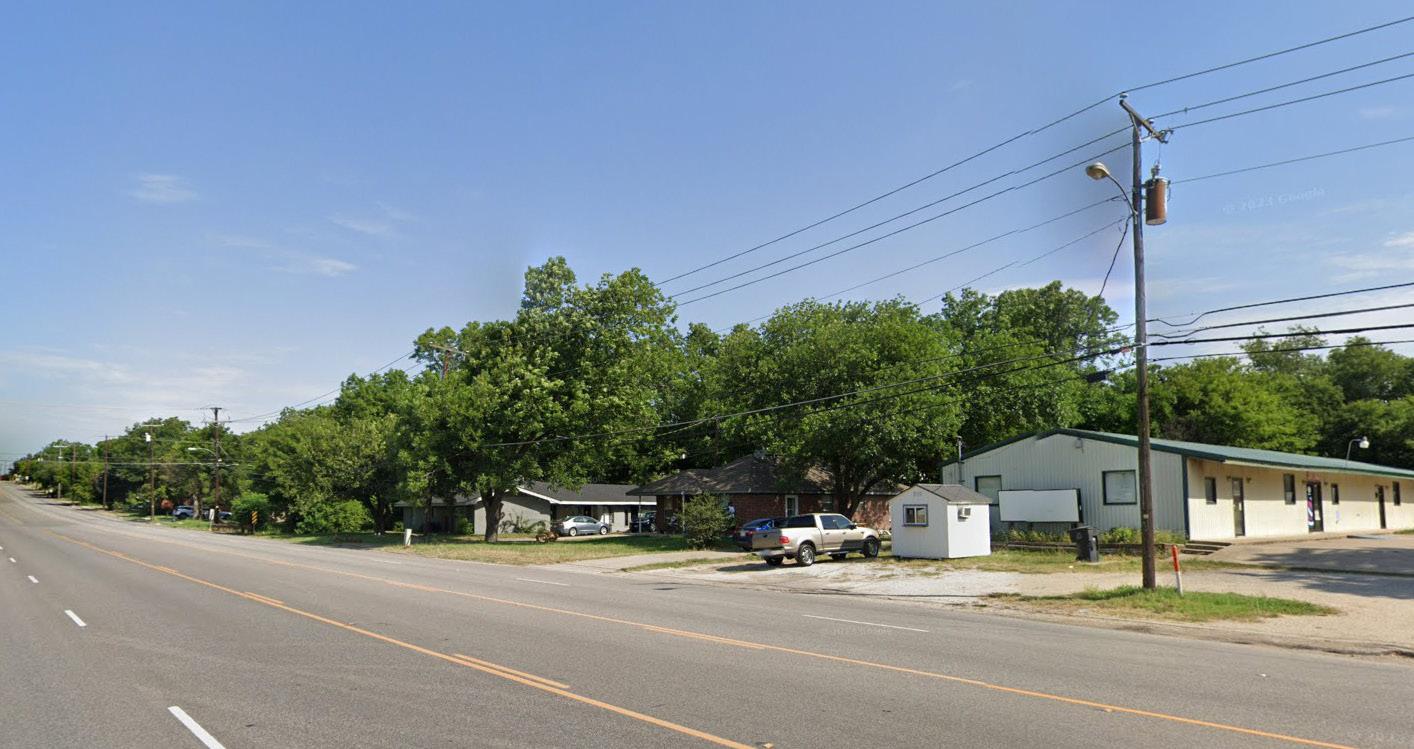
Narrow sidewalks that are frequently interrupted by driveways create unsafe conditions for pedestrians and decrease the walkability of this neighborhood. Additionally, there are no landscape buffers and ADA accessibility is limited along the frontage, making for an unpleasant pedestrian experience.
With Ferguson Park being a possible destination from the East Downs Neighborhood, safe pedestrian crossings and appropriate signage should be considered for safe pedestrian crossings.
The environment along East Adams Avenue creates an uncomfortable and visually unappealing experience for both pedestrians and motorists. Additionally, the presence of overhead utilities limits opportunities for planting shade trees.
Existing Condition
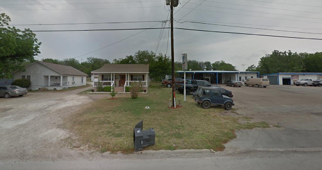
East Adams Ave. is a high-traffic arterial street, connecting Downtown to the neighborhood. The streetscape and sidewalks from Downtown transition into the East Downs Neighborhood but do not provide a safe and pedestrian-friendly experience. This undesirable streetscape is created by too many driveways, a lack of sidewalk infrastructure, a high-speed road, and a lack of landscape buffering. The mix of single-family and general commercial development does not create a connected sidewalk, as there are too many intersecting driveways that create inconsistencies in the sidewalk infrastructure.
Land Use
East Adams Ave. needs help with identity and effective land use organization to provide a consistent streetscape. Several vacant lots along the frontage create gaps in development. Turning this area into a commercial corridor could activate the streetscape and create an extension of the downtown area.
Sidewalks
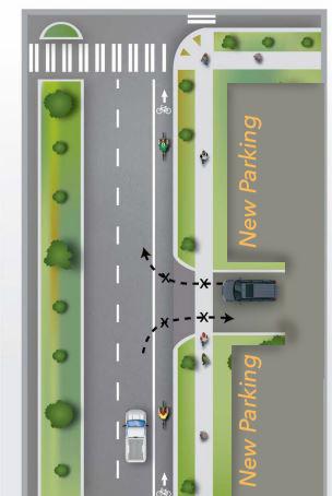
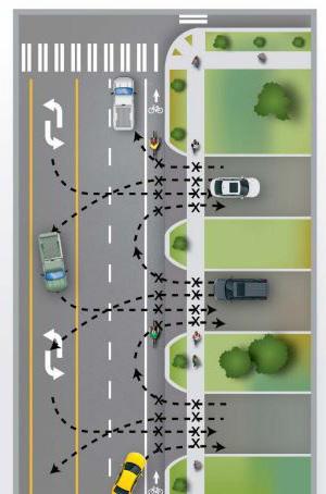
Access Management Basics
Municipalities have the authority to implement subdivision and zoning regulations which provide a basis for street access. Access management mechanisms such as shared access, cross access, lot width, driveway throat length, internal street circulation, and thoroughfare planning are an extension of a City’s subdivision and regulatory authority. The above exhibit is for diagrammatic purposes and does not constitute a City of Temple directive.
Conflict Points
When considering improvements to a corridor’s function and safety, it is important to identify uncontrolled interactions between travel lanes, driveways, and sidewalks. These areas are where hazards and safety concerns for vehicle/pedestrian interaction arise. Additionally, these ingress and egress points can significantly impact the continuous flow of traffic, making congestion worse.
Access Management Results
The following are the resulting benefits of access management:
• Increased pedestrian comfort levels with more continuous sidewalks and landscape
• Reduced vehicle ingress/egress conflicts
• Increase pedestrian safety considerations
• Overall improvement for a cohesive built environment
• A plan to work with businesses and property owners to improve the function and access to the street system
Neighborhood Mixed Use. The character and land use of this area is currently industrial. While these businesses are well known and established, they do have an impact on the adjacent residences. Housing conditions in both the Jackson Park and East Downs Neighborhoods are worse off the closer they are to these uses. A long-term transition toward something that is more complementary to the nearby residential should be considered, which may still include employment or residential.
This
NEIGHBORHOOD CONSERVATION
Neighborhood Conservation
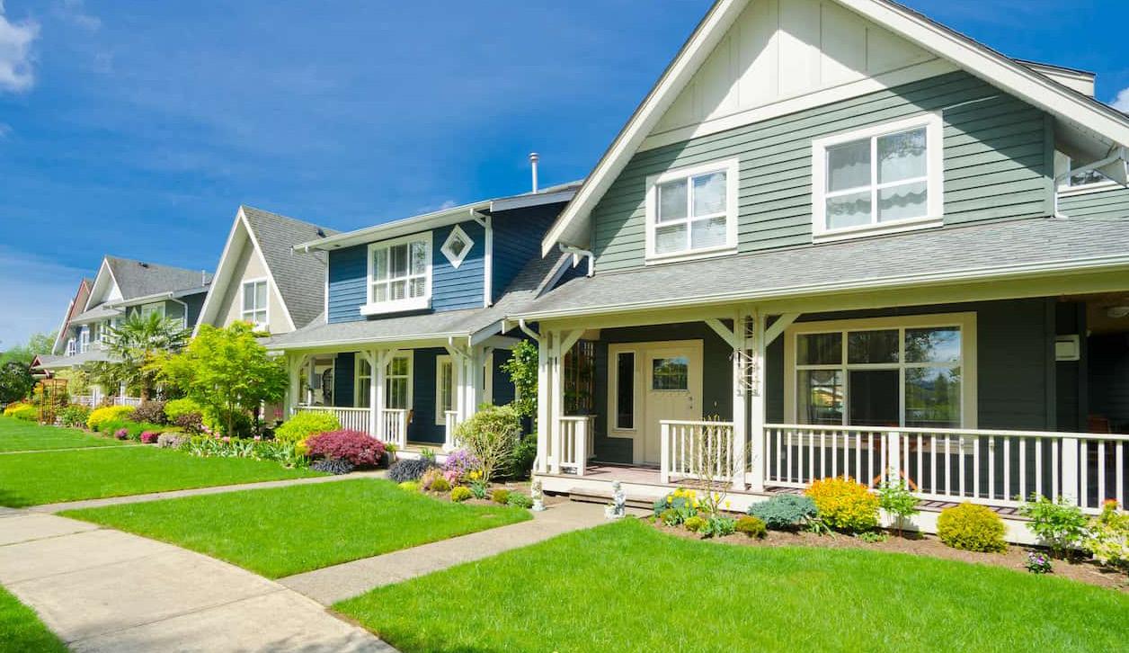
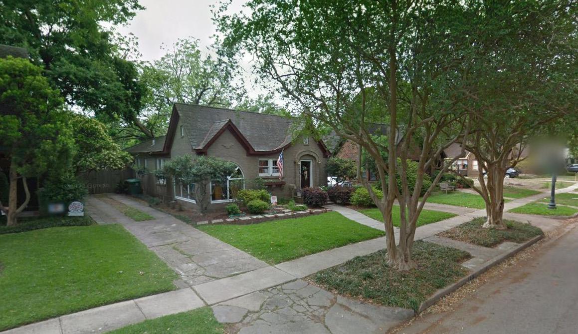
The Neighborhood Conservation Area is a generational neighborhood on the edge of downtown Temple and Williamson Creek. With quaint housing, the existing residential development in this area consists of one-story, single-family houses. The area has limited walkability with scarce pedestrian facilities. These houses sit on smaller lots arranged in a grid-like structure with traditional block sizing and alleyways totaling 240’ in total depth on average.


NEIGHBORHOOD CONSERVATION
Infill Housing Considerations
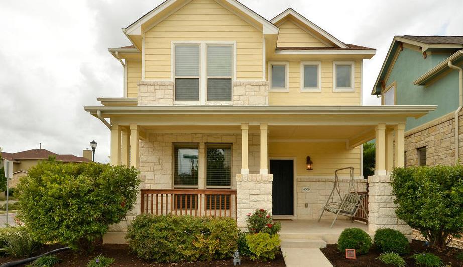
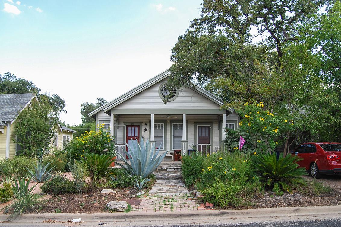
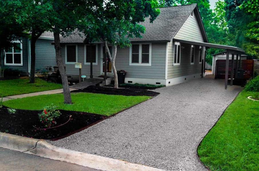
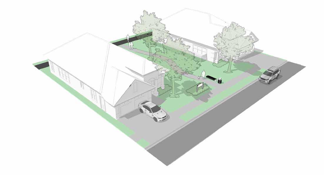
The affordability of housing within East Downs can be managed through the integration of different types of infill housing, such as duplexes and townhomes. The increased diversity of housing types removes barriers to entry for homeownership and renting. These infill options also fit into the single-family home character of East Downs and into the odd lot and block sizings. The smaller lot sizing allows for a higher density of housing that provides a higher number of housing choices.
Existing Character
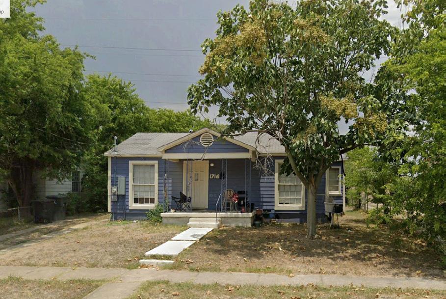
Key Attributes
• Unimpeded pedestrian facilities
• Allows narrow lot dimensions for added density
• Improved building interface with street
• Availability of front porches
Suggested Outcomes
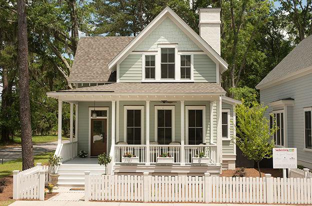
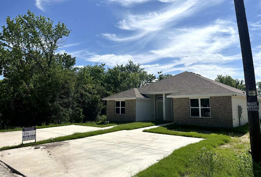
Key Attributes:
• Allows broad spectrum of housing affordability
• Alleys improve home frontage along roadways
• Duplex character to match traditional style of housing within the downtown area of Temple
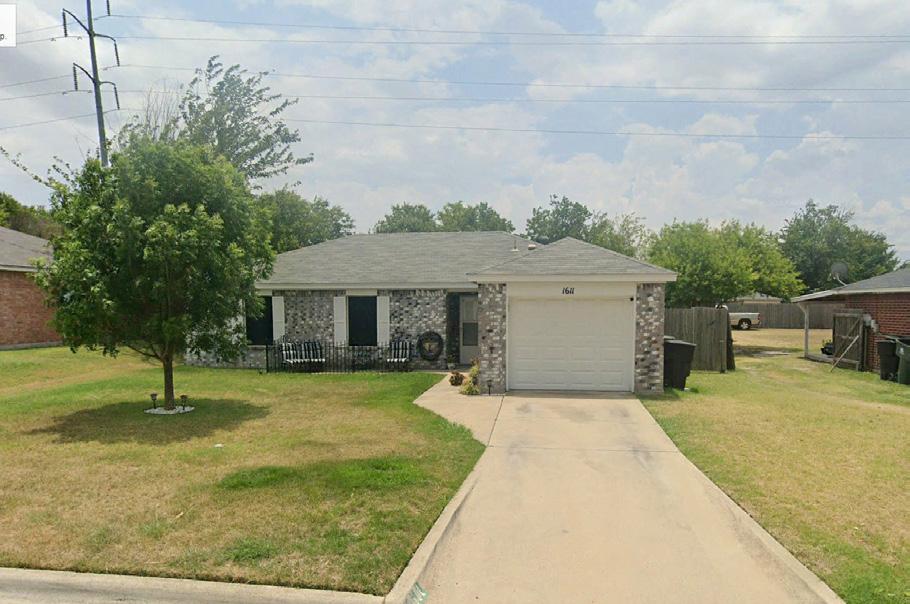
Key Attributes
• Front loading appropriate on 50’ + wide lots
• Side driveways to rear garages improve architectural character along the street
• Shared driveways limit the amount of curb cuts and sidewalk interruption
• Percentage of garage to facade should be limited to 40%.
• Garages should be located a minimum of 4 feet behind front build wall
Traditional Blocking
Block lengths and depths within the Neighborhood Conservation Area are intended to maintain the character and sense of place that a traditional neighborhood in the Downtown area encompasses. East Downs was historically designed with these standards to allow for flexibility of traditional housing and maintains a walkable,
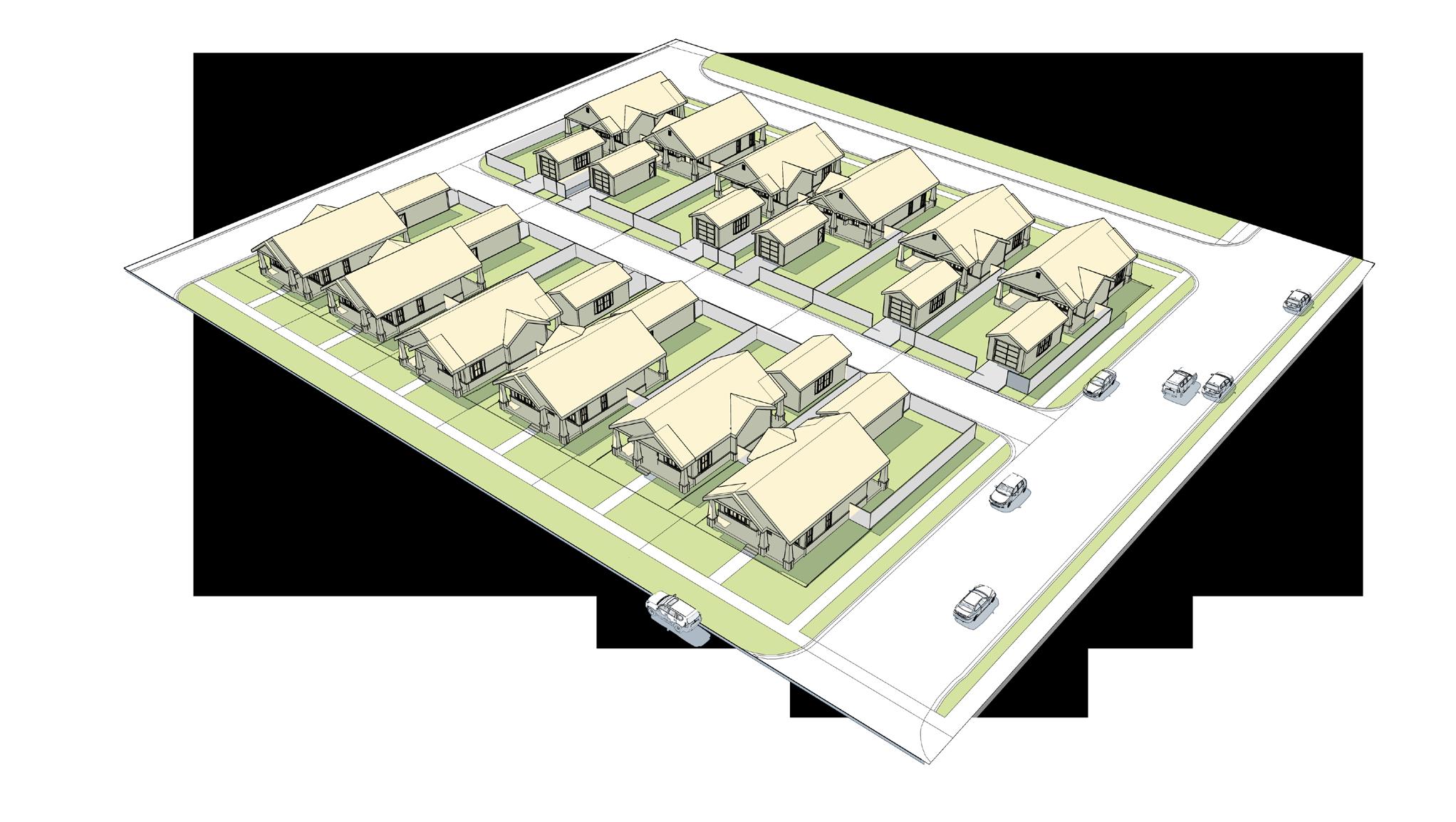
Density
In order to promote the use of neighborhood conservation that includes blocking and a grid-like layout, the City can provide additional flexibility in standards and density bonuses that encourage this kind of development within this neighborhood. This area will act as a buffer zone before the proposed linear park, which will be conducive to the existing neighborhood and promote new homes without taking away the character of the area as a whole. Density bonuses may include allowing smaller lots with smaller homes within the grid systems. By using flexible standards, there may be opportunities for reduced setbacks, impervious cover limits, and building height on individual lots if the subdivision’s total with protected green space balances appropriately.
Alley loaded
Duplex
Front loaded
Alley loaded
Duplex
Front loaded

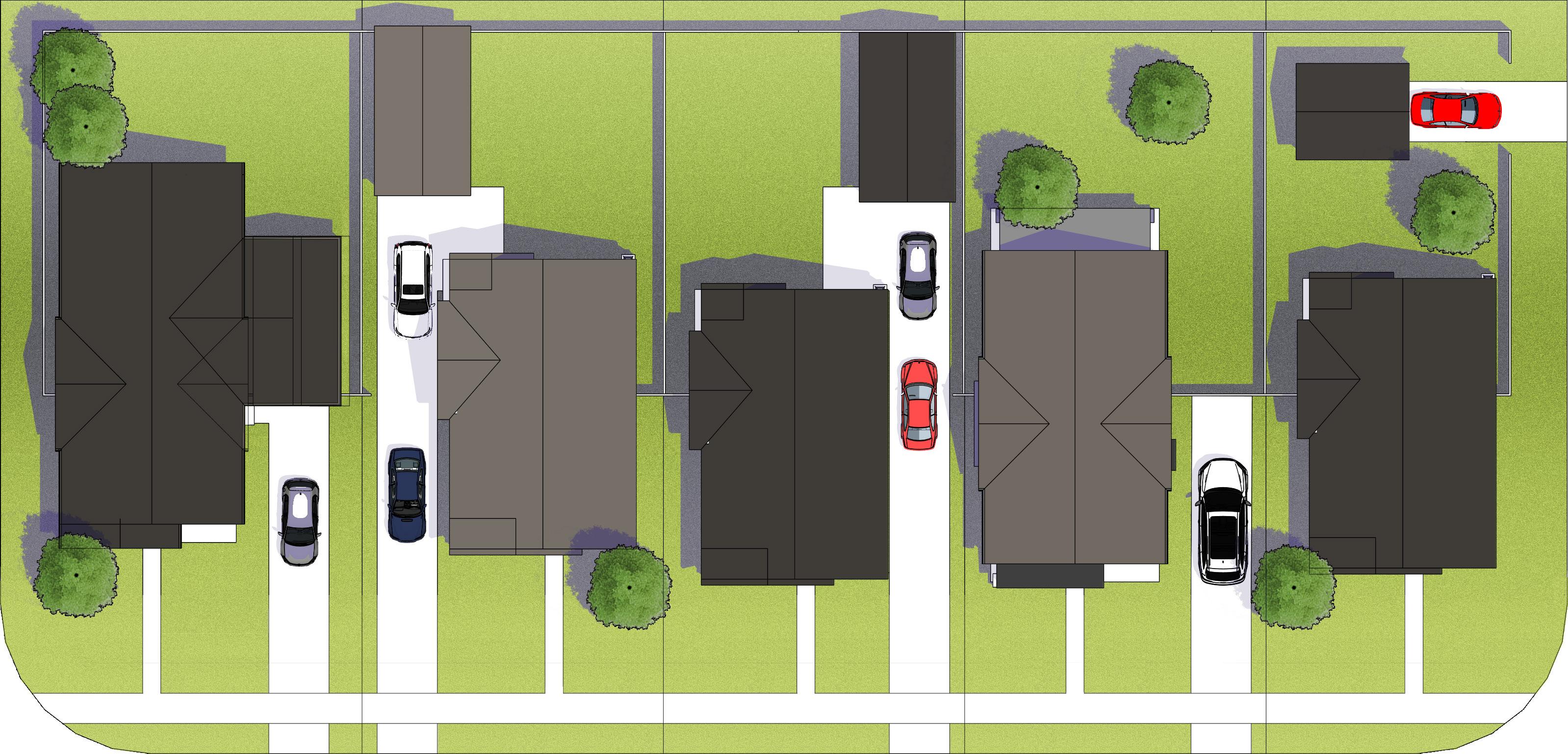
• Front loaded
• 60’ corner lot
• Carriage home with 2-car garage
• Front loaded
• Detached, rear garage
• Garage encroachment onto rear and side setbacks
• 50’ single-family lot
• Front setback reduced to 15’ due to detached garage
• 50’ single-family lot
• 5’ porch encroachment into front setback
• 50’ single-family lot
• Carriage home with 3-car garage
Non-Conforming Lots
In order to allow for infill and redevelopment that is conducive to the existing environment, the City of Temple may make exceptions or allow for variances based on existing lot constraints that do not conform with updated lot standards. Each lot may face a different set of circumstances and redevelopment should be discussed with appropriate City Staff to determine a path forward.
Alleyways on Collector Level Roads
To prevent driveway interactions with busy neighborhood collector roads, alleys are recommended for all housing types along collector roads. Additionally, alleys should be utilized for any multifamily dwelling.
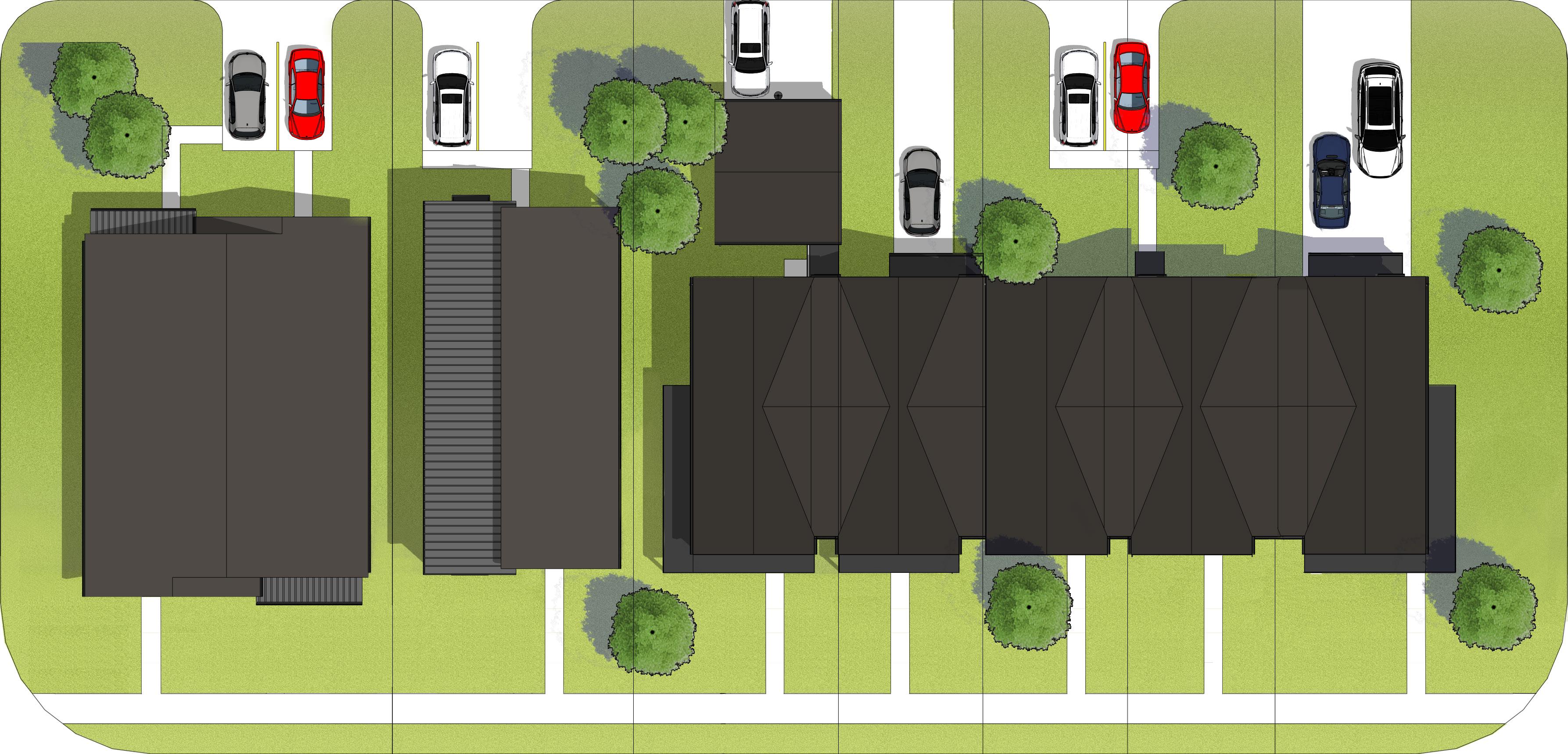
• 65’ corner lot
• Duplex
• 5’ porch encroachment into front setback
• 40’ lot
• Duplex
• 34’ lot
• Townhome with attached 2-car garage
• 24’ lot
• Drive way access
• 24’ lot
• 24’ lot
• 38’ lot
• Drive way access
Key Characteristics
• Multi-family lots are alley loaded
• Uninterrupted pedestrian facilities
• Provide a minimum of 2 rear-oflot parking spaces






ALLEYS
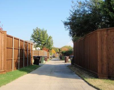
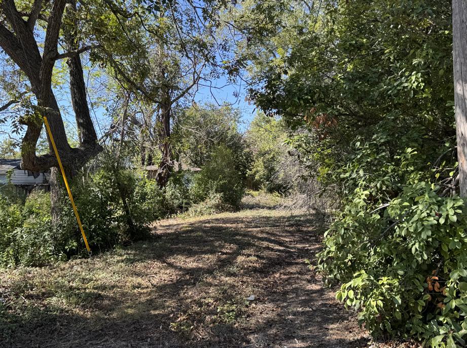
The traditional development of East Downs relied on the use of alleys. Most of these alleys have been abandoned or are not maintained. The amount of vehicle access afforded by each alley varies from block to block. The value and role alleys play within the character of a neighborhood are not always evident. As part of this planning document, this section will highlight some of the key benefits of alleys and provide a guide for utilization.
ALLEY REGULATORY GUIDANCE
Zoning Districts Applicable in all zoning districts.
ROW 24’ max, 20’ min. for two way alley, 16’ for oneway.
Pavement Hardscape, whether concrete, asphalt, or vehicular paver is preferred surface.
Max Height Accessory buildings adjacent to alleys should be compatible with surrounding structures and not exceed the height of the primary structure or 2.5 stories, whichever is less.
Building Setback
All buildings should be setback a minimum of 15’ from side street , unless zoning setback is intended to be 0’ then consideration of sight triangles should be observed.
Parking Is allowed adjacent to alley provided the parking space meets the minimum size of 9’ by 18’ and is clear of alley ROW.
Waste Receptacles For commercial properties, alley waste receptacles should be screened from view of adjacent residential properties.
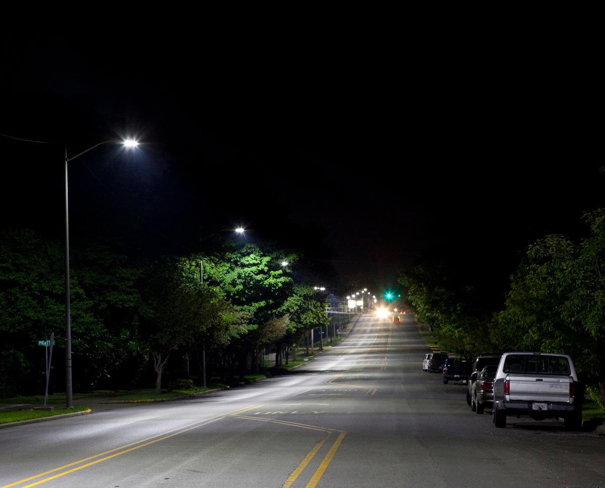
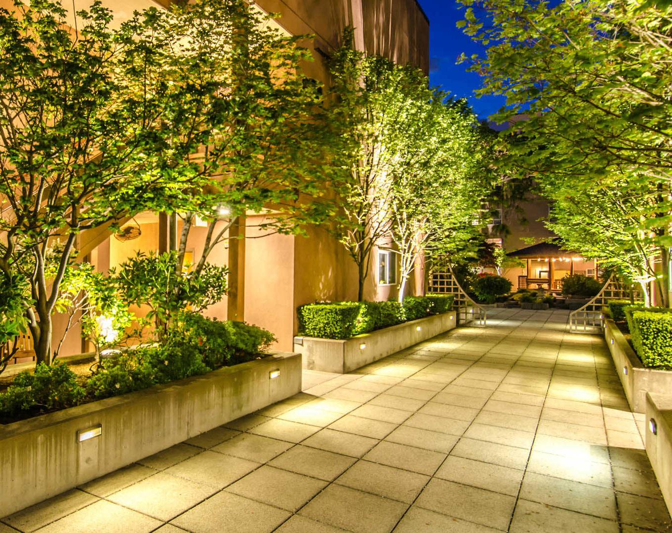
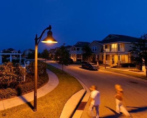
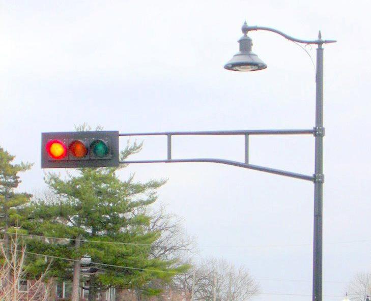
Lighting Lighting should be present near alley and street intersection. Driveways along alleys should be lit for both vehicular and crime safety precautions.
Landscaping Trees with mature height of 25’ or less are preferred. Placement should minimize interaction with overhead utilities. All adjacent shrubs and groundcovers should be maintained to limit impediment of alley traffic.
Alley Benefits - Form & Function
Utility Placement
In many circumstances, alleys are home to electric, gas, water, and sewer lines that provide services to individual lots. This consolidation reduces the right-of-way congestion, prioritizes utility trunk lines, and limits maintenance impacts on roadway traffic. Additionally, by placing utilities in the alley it frees up more space for street tree growth both in the below-ground root zone and tree canopy.
Improved Lot Access
Alleys provide direct vehicular access to the rear of a property, providing more opportunities for parking and, in turn, reducing street clutter by eliminating a need for a front yard driveway and diminishing vehicular and pedestrian conflicts. Increased on-street parking availability provides more comfortable accommodations for neighborhood visitors.
Aesthetic Contributions
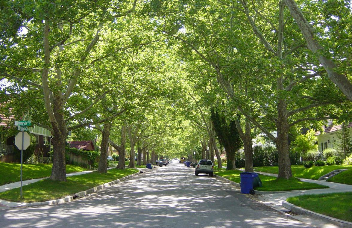
The impacts of improved lot access and utility access allow for an increase in aesthetic enhancements to the neighborhood’s character. Street trees grow unencumbered, reaching maturity faster, and are not impacted by street utilities. Eliminating garages from the front of the houses removes the monotony of the garage door from the front facade and increases the overall architectural interest of the structure. The result is a neighborhood block where children run across uninterrupted front yards under the shade of large trees, contributing to the neighborhood’s long-term health and vitality.
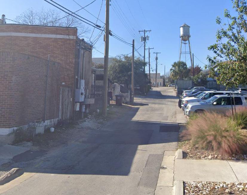
Neighborhood Commercial
Neighborhood commercial needs to maintain context sensitive design, typically this means orienting the buildings to directly abut the street. If needed, parking should be in the rear of the property directly off the alley or parking lot. Opportunities for shared parking agreements between commercial properties can help assist in a more organized approach to meeting parking demand.
Residential Infill
Alleys can support residential infill and provide local access for adjacent lots. Alleys allow for a wider variety of infill housing types without impacting the curb appeal of housing with vehicle clutter. Safety and security measures are best addressed by property owners where placement of lighting and other security features can respond to individual lot conditions.
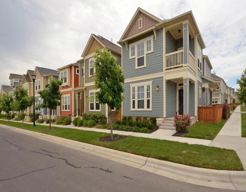
Collector Alleyways
Collector roads should support residential alleyways to provide local access for adjacent lots. Alley loaded housing would remove the interference of driveway ingress and egress. This would improve the efficiency and safety of collector roads.
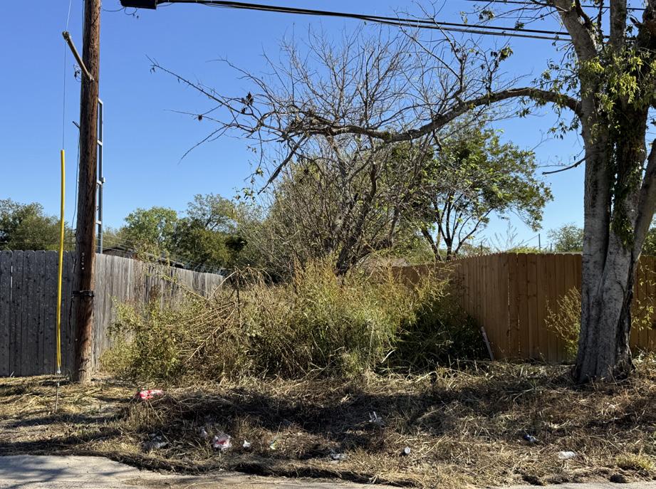
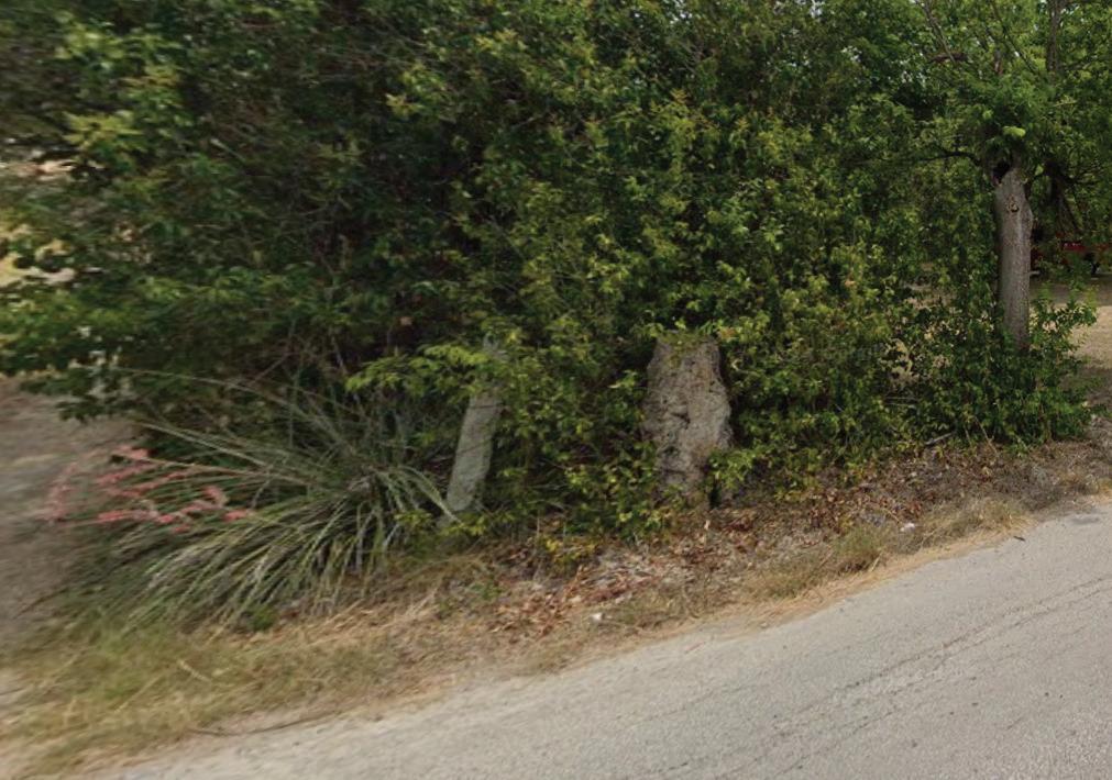
NEW NEIGHBORHOOD
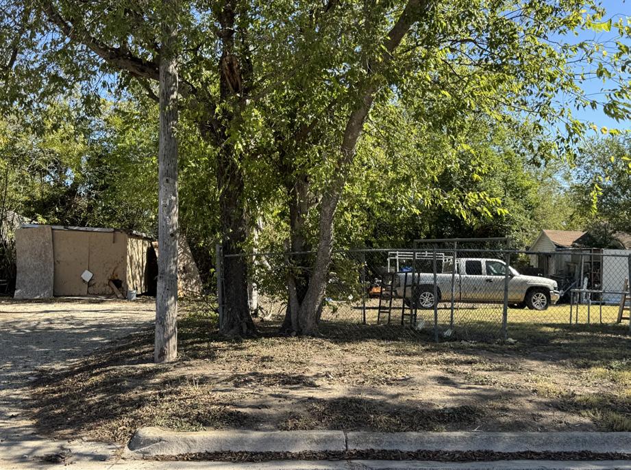
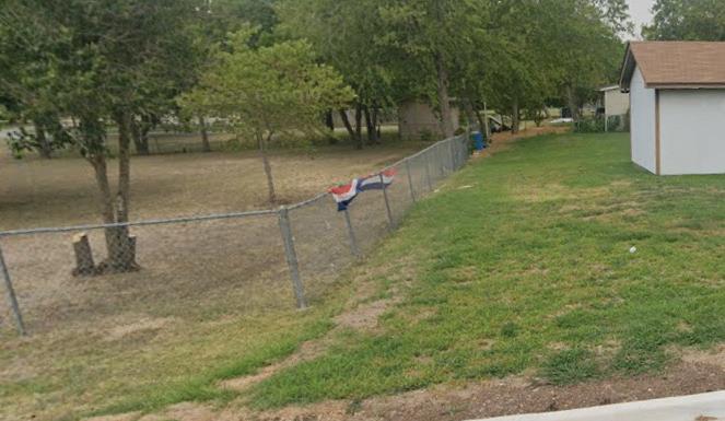
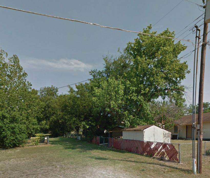
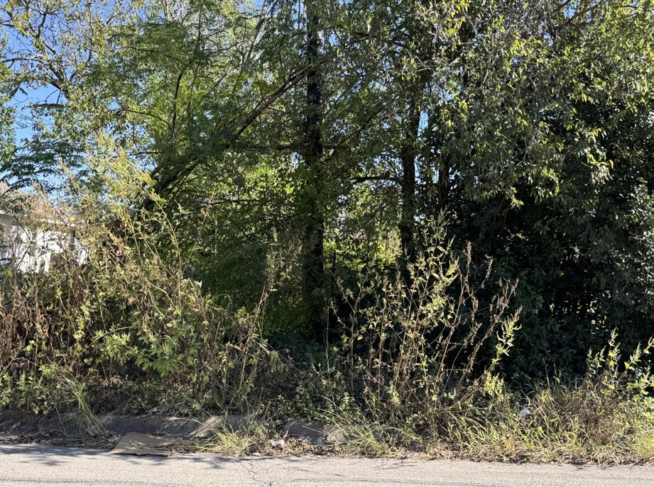
The New Neighborhood’s characteristics are both rural and new single-family residential development. Long-standing residential properties are built on large acreage lots and within an agricultural backdrop of pastures and fields. These properties reflect elements of rural farm and ranch life typically found on the outskirts of town, a character that residents value.
Rural and Agricultural Land
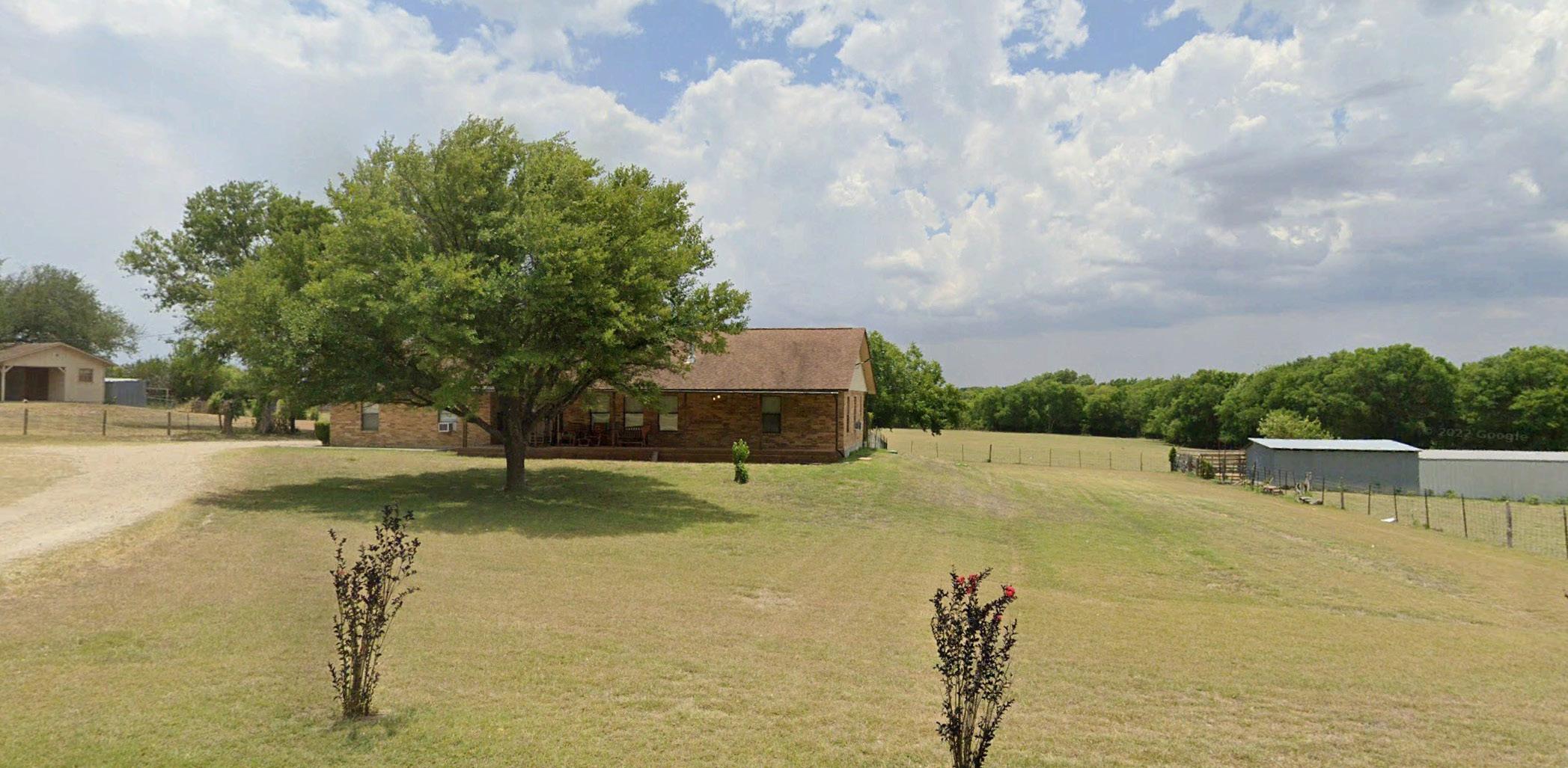
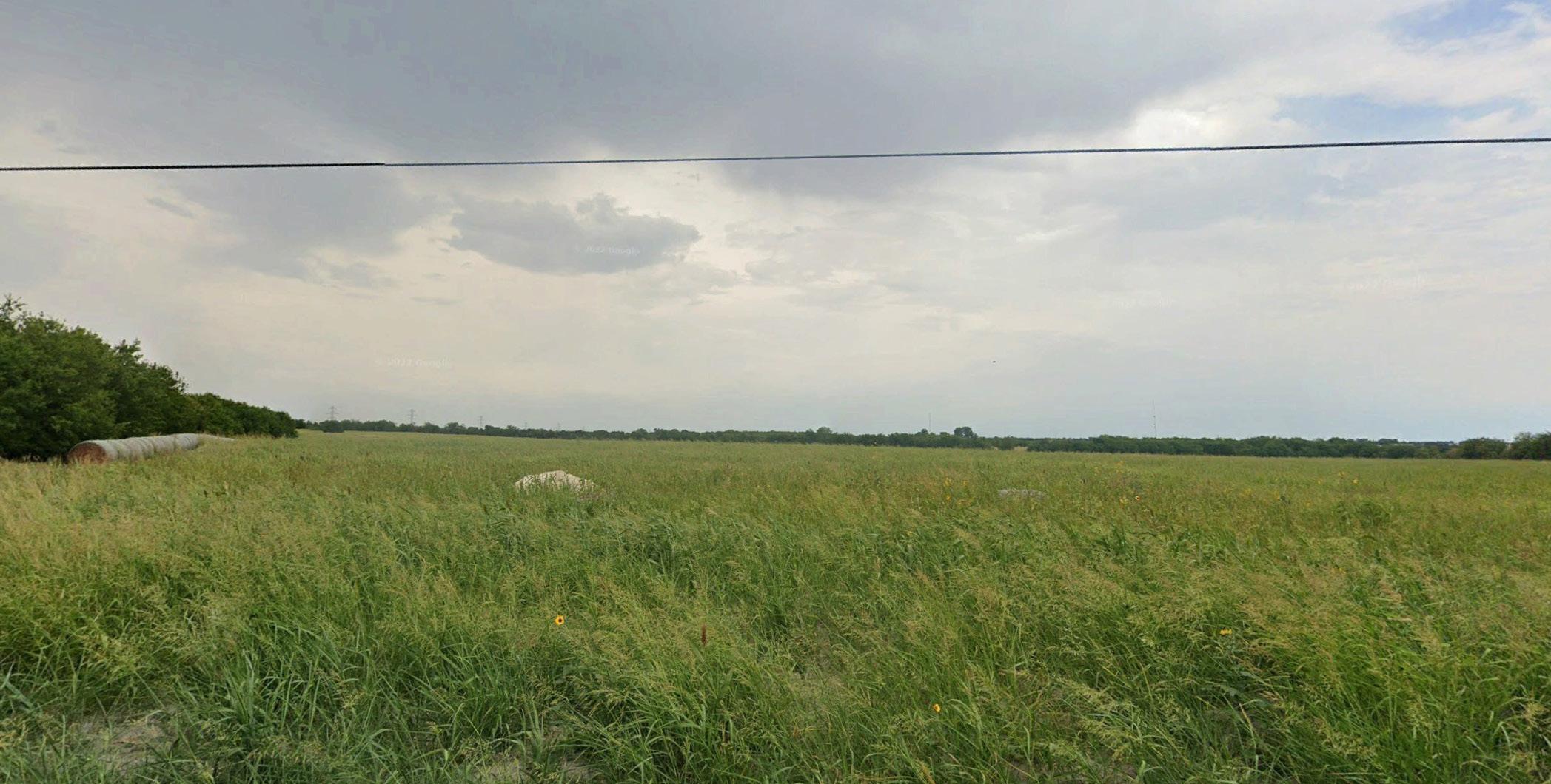
New development should embrace the rural nature of the plan area’s east side. Open space connections to Williams Creek Linear Trail should be a priority for new residential developments. Opportunities for natural and undevelopable land, such as land within the floodplain contributing to open space, whether, passive and aesthetic or programmed and active can contribute to maintaining a rural character.
Incoming Single-Family Development
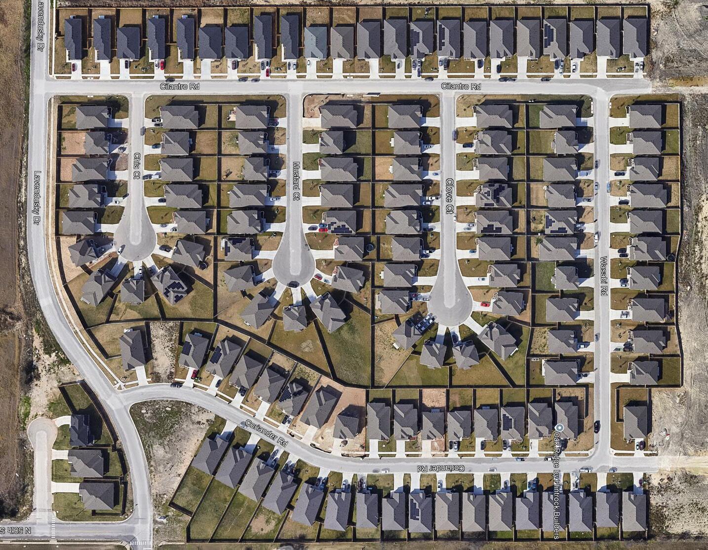
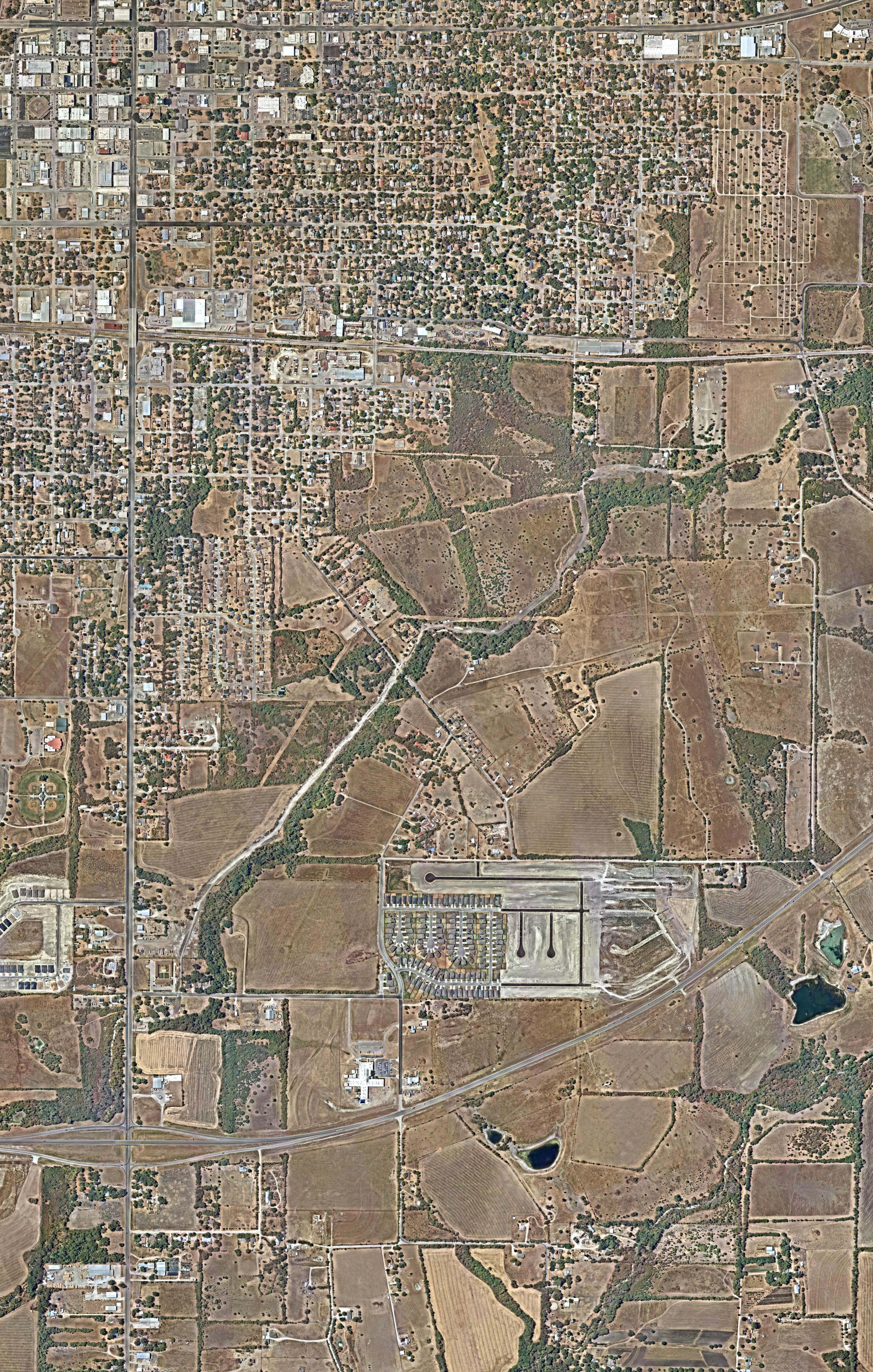
On the east of East Downs, a single-family neighborhood is under construction. The subdivision features single-family housing with attached garages and two-car driveways. The subdivision has a large percentage of its housing situated on cul-de-sacs with limited connectivity to the surrounding areas. Privacy fences border the edges of the development with homes oriented inward, giving a sense of selfcontainment and lack of connection to the plan area.
This area includes properties actively used for agricultural purposes, such as farming and livestock. These uses draw many residents looking for a more rural lifestyle. Efforts to maintain current agricultural lands may be incentivized through regulatory means. Additional agricultural efforts, such as community gardens, may contribute to the agrarian character of the plan area.
Public roadways and pedestrian connections can connect multiple developments and provide a more cohesive neighborhood feel. Cul-de-sacs and deadend streets create internalized endpoints and limit the opportunity for community-wide connections. Efforts should be made to ensure streets engage with other developments where possible. These connections enable additional route opportunities and create a contiguous neighborhood feel.
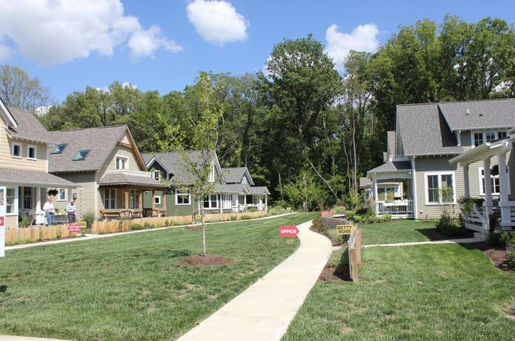
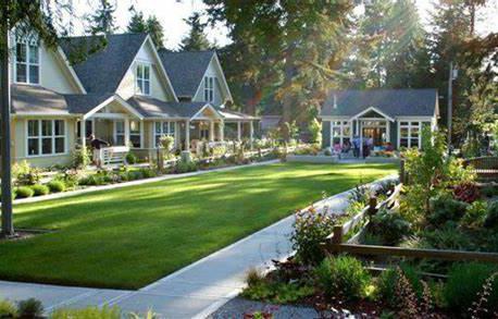
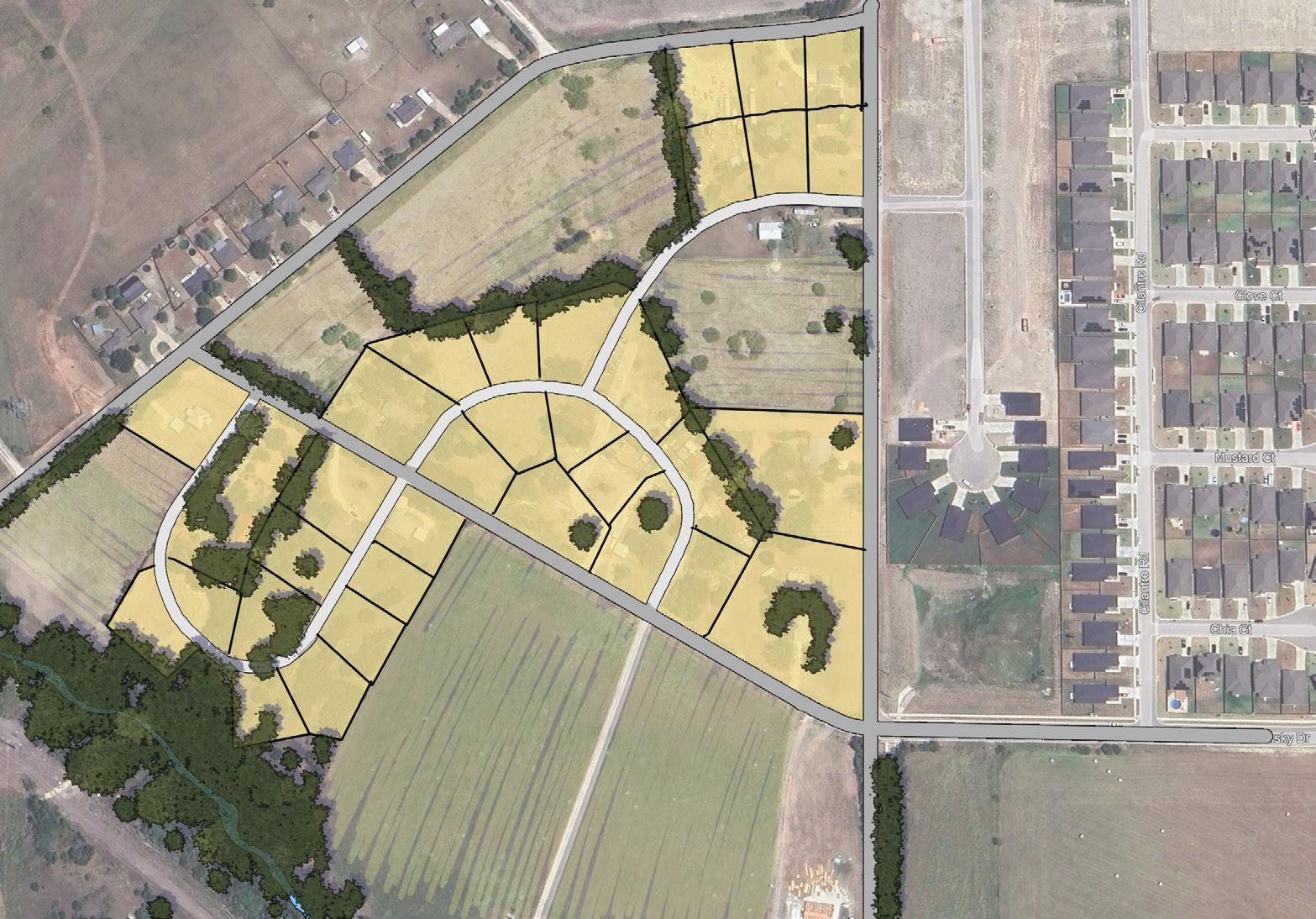
Conservation development, sometimes called Open Space Neighborhoods, harmonizes with the landscape and environmental conditions. These neighborhoods are built on a smaller footprint within a tract of land while still managing the development density allowable. Having subdivisions that follow this design method saves on the cost of infrastructure, increases home values, and provides for a greater sense of community while preserving open space and protecting environmentally sensitive areas. These neighborhoods still include amenities such as sidewalks, parks, and vehicle parking.
For neighborhoods of this manner, incentives for protecting the open space can be provided. These may include height allowances, mixed housing types, reduced lot sizes, reduced setbacks, or higher impervious cover limits. Options for negotiating things such as affordable housing can be a factor when these neighborhoods are in the early stages of development.
Land Conservation Strategies
Cluster Development Examples
Conservation Development Example
Integrated Open Spaces
Embraced Agricultural Uses
Integrated Road Network Lavendusky
The creation and expansion of points of access to areas outside of the plan area via roads, pedestrian facilities, parks, and trails would serve to integrate East Downs back into the City of Temple. Additionally, improvements to rail crossings would allow for safer and higher functioning points of connection to Jackson Park.
Creating screening and buffers to separate rail lines and industrial uses from residential land uses will increase the quality of life for residents by helping buffer both sound and visual nuisance. Barriers to the rail lines will also impede access to the railway ROW and limit unintended visitor crossings through the plan area. Safety
The addition of screenings and improvements to intersections and dead-end roads increases the safety of the nearby neighborhoods while simultaneously boosting the functionality of the area. Enhanced lighting and hammerhead turnarounds make dead-end roads safer and more functional for emergency and public works vehicles.
Addressing Transitioning of Use
The Neighborhood Mixed-Use zone is one of the two primary character areas interfacing with Downtown Temple. This zone is a transitional area that can increase the compatibility of uses and interconnectivity between East Downs, Downtown Temple, and the rail lines that bisect them. The current conditions of this plan area include a heavy industrial presence around the rail line that directly abuts residential homes. To maintain a balanced neighborhood with compatible uses, a goal to bear in mind for future development is to ensure a gradual transition from highintensity uses to those with lower classifications, allowing for a buffer area between the rail and the residential homes. Transition zones provide a clear opportunity for increased housing choice through a mix of unit types such as multiplex, townhomes, neighborhood apartments, and live-work units. This mix of housing types would increase supply and provide housing opportunities to a wide range of income brackets.
Adaptive Reuse
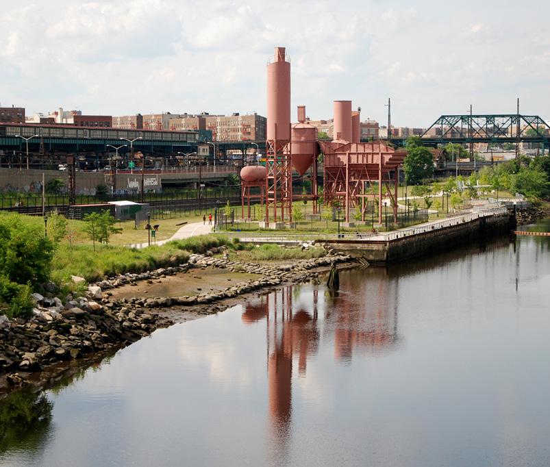
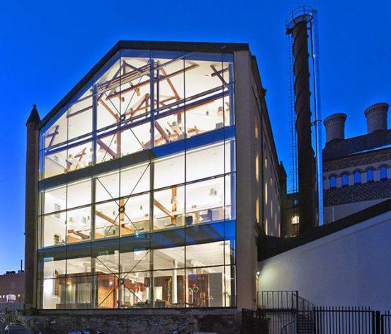
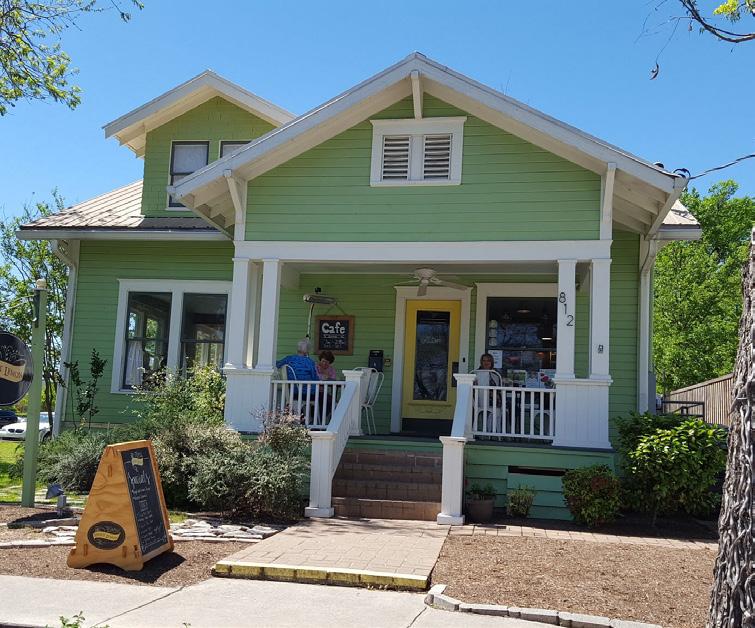
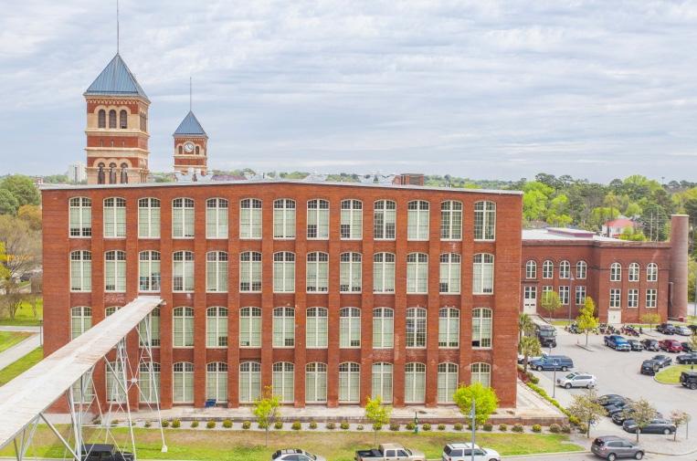
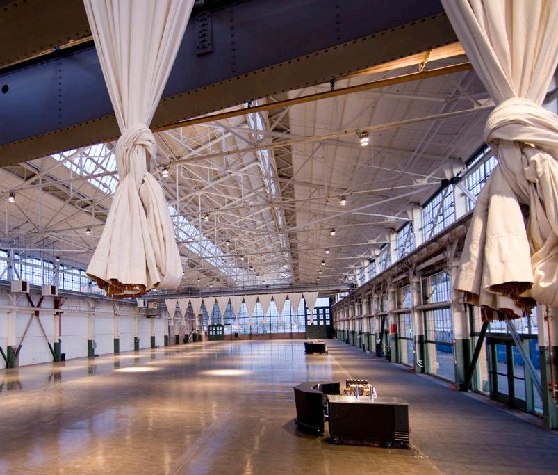
Adaptive reuse is a method of preserving the character of these uses while transitioning them into a more beneficial and suitable use for the long-term benefit of East Downs. Transitioning the existing structures within the light industrial zone can provide economic growth, additional housing, and open space for the overall benefit of the plan area. This can happen through renovating existing structures and spaces into businesses, housing, or parks. Shifting from industrial uses may reduce overall intensity, but the building’s character will remain similar, ensuring a smooth neighborhood transition. This preserves character and history while finding a balanced use that aligns with the area in which it finds itself.

Buffering Current Non-Compatible Uses on 16th St.
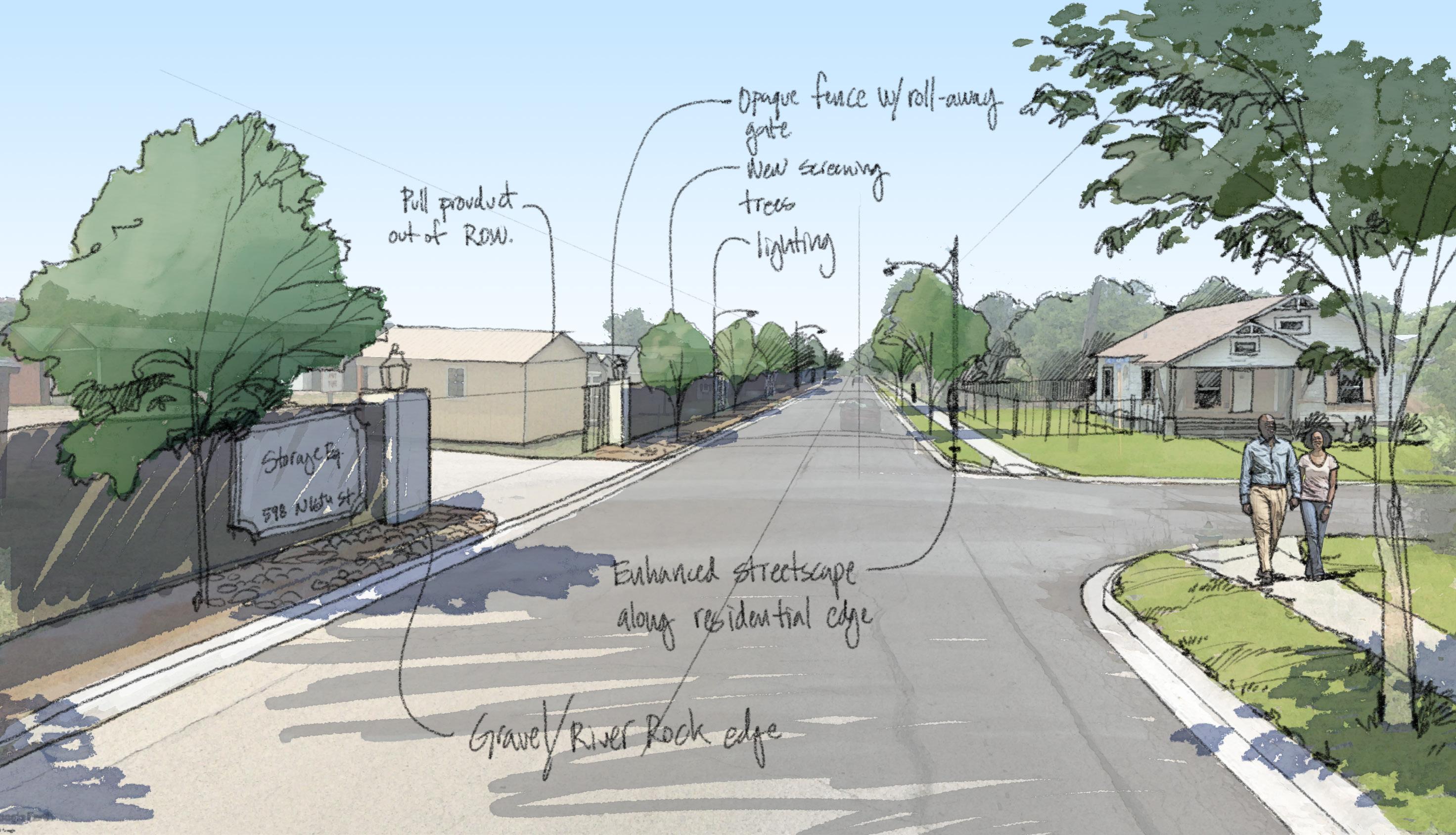
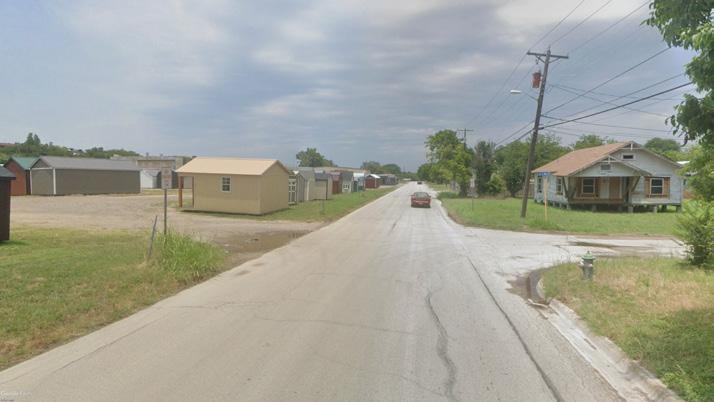
Types of Screening
Screening through fencing and vegetation creates an aesthetic separation of uses by layering decorative features to make an area appealing. The fencing can consist of wood, brick, stone, or metal. The addition of ornamental plantings and trees provides secondary dividers between uses.
Key Characteristics
• Decorative, opaque fencing
• Improved lighting
• Street trees
• Gravel / river rock edge
• Enhanced streetscape
• Gating
• Pedestrian facilities
Examples of Adaptive Re-Use
Concrete Plant to Park
Brewery to Office Space
Warehouse to Concert Hall
Factory to Event Hall Mill to Apartments
House to Cafe
LinearWilliamsonCreek
Proximity
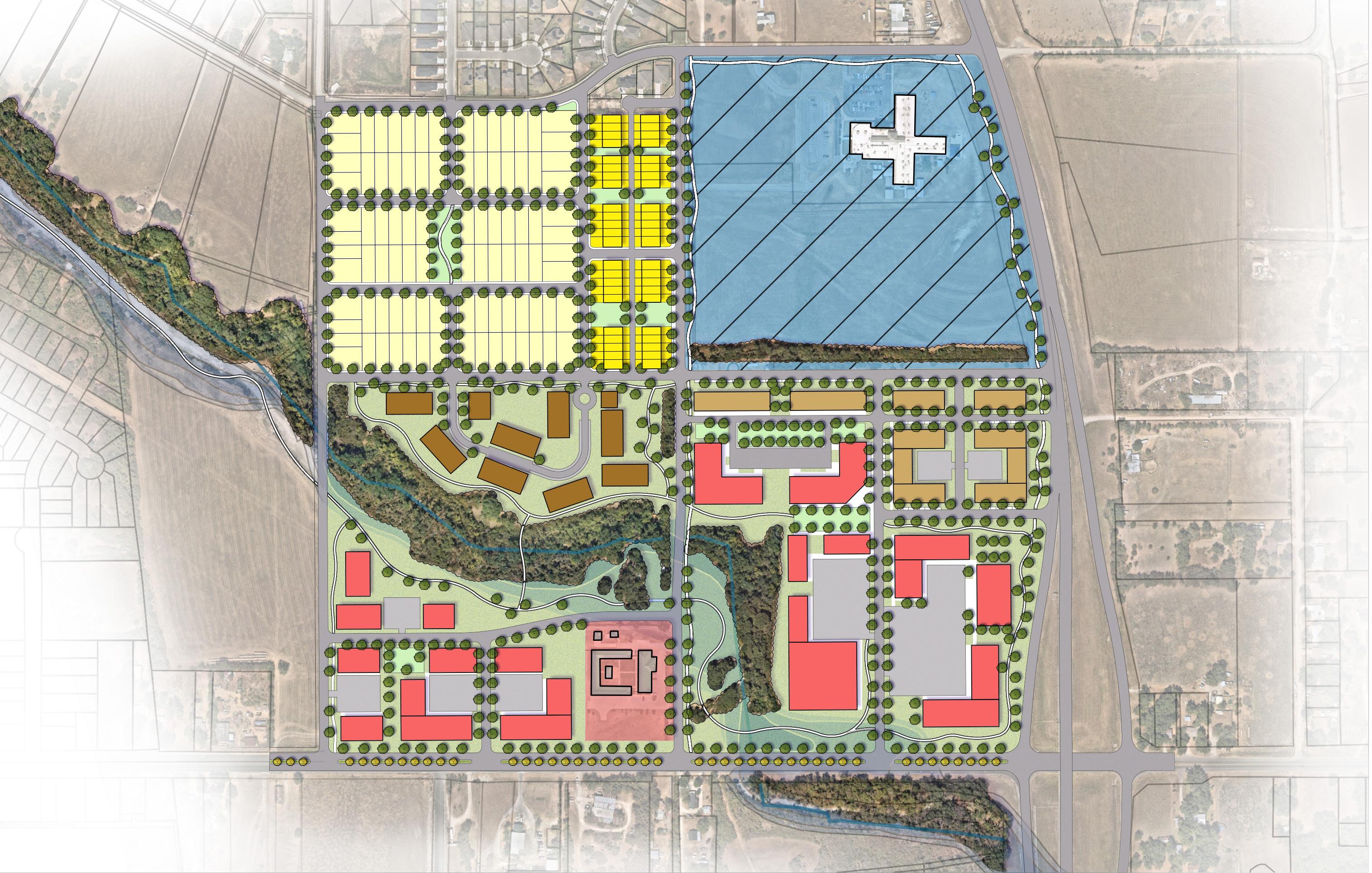
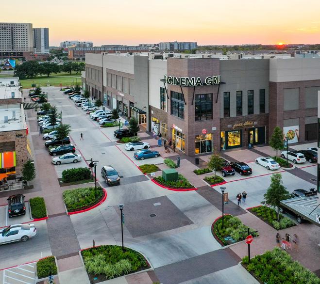
This mixed-use area sits at the intersection of several key East Downs Plan Area elements. H.K. Dodgen Loop and Adams Ave. provide ample vehicular traffic, allowing for a viable commercial node and a gateway into downtown. Additionally, the linear park allows off-street connectivity for the surrounding neighborhood to this commercial hub. The mixed-use hub also provides diverse residential housing in a Hector P. Garcia Elementary neighborhood. This promotes different needs for higher-density housing, live-work opportunities, and service industries.
Connectivity
A new cross-section of 50th St. provides on-street parking and a walkable setting with a new side-path on the east side. This allows connections to both the linear park trail and the elementary school. Additionally, the continuation of 42nd St. to Adams Ave. allows more frontage for commercial viability and provides connections for the extension of Barton Ave. A sidepath along the loop will provide additional pedestrian connectivity for future developments to the mixed-use node.
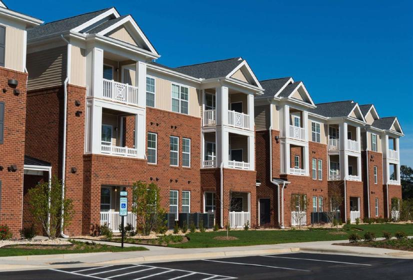
Multi-Family Housing
The proximity to the H. K. Dodgen Loop and Hector P. Garcia Elementary School provides opportunity for higherdensity housing, such as apartments and townhomes. Consolidating density towards the edge of the plan area mitigates traffic issues within the neighborhood.
Commercial Development
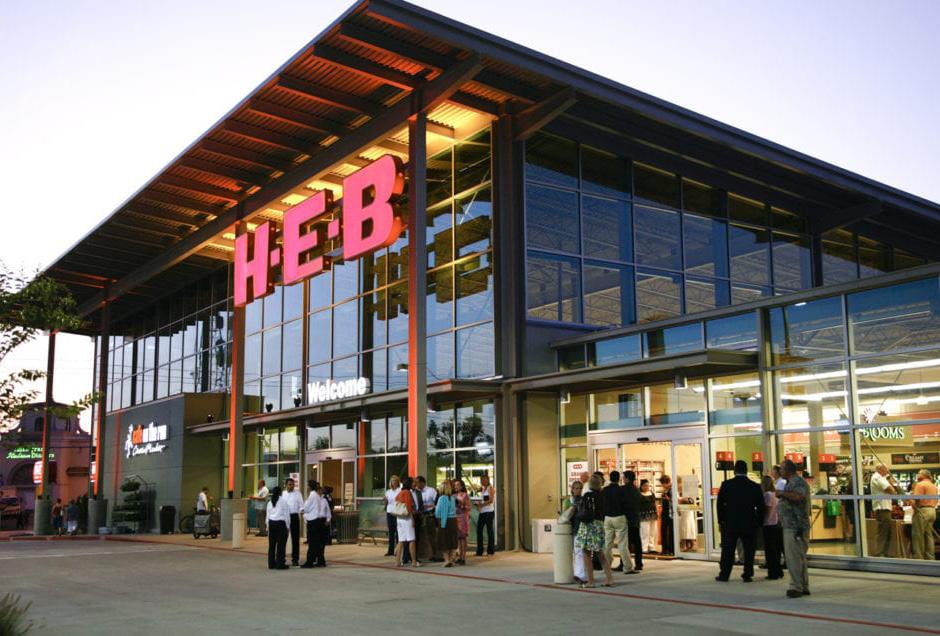
Commercial and retail developments will front East Adams Ave. and act as a gateway along the H. K. Dodgen Loop.
Neighborhood
Residential developments should be built in a way that interfaces with the elementary school. By facing homes towards the school it creates a sense of community and safety for the students. These homes should be alley-loaded and configured in a way that reduces conflict with the school traffic.

Varying Intensities
The designation of mixed-use land allows for a variety of commercial developments, and several types of housing increase the plan area’s housing opportunity while enhancing housing choice. The intensity of commercial use is highest at the corners of the major arterials and slowly transitions out to residential uses neighboring the elementary school. The inner sections surrounding the elementary school will become varying densities of residential use allowing housing opportunities for teachers and families with students.
Hector P. Garcia Elementary School
ParkTrail
Oak Ridge
CenTex Alcoholic Rehabilitation Center
H. K. Dodgen Loop
Townhomes
Utility Alley for Parking & Driveways
Connector Trail to 14th St. Trail
Floodplain Management
New Side Path to Prewitt Park & Linear Trail
Maintain Drainage
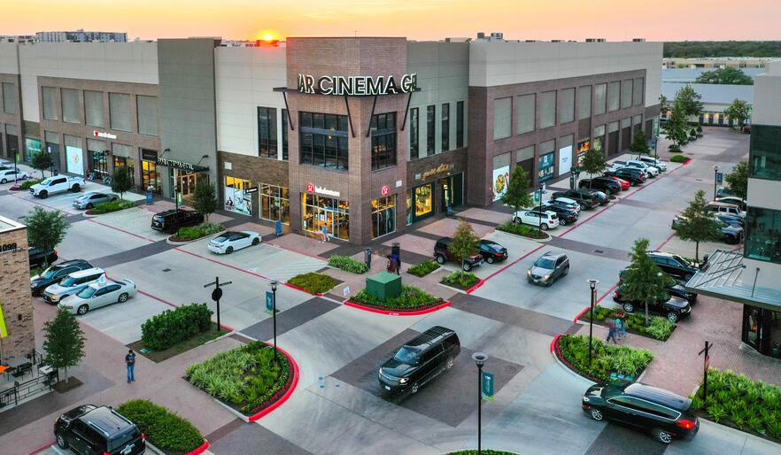
Parking behind Buildings where possible
Parking Available in Portion of Floodplain
22nd St. to Barton Ave.
Extension of Barton Ave. Cross Access for Parking
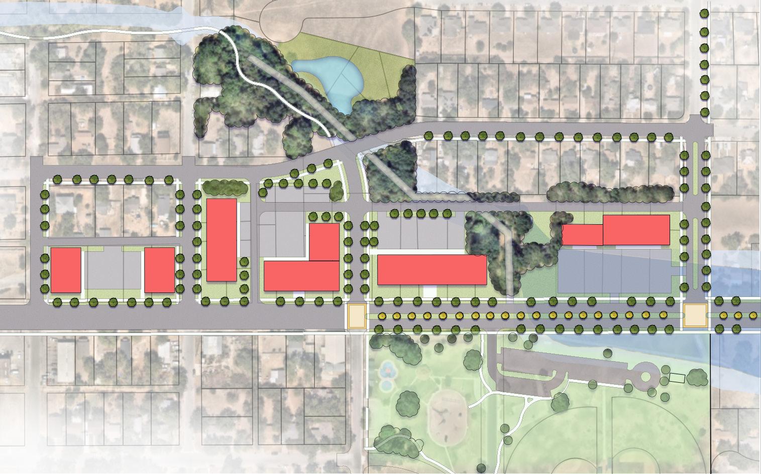
Connecting Barton Ave. will remove two dead-end streets in the plan area. A continuous road will minimize the need for both vehicles and pedestrians to traverse the neighborhood on Adams Ave.
In response to management strategies, cross-access easements for unified parking will help minimize curb cuts along Adams Ave. and allow unified development opportunities.
22nd St. Connection
The extension enables this connection of Barton Ave. by continuing 22nd St. to Barton Ave. and development opportunities are increased from the new frontage.
Ferguson Park Redevelopment Enhanced Intersection
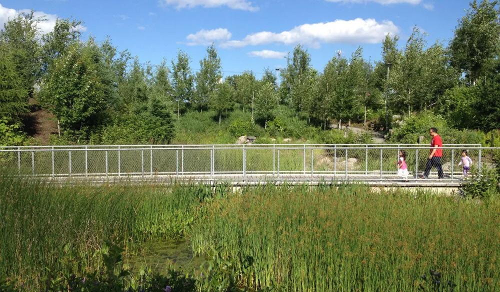
Redevelopment should improve the existing floodplain issues. Strategic upstream detention, re-engineered channels, and new road designs should work in harmony to allow development and mitigate flooding. Mitigate Flooding
Floodplain Management
East Adams Ave.
E. Barton Ave.
Slip Street / Parking Behind Building
LINEAR PARK
Linear Park
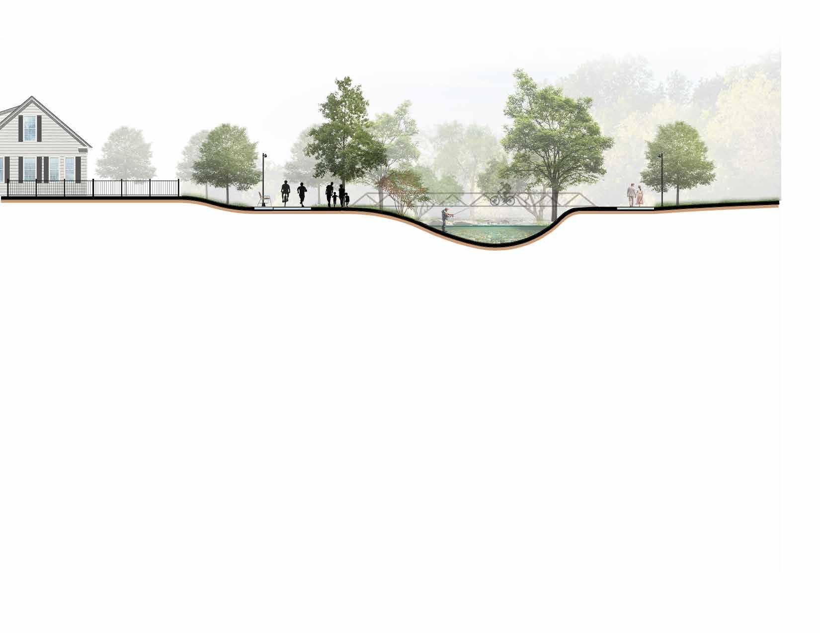
The Linear Park, which encapsulates the Williamson Creek drainage corridor, bisects the plan area diagonally from Northwest to Southeast. The extensive length of the park supports uninterrupted multi-use trails that connect acros East Downs, while maximizing the use of otherwise undevelopable land within the drainage corridor. The park allows for the maximization of the undevelopable space within the drainage corridor. This park will provide a trail system that has farreaching connections to the surrounding neighborhoods and parks in Temple.
The integrated trail system enables the linear park to seamlessly connect with surrounding residential developments throughout East Downs. Strategic access nodes link local pedestrian infrastructure to the proposed trail network, enhancing connectivity and accessibility between neighborhoods and open spaces.
Key Characteristics
• Integrated trail system
• Maximize Williamson Creek’s potential
• Connectivity to surrounding parks
• Accessibility to residential developments
• Additional pedestrian route to school
Regional Connectivity
The Linear Park is planned to integrate into the trail system that connects along Williamson Creek into Hillcrest Cemetery, Miller, Jackson, Prewitt, Ferguson, Wilson, and Baker Parks. Additionally, the park connects to the commercial edge district.
Accessibility
The Linear Park will have many access points across the plan area via the integrated trail system. The integrated trail system will connect neighborhoods, housing developments within East Downs, and major thoroughfares providing meaningful connection throughout.
Park Connectivity
Existing City Parks
Proposed Thoroughfare Connector Trail
Proposed Neighborhood Connector Trail
Proposed Greenway Trail
Trail Access
Trail Activity

Route to School Trail Amenities

Destinations
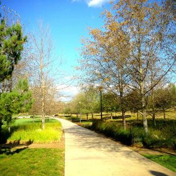
maintain understory and clear undergrowth crossings where allowable at access points Trail Corridor Near Residential
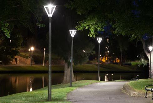
trail lights and seating located at access points
align trail with easement where possible

KEY TAKEAWAYS
• Easements provide good locations for trail
• Development to interface with Linear Park
• Access to multiple park facilities
• Off-street connectivity for school and commercial node
williamson
GENERAL STREET ZONE
MULTI-FAMILY ZONE
NEIGHBORHOOD ZONE
INTERSECTION ZONE
PARK ZONE
NEIGHBORHOOD BRANDING
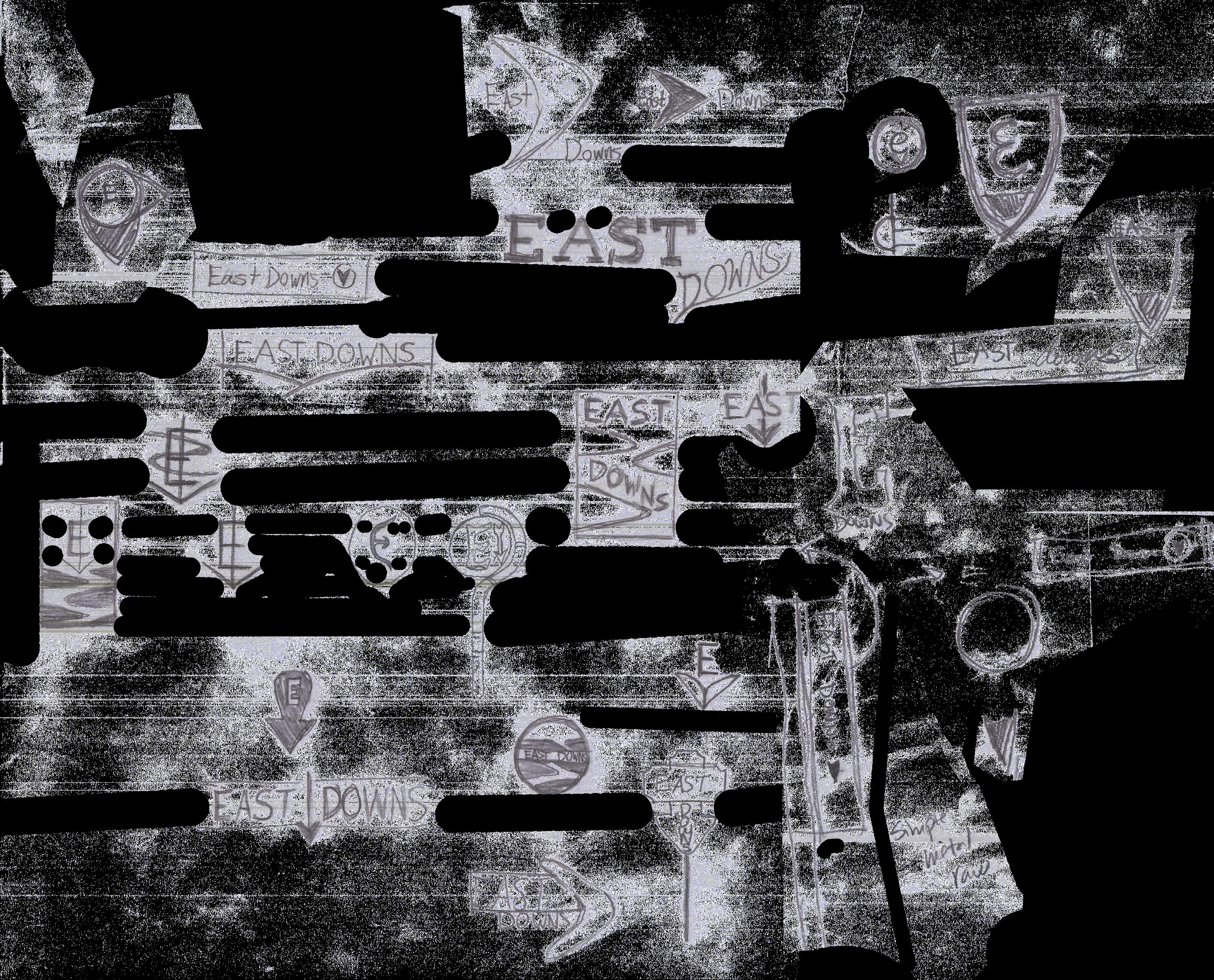
The East Downs name for the neighborhood originated as part of this planning exercise. The establishment of the neighborhood’s brand was a process that included significant input from the City’s planning team in an effort to capture the spirit of the neighborhood in graphic form. Below illustrates the concept development of the East Downs brand.
EAST EAST
EA ST Do w ns
EAST DOWNS
EAST DOWNS
EAST DOWNS
Do w ns
Downs
EAST DOWNS East Downs
East Downs
The East Downs neighborhood is characterized by Williamson Creek and the surrounding pasture land. These central elements that contribute to how residents feel about the character of East Downs should be preserved. The branding of East Downs should contain these elements of rolling grass lands and creeks.
FONTS
Canto Bold italic
Rievan Uncial R egular
Palatino Linotype Bol
STREET SIGN TOPPERS
Downs EAST
East Downs
East Downs

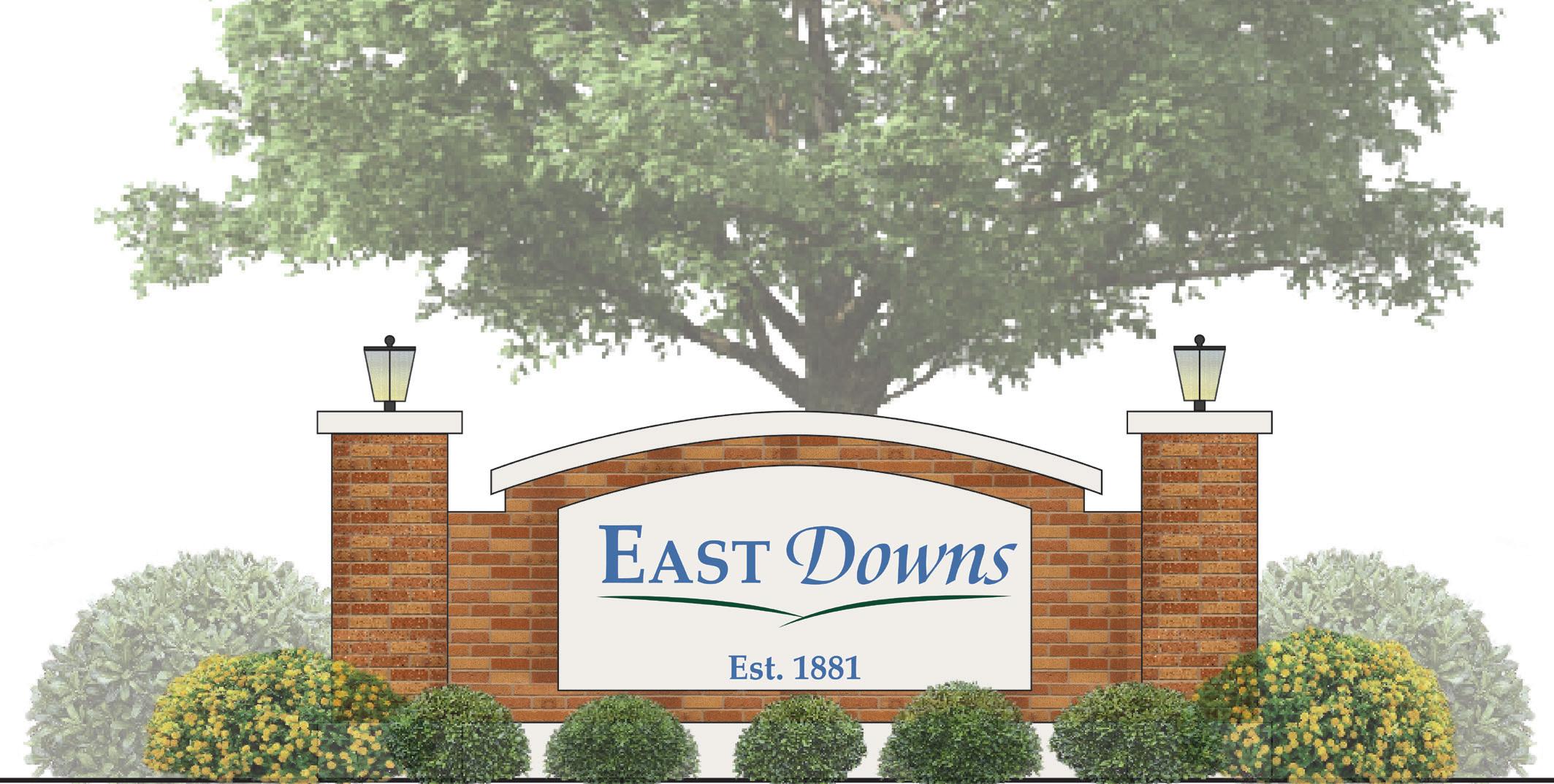
NEIGHBORHOOD MONUMENT
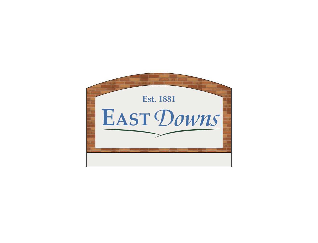
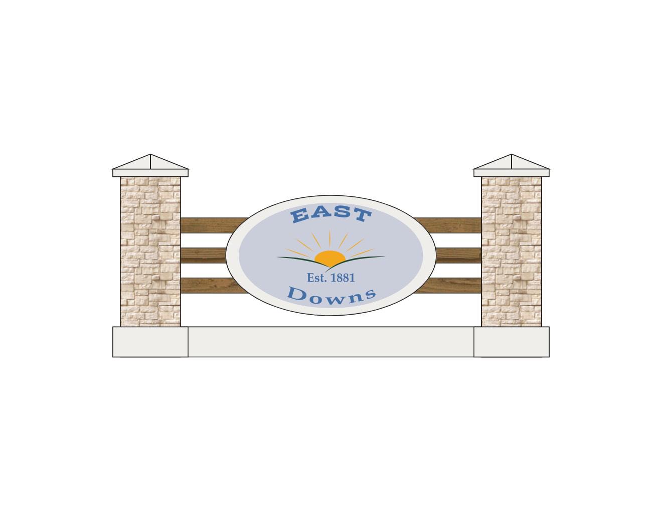
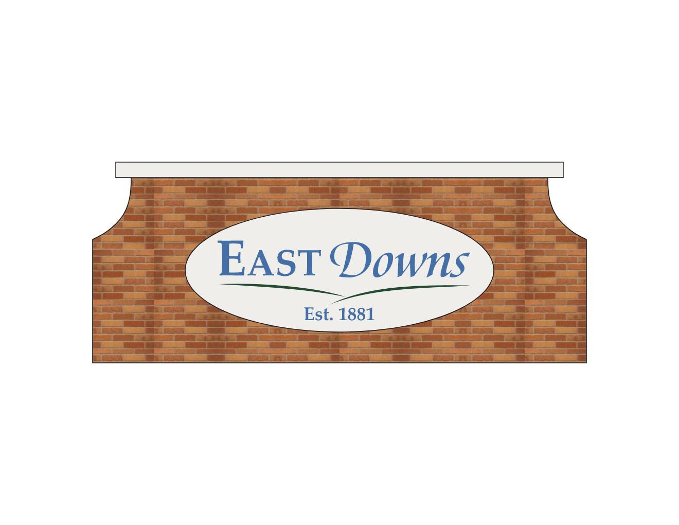
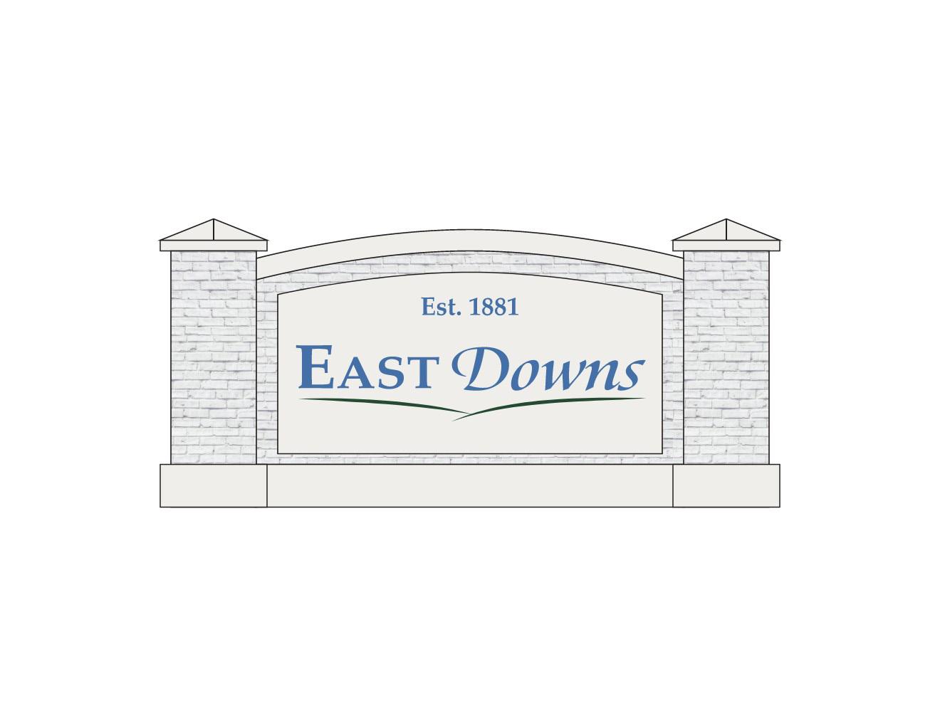
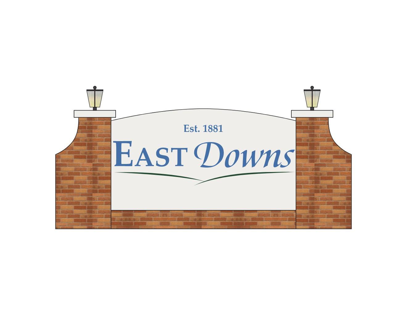
An elongated blade sign should be used for the entry monument to maintain the quiet, understated character of East Downs. The placement of the monumentation will be at the intersection of Fowler Road and E Adams Avenue, where it will be replacing the existing blade sign. With East Downs being located along a major arterial road, the signage creates a distinct point of entry along Adams Avenue and the primary entry point at Fowler. Other monument opportunities should be located along the Loop and the new Nugent Avenue Crossing.
Recommendations
EAST DOWNS NEIGHBORHOOD ACTION PLAN
This section of the plan summarizes the recommendations derived from the project findings into the East Downs Neighborhood Action Plan. These actions follow the direction put forth in the City’s Strategic Plan and Temple By Design, 2020 Comprehensive Master Plan. In accordance with those plans, the actions are organized by the focus areas: Smart Growth, Public Safety, Places and Spaces, and High-performing Organization. The recommendations in the Action Plan will reference the respective Comprehensive Plan initiative they help to realize. The Action Plan will identify the implementation method, priority, and department involvement.
SMART GROWTH INITIATIVES
18th St. from Nugent Ave. to Shell Ave. Plan, design, and construct 18th St. from Nugent to Shell as a north to south community collector north of Nugent Ave. Ultimate alignment will be dependent on site conditions and property owners at the time of development. Pedestrian facilities should be included as a part of this project. Munroe Ave. will be extended to connect into the new 18th St.
50th St. from Lavendusky Dr. to Adams Ave. Plan, design, and construct the improvements to 50th St. from Adams Ave. to Lavendusky Dr. Additional right-of-way may be required to include pedestrian facilities and parallel parking along this stretch of road.
French Ave. from 16th St. to 42nd St. Plan, design and reconstruct French Ave. to a Neighborhood Collector that runs from west to east along the plan boundary. Additional right-of-way may be required to accommodate sidewalks along French Ave. Evaluate the alignment of 20th St. during Design.
Design and Development
DD.1
Adams Ave. Corridor Plan. Corridor study to evaluate Adams Ave. Design standards to include access management, building placement, parking locations, and landscape standards.
DD.2
Encourage infill and redevelopment that is respectful of the neighborhood character while increasing housing choice and opportunity in the focus areas of the plan identified as residential.
DD.3
Support the development of the southeast portion of the plan area into a mixed-use node. The redevelopment should focus on establishing a walkable commercial district to provide job opportunities and supporting services to all adjacent neighborhood plan areas. Work with TRC and Chamber of Commerce to identify an organization to engage possible developers for residential along 50th St. and more commercial product along Adams Ave. and H.K. Dodgen Loop.
Streets and Thoroughfares
ST. 1
Nugent Ave. from 14th St. to H.K. Dodgen Loop. Plan, design, and construct a community collector that runs east to west through the plan boundary. Along Nugent Ave., this will include: the railroad crossing, acquisition of parcels on E Nugent Ave., Williams Creek crossing, and the roundabout intersection at 18th St. and Nugent. The additional inclusion of the southern portion of 18th St. will be constructed as a community collector from Nugent Ave. This will include the Williams Creek crossing, and the extension of Munroe Ave. to the new 18th St.
• Union Pacific Railroad Crossing Options:
• Option A: Nugent Ave. Rail Line Flyover Crossing
• Option B: Nugent Ave. Rail Line At Grade Crossing
ST.2
Nugent Ave. and 42nd St. Intersection. Evaluate, plan, and design a an improved intersection at Nugent and 42nd prior to the H.K. Dodgen Loop intersection. Identify what additional right-of-way to accommodate design may be necessary. Pedestrian access and City gateway monumentation should be considered as part of the project.
Barton Ave. from 14th St. to 50th. St. Plan, design, and construct the connection of Barton Ave. as a neighborhood collector across the drainage way between 20th St. and 22nd St. Make improvements to existing roadway in order to make a smooth and contiguous west to east route from 14th St. to 36th St. Additional right-of-way may be required to complete this project. Sidewalks and lighting should be included as part of this project.
16th St. from Adams Ave. to Future Collector. Plan, design, and construct or reconstruction 16th St. from Adams Ave. to Future Collector. Additional right-of-way may be required to complete this project. Sidewalks should be included as part of this project and connect to the proposed The Linear Trail proposed within this plan.
ST.8
Fowler Rd. Plan, design, construct, and reconstruct Fowler Rd. as a neighborhood collector that is realigned to connect Prewitt Park with French Ave. and Adams Ave. Additional right-of-way may be required to provide side path along the road. The integration of on-street parking for Prewitt Park should be considered.
20th St. Pedestrian Connector. Plan, design, and reconstruct 20th St. as a pedestrian connector from Adams Ave. to Houston
ST.9
as an important north to south pedestrian connection through the neighborhood.
ST.10
Lavendusky Dr. from 42nd to French Ave. Plan, design, and construct Lavendusky Dr. as a neighborhood collector from 42nd St. to French Ave. with intersection plans for integration into both roads. Include pedestrian facilities for safe crossing.
ST.11
42nd St. from Lavendusky Dr. to Adams Ave. Plan, design, and construct a community collector that runs from north to south along the plan boundary. Additional right-of-way may be required to accommodate sidewalks along 42nd St.
ST.12
Removal of Munroe Ave. Rail Crossing. Coordination with Union Pacific for the decommissioning and removal of the existing rail crossing at Munroe Ave, and negotiate with Union Pacific to move the rail crossing to Nugent Ave.
ST.15
Replace poor condition sidewalks from plan area. Repair and add sidewalks in areas identified for sidewalk improvement.
Tree Program. Preserve existing heritage trees where possible during new development. Encourage new street trees and street tree replacement as needed throughout the plan area. Include review of street trees to ensure limbs do not impede ingress and egress of emergency and city vehicles. Consider ordinance revisions to assist in this program.
Implement a sidewalk condition evaluation on a 5-year cycle to assess for ADA compliance and connectivity. Schedule repairs and additions through the CIP plan or identify funding through other programs.
Involve departments to evaluate solutions for traffic calming methods throughout the neighborhood, with particular attention paid to intersections and enhanced pedestrian safety measures.
Infrastructure Systems
IS.1
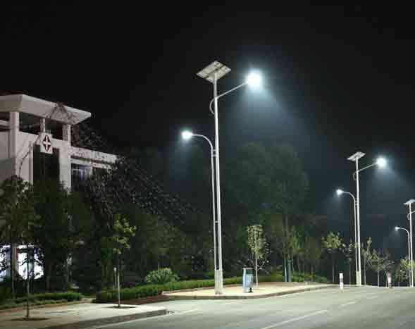
Lighting Plan. Implement lighting plan within the East Downs Neighborhood. Evaluate high needs areas to receive lighting priority.
Police Safety
Alleyways. Determine highest and best use for alleyways in this neighborhood. Primarily focus on the alleyways near Adams Ave. to act as a commercial backage road for trash, unloading, and potential staff parking for commercial and higher density residential uses. Implement Policy for future development along collectors requiring Alleyways.
Improve safety conditions through additional lighting, opening up dead end roads with hammerhead turn-a-rounds, and buffering properties abutting the rail line with ornate fencing. Identify strategies for the Police Department to use for additional safety near the rail.
Include drainage solutions as part of roadway projects to address drainage issues within the neighborhood. Identify potential regional solutions within parks or easements currently owned by the City.
Trails PT.1
The Linear Park Study. Study the Williamson Creek for a potential Linear Park that connects Miller Park to 50th St. with connections to Prewitt Park, 16th St, French Ave., 18th St, and H.K. Dodgen Loop. Determine best route and potential facilities along the linear park trail for additional programming.
Prewitt Park. Plan, design, and construct new facilities to the existing parkland and ensure connectivity with proposed French Ave., Fowler Rd, and The Linear Park facilities in a way that emphasizes pedestrian safety and accommodates vehicle traffic where appropriate.
PT. 3
PT. 4
14th St. Pedestrian Connector. Plan, design, and construct a side-path along 14th from Adams Ave. to East Downs Rd. Additional right-of-way may be required.
14th St. Pedestrian Trail. Study and evaluate a trail from Nugent to Shell Ave. Identify the best and safest route for pedestrian traffic.
Economic Growth
EG.1
Work with TRC, TEDC, and other community partners to explore options to bring commercial businesses to the Southeast commercial node along H.K. Dodgen Loop and Adams Ave.
Community Health
HIGH-PERFORMING ORGANIZATION
Collaborate with TISD for the potential expansion of Hector P. Garcia and establish guidelines for development along 50th St. that enables a buffer from the commercial edges of Adams Ave. and 50th St. with high-density residential and open space while providing for new growth and diversity in product.
Neighborhood Stabilization and Redevelopment
Develop a community outreach program to educate the public about
Task the Neighborhood Coalition with scheduling and promoting block parties and events, such as National Night Out, and share information about the Tool Library, Tool Trailer, and TTX Connect app.
NSR.5
NSR.6
Promote the use of the TTX
Neighborhood Conservation Area. Address zoning regulations to encourage and allow continued block design in neighborhood conservation areas. Update Future Land Use and Thoroughfare Plan where appropriate. Work to sync Love Where You Build and the UDC with recommendations.
Promote the Neighborhood Enhancement Grant Program to aid in the revitalization of
EAST DOWNS NEIGHBORHOOD CAPITAL IMPROVEMENT PLAN
The following list of projects was derived from the conceptions and recommendations formulated as part of the planning process. The projects identified correlate with the actions found in the East Downs Neighborhood Action Plan. Projects may be a single action or a combination of actions. The opinion of the probable cost was developed uniquely for each particular project and includes the cost of construction, contingency, land/right-of-way acquisition, and professional services. Action prioritization in regard to project implementation should be followed; however, if circumstances arise that increase the urgency or cost savings for the realization of the project, deviations from the recommended action priority is appropriate.
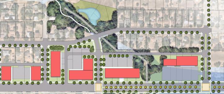
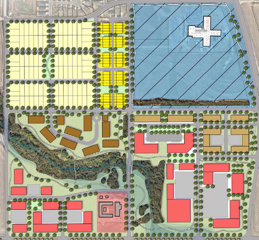
The water lines identified in this exhibit provide recommended locations and capacity to serve the neighborhood district.

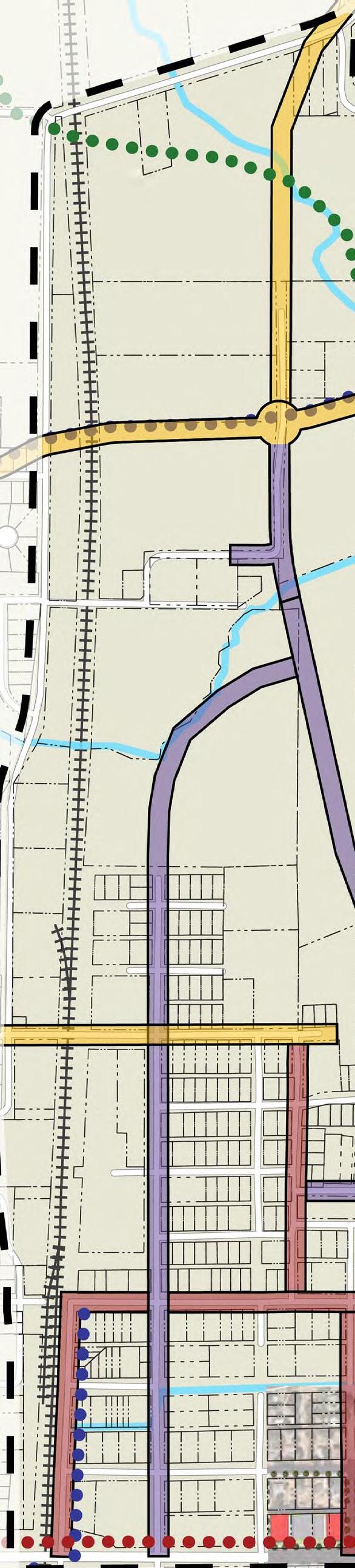
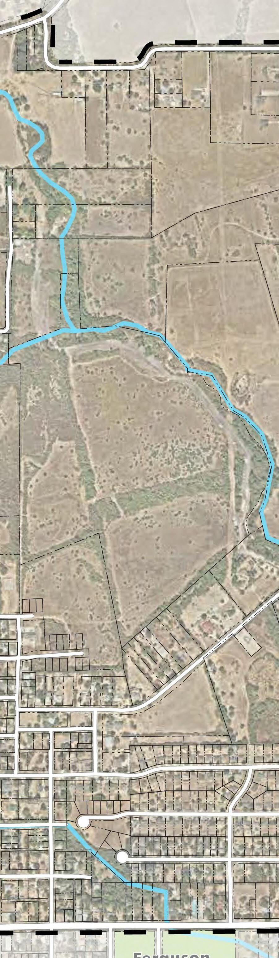
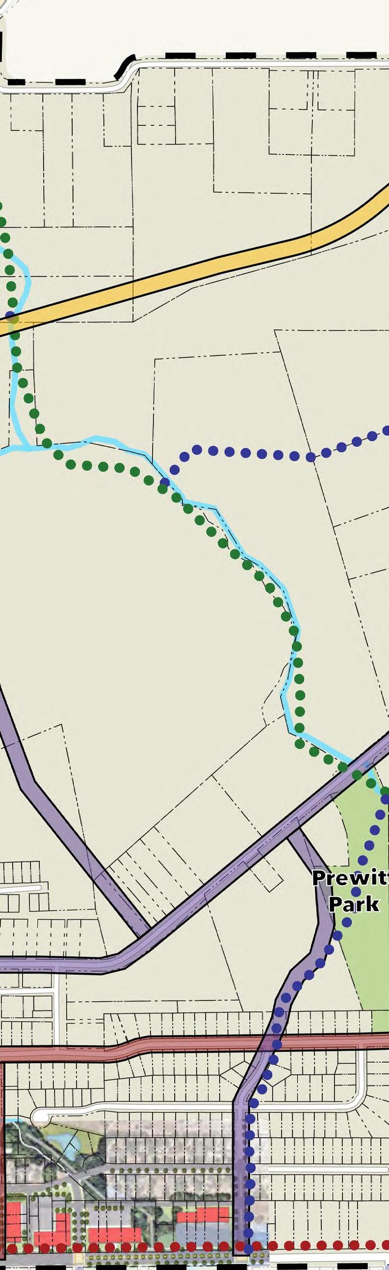
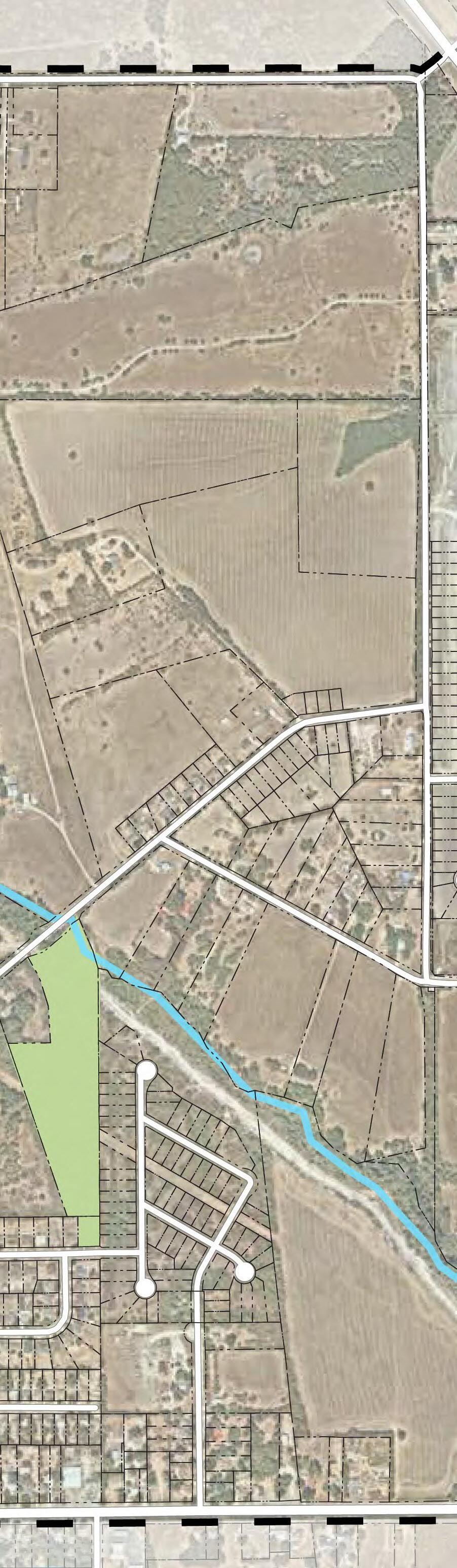
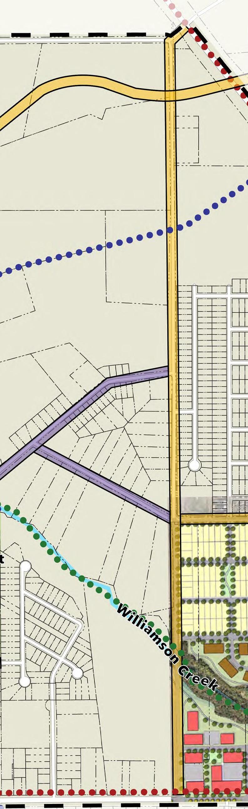
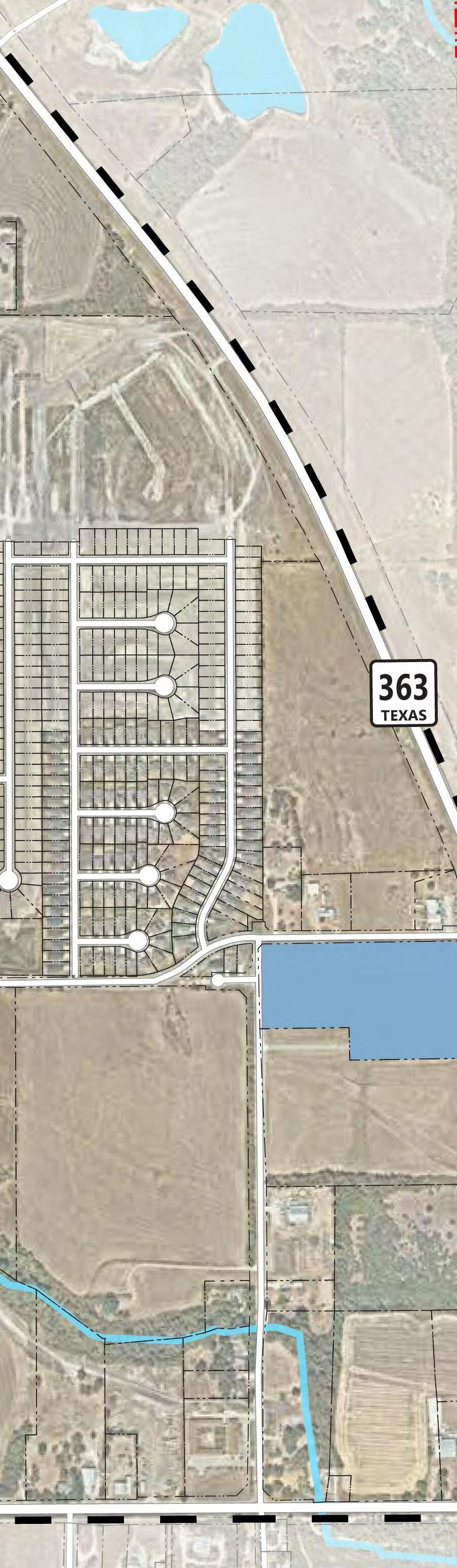
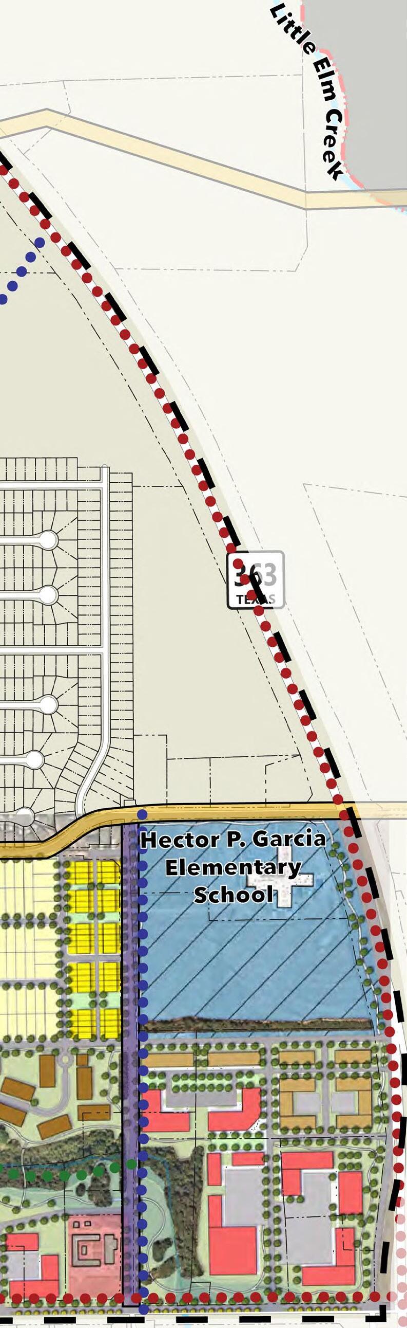


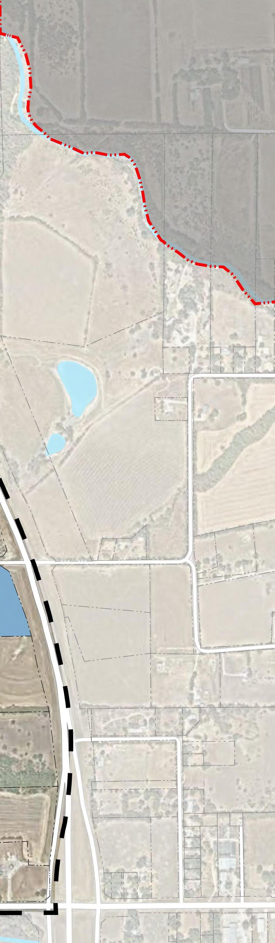

The wastewater lines identified in this exhibit provide recommended locations and capacity to serve the neighborhood district.