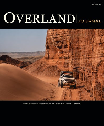
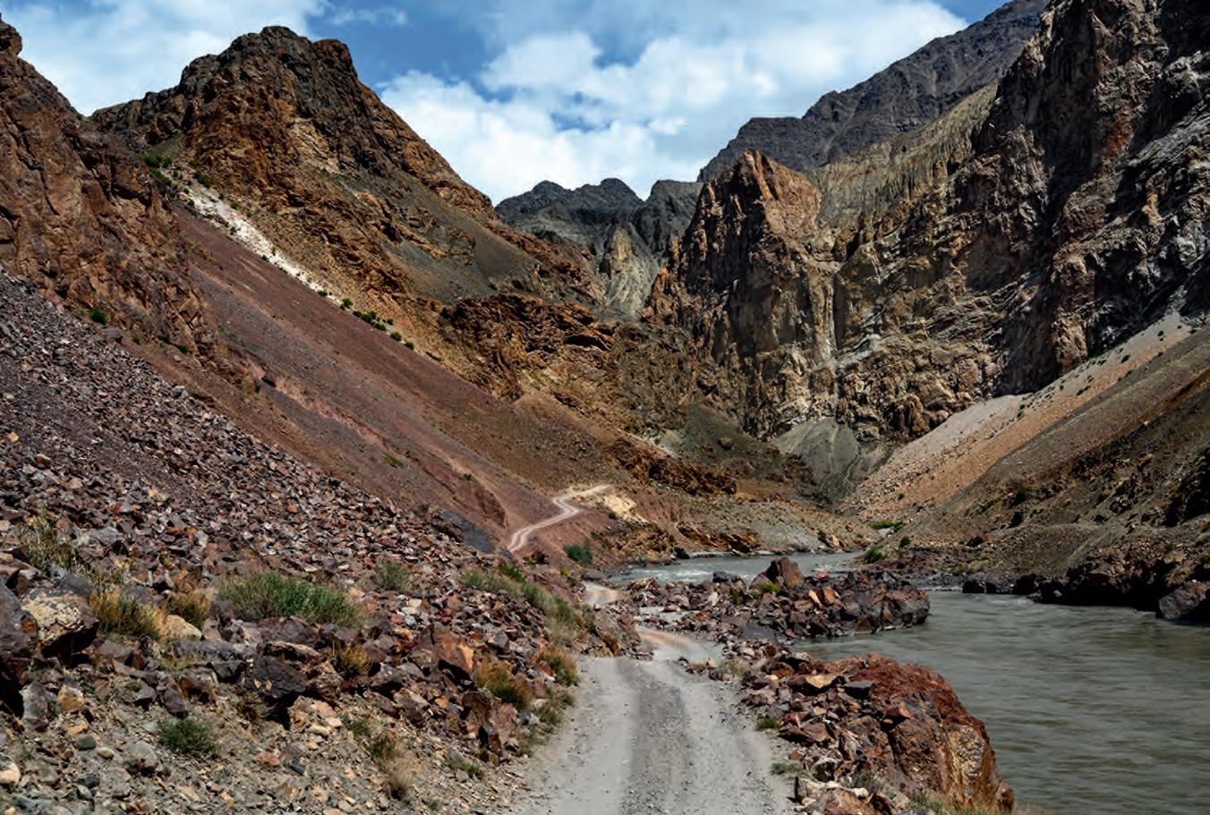
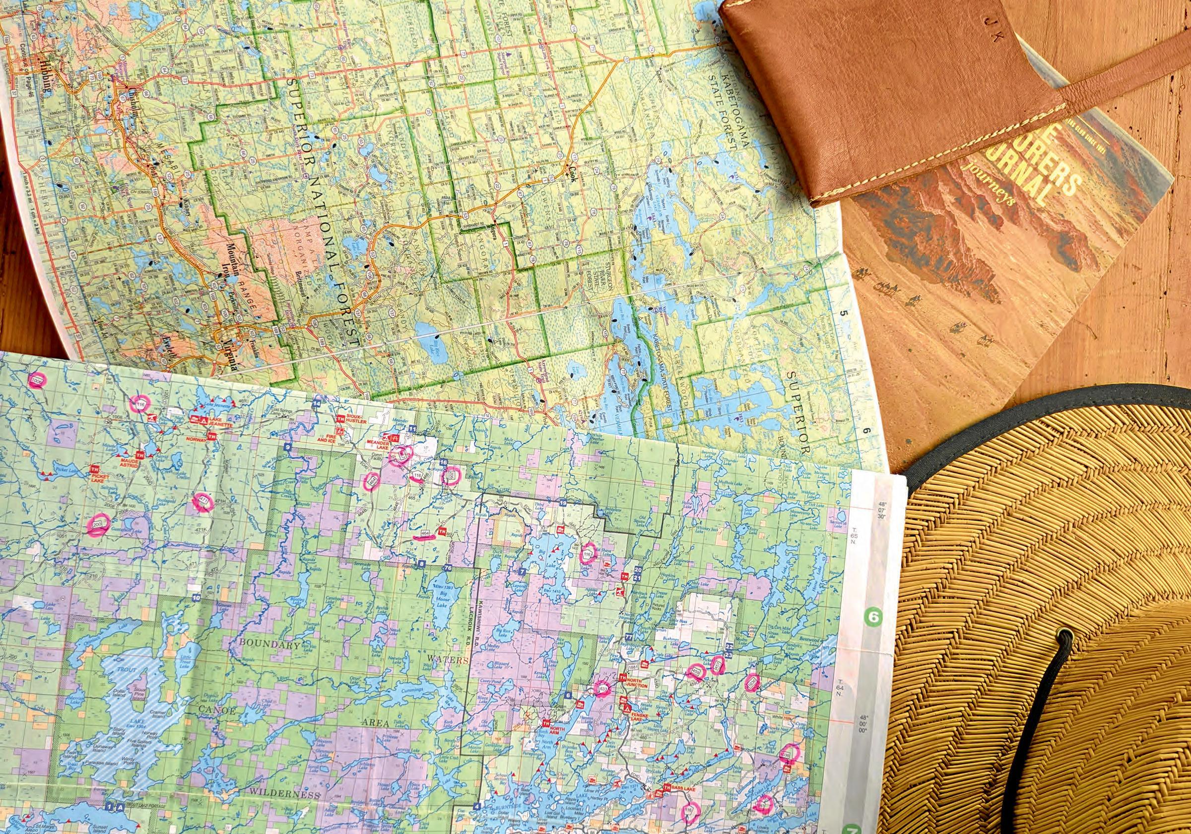
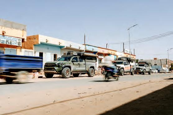
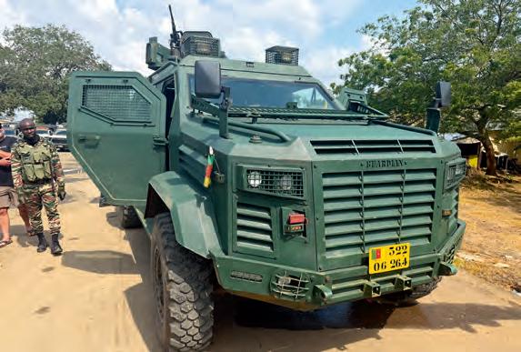
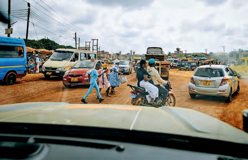
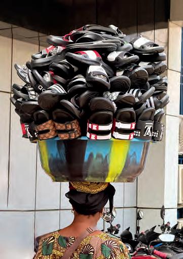
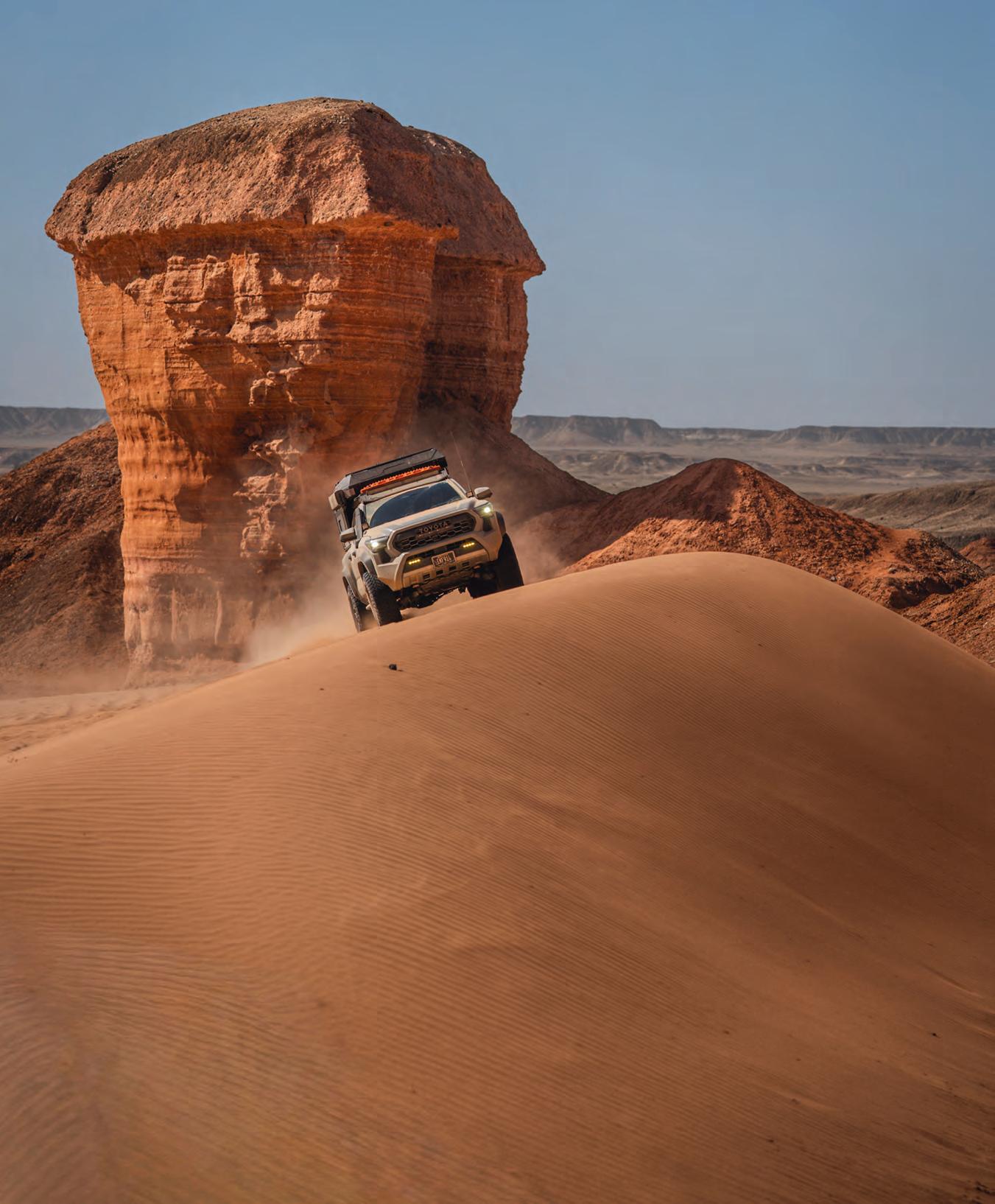
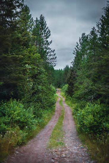
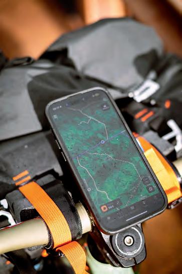
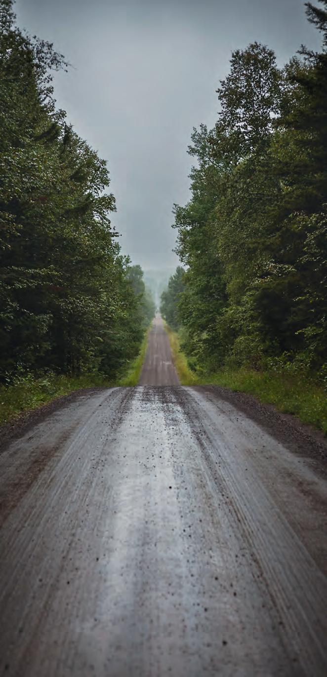
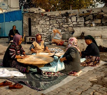
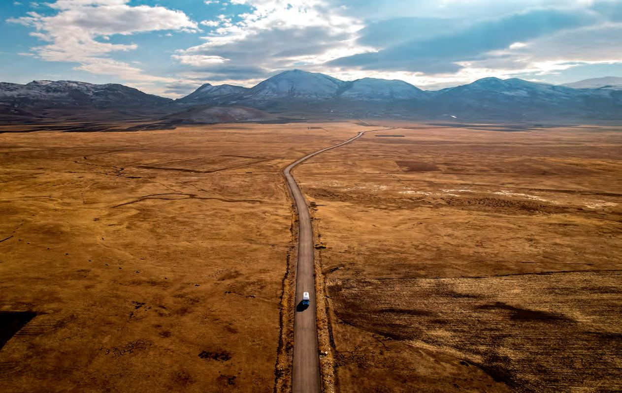
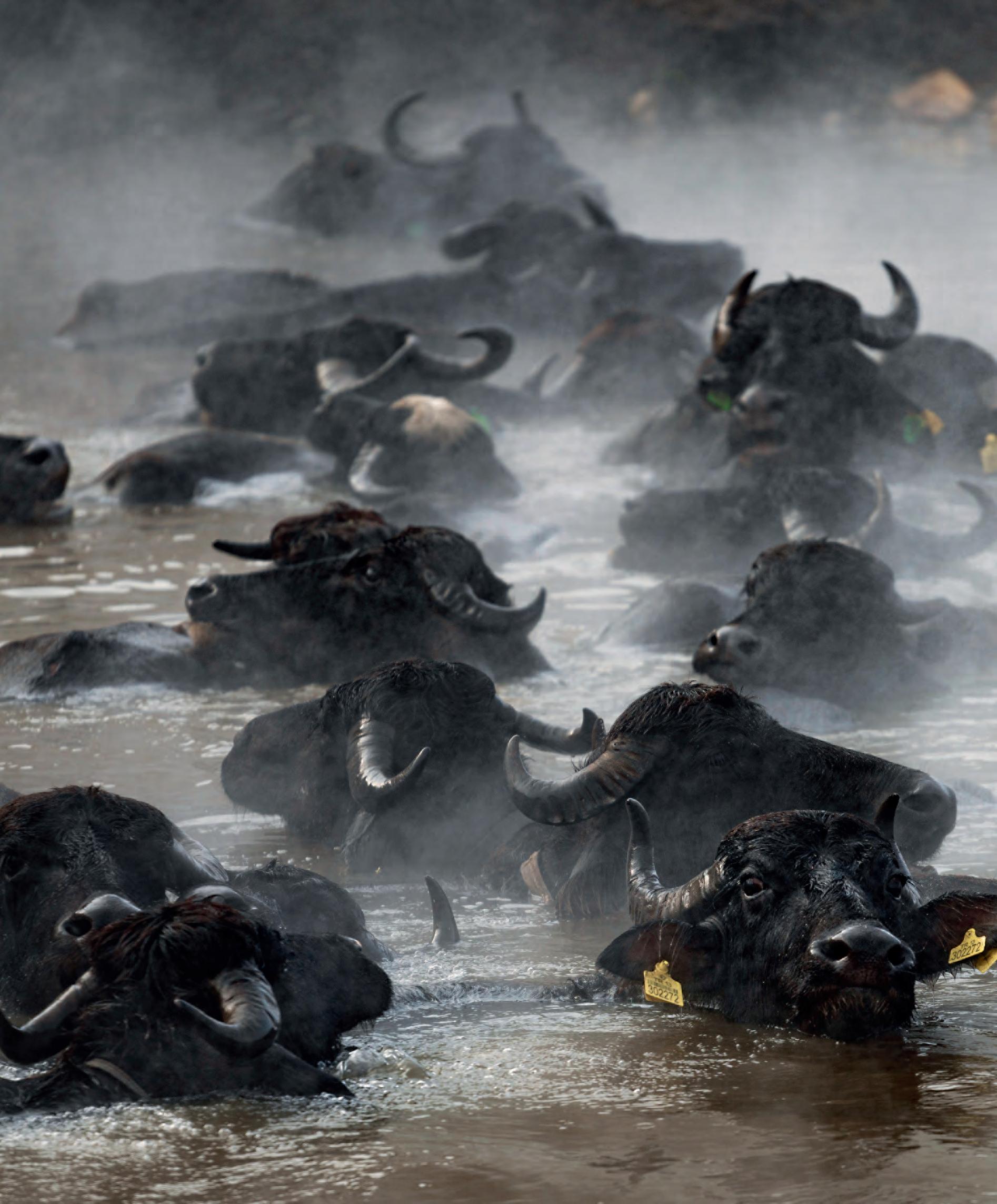
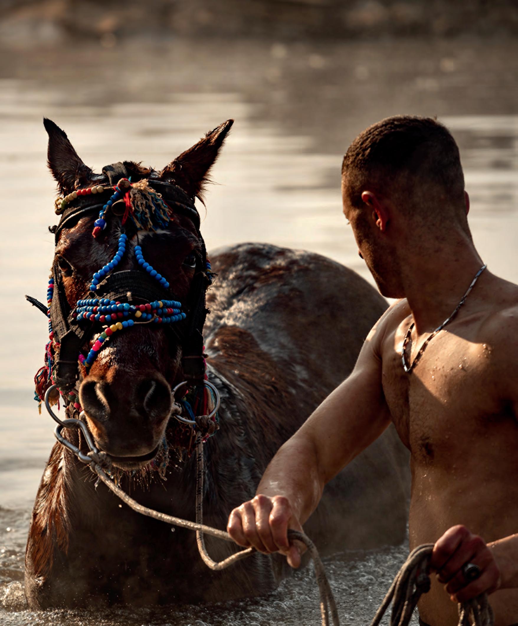
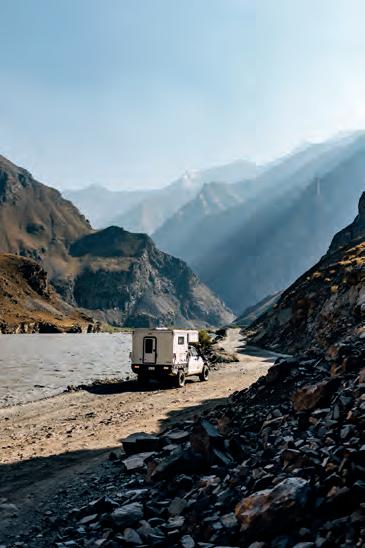
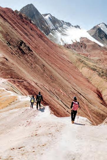
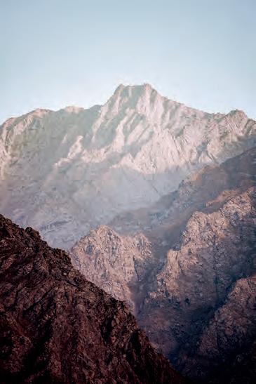
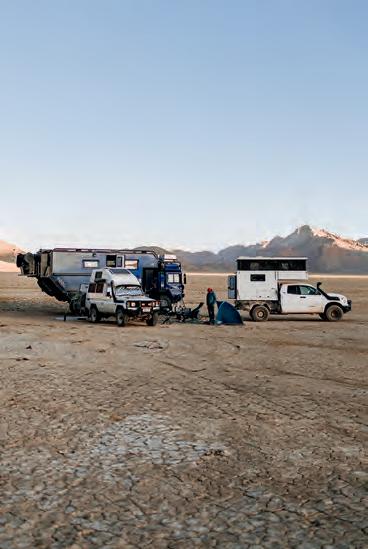
GORNO-BADAKHSHAN AUTONOMOUS OBLAST | PAPER MAPS | AFRICA | MINNESOTA
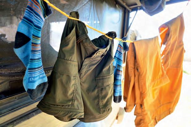
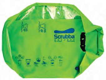
83 Keeping it Clean: Wringing the Friction From Camp Laundry, Brittany Highland
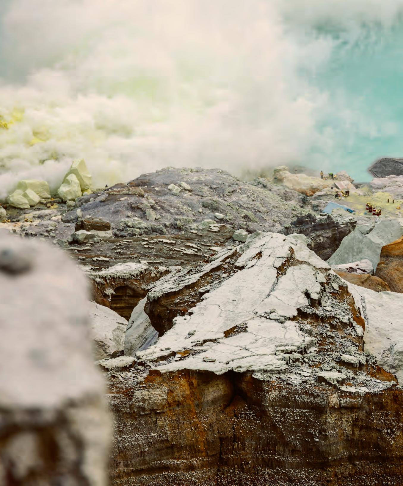
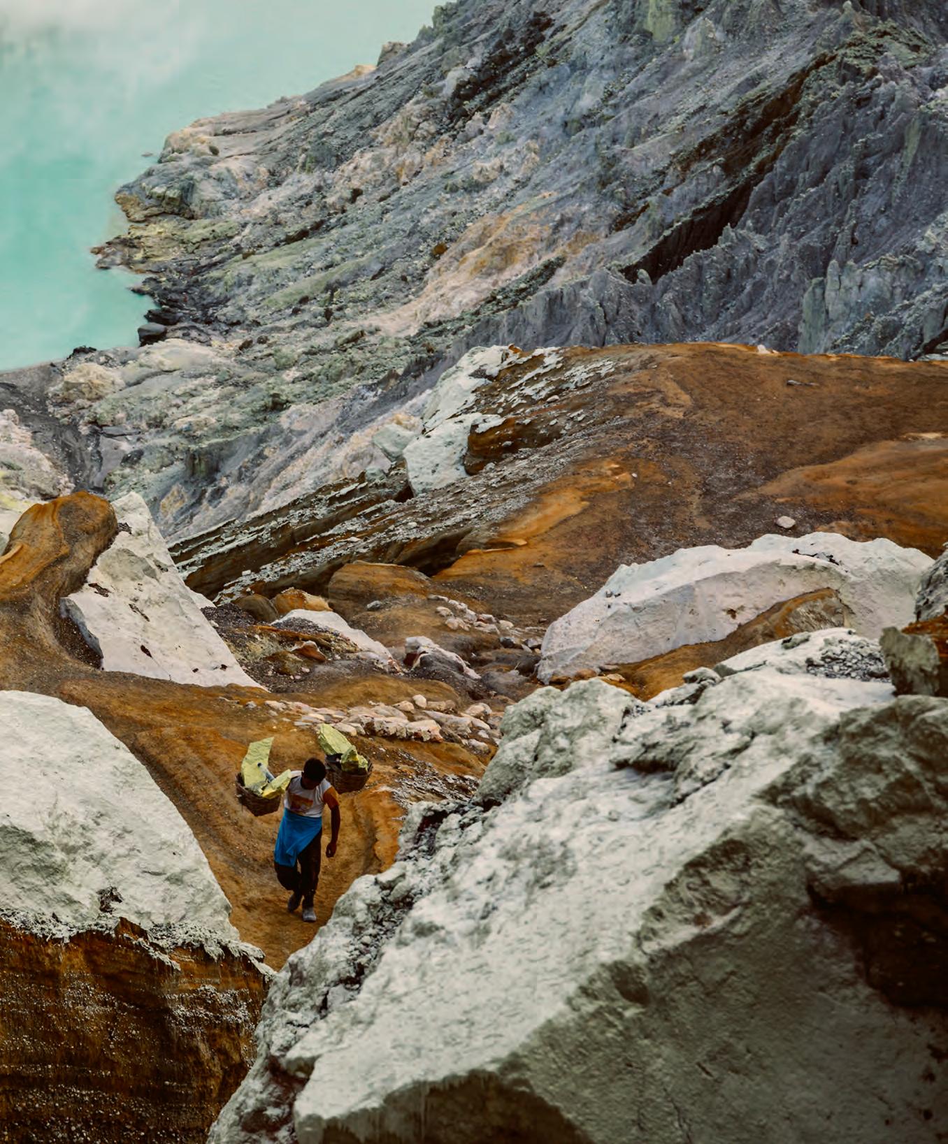
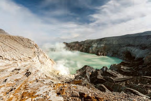
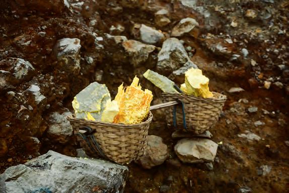
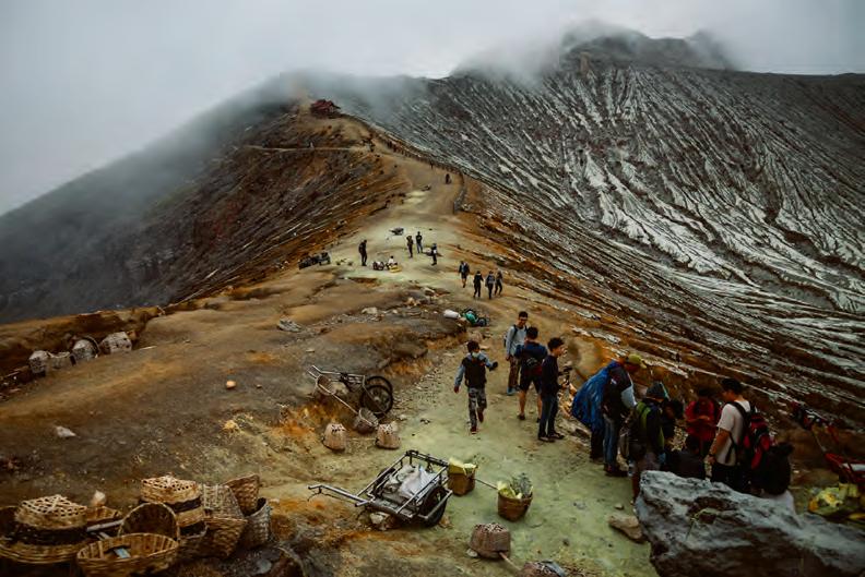
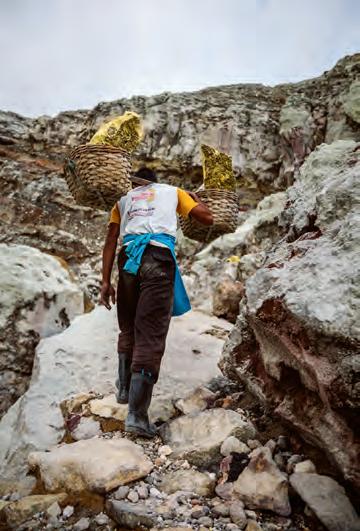
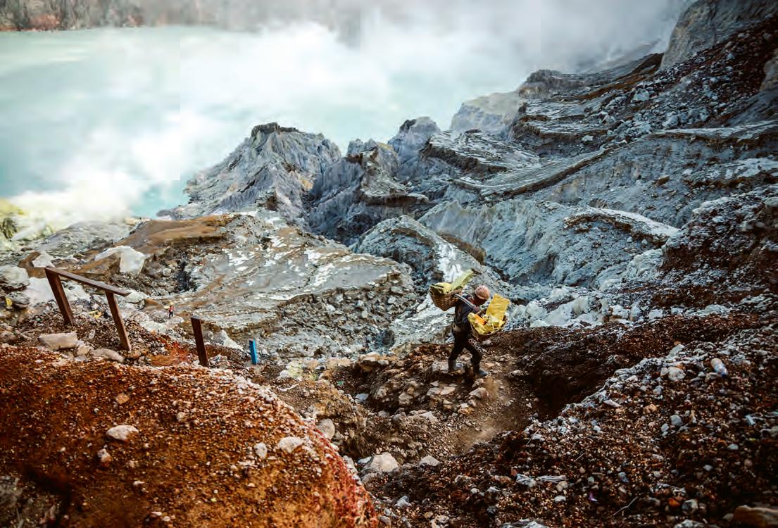
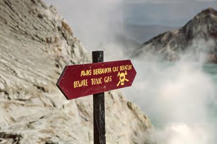
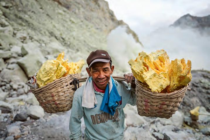
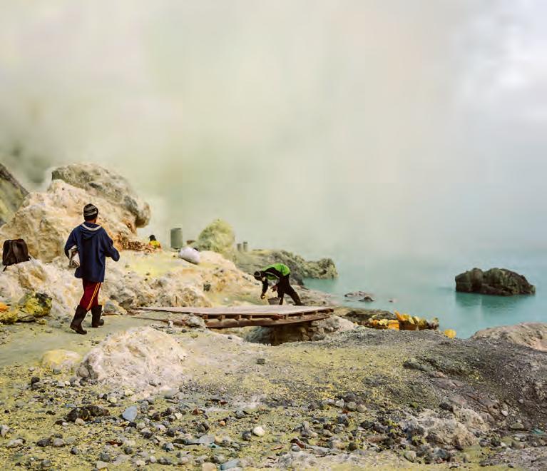
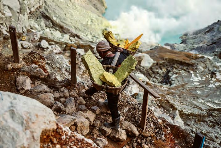
86 Gateway to Hell: The Startling Paradox of East Java’s Gunung Ijen, Maria Zehentner
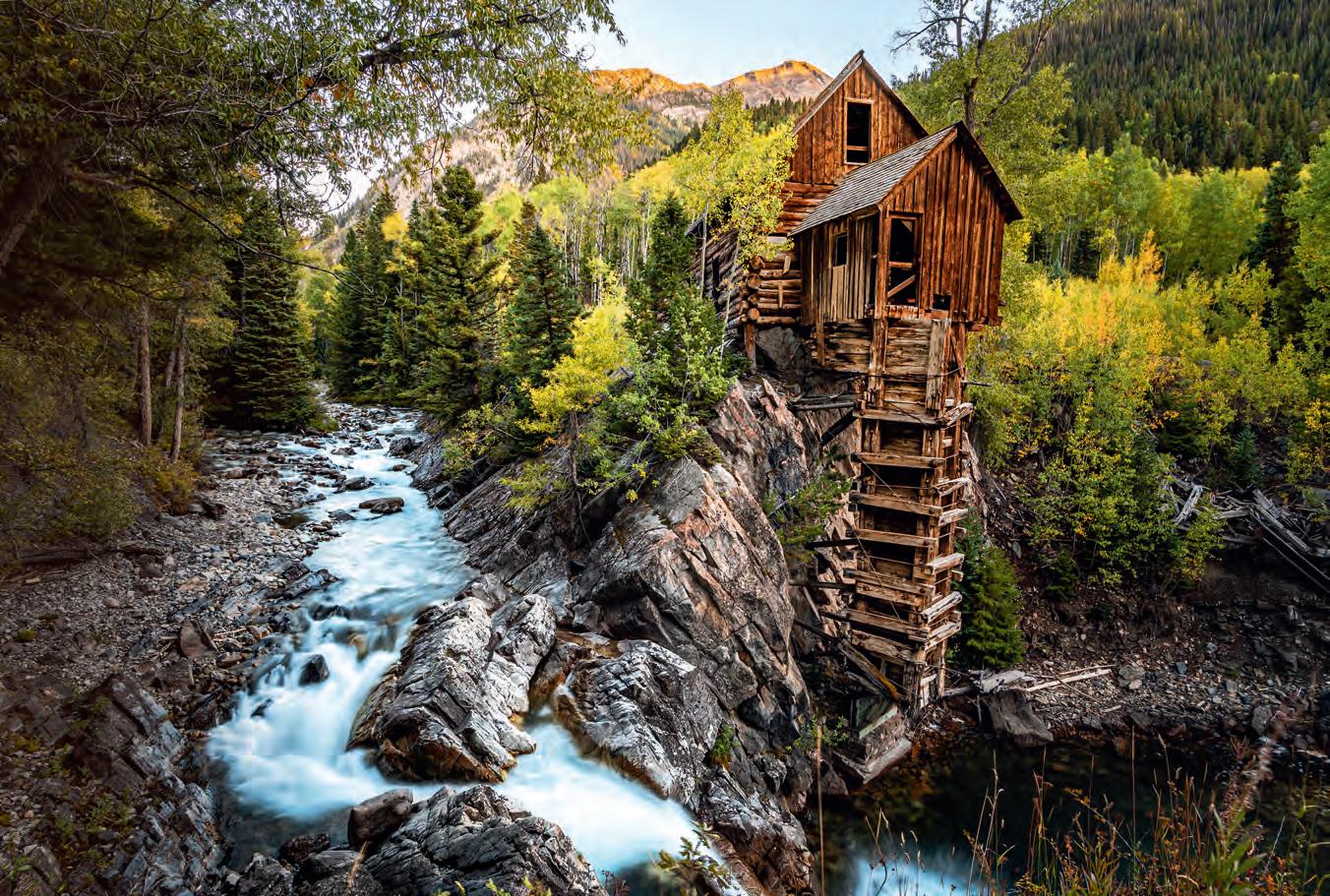
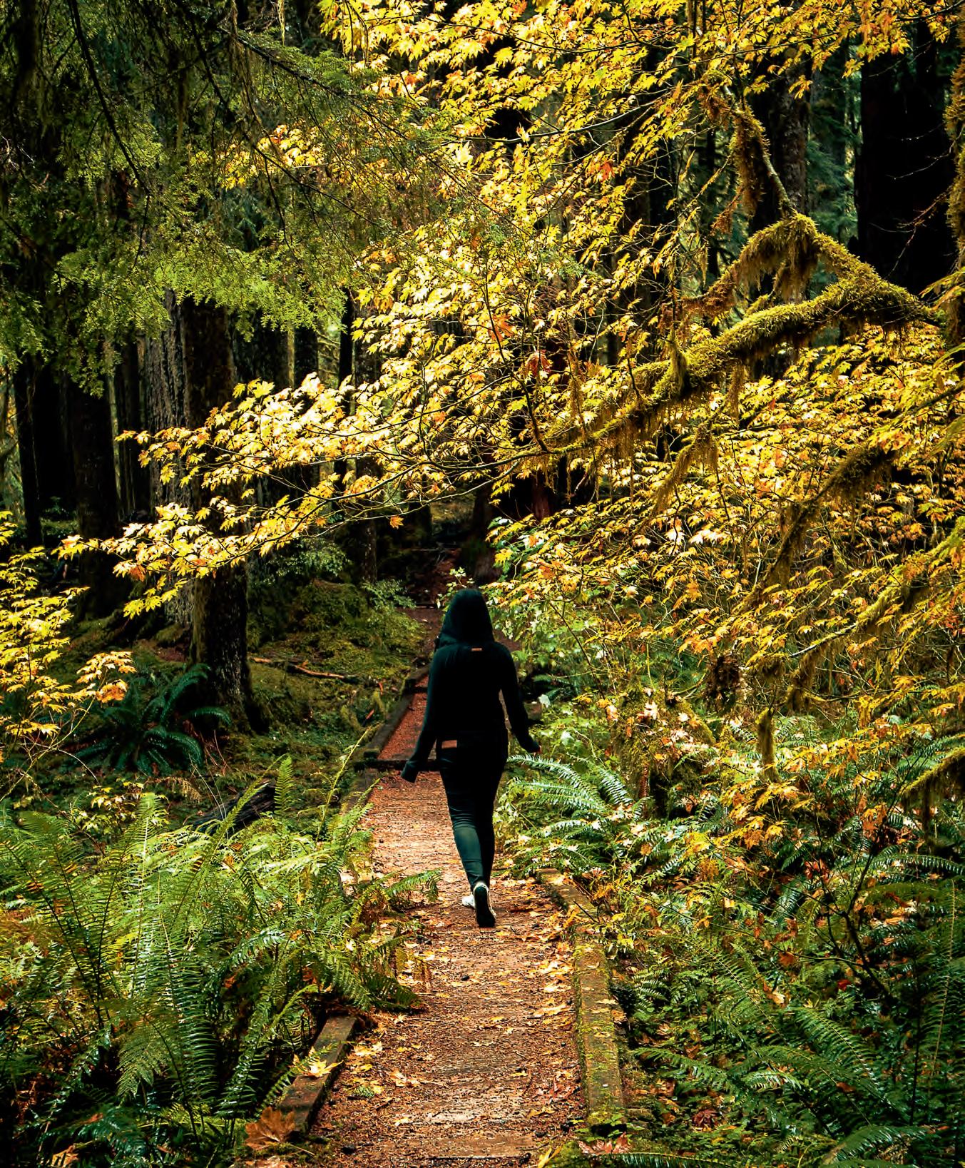
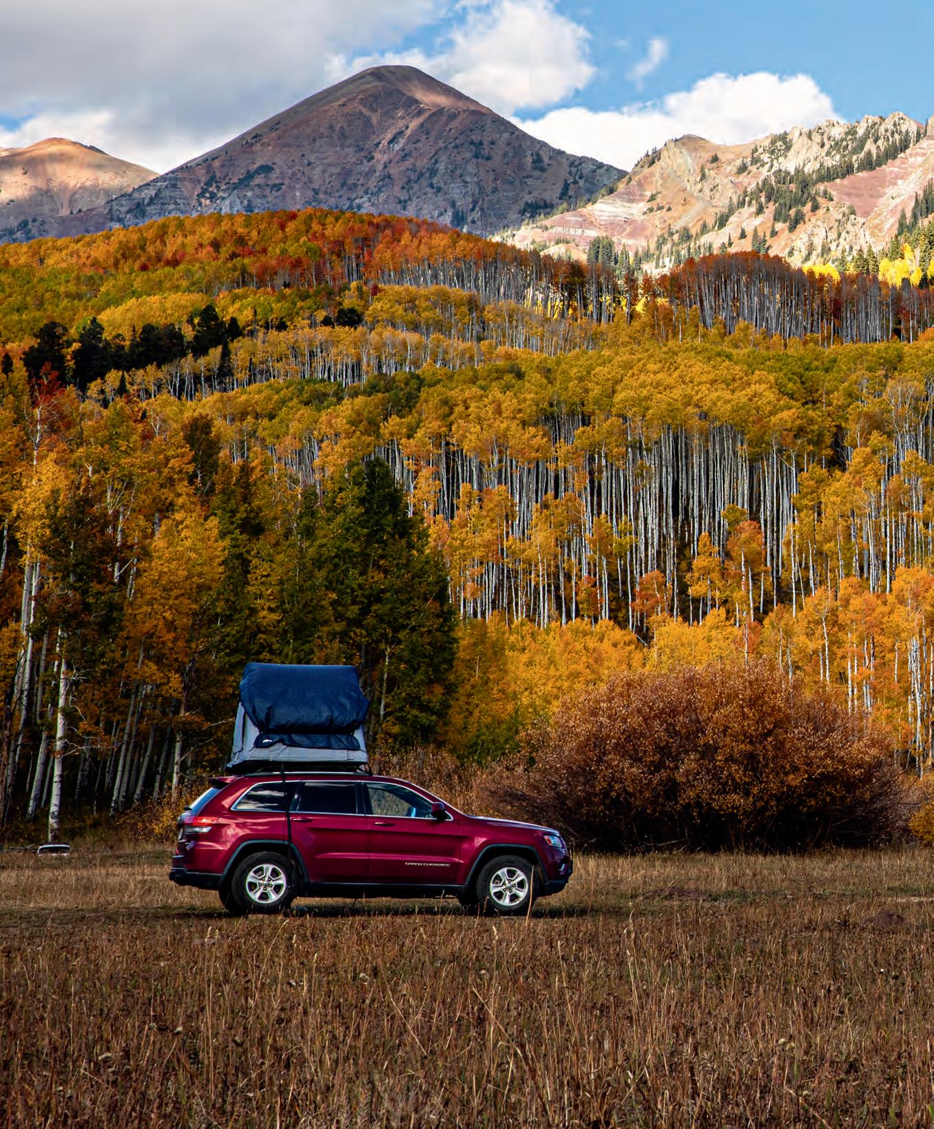
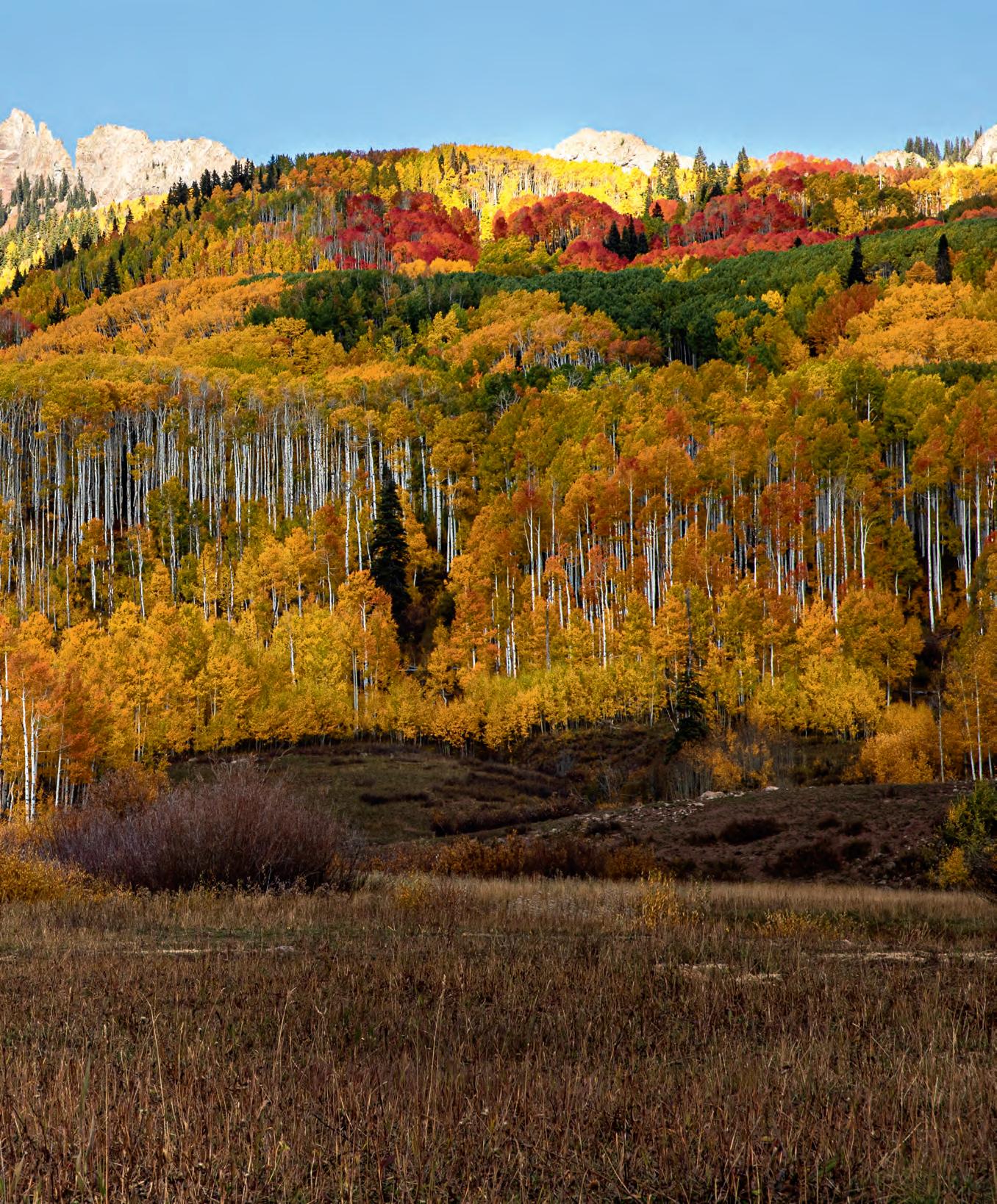
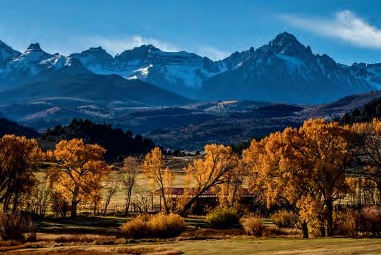
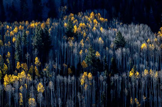
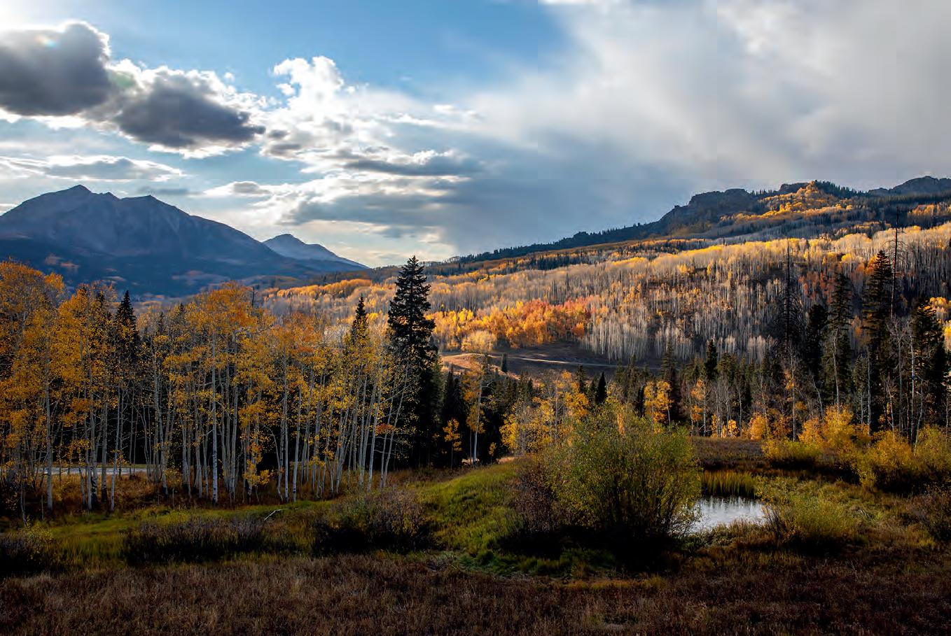
92 Turning Over a New Leaf: Fall is Colorado’s Best Season, Winston Ross
Departments
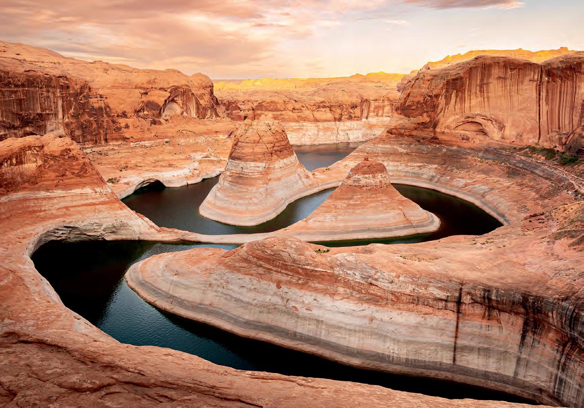
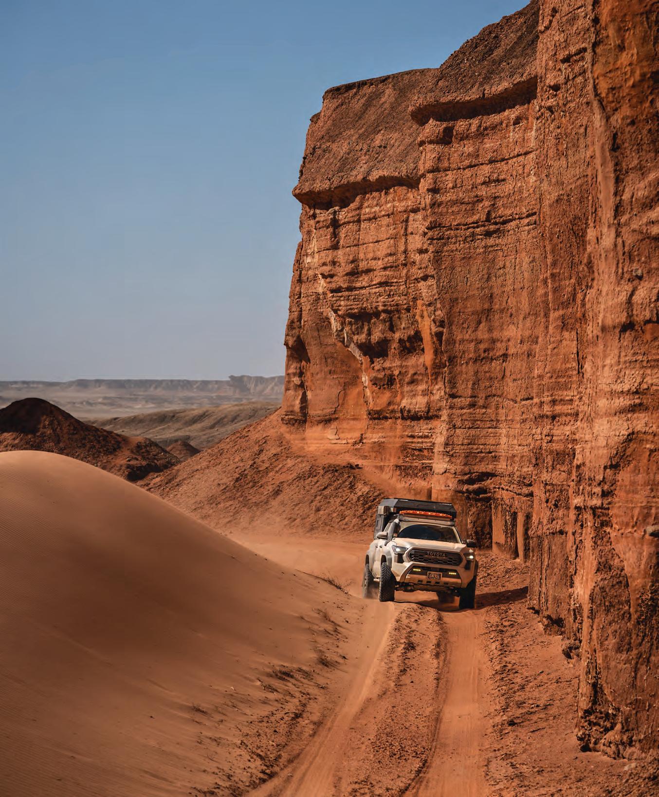
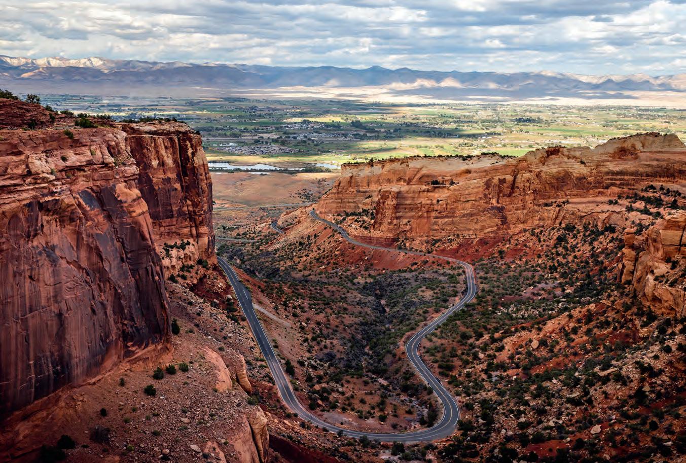
Canyon
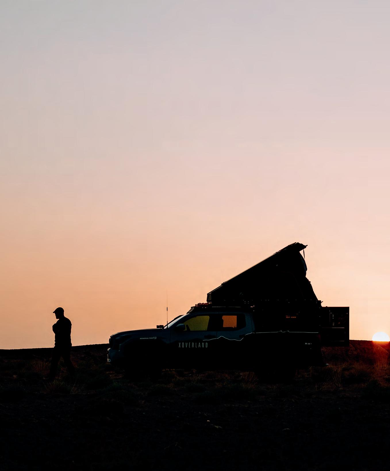
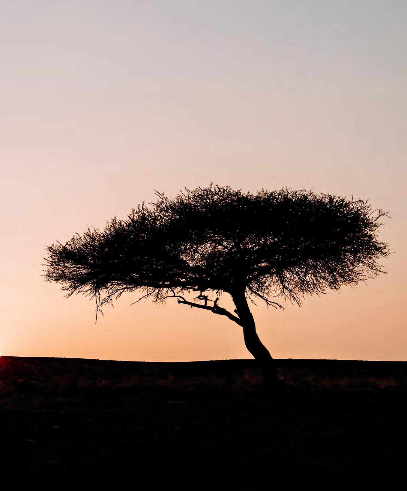
Photo by Scott Brady
Photo by Eric Moon
OVERLAND JOURNAL
WE ARE ADVENTURERS Constantly traveling. Testing and using gear in real-world situations. Gaining experience, which we readily share.
OUR RESUME
7 continents | 158 countries | 594 years combined experience
EXPERIENCE MATTERS
WE ONLY KNOW THINGS WHEN WE LIVE THEM
CHIEF EXECUTIVE OFFICER Rachelle Croft
CHIEF CREATIVE OFFICER Clay Croft
EXECUTIVE PUBLISHER Scott Brady
EDITOR IN CHIEF Tena Overacker
DIRECTOR OF DESIGN Stephanie Brady
BUSINESS DEVELOPMENT AND PARTNERSHIPS Megan Walthall
DIRECTOR OF SALES Brian McVickers
HEAD OF BRAND AND MARKETING Jake Perucca
DIRECTOR OF CONTENT AND PRODUCER Andy Potter
HEAD OF DESIGN AND BRAND MANAGEMENT Amy Farrell
SENIOR EDITOR Ashley Giordano
4WD SENIOR EDITOR Graeme Bell
ASSOCIATE EDITOR Stephan Edwards
MEDICAL EDITOR Dr. Jon Solberg, MD, FAWM
CONTRIBUTING EDITORS Luisa Bell, Chris Cordes, Joe Fleming, Richard Giordano, Dan Grec, Brendon Hak, Brittany Highland, Bradley J. Meier, Sandra Muñoz, Lucy Pinnell, Winston Ross, Steven Vryhof, Maria Zehentner
CONTRIBUTING PHOTOGRAPHERS Clay Croft, Ben Fuery, Kira Hak, Katie Harris, Dave Newton, Richard Giordano, Leander Nardin, Eric Moon
Send address changes to service@overlandjournal.com. Include complete old address as well as new address. Allow two to four weeks for the change to become effective. Overland Journal is not forwarded by the US Postal Service. It is the subscriber’s responsibility to inform Overland Journal of an address change.
Overland Journal is a trademark of Overland Collective, LLC. All rights reserved. Reproduction in whole or in part without written permission is prohibited. Overland Journal is a wholly owned subsidiary of Overland Collective, LLC.
NO COMPROMISE
We carefully screen all contributors to ensure they are independent and impartial. We never have and never will accept advertorial, and we do not allow advertising to influence our product or destination reviews.
ADVENTURE POTLUCK
Love the Journal, especially bringing it to work to share with others.
Chris Arrington
CARPE LIBRUM
I am really enjoying [the Journal] as well as Scott’s new book [Overlanding 101]. Thank you for all you do.
Paul Crafts
SHARE
Use #overlandjournal on Instagram or Facebook.
WHERE HAS YOUR OVERLAND JOURNAL BEEN?
Send us a photo, along with your name, the location, make/year of your vehicle, and a brief description. editor@overlandjournal.com
INSIDE SCOOP
ROW 1
@theadventureguys_
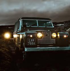
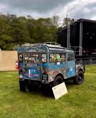
A proper Land Rover always looks better with bad weather behind it. Especially a Series II, built with the kind of character you just don’t see anymore.
@nomadic.fern
Happy Halloween.
@farwayout
The vastness of the Puna hides [more than] geological wonders. We found [a] small set of houses next to an abandoned train station. Not a bad place to camp and gaze into the night sky, if you’re not afraid of the ghosts of the past and the biting cold once the sun sets.
ROW 2
@letsgoto_pl
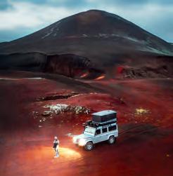
When NASA publishes Mars pics, but you’ve already been there. A proper Mars Rover successfully colonized the Red Planet—population: 2 humans + 1 classic Landy.
@rightlanefever
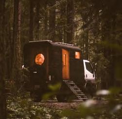
The goal was to build a handcrafted camper capable of navigating the mud, sand, and snow required to pursue surfing in remote areas, while still balancing a sense of style and functionality. The truck is a 1998 Mitsubishi Fuso FG 4x4; it’s not the fastest, but it gets you there.
@gravel_and_salt
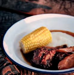
South African Classics No. 9: oxtail stew with pap and sweet corn, simmered in a rich, spiced gravy until it falls off the bone. It’s the ultimate hearty meal after a day of adventure.
ROW 3
@jmophoto
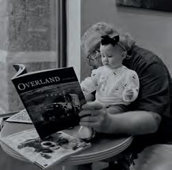
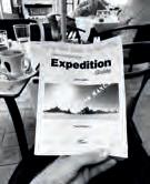
Second-generation bookstore buddy. Photo by the first-generation @mercedesnicole27.
@roam.wild_
What does everyone do in between adventures? We’ve been trying to sharpen our photography and videography skills lately. I think it’s about time we upgraded lenses, but a new drone sounds nice too.
@from_the_road
Aahhhwwooooooo. Cue the Into the Wild soundtrack. Solo camp trip. A little bit unplanned. No beer [and] no food but I survived.
Sign up for our new newsletter at overlandjournal.com for Weekly Adventure Roundups, and catch the latest Overland Journal Podcast, revisit From the Vault gems, and meet our team Behind the Scenes.
BEHIND THE SCENES AT EXPEDITION PORTAL
JACK MAC Digital Coordinator • Expedition Portal, Overland Journal
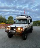
Between scheduling featured classifieds and social media posts, Jack Mac heads to the Blue Tit’s 40th birthday party at the UK’s Eastnor Castle, brushes up on his vehicle-dependent expedition skills, and embarks on a side quest to Madrid in his 78-Series Troopy.
OVERLAND JOURNAL
SUBSCRIBE
Overland Journal is the original publication for environmentally responsible, worldwide, vehicle-supported, expedition and adventure travel.
SUBSCRIPTIONS AND BACK ISSUES
5 issues/year, online at overlandjournal.com or Overland Collective PO Box 641, Belgrade, MT, 59714-8635
DOMESTIC & CANADA (USD)
1 year $65
INTERNATIONAL (USD) 1 year $95
DIGITAL
Available on iTunes, Google Play, and the Libby Library app.
BRENDON AND KIRA HAK
Brendon has been behind the wheel his entire life, his first solo expedition being at just six years old. No matter the season, you can find him outside, twisting a throttle or stomping a pedal. Kira’s passion has always been travel and photography. For her, capturing an image to share with the “inside” world has the power to change mindsets. Kira is certain she will travel to every corner of this beautiful planet and spark an interest in others to do the same. So the wanderer met the horse, and Adventure Haks was born—a platform to share their photography and tales of their journeys, with the goal to simply enjoy life and inspire others to get outside and explore. @adventurehaks
WINSTON ROSS
Over two decades, Winston Ross worked his way from cub reporter at a newspaper in the Inland Northwest to senior writer at Newsweek magazine. He has won multiple national and regional awards for his work on investigative and long-form narrative projects. In 2020, Winston bought a Ram ProMaster and tracked down a California couple who’d amassed a mighty Instagram following of life in their own van, and talked them into traveling north to live in his home (and Airbnb) to do a build. Having now trading up for a truck/camper, he chases down favorite whitewater rafting and mountain biking destinations across the American West. winstonross.wordpress.com
For seven years, Leander and Maria traveled the world with their son, Lennox (now 14), in a self-converted Mercedes 911 expedition truck named “Akela.” Their route led from Europe across Central Asia to Southeast Asia, Japan, Australia, and throughout North America—a combination of remote tracks, mechanical challenges, and the everyday realities of long-term family overlanding. After reaching Mexico, they deliberately paused rather than continuing by default, as expedition travel also requires reflection. Currently spending time in their home country of Austria, they are considering what the next chapter should look like. The direction remains open, but the drive to explore and move toward the horizon is unchanged. @akela.world
Bradley J. Meier is an outdoor and adventure photographer based in the Cascade foothills of Washington state. Known for his evocative imagery of the Pacific Northwest and the American West, his work blends storytelling, family life, and a deep connection to wild places. Bradley has collaborated with leading outdoor and overland brands, capturing everything from rugged coastlines to high desert landscapes, always with an eye toward authenticity and lived experience. Whether documenting quiet nights on a forest road or the chaos of family travel, his photography highlights the beauty in both stillness and movement. Bradley continues to build a body of work that inspires others to explore, unplug, and hold onto something wild. @bradleyjmeier
Lucy and Ben have spent the past decade traveling Europe, Asia, and beyond in their (t)rusty old self-built camper van. Along the way, they’ve created documentaries, chased hot springs, met countless people who’ve shaped their journeys, and discovered wild places that have tested both the van’s resilience and their own. As the writer behind their stories, Lucy weaves together moments of grit, beauty, and human connection, capturing the unvarnished reality of life on the road. Her work blends encounters and challenges into tales of discovery—from frozen mountain passes to distant remote villages. The road ahead is still unwritten, but their journeys east continue ever further. @fromrusttoroadtrip
ERIC MOON
Eric Moon is a landscape photographer driven from a young age by a passion for adventure and the pursuit of the extraordinary. With over 15 years behind the lens, he has traveled to the harshest and most remote corners of the United States, driving treacherous roads, scaling rugged terrain, and enduring extreme conditions to capture moments of raw, unfiltered beauty that few will ever witness in person. Unafraid to go where others won’t, Eric seeks out landscapes that test the limits of both man and machine. When he’s not chasing light at the edge of the world, Eric is a devoted husband and father who loves traveling, backpacking, overlanding, rock climbing, and mountain biking. @the_mr_moon
LUCY PINNELL
BRADLEY J. MEIER
MARIA ZEHENTNER
STEVEN VRYHOF
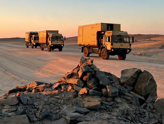
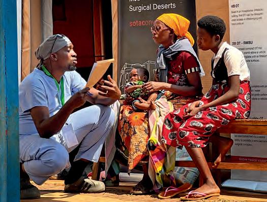
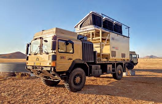
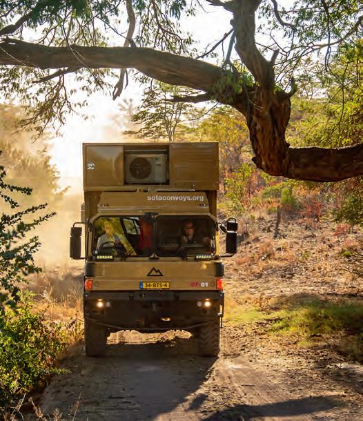
Steve Vryhof was inspired by his two sons, both ER doctors and world travelers, to try to improve surgical care in low- and middle-income countries. He and his co-founder from the Netherlands, Bart Kruijsen, began SOTA Convoys (SOTAC) to use military-grade overlanding trucks and advanced medical technology to bring a team with a self-sufficient operating theater and comfortable staff living quarters to people too remote or too poor to access surgical care on their own. Designed and built in Europe, the convoy was shipped to Africa and has provided “proof of concept” in a variety of East African surgical camps. The SOTAC team is designing and building a new and improved convoy for deployment in the Fall of 2026. @sotaconvoys
CHRIS CORDES
Chris was born and raised outside of Dallas, Texas, and didn’t receive a real taste of the overlanding lifestyle until moving to Arizona in 2009. It was there that he fell in love with four-wheel-drive vehicles and the great outdoors, quite literally altering the path of his life. Instead of pursuing his planned career in aviation, Chris accepted a position with Overland Journal and Expedition Portal, where he would hone his skills in writing, photography, and off-pavement driving. Over the years, he has lived full time on the road, mapped trails from the Arctic Circle to Mexico, driven across Australia, and backpacked the Himalayas. He is currently an Airstream Ambassador and works for onX Off-road, managing their Trail Guide community. @4x4_touring
After studying and working as an engineer, Dan realized it wasn’t making him happy, so he left it all behind in search of a more vibrant and fulfilling dream. He’s been exploring the remote corners of the globe for two decades in his four-wheel-drive vehicles, seeking unique experiences and connections with the local populations he encounters. To date, Dan has explored 65 countries across five continents, documenting what he sees and learns as he slows down to enjoy the pace of a life well lived. Now joined by his partner, Katie, and their young daughter, Aurora, the newfound team continues to search out the tastiest street food, natural hot springs, and remote mountains around the world. @theroadchoseme
RICHARD GIORDANO
In 2016, Richard Giordano completed a 48,800-kilometer overland journey from Vancouver, Canada, to Ushuaia, Argentina, with his wife, Ashley, in their well-loved but antiquated 1990 Toyota Pickup. That trip catapulted Richard into a career as a freelance video producer and photographer. He has crafted commercials for Toyota Canada, is the lead photographer and director of photography on the Expedition Overland Apex series, and is currently on the road in Central Asia, relishing a life of slow travel in his OEV Alpine camper and Toyota Tundra. If you see Richard out in the wild, he’ll most likely have a smile on his face, a strong coffee in one hand, and a camera in the other. @desktoglory
BRITTANY HIGHLAND
When Brittany Highland found out people actually drive around the world, she instantly thought, “We should do that.” With her husband, Eric, she has 11 years of full-time travel behind her and a delightfully adventurous 9-year-old named Caspian. She expects their circuitous circumnavigation of the globe will last the remainder of her son’s childhood. Her family recently concluded more than four years of overlanding through Latin America, and has shipped their Jeep Gladiator and Alu-Cab Canopy Camper to Africa for the next adventure. Brittany is dedicated to empowering other parents to overland with their children, teaching life’s most valuable lessons through international travel. Join them on their journey. @hourlesslife
LUISA BELL
Luisa Bell has always had a passion for travel, but she never imagined that she would travel the world with her family in a self-built Land Rover Defender camper. As the navigator, administrator, and penetrator of bureaucracy, she has led her family to over 65 countries on five continents. Luisa is the wife of Graeme, and their quarter-century together feels like a full century in overlander years. Her two kids and her dog are her pride and joy, and if she could travel with them indefinitely, she would. With a background in immigration law, she has the ability to make the impossible possible and has no plan of settling down or retiring her full-time traveler status. a2aexpedition.com
DAN GREC
SANDRA MUÑOZ
Sandra Muñoz is an emerging voice in the outdoor writing community, providing readers with unique insights into the beauty and challenges of exploring untamed landscapes. With a passion for nature, she offers a distinct perspective on overland journeys, camping experiences, and off-road adventures across America’s wide-open spaces. Teamed with husband, William Doree, they embrace the outdoors through adventures in national parks, across the Sonoran Desert, camping beneath starry skies, and trekking along mountain trails. These shared adventures not only deepen her appreciation for wild spaces but also inspire her to chronicle their experiences for others to enjoy in various publications such as Digital Trends en Español, Arizona Driver, OutdoorX4, and Rovers North. Sandra resides in Phoenix, Arizona.
JOE FLEMING
A born-and-raised American, Joe is a US Army veteran who has been living in South Africa since 2014. After connecting with local motorcycle enthusiasts, he started organizing local rides and long weekend events and has found his niche of hosting international riders throughout Southern Africa on motorcycle adventures (not tours) with Bonafide Moto Co. No matter the challenge along the way, Joe and his team look after riders and always ensure everyone arrives at camp at the end of the day. Over the last 10 years, Joe has fallen in love with this part of the world. He identifies as a South African and has a mission to share Africa with other adventurers from around the globe. @sotallrightnow
FIELD TESTED RICHARD GIORDANO
Pelican ATX and Aegis Carry-on Luggage
Two similar options for different travel
scenarios.
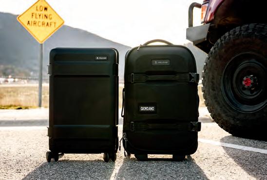
Airline travel without checking bags is a cheat code that is well worth striving for. Free yourself from the worry of theft, damage, and lost luggage (and the wasted time associated) with either of these two premium carry-on options from Pelican. Both offer organized space for up to a week of travel between laundry cycles in completely different packages. It’s about weather protection versus volume, domestic versus international travel, and security versus weight.
Are you hauling precious cargo (think about that Leica wrapped in your underwear) on a flight to Denver, to the open bed of a rented pickup, across endless dirt roads, through rainstorms, and back to your upscale hotel room in Telluride? Take the burly ATX. If you’re planning weeks of independent train travel around Japan, Europe, or beyond, choose the nimble Aegis.
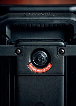
The build quality of this piece feels unmatched. A sealed Pelican Armor exterior with a pressure relief valve, 360-degree Hinomoto wheels, TSA locking latches, and soft-close handles scream quality. You’re paying for these premium touches, but it’s nice to know that the value is there, even at first glance.
The whole point of this luggage is to be used as a carry-on. Domestic airlines have a fairly consistent baggage size limitation of 22 x 14 x 9 inches and no weight limit, further indicating that the bag “must be light enough that you can store it in an overhead bin unassisted.” The 22-inch ATX fits the bill perfectly for domestic travel, but what if you want to travel outside of the USA or Canada? Internationally, the physical dimensions should be small enough, but the weight will be the real problem, as most international airlines limit a carry-on to 15 pounds. Since this ATX weighs 12.8 pounds, it doesn’t allow much payload for gear. Even lightly packed, it easily exceeds 20 pounds. As of late, many international carriers have been weighing my carry-on, so this is a legit concern.
Assuming you want to stay in North America and that protection of your belongings is paramount, the ATX does the trick and then some. The hard case and integrated seal protect from water and dust (as you would expect from Pelican) while the internal ripstop liner, zippered compartments, and compression straps help make the most of the 30-liter volume. The size was suitable for a weekend away in the winter or a week away in warmer tempera-
tures, where I didn’t have to bring bulky items like puffy jackets or boots.
Overall, I find myself longing for short-term adventures that are worthy of this burly carry-on while knowing it wouldn’t look totally out of place rolling into a lobby of a boutique hotel once the mud, dirt, and grime are wiped off—not unlike myself. This piece epitomizes the Pelican motto of “Built to protect to equip for the mission.”
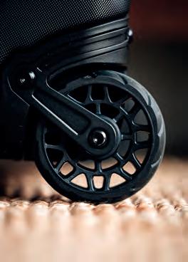
If weight and volume are more important than outright protection, the 22-inch Aegis carry-on may be the option for you. At 7.3 pounds, it is almost half the weight of the similarly sized ATX but still offers superior touches, such as a pair of smooth, quiet, oversized wheels and a multi-stage extension handle.
To keep the weight low, Pelican has used an EVA-molded front shell and weather-resistant 500D Cordura fabric. It’s a blend between hard- and soft-sided luggage. Will it keep your gear dry if strapped to a roof rack in monsoon season? Probably not. Can it withstand a rainstorm while waiting for a bus in London? Definitely. The Aegis (a nod to Zeus’ goatskin shield) is more protective than a duffel bag while still having a soft exterior that won’t damage the interior of a modern SUV. A plus for those vegans out
Prepare for takeoff! Pelican’s new 22-inch carry-on luggage options include the rugged hard-sided ATX and the lightweight Aegis.
FIELD TESTED RICHARD
GIORDANO
there, it’s not made of actual goatskin. The hybrid duffel design provides 25% more volume than its ATX counterpart.
The 40-liter capacity really makes this a contender for singlebag minimalist international travel. The less you bring, the more freedom you have to take a bus instead of a taxi, an inexpensive flight instead of paying for checked luggage, or to sleep in a capsule hotel instead of paying for a whole room. Pack intentionally, and this could be large enough to travel indefinitely—come on, give the 5-year warranty a good run for your money.
Zippered pockets throughout (including exterior-accessible ones) and a ripstop lining provide ample opportunities for organization. I found the single large compartment (compared to the two separate sides of the ATX) allowed for more versatile packing, even if I wished for compression straps that weren’t elastic. The Aegis requires only half the floor/bed/counter space to access your belongings. It’s perfect for tight spaces.
PELICAN.COM
FIELD TESTED STEPHAN EDWARDS
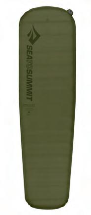
Sea to Summit Camping Gear ADV
Irecently embarked on my first long solo ADV ride, spending four weeks riding over 2,300 miles through five states from Albuquerque to my home in Montana. As befits a springtime ride in the shadow of the Rockies, the weather was, shall we say, variable. I departed on my first day from the normally dry climes of New Mexico in a monsoon that turned to snowstorms on the passes that crossed into Colorado. Utterly drenched on the bike, my soak in the hot pools in Pagosa Springs was well-earned. Also well-earned was a solid night’s sleep thanks to my Sea to Summit tent and sleep system.
Sleep is an underrated aspect of long-distance motorcycle travel. The more rested your body and mind are, the safer you’ll ride, and the more fun you’ll have. Assembling a sleep system that’s lightweight and doesn’t take up too much space is key, espe-
pack-out perfected.
cially for a solo trip. I wanted my pack-out to be light enough that I could pick up the bike by myself when I inevitably dumped it on the ground. But, I also didn’t want to skimp on my camping gear and end up uncomfortable and restless when it was time to switch off the headlamp. You should look forward to bedding down at night in a shelter that encourages sound sleep rather than gritted teeth as you groan about sacking out on the gravel.
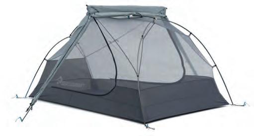
I carried the Sea to Summit Telos Ultralight 3-Person tent, the Australian company’s Ascent 15-degree down sleeping bag, and the Camp Plus self-inflating sleeping pad.
Left to right: The Pelican pressure release valve automatically equalizes interior air pressure, protecting against vacuum within the case, while a hydrophobic membrane keeps dust and water out. | The large pair of wheels on the Aegis rolls smoothly and quietly between airline gates or over cobbled streets.
I have slept many nights in single-person tents and almost always barely tolerate it. With very little room to sit up or turn over, no space for gear, and just overall claustrophobia, singleperson tents feel like the middle airline seat of the backcountry. Bonus headroom and area to stretch out are worth it for the comfort factor.
The term “ultralight” is often casually bandied about in the world of outdoor gear, but the Telos delivers. At a mere 4 pounds 11 ounces, it’s admirably light for a shelter with nearly 40 square feet of floor space, and Seat to Summit’s FairShare storage system means the tent packs into three separate stuff sacks to split up the load. Traditionally packed tents end up with an awkward oblong shape that can be hard to stow, so this turned out to be a huge boon for loading my soft saddle bags, where I often needed to cram items into little corners to maximize space.
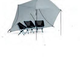
The Telos sets up quickly with its proprietary Tension Ridge single-pole system that also turns the rainfly into a stand-alone open shelter in Hang Out mode. Because of the freestanding design, the fly can be set up independently of the tent for dry assembly and takedown in damp conditions. Sea to Summit credits the Tension Ridge with giving the Telos the best space-to-weight ratio in the category, and 52.5 inches of peak height and tall, easy-to-access doors confirm that claim. Much of this tent’s featherweight character comes down to its overwhelmingly mesh construction.
The big liability of ultralight construction is its papery and potentially fragile materials, and because I neglected to get the Telos footprint ($51), I worried about the durability of the thin bathtub floor on more abrasive surfaces. It never tore or developed weak spots, but over the long term, it’s likely worth adding the extra layer of protection. I found the fly difficult to set up in windy conditions, but its impermeability was second to none when the rain and snow really started pelting down.
ASCENT 15-DEGREE DOWN SLEEPING BAG | $449
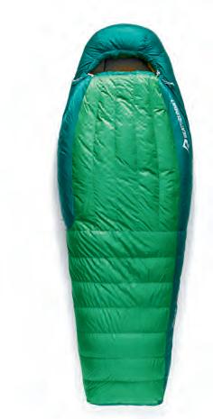
Because I was traveling in the heart of spring at elevations up to 9,000 feet across Colorado, Wyoming, and the Utah high deserts, I needed a true three-season sleeping bag to stay warm in potentially below-freezing temps overnight. Compressibility was key for packing efficiency on the bike, too, so down fill was the only answer. The Ascent comes in two temperature ratings, 30-degree and 15-degree. I went with the colder rating that features Responsible Down Standard-certified, 750+ fill-power goose down with a nonPFAS Ultra-Dry treatment, while still staying under 2.5 pounds total weight.
With the warmth factor dialed in, where the Ascent really shines is its versatility beyond what normal mummy bags offer. The FreeFlow zippered footbox lets you air out sweaty boot feet and increase head-to-toe ventilation, and the short side zipper, opposite the main one, frees up shoulder space.
The Ascent’s myriad adjustability meant I could regulate temperature no matter the weather, and it easily accommodated a range of sleeping positions. But because of all the zippers, it also felt fussy in use and they often jammed on the baffles, which sometimes meant flipping on a headlamp to free them—not great for getting my beauty rest before a long day on the road.
While the sleeping bag is the centerpiece of any sleep system, it’s also important to get yourself off the ground for maximum comfort and warmth. I paired the Ascent bag with Sea to Summit’s Camp Plus sleeping pad. The Camp Plus in the regular size comes in a hair under 2 pounds and packs into its compressible stuff sack to an 8 x 11-inch cylinder. This is a little on the bulky side, but the trade-off is claimed four-season use due to its 3-inch thickness and Delta Core foam-backed R-4.3 insulation value. The 75D polyester shell proved abrasion-resistant when confronted with desert sand and grit, and after nearly a month of travel, it still looked brand new. SEATOSUMMIT.COM
Garments that provide stylish, practical warmth and stand the test of time.
Mountain Hardwear has been around since 1993 and is based in Richmond, California, where they operate out of a former Ford Motor Company assembly plant. Columbia Sportswear took the helm in 2003 when it acquired the brand, but the “focus on the mountain, not the masses” ethos continues to drive the company to this day.
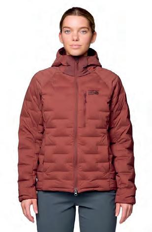
STRETCHDOWN HOODY | $300
A down puffer coat is a staple for me, and the right one can segue between the fall, winter, and spring seasons with ease.
The Mountain Hardwear Stretchdown hoody strikes the perfect balance between weight and warmth without being bulky, and the 700-fill RDS-certified down/144 GSM ratio is suitable for various temps in my mountain town, comfortable on its own to about 20°F. When worn with a base layer underneath, colder temperatures (within reason) pose no challenges.
The total weight of the coat (size medium) is 14 ounces, and it packs down to the size of a giant grapefruit, making it easy to stow. Moveability is excellent, thanks to the 20D durable stretch combo of nylon, elastane, and polyester. Stretchdown “weaves pockets of down insulation from a single stretch fabric,” further eliminating restrictions in movement. Small touches perfect the package, such as the elastic binding on the cuffs and insulated hood, drawcord hem adjustment, and inside drop pocket.
The zippers on the outside side pockets are somewhat fiddly to open and close (more so to close since they catch), and you definitely can’t operate them while wearing gloves. The Stretchdown runs large, and I’d recommend sizing down by a full size unless you want to leave room for several layers underneath.
I’ve been wearing the Stretchdown for two years now, and it has become my go-to in winter and the shoulder seasons. After several trips through the washing machine, the zippers are still hanging tough. Basic black suits me, but the gem-colored teal (jack pine) option is another appealing choice among several colorways offered. Available in sizes for men and women.
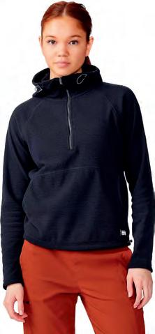
SUMMIT GRID TUNIC HOODY | $85
Wool and cotton are my preferred base-layer fabrics, and I steer clear of synthetics when possible, even with the increased breathability and benefits of the latter in recent years. But there is a time and place for everything, and when someone handed me the Mountain Hardwear Summit grid tunic hoody on a chilly June morning in Idaho’s Sawtooth Mountains, I was happy to have it. The 100% 200 GSM polyester insulating fabric is ultra soft, enveloping you in a cozy blanket of warmth that immediately zaps the cold.
This pullover is super lightweight and stretchy, with a cinching scuba-style hood and hemline. The kangaroo pocket ensures that your hands stay as warm as your torso, and the hoody is the ideal length for pairing with multiple layers.
I keep the Summit close at hand, reaching for it most to wear as a standalone when the days are cold, and I know I will be outside for a good portion of it. I sometimes don it for short hikes, but inevitably remove it (or wish I could) about halfway through due to heat buildup. Zip vents would be a game-changer. Available in sizes for men and women. MOUNTAINHARDWEAR.COM
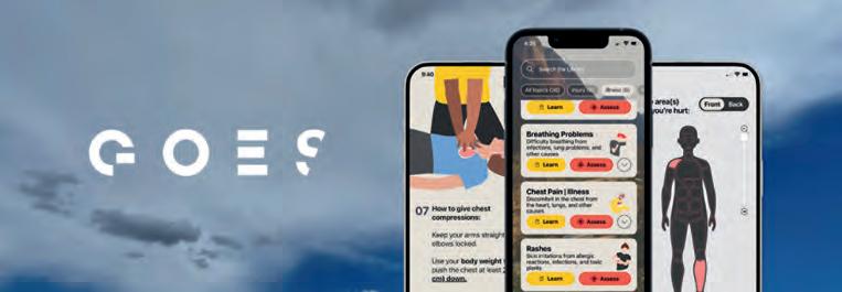
GOES Health App
A new app quantifies environmental risks, offering safety as a service.
Theknowledge and skills learned in a Wilderness First Aid (WFA) course can help mitigate the risks of adventure travel, but retaining that information can be challenging, and applying it to real-time risk assessment and treatment can take a lifetime to master. What if you could simply travel with your own personal wilderness medicine physician, one who would help you stay ahead of danger and act with confidence during a real medical emergency? That reality may be more attainable than you think, thanks in part to Global Outdoor Emergency Support (GOES) Health app, a health and safety platform for iPhone and Android.
GOES Health offers on-the-go trip planning tools, real-time environmental alerts, and offline medical advice during an emergency. The magic behind GOES lies in its proprietary AI engine and Core API (application programming interface), a risk-detection feature that scans for environmental risks based on your location, and an offline medical assessment algorithm written by wilderness medicine experts. This mighty package of three is the brainchild of CEO and Co-founder Camilo Barcenas. Mr. Barcenas spent over 15 years in the health technology and startup sector, and I recently sat down with him and GOES
Health’s Chief Medical Officer Dr. Colin Little, to learn more about this product. Savvy smartphone users will easily navigate the menu’s four main tabs, which are accessible from the bottom of the home screen: Home, Prepare, Learn, and Assess. Start your day by pouring a cup of coffee and accessing the Home screen. Current or predicted risks such as heatwaves, flash floods, altitude illness, lightning strikes, or wildfire smoke are displayed based on your location, elevation, and weather. Get your brain cells up and running by answering the Question of the Day, which challenges your understanding of wilderness medicine topics. Correct answers earn you digital tokens and stamps, which can be redeemed for discounts at outdoor retailers such as Duration Health, Uncharted Supply Co, and Outdoor Element. A Build Your Vocab tab introduces or reinforces medical terminology to help you communicate more effectively with health care and rescue professionals. Next, a featured series of short articles begs you to pour a second cup of mud and spend five minutes reading about wilderness medicine topics such as water safety, winter survival skills, and camp hygiene, to name a few.
Now, thinking ahead to your travel day, you’re ready to move across the bottom of
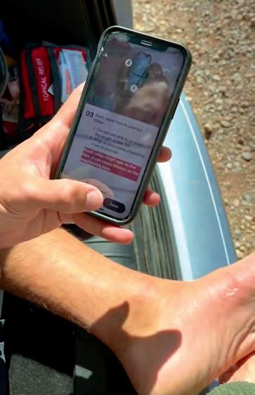
Navigated like a choose-your-own-adventure book, the app can guide you to a diagnosis and treatment.
the home screen to the Prepare tab, which displays your GPS coordinates, a graphical representation of the weather, and a 16-day forecast. Use the search bar to access this information for the next planned stop on your route. Environmental risks are quantified based on temperature, elevation, UV exposure, air quality, and local flora/fauna such as poison ivy, mosquitoes, insects, and snakes. Risks include environmental and locationspecific considerations such as hypothermia, heat stroke, altitude sickness, and lightning strikes, quantified and translated into clear, actionable guidance.
The Learn tab takes you to a series of 36 topics ranging from illness and injury to how to perform CPR and care for yourself in a natural disaster. Most take less than five minutes to read and are well written and easy to understand. Bulleted lists and simple illustrations drive home key points, and many topics guide you right into a patient assessment using a choose-your-ownadventure-style algorithm of questions and available actions.
your day in the field with the Prepare tab open forces you and your team to conduct just this type of briefing, improving situational awareness and decreasing the chances of injury and/or illness. You certainly do not need this app to do so, but for less than a tank of gas, it could help organize a novice team and get everyone on the same page. The Assess tab, which guides you through basic first aid principles, is not a substitute for mastering the material in a hands-on Wilderness First Aid Course or for carrying a well-stocked trauma and expedition medical kit, but the algorithms are medically sound, bringing a sense of calm and organization, especially for those not used to caring for illness and injury. I prefer a laminated, soft-covered medical field manual, one not prone to a dead battery, cracked screen, or out-of-date operating system, and one in which I can make notes and dog-ear important pages. However, I am old-school and do not adjust my shock absorbers with an app either.
ARGUABLY THE MOST USEFUL TAB ON THE HOME SCREEN IS THE ASSESS TAB. HERE, A SERIES OF OFFLINE, ALGORITHMIC PROMPTS GUIDE YOU TO SELECT THE INJURY OR ILLNESS DEPENDING ON THE MEDICAL SITUATION YOU’RE FACING.
The final, and arguably most useful tab on the home screen, is the Assess tab. Here, a series of offline, algorithmic prompts guide you to select the injury or illness depending on the medical situation you’re facing. Your medical assessment of the patient is then guided through a simple touchscreen questionnaire, similar to what a wilderness medicine expert would ask to help you decide on a plan of action. Clever features include “select the body part where you’re hurting,” and simple illustrations guide you through a variety of procedures, such as fashioning a splint or reducing a dislocated kneecap or shoulder joint. Users should not plan to arrive at an extended list of possible diagnoses, but the prompts are good refreshers for what you should have been taught in a standard WFA course.
Overall, I like this app. Every organized expedition I’ve ever been on (military and civilian) starts the day with a commander’s briefing, including where we are on the map and where we are going, a forecasted weather report, and a threat assessment. Starting
I suspect the app will continue to evolve and incorporate other potential features of interest, such as encounters with international flora/fauna, US State Department notifications, and possibly even countryspecific immunization and disease information from the Centers for Disease Control and/or the World Health Organization. I am not aware of any other app that can help synthesize such a wide range of information into a usable platform, and it is worthy of a one-year subscription.
GOES Health does not keep track of your location or environmental risks, and your data is not shared with others. Mr. Barcenas and Dr. Little are quick to point out that GOES Health is not a substitute for a doctor-patient relationship or obtaining certification in Wilderness First Aid. Currently, risk assessments do not account for civil unrest, such as alerts from the Smart Traveler Enrollment Program (STEP) or the US State Department.
$36/YEAR, $6/MONTH | GOES.HEALTH
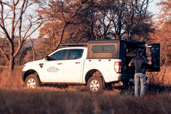
Alu-Cab ModCap Canopy Base
A utility-first, customizable solution for your storage needs.
For years, I ran an RSI SmartCap on my Ford Ranger. It’s a canopy that’s hard to fault—stylish, sleek, and built with clean lines that give any vehicle a polished, factory-fresh look. I loved how refined it made my rig look; it had presence, and it turned heads.
But as my trips became longer and more demanding, my priorities shifted. The more time you spend living out of your truck, the less you care about appearances—and the more you value usability. That’s when I made the switch to the Alu-Cab ModCap.
The RSI is a canopy that balances strength with style, but the ModCap leans into a completely different philosophy: it’s a utility-first design. Built with modularity at its core, it’s designed to adapt—mount a rack, bolt on accessories, slide in storage, or configure it to fit your next adventure. In terms of practicality, the system is unmatched.
Built with modularity at its core, it’s designed to adapt—mount a rack, bolt on accessories, slide in storage, or configure it to fit your next adventure. In terms of practicality, it’s unmatched.
One of the ModCap’s standout features is that, unlike most canopies, it completely replaces the factory tailgate. By doing so, it sheds unnecessary weight from the rear of the truck, keeping the build lighter and better balanced overall. On long trips where every pound counts—whether for fuel efficiency, suspension performance, or ease of handling in tough terrain—this makes a noticeable difference. The design isn’t just about being lighter; it’s about being smarter. Less weight at the rear means less strain, better ride quality, and more freedom to kit the vehicle with gear that actually matters.
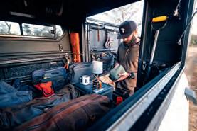
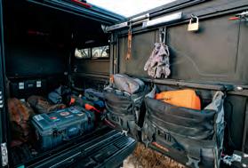
What I appreciate most about the ModCap is how customizable it is, and the back door has become my favorite workspace. I’ve kitted it out with Turkana panniers and their new modular pouches, turning what could have been dead space into organized, grab-and-go storage. While Alu-Cab does have a MOLLE bracket you can purchase, I found that by putting in some eye bolts in the rail systems, I was able to configure it to my needs.
Each pouch has a purpose (tools, recovery gear, cooking essentials, or first-aid), and I can swap them around depending on the trip. On a long overland expedition, that means everything I need is right at hand the moment I swing open the door. No digging through bins, no wasted time—just pure function built around how I actually use the truck.
$1,500+ | ALUCAB.COM
Clockwise from top: The Alu-Cab ModCap mission: utility, adaptability, and performance where it counts. | The ability to fully customize your storage solutions makes it a canopy built for real-world adventure. | Small details make the ModCap shine. It’s a system that grows with you, adapts to your style, and allows for true personalization in a way few others can.
Traeger Ranger
Summon the taste of open flame cooking without the fire.
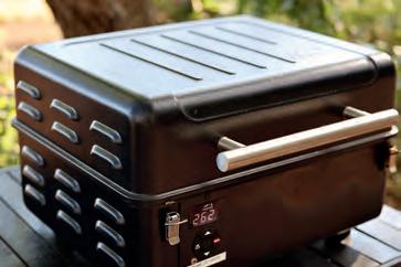
Acampstove should be simple, easy to use, versatile, and fun, and the Traeger Ranger is the Swiss Army knife equivalent: it’s a portable pellet grill that also functions as a smoker and an oven. Smoke, sear (on the included cast iron griddle), and bake to your heart’s content in the wild.
The grill’s interior has a pellet hopper with an 8-pound capacity and offers 176 square inches of cooking space, while the exterior dimensions are 21 x 13 x 20 inches. Grilling pellets come in flavors like apple, cherry, hickory, oak, and pecan, in bags of 20 or 33 pounds, priced from $18 to $30. Simply fill the hopper with the flavored pellet of your choice. They are then fed to the firepot, igniting and burning as fuel. An inter-
FIELD TESTED LUISA
BELL
Gnara Livsn x EcoTrek Overalls
These bibs are intended to be lived in.
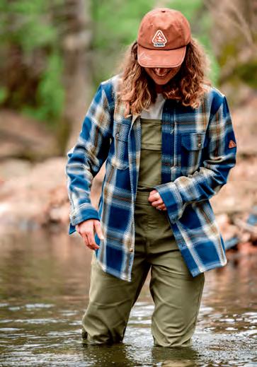
TheGnara Livsn x EcoTrek Overalls are one of those rare pieces of outdoor clothing that feel genuinely designed for women who actually spend time outside. For a pair of technical, utilitarian overalls, they’re surprisingly comfortable, and I wear mine constantly, much to my husband’s disdain. He says I always look like I’m heading out on a camping trip or fishing expedition. Made from a recycled nylon blend, they’re lightweight, stretchy, and relaxed enough for all-day wear.
Their standout feature on the trail is the patented GoFly zipper system, which makes bathroom breaks far easier without having to take off the entire overall. A zipper that runs from the lower front to the rear waistband provides ample access when needed. It’s especially useful when squatting or when
paired with a portable urination device. I also love the adjustable bib straps, which use a quick snap release instead of a fiddly button. I was once stuck thigh-deep in a boggy Minnesota marsh, and I can confirm these overalls are both quick-drying and stainresistant.
And then there are the pockets, so many pockets: between the front pen pockets, and ones for a phone and a large wallet, the side hand pockets with a hidden pouch on the left, two thigh EDC options, two rear zippered, and an additional zippered stash pocket, there’s a place for everything. I keep an EDC in one thigh pocket and bear spray in the other, and I’ve genuinely used every single one at some point. The only real drawback is the price, which is offset by constant use. Available in a men’s version as well.
$229 | GNARA.COM
nal fan helps maintain an even temperature throughout the cooking chamber.
The Ranger requires a 120-volt AC power source and has a 6-foot cord—we connect it to our Goal Zero portable power station, charged via solar power. At 32 pounds, this grill is no lightweight, but we find it increases our mealtime enjoyment factor enough to make it worthwhile. Heavy-duty, water-resistant covers are available for $70 to protect it in transit and from the elements.
$480 | TRAEGER.COM
NOTE Check
for a
Overland Chef on
EDITOR’S
out
page 124
recipe cooked in the Traeger by William Doree, the author’s husband.
Photo by William Doree
Analog Nomads
Navigating travel in the digital age.
By Brendon Hak
Photography By Kira Hak
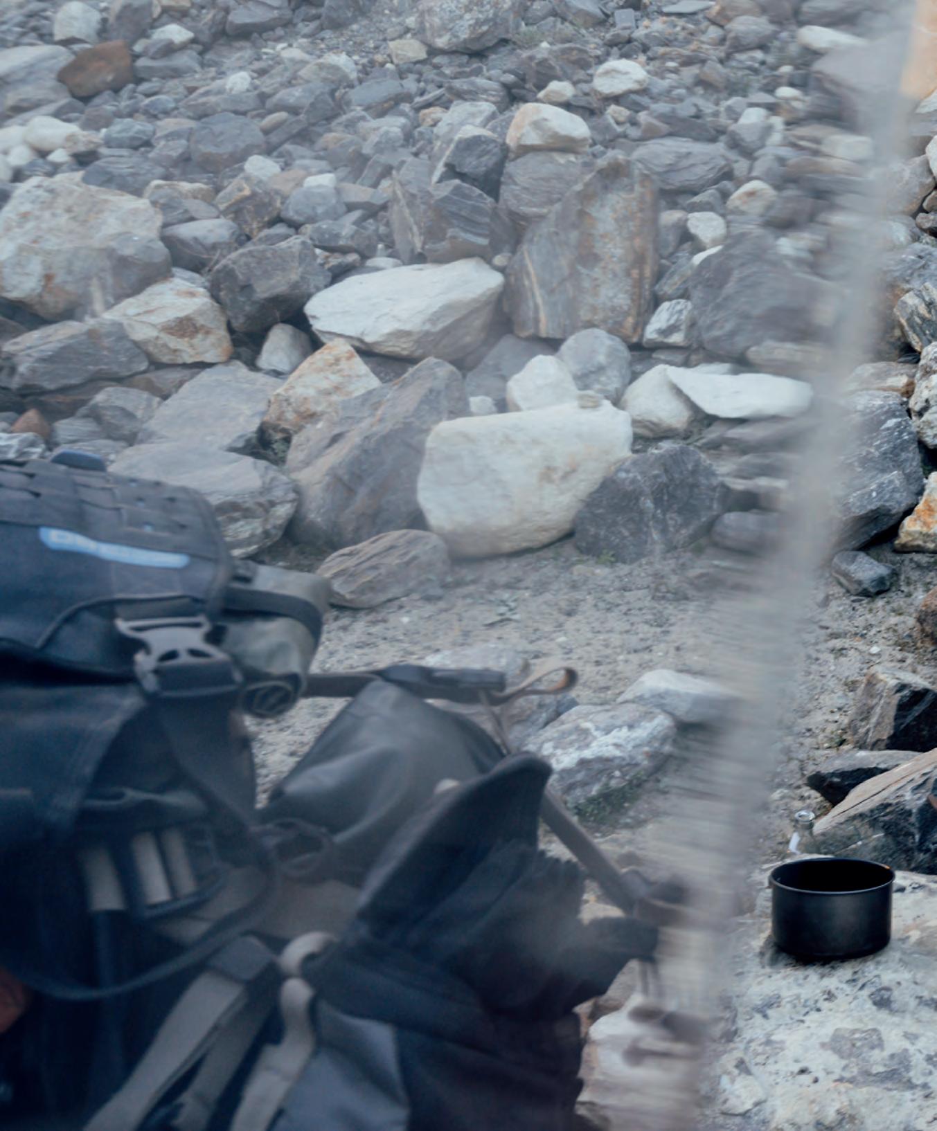
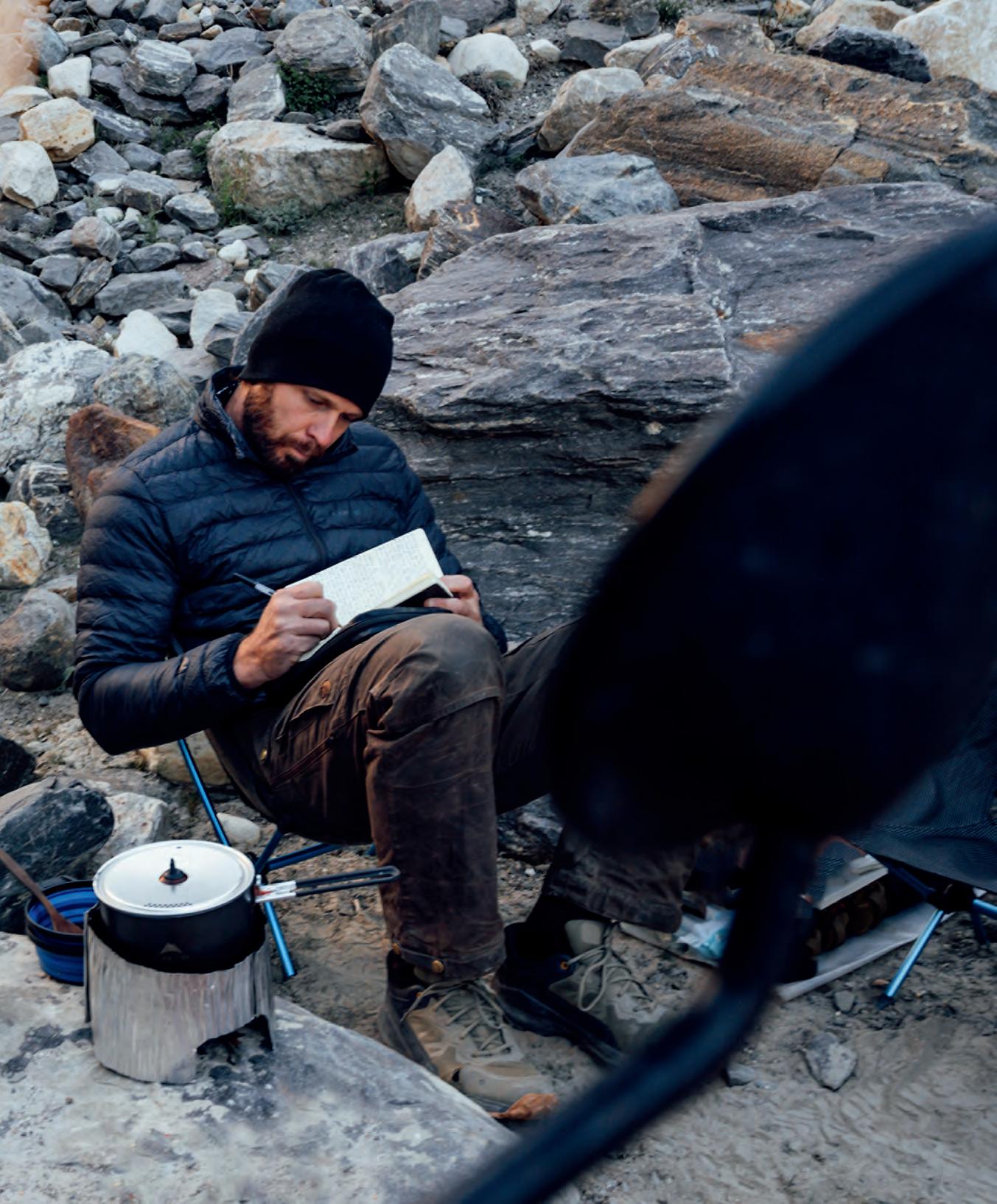
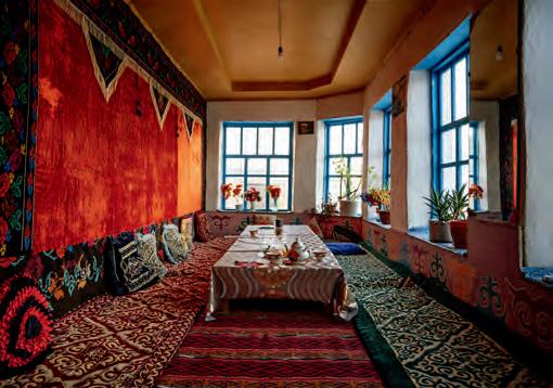
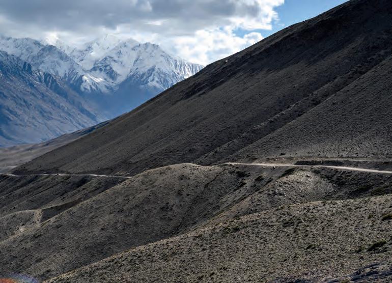
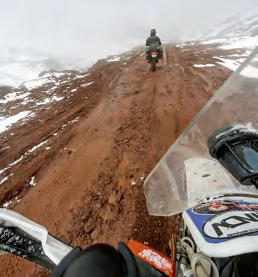
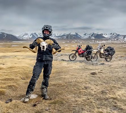
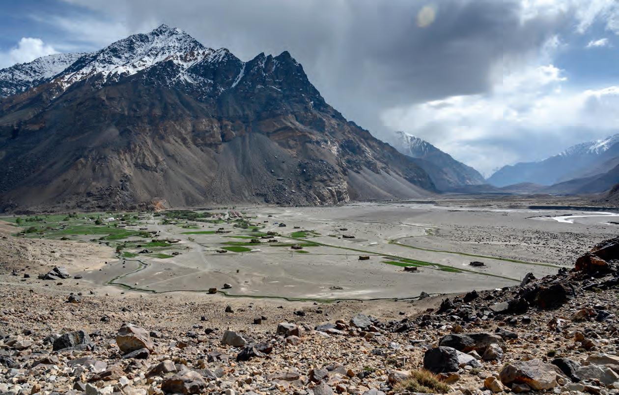
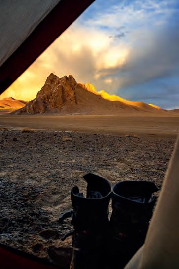
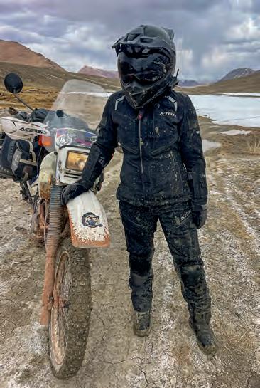
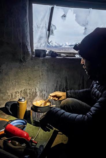
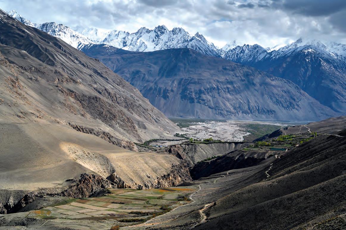
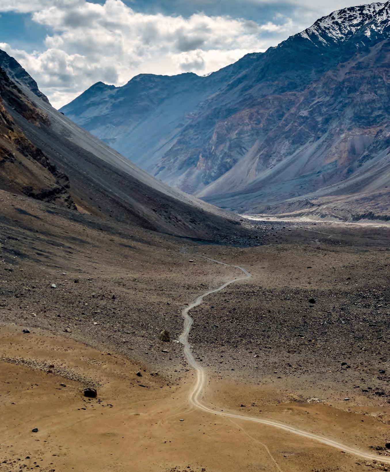
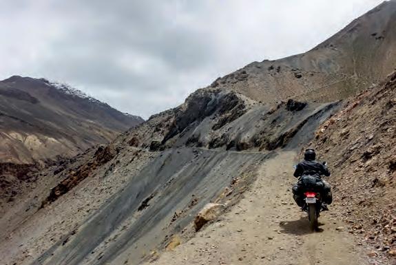
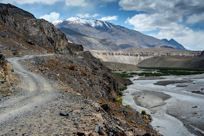
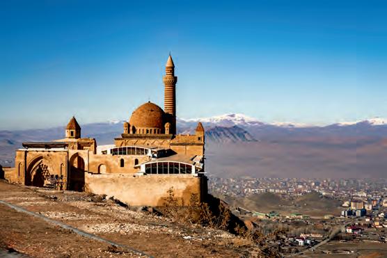
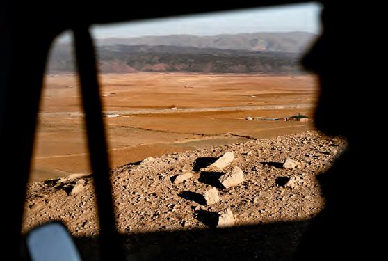
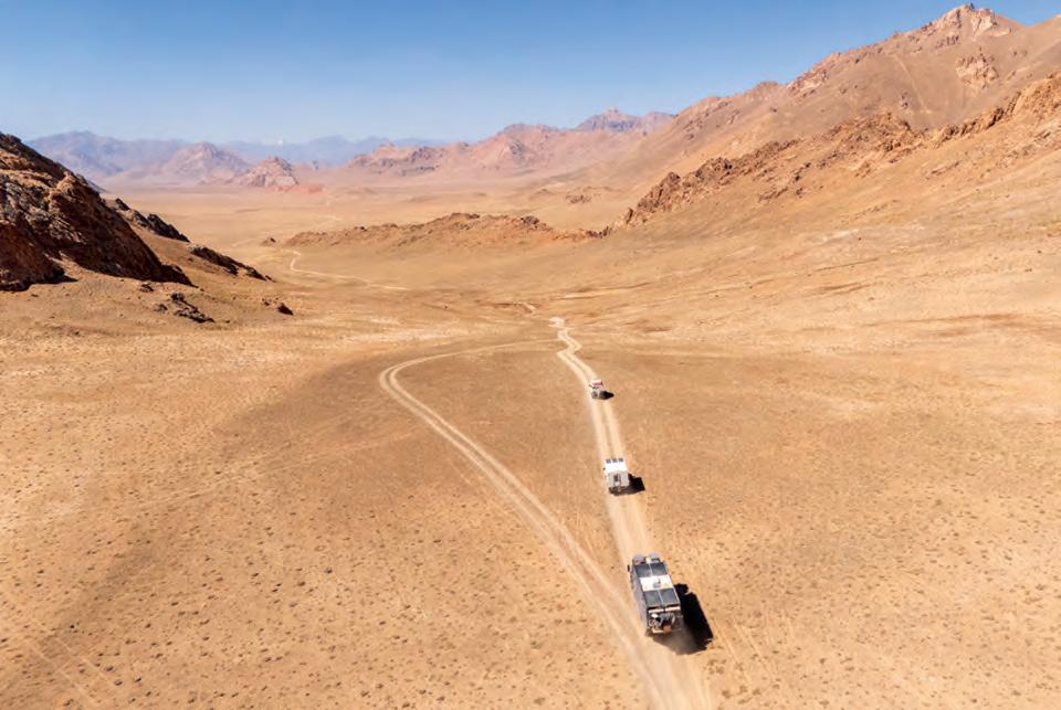
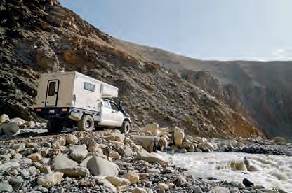
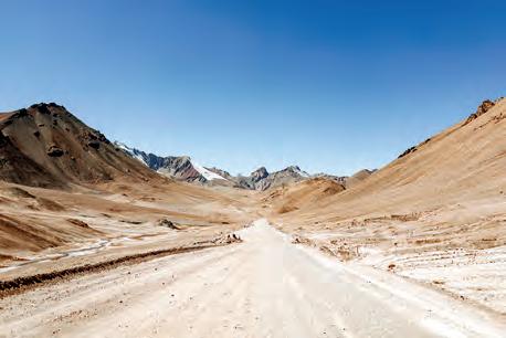
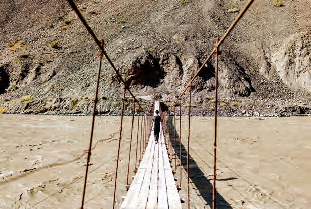
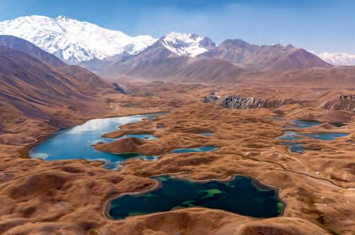
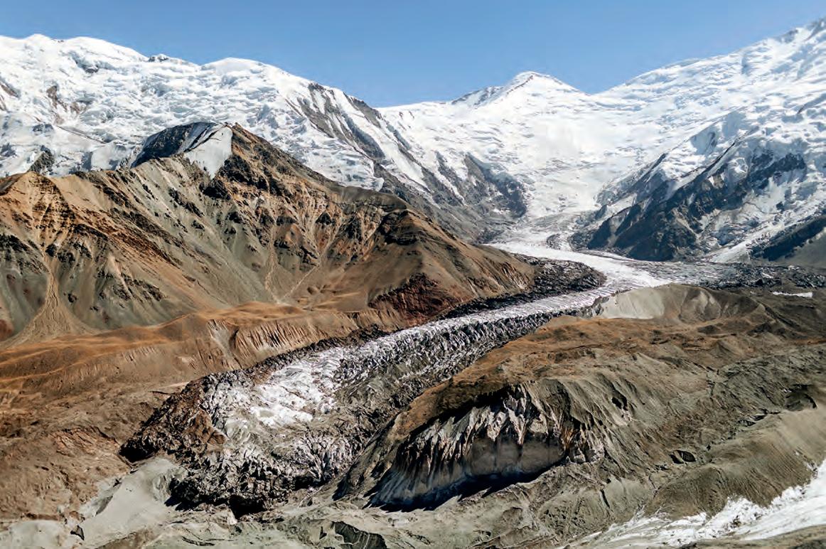
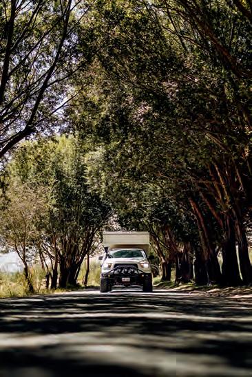
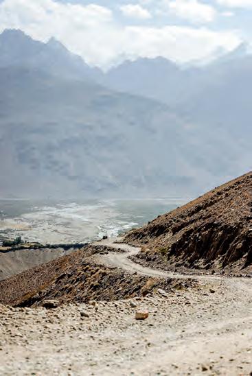
Clockwise from top left: The landscape outside is austere, but inside the homes, color and textiles often fill every surface. | The road clings to the mountainside, small against the scale of the surroundings. | One last look back at the Bartang Valley before we climb into the highlands. | Brendon holds up an argali sheep skull we came across in the Zorkul Valley. | Spring snowmelt leaves the high elevation paths a muddy mess. | Opening page: Dinner simmers as Brendon documents the day without screens or signal.
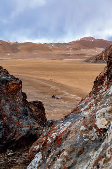
Calm,steady breaths accompanied my evening survey as I looked out at a vast expanse, hemmed in by the rise and fall of a russet mountain silhouette. The features mirrored the map I was holding, confirming our position. Over the horizon was a vista just like it, and beyond that, yet another, a repetition of open wilderness that we’d been crossing for days. The motorcycles and our nylon domicile perched below me were mere specks, distinguished only by their contrary colors. It was breathtaking; the atmosphere, mainly, but also the view. Full lungs would not satiate my need for oxygen at this elevation, and I’d given up on the attempts for the pain it caused. The air was so desiccated that every inhale felt like a rasp dragging through my throat.
A barely audible rumble propagated in the distance, and I wondered if the storm would stay in the periphery, like the whisper of a headache lurking for hours. Or would it visit doom upon us, like the migraine and nausea rendering my partner, Kira, tent-bound since we rolled to a stop. With my survey complete, I took care in folding the map, which had become restless in the wind. Not for fear of ripping the paper, but to avoid reopening the bloody cracks that had developed on my dry fingers. We’d succeeded in getting ourselves into a position to suffer the bitter elements, but this wasn’t the goal, just a side effect of the region. We were in a remote extremity of Central
Asia’s eastern flank, a place once known as Bam-i-Dunya, the Roof of the World, and we were nearing a point of no return.
It was the first of many potentially impassable detours, wispy lines singled out from their bolder counterparts on our latest treasure, the chart I’d just folded. Finding a good paper map abroad is rare, and each time we do, I feel as if we’ve come into possession of a long-lost artifact, beckoning for a quest. Arguably, the applications at my disposal are more detailed, better equipped with pertinent information, and far more convenient. But lately, I’m finding the only ease my smartphone offers is the ability to zoom in and out, easily detaching myself from the scale of our surroundings. Not to mention inundating us with the when, where, and how to see a place while the GPS holds my hand to cross the street, making sure I don’t talk to strangers along the way. The paper version, on the other hand, is unbiased and offers a big picture with a stage wide open for unbridled discovery. It’s a two-dimensional option with no promises offered in the form of curated pictures, bygone experiences, or current opinions—spoilers that my digital companion never fails to put forth.
There we were, sequestered at an uncomfortable elevation and facing a high probability that our route would fall flat this early in the season. We’d opted to consult locals instead of the screen to avoid inaccurate assessments, but the old-fashioned approach can have flaws
as well. Ultimately, our well-being had to rest on our own judgment, a point emphasized the following day as we pulled into the small hotspring hamlet of Dzharty–Gumbez. The lonely cluster of buildings stood in a tangy sulfuric breeze while a solitary figure watched our approach. He gestured to the line we should take to reach his side of the river, but instead we parked and walked the rickety footbridge to introduce ourselves.
The paper map is a twodimensional option with no promises offered in the form of curated pictures, bygone experiences, or current opinions—spoilers that my digital companion never fails to put forth.
Along with the universal language of tea and smiles, we pulled out the sacred parchment and showed him our route, which he fully endorsed. However, this was the same fellow who invited us to ride through the rocky knee-deep brine when there was a perfectly serviceable bridge. His blessing reflected the riverbank, crusted with many grains of salt buildup. With unaltered optimism, we made for the Yangidavan Pass, keeping an astute eye on the changing conditions.
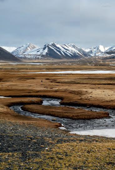
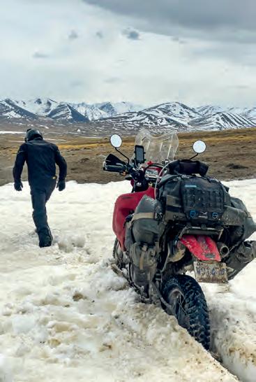
The parched ground turned muddy from meltwater, and snowpack clung to depressions in the landscape. An absence of tracks meant we had the honor of breaking trail into a realm still shaking off winter’s tenuous hold. I’d expected some frosty remnants and was glad we came to see for ourselves the extent of it. Bare earth showed between the fingers of white that laced themselves down the mountain saddle. We couldn’t ride straight through, but by climbing the
dry slopes first, we could angle back down across the snow with gravity on our side (arduous but passable) and then repeat the strategy in the reverse direction. It was neither quick nor easy, but following the summit, a promising panorama loomed below, a wide basin four kilometers across and rolling downhill into the periphery. Alas, it was a mirage; the valley that comprised the tail end of this route was a spring runoff swamp.
The broad and majestically uninhabited Zorkul Valley, which had impeded our progress with its sodden self, was the aforementioned point of no return. Beyond this position, we would not have enough fuel to backtrack. Even with favorable conditions, these are serious junctures requiring an audit of our situation. Should a mechanical failure or any other predicament leave us stranded, are we willing and able to hoof it out on foot? What are the odds of help passing by if we need to put roots down? We’d made it a mere 20 kilometers in the preceding three hours, pushing, pulling, and cursing our way along. Continuing was folly, and we knew it, but it was a satisfactory defeat. A small shepherd’s hut we’d passed called us back with its potential for wind cover, and surpassed our expectations with enough space to pitch up inside for the night. A sense of relief hung in the air, alongside a faint goaty ambiance. If the weather turns, we couldn’t be in a better spot, and the weather was meant to turn.
We hadn’t forgone all digital consults. Due diligence in an area known for rapid and extreme weather fluctuations warranted an eye on the forecast. We’d had multiple days without service, but when we
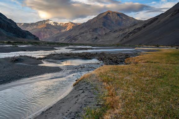
Clockwise from top left: Last light falls across the mountains outside our tent. | When the visor stays down for a picture, I know the last stretch was particularly challenging. | With our camp set up in the shepherd’s hut, we could now take in the serenity of the landscape around us. | It is no small joy to cook indoors on a cold night, even if it does smell like goats inside. | Our small tent sits lonely in the open, as we wrap up our evening surgery. | Without gravity on our side, stomping a path through the snow is the only way forward. | Opposite: Brendon stops to assess a gathering storm moving across the landscape.
last looked, heavy snowfall was predicted for later in the week. With mountain passes over 4,400 meters behind us, and a swampy morass in front, the blizzard’s early arrival could leave us in a bind. Peace of mind was granted by our creekside shelter, its dung stove, and a stockpile of dried droppings outside that would outlast any prolonged stay.
Trading the prospects of another night out in sub-zero temps with a serendipitous chalet under the stars was a favorable consolation prize to the uncompleted detour. Adding to our good fortune, it seemed that the heavy exertion had sped our acclimatization, dissipating the acute mountain sickness we’d been battling. As I hydrated my hands in the frigid stream, a comical notion crossed my mind: I could scour every booking platform available and not find a retreat this tranquil. I shook it off, realizing we were not guests in the Swiss Alps with an abundance of options. We were interlopers in an area covering 64,000 square kilometers, spiked with peaks towering over 7,000 meters, a magnitude that dwarfs my mind’s comparison. We were becoming acquainted with deprivation delirium, where any small comfort was seen as a grand luxury in the Gorno-Badakhshan Autonomous Oblast (GBAO), a locale named with Soviet stature, but uniquely spartan in its conditions.
We woke to immovable motorcycles, a frozen plaster cast of mud having set over the drivetrain and brake calipers. We waited out the thaw with hot coffee, basking in the quietude before our single cylinder ruckus once again disturbed the inhabitants of the valley I originally took for vacant. Migratory birds making their annual commute filled the sky, and brilliantly camouflaged herds of argali roamed high on the rocky slopes, nearly invisible once they stopped moving. Also known as Marco Polo sheep, these residents gave us an insight we could put to good use. We extracted ourselves in a fraction of the time by traversing at the limit of our traction, where it was too steep for the water to pool and soften the terrain. A day later, the weather came on cue, but thankfully, we had made it back to the frost-heaved and fractured main artery. Through sleet and snow, the post-apocalyptic pavement led us to an outpost community, a safe haven that initially looked as gray and bleak as the sky above.
The sole café betrayed its abandoned outward appearance with a small wisp of smoke from the chimney. A lukewarm draft floated over to our frozen frames, and the two pots sitting atop its source contained everything we needed: hot tea and soup of unknown origin (perhaps yak, judging by the thick black hairs still attached to the contents). I saw this as a fitting opportunity to break from my purest principles and seek counsel from the plastic rectangle in my pocket, but only a partial treason, as I’d be using an offline app instead of the internet. It is neither fun nor
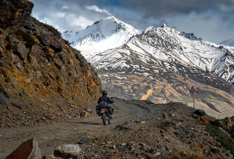
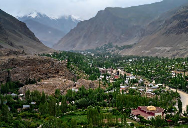
In these blind corners, the path ahead demands attention more than the view. | The town of Khorog is a lush green metropolis nestled amongst the rough. | Opposite: The Panj River forms a divide between Tajikistan and Afghanistan.
THE TOWN’S PROVISIONS, ALTHOUGH SCANT, WERE ENOUGH TO KEEP US MOVING TOWARD THE REGION’S SOUTHWESTERN FLANK, WHICH SAT 2,000 METERS LOWER AND IN A DIFFERENT SEASON.
fair to visit multiple guesthouses, raising hopes of income as rudimentary conditions are scrutinized, awkwardly postponing offers of food and drink until ready to commit. At times, we instead read a few iOverlander check-ins to optimize the outcome and make a decision before showing up. In a town without a functioning electrical grid or indoor plumbing, this meant finding a restful stay at the only house with a modern solar setup. The town’s provisions, although scant, were enough to keep us moving toward the region’s southwestern flank, which sat 2,000 meters lower and in a different season.
When coming from above, the towns of the lower GBAO first felt like vibrant metropolitan hubs nestled along the seaside. With time spent scouting this way and that, the springtime illusion of prosperity in a comfortable waterfront atmosphere dissipated. These are hardscrabble high-elevation settlements, eked out of the arid terrain by traditional methods at the hands of the resilient Badakhshan people. Multiple ethnicities stand under this proud umbrella, a population that has endured by utilizing the region’s watersheds as they course
toward the Aral Sea basin. Rivers have carved out the valleys and canyons bearing the same names: the Gunt, which we followed down to warm our bones, and the Panj as we swung back around to climb the Wakhan Corridor, the geographical feature marking the border between Tajikistan and Pakistan. Then, there was the formidable Shakdara Valley, which had the courtesy to bar our entrance before too much struggle ensued. Our map was becoming a mess, overlapping circles and squiggly dead ends, almost like I had been trying to warm up my pen instead of tracing a route. It was roaming at its finest. A few turns of the sun would separate moments of severe strain, where we questioned our motives, and effortless camps under flowering trees, where we daydreamed of the next challenge. Every time it got too comfortable, convection currents of warm air would rush toward higher ground, drawing us upward with it.
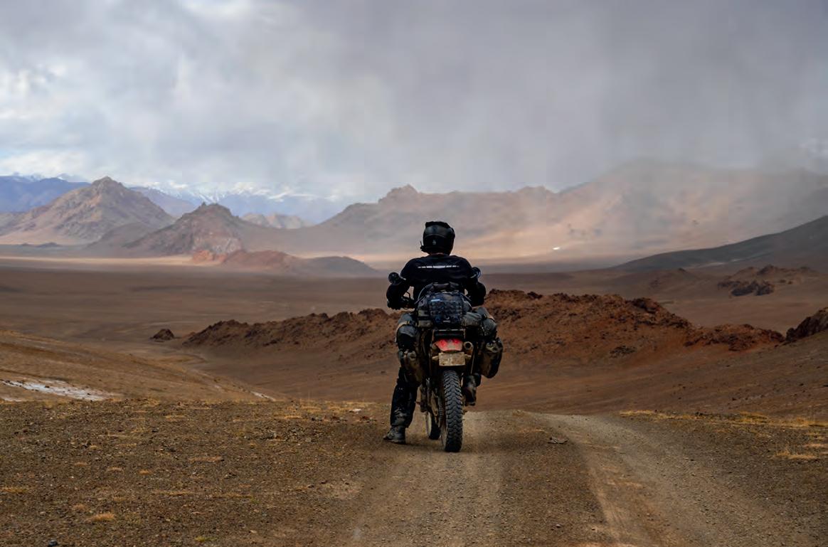
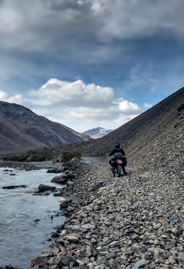
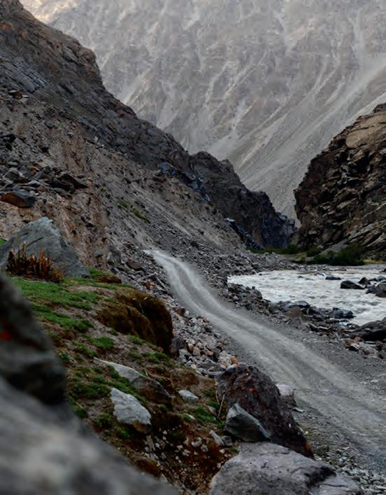
Clockwise from top left: Trusting the road ahead is easier when you stay away from the edge. | The waterways of the GBAO are the lifeblood of the region. | The challenges of the terrain are small on their own, but accumulate over long days. | The river crossings were not remarkable at the end of May. However, with roads literally cut into the steep slopes, landslides are a real danger. | Opposite: The mountains in the Bartang are mighty and constantly remind us how small we are within their shadow.
The siren song of the high plateaus had been ringing in our ears since our first descent, calling for one last bold stroke across the map. We could bisect the circuitous route we’d taken thus far, cutting straight through the Tajik National Park to where we’d begun, exiting on the same frequency of exploration as our entrance. It meant going against the grain of popular opinion that May was too early for certain routes. Sure, some paths had proven that notion, but many others were to the contrary, and this one held promise. The Bartang Valley is closed for most of the year by snowfall and is impassable for much of the rest of the time due to avalanches, rockslides, and swollen rivers. We had it on good authority that the latter, which impedes most motorcyclists, could be avoided by going before snowmelt from above surged the waterways. We’d again lose all but the barest of amenities. Still, the gain would be more than mere elevation, so we entered a fissure in the immensity of rock comprising eastern Tajikistan and began our final ascent.
Our map was becoming a mess, overlapping circles and squiggly dead ends, almost like I had been trying to warm up my pen instead of tracing a route.
The Bartang (“narrow passage” in the local dialect) would live up to its name; the first 200 kilometers contained multiple tight passages, with sheer, precarious slopes above, and a churning torrent of water below. A smattering of tiny villages clung to areas flat and wide enough, but we couldn’t simply search the black box for basic necessities, and not just because of the absence of reception. What was open last season had no bearing on this one. We topped off our tanks at every opportunity to ensure we could cross the 400-kilometer fuel gap following the last village. A packet of biscuits here, a bit of fuel from a steel drum there—scarce but sufficient. As it turned out, the rivers were crossable, and the rough track surmountable, but I could appreciate that it wouldn’t have taken more than a heavy rain to destabilize the mountain and bury our retreat. The labyrinth of chasms was followed by a rapid ascension into the highland desert above. It was beautifully barren and indescribable, but I’ll happily add my name to the list of those who have tried and failed to meet their mark.
Sitting atop the Kyzyl–Art Pass in the aftermath of an unforgettable journey, I snuck one last glance over my shoulder to the dramatic folds of earth holding an untold abundance of varying terrain, Tajikistan’s Pamirs. Twenty-three days and 1,800 kilometers prior, we sat in this very spot, eyes wide in wonder at what Central Asia’s most highly acclaimed adventure destination would hold. We held no checklists or expectations, just a worn-out map and worn-in willpower to experience the Pamirs firsthand.
I am not as tech-averse as I may have led on earlier, but the digital realm at our fingertips can hinder just as quickly as it can help by ruining the show before we’ve seen it, or by building a false reliance on technology that has no stake in our safety. Over the years, I’ve learned it does not serve me well to probe too far into a place before we go, as long as there are no dire consequences of keeping the blinders on. Certain locations deserve
a close look at the stories of those who have come before—others don’t. Seeking and heeding local advice is crucial, but the information given needs to be sifted with the same prudence I put toward analyzing our own capabilities. The world is shrinking, but that doesn’t mean there isn’t an entire planet of places yet to discover. While seeking exploration, anywhere can be uncharted territory, provided you don’t read the charts first. Well, perhaps a glance to ensure we don’t run up on any reefs, then I conveniently forget all the rest and get out there. Pioneering new paths has everything to do with perception.
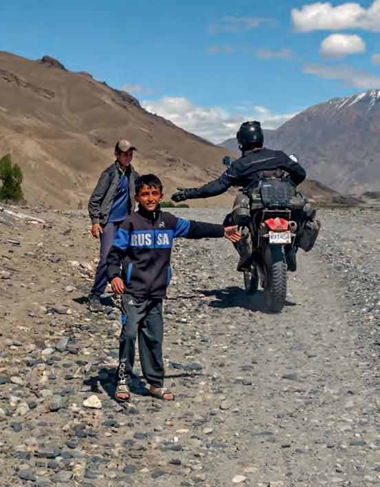
Sweeping views of the Bartang Valley spread out before us, a hint of danger, and nothing man-made for days completed the feeling of glorious isolation. | Opposite: Enjoying an open stretch of the Bartang Valley before being swallowed again by its narrow passages. | In villages in this region, children often run to the roadside in hopes of high fives from passing motorcyclists.
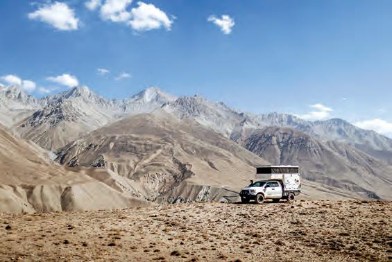
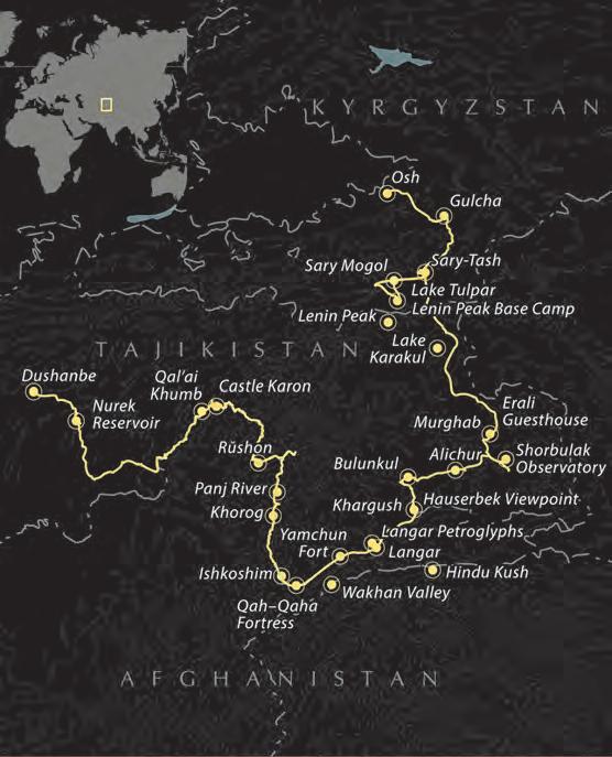
EDITOR’S NOTE For a detailed evaluation of paper map usage, visit page 35 for Luisa Bell’s “Off the Map.” If you’d like a closer look at the intricacies of the Pamir Highway, visit page 113 for Ashley Giordano’s Overland Route.
Off the Map
Paper maps are an essential tool for overlanding, camping, and long-distance travel.
By Luisa Bell
My first proper job in the mid-1990s was as a salesperson working out of a major city. Prospective clients were scattered across the urban center, the surrounding suburbs, and as far as the platinum-rich west, often a half-day’s drive away. Each morning began with cold calls and confirmed appointments, followed by time spent at my desk unfolding well-worn paper maps and plotting the day’s route. Before setting off, I would study the roads carefully, committing them to memory so I could navigate confidently through traffic without constantly glancing down. At the time, it felt like a practical necessity rather than a learned skill.
Only years later did I realize how valuable my early mapreading experience would become. Navigating unfamiliar territory with a paper map taught powerful habits that now feel instinctive when overlanding, whether weaving through congested streets in search of Land Rover parts or exploring remote trails far from paved roads. Reading topography, recognizing
landmarks, tracking sun position, and mentally recording the route just driven have all become second nature. A paper map can reveal alternative routes, shortcuts, and connections that invite exploration and often lead to unexpected places.
When GPS arrived, so went the quiet disappearance of analog navigation skills. Paper maps were pushed aside, along with cursive handwriting, mental arithmetic, and memorizing phone numbers, on the growing list of abilities many people no longer practice.
Spend enough time overlanding, however, and the limitations of digital navigation eventually become apparent. Dead batteries, cracked screens, lost satellite signals, or the familiar “No Service” warning have a way of appearing precisely when conditions are most demanding. Even with tablets loaded with offline maps, dedicated GPS units mounted to dashboards, and phones grabbing a signal whenever possible, experienced overlanders still keep paper maps tucked into a door pocket or map sleeve, as their absolute reliability sets them apart.
By laying out a topographic map, you gain a level of context no app can match: immediate awareness of the land’s shape, relationships among terrain features, and the web of roads and tracks beyond your current route.
Unlike digital devices, paper maps never freeze, reboot, or need a power source. By laying out a topographic map, you gain a level of context no app can match: immediate awareness of the land’s shape, relationships among terrain features, and the web of roads and tracks beyond your current route. Alternate exits, forgotten routes, and unexpected options are brought to light—critical insights for long or complex journeys, especially with family or across unfamiliar public lands.
An effective approach is to begin with the big picture and then progressively narrow the focus. A road atlas or state-specific mapbook makes it easy to outline general routes. Once that framework is established, larger-scale topographical maps provide critical detail, revealing geographic features that may slow or halt progress. When paired with Motor Vehicle Use Maps, this process ensures that a route is not only physically passable but also legally accessible for the type of vehicle being used.
Routes marked with non-bleed pens, fuel distances noted in advance, and multiple alternate options reduce stress when conditions change or plans unravel. Keeping maps folded, organized, and easily accessible in the cab allows them to be consulted quickly without interrupting travel. While digital tools such as onX Offroad can serve as a valuable offline backup, paper maps remain the foundation of our navigation system, encouraging situational awareness, deliberate decision-making, and a deeper understanding of the landscape you are moving through—long after the signal drops.
ROUTE PLANNING
When setting out on an expedition, spreading out a large paper map and plotting a route makes the trip feel more adven-
turous and soon becomes a foundational part of the planning process. Tracing a line across unfamiliar terrain on another continent feels exciting, but there is also intent behind it. When we began talking about our first journey, the paper map became our starting point and constant reference, shaping not just where we would go but how we thought about the adventure itself. It was placed on the wall as our motivator, prompting conversations about distances, terrain, fuel availability, border crossings, and realistic daily progress.
Large-format maps are invaluable for fleshing out the big picture. It is easier to understand how mountain ranges, river systems, political boundaries, and road networks interact. Paper maps are always our first step in route planning, whether we are navigating the remote forests of the Boundary Waters in Minnesota, the winding backroads of Arkansas’ Ozarks, or the wilds of Africa. They allow us to see the land as it lies, anticipate challenges before we encounter them, and build a route that is both ambitious and achievable.
NAVIGATING WITHOUT A GPS
When traveling in remote areas, paper maps (as current as possible) are often more reliable than GPS systems. Many roads are unnumbered, and digital data can be inaccurate, outdated, or simply wrong. Without connectivity, contours, rivers, and points of interest may not display at all, and offline downloads may be corrupted or incomplete.
Learning how to read and navigate using a paper map builds the confidence needed to make informed decisions when technology fails unexpectedly: a mobile phone can overheat, get wet while trying to capture the perfect photo or video, or fail at the worst moment. It is often only in truly remote places that you realize just how dependent you have become on technology and why traditional navigation still matters.
THE PROS AND CONS OF DIFFERENT TYPES OF MAPS (TOPO VERSUS ROAD ATLAS)
Topographical maps are best used for off-pavement, remote adventures. They show elevation data, terrain features, and contour lines. With a topo map, you can assess gradients, rivers, and mountain passes to judge whether a trail is too risky and if your vehicle is equipped for the conditions. Topographic maps help you plan safe, realistic routes in challenging terrain.
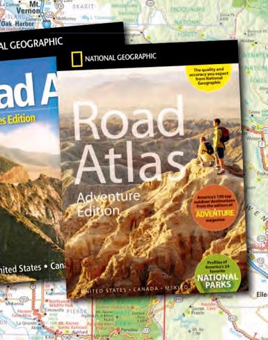
Road atlases, on the other hand, offer regional details: road networks, distances, towns, fuel stops, natural features, campsites, and sometimes outdoor recreation areas. We often use a road atlas with topographic detail for mapping rural routes. While less precise than dedicated topo maps, it still shows whether a road is paved, gravel, or unmaintained.
Unfortunately, no paper mapping system is accurate enough to reflect whether a forest service road has been recently maintained, raising the constant question of whether a road is truly suitable to drive on at all.
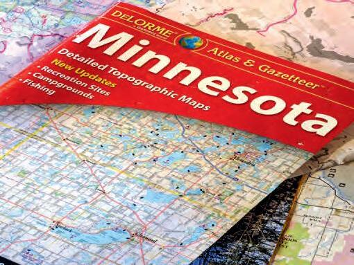
RAND MCNALLY/DELORME ROAD ATLASES
We love our DeLorme road atlases and have a wide range of them tucked neatly away in the Landy. We use these maps primarily for initial route planning in remote areas, and most of our pages are marked up with non-bleed markers for easy reference in the field. Each mapbook features detailed topographical maps and includes a comprehensive amount of supporting information, such as:
• A detailed map index;
• Suggested recreation and outing ideas;
• Lists of recreation areas with notes on available activities, including camping, hiking, horseback riding, boating, biking, fishing, winter activities, hunting, and historical sites;
• Outdoor adventure areas;
• Unique natural features.
Clearly marked boundaries for national forests and state land, along with points of interest such as campgrounds, water access, wildlife management areas, airports, Native American reservations, and more.
Some states use maps at scales of 1:250,000 or lower, making fine details hard to see—especially in complex terrain or dense networks.
$11 AND UP | RANDPUBLISHING.COM
NATIONAL FOREST MAPS
When visiting national forests, these maps are invaluable and are generally our first resort for planning any remote adventure. We usually use them in conjunction with Motor Vehicle Use Maps, which clearly indicate what types of vehicles are permitted on specific forest roads and trails. National forest maps are available online or through local ranger offices and typically include the following information:
• General information about the area, including historic sites, scenic byways, day trips, fishing access, visitor centers, and accessibility details;
• Lists of campgrounds;
• Lists of designated trails for hiking, auto travel, skiing, cycling, snowmobiling, hunting, and horseback riding.
Comprehensive symbol keys identifying rest areas, picnic sites, drinking water, restrooms, hiking, horse, and bicycle trails, fishing piers, boat ramps, all-terrain vehicle routes, and more.
Some national forest maps may be outdated and miss closed or unmaintained roads. Check the publication date on the back before relying on it for planning.
$14 AND UP | FS.USDA.GOV
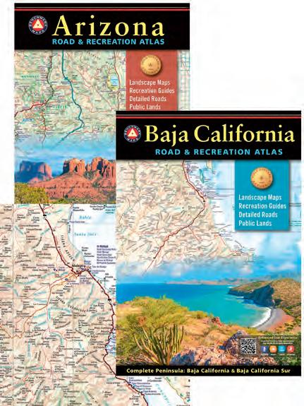
BENCHMARK
MAPS
We use Benchmark Road and Recreation Atlases when traveling through large, open states with extensive public lands and backcountry access. These atlases are useful once I’ve moved past initial planning and are most often referenced when navigating remote areas within a single state. We do prefer Benchmark maps, as they are easy to read and mapped at a larger scale, making the topographical detail more legible with less information condensed into a single area. Most maps include the following information:
• Clearly indexed road networks, which include paved, gravel, and unmaintained roads;
• Public land boundaries, including BLM, national forest, state land, and other managed areas;
• Campgrounds with dispersed camping areas;
• Recreation areas and points of interest for hiking, hunting, fishing, boating, and general outdoor use;
• Unique natural features and landmarks.
The drawback is that some minor spurs or trails aren’t marked, complicating remote trail planning.
FROM $10 | BENCHMARKMAPS.COM
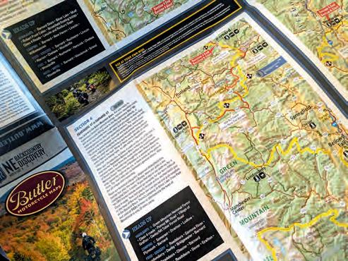
BUTLER (AND BDR)
MAPS
Butler Maps offers a wide range of choices aimed primarily at motorcycle riders, but they can also be used effectively by overlanders in 4WDs. They are waterproof and tear-resistant, making them wellsuited for travel on backcountry roads. You can choose between maps focused on paved roads, dirt roads, or the company’s backcountry and Adventure Series, which guides you along established routes. While Butler also produced and sold Backcountry Routes (BDR) maps for years, note that they are now only available at BDR's online store, store.ridebdr.com. The BDR maps are useful, as they clearly highlight each section of the route and include key information such as:
• Points of interest;
• Fuel stops;
• Camping options;
• Grocery resupply.
They are a great option for anyone looking to remove some of the guesswork from a shorter trip across the States, without having to do the hard work of planning an entire route from scratch.
FROM $17 | BUTLERMAPS.COM
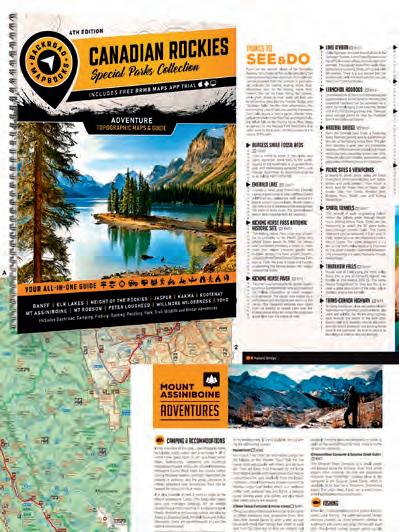
BACKROAD
MAPBOOKS
BackRoad mapbooks are our go-to when traveling through Canada. They are full of comprehensive information about each region, provide the history of the province, and suggest trails in the area. Each mapbook features topographical maps with:
• Highway, logging roads, and other off-road trails;
• Land and water features;
• Park and adventure points;
• Campgrounds;
• Hiking trails and motorized trails such as ATV, snowmobile, and winter-specific trails;
• Paddling routes;
• Hunting and fishing areas;
• Historical information.
BackRoad mapbooks are available in spiral-bound editions, large-format paper maps, and digital versions, with bundle options to help save some money. The two downsides are that coverage doesn’t extend into the United States and that purchasing the full range of mapbooks for all of Canada can get costly if you’re traveling extensively across multiple regions.
FROM $20 | BACKROADMAPBOOKS.COM
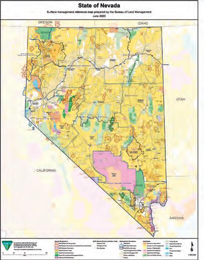
BUREAU OF LAND MANAGEMENT (BLM)
MAPS
We use these maps most often when traveling through the Western United States, where the BLM manages large portions of land. They are useful in understanding land ownership and access, as state land trust parcels can sometimes overlap or border BLM land and may require a permit, and for identifying wildlife refuges, conservation areas, and national monuments managed by the BLM. Most BLM maps include the following information:
• Public land boundaries showing BLM, private, state, and other federally managed lands;
• Limited topographical detail to help interpret terrain, washes, and elevation changes;
• Recreation sites such as campgrounds, trailheads, and day-use areas;
• Points of interest relevant to backcountry travel.
In this case, BLM maps are often most effective when accessed digitally through the BLM website, as printed maps can be limited in detail and may not reflect recent changes in access or management.
$6, FREE ONLINE | BLM.GOV
NATIONAL GEOGRAPHIC
MAPS
In years past, we have used National Geographic maps and mapbooks when traveling to national parks and large recreation areas. They offer clear views of the terrain, give close attention to roads, tracks, and trails, and can be a little intimidating when planning a route, given the amount of information provided. The maps are waterproof and tearresistant, making them ideal for backcountry adventuring, and feature detailed topographical information:
• Clearly marked trail charts for hiking, riding, biking, snowmobiling, cross-country skiing, and horseback riding;
• Roads and access routes relevant to the park or recreation area;
• Land and water features such as rivers, lakes, valleys, and summits;
• Campgrounds, trailheads, boat launches, fishing access, and day-use areas;
• Points of interest, including viewpoints, historic sites, and landmarks;
• Park boundaries, wilderness areas, and protected land designations.
Each map’s coverage is limited to specific parks and recreation areas rather than states, so you’ll need to purchase a new map for each area.
FROM $15 | NATGEOMAPS.COM
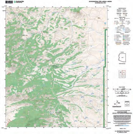
US GEOLOGICAL SURVEY (USGS)
TOPO MAPS
The USGS is a federal scientific agency within the Department of the Interior that collects and publishes scientific data about the country’s landscape and more. The USGS allows you to create your own topographical map within a set number of scales that you can download and print for your own use, thereby eliminating the need to purchase any large maps or map books. They offer a select number of maps you can download or purchase from their store, including state maps, national parks, US Forest Service maps, and county and national atlas maps, among others. The DIY detailed topographical maps include:
• Roads such as highway, local, secondary, and 4WD;
• Recreation structures;
• Trail surfaces;
• Emergency services;
• Transportation;
• Hydrography, such as dams, waterfalls, springs, etc.;
• Boundaries for state land, BLM, forest, US Fish and Wildlife Service, and the US Department of Defense, to name a few.
However, such a detailed topographical map can be distracting to read in mountainous terrain.
FROM $9/MAPS FOR PURCHASE, FREE/DIY TOPO MAPS | USGS.GOV
Latitude
Eric Moon
The Grand Pursuit
Our team of travelers crosses three continents to realize a dream.
By Scott Brady
Photography by Richard Giordano, Scott Brady, and Clay Croft
Smallideas take nearly as much work, time, and investment as big ideas. So why do most people settle for the small ones? Risk. The bigger the aspiration, the more likely we are to fail, with our reputation, ego, and oftentimes our life (or livelihood) on the line. But is avoiding risk a safer path? For much of human history, risk meant being eaten by a saber-toothed tiger (or suffering similar catastrophes), and we are wired to avoid it as a result. In modern times, the reality of actual risk, accidental death, and financial ruin (crypto bros excluded) is significantly lower than our mind’s capacity to imagine calamity.
Statistics reveal that the adventurer lives much longer than the cautious citizen, and the entrepreneur who pushes past the six-year mark ends up being nearly 15 times more wealthy than the median income for employees. In studies such as the NASA astronaut comparison, explorers live five to seven years longer on average than the general population, with the biggest gains being in cardiovascular health, cognitive preservation, and psychological resilience. For years, Clay Croft and I have been encouraging each other to pursue our next big thing. If we were going to put in the effort, planning, expense, and time, why not embrace a grand pursuit?
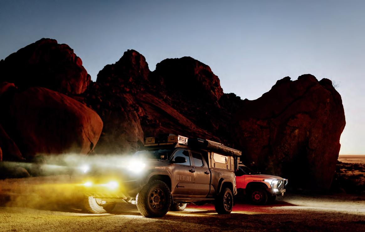
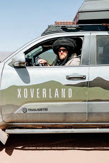
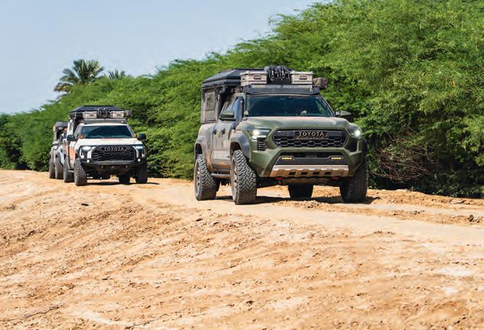
In early 2025, Clay approached me about the concept of XOverland driving around the world and crossing three continents. It was an ambitious idea, and one that would also test the limits of the new hybrid Toyota drivetrains and an oil that Mobil 1 wanted evaluated in extreme conditions. The oil was designed to last 25,000 miles between changes, but Clay wanted to prove it across North America,
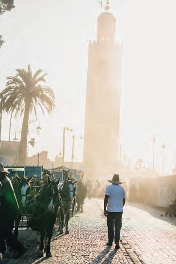
Europe, and the length of Africa. With that, the Milestones Expedition was born. For the first segment, Clay and the team drove from Montana to St. John’s, Newfoundland. Then, for segment two, they shipped to England and drove up to John o’Groats, then to Nordkapp before driving south through Europe to the ferry for Morocco. This is where our story begins.
THE SAHARA AND THE LIBRARIES OF CHINGUETTI
In the cobbled streets of the Marrakech souk, a thousand particles of dust shadow light, and for an instant, I felt like a time traveler. The team had been delayed from Germany, so I had the rarest of gifts— an unfettered day. The dar I had rented was so old and small that climbing its stairs required me to both stoop and twist to navigate the steep passage. It was also impossibly inviting and cool against the heat and humidity of the early October morning. I had not slept well, the combination of jet lag and anticipation, yet I would not waste this moment. The words of Marcus Aurelius were ringing in my thoughts, as they do most mornings.
Namibia is a treasure for any traveler, with abundant culture, campsites, and natural beauty. | Opposite: Colinas Canyon, located in southern Angola, felt like our first relaxed camp of the trip, and we celebrated Thanksgiving by breaking out the air fryer and calling family from the sat phone. | Opening spread: A lone acacia tree marked our camp for the night. We were soon to be surrounded by the darkness of the desert, with not another soul in sight.
| Bull
| Fortunately, the
| We decided that
were shaped the same. This one either meant stop, or that
was ever-present on the busy tracks, making visibility a challenge and clogging the air filters. | The tea ceremony is a lesson for all of us: slow down, make a hot drink, and enjoy conversation with friends. | We could not determine if Clay had just married these three women or promised to buy bracelets and scarves. The jury is still out. | Opposite: The
Clockwise from top left: The light in Africa never disappoints, the setting sun casting a glow across the medina of Marrakech.
Clay wore the scarf best, like a wayward Viking driving across the Sahara.
signs
Zouérat Aladdin’s shoes are ahead.
dust
infamous ore train was our only guide east into the Sahara, traveling 437 miles from the coast to Zouérat.
“At dawn, when you have trouble getting out of bed, tell yourself: I have to go to work—as a human being. What do I have to complain of, if I’m going to do what I was born for—the things I was brought into the world to do? Or is this what I was created for? To huddle under the blankets and stay warm?”
The border was also chaotic, made only slightly more tolerable by our fixer—not because he solved any administrative hurdles, but because he was mildly entertaining in a neurotic, attention-deficit disorder kind of way.
Fortunately, for me, the streets of this ancient city contained many distractions, chief among them, coffee. It would be hours before the team would arrive, so my progress was slow, interrupted by spices, art, mint tea, photographs, coffee, and music. I wondered why the spices seemed stronger and more fragrant here, so much so that I spent unreasonable amounts of money on cardamom, turmeric, saffron, and paprika. I should have made a coffee in the apartment, because my movements had slowed to a crawl, every turn a new palette of discovery. The sun was getting lower, and it was time to move on to the medina and my friend at Coffee Houmti. I have been visiting his tiny tea and coffee shop on Rue Bab Doukkala for years, and it never disappoints. It also seemed like the perfect spot to reunite with the XOverland team, who had just pushed straight from Germany for days.
Leaving Marrakech, we climbed into the High Atlas mountain range, a striking shift from the desert below, filled with low trees and
blessed with cooler temperatures. This route would lead us into the Sahara and a long, remote track toward Mauritania. The western edges of the Sahara are massive, with few inhabitants, and endless overland routes to explore. We settled on an old track provided by Chris Scott and made steady progress south. Each day ended with the sun painting a new masterpiece across the horizon, and a camp under a star-filled sky. To the south, the border with Mauritania awaited.
I first learned of Mauritania while watching the Dakar, riders and drivers crossing a broad expanse of dunes, hard pans, and stony escarpments. It was also rated Level 3 by the US State Department (“Reconsider Travel”) with the country’s far-north border zones designated Level 4 (“Do Not Travel”). Despite the risks, recent terrorist activity had been minimal, and we hoped our group size and number of vehicles would serve as a deterrent. The border was also chaotic, made only slightly more tolerable by our fixer—not because he solved any administrative hurdles, but because he was mildly entertaining in a neurotic, attention-deficit disorder kind of way. The crossing took most of the day, thrusting us out into the desert at the hottest part of the afternoon. It would be worth it, though; the infamous ore train route was calling, along with Ben Amera, the largest monolith in Africa and second-largest in the world. We lowered the tire pressure and Ryan Erickson took the lead in the 6-foot-bed Tacoma, picking his way through the larger ergs.
Ben Amera is stunning to behold, even when spotted from nearly 50 kilometers away. It punctured the horizon, a colossal granite fea-
Clockwise from top left: The local strategy for packing, hauling, and securing various extreme loads was a constant source of entertainment for the team. | We had deep reverence for the libraries and librarian of Chinguetti, standing in near silence as he leafed through books far older than the printing press. | The timing of our journey put us just on the tail end of the rainy season, with the mud starting to dry in places. | Street vendors are an ambitious bunch, offering everything from flip-flops to giant (and apparently edible) snails. | Mauritania’s fishing culture is vibrant and ancient, and we felt transported into the past watching these wooden trunks get hauled ashore. | While unleaded was generally available and of good quality, there were still times we needed to fill the auxiliary tanks from plastic jugs. We would only put questionable fuel in the back, as there were additional inline filters to protect the trucks.
ture that is even taller than Australia’s Uluru (Uluru is larger overall). Just reaching the base requires days of desert travel in a 4WD. We made camp in its shadow and sat for hours, observing its details and talking amongst ourselves about the rarity of the moment and the gratitude that came with it.
Our next destination was the ancient village of Chinguetti, positioned at the edge of the Sahara, accessible via a heavily corrugated one-way track. Known as the City of Libraries, the fortified town was founded in the 13th century as a critical caravanserai along the Trans-Saharan trade route, and served as an important resting place for pilgrims en route to Mecca. Its role extended to the storage of religious texts, maps, and scientific manuscripts. Despite the town’s defenses, its greatest threat is the encroaching desert, which has already consumed the 8th-century settlement of Abweir (just outside Chinguetti), and is currently marching against the ksar
As we entered the border, the process was a combination of modern surveillance and oldschool interrogation.
At its peak, Chinguetti housed 30 libraries, and many remain, often curated by multi-generational families.
We pulled up to the dry-stone mosque in the center of town, and were greeted by a beaming woman who spoke about as many words of English as I did Arabic, so we settled on broken Spanish. She asked if we wanted to visit the lost mosque and the ancient texts. Our enthusiastic smiles confirmed our acceptance of her offer.
We walked across the empty street and entered a large courtyard. Other women had set up shop to sell bracelets, rings, and stones. As if from the ether, a cloaked librarian appeared at the door, slowly dislodging the hardwood lock from the doorframe, each movement of the key shifting against a series of gravity tumblers and hidden interlocks. He pressed hard against the heavy door before waving us in, motioning us to remove our hats, an important reminder of the spiritual significance of the seventh holiest city in Islam. Taking a seat at his desk, he donned white gloves and, in a stuttering tempo, uttered his first words to us: “goat” referred to the thin skin used to create the pages of the 14th-century manuscript he presented. It was an Arabic poem, and it felt like time folded in on itself—a man holding a book predating the printing press, likely handled by his father, grandfather, and countless generations before.
“He stood all night with his saddle and bridle on him, he stood all night while I gazed at him admiring, and did not rest in his stable. But come, my friends, as we stand here mourning, do you see the lightning? See its glittering, like the flash of two moving hands, amid the thick gathering clouds. Its glory shines like the lamps of a monk when he has dipped their wicks thick in oil. I sat down with my companions and watched the lightning and the coming storm.” –“The Mu’allaqat” of Imru’ al-Qays (lines 54-56)
HOLDING OUR BREATH FROM NIGERIA TO CAMEROON
While Senegal, Guinea, Ivory Coast, Ghana, Togo, and Benin had been a bureaucratic gauntlet, and the roads of Guinea proved to be the worst I had ever encountered in Africa, we had never felt threatened. However, the specter of Nigeria loomed—a country long regarded for its crime, scams, checkpoints, and religious infighting. We had picked up Kurt Williams in Senegal, so we had a deep roster
The ancient books in Chinguetti were filled with poetry, religious texts, and rich scientific detail. | Just when we felt the road was tough, a semi-truck driver would lumber past, suspension creaking, popping through the ruts and wallows. | I love the energy of African towns and roads, a loosely coordinated dance of trucks, cars, motorcycles, livestock, and people,
The flooding in Nigeria was intense, with some streets being headlight-deep on the Tundra. | Our trusty convoy transported us across thousands of miles of dirt, sand, broken roads, and endless tarmac, never once leaving us stranded. | Opposite, clockwise from top left: The joy and warmth of the people in West Africa is wondrous to experience, and has changed me in ways I cannot fully express. | An armored Ram truck with a .50 caliber on a turret served as our heavy overwatch during the 300-plus-kilometer push through the Cameroon civil war zone. | West Africans are industrious and kind, finding creative ways to both transport and sell goods. | Traffic can only be described as chaotic, but the speeds are relatively slow, so the risk of injury drops considerably.
of driving and travel skills to lean on. As we entered the border, the process was a combination of modern surveillance and oldschool interrogation. Admittedly, our timing could not be more suspect: six military-age Americans rocking up to Nigeria just as the president of the United States was threatening hostile intervention. It was no surprise that the immigration official looked me dead in the eye and asked if I was CIA.
The southwest corner of the country is quite safe, the drivers notwithstanding. In all of my travels, I have never encountered such ouroboric drivers. Words cannot quite describe the sea of humanity, with Nigeria having over 200 million people in a country only 33 percent larger than Texas. Even our attempt to avoid Lagos was ill-fated, with hours of delays, traffic jams, and checkpoints. We arrived at our accommodation hours after dark, a trend that would repeat nearly every night across the country. Travel was so chaotic that we even needed to deploy MaxTrax to merge onto a highway. We followed a specific route that had been shared by the US government, one that would hopefully deliver us to the border of Cameroon without harm.
I could feel the shift in the tone of our team and became very aware of the consequences when Clay asked his firstborn son, Cyrus, to ride in the Tundra with me (better to separate father and son, just in case).
The progress can only be described as exhausting, requiring constant vigilance as a driver, including a night of torrential rain that delayed our arrival at an apartment by hours. The water was so deep on the road that my headlights dipped into the murk. After crossing the country, we finally arrived at Cameroon’s consulate. Here, we needed our e-Visa and a specific stamp for crossing at Ekok, the border that would mark the beginning of our military convoy through the active Ambazonia war zone.
We slept at the border to make sure we could meet the convoy on time, its schedule a mystery to most travelers, ourselves included. Fortunately, the travel goddesses shone down on us that day, and after four hours, we cleared the border to have our passports confiscated and our group escorted to the police station in town. It was clear this was a dangerous job, with several bullet-riddled trucks positioned in the yard, others affixed with ramshackle armor. We would not need to wait long, as two armored 70-Series Land Cruisers pulled up, tailed by an up-armored Ram with a .50 caliber affixed to the roof. The scene was surreal, as the soldiers seemed far more interested in the goods they were loading up than in our safety. But they were friendly, professional, and the trucks (and guns) looked squared away; the next 300 kilometers would determine whether that was really the case.
I could feel the shift in the tone of our team and became very aware of the consequences when Clay asked his firstborn son, Cyrus, to ride in the Tundra with me (better to separate father and son, just in case). In typical hurry-up-and-wait fashion, we staged at the police station awaiting our departure; then, in a flurry of activity, the soldiers loaded up, and we were on the move. The locals certainly understand the assignment and give a wide berth to the armored Land Cruisers, and an even wider
berth to the Ram with the .50-cal. So wide that we witnessed several oncoming vehicles end up in the ditch or jungle as they tried to get out of the way.
The speed the convoy drove was mental, although we all later admitted it was fun—Type 2 fun. It was also clear that the convoy had other plans, including stopping for lunch, asking us for beer money, and ultimately just telling us to leave on our own without their protection. It wouldn’t be until well after dark that we arrived in a halfabandoned hotel overlooking Buea. We had survived two of the most dangerous regions in West Africa, but the Congo still remained.
SILVERBACK GORILLAS AND DESPOT REGIMES
There are few regions on a map that elicit a greater sense of adventure than the Congos, yet the two countries could not be more different. The Democratic Republic of the Congo (DRC) is a geopolitical monster, roughly the size of the United States east of the
Mississippi. Home to 110 million people, it is the very definition of chaos, bureaucracy, and corruption. The DRC is the final boss of any north–south Africa expedition. The Republic of Congo (RoC), by contrast, is a relatively stable and generally benign autocracy, with the president having ruled for more than four decades across two stints in power.
After leaving Cameroon and entering the RoC, our team let out a collective sigh of relief. Even the border crossing was mellow and one of the easier processes along our route. The road was nearly new, and one of the locals said you could ride a skateboard from the border to Brazzaville (mostly true). The narrow asphalt highway barely split the jungle, with gigantic trees overhanging the route. Off to the sides, muddy jungle tracks headed into the forest, used by logging operations looking for old-growth timber. The RoC would hold two milestones for us: crossing the equator and having an opportunity to sit face-to-face with a gorilla.
I have always found it interesting that the equator (or any other major circles of latitude, such as the Arctic Circle or the Tropic of Cancer) has such universal appeal. I suppose it makes us feel like genuine explorers, arriving at key geographic points that divide the Earth into its primary climate and solar zones. For the XOverland team, arriving at the equator felt like a significant accomplishment, and candidly, a major relief. It felt like we were shifting to the downhill slide of the journey, the wild card of the DRC notwithstanding. The monument was a humongous steel globe set atop a concrete base, and we took our time to take photos and celebrate the accomplishment. There was a school right next to it, and the kids played along, yelling and cheering their approval.
One of the highlights of the journey for me was the time spent at the Lésio-Louna Gorilla Reserve. The sanctuary does not require a perimeter fence, as the western lowland gorillas are housed on a forested island in the Louna River. Getting there was an adventure, with the Toyotas in low range, navigating mud, steep climbs, and deep sand. After the punishing two-track, we arrived at an oasis along the river, complete with a beautiful camping area and accommodation huts. It also served as the launching point for high-powered, open riverboats that could outrun the fast current, and even faster hippos.
We had barely left the dock when a large male gorilla exploded into the water, slamming the current with his fist and grunting aggressively in our direction. A collective “Whoa” erupted from nearly every team member; still, the cameras kept rolling. We motored a safe distance away and took in the size of him, noting how effortlessly he moved through the trees and brush. Farther upriver, we had the opportunity to float by a more gentle individual, who watched us with curiosity as he peeled bananas and pineapples with his teeth and fingers. It was humbling just how human-like his mannerisms were, or maybe just how ape-like we are.
The time with the gorillas was a much-needed distraction from the challenge ahead: getting three vehicles and six travelers (from two different countries) across the border into the Democratic Republic of Congo. We knew from reports that this would be no easy task with the flared tensions and political posturing of recent weeks. Hoping for less chaos, we chose the milder crossing through Cabinda, the Angolan exclave wedged between the two Congos. Unfortunately, the opposite occurred.
It would take an entire article to describe what happened at the border, although the really interesting part started after we had already been stamped into the country. We were nearly 10 kilometers into the DRC when we were stopped and ceremoniously (with escorts) sent back to the border post. Here, we were told that the Canadians were free to enter, but that the Americans could not. It was not an invitation for a bribe, as the authorities made it clear the error was entirely their own and that they were working hard on a solution. Hours passed, and eventually the outcome revealed: we would receive
Walking up on an elephant skull is humbling, both due to the size and the significance of these stunning animals. | Equally stunning is to sit a few meters from a silverback gorilla and watch them move, rip into fruit, or crash through the trees effortlessly. It is said that they have the strength of 10 men. | Opposite If you could drive a Tacoma on Mars, it would probably look a lot like southern Angola, with sandstone spires and beautiful dunes dotting the landscape.
As the sun set on our journey, we were deeply grateful for the adventure, our quality time together, and for our safe arrival at Africa’s southernmost point.
a transit visa and be accompanied by two escorts to the next border with Angola. The situation got even more curious after we left with the minders, who directed us to the police station in the next city, just for photos with the chief of police. The upside was that none of the checkpoints applied; each one waved us through with a salute and a grin.
Expeditions are often like that—a hurried start, followed by intense challenge, and ending with celebration, relief, and growth.
The drive was intense, pushing well past posted speed limits (at the urging of our minders) and continuing well into the dark. The goal was to cross the border that same day; however, time would not be on our side. We arrived after the Angolan side had closed, were ushered into the customs control yard, and told to camp for the night. Fortunately, it seemed like the commander in charge (who now had our passports) had taken a liking to us, driving us to the best pizza joint in town, where we ate pies and drank milkshakes, wondering what twilight zone we had entered. The next morning, we awoke to the gates of the compound opening, the commander smiling, with our passports in hand. We were free and ceremoniously escorted to a nearby gas station, then the border. In about 24 hours, we had overcome the final linchpin of the expedition and safely crossed the Congo.
CAPE AGULHAS
After entering Angola, a far more pedestrian pace ensued, complete with stunning campsites and even a Thanksgiving dinner in the
sandstone wonderland of Colinas Canyon. The mood was light, but as Clay reminded us, we were not finished. We needed to preserve the trucks and our safety to the final mile. We stayed vigilant while also enjoying days in the Etosha National Park, clean laundry in Windhoek, and floating on the Orange River in kayaks. The reduction of stress felt overwhelming, like I had been holding my breath for six weeks.
We motored across Namibia and South Africa with ease, stopping for coffees and comfortable campsites with showers. We met up with friends and even paid a visit to Bakkrans Eco Lodge in the Cederberg, where my closest mates sang me “Happy Birthday.” Expeditions are often like that—a hurried start, followed by intense challenge, and ending with celebration, relief, and growth. We could feel it as we closed in on the final mile, the Indian and Atlantic oceans coming into view. As our journey came to a close, my 20-year goal of crossing all seven continents came to an end. In addition, Clay, Richard Giordano, and I had completed our overland circumnavigation via the latitudes. As we pulled up to the southernmost point in Africa, I believe Clay Croft said it best:
“Isn’t overlanding incredible? You travel to test yourself, to learn, and overcome. It’s truly a magical way to see the world … whatever big dream you have, just start somewhere. Depart on your first mile and go live a good story.” –Clay Croft
Soggy in Sota
The art of decompression via a Midwestern reset.
By Chris Cordes
Clockwise from top left: The ferns here would make any Pacific Northwesterner feel at home. | While crossing one of the countless creeks along my path, I paused to watch a pair of fly fishermen casting in the morning light. | Some marshy shorelines have dense vegetation mats thick enough to walk on, bouncy like a floating dock, while others you might fall right through. If there’s a pathway, it’s best to use it. | Cell service is nonexistent here, so I scanned offline maps looking for stops to hunker down and brew hot coffee. | Black-eyed Susans add bright splashes of color to the deep-green woods. | Minnesota hosts a vast network of interconnecting backroads and a larger network of powersports trails than I’ve experienced anywhere else. For someone bikepacking, the options are practically limitless. | Opposite: Over the rolling hills, no traffic approaches, just walls of fog and rain tending to the seemingly boundless forests and lakes. | Opening page: North of the Twin Cities, the side roads begin to turn to gravel and the sidewalks to wildflowers.
Tenyears ago, Minnesota wasn’t on my bikepacking radar. Or any radar, really. But love has a way of changing things, including your horizons. When I fell for a woman who called the North Shore home, the state earned an unlikely corner in my adventure catalog. It’s a destination that draws me back with its crooked trails, endless forests, cold lakes, and long silences—the kind of place you go when you’re not looking for a vacation, but an escape. And last summer, I desperately needed one.
Between calls, email, Slack, social media, news, and politics, my life felt like a web browser with too many tabs open and no way to find which one was playing music. For a change, I pointed the truck north and set out for a solo bikepacking trip up the North Shore. The plan: a loose itinerary for a 190-mile loop from Tofte through Superior National Forest, cutting east to Grand Marais, then tracing the Lake Superior coast back. I would be leaving the headphones and work behind. It was to be me and a DSLR camera, with a few days of moving slowly, sweating a lot, and maybe remembering how to breathe.
RAIN AND RESETS
The forecast said “partly cloudy,” but in the “Land of 10,000 Lakes,” you can bet water is in those clouds more often than not.
I woke to rain drumming the camper shell and wind shaking the trees like they owed it money. There was no turning back now. I cinched my rain gear, saddled the bike, and pedaled into the gray.
My casual 40-mile start to shake off the rust (it had been a while since my last big ride) felt twice that distance due to the headwind, while the rain, never content to stick to either a mist or downpour, kept inventing new ways to soak me. I stopped more than I should have—each coffee break an excuse to hide in the trees, fire up the stove, and feel something warm in my hands.
Halfway through the day, I rolled up to the Trestle Inn, a local watering hole I’d been dreaming about since before the ride began. Inside, the promise of hot food and a dry seat called to me. The sign indicated otherwise: closed (of course). With no other souls in sight, and a barking dog interrupting the quiet sting of disappointment, I didn’t wait around.
As I rounded a corner, a bridge came into view. The tires rolled onto the wooden beams with a rhythmic clunk until I grabbed the brakes, captivated by the scene below. Two fishermen were casting into a lazy stream while the forest exhaled around them. Almost instinctively, I turned to pedal away. Training instilled by our modern lives usually keeps us going, roaring in the background about the places we have to be. So it took a surprising amount of effort to unclip from my pedals and just sit. The silence was thick—almost noisy in contrast to the world I’d left behind. I closed my eyes and listened to the absence of volume I’d been craving—the kind of void that isn’t empty, but full and rich.
Eventually, I clipped in and traded the hushed babble of the creek for the crunch of gravel, but there had been a shift. The rest of the ride felt slower, more purposeful. Not like I was pedaling to reach the next stop, but to be right there in each moment.
I made camp early that night—bone-tired, drenched to the core, but present. Dinner was freeze-dried fajitas, Michelin-starred, in context. I crawled into my bag with fingers crossed for a drier tomorrow.
MUD, DETOURS, AND BEARS
The rain had downgraded from biblical proportions to a persistent drizzle. I brewed coffee by a glassy lake while loons called across the water, a refreshing change from the pings and buzzes of devices during my typical mornings. The trail ahead promised narrower, graded paths, with more old ATV trails and two tracks. I linked up with a route deep in the forest on the kind of trail where maps feel more like guidelines and the only things closing in faster than the brush are the mosquitoes. The recent storm had made a mess of things—swollen creeks, deep ruts, and enough muck to turn my tracks from a straight line to something that resembled twisting ladders of DNA. Then the creek crossings started.
The recent storm had made a mess of things— swollen creeks, deep ruts, and enough muck to turn my tracks from a straight line to something that resembled twisting ladders of DNA.
First crossing: shoes soaked. Second: knees soaked. Third: I waded in, bike lifted as high as I could, but turned back when the water was waist-deep, and my shoes began leaving my feet in favor of the mud beneath. Defeated, I rerouted. It was the only trail connecting my loop, and without it, I’d lose both my planned resupply and my shot at a cold beer that night. Those dim prospects stung worse than the frigid water against my skin. I started slowly pedaling back through the brush, my mood admittedly soured by the turn of events.
Then the bear showed up. It burst from the bushes without warning, a shockingly fast blur of fur and surprise. In shock, I yelled, and to my good fortune, it bolted. I laughed like an idiot, heart hammering, my frustration with the water having completely evaporated, leaving me exhilarated and grateful to be on this ridiculous escapade. With wet socks, muddy shorts, and shaky hands, I rerouted via a patchwork of ATV tracks and backroads. Forget tonight’s camp, I wanted a beer.
I filtered lake water in the wind, rationed snacks, and pushed on, riding many more miles than planned. Finally, gravel turned to pavement, and I rolled into Grand Marais, certainly looking and smelling more like the bear I’d met in the swamp than the tourists I passed in town.
Voyageur Brewing welcomed me without flinching, though. I inhaled barbeque sliders, a brownie, and two pints of local beer like I hadn’t eaten in days. Warmth returned—both physical and emotional. For the first time on the trip, I felt dry, and my spirits were high.
DONUTS AND CLARITY
The next day brought honest-to-god sunshine, and the world was suddenly golden, the trip finally smiling back at me. I celebrated
The path forward sank deep beneath the swelling banks of a lake, casting doubt on the remainder of my journey. | Opposite, clockwise from top left: The North Shore of Lake Superior feels much like an eastern seashore, awash with quaint restaurants positioned to enjoy a good view and a stiff drink. | If seafood is to your liking, this local stop has everything from fish and chips to hearty chowders that will satisfy even the most demanding connoisseurs. | The not entirely complete Gitchi–Gami State Trail was a highlight of the ride, especially the section south of Grand Marais. | Baked goods are a premium bikepacking fuel, and World’s Best Donuts delivers. You’ll have to try them yourself to decide if they live up to the claim.
A rainbow paints the horizon, a reminder that no matter our circumstances, there’s beauty to be found if we can just look up.
with carbs—Grand Marais is home to World’s Best Donuts, a name that might sound like a bold claim, but it delivers. I sat on a bench overlooking Lake Superior, coffee in one hand, still-warm donut in the other, and enjoyed the tranquil setting. There was no rush, no notifications—just gulls, waves, and sugar.
The ride south followed the Gitchi-Gami State Trail, with loosely connected sections of perfect pavement twisting through forest and cliffsides, the lake glittering to my left, reminding me of why I fell in love with bike riding in the first place. But not all of it was trail. One stretch dumped me onto Highway 61—busy, loud, and fast. I kept my head down, pedals turning.
That’s when I met the second bear. This time, I’m not sure who was more surprised, the bear or me. I had factored in the possibility of seeing one in the woods, but here? Not 10 feet from the shoulder of a main highway, the thought hadn’t even crossed my mind. Whether it was my commanding presence or the 1980s Winnebago hurdling past on a cloud of questionable fumes, the animal decided the woods were indeed the place to be and retreated. I, on the other hand, stuck to the road, though just barely, as the parade of dreary-eyed drivers continued their Sunday circuit back toward the Twin Cities.
It was a good kind of tired, resembling clarity. Three days of swapping music, messages, and headlines for trees, rain, gravel, and the slow return of perspective set in.
The bike trail picked back up, and peace returned. I stopped in Lutsen at Fika Coffee, a cozy haven named after the Swedish word for a deliberate pause and social coffee break, typically involving a sweet. I took the fika concept to heart. Then I did so again at Coho Café in Tofte for chowder and a cookie, fulfilling on the “treat” aspect (minus the coffee).
The final miles rolled easily by, and as my truck came into view, I felt the weight of the trip—not only in my legs, but in my mind. It was a good kind of tired, resembling clarity. Three days of swapping music, messages, and headlines for trees, rain, gravel, and the slow return of perspective set in.
Soon, I’d be back to my normal life, and a nagging feeling tugged on me, whispering that nothing had really changed. The digital tide kept rolling. The world hadn’t waited. But then, I had a thought. We talk a lot about productivity: chasing it, hacking it, measuring it. We buy apps to optimize our hours and devices to make every second count. But maybe the real problem isn’t how productive we are. Maybe it’s how obsessed we’ve become with being productive in the first place.
Out there—alone, wet, occasionally lost—I wasn’t getting things done. I was focusing on doing one thing at a time: pedaling, filtering water, listening to loons, watching rain dance across the handlebars. And it felt, strangely, like more than enough.
This ride didn’t delete my inbox or cancel my meetings. But it did remind me that there’s a whole world out there, steadily turning outside the buzz of our schedules. Lakes still ripple. Rivers run. Loons call at dusk. And none of it cares whether we’ve hit “inbox zero.” It’s a lesson I hope to remember for some time. But lest I begin to forget, I’ll be sure to point my wheels north towards soggy ol’ Minnesota once more.
Budaklı Beckons
Finding humility and resilience in Türkiye’s wild places.
By Lucy Pinnell
Photography by Lucy Pinnell and Ben Fuery
from top left: Lucy, the van’s chief mechanic, improvises a roadside oil change. | An aerial view of the Iron Marsh waterways reveals a vast and complex system. | Driving through the desolate, empty plains reminded us how far from home we were. | A group of women in the street make lavash bread to share with passersby. | Overladen trucks are ubiquitous on Türkiye’s roads. | Opening spread: We took our new friend up on his offer for a lift back to our van, even though it was but a short distance from the pool.
Clockwise
Among the furthest eastern provinces of Türkiye, where dormant volcanoes tower like sultans over their empires, lies one of the country’s most spectacular sights. It’s a place that draws intrepid travelers, those keen to leave the well-trodden paths of Anatolia in the rearview mirror. Nestled in the foothills of the Armenian Highlands, the highest plateau in Western Asia, at the foot of one of Türkiye’s tallest volcanoes, lies a hot spring. Hot water spews from the belly of Nemrut Dağı across the vast Iron Marshes below, which in itself would be a location awe-inspiring enough to write about. But it’s the locals who use these hot springs that make them so noteworthy—and we don’t just mean the villagers.
Türkiye had always held a distant longing for us, the next natural progression after many seasons spent exploring the Balkans and seeing the ways Ottoman influence had woven itself into the culture. The coffee, fabrics, food, and music were puzzle pieces that slotted into place to build up a wondrous and enticing picture in our minds. We were smitten, despite never having been there.
We’d been on the precipice of entering Türkiye in 2019, before last-minute van repairs in the UK had left us with tight purse strings. We only made it as far as Greece before a certain global virus chased us back to our home island, stranding us for the next year and a half. Desperate for our next real adventure, here we were at last, after many
agonizing months of being skint and stationary. It was like a gift was handed to us at an unexpected moment, a voyage with no route or timescale, unplanned, opportunistic, and brimming with potential.
The journey so far had not been easy, though, and we were arguably driving the most unsuitable vehicle for such a trip, a 2002 LDV Convoy. Formerly a 17-seater minibus and workhorse of British industry, it was now a defunct rolling scrapheap with a living space in the back. We’d converted it to a camper back in 2015, eventually adding a few luxuries like insulation and a fridge, removing nonessential amenities such as running water and heating. Pre-departure repairs had included welding four new wheel arches and steps, plus replacing the entire panel that held the sliding door up, taken from a scrapyard van that was, ironically, less rusty than ours.
By this point, we’d been through five starter motors, four brake master cylinders, three fuel pumps, and countless panels. Parts of the chassis were made up of an old umbrella stand. The back doors were dented from reversing into a Land Rover (the Landy was fine), and we’d recently acquired a new dent in the rear corner from an overzealous Turkish truck driver. It was poorly insulated, unreliable, difficult to find parts for, with steering like a boat, and brakes that failed so often we’d learned to drive without them. It was not at all suitable for a 5,000-kilometer overland trek.
Water buffalo enjoy a morning soak in a hot spring pool.
We’d bodged and scraped our way across the west of Türkiye with recurrent fueling issues, morning doses of brake cleaner into the frozen air intake, and a midnight starter motor change in a dusty car park (starter motor number six). We were so in tune with the workings of our van by now that it was almost a symbiotic harmony of machine and muscle, or rather a very complex and longstanding love/hate relationship. When we asked a mechanic if we would make it east, he responded simply: insha’Allah (God willing).
tous kindness washed over any unease we felt. Nowhere in Europe have we ever felt so embraced as travelers; there were few places in Türkiye where we were not offered tea, cigarettes, breakfast, help with our van, or a place to spend the night, usually via someone’s English-speaking nephew on the other end of the phone. The Turks’ disarming generosity was, in part, the warmth we felt that drove us onward.
By this point, we’d been through five starter motors, four brake master cylinders, three fuel pumps, and countless panels. Parts of the chassis were made up of an old umbrella stand.
Now we were at a halfway point, on the cusp of east and west, daring ourselves to take that next leap into the unknown. We could’ve been content with the adventure so far, as it had been everything we’d dreamed of and more. Truthfully, it was never a decision we had to make: we knew that we would keep heading east, whatever that entailed, so long as we still had a small pot of money and a (sort of) working van. There was a beauty in being hopelessly underprepared. Had we had winter tires, a heat source, and any inkling of how brutally cold Türkiye can get, the journey would’ve lost its purity in naïveté. It was, in essence, a break for freedom at a decisive moment.
For the first time since we began traveling in 2016, we felt a great yawning of the world as it opened out wide before us, full of tantalizing possibilities, and yes, hardship. As Rick Rubin said, “Not being aware of a challenge may be just what we need to rise to it,” and we were both blissfully unaware and fully ready to embrace the elements, engine trouble, and dangerous roads ahead. Risk, after all, runs hand-in-hand with overlanding. Without it, there is no growth, only safety and stagnation.
On our first night pushing east, snow struck. Central Türkiye was cold in December, but eastern Türkiye was frigid. The van engine turned over and over before eventually being coaxed into life. We defrosted numb fingers on cups of tea from our little gas stove while the wind whipped snowflakes into our hair.
After driving for many hours on miles of dusty tarmac, the landscape became increasingly brown and barren. Houses took on a different nature, small concrete dwellings with colorful tin roofs, huddling low against the weather. Small village after village followed, clusters of shops and dwellings banded together by necessity in this arid land, too dry even for snow. The roads were eerily empty of traffic, save for the occasional overturned lorry that reminded us of winter’s cruel nature.
The further east we drove, the more the military checkpoints increased in frequency, intimidating structures of barbed wire and concrete lined with tanks and machine-gun-armed men. This long-disputed region was vulnerable to terrorism and insurgency, yet the gendarmerie were friendly and curious, bade us welcome, and wished England luck in the ongoing World Cup.
Despite the many checkpoints, we never felt unsafe. Edgy, sure, perhaps a little unsettling, but time and time again, ubiqui-
Despite struggling through the cold, the van played ball, and a few days later, we rolled down the bumpy dirt track onto the Iron Marshes, eyes bright, hearts soaring with excitement at the otherness of the wide-open steppe intercut with reedy waterways. We were here, in the place we’d longed to visit for so long.
The marshes were a vision unto themselves, a pale green grassland stretching endlessly flat all the way to the villages beyond, flanked by the omnipresent Nemrut Dağı to the east. The road crests, and just beyond, wisps of steam float up from pools of earthy water, catching the low sunlight for a brief moment before disappearing. Flocks of birds caw and take flight, soaring over herds of dark figures grazing across the land: water buffalo, the very creatures that drew us here.
This spot was one of our earliest discoveries while researching the country’s hot springs, reported to be a magnet for photographers from as far away as Istanbul, in a region that sees comparatively few tourists. We are total sulfur addicts, and it promised to be the most spectacular of all 90+ hot springs we’d soaked in to date. Our camp came together as the sun bowed below the wide horizon, alone in the vast, dark valley.
Morning brought with it crisp air, a light frost, and hundreds of water buffalo making their way down from the barns of the nearby village. No sooner had we grabbed our camera than they were sloshing their way into the steaming pools. Their eyes fixed ours with wary looks as we snapped away, but they were otherwise unfazed, chewing cud, and occasionally rolling onto their backs with hooves in the air. The dark figures silhouetted against the steam created a perfectly harmonious scene, a natural photography studio. A tourist attraction it was not, with no infrastructure and mounting piles of rubbish tarnishing the site. Even so, it was a unique, once-in-a-lifetime moment.
Originating in Southeast Asia, water buffalo bathe to regulate their body temperatures. While they typically do so to cool off in hot climates, here they do so to keep warm, ensuring their survival. Their wide hooves prevent them from sinking in mud, so they can roam freely across the marshes, making it the perfect breeding ground for the herds.
The villagers depend heavily on the animals for income, selling cheese and butter made from their milk. According to them, bathing in the hot springs heals the buffaloes’ wounds, alleviates discomfort in their udders, and ensures quality milk. Unfortunately, the population of water buffalo has declined sharply in recent years due to the extensive loss of wetlands as marshes are drained for intensive agriculture. In addition, every autumn, locals cut and harvest huge quantities of reeds and catch fish from the lakes. All three actions are integral to the nesting and breeding of birds and
are also necessary for the subsistence of the resident humans. The Iron Marshes are one of the most important avian breeding areas in Türkiye and have a profound impact on the surrounding ecosystems. The region was declared a “Sensitive Area to be Strictly Protected” in 2022, although, as with many environmental efforts here, it could be another case of too little too late.
A horse and cart approached with a man standing atop it, hollering and clutching the reins. It was a handsome steed, with shiny dark hair and a long muzzle adorned with beads. The man removed its collar and shafts and led it into the steaming pool before stripping himself off to join. He combed the stiff hair of its back, scrubbed its teeth with his fingers, and splashed water gently onto its face, which the horse seemed to enjoy, lifting its head into the droplets. He then performed tricks for us, standing on the horse’s back, riding it around, and making it jump up on its rear legs—none of which the horse seemed to enjoy.
Fortunately for those who don’t fancy bathing in a heady mix of excrement and tuberculosis, there is another pool for humans.
People bring their horses here throughout the winter to wash off the dirt from long periods spent in the stables and to give them a chance to stretch their legs and warm up during times when temperatures can reach -20°C. The man’s family has been farming the land here for over 50 years, taking ownership of the hot springs and overseeing the building and subsequent demolition of a spa.
We couldn’t imagine a more idyllically simple lifestyle, rearing livestock and bathing in hot springs amongst what had to be one of the country’s most magnificent areas, but he told us that he planned to leave his family’s farm behind and seek work in Germany. It’s a growing trend amongst young Turks who leave in search of better incomes, job prospects, and ultimately better living conditions.
In particular, Kurdish-majority regions such as Van and Bitlis (where we found ourselves) are consistently ranked among the poorest sections of the country, with inflation soaring above 85% in 2022. When coupled with low earnings and increasingly restrictive laws against freedom of speech, the result is that up to 82% of those under 30 say they would like to work abroad. It was a story we’d heard from people time and again, as they defaulted to speaking in German once they realized we were foreign.
We opted out of joining our new friend in the pool, thanked him for his time, and watched his horse and cart gallop back up the dusty track. Fortunately for those who don’t fancy bathing in a heady mix of excrement and tuberculosis, there is another pool for humans; it’s a milky green color, bubbling with noxious gases that are best kept at arm’s length to avoid a headache. Our soak was spectacular, especially as a layer of fresh snow fell and carpeted the land around us. We couldn’t help wondering if the next time we passed through, it would be an altogether unrecognizable place, for better or worse. Nowhere have we felt so vulnerable to the wild, nor seen places on the brink of irreversible change.
Over the following weeks, we would visit the majestic İshak Pasha Palace, circle the base of Ağrı Dağı, Türkiye’s highest mountain, and spend New Year’s dancing and drinking raki with Kurds. We were offered warm places to sleep, tea at petrol stations, breakfast at
|
İshak Pasha, an 18th-century Ottoman palace, took 99 years to build and has Anatolian, Iranian, and North Mesopotamian architectural elements.
Descending Ağrı Dağı, a highly sensitive military frontier zone bordering Türkiye, Iran, and Armenia. | Opposite: A local herder leads his horse into a thermal pool to bathe.
a mosque, flatbreads, sweets, and countless greetings. Despite being warned by Western Turks against visiting the East—a supposedly dangerous and conservative Muslim region—the tolerance shown here was more evident than in our own homeland, and the hospitality of the people continually humbled us.
We also braved overnight temperatures of -15°C with only a hot water bottle to keep us warm, and found ourselves on dangerously icy roads not once, but twice. The first time, four strangers helped push us free. The second, we nearly died.
After one wrong turn, we found ourselves with wheels spinning on a sheer hill of ice. We were frozen with terror, trapped on a slick mountain road with a dizzying camber that sloped toward a gaping drop. I sat with my foot jammed on the brake for nearly two hours, toes turning numb and blue. Eventually, the police arrived to rescue us with gritters and warm smiles. Astonishingly, there was no fine, no lecture. Then, just as we were sat in the cab, heads in hands, processing the near-tragedy, a knock came at the window: an aged man offering a cup of tea. That simple gesture meant more to us than he’ll ever know.
After our brush with disaster, the unsuitability of our van finally dawned on us, and we set about adapting it with appropriate tires and a cheap wood-burning stove with a flue poked out the window. However, our confidence in driving on snow and ice would take longer to rebuild. We managed to continue through the Caucasus in the depths of winter, our (t)rusty old van surpassing expectations again and again.
It was never about reliability for us; it was about resilience— ours and the van’s. We’d made it, not because our van was a failsafe,
but because of our stubbornness and sheer determination to keep it going. Just a few years ago, our van was sitting in the driveway staring at a one-way tow to the local scrapyard. It was a reminder to believe not just in our vessel, but in ourselves and our abilities too. Sure, it rattled, leaked, froze, and faltered. More importantly, it taught us invaluable lessons and carried us through places of aching beauty. What more could you ask from a vehicle?
Sometimes the road leads you to danger, and sometimes it leads to something soulshakingly poignant.
The cold tested us, revealing a strange kind of joy: a deep, elemental satisfaction that can only be felt. Although shaken from our near disaster, we realized the challenges we’d faced together had only brought us closer. Sometimes the road leads you to danger, and sometimes it leads to something soul-shakingly poignant. In the aftermath of that frozen mountain pass, we found humility and resolve, and the realization that we were fragile, fallible, yet still willing to trust the road and ourselves. The line between adventure and danger is thin, and we had danced upon it. Walk it with care, and it becomes the ground where something new in you takes root.
We foolishly attempted to drive up Nemrut Dağı with no snow chains or winter tires.
Keeping it Clean
Wringing the friction from camp laundry.
By Brittany Highland
Ihaven’towned a washing machine since 2018, when we sold our first house on wheels, a 40-foot diesel motorhome. Through the intervening years, as my family’s movable homes have shrunk in size, my appreciation for modern appliances has deepened. Some days at camp, when I’m playing catch-up, I relate to Mary Lois Walker Morris, who lived in 1880s Utah and described her daily activities in a diary:
“Sat 21st arose about 7. W[eather] mild and fine, did housework all day, retired about 11.
“Mon 23rd arose soon after 6 a.m. fine p.m. cloudy, did housework till 4 p.m.
“Tue 24th arose before 6. W[eather] fine, did housework … repairing in the eve feel almost sick with fatigue, retired about 10.”
In today’s advanced economies, household chores require less of our time each day, thanks to the advent of dishwashers, robot vacuums, washing machines, dryers, and the like. By contrast, when we find ourselves traveling for an extended period without these tools,
we often wrestle with activities that are otherwise routine. It takes time and practice to develop the muscle memory we normally associate with tasks like laundry. Until then, it feels unnatural and extremely time-consuming.
Cleaning clothes by hand will always be time-consuming compared to using a washing machine, which is why I still prefer to do laundry in bulk during short Airbnb stays or by utilizing a nearby lavandería in whichever country we’re in. But for normal days at home (read: our Jeep), I’ve streamlined my process using an intentionally selected slate of items. These laundry essentials are compact and lightweight enough for either 4WD or motorcycle travel, making them perfectly suited for overland use.
Sourcing water is a primary concern on the road, due to limited storage capacity. The most straightforward solution is to save laundry for an established campground with a provided water source. Alternatively, natural sources can be used. There have even been positive reports from overlanders who have used ocean water for their clothes-washing needs. If you’re in a pinch and don’t have an option beyond the water you’re carrying, the method I describe below requires 2.6 gallons per “load”: 1.3 gallons to wash and the same amount to rinse.
SCRUBBA
WASH BAG
I’m always astonished that something this simple works so well. Add water, a small amount of biodegradable soap, and your clothing to the Scrubba wash bag. The max load is said to be two T-shirts, two pairs of socks, and two pairs of underwear. But I know from experience that the bag can hold a pair of heavyduty men’s outdoor pants or several pairs of my son’s shorts. The key is Scrubba’s “nobules,” a collection of raised bumps on the bottom of the bag; as you agitate clothing against them, dirt and stains are gradually removed. Dump the soiled water, add fresh water to rinse, and you’ve just washed a load of laundry at camp.
This version of a load is minuscule compared to what a washing machine holds, which is why I put the word in quotation marks. But by washing a load or two each day, a family of three can stay caught up, especially if it’s possible to wear the same clothes over multiple days (for my nineyear-old son, impossible).
I find it’s most effective to wash similarly soiled clothes together; for example, pants and socks combined, while shirts might wash with underwear. The biggest challenges are juggling travel days, when clothes don’t have time to hang dry, or dealing with rain or cloud cover. Worst-case scenario, remember people in most countries do not own a washing machine, and there is often a laundromat available somewhere. The iOverlander phone app has a marker for this.
Daily chores may feel like drudgery, especially when surrounded by superb trails or sightseeing, but establishing a sustainable process at camp is like unearthing a treasure. Instead of packing up because you’ve run out of clean things to wear, now you get to stay out longer. It’s generally accepted that sundowners pair well with watching skivvies dry on the rustling breeze at dusk.
$60 | THESCRUBBA.COM
SEA TO SUMMIT
WILDERNESS WASH
If you don’t have a campground sink available for disposing of graywater, then it’s important to use biodegradable soap for clothes washing. Wilderness Wash is superconcentrated, so a capful is typically enough for one Scrubba load. This versatile soap can also be used for washing dishes, outdoor gear, or even your person. It was developed in accordance with Leave No Trace principles, but don’t forget to scatter used water at least 200 feet from your camp and natural water sources. Available in multiple sizes, including carry-on sizes that meet airline regulations.
$11 (8.5 OUNCES) | SEATOSUMMIT.COM
SEA TO SUMMIT
NYLON FOLDING BUCKET
Sea to Summit also offers a 10-liter folding bucket made from recyclable non-PFAS materials. With its welded seams, it’s designed to remain freestanding even when full of liquid. We originally brought it on our international journey to store water beside fires, but I’ve gradually begun incorporating the bucket into my laundry routine. If I have stained clothes that need to soak before washing, out comes the bucket. And once clothes have been rinsed in the Scrubba wash bag, I wring the water from each item, place everything in the bucket, and carry it to my clothesline. It’s easy to clean and dries quickly, so you can put it back in storage before hitting the road.
$39 | SEATOSUMMIT.COM
RED OXX
FLEXO-LINE TRAVEL CLOTHESLINE
Manufactured in Canada, the Flexo-Line from Red Oxx has been part of our kit for the past five years. These clotheslines are designed to be used without clothespins, which we don’t have space for in our vehicle. Made of surgical-grade natural latex rubber, each line can stretch to 7 feet long and hold 12 pounds of wet clothing. I’ve used the Flexo to dry clothes in hotel showers, and at camp, I hang it from the side-wing doors on either side of our habitat, where I can dry two to three Scrubba loads at a time. It’s extremely durable while weighing less than an ounce.
$15 | REDOXX.COM
DOWNY
WRINKLE RELEASER FABRIC SPRAY
This product doesn’t come out often, but I’m always grateful to have it on hand when I need it. Because our clothing is stored rolled in drawers, we opt for wrinkle-resistant fabrics whenever possible. But on the odd occasion when we visit a winery or have (gasp) a date night, Downy’s wrinkle releaser fabric spray works quickly on dresses or cotton shirts. Simply spray, tug, and smooth the sprayed fabric, then hang or lay flat to dry. It works wonders, transforming the overland traveler from shabby to tablecloth-presentable, and the 3-ounce size you can find in the travel toiletry section will last a long time.
$2 | TARGET.COM
HHL TECHNOLOGY
VITAL PROTECTION AM2 SPRAY
Permethrin is an insecticide used in many environments to protect against mosquito- and tick-borne illnesses such as malaria or Lyme disease, as well as against mites and lice. While not laundry-related per se, South Africabased HHL Technology offers a permethrin spray called Vital Protection AM2 for clothing and textiles, which is widely available in stores like Outdoor Warehouse, and lasts up to three months. For long-term overlanders who are not taking malaria prophylaxis, permethrin is an important tool to ward off illness. In the United States, stores like REI are a good source for permethrin products. Wash treated clothing separately and reapply as needed.
$14 | THEQUARTERMASTER.CO.ZA
Gateway to Hell
The startling paradox of East Java’s Gunung Ijen.
By Maria Zehentner
Photography by Leander Nardin
INDONESIA, THE WORLD’S LARGEST ISLAND NATION, is a land of extraordinary wonders, including East Java’s Gunung Ijen, an unpredictable, active sulfur volcano. Its crater lake is the largest highly acidic reservoir on Earth, with a pH level comparable to battery acid. At night, when the sulfur gases mix with oxygen, glowing blue flames ignite (provided the weather cooperates), a phenomenon seen only in a few other places in the world.
But Nature’s spectacle attracts more than geologists and tourists to this 2,769-meter-high peak. Every day, miners work in and around the crater, extracting sulfur by hand in extremely dangerous, inhumane conditions.
Pos Paltuding serves as both a base camp for a three-kilometer hike up to the crater’s rim and for the sulfur workers. Seeking respite from the tropical heat at sea level and the chaos of city traffic, we crawl up the winding road to the top of the plateau. Pleasantly cool temperatures greet us at 1,800 meters above sea level, and we park, get out, and start exploring. Amidst the few warungs (food stalls), one building stands out: the sulfurweighing station, a rundown wooden hut with an old scale, surrounded by towering mounds of bright yellow sulfur. Thin, weathered workers in worn clothing push the “yellow gold” in wheelbarrows to be weighed. Exhausted, they sink to the ground, rolling clove cigarettes as they wait for their money. The miners greet us with smiles, encouraging us to come closer.
Due to the steady stream of international visitors, some of the men speak remarkably good English. They tell us that their workday begins in the middle of the night. With empty wooden carts, they embark on the steep ascent, the piercing smell of sulfur assaulting their senses. At the crater’s rim, their wooden carts are exchanged for baskets before they descend several hundred meters into the crater’s perilous depths. Workers hack away at the hardened sulfur blocks, load the pieces into baskets, climb out of the crater, and transfer their yield into wheelbarrows.
Gunung Ijen’s sulfur gases create a dense, toxic cloud layer that makes breathing difficult and severely restricts visibility. Sulfur-rich gases escape through cracks triggered by constant volcanic activity, and oxygen turns these gases into sulfur dioxide, which solidifies into elemental sulfur. When the wind is favorable, the concentration of the dangerous toxin is bearable. The air smells of rotten eggs, but it is still breathable. However, when the wind dies down, it becomes a toxic pit: the high concentration of sulfur dioxide irritates and corrodes the respiratory system, leading to coughing, shortness of breath, and irritation of the eyes and nose. The men work without protective clothing or gas masks, employment contracts, or medical care. Workers have only wet cloths to wrap around their faces to avoid fainting, which could result in death.
The sulfur miners at Gunung Ijen work in informal groups, meaning they operate without official union representation or legal protection. Various non-governmental organizations, such as TAPOL and the Indonesian Labor Union, have been working for years to improve conditions, providing respirators and medical care, supporting education projects for the miners’ children, and promoting alternative sources of income. Despite these efforts, the fundamental challenges persist.
A miner carries up to 90 kilograms (200 pounds) of sulfur (about twice his own body weight) in his basket, climbs up to the crater, and returns with wheelbarrows fully loaded up to three times in a single shift, as they are paid per kilogram. Every man works alone. Several tons of sulfur are extracted by hand each day and transported to the city of Surabaya, where it is processed into matches, car batteries, bleaching agents, and laundry detergent. Workers earn roughly 6–10 cents per kilogram, depending on the quality of the sulfur. Despite the physical strain, pain, and severe health risks, it’s a sought-after job, with higher earnings at the end of the month than the average Indonesian’s income.
We camp overnight on the plateau and start our climb to the crater the next morning without renting gas masks, with scarves to cover our faces if the fumes become too strong. Although it’s still very early, the entrance gate is already busy. The trail up the volcano is steep, with loose rocks scattered along the path. As we climb higher, the distinct rotten-egg smell becomes increasingly noticeable. After an hour, we reach the crater’s edge. Due to dangerously high gas levels, tourists are prohibited from descending into the crater.
Despite strong gusts of wind, we approach the rim for a glimpse of the acid lake. Low clouds make it hard to see, but they occasionally part, showing brief, magical views. Thick, yellow sulfurous mist drifts over the turquoise waters, creating a mystical scene that leaves us in awe. It’s a powerful image, and we forget for a moment the harsh realities surrounding us.
On the descent, we pass workers sledding their heavy carts downhill, their heels dug into the ground to keep the load under control. Others are already climbing back up for their next round. To earn extra money, some miners even transport tourists (who can’t make it up to the top on their own) in their wheelbarrows. Observing the scene in silence, we become uncomfortable, almost ashamed, as we reflect on how close the lines between fascination and exploitation, beauty and hardship, can be. As overlanders exploring the remote corners of the planet, we sometimes struggle with our role. Are we observers, stewards, responsible tourists, or potentially somewhere in between?
Reaching the bottom, we camped one last night on the plateau before leaving the duality of Gunung Ijen—a breathtaking slice of heaven in the midst of hell on earth.
(CLOCKWISE FROM TOP LEFT) LAYERS OF VOLCANIC ROCK AND MINERALSTAINED SLOPES FRAME THE VAST CALDERA, HARBORING THE ALLURING DANGERS WITHIN. WEATHER OBSCURES THE INFAMOUS BLUE FLAMES WE’VE COME TO SEE, BUT THE LAKE DOES NOT DISAPPOINT.
BLOCKS OF SULFUR COLLECTED FROM THE ACTIVE CRATER FILL BASKETS AND WEIGH UP TO 90 KILOGRAMS. THE BURDEN IS GREAT IN THIS INTENSE WORK.
A MINER BALANCES A LOAD ACROSS HIS SHOULDERS WITH TANGIBLE WEARINESS, MARKED BY HIS STOOPED FRAME AND DUTIFUL, TRUDGING STEPS.
FEW PLACES INCORPORATE SUCH A POPULAR TOURIST ATTRACTION AND A DANGEROUS WORKPLACE SO CLOSELY. IT’S A MORE-THAN-QUESTIONABLE COMBINATION, YET HERE WE ARE.
(OPENING SPREAD)
A MINER CLIMBS OUT OF GUNUNG IJEN’S CRATER CARRYING BASKETS OF FRESHLY HARVESTED SULFUR. DENSE VOLCANIC FUMES DRIFT ACROSS THE RIM, CONCEALING THE LAKE’S TURQUOISE WATERS IN THE HAZE.
(CLOCKWISE FROM TOP LEFT) SURROUNDED BY STEAMING VENTS, JAGGED ROCK, AND ASH-COVERED SLOPES, THE LANDSCAPE SEEMS NOT OF THIS WORLD. FOR THE MINER, IT’S JUST ANOTHER DAY’S WORK ON A MOUNTAIN IN JAVA.
HIDDEN BENEATH THE BEAUTY OF THE CRATER LIES A WORKPLACE SHAPED BY HEAT, GASES, AND PHYSICAL LABOR SO TAXING THAT IT’S DIFFICULT FOR MOST OF US TO COMPREHEND.
EACH FIVE-KILOMETER JOURNEY OUT OF THE CRATER ENDS AT THE WEIGHING STATION, WHERE SACKS OF SULFUR ARE EXCHANGED FOR A FEW DOLLARS.
A BAG OF SULFUR HANGS FROM THE SCALE TO BE WEIGHED BEFORE BEING PREPARED FOR TRANSPORT AND SALE, AND ULTIMATELY, ITS TRANSFORMATION INTO HOUSEHOLD PRODUCTS.
THE WORKERS’ PERILOUS JOURNEY INCLUDES CLIMBING 9,000 FEET TO THE SUMMIT AND THEN 3,000 FEET DOWN INTO THE CRATER. THE TREK IS BOTH UNFORGIVING AND UNRELENTING BY NATURE.
DESPITE HIS HEAVY LOAD, A SMILE BREAKS THROUGH THIS WORKER’S FACE, WITH AN UNMISTAKABLE BRIGHTNESS THAT PENETRATES THE SURROUNDING DUST AND FUMES.
A WARNING SIGN MARKS THE EDGE OF THE CRATER, INDICATING THE POTENTIALLY DEADLY CONDITIONS.
Turning Over a New Leaf
Fall is Colorado’s best season, if you don’t mind the unpredictable weather.
By Winston Ross
Thelast twinkling mustard-colored leaves from a small grove of Aspen trees clung to the bone bark at a campsite perched high above Brush Creek, a few miles from Crested Butte, Colorado. It’s a treat to take a hammock nap in a grove like this, because we don’t have many aspens in Oregon, where I’m from. But the reason I like this site is its proximity to a network of mountain biking trails that helped make this region famous. From the brutal climb up to Teocalli Ridge and the blissful bombardment back down it, to a delightful zigzag of concentric circles in the other direction, each trail rewards its rider with ever-changing views of the Elk Mountains and the sweeping, stunning valley into which they drain.
I had always imagined Colorado’s outdoors to be a crowded place, loved too hard by square-jawed outdoorspeople who had already discovered every jagged peak, forest grove, and mountain pass, who had spent months meticulously planning out their excursions, clogging campsites. I couldn’t just drive to the Rocky Mountain state without research and reservations, expecting to find idyllic campsites a few scant yards from its best trailheads, could I?
Over the past few years, I have discovered a secret: people tend to clear out in the fall, which is arguably Colorado’s best season. Kids go back to school, the rivers are largely too low for whitewater rafting, and the snow has yet to beckon skiers and snowboarders to the legendary slopes of Aspen and Telluride. Even when the leaf peepers descend upon the state to snatch photographs of peak season, there’s still enough public land to accommodate interlopers like me. Crisp evenings make some of the country’s best hot springs a balmy way to catch the last light of day.
By the fall of 2025, I was sure I had mastered the art of overlanding in Colorado, after two years crisscrossing the western half. On my first journey here, I’d lumbered to Denver and Colorado Springs in a rented Toyota Tacoma, before rolling south into the Arkansas River valley to explore Salida and into the San Juans for Pagosa Springs, then back east again. There were stunning landscapes, cool hotels for alternatives to camping, a surprisingly dynamic food scene in resort towns like Aspen, and a bounty of hot springs in the mountains. Everywhere I went, I spotted places I vowed to return to in the Ram Promaster I built out in 2020.
I returned with the van a year later and learned some new lessons. Too much time in lovely but bougie Aspen and Telluride, not enough in the towns with the trails most suited to the rollercoaster single-track I coveted. I wanted to camp far enough away from people that my border collie, Alsea, could roam around offleash without pestering neighbors to throw sticks for her, and I wanted to be as close as possible to trailheads, so I didn’t have to pack up on a riding day and drive somewhere.
I also wanted to try it in my Subaru Outback. After five years, I had sold the van. Renting it out took up more time than I wanted, repair bills were climbing, I’d built the bed in it too short for my 6-foot frame, and its front-wheel drive kept me out of campsites I could only ogle from afar.
In the van, I had the hard-shell, streamlined iKamper Skycamp Mini 2.0. The included mattress is much too thin for me, but the rooftop tent pops open and sets up in a flash, and the rainfly is already attached, so I put it on the Subaru. A swap with a brand-new Exped MegaMat Duo solved the mattress problem, although it would have to be stored in my hatch. I traded out the van’s excellent but bulky camp kitchen for a shorter gear storage box from Radius Outfitters, and wedged my Dometic CFX2 cooler into the space behind the driver’s seat. By the time I’d squeezed in a propane tank, a Dometic water jug, three batteries and a power console from DK2, the Snow Peak Takibi Tarp Hexa shelter, a propane-powered firepit from Howl, the MoonShade portable awning, a NEMO Dagger Osmo tent (in case I wanted to camp somewhere without opening up the RTT), a camping chair, a small tote for dry goods, and a tiny chair and table from Helinox, there was barely enough room for Alsea in the back of my Outback. Even if only for the extra cargo space, it was clear, looking at my stuffed, sagging, overloaded SUV, that my next vehicle setup would be a truck and camper. It would be the Outback’s last big journey, and I was asking a lot of it.
I had a pretty good idea of the itinerary for the month-long trip. I would pick up a new mountain bike, the Specialized Turbo Levo SL, break it in at my favorite trail network near Portland, Post Canyon, and then barrel on to Boise to crash in a rustic little yurt for the night. Next was Park City, Utah, a good stopping point between Idaho and my first destination in Colorado: Fruita, home to a sprawling high-desert Bureau of Land Management campground where every site is but a few feet from the trail network in the North Fruita Desert.
I punched through a heavy thunderstorm to get to Park City, but I didn’t have to worry about setting up camping gear that night, bound for the ghost town of a ski resort that was Deer Valley. Fall is arguably the resort’s slowest season, as most people travel here for crisp powder in the winter and early spring, not to see the leaves change or ride the beautifully designed trails all around the city. I headed to Heber City for a gorgeous ride in the Riverview Trail System, whooshing through tunnels of pink petals that had begun to drop from rows upon rows of cherry trees, the trail soaked with just the right amount of moisture from the storm I’d arrived in.
With a full kitchen at my disposal, I spent the next day prepping a batch of taco fixings and pesto pasta so that I could get to camp in Fruita with easy-to-reheat food and downsize the bulky
of Rim Rock Drive trace a path between red rock wilderness above and the fertile Grand Valley below. | Opening spread: The mountains around Crested Butte, Colorado, explode in colors each fall, but only during a short window of time.
My border collie, Alsea, roams through golden grasslands below Devil’s Canyon Loop, Colorado. | Hanging Lake’s turquoise waters are worth the hike, but this Glenwood Canyon gem draws crowds. Snag a permit and go early. | Fall color erupts across a Colorado mountainside along the road between Fruita and Ridgway, where aspen groves blanket the lower slopes in amber and gold. | Opposite: From the rim of Colorado National Monument, the serpentine curves
Clockwise from top left: Alsea, unbothered by the elevation, conducts her own water quality assessment near Durango. | When the aspens have given their best gold and begun to let go, the forest transforms, bare white trunks catching the light. | Two riders descend a sweeping singletrack line above the high desert near Fruita, where legendary trails draw mountain bikers from around the world. | Aspen gold smears across the hillsides above town, the trees doing their best impression of a painting mid-brushstroke. | The jagged peaks of the San Juan Mountains, anchored by 14,158-foot Mount Sneffels, tower above golden cottonwoods along the Dallas Divide near Ridgway. | Aspen season in Crested Butte serves up chilly nights and vibrant colors.
groceries I had no space for in the car. On the way to Colorado, I stopped to ride along the shores of Strawberry Reservoir, on a route that serves up one waterfront vista after another. I dropped a pin at the trailhead for next time, where a perfect dispersed camping spot lay, and motored off again for the Grand Valley.
Pass after pass weaves you through one majestic scene after another. The mountains seem to go on for eternity in all directions.
Fruita was my first opportunity to sprawl out and arrange the perfect campsite, a chore I’d been looking forward to for the past year. I parked the Outback at the base of a small knoll with a picnic table and a series of thirsty-looking juniper trees. It took an hour and a half to set everything up, but in the end, I had a camp fit for a king. Had I been in the van, my whole living area would have been stuck in the gravel parking lot at the base of the small hill. With this setup, I sat perched on a plateau with views of the Book Cliffs to the north, Grand Mesa to the east, and the Colorado National Monument to the south. The discovery that I’d forgotten to bring a camp stove didn’t dampen my spirits, even as that was going to require packing up the tent and driving 40 minutes into Grand Junction and a Walmart to buy one. I felt like I had perfected overlanding. I was giddy to have sold the van.
That night, a storm blew in from Utah, pelting my tent with rain from the predawn hours until it was time to crawl out in the morning and see what was wet. Alsea had demanded to be let out in the middle of the night, but she avoided the weather by scooting under the car. The rain was a blessing, transforming trails from dust to a nice, tacky dirt. I fastened booties on each of the dog’s paws, and we blasted up and down the system, grinning even through the climbs.
On my last night in Fruita, I picked up a rental bike for a friend who flew in from Portland to spend a few days riding and hiking with me. “You’re like a professional camper,” he told me as we arrived at camp, and I beamed with pride. We carved the trails as the sun set and then again the next morning, before heading east to Palisade, and the wine country there that most people have never heard about.
For the next couple of nights, my buddy and I stayed at the Estate House at the Carboy Winery, where we met Barbie Graham, who moved to Grand Junction from the Bay Area, where she’d worked as a sommelier. If you knew about Colorado wine, she told us over a tasting, you knew it to be mediocre and probably too sweet. But this valley is about the only place in the state where grapes grow, because the Grand Mesa, the world’s largest flat-top mountain, blocks freezing weather from the Rockies. And as wineries have changed hands over the past couple of decades, the wine keeps getting better.
The next day, I dropped my friend off back at the airport and headed for Crested Butte, an impossibly cute town over the jawdropping Kebler Pass. Colorado’s epic mountain passes are special in that you’re not just looping around one mountain, or even three or four. In much of the state, there are a half-dozen peaks everywhere you look, so pass after pass weaves you through one majestic scene after another. The mountains seem to go on for eternity in all directions.
Within minutes of leaving Grand Junction, I was on a dirt road filled with forests shimmering with every color in autumn’s rainbow, spread out in the Gunnison Valley, where beautiful blankets of scenery lay around every turn. The hills were bursting with color, the vibrant yellows of ubiquitous aspen trees combined with orange, red, and purple. After a couple of hours on the road, I arrived in Crested Butte, where nature’s grand exhibit proved even more magical than it was the first year I visited.
Leaf peeping, as they call it, is a crapshoot; you may find bursts of color everywhere if you hit it right, but you might arrive too early or late. Residents are known to be agile at this game, scanning highway cameras and Instagram postings to decide which weekend they might pack up and see the leaves in their prime. But if you’re coming from farther away and need to plan a trip a few months in advance, you need a little luck.
I’d camped in 2024 outside of Crested Butte proper at Brush Creek, in a small aspen grove that sat 100 yards above the creek, as far up the rough road as the van would take me. This year, I was eager to see if my Outback could push further up the hill and away from the cacophony of mooing cows I knew would keep me awake in the rooftop tent. I put the Subaru into “X-Mode” and crawled past the site, terrified as the vehicle lurched its way up and over the cavernous potholes on a road marked “4x4 only.” After 150 yards, the car reached babbling Brush Creek, maybe 8 inches deep. If I wanted to go further to a series of choice campsites I’d seen on my bike in 2024, I’d have to drive across that creek. My hitch-mounted rack was already bottoming out every 10 yards, and I chickened out, barely turning around at the entrance to the creek, then loping back to the original site and those noisy bovines.
We made it through the chilly (30°F) first night in the mountains with one casualty: a mouse had somehow wriggled its way into the small opening of my water bottle and then failed to wriggle its way back out again. Right before I took a gulp, I discovered the poor critter in there, drowned.
As soon as I rode into a section of the trail close enough to get a cell signal, I learned that the third weather system of the trip was on its way in. Between the cows and the cold, I decided to pack up camp after two nights in the forest, and after one more night of camping in a different place with a decent cell signal, I’d book a hotel in town, at Eleven Scarp Ridge. Not long after I checked in, the skies opened up, dumping an inch of rain on everything within a couple of miles of Crested Butte. I took a sauna and a swim in the hotel’s cozy spa and munched on the charcuterie board that the staff serves for “apres,” before tucking in to a few episodes of Squid Game on their projector screen.
“That’s not camping,” a mountaineer friend of mine ribbed me when she saw my Instagram stories from the hotel, and I didn’t argue with her. At this elevation and with this setup, I didn’t intend to spend every night of the trip outdoors, especially not during a 36-hour thunderstorm. I might have the gear to stay dry, but sitting under a tarp for a day and a half with nothing to do but watch the rain fall sounded like misery to me. Last year, I’d made a similar call; even with the comforts of the van, the house batteries were all but dead, my 30-gallon tank was drained, and the hot tub at another stunning boutique hotel in Crested Butte called Vaquera
Fall color erupts along Kebler Pass, where one of Colorado’s largest aspen groves blankets the West Elk Mountains.
House was calling my name. Sometimes it just makes sense to take a break from roughing it.
On the full day I had in between those nights at Scarp Ridge, Alsea and I headed south to Gunnison, where only a passing hailstorm threatened to ruin the day. I biked a beautiful area called Hartman Rocks, which reminded me of California’s Alabama Hills, but with fun single-track crisscrossing the landscape. There were BLM sites here and there, meaning I’d found another spot where I could ride out right from camp. I made sure to drop another pin before heading back up the mountain.
the hotel room reminded me of the Swiss Alps. Purgatory lies 20 minutes away from another tried-and-true thermal bath, Durango Hot Springs. It’s like jumping into a warm (or piping hot, depending on which tub you choose) glass of champagne, because the resort pumps medical-grade oxygen into the water. The nanobubbles help oxygenate the skin and speed injury recovery times (so they say), and while I have no idea if that’s true, it’s amusing to brush the bubbles off your skin underwater.
It’s like jumping into a warm glass of champagne, because the resort pumps medicalgrade oxygen into the water.
From Crested Butte, I went south, dropping back out of the mountains and into the desert, through Gunnison and on to a campsite at one of my favorite places on Earth: Orvis Hot Springs. With its beautifully manicured grounds, a 112°F “lobster pot” tub right next to a proper 50°F cold plunge, a community kitchen stocked with excellent tea from Montana, and a view from camp of the San Juans, Orvis was a mandatory stop, and another place I could spread out a bit. This time, I attached the Moon shelter to the car, laid out the kitchen on a deck some people pitch tents on, and settled in for a soothing soak after dinner as a supermoon rose across Highway 550.
This more civilized campsite came with tradeoffs. Instead of cows interrupting my sleep, it was rowdy neighbors and an incessantly barking dog. When I tried to take a post-soak nap the next day, the pop-pop-pop of a shooting range across the highway blocked my attempts at relaxation. I pined for some insulation and a fan, and for some mystical blend of privacy and amenities. At 7,000 feet of elevation, it was also another cold couple of nights. So cold that when I woke up each morning, a quarter-inch-thick frost had coated everything that wasn’t covered, including on the ceiling of my tent, from the condensation Alsea and I created as we slept. As much fortune as is involved in timing out fall colors, so it goes with the weather in Colorado, where you can experience a 40°F temperature swing in a single day and everything Mother Nature can throw out, from hail to thunder and lightning to highUV heat.
No matter how well you plan and pack, it still takes at least a week to settle into the rhythm of the road, where everything sets up easily and quickly and exactly the way you want it. I shook the ice off my tent and packed it up quickly so I could beat everyone to another one of my favorite networks in Colorado: the Ridgway Area Trails (RAT). Each named for some famous rat or mouse, the system is just my style—not super technical, with flowy, stupendous views of the San Juans at every turn, and on this morning, we had it all to ourselves.
After a few more nights in near-freezing temperatures, I found another ghost town of a ski resort to hole up in through another impending storm: Purgatory Resort, a half hour north of Durango, my favorite Colorado town. The drive to Purgatory served up another sensational series of fall color landscapes, and the view from
The next morning, Alsea and I headed back up the highway toward a gnarly trail system I both looked forward to and dreaded. All of the routes lead up to Engineer Mountain, a mythic slab of quartz trachyte visible only to those willing to tackle a brutal 2,000-foot climb to its base. Even when you get there, the ridgeline trails that spur off in four different directions from the mountain all offer some degree of difficulty, be it patches of thick mud or technical drops. We tried each spur until I got tired of mucking around, then poked our way back down the mountain again.
Then came another storm, this one the biggest of the trip. Alsea had been limping a bit on and off the last few days, so I took it as a sign from Nature that we should catch up on some photo editing and writing and stay indoors. By the time it reached Colorado, it was only rain, but I saw an inch in the forecast for everywhere between Durango and Moab, where I was headed. Plan A was to camp somewhere around Cortez and ride Phil’s World, but the storm forced a change of plans, as it had in 2024, when a big snow event scared me out of Telluride.
I checked the weather forecast for every place within a fourhour radius, and the storm’s path was too big to avoid. So on to Moab I went, to a campground I could trust would have open sites even on a Saturday afternoon arrival. I pulled into an available spot and set up camp, happy to stay put for two whole nights. At 1 a.m., a powerful thunderstorm blew in, shaking the tent with 20-mph winds before dumping rain on us.
We caught enough of a break in the rain the next day for a ride right from camp, the trails not too soaked for my bike to leave tracks, the slickrock sections immediately dry. But the rain returned the next night, leaving me only an hour between showers to pack up without having to stow a bunch of gear wet. I spent the last six nights of the trip indoors, first at one of the brand-new casitas at Hoodoo Moab and then at the newly renovated Boise’s Inn at 500 Capitol.
It was an unexpected development to spend so much of the road trip out of the elements. I had been looking forward to coming back to the gorgeous public lands in Utah and Colorado, setting up blinged-out campsites, warming myself by the Howl fire as Alsea and I watched every phase of the moon rise. But the weather in this part of the world is intense, requiring a roll-with-it attitude. Maybe next year, in my truck and camper setup, I’ll finally get overlanding right.
SKILLS ASHLEY GIORDANO PHOTOGRAPHY BY
RICHARD GIORDANO
All I wanted was a pack of Japanese sheet masks. A seemingly simple task, but as I entered Don Quijote’s brightly lit shopfront, welcomed by the store’s familiar jingle, I was met by the crush of people akin to the nearby Shibuya Scramble Crossing. Shoulder to shoulder with my fellow shoppers, I passed small speakers blaring loud advertisements before being swept along eight floors of shelves overflowing with packaged snacks, beauty products, Halloween costumes, electronics, novelties, and more. It’s all purposefully disorganized, forcing the consumer into the ultimate treasure hunt. Hot, irritated, and suffering from sensory overload, I eventually found my masks and got the heck out of there.
Fueled by a weakened yen, a rich culinary culture, and one-of-a-kind cultural experiences, Japan surpassed a recordbreaking 40 million international visitors for the year by the end of 2025. Many of those visitors will have set foot in Don Quijote or another souvenir shop or discount store, filling every spare inch of suitcase space for the return trip home. An extreme example that embodies the spectacle of modern-day souvenir acquisition, I couldn’t help but wonder how we navigate ethical, responsible trinket-buying in the 21st century.
From postcards, stickers, and keychains sold at gas stations in the American West to Chinese-made goods hawked at markets worldwide, the souvenir-buying experience varies widely from place to place. While I’ve enjoyed visits to women-run cooperatives in Morocco and copper-coffee-set shopping in Sarajevo, I drew the line at the Stalin-themed gift shop housed in the museum named after him in Gori, Georgia, complete with coffee mugs adorned with a hammer and sickle. That was weird. I do know, however, that our shopping habits can lead to unintended consequences if we’re not careful. Fortunately, overland travel empowers us to choose where we spend our hard-earned money, whether it’s supporting local artisans, protecting plant and animal species, respecting the environment, or prioritizing the ethical and safe treatment of the people involved.
“When we collect souvenirs, we do so not to evaluate the world, but to narrate the self,” writes journalist and author Rolf Potts in his book, Souvenir. Researchers know we purchase souvenirs for three main reasons: as gifts, memory aids, and as evidence that we were, in fact, “there,” and experienced (what we believe to be) “authenticity.” Potts continues, “Authentic-seeming souvenirs can be a way of convincing ourselves (and others) that we have somehow grasped the behind-the-scenes essence of the place and its inhabitants.” I would, however, add that purchases are often made simply because the food is delicious, skincare products are superior,
Kyrgyz artist Zhanyl Baisheva founded the non-governmental organization Altyn Oimok in 1994, employing dozens of women to preserve the tradition of shyrdak rug making. | A feast for the eyes—will your next treasure be found within? | Opening page: Getting lost in a Moroccan souk is a great way to discover vast quantities of wares, including glowing lamps of all shapes and sizes.
or specialty items are more useful and of higher quality (and perhaps sold at a lower price)—hence why I (and many others) paid a visit to Don Quijote. Sometimes we just enjoy the stuff we’re buying, particularly if its purpose goes beyond the dust-collector realm and into everyday use.
Souvenir shopping, however, offers an opportunity for introspection. Why do I want this item? Is it something I’ll use back home? How difficult is it to transport? Traveling by bicycle, motorcycle, van, and four-wheel-drive vehicle affords more space than the average backpacker, but we’re still limited, and it can be expensive to ship or fly items home. The English textile designer William Morris advised, “Have nothing in your houses that you do not know to be useful or believe to be beautiful.” He led the Arts and Crafts movement, which was motivated by a rejection of cheap, inferior goods produced in poor conditions and at low wages in factories, a concern for conserving traditional skills, and a desire to see art and design thrive. This was in 1880, by the way. Today, UNESCO’s Intangible Cultural Heritage and the British Museum’s Endangered Material Knowledge Programme work to preserve oral traditions, performing arts, social practices, rituals, and knowledge and practices related to nature, skills, and the production of traditional crafts. This endeavor becomes more important each year due to the effects of ever-expanding globalization.
Some of the most problematic souvenirs are cheap, lowquality, and mass-produced. “Buying meaningful souvenirs is an easy way to support artists, small businesses, and social enterprises, and thus give back to the community,” says Emily Lush, a writer, photographer, and ethical fashion researcher behind the travel website Wander-Lush. “Do your research. Focus on traditional craft techniques and materials. Is organic hemp a specialty fabric? Is basket weaving part of the cultural heritage? Seek out social enterprises and ethical boutiques, going straight to the source.” The Fair Trade Federation and World Fair Trade Organization prioritize safe and healthy working environments free of forced, exploitative, or underpaid labor, ensuring the rights of children, and supporting business models that give women equal opportunity to take on leadership roles and hone their professional and personal skills. Ask questions, be curious, don’t lowball, and know when it’s appropriate (or inappropriate) to barter.
At one time, over 250 species of butterflies were recorded in Indonesia’s Bantimurung Bulusaraung National Park. Visitors swim near the park’s waterfall, wander through karst caves, and admire colorful butterflies fluttering through the air—in theory. To meet the excessive demand for butterfly souvenirs driven by overtourism, protected species have been illegally caught and sold as individual specimens, housed in frames and attached to keychains, causing their populations to dwindle. When interviewed, most park visitors admitted they didn’t know regulations forbidding the sale and purchase of protected butterflies even existed. By now, we know to avoid wildlife souvenirs made of elephant ivory, ti-
ger, rhino, sea turtle, and turtle shell products, but coral and seashell trinkets (including shells you’ve found on the beach), sea horses, hummingbirds, animal skins, and furs can slip under the radar, as can nests and bird feathers. There are many others, including products made from endangered rosewood or live snake wine. All are set out in the Convention on International Trade in Endangered Species of Wild Fauna and Flora (CITES), a legally binding agreement between (nearly) all countries worldwide.
Tourism researchers found that after multiple journeys abroad, travelers acquire fewer souvenirs and ascribe less meaning to those acquired on previous trips. For some, travel becomes less meaningful, diminishing the significance of souvenirs; for others, the trip and the memories remain extremely significant, but they no longer feel the need to collect tangible tokens. I still gravitate toward food items such as spices, dried tea and herbs, and local paper maps, but love the small, ceramic tagine I hauled back from Morocco, my co-op tote bag from Bozeman, Montana, and a beautiful coffee table book on traditional breadmaking from Georgia. But I also enjoy experiential souvenirs: cooking and crafting classes, memento collecting, bazaar tours, Polaroid photos, and curating my own music playlists from tunes heard in restaurants, cafés, and taxis. Ultimately, though, the all-encompassing question is: does the object bring you joy, make another’s life better, keep a small business running, or refrain from negatively impacting flora and fauna? Then enjoy it to the fullest, and take the advice of British politician, diplomat, and writer, the Earl of Chesterfield: “Do not become a virtuoso of small wares, fooling away your money on baubles at toy shops. Have one handsome snuffbox and one handsome sword, but then no more pretty and very useless things.” And with that, I’m off to do my sheet mask.
RESOURCES
I also enjoy experiential souvenirs: cooking and crafting classes, memento collecting, bazaar tours, Polaroid photos, and curating my own music playlists from tunes heard in restaurants, cafés, and taxis.
UNESCO Intangible Cultural Heritage ich.unesco.org
BRITISH MUSEUM’S ENDANGERED MATERIAL KNOWLEDGE PROGRAMME britishmuseum.org/our-work/departments/africaoceania-and-americas/endangered-material-knowledge-programme FAIR TRADE FEDERATION fairtradefederation.org
WORLD FAIR TRADE ORGANIZATION wfto.com
WANDER-LUSH wander-lush.org
CONVENTION ON INTERNATIONAL TRADE IN ENDANGERED SPECIES OF WILD FAUNA AND FLORA (CITES) cites.org
DESTINATIONS DAN GREC
PHOTOGRAPHY BY DAN GREC AND KATIE HARRIS
TASMANIA
Australia is a quirky and isolated place. Animals hop rather than walk, everyone sounds like Steve Irwin, and because beer is too hard to spell, they called it XXXX instead. All of that is on the mainland, which is a bustling metropolis in comparison to the outlier island state of Tasmania, which lies roughly 130 nautical miles off the southeast coast of Australia in the Southern Ocean.
At just 35,000 square miles, Tasmania comprises less than 1% of the entire Australian landmass, and is easy to overlook. For a few decades, even official government programs failed to include it on the country’s maps. Thanks to its isolation, “Tassie” has long been the brunt of many bad-taste jokes told on the mainland, usually involving dates with relatives and how Tasmanian Tinder is just a family photo album.
In reality, Tasmania is an untouched paradise for those looking to explore the world’s remote regions. Boasting snowcapped mountains, some of the oldest trees on the planet, meandering rivers, and untouched beaches, it has something for everyone. In recent years, the true nature of this place has been uncovered thanks to YouTube and Instagram. While still extremely sleepy and out of the way, it’s now finally viewed as a worthy destination, on par with the finest Australia has to offer.
Tasmania is an untouched paradise for those looking to explore the world’s remote regions. Boasting snow-capped mountains, some of the oldest trees on the planet, meandering rivers, and untouched beaches, it has something for everyone.
With a population of only half a million people, and more than 40% of its land protected within national parks, reserves, or World Heritage sites, Tasmania has a staggering density of wildlife.
On a single day, we saw 28 wombats and nearly a double-digit count of the notoriously elusive and hard-to-spot platypus, the incredible duck-billed monotreme many Aussies have never seen.
Driving at dawn and dusk, you are guaranteed to encounter critters on the road. Slow down and use extreme caution, as wildlife-vehicle collisions are common, and creatures like the Tasmanian devil are becoming critically endangered as a result.
Dozens of daily flights operate from major Australian cities to the capital of Hobart in the south and Devonport in the north. For those bringing a vehicle from the mainland, the mighty Spirit of Tasmania ferry operates daily service from just outside Melbourne to Devonport. The 10-hour crossing is nothing to sneeze at, though thankfully, the enormous ship does a good job of smoothing out the worst of the Tasman Sea.
Travel prices fluctuate with the seasons, with flights often around $80 USD per person, and ferry tickets in the region of $50-$200 USD per person one way, plus an additional $150 USD for a vehicle.
VISAS
Tasmania is a state of Australia, like any other, and therefore, the same immigration rules apply. All visitors from around the world require a valid passport and must apply for a visa using the Australian Electronic Travel Authority (ETA) App or the
Department of Home Affairs website before arrival. The most common visitor visa costs $20 AUD and allows for a stay of up to three months, with multiple entries permitted within a 12-month window. Longer duration visas are also available.
WEATHER/WHEN TO GO
Southern Hemisphere winters (May–September) are cold and blustery, with snow common at higher elevations, and rainfall is a near certainty every day. With Antarctica only a stone’s throw away, average winter temperatures hover between 37°F and 52°F, and few people explore the island during what Aussies consider to be downright freezing conditions. Many attractions, campsites, and tracks are closed or impassable in the winter, making for a trip strictly limited to hot chocolate around the fire inside the Airbnb.
During the Southern Hemisphere’s summer months (November–February), Tasmania sees relatively mild temperatures, with average daytime highs in the 63°F–74°F range. It’s the busy season, and visitors to Australia are advised to explore Tasmania to escape the scorching temperatures seen across much of the continent during summer.
Sadly, the hole in the ozone layer hovers directly over Tasmania, and even on cloudy days, sunburn is a major concern. Wear plenty of sun protection, including a hat, sunscreen, sunglasses, and long sleeves.
OVERLANDING
Infrastructure across Tasmania is excellent, with paved major thoroughfares; most gravel roads are in constant use and good condition. The further you venture into the wild, especially on the rugged west coast of the island, the less development and the fewer facilities you will encounter. Gas stations are quaint, mum-and-pop operations, and any roads off the main highways will be gravel or dirt.
While shipping a private vehicle to Australia is an option, it is both expensive and notoriously heavy on regulatory roadblocks. A carnet de passage is mandatory, and vehicles must be spotlessly clean inside and out, with heavy fines and delays incurred for the smallest spec of dirt or grass seed discovered. Many simply find Australia’s strict quarantine and customs laws to be too much of a hassle.
With some of the most reliable overland vehicles on the planet sold in the country, those on longer trips have the option to fly and buy (straightforward as a foreigner), or to take advantage of the plethora of rental agencies offering a full range of vehicles, all the way up to fully outfitted turbo-diesel Land Cruisers ready for weeks of adventure.
Four-wheel drive is not necessary to explore much of the island’s developed regions. However, in recent years, world-class tracks and vast wilderness areas have become the sole reason thousands of 4WD enthusiasts make the journey to Tassie each year. One such example, with the catchy “Thousand-dollar Track” moniker, got its name because of the minimum value for damage done to any vehicle attempting it. If that’s your scene, you’ll absolutely want a well-equipped vehicle ready for remote
travel on beaches, mountains, and dense rainforest, and it’s best to travel in a convoy for the most difficult areas. Be prepared for endless mud, soft sand, tree roots, more mud, concentrated trees for severe pinstripes, and plenty more severely sticky black mud. It goes without saying that a rental vehicle should be properly insured. Consider yourself warned.
ACCOMMODATION
Tasmania has every style of accommodation you can imagine in spades. Remote areas offer abundant opportunities for primitive camping everywhere, from stunning white-sand beaches to mountaintops. Many free campsites on the East Coast have drop toilets, and paid campgrounds have all the comforts of home. A few places have free campsites with basic facilities, though they do fill up quickly during the busy summer months. Virtually all towns have an RV-park-style campground with hot showers, electricity, and washing facilities. For those without camping gear, there are a plethora of Airbnbs, guesthouses, hotels, and a few luxury resorts dotted around the island.
MONEY
Nicknamed the “Aussie dollar” (not “Australian dollarydoos,” despite The Simpsons’ valiant effort), the Australian dollar is the one and only currency used throughout the country.
One US dollar usually buys around $1.30 Australian, making everything automatically 30% cheaper for visiting Yanks. Major credit cards issued by Visa and Mastercard are accepted everywhere, with chip-and-pin being the standard. It’s always wise to travel with a couple of hundred Australian dollars cash, and virtually every town has an ATM. Don’t rely on using cash in US dollars, though it can be exchanged at banks.
CULTURAL CONSIDERATIONS
Australia is an isolated island in an enormous ocean, and it can feel a bit behind the times. Tasmania is a small, isolated island off the mainland, making it a bit of a backwater; walking through towns often feels like going back in time 20 years or so. Locals are open, warm, and friendly to a fault, and more than once, I was caught off guard thinking it was too good to be true.
Basic tasks often take longer than normal, and grocery stores might not stock the latest and greatest, and may run short. I recommend fully embracing this corner of the world that time has forgotten, and slowing down to the pace of local life.
A capable four-wheel drive can get you off the beaten path. | Opening page: With turquoise water and pure white sand, Wineglass Bay defies belief.
Clockwise from top left: Side trails off The Overland Track pack a punch. | The windswept and remote dunes at the end of the Sandy Cape Track are reward enough. | Scrambling to the top of Tasmania’s most well-known peak, Cradle Mountain, is a must for wilderness hikers. | Intimate wildlife encounters are a daily occurrence in Tassie. | A stroll across Gordon Dam is not for the faint of heart. | Tasmania offers more than 3,000 miles of coastline waiting to be explored. | Tidal river crossings require careful scouting.
DO
• Greet everyone everywhere as if they were your friend you’ve known for years (chances are, you will chat for an hour);
• Don’t rush, take it easy, chill out, and go with the flow.
DON’T
• Mention how many Tasmanians are inbred (they’ve heard the jokes a hundred times, and they’re not funny);
• Talk about how the mainland is better (if you prefer it, go there);
• Trash the place (low impact and Leave No Trace are deeply ingrained philosophies here).
LANGUAGE
English is the only official language across Australia, though accents can be so thick that it’s hard to understand a single word. Thankfully, Tassie locals are used to foreigners who struggle to catch on, and they’re more than happy to repeat themselves and will probably have a laugh at your expense. Just remember it’s all in jest, and it’s perfectly acceptable to make fun of their accent in return.
If you’re feeling brave, it never hurts to drop in a few Aussie words anywhere in the country to break the ice.
Clockwise from top left: Despite inland forests being dominated by eucalyptus trees, no koalas inhabit the island. | Hundreds of marked trails offer spectacular hiking. | The ever-changing weather often lines up for a moody sunset. | Swing bridges span many of the larger rivers that swell considerably during spring runoff. | Tasmania is home to some of the oldest trees on the planet and is the birthplace of conservation efforts in Australia. | Cool temperate rainforests cover a tenth of Tasmania. | Opposite: The diverse ecosystems found along The Overland Track never fail to impress. | Wild, crystal-clear rivers are a highlight of the island.
You’ll still stand out like a sore thumb, but locals will appreciate the effort.
• G’day and G’day, mate, are the universally accepted “hello” greetings all across the land. There is never an inappropriate time to don a big smile and use them.
• How ya goin’? is an informal “How do you do?” and works as a greeting or icebreaker. The standard reply is to say the same in return, or simply “Good, mate.”
FOOD AND DRINK
Fresh-shucked oysters, rock lobster, chowder, scallops, prawns, fish and chips, and plenty more are not only delicious but priced like it’s 1963.
As well as the standard Aussie Tucker-like meat pies (don’t miss out on the kangaroo one), chicken parmies, and Vegemite sandwiches, there are a few specialties worth trying. Blessed with spectacularly fresh seafood of every variety, a stop at one of the many oyster farms is a must. Freshshucked oysters, rock lobster, chowder, scallops, prawns, fish and chips, and plenty more are not only delicious but priced like it’s 1963. Oysters run around $18 USD a dozen, and a half rock lobster will only set you back about $40 USD.
“The Apple Isle” grows more apples than the rest of Australia combined, resulting in a smattering of craft cideries about Tasmania. At two centuries old, Cascade Brewing in Hobart takes the crown of Australia’s oldest operating brewery, and the quirky tour is well worth the price of admission, especially since it includes samples of all the products made onsite. Make sure to walk around behind the large water tanks to spot the family of platypuses living there.
With relatively cool winters and no shortage of rainfall, Tasmania is home to some incredible boutique wineries. Few are mechanized or large-scale, resulting in each tasting room having its own quirky atmosphere and wines. It’s easy to spend a sunny afternoon, or a whole week, tasting incredible whites, reds, and bubbly all grown, harvested, and lovingly crafted right outside the tasting rooms’ doors.
ADVENTURE
With thousands of kilometers of single-track trails and stunning and untouched landscapes, Tasmania is a hiker’s paradise. Without a doubt, the jewel in the crown is The Overland Track, Australia’s premier wilderness hike. Running the length of Lake St. Clair National Park in the northeast of the island, the 65-kilometer track takes six or seven days, and is no stroll in the park. With severe weather and snow possible year-round, hikers need to be well prepared and self-sufficient. Take your time to explore as many side trails as possible; the views from the mountain tops are utterly breathtaking. With extremely unpredictable and woolly weather rolling in directly from Antarctica, the Great Southern Ocean is simultaneously frigid and a big-wave surfer’s dream come true. Underground videos posted online show what may be the biggest wave ever surfed in a secret Tassie West Coast break. For
those of us looking to survive our time in the ocean, the Eastern breaks are much friendlier, with perfect rollers peeling into the white sand beaches more days than not. The Tasman Sea is often a touch warmer too.
Tasmania boasts some of the best whitewater paddling under the sun, with a 10-day trip down the Franklin River billed as a once-in-a-lifetime experience. A host of operators run half- and full-day rafting, kayaking, and pack-rafting trips for all skill levels.
The ex-mining town of Derby has undergone a transformation in recent years and now boasts a network of hand-built trails that offer excellent mountain-biking opportunities. Bikes can be rented in town, and shuttle buses regularly transport riders to the top of the extensive trail network, which features wellsigned, mapped trails catering to all skill levels.
RESOURCES
DEPARTMENT OF HOME AFFAIRS immi.homeaffairs. gov.au/visas/getting-a-visa/visa-finder
TOURISM TASMANIA discovertasmania.com.au
TOURISM AUSTRALIA australia.com
WIKICAMPS AUSTRALIA the source for all camping downunder wikicamps.com.au/
OVERLAND ROUTES ASHLEY GIORDANO
PHOTOGRAPHY
BY
RICHARD GIORDANO AND DAVE NEWTON
THE PAMIR HIGHWAY VIA THE WAKHAN VALLEY
The Pamir Highway is renowned as one of the world’s greatest road journeys, offering rough, challenging routes through a harsh environment, with breathtaking high-elevation lakes, rugged mountains, and small but mighty communities sprinkled along the way. Connecting the Tajik capital of Dushanbe with the city of Osh in southern Kyrgyzstan, the Pamir Highway spans a minimum of 1,250 kilometers and passes through the remote Gorno–Badakhshan Autonomous Oblast (GBAO) region in eastern Tajikistan. Referring to the Pamir Highway, most overland travelers mean either the M41, which is the “official” route, or one of a collection of routes connecting parts of the M41 with Dushanbe, such as via the Wakhan, Shakhdara, and Bartang Valleys. This OV Route detours through the Wakhan Valley, where the road hugs the mighty Panj River, which establishes the Afghan border for hundreds of kilometers from Qal’ai Khumb to Ishkoshim. Eastbound travelers gain elevation as they exit the valley from Khargush, returning to the M41 and continuing to Osh with a few side quests along the way. Near the Tajik–Kyrgyz border, Ak–Baital Pass (15,272 feet), qualifies the M41 as the second-highest “paved” highway in the world.
GENERAL INFORMATION
Historical accounts point to the Pamir region as a crossroads of trade routes, including the ancient and medieval Silk Road, with Marco Polo purportedly passing through the Pamirs in the 13th century, and Alexander the Great crossing the Amu Darya (formerly the Oxus River) in 329 BCE. By the 19th century, Tajik territory had become important to the Russians and British during the Great Game, when the two powers fought for influence, control, and expansion of their empires.
The Soviets, hoping to integrate the border region into the larger framework of the Union under Joseph Stalin, built the Pamir Highway between 1934 and 1940, a colossal undertaking promising a regular supply route, connectivity, and modernization, enabling the first motorized vehicle access in the region. After the collapse of the USSR, the resulting lack of maintenance has led to infrastructure decay, including deep potholes, uneven sections of broken asphalt, corrugated rocky sections, and more.
Don’t be too put off by tales of hardcore 4WD sections threatened by potential and seasonal landslides. As China’s interest in the region increases, fresh pavement is laid daily, and folks have tackled the route with everything from bicycles to 2WD cars. Hot springs, pilgrimage sites, and Soviet relics urge visitors to stop and linger. If you do, you’ll hear Tajik, Uzbek, Russian, Kyrgyz, and Pamiri languages spoken by the local people who welcome visitors wholeheartedly—especially the kiddos, who are eager to practice English outside the classroom.
Across the Panj, Afghanis navigate narrow shelf roads on whirring motos, while on the Tajik side, BMW cars, Lada Nivas, and the ubiquitous 100- and 200-Series Land Cruisers and their Lexus equivalents zip by, leaving you in the dust. Continuing through the Wakhan Valley, waving groups of kids clad in green, red, and white school uniforms walk tree-lined roads. In early September, harvest season draws families to the fields, wielding scythes and bucket hats to protect against the sun. If they beckon you to join their mid-day picnics, it is wise to do so.
Despite the route’s heart-wrenching beauty, altitude sickness and food poisoning persist, permits require time and organization, and inclement weather can close sections of the road. Due to the Pamir Highway’s ever-changing nature, by the time this article goes to print, something will be out of date. Perhaps the Afghanistan bridge market in Ishkoshim will reopen to tourists again—it’s anybody’s guess. The challenges of the route are outweighed by the experience.
THE DRIVE
DUSHANBE TO QAL’AI KHUMB (355 KILOMETERS)
Although this route can be driven in both directions, we will travel west to east for the purposes of this article. Finalize any paperwork in Dushanbe and stock up on Tajik somanis, groceries, water, and diesel or petrol. The city (pop. 1.23 million) blends Soviet neoclassical architecture with new high-rise buildings, and from here the smooth A385 brings visitors past the Nurek Reservoir, the second-tallest dam in the world.
Eventually, you’ll reach the Panj River and, surrounded by mountains, travel the cliffside road leading to Qal’ai Khumb. Stop by Castle Karon—once a major Silk Road settlement—and the Saturday morning cross-border market in Ruzvat if it’s open. Get used to camo-clad Tajik officers patrolling on foot. Due to the proximity
to the Afghanistan border, you’ll stop at roughly 10 routine military checkpoints between here and Ak–Baital Pass. It is forbidden to camp near the Panj River.
QAL’AI KHUMB TO KHOROG WITH A BARTANG VALLEY SIDE QUEST (283 KILOMETERS)
Due to long-term road building and construction between Qal’ai Khumb and Rushon, smooth pavement is now a thing of the past, and the least enjoyable section of this route begins. Stone blasting, queues of vehicles, bustling heavy machinery, dust, and a lineup of transport trucks mean the going is tedious. Sections of the road are closed to vehicle traffic each day; check iOverlander for official opening hours and updates. At Rushon (177 kilometers from Qal’ai Khumb), continue another 5 kilometers to the Bartang Valley turnoff. Here, you will detour from the Pamir Highway along 16 kilometers of pavement surrounded by pretty villages, orchards, and streams.
While this route does not include a complete detour through the Bartang Valley, it’s easy enough to take a side trip into the Jizeu Valley. The road is decent, with one rocky shelf road just wide enough for a 2008 Toyota Tundra. Accessible only by foot via a long suspension bridge, Jizeu is a peaceful village community with vibrant blue lakes, a dozen or so homesteads, and guesthouses for visitors to spend the night. It is a 15-kilometer hike from the Jizeu Bridge to the first of two villages, with an elevation gain of 780 meters.
Back at the Bartang Valley turnoff, it is another 64 kilometers to Khorog, the economic and cultural center of the GBAO region. Refill the pantry, fill up on fuel, and complete any vehicle repairs here. From Khorog, most overlanders piloting large expedition-size trucks skip the Wakhan Valley because of a couple of narrow or tight switchback sections, continuing to Alichur along the M41 instead.
KHOROG TO LANGAR (217 KILOMETERS)
While Tajikistan is 93% mountainous (and home to 11 peaks over 19,000 feet), the Ishkoshim district offers a glimpse of the soaring Hindu Kush. This section brings visitors through numerous villages, eventually arriving in Ishkoshim, the largest settlement in the Wakhan Valley, where 26,000 inhabitants go about their daily lives.
The Saturday-morning cross-border market has been closed to tourists since 2023; check for updates in case the situation has changed. From Ishkoshim, the road quietens down significantly as transport trucks opt for the main Pamir Highway route from Khorog. This section of the Wakhan features a wealth of archaeological sites, including castles, petroglyphs, and holy places, such as the mostly 12th-century Yamchun Fort and the 7th-century Qah–Qaha Fortress. Other worthwhile stops include the Engels Peak Meadow and Hauserbek Viewpoint hikes and a dip in the Bibi Fatima Zahra hot springs.
LANGAR TO MURGHAB (226 KILOMETERS), PLUS TWO OPTIONAL SIDE QUESTS (109 KILOMETERS)
After the small village of Langar, known for its petroglyphs, the gravel track begins to climb via a series of switchbacks, offering spectacular mountain views and glimpses of roadside shrines topped with goat or Marco Polo sheep horns. As you head farther from the Panj River, wild camping is tolerated by the Tajik military—good thing, too, as the scenery is stupendous.
LEFT COLUMN
37°8′1.16″N, 72°43′37.85″E
36°58′14.26″N, 72°15′36.56″E
RIGHT COLUMN
38°35′3.88″N, 73°32′35.38″E
37°59′54.80″N, 71°45′10.96″E
39°30′25.52″N, 72°56′12.40″E
OPENING PAGE
37°50′39.59″N, 74°9′43.24″E
There is a boulder-strewn water crossing to tackle at 37°10’21.14” N, 72°44’13.85”E. If possible, go in the morning when water levels are lower. In early September, the crossing was maintained every three days by an excavator. On the way to Khargush Pass, bone-rattling corrugations lead to Chukurkul Lake, where tiny succulents fight to survive despite the hyper-arid climate at 3,949 meters. It is a desolate, yet beautiful, place to camp.
Corrugations continue as the track meets up with the M41. From here, there are two detours available. The first is a 60-kilometer loop past the small village of Bulunkul, where you can find provisions, including fresh tomatoes, cucumbers, and grapes (seasonally), as well as additional drinks and dry goods. The two-track along this route is variable—some rocky and slow, some nice and flat. There is a picturesque yurt camp located on the shore of the Gunt River; if you have time, stop by, and the friendly owner will fill the indoor concrete bath with piping hot water from the local spring, a welcome indulgence as the temperatures continue to drop with the elevation gain.
Completing the loop, you’ll head back onto the M41 past Alichur, turning right at 37°58’31.13” N, 73°57’25.39” E to begin the second optional 50-kilometer detour towards the defunct Shorbulack Observatory (think abandoned ghost town) and the Shakty Petroglyphs. Venture a bit further into the DarvaTash Basin, where stunning wild camp options abound in desolate lunar landscapes— it’s the stuff of dreams. Returning to the M41, continue to Murghab,
which, at 3,650 meters above sea level, is the highest town in Tajikistan. Fill up with fuel and overnight at the Erali Guesthouse, which offers rooms, meals, hot showers, and vehicle parking in a gated dirt lot.
MURGHAB, TAJIKISTAN, TO SARY–TASH, KYRGYZSTAN (229 KILOMETERS), PLUS TWO OPTIONAL SIDE QUESTS (227 KILOMETERS)
Founded as a Russian military fort at the end of the 19th century, Murghab became an important road supply station during the construction of the Pamir Highway. In town, the container market is worth a visit, as is the large hand-operated water pump. The pavement stretching from Murghab to the base of Ak–Baital Pass is pretty decent; you’ll notice a barbed-wire fence running on the driver’s side—China begins on the other side. From the peak of the pass, the gravel road descends to a blue sign announcing the maximum elevation, all of which is nearly obstructed by stickers. Here’s your chance for a photo op.
Approximately 130 kilometers later lies Karakul Lake, home to a Kool-Aid blue lake and the last settlement you’ll encounter in Tajikistan before arriving at the Kyrgyz border. Prepare for groovy and undulating pavement before a section of corrugations leading up to Kyzyl Art Pass and one of the most remote and highest border crossings in the world. After the paperwork is done, set your clock one hour ahead. Finally, road conditions improve, and Sary–Tash appears in the distance. Small shops offer produce, including fresh
LEFT COLUMN
37°59′47.02″N, 71°44′47.44″E
39°26′13.93″N, 72°53′57.66″E
MIDDLE COLUMN
38°2′27.60″N, 70°21′49.49″E
37°49′7.33″N, 74°10′57.22″E
RIGHT COLUMN
37°0′21.39″N, 72°29′7.63″E
37°4′6.93″N, 72°41′7.14″E OPPOSITE:
39°27′11.74″N, 72°54′34.60″E
apples, peaches, and tomatoes; visit the ATM if you need Kyrgyz currency.
From Sary–Tash, two optional detours place the cherry atop your Pamir Highway experience: Tulpar Lake and Peak Lenin Base Camp. Each requires a bumpy off-pavement drive via gravel roads branching off from the village of Sary–Mogol, where a lively weekly market features spectacular mountain views. A 20-kilometer drive takes visitors to Tulpar Lake, where seasonal yurt camps provide shelter for tourists and hikers. You may wild camp here as well.
From Sary–Mogul, Peak Lenin Base Camp (offering cabins, yurts, and tents) is roughly a 50-kilometer drive via variable tracks that alternate between rolling, smooth, and bumpy. Continue three kilometers further to the “Onion Field.” This last bit is the most challenging, but once there, you’ll spot wild onions and spectacular views of the 7,134-meter massif. Wild camping is allowed here, with hiking opportunities nearby.
SARY–TASH TO OSH (186 KILOMETERS)
The paved road from Sary Tash to Osh is in good condition, although you may encounter construction near the serpentine Taldyk Pass. Red rocks, the sparkling blue river of the Gulcha Valley, and turquoise-accented mosques provide visual distractions before you arrive in the bustling city of Osh. Park at the Tes Hotel, enjoy a shower and laundry, order laghman and tea at the Navan restaurant or breakfast at the Breo Café, and reflect on the adventurous days behind you, a memorable journey through the roof of the world.
ACCESS
FLYING IN Dushanbe International Airport (DYU) is the primary starting point for most travelers starting the west-to-east route, while Kyrgyzstan’s Osh International Airport (OSS) is preferred for the north-to-south route. Bishkek is Kyrgyzstan’s main airport.
OVERLANDING Dushanbe, Tajikistan, lies on routes from Kyrgyzstan and Uzbekistan, while Osh, Kyrgyzstan, is easily accessible via routes through Uzbekistan and Kazakhstan.
LOGISTICS
TOTAL DISTANCE 1,451 kilometers without detours; 1,832 with all detours described above
SUGGESTED TIME Five days minimum. According to the Caravanistan
website, you can complete the route in three days if you are willing to pull 16-hour driving days and forgo all side trips. We did the opposite and enjoyed the route for 16 days.
LONGEST DISTANCE WITHOUT FUEL 426 kilometers
FUEL SOURCES
Diesel was slightly more challenging to find than gasoline (which was plentiful enough throughout the route). Some overlanders driving diesel-powered vehicles and/or using heaters encountered challenges at high elevations.
DOSHTAK 38°27′22.9″N, 70°46′47.3″E
KHOROG 37°29′3.76″N, 71°34′54.09″E
ISHKOSHIM 36°42′36.83″N, 71°38′16.20″E
MURGHAB 38°10′28.72″N, 73°58′28.96″E
SARY-TASH 39°43′47.57″N, 73°14′50.23″E
DIFFICULTY
(3.5 out of 5.0)
The difficulty lies mainly in longer-term wear and tear on your vehicle rather than the need to engage 4WD to tackle obstacles. Although it is possible to complete the route with a 2WD vehicle, 4WD, or, at the very least, ground clearance, a shorter wheelbase, and off-pavement experience are preferable for peace of mind. In addition, more preparation is required due to permit requirements, strategic food and water rationing in some sections, the need to acclimatize, and the area’s remoteness. For optimal acclimatization, drink plenty of water, and once over 3,000 meters, never sleep more than 300 to 400 meters higher than the previous night.
WHEN TO GO
Dry, warm, and stable weather lasts from May to September. Be prepared, as conditions can become unpredictable over 4,000 meters.
PERMITS AND FEES
VISAS As of 2026, Tajikistan offers visa-free entry to citizens of over 65 countries for stays of up to 30 days. Tourists from 120 countries may apply for an e-Visa valid for up to 60 days; e-Visa approvals can take some time (i.e., weeks), but with an e-Visa, you do not require an OVIR Registration extension, and you may simultaneously apply for the GBAO permit (see below). Citizens of 55 countries may enter and remain in Kyrgyzstan without a visa or registration requirement for a maximum period of 30 days within a 60-day period; travelers wishing to extend their stay may apply for an e-Visa.
TEMPORARY IMPORT PERMIT Obtain on arrival at the Tajikistan border, then again upon entering Kyrgyzstan. If spending time in Tajikistan, ask the passport control agent to grant at least 30 days on the temporary import permit (standard registration is 16 days). At the time of writing, overlanders piloting right-hand-drive vehicles were prohibited from entering Tajikistan from Uzbekistan but could cross from Kyrgyzstan. Check iOverlander for updates.
GBAO PERMIT Obtain from local OVIR offices in Panjakent, Dushanbe, Khorog, and Murghab (see iOverlander for more information). Local tour outfits can also arrange your GBAO permit in advance, as can ountravela.com. As you travel along the Pamir Highway, you will pass numerous GBAO posts where your passport and permits will be checked.
OVIR REGISTRATION EXTENSION If your stay in Tajikistan exceeds 10 days, you need to register with a local OVIR office. Exception: If you apply for and receive a Tajik e-Visa online, you may skip this step.
BORDER PERMIT FOR PEAK LENIN BASE CAMP AND TULPAR LAKE Contact the Community Based Tourism (CBT) offices in Sary–Mogol or Osh to obtain a permit for these areas. Apply at least one to two weeks in advance via email or WhatsApp.
SUGGESTED CAMPSITES
All “wild camps” listed below are just that—no amenities are available.
FISH FARM RIVER WILD CAMP
38°30′14.50″N, 70°47′59.43″E
FOOTBALL FIELD WILD CAMP
37°54′45.86″N, 71°23′19.10″E
MEADOW WILD CAMP W/MOUNTAIN VIEWS
38°16′19.97″N, 71°21′5.32″E
PAMIR LODGE, KHOROG
Showers, a dishwashing station, handwashing laundry facilities, meals, and access to mechanics
37°29′12.52″N, 71°33′44.60″E
RIVERSIDE CAMP WITH LOCAL FAMILY
Parking available in a grassy field next to the family’s home, pit toilets available
36°47′45.46″N, 71°34′5.77″E
PANORAMA WILD CAMP
37°9′46.78″N, 72°43′53.17″E
CHUKURKUL LAKE WILD CAMP
37°33′20.80″N, 73°6′34.68″E
RIVERSIDE WILD CAMP
37°49′14.92″N, 73°41′16.48″E
LUNAR WILD CAMP
37°49′7.33″N, 74°10′57.22″E
ERALI GUESTHOUSE
Rooms, meals, hot showers; you may stay in your vehicle in the back gated dirt lot
38°10′47.68″N, 73°58′16.96″E
KARAKOL LAKEVIEW WILD CAMP
39°9′58.50″N, 73°28′0.59″E
SARYSOUL MOUNTAIN LODGE
Cozy respite with field parking, nice views, showers, and hot meals
39°43′15.85″N, 73°15′12.1″E
ONION FIELDS WILD CAMP
39°27′11.74″N, 72°54′34.60″E
CONTACTS
OVIR OFFICES, GBAO, AND BORDER PERMITS visitalay.com
CENTRAL ASIA FOR OVERLANDERS by Valeria Pixner and Lukas Unterholzner
EXPLORE KYRGYZSTAN: 24 OF THE BEST OFF-ROAD ROUTES by OunTravela
It is recommended that the traveler utilize redundant GPS devices (like a phone and a dedicated GPS), along with paper maps and a compass. This track, along with all other Overland Routes, can be downloaded on our website at overlandjournal.com/overland-routes/.
Overland Route descriptions are intended to be an overview of the trail rather than turn-by-turn instructions. We suggest you download an offline navigation app and our GPX track, as well as source detailed paper maps as an analog backup. As with any remote travel, circumstances can change dramatically. Drivers should check road conditions with local authorities before attempting the route and be ready to turn back should extreme conditions occur.
Cartography
SOTA CONVOYS MOBILE DESERT OASES
SOLUTIONS THROUGH OVERLANDING TO IMPROVE HEALTHCARE.
Burundi is a small country in the heart of Africa. There is a lovely road that runs from the largest city, Bujumbura, into the hills. “These hills are grass-covered and rolling, and [with continued apologies to Alan Paton] they are lovely beyond any singing of it.” Burundi is also the second poorest country in the world and the most densely populated country in Africa. It fools you in more ways than one. A visitor might expect to see children with distended bellies or adults thin and frail. Instead, she would find generally well-fed people who are happy, selfless, and beautiful. But the observer should not turn away, for Burundi is facing a looming crisis.
Historically, Burundi, with its fertile valleys and long rainy season, has been able to feed its population, with subsistence farming providing sufficient food for centuries. But in the last decades, the population has boomed from 3 million to 13 million. In the near future, the food system will be strained, as will all other systems: education, transportation, the economy, and, to our concern, healthcare.
SOTA Convoys (SOTAC for short) is developing a model to improve healthcare in low and middle-income countries (LMICs). Specifically, SOTAC seeks to provide surgical care for those too poor, too remote, or too debilitated to access it themselves. Worldwide, twothirds of humanity have no access to surgical care. Eighteen percent of the global disease burden can be treated through surgical procedures, and three times more people die from surgical need than AIDS, tuberculosis, and malaria combined. In Sub-Saharan Africa, 9 out of 10 cannot access surgical care when they need it. Eighty-five percent of Burundi’s 13 million people live in rural areas, served mainly by eight surgeons.
Surgery, obstetrics, trauma, and anesthesia (SOTA) is an acronym widely used in global healthcare, from local medical agencies to the UN and the World Health Organization. Since 2015, much effort has gone into advocating for SOTA care, but not much progress has been made in providing it. SOTA Convoys is demonstrating that a three-truck convoy can accomplish what makes complete sense: bring the operating theater to the patient.
Why has such an obvious solution not been implemented before? Most people, surgeons included, expect surgery to be performed in a modern, Western, capital-intensive setting, which is out of reach for many countries. Well-intentioned donors have built hospitals with expensive equipment in places such as Africa, only to find them, months or years later, mostly empty or abandoned because
staffing, supplies, or repairs are beyond the capacity of the local healthcare system. The result is “surgical deserts,” places limited by poverty, distance, terrain, or infrastructure that can never be a source for much-needed SOTA care.
SOTAC’s strategy utilizes self-sufficient, all-terrain overlanding vehicles to bring care to patients, made possible by recent developments; three of the most important are listed here.
SOTAC makes its way through an inland area of Burundi. | A doctor from Mercy Surgeons interviews a mother whose toddler is about to receive a hernia repair.
• Overlanding vehicles have come a long way in the last 10 years. SOTAC has taken three former British Army MAN HX60 trucks and formed a convoy with staff quarters (SQ), an operating theater (OT), and pharmacy/storage (PS). Both the SQ and the OT trucks have solar panels and a sophisticated battery system providing energy independence.
• Medical technology is smaller, lighter, more durable, and cheaper. An X-ray machine was once the size and weight of a refrigerator. Today, models are the size and weight of a carry-on, with better resolution and at a fraction of the cost. SOTAC’s OT is outfitted with small but durable equipment, from the anesthesia tower to the sterilizer.
• Communication technology provides inexpensive connections almost anywhere in the world. Cell phones are ubiquitous. Satellite-based Starlink, which SOTAC just installed, gives reliable connections in the world’s most remote areas. Telemedicine can put local practitioners in touch with any expert in the world.
The MAN HX60 vehicles are very capable as standard, with the only modification being long-range fuel tanks. Mounted on the HX60, the operating theater has a side door but also a hydraulic lift at the back, allowing a gurney to be raised and pushed into the theater. The other two trucks are for support. One carries all the medical equipment and spare parts, and its roof has three clamshell rooftop tents for staff use. The other is a high-end motorhome built by Bliss Mobil, with more sleeping arrangements, a kitchen and bathroom, and a large table for dining and workspace. The fourth piece of the SOTAC setup, built by Hospitainer, is a 6 x 9-meter inflatable build-
FOR THOSE WHO WANT TO BE MORE HANDS-ON, WE WILL SOON WELCOME EXPERIENCED OVERLANDERS TO VOLUNTEER AS DRIVERS, HELPING US MOVE THE CONVOY SAFELY BETWEEN CAMPS AND ACROSS BORDERS.
ing that provides additional storage and space for pre- and post-op care.
The OT features air-conditioning and a three-step air filtration system, including HEPA and UV lights, that creates a sterile environment. Besides the operating table and light, the provided medical equipment includes an anesthesia system that produces its own oxygen and medical air. There is also a backup power supply, making it perfect for low-resource environments, as well as a patient monitor, aspirating pump, ultrasound and electrosurgical units, a defibrillator, sterilizer, and a host of additional diagnostic tools and surgical instruments—and the result is a mobile oasis in a surgical desert.
Setting up a SOTAC surgical camp requires the cooperation of multiple partners. SOTAC policy intentionally seeks top-down approval from the country’s leader and its minister of health. As for staffing, rather than the neo-colonial model of Westerners coming in for fly-in, fly-out “parachute drops,” SOTAC empowers local healthcare workers to enhance and extend their outreach, leaving behind sustainable improvements. The local healthcare partner also tends to the licensing of staff and the transport of medicines, two bureaucratic hassles SOTAC tries to avoid. Contributions are encouraged from all organizations interested in promoting mobile surgical solutions. The Hospitainer Foundation, for example, often donates the funds for consumables, such as sterile gowns, sponges, and bandages, which local providers often lack.
The most recent SOTAC surgical camp was set up in Gisuru, a commune on the eastern edge of Burundi, near the border with Tanzania. SOTAC’s medical partner was Mercy Surgeons, a group of Burundian surgeons dedicated to providing surgical care to those with no access, especially children and rural populations. Dr. Alliance Niyukuri, the first certified and the only pediatric surgeon in Burundi and the team leader, remembers: “The moment our teams began setting up, word spread quickly that the surgeons had arrived naza camions [“with trucks” in Kirundi, the local language]. Within minutes, crowds of patients gathered, eager to be seen by and helped by a surgeon.” The team reviewed 164 patients in the clinic, and 35 surgical procedures were completed. Priorities were children’s hernia repairs and cases suitable for the surgical technique WALANT (wide awake local anesthesia no tourniquet), a simpler, less-invasive method perfect for low-resource settings. Volunteers engaged in management and coordination, communication and triage, data collection, and biomedical support are critical to the Mercy Surgeons and SOTAC model.
On the last day of surgery for the SOTAC-Mercy Surgeons collaboration, Dr. Alliance was pleased that so many in Gisuru were
The operating theater enables surgeons to perform procedures that are needed, safe, and effective. | SOTAC’s support truck, equipped with clamshell tents, on a remote campsite in Namibia. | Opposite: The SOTA Convoy, passing through the ancient Namib Desert in southwestern Africa.
helped, yet saddened by the many who were turned away. The mother of a three-year-old boy, who could not be scheduled for surgery, came near the OT in a last attempt to have her child operated on. Expecting a last-minute plea or a guilt-trip, the doctor worried he would have to explain again why it was not possible. But the woman said, “Muganga, muganga, nukuri naho umwana wanje atashikiriwe, ndabashimiye cane gose. Komwanje twari tubakeneye kandi hari benshi mwafashije (Doctor, doctor, truly, even if you could not treat my son, I thank you for coming. We needed you, and you have helped many).” This snapshot, a mother looking beyond her disappointment to rejoice with those who were helped, is typical of the selfless hearts of the Burundi people. SOTAC and its partners will return soon.
GET INVOLVED
Overlanders can play a vital role in supporting SOTAC in its efforts to bring surgical care to remote regions. Follow our journey on Instagram and the website. Note the convoy’s current location and upcoming deployments, spread the word, and visit one of our surgical camps if you’re in the area. For those who want to be more handson, we will soon welcome experienced overlanders to volunteer as drivers, helping us move the convoy safely between camps and across borders. Supporters can also donate via the website to help cover our deployment costs. And medical organizations, local to international, can contact us with ways they can assist, from supplies and equipment to advice and staffing. Visit us at sotaconvoys. org, and contact us at info@sotaconvoys.org.
Theart of eating well in the great outdoors is all about being creative, organized, and selecting the right culinary kit for you. For many, a fireside camping meal consists of pouring hot water into a bag and waiting the requisite half-hour or so for your meal to rehydrate. But there’s a better way. With select recipes and tools, you can enjoy freshly prepared gourmet campsite meals in the same time it takes your pasta to re-fluff itself.
It doesn’t matter whether you are overlanding in a tricked-out 4WD with a rooftop tent or bunking on an air mattress in the back of your SUV. Planning and prep work are critical factors in making your off-road meals successful. As a general rule, prep as many of the ingredients at home, so chopping, slicing, and marinating are the least of your campsite tasks. Most of these types of items will last several days. Also, bring only the pots and pans you will need to cook your menu. In other words, your entire cast-iron collection is not welcome.
While this meal can be prepared over an open flame, we used our Traeger Ranger pellet grill for this tried-and-true favorite to add the delicious smoky flavor we have come to crave—without the campfire. Eating well in the backcountry is as important to us as where we go and what we do; it’s part of the experience.
This recipe may seem beyond basic, but that is the attraction of it. Only a few ingredients and steps are necessary to create a delicious meal, leaving you time to enjoy your sundowner in the natural beauty around you.
Hatch Chile Smoked Pork Chops with New Potatoes
A simple dish elevated to a smoky pièce de résistance.
New potatoes cut into coin sizes, approximately 1/4-inch thick
Salt
Pepper
Garlic powder
2-3 tablespoons olive oil or butter
Asparagus
Prepare the smoker and set it to 250°F. Season pork chops with salt, pepper, garlic powder, and hatch chili seasoning rub. Smoke until the internal temperature is 140°F. It should take about 30 to 45 minutes, depending on the thickness of the chops.
Heat a frying pan over medium-high heat with the olive oil or butter, or a combination of both. Throw in the potatoes and stir to coat, adding salt, pepper, and garlic powder to taste. Cook the potatoes, stirring occasionally, until crisp on the outside and pillowy soft on the inside. If your potatoes are done before the meat, simply reheat over medium heat.
Trim the ends from the asparagus stalks, and add to your already heated, oiled frying pan (after removing the potatoes). Cook over medium-high heat for 5-7 minutes and season with salt and pepper.
EDITOR’S NOTE See Sandra Muñoz’s review of the Traeger Ranger on page 20.
OVERLAND CHEF SANDRA MUÑOZ
the Siuslaw National Forest, then head down to the beach for the day, coffee in hand, tailgate dropped, kids barefoot before we’ve even parked.
The coast has its own rhythm. Salt air, wind that never really quits, waves chewing at the shoreline. It’s familiar in the way a favorite song is, it always plays the same, but it hits you differently depending on the day. Sometimes, on the way down, we’ll make a detour to Cannon Beach just to grab coffee from the Sleepy Monk. I swear, there are days it feels like we drive all the way to Oregon just for one of their iced white mochas. We’ll sit on a bench outside, the kids sharing a muffin, the smell of roasted beans mixing with the salt off the water. It’s a small thing, but those little rituals are what keep pulling us back.
I’ve learned that “overlanding” and travel in general aren’t always about the escape; it’s about the return. To yourself. To your people. To the version of you that still knows how to breathe deep, laugh when things fall apart, and find quiet in unexpected places.
One trip still sticks with me, not because it was peaceful, but because it was pure chaos. We had both dogs and both kids with us, and all four were out of their minds. The dogs kept sprinting down the beach, barking at strangers. Wesley punched his baby sister in the face in a mid-mattress wrestling match. She screamed. He cried. The dogs howled. And just as I was trying to reset the vibe, I launched my drone to catch golden hour, only to lose signal and watch it vanish into the dunes.
I just sat down in the sand and stared at the ocean for a minute. Not angry, not even frustrated, just done. The wild isn’t always quiet. Sometimes it’s just everything spinning out at once.
But that’s the thing about these trips. Even when it’s chaos, it’s still ours. The wind eventually calms, the kids pass out in the truck, and the beach becomes a memory we’ll laugh about for years.
Then there’s the desert trip, the one that went entirely off the rails and still turned out unforgettable. My son and I headed to Boise to meet some friends for a trip into the Alvord Desert. It was supposed to be simple: wide-open space, dry lake camping, and good laughs. But the runoff from nearby mountains had other plans.
It had been one of those desert evenings that felt too perfect to last. The sky caught fire, orange and pink melting into deep purple, and the whole lakebed turned into a mirror. I couldn’t stop shooting photos. Photography has been my thing for years, but it’s more than a hobby. It’s how I slow down, how I see things I’d otherwise miss. It’s also the dream I keep tucked in my back pocket, to go full-time, but the idea comes with the kind of fear you feel in your chest. I’ve got two kids, a wife, and bills to pay. They deserve security. A steady paycheck. Even if it means I’m stretched thin and feeling stuck.
That night, the water started seeping in just after sunset. At first, it was just a shine across the playa. Then it wasn’t. Out
here, change happens fast. One minute you’re parked on dry ground, and the next you’re halfway to floating. We scrambled, tents still up, gear flying into the trucks. My son looked over and said, “The water’s coming for us, Dad. We better run.” It was eerie and hilarious all at once, like something out of a movie we didn’t sign up for.
We hauled out in the dark, headlights bouncing across the water, wondering if we’d end up stuck dead-center in what was now a lake. Sometime after midnight, we blew past a “Welcome to Nevada” sign. I got on the radio to my buddies ahead of me: “Where the hell are we?” We laughed, but it was that tired, what-else-can-you-do kind of laugh.
We’d driven hours in the wrong direction, my friends still needed fuel, and the closest gas station was nowhere near where we should have been. We camped wherever we could, but the next morning was another story. Steam rose from a sulfur hot spring like a scene from another planet, beautiful enough to make me forget, for a few minutes, that I had to drive all the way home in one shot to be back at work the next day. My son, Wes, was absolutely stoked, and those are the moments I live for. By the time I pulled into my driveway, I was wrecked. But I wouldn’t trade that night for anything.
I’ve learned that “overlanding” and travel in general aren’t always about the escape; it’s about the return. To yourself. To your people. To the version of you that still knows how to breathe deep, laugh when things fall apart, and find quiet in unexpected places.
I don’t get away as often as I’d like. Most of my trips are short. The forest road near home, a few nights at the coast, one chaotic push into the desert. But every time, I come back lighter. Clearer. Closer to the man I’m trying to be. To the father and husband I’m trying to be.
Holding onto something wild, even just for a night, reminds me that I’m not just surviving, I’m living. And that’s enough for me. Continued
Holding Onto Wild
Reminders of why life is worth living.
There’s a dirt road about 30 miles from my home in Buckley, Washington, that doesn’t show up on most maps. There is no cell signal, no signs—just Douglas firs, silence, and the small hiss of wind through the trees. It’s not far, not even that remote. But it’s where I go to reset.
I’m a dad, a husband, and a full-time city utility worker. I’ve got two kids, a mortgage, and a truck payment that makes me question my choices every month. I’m also a freelance photographer, or at least I try to be, and someone who still believes in getting lost on purpose.
Most of the time, I’m juggling work and family while trying to hold on to the creative part of myself that often gets buried under responsibility. But when I can sneak away, even for a night, I load up the truck, and we sleep under the trees— my wife, my kids, and me crammed into the back, heads nestled under canvas and stars.
This story isn’t about an epic expedition or far-flung trail. It’s about finding pockets of stillness close to home, and how even the shortest escapes can restore something deeper. It’s about learning that holding onto something wild, even just a sliver of it, makes me a better man when I come back home.
There’s a stretch of Forest Service Road 70, just past Greenwater, Washington, that smells like home. Not in some nostalgic, childhood-memory way, but home in the way your
body remembers before your brain catches up. The minute I hit that section of road, I roll the windows down. Damp cedar, old rain, moss on bark—it cuts through whatever I’ve been carrying that week.
Up here, the roads all connect like veins. You can wander for hours without seeing another soul, turning one corner and ending up on some spur road with a jaw-dropping view of Mount Rainier, or stumbling across an old fire lookout that makes you feel like you’ve stepped back in time. I’ve driven up here in early morning fog and come around a bend to find a whole herd of elk standing in the road, steam curling from their noses. Those moments stick.
We’ve been coming here for years, and it’s never the same twice. One week it’s fog-drenched and quiet, like a cathedral; the next, it’s sunlit and alive with birdsong and my kids skipping rocks in the river. We sleep in the truck, pop-up deployed, kids wedged between us on that old Hest mattress. It’s not glamorous. Sometimes it’s not even comfortable. But it’s enough. I don’t need adventure to feel alive. I need the kind of quiet that reminds me I’m more than a job title or a monthly truck payment.
We’ve spent more weekends than I can count near Cape Kiwanda and Tierra Del Mar. It’s one of our “spots.” We usually camp up in the hills off one of the nearby forest roads in