I S S U E 1 21 | S U M M E R 2 02 6
Measuring success together
T H E M AGA Z I N E O F S U RV E Y + S PAT I A L N E W Z E A L A N D
The Measure.
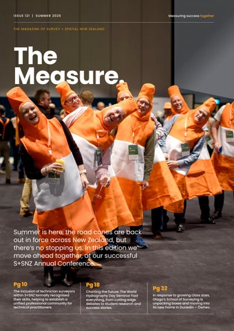
Summer is here, the road cones are back out in force across New Zealand, but there’s no stopping us. In this edition we move ahead together, at our successful S+SNZ Annual Conference. Pg 10
The inclusion of technician surveyors within S+SNZ formally recognised their skills, helping to establish a unified professional community for technical practitioners.
Pg 18
Charting the Future: The World Hydrography Day Seminar had everything, from cutting edge debates to student research and success stories.
Pg 32
In response to growing class sizes, Otago’s School of Surveying is unpacking boxes and moving into its new home in Dunedin – Ōwheo.