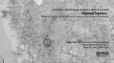
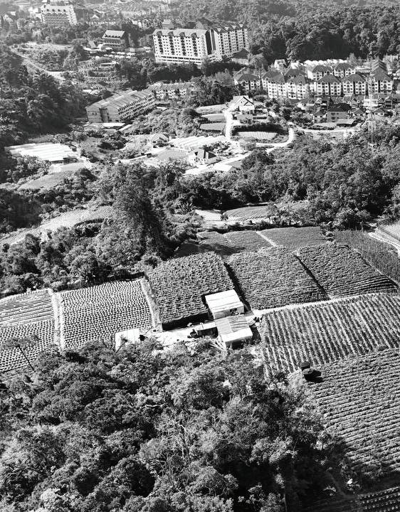
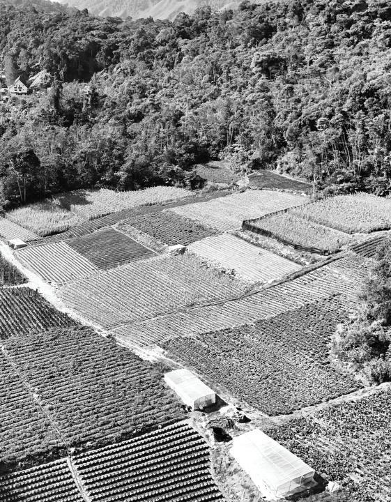
Title: Highland Tapestry: Weaving Ecology, Community, and Economy in the Cameron Highlands
All rights reserved; no part of this publication may be reproduced, stored in a retrieval system, or transmitted in any form or by any means, electronic, mechanical, photocopying, recording, or otherwise without prior written permission of the publisher.
The publisher does not warrant or assume any legal responsibility for the publication’s contents. All opinions expressed in the book are of the authors and do not necessarily reflect those of the National University of Singapore.
HIGHLAND TAPESTRY
Weaving Ecology, Community, and Economy in the Cameron Highlands
NUS College of Design & Engineering | Department of Architecture LAD4010 Design 8 & LA4702 MLA Studio, 15 JAN - 22 APR 2026
Boddapati Krishna Sri | Chee Shi Jia, Maydalene | Jonald Khaw Khoo Zhi Luo I Lee Huei Min | Ng Jun Hao | Soh Seh Ting | Su Juhui | Wu Qiqi
Cameron Highlands is renowned for its remarkable natural beauty and agricultural significance. For generations, its cool climate and rich biodiversity have shaped its identity as one of Malaysia’s most popular travel destinations. Yet, like many environmentally sensitive landscapes, Cameron Highlands faces increasing pressures arising from rapid development, changing land-use patterns, intensive agriculture, and tourism growth. Balancing economic opportunities with environmental stewardship remains one of the most pressing challenges facing the region today. It is therefore encouraging and inspiring to witness the collaborative work presented in this publication. Through the National University of Singapore’s LandscapeArchitecture Design Studio, students engaged deeply with the realities of Cameron Highlands. By combining scientific analysis, spatial research, field observations, and meaningful engagement with local stakeholders, the studio produced thoughtful and innovative proposals that address the complex relationship between people, livelihoods, and the environment.
REACH has always welcomed opportunities to connect local experience with new ideas and perspectives. This collaboration provided a valuable platform for students to explore the opportunities and challenges facing Cameron Highlands while engaging with the people, places, and issues that shape the region. The result is a collection of thoughtful proposals that encourage us to look at familiar challenges in new ways and to consider how environmental stewardship and economic development can move forward together.
REACH is grateful for the opportunity to collaborate with the National University of Singapore (NUS) and to share local knowledge and experiences with the students throughout this journey. We commend the dedication of the NUS team, community representatives, and all stakeholders who contributed to this meaningful endeavour. May this publication inspire continued collaboration, thoughtful discussion, and collective action towards a more resilient and sustainable future for Cameron Highlands.
FOREWORD II
Ong Kian Ming
Adjunct Professor, Philosophy Politics & Economics, Taylor’s University and Former Member of Parliament, Malaysia
I’ve always viewed Cameron Highlands with a sense of mystique from my visits to the fog-shrouded tea plantations as a young tourist with my parents to hiking through the mossy forest trail in Brinchang as an adult and thinking about the lost Japanese gold mine described in Tan Twan Eng’s Garden of Evening Mists using the backdrop of a Japanese garden tucked away in a hidden corner of this hilltop retreat.
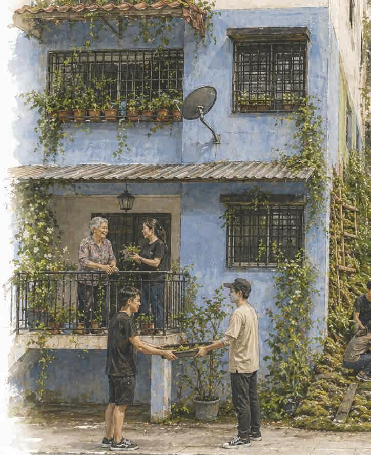
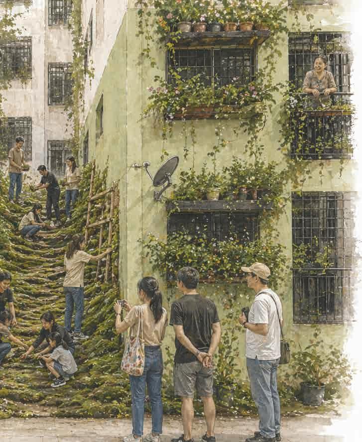
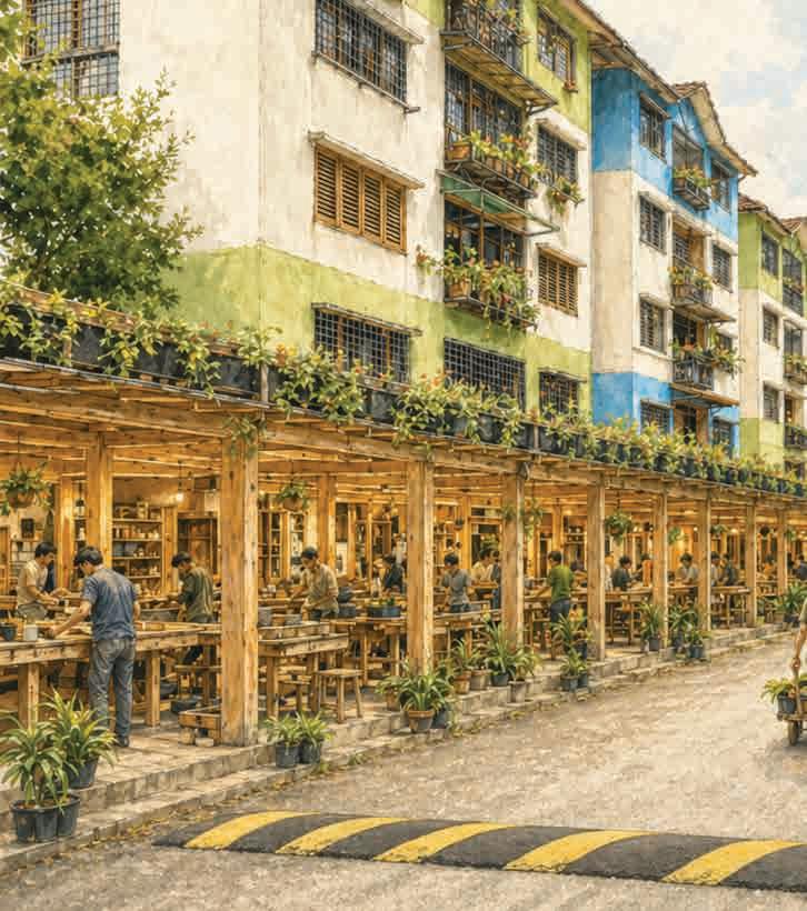
My imagination was allowed to re-engage with Camerons recently, after listening to Architecture students from the National Unity of Singapore (NUS) bring their ideas to reimagine different parts of the CH landscape as part of their studio project. I was impressed and inspired by their many ideas ranging from planting community gardens in public flats as a way to bring tourists and income to an otherwise dilapidated place to a hillslope restoration project that was integrated with community activities to a repurposing an old marketplace to a placemaking venue with different levels of community engagement.
I would really love to see some of these ideas come into fruition. And perhaps, with the right kind of engagement with stakeholders from the private and public sector, this may one day happen. I hope that the NUS architecture community, both faculty as well as students, would continue to engage with the CH ecosystem for some of these current and future ideas to gain traction, to evolve, to be contextualized further, and perhaps, one day, to become reality.
THE FIRST SERIES OF HIGHLAND TAPESTRY
HWANG YUN HYE
Associate Professor, Landscape Architecture, Department of Architecture College of Design and Engineering, National University of Singapore
Despite the historical celebration of the Cameron Highlands as a rich tapestry of biodiversity and cultural heritage, the region faces persistent challenges due to the uneasy coexistence of intensive agriculture, mass tourism, and environmental preservation. To address these complex frictions, we conducted a design studio with students from the Bachelor and Master of Landscape Architecture programmes at NUS. This studio focused on the district of Tanah Rata—a high-altitude plateau where the rapid expansion of agro-tourism and commercial farming threatens the region’s signature cool climate and ecological stability. Through this studio, students demonstrated how interdisciplinary research, masterfully integrating geospatial mapping, ethnographic fieldwork, and scientific data analysis, can be applied to envision resilient futures. In this exploratory setting, students engaged with critical literature from geography and anthropology to spatialize socio-ecological frictions and develop scenario-based design strategies. This approach enabled a deep immersion into the “Highland Tapestry,” facilitating proposals that weave together ecological restoration, economic viability, and socio-cultural equity, underscoring the role of landscape architecture in advocating for sustainable development in Southeast Asia’s highland regions.
The success of this studio was made possible by the generous support and collaboration of many contributors. We extend our sincere gratitude to Mr. Siva Das (Vice-President, REACH) for his insightful guest lecture, to the REACH team with Mr. Dilip for hosting our fieldwork, and to Dr. Lu Xiaoxuan (NUS) for sharing student works from the MLA Chiang Mai studio and offering critical commentary across three review sessions. We are deeply grateful to Mr. Gerald, Mr. Fung, Mr. Mani and the Orang Asli communities, for their openness and willingness to share invaluable local knowledge during our fieldwork. Special thanks go to the diverse stakeholders in Tanah Rata who participated in our engagements, helping students develop a richer understanding of the site context. We also wish to acknowledge Dr. Ong Kian Ming, who provided thoughtful feedback and grounded our speculative analyses in on-the-ground realities. Lastly, we appreciate the reviewers —Dr. Gereth, Dr. Dorothy, Yifeng (NUS), and Kenya (Tokyo U.) —for their invaluable comments on the final projects.
STUDIO INTRODUCTION
OVERVIEW
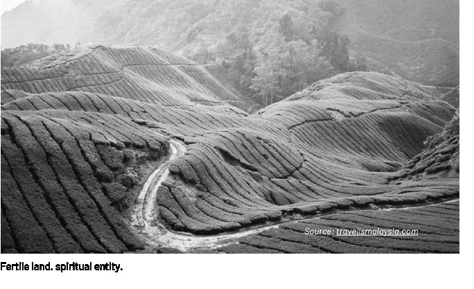
The Cameron Highlands, a high-altitude plateau (with its highest peaks reaching over 2,000 meters above sea level) on Peninsular Malaysia’s Main Range known for its exceptionally fertile lands and rich biodiversity, was historically celebrated for its tapestry of dense jungles, colonial estates, and indigenous sacred sites. This unique character, woven from soaring peaks and rolling tea plantations, is now under threat.
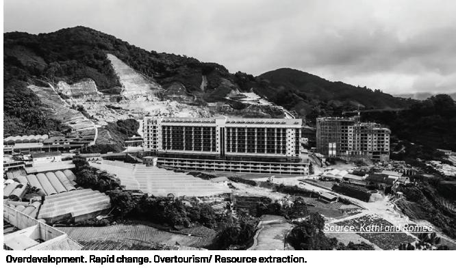
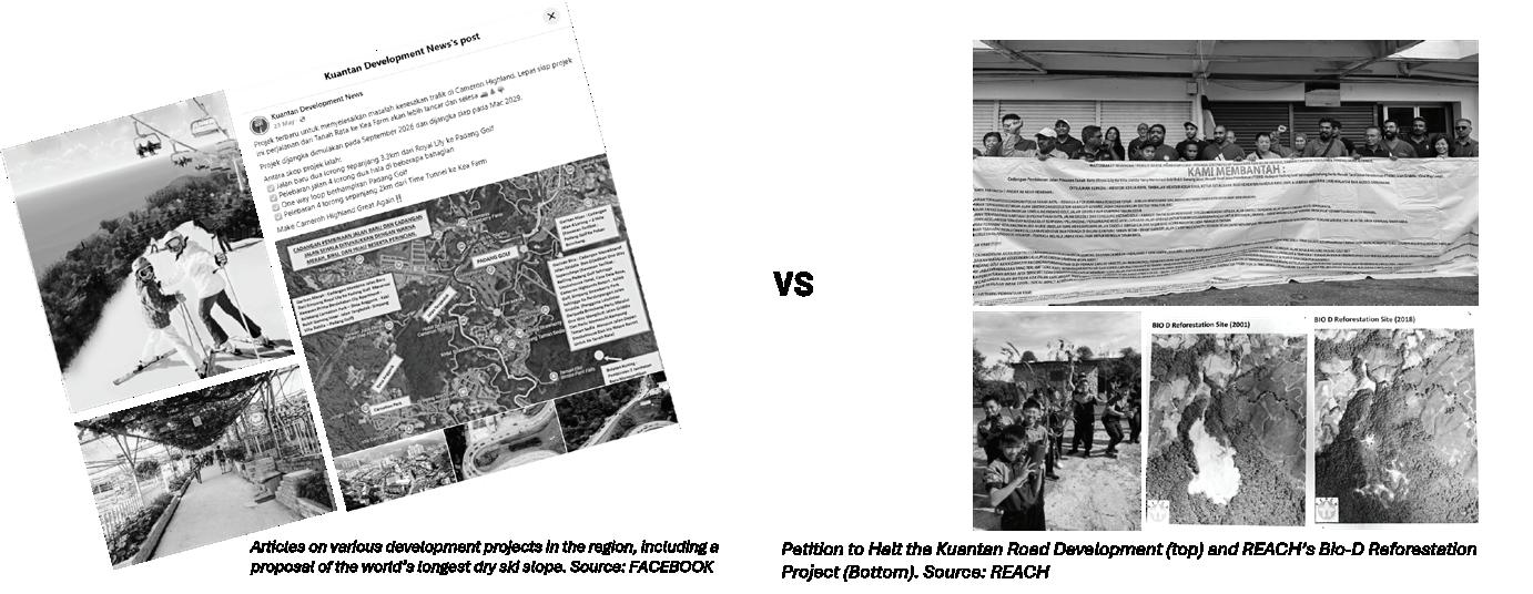
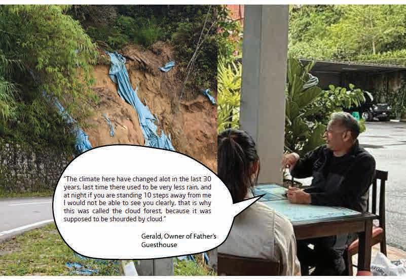
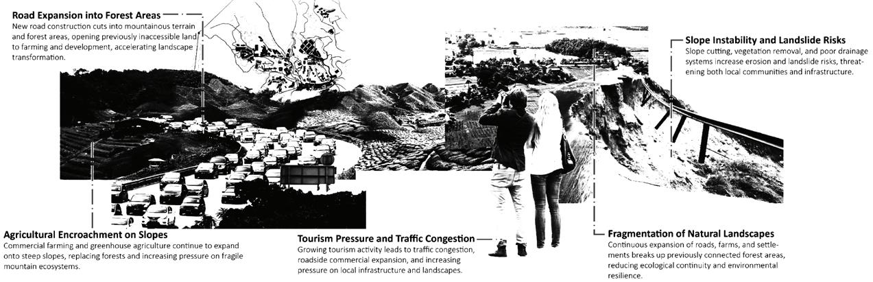
Since its colonial development as a hill station, the region has been caught in a persistent conflict between economic development and environmental preservation. This tension has intensified dramatically in recent decades as what began as a modest tourist industry has exploded, fueled by official development plans promoting agrotourism and aiming to make the highlands a “prime tourist destination.” The rapid, often unregulated, expansion of both commercial agriculture and mass tourism has led to extensive deforestation on steep, erosion-prone slopes, triggering severe landslides and soil degradation. Simultaneously, sprawling infrastructure built to accommodate tourists fragments natural habitats, strains local resources, and contributes to rising temperatures that threaten the region’s signature cool climate. These pressures have also profoundly impacted the indigenous Orang Asli communities, leading to the loss of ancestral lands and the erosion of their cultural identity.
Focusing on the district of Tanah Rata, the “Highland Tapestry” studio investigates these frictions between conservation and development, circular and linear economies, and tradition and modernity. The studio approaches the Cameron Highlands as a living laboratory for landscape architecture, aiming to develop proposals that weave together ecological restoration, economic viability, and socio-cultural equity. Grounded in sitespecificity and deep community engagement, the studio challenges students to envision long-term, local, and resilient futures.
Students will immerse themselves in critical literature from geography and anthropology and engage directly with a diverse range of stakeholders—including local communities, agricultural producers, and environmental advocates like the Regional Environmental Awareness Cameron Highlands (REACH)—to understand the ongoing debates and codevelop meaningful design strategies.
- 721km2, 1.4-1.8km above sea level
- 45,000 residents + 20,000 migrant workers, 3-5 million tourists
- Agriculture, Tea cultivation, and Tourism
QUESTIONS AND APPROACHES
The studio was driven by two fundamental questions: How can landscape architecture catalyze a regenerative economy in the Cameron Highlands by leveraging ecological restoration and agricultural heritage to create sustainable livelihoods? Furthermore, how can design strategies translate the cultural knowledge and ancestral rights of local communities into new models of economic stewardship that ensure their agency and prosperity?
To address these inquiries, the studio adopted a three-fold methodological approach. First, we utilized a Multi-Scalar Systems Framework to navigate the complexities between regional environmental shifts and local site conditions. Second, we employed Mapping as a Critical Design Tool, using it not merely for representation but as an active method to spatialize and interrogate socio-ecological frictions. Finally, the studio maintained a Community-Centric/Localization focus, grounding every proposal in the specific needs and traditional wisdom of the people who inhabit the highlands, ensuring that design outcomes are both resilient and socially equitable.
THREE PROJECTS
1: CONTEXTUALIZING
FRICTIONS
(Weeks 1–5)
Project 1 immerses students in the complex dynamics of development, conservation, and socio-cultural change within the highland regions of Southeast Asia. Through an analysis of academic literature and news articles, students will focus specifically on the application to Cameron Highlands. Distinct from a typical design “case study,” this project requires students to engage with analytical reviews on literature from geography, anthropology, and political ecology. They will model and draw the socio-ecological qualities of these sites, spatializing the major frictions discussed in the readings. Each student will analyze based on readings and case studies—the Cameron Highlands and a comparable international projects. The goal is to build a shared vocabulary for identifying and articulating complex landscape challenges in diverse settings.
This comparative approach will enable a productive dialogue between sites, examining factors like the speed and scale (local, regional, and global scale) of landscape transformation, the conflict between traditional and state knowledge systems, and the roles of various stakeholders.
2: IMMERSING IN THE TAPESTRY (Weeks 6–9)
Project 2 immerses students in the on-the-ground realities of the Cameron Highlands through a seven-day fieldwork trip. The work will focus on three distinct areas within Tanah Rata Town, each representing a different facet of the region’s challenges:
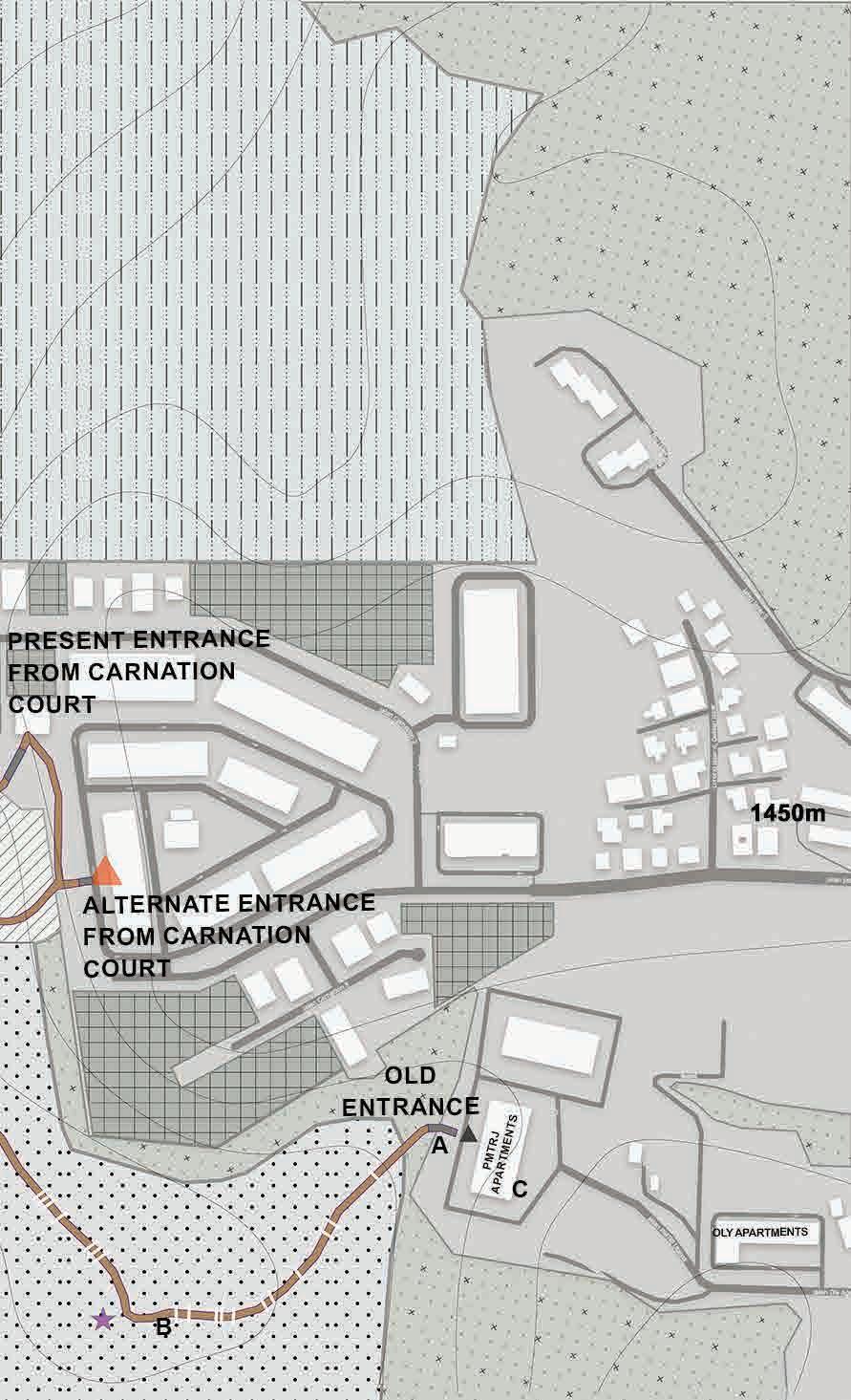
― A. Carnation Park Estate and its surrounding context: A residential complex situated at the forest edge, directly interfacing with Jungle Trail 10.
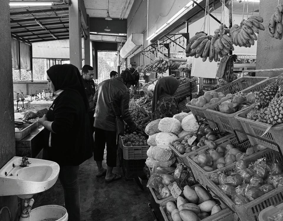
― B. Father’s Guesthouse and amenities along Jalan Besar: The commercial and social heart with tourist accommodation, local markets, and public spaces, showcasing daily life and tourist interaction.
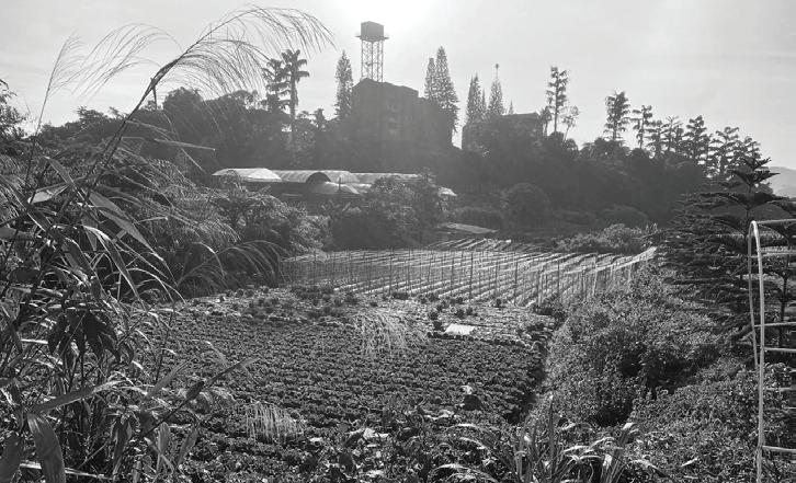
― C. Agricultural lands and greenhouses on a Tanah Rata hill: The proposed site for intensive, government-initiated infrastructural development within the next decade.
This direct site investigation will be supplemented by visits to 2-3 reference projects managed by REACH, organic farmers, Orang Asli communities, or social entrepreneurs. Students will select one of these three primary sites to conduct a reflective and speculative analysis. Their analysis must foreground the critical frictions between conservation and production, the competing claims of mass tourism and ecotourism, and the tensions between indigenous land rights and state-led development.
PROJECT 3: WEAVING ALTERNATIVE FUTURES (Weeks 10–14)
Students’ study of case-based issue statements (Project 1) and their engagement with the on-the-ground frictions in the Cameron Highlands (Project 2) will provide the critical foundation for this final project. The aim is to develop landscape strategies that offer alternative, resilient futures for the region. The critical concepts and ideological frictions identified in the first two projects must be present and form the conceptual framework of their design proposal. While students will develop an individual project, it will be situated within a small group to facilitate dialogue between projects sharing similar sites or conceptual approaches. Their project must be scenario-based, and they will perform an evaluative assessment to determine the factors that facilitate or impede students’ proposed strategies under various ecological, social, and economic conditions.
REFERENCES
Abdul B., A. B. (2011). Landslide susceptibility modelling under environmental changes: A case study of Cameron Highlands, Malaysia (Doctoral dissertation, Universiti Teknologi Petronas).
Aminu, M., Matori, A. N., Yusof, K. W., Malakahmad, A., & Zainol, R. B. (2015). A GIS-based water quality model for sustainable tourism planning of Bertam River in Cameron Highlands, Malaysia. Environmental Earth Sciences, 73(10), 6525-6537.
Ariffin, A. R. M., Ali, Z. M., Zainol, R., Rahman, S., Ang, K. H., & Sabran, N. (2014). Sustainable highland development through stakeholders’ perceptions on agro ecotourism in Cameron Highlands: A preliminary finding. In SHS Web of Conferences (Vol. 12, p. 01086). EDP Sciences.
Barrow, C. J., Clifton, J., Chan, N. W., & Tan, Y. L. (2005). Sustainable development in the Cameron highlands, Malaysia. Malaysian Journal of Environmental Management, 6, 41-57.
Berkes, F., Colding, J. and Folke, C., 2000. Rediscovery of traditional ecological knowledge as adaptive management. Ecological applications, 10(5), pp.1251-1262.
Berger, A., & Kotkin, J. (Eds.). (2018). Infinite suburbia. Chronicle Books.
Chan, N. W. (2006). Cameron Highlands: issues and challenges in sustainable development.
Chan, N. W. (2010). Unsustainable development and environmental change in Cameron Highlands. Environ Res Technol, 546.
Chavoshi, R. (2017, July 13). Why the success of the Cameron Highlands might be its downfall. Eco-Business. Retrieved November 28, 2025, from https://www.eco-business.com/opinion/why-thesuccess-of-the-cameron-highlands-might-be-its-downfall/
Cheer, J. M., Milano, C., & Novelli, M. (2019). Tourism and community resilience in the Anthropocene: Accentuating temporal overtourism. Journal of Sustainable Tourism, 27(4), 554-572.
Ching, S. L., Choong, Y. O., Lau, L. S., Seow, A. N., & Choong, C. K. (2022). Sustainable ecotourism development strategies through strengths, weaknesses, opportunities and threats analysis: The case of Cameron Highlands, Malaysia. Business Strategy & Development, 5(2), 110-116.
Dong, M. M., Midmore, P., & Plotnikova, M. (2022). Understanding the experiences of Indigenous minorities through the lens of spatial justice: The case of Orang Asli in Peninsular Malaysia. Regional science policy & practice, 14(5), 1223-1240.
Endicott, K (2016), Malaysia’s original people: past, present and future of the Orang Asli, NUS Press, Singapore
Fong, F. (2025, February 7). Cameron Highlands: Paradise lost between agricultural demands and tourism woes. The Rakyat Post. https://www.therakyatpost.com/news/malaysia/2025/02/07/ cameron-highlands-paradise-lost-between-agricultural-demands-and-tourism-woes/ Forsyth, T., & Walker, A. (2008). Environmental crisis and the crisis of knowledge. Forest Guardians, Forest Destroyers: the politics of environmental knowledge in Northern Thailand, 3-26.
Fujimaki, M., (2008). Tourism and Orang Asli Communities in Malaysia : A Preliminary Report of Case Study on Cameron Highlands, No.91 171-200.
Green Yatra. (n.d.). Retrieved November 20, 2025, from https://www.greenyatra.org/
How Jin Aik, D., Ismail, M. H., Muharam, F. M., & Alias, M. A. (2021). Evaluating the impacts of land use/land cover changes across topography against land surface temperature in Cameron Highlands. PloS one, 16(5), e0252111.
Hearn, G. J. (Ed.). (2011). Slope engineering for mountain roads. Geological Society of London. Kathirithamby-Wells, Jeyamalar, (2005). Nature and nation: forests and development in Peninsular Malaysia, University Press ; Copenhagen : Nordic Institute of Asian Studies
Landezine. (n.d.). Extraction. Retrieved November 20, 2025, from https://landezine.com/topics/ forces-frictions/extraction/
Lee, P. C. (1966). Cameron Highlands district, Pahang. In forest resources reconnaissance survey of Malaya report (Vol. 6).
Liu, J., Dietz, T., Carpenter, S. R., Taylor, W. W., Alberti, M., Deadman, P., ... & Lubchenco, J. (2021). Coupled human and natural systems: The evolution and applications of an integrated framework: This article belongs to Ambio’s 50th Anniversary Collection. Theme: Anthropocene. Ambio, 50(10), 1778-1783.
Local Futures. (n.d.). Retrieved November 20, 2025, from https://www.localfutures.org/
Making Roots. (n.d.). The Cameron Highlands: Must do. Retrieved November 20, 2025, from https:// www.makingroots.co.uk/post/thecameronhighlandsmustdo Manzenreiter, W., Lützeler, R., & Polak-Rottmann, S. (Eds.). (2020). Japan’s new ruralities: Coping with decline in the periphery. Routledge.
Mohd Saufi, S. A., Azinuddin, M., Som, A. P. M., & Hanafiah, M. H. (2025). Overtourism Impacts on Cameron Highlands Community’s Quality of Life: The Intervening Effect of Community Resilience. Tourism Planning & Development, 22(2), 228-235.
Nasidi, N. M., Wayayok, A., Abdullah, A. F., & Mohd Kassim, M. S. (2021). Dynamics of potential precipitation under climate change scenarios at Cameron highlands, Malaysia. SN Applied Sciences, 3(3), 334.
Nhu, V. H., Mohammadi, A., Shahabi, H., Ahmad, B. B., Al-Ansari, N., Shirzadi, A., ... & Nguyen, H. (2020). Landslide detection and susceptibility modeling on cameron highlands (Malaysia): A comparison between random forest, logistic regression and logistic model tree algorithms. Forests, 11(8), 830.
Omar Sattur. (Ed.). (2002). Roadside Bio-Engineering Site Handbook, Department of Roads, His Majesty’s Government of Nepal.
Paez, R. (2024). Operative mapping: the use of maps as a design tool. Actar D, Inc.. Rahim, H., Wahab, M. A. M. A., Amin, M. Z. M., Harun, A., & Haimid, M. T. (2016). Economic values of conservation attribute options in Cameron Highlands. Economic and Technology Management Review, 11, 123-133.
Rasul, M. G., Islam, M. S., Yunus, R. B. M., Mokhtar, M. B., Alam, L., & Yahaya, F. M. (2017). Spatial and Temporal Variation of Water Quality in the Bertam Catchment, Cameron Highlands, Malaysia: Rasul et al. Water Environment Research, 89(12), 2088-2102.
REACH. (n.d.). Reforestation. Retrieved November 20, 2025, from https://reach.org.my/category/ activities/reforestation/
Shirasaka, S. (1988). The Agricultural Development of Hill Stations in Tropical Asia A Case Study in the Cameron Highlands, Malaysia. Geographical review of Japan, Series B., 61(2), 191-211. Straits Times. (2024, February 19). Cameron Highlands residents face water supply crisis amid rapid development. Retrieved November 20, 2025, from https://www.straitstimes.com/asia/se-asia/ cameron-highlands-residents-face-water-supply-crisis-amid-rapid-development
Straits Times. (2024, May 11). Petal power: Blossoms and battles in Malaysia’s floriculture hubs. Retrieved November 20, 2025, from https://www.straitstimes.com/asia/se-asia/petal-powerblossoms-and-battles-in-malaysias-floriculture-hubs
Straits Times. (2024, November 9). Prices soar as vegetable production in Cameron Highlands hit by monsoon. Retrieved November 20, 2025, from https://www.straitstimes.com/asia/se-asia/ prices-soar-as-vegetable-production-in-cameron-highlands-hit-by-monsoon
Urry, J., & Larsen, J. (2011). The tourist gaze 3.0. https://linc.nus.edu.sg/record=b3244083
Utusan Malaysia. (2025, September). Pembinaan jalan tidak selesai, kesesakan Cameron Highlands. Retrieved November 20, 2025, from https://www.utusan.com.my/nasional/2025/09/ pembinaan-jalan-tidak-selesai-kesesakan-cameron-highlands/ Vandergeest, P. (1996). Mapping nature: Territorialization of forest rights in Thailand. Vaz, J., & Aphinives, N. (2014). Living landscapes, connected communities: Culture, environment, and change across Asia. Kuala Lumpur: WWF Malaysia. Weebers, R. C. (2017). tanah rata and the development of the Cameron Highlands, 1925–2030. Journal of the Malaysian Branch of the Royal Asiatic Society, 90(1), 101-111.
Wiki Impact. (n.d.). The golden era of Cameron Highlands is over because of climate change. Retrieved November 20, 2025, from https://www.wikiimpact.com/the-golden-era-of-cameronhighlands-is-over-because-of-climate-change/
[Statistics/maps of Cameron Highlands]
Geospatial data portal by Department of Statistics Malaysia (DOSM) https://statsgeo.mycensus. gov.my/geostats/
Pahang State Government / Pahang State Planning Unit — for regional development plans, district profiles and planning data. https://pahang.gov.my/
Ministry/Department of Agriculture Malaysia (DOA) — for statistics on vegetable, tea and flower production (important in Cameron Highlands). See https://www.doa.gov.my and related commodity reports.
Malaysian Forestry Department / State Forestry Department (Pahang) — for forest cover, protected areas and land-use info. Tourism Malaysia and Pahang Tourism — for visitor numbers, attractions and tourism reports. Visit https://www.tourism.gov.my
Malaysian Meteorological Department (MetMalaysia) — for climate, rainfall and temperature records for Cameron Highlands. See https://www.met.gov.my. https://www.openstreetmap.org/node/254074510#map=16/4.47134/101.37699&layers=P https://www.jupem.gov.my/en/orang-awam?utm_source=chatgpt.com
15 JANUARY - 22 APRIL 2026
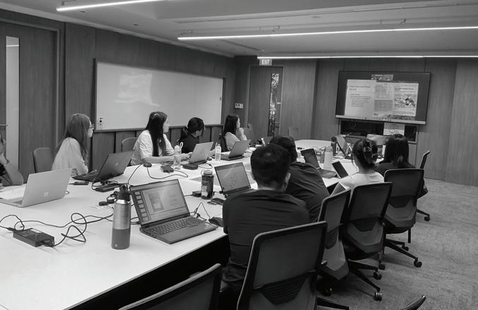
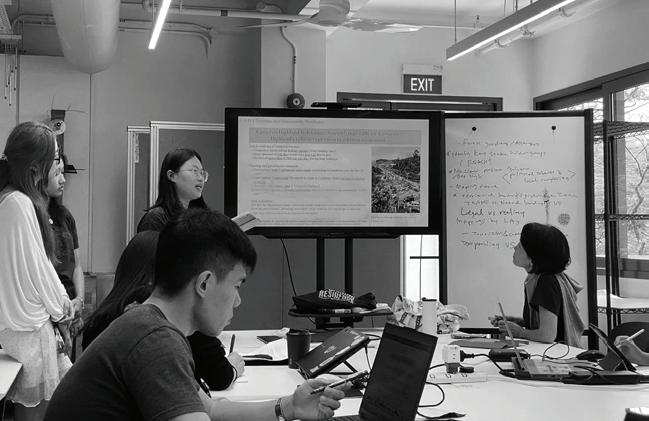
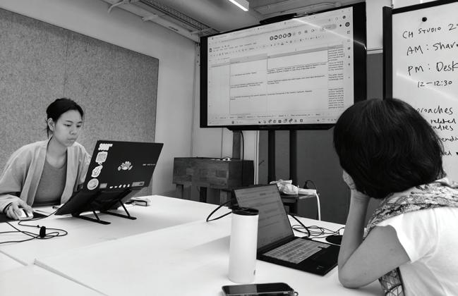
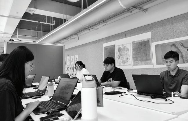
The studio started off with an introduction to the project by the studio tutor, Ms. Hwang Yun Hye, Associate Professor. This was followed by a brief self-introduction session among the students, allowing everyone to get to know one another better.
15 Jan
Studio Orientation
15 Jan
Seminar
Then Mr. Siva Das, Vice-President of REACH Cameron Highlands, who shared the organisation’s contributions to the region, while highlighting its ongoing challenges, proposed solutions, long-term goals. This was followed by a presentation by Visiting Associate Professor, Dr. Xiaoxuan Lu, who shared her studio experience in Chiang Mai, highlighting key learning takeaways, reflections, and valuable tips that we could carry forward into our Cameron Highlands fieldtrip and studio journey.
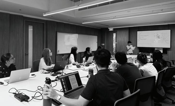
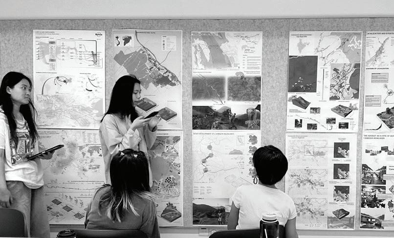
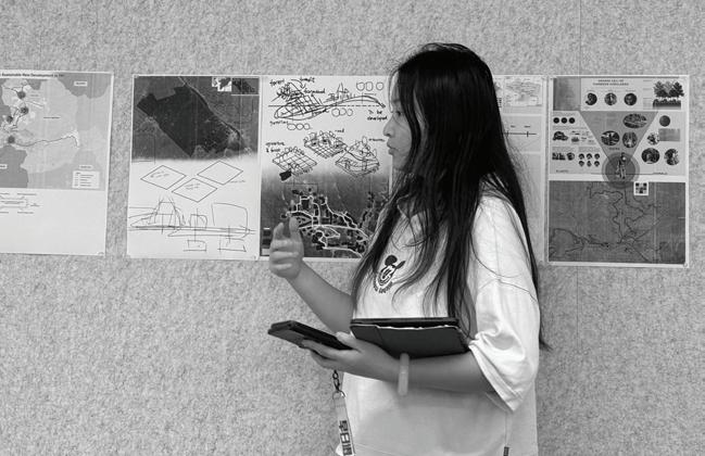
Each group of students took turns to present their key takeways and understandings of the given articles, and how these key lessons learnt can be applied for their subsequent studio projects and research.
22 Jan
Group Presentation
22 Jan
Studio Discussion
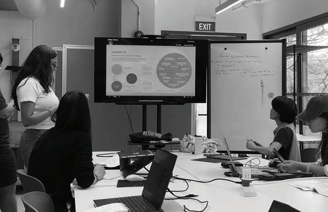
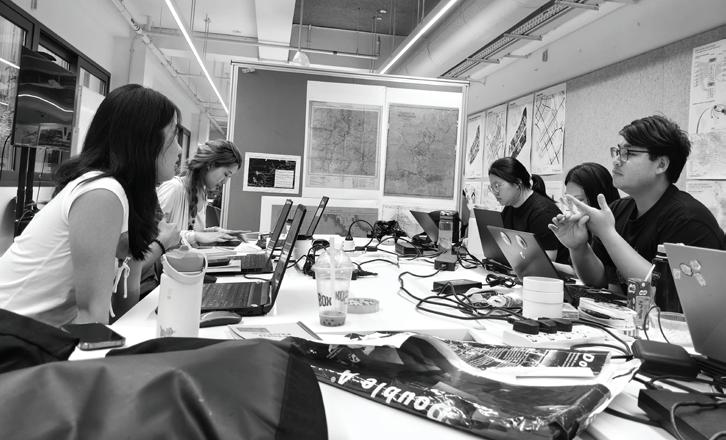
Discussion on project 1 review through group discussions and individual studio consultation.
Discussion about the project 1 review and refining our case study and research analysis and our project narrative.
29 Jan - 05 Feb
Studio Consultation
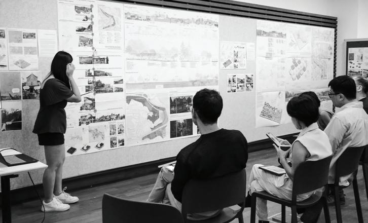
12 Feb Project 1 Review
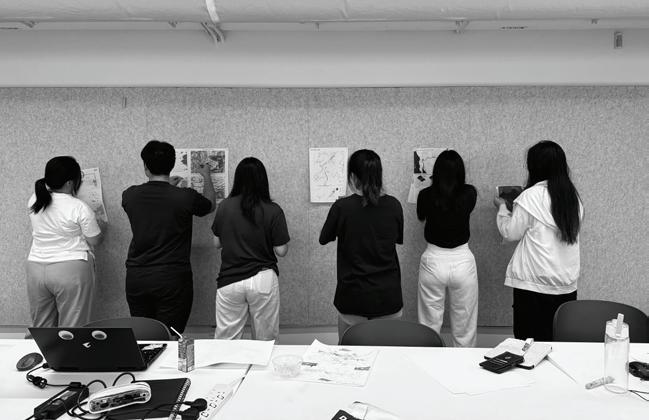
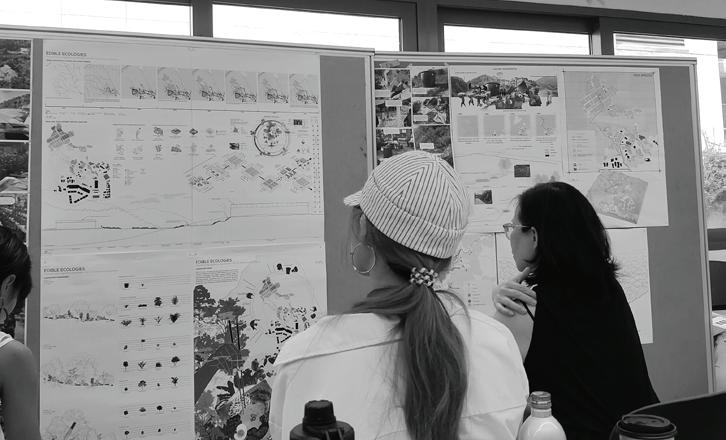
The students took turns to present their case study and preliminary research findings based on the chosen articles and topic of interests. During Project 1 review, 2 external reviewers were invited: Dr. Xiaoxuan Lu, Visiting Associate Professor, Department of Architecture, NUS Ms. Tiantong Gu, NUS Researcher
Each group were tasked to prepare the studio site model, fieldtrip booklet and drone equipment for studio fieldtrip live data mapping.
19
Feb
Fieldtrip Preparation
22 Feb Field Work Day 1
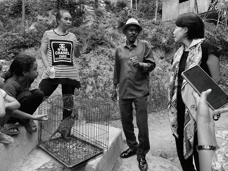
Arrival & Orang Asli Village Visit
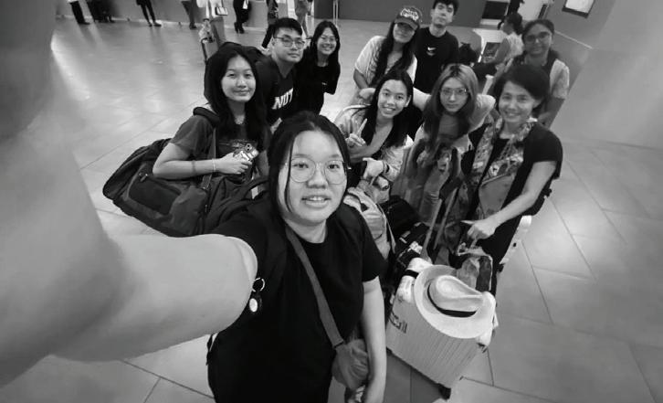
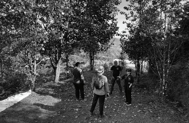
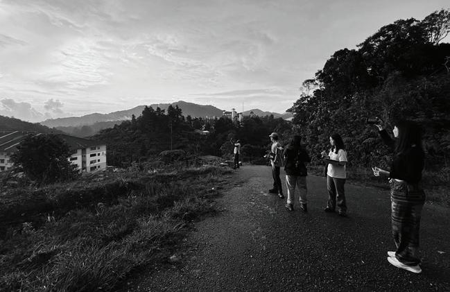
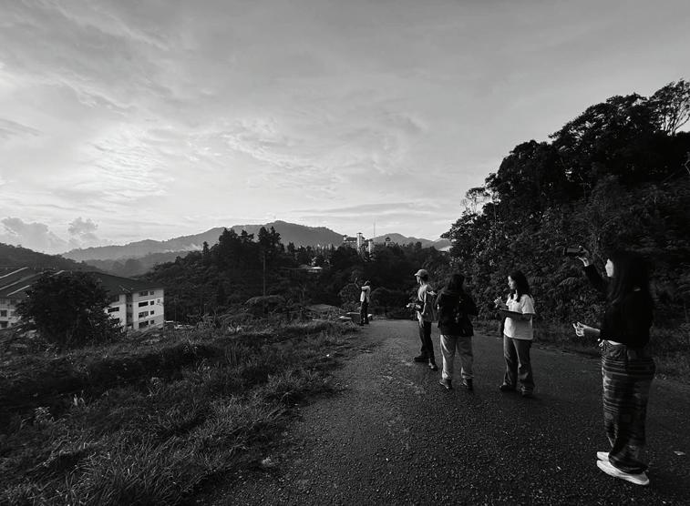
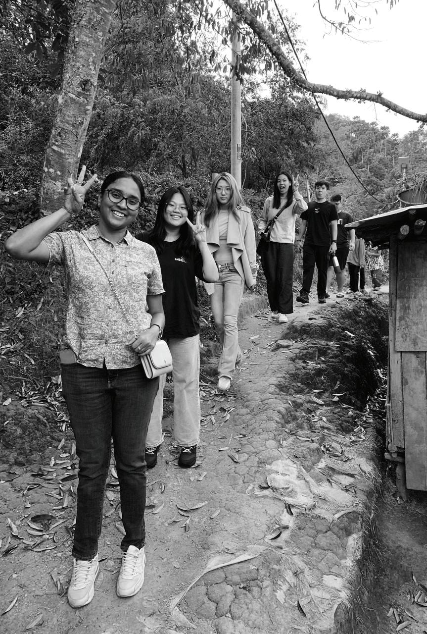
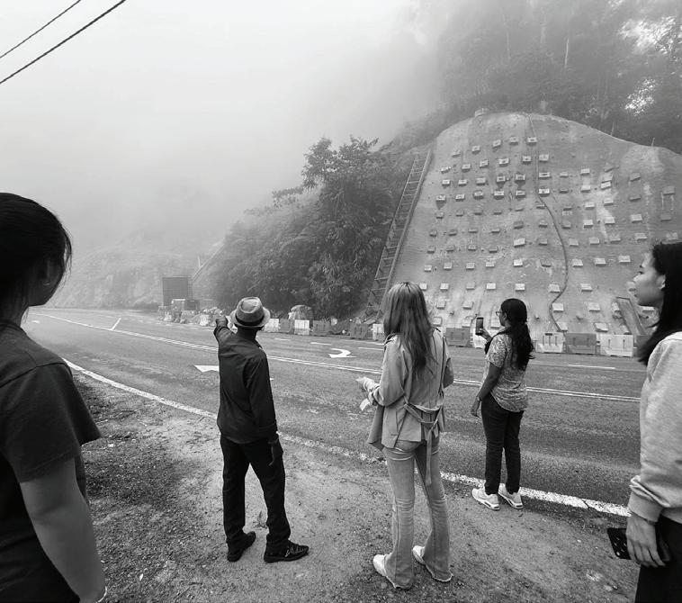
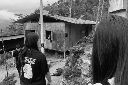
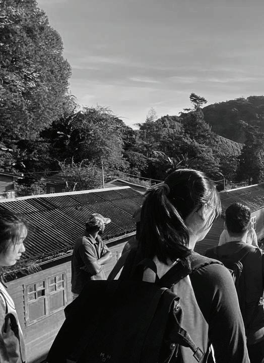
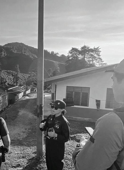
Arrived at Kuala Lumpur International Airport and set off our journey to Cameron Highlands, Tanah Rata. On our way up, we stopped by at one of the Orang Asli Village for a short visit and interviewed the residents living there.
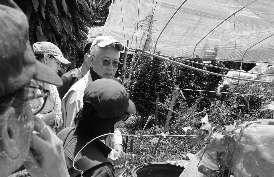
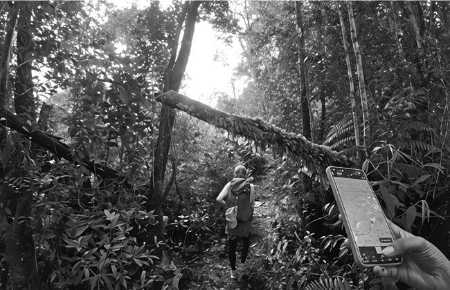
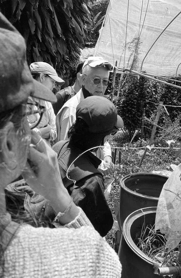
Visited the BOH Tea plantation with a introductory tour given by the REACH organisation. Afterwards, we went to the Bio D forest walk and participated in the tree planting activity hosted by the vicepresident of REACH Organisation, Mr. Siva Das. Later, we stopped by at Mr. Fung’s organic farm for a visit and had a farm-to-table lunch hosted by the organic farm owner, Mr. Fung.
23 Feb Field Work Day 2
Bio D Forest Walk and Tree Planting & Mr. Fung’s Organic Farm Visit
24 Feb Field Work Day 3
Individual Fieldwork & Mr. Mani’s House Visit
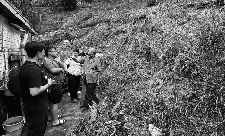
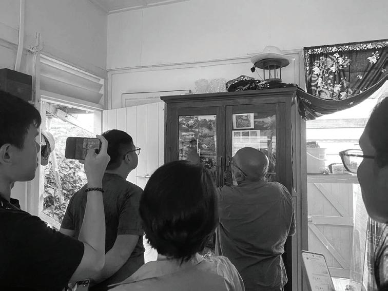
Each group went to conduct their site visits in the morning. Later, we visited Mr. Mani’s house, where we interviewed him to find out more about the history of Tanah Rata and its development over the years.
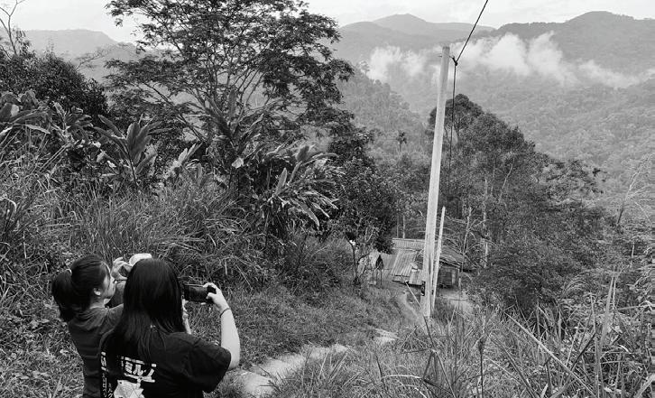
Each group continued to carry out their site visits to gather more data. Later, we visited the Orang Asli community to find out more about their history, living and culture.
25 Feb Field Work Day 4
Individual Fieldwork & Orang Asli Community Visit
26 Feb Field Work Day 5
Individual Fieldwork
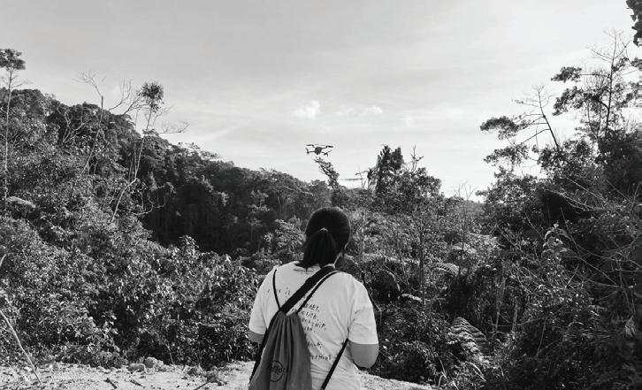
More group and individual site visits are carried out throughout the day for more observations and analysis to be collected. In some of our site areas, drones were used to capture areas that are not physically accessible for visitors.
More group and individual site visits are carried out throughout the day for more observations and analysis to be collected.
At the end of the day, each group will share their findings base don our narrative and site focus.
27 Feb Field Work Day 6
Individual Fieldwork
28
Feb Field Work Day 7
Pecha Kucha in REACH Office & BOH Tea Tour
Each student presented their individual site analysis in a Pecha Kucha format at the REACH office. To end of our fieldtrip as a reward, we went to the BOH tea plantation for a quick tour and relaxation before heading back to Kuala Lumpur International Airport for our returning flight to Singapore.
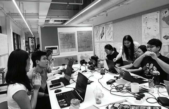
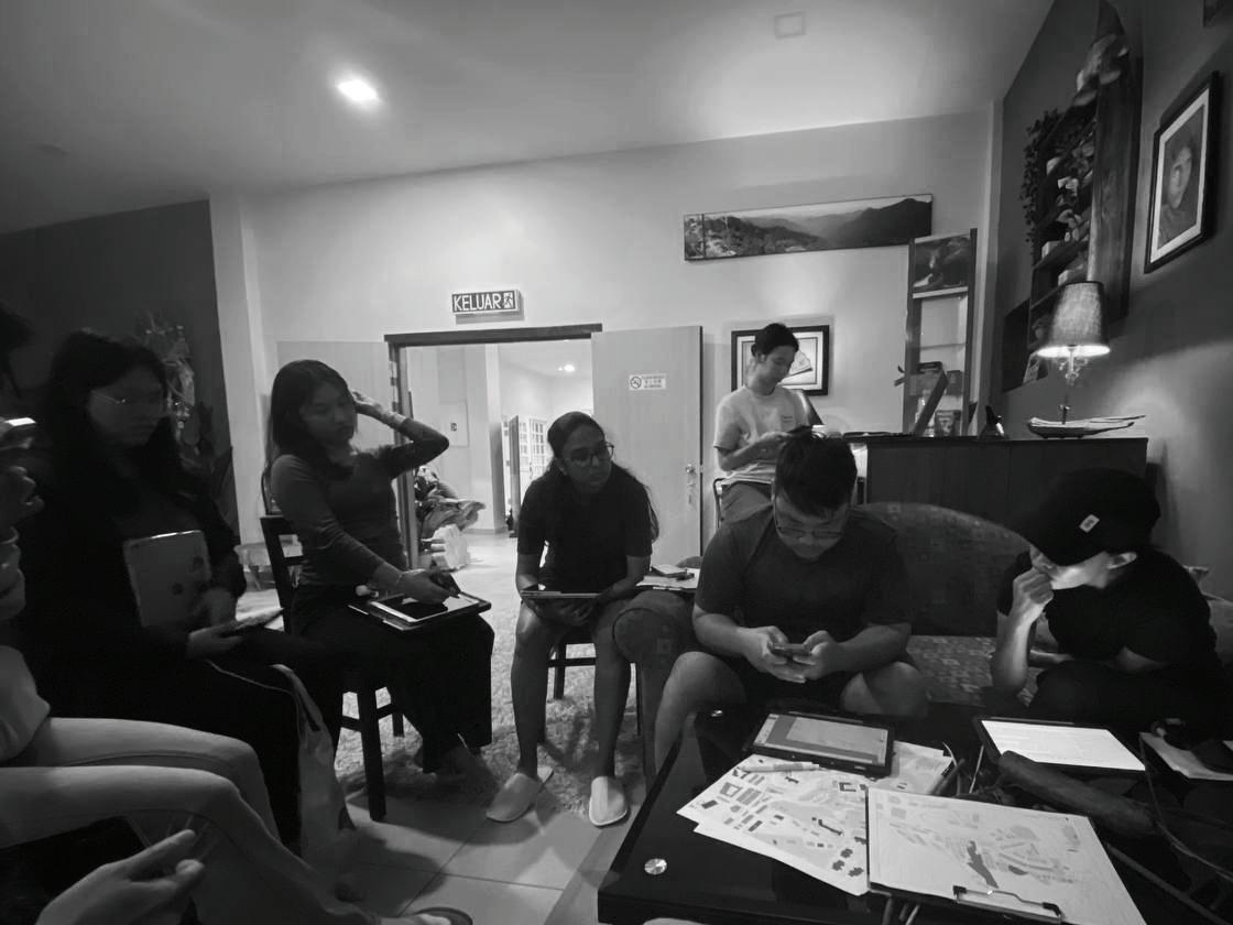
Discussion of project 2 review, with more in-depth focus on our project site, research analysis and design concept. Individual consultations and mock review were conducted to further refine and prepare for project 2 review crit.
05 & 12 Mar
Studio Consultation
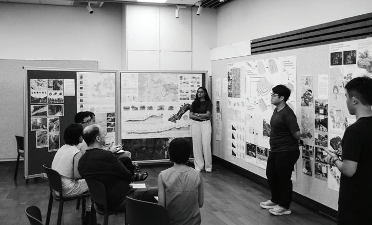
19 Mar Project 2 Review
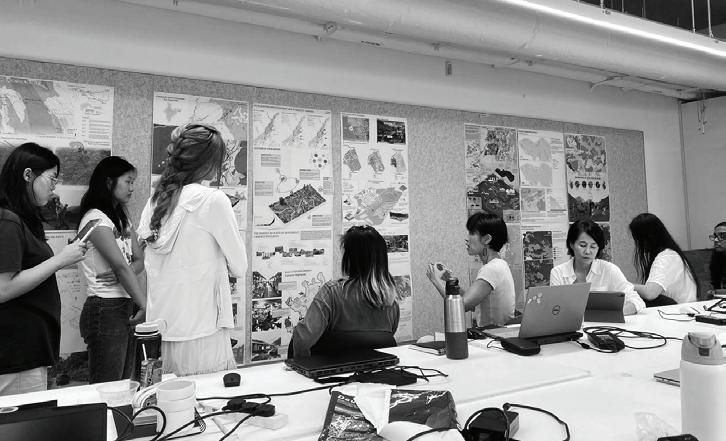
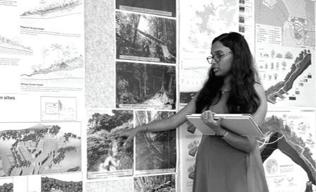
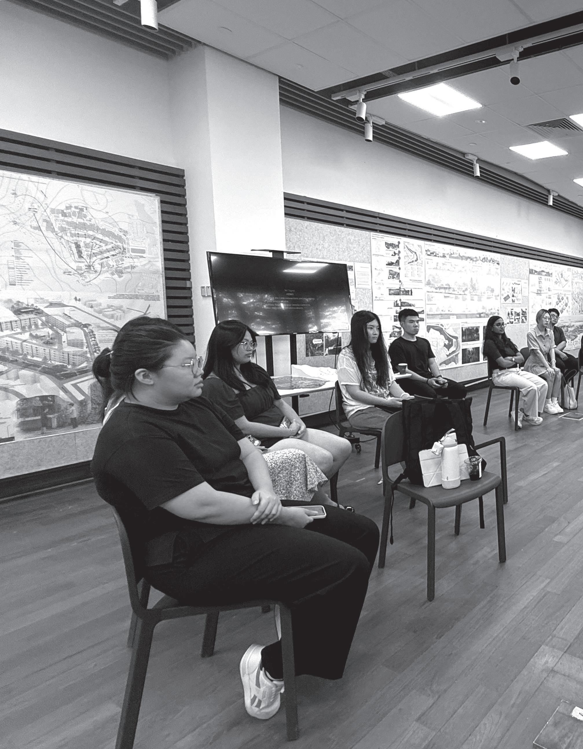
Students took turns to present their detailed site analysis and preliminary design concepts. During Project 2 review, two external reviewers were invited: Dr. Dorothy Tang, Assistant Professor, NUS Dr. Xiaoxuan Lu, Visiting Associate Professor, NUS
More individual consultations to further refine our designs and in preparation for production for project 3 review.
26 Mar - 16 Apr
Design Development & Studio Consultation
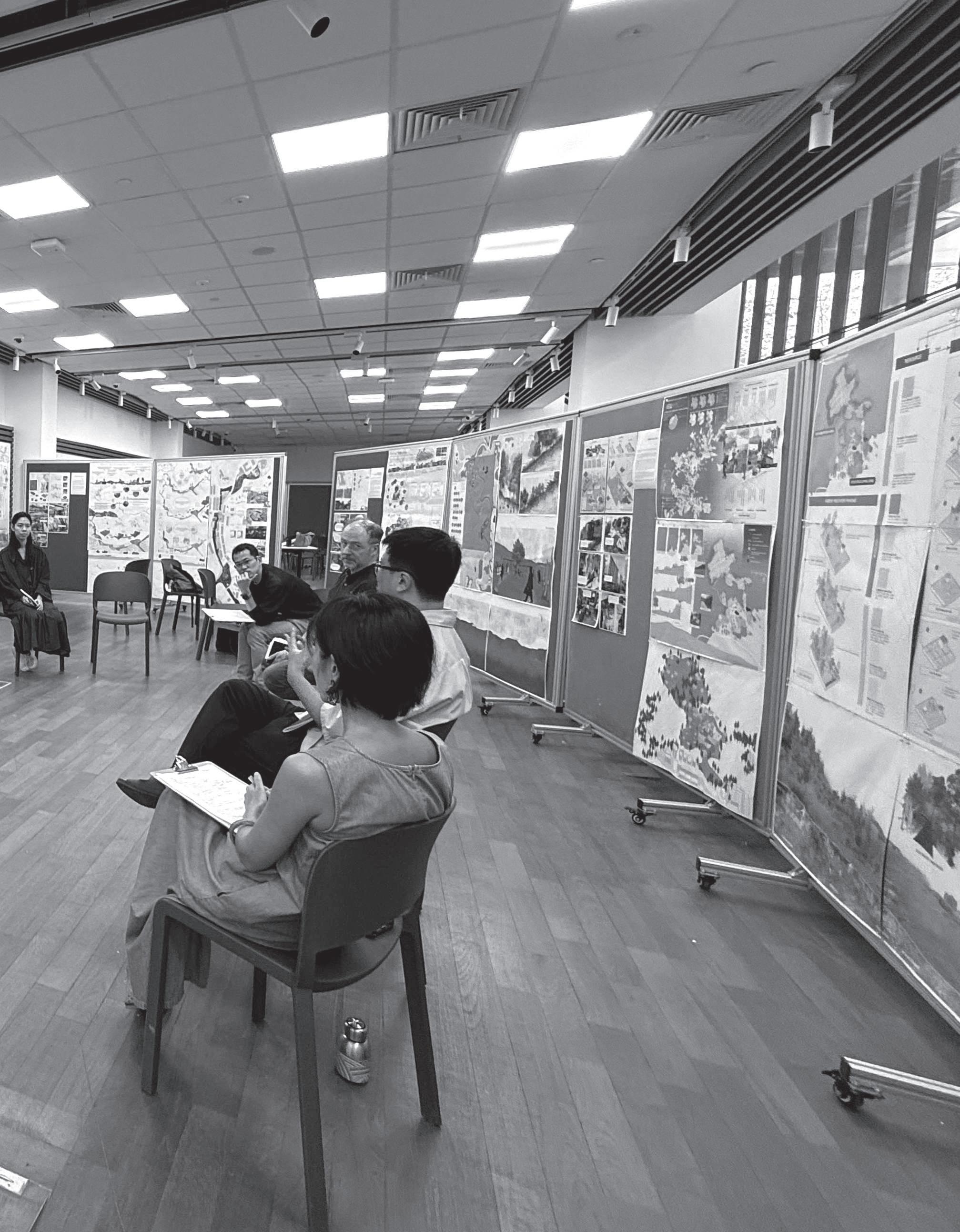
22 Apr Final Review
During final review, four external reviewers were invited:
Mr. Tiger Lin Yifeng, Associate Professor, NUS
Dr. Gareth Gerard Doherty, Associate Professor, NUS
Dr. Xiaoxuan Lu, Visiting Associate Professor, NUS
Mr. Kenya Endo, PhD Candidate, University of Tokyo
PROJECT OVERVIEW
[Group A: Forest Edge]
1.1. TRAIL 10+
1.2. Re-Habitable Slopes
1.3. Carnation Commons
[Group C: Highlands Development]
3.1. Living Terrains
3.2. Resource Loop Camp
3.3. un-BERRY-lievable
[Group B: Urban Amenities]
2.1. Living Musuem Of Tanah Rata
2.2. From External to Local
2.3. Where the stream meets the Town
GROUP A: FOREST EDGE
TRAIL 10+
RECONSTRUCTING FLOW, PAUSE AND, INTERACTION
Boddapati Krishna Sri
RE-HABITABLE SLOPE
ECOLOGIES OF LANDSLIDE VULNERABLE SLOPES
Jonald Khaw
CARNATION COMMONS
FOREST TO COMMUNITY FUTURES IN TANAH RATA
Ng Jun Hao P43 P65 P83
TRAIL 10+ : BEYOND MOVEMENT RECONSTRUCTING FLOW, PAUSE & INTERACTION
BODDAPATI KRISHNA SRI
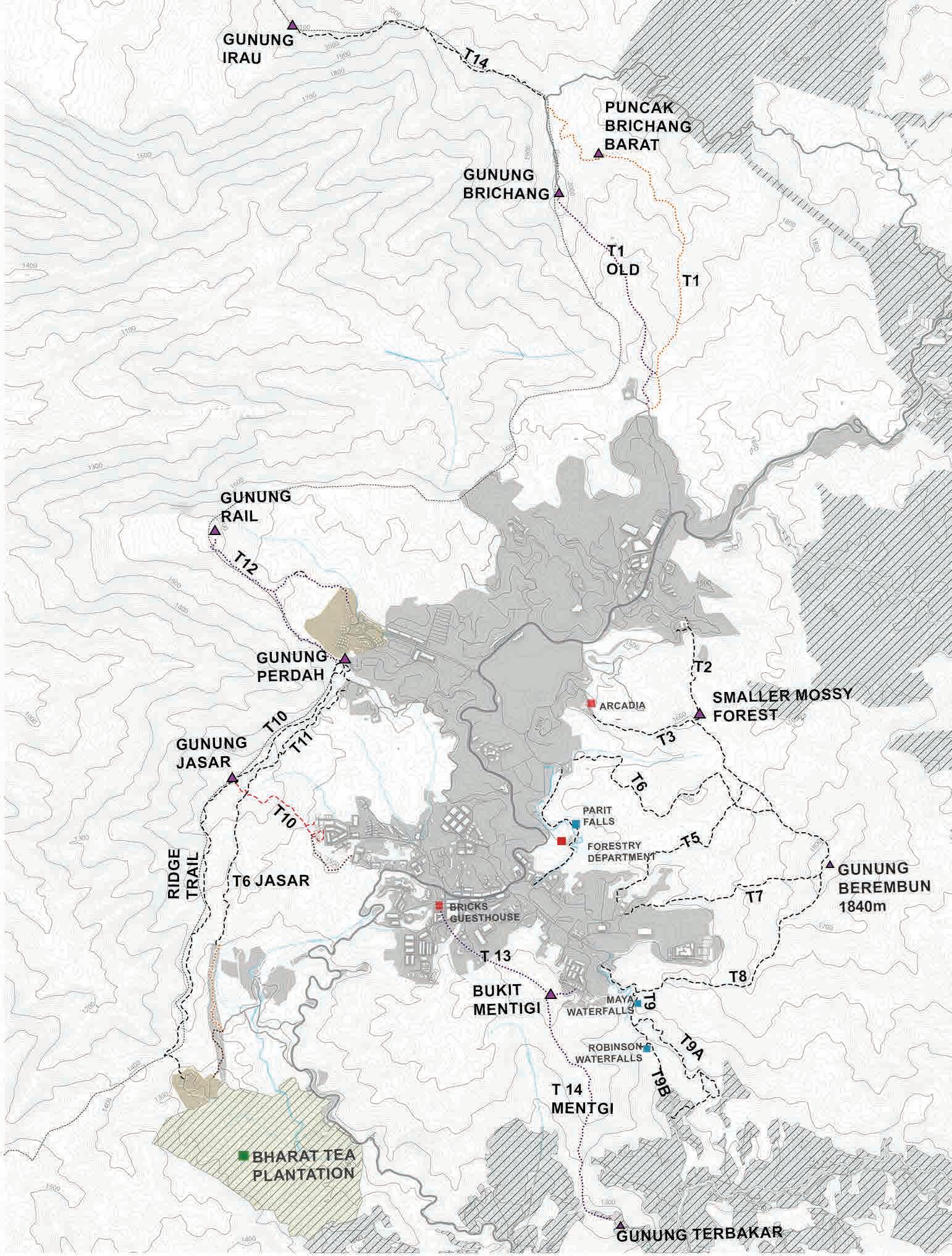
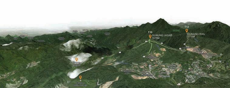
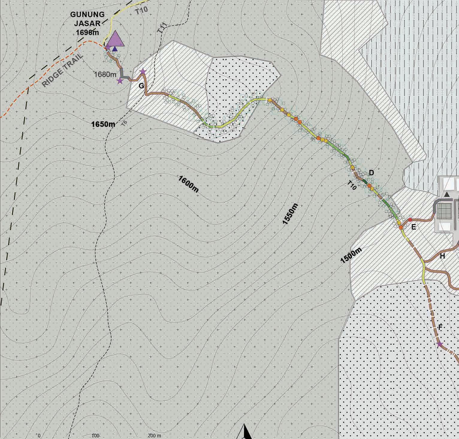
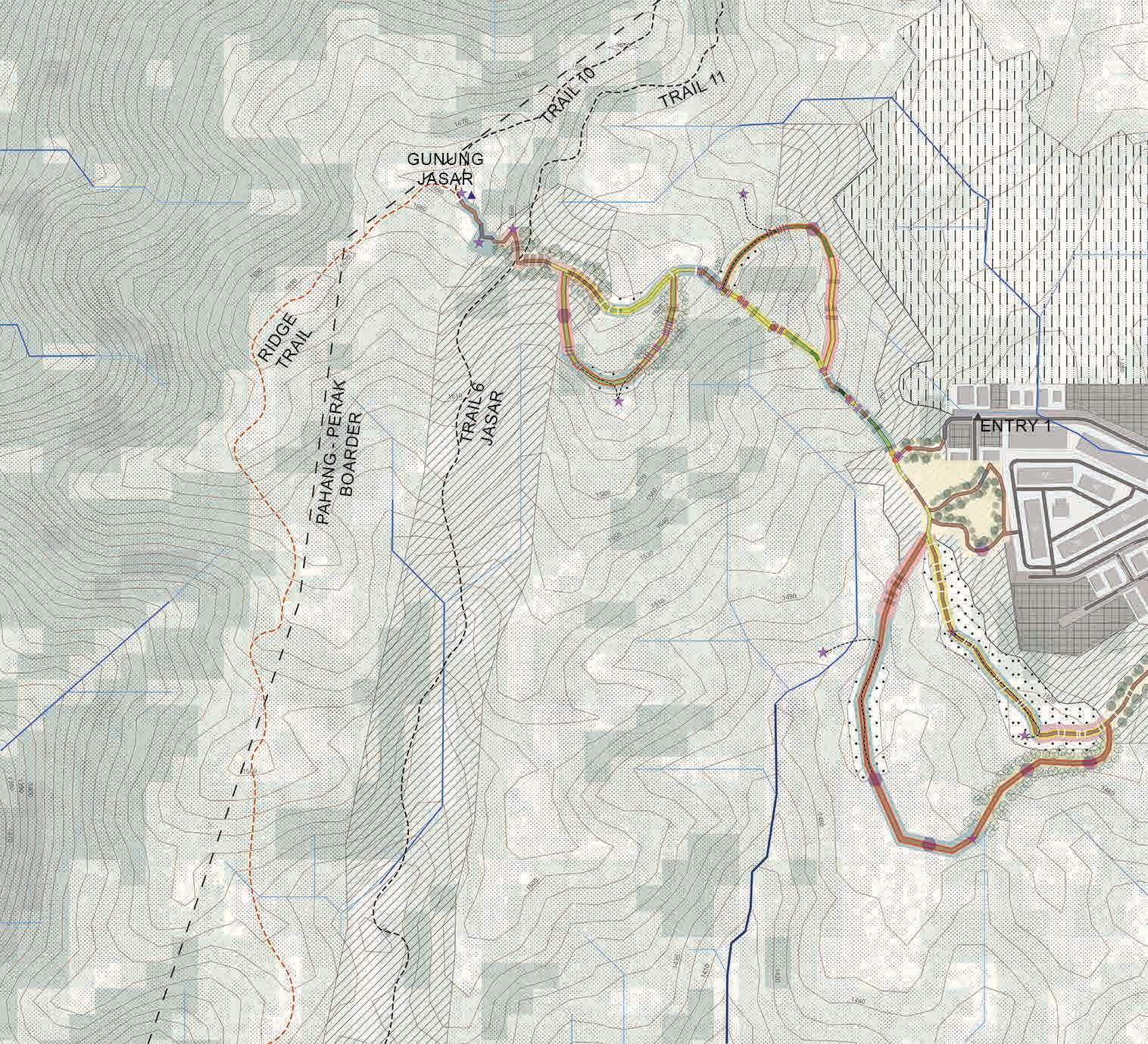
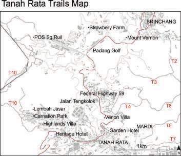
This project examines the network of Trails 1–14 in the Cameron Highlands, focusing on Trail 10 as an enhanced system, Trail 10+. Historically, these trails originated from Orang Asli movement routes connecting Gunung Jasar and surrounding forest systems, later formalised during colonial surveying and plantation expansion. Today, this once continuous network is fragmented, with breaks occurring near developed edges, disrupting ecological continuity and user movement.
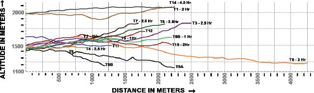
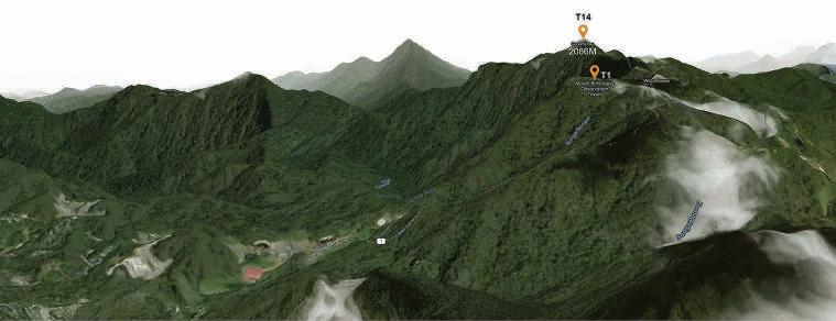
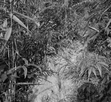
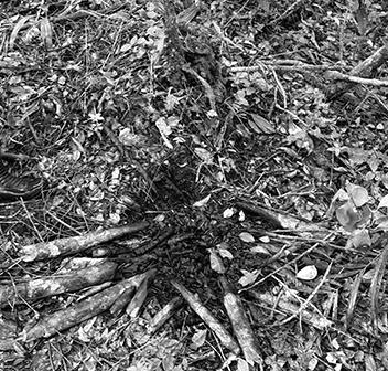
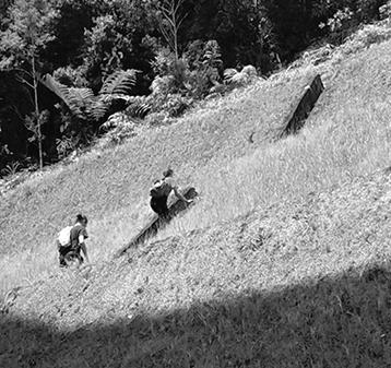
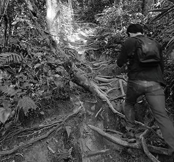
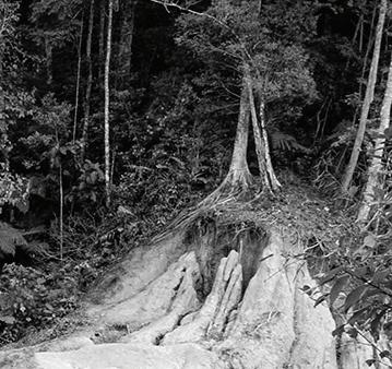
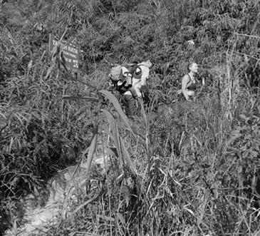
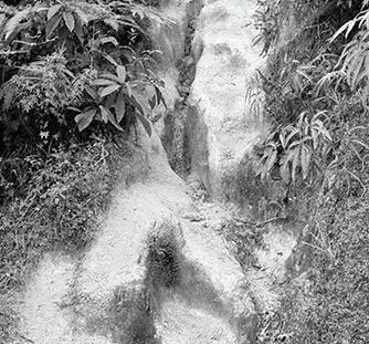
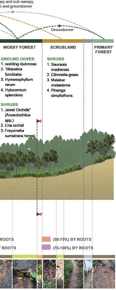
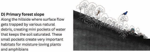
Sectional analysis shows that most trails range between 1–3 km, with Trail 6 extending further, while Trails 1 and 14 reach elevations above 2000 m. Trail 10, located between 1470 to 1695 m, traverses highly variable terrain. Mapped data indicates that zones with less than 25% root coverage correspond to loose, sandy soils and higher landslide susceptibility, while areas with 75–100% root coverage are comparatively stable. In these zones, exposed root networks act as natural stabilisers and often function as informal steps, aiding movement along steeper sections.
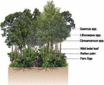
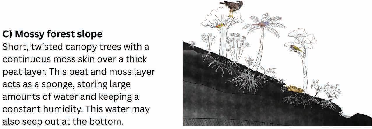
Mossy forest patches, typically found in higher, shaded zones, show signs of ecological stress. Reduced canopy cover increases exposure, accelerating soil drying and erosion, and diminishing the ground’s ability to retain moisture. This results in the gradual thinning and loss of moss layers critical to the cloud forest ecosystem.
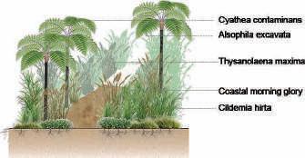
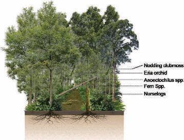
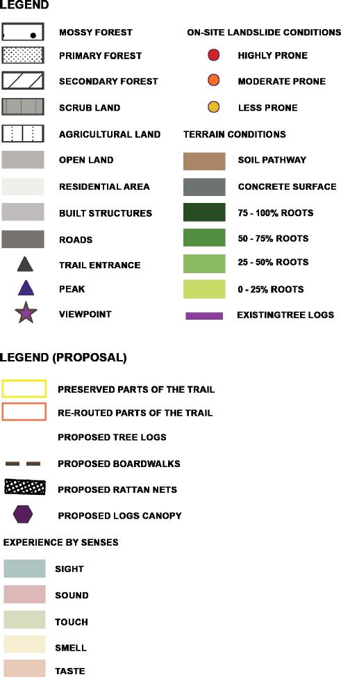
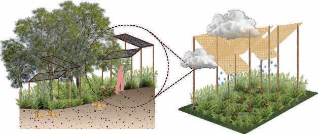
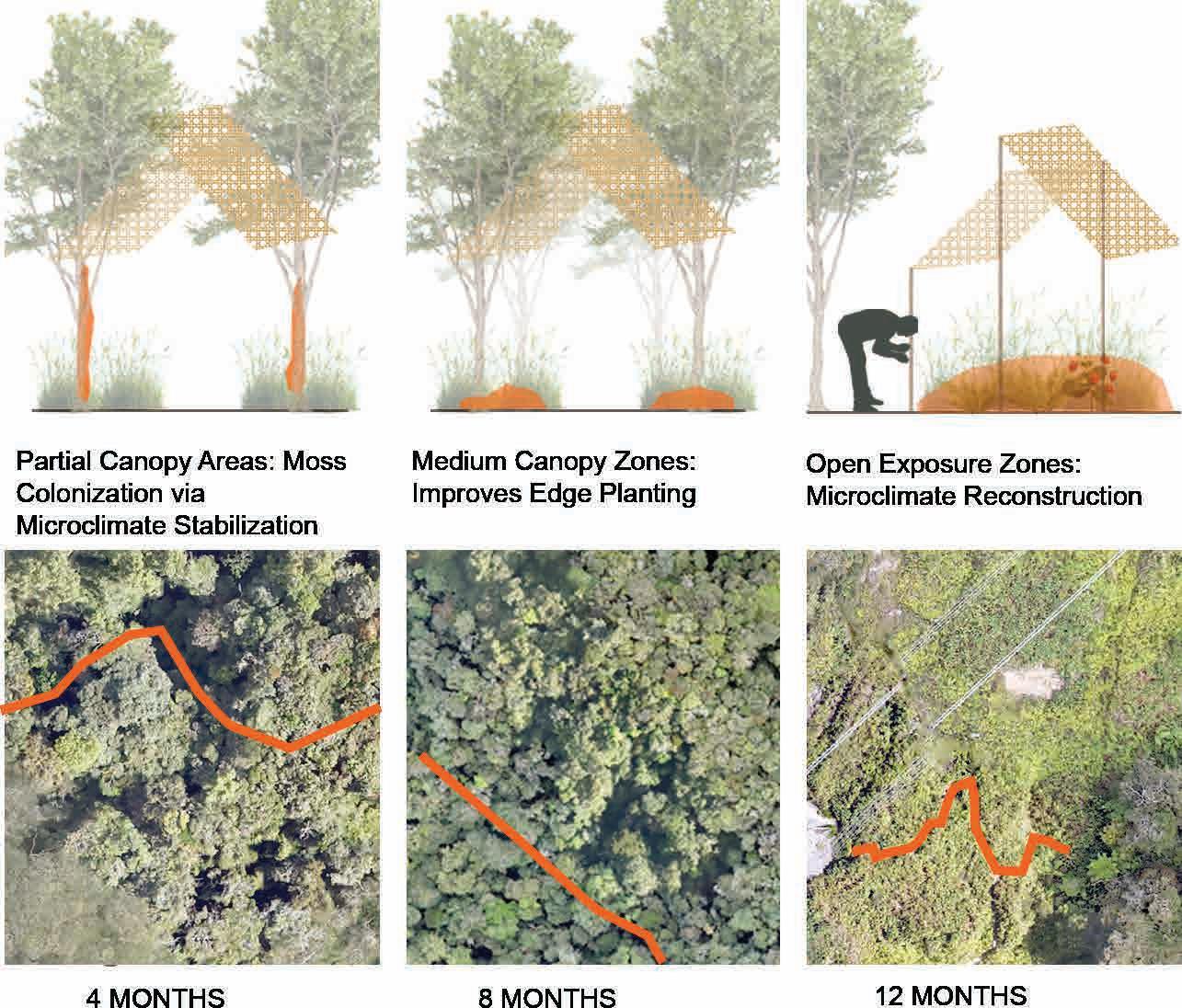
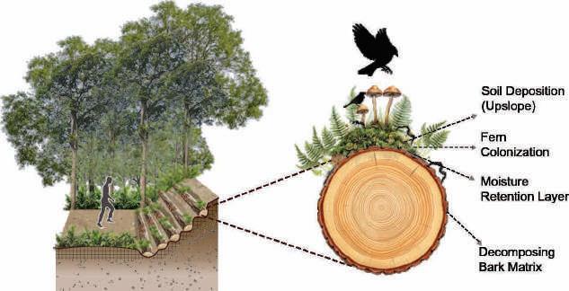
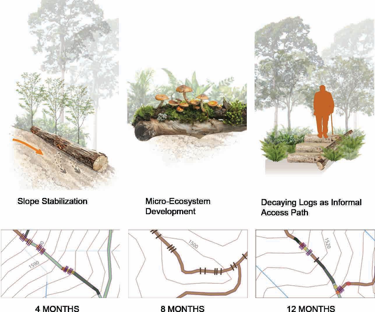
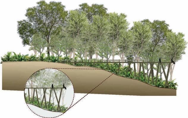
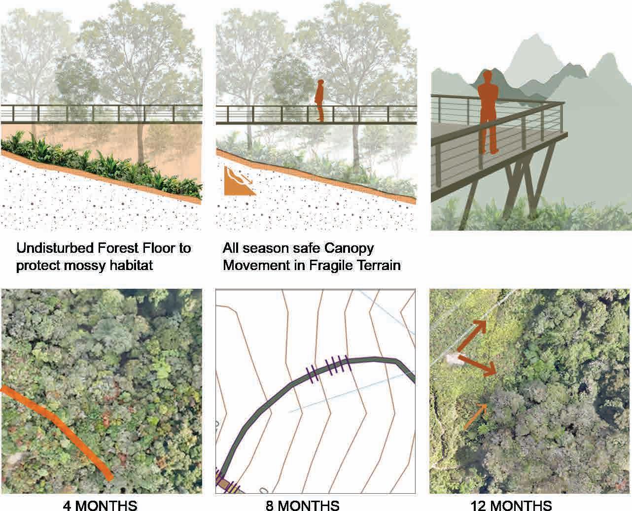
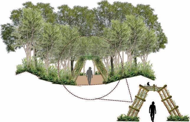
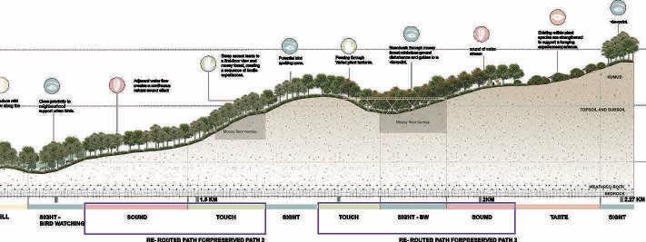
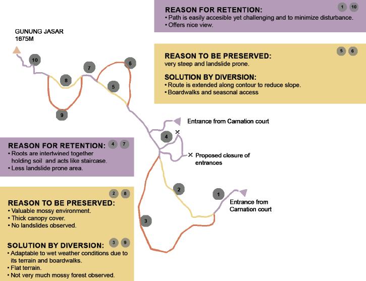
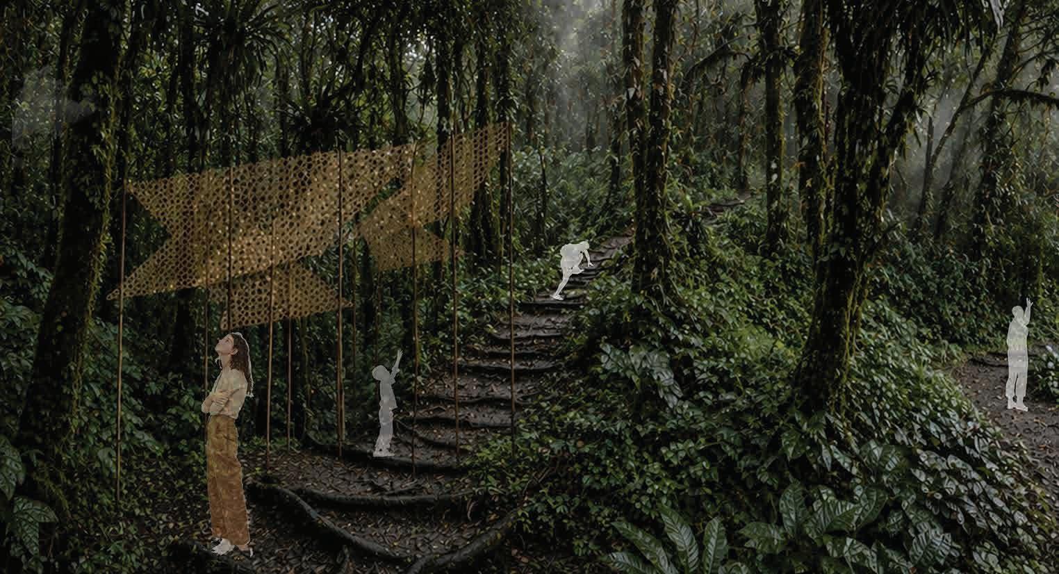
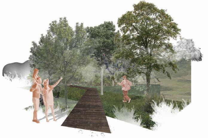
In response, the proposal diversifies human and water flows along contour bands to redistribute movement and reduce pressure on eroded and sensitive areas. High-risk landslide zones are stabilised using nurse logs placed parallel to contours to slow runoff, trap sediment, and rebuild soil. In mossy forest patches, elevated bamboo and hardwood boardwalks prevent trampling and retain moisture. In well sunlit and open areas, 30° inclined rattan nets were layered to mimic varied heights of tree canopy, create shade, support regeneration, and enable partial fog capture.
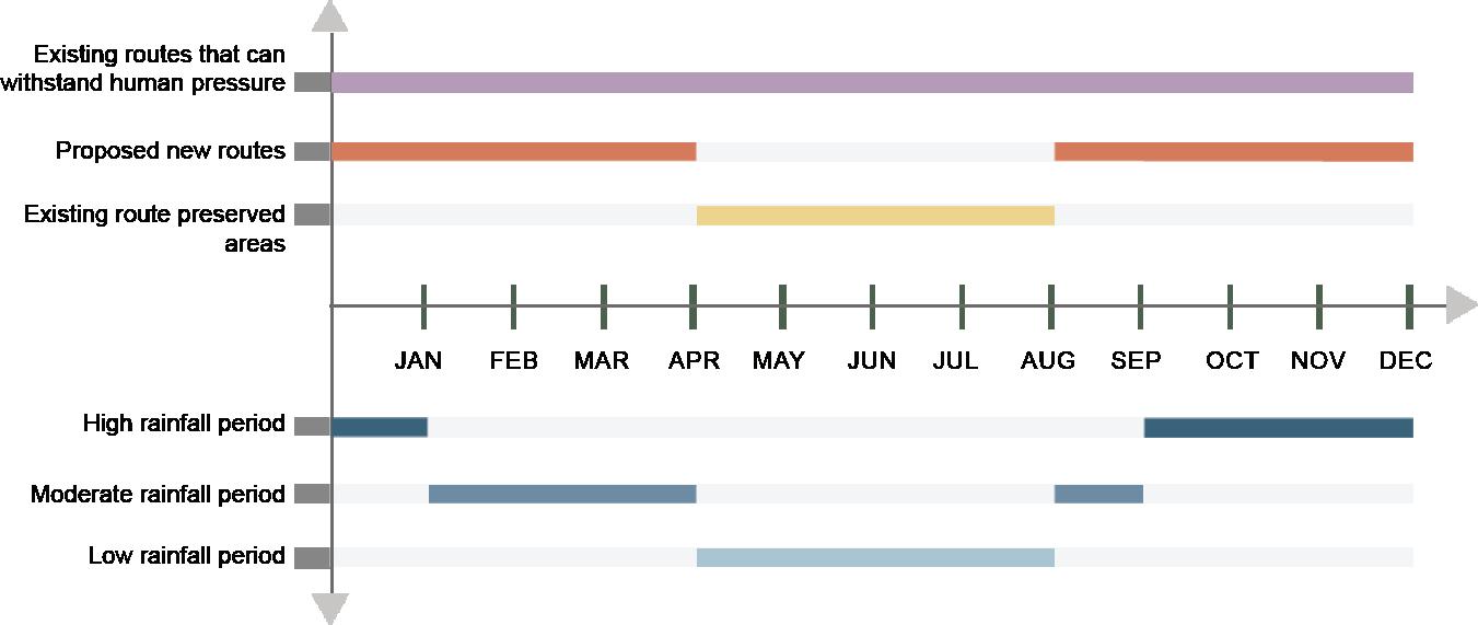
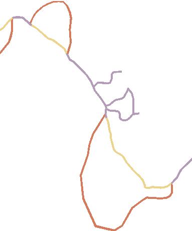
Recognising seasonal conditions, certain segments particularly mossy and landslide-prone zones remain accessible only during drier months (approximately four months annually), allowing recovery during monsoon periods through alternative routes.
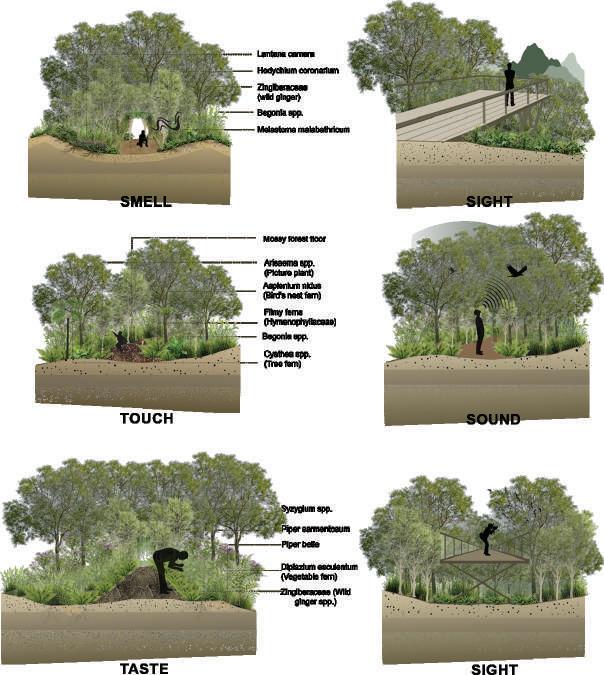
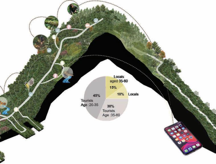
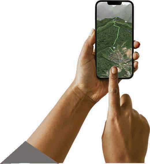
Digital tools, functioning as a sixth sensory layer, integrate AR, drones, and digital twins for monitoring and engagement. Sensory interventions engage sight, sound, touch, smell, and taste, with guided, non-extractive learning of Orang Asli foraging techniques through AR overlays. Together, these strategies transform Trail 10 into a seasonally adaptive, stabilised, and interactive system.
TIMELINE OF CAMERON HIGHLANDS TRAIL EVOLUTION
The trails of Cameron Highlands began as natural paths created by Orang Asli communities, shaped by the landscape and their movement through the forest. Over time, these paths were adapted by the British into survey routes and later used for tea plantation access. During the 1940s, they served military purposes, and after the 1960s, they became recreational jungle trails forming today’s ecotourism network.
However, this system is no longer continuous. Urban development and private land have fragmented many trails some have disappeared, while others are cut off or inaccessible. Today, the trails exist as a disconnected network, reflecting layers of history rather than a fully intact system.
BEFORE 1885 INDIGENOUS FOREST PATHS
Indigenous Orang Asli (SEMAI &TEMIAR) forest paths used for hunting, gathering and cultural movement.
Expansion of eco-tourism and jungle trekking infrastructure.
Current trails: Trail 3, Trail 6, Trail 10, Trail 14
1990 – 2010
ECOTOURISM EXPANSION
Contemporary hiking network with conservation challenges.
Current trails: Trail 1-14
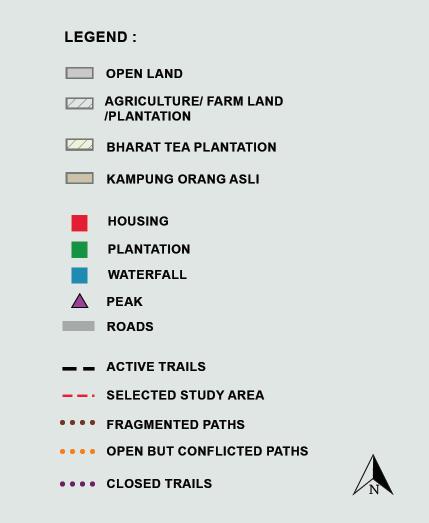
MAPPING THE TRAIL (1 TO 14) NETWORK
Existing, Fragmented, and Lost Paths
COMPARATIVE SECTIONAL PROFILES OF JUNGLE TRAILS
TRAIL 14 - GUNUNG IRAU
TRAIL 9A - ROBINSON WATERFALLS
TRAIL 1 NEW - PUNCAK BRICHANG BARAT
TRAIL 2 - CORAL HILL
TRAIL 4 - PARIT FALLS
TRAIL 7 - GUNUNG BEREMBUN
ASSESSMENT OF FACTORS AFFECTING TRAIL ACCESS
CONDITIONS
FRAGMENTED TRAILS BY URBAN DEVELOPMENT
T2 - The original trailhead near the temple has been significantly impacted by a construction site.
T6 - The original trailhead near the temple has been significantly impacted by a construction site.
T10 - Reduced by the length of 0.5 KM due to housing expansion
T1, t11, T12, T13, t14 - Lost in the growth of tanah rata.
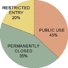
TRAILS FULLY OPEN FOR PUBLIC USE
T2, T3, T4, T5, T7, T8, T10
All (1-14) trails are restricted during the monsoon season (late October to January) to prevent accidents from flash floods and landslides.
FULLY/ PARTIALLY RESTRICTED TRAILS
T1 (NEW) - Need permit to enter.
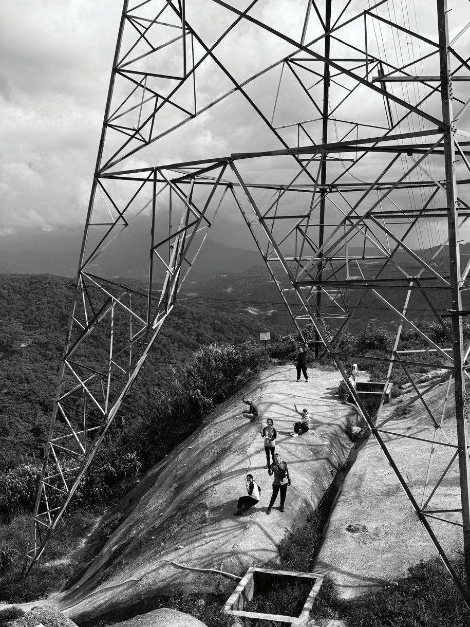
T6 - Intersects with vegetable farms and electricity pylons, with some sections now transitioning into paved farm tracks.
T1 (NEW) - Need permit to enter.
PERMANENTLY CLOSED TRAILS
T1 - Passing through private land and saftey concerns near TV tower area
T11, t13, T14 (MENTGI)- Lost in Housing expansion
T12 - Weather station and housing expansion
MAPPING OF EXISTING ONSITE TERRAIN CONDITIONS OBSERVED DURING
CLEARED SECONDARY VEGETATION
DURING SITE VISIT
HEAVY LANDSLIDE CONDITION
NURSELOG AND UNCLEAR ACCESS
EXISTING TACTILE DIVERSITY OF PLANTS
GROWTH OF SECONDARY VEGETATION NEAR THE PEAK
LANDSLIDE CONDITION NEAR ENTRANCE
SPECIES MOVEMENT AND GROUND CONDITIONS ACROSS THE SECTION
SECTION A-A’
SECTION B-B’
SECTION C-C’
MAPPING OF PROPOSED DESIGN
STRATEGY 1 : RATTAN NETS
Inspired by the existing fog collectors on site, the proposed woven rattan nets are placed in degraded areas of the mossy forest to capture atmospheric moisture and support understory regeneration. Installed at a 45-degree angle, the structures withstand rainfall while gradually integrating with the forest ecosystem. The filtered light, varying heights, and dripping water droplets also create an immersive sensory experience along the trail in Cameron Highlands.
STRATEGY 2 : NURSELOGS
Inspired by the existing nurse log conditions on site, fallen tree logs are intentionally placed across the slopes to slow soil erosion and retain soil during rainfall. proposed emporary closure of certain trail areas allows vegetation to gradually grow over the logs, supporting long-term soil stabilization and ecological recovery in the trail.
STRATEGY 3 : BOARDWALKS
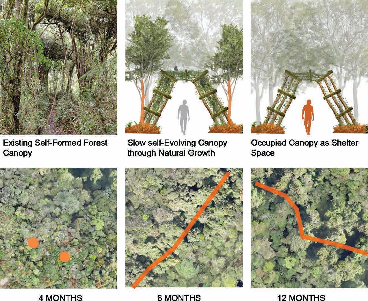
STRATEGY 4 : SELF WEAVING CANOPIES
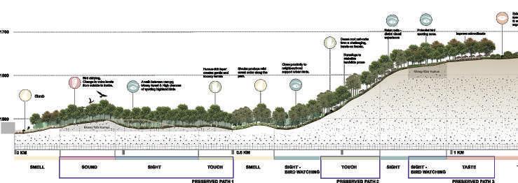
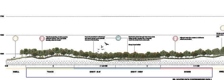
CHANGING SENSORY EXPERIENCE ALONG THE TRAIL: BEFORE AND
SIGHT
1. Board walk - walk between canopy
2. Bird watching
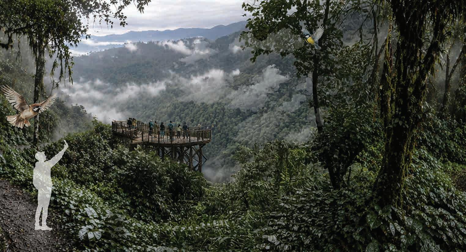
3. Viewpoint / clif
4. Walking through fog nets
5. Walking through natural and proposed self weaving canopy structures.
TOUCH
1. Experiencing different textured plants
2. Existing intertwined roots and steep slopes.
3. Usage of existing rope.
4. Forest floor of mossy environment.
SOUND
1. Musical echos of birds.
2. Sounds of flowing streams.
3. Sound effect created while moving in and out through canopies.
SMELL
1. Varied fragnant species placed along path.
TASTE
1. Partial foraging experience to visitors near the peak.
AND AFTER INTERVENTION
TRAIL INTERVENTION STRATEGY
EXPECTED USER GROUP
Most trail users are tourists, primarily aged 20–35, followed by 35–60. while only a small percentage of locals and Orang Asli use the trails, as many have shifted to other occupations and younger generations have moved away. So the goal was to partially make them use the trails for daily activity.
RE-HABITABLE SLOPES
KHAW CHEE HONG, JONALD
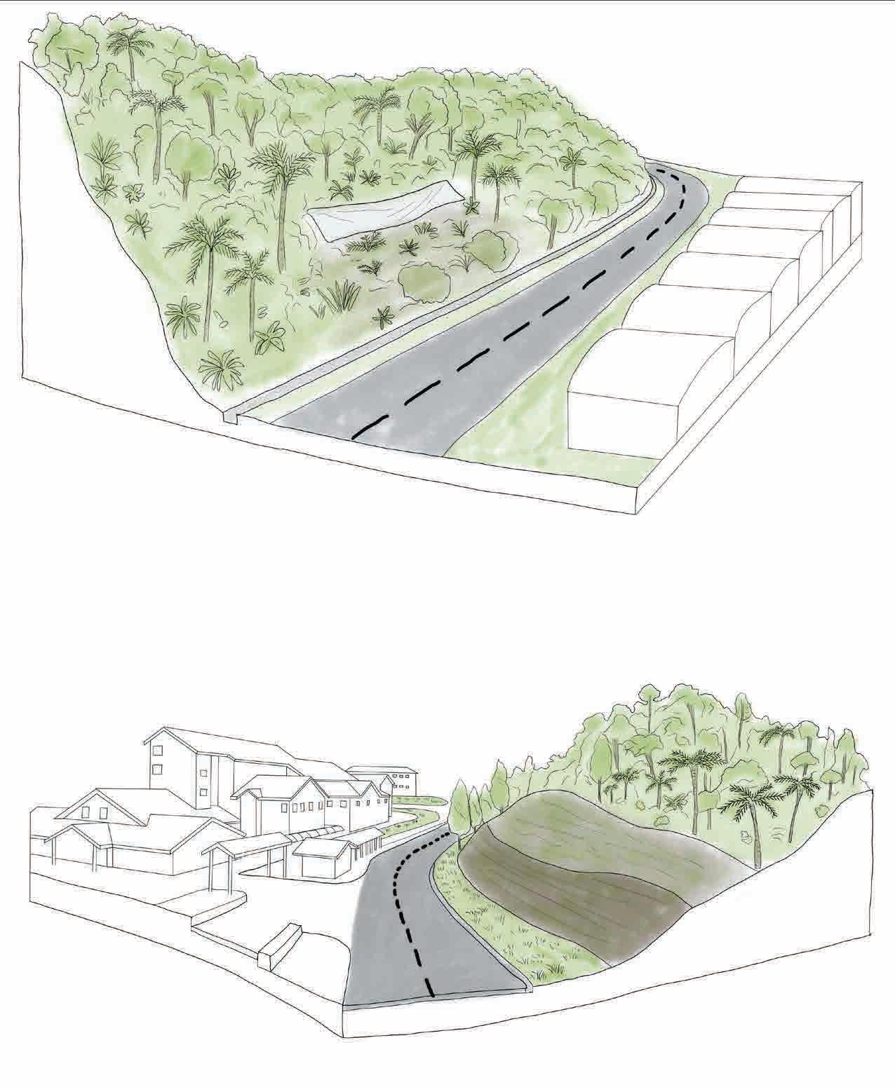
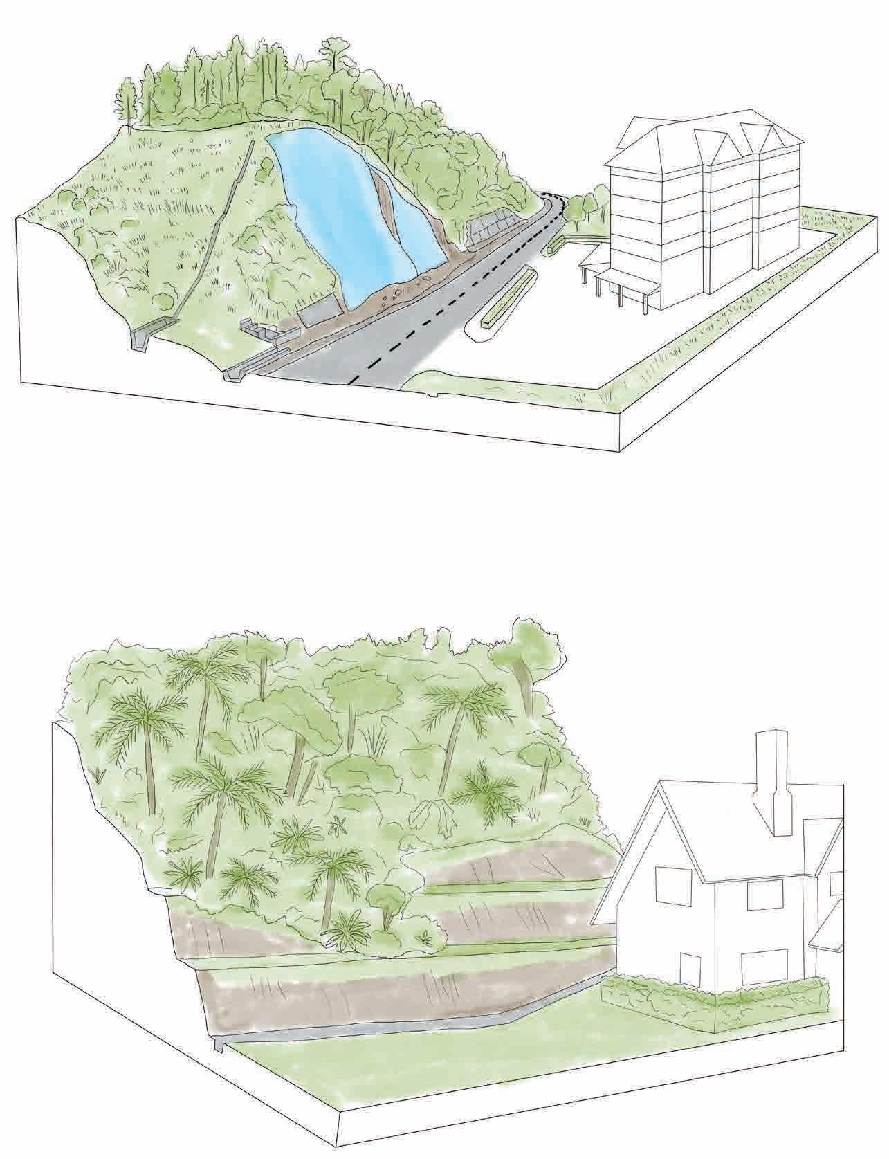
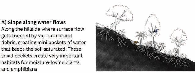
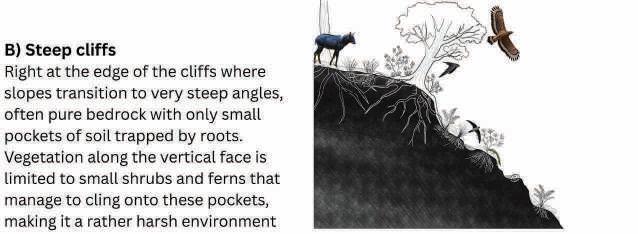
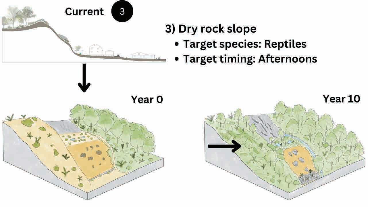
This project aims to capitalise on landslide-vulnerable slopes on the forest edges around a residential area in Cameron Highlands, inducing natural landform changes to create novel habitats for key species, stabilising the slopes in the process.
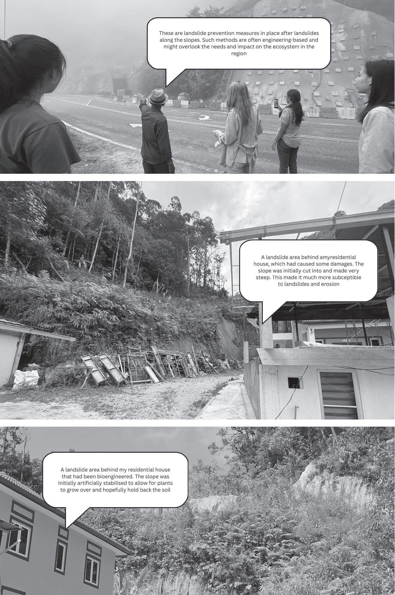
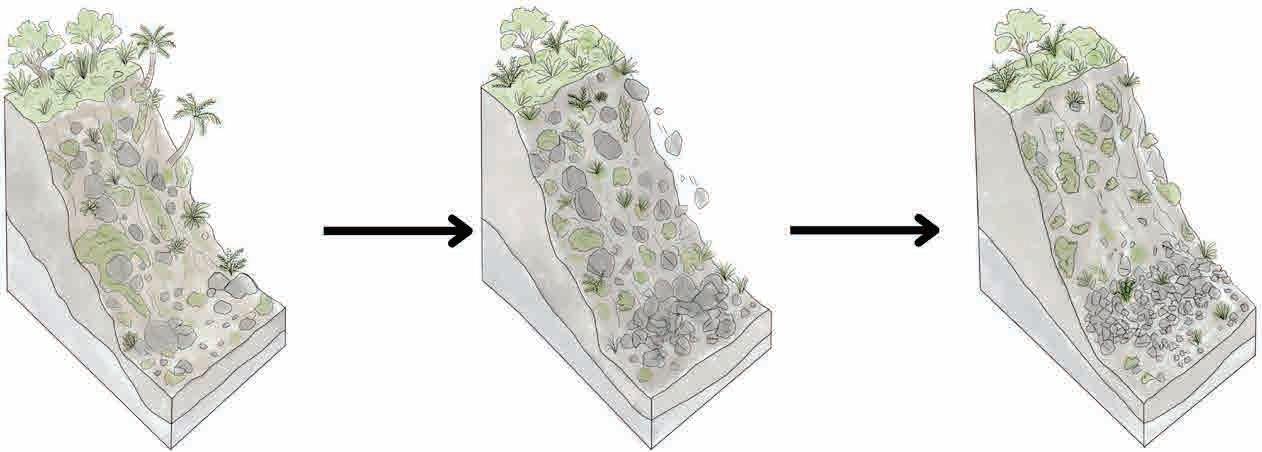
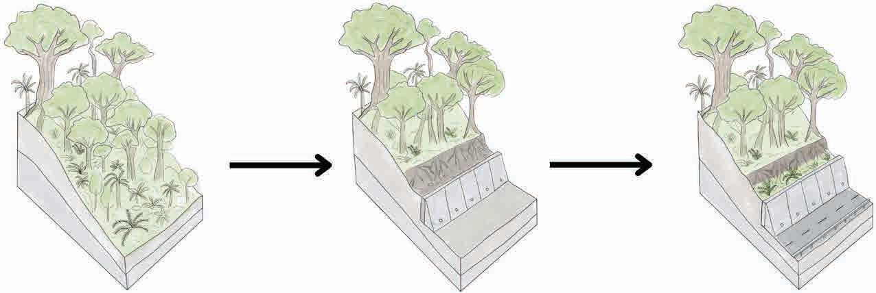
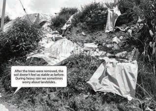
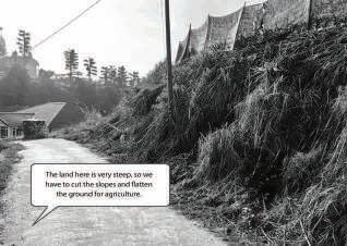
Urban development around Cameron Highlands has increasingly encroached into the surrounding primary forests, cutting into the slopes to create flat ground for development. The resulting forest slopes become extremely unstable, often triggering landslides which require further engineered stabilisation methods. Additionally, native habitats, hosting a rich montane biodiversity, are threatened due to this large scale reshaping of the forest. Yet, these altered slopes have also created new opportunities, where novel ecosystems have filled in these otherwise uninhabitable landscapes.
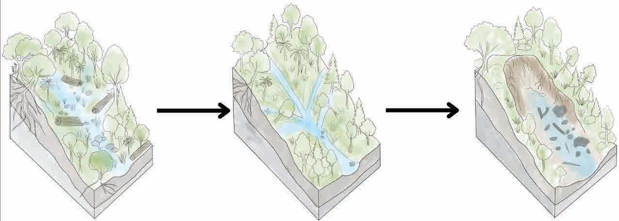
To kickstart the design, slopes carrying landslide scars or risks are chosen. Unique characteristics of each slope, like slope profile and hydrology, are taken into account as opportunities, informing targeted slope modification techniques. Such strategies catalyse and accelerate natural processes, like weathering and erosion, in a controlled manner rather than directly shaping the slopes.
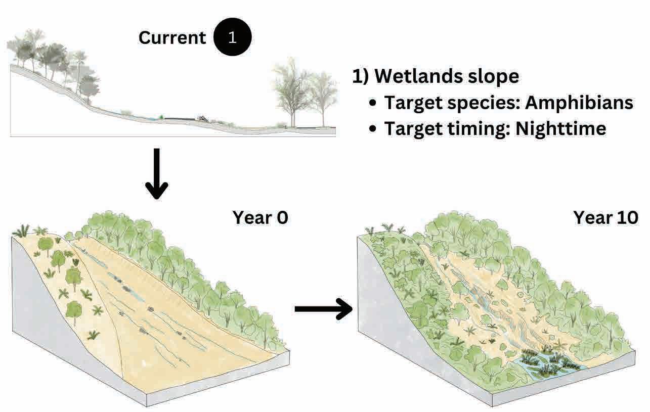
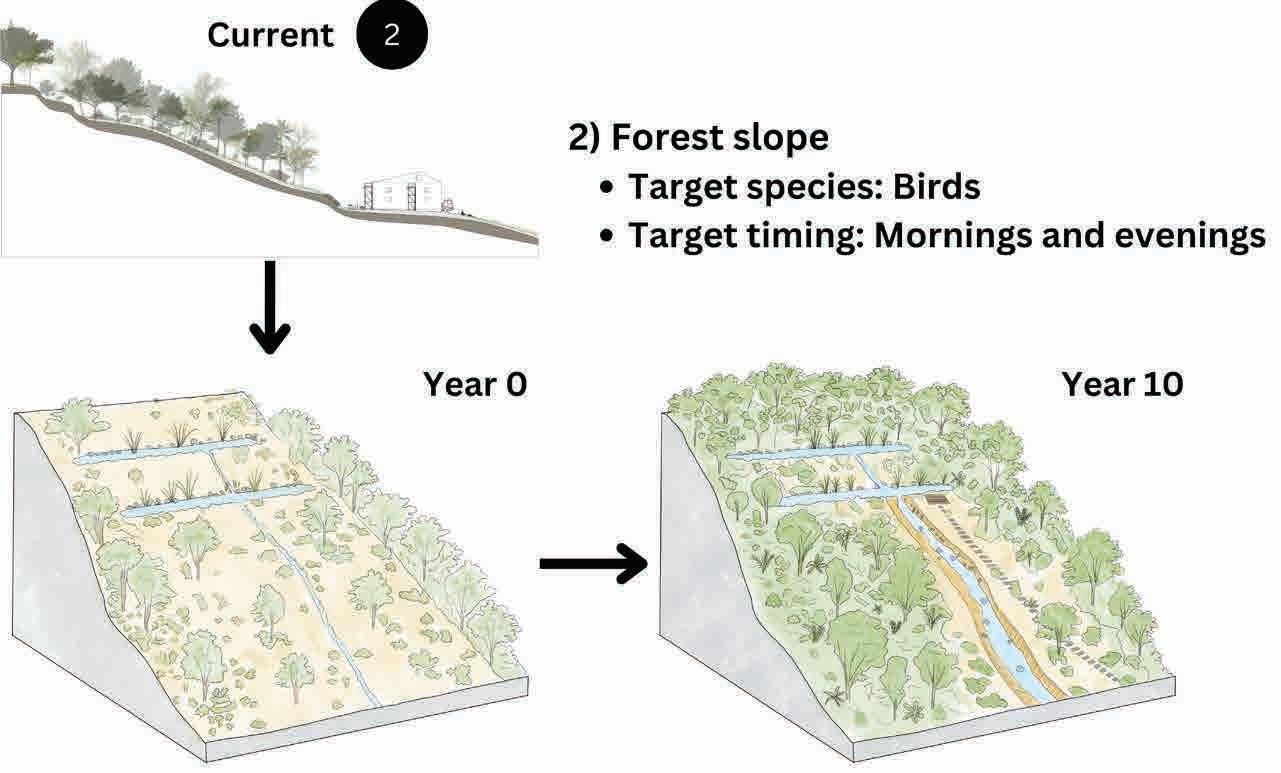
These controlled processes shape not just the slopes, but also the surrounding areas at the foot of each slope. As the slopes reshape over time, suitable native flora will begin re-inhabiting these slopes, creating small, novel habitats suitable for a variety of native fauna. At the same time, the foot of each slope, once bare, now hosts a unique space designed to bring residents and the non-human side-byside, facilitating a dialogue between the two.
This project reframes landslides not as hazards to be suppressed, but as opportunities that can be steered. Through targeted interventions that work alongside slope hydrology, erosion and succession, it creates a transferable design framework that can turn vulnerable edges into designed habitats and shared landscapes for both human and non-human communities.
CASE STUDY (HONG KONG LANDSLIDES)
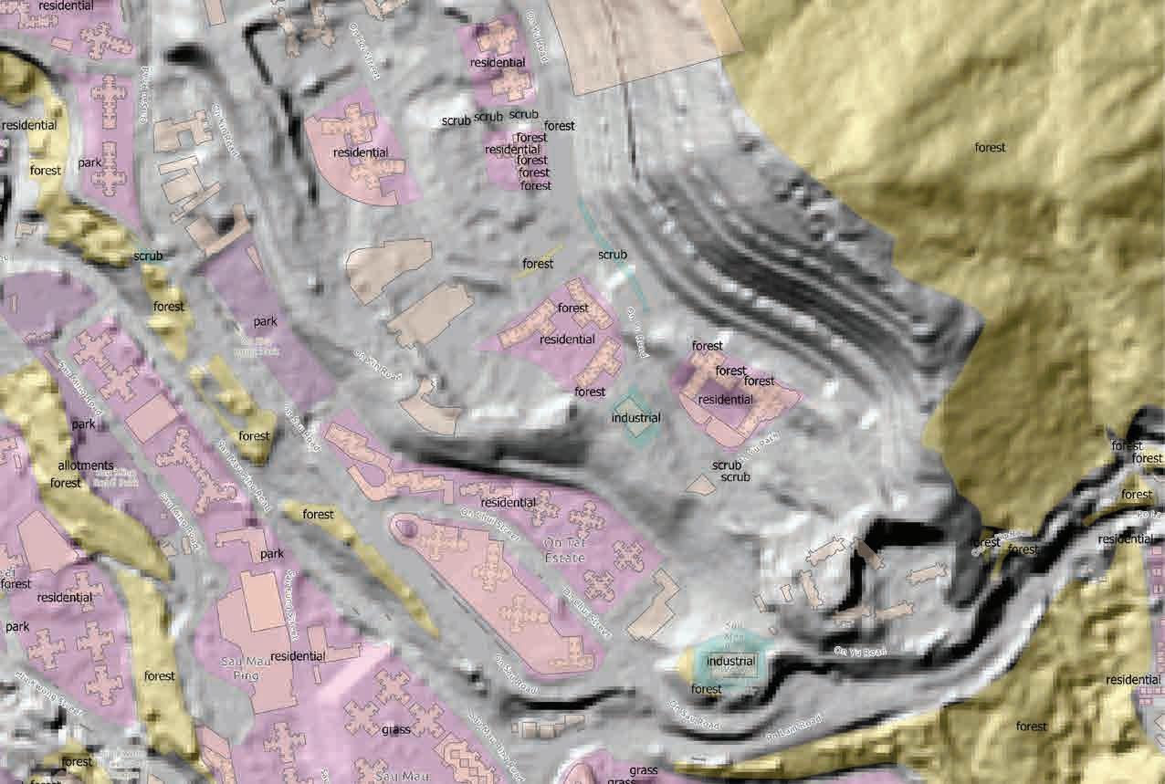
Current landuse on the site of the Sau Mau Ping landslide
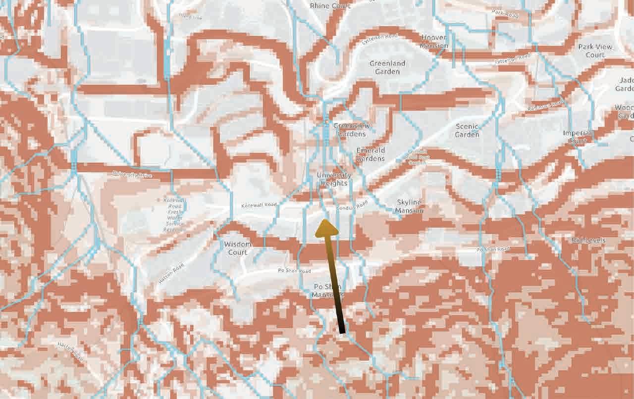
Current slopes and waterflow on the site of the Po Shan landslide.
TANAH RATA ENVIRONMENTAL STUDY
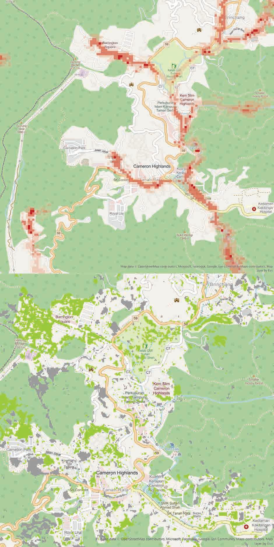
Highest landslide risk (top) and NDVI change (bottom) between 2014 and 2024
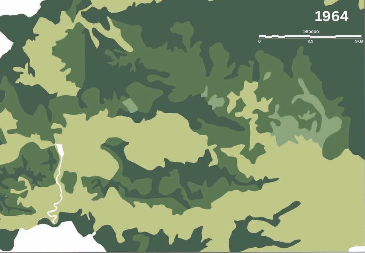
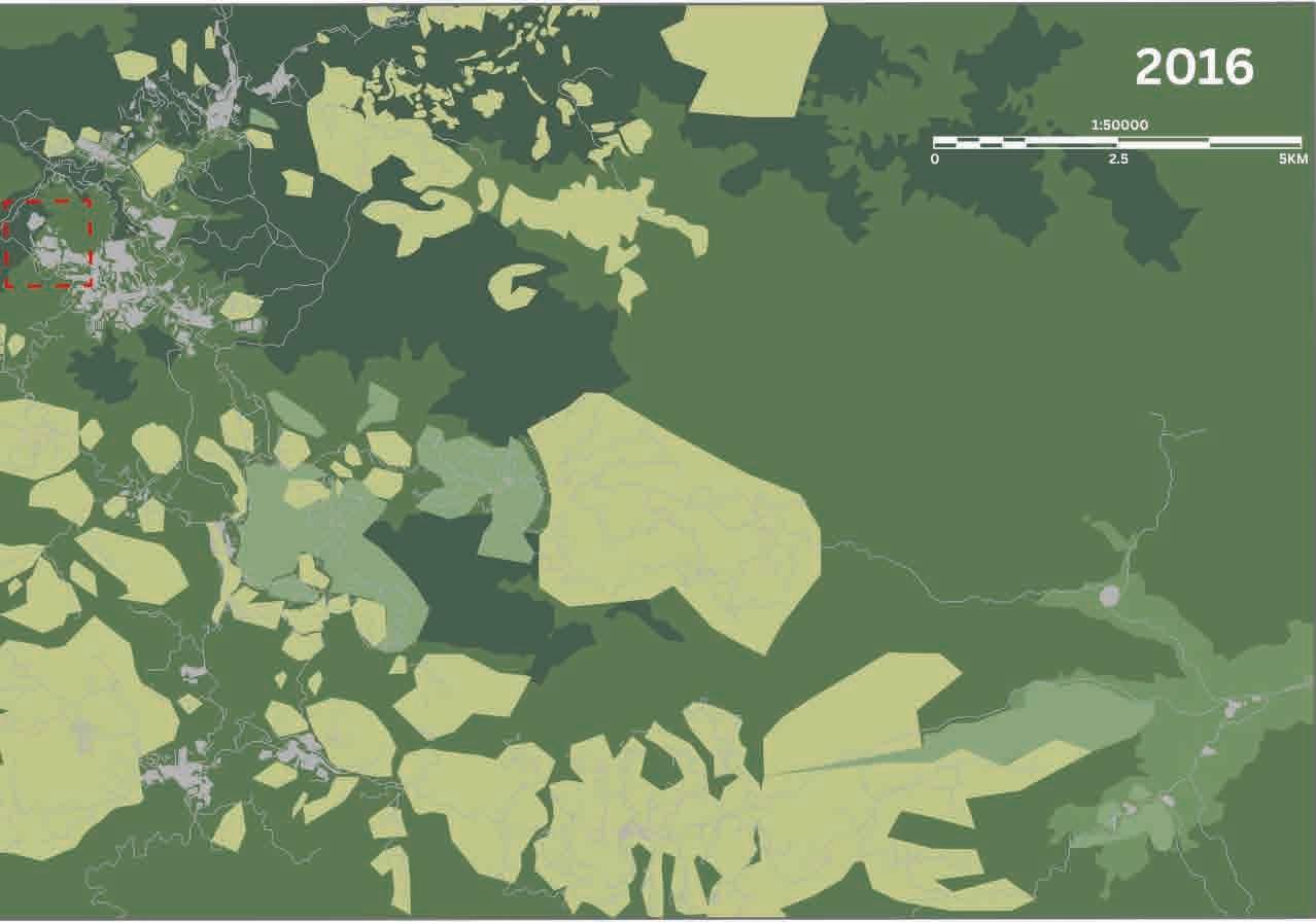
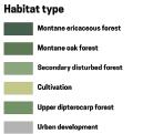
HABITAT CHANGE
Habitats around Cameron Highlands in 1964 and 2016
Trying to understand the issues and opportunities during the site visit
SITE ANALYSIS
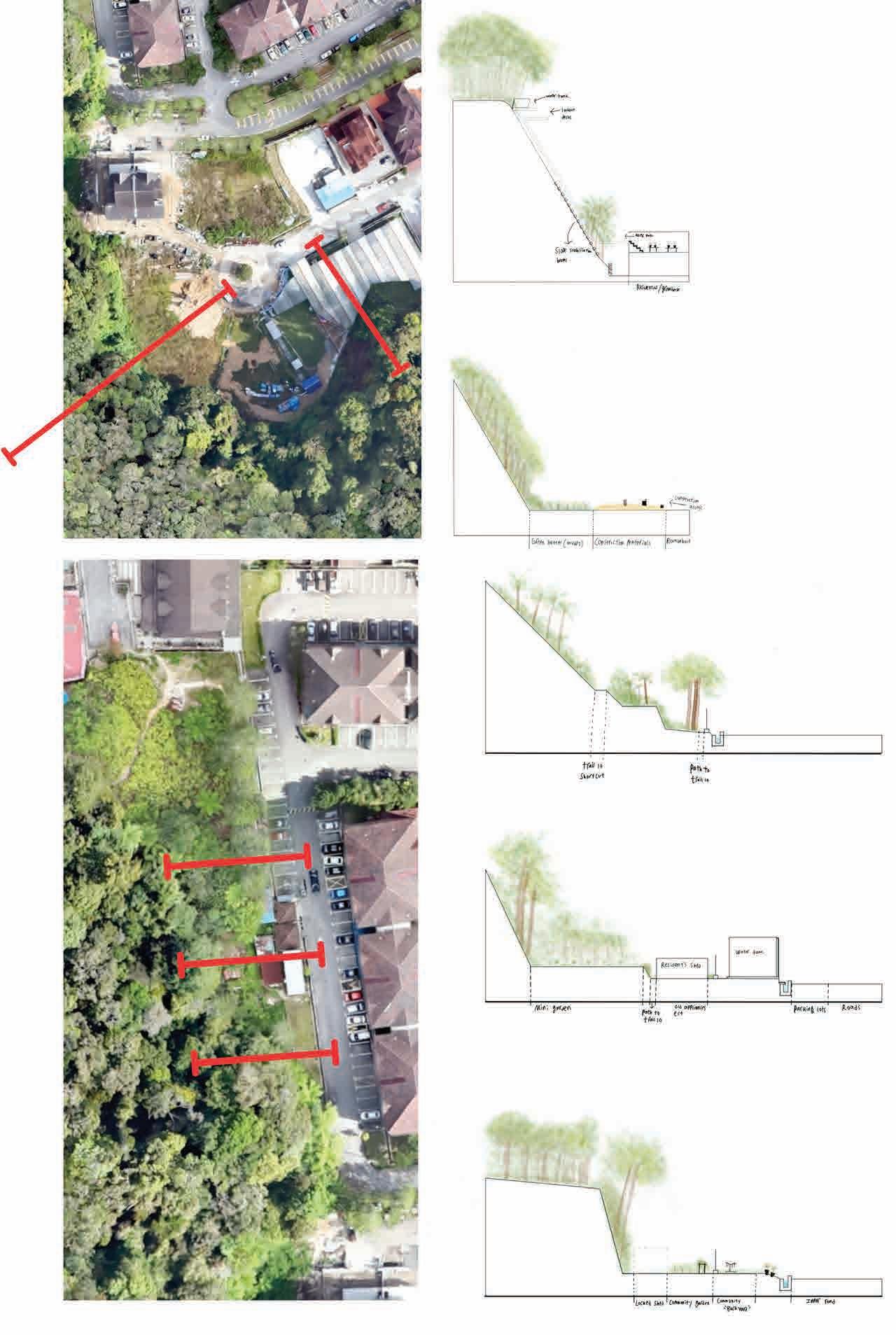
Basic sections of the forest edges around Carnation Court, sketched onsite
SITE ELEVATION
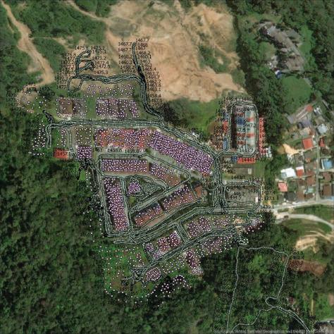
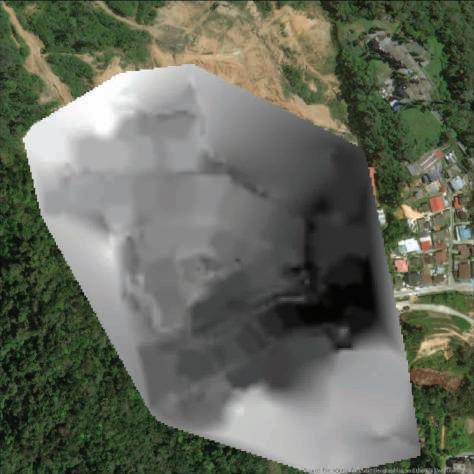
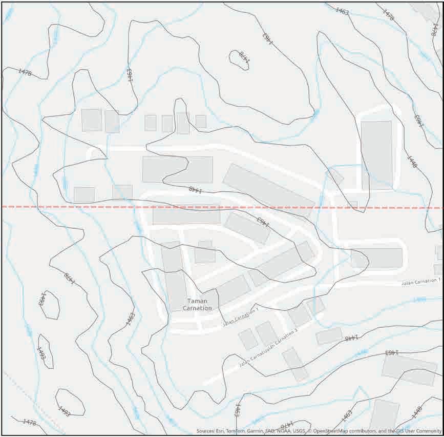
Spot elevation taken on site, processed to create a DEM for slope analysis
LANDFORM CHANGES
Changes in topography between 1936 and 2014
SLOPE & LANDSLIDE MAPPING
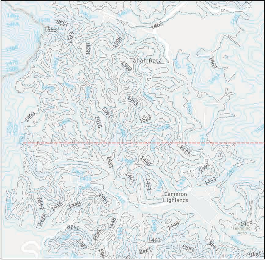
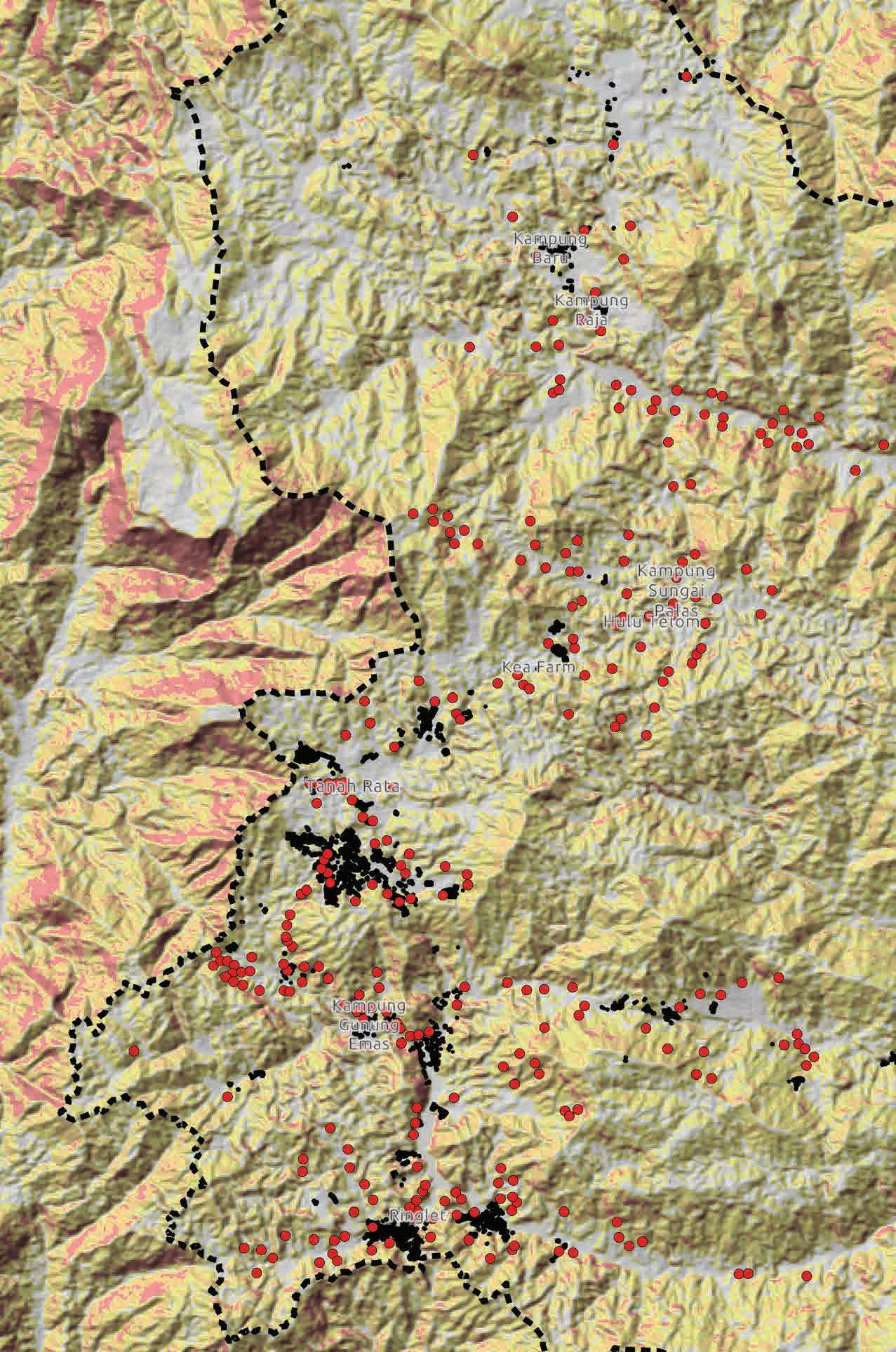
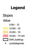
Historical landslide areas and slope steepness around Cameron Highlands
LANDSLIDE AREAS
Some landslides that occured near urban development
HABITAT CHANGES
Key habitats around Cameron Highlands and how they have changed
DESIGN PHASES
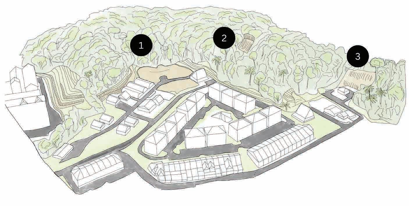
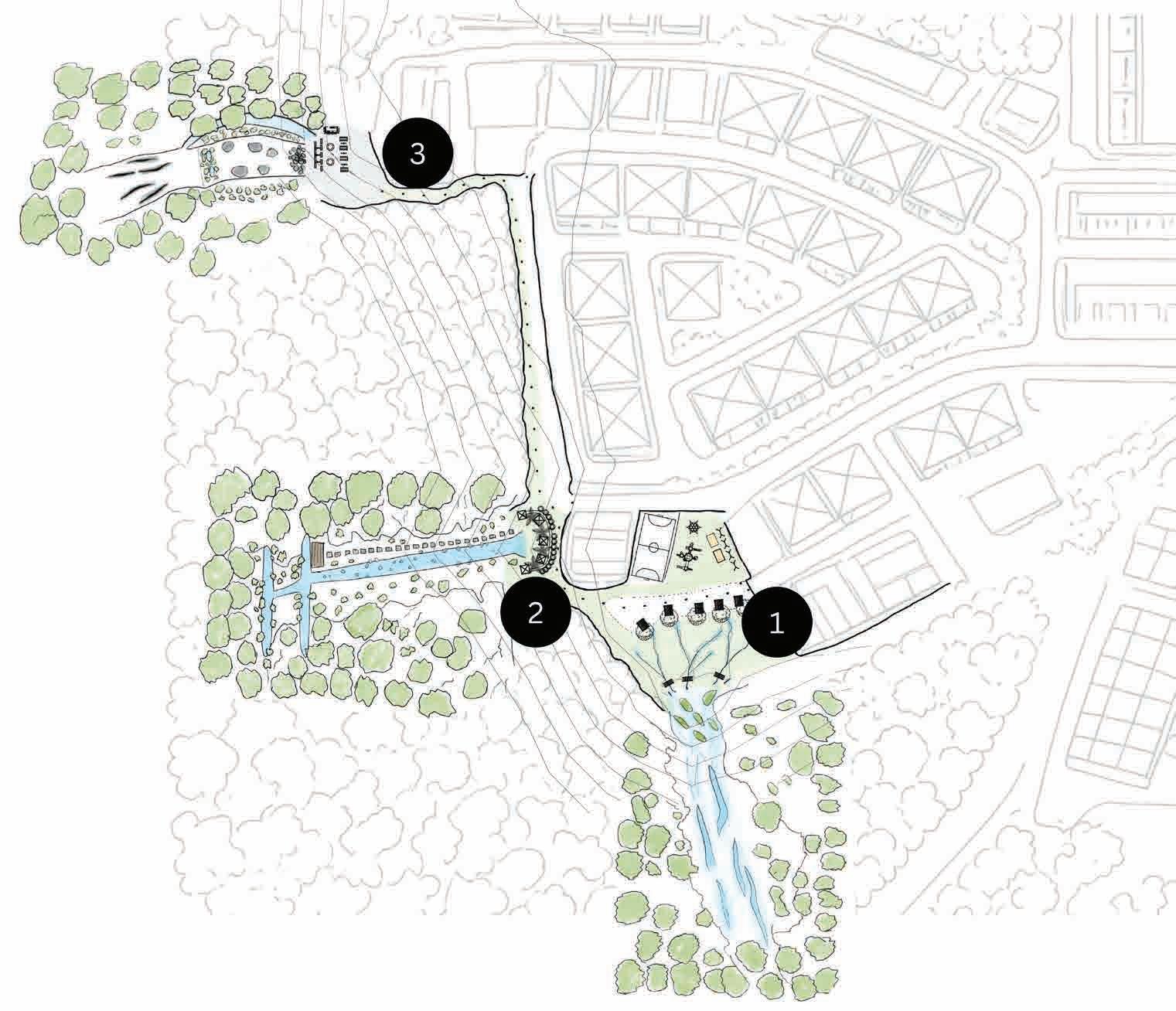
Three key slopes around Carnation Court and my design’s phased changes
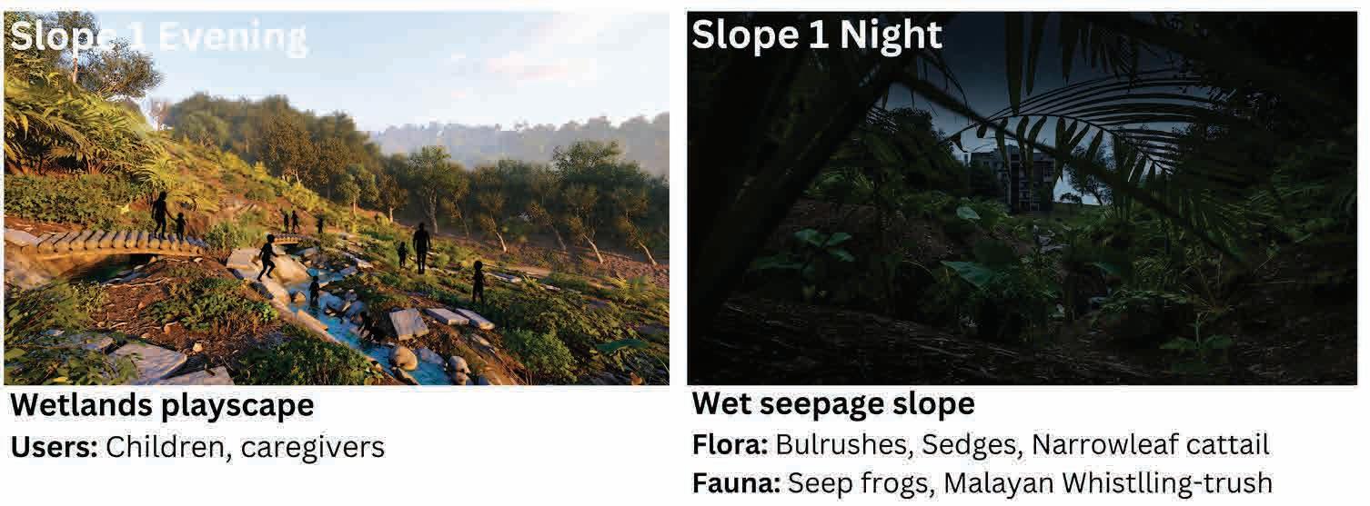
1. Wetlands Slope
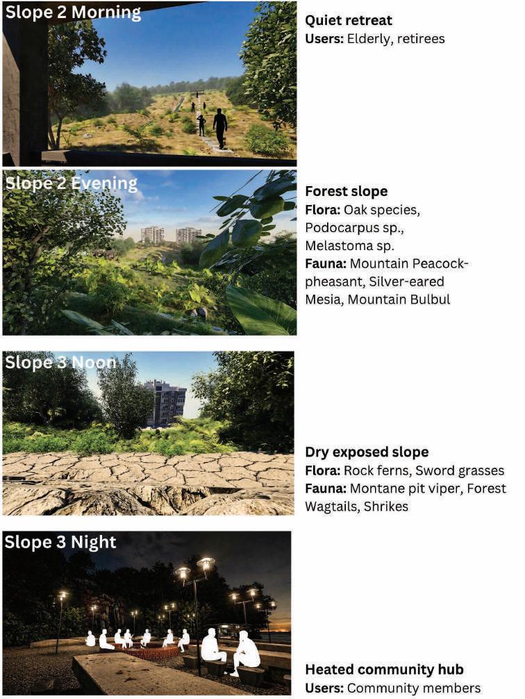
2. Forest Slope
3. Dry Rock Slope
PERSPECTIVES
Perspectives of the slopes from a human’s perspective vs fauna’s perspective
CARNATION COMMONS: FOREST TO COMMUNITY FUTURES IN TANAH RATA
NG JUN HAO
The project reimagines the forest-edge residential landscape of Carnation Park as a resident-led system of shared productive spaces rooted in nearby forest ecology.
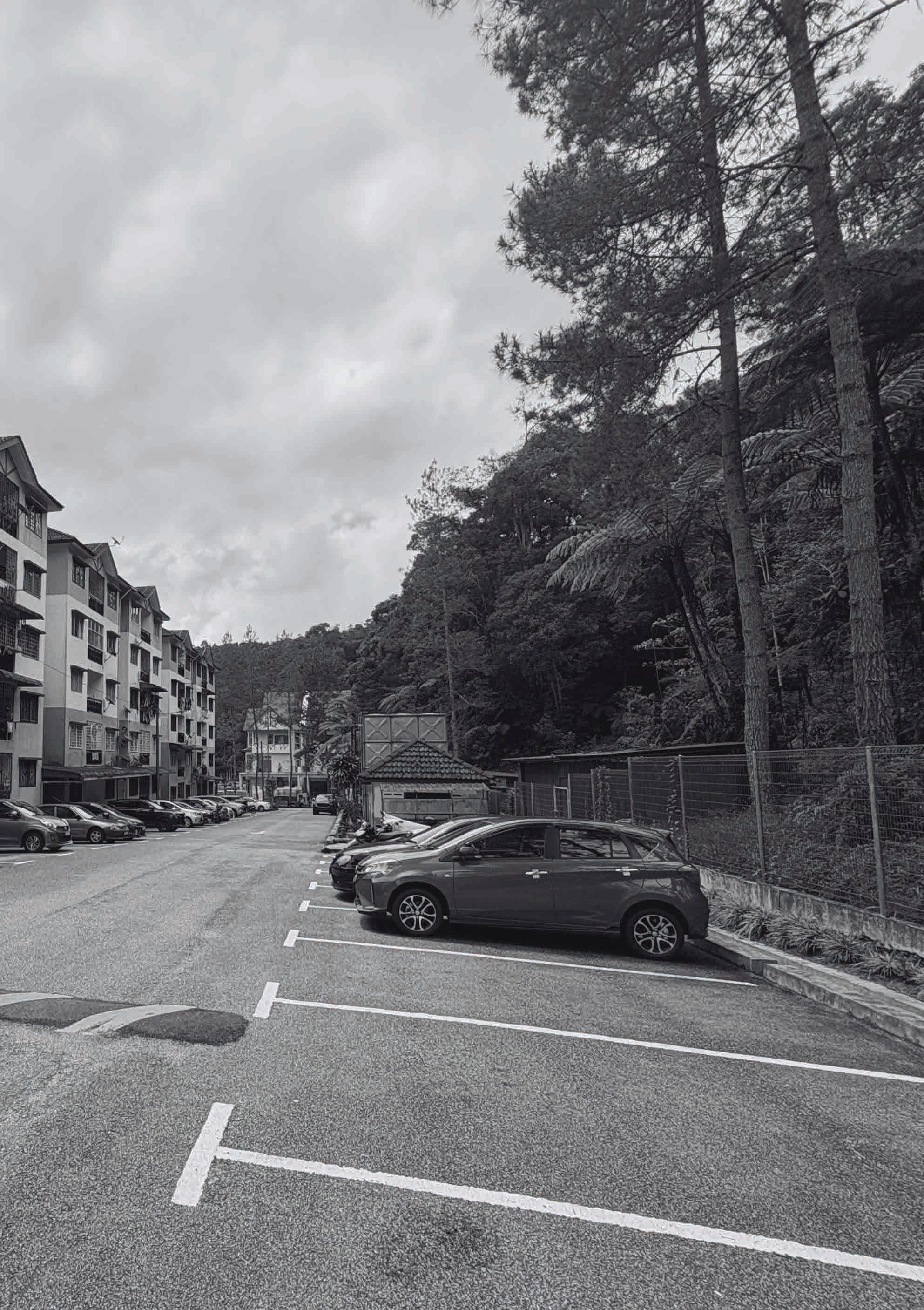
The Carnation Park Estate sits at the edge of the primary forest, yet this proximity is weakly translated into collective community benefit. As Tanah Rata has expanded from a compact forest settlement into a fragmented hill town, development has produced residual land that remains spatially disconnected, underused, and difficult to manage collectively. Within Carnation Park, vacancies, weak shared maintenance, and unclear ownership have turned many open spaces into friction zones of neglect and informal use. At the same time, the ecological gradient between forest and town remains sharply divided: rich montane biodiversity stops abruptly at the urban edge, where it is replaced by a narrow and simplified planting palette. These conditions reveal a spatial and ecological gap between the forest and everyday residential life.
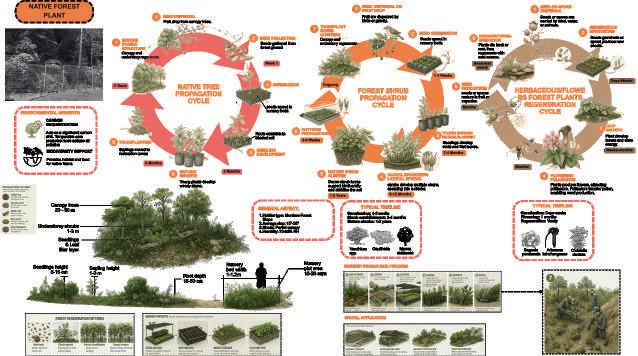
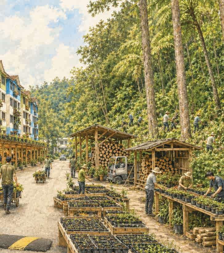
The first phase establishes forest-edge species and materials within underutilized spaces through reference plots, nursery areas, and cultivation zones. This creates visible and usable ecological infrastructure within the residential landscape, allowing local forest resources to enter daily community space through cultivation and propagation. while matching each intervention to specific conditions of shade, slope, humidity, and access across the site.
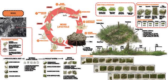
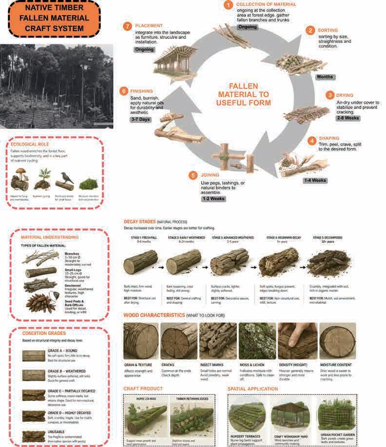
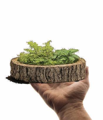
The second phase reorganizes underutilized land into commoning assets through three productive systems: moss cultivation, native forest plant nursery, and fallenmaterial craft. These systems transform residual spaces into collective zones of cultivation, making, and local exchange, allowing residents to participate in shared production and stewardship. Over time, the project extends beyond Carnation Park through connected neighborhood spaces and repeatable productive typologies across Tanah Rata.
Carnation Commons proposes a resilient forest-to-community infrastructure where ecological proximity supports collective stewardship, local livelihood, and neighborhood-scale commons, demonstrating how underutilized forest-edge settlements can evolve into shared productive landscapes.
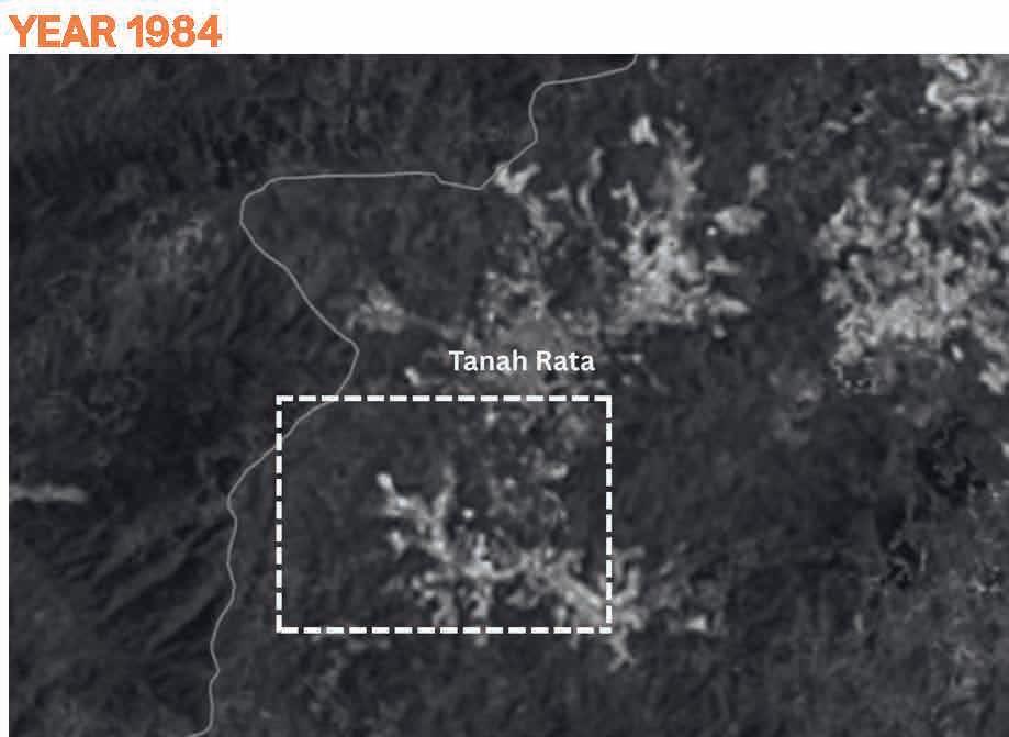
TERRITORIAL TRANSFORMATION OF TANAH RATA
From compact forest settlement to fragmented hill expansion
Source: Google Earth Maps historical imagery
In 1984, Tanah Rata appears as a compact settlement embedded within a largely continuous forest matrix, with development still limited in extent.
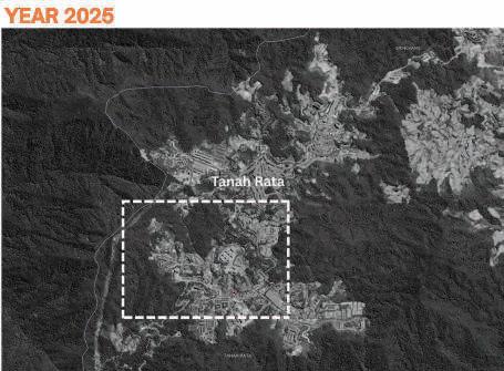
EXPANSION ACROSS THE SLOPES
Forest fragmentation and the growth of residual edge spaces
Source: Google Earth Maps historical imagery
By 2025, the settlement expands significantly across the slopes, fragmenting forest cover and extending development toward the surrounding hill terrain.
As Tanah Rata expands, the forest edge shifts from a continuous ecological system into a fragmented settlement boundary, multiplying underutilised edge conditions.
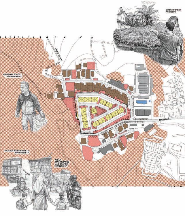
RESIDENT VOICES AND SPATIAL FRICTIONS ACROSS CARNATION PARK ESTATE
Forest proximity, vacancy, and weak shared ownership in the residential landscape
Resident interviews and site observations reveal how forest proximity, underused open spaces, weak maintenance, and fragmented ownership shape the everyday condition of Carnation Park.
Carnation Park is valued for its cool air and direct relationship to the forest, yet many shared spaces remain underused and unevenly claimed. Informal forest transplanting already occurs at the domestic scale, but these practices remain fragmented rather than structured as collective community assets.
The mapped residential fabric reveals vacancies, neglected commons, and underutilised ground that could be reworked into shared productive spaces.
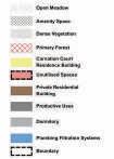
Legend:
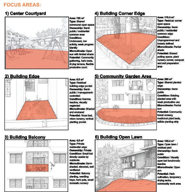
COMMON FOCUS AREAS OF UNDERUTILIZED SPACE IN CARNATION PARK
Communal focus areas with potential for collective use and productive transformation
These shared spaces reveal the common underutilised conditions within Carnation Court, including the central courtyard, building edges, balcony extensions, community garden areas, and open lawns. Although they differ in size and microclimate, they remain weakly programmed and loosely managed, making them suitable as the first sites for collective cultivation, propagation, and everyday shared use.
Shared open spaces within Carnation Park remain weakly programmed, yet they offer accessible ground for collective cultivation and community use.
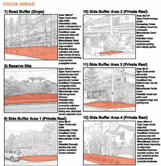
Along the residential periphery, underutilised spaces appear as slope buffers, reserve plots, and side margins between housing and the forest edge. These areas are more fragmented and unevenly claimed, but their conditions of shade, humidity, openness, and adjacency make them suitable for moss cultivation, nursery expansion, and small-scale productive landscapes tied to the wider forest-edge system.
Peripheral edge spaces are fragmented and unevenly claimed, but their environmental conditions support new forms of productive landscape use.
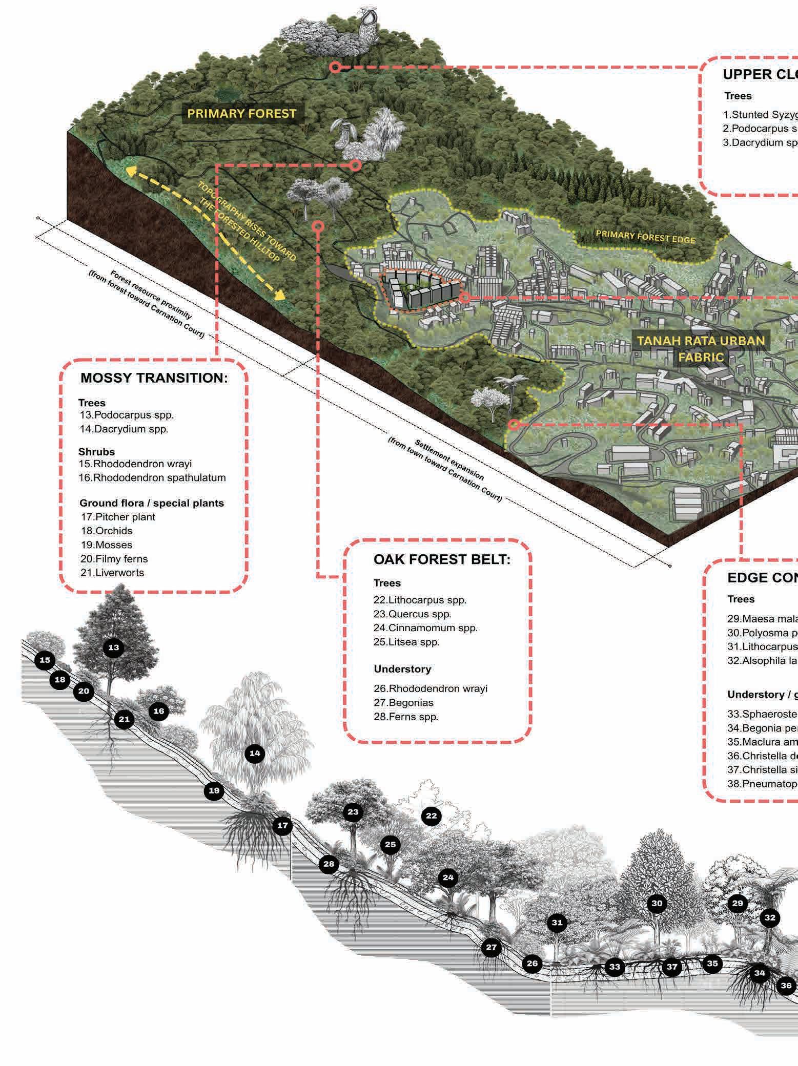
FOREST EDGE AND URBAN LANDSCAPE CONDITIONS
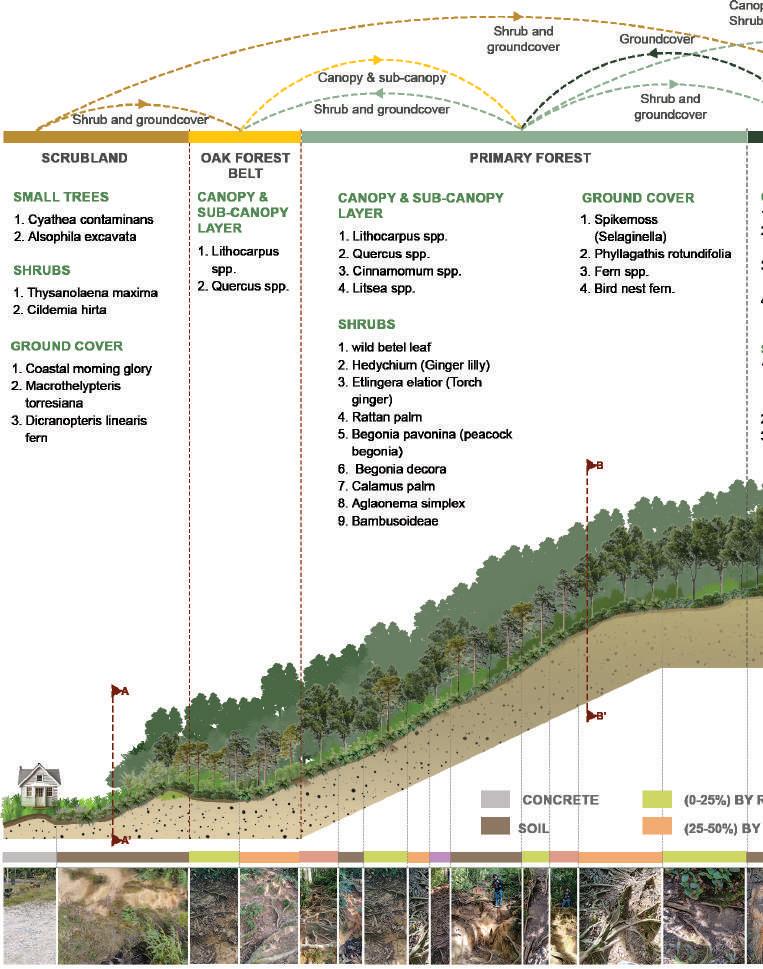
The transition from primary forest to urban settlement, mapping how vegetation, microclimate, and ground conditions change across the edge. It positions Carnation Park within this gradient, where forest-derived species can be reintroduced into underused residential spaces through cultivation and shared stewardship.
FOREST RESOURCE FLOW INTO CARNATION PARK
A community spatial system linking collection, cultivation, exchange, and domestic extension across the forest-edge residential landscape
Framework links forest resources to Carnation Court through connected shared spaces—collection points, nurseries, moss zones, exchange strips, and domestic edges—integrating forest, residence, and neighbourhood.
MOSS CULTIVATION SYSTEM
Moss system converts forest-edge conditions into productive infrastructure, activating underused spaces for cultivation, maintenance, and small-scale product-making.
NATIVE FOREST PLANT NURSERY SYSTEM
This system supports the cultivation of native shrubs, understory plants, and forest-edge species within Carnation Park. By using nursery beds, regeneration plots, and staged transplanting cycles, local plant resources become part of everyday residential space while strengthening ecological continuity between forest and settlement.
FALLEN-MATERIAL CRAFT SYSTEM
Fallen-material craft system repurposes woody remnants through sorting, drying, and shaping into modular elements, supports, and shared infrastructure within a forest-community loop.
COMMUNITY SPATIAL SYSTEM
PRIMARYFOREST
TIMBER STORE / PREPARE YARD
+Sort, dry, trim, and prepare fallen wood for reuse.
DIY DISPLAY
+Show crafted outputs, test prototypes, and share making knowledge publicly.
NATIVE PLANT NURSERY
+Propagate native species, harden seedlings, and prepare for transplanting.
FOREST-EDGE COLLECTION
+Collect seeds, host material
FOREST-EDGE
COLLECTION POINT
seeds, moss fragments, and material from forest edge.
SHARED COMMONS NODE
+From natural resource
EXCHANGE STRIPS
+Exchange knowledge, repair modules, and support community planting work.
MAIN ROAD
BALCONY HARVESTING
+extend cultivation into daily domestic life.
MOSS GALLERY
+Cultivate moss in shaded pockets and guide slow public movement.
Community exchange strip extending shared use toward adjacent landed houses opening back yard space.
MOSS THRESHOLD SLOPE
+Cultivate moss terraces, retain moisture, and shape public display.
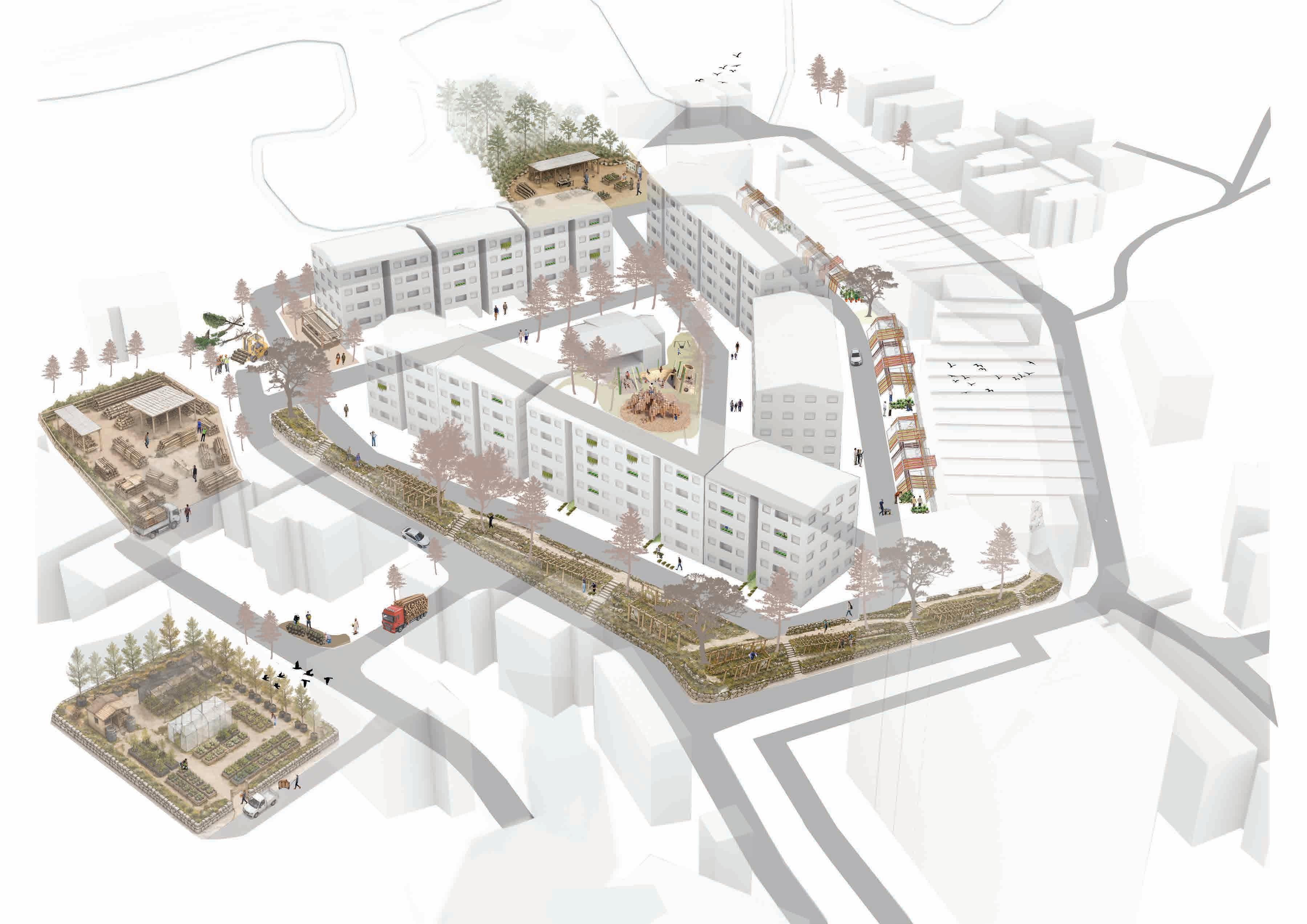
This shows how forest-derived resources move into Carnation Park through a linked set of working and public spaces. Collection, nursery propagation, timber preparation, moss cultivation, exchange, and domestic extension are arranged as one spatial system, connecting the forest edge, shared commons, and surrounding residential fabric.
The overall community framework connects forest resource input to shared production spaces and neighbourhood exchange. The system becomes visible at the residential scale through balcony harvesting, moss edges, exchange strips, and shared commons.
PHASE 1
+Forest Source and Collection
Forest source (search + gather)
Search, gather and bring forest material to the site.
Forest-edge collection point (sort+clean)
PHASE
+Workshop preparation
Prepare + Make + Store
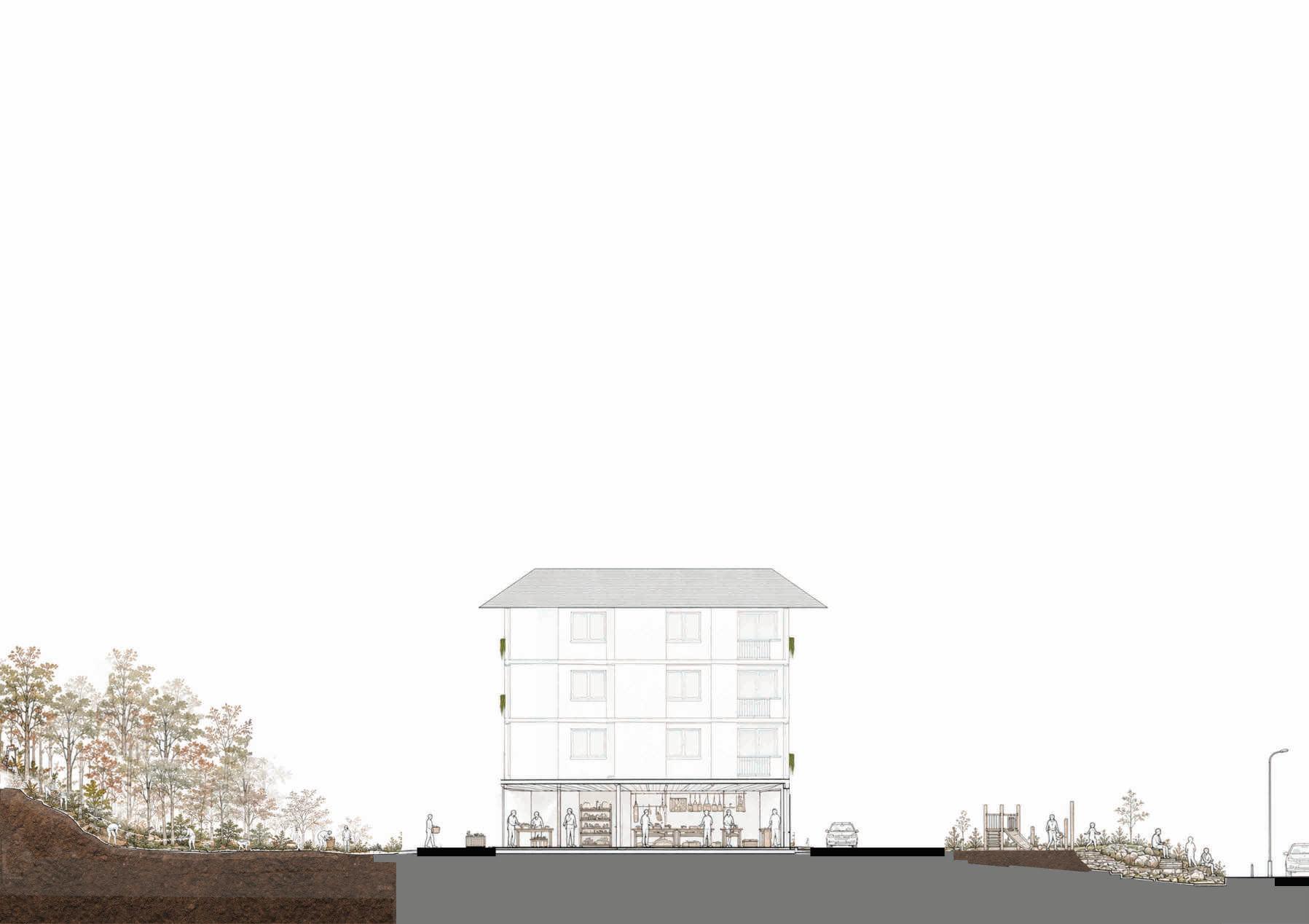
This sectional progression traces the spatial transformation of Carnation Park from forest-edge resource collection to public embedding within the residential landscape. Phase 1 begins at the forest source and collection edge, where materials are gathered and sorted.
PHASE 2 preparation under housing
+ Share
Material are prepared, cultivate and crafted in the sheltered workshop
PHASE 3
+Workshop-made elements animate the play area and moss landscape along the public edge
Natural Play Area (partially from the workshop)
Moss threshold slope (moss cultivatation + public edge)
Phase 2 introduces sheltered workshop spaces under housing blocks for preparation, cultivation, making, and storage. Phase 3 extends these workshop-made elements into shared public areas, where moss landscapes, natural play spaces, and productive edges become part of everyday communal life.
LIVED ATMOSPHERE OF THE MOSS GALLERY SPACE
Cultivation, exchange, and everyday life between the residential blocks
The Moss Gallery Space transforms the underused gap between residential buildings into a shared productive commons. Moss cultivation, balcony planting, product display, and casual social use are brought together as part of everyday community life.
THE FOREST EDGE COLLECTION POINT
A shared productive edge between forest and housing
The Forest Edge Collection Point reworks the residential-forest boundary into a shared space for cultivation, making, and exchange. By combining workshop activity, nursery growth, and everyday planting, the edge becomes a productive commons embedded within daily community life.
SHARED COMMONS NODE
A natural play area shaped by shared use, local material, and everyday community life
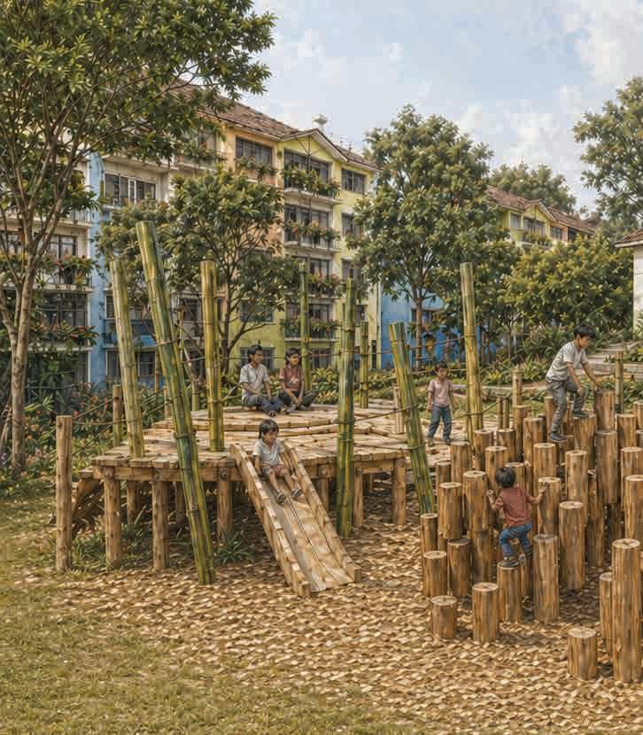
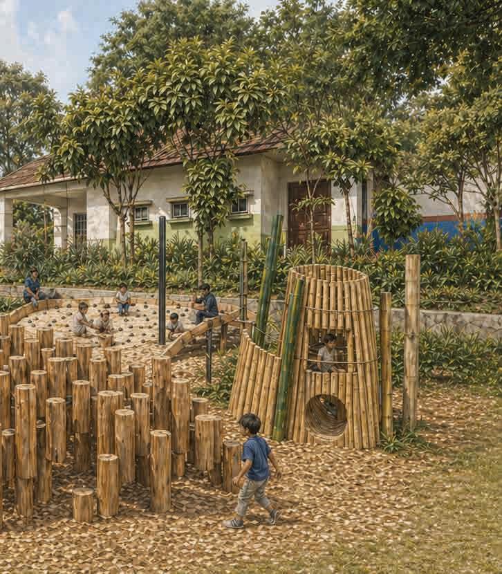
The Shared Commons Node transforms an underused open space into a communal play landscape built from workshop-made natural elements and forest-derived materials.
Timber logs, bamboo structures, and planted edges create a space for play, gathering, and informal social use, allowing everyday community activity to become part of the wider forest-to-community system.
GROUP B: URBAN AMENITIES
LIVING MUSEUM OF TANAH RATA
CURATING BOTANICAL HISTORIES IN TANAH RATA
Soh Seh Ting
FROM EXTERNAL TO LOCAL
REIMAGINING THE MARKETPLACE AS A CIRCULAR LANDSCAPE
Wu Qiqi
WHERE THE STREAM MEETS THE TOWN
WHERE WATER SHAPES COMMUNITY
Chee Shi Jia, Maydalene P105 P125 P139
LIVING MUSEUM OF TANAH RATA
SOH SEH TING
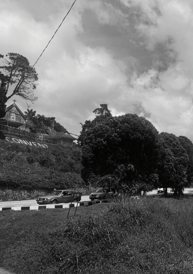
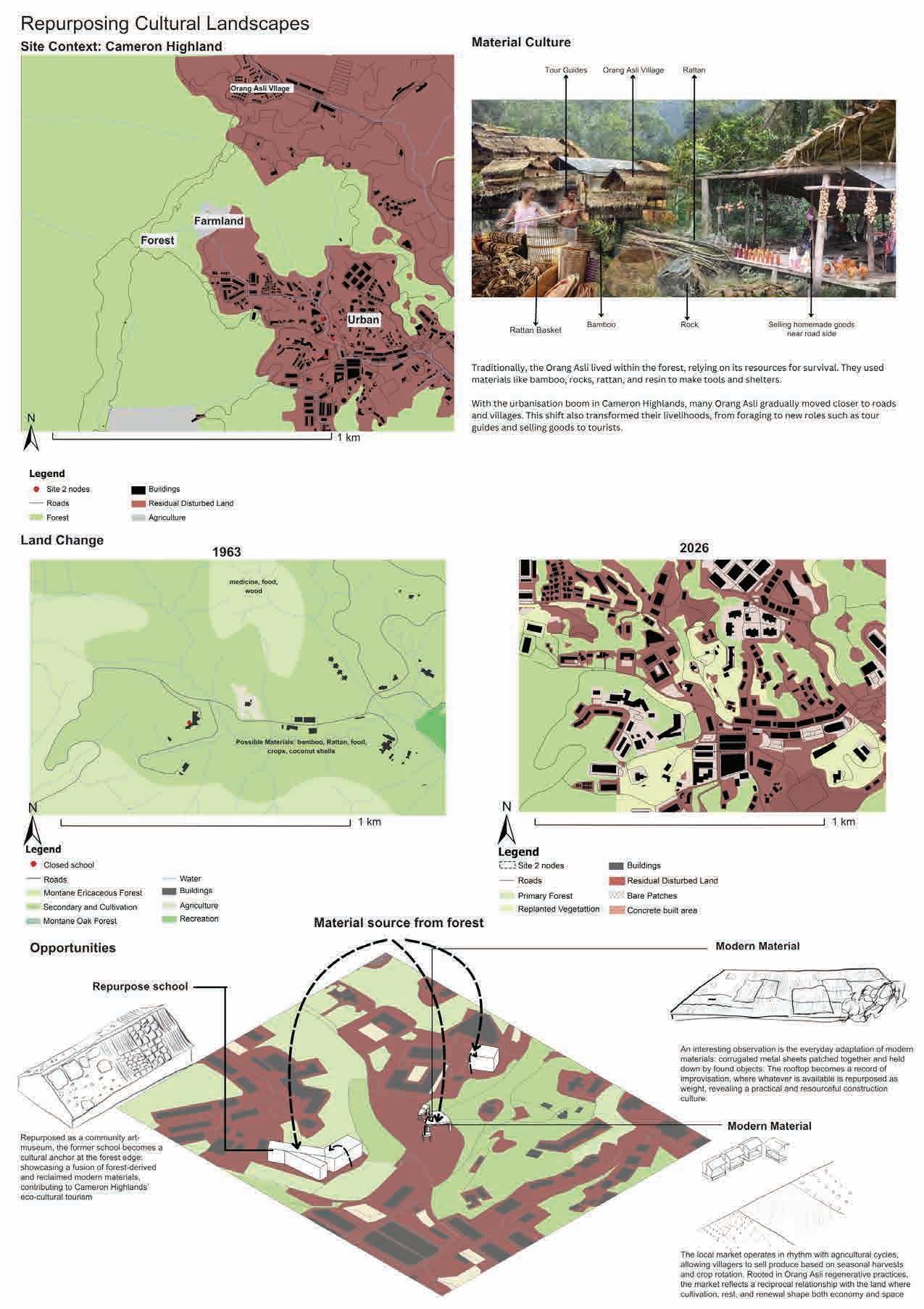
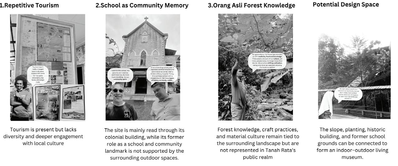
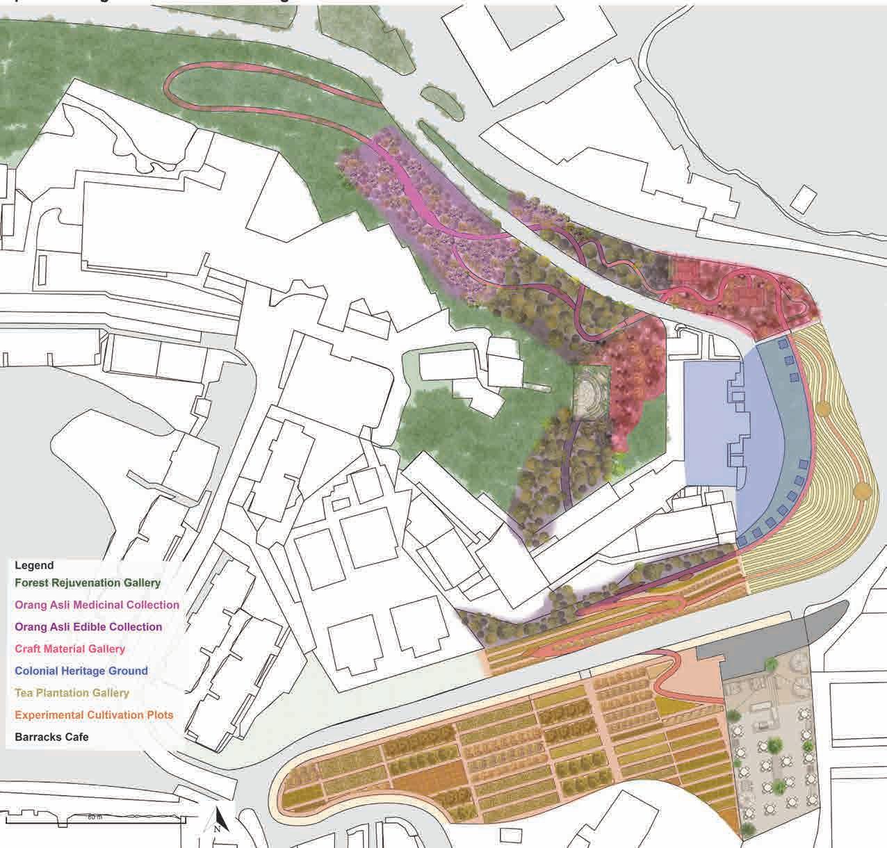
The project seeks to transform the convent compound in Tanah Rata into a living museum, where Cameron Highlands’ forest, Orang Asli, colonial, agricultural and community histories are experienced through planting, movement and time.
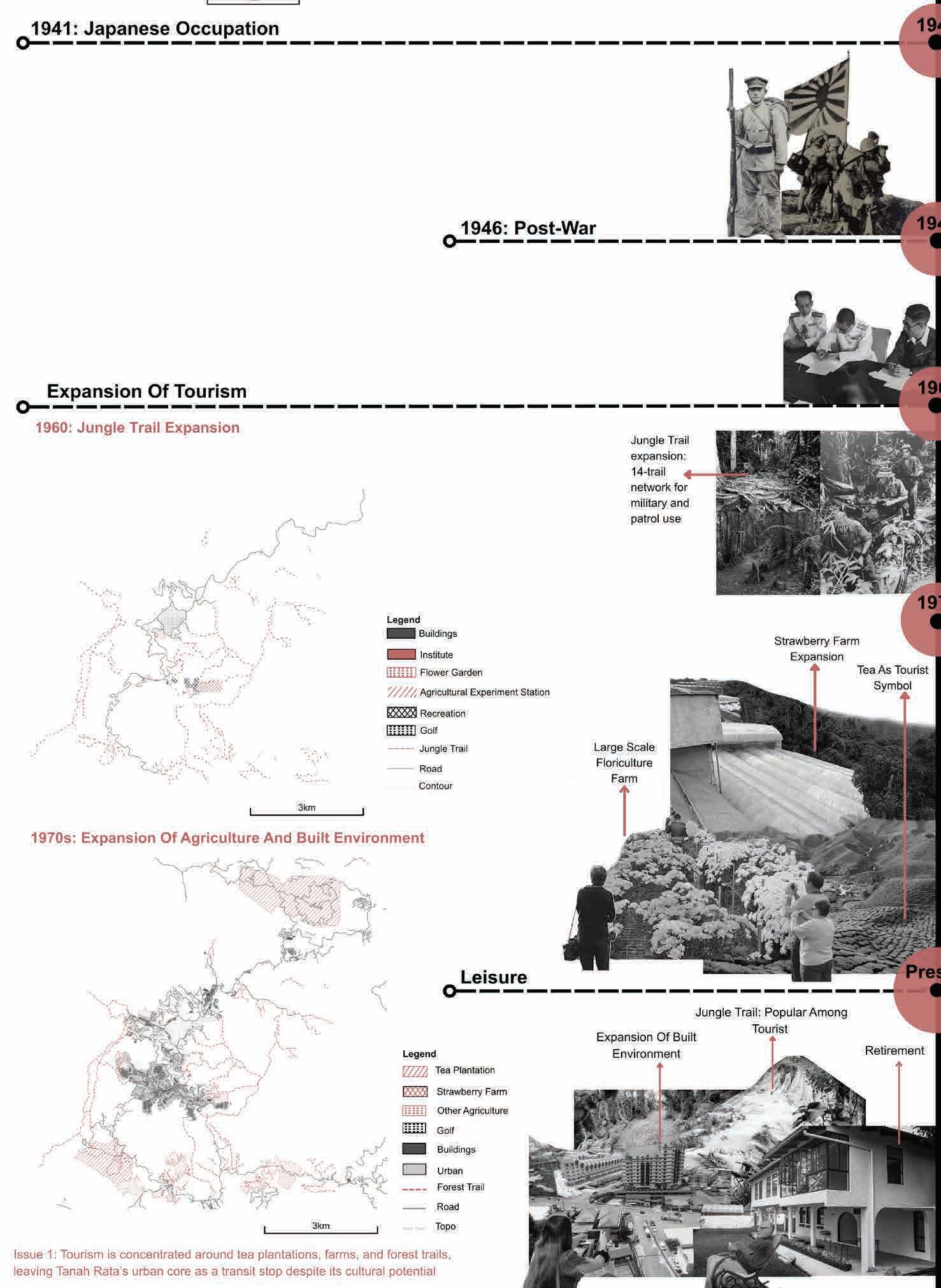
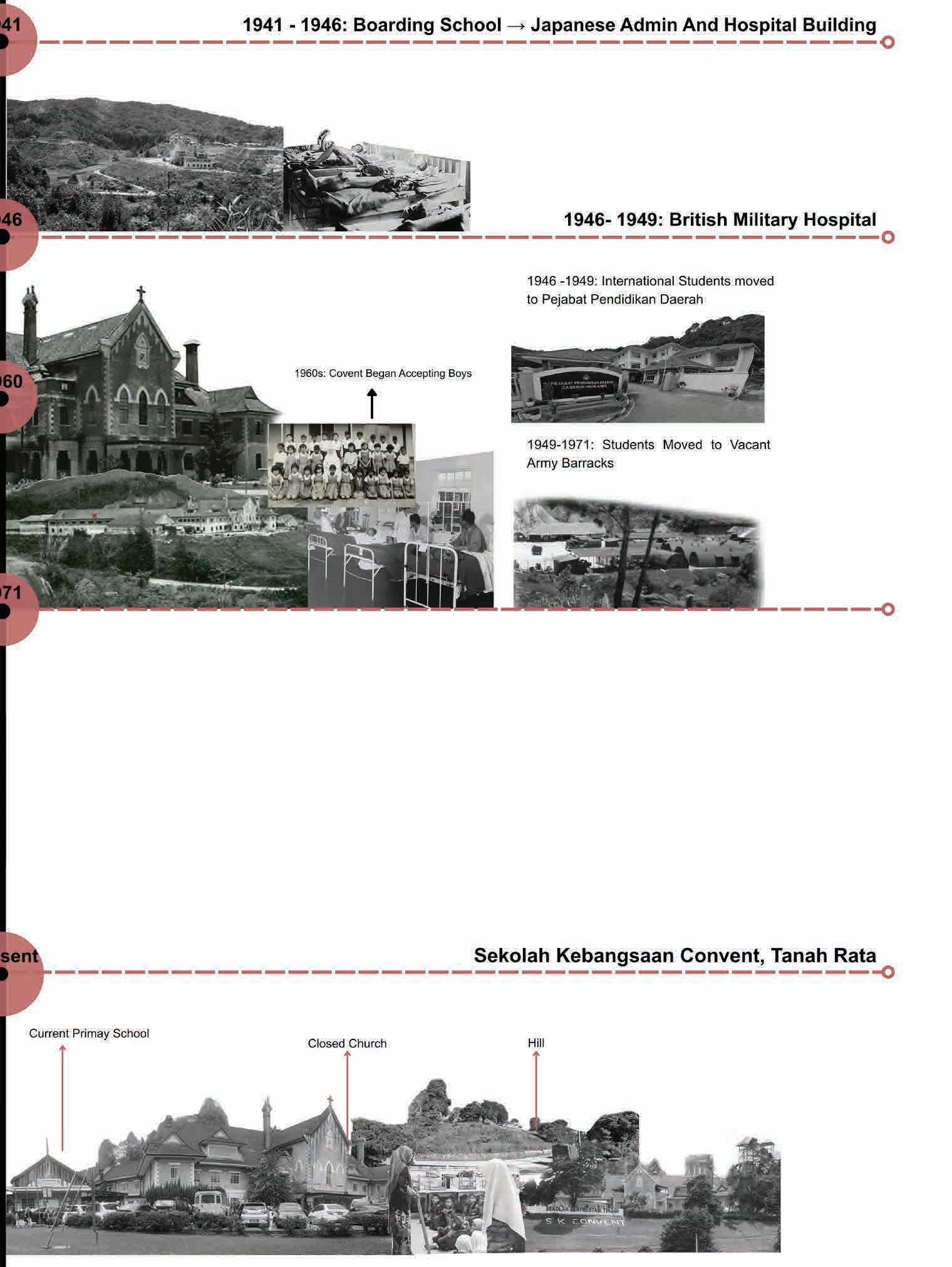
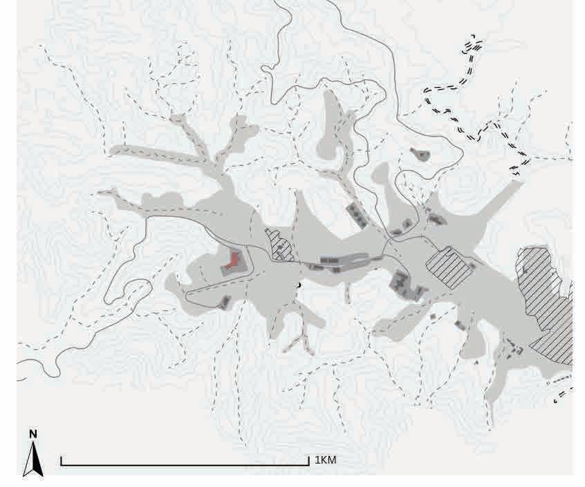
Tourism in Cameron Highlands is largely concentrated in peripheral landscapes such as tea plantations, farms and forest trails, leaving Tanah Rata’s urban core underexplored despite its cultural and historical potential. At present, the site is mainly understood through its colonial architecture, while the surrounding landscape does little to reveal its histories of education, community memory and Orang Asli forest knowledge. The project responds by using the relationship between the historic building, school grounds and sloping landscape to create an indoor–outdoor museum, where hidden histories are made legible through landscape experience rather than static display.
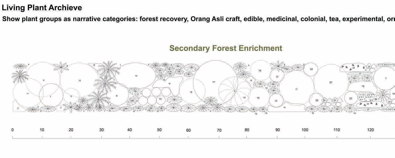
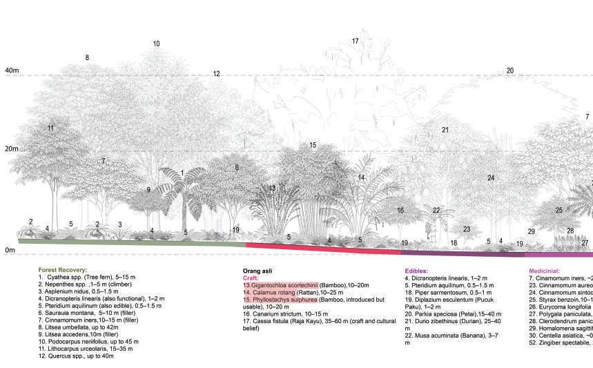
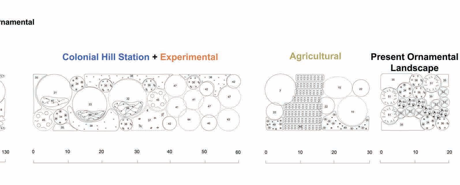
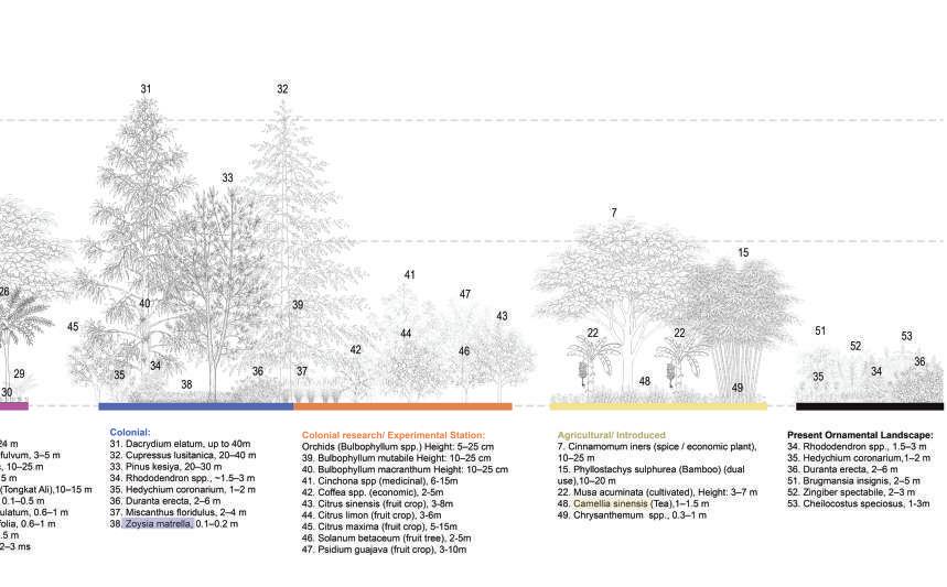
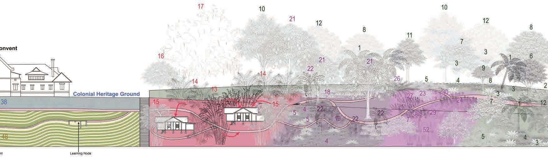
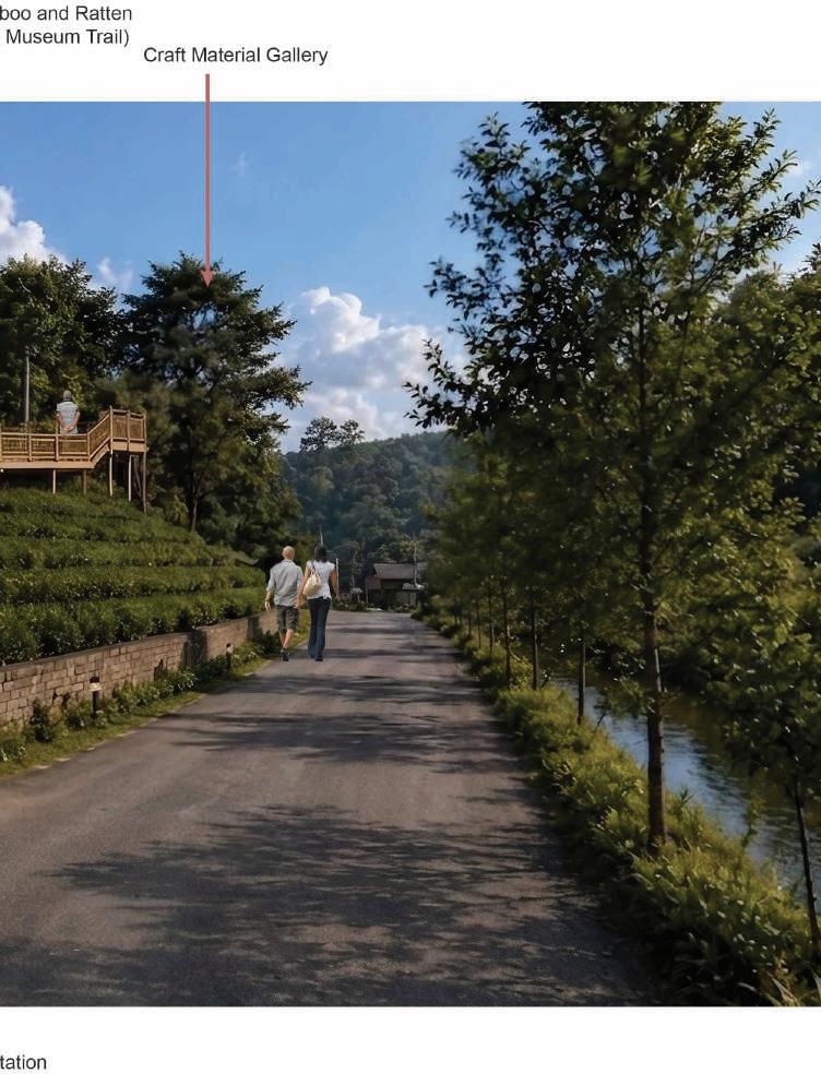
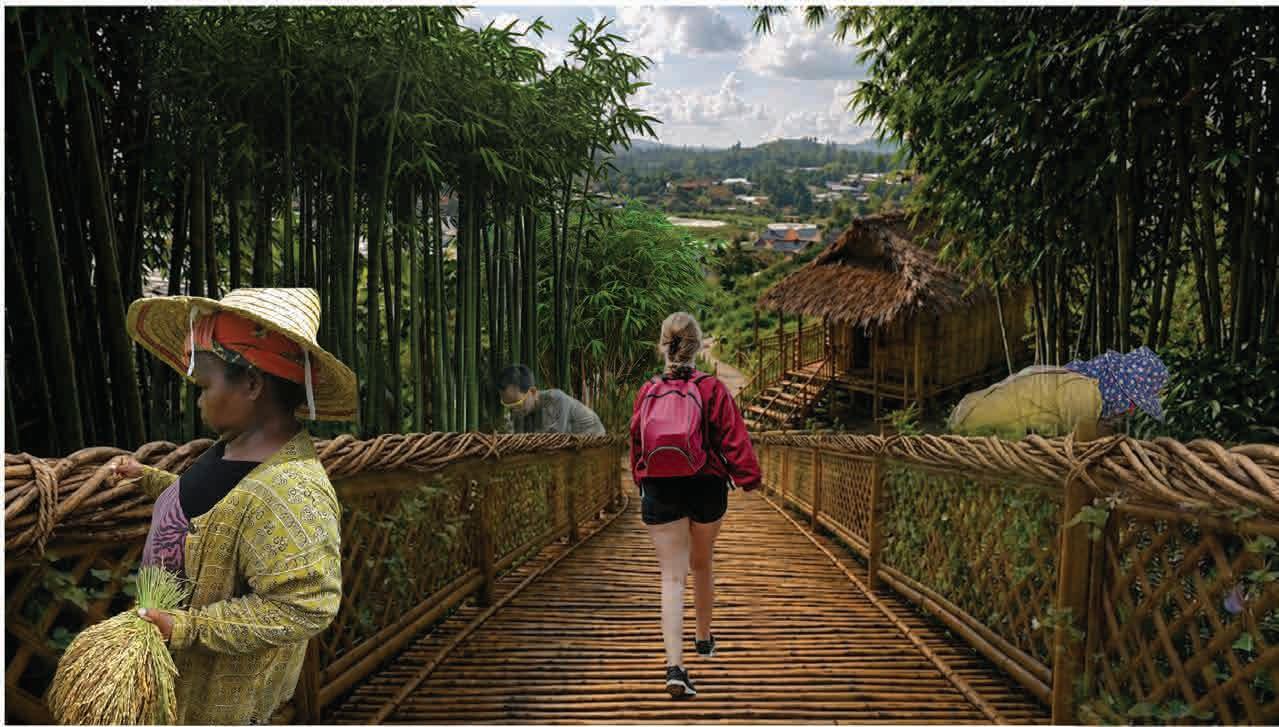
The first strategy implements planting as a narrative system. Selected species are placed according to the cultural and ecological histories they represent. The existing secondary forest is enriched with native planting to support forest recovery and create a more immersive forest trail, while bamboo, rattan and useful plants embed Orang Asli craft and material knowledge along the route. The colonial lawn, tea landscape and experimental agriculture plots are arranged as distinct but connected planting conditions, allowing visitors to read the transformation from forest knowledge to cultivated landscapes.
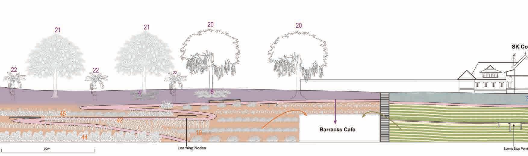
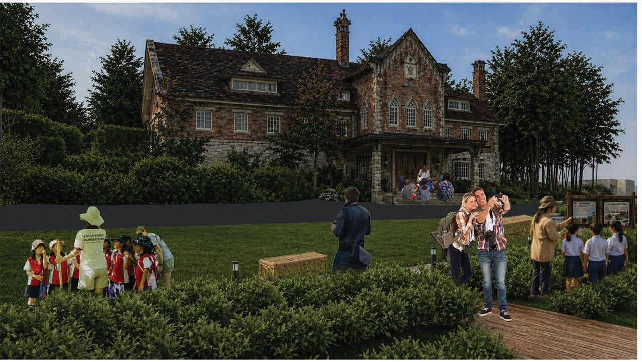
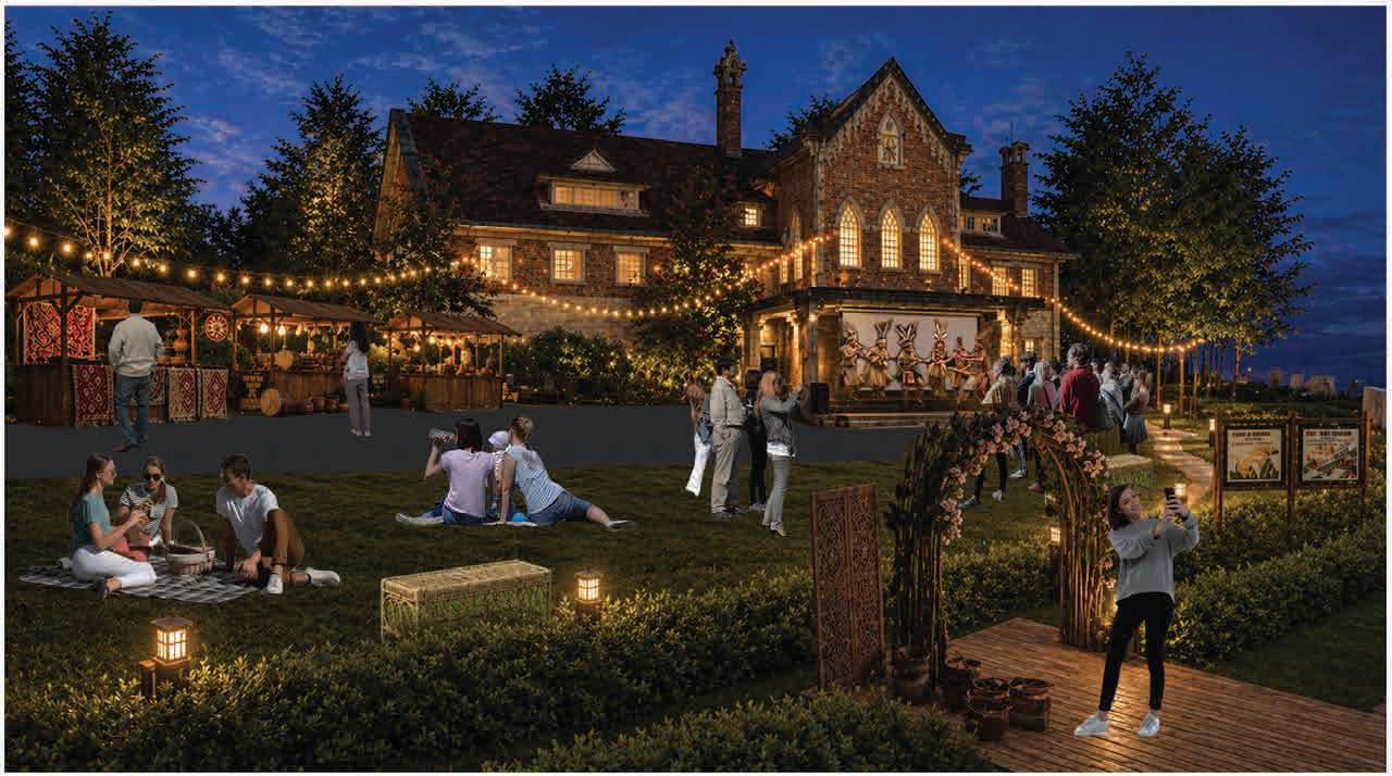
The second strategy curates spatial sequences that guide how users experience and participate in these narratives. Bamboo, rattan and craft-related plants are expressed through site elements such as steps, seating, and small structures. The colonial lawn becomes a flexible open space for community gathering, festivals, performances, outdoor learning and night projections. Tea, experimental crops and Orang Asli edible plants extend the museum into productive use, supporting culinary experiences, with Barracks Cafe.
Together, these strategies create a living museum that reconnects Cameron Highland’s layered histories with everyday community use, while positioning the convent compound as a future community node and cultural attraction that encourages visitors to stay longer in Tanah Rata.
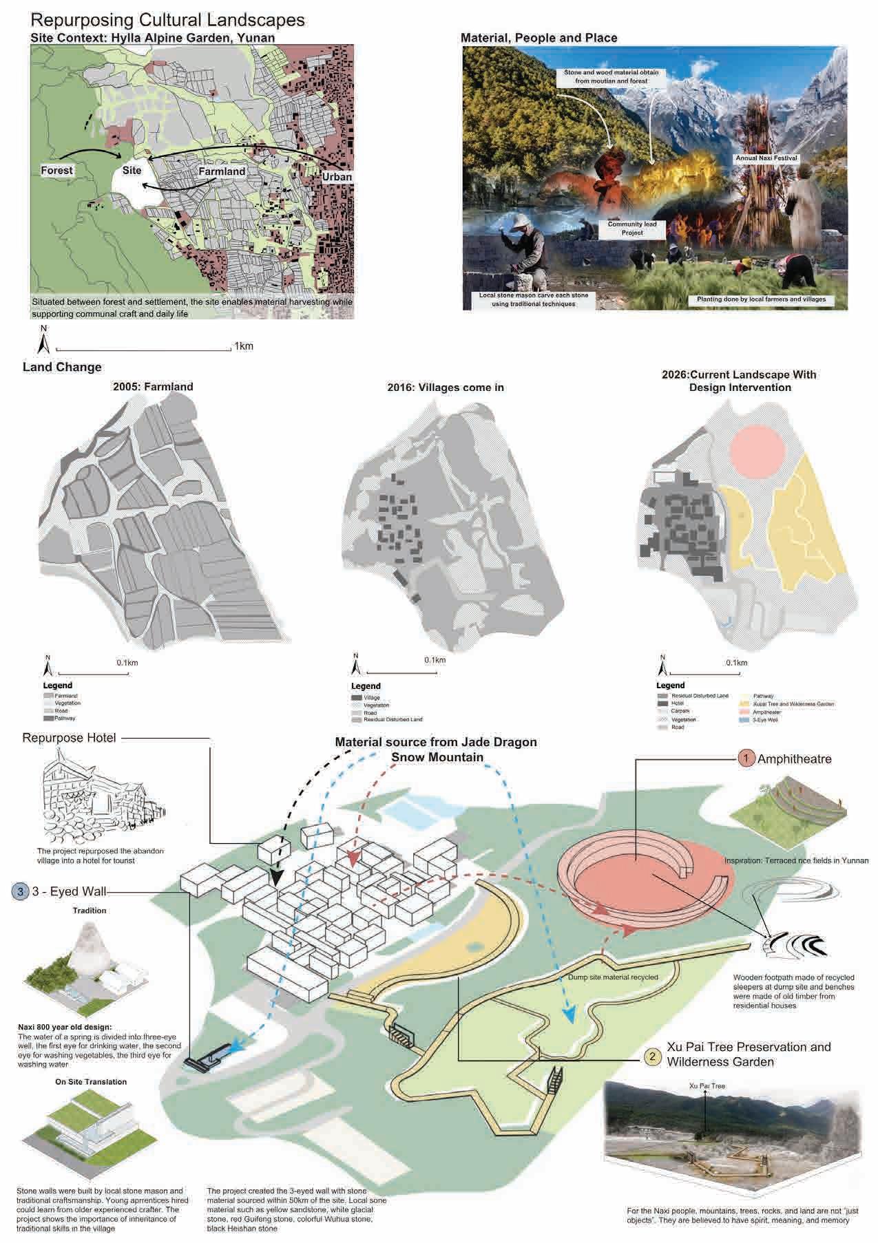
CASE STUDY: HYLLA ALPINE GARDEN, YUNNAN
Project 1: Learning from Edge Landscapes: Hylla Alpine Garden
This study explores how landscapes are shaped through the interaction of materials, people, and cultural practices. Rather than being fixed, landscapes evolve through movement, reuse, and local knowledge.
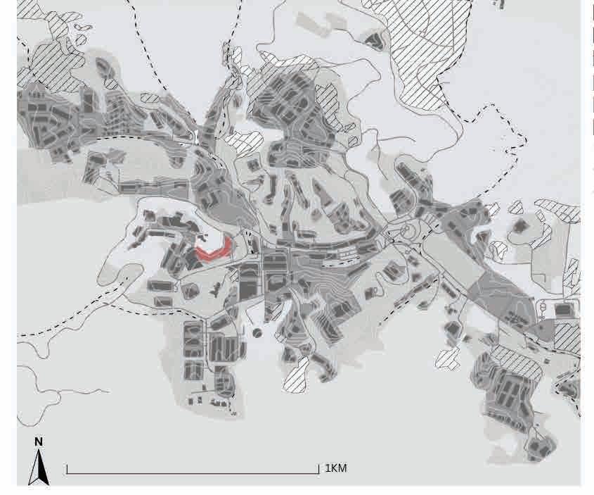
URBAN CONTEXT: TANAH RATA CENTRAL CORE
Application To Site
While the precedent operates within a rural context, this project reinterprets the idea of landscape as a system of flows, positioning the urban central core as a collection point for materials, crops, and cultural practices.
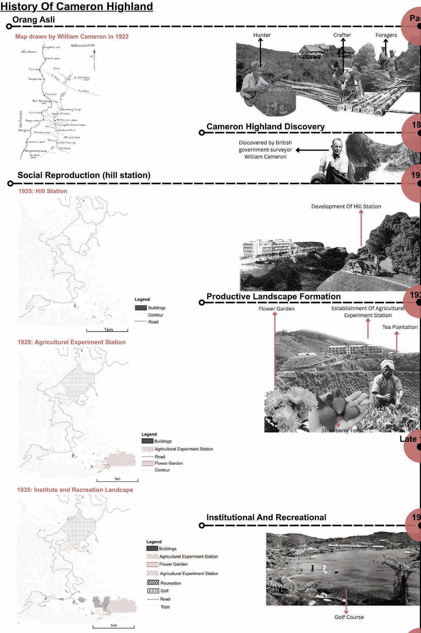
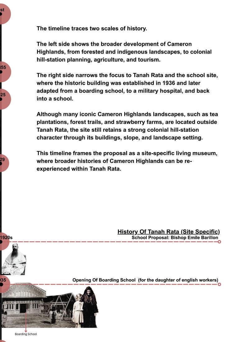
HISTORICAL LAYERS OF THE SITE
HISTORICAL
LAYERS
OF THE SITE (continue)
SITE ISSUES & OPPORTUNITIES
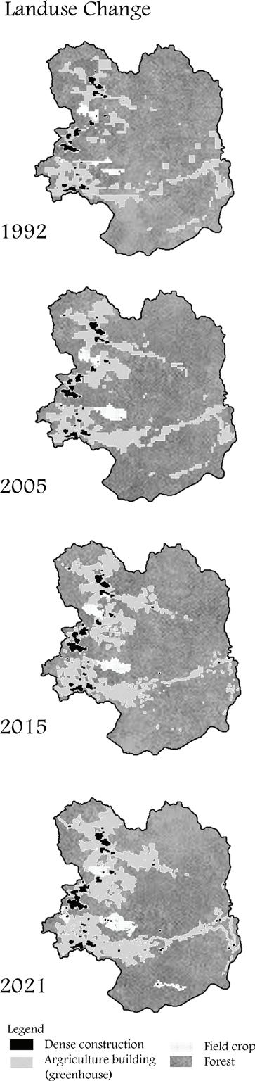
Landuse Change
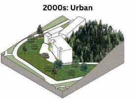
Tanah Rata’s landscape has shifted from a less developed forest-agricultural setting into a denser urban tourism core
Key Site Findings 1936
Tanah Rata’s urban core contains tourism, school memory, Orang Asli knowledge, and landscape potential, but these layers are disconnected and not clearly experienced through the site.
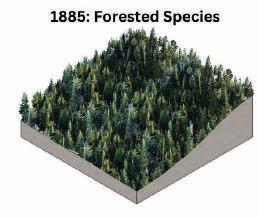
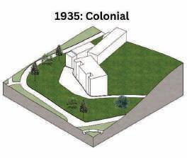
The site evolved from forested species, to a colonial institutional landscape, and later into an urbanised setting around the former school
DESIGN STRATEGY 1
Planting As A Curatorial Medium: Tanah Rata’s urban core contains tourism, school memory, Orang Asli knowledge, and landscape potential, but these layers are disconnected and not clearly experienced through the site.
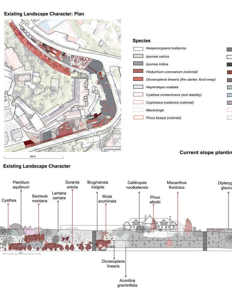
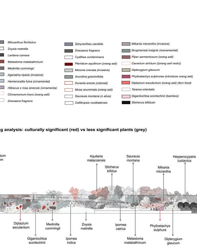
Current slope planting is analysed to identify culturally significant species and reveal opportunities for a more meaningful landscape.
DESIGN STRATEGY 1
Plants extracted from the historical timeline and existing slope landscape are arranged into narrative groups, translating Cameron Highlands’ histories into living design material.
DESIGN STRATEGY 2
Spatial Sequence As Experience: The planting palette is arranged across the slope as a trail-based sequence, where ecological suitability, cultural meaning, and visitor experience are layered together.
Spatial Organisation of the Living Museum: The slope becomes a journey through forest, craft, heritage, tea, agriculture, and café landscapes.
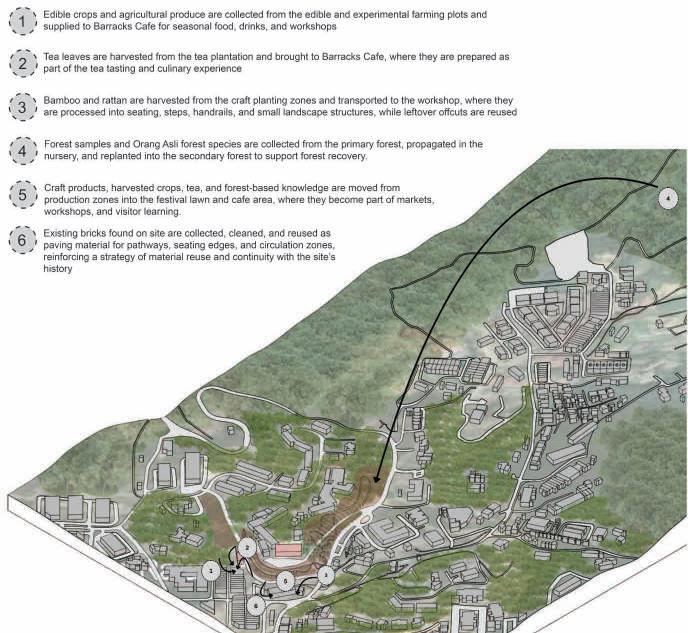
Material Flow System: Forest and planted materials are traced from their source to the site, showing how they are harvested, moved, used, and reused within the museum.
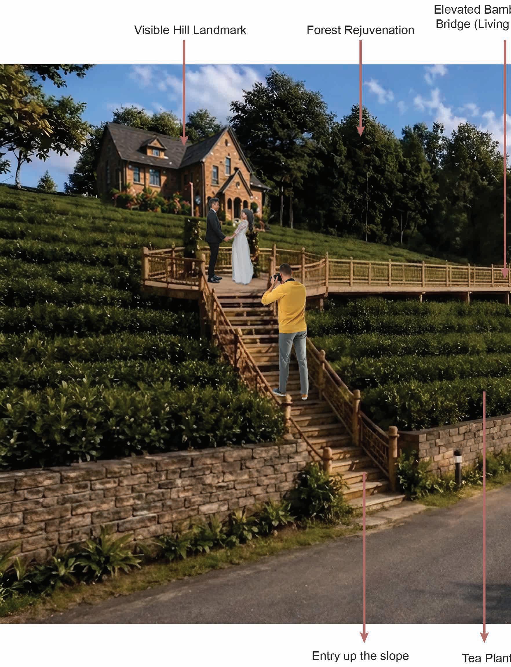
Site Visibility: Located on a prominent hill within Tanah Rata, the living museum becomes a visible cultural landmark for the town.
PERSPECTIVES
Landscape Across Use
Shows how the living museum supports different modes of occupation, from everyday learning and tourism to larger cultural festival events that bring together locals, community, and visitors
Everyday Life
Students and visitors use the site for outdoor learning, storytelling, tea-related education, heritage interpretation, and scenic viewing.
Monthly Cultural Festival
During monthly festivals, the landscape hosts craft booths, Orang Asli cultural activities, food, performance, film, and communal gathering.
Landscape Across Time
The proposal is framed as an evolving landscape system rather than a fixed final image. Over time, planted materials mature into both spatial enclosure and cultural resource, allowing the craft zone to physically transform through the growth and later harvesting of bamboo and rattan for landscape construction.
1 Year
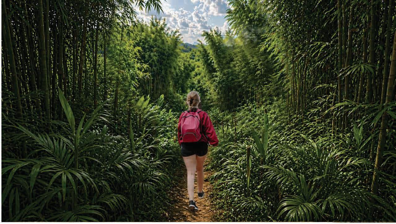
A simple dirt trail moves through newly planted bamboo and rattan as the landscape begins to take form
10 Year
As the planting matures, bamboo and rattan become both spatial structure and material resource. Once established, they are harvested and reused for steps, railings and other crafted landscape elements along the trail.
FROM EXTERNAL TO LOCAL: REIMAGINING THE MARKETPLACE AS A CIRCULAR LANDSCAPE
WU QIQI
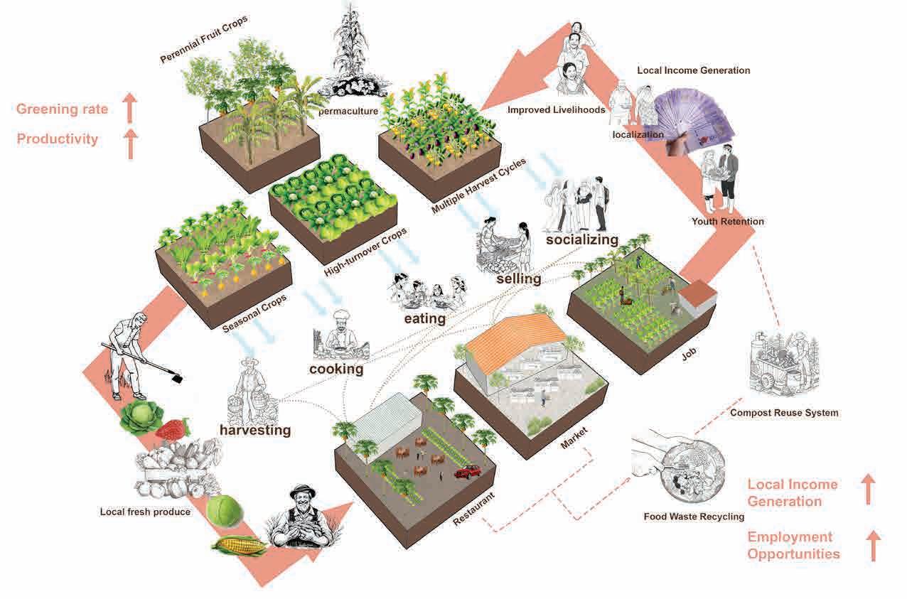
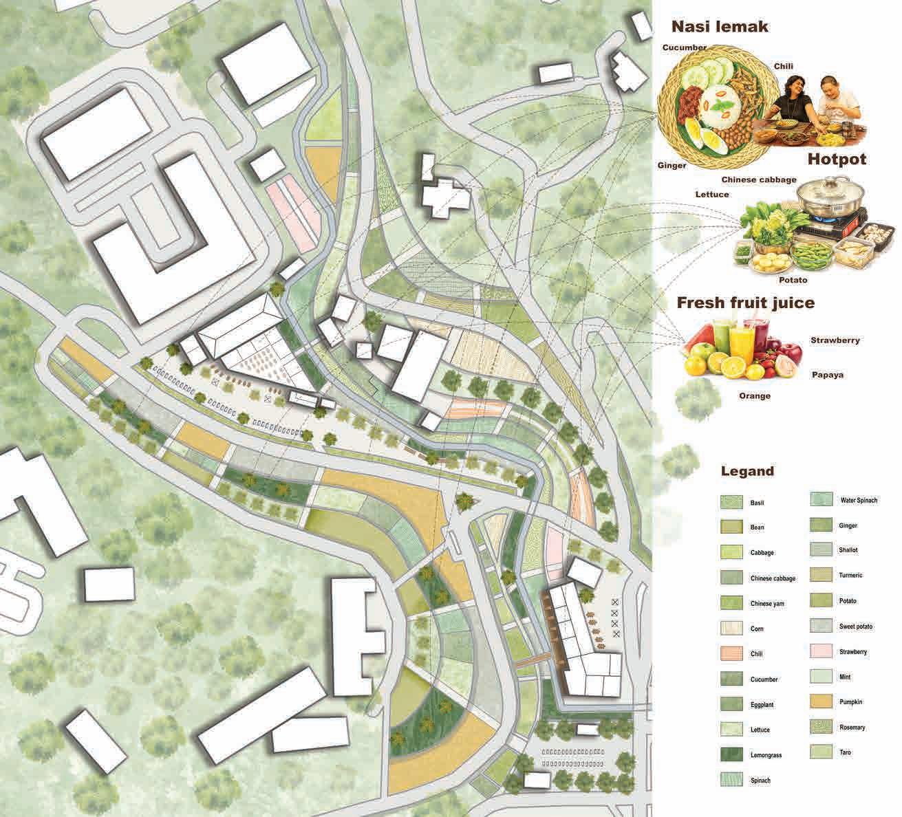
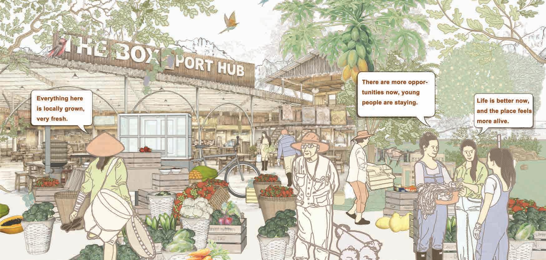
This project introduces an alternative marketplace in Cameron Highlands by transforming underutilized open spaces near the market into productive landscapes. This approach enables the local production, distribution, and consumption of food within the town.
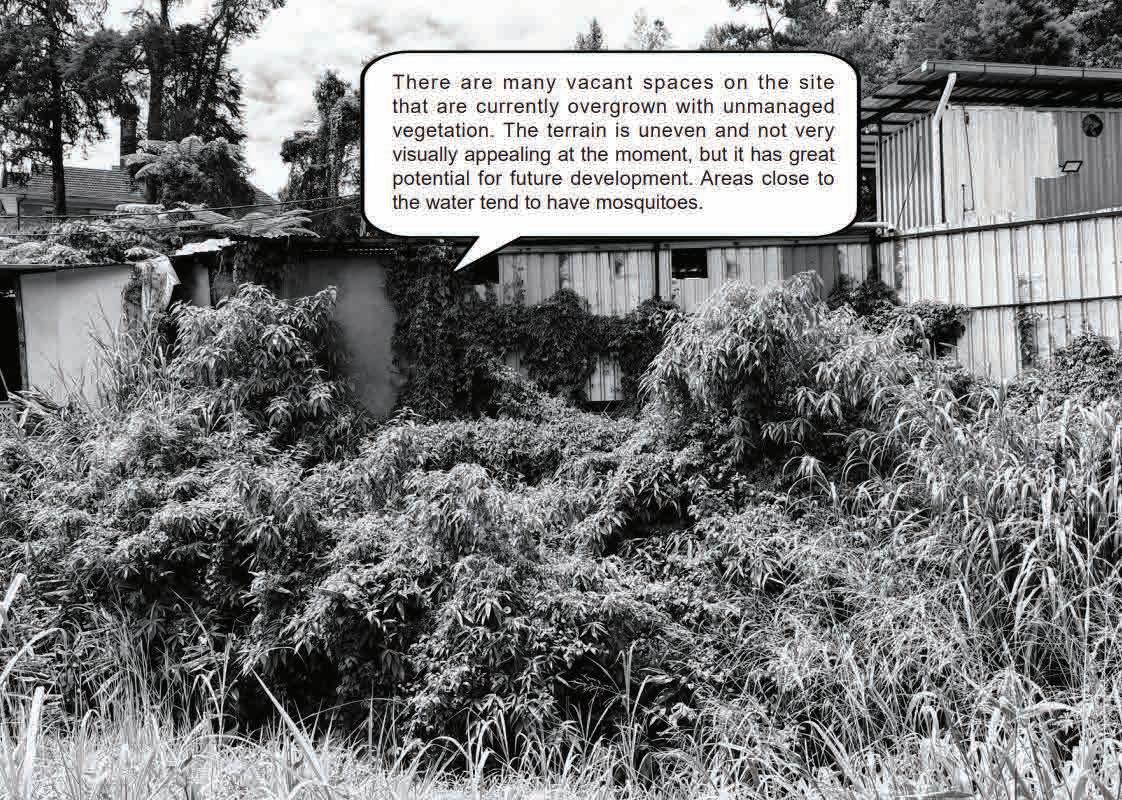
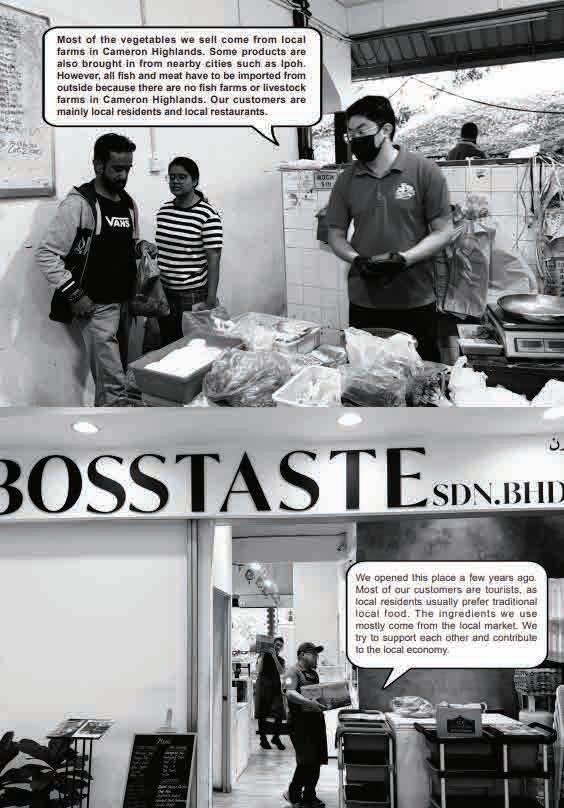
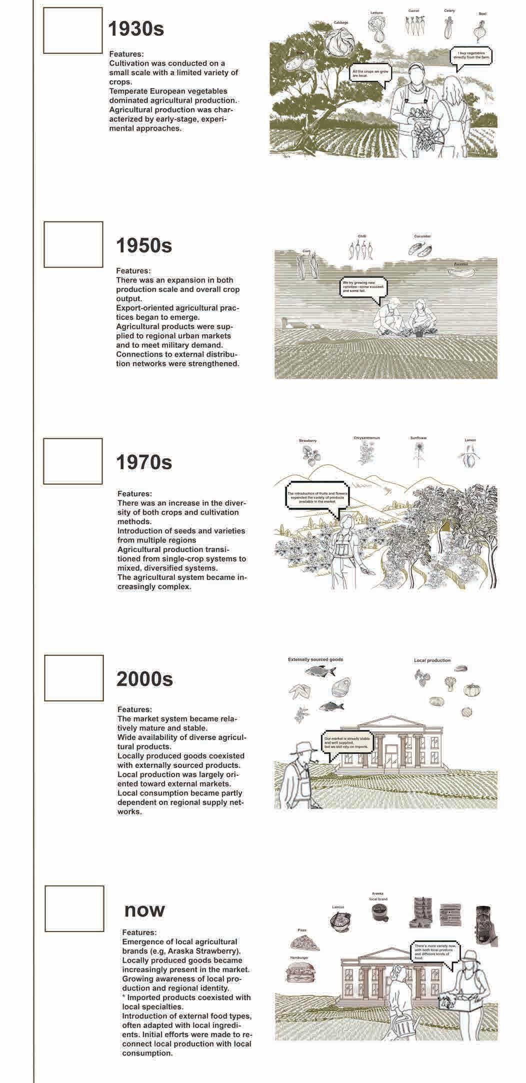
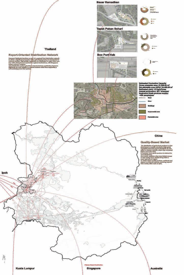
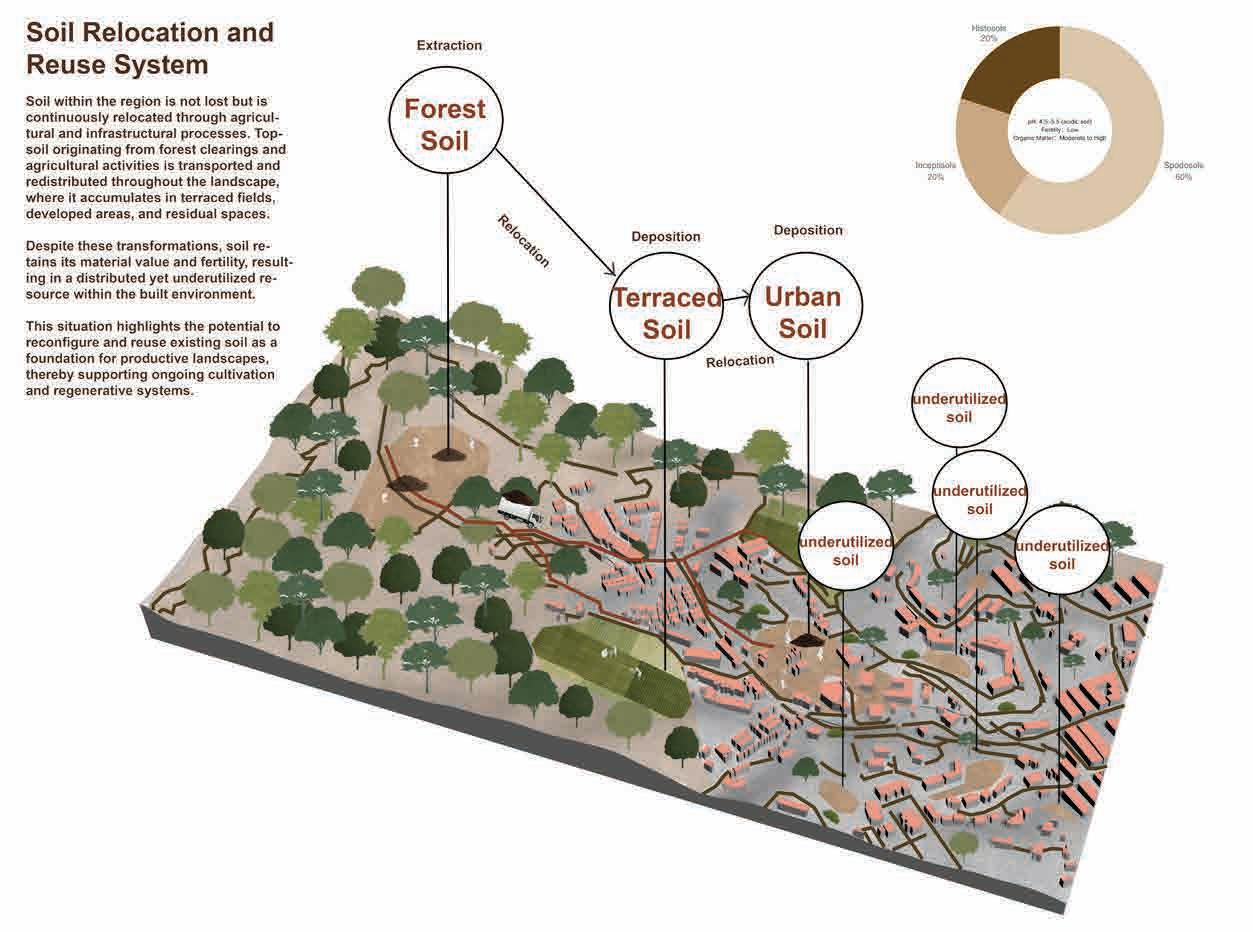
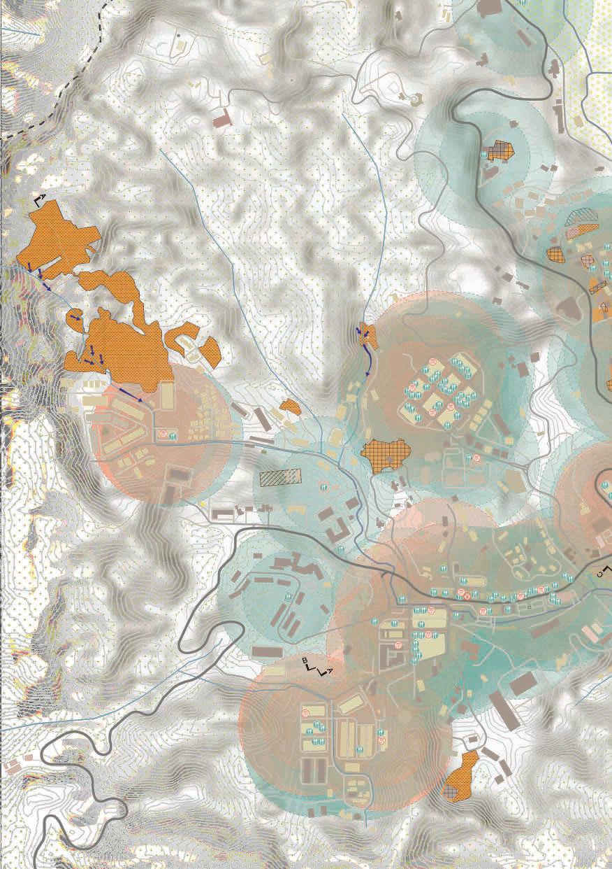
Agriculture in Cameron Highlands has shifted from a local system to an externally focused production network, weakening the link between local land and consumption. Despite expanded agricultural land and output, local communities still depend on imported or lower-quality goods, revealing a gap between production and access. The current market system prioritizes external demand and product variety, resulting in goods that do not reflect local production. At the same time, human activities redistribute soil, leaving fertile topsoil in the urban built-up and unused areas that can be reclaimed as a productive resource.
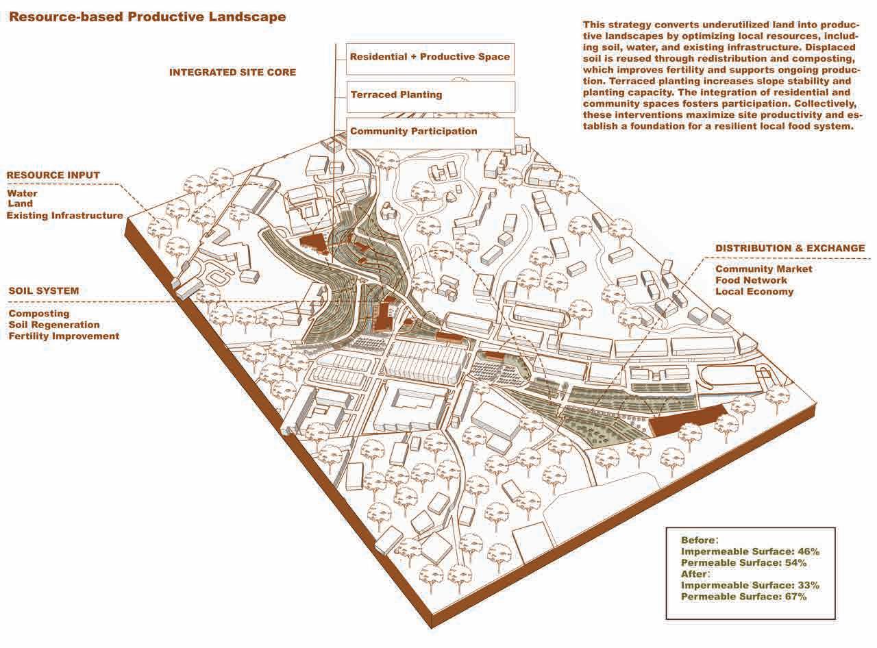
Strategy 1: Resource-based Productive Landscape
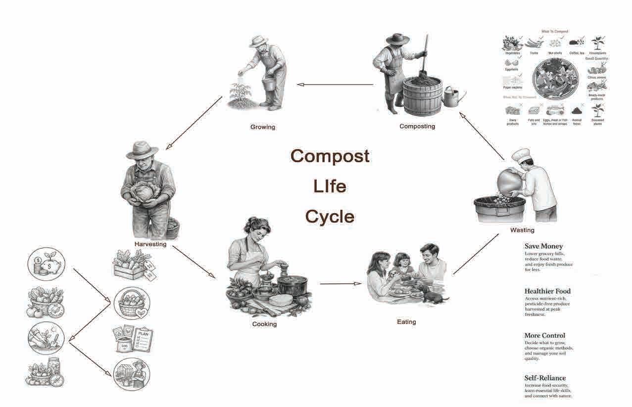
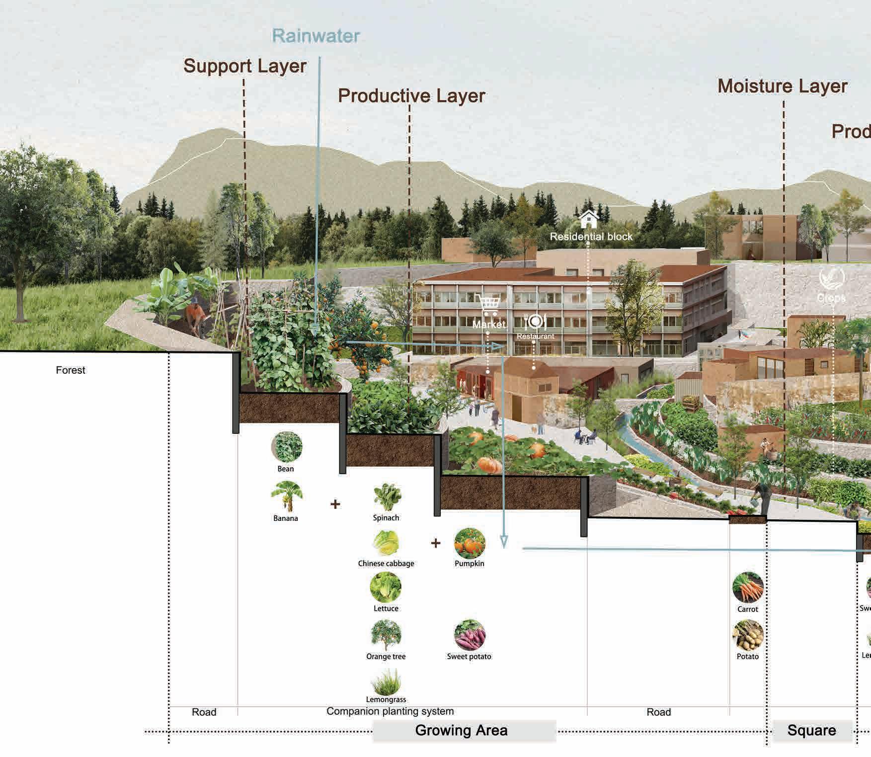
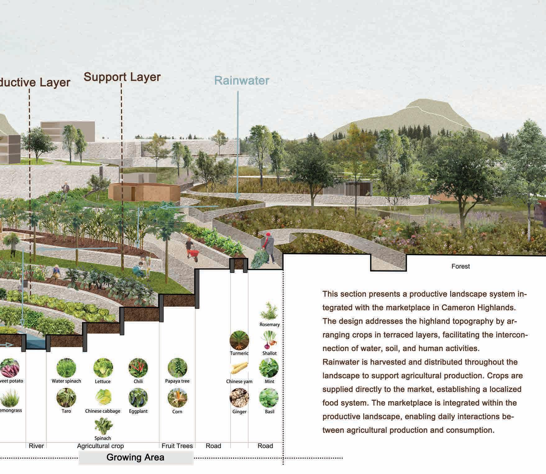
Local resources such as soil, water, land, and existing infrastructure are identified and optimized to maximize productivity. Underutilized spaces become cultivation areas, while soil retention, redistribution, and composting support long-term fertility and ongoing production.
Strategy 2: Connected Local Food System
Productive landscapes are integrated with markets to connect farming, harvesting, processing, and selling. Locally grown produce is supplied directly to nearby markets, creating a local economic system that reduces external dependency, shortens distribution chains, and strengthens accessibility, income opportunities, and economic resilience.
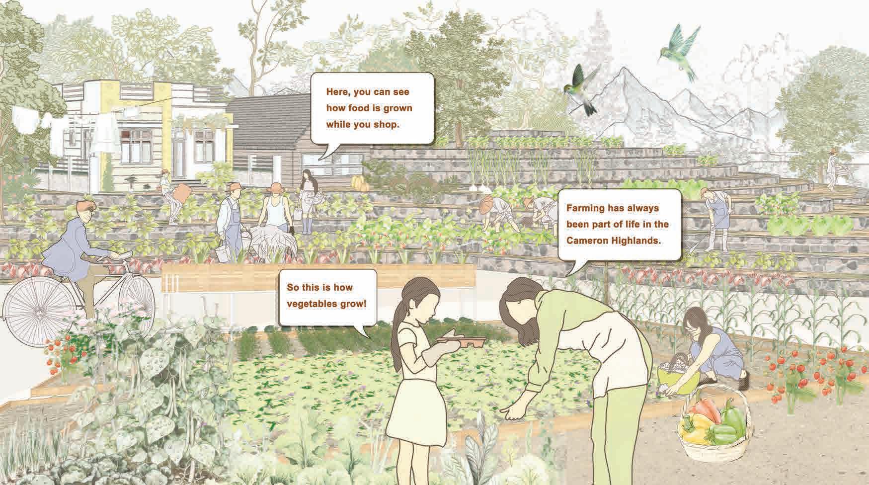
Strategy 3: Embedded Production in Daily Life
Food production is integrated into circulation paths, public spaces, and market edges, making cultivation visible and accessible. This approach encourages daily engagement, increases awareness of local produce, and fosters cultural identity and confidence in local food practices.
Together, these strategies reconnect local resources, production, and markets to create a cohesive, resilient, and self-sustaining food system.
SITE CONTEXT & SPATIAL STRUCTURE
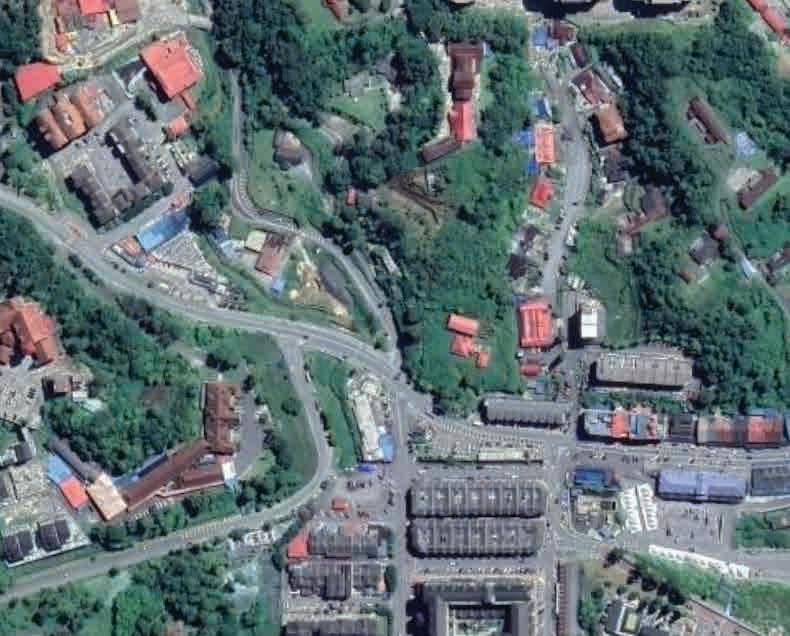
Road network, built density, and underutilised open spaces around the market area
Source: Google Maps Traffic site data
Unmanaged and Underutilised Land
ISSUE STATEMENTS
Fragmented Local Food System
TIMELINE
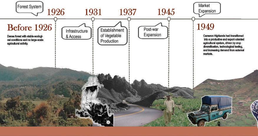
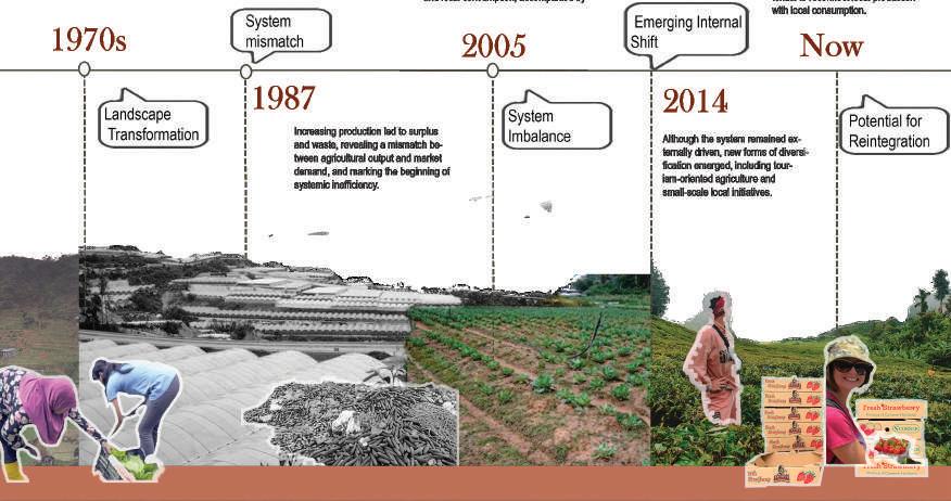
Transformation of agricultural and market systems in Cameron Highlands
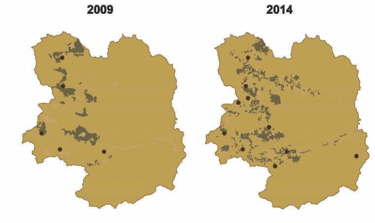
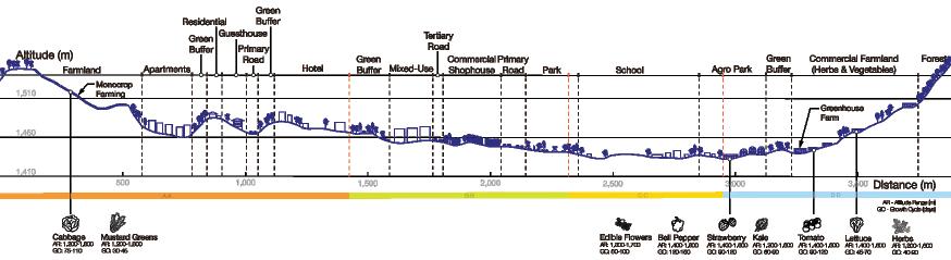
AGRICULTURAL EXPANSION & CHANGES IN CROPS
Expansion of agricultural land and shifts in crop types from early development to present
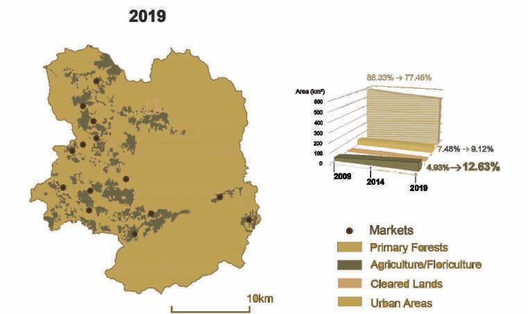
AGRICULTURAL EXPANSION & CHANGES IN CROPS
Expansion of agricultural land and shifts in crop types from early development to present
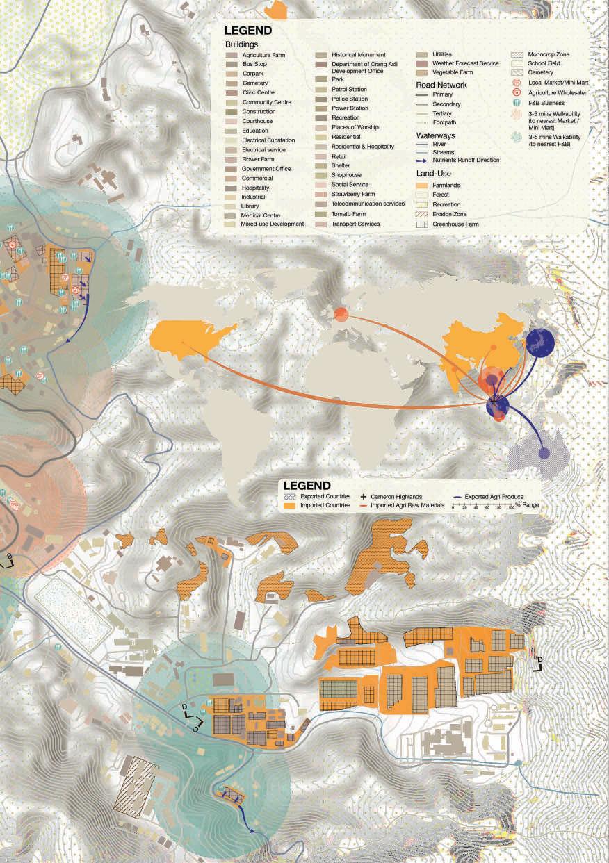
EXPORT-ORIENTED DISTRIBUTION NETWORK
Regional flow of agricultural products from Cameron Highlands to external markets
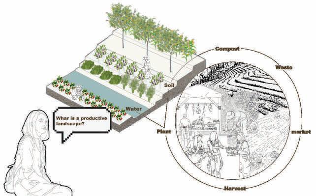
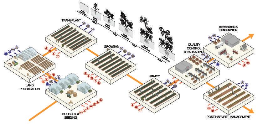
DEFINING PRODUCTIVE LANDSCAPE
Connecting planting, harvesting, composting, and market activities into a continuous productive cycle
RESOURCE-BASED PRODUCTIVE LANDSCAPE
Transforming local resources into productive landscapes
CONNECTED LOCAL FOOD & ECONOMIC SYSTEM
Integrating food production and market activities to drive local economic growth and circular resource use
FOOD WASTE TO RESOURCE CYCLE
Food waste is composted and reused to support continuous local food production
SOIL RELOCATION & REUSE SYSTEM
Relocated and underutilised soil retains its value as a resource, offering strong potential for productive reuse
136 Section illustrating how the three design strategies are integrated and work together within the landscape
WHERE THE STREAM MEETS THE TOWN
CHEE SHI JIA, MAYDALENE
This project aims to revitalise the socio-economic and ecological landscape of Tanah Rata through reconnecting and rehabilitating the streams and their surrounding spaces
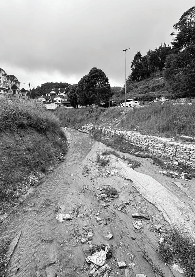
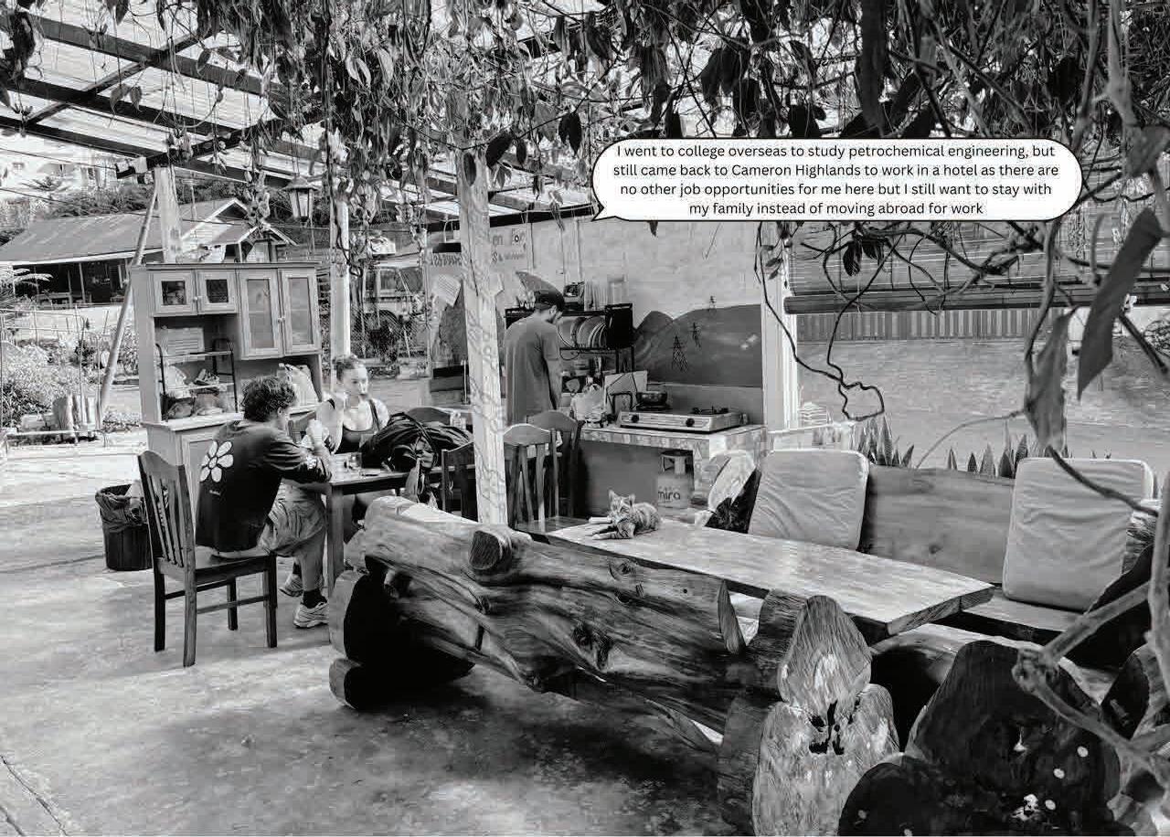
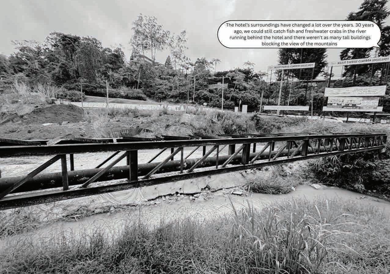
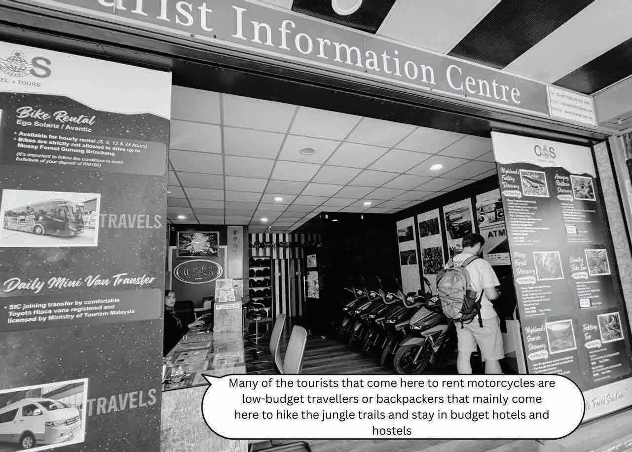
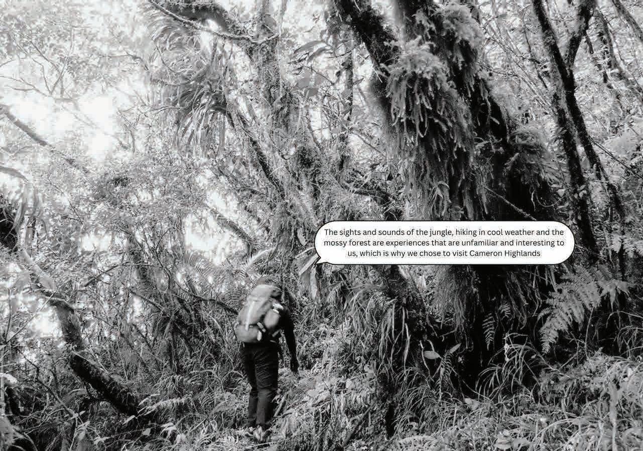
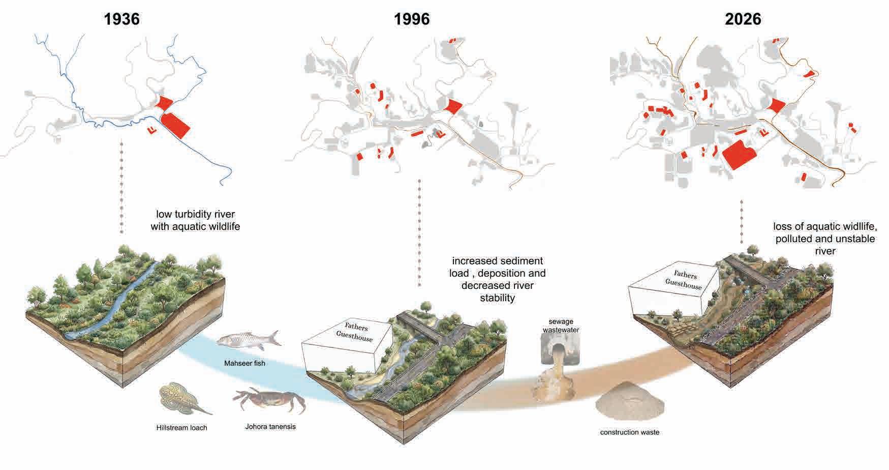
Tanah Rata has evolved from the colonial retreat that it started out as to the domestic and backpacking ecotourism destination it is today. However, the river that has facilitated this development, facilitating drainage, life and agriculture, is facing increasing pollution, degradation and fragmentation. Furthermore, as the tourism industry grows, locals are still stuck with a lack of job opportunities outside of the tourism sector.
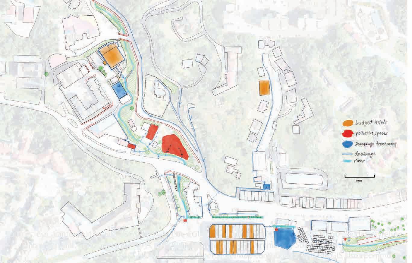
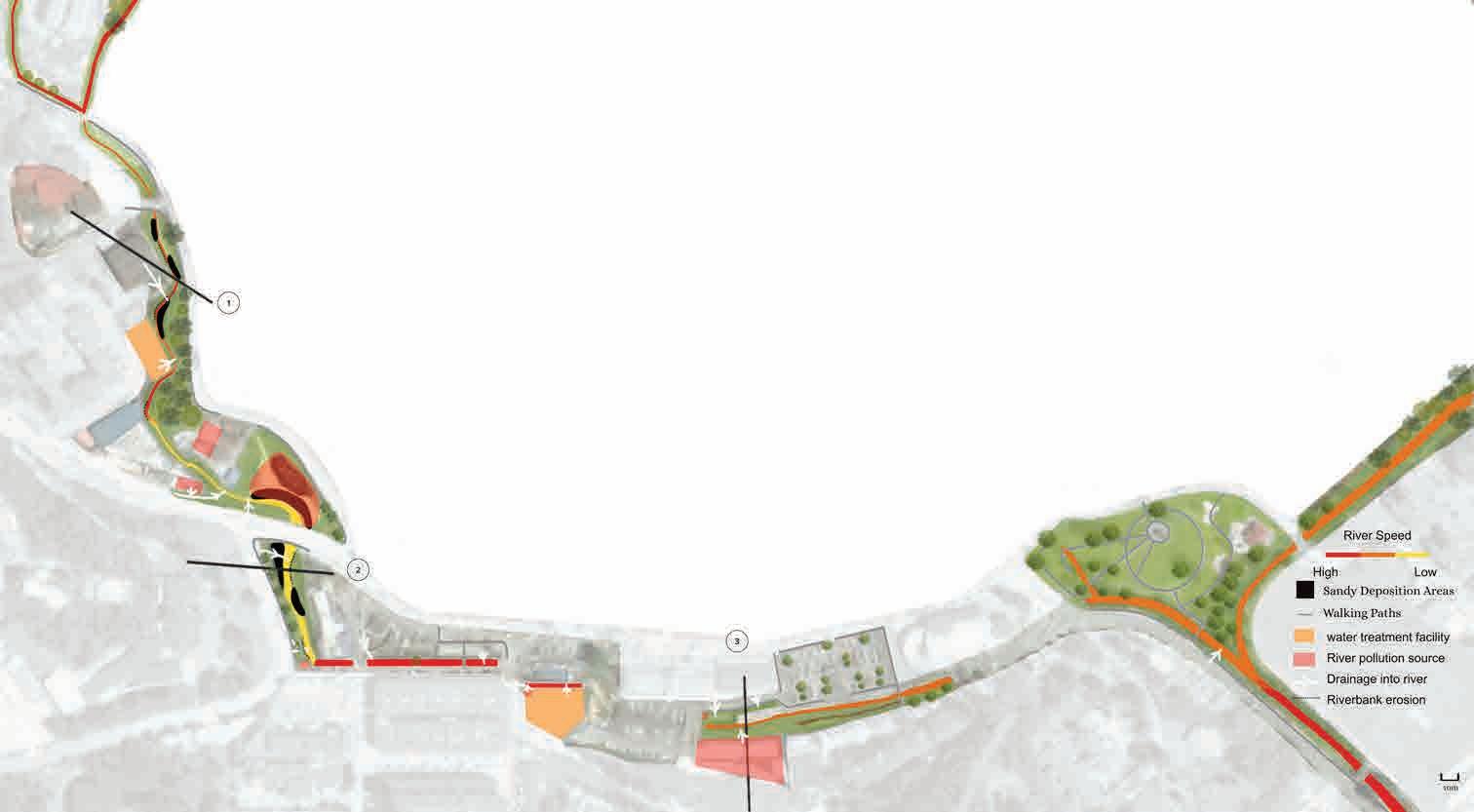
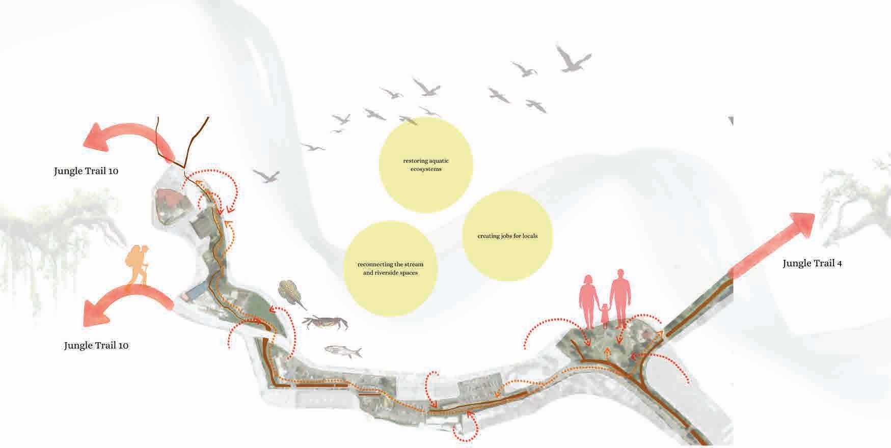
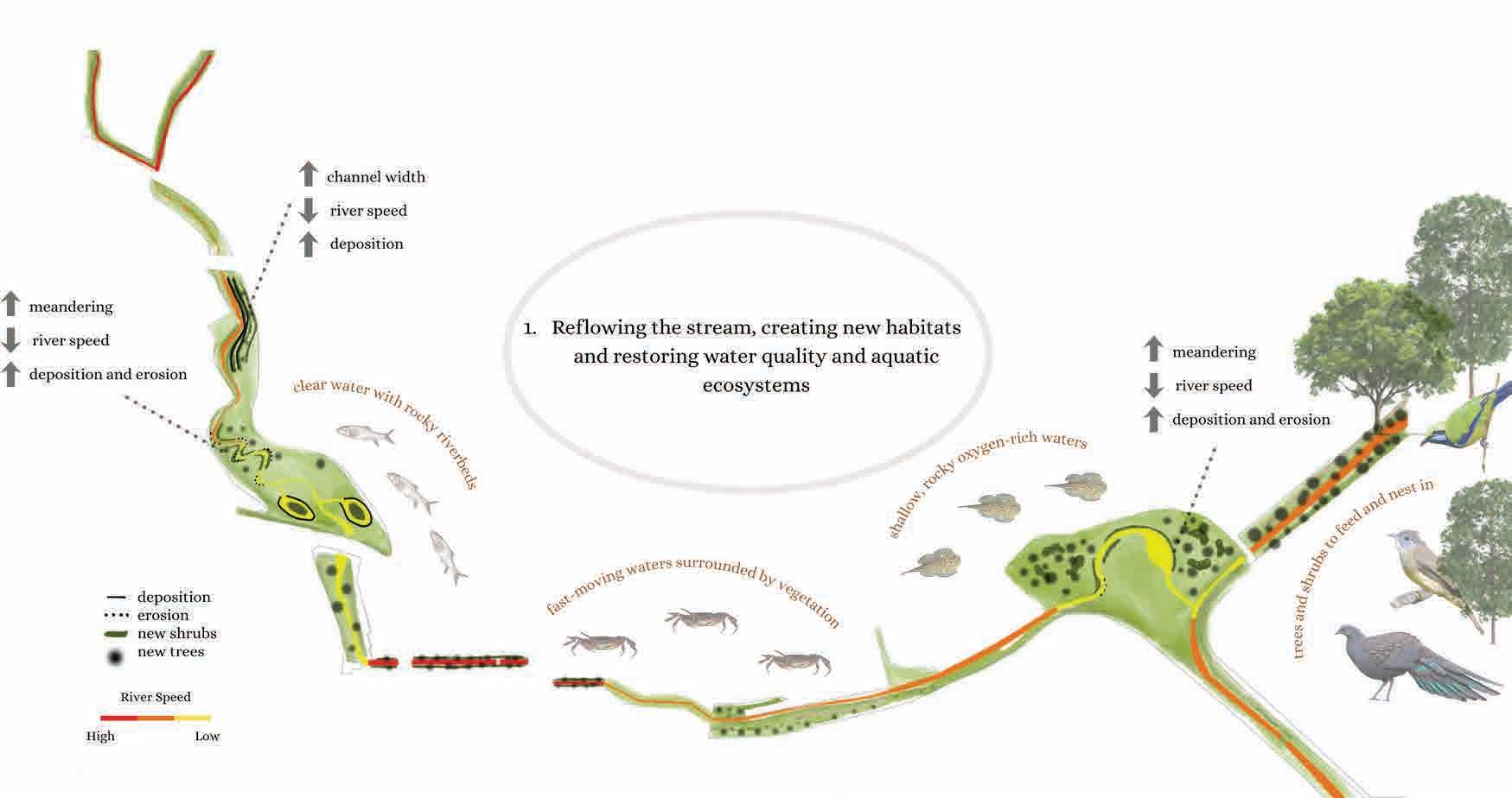
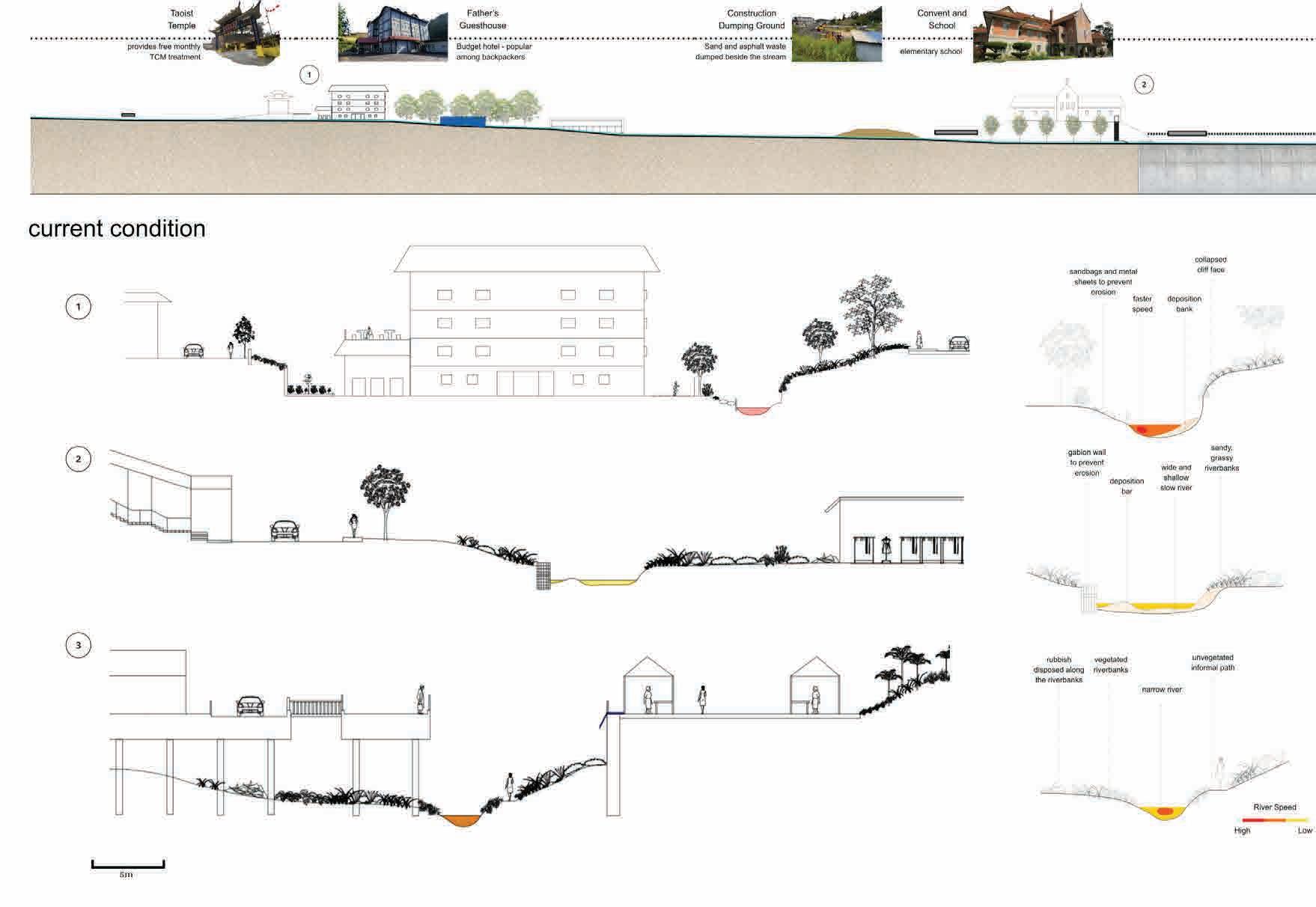
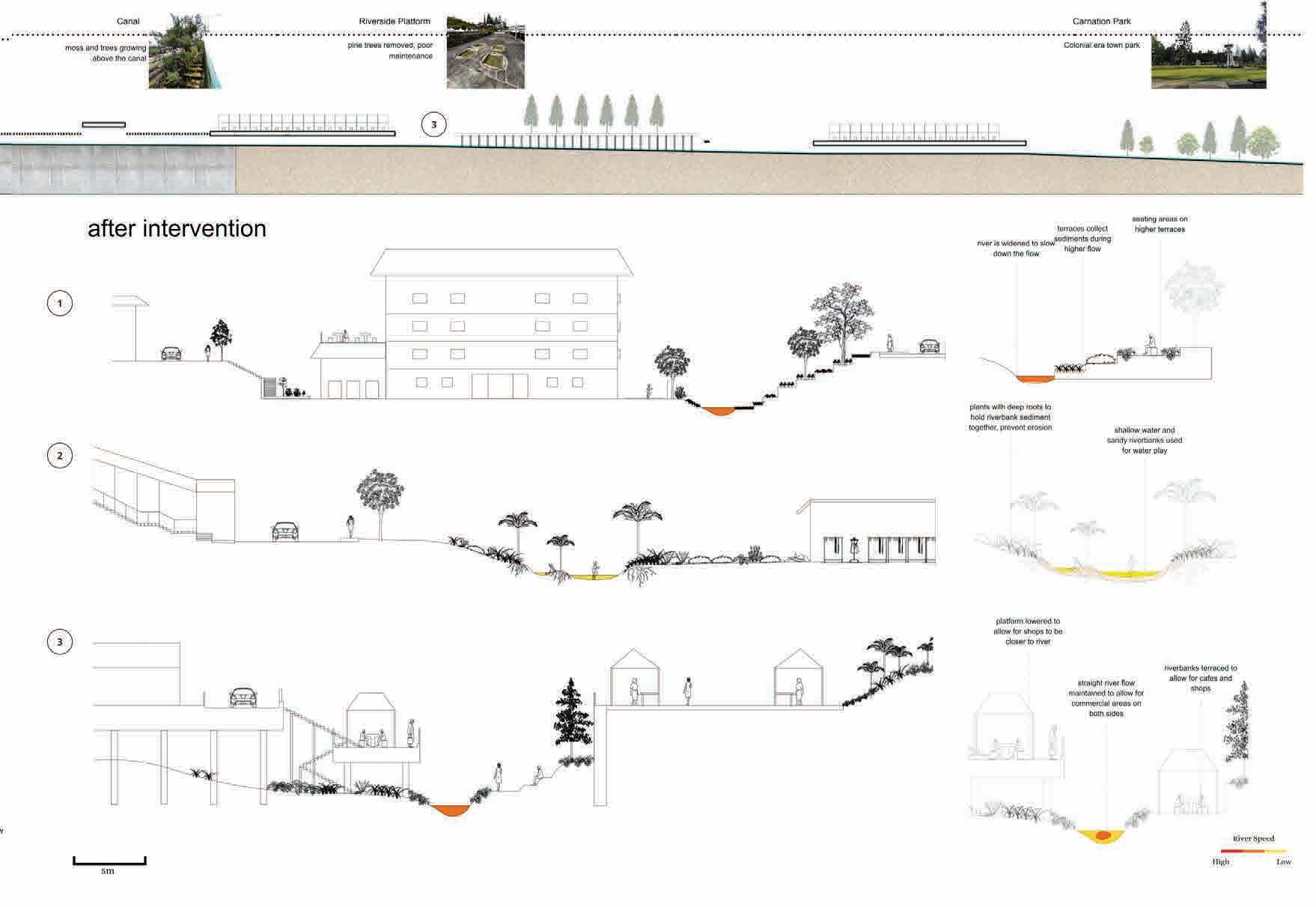
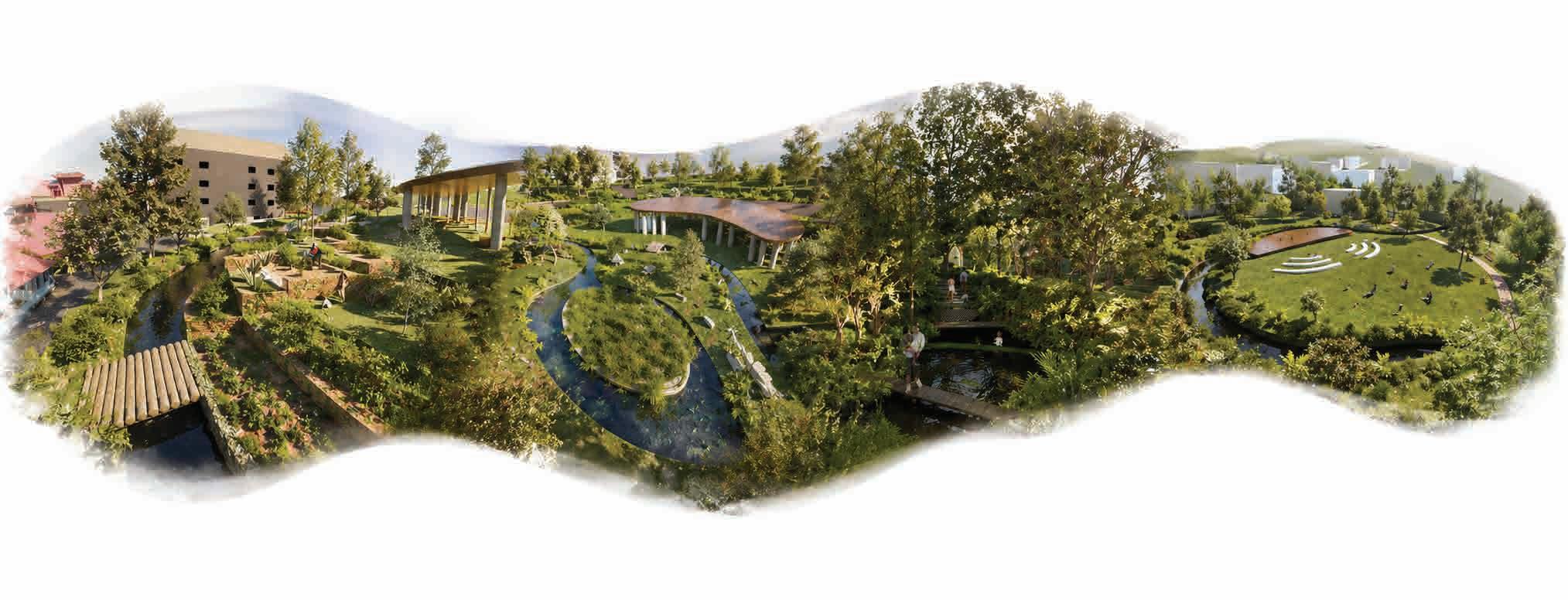
Phasing strategy 1: Through uncovering sections of the river that have been built over, the stream is reconnected to form a continuous path through the town centre, connecting the trail from jungle trail 10 and 4. The stream is also reshaped, slowed down or sped up at different sections to manipulate erosion and deposition. Along with reshaping the riverbanks and landforms, these actions rehabilitate water quality and restore aquatic habitats for the native birds, fish and crabs.
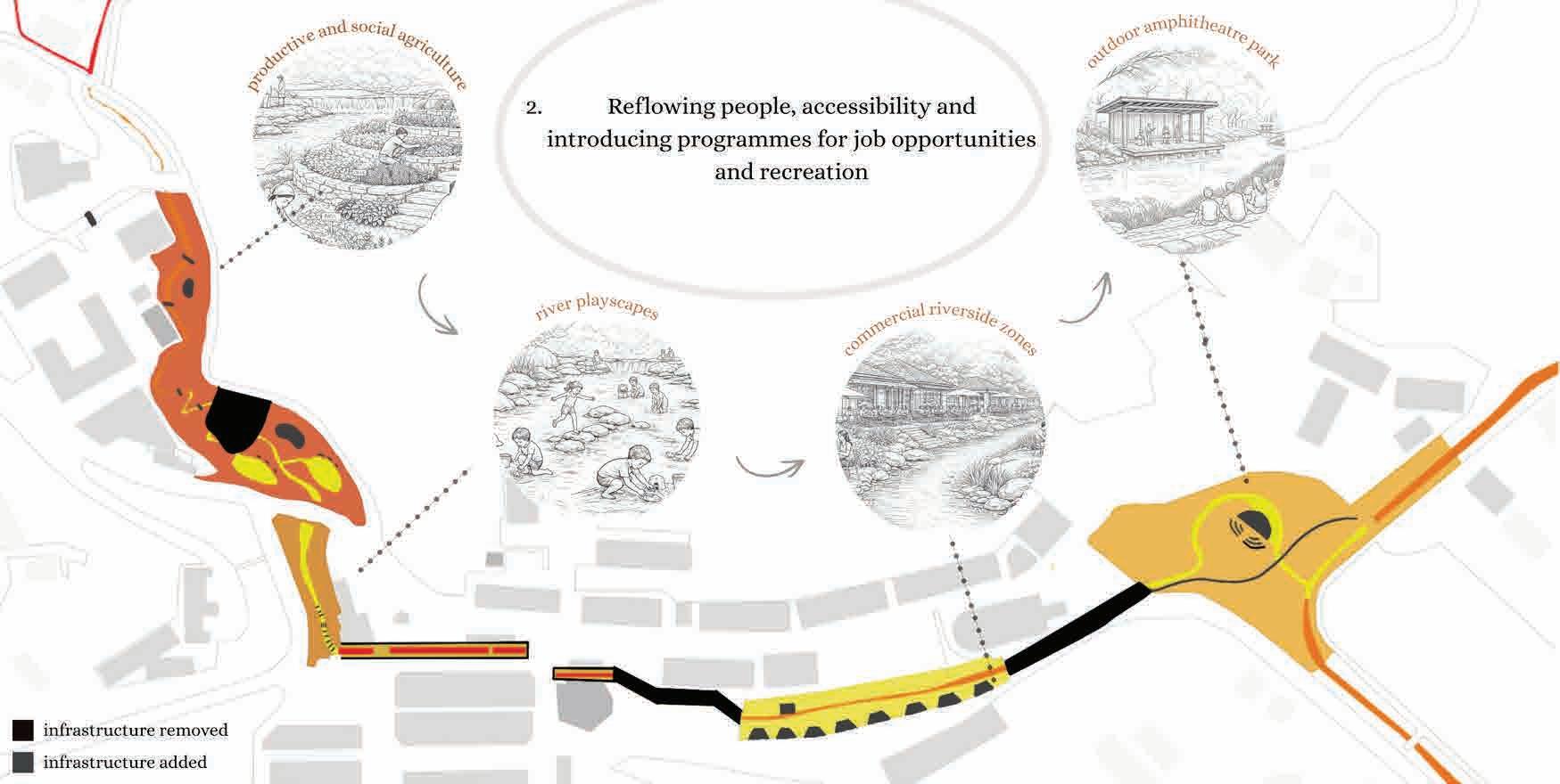
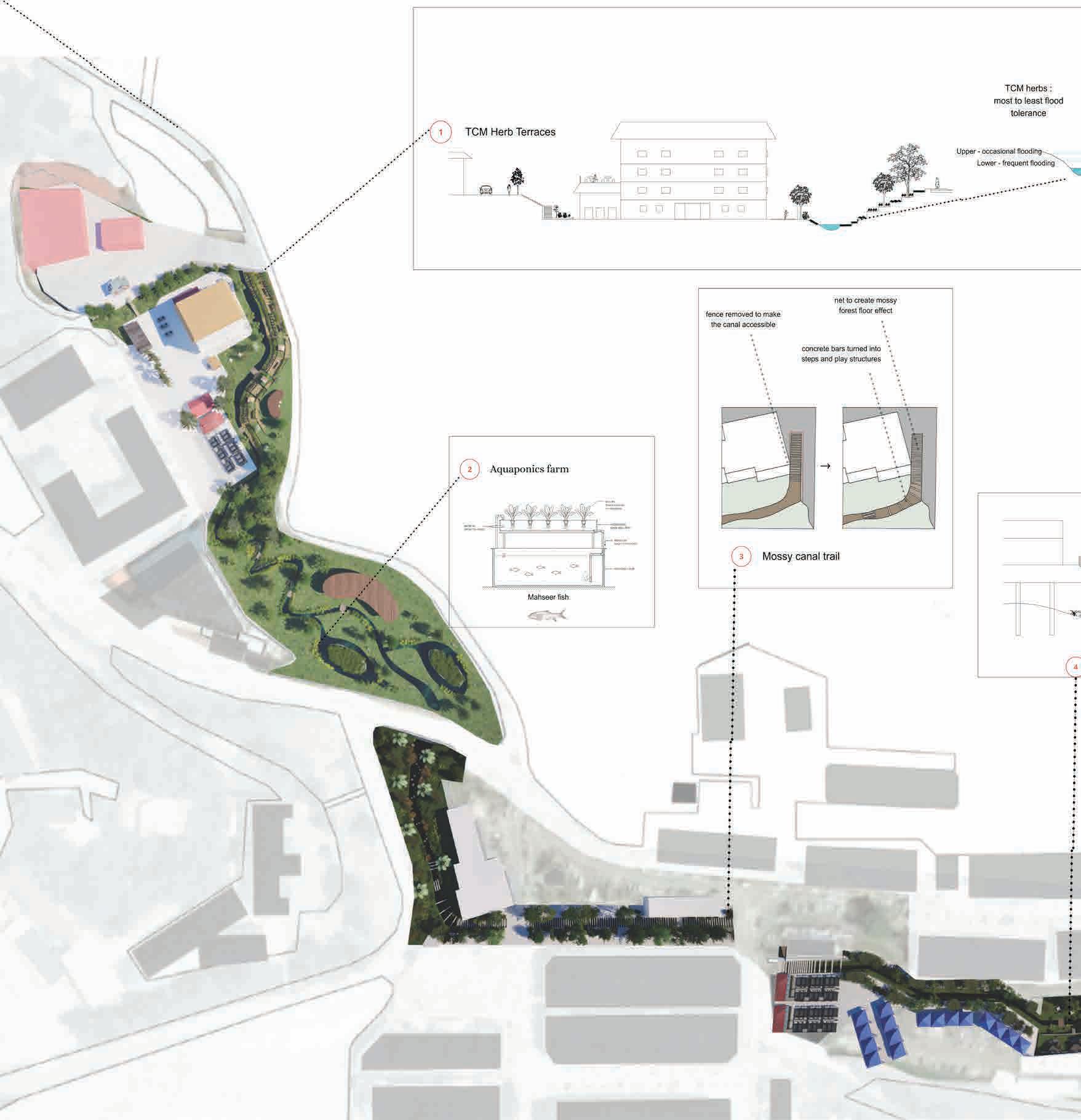
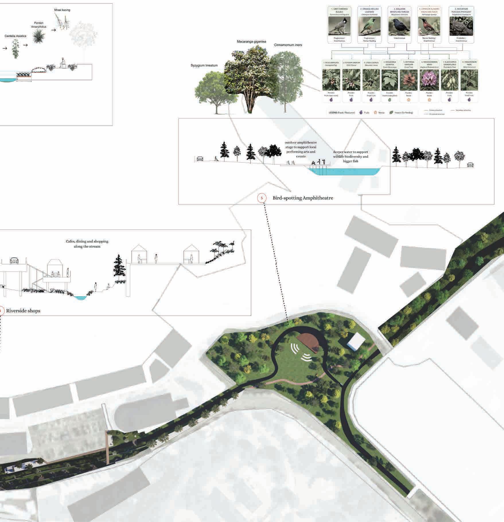
Phasing strategy 2: After reflowing and reshaping the stream and its surrounding spaces, programmes rooted in surrounding contexts are introduced into these spaces to not only bring locals and tourists together but also create job opportunities for local. Upstream, a medicinal herb terrace farm beside the river flowing past a budget hotel connects the Taoist templegoers and medical practitioners to tourists interested in their culture. Downstream, slower-flowing pools are created to allow for native fish to be reintroduced into the river through aquaponic farms. At the edge of jungle trail 4, habitats for the birds that inhabit the jungle are extended into the town through Carnation Park into an outdoor amphitheatre that local tour guides can bring tourists to birdwatch, which can also be used by local performers and organisations for different events.
The stream is used as the backbone of sustainable tourism and socio-economic growth in Tanah Rata for the locals, tourists and wildlife of Cameron Highlands.
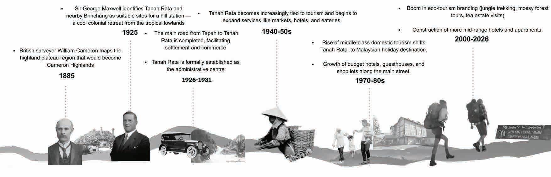
TIMELINE
Evolution of tourism in Tanah Rata
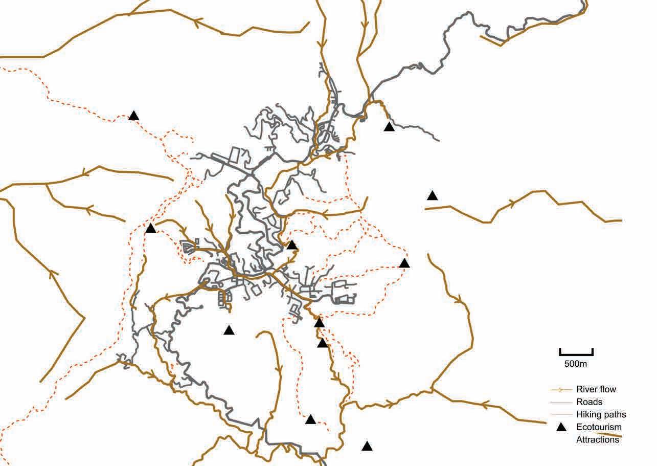
MAPPING OF ECOTOURISM ATTRACTIONS
Tanah Rata as a gateway to ecotourism attractions
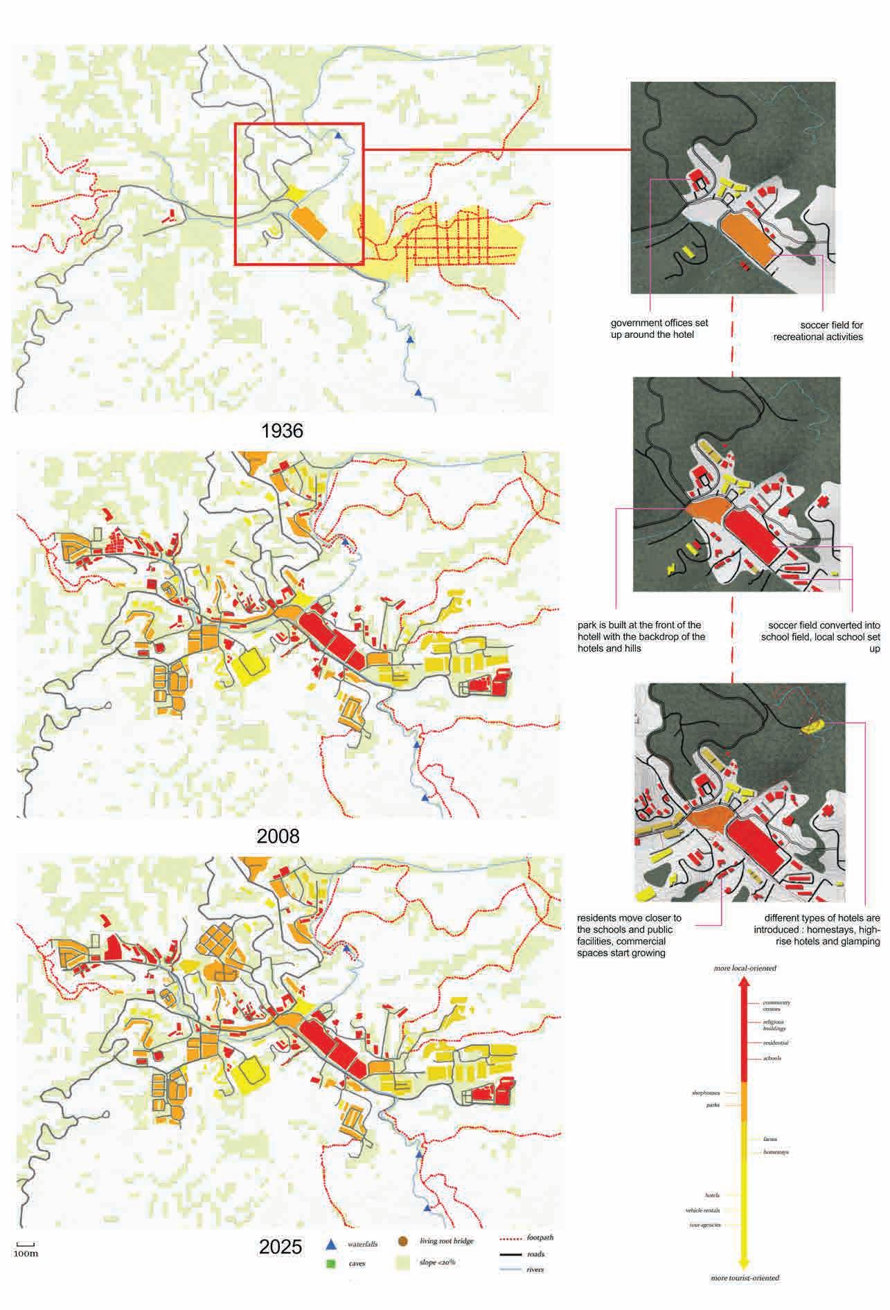
HISTORICAL MAPPING
Impact of tourism on development in Tanah Rata
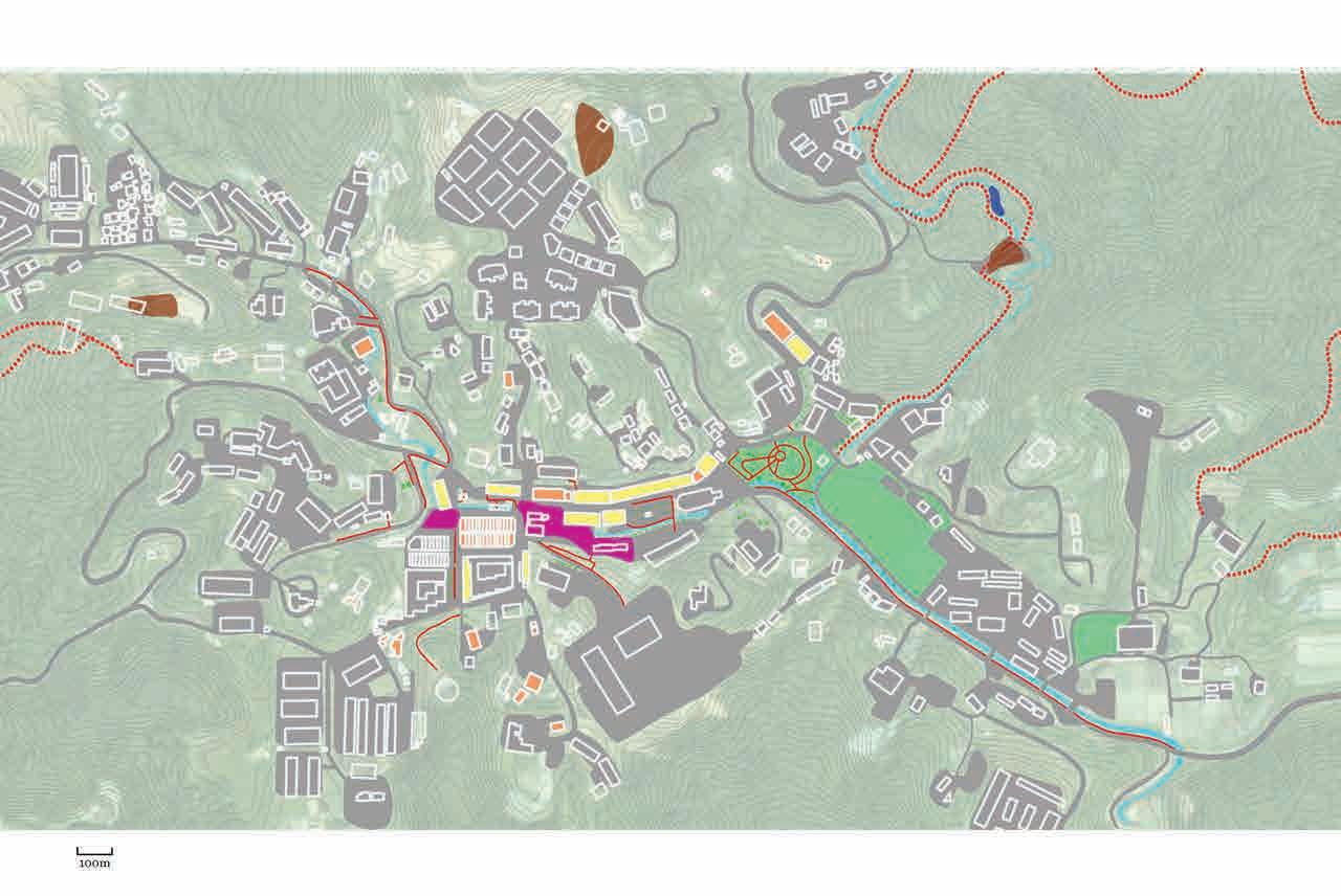
LANDUSE MAPPING
Spatial analysis of the existing urban fabric of Tanah Rata
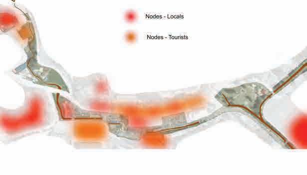
LANDUSE MAPPING
Locals view on Tanah Rata
HISTORICAL MAPPING
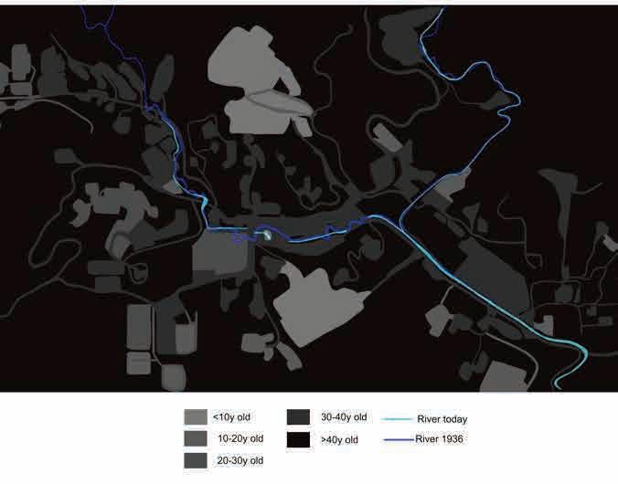
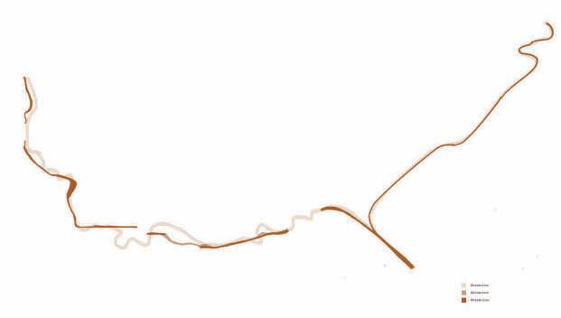
Age of landscape of Tanah Rata and stream evolution
LANDUSE MAPPING
Tourists view on Tanah Rata
INTERVIEWS
Asking locals working in the tourism industry about life in Tanah Rata
INTERVIEWS
Asking tourists about why they chose Cameron Highlands
SITE MAPPING
Mapping the streamside conditions and amenities
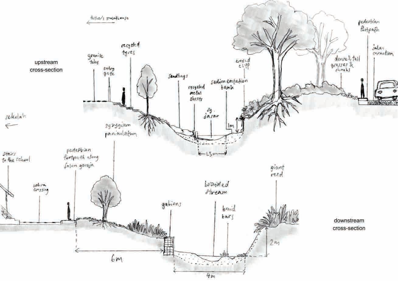
SITE SECTIONS
Sections of the stream sketched on site
SITE MAPPING
Mapping the streamside conditions and amenities
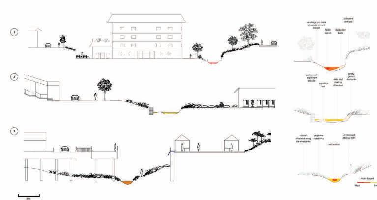
STREAM ANALYSIS
Sections analysis of the stream at different points
SITE EVOLUTION
Development and its impact on stream conditions and aquatic wildlife
DESIGN CONCEPT
Reconnecting the stream, people and creating job opportunities
PHASING STRATEGY 1
Reflowing the streams and restoring aquatic habitats and wildlife
PHASING STRATEGY 2
Reflowing people and introducing economic and recreational programmes
RIVER RESTORATION SECTIONAL DRAWINGS
Sectional Transformation of the Urban Stream Edge
TCM Herb Terraces
Aquaponics farm
Mossy canal trail
Canal mossy trail
Bird-spotting Amphitheatre
GROUP C: HIGHLANDS DEVELOPMENT
LIVING TERRAINS
ON THE PRACTICES AND EMPOWERMENT OF ORANG ASLI COMMUNITIES
Lee Huei Min
RESOURCE LOOP CAMP
DESIGNING CLOSED-LOOP RESOURCE SYSTEMS FOR LOW-IMPACT ACCOMMODATION
Su Juhui
UN-BERRY-LIEVABLE
TRANSFORMING HIGHLAND LANDSCAPE INTO NATIVE BERRY ECOLOGIES
Khoo Zhi Luo P161 P183 P199
LIVING TERRAINS: ON THE PRACTICES AND EMPOWERMENT OF ORANG ASLI COMMUNITIES
LEE HUEI MIN
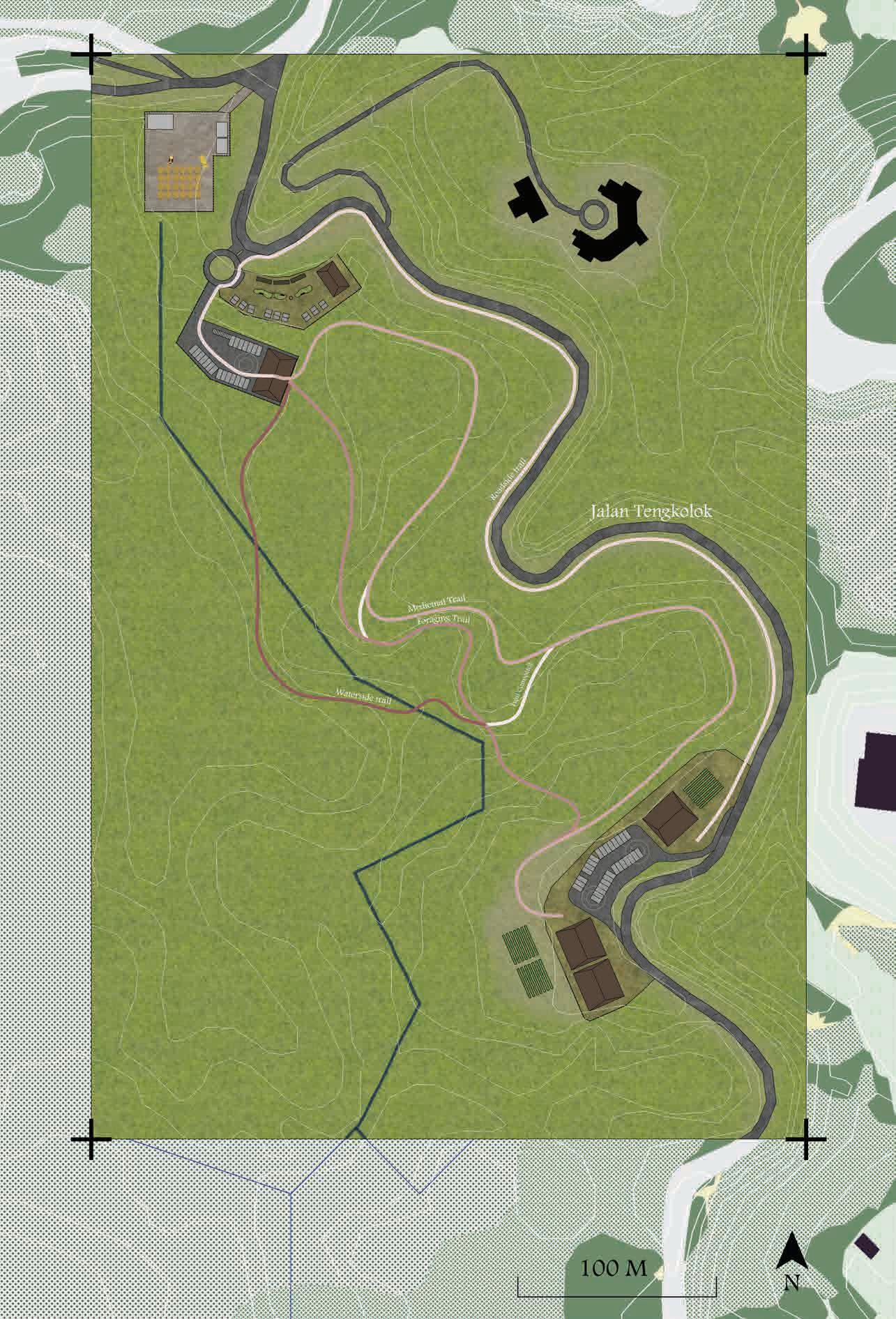
The project proposes an Orang Asli-led productive landscape along a roadside terrain in Tanah Rata, Cameron Highlands, aiming to create spatial forms that support the use, livelihood, stewardship, and agency of the Orang Asli while strengthening Tanah Rata’s identity as a tourist destination.
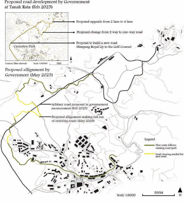
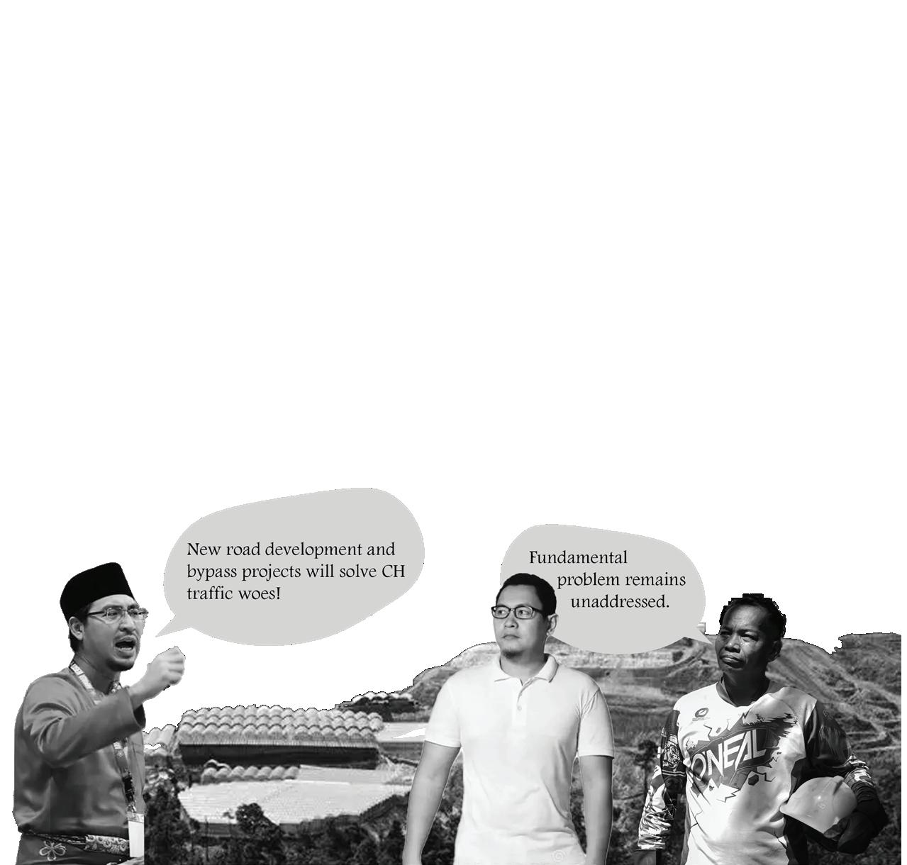
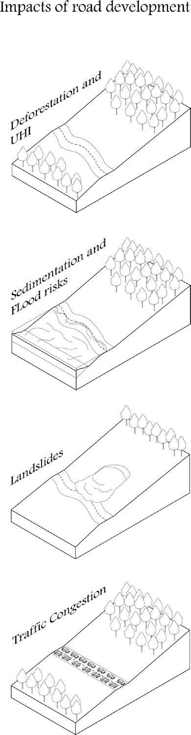
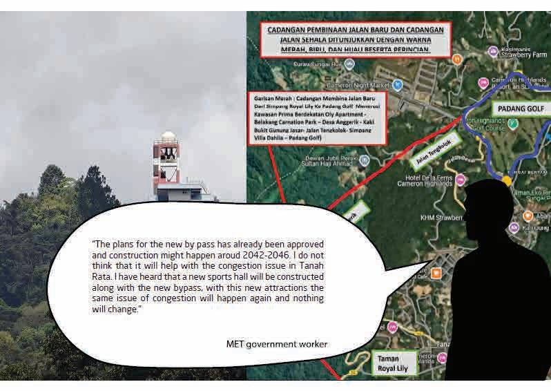
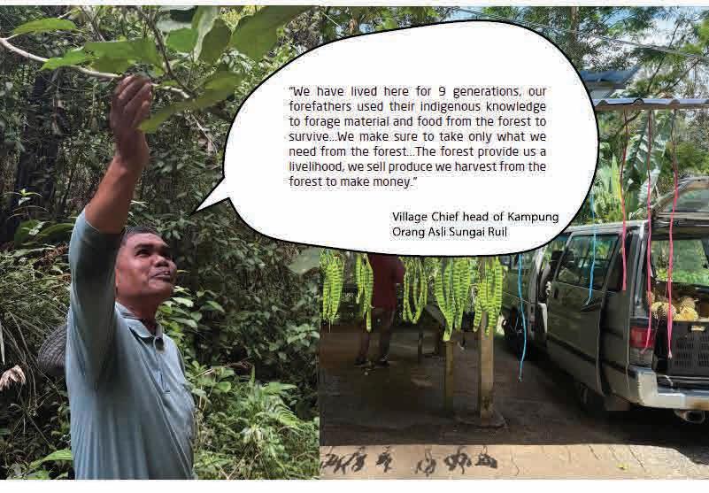
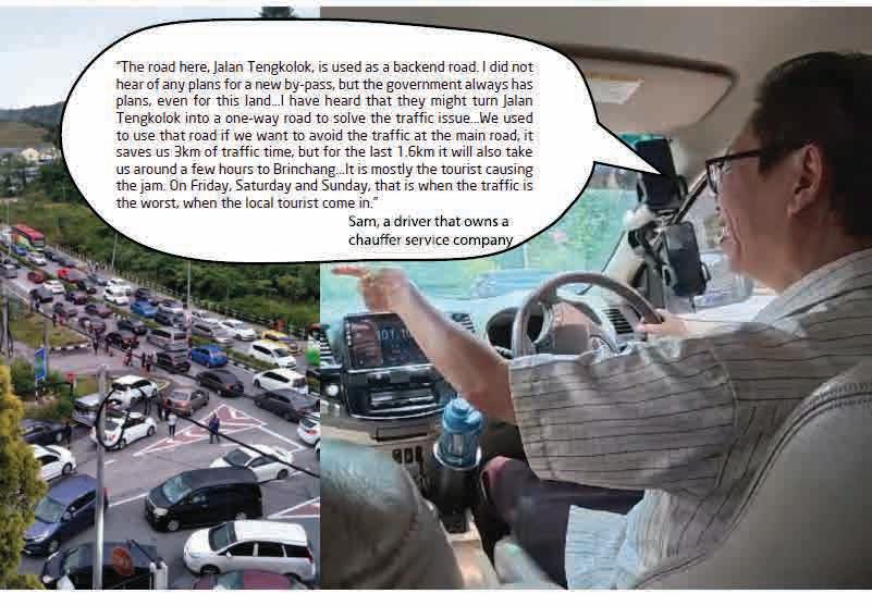
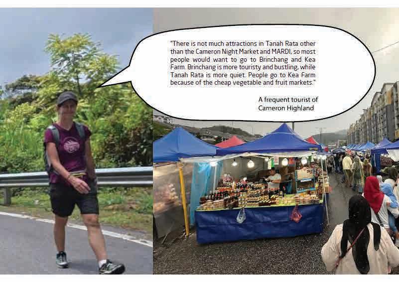
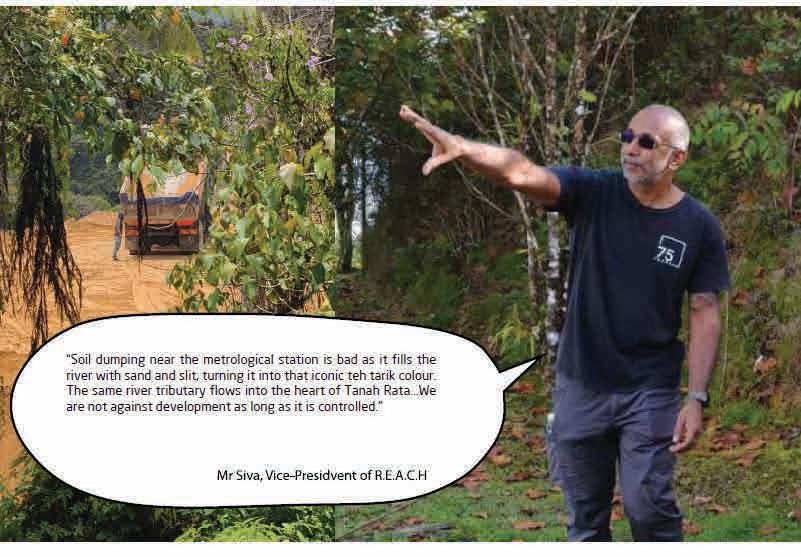
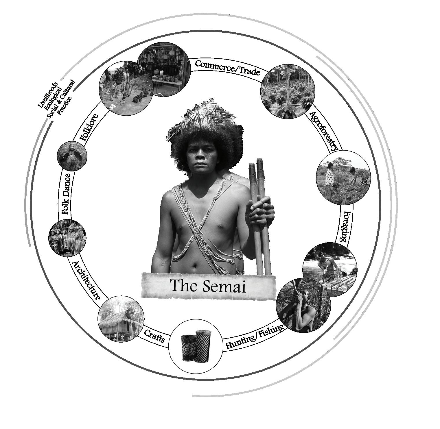
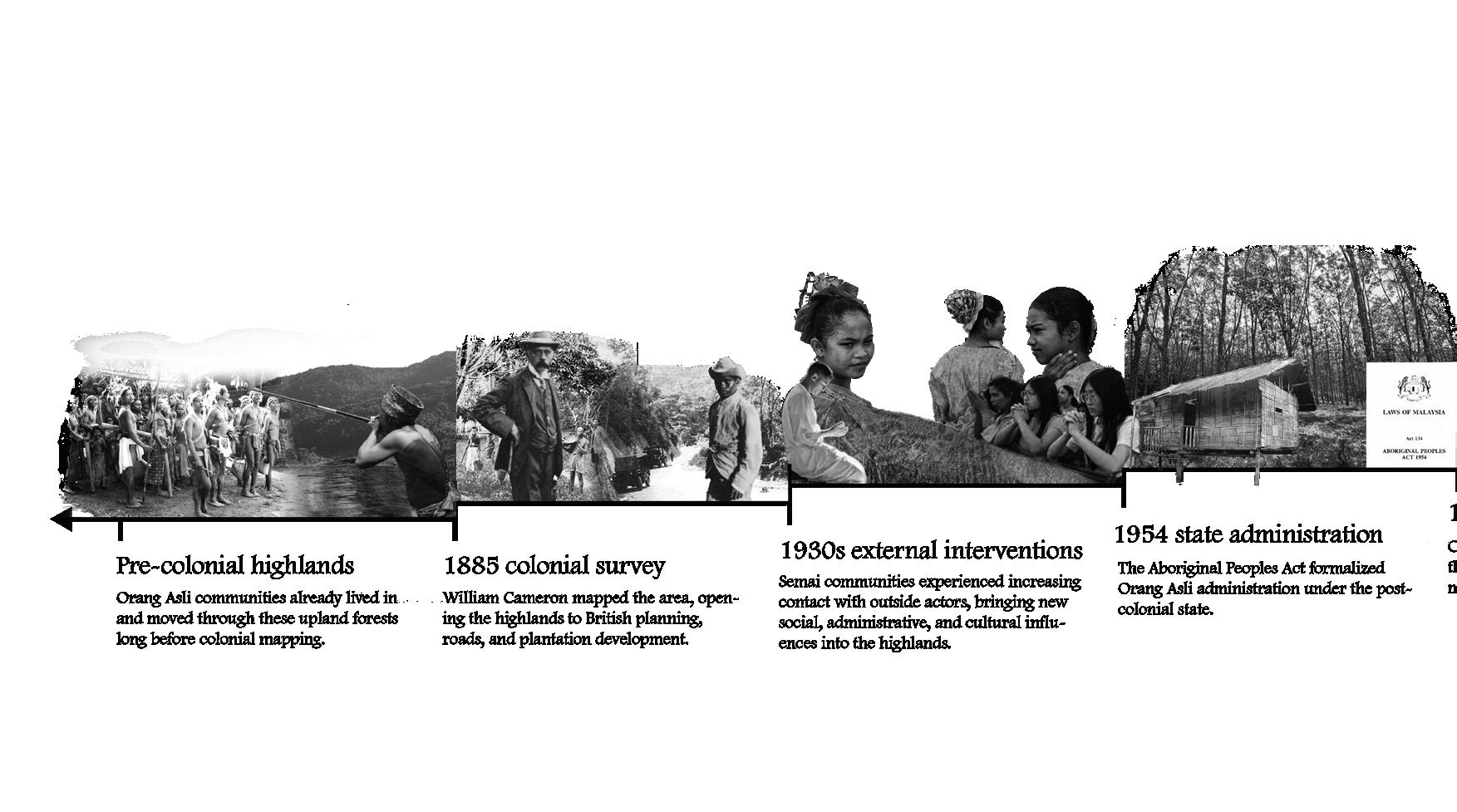
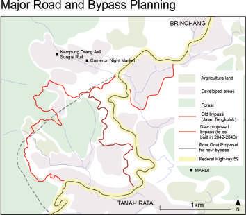
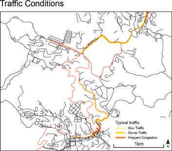
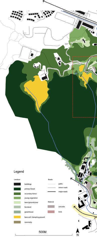
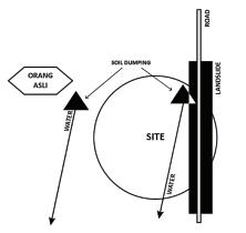
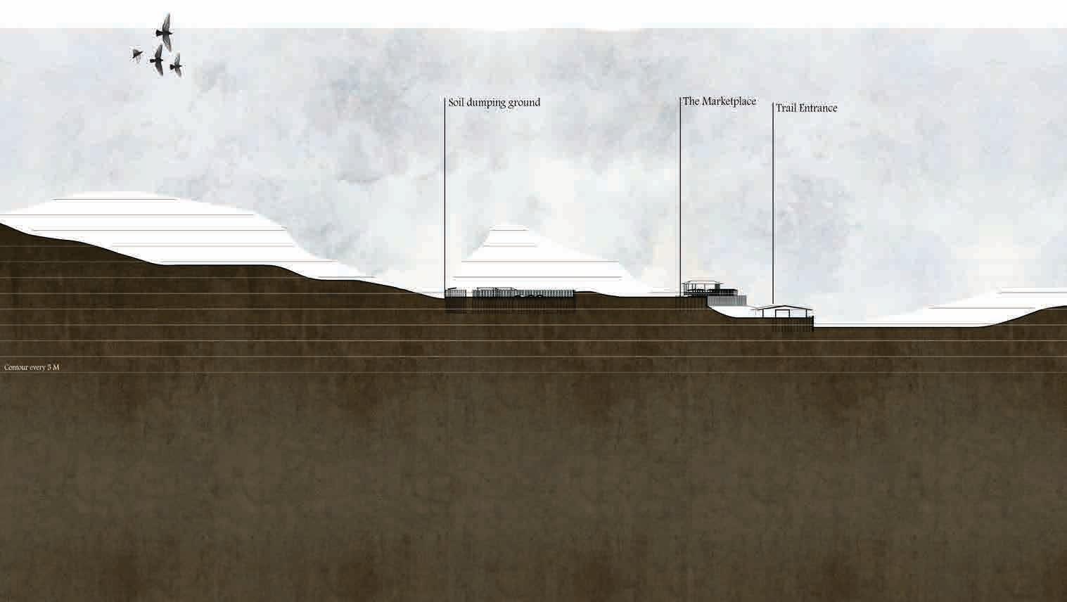
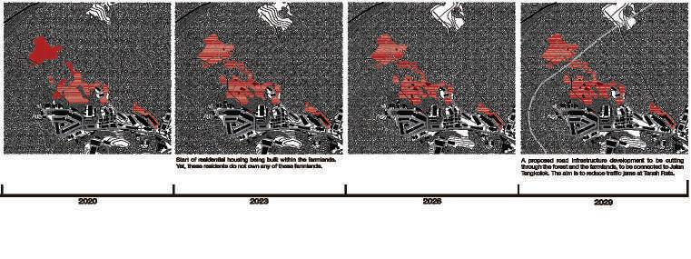
State-led modernisation has not only formalised settlement patterns but also weakened forest-based practices, knowledge systems, and increased living costs for the Orang Asli. Within the wider context of Tanah Rata, although the town continues to be marketed as a tourist destination, the community argues that it remains underutilised by visitors, who tend to favour Brinchang and Kea Farm further north. At the same time, plans are already in place to bypass Tanah Rata through future road development, resulting in the town experiencing negative effects of tourism such as traffic congestion while retaining little tourist activity. The local site, Jalan Tengkolok, can be traced to early colonial planning and, built along steep terrain, is vulnerable to erosion and ongoing soil dumping from nearby landslides and development works. Hidden from view, a water tributary runs below the dumping ground, carrying silt and sediment downstream, turning the water “teh tarik” brown and increasing flood risk along the watershed.
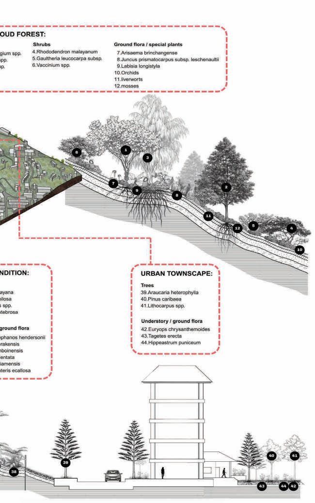
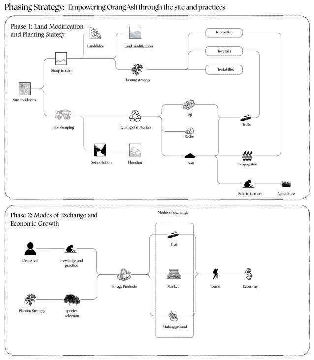
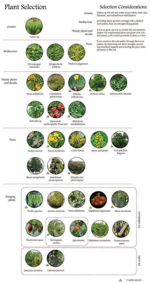
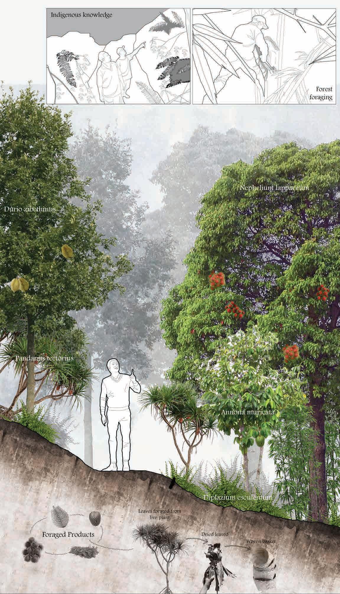
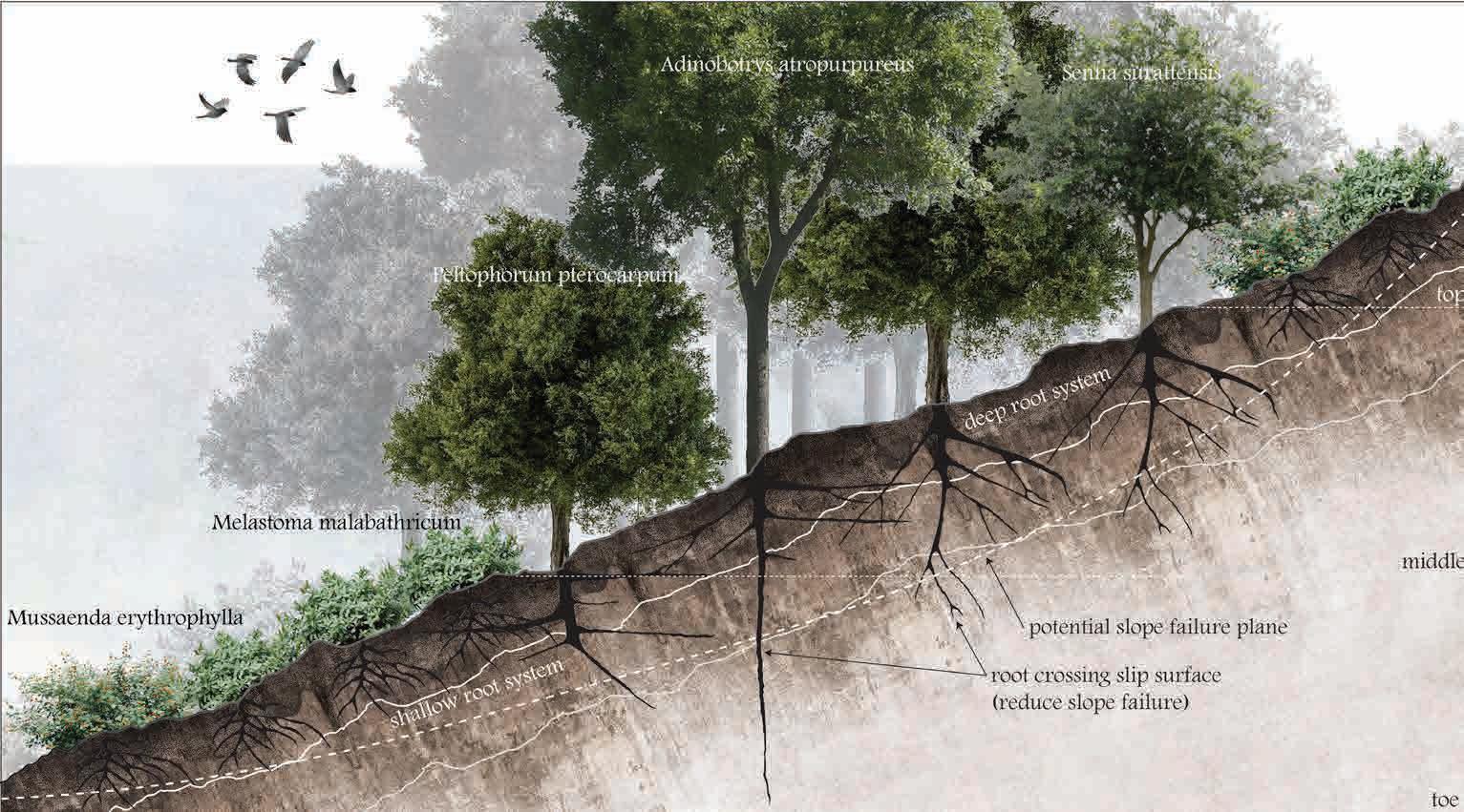
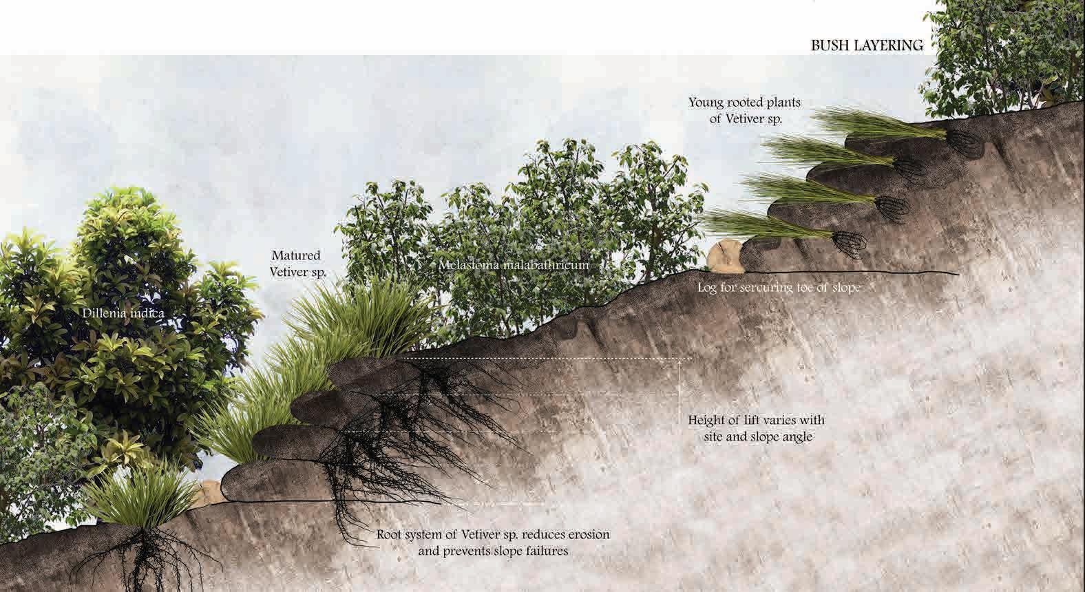
The design begins with reshaping the landscape through topographical modification and a detailed planting strategy to stabilise the site and prepare it for habitation and Orang Asli activity. The planting strategy is organised around three functions—retention, stabilisation, and practice—where soil-retaining vegetation reduces siltation into adjacent water bodies and slope-stabilising species such as vetiver create more resilient terrain conditions. At the same time, planting zones are established for agroforestry, foraging, and medicinal cultivation, with informal trails gradually emerging through repeated movement across the site.
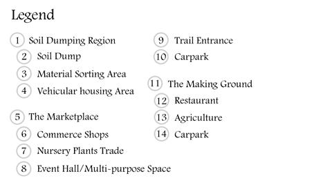
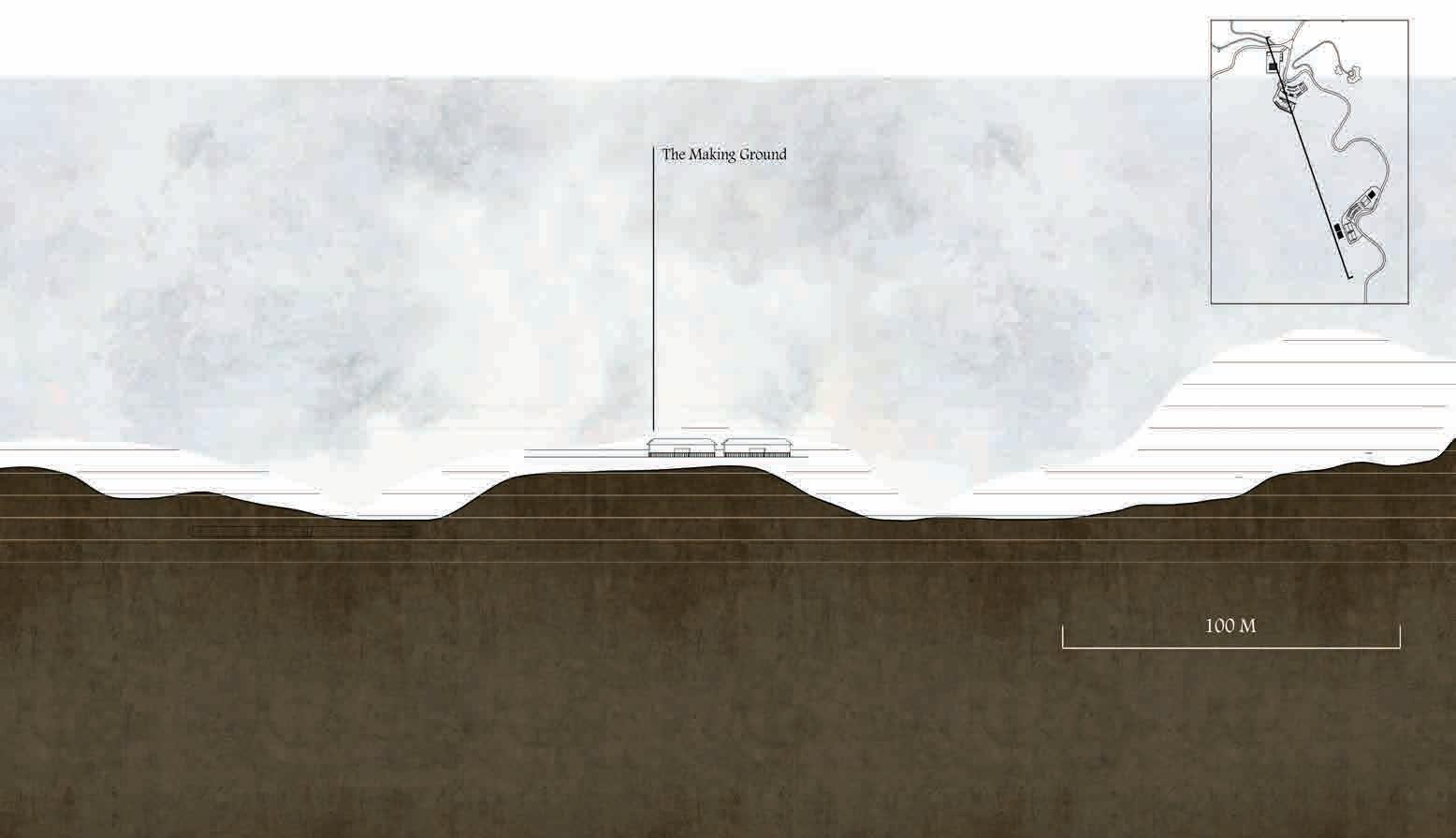
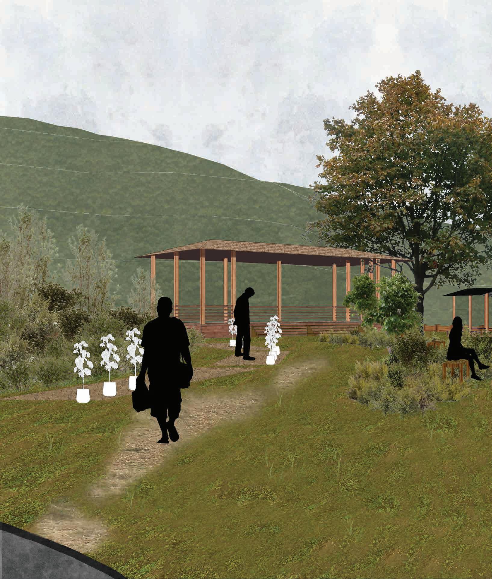
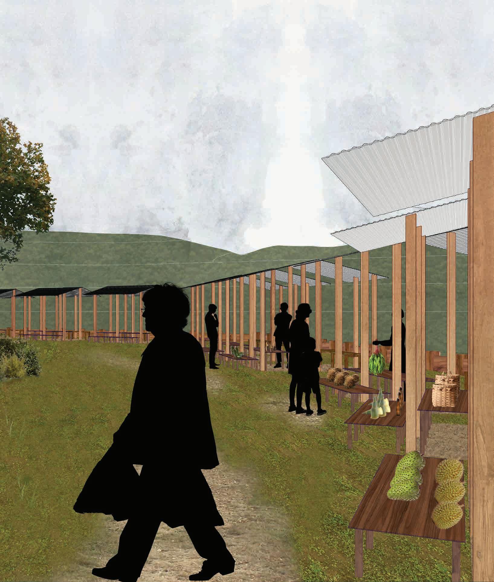
In the next phase, infrastructure is introduced and formalised at key nodes to support programmes and facilitate exchange between the Orang Asli and visitors, including a market, trail network, and making ground. The former soil dumping site is transformed into a market for forest produce and crafts, while a network of themed trails—such as foraging, water, and medicinal routes—connects the landscape and structures, supporting movement across the site. The making ground supports the processing and transformation of forest materials through activities such as cooking and craft-making.
Ultimately, the project reimagines the site as a landscape of adaptive livelihood, cultural continuity, and controlled public encounter, where culture is not merely represented but practiced as a living relationship between land, knowledge, and community.
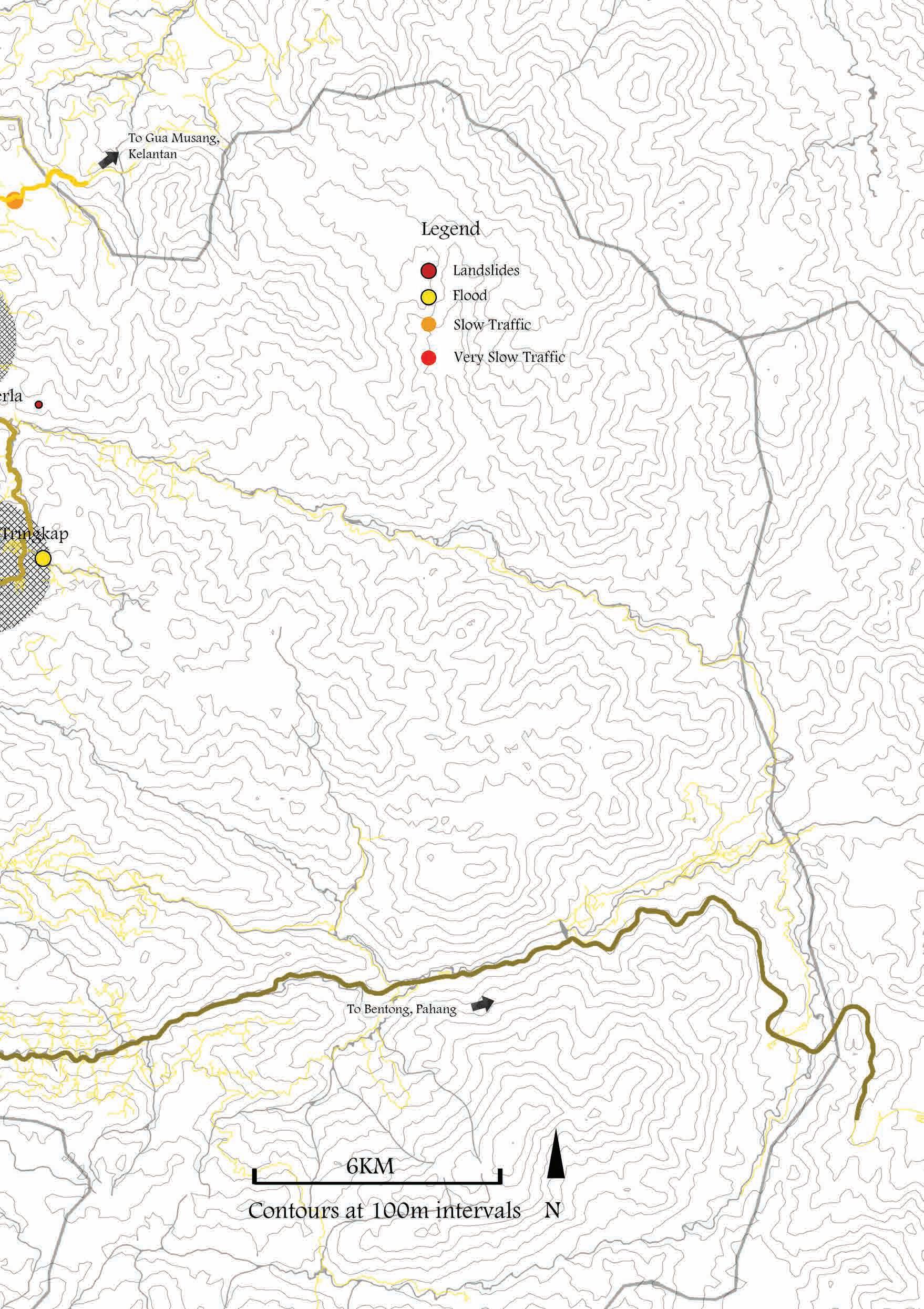
RESEARCH: ROAD DEVELOPMENT
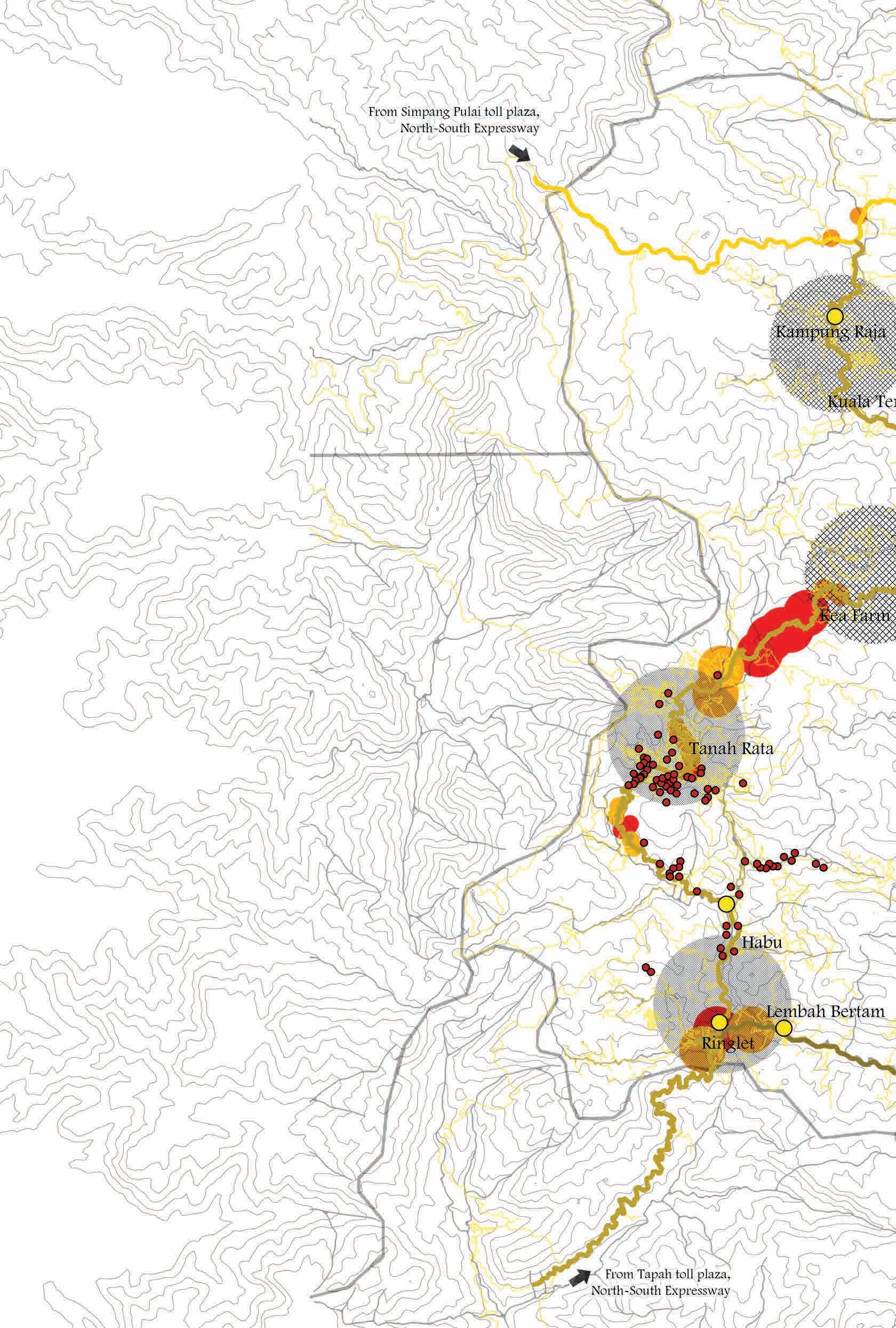
Proposed road development in Tanah Rata
RESEARCH: STAKEHOLDERS
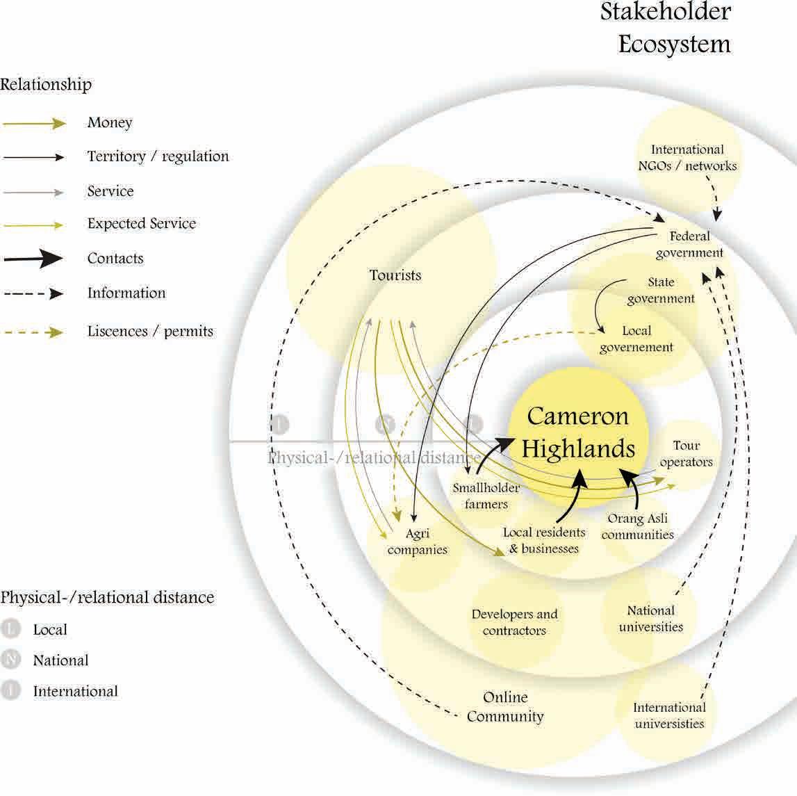
Stakeholder Ecosystem in Cameron Highlands
RESEARCH: ROAD PRESSURE
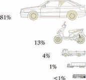
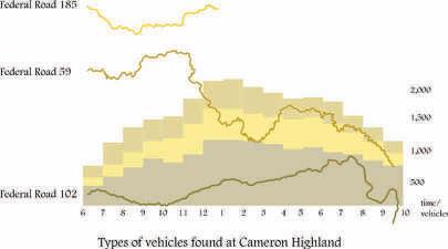
Type of vehicular and comparing road traffic at different federal highways
FIELD WORK: INTERVIEWS
Interviewing locals at Tanah Rata
New road development
Government plans
Indigenous knowledge
Orang Asli livelihood
Jalan Tengkolok
Traffic Congestion
One-way road
Soil erosion Climate change
Soil dumping Water Pollution
Tourist Attraction
Kea Farm and Brinchang
SITE CONTEXT: ORANG ASLI
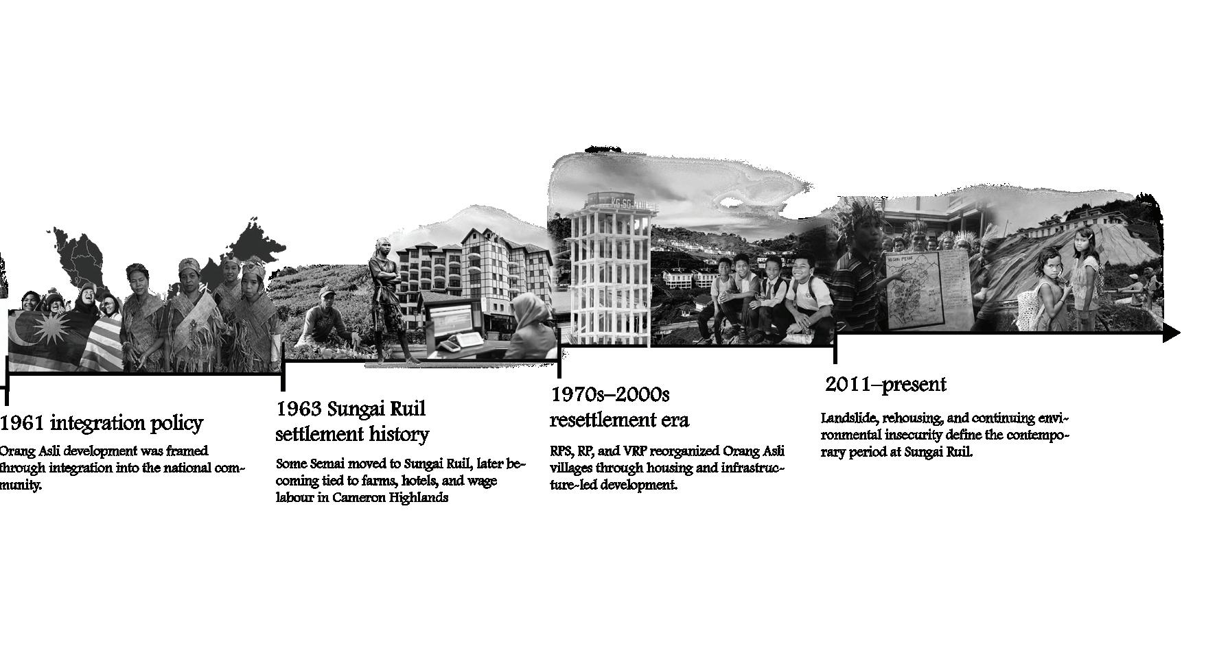
Orang Asli Practices and Timeline in Cameron Highlands
SITE CONTEXT: ORANG ASLI
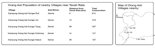
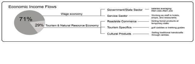
Orang Asli Population, Kampung Locations and Income Flows
SITE CONTEXT: SITE PRESSURES
New Development, Traffic Congestions & Landcover
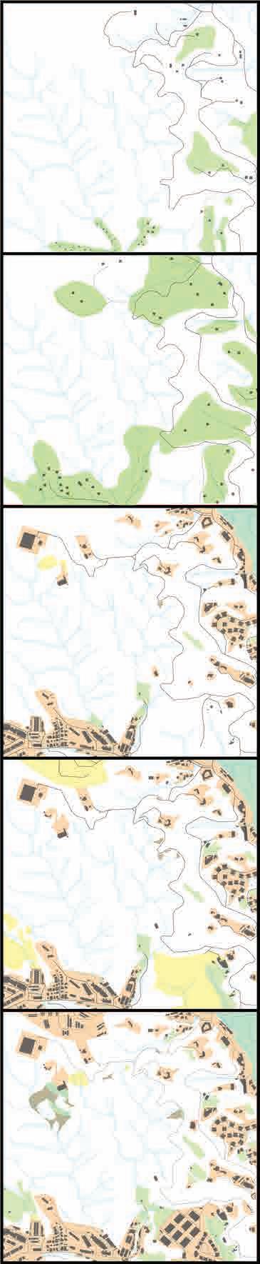
SITE CONTEXT: HISTORICAL CHANGES
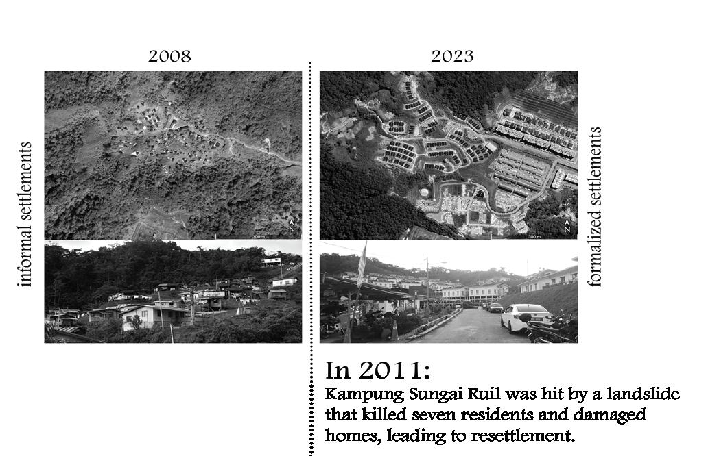
Historical changes in the site 1949 - Present
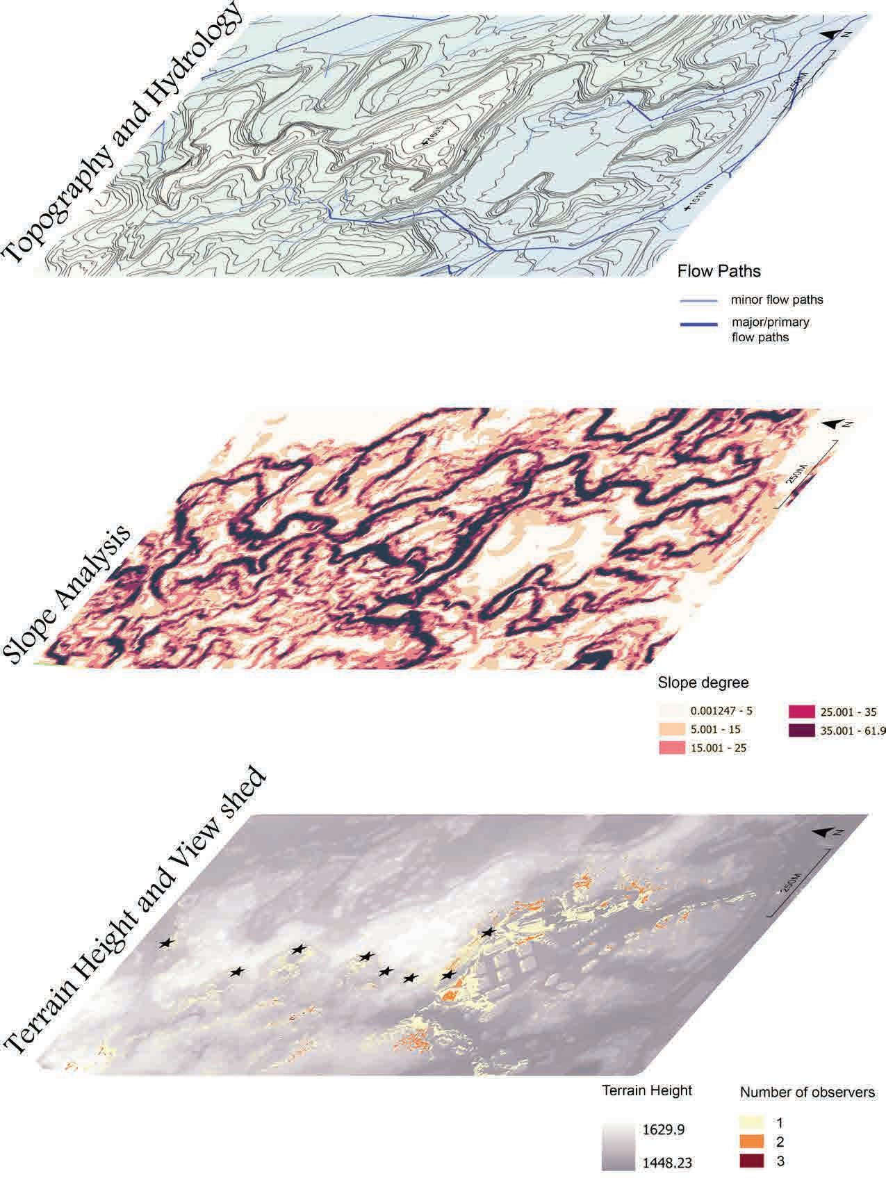
DATA ANALYSIS
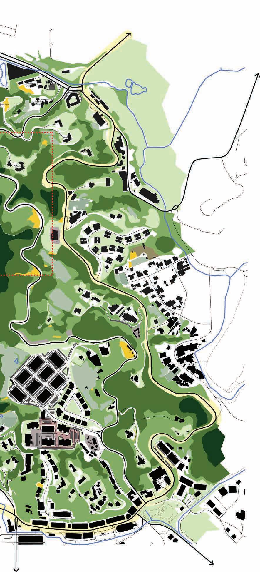
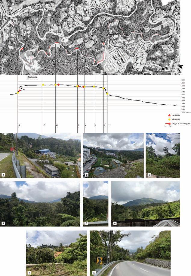
Site topology, hydrology, slope and viewshed
VIEWPOINTS
Road elevation and viewpoints
PHASING STRATEGY
Phase 1, Phase 2 and Summary of Site Issues
FOCAL SITE PLAN
Overall Map of Design
PLANTING PLAN
Plant Selection and Categories
PLANTING STRATEGIES
To Practice, To Stabalize, To Retain
To Stabilize
THE MARKETPLACE
Eye-level Perspective of The Marketplace
RESOURCE LOOP CAMP
SU JUHUI
This project proposes a climate-adaptive accommodation system, which integrates resource utilization, waste management, and ecological processes into the construction of accommodation sites.
The developed tourism industry mainly relies on the local cool climate and unique plateau landscapes. However, all these are being damaged by overdevelopment, and overtourism has also caused a significant amount of resource consumption and waste. This project addresses these issues by considering how to obtain, utilize, and recycle resources in a way that suits the local environment.
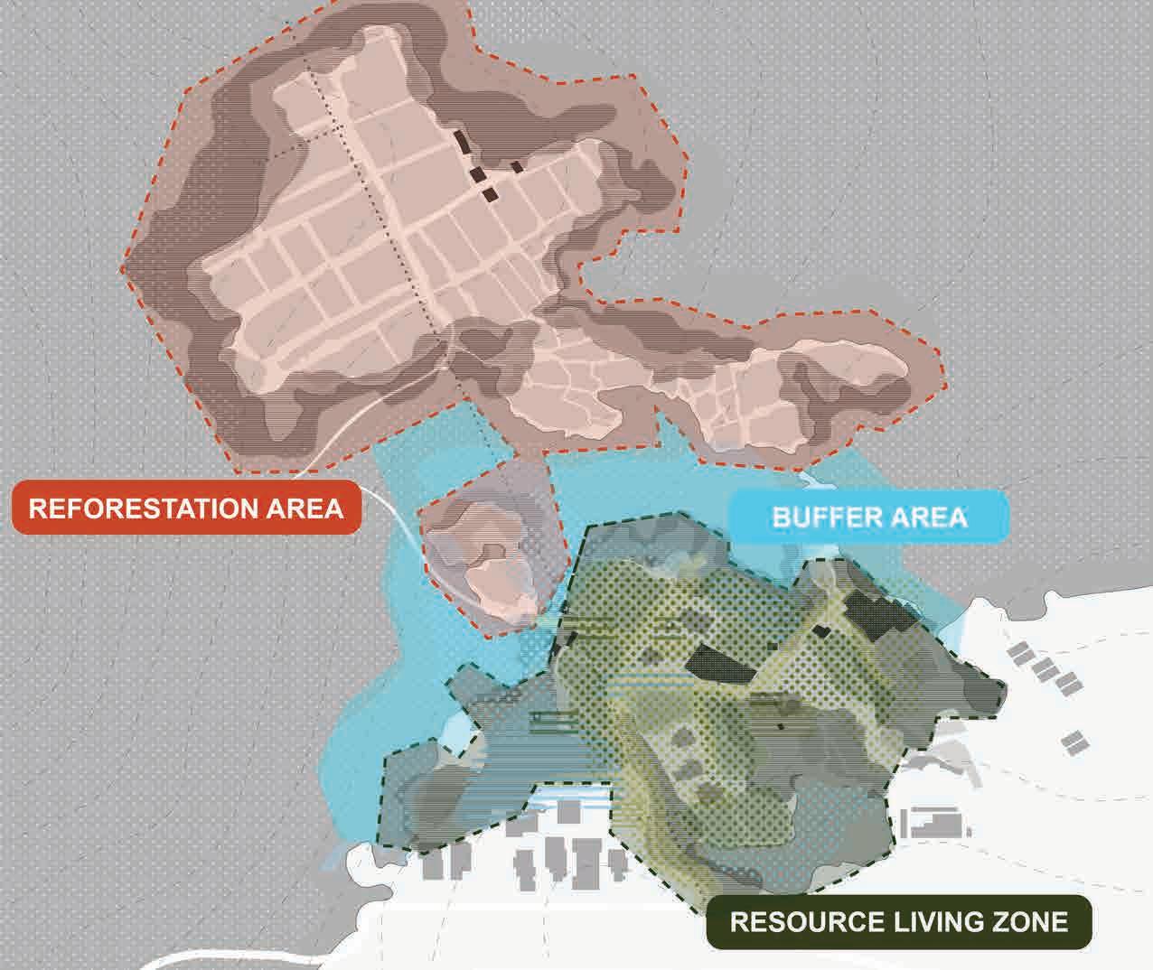
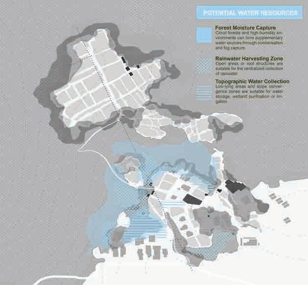
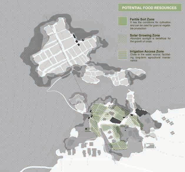
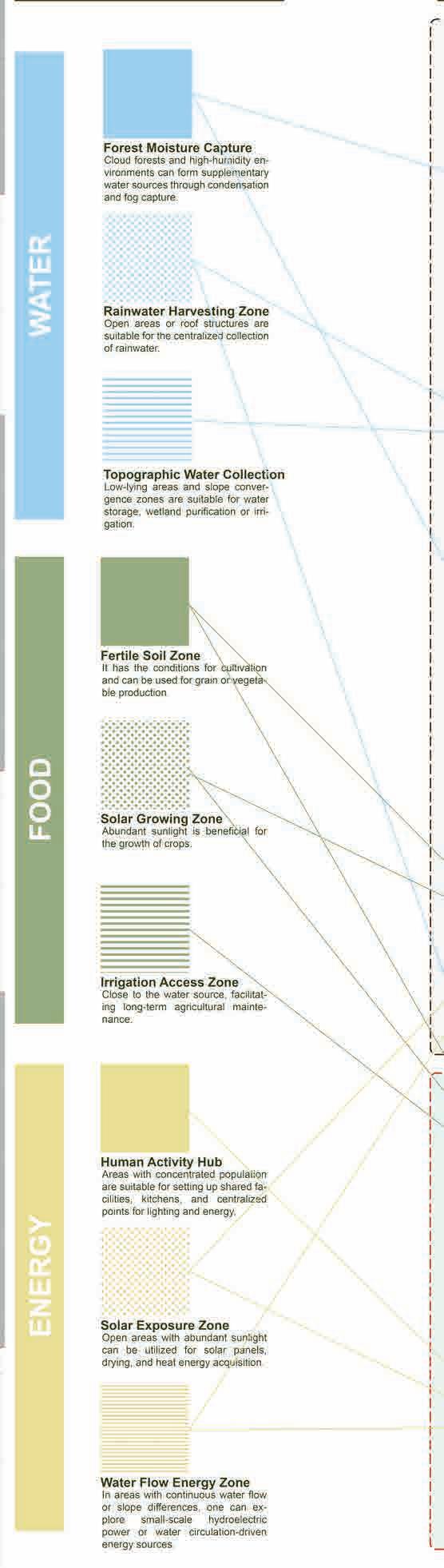
The first strategy is based on the site conditions to establish a resourcedriven system framework. Firstly, the site is divided according to the degree of development: the areas deep within the forest are rewilded to restore the ecology; the developed areas already exist are integrated with existing resources, transformed into low-impact camping spaces, and ecological buffer zones are set up at the junction of forest and farmland to protect the edges and regulate the microclimate. On this basis, the key features of the site are identified and translated, converting the original factors such as cloud forests, rainfall, high humidity environments, and farmland into exploitable resource potential, and further organizing their distribution in the site, integrating them with human activities and site facilities to construct a continuous low-tech resource network.
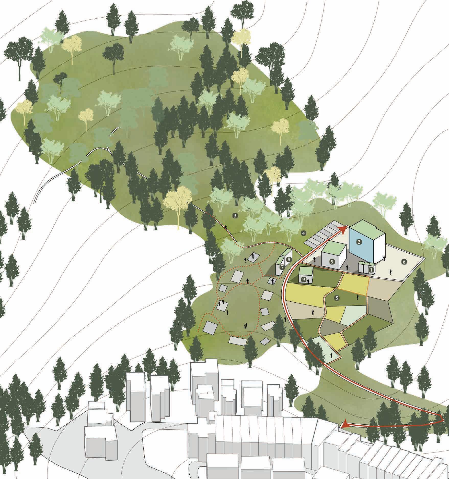
Based on this framework, the spatial planning will be allocated according to the availability of resources and environmental conditions. Based on the relationship between resource potential and resource flow, activity areas are naturally formed, thereby creating a camping layout with site characteristics. This method emphasizes a design approach of light intervention and low impact, adapting to the terrain, climate and resource distribution, and constructing an open and sustainable spatial structure.
This project has developed a climate-adaptive, resource-efficient, and ecoresponsible accommodation model, integrating resource consumption and waste recycling into the site.
REGIONAL TENSIONS IN CAMERON HIGHLANDS
The highland landscape is shaped by overlapping pressures from tourism growth, agricultural expansion, and environmental degradation.
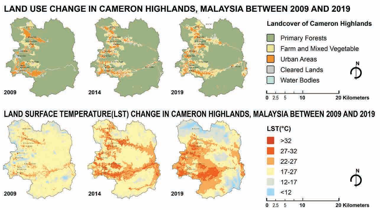
DEVELOPMENT & CLIMATE SHIFT
As agricultural and built-up land expanded over time, regional temperatures also increased, indicating environmental stress linked to land transformation.
TOURISM DOMINATES THE LOCAL ECONOMY
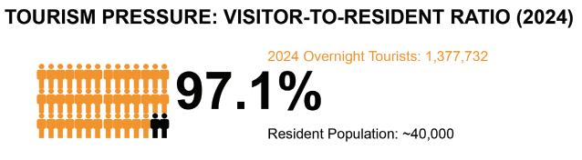
Visitor numbers significantly exceed the resident population, showing the region’s strong dependence on tourism activity.
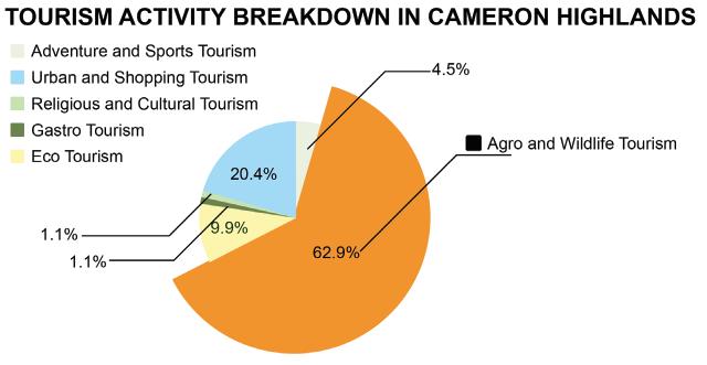
NATURE DRIVES TOURISM
Nature, scenery, cool climate, and leisure experiences are the key attractions drawing people to Cameron Highlands.
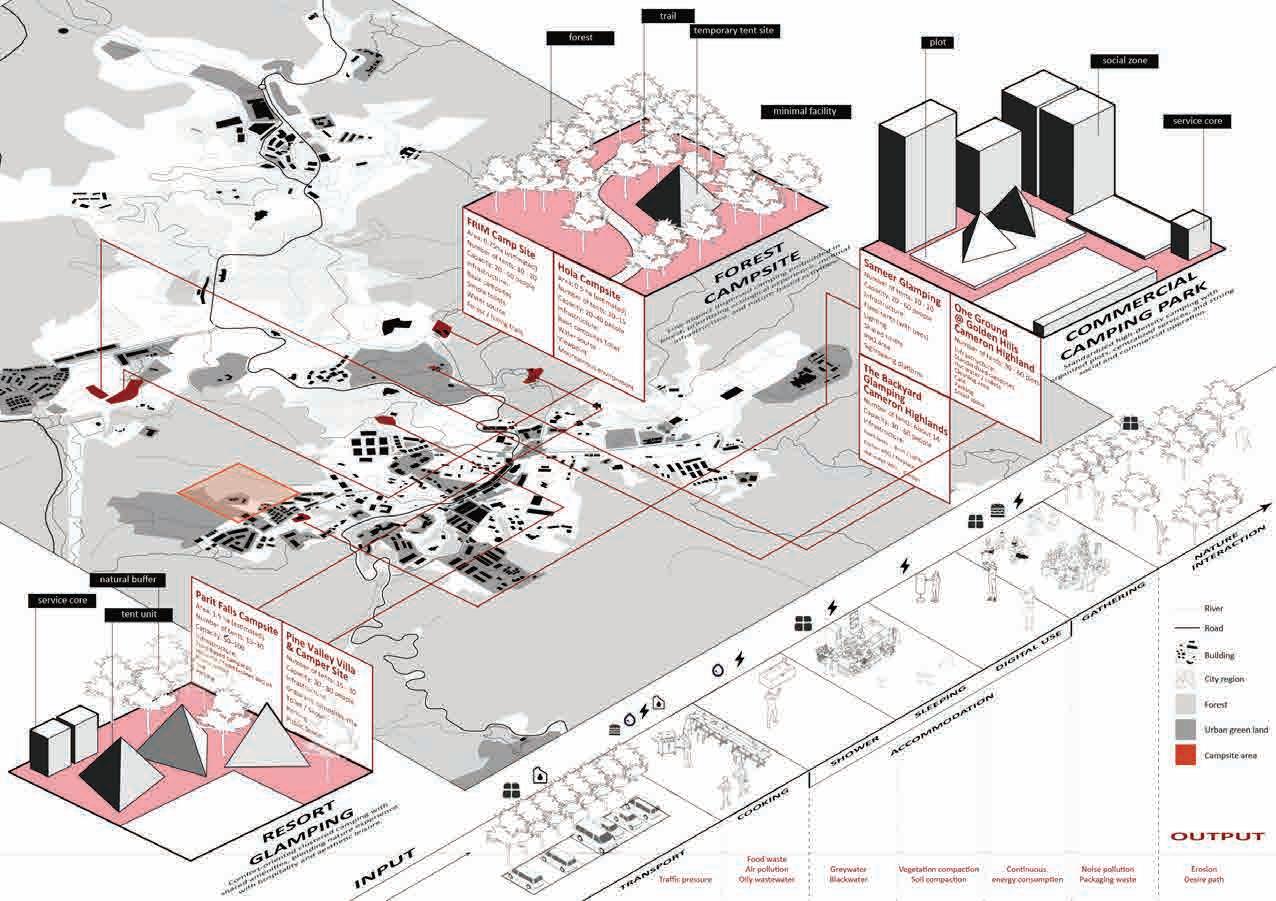
EXISTING CAMPING TYPOLOGIES
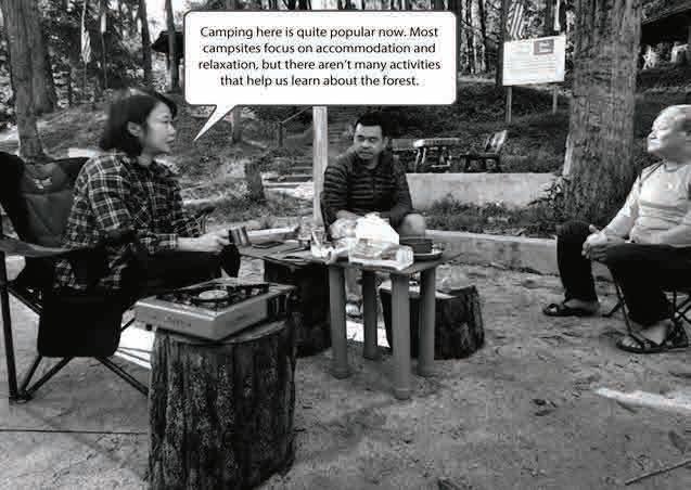
Current campsites are limited in location and often operate as isolated consumer spaces with little ecological integration or resource efficiency.
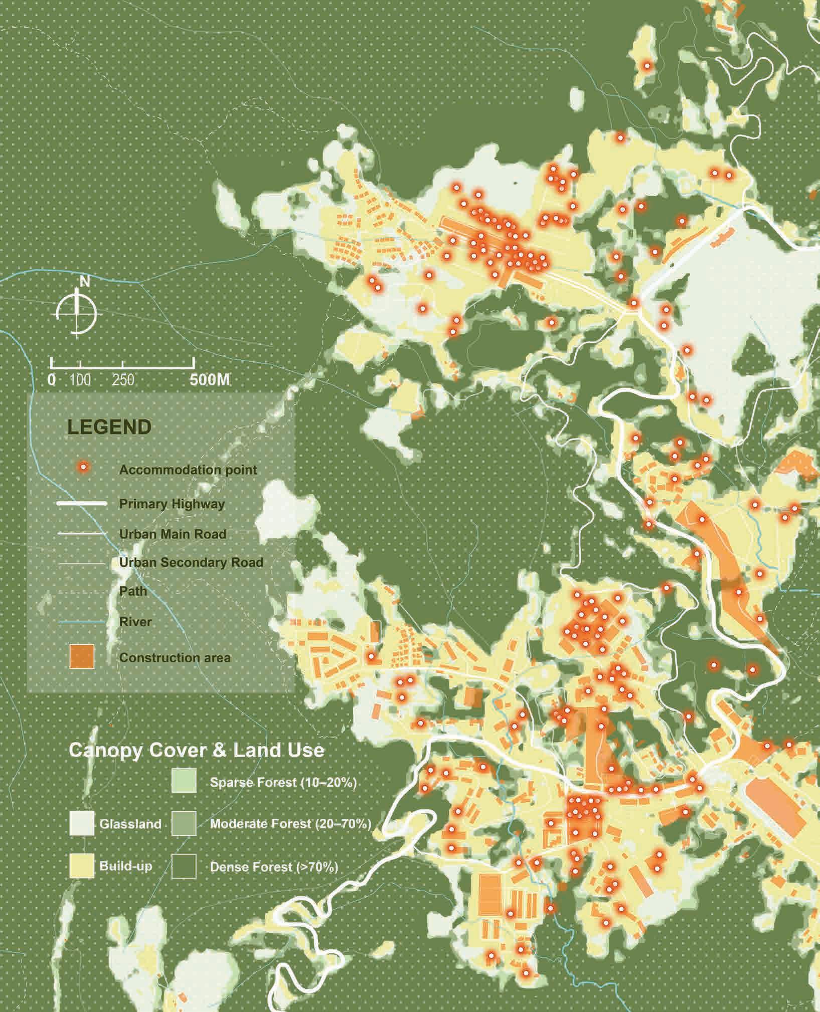
Although visitors come for nature, most accommodation is concentrated in urbanised zones rather than ecologically rich landscapes. This creates a mismatch between expectation and experience.
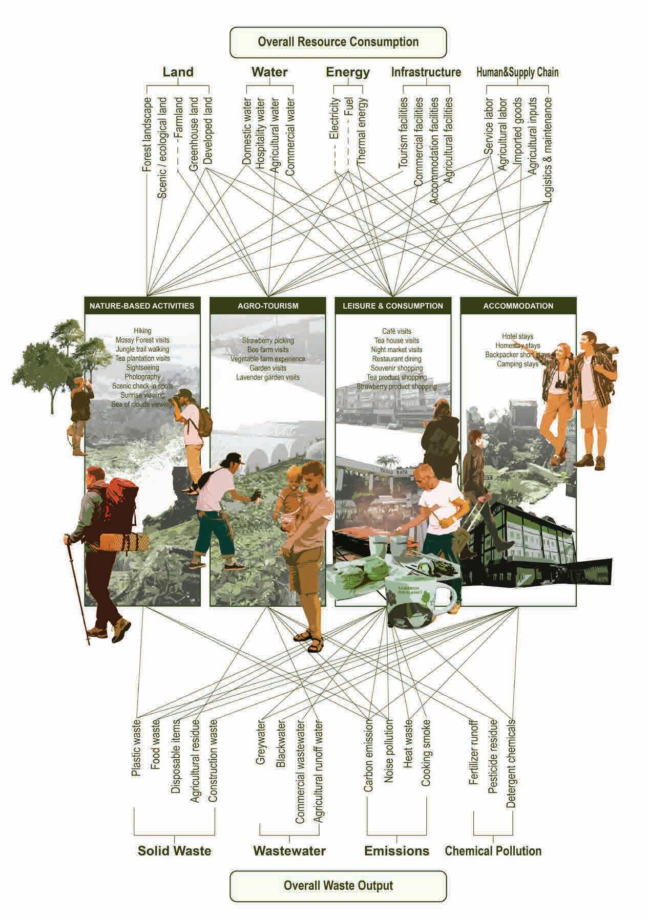
TOURISM CONSUMPTION PATTERNS
Tourism activities depend heavily on water, food, energy, and maintenance while producing waste streams. Current systems extract resources from the landscape without returning value.
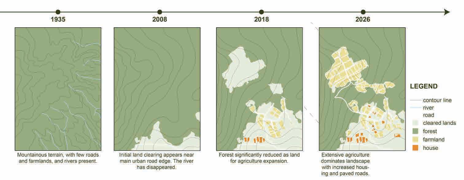
LANDSCAPE TRANSFORMATION OVER TIME
Historical mapping reveals how rivers, forests, farmland, roads, and built-up areas have progressively shifted over time. Natural land has been cleared and replaced by intensive agricultural and urban development.
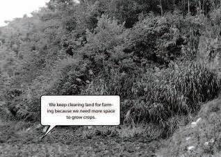
FIELD OBSERVATIONS
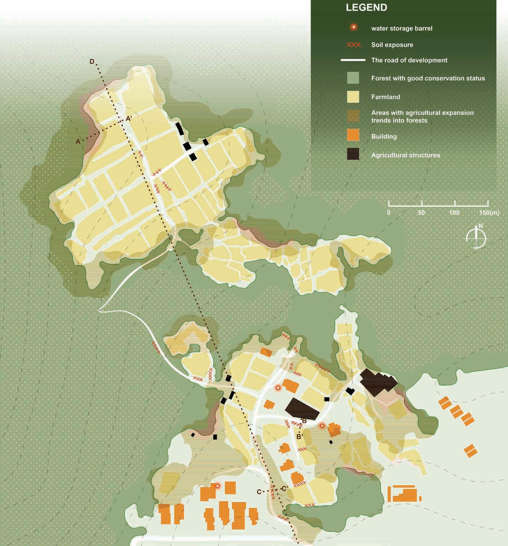
On-site investigation identified erosion, fragmented edges, exposed soil, poor accessibility, and mono-functional land use. These visible conditions reflect deeper environmental and spatial problems.
TERRAIN UNDER PRESSURE
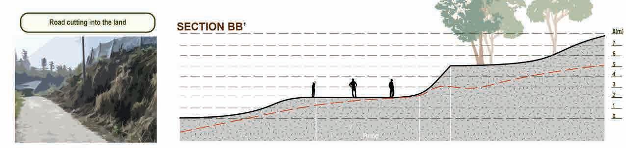
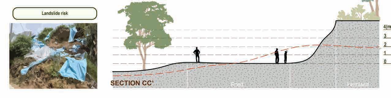
Section studies reveal how engineering interventions have disrupted natural contours, intensified slope instability, and pushed agriculture into ecologically sensitive edges.
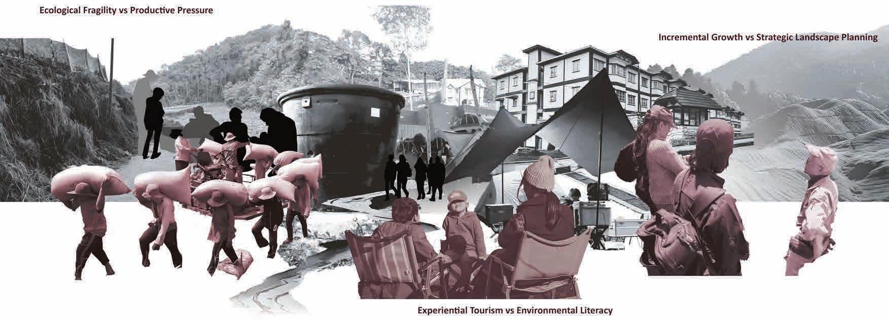
CONFLICTS EMBEDDED IN THE LANDSCAPE
Rather than isolated issues, the site reveals three overlapping conflicts between productive land use, tourism behaviour, and long-term landscape governance.
REORGANISING THE SITE STRUCTURE
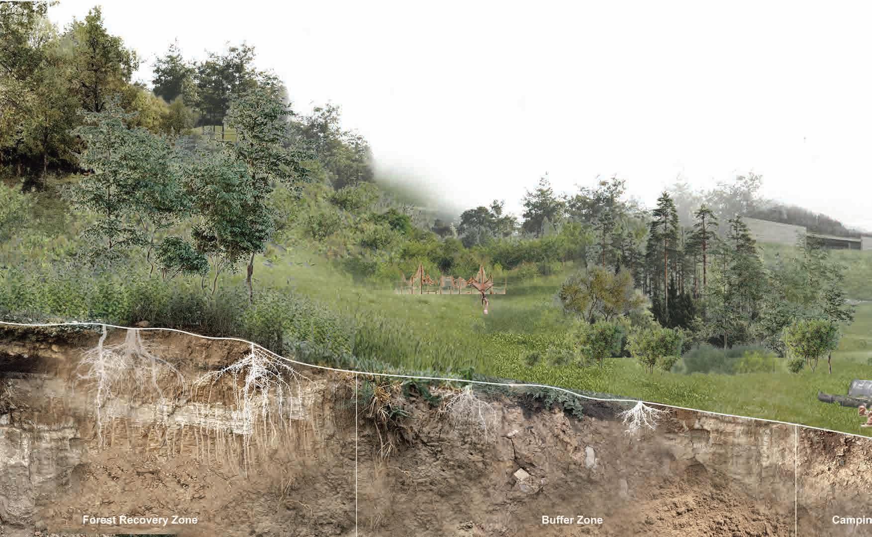
The proposal divides the site into forest recovery, buffer transition, and resource living zones to balance ecology and occupation.
SITE PLAN
The site occupies a strategic threshold between forest edge, farmland, and tourism access routes, making it suitable for testing alternative land use.
The final design introduces lightweight living spaces integrated with productive landscape, ecological restoration, and shared infrastructure.
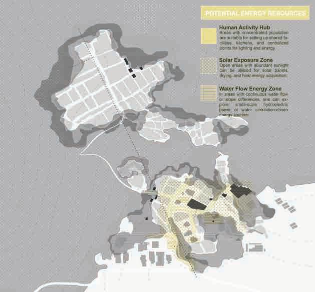
MAPPING LOCAL POTENTIALS
Rainwater, productive land, and renewable energy opportunities are identified as the foundation for a self-supporting tourism model.
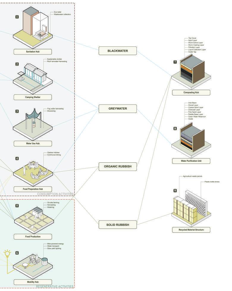
CIRCULAR LIVING SYSTEM
Water, food, energy, and waste are managed within the site through closed-loop systems that reduce external dependency.
Moisture-rich air is captured through mesh collection systems and transformed into usable water for showering. Instead of hiding infrastructure, water harvesting becomes part of the visitor experience, where daily comfort is directly connected to the surrounding forest climate.
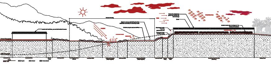
The sectional drawing demonstrates how accommodation, circulation, and ecological systems are embedded within the existing terrain. Rather than flattening the land, the proposal works with slopes, views, drainage, and vegetation to create a low-impact living environment shaped by the natural highland landscape.
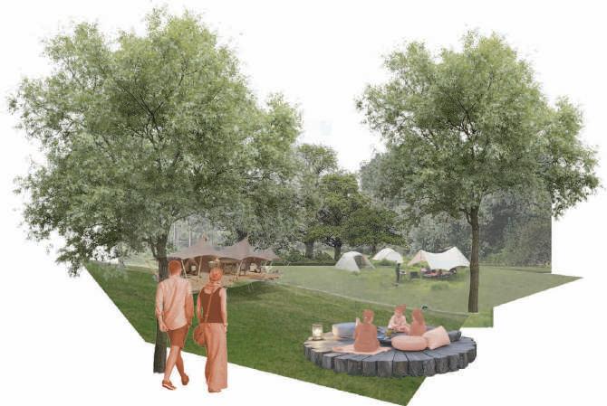
Lightweight camping units are carefully positioned between restored vegetation and open views, allowing visitors to stay closer to nature with minimal disturbance to the land. The space offers immersion in the cool climate, sounds of the forest, and changing atmosphere of the highlands.
KHOO ZHI LUO
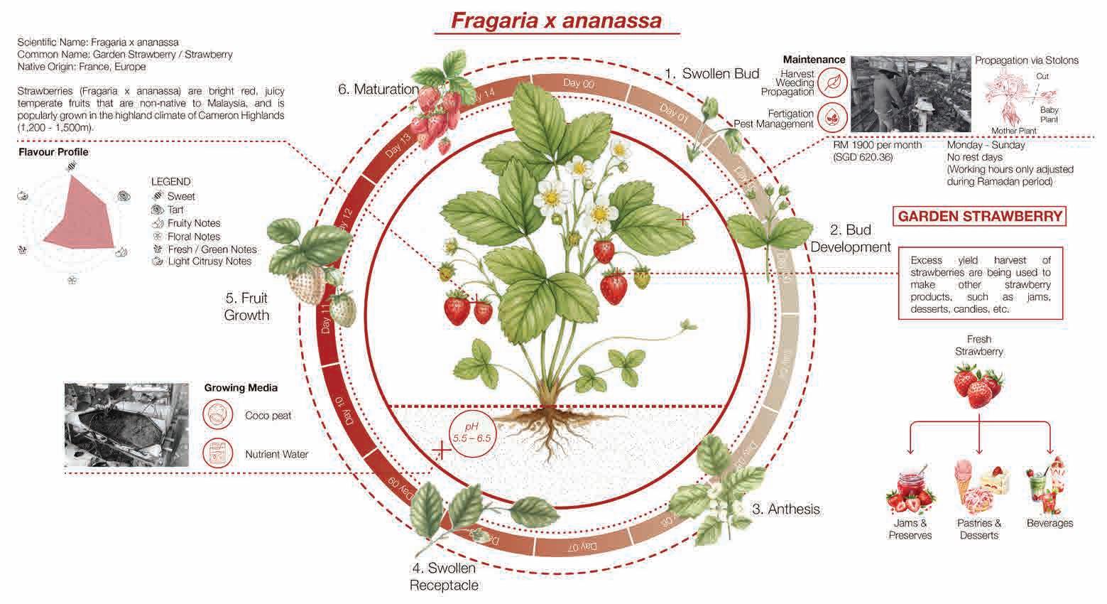
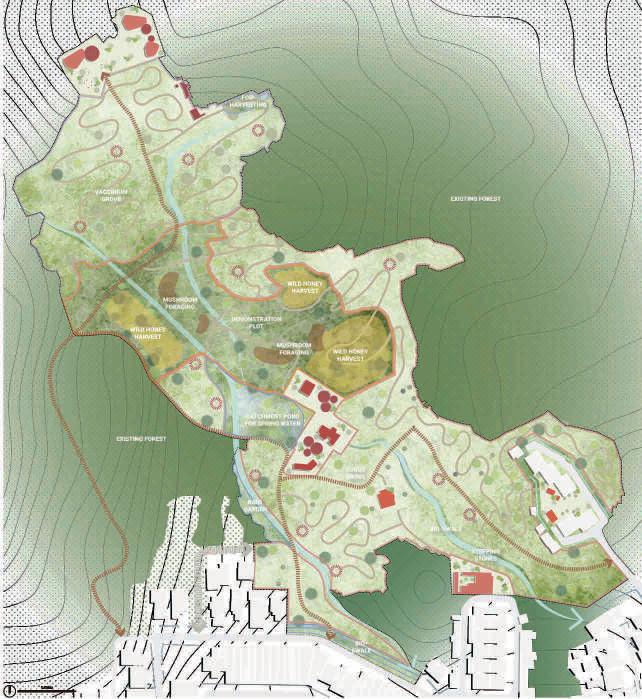
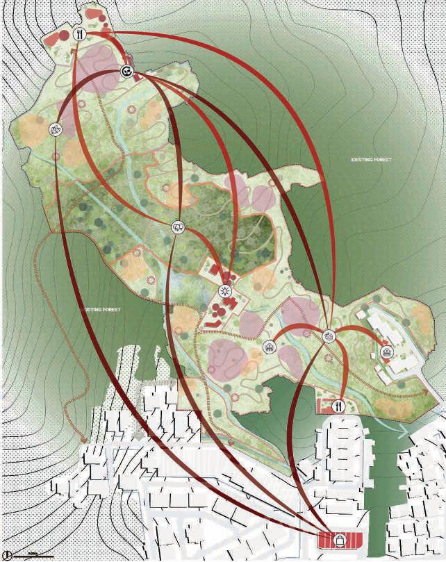
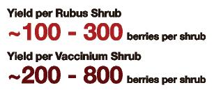
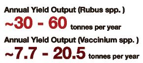
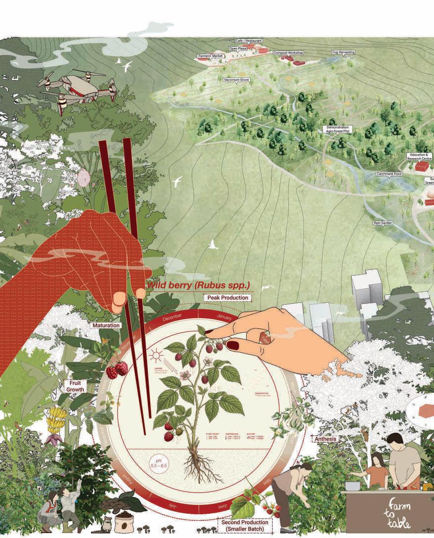
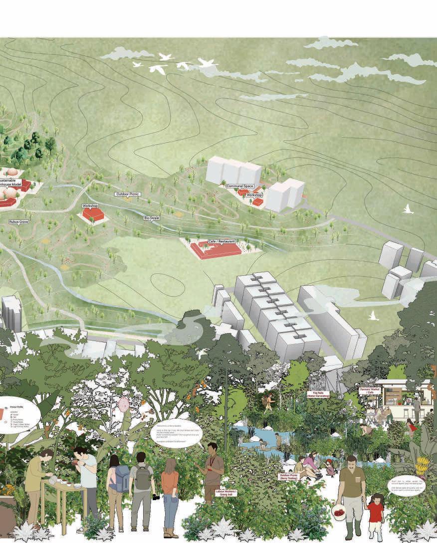
un-Berry-lievable proposes a regenerative alternative cultivation to Cameron Highlands’ extractive agro-tourism landscape through native berry-based agroforestry systems.
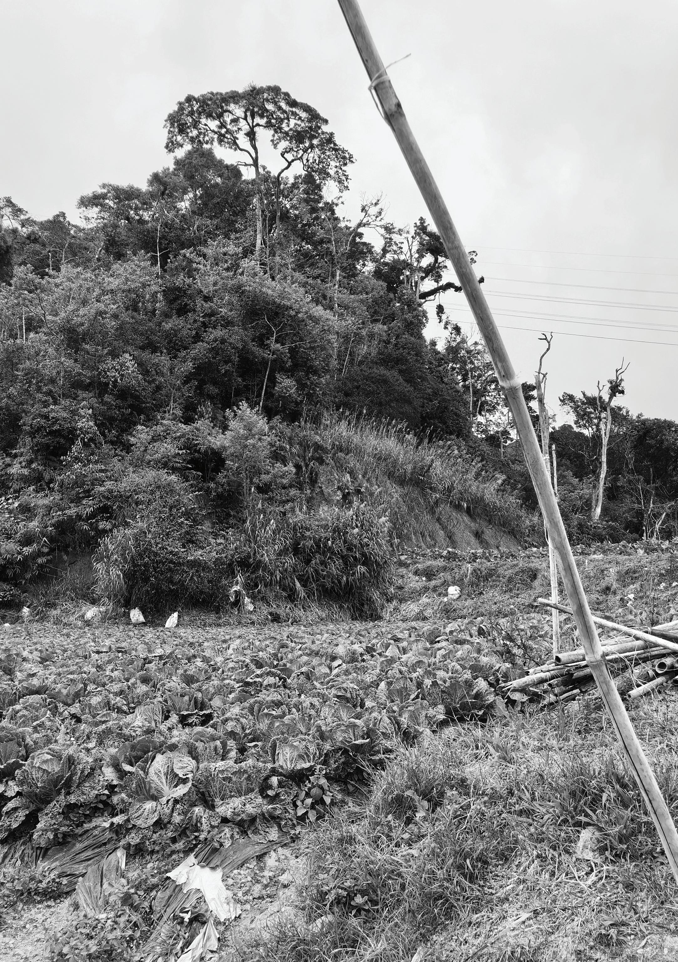
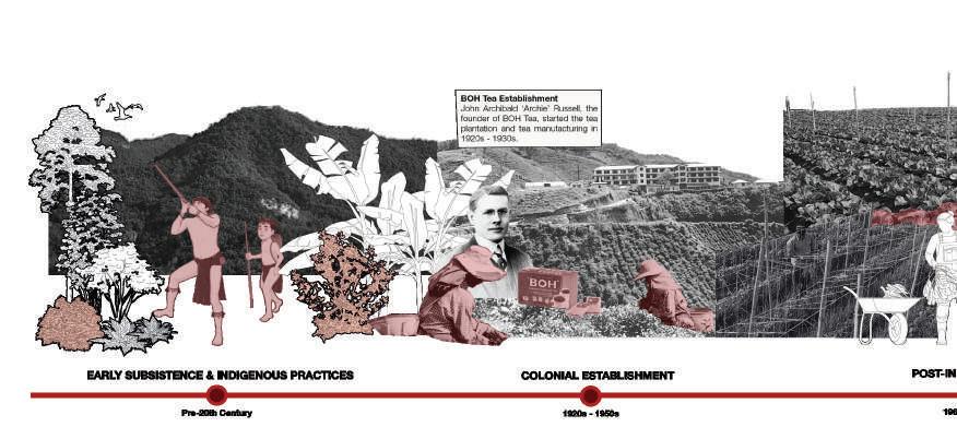
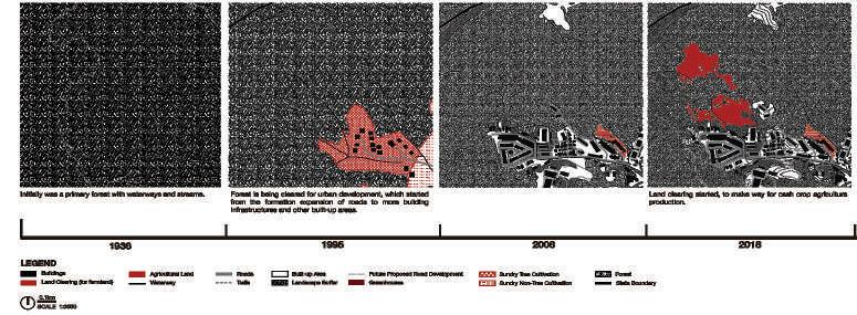
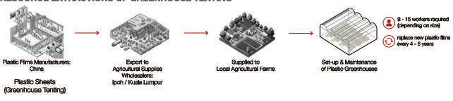
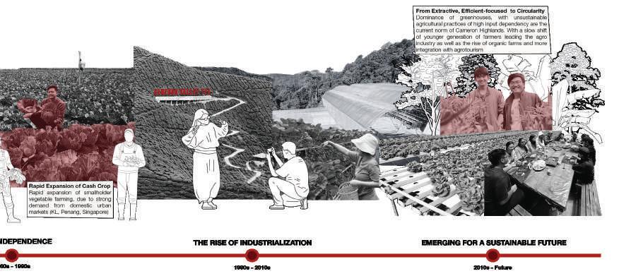
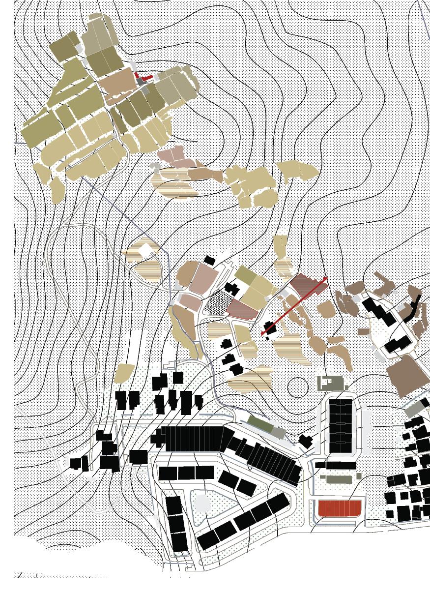
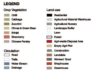
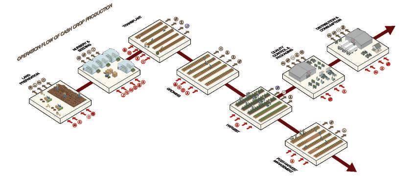
Cameron Highlands is widely perceived as a productive and picturesque agricultural landscape, yet its current model reveal its critical ecological and socio-cultural tensions. Agro-tourism has transformed farming into a curated consumer spectacle — often characterised by repetitive and limited activities — while concealing the impacts on labour, waste and ecological degradation behind a polished façade. At the same time, land is increasingly cleared and optimised for intensive monocrop practices that priortise rapid harvest cycles over long-term soil health, biodiversity and regenerative capacity. Both agro-tourism and cash crop production depend heavily on intense resource extractive systems — plastics, agrochemicals, and excessive water-use — whose negative impacts are externalised into surrounding ecosystems. As a result, the landscape operates as a controlled, extractive system that distances people from the realities of food production and weakens ecological resilience.
Phasing Strategy 01: Land-Use Regenerative System
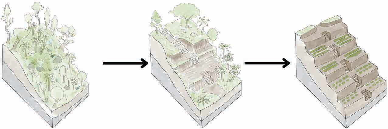
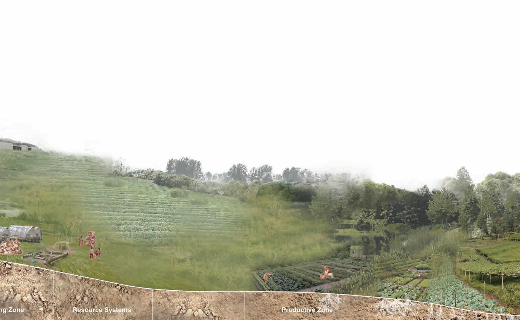
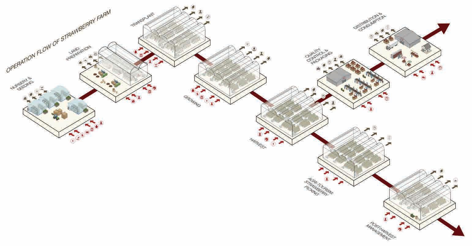
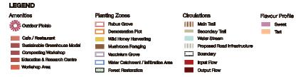
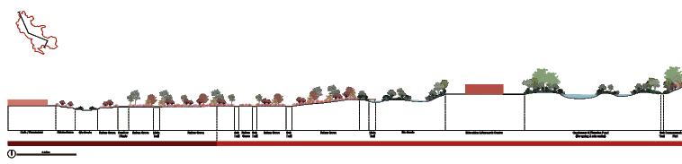
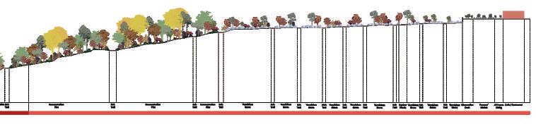
The approach prioritises reworking with the existing terraced terrains while retrofitting existing structures into shared infrastructures, such as workshops, farm-to-table spaces, farmers’ market, etc. Selected areas within the understory of the central forest patch are gradually transformed into multi-layered agroforestry demonstration plots, integrating native and edible species that benefit from natural canopy “tenting” rather than artificial plastic coverings. This shifts the landscape from a rigid monoculture system into a dynamic agroforestry condition, allowing it to transition through phases of establishment, accumulation, and eventual ecological abundance.
Phasing Strategy 02:
Forage and Cook Loop
At the experiential scale, the project redefines agro-tourism thorugh a “forage and cook” loop that encourages active participation. Spatial configurations are designed to guide visitors through cycles of identifying, foraging and processing native produce, culminating in shared workshop and farm-to-table spaces. This loop repositions the landscape as an active learning environment of a variety of cultivations, fostering a deeper connection between people, food, and place while celebrating local identity.
Ultimately, un-Berry-lievable reframes agro-tourism from an extractive system into a participatory, regenerative landscape that restores ecological processes and cultural relationships with food.
Understanding the Growth Cycle & Operations needed for Strawberry Production
To communicate the farm’s operational workflow, illustrate resource and production flows, highlight key stages from planting to distribution, and identify opportunities for improving its sustainability, and potential design intervention points.
STATISTICS OF AGRICULTURE & TOURISM SECTOR
Statistics of the Two Biggest Economic Sectors in Cameron Highlands
Source: Department of Malaysia - Interim Report: Agricultural Census 2024 and Planning Malaysia: Journal of the Malaysian Institute of Planners
AGRICULTURE OF CAMERON HIGHLANDS
Analysis of Farmlands & Agro-Tourism in Cameron Highlands
DEVELOPMENT EXPANSION IN CAMERON HIGHLANDS
Mapping of the Increasing Encroachment of Farmlands & Urban Areas over the years
Mapping shows progressive farmland and urban encroachment across Cameron Highlands from 2009 to 2019, highlighting landscape fragmentation and expansion patterns.
AGRO-TOURISM IN CAMERON HIGHLANDS
The Types of Agro-Tourism Activities
STRAWBERRY FRUITING PROFILE
Studying the Growth & Fruiting Cycle, Requirements & Production Use of Strawberries
STRAWBERRY PRODUCTION
Operation Flow of Strawberry Farm based on Fieldtrip Observations
Diagram illustrates strawberry farm operations in Cameron Highlands, based on fieldtrip observations, tracing processes from nursery and greenhouse cultivation to harvesting, processing, packaging, and distribution, highlighting resource and labour flows.
EVOLUTION OF AGRICULTURE PRACTICE & ECONOMY
Timeline Montage of how Agriculture have Evolved & Impact its Economy
EVOLUTION OF FARMLAND EXPANSION
Timeline of Site Specific Farmland Expansion over the years
ANALYSIS OF OTHER AGRI-RESOURCE EXTRACTIONS
Resource Extraction of Greenhouse Plastic Tenting
Resource Extraction of Bamboos
LABOUR
SCHEDULE
Timeline of the Farmers’ Daily Routine
COMMON CROPS GROWN
Site Observations of the Most Common Crops Grown & Harvested at Site Area
CASH CROP PRODUCTION
Operation Flow Diagram of a Cash Crop Production
Section drawing illustrates existing landform and land use in Cameron Highlands, featuring terraced farming for cash crops and greenhouse-based strawberry cultivation, shaped by slope adaptation and intensive agricultural practices.
STRATEGY 01
Reframing the Landscape System
STRATEGY 02
“Forage and Cook” Loop
PROJECTED NEW ROUTINES
New Routine Schedule for Farmers & Other Employees
New Activity Schedule / Itinerary for Visitors
PROJECTED BERRIES FORAGE CAPACITY
Statistics of the Total Projected Yield Harvest of Berries Forecast
PROJECTED NEW OPERATION FLOW
The New Closed Loop Operation Flow
FRUITING CYCLE
All-year-round Foraging and Fruiting of Berries & Other Edibles
REFLECTIONS
“Cameron Highlands taught us that landscape architecture is not just about shaping spaces, but about mediating the complex relationships between ecology, culture, and livelihoods.”
Yun Hye Hwang
“This overseas studio pushed me beyond familiar local contexts. Being on site showed me the importance of local stakeholders, NGOs, and everyday conversations in understanding place. I also learnt how plants can carry memory, culture, and ecology, revealing issues and meanings that could only be understood through fieldwork.”
Soh Seh Ting
“This studio has pushed me to follow through a full design process to completion, from rigorous site analysis to a proper design plan. I really enjoyed being able to just focus on designing for the non-human, and then seeing how we fit into this landscape.”
Jonald Khaw
“This studio challenged my usual approach of designing from a green or brown field by working within an existing, living forest system. Engaging with complex terrains and contours made the process demanding yet exciting. Designing within a sensitive mossy forest, a valuable and fragile ecosystem, pushed me to respond without altering its essence. It became a meaningful shift while seeing constraints not as limits, but as opportunities for a more grounded and responsive design approach.”
Boddapati Krishna Sri
“The Cameron Highland studio was the first studio where the site was outside of Singapore. It gave us the opportunity to study an entirely different context, conduct field works and interviews about a whole new group of people. Conversations with farmers, NGOs and the Orang Asli, allowed me to understand the site better, to create a more relevant and site specific design for the stakeholders. Overall, I think that Cameron Highland being a space with rich history and intensive development, served a good research ground and learning experience.”
Lee Huei Min
“This studio has taught me to question conventional agricultural aesthetics and systems. It reinforced my role as a designer in shaping how people engage with food systems, encouraging more conscious, ecological, and meaningful interactions. I learned that landscapes can act as active mediums to reconnect people with processes often hidden or overlooked.”
Khoo
Zhi Luo
“This studio shifted my approach from reading landscape as background to understanding it as a contested system shaped by ecology, labour, ownership, and everyday use. Working in Cameron Highlands helped me observe more carefully how land is shared, neglected, and adapted. It also pushed me to make design proposals that are more grounded, critical, and connected to real site conditions especially the uneven realities of settlement at the forest edge.”
Ng Jun Hao
“This course helped me understand the importance of thorough site analysis and research. I learned how to carefully study context, systems, and local conditions, and use these findings to inform design decisions. It encouraged me to develop site-specific strategies rather than generic solutions, making my design more grounded, meaningful, and responsive.”
Wu Qiqi
“This studio changed the way I approach design projects, especially through research and storytelling. I realised that every project is more than a site—it is a story shaped by people, history, culture, and everyday life. A clear narrative gives the design stronger direction and meaning. I also learned to look beyond surface conditions and explore local identity and hidden systems before proposing solutions.”
Su Juhui
“This studio was very enriching and insightful as we got to immerse ourselves in our site for a week, living and interacting with the locals to better understand both the site and its users. Although it was a difficult process, I found it interesting to learn how to transform the insights we obtained from people and observations on site from stories into mappings and visualisations to form the basis for our design projects, making the intangible tangible.”