DEPARTMENT DIRECTORY Governor Kelly Armstrong ADMINISTRATIVE DIVISION Game and Fish Director: Jeb Williams Deputy Director: Casey Anderson Chief, Administrative Services: Brian Hosek Grant Management Services Manager: Corey Wentland Administrative Staff Officer: Justin Mattson Administrative Assistant: Lynn Timm Building Maint. Supervisor: Brandon Diehl Human Resources Services Manager: Melissa Long Administrative Officer: Alan Peterson Financial Services Manager: Angie Morrison Accountants: Kelly Wike, Ashley Hillerson Business Services Manager: Alison Kammer Technical Operations Lead: Alan Reile Data Scientist: Shane Wegner Licensing Services Manager: Randy Meissner Assistants: Amanda Anstrom, Tracy Price, Tana Bentz, Tanya Mikkelsen, Elizabeth Klein Administrative Assistant – Dickinson: Stephanie Richardson Administrative Assistant – Devils Lake: Lisa Tofte Administrative Assistant – Jamestown: Tonya Kukowski Administrative Assistant – Riverdale: Mattea Bierman Administrative Assistant – Williston: Stephanie Wellman CONSERVATION AND COMMUNICATIONS DIVISION Division Chief: Bruce Kreft, Bismarck Communications Manager: Mike Anderson, Bismarck Editor: North Dakota OUTDOORS: Ron Wilson, Bismarck Marketing Coordinator: Cayla Bendel, Bismarck Digital Media Editor: Lara Anderson, Bismarck Photographer/Videographer: Ashley Peterson, Bismarck Marketing Specialist: Jackie Ressler, Bismarck Information Specialist: Dawn Jochim, Bismarck Graphic Artist: Kristi Fast, Bismarck Education Supervisor: Marty Egeland, Bismarck Education Coordinator: Jeff Long, Bismarck Hunter Education Coordinator: Brian Schaffer, Bismarck Outreach Biologists: Doug Leier, West Fargo; Greg Gullickson, Minot; Jim Job, Grand Forks Conservation Supervisor: Patrick Isakson, Bismarck Conservation Biologists: Sandra Johnson, Elisha Mueller, John Schumacher, Aaron Larsen, Greg Schonert, Bismarck Administrative Assistant: Amber Schroeter, Bismarck ENFORCEMENT DIVISION Division Chief: Scott Winkelman, Bismarck Investigative Supervisor: Jim Burud, Kenmare Investigator: Blake Riewer, Grand Forks Operations Supervisor: Jackie Lundstrom, Bismarck Warden Pilot: Mike Linden, Bismarck Region No. 1 Warden Supvr: Michael Sedlacek, Jamestown District Wardens: Corey Erck, Bismarck; Andrew Dahlgren, Milnor; Erik Schmidt, Linton; Greg Hastings, Jamestown; Noah Raitz, LaMoure; Gavin Herbert, Steele; Nick Tschepen, Fargo Region No. 2 Warden Supvr: Paul Freeman, Devils Lake District Wardens: Jonathan Tofteland, Bottineau; Jonathan Peterson, Devils Lake; James Myhre, New Rockford; Alan Howard, Cando; Drew Johnson, Finley; Sam Feldmann, Rugby; Gage Muench, Grand Forks; Dale Skalicky, Langdon; James Myhre, Sheyenne Region No. 3 Warden Supvr: Joe Lucas, Riverdale District Wardens: Michael Raasakka, Stanley; Shawn Sperling, Minot; Keenan Snyder, Williston, Josh Hedstrom, Tioga; Riley Gerding, Kenmare; Clayton Edstrom, Turtle Lake; Conner Folkers, Garrison; Luke Aamold, Watford City Region No. 4 Warden Supvr: Dan Hoenke, Dickinson District Wardens: Kylor Johnston, Hazen; Zachary Biberdorf, Bowman; Courtney Sprenger, Elgin; Zane Manhart, Golva; Jerad Bluem, Mandan; Zachary Schuchard, Richardton; Dominic Falch, Killdeer Administrative Assistant: Lori Kensington, Bismarck WILDLIFE DIVISION Division Chief: Bill Haase, Bismarck Assistant Division Chief: Levi Jacobson, Bismarck Game Mgt. Section Leader: Stephanie Tucker, Bismarck Pilot: Jeff Faught, Bismarck Upland Game Mgt. Supvr: Jesse Kolar, Dickinson Upland Game Mgt. Biologist: Rodney Gross, Bismarck Migratory Game Bird Mgt. Supvr: John Palarski, Bismarck Migratory Game Bird Biologist: Mason Ryckman, Bismarck Big Game Mgt. Supvr: Bruce Stillings, Dickinson Big Game Mgt. Biologists: Brett Wiedmann, Dickinson; Jason Smith, Jamestown; Ben Matykiewicz, Bismarck Survey Coordinator: Chad Parent, Bismarck Wildlife Veterinarian: Dr. Logan Weyand, Bismarck Wildlife Health Biologist: Ryan Herigstad, Bismarck Game Management Biological Technician: Vacant Wildlife Resource Management Section Leader: Kent Luttschwager, Williston Wildlife Resource Mgt. Supvrs: Brian Prince, Devils Lake; Brian Kietzman, Jamestown; Dan Halstead, Riverdale; Blake Schaan, Lonetree; Judd Jasmer, Dickinson; Jens Johnson, Bismarck Wildlife Resource Mgt. Biologists: Randy Littlefield, Lonetree; Rodd Compson, Jamestown; Todd Buckley, Williston; Jake Oster, Riverdale; Andrew Ahrens, Devils Lake; Broden Ullyott, Dickinson Wildlife Biological Technicians: Tom Crutchfield, Jim Houston, Bismarck; Dan Morman, Robert Miller, Riverdale; Jason Rowell, Jamestown; Scott Olson, Devils Lake; Zach Eustice, Williston; Colton Soiseth, Quentin Corcoran, Lonetree Private Land Section Leader: Kevin Kading, Bismarck Habitat Manager: Nathan Harling, Bismarck Private Land Field Operation Supvrs: Curtis Francis, East Region, Andrew Dinges, West Region, Bismarck Private Land Biologists: Zach Johnson, Colin Penner, Bismarck; Jaden Honeyman, Ben Reith, Dickinson; Ryan Huber, Riverdale; Renae Schultz, Jeff Williams, Jamestown; Terry Oswald, Jr., Harvey; Erica Sevigny, Williston; Brandon Ramsey, Matthew Parvey, Devils Lake Procurement Officer: Dale Repnow, Bismarck FISHERIES DIVISION Division Chief: Greg Power, Bismarck Fisheries Mgt. Section Leader: Scott Gangl, Bismarck Fisheries Supvrs: Russ Kinzler, Riverdale; Paul Bailey, Bismarck; Brandon Kratz, Jamestown; Aaron Slominski, Williston; Bryan Sea, Devils Lake; Lucas Rott, Riverdale Fisheries Biologists: Todd Caspers, Devils Lake; Mike Johnson, Jamestown; Jeff Merchant, Dickinson; Zach Kjos, Riverdale Fisheries Biological Technicians: Phil Miller, Devils Lake; Justen Barstad, Bismarck; Brian Frohlich, Riverdale; Ethan Krebs, Jamestown, Sanden O’Connell, WIlliston Production/Development Section Supvr: Jerry Weigel, Bismarck Aquatic Nuisance Species Coordinator: Benjamin Holen, Jamestown Aquatic Nuisance Species Biologists: Mason Hammer, Jamestown; Kyle Oxley, Bismarck Fisheries Development Supvr: Bob Frohlich, Bismarck Fisheries Dev. Proj. Mgr: Wesley Erdle, Bismarck Fisheries Development Specialist: Kyle Hoge, Jacob Heyer, Joe Fladeland, Bismarck Administrative Assistant: Janice Vetter, Bismarck ADVISORY BOARD District 1 ....................................................................................................Nathan Hovde, Alexander District 2 ..................................................................................................................Travis Leier, Velva District 3 ................................................................................................ Edward Dosch, Devils Lake District 4 ....................................................................................................... Karissa Daws, Michigan District 5 ............................................................................................... Doug Madsen, Harwood District 6 ......................................................................................Jordan Svenningsen, Luverne District 7 ..................................................................................................Jody Sommer, Mandan District 8 .............................................................................................................. Rob Brooks, Rhame
Game and Fish Department fisheries personnel took the first eggs during the walleye spawn in 2025 on April 29 at Lake Sakakawea and Devils Lake. The spawning operations were shut down at both lakes in early May when egg goals were met. PHOTO BY ASHLEY PETERSON.
Contributing photographers for this issue: Mike Anderson, Paul Bailey and Ashley Peterson. Official publication of the North Dakota Game and Fish Department (ISSN 0029-2761) 100 N. Bismarck Expressway, Bismarck, ND 58501-5095 Website: gf.nd.gov • Email: ndgf@nd.gov • Information 701-328-6300 • Licensing 701-328-6335 • Administration 701-328-6305 • North Dakota Outdoors Subscriptions 701-328-6363 • Hunter Education 701-328-6615 • The TTY/TTD (Relay ND) number for the hearing or speech impaired is 800-366-6888
Periodical Postage Paid at Bismarck, ND 58501 and additional entry offices. Printed in the United States POSTMASTER: Send address changes to: North Dakota OUTDOORS 100 North Bismarck Expressway Bismarck, ND 58501-5095
Report All Poachers (RAP) 701-328-9921 In cooperation with North Dakota Wildlife Federation and North Dakota State Radio.
The mission of the North Dakota Game and Fish Department is to protect, conserve and enhance fish and wildlife populations and their habitats for sustained public consumptive and nonconsumptive use. ■ Editor: Ron Wilson
■ Graphic Designer: Kristi Fast
■ Circulation Manager: Dawn Jochim
MARCH-APRIL 2026 • NUMBER 8 • VOLUME LXXXVIII
CONTENTS 2
My 2 Cents
4
New Fishing Season, A Few Regulation Changes
6
North Dakota Fishing Waters
30
2025 Fish Stocking Report
33
Devils Lake Basin Boating Access
34
Missouri River System Boating Access
38
2025 Top Whoppers
41
Back Cast
North Dakota OUTDOORS is published 10 times a year, monthly except for the months of April and September. Subscription rates are $15 for one year or $30 for three years. Remittance should be by check or money order payable to the North Dakota Game and Fish Department. Indicate if subscription is new or renewal. The numbers on the upper right corner of the mailing label indicate the date of the last issue a subscriber will receive unless the subscription is renewed. Permission to reprint materials appearing in North Dakota OUTDOORS must be obtained from the author, artist or photographer. We encourage contributions; contact the editor for writer and photography guidelines prior to submission. The NDGFD receives Federal financial assistance from the US Fish and Wildlife Service and the US Coast Guard. In accordance with Title VI of the Civil Rights Act of 1964, Section 504 of the Rehabilitation Act of 1973, Title II of the Americans with Disabilities Act of 1990, the Age Discrimination Act of 1975, and Title IX of the Education Amendments of 1972, the NDGFD joins the US Department of the Interior and its Bureaus and the US Department of Homeland Security in prohibiting discrimination on the basis of race, color, national origin, age, disability, sex (in education programs or activities) and also religion. If you believe you have been discriminated against in any program, activity, or facility as described above, or you desire further information, please write to: ND Game and Fish Department, Attn: Chief of Administrative Services, 100 N. Bismarck Expressway, Bismarck, ND 58501-5095 or to: Office of Civil Rights, Department of the Interior, 1849 C Street, NW, Washington, DC 20240.
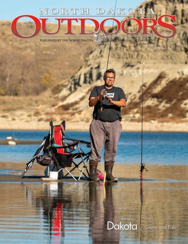
Front Cover
Fishing for chinook salmon in fall at Lake Sakakawea’s Government Bay. PHOTO BY ASHLEY PETERSON.
My 2 Cents from the
DIRECTOR
Spring Signals
Fishing in North Dakota is about more than catching fish.
Jeb Williams
DIRECTOR, NORTH DAKOTA GAME AND FISH DEPARTMENT
2 ■ ND OUTDOORS ■ MARCH-APRIL 2026
There’s a certain kind of optimism that comes with a North Dakota spring. It doesn’t arrive all at once — it rarely does — but somewhere between the last stubborn snowbank and the first open boat ramp, you can feel it. For many of us, that signal comes not from the calendar, but from the water. Spring fishing in North Dakota is more than just a change in season — it’s a reset. After a long winter, our fisheries begin to wake up. Walleye move shallow with purpose, pike cruise the warming backwaters, and anglers — just as eager — start to reappear on shorelines and in boats across the state. Whether it’s a quiet evening along the Missouri River or that first trip to Devils Lake, there’s a shared understanding: we’ve been waiting for this. But spring also reminds us of something deeper, the importance of what lies beneath the surface. Healthy fisheries don’t happen by accident. They are the result of a great state and federal partnership with our two hatcheries, thoughtful management, strong habitat, and the support of anglers who care about the resource. From water level management on our larger reservoirs to habitat work in smaller lakes and rivers, each piece plays a role in sustaining the opportunities we value. And those opportunities matter. Fishing in North Dakota is about more than catching fish. It is time spent with family, lessons passed between generations, and quiet moments that are increasingly hard to find elsewhere. It’s introducing a kid to their first bite, watching them learn patience, and maybe, if you’re lucky, seeing that spark turn into a lifelong passion. That’s why access to North Dakota’s fisheries remains such an important part of the conversation. Investments in boat ramps, shore-fishing areas, and public access points continue to ensure that no matter where you live, the opportunity to fish is within reach. Because at its core, fishing should be something everyone can experience. This spring, as you get back on the water, it’s worth taking a moment to appreciate not just the catch, but the resource itself. Pay attention to the conditions, respect regulations, and consider the role each of us plays in keeping these fisheries strong. The season ahead will bring its share of memorable days — some measured in fish, others in something less tangible but just as important. Either way, spring has a way of reminding us why we come back. And that’s worth at least a couple of cents.
PROTECT THE LAKES YOU LOVE.
CLEAN DRAIN DRY EVERY SURFACE. EVERY TIME.
W
hether you are a seasoned angler or a weekend hobbyist, the rules governing North Dakota’s waters are more than just a list of “dos and don’ts” — they are the cornerstone of conservation that stretches back over a century. As we look toward the new fishing season beginning April 1, 2026, it is worth taking a quick look at what, when and why changes have been made. The roots of North Dakota’s fisheries management are deeper than many realize. The very first fishing laws were established in 1881, back when the region was still the Dakota Territory. In those early days, the focus was narrow, primarily centered on basic creel and length limits to prevent total depletion of local stocks. The modern era of management truly took flight around 1950 with the creation of the fisheries division and the hiring of the state’s first professional fisheries biologist. Since then, “biology first” has driven the regulation process while attempting to keep the rules simple and straightforward. Ultimately, the goal is sustaining healthy fish populations for the long haul, and ensuring every angler has reasonable prospects to catch fish.
KEY CHANGES FOR 2026-28
While the North Dakota Game and Fish Department prides itself on keeping regulations simple and consistent, every two years brings a few necessary adjustments. Here is what you need to know for the upcoming season.
RETURN OF THE WHITE SUCKER
Perhaps the most significant shift for big-bait enthusiasts is the reintroduction of live white suckers as legal bait on the Missouri River System, Lake Audubon, Devils Lake and Stump Lake. For around three decades, suckers have been banned in these waters. However, an internal evaluation of past sucker regulations concluded that restrictions did little to reduce sucker abundance. Given that anglers have lamented the lack of options for larger live bait since the ban on suckers, particularly on the Missouri River System, the Department has opted to restore this choice. It must be stressed, however, that though suckers may be legal on these big waters, it will take time before they become available for most. It will take a while for bait vendors to find sources of suckers and make their product available to the public. 4 ■ ND OUTDOORS ■ MARCH-APRIL 2026
It’s been more than three decades since the last snagging season for salmon on the Missouri River System.
EXPANDED SPEARFISHING OPPORTUNITIES The Department continues to receive public input and incorporate change when and where possible. This includes: • Underwater spearfishing — This season has been expanded to a year-round schedule to match bow fishing and (above water) spearing seasons. Additionally, smallmouth bass have been added to the list of legal species for underwater spearers. • Darkhouse spearfishing — You can now legally harvest channel catfish while darkhouse spearfishing on the Missouri River System. This change aligns darkhouse rules with existing open-water and bow-fishing regulations.
SALMON SNAGGING, WHITE BASS LIMITS
Fans of the autumn chinook salmon run on Lake Sakakawea will see the reinstatement of the salmon snagging season, and an expansion to include bow and spearing. The season will run from Sept. 25 through Oct. 31 and is restricted to daylight hours only. (Note: The salmon snagging season was eliminated in 1995.) Finally, if you enjoy targeting white bass, you can harvest more this upcoming year. Daily limits have increased from 20 to 30, and possession limits have jumped from 40 to 60. Biologists believe this increase will boost recreational activity in a few locales without putting any bass populations at risk.
SIMPLIFYING PAPERWORK
In a move toward less red tape, anglers will no longer be required to register for darkhouse spearfishing. After 25 years of data collection, the Department has a firm grasp on how this activity impacts northern pike populations. With survey response rates declining, officials determined that mandatory registration was no longer necessary to maintain a healthy resource. With a new fishing season underway this spring, these changes reflect a Department that is listening to public feedback while remaining grounded in biological data. Tight lines! And pay it forward by taking a beginner fishing today.
GREG POWER is the Game and Fish Department’s fisheries chief.
ND OUTDOORS ■ MARCH-APRIL 2026 ■ 5
N
orth Dakota has more than 440 fishing waters that have public access and some degree of management by state Game and Fish Department biologists. What follows are driving directions and infrastructure information for these managed waters, plus additional fish population remarks for many of them. The number in parenthesis that follows each fishery is simply a code used by biologists to help identify those waters. The codes are also found on the accompanying maps to help readers locate specific waters. The fishery outlooks provided by Game and Fish Department district fisheries
6 ■ ND OUTDOORS ■ MARCH-APRIL 2026
supervisors and biologists are not all-inclusive reports but rather peeks into each water’s fish populations to help frame angler expectations. With a record number of lakes scattered across North Dakota, fisheries biologists have yet to conduct thorough population assessments on many of these waters. Any changes and updates on managed lakes appear under the fishing tab on the Game and Fish Department’s website at gf.nd.gov. Most state public fishing waters have boat ramps. Lakes or rivers where no ramp exists are listed as “no ramp.” Check signs at each area for further restrictions.
NORTHWEST FISHERIES DISTRICT Aaron Slominski, district fisheries supervisor, Williston BURKE COUNTY Northgate Dam (097) – 6 miles north, 1 mile west, 2 miles north, .5 miles west of Bowbells. Good walleye and bluegill populations. Stocked with rainbow trout annually, with some nice-sized carry-over fish. Largemouth bass and black crappie present. (Fishing pier). Powers Lake (093) – Southeast side of Powers Lake. Good number of pike. (Fishing pier). Short Creek Dam (094) – 5.5 miles north of Columbus. Bluegill, perch, pike and walleye present. (Fishing pier). Smishek Lake (095) – 4 miles northwest of Powers Lake. Decent numbers of walleye and pike, with some large fish of both species. Small perch and bluegill abundant, with some large bluegill in low numbers. (Fishing pier).
DIVIDE COUNTY Baukol-Noonan Dam (475) – 3 miles east, 1.5 miles south, .5 miles west of Noonan. Decent numbers of pike and walleye. Abundant small perch and bluegill. Largemouth bass present. (Fishing pier). Baukol-Noonan East Mine Pond (508) – 3 miles east, 1 mile south, .8 miles west, .4 miles south of Noonan. Good number of largemouth bass. Small bluegill and perch abundant. Skjermo Lake (126) – 3 miles west, 4 miles northwest of Fortuna. Good numbers of pike and perch. (Fishing pier). MCKENZIE COUNTY Arnegard Dam (216) – .5 miles west, 2 miles north, 1.5 miles west of Arnegard. Good pike population. Yellow perch present, but most are smaller. Abundant black bullhead population. Stocked with adult catfish and adult bluegill in 2025. (Fishing pier). Hepper Dam (067) – 1.5 miles south, 3 miles east, 1.2 miles north, 2 miles
east, 1.2 miles southeast of Keene. Stocked with adult bluegill in 2024. (No ramp). Sather Dam (217) – 11 miles south, 8 miles west of Alexander. Good bluegill and largemouth bass populations. Crappie present. (Fishing pier). Watford City Park Pond (640) – Southeast side of Watford City. Fishery is reliant on annual stocking due to frequent winterkills. (Fishing pier, no ramp). MOUNTRAIL COUNTY Clearwater Lake (248) – 2 miles east, 3.8 miles north, .5 miles east, 3 miles north-northeast, .5 miles east of Stanley. Strong pike population. Walleye, perch and bluegill present. Stanley Pond (245) – Northeast side of Stanley. Fishery is reliant on annual stocking due to frequent winterkills. (Fishing pier). Stanley Reservoir (251) – 1 mile south of Stanley. Complete winterkill in 2025. (No ramp).
COLIN PENNER
NORTHWEST FISHERIES DISTRICT
ND OUTDOORS ■ MARCH-APRIL 2026 ■ 7
White Earth Dam (249) – 6 miles north, 8.5 miles east, 2 miles south of Tioga. Decent walleye and pike populations. Bluegill, crappie and perch present. (Fishing pier). RENVILLE COUNTY Lake Darling (285) – 16 miles north, 13 miles west of Minot. Good walleye population. Perch, pike, smallmouth bass and black bullhead present. (Fishing pier). WILLIAMS COUNTY Blacktail Dam (373) – 5 miles north, 5 miles west, 1 mile north of the junction of U.S. highways 2 and 85. Access to boat ramp may be difficult during renovation project. Good numbers of walleye and pike, with some bigger fish of both species. Small perch and bluegill abundant, with some bigger bluegill in low numbers. Smallmouth bass in low numbers. (Fishing pier). Cottonwood Lake (381) – 1 mile east, .5 miles north of Alamo. Good number of pike. Walleye and perch present. (Fishing pier). East Spring Lake Pond (380) – North side of Williston. Winterkills every year. Fishing opportunities reliant on annual stocking of adult pike. (Fishing pier, no ramp).
A nice walleye from Horsehead Lake in Kidder County.
8 ■ ND OUTDOORS ■ MARCH-APRIL 2026
Epping-Springbrook Dam (374) – 1.5 miles east of Springbrook. Catfish, perch, pike and walleye present. Abundant bullhead population. (Fishing pier). Kettle Lake (099) – 3 miles east, 2.5 miles north of Zahl. Rainbow trout stocked annually. Bluegill and largemouth bass present. (Fishing pier). Kota-Ray Dam (376) – 5 miles south, .5 miles east, 2 miles south of Ray. Good number of nice largemouth bass. Small perch and small bluegill abundant. Walleye present. Brown trout and rainbow trout stocked annually. (Fishing pier). Little Muddy River (393) – East edge of Williston. Highly dependent on high water levels and fish movement from upper Missouri River. Fair populations of pike and catfish, with many other species present. (Fishing pier). McGregor Dam (378) – 1 mile south of McGregor. Good number of walleyes. Bluegill and crappie present. Rainbow trout stocked annually. (Fishing pier). McLeod (Ray) Reservoir (377) – Southwest side of Ray. Good pike population. Stocked with adult bluegill and adult perch in 2025. (Fishing pier). Tioga Dam (379) – North side of Tioga. Good number of pike. Perch and bluegill present. (Fishing pier). Trenton Lake (018) – South side of
Trenton. Good crappie population. Decent numbers of walleye, pike and catfish. Due to periodic interconnection with the Missouri River, many other species present. (Fishing pier). West Spring Lake Pond (033) – North edge of Williston. Fishery reliant on annual stocking due to frequent winterkills. (No ramp). RIVERS AND LAKES Upper Missouri River (014) – Missouri River from Williston to Montana state line. Primarily a spring and fall fishery for sauger and walleye. Fishing success largely driven by water clarity. Channel catfish abundant. Many other species present. Yellowstone River (019) – Near the towns of Buford, Cartwright and Fairview. Primarily a spring and fall fishery for sauger and walleye. Channel catfish abundant. Many other species present. (Fishing pier).
SOUTHWEST FISHERIES DISTRICT Jeff Merchant, district fisheries biologist, Dickinson ADAMS COUNTY Mirror Lake (040) – South side of Hettinger. Bullheads up to a half pound abundant. Good number of channel catfish up to 5 pounds stocked annually. Good number of walleye up to 3 pounds. Some northern pike up to 3 pounds, bluegill up to a half pound and mostly small yellow perch. (Fishing pier). North Lemmon (042) – 5 miles north of Lemmon, S.D. Rainbow and brown trout stocked in 2024. Some brown trout up to 2 pounds. Small yellow perch abundant. Some bluegill up to three quarters of a pound. Good numbers of largemouth bass up to 4 pounds and walleye up to 8 pounds. (Fishing pier).
southWEST FISHERIES DISTRICT
BILLINGS Easy Hill Dam (499) – 2 miles south, 6 miles west, 5.3 miles south, .5 miles northeast of Belfield. Abundant small bluegill, with some fish up to 1 pound. Adult largemouth bass stocked in 2024. (No ramp). BOWMAN COUNTY Bowman-Haley Dam (085) – 11 miles south, 8 miles east, 2 miles south of Bowman. Fair number of walleye up to 5 pounds and northern pike up to 10 pounds. Good number of white bass up to 1 pound and smallmouth bass up to 2 pounds. Some yellow perch and crappie up to a half pound. Abundant bullhead up to 1 pound. Carp up to 15 pounds abundant, good for bowfishing. (Fishing pier). Gascoyne Lake (086) – 1.5 miles northwest of Gascoyne. Northern pike abundant, with some fish up to 7 pounds. Smaller common carp also abundant.
Kalina Dam (087) – 2 miles west, 1 mile south, 1 mile west, 1 mile south of Bowman. Confirmed winterkill in 2025, likely significant. (No ramp). Lutz Dam (519) – 2.5 miles south, 2 miles west, .75 miles north of Griffin. Rainbow trout stocked annually. Small bluegill abundant, with some yellow perch and black crappie. (No ramp). Spring Lake (088) – 1 mile south, 4 miles west of Rhame. Good numbers of small walleye and yellow perch, with some perch up to 1 pound. Some smaller bluegill. DUNN COUNTY BarZ Dam (664) – 8 miles north, 3 miles west, 2 miles north, 3 miles northwest of Killdeer. Adult bluegill stocked in 2024. (No ramp). Lake Ilo (131) – 1 mile west, 1 mile south of Dunn Center. Low water levels due to issues with the dam. Boat ramp not usable. Contact U.S. Fish and Wildlife Service with questions. (Fishing pier).
GOLDEN VALLEY COUNTY Beach City Pond (657) – Southwest side of Beach. Rainbow trout stocked annually. (Fishing pier, no ramp). Camels Hump Lake (150) – Northeast of Sentinel Butte I-94 Exit 10. Rainbow and brown trout stocked in 2024. Abundant small largemouth bass, with a few up to 4 pounds and bluegill up to a half pound. Odland Dam (151) – 7 miles north of Beach. Abundant small walleye and small yellow perch. Good numbers of bluegill up to 1 pound. (Fishing pier). Williams Creek Dam (152) – 5 miles south, 2 miles east, 2 miles south, 3 miles east, 1.25 miles south, .75 miles southwest of Golva. Small yellow perch abundant, with some up to a half pound. A few larger walleye. (No ramp). GRANT COUNTY Heart Butte Reservoir (160) – 15 miles south of Glen Ullin. Good number of walleye, with some fish up to 8 pounds, ND OUTDOORS ■ MARCH-APRIL 2026 ■ 9
catfish up to 12 pounds, pike up to 10 pounds, white bass up to 2 pounds, smallmouth bass up to 2 pounds and yellow perch up to 1 pound. Some crappie up to 1 pound and bluegill up to a half pound. Abundant bigmouth buffalo up to 40 pounds and bullheads up to 2 pounds. Some carp up to 20 pounds. (Fishing pier). Raleigh Reservoir (163) – 3.5 miles west, .25 miles south of Raleigh. Abundant small bluegill with some up to three quarters of a pound. Abundant small walleye and yellow perch with some perch up to a half pound. (Fishing pier). Sheep Creek Dam (164) – 4 miles south, .5 miles west of Elgin. Catchable-sized rainbow and brown trout stocked in spring 2024. Good number of crappies up to one third of a pound and bluegill up to a half pound. Good number of small walleye and small largemouth bass. (Fishing pier). HETTINGER COUNTY Blickensderfer Dam (176) – 3.5 miles south, 1 mile east, .5 miles south of Mott. Good numbers of bluegill and smaller northern pike, some smaller yellow perch (No ramp). Castle Rock Dam (174) – 2 miles west, 1.5 miles south, 2 miles west, .5 miles south of Mott. Rainbow trout stocked annually.
Fishing the Missouri River in spring.
10 ■ ND OUTDOORS ■ MARCH-APRIL 2026
Indian Creek Dam (171) – 1.5 miles west, 2 miles south, 2 miles west, 3 miles south of Regent. Abundant walleye up to 7 pounds, smallmouth bass up to 4 pounds and yellow perch up to a half pound. Fair number of bluegill up to 1 pound. Some largemouth bass up to 3 pounds. (Fishing pier). Larson Lake (173) – .5 miles north and 2 miles east of Regent. Fair number of small yellow perch and northern pike. Confirmed winterkill in 2025, likely minor. Mott Watershed Dam (175) – North side of Mott. Rainbow trout stocked annually. Small bluegill and green sunfish abundant. Few largemouth bass up to 2 pounds. Adult smallmouth bass stocked in 2023 and 2024. (Fishing pier). MORTON COUNTY Danzig Dam (243) – 2 miles north, 1.4 miles west, .2 miles north of I-94 Exit 120. Good numbers of northern pike up to 15 pounds and small yellow perch. Fair number of walleye up to 4 pounds. Gaebe Pond (025) – 1.5 miles west of New Salem. Rainbow trout stocked annually. Adult catfish up to 5 pounds stocked most years. Some small perch, crappie and bluegill. (Fishing pier, no ramp). Glen Ullin Reservoir (238) – Northwest side of Glen Ullin. Catch-
able-sized rainbow trout stocked annually. (No ramp). Krieg’s Pond (705) – 5 miles east of Hebron. Catchable-sized trout, yellow perch and catfish stocked most years. (No ramp). SIOUX COUNTY Labow Lake (714) – 4 miles north, 2 miles west, 1 mile north, .5 miles east, .5 miles north of Thunderhawk, S.D. Small bluegill abundant and some largemouth bass. (No ramp). Larson Lake (090) – 4 miles north, 1 mile west, .2 miles south of Thunderhawk, S.D. Small bluegill and green sunfish abundant. Some largemouth bass. (No ramp). SLOPE COUNTY Cedar Lake (322) – 8 miles south, 5 miles west of the junction of ND highways 21 and 22. Confirmed winterkill in 2025, likely significant. Davis Dam (323) – 16 miles west, 4 miles north of Amidon. Rainbow trout stocked annually. Abundant bluegill up to a half pound and largemouth bass up to 5 pounds. STARK COUNTY Belfield Pond (332) – Southwest side of Belfield. Dam de-watered in 2024 for repairs; winterkill likely. Re-stocking in spring 2025 depending on water levels. (Fishing pier).
COLIN PENNER
North Central FISHERIES DISTRICT
Dassinger Pond (328) – 3.5 miles south, 2 miles east and south, 2.6 miles south of Exit 72. Walk through the gate 400 yards west to the pond. No motor vehicles inside this gate. Small bluegill and largemouth bass abundant, with a few larger fish. (No ramp). Dickinson Dike (331) – Southwest side of Dickinson. Abundant small bluegill, black crappie and yellow perch. Catchable-sized trout and catfish stocked in 2024. (Fishing pier). Dickinson Reservoir (330) – 2 miles west of Dickinson. Good number of walleye up to 5 pounds, yellow perch up to a half pound, crappie up to 1 pound, catfish up to 10 pounds and bluegill up to 1 pound. Fair number of pike up to 15 pounds. Abundant bull-
heads up to 1 pound and carp up to 8 pounds. (Fishing pier). Slater Pond (503) – From I-94 Exit 84, .75 miles north, 1 mile east, .5 miles north, .5 miles east. Small yellow perch abundant. (Fishing pier, no ramp). RIVERS AND LAKES Cannonball River (388) – In Slope, Hettinger, Grant and Sioux counties. Carp abundant most of the time. Fair walleye, northern pike and catfish numbers. (No ramp). Heart River (390) – In Stark, Grant and Morton counties. Carp and buffalo abundant most of the time. Smallmouth bass abundant. Some walleye, northern pike and catfish during spring spawning. (No ramp). Little Missouri River (410) – Southwestern part of state. Catfish up to
10 pounds abundant. Some sauger, northern pike and walleye during spring spawning. (No ramp).
NORTH CENTRAL FISHERIES DISTRICT Lucas Rott, district fisheries supervisor, Riverdale BOTTINEAU COUNTY Carbury Dam (452) – 1 mile south, 1 mile west of Carbury. Decent number of 18- to 22-inch northern pike. (Fishing pier). Lake Metigoshe (077) – 9 miles north, 4 miles east, 1 mile north of Bottineau. Several sizes of bluegill, including some large fish. Good number of walleye in a wide range of sizes, including fish up to 26 inches. Good pike fishing, with some large fish. (Fishing pier). ND OUTDOORS ■ MARCH-APRIL 2026 ■ 11
Long Lake (078) – 9 miles north, 7 miles east, 1 mile south, 1 mile east, .5 miles south, .3 miles east of Bottineau. Good pike and walleye populations. Walleye population has a variety of sizes with fish up to 25 inches. Fair number of small yellow perch. Loon Lake (674) – 9 miles north, 4 miles east, 2 miles south, 2 miles east, .5 miles north of Bottineau. Very good walleye population, with a variety of sizes including fish up to 25 inches. Fairly abundant population of mostly small yellow perch. (No ramp). Pelican Lake (079) – 9 miles north, 8 miles east, .5 miles southwest of Bottineau. Decent number of northern pike, some good-sized fish. Strawberry Lake (081) – 9 miles north, 3 miles west, .5 miles south of Bottineau. Rainbow trout stocked annually. (Fishing pier). Thompson Lake (074) – 9 miles north, 4 miles east, 2 miles south, 1 mile east, 1 mile south of Bottineau. Mostly small yellow perch abundant. (No ramp). BURLEIGH COUNTY New Johns Lake (750) – 11.8 miles south, 3 miles east of Mercer. Decent walleye numbers, with many large fish up to 25 inches. Excellent smallmouth bass fishery, with large fish present. Small perch abundant. Periodically stocked with muskies. (Fishing pier). MCHENRY COUNTY Buffalo Lodge Lake (205) – 2 miles east, 3 miles north, 2 miles east of Granville. Good numbers of northern pike and walleye. A few larger fish of both species. (Fishing pier). Cottonwood Lake (202) – 2.5 miles north of Butte. Good number of walleyes, with a few larger fish up to 26 inches. Low number of northern pike. Small perch abundant. (Fishing pier). George Lake (203) – 13 miles north, 1 mile east, 1.3 miles north, .5 miles
12 ■ ND OUTDOORS ■ MARCH-APRIL 2026
east of the junction of U.S. Highway 52 and ND Highway 14. Partial winterkill in 2023. Reduced number of mostly smaller pike present. Low perch numbers. (Fishing pier). Poynter’s Pond (092) – 3.2 miles northwest, .2 miles north of Velva. Annual winterkill lake managed for seasonal fishery with spring stocking of adult fish. (No ramp). Round Lake (204) – 10 miles north, 1.5 miles west of Anamoose. Moderate numbers of pike and walleye. Abundant but mostly small yellow perch. MCLEAN COUNTY Brush Lake (221) – 3 miles north of Mercer. Significant winterkill in 2023. Most sportfish eliminated but some adult pike remained. Restocked with adult bluegill and fry and walleye fingerlings. Low abundance of all species. (Fishing pier). Camp Lake (479) – 17.5 miles north, 2 miles east of Turtle Lake. Likely winterkilled in 2023. Fishery remains incidental from movement of fish from Strawberry Lake. (No ramp). Camp Loop Pond (546) – 3 miles southwest of Riverdale on U.S. Army Corps of Engineers’ downstream campground. Catchable-sized rainbow trout stocked annually. A few large trout caught in early spring. (Fishing pier, no ramp). Coal Lake (528) – 3 miles south, 1.5 miles east, .75 miles north of Underwood. Very good population of nice walleye, with fish up to 24 inches. Abundant and mostly small yellow perch. (No ramp). Crooked Lake (223) – 10 miles north, .2 miles east, .1 mile south of Turtle Lake. Major winterkill in 2023. Restocked with adult yellow perch and walleye fry and fingerlings in 2023 and walleye fingerlings and adult bluegill in 2024. Exceptional walleye year-class
established from 2023 stocking. Low numbers of adult fish. Custer Mine (224) – 4 miles east, 2 miles south of Garrison. Poor performance and excessive bird predation on annual spring stockings will change future management. The fishery is now managed with annual spring stocking of adult game fish. East Park Lake (752) – 9 miles south of Mercer. Fair walleye numbers, with some larger fish. Fair number of northern pike. (Fishing pier). Lake Audubon (225) – North of Coleharbor. Walleye numbers below long-term average but size structure is improved. Excellent smallmouth bass fishery, with trophy-sized fish abundant. A good muskie fishery. (Fishing pier). Lake Brekken (232) – 1.5 miles north of Turtle Lake. Decent number of walleye, with some fish up to 24 inches. Mostly smaller perch abundant. (Fishing pier). Lake Gertie (724) – 1 mile south of Benedict. Good numbers of northern pike and walleye, some larger fish. Walleye up to 27 inches present. (No ramp). Lake Holmes (455) – 1 mile northeast of Turtle Lake. Fair number of walleye, with some larger fish. Small perch abundant. Lightning Lake (233) – .5 miles east of Turtle Lake. A quality trout fishery with some large fish. Stocked annually with rainbow trout. (Fishing pier). Long Lake (228) – 13 miles north, 4 miles east, 2 miles north, 1.5 miles west of Turtle Lake. Fair number of northern pike, with some larger fish. Max City Pond (471) – Southeast corner of Max. New community pond that winterkills annually. Managed by annual spring stocking of adult sportfish. (No ramp). ND 4-H Pond (440) – 1.5 miles west, .3 miles south of Washburn. Small com-
Family outing on Devils Lake.
munity pond that winterkills annually. Managed with annual spring stocking of adult game fish. (No ramp). Painted Woods Creek (418) – 5 miles southeast of Washburn. Fair number of northern pike. Walleye fishing can be occasionally good in early spring. (No ramp). Painted Woods Pond (429) – .6 miles south, .25 miles west of the junction of U.S. Highway 83 and ND Highway 1804. Managed by annual spring stocking of adult sport fish. (No ramp). Pelican Lake (757) – 7 miles north, 2 miles east, .2 miles north of Mercer. Good numbers of pike and smaller perch. (No ramp). Riverdale City Pond (220) – North side of Riverdale. Popular pond for kids and family outings. Lots of small bluegill and bass. Stocked annually with catchable-sized rainbow trout. (Fishing pier, no ramp). Strawberry Lake (226) – 17.5 miles north, 2 miles east of Turtle Lake. Good pike and fair walleye populations. Lots of small perch and bluegill. Triangle Y Pond (463) – 4 miles west, 1.5 miles south, 1 mile west, 1 mile
south, 1 mile west, .5 miles south of Garrison. Small pond stocked with bluegill and crappie, used mostly by Triangle Y kids. (Fishing pier, no ramp). Underwood Pond (442) – Southwest side or Underwood (access through golf course gate on the southeast side). Seasonal pond managed with spring stocking of rainbow trout. Pond dries up by mid/late summer. (No ramp). West Park Lake (753) – 9 miles south, 3 miles west of Mercer. Decent numbers of walleye and northern pike. Some larger pike and walleye present. Small perch abundant. (No ramp). MERCER COUNTY Harmony Lake (560) – 6 miles north, 1 mile west of Hazen. Good numbers of small- to medium-sized bluegill and crappie. Some northern pike. Stocked annually with rainbow trout in spring. (Fishing pier). Hazen Creek (382) – West end of Hazen. Catchable-sized rainbow trout stocked annually in spring. (No ramp). OLIVER COUNTY East Arroda Dam (262) – 1 mile east
of Fort Clark ND Highway 200A. Fair number of pike, with some larger fish. Decent number of crappie and mostly smaller perch. Earthen fishing piers available for shore-fishing access. Nelson Lake (258) – 5 miles east, 3 miles south of Center. Best largemouth bass lake in the state. Open water year-round allows warmwater fish to grow better than in other lakes. Quality-sized bluegill and crappie abundant. (Fishing pier). Oliver County Sportsmen’s Pond (266) – 4 miles south, .5 miles west of Center. Catchable-sized rainbow trout stocked annually. (No ramp). West Arroda Dam (264) – 1 mile east of Fort Clark ND Highway 200A. Northern pike abundant. Good number of bluegill and a fair population of smaller crappie. Earthen fishing piers available for shore-fishing access. PIERCE COUNTY Antelope Lake (617) – 6.7 miles north, 3 miles east, 1 mile north, 2 miles east, 2 miles south of Anamoose. Good number of walleye from 15-22 inches. Low abundance of quality-sized perch. Balta Dam (269) – .5 miles south ND OUTDOORS ■ MARCH-APRIL 2026 ■ 13
Good numbers of walleye and pike. Some good-sized bluegill and crappie. (Fishing pier). Stober Lake (562) – 9 miles east, 2 miles north, 2 miles east of McClusky. Good walleye population, with fish up to 25 inches. Low yellow perch abundance, with some large fish. Wolf Lake (558) – .5 miles south, 1.8 miles west of Martin. Substantial winterkill in 2023. (No ramp).
of Balta. Decent number of smaller northern pike. Clear Lake (654) – 6 miles east, .7 miles south of Anamoose. Good number of quality-sized walleye from 14-22 inches. Yellow perch numbers low. (No ramp). Davis Lake (024) – 2 miles west, 1.5 miles south of Balta. Low abundance of northern pike. RENVILLE COUNTY Glenburn Pond (466) – North side of Glenburn. Small pond stocked annually with catchable-sized trout. Adult perch and bluegill stocked periodically. (Fishing pier, no ramp). SHERIDAN COUNTY Barreth Lake (158) – 2 miles south, 2 miles east, 2 miles south, .6 miles west of Goodrich. High number of small yellow perch. (No ramp). Bender Lake (715) – .5 miles south, 4 miles west, .5 miles south of Martin. Low abundance of smaller yellow perch. (No ramp). Cherry Lake (698) – 7 miles north, 3 miles east, 2 miles north, .3 miles west of Mercer. Fair number of northern pike, with some quality-sized fish. Low number of small yellow perch. (No ramp). Coal Mine Lake (482) – 14 miles 14 ■ ND OUTDOORS ■ MARCH-APRIL 2026
south, 5 miles east of Anamoose. Low abundance of small northern pike. (Fishing pier). Davis WPA (598) – 8 miles south, 1 mile east of Denhoff. Good walleye population, with larger fish up to 28 inches. High abundance of small yellow perch. Heckers Lake (751) – 9 miles south, 2.4 miles east of Mercer. Good number of walleye, with fish up to 26 inches. Decent numbers of pike and smallmouth bass. Small yellow perch abundant. (No ramp). Hinsz Lake (765) – 8 miles south, 3 miles west, 1 mile south, .6 miles west, .7 miles northwest of Anamoose. Good numbers of walleye and northern pike. Mostly smaller yellow perch. Miller Lake (772) – 18 miles north, 2 miles east, .2 miles south of McClusky. Abundant smaller yellow perch (No ramp). Mud Lake (716) – 4.5 miles south of Anamoose. Likely significant winterkill in 2023. (No ramp). Sheyenne Lake (314) – 13.5 miles south, 1.5 miles east, .4 miles north of Anamoose. Pike stocked periodically. (No ramp). South (Hoffer) McClusky (316) – 2 miles north, 1 mile west of McClusky.
WARD COUNTY Hiddenwood Lake (443) – 8 miles south of Makoti. Fair number of walleye, with some large fish. High abundance of small yellow perch. Some larger-sized smallmouth bass and northern pike. (Fishing pier). Makoti Lake (365) – 6 miles south of Makoti. High number of northern pike, with some larger fish. High abundance of small yellow perch. North Carlson Lake (360) – 10 miles east of Ryder. Abundant small yellow perch. Moderate number of northern pike. Rice Lake (362) – 4 miles north, 7 miles east, 2 miles north of Ryder. Abundant northern pike. Low walleye numbers. High numbers of small yellow perch and bluegill. (Fishing pier). South Carlson Lake (361) – 10 miles east of Ryder. Decent numbers of northern pike and small yellow perch. (Fishing pier). State Fair Pond (027) – North end of state fairgrounds. Small pond stocked annually with catchable-sized trout and panfish. (Fishing pier, no ramp). Velva Sportsmen’s Pond (364) – 7 miles south, 1.5 miles west, 1 mile south, .5 miles west of Velva. Consistently a quality fishery for nice-sized rainbow and brown trout. Fair number of smaller largemouth bass. (Fishing pier). RIVERS AND LAKES J Clark Sayler NWR (096) – .5 miles
COLIN PENNER
South Central FISHERIES DISTRICT
north, 5 miles east of Upham. Some northern pike fishing opportunities in summer. (No ramp). Knife River (392) – In Dunn and Mercer counties. Connected to the Missouri River, so a variety of fish species available. McClusky Canal (464) – Central part of state in McLean, Burleigh and Sheridan counties. Excellent smallmouth bass fishery, with some larger fish. Variety of fish species available. (Fishing pier, no ramp). Souris River (Mouse River) (396) – North central part of state. Fair numbers of pike, walleye and perch. (Fishing pier).
SOUTH CENTRAL FISHERIES DISTRICT Paul Bailey, district fisheries supervisor, Bismarck BURLEIGH COUNTY Apple Creek (398) – South central part of state. Lower reaches can be good for northern pike, walleye, crappie and catfish. (No ramp). Cottonwood Park Pond (635) – On west side of Cottonwood soccer complex in south Bismarck. Adult northern pike and other species may be stocked in spring. Frequently winterkills, resulting in the lake often being fishless in mid- to late winter. Winter access may be difficult due to the closest parking lot being gated during winter. Winter parking is available to the northeast of
Cottonwood Park Pond and access is available via the paved walking path. (Fishing pier, no ramp). Crimmins WPA (747) – 3 miles west, 11 miles north, .5 miles west of Wing. Walleye abundant and perch present. (No ramp). Lake Harriet (Arena Lake) (610) – 8 miles west, 1 mile south of Tuttle. Abundant northern pike and a low number of yellow perch. (No ramp). Long Lake (104) – 1 mile south, 2.5 miles east of Moffit. Northern pike abundant. Contact refuge for specific angling regulations. (Fishing pier, no ramp). McDowell Dam (101) – 4 miles east, 1 mile north of Bismarck on ND Highway 10. Bluegill abundant and largemouth ND OUTDOORS ■ MARCH-APRIL 2026 ■ 15
Goose Lake (501) – 3 miles east of Braddock. Complete winterkill in 2022-23. Both northern pike and yellow perch stocked in 2023. Perch numbers remain low but small pike are abundant. (No ramp). North Senger (070) – 1 mile north, 7 miles east, 3 miles north, 1.25 miles east of Strasburg. Yellow perch abundant. (No ramp). Rice Lake (142) – 9.5 miles south, .8 miles west of Strasburg. Fair numbers of northern pike and perch and a low number of walleye.
bass present in lower numbers. Catchable-sized rainbow trout stocked in spring. (Fishing pier). OWLS Pond (026) – Just west of Bismarck Game and Fish office. Catchable-sized rainbow trout stocked in spring and fall. Other species (bluegill, perch, catfish and white bass) may also be stocked. (Fishing pier, no ramp). Wilton City Pond (600) – South side of Wilton. Catchable-sized rainbow trout stocked in spring. (No ramp). EMMONS COUNTY Baumgartner Lake (529) – 6 miles south of Linton. Winterkill in 2022-23. Northern pike stocked in 2023 are small but abundant. (No ramp). Braddock Dam (140) – 2 miles southwest of Braddock. Experienced a partial winterkill in 2022-23. Fair numbers of northern pike, walleye, channel catfish and yellow perch remain. Bluegill and black bullheads present. 16 ■ ND OUTDOORS ■ MARCH-APRIL 2026
KIDDER COUNTY Alkaline Lake (590) – 15 miles south and 2.25 miles east of Tappen. Walleye abundant. Fair number of pike, with fish occasionally over 10 pounds. Large perch present in low numbers. Bertsch Morrison WPA (513) – 2 miles east, 10 miles north, .75 miles east of Robinson. Multiple year-classes of yellow perch. (No ramp). Cherry Lake (177) – 15 miles north, 3 miles east of Steele. Small northern pike abundant, along with a fair number of perch. Deer Lake (685) – 8 miles east of Robinson. Complete winterkill in 2022-23. Adult perch stocked in 2023 present in fair numbers. (No ramp). Des Moines Lake (593) – 5.5 miles east of Robinson. Northern pike and walleye abundant. (No ramp). Etta-Alkaline Complex (650) – 1 mile south, 2.5 miles west, 3 miles south of Dawson. Complete winterkill in 2022-23. Small northern pike present. (No ramp).
Fresh Lake (549) – 15 miles south, 7 miles east, 1 mile south of Dawson. Walleye abundant. Pike and perch present. (No ramp). Frettim Lake (180) – 2 miles east, 1 mile north of Robinson. Winterkill in 2022-23. Adult bluegill and walleye fingerlings stocked in 2023. Geier Lake (740) – 12 miles east, 9.5 miles north of Robinson. Walleye abundant and perch present. (No ramp). Helen Lake (601) – 2.5 miles west, 6 miles north of Tuttle. Consistently good northern pike fishery, with fish occasionally over 8 pounds. Perch present. (No ramp). Horsehead Lake (594) – 10.7 miles north, .25 miles east of I-94 Exit 205. Northern pike and walleye abundant. Jasper Lake (573) – 7 miles north, .5 miles east of Robinson. Good numbers of walleye and perch. Bluegill present. Koenig North (676) – 12.25 miles north, 1.5 miles east of Robinson. Walleye abundant and perch present. Winter access only. (No ramp). Koenig South (677) – 12.25 miles north, 1.5 miles east of Robinson. Multiple perch year-classes present. Winter access only. (No ramp). Lake Geneva (666) – 2 miles south, .5 miles east of I-94 Exit 195. Complete winterkill in 2022-23. Adult perch stocked in 2023 and present in fair numbers. Walleye stocked in 2024. (No ramp). Lake Isabel (183) – 2 miles south, .5 miles east, .75 miles south of Dawson. Small northern pike abundant. Perch and walleye present in lower numbers. Non-Department winter aeration may occur. Lake Josephine (186) – 2 miles north of Tuttle. Walleye and perch abundant. A few northern pike. (Fishing pier). Lake No. 5 (476) – 3.5 miles west, 7.5 miles north, 1.5 miles east, 1 mile south
of Dawson. Northern pike abundant, but the lake frequently winterkills. (No ramp). Lake Williams (182) – .3 miles east, .5 miles south of the town of Lake Williams. Fair numbers of walleye, northern pike, yellow perch and smallmouth bass. Leno Lake (604) – 1 mile east, 7 miles north of Tuttle. Winterkill in 2022-23. Adult yellow perch and fingerling walleye stocked in 2023. Northern pike stocked in 2024. (No ramp). Long Alkaline Lake (629) – 3 miles west, 7 miles north of Robinson. Small northern pike abundant. Perch present. (No ramp). McPhail WMA (569) – 7 miles north, 2 miles west of Tappen. Abundant walleye and perch. (No ramp). Neustel Lake (712) – 2 miles north of Robinson. Small walleye abundant. (No ramp). Pelican Lake (474) – 3 miles east, 11 miles north, 1 mile east of Robinson. Walleye and perch present in good numbers. (No ramp). Plowe Lake (735) – 6 miles east, 5 miles north, 1 mile east of Robinson. Walleye, northern pike and perch pres-
ent in fair numbers. (No ramp). Rafferty Lake (734) – 12 miles east, 9.8 miles north of Robinson. Winterkill in 2022-23. Adult yellow perch stocked in 2023 and walleye stocked in 2024. (No ramp). Remmick Lake (731) – 3 miles east, 6 miles north of Robinson. Fair numbers of walleye and perch. Winter access only. (No ramp). Round Lake (181) – 1 mile north, 1.5 miles east of Pettibone. Fair numbers of northern pike, yellow perch and walleye. (No ramp). Schumacher Lake (702) – 7 miles north, 1 mile east, .2 miles northeast of Robinson. Partial winterkill in 2022-23. Walleye, yellow perch and bluegill in low numbers. Walk-in access on state land on northwest portion of the lake. (No ramp). Sibley Lake (646) – 7 miles north, 2 miles east, 1 mile south of Dawson. Walleye and perch abundant. Non-Department winter aeration may occur. Swan Lake (678) – 10.5 miles north of Robinson. Small perch abundant and a few larger fish present. (No ramp).
Trautmann Lake (733) – 1 mile west, 2 miles north, 1 mile west, 1 mile north of Robinson. Small walleye abundant. (No ramp). Willow Lake (645) – 9 miles north, 3 miles west of Robinson. Cormorant predation has impacted the fishery, but some walleye and yellow perch present. (No ramp). Woodhouse Lake (472) – 12 miles north, 12 miles east of Wing. Walleye abundant and perch present in fair numbers. (No ramp). LOGAN COUNTY Beaver Lake (197) – 8 miles south, 8 miles east of Napoleon. Northern pike abundant, with fish occasionally over 10 pounds. Braun Lake (588) – 18 miles south, 1 mile east of Steele. Walleye and small perch abundant. (No ramp). Kleingartner Lake (710) – 10 miles south, 5 miles west of Gackle. Fair number of northern pike and a low number of yellow perch. (No ramp). Lepp Lake (717) – 1 mile east, 1 mile north of Lehr. Fair numbers of northern pike and yellow perch. (No ramp). Logan (Mueller) WMA (613) – 8 miles north, 5 miles west, .5 miles south of Lehr. Complete winterkill in 2022-23. Small walleye abundant. (No ramp). Logan Lake (453) – 1 mile west of Gackle. Walleye abundant. Fair number of small perch. (No ramp).
Missouri River walleye.
ND OUTDOORS ■ MARCH-APRIL 2026 ■ 17
Marvin Miller Lake (533) – 6.5 miles south, 8 miles west, .5 miles north of Gackle. Excellent walleye fishery, with fish occasionally over 25 inches. Fair number of perch and a low number of northern pike. Mundt Lake (199) – 3 miles east, 4 miles north, 1 mile east, .5 miles south of Lehr. Suspected winterkill in 202223. Fair numbers of walleye and perch present. (Fishing pier). North Napoleon Lake (502) – 4.5 miles west, 1 mile north, 1 mile east of Napoleon. Suspected winterkill in 2022-23. Northern pike, perch and walleye present. (No ramp). Ost Lake (749) – 7 miles east, 1 mile north, 1 mile west, .5 miles north of Lehr. Walleye and yellow perch abundant. (No ramp). Railroad Lake (708) – 5.5 miles east of Lehr. Fair numbers of walleye and yellow perch. Thurn Lake (620) – 5 miles north of Lehr, .5 miles east. Good number of small walleye. Yellow perch present. (No ramp). Wentz WPA (632) – 12 miles east of Napoleon. Complete winterkill in winter 2022-23. Walleye re-stocked in 2023 and 2024 and fish over 12 inches present. (No ramp). West Lake Napoleon (201) – 1 mile west of Napoleon. Experienced partial winterkill in 2022-23, but good numbers of walleye, yellow perch and northern pike remain.
18 ■ ND OUTDOORS ■ MARCH-APRIL 2026
Wetzel Lake (737) – 11 miles west, 1 mile south of Gackle. Northern pike abundant. (No ramp). Zenker Lake (021) – 3.5 Miles west of Gackle. Walleye and yellow perch abundant. (No ramp). MCINTOSH COUNTY Clear Lake (215) – 6 miles east, 2 miles south of Wishek. Complete winterkill in 2022-23. Adult yellow perch stocked in 2023 and northern pike stocked in 2024. (No ramp). Dollinger-Schnabel Lake (580) – 2 miles north, 5 miles west, 3 miles north of Venturia. Walleye and yellow perch abundant. (No ramp). Dorfman Lake (642) – 5 miles north, 2 miles west of Ashley. Walleye abundant, along with fair numbers of northern pike and yellow perch. (No ramp). Dry Lake (213) – 5 miles west, 4 miles north, 2 miles east, .5 miles south of Ashley. Excellent walleye fishery, with fair numbers of northern pike and large yellow perch. Green Lake (210) – 2 miles east, 4 miles south, 1 mile east of Wishek. Quality walleye and yellow perch fishery, with a low number of northern pike. (Fishing pier). Harr Lake (514) – 10 miles east, 12 miles north of Ashley. Walleye abundant and yellow perch present. (No ramp). Kislingbury Lake (763) – .5 miles east, 1.5 miles north of Ashley. Walleye and yellow perch abundant.
Lake Hoskins (211) – 3 miles west of Ashley. Fair numbers of walleye, northern pike and yellow perch. Low number of large bullheads. (Fishing pier). Lehr WMA (570) – 2 miles east, 1 mile south of Lehr. Walleye and yellow perch abundant. McIntosh WMA (231) – 10 miles east, 9 miles north of Ashley. Winterkill in 202223. Fair number of adult yellow perch stocked in 2023. (No ramp). Miller Lake (315) – 7.5 miles east, 2.5 miles south of Lehr. Fair number of walleye, along with low numbers of northern pike and yellow perch. (No ramp). Mudd Lake (595) – 1 mile west of Lehr. Fair number of northern pike and a low number of yellow perch. (No ramp). Nagel Lake (Koepplin WPA) (707) – 1.5 miles east, .5 miles south of Lehr. Walleye abundant and yellow perch present. (No ramp). Pfeifle Lake (690) – 10 miles south, 2 miles east of Wishek. Northern pike, yellow perch and walleye present in fair numbers. (No ramp). Pudwill Lake (214) – 9 miles south, 4 miles west, 1 mile north, .5 miles west of Lehr. Frequently winterkills, but low numbers of northern pike, walleye and perch may be present. (No ramp). Rueb Eszlinger (691) – 7.5 miles north, 2 miles west of Ashley. Yellow perch abundant. (No ramp).
MORTON COUNTIES Crown Butte Dam (237) – 4 miles west on access road on north side of I-94 Exit 147. Suffered winterkill in 2022-23. Bluegill, largemouth bass and channel catfish have been stocked. (Fishing pier). Fish Creek Dam (239) – 8 miles south, 2 miles east, 1 mile south of I-94 Exit 134. Largemouth bass and bluegill abundant. Smallmouth bass, crappie and channel catfish present in lower numbers. Catchable-sized rainbow trout stocked in spring. (Fishing pier). Harmon Lake (660) – 8 miles north of Mandan on ND Highway 1806. Largemouth bass, bluegill and crappie abundant. Channel catfish and northern pike present in lower numbers. (Fishing pier). Little Heart Pond (746) – 11 miles south of Mandan on ND Highway 1806. Catchable-sized rainbow trout stocked in spring. (No ramp).
Nygren Dam (242) – 6 miles north, 1 mile east, 3 miles north, .5 miles east of Flasher. Bluegill and largemouth bass abundant. (Fishing pier). Porsborg Dam (675) – Northwest Mandan. Rainbow trout (and other species) may be stocked in spring. (No ramp). Sweet Briar Lake (240) – 18 miles west of Mandan I-94 Exit 134. Fair numbers of walleye, northern pike, yellow perch, bluegill, crappie and channel catfish. (Fishing pier). SIOUX COUNTY Froelich Dam (318) – 9 miles north, 2 miles west of Selfridge. Walleye and northern pike abundant. Yellow perch, crappie, bluegill and largemouth bass present.
NORTHEAST FISHERIES DISTRICT Bryan Sea, district fisheries supervisor, Devils Lake
BENSON COUNTY Free Peoples Lake (484) – 4 miles north or Warwick. Smaller walleye with most 8-12 inches. (No ramp). Gravel Pit Lake (661) – 4.5 miles west of Fort Totten. No recent information. Managed by the U.S. Fish and Wildlife Service. (No ramp). Mission Lake (662) – 5 miles south, 1.5 miles east, 2 miles south of Devils Lake. No recent information. Managed by the U.S. Fish and Wildlife Service. (No ramp). Wood Lake (054) – 2 miles west, 1 mile south of Tokio. Bluegill common but fewer 7- to 8-inch fish available. Low number of largemouth bass and mostly smaller fish. Good number of 15- to 20-inch walleye with some bigger fish. Pike numbers are fair with most ranging from 20-30 inches. Perch are small. CAVALIER COUNTY Langdon City Pond (115) – South side
COLIN PENNER
NorthEast FISHERIES DISTRICT
ND OUTDOORS ■ MARCH-APRIL 2026 ■ 19
of Langdon. Rainbow trout stocked annually. Most fish caught in May. (Fishing pier). Mount Carmel Dam (114) – 9 miles north, 2 miles east, 2 miles north of Langdon. Walleye population is good, with several sizes available, including some big fish. Decent number of nice-sized pike in the 20- to 30-inch range and a few bigger fish. Crappie population is down a little but still Ok numbers of 8- to 10-inch fish and lots of smaller fish. Perch mostly smaller but some reaching 9-10 inches. (Fishing pier). EDDY COUNTY Adams Lake (603) – 10 miles south of Warwick. Lots of smaller perch around 6 inches, with some fish up to 10 inches. (No ramp). Lake Coe (652) – 10 miles south of Warwick on east side of Eddy County Road 8. Walleye catch was down in 2025 likely due to low catchability with algae on survey nets and does not reflect the current population. 2024 fish status showed a good number of walleye, with several size-classes available. Abundant small perch.
Shore-fishing on Devils Lake.
20 ■ ND OUTDOORS ■ MARCH-APRIL 2026
Medicine Lake (512) – 11.5 miles south, 1.3 miles west of Warwick. Fair number of perch. (No ramp). New Rockford Reservoir (137) – North side of New Rockford. No pike sampled but adult fish were stocked in spring 2024. These fish ranged from 20-26 inches. Low abundance of crappie and perch. Bullheads abundant. (Fishing pier, no ramp). North Lake Washington (125) – 6 miles south of Warwick. Good walleye population, with most fish between 15-20 inches. Perch numbers are up and most are less than 8 inches. Warsing Dam (135) – 1 mile northeast of Sheyenne. Abundant bullheads. Low abundance of pike and perch. (Fishing pier). FOSTER COUNTY Dry Lake (548) – 7 miles east, 5 miles south, 2 miles east of Carrington. 2025 walleye catch down due to algae on survey nets and does not reflect current fish populations. 2023 status showed a good number of 15- to 18-inch walleye, with some fish over 20 inches. Pike and perch in low densities. No black bullheads sampled in
2023. (No ramp). Juanita Lake (147) – 2 miles east of Grace City. Good abundance of pike. Low abundance of perch but fish nicer-sized. (Fishing pier). GRAND FORKS COUNTY English Coulee Pond (244) – 5 miles south, 3 miles east, 1 mile south, .5 miles east of Emerado. Pike, bluegill, crappie and perch sampled in 2024. Some nice pike with some fish up to 32 inches. Good numbers of 7- to 8-inch bluegill and lots of smaller fish. Some nice crappies up to 10 inches. Good number of perch with an average length of 8 inches. (Fishing pier, no ramp). Fordville Dam (153) – 5 miles west, 1 mile north, .5 miles west, .5 miles north of Inkster. Low number of larger walleye. Low number of pike, with mostly larger fish over 28 inches. Low abundance of perch. Bluegills abundant, with mostly small fish. Good crappie numbers, with multiple size-classes. Bullheads and suckers remain a management issue. (Fishing pier). Kolding Dam (155) – 5 miles southeast, 1 mile south of Niagara on U.S.
Highway 2. No fish sampled in summer 2024, but adult fish stocked in spring 2024. These fish ranged from 20-26 inches. Larimore Dam (154) – 2 miles northeast of Larimore. Low number of walleyes. Few smaller-sized perch. Low number of pike. Good numbers of bluegill, with some up to 8 inches. Black crappie population is good, with a fair number of 6- to 10-inch fish. Carp abundant. (Fishing pier). Niagara Dam (156) – North of Niagara. No fish sampled in summer 2024 but adult fish were stocked in spring 2024. These fish ranged from 20-26 inches. Ryan Park Pond (659) – South side of Grand Forks. Small community fishery stocked annually with trout. Some bluegill stocked in 2023. A good place to take a kid fishing. (Fishing pier, no ramp). GRIGGS COUNTY Carlson-Tande Dam (169) – 1 mile south, 5 miles west of Aneta. 2024 netting survey showed small perch, fair number of bluegills less than 7-inches, with a few bigger fish, along with a few nice walleye and pike. Lake Addie (596) – 4 miles east, 1 mile south, 1 mile west of Binford. Managed as a walleye and perch fishery. Good population of walleye, with fish of all sizes, including some bigger fish. Good number of perch. (No ramp). Red Willow Lake (168) – 6 miles north, 2 miles west of Binford. Good number of 15- to 20-inch walleye, with a few larger fish. Good number of 21- to 28-inch pike. Bluegills abundant but mostly small. Perch in low densities and are typically small. Low abundance of largemouth bass. Muskies present but typically not sampled in the survey. Sibley Lake (435) – 1 mile west, 3 miles south of Binford. Low abundance of nicer-sized pike and perch. (No ramp).
NELSON COUNTY Lake Laretta (506) – 2 miles west, 2 miles north of Michigan. 2024 netting survey produced a low number of medium-sized pike. Low catch of perch, but some that survived predation are large. Number of walleye down from recent years but decent numbers of 15- to 18-inch fish. Some bigger fish available. (No ramp). McVille Dam (252) – 1 mile east of McVille. No walleye sampled in 2025. Larger pike at low densities. Abundant small perch and bluegill. (Fishing pier). Silver Creek Dam (268) – 4 miles west, .5 miles south of McVille. Small reservoir with a winter pike fishery. Some decent-sized pike present. Fair number of perch. Bullheads and suckers abundant and a management problem. (No ramp). Tolna Dam (254) – 1 mile south, 2 miles east of Tolna. Walleye present in low densities. Some pike averaging 20-24 inches. Perch numbers fairly low. Bluegill present, averaging about 7 inches. Whitman Dam (253) – 1.5 miles north, 3 miles east of Whitman. Low abundance of perch. Fair fishing for goodsized pike and some keeper-sized walleye. Crappie present, can produce some larger fish. (Fishing pier). PEMBINA COUNTY Renwick Dam (265) – 6 miles west, 1 mile north of Cavalier. Abundant smaller perch. Low abundance of medium-sized pike. Mostly smaller crappie, with a few 8-10 inches. Bullheads and white suckers abundant. (Fishing pier). PIERCE COUNTY Sand Lake (270) – 4 miles north of Pleasant Lake. Fair pike population ranging from 19-28 inches. Small perch abundant. Low abundance of bluegills stocked in 2024.
RAMSEY COUNTY Cavanaugh Lake (276) – 9 miles north, 1 mile west, .5 miles north of Devils Lake. Winterkills often, but fish repopulate during high spring runoff. Fair number of pike sampled. (No ramp). Fenster Lake (621) – 3 miles north, 4 miles east of Crary. Good number of medium- to larger-sized pike. Fair number of 8-inch perch, with some up to 12 inches. (No ramp). Ruger Park Pond (467) – Northeast side of Devils Lake. Adult pike stocked annually in spring. (Fishing pier, no ramp). ROLETTE COUNTY Belcourt Lake (300) – 2 miles north of Belcourt. Yellow perch and northern pike abundant, with some keeper-sized fish. Black bullheads abundant. Cain Lake (450) – 2 miles south, 9 miles west, .5 miles north of St. John. No recent information. Managed by the U.S. Fish and Wildlife Service. (No ramp). Carpenter Lake (291) – 12 miles west of St. John. Good pike population, with most fish longer than 21 inches. Fair walleye population, with mostly bigger- sized fish. Lower perch numbers, with some 7-9 inches. Crow Lake (798) – .5 miles north, 6.5 miles west, .5 miles south of St. John. (No ramp). Dion Lake (293) – 10 miles west, 2 miles north, 1 mile east of St. John. A few larger walleye present. Fair number of perch, with most fish under 9 inches. Good pike population, with fish ranging from 15-33 inches. Bluegill numbers increasing, with most fish about 5 inches but a fair number of 8to 10-inch fish. (Fishing pier). Gordon Lake (299) – 4.5 miles north, 1 mile west, .25 miles northwest of Belcourt. Walleye and yellow perch abundant, with some larger fish. Northern pike and bluegill in good numbers. ND OUTDOORS ■ MARCH-APRIL 2026 ■ 21
North Tobiason Lake (336) – 8 miles west of Hatton. Good numbers of pike, walleye and perch. Bullheads abundant. South Golden Lake (337) – 10 miles east, 3 miles north, .5 miles west of Finley. Primarily a walleye and perch fishery, with some pike and bluegill. Good number of 15- to 20-inch walleye. Perch numbers are good for keeper-sized fish. Some bluegills present. Bullheads abundant and a management problem. (Fishing pier).
Gravel Lake (294) – 6 miles west, .5 miles north of St. John. In 2024 netting survey, pike averaged about 22-26 inches, with larger fish as well. Mainly small perch but a few larger ones. Bluegill mostly under 8 inches, but also some larger fish. A low-density walleye population, with the larger fish about 22 inches. (Fishing pier). Hooker Lake (295) – 8 miles west of St. John. Trout stocked annually and reach maximum size in fall. Currently, some older, larger trout available due to lack of winterkill in recent years. Trout ranged from 10-20 inches in the 2023 netting survey. Tiger trout (brown/brook trout cross) are low in abundance. (Fishing pier). Jarvis Lake (301) – .75 miles southwest, 6 miles west of St. John. Yellow perch abundant, with a few larger fish. Walleye ranging from 12-18 inches abundant. Bluegill and northern pike present. Martin Lake (432) – 1.2 miles east, 1 mile north, .8 miles east of Belcourt. Walleye abundant. Perch present. (No ramp). School Section Lake (296) – 9 miles north, 2.5 miles east of Dunseith. 22 ■ ND OUTDOORS ■ MARCH-APRIL 2026
Good numbers of 15- to 19-inch pike. Shutte Lake (298) – .5 miles east of Dunseith. Good number of pike and a low number of perch. (No ramp). Upsilon Lake (297) – 6 miles west, 1 mile north of St. John. Good number of pike of all sizes, with some large fish. Fair to low number of nice walleyes, along with some smaller perch. Fair number of smaller bluegills. Crappies present. (Fishing pier). Wheaton Lake (292) – 4.5 miles north, 2 miles west of Belcourt. Northern pike and yellow perch fishery, with some decent keeper-sized fish. STEELE COUNTY Finley Dam (Lynch Lake) (335) – 1 mile south of Finley. Pike stocked regularly and provide fishing opportunities. Most pike around 20-28 inches. Some perch with a median length of 8 inches. High bullhead population a management problem. (Fishing pier, no ramp). North Golden Lake (339) – 10 miles east, 4 miles north, .5 miles west of Finley. Low number of 15- to 20- inch walleye. No pike sampled. Fair abundance of perch averaging 7 inches. Bullheads abundant.
TOWNER COUNTY Armourdale Dam (349) – 9 miles east, 1.5 miles north of Rolla. Good catch of 10- to 15-inch walleye. A few northern pike 27-30 inches. Fair number of 7- to 8-inch yellow perch. (Fishing pier). Bisbee Dam-Big Coulee (350) – 1 mile east of Bisbee. Low number of small walleyes. Fair number of pike, with some fish up to 27 inches. Fair number of perch, with most fish about 6 inches. (Fishing pier). WALSH COUNTY Bylin Dam (355) – 3 miles east, 3 miles south of Adams. Netting survey in 2024 showed a good pike population. A few smaller perch. No walleye sampled. (Fishing pier). Homme Dam (356) – 2 miles west of Park River. Perch numbers down from years past, with fish averaging 8 inches. Crappie abundant, with most 6-9 inches, along with some bigger fish up to 11 inches. Lower densities of pike, with some nice-sized fish. Lower densities of walleyes. White suckers and bullheads abundant and problematic. (Fishing pier). Matejcek Dam (354) – 6 miles south of Lankin. Fair number of 15- to 20-inch walleye and 21- to 28-inch pike. Mostly smaller perch but some bigger fish present. Low abundance of nicer-sized crappie. White suckers abundant.
WELLS COUNTY Georgeson Lake (625) – 3 miles north, 3 miles east, .25 miles north of Bremen. Fair number of 7- to 9-inch perch. (No ramp). Goose Lake (608) – 3 miles north, 3 miles east, 1 mile north of Harvey. Significant winterkill in 2025. Low abundance of walleye and perch. Harvey Dam (368) – Southeast side of Harvey. Good catch of pike ranging from 17-30 inches. Low abundance of perch ranging from 6-9 inches. (Fishing pier). Hurdsfield-Tuffy Lake (616) – 3.5 miles east of Hurdsfield. Fair number of eating-sized walleye ranging from 15-20 inches, with some big fish. Good perch population averaging 8 inches. Carp reproducing and a management problem. Monson Lake (124) – 1 mile south, 1 mile east, 8 miles south, 1 mile west of Bowdon. Good walleye population. Average size is 15 inches but some larger fish up to 27 inches. A few
smaller perch. (No ramp). Silver Lake (105) – 1 mile west, 7.5 miles south, 2 miles west, 2 miles north of Bowdon. Low density perch population, with most fish about 8 inches and a few over 10 inches. (No ramp). Silver Lake WMA (721) – 3 miles south of Chaseley. Walleye catch down likely due to low catchability in survey nets but likely does not reflect the population. Still good numbers of walleye and a fair number of smaller perch, with a few larger fish present. Carp abundant and a fish management problem. (No ramp). Sykeston Dam (369) – Northwest side of Sykeston. Fair number of pike, with multiple sizes up to 31 inches. Fair number of perch. (Fishing pier). RIVERS AND LAKES Turtle River (404) – In Grand Forks County. Rainbow trout stocked twice in spring and once in fall to provide a unique riverine trout fishery. Mostly a put-and-take fishery. (No ramp).
SOUTHEAST FISHERIES DISTRICT Brandon Kratz, district fisheries supervisor, Jamestown BARNES COUNTY Blumers Pond (023) – 1 mile south of Valley City. Perch and bluegill present. (No ramp). Clausen Springs (051) – 3 miles north, 1 mile east, .5 miles north of the junction of ND highways 46 and 1. Largemouth bass and bluegill abundant. Occasional perch. (Fishing pier). Clauson Lake (704) – 4 miles west, .5 miles south, .5 miles east of Nome. Low density perch population. (No ramp). Eckelson Lake North (605) – 3 miles north, .5 miles east, 1 mile north, .5 miles east of Eckelson. Perch abundant. Larger fish present. (No ramp). Eckelson Lake South (671) – 4 miles south, 1.5 miles east of Eckelson. Low numbers of pike and perch. Occasional walleye. (No ramp).
COLIN PENNER
SouthEast FISHERIES DISTRICT
ND OUTDOORS ■ MARCH-APRIL 2026 ■ 23
Fox Lake (586) – 1 mile north, .75 miles west of Eckelson. Walleye and perch abundant. Larger fish present. Hatchery Kids Pond (064) – 2 miles northwest of Valley City. Rainbow trout (stocked in spring) and perch. (No ramp). Hobart Lake North (636) – 3.5 miles northwest of I-94 Exit 288. Perch abundant, with some large fish. (No ramp). Hobart Lake South (532) – 1.4 miles south, 3.4 miles west of I-94 Exit 288. Perch abundant. (No ramp). Island Lake (672) – 3 miles south, .5 miles east of Urbana. Small walleye abundant. (No ramp). Kee Lake (606) – 7 miles south, 2 miles east of Eckelson. Moderate numbers of pike and walleye. Occasional perch. (No ramp). Lake Ashtabula (046) – 10 miles north of Valley City. Walleye, pike and smallmouth bass abundant. Good number of larger fish. Moderate numbers of perch, crappie, white bass and bluegill. Mus-
Happy anglers on one of North Dakota’s many prairie walleye waters.
24 ■ ND OUTDOORS ■ MARCH-APRIL 2026
kellunge present. ANS alert as zebra mussels are present. (Fishing pier). Meadow Lake (565) – 6 miles west, 6 miles north of Litchville. Moderate numbers of perch and walleye, with some larger fish. (No ramp). Middle Eckelson (670) – 2 miles east of Eckelson. Moderate pike and walleye populations. Small perch abundant. Moon Lake (049) – 2 miles west, 5.5 miles south, 4 miles west, 2 miles north of Valley City. Perch abundant. Occasional walleye, smallmouth bass and rainbow trout. Mosher WPA (564) – 2.5 miles north, 4.5 miles east of Dazey. Walleye abundant. (No ramp). Olson WPA (633) – 1.5 miles north of I-94 Exit 283. Moderate numbers of pike, perch and walleye. Large black bullhead. (No ramp). Round Lake (069) – 1.5 miles east, 1 mile south of Sanborn. Moderate numbers of pike, perch and walleye. (No ramp). Sanborn Lake (557) – 2 miles east, 1
mile north, .5 miles east of Sanborn. Moderately high numbers of pike and perch. (No ramp). Sanborn WPA (567) – 1 mile east of Sanborn. Moderate number of pike. Low density perch population. (No ramp). St. Mary’s Lake (045) – 2 miles west, 5.5 miles south, 4 miles west, 1 mile north of Valley City. Walleye and perch abundant. (No ramp). Sweetwater Lake (052) – 4 miles south, 1 mile east of Sanborn. Moderate numbers of crappie, perch and walleye. (No ramp). CASS COUNTY Brewer Lake (111) – 1 mile south, 1 mile west of Erie. Largemouth bass and bluegill abundant. Some larger bass. Occasional walleye and crappie. (Fishing pier). Brooks Harbor (326) – .5 miles south, .5 miles west of I-94 Exit 346. Rainbow trout and perch present. Public area on south end. (Fishing pier, no ramp).
Casselton Pond (219) – Southeast corner of Casselton. Rainbow trout stocked annually in spring. (No ramp). Casselton Reservoir (106) – Just west of Casselton. Good number of pike. (Fishing pier). Lindemann Lake (703) – 2 miles north, 1 mile east, .5 miles north of Enderlin. Moderate number of perch and walleye. (No ramp). North Woodhaven Pond (656) – 2.25 miles south, .25 miles east of I-94 Exit 348. Rainbow trout stocked annually in late spring. (Fishing pier, no ramp). South Woodhaven Pond (673) – 2.8 miles south, .25 miles east of I-94 Exit 348. Perch present. (Fishing pier, no ramp). DICKEY COUNTY Heinrich Lake (611) – 17.5 miles east, 1 mile south of Ashley. Low density perch population. (No ramp). Moores Lake (119) – 18.5 miles west, 1 mile north of Ellendale. Moderate pike numbers. Low numbers of perch. (No ramp). Pheasant Lake (120) – 6 miles west of Ellendale. Moderate numbers of bluegill, pike and perch. (Fishing pier). Shimmin Lake (531) – 20.5 miles west, 1 mile south of Ellendale. Winterkill in 2022-23. (No ramp). TAD Lake (760) – 8 miles west of Oakes. Abundant small- to medium-sized perch and walleye. (No ramp). Whitestone Lake (122) – .5 miles south, 1.5 miles west, 1 mile south of Merricourt. Winterkill in 2022. (No ramp). Wilson Dam (121) – 7.5 miles west of Monango. Moderate number of pike. Low density perch population. (Fishing pier). LAMOURE COUNTY Alfred Lake (574) – 7 miles east, 1.5 miles south of Gackle. Pike abundant. Low density pike perch population. (No ramp). Bernstons Lake (022) – .5 miles north,
.5 miles west of Kulm. Pike abundant. Occasional perch. (No ramp). Boom Lake (Marion Lake) (561) – .5 miles west of Marion. Moderate numbers of pike, small perch and walleye. Cottonwood Lake (192) – 5 miles west, 5 miles south, 1 mile west of LaMoure. Pike abundant. (No ramp). Diamond Lake (553) – 5.5 miles north of Kulm. Walleye abundant. Moderate number of pike. East Kalmbach Lake (157) – .5 miles south, 4.5 miles west, .5 miles south of Jud. Northern pike abundant. (No ramp). Flood Lake North (447) – 4 miles north of Kulm. Good number of pike. Low density perch and walleye populations. (No ramp). Flood Lake South (511) – 3.5 miles north of Kulm. Fair numbers of pike and perch. Heinrich-Martin Dam (189) – .75 miles east, .5 miles south of Adrian. Largemouth bass and bluegill abundant. Moderate numbers of crappie, perch and pike. Kalmbach Lake (194) – .5 miles south, 4.5 miles west, .5 miles south of Jud. Good number of pike. Kulm-Edgeley Dam (191) – 4 miles west, 2 miles south of Edgeley. Moderate numbers of pike, bluegill and perch. Low number of walleye. Lake LaMoure (196) – 1 mile south, 1 mile east, 2.5 miles south, 1 mile west, .5 miles south of LaMoure. Moderate numbers of walleye, pike, crappie, perch and bluegill. ANS alert as zebra mussels are present. (Fishing pier). Limesand-Seefeldt Dam (193) – 8 miles south, 3 miles west of Marion. Pike abundant. Moderate numbers of bluegill, perch and crappie. Water low due to leaking dam. Schlecht-Thom Dam (195) – 5 miles west, .5 miles north of Edgeley. Moderate numbers of pike, perch and crappie. Schlenker Dam (Lehr Dam) (422)
– 11 miles west, .5 miles south of the junction of U.S. Highway 281 and ND Highway 46. Moderate number of pike. Occasional perch. Twin Lakes (552) – 4 miles north of LaMoure. Walleye and pike abundant, with the occasional perch. Some larger fish. ANS alert as zebra mussels are present. LOGAN COUNTY Arnies Lake (623) – 1.5 miles south of Gackle, 2 miles east, 1 mile south. Moderate numbers of pike, perch and walleye. (No ramp). Erickson Lake (722) – 8.5 miles north, 3 miles west, 1 mile north, 1.5 miles west, .5 miles south of Kulm. Low density perch population. (No ramp). Lake Fredonia (072) – .5 miles east, 1.5 miles south of Fredonia. Moderate number of small- to medium-sized perch. (No ramp). Oriole Lake (267) – 8.25 miles south of Gackle. Pike abundant. (No ramp). MCINTOSH COUNTY Berlin Lake (779) – 9.5 miles east, 7 miles north, 2 miles east, 2 miles north of Ashley. Moderate number of small perch and walleye. (No ramp). Blumhardt Dam (208) – 9.5 miles east, 7 miles north, 1.5 miles east of Ashley. Low density trout population. Coldwater Lake (209) – 15.5 miles east, 1 mile south, 1 mile west of Ashley. Moderate numbers of walleye and pike, with some larger fish. High number of small perch. (Fishing pier). Serpent Lake (781) – 13.5 miles east, 2 miles north, 1 mile east of Ashley. Moderate numbers of pike and perch. (No ramp). RANSOM COUNTY Dead Colt Creek (284) – 5 miles south, 1 mile east, .5 miles north, .5 miles east of Lisbon. Largemouth bass, bluegill and crappie abundant. Some larger bass. Moderate perch ND OUTDOORS ■ MARCH-APRIL 2026 ■ 25
density. (Fishing pier). Lone Tree Lake (Englevale) (283) – .5 miles north, 2 miles west of Englevale. Moderate number of medium-sized pike and perch. (No ramp). Mooringstone Pond (281) – .75 miles west of the city of Fort Ransom. Rainbow trout stocked annually in late spring. (Fishing pier, no ramp). RICHLAND COUNTY Bisek Slough (682) – 2 miles north, .5 miles west of Lidgerwood. Low density perch and pike populations. Elm Lake (693) – .5 miles east, 3.5 miles south of Lidgerwood. Walleye abundant. Low number of pike. (No ramp). Four Corners Lake (727) – 3.5 miles east, 2 miles south, .5 miles west of Lidgerwood. Moderate numbers of walleye, perch and bluegill. (No ramp). Grass Lake (272) – 2 miles west, 1 mile north, 1 mile west, 1 mile north, 1.5 miles west of Lidgerwood. Pike, perch and crappie abundant. Gullys Slough (572) – 4 miles east, 1 mile south of Lidgerwood. Moderate numbers of pike, perch and walleye. Occasional bluegill. (No ramp). Hankinson Legion Memorial Pond (062) – 1.5 miles south, .5 miles west of Hankinson. Trout stocked annually in late spring. Crappie present. (No ramp). Haus Lake (745) – 2 miles east, 7 miles south, .25 miles east of Lidgerwood. Small- to medium- sized walleye present. (No ramp). Horseshoe Lake (287) – 4 miles west, 1 mile south of Hankinson. Moderate numbers of pike, perch, bluegill and walleye. Some larger walleye. Lake Elsie (289) – 1 mile south, 1.5 miles west of Hankinson. Walleye and crappie abundant. Moderate numbers of smallmouth bass, bluegill and perch. Occasional catfish. 14-inch minimum walleye length limit. ANS 26 ■ ND OUTDOORS ■ MARCH-APRIL 2026
alert as zebra mussels are present. (Fishing pier). Lueck Lake (622) – 6 miles east, 2.5 miles south of Lidgerwood. Walleye and perch abundant. Larger fish present. (No ramp). Mooreton Pond (288) – 2 miles east of Mooreton. Rainbow trout stocked annually in late spring. Low number of walleye. Occasional perch, bass, crappie and channel catfish. (Fishing pier). Moran Lake (563) – 6 miles west, 2 miles south of Hankinson. Pike and bluegill present. (No ramp). Reiland Lake (729) – 3 miles north, .5 miles east of Lidgerwood. Moderate numbers of walleye and perch. Some larger fish present. (No ramp). Shriner Lake (754) – 4.5 miles south, .25 miles east of Lidgerwood. Moderate numbers of pike, perch and walleye. (No ramp). Vislisel Lake (728) – 1 mile north, 2 miles east, 1 mile north, 1 mile west of Lidgerwood. Small walleye and perch present. (No ramp). Wahl Lake (523) – 1 mile east, 2 miles south of Lidgerwood. Abundant small bluegill. Occasional pike, walleye and perch. (No ramp). West Moran Lake (669) – 2 miles east, .5 miles south of Lidgerwood. Moderate number of walleye. Some larger fish present. (No ramp). SARGENT COUNTY Alkali Lake (302) – 3 miles south of Cayuga. Low number of medium-sized walleye, with some large fish. (Fishing pier). Bergh Slough (647) – 1 mile south, 2.5 miles east of Forman. Low density of larger perch. (No ramp). Boot Lake (282) – 3.5 miles south of Forman. Substantial winterkill 2022. (No ramp). Buffalo Lake (307) – 6 miles north, 1 mile east of Rutland. Moderate numbers of pike and small walleye.
Consolidated Lake (651) – 2 miles south, 3 miles east of Forman. Moderate numbers of pike, walleye and largemouth bass. Crappie present. (No ramp). Deuce Lake (257) – 1.5 miles south, 1 mile east, .25 miles south of Forman. Small walleye and perch present. (No ramp). Fiala Lake (571) – 1 mile west, 2 miles south of Forman. Moderately high number of perch. Low pike density. (No ramp). Kraft Slough (643) – 1 mile south, 9 miles east, 2.5 miles north of Oakes. Walleye and perch abundant. Occasional pike. Lake Tewaukon (305) – 5 miles south of Cayuga. Contact Tewaukon National Wildlife Refuge for recent information. (Fishing pier). Lake Walstead (667) – 4 miles south, 1 mile east, 1 mile north of Forman. Fair numbers of walleye, perch and pike. (No ramp). Marquette Slough (522) – 3.5 miles south, .5 miles east of Cayuga. Low density pike, walleye and crappie populations. (No ramp). Nelson Lake (313) – 4.5 miles south, .5 miles east of Forman. Pike abundant. Moderate numbers of perch and walleye. (No ramp). Ole Breum Lake (744) – 5 miles north, 1 mile east of Rutland. Moderate number of walleye. Low number of perch and pike, with the occasional crappie and bluegill. (No ramp). Silver Lake (303) – 3 miles west, 2 miles south of Rutland. Moderate number of pike. (Fishing pier). Sprague Lake (309) – 6 miles west, 4 miles south, 1.5 miles west of Cayuga. Contact Tewaukon National Wildlife Refuge for recent information. Tosse Slough (679) – 7.5 miles south, 1 mile east, 2 miles south, 1 mile east of Geneseo. Winterkill in 2022-23. Remnant pike population.
STUTSMAN COUNTY Alkali Lake (539) – 11 miles north, 5 miles east, .5 miles south of Jamestown. Good numbers of pike, perch and walleye. Some larger walleye and pike. Ramp closed Oct. 1 until freeze-up each year. Idle speed only. (No ramp). Bader Lake (427) – 4 miles south, 1 mile east of I-94 Exit 230. Moderate numbers of walleye, pike and perch. Barnes Lake (346) – 1 mile east, 6 miles north of Woodworth. Walleye abundant. Moderate number of pike. Big Mallard Marsh (599) – 9 miles north, 2.5 miles east of Woodworth. Walleye abundant. Moderate number of pike and perch. Brooks Complex (797) – 4 miles south, 2 miles east, 2 miles south, .5 miles west of Cleveland. Perch and walleye abundant. (No ramp). Clark Lake (340) –1 mile west, 3 miles north, 4 miles west of Woodworth. Moderate numbers of walleye and pike. Occasional perch. Cleveland Pond (473) – 2.5 miles west of Cleveland. High density perch population. (No ramp). Cleveland Slough (665) – .5 miles south of Cleveland along County Road 67. Perch and walleye abundant. Occasional large pike. (No ramp). Crystal Springs (179) – 1 mile east of Crystal Springs. Walleye and pike abundant. Cysewski Lake (148) – 11 miles north, 4 miles east, 2 miles north, .5 miles east, 1 mile north of Jamestown. Moderate number of perch. (No ramp). Deer Lake (497) – 11.7 miles north of Cleveland. Good number of perch. Occasional walleye. (No ramp). East Easter Lake (782) – 5 miles north, 4 miles east, 1 mile south of Streeter. Perch abundant. (No ramp). Flooded House Lake (783) – 3 miles west of Streeter. Moderate number of perch present. Low density walleye
population. (No ramp). Foot Lake (321) – 2 miles south, 4 miles west of Medina. Walleye and perch abundant. (No ramp). Gaier Lake (784) – 8.5 miles north, 1 mile west of Cleveland. Low density perch population. (No ramp). Ghost Lake (785) – 8 miles east, 3 miles south, 1 mile west of Woodworth. Low density perch population. (No ramp). Half Way Lake (312) – 3.5 miles south of Medina. Abundant perch and occasional crappie. Walleye present. (No ramp). Hehn-Schaffer Lake (459) – 4 miles north of Gackle. Moderate numbers of perch and walleye. Low density pike population. (Fishing pier). Hieb Lake (786) – 3.5 miles east, 6 miles north, 1 mile east of Medina. Moderate number of perch. (No ramp). Hoggarth Dam (576) – 3 miles west, 3 miles south of Courtenay. Walleye and perch abundant. (No ramp). Jamestown Reservoir (341) – 2 miles north of Jamestown. Moderate numbers of pike and walleye. Crappie abundant. Occasional perch and smallmouth bass. 14-inch minimum walleye length limit. (Fishing pier). Jay Nelson Lake (431) – 3.5 miles
south of Medina. Walleye abundant. Moderate number of perch. (No ramp). Lake Rau (319) – 4 miles south, 2 miles east, 2.5 miles south of Medina. Moderate number of pike, with the occasional perch. (No ramp). Little Britches Pond (492) – Next to Jamestown Reservoir marina. Late spring rainbow trout, crappie and perch. Occasional walleye and pike. (No ramp). Mallard Marsh North (496) – 9 miles north, 2.5 miles east of Woodworth. Walleye abundant. Moderate number of pike and perch. (No ramp). Manley Lake (631) – 4 miles south, 9 miles west, .25 miles north of Pingree. Moderate number of perch. (No ramp). Mud and Pearl Lakes (730) – North access 11 miles north, 2.5 miles west of Medina. South access 8 miles north, 2 miles west, 1.25 miles north of Medina. Perch and walleye abundant. (No ramp). Paris Lake (789) – 8 miles east, 3.5 miles south of Woodworth. Low density perch population. (No ramp). Pipestem Reservoir (348) – 5 miles northwest, .8 miles west, 1 mile south of Jamestown. Pike, perch and walleye abundant. ND OUTDOORS ■ MARCH-APRIL 2026 ■ 27
Pleasant Lake (788) – 4 miles south, 2 miles east, 2 miles south, 1 mile east of Cleveland. Low density perch population. (No ramp). R and M Lake (579) – 4 miles east, 5 miles north of Buchanan. Walleye abundant. Moderate number of perch. Larger fish present. (No ramp). Reule Lake (607) – 5 miles west of Medina. Walleye abundant. Moderate number of perch. Low density pike population. (No ramp). Schock Lake (592) – 11 miles north, 3.5 miles east, 1 mile north, .5 miles west of Jamestown. Perch and walleye abundant. (No ramp). School Lake (790) – 5 miles north, 5 miles east, 3 miles north of Streeter. Moderate density perch population. (No ramp). South Stink Lake (438) – 1 mile south, 8.5 miles west, 1 mile south, 1 mile east of Medina. Moderate number of perch. (No ramp). Spiritwood Lake (343) – 11 miles north, 4 miles east of Jamestown. Smallmouth bass abundant. Moderate numbers of walleye and perch. (Fishing pier). Stink Lake (766) – 2.5 miles east of Crystal Springs. Walleye and perch abundant. Occasional large pike. (No ramp). Stirton Lake (792) – 3 miles south of Cleveland. Walleye abundant. Moderate perch population. (No ramp). Streeter Lake (460) – South side of Streeter. Abundant small- to medium-sized walleye. Sunday Lake (649) – 1 mile west, 3 miles north of Woodworth. Moderate number of perch. (No ramp). Trautman Slough (793) – 4 miles south, 2 miles west, 1 mile south of Cleveland. Walleye abundant. Occasional perch. (No ramp). Wanzek Slough (414) – .5 miles west, 1 mile south, .75 miles west of Windsor. Moderate number of walleye and 28 ■ ND OUTDOORS ■ MARCH-APRIL 2026
perch. Winter access only. (No ramp). West Easter Lake (795) – 5 miles north, 3 miles east of Streeter. Perch present. (No ramp). Wieland Pond (449) – 1 mile east, 3 miles south, 2.2 miles east of Montpelier. Low density perch population. (No ramp). Youme Lake (437) – 2 miles east, 6.5 miles north of Medina. Good number of perch. (No ramp). Zimmerman Lake (796) – 2 miles north of Cleveland. Low density perch population. (No ramp). RIVERS AND LAKES Bois de Sioux River (412) – Southeast corner of state in Richland County. Good catfish and walleye populations. (No ramp). James River (400) – Southeastern part of state. Moderate number of walleye. Occasional pike, perch, crappie and channel catfish. Red River (411) – Eastern edge of state. Catfish abundant, larger fish common. Moderate number of walleye, with some larger fish. (Fishing pier). Sheyenne River (397) – Southeastern part of state. Smallmouth bass abundant. Moderate numbers of walleye and catfish. Good number of muskies in upper reaches. (Fishing pier). Wild Rice River (409) – Southeastern part of state. Moderate numbers of catfish, walleye and pike. (No ramp).
MISSOURI RIVER SYSTEM Russ Kinzler, Missouri River System supervisor, Riverdale WALLEYE Lake Sakakawea – High forage abundance and good habitat conditions have allowed Sakakawea walleye to maintain good body condition, good growth rates and high abundance. Walleye abundance
increased in 2025 and is above the long-term average. In 2026, anglers should find good numbers of fish from 11-20 inches, along with some larger fish found mainly in the middle to lower portions of the reservoir. Missouri River/Lake Oahe – Walleye reproductive success has been good to excellent in recent years, but forage for these fish has been in short supply. Small walleyes are abundant but tend to be in poor condition and slow growing. However, this fishery continues to provide opportunities for trophy-sized fish. NORTHERN PIKE Lake Sakakawea/Lake Oahe – Northern pike abundance in Sakakawea has declined from the record high in 2012, but trophy-sized pike exceeding 15 pounds still present. SALMON Missouri River System – Salmon fishing was good in 2025. Good numbers of fish were caught, with an average size of about 7.5 pounds and larger fish weighing about 16 pounds. SMALLMOUTH BASS Lake Sakakawea – The smallmouth bass population remains good, with some whopper-sized fish in the system. TROUT Garrison Dam Tailrace – Continues to produce trophy brown and rainbow trout. The Tailrace continues to maintain a diverse quality fishery, not only for trout, but for walleye and salmon. CATFISH Upper Lake Sakakawea, Missouri River and Yellowstone River – Strong catfish population, with some fishing exceeding 10 pounds. Lake Sakakawea – Good population of catfish throughout the reservoir, but the best numbers and fishing success are in the upper end.
Another walleye from another North Dakota prairie fishery.
Garrison Dam Tailrace – Provides some good fishing for smaller catfish, especially in summer. Catfish from this area are great table fare due to the relatively cold water throughout summer. Missouri River, south of Garrison Dam – Channel catfish are abundant and underutilized throughout the entire reach.
DEVILS LAKE BASIN Todd Caspers, district fisheries biologist, Devils Lake WALLEYE Devils Lake – Walleye population continues to do well. Reproduction in recent years has generally been good and there are many fish less than about 18 inches. The number of 15- to 20-inch walleye is still above average, so there are quality fish available. The number of walleye longer than 20 inches is right about average. Stump Lake – The walleye population is doing very well. There are a variety of sizes available, with good numbers of fish. The number of fish in the size groups that anglers would be most interested in are all above average. The number of walleye 20 inches and longer are still well above average. Irvine-Alice-Mikes Complex – Boat access conditions currently very poor,
as the makeshift boat launch site a few miles north of Churchs Ferry is unusable and will remain so unless water levels rise significantly. Walleye population continues to do well. There are a variety of sizes available and a good number of fish from 14-21 inches. NORTHERN PIKE Devils Lake – Northern pike will continue to provide angler opportunities in 2026. Pike can be found throughout the lake, particularly in shallower areas. The number of pike is currently a little below average. Most fish are between 20-32 inches, but trophy-sized pike are available. Stump Lake – Northern pike numbers are a little below average. Most pike are between 25 and 35 inches long, but some larger fish present. Irvine-Alice-Mikes Complex – Northern pike still abundant. Most fish are medium-sized. Pike in Lake Irvine are underutilized, so anglers should not be shy about keeping their limit. In fact, the pike seem to be too abundant, as their body condition is relatively low at times, so keeping pike from this lake would be beneficial for the pike population as it may help reduce competition for food.
low. In 2026, anglers should expect slower perch fishing than usual. Thankfully, it appears perch reproduction was good in 2025, so the numbers of perch should rebound, and anglers should notice more perch again starting in 2027. Stump Lake – Yellow perch relatively abundant. However, many of the fish will likely be about 8 inches or so with some bigger fish available. Overall, there should be perch fishing opportunities in 2026, but fishing will likely be slower for large perch. Irvine-Alice-Mikes Complex – Yellow perch numbers are low, but the few perch in the lake tend to be goodsized. WHITE BASS Devils Lake – White bass are relatively abundant and their numbers are above average. Most fish will be about 14-16 inches. Stump Lake – White bass abundant. Most bass will likely be between about 12-15 inches in 2026, but there should be some smaller and larger fish. Irvine-Alice-Mikes Complex – White bass numbers are low, but they tend to be good-sized. Fish populations in Lake Alice are similar to Lake Irvine.
YELLOW PERCH Devils Lake – The number of catchable-sized yellow perch is currently ND OUTDOORS ■ MARCH-APRIL 2026 ■ 29
report BLACK CRAPPIE
BROWN TROUT
Pheasant Lake, Dickey County (adult) .................. 150 Blumhardt Dam, McIntosh County (adult) .......... 110 East Easter Lake, Stutsman County (adult) ........ 110 Pipestem Reservoir, Stutsman County (adult) ....167 Lake Rau, Stutsman County (adult) ........................ 120 State Fair Pond, Ward County (adult) ................... 202
North Lemmon, Adams County .................................700 Camels Hump Lake, Golden Valley County .......700 Sheep Creek Dam, Grant County .............................700 Missouri River ..................................................................20,351 Velva Sportsmen’s Pond, Ward County ............... 350 Kota Ray Dam, Williams County ...............................700
BLUEGILL
CHANNEL CATFISH
Kalina Dam, Bowman County (adult) ................... 900 Short Creek Dam, Burke County (adult) ..............276 Wilson Dam, Dickey County (adult) ......................... 121 Ryan Park Pond, Grand Forks County (adult) ...... 645 Arnegard Dam, McKenzie County (adult) ........... 615 Watford City Park Pond, McKenzie County (adult) ....................................................................... 580 Triangle Y Pond, McLean County (adult) ................72 Stanley Pond, Mountrail County (adult) .............. 555 White Earth Dam, Mountrail County (adult) ..... 432 Moran Lake, Richland County (adult) .................... 961 Belfield Pond, Stark County (adult) ..................... 1,060 Finley Dam (Lynch Lake), Steele County (adult) ....................................................................... 900 Jamestown Reservoir, Stutsman County ............ 455 State Fair Pond, Ward County (adult) ....................735 McLeod (Ray) Reservoir, Williams County (adult) ........................................................................ 610 Tioga Dam, Williams County (adult) .......................637 West Spring Lake Pond, Williams County (adult) ....................................................................... 335 30 ■ ND OUTDOORS ■ MARCH-APRIL 2026
Moon Lake, Barnes County ...................................20,043 Pheasant Lake, Dickey County ............................19,975 Braddock Dam, Emmons County (adult) ............ 200 Lake LaMoure, LaMoure County .......................23,899 Arnegard Dam, McKenzie County (adult) .......... 248 Watford City Park Pond, McKenzie County (adult) ........................................................................ 100 Custer Mine, McLean County (adult) .................... 200 Max City Pond, McLean County (adult) .............. 200 ND 4 H Pond, McLean County (adult) .................. 136 Painted Woods Pond, McLean County (adult) .... 200 Crown Butte Dam, Morton County (adult) ......... 100 Fish Creek Dam, Morton County (adult) ............. 200 Harmon Lake, Morton County (adult) .................. 685 Krieg’s Pond, Morton County (adult) .........................75 Stanley Pond, Mountrail County (adult) ............... 104 Glenburn Pond, Renville County (adult) .............. 200 Belcourt Lake, Rolette County (adult) ................... 313 Cedar Lake, Slope County (adult) ........................... 500 Belfield Pond, Stark County (adult) ............................78 Dickinson Dike, Stark County (adult) ..................... 130
Epping Springbrook Dam, Williams County (adult) ....................................................................... 243 West Spring Lake Pond, Williams County (adult) ........................................................................ 100
CRAPPIE
Moran Lake, Richland County (adult) ....................... 12 Jamestown Reservoir, Stutsman County ............. 541
CUTTHROAT TROUT
McDowell Dam, Burleigh County (adult) ............ 305 OWLS Pond, Burleigh County (adult) .................... 100 Brooks Harbor, Cass County (adult) ....................... 165 Camels Hump Lake, Golden Valley County (adult) ....................................................................... 400 Mooreton Pond, Richland County (adult) ........... 330 Dickinson Dike, Stark County (adult) .................... 300
CHINOOK SALMON
Lake Sakakawea (smolt) ......................................298,666
LAKE STURGEON
Pembina River ................................................................... 1,000
LARGEMOUTH BASS
McDowell Dam, Burleigh County ..........................5,410 Pheasant Lake, Dickey County ............................20,318 Wilson Dam, Dickey County ....................................4,328
Raleigh Reservoir, Grant County .........................14,837 Schlecht Thom Dam, LaMoure County ........... 2,406 Crown Butte Dam, Morton County .......................6,416 Fish Creek Dam, Morton County ...........................6,416 Harmon Lake, Morton County ................................9,684 Sand Lake, Pierce County (adult) ................................ 91
PURE MUSKELLUNGE
East Park Lake, McLean County ............................1,907
TIGER MUSKELLUNGE
Lake Audubon, McLean County ............................ 2,016
NORTHERN PIKE
Eckelson Lake South, Barnes County .............24,000 Hatchery Kids Pond, Barnes County (adult) ....... 55 Cottonwood Park Pond, Burleigh County (adult) .....................................................................2,135 Casselton Reservoir, Cass County (adult) ............60 Casselton Reservoir, Cass County ...................... 3,500 Horace Pond, Cass County (adult) ............................ 30 Moores Lake, Dickey County .................................. 5,200 Pheasant Lake, Dickey County (adult) .................... 90 Pheasant Lake, Dickey County ........................... 10,500 Wilson Dam, Dickey County (adult) .......................... 45 Lake Ilo, Dunn County ........................................................ 65 New Rockford Reservoir, Eddy County (adult) ......100 Warsing Dam, Eddy County (adult) ........................... 98 Baumgartner Lake, Emmons County ..............26,000 Goose Lake, Emmons County .............................53,700 Bernstons Lake, LaMoure County ....................... 9,900 Kulm Edgeley Dam, LaMoure County (adult) .....60 Schlecht Thom Dam, LaMoure County (adult) ...... 40 Schlenker Dam (Lehr Dam), LaMoure County (adult) .......................................................................... 30 Poynter’s Pond, McHenry County (adult) ........... 150 Lake Hoskins, McIntosh County ......................... 14,300 Max City Pond, McLean County (adult) .............. 200 Ruger Park Pond, Ramsey County (adult) ...........187 Elm Lake, Richland County (adult) ........................... 110 Fiala Lake, Sargent County (adult) .............................75 Nelson Lake, Sargent County (adult) .......................60 Lake Walstead, Sargent County (adult) ..................60 Finley Dam (Lynch Lake), Steele County (adult) ...60 Bader Lake, Stutsman County (adult) ................... 100 Cleveland Slough, Stutsman County (adult) ..... 125 Jamestown Reservoir, Stutsman County (adult) ......... 5 Sunday Lake, Stutsman County (adult) ................. 115 East Spring Lake Pond, Williams County (adult) ... 195
RAINBOW TROUT
North Lemmon, Adams County ..............................2,100 Moon Lake, Barnes County ..................................... 2,800 Easy Hill Dam, Billings County .................................. 900 Strawberry Lake, Bottineau County ........................700 Lutz Dam, Bowman County .........................................700 Northgate Dam, Burke County .............................. 3,500 McDowell Dam, Burleigh County .............................700 OWLS Pond, Burleigh County ................................... 800 Wilton City Pond, Burleigh County ......................... 200 Brooks Harbor, Cass County .......................................700 Casselton Pond, Cass County .................................... 200 North Woodhaven Pond, Cass County .................700 Langdon City Pond, Cavalier County .................... 350 Beach City Pond, Golden Valley County ............. 350 Camels Hump Lake, Golden Valley County ....2,100 Ryan Park Pond, Grand Forks County .................. 850
Sheep Creek Dam, Grant County ......................... 1,400 Castle Rock Dam, Hettinger County .......................700 Mott Watershed Dam, Hettinger County .............700 Blumhardt Dam, McIntosh County ..........................700 Watford City Park Pond, McKenzie County ...... 350 Camp Loop Pond, McLean County ........................ 430 Lightning Lake, McLean County ........................... 1,000 Riverdale City Pond, McLean County ....................700 Underwood Pond, McLean County ........................ 350 Harmony Lake, Mercer County ................................. 350 Hazen Creek, Mercer County ..................................... 200 Fish Creek Dam, Morton County ..............................700 Gaebe Pond, Morton County ...................................... 350 Glen Ullin Reservoir, Morton County ..................... 350 Krieg’s Pond, Morton County ..................................... 350 Little Heart Pond, Morton County ............................700 Porsborg Dam, Morton County ................................. 850 Stanley Pond, Mountrail County ................................700 Missouri River ................................................................... 6,689 Turtle River ........................................................................... 1,600 Oliver County Sportsmen’s Pond, Oliver County ........................................................................ 350 Mooringstone Pond, Ransom County .................... 150 Glenburn Pond, Renville County .............................. 350 Hankinson Legion Memorial Pond, Richland County ........................................................................................ 150 Mooreton Pond, Richland County .........................2,100 Hooker Lake, Rolette County ................................... 1,400 Davis Dam, Slope County ..............................................700 Belfield Pond, Stark County ..........................................700 Dickinson Dike, Stark County ..................................2,100 Little Britches Pond, Stutsman County ................. 150 State Fair Pond, Ward County .................................... 350 Velva Sportsmen’s Pond, Ward County ................700 Kettle Lake, Williams County .......................................700 Kota Ray Dam, Williams County ............................2,100 McGregor Dam, Williams County ......................... 1,400 West Spring Lake Pond, Williams County .......... 350
SMALLMOUTH BASS
Lake Williams, Kidder County (adult) .................... 166
TIGER TROUT
Moon Lake, Barnes County ......................................2,760 Hooker Lake, Rolette County ...................................... 990
WALLEYE
Mirror Lake, Adams County ......................................9,791 North Lemmon, Adams County ............................. 7,000 Lake Ashtabula, Barnes County .......................413,350 Fox Lake, Barnes County ....................................... 53,000 Island Lake, Barnes County ...................................30,000 Kee Lake, Barnes County ........................................ 16,000 Middle Eckelson, Barnes County .......................75,400 Moon Lake, Barnes County ................................... 16,000 Olson WPA, Barnes County ...................................26,000 St. Mary’s Lake, Barnes County ...........................10,000 Sweetwater Lake, Barnes County ....................... 4,800 Free Peoples Lake, Benson County ................ 35,200 Wood Lake, Benson County .................................. 10,500 Long Lake, Bottineau County ............................... 24,700 Loon Lake, Bottineau County .............................. 60,600 Lake Metigoshe, Bottineau County .................115,900 Bowman Haley Dam, Bowman County .......139,000 Spring Lake, Bowman County ............................... 6,000 Northgate Dam, Burke County .............................19,600
Short Creek Dam, Burke County ........................ 16,800 Smishek Lake, Burke County ................................30,000 Crimmins WPA, Burleigh County ...................... 28,800 New Johns Lake, Burleigh County ....................96,000 Mount Carmel Dam, Cavalier County .............39,000 TAD Lake, Dickey County .......................................39,200 Baukol Noonan Dam, Divide County ................ 4,500 Lake Ilo, Dunn County ............................................ 104,300 Lake Coe, Eddy County ............................................50,250 North Lake Washington, Eddy County .......... 35,200 Rice Lake, Emmons County ................................123,000 Rice Lake, Emmons County (fry) ...................1,175,000 Dry Lake, Foster County ......................................... 55,500 Larimore Dam, Grand Forks County ............... 10,500 Heart Butte Reservoir, Grant County ..............119,100 Raleigh Reservoir, Grant County ........................ 12,600 Sheep Creek Dam, Grant County .......................22,015 Red Willow Lake, Griggs County .......................25,200 Castle Rock Dam, Hettinger County ................ 10,500 Indian Creek Dam, Hettinger County ...............21,000 Alkaline Lake, Kidder County ............................245,000 Des Moines Lake, Kidder County ......................49,400 Fresh Lake, Kidder County .....................................24,000 Frettim Lake, Kidder County ................................. 12,000 Lake Geneva, Kidder County ................................50,000 Horsehead Lake, Kidder County .....................235,900 Lake Isabel, Kidder County .................................... 19,800 Jasper Lake, Kidder County .................................. 28,800 Lake Josephine, Kidder County ..........................40,000 Leno Lake, Kidder County ...................................... 19,200 McPhail WMA, Kidder County ............................ 54,000 Neustel Lake, Kidder County .................................. 9,600 Remmick Lake, Kidder County ............................50,400 Round Lake, Kidder County ..................................20,000 Schumacher Lake, Kidder County .....................41,300 Sibley Lake, Kidder County .................................. 94,600 Woodhouse Lake, Kidder County ..................... 28,800 Boom Lake (Marion Lake), LaMoure County ............................................................21,600 Kulm Edgeley Dam, LaMoure County .............. 4,800 Lake LaMoure, LaMoure County .....................149,300 Twin Lakes, LaMoure County ............................272,980 Arnies Lake, Logan County (fry) .....................200,000 Braun Lake, Logan County ...................................... 9,500 Marvin Miller Lake, Logan County ....................24,000 Mundt Lake, Logan County ................................... 19,500 Railroad Lake, Logan County ............................... 20,700 Thurn Lake, Logan County ....................................... 9,200 West Lake Napoleon, Logan County .............. 98,800 Zenker Lake, Logan County .................................... 9,200 Buffalo Lodge Lake, McHenry County .........100,900 Cottonwood Lake, McHenry County ...............24,200 Round Lake, McHenry County ......................... 100,350 Berlin Lake, McIntosh County (fry) ................300,000 Coldwater Lake, McIntosh County .................. 54,000 Dollinger Schnabel Lake, McIntosh County.....24,000 Dry Lake, McIntosh County ................................ 196,800 Green Lake, McIntosh County .............................78,400 Harr Lake, McIntosh County ................................. 20,700 Kislingbury Lake, McIntosh County ................ 48,600 Lehr WMA, McIntosh County ..............................29,900 Miller Lake, McIntosh County ............................. 48,600 Pfeifle Lake, McIntosh County .............................24,000 Lake Audubon, McLean County ...................... 209,700 Lake Brekken, McLean County .......................... 28,800 Brush Lake, McLean County ................................ 27,200 East Park Lake, McLean County ........................20,000 Lake Holmes, McLean County ............................49,600 ND OUTDOORS ■ MARCH-APRIL 2026 ■ 31
Painted Woods Creek, McLean County ........ 10,500 Strawberry Lake, McLean County ..................... 19,800 West Park Lake, McLean County ..................... 45,600 Danzig Dam, Morton County .................................21,000 Sweet Briar Lake, Morton County ......................21,000 Clearwater Lake, Mountrail County ...................15,400 White Earth Dam, Mountrail County ............... 19,500 Lake Laretta, Nelson County ................................24,000 McVille Dam, Nelson County .................................. 4,500 Stump Lake, Nelson County ...............................207,200 Tolna Dam, Nelson County .................................... 18,000 Devils Lake .................................................................... 198,350 Devils Lake (fry) .........................................................800,000 Lake Sakakawea .........................................................510,600 Antelope Lake, Pierce County ............................198,100 Clear Lake, Pierce County ......................................79,200 Irvine Alice Mikes Complex, Ramsey County (fry) ................................................................1,000,000 Lake Darling, Renville County ...........................239,350 Elm Lake, Richland County .....................................41,600 Lake Elsie, Richland County ................................... 76,160 Four Corners Lake, Richland County ...............21,600 Grass Lake, Richland County .............................100,400 Gullys Slough, Richland County ........................ 50,500 Haus Lake, Richland County .................................. 5,200 Horseshoe Lake, Richland County ....................36,100 Lueck Lake, Richland County ................................35,100 Reiland Lake, Richland County ............................10,400 Shriner Lake, Richland County ............................20,800 Vislisel Lake, Richland County .................................8,100 Wahl Lake, Richland County ................................. 15,600 West Moran Lake, Richland County ............... 36,400 Belcourt Lake, Rolette County .............................33,000 Carpenter Lake, Rolette County .........................75,900 Crow Lake, Rolette County ...................................... 9,600 Dion Lake, Rolette County ....................................... 9,500 Gordon Lake, Rolette County ............................... 15,200 Jarvis Lake, Rolette County .......................................17,100 Upsilon Lake, Rolette County ............................... 15,200 Wheaton Lake, Rolette County ............................. 9,500 Alkali Lake, Sargent County .................................. 20,700 Buffalo Lake, Sargent County ...............................50,400 Consolidated Lake, Sargent County ................25,300 Deuce Lake, Sargent County ................................ 14,400 Marquette Slough, Sargent County .................... 4,800 Ole Breum Lake, Sargent County ..................... 36,400 Silver Lake, Sargent County .................................. 14,400 Sprague Lake, Sargent County ...........................25,200
32 ■ ND OUTDOORS ■ MARCH-APRIL 2026
Lake Tewaukon, Sargent County ..................... 147,600 Lake Walstead, Sargent County ........................... 4,800 Heckers Lake, Sheridan County ........................ 33,600 Hinsz Lake, Sheridan County ...............................49,300 South (Hoffer) McClusky, Sheridan County..... 19,200 Stober Lake, Sheridan County .............................50,400 Froelich Dam, Sioux County ...................................15,400 Cedar Lake, Slope County ......................................30,000 Dickinson Reservoir, Stark County ...................98,798 North Golden Lake, Steele County ...................39,600 North Tobiason Lake, Steele County ................. 4,500 South Golden Lake, Steele County .................. 57,240 Barnes Lake, Stutsman County ..........................40,000 Clark Lake, Stutsman County ...............................40,000 Cleveland Slough, Stutsman County .............. 85,800 Crystal Springs, Stutsman County ......................11,000 Foot Lake, Stutsman County ................................24,200 Hehn Schaffer Lake, Stutsman County ......... 10,500 Hoggarth Dam, Stutsman County ................... 22,200 Jamestown Reservoir, Stutsman County (adult) ..............................................................................1 Jamestown Reservoir, Stutsman County .....107,000 Jay Nelson Lake, Stutsman County ..................76,300 Pipestem Reservoir, Stutsman County ........133,400 R and M Lake, Stutsman County ....................... 18,500 Reule Lake, Stutsman County ...........................159,950 Reule Lake, Stutsman County (fry) ...........2,550,000 Spiritwood Lake, Stutsman County ..................49,200 Stink Lake, Stutsman County ................................71,500 Stink Lake, Stutsman County (fry) ..................175,000 Stirton Lake, Stutsman County .......................... 85,800 Streeter Lake, Stutsman County .......................... 4,500 Trautman Slough, Stutsman County .................84,100 Wanzek Slough, Stutsman County .................... 17,400 Armourdale Dam, Towner County ......................10,400 Bisbee Dam Big Coulee, Towner County ..... 34,500 Matejcek Dam, Walsh County .............................. 10,500 Hiddenwood Lake, Ward County ....................... 19,200 Rice Lake, Ward County ..........................................30,000 Goose Lake, Wells County .................................... 30,800 Hurdsfield Tuffy Lake, Wells County ............... 28,800 Silver Lake WMA, Wells County (fry) ...........400,000 Blacktail Dam, Williams County .......................... 19,500 Epping Springbrook Dam, Williams County ...19,600 Kota Ray Dam, Williams County .......................... 4,500 McGregor Dam, Williams County ........................ 9,800 McLeod (Ray) Reservoir, Williams County .... 8,400
WHITE BASS
Porsborg Dam, Morton County (adult) ................. 180 Ruger Park Pond, Ramsey County (adult) ............ 53
WHITE CRAPPIE
State Fair Pond, Ward County (adult) ....................... 61
YELLOW PERCH
Mirror Lake, Adams County (adult) ......................1,320 Lake Ashtabula, Barnes County (adult) ............61,611 Bowman Haley Dam, Bowman County (adult) .....................................................................5,104 Kalina Dam, Bowman County (adult) ................. 1,810 Powers Lake, Burke County (adult) ..................... 7,000 Short Creek Dam, Burke County (adult) ..........4,528 OWLS Pond, Burleigh County (adult) ................4,462 Casselton Reservoir, Cass County (adult) .......4,412 Shimmin Lake, Dickey County (adult) ............ 12,900 Whitestone Lake, Dickey County (adult) ............. 774 Lake Ilo, Dunn County (adult) ...............................14,965 Heart Butte Reservoir, Grant County (adult) ......8,291 Blickensderfer Dam, Hettinger County (adult) ..1,270 Larson Lake, Hettinger County (adult) ............ 3,320 Diamond Lake, LaMoure County (adult) ........ 4,693 Lake LaMoure, LaMoure County (adult) .......20,640 Twin Lakes, LaMoure County (adult) ...............21,500 Danzig Dam, Morton County (adult) ................. 3,230 Krieg’s Pond, Morton County (adult) ......................570 White Earth Dam, Mountrail County (adult) ... 8,456 Haus Lake, Richland County (adult) ...................6,552 Moran Lake, Richland County (adult) ....................775 Boot Lake, Sargent County (adult) ...................... 1,860 Marquette Slough, Sargent County (adult) ............5,040 Tosse Slough, Sargent County (adult) .............. 3,255 Cedar Lake, Slope County (adult) ....................... 3,550 Dickinson Reservoir, Stark County (adult) ......8,237 Clark Lake, Stutsman County (adult) .................4,562 Jamestown Reservoir, Stutsman County (adult)........ 20 Little Britches Pond, Stutsman County (adult) ....... 243 Meander Lake, Stutsman County (adult) ....... 4,304 Pipestem Reservoir, Stutsman County (adult) ...4,241 West Easter Lake, Stutsman County (adult) ..... 7,955 Cottonwood Lake, Williams County (adult)...... 9,516 McLeod (Ray) Reservoir, Williams County (adult) .....................................................................2,718 Tioga Dam, Williams County (adult) .................. 6,480
Devils Lake Basin boating access
MINNEWAUKAN DUMPGROUND – 1.5 miles south of Minnewaukan on old U.S. Highway 281. Gravel access road – Minnewaukan Community Club. ROUND LAKE BAY – 3 miles south of Minnewaukan on U.S. Highway 281. Paved access road, trash receptacles, minimal water on end of ramp and sharp drop off at the end of ramp – Minnewaukan Community Club. GRAHAMS ISLAND STATE PARK – 10 miles west of Devils Lake on ND Highway 19, then 6 miles south. Paved access road, fish cleaning facility, developed and primitive camping, security lights, picnic shelter, trash receptacles, concession, lodging, access fee, RV dump station – North Dakota Parks and Recreation. SCHWAB LANDING – 7 miles west of Devils Lake on ND Highway 19. Paved access road, fish cleaning facility, developed and primitive camping, security lights, picnic shelter, trash receptacles, concession, RV
Following is a list of boating access sites in the Devils Lake Basin (Lake Irvine, Devils Lake and Stump Lake). All sites have a boat ramp, courtesy dock and restrooms unless otherwise noted. Depending on run-off and lake levels, some ramps may be marginal or become unusable. For update information, visit the North Dakota Game and Fish Department’s website (gf.nd.gov) or contact the appropriate managing authority at the end of each listing.
dump station – North Dakota Game and Fish Department.
security lights, trash receptacles – North Dakota Game and Fish Department.
CREEL BAY – 3 miles south of Devils Lake on ND Highway 20, then 2 miles west and .25 miles north. Paved access road, fish cleaning facility, developed and primitive camping, security lights, picnic shelter, trash receptacles – Ramsey County Park Board.
ESTENSON LANDING – 15 miles south of Devils Lake on ND Highway 20. Paved access road, trash receptacles – North Dakota Game and Fish Department.
HENEGAR LANDING – 1 mile west of Devils Lake on ND Highway 19, then .75 miles south. Paved access road, fish cleaning facility, security lights, trash receptacles – Ramsey County Park Board. SPIRIT LAKE CASINO – 6 miles south of Devils Lake on ND Highway 20/57. Paved access road, fish cleaning facility, developed and primitive camping, security lights, trash receptacles, concession, lodging, boat rental, RV dump station – Spirit Lake Casino. EAST BAY – 3 miles south of Devils Lake on ND Highway 20. Paved access road,
BLACK TIGER BAY – 16.5 miles south of Devils Lake on ND Highway 20, then 4 miles north-northeast. Gravel access road, no restrooms – North Dakota Parks and Recreation. TOLNA LANDING (STUMP LAKE) – 3 miles north of Tolna. Gravel access road, fish cleaning facility, security lights, picnic shelter, trash receptacles – Tolna Community Club. STUMP LAKE PARK – 11 miles south, 1 mile west of Lakota. Paved access road, fish cleaning facility, developed and primitive camping, security lights, picnic shelter, trash receptacles, concession, lodging, RV dump station – Nelson County Park Board. ND OUTDOORS ■ MARCH-APRIL 2026 ■ 33
Missouri River System boating access 1
SUNDHEIM PARK – 2 miles west of Cartwright on ND Highway 200, on west side of Yellowstone River and south side of ND Highway 200. Paved access road, no courtesy docks, security lights, picnic shelter, trash receptacles – Yellowstone Township.
2
CONFLUENCE AREA – 1.5 miles south of Buford on ND Highway 1804. Paved access road, developed and primitive camping, security lights, picnic shelter, trash receptacles – Williams County WRD.
3
LEWIS AND CLARK BRIDGE – 4 miles west of Williston on U.S. Highway 2, 3 miles south on U.S Highway 85, on south side of Missouri River, and east side of U.S. Highway 85. Paved access road, security lights, picnic shelter – Williams County WRD.
4
LEWIS AND CLARK STATE PARK – 16 miles east of Williston on ND Highway 1804, then 3 miles south. Paved access road,
34 ■ ND OUTDOORS ■ MARCH-APRIL 2026
Following is a list of boating access sites on the Missouri River System in North Dakota. All sites have a boat ramp, courtesy dock and restrooms unless otherwise noted. For updated information, visit the North Dakota Game and Fish Department’s website (gf. nd.gov) or contact the appropriate managing authority at the end of each listing.
fish cleaning facility, developed and primitive camping, security lights, picnic shelter, trash receptacles, concession, lodging, access fee, RV dump station – North Dakota Parks and Recreation.
5
WHITETAIL BAY (LUND’S LANDING) – 22 miles east of Williston on ND Highway 1804. Paved access road, fish cleaning facility, developed camping, security lights, picnic shelter, trash receptacles, concession, lodging, boat rental – Williams County WRD.
6
TOBACCO GARDEN CREEK BAY – 2 miles east of Watford City on ND Highway 23, then 25 miles north and east on ND Highway 1806. Paved access road, fish cleaning facility, developed and primitive camping, security lights, picnic shelter, trash receptacles, concession, lodging, RV dump station – McKenzie County Park Board.
7
LITTLE BEAVER BAY – 32 miles northwest of New Town on ND Highway 1804, then 3 miles south. Gravel access road, fish cleaning facility, developed and primitive camping, security lights, picnic shelter, trash receptacles – Williams County WRD.
8
WHITE EARTH BAY – 28 miles northwest of New Town on ND Highway 1804, then 2 miles south, 1 mile east, 3 miles south, 3 miles east. Gravel access road, fish cleaning facility, developed and primitive camping, security lights, picnic shelter, trash receptacles, concession, RV dump station – Mountrail County Park Board.
9
SANISH BAY (AFTEM) – 1 mile north, 2 miles west of New Town. Gravel access road, no restrooms – New Town Park Board/Aftem Development.
10
NEW TOWN MARINA – 2 miles west of New Town on ND Highway 23. Paved access road, fish cleaning facility, developed and primitive camping, security lights, picnic shelter, trash receptacles, concession, RV dump station – New Town Marina Association.
11
FOUR BEARS – 4 miles west of New Town on ND Highway 23. Paved access road, fish cleaning facility, developed and primitive camping, security lights, picnic shelter, trash receptacles, concession, lodging, RV dump station – Three Affiliated Tribes.
12
POUCH POINT – 7 miles south, 2 miles east, 2 miles south, 1 mile east, 3 miles south of New Town. Paved access road, picnic shelter – Three Affiliated Tribes.
13
LITTLEFIELD BAY – 5 miles south, 2 miles east of New Town. Gravel access road, no restrooms, no courtesy docks – North Dakota Game and Fish Department.
14
VAN HOOK – 5 miles east of New Town on ND Highway 23, then 2 miles south. Paved access road, fish cleaning facility, developed and primitive camping, security lights, picnic shelter, trash receptacles, concession, RV dump station – Mountrail County Park Board.
18
HALE MARINA – 18 miles southeast of Mandaree. Gravel access road, no restrooms, no courtesy docks – Three Affiliated Tribes.
19
MCKENZIE BAY – 22 miles southeast of Mandaree. Paved access road, fish cleaning facility, developed and primitive camping, security lights, picnic shelter, trash receptacles, concession, lodging, RV dump station – Watford City Park Board.
20
LITTLE MISSOURI BAY – 16 miles northeast of Dunn Center. Paved access road, fish cleaning facility, developed and primitive camping, security lights, trash receptacles – Dunn County Park Board.
21
CHARGING EAGLE BAY – 12 miles north of Halliday on ND Highway 8, then 10 miles west on BIA No. 22. Gravel access road, fish cleaning facility, primitive camping, trash receptacles – Three Affiliated Tribes.
22
INDIAN HILLS RESORT – 11 miles west of White Shield on ND Highway 180, then 3 miles south. Gravel access road, fish cleaning facility, developed and primitive camping, security lights, picnic shelter, trash receptacles, concession, lodging, boat rental, RV dump station – North Dakota Parks and Recreation/ Three Affiliated Tribes.
23
BEAVER CREEK BAY – 12 miles north of Zap. Paved access road, primitive camping, picnic shelter, trash receptacles – Zap City Park Board.
24
DAKOTA WATERS RESORT – 15 miles north of Beulah. Paved access road, fish cleaning facility, developed and primitive camping, security lights, picnic shelter, trash receptacles, concession, lodging, boat rental, RV dump station – Dakota Waters Resort.
25
BEULAH BAY – 17 miles north of Beulah. Paved access road, fish cleaning facility, developed and primitive camping, security lights, picnic shelter, trash receptacles, lodging, RV dump station – Beulah City Park Board.
26
PARSHALL BAY – 3 miles west, 1 mile south, 3 miles west, 1 mile south, 2 miles west of Parshall. Paved access road, fish cleaning facility, developed and primitive camping, security lights, picnic shelter, trash receptacles, concession, boat rental, RV dump station – Mountrail County Park Board.
DOUGLAS CREEK BAY – 11 miles west of Garrison on ND Highway 37, 5 miles south, 5 miles east to corps ramp or 11 miles west of Garrison on ND Highway 37, 2 miles south, 1 mile east, 1 mile south to county ramp. Gravel access road, primitive camping, trash receptacles – U.S. Army Corps of Engineers/McLean County Park Board.
SKUNK BAY – 14 miles northeast of Mandaree. Gravel access road, developed and primitive camping, concession, lodging – Three Affiliated Tribes/Roads Maker, Inc.
CAMP OF THE CROSS – 4 miles west, 1.5 miles south, 1 mile west, 1 mile south, 1 mile west, .5 miles south of Garrison. Gravel access road, no restrooms – Camp of the Cross.
DEEP WATER CREEK BAY – 14 miles south of Parshall on ND Highway 37, then either 1 mile south to the corps ramp (no camping) or 2.5 miles west and .5 miles south to the county ramp (primitive camping). Gravel access road – U.S. Army Corps of Engineers/McLean County Park Board.
HAZEN BAY – 14 miles north of Hazen. Paved access road, fish cleaning facility, developed and primitive camping, security lights, picnic shelter, trash receptacles, concession, lodging, RV dump station – Hazen City Park Board.
15 16 17
27 28
ND OUTDOORS ■ MARCH-APRIL 2026 ■ 35
BRIAN HOSEK
29
LAKE SAKAKAWEA STATE PARK – Just east and north of Pick City. Paved access road, fish cleaning facility, developed and primitive camping, security lights, picnic shelter, trash receptacles, concession, lodging, boat rental, access fee, RV dump station – North Dakota Parks and Recreation.
30
GARRISON CREEK – 2 miles west of Garrison on ND Highway 37, 3 miles south, 1 mile east. Gravel access road, no restrooms – Garrison Cabin Association.
31
FORT STEVENSON STATE PARK – 3 miles south of Garrison. Paved access road, fish cleaning facility, developed and primitive camping, security lights, picnic shelter, trash receptacles, concession, lodging, boat rental, access fee, RV dump station – North Dakota Parks and Recreation.
32
STEINKE BAY – 3 miles west of the junction of ND Highway 37 and U.S. Highway 83, then 2 miles south. Gravel access road, primitive camping – North Dakota Game and Fish Department.
33
SPORTSMENS CENTENNIAL PARK – 1 mile west of the junction of ND Highway 37 and U.S. Highway 83, then 2 miles south, 1 mile west. Gravel access road, fish cleaning facility, 36 ■ ND OUTDOORS ■ MARCH-APRIL 2026
developed and primitive camping, security lights, picnic shelter, trash receptacles – McLean County Park Board.
34
WEST TOTTEN TRAIL – 7 miles north of Coleharbor on U.S. Highway 83, then .5 miles west, or 2 miles south of the junction of U.S. Highway 83 and ND Highway 37, then .5 miles west. Gravel access road – McLean County Park Board.
35
WOLF CREEK – 1 mile east of Riverdale on ND Highway 200, then 2 miles north, 1 mile east, 1 mile north, .5 miles east. Gravel access road, fish cleaning facility, primitive camping, security lights, picnic shelter, trash receptacles, RV dump station – U.S. Army Corps of Engineers.
36
GOVERNMENT BAY – Just north of Riverdale. Paved access road, fish cleaning facility, developed and primitive camping, security lights, trash receptacles – U.S. Army Corps of Engineers.
37
GARRISON DAM TAILRACE – Directly below Garrison Dam. Paved access road, fish cleaning facility, developed camping, security lights, trash receptacles – U.S. Army Corps of Engineers.
38
UPA SITE (STANTON) – Just west of UPA Power Plant on ND Highway 200A near Stanton. Paved access road, security lights, trash receptacles – City of Stanton.
39
WASHBURN – On east side of the Missouri River near Washburn, north of ND Highway 200A bridge. Paved access road, fish cleaning facility, primitive camping, security lights, trash receptacles, RV dump station – Washburn City Park Board.
40
SANGER (CROSS RANCH) – Just east of Sanger townsite on west side of Missouri River. Gravel access road, primitive camping, picnic shelter, trash receptacles – North Dakota Parks and Recreation.
41
STECKEL BOAT LANDING (WILTON) – 22 miles north of Bismarck on ND Highway 1804, or 5.5 miles west, 1 mile south, and 1.5 miles west of junction of U.S. Highway 83 and ND Highway 36. Paved access road, primitive camping, picnic shelter, trash receptacles – Burleigh County Park Board.
42
HOGE LANDING – On east side of the Missouri River near Bismarck, 6.4 miles north of I-94 bridge on River Road, then .7 miles west and 1.5 miles south/southwest. Gravel access road, picnic shelter, trash receptacles – Bismarck Parks and Recreation.
43
KNIEFEL (MISTY WATERS) LANDING – On east side of the Missouri River near Bismarck, 3 miles north of I-94 bridge on River Road, then 1 mile west. Paved access road, fish cleaning facility, security lights, picnic shelter, trash receptacles, concession – Burleigh County Park Board.
44
GRANT MARSH BRIDGE – On east side of the Missouri River near Bismarck, south side of the I-94 bridge on River Road. Paved access road, security lights, trash receptacles – Bismarck Parks and Recreation.
45
FOX ISLAND PARK – From Washington Street, .75 miles west on Riverwood Drive (1 block south of Expressway), 1.5 miles south and .5 miles west. Paved access road, fish cleaning facility, security lights, trash receptacles – Bismarck Parks and Recreation.
46
LITTLE HEART BOTTOMS (SCHMIDT) – 11 miles south of Mandan on ND Highway 1806, then 1 mile north. Paved access road, trash receptacles – Morton County Park Board.
47
KIMBALL BOTTOMS (DESERT) – 8 miles south of Bismarck on ND Highway 1804, then 2 miles south. Paved access road, primitive camping, picnic shelter, trash receptacles – Burleigh County Park Board.
49
MACLEAN BOTTOMS (GUN RANGE) – 14 miles south of Bismarck on ND Highway 1804, then 2 miles south. Paved access road, picnic shelter, trash receptacles – Burleigh County Park Board.
50
HAZELTON – 31 miles southeast of Bismarck on ND Highway 1804 or 13 miles west and 2 miles north of Hazelton. Campground located just south of boat ramp. Paved access road, developed and primitive camping, security lights, picnic shelter, trash receptacles – U.S. Army Corps of Engineers.
51
FORT RICE – 28 miles south of Mandan on ND Highway 1806, then .5 miles east. Paved access road, fish cleaning facility, primitive camping, security lights, picnic shelter, trash receptacles – Morton County Park Board.
52
PRAIRIE KNIGHTS MARINA – 10 miles south of the Cannonball River on ND Highway 1806, then 3.5 miles east. Gravel access road, fish cleaning facility, developed and primitive camping, security lights, picnic shelter, trash receptacles, lodging, RV dump station – Prairie Knights Casino.
53
BEAVER BAY – 13 miles west of Linton on ND Highway 13, then 2 miles south on ND Highway 1804. Paved access road, fish cleaning facility, developed and primitive camping, security lights, picnic shelter, trash receptacles, concession, RV dump station – U.S. Army Corps of Engineers.
54
JENNERVILLE (RIVERY) – 13 miles west of Linton on ND Highway 13, then 6.5 miles south on ND Highway 1804, and 3.5 miles west at Rivery turnoff. Gravel access road, no restrooms, no courtesy docks – U.S. Army Corps of Engineers.
55
CATTAIL BAY (WINONA) – 10 miles west of Strasburg, 1 mile south, 7 miles west, then 1 mile north on ND Highway 1804, 2 miles west, 2 miles south, 1 mile west. Gravel access road, fish cleaning facility, primitive camping, trash receptacles, concession – U.S. Army Corps of Engineers.
56
FORT YATES – North edge of Fort Yates. Paved access road, primitive camping, picnic shelter, trash receptacles – Standing Rock Sioux Tribe.
57
LANGELIERS BAY – 10 miles west of Strasburg, 1 mile south, 7 miles west, then 11 miles south on ND Highway 1804, and .75 miles west. Paved access road, fish cleaning facility, primitive camping, security lights, trash receptacles – Emmons County Park Board.
48
GRANER BOTTOMS (SUGAR LOAF) – 19 miles south of Mandan on ND Highway 1806, then 1 mile east, or about 3 miles north of Huff. Paved access road, fish cleaning facility, developed and primitive camping, security lights, picnic shelter, trash receptacles, RV dump station – Morton County Park Board.
ND OUTDOORS ■ MARCH-APRIL 2026 ■ 37
Whopper rainbow trout from the Tailrace.
WALLEYE – 15 pounds, 6 ounces, Missouri River; 13-6,
Lake Sakakawea; 13-3, Missouri River; 11-8, Missouri River; 11-5, Devils Lake.
CRAPPIE – 2-14, Pipestem Reservoir; 1-14, Lake Ashtabula; 1-14, Lake Oahe; 1-12, Mount Carmel Dam; 1-12, Heart Butte Reservoir.
NORTHERN PIKE – 26-13, Lake Sakakawea; 24-8, Lake Sakakawea; 24-3, Missouri River; 22-15, Lake Sakakawea; 22-16, Lake Sakakawea.
CHANNEL CATFISH – 16-10, Epping-Springbrook Dam; 16-0, Red River; 14-8, Red River; 14-1, Bois de Sioux River; 12-2, Lake Sakakawea.
YELLOW PERCH – 2-9, Devils Lake; 2-3, Big Mallard
WHITE BASS – 3-11, Trenton Lake; 3-11, Devils Lake; 3-10,
SMALLMOUTH BASS – 5-13, Lake Audubon; 5-6, New
BUFFALO – 35-8, Heart River; 30-0, Lake Oahe; 22-9, Lake Sakakawea.
CHINOOK SALMON – 21-14, Missouri River; 17-8, Mis-
BULLHEAD – 3-14, Pipestem Reservoir; 3-1, Juanita Lake; 2-12, Pipestem Reservoir; 2-6, Pipestem Reservoir; 2-6, Pipestem Reservoir.
Marsh; 2-2, Devils Lake; 2-2, Irvine Alice Mikes Complex; 2-0, Devils Lake.
Johns Lake; 5-4, Hiddenwood Lake; 4-12, Lake Ashtabula; 4-4, New Johns Lake. souri River; 15-14, Lake Sakakawea; 15-3, Missouri River; 14-12, Lake Sakakawea.
BROWN TROUT – 9-5, Missouri River. RAINBOW TROUT – 11-3, Missouri River; 11-1, Missouri
River; 7-6, Kettle Lake; 5-4, Hooker Lake; 5-1, Hooker Lake.
BLUEGILL – 1-11, Strawberry Lake; 1-8, Lake Gertie; 1-4.
Sweet Briar Lake.
38 ■ ND OUTDOORS ■ MARCH-APRIL 2026
Irvine-Alice-Mikes Complex; 3-4, Devils Lake.
COMMON CARP – 28-4, Lake Sakakawea. FRESHWATER DRUM – 15-13, New Johns Lake; 7-1, Lake Audubon; 6-12, Lake Audubon.
GOLDEYE – 2-3, Lake Oahe. LAKE WHITEFISH – 9-3, Missouri River. PADDLEFISH – 112-0, Missouri River; 106-0, Yellowstone River; 105-0, Yellowstone River; 102-0, Yellowstone River; 100-0, Missouri River.
SEARCH
ND OUTDOORS ON YOUR FAVORITE PODCAST PLATFORM
ND
podcast
ND OUTDOORS
PODCAST
Ep. 92 – From My Ice House to Your Ice House
Ep. 93 – It's Important to Us All
GF.ND.GOV/NDO-PODCAST
HOSTED BY:
CAYLA AND CASEY
Ep. 96 – Which Came First, Paddlefish or Spatulas? Airs April 29!
– Airs April 29 –
ND OUTDOORS ■ MARCH-APRIL 2026 ■ 39
THE OFFICIAL PODCAST OF THE NORTH DAKOTA GAME AND FISH DEPARTMENT.
40 ■ ND OUTDOORS ■ MARCH-APRIL 2026
BACKCAST I
t’s lost on a generation and then some that North Dakota once had a fishing opener, an anticipated event the first Saturday in May that crowded anglers within a short cast of one another along the banks of waters that held stocked trout, native pike and other fish. Nostalgia aside, it’s unlikely anglers are pining for the past as they were gifted more than three decades ago the opportunity to fish year-round. Today, you renew your fishing license on April 1 and it’s good until March 31 of the following year. I think the expectation; the hope of a coming season opener is good for the soul. While we don’t get that with fishing in North Dakota anymore, we get our fix with the promised openings for upland birds, deer and other wild game. I know this is a tired, overused example — nonetheless true because it holds water — but I can walk into a room today full purpose, on mission, and just as quickly forget what I’m doing there. Yet I can still remember opening day of fishing season 50-plus years ago as a wet-behind-the-ears angler who had lost nights of sleep in anticipation of wet-wading into the creek in high top sneakers to dap a worm next to a sunken log I couldn’t reach from the bank. I remember the fishing rod I used for years before graduating to a hand-medown rod from Dad that was the color of a shiny UPS truck. My multi-pocketed, canvas fishing creel was green, stained and smelled like old fish, worms and dead grass, and was never allowed in the house.
In any of the pockets I could find bare hooks, lead split shot, a jar of orange fish eggs, pocketknife, pliers and a snakebit kit I didn’t know how to use but thought it was cool to carry around. A black, 12-inch ruler was also stenciled on the front of the creel to measure what I caught. Seldom did fish tape out at a foot long from that small creek that was too wide to jump across in most spots, but not by much. These seminal memories stuck with me because they were important and shaped me at the time without even knowing it. Adventures from the outdoors, no matter how grand, have had a way of doing that. While I know for a fact that I walked across a gymnasium stage 50 miles
from that little creek years later to shake someone’s hand to receive my high school diploma, I don’t remember it. What stuck was Dad and I deciding at breakfast around a campfire at fish camp who would go upstream and who would go down, followed by him telling me to catch some fish, not to fall in and drown, and to remember our deal about not telling Mom when we got home that he never let me out of his sight. Honestly, I remember living up to all of those.
RON WILSON is editor of North Dakota OUTDOORS.
ND OUTDOORS ■ MARCH-APRIL 2026 ■ 41
North Dakota Outdoors Magazine North Dakota Game and Fish Department 100 N. Bismarck Expressway Bismarck, ND 58501 To renew your subscription or change your address, call 701-328-6300 or go to gf.nd.gov/buy-apply.
Small, but easy on the eyes, this orangespotted sunfish is one of those fish species in North Dakota that is seldom caught by anglers, fisheries biologists say. The orange-spotted sunfish is similar to bluegill, but typically more colorful and smaller. Adult fish are only 3-4 inches in length. PHOTO BY ASHLEY PETERSON
connect with us 42 ■ ND OUTDOORS ■ MARCH-APRIL 2026
gf.nd.gov/connect