3460 NW Forest Ln, Portland, OR

Page 1

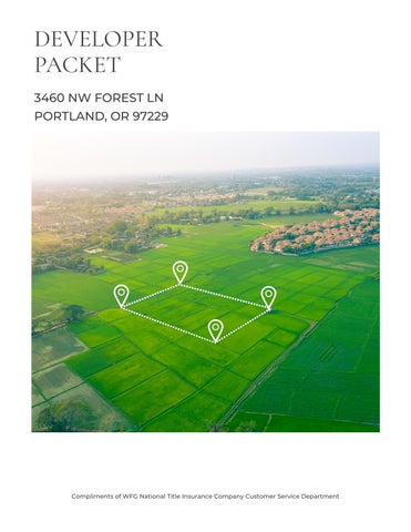
DEVELOPER PACKET

3460 NW FOREST LN

PORTLAND, OR 97229

Compliments of WFG National Title Insurance Company Customer Service Department

TABLE OF

Property Details

Utility As-Builts (Water & Sewer)

Zoning Information

Custom Maps

 Community Information

-Demographics

-Traffic Counts

The information contained is provided by WFG’s Customer Service Department to our customers, and while deemed reliable, is not guaranteed.
CONTENT S

PROPERTY

DETAILS

 Property Information

Assessors Tax Map

Vesting Deed

The information contained is provided by WFG’s Customer Service Department to our customers, and while deemed reliable, is not guaranteed.

PropertyDetailReport

Owner:John&MarjorieCarson

Site:3460NWForestLnPortlandOR97229

Mail:POBox10944PortlandOR97296

LocationandSiteInformation

County: Multnomah LotSqFt: 140,025

LegalDescription: SECTION251N1W,TL1003.21ACRES LotAcres: 3.21

APN: R324499

TaxLot: 1N1W25A00100

Twn-Rng-Sec: 01N/01W/25/NE

LandUse: 101-Single-Family,Residential,Improved

LandUseSTD: SingleFamilyResidence

CountyBldgUse: RSFR-ResidentialImproved

Neighborhood: ForestPark #Dwellings: Subdivision: MapPage/Grid: 595-H2

LegalLot/Block: Zoning: MultnomahCo.-CFU2

CensusTract/Block: 007000/2001 Watershed: ColumbiaSlough-WillametteRiver

ElementarySchool: SkylineElementarySchool HighSchool: LincolnHighSchool

MiddleSchool: SkylineElementarySchool SchoolDistrict: Portland

PropertyCharacteristics

09/25/2009

Document#: 2009136131 LoanType:

DeedType: Deed Price/SqFt: $000 TitleCo: SellerName: ATKINSON,VIRGINIACTR

PreparedBy:WFGNationalTitleCustomerServiceDepartment 12909SW68thPkwy,Suite350,Portland,OR97223

P:5036031700|3608915474E:cs@wfgnationaltitlecom|cccs@wfgtitlecom

SentryDynamics,Inc anditscustomersmakenorepresentation,warrantiesorconditions,expressorimplied, astotheaccuracyorcompletenessofinformationcontainedinthisreport

TotalLivingArea: 2,560 Bedrooms: 4 YearBuilt/Eff: 1977 FirstFloorSqFt: 1,440 BathroomsTotal: 2 Heating: ForcedAir SecondFloorSqFt: BathroomsFull/Half: 2/0 Cooling: BasementFin/Unfin:
Stories:
Fireplace:
AssessmentandTaxInformation MarketTotal: $734,74000 PropertyTax: $7,68125 MarketLand: $444,000.00 Exemption: MarketStructure: $290,740.00 MarketImproved%: 40.00% AsssessmentYear: 2022 LevyCode: 391 AssessedTotal: $389,440.00 MillRate: 19.7238
Lender:
1,120/0
1
2 AtticFin/Unfin: Foundation: Concrete Pool: GarageSqFt: RoofMaterial: Wood Kitchen: 1
SaleandLoanInformation SaleDate:
SaleAmount: LoanAmount:

ParcelID:R324499

SiteAddress:3460NWForestLn

SentryDynamics,Inc anditscustomersmakenorepresentations, warrantiesorconditions,expressorimplied,astotheaccuracyor completenessofinformationcontainedinthisreport

AssessorMap

ParcelID:R324499

SentryDynamics,Inc anditscustomersmakenorepresentations, warrantiesorconditions,expressorimplied,astotheaccuracyor completenessofinformationcontainedinthisreport

AerialMap

UTILITY

AS - BUILTS

 Water As-Built Maps

Not in a Service District

 Sewer As-Built Maps

Not in a Service District

The information contained is provided by WFG’s Customer Service Department to our customers, and while deemed reliable, is not guaranteed.

ZONING

 Detailed Zoning Information

CFU2 (Commercial Forest Use-2)

Zoning Map

 Community Jurisdiction

The information contained is provided by WFG’s Customer Service Department to our customers, and while deemed reliable, is not guaranteed.

DETAILS

(3) A parcel or lot lawfully created by a partition or a subdivision plat after February 20, 1990.

(4) Exceptions to the standards of (A)(2) above:

(a) Where two contiguous parcels or lots are each developed with a lawfully established habitable dwelling, the parcels or lots shall be Lots of Record that remain separately transferable, even if they were held in the same ownership on February 20, 1990.

(b) Where approval for a “Lot of Exception” or a parcel smaller than 19 acres under the “Lot Size for Conditional Uses” provisions has been given by the Hearing Authority and the parcel was subsequently lawfully created, then the parcel shall be a Lot of Record that remains separately transferable, even if the parcel was contiguous to another parcel held in the same ownership on February 20, 1990.

(B) In this district, significant dates and ordinances applicable for verifying zoning compliance may include, but are not limited to, the following:

(1) July 10, 1958, F-2 zone applied;

(2) December 9, 1975, F-2 minimum lot size increased, Ord. 115 & 116;

(3) October 6, 1977, MUF-20 and CFU38 zones applied, Ord. 148 & 149;

(4) August 14, 1980, MUF-19 & 38 and CFU-80 zones applied, Ord. 236 & 238;

(5) February 20, 1990, lot of record definition amended, Ord. 643;

(6) January 7, 1993, MUF-19 & 38 zones changed to CFU-80, Ord. 743 & 745;

(7) August 8, 1998, CFU-1 zone applied, Ord. 916 (reenacted by Ord. 997);

(8) May 15, 2002, Lot of Record section amended, Ord. 982 & reenacted by Ord. 997;

(C) A Lot of Record which has less than the minimum lot size for new parcels, less than the front lot line minimums required, or which does not meet the access requirements of MCC 39.4135, may be occupied by any allowed use, review use or conditional use when in compliance with the other requirements of this district.

(D) The following shall not be deemed a Lot of Record:

(1) An area of land described as a tax lot solely for assessment and taxation purposes;

(2) An area of land created by the foreclosure of a security interest;

(3) A Mortgage Lot;

(4) An area of land created by court decree.

§ 39.3030 LOT OF RECORD –COMMERCIAL FOREST USE-2 (CFU-2).

(A) In addition to the standards in MCC 39.3005, for the purposes of the CFU-2 district a Lot of Record is either:

(1) A parcel or lot which was not contiguous to any other parcel or lot under the same ownership on February 20, 1990, or

(2) A group of contiguous parcels or lots:

(a) Which were held under the same ownership on February 20, 1990; and

3-4 CHAPTER 39 – MULTNOMAH COUNTY ZONING CODE

(b) Which, individually or when considered in combination, shall be aggregated to comply with a minimum lot size of 19 acres, without creating any new lot line.

1. Each Lot of Record proposed to be segregated from the contiguous group of parcels or lots shall be a minimum of 19 acres in area using existing legally created lot lines and shall not result in any remainder individual parcel or lot, or remainder of contiguous combination of parcels or lots, with less than 19 acres in area. See Examples 1 and 2 in this subsection.

2. There shall be an exception to the 19 acre minimum lot size requirement when the entire same ownership grouping of parcels or lots was less than 19 acres in area on February 20, 1990, and then the entire grouping shall be one Lot of Record. See Example 3 in this subsection.

3. Three examples of how parcels and lots shall be aggregated are shown in MCC 39.3070 Figure 1 with the solid thick line outlining individual Lots of Record:

4. The requirement to aggregate contiguous parcels or lots shall not apply to lots or parcels within exception or urban zones (e.g. MUA-20, RR, BRC, R10), but shall apply to contiguous parcels and lots within all farm and forest resource zones (i.e. EFU and CFU), or

(3) A parcel or lot lawfully created by a partition or a subdivision plat after February 20, 1990.

(4) Exceptions to the standards of (A)(2) above:

(a) Where two contiguous parcels or lots are each developed with a lawfully established habitable dwelling, the parcels or lots shall be Lots of Record that remain separately transferable, even if they were held in the same ownership on February 20, 1990.

(b) Where approval for a “Lot of Exception” or a parcel smaller than 19 acres under the “Lot Size for Conditional Uses” provisions has been given by the Hearing Authority and the parcel was subsequently lawfully created, then the parcel shall be a Lot of Record that remains separately transferable, even if the parcel was contiguous to another parcel held in the same ownership on February 20, 1990.

(B) In this district, significant dates and ordinances applicable for verifying zoning compliance may include, but are not limited to, the following:

(1) July 10, 1958, F-2 zone applied;

(2) December 9, 1975, F-2 minimum lot size increased, Ord. 115 & 116;

(3) October 6, 1977, MUF-20 and CFU38 zones applied, Ord. 148 & 149;

(4) August 14, 1980, MUF-19 & 38 and CFU-80 zones applied, Ord. 236 & 238;

(5) February 20, 1990, lot of record definition amended, Ord. 643;

(6) January 7, 1993, MUF-19 & 38 zones changed to CFU-80, Ord. 743 & 745;

(7) August 8, 1998, CFU-2 zone applied, Ord. 916 (reenacted by Ord. 997);

CHAPTER 39 – MULTNOMAH COUNTY ZONING CODE 3-5

(8) May 16, 2002, Lot of Record section amended, Ord. 982, reenacted by Ord. 997;

(C) A Lot of Record which has less than the minimum lot size for new parcels, less than the front lot line minimums required, or which does not meet the access requirements of MCC 39.4135, may be occupied by any allowed use, review use or conditional use when in compliance with the other requirements of this district.

(D) The following shall not be deemed a Lot of Record:

(1) An area of land described as a tax lot solely for assessment and taxation purposes;

(2) An area of land created by the foreclosure of a security interest;

(3) A Mortgage Lot.

(4) An area of land created by court decree.

§ 39.3040 LOT OF RECORD –COMMERCIAL FOREST USE-3 (CFU-3).

(A) In addition to the standards in MCC 39.3005, for the purposes of the CFU-3 district a Lot of Record is either:

(1) A parcel or lot which was not contiguous to any other parcel or lot under the same ownership on February 20, 1990, or

(2) A group of contiguous parcels or lots:

(a) Which were held under the same ownership on February 20, 1990; and

(b) Which, individually or when considered in combination, shall be aggregated to comply with a minimum lot size of 19 acres, without creating any new lot line.

1. Each Lot of Record proposed to be segregated from the contiguous group of parcels or lots shall be a minimum of 19 acres in area using existing legally created lot lines and shall not result in any remainder individual parcel or lot, or remainder of contiguous combination of parcels or lots, with less than 19 acres in area. See Examples 1 and 2 in this subsection.

2. There shall be an exception to the 19 acre minimum lot size requirement when the entire same ownership grouping of parcels or lots was less than 19 acres in area on February 20, 1990, and then the entire grouping shall be one Lot of Record. See Example 3 in this subsection.

3. Three examples of how parcels and lots shall be aggregated are shown in MCC 39.3070 Figure 1 with the solid thick line outlining individual Lots of Record:

4. The requirement to aggregate contiguous parcels or lots shall not apply to lots or parcels within exception, urban, or Columbia River Gorge National Scenic Area zones (e.g. MUA20, RR, SRC, R-10, GGA-40), but shall apply to contiguous parcels and lots within all farm and forest resource zones (i.e. EFU and CFU), or

(3) A parcel or lot lawfully created by a partition or a subdivision plat after February 20, 1990.

(4) Exceptions to the standards of (A)(2) above:

3-6 CHAPTER 39 – MULTNOMAH COUNTY ZONING CODE

PART 4 – BASE ZONES

PART 4.A – RESOURCE DISTRICTS

PART 4.A.1 – COMMERCIAL FOREST USE DISTRICTS (CFU)

§ 39.4050- PURPOSES.

(A) The purposes of the Commercial Forest Use Base Zones (CFU) are to conserve and protect designated lands for continued commercial growing and harvesting of timber and the production of wood fiber and other forest uses; to conserve and protect watersheds, wildlife habitats and other forest associated uses; to protect scenic values; to provide for agricultural uses; to provide for recreational opportunities and other uses which are compatible with forest use; implement applicable Comprehensive Plan policies, and to minimize potential hazards or damage from fire, pollution, erosion or urban development.

(B) One of the implementation tools to carry out the purposes of the CFU is a Lot of Record requirement to group into larger "Lots of Record" those contiguous parcels and lots that were in the same ownership on February 20, 1990. This requirement is in addition to all "tract" grouping requirements of State Statute and Rule.

(C) The CFU Base Zones are: CFU, CFU-1, CFU-2, CFU-3, CFU-4, and CFU-5. These zones may be referred to collectively as the “CFU” because all standards and requirements applicable to the specific CFU base zone itself also apply to each of the other zones except as expressly stated otherwise.

§ 39.4055 AREA AFFECTED.

MCC 39.4050 through 39.4155 shall apply to those lands designated CFU (CFU, CFU-1, CFU-2, CFU-3, CFU-4, and CFU-5) on the Multnomah County Zoning Map.

§ 39.4060 DEFINITIONS.

As used in MCC 39.4050 through 39.4155, unless otherwise noted, the following terms and their derivations shall have the following meanings:

Auxiliary - For the purposes of MCC 39.4070 (A)(2) to (3), the use or alteration of a structure or land which provides temporary help, or is directly associated with the conduct of a particular forest practice. An auxiliary structure shall be located on site, be temporary in nature, and be designed not to remain for the entire growth cycle of the forest from planting to harvesting. An auxiliary use shall be removed when the particular forest practice for which it was approved is concluded.

Commercial Tree Species - Trees recognized under rules adopted under ORS 527.715 (1996) for commercial production.

Contiguous - Refers to parcels or lots which have any common boundary, excepting a single point, and shall include, but not be limited to, parcels or lots separated only by an alley, street or other right-of-way.

Cubic Foot Per Acre - The average annual increase in cubic foot volume of wood fiber per acre for fully stocked stands at the culmination of mean annual increment as reported by the USDA Soil Conservation Service. Where SCS data are not available or are shown to be inaccurate, an alternative method for determining productivity may be used. An alternative method must provide equivalent data and be approved by the Department of Forestry.

Cubic Foot Per Tract Per Year - The average annual increase in cubic foot volume of wood fiber per tract for fully stocked stands at the culmination of mean annual increment as reported by the USDA Soil Conservation Service. Where SCS data are not available or are shown to be inaccurate, an alternative method for determining productivity may be used. An alternative method must provide equivalent data and be approved by the Department of Forestry.

CHAPTER 39 – MULTNOMAH COUNTY ZONING CODE 4-1

Forest Operation - Any commercial activity relating to the growing or harvesting of any forest tree species as defined in ORS 527.620(6).

Heritage Tract Dwelling - A type of single family detached dwelling in the EFU and the CFU zoning districts with approval criteria that includes a requirement for ownership of the lot or parcel prior to January 1, 1985. The complete description of approval standards are in the use sections of the districts.

Large Acreage Dwelling - A type of single family detached dwelling in the CFU zoning districts with approval criteria that includes a requirement for single ownership of 160 contiguous forest zoned acres or single ownership of 200 forest zoned acres in Multnomah County or adjacent counties that are not contiguous. The complete description of approval standards are in the use sections of the districts.

Same Ownership - Refers to greater than possessory interests held by the same person or persons, spouse, minor age child, same partnership, corporation, trust or other entity, separately, in tenancy in common or by other form of title. Ownership shall be deemed to exist when a person or entity owns or controls ten percent or more of a lot or parcel, whether directly or through ownership or control or an entity having such ownership or control. For the purposes of this subsection, the seller of a property by sales contract shall be considered to not have possessory interest.

Template Dwelling - A type of single family detached dwelling in the CFU zoning districts with approval criteria that includes a requirement that a certain number of parcels and dwellings exist within a 160-acre square (map template) centered on the subject tract. The complete description of requirements are in the use sections of the district.

Tract - One or more contiguous Lots of Record in the same ownership. A tract shall not be considered to consist of less than the required acreage because it is crossed by a public road or waterway. Lots that are contiguous with a

common boundary of only a single point are not a tract.

§ 39.4065 USES.

No building, structure or land shall be used and no building or structure shall be hereafter erected, altered or enlarged in the CFU except for the uses listed in MCC 39.4070 through 39.4080 when found to comply with MCC 39.4100 through 39.4155 provided such uses occur on a Lot of Record.

§ 39.4070 ALLOWED USES.

The following uses and their accessory uses are allowed, subject to all applicable supplementary regulations contained in MCC Chapter 39.

(A) The following uses pursuant to the Forest Practices Act and Statewide Planning Goal 4:

(1) Forest operations or forest practices including, but not limited to, reforestation of forest land, road construction and maintenance, harvesting of a forest tree species, application of chemicals, and disposal of slash;

(2) Temporary or permanent on site structures which are auxiliary to and used during a particular forest operation per ORS 215 and 455.315. Conversion of these structures is subject to any applicable land use and building permit review procedures; or

(3) Physical alterations to the land auxiliary to forest practices including, but not limited to, those for purposes of exploration, mining, commercial gravel extraction and processing, landfills, dams, reservoirs, road construction or recreational facilities.

(B) A temporary portable facility for the primary processing of forest products.

(C) Farm use, as defined in ORS 215.203.

4-2 CHAPTER 39 – MULTNOMAH COUNTY ZONING CODE

(D) Alteration, maintenance, replacement or restoration of an existing lawfully established habitable dwelling as defined in MCC 39.2000 and located within 100-feet from an existing dwelling.

(1) In the case of a replacement dwelling, the existing dwelling shall be removed, demolished or converted to an allowable nonresidential use within three months of the completion or occupancy of the replacement dwelling.

(2) Restoration or replacement due to fire, other casualty or natural disaster shall commence within one year from the occurrence of the fire, casualty or natural disaster.

(E) Uses to conserve soil, air and water quality and to provide for wildlife and fisheries resources, including a public or private wildlife and fisheries resources conservation area.

(F) An uninhabitable structure accessory to fish and wildlife enhancement.

(G) A caretaker residence for a public park or a fish hatchery.

(H) Local distribution lines (e.g., electric, telephone, natural gas, etc.) and accessory equipment (e.g., electric distribution transformers, poles, meter cabinets, terminal boxes, pedestals), or equipment which provides service hookups, including water service hookups.

(I) Climbing and passing lanes within the right of way existing as of July 1, 1987.

(J) Reconstruction or modification of public roads and highways, not including the addition of vehicular travel lanes, where no removal or displacement of buildings will occur, or no new land parcels result.

(K) Temporary public road and highway detours that will be abandoned and restored to original condition or use at such time as no longer needed.

(L) Minor betterment of existing public roads and highway related facilities such as maintenance yards, weigh stations and rest areas, within a right-of-way existing as of July 1, 1987, and contiguous public-owned property utilized to support the operation and maintenance of public roads and highways.

(M) A lookout tower for forest fire protection.

(N) A water intake facility, canal and distribution lines for farm irrigation and ponds.

(O) A temporary forest labor camp.

(P) Exploration for mineral and aggregate resources as allowed by state law.

(Q) Exploration for geothermal resources.

(R) A site for the disposal of solid waste that has been ordered to be established by the Environmental Quality Commission under ORS 459.049, together with equipment, facilities or buildings necessary for its operation.

(S) Type A home occupations pursuant to MCC 39.8800.

(T) Accessory Structures subject to the following:

(1) The accessory structure is customarily accessory or incidental to any use permitted or approved in this base zone, is located within 100 feet of the dwelling and is a structure identified in the following list:

(a) Garages or carports;

(b) Pump houses;

(c) Garden sheds;

(d) Workshops;

(e) Storage sheds, including shipping containers used for storage only;

(f) Greenhouses;

CHAPTER 39 – MULTNOMAH COUNTY ZONING CODE 4-3

(g) Woodsheds;

(h) Shelter for pets, horses or livestock and associated buildings such as: manure storage, feed storage, tack storage, and indoor exercise area;

(i) Swimming pools, pool houses, hot tubs, saunas, and associated changing rooms;

(j) Sport courts;

(k) Gazebos, pergolas, and detached decks;

(l) Fences, gates, or gate support structures; and

(m) Mechanical equipment such as air conditioning unites, heat pumps and electrical boxes; and

(n) Similar structures.

(2) The Accessory Structure shall not be designed or used, whether temporarily or permanently, as a primary dwelling, accessory dwelling unit, apartment, guesthouse, housing rental unit, sleeping quarters or any other residential use.

(3) The Accessory Structure may contain one sink.

(4) The Accessory Structure shall not contain:

(a) More than one story;

(b) Cooking Facilities;

(c) A toilet;

(d) Bathing facilities such as a shower or bathing tub;

(e) A mattress, bed, Murphy bed, cot, or any other similar item designed to aid in sleep as a primary purpose, unless such item is disassembled for storage; or

(f) A closet built into a wall.

(5) Compliance with MCC 39.8860 is required.

(6) The combined footprints of all Accessory Buildings on a Lot of Record shall not exceed 2,500 square feet.

(7) An Accessory Building exceeding any of the Allowed Use provisions above shall be considered through the Review Use provisions.

(8) Buildings in conjunction with farm uses as defined in ORS 215.203 are not subject to these provisions. Such buildings shall be used for their allowed farm purposes only and, unless so authorized, shall not be used, whether temporarily or permanently, as a primary dwelling, accessory dwelling unit, apartment, guesthouse, housing rental unit, sleeping quarters or any other residential use.

(U) Actions taken in response to an emergency/disaster event as defined in MCC 39.2000 pursuant to the provisions of MCC 39.6900.

(V) Wildlife Habitat Conservation and Management Plan. This use is not allowed in the CFU-1, CFU-2, CFU-3, CFU-4, or CFU-5 and authorization of a single family dwelling in conjunction with a Wildlife Habitat Conservation and Management Plan is prohibited.

(W) Signs, as provided in this chapter.

(X) Solar, photovoltaic and wind turbine alternative energy production facilities accessory to uses permitted in the base zone, provided that:

(1) All systems shall meet the following requirements:

(a) The system is an accessory alternative energy system as defined in MCC 39.2000;

4-4 CHAPTER 39 – MULTNOMAH COUNTY ZONING CODE

(b) The system meets all base zone, overlay, and other zoning requirements;(c) The system is mounted to a ground mount, to the roof of the dwelling or accessory structure, or to a wind tower;

(2) The overall height of solar energy systems shall not exceed the peak of the roof of the building on which the system is mounted;

(3) Wind Turbine Systems:

(a) Wind turbine systems shall be set back from all property lines a distance equal to or greater than the combined height of the turbine tower and blade length. Height is measured from grade to the top of the wind generator blade when it is at its highest point;

(b) No lighting on wind turbine towers is allowed except as required by the Federal Aviation Administration or other federal or state agency.

(c) The land owner must sign and record a covenant stating they are responsible for the removal of the system if it is abandoned. In the case of a sale or transfer of property, the new property owner shall be responsible for the use and/or removal of the system. Systems unused for one consecutive year are considered abandoned.

§ 39.4075 REVIEW USES.

The following uses may be permitted when found by the approval authority to satisfy the applicable standards of this Chapter:

(A) Replacement or restoration of an existing lawfully established habitable dwelling more than 100 feet from the existing dwelling.

(1) In the case of a replacement dwelling, the existing dwelling is removed, demolished or converted to an

allowable nonresidential use within three months of the completion or occupancy of the replacement dwelling.

(2) Restoration or replacement due to fire, other casualty or natural disaster shall commence within one year from the occurrence of the fire, casualty or natural disaster.

(B) The following dwellings:

Base Zone Large Acreage Dwellingpursuant to MCC 39.4085 and all other applicable criteria.

Template Dwellingpursuant to MCC 39.4090 and all other applicable criteria.

Heritage Tract Dwellingpursuant to MCC 39.4095 and all other applicable criteria.

CFU YES YES YES CFU-

YES NO NO

(C) A temporary dwelling for health hardship pursuant to all applicable approval criteria, including but not limited to MCC 39.8700 and 39.4110.

(D) An asphalt and concrete batch plant accessory to a specific highway project pursuant to MCC 39.4100.

CHAPTER 39 – MULTNOMAH COUNTY ZONING CODE 4-5
1
CFU2 YES
CFU3 NO NO NO CFU4 YES YES
CFU5 NO
YES YES
YES
YES NO

(E) A mobile home during the construction or reconstruction of a residence allowed under MCC 39.4070 (D) or MCC 39.4075 (A) or (B), provided that the mobile home is removed, demolished or converted to an allowable nonresidential use within three months of the completion of the dwelling pursuant to all applicable approval criteria, including but not limited to MCC 39.4100, 39.4110 and 39.4115.

(1) In the CFU-4 zone, the mobile home may not exceed a period of two years.

(F) Off-street parking and loading as required by MCC 39.6500 through MCC 39.6600.

(G) Lot Line Adjustment pursuant to all applicable approval criteria, including but not limited to the provisions of MCC 39.4130.

(H) Placement of structures necessary for continued public safety, or the protection of essential public services or protection of private or public existing structures, utility facilities, roadways, driveways, accessory uses and exterior improvements damaged during an emergency/disaster event. This includes replacement of temporary structures erected during such events with permanent structures performing an identical or related function. Land use proposals for such structures shall be submitted within 12 months following an emergency/disaster event. Applicants are responsible for all other applicable local, state and federal permitting requirements.

(I) Wireless communications facilities that employ concealment technology or co-location as described in MCC 39.7710(B) pursuant to the applicable approval criteria of MCC 39.7700 through MCC 39.7765.

(J) Lots of Exception pursuant to all applicable approval criteria, including, but not limited to MCC 39.4125, MCC 39.4135 and Part 9 of this Chapter.

(K) Consolidation of Parcels and Lots pursuant to MCC 39.9200.

(L) Structures or uses customarily accessory or incidental to any use permitted or approved in the CFU, which do not meet the “accessory structures” standard in MCC 39.4070 Allowed Uses, but which meet the following provisions:

(1) The Accessory Structure shall not be designed or used, whether temporarily or permanently, as a primary dwelling, accessory dwelling unit, apartment, guesthouse, housing rental unit, sleeping quarters or any other residential unit.

(2) The Accessory Structure shall not contain a bathing tub.

(3) Any toilet or bathing facilities, such as a shower, shall be located on the ground floor of any multi-story building.

(4) An Accessory Structure containing a toilet or bathing facilities shall not contain Cooking Facilities.

(5) The Accessory Structure shall not contain a mattress, bed, Murphy bed, cot, or any other similar item designed to aid in sleep as a primary purpose, unless such item is disassembled for storage.

(6) The applicant must show that building features or combined building footprints exceeding the Allowed Use provisions are the minimum possible departure from the Allowed Use standards to accommodate the use.

(7) Compliance with MCC 39.8860 is required.

(M) A Type B home occupation when approved pursuant to MCC 39.8850.

§ 39.4080 CONDITIONAL USES.

The following uses may be permitted when found by the approval authority to satisfy the applicable standards of this Chapter:

(A) The following Community Service Uses pursuant to all applicable approval criteria, including but not limited to the provisions of

4-6 CHAPTER 39 – MULTNOMAH COUNTY ZONING CODE

MCC 39.4100, MCC 39.4105, MCC 39.4110, MCC 39.4115, and MCC 39.7500 through MCC 39.7525. For purposes of this Section, the applicable criteria of MCC 39.7515 shall be limited to Subsections (A) through (H) of that Section.

(1) Private park and private campground. In addition to the approval standards listed in MCC 39.4080(A) above, a private campground shall be subject to the following:

(a) Except on a lot or parcel contiguous to a lake or reservoir, the campground shall not be allowed within three miles of an urban growth boundary unless an exception is approved pursuant to ORS 197.732 and OAR chapter 660, division 4.

(b) The campground shall be an area devoted to overnight temporary use for vacation, recreational or emergency purposes, but not for residential purposes.

(c) The campground is established on a site or is contiguous to lands with a park or other outdoor natural amenity that is accessible for recreational use by the occupants of the campground.

(d) The campground shall be designed and integrated into the rural agricultural and forest environment in a manner that protects the natural amenities of the site and provides buffers of existing native trees and vegetation or other natural features between campsites.

(e) Campsites may be occupied by a tent, travel trailer or recreational vehicle. Separate sewer, water or electric service hook-ups shall not be provided to individual camp sites. Overnight temporary use in the same campground by a camper or camper's vehicle shall not exceed

a total of 30 days during any consecutive 6 month period.

(f)The campground shall not include intensively developed recreational uses such as swimming pools, tennis courts, retail stores or gas stations.

(2) Cemetery.

(3) Fire station for rural and forest fire protection.

(4) Aid to navigation and aviation.

(5) Water intake facility, related treatment facility, pumping station, and distribution line. The term “distribution line” includes water conduits and water transmission lines.

(6) Reservoir and water impoundment.

(7) New distribution line (e.g., gas, oil, geothermal) with a right-of-way 50 feet or less in width or new electric transmission line with a right-of-way width of up to 100 feet as specified in ORS 772.210.

(8) Forest management research and experimentation facility as defined by ORS 526.215.

(9) State and Local Parks.

(a) Uses allowed in a State Park, subject to a state master plan as described in OAR 660 Division 34, are:

1. All uses allowed under Statewide Planning Goal 4, provided the uses are also allowed under OAR 736, Division 18; and

2. The uses, as authorized in a state master plan adopted by the Oregon Parks and Recreation Department (OPRD), listed in OAR 660-034-0035.

CHAPTER 39 – MULTNOMAH COUNTY ZONING CODE 4-7

3. A “State Park” is any property owned or managed by OPRD and that has been determined by OPRD to have outstanding natural, cultural, scenic and/or recreational resource values that support the state park system mission and role. For the purposes of this subsection, endowment properties and administrative sites are not state parks.

(b) Uses allowed in a Local Park are those specified in OAR 660-0340040. A Local Park is a public area intended for open space and outdoor recreation use that is owned and managed by a city, county, regional government, or park district and that is designated as a public park in the applicable comprehensive plan and zoning ordinance [OAR 660-0340010(8)].

(10) Utility facility for the purpose of generating power provided the facility not preclude more than 10 acres from use as a commercial forest operation unless an exception is taken pursuant to OAR 660, Division 4.

(11) Radio and television transmission towers subject to the definitions, restrictions and standards in MCC 39.7515, 39.7520 (A) (8) and 39.7550 through 39.7575 and wireless communications facilities when found to satisfy the requirements of MCC 39.7700 through 39.7765.

(12) Refuse dump or sanitary landfill for which the Department of Environmental Quality has granted a permit under ORS 459.245, together with equipment, facilities or buildings necessary for its operation.

(13) Regional Sanitary Landfill for which the Department of Environmental Quality has granted a permit under ORS 459.245, together with equipment,

facilities or buildings necessary for its operation subject to the definitions, restrictions and standards in MCC 39.7600 through 39.7625.

(14) Private hunting and fishing operation without any lodging accommodations.

(15) Private seasonal accommodations for a fee hunting operation or fishing, provided:

(a) Accommodations are limited to no more than 15 guest rooms as that term is defined in the Oregon Structural Specialty Code;

(b) Only minor incidental and accessory retail sales are permitted;

(c) Accommodations are occupied temporarily for the purpose of hunting during game bird and big game hunting seasons or fishing during fishing seasons authorized by the Oregon Fish and Wildlife Commission; and

(d) Accommodations for fishing must be located within 1/4 mile of fish bearing Class I waters.

(16) Mining, processing and production of geothermal resources.

(B) The following uses pursuant to all applicable approval criteria, including but not limited to the provisions of MCC 39.4100, MCC 39.4105, MCC 39.4110, MCC 39.4115, MCC 39.7000 through MCC 39.7035, and MCC 39.7300 through MCC 39.7330. For purposes of this Section, the applicable criteria of MCC 39.7015(A) shall be limited to Subsections (1) through (7) of that Section:

(1) Mining and processing of aggregate and other mineral or subsurface resources as allowed by state law;

(2) Permanent facility for the primary processing of forest products;

4-8 CHAPTER 39 – MULTNOMAH COUNTY ZONING CODE

(3) Permanent logging equipment repair and storage;

(4) Log scaling and weigh stations;

(5) Construction of additional passing and travel lanes requiring the acquisition of right of way but not resulting in the creation of new land parcels;

(6) Reconstruction or modification of public roads and highways involving the removal or displacement of buildings but not resulting in the creation of new land parcels;

(7) Improvement of public roads and highway related facilities, such as maintenance yards, weigh stations and rest areas, where additional property or right of way is required but not resulting in the creation of new land parcels; and

(8) Expansion of aircraft landing areas auxiliary to forestry practices, notwithstanding the provisions of MCC 39.5180 through 39.5190.

(C) Type C home occupations pursuant to all applicable approval criteria, including but not limited to MCC 39.7400 through 39.7410.

§ 39.4085 LARGE-ACREAGE DWELLING STANDARDS.

A large acreage dwelling may be sited on a tract or tracts, subject to the following:

(A) The lot or lots in the tract(s) meet(s) the applicable Lot of Record standards of Part 3 of this Chapter.

(B) The property consists of:

(1) A single tract of at least 160 contiguous acres in one ownership within Multnomah County and all zoned for forest use; or,

(2) Two or more tracts of at least 200 combined acres in one ownership that are not contiguous, but are in

Multnomah County or adjacent counties, and all zoned for forest use.

(C) There is no other dwelling on the tract and no other dwellings are allowed on other lots (or parcels) that make up the tract.

(D) The dwelling will be located outside a big game winter habitat area as defined by the Oregon Department of Fish and Wildlife, or that agency has certified that the impacts of the additional dwelling, considered with approvals of other dwellings in the area since acknowledgment of the Comprehensive Plan in 1980, will be acceptable.

(E) A statement has been recorded with the Division of Records that the owner and the successors in interest acknowledge the rights of owners of nearby property to conduct forest operations consistent with the Forest Practices Act and Rules, and to conduct accepted farming practices;

(F) Proof of a long-term road access use permit or agreement shall be provided if road access to the dwelling is by a road owned and maintained by a private party or by the Oregon Department of Forestry, the Bureau of Land Management, or the United States Forest Service. The road use permit may require the applicant to agree to accept responsibility for road maintenance;

(G) A condition of approval requires the owner of the tract to plant a sufficient number of trees on the tract to demonstrate that the tract is reasonably expected to meet Department of Forestry stocking requirements at the time specified in Department of Forestry administrative rules, provided, however, that:

(1) The planning department shall notify the county assessor of the above condition at the time the dwelling is approved;

(2) The property owner shall submit a stocking survey report to the county assessor and the assessor will verify that the minimum stocking requirements have been met by the time required by

CHAPTER 39 – MULTNOMAH COUNTY ZONING CODE 4-9

Department of Forestry rules. The assessor will inform the Department of Forestry in cases where the property owner has not submitted a stocking survey report or where the survey report indicates that minimum stocking requirements have not been met;

(3) Upon notification by the assessor the Department of Forestry will determine whether the tract meets minimum stocking requirements of the Forest Practices Act. If the department determines that the tract does not meet those requirements, the department will notify the owner and the assessor that the land is not being managed as forest land. The assessor will then remove the forest land designation pursuant to ORS 321.359 and impose the additional tax pursuant to state law;

(H) Evidence is provided, prior to the issuance of a building permit, that the covenants, conditions and restrictions form adopted as "Exhibit A" to the Oregon Administrative Rules (OAR), Chapter 660, Division 6 (December, 1995) has been recorded with the county Division of Records;

(1) The covenants, conditions and restrictions as specified in "Exhibit A" above shall specify that it is not lawful to use the acreage of the subject tract to qualify another tract for the siting of a dwelling;

(2) The covenants, conditions and restrictions as specified in "Exhibit A" are irrevocable, unless a statement of release is signed by an authorized representative of Multnomah County and any other county where the property subject to the covenants, conditions and restrictions is located;

(3) Enforcement of the covenants, conditions and restrictions shall be as specified in OAR 660-06-027 (December, 1995).

(I) The dwelling meets the applicable development standards of MCC 39.4110 and 39.4115.

§ 39.4090 TEMPLATE DWELLINGS STANDARDS.

(A) A template dwelling may be sited on a tract, subject to the following:

(1) The lot or lots in the tract shall meet the applicable Lot of Record standards of Part 3 of this Chapter.

(2) The tract shall be of sufficient size to accommodate siting the dwelling in accordance with MCC 39.4110 and 39.4115;

(3) The tract shall meet the following standards:

(a) If the tract is predominantly composed of soils which are capable of producing 0 to 49 cubic feet of Douglas Fir timber per acre per year (cf/ac/yr); and

1. The lot upon which the dwelling is proposed to be sited and at least all or part of 3 other lawfully created lots existed on January 1, 1993 within a 160acre square when centered on the center of the subject tract parallel and perpendicular to section lines; and

2. At least three dwellings lawfully existed on January 1, 1993 within the 160-acre square and those dwellings either continue to exist or have been replaced by lawful replacement dwellings, or

4-10 CHAPTER 39 – MULTNOMAH COUNTY ZONING CODE

(b) If the tract is predominantly composed of soils which are capable of producing 50 to 85 cf/ac/yr of Douglas Fir timber; and

1. The lot upon which the dwelling is proposed to be sited and at least all or part of 7 other lawfully created lots existed on January 1, 1993 within a 160acre square when centered on the center of the subject tract parallel and perpendicular to section lines; and

2. At least three dwellings lawfully existed on January 1, 1993 within the 160-acre square and those dwellings either continue to exist or have been replaced by lawful replacement dwellings, or

(c) If the tract is predominantly composed of soils which are capable of producing above 85 cf/ac/yr of Douglas Fir timber; and

1. The lot upon which the dwelling is proposed to be sited and at least all or part of 11 other lawfully created lots existed on January 1, 1993 within a 160-acre square when centered on the center of the subject tract parallel and perpendicular to section lines; and

2. At least five dwellings lawfully existed on January 1, 1993 within the 160-acre square and those dwellings either continue to exist or have been replaced by lawful replacement dwellings

(d) Lots and dwellings within urban growth boundaries shall not be counted to satisfy Subsections (a) through (c) above.

(e) There is no other dwelling on the tract.

(f) No other dwellings are allowed on other lots (or parcels) that make up the tract.

(g) Except as provided for a replacement dwelling, all lots (or parcels) that are part of the tract shall be precluded from all future rights to site a dwelling.

(h) No lot (or parcel) that is part of the tract may be used to qualify another tract for the siting of a dwelling.

(i) Pursuant to the definition of “Date of Creation and Existence” in MCC 39.2000, if the lot, parcel or tract does not qualify for a dwelling under the standards in this section, any reconfiguration after November 4, 1993 cannot in any way enable the tract to meet the criteria for a new dwelling.

(j) Pursuant to the definition of “Date of Creation and Existence” in MCC 39.2000, lots, parcels and tracts that are reconfigured after November 4, 1993 cannot be counted as meeting the “other lawfully created lots” existing on January 1, 1993 standard in subsections (A)(3)(a), (b), and (c) of this Section above: 3, 7, and 11 lots respectively.

(k) “Within” as used in the context of Subsections (a)2., (b)2. and (c)2. of this Section shall mean that all of the dwellings or any part of the dwellings are in the 160-acre square.

CHAPTER 39 – MULTNOMAH COUNTY ZONING CODE 4-11

(4) The dwelling will be located outside a big game winter habitat area as defined by the Oregon Department of Fish and Wildlife, or that agency has certified that the impacts of the additional dwelling, considered with approvals of other dwellings in the area since acknowledgment of the Comprehensive Plan in 1980, will be acceptable.

(5) Proof of a long-term road access use permit or agreement shall be provided if road access to the dwelling is by a road owned and maintained by a private party or by the Oregon Department of Forestry, the Bureau of Land Management, or the United States Forest Service. The road use permit may require the applicant to agree to accept responsibility for road maintenance.

(6) A condition of approval requires the owner of the tract to plant a sufficient number of trees on the tract to demonstrate that the tract is reasonably expected to meet Department of Forestry stocking requirements at the time specified in Department of Forestry administrative rules, provided, however, that:

(a) The planning department shall notify the county assessor of the above condition at the time the dwelling is approved;

(b) The property owner shall submit a stocking survey report to the county assessor and the assessor will verify that the minimum stocking requirements have been met by the time required by Department of Forestry rules. The assessor will inform the Department of Forestry in cases where the property owner has not submitted a stocking survey report or where the survey report indicates that minimum stocking requirements have not been met;

(c) Upon notification by the assessor the Department of Forestry will determine whether the tract meets minimum stocking requirements of the Forest Practices Act. If the department determines that the tract does not meet those requirements, the department will notify the owner and the assessor that the land is not being managed as forest land. The assessor will then remove the forest land designation pursuant to ORS 321.359 and impose the additional tax pursuant to state law;

(7) The dwelling meets the applicable development standards of MCC 39.4110 and 39.4115;

(8) A statement has been recorded with the Division of Records that the owner and the successors in interest acknowledge the rights of owners of nearby property to conduct forest operations consistent with the Forest Practices Act and Rules, and to conduct accepted farming practices;

(9) Evidence is provided, prior to the issuance of a building permit, that the covenants, conditions and restrictions form adopted as "Exhibit A" to the Oregon Administrative Rules (OAR), Chapter 660, Division 6 (December, 1995), or a similar form approved by the Planning Director, has been recorded with the county Division of Records;

(a) The covenants, conditions and restrictions shall specify that:

1. All lots (or parcels) that are part of the tract shall be precluded from all future rights to site a dwelling; and

2. No lot (or parcel) that is part of the tract may be used to qualify another tract for the siting of a dwelling;

4-12 CHAPTER 39 – MULTNOMAH COUNTY ZONING CODE

(b) The covenants, conditions and restrictions are irrevocable, unless a statement of release is signed by an authorized representative of Multnomah County. That release may be given if the tract is no longer subject to protection under Statewide Planning Goals for forest or agricultural lands;

(c) Enforcement of the covenants, conditions and restrictions shall be as specified in OAR 660-06-027 (December, 1995).

§ 39.4095 HERITAGE TRACT DWELLINGS STANDARDS.

(A) A heritage tract dwelling may be sited, subject to the following:

(1) On a tract:

(a) That is not developed with a single family residence, and

(b) That is not capable of producing 5,000 cubic feet per year of commercial tree species based on soil type, and

(c) That is located within 1,500 feet of a public road as defined under ORS 368.001 that provides or will provide access to the subject tract. The road within the public right-ofway shall be maintained to the standards set forth in the County Right-of-Way Access Permit and be, as applicable, either paved or surfaced with rock. The road shall not be:

1. A U.S. Bureau of Land Management road; or

2. A U.S. Forest Service road unless the road is paved to a minimum width of 18 feet, there is at least one defined lane in each direction and a maintenance agreement exists between the United States

Forest Service and landowners adjacent to the road, a local government or a state agency.

(d) For which deeds or other instruments creating the lots or parcels were recorded with the County Recorder, or were in recordable form prior to January 1, 1985;

(e) That is comprised of lots or parcels that were lawfully created and pursuant to the definition of “Date of Creation and Existence” in MCC 39.2000, if the lot, parcel or tract does not qualify for a dwelling under the standards in this section, any reconfiguration after November 4, 1993 cannot in any way enable the tract to meet the criteria for a new dwelling;

(f) Notwithstanding the same ownership grouping requirements of the Lot of Record section, the tract was acquired and owned continuously by the present owner:

1. Since prior to January 1, 1985; or

2. By devise or by intestate succession from a person who acquired the lot or parcel since prior to January 1, 1985.

3. For purposes of this subsection, “owner” includes spouses, child, child-in-law, parent, sibling, sibling-in-law, parent-in-law, sibling of a parent, child of a sibling, stepparent, stepchild, grandparent or grandchild of the owner or a business entity owned by any one or combination of these family members.

CHAPTER 39 – MULTNOMAH COUNTY ZONING CODE 4-13
(S-1 2022)

(g) Where the lot or parcel on which the dwelling will be sited was part of a tract on November 4, 1993, that no dwelling exists on another lot or parcel that was part of that tract.

(2) When the lot or parcel on which the dwelling will be sited lies within an area designated in an acknowledged comprehensive plan as habitat of big game, the siting of the dwelling shall be consistent with the limitations on density upon which the acknowledged comprehensive plan and land use regulations intended to protect the habitat are based.

(3) When the tract on which the dwelling will be sited consists of more than one lot or parcel, the remaining lots or parcels shall be consolidated into a single lot or parcel prior to the issuance of any development permits.

(4) Prior to the issuance of any development permits the owner of the tract shall plant a sufficient number of trees on the tract to demonstrate that the tract is reasonably expected to meet Department of Forestry stocking requirements at the time specified in Department of Forestry administrative rules, provided, however, that:

(a) The Land Use Planning Division shall notify the County Assessor of the above condition at the time the dwelling is approved;

(b) The property owner shall submit a stocking survey report to the County Assessor and the Assessor will verify that the minimum stocking requirements have been met by the time required by Department of Forestry rules. The Assessor will inform the Department of Forestry in cases where the property owner has not submitted a stocking survey report or where the survey report indicates

that minimum stocking requirements have not been met;

(c) Upon notification by the Assessor, the Department of Forestry will determine whether the tract meets minimum stocking requirements of the Forest Practices Act. If the Department of Forestry determines that the tract does not meet those requirements, it will notify the owner and the Assessor that the land is not being managed as forest land. The Assessor will then remove the forest land designation pursuant to ORS 321.359 and impose the additional tax pursuant to state law;

(5) The dwelling meets the applicable standards of MCC 39.4110 and 39.4115. (Ord. 1309, Amended, 08/18/2022)

§ 39.4100 USE COMPATIBILITY STANDARDS.

(A) Specified uses of MCC 39.4075 (D) and (E) and MCC 39.4080 (A), (B) and (C) may be allowed upon a finding that:

(1) The use will:

(a) Not force a significant change in, or significantly increase the cost of, accepted forestry or farming practices on surrounding forest or agricultural lands;

(b) Not significantly increase fire hazard, or significantly increase fire suppression costs, or significantly increase risks to fire suppression personnel; and

(2) A statement has been recorded with the Division of Records that the owner and the successors in interest acknowledge the rights of owners of nearby property to conduct forest operations consistent with the Forest Practices Act and Rules, and to conduct accepted farming practices.

(S-1 2022)

4-14 CHAPTER 39 – MULTNOMAH COUNTY ZONING CODE

(B) In the East of Sandy River Planning Area single family dwellings as specified in MCC 39.4075 (B) may be allowed upon a finding that they will not significantly impact open space, public facilities, wildlife habitat, and rural community character.

§ 39.4105 BUILDING HEIGHT REQUIREMENTS.

(A) Maximum structure height – 35 feet.

(B) Structures such as barns, silos, windmills, antennae, chimneys, or similar structures may exceed the height requirements.

§ 39.4110 FOREST PRACTICES SETBACKS AND FIRE SAFETY ZONES.

The Forest Practice Setbacks and applicability of the Fire Safety Zones is based upon existing conditions, deviations are allowed through the exception process and the nature and location of the proposed use. The following requirements apply to all structures as specified:

CHAPTER 39 – MULTNOMAH COUNTY ZONING CODE 4-15
CFU2 OS RF RF NW53RDDR NW THOMPSON RD N W F O R E S T L N NW 53RD DR NWFIRELA N E 1 DR This map s a copy of public record and s provided solely for nform ation purposes W FG National Tit e assumes no liab ity for variations, f any, in d mens ons, area or location of the prem ises or the locat on of mprovements Customer Serv ice D epartment 12909 SW 68th Parkway, Suite 350 Portl and, OR 97223 (503) 603-1700 cs@w fgnationaltitle.com 0 190 380 95 Fee t Zoni ng Subject Property Tax Lots Park s & O pen Spaces Rural Single Family ²

RELATED PROPERTIES

Split/MergedatapriortoFebruary6,2018isnotavailableonline, pleasecallMultnomahCountyAssessment&Taxationdivision.

Property Owner Property Address 2022 Assessed Value R264779 VANHORN,RONALD
GENERAL INFORMATION Property Status A Active Property Type RP Residential Legal Description SANDBERG ADD, BLOCK 4, LOT 42 Alternate Account Number R743002590 Neighborhood R138 Map Number 1S2E04AB -07100 Property Use B - RESIDENTIAL IMPROVED LevyCode Area 201
Owner Name VAN HORN,RONALD
&VAN
V Mailing Address 9229 SE YAMHILL ST PORTLAND, OR
G &VANHORN,VALERIEV 9229SEYAMHILL ST,PORTLAND,OR97216 $142,810
OWNERINFORMATION
G
HORN,VALERIE
97216-2127
Linked PropertiesProperty Group IDGrouped PropertiesSplit / Merge DateSplit / Merge AccountsSplit / Merge MessageIMPROVEMENTS  Expand/Collapse All LAND SEGMENTS LANDNO LANDTYPE LANDSIZE L1 RES RESIDENTIAL LAND 5,995Sq. ft TOTALS 5,995 Sq. ft/0.14 acres ASSESSEDVALUES YEAR IMPROVEMENTS LAND SPECIALMARKET/USE RMV M5VALUE EXEMPTIONS M50ASSESSED 2022 $130,880 $220,000 -/- $350,880 $350,880 $142,810 2021 $117,840 $195,000 -/- $312,840 $312,840 $138,660 2020 $99,840 $185,000 -/- $284,840 $284,840 $134,630 2019 $96,690 $185,000 -/- $281,690 $281,690 $130,710 2018 $92,200 $175,000 -/- $267,200 $267,200 $126,910 2017 $83,050 $145,000 $0 / $0 $228,050 $228,050 $123,220 2016 $70,120 $128,000 -/$0 $198,120 $198,120 $119,640 2015 $71,390 $96,300 $0 / $0 $167,690 $167,690 $116,160 2014 $59,070 $92,700 $0 / $0 $151,770 $151,770 $112,780 2013 $51,420 $85,000 $0 / $0 $136,420 $136,420 $109,500  Improvement#1 Improvement Type Building Type Class - SINGLE FAMILYRESIDENTIAL 1STY 3.0 ID SEGMENTTYPE YEARBUILT EFFECTIVEYEARBUILD SQ.FT 1 MAIN 1948 1948 1,050 2 CONCRETE - - 500 3 ENCPORCH - - 36
SALES HISTORY DEED SELLER BUYER INSTR# DATE CONSIDERATION AMOUNT INST VANHORN,RONALD G & VAN HORN,VALERIE V VAN HORN,RONALD G &VAN HORN,VALERIEV BP07751228 -

Ifapplicable, the described property isreceiving special valuation basedupon itsuse.Additionalrollbacktaxes which may become due basedon the provisionsof thespecialvaluationarenotindicatedinthislisting.

TOTAL TAXESDUE

CurrentYearDue $0.00 Past YearsDue $0.00 TotalDue $0.00 PayOnline AllPaymentOptions

Eective Date: 6/28/2023
 Details TAXYEAR TOTAL BILLED AD VALOREM SPECIAL ASMT PRINCIPAL INTEREST DATE PAID TOTAL OWED 2022 $3,813.35 $3,813.35 $3,813.35 $0.00 - $0.00 Installment 1 $1,271.12 - - - $0.00 11-22022 $0.00 Installment 2 $1,271.12 - - - $0.00 11-22022 $0.00 Installment 3 $1,271.11 - - - $0.00 11-22022 $0.00 2021 $3,749.01 $3,749.01 $3,749.01 $0.00 - $0.00 Installment 1 $1,249.67 - - - $0.00 11-192021 $0.00 Installment 2 $1,249.67 - - - $0.00 11-192021 $0.00 Installment 3 $1,249.67 - - - $0.00 11-192021 $0.00 2020 $3,439.37 $3,439.37 $3,439.37 $0.00 - $0.00 Installment 1 $1,146.46 - - - $0.00 11-182020 $0.00 Installment 2 $1,146.46 - - - $0.00 11-182020 $0.00 Installment 3 $1,146.45 - - - $0.00 11-182020 $0.00 2019 $3,312.95 $3,312.95 $3,312.95 $0.00 - $0.00 Installment 1 $1,104.32 - - - $0.00 11-122019 $0.00 Installment 2 $1,104.32 - - - $0.00 11-122019 $0.00 Installment 3 $1,104.31 - - - $0.00 11-122019 $0.00 2018 $3,215.66 $3,215.66 $3,215.66 $0.00 - $0.00 Installment 1 $1,071.89 - - - $0.00 11-192018 $0.00 Installment 2 $1,071.89 - - - $0.00 11-192018 $0.00 Installment 3 $1,071.88 - - - $0.00 11-192018 $0.00 2017 $3,082.14 $3,082.14 $3,082.14 $0.00 - $0.00 Installment 1 $1,027.38 - - - $0.00 11-212017 $0.00 Installment 2 $1,027.38 - - - $0.00 11-212017 $0.00 Installment 3 $1,027.38 - - - $0.00 11-212017 $0.00 2016 $2,820.84 $2,820.84 $2,820.84 $0.00 - $0.00 Installment 1 $940.28 - - - $0.00 11-152016 $0.00 Installment 2 $940.28 - - - $0.00 11-152016 $0.00 Installment 3 $940.28 - - - $0.00 11-152016 $0.00 2015 $2,722.56 $2,722.56 $2,722.56 $0.00 - $0.00 Installment 1 $907.52 - - - $0.00 11-122015 $0.00 Installment 2 $907.52 - - - $0.00 11-122015 $0.00 Installment 3 $907.52 - - - $0.00 11-122015 $0.00 2014 $2,495.07 $2,495.07 $2,495.07 $0.00 - $0.00 Installment 1 $831.69 - - - $0.00 11-142014 $0.00 Installment 2 $831.69 - - - $0.00 11-142014 $0.00 Installment 3 $831.69 - - - $0.00 11-142014 $0.00 2013 $2,259.58 $2,259.58 $2,259.58 $0.00 - $0.00 Installment 1 $753.20 - - - $0.00 11-152013 $0.00 $0 $0 $0 $0 $0 $0 $0 $0 $0 $0
TAX SUMMARY
Installment 2 $753.19 - - - $0.00 11-152013 $0.00 Installment 3 $753.19 - - - $0.00 11-152013 $0.00 2012 $2,034.72 $2,034.72 $2,034.72 $0.00 - $0.00 Installment 1 $678.24 - - - $0.00 11-142012 $0.00 Installment 2 $678.24 - - - $0.00 11-142012 $0.00 Installment 3 $678.24 - - - $0.00 11-142012 $0.00 2011 $2,249.46 $0.00 $2,249.46 $0.00 - $0.00 Installment 1 $749.82 - - - $0.00 11-92011 $0.00 Installment 2 $749.82 - - - $0.00 11-92011 $0.00 Installment 3 $749.82 - - - $0.00 11-92011 $0.00 2010 $2,183.15 $0.00 $2,183.15 $0.00 - $0.00 Installment 1 $727.72 - - - $0.00 11-152010 $0.00 Installment 2 $727.72 - - - $0.00 11-152010 $0.00 Installment 3 $727.71 - - - $0.00 11-152010 $0.00 2009 $2,126.20 $0.00 $2,126.20 $0.00 - $0.00 Installment 1 $708.74 - - - $0.00 11-132009 $0.00 Installment 2 $708.73 - - - $0.00 11-132009 $0.00 Installment 3 $708.73 - - - $0.00 11-132009 $0.00 2008 $2,006.46 $0.00 $2,006.46 $0.00 - $0.00 Installment 1 $668.82 - - - $0.00 11-62008 $0.00 Installment 2 $668.82 - - - $0.00 11-62008 $0.00 Installment 3 $668.82 - - - $0.00 11-62008 $0.00 TAXYEAR RECEIPTNUMBER TRANSACTION DATE PAYMENTAMOUNT 2022 MULT-1371291 11-2-2022 $3,698.95 2021 MULT-1269925 11-19-2021 $3,636.54 2020 MULT-933206 11-18-2020 $3,336.19 2019 MULT-462930 11-12-2019 $3,213.56 2018 MULT-221805 11-19-2018 $3,119.19 2017 8818380 11-21-2017 $2,989.68 2016 8418470 11-15-2016 $2,736.21 2015 8036317 11-12-2015 $2,640.88 2014 7705266 11-14-2014 $2,420.22 2013 7361813 11-15-2013 $2,191.79 2012 6991364 11-14-2012 $1,973.68 2011 6531570 11-9-2011 $2,181.98 2010 6272277 11-15-2010 $2,117.66 2009 5880438 11-13-2009 $2,062.41 2008 5405767 11-6-2008 $1,946.27 $0 $0 $0 $0 $0
Multnomah County T1N R1W S25 Latitude: 45.547561, Long TAXLOT INFORMATION Tax Lot ID: 1 R Number: R Tax Lot Size: 3 Building Area 2 Market Total Value $ Land Use S Year Built 1 Sale Date Sale Price U Market Land Value 4 Market Building Value 2 State General Property Class 1 County Tax Code 391 Site Address 3460 NW FOREST LN POLITICAL BOUNDARIES Jurisdiction Unincorporated Multnomah County Neighborhood Forest park Voting Precinct 3301.00000000 Metro Council District 5 Metro Councilor Mary Nolan Metro Councilor Email mary.nolan@oregonmetro.gov US Congressional District 1 Oregon House District 33 +30 m 100 ft Leaet (http://leaetjs com) | Tiles: © Metro RLIS
3460 NW FOREST LN, PORTLAND, OR, 97229

LAND

Oregon Senate District 17
USE AND PLANNING Local Zoning CFU2 Generalized Zoning RUR Classied Zoning EFU Watershed Willamette River-Frontal Columbia River Sub-Watershed Willamette River Basin Willamette Sub-Basin Lower Willamette Flood Plain Outside Wetland Not in a wetland Urban Growth Boundary Outside Urban/Rural Reserve Rural Reserve Name Multnomah County rural reserve West USGS Quad Name Portland SERVICE DISTRICTS Garbage Hauler Walker Garbage Service Commercial Hauler Unfranchised Dropbox Provider Unfranchised School District PORTLAND School District Number 1J Oregon Dept. of Ed. Dist. ID 2180 Natl. Center for Ed. Statistics Dist. ID 4110040 Water District Park District Sewer District Fire District Tualatin Valley Fire and Rescue District Fire Management Zone 5290 CENSUS INFORMATION Census Tract 70 00000000 Census Block Group 2

Data Resource Center

600 Northeast Grand Avenue, Portland, OR 97232

503-797-1742

drc@oregonmetro.gov

© Oregon Metro www.oregonmetro.gov/rlis

This Web site is offered as a public service, integrating various government records into a region-wide mapping system The property assessment records are a multi-county integration of Clackamas, Multnomah and Washington County records MetroMap blends each county's records into a common database on a quarterly basis Therefore, to view each county's ofcial records, go to their respective web sites or ofces The other MetroMap data are derived from city, county, state, federal and Metro sources. The metadata (data about the data) are included on this site, including the sources to be consulted for verication of the information contained herein. It describes some cases where Metro blends city and county records by generalizing the disparities Metro assumes no legal responsibility for the compilation of multi-source government information displayed by Metro Map Users of this information are cautioned to verify all information

Census Block Population (2010) 2390

CUSTOM

Topography

 Water Features

 Aerial

 Aerial Environmental

 Community

 Transit

 Vacant Land

The information contained is provided by WFG’s Customer Service Department to our customers, and while deemed reliable, is not guaranteed.

MAPS

Con tour s

NW FIRELANE 1 R D N W F O R E S T L N 1000 1005 910 930 925 920 915 910 905 900 975 960 970 935 970 930 905 965 905 960 955 965 910 950 8 6 5 855 945 985 910 980 1020 870 915 915 980 925 875 860 915 870 920 8 8 0 975 920 885 1015 925 995 925 890 865 930 930 875 1000 935 895 920 995 870 880 990 940 9 9 0 9 85 940 875 885 955 950 890 935 890 880 945 940 885 895 895 900 900 1010 905 905 910 890 870 8 6 0 930 900 880 940 910 890 1000 920 870 880 900 880 910 920 890 890 900 910 920 9 3 0 900 940 910 920 950 960 970 970 960 950 940 930 1000 990 980 This map s a copy of public record and s provided solely for nform ation purposes W FG National Tit e assumes no liab ity for variations, f any, in d mens ons, area or location of the prem ises or the locat on of mprovements Customer Serv ice D epartment 12909 SW 68th Parkway, Suite 350 Portl and, OR 97223 (503) 603-1700 cs@w fgnationaltitle.com 0 60 120 30 Fee t
Tax Lots Subject Property 5' C ontours ²

Floo d P lain

NW53RDDR NW THOMPSON RD N W F O R E S T L N NW 53RD DR NWFIRELA N E 1 DR This map s a copy of public record and s provided solely for nform ation purposes W FG National Tit e assumes no liab ity for variations, f any, in d mens ons, area or location of the prem ises or the locat on of mprovements Customer Serv ice D epartment 12909 SW 68th Parkway, Suite 350 Portl and, OR 97223 (503) 603-1700 cs@w fgnationaltitle.com 0 190 380 95 Fee t
Tax Lots Subject Property St reams Flood Plain Wetlands Rivers ²
NW FIRELANE 1 R D N W F O R E S T L N This map s a copy of public record and s provided solely for nform ation purposes W FG National Tit e assumes no liab ity for variations, f any, in d mens ons, area or location of the prem ises or the locat on of mprovements Customer Serv ice D epartment 12909 SW 68th Parkway, Suite 350 Portl and, OR 97223 (503) 603-1700 cs@w fgnationaltitle.com 0 60 120 30 Fee t Aeri al Subject Property Tax Lots ²
NW FIRELANE 1 R D N W F O R E S T L N 1000 1005 910 930 925 920 915 910 905 900 975 960 970 935 865 970 930 905 965 905 960 955 965 910 950 8 6 5 855 945 985 910 980 1020 8 7 0 915 915 980 925 875 860 915 870 920 880 975 920 885 1015 925 995 925 890 865 930 930 875 1000 935 895 920 995 870 880 990 940 9 9 0 9 8 5 940 875 885 955 950 890 935 890 880 945 940 885 895 895 900 900 1010 905 905 910 This map s a copy of public record and s provided solely for nform ation purposes W FG National Tit e assumes no liab ity for variations, f any, in d mens ons, area or location of the prem ises or the locat on of mprovements Customer Serv ice D epartment 12909 SW 68th Parkway, Suite 350 Portl and, OR 97223 (503) 603-1700 cs@w fgnationaltitle.com 0 60 120 30 Fee t Aeri al
po Tax Lots Subject Property 5' C ontours ²
To
NORTHW EST INDUSTRIAL LINNTO N FO REST PARK/LINNTO N FO REST PARK This map s a copy of public record and s provided solely for nform ation purposes W FG National Tit e assumes no liab ity for variations, f any, in d mens ons, area or location of the prem ises or the locat on of mprovements Customer Serv ice D epartment 12909 SW 68th Parkway, Suite 350 Portl and, OR 97223 (503) 603-1700 cs@w fgnationaltitle.com 0 420 840 210 Fee t Com mun ity Ta x Lots Su bject Prop erty 8 9 : Fire Sta ti ons n Hospitals n Scho o s n { Librarie s Neigh borhoo ds Rivers Pa rk ²
NW THOMPSONRD NW LEIFERIKSON DR NWFIRELANE 1RD N W F O R E S T L N NW53RDDR NWFIRELAN E 2 RD NWLEIFERIKSONDR NW FIRELANE1RD For est Pa rk Nor th This map s a copy of public record and s provided solely for nform ation purposes W FG National Tit e assumes no liab ity for variations, f any, in d mens ons, area or location of the prem ises or the locat on of mprovements Customer Serv ice D epartment 12909 SW 68th Parkway, Suite 350 Portl and, OR 97223 (503) 603-1700 cs@w fgnationaltitle.com 0 320 640 160 Fee t Tran sit Tax Lots Subject Property X Bus St ops X Light R ail St ops Æ Park & Ride n £ Trans it Cent ers Bik e R outes Bus Lines Light R ail OHSU Tram Park ²
NW53RDDR NW THOMPSON RD N W F O R E S T L N NW 53RD DR NWFIRELA N E 1 DR For est Pa rk Nor th For est Pa rk Nor th This map s a copy of public record and s provided solely for nform ation purposes W FG National Tit e assumes no liab ity for variations, f any, in d mens ons, area or location of the prem ises or the locat on of mprovements Customer Serv ice D epartment 12909 SW 68th Parkway, Suite 350 Portl and, OR 97223 (503) 603-1700 cs@w fgnationaltitle.com 0 190 380 95 Fee t Vac ant Tax Lots Subject Property Vacant Lot s Park ²

COMMUNITY

INFORMATION

Demographics

 Traffic Counts

The information contained is provided by WFG’s Customer Service Department to our customers, and while deemed reliable, is not guaranteed.

3460 NW Forest Ln, Portland, OR 97229
Online Pop-Facts: Population Quick Facts Pop-Facts: Population Quick Facts 3460 NW Forest Ln, Portland, OR 97229 0 - 3 mi Population 2027 Projection 78,151 2022 Estimate 74,512 2010 Census 63,587 2000 Census 52,838 Growth 2022-2027 4.88% Growth 2010-2022 17.18% Growth 2000-2010 20.34% 2022 Est. Population by Age 74,512 Age 0 to 4 2,882 3.87% Age 5 to 9 3,179 4.27% Age 10 to 14 3,343 4.49% Age 15 to 17 2,164 2.90% Age 18 to 20 3,341 4.48% Age 21 to 24 3,745 5.03% Age 25 to 34 12,645 16.97% Age 35 to 44 11,338 15.22% Age 45 to 54 10,816 14.52% Age 55 to 64 9,011 12.09% Age 65 to 74 7,663 10.28% Age 75 to 84 3,440 4.62% Age 85 and over 945 1.27% Age 16 and over 64,402 86.43% Age 18 and over 62,944 84.47% Age 21 and over 59,603 79.99% Age 65 and over 12,048 16.17% 2022 Est. Median Age 40.25 2022 Est. Average Age 41.13
3460 NW Forest Ln, Portland, OR 97229 Sitewise
2022 Est. Population by Single-Classification Race 74,512 White Alone 58,870 79.01% Black or African American Alone 1,628 2.18% American Indian and Alaska Native Alone 443 0.60% Asian Alone 7,339 9.85% Native Hawaiian and Other Pacific Islander Alone 321 0.43% Some Other Race Alone 1,719 2.31% Two or More Races 4,192 5.63% 2022 Est. Population by Ethnicity (Hispanic or Latino) 74,512 Hispanic or Latino 4,679 6.28% Not Hispanic or Latino 69,833 93.72% 2022 Est. Population by Sex 74,512 Male 36,530 49.03% Female 37,982 50.97%
3460 NW Forest Ln, Portland, OR 97229 Sitewise Online Pop-Facts: Population Quick Facts Pop-Facts: Population Quick Facts 3460 NW Forest Ln, Portland, OR 97229 0 - 3 mi
Copyright © Claritas, LLC 2022. All rights reserved.
3460 NW Forest Ln, Portland, OR 97229 Sitewise Online Pop-Facts: Household Quick Facts Pop-Facts: Household Quick Facts 3460 NW Forest Ln, Portland, OR 97229 0 - 3 mi Households 2027 Projection 35,578 2022 Estimate 33,882 2010 Census 28,517 2000 Census 23,841 Growth 2022-2027 5.01% Growth 2010-2022 18.81% Growth 2000-2010 19.61% 2022 Est. Households by Household Income 33,882 Income Less than $15,000 2,066 6.10% Income $15,000 to $24,999 1,222 3.61% Income $25,000 to $34,999 1,481 4.37% Income $35,000 to $49,999 2,442 7.21% Income $50,000 to $74,999 4,272 12.61% Income $75,000 to $99,999 3,627 10.71% Income $100,000 to $124,999 3,356 9.91% Income $125,000 to $149,999 2,920 8.62% Income $150,000 to $199,999 4,006 11.82% Income $200,000 to $249,999 2,328 6.87% Income $250,000 to $499,999 3,311 9.77% Income $500,000 or more 2,850 8.41% 2022 Est. Average Household Income $ 162,935 2022 Est. Median Household Income $ 113,636 2022 Median HH Inc. by Single-Classification Race White Alone $ 112,854 Black or African American Alone $ 68,084 American Indian and Alaska Native Alone $ 45,510 Asian Alone $ 172,509 Native Hawaiian and Other Pacific Islander Alone $ 61,338 Some Other Race Alone $ 52,429 Two or More Races $ 92,522 Hispanic or Latino $ 86,180 Not Hispanic or Latino $ 115,092 2022 Est. Households by Household Type 33,882 Family Households 16,446 48.54% Nonfamily Households 17,436 51.46% 2022 Est. Group Quarters Population 2,077
2022 Est. Households by Household Size 33,882 1-person 12,886 38.03% 2-person 11,462 33.83% 3-person 4,403 13.00% 4-person 3,264 9.63% 5-person 1,265 3.73% 6-person 409 1.21% 7-or-more-person 192 0.57% 2022 Est. Average Household Size 2.14 3460 NW Forest Ln, Portland, OR 97229 Sitewise Online Pop-Facts: Household Quick Facts Pop-Facts: Household Quick Facts 3460 NW Forest Ln, Portland, OR 97229 0 - 3 mi
2022 Est. HHs by Type by Presence of Own Children 16,446 Married-Couple Family, own children 5,551 33.75% Married-Couple Family, no own children 7,914 48.12% Male Householder, own children 450 2.74% Male Householder, no own children 493 3.00% Female Householder, own children 1,100 6.69% Female Householder, no own children 938 5.71% Copyright © Claritas, LLC 2022. All rights reserved. 3460 NW Forest Ln, Portland, OR 97229 Sitewise Online Pop-Facts: Household Quick Facts Pop-Facts: Household Quick Facts 3460 NW Forest Ln, Portland, OR 97229 0 - 3 mi
NW Forest Ln,
Sitewise Online
Demographic Snapshot (Part 1) Pop-Facts: Demographic Snapshot (Part 1) 3460 NW Forest Ln, Portland, OR 97229 0 - 3 mi Population 2027 Projection 78,151 2022 Estimate 74,512 2010 Census 63,587 2000 Census 52,838 Growth 2022-2027 4.88% Growth 2010-2022 17.18% Growth 2000-2010 20.34% 2022 Est. Population by Single-Classification Race 74,512 White Alone 58,870 79.01% Black or African American Alone 1,628 2.18% American Indian and Alaska Native Alone 443 0.60% Asian Alone 7,339 9.85% Native Hawaiian and Other Pacific Islander Alone 321 0.43% Some Other Race Alone 1,719 2.31% Two or More Races 4,192 5.63% 2022 Est. Population Hispanic or Latino by Origin 74,512 Not Hispanic or Latino 69,833 93.72% Hispanic or Latino 4,679 6.28% Hispanic or Latino by Origin 4,679 Mexican 2,897 61.91% Puerto Rican 205 4.39% Cuban 166 3.54% All Other Hispanic or Latino 1,411 30.15% 2022 Est. Hisp. or Latino Pop by Single-Classification Race 4,679 White Alone 2,393 51.15% Black or African American Alone 50 1.07% American Indian and Alaska Native Alone 120 2.57% Asian Alone 35 0.75% Native Hawaiian and Other Pacific Islander Alone 14 0.29% Some Other Race Alone 1,506 32.18% Two or More Races 560 11.98%
3460
Portland, OR 97229
Pop-Facts:
2022 Est. Pop by Race, Asian Alone, by Category 7,339 Chinese, except Taiwanese 1,972 26.87% Filipino 446 6.07% Japanese 557 7.58% Asian Indian 1,674 22.81% Korean 966 13.16% Vietnamese 591 8.05% Cambodian 11 0.14% Hmong 133 1.81% Laotian 84 1.15% Thai 251 3.41% All other Asian Races, including 2 or more 656 8.94% 2022 Est. Population by Ancestry 74,512 Arab 15 0.02% Czech 252 0.34% Danish 616 0.83% Dutch 1,013 1.36% English 6,005 8.06% French (except Basque) 1,574 2.11% French Canadian 247 0.33% German 9,185 12.33% Greek 331 0.44% Hungarian 265 0.36% Irish 6,135 8.23% Italian 2,546 3.42% Lithuanian 253 0.34% Norwegian 2,030 2.72% Polish 1,367 1.83% Portuguese 189 0.25% Russian 814 1.09% Scottish 1,519 2.04% Scotch-Irish 836 1.12% Slovak 77 0.10% Subsaharan African 698 0.94% Swedish 1,907 2.56% Swiss 420 0.56% Ukrainian 117 0.16% United States or American 2,847 3.82% Welsh 609 0.82% West Indian (except Hisp. groups) 161 0.22% Other Ancestries 24,945 33.48% Ancestry Unclassified 7,539 10.12% 2022 Est. Pop Age 5+ by Language Spoken At Home 71,630 Speak only English 59,708 83.36%
3460 NW Forest Ln, Portland, OR 97229 Sitewise Online Pop-Facts: Demographic Snapshot (Part 1) Pop-Facts: Demographic Snapshot (Part 1) 3460 NW Forest Ln, Portland, OR 97229 0 - 3 mi
Speak Asian or Pacific Island Language 3,901 5.45% Speak IndoEuropean Language 3,312 4.62% Speak Spanish 3,706 5.17% Speak Other Language 1,003 1.40% 3460 NW Forest Ln, Portland, OR 97229 Sitewise Online Pop-Facts: Demographic Snapshot (Part 1) Pop-Facts: Demographic Snapshot (Part 1) 3460 NW Forest Ln, Portland, OR 97229 0 - 3 mi
2022 Est. Population by Sex 74,512 Male 36,530 49.03% Female 37,982 50.97% 2022 Est. Population by Age 74,512 Age 0 to 4 2,882 3.87% Age 5 to 9 3,179 4.27% Age 10 to 14 3,343 4.49% Age 15 to 17 2,164 2.90% Age 18 to 20 3,341 4.48% Age 21 to 24 3,745 5.03% Age 25 to 34 12,645 16.97% Age 35 to 44 11,338 15.22% Age 45 to 54 10,816 14.52% Age 55 to 64 9,011 12.09% Age 65 to 74 7,663 10.28% Age 75 to 84 3,440 4.62% Age 85 and over 945 1.27% Age 16 and over 64,402 86.43% Age 18 and over 62,944 84.47% Age 21 and over 59,603 79.99% Age 65 and over 12,048 16.17% 2022 Est. Median Age 40.25 2022 Est. Average Age 41.13 3460
Pop-Facts: Demographic Snapshot (Part 1) 3460 NW Forest Ln, Portland, OR 97229 0 - 3 mi
NW Forest Ln, Portland, OR 97229 Sitewise Online Pop-Facts: Demographic Snapshot (Part 1)
2022 Est. Male Population by Age 36,530 Age 0 to 4 1,497 4.10% Age 5 to 9 1,615 4.42% Age 10 to 14 1,721 4.71% Age 15 to 17 1,091 2.99% Age 18 to 20 1,558 4.27% Age 21 to 24 1,720 4.71% Age 25 to 34 6,193 16.95% Age 35 to 44 5,564 15.23% Age 45 to 54 5,417 14.83% Age 55 to 64 4,576 12.53% Age 65 to 74 3,630 9.94% Age 75 to 84 1,577 4.32% Age 85 and over 373 1.02% 2022 Est. Median Age, Male 40.16 2022 Est. Average Age, Male 40.79 2022 Est. Female Population by Age 37,982 Age 0 to 4 1,386 3.65% Age 5 to 9 1,564 4.12% Age 10 to 14 1,622 4.27% Age 15 to 17 1,073 2.83% Age 18 to 20 1,783 4.69% Age 21 to 24 2,026 5.33% Age 25 to 34 6,452 16.99% Age 35 to 44 5,774 15.20% Age 45 to 54 5,399 14.22% Age 55 to 64 4,435 11.68% Age 65 to 74 4,033 10.62% Age 75 to 84 1,862 4.90% Age 85 and over 573 1.51% 2022 Est. Median Age, Female 40.34 2022 Est. Average Age, Female 41.45
3460 NW Forest Ln, Portland, OR 97229 Sitewise Online
Pop-Facts: Demographic Snapshot (Part 1) 3460 NW Forest Ln, Portland, OR 97229 0 - 3 mi
Pop-Facts: Demographic Snapshot (Part 1)
2022 Est. Pop Age 15+ by Marital Status 65,108 Total, Never Married 25,811 39.64% Males, Never Married 13,027 20.01% Females, Never Married 12,784 19.63% Married, Spouse present 29,157 44.78% Married, Spouse absent 1,497 2.30% Widowed 1,859 2.85% Males, Widowed 448 0.69% Females, Widowed 1,410 2.17% Divorced 6,785 10.42% Males, Divorced 2,997 4.60% Females, Divorced 3,788 5.82% 2022 Est. Pop Age 25+ by Edu. Attainment 55,858 Less than 9th grade 534 0.96% Some High School, no diploma 856 1.53% High School Graduate (or GED) 5,160 9.24% Some College, no degree 7,438 13.32% Associate Degree 2,765 4.95% Bachelor's Degree 21,675 38.80% Master's Degree 11,122 19.91% Professional School Degree 3,478 6.23% Doctorate Degree 2,830 5.07% 2022 Est. Pop. Age 25+ by Edu. Attain., Hisp./Lat. 2,758 No High School Diploma 516 18.69% High School Graduate 508 18.42% Some College or Associate's Degree 677 24.56% Bachelor's Degree or Higher 1,058 38.34% Copyright © Claritas, LLC 2022. All rights reserved.
Sitewise Online Pop-Facts: Demographic Snapshot (Part 1) Pop-Facts: Demographic Snapshot (Part 1) 3460 NW Forest Ln, Portland, OR 97229 0 - 3 mi
3460 NW Forest Ln, Portland, OR 97229
NW
Sitewise Online Pop-Facts: Demographic Snapshot (Part 2) Pop-Facts: Demographic Snapshot (Part 2) 3460 NW Forest Ln, Portland, OR 97229 0 - 3 mi Households 2027 Projection 35,578 2022 Estimate 33,882 2010 Census 28,517 2000 Census 23,841 Growth 2022-2027 5.01% Growth 2010-2022 18.81% Growth 2000-2010 19.61% 2022 Est. Households by Household Type 33,882 Family Households 16,446 48.54% Nonfamily Households 17,436 51.46% 2022 Est. Group Quarters Population 2,077 2022 HHs by Ethnicity: Hispanic/Latino 1,547 4.56% 2022 Est. Households by HH Income 33,882 Income < $15,000 2,066 6.10% Income $15,000 to $24,999 1,222 3.61% Income $25,000 to $34,999 1,481 4.37% Income $35,000 to $49,999 2,442 7.21% Income $50,000 to $74,999 4,272 12.61% Income $75,000 to $99,999 3,627 10.71% Income $100,000 to $124,999 3,356 9.91% Income $125,000 to $149,999 2,920 8.62% Income $150,000 to $199,999 4,006 11.82% Income $200,000 to $249,999 2,328 6.87% Income $250,000 to $499,999 3,311 9.77% Income $500,000+ 2,850 8.41% 2022 Est. Average Household Income $ 162,935 2022 Est. Median Household Income $ 113,636 2022 Median HH Income by Single-Class. Race or Ethn. White Alone $ 112,854 Black or African American Alone $ 68,084 American Indian and Alaska Native Alone $ 45,510 Asian Alone $ 172,509 Native Hawaiian and Other Pacific Islander Alone $ 61,338 Some Other Race Alone $ 52,429 Two or More Races $ 92,522 Hispanic or Latino $ 86,180
3460
Forest Ln, Portland, OR 97229

Pop-Facts:

Not Hispanic or Latino $ 115,092
3460 NW Forest Ln, Portland, OR 97229 Sitewise Online
3460
0 - 3 mi
Demographic Snapshot (Part 2) Pop-Facts: Demographic Snapshot (Part 2)
NW Forest Ln, Portland, OR 97229
2022 Est. Family HH Type by Presence of Own Children 16,446 Married-Couple Family, own children 5,551 33.75% Married-Couple Family, no own children 7,914 48.12% Male Householder, own children 450 2.74% Male Householder, no own children 493 3.00% Female Householder, own children 1,100 6.69% Female Householder, no own children 938 5.71% 2022 Est. Households by Household Size 33,882 1-person 12,886 38.03% 2-person 11,462 33.83% 3-person 4,403 13.00% 4-person 3,264 9.63% 5-person 1,265 3.73% 6-person 409 1.21% 7-or-more-person 192 0.57% 2022 Est. Average Household Size 2.14 2022 Est. Households by Presence of People Under 18 33,882 Households with 1 or more People under Age 18 7,546 22.27% Households with No People under Age 18 26,336 77.73% Households with 1 or more People under Age 18 7,546 Married-Couple Family 5,726 75.88% Other Family, Male Householder 500 6.63% Other Family, Female Householder 1,241 16.45% Nonfamily, Male Householder 56 0.74% Nonfamily, Female Householder 23 0.31% Households with No People under Age 18 26,336 Married-Couple Family 7,743 29.40% Other Family, Male Householder 439 1.67% Other Family, Female Householder 796 3.02% Nonfamily, Male Householder 8,280 31.44% Nonfamily, Female Householder 9,078 34.47%
3460
0 - 3 mi
3460 NW Forest Ln, Portland, OR 97229 Sitewise Online Pop-Facts: Demographic Snapshot (Part 2)
Pop-Facts: Demographic Snapshot (Part 2)
NW Forest Ln, Portland, OR 97229
2022 Est. Households by Number of Vehicles 33,882 No Vehicles 4,202 12.40% 1 Vehicle 12,283 36.25% 2 Vehicles 12,242 36.13% 3 Vehicles 3,545 10.46% 4 Vehicles 1,004 2.96% 5 or more Vehicles 607 1.79% 2022 Est. Average Number of Vehicles 1.63 Family Households 2027 Projection 17,277 2022 Estimate 16,446 2010 Census 14,098 2000 Census 11,812 Growth 2022-2027 5.05% Growth 2010-2022 16.66% Growth 2000-2010 19.35% 2022 Est. Families by Poverty Status 16,446 2022 Families at or Above Poverty 15,970 97.11% 2022 Families at or Above Poverty with Children 6,952 42.27% 2022 Families Below Poverty 476 2.89% 2022 Families Below Poverty with Children 296 1.80% 2022 Est. Pop Age 16+ by Employment Status 64,402 In Armed Forces 2 0.00% Civilian - Employed 44,764 69.51% Civilian - Unemployed 1,570 2.44% Not in Labor Force 18,066 28.05% 2022 Est. Civ. Employed Pop 16+ by Class of Worker 44,376 For-Profit Private Workers 29,971 67.54% Non-Profit Private Workers 5,205 11.73% Local Government Workers 2,013 4.54% State Government Workers 1,132 2.55% Federal Government Workers 827 1.86% Self-Employed Workers 5,075 11.44% Unpaid Family Workers 152 0.34%
Pop-Facts:
Pop-Facts: Demographic Snapshot (Part 2) 3460 NW Forest Ln, Portland, OR 97229 0 - 3 mi
3460
NW Forest Ln, Portland, OR 97229 Sitewise Online
Demographic Snapshot (Part 2)
2022 Est. Civ. Employed Pop 16+ by Occupation 44,376 Architect/Engineer 2,455 5.53% Arts/Entertainment/Sports 2,400 5.41% Building Grounds Maintenance 502 1.13% Business/Financial Operations 4,226 9.52% Community/Social Services 796 1.79% Computer/Mathematical 2,649 5.97% Construction/Extraction 769 1.73% Education/Training/Library 2,704 6.09% Farming/Fishing/Forestry 90 0.20% Food Prep/Serving 1,922 4.33% Healthcare Practitioner/Technician 3,554 8.01% Healthcare Support 785 1.77% Maintenance Repair 480 1.08% Legal 988 2.23% Life/Physical/Social Science 781 1.76% Management 7,468 16.83% Office/Admin. Support 3,863 8.71% Production 977 2.20% Protective Service 445 1.00% Sales/Related 4,268 9.62% Personal Care/Service 926 2.09% Transportation/Moving 1,328 2.99% 2022 Est. Pop 16+ by Occupation Classification 44,376 Blue Collar 3,554 8.01% White Collar 36,151 81.47% Service & Farm 4,671 10.53% 2022 Est. Workers Age 16+ by Transp. To Work 43,486 Drove Alone 26,374 60.65% Car Pooled 2,657 6.11% Public Transportation 4,296 9.88% Walked 3,465 7.97% Bicycle 1,685 3.88% Other Means 687 1.58% Worked at Home 4,323 9.94% 2022 Est. Workers Age 16+ by Travel Time to Work* Less than 15 minutes 7,601 15 to 29 Minutes 17,534 30 to 44 Minutes 9,554 45 to 59 Minutes 2,711 60 or more Minutes 1,918 3460 NW Forest Ln, Portland, OR 97229 Sitewise Online Pop-Facts: Demographic Snapshot (Part 2) Pop-Facts: Demographic Snapshot (Part 2) 3460 NW Forest Ln, Portland, OR 97229 0 - 3 mi
2022 Est. Avg. Travel Time to Work in Minutes* 27.57 2022 Est. Occupied Housing Units by Tenure 33,882 Owner-Occupied 19,003 56.09% Renter-Occupied 14,879 43.91% 2022 Occupied Housing Units: Avg. Length of Residence Owner-Occupied 11 Renter-Occupied 5 3460 NW Forest Ln, Portland, OR 97229 Sitewise Online Pop-Facts: Demographic Snapshot (Part 2) Pop-Facts: Demographic Snapshot (Part 2) 3460 NW Forest Ln, Portland, OR 97229 0 - 3 mi
2022 Est. Owner Occupied Housing Units by Value 19,003 Value Less than $20,000 13 0.07% Value $20,000 to $39,999 21 0.11% Value $40,000 to $59,999 10 0.05% Value $60,000 to $79,999 13 0.07% Value $80,000 to $99,999 2 0.01% Value $100,000 to $149,999 35 0.18% Value $150,000 to $199,999 49 0.26% Value $200,000 to $299,999 253 1.33% Value $300,000 to $399,999 1,466 7.72% Value $400,000 to $499,999 2,599 13.68% Value $500,000 to $749,999 6,069 31.94% Value $750,000 to $999,999 4,626 24.34% Value $1,000,000 to $1,499,999 2,773 14.59% Value $1,500,000 to $1,999,999 707 3.72% Value $2,000,000 or more 368 1.94% 2022 Est. Median All Owner-Occupied Housing Unit Value $ 707,632 2022 Est. Housing Units by Units in Structure 36,218 1 Unit Attached 2,023 5.59% 1 Unit Detached 18,610 51.38% 2 Units 426 1.18% 3 or 4 Units 1,350 3.73% 5 to 19 Units 5,125 14.15% 20 to 49 Units 4,026 11.11% 50 or More Units 4,516 12.47% Mobile Home or Trailer 120 0.33% Boat, RV, Van, etc. 24 0.07% Dominant structure type 1 Unit Detached 2022 Est. Housing Units by Year Structure Built 36,218 Housing Units Built 2014 or Later 5,008 13.83% Housing Units Built 2010 to 2013 1,214 3.35% Housing Units Built 2000 to 2009 5,703 15.75% Housing Units Built 1990 to 1999 4,340 11.98% Housing Units Built 1980 to 1989 2,000 5.52% Housing Units Built 1970 to 1979 2,759 7.62% Housing Units Built 1960 to 1969 2,043 5.64% Housing Units Built 1950 to 1959 2,467 6.81% Housing Units Built 1940 to 1949 2,247 6.20% Housing Units Built 1939 or Earlier 8,438 23.30% 2022 Est. Median Year Structure Built** 1981 3460 NW Forest Ln, Portland, OR 97229 Sitewise Online Pop-Facts: Demographic Snapshot (Part 2) Pop-Facts: Demographic Snapshot (Part 2) 3460 NW Forest Ln, Portland, OR 97229 0 - 3 mi

3460 NW Forest Ln, Portland, OR 97229 Sitewise Online

Pop-Facts: Demographic Snapshot (Part 2)

Pop-Facts: Demographic Snapshot (Part 2)

Dominant Year Structure Built 1939 or Earlier

Copyright © Claritas, LLC 2022. All rights reserved.

* This row intentionally left blank. No Total Category.

**1939 will appear when at least half of the Housing Units in this reports area were built in 1939 or earlier.

3460
NW Forest Ln, Portland, OR 97229 0 - 3 mi
3460 NW Forest Ln, Portland, OR 97229 Sitewise Online Pop-Facts: Census Demographic Overview (Part 1) Pop-Facts: Census Demographic Overview (Part 1) 3460 NW Forest Ln, Portland, OR 97229 0 - 3 mi Population 2027 Projection 78,151 2022 Estimate 74,512 2010 Census 63,587 2000 Census 52,838 Growth 2022-2027 4.88% Growth 2010-2022 17.18% Growth 2000-2010 20.34% 2010 Population by Single-Classification Race 63,587 White Alone 52,714 82.90% Black or African American Alone 1,583 2.49% American Indian and Alaska Native Alone 436 0.68% Asian Alone 4,353 6.85% Native Hawaiian and Other Pacific Islander Alone 275 0.43% Some Other Race Alone 1,448 2.28% Two or More Races 2,778 4.37% 2010 Population By Ethnicity 63,587 Not Hispanic or Latino 59,797 94.04% Hispanic or Latino 3,789 5.96% 2010 Hispanic or Latino by Single-Classification Race 3,789 White Alone 1,908 50.36% Black or African American Alone 43 1.14% American Indian and Alaska Native Alone 94 2.49% Asian Alone 30 0.79% Native Hawaiian and Other Pacific Islander Alone 10 0.26% Some Other Race Alone 1,267 33.45% Two or More Races 437 11.52% 2010 Population by Sex 63,587 Male 31,259 49.16% Female 32,328 50.84% Male/Female Ratio 0.97

Pop-Facts: Census Demographic Overview (Part 1)

2010 Population by Age 63,587 Age 0 to 4 3,238 5.09% Age 5 to 9 3,323 5.23% Age 10 to 14 3,061 4.81% Age 15 to 17 1,698 2.67% Age 18 to 20 2,865 4.51% Age 21 to 24 4,268 6.71% Age 25 to 34 11,440 17.99% Age 35 to 44 10,256 16.13% Age 45 to 54 8,824 13.88% Age 55 to 64 8,119 12.77% Age 65 to 74 3,756 5.91% Age 75 to 84 1,868 2.94% Age 85 and over 872 1.37% Age 16 and over 53,391 83.97% Age 18 and over 52,268 82.20% Age 21 and over 49,403 77.69% Age 65 and over 6,495 10.21% 2010 Median Age 36.85
3460 NW Forest Ln, Portland, OR 97229 Sitewise Online
Pop-Facts: Census Demographic Overview (Part 1) 3460 NW Forest Ln, Portland, OR 97229 0 - 3 mi
2010 Male Population by Age 31,259 Age 0 to 4 1,681 5.38% Age 5 to 9 1,685 5.39% Age 10 to 14 1,590 5.09% Age 15 to 17 857 2.74% Age 18 to 20 1,261 4.03% Age 21 to 24 1,938 6.20% Age 25 to 34 5,494 17.58% Age 35 to 44 5,265 16.84% Age 45 to 54 4,517 14.45% Age 55 to 64 4,013 12.84% Age 65 to 74 1,829 5.85% Age 75 to 84 828 2.65% Age 85 and over 298 0.95% 2010 Median Age, Male 37.13 2010 Female Population by Age 32,328 Age 0 to 4 1,557 4.81% Age 5 to 9 1,637 5.06% Age 10 to 14 1,470 4.55% Age 15 to 17 841 2.60% Age 18 to 20 1,604 4.96% Age 21 to 24 2,330 7.21% Age 25 to 34 5,946 18.39% Age 35 to 44 4,991 15.44% Age 45 to 54 4,306 13.32% Age 55 to 64 4,106 12.70% Age 65 to 74 1,926 5.96% Age 75 to 84 1,040 3.22% Age 85 and over 573 1.77% 2010 Median Age, Female 36.56
Copyright © Claritas, LLC 2022. All rights reserved.
Pop-Facts: Census Demographic Overview (Part 1) 3460 NW Forest Ln, Portland, OR 97229 0 - 3 mi
3460 NW Forest Ln, Portland, OR 97229 Sitewise Online Pop-Facts: Census Demographic Overview (Part 1)
3460 NW Forest Ln, Portland, OR 97229 Sitewise Online Pop-Facts: Census Demographic Overview (Part 2) Pop-Facts: Census Demographic Overview (Part 2) 3460 NW Forest Ln, Portland, OR 97229 0 - 3 mi Households 2027 Projection 35,578 2022 Estimate 33,882 2010 Census 28,517 2000 Census 23,841 Growth 2022-2027 5.01% Growth 2010-2022 18.81% Growth 2000-2010 19.61% 2010 Households by Household Type 28,517 Family Households 14,098 49.44% Non-family Households 14,419 50.56% 2010 Group Quarters Population 2,076 2010 Hispanic or Latino Households 1,204 4.22% 2010 Households by Household Size 28,517 1-person 10,460 36.68% 2-person 9,949 34.89% 3-person 3,662 12.84% 4-person 2,920 10.24% 5-person 1,034 3.63% 6-person 314 1.10% 7-or-more-person 178 0.62%
2010 Households by Type and Presence of Children 28,517 Married-Couple Family, own children 4,777 16.75% Male Householder, own children 391 1.37% Female Householder, own children 944 3.31% Married-Couple Family, no own children 6,753 23.68% Male Householder, no own children 414 1.45% Female Householder, no own children 819 2.87% Non-family Households 14,419 50.56% 2010 Households by Presence of People Under Age 18 28,517 HH with 1 or More People Under Age 18: 6,490 22.76% Households with No People Under Age 18: 22,027 77.24% HH with 1 or More People Under Age 18: 6,490 Married-Couple Family 4,928 75.93% Other Family, Male Householder 431 6.63% Other Family, Female Householder 1,064 16.40% Nonfamily, Male Householder 47 0.73% Nonfamily, Female Householder 20 0.31% Households with No People Under Age 18: 22,027 Married-Couple Family 6,603 29.98% Other Family, Male Householder 374 1.70% Other Family, Female Householder 698 3.17% Nonfamily, Male Householder 6,883 31.25% Nonfamily, Female Householder 7,469 33.91% 2010 Occupied Housing Units by Tenure 28,517 Owner-Occupied 16,329 57.26% Renter-Occupied 12,188 42.74% Copyright © Claritas, LLC 2022. All rights reserved. 3460 NW Forest Ln,
97229 Sitewise Online Pop-Facts: Census Demographic Overview (Part 2) Pop-Facts: Census Demographic Overview (Part 2) 3460 NW Forest Ln, Portland, OR 97229 0 - 3 mi
Portland, OR
3460 NW Forest Ln,
Sitewise Online Retail Market Power Opportunity Gap Report By Retail Store Types Retail Market Power Opportunity Gap Report By Retail Store Types 3460 NW Forest Ln, Portland, OR 97229 0 - 3 mi 2022 Demand 2022 Supply Opportunity Gap/Surplus Total retail trade including food and drink (NAICS 44, 45 and 722) $ 2,404,773,114 $ 1,376,104,205 $ 1,028,668,909 Total retail trade (NAICS 44 and 45) $ 2,123,231,567 $ 1,161,986,391 $ 961,245,177 Motor vehicle and parts dealers (NAICS 441) $ 478,020,486 $ 104,154,446 $ 373,866,042 Automobile dealers (NAICS 4411) $ 400,444,980 $ 72,695,633 $ 327,749,347 New car dealers (NAICS 44111) $ 355,815,214 $ 70,126,274 $ 285,688,939 Used car dealers (NAICS 44112) $ 44,629,767 $ 2,569,358 $ 42,060,409 Other motor vehicle dealers (NAICS 4412) $ 45,533,126 $ 16,378,619 $ 29,154,507 Recreational vehicle dealers (NAICS 44121) $ 18,197,890 $ 8,593,902 $ 9,603,988 Motorcycle, boat, and other motor vehicle dealers (NAICS 44122) $ 27,335,236 $ 7,784,717 $ 19,550,519 Boat dealers (NAICS 441222) $ 10,831,509 $ 1,934,113 $ 8,897,397 Motorcycle, ATV, and all other motor vehicle dealers (NAICS 441228) $ 16,503,726 $ 5,850,604 $ 10,653,122 Automotive parts, accessories, and tire stores (NAICS 4413) $ 32,042,381 $ 15,080,193 $ 16,962,187 Automotive parts and accessories stores (NAICS 44131) $ 20,269,478 $ 8,009,824 $ 12,259,653 Tire dealers (NAICS 44132) $ 11,772,903 $ 7,070,369 $ 4,702,534 Furniture and home furnishings stores (NAICS 442) $ 49,653,934 $ 107,809,860 - $ 58,155,926 Furniture stores (NAICS 4421) $ 27,204,470 $ 42,920,356 - $ 15,715,885 Home furnishings stores (NAICS 4422) $ 22,449,464 $ 64,889,504 - $ 42,440,040 Floor covering stores (NAICS 44221) $ 11,123,858 $ 32,954,325 - $ 21,830,467 Other home furnishings stores (NAICS 44229) $ 11,325,606 $ 31,935,179 - $ 20,609,573 Window treatment stores (NAICS 442291) $ 536,103 $ 611,268 - $ 75,165 All other home furnishings stores (NAICS 442299) $ 10,789,503 $ 31,323,911 - $ 20,534,408 Electronics and appliance stores (NAICS 443) $ 28,309,254 $ 38,538,909 - $ 10,229,655 Household appliance stores (NAICS 443141) $ 6,654,530 $ 8,654,280 - $ 1,999,751 Electronics stores (NAICS 443142) $ 21,654,724 $ 29,884,629 - $ 8,229,905 Building material and garden equipment and supplies dealers (NAICS 444) $ 166,180,403 $ 85,435,304 $ 80,745,098 Building material and supplies dealers (NAICS 4441) $ 143,456,947 $ 76,988,900 $ 66,468,048 Home centers (NAICS 44411) $ 79,575,449 $ 54,755,868 $ 24,819,582 Paint and wallpaper stores (NAICS 44412) $ 4,884,640 $ 406,693 $ 4,477,946 Hardware stores (NAICS 44413) $ 12,668,975 $ 1,984,283 $ 10,684,692 Other building material dealers (NAICS 44419) $ 46,327,883 $ 19,842,056 $ 26,485,828 Lawn and garden equipment and supplies stores (NAICS 4442) $ 22,723,455 $ 8,446,405 $ 14,277,050 Outdoor power equipment stores (NAICS 44421) $ 4,670,761 $ 2,625,987 $ 2,044,773 Nursery, garden center, and farm supply stores (NAICS 44422) $ 18,052,695 $ 5,820,418 $ 12,232,277 Food and beverage stores (NAICS 445) $ 308,846,435 $ 191,890,804 $ 116,955,632 Grocery stores (NAICS 4451) $ 271,596,046 $ 177,437,546 $ 94,158,499 Supermarkets and other grocery (except convenience) stores (NAICS 44511) $ 260,587,583 $ 156,411,585 $ 104,176,001 Convenience stores (NAICS 44512) $ 11,008,460 $ 21,025,961 - $ 10,017,502 Specialty food stores (NAICS 4452) $ 7,836,225 $ 5,016,356 $ 2,819,869
Portland, OR 97229
Meat markets (NAICS 44521) $ 2,366,546 $ 1,681,337 $ 685,209 Fish and seafood markets (NAICS 44522) $ 932,249 $ 1,618,212 - $ 685,963 Fruit and vegetable markets (NAICS 44523) $ 1,627,958 $ 0 $ 1,627,958 Other specialty food stores (NAICS 44529) $ 2,909,472 $ 1,716,807 $ 1,192,665 Baked goods and confectionery and nut stores (NAICS 445291 + 445292) $ 1,541,412 $ 0 $ 1,541,412 All other specialty food stores (NAICS 445299) $ 1,368,059 $ 1,716,807 - $ 348,747 Beer, wine, and liquor stores (NAICS 4453) $ 29,414,165 $ 9,436,903 $ 19,977,262 Health and personal care stores (NAICS 446) $ 121,595,145 $ 58,773,904 $ 62,821,242 Pharmacies and drug stores (NAICS 44611) $ 105,450,587 $ 36,758,171 $ 68,692,415 Cosmetics, beauty supplies, and perfume stores (NAICS 44612) $ 7,085,367 $ 10,240,051 - $ 3,154,683 Optical goods stores (NAICS 44613) $ 3,426,139 $ 3,730,104 - $ 303,965 Other health and personal care stores (NAICS 44619) $ 5,633,052 $ 8,045,577 - $ 2,412,524 Food (health) supplement stores (NAICS 446191) $ 1,999,225 $ 1,141,814 $ 857,410 All other health and personal care stores (NAICS 446199) $ 3,633,828 $ 6,903,763 - $ 3,269,935 Gasoline stations (NAICS 447) $ 155,137,998 $ 58,547,432 $ 96,590,565 Clothing and clothing accessories stores (NAICS 448) $ 88,126,228 $ 75,991,218 $ 12,135,010 Clothing stores (NAICS 4481) $ 57,643,711 $ 45,215,928 $ 12,427,783 Men's clothing stores (NAICS 44811) $ 2,744,191 $ 664,430 $ 2,079,760 Women's clothing stores (NAICS 44812) $ 10,364,795 $ 15,326,169 - $ 4,961,374 Children's and infants' clothing stores (NAICS 44813) $ 1,604,954 $ 1,453,085 $ 151,869 Family clothing stores (NAICS 44814) $ 34,573,912 $ 23,633,640 $ 10,940,272 Clothing accessories stores (NAICS 44815) $ 2,968,291 $ 1,258,869 $ 1,709,422 Other clothing stores (NAICS 44819) $ 5,387,569 $ 2,879,736 $ 2,507,833 Shoe stores (NAICS 4482) $ 11,601,323 $ 11,657,956 - $ 56,633 Jewelry, luggage, and leather goods stores (NAICS 4483) $ 18,881,195 $ 19,117,333 - $ 236,138 Jewelry stores (NAICS 44831) $ 12,626,203 $ 15,327,558 - $ 2,701,355 Luggage and leather goods stores (NAICS 44832) $ 6,254,992 $ 3,789,775 $ 2,465,217 Sporting goods, hobby, musical instrument, and book stores (NAICS 451) $ 34,180,657 $ 39,683,673 - $ 5,503,017 Sporting goods, hobby, and musical instrument stores (NAICS 4511) $ 30,813,181 $ 31,245,341 - $ 432,160 Sporting goods stores (NAICS 45111) $ 23,046,164 $ 24,382,507 - $ 1,336,342 Hobby, toy, and game stores (NAICS 45112) $ 5,693,397 $ 4,423,272 $ 1,270,126 Sewing, needlework, and piece goods stores (NAICS 45113) $ 977,131 $ 513,881 $ 463,250 Musical instrument and supplies stores (NAICS 45114) $ 1,096,488 $ 1,925,682 - $ 829,194 Book stores and news dealers (NAICS 4512) $ 3,367,476 $ 8,438,333 - $ 5,070,857 Book stores (NAICS 451211) $ 3,142,614 $ 8,047,895 - $ 4,905,281 News dealers and newsstands (NAICS 451212) $ 224,862 $ 390,437 - $ 165,576 General merchandise stores (NAICS 452) $ 267,280,725 $ 108,611,797 $ 158,668,926 Department stores (NAICS 4522) $ 34,385,677 $ 288,197 $ 34,097,480 Other general merchandise stores (NAICS 4523) $ 232,895,049 $ 108,323,600 $ 124,571,450 Warehouse clubs and supercenters (NAICS 452311) $ 209,978,028 $ 99,646,499 $ 110,331,525 All other general merchandise stores (NAICS 452319) $ 22,917,023 $ 8,677,101 $ 14,239,922 3460 NW Forest Ln, Portland, OR 97229 Sitewise Online Retail Market Power Opportunity Gap Report By Retail Store Types Retail Market Power Opportunity Gap Report By Retail Store Types 3460 NW Forest Ln, Portland, OR 97229 0 - 3 mi 2022 Demand 2022 Supply Opportunity Gap/Surplus

* GAFO (General merchandise, Apparel, Furniture and Other) represents sales at stores that sell merchandise normally sold in department stores. This category is not included in Total Retail Sales Including Eating and Drinking Places.

Portland, OR 97229

Miscellaneous store retailers (NAICS 453) $ 48,129,330 $ 57,328,970 - $ 9,199,641 Florists (NAICS 4531) $ 2,311,076 $ 2,836,401 - $ 525,325 Office supplies, stationery, and gift stores (NAICS 4532) $ 10,723,559 $ 13,042,763 - $ 2,319,204 Office supplies and stationery stores (NAICS 45321) $ 4,668,583 $ 3,304,667 $ 1,363,916 Gift, novelty, and souvenir stores (NAICS 45322) $ 6,054,976 $ 9,738,095 - $ 3,683,120 Used merchandise stores (NAICS 4533) $ 7,069,987 $ 9,425,703 - $ 2,355,716 Other miscellaneous store retailers (NAICS 4539) $ 28,024,708 $ 32,024,103 - $ 3,999,395 Pet and pet supplies stores (NAICS 45391) $ 8,067,816 $ 13,284,643 - $ 5,216,826 Art dealers (NAICS 45392) $ 4,990,629 $ 2,474 $ 4,988,154 Manufactured (mobile) home dealers (NAICS 45393) $ 3,086,105 $ 2,247 $ 3,083,858 All other miscellaneous store retailers (NAICS 45399) $ 11,880,158 $ 18,734,739 - $ 6,854,581 Tobacco stores (NAICS 453991) $ 2,697,696 $ 4,439,381 - $ 1,741,685 All other miscellaneous store retailers (except tobacco stores) (NAICS 453998) $ 9,182,462 $ 14,295,358 - $ 5,112,896 Non-store retailers (NAICS 454) $ 377,770,972 $ 235,220,076 $ 142,550,896 Electronic shopping and mail-order houses (NAICS 4541) $ 358,585,984 $ 233,446,347 $ 125,139,640 Vending machine operators (NAICS 4542) $ 2,549,694 $ 1,094,694 $ 1,455,000 Direct selling establishments (NAICS 4543) $ 16,635,291 $ 679,035 $ 15,956,256 Fuel dealers (NAICS 45431) $ 7,866,099 $ 23,008 $ 7,843,091 Other direct selling establishments (NAICS 45439) $ 8,769,192 $ 656,027 $ 8,113,165 Food services and drinking places (NAICS 722) $ 281,541,545 $ 214,117,812 $ 67,423,733 Special food services (NAICS 7223) $ 22,343,146 $ 18,076,868 $ 4,266,278 Food service contractors (NAICS 72231) $ 17,721,442 $ 14,485,199 $ 3,236,243 Caterers (NAICS 72232) $ 4,212,640 $ 3,315,559 $ 897,081 Mobile food services (NAICS 72233) $ 409,063 $ 276,110 $ 132,953 Drinking places (alcoholic beverages) (NAICS 7224) $ 10,457,444 $ 16,210,396 - $ 5,752,952 Restaurants and other eating places (NAICS 7225) $ 248,740,959 $ 179,830,549 $ 68,910,409 Full-service restaurants (NAICS 722511) $ 126,643,747 $ 99,674,601 $ 26,969,144 Limited-service restaurants (NAICS 722513) $ 103,654,554 $ 50,145,775 $ 53,508,778 Cafeterias, grill buffets, and buffets (NAICS 722514) $ 2,642,833 $ 79,091 $ 2,563,742 Snack and nonalcoholic beverage bars (NAICS 722515) $ 15,799,825 $ 29,931,082 - $ 14,131,257 GAFO* $ 467,561,521 $ 370,648,500 $ 96,913,019 General Merchandise Stores-452 $ 267,280,725 $ 108,611,797 $ 158,668,926 Clothing & Clothing Accessories Stores-448 $ 88,126,228 $ 75,991,218 $ 12,135,010 Furniture & Home Furnishings Stores-442 $ 49,653,934 $ 107,809,860 - $ 58,155,926 Electronics & Appliance Stores-443 $ 28,309,254 $ 38,538,909 - $ 10,229,655 Sporting Goods, Hobby, Book, Music Stores-451 $ 34,180,657 $ 39,683,673 - $ 5,503,017 Office Supplies, Stationery, Gift Stores-4532 $ 10,723,559 $ 13,042,763 - $ 2,319,204
Online Retail Market Power Opportunity Gap Report By Retail Store Types Retail Market Power Opportunity Gap Report By Retail Store Types 3460 NW Forest Ln, Portland, OR 97229 0 - 3 mi 2022 Demand 2022 Supply Opportunity Gap/Surplus
3460 NW Forest Ln,
Sitewise

3460 NW Forest Ln, Portland, OR 97229 Sitewise Online

Retail Market Power Opportunity Gap Report By Retail Store Types

Retail Market Power Opportunity Gap Report By

Retail Market Power data is derived from two major sources of information. The demand data is derived from the Consumer Expenditure Survey (CE Survey or CEX), which is fielded by the U.S. Bureau of Labor Statistics (BLS). The supply data is derived from the Census of Retail Trade (CRT), which is made available by the U.S. Census. Additional data sources are incorporated to create both supply and demand estimates. The difference between demand and supply represents the opportunity gap or surplus available for each merchandise line in the specified reporting geography. When this difference is positive (demand is greater than the supply), there is an opportunity gap for that merchandise line; when the difference is negative (supply is greater than demand), there is a surplus.

Copyright © 2022 Environics Analytics. All rights reserved.

3460 NW Forest Ln, Portland, OR 97229 0 - 3 mi 2022 Demand 2022 Supply Opportunity Gap/Surplus

Traffic Listing

Powered
by Sitewise Data Source: Kalibrate TrafficMetrix
Map # Street Cross Street Dir. Volume Type/Year Dist. (mi) 1. NW Thompson Road NW Cornell Rd SW 1,272 Current Year 0.5 2. NW Thompson Rd NW 53rd Dr NW 1,261 Current Year 0.5 3. NW Saint Helens Rd NW Yeon Ave N 7,000 Published (1999) 0.7 4. Northwest Saint Helens Road NW Yeon Ave SE 31,338 Current Year 0.7 5. NW Kittridge Ave NW Front Ave NE 14,712 Published (1999) 0.7 6. NW Yeon Ave NW Saint Helens Rd NW 33,578 Published (1999) 0.7 7. Northwest Saint Helens Road NW Kittridge Ave SE 33,173 Current Year 0.7 8. Northwest Yeon Avenue NW 44th Ave NW 24,754 Current Year 0.8 9. NW Thompson Rd NW Skyline Blvd W 1,615 Published (1995) 0.8 10. NW Skyline Blvd NW Cresap Ln SE 2,655 Current Year 0.8 11. NW Skyline Blvd NW Thompson Rd NE 1,599 Published (1988) 0.9 12. NW Cornell Rd NW Thompson Rd E 7,026 Current Year 0.9 13. NW Kittridge Ave NW Front Ave NE 10,896 Published (1999) 0.9 14. NW Cornell Rd NW Thompson Rd E 6,615 Current Year 0.9 15. NW Thompson Rd NW Pinnacle Dr S 2,574 Current Year 0.9 16. NW Ramsey Dr NW Walmer Dr N 191 Current Year 0.9
3460 NW Forest Ln, Portland, OR 97229 June 28, 2023

Turn static files into dynamic content formats.

Create a flipbook
Issuu converts static files into: digital portfolios, online yearbooks, online catalogs, digital photo albums and more. Sign up and create your flipbook.