Martha’s Vineyard Self-Guided Sign Language Heritage Driving Tour
Martha’s Vineyard’s Shared Signed Language Heritage
SELF-GUIDED AUTO TOUR
It’s believed that the hereditary deafness on Martha’s Vineyard (MV) was the product of a gene introduced into the population by immigrants from the County of Kent, England, in the 1600s. Because heredity was not well-understood until the early 19th century, no one could predict if a child would be born Deaf or hearing. Over time, this led to the natural development of an English-influenced signed language that became a shared signed language for Deaf and hearing residents alike. By the mid 1800s the prevalence of deafness on the island was striking. On the mainland, 1 in every 5,730 people was born Deaf, but in Chilmark 1 in 25 and in the village of Squibnocket it was 1 in 4. It’s also believed that MV’s unique signed language influenced the development of American Sign Language (ASL) when students from Martha’s Vineyard attended the American School for the Deaf in Hartford, CT, between 1825 and 1892.
There are no monuments to Chilmark’s signed language community, no statues, plaques, roadside boulders, or carefully preserved house museums. But traces remain: modest farms and simple dwellings from the 19th and early 20th centuries, when, in Nora Groce’s words, “Everyone here spoke sign language.”*
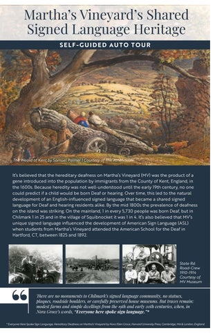
The Weald of Kent by Samuel Palmer | Courtesy of The Athenaeum
Courtesy of MV Museum
Welcome to our Self-Guided Auto-Tour
It’s designed to raise awareness of Martha’s Vineyard’s shared signed language and to encourage our, as well as other community members to recognize the unifying practicality of a shared signed language for everyone — including hearing, hard of hearing, and Deaf individuals, as well as family members, friends, caregivers, co-workers, professionals, and ASL-signing visitors and tourists.
= Note Points of Interest along the way.
Courtesy of MV Museum
Wishing you a pleasant educational journey!
TOUR STOP 1
MARTHA’S VINEYARD CHAMBER OF COMMERCE
24 Beach Street, Vineyard Haven - www.mvy.com
This area now known as Vineyard Haven, was originally called Nobnocket by the Wampanoag people. Early colonial settlers referred to it as Holmes Hole, likely named after an early settler or a place name from England. By the mid-19th century, Holmes Hole was a bustling maritime community, serving as a vital port for shipbuilding, whaling and commerce. The harbor’s strategic location made it a key stopover for vessels, contributing significantly to the island’s economy and development.
At its height, Holmes Hole Harbor was thick with masts - sometimes 50-100 ships anchored here, waiting out a storm or loading cargo, sails billowing and crew at work.
Today, Vineyard Haven remains the main port of entry to Martha’s Vineyard, reflecting its enduring maritime heritage.
Beach Street, which runs in front of the Chamber of Commerce building, was once the gateway to the village of Holmes Hole. Until the 1830s, a 6-foot-deep channel called Bass Creek flowed where Water Street and Lagoon Pond Road run today, and the sail-powered ferries from the mainland docked at the foot of Beach Street, where the Five Corners intersection is today. Judge Samuel Sewall, whose account of a 1714 visit to Martha’s Vineyard contains the first mention of a “Deaf resident” of the Island, began his journey at Beach Street. So, perhaps, did Jonathan Lambert (the Deaf man he met), when he immigrated to the Island in 1694.
Note: We recommend watching the documentary, A Brief History of Martha’s Vineyard’s Deaf Community in the Chamber’s visitors’ area or online at mvy.com if the Chamber is closed.
DIRECTIONS TO STOP 2:
• From the Chamber parking lot, turn left on Beach St.
• Take an immediate right onto Lagoon Pond Road.
• Continue 0.5 miles to the museum entrance (on right).
• Drive up the hill to the parking lot.
Courtesy of MV Museum
TOUR STOP 2
MARTHA’S VINEYARD MUSEUM
151 Lagoon Pond Road, Vineyard Haven
Perched on the hilltop overlooking Lagoon Pond and Vineyard Haven Harbor, the Museum preserves exhibits and interprets materials related to the history of Martha’s Vineyard’s signed language (MVSL) legacy. Look for Thomas Hart Benton’s portrait of Joseph “Josie” West, a Deaf farmer from Chilmark. Ask the research librarian to view Alexander Graham Bell’s 1880s notebook (MV research). If interested in Deaf genealogy, ask for a copy of the list of MV students who attended the American School for the Deaf (ASD) between 1825–1892 (a key resource for Stop 11 - Abel’s Hill Cemetery).
DIRECTIONS TO STOP 3:
• From the Museum parking lot - turn left at the bottom of the hill
. Retrace your route on Lagoon Pond Rd.
. Turn left on Beach Street (pass Chamber on right)
TOUR STOP 3
LAMBERT’S COVE
. As road curves left, it becomes State Rd. Continue 2.3 miles
. Turn right on Lambert’s Cove Rd.
. Drive 1.4 miles to Lambert’s Cove. Martha’s Vineyard Museum
(Named after Jonathan Lambert - MV’s first Deaf settler) 281 Lambert’s Cove Road, West Tisbury
Jonathan Lambert’s father, Joshua Lambert (or Lumbert), immigrated from the county of Kent, England in 1634. He along with others from his community carried a hereditary gene of deafness. After initially settling in Scituate, MA, the family moved to Barnstable in 1639.
In 1694, Jonathan Lambert, who was Deaf, and his hearing wife, Elizabeth Eddy, purchased land from a Wampanoag Sachem and built their home overlooking James Pond where they farmed, fished, and became part of the island’s close-knit community. Two of their seven children were also Deaf, and the hereditary trait they carried helped lay the foundation for a shared signed language that would shape life on Martha’s Vineyard for generations. While the land remains private today, the cove and its whitesand beaches are open to the public and offer a glimpse into this historic site.
Both beach areas are located on the Lambert’s homeland.
Lamberts Cove: (Photo on right) The public beach will be to your right. Parking is restricted to residents & guests from June 15 to Sept. 15, 7am to 5pm.
James Pond Preserve is adjacent to it. During the Summer season (June 1-Sept. 14) parking hours are from 10:30 am to 6:30 pm and require an online reservation from mvlandbank.com
Lambert’s Cove Beach
James Pond Reserve
“Josie” West “ Courtesy MV Museum
DIRECTIONS TO STOP 4:
• Continue 1.8 miles on Lambert’s Cove Road until it meets State Rd.
• Turn right onto State Rd.
• Continue 2.5 miles to Panhandle Rd. and turn right by the Agricultural Hall
• Bear left at the curve, and soon after, turn right on Middle Rd.
• Drive 1.9 miles on Middle Rd. and pause at Tea Lane on right.
Since no parking is available at Stop 4- Old Chilmark Center, please read the history now, & when on middle Rd, note the photo of the hill where the first Town Hall was located (to the left of Tea Lane).
TOUR STOP 4
OLD CHILMARK CENTER
Middle Rd. junction of Tea Lane & Meetinghouse Rd, Chilmark*
Until the early 1800s......this was the heart of Chilmark Village. Both Deaf and hearing residents alike gathered here to worship at the Congregational and Methodist Churches, do business, socialize at the general store and attend meetings at the Town Hall (Also known as “Woodpecker Hall”).
Most residents of Chilmark would have spent their lives on widely scattered farms like these that, even today, border Middle Road. The distinctive “dry stone” walls that border the fields were created by stacking stones dug out of the fields to make plowing easier.
* The three roads that converge here all date back to the 1700s
DIRECTIONS TO STOP 5:
• Continue 2.5 miles on Middle Rd.
• Turn right onto Menemsha Rd.
• Follow signs to Menemsha and Dutcher Dock
• Turn left & drive downhill
TOUR STOP 5
MENEMSHA HARBOR
Menemsha Creek, Dutcher Dock, Chilmark
A close-knit fishing village where Deaf and hearing families worked side by side. Signing was used freely on boats, docks, and in homes.
The Creekville Post Office served as a hub for signed conversations, community news, and connection. (1900–1913).
Chilmark’s First Town -1843
Tea Lane; Courtesy of MV Museum
DIRECTIONS TO STOPS 6 & 7:
• Drive back uphill
• Drive across Stop 6 - Beetlebung Corner intersection
• Stop 7- Chilmark Public Library
Read History of #6-Beetlebung Corner History from the Chilmark Library parking lot.
TOUR STOP 6
BEETLEBUNG CORNER
Intersection of South Rd., State Rd., Middle Rd, and Menemsha Road (also called Menemsha Crossroad)
One of the town’s three one-room schoolhouses (now the police station) stood on the South Road side of this intersection since before 1850.
In 1891 Elliot Mayhew moved his general store, the “Cornerway”, from the old Chilmark Center, to this new hub on State Road, where it also served as post office and library until it burned in 1910. It was rebuilt in 1924. After the 1910 fire, the library was hosted in private homes and the town hall until 1953.
In 1887 a new town hall was built; and in 1910 the Methodist church was moved from the old Chilmark Center to the Menemsha Crossroad.
DIRECTIONS FROM THE CHILMARK LIBRARY PARKING LOT (STOP 7):
Look out from the South Rd entrance and note these key landmarks:
• Right: Town Hall — on the corner of Middle Rd. and Menemsha
• Straight ahead: Menemsha Rd. - leads to Menemsha Harbor
• In front of the library: Middle Rd. becomes State Rd. at the Junction
• To the Left: State Rd. passes the Chilmark General Store and leads to Gay Head Lighthouse in Aquinnah.
TOUR STOP 7
CHILMARK PUBLIC LIBRARY
522 South Rd, Chilmark
In 1882 the library (composed of 32 books) was located on a shelf in E. Elliot Mayhew’s store on Middle Road, and moved to the new Town Hall until Mayhew’s new store housed it again. In 1953, the town purchased the home of Katie West, the sister-in-law of George and Josie West.). The library opened in its new home in 1956. Since then, the library has been expanded to include her house. (Originally built for Captain William Tilton in 1790).
The present library incorporates the former home of Katie West, the last known Deaf MVSL signer, who died in 1952 *. Built in 1790, her house became a part of the library when it moved here in 1956. Today, the library preserves collections related to the Island’s once-shared signing community.
Call ahead to schedule a tour of Katie’s house. The library maintains an extensive collection on Chilmark’s shared signed language community.
Although Katie West was the last Deaf MVSL signer on the Vineyard, she moved to MV from new Bedford and did not carry the gene of deafness. Katie’s sister-in-law Eva West Look was the last Deaf MVSL signer, carrying the deaf gene. Eva died in 1950.
TOUR STOP 8
CHILMARK GENERAL STORE
7 State Road, Chilmark
The Chilmark General Store was not always located at its current spot on State Road. Originally, it was on Middle Road in the Old Chilmark Center, near the former Town Hall. E. Elliot Mayhew moved his store to Beetlebung Corner around 1895. By that time, Beetlebung corner was becoming the new civic hub. The post office and library had already been part of his establishment by 1891. This beloved store was a gathering place for Deaf and hearing neighbors alike.
The store is known to have burned in the early 1900s and was rebuilt soon afterword, becoming again a key gathering place. Deaf residents were often the most literate, and sought out by hearing residents to read and sign mail & newspapers, while neighbors lingered to talk, sign and often play checkers by the stove in the cold months.
DIRECTIONS TO STOP 9:
• Continue 1.9 miles west on State Rd.
• Turn left on Squibnocket Rd. and drive downhill to parking area
From June 15 to Labor Day, you need a Parking Sticker on Window between 9am-5pm
Katie West’s House; Courtesy MV Museum
Courtesy of Vineyard Gazette
TOUR STOP 9
SQUIBNOCKET BEACH
34 Squibnocket Rd, Chilmark
For generations, Chilmark fishermen launched boats from this beach, pulling them ashore at night. Squibnocket was central to community fishing life.
The town of Chilmark has no natural deep-water harbor, but in the 18th and 19th centuries, many Chilmark fishermen used Squibnocket as a base of operations, launching their small boats from the beach in the morning and pulling them above the reach of the tide at night.
At this point choose one of two route options:
OPTION 1 - SHORT ROUTE
DIRECTIONS TO STOP 11 - ABEL’S HILL CEMETERY - (SEE STOP 11 PHOTO AND HISTORY)
• Return uphill- and turn right on State Rd. - Drive back to Stop 6 - Beetlebung Corner.
• Turn right on South Rd. (pass Chilmark Library)
• Drive 2 miles and Look to your Left for a large Memorial Rock (See Stop 11 Photo).
• Pull into the small parking space in front of the large monument rock: read the plaque before driving down the hill on the cemetery Rd. (just to the left of the monument).
• When leaving the cemetery follow directions to Stop 12 Grange Hall, and End of your tour Back at Stop #1 Chamber of Commerce.
OPTION 2 - SCENIC LOOP TO AQUINNAH (APPROX. 12 MILES ROUND TRIP)
Drive-by Stop 10:
• Read Stop 10 History now -since there’s no place to park or stop.
• Return uphill -and Turn Left on State Rd.
• Drive-by Stop 10 Jared & Jerusha
right.
Mayhew’s -”Yellow House” - 0.3 mile on
Courtesy MV Museum Squibnocket P.O.; Courtesy of MV Museum
TOUR STOP 10
JARED AND JERUSHA
MAYHEW HOUSE
231 State Road, Chilmark
Nearly hidden from the road by high hedges, this turreted QueenAnne-style house is recognizable by its yellow-painted clapboards, white trim, and red roof. Built in the late nineteenth century, it was the home of Jared Mayhew and his wife Jerusha Reed…until the 1898 marriage of their daughter Ethel Love, Jared was a prosperous farmer who raised sheep on over 100 acres of land. Jared, like his parents, Benjamin and Hannah, his older brother Benjamin, his uncle Alfred, and his aunts Ruby and Love (Lovey) - were Deaf. He is said to have been the last Chilmark resident born into a family where deaf children outnumbered hearing ones. Jared attended the American School for the Deaf (ASD) in Hartford, Connecticut from 1864-1869. His brother, Ben, and relatives Alfred, and Lovey* attended before him. His wife was hearing.
* Lovey Mayhew, born in 1802, was among the first three students from Martha’s Vineyard to attend the American School for the Deaf (ASD) — the nation’s first permanent school for Deaf students, founded in 1817. She enrolled on October 25, 1825, at age 23, together with Sally and Mary Smith — sisters from the Smith family, ages 19 and 14.
DIRECTIONS:
Continue on State Rd. 6 miles to Gay Head Lighthouse and panoramic views along Aquinnah Circle with its points of interest.
• Continue 6 miles to the panoramic views of Gay Head Lighthouse, the cliffs and ocean along the Aquinnah Circle Road to: Points of Interest:
• Gay Head Lighthouse
• Wampanoag gift shops, and restaurant
• Aquinnah Cliffs Overlook
• Wampanoag Indian Cultural Center
• Rest Rooms
• Moshup Beach and Hiking Trail to Beach
Note: Most of these locations are not easily accessible for visitors with mobility challenges, but the drive itself is spectacular and highly recommended. This scenic loop leads back to State Road and returns to Stop 6 - Beetlebung Corner
DIRECTIONS
TO LAST LEG OF THE TOUR:
• Stay left on Aquinnah Loop to merge with State Rd. and return to Beetlebung Corner
• Turn right onto South Road (pass Chilmark Library on right
• Drive 2 miles and Look to your Left for a large Memorial Rock (See Stop 11 Photo).
• Pull into the small parking space in front of the large monument rock to read the plaque before driving down the hill on cemetery Rd. (just to the left of the monument).
Courtesy MV Museum
Gay Head Lighthouse; Courtesy MV Museum
TOUR STOP 11
ABEL’S HILL CEMETERY
322 South Road, Chilmark
Abel’s Hill, named for 17th-century Wampanoag resident Abel Wauwompuhque, was the site of Chilmark’s first 2 Congregational meetinghouses. The old section of the cemetery is located on the hill, in front of the parking lot at the bottom of the road (to the left of this monument). It stretches from slightly left of the roadway ahead of you all the way to the stone wall on your right. At least 28 members of the Chilmark deaf community are buried on this hill, including Jared and Jerusha Mayhew (Stop 10), “One-Armed Ben” Mayhew, Josie West (Stop 2), George and Dedemia West, Eva West Look and Katie West (See Stop 7). For visitors interested in Martha’s Vineyard’s Deaf genealogy, the MV Museum’s list of ASD students (1825–1892) is especially helpful for people seeking to know more about those who carried the Vineyard’s signing heritage. Many of the students named on that list — along with their parents and extended family members — can be located on gravestones throughout this old section of the cemetery.
DIRECTIONS TO STOP 12:
• Continue 5.7 mi. on South Road (which becomes State Road in West Tisbury). The Grange Hall is on your right.
TOUR STOP 12
GRANGE HALL
1067 State Road, West Tisbury
Built in 1859, this post-and-beam building was central to Vineyard’s civic and social life. Agricultural fairs, debates, voting and dances all welcomed Deaf and hearing residents alike, with MVSL used naturally across the community.
Addendum - Much of this history might have remained hidden if not for Joan Poole Nash’s collection of MVSL signs gathered from her hearing great-grandmother and other signing elders who had used the Island’s shared signed language fluently. Her work not only preserves this unique local signed language but also connects the dots between MVSL and the development of ASL — particularly through the role Vineyard students played when they brought their signs to the American School for the Deaf in Hartford, Connecticut.
End of Tour
DIRECTIONS TO STOP 1 - CHAMBER OF COMMERCE:
• From the Grange Hall, continue on State Road back toward Vineyard Haven.
• After about 5.3 miles you’ll pass Lamberts Cove Rd. on your left - the turn that led you to Stop 3, the homeland of Jonathan Lambert, where this historic story truly began.
• Bear right at the curve, passing Tisbury’s Main Street shopping center on your left.
• Chamber of Commerce will be on your left, just before Five Corners, in Vineyard Haven. Welcome Back
Courtesy MV Museum
This brings your journey full circle — nearly 300 years as a unique shared signed language community. Thank you for taking the Martha’s Vineyard Signed Language Heritage AutoTour. We hope this journey has deepened your connection to the Island’s legacy and offered insight into the benefits of a shared signed language.
We encourage you to Try Your Hand at the Manual Alphabet below: Fingerspell your name, colors, animals, things you see. Experiment!...and Discover the practicality of a shared signed language.
THE MANUAL ALPHABET
Sign Language, of which the manual alphabet is an important part, was brought to America from France in the early 1800’s by Rev. Thomas Hopkins Gallaudet and Laurent Clerc (a Deaf sign language teacher from Paris).
TRY YOUR HAND AT FINGERSPELLING
• The first permanent School for the Deaf opened in Hartford, CT in 1817 - Now known as the American School for the Deaf (ASD)
• Between 1825-1892 Deaf students from Martha’s Vineyard attended the school, bringing with them their English based Vineyard sign language now known as Martha’s Vineyard Sign Language (MVSL).
• There is also growing interest in the possibility that a distinct Wampanoag Sign Language on MV may have influenced MVSL. These historical relationships continue to be explored.
• Over time, the signs from MV and Frenchinfluenced signs taught at ASD likely mingled, contributing to the development of what we now recognize as American Sign Language (ASL) - with the manual alphabet playing an important role in its evolution.
• Some researchers, including Nora Groce, proposed MVSL may have originated in a region of Kent, England called the Weald, from which some Deaf settlers emigrated in the 1600s. More recent scholarship has raised questioned this connection.
Fingerspelling offers immediate communication by manually spelling words and clarifying unheard and misunderstood words.
Courtesy MV Museum
MV Signs Then & Now*
To raise awareness of Martha’s Vineyard’s shared signed language community from the late 1600s to mid-1900s.
To encourage a shared signed language revival on MV to bridge the communication gaps of today.
Martha’s Vineyard’s shared signed language community, which spanned from the late 1600s to the mid-1900s, left a profound legacy. What began as a practical adaptation to hereditary deafness grew into a model of inclusion - a community where, as historian Nora Ellen Groce noted in her book title - by the mid-1800s almost “Everyone Here Spoke Sign Language.”
Today, we can revive that spirit by choosing to learn and share basic ASL tools such as fingerspelling and basic signs. This tour is not just about the past - it’s about creating a future where communication barriers are bridged with simplicity, creativity, and care for one another -a place where hearts meet and grammar no longer sets limits on connection.
We encourage hearing and hard of hearing individuals to learn the Manual Alphabet and some basic ASL signs - to share and practice with family, friends, schoolmates and co-workers - and begin to bridge communication gaps within their own circles to:
• Support hard of hearing relatives and friends by fingerspelling unheard or misunderstood words.
• Provide caregivers and frail patients simple signs such as eat, drink, bathroom, hurt, where?
• Enable ease for folks with developmental challenges or voice difficulties.
• Assist those struggling with English as a second language.
• Give infants (as early as 5 mo.) and toddlers a means to communicate before muscles for speech develop.
• Enable Communication for hearing people in noisy, quiet, or distant situations, such as sports events, across rooms, in restaurants, or even underwater!
• Offer businesses and professionals a way to better accommodate Deaf and ASL signing visitors and tourists.