
Comprehensive Plan
Village of Shorewood Hills - Plan Commission
Dave Benforado, Chair
James Etmanczyk
Brauna Hartzell
John Imes, Trustee
Earl Munson
Debra Remington
Karl Wellensiek
Village of Shorewood Hills - Administration
Karl Frantz, Administrator
Karla Endres, Clerk
David Sykes, Deputy Clerk
Nancy Kolberg, Accounting Clerk
Village of Shorewood Hills - Board of Trustees
Dave Benforado, President
Cokie Albrecht, Trustee
John Imes, Trustee
Scott Friedman, Trustee
Mark Lederer, Trustee
Shabnam Lotfi, Trustee
Laura Valderrama, Trustee
Sean Cote, Treasurer
...and many other residents of the Village who contributed time, thoughts, and resources
Prepared by:
This document was prepared by MSA Professional Services, Inc. with assistance from Village Staff.

August, 2021
Thank you for reviewing the Village of Shorewood Hills 2021 Comprehensive Plan. While required every decade by Wisconsin law, we embrace this requirement as an opportunity – an opportunity to take a snapshot of our community through a variety of lenses, seek and consider comments from residents, and take a look forward, trying to anticipate the issues the Village will encounter from a planning perspective over the next decade or so.
The Plan Commission took the laboring oar in the development of this Comprehensive Plan. After the Village Board of Trustees adopted an agreement with MSA Professional Services, Inc., in late 2019 for assistance in developing a new Plan, the Plan Commission met with MSA on March 10, 2020, to initiate the process. Our direction to MSA was to use the 2009 Village Comprehensive Plan as the general basis and framework for the new Plan.
The development of this Plan took a bit longer than we had anticipated. Two intervening events elongated a process that we thought would take 12 months – the COVID public health pandemic (all of our meetings became virtual ZOOM meetings) and the completion of the Village’s Garden Homes Neighborhood Plan (Appendix D). Notwithstanding those two events, we solicited and received substantial input from Village residents about this Plan over the last 15 months – two e-surveys, two online mapping exercises, two virtual open houses (see Appendix C, Public Engagement Summary). The Plan Commission met over the course of many long meetings between November 2020 and August 2021 for detailed reviews of comments from Village residents, Committees, Village Staff, and our planning consultants. We then made line by line reviews of draft chapters. To all who provided feedback, thank you. You helped make this 2021 Plan better.
The Village’s 2009 Comprehensive Plan looked into the future and correctly highlighted the probable areas of future growth and redevelopment in the Village as being in the Marshall Court and Pyare Square areas. This 2021 Plan identifies the entire University Avenue corridor as being potentially ripe for redevelopment, and calls for the Village to embark on a neighborhood planning process focused on that area within the next few years.
Make no mistake, there is and will be pressure to redevelop some parcels along University Avenue over the next decade or so. Those proposals will include taller buildings, mixed uses, some commercial space, and some multi-family units. Over the last decade, the Village has approved and incorporated 366 apartments, 12% of which are affordable, into our community’s housing stock. This was a very significant progressive change for our small Village that we should be proud of. We need to continue working to make sure that Village residents who reside in those units are welcomed into and made a part of our community. The challenge going forward will be to determine how best to approach and consider future redevelopment proposals, in all likelihood along the University Avenue corridor.
On behalf of the Village Board of Trustees, Plan Commission Members and all who contributed to the development of this Plan, I am pleased to present the Village of Shorewood Hills 2021 Comprehensive Plan.
David J. Benforado, President Village of Shorewood Hills

The Village Board of theVillage of Shorewood Hills,Wisconsin, do ordain as follows:
Section 1. Pursuant to section 62.23(2) and (3) of the Wisconsin Statutes, the Village of Shorewood Hills is authorized to prepare and adopt a comprehensive plan as defined in section 66.1001(1)(a) and 66.1001(2) of the Wisconsin Statutes.
Section 2. Prior to beginning the process to update the Village’s comprehensive plan,the Village Board adopted written procedures designed to foster public participation in every stage of the preparation of a comprehensive plan as required by section 66.1001(4)(a) of the Wisconsin Statutes. Members of the public were invited to participate in the planning process through Plan Commission meetings, surveys,two public meetings and a public hearing.
Space reserved for ordinance.
Section 3. The VillageBoard appointed the Plan Commission to work with the Village’s planning consultant MSA Professional Services, Inc. to prepare an update to the Village’s previous 2009Comprehensive Plan.
Section 4. The Plan Commission met numerous times to prepare and review the draft comprehensive plan and has adopted a resolution recommending to the Village Board adoption of the document entitled "Village of Shorewood Hills 2021 Comprehensive Plan," containing all of the elements specified in section 66.1001(2) of the Wisconsin Statutes.
Section 5. The Village held one public hearing on the Comprehensive Plan, in compliance with the requirements of section 66.1001(4)(d) of the Wisconsin Statutes, on September 20, 2021
Section 6. The Comprehensive Plan may be used as the basis for, among other things, official mapping, local subdivision regulations, general zoning ordinances, shoreland/wetland zoning, and as a guide for approving or disapproving actions affecting growth, development, conservation, and recreationwithin the jurisdiction of the Village of Shorewood Hills.
Section 7. The 2021 Comprehensive Plan may from time to time be amended, extended, or added to in greater detail following the procedures specified within the plan and Wisconsin State Statutes.
Section 8. The VillageBoard, by enactment of this ordinance, formally adopts the document entitled, "Village of Shorewood Hills 2021 Comprehensive Plan," pursuant to section 66.1001(4)(c) of the Wisconsin Statutes.

Page 1 of 2
This updated comprehensive plan envisions a shared future and actions for the Village of Shorewood Hills, which we acknowledge to be lands once occupied by the Ho-Chunk people. The Ho-Chunk people have stewarded this land since time immemorial, and it is our intent that this Plan provide a guide for community physical, social, and economic wellbeing consistent with the generations of indigenous planning and knowledge that have a deep history, present, and future in this place.

A ACTION PLAN
( Available on the Village website)
B MAPS
( Available on the Village website)
C
D
PUBLIC ENGAGEMENT SUMMARY
( Available on the Village website
GARDEN HOMES NEIGHBORHOOD PLAN
( Available on the Village website)

The purpose of this plan is to establish a shared vision for Shorewood Hills that will guide future actions and decisions. This guidance improves the Village’s ability to work cohesively and consistently over time.
The Village's first comprehensive plan was adopted in 2009 to serve as a resource for managing growth and change. The original plan as well as this 2021 comprehensive plan update are working documents used by Village officials to direct community decisions, to assist with budgeting, and as a tool to focus and stimulate private housing and business investment.
A comprehensive plan functions as an umbrella document that considers most issues affected by Village government, and it is to be used in coordination with other documents and ordinances. The plan refers to other plans and studies that address specific topics in greater detail.
The plan is implemented through the use of ordinances, especially the zoning ordinance. This plan is intended to help the Plan Commission and Village Board apply those ordinances. In fact, State statutes require that certain decisions must be consistent with this Plan.
The plan represents the Village’s best effort to address current issues and anticipate future needs, but it can and should be amended as conditions warrant reconsideration of policies. The plan can and should be amended from time to time to adjust to changing conditions, and should be fully updated with new data every 10 years.
This Plan is organized into nine chapters, each containing two main sections: background information on the specific plan element, and major goals as well as policies and actions to achieve those goals. wisconsin's comPrehensiVe PlanninG
Wisconsin’s Comprehensive Planning legislation [§66.1001 Wis. Stats.] was adopted in October of 1999. The law requires that, after January 1, 2010, if a local government unit enacts or amends any of the following ordinances, the ordinance must be consistent with that local governmental unit’s comprehensive plan:
• Official maps
• Local subdivision regulations
• General zoning ordinances
• Shoreland/wetland zoning ordinance
Wis. Stat. Sec. 66.1001 does not mandate specific land use policies communities must adopt, rather it requires that certain topics, or elements, must be addressed in each plan, and the procedures for plan creation, adoption, and amendments.
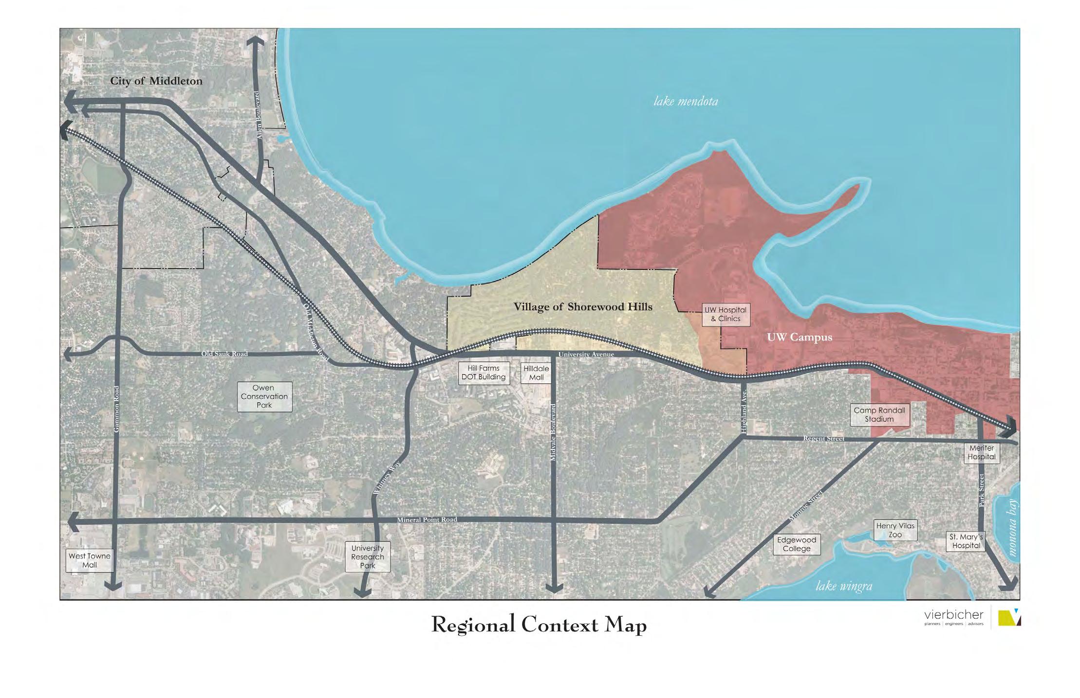
The Village of Shorewood Hills has been an important entity in the development of the west side of the Madison area. Beginning as a series of separate real estate plats in the World War I era, incorporation as a Village in 1927 combined the plats. These plats were largely the vision of John C. McKenna, and his first developments in the Madison area; he later went on to develop other areas on both the east and west sides of Madison.
When first formed, the Village of Shorewood Hills was a remote and distinct area from the city of Madison. After World War II, the city grew out to meet and later surround the Village, but Shorewood Hills has remained a separate, yet deeply connected municipality.
Originally agricultural land, a Milwaukee and Mississippi Railroad extension through the area in 1856 eased development west of Madison. The first plat in the now Village, College Hills, was established in 1912 on land from the Jacob Breitenbach farm. Named for its location west of the University of WisconsinMadison, homes originally catered to university professors. The second development of College Hills was established in 1915 on land from part of the Lewis Post farm. Though delayed by World War I, McKenna began a new series of plats between Lake Mendota and University Avenue, shortly thereafter which he called Shorewood.
The streets for both College Hills and Shorewood were laid out by the noted landscape architect O.C. Simonds, and were designed to emphasize the natural beauty of the area. In post World War I construction, Shorewood and College Hills both grew significantly, and by the time of incorporation in 1927 there were 52 houses and 205 residents. At this time, Madison was still centrally located on the isthmus with unincorporated areas separating both municipalities.
Looking for more information on the Village's history, from racial covenants to historical businesses? Shorewood Hills: An Illustrated History by Thomas Brock is available at your local library.
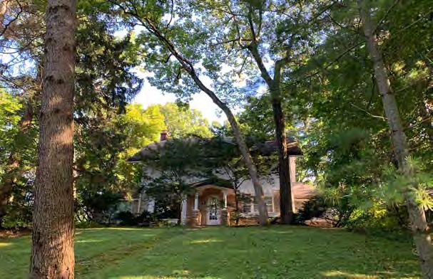
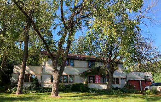
Primarily a community of single-family homes, the Village is largely characterized by its architectural diversity. In contrast to many Madison neighborhoods, Shorewood Hills developed over a very long period of time, with four distinct periods of construction consisting of: post World War I, post-Depression (late 1930s), post World War II, and post-2010. During each distinct period, homes were designed reflecting the architectural styles of the time, most architectdesigned, and many by well-known Madison figures.
Although initially consisting solely of McKenna’s residential plats, Shorewood Hills has expanded through annexation twice. These include the 1932 annexation of Blackhawk Country Club, a golf club just west of Shorewood Hills, and the 1957 annexation of Garden Homes and University Avenue commercial corridor. The Village has consistently grown through gradual density increases as well, including the addition of Shackleton Square condos in 1985 and multi-unit apartment construction primarily in the 2010s onward.
VillaGe education
The Shorewood Hills Elementary School and the Village have always been administratively separate, though there have always been strong ties between the school and community. Initially the Village school was part of a school district in the Town of Madison offering K-8 classes, and students went to Madison high schools. As the Village and surrounding area grew, the school grew with it, requiring addition and renovation. The first part of the school was constructed in 1939, and additions to this building were made in 1950, 1962, 1990, and 2017. In 1962, the Shorewood Hills Elementary School was integrated into the Madison Metropolitan School District.
VillaGe today
Today, the Village of Shorewood Hills remains a highly desirable residential area. Its proximity to the University of Wisconsin-Madison, UW Hospital, and the City of Madison make it extremely convenient for residents, and the Village has higher average home values than any other municipalities in the County, consistent with this demand.
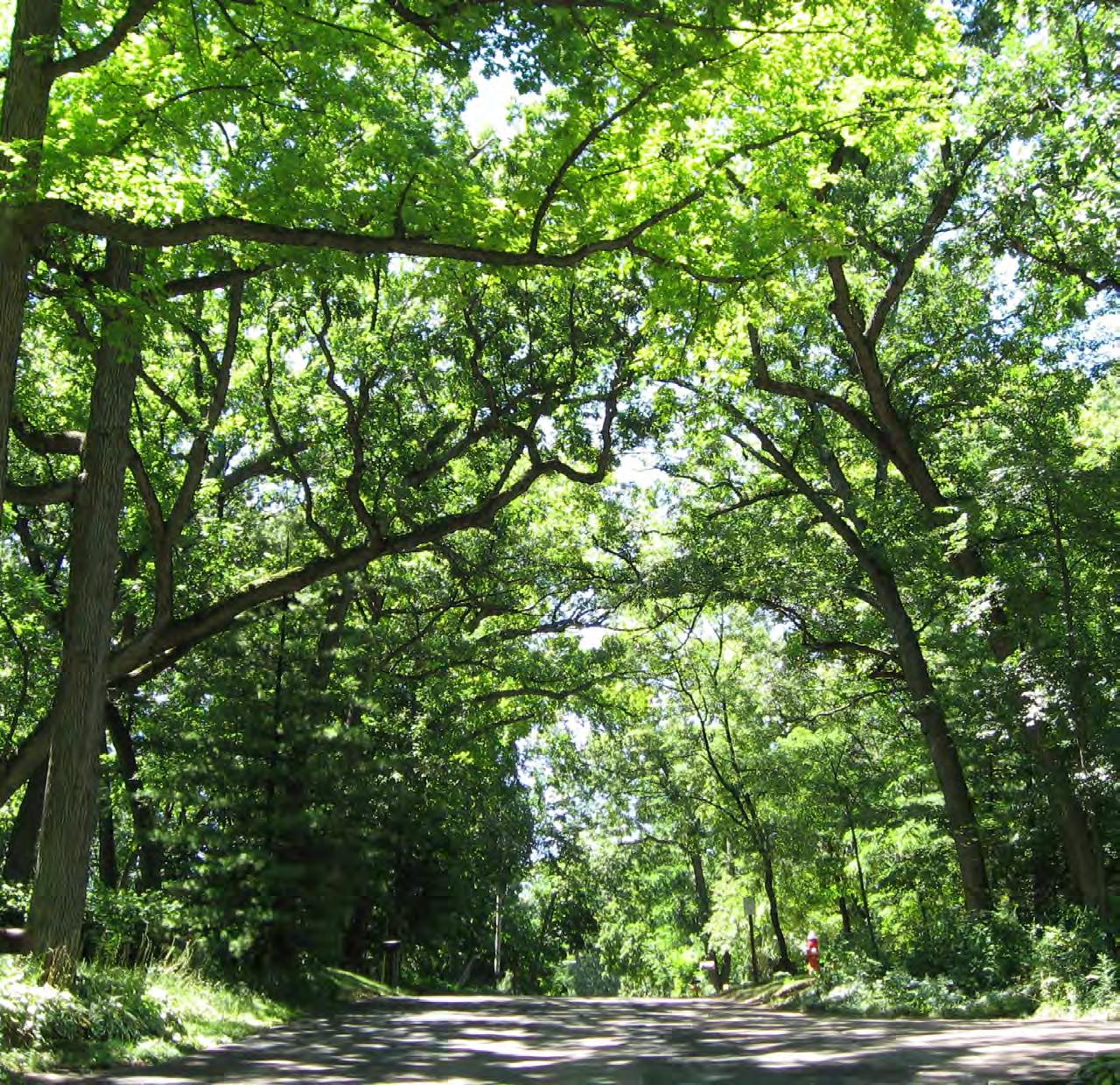
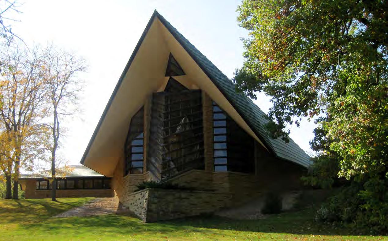
The Village’s character and its unusual layout is a response to its unique natural setting. Accented by woods, rolling hills, and a dramatic shoreline from which the Village takes it's name, portions of the Village’s “organic” street-plan were laid out by the noted landscape architect O.C. Simonds, whose work is reminiscent of the work of some of the most famous planners of the late 19th and early 20th Centuries. Simonds’ contemporaries include Fredrick Law Olmsted, Raymond Unwin, Clarence Stein, John Nolen and other planners of the Picturesque tradition, which favors rough and wild scenery over a manicured and polished landscape. The Village is also home to Frank Lloyd Wright’s First Unitarian Church – one of the Wisconsin architect’s most celebrated works.
Many homes that build the character of the Village were designed during the 1940s and 1950s by a local architect named William Kaeser, a longtime resident.
The Village seeks an environment where homeowners are free to express individual design options, but within a common framework that emphasizes a common sense of shared sensitivity toward the impact of individual design decisions on overall neighborhood character and resident enjoyment.
Three Dane County municipalities – the City of Madison, the Village of Maple Bluff, and the City of Middleton – are compared to the Village of Shorewood Hills in different areas of this plan due to proximity and size. Comparisons are also made at various times to both the County and the State, and are used solely as points of reference. The table below is an introductory comparison of selected demographics between these municipalities, Dane County, and the State of Wisconsin.
In short, Shorewood Hills' averages in household income, educational attainment, and housing values are much higher than County averages. And while the City of Madison and Dane County have a younger median age due in part to the significant University of Wisconsin – Madison student population, the Village has seen a decrease in median age as new rental housing has been added over the past decade. The Village also is home to more family households and households with children than other studied jurisdictions.
reGional comParison
attainment
Nearly 9 out of 10 residents over 25 (88%) have at least a Bachelor's Degree.
Much of the information throughout this section has been summarized from The Village of Shorewood Hills Intensive Survey Report (2000), which studied the Village’s architectural heritage to determine eligibility and boundaries for potential historic districts. The report included a great deal of original research, as well as extensive citations from a previously written history of the Village by Professor Thomas Brock, which was published in 1999.
The community encourages the preservation of the Village’s many historic structures that reflect both the Village’s history, as well as the major architectural
movements of the region and country. Many of these structures are found within the Village’s original plats: College Hills and Shorewood, which are registered National Historic Districts.
The Village has always valued the restoration and sensitive remodeling of historic structures in a manner consistent with the Department of Interior’s Standards for Historic Preservation.
The Village also encourages property owners to make full use of State historic preservation tax credits for certified restoration and rehabilitation of designated historic properties.
Shorewood Hills contains a remarkable collection of early to mid 20th Century residential architecture, including one of the most photographed houses of worship in the United States, the Frank Lloyd Wright designed Unitarian Meeting House.
The Village is widely known for its collection of postVictorian homes, with a legacy owed much to the work of Frank Lloyd Wright. Two of his most famous works, Pew House and First Unitarian Meeting House, are both located within the Village. The Pew House is a prototype for Wright’s Usonian designs, which pioneered prefabricated construction and was constructed in 1940. The Unitarian Meeting house was constructed by Marshall Erdman between August 1949 and August 1951, and has since been expanded in both 1964 and 2008.
Many residences throughout the Village are also designed in Wright’s Prairie Style. Some of these are designs of Wright followers such as George Elmslie. Other noted architects featured in Village homes include Frank Riley, William Kaeser, Herb Fritz, the firm of Law, Law, and Potter, and the firm of Beatty and Strang. Other architects and firms that have designed multiple homes in Shorewood Hills include Balch and Lippert, Henry T. Dysland, Flad and Moulton, and Edward Tough. Many of these firms still exist today: Law, Law and Potter became Potter Lawson; Beatty and Strang became Strang; and Flad and Moulton became Flad, all active architectural firms locally and nationally.
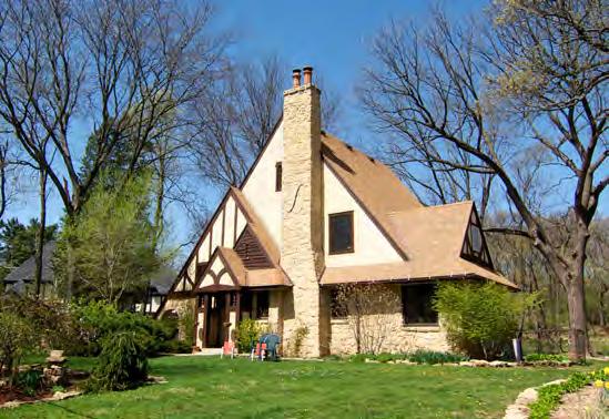
Shorewood Hills also has an impressive collection of houses designed in more conventional period styles, as well as several excellent examples of unique adaptations of these styles. Perhaps the most common of these styles throughout the Village is English Tudor.
A large number of Craftsman and Bungalow style houses are also located throughout the Village, as well as many International style homes constructed in the 1940s and 1950s. Collectively these styles serve as a chronicle of the evolution of American architecture.
The State of Wisconsin offers a 25% state income tax credit toward the costs of residential historic restoration projects in designated districts. To qualify, a property must be located in a state or national district; the project must meet historic preservation standards; and the costs of restoration must exceed $10,000.
A tax credit is a stronger incentive than tax deduction, in that the credited amount is deducted directly from the individual’s state income tax bill (not taxable income) on a dollar for dollar basis. For instance, a $40,000 project would qualify for a direct $10,000 tax credit that can be taken over a period of up to 15 years.
Preservation easements involve the purchase or donation of the right to demolish or radically alter a historic residence. Generally, the easement holder – a preservation or land trust – has the legal authority to approve or prevent major exterior alterations to the affected property. Donations of easements to qualified non-profit preservation trusts usually qualify as charitable contributions for tax purposes. The most common use of preservation easements are for properties listed (either individually or as part of a designated historic district) on the State or National registers of historic places. The Village does not hold any preservation easements.
The Shorewood Hills Intensive Survey Report (2000) noted 508 resources of architectural interest in the Village. The two largest concentrations of historic resources were afterward recognized as State and National Historic Districts: Shorewood and College Hills (p. 10). Both districts are exclusively residential, and include large sections of the original Village plats. The report also mentioned a third collection of buildings, including the Veterans Hospital Complex, as potentially being eligible for listing on the National Register of Historic Places. The only individual structure listed on the State and National Registers is the First Unitarian Meeting House.
The Village does not have a historic district ordinance, and in the absence of an ordinance largely defers to property owners in regards to alterations. Owners of any property or structure, even within a designated District, are allowed to remodel or alter structures as long as the alteration meets all other Village ordinances. Listing in the National Register brings financial incentives for preservation through previously mentioned tax credits, but protections are not a feature of the program.
An alternative potential method of review involves the use of a conditional use process to control demolition and the replacement of structures within historic
districts. This could be done by designating select historic areas as historic district overlay zones in the zoning ordinance, and then applying requirements for preservation on top of the base regulations already in place for the district. This process would keep the review of demolition permits directly under the purview of the Plan Commission.
Under this potential process, demolition could be allowed as a conditional use only if certain standards for the preservation of overall neighborhood character are met. The conditional use standards would relate to how the proposed demolition and replacement use “fits” within established neighborhoods character, including potential requirements to preserve natural features or stands of mature trees.
While the Village and its residents strongly wish to preserve current character of the community, overly restrictive architectural reviews of residential property (aside from lake-shore properties) has not traditionally been an outstanding issue in the community. Any additions or new construction as a result of demolition must meet existing Village ordinances such as Floor Area and Height Limitations and Lake Setback. Personal decisions such as color and architectural style are left to the discretion of the property owner.
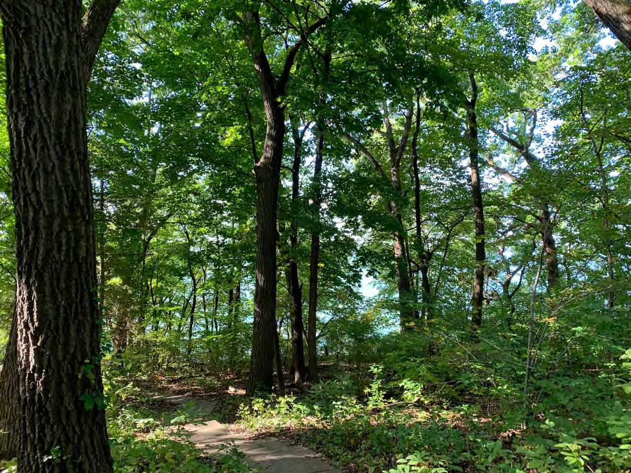
The Village’s most notable water resource is Lake Mendota. Lake Mendota continues to be negatively impacted by runoff within the greater watershed, which has resulted in increased incidence of non-point source pollution. Non-point source pollution is difficult to control, since it is not a result of a single source, and instead results from general runoff which can be contaminated by things like leaves, fertilizer, and oil.
Flash flooding, pollution, and rising lake levels are shared problems, and have been well studied in recent years, especially lake levels and flooding. Without cooperation from all communities in the watershed, local mitigation efforts aimed at reducing runoff will be limited. However, the Village's efforts toward sound stormwater management practices are necessary to confront the problem at a local level.
A study of lake levels was authorized by Dane County in 2018 from a task force including experts from the University of Wisconsin, Dane County Land & Water Resources, the Wisconsin Department of Natural Resources (DNR), and others. The final recommendations directly address dam management, ways to increase flow through the Yahara chain of lakes, and stormwater/infiltration issues of concern. On a local level, the Village will continue to coordinate with relevant governments to make sure its perspective on Lake Mendota water quality and water levels is heard in addition to implementation of the Village's Sustainability Plan.
Given the severity and multi-faceted nature of stormwater and flash flooding, the Village utilizes both engineering and planning-based approaches including detention and rain gardens in key areas. The Village's stringent stormwater ordinance requires properties to make improvements in stormwater management as they are redeveloped. The Village also created an Ad Hoc Stormwater Committee in 2018 that examined causes of the 2018 flash flood, as well as provided recommendations of actions to prevent future catastrophic flash flood events from impacting the community.
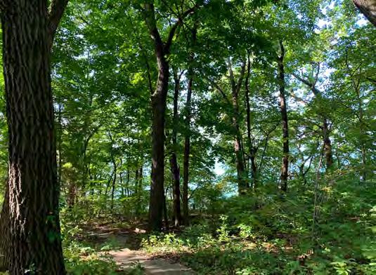
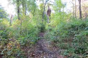
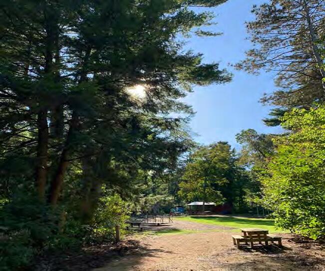
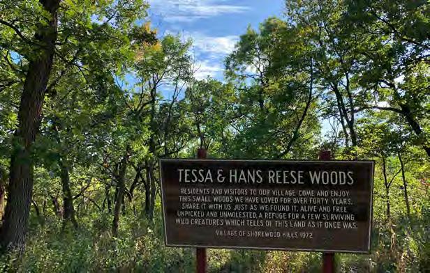
Substantial stands of mature trees exist throughout the Village, connecting natural areas that are interspersed throughout the community. The largest of these is the 1.3-acre Tessa and Hans Reese Woods located adjacent to Quarry Park. This site was donated to the Village in 1972, and serves as an example of woodland that once was common in the Village. Other natural areas include the partially restored Koval Woods, Kaeser Woods, a large part of McKenna Park, and the restored hillside on the east-side of Post Farm Park. These areas are abundant in wildlife and natural vegetation.
Over the years, Shorewood Hills has supported a number of environmental sustainability projects, such as installing rain gardens to reduce storm water runoff, participating in MGE’s renewable energy program, reducing salt use on roads, offering community gardens, and demonstrating commitment to biological diversity by becoming a Tree City and Bird City community.
The Village created a Sustainability Committee charged with making policy recommendations pertaining to environmental sustainability. The Committee offers sustainability education to residents through public seminars and community events. For more details, see the memo linked below.
The Village Board adopted the Sustainability Plan after two years of work by the Committee. Thanks to Anne Readel, Mark Redsten, Anne Helsley-Marchbanks, Sarah Goldenberg, Matthew Silverman, Cara Coburn Faris, Fritz Grutzner, Eric Adelman, Ty Cashen, Nadeem Afghan, and Tracy Bailey for serving on the Committee.
The Village's Sustainability Plan (approved 11/18/2019) is available on the Village website, currently here
wetlands, floodPlains & soils
The map above highlights natural landscape features of the Village and surrounding area, including steep slopes, hydric soils, environmental corridors, wetlands, and floodplains. Steep slopes are subject to increased erosion, especially when disturbed with construction or earth-moving, and should be carefully monitored if such activities occur. Steep slopes also can lead to increased runoff in significant weather events.
Hydric soils are associated with high groundwater levels during at least part of the year, and can result in additional expense for building construction in some
instances. Hydric soils in the Village are mainly found along University Avenue between Rose Place and Schmitt Place, as well as east of Wellesley Road.
According to the Wisconsin DNR wetland inventory, there are no wetlands in the Village. Because of the generally steep grades along Lake Mendota, there are also no floodplain areas in the Village. Environmental Corridors are designated by the Capital Area Regional Planning Commission and generally follow stream corridors, large parks, wetland boundaries, or connect large natural areas. There are no official environmental corridors in the Village, but there are several in the surrounding area, especially on the University campus.
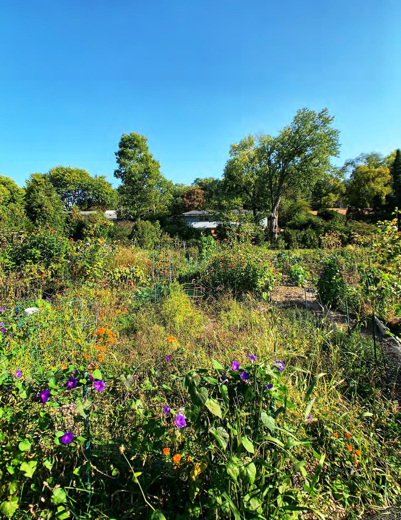
As with many areas outside of Madison's isthmus, land in Shorewood Hills was largely farmed before it was developed. Major farms that were later developed include the Thomas Isom farm (VA and UW hospitals), the Jacob Breitenbach farm (the College Hills plat), the Lewis Post farm (Post Farm park and adjacent housing), the David Stephens farm and quarry (the Shorewood plat), and the Alfred Merrill farm (Blackhawk Country Club). Though no commercial farmland remains, the Village’s Community Garden provides 59 annual (20' x 20') plots and 23 perennial (10' x 10') plots for familyscale agriculture. Water, compost, and wood chips are provided on-site. The gardens are overseen by committee, which is charged with assigning plots and maintenance. Other community garden areas are located just outside of the Village on University of Wisconsin property across from the Eagle Heights residences and next to University Houses.
Most of the Village’s archaeological resources are traced to Native American settlement along the lakeshore. These include several effigy mounds located on the grounds of the Blackhawk Country Club, and are listed on the National Register of Historic Places. The most famous of these is the Goose Mound that overlooks Lake Mendota.
Many sustainability efforts have been undertaken in the history of the Village that directly address natural resources and environmental protection. The list is lengthy, and highlights the importance of these issues in the community. Notable agricultural and natural resource initiatives include:
• The Village's Stormwater Management Ordinance
• Establishment of the Stormwater Utility
• Membership in Madison Area Municipal Storm Water Partnership
• Installation of water conveyance facilities
• Installation and maintenance of rain gardens for water infiltration
• Curb engineering to manage rainwater
• Permeable pavement trials
• Membership in Yahara WINS program
• Street sweeping program
• Leaf and brush pickup program
• Salt use reduction policy
• Establishment of Parks Committee
• Maintaining a tree inventory
• Tree, Shrub, and Forest Management Ordinance
• Recognized Tree City
• Native tree sale program
• Invasive species removal program
• Invasive Species Ordinance
• Lakefront setback for development
• Recognized Bird City
• Allows chickens and beekeeping
• Diversifying municipal vehicles to prioritize hybrid
The Village of Shorewood Hills is proud to be the first village in Wisconsin to power all municipal facilities and operations with 100% renewable energy, reducing Village CO2 emissions by 600,000 lbs annually.


Goal 1: Preserve and protect the cultural and historic character of the Village.
Policies:
1: Encourage a diverse array of housing types while recognizing the historic character of the Village.
2: Increase public awareness of and pride in community resources, utilizing events to introduce new residents to Village community life.
3: Preserve and create new events that contribute to and reinforce the identity of the Village.
Actions:
1: Periodically review changes to State statutes that may require changes to the zoning ordinance and review variances requested and approved that may suggest a need for ordinance revisions.
2: Maintain marketing materials that connect residents to available sources of funding that incentivize historic rehabilitation and preservation in the Village’s historic districts.
3: Continue to support major community events that serve as a source of pride in the community (e.g. 4th of July), and continue to support new events that bring residents together (e.g. food trucks).
Goal 2: Balance conservation with increased access to natural resource amenities.
Policies:
4: Preserve and improve outdoor spaces that act as a focal point for resident interaction.
5: Preserve and protect key environmental corridors, native vegetation, tree canopy, and wildlife species consistent with the Sustainability Plan.
Actions:
4: Study lake access improvements at McKenna Park, and budget for regular upkeep to trails and access points to ensure all residents can utilize this vital resource.
5: Annually inspect access points to natural areas, and prioritize maintenance to ensure all areas receive adequate levels of care, to encourage continued use in balance with maintaining the natural environment.
Goal 3: Protect the natural environment to the greatest extent feasible, as it is deeply tied to character of and attachment to the Village.
6: Continue to proactively and extensivley address flash-flooding, stormwater, and runoff issues facing the Village.
7: Minimize the impact of site development and infrastructure improvements on the natural environment.
8: Continue to partner with other regional governments and entities on key restoration initiatives that protect the natural environment (e.g. Willow Creek watershed, etc.).
9: Maintain ordinances that require lot development practices on public and private property that help to filter and infiltrate rainwater.
10: Maintain the Village’s diverse, resilient urban forest.
Actions:
6: Partner with the City of Madison, Dane County, and other organizations to proactively address flash-flood mitigation, runoff in the watershed, and other key water issues affecting the Village.
7: Adopt measures and ordinances consistent with the Village’s Sustainability Plan that further the policies of this chapter.
8: Minimize impervious surfaces and maximize on-site stormwater infiltration and detention in development and site review.
9: Protect and maintain the existing trees, tree canopy, wooded terrain, and other aspects of the natural environment currently existing in the Village.
Have you read the Village's Sustainability Plan?
Many of these goals, policies, and actions seek to move forward sustainable actions. You can read the Sustainability Plan in full here.
Shorewood Hills is widely loved by residents for its natural and historic resources – and in many cases this is one of the main reasons that residents move to the community. When asked to describe aspects of the Village in one word in the community survey, some of the top responses included “community”, “beautiful”, “green”, “trees”, and “quaint” – all references to these natural and cultural amenities unique within the surrounding area.
The 2020 Community Survey and Map asked residents several questions about improvements they would like to see – and things they felt most important to keep. Some of the top responses include:
• Ways to make the lakefront more accessible
• More places for residents to gather together in parks and open spaces
• Fourth of July and Food Trucks in the Park are treasured events in the way they can bring neighbors together
Other insights from focus group participants included:
• Importance of rain gardens and “natural” feel throughout the Village with native plantings and trees
• Upkeep to existing walking and bike paths through the community
• Trees and Forester are a community asset that can be expanded/leveraged
One of the things that sets the Village of Shorewood Hills apart from larger communities is the consistently high level of services. The Village of Shorewood Hills provides a full range of urban services to residents and businesses. Some services, like water and wastewater treatment, are provided in conjunction with other entities such as the City of Madison and Madison Metropolitan Sewerage District. Others such as police are independent, but cooperate and coordinate with adjoining jurisdictions. There are also facilities and services — the Village’s parks, pool, garbage, brush, and leaf collection, and wood chip and mulch delivery that are maintained for the convenience and enjoyment of residents.
Constructed in 1925, the Shorewood Hills Elementary School has been a part of the Madison Metropolitan School District since 1962. A K-5 institution that draws pupils from the Village and the City of Madison (including Eagle Heights/University Houses), the school is frequently noted as one of the centers of Village involvement. Many families move to the Village due to access to the school and current (2019) enrollment is 471 students. Village residents have access to the school property through a Village recreational easement, including fields, basketball and tennis courts, playground, and a Village-maintained ice rink. The property also includes the Heiden Haus. In 2021, Heiden Haus is scheduled for extensive renovation; contributions from Village residents provided half of the renovation cost, the other half was provided by the Village.
The Village owns a 94-acre parcel, which it leases to Blackhawk Country Club to operate an 18-hole golf course and clubhouse. The Village purchased the lands in 1944, and has leased the land back to the Country Club since that time. The current lease was signed in 2015 and runs through 2044. Though leased to the Club, the Village uses the grounds for annual Village celebrations including the Fourth of July fireworks. The Village and its various organizations may use the clubhouse for social functions up to 24 times per year, and residents have full use of the Club grounds for winter recreation from December 1 to April 1 every year.
Though the Village does not have a library, the Dane County Bookmobile makes weekly stops at Shorewood Hills Elementary School. The two closest City of Madison libraries are the Sequoia branch, about 1.5 miles to the south at Midvale Boulevard and Tokay Boulevard, and the Monroe Street branch, about 1.1 miles southeast of the University Bay Drive/University Avenue intersection.
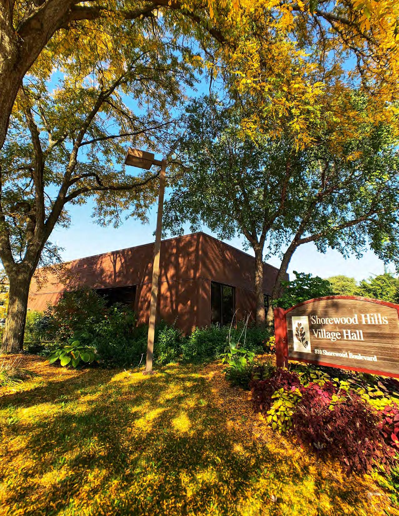
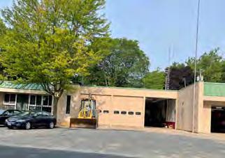
Village Hall and the police station operate out of 810 Shorewood Boulevard, on one of the major entrances to the Village. The building was purchased in 1997 and updated in 2008-2009 for Village use, including converting the former bank drive-through to a police garage. Village administration operates out of this location, as does the full Village police department.
The Village owns and operates a membership-based 50-meter pool and an adjacent community center, which were originally built in 1969-1970. Both are located in Post Farm Park. The pool was extensively renovated in 1996-1997, and significant improvements were made to it in later years. The pool is the largest enterprise of the Village, with over 1,000 members and is financially self-supporting.
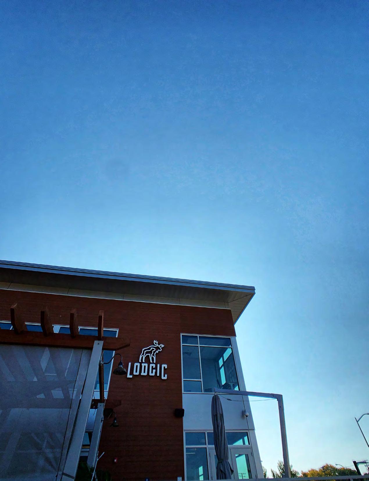
There are three childcare facilities in the Village: Lodgic Kids Camp, the Waisman Center, and the Meeting House Nursery School at First Unitarian Meeting House.
McKenna Park includes a historic boathouse with a rooftop pavilion for recreational use and rack storage at lake level. The Village operates a canoe/kayak share program for residents that utilizes the boathouse for storage. The Shorewood Hills Marina is located north and below Blackhawk Country Club, and provides slips and a mooring field for boats.
Shorewood Hills operates a public works garage located on Shorewood Boulevard, across from the Heiden Haus and the Shorewood Hills Elementary School. Operations run from this building include street maintenance, brush and leaf collection, sewer and water, pool maintenance, and care of all Village facilities. The Village also has a salt shed and cold storage building south of Blackhawk Country Club. Since 2013, the Village has contracted with the City of Madison for all EMS and Fire Services, including Fire Department inspections, building plan reviews, and ambulance services.
The Heiden Haus was constructed in 1980 to honor Olympic speed skaters, Eric and Beth Heiden, former residents of the Village. The Heiden Haus is located on property owned by the Madison Metropolitan School District. The Village was granted a recreational easement from the school district for use of the property. The Heiden Haus was originally built as a warming house for ice skaters and hockey players using the Village ice rinks, and it is now also used in the summer by the Land Recreation program, as well as by others throughout the year. In 2021-2022 the Heiden Haus underwent a major renovation and expansion, funded by a generous donation from the Village and through private donations.
The Village is home to world-renowned scientific research and medical facilities operated by the University of Wisconsin - Madison. Facilities located within the Village include UW Health Clinics, the American Family Children's Hospital, portions of UW Hospital, and the William S. Middleton Memorial Veterans Hospital.
Village parks include wooded and open spaces, shoreline, trails, and recreation areas and constitute one of the community’s greatest assets. These resources provide residents access to nature, relaxation, and recreation within the community. Most parks include recreational areas that provide a place for activities and gatherings. They also contain natural areas, which protect native plants and animals, preserve green space, control erosion, and are enjoyed for passive recreation.
Parks and their use are overseen by the Parks Committee and the Recreation Committee, which serve in an advisory capacity to the Village Board and work to preserve and enhance recreational opportunities. The Village operates recreation programs throughout the year in Village parks. There is a continual conversation on preserving and expanding recreational opportunities.
Clubhouse, Dining, Community Events, Marina, Sledding , CrossCountry Skiing
The Village Water Utility obtains its wholesale water supply from the City of Madison Water Utility, with parcels north of the railway corridor being served by the Village Water Utility, and parcels south being served directly by the City of Madison Water Utility. The Village operates one water booster station. Electric and natural gas services are provided to the Village by Madison Gas and Electric Company.
Village Sewer Utility mains run throughout the Village, and are generally replaced with road reconstruction. All Village sewage runs to one of two Madison Metropolitan Sewerage District interceptors on University Avenue, and there is one Village operated lift station, located at McKenna Park.
The Village contracts with Pellitteri Waste systems for all residential refuse and recycling pickup.
The Village has excellent high-speed internet access, with provider options including Spectrum and AT&T. Though there are no cell phone towers within the Village, expanding 5G service may necessitate future equipmnent installation.
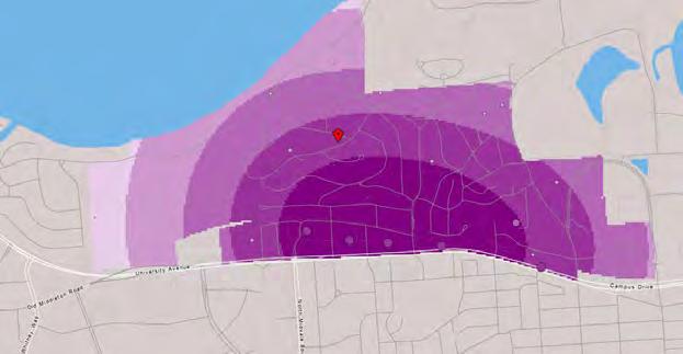
Portions of the Village have been subject to periodic flooding for decades. The problem has been especially acute in the University Avenue corridor from Midvale Boulevard to Willow Creek on the UW Campus. That corridor is the low point in the Willow Creek Drainage Basin through which stormwater passes on its way to Lake Mendota, either though the underground conduit system of pipes or above ground when those conduits reach capacity. That drainage basin is 1,922 acres, 84 percent of which is in the City of Madison (see map in Appendix). Low-lying areas in the University Avenue corridor are natural collection points for stormwater flash floods, occasionally rendering the University Avenue corridor impassible after major storms. The most recent flash flooding event occurred on August 20, 2018, and caused extensive damage in Garden Homes, along the entire University Avenue corridor, and in low-lying areas north of the rail corridor including the Village Pool.
The response to this event resulted in the formation of a Village Ad Hoc Stormwater Committee which is researching and modeling recommendations. As a result of the August 2018 flood, the City of Madison created a Willow Creek Watershed Study in April 2020 to identify causes of flooding and potential solutions to reduce that flooding, with an anticipated report in Fall 2021.
To address flash flooding in this area, major investment into infrastructure will need to be undertaken in coordination with the City of Madison. One of the key upcoming projects is the planned reconstruction of University Avenue in 2022 between Shorewood Boulevard and University Bay Drive. That project will include the installation of an additional 96” underground stormwater conduit. Other projects under consideration by the Ad Hoc Stormwater Committee include additional protection berms, a new stormwater conduit, and new detention areas. Other recommendations are still being formed and modeled, but this remains a top priority of the community and is the largest concern of residents.
Long-term solutions will need to be implemented in coordination with the City of Madison and Dane County. Significant reduction of the stormwater issues in the area will not be achieved without reduction in runoff and additional detention facilities at up-gradient locations outside of the Village.
The Village has a stormwater management ordinance, which regulates stormwater management on both commercial and residential properties. The purpose of the ordinance is to reduce stormwater runoff, sediment transfer, and nutrient loading within the regional watershed. In 2007 the Village also created a stormwater utility to make improvements to stormwater management within the Village and assess fees to carry out those improvements.
Since adopting the Stormwater Management and Erosion Control Ordinance, the Village has been steadily increasing removal of Total Suspended Solids (TSS) via both structural measures and practice improvements. Leveraging stormwater utility revenue and State and County grants, more than 12 specific Village owned structural stormwater best management practices (BMPs) projects have been constructed, and there are more privately constructed rain gardens and rain barrels on private residences. The Village continues to improve effectiveness of street sweeping, reducing salt use, and yard waste/leaf removal.
The Village is now enrolled in the National Flood Insurance program, and residents can purchase flood insurance through NFIP (www.FloodSmart.Gov).
Goal 1: Maintain the high quality and efficiency of utilities and services.
Policies:
1: Integrate goals of the Village Sustainability Plan into Village services.
2: Continue to leverage development projects to improve utility infrastructure.
3: Encourage residents and businesses to improve the efficiency of their personal energy use.
4: Continue to maintain a strong relationship with the Madison Metropolitan School District regarding future development in the Village, as well as future use of the Shorewood Hills Elementary School site and facilities.
Actions:
1: Explore the feasibility of instituting a municipal composting program.
2: Encourage on-site composting of both food and green/leaf waste on resident properties.
3: Bury existing utilities, where feasible, as development and reconstruction occurs.
4: Distribute and promote available incentives, energy audits, and other programs offered through Focus on Energy and MGE to assist individuals and businesses with energy efficiency and renewable energy measures.
5: Encourage the use of public and private solar energy systems, partnering with community solar programs.
6: Partner with the Village Green Team to invite Madison Gas & Electric, Madison Water Utility, and other relevant organizations to host a biennial Sustainability Workshop for Village residents.
There are many community services and facilities that are well-loved by residents, notably the park system and Village pool. However, many residents also noted that the Village can better utilize existing spaces, whether that be making them more accessible to residents of differing levels of ability, centralizing locations, or capitalizing on proximity to other resources (e.g. the Public Works Garage and Shorewood Elementary School’s field/green).
When asked whether the Village should spend more tax dollars to improve the quality of amenities across a variety of areas, four of the top five responses came from within this element of the comprehensive plan – Stormwater Management (58% of respondents), Parks (41%), Library Access (28%), and Recreation Programming (28%).
The 2020 Community Survey asked residents about improvements they would like to see – and things they felt most important to keep. Some of the top responses include:
• Improvements to existing Village Park Facilities and Park Buildings
• Increased Investment in Municipal Buildings (Pool Building/Community Center, Public Works Garage, Boathouse)
• Stormwater Facility Solutions are a Consistent Issue
Other insights from focus group participants included:
• Opportunities to rethink Village buildings to enhance resident interaction
• Shorewood Elementary School is for many the center of community life
• Focus on year-round facilities to keep resident engagement in all seasons


Policies:
5: Improve the quality of surface water runoff by continuing to implement stormwater best management practices.
6: Encourage residential and commercial properties to implement additional onsite stormwater management techniques to reduce the impacts of stormwater discharge (e.g. rain gardens, rain barrels, green roofs, bioretention basins, etc.).
7: Continue to explore transition of winter road maintenance practices to a brine/ total liquid application system to reduce the amount of sodium chloride entering the environment.
8: Utilize the Ad Hoc Stormwater Committee in an advisory capacity to the Village Board until such time as its subject matter expertise is no longer needed.
Actions:
7: Continue to partner with the City of Madison in studying and addressing flash flooding along the University Avenue corridor, in particular measures to slow or detain stormwater upstream in the Willow Creek drainage basin.
8: Consider recommendations of the Ad Hoc Stormwater Committee in addressing major challenges and concerns.
9: Initiate a community-wide inventory of existing rain gardens, rain barrels, green roofs, and other stormwater retention systems both private and public to create Village benchmarks and goals.
Policies:
9: Improve or redevelop Village facilities to meet a wide range of needs of residents, including full compliance with the requirements of the Americans with Disabilities Act (ADA) to meet the needs of residents with mobility impairments.
10: Prioritize the incorporation of green building technologies, energy saving measures, and renewable energy generation into all new or remodeled Village-owned buildings.
11: Integrate community spaces into all Village buildings, with different amenities, in order to serve all community members.
Actions:
10: Revisit past Village facilities studies to determine future needs and prioritize investment.
11: Integrate LED lighting, solar energy, and other green technologies into all plans for municipal building remodeling and replacement.
12: Undertake a community conversation to determine the most appropriate location for the Community Center.
Goal 4: Maintain a high quality set of parks and trails open to the public.
Policies:
12: Develop and maintain park facilities that meet a wide range of needs for residents.
13: Preserve and improve water-related recreational opportunities and facilities.
Actions:
13: Conduct an Outdoor Recreation Planning study of Village parks and open spaces, utilizing the plan to guide facilities improvements and establish grant eligibility.
14: Conduct a study to redevelop/renovate the McKenna Park boathouse and shelter to serve as a key community asset and a gathering space for residents.
15: Develop a plan for Post Farm Park, including a planning process for community center/pool building updates and renovations.
16: Should land become available within the Village for potential use as park and open space, consider potential acquisition, if feasible.
When implemented properly, economic development creates jobs, raises income levels, diversifies the economy, and improves resident quality of life while simultaneously protecting the environment. There are many dimensions to economic development. One important dimension is the employment opportunities for and incomes of a community’s residents. Another is the formation, attraction, and expansion of businesses and enterprises that create local wealth and increase amenities for residents of the community.
The economic development element of a comprehensive plan explores the relationship between economic activity and land use. Through the vision, goals, and objectives of this element, the Village establishes guidelines for making decisions about where economic activity is best suited to occur, what types of economic activity are acceptable within the community, what constraints should be imposed on economic activity for the benefit of the community, and how the community should be involved in promoting development of appropriate types of economic activity.
Public participation in the creation of this Plan revealed a desire for more locally-owned, community-serving businesses within the Village. This primarily means businesses that are geared toward more of a local rather than a regional market.
The vast majority of residents feel as if they have convenient access to shops and businesses that serve their daily needs (86% of survey respondents), and community conversations frequently cited access to local businesses as one of the key amenities of the community. Many of the types of new business identified by residents reflect this reality—there is good to great access for daily needs, but additional services such as local restaurants, brewpubs, bookstores, and a bike repair shop are desired amenities. New economic development through redevelopment is primarily limited to areas surrounding the University Avenue corridor, and are discussed in the Land Use section of this plan.
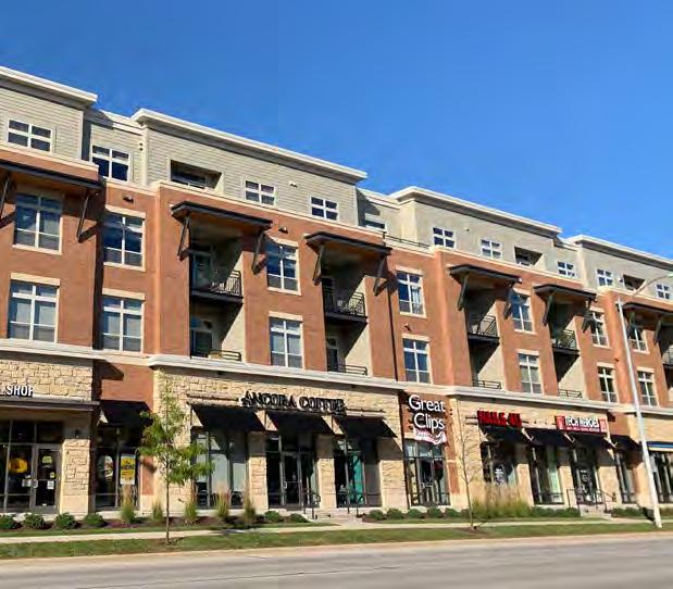
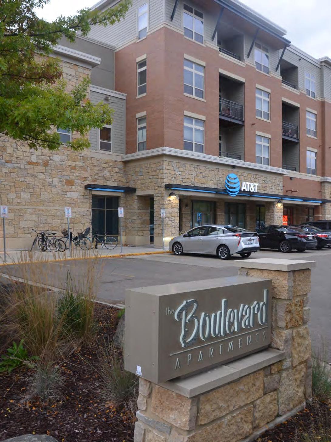
The University Avenue corridor has been a catalyst for Village business development since its annexation in 1957, serving as the main economic and employment corridor in the Village. Redevelopment in the corridor is continuing, and the Village has seen significant development along the corridor in the past decade. Each round of redevelopment has generally corresponded with an increase in development intensity. The street's status as a major transportation corridor has positioned it to serve both regional and local needs, and is well sited to serve future economic growth of the community.
Educational attainment for residents of Shorewood Hills speaks to the capabilities of the community to adapt to and manage change. The Village is by far the most highly educated municipality in the State: nearly 90% of residents over the age of 25 have a Bachelor's degree or higher, 11 percentage points higher than the next closest municipality, and nearly five times the median of all communities. The Village also has over six times the state percentage of residents with a graduate or professional degree.
Educational attainment is a predictor of income, and this holds true in the Village. Resident median household income is higher than both State and County levels, and at over $125,000, this represents the second highest median household income in Dane County and the fifth highest in the entire State. In Middleton, Madison, Dane County, and the State as a whole, the most common household income range is between $50,000 and $74,999, and for Shorewood Hills the most common household income range is $200,000 or greater.
Sixty-six percent of Village residents are active participants in the labor force as of 2018, with the vast majority (79%) employed in educational, health, or professional related occupations. This is directly influenced by the University of Wisconsin - Madison campus and healthcare facilities adjacent to the Village.

household income
The Wisconsin Department of Revenue maintains a database of assessed property values for every taxing jurisdiction in the State, which is a valuable resource for analyzing local economies. The total assessed value is an indicator of the balance of development within a municipality, and, therefore, how much property tax burden each sector has. The per-capita rate of property assessment suggests that a lower tax rate is possible to provide the same amount of services. The table above shows both the dollar amount of assessments for the Village by property class and the percentage of each property class for the Village and other municipalities.
The Village has a very high per-capita assessed value, indicating economic strength in the community. As a general rule, it can be beneficial to residents to have higher percentages of commercial property development on the tax rolls to share the overall
property tax burden. Shorewood Hills is somewhat unusual in that it has a very high percentage of residential property value but still has a low tax rate in comparison to other regional municipalities. This anomaly is mainly due to the Village’s high residential property values, which allow the Village to maintain a low overall mill rate while still collecting enough taxes to fund the high level of services that residents have come to expect.
To the extent that the Village can continue to encourage redevelopment of underutilized commercial properties along University Avenue to higher-density, more valuable land uses, it will be able to keep the mill rate low for its residents. As increased utilization and redevelopment of parcels occurs along the corridor, there is the potential that Bus Rapid Transit and other improvements will increase demand for higher-density residential and commercial uses that will increase redevelopment opportunity in key areas.
Employment forecasts at the Village level are not available from the Census or State of Wisconsin, and due to limited redevelopment areas would not be a reliable estimate of increase in jobs by sector. Countywide figures are available through the Wisconsin Department of Workforce Development (DWD), and can serve as a small indication of potential resident employment sectors. Countywide figures indicate that employment growth is expected in:
• Professional and Business Services (18%)
• Leisure and Hospitality (16%)
• Information (13%)
• Education and Healthcare (10%)
These employment projections indicate employment stability or potential growth in Village and Villageadjacent areas. The proximity of two major hospitals and a UW Health clinic means that the Village may be well-situated to take advantage of the growth in the health care sector. Management, education, and finance employment are also projected to increase, which may offer new opportunities to Village residents and the potential for increased wages.
tax increment financinG
The total assessed valuation of Village property currently stands at approximately $570 million (2018). Tax Increment Financing (TIF) – where increases in property tax collections within a specified district are used to fund improvements that spur development is one of the most powerful tools that municipalities have. Since the late 1980s, the Village has used tax increment financing to fund public improvements and new private investment along the University Avenue corridor to attract and boost commercial development. The Village’s original Tax Increment District (TID), established in 1987, helped fund various improvements in the area of the former Wisconsin Brick and Block Company on the near east side of the Village, an area now known as University Station. TID #1 was retired in 1995.
In 1993 a second TID was established to fund public improvements within an area extending from Shorewood Boulevard on the east to just beyond Maple Terrace on the west. The district included the Village’s University Avenue frontage along that stretch and extended to the north side of the Wisconsin-Southern right-of-way. Increment generated by the district was used to finance various stormwater management and circulation improvements. TID #2 was closed at the end of 2006 – 15 years earlier than State statute required –returning $43 million in increment to the property tax rolls.
In 2008 the Village created TID #3 in the Doctor’s Park area of the Village. This TID was created as a mixeduse TID, which has a maximum 20-year lifespan not including the opportunity for a Tax Increment District extension. The TID was created to fund street and infrastructure improvements to Marshall Court, University Avenue, and University Bay Drive, to be able to accommodate redevelopment of the corridor. Funds in the Tax Increment District were also used for a bicycle path just north of the railroad tracks to connect the “missing link” between Shorewood Boulevard and the UW’s path that ends at University Bay Drive, among other projects.
The Village has since utilized TID #4 and TID #5 in the Lodge at Walnut Grove area to assist in redevelopment of the former Pyare Square office building site. Tax Increment Districts 3-5 are currently open, and there are some redevelopment opportunities available within the districts.
Tax Increment Financing will be used to fund the Village's largest upcoming infrastructure project, the 2022 redevelopment of University Avenue. This project will have significant stormwater infrastructure components, and will represent a substantial shared investment with the City of Madison.
As TIDs close, there is also the opportunity to extend the life of any individual TID by one year to collect additional increment which must be used predominantly for affordable housing as required by State law.
Expand and diversify businesses that meet the needs of all residents through accessible and context sensitive redevelopment.
Policies:
1: In reviewing development proposals, seek to maintain a balance between the interests of the Village and the interests of the developer.
2: Commercial developments will be held to the highest standards of site planning, design, materials, efficiency, and sustainability, and should support multiple of the following criteria:
• Increases tax base while minimizing additional service cost
• Encourages energy efficiency consistent with the Village’s Sustainability Plan
• Provides access to amenities not currently found in the Village, including new types of employment and services
• Encourages affordable or workforce housing units (see page 37)
• Supports locally-owned businesses
• Provides public amenities, such as pocket parks or other green space
3: New commercial spaces will strive to contain locally-owned, neighborhoodserving businesses as a majority of commercial space.
4: Prioritize those mixed-use developments that can maximize development potential, support pedestrian and bike facilities, and introduce new residents to the Village.
Actions:
1: Encourage green spaces and sustainability features in new development consistent with the Village’s Sustainability Plan.
2: Continue to encourage public amenities (e.g. pocket parks, social gathering spaces, public art - see page 37) as a component of all new development.
3: Require connections to walking, biking and transit that can help reduce the need for parking spaces in new developments.
Policies:
1: If the Village decides to begin a residential composting program, allow businesses to opt in to the composting initiative, at their cost.
2: Encourage and facilitate businesses and commercial buildings to easily incorporate sustainability features (e.g. solar panels).
There have been major changes along the University Avenue corridor in the past decade, but residents largely believe the Village has worked with property owners to redevelop in a context-sensitive way. They are hopeful that the Village will continue to be able to maintain conditions for redevelopment that is high-quality, adds new amenities, and adds to public improvements and resident quality of life (such as walking, biking, and stormwater management enhancements).
Aside from businesses that exist in the Village itself, the proximity to Hilldale Mall and access to other amenities is outstanding – and residents feel they are able to easily access all their needs.
The 2020 Community Survey and Map asked residents several questions about improvements they would like to see – and things they felt most important to keep. Some of the top responses include:
• Village is Centrally Located to Businesses
• Business Corridor Offers a Variety of Options
• D esire for Local Restaurant Options
Other insights from focus group participants included:
• Variety of businesses is positive, even if not all residents are patrons
• Change can be difficult, and even well-loved redevelopments may initially be opposed
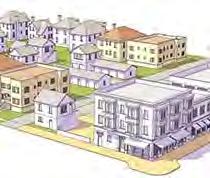


In it's most basic form, context sensitive redevelopment is redevelopment that takes into considerations the surrounding location, no matter type, structure, or use. In practice, this means design that accommodates users of adjacent parcels, such as step backs to lower the perceived height of housing near existing residential homes, or increased height and groundlevel retail in areas that are walkable with access to transit.
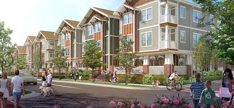
Example: Though three stories in height, this building has a mix of building materials to integrate more closely with traditional residential development, and features pitched roofs that share silhouette with single family homes. It also includes a front porch with craftsman-inspired pillars.
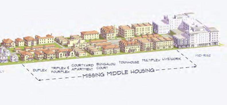
Example: Missing Middle housing. Though context sensitive development often refers to features that allow larger buildings to more seamlessly integrate into the surrounding environment, missing middle housing types (smaller than large multi-family, but larger than single-family homes) can provide an excellect transition between different structure types. These buildings are often 2 to 49 units in size, and can include townhomes, cottage courts, multi-plexes, and mixed-use developments.
Workforce housing is affordable housing, with or without subsidies. With subsidies, it serves the lowest income workers in a community, the lower-wage workers at a range of businesses within the Village. Without subsidies, this is housing that serves residents up to 120% of the area median income (approx. $120,000 annually for a 4-person household in Dane County). Because all households need housing that is affordable to them, creating workforce housing ensures that residents who earn 30% of the area median income can find housing appropriate to their incomes just as those earning 120% or 200% of the area median income can.
A pocket park is a small park, public area, or social gathering space that is accessible and open to the general public. They can be valuable amenities in mixed use areas, providing open space for building residents as well as gathering space for the general public. Pocket Parks can be owned by a private developer with public access, or they can transfer ownership (and maintenance) to a municipality as a component of development.

Shorewood Boulevard acts as the gateway to the Village. Shorewood Boulevard bisects the community east to west, and serves as the only direct connection between University Avenue on the south and Lake Mendota Drive (via Edgehill Drive) on the north. University Bay Drive serves as an alternative. The University of Wisconsin has in the past committed to “no net increase” in parking at UW Hospital as they eliminate surface parking and move towards structured parking, which should limit any potential traffic increases in the area. The Village itself uses a number of strategies to control traffic and speeds within its jurisdiction. The speed limit on all residential streets in the Village is 20 miles per hour, many of the “Y” shaped intersections in the Village have been modified by squaring off curves to slow down traffic, and the Village has added speed humps in key areas such as Shorewood Boulevard, Edgehill Drive, and University Bay Drive.
University Avenue, which serves the entire west side of Madison, is the Village’s only arterial street. It forms the southern edge of the Village and provides direct access to downtown Madison. As part of the State’s trunk highway system, it carries approximately 50,000 vehicles per day. One of the most heavily
trafficked streets in the region, University Avenue is the main transportation spine for a large portion of the metropolitan area. This is reflected in the intensity of development along the corridor. The City of Madison's Comprehensive Plan anticipates that the corridor will continue to increase in density, with the entirety of the Madison side of the corridor classified as Community Mixed Use (2-6 story) or Regional Mixed Use (2-12 story) in their future land use classifications. Transportation impacts in the future will be partially mitigated by Bus Rapid Transit, which will be implemented in 2023.
While nearly 60% of Village commuters drive alone to their workplace, alternate modes of commuting are an important part of the working lives of many residents. The Village has higher rates of walking and bicycling to work, a larger share of public transit commuters than other studied municipalities aside from the City of Madison, and shortest average resident commute time. Though the Village is well connected by many modes of transportation, these patterns reinforce the connections the Village has with the University of Wisconsin and City of Madison in allowing high levels of non-car commuting.
The Village’s Public Works Committee is charged with making recommendations for local street improvements within the Village. These are typically carried out on a yearly basis using the Department of Transportation's WISLR system, which rates pavement condition. Other considerations for road repair include the condition of buried infrastructure and other utilities.
The majority of roads east of Shorewood Boulevard have recently been reconstructed, with remaining roads and roads to the west of Shorewood Boulevard to be prioritized in coming years. All road reconstructions include stormwater management components.
The major upcoming road projects that will impact the Village are the reconstructions of University Avenue from Shorewood Boulevard to University Bay Drive and the Lake Mendota Drive Bridge reconstructions. The Village is participating with the City of Madison on design and construction of the University Avenue project. A major component of the project is widening terraces and sidewalks, increasing accessibility to bus stops for Village residents, and general improvements to improve pedestrian safety in the corridor.
The reconstruction will also update and upgrade storm sewer structures, and potentially increase capacity through the use of large diameter storm pipes.
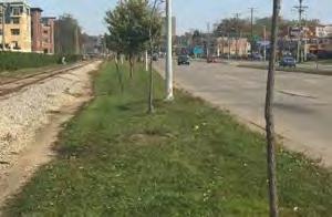
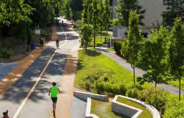
Dedicated bike paths and lanes largely border the edges of the Village, providing east-west connections that link up with larger continuous trails and paths in other municipalities. Interior neighborhoods are largely without dedicated sharrows, lanes, or paths. As these neighborhoods are more lightly trafficked, there is less need to clearly delineate roadway for different modes of transportation.
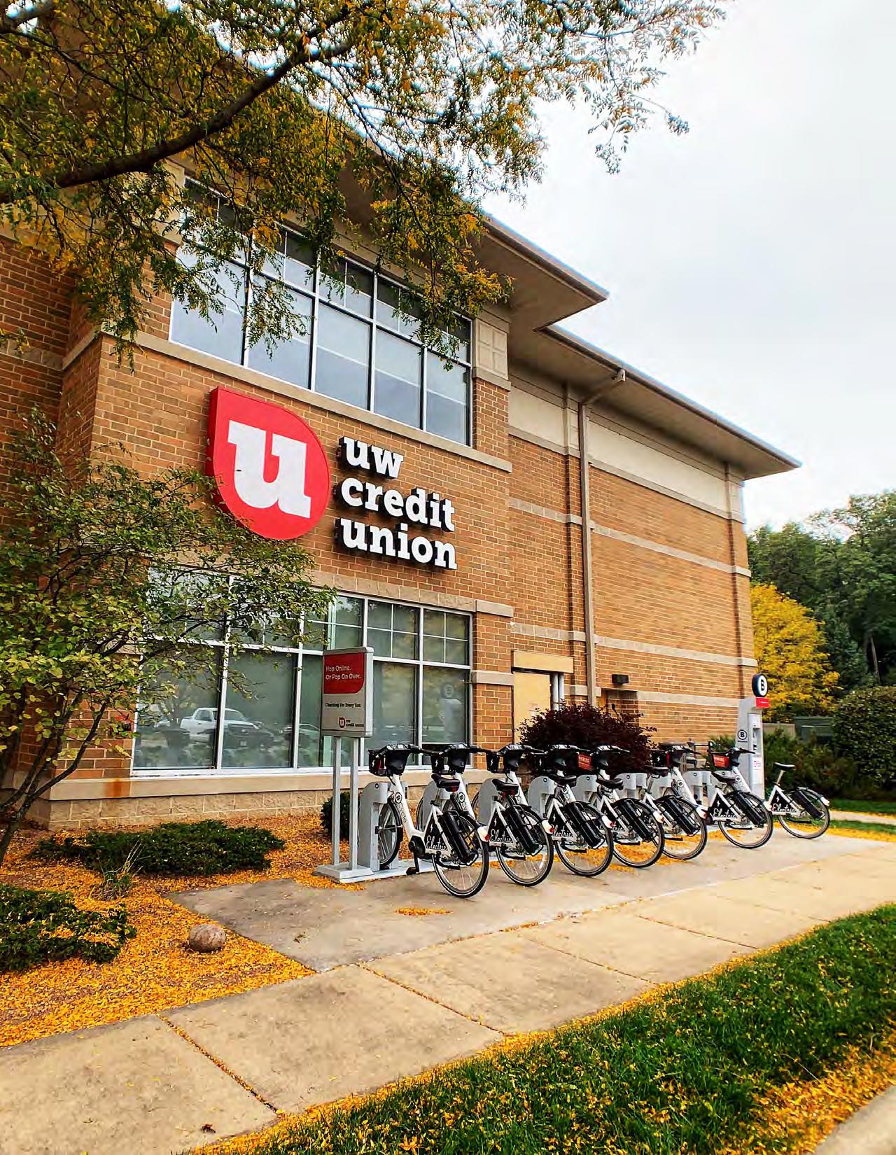
The Village celebrated the opening of the final completed link in the Blackhawk Path bike trail extension in 2019, which completes an uninterrupted route from the Town of Springfield to the University of Wisconsin - Madison campus, and is a key component of a major bicycle commuting network into the isthmus. University Avenue reconstruction in 2022 is planned to include a bike/pedestrian bridge over University Bay Drive that will enhance this connection.
The Village is served by 13 bus routes that run along University Avenue. Bus routes provide access to the UW campus, Madison, Middleton, and other destinations within the metropolitan area. Direct bus service into the Village interior was discontinued in 1988. Some residents have cited this as a barrier toward commuting via transit, though the Village contracts Metro Transit for para-transit service in the Village.
The City of Madison has an accepted application to the Federal Transit Administration's Small Starts program for an east-west bus rapid transit route, which will bring significant changes to transit speeds and potentially ridership. There are planned BRT stations at Midvale Boulevard, Shorewood Boulevard, and University Bay Drive. Construction is expected to start in 2023, with a targeted line opening date by the end of 2024.
sidewalk network
The sidewalk system in Shorewood Hills is a loose patchwork of connections. The most intact network of sidewalks is located in the original College Hills plat, although the network is disjointed even there. Hightraffic locations near Shorewood Hills Elementary School, University Avenue, Locust Street, and Shorewood Boulevard all have sidewalks, reflecting a coordinated effort by the Village to ensure sidewalks for safety in key locations.
The Village also has several attractive triangle parks located at key intersections in the local sidewalk and road network. These parks contribute greatly to the character of the Village, adding physical definition to several key pedestrian crossings and slowing traffic.
Though the lack of sidewalks in some areas reinforces the feeling of being immersed within a natural environment, there are benefits to complete sidewalk systems. Among other benefits, they encourage greater levels of active pedestrian use, better connect residents to destinations, increase safety and accessibility for children and seniors, increase viability of winter walking, reduce conflict with vehicles, and can promote social interactions between residents.
The Village Board adopted a complete streets resolution to ensure an integrated transportation network promoting safe, equitable, and convenient travel for all users. Learn more about complete streets in the resolution here: https://www.shorewood-hills.org/completestreets
Top Issues & Opportunities:


Policies:
1: Move toward implementation of a streets program that is safe, convenient, and attractive for all residents regardless of age, ability, or mode of transportation.
2: Ensure residents of every home in the Village have safe pedestrian and bicycle access to reach any destination.
3: Promote walkable developments that incorporate bike parking and bike repair stations.
4: Discourage high speed commuting through the enforcement of traffic ordinances. Actions:
1: Provide adequate bike parking at all Village parks and facilities.
2: Identify and fill gaps in the sidewalk network where critical for pedestrian safety. Establish and maintain safe walking routes between the east and west edges of the Village, including along Lake Mendota Drive.
3: Continue to integrate various complete streets and traffic calming elements in street reconstruction as appropriate.
Policies:
5: In planning new pedestrian connections, consider and prioritize ways to connect residents to existing public transportation routes.
6: Continue to support the Metro Transit bus system.
7: Continue to advocate for solutions that increase safety at University Avenue crossings.
Actions:
4: Continue to enforce the Village speed limit in all areas.
5: Create pedestrian walkways in conjunction with Bus Rapid Transit (BRT) construction that connect different neighborhoods directly to BRT stations.
6: Integrate character and context sensitive markers (e.g. signs, sharrows) in critical areas that promote streetsharing for multimodal transportation.
7: Work with the Shorewood Hills Elementary School to encourage biking and walking to school (e.g. safe routes to school, spokes to school, or other bike/walk to school programming), and assess critical routes for student safety.
8: Actively support ongoing planning and construction of the Bus Rapid Transit system.
Policies:
8: Incorporate Green Street principles in reconstructed streets as feasible and appropriate.
A green street is a stormwater management approach that incorporates vegetation (perennials, shrubs, trees), soil, and engineered systems (e.g., permeable pavements) to slow, filter, and cleanse stormwater runoff from impervious surfaces (e.g., streets, sidewalks). Green streets are designed to capture rainwater at its source, where rain falls. Whereas, a traditional street is designed to direct stormwater runoff from impervious surfaces into storm sewer systems (gutters, drains, pipes) that discharge directly into surface waters, rivers, and streams. (Federal Emergency Protection Agency)
9: Encourage electric vehicle charging stations throughout the Village.
Actions:
9: Review requirements for and encourage the inclusion of electric vehicle charging stations as a component of new development as appropriate.
Many of these goals, policies, and actions seek to move forward these related actions. You can read the Complete Streets resolution here: https://www.shorewood-hills.org/completestreets
Voices from the Community:
Residents generally feel safe and comfortable in getting around the Village – no matter how they choose to travel. The vast majority of residents indicated in the community survey that bikeability (77%) and walkability (79%) of the Village are “excellent” or “good”, with at least 2/3rds of residents taking walks in the Village most or all days of the week.
Though happy with their current experience, when asked what level of spending they support for various improvements in the Village, the only two that received a majority of votes to “spend more” were transportation related: 60% of respondents would spend more on Sidewalk, Trail, and Pedestrian improvements, and 54% of respondents would spend more on Bike Lane and Trail Improvements. More residents indicated larger tax dollar support for improved/expanded Bike & Pedestrian Facilities than for Stormwater Management.
The 2020 Community Survey and Map asked residents several questions about improvements they would like to see – and things they felt most important to keep. Some of the top responses include:
• C ontent with Village bike & pedestrian facilities – but improvement is possible
• Traffic can travel quickly, posing conflicts with other users of the road
• There are areas where new paths are desired to connect neighborhoods
Other insights from focus group participants included:
• University Avenue crossings deserve vigilant attention
• Redevelopment should help provide pedestrian and bike facility improvements
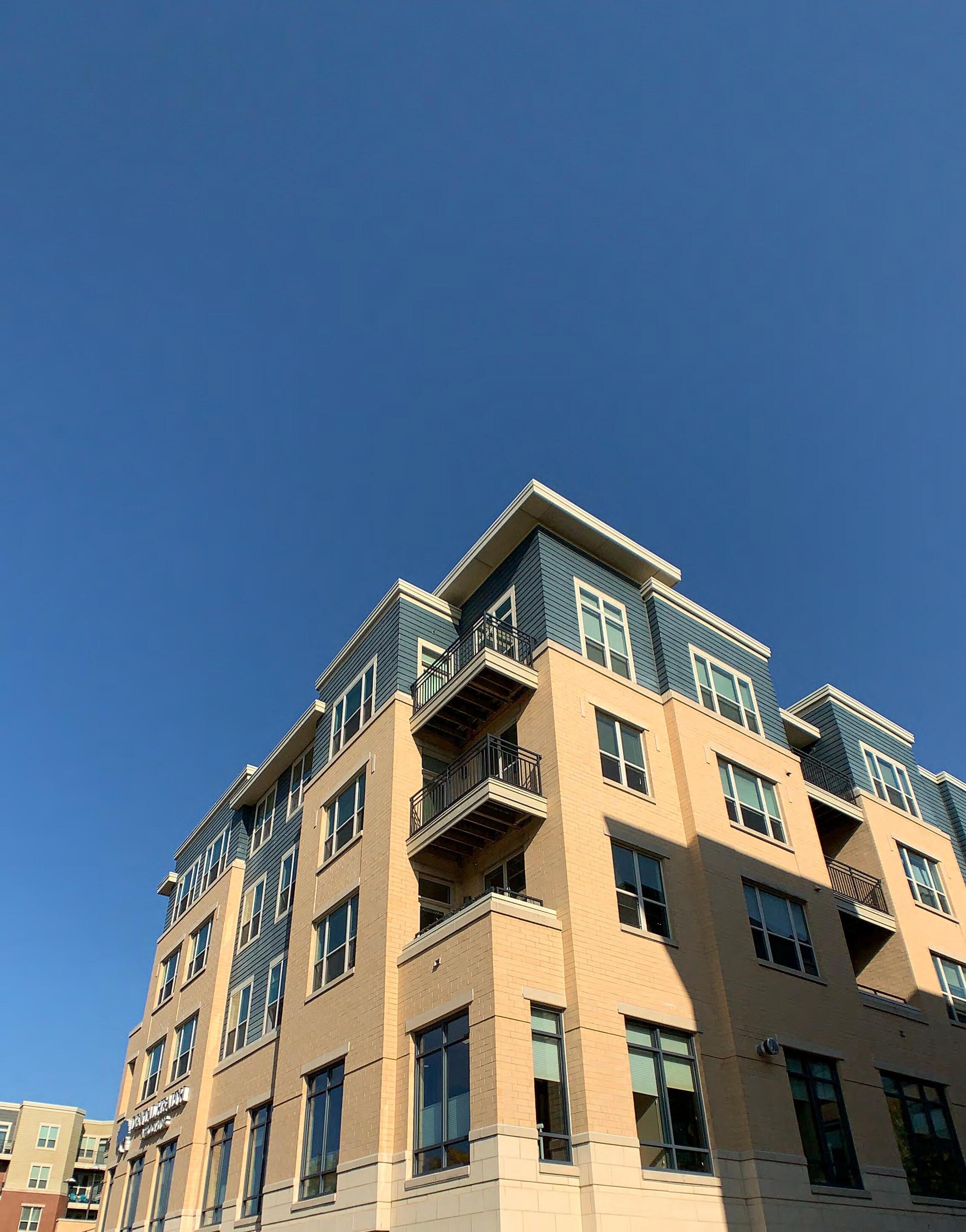
$1,200,000
$1,000,000
$800,000
$600,000
$400,000
$200,000
974 - The number of housing units as of 2019, per American Community Survey (ACS) 5-year Estimates.
67% - The percentage of units that are single-family detached, compared to 58% for Dane County and 41% for the City of Madison.
65% - The percentage of all units that are owner-occupied, based on the American Community Survey (ACS). In 2010, 91% of all housing units in the Village were owner-occupied.
0% - The percentage of all units that are attached single-family units (e.g. townhomes, twinhomes), based on ACS surveys. Attached and two-unit building forms are becoming more common as an important component of gradual density increases while maintaining ownership affordability.
47% - The percentage increase in the Village's median home value since the market bottom in 2012. The increase in the same timeframe has been 57% in the City of Madison, 50% in Maple Bluff, and 52% for Dane County as a whole. Home values in the Village did not decrease as significantly during the Great Recession (less market volatility).
$1,709 - The median gross cost for a rental unit in 2019. A household would have to earn $68,000 per year to afford this cost.
$3,560 - The approximate monthly housing cost for a mortgage on the median-valued home in the Village ($665,280 per 2019 ACS - assumes 20% downpayment, 3% interest rate, 30-year amortization). A household would have to earn about $142,000 per year to "afford" this cost.
25% / 52% - The percentages of owner households and renter households, respectively, that pay more than 30% of their annual income on housing costs.
Housing affordability is assessed based on a combination of income and household size. Both nationally and locally, 30% of any household's income is the generally recognized housing "affordability limit" for households before budgets are cut for other essentials, such as food, healthcare, childcare, etc.
This means that any households paying more than 30% of their income toward total housing cost (rent/mortgage, taxes, insurance, utilities, etc.) are considered cost-burdened within the housing market, and by definition are living in housing they cannot "afford", though cost burden is a greater problem at lower incomes.
Though the Village's primary housing unit type is single-unit detached homes (67% of all units), multiunit (or multi-family) housing makes up a significant and increasing portion of all Village housing. As the Village continues to redevelop and the larger region continues to grow, multi-unit housing stock will likely continue to grow as a total percentage of all units.
Continued population growth within the county and region since 2010, combined with the Village's location near employment, the University of Wisconsin, key amenities, and major transportation corridors, has already demonstrated strong demand for more housing in the market over the past decade. This growth has created strong demand for high-density residential construction. Nearly 30% of all residential units in the Village are less than a decade old, with the vast
majority of these being multi-family units. This demand is expected to continue as the county continues to grow, and will have a large impact on future development of both the Madison and Shorewood Hills sections of the University Avenue corridor.
Prior to the 2010s, the Village’s most rapid period of residential development occurred in the late 1930s when over 130 single-family residences were added to the Village. In comparison, development pressures through the 2010s produced more than three times that total amount in the same timeframe. This anticipated continued demand is one of the most notable considerations in housing future residents of the Village. While there is demand for new multi-unit construction due to regional housing pressures, (re) development within the Village is expected to continue to balance regional with local needs, including the Village's design standards and resident preferences.
Age of housing in the Village was capped for many years by lack of land to develop new structures. For much of the Village's existence, this means that the vast majority of homes were constructed prior to the 1960s—with the exception of single-unit redevelopment—and much of the overall housing stock was in single-unit detached structures.
As the City of Madison expanded through the 1950s and 60s and development extended west beyond Midvale Boulevard, suburbanization and development pressures in the region mostly bypassed the Village. Though development did occur in remaining plats during this time, no large-scale development occurred.
As can be seen in the Residential Year Constructed Map, there are exceptions on the original plats—and especially along Lake Mendota Drive—which have seen residential redevelopment since the year 2000. In the past decade, there has also been accelerating demand for multi-unit housing structures. So while the majority of residential structures in the Village were constructed prior to the 1960s, many units are being added in new construction, shifting the average age of units lower.
As of the 2000 Decennial Census, 80% of all housing units in the Village were constructed prior to 1960, but this number dropped to 58% as of 2019 American Community Survey Estimates. Currently, 29% of all housing units in the Village have been built since 2010.
$1,000,001 - $2,000,000
$750,001- $1,000,000
$500,001 - $750,0000
$250,001 - $500,0000
$150,001 - $250,000
The Village has always had high property values within the region, which has lent to the ability to provide high-quality services for residents. Within the Village itself the original Shorewood Plat has, in general, higher assessed property values than the College Hills plat. Homes in southern areas of the Village nearer to the rail line and University Avenue are also generally assessed at lower values than the average for the Village.
Home values in the Garden Homes neighborhood, where most properties are assessed between $150,000 and $250,000, are among the most affordable in the Village.
Homes along Lake Mendota have some of the highest values of all residences in the Village, including the only single -unit residences that have assessed values over $2,000,000.
An important component of assessment values is the differentiation between land value (the assessed price of land without any structures) and the improvement value (value of structures without land).
When comparing these two values, it can provide insight into the "level of use" of a given parcel, as structures maintain a relative consistency in value over time while land values can change drastically depending on market forces. Low ratios generally indicate a higher likelihood of redevelopment, and high ratios indicate a low likelihood of redevelopment or change of use.
As market forces change and impact land value, lower Improvement-to-Land value ratios can indicate parcels that may be "underbuilt" or underutilized compared to what would be expected given the investment to acquire the parcel. These are the residential homes in the Village that have the highest likelihood of extensive rehabilitation or redevelopment.
Overall, the Village has generally higher land values than surrounding jurisdictions, consistent with the demand created from proximity to amenities, quality of housing, restricted supply of homes, and the general locational amenities the Village offers. Areas of the Village that have significantly low improvement value ratios include many parcels along Lake Mendota Drive, as well as some of the larger residential parcels in the original Shorewood plat.
Value ratios
Just as improvement value ratios can be used to determine the likelihood of residential redevelopment, this ratio can also be used to determine the likelihood of redevelopment in areas that are likely to contain future residential uses.
Due to the Village's inability to annex new land for development, almost all new near-term residential unit additions will come in the current commercial corridor along University Avenue through mixed-use development.
Within this corridor, many of the parcels have an improvement value of less than 3.0, and some less than 1.5. This indicates that there may be opportunity for redevelopment in many areas of the corridor over the life of this plan, as higher-intensity uses can create more income for property owners in a manner better balanced to increased intensity of use.
Considering the lower-density residential history of the Village and large increases in the number of housing units that have accompanied residential development over the past decade, redevelopment in this corridor could introduce significant numbers of new households to the Village.
An accessory dwelling unit (ADU) is a smaller, independent residential dwelling unit located on the same lot as a stand-alone (i.e., detached) single-family home. ADUs go by many different names throughout the U.S., including accessory apartments, secondary suites, and granny flats. ADUs can be converted portions of existing homes (i.e., internal ADUs), additions to new or existing homes (i.e., attached ADUs), or new stand-alone accessory structures or converted portions of existing stand-alone accessory structures (i.e., detached ADUs).
Internal, attached, and detached ADUs all have the potential to increase housing affordability (both for homeowners and tenants), create a wider range of housing options within the community, enable seniors to stay near family as they age, and facilitate better use of the existing housing fabric in established neighborhoods.
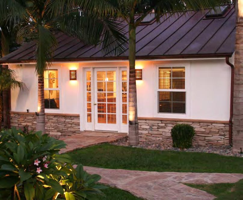
For more information on ADUs, see AARP's ABC of ADUs here: https://www.aarp.org/content/dam/ aarp/livable-communities/livable-documents/ documents-2019/ADU-guide-web-singles-071619.pdf
Two separate and often confused housing types, cohousing and cooperatives are often mentioned together. The definitions for each are:
Cohousing: an intentional community of private homes supplemented by shared facilities (e.g. kitchen). The community is planned, owned and managed by residents – who also share activities which may include cooking, child care, gardening, and governance of the community. The legal structure is typically a Home OWners Association, Condo Association, or Housing Cooperative.
Cooperative: A term used informally to describe any type of cooperative living situation. Legal definitions usually refer to a Limited Equity Housing Cooperative (LEHC). A LEHC is a building or group of buildings owned jointly by all residents, with a single “blanket” mortgage. Each individual typically does not have to qualify for the loan, but rather purchases a share in a nonprofit corporation that owns the property.
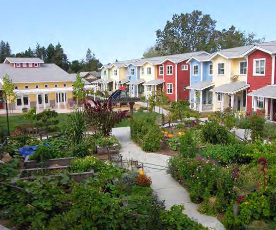
For more information on Cooperatives and Cohousing in Madison, see this Cap Times article: https://madison. com/ct/news/local/govt-and-politics/our-housecould-co-ops-help-solve-madisons-housing-crisis/ article_20e329c6-80ce-5788-8302-73627c15d67c.html
Cottage courts are groupings of smaller homes around a shared common space — often a "green" — which takes the place of a traditional yard. Used to increase density of housing and promote affordability through shared land and lower cost of construction, these homes can be either owner- or renter-occupied.
Housing of this type can be used for infill or redevelopment, as well as to diversify housing types in existing or new neighborhoods. Often, cottage court developments will see 5-10 units on a 0.2 - 0.4 acre lot or adjacent lots.
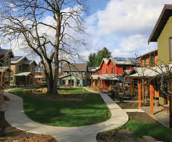
For more information on Cottage Courts, see this article from Opticos Design: https://missingmiddlehousing. com/types/cottage-court#documented
Attached unit housing refers, in general, to any dwelling units on single lots that have shared walls at the property line. However, this "style" of housing can also be used to develop frontage along a single lot, as a transition from higher-intensity uses to lowerintensity uses (multi-family to single-family), or as infill development. Though there can be as few as two units (duplex), it is more common to see 4+ attached unit structures due to site requirements and construction

efficiencies.
Attached units are often referred to as "townhomes", "rowhouses", or "duplexes", and refer to the structure type, not the form of ownership. Attached unit housing can be either owner- or renter-occupied, and have been used in the City of Madison (and Shorewood Hills area) in multifamily development to provide a more traditional residential facing when directly adjacent to single-family residential (Quarry Apartments).
Top Issues & Opportunities:
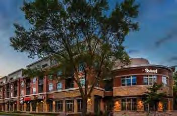

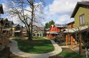
Policies:
1: Continue to engage with the community regarding housing needs and issues, especially regarding quality, access, and affordability.
2: Where neighborhoods have a distinctive and desirable design and function, as affirmed through a community planning process or district designation, that character should be honored when redevelopment projects occur. Redevelopment should be compatible with scale and proportions of nearby homes.
3: Encourage water and energy efficiency in all housing, including new construction and existing home improvements. Designers and builders should use common green building checklists to ensure increased sustainability in new housing.
Actions:
1: Adopt standards in the zoning ordinance to ensure that garages are not the dominant feature of the streetscape.
2: Follow Neighborhood Plans, if available, when reviewing site development and redevelopment proposals, including general design standards which may be adopted into the zoning ordinance.
3: Continue to share information on energy programs, audits, and green design principles in conjunction with the permitting process.
Policies:
4: The Village will work with developers to continue to include workforce housing into redevelopment, and will explore all feasible methods including affordable units. People who work in the Village should be able to afford to live in the Village, and Shorewood Hills will continue to support the development of housing that is accessible across a range of incomes.
5: Encourage housing and transportation investments to occur in tandem, so that any potential redevelopment also encourages and/or increases access to public transportation and multi-modal paths.
6: Encourage the development of housing for people of all abilities – including universal design principles in new housing (and accessory dwelling units) that can provide flexibility in care for senior households.
7: Encourage new development to include features designed for aging residents when in walking distance of public and commercial amenities.
8: Promote the preservation of affordable single-unit housing that currently exists in the Village.
4: Review the zoning ordinance to ensure development formats that limit cost (including small lots, small homes, attached units, and “cottage court” clusters of detached homes) can be constructed in current or future neighborhoods.
5: Consider partnering with a land trust that can ensure permanently affordable homes by separating the cost of the home from the cost of the land for incomequalified buyers, as homes appear on the market or opportunities for (re)development occur.
6: Encourage the development of housing units that feature zero-entry and other universal design elements where feasible in (re)development, and provide materials that promote the importance of aging-in-place.
7: Encourage inclusion of income-qualified (affordable/workforce) housing units as a component of all new multi-unit residential development proposals.
8: Review and approve housing development proposals based on consistency with the Land Use chapter of this plan, including the Future Land Use map and any associated policies.
9: Consider amending the Village’s ordinances to allow accessory dwelling units (with appropriate standards to ensure compatibility with other homes in the neighborhood) for the purpose of increasing housing choice, accommodating different household types and preferences, and increasing affordability.
10: Continue to market Village amenities and resources to residents who are renters, especially residents of multi-unit buildings.
The Village has some of the most highly desired housing in the State – a combination of proximity to amenities, the University of Wisconsin, downtown Madison, and the natural environment. Though in recent years, housing costs have continued to rise. Residents surveyed acknowledged a strong need to expand and preserve housing affordability, especially ownership opportunities for younger families – the Community Survey indicated “entry-level ownership housing” as the only housing type identified in which the plurality of residents said there isn’t enough. General affordability was also a concern, with 58% “agreeing” or “strongly agreeing” that there is a need for more housing available to working families and individuals.
The 2020 Community Survey asked residents about improvements they would like to see – and things they felt most important to keep. Some of top responses include:
• Many respondents (37%) indicated that it is difficult to find adequate housing, while 13% indicated that adequate housing is easy to find
• Neighborhood character was the largest single factor listed as to why respondents chose to live at their current residence
Other insights from focus group participants included:
• It is easy to be skeptical of proposed development – even if it ends up being a good thing for the community
• The Board has done an excellent job in negotiating aspects of redevelopment that integrate well into the Village
• Neighborhoods in the Village are unparalleled – Village amenities set it apart from any other place


The Village is surrounded by the City of Madison on three sides, each side with distinct surrounding land uses. To the west of the Village, beyond Blackhawk Country Club, is low- to medium-density single-family residential. To the southwest of the Village are State office buildings, Madison Yards redevelopment, and Hilldale Mall. South along University Avenue the uses are primarily small retail and service establishments, with medium-density residential in adjacent blocks. To the east is the University of Wisconsin campus, which includes university housing, recreation, open space, and employment/clinics. To the north, the Village is bounded by Lake Mendota.
Per American Community Survey estimates, the City of Madison's population as of 2019 was 254,977; it is the seat of government for both the State and for Dane County. The City plays a very active role in both local and regional planning, and has developed numerous detailed neighborhood plans to guide development at the neighborhood level. Each of these neighborhood plans is adopted into the comprehensive plan, which was rewritten in 2018 and acknowledges significant changes in Future Land Use to accommodate growth in key areas.
Insights into the intergovernmental context for the comprehensive plan can be found in the plans of these neighboring jurisdictions. These plans are important because they reflect attitudes toward growth, development and intergovernmental cooperation in communities that share common borders with the Village. These attitudes and plans will heavily influence the location, intensity, and arrangement of development adjacent to the Village. They also help provide guidance for the planning of the community’s edges so that the interface between land uses across municipalities can be effectively handled. Finally,
the plans are also important since they help identify areas of common concern that communities, working together, may be better equipped to address.
Based on comments received during the planning process, several of the issues foremost in the minds of Village residents are cross-jurisdictional in scope. These include: transportation, watershed/stormwater management, and development activities in the west campus area/along University Avenue. Development of effective solutions to these issues must involve concerted efforts among all affected jurisdictions.
The Village already has a number of intergovernmental cooperation efforts, including the Joint Campus Area Committee, which is composed of seven representatives from the University of Wisconsin, six representatives from the City of Madison, the four adjacent City alders, and two representatives from the Village of Shorewood Hills. The mission of the Joint Campus Committee is to provide feedback to the UWMadison Design Review Board for projects taking place in the Campus Institutional district.
The Village also cooperates with adjoining jurisdictions in a variety of ways, including watershed and stormwater planning, infrastructure planning and funding, transit access planning, and fire/EMS provision, among other services.
The City of Madison Future Land Use Plan, which guides anticipated forms, uses, and densities is a key consideration in the planning process. While areas to the west will remain low-density neighborhood residential, the City does continue to anticipate significant change and growth along the entire University Avenue corridor from Madison Yards/Hill Farms to Highland Avenue.
To accommodate the anticipated growth of the City over the next two decades (projected increase of 70,000 residents), as well as to promote walkable and transit-oriented development patterns, the City of Madison has classified the majority of parcels along University Avenue as Community Mixed Use.
In considering cohesion of design and access in the corridor, the Village should anticipate that demand for approximately the same uses and densities will exist on the Village side of University Avenue as the Madison side. Redevelopment opportunities in the corridor provide proximity to amenities and rapid transit, and Village parcels on University Avenue are also more easily developable due to larger lot sizes and lower barriers to land assembly.
The City describes the Community Mixed Use district as: areas supporting an intensive mix of residential, commercial, and civic uses serving residents and visitors from the surrounding area, located along major transit corridors, and accommodating significant development (2-6 stories) including a variety of housing options and commercial uses integrated throughout the district.
As the Village is represented on the Joint Campus Area Committee, it is directly represented in conversations regarding campus development, including regular updates on all projects on campus.
Within the West Campus district directly adjacent to the Village, there is one major project anticipated through 2027: the Nielsen Wellness Center building addition at 1000 Highland Avenue (W-28, above). The University also anticipates a building addition to the Preserve Outreach Center, located on University Bay Drive (W-29, above). Long-term, the University also anticipates a hospital addition (W-01).
The University has prioritized landscaping and sustainability within this most recent campus plan, which is expected to continue through future planning efforts. This includes Green Infrastructure and Stormwater Management throughout campus, as well as a Utility Master Plan to incorporate alternative energy sources for all campus buildings.
The University is also considering the impacts of Bus Rapid Transit on future planning and development, including in the West Campus Area, and has stated that they intend to prioritize improvements to bicycle and pedestrian networks that connect campus, including adjacent to the Village.
Note: The adopted C-I District Master Plan does not include the ability to develop U-Bay fields. The map in the adopted plan contains currently marked and used game fields in the NW corner within the area. This area is currently designated as "Conservation" within the Plan, and because of this the University would need to acquire a Conditional Use Permit from the City of Madison for any future development in this area. The undeveloped nature of U-Bay Fields remains important to the Village, and preservation as a Conservation area is a Village priority.
The Greater Madison Metropolitan Planning Organization (MPO) leads the collaborative transportation systems planning for the Greater Madison region. The MPO is responsible for comprehensive planning and decision making that prioritizes transportation investments for roads, public transit, bicycle, pedestrian and other transportation needs. The MPO is housed in and staffed by the City of Madison Planning Division. As the basis for the MPO is planning of regional significance, the Village's primary interactions with the MPO are related to the University Avenue Corridor.
The Village of Shorewood Hills is located within the planning jurisdiction of the Capital Area Regional Planning Commission (CARPC). CARPC is the water quality management planning agency for Dane County. In coordination with the Wisconsin Department of Natural Resources, CARPC prepares water quality plans and is regularly involved in the delineation of and amendments to urban service areas and environmental corridors.
The Shorewood Hills Elementary School has been a part of the Madison Metropolitan School District (MMSD) since 1962. MMSD is the entity that oversees additions, renovations, and changes to the school building—as well as some aspects of the green space surrounding it—and has worked with the Village over the years in planning school facility needs and updates.
Metro Transit service to the Village is an integral component of the transportation system, and one that is in the process of expanding. The City of Madison and Metro Transit's Bus Rapid Transit plan was accepted into the Federal Transit Administration's Small Starts Program, and when implemented will provide frequent transit access along the larger EastWest corridor. The Village supports Metro Transit and Bus Rapid Transit Initiatives.
Top Issues & Opportunities:
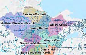


Goal 1: Work closely with other governments and government organizations to ensure sustainable and impactful initiatives.
Policies:
1: Continue to support the Shorewood Hills Elementary School in engaging parents and the community, increasing involvement with the Village and other residents.
2: Maintain and expand as needed mutually-beneficial agreements for shared or contracted services and utilities with the City of Madison.
1: Maintain communication with Madison Metropolitan School District to discuss issues of concern and opportunities for collaboration.
2: Continue to meet with City of Madison staff to coordinate projects as may be appropriate.
2: Continue to research and fund stormwater and flash flooding improvements in partnership with the City of Madison and other partners within the Willow Creek Watershed, including model, study, and infrastructure investments.
3: Continue to work with the University of Wisconsin-Madison as part of the Joint Campus Area Committee to ensure Village interests are represented in University land use decisions. This will include opposition to the development of University Bay athletic fields.

Residents of the Village have incredible access to natural, open space, and recreation amenities due to proximity to the University of Wisconsin-Madison. Residents highly value this access – whether it be use of open fields, access to Lake Mendota and Picnic Point, or trails that connect through campus to areas in the City of Madison.
Residents also value location to amenities within the City of Madison. The Village’s growth will be influenced by redevelopment that occurs in the University Avenue corridor, and the City of Madison is expected to grow by 70,000 residents over the next 20 years. Members of the community throughout this process expressed the dual perceptions of being in the center of a growing region and the access to amenities that comes along with it, as well as the desire to protect the aspects of the Village that they treasure the most – notably the quaint sense of community.
Other insights from focus group participants included:
• The Village is not in opposition to or in competition with Madison, and shares regional pressures, challenges, and opportunities
• Partnership on stormwater, watershed, and other issues will continue to be one of the most important shared initiatives
• A ccessing the proximity to public transit can be difficult for residents who live further into the Village
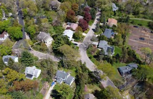
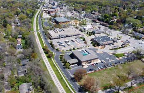
Every few years, the State Department of Administration produces population projections for municipalities to use in planning future growth. While this is critical for many municipalities across the State, the Village is mostly built out, which causes projections for the Village to be historically inaccurate. The most recent projections (vintage 2013) anticipated a 2020 resident population of 1,540 in the Village, compared to the 2019 American Community Survey estimate of 2,277. For this reason, Department of Administration projections, which are based on data prior to the boom in University Avenue Corridor redevelopment projects, are not accurate or useful as a basis for planning decisions.
As the Village is completely landlocked by the City of Madison, in the near term all new household (and the majority of population) growth will likely come through redevelopment in the University Avenue corridor, as well as a smaller amount through gradual increases in density as ADUs may be developed, or single vacant lots are split and developed from otherwise combined parcels.
Comprehensive Plan 2020
Village of Shorewood Hills Dane County, WI
The Village's Future Land Use Map contains different land use categories that illustrate an overall land use vision. These categories, including explanation of the Village’s intent, zoning, design and development strategies for each, are described in this chapter.
Water Body
Parcel Boundaries
Shorewood Hills
Existing Land Use
Commercial - Office
The Future Land Use Map presents recommended future land uses for the Village of Shorewood Hills. This map—and the associated policies—form the basis for land development decisions and are to be consulted whenever development is proposed, especially when a zoning change or land division is requested. Zoning changes and development shall be consistent with the future land use category shown on the map and the corresponding plan text.
Future land use categories identify areas by their primary intended uses, character, and densities. These classifications are not zoning districts. They do not establish binding performance criteria for land uses (i.e. setbacks, height restrictions, etc.), nor are they intended to encompass all possible uses that may be permitted within a given future land use classification.
The Village may from time to time create neighborhood plans for areas as part of future amendments to this comprehensive plan that further illustrate and guide development.
Future land use classifications identify existing Village of Shorewood Hills Zoning Districts that are “consistent” within each future land use category (identified as “Potentially Acceptable Zoning Districts”). This list of potentially acceptable zoning districts will be used by the Village to determine whether requests for rezoning of property are generally consistent with this plan. Areas subject to zoning districts include all lands located within the Village of Shorewood Hills municipal boundary. Some areas (Garden Homes Neighborhood) contain a variety of possible districts not explicitly listed.
Land use and design policies in this plan should be considered during all development processes, especially in rezoning or zoning ordinance amendment processes when consistency with the plan is a statutory requirement.
The General Design Strategies and images within any category are provided to help developers and Village officials make design decisions during the development process consistent with the intent of the future land use category and the general desire for high quality site and building design. These strategies may be used to help determine whether to approve rezoning, conditional use permit, site plan, or planned unit developments. The illustrations and photos are not an exhaustive list of best planning practice and do not constitute the whole means by which high quality site and building design should occur. Any development proposal should be reviewed by not only Village staff and committee, but also by a certified planning professional.
The identification of future land use categories and potentially acceptable zoning districts does not compel the Village to approve development or rezoning petitions consistent with the future land use category or map. Other factors will have to be considered, such as the quality of the proposed development, its potential effect on adjacent properties, its potential effect on Village transportation infrastructure, the capacity and ability to provide services to the site, and the phasing of development, before any development applications are approved. In addition, it is not anticipated that all areas suggested for future (re) development on the Future Land Use Map will develop or be rezoned for development following adoption of this comprehensive plan. In some cases it may be years or decades before (re)development envisioned in the plan occurs due to market conditions or property owner intentions.
amendinG the future land use maP
It may from time to time be appropriate to consider amendments to the Future Land Use Map, usually in response to a type of development not originally envisioned when this plan was adopted. See the Implementation Chapter for a description of procedural steps for amending any aspect of this plan. The following criteria should be considered before amending the map:
• Compatibility - The proposed development will not have a substantial adverse effect upon adjacent property, with a particular emphasis on uses that are adjacent to existing residential neighborhoods. A petitioner may indicate approaches that will minimize incompatibilities between uses.
• Natural Resources - The land does not include natural features which will be adversely affected by the proposed development. The proposed development will not result in undue water, air, light, noise pollution, soil erosion, or stormwater runoff. Petitioners may indicate approaches they intend to use to preserve or enhance the most important and sensitive natural features of the proposed site and mitigate impacts to surrounding properties.
• Transportation - The development will allow for construction of appropriate roads that are suitable for travel or access by emergency vehicles. The proposed development will not create a significant detriment to the condition of adjacent transportation facilities or cause significant safety concerns for motorists, bicyclists, or pedestrians. Petitioners may indicate approaches they intend to use to mitigate transportation compatibility concerns.
• Ability to Provide Services - Provision of public facilities and services will not place an unreasonable financial burden on the Village. Petitioners may demonstrate to the Village that the current level of services are adequate to serve the proposed use, including but not limited to school capacity, emergency services capacity, parks, library services, and water or sewer services. Petitioners may demonstrate how they will assist with any shortcomings in Village or regional services or facilities.
• Public Need - There is a clear public need for the proposed change or circumstances have resulted in a need for the change. The proposed development is likely to have a positive impact on the Village. The Village may require that the property owner or agent fund and prepare a fiscal impact analysis by an independent professional.
• Adherence to Other Portions of this Plan - The proposed amendment/development is consistent with the general vision for the Village, and the other goals, policies and actions of this plan.
The boundaries of future land use designations are approximate and are generally intended to align with parcel boundaries. Where there is uncertainty about the intended boundaries on the Future Land Use Map, the Village Board shall decide the intended boundary with a recommendation from the Plan Commission.
This section includes a description of each of the Future Land Use Plan categories. These categories include recommended land uses (e.g. residential, employment, mixed use), and land use densities (i.e. dwelling units per acre). All zoning decisions, land divisions, utility extensions, capital improvement projects, and related land development activities and decisions should be consistent with the recommendations of the Future Land Use Plan.
NR areas are designated to provide a subtle mix of housing types for all members of the community, ensuring residents have sufficient housing options to remain in neighborhoods throughout their lives as circumstances may change. The vast majority of the area designated as NR is and will continue to be used for single family homes, but a variety of two-unit or attached housing options may also be appropriate within this designation in specific areas (see Garden Homes Neighborhood Plan, linked below).
1. NR areas should continue to have both rental and owner-occupied housing, and may include housing options for people of all ages and physical abilities.
2. All housing types will follow Village regulations on building height (max. 32 feet) and bulk (following Floor Area Limits).
3. Accessory dwelling unit structures may be considered in the NR area, and if so will be designed for compatibility with other nearby housing (examples at right).
The Garden Homes neighborhood, unique in the NR category, has undergone an extensive neighborhood planning process. As a result of this neighborhood plan, a variety of potential structure types have been identified. Stressing support for remaining homes, the plan encourages potential (re)development that remains consistent with neighborhood scale, affordability, and feel.
All land use decisions and considerations within the neighborhood plan boundary should follow the redevelopment objectives of the Garden Homes Neighborhood Plan. In some cases this plan considers potential zoning districts other than those listed below, though the Village will not proactively rezone parcels.
nr Potentially accePtaBle zoninG districts
• R-1 Single-Family Residence District (R-1)
• R-2 Single-Family Residence District (R-2)
• R-3 Single-Family Residence District (R-3)
• See Garden Homes Neighborhood Plan
Accessory Dwelling Unit Examples (see pp. 56-57 for more information)
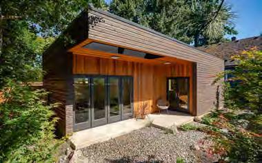

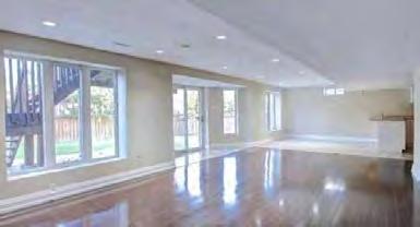
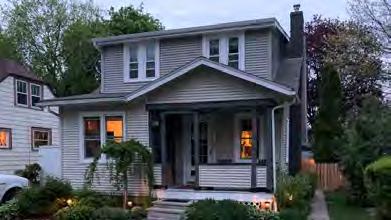
NMU category includes existing and planned activity centers with retail, restaurant, service, institutional, commercial, and civic uses primarily serving nearby residents. Residential is also a component of the NMU district, both in mixed use developments and as standalone multi-unit residential developments.
Development and design within NMU areas should typically be compact and walkable. NMU areas should be well-connected to neighborhoods, as well as to multi-modal transportation as a component of the development process.
1. As part of the zoning approval process, the appropriate mix of land uses, densities, and intensities will be determined with consideration of market conditions and compatibility with adjacent neighborhoods. Typically residential densities in NMU areas will be 20-80 units per net acre (excluding streets, parks, etc.), and may include medium-density residential uses such as townhomes, etc.
2. While both residential and nonresidential uses are accommodated within this mixed-use area, not every building in a mixed-use area needs to include both residential and non-residential uses. Nonresidential development within NMU areas should be predominantly service and retail when possible to support surrounding residential and neighborhoods, though office and other employment uses could also be appropriate.
3. To best support neighborhood-serving retail, an individual building should not include more than 25,000 square feet of commercial space, except for buildings containing grocery stores and/ or community facilities (such as libraries). When larger commercial uses are present, the building should be designed with extra care to ensure uses that best support surrounding neighborhoods. Commercial spaces could be constructed in a range of sizes to add variety and encourage a mix of different commercial uses.
Potentially accePtaBle zoninG districts
• R-4 Multiple-Family Residential District (R-4)
• C-1 Village Commercial District (C-1)
4. Based on market demand and recent development patterns, new buildings in NMU areas are expected to be two or more stories in height with a preference towards multi-story buildings. This general height provides opportunity for adequate transition from University Avenue stepping down to existing residential neighborhoods to the north.
5. Mixed use and other intensive development will require careful design where the use adjoins less intense residential development.
6. Integration of affordable housing into mixed-use areas will continue to be strongly encouraged. Multi-unit residential within the mixed use category should contain a mixture of unit sizes and a mix of income-qualified and market rate units. A mix of affordable occupancy types is also strongly encouraged for the classification as a whole (both rental and ownership options).
7. Development and design within NMU areas should prioritize multimodal access from both the Village interior as well as University Avenue, and include generous sidewalks, welcoming street entrances, and considerations for the location of transit stops. Any sidewalks or mixed-use paths in developments will be open and maintained for public through traffic. The inclusion of green infrastructure and social gathering spaces will be strongly encouraged.
8. Buildings in NMU areas should be oriented towards streets with context-sensitive setbacks from public sidewalks to activate the street and increase walkability while maintaining tree canopy.
9. Private off-street parking should be located primarily underground. Where parking is required for retail and service businesses, it should be shielded from public streets and substantially landscaped when facing existing residences.
10. Any development should integrate site design elements that facilitate pedestrian and bicyclist access to retail portions, ensuring easy access for multi-modal transportation.
• C-2 Limited Commercial District (C-2)
• C-3 Medical Office-Commercial District (C-3)
• PUD Planned Unit Development District (PUD)
The images and text below describe general design and features of Neighborhood Mixed Use buildings and sites.
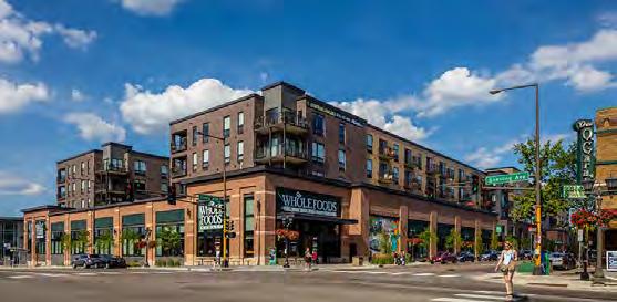
Examples of integration of community serving retail or community facilities into mixed use development, such as grocery stores or libraries.
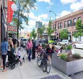
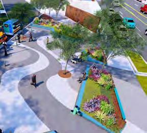

Outdoor social gathering spaces should be an integral part of NMU areas to support residential populations in the near vicinity, as well as provide for gathering of residents from the surrounding areas as a community destination and activity center.
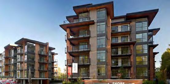
Good Design Elements: Vertically-proportioned, significant glass, varying facade, high quality building materials, and ample landscaping.
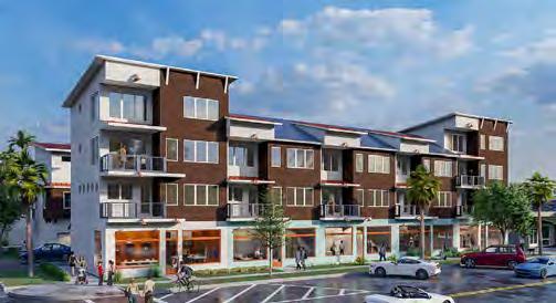
Design for mixed use structures can include varying forms, including opportunities for ownership options such as townhomes and/or condos.
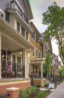
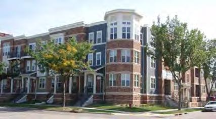
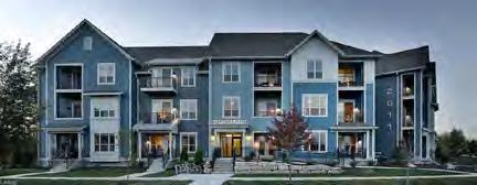
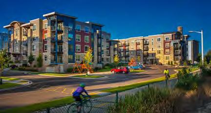
Mixed use districts can allow either single-use or mixed use developments: developments that provide two or more uses either on a single tract of land as horizontal mixed use or within a single building (vertical mixed use). Typically the first floor is retail, but office or a public use may also occupy the first floor.
As shown in these images, mixed use districts can contain a variety of sizes and styles that can complement the surrounding commercial and residential character.
Elements to consider: building height, roofline (pitched vs. flat), building materials, building setback from the street, parking location, etc
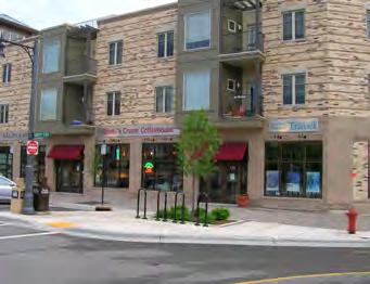
First floor retail with upper story office or residential with shallow setbacks.
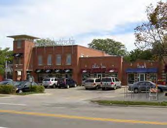
1.5- to 2-story neighborhood commercial with side-yard parking.
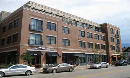
Tall buildings should step back the upper floors to reduce the impact on the surrounding properties.
E areas include predominantly corporate, University, and business offices, research facilities, laboratories, medical clinics/hospitals, and other similar uses. They generally do not include retail and consumer service uses for the wider community, but may include limited retail and service establishments that primarily serve employees and users of the area. Employment areas are not generally recommended for any residential uses. Although generally used to identify relatively large employment areas (e.g., Veterans Hospital) the designation may also be applied to an individual property where appropriate.
While there are no fixed limits on suggested size or development intensity within E areas, all uses should remain compatible with the density and scale of surrounding development. The intensity of development may vary significantly depending on the surrounding context.

SI areas include schools, some government facilities, railroads, utilities and other parcels that are owned by a public, quasi-public, utility, or religious entity. Park and recreational uses are sometimes a primary or secondary use on these sites.
1. Schools and places of assembly and worship should continue to prioritize ease of access from within neighborhoods.
2. SI uses should continue to be located on or near central streets, and be designed so that higher volumes of traffic associated with such uses will not be drawn through local neighborhood streets.
3. Streets, walkways, and multi-use paths and trails should provide strong pedestrian and bicycle linkages adjacent to and connecting larger SI areas.
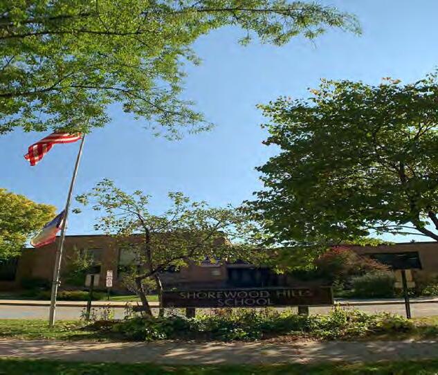
• CF Community Facility District (CF)
• C-3 Medical-Office Commercial District (C-3)
Conditional use in most of the Village’s zoning districts.
PO category includes public parks, recreation areas, private recreation uses (e.g., golf courses), bioretention basins, garden triangles, and other natural features and lands with a park-like character that are to be preserved. Parks and open space uses are allowed uses in all other land use categories, regardless of whether or not the area is mapped as Parks and Open Space.
Parks often serve as important community gathering places, and wherever possible should be made accessible to residents with disabilities. Frontages on public streets that make them both visible and accessible by neighborhood and Village residents should be maintained and improved where possible to expand access.
Linking otherwise separate open spaces with bicycle and pedestrian connections can expand trail connections that serve as recreation space while further connecting the system.
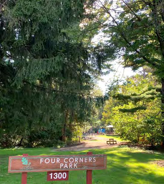
Though noted in the PO classification, Blackhawk Country Club is unique among these areas. The land the club operates on is Village owned, and the current lease runs through 2034 with an option for the Club to renew through 2044.
Parks and open spaces are vital to community health, providing valuable ecological services to the community that include moderating summer temperatures, improving air quality, and slowing and filtering stormwater runoff.
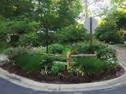
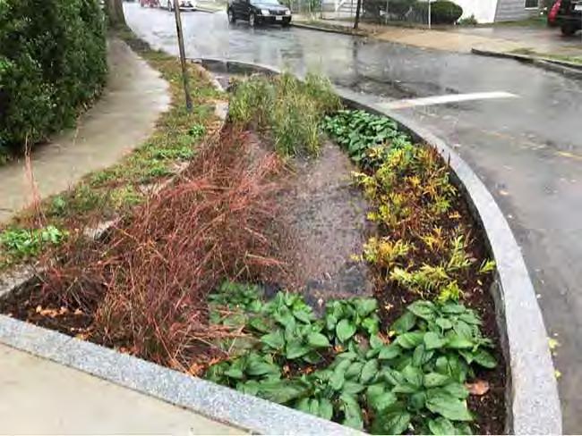
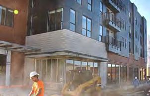
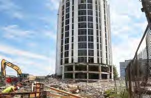
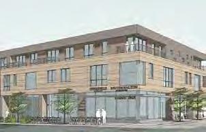
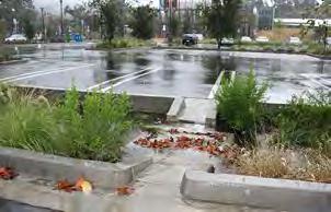
Policies:
1: Encourage development that uses land efficiently, including increased density and mixed-use infill (re)development
2: Strive for balanced growth that increases employment, resident-serving retail, and residential uses in concert.
3: Encourage development formats and building designs that support adaptive reuse as markets shift – such as large-format commercial buildings that can be reasonably divided into multi-tenant buildings.
4: Encourage landscaping practices that delay, filter and infiltrate stormwater, beyond basic compliance with Village and County regulations.
5: Ensure that new development is a net increase to Village tax revenue, while also considering needs and amenities offered to residents.
6: Developers will be expected to integrate aspects of the Village’s Sustainability Plan into new developments whenever feasible.
7: Developers of mixed-use residential buildings will be expected to pay their full share of the additional cost for emergency services provided to the Village by the City of Madison.
Policies:
8: Design all new development for safe walking and biking.
9: Protect the existing freight rail line for long-term regional transit use.
10: Discourage the use of large surface lots and at-grade parking in all redevelopment projects, and require significant underground parking as a component of all redevelopment.
11: Evaluate the appropriate number of parking stalls necessary in redevelopment considering increased integration of bicycle and pedestrian facilities and access to transit.
12: Locate community facilities, centers, and gathering spots in strategic locations that are centrally located and easily accessible from neighborhoods.
13: Discourage the development of single-story buildings.
14: Encourage infill of under-utilized land and buildings in a manner that creates a cohesive mixed-use neighborhood feel. Seek opportunities for linkages between new development in the University Avenue corridor and existing neighborhoods and recreation resources.
15: Encourage and facilitate initiatives that make mixed-use areas unique and attractive. This can be implemented quickly as a component of redevelopment, or incrementally over time in areas that are already developed.
• Incorporate squares and pocket parks as multi-use destinations.
• Design buildings to activate outdoor spaces with entrances and ample windows, café space with outdoor seating, etc.
• Incorporate art into infrastructure and outdoor spaces
• Incorporate recreation into all public spaces.
• Design with priority to walking and bicycling.
• Allow for experimentation and change. Places may need to be adapted to changing needs and conditions.
1: Consider a “neighborhood” planning process for the University Avenue corridor focused on diversity of housing types, mixed-use development, and retail options that expand choices and reinforce the existing character of the Village. Identify any future road or transportation infrastructure that the Village should encourage or require.
2: Enhance and preserve the general property tax revenue of the Village, including but not limited to negotiating Payment in Lieu of Taxes (PILOT) arrangements with new taxable properties and existing taxable properties that may convert or be sold to tax exempt entities.
Voices from the Community:
There have been major land development investments in the Village over the past decade, and residents have a wide range of opinions about what “pace” of growth is appropriate in the Village. Overall, residents in this process indicated that land use decisions over the past decade have been well-handled, and that the Village will continue to not only maintain conditions for appropriate growth, but will also actively guide land use decisions that improve quality, add new amenities, and enhance resident quality of life.
The planning process fostered conversation with residents on identity and change within the Village, and these few conversations indicated general hope for:
• Village-centered redevelopment that is high-quality and attractive
• A dding public amenities as a component of changes in land use
• Increasing safety for walkers, bicyclists, and other users of the Village whenever new development occurs
A prominent feature in and along the border of the Village of Shorewood Hills is the University Avenue corridor. Stretching from The Lodge at Walnut Grove at the western edge of the Village to University Bay Drive at the eastern edge, the corridor contains over 30 parcels of different development types and intensities. At present, this corridor collectively represents over 20 percent of the Village tax base.
Over a decade ago, the Village anticipated real estate pressures in the Marshall Court area and was able to get ahead of the development curve by drafting and adopting the Doctor’s Park Neighborhood Plan.

That Plan was ultimately incorporated into the 2009 Village Comprehensive Plan.
Similar real estate pressures are being applied to the University Avenue corridor, and as part of this Plan it is recommended to undertake a full "neighborhood"
planning process to determine the shared future of the University Avenue corridor.
While we know that any development is likely to be mixed use (both because it is called for in this plan and because market forces are strongest for that development type), the actual development patterns are up to individual property owners.
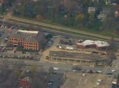
To ensure cohesiveness of any potential development, the Village should undergo the same thorough planning process as previous neighborhood plans, but for an area focused on new potential building types, street connections, and resident amenities.
A University Avenue Corridor Plan would allow opportunity for residents and business owners to create a shared vision of an area primed for change. This process should include conversations of why new businesses and residents would want to reside in the Village, how change can occur in that corridor while preserving the distinct atmosphere of the Village, and multiple potential future states for this corridor over the next ten to twenty years.

Existing low-density, auto-oriented uses will see market pressure for redevelopment
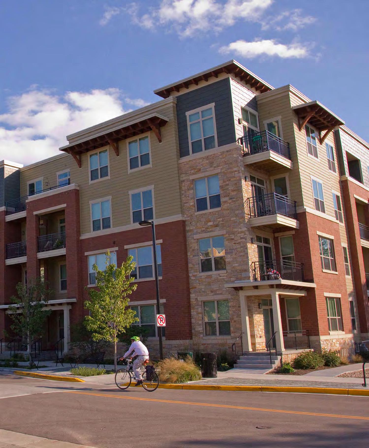

Responsibility for implementing this plan lies primarily with the Village Board, several Village committees and commissions, including the Plan Commission, and Village staff.
The Village Board sets priorities, controls budgets and tax rates, and has the final say on key aspects of public and private development projects. Each Trustee should know where to find this plan and should be familiar with the major goals described herein. The Village Board should expect that major actions remain consistent with this plan.
Land use and development recommendations are a core component of this plan, and the Plan Commission has a major role in guiding those decisions. Plan Commission members must each have access to this plan and must be familiar with its content, especially the Land Use Chapter. It is the responsibility of the Plan Commission to determine whether proposed projects are consistent with this plan, and to make decisions and recommendations that are consistent. In cases where actions that are inconsistent with this plan are believed to be in the best interest of the Village, the Plan Commission should seek public feedback before recommending amendments to the Plan.
All committees, boards and commissions that serve as an extension of the Village of Shorewood Hills should treat this Plan as relevant to their activities in service to the community, and should seek outcomes consistent with the goals and policies herein. Many plans written under the guidance of various committees have influenced the content of this plan, and other plans referenced should be treated with the same weight as an extension of the comprehensive plan.
Village staff have a significant influence on capital projects, operational initiatives and regulatory decisions. It is imperative that individuals in key roles know about, support, and actively work to implement the various policies and actions in this plan.
Staff members should be familiar with and assist in tracking the various goals, policies and actions laid out in this plan, and should reference that content as appropriate in communications with residents and elected and appointed officials. The purpose of this extra effort is to strengthen staff recommendations and reinforce the plan as a relevant tool integral to Village functions.
The Village Administrator, as lead administrative official, should ensure that other key staff members and committees are actively working to implement this comprehensive plan.
Implementation of this Plan also depends, to a great degree, on the actions and decisions of entities other than Village government. The Action Plan (Appendix B) indicates a few responsible parties that the Village does not control or direct.
It is necessary to work with other partners to further implementation of the goals, policies, and actions of this plan. The following Village activities can support this effort:
• Share this plan with all interested and mentioned parties.
• Take the lead role in establishing collaboration with these organizations.
• Know and communicate the intent of relevant objectives and strategies. Partner organizations need to understand and buy in to the rationale before they will act.
To provide lasting value and influence, this plan should be used and referenced regularly. To inform annual processes, once per year the Plan Commission will review the comprehensive plan and the annual TID report. The Village should review the following information:
• Action items in progress or completed during the prior 12 months.
• Staff recommendations for action items to pursue during the next 12 months.
The most important opportunity for this plan to influence the growth and improvement of the Village is through the annual budgeting and capital planning processes. These existing annual efforts determine what projects will and will not be pursued by the Village, and so it is beneficial to integrate this plan into those processes every year as they have already been discussed in detail.
The compilation of actions in Appendix B is a resource to support decisions about how and where to invest the Village’s limited resources. The Annual Update should draw from these actions. Plan Commission can make recommendations for Board consideration, identifying those choices and commitments most likely to further the goals, policies, and actions identified through this planning process.
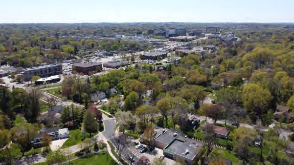
Once adopted, the Plan becomes a tool for communicating the Village’s land use policy and for coordinating legislative decisions. Per the requirements of Wisconsin’s Comprehensive Planning Law, after January 1, 2010, if a local government unit enacts or amends any of the following ordinances, the ordinance must be consistent with that local governmental unit’s comprehensive plan:
• Official maps
• Local subdivision regulations
• General zoning ordinances
• Shoreland/wetland zoning ordinances
An action will be deemed consistent if:
• It furthers, or at least does not interfere with, the goals, policies, and actions of this Plan,
• It is compatible with the proposed future land uses and densities/intensities contained in this Plan,
• It carries out, as applicable, any specific proposals for community facilities, including transportation facilities, that are contained in the Plan.
The State of Wisconsin requires that the implementation element describes how each of the nine elements will be integrated and made consistent with the other elements of the Plan. Prior to adoption of the Plan, the Village reviewed, updated, and completed all elements of this Plan together, and no inconsistencies were found.
Although this Plan is intended to guide decisions and actions over the next 10 to 20 years, no one can precisely predict future conditions. Amendments may be appropriate, particularly if emerging issues or trends render aspects of the plan irrelevant or inappropriate. Or the Village may be faced with an opportunity, such as a development proposal, that does not fit the plan but is widely viewed to be beneficial. Should the Village wish to approve such a proposal, it must first amend the plan so that the decision is consistent. These amendments should be carefully considered, however, and should not become the standard response to proposals that do not fit the plan. Frequent amendments to meet individual development proposals may threaten the integrity of the plan and the planning process.
Any changes to the plan text or maps constitute amendments to the plan, and should follow a standard process as described in the following section. Amendments may be proposed by either the Village Board or the Plan Commission, though a land owner or developer is also allowed to initiate this process.
If any provision of this comprehensive plan is found to be invalid or unconstitutional, or if the application of this Plan to any person or circumstances is found to be invalid or unconstitutional, such invalidity or unconstitutionality will not affect the other provisions or applications of this Plan, which can be given effect without the invalid or unconstitutional provision or application. If any requirement or limitation attached to an authorization given under this Plan is found invalid, it shall be presumed that the authorization would not have been granted without the requirement or limitation and, therefore, said authorization shall also be invalid.
The 20-year horizon of this plan defines the time period used to consider potential growth and change. However, over time conditions and priorities change, preferences shift, and technology evolves. The community’s comprehensive plan needs to be amended and adjusted at times to keep pace with these changes to remain relevant.
In the years between major plan updates it may be necessary or desirable to amend this Plan. A straightforward amendment, such as a future land use map revision for which there is broad support, can be completed through the following process.
Amendments can be initiated by referral from Plan Commission or the Village Board, or by application from a member of the public. For amendments proposing major changes to Plan policies, a more involved public process should be considered to ensure that it is in the best interest of and well supported by the community.
Plan Commission holds a public hearing on the amendment, preceded by a 30-day notice. Notice of the amendment should also be sent directly to other governmental entities that may be affected by the change, such as a neighboring jurisdiction.
After holding the public hearing, Plan Commission can approve or deny a resolution to adopt the plan as amended, or recommend adjustments to the proposed amendment. The Commission may request more information before taking action.
The Village Board hears a report from Plan Commission on the amendment, and considers adoption of the amended Plan by ordinance. The Village Board may desire to revise the Plan after it has been recommended by the Plan Commission, though a new recommendation will be required by Plan Commission on any proposed change.
Staff completes the plan amendment as approved, including an entry in an amendment log. A revised PDF copy of the plan is posted to the Village website.