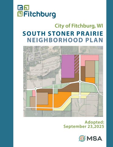
SOUTH STONER DEVELOPMENT
City of Fitchburg, FUTURE LAND USEWI MAP
SOUTH STONER PR AIRIE NEIGHBORHOOD PL AN
March 20, 2025
LEGEND 33 - 43 A.
40 - 50 A.
Business Park (BP)
(Range to include hatched areas)
High Density Residential (HDR)
Adopted: September 23,2025
17 ACRES
Neighborhood Mixed Use (NMU)
47 ACRES
Parks, Open Space, & Stormwater Management
(Range to include hatched areas)
Roundabout 41 ACRES
Medium-High Density Residential (MHD)
41 ACRES
Medium Density Residential (MDR)
Existing Trails Proposed Trails
ACKNOWLEDGEMENTS COMMON COUNCIL
Julia Arata-Fratta, Mayor Dave Herbst, 1st District Joe Maldonado, 1st District Bill Jetzer, 2nd District Gabriella Gerhardt, 2nd District Jay Allen, 3rd District Donald Dantzler, 3rd District Jim Wheeler, 4th District Nicole Vafadari, 4th District
PLAN COMMISSION
Mayor Julia Arata-Fratta, Chair Steven Heller, Vice Chair Carol Poole Josh Knackert Zachary Billings Shelley Malofsky Gabriella Gerhardt
PROJECT STEERING COMMITTEE*
Al Brisack, Edgewood College Bill Buglass, Fitchburg Minerals (alternate) Brian Moeller, resident Carol Poole, Fitchburg Plan Commission Chad Wiese, Verona School District Chris Ehlers, resident Clint Weninger, Fitchburg Minerals (Payne and Dolan) Jason Valerius, CARPC Meredith Shelton, resident Robin Loger, Fitchburg Hills (Yahara Materials)
CITY STAFF
Brad Sippel, AICP, Community Development Planner Deanna Schmidt, AICP, City Planner / Zoning Administrator Zack Jones, Associate Planner Michael Zimmerman, Economic Development Director Joyce Frey, Economic Development Specialist Loreen Gage, Housing Initiatives & Programs Specialist Tracy Foss, PE, Assistant Director of Public Works Ben Schulte, PE, Principal Engineer (Environmental) Ross Kahler, PE, Senior Project Engineer (Transportation)
MSA PROFESSIONAL SERVICES, INC
Stephen Tremlett, AICP, CNU-A, Project Manager Olivia Bolton, Assistant Planner Vanessa Abou Harb, Assistant Planner Christine Pelto, PE Project Engineer Matt Roland, PE Project Engineer - Mobility Gabe Lujan, PE Project Engineer - Water *Note: Acknowledgements do not indicate endorsement or support by any individual steering committee members
CO N T E N T S Chapter 1: Introduction & Process
1
Chapter 1 discusses the plan’s purpose and objectives, and summarizes the planning process, and public feedback.
Chapter 2: Vision, Goals, & Guidelines
12
Chapter 2 establishes the vision, strategies, and design guidelines to guide future growth in the Neighborhood.
Chapter 3: Land Use
30
Chapter 3 reviews a variety of factors that will impact current and future development in the Neighborhood,. This chapter provides the recommended land use concept for the neighborhood, with diagrams outlining the design process and proposed land uses, design preferences, and a general road network pattern.
Chapter 4: Engineering
47
Chapter 4 reviews the quality and capacity of existing municipal infrastructure within the planning area, and identifies analysis of how to serve the preferred concept and proposed Future Land Use.
Appendix A: Implementation Action Plan Appendix B: Relevant Plans & Development Review Appendix C: Engineering Analysis Appendix D: Maps Public Engagement Documents The City of Fitchburg website— under the Planning & Zoning Department page— provides background on this project, including access to all public engagement documents and summary information.
This page is intentionally left blank.
1
CHAPTER 1 INTRODUCTION & PUBLIC INPUT
2 Purpose, Objectives & Process This section outlines the overall purpose, objective and planning process for the South Stoner Prairie Neighborhood Plan.
6 Study Area & Regional Context This section defines the geographic boundaries of the study area, and its significance in the larger regional context.
8 Public Input This section provides a detailed summary of the different public engagement activities that were conducted through the planning process.
Chapter 1 | Introduction & Public Input
2
PURPOSE, OBJECTIVES & PROCESS What is the intention of this Neighborhood Plan? This Plan is intended to be a living, workable document for the City of Fitchburg to use as a guide for development/ policy decisions, infrastructure budgets, and strategies in the next twenty years and beyond. This plan establishes a baseline of expectations and targets to meet the community’s vision. This Plan’s Future Land Use Map will become policy as part of the Comprehensive Plan. A neighborhood plan update is recommended as part of any City Comprehensive Plan update, or as needed in the interim to reassess market conditions or changes to the vision/intent for the area. What is the process to update or amend this Plan? A draft of this Plan will be shared with City committees and commissions by Council referral. Once revisions are made per feedback from the City’s committees and commissions, a public hearing and plan recommendation will be held at Plan Commission. Lastly, a public hearing will be held at City Council prior to consideration of plan adoption.
PURPOSE
The South Stoner Prairie Neighborhood Plan (henceforth referred to as ‘the Plan’) is a detailed strategy to develop South Stoner Prairie as a complete neighborhood. The plan responds to the City of Fitchburg’s needs and vision to accommodate growth in balance with community interests and the area’s existing character. In 2020, the City of Fitchburg adopted the “Growing Fitchburg” Comprehensive Plan, which identified South Stoner Prairie as a Future Urban Development Areas (FUDA). In coordination with staff, stakeholders, and the general public, this Plan identifies areas to protect and develop in the South Stoner Prairie FUDA. The Plan proposes a balanced neighborhood that can accommodate growth, provide economic opportunities, minimize environmental impacts, and address transportation and service needs. The South Stoner Prairie Neighborhood is located outside of the existing Urban Service Area (USA). USAs are included in area plans for local, regional, and state agency decisions can be coordinated, consistent, and capable of achieving desired growth and development patterns. This plan will serve as the framework for the City’s future USA amendment application to the Capital Area Regional Planning Commission (CARPC) and the Wisconsin Department of Natural Resources (WDNR) to accommodate expected growth in the City.
PLAN OBJECTIVES 1. Identify suitable areas for development within the South Stoner Prairie Future Urban Development Area (FUDA). Establish a preferred land use plan that balances growth, blends with the local character, and protects community interests. 2. Identify any infrastructure improvements (water, wastewater, stormwater, etc.) needed to accommodate new development. Establish a plan for new development, including uses, within the constraints of public infrastructure systems. 3. Evaluate transportation networks to include a street and path network to provide connectivity. Project future traffic patterns and volumes to identify and mitigate traffic-related constraints on new uses in the planning area. 4. Enhance bike, pedestrian, and transit accessibility throughout the planning area.
City of Fitchburg | South Stoner Prairie Neighborhood Plan
Map 4.2 Growth Zones
3 Growing Fitchburg 2030
Map 4.2 Growth Zones
GROWING FITCHBURG 2030
Figure 1.1: City of Fitchburg Growth Areas Map
This is the City of Fitchburg’s most recent Comprehensive Plan, replacing the 2009 plan. It outlines the City’s goals, objectives, and policies to guide growth and development from 2020 to 2030. The City identifies the South Stoner Prairie Neighborhood as a Greenfield Growth Zone/ FUDA, south of the existing Urban Service Area. Future Growth Map The Comprehensive Plan included a land-use modeling exercise, which formed the basis of the City’s future growth map (Figure 1.1) and identified long-term FUDAs. It defined three Growth Zones: •
Greenfield: Undeveloped lands, often agricultural, located at the edge of the City outside of the Urban Service Area.
•
Grayfield: Lands that are already developed, or lands that are vacant and surrounded by development, inside of the Urban Service Area.
What is a “Complete” Neighborhood? Farmfield: Lands planned for agriculture outside Where will Fitchburg grow? CARPC describes a complete neighborhood as one of the urban service and not within a FUDA. with “a mix of housing types, walkable streets, This growth zone is intended to accommodate parks and Where will Fitchburg grow? civic spaces, and shopping/services” agriculture and associated development. (CARPC, The 2050 Regional Development Framework). These neighborhoods accommodate Determination of Greenfield Growth Zones growth with less pressure to develop farmland South Stoner Prairie’s designation as a greenfield and natural areas, while ensuring safe, convenient growth zone is attributed to the following: access to daily necessities for residents. With • Location: This area is located at the edge of the intentional planning and design, complete city’s current Urban Service Area. neighborhoods incorporate a range of housing, • Transportation Routing: There are strong a well-connected street network, amenities like north/south connections with Fitchrona Road stores, schools, and places of worship, and access and South Seminole Highway. to bike, pedestrian, and transit systems. •
Land use modeling will assume an essential role in connecting the neighborhood to surrounding areas.
SSP Neighborhood goals and strategies are further explored in Chapter Two.
Chapter 1 | Introduction & Public Input
4-10
4
PURPOSE, OBJECTIVES & PROCESS
HOW TO USE THIS PLAN
This Plan is organized into four main chapters and four appendices. Chapter One outlines the plan’s purpose and objectives and summarizes the planning process and public feedback. This feedback is reflected in the results presented in the other chapters, through the proposed land use concept, policies, and recommendations. Chapter Two establishes policies, strategies and actions to guide future growth in the study area. The information in this chapter supports review of development proposals, as well as actions steps to support the long-term development of this neighborhood. Chapter Three outlines the evaluation process to determine preferred land uses within the study area. It establishes key design parameters— including road and trail connectivity, parks and open space, land use density, etc.— that define the Neighborhood’s character. The final land use concept provides the foundation for the Plan’s Future Land Use (policy) Map and is used to determine the utility needs in Chapter Four. Chapter Four offers background information that informed the design and decision-making process, including a review of the quality and capacity of existing municipal infrastructure within the planning area. City actions to support infrastructure improvements are outlined in Chapter Two.
PLAN PROCESS
This Plan was developed over approximately sixteen months, beginning in October 2023. The process included the following activities: Background Research and Consistency The planning process included a review of relevant plans to identify community goals, initiatives and recommendations that may impact the future development of the South Stoner Prairie Neighborhood. A detailed summary of this plan review is included in Appendix B. Opportunities / Issues Identification Identify limitations/constraints and opportunities that can impact the preferred land use pattern, utilities and infrastructure needs Land Use Scenario Planning Based on the existing conditions and feedback, the process included three parts from initial land use bubble-diagrams, detailed concepts, and a preferred concept. System Analysis and Infrastructure Needs Evaluate system based on a preferred concept, identifying improvements necessary to allow development, inclusive of sanitary sewer, potable water, stormwater management, and mobility networks (vehicle, bike and pedestrians). Outreach and Engagement Plan Staff Meetings MSA planners met with staff at every stage of the planning process to review and discuss draft materials. The City’s planning, engineering, and economic development departments participated in these meetings. Key Stakeholder Interviews MSA and City planning staff met with key stakeholders, including the current landowners.
City of Fitchburg | South Stoner Prairie Neighborhood Plan
PURPOSE, OBJECTIVES & PROCESS
Meetings covered a range of topics, including intentions for future investment in the neighborhood, preferences for changes in the study area, and any other issues of concern. Feedback from these interviews is briefly summarized in this chapter. City Council & Other City Commissions City staff presented planning process updates and plan draft material, and sought feedback on that material, from several City commissions including the following: • Community and Economic Development Authority (CEDA) • Transportation and Transit Commission (TTC) • Plan Commission (PC) • City Council Feedback received by the commissions contributed to the Plan’s development.
5
General Public Involvement The general public was able to hear about the project and provide feedback on a number of occasions throughout the planning process, including the following: • Online Opportunity Mapping • Online Survey • Public Open Houses / Input Forums • Steering Committee “Working” Meetings • Plan Commission / Committee of the Whole Meetings • Public Hearing and Adoption Meeting Steering committee meetings and other City meetings discussing this project were properly noticed and available to the general public. Questions and comments were received via emails to neighborhood.plans@fitchburgwi.gov, which also provided subscribers with project updates.
Table 1.1: Project Timeline 2023 Nov Dec
Jan
Feb
Mar
Apr
May
2024 Jun Jul
Aug
Sep
Oct
Nov
Dec
2025 Jan Feb
BACKGROUND RESEARCH SC #1
SC #2
Open House #1
SC #3
SC #4
Open House #2
SC #5 Open House #3
LAND USE MODELING GOALS / POLICY DEVELOPMENT ENGINEERING FINAL PLAN DRAFT*
*Draft Plan Review and Adoption will take place in February - August 2025.
Chapter 1 | Introduction & Public Input
6
REGIONAL CONTEXT & STUDY AREA W Badger Rd
Hammersley Rd
5,400 129,000 e Road HWY Wtag BELTINE eltline Fron
d
Frisee Dr
Lake Farm Rd
Bike Path Bike Lanes
e Rd
Byrn
Primary Road
Goodland Park Rd
Railroad
Haight Farm Rd
Nobel Dr
MM Lalor Rd
Hwy
Lake Farm Rd
Urban Service A
Project Location City of Fitchburg Surrounding Municipality Bike Path
Traffic Count
B
Bike Lanes Primary Road
Urban Service Area Boundary Railroad
Schneider Dr
22,200
Traffic Count
Urban Service Area Boundary
Irish Ln
Whalen Rd
TOWN OF DUNN
14
ne Rd
Rd Cai ne
ne Rd
Byr
B MM
Borchert
Rd
TOWN OF OREGON D
B
Schneider Dr VILLAGE OF OREGON
0
MM Schuster Rd
M
Schneider Dr Purcell Rd
Schuster Rd
M
VILLAGE OF OREGON
South Stoner Prairie is well-connected to the local and regional transportation corridors. The City of Fitchburg | South Stoner Prairie Neighborhood Plan
VILLAGE OF OREGON
neighborhood has easy access to USH 151/WIS 18 to the west and USH 12/18 (via Fitchrona Road, Commerce Park drive, and Seminole Highway), providing access to the City of Madison and other Dane County communities. The neighborhood is also bordered by two roadways that provide eastwest connectivity through the City (via Lacy Road) and to the City of Verona (via Grandview Road and Whalen Road). Sand Hill Rd
TOWN OF OREGON D
Bordered by the Fitchburg Urban Service Area to the north, this neighborhood is one of the eight “Greenfield Growth Zones” in the City of Fitchburg. Surrounded by agricultural land on its east and south sides, this neighborhood provides a transition to the more urban developments to its north, east and west, in both the City of Fitchburg and the Madison Metro area.
Data Sources: Dane County GIS (2023) Dane County Aerial (2022) Wisconsin DOT (2018)
Sand Hill Rd
Sunset Dr
Data Sources: Dane County GIS (2023) Dane County Aerial (2022) Wisconsin DOT (2018)
Sand Hill Rd
chb
urg
TOWN OF DUNN
M
14 Cai ne Rd
Traffic Count
TOWN OF DUNN
Schuster Rd
WHALEN RD
Adams Rd
TOWN OF MONTROSE
Railroad
Study Area
Dane County, Wisconsin
Byr
REGIONAL CONTEXT
Primary Road
Surrounding Municipality
Meadowview Rd
14
Bike Lanes
City of Fitchburg City of Fitchburg
TOWN OF BLOOMING GROVE
14
d n R27,200
yto Cla
Rd
E Cheryl Pkwy
Cai ne
Research Par
Dr
Rd Lalor Rd
Richardson S t
Larsen Rd
E
Syene Rd
Rd
Bike Path
Greenfield & South Stoner Prairie Neighborhood Plan Project Location
Dr
MM
k
Lalor Rd
Larsen Rd r
Frisee Dr
art ngelh
Surrounding Mu
CITY OF FITCHBURG
Purcell Rd
TOWN OF OREGON D
oy McC
W
22,200
Fit
TOWN OF VERONA
M
Moorland Rd
Rd
CITY OF VERONA
CITY OF MONONA
CITY OF MADISON
22,200
32,300
Goodland Park Rd
City of Fitchburg
City of Fitchburg Dane County, Wisconsin
Post Rd
Te r
LACY RD
S Seminole
Fitchrona Rd
CITY OF FITCHBURG
Frisee Dr
Rd
Lac y
E
Research Par Sem
Gilbert Rd
Dr Pa
m erce Com
Lacy Rd
Grandview Rd
Printed By: smorrison, File: \\msa-ps.com\fs\Project\07\07729\07729051\GIS\7_07729051_NeighborhoodPlan_Figures.aprx
D
Mutchler Rd
Borchert Rd
nd Osmu se n Rd
Lac y
Ve
Fitc
er Rd st
Manch e
Adams Rd
Irish Ln
Tod d
Mutchler Rd
Ro a
a R F d ro nta ge
Rd
Prairie Rd
Muir Field Rd
d rg R bu Fits a s t Pas ch
Gr ov eD
r
Mutchler Rd
Rd
L
MCKEE RD
ford ong
4,400
Sch umann D r
rk
18/151
D
AR
VE
127,000
CITY OF FITCHBURG
3,400
Irish Ln
Adams Rd
i n ole Hwy
le Hwy S Semino
Print Date: 10/4/2023
Research FPa itcrhrona Rd
Richardson S t
h
W Badger Rd
12
Gra n
d
Meadowview Rd
Project Location
Goodland
Haight Farm Rd
TOWN OF BLOOMING GROVE
S Sye ne Rd
Printed By: smorrison, File: \\msa-ps.com\fs\Project\07\07729\07729051\GIS\7_07729051_NeighborhoodPlan_Figures.aprx
42,400
S Sye ne Rd
le Hwy
urg Way William s b
Whalen Rd rona Rd
N RO
Maple
TOWN OF MONTROSE
67,000
Haight Farm Rd
bitt Nes
Sunset Dr
MM 5,400 129,000 e Road HWY Wtag BELTINE eltline Fron
ro n
Nobel Dr E
Whalen Rd
Nobel Dr
d
56,500
E Cheryl Pkwy
Rd on 27,200
WB
Greenfield & South Stoner Prairie Neighborhood PlanPark Rd
Dr
D
14
Raymond Rd
Meadowood Dr
E Cheryl Pkwy WHALEN RD
TOWN OF VERONA
M
Barton Rd
k
dview Blv
LACY RD VERONA
Dr
t
lay
W C
ch Rd F r is
CITY OF
Richardson S t
Syene Rd
r
M
Rd Grandview r Sch umann D
k
d oy R McC
Hammersley Rd
TOWN OF MIDDLETON
h art ngel r
LACY RD
Gr ov eD
gfo
L on
MCKEE RD
na Blvd en cK
n Osmu dse n Rd
er rd T
MM
S Sye ne Rd
Maple
Study Area
Moorland Rd
Post Rd Lacy Rd
Meadowview Rd
Lacy
Dr
m erc e Pa
r
V
Rd
City of Fitchburg Dane County, Wiscon
TOWN OF BLOOMING GROVE
14
n CITY OF MONONA layto 27,200 W C
CITY OF MADISON
32,300
Com
er Rd
st Manch e
Rd
O ER
Te r
Sch umann D r
rk
18/151
D D
R NA
Tod d
Ro a
ag e
itt
4,400
12 3,400
L on
MCKEE RD
Lake Farm Rd
nd Osmu se n Rd
127,000
Gr an
d b Nes
S Semino
r
Ro a
Ve Fitc
i n ole Hwy Sem
a s t Pas s
WB
rd gfo
W Badger Rd
5,400
d oy R McC
Study Are
Greenfield & South Stone Neighborhood Pla
Dr
h art ngel
Larsen Rd
42,400
dview Blv
D
32,300
ro n
E
acy Rd
D
Syene Rd
urg Way William s b
129,000 Road HWY Wtage BELTINE eltline Fron
d
Moorland Rd
Post Rd
na hro Rd
67,000
12
CITY OF MONONA
CITY OF MADISON
4,400
Tod d
56,500
127,000
Gr an
Sem
Gilbert Rd Prairie Rd
Raymond Rd
Meadowood Dr
WB
d
ch Rd F r is
Muir Field Rd
67,000
dview Blv
na Blvd en cK
Barton Rd
E
i n ole Hwy
M
TOWN OF MIDDLETON
a R F d ro nta ge
Print Date: 10/4/2023
Figure 1.2: Regional Area Map
0
Data Sources: Dane County GIS (2023) Dane County Aerial (2022) Wisconsin DOT (2018)
0
0.25
0.5 Miles
0.25
0.5 Miles
0.25
0
Print Date: 12/4/2023
Study Area Quarry
Vista Dr Stone
eD
Gat
r
South Stoner Prairie Neighborhood Plan
Lacy Rd
Goose Lake Dr
City of Fitchburg Dane County, Wisconsin
Fitchrona Rd
REGIONAL CONTEXT & STUDY AREA
7
Project Location City of Fitchburg Surrounding Municipality Parcel Boundary
Figure 1.3: Study Area
ate
eG
Ston
Dr
Lacy Rd
CY RD
LA
Fitchrona Rd
Data Sources: Dane County GIS (2023) Dane County Aerial (2022)
Grandview Rd
TOWN OF VERONA
Study Area
Vista Dr
ate
eG
Ston
Dr
South Stoner Prairie Neighborhood Plan
Lacy Rd
SEMINOL
Project Location City of Fitchburg Surrounding Municipality
GRANDVIEW RD
Parcel Boundary
Local Developments Notable developments near the study area include: • North of Lacy Road, Commerce & Industrial Park connects to McKee Road (CTH PD) along Commerce Park Drive. • The Quarry Vista neighborhood to the north, which similar to SSPN, was also built on the site of a former quarry. • A planned athletic facility will soon be built directly east of SSPN. • The O’Brien solar farm was occupied lands east of SSPN for over twenty years. Grandview Rd
e Hwy
Grandview Rd
The Town of Verona to the west features large-lot residential development and agricultural land. The City of Verona/Town of Verona boundary agreement designates the southeastern border of the study area as a “City/Town Interest Area.” A summary analysis of recent developments used as case studies in the SSPN planning process is provided in Appendix B of this Plan. S Seminol
The planning area falls within the attendance zones of Stoner Prairie Elementary School, Savannah Oaks Middle School, and Verona Area High School in the Verona Area School District. The study area is in Aldermanic District 4. Printed By: smorrison, File: \\msa-ps.com\fs\Project\07\07729\07729051\GIS\7_07729051_NeighborhoodPlan_Figures.aprx
300 Feet
City of Fitchburg Dane County, Wisconsin
Printed By: smorrison, File: \\msa-ps.com\fs\Project\07\07729\07729051\GIS\7_07729051_NeighborhoodPlan_Figures.aprx
Fitchrona Rd
Goose Lake Dr
TOWN OF VERONA
150
AY
0
e Hwy
FITCHRONA RD
Goose Lake Dr
S Seminol
Quarry
Vista Dr
E HIGHW
Print Date: 12/4/2023
As shown in the map on the right, the study area is generally bound by: • Lacy Road to the north (excluding lands already in the urban service area) • Fitchrona Road to the west • Edgewood College property and solar farm prior to Seminole Highway to the east • not quite to Grandview Road to the south.
Hwy
Quarry
Printed By: smorrison, File: \\msa-ps.com\fs\Project\07\07729\07729051\GIS\7_07729051_NeighborhoodPlan_Figures.aprx
The SSP Neighborhood is approximately 280 acres, mostly agricultural with limited woodlands, as well as active quarry operations.
Print Date: 12/4/2023
TOWN OF VERONA
S Seminole
STUDY AREA
Data Sources: Dane County GIS (2023) Dane County Aerial (2022)
Neighborhood Amenities The neighborhood is very close to recreational trails such as the Badger State Trail, the Military Ridge State Trail, and Quarry Ridge Park, which offers unique mountain biking trails. Despite the absence of bike paths or lanes within the study area, it is near an extensive network to the north and east, connecting it to nearby communities. 0
150
300 Feet
Chapter 1 | Introduction & Public Input
8
PUBLIC INPUT Providing opportunities for elected officials, property owners and other stakeholders to participate in the planning process offers valuable input and better direction to the final Plan. The following section summarizes the Plan’s engagement activities conducted from October 2023 to December 2024.
STEERING COMMITTEE MEETINGS
The steering committee meetings addressed key themes such as the potential addition of a school, the challenge of earth wall dividing the quarries, and the impact of new development on existing trees. They discussed the possibility of adding a school to the neighborhood, considering the best location in relation to current land use and the school district’s requirements. The meetings also emphasized preserving local trees by including them in the proposed open spaces. Attendees emphasized the importance of removing the earth wall between the quarries to allow for consistent development patterns.
KEY STAKEHOLDER INTERVIEWS
Property Owners All of the property owners showed interest in the highest and best use for their land. The existing quarry operators mentioned that extraction will continue for at least the next five years, with transition to development (vs. restoring back to agriculture). The existing landscape in the study area will be severely altered after the quarry operation; a good portion of the land will move 40-60 feet below the current grade, and most of the woodlands will be removed. Current property owners do not intend to quarry the southwest and southeast portions of the neighborhood; however, development in these areas is likely to occur beyond the next ten years due to lack of utilities and current interests of the property owners.
Verona Area School District The South Stoner Prairie Neighborhood lies entirely within the Verona Area School District (VASD). Two VASD facilities, Stoner Prairie Elementary School and Savanna Oaks Middle School, are SSPN’s immediate neighbors to the east along Lacy Road. VASD discussed their most recent school projections through 2035, which identify some development in this neighborhood, but not to the extent established in this plan. While Stoner Prairie Elementary could face capacity challenges by 2035, there are strategies in place to manage these potential issues (e.g., realigning grades at existing schools). The district owns land east of SSPN for a future high school, but indicated strong interest in an elementary school in the South Stoner Prairie area given the potential development identified throughout the planning process. City of Verona The City of Verona is focused on development closer to the current municipal limits. During the time of this project, the City was starting their Comprehensive Plan update, but did not have any indication that the update would impact plans for the South Stoner Prairie Neighborhood area. Town of Verona The Town of Verona has interest in any improvements along Fitchrona Road, which divides Fitchburg and the Town of Verona. There are current plans to consider a lower density housing development just west of Fitchrona, which could have potential impacts to road/access placement along Fitchrona Road to serve vehicle connectivity through both communities. Madison Metropolitan Sanitary District (MMSD) MMSD noted that this study area is identified in their Collections Systems Facilities Plan, and just beginning evaluation of the design to extend service over to Fitchrona Road from their current
City of Fitchburg | South Stoner Prairie Neighborhood Plan
PUBLIC INPUT
main along USH 18. Coordination will be necessary between CARPC, the Town of Verona, and the City of Fitchburg to provide an extension of this utility. Developer Focus Group A remote meeting was held with a group of individuals in the development industry— home builders, developers, real estate brokers, and regional economic development specialists. Key takeaways from these discussions include: • Opportunities for a business park near Lacy, continuing from the business park to the north along a future Commerce Park Drive extension, with a specific need for clean manufacturing. • Discussion on high cost of agrihood concept and likely not a good fit for this neighborhood. • Low-density residential should be buffered from the business park • Overall need for high-density housing options • A public school would be a benefit to the neighborhood.
9
PUBLIC OPEN HOUSES
Open House #1 - Kick-Off About 80 people attended the combined Greenfield and South Stoner Prairie neighborhood plan open house on 12/04/2023. It shed light on important topics and concerns for the local community. Amongst the ideas mentioned is the importance of balancing density with a mix of housing styles and types to accommodate younger families, professionals (like Epic employees), and seniors. The newer residents stressed the need to preserve connection to nature with interspersed trails. The meeting emphasized the need to include mass transit options, such as a bus service on Lacy Road or a future rail connection, while also addressing traffic concerns from the increased use of Lacy Road. Other concerns targeted the altered views from the quarry land from the resident’s perspective. The attendees also showed interest in introducing local shopping opportunities to the neighborhood, notably for the residents living on the southeast side of USH 18/151.
Photos from Open House events
Chapter 1 | Introduction & Public Input
PUBLIC INPUT
it
Commerce Park Dr
Figure 1.4: Public Input Map
12/18
Dr ew Vi
Quarry Vista Dr
at e
eG St o n
Dr
Lacy Rd
Go os e
La ke Dr
Print Date: 1/10/2024
Open House #2 - Concept Review This meeting on 03/28/2024 & focused on three main themes: % housing, transportation connectivity, and connections to nature. As for transportation, the meeting showed the importance of connecting to existing biking/ hiking trails and Madison Metro transit stops. Under the “connection to nature” theme, the attendees discussed the importance of preserving wildlife habitat where it is highest in quality, as well as differentiating the ecological corridors from the parks, the open space, and the recreation corridors. Overall, “Option A” was preferred due to its balanced layout between housing and business parks.
Sum m
10
ate
Dr
To nt o
TOWN OF VERONA
& %
Printed By: smorrison, File: \\msa-ps.com\fs\Project\07\07729\07729051\GIS\7_07729051_SSP_PublicInput.aprx
Fitchrona Rd
Tr l
City of Fitchburg Dane County, Wisconsin
Tr l
TOWN OF VERONA
Pheasant Ln
To nt o
Lacy Rd
Open House #3 - Draft Plan This meeting was held on 12/19/2024 to highlight the entire planning process and share the goals, policies and actions identified in the plan. This evening was marred by poor weather conditions, resulting in minimal attendance and minimal feedback. A recording of the presentation was posted on the City’s website and boards with the strategies and goals were placed in City Hall for several weeks to gain feedback. Grandview Rd
& %
Pedestrian/Bicycle Opportunity/ Concern Traffic Concern Something to Preserve Other; Other
& Stormwater Concern % le Hwy
Go os e
La ke Dr
eG St o n
South Stoner Prairie Neighborhood Plan
S Semino
& %
Quarry Vista Dr
Public Input Map
Commerce Park Dr
Dr ew Vi
Sum m
it
Pheasant Ln
Fitchrona Rd
12/18
Project Location City of Fitchburg Parcel Boundary
Grandview Rd
ONLINE MAPPING
The online mapping tool was active from November 2023 to January 2024 and collected 50 responses (Figure 1.4). Three main themes were identified: transportation, housing, and connection to nature. Increased traffic appeared as a main concern under transportation. The responses tackled the potential of providing shared-use path connections into the new neighborhood. For housing, the responses highlighted the need to balance preservation of farmland in the southern area of the neighborhood, with the need to increase density through a variety of housing types. “Missing Middle” was introduced as a strategy to address housing affordability. The respondents expressed great interest in maintaining a strong connection to nature and preserving open views to appreciate the surrounding landscape.
City of Fitchburg | South Stoner Prairie Neighborhood Plan
Data Sources: Dane County GIS (2023) Dane County Aerial (2022) Public Input Collected 2023 County of Dane, Esri Canada, Esri, HERE, Garmin, INCREMENT P, Intermap, USGS, METI/NASA, EPA, USDA
0
150 300 Feet
PUBLIC INPUT
SURVEY RESULTS
Figure 1.5: Land Use Scenario Options in Online Survey
MDR 8 ACRES
(15-30 U/A + COMMERCIAL)
NW
LDR 40 ACRES
P 24 ACRES
MDR 14 ACRES
P
TO N
HIGH DENSITY RESIDENTIAL (11-20 U/A)
NE
SCHOOL 26 ACRES
NMU 34 ACRES
OS
SW
OS
9 ACRES
MDR 32 ACRES
HDR
SE
MEDIUM DENSITY RESIDENTIAL ( 6-10 U/A)
88 NMU 64 30 ACRES ACRES
LOW DENSITY RESIDENTIAL ( > 6 U/A)
64 ACRES
NE
(15-30 U/A + COMMERCIAL)
HIGH DENSITY RESIDENTIAL (11-20 U/A)
MEDIUM DENSITY RESIDENTIAL ( 6-10 U/A)
BP
22 ACRES
115 ACRES
BUSINESS PARK
OS
25 ACRES
MDR 40 ACRES
STEEP SLOPES
PARK
SE
OPEN SPACE & SW MANAGEMENT
LDR
ROADS (existing / proposed)
22 ACRES
MDR 10 ACRES
NW
P
54 ACRES
PARK
20 ACRES
LDR 12 ACRES
40 ACRES
LOW DENSITY RESIDENTIAL ( > 6 U/A)
OPEN SPACE & 38 OSACRES SW MANAGEMENT
TO SEMINOLE HWY
FITCHRONA RD
TR
HDR
ACRES
TO N
TO
ACRES
NEIGHBORHOOD MIXED USE
26
SCHOOL
30 ACRES
TR
12 ACRES
SW
ROADS (existing / p
12 ACRES
LDR
TO SEMINOLE HWY
45 ACRES
20 ACRES
LDR 12 ACRES
SOUTH STONER PRAIRIE NEIGHBORHOOD
TO GRANDVIEW
DRAFT
TO GRANDVIEW
TO GRANDVIEW
TO GRANDVIEW
DRAFT
LAND USE BUBBLE DIAGRAM OPTION “A”
1/28/2024
1/28/2024
South Stoner Prairie Neighborhood Plan Survey
Table 1.2: Public Survey Results
Q20 Which land use option do you prefer? Answered: 184
Skipped: 106
Option "A"
Option "B"
No Opinion / Not Sure
0%
10%
20%
30%
40%
50%
60%
70%
80%
ANSWER CHOICES
RESPONSES
Option "A"
52.17%
90%
100%
96
Option "B"
27.17%
50
No Opinion / Not Sure
20.65%
38
TOTAL
Land Use Scenarios In Land Use Option “A”, respondents found not enough low density, too much high density, and just enough medium density and neighborhood mixeduse. Parks and open space were tied between too little and just enough. In Land Use Option “B”, respondents found not enough parks and open space, just enough low density, medium density and neighborhood mixed-
STEEP SLOPE
LDR FITCHRONA RD
TO
HDR 66 ACRES
MAP LEGEND
NMU
48
ACRES
ROCK RIDGE RD
14 ACRES
Of the medium-density options, the top three preferences were: • Single family (1/8 acre) – 56% • Single family (1/4 acre) – 61% • Duplex – 61% Of the high-density options, the top three preferences were: • Townhomes (4-8 units) – 55% • Single family (1/12 acre) – 50% • Single family (1/10 acre) – 49%
NEIGHBORHOOD MIXED USE
LACY RD
QUARRY VISTA NEIGHBORHOOD
MAP LEGEND
OS
15 ACRES
NMU
14 ACRES
Preferred Housing Types Low-density residential was most supported by respondents, with the top three preferences being: • Single family (1/3 acre) – 72% • Single family (1/2 acre) – 71% • Single family (3/4 acre) – 66%.
Option B
LACY RD
QUARRY VISTA NEIGHBORHOOD
COMMERCE PARK DR
Option A COMMERCE PARK DR
The survey, open from February to March 2024, received 290 responses. It displayed a variety of images at different densities to gauge neighborhood preferences and provided the opportunity to comment on two options for the land use concept (Figure 1.5).
11
184
use, and too much high density and business park. Overall, 52% of respondents preferred Option “A” (Table 1.2). See Chapter Three for more information.
OTHER COMMENTS
Other comments received through emails and calls stressed the need to prevent sprawl and aim for some increases in density to enhance economic growth and provide for sustainable development. Chapter 1 | Introduction & Public Input
SOUTH STONER PRAIR NEIGHBORHOO
LAND USE BUBBLE D OPTION “B”
12
CHAPTER 2 VISION, GOALS, & GUIDELINES
13 Vision, Goals & Strategies This section presents the overall long-term vision for the South Stoner Prairie Neighborhood, and states the goals and policies to reach this stated vision.
23 Future Land Use Map This section presents the proposed Future Land Use Map and its relationship to the existing comprehensive plan.
24 Placemaking & Design Guidelines This section presents strategies to guide the development of a unique place that will draw from the City of Fitchburg and the broader region.
City of Fitchburg | South Stoner Prairie Neighborhood Plan
13
VISION, GOALS, & STRATEGIES This section establishes goals and strategies that will guide the development of the Neighborhood. Strategies supplement the design guidelines found in this chapter and the implementation action plan in Appendix A..
VISION STATEMENT South Stoner Prairie will develop as a complete neighborhood that creates diverse and affordable housing options, expands job opportunities, facilitates sustainable design and development practices, and promotes social equity. Neighborhood goals are divided into the following categories and further explained on the following pages: Housing: Integrate a diversity of housing types to accommodate a variety of lifestyles, age groups, and income levels. Mobility: Implement safe, convenient and attractive streets that are accessible for all ages, abilities, and modes of transportation (pedestrian, bicycle, vehicle, and mass transit). Economy: Locate employment options near residential areas, supporting the local and regional economy and providing job opportunities. Quality of Life: Maintain streetscapes and open spaces that are accessible to all residents for recreation and enhanced neighborhood character. Sustainability: Create an economically and environmentally sustainable development pattern, protecting existing natural features.
Chapter 2 | Vision, Goals, & Guidelines
14
VISION, GOALS, & STRATEGIES
1. HOUSING GOAL & STRATEGIES Goal 1 – Integrate a diversity of housing types to accommodate a variety of lifestyles, age groups, and income levels. Strategy #1.1 Encourage a variety of housing types, forms, price points, and tenures are included in the neighborhood. Subdivisions should include a mix of unit types that will support varying household sizes and incomes. Subdivisions of 20 lots or more may be required to provide at least two housing types/forms.
Strategy #1.2 Encourage building and site design to facilitate transitions between low-intensity residential development and more intensive multi-unit residential, office and mixed-use developments.
This neighborhood incorporates varied housing types, using building orientation to mitigate compatibility issues.
Building forms and neighborhood patterns should be compatible with the design guidelines established in this Plan. What is “Intensive” Development? It refers to utilizing a piece of land to its maximum potential by building structures close together and/ or larger in size and scale. Intensive developments provide a wider range of businesses and activities for higher numbers of people in a community.
This apartment building steps down the building adjacent to a neighboring lower-density residential use.
For the purposes of this Plan, low-intensity residential development indicates single-family, duplex, townhomes, and small multi-unit buildings.
City of Fitchburg | South Stoner Prairie Neighborhood Plan
VISION, GOALS, & STRATEGIES
15
2022 EAST SIDE PLAN
1. HOUSING GOAL & GOAL 4: STRATEGIES (cont.)
COMMERCIAL
Policy #6
Encourage intensive development, Strategy #1.3 where practical, along primary corridors
support future a sustainable public Concentrate to higher-density residential and mixedtransit route(s). use developments along primary corridors to support future sustainable public transit route(s).
Public transit provides social, environmental, and economic benefits to communities. The most sustainable transit routes will be located along higher-density residential and commercial corridors (increased ridership). In South Stoner Prairie, these corridors would include Lacy Road, a proposed extension of Commerce Park Drive, and the addition of Collector Road “A.”
The first bus route in Sun Prairie serviced this neighborhood due to its concentrationPARK of high-density housing inclusive of home& RIDE LOWownership and rental units. DENSITY
Strategy #1.4 Encourage Traditional Neighborhood Design (TND) developments that allow for ‘missing middle’ and small-lot housing. Traditional Neighborhood Design (TND) promotes “compact, pedestrian-oriented neighborhoods with a mix of commercial and residential uses, a variety of housing types, and public places where people can socialize and engage in civic life” (Capitol Region Council of Governments). TND also improves land use efficiency and opportunities for alternative modes of transportation.
The above four-unit development includes reduced setbacks and porches that provides a welcoming frontage. The building types also fit the “missing middle” housing formats as illustrated below.
Chapter 2 | Vision, Goals, & Guidelines
16
VISION, GOALS, & STRATEGIES
022 EAST SIDE PLAN
GOAL 4:
2. MOBILITY GOAL & STRATEGIES
Policy Goal 2#1 – Implement safe, convenient and
PARK
attractive streetsalong that are for all Provide sidewalks all accessible streets and ages, abilities, and modes of transportation multi-use trails in the environmental (pedestrian, bicycle, vehicle, and mass transit). corridors and parks. Strategy #2.1
Policy Develop#2 a convenient and connected multi-modal transportation system that links the neighborhood to Develop a comprehensive system of the City and greater Dane County area. pedestrian and bicycle facilities that connects the East Side area the and other Trails provide opportunities for to passive active sections of the Village and to the greater recreation, support healthy living, increase the value of Dane County trail system. adjacent neighborhoods, and provide alternatives to motorized transportation, connecting people to civic and employment areas. These benefits are multiplied when local trails are linked together and to regional trail systems.2022 EAST SIDE PLAN
This trail connects a major roadways to a neighborhood park to several local neighborhood streets.
GOAL 4: Strategy #2.2 Policy #3to connect to existing streets Require proposed streets and intersections, wherever practical. Dead-end streets and non-continuous trail Require proposed streets to networks connect to limit options when moving throughout a community. existing streets and intersections, practical. This reduced wherever mobility increases travel distance and traffic on primary roadways, can frustrate drivers/pedestrians, and discourages non-motorized travel. Development shall make every effort to connect to existing facilities (trails, roadways and intersections). This Plan anticipates neighborhood development to occur in fragments over time; future development should anticipate and provide necessary connections between developments. New neighborhoods making road and pedestrian connections that were established in older subdivisions.
City of Fitchburg | South Stoner Prairie Neighborhood Plan
VISION, GOALS, & STRATEGIES
2. MOBILITY GOAL & STRATEGIES (cont.) Strategy #2.3 Discourage cul-de-sac and dead-end streets in favor of connected streets that provide transportation flexibility. Where cul-de-sacs are necessary due to terrain or natural features, development should install multi-use paths connecting dead-ends to the street network.
Strategy #2.4 Design complete streets and utilize traffic calming and safety measures where appropriate to create a better street environment for pedestrians and cyclists. The frequency and speed of vehicles can greatly impact road safety, especially for pedestrians/bicyclists. Various “traffic calming” measures can be designed or retrofitted to a roadway to reduce vehicle speeds and discourage vehicle usage (cut-through traffic). Traffic calming measures in South Stoner Prairie can include bumpouts, traffic circles, high-visibility crosswalks, and raised pedestrian crossings. Streets shall include adequate lighting, especially on major collector roads and at significant intersections, to ensure safety of all users.
17
Traffic Calming Measures reduce traffic speeds and/
or cut-through traffic with the goal of increasing safety for motorists, bicyclists, and pedestrians. • Striping Drive Lane Edge: Painted solid line to reduce the perceived lane width and separate it from parking or biking space. • Tree-lined Streets: Streets with landscaped center medians and/ or perimeter trees can affect driver perceptions of lane width, inducing lower speeds. • Speed Display Sign: Street sign with radar that displays actual speed and prompts motorists to slow down (via blinking or flashing lights).
Speed Display
• Bump-out (bulb-out, neckdowns): Curb extensions into the road section (outside travel lanes) that narrows the road and length of pedestrian crossings. • Raised Crossing / Intersection: Speed table across the entire crossing / intersection that reduces vehicle speed and creates level crossings for pedestrians. • Raised Median / Crossing Refuge: Placement of a raised island in the middle of the roadway to narrow the vehicle travel lanes.
Bump-out
• Chicanes and Traffic Circles: Features that shift the path of traffic horizontally within the right-of-way. Chicanes do this mid-block and traffic circles do this within intersections.
Raised Median / Crossing Refuge, Plus Speed Table
Chicane
Chapter 2 | Vision, Goals, & Guidelines
18
VISION, GOALS, & STRATEGIES
3. ECONOMY GOAL & STRATEGIES 2022 EAST SIDE PLAN
GOAL 3: Policy #1
Goal 3 – Locate employment options near residential areas, supporting the local Employment areas should be and regional economy and providing jobwith the density compatible and scale of surrounding opportunities. development with safe Strategy #3.1
Smaller Building
pedestrian and vehicle connections established with neighboring residential subdivisions.
Attract businesses that will meet local and regional needs, provide quality job opportunities, create a diverse mix of uses, and expand the property tax base. Balanced neighborhoods include commercial areas within walking distance of residential areas; businesses and building forms will enhance the neighborhood’s character and provide employment options in close proximity to where residents live.
LARGEST BUILDING
This example ties the business park to the neighborhood along a minor street, as well as by an off-street trail. Building scale in the business park is smaller closer to the residential area.
Strategy #3.2 Promote commercial / business park areas that are compatible with the density and scale of surrounding development or screened to the extent practical. Building forms should follow design and compatibility guidelines as described in this Plan. Scale, massing, and uses in employment areas shall consider design solutions that minimize impact to residential areas. Pedestrian and vehicle connections shall be provided between residential and employment areas.
This two-story mixed use building has a pitched roof and gables that are aesthetically compatible with single-story ranch homes similar to those that already exist or will soon be constructed in the area surrounding the neighborhood.
Strategy #3.3 Incorporate safe and convenient pedestrian, bicycle, and motor vehicle connections within and through commercial, mixed-use, and business park developments. Balanced neighborhoods includes walkable access to jobs and services. Business entrances should connect to the street. Parking areas should include dedicated pathways and crossings to increase safe travel between businesses and parked vehicles.
City of Fitchburg | South Stoner Prairie Neighborhood Plan
VISION, GOALS, & STRATEGIES
19
4. QUALITY OF LIFE GOAL & STRATEGIES Goal 4 – Maintain streetscapes and open spaces SIDE PLANto all residents for recreation that2022 areEAST accessible and enhanced neighborhood character. GOAL 2: StrategyPolicy #4.1 #1 Design residential areas around community gathering Design neighborhoods around community gathering places (e.g., parks, public squares, places (e.g., parks, schools, churches, community schools, churches, and other community gardens, and other community facilities). facilities).
Public / community facilities are activity hubs within a neighborhood, historically placed on the premiere site within a neighborhood, Policy #2 district, or community. These facilities should be planned for and located in areas that A variety of park types and sizes, ranging are accessible visible within the neighborhood. fromand small pocket parks to a community
park, should be planned to meet the needs of East Side residents.
Strategy #4.2
Plan for parks that vary in size and facilities to fulfill ranging neighborhood recreation interests, including creating a larger park to serve as an Area or Community Park, consistent with the Fitchburg Parks and Open Space Plan. Parks should be within 1/4- to 1/3-mile from residents with at least one neighborhood park within a 10-minute walk. Larger subdivisions should consider more than one park with varying programs, where practical.
This Sun Prairie neighborhood includes a variety of open spaces that provides for diversity of uses and amenities, including a plaza (red circle), boulevard street (yellow circle), and traditional neighborhood park (green circle).
Strategy #4.3 Allocate enough contiguous and functional park land to serve as an area or community park.
Chapter 2 | Vision, Goals, & Guidelines
20
VISION, GOALS, & STRATEGIES
4. QUALITY OF LIFE GOAL & STRATEGIES (cont.) 2022 EAST SIDE PLAN Strategy #4.32: GOAL Make Policy intentional multi-modal connections between #4 local and regional park/open space areas. Environmental features offer a break from the urbanized Design attractive arterial/collector environments we live in. Trails amenities road streetscapes withand/or streetpark trees landscaping clusters, asTying well together shouldand/or take advantage of these features. as other streetscape enhancements several park and open space destinations provides a practical. benefitwhere to all neighborhoods residing along the route(s). Locally, the South Stoner Prairie neighborhood has the opportunity to connect to the Quarry Ridge Recreation Area and the Badger State Trail.
Strategy #4.4 Design attractive streetscapes with street trees, lighting, and/or low maintenance landscaping clusters along major roadways.
Attractive streetscapes enhance the pedestrian experience with strategies including median and terrace plantings, paved sidewalks and paths, street trees, and pedestrian-scale lighting.
Effective streetscape design can improve pedestrian experience and safety, address stormwater management, and minimize necessary landscaping efforts. Elements including median or terrace treatments, landscaping, and paving design along primary roadways can also establish / enhance the community ‘s identity.
Strategy #4.5 Plan and design public infrastructure that is sustainable and low maintenance. Species of street trees should be selected for qualities including low maintenance requirements, canopy size, climate survivability, and pollution tolerance. Road medians must be sized appropriately for the health of trees and plantings. Planting beds should utilize native plant species such as prairie grasses and require as little mowing as possible.
City of Fitchburg | South Stoner Prairie Neighborhood Plan
VISION, GOALS, & STRATEGIES
21
5. SUSTAINABILITY GOAL & STRATEGIES Goal 5 – Create an economically and environmentally sustainable development pattern. Strategy #5.1 Protect and restore the environment by integrating natural features into common open spaces for active / passive recreation, public gathering, or flood protection and stormwater management. Strategy #5.2 Preserve the existing tree canopy to the extent possible, to include woodlands that are not intended to be quarried. Preservation efforts will especially prioritize highquality woodlands containing heritage or old growth trees. Woodlands will help to create a buffer between natural areas and development, ensuring wetland and stormwater collection areas remain undisturbed. The existing woodlands will also provide the neighborhood with an essential tree canopy while young trees grow within the new development.
Strategy #5.3 Encourage high-density residential development along collector and arterial roadways.
This diagram illustrates how stormwater management areas could also serve as a buffer between different uses, and provide passive recreational activities if connected to trails.
This will allow for greater preservation of open space in the middle and edges of subdivisions and create viability for future transit service.
Chapter 2 | Vision, Goals, & Guidelines
22
VISION, GOALS, & STRATEGIES
5. SUSTAINABILITY GOAL & STRATEGIES (cont.) Strategy #5.4 Explore options to recycle quarry byproducts through site development to reduce waste and allow for more economical development. Strategy #5.5 Encourage energy-efficient buildings consistent with the city’s existing energy targets. Energy targets are available in the Fitchburg Sustainability Plan and the Clean Energy Resolution.
The photo above presents an example of design strategies to maximize infiltration through pervious materials.
Strategy #5.6 Consider opportunities for alternative energy use within neighborhood design. Future neighborhood development can support alternative forms of energy through solar-friendly urban design techniques and EV ready development. Aligning roadways east-west has roof planes facing north-south, allowing for maximum surface for solar panels.
Solar panels can be integrated into residential areas while preserving neighborhood character.
City of Fitchburg | South Stoner Prairie Neighborhood Plan
FUTURE LAND U
M
23
Quarry Ridge Park
SOUTH STONER DEVELOPMENT
BP
NMU
FITCH
MHD
Rd
Lacy Rd
Fitchrona Rd
Lacy Rd
BP
Commerce Park Dr
Fitchrona Rd
Rock Legend
Quarry Vista Dr
e Rd Ridg
The hatched area on Commerce Park Drive indicates land which could be occupied by one of two uses: business park or highdensity residential.
Lacy Rd
Commerce Park Dr
e Rd Ridg
Quarry Ridge Park
NMU
FITCHBURG HILLS MHD HDR
FITCHBURG MINERALS
MDR Collec
tor A
HDR
FITCHBURG MINERALS
HDR
Fitchrona Rd
Fitchrona Rd
Collector C
Collector B
MDR
To South Seminole Hwy
LDR MDR
MDR
Collector D
MHD
MHD
or A
MDR
HDR
Collector B
Collector B
MHD
NMU
Collector A
Collect
LDR
Collector D
Tonto Tr
MDR
Collector A
Collector C
Tonto Tr
NMUMHD
The recommended land use categories match those already provided in the Comprehensive Plan, except for Neighborhood Mixed Use. Chapter Three of this Plan identifies the intent with this new FLU category.
March 20, 2025
Rd
Quarry Vista Dr
FUTURE LAND USE MAP
Figure 2.1: SSPN Future Land Use Map
Rock
As discussed in Chapter One, the City identifies South Stoner Prairie as a Greenfield Growth Zone / FUDA. The Comprehensive Plan’s current Future Land Use (FLU) Map only documents existing land uses until a more detailed neighborhood plan is developed. This neighborhood planning process (see Chapter Three) establishes a FLU Map for the South Stoner Prairie FUDA in Figure 2.1. Through the adoption of this Plan, the City will amend the Comprehensive Plan’s citywide FLU Map.
Rock
FLU AMENDMENT
Rock Legend
FUTURE LAND USE MAP
LDR
BASH
To Grandview Rd
Collector B
BASHA To Grandview Rd
LDR
WOLF
To Grandview Rd
WOLF
To Grandview Rd
LEGEND LEGEND Business Park (BP) 33 33 - 43-A. Business Park (BP) 43 A.
(Range to include hatched areas)
17 ACRES
Neighborhood Use (NMU) Neighborhood Mixed Use (NMU) 17 ACRESMixed
47 ACRES
Parks, Open Space, & Stormwater Management
(Range to include hatched areas)
40 - 50 A.
High Density Residential (HDR)
(Range to include hatched areas) High Density Residential (HDR) 40 - 50 A.
(Range to include hatched areas)
41 ACRES
Medium-High Density Residential (MHD)
41 ACRES
41 ACRES
47 ACRES
Medium-High Density Residential (MHD)
Medium Density Residential (MDR)
Medium Density Residential (MDR) ACRES Low Density Residential (LDR) 17 41 ACRES
Parks, Open Space, & Stormwater Management
Roundabout
Roundabout Existing Trails Proposed Trails
Existing Trails Proposed Trails 0 mi
17 ACRES
1/12 mi
1/6 mi
1/3 mi
Low Density Residential (LDR) 0 mi
1/12 mi
1/6 mi
Chapter 2 | Vision, Goals, & Guidelines
1/3
24
PLACEMAKING QUALITY PLACES
Placemaking is the process of creating quality places that attract people. Quality places can and should be unique and memorable, but there is a set of general physical characteristics that all good places share. Project for Public Spaces (PPS) has found that Quality Places share four common characteristics: 1) they are accessible; 2) people are engaged in activities there; 3) the space is comfortable and has a good image; and 4) it is a sociable place - one where people meet each other and take people when they come to visit.
The Place Diagram (created by PPS) is shown below, and describes the many facets that make a place “great”. The Vision for this Plan is to make South Stoner Prairie a distinctive place. This section describes guidelines to work towards this goal; however, these guidelines are not intended as strict requirements.
PLACEMAKING STRATEGIES
The following guidelines, and the map on the next page, describe some placemaking strategies to enhance the neighborhood’s capacity to attract people and investment and generate positive feelings about this area.
City of Fitchburg | South Stoner Prairie Neighborhood Plan
25
DESIGN GUIDELINES Design guidelines are set to create memorable, desirable buildings and spaces, fostering a unique neighborhood character that residents will love and continue to invest in for many decades. Nonresidential and multifamily developments are encouraged to meet these guidelines.
1. ECO / SUSTAINABLE DESIGN A. Orient buildings on the site to maximize natural light, ventilation, and solar energy opportunities. B. Consider using green roof technologies. C. Use “dark sky” friendly exterior lighting and energyefficient lighting technologies. D. Consider using mechanical systems that utilize renewable energy (solar, wind, geothermal) and minimize greenhouse emissions. E. Utilize rain water collection, storage and distribution for irrigation systems. F.
Consider reusing “grey” water (wastewater generated from domestic activities such as laundry, dishwashing, and bathing) for irrigation and other non-potable uses.
G. Include bio-filtration basins and swales as a part of the stormwater systems on site to promote infiltration and groundwater recharge and reduce sediment runoff. H. Consider using porous paving materials (asphalt, concrete and pavers) in parking areas, walkways, etc. I.
Use drought tolerant landscaping materials to limit water use.
J.
Incorporate Level 1 or 2 electric vehicle charging stations within exterior and covered parking areas.
Chapter 2 | Vision, Goals, & Guidelines
26
DESIGN GUIDELINES
2. ARCHITECTURE & DESIGN A. Buildings should utilize details or changes in materials to create a discernible base, middle and top. Multi-storied buildings should have a horizontal expression line between the first and upper floors. B. Buildings should establish vertical proportions for the street facade (e.g., expression of structural bays, variation in material, and/or variation in building plane), and for the elements within that facade (e.g., windows, doors, structural expressions, etc).
Cap Body Base
C. Avoid large, undifferentiated building walls and roof lines. Desired design features include variation in materials and colors, projecting and recessed bays, and variation in building heights. D. Street-facing facades should use durable and highquality building materials. All sides of the building should include materials and design characteristics consistent with the front facade. Use of lesser quality materials for the sides and rear facades should be minimized. Vulnerable materials, such as Exterior Insulation Finishing System (EIFS), should not be used.
Examples of various techniques in use to break down the apparent mass of a large building, including canopies, recessed decks, recessed top story, and variations in materials and wall plane.
City of Fitchburg | South Stoner Prairie Neighborhood Plan
DESIGN GUIDELINES
27
2. ARCHITECTURE & DESIGN (CONT.) E. Awnings and canopies are strongly encouraged on ground floor facades of commercial, mixed use and apartment buildings. Awning colors should relate to and complement the primary colors of the building facade. Glowing awnings (backlit, light shows through the material) are discouraged. F.
All buildings should have clearly-defined and welcoming entrances. Canopies, awnings, covered porches, and/or gable roof projections should be provided along facades that give access to the building to accentuate entrances and give shelter to visitors.
G. All service, refuse, garage doors, mechanical equipment and loading dock areas should be screened from public view through strategic placement, landscaping, and/or architectural design integration. For sites with dual frontage configurations, these features should generally be located along a side yard, and not prominently visible from either the collector/arterial road or the local street. H. While all buildings should be close to the street, most residential buildings should use a first floor elevation that is higher than the adjacent public sidewalk to maintain comfort and privacy for residents. Look for opportunities to use grade changes across the site to also provide accessible entrances to the building.
This example shows the use of a recessed entry to identify its location, and changes in material and wall plane to break up the side facade.
Example of a building facade screening rooftop mechanical from ground view.
Chapter 2 | Vision, Goals, & Guidelines
28
DESIGN GUIDELINES
3. PARKING, SCREENING & LANDSCAPING
Development #1 Development #2
A. Shared parking between uses is encouraged, to make more efficient use of land for parking. B. Parking is encouraged to be located in the side yard and rear yard, or beneath buildings. C. Parking and loading areas visible from the public street should be screened with berming, landscaping, fencing or a combination of these three. D. Construct pedestrian walkways between the public sidewalk and primary building entries. Onsite walkways should be separated from traffic and designed to safely connect the building to parking lots and other destinations on the site.
This illustration shows two developments on adjoining lots sharing parking and an access drive. A sidewalk connects the two developments through the parking area.
E. Parking lots should be landscaped along their edges and within each parking island. The incorporation of required stormwater detention and infiltration devices into the design of the parking area is encouraged. F.
All parking areas should have concrete curbs to protect landscaping areas, excluding those areas dedicated for snow storage. The curbs may contain gaps to allow stormwater flow into infiltration basins.
G. Fencing and screening should be similar or complementary to the materials of the primary building(s). H. Landscape design should use native plant species to the region, especially buffering wetlands and other significant natural features.
Example of well landscaped parking edges.
Examples of desired stormwater management designs within parking lots.
City of Fitchburg | South Stoner Prairie Neighborhood Plan
DESIGN GUIDELINES
4. COMPATIBILITY GUIDELINES (ADJACENT TO LOWINTENSITY RESIDENTIAL) These compatibility guidelines should apply to all new multi-unit residential, office and/or mixed use development of three-stories or larger and/or any development requiring a Planned Development (PD) zoning approval located on land abutting or across a street or alley from low-intensity residential. For purposes of this section, low-intensity residential development should mean single-family, duplex, townhomes (6 or less units), and small multi-unit buildings (8 or less units). A. Use Intensity. In developments with multiple buildings with varying intensities, the development should locate buildings with the least intense character (e.g., lower heights, fewer units) nearest to the abutting low-intensity residential development. B. Building Height. To ensure that new buildings are compatible in scale with surrounding properties, building height of any proposed structure(s) should not exceed thirty-five (35) feet in height in the following locations: 1. Portion of the structure within sixty (60) feet of a singlefamily or duplex lot. 2. Portion of the structure within thirty (30) feet of any other low-intensity residential lot (i.e., structures with 3+ units).
C. Bulk and Mass. Primary facades abutting or across a street or alley from low-intensity residential development should be in scale with that housing by employing the following strategies: 1. Varying the building plane setback a minimum of two (2) feet at an interval equal or less than the average lot width of the applicable low-intensity residential uses. For example, if a block of single-family lots is across the street from the development with an average lot width of 50 feet, the applicable facade should vary its building plane, at a minimum, every 50 feet. 2. Providing a gable, dormer, or other change in roof plane at an interval equal or less than the average lot width of the applicable low-intensity residential uses. For example, if a block of single-family lots is across the street from the development with an average lot width of 50 feet, the
29
applicable roofline should vary, at a minimum, every 50 feet (measured at the roof eave).
D. Roof Pitch. The roof pitch of new residential buildings should range between 6:12 and 12:12. The roof pitch of porches should not exceed that of the residential building to which it is attached. E. Architectural Features. Encourage all the following categories of architectural features, with preference for at least two, to be incorporated into street-facing facades: 1. Porches or porticos 2. Balconies 3. Dormers and Gables 4. Bay Windows 5. Door and Window Ornamentation which may include surrounds, pediments, lintels and sills, hoods, and/or shutters.
F. Entrances. Street-facing facades providing direct access to first story dwelling units through individual entrances are encouraged. Preference is at least twenty-five (25) percent of ground units having direct access. G. Garages. Attached garages should not face or open towards the street. If this is not attainable, garages should be sufficiently screened and face the street with the highest intensity of adjacent uses. H. Parking. Parking areas that are visible from the street and located in the building front lot setback should provide buffering at a minimum height of thirty-six (36) inches above the parking surface. Buffering can consist of landscaping, berms, fences/ walls, or a combination of these. I.
Refuse Areas. Dumpsters should be placed either in the underground garage or behind the building with opaque screening (constructed of the same materials as the primary building). If the refuse area cannot be placed behind the building, a wood fence or wall, at least six (6) feet in height, with landscaping around trash enclosures is encouraged.
Chapter 2 | Vision, Goals, & Guidelines
30
CHAPTER 3 LAND USE
31 Existing Land Uses This section looks at a variety of factors that impact current land use supply and future demand in the study area. It highlights existing land use, zoning, and property ownership.
34 Natural Resource Systems This section provides an overview of the natural environment that shapes the Neighborhood.
37 Land Use Concept Development This section outlines the preferred character for the neighborhood through feedback received on a series of land use concepts. Key design parameters are identified through the preferred concept, providing the basis for utility infrastructure review and the Future Land Use for this area.
City of Fitchburg | South Stoner Prairie Neighborhood Plan
31
EXISTING LAND USES Table 3.1: Property Ownership Ownership
A crucial early step towards establishing a vision and promoting redevelopment is analyzing the existing environment. This chapter contextualizes the factors which will impact the current supply and future demand of land uses in the Neighborhood, excluding municipal infrastructure factors that are discussed in Chapter Four. Print Date: 6/3/2025
Owner
# of Parcels
Printed By: vabouharb, File: \\msa-ps.com\fs\Project\07\07729\07729051\GIS\7_07729051_NeighborhoodPlan_Figures_Vanessa_20240610.aprx
The quarry sites, illustrated in the photos on the right, are surrounded by open space and agricultural uses, creating a unique set of environmental conditions. Fitchburg Minerals LLC owns most of the adjacent land to the west, bordering the Town of Verona. Most of the land is used for current or future quarry activity.
% of Total
516,881
11.9
4.5%
FITCHBURG HILLS LLC
5
4,222,457
96.9
36.5%
FITCHBURG MINERALS LLC
9
5,205,514
119.5
45.0%
ROBERT L WOLF
3
1,629,897
37.4
14.1%
Study Area Total
20
11,574,749
265.7
100
Figure 3.1: Property Ownership Map Quarry
Vista Dr
r Lacy Rd
FITCHBURG HILLS LLC
FITCHBURG MINERALS LLC
D ate
Goose Lake Dr
FITCHBURG MINERALS LLC
FITCHBURG HILLS LLC
FITCHBURG HILLS LLC
Fitchrona Rd
The South Stoner Prairie Neighborhood sits on approximately 280 acres of land, divided into 20 parcels. The five major landowners are identified in Table 3.1 and Figure 3.1. Around 80% of the area is owned by two main entities: Fitchburg Hills LLC (with 96.9 acres, equivalent to 36.5% of the total area) and Fitchburg Minerals LLC (with 116.3 acres, equivalent to 43.8% of the total area).
Area (Acres)
3
eG St o n
PROPERTY OWNERSHIP
Area (sqft)
BASHA LLC
FITCHBURG MINERALS LLC
FITCHBURG HILLS LLC
FITCHBURG HILLS LLC
TOWN OF VERONA FITCHBURG MINERALS LLC
FITCHBURG MINERALS LLC
BASHA LLC BASHA LLC FITCHBURG MINERALS LLC
FITCHBURG MINERALS LLC
FITCHBURG MINERALS LLC
ROBERT L WOLF
FITCHBURG MINERALS LLC
ROBERT L WOLF
ROBERT L WOLF
BASHA LLC
Photos of Neighborhood Grandview Rd
Chapter 3 | Land Use
32
EXISTING LAND USES
Figure 3.2: Existing Land Use Map
NOTE: This is completed in 2024 at the beginning of this planning process, and does not reflect the existing conditions at the time of this plan’s adoption.
EXISTING LAND USE
The study area has multiple active quarry sites surrounded by woodland and agricultural land. As indicated in Table 3.2, the study area’s primary uses by total land area are agriculture (64.4% by area), extractive (20.5% by area), and woodland (6.0% by area). There is a 7.3-acre area outside of the Neighborhood— within the Town of Verona and outside of the City’s Urban Service Area—which is already dedicated to a single-family residential development. There is an already developed neighborhood within the town on the north side of Lacy Road.
Table 3.2: Existing Land Use Land Use Category
Acres
Area % of Total
Agriculture
174.3
64.4%
Extractive
55.5
20.5%
Open Land
12.2
4.5%
Single Family
7.3
2.7%
Transportation
4.8
1.8%
Woodland
16.4
6.1%
Total
270.5
100
North of the study area, the City of Fitchburg has a mix of extractive sites, industrial uses, and a notable amount of existing and proposed single-family housing. To the east and west, there are singlefamily neighborhoods with rural character and vast open spaces.
City of Fitchburg | South Stoner Prairie Neighborhood Plan
EXISTING LAND USES
33
Figure 3.3: Existing Zoning Map
ZONING
The city’s zoning ordinance assigns all parcels to districts, describes which uses may occur within each district, and establishes dimensional standards for development within each district, including minimum building setbacks, maximum lot coverage, and maximum building height.
Table 3.3: Zoning Zoning District Exclusive Agriculture Rural Development Transitional Agriculture
Total
Parcels # % 15 75% 4 20% 1 5% 20 100
(sqft) 8,641,934 2,718,285 214,534
11,574,753
Area (Acres) 198.4 62.4 4.9 265.7
% of Total 74.7 23.5 1.9 100
As indicated in Figure 3.3 and Table 3.3, 74.7% (198.4 acres) of the total area is currently zoned as A-X (Exclusive Agriculture). The second most common zoning in this neighborhood is the R-D (Rural Development), with 62.4 acres occupying 23.5% of the total area. This zoning reflects the current character and feel of the neighborhood.
Chapter 3 | Land Use
34
NATURAL RESOURCE SYSTEMS WETLANDS
Figure 3.4: Wetland Potential Map
As of Fall 2023, there are no delineated wetlands in the neighborhood. Per a desktop review by a wetland delineator, several areas were identified as potential wetland locations (Figure 3.4). There is one high‐ probability wetland location in the northeast corner; this area would not be considered jurisdictional by US Army Corps of Engineers (USACE) and therefore would likely qualify for a non‐federal exemption from the Wisconsin Department of Natural Resources (WDNR). There is an intermittent stream that runs along the western edge of the project area containing medium potential for wetlands. This roughly 2,253 sq ft portion of the stream is located in the northwestern‐most corner of the project area and would likely be considered jurisdictional. A wetland delineation and navigability determination shall be completed prior to development. There are seven other vegetated drainages that collect runoff from surrounding agricultural fields with slopes indicating a low likelihood for wetland formation. If wetlands are determined to be present, they would likely be jurisdictional and would need a wetland permit if disturbed.
WOODLANDS
While the South Stoner Prairie Neighborhood is primarily composed of agricultural land and the quarry, there are patches of woodlands intersperse throughout the project area. The largest woodland areas are located southwest and south of the quarry. East of the quarry are patches of woodlands along the perimeter of agricultural fields. Further field study to determine the maturity, species makeup, and health of the woodlands within in the project site will guide preservation needs within individual developments.
City of Fitchburg | South Stoner Prairie Neighborhood Plan
In 2022, the Capitol Area Regional Planning Commission (CARPC), in collaboration with the UW State Cartography Office, Dane County Tree Board, and Dane County Tree Canopy Working Group, updated its Heritage Oak Project inventory for the first time since 2001. Heritage oak trees are estimated to be at least 200 years and are invaluable cultural and biological resources. According to this inventory, there are no heritage oaks present within the project site.
NATURAL RESOURCE SYSTEMS
EXISTING WATERSHEDS
35
Figure 3.5: Existing Watersheds Map
Figure 3.5 outlines the SSP Neighborhood’s division into the following sub‐watersheds: 1. The east edge, consisting of Fitchburg Hills, LLC parcels and the eastern portion of the Basha parcel (NE corner of Figure 3.1). These parcels drain east toward a series of existing kettles (closed depressions). These kettles are environmentally sensitive areas, so changes in runoff conditions that effect the frequency and duration of flooding of basins can have deleterious and long‐ lasting effects. These kettles are located adjacent to the planning area and owned by different entities. Any increase in runoff volume from the SSPN area will increase flood elevations within these kettles and decrease the value of land surrounding the kettles. Volume controls may be required in this area to control post‐construction runoff volumes to pre‐ development levels for events up to the 200‐year storm. 2. The southern edge, consisting of the western two Fitchburg Minerals parcels and the Wolf parcels. These parcels all naturally drain west toward Goose Lake and the surrounding wetlands, which have been known
to flood under existing conditions. Increased runoff volumes resulting from the development of these parcels will likely cause existing flooding to worsen. 3. The gravel quarry, which is currently landlocked due to gravel excavation. Any development that results in the discharge of stormwater runoff may require management practices to control runoff rates and volumes to zero, as currently occurs. In practice, stormwater management from this portion of the site would be accommodated by increased management in
neighboring areas; however, these areas have challenges of their own.
SOILS
The USDA Natural Resources Conversation Service Web Soil Survey indicates that the South Stoner Prairie Neighborhood is composed of a variety of silt loam soils, including Newglarus‐ Dunbarton, Dodge, Kegonsa, Plano, Ringwood, Rockton, St. Charles, Sogn, Traxel, and Whalan silt loam varieties (See Attachment B). The roughly 39 acres of the site composed of the quarry is excluded from the soil analysis given the land is highly disturbed. Chapter 3 | Land Use
36
NATURAL RESOURCE SYSTEMS
The majority of soil types within the project area are noted as prime farmland or farmland of statewide importance, with the exception of the Newglarus‐ Dunbarton (~2.5% of project area) and Sogn (~3% of project area) soil types. The location of these soils roughly overlaps with the presence of woodlands. Approximately 30% of the project site is comprised of Rockton silt loam with 6% to 12% slopes (RoC2), with another 13% comprised of Rockton silt loam with 2% to 6% slopes (RoB). RoC2 is an eroded soil located on the backslope of hills and is well drained; RoB is not eroded, located on a hill’s summit, and is also well drained.
EXISTING PARKS, OPEN SPACE, & CULTURAL RESOURCES
Based on Wisconsin Historic Preservation Database (WHPD), there are no archeological sites or historical structures/sites. There has not been a study within the neighborhood study area. Quarry Ridge Recreation Area Designated as a Special Use Area in Fitchburg’s 2025 Parks and Open Space Plan, Quarry Ridge is a 64-acre former quarry site just outside the northwestern edge of the neighborhood. It provides access to the Military Ridge State bike trail and fourteen trails over approximately five miles of off-road biking (and some separate hiking) trails. In addition, Quarry Ridge has a shelter, restrooms, picnic tables, an information kiosk, and parking.
The assessment found that the project area is covered by the Broad Incidental Take Permit/ Authorization for No/Low Impact Activities, meaning the WDNR determined projects within this area will not impact or minimally impact endangered or threatened species within the state provided that a number of follow up actions are implemented. No formal review letter from the WDNR is needed so long as the follow up actions are followed in compliance with state and/or federal law. The follow up actions listed in the preliminary assessment relate to the Rusty Patched Bumble Bee and include providing active season (prairie, marsh/wetlands, farmland, parks, and gardens) and overwintering habitat (non‐compacted soils, sandy soils, or woodlands) for the bee. Any future development should: •
use native trees, shrubs and flowering plants in landscaping,
•
provide plants that bloom spring through fall,
•
remove and control invasive plants in any habitat used for foraging, nesting, or overwintering.
Endangered Species An Endangered Species Preliminary Assessment was conducted through the WDNR’s Natural Heritage Inventory to determine the presence of any endangered terrestrial and wetland species within a 1‐mile buffer and aquatic species within a 2‐mile buffer of the project area.
City of Fitchburg | South Stoner Prairie Neighborhood Plan
37
LAND USE CONCEPT DEVELOPMENT INTENT
The land use concept exercise was developed to support community discussion on density and development pattern, road network and open space preservation. Each concept was based on general design themes with varying land use makeup. This section will highlight general feedback received through different engagement activities (see Chapter 1 for additional information). Typically, development will move forward when the current property owner shows interest to sell or build on the property. Village acquisition of property may be required in order to implement variations of these concepts. The concept presented in this Plan provides: •
A long-term vision for what’s possible
•
Support for identifying character and design parameters should properties develop or redevelop
•
Collaboration opportunities for existing property owners to best serve local businesses, regional employers, residents, and the redevelopment area
The provided concept is not: •
Restricting the properties from continuing current land uses
•
Establishing the final design of the neighborhood. The built network of local streets is subject to change based on the needs of individual developments to accommodate lot sizing and larger-scale projects (such as the business park). Major collector roads identify required access points and connections, but may vary in their final design. Consultation with the Planning Department and Plan Commission are required to determine if a minor comp plan amendment will be required.
DESIGN PROCESS
The development of the Plan’s preferred concept went through three phases of evaluation: 1. Bubble Diagrams were developed, creating three options, recognizing land use transitions to surrounding areas, to provide coherent growth pattern . The concepts were reviewed by the Steering Committee and Planning Commission, and adjusted based on feedback from Community Survey. Following Planning Commission approval and public input, the diagrams were refined into a preferred bubble diagram leading into phase two, where three options of detailed concepts were developed. 2. Detailed Concepts delineate environmental corridors, floodplains, topography, etc, and define the minimum and maximum density ratios, all while evaluating the neighborhood’s utility capacity. Following approvals from the Plan Commission and feedback from the Steering Committee and Public Engagement, a choice was made with the preferred option. 3. Preferred Concept includes further modifications and refinement based on feedback from landowners, the general public and the steering committee. Based on this phase, the Future Land Use Map provided in Chapter 2 was developed.
Chapter 3 | Land Use
38
PHASE 1: BUBBLE DIAGRAMS OPTION A
Figure 3.6: Bubble Diagram - Option A
Primary Design Themes
• •
Inclusive of Existing Planned Development: Incorporates existing plans for low-density residential development in the northwest corner of the site.
MDR 8 ACRES
NW
P
24 ACRES
HDR 66 ACRES
MEDIUM RESIDENT
P
TR
OS
SW
OS
9 ACRES
HDR 22 ACRES
MDR 32 ACRES
SE
PA
OPEN S SW MANA
LDR
ROADS
12 ACRES
Engagement Feedback
•
•
TO SEMINOLE HWY
FITCHRONA RD
Density: Not enough low density, too much high density, just enough medium density and neighborhood mixed-use. Business Park: Should be included to meet needs and provide jobs.
SCH
30 ACRES
14 ACRES
•
LOW D RESIDENT
MDR 14 ACRES
26 ACRES
TO N
HIGH D RESIDENT
NE
SCHOOL
NMU 34 ACRES TO
MDR
LDR 12 ACRES
10 ACRES
TO GRANDVIEW
TO GRANDVIEW
•
Parks & Open Space: Responses tied between “too little” and “just enough.”
MA
NEIGHB MIXE
(15-30 U/A + C
LDR 40 ACRES
No Business Park uses: Excludes Business Park uses. Density: Concentrates higherdensity developments near significant Lacy Road and Fitchrona Road intersections.
OS
15 ACRES
NMU 14 ACRES COMMERCE PARK DR
•
LACY RD
QUARRY VISTA NEIGHBORHOOD
DRAFT 1/28/2024
Preferred Design: Option A was chosen to move forward, with direction to incorporate a business park area on Commerce Park Drive.
Proposed Land Use Percentages: Neighborhood Mixed Use (15-30 U/A + Commercial) High Density Residential (11-20 U/A) Medium Density Residential (6-10 U/A) Low Density Residential (>6 U/A) School Park Open Space & SW Management
City of Fitchburg | South Stoner Prairie Neighborhood Plan
48 Acres 88 Acres 64 Acres 64 Acres 26 Acres 54 Acres 38 Acres
13% 23% 17% 17% 7% 14% 10%
ST
SOUTH STONER NEIGHB
LAND USE OPTION “A
LAND USE CONCEPT DEVELOPMENT: PHASE 1
OPTION B
39
Figure 3.7: Bubble Diagram - Option B
Primary Design Themes
• •
•
Intensity: more intensive development alternative
30 ACRES
Density: Just enough neighborhood mixed-use and low/medium density residential, too much business park
40 ACRES
NW
NEIGHBO MIXED
P
NE
(15-30 U/A + C
HIGH D RESIDENTI
MEDIUM RESIDENTI
BP
22 ACRES
115 ACRES
LOW DE RESIDENT
BUSIN PA
TO N
TO
OS
TR
Engagement Feedback
•
HDR
ROCK RIDGE RD
NMU
Density: Concentrates the development to the north.
Parks: not enough parks and open space
MA
NMU 12 ACRES
25 ACRES
Business Park: adds Business Park across the NE corner on Lacy Road and an extended Commerce Park Drive
•
LACY RD
QUARRY VISTA NEIGHBORHOOD
COMMERCE PARK DR
Existing Development Plans: This option proposes neighborhood mixed-use and high-density residential development on Fitchrona Road and Lacy Road in place of the planned low-density residential neighborhood
MDR
OS 20 ACRES
40 ACRES
PA
SE
OPEN S SW MANA
LDR
SW
LDR
ROADS
12 ACRES TO SEMINOLE HWY
45 ACRES
STE
LDR 20 ACRES FITCHRONA RD
•
Proposed Land Use Percentages: Neighborhood Mixed Use (15-30 U/A + Commercial) High Density Residential (11-20 U/A) Medium Density Residential (6-10 U/A) Low Density Residential (>6 U/A) Business Park Park Open Space & SW Management
TO GRANDVIEW
TO GRANDVIEW
DRAFT 1/28/2024
42 Acres 40Acres 40 Acres 78 Acres 115 Acres 22 Acres 45 Acres
11% 10% 10% 20% 30% 6% 12%
Chapter 3 | Land Use
SOUTH STONER NEIGHB
LAND USE OPTION “B
40
PHASE 2: DETAILED CONCEPT CHANGES FROM PHASE 1
Based on bubble diagram Option ‘A’, recommended by the steering committee, additional review of the study area, and the feedback received in Phase 1, MSA developed a detailed land use concept.
DESIGN THEMES •
Connections: Collector road additions consider future connections toward Grandview Road and South Seminole Highway.
•
Density: Higher-density developments are concentrated along the major collector roads through the neighborhood.
•
School: Initial conversations indicate that the Verona Area School District (VASD) is considering a long-term plan to build an elementary school; this school could be located within the South Stoner Prairie neighborhood based on the proposed amount of walkable residential development (detailed information provided in phase three).
•
Parks, Open Space, and Stormwater Management: Open space areas are placed within the site to accommodate steep changes in grade; variety of park spaces will meet a range of recreational needs.
Changes from the initial design phase include: •
Extension of Commerce Park Drive farther south toward Grandview Road.
•
Collector Road ‘A’ splits into one-ways along a central greenway to provide open air stormwater conveyance
•
Collector Road ‘A’ is the preferred connection to Seminole Highway over Collector Road ‘B.’ Collector Road ‘B’ runs through low- to mediumdensity residential neighborhoods with the potential for a greater number of driveways and conflict points compared to Collector Road ‘A’.
•
Collector ‘B’ extends farther north due to woodlands and steeper slopes in the southeast corner of the site.
•
This land use scenario proposes road connections to the planned low-density residential neighborhood northeast of the study area based on the development’s approved road network; this connection would not provide a strong north/south connection from Lacy Road.
•
Land uses proposed in Option ‘A’ for the area south of Legend Rock Road were changed after landowners expressed interest in business park development along Lacy Road.
City of Fitchburg | South Stoner Prairie Neighborhood Plan
SOUTH STONER DEVELOPMENT
LAND USE CONCEPT DEVELOPMENT: DRAFT PHASE 2
41
July 26, 2024
SOUTH STONER DEVELOPMENT
Figure 3.8: Detailed Land Use Concept from Phase 2 Legend
DRAFT
Rock Rd
Rock Rock Legend
Rd
Rock e Ridg
Fitchrona Rd
Quarry Vista Dr
Planned Low-DensityLacy Rd Residential Neighborhood
BP
SCHOOL
Rd
Fitchrona Rd
Lacy Rd
BP
Planned Low-Density Residential Neighborhood
NMU
Commerce Park Dr
e Rd Ridg
Lacy Rd
Commerce Park Dr
Quarry Vista Dr
July 26, 2024
MHD ALLEYLacy Rd
NMU ALLEY
MHD ALLEY
ALLEY
HDR
SCHOOL
ALLEY
MDR
ALLEY
HDR Collec
tor A
MDR
Potential Road Extension
Collector A
Tonto Tr
or A
Potential
MDR Collector A
Tonto Tr
ALLEY
HDR
LDRRoad Extension
MHD
MDR
To Collector B Grandview Rd
MDR
Collector D
ALLEY
ALLEY Collector B
Collector C
ALLEY
Collector B
To South Seminole Hwy Collector B
LDR
MHD Collector D
Collector C
ALLEY ALLEY
To South Seminole Hwy
Collect
HDR
AL
LE
AL
Y
To Grandview Rd
LE
Y
MDR To Grandview Rd
Fitchrona Rd Rd Fitchrona
To Grandview Rd
NOTE: This is a conceptual development illustration. None of the above developments School School (BP) 15ACRES ACRES Business 25 ACRES BusinessPark Park (BP) 15 25 ACRES (Up to 36 acres with hatched areas) (Up to 36 acres with hatched areas) are being considered at the time of the planning 69 ACRES Parks, Open Space, & Stormwater Management Parks, Open Space, & Stormwater Management 69 ACRES process. Development plans will be proposed 7 ACRES Neighborhood Mixed Use (NMU) 7 ACRES Neighborhood Mixed Use (NMU) Traffic Circle by property owners, and subject to City review 29 ACRES High Density Residential (HDR) Traffic Circle (Up to 43 acres with hatched areas) 29 ACRES High Density Residential (HDR) and approval using this plan as guidance for (Up to 43 acres with hatched areas) Medium-High Density Residential (MHD) 32 ACRES that approval. While roads are presented in 32 ACRES Medium-High Density Residential (MHD) each concept, it is understood that there would 34 ACRES Medium Density Residential (MDR) be additional local streets designed to provide 0 mi 1/12 mi 1/6 mi 1/3 mi 34 ACRES Medium Density Residential (MDR) 14 ACRES Low Density Residential (LDR) access to individual developments.
LEGEND LEGEND
14 ACRES
Low Density Residential (LDR)
0 mi
1/12 mi
1/6 mi
1/3 mi
Chapter 3 | Land Use
42
PHASE 3: PREFERRED CONCEPT CHANGES FROM PHASE 2
Changes from the detailed concept were derived from stakeholder input and findings from initial traffic and stormwater management studies. •
The proposed minor collector road through the business park area is extended to connect to Legend Rock Road north of the development.
•
The proposed school site is relocated to outside of the study area, adjacent to the approved plans for a low-density residential neighborhood. This area is already part of the Urban Service Area, but does not have a future land use designation.
•
The extension of Commerce Park Drive south through the development toward Grandview Road is firmly established in the concept based on additional review of anticipated elevation and reclamation plans for the quarries.
DESIGN THEMES
Connections Lacy Road will establish a long term east-west connection through Fitchburg. Collector Roads ‘A’ and ‘B’ run parallel to Lacy with a potential future connection to South Seminole Highway. The location of the Collector ‘A’ intersection with Fitchrona Road was selected to optimize safety by lining up with Tonto Trail. Final location of this intersection may be altered due to proximity/ crossing of the intermittent stream to the east; if it is deemed a navigable waterway by the DNR, any disturbance will require a permit from the DNR. Commerce Park Drive will extended south through the neighborhood, connecting South Stoner Prairie’s business park area along Lacy to adjacent business parks to the north. Collectors ‘C’ and ‘D’ run north-south through the western portion of the neighborhood; these collectors can provide future links to the proposed school site and be extended south to Grandview Road.
The built network of local streets is subject to change based on the needs of individual developments to accommodate lot sizing and larger-scale projects (such as the business park). Major collector roads identify required access points and connections, but may vary in their final design. Consultation with the Planning Department and Plan Commission are required to determine if a minor comp plan amendment will be required. Density Higher-density developments are concentrated along the major collector roads through the neighborhood. Neighborhood Mixed-Use areas create a more gradual transition between busy external roads to lower density areas within the neighborhood. Based on assumed densities per each residential land use, the provided concept at full build-out could provide 1,254 to 3,173 residential units (low to midpoint of the Comprehensive Plan density ranges). Land Use “Flex” Areas: Business Park or HDR The hatched area included in Figure 3.9 along Commerce Park Drive addresses concerns regarding the final grading after quarrying operations are complete. Based on provided reclamation plans from landowners, the significantly different final elevations will result in an earth wall at the property line; while the removal of this wall is preferred in order to provide a larger Business Park (BP) area, the hatched area can be developed as High-Density Residential (HDR) should the wall remain. It is a 100% requirement of the proposed concept and future land use plan that the final site is graded to allow for Commerce Park Drive to extend south through the neighborhood to Grandview Road.
City of Fitchburg | South Stoner Prairie Neighborhood Plan
SOUTH STONER DEVELOPMENT
LAND USE CONCEPT
March 20, 2025 SOUTH STONER LAND USEDEVELOPMENT CONCEPT DEVELOPMENT: PHASE 3
LAND USE CONCEPT
43
March 20, 2025 Quarry Ridge Park
Figure 3.9: Preferred Land Use Concept from Phase 3
Ridg
MDR
e Rd
Lacy Rd
Fitchrona Rd Fitchrona Rd
MDR
LDR
Planned Residential Neighborhood
LDR LDR
BP
LDR
Planned Residential Neighborhood
LDR
BP
Commerce Park Dr
e Rd Ridg
Rock
Quarry Vista Dr
Lacy Rd
ck Rd Legend Ro
Rock
Quarry Vista Dr
Commerce Park Dr
ck Rd Legend Ro
Quarry Ridge Park
Lacy Rd
NMU Lacy Rd
NMU
MHD ALLEY
MHD ALLEY
ALLEY
ALLEY
ALLEY
HDR ALLEY
LDR
LDR
MDR
HDR
LDR MDR -OR- SCHOOL/PARK
MDR
MDR
Collec
tor A
MDR -OR- SCHOOL/PARK
Collec
tor A
MDR Tonto Tr Tonto Tr
Collector A
HDR
Collector A
MDR
MHDHDR NMU NMU
ALLEY
LDR
MDR
MHD
Collector B
LDR
Collector B
ALLEY
MDR MDR
Collector B
Fitchrona Rd Fitchrona Rd
Collector D
ALLEY ALLEY
Collector C
ALLEY
To Grandview Rd
Collector D
Collector C
ALLEY
Collector B
To South Seminole Hwy
To South Seminole Hwy
To Grandview Rd AL
To Grandview Rd
LE
AL
Y
LE
Y
LDR LDR
To Grandview Rd
LEGEND LEGEND 25 - 34 A. Business Park (BP) (RangePark to include (BP) hatched areas) 25 - 34 A. Business (Range to include hatched areas)
33 - 42 A. High Density Residential (HDR) Density Residential (HDR) (Range to include hatched areas) 33 - 42 A. High (Range to include hatched areas)
29 ACRES Medium-High Density Residential (MHD) 29 ACRES Medium-High Density Residential (MHD) 29 ACRES Medium Density Residential (MDR) 29 ACRES Medium Density Residential (MDR) Low Density Residential (LDR) ACRESLow Density Residential (LDR) 1414 ACRES
NOTE: This is a conceptual development illustration. None 16 ACRES Neighborhood Mixed Use (NMU) of the above developments 16 ACRES Neighborhood Mixed Use (NMU) are being considered at the 68 ACRES Parks, Open Space, & Stormwater Management 68 ACRES Parks, Open Space, & Stormwater Management time of the planning process. Development plans will be Roundabout Roundabout proposed by property owners, Existing Trails and subject to City review and Existing Trails Proposed Trails Proposed Trails approval using this plan as 47 ACRES Right-of-way guidance for that approval. 0 mi
0 mimi 1/12
1/12 mi 1/6 mi
1/6 mi
1/3 mi
1/3 mi
Chapter 3 | Land Use
44
LAND USE CONCEPT DEVELOPMENT: PHASE 3
Neighborhood Mixed-Use (NMU) The City’s Comprehensive Plan allows Mixed-Use to include “variety of housing units, types and densities along with neighborhood scale retail businesses and offices,” located within either mixeduse or standalone buildings (where permitted by comprehensive development plans). This neighborhood plan envisions greater flexibility in the NMU area, allowing standalone multi-unit buildings, standalone commercial buildings, and/or vertical mixed use (see side bar for more information). Development within the NMU is recommended to meet the following requirements beyond those identified in Chapter Two: •
The development shall be context-sensitive in scale, massing and design.
•
Site design should create walkable environments catering to the pedestrian more than the automobile.
•
All buildings are set close to the sidewalk with doors and windows facing the street with parking located behind the building (see additional design guidelines in Chapter 2).
•
Individual multi-unit residential developments are allowed, as well as blocks or groupings of duplex/townhome lots and single-unit homes on alleys.
•
Individual neighborhood commercial developments are allowed. Typically this allows up to 25,000 square foot multi-tenant buildings, but may also include small-scale single-tenant buildings.
Proposed Elementary School Site The Verona Area School District is considering a long-term plan to build an elementary school near the study area. The SSP Neighborhood would be a desirable location for this school based on the proposed walkable residential development and support from the Steering Committee.
Vertical vs Horizontal Neighborhood Mixed-Use Vertical Mixed-Use combines different uses in the same building. Lower floors generally have more public uses (such as retail) with private uses on the upper floors (professional offices, residential, or hotel).
Horizontal Mixed-Use combines single-use buildings on distinct parcels in a range of land uses within one block, providing a mix of uses within a walkable block.
Criteria for a desirable school site would include: •
Location that is “one layer” removed from main thoroughfare traffic (the site north of Collector A would provide hazard-free access; walking across Lacy Road would be an example of an unusually hazardous condition).
•
Access to adjoining green space like a park or dry storm retention.
•
Adjoining lots are ideally residential and not commercial.
•
Three points of entry to the site for parent drop-off, bus drop-off, and operations (trash and deliveries).
•
Topography that would allow for one or twostory construction and flat playground space.
City of Fitchburg | South Stoner Prairie Neighborhood Plan
LAND USE CONCEPT DEVELOPMENT: PHASE 3
Through this planning process, the ideal location for this facility is on the north side of Collector ‘A’ , which is outside this neighborhood area). • Upon further study, alternative locations consistent with policies in the Fitchburg Comprehensive Plan that meet the school district criteria may be considered. Parks, Open Space, and Trails Existing and proposed trails are indicated in red in Figure 3.9; these off-road trails can connect residents to Quarry Ridge Park, the primary neighborhood park, and follow the east-west connections on Collector A. City ordinance requires a parkland dedication of 2,900 square feet of per residential unit (or feein-lieu of ). The anticipated full build-out of the SSP Neighborhood at 1,254 - 3,173 residential units would require a 84 - 211 acres of dedicated park space. While the proposed concept does not provide the minimum 84 acres, the shortfall is distributed evenly between landowners.
45
Placement of parks throughout the site was also carefully considered to accommodate estimated stormwater management needs and fulfill service area needs. Small parks serve a 1/4 mile radius, and neighborhood parks serve a 1/2 mile radius. As is indicated in Figure 3.10, the proposed concept provides park space (identified with a green dot) within adequate distances for all residential areas; small playgrounds may need to be provided privately within the residential developments north of Collector A or incorporated into areas currently reserved for stormwater management (open space areas not identified with a green dot). There are areas of old growth/heritage trees near Collector ‘A’ and Collector ‘D’ that should be preserved - if in good health - through lot and road design. Per the preferred concept, a portion of the old growth that exists within the Collector ‘A’ corridor could be maintained in the expansive boulevard.
Figure 3.10: Park Spaces with Walking Sheds
Chapter 3 | Land Use
46
LAND USE CONCEPT DEVELOPMENT: PHASE 3
SOUTH STONER DEVELOPMENT
PHASING March 20, 2025
Figure 3.11: Development Phasing Map Quarry Ridge Park
Rock Legend
Build-out of the planned improvements is expected to occur over 5-20 years. The projected timing of new private expansions and development is based on three factors:
Rd
Rock
Quarry Vista Dr
Ridg
BP
Fitchrona Rd
e Rd
Lacy Rd
1. Projections offered by business owners. 2. Timing of necessary infrastructure improvements.
The build-out period is divided into three phases; however, individual projects may occur sooner or later than suggested in the phasing map (Figure 3.11).
Phase 2A Phase 2 is divided into two sub-phases that may develop independently from one another. The lands within Phase 2A are not planned to be quarried, but development in this area will be
Collector A
2A
MHD
MHD
Collector C
NMU
Collector B
FITCHBURG HILLS MHD
1 MDR Collect
or A
HDR LDR MDR
Collector B
MDR
2B
To South Seminole Hwy
BASHA
To Grandview Rd
Collector D
Tonto Tr
Lacy Rd
NMU
HDR
3
FITCHBURG MINERALS
3. Expected market demand for new lots.
LDR
WOLF To Grandview Rd
Fitchrona Rd
Phase 1 The lands within Phase 1 are currently under a conditional use permit for quarry operations that will expire December 31, 2028. Upon permit expiration, this area will transition into an active development site and be the first area within the neighborhood to develop. These lands may be built-out in one or multiple subphases.
Commerce Park Dr
DEVELOPMENT PHASING
LEGEND
tied to the extension of utilities service along Fitchrona Road. This area will likely begin buildout after the initial development phase north of the study area. 33 - 43 A.
40 - 50 A.
Business Park (BP)
(Range to include hatched areas)
High Density Residential (HDR)
Neighborhood Mixed Use (NMU)
47 ACRES
Parks, Open Space, & Stormwater Management
(Range to include hatched areas)
41 ACRES
Medium-High Density Residential (MHD)
41 ACRES
Medium Density Residential (MDR)
17 ACRES
Low Density Residential (LDR)
Roundabout Existing Trails
Proposed Trails
Phase 2B Development of the lands within 2B is tied to road and utility extensions, likely from the north (Phase 1 lands) or as a long-term development area tied to outside development on the west side.
City of Fitchburg | South Stoner Prairie Neighborhood Plan
Phase 3 The majority of lands within Phase 3 are already quarried and currently house materials for quarrying operations. The current owner of lands closest to Lacy Road do not foresee development in the short or mid-term; the Wolf properties to the south may be quarried in the future. Any development in this area will require utility and road extensions from the north or west.
17 ACRES
0 mi
1/12 mi
1/6 mi
1/3 mi
47
CHAPTER 4 ENGINEERING
48 Stormwater Management This section reviews the quality and capacity of the stormwater infrastructure in the study area.
52 Utility Infrastructure This section reviews preliminary utility analysis within the study area.
58 Transportation Network This section reviews the existing transportation infrastructure and transit service in the study area, and offer recommendations on their improvement.
Chapter 4 | Engineering
48
STORMWATER MANAGEMENT This section highlights water resource issues and provides a planning-level approach to managing stormwater in the future developed neighborhood. The conceptual plan was developed with consideration for key concerns noted by residents and City staff. Refer to Appendix C for the detailed preliminary stormwater management plan.
•
Currently, there are two quarries located on the north side of the SSPN. Two reclamation plans for the quarries have been provided to MSA. The western quarry owned by Fitchburg Minerals, LLC is planned to create an internally drained depression that ranges from 50’ to 150’ deep with an outlet to the west. The eastern quarry owned by Fitchburg Hills LLC is planned to drain by gravity to the east (Figure 2).
•
There are no regulatory wetlands located in the project area, but there are wetland indicator soils located just east of the project area.
KEY ISSUES
The SSPN development area has multiple issues related to stormwater management with additional off-site issues that will impact the layout and implementation of the neighborhood plan. Key issues include the following: •
•
•
Surface water runoff drains in two general directions. The runoff draining to the west will travel under Fitchrona Road through two culverts before eventually reaching Goose Lake. The runoff draining to the east will flow into closed depression just outside the SSPN project area. This closed depression is part of a massive internally drained watershed stretching from the North Stoner Prairie Neighborhood southeast to Brooklyn in south-central Dane County. The larger internally drained watershed consists of multiple closed depressions that have no defined surface overflow routes. Runoff can only leave the closed depressions by infiltrating or if water levels rose high enough, water would discharge south along South Seminole Highway (Figure 4.1). The presence of shallow groundwater has been on the north side of Lacy Road in the North Stoner Prairie Neighborhood, where water levels have fluctuated considerably. While the closed depression immediately east of the SSPN does not have historic standing water there have been years where standing water has been present for prolonged periods during wet years. Shallow groundwater may limit stormwater infiltration if encountered.
STORMWATER MANAGEMENT STANDARDS AND BEST PRACTICES
All areas in the proposed amendment area will be subject to the following standards: Performance Standards Applicable stormwater management performance measures for this site will exceed standards required by the State of Wisconsin (NR 151), Dane County (Ch. 14), and the City of Fitchburg (Ch. 30, Article II, Section 30-28) for Erosion Control and Stormwater Management, which are summarized below. Water Quality: Require Post-Construction sediment control sufficient to reduce total suspended solids leaving the site by at least 80% Peak Discharge Rate Control: Maintain predevelopment peak runoff rates for the 1- through 200-yr, 24-hour storm events, utilizing an MSE4 rainfall intensity distribution, as itemized below:
City of Fitchburg | South Stoner Prairie Neighborhood Plan
1-yr, 24-hr event (2.49 inches). 2-yr, 24-hr event (2.84 inches). 10-yr, 24-hr event (4.09 inches). 100-yr, 24-hr event (6.66 inches). 200-yr, 24-hr event (7.53 inches).
R
LA C E
DR
Stormwater Analysis STORMWATER MANAGEMENT South Stoner Prairie Lake Monona-Yahara River
TP RY W AY BRADBU
R
D
LN
BASALT
DORCHES T E
WESTIN DR
ITT
SB
KE
S CHUMA N N DR
R
NE
M AR
RD
PA
CO M
City of Fitchburg Dane County, WI
SUB-ZERO PKWY
LA C E
TP
WAYFAIR ST
Surrounding Municipality City of Fitchburg
SUB-ZERO PKWY
LACY RD
DR GATE STONE
1
15
CITY OF FITCHBURG
PHEASANT LN
Story Creek
WIL
Y
WAYFAIR ST
D CAT DR
SPARK ST
HWY
A DR QUAR RY VIST
GO OS
E LAKE DR
INOLE
FITCHRONA RD
Goose Lake
Dane County, WI
10-ft Contour
S SEM
TRL
South Stoner Prairie Neighborhood Plan
Parcels
LEO MA R
D
TOWN OF VERONA &
Project Area
Badger Mill Creek
TO N TO
18
S CHUMA N N DR
RK D
M ER CE CO M
Story Creek
DR
TR B IT
ST
WIL
City of Fitchburg
CITY OF FITCHBURG
PHEASANT LN
NES
Lake Monona-Yahara River
KE
PA
GO OS
R
FAIRHAVEN R D
Y
M AR
R
LACY RD
CITY OF MADISON H TE URIC
Stormwater Analysis
DR
A DR QUAR RY VIST
D CAT DR
HWY
RD
INOLE
ITT
SB
NE
S SEM
D
W AY BRADBU
DR GATE STONE
E LAKE DR
SGRO V E CO
H US
R
RY R
BUDS DR
DOLPHIN DR
MANCHESTER R D
FITCHRONA RD
D
WESTIN DR
SPARK ST
BASALT
Figure 4.1: Stormwater Drainage Map
LEO MA R
TR B IT
DORCHES T E
LN
DR
Goose Lake MAPLE GROVE DR
BUDS DR
R
SGRO V E CO
NES
M ER CE
MADISON
H TE URIC
49
Neighborhood Plan
RK D
RD
ST
Water Accumulation Flow Line Wetlands (WDNR) 12-digic HUCs (Subwatershed) Project Area
Flood Hazard Zones
Parcels 1% Annual Chance Flood Hazard City of Fitchburg Regulatory Floodway Surrounding Municipality 0.2% Annual Chance Flood Hazard 10-ft Contour Water Accumulation Flow Line
Badger Mill Creek
Wetlands (WDNR) 12-digic HUCs (Subwatershed)
TO N TO
TOWN OF VERONA
Flood Hazard Zones
TRL
1% Annual Chance Flood Hazard
Data Sources: Dane County GIS (2023) FEMA Floodplain WDNR
GRANDVIEW RD
Regulatory Floodway
0.2% Annual Chance Flood Hazard VROMAN RD
0
400
800 Feet
Data Sources: Dane County GIS (2023) FEMA Floodplain WDNR
GRANDVIEW RD
VROMAN RD
0
Infiltration: Requirement for any development type is to infiltrate sufficient runoff volume so that postdevelopment infiltration volume shall be at least 90% of the pre-development infiltration volume based on average annual rainfall. Additionally, because of the existence of closed depressions, post-development runoff volumes shall be required to match 100% of predevelopment runoff volumes based on average annual rainfall. See stormwater report for the full analysis and discussion. Thermal Control: The amendment area is not part of any thermally sensitive areas and thus will not be required.
400
Oil and Grease Control: Required for the commercial lots planned for the development.
STORMWATER FACILITY MANAGEMENT
The City of Fitchburg will accept and maintain the stormwater facilities in public outlots following City standards. Any facilities on private lots will be maintained by the property owners and will be subject to a maintenance agreement in perpetuity, per Ch. 14.49(3)(d) and 14.51(1)(i) of Dane County ordinance and Ch. 30, Article II, Sec. 30-28(11) of the City of Fitchburg Ordinance. Chapter 4 | Engineering
800 Feet
50
STORMWATER MANAGEMENT
South Stoner Prairie Neighborhood Plan City Of Fitchburg, Dane County, Wisconsin
RECOMMENDATIONS STORMWATER MANAGEMENT
Figure 4.2: Internally Drained Watersheds/Drainage Routes
Peak Discharge and Drainage M1. Control peak discharge to pre-development levels for the 1-year through 200-year events to meet City and State requirements. M2. Coordinate safe drainageway for runoff flowing through development to the northwest.
South Stoner Prairie Neighborhood Plan City Of Fitchburg, Dane County, Wisconsin
Stormwater Volume M3. Require runoff volume control practices that achieve 100% of pre-development runoff volume for all development areas, including roads draining to the closed depression, based on the average annual rainfall series. This could be accomplished through regional stormwater controls and integrating stormwater controls into site landscaping requirements. M4. For the rest of the neighborhood (areas not draining to a closed depression), design stormwater controls that reduce runoff volumes to 90% of the predevelopment runoff volume for all areas, including roads.
Figure 1. SSPN Internally Drained Watershed and Drainag planned. Smaller infiltration areas may be needed in M5. Require additional soil borings during the higher density areas (business park, neighborhood development of the detailed stormwater designs. mixedWatershed use, high density residential) to compensate Figure 1. SSPN Internally Drained and Drainage Routes Shallow groundwater or poor soils could be found for poor infiltration potential in the regional areas. in the areas where regional stormwater basins are
City of Fitchburg | South Stoner Prairie Neighborhood Plan
STORMWATER MANAGEMENT
51
Figure 4.3: Flood Protections
Water Quality M6. Volume and peak discharge control practices are likely to also provide the water quality treatment required by ordinances (at least 80% reduction in Total Suspended Soils relative to no controls). Flood Protection M7. Establish a flood protection elevation of approximately 1020.6 ft for the closed depression east of the neighborhood (see Figure 4.3), based on the predicted water surface elevation for back-toback 100-year runoff events. This corresponds to an inundation area of approximately 37.5 acres for the existing topography. This extreme weather scenario is recommended for flood protection because there is no surface outlet for the area.
Chapter 4 | Engineering
52
UTILITY INFRASTRUCTURE The City of Fitchburg Department of Public Works operates and maintains utilities throughout the city, including a sanitary utility, water utility, and stormwater utility. A majority of the SSP Neighborhood is designated by the Comprehensive Plan to be served by the Seminole Highway Sewer Interceptor.
SANITARY SEWER
Sanitary Sewer Calculations Overview The preferred land uses for the SSP Neighborhood include an area that may develop either as highdensity residential or business park. MSA calculated sanitary sewer sizing for each scenario, noted as Options A and B. The design assumes average water usage of 80 gallons per day per person; the estimated number of people per unit is interpolated from U.S. Census household sizes to cover steps between densities. The estimated flow rate is based on the expected flow rates of 1,500 gallons per day per acre for commercial use and 80 gallons per person per day for residential use. A peaking factor of 2.5 for commercial development and 4.0 for residential development. Current Average Daily Flow for the Interceptor Sewer and the Wastewater Plant The area of the proposed USAA flows in two different directions (the sewershed similarly follows the division of the SSP Neighborhood’s watershed, as depicted in Figure 4.1). The western area will flow to Fitchrona Road or to a future connection to the MMSD interceptor. Fitchrona Road
sewer capacity 1.162 cfs with reserves of 0.446 cfs for building out Quarry Vista neighborhood and the low-density subdivision planned northwest of this planning area. This leaves 0.716 cfs for additional development. Full development of the western area at the lowest density range of the proposed concept, is expected to generate an additional peak wastewater flow rate of 0.915 cfs in the existing sewers; therefore, this singular connection will likely be inadequate, and need for additional connection should be anticipated. The design and layout of additional connection to the MMSD interceptor within Town of Verona is currently being explored. An upsized pipe or an additional connection can allow for greater densities based on the proposed future land use map identified in this plan, as well as potential future growth to the south of this neighborhood, as further analyed in Appendix C. The eastern area will flow north and connect to the existing sanitary sewer on Lacy Road. The existing capacity on the sewer on Lacy Road is 1.373 cfs; however, the City intends to reserve a portion of this pipe capacity for potential future development along the north side of Lacy Road. At this time, the assumption is 30% of the pipe capacity will be reserved for the property north of Lacy Road
Table 4.1: Average and Peak Wastewater Flow Rates - Western Lands Western Lands Metrics
Land Use Low Density Residential Medium Density Res. Med-high Density Res. High Density Residential Neighborhood Mixed Business Park Offsite
Average Average Peaking Flows Flows Factor (GPD) (cfs)
Peak Flow (cfs)
80 GPD/person
11 units
2.8 people/unit
2,464
0.004
4
0.015
80 GPD/person
123 units
2.5 people/unit
24,600
0.038
4
0.152
80 GPD/person
155 units
2.3 people/unit
28,520
0.044
4
0.177
80 GPD/person
410 units
2.0 people/unit
65,600
0.101
4
0.406
80 GPD/person 1,500 GPD/acre 1,500 GPD/acre 80 GPD/person
22 units 1.1 acres 24.6 acres
2.0 people/unit 2.5 people/unit
3,520 1,650 36,900 0
0.005 0 0.057 0.000
4 0 2.5 4 Total
0.022 0 0.143 0.000 0.915
City of Fitchburg | South Stoner Prairie Neighborhood Plan
UTILITY INFRASTRUCTURE
Table 4.2: Average and Peak Wastewater Flow Rates - Eastern Lands (currently owned by Promega Eastern Lands (OPTION A - HDR Flex Area) Corporation). This leaves Average Average 0.9611 cfs for the South Stoner Peaking Metrics Flows Land Use Flows Factor Prairie neighborhood to utilize. (GPD) (cfs) Development in this sewershed Low Density 80 GPD/person 18 units 2.8 people/unit 4,032 0.006 4 Residential will be limited to that Medium Density 80 GPD/person 24 units 2.5 people/unit 4,800 0.007 4 capacity unless an alternative Res. connection is provided. Med-high Density 80 GPD/person 102 units 2.3 people/unit 18,768 0.029 4
Based on the proposed development concept using the lowest density ranges results in a peak flow of 0.6450.770 cfs dependent on if the flex area is business park or residential. For comparison, development closer to the midpoint of the density ranges is expected to generate 1.3611.750 cfs in the existing sewer systems (as outlined in Appendix C), which may require another connection beyond the Lacy Road sewer.
Res. High Density Residential Neighborhood Mixed Business Park Offsite
53
Peak Flow (cfs) 0.025 0.030 0.116
80 GPD/person
428 units
2.0 people/unit
68,480
0.106
4
0.424
80 GPD/person 1,500 GPD/acre 1,500 GPD/acre 80 GPD/person
137 units 6.9 acres 0.0 acres 0 units
2.0 people/unit 2.3 people/unit
21,920 10,275 0 0
0.034 0.016 0.000 0.000
4 2.5 2.5 4 Total
0.136 0.040 0.000 0.000 0.770
Eastern Lands (OPTION B - Business Park Flex Area) Metrics
Land Use Low Density Residential Medium Density Res. Med-high Density Res. High Density Residential Neighborhood Mixed Business Park Offsite
Average Average Peaking Flows Flows Factor (GPD) (cfs)
Peak Flow (cfs)
80 GPD/person
18 units
2.8 people/unit
4,032
0.006
4
0.025
80 GPD/person
24 units
2.5 people/unit
4,800
0.007
4
0.030
80 GPD/person
102 units
2.3 people/unit
18,768
0.029
4
0.116
80 GPD/person
250 units
2.0 people/unit
40,000
0.062
4
0.248
80 GPD/person
137 units
2.0 people/unit
21,920
0.034
4
0.136
Estimate of the Average Daily 1,500 GPD/acre 6.9 acres 10,275 0.016 2.5 0.040 1,500 GPD/acre 8.9 acres 13,350 0.021 2.5 0.052 and Peak Wastewater Flow 80 GPD/person 0 units 2.3 people/unit 0 0.000 4 0.000 The estimated peak flow of Total 0.645 the western drainage area can range from 0.915 cfs. to interceptor located west of Fitchrona Road (yet to 2.683 cfs. dependent on the density within the be determined, will require further review by the Comprepensive Plan (low-midpoint density range) City). The sewers within the development area will and potential off-site area to the south. The eastern be sized to serve future development beyond the drainage area ranges from 0.645 cfs. to 1.750 cfs. USAA to the southwest. Additional review is needed to determine off-site up-sizing projects which will collect the anticipated All sewers connecting to the interceptor within the deficit. proposed development are anticipated to range in size from 8-inches to 15-inches in diameter. All Proposed Sanitary Sewer Extension gravity sewer lines will extend to the plat edges The land within the proposed USAA will potentially wherever streets extend to the plat edge. The be served by a connection to Lacy Road to the north developer will be responsible for installation of and by a future connection to the existing MMSD Chapter 4 | Engineering
54
UTILITY INFRASTRUCTURE
Figure 4.4: Preliminary Sanitary Exhibit RIM = 1028.50 I.E. = 1015.99(NE) I.E. = 1016.10(S) DEPTH = 12.5'
RIM = 1061.36 I.E. = 1027.37(S) DEPTH = 34.0'
MHD
<<
LDR
OS
MHD
LDR LDR
BUSINESS PARK
<<
PARK (OS)
MHD
HDR
MHD
<<
MDR
HDR
SCHOOL
BEGIN SANITARY SEWER BY OTHERS
HDR
MDR
HDR <<
PARK
PARK
<<
HDR NMU
OS
HDR
STEEP SLOPES
MDR
MHD <<
OS
LDR
STEEP SLOPES
<<
<<
MHD LDR
MHD
<<
RIM = 1107.79 I.E. = 1089.96(W) DEPTH = 17.8'
MDR
MDR
MHD
<<
MDR
MDR
LDR
<<
MHD
<<
PARK
MDR <<
OS
<<
MHD
STEEP SLOPES
<<
<<
MDR
RIM = 1078.58 I.E. = 1064.15(N) DEPTH = 14.4' <
RIM = 1021.73 I.E. = 1011.80(N) I.E. = 1008.90(S) DEPTH = 12.8' NO. PROJECT DATE: .
DRAWN BY:
Init
.
DESIGNED BY:
Init
.
CHECKED BY:
Init
.
<
.
RIM = 1046.19 I.E. = 1028.54(NW) DEPTH = 17.7'
<<
<<
OS
DATE
REVISION
BY
.
.
.
.
.
.
.
PLOT DATE: 6/18/2025 10:19 AM, G:\07\07729\07729051\CADD\C3D\Sanitary Sewer Analysis\PDF\2025.03.21 Exhibits\SSP Sanitary Sewer Analysis CONNECTIONS.dwg
RIM = 1027.72 I.E. = 1015.10(SW) DEPTH = 12.6'
MHD
LDR
MDR
600
<<
LDR
OS
300
<<
RIM = 1000.89 I.E. = 984.34(N) I.E. = 984.44(E) DEPTH = 16.6' RIM = 1028.02 I.E. = 1001.56(E) I.E. = 1001.66(S) DEPTH = 26.5'
NMU
0
<<
RIM = 990.28 I.E. = 979.32(S) DEPTH = 11.0'
BUSINESS PARK HDR (OR BUSINESS PARK)
<<
RIM = 1052.60 I.E. = 1039.67(SE) DEPTHMDR = 12.9'
. .
<<
RIM = 1100.20 I.E. = 1087.78(W) I.E. = 1087.78(E) I.E. = 1087.68(N) DEPTH = 12.5'
OFFSITE AREA
<<
ENGINEERING | ARCHITECTURE | SURVEYING FUNDING | PLANNING | ENVIRONMENTAL 1702 Pankratz St Madison, WI 53704 (608) 242-7779 www.msa-ps.com © MSA Professional Services, Inc.
all sewer facilities based on the final plat approval and development agreement. As shown in the alternative routing in Figure 4.4, consideration should be given to an alternative routing of the sanitary sewer through the business park area with the northern area served from the east, allowing the sanitary sewer connecting to Collector ‘A’ to minimzie the depths to finished grade. The preliminary sanitary plan is presented in Figure 4.4. Services may be extended to the southwestern area outside of the neighborhood USAA (indicated by the red dashed line). The approximate total of off-site area to be served is 160 acres. That area was City of Fitchburg | South Stoner Prairie Neighborhood Plan
SOUTH STONER PRAIRIE NEIGHBORHOOD CITY OF FITCHBURG DANE COUNTY, WI
ALTERNATIVE ROUTING
PROJECT NO.
SANITARY SEWER ANALYSIS
07729051 SHEET
----
UTILITY INFRASTRUCTURE
55
PUBLIC WATER SERVICE
multiplied by 0.6 to account for future residential lots (assuming that 40% of the land area is reserved for environmental factors, development limitations, stormwater management, and parkland dedication). The total approximate developable area of this southern area is approximately 96 acres. The medium density residential classification (8 u/a); therefore, this service extension will provide for an estimated 768 units, adding an additional expected flow of 0.947 cfs in the system.
The SSP Neighborhood is located in the West Zone, one of three separate water pressure zones serving the Fitchburg community. The North Stoner Prairie Neighborhood development called for a new well to be installed within West Zone at the southeastern portion of that neighborhood. The preliminary water main plan is presented in Figure 4.5. The east area of the USAA will be served by connecting to a 12” water main in Lacy Road. This proposed 12” water main will run in the future
Figure 4.5: Preliminary Watermain Exhibit BUSINESS PARK HDR (OR BUSINESS PARK)
MDR
LDR
NMU 0 12-IN D.I. WM
10-IN D.I. WM
MHD
10-IN D.I. WM
LDR
100
OS 8-IN D.I. WM
8-IN D.I. WM
12-IN D.I. WM
BUSINESS PARK
PARK (OS)
8-IN D.I. WM
10-IN D.I. WM
OS LDR
MHD
HDR
MHD 8-IN D.I. WM
8-IN D.I. WM
LDR MHD8-IN D.I. WM MDR
HDR
MDR -ORSCHOOL/PARK
LDR
HDR
10-IN D.I. WM
HDR
MHD
8-IN D.I. WM
MDR
10-IN D.I. WM
12-IN D.I. WM
MDR
10-IN D.I. WM
PARK
12-IN D.I. WM
PARK
10-IN D.I. WM 10-IN D.I. WM
HDR
12-IN D.I. WM
MHD
NMU
OS
10-IN D.I. WM
8-IN D.I. WM
STEEP SLOPES
OS
STEEP SLOPES
MHD
LDR
8-IN D.I. WM
MDR
MHD
MHD
MDR
NO. PROJECT DATE: .
DATE
Init
.
DESIGNED BY:
Init
.
.
CHECKED BY:
Init
.
.
DRAWN BY:
.
12-IN D.I. WM
12-IN D.I. WM 12-IN D.I. WM
MDR
8-IN D.I. WM
MDR
PARK
LDR
8-IN D.I. WM
8-IN D.I. WM
OS
STEEP SLOPES
MDR
PRELIMINARY
PLOT DATE: 3/21/2025 4:09 PM, G:\07\07729\07729051\CADD\C3D\Sanitary Sewer Analysis\Prelim Water Layout.dwg
8-IN D.I. WM
8-IN D.I. WM
12-IN D.I. WM
MHD
LDR
MDR
8-IN D.I. WM
FUTURE WELL TO BE INSTALLED SOUTH OF SUBDIVISION
8-IN D.I. WM
8-IN D.I. WM
MHD
8-IN D.I. WM
12-IN D.I. WM
OS
HDR MDR
8-IN D.I. WM
12-IN D.I. WM
12-IN D.I. WM
8-IN D.I. WM
REVISION
BY
.
.
.
.
.
.
ENGINEERING | ARCHITECTURE | SURVEYING FUNDING | PLANNING | ENVIRONMENTAL 1702 Pankratz St Madison, WI 53704 (608) 242-7779 www.msa-ps.com © MSA Professional Services, Inc.
GREENFIELD NEIGHBORHOOD CITY OF FITCHBURG DANE COUNTY, WI
PRELIMINARY WATERMAIN LAYOUT
Chapter 4 | Engineering
200
56
UTILITY INFRASTRUCTURE
Commerce Park Drive right of way and extend east and west down Collector A. The proposed water main will be 10” throughout the business park areas and 8” through the low-to-mediumdensity residential areas. The water main will form a loop through the neighborhood. Future developers will be responsible for the installation of all water main facilities within their portion of the plat.
Table 4.3: Average and Peak Water Demand All Lands Average Flows (GPD)
Metrics
Land Use
Business Park
1500 GPD/acre
24.6 acres
-
36,900
Low Density Residential
80 GPD/person
50 units
2.8 people/unit
11,200
Medium Density Residential
80 GPD/person
206 units
2.5 people/unit
41,200
Med-high Density Residential
80 GPD/person
414 units
2.3 people/unit
76,176
The estimated flow rate (provided 80 2.0 High Density Residential 2100 units 336,000 in Table 4.3) is based on a typical GPD/person people/unit expected commercial flow rate 80 2.0 398 units 63,680 of 1,500 gallons per acre per day people/unit Neighborhood Mixed GPD/person and a typical expected residential Use 1500 13.7 acres 20,550 flow rate of 80 gpd. The average GPD/acre daily demand for the SSPN is Total 585,706 585,706 gpd. The maximum daily demand for SSP Neighborhood, based on the City’s highest day Seminole Highway. This facility receives natural rate factor used in the last 10 years of 2.13 is 897,900 gas from two major national transmission lines, gpd. one from the south, one from the east and south and serves as the “gate” to the MG&E distribution PRIVATE UTILITIES network, reducing the pressure from “transmission” In addition to the public utilities discussed above levels to “distribution” levels. Although there is there are several private utilities that serve the technically no additional restriction or requirement community with facilities that impact the South for development with respect to these natural Stoner Prairie Neighborhood and surrounding area gas facilities, the Public Services Commission of including fiber optics, gas and electric. Wisconsin recommends a 200’ setback from the distribution lines for new development.
NATURAL GAS
Madison Gas and Electric (MG&E) operates a pair of 12- and 16- inch gas mains on either side of the Badger State Trail, running in an easement within DOT right-of-way. MG&E also operates the Lacy Road “South Gate”, just east of South Stoner Prairie near the southwest corner of Lacy Road and
FIBER OPTIC
AT&T has an installed fiber optic cable running along the west right of way line of Seminole Highway. This telecommunications and data line services the Fitchburg Commerce Park and other development north and east of SSPN.
City of Fitchburg | South Stoner Prairie Neighborhood Plan
UTILITY INFRASTRUCTURE
57
SOLAR ENERGY
Madison Gas and Electric (MG&E) operates O’Brien Solar Farm facility located directly east of the neighborhood plan area. The total project area consists of approximately 160 acres. A 34-acre portion of the facility is located west of Seminole Highway, immediately east of the SSPN. The facility boasts more than 60,000 panels with an estimated 20 megawatt peak capacity. The solar farm project helps to provide sustainably-sourced, renewable energy to the greater Fitchburg area.
RECOMMENDATIONS – UTILITY INFRASTRUCTURE AND SERVICE
The recommendations for utilities improvements introduced in this section focus only on those improvements that should be initiated by the city of Fitchburg in order to fulfill the vision, goals, and principles of this plan. In addition, many public and private utilities improvements will be initiated by the private development community as a component of individual development projects. However, this plan does not expressly direct those improvements. W1. Evaluate additional sewer service capacity on SSPN western portion to the MMSD intercepter northwest of the neighborhood across Fitchrona Road. W2. Follow the water main construction plan outlined in the Preliminary Water Main Plan. Approximate pipe sizing per area is as follows: •
12” water main along Commerce Park Drive and along Collector A
•
10” water main within Business Park and Higher Density/Multi-unit Residential Areas (BP/HDR)
•
8” water main along Collector B and for all other Lower Density Residential areas (LDR/MDR).
Chapter 4 | Engineering
58
TRANSPORTATION NETWORK
Timb e
2,300
Madison MPO Bus Route
2022 Traffic Count Site (AADT)
Richardson St
Principal Arterials - Other Collectors - Urban
Mutchler Rd
Collectors - Major, Rural Local/Private Road
Fi t
chb
urg
Rd
Collectors - Minor, Rural
7,700
2,500
1,500
Fit
chb
urg
Rd
Data Sources: Dane County GIS (2023) Transportation Planning Centerlines: MPO (2020) Dane County Aerial (2022) WisDOT (2022)
0150 300 Feet
Lacy Road (left) and Fitchrona Road (right) are the primary connections to the neighborhood and could absorb most of its traffic.
City of Fitchburg | South Stoner Prairie Neighborhood Plan
os
n
Surrounding Municipality Mutchler Rd
le Hwy S Semino
City of Fitchburg
M
SSPN’s street network has two access points, through Lacy Road Whalen Rd to the north and Fitchrona Road to the west. Lacy Road is one of the main east/west connections in the City. Lacy Road gets busier as it moves east, transitioning from an urban collector in South Stoner Prairie to a minor arterial. Bordering the neighborhood on the West, is Fitchrona Road, a minor collector connecting that connects to the Town of Verona.
Rd
an
Ra
ri t
5,800
or Dr Tud
Principal Arterials - Other Freeways
Hwy CITY OF VERONA
Whalen Rd
320
Norwic
Minor Arterials
1,500
Forest
Osmundsen Rd
nD
P
City of Fitchburg Dane County, Wisconsin
Current Roadway Functional Class
2,500
2,300
St
Devor
Rd
or Dr Tud
S Seminole
Old PB
R
r kD
P ar
Comm
s hard Dr os
n Norwic
2,000
Military R i dge Dr
Leo Mary St
Fitchrona Rd
Osmundsen Rd
Timb e
R
nD
P
Leo Mary St
Buds Dr
rches
Do
Cosgrove Dr
Devor
Ra
Dolphin Dr
Dr
r kD
P ar Buds Dr
Comm Dr
e
Dolphin Dr
Manchester Rd
Mu
Country Grove Dr
Ice Age Dr
Fitchrona Rd
rches
Do
Manchester Rd
Cosgrove Dr
Printed By: smorrison, File: \\msa-ps.com\fs\Project\07\07729\07729051\GIS\7_07729051_NeighborhoodPlan_Figures.aprx
640
2,400
Grandview Rd
Pembroke Dr
h St
5,800
430
e dg
an
ri t
Wil
2,400
Study Area
h St
13,600
Lacy Rd
e
PB
South Stoner Prairie o Rd 5,400 Neighborhood Plan 6,500
dg 320
ersimmo
Pembroke Dr
St
d oR
r
Sch uma n
430
Ma rle
n Dr
Lacy Rd
ersimmo
Wil shire D r
w Do
Ma rle
r
Sch uma n
5,400
w Do
3,400
d
n Dr
d
dg e
Transportation Network
Sub-Zero Pkwy
2,0
e Trl
dg e
2,000
W o od
5,800
B
1,500
sE
1,100
B
1,500
r Ridg
tplace Dr rke Ma
18,400
1,100
e erc
e Trl
7,600
TOWN OF VERONA
erty Dr Lib
2,000
41,600
12/18
TOWN OF VERONA
sE
6,500
3,400
7,600
W o od
Motor Vehicle Infrastructure The Neighborhood is bordered by a busy collector to the north (Lacy Road) and located near a principal arterial to the west, Verona Road (Figure 4.6). The Neighborhood will benefit from establishing safe and efficient access to these primary arterial Grandview Rd through an effective internal street network.
Rd
r Ridg
tpla rke ce Dr Ma
5,800
Rd ury
Dr
d Fairhave n R
Rd ury
Dr
d nR
EXISTING CONDITIONS
itt sb
19,800
4,400
3,400
Forest
Rd
Print Date: 11/1/2023
Wa t
23,600
Ne
18,400
19,800
4,500
8,100
Sub-Zero Pkwy
23,600
10,000 3,200
tin
CITY OF MADISON
4,900
Bradb
8,100
35,200
1,100
27,200
es W
East Pass
Ma
Wa t
OF ON
9,900
d erf o rd R r Way te
SSPN is located outside of — but Prairie Rd 9,900 in proximityRdto— Madison Metro 35,200 y m m 1,100 erf o rd Wa r o 27,200 th T te rl Transit’s service area. The Badger State 10,000 Bradb Rockstrea m Trail is directly east, and Military 3,200Ridge 3,400 Heat h er G len Dr State Trail is directly north. Lacy Road in has tpath and bike lanes leading east. 4,500 Cross Country Rd e erc The Neighborhood is near Rd Verona itt b s 41,600 Ne to the Road, which connects Beltline Highway and greater Madison area.Maple Grov es W
ass
Prairie Rd
s hard Dr
Figure 4.6: Transportation Network Map
Effective transportation infrastructure is critical to the Neighborhood’s ield ir F longterm success. This section reviews motor vehicle, pedestrian, bicycle, and mass transit infrastructure.
Gree ro
ss
in
g
Bl
vd
Burke Rd
View Dr
Forest R
C
it y
h
C
H
ig
Madison College Commercial Ave
at
io
n
Pick ‘n
601 602
D2
Av e
Dr
A1
601 602 603 604 605
East High School t
Pennsyl v
Rd
ta
151
un R d
603 604
Roth St
Maple Bluff Village Hall Nelson Rd
rn
an ia
y
ot
N ol en
W
D
Jo h
ge
ce
B
Aberg Ave
Av e
W as h
on
a n Pk w y
r ic
on
n
in gt
n
s t Te r r a
te
St
St
Ea
Lake Mendota
Dane County Regional Airport
n Rd
Branch
P
A2
vd
Herzing University
Bluff
In
Nor th
P
Po r
ter St
Sun Prairie Park & Ride
Innovation Way
Felland Rd
Parmen
602
Bl
M ai n
W ils
M on ro e
on
in gt
M iffl in
W as h
P
e
American Center Park & Ride
rk
E
n
Am
605
Shabazz High School
Packers Ave
M
d
Bl vd
S
Huxley St
ns o
N Biltmo
COUNTY
L
W
*See inset map.
Reiner Rd
Jo h
Hanson Road Bus Facility
Hanson Rd
N Stoughto
rt D
R2
ar e
Londonderry D
Darwin Dr
Lakeview Library
151
Maple59 TRANSPORTATION NETWORK
65
International Ln
po
e Av
aw
Packers Ave
r th
ry
De l
American Family
UW Health East Madison Hospital
Eas t Pa
Southridge Way Wheeler Rd
Sherman Ave
Ce
No
Central Wisconsin Center Troy Franklin Ave Dr
u nt
Allen Blvd
Middleton High School
a n d Dr
School Rd
Murphy Dr
Costco
F
Park St
West Rd
Discovery Dr
r thl
94
sR
No
Metro Market 604
38
81
90
ye
Middleton
yA ve
Q
D2
Browning Rd
Sun Prairie
Hoepker Rd
39
Ln re
82
C
COUNTY
38
Ha
La ng do n
75
Kohl Center
65
603 604
Warner Park Sherman Ave
Valley Ridge Rd
ur
81
605
B
Dryden Dr
t et
C
38
Troy Dr
605
Monona Terrace
C
m
ss Ba
nt
Knutson Dr Marion BlvdDonna Dr North Rd
38
E
Charter
Orchard
Ce
65
81
Mills
Randall
G or ha m
oo Br
Park
Dayton
B
603
113
King
C
80
Brooks
Breese
Middleton Municipal Airport
Eagle Dr
Capitol Square
Camp D Randall
MarchO 2025
ck
Hamilton
B Central Library
A
75
System Map
12
Airport Rd
B
O
82
co an H
ll ro ar
State
R A
D
J
in kl an Fr
s in on
28
Walnut
r tle Bu
ey kn nc Pi
is c W
81
81
D
28
J
Center
E
Central Library
A
r ai Bl
Farley
Franklin
81
F
C E
R
University
ns o
F
R
Jo h
R
A
Bluff
B
S
Todd Dr
yR
er
ch
Fi s
hH
at
Fis
r
D
ek
re
lC
w
O
W ay
ur
nb
de
an
Br
y
w
Novation Pk
ck Rd
Mc
C oy
Br
La
cy
as
sic
aR
Rd
39
90
616
Roanne Ln
Siggelkow Rd
14
cy
Rd
sic
aR
d
chio Dr dic
La
as
Ra
Syene Rd
Br
E Cheryl Pkwy
Fitchburg City Hall
Lacy Rd
Fitchburg Library
ve
A
n
to
ng
eb ag o
Win n
d
Rd
d
St
as
W
14
Femrite Dr
Great Gray Dr
g
r
dD
617
617 618 641
Rimro
d
yR
er
ch
at
hH
Fi s
u
Sem
To d
Rd
ah
W i nn e q u
r
nD
Anto
Fitch
y
w
ck Rd
Allied Dr
d
aR
on
Ve r
St
on
il s
W
Rimro
Todd Dr
r
dD
To d
Monona Dr
Rd
ry
he
Fis
hH
atc
Sem
d
Rd
a
N
ak om
Allied Dr
Novation Pk
Rd
d
on
ym
Ra
Rd
e
go
Se
d
aR
Lacy Rd
Meinders Rd
n
chio Dr dic
Voges Rd
E Cheryl Pkwy
Fitchburg Library
90 615 617 618
Industrial Dr
G Moorla nd Rd
iL
Ra
Tradewinds Pwky
Fitchburg City Hall
hi
an
erm
n
to
ot
Beltline Hwy
Nob Hill Rd
Dream Ln
on
616
Dutch Mill Park & Ride
616
Sk
Marsh Rd
Ve r
d ill R
se Ln ee Fr
r
M
Deer Valley Rd
Syene Rd
nD
h
Pheasant Ridge Trl
Orlando Bell Park
Valor Way
Anto
tc
E
Sh
Fordem Ave
t
rS
Je
ni
fe
ffe
’K ee
O
St
St
on
il s
W
Rd
ry
hH
atc
St
a
ak om
N
C
d
Blv
ne
To w
E
he
Rd
go
Se
ba
ne
St
ve
A
n
to
ng
hi
go
St
as
Win
er
Rd
Fordem Ave
W
E
Wa lt
Av e
an ia
Pennsyl v
Av e
an
Sh
t
rS
fe
ni
Je
L
S Towne Dr
St
e
St
le
ap
erm
B lv d
r een wa y
G
M
Demin gW ay
y
ot
D
N ol en
Deming Way
Excels
on
n
d
nR
ti o
nc
Ju
r
Manor Dr
D
St
G
39
Agriculture Dr
d
in
Badger Ln
Daniels St
en
w
618 641
615
D
Department of Agriculture Trade & Consumer ProtectionRd C oy Mc
World Dairy Dr
e
ld
e ol
Vondron Rd
Pflaum Rd
idg
Ba
St
N
n
Grandview Rd
e
rch Park Dr ea es
rch Park Dr ea
is B
Rd
617
617 618 641
s Re
dd
hR
Grove
oll
Amnicon Trl
hn
Bram St St l Trl tai
ter
151
18
R
Lacy Rd Moorla nd Rd
Walmart
18
617 618 641
Ca
esen D r
Coho St
en
n
Industrial Dr
12
Copps Ave
is B
Nob Hill Rd
617 618 641
Broadway
Hig
Stoughton
dd
629
idg
Beltline Hwy
Cahill Main
617 Fe mr McKee 618Rd ite Dr 629641
Edna Taylor Pkwy
McKee Rd
hR
iL
South Towne Mall
151
Turner Ave
Hig
Ca
r
Coachman Pl
t
Wyalusing Dr
Rd
COUNTY
PD
18
D
Winn e q u a h R d
635 636
Coachman Pl
Cahill Main
Verona Park & Ride
618 641
Owen Rd
613 614
612
Hel Greenway Cross g
616 635 617 636 618 629 641 Royal Wulff Ter
Tompkins Dr
Madison College South
18 SSM/Dean 14 Clinic
12
East High School
tS
COUNTY
Jo
618 641
Buckeye Rd
Emil St
Frontage Rd
611
rs
A B T E F R 75
Sprecher Rd
e
C2
os
Buick St
W Badger Rd
Post Rd
Pheasant Hill Rd
629
Bram St
S Towne Dr
e
Royal Wulff Ter
617 618
Reetz Rd
ol in
Verona Area High School
y
a Ave
Hw
Lake Point Dr
Manor Dr
629
Hw
Sk
e
PD
Fitchrona Rd
642
Deer Valley Rd
ol in
y
635
La636 Follette High School
Nichols Rd
COUNTY
Badger Ln
Post Rd
Lovell Ln 636
Pheasant Ridge Trl
e ol
Jenewein Rd
St
N
e r on
V Greenway Cross
ter
629
18
635 636 612
Dean Ave e Rd
Red Arrow Trl
Jenewein Rd
Hy-Vee
n
ontag
Verona Frontage Rd
628 Lovell Ln 636 642
hn
636
Red Arrow Trl
628
635
os
Alliant Energy Center
S Fr
Fi
St
Park
Rusk Ave
613 614
638K
Metro Market Alliant Energy Center 615
Village on Park Kings Mill Way
637
ey ck
Nakoma Plaza
Olin Turville
TargetPark
Jo
e Rd Verona Frontage Rd
635 636
Madison College South
14
Coho St
629 642
ontag
18
638K
N
Emil St
Frontage Rd
McKee Rd
638
Pick ‘n Save
626 625 Buick St 618 641 esbit t Rd
Village on Park
W Badger Rd Cross Country Rd
12
Olin Ave
Rusk Ave
Reetz Rd
Raymond Rd
S Fr
E
Goodman South Library 624
na Rd ro
Cosgrove Dr
Nakoma Plaza
637
SSM/ Dean s Clinicast Pas
Fisher St
y
Main St
Hw
h ts R d
628
University of Wisconsin–Madison Arboretum
Prairie Rd
t
ne
625
St
w
l t li
Northern Lig
Gilbert Rd
628 Be
629 642
626
y burg W a
637
623
635 642
St
s lli a m28 38 65 A B C 626 D F WiR
Maple Grove Dr
624
625
P
St. Mary’s
Raymond Rd
t
623
McKee Rd
COUNTY
PD
Odana Rd
Erin St
n to ng hi 624
m
tS
Edgewood Henry Vilas Zoo College
as W
oo
et
St
W
Terrace
ss
e
Meriter
623Br
e Av
Muir Field Rd ar k
ro
Drake St
High Point Rd
636
on
Monroe St Library
Mills St
Woods Rd ay S
M
622
Kohl Center
626 627 Capitol Square 627 Meadowridge 75 629Monona Library A B E F R
Ba
637 638 641
Elver Park
O
d lv
Rd
Regent St
Orchard St
ay
J
Dayton St Marty Rd
dw
637 Camp 638 Randall
West High School
od
Atwo
t
Fisher St
Bu
611
Goodman South Library
612
University of s vie Wisconsin–Madison Da Arboretum
n Rd
wy
n
94
St
638
SSM/
Dean Cottage Grove Rd Clinic
Stoughto
St
Whitney Way
628
eH
so
tS
St
ve dA
s Ave
oo
in
t lin
hn
et
rk
tw
w
628 Bel
son
Dominion Dr r 614 D Olin Atvaer S h t or g DrOlin Turville N Sharpsbur
637
Atla
StA
ld
635 642
ss
St. Mary’s
Pa
ay
51
Jo
A B C D F R 28 38 65
613
Pinney Library
m
614 615
Milky Way
Mills St
Randall Ave
Dempsey Rd
612
Wil
Monona Terrace
oo
Ba
Orchard St
Erin St
King St
Br
rs
O
E
Sun Prairie Park & Ride
Reiner
Walsh Rd
ve lA
Brooks St
cia
Lake St
er
Edgewood Henry Vilas Zoo College
G
ge
m
Dennett Dr
w
Odana Rd
r
E
P
A1
In
m
Langdon
J
Highland Ave
Gl e n
Toepfer Ave
Midvale Blvd
Woodman’s on M
636
Clarmar
Co
St
Thompson Dr Charter St
a
Park
St S St n so hn Jo
m ha
Sun Prairie Public Library
E
Metro Transit
Market
d
ot
Sycamore Linden Dr
Tr
Madison Park W
or
Park
Linnerud
James Walmart
Memorial Union
S
Main
W
Woodman’s
151
W
B F R
601
SycamoreObservatory Ave 601 Dr
oosa Nak
Tenney Park
Windsor
Grand
rR
Jo h
d
n Rd
re
on
rR
Eaga
ie
Lien Rd
Campus Dr
nd
Hoyt Park
Olbrich Botanical Gardens
Sequoya Library
Franklin Ave
Blu
O
East Towne Mall
611 Commercial 637 CampAve 638 Randall West 63130 Dayton St High School 632 Kohl Center Regent St e Main 633Post Office Capital High Av 613 612 n 637 School 641 to d ng Hiestand 638 642 ay R Meriter hi as Park Monroe St MilwaukeeWSt Milwaukee St 641 dw e Library W 635 Spe Drake St ve St s A 642 oe ak 611 601 f f St
ir
n
Th
W
S
West High School A
Target
Marsh Dr
Walmart 65 28 38
R
r
A B C D F R 28 38 65
Walnut St
Hy-Vee
80 65
ve 38
D
ie
lL
A
gs
Ze
ta
on
r in
Tow
Bird
en
W ils
tin
W
on
W as h
in gt
n
so
Sp
er
Bristol
C
gt
Olbrich Park
633
t
Fa
in
ay Dr Me yB
E
h as
Rethke Ave
Segoe Rd
Hawthorne Library
633
Tokay Blvd
tS
t
632
Hilldale Mall
d Ave twoo
rs
Bartillon Dr
C
Commercial 633 Ave Regent St Hoard St
A
Universit
Wright St
n
Fair Oaks Ave
601 602
vi
Park
602 631 & VA 601 UW Hospitals 28
602
Reindahl
Orin Rd
Highland Ave
Ba
E 38
St
W King St Hammersly Rd
B
Fi
Madison Eagle College Heights
Eagle Heights Dr
Marquette St
e Dr
627 628 n ilso
L
Anderson St
St
Scienc
n
Gilbert Rd
so
St
hn
oll
Jo
rs
m
E
Schroeder Rd
St
n
Nor th
632
Hy-Vee MetroOdana Rd Transit
633
ge
ha
lL
601 East High 602 School St on 603 ns 604 Joh E 605Mineral Point Rd
Garner Park
In
or
na
Shopko Dr
Madison College Commercial Ave
Packers AveEau Claire Ave
Huxley St
Rosa Rd
Brooks St
nn a
G
t io
University AveMel
38
Sheboygan Ave
Island Dr
McKe
Lake St
H
E
na
Pick ‘n Save
Aberg28 Ave
604
Maple Bluff Village Hall
Social Security Administration
James Madison Park
St
n
r te
School
Regent St
Yellowstone Dr
Westfield Rd
High Point Rd
Linden Dr
Starr Grass Dr
Randall Ave
S
e pe
631 632 633
Gl e n
e Dr
Sequoya Library
Toepfer Ave
Scienc
Midvale Blvd
633
Tokay Blvd
51
Gammon Rd
Observatory Dr
624 625 626Memorial 627Union 629 Langdon 642
Charter St
Campus Dr
Mica Rd
642
635 642
Odana Rd
ee
Sherman Ave
Rd
High Point Rd
622
Marsh Dr
Waldorf Blvd
Hoyt
633
Hy-Vee
626
Woodman’s
A B C D F R 28 62338 65
Walnut St
28 38 65
R
Highland Ave
Mineral Point Rd
St ff Blu Shadow Wood Dr
Park Mid Town Rd Capital High School 641
Segoe Rd
laire Ave
Regent St
Franklin Ave
632 633
Hilldale Mall
E au C
632
Regent St
3
A
e Av
621
Odana Rd
West Towne Mall
605
Dr Kinsman ta Blvd do en eM ak
I F does not continue to Capitol Square. Shabazz Last High stop at Sheboygan & Segoe.
Tenney Park
621
80 65
C
Hill Creek Dr
Memorial High School
Tree La
E
SSM/Dean Clinic
L C Bicycle / Pedestrian Routes H38 E E area is E H 55connected The study to Lake Monona Monona G B O A L the City’s bicycle/pedestrian H W Johnson 65 D2 networkJ via Lacy DRoad, which E 75 65 J has multi-use paths and sections O L a ke W i ng ra D1 75 E D1 65 with bike lanes. The City has a 38 B 55 P Fitchburg G robust pathD2and bike lane system D2 75 75 O within the existing Urban Service L 65 G Area. The area is served by Legend G Epic Verona regional trails such as the Military 75 H SOUTH Corridor with H Ridge Trail, Badger State Trail,P Capitol Square Point of Interest STONER B many routes 75 H Capital City Cannonball Path, and PRAIRIE Hospital Park & Ride P 65 McFarland D2 Service Trail. The area also offers bike lanes on many roads such as Lacy Frequent Coverage 65 Road75and McKee Road. Maps of Buses arrive every 15 minutes or less on Buses arrive every 60-80 minutes. weekdays and Saturdays, every 30 minutes Fitchburg the bicycle/pedestrian network or less Sundays and evenings. Peak-only Buses arrive during peak hours. are included in Appendix B. Standard 65 Buses arrive every 30-60 minutes. Supplemental Legend Additional peak-hour service when MMSD schools are in session. To foster the success of a truly Open to the general public. Corridor with Capitol Square Point of Interest complete neighborhood, it many routes is imperative Hospital that bicycle/ P Park & Ride pedestrian routes in SSPN connect to adjacent developments with bike/ped infrastructure (Edgewood, North Stoner Prairie, Quarry Vista, etc.).
Sheboygan Ave
arner Park
R
Ancient Ln Highland AveOakHospitals
Red Tail Dr
F
Watts Rd
Pleasant View Rd
rtree Run
dleton Rd
al
ve
Owen Park
Walmart
Universit
631 Valley View Rd UW & VA
28
pit
yA
University Row
628
Eagle Heights
38
sit
Silvertree Run Roth St 603 Old Middleton Rd
ABeltBline FHwyR
ay Dr yB
University Ave
38
er
Old Sauk Rd
621
622
Dr
ta
Eagle Heights Dr
Tall Pines Way
28
sity Row
Junction Rd
S
Junction Road Park & Ride
do
South Point Rd
F does not continue to Capitol Square. Last stop at Sheboygan & Segoe.
Alicia Ashman Library
621
Pleasant View Rd
Sugar Maple Ln
ke
La
SSM/Dean Clinic
Prairie Towne Center
iv
COUNTY
Silicon Prairie Pkwy
n Me
621
Old Sauk Rd
Mineral Point Rd
Un
Melody Ln
Darwin Dr
Lakeview Library
ld tfie
M
Madison West DMV
Heartland Trl
Old Sauk Rd
COUNTY
Warner Park
Anniversary Ln
Independence Ln
51
Londonderry Dr
Marshall Park
Sawmill Rd
es W
Southridge Way
Browning Rd
Ca
ior Dr
603 604
Dryden Dr
Blackhawk Rd
65
605
Mendota Ave
nt Rd
38
605
Gammon Rd
81
Middleton Library
Middleton St
65
81
Greenway Station
Middleton City Hall
High Poi
Q
14
38
John Q Hammons Dr
Valley Ridge Rd
C
COUNTY
38
University
Park St
m
t et
75
Monona Terrace
C
Ave
r
Donald Dr
Thompson
Murphy Dr
75
Park Lawn Pl
oo Br
ss Ba
C
65
Green Ave
Figure 4.7: Public Transit Network Map (Madison Metro Department) Transit System A D2 B F 28 The Neighborhood is outside State Street of the Madison Metro Transits D 80 84 A University / W Gorham After 7:15 pm and on weekends: system service area. Active bus F G F routes (illustrated in Figure 4.7) R2 B Maple L C Bluff include: 38 F C R Sun Prairie L A R • Route B on Fish Hatchery R1 G Capitol Square C Road D2 GE Lake Mendota E Lake Monona • Route D2 on Nesbitt Road, O A F D1 B D1 W Johnson A Fitchrona Rd, and Anton Drive H J A J 28 C L R1 P E D 38 • Route H on Post Road State Street D1 75 65 J J O D Lake Wingra D1 80 84 • Route 65 on E Cheryl Parkway G D1 University /D1 W Gorham After 7:15 pm and on weekends: B C C1 and CTH MM F D2 D1 75 O 55 • Route 75 on McKee Road C E
Airport Terminal
Tennyson Ln
Lacy Rd
Chapter 4 | Engineering
Serv
SOUTH STONER DEVEL
TRIP G
TRANSPORTATION NETWORK
Lacy R
Fitchrona Rd
The engineering assessment included a high-level review of these intersections which are most likely to be impacted by development: • Fitchrona Road & Collector A / Tonto Trail (existing minor street stop-control) • Lacy Road & Commerce Park Drive (existing minor street stop-control)
Planned Residential
Neighborhood Trip Generation The Institute of Transportation Engineers (ITE) Trip Generation Manual 11th Edition, is used to determined potential trip count in and out of the neighborhood at peak of the day. The Rd Lacyperiods following assumptions are included in this estimate.
•
Commerce Park Dr
TRAFFIC REVIEW
Fitchrona Rd
60
Residential unit counts use the midpoint of A llector the density ranges determined in the CoCity’s Planned Residential Neighborhood Comprehensive Plan.
The review assessed the impact of development— • Commercial size is assumed based on building including anticipated trip generation— and area coverage found in similar developments in evaluated the necessity of improvements to Fitchburg. maintain safe street operations. The evaluation • Surrounding lands growth impacts include a accounted for the proposed land uses outlined in 0.5% increase assumption. STONER DEVELOPMENT Chapter Three of thisSOUTH Plan (depicted in Figure 4.8). TRIP GENERATION rA ecto CollMarch In Option A, area tor in Figure 4.8 is Collec 20,the 2025 hatched B included as high-density residential land use (320 dwelling units); in Option B, this area is included Figure 4.8: Transportation Network Analysis LEGEND
Collector B Commerce Park Dr
Fitchrona Rd
Lacy Rd
Planned Residential Neighborhood
LEGEND
rA
25 - 34 A.
Collecto
33 - 42 A.
Business Park (BP)
(Range to include hatched areas)
High Density Residential (HDR)
25 - 34 A.
33 - 42 A.
Business Park (BP)
16 ACR
(Range to include hatched areas)
68 ACR
High Density Residential (HDR)
(Range to include hatched areas)
29 ACRES
Medium-High Density Residential (MHD)
29 ACRES
Medium Density Residential (MDR)
14 ACRES
Low Density Residential (LDR)
16 ACRES
Neighborhood Mixed Use (NMU)
68 ACRES
Parks, Open Space, & Stormwater Management
(Range to include hatched areas)
Roundabout
Collector B
29 ACRES
Medium-High Density Residential (MHD)
29 ACRES
Medium Density Residential (MDR)
14 ACRES
Low Density Residential (LDR)
LEGEND Business Park (BP)
Proposed Trails
0 mi
City of Fitchburg | South Stoner Prairie Neighborhood Plan 25 - 34 A.
Existing Trails
16 ACRES
Neighborhood Mixed Use (NMU)
1/12 mi
1/6 mi
TRANSPORTATION NETWORK
as business park, assumed to be a general office building (accommodating multiple tenants for businesses, commercial or industrial organizations, or professional persons/firms). See Appendix C (Exhibits 1 & 2) for trip generation tables. Calculated peak hour trips were assigned to the study intersections based on trip distribution percentages. Trip Distributions Overall (global) trip distribution percentages were estimated based on traffic data collected at area intersections, historical count data, and expected routing of the proposed land uses in the proposed. Estimates were adjusted to account for nearby employment centers in the area and likely travel routes for the quantity and placement of proposed residential development. Local distributions at intersections are based on a combination of anticipated travel time within the proposed roadway network, and the location of the destination relative to the development’s access points. The resulting anticipated distribution is listed below (see Appendix C for full review): • 30% to/from the northwest on Fitchrona Road • 10% to/from the southwest on Fitchrona Road • 15% to/from the north on Commerce Park Drive • 45% to/from the northeast on South Seminole Highway The extension of Collector A east to South Seminole Highway was considered while determining the distribution of the new trips. Based on proximity to Seminole Highway and larger number of trips expected to use South Seminole Highway, the analysis assumes 15% of the trips generated by the new development will use the extension to South Seminole Highway. The extension of Commerce Park Drive south to Grandview Road in the future
61
will likely not significantly affect the distribution of new trips generated by the South Stoner Prairie Development based on the availability of alternate routes and limited trips expected to the south of the development. No trips were assumed to use this connection as part of the analysis. Evaluated Intersections Fitchrona Road & Collector A (Tonto Trail) The existing intersection at Fitchrona Road & Tonto Trail is a T-intersection, with north, south, and west approaches. At this intersection, Fitchrona road has a rural cross section without pedestrian/bicycle facilities or turn lanes. The west approach on Tonto Trail has one shared right/left turn lane. A separate, low-density residential neighborhood southeast of the Fitchrona Road & Lacy Road intersection is expected to develop as the South Stoner Prairie Development occurs. This development will construct 98 single-family detached housing units and 30 single-family attached housing units (15 duplexes). This area is also a potential site for an elementary school for up to 500 students. Lacy Road & Commerce Park Drive The existing intersection at Lacy Road & Commerce Park Drive is a T-intersection, with north, east, and west approaches and a driveway to the south. Lacy Road was recently reconstructed at this location with an urban cross section containing east and westbound bike lanes and a trail crossing the north approach of the intersection. The west approach on Lacy Road has one 235-foot left turn lane and one through lane. The east approach has one 205-foot right turn lane, one through lane, and one 280-foot left turn lane. The north approach on Commerce Park Drive has one shared right/left turn lane.
TRAFFIC ANALYSIS
Peak hour traffic counts (6:00 AM – 9:00 AM, 3:00 PM – 6:00 PM) were collected at major intersections near the study area in December of 2023. These Chapter 4 | Engineering
62
TRANSPORTATION NETWORK
intersections include Fitchrona Road & Grandview Road, Fitchrona Road & Lacy Road, and Lacy Road & South Seminole Highway. The most recent average growth rate used by WisDOT for Dane County, which is 0.5%, was applied to the traffic counts to forecast volumes to the 2045 full build condition. Note: Given the lack of development around the existing Commerce Park Drive intersection, the existing turning movements to/from the existing north approach were expected to be relatively low and assumed to be negligible.
Considering that overall AM peak hour volumes are lower than PM peak hour, only the PM peak period was included in the analysis. The analysis of the study intersections included these elements: • Capacity, Level of Service, & Queueing Analysis • Traffic Signal Warrant Analysis Capacity, Level of Service, & Queueing Analysis The analyses were conducted using Synchro 12 and HCS2023 software, following HCM 7th Edition methodologies and WisDOT headway values. The analysis assigns a level of service (LOS) to each movement at intersections, ranging from very good (LOS A) to very poor (LOS F), based on delay measured in seconds per vehicle (see Table 4.4). Evaluation criteria to note: •
•
Results for Lacy Road & Commerce Park Drive and Fitchrona Road & Collector A were analyzed for two development options (A and B).
•
All approaches at Lacy Road & Commerce Park Drive operate above LOS D for both traffic signal and roundabout scenarios in both development options.
•
No significant operational differences were found between Option A and Option B.
•
95th percentile queue lengths are expected to fit within existing or proposed turn lane lengths.
Traffic Signal Warrant Analysis The analysis evaluated three warrants from the Manual on Uniform Traffic Control Devices (MUTCD) for considering traffic signals at the study intersections. These warrants were based on eighthour, four-hour, and peak hour vehicular volumes. For the year 2045, with full development traffic: •
Fitchrona Road & Collector A: None of the evaluated warrants are projected to be met. Only minor street stop control will be considered for this intersection.
•
Lacy Road & Commerce Park Drive: Warrants 2 and 3 are projected to be met. Both a traffic signal and a roundabout will be considered for future planning, though a minor street stop control could work in the short term.
If LOS falls below LOS D, intersection traffic control changes will be considered.
Table 4.4: Level of Service (Highway Capacity Manual)
City of Fitchburg | South Stoner Prairie Neighborhood Plan
TRANSPORTATION NETWORK
Fitchrona Road & Collector A (Tonto Trail) At the Fitchrona Road & Collector A/Tonto Trail intersection, the trip generation rate was applied to the 29 existing single family dwelling units (ITE Trip Generation Manual, 11th Edition). The WisDOT 12-Hour Distributions were used to estimate hourly volumes at the intersection based on daily trips. Once the PM peak hourly traffic volumes were calculated, the trip distribution percentages used for the new development were applied to estimate the turning movements to and from the west approach on Tonto Trail. WisDOT turn lane warrants were evaluated for Fitchrona Road at the Collector A/Tonto Trail intersection. Warrants account for the design speed of the roadway, percentage of turning vehicles, and the number of conflicting oncoming vehicles to provide guidance for turn lanes at an intersection. Based on the results of the turn lane analysis, a southbound left turn lane is warranted on Fitchrona Road and therefore included in the analysis. Lacy Road & Commerce Park Drive Based on the calculated number of trips and Level of Service (LOS), the intersection of Lacy Road & Commerce Park Drive warrants traffic signal improvements (noting that the City would prefer a roundabout at this location). Future analysis for both a traffic signal and a roundabout will be considered. With traffic signal warrants met at full build-out, only a traffic signal and roundabout alternative will be included as part of the future planning review. Minor street stop control would likely operate adequately in the short-term; however, considering traffic signal warrants have not been met at Fitchrona Road & Collector A, only minor street stop control is included for the analysis at Fitchrona Road & Collector A.
63
INTERSECTION ALTERNATIVES
The recommended alternatives for the study intersections will allow for safe and efficient operations to accommodate development. These locations should be monitored for additional improvements when traffic increases and/or further development occurs. Recommendations are the same for Options A and B. Fitchrona Road & Collector A (Tonto Trail) Based on the traffic analysis, the Fitchrona Road & Collector A/Tonto Trail intersection should remain as minor street stop control on the east and west approaches, with a left turn lane and shared through/right turn lane on the new west approach. Lacy Road & Commerce Park Drive Given there is not an exact development timeline, the relatively recent reconstruction on Lacy Road, and the existing turn lanes at the Lacy Road & Commerce Park Drive intersection, minor street stop control on Commerce Park Drive could be considered as an interim measure while traffic volumes are low at the early stages of development. As the area continues to develop, the traffic analysis indicates that either a traffic signal or roundabout would operate acceptably. There is preference for a roundabout to accommodate additional capacity and provide greater safety benefits compared to a signaled intersection. Before the area is developed, the City should reserve additional right of way at the intersection to allow for a roundabout to be constructed in the future. Considering the intersection was recently constructed with turn lanes, the City should continue to monitor the safety and traffic operations at the intersection as the development progresses and consider constructing a roundabout when necessary.
Chapter 4 | Engineering
64
TRANSPORTATION NETWORK
SIGHT DISTANCE REVIEW
The sight distance for the new east approach to the Fitchrona Road & Tonto Trail/Collector A intersection was evaluated. A future reconstruction on Fitchrona Road will include a reduction of the speed limit, therefore the future design speed of 45 mph was used for analysis. A southbound left turn lane was included in the sight distance analysis based on the recommendations elsewhere in this study. The vertical profile of Fitchrona Road was approximated using topographical data obtained from Google Earth. Fitchrona Road is classified as a rural major collector at this intersection. Based on FDM 11-10-5, Table 5.1, a single unit truck (SU) is suggested as the design vehicle to evaluate the intersection sight distance and vision triangles. Given the potential of a new elementary school in the separate development north of Collector A, and the residential development in South Stoner Prairie, it was assumed the intersection would be used by school buses, garbage trucks, delivery trucks, etc. so a single unit truck was included with the sight distance analysis. The sight distance was also evaluated for a passenger car (PC). Guidelines for vision triangles were obtained from FDM 11-10, Attachment 5.10. A vision triangle provides an opportunity for speed adjustments or evasive maneuvers by vehicles in
the event a vehicle on the side road fails to stop. Existing trees and vegetation are present in the northeast and southeast quadrants of the proposed intersection. The City should consider removing the existing vegetation within the vision triangles during the construction of the east approach. Intersection sight distances criteria were obtained from FDM 11-10, Table 5.2; the calculated desirable and minimum sight distance values are shown in Table 4.5. The desirable sight distance criteria values are preferred distances to use when evaluating sight distance, while the minimum sight distances are available for situations where the desirable intersection sight distance cannot be met. Full sight distance calculations are attached in Appendix C. The intersection sight distances shown in Table 4.5 were reviewed, and the results are shown in Appendix C, Exhibit 5. Based on the analysis, the minimum sight distance for the future design speed is expected to be met for a passenger car for both left turns and right turns from Collector A. The minimum sight distance for a single unit truck to the right is not expected to be met due to the vertical crest curve to the north of the intersection. Both the minimum and desirable intersection sight distance is expected to be met to the south for both passenger cars and single unit trucks.
Table 4.5: Intersection Sight Distance Values
City of Fitchburg | South Stoner Prairie Neighborhood Plan
TRANSPORTATION NETWORK
65
The available intersection sight distance to the right for passenger cars and single unit trucks was estimated based on the approximate vertical profile. The available sight distance to the north for a westbound left turn from Collector A is approximately 540 feet for a passenger car and approximately 550 for a single unit truck. Based on the estimated available sight distance, the existing available sight distance would be sufficient for a 35 mph design speed for single unit trucks.
T5. When development warrants, consider expansion of bus service to accommodate existing and new residential/business development in the area. Bus service could also link South Stoner Prairie to the Fish Hatchery Road rapid transit (BRT) line. T6. Consider a multi-use trail connection to the Badger State Trail and existing North Stoner Prairie Neighborhood trail network to the north and east of the South Stoner Prairie development as future development occurs.
RECOMMENDATIONS – TRANSPORTATION NETWORK
T7. Work with Verona School District to provide an internal circulation system that provides safe routes to school for adjacent Stoner Prairie Grade School and Savanna Oaks Middle School with consideration for additional connections as needed to reduce the amount of school peak-hour traffic that now uses the local street system.
Some area roadway improvements have been planned and are scheduled for construction in the near future. The reconstruction of Fitchrona Road north of Tonto Trail is planned for 2026. A roundabout is planned for construction at Lacy Road & Fitchrona Road; a detailed traffic analysis was completed as part of the design of that project. Recommendations for transportation improvements listed below offer safety for roadway users and connectivity to the existing infrastructure. T1. When warranted by delay or safety concerns, consider a roundabout at the Lacy Road & Commerce Park Drive intersection to accommodate the projected traffic from the South Stoner Prairie development. T2. When Collector A is constructed to connect to Fitchrona Rd, construct a southbound left turn lane to Fitchrona Road at Collector A. T3. Evaluate the addition of bike lanes to Commerce Park Drive within the SSP Neighborhood and along Collector A and B to connect to existing bike lanes on Lacy Road. T4. Concurrent with future development, extend Commerce Park Drive from the limits of the South Stoner Prairie development to Grandview Road.
T8. Concurrent with future development, extend Collector A from the limits of the South Stoner Prairie development to connect to Seminole Highway. Evaluate adding roundabout intersections as appropriate from Fitchrona to Seminole Highway to reduce traffic congestion and increase safety. Ensure roundabouts are designed to safely accommodate bicyclists and pedestrians.
T9. As development advances southward along Seminole Highway, extend Badger State Trail connections to intersect with the proposed SSPN internal trail network to promote regional neighborhood connectivity and enhance multimodal commuting opportunities (also see T6 and T7). T10. Consider installation of advisory bike lanes (or sharrows) on local roads with lower speeds and traffic volume to encourage road sharing (for use where on-road bike lanes are not feasible or roads are intentionally kept narrow to reduce motor vehicle speeds).
Chapter 4 | Engineering