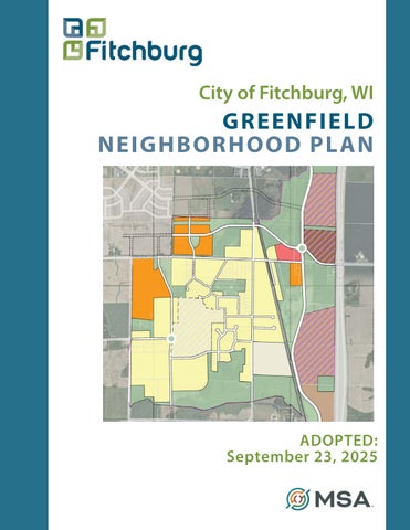
City of Fitchburg, WI
W HILL DR
GREENFIELD NEIGHBORHOOD PL AN
LEGEND 0-123 A.
Business Park
0-22 A.
High Density Residential
17-118 A.
Medium-High Density Residential
(Range to include hatched areas) (Range to include hatched areas) (Range to include hatched areas)
59 Acres
Medium Density Residential
7 Acres
Neighborhood Mixed Use
270-325 A.
ADOPTED: September 23, 2025
Low Density Residential
(Range to include hatched areas)
29-84 A.
Farming/Agrihood
308 Acres
Parks, Stormwater Management, & Open Space
(Range to include hatched areas)
Potential Roundabout Proposed Trails Bike Lanes
0 mi
1/12 mi
1/6 mi
1/3 mi
ACKNOWLEDGEMENTS COMMON COUNCIL
Julia Arata-Fratta, Mayor Dave Herbst, 1st District Joe Maldonado, 1st District Bill Jetzer, 2nd District Gabriella Gerhardt, 2nd District Jay Allen, 3rd District Donald Dantzler, 3rd District Jim Wheeler, 4th District Nicole Vafadari, 4th District
PLAN COMMISSION
Mayor Julia Arata-Fratta, Chair Steven Heller, Vice Chair Carol Poole Josh Knackert Zachary Billings Shelley Malofsky Gabriella Gerhardt
PROJECT STEERING COMMITTEE*
Aaron Richardson, McGaw Neighborhood Resident Andy Weiland, Oregon School District Courtney Odorico, Resident Dave Emerich, Frostwood Farms (alternate) Ed Kinney, Resident Elizabeth Thompson, Resident Jason Valerius, CARPC Lisa Steinhauer, Frostwood Farms Mary Sue Oppermann, Stoneman Family Farm Nicole Vafadari, Fitchburg Common Council
CITY STAFF
Brad Sippel, AICP, Community Development Planner Deanna Schmidt, AICP, City Planner / Zoning Administrator Zack Jones, Associate Planner Michael Zimmerman, Economic Development Director Joyce Frey, Economic Development Specialist Loreen Gage, Housing Initiatives & Programs Specialist Tracy Foss, PE, Assistant Public Works Director Ben Schulte, PE, Principal Engineer (Environmental) Ross Kahler, PE, Principal Engineer (Transportation) Phil Grupe, Sustainability Specialist
MSA PROFESSIONAL SERVICES, INC
Stephen Tremlett, AICP, CNU-A, Project Manager Olivia Bolton, Assistant Planner Vanessa Abou Harb, Assistant Planner Christine Pelto, PE Project Engineer Matt Roland, PE Project Engineer - Mobility Gabe Lujan, PE Project Engineer - Water *Note: Acknowledgements do not indicate endorsement or support by any individual Steering Committee members
CO N T E N T S Chapter 1: Introduction & Process
1
Chapter 1 discusses the plan’s purpose and objectives, and summarizes the planning process, and public feedback.
Chapter 2: Vision, Goals, & Guidelines
15
Chapter 2 establishes the vision, strategies, design guidelines to guide the future growth of the Greenfield Neighborhood study area.
Chapter 3: Land Use
36
Chapter 3 looks at a variety of factors that impact the current and future development in the Greenfield Neighborhood, developing a series of land use diagrams to facilitate discussion about land use, design preferences, and general road pattern. This chapter provides the recommended land use concept for the neighborhood.
Chapter 4: Engineering
59
Chapter 4 reviews capacity of existing municipal infrastructure within the planning area, and identifies analysis of how to serve the preferred concept and proposed Future Land Use.
Appendix A: Implementation Action Plan Appendix B: Relevant Plans & Development Review Appendix C: Engineering Analysis Appendix D: Maps
Public Engagement Documents: The City of Fitchburg website under the Planning & Zoning Department page provides background on this project, including access to all public engagement documents and summary information.
This page intentionally left blank.
1
CHAPTER 1 INTRODUCTION & PUBLIC INPUT
2 Purpose, Objectives & Process This section outlines the overall purpose, objective and planning process for the Greenfield Neighborhood Plan.
6 Study Area & Regional Context This section defines the geographic boundaries of the study area, and its significance in the larger regional context.
8 Public Input This section provides a summary of the different public engagement activities that were conducted for the Greenfield Neighborhood. For meeting and engagement materials visit:
Public Engagement Documents: The City of Fitchburg website under the Planning & Zoning Department page provides background on this project, including access to all public engagement documents and summary information.
Chapter 1 | Introduction & Public Input
2
PURPOSE, OBJECTIVES & PROCESS What is the intention of this Neighborhood Plan? This plan is intended to be living, workable document for the City of Fitchburg to guide development, policy, and infrastructure budgets over the next 20-plus years. This plan will be used as a baseline to meet the community’s vision (See Chapter 2). The entire plan becomes policy as part of Appendix A to the City’s Comprehensive Plan. The Future Land Use Map in the Comprehensive Plan will be updated to reflect the Future Land Use Map in this plan. What is the process to amend/ update this Plan? Changes to this Neighborhood Plan requires adopting an ordinance to amend or update the Comprehensive Plan in accordance with the procedures listed in Chapter 5 of the Comprehensive Plan and pursuant to Wisconsin Statute 66.1001. The Neighborhood Plan update will be reviewed with all other amendments during the bi-annual amendment process each year. The Planning Department, Mayor, or three members of the Common Council are the only ones that may recommend modifications to be considered as a minor amendment to the Plan.
PURPOSE
The Greenfield Neighborhood Plan is a detailed strategy to accommodate growth while protecting community values and the existing land use’s character. The key focus is to guide future development proposals by landowners and/or developers that would provide housing options, provide economic and job opportunities, minimize environmental impacts, and balance transportation and service needs. The Greenfield Future Development Area (FUDA) was identified in 2004, Resolution R-35-04, for incorporation in the urban service area. This plan identifies areas of the Greenfield FUDA that are suitable for urban expansion. See the next page for more information on FUDAs. The Greenfield Neighborhood is located in the eastern portion of the City of Fitchburg, and south of the existing Urban Service Area. The Capital Area Regional Planning Commission (CARPC) and the Wisconsin Department of Natural Resources (DNR) have regional approval authority over Urban Service Area (USA) amendments. This plan serves as the framework for the City’s USA Amendments applications to CARPC and the Wisconsin DNR.
OBJECTIVES 1. Establish a preferred land use plan that balances growth, blends with the local character, and protects community interests. 2. Identify suitable areas for development within the Greenfield Future Urban Development Area (FUDA). 3. Identify the infrastructure improvements (water, wastewater, stormwater, etc.) needed to accommodate new development. 4. Project future traffic patterns and volumes to identify and mitigate traffic-related constraints on new uses in the planning area. 5. Evaluate adjacent transportation networks and include a street and path network to provide connectivity to adjacent transportation networks and within the neighborhood. 6. Enhance bike, pedestrian, and transit accessibility throughout the planning area. 7. Establish a plan for new development, including uses, within the constraints of public infrastructure systems.
City of Fitchburg | Greenfield Neighborhood Plan
Growing Fitchburg 2030
Map 4.2 Growth Zones
FUTURE URBAN DEVELOPMENT AREAS (FUDA)
PURPOSE, OBJECTIVES & PROCESS
3
Figure 1.1: City of Fitchburg Growth Areas Map
Resolutions R-30-07 and R-89-07 created the City’s future urban development boundary with goals of maintaining the coexistence of the urban and rural areas, creating attractive highly intensive transit oriented neighborhoods and improving the quality of older areas through maintenance and redevelopment, while maintaining the natural resources and high quality farmland that resembles the City’s history. FUDAs were categorized into 3 Growth Zones: • Greenfield: Undeveloped lands, often in agricultural use, located at the edge of the City’s developed outside ofgrow? Urban Service Area (USA) Expansion Whereareas will Fitchburg In determining whether to undertake a the Urban Service Area. As shown in Figure neighborhood plan, the City considered the 1.1), Greenfield Neighborhood is identified as a following factors: the need for the neighborhood greenfield growth zone. and related urban service adjustment in • Grayfield: Lands that are already developed, relation to existing urban service areas, or other or lands that are vacant and surrounded by Where will Fitchburg grow? neighborhoods approved or anticipated with development, inside of the Urban Service Area. staged urban service entry; the maintenance of the • Farmfield: Lands planned for agriculture approved average maximum annual growth rate of outside of the urban service and not within 75 acres per year; ability to meet the resource and a FUDA. This growth zone is intended to service needs in different geographic locations; accommodate agriculture and associated the rate of completion of existing urban areas and development. neighborhoods; and infill and redevelopment pace or opportunities presented. Chapter 1 | Introduction & Public Input
4-10
4
PURPOSE, OBJECTIVES & PROCESS
HOW TO USE THIS PLAN
This plan is organized into four main chapters and four appendices. Chapter One outlines the plan’s purpose and objectives, and summarizes the planning process and public feedback. This feedback is reflected in the results presented in the other chapters, through the proposed land use concept, policies, and recommendations. Chapter Two establishes the vision, strategies and actions to guide future growth in the study area. The information in this chapter supports review of future development proposals, as well as action steps to support the long-term development of this neighborhood.
PLAN PROCESS
This Plan was developed over approximately [##] months, beginning in November 2023. The process included the following activities: Background Research and Consistency The planning process included a review of relevant plans to identify community goals, initiatives and recommendations that may impact the future development of the Greenfield Neighborhood. A detailed summary of this plan review is included in Appendix B. Opportunities / Issues Identification Identify limitations/constraints and opportunities that could impact the preferred land use pattern, utilities and infrastructure needs.
Chapter Three outlines the evaluation process used to determine the preferred land use for the study area. It also establishes key design parameters, including road and trail connectivity, parks and open space, land use density, etc., that can define the character of the Greenfield Neighborhood. This chapter provides the baseline for the Future Land Use (policy) Map in Chapter Two and is used to determine the utility needs discussed in Chapter Four.
Land Use Scenario Planning Based on the existing conditions and feedback, the process included initial land use bubble-diagrams, detailed concepts, and a preferred concept.
Chapter Four offers background information that informed the design and decision-making process, including a review of the capacity of existing municipal infrastructure within the planning area. City actions to support infrastructure improvements are outlined in Chapter Two.
Outreach and Engagement Plan Staff Meetings MSA planners met with staff at every stage of the planning process to review and discuss draft materials. The City’s planning, engineering, and economic development departments participated in these meetings.
System Analysis and Infrastructure Needs Evaluate the overall system based on a preferred concept, identifying improvements necessary to allow for development, inclusive of sanitary sewer, potable water, stormwater management, and mobility networks (vehicle, bike and pedestrians).
Key Stakeholder Interviews MSA and City planning staff met with a number of key stakeholders, including current landowners with large holdings, DNR, CARPC, and Friends of Waubesa Wetlands. Each meeting covered a City of Fitchburg | Greenfield Neighborhood Plan
PURPOSE, OBJECTIVES & PROCESS
range of topics, including intentions for future investment in the neighborhood, preferences for changes in the study area, and any other issues of concern. Feedback from these interviews is briefly summarized in this chapter.
events through their “Notify Me” on the City page on for this neighborhood plan.
City Council & Other City Commissions City staff presented planning process updates and plan draft material, and sought feedback on that material, from several City commissions including the following: Community and Economic Development Authority (CEDA), Plan Commission (PC), and Board of Public Works. Feedback received by the above commissions have contributed to this plan. General Public Involvement Steering Committee meetings and other City meetings discussing this project were properly noticed and open to the general public. The City also provided an opportunity to be notified of
5
The general public was informed and provided opportunities to provide feedback on a number of occasions throughout the planning process, including the following: •
Online Opportunity Mapping
•
Two Neighborhood Meetings (Visioning meeting and Concept Feedback meeting)
•
Online Survey
•
Public Open Houses/Input Forums
•
Developer Focus Group
•
Steering Committee “Working” Meetings
•
Plan Commission Meetings
•
Public Hearing and Adoption Meeting
•
Questions and responses were also provided through the neighborhood.plans@fitchburgwi. gov email.
Table 1.1: Project Timeline 2023 Nov - Dec Jan - Feb
2024 Mar - Apr May - Jun Jul - Aug
Sep - Oct
Nov - Dec Jan - Feb
2025 Mar - Apr May - Jun
Jul - Aug
BACKGROUND RESEARCH
SC #1
Public Input Forum #1
SC #2
SC#3
SC#4
Open House #1
SC #5
SC #6
LAND USE MODELING GOALS / POLICY DEVELOPMENT ENGINEERING FINAL PLAN DRAFT FINAL PLAN REVIEW AND ADOPTION
Chapter 1 | Introduction & Public Input
6
REGIONAL CONTEXT & STUDY AREA r
E
Tod d
Frisee Dr Rd
Lac y
Lalor Rd
Lake Farm Rd
Project Location CityOF of Fitchburg TOWN DUNN
Goodland Park Rd
Haight Farm Rd
Surrounding Municipality Bike Path
14
Primary Arterial
ne Rd
Byr
B
Primary Road
Lalor Rd
Railroad City Hall Interchange
Irish Ln
Schneider Dr
TOWN OF DUNN
ne Rd
Data Sources: B Dane County GIS (2023) Dane County Aerial (2022) Wisconsin DOT (2018)
MM MM
M M
VILLAGE OF OREGON VILLAGE OF OREGON
Schuster Rd
Schneider Dr
Sand Hill Rd
Schuster Rd
FISH HATCHERY RD
Sand Hill Rd
Cai ne
Rd
Byr
TOWN OF OREGON D
B
MM MM
Schneider Dr
Sand Hill Rd
E Cheryl Pkwy
14
M M
Lake Farm Rd
Urban Service Area Boundary
Frisee Dr
Dr
Rd
Research Par
City of Fitchburg Dane County, Wisconsin
Meadowview Rd
MM MM
k
MM
14
d
Larsen Rd
nR
to
TOWN OF BLOOMING GROVE
TOWN OF DUNN
Cai ne Rd
Mutchler Rd
TOWN OF Purcell Rd OREGON D
Neighborhood Plan
E
r
Syene Rd
Rd
lay
Hwy
S Seminole
FISH HATCHERY RD
Rd urg chb Fit
Dr
Lacy
Richardson S t
Dr Pa Com
Fitchrona Rd Rd
TOWN OF MONTROSE
Larsen Rd
Syene Rd Lake Farm Rd
Larsen Rd
Lalor Rd
Research Par n ole Hwy HW Se Y mi MIN S SE
nd Osmu se n Rd
ne Rd Byr LACY RD
oy McC
W C
CITY OF FITCHBURG
VILLAGE OF OREGON
Sunset Dr
City of Fitchburg | Greenfield Neighborhood Plan 0.5 Miles
MCKEE RD
Te r
Adams Rd
Data Sources: Dane County GIS (2023) Dane County Aerial (2022) Wisconsin DOT (2018)
0.25
rd gfo
L on
CITY OF FITCHBURG
Bordered by the Fitchburg Urban Service Area (USA) to the north, this neighborhood is one of eight “Greenfield Growth Zones” in the City of Fitchburg. The McGaw Neighborhood (208 Acres) to the north and the East Highway 14 Neighborhood (431 Acres) to the east are also designated growth zones.
0
Tod d
Richardson S t
Ro a
a R F d ro nta ge
Ve Fitc
M
art ngelh
Study Area
City Hall Interchange Greenfield & South Stoner Prairie
Moorland Rd
Whalen Rd
REGIONAL CONTEXT B
D
Railroad
CITY OF MONONA
CITY OF MADISON
Schuster Rd
TOWN OF MONTROSE
Purcell Rd
TOWN OF VERONA
Primary Arterial
Post Rd
Borchert
Railroad City Hall TOWN OF Interchange OREGON D
OLE
Mutchler Rd
Prairie Rd Manch e
st
er Rd
Rd
Borchert
Primary Road
Sunset Dr
12
Political, School & Special Districts MM Sources: WHALEN RD
Surrounding Municipality Bike Path Goodland Park Rd
W Badger Rd
Nobel Dr
CITY OF VERONA
M M
e Road HWY Wtag BELTINE ron W Beltline F Gra n
Sch umann D r
14
City of Fitchburg
Primary Road Nobel Dr
Irish Ln
Lacy Rd
Cai Gro ne ve D Rdr
Rd
Adams Rd
Printed By: smorrison, File: \\msa-ps.com\fs\Project\07\07729\07729051\GIS\7_07729051_NeighborhoodPlan_Figures.aprx
FISH HATCHERY RD
Primary Arterial
Rd
Lac y Gilbert Rd
le Hwy
S Semino
Muir Field Rd
a s t Pas s
Rd urg chb Fit
itt
Grandview Rd
Surrounding Municipality Bike Path
D
AR
N RO VE
Adams Rd
City of Fitchburg
Frisee Dr
n Osmu dse n Rd Print Date: 10/4/2023
Mutchler Rd
Fitchrona Rd
Whalen Rd
rk
Urban Service Area Boundary
Haight Farm Rd
ro n
b Nes
Urban Service Area Boundary
E Cheryl Pkwy
S Sye ne Rd
Printed By: smorrison, File: \\msa-ps.com\fs\Project\07\07729\07729051\GIS\7_07729051_NeighborhoodPlan_Figures.aprx
Dr
r Gr ov eD
Rd urg chb
urg Way William s b
Maple
Project Location
d
Meadowood Dr
na hro Rd
E
Meadowview Rd
MM MM
Dr
d
VERONA
Raymond Rd
18/151
Rd
Project Location
dview Blv
CITY OF FITCHBURG
WHALEN RD
CityCITY of OF Fitchburg VERONA Dane County, Wisconsin TOWN OF
k
Barton Rd
ch Rd F r is
Grandview Rd
Fit
TOWN OF MIDDLETON
Irish Ln
Greenfield & South Stoner Prairie Whalen Rd WHALEN RD Neighborhood Plan
M
Hammersley Rd
ton
lay
W C
C Dan
TOWN OF BLOOMING GROVE
14
Goodland Park Rd
LACY RD
M
d oy R McC
0
0.25
Data Sources: Dane County GIS (2023) Dane County Aerial (2022) Wisconsin DOT (2018)
0.5 Miles
0
St
Greenfield Ne
Dr
City of Fitchburg Dane County, Wisconsin
S Sye ne Rd
Maple
MM MM
Haight Farm Rd
Lacy Rd Nobel Dr
Study Area
ONONA
m er ce Pa
Com
Research Par
E Cheryl Pkwy
E
n ole Hwy OLE HW Se Y mi
Ve
Fitc Richardson S t
er Rd
st Manch e
a s t Pas s
N RO
VE
Rd
Sch umann D r
rk
na Blvd en cK
S Semino
itt
D AR
Dr
Te r
S Sye ne Rd
le Hwy
b Nes
18/151 k
MCKEE RD
h art ngel
Post Rd
TOWN OF BLOOMING GROVE
Meadowview Rd
rd gfo
L on
CITY OF MONONA
Greenfield & SouthMoorland Stoner Prairie Rd Neighborhood Plan
Dr
14
Rd
ton
lay
W C
12
h art ngel
D
MIN
ro n
na hro Rd
LACY RD
Syene Rd
a R F d ro nta ge
Te r
d oy R McC
m erce
MCKEE RD
S SE
Ro a
Prairie Rd n Osmu dse n Rd
Muir Field Rd
Gilbert Rd Tod d r
OLE HW Se Y mi MIN S SE
Ro a
a R F d ro nta ge
Ve
Dr m er ce Pa
Com
E Lacy Rd
Purcell Rd
Post Rd
d
CITY OF MADISON
Moorland Rd
Road HWY Wtage BELTINE W Beltline Fron Gr an
d
D
Raymond Rd
Sch umann D r
rk
18/151
rd gfo
W Badger Rd
D
urg Way William s b
Study Area
CITY OF MONONA
CITY OF MADISON
12
Meadowood Dr
L on
W Badger Rd
dview Blv
a Rd
d
ro n
ch Rd F r is
d
rg Way am s bu
dview Blv
Print Date: 10/4/2023
M
TOWN OF MIDDLETON
Raymond Rd
d Dr
Road HWY Wtage BELTINE W Beltline Fron Hammersley Rd Gr an Barton Rd
na Blvd en cK
Gilbert Rd
n ole Hwy
Figure 1.2: Regional Area (Refer to Appendix D) Barton Rd
0.25
0.5 Miles
Greenfield is well connected to local and regional transportation corridors. The neighborhood is located near two major roadways: USH 14 to the east, and the Beltline Highway to the north (see Figure 1.2). The study area does not have direct access to the USH 14. An active freight railroad corridor also passes through the study area just east of Syene Road, running parallel to USH 14. This corridor is currently used for freight transportation, but there is potential for future passenger transportation
Study Area
MM
Greenfield Neighborhood Plan
7
City of Fitchburg Dane County, Wisconsin
Figure 1.3: Study Area (Refer to Appendix D) Nob el Mica Rd
City of Fitchburg
The Greenfield Neighborhood benefits from proximity to business uses and other future land uses (residential, business, parks and open space) to the northeast. School District: Oregon Schools Aldermanic District: 3 & 4 Existing Parks: Greenfield Park, the Curry Court natural area and the Gold Addition.
ey
rR
d
W
ble
Co b
r lD
S Syene Rd
Hil st Ea
Trl
Whalen Rd
an
All lots adjacent to the site are farmland, rural residential, open space, and woodland. This neighborhood provides a transition to more urban developments to its north, in both the City of Fitchburg and the Madison Metro area.
Hill Top Rd
Gold Dr
Murphy Creek (and Byrne Road) to the south.
Hill Dr
•
14
Irish Ln
W es t
The US Highway 14 to the east.
• •
Waterville Way
Caine Rd
•
Printed By: smorrison, File: \\msa-ps.com\fs\Project\07\07729\07729051\GIS\7_07729051_NeighborhoodPlan_Figures.aprx
Caine Road to the west.
Surrounding Municipality Parcel Boundary
Farmstead and agricultural lands (planned for in the City’s McGaw Neighborhood) to the north.
•
•
Dr
Fa h
Tullamore St
The study area (Figure 1.3) is bounded by:
14
Wil dhe at h er
Gln
14
•
Dr
Project Location
Notre Dame Dr
The Greenfield Neighborhood is approximately 975 acres, mostly privately-owned.
Fahey Gln
Print Date: 10/4/2023
STUDY AREA
Old In d i
Data Sources: Dane County GIS (2023) Dane County Aerial (2022)
0
250
500 Feet
Byrne Rd
14
The planning area includes an existing residential neighborhood with over 241 low-density homes on private septic. Some homes are connected to City Water and private septic; none of the homes are on City Sanitary. The Plan looks to improve connectivity and stormwater management within this neighborhood and establish opportunities for new housing choices should a landowner or developer propose new development in the study area. It is near McGaw Park and Quarry Hill Park, which provide for a variety of recreation opportunities beyond the City parks within the study area. Despite the absence of bike paths or lanes within the study area, the neighborhood is near an extensive network to the north, such as the Capital City Trail, connecting to nearby communities. Chapter 1 | Introduction & Public Input
8
PUBLIC INPUT Below is a detailed summary of the engagement activities conducted from November 2023 to December 2024, providing opportunities for elected officials, property owners and other stakeholders to offer valuable input and to the betterment of the final plan. The City’s website (under Planning & Zoning Department) provides access to all public engagement documents and summary information.
STEERING COMMITTEE MEETINGS
The Steering Committee emphasized the importance of blending new development with the local and surrounding character of the neighborhood. The meetings focused primarily on the need to develop carefully, while considering impacts on the existing community. Improving bike and pedestrian safety, along with addressing current and future traffic issues, was a significant concern. The meetings highlighted the residents’ priority for enhancing social interaction and cohesion within the neighborhood, fostering a stronger sense of community. Several members of the steering committee, advocated for a balanced development approach, respecting the desires of property owners who wish to develop their land. However, many residents advocated for no development. When evaluating land use options, Options “A” and “B” were preferred compared to Option “C” which was deemed too dense, particularly for the southern portion of the neighborhood. Among the options presented, there was no clear consensus on the road network. The residents noted their concerns regarding the addition of the interchange, finding it unnecessary with the availability of County Road MM as an alternative. During Steering Committee Meeting #4, the committee and residents shared their feedback on the goals, suggesting edits to the concepts and language.
City of Fitchburg | Greenfield Neighborhood Plan
Other themes discussed during the meetings include: wetlands, stormwater management, road extensions, potential off-road paths, land uses, residential densities, local topography, smart code, Agrihood and nuisance, and preserving the local neighborhood character.
STAKEHOLDER INTERVIEWS
The process included a handful of interviews with property owners, Oregon School District, Capital Area Regional Planning Commission (CARPC), Wisconsin Department of Transportation (WisDOT), Friends of Waubesa Watersheds, as well as a group of local homebuilders and development specialists (through a focus group). Property Owners The interviews highlighted the intentions of various neighborhood property owners regarding future development. • The owner of the southeast neighborhood property intends to continue farming and, if development were to occur in the future, prefers open space rather than a cluster of apartments. Follow up conversation by City staff indicated landowner’s openness to agribusiness should his land redevelop. • The southwest neighborhood property is currently leased out for farming, but the owner is open to selling in the future. Their preference is for low-density residential development, though they may consider medium-density if it aligns with the character of the area. • The northwest neighborhood property owner does not plan to sell for development and prefers the greatest flexibility in how their land is developed, should any regulations be imposed. Oregon School District During the interview, it was noted that the current school projections do not account for future growth in the study area through 2035
PUBLIC INPUT
9
and are already falling short to date. Forest Edge Elementary (K-6) in the Terravessa Neighborhood could face capacity issues by 2035. However, strategies are in place to manage this potential issue, including the construction of a new middle school for grades 5-8, which would allow Forest Edge and Rome Corners to serve grades (K-4).
Friends of Waubesa Watersheds Discussion covered the importance of the Murphy and Swan Creeks, and impacts of farming and development on these creeks that feed into the Waubesa Watershed. There is interest in protecting existing wetlands, restoring wetlands, and groundwater recharge.
CARPC We discussed how this plan can be part of the Urban Service Area amendment application either as a single application, or in a phased amendment.
PUBLIC OPEN HOUSES
WisDOT We discussed the potential for this neighborhood, including interest of an interchange within the study area with potential connection to CTH B. Per our discussions with WisDOT, no determination on if USH 14 can be reviewed based on future “urban” conditions, allowing for one-mile spacing of interchanges. Additional discussions will be necessary to consider a future interchange- likely through a transportation study recommended as an implementation item in this Plan.
Open House #1 - Kick-Off A public open house was held on 12/04/2023 for both Greenfield and South Stoner Neighborhoods. Approximately 80 people attended the meeting. Some residents emphasized the importance of preserving the agricultural heritage in and around the established Greenfield Neighborhood. Additionally, meeting attendees shared significant concerns regarding stormwater issues affecting their homes, protecting wetlands, existing and future traffic along the major roadways that bound and cut through the neighborhood, and any future requirement to connect to City sanitary service.
Open Houses (07/31/2024)
Chapter 1 | Introduction & Public Input
10
PUBLIC INPUT
Open House #2 - Goals & Strategies Review This meeting took place on 07/31/2024, where the public participated in three engagement activities: goals and strategies voting, map input (Figures 1.4 and 1.5), and concerns pyramid. In addition to the feedback from the activities (presented below), general feedback from attendees had major concerns with the interchange, potential requirement for existing landowners to connect to the City sanitary sewer system, existing, and future flooding and the amount of development proposed.
Figure 1.4: Public Input Map - Option A - Open House #2 (Refer to Appendix D)
Concerns Pyramid themes: • Highest Concern: need to preserve the character of the neighborhood. • Moderate to High Concern: increased traffic pattern and businesses at Syene and Irish Lane intersection, preserving farmland and highway interchange. • Moderate Concern: commercial land use on the west, and storm flooding. Common maps themes: • Road Connections and Extensions: opposition to connecting or extending roads; concerns about disrupting the existing established neighborhood and increasing traffic, especially with potential interchange identified. • High-Density Housing: will change the neighborhood’s character and increase flooding risks. • Business Development: particularly near residential neighborhoods, causing increased traffic and noise. • Environmental and Flooding: The need to address the current drainage and flooding as well as the environmental impact of new developments, particularly on wetlands and existing drainage systems. • Buffers and Preservation: strong desire for buffers between new developments and existing established neighborhood. City of Fitchburg | Greenfield Neighborhood Plan
Figure 1.5: Public Input Map - Option B - Open House #2 (Refer to Appendix D)
PUBLIC INPUT
NEIGHBORHOOD MEETINGS
Neighborhood Meeting #1 During the first neighborhood meeting, held on 01/04/2024, it was evident that all groups preferred ‘Limited’ or ‘No Growth’ options to ensure the viability of the local family farms. There was a strong overall support for lower density housing options, reflecting the community’s desire to maintain a more rural character. The attendees suggested locating intense development east of Syene Road, particularly in the northeast quadrant. Preserving wetlands and flood-prone areas as greenways or open spaces was a priority, along with maintaining a parkland buffer from development to the north, specifically around the Moraine Edge Park area. There was a clear preference for homes that blend with the natural character of the area, avoiding standardized designs. Finally, the residents highlighted the need for community and civic spaces.
11
Neighborhood Meeting #2 At the second meeting on 04/22/2024, the attendees shared their concerns regarding the development timeline, with a perception that it may occur in the next few years rather than one to two decades from now. They highlighted the stormwater issues, particularly the water flowing into Greenfield Park from the Caine Road farm hills. The discussion stressed the importance of carefully locating development within Greenfield to minimize the impact on the existing established neighborhood, as residents shared their preference for some suitable areas for development. They noted the importance of ensuring that new roadway alignments do not impede existing services or impact existing property owners, especially with potential addition of an interchange. Many residents continued to advocate for prohibiting development in Greenfield, and not requiring future hookup to the City’s sanitary sewer system.
Neighborhood Meetings (04/22/2024)
Chapter 1 | Introduction & Public Input
the following elem Answered: 139
12
PUBLIC INPUT
SURVEY RESULTS
Figure 1.6: Survey Land Use Maps: Option A & B
The survey, conducted from July 2024 to September 2024, received 209 responses. Figure 1.6 portrays the two options that were presented in the survey feedback in different parts of the neighborhood.
Greenfield Neighborhood Plan Survey The survey revealed that while sustainability and quality of life goals received high support (around 80%), housing (44%), economy/job growth (42%), and 26 Reviewing options, which option do you prefer as it relates to transportationthe goalstwo (30-64%) ranked lower.
the following elements?
For Option A, respondents felt there was too little low-density and farm/ rural residential Answered: 139 areas, but enough parks and open space, with too much medium to high-density residential and commercial spaces. For Option B, respondents noted that there wasn’t enough land for farming and rural residential, just enough low and highdensity areas, and too much medium density and commercial spaces. Overall, respondents prefer large singlefamily homes and green spaces, expressing concerns about traffic, environmental impacts, and the loss of the area’s semirural character. While there were comments by participants preferring an opton of “no development”, those that responded favored the land use pattern and percentage of Option A and the road network and land use mix and diversity of Option B.
City of Fitchburg | Greenfield Neighborhood Plan
Skipped: 70
Skip
PUBLIC INPUT
ONLINE MAPPING TOOL
The online mapping tool was active from November 2023 to January 2024. The map (Figure 1.7) shows a significant amount of concern regarding traffic speeds, particularly on Irish Lane, emphasizing the need for improved traffic management and safety measures. Other concerns include the pressing need for enhanced stormwater management, especially to address issues arising from snowmelt. Preserving the ecological health of wetlands and protecting farmland are also top priorities for the community. Some residents expressed concerns that many open spaces would be converted into active parks. Overall, the community stressed the need to Wild h
eat
Wil dh
eat h
er D
r
maintain the local character while expanding parks and recreational facilities and preserving open space and wildlife habitat.
OTHER PUBLIC COMMENTS
Other comments received through emails and calls recognized the need for gentle density rather than sprawl to ensure economic sustainability.
Many residents expressed opposition to new Public Input Map development. While additional biking and pedestrian options are welcomed, Greenfield residents shared Neighborhood Plan concerns about the impact of development on theInput M Public neighborhood’s character, culture, and sense of Greenfield City of Fitchburg identity. Neighborhood Plan MM
MM
Dane County, Wisconsin
Gl
n
r
Notre Dame Dr
Mica Rd
Dr
Fahey Gln
Nob el D
her
13
Figure 1.6: Public Input Map (Refer to Appendix D) ey
City of Fitchburg Dane County, Wiscons
Fa h
Co
bb
ler
Rd
W
Tullamore St
Waterville Way
Project Location Parcel Boundary
14
r lD Hil
Irish Ln 14
st
& % % &
Parcel Boundary Comment Type
Something to Preserve
Pedestrian/Bicycle Opportu Concern
Other; Other
Traffic Concern
& Stormwater Concern %
Something to Preserve
S Syene Rd
Hill Top Rd
Caine Rd
Irish Ln
Hil
lD
r
& % & %
st
& %
Project Location
Pedestrian/Bicycle Opportunity/ Concern Traffic Concern
Ea
& & % %
West Hill Dr
& % S Syene Rd
& %
& % & %
& %
Comment Type
Ea
West Hill Dr
& % % &
& %
Other; Other
& Stormwater Concern %
Trl Old In d i
an
& %
Trl
& % Gold Dr
Whalen Rd
an
Gold Dr
Hill Top Rd
Old In d i
& %
Byrne Rd
Data Sources: Dane County GIS (2023) Dane County Aerial (2022) Public Input Collected 2023 County of Dane, Esri Canada, Esri, HERE, Garmin, INCREMENT P, Intermap, USGS, METI/NASA, EPA, USDA 14 0 Byrne Rd
0.1
0.2 Miles
Data Sources: Dane County GIS (2023) Dane County Aerial (2022) Public Input Collected 2023 County of Dane, Esri Canada, Esri, HERE, Garmin, INCRE USGS, METI/NASA, EPA, USDA
14 0
Chapter 1 | Introduction & Public Input
0.1
0
14
PUBLIC INPUT
PETITION AND CITY RESPONSE
On December 2nd, 2024, the City of Fitchburg received a petition regarding the Greenfield Neighborhood Plan. On the same day, the Greenfield Steering Committee and project staff received a letter from the Friends of Waubesa Wetlands. Both were received the day before the scheduled December 3, 2024 Greenfield Steering Committee meeting to discuss utilities, stormwater, and traffic. Below is a summary of the key requests and recommendations. The Friends of Waubesa Wetlands Recommendations are listed below: • Maximize wetland preservation and restoration using Joanne Kline’s map. • Ensure zero increase in runoff with a 100% stormwater stay-on goal. • Retain ample open space for native vegetation and wildlife. • Explore installing a USGS monitoring station at Murphy’s Creek and Lalor Road. • Consider recycling wastewater to reduce demand for new high-capacity wells. • Use adaptive implementation to phase development projects, assess each phase, and make necessary adjustments.
City of Fitchburg | Greenfield Neighborhood Plan
The Greenfield Neighborhood Petition On December 2nd, 2024, the City of Fitchburg received a petition regarding the Greenfield Neighborhood Plan signed by 181 Fitchburg residents. The petition requests the following: • Assess development impacts on water resources with expert input before designating land for development. • Avoid curb, gutter, sewer, and sidewalk installations to prevent drainage issues and disruption. • Create low-density residential buffers with height restrictions near single-family homes. • Maintain essential street connections for connectivity and emergency access. • Reduce Business Park and High/Medium-High Density Residential areas to preserve farmlands. • Preserve existing agricultural lands to maintain the community’s historical nature.
The petitions and staff memo addressing these items are viewable on the Planning & Zoning page on the City’s website.
15
CHAPTER 2 PLAN VISION, STRATEGIES & GUIDELINES
16 Vision, Goals & Strategies This section presents the long-term vision for the Greenfield Neighborhood Plan, and states the goals and strategies to reach this vision.
27 Future Land Use Map This section presents the Future Land Use Map and its relationship to the existing comprehensive plan.
28 Placemaking & Design Guidelines This section presents strategies to guide the development of a unique place that will draw from the City of Fitchburg and the broader region.
Chapter 2 | Vision, Strategies, and Guidelines
16
VISION, GOALS & STRATEGIES This section establishes goals and strategies to guide the development of the Greenfield Neighborhood. These supplement the design guidelines and land use strategies in this chapter.
VISION STATEMENT Greenfield Neighborhood will balance residential and economic growth while preserving the local character and quality of life of its current and future residents. Neighborhood goals are divided into the following categories and further explained on the following pages: Housing: Additional housing options will be provided in the neighborhood, but will be strategically placed, designed and buffered to be compatible with the existing Greenfield Neighborhood. Economy: Employment and goods/services will be strategically located and connected to reduce the dependency on longer automobile travel and to provide local and convenient options near the neighborhood. Mobility: Support future regional transportation connections that limit impacts on Greenfield’s local streets as the region continues to grow. Implement safe, convenient and attractive streets for everyone regardless of age, ability or mode of transportation (pedestrian, bike, automobile, transit). Quality of Life: Create and maintain open spaces accessible to all residents for recreation and neighborhood character preservation. Sustainability: Create an economically and environmentally sustainable development pattern, protecting existing natural features. Consider the historical significance of the neighborhood, especially opportunities to preserve farm fields and implementation of low-impact development techniques for infrastructure design. City of Fitchburg | Greenfield Neighborhood Plan
VISION, GOALS, & STRATEGIES
17
1. HOUSING GOAL & STRATEGIES Goal 1 – Additional housing options will be provided in the neighborhood, but will be strategically placed, designed and buffered to be compatible with the existing Greenfield residents.
GREENFIELD NEIGHBORHOOD
Strategy #1.2 Encourage well-designed developments that mitigate any potential conflicts in providing a mix of housing types within a subdivision/plat.
ISSUES BOARD December 28, 2024
Approved Mixed Residential Neighborhood
NO
Adopted McGaw Neighborhood Plan
BE L This apartment building steps down the building adjacent to a DR HDR neighboring lower-density residential use.
MHD
OS
MDR
Collector A
Strategy #1.3 New development adjacent to the existing established Greenfield neighborhood should include mitigation techniques to maintain the general local character of this neighborhood.
ill EH
WEE
W HILL DR
IRISH LN BYDA
Greenfield Park
ILROAD
WHALEN RD
NEY BLA
Curry
RD
SOUT
Hill Top
RA HERN
Collector B
SIN &
WISCON
Maloney
S SYENE RD
TR
Old Indian
CAINE RD
Within approximately 200 feet of the existing neighborhood, as defined in (shown on the right), building heights shall not to exceed 3 stories or 35 feet (following the allowances in the neighborhood). To further buffer potential development north of Irish Lane, consider a dedicated open space on the north side of Irish Lane that can preserve existing old growth/ heritage trees and provide for a shared use path.
US-14
NEY
BLA
Building forms and site layout should be compatible with the design guidelines established in this Plan. This approach helps to address potential conflicts by setting guidelines that balance the needs and characteristics of various housing options, promoting a cohesive and inclusive community.
DRAFT
Potential Interchange
Incorporating diversity of housing types with varying density and massing can be achieved through careful design considerations. Design guidelines/standards can help achieve compatibility between uses.
This neighborhood incorporates varied housing types, using building orientation to mitigate compatibility issues.
RD
Strategy #1.1 Encourage a variety of housing types, forms, price points, and tenures in the neighborhood, locating the least dense housing next to existing residential lots.
The map above identifies BYRNE a 200-ft buffer around the established RD neighborhood.
Chapter 2 | Vision, Strategies, and Guidelines
LEGEND
Core Neighborhood 200ft buffer
18
VISION, GOALS, & STRATEGIES
1. HOUSING GOAL & STRATEGIES (cont.)
Strategy #1.4 Encourage Traditional Neighborhood Design (TND) developments that allow for ‘missing middle’ and small-lot housing. TND neighborhoods are modeled after the traditional pre-war neighborhoods in the United States that are prevalent throughout Wisconsin. They promote compact, pedestrian-oriented neighborhoods with a mix of commercial and residential uses, a variety of housing types, and public places where people can socialize and engage in civic life. TND also improves land use efficiency and opportunities for alternative modes of transportation.
The above four-unit development includes reduced setbacks and porches that provides a welcoming frontage. The building types also fit the “missing middle” housing formats.
What is the “missing middle”? The Missing MIddle is a range of multi-unit or clustered housing types compatible in scale with single-family homes that help meet the growing demand for walkable and urban living. Ellen Dunham-Jones, professor at the Georgia institute of Technology, stated “well-designed ‘Missing Middle’ buildings unify the walkable streetscape as they greatly diversify the choices available for households of different age, size and income”. Housing types include duplex, triplex/fourplex, courtyard apartment, bungalow court, townhomes, mutiplex and live/work units.
City of Fitchburg | Greenfield Neighborhood Plan
VISION, GOALS, & STRATEGIES
19
2. ECONOMY GOAL & STRATEGIES Compatible Scale
Goal 2 – Employment and goods/services will be strategically located and connected to reduce the dependency on longer vehicle travel and to provide local and convenient options near the neighborhood. Strategy #2.1 Commercial uses and building forms will be compatible with general neighborhood context.
McGann Ln
Dr ents
Apartm
ents
Apartm
Sparkle Stone Cres
Research Park Dr
S Fish Hatchery Rd
This example ties the business park to the neighborhood along a minor street, as well as by an off-street trail. Building scale in the business park is smaller closer to the residential area. Quarry Hill Dr Challenger Dr
Encouraging flexible land uses enables a more tailored and timely response to market needs at the time of development. However, fragmented residential developments can lead to long-term home value deterioration and reduce the sense of place and neighborhood feel for residents of the developments.
rk Pa
Castle Rock Dr
Commercial / Mixed-use nodes should be designed to be compatible with the surrounding residential area. The scale, massing and uses within the employment area should consider design solutions to minimize its impact on the surrounding neighborhoods. Pedestrian and vehicle connections should be provided between residential and the employment area(s).
Strategy #2.2 Promote flexible land uses east of the tracks that allow for either gentle increases in residential density or business park to respond to market needs and landowner interests.
h
arc
se Re
Mixed-Use Development
Large Building
Offices & Restaurant
Lacy Rd
There are two clusters of flex area with one area located north of Irish Lane and the other located closer to Byrne Road. Whichever use is approved for more than half of a cluster shall result in requiring the remaining of the cluster to match the initial requested use for that specific cluster area. This two-story mixed-use building has a pitched roof and gables compatible with single-story ranch homes in the surrounding well-established neighborhood.
Chapter 2 | Vision, Strategies, and Guidelines
20
VISION, GOALS, & STRATEGIES
022 EAST SIDE PLAN
3. MOBILITY GOALS & STRATEGIES
GOAL : – Support future regional transportation Goal43A connections that limit impacts on Greenfield’s
Policy local #1 streets as the region continues to grow.
PARK
Provide sidewalks along all streets and multi-use trails in the environmental Strategy #3A.1 Develop a contiguous bike network through the corridors and parks.
neighborhood, connecting to the rest of the City and to the greater Dane County trail system.
alternative modes of transportation, and enhance the valueaofcomprehensive nearby neighborhoods. These Develop system ofbenefits are amplified when interconnected and integrated into pedestrian and bicycle facilities that regional networks. connects the East Side area to the other sections of the Village and to the greater Strategy Dane County#3A.2 trail system.
Encourage alternative north-south and east-west collector streets that shift traffic growth away from S. Syene and Irish Lane. Channeling traffic to larger arterial roads, improves overall traffic flow and reduces local congestion. It enhances safety in residential areas by minimizing through-traffic.
Hollyhock St
Multi-use Policy #2paths promote healthy lifestyles, provide
E Cheryl Dr
This trail connects a major roadways to a neighborhood park to several local neighborhood streets.
Snapdragon Trl
y
kw
P yl
er Strategy #3A.3 Ch E Continue considerations of a USH 14 interchange between the Lacy Road and County Highway MM interchanges to plan for regional transportation needs.
Glen
Sunflower D
r
Jones Farm Dr
Fahey
Future growth to the east and south will impact the level of service of existing roads. As the area continues to urbanize, the need for an additional interchange may be warranted. It is important to assess the potential long-term impacts of the interchange on the current and future developments near USH 14 and north of Irish Lane, should it be planned for or constructed in the proposed location. The interchange will enhance accessibility and reduce travel time for residents, alleviating local traffic congestion by providing a direct route to major roads. Consider connecting the interchange with Collector A and County Highway B.
Stoneman Dr
y
t Wa
hligh
Nort
ay
ce W
Prin Lacy Rd
New neighborhoods making road and pedestrian connections that were established in older subdivisions. Aurora Ave
City of Fitchburg | Greenfield Neighborhood Plan
VISION, GOALS, & STRATEGIES
21
3. MOBILITY GOALS & STRATEGIES Goal 3B – Implement safe, convenient and attractive streets for everyone regardless of age, ability or mode of transportation (pedestrian, bike, vehicle, transit).
Strategy #3B.1 Provide sidewalks and bike facilities (if necessary) along all streets to promote walkability and connectivity. Walkability is important in residential development, particularly in urban and suburban areas. Sidewalks provide safe and comfortable mobility.
Sidewalks can enhance safety for pedestrians, promote physical activity, and improve accessibility for all residents.
Strategy #3B.2 Promote narrower streets to increase pedestrian safety and to develop land more sustainably. Streets provide access and parking storage. The wider the road the greater cost to maintain (e.g., street sweep, plow and repair). Right-sizing roadways has safety, financial and environmental benefits.
Strategy #3B.3 Encourage proposed streets to connect to existing streets and intersections, wherever practical. Dead-end streets and non-continuous trail networks limit options when moving throughout a community. This reduced mobility increases travel distance and traffic on primary roadways, can frustrate drivers/ pedestrians, and discourages non-motorized travel. Development should make every effort to connect to existing facilities (trails, roadways and intersections).
The photo above illustrates of a safe crosswalk connecting to a path.
This Plan anticipates neighborhood development to occur in phases over time; future development should anticipate and provide necessary connections between developments. Cul-de-sac and dead end streets proposed due to terrain or natural features should install multi-use paths connecting dead-ends to the street network.
Chapter 2 | Vision, Strategies, and Guidelines
22
VISION, GOALS, & STRATEGIES
3. MOBILITY GOALS & STRATEGIES (cont.)
Strategy #3B.4 Utilize traffic calming measures (e.g., bump-outs, traffic circles, speed tables, rectangular rapid flash beacons) where appropriate to create a better street environment for pedestrians and cyclists. The frequency and speed of vehicles can greatly impact road safety, especially for pedestrians/bicyclists. “Traffic calming” measures that can be designed or retrofitted into a roadway can reduce vehicle speeds, and in some cases discourage vehicle usage (cut-through traffic).
Strategy #3B.5 Design streets, multi-use paths, and trails that include adequate lighting to ensure safety of users. Well-designed lighting can enhance visibility and promote a sense of security, encouraging more people to walk, bike, and engage in outdoor activities. By integrating effective lighting solutions, communities perceive the streets as more welcoming.
Traffic Calming Measures reduce traffic speeds and cut-through traffic with the goal of increasing safety for motorists, bicyclists, and pedestrians. • Striping Drive Lane Edge: Painted solid line to reduce the perceived lane width and separate it from parking or biking space. • Tree-lined Streets: Streets with landscaped center medians and/or perimeter trees can affect driver perceptions of lane width, inducing lower speeds. • Speed Display Sign: Street sign with radar that displays actual speed and prompts motorists to slow down (via blinking or flashing lights). • Bump-out (bulb-out, neck-downs): Curb extensions into the road section (outside travel lanes) that narrows the road and length of pedestrian crossings. • Raised Crossing / Intersection: Speed table across the entire crossing/intersection that reduces vehicle speed and creates level crossings for pedestrians. • Raised Median / Crossing Refuge: Placement of a raised island in the middle of the roadway to narrow the vehicle travel lanes. • Chicanes and Traffic Circles: Features that shift the path of traffic horizontally within the right-of-way. Chicanes do this mid-block and traffic circles do this within intersections.
Raised Median / Crossing Refuge, Plus Speed Table Speed Display Sign
Chicane
City of Fitchburg | Greenfield Neighborhood Plan
Bump-out
22 EAST SIDE PLAN
VISION, GOALS, & STRATEGIES
23
GOAL 2: Policy #4
4. QUALITY OF LIFE GOAL & STRATEGIES
Design attractive arterial/collector road streetscapes with street trees and/or landscaping clusters, as well 2022 EAST SIDE PLAN as other streetscape enhancements where practical. Goal 4 – Create and maintain open spaces
accessible GOALto2all : residents for recreation and neighborhood character preservation. Policy #4
Strategy #4.1 attractive PlanDesign and design publicarterial/collector infrastructure that is road streetscapes withlow street trees sustainable, attractive and maintenance. and/or landscaping clusters, as well
Effective streetscape designenhancements can improve pedestrian as other streetscape experience and safety, address stormwater where practical. management, and minimize necessary landscaping 2022 EAST SIDE PLAN efforts. Elements including median or terrace treatments, landscaping, and paving design along primaryGOAL roadways 2:can also establish / enhance the community ‘s identity.
Policy #1
Species of street trees should be selected for qualities Design neighborhoods around community including low maintenance requirements, canopy size, places (e.g., parks, public squares, climategathering survivability, and pollution tolerance. Road schools, and other medians must bechurches, sized appropriately forcommunity the health of facilities). trees and plantings. Planting beds should utilize native plant species such as prairie grasses and require as little mowing as possible.
Policy #2
A variety Strategy #4.2 of park types and sizes, ranging small pocket parks to a community Designfrom new neighborhood residential areas around park,gathering should beplaces. planned to meet the needs community of East Side residents.
Public/community facilities are the activity hubs within a neighborhood. Historically, these facilities were placed on the premiere site within a neighborhood/district/ community. These facilities should be planned for and located in areas that are accessible and visible within the neighborhood.
This Sun Prairie neighborhood includes a variety of open spaces that provides for diversity of uses and amenities, including a plaza (red circle), boulevard street (yellow circle), and traditional neighborhood park (green circle). Below are examples of attractive streetscaping.
Chapter 2 | Vision, Strategies, and Guidelines
24
VISION, GOALS, & STRATEGIES
4. QUALITY OF LIFE GOAL & STRATEGIES (cont.)
Fitchburg Moraine Open Space & Preser
open space system will allow Fitchburg to preserve significant g Fitchburg FitchburgThis Moraine Moraine Open OpenSpace Space&&Preservation PreservationAre Are It will also create and preserve wildlife corridors, protect gro Fitchburg Moraine features. Open Space & Preservation Areas areas and high risk contamination areas, as well as protect impo This Thisopen openspace spacesystem systemwill willallow allowFitchburg Fitchburgtotopreserve preservesignifi significant cantgeologic geologicand andnatu na cultures features of the city. Open space elements could include mu This open space system will allow Fitchburg to preserve preserve signifi cant geologic and natural features. features. ItItwill will also also create create and and preserve wildlife wildlife corridors, corridors, protect protect groundwater groundwater recha recha areas, connected pedestrian and bike trails, prairie-oak restor features. It will also create and wildlife corridors, protect groundwater areas areas and andhigh highpreserve risk riskcontamination contamination areas, areas, as aswell well as asprotect protectrecharge important importanthistorical historicala farmsteads. areas and highcultures risk contamination areas, wellspace as protect important historical and cultures features features ofofthe thecity. city.as Open Open space elements elements could couldinclude includemulti-use multi-use recreatio recreati cultures features of the connected city. Open space elements multi-use recreational areas, areas, connected pedestrian pedestrian and andcould bike bikeinclude trails, trails, prairie-oak prairie-oak restoration restoration and and histo his areas, connected pedestrian and bike trails, prairie-oak restoration and historic farmsteads. farmsteads. farmsteads. prings
Nine S
Strategy #4.3 Plan for parks that vary in size and facilities to fulfill ranging neighborhood recreation interests consistent with the Fitchburg Parks and Open Space Plan.
nsgs rig pri pn eeSS inin NN
prings
Nine S
Parks should be within 1/4- to 1/3-mile from residents with at least one neighborhood park within a 10 minute walk. Through neighborhood design, consider how different parks connect to each other, including to the existing parks such as Greenfield Park. Larger neighborhoods should consider more than one park with varying programs, where practical.
Mo
rai
ne
Ed
ge
MMoo rariai nnee rai EEdd ne ggee Ed PPaa ge rkrk Pa rk
Pa
rk
Mo
eeekk nnCCr r ssee SSwwaa rere eek n Cr serve rsrshheeddPP a w S re WW aatete ed P h s r Wate
Suga
r Wate rshe River Strategy #4.4 d Pr eser ve S S u u gg Make intentional multi-modal connections between WW aatetersrs aar rRRiviveer r Suga hheedd r Riv Wate P P reressee e rshe local and regional park/open space areas, especially rvrvee d Pr r eser ve developing a path through a proposed Moraine Edge Corridor.
Environmental features offer a break from the urbanized environments we live in. Trails and/or park amenities should take advantage of these features. Tying together Possible several park and open space destinations providesNational a TrailIce Age Corridor benefit to all neighborhoods residing along the route(s).
Possible Possible National NationalIce Ice Age AgeTrail Trail Corridor Corridor
eekk Mokrain CCrere Ew aanen PPreresse dw g reeP ervee S C S y y re es serveuutatar r an Sw ry Pr rirbib MMoorarainin TT ta u eeE b E i d d g g r e e Morain T PPreressee e Edge rvrvee Preserv e
Possible National Ice Age Trail Corridor
Proposed City Wide Bike Loop
Proposed ProposedCity CityWide WideBike BikeLoop Loop Proposed City Wide Bike Loop
Streets Ice_Age_Corridor Ice_Age_Corridor
Streets
Woods
Woods
Env.Space CorridorStreetsEnv. Corridor Wetlands Woods Wetlands Moraine OpenIce_Age_Corridor Space Moraine Open Moraine Open Space
Env. Corridor
Wetlands
0 8751,750
3,500 5,250 0 875 1,75
0 8751,750
3,500
--
UrbanWoods Service Area waterfitbuf City Limits UrbanWoods Service Area Woods Streets Streets City Limits Ice_Age_Corridor Ice_Age_CorridorIce_Age_Corridor Streets Woods Streets Ice_Age_Corridor 0 0waterfitbuf 875 875 1,750 1,750 3,500 3,500 5,250 5,250 7,000 0 0 875 875 1,750 1,7507,000 3,500 3,500 5,250 5,250 7 Service Area waterfitbuf Urban City Limits City Feet Feet Woods Streets Ice_Age_Corridor Ice_Age_Corridor Ice_Age_Corridor Ice_Age_Corridor Woods Streets Streets Woods Water Proposed_Bike_Trails CityStreets Parks Water City Parks Proposed_Bike_Trails 0 0 875 875 1,750 1,750 5,250 3,500 3,500 7,000 5,250 5,250 7,000 7,000 0Wetlands 875 1,750 3,500 5,250 7,000 Env. Env. Corridor Corridor Wetlands WetlandsWoods Moraine Moraine Open Open Space Space 0 875 1,750 3,500 Env. Corridor Moraine Open Space Env. Corridor Wetlands Moraine Open Space Parks & Planning Feet Feet Feet Proposed_Bike_Trails Water City Parks Feet Ice_Age_Corridor Woods Streets Wetlands Wetlands Existing_Bike_Trails Open Space Space Env. Env.Corridor CorridorWetlands Moraine MoraineOpen 0 8751,750 3,500 5,250 7,000 Env.Space Corridor Wetlands Moraine Open Space Env. Corridor Moraine Open Decem Existing_Bike_Trails Urban Urban Service ServiceArea Area waterfitbuf waterfitbuf City CityLimits Limits UrbanService Service Area waterfitbuf CityLimits Limits City Urban Area waterfitbuf Feet Existing_Bike_Trails Wetlands Env. Corridor Moraine Open Space City Service ServiceArea Area waterfitbuf waterfitbuf Urban Urban CityLimits Limits City CityofofFitchburg Fitchburg Urban Service Area waterfitbuf City Limits Urban Service Area CityCity Limits Water Water Proposed_Bike_Trails Proposed_Bike_Trails CityParks Parks Waterwaterfitbuf Proposed_Bike_Trails City CityParks Parks Water Proposed_Bike_Trails Parks&&Planning PlanningDepartments Departments waterfitbuf Urban Service Area City Limits City of Parks Fitchburg Proposed_Bike_Trails Proposed_Bike_Trails Water Water CityParks Parks Proposed_Bike_Trails City Parks Water Proposed_Bike_Trails City Parks WaterCity Existing_Bike_Trails Existing_Bike_Trails December December16, 16,2005 2005 Existing_Bike_Trails Existing_Bike_Trails Parks & Planning Departments Proposed_Bike_Trails Existing_Bike_Trails Water City Parks Existing_Bike_Trails Existing_Bike_Trails December 16, 2005 Existing_Bike_Trails Existing_Bike_Trails The Moraine Open Space and Preservation areas preserve and protect significant geological and natural features, wildlife corridors, groundwater recharge areas, high risk communication areas, and important historical and cultural features. (City of Fitchburg, Planning & Parks Departments, 2005)
City of Fitchburg | Greenfield Neighborhood Plan
VISION, GOALS, & STRATEGIES
25
5. SUSTAINABILITY GOALS & STRATEGIES Goal 5A– Create an economically and environmentally sustainable development pattern, protecting existing natural features.
Strategy #5A.1 Provide adequate vegetative buffers between development and natural features. Vegetated buffers (i.e.,dense growth of shrubs, trees, high grasses, perennials, and other plants) can help slow, capture and filter stormwater runoff.
Strategy #5A.2 Integrate environmental corridors and open space into a comprehensive stormwater management system that provides key ecosystem services on a regional scale where appropriate. Stormwater management areas can expand the open space corridor. Dry ponds can be seeded as a prairie and wet ponds can become a “pond” feature.
Strategy #5A.3 Integrate environmental features into the neighborhood as common open spaces for active or passive recreation, public gathering spots, or flood protection and stormwater management. The Moraine Edge environmental corridor will connect the ancient wooded areas near Syene Road and Irish Lane to the wetlands in the northeast and the parks in the northwest, just outside Greenfield. This approach enhances quality of life by providing areas for recreation and social interaction. These spaces can serve as natural flood protection and improve stormwater management.
Strategy #5A.4 Consider opportunities for alternative energy use within neighborhood design. Future neighborhood development can support alternative forms of energy through solar-friendly urban design techniques and EV ready development. Aligning roadways east-west with roof planes facing north-south, allows for maximum surface for solar panels.
Chapter 2 | Vision, Strategies, and Guidelines
26
VISION, GOALS, & STRATEGIES
5. SUSTAINABILITY GOALS & STRATEGIES (cont.) What is “Low-Impact” Development (LID)?
Goal 5B – Consider the historical significance of the neighborhood, especially opportunities to preserve farm fields and implementation of low-impact development techniques for infrastructure design.
Strategy #5B.1 Strategically preserve natural lands and existing farmland that can complement neighboring housing developments.
LID is an ecologically friendly approach to site development and storm water management that aims to mitigate development impacts to land, water, and air. The approach emphasizes the integration of site design and planning techniques that conserve the natural systems and hydrologic functions of a site (e.g., reducing roadway surfaces, permeable pavement surfaces).
Maintaining the neighborhood’s agricultural heritage honors its long-standing farming traditions and reinforces the community identity. Preserving natural lands and farmland can protect local biodiversity and promote outdoor activities and community engagement. Additionally, preserved areas serve as buffers between residential development and agricultural operations, reducing use conflicts while providing residents with scenic views and recreational opportunities that enrich their quality of life.
Strategy #5B.2 Ensure, through the development review process, that site development and infrastructure improvements occur in area with the least possible impacts to natural environments.
The photo above presents design strategies to maximize infiltration through pervious materials. Below is an example of an Agrihood Development, balancing farming and residential.
This approach preserves local ecosystems and biodiversity. This strategy also promotes sustainable growth, reduces environmental degradation, and enhances the community’s overall quality of life.
Strategy #5B.3 Encourage landscaping practices on public and private property that help to filter and infiltrate rainwater.
This helps reduce runoff and prevents flooding, protecting local waterways from pollution. This strategy also promotes groundwater recharge, supports healthy plant growth, and enhances the aesthetic appeal of properties.
Energy targets are available in the Fitchburg Sustainability Plan and the Clean Energy Resolution (R-26-19).
City of Fitchburg | Greenfield Neighborhood Plan
Strategy #5B.4 Encourage energy-efficient buildings consistent with the city’s existing energy targets.
27
BLA NEY RD
FUTURE LAND USE MAP
As discussed in Chapter 1, The Greenfield Future Development Area (FUDA) was identified in 2004, Collector A Resolution R-35-04, for incorporation in the urban service area. The City Comp Plan’s current Future Land Use (FLU) Map only presents existing land uses until a more detailed neighborhood plan is developed. Collector B
Hill Top
SOUT
W HILL DR
SIN &
N WISCO
Maloney
Potential Interchange
Greenfield Park
THER
NEY
RD
& SOU
ILROA
BLA
N RA
NEY
S SYENE RD
BLA
NSIN
WISCO
CAINE RD
OAD
RAILR
EE TR
Collector B
HERN
W BYDA
The neighborhood planning process (outlined in Curry Chapter 3) produced a FLU Map for the Greenfield FUDA, illustrated in Figure 2.1. Land uses WHALEN RD Park Greenfield within the Neighborhood match the categories established in the City’s Comprehensive Plan, Maloney except for the Neighborhood Mixed-Use and GREENFIELD NEIGHBORHOOD Old Indian Agrihood categories (see Chapter 3 for land FUTURE LAND USE DRAFT October 11, 2024 use information). There are also several Hill Top hatched areas within the FLU Map, Figure 2.1: Recommended Future Land Use Map Revision indicating flexibility develop these areas Curry (Refer to Appendix D) as business park or residential based on market and/or site conditions. D
Approved Mixed Residential Neighborhood
RD NEY
HDR MDR
MHD BYRNE RD OS
US-14
DR
LEGEND
W HILL DR
IRISH LN
Neighborhood Mixed Use
CAINE RD
7 Acres
WHALEN RD
Potential Roundabout
RD
D
Medium Density Residential
Hill Top
ILROA
59 Acres
Parks, Stormwater Management, & Open Space Curry
N RA
Collector B
308 Acres
(Range to include hatched areas)
(Range to include hatched areas)
NEY
Medium-High Density Residential
Maloney
Farming/Agrihood
BLA
17-118 A.
29-84 A.
BYRNE RD (Range to include hatched areas)
Greenfield Park
S SYENE RD
High Density Residential
Low Density Residential
(Range to include hatched areas)
THER
0-22 A.
270-325 A.
(Range to include hatched areas)
& SOU
Business Park
NSIN
0-123 A.
270-325 A.
Potential Interchange
Collector A
WISCO
d areas)
L
EE TR
esidential
Adopted McGaw Neighborhood Plan
BE
W BYDA
d areas)
NO
BLA
Through the adoption of this Plan, the City will amend the Comprehensive Old Indian Plan to incorporate this FLU Map for the Greenfield Neighborhood.
d areas)
se
Comp Plan - Future Land Use Map (excerpt) EE TR
IRISH LN
ntial
US-14
W HILL DR
IRISH LN
W BYDA
MDR
OS
HD
RD
HDR
S SYENE RD
Adopted McGaw Neighborhood Plan
Potential
Collector A
Low Density Residential
Old Indian
Proposed Trails
0 mi
1/12 mi
1/6 mi
(Range to include hatched areas)
29-84 A.
Farming/Agrihood
308 Acres
Parks, Stormwater Management, & Open Space
(Range to include hatched areas) BYRNE RD
Potential Roundabout
Chapter 2 | Vision, Strategies, and Guidelines
LEGEND
Proposed Trails
0-123 A.
Business Park
0-22 A.
High Density Residential
0tomi miareas)1/6 mi (Range include 1/12 hatched
270-325 A.
Low mi Density Residential 1/3 (Range to include hatched areas) Farming/Agrihood
28
PLACEMAKING QUALITY PLACES
Placemaking is the process of creating quality places that attract people. Quality places can and should be unique and memorable, but there is a set of general physical characteristics that all good places share. Project for Public Spaces (PPS) has found that Quality Places share four qualities: 1) they are accessible; 2) people are engaged in activities there; 3) the space is comfortable and has a good image; and 4) it is a sociable place - one where people meet each other and take people when they come to visit.
City of Fitchburg | Greenfield Neighborhood Plan
The Place Diagram (created by PPS) is shown below, and describes the many facets that make a place “great”. The Vision for this Plan is to make Greenfield a distinctive place. This section describes guidelines to work towards this goal; however, these guidelines are not intended as strict requirements.
29
DESIGN GUIDELINES This section is intended to create memorable and desirable buildings and spaces within the Greenfield Neighborhood. The objective is to create unique neighborhoods that residents will love and continue to invest in for many decades. All developments are encouraged to meet these guidelines.
1. ECO / SUSTAINABLE DESIGN
A. Orient buildings on the site to maximize natural light, ventilation, and solar energy opportunities. B. Consider using green roof technologies. C. Use “dark sky” friendly exterior lighting and energy efficient lighting technologies. D. Consider using mechanical systems that utilize renewable energy (solar, wind, geothermal) and minimize greenhouse emissions. E. Utilize rain water collection, storage and distribution for irrigation systems. F.
Consider reusing “grey” water (wastewater generated from domestic activities such as laundry, dishwashing, and bathing) for irrigation and other non-potable uses.
G. Include bio-filtration basins and swales as a part of the stormwater systems on site to promote infiltration and groundwater recharge and reduce sediment runoff. H. Consider using porous paving materials (asphalt, concrete and pavers) in parking areas, walkways, etc. I.
Use drought tolerant landscaping materials to limit water use.
J.
Incorporate Level 1 or 2 electric vehicle charging stations within exterior and covered parking areas.
Chapter 2 | Vision, Strategies, and Guidelines
30
DESIGN GUIDELINES
2. SITE PLANNING
A. Minimize the amount of disturbance to the existing terrain. Sites and buildings should be designed to fit within the existing topography to the extent possible, while still providing an inter-connected street grid and the desired composition of land uses. B. Design sites to preserve large native trees and other significant vegetation, including prairie remnants, wetlands, and similar features.
The ADA ramp is incorporated in the stair entrance and meets the needs of all users.
C. Public spaces and plazas are encouraged, where appropriate. D. Building setbacks should be similar to setbacks of adjacent building within a given block. E. Buildings and the primary entrance should front the public street.
An example of a development that preserves the local trees through parkland dedication, providing an attractive public space for the surrounding residences.
3. SIGNAGE & LIGHTING
A. Appropriately-scaled signage is critical and should complement the building and site. Wall, projecting, and ground signs should be integrated within the overall building design in color, style and articulation. B. Where freestanding ground signs are proposed, the use of monument signs is preferred over pole or post mounted signs. Shrubs and/or perennial planting beds should be planted around freestanding signs. C. Lighting on exterior signs is encouraged to be mounted externally, above the sign, and directed downward, or internally lit for freestanding signs. D. Full cut-off (dark-sky compliant) exterior lighting is encouraged in all locations to reduce glare and light pollution.
City of Fitchburg | Greenfield Neighborhood Plan
Examples of full cutoff fixtures that minimize glare and light pollution.
DESIGN GUIDELINES
31
4. ARCHITECTURE & DESIGN
A. Buildings should utilize details or changes in materials to create a discernible base and top. Multi-storied buildings should have a horizontal expression line between the first and upper floors. B. Buildings should establish vertical proportions for the street facade (e.g., expression of structural bays, variation in material, and/or variation in building plane), and for the elements within that facade (e.g., windows, doors, structural expressions, etc). C. Avoid large, undifferentiated building walls and roof lines. Desired design features include variation in materials and colors, projecting and recessed bays, and variation in building heights. D. Street-facing facades should use durable and highquality building materials. All sides of the building should include materials and design characteristics consistent with the front facade. Use of lesser quality materials for the sides and rear facades should be minimized. Vulnerable materials, such as EIFS, should not be used. E. All buildings should have clearly-defined and welcoming entrances. Awnings and canopies are strongly encouraged on ground floor facades of commercial, mixed-use and apartment buildings. Awning colors should relate to and complement the primary colors of the building facade. Glowing awnings (backlit, light shows through the material) are discouraged. F.
All service, refuse, garage doors, mechanical equipment and loading dock areas should be screened from public view through strategic placement, landscaping, and/or architectural design integration. For sites with dual frontage configurations, these features should generally be located along a side yard, and not prominently visible from either the collector/arterial road or the local street.
Examples of various techniques in use to break down the apparent mass of a large building, including canopies, recessed decks, recessed top story, and variations in materials and wall plane.
Chapter 2 | Vision, Strategies, and Guidelines
32
DESIGN GUIDELINES
5. PARKING, SCREENING & LANDSCAPING
Development #2
A. Shared parking between uses is encouraged, to make more efficient use of land for parking.
Development #1
B. Parking is encouraged to be located in the side yard and rear yard, or beneath buildings. C. Parking and loading areas visible from the public street should be screened with berming, landscaping, fencing or a combination of these three. D. Construct pedestrian walkways between the public sidewalk and primary building entries. On-site walkways should be separated from traffic and designed to safely connect the building to parking lots and other destinations on the site.
This illustration shows two developments on adjoining lots sharing parking and an access drive. A sidewalk connects the two developments through the parking area.
E. Parking lots should be landscaped along their edges and within each parking island. The incorporation of required stormwater detention and infiltration devices into the design of the parking area is encouraged. F.
All parking areas should have concrete curbs to protect landscaping areas, excluding those areas dedicated for snow storage. The curbs may contain gaps to allow stormwater flow into infiltration basins.
G. Fencing and screening should be of similar materials as primary building(s).
Example of well landscaped parking edges.
H. Landscape design should use plant species native to the region, especially buffering wetlands and other significant natural features.
Examples of desired stormwater management designs within parking lots.
City of Fitchburg | Greenfield Neighborhood Plan
DESIGN GUIDELINES
33
6. AGRIHOOD
This section aims to preserve and protect large tracts of farmland and cluster appropriately designed development in areas that are less visually or environmentally sensitive. In addition to all other guidelines, the following is recommended for Agrihood uses: A. Preservation of natural resources: The development should aim to preserve visually sensitive areas and important natural resources, by clustering homes in a traditional village layout. B. Open Space: To balance the farming and residential uses, the Agrihood should maintain 60 to 70% of the land as farmland open space.
Diagram showing the balance between development and open spaces.
C. Housing Density: The remaining 30-40% of the land should be single-family on 1/4 acre lots or smaller, duplexes, triplexes, fourplexes, with a density of 4 to 12 units per acre. D. Interconnected Trail Network: It is recommended to have a network of shared-use trails through the development, connecting important community amenities while linking to trails in the neighborhood. This encourages outdoor activity and enhances community connectivity. E. Community Engagement: Include project components that encourage engagement with food-production spaces, such as trails, edible landscaping, community gardens, and teaching gardens.
The examples above show a traditional village layout, and illustrate how the different houses share similar architectural language and style.
Chapter 2 | Vision, Strategies, and Guidelines
34
DESIGN GUIDELINES
7. COMPATIBILITY GUIDELINES
(ADJACENT TO LOW-INTENSITY RESIDENTIAL)
These compatibility guidelines should apply to all new multi-unit residential, office and/or mixed-use development of three-stories or larger and/or any development requiring a Planned Development (PD) zoning approval located on land abutting or across a street or alley from low-intensity residential. For purposes of this section, low-intensity residential development should mean single-family, duplex, townhomes (6 or less units), and small multi-unit buildings (8 or less units). A. Use Intensity. In developments with multiple buildings with varying intensities, the development should locate buildings with the least intense character (e.g., lower heights, fewer units) nearest to the abutting low-intensity residential development. B. Building Height. To ensure that new buildings are compatible in scale with surrounding properties, building height is limited to four (4) stories above ground level, except the height of the proposed structure(s) should not exceed thirty-five (35) feet in height in the following locations:
D. Roof Pitch. The roof pitch of new residential buildings should range between 6:12 and 12:12. The roof pitch of porches should not exceed that of the residential building to which it is attached. E. Architectural Features. Encourage all the following categories of architectural features, with preference for at least two, to be incorporated into street-facing facades: 1. Porches or porticos 2. Balconies 3. Dormers and Gables 4. Bay Windows 5. Door and Window Ornamentation which may include surrounds, pediments, lintels and sills, hoods, and/or shutters.
1. Portion of the structure within sixty (60) feet of a singlefamily or duplex lot. 2. Portion of the structure within thirty (30) feet of any other low-intensity residential lot (i.e., structures with 3+ units). 3. Portion of the structure within 200ft of any existing (as of the adoption of this plan) single-family primary structure.
C. Bulk and Mass. Primary facades abutting or across a street or alley from low-intensity residential development should be in scale with that housing by employing the following strategies: 1. Varying the building plane setback a minimum of two (2) feet at an interval equal or less than the average lot width of the applicable low-intensity residential uses. For example, if a block of single-family lots is across the street from the development with an average lot width of 50 feet, the applicable facade should vary its building plane, at a minimum, every 50 feet. 2. Providing a gable, dormer, or other change in roof plane at an interval equal or less than the average lot width of the applicable low-intensity residential uses. For example, if a block of single-family lots is across the street from the development with an average lot width of 50 feet, the applicable roofline should vary, at a minimum, every 50 feet (measured at the roof eave).
City of Fitchburg | Greenfield Neighborhood Plan
F. Entrances. Street-facing facades providing direct access to first story dwelling units through individual entrances are encouraged. Preference is at least twenty-five (25) percent of ground units having direct access. G. Garages. Attached garages should not face or open towards the street. If this is not attainable, garages should be sufficiently screened and face the street with the highest intensity of adjacent uses. H. Parking. Parking areas that are visible from the street and located in the building front lot setback should provide buffering at a minimum height of thirty-six (36) inches above the parking surface. Buffering can consist of landscaping, berms, fences/ walls, or a combination of these. I.
Refuse Areas. Dumpsters should be placed either in the underground garage or behind the building with opaque screening, constructed complimentary material of the primary building. If the refuse area cannot be placed behind the building, a wood fence or wall, at least six (6) feet in height, with landscaping around trash enclosures is encouraged.
DESIGN GUIDELINES
35
This page intentionally left blank.
Chapter 2 | Vision, Strategies, and Guidelines
36
CHAPTER 3 LAND USE
37 Land Use Background This section looks at factors that impact current land use supply and future demand in the Greenfield study area. It highlights existing land use, zoning, and property ownership, and provides an overview of the natural environment that shapes the neighborhood.
44 Land Use Concept Development This section outlines the preferred character for the neighborhood through feedback received on a series of land use concepts (Page 45 Bubble Diagres, Page 48 - Detailed Concepts, and Page 52 - Preferred Concept). Key design parameters are identified through the preferred concept, providing the basis for utility infrastructure review and the Future Land Use for this area.
City of Fitchburg | Greenfield Neighborhood Plan
14 14
HARTUNG BROTHERS INC HARTUNG BROTHERS INC
North
37
Greenfield Neighborhood Plan Greenfield Neighborhood Plan
EXISTING LAND USE & PROPERTY OWNERSHIP City of Fitchburg Dane County, Wisconsin City of Fitchburg Dane County, Wisconsin
HAAS REV LIVING TR, FRANCES C MEICHER HAAS REV LIVING TR, FRANCES C MEICHER
ANDREW J LAWRY
ADAM J GILE
PATRICK M CAINE
HARTUNG BROTHERS INC HARTUNG BROTHERS INC
14
At h
Wat er
Wat er
vil
vil
Greenfield N HAAS REV LIVING TR, FRANCES C MEICHER HAAS REV LIVING TR, FRANCES C MEICHER
lon
e Rd
Study A
le Wa y
STONEMAN FAMILY FARM LLC STONEMAN FAMILY FARM LLC
STONEMAN FAMILY FARM LLC STONEMAN FAMILY FARM LLC
Greenfield Neighborhood Plan
City ofAF Study
Surroun City of F
City of Fitchburg KINNEY 1996 REV SCOTT Dane County, Wisconsin TR, WILFRED SCHMIESING
HAAS REV LIVING CHRISTINE TR, FRANCES L KOBER C MEICHER Current BYRON BYRON DD CHRISTINE Owner COOOPER COOOPER L KOBER Ea st Hil lD lD r r Hil st Ea
Current Owner Current Owner
FROSTWOOD FARM V LLC
JOSEPH M SCHWARTZ
DAMON HESSE
GARY S HEBERLING
JOSEPH M SCHWARTZ HARDY FAMILY TR, DANIEL T & MARCIA J HARDY FAMILY TR,FAMILY DANIEL TR, T HARDY & MARCIA T & MARCIAJJ DANIEL
JON S ODORICO
BYRON D COOOPER
14 14
HAAS REV LIVING TR, FRANCES C MEICHER HAAS REV LIVING TR, FRANCES C MEICHER
Pr Owne
Greenfield
Hill Top Rd
HAAS REV LIVING TR, FRANCES HAAS REV LIVING C MEICHER TR, REV FRANCES HAAS LIVING C MEICHER TR, FRANCES C MEICHER
Hill Top Rd
Study
Dane County GIS Dane
City o
Dane County GIS Dane Surro
JON S ODORICO
Parce
Old Indian Trl
GARY S HEBERLING
JANICE L O'BRIEN
LnGrass Ln Blue Grass Blue
600DAMON Feet HESSE
Current Owner
14
Ci Dane
S Syene Rd
KINNEY KINNEY LIVING TR, LIVING TR, KATHLEEN H KATHLEEN H
KINNEY BARDEN KINNEY BARDEN REV TR, REV JAMES TR, JAMES & REGINA & REGINA
D CRAIG
300
Maloney Trl Maloney Trl
Gold Dr Gold Dr
Caine RdCaine Rd
City of Fitchburg Data Sources: Dane County GIS (2023) Dane County ELU (2020) Dane County Aerial300 (2022) 0 600 Feet Surrounding Municipality
GARYS S GARY HEBERLING HEBERLING
Current Owner Current Owner
Sources: StudyData Area
FROSTWOOD Dane County GIS (2023) Dane County ELU (2020) FARM V LLC Dane County Aerial (2022)
Parcels0
Parcels
HAAS REV LIVING TR, FRANCES C MEICHER HAAS REV LIVING TR, FRANCES C MEICHER
Irish Ln
E & CAROLE S KINNEY 1996 REV TR, WILFRED E & CAROLE S
BARDEN REV TR, JAMES & CHARLES REGINA KINNEY
Parcels Surroun
HAAS REV LIVING TR, FRANCES C MEICHER HAAS REV LIVING TR, FRANCES C MEICHER
STONEMAN FAMILY FARM LLC
Irish Irish LnLn
SCOTT SCHMIESING
BARDEN REV BARDENREV TR, JAMES&& TR, JAMES REGINA KINNEY REGINAKINNEY
City Dane Co City Dane Co
HAAS REV LIVING TR, FRANCES C MEICHER HAAS REV LIVING TR, FRANCES C MEICHER
At hl on e Rd le Wa y
South
Whalen Rd
Pro Pro Owner Owner
Greenfield N
Parcels
LARRY VLARRY V JACKSON JACKSON
Co Co bb bb ler ler W WR Rd ex exd fo fo rd rd W W ay ay
Dr Dr
MICHAEL MICHAEL J DENSONJ DENSON
Fah ey Gln Fah ey Gln
Bob's DrBob's Dr
Gln Fa he y W
Gln
Fa he y
her
her
Property Ownership Map
14
Print Date: 10/19/2023
Figure 3.1 illustrates the 267 parcels (of the 307 parcels in the study area) are within the established residential neighborhood; lands in this area are predominantly residential, distributed among several private owners, and surrounded by privately-owned agricultural land.
14 14
Gold Dr
JONES FAMILY SYENE FARM TR
t Dr
t Dr
JON S ODORICO JONES FAMILY SYENE FARM TR JOHN W STONEMAN
CAINE REV TR, FRANCESCA
CAINE REV TR, FRANCESCA
JONES FAMILY SYENE FARM TR
CITY OF FITCHBURG
ANDREW J LAWRY
ADAM J GILE
Caine Rd
JONES FAMILY SYENE FARM TR
Printed By: aconverse, \\msa-ps.com\fs\Project\07\07729\07729051\GIS\7_07729051_NeighborhoodPlan_Figures.aprx Printed By: File: aconverse, File: \\msa-ps.com\fs\Project\07\07729\07729051\GIS\7_07729051_NeighborhoodPlan_Figures.aprx
S Syene Rd Old Indian Trl
Printed By: aconverse, File: \\msa-ps.com\fs\Project\07\07729\07729051\GIS\7_07729051_NeighborhoodPlan_Figures.aprx
LnGrass Ln Blue Grass Blue
Hill Top Rd
HAAS REV LIVING TR, FRANCES HAAS REV LIVING C MEICHER TR, REV FRANCES HAAS LIVING C MEICHER TR, FRANCES C MEICHER
Kitt ycres Kitt ycres
e Trl e Trl Bydawe Bydawe
Hill Top Rd
eat
Parcels Surrounding Municipality
r
PROPERTY OWNERSHIP
The Greenfield Neighborhood is mostly privately-owned, with only 1.8% of the land (17.1 acres) owned by the City of Fitchburg. Five entities (Haas Rev Living Tr, Frances C Meicher; Jones Family Syene Farm Tr; Caine Rev Tr, Francesca; Stoneman Family Farm Llc; Frostwood Farm V LLC) own 51.2% of the study area, making the outlook of this neighborhood closely tied to these parcels and their potential development.
Wild h
FERESHTE TABRIZI
HAAS REV LIVING TR, FRANCES C MEICHER HAAS REV LIVING TR, FRANCES C MEICHER
Clare Dr el Dr
14
eat
Surrounding Municipality City of Fitchburg
el D
Tu lla
Wild h
West HillWest Dr Hill Dr
Current Owner
BYRON D COOOPER
No b
Tu lla
City ofArea Fitchburg Study
CAINE REV TR, FRANCESCA
MICHAEL MICHAEL J DENSONJ DENSON
Current Owner
Current Owner
LARRY VLARRY V JACKSON JACKSON
HAAS REV LIVING CHRISTINE TR, FRANCES L KOBER C MEICHER Current BYRON BYRON DD CHRISTINE Owner COOOPER COOOPER L KOBER
Clare Dr
No b
Way Way ld Isle rald Isle era e Em Em St St ore ore m m
HAAS REV LIVING TR, FRANCES C MEICHER HAAS REV LIVING TR, FRANCES C MEICHER
W
HAAS REV LIVING TR, FRANCES C MEICHER HAAS REV LIVING TR, FRANCES C MEICHER
Study Area
S Syene SRd Syene Rd
Print Date: 10/19/2023 Print Date: 10/19/2023
Figure 3.1: Property Ownership Map (Refer to Appendix D)
Notre Dame NotreDrDame Dr
A crucial early step towards establishing a vision and promoting redevelopment is analyzing the existing environment. This chapter contextualizes the factors which will impact the current supply and future demand of land uses in the Greenfield Neighborhood, excluding municipal infrastructure factors that are discussed in Chapter Four.
Ln Ln Holstein Holstein
S Syene SRd Syene Rd
HAAS REV LIVING TR, FRANCES C MEICHER HAAS REV LIVING TR, FRANCES C MEICHER
l ee Tr ee Trl Bydaw Bydaw
RG
Property Property Ownership Map Ownership Map North
Byrne Rd
PATRICK M CAINE
Data Sources: Dane County GIS (2023) Dane County ELU (2020) Dane County Aerial (2022) 14
Photos of Neighborhood 0
300
600 Feet
Dane County D 14
Chapter 3 | Land Use
LAND USE AND PROPERTY OWNERSHIP
38
Print Date: 4/16/2025
Figure 3.2: Existing Land Use (Refer to Appendix D)
Mica Rd
r
Wild h
her
her
Dr
Existing Land Use
Existing Land Use
Greenfield Neighborhood Plan
Greenfield Neighborhood Plan
Dr
City of Fitchburg Dane County, Wisconsin
Co
bb
ler
Rd
W
Fa h
ey
Gln
eat
eat
Fa he y
Gl
n
Tullamore St
MM
Wild h
Notre Dame Dr
Fahey Gln
r
Notre Dame Dr
City of Fitchburg Dane County, Wisconsin
Study Area
bb ler
Rd
W
Waterville Way
Co
City of Fitchburg
Surrounding Municipality Waterville Way
14
Irish Ln
Existing Land Use
Agriculture Study Area Single Family
Surrounding Municipality
Multi-Family
S Syene Rd
Ea
st
W es
Hil
lD
r
t Hill Dr
City of Fitchburg
Two Family
Caine Rd
Irish Ln
Vacant Land Use Existing
14
Commercial
Agriculture
Open Land
Single Family
Outdoor Recreation
lD
r
Two Family Woodland Water
Multi-Family
Trl
Right of Way
Vacant
an
Gold Dr
S Syene Rd
Hil st Ea
Whalen Rd
W es
t Hill Dr
Hill Top Rd
Caine Rd
Printed By: vabouharb, File: \\msa-ps.com\fs\Project\07\07729\07729051\GIS\7_07729051_NeighborhoodPlan_Figures_Vanessa_20240610.aprx
Old In d i
Transportation
Commercial Open Land
Hill Top Rd
Outdoor Recreation Woodland
Trl
Water Byrne Rd
an
Gold Dr
amore St
Nob el D
Fahey Gln
Nob el D
MM
Old In d i
Right of Way
14
Data Sources: Dane County GIS (2023) Dane County ELU (2020) Dane County Aerial (2022)
Transportation 0
EXISTING LAND USE
250
500 Feet
Table 3.1: Existing Land Use
The study area has a rural residential/ ex-urban character. Its primary uses include agriculture (46% by area), single-family residential (20.6%), and open space (15.6%) (see Table 3.1). Byrne Rd
The center of the study area is defined by singlefamily residential uses surrounded by agricultural land and woodlands. The existing residential development reflects the low-density, ex-urban environment that has historically shaped the Greenfield Neighborhood. The area has few vacancies with approximately three acres of vacant land (see Figure 3.2).
City of Fitchburg | Greenfield Neighborhood Plan
LAND USE CATEGORY Agriculture Commercial 14 Multi-Family Open Land Outdoor Recreation Right of Way Single Family Transportation Two Family Vacant Water Woodland Total
AREA (acres) acres % of Total 46.0% 455.85 Data Sources: Dane County GIS (2023) Dane County ELU (2020) 0.3% Dane County Aerial (2022) 2.70 0.1% 0.55 0 250 500 Feet 15.6% 154.31 1.3% 12.77 0.0% 0.18 20.4% 202.74 5.5% 54.39 0.2% 2.31 0.3% 3.06 0.3% 2.68 10.1% 100.12 100.0% 991.66
LAND USE AND PROPERTY OWNERSHIP
39
Print Date: 6/10/2024
Figure 3.3: Existing Zoning (Refer to Appendix D)
Existing Zoning
Mica Rd
r
Wild h
Dr
her
Greenfield Neighborhood Plan
Dr
Greenfield Neighborhood Plan
PDD-GIP
PDD-GIP
Fa h
City of Fitchburg Dane County, Wisconsin
bb ler
Rd
W
Tullamore St
her
eat
ey
Gln
eat
Wild h
Notre Dame Dr
Fahey Gln
Nob el D
Notre Dame Dr
Fahey Gln
Existing Zoning
MM
MM
A-X
Co
A-X
City of Fitchburg Study Area Dane County, Wisconsin
Co bb
ler
Rd
Waterville Way
A-XA-X
A-X
erville Way
A-X
lD
Hil
st
R-L
R-L
R-L
A-X
S Syene Rd
Caine Rd
District - General Implementation
Zoning District & Description Plan
r
t Hill Dr
R-R
A-XR-L
R-R
PDD-SIP,Planned Development
A-X
A-S; A-T; AX: Agriculture District - Specific Implementation
14
R-L
Hill Top Rd
R-L
Plan
P-R,Park and Receration; P-R,Park R-D,Rural Development and Recreation R-R,Rural Residential
A-X
R-L
PDD-GIP,Planned Development R-L,Low Density Residential District - General Implementation R-LM,Low to Medium Density Plan Residential
A-X
A-T
ZONING
A-X
Trl
A-X
Old In d i
R-L
A-X
R-M,Medium DensityDevelopment Residential PDD-SIP,Planned District - Specific Implementation Plan
A-X
R-R
R-D,Rural Development
R-L
Trl
A-S
A-X
Hill Top Rd
R-L A-X
A-X
R-R,Rural Residential
A-X
R-L,Low Density Residential
A-X
A-X
Data Sources: Dane County GIS (2023)
A-S
Byrne Rd
Dane County (2022) R-LM,Low toAerial Medium Density City of Fitchburg Zoning: 2023 Residential
R-M,Medium Density Residential
14
an
A-X
R-L
A-T
R-L
R-L
Gold Dr
R-R
R-L
Gold Dr
A-X
S Syene Rd
R-R
an
lD Hil
P-R
Ea
A-X
A-S
st
Whalen Rd
R-R
A-X
P-R
R-L
A-X
A-X
A-X
A-X
Ea
A-X
A-T
City of Fitchburg PDD-GIP,Planned Development
R-L
r
t Hill Dr
A-T
R-R
R-R
R-L
A-S; A-T; AX: Agriculture
P-R,Park and Receration; P-R,Park Study Area and Recreation
R-L
W es
A-X
R-R
W es
A-X
Printed By: vabouharb, File: \\msa-ps.com\fs\Project\07\07729\07729051\GIS\7_07729051_NeighborhoodPlan_Figures_Vanessa_06.10.24.aprx
R-R
A-X 14
R-R
Irish Ln
Zoning District & Description
R-L
Irish Ln
A-X
City of Fitchburg
A-X
R-L
Old In d i
R-L
0
A-X
A-X
R-R
R-L assigns all parcels The city’s zoning ordinance toA-Xdistricts, describes which uses A-X may occur A-X within each district, and establishes dimensional A-S standards for development within each district, including minimum building setbacks, maximum lot coverage, and maximum building height. Byrne Rd
Existing zoning within the study area is shown in the Figure 3.3 and Table 3.2. Sixty percent (60%) of the study area is currently zoned as A-X (Exclusive Agriculture). Most parcels are zoned as R-L (Low Density Residential) with 240 parcels that comprise 19.1% of the land area. This zoning reflects the current character and rural feel of the neighborhood.
250
500 Feet
Table 3.2: Zoning Zoning District
14
Parcels
Area
#
%
(sqft)
A-S, Small Lot Agriculture
2
0.7
2,043,703
(Acres) % of Total
A-T, Transitional Agriculture
2
0.7
2,187,101 50.21 Dane County Aerial (2022)
5.4
A-X, Exclusive Agriculture
33
10.7
24,639,335
565.64
60.4
P-R, Park and Recreation
5
1.6
501,310
11.51
1.2
PDD-GIP, Planned Development District - General Implementation Plan
4
1.3
820,900
18.85
PDD-SIP, Planned Development District Specific Implementation Plan
1
0.3
118
0.00
46.92
Data Sources: Dane County GIS (2023)
City of Fitchburg Zoning: 2023
0
250
5.0
2.0
500 Feet
0.0
R-D, Rural Development
2
0.7
42,562
0.98
0.1
R-L, Low Density Residential
240
78.2
7,809,011
179.27
19.1
R-LM, Low to Medium Density Residential
2
0.7
38,970
0.89
0.1
R-M, Medium Density Residential
2
0.7
36,461
0.84
0.1
R-R, Rural Residential
14
4.6
2,702,566
62.04
6.6
Total
307
100.0
40,822,035
937.14
100.0
Chapter 3 | Land Use
40
NATURAL RESOURCE SYSTEMS WETLANDS
19721 sq ft
te
sia
6388 11405 sq ft sq ft
Blaney
wick ck Tarpley
Dragon wi
Curly Oaks
i Gig
Fa he yF ah ey
W ex Cob fo rd bler
Clover Point
Smoky
Bob's
Nobel
Nobel
Nobel
Fox Glove Abbey
Wetland Potential
av en
36505 sq ft
Low
Maloney
Caine
Yes
Old Indian
Maple
Raceway
331386 sq ft
Ar
DNR Mapped W
Excavated pond
12446 sq ft
Wetland too sm Parcels
Intermittent Str
Strahler Stream Orde
19721 sq ft
Gold
Whalen
Maybe
Project Area
Curry
Satsuma
Tulare
No
198369 sq ft
41957 sq ft
Hill Top
11528 sq ft
1st Order
te
sia
6388 11405 sq ft sq ft
Project Area DNR Mapped Wetlands
14389 sq ft
Excavated pond
1066141 sq ft
Wetland too small to delineate
1088702 sq ft
Parcels Intermittent Streams
Dat Dane Co
10780 sq ft
Strahler Stream Order
Byrne
1st Order
Byrne 0
14389 sq ft
1066141 sq ft
1088702 sq ft
10780 sq ft
Byrne
Byrne
Wetlands play an essential role in the quality and quantity of local water sources. A study conducted by Joanne Kline in 2019 highlights the natural significance of certain wetlands within the study area. The
Maybe Yes
36634 sq ft
24531 sq ft
Federal Jurisdiction
No
8308 234483 sq ft sq ft
14
Syene
ill
West Hill
kh
Low Federal Jurisdiction
14
3645 sq ft
6023 sq ft
Greenfield Park
Blue Grass
1868 sq ft
Ea st H
44465 sq ft
Oa
Medium
7000 sq ft 49847 sq ft
Irish
City of Fitchburg Dane County, WI
High
14
13787 sq ft
10616 sq ft
Medium
Maple
City of Dane C
8787 sq ft
6073 sq ft
High
Printed By: jfelland, File: \\msa-ps.com\fs\Project\07\07729\07729051\GIS\7_07729051_Greenfield Wetlands.aprx
Raceway
14
14
Syene
Blue Grass
Tulare
Ar
Mica
Print Date: 10/26/2023
Cork
Blaney
wick
Tarpley
Dragon wick
Curly Oaks
l
West Hill
Hil st Ea
Gold
During the project’s desktop review of wetlands, several potential wetlands were identified; these areas are hatched to indicate the likelihood of federal determination in Figure 3.4. Wetlands determined to be non‐federal by the US Army Corps of Engineers can be filled (up to one acre per parcel) with wetland fill credits paid to the Wisconsin DNR. Greenfield residents expressed concern for preservation of the local wetlands, springs, and creek.
Old Indian
e
wee Byda
ld
Go
Satsuma
Curry
lon
ld
Hill Top
12446 sq ft
Gre Neighbo
1336558 sq ft
Go
41957 sq ft
331386 sq ft
At h
Waterville
Wetland Potential
Pote Wet
Fiddle
ino
ino
m
lo Pa
Maloney
r
m
198369 sq ft
Clare
lo Pa
36505 sq ft
36634 sq ft
24531 sq ft
the
Notre Dame
Greenfield Park
Holstein
av en
l
le ald Is Emer
kh
wee Byda
Oa
Jan
14
8308 234483 sq ft sq ft
st
hea
be
k hwic
Smit
Kitty cre Wild
44465 sq ft
13787 sq ft
6023 sq ft
No
Potential Wetlands
Maves
7000 sq ft 49847 sq ft
Irish
l
Greenfield Neighborhood Plan
8787 sq ft
10616 sq ft
be
Monks
1336558 sq ft
6073 sq ft
No
MM
Granite
r
Mary
Tullamore
MM
the
Quiet Stone
el
st
hea
ale
Sh
b No
As shown in Figure 3.4, there are several mapped wetlands in the northern, eastern, and southern portions of the Greenfield Neighborhood. The northernmost project area also includes a small area of flood plain with a 1% annual chance of flood hazard; another floodplain area is located just south of the project area. Within these known wetlands there are three small ponds; the largest pond is located centrally and east of the railroad. Two small ponds are located on the project area’s southern border.
Kitty cre
Wild
Figure 3.4: Wetland Potential (Refer to Appendix D)
Neighborhood is located in the Murphy Creek Subwatershed and Swan Creek Subwatershed, which feed into the Waubesa Wetlands. Kline notes that the Waubesa Wetlands are internationally designated as a “Wetland of Distinction” by the Society of Wetland Scientists. It is essential to prevent any adverse effects on the water that feeds into this wetland. Data Sources: Dane County GIS (2023) WDNR
0
500
1,000 Feet
Growing Fitchburg 2030 includes a policy that environmental corridors (including wetlands) outside the current urban service area should provide a 300-foot, except their are allowances to reduce the setback as follows: 100 feet if an isolated wetland not mapped in the
City of Fitchburg | Greenfield Neighborhood Plan
Comprehensive Plan Map 4.3 and further reduced to 75 feet if degraded or farmed . This Plan exceeds this requirement. Figure 3.5 identifies potentially restorable wetlands. Growth within the Greenfield Neighborhood should maximize the preservation and restoration of these areas through methods such as providing adequate buffer zones from development. Potentially restorable wetlands in Greenfield are mainly located east of the railroad, west of US-14, and south of Irish Lane as well as south of Old Indian Trail and north of Byrne Road. However, some of the identified restorable
NATURAL RESOURCES SYSTEMS
wetlands are conveyance ditches within farm fields, which are generally considered low-quality wetlands due to a buildup of contaminants. Chapter Four of this Plan identifies engineering standards for stormwater detention and treatment to protect priority wetlands, contiguous with existing wetlands or with Swan Creek or Murphy’s Creek.
41
Figure 3.5: Potentially Restorable Wetlands (A Watershed Plan for Conserving Waubesa Wetlands” by Joanne Kline, 2019)
WOODLANDS
There are patches of woodlands throughout the Greenfield Neighborhood; the highest concentration is located within the residential neighborhood south of Irish Lane. Woodlands are also present along the perimeter of farm fields in the northern, eastern, and western areas of the neighborhood. Further study is needed to determine the maturity, species makeup, and health of these woodlands. The results of said study would indicate the practical need for preservation when considering future development. In 2022, Capital Area Regional Planning Commission (CARPC)— in collaboration with the UW State Cartography Office, Dane County Tree Board, and Dane County Tree Canopy Working Group— updated its 2001 Heritage Oak Project inventory. Estimated to be at least 200 years old, heritage
oaks are invaluable cultural and biological resources. According to this inventory, there are two heritage oaks located within the project site: one located near the intersection of Irish Lane and Highway 18, and the other is just east of the railroad crossing through Irish Lane (Figure 3.6).
SOIL & GROUNDWATER CONDITIONS The USDA Natural Resources Conservation Service (NRCS) Web Soil Survey indicates that the Greenfield Neighborhood is composed of a variety of
loam and silt loam soil varieties, and one silty clay loam variety (Sable, approximately 55.8 acres or 5.5% of the project area). Silt loam soils within the project site include Batavia, Dodge, Dresden, Elburn, McHenry, Orion, Plano, Radford, Ringwood, St. Charles, Troxel, and Virgil; loam varieties include Griswold, Kidder. McHenry silt loam (6 to 12% slopes) composes 18% of the project area (181.6 acres), and St. Charles Silt Loam (6 to 12% slopes) composes 18% (180.6 acres). These two varieties Chapter 3 | Land Use
MM
42
Natural Resources
NATURAL RESOURCES SYSTEMS Greenfield Neighborhood Plan City of Fitchburg Dane County, Wisconsin
Byrne Rd
Gln
ey
d
Lakes and Ponds Greenfield Neighborhood Plan Heritage Tree City of Fitchburg Wetlands (WDNR) Dane County, Wisconsin
14
Wetland Potential (MSA Evaluation)
lD
S Syene Rd
Hil
Medium
Ea
st
High
r
Irish Ln
Study Area
Low
City of Fitchburg
Flood Zone Designation Surrounding Municipality
10-ftFlood ContourPlain: 1% Annual Chance SteepFlood Slopes Hazard (>20%)
Hill Top Rd
Rivers and Streams
Existing Watershed
Wetlands (WDNR) Data Sources:
an
Heritage Tree
Trl
LakesWhalen and Ponds Rd
Gold Dr
S Syene Rd Trl an
14
W
Waterville Way
Printed By: smorrison, File: \\msa-ps.com\fs\Project\07\07729\07729051\GIS\7_07729051_NeighborhoodPlan_Figures.aprx
r lD
Hil
ast Gold Dr
Old In d i
Byrne Rd
Steep Slopes (>20%) Natural Rivers and Streams Resources
Co bb ler R
MM
14
Hill Top Rd
Dr
Fa h
Tullamore St
10-ft Contour
t Hill Dr
op Rd
Figure 3.7 shows USDA ratings for dwellings based on the soil properties that affect the capacity of the soil to support a load without movement and on the properties that affect excavation and construction costs. The properties that affect the load-supporting capacity include depth to a water table, ponding, flooding, subsidence, linear extensibility (shrink-swell potential), and compressibility. Compressibility is inferred from the Unified classification of the soil. Rating class terms indicate the extent to which the soils are limited by all of the soil features that affect the specified use.
Surrounding Municipality
at h er
W es
Dr
Wil dhe
Caine Rd
t her
Dr
City of Fitchburg
14
Wil dhe a
Nob el
Notre Dame Dr
Study Area Mica Rd
Print Date: 10/27/2023
Figure 3.6: Natural Resources (Refer to Appendix D) Fahey Gln
encompass the largest portion of the Greenfield Neighborhood. All other soil types make up approximately 0.2% to 6.3% of the project area.
Old In d i
Dane County GIS (2023)
Wetland Potential (MSA Evaluation) Dane County Aerial (2022) High
Dane County LiDAR (2017) FEMA Flood Data (2023)
Medium WDNR SWDV (2023) Low Flood Zone Designation
0
250
Flood Plain: 1% Annual Chance Flood Hazard
500 Feet
Existing Watershed
Byrne Rd
14
Data Sources: Dane County GIS (2023) Dane County Aerial (2022) Dane County LiDAR (2017) FEMA Flood Data (2023) WDNR SWDV (2023)
Figure 3.7: USDA map
14 0
250
500 Feet
IRISH
USH 14
WHALEN
SYENE
City of Fitchburg | Greenfield Neighborhood Plan
CAINE
In the study area, roughly: • 22% of the land is “Not limited” (shown in green), indicating soil features that are very favorable for the specified use. • 52% of the land is “Somewhat limited” (shown in yellow), indicating that the soil has features that are moderately favorable for the specified use. The limitations can be overcome or minimized by special planning, design, or installation. Fair performance and moderate maintenance can be expected.
BYRNE
NATURAL RESOURCES SYSTEMS
•
26% of the land is “Very limited” (shown in red), indicating soil has one or more features that are unfavorable for the specified use. The limitations generally cannot be overcome without major soil reclamation, special design, or expensive installation procedures. Poor performance and high maintenance can be expected.
ENDANGERED SPECIES
43
ARCHEOLOGY & HISTORIC STRUCTURES
Based on a Historical and Architectural Resources Survey of Fitchburg, some homes in the Greenfield Neighborhood and the RR bridge east of Syene Road were surveyed in detail but were not considered eligible for the national registers. The Indian Trail was identified on the City’s cultural resources map.
An Endangered Species Preliminary Assessment was conducted through the WDNR’s Natural Heritage Inventory to determine the presence of any endangered terrestrial and wetland species within a 1‐mile buffer and aquatic species within a 2‐mile buffer of the project area. The assessment found that the project area is covered by the Broad Incidental Take Permit/ Authorization for No/Low Impact Activities, meaning the WDNR determined projects within this area will not impact or will minimally impact endangered or threatened species within the state provided that a number of follow up actions are implemented. No formal review letter from the WDNR is needed so long as the follow up actions are followed in compliance with state and federal law. The follow up actions listed in the preliminary assessment relate to the Rusty Patched Bumble Bee and include providing active season habitat (prairie, marsh/wetlands, farmland, parks, and gardens) and overwintering habitat (non‐ compacted soils, sandy soils, or woodlands) for the bee. Any future development should use native trees, shrubs and flowering plants in landscaping,provide plants that bloom from spring through fall, remove and control invasive plants in any habitat used for foraging, nesting, or overwintering.
Chapter 3 | Land Use
44
LAND USE CONCEPT DEVELOPMENT INTENT
The land use design concept exercise was developed to support community discussion on density and development pattern, road network and open space preservation. Each concept was based on general design themes with varying land use percentages. This section will highlight general feedback received through different engagement activities (see Chapter One for a summary of the public engagement). Typically, development will move forward when the current property owner shows interest to sell or build on the property. The concept provided in this Plan provides: • A long-term vision for what’s possible • Character and design parameters should properties develop or redevelop • Collaboration opportunities for existing property owners to best serve local businesses, residents, and the redevelopment area. The provided concept does not: •
Restrict the properties from continuing current land uses.
•
Establish the final design of the neighborhood.
City of Fitchburg | Greenfield Neighborhood Plan
DESIGN PROCESS
The development of a preferred concept went through three phases of evaluation, as described below. 1. Bubble Diagrams were developed, creating three options, recognizing land use transitions to surrounding areas, to provide coherent growth pattern . The concepts were reviewed by the Steering Committee and Plan Commission, and adjusted based on feedback from the Community Survey. Following Plan Commission review and public input, the diagrams were refined into a preferred bubble diagram leading into phase two, where three options of detailed concepts were developed. 2. Detailed Concepts delineate environmental corridors, floodplains, topography, etc, and define the minimum and maximum density ratios, all while evaluating the neighborhood’s utility capacity. Following feedback from the Plan Commission, Steering Committee, and a summary of the public engagement, a choice was made with the preferred option. 3. Preferred Concept includes further modifications and refinement based on feedback from landowners, the public and the Steering Committee. Based on this phase, the Future Land Use Map provided in Chapter 2 was developed.
45
PHASE 1: BUBBLE DIAGRAMS OPTION A
Figure 3.8: Bubble Diagram - Option A (Refer to Appendix D)
Primary Design Themes
NO
BE
OS
60 ACRES IRISH LN
MDR 25 ACRES LDR
LDR
MDR 102 ACRES
P
8 ACRES
178 ACRES (existing)
40 ACRES
AGH 155 ACRES
SYENE RD
Expansive Moraine Edge Park: Allocates a large area for Moraine Edge Park.
R
102 ACRES
NMU 42 ACRES
CAINE RD
•
R
HDR
Density: Concentrates the majority of development to the north. Agrihood/Open Space: Preserves open space, Agrihood, and existing farmland to the south.
R
HIGHFIELD RESERVE NEIGHBORHOOD
No Business Park uses: Excludes Business Park uses.
•
LD
•
Transportation: no clear consensus on the interchange addition, with some residents supporting and others opposing the change.
P
HDR 60 ACRES
P
AGH
15 ACRES
138 ACRES
OS
DRAFT
50 ACRES
Engagement Feedback
IRISH LN
USH 14
•
USH 14
•
No Interchange or New Collector: Presents a scenario with no interchange or new collector roads.
SYENE RD
•
BYRNE RD
02/06/2024
•
Business Park: Should be included to meet employment needs.
Proposed Land Use Percentages: Neighborhood Mixed-use (15-30 U/A + Commercial) High Density Residential (11-20 U/A) Medium Density Residential (6-10 U/A) Low Density Residential (>6 U/A) Agrihood & Farming Park, Open Space & SW Management Business Park
42 Acres 162 Acres 127 Acres 218 Acres 293 Acres 133 Acres 0 Acres
•
Moraine Edge Park: Large dedication is not practical.
4% 17% 13% 22% 30% 14% 0%
Chapter 3 | Land Use
G N
LA O
46
CONCEPTUAL DEVELOPMENT SCENARIOS
OPTION B
Figure 3.9: Bubble Diagram - Option B (Refer to Appendix D)
•
BE
20 ACRES
P
8 ACRES
LDR
178 ACRES (existing)
R IRISH LN
PA S
BP
226 ACRES
AGH
TO CTH B
96 ACRES
OS 75 ACRES
AGH 144 ACRES
USH 14
48 ACRES
MDR 20 ACRES
Engagement Feedback
BYRNE RD
DRAFT 02/06/2024
•
Preferred concept: The Steering Committee this option as the preferred concept.
Proposed Land Use Percentages: Neighborhood Mixed-use (15-30 U/A + Commercial) High Density Residential (11-20 U/A) Medium Density Residential (6-10 U/A) Low Density Residential (>6 U/A) Agrihood & Farming Park, Open Space & SW Management Business Park
City of Fitchburg | Greenfield Neighborhood Plan
RE
POTENTIAL INTERCHANGE
IRISH LN
MDR 50 ACRES
Moraine Edge Park: Allocates a smaller area for Moraine Edge Park.
Traffic and heritage trees: Concerns about traffic on Irish Lane and its impact on large oak trees.
NMU 38 ACRES
NMU
Preserving open space: through Agrihood, open space, and existing farmland to the south.
•
RE
LDR 14 ACRES
Density: Concentrates the majority of development to the north.
Commercial uses: the public perceived commercial uses as less probable near Caine Road.
(1
R
HIGHFIELD RESERVE NEIGHBORHOOD
Business Park uses: adds Business Park uses along the east.
•
OS
58 ACRES
LD
CAINE RD
•
NO
SYENE RD
•
Interchange at Irish Lane: adds an interchange at Irish Lane.
BLANEY RD
•
SYENE RD
•
USH 14
Primary Design Themes
58 Acres 0 Acres 70 Acres 240 Acres 240 Acres 141 Acres 226 Acres
6% 0% 7% 25% 25% 14% 23%
GR NE
LAN OP
CONCEPTUAL DEVELOPMENT SCENARIOS
Primary Design Themes
•
Business Park in the northeast: Designates the area for a Business Park.
•
BE
OS
R
24 ACRES
HIGHFIELD RESERVE NEIGHBORHOOD
HDR
NMU
BP
IRISH LN
R
MDR 18 ACRES
LDR
178 ACRES (existing)
IRISH LN
P
P
MDR 82 ACRES
8 ACRES
AGH 102 ACRES
AGH 110 ACRES
MDR HDR
OS
98 ACRES
46 ACRES
12 ACRES
MDR 58 ACRES
USH 14
•
Density: Concerns about high density, especially in the south area of the neighborhood.
TO CTH MM
R
150 ACRES
38 ACRES
Engagement Feedback •
MDR 45 ACRES
POTENTIAL INTERCHANGE
6 ACRES
Agrihood/Open Space: Dedicates the lowest area to Agrihood and open space. Moraine Edge Park: Narrows and locates Moraine Edge Park north.
LD
SYENE RD
•
Development flexibility: Allows for development across the area.
NO
CAINE RD
•
USH 14
Interchange north of Irish: Connects to Nobel Drive.
SYENE RD
•
Figure 3.10: Bubble Diagram - Option C (Refer to Appendix D)
BLANEY RD
OPTION C
47
BYRNE RD
DRAFT 02/062024
Separate E/W road: Interest but no consensus on the addition of an east-west road to divert future traffic from Irish Lane. Steering Committee asked for traffic relieving alternatives.
Proposed Land Use Percentages: Neighborhood Mixed-use (15-30 U/A + Commercial) High Density Residential (11-20 U/A) Medium Density Residential (6-10 U/A) Low Density Residential (>6 U/A) Agrihood & Farming Park, Open Space & SW Management Business Park
6 Acres 50 Acres 249 Acres 178 Acres 212 Acres 130 Acres 150 Acres
1% 5% 26% 18% 22% 13% 15%
Chapter 3 | Land Use
G N
LA O
48
PHASE 2: DETAILED CONCEPT CHANGES FROM PHASE 1
Based on bubble diagrams, recommendations by the Steering Committee, additional review of the study area, and the extensive feedback received in Phase 1, the project team developed a detailed land use concept. Changes from initial design phase include: •
Reduced residential density while promoting the Missing Middle approach
•
Added additional “open space” buffering between existing and new development areas
•
Preservation of significant open space
•
Alternate configuration of Irish Lane to limit non-residential traffic
•
Locating high density housing, mixed-use and business park east of the railroad
•
Limited interventions within the existing established Greenfield neighborhood
SCENARIO B: DESIGN THEMES •
Local character: Preserves the local character of the existing established Greenfield neighborhood by introducing a green buffer space between Irish Lane and the proposed collector to the north
•
Commercial Use: This option changes the Neighborhood Mixed Use to Commercial Use north of Irish Lane
•
Gentle Density: Changes High Density to Medium-High Density in the North-west sections of the study area. It moves the proposed collector to the north south to allow for more development around it.
•
Agribusiness Park: introduces the concept of the Agribusiness Park use east of the tracks
• SCENARIO B ALTERNATIVE: DESIGN THEMES •
New E/W connection to Interchange: This option includes the closure of Irish Lane at the tracks
•
Business Park east of the tracks: Designates the area east of the tracks for Business Park development
•
Node at roundabout: Establishes a Commercial node at the roundabout near the potential interchange.
•
Preservation of farmland: Focuses on preserving farmland in the central area.
•
Mix of Residential: along the western side and north of Irish Lane.
SCENARIO A: DESIGN THEMES •
Reducing traffic and increasing connectivity: Adding an interchange at Irish Lane with connections north to Blaney Road and Nobel Drive.
•
Introducing commercial uses: Establishing a Business Park north of Irish Lane.
•
Limiting higher residential densities: Restricting higher residential densities in the northwest, west, and southeast areas.
•
Preserving farmland and single-family residential: Showing Agrihood use to the south.
•
Introducing medium-density residential: along Caine Road to balance the low-density infrastructure.
City of Fitchburg | Greenfield Neighborhood Plan
WHALEN RD
CAINE RD
TULARE ST
GREENFIELD DEVELOPMENT
DRAFT DETAILED CONCEPT 49 1 CONCEPT June 24, 2024
BYRNE RD
Figure 3.11: Detailed Concept - Scenario A (Refer to Appendix D) LEGEND
5 ACRES
EY AN BL
189 ACRES Farm/Rural Residential
70 ACRES Business Park
204 ACRES Parks, Recreation, & Open Space
Commercial
RD
26 ACRES High Density Residential
11 ACRES Business Park or Neighborhood Mixed Use
41 ACRES Medium-High Density Residential
Potential Roundabout
59 ACRES Medium Density Residential
NO
0 mi
BE
215 ACRES Low Density Residential
L
1/12 mi
1/6 mi
1/3 mi
MDR
DR
LDR
LDR US-14
OS
Potential Interchange DR
S SYENE RD
LL HI W
ALLEY ALLEY
TR
ALLEY
WEE
BYDA
ALLEY
IRISH LN
WHALEN RD
CAINE RD
TULARE ST
BYRNE RD
Chapter 3 | Land Use LEGEND
WHALEN RD
CAINE RD
TULARE ST
DETAILED CONCEPT
50
GREENFIELD DEVELOPMENT DRAFT
CONCEPT 2 June 16, 2024
BYRNE RD
Figure 3.12: Detailed Concept - Scenario B (Refer to Appendix D) LEGEND 88 ACRES Farm/Rural Residential/Agrihood
11 ACRES Commercial/Neighborhood Mixed Use
283 ACRES Parks, Recreation, & Open Space
RD
0 ACRES
EY AN BL
157 ACRES Business Park
High Density Residential
34 ACRES Medium-High Density Residential 58 ACRES Medium Density Residential
NO
0 mi
BE
1/12 mi
1/6 mi
1/3 mi
226 ACRES Low Density Residential
DR
US-14
L
IRISH LN
DR
S SYENE RD
LL HI W
CAINE RD
BYRNE RD
City of Fitchburg | Greenfield Neighborhood Plan LEGEND
TR
TULARE ST
WEE
BYDA
WHALEN RD
WHALEN RD
CAINE RD
TULARE ST
GREENFIELD DEVELOPMENT
51 DETAILED DRAFT CONCEPT 2-CONCEPT Alternative June 24, 2024
BYRNE RD
Figure 3.13: Detailed Concept - Scenario B Alternative (Refer to Appendix D) LEGEND
EY AN BL
88 ACRES Farm/Rural Residential/Agrihood
144 ACRES Business Park Commercial/Neighborhood Mixed Use
289 ACRES Parks, Recreation, & Open Space
0 ACRES
High Density Residential
17 ACRES Business Park/ Commercial
41 ACRES Medium-High Density Residential
RD
3 ACRES
Potential Roundabout
61 ACRES Medium Density Residential
NO
0 mi
L
1/12 mi
1/6 mi
1/3 mi
MDR
DR
MHD
OS
LDR
LDR
US-14
BE
225 ACRES Low Density Residential
LDR
Potential Interchange
DR HI W
TR
S SYENE RD
LL
ALLEY
WEE
BYDA
ALLEY
IRISH LN
WHALEN RD
CAINE RD
TULARE ST
BYRNE RD
Chapter 3 | Land Use LEGEND
52
PHASE 3: PREFERRED CONCEPT CHANGES FROM PHASE 2 Addressed Comments • Reduced residential density • Added additional “open space” buffering between existing and new development • Preserved a significant amount of open space • Included “Agrihood” land use category • New collector roads to limit non-residential traffic on Irish Lane and Syene Road • Reduced commercial and business areas and limited them east of the tracks • Limited interventions within the existing neighborhood
Based on the feedback received in Phase 2, the project team developed a preferred concept, serving as the base for the Future Land Use Map, with the following changes: •
Collector ‘A’ moved north to minimize impacts to existing landowners
•
Removed connections into neighborhood and introduced Collector ‘B’ to move traffic through neighborhood
•
Reduced densities north of Irish and east of Collector ‘B’
•
Reduced business park area, and locating higher densities only east of railroad
•
Removed connection between Nobel Drive and Blaney Road due to potential feasibility issues. The preferred concept shows the connection as depicted in the adopted McGaw Neighborhood Plan.
CHANGES IN LAND USE PERCENTAGES
Illustrated in Figure 3.14, the preferred concept reduces both Neighborhood Mixed-use/ Commercial and Business Park uses, while increasing the Low, Medium, and Medium-High Density Residential as well as the Open Space. The concept provides room for flexibility, where it could include between zero to three percent of High-Density residential as well as three to nine percent of Agrihood. The flexibility provides more freedom to adapt to market conditions by providing two alternatives.
City of Fitchburg | Greenfield Neighborhood Plan
PREFERRED CONCEPT
53
Figure 3.14: Land Use Percentage Changes Throughout the Phases
Refined Land Use
Detailed Concept
Preferred Concept
Chapter 3 | Land Use
CAINE RD
Old Indian
54
GREENFIELD NEIGHBORHOOD
PREFERRED CONCEPT
DRAFT POTENTIAL LAND USE SCENARIO
BYRNE RD
October 11, 2024
Figure 3.15: Preferred Concept (Refer to Appendix D)
LEGEND 0-123 A.
Business Park
0-22 A.
High Density Residential
17-118 A.
Medium-High Density Residential
(Range to include hatched areas)
270-325 A. 29-84 A.
Farming/Agrihood
308 Acres
Parks, Stormwater Management, & Open Space
(Range to include hatched areas) (Range to include hatched areas)
(Range to include hatched areas)
Potential Roundabout
MediumMixed Density Residential 59 Acres Approved
Residential Neighborhood
Potential Traffic Circle Proposed Trails
NO
0 mi
DR
1/6 mi
1/3 mi
HDR
BLA
L
1/12 mi
RD
Adopted McGaw Neighborhood Plan
BE
MHD
OS
MDR
US-14
Neighborhood Mixed Use
NEY
7 Acres
Low Density Residential
(Range to include hatched areas)
Potential Interchange
Collector A
WEE
EH
ill
BYDA
W HILL DR
IRISH LN
D ILROA
CAINE RD
City of Fitchburg | Greenfield Neighborhood Plan
RD NEY
N RA
Old Indian
BYRNE RD
Business Park
THER
Curry
BLA
Hill Top
WHALEN RD
LEGEND
& SOU
Collector B
NSIN
WISCO
Maloney
S SYENE RD
TR
Greenfield Park
PREFERRED CONCEPT
DESIGN THEMES
Connections Collector ‘A’ will establish a long term east-west connection through Fitchburg. It will absorb most of the traffic from Irish Lane, preserving its local character and enhancing the safety in the surrounding residential area. The need for a parallel collector to relieve pressure from Irish Lane is due to several factors: • The impact on old growth trees and the adjacent neighborhood • Current traffic conditions on Irish Lane, and the anticipated increase in county traffic with new neighborhood developments • Current concerns around the number of driveways on Irish Lane The preferred option strategically locates Collector ‘A’ north, to minimize its impacts on existing farmland and landowners. The location is also
55
based on the following: • The location of overhead power lines and poles north of Irish Lane • The existing grades and the required slope for a collector • The minimum required spacing between two collector roads, leading to a needed buffer between Irish Lane, the proposed Collector ‘A’, and the Nobel Drive extension To preserve the local character, this layout introduces Collector ‘B’ to provide an alternative to Syene Road, reorient the traffic from the local roads, and move traffic throughout the neighborhood. To enhance connectivity, the Old Indian Trail is extended West, connecting the existing established Greenfield neighborhood to the potential new development. This design enhances safety by providing an additional access point to the existing neighborhoods.
Figure 3.16: Collector A Grading Plan (Refer to Appendix C)
0
50
Existing Overhead Telephone Lines EXISTING OVERHEAD TELEPHONE LINES (TYP.)
OPTION 1B GRADING LIMITS
125+00
130+00
00
120+
EXISTING WETLAND BOUNARY
13
5+
00
AILR IN R ONS WISC
Option 1A (Cut hill and grade at 4:1) Option 1B (Cut hill and grade at 3:1) Option 2 (Match top of hill and fill surrounding area, grade at 4:1)
OAD
OPTION 2 GRADING LIMITS
S SYENE RD
OPTION 1A GRADING LIMITS
CUT/FILL ANALYSIS: OPTION 1A (CUT HILL AND GRADE AT 4:1), NET VOLUME CHANGE: 19,200 CY CUT OPTION 1B (CUT HILL AND GRADE AT 3:1), NET VOLUME CHANGE: 15,800 CY CUT
Chapter 3 | Land Use
100
AD
CAINE RD
Old Indian
56
PREFERRED CONCEPT
GREENFIELD NEIGHBORHOOD ISSUES BOARD
DRAFT
December 28, 2024
BYRNE RD
LEGEND 0-123 A.
Business Park
0-22 A.
High Density Residential 29-84 A. (Range areas) NO to include hatched Adopted McGaw Neighborhood Plan BE Medium-High Density Residential L DR 308 Acres HDR (Range to include hatched areas)
Farming/Agrihood
59 Acres
Medium Density Residential MHD OS
Potential Roundabout
7 Acres
Neighborhood Mixed Use
Parks, Stormwater Management, & Open Space US-14
MDR
(Range to include hatched areas)
Y RD
17-118 A.
Low Density Residential
(Range to include hatched areas)
BLA NE
270-325 A.
(Range to include hatched areas)
Approved Mixed Residential Neighborhood
Potential Traffic Circle Proposed Trails
0 mi
1/12 mi
1/6 mi
Potential Interchange
Collector A
ill EH
W HILL DR
IRISH LN
WEE
Greenfield Park
ILROA
WHALEN RD
NEY
N RA
THER
Curry
BLA
Hill Top
RD
& SOU
Collector B
NSIN
WISCO
Maloney
S SYENE RD
TR
CAINE RD
D
Compatibility with Existing Greenfield Neighborhood In response to the neighborhood petition created during the planning process, the City will maintain a 200foot low-density buffer adjacent to the existing established Greenfield neighborhood (See Figure 3.17) to maintain the existing character of the neighborhood. This buffer area should maintain the same height restriction set for the established neighborhood, which restricts buildings to three (3) stories (or 35 feet).
Figure 3.17: Preferred Concept (Refer to Appendix D)
BYDA
Density Higher-density developments are concentrated along the major collector roads east of the railroad through the neighborhood. Neighborhood Mixed-Use areas create a more gradual transition between busy external roads to lower density areas within the neighborhood. Based on assumed densities per each residential land use, the provided concept at full build-out could provide 1,073 to 4,259 residential units (low to midpoint of Comprehensive Plan densities).
Old Indian
BYRNE RD
LEGEND Core Neighborhood
Agrihood Agrihood integrates food production/ garden plots, into smaller residential clusters. It aims to preserve and protect large tracts of farmland and cluster appropriately designed development in areas that are less visually or environmentally sensitive, similar to a traditional village. These areas can include single-family, duplex, triplex, and fourplexes built into working farms or community gardens, all connected by a shared-use trail network.
City of Fitchburg | Greenfield Neighborhood Plan
200ft buffer
0 mi
1/12 mi
1/6 mi
1/3 mi
1/3 mi
PREFERRED CONCEPT
Additional design strategies for Agrihoods are detailed in Chapter 2. Neighborhood Mixed-Use (NMU) The City’s Comprehensive Plan allows MixedUse to include “variety of housing units, types and densities along with neighborhood scale retail businesses and offices,” located within either mixed-use or standalone buildings (where permitted by comprehensive development plans). This Plan envisions greater flexibility in the NMU area, allowing standalone multi-unit buildings, standalone commercial buildings, and/or vertical mixed-use (see sidebar). NMU Development within the Neighborhood is recommended to meet the following requirements beyond those identified in Chapter 2:
•
The development should be context-sensitive in scale, massing and design.
•
Site design should create walkable environments catering to the pedestrian more than the automobile.
•
All buildings are set close to the sidewalk with doors and windows facing the street with parking located behind the building.
•
Individual multi-unit residential developments are allowed, as well as blocks or groupings of duplex/townhome lots and single-unit homes on alleys.
•
Individual neighborhood commercial developments are allowed up to 25,000 square foot multi-tenant buildings, but may also include small-scale single-tenant buildings.
57
Vertical vs Horizontal Neighborhood Mixed-Use Vertical Mixed-Use combines different uses in the same building. Lower floors generally have more public uses (such as retail) with private uses on the upper floors (professional offices, residential, or hotel).
Horizontal Mixed-Use combines single-use buildings on distinct parcels in a range of land uses within one block, providing a mix of uses within a walkable block.
Chapter 3 | Land Use
58
PREFERRED CONCEPT
GREENFIELD GREENFIELDNEIGHBORHOOD NEIGHBORHOOD DRAFT DRAFT
PHASING PHASING MAP MAP February 05, 2025 05, 2025 February
<< <<
ill EH
<<
<<
Y RD
US-14
D EY R
US-14
Potential Interchange
Potential Interchange
RD
<<
<<
Collector B
NEY
NEY
ill
<<
S SYENE RD
<< << <<
<<
<<
<<
<<
<<
<<
CAINE RD
BLA
RD
<< <<
<<
D
ILROA
N RA
THER
<<
<<
& SOU <<
<<
<<
W HILL DR
EH <<
S SYENE RD
<<
<<
<<
W HILL DR
<<
<<
<<
NSIN
WISCO
Collector B
<<
AD
RAILRO
TR
<<
<<
<<
<< Curry
<<
<<
<<
<<
<<
<<
<<
<< <<
<<
3 4A
<<
<<
Old Indian
<<
HERN
WEE
<<
<<
4B
Hill Top
<<
BYRNE RD
4A
<<
<<
<<
<<
<<
<<
<<
4B
<<
<<
CAINE RD
BLA N
<<
<< <<
<<
<<
<<
<<
<<
<<
SOUT
BYDA
<<
<<
<<
<< Curry
Maloney
<<
SIN &
<<
<<
<<
<<
<<
WISCON
<<
<<
Hill Top
Old Indian
3
<<
IRISH LN
<<
EE TR
<<
<<
<<
2
WHALEN RD
1
W BYDA
<<
<<
<<
2
IRISH LN
Collector A
<<
<<
MDR
<<
OS
Maloney
<<
<< <<
0 mi
1/12 mi
1/6 mi
1/3 mi
<<
The total acreage contained within each of the different phases is as follows:
BYRNE RD <<
Phase Area Proposed Sewer <<
<<
Phase 1: 161.76 acres Phase 2: 240.53 acres Phase 3: 108.90 acres Phase 4A: 76.87 acres Phase 4B: 268.14 acres
Collector A
<<
MHD
WHALEN RD
1
HDR
<<
DR
<<
The established Greenfield neighborhood will not need to connect to City sanitary service to allow for future growth, except for the lots abutting Irish Lane and Old Indian Trail as noted in Figure 3.18.
BLA NE
HDR
Adopted McGaw Neighborhood Plan MHD OS MDR
BLA
DR
<<
L
<<
L
NO
BE
Adopted McGaw Neighborhood Plan
BE
<<
NO
Approved Mixed Residential Neighborhood
<<
Following this, Areas 2 and 3 will be available for development. Area 3 requires significant infrastructure improvements and offers limited development potential, which is why it is separated from Area 1. Areas 4A and 4B will be serviced by Area 3.
<<
Approved Mixed Residential Neighborhood
<<
To provide sanitary services to new development, Area 1 must be constructed first to enable servicing of Areas 2 and 3. Area 1 includes the initial extension of the Syene interceptor, which will provide services to the entire neighborhood.
Figure 3.18: Development Phasing Map (Refer to Appendix D)
<<
DEVELOPMENT PHASING
<<
<<
0 mi
City of Fitchburg | Greenfield Neighborhood Plan
1/12 mi
1/6 mi
1/3 mi
59
CHAPTER 4 ENGINEERING
60 Stormwater Management This section identifies the needs and requirements for managing stormwater in the study area.
65 Utility Infrastructure This section reviews preliminary utility analysis within the study area and provides recommendations for sewer and water service extensions.
73 Transportation Network This section reviews the existing multi-modal transportation infrastructure and transit service in the study area, and offer improvement recommendations.
Chapter 4 | Engineering
Old Indian
N
3
BLA
C
CAINE RD CAINE RD
CAINE RD
60
Curry Old Indian
OAD
WHALEN RD
D ILROA RN RA
WHALEN RD
2
Old Indian
2
1 21
STORMWATER MANAGEMENT
GREENFIELD NEIGHBORHOOD
1
RESTORABLE WETLANDS
DRAFT
BYRNE RD
November 27, 2024
BYRNE RD
BYRNE RD
IN STUDY AREA
This exhibit highlights the wetlands within the study area This section highlights key water resource issues andthat should be Figure 4.1: Greenfield Neighborhood Preferred Concept prioritized for restoration. These wetlands are classified as Potentially # Priority Restorable Wetlands provides a planning-level approach to This exhibit highlights the wetlands the study area that should be Restorable Wetlands (PRW) underwithin themanaging “Rural Open Space” category, prioritized fortorestoration. TheseAdditionally, wetlands are classified Potentially according the study below. some PRWsasoutside the study # stormwater for the future developed neighborhood. Restorable Wetlands (PRW) under the study “Rural Open Space” category, area are highlighted due towithin their potential impact on the neighborhood. This exhibit highlights the wetlands the area that should be according to the study below. Additionally, some PRWs outside the study prioritized for restoration. These wetlands are classified as Potentially The conceptual plan was developed with consideration Based “A Watershed Plan Conserving Waubesa Wetlands” study by Joanne Kline. # area areonhighlighted to for their potential impact on the neighborhood. Restorable Wetlands (PRW)due under the “Rural Open Space” category, for keyaccording concerns regarding floodingsome issues asoutside notedtheby to the study below. Additionally, PRWs study Based on “A Watershed Plan for Conserving Waubesa Wetlands” study by Joanne Kline. area are highlighted due to their potential impact on the neighborhood. neighborhood residents. Refer to Appendix C for the Based on “A Watershed Plan for Conserving Waubesa Wetlands” study by Joanne Kline. detailed preliminary stormwater management plan. IN STUDY AREA
Existing Wetlands
OUT OF Approved Mixed STUDY AREA IN STUDY Residential Neighborhood
Water Basin
Existing Wetlands
Infiltration Basin Adopted McGaw Water Basin Neighborhood Plan
NO
BLA
OUT OF STUDY AREA
NEY RD
BE OUT OF STUDY AREA L Existing Wetlands DR HDR Basin Infiltration Water Basin
MHD
OS
MDR
Infiltration Basin
0 mi
1/12 mi
US-14
AREA
1/6 mi
1/3 mi
Collector A
KEY ISSUES
0 mi
1/12 mi
1/12 mi
1/6 mi
EH ill
W HILL DR
Gln
ey
Fa h
Rd
W
ler
bb
CAINE RD
Co
S SYENE RD
City of Fitchburg Dane County, Wisconsin
RD NEY
Old Indian
Greenfield Neighborhood Plan
2
Study Area City of Fitchburg
1 There are regulatory wetlands located in the City of Fitchburg Dane County, Wisconsin project area. They are primarily located around the streams with three mapped wetlands on Figure 4.2: Natural Resources (Refer to Appendix D) the eastern side of the neighborhood (refer to the map on the previous page). High quality This exhibit highlights the wetlands within the study area that should be prioritized for restoration. These wetlands are classified as Potentially # Wetlands (PRW) under the “Rural Open Space” category, wetlands are present downstream in the Swan Restorable according to the study below. Additionally, some PRWs outside the study Creek and Murphy Creek watersheds, including area are highlighted due to their potential impact on the neighborhood. the Waubesa Wetlands State Natural Area. The residents noted their concerns regarding preserving and restoring the wetlands in the neighborhood to protect the Watershed quality and quantity. 14
Irish Ln
Surrounding Municipality
Dr
Hill Top Rd
Nob el
Trl
Wetlands (WDNR)
Wetland Potential (MSA Evaluation)
Study Area
Dr
City of Fitchburg
Medium
Fa h
W
r
dhe at h er
IN STUDY AREA
Dr
Low
Flood Zone Designation
OUT OF STUDY AREA
Flood Plain: 1% Annual Chance Flood Hazard
Steep Slopes (>20%)
Hil
bb
Flow Direction
Data Sources: Dane County GIS (2023) Dane County Aerial (2022) Dane County LiDAR (2017) FEMA Flood Data (2023) WDNR SWDV (2023)
Waterville Way
Heritage Tree
Byrne Rd
Hill Top Rd
14
Wetlands (WDNR)
Wetland Potential (MSA Evaluation)
0
High
250
0 mi
1/12 mi
Localized flooding has been an issue near Curry Court and Old Indian Trail. A study was completed by AE2S in 2021. The residents noted their concerns regarding recurring flooding.
City of Fitchburg | Greenfield Neighborhood Plan
r lD
S Syene Rd
Existing Watershed
Data Sources: Dane County GIS (2023) Dane County Aerial (2022) Dane County LiDAR (2017) FEMA Flood Data (2023) WDNR SWDV (2023)
250
Hill Top Rd
500 Feet
Trl
0
14
Hil Ea
st
Hill Dr
Flood Plain: 1% Annual Chance Flood Hazard
1/3 mi
an
Whalen Rd
Flood Zone Designation
Gold Dr
14
Printed By: smorrison, File: \\msa-ps.com\fs\Project\07\07729\07729051\GIS\7_07729051_NeighborhoodPlan_Figures.aprx
Surface water runoff drains in three general directions. The runoff draining to the north will travel to an intermittent stream of Swan Creek. The runoff draining to the east will flow into a closed depression just outside the project area. The runoff draining to the south will flow into Murphys Creek.
Irish Ln
W es t
Old In d i
1/6 mi
500 Feet
Caine Rd
Trl
Low
an
Gold Dr
Infiltration Basin
Co
st
S Syene Rd
Lakes and Ponds
Byrne Rd
•
Water Basin
Based on “A Watershed Plan for Conserving Waubesa Wetlands” Existing Watershed study by Joanne Kline. Rivers and Streams
Medium
•
Existing Wetlands
ler
lD
10-ft Contour Rd
ey
Gln
Old In d i
Wil
High
Surrounding Municipality
an
Gold Dr
Heritage Tree
Mica Rd
Print Date: 10/27/2023
Caine Rd
14
BYRNE RD
Lakes and Ponds
Tullamore St
Ea
Printed By: smorrison, File: \\msa-ps.com\fs\Project\07\07729\07729051\GIS\7_07729051_NeighborhoodPlan_Figures.aprx
Hill Dr
W es t
Whalen Rd
Rivers and Streams
S Syene Rd
Ea
W es
Steep Slopes (>20%)
Hill
t Hill Dr
10-ft Contour
st
Rd ler bb
BLA
Mica Rd
Collector B
Print Date: 10/27/2023
Gln ey
Fa h
3
AD
W
Curry
RAILRO
Co
HERN
Natural Resources
Notre Dame Dr
Caine Rd
& SOUT
MM
Fahey Gln
Irish Ln
Hill Top
Greenfield Neighborhood Plan
WHALEN RD
Dr
NSIN
Waterville Way
Natural Resources
MM
5
WISCO
Notre Dame Dr
Fahey Gln
•
4
TR
Dr
Waterville Way
Wil dhe at h er
WEE
Maloney
The neighborhood land use includes an existing low-density, wooded neighborhood surrounded by agricultural fields and highquality sedge wetlands to the South. Tullamore St
BYDA
hea t her
1/3 mi
Greenfield Park
Wild
Notre Dame Dr
Fahey Gln
•
Dr
1/3 mi
IRISH LN
The neighborhood faces multiple issues related to stormwater management and off-site issues that would impact the overall layout and implementation of this neighborhood plan. Key issues include the following: Nob el
1/6 mi
Potential Interchange
0 mi
Old In d i
Byrne Rd
14
STORMWATER MANAGEMENT
•
Localized flooding near the Syene/ Irish intersection, with occurrences of stormwater over topping Syene Road and flooding of homes.
PROPOSED LAND USE
The conceptual stormwater management plan was developed during the neighborhood planning process using the preferred Land Use concept (see Chapter 3). Proposed land use will be a mix of lower density residential areas on the west side of the neighborhood and high-density residential/business park on the east side of the neighborhood.
61
Table 4.1: Maximum Pre-Development Runoff Curve Numbers
* Development must meet the pre-development cropland curve numbers outlined in Table 4.1. Curve numbers for the conceptual stormwater management plan were more restrictive for crop land uses. The conceptual model in the appendix was not updated to reflect these changes.
Figure 4.3: Potential Stormwater Management Concept
STORMWATER MANAGEMENT DESIGN AND STANDARDS
The entire neighborhood will need to be added to the urban service area, so an amendment will need to be submitted to the Capitol Area Regional Planning Commission (CARPC) before development can occur. Typically, CARPC requires post-development runoff volume for the 1-year, 2-year, 10-year, 100-year, and 200-year, 24-hour storm event to be reduced to 90% of the pre-development runoff volumes.
STORMWATER FACILITY MANAGEMENT
The City of Fitchburg will accept and maintain the stormwater facilities in public outlots following City standards. Any facilities on private lots will be maintained by the property owners and will be subject to a maintenance agreement in perpetuity, per Ch. 30-26(e)(7) of the City of Fitchburg Ordinance, Ch. 14.49(3)(d), and 14.51(1) (i) of Dane County ordinances.
On-Site Flow Direction Off-Site Flow Direction
Watershed Boundaries
Potential BMP (oustide study area)
Chapter 4 | Engineering
62
STORMWATER MANAGEMENT
Performance Standards Each development within the Greenfield Neighborhood will be subject to the criteria outlined in the City’s ordinance and State’s administrative code. Regional basins can be utilized to meet the performance standards for multiple developments in the neighborhood, if agreed upon by the landowners and the City.
Figure 4.4: Watersheds with Closed Depressions (Highlighted in Orange)
In addition, to meet these criteria on both the City and State level, in order to preserve the habitat function in Swan and Murphy Creek, Neighborhood-specific design objectives that go above and beyond the City’s and State’s standard ordinance criteria will also be necessary. Peak Discharge Rate Control •
Control post-development peak discharge to pre-development rates for the 1-year and 2-year, 24-hour storm events (Wisconsin Administrative Code, Chapter NR 151).
•
Control post-development peak discharge to pre-development rates for the 1-year, 2-year, 10-year, 100-year, and 200-year, 24-hour storm events (City of Fitchburg Ordinances, Section 30-28(b)(4), and Dane County Ordinance, Ch. 14.12(2)(c)1).
•
The maximum runoff curve number in such calculations shall be those shown in Table 4.1.
Volume Control •
Maintain 100% of the pre-development infiltration (stay-on) volume, with no caps on area required and no exemptions for roads or soil type, based on the 1981 annual rainfall series (City of Fitchburg Ordinances, Section 3028(b)(6)a and NR 151).
Water Quality •
Retain 80% of Total Suspended Solis postdevelopment compared to no controls (Section 30-28(b)(1)a of the City ordinance and NR 151).
City of Fitchburg | Greenfield Neighborhood Plan
Closed Depression
Areas Draining to Closed Depressions •
Establish a flood protection elevation in the closed depressions equivalent to standing water level that would result from back-toback 100-year runoff events (Dane County Ordinances, 14.12(2)(g)3).
STORMWATER MANAGEMENT
RESTORABLE WETLANDS
As discussed in Chapter 3, there are portions of the neighborhood with wetland ecosystems primarily around Swan Creek and Murphy Creek. In Figure 4.1, there are five areas identified as potentially restorable wetlands that are near existing mapped wetlands. In order to protect the wetlands and the quality of the creeks, stormwater detention and treatment needs to be engineered with the following in mind. The creek, with its relatively cool water characteristics, should be protected from the thermal impacts of stormwater inputs. Stormwater outfalls which concentrate flows in one location could contribute to scouring within the channel during large rain events. Stormwater practices that may help meet this objective include stormwater infiltration, which could reduce the volume of stormwater inputs into the creek, and which may help maintain groundwater baseflow to the wetland and creek. Distributed stormwater outfalls into the wetland and creek may reduce scouring flows. The main work of restoration and enhancement within the wetland should focus on increasing the diversity of the wetland plant community. Reducing populations of non-native invasive species, particularly reed canary grass, will involve substantial herbicide treatments, potentially regular prescribed burning, and replanting with native species. Factors which contribute to the spread and dominance of reed canary grass should also be addressed. Inputs of sediment and nutrients into the system from the adjoining agricultural fields should be mitigated with substantial upland environmental corridors of dense native herbaceous plantings, such as prairie. If accumulated agricultural sediments are present and are changing the hydrologic regime by making the wetland drier, these deposits should
63
be removed. After removal, the areas should be replanted with native species.
RECOMMENDATIONS - STORMWATER Stormwater Modeling M1. Maintain 100% of pre-development infiltration volume, with no caps on area required and no exemptions for roads or soil type, based on the 1981 annual rainfall series. M2. For new development in the neighborhood, design practices to maintain pre-development peak runoff rates for the 1, 2, 10, 100, and 200year, 24-hour design storm. The maximum pre-development runoff curve number in such calculations is further detailed in Table 4.1. M3. Impervious area percentages for proposed land use types shall not exceed the table without changes in the stormwater management areas. M4. Consider a potential BMP structure in the southwest corner of the Caine/Irish intersection to improve current conditions (as shown on Figure 4.3). While this area is outside of the study area, it could be considered as part of any development of the same owner in the southeast quadrant of the Cain/Irish intersection. Water Resources M5. During the Blaney Road extension south of Irish Lane, it is recommended that the overflow elevation of the closed depression east of the railroad tracks be lowered. Improvements to the drainageway headed north should also be considered. This was recommended as a potential alternative during the Curry Court and Old Indian Trail Study to help reduce flooding in the neighborhood. However, during the study it was determined that it was not a viable solution because the landowner was not willing to give the City a stormwater easement. This solution should be reconsidered if/when the land is sold and/or developed. Chapter 4 | Engineering
64
STORMWATER MANAGEMENT
M6. Most of the development will occur at the edges of the neighborhood. Based on existing topography, it was assumed that the development will require seven stormwater practice locations, which include a paired system approach with a wet pond and infiltration basin. The stormwater practices could be designed to serve multiple developments depending on how each future developer purchases and develops the land. M7. All new culverts under roadways shall be designed to convey runoff from the 200-year, 24hour storm event. M8. Stormwater facilities should be integrated into the landscape and aesthetic design of open space to support the creation and restoration of natural landscapes including restored/enhanced wetlands while also enhancing recreational opportunities. M9. Development should review “A Watershed Plan for Conserving Waubesa Wetlands” by Joanne Kline to determine opportunities to restore wetlands within the neighborhood. As shown in Figure 4.1, five areas have been identified for potentially restorable wetlands based on the Kline Report, Preferred Land Use Concept and Future Land Use Map. M10. The main work of restoration and enhancement within the wetland should focus on increasing the diversity of the wetland plant community. Reducing populations of non-native invasive species, particularly reed canary grass, will involve substantial herbicide treatments, potentially regular prescribed burning, and replanting with native species. M11. Allowing density bonuses (more units for a given land area) in exchange for wetland restoration or accepting high-quality and/or
City of Fitchburg | Greenfield Neighborhood Plan
restored wetlands as parkland dedication could help restore and preserve priority wetlands. If density bonuses are considered, the areas east of the railroad would likely be the best place for the application of this option to avoid density increases near the core of the existing Greenfield neighborhood. M12. The City Engineer may consider requiring over-detention in strategic locations in the neighborhood to reduce stormwater flows into the existing neighborhood and into Swan Creek and Murphy Creek. This would create postdevelopment storm flows that are better than predevelopment flows. M13. Explore the installation of a USGS monitoring station at Lalor Road and Murphy Creek. This location is in the Town of Dunn. The USGS, Town of Dunn and other partners may be available to work with the City and developers to fund the installation and operation of this station (as occurred with the Swan Creek USGS station). M14. Encourage dedication of open space for native vegetation and environmental corridors to support wildlife habitat and resident well-being. Encourage citizen involvement in volunteer nature restoration and hands-on education and citizen science. M15. Encourage developers to use alternative stormwater and water use reduction techniques such as rain barrels and grey water recycling systems in new developments.
65
UTILITY INFRASTRUCTURE SANITARY SEWER
The Syene interceptor conveys sanitary waste water from Fitchburg to Madison Metropolitan Sewerage District’s (MMSD’s) interceptor and treatment facility in Madison. The existing Syene interceptor has capacity to serve the development planned for the Greenfield Neighborhood. The Syene Interceptor is designed to service lands to southern City limits, as shown in Figure 4.5.
Figure 4.5: Syene Interceptor Tributary Area Map Syene Interceptor Design Study (2000)
Future extensions of this interceptor can also be sized to accommodate the planned density. The existing interceptor north of Lacy Road is 36 inches in diameter extending south along the railroad tracks to Byrne Road, where will narrow. This size will need to be reassessed before the next planned extension in 2025 and beyond. This Neighborhood Plan suggests the interceptor will follow future extensions of Blaney Road extending south to Byrne Road, deviating from the Syene Interceptor Design Study (2000). Beyond this neighborhood the interceptor may extend south along the railroad line, as presented in Figure 4.5, but this will be studied further in the future. The City’s FUDAs were selected to avoid development requiring a lift station due to the additional upfront and long-term maintenance costs of development on a lift station. At this time, the Chapter 4 | Engineering
UTILITY INFRASTRUCTURE
0
700
Figure 4.6: Proposed Sewer Interceptor and Collector Layout << <<
Flow Direction <<
<<
intent is to serve all lands by gravity; however, a future detailed study may determine areas cannot be serviced by gravity. A future decision will be required to determine allowances for development that would require a lift station.
350
S SYENE ROAD
66
NORTH SANITARY DRAINAGE AREA
OFFSITE FLOW
SANITARY INTERCEPTOR (TYP.)
S SYENE ROAD
<<
<<
<<
<<
<<
<<
<<
<<
<<
<<
<<
<<
<<
Structure - (31) SAN. SEWER MH (48 IN) RIM = 912.89 I.E. = 879.26(N) I.E. = 879.26(S) I.E. = 879.26(W) DEPTH = 33.6'
<<
<<
<< <<
SANITARY DRAINAGE AREA BOUNDARY (TYP.)
<<
<<
<<
DRAINAGE AREA DIVIDING LINE
<<
CAINE ROAD
<< Structure - (18) SAN. SEWER MH (48 IN) RIM = 914.38 I.E. = 880.18(N) I.E. = 880.18(S) DEPTH = 34.2'
<<
<<
<<
<<
<<
<< <<
<<
<<
<<
INTERCEPTOR CONNECTION POINT #2 Structure - (69) SAN. SEWER MH (48 IN) RIM = 923.07 I.E. = 880.90(N) I.E. = 880.90(W) DEPTH = 42.2'
<<
<<
<<
<<
<<
<<
<<
SOUTH SANITARY DRAINAGE AREA
<<
<<
<<
<< <<
BRYNE ROAD
<< <<
Off-Site Area Services may be extended south and west outside of the neighborhood USAA (indicated in Figure 4.7 by
IRISH LANE
<<
<<
Sanitary sewer sizing is evaluated based on the preferred neighborhood concept (see Chapter 3), which includes areas that may develop either as residential or business park. Old Indian Trail and Irish Lane will be the two mains that connect to the interceptor; they are essential to are serving different areas of the neighborhood and providing necessary main depths. To assess the potential of either land use scenario, Tables 4.1-4.4 include Scenario A (all residential) and Scenario B (business park).
Structure - (17) SAN. SEWER MH (48 IN) RIM = 908.66 I.E. = 878.99(N) I.E. = 878.99(S) DEPTH = 29.7'
INTERCEPTOR CONNECTION POINT #1
<<
Sanitary Sewer Calculations Overview Based on the preliminary evaluation, gravity service within the Greenfield Neighborhood is divided into north and south sanitary drainage areas.
<<
<<
<<
The design assumes average water usage of 80 gallons per day per person, based on feedback and internal discussion that 100 gallons per day is out of date with the advent of new efficient fixtures and household appliances. The number of people per unit is per US Census and has been interpolated to cover the steps between density.
City of Fitchburg | Greenfield Neighborhood Plan
UTILITY INFRASTRUCTURE
67
Figure 4.7: Offsite Area Extension (Syene Interceptor Tributary Area Map)
the red dashed line), and is identified as offsite development in the Tables 4.1-4.4. The potential units in this off-site service area to be served is determined by the following assumptions: •
60% of the area is developable (assuming that 40% of the land area is reserved for environmental factors, development limitations, stormwater management, and parkland dedication), resulting in developable areas of 315 acres to the north and 365 acres to the south.
•
Eight units per acre is the average density for this area, which may be conservatively high; therefore, this service extension will provide for an estimated 2,520 units to the north and 2,910 units to the south.
Off-site areas are included to ensure the proposed infrastructure can accommodate potential development beyond the Greenfield neighborhood if the City’s growth management strategies are amended in the future. However, no service is planned beyond Old Indian Trail or outside of Irish Lane at the time of adoption. Estimate of Average Daily/Peak Wastewater Flow Estimated flow rates for average wastewater are based on typical rates of 1,500 gallons per day per acre for commercial/business park use and 80 gallons per person per day for residential use; Peak flow is calculated by a peaking factor of 2.5 for commercial uses and 4.0 for residential uses. Scenario A (all residential development) produces a higher flow in both areas, with an estimated peak flow of 5.595 cfs from the north (Table 4.1) and 5.357 cfs from the south (Table 4.3). North Area The northern area will drain to a sanitary main along Irish Lane that will connect into the future
extension of the Syene interceptor. Based on Tables 4.1-4.2 (on the next page), the preliminary sizing (accounting for offsite area) suggests a 24” main will be necessary (see Table 4.8 for sizing information). This includes the potential service to the existing interior neighborhood. South Area The south area will drain to Old Indian Trail and continue east to the Syene Interceptor (located along Blaney Road). Based on Tables 4.3-4.4, this area should be served by a 24” main to the Syene interceptor (see Table 4.8 for sizing information). Chapter 4 | Engineering
68
UTILITY INFRASTRUCTURE
Table 4.1: North Proposed Sanitary Peak Flow (Scenario A- Residential) Land Use
Metrics
Business Park Low Density Residential Medium Density Res. Med-high Density Res. High Density Residential Neighborhood Mixed
1500 GPD/acre 80 GPD/person
0.0 acres 330 units
Median Unit/Acres Average Flows (GPD) 0 2.8 people/unit 73,920
80 GPD/person
416 units
2.5 people/unit
80 GPD/person
539 units
80 GPD/person
80 GPD/person 1500 GPD/acre Agrihood (res. only) 80 GPD/person Offsite 80 GPD/person Pipe Size Needed = 24”
Average Flows (cfs) 0.000 0.114
Peaking Factor 2.5 4
Peak Flow (cfs) 0.000 0.457
83,200
0.129
4
0.515
2.3 people/unit
99,250
0.154
4
0.614
1,105 units
2.0 people/unit
176,800
0.274
4
1.094
193 units 7.7 acres 0 units 2,520 units
2.0 people/unit
30,800 11,550 0 463,680 939,200
0.018 0.000 0.717
4 2.5 4 4
2.8 people/unit 2.3 people/unit
0.045 0.000 2.870 5.595
Table 4.2: North Proposed Sanitary Peak Flow (Scenario B- Business Park) Land Use Business Park
Metrics
1500 GPD/ acre Low Density 80 GPD/ Residential person Medium Density 80 GPD/ Res. person Med-high Density 80 GPD/ Res. person High Density 80 GPD/ Residential person Neighborhood 80 GPD/ Mixed person 1500 GPD/ acre 80 GPD/ Agrihood (res. only) person Offsite 80 GPD/ person Pipe Size Needed = 24”
59.3 acres 330 units 416 units 0 units 0 units 96 units
Median Unit/Acres Average Flows Average Flows Peaking (GPD) (cfs) Factor 88,950 0.138 2.5 2.8 people/ unit 2.5 people/ unit 2.3 people/ unit 2.0 people/ unit 2.0 people/ unit
3.9 acres 0 units 2,520 units
2.8 people/ unit 2.3 people/ unit
City of Fitchburg | Greenfield Neighborhood Plan
Peak Flow (cfs) 0.344
73,920
0.114
4
0.457
83,200
0.129
4
0.515
0
0.000
4
0.000
0
0.000
4
0.000
15,408
4
5,850
0.009
2.5
0.023
0
0.000
4
0.000
463,680
0.717
4
2.870
731,008
4.209
UTILITY INFRASTRUCTURE
69
Table 4.3: South Proposed Sanitary Peak Flow (Scenario A - Residential) Median Unit/Acres Average Flows (GPD) 0
Land Use
Metrics
Average Flows (cfs) 0.000
Peaking Factor
Business Park
1500 GPD/acre
0.0 acres
Low Density Residential Medium Density Res. Med-high Density Res. High Density Residential Neighborhood Mixed
80 GPD/person
421 units
2.8 people/unit
80 GPD/person
0 units
80 GPD/person
Peak Flow (cfs)
2.5
0.000
94,304
0.146
4
0.584
2.5 people/unit
0
0.000
4
0.000
1,174 units
2.3 people/unit
216,016
0.334
4
1.337
80 GPD/person
0 units
2.0 people/unit
0
0.000
4
0.000
80 GPD/person
0 units
2.0 people/unit
0
1500 GPD/acre
0.0 acres
Agrihood (res. only)
80 GPD/person
80 units
Offsite
80 GPD/person
2,920 units
4
0
0.000
2.5
0.000
2.8 people/unit
17,987
0.028
4
0.111
2.3 people/unit
537,280
0.831
4
3.325
Pipe Size Needed = 24”
865,587
5.357
Table 4.4: South Proposed Sanitary Peak Flow (Option B - Business Park) Land Use Business Park
Metrics
1500 GPD/ acre Low Density 80 GPD/ Residential person Medium Density 80 GPD/ Res. person Med-high Density 80 GPD/ Res. person High Density 80 GPD/ Residential person Neighborhood 80 GPD/ Mixed person 1500 GPD/ acre 80 GPD/ Agrihood (res. only) person Offsite 80 GPD/ person Pipe Size Needed = 24”
63.9 acres 421 units 0 units 248 units 0 units 0 units
Median Unit/Acres Average Flows Average Flows Peaking Factor Peak Flow (cfs) (GPD) (cfs) 95,850 0.148 2.5 0.371 2.8 people/ unit 2.5 people/ unit 2.3 people/ unit 2.0 people/ unit 2.0 people/ unit
0.0 acres 80 units 2,920 units
2.8 people/ unit 2.3 people/ unit
94,304
0.146
4
0.584
0
0.000
4
0.000
45,595
0.071
4
0.282
0
0.000
4
0.000
0
4
0
0.000
2.5
0.000
17,987
0.028
4
0.111
537,280
0.831
4
3.325
791,016
4.673
Chapter 4 | Engineering
UTILITY INFRASTRUCTURE
PUBLIC WATER SERVICE
LEGEND:
0
300
600
EXISTING 10-IN WATERMAIN
W
EXISTING 8-IN WATERMAIN
W
EXISTING 6-IN WATERMAIN
POTENTIAL FUTURE CITY WELL
W W
W W W
W
S SYENE ROAD
W
W
IRISH LANE
W
W
W
POTENTIAL FUTURE CITY OF FITCHBURG WELL
W
W
W
W
W
W
W W
W
W
W
W
W
W
W
W
W
W
W
W
W
W
W
W
W
W
W
W
W
BRYNE ROAD
City of Fitchburg | Greenfield Neighborhood Plan
W
W
CAINE ROAD
W
In addition to the public utilities discussed above there are several private utilities that serve the community with facilities that impact the Greenfield Neighborhood and surrounding area including fiber optics, gas and electric.
EXISTING 12-IN WATERMAIN
W
PROPOSED WATERMAIN
The average water demand for the proposed development is estimated to be 431,171 - 620,841 gallons per day, as illustrated in Tables 4.6-4.7. Accounting for the highest max day/ average day ratio (since 2012) of 2.01 in the east/northeast zone, the estimated peak water demand for the development would be 866,654 1,247,890 gallons per day
PRIVATE UTILITIES
W
FUTURE WATERMAIN EXTENSION
W
Greenfield is located in the Northeast Zone, one of three water pressure zones serving Fitchburg. A new Northeast high capacity well is planned in the northwestern quadrant of the neighborhood. Figure 4.7 provides a conceptual watermain layout.
Figure 4.8: Proposed Watermain Layout S SYENE ROAD
70
UTILITY INFRASTRUCTURE
71
Table 4.6: Average and Peak Water Demand (Option A)
Land Use Business Park Low Density Residential Medium Density Res. Med-high Density Res. High Density Residential Neighborhood Mixed Agrihood (res. only)
Metrics 1,500 GPD/acre 220 GPD/unit 145 GPD/unit 145 GPD/unit 130 GPD/unit 130 GPD/unit 1,500 GPD/acre 220 GPD/unit
0 acres 519 units 416 units 1,713 units 1,105 units 193 units 8 acres 80 units
Average Flows (GPD) 0 114,180 60,320 248,385 143,650 25,090 11,550 17,666 620,841
Table 4.7: Average and Peak Water Demand (Scenario B)
Land Use Business Park Low Density Residential Medium Density Res. Med-high Density Res. High Density Residential Neighborhood Mixed Agrihood (res. only)
Metrics 1,500 GPD/acre 220 GPD/unit 145 GPD/unit 145 GPD/unit 130 GPD/unit 130 GPD/unit 1,500 GPD/acre 220 GPD/unit
123 acres 519 units 416 units 248 units 0 units 96 units 4 acres 80 units
Average Flows (GPD) 184,800 114,180 60,320 35,902 0 12,519 5,850 17,600 431,171
Chapter 4 | Engineering
72
UTILITY INFRASTRUCTURE
RECOMMENDATIONS – UTILITIES
W2. Model and evaluated proposed network system in this neighborhood as part of the next water system master plan update to determine final water pipe sizes. Based on the Preliminary Watermain Plan layout. Approximate pipe sizing per area is as follows:
Recommendations for utilities improvements emphasize actions to be initiated by the City of Fitchburg in order to fulfill the vision, goals, and principles of this plan. In addition, many public and private utilities improvements will be initiated by the private development community as a component of individual development projects. To the extent that is practical, use of eminent domain for new sanitary sewer infrastructure should be avoided. W1. Follow the Proposed Conceptual Sewer Interceptor and Collector Layout. Re-evaluate interceptor/sub-interceptor sizes with each sewer extension to ensure changes in land use densities are accounted for. Approximate pipe sizing per area is as follows (see Table 4.8): •
Install 36” interceptor along Blaney Road, starting north of the neighborhood down to Byrne Road, likely in stages.
•
Install 24” sub-interceptor sewer main along Irish Lane from Blaney Road to the west.
•
Install 24” sub-interceptor sewer mains through Old Indian Trail.
•
Install 12” water main along Blaney Rd , Irish Ln, and potentially Byrne Road.
•
Install 10” water main along Collector A , Collector B, Syene Road (south end), and within Business Park and Higher Density/Multi-unit Residential Areas (BP/HDR)
•
Install 8” water main for all other Lower Density Residential areas (LDR/MDR).
W3. Evaluate the need for a water main and size (if needed) on Caine Road with the next water system master plan update.
Table 4.8: Pipe Capacity Calculations
Pipe Capacity Calcs D 8” 10” R 0.333 0.417 A 0.349 0.545 P 2.093 2.617 R 0.167 0.208 N 0.011 0.011 C 100.485 104.293 S 0.004 0.003 Q (cfs) 0.905 1.373
12” 0.500 0.785 3.140 0.250 0.011 107.510 0.002 1.979
15” 0.625 1.227 3.925 0.313 0.011 111.584 0.002 2.963
18” 0.75 1.766 4.710 0.375 0.011 115.027 0.001 4.310
City of Fitchburg | Greenfield Neighborhood Plan
21” 0.875 2.404 5.495 0.438 0.011 118.020 0.001 5.935
24” 1 3.140 6.280 0.500 0.011 120.676 0.008 23.965
27” 1.125 3.974 7.065 0.563 0.011 123.069 0.008 32.809
30” 1.25 4.906 7.850 0.625 0.011 125.249 0.008 43.452
Figure 4.9: Transportation Network Dr
Mica Rd
Byrne Rd
Gl n ey Fa h
ler Rd
Waterville Way
Principal Arterials - Other Freeways Collectors - Urban Collectors - Major, Rural
22,200
1,400
Collectors - Minor, Rural Local/Private Road
850
Irish Ln
14
S Syene Rd
W es t
Hil
lD
r
Hill Dr
670
Ea
Hill Top Rd
Data Sources: Dane County GIS (2023) Dane County Aerial (2022) WiDOT (2022)
Trl
Whalen Rd
Current Roadway Functional Class
an
US Highway 14 The neighborhood’s eastern limit is defined by US Highway 14 (see Figure 4.9). USH 14 has no direct access to the Neighborhood. The closest interchange connections are at Exit 134 for Lacy Road and Exit 139 for County Highway MM. The Neighborhood will benefit from establishing safe and efficient access to this primary arterial through an effective internal street network.
Dr
2022 Traffic Count Site (AADT) Co bb
EXISTING CONDITIONS
dhe at h er
Caine Rd
The Greenfield Neighborhood is currently outside of — but located close to— the City’s transit service area and its bike facilities. The neighborhood is adjacent to US Highway 14 which connects to the Beltine Highway and Madison area.
Wil
City of Fitchburg Surrounding Municipality
W
Tullamore St
14
Study Area
st
Nob el
City of Fitchburg Dane County, Wisconsin
Gold Dr
Print Date: 10/4/2023
Effective transportation infrastructure is critical to the Neighborhood’s longterm success. This section reviews 22,200 existing conditions for motor vehicle, pedestrian, bicycle, and mass transit infrastructure. 850
Printed By: smorrison, File: \\msa-ps.com\fs\Project\07\07729\07729051\GIS\7_07729051_NeighborhoodPlan_Figures.aprx
Top Rd
TRANSPORTATION NETWORK Notre Dame Dr
70
73
Greenfield Neighborhood Plan
Fahey Gln
,400
Transportation Network
MM
Old In d i
14
Proposed USH 14 Improvement According to Chapter 10 of A Policy on Geometric Design of Highways and Streets, 7th Edition (AASHTO) the minimum interchange spacing based on current conditions would be a minimum of two (2) miles apart; however, the City intends to see urban growth over the next 1020 years through this corridor. As it develops, the highway may be considered “urban”, which will allow for interchanges to be
0
250
500 Feet
Byrne Rd
within one mile of each other. Since the current distance between interchanges exceeds 4 miles, the neighborhood is an ideal location for an additional interchange to provide better connectivity as the region grows around USH 14. The question on spacing impacts where within the neighborhood an interchange may be constructed based on existing interchange north (1.7 miles Irish Lane) and
14
south (2.4 miles from Irish Lane). A new interchange coupled with a new east-west collector could absorb some of the traffic on Irish Lane and South Syene Road. It would also complement the potential urban development in the next twenty years, providing better mobility throughout the City and increasing potential for employment development around the connection. Chapter 4 | Engineering
74
TRANSPORTATION NETWORK
Street System The street network provides six points of access into the study area via Caine Road, Irish Lane, Whalen Road, and South Syene Road; South Syene Road and Irish Lane are primary high-traffic collectors through the existing neighborhood. South Syene Road changes moving south, from a collector (major, rural) into a local road. Irish Lane changes from a collector (major, rural) to a collector (minor, rural) while moving east. Transit System The City of Fitchburg contracts with Madison Metro for transit service within the City limits. The Greenfield Neighborhood falls outside of the service area of the transit system. Bus routes include Route B on Fish Hatchery Road; Route D2 on Nesbitt Rd, Fitchrona Rd, and Anton Dr; Route H on Post Road; Route 65 on E Cheryl Parkway and CTH MM; and Route 75 on McKee Road.
Greenfield Neighborhood Current Street Conditions
Irish Ln
S Syene Rd
Byrne Road
Caine Road City of Fitchburg | Greenfield Neighborhood Plan
Approved Mixed Residential Neighborhood
TRANSPORTATION NETWORK
NO
HDR
Figure 4.10: FLU Map with Bicycle & Pedestrian Facilities Collector A
Approved Mixed Residential Neighborhood
BYDA WEE
MDR
OS
MHD
NEY
IRISH LN
HDR
BLA
DR
W HILL DR
L
RD
Adopted McGaw Neighborhood Plan
BE
US-14
NO
Greenfield Park
RD NEY BLA
S SYENE RD
D
WISCO
ILROA
N RA
W HILL DR B Collector
THER
Curry
Greenfield Park
NSIN
RD NEY
D
ILROA
N RA
Curry
THER
& SOU
Hill Top
Old Indian
BLA
Maloney
Collector B
& SOU
Hill Top
TR
CAINE RD
NSIN
IRISH LN
WHALEN RD
Old Indian
CAINE RD
WHALEN RD
WISCO
Maloney
Potential Interchange
S SYENE RD
TR
Collector A
WEE
Figure 4.10 illustrates the Plan’s Future Land Use Map with proposed routing for shared use paths (red dashed line) and on-road bike lanes (blue dashed line) throughout the neighborhood.
October 11, 2024
MDR
OS
BYDA
Bicycle/Pedestrian Routes The existing neighborhood does not currently have any bike lanes; however, the City’s robust bicycle/pedestrian network is located just north within the current Urban Service Area. It is served by several major regional trails such as the Military Ridge State Trail, Badger State Trail, Cannonball path, and Capital City State Trail. During the Public Engagement process, many residents noted their concerns regarding speed issues and pedestrian/bike safety issues on Irish Lane and S. Syene Road.
FUTURE LAND USE
DRAFT
MHD
EY R D
DR
BLA N
L
75
GREENFIELD NEIGHBORHOOD Adopted McGaw Neighborhood Plan
BE
BYRNE RD
BYRNE RD
LEGEND LEGEND
0-123 A.
0-123 A.
Business Park
(Range Business Park to include hatched areas) 270-325 A. (Range to include hatched areas)
High Density Residential 0-22 A.High Density Residential
0-22 A.
tohatched include hatched areas) (Range(Range to include areas)
29-84 A.
Medium-High Density Residential Medium-High Density Residential 17-118 A. A. 308 Acres 17-118
270-325 A.
Low Density Residential
Low Density Residential(Range to include hatched areas)
(Range to include hatched areas)
29-84 A. Farming/Agrihood
Farming/Agrihood
(Range (Range to include hatched areas) to include hatched areas)
(Range to include hatched areas)
Parks, Stormwater Management, Acres Parks, Stormwater Management, & Open308 Space
59 Acres
Medium Density Residential
Potential Roundabout
7 Acres
Neighborhood Mixed Use
(Range to include hatched areas)
59 Acres 7 Acres
Medium Density Residential Neighborhood Mixed Use
Proposed Trails Bike Lanes
& Open Space
Potential Roundabout 0 mi Proposed Trails
Bike Lanes
1/12 mi
1/6 mi
1/3 mi
0 mi
1/12 mi
Chapter 4 | Engineering
1/6 mi
Mixed TRANSPORTATION NETWORK Approved Residential Neighborhood
GREENFIELD NEIGHBORHOOD
NO
Adopted McGaw Neighborhood Plan
L
D
D
existing
RD
existing
RD
ill EH
ill
existing existing S SYENE RD existing
D
existing
ILROA
25
N RA
27 26
THER
28
28
27 22 26 23
22
& SOU
CAINE RD
NSIN
30 29
30 Old Indian 29 21
existing
Curry existing
17
19
D
31
31
21
ILROA
33 32
Old Indian
N RA
34
20
existing
THER
35
existing
existing
39
Curry
& SOU
34
33 32
Hill Top
existing
NSIN
35
existing
existing g
20
Maloney
WISCO
16
Hill Top
WISCO
36
36
37
13
existin
42 41 40
37
existing
Greenfield Park
existing
38
43
51
existing
15
existing
ng
40
Maloney
TR
39
44
WHALEN RD
existing
16
existi
42 41 existing
43
WHALEN RD 45
existing IRISH LN
47 46
38
12
existing
Greenfield Park
existing 11
13
E TR
9 10
44 45
49 48
existing
WEE
S Syene Rd & Collector A (proposed new intersection)
3
4 5 6 7 8
47 46
50
existing
2
51
14
NEY
1
49 48
EH
50
W HILL DR
IRISH LN
BLA
12
US-14
11
S SYENE RD
DR
NEY
L
BLA NEY R
Adopted McGaw Neighborhood Plan
BE
BLA
9 10
NO
Irish Lane & Caine Road (existing minor street stopcontrol)
The proposed land use concept provides two scenarios for future development- Option A assumes greater residential development; Option B assumes a business park in Lots 14, 15, and 17. This plan proposes extending Blaney Road north of the neighborhood to Byrne Road, and constructing new collector roadways within the development. The analysis assumed full buildout by 2045.
3
4 5 6 7 8 Approved Mixed Residential Neighborhood
Whalen Road & Caine Road (existing minor street stopcontrol)
The review assessed new development’s expected impact on the study intersections and evaluated the necessity of improvements to maintain acceptable operations. Assumed land uses and potential impact (number of dwelling units, building sizes, etc) were estimated based on lot acreage and densities as outlined in Chapter 3 of this Plan.
2
BYDA
•
1
WE BYDA
•
Figure 4.11: Transportation Network
CAINE RD
•
September 23, 2024
existing
The planning process included a high-level review of intersections most likely to be impacted by development. The study intersections are listed below:
DR
W HILL DR
TRAFFIC REVIEW
DRAFT POTENTIAL LAND USE SCENARIO BLA NEY R
BE
existing
76
23 existing 24
19
18
24
18
25
BYRNE RD BYRNE RD
LEGEND LEGEND 37 ACRES
Business Park / Medium-High
270 ACRES Low Density Residential
Business Park / Medium-High Density Residential 37 ACRES Density Residential 55 ACRES High Density Residential / Business Park
22 ACRES
270 ACRES Low Density Residential
Farming/Agrihood / Low Density Residential
55 ACRES High Density Residential / Business Park 22 ACRES Medium-High Density Residential / 29 ACRES Farming/Agrihood
64 ACRES
Business Park
308 ACRES Medium-High Density Residential / 1764 ACRES Medium-High Density Residential ACRES
Business Park
59 ACRES
Medium Density Residential
7 ACRES
Neighborhood Mixed Use / Medium Density Residential
17 ACRES
Medium-High Density Residential
59 ACRES
Medium Density Residential
7 ACRES
Neighborhood Mixed Use / Medium Density Residential
Farming/Agrihood / Low Density Residential
Parks, Stormwater Management, 29 ACRES Farming/Agrihood & Open Space Potential Roundabout
308 ACRES
Parks, Stormwater Management,
0 mi Potential Traffic Circle & Open Space
Proposed Trails
Potential Traffic Circle Proposed Trails Study Intersection
City of Fitchburg | Greenfield Neighborhood Plan
1/12 mi
1/6 mi
1/3 mi
Potential Roundabout 0 mi
1/12
TRANSPORTATION NETWORK
ASSESSMENT METHODOLOGY
Trip Generation Trip generation rates were applied to the proposed land uses based on the Institute of Transportation Engineers (ITE) Trip Generation Manual. In Option A, lots adjacent to USH 14 are assumed to be medium- and high-density residential land use (70% of HDR would be mid-rise multi-family housing, 30% as low-rise multi-family housing per City guidance). In Option B, lots adjacent to USH 14 are assumed to be general office or manufacturing uses. The trip generation tables for Options A and B are provided in Appendix C. (Exhibits 1 and 2). The calculated peak hour trips were assigned to the study intersections based on trip distribution percentages. Trip Distribution Overall trip distribution percentages were estimated based on traffic data collected at area intersections, historical count data, and expected routing of land uses in the proposed development. Adjustments were made based on engineering judgement of observed employment centers in the area and likely travel routes, given the significant residential component of the proposed development. Local distributions at intersections are based on the engineering judgement of anticipated travel time withing the new roadway network and distance to destinations relative to a development’s access points. A future extension of Collector A aligned with Irish Lane and Caine Road was considered while determining the distribution of the new trips. For analysis purposes, it was assumed 35% of the new trips would use Collector A, and 25% would use Irish Lane based on the relocation of the railroad crossing from Irish Lane to Collector A, and the traffic calming on Irish Lane.
77
An analysis was also completed for a potential interchange on USH 14 near Irish Lane. Land use was assumed to remain the same for the interchange alternative, but the distribution of new trips was adjusted based on a change in routes with the new interchange. No adjustments to existing background traffic were made for the interchange alternative analysis. Expected distributions without the USH 14 interchange are identified in Figure 4.12. With the addition of the interchange on USH 14, it is assumed that a majority of new traffic heading north and south would shift away from the local arterial and collectors. Distributions were adjusted accordingly, as shown in Figure 4.13. Evaluated Intersections Caine Road & Whalen Road The existing intersection at Caine Road & Whalen Road is minor street stop-controlled on the east and west approaches, with one lane on each approach. Both Caine Road and Whalen Road have a rural cross section without existing pedestrian or bike facilities. Irish Lane & Caine Road The existing intersection at Irish Lane & Caine Road is a T-intersection with minor street stop control on the south approach. All three approaches have one lane on each approach. Both Irish Lane and Caine Road have a rural cross section without existing pedestrian or bike facilities. Syene Rd & Collector A This Plan proposes a new intersection on Syene Road at Collector Road “A”, approximately 1,110 feet north of Irish Lane & Syene Road. Railroad tracks owned by Wisconsin & Southern Railroad are located approximately 135 feet east of the proposed intersection. Coordination will be required with Wisconsin & Southern Railroad to establish this crossing with potential impacts to Chapter 4 | Engineering
78
TRANSPORTATION NETWORK
Figure 4.12: Trip Distribution (No Interchange)
Figure 4.13: Trip Distribution (With Interchange)
the Syene railroad crossing. Preference will be to keep both crossings, but see the overall benefit of creating the crossing to the north to provide an east-west connectivity through the neighborhood that minimize impacts to the existing residents.
study intersections was required to perform analysis and were estimated using the traffic counts from the nearby major intersections collected for this study. Given the lack of development west of the Whalen Road intersection, turning movements to/from the west approach were assumed to be negligible. Existing movements to/from the east approach at the Irish Lane & Syene Road intersection were moved to the new intersection with Collector A & Syene Road, assuming the railroad crossing on Irish Lane is closed and moved to the Collector A.
TRAFFIC ANALYSIS
Peak hour traffic counts (6:00 AM – 9:00 AM, 3:00 PM – 6:00 PM) were collected at major intersections near the study area in December of 2023. These intersections included Byrne Road & Caine Road, Caine Road & Irish Lane, and Irish Lane & Syene Road. The most recent average growth rate used by WisDOT for Dane County, which is 0.5%, was applied to the traffic counts to forecast volumes to the 2045 full build condition. Note: No traffic counts were collected at Caine Road & Whalen Road. An estimate of the existing traffic at the
City of Fitchburg | Greenfield Neighborhood Plan
Considering that overall AM peak hour volumes are lower than PM peak hour, only the PM peak period was included in the analysis. The analysis of the study intersections included these elements: •
Capacity, Level of Service, & Queueing Analysis
•
Traffic Signal Warrant Analysis
TRANSPORTATION NETWORK
79
Table 4.9: Highway Capacity Manual Level of Service
Capacity, Level of Service, & Queueing Analysis The operational and capacity analyses were completed using Synchro 12, HCS2023 software, Highway Capacity Manual (HCM) 7th Edition methodologies, and WisDOT headway values, as specified in TEOpS 16-15-20.2.1. This analysis assigns a level of service (LOS) to each movement that refers to the overall quality of flow at an intersection. LOS ranges from very good, LOS “A,” to very poor, LOS “F,” based on delay measured in seconds per vehicle. Table 4.9 represents the delay criteria used for determining the LOS at an intersection. Should delay or capacity fall below the improvement threshold (lower than LOS D), alternate traffic control changes may be considered as part of this study. Full operational analysis outputs can be viewed in Appendix C. Traffic Signal Warrant Analysis Caine Road & Whalen Road This intersection was analyzed with existing control and lane geometry. There is one shared lane on all approaches with stop control on the east and west approaches. Based on the results of the operational analysis, all approaches are expected to operate at or above LOS B for each of the Scenarios A & B, and with or without the interchange. Analysis results for Scenarios A & B for both non-interchange and interchange alternatives are included in Appendix C (Exhibit 5).
Irish Lane & Caine Road Assuming the north leg will be added at the intersection with the development, the intersection was analyzed as a minor street stop control on the northbound and southbound approaches (with one shared lane on the remaining approaches). Based on the operational analysis, all approaches except for the northbound lane are expected to operate at or above LOS C for each of the Scenarios A & B, and with or without the interchange; the northbound lane operates at LOS F for all scenarios, which is below the improvement threshold (LOS D). Potential improvements considered at this intersection were a traffic signal, roundabout, and adding turn lanes on Caine Road. Traffic signal warrant analysis was completed including the expected traffic from the anticipated development and forecasted traffic counts. The Manual on Uniform Traffic Control Devices (MUTCD) specifies nine warrants used to justify the consideration of a traffic signal at an intersection. Based on the location of the intersections and surrounding land use, only Warrant 1 (eight-hour vehicular volume), Warrant 2 (four-hour vehicular volume), and Warrant 3 (peak hour volume) were evaluated. The remaining signal warrants were not intensively reviewed as part of the analysis as the existing roadway infrastructure and land uses would not apply to the remaining warrants. Chapter 4 | Engineering
80
TRANSPORTATION NETWORK
An eastbound right turn lane at the intersection of Irish Lane & Caine Road is warranted based on the results of the WisDOT turn lane warrant analysis, which accounts for the design speed of the roadway, percentage of turning vehicles, and the number of conflicting oncoming vehicles to provide guidance for turn lanes at an intersection. As future development occurs near Greenfield, or observed turning movements rise, additional turn lanes may be considered. Left and right turn lanes are not expected to be warranted on Caine Road at Whalen Road due to expected low turning volumes; therefore, WisDOT turn lane warrants were not evaluated for the Caine Road & Whalen Road intersection.
configuration of the approaches were utilized to achieve traffic analysis results of LOS D or better for each of the alternatives. Analysis results and lane configurations for the traffic signal and roundabout alternatives for Scenarios A & B (non-interchange and interchange options) are included in Exhibit 5, Appendix C.
An interim improvement measure to considered is the addition of a northbound left turn lane on Caine Road. The results of the analysis with the northbound left turn lane show the northbound through/right turn lane operates at LOS B and the northbound left turn lane is expected to operate at LOS E. The results of the queue analysis show adding the northbound left turn lane would decrease the reported 95th percentile queue length of the northbound approach from 175 feet to 75 feet for the northbound left turn lane. Analysis results for both Scenarios A & B for the non-interchange and interchange alternatives are included in Exhibit 5, Appendix C.
Whalen Road & Caine Road All movements through this intersection would score at or above LOS B and no significant queueing is expected, therefore no improvements are recommended. The existing minor street stop control on Whalen Road & Caine Road should remain. The City should continue to monitor the intersection and consider future improvements if dictated by safety or traffic operation issues arise as the development progresses.
Syene Road & Collector A Traffic signal warrants were not evaluated at this intersection as part of this analysis. Based on the anticipated development volumes at this, it is assumed traffic signal warrants would be met. Only a traffic signal and roundabout alternative will be included as part of the future planning review. All approaches would operate above LOS D for the traffic signal and roundabout scenarios for both development Scenarios A and B, with or without the USH 14 interchange. Slight differences in the City of Fitchburg | Greenfield Neighborhood Plan
INTERSECTION ALTERNATIVES
The recommended alternatives for the study intersections will allow for safe and efficient operations to accommodate development. These locations should be monitored for additional improvements when traffic increases and/or further development occurs.
Irish Lane & Caine Road When traffic signal warrants are not met, it is not typically recommended to change the intersection control type to traffic signals or a roundabout. Installing traffic signals or a roundabout at unwarranted intersections could violate driver expectations, increase crashes, and cause delays. In the interim, the City should consider adding one eastbound right turn lane and one northbound left turn lane (evaluating these additions for impacts to adjacent properties and any existing old growth/ heritage trees). The City should continue to monitor the intersection and consider future analysis if dictated by safety or traffic operation issues.
TRANSPORTATION NETWORK
Syene Rd & Collector A As the area continues to develop, both a traffic signal and roundabout would operate acceptably. A roundabout typically can handle additional capacity and has greater safety benefits when compared to a signalized intersection. Based on the results of the analysis, potential intersection configurations for each development scenario and potential interchange alternative are shown in Exhibit 6, Appendix C. With the proximity of the railroad to the intersections, a traffic signal or roundabout would both require coordination with the railroad and special attention during design to include any safety equipment at the crossing recommended by the railroad. The potential new railroad crossing on Collector A would cross though the turn lanes for the signalized alternative. If a roundabout is preferred, the City should reserve additional rightof-way at the intersection to allow for a roundabout to be constructed in the future. Given the larger footprint of a roundabout, alignment may need to shift slightly west to allow enough clearance to the new railroad crossing (further study required).
RECOMMENDATIONS TRANSPORTATION
81
Road intersection. A traffic signal or roundabout should be considered at the new intersection to accommodate the projected traffic from the Greenfield development and potential diverted traffic from the removal of the existing railroad crossing on Irish Lane. T3. Concurrent with future development, extend Blaney Road from the limits of the Greenfield development north to Lacy Road. T4. Concurrent with future development, extend Collector B south from the from the limits of the Greenfield development to connect to Byrne Road. Consider roundabout intersections as deemed appropriate to reduce traffic congestion and improve intersection safety. T5. When development warrants, consider expansion of bus service to accommodate existing and new residential and business development in the area. Bus service could also link the Greenfield development to the future Fish Hatchery Road BRT line. T6. Concurrent with future development, consider constructing multi-use paths to connect the Greenfield development to the existing multi-use path to the northwest on Nobel Drive.
Recommendations for transportation improvements will promote roadway user safety and build connectivity to existing infrastructure. To the extent that is practical, use of eminent domain for new roads should be avoided.
T7. Include a multi-use path through a new Moraine Edge Corridor to connect through and beyond the study area to the east and west.
T1. When warranted by delay or safety concerns, consider a traffic signal or roundabout at the Irish Lane & Caine Road intersection to accommodate the projected traffic from the Greenfield development. Not expected within the 2045 design year.
T9. Ensure the safety and convenience for bicyclists and pedestrians are prioritized with any future road or intersection projects.
T2. The development proposes a new intersection at Collector Road A and Syene Road, approximately 1,100 feet north of the existing Irish Ln and Syene
T8. Require the right-of-way for Whalen Road and Caine Road.
T10. Consider adding bike lanes or a multi use path to Syene Road within the Greenfield development and along new collector roads Collector A and B (see Figure 4.10). Chapter 4 | Engineering