MITALI TARAIKAR
01
Tactical Thinking
“Farming in a Box: The Role of Smart Tech in Container + Vertical Farming”
02 03 04 05 06
Co - Op Work Experience
KZF Design
Urbanism
Creating Sustainable Cities through Pedestrian Urbanism
Taking the scenic route ( To nowhere)
Studying Paddock Hills : A small and historically significant neighborhood
Public Spaces
“Public Spaces are symbolic, used by different people or communities. “
The
Urban Sprawl
(URBAN) isation of Bandra Kurla Complex
01
Tactical Thinking
“Farming in a Box: The Role of Smart Tech in Container + Vertical Farming”
Type : Catalyzing Climate Action in Cincinnati through Tactical Urbanism
Name : Plan Making Workshop/Studio (Research and analysis done in Group
Tactical solution is Individual work
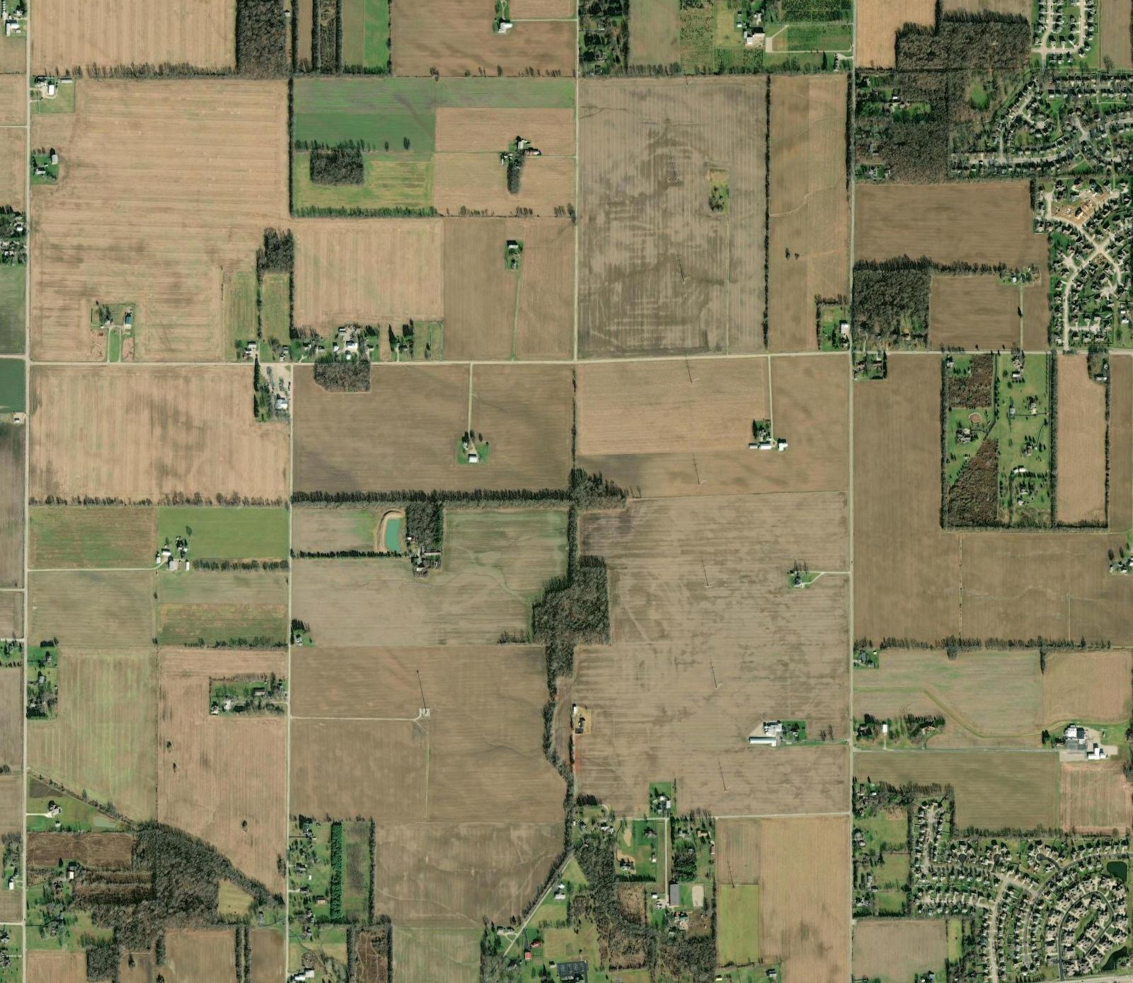
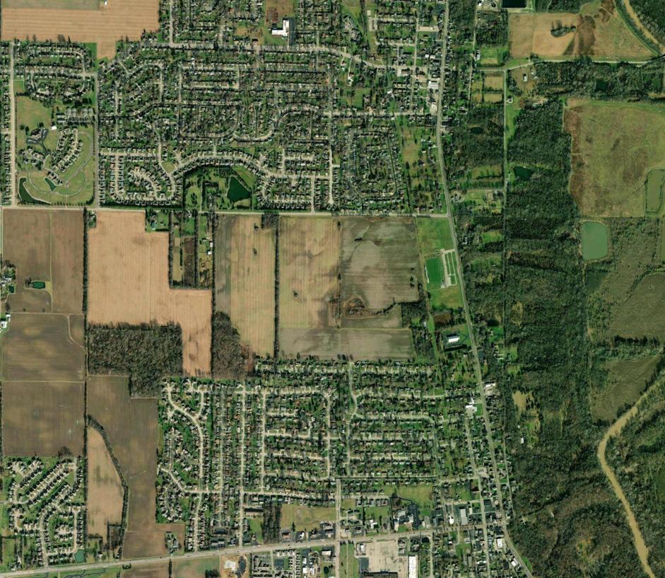
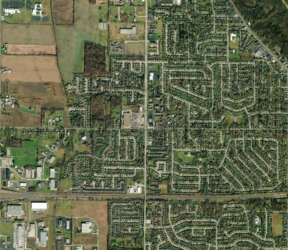
Location : Cincinnati, Ohio, USA
Year : 2024
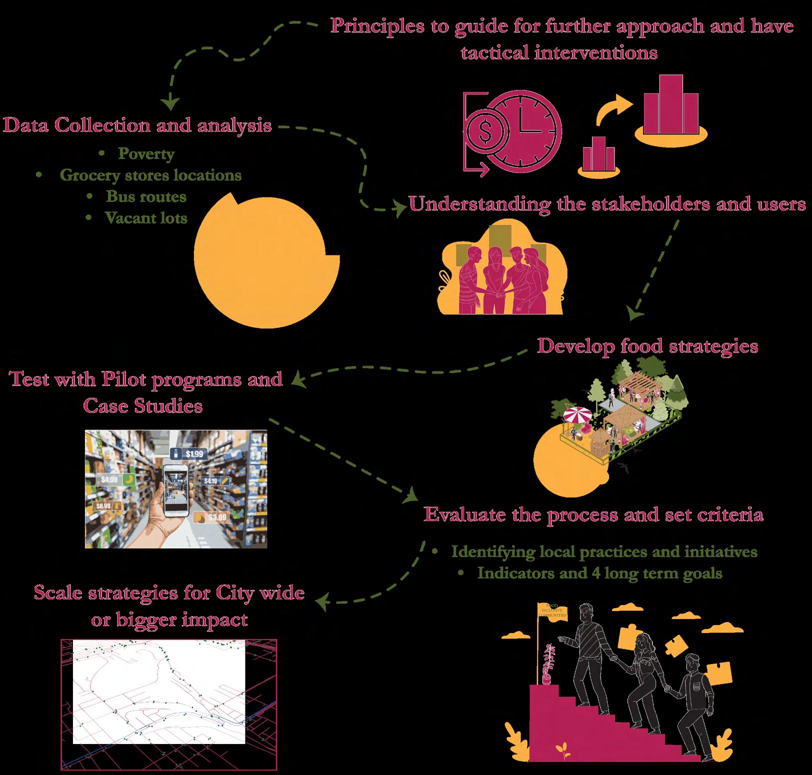
The challenge was to change attitudes toward Climate action in Cincinnati by utilizing Tactical Urbanism as a catalyst. This approach focuses on creating long-term impacts through shortterm, low-cost, grassroots pilot programs or temporary interventions.
Guided by the objectives outlined in the Green Cincinnati Plan adpoted in 2023, the challenge involves validating these goals by proposing strategies for small-scale projects that test innovative ideas, engage the community, and inform actionable changes.
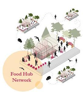
VISION FOR 2050
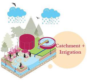
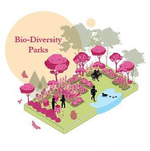
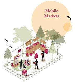
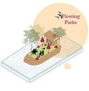
“Every Citizen of Cincinnat has access to nutrient dense , locally produced food via a network of food hubs, which also acts to mitigate heat and flooding.”
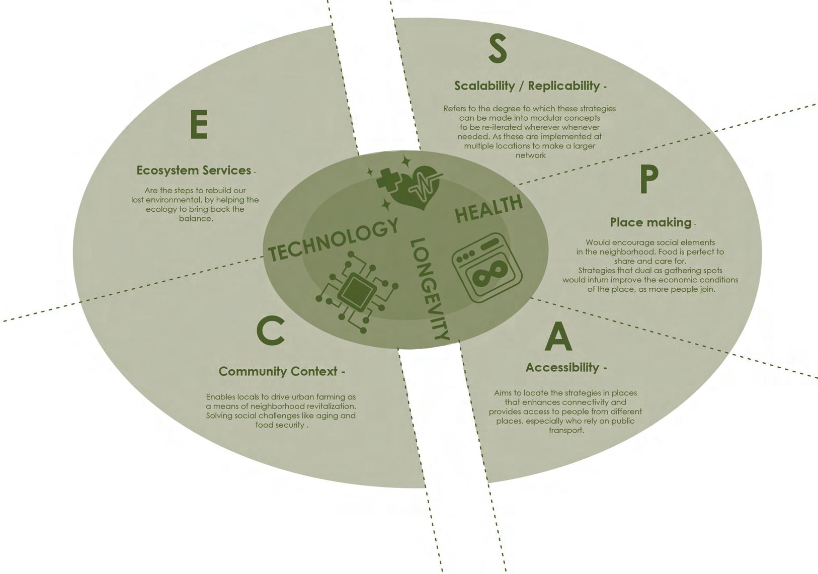
Approach : The three guiding principles
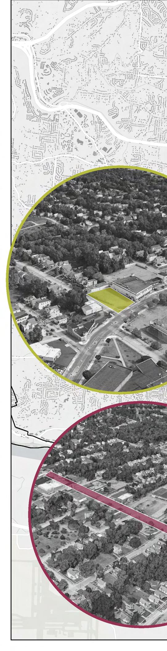
City of Cincinnati Percent Population Low Access (LILA) : 31.6%
Camp Washington
Percent Population Low Access (LILA) : 45 %
Median Income : $32 ,000
Area taxed as vacant Acres
Low Price Hill + Queensgate
East Price Hill
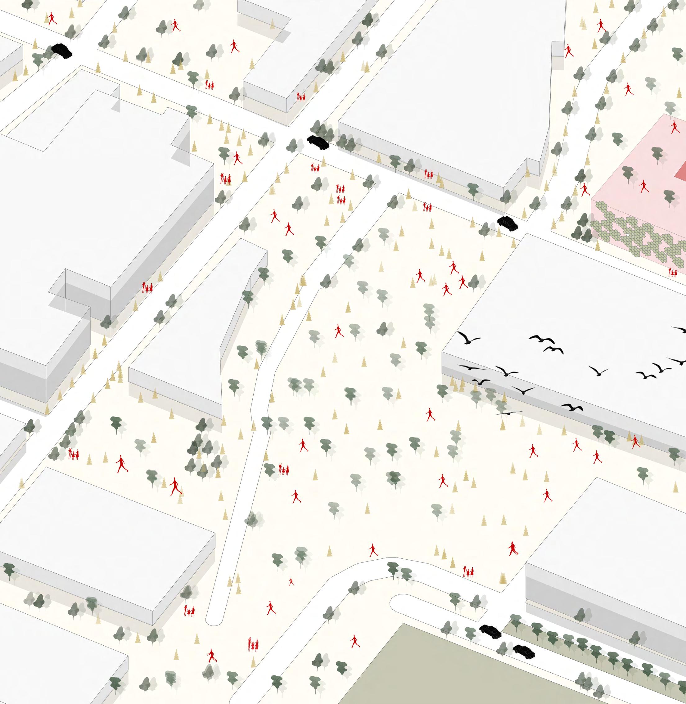
STRATEGIES
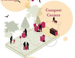
CATALOG
SCALABILITY
PLACE MAKING
ACCESSIBIILITY
COMMUNITY CONTEXT

ECOSYSTEM SERVICES
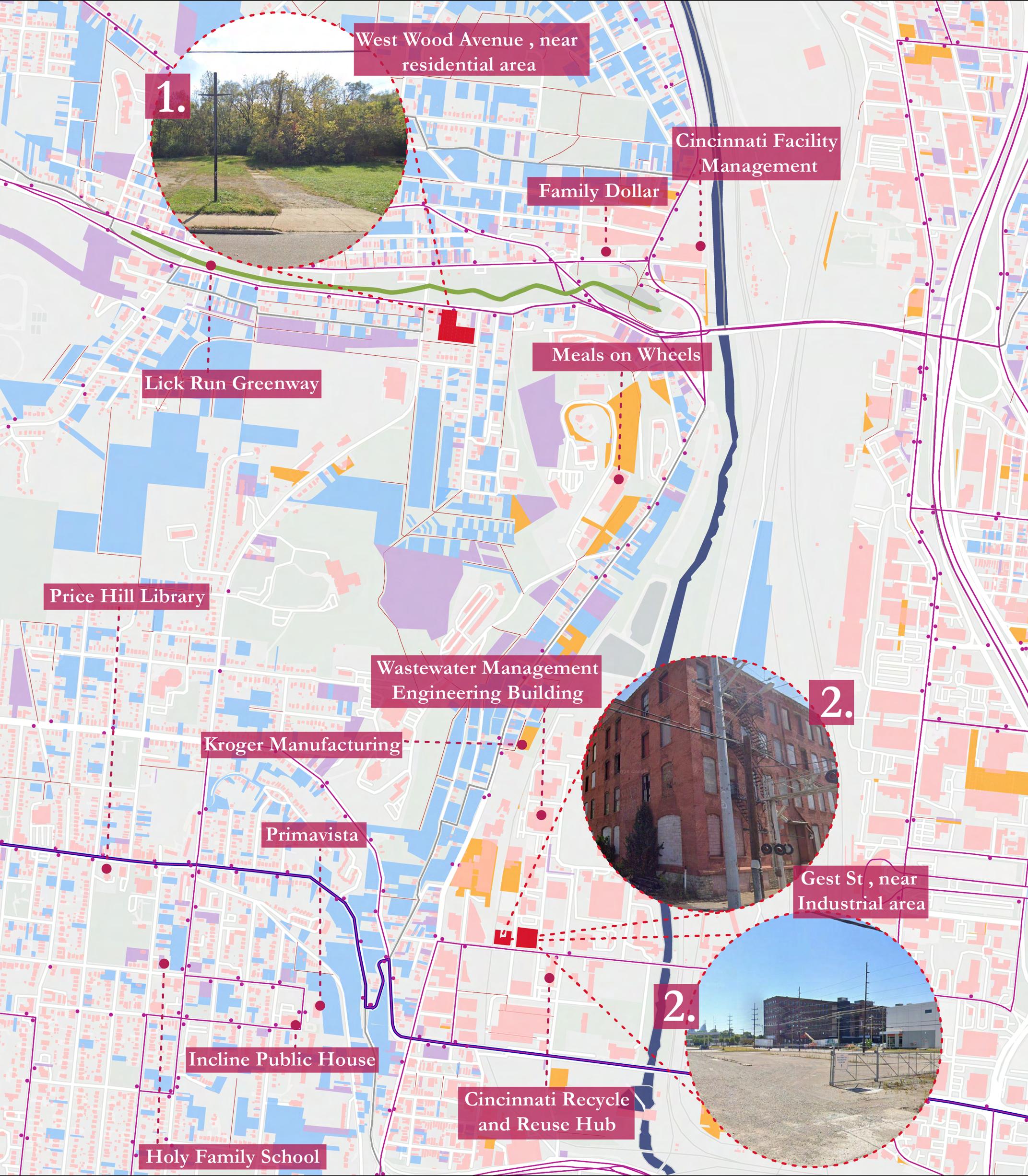
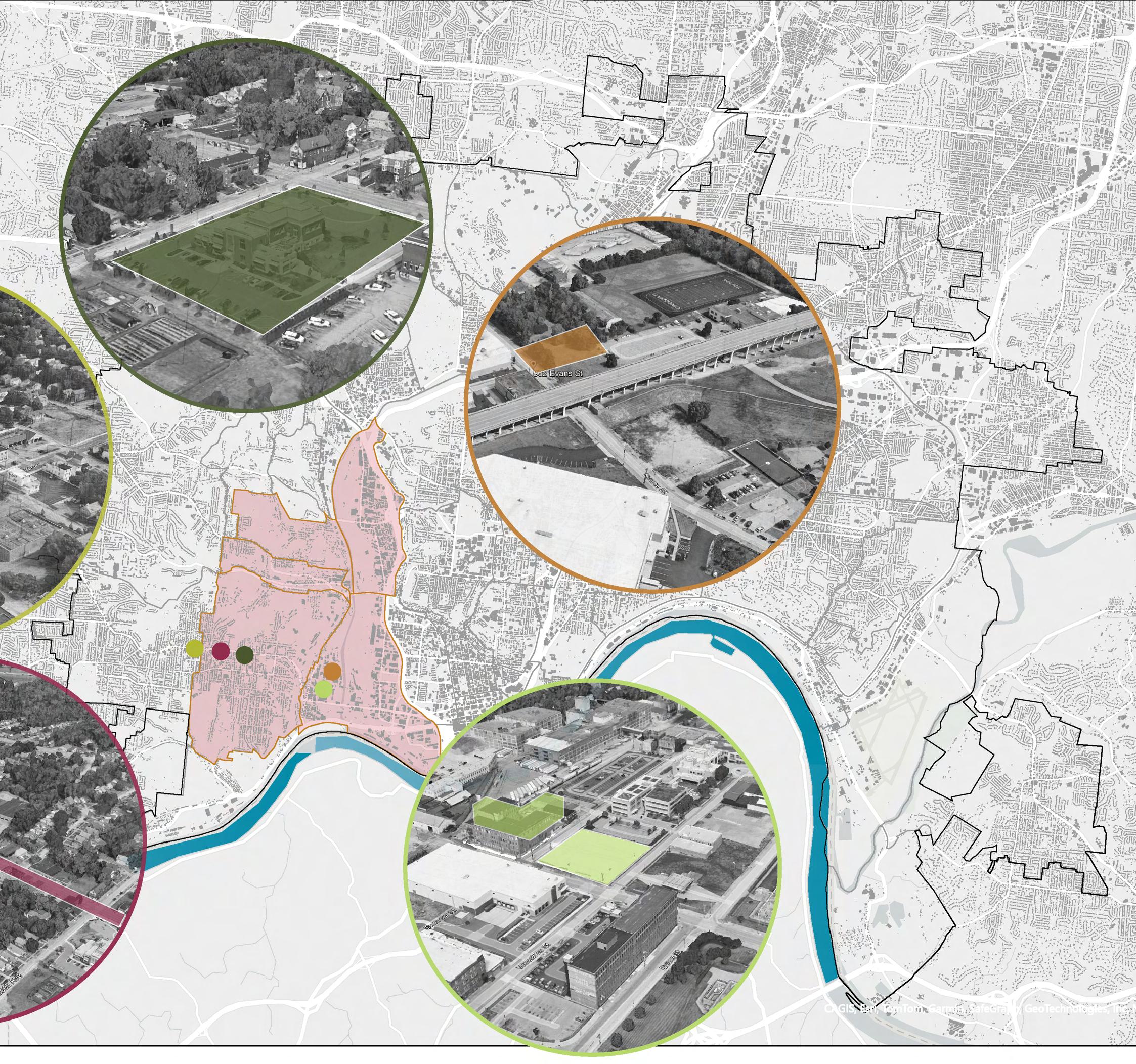
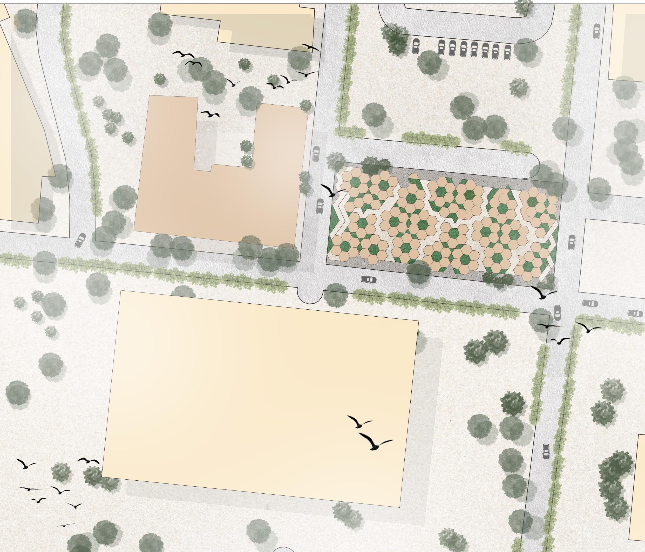
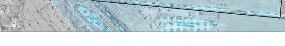
Site Selection Map
LEGEND
Vacant Commercial lots -
Vacant Residential lots -
Vacant Industrial lots -
Two Sites -
Existing Bus Routes -
RoutesBus stops -
Existing properties -
Lick Run greenwayMill Creek -
BRT
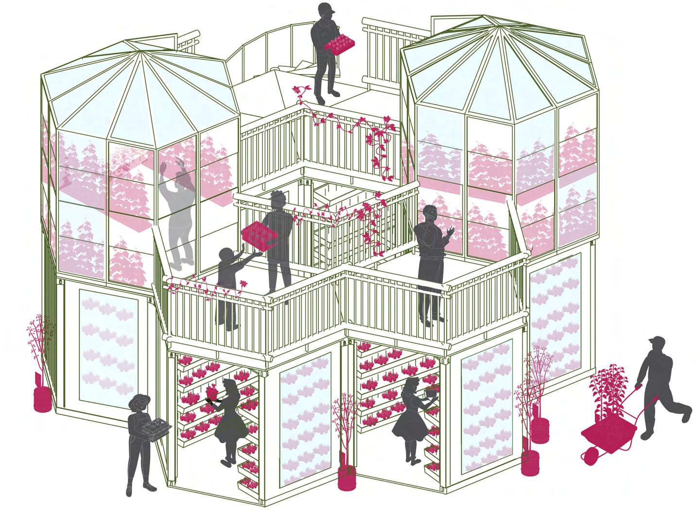
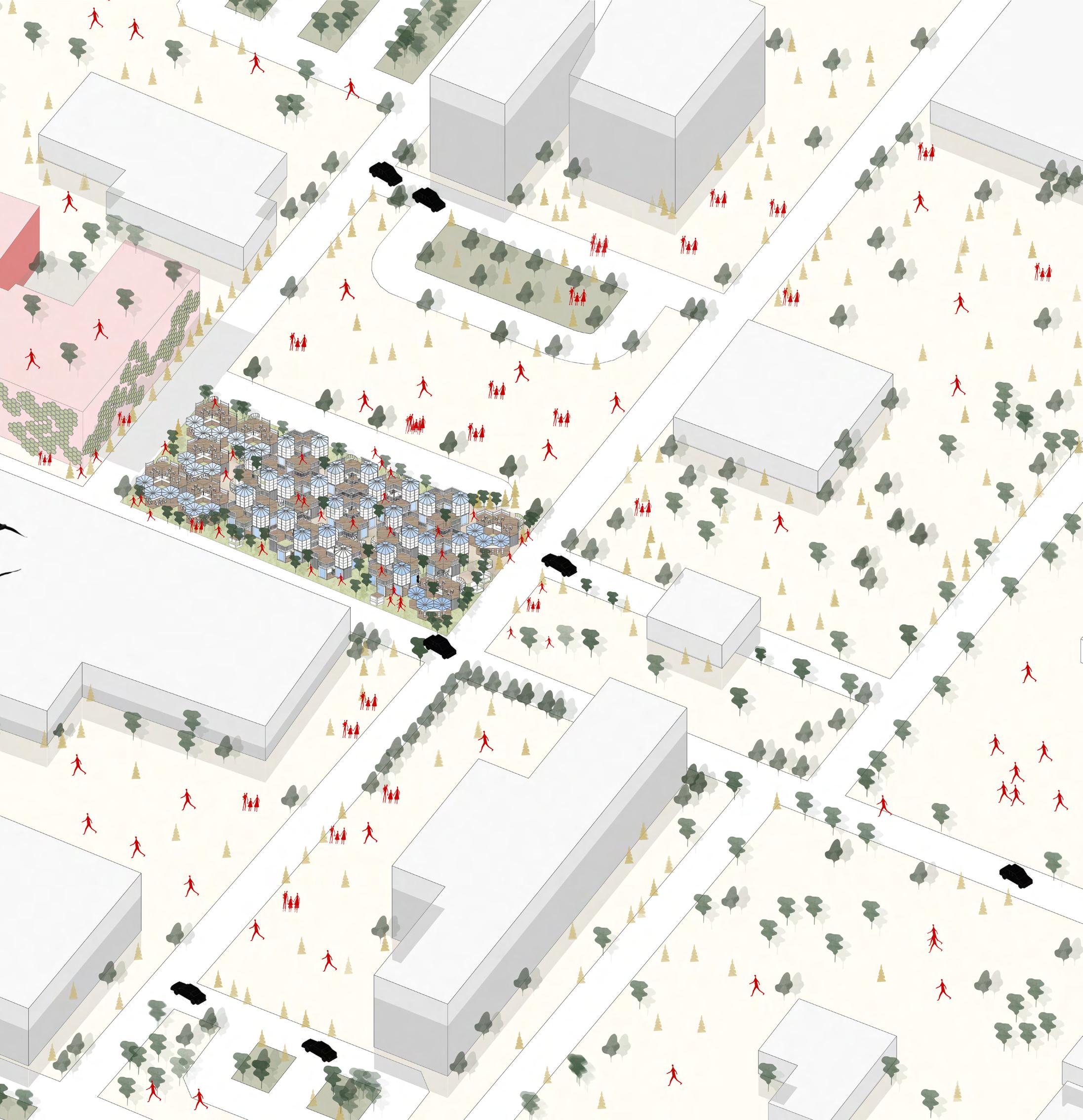
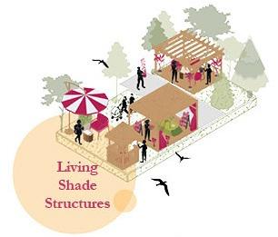
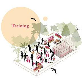
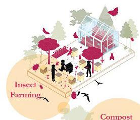
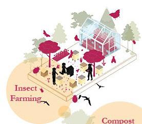
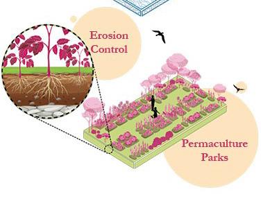
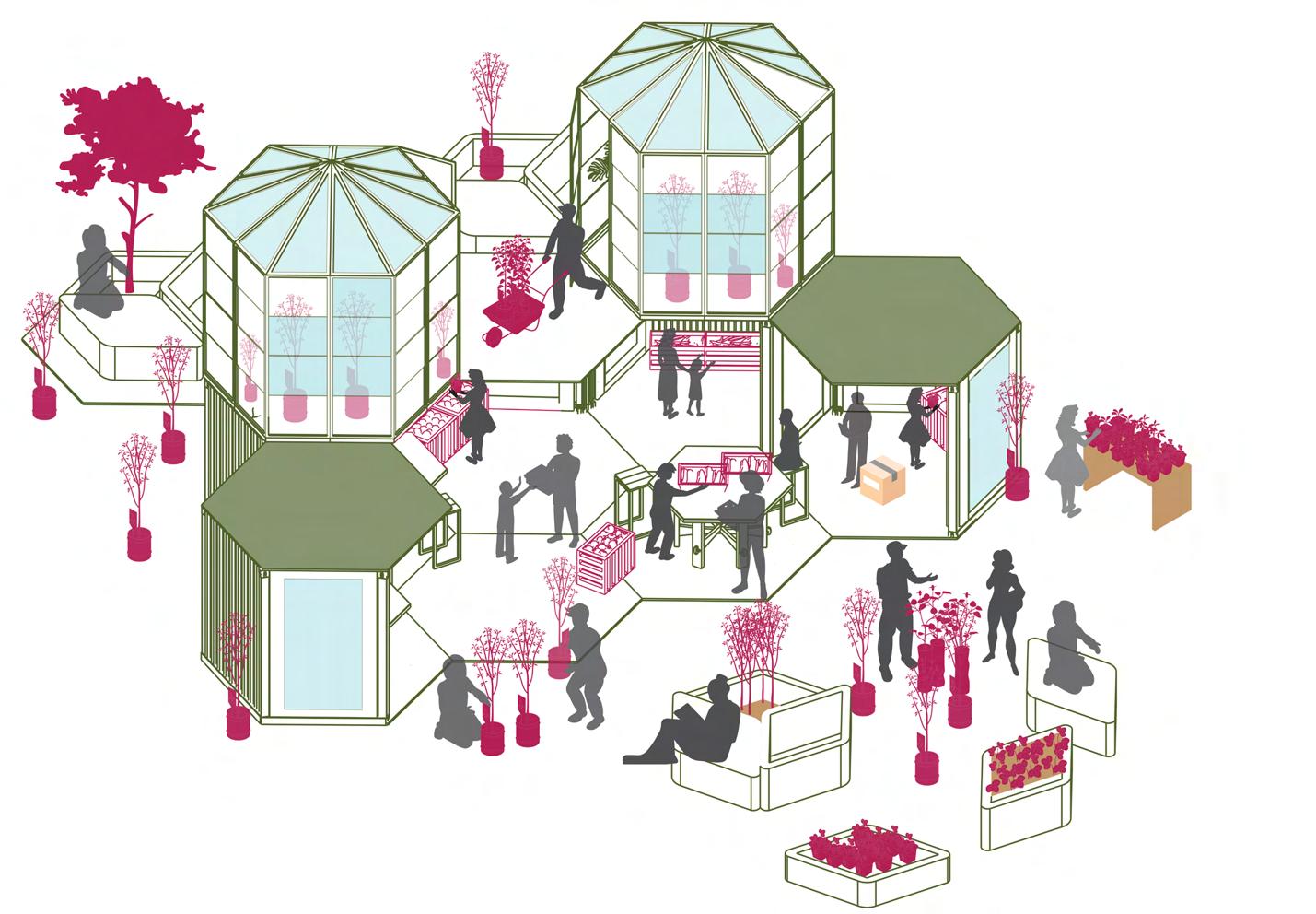
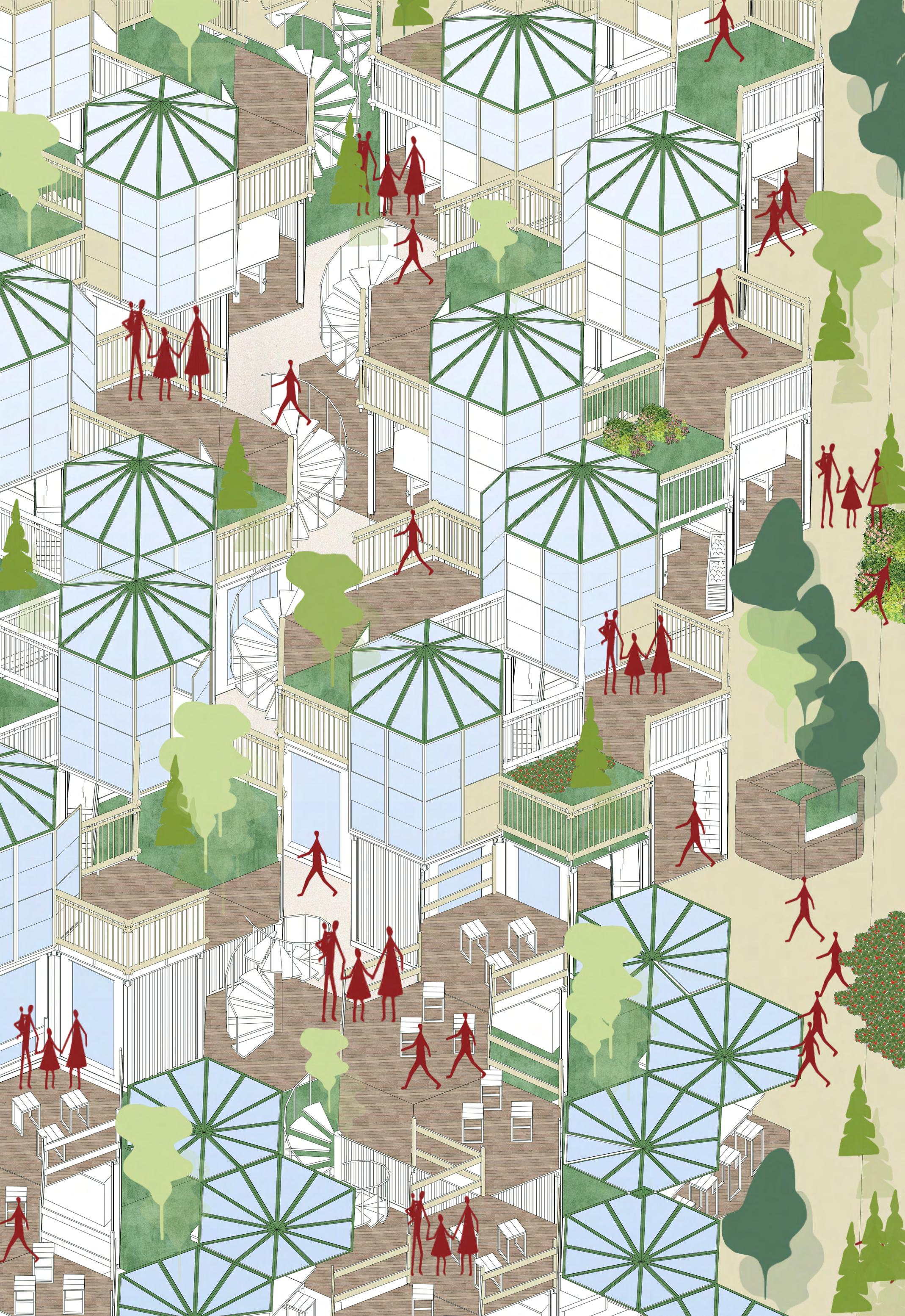
HEXAGONAL POD USED FOR ORCHARDS AND FARMING
HEXAGONAL POD USED FOR ORCHARDS AND FOR HYDROPONIC FARMING INSIDE IN CONTROLLED ENVIRONMENT

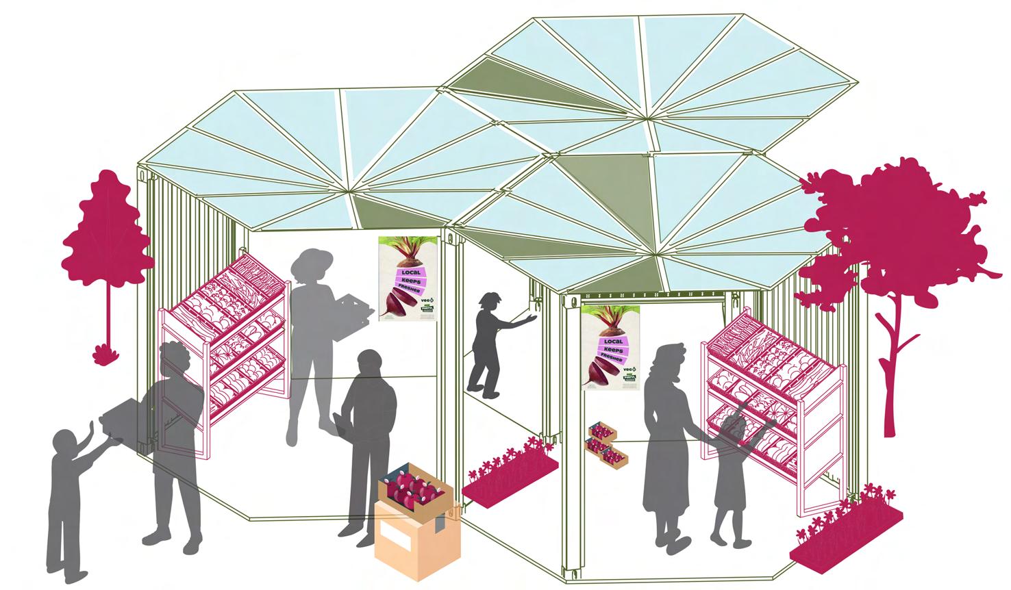
MARKET SPACES CONNECTED WITH EACH OTHER HAVING GREEN ROOFS AND DIGITAL PAYMENT SYSTEMS.
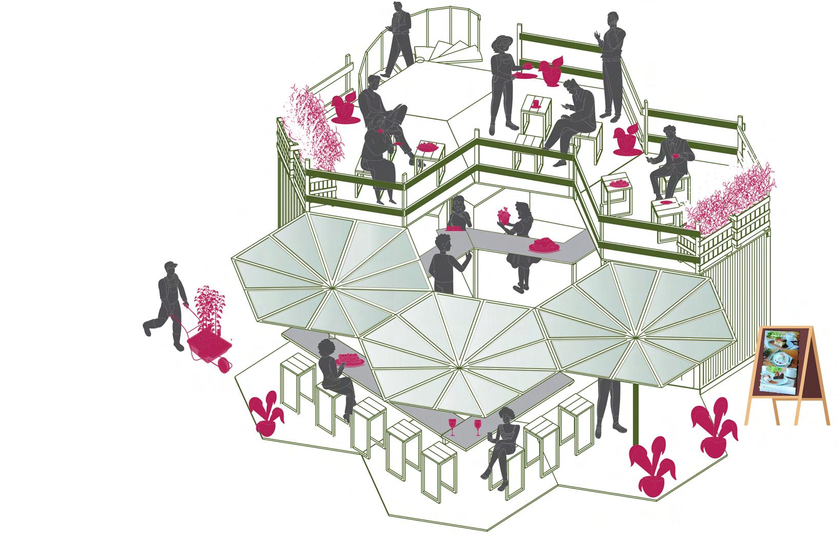
RESTAURANT AND CAFES WITH SOCIAL SPACES INTEGRATED AND HAVING DIGITAL SCREENS TO SHOWCASE THE MENU
RESTAURANT AND CAFES WITH SOCIAL SPACES INTEGRATED AND HAVING DIGITAL SCREENS TO SHOWCASE THE MENU
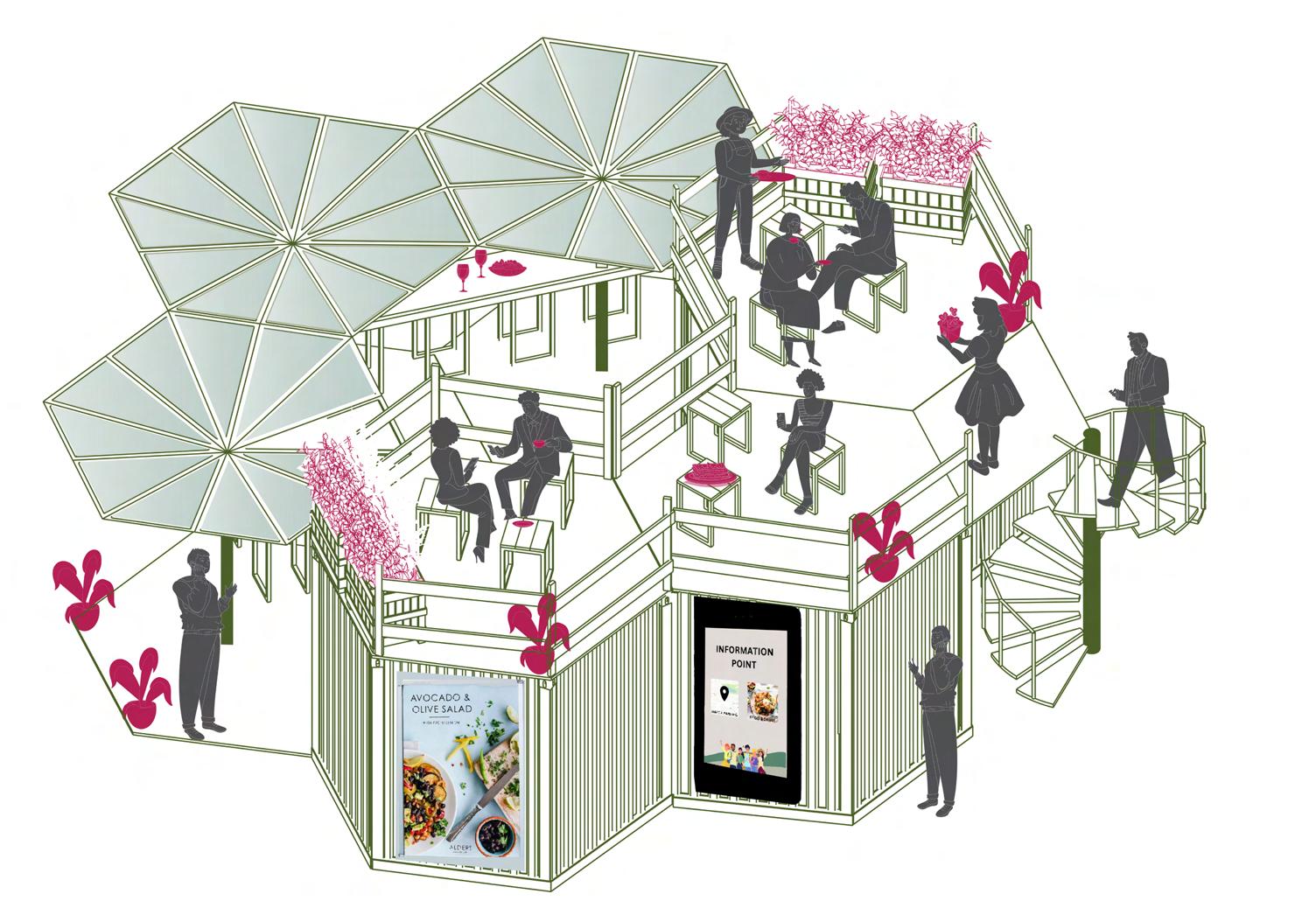
WORKSHOP PODS WITH GREENHOUSE ON THE TOP AND PLANTING WITH SITTING POD
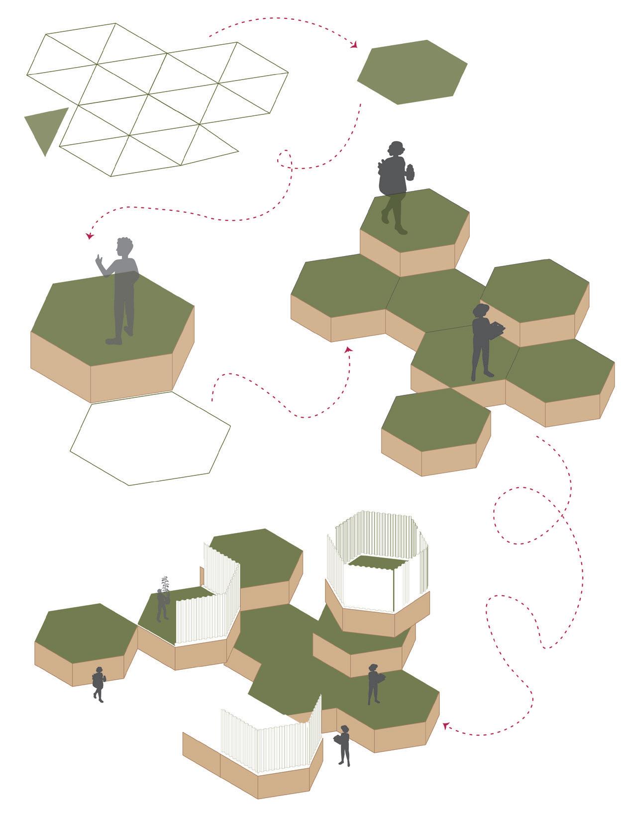
Triangular grid is flexible and adaptable.
GRID : Different polygons can be formed that are scalable.
Provides strutural stability and makes hexagonal pods more robust
Inspired from Honeycomb which maximises light and increases energy efficiency. Natural approach towards formation of hexagons.
SITE PLAN :
Metal corrugated panel as walls
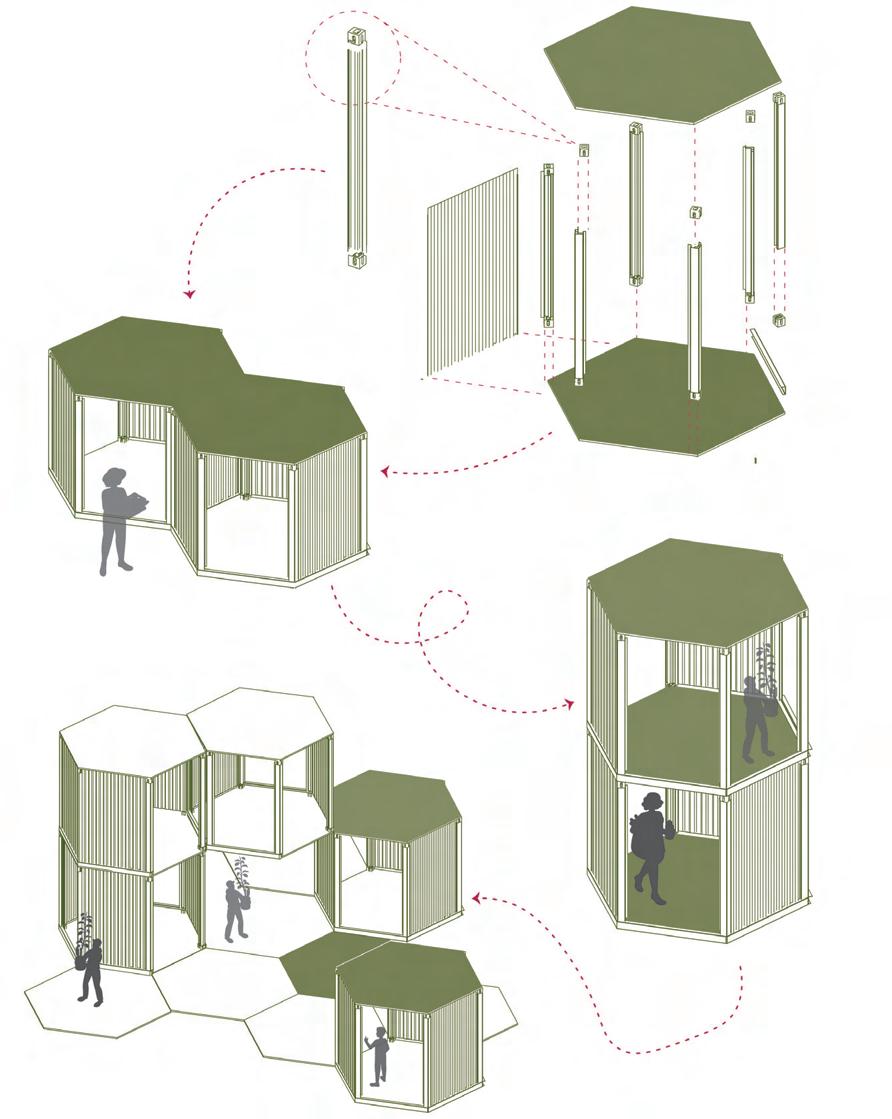
Metal bolts used as connectors for structural elements
Horizontal placement of pods with steel beams
Stacked pods used as functional spaces on sites
Steel beams used to build the structural layout and supporting elements
Wooden floor with steel beams
Vertical stacking with bolts acts as connection betweeen two structural support beams
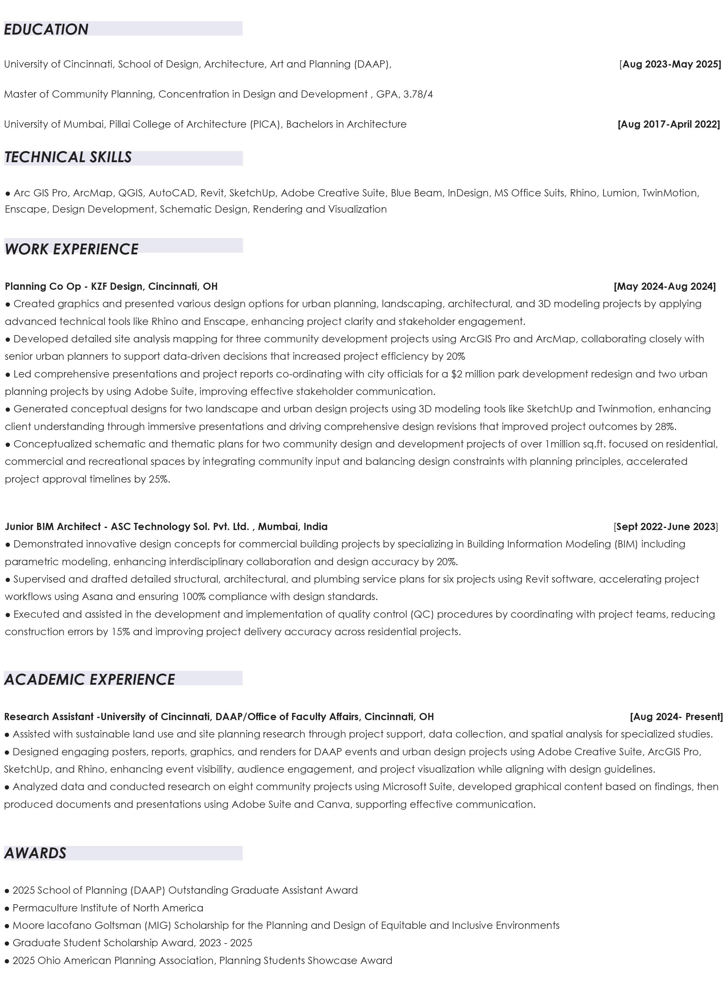
During the summer of 2024, I had the incredible opportunity to work as a planning intern at KZF Design, a multidisciplinary firm based in Cincinnati, Ohio. This experience was very amazing as I contributed to a diverse range of projects spanning planning, architecture, landscape architecture, and MEP (mechanical, electrical, and plumbing) fields. It provided me with valuable practical knowledge and helped me in my professional growth.
Although confidentiality prevents me from sharing all details, I can showcase a few images from the projects I contributed to during my internship.
//Co - Op Work Experience

Type : Planning and Urban Design
Location : Cincinnati, Ohio, USA
Year : 2024
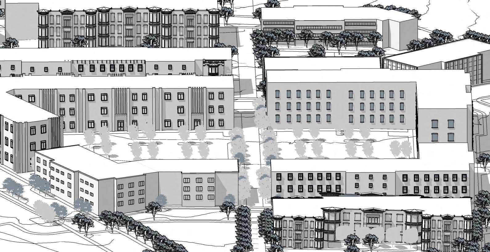
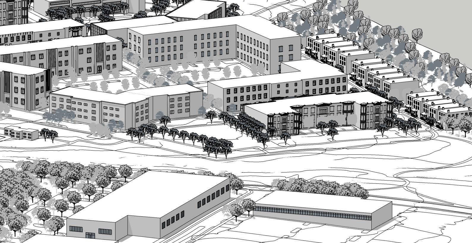
02
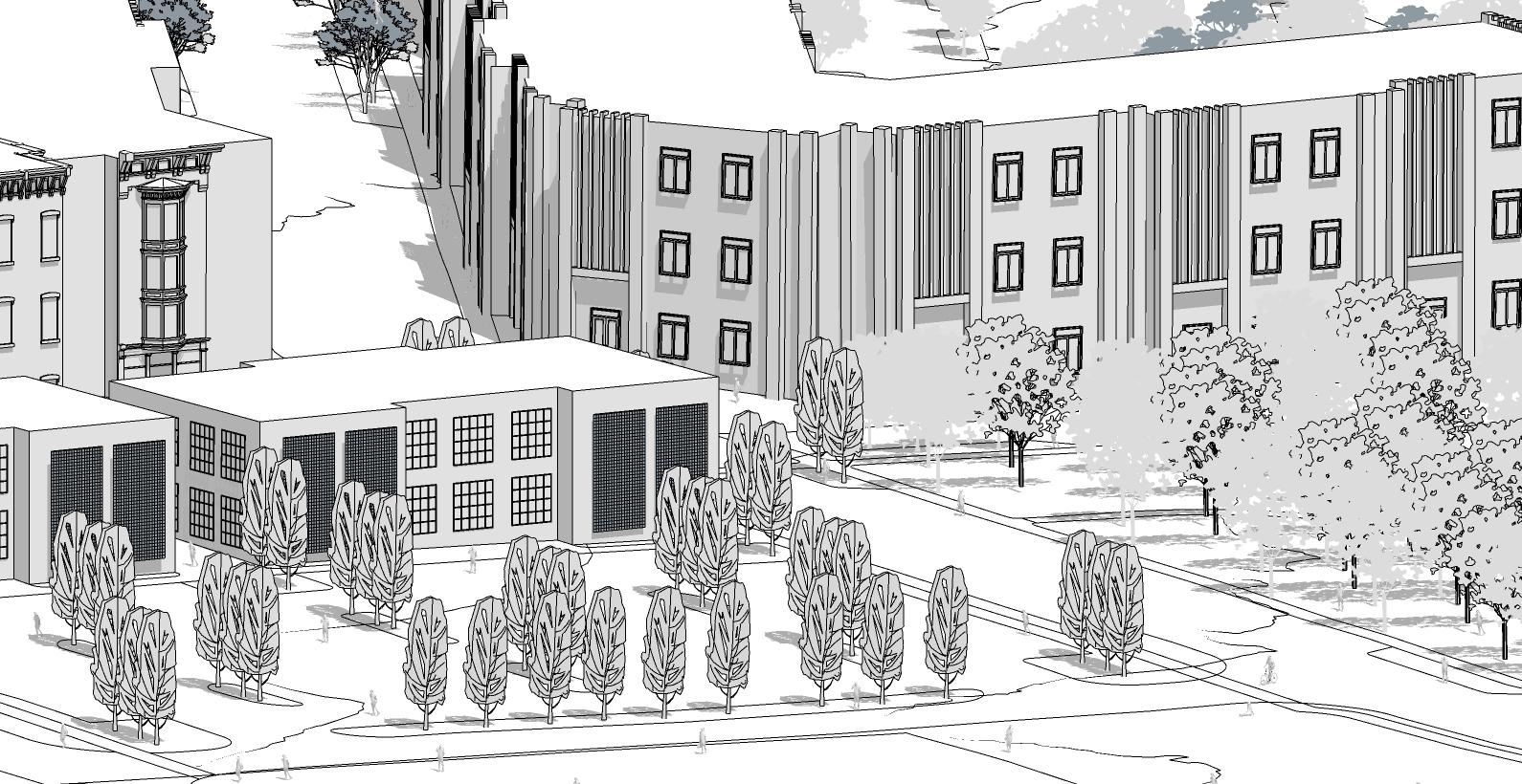
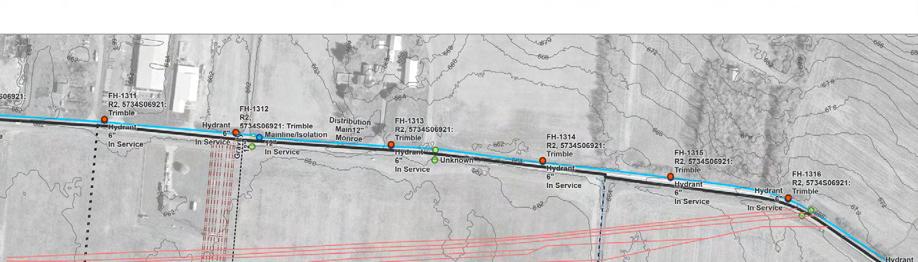
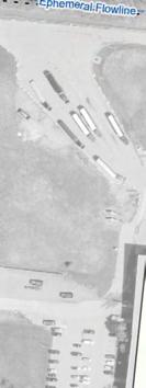
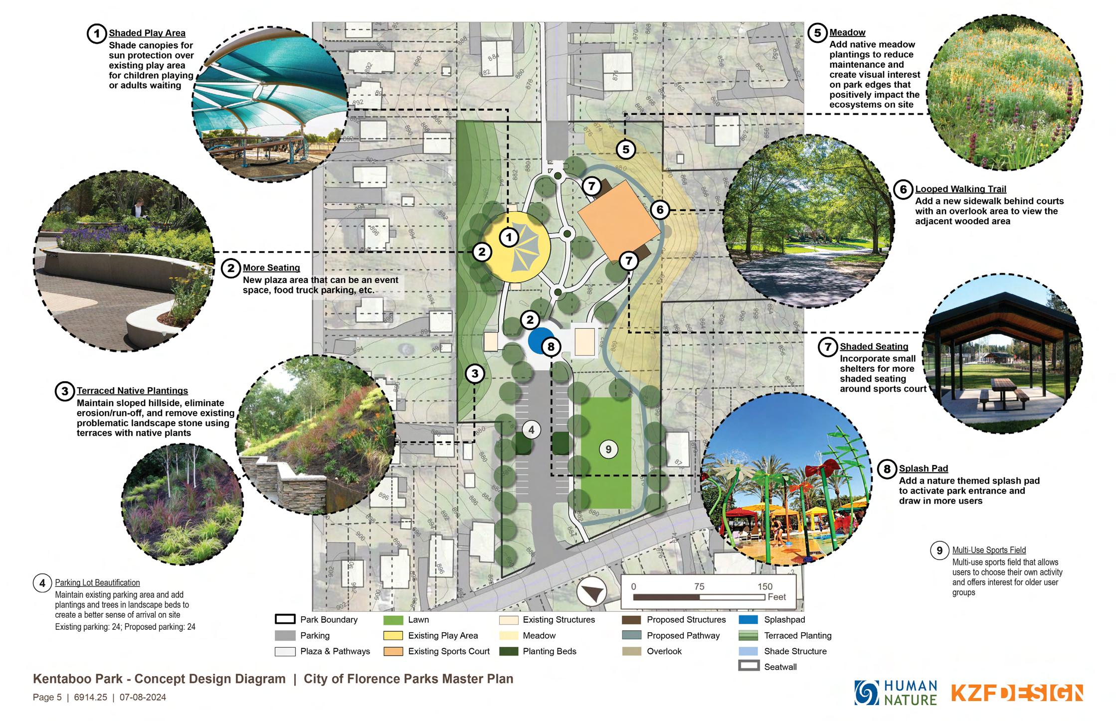
3D View of a site in Monroe
3D View of a site in Monroe
3D View of a site in Monroe

Existing

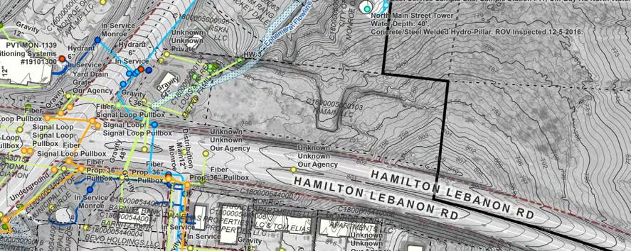
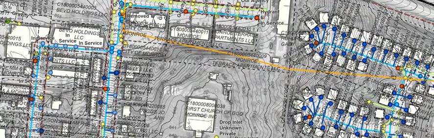
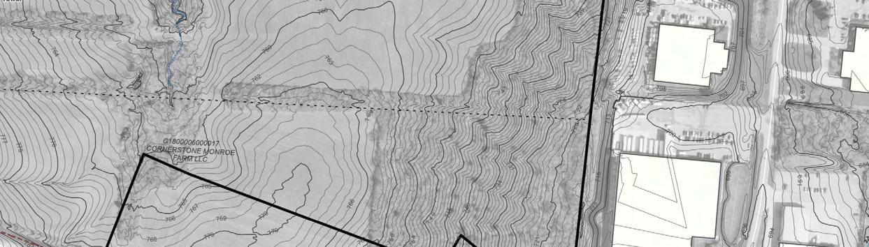
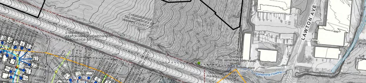
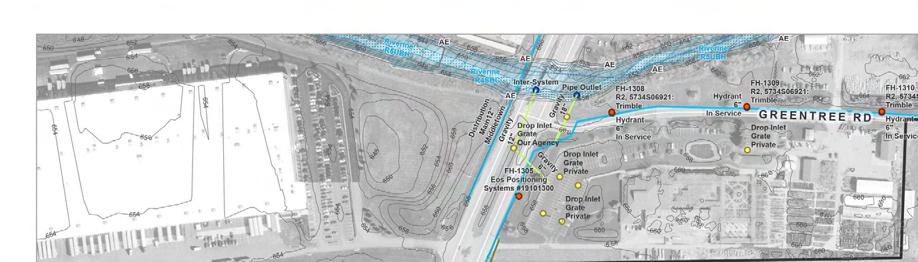
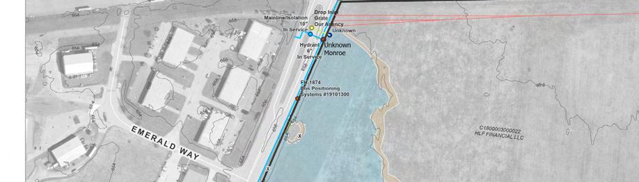
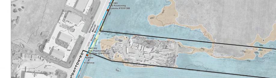
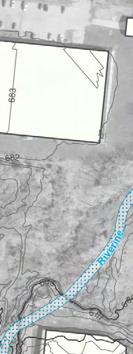
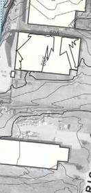
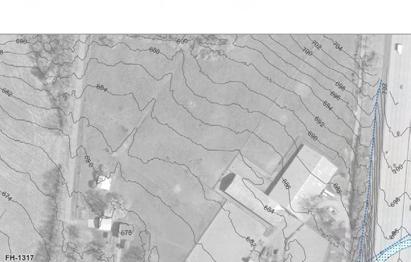
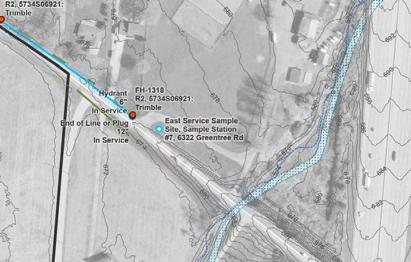
Frick/Greentree Site | Diagramming Map

3D Modeling: Built detailed 3D models and rendered them to visualize designs within their respective sites.
2/18/25, 9:44 PM
Graphics Creation: Designed various graphics for zoning codes and other planning and landscape architecture projects.
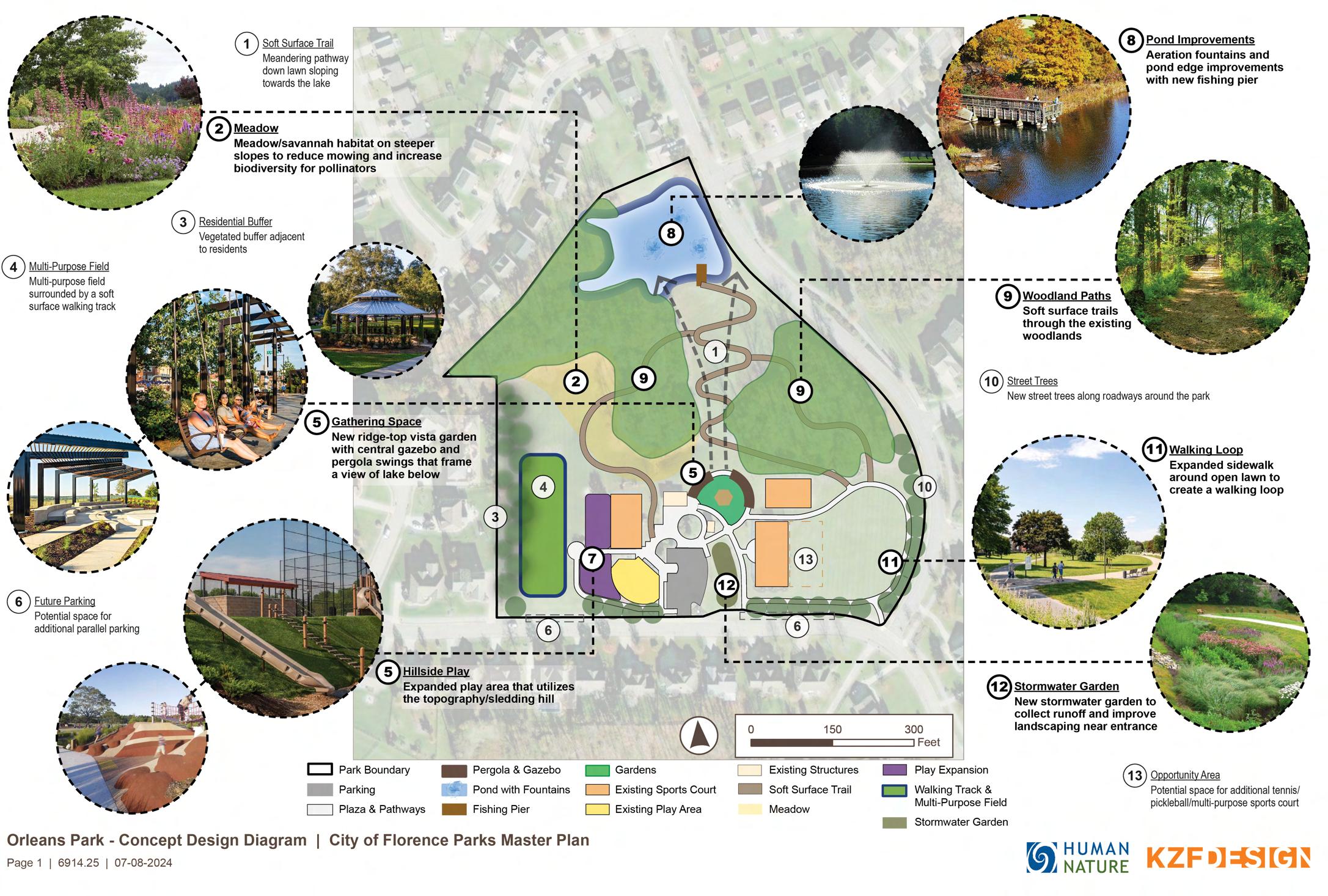
6914.25 Florence PMP - Concept Diagrams_Presentation_rev15.png


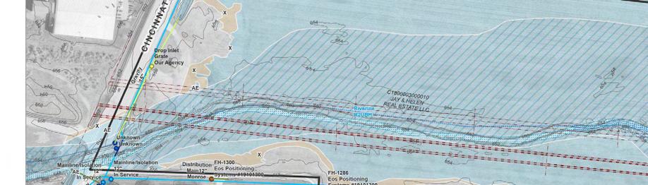
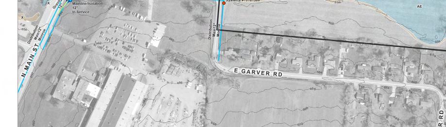
Site Context Map - Warner Village
Warner Village | Context Map
Sweet Potato Ridge Road
ENGLEWOOD
YMCA OF GREATER DAYTON


Schematic Plans and Concepts: Developed initial design concepts based on site context and created schematic plans to reflect these ideas.


InterState 70
Research-Based Work: Conducted research and background studies on policies relevant to specific planning projects.
“Creating Sustainable cities through Pedestrian Urbanism”
Type : Book Publication
Name : Creating Sustainable cities through Pedestrian Urbanism by Hyesun Jeong
Location : Cincinnati, Ohio, USA
Year : 2024-25
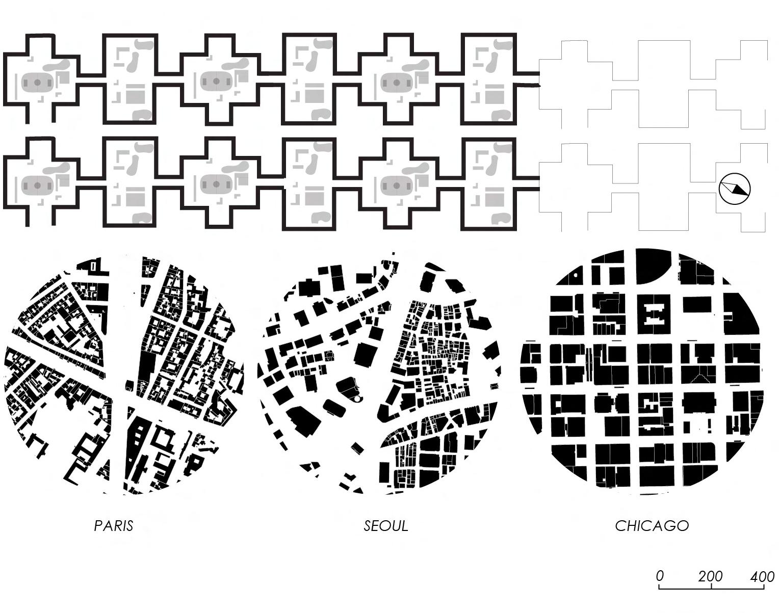
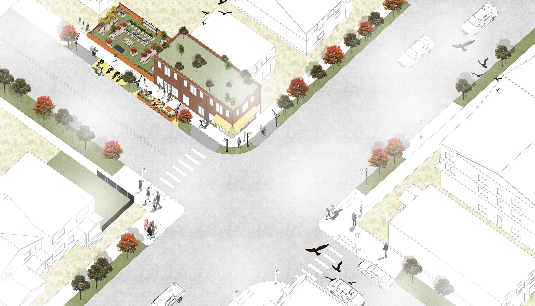
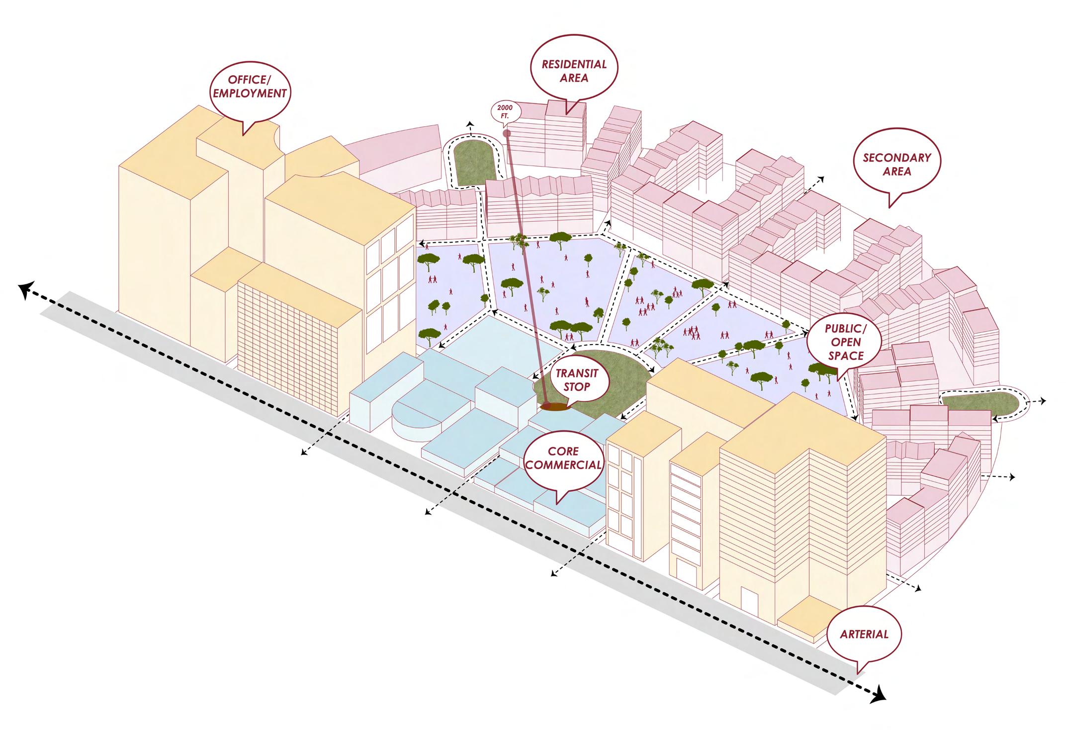
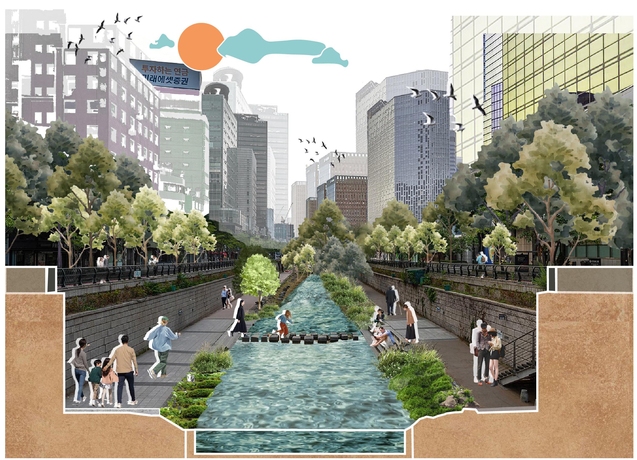
I created Urban Design research and visualization work during my amazing graduate assistantship with prof. Hyseun Jeong for her book publication in the year 2024-25. This experience was very insightful as I contributed to a diverse range of graphics and research for her book “Creating Sustainable Cities Through Pedestrian Urbanism” looks at how cities around the world are redefining the connection between mobility, place, and community. Drawing on examples from across North America, Europe, and Asia, her book highlights the ongoing shift from car-focused planning to more people-centered urban design.
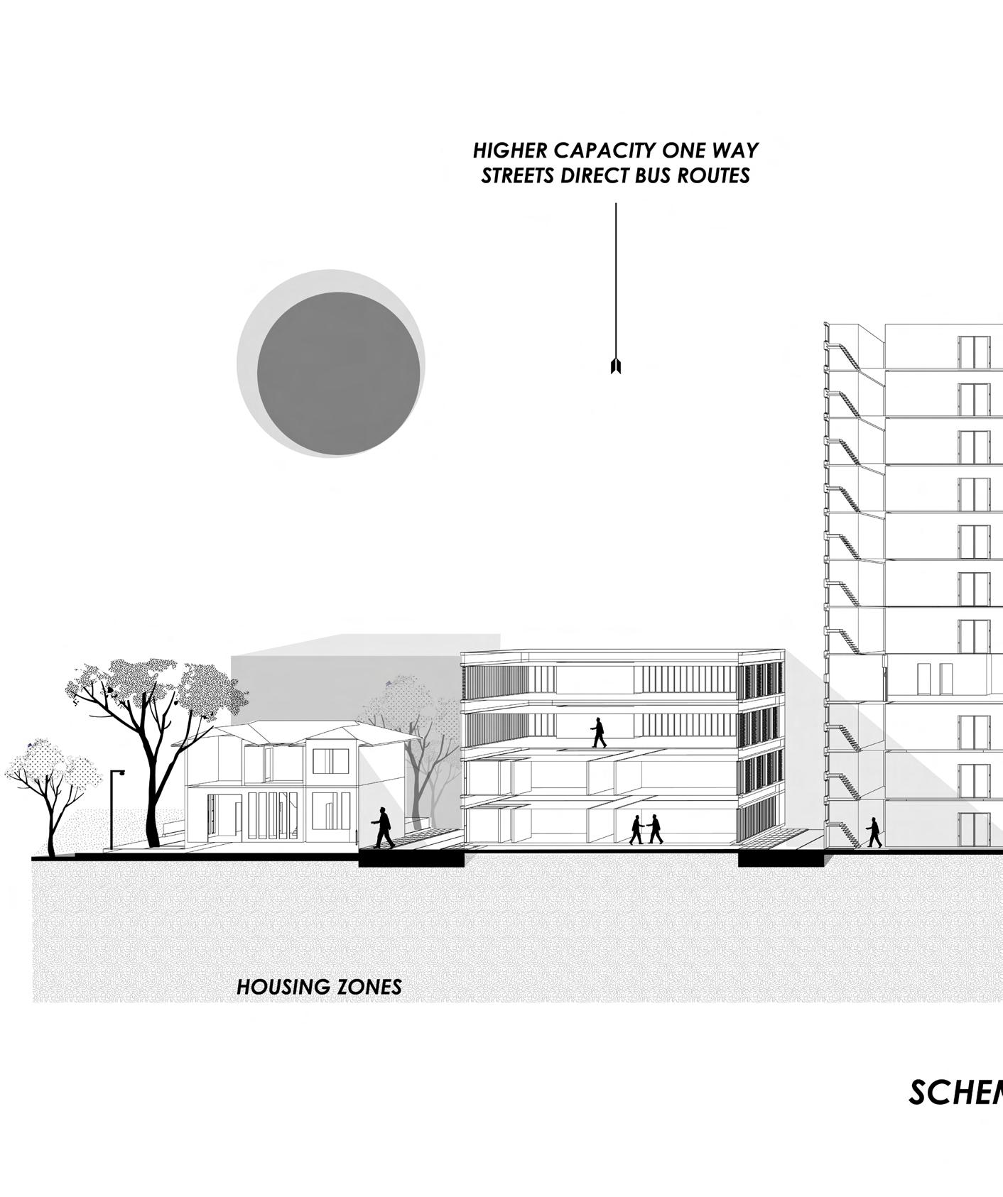
The diagrams illustrate pedestrian urbanism principles from the book at multiple scales, from block typologies (Paris, Seoul, Chicago) and transit-oriented district layouts to the transformation of an elevated freeway into a vibrant riverfront park, emphasizing shifts toward walkable, mixed-use, human-centered urban form.

Tactical Urbanism; Bottoms Up Neighbourhood Transformation in Chicago
City in a Garden, City in the Mountains: Singapore and Seoul’s Green Development
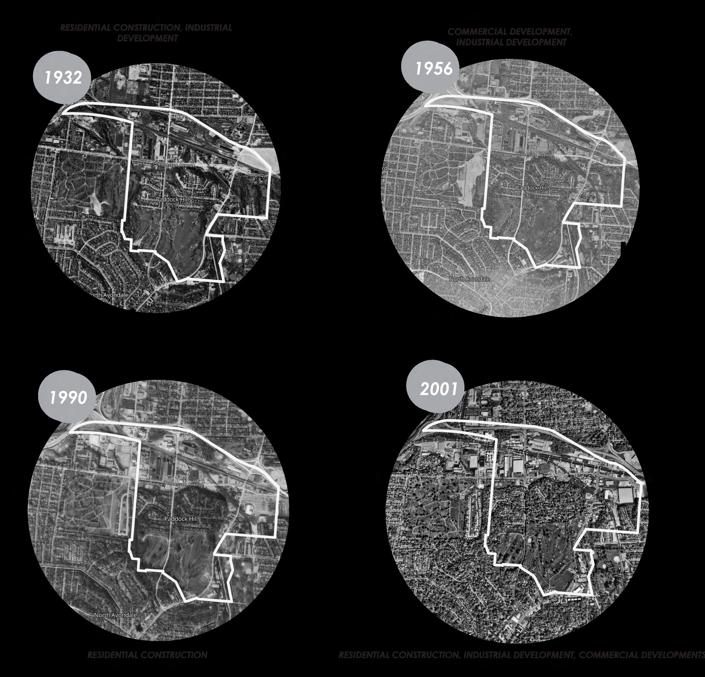
Historical evolution of Paddock Hills
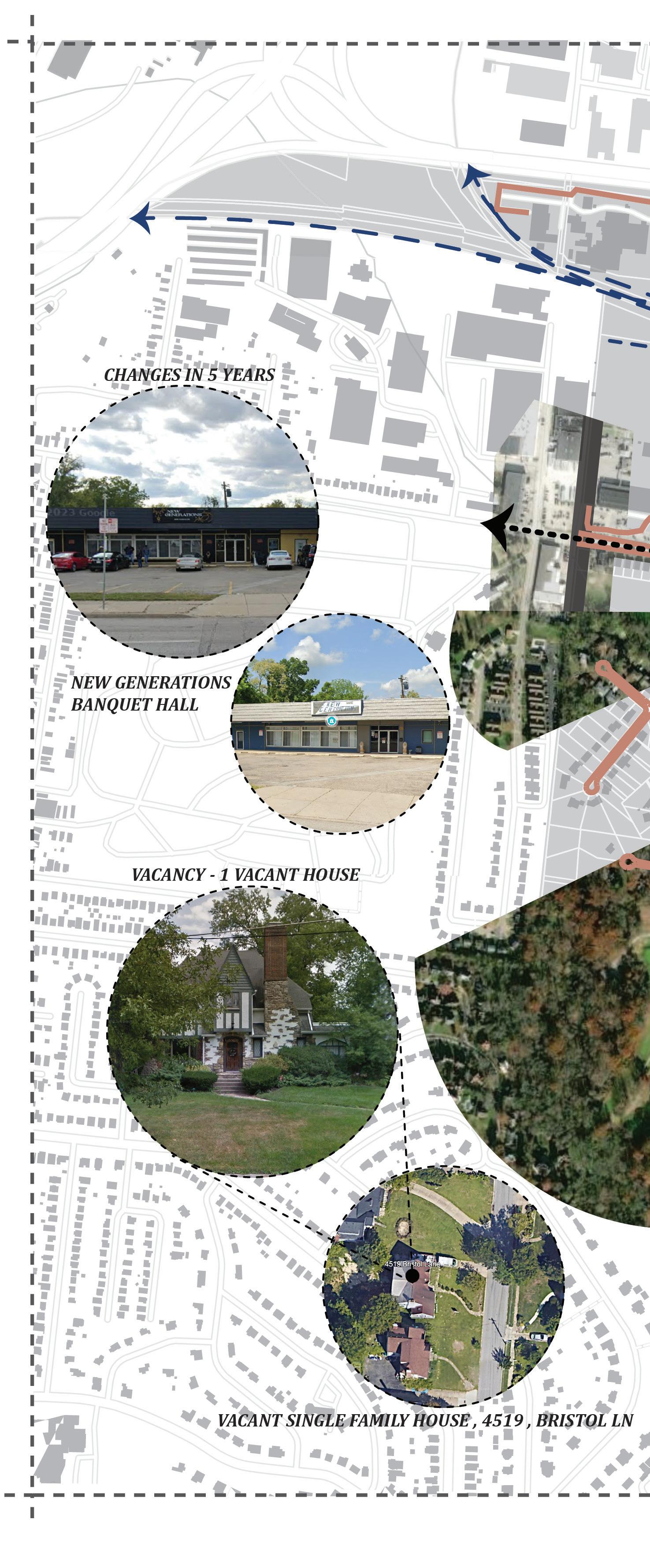
//Taking the scenic route ( To nowhere)
Studying Paddock Hills : A small and historically significant neighborhood
Type : Understanding the various forms of Planning
Name : Methods of Physical Planning
Location : Cincinnati, Ohio, USA
Year : Spring 2024
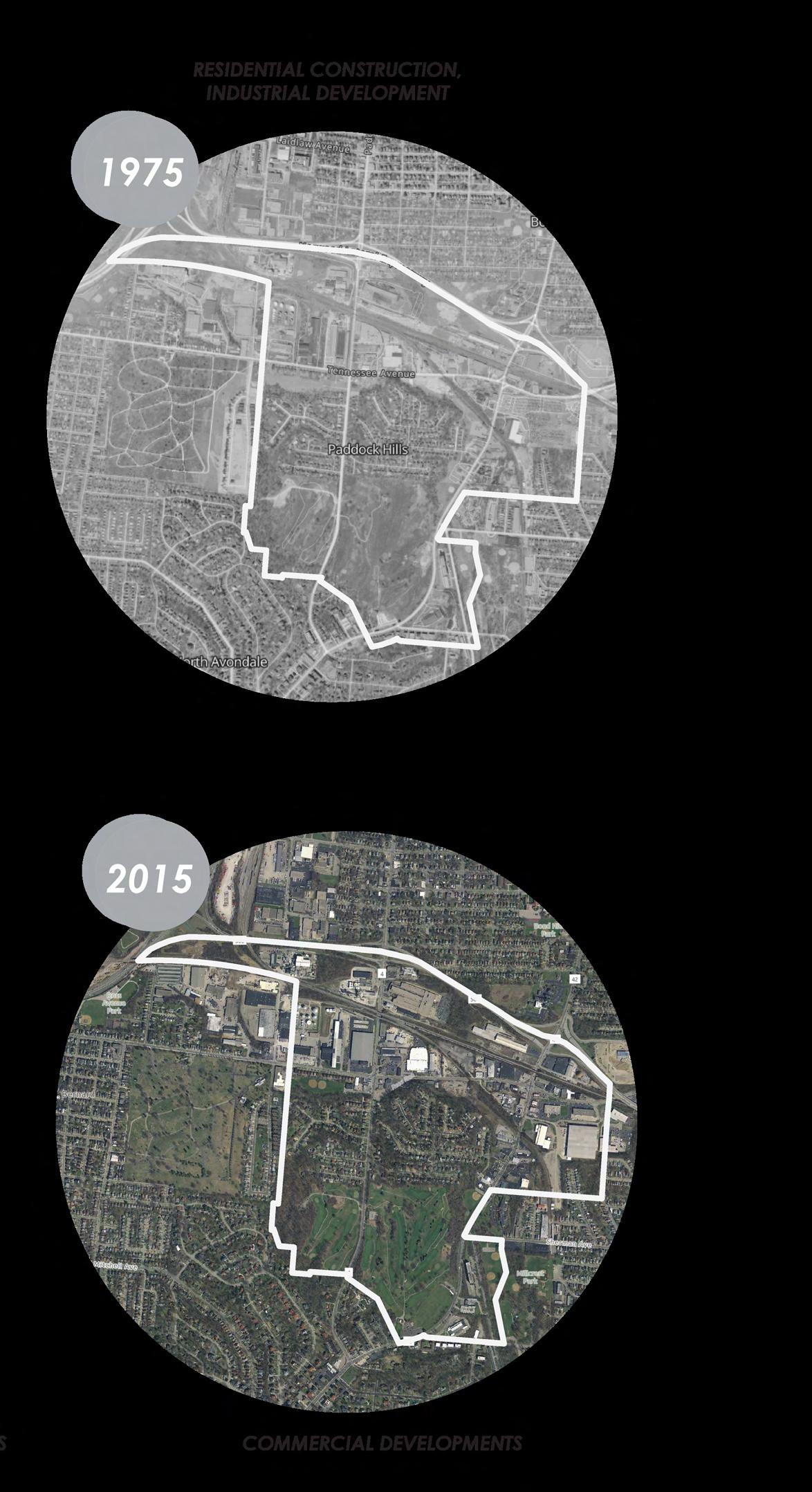
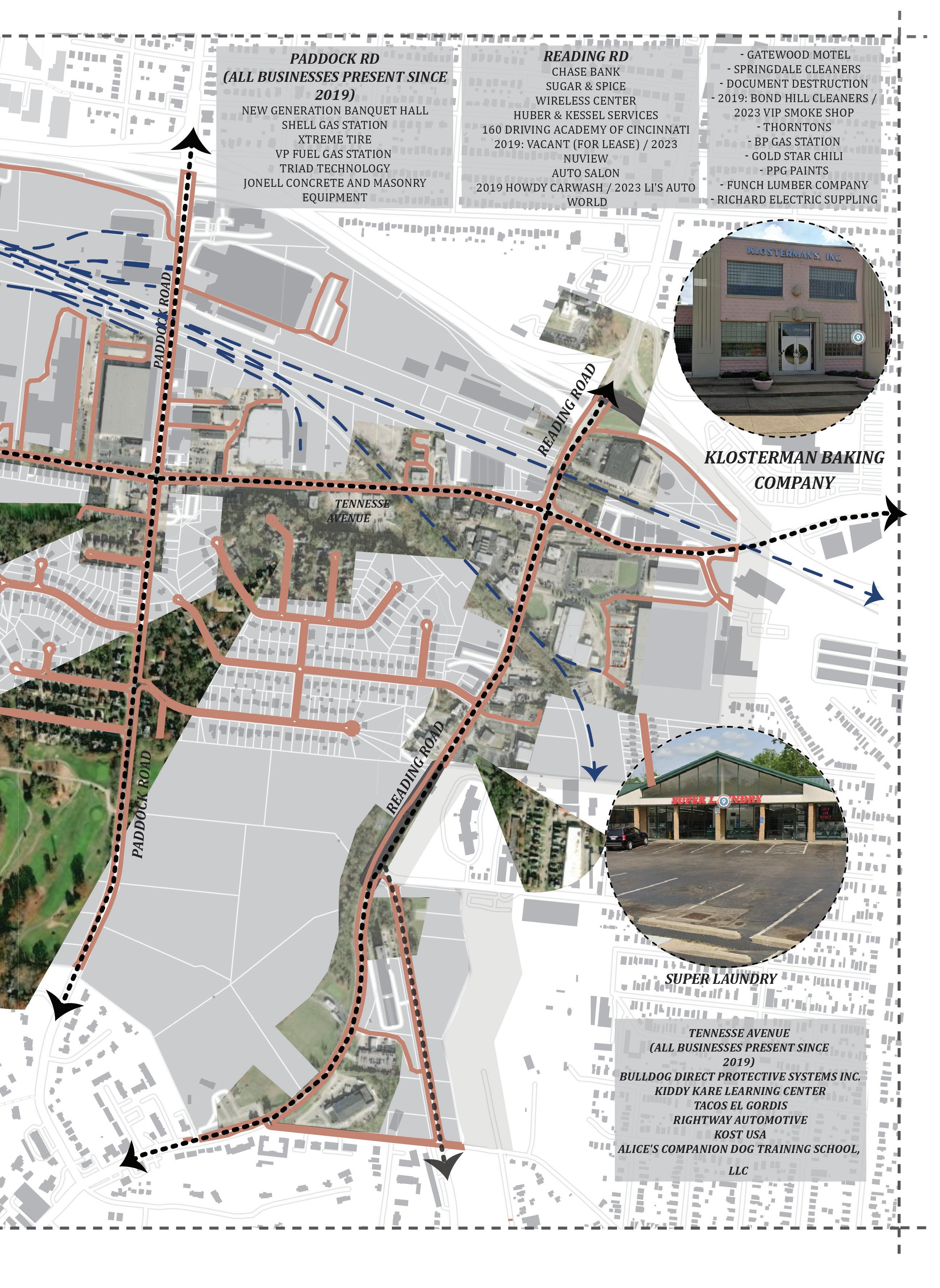
As roads and highways became the dominant force in the United States, the rise of the automobile focused neighborhoods began popping up across the country. Paddock Hills is one of those neighborhoods. The majority of the buildings that are present today were also present at the start of Paddock Hills. Most of the development that Paddock Hills has engaged in over the past few decades is simply developing the empty land that they have along Tennessee Ave / their central business district.
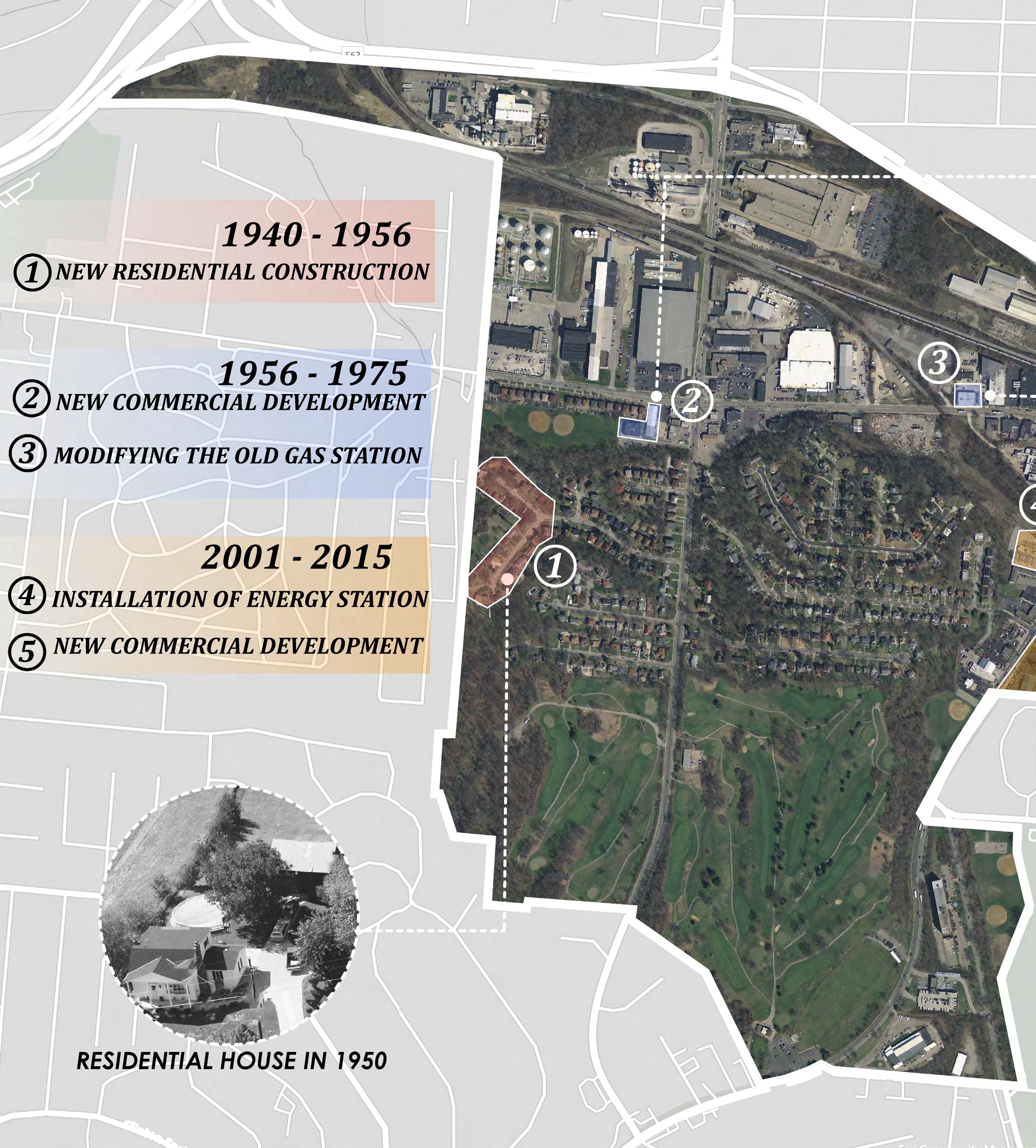
Historical evolution Analysis of Paddock Hills - Growth Pattern Diagram
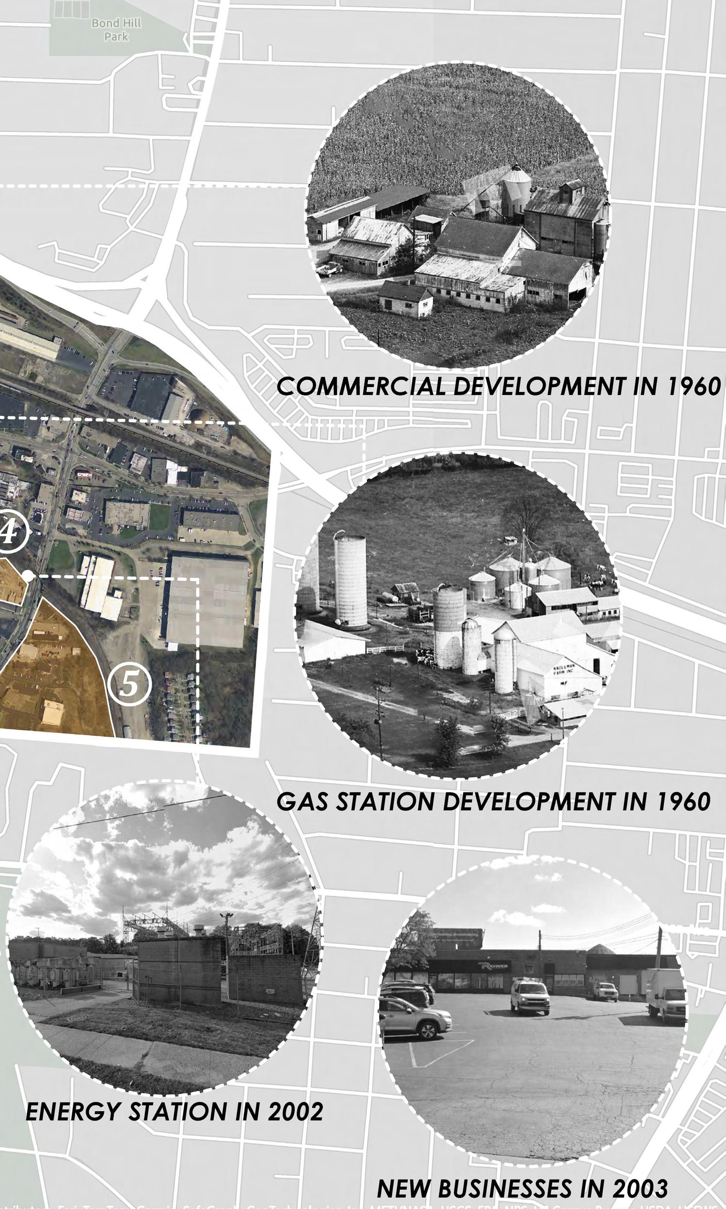
Paddock Hills has changed very little since its inception, the biggest development this area has seen was the development of Paddock Hills itself – going from rural farmland to a tight-knit community today.
Avon Field Golf Course is the biggest defining feature of the neighborhood. Developed in 1914, it is the oldest development in the neighborhood but also the oldest public golf course west of the Allegheny Mountains, making the golf course a staple in the community.
In recent years, Paddock Hills has seen almost no groundbreaking developments, only one developments has taken shape in the past couple of years, this development which is a senior living facility captures the essence of the neighborhood perfectly. This neighborhood is a very clam, safe, laidback environment to enjoy your days.
With virtually no vacant buildings anywhere in the neighborhood, there is little turnover in their business district or within their residential area. When businesses and people move into Paddock Hills they find themselves to be apart of a supportive and stable community, resulting in residents and business owners becoming longterm members of the neighborhood.
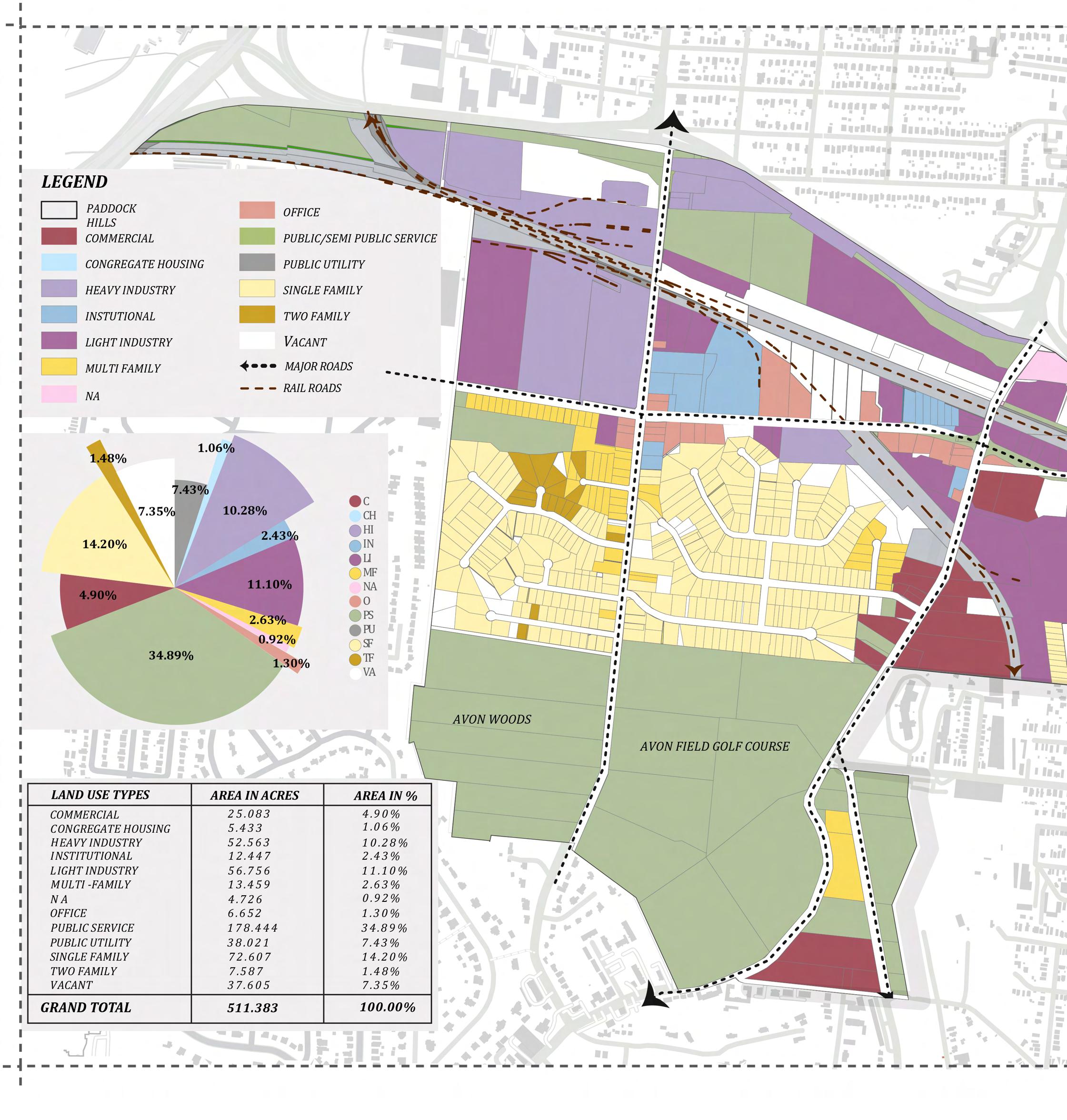
Existing land use map of Paddock Hills

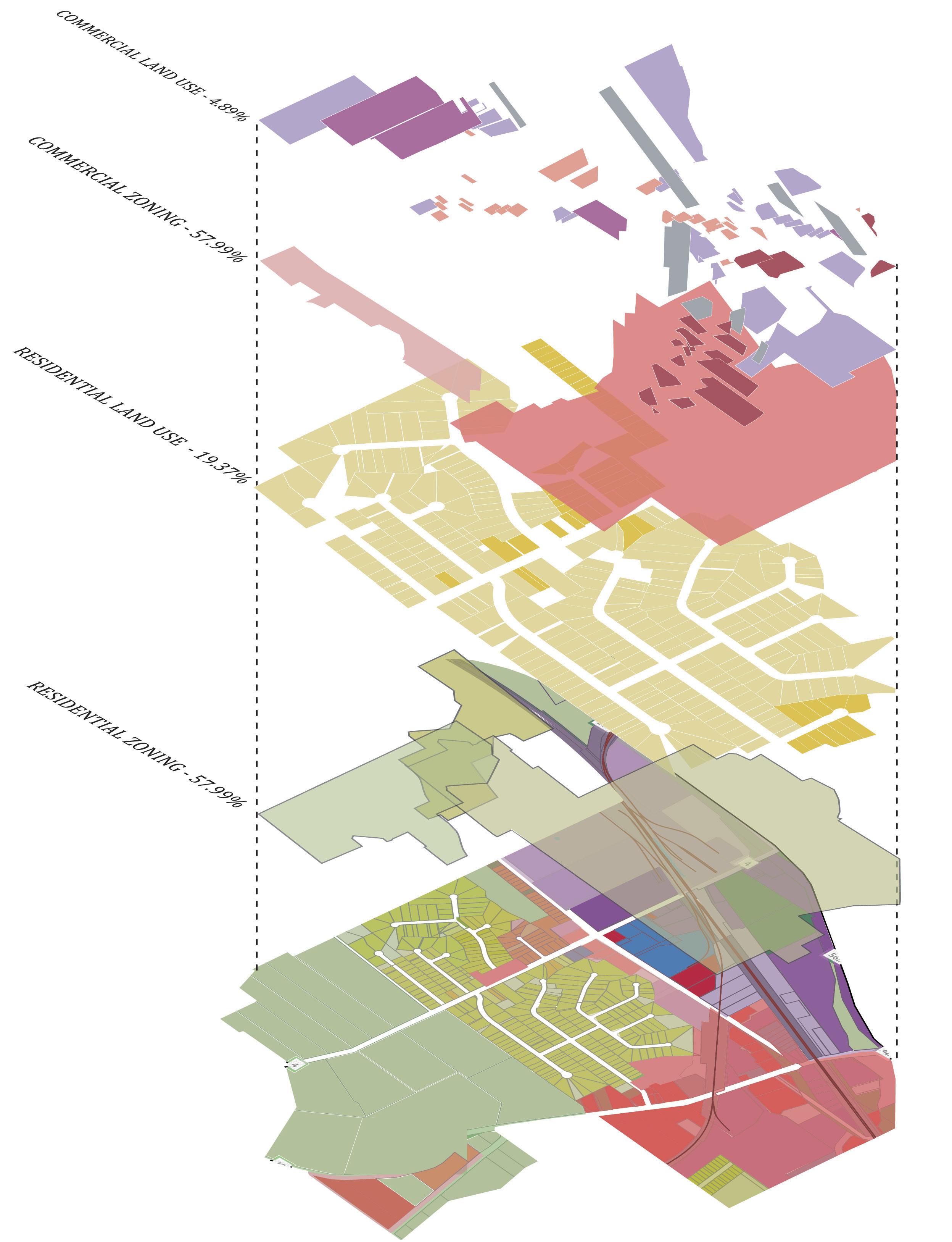
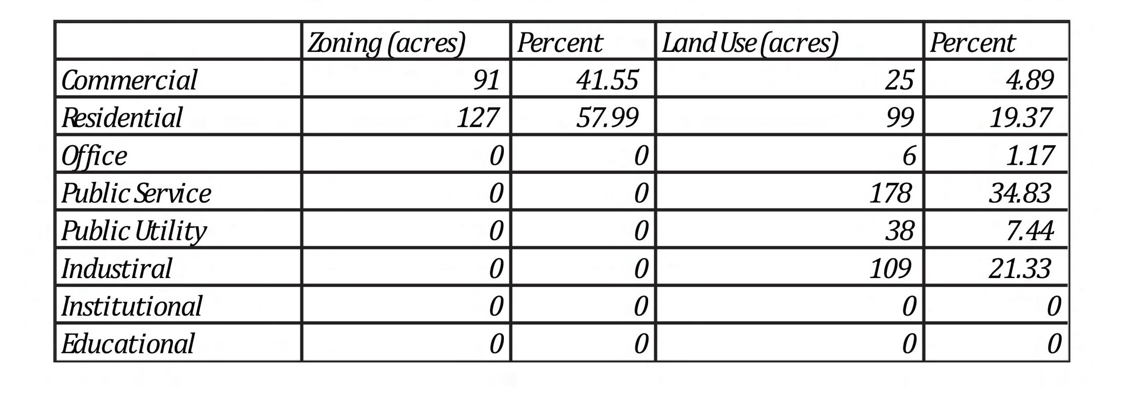
Comparison between Land use and zoning
ZONING TYPE VS LAND USE TYPE
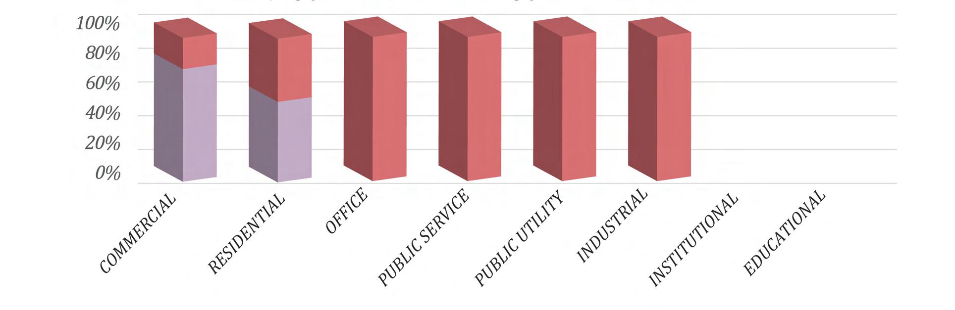
ZONING(ACRES) LANDUSE(ACRES)
__Public Spaces__
“Public Spaces are symbolic, used by different people or communities. “
Type : Research Study and Analysis of Public Space
Name : Public Space : Possibilities and Potentialities
Location : Cincinnati, Ohio, USA
Year : Fall 2023
This study is an attempt to study about Public Spaces and how different margenalized people use these spaces.Public spaces often dominate the young and middle-aged, where older individuals tend to be ignored by contemporary urban planning practice. Due to continuous demographic change, a rise in the number of elderly individuals can be predicted in developed nations.
WHY THIS USER GROUP?

USER GROUP SELECTED : ELDERLY
PEOPLE
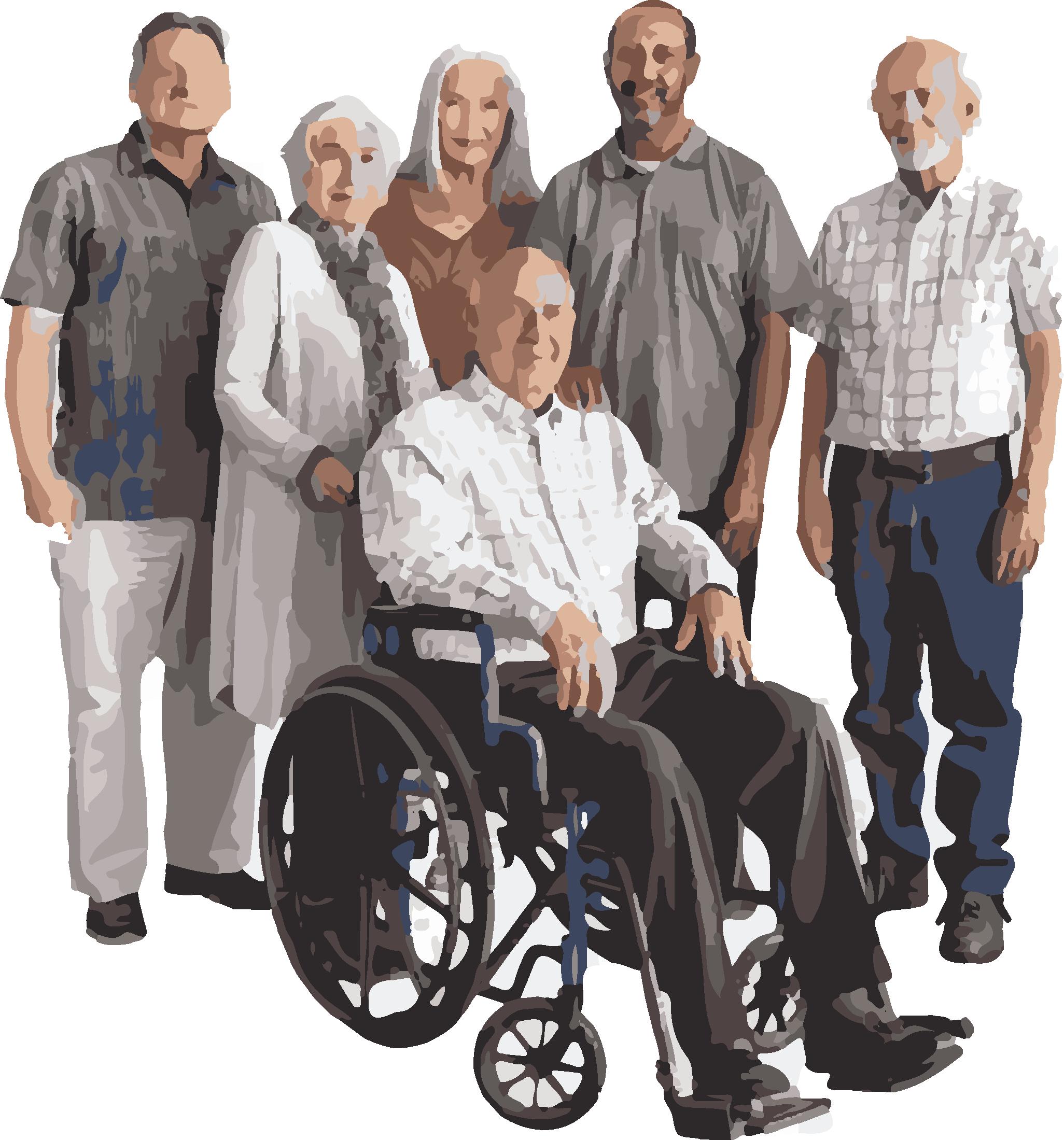
One of the communities which I chose as marginalized are the elderly people who are using the public spaces in various ways and terms.
Talking about elderly people, they are marginalized because of their age factor. Today elderly people are the most liable and sensitive group of people as they tend to become weak day by day and their physical ability to work also deteriorates.
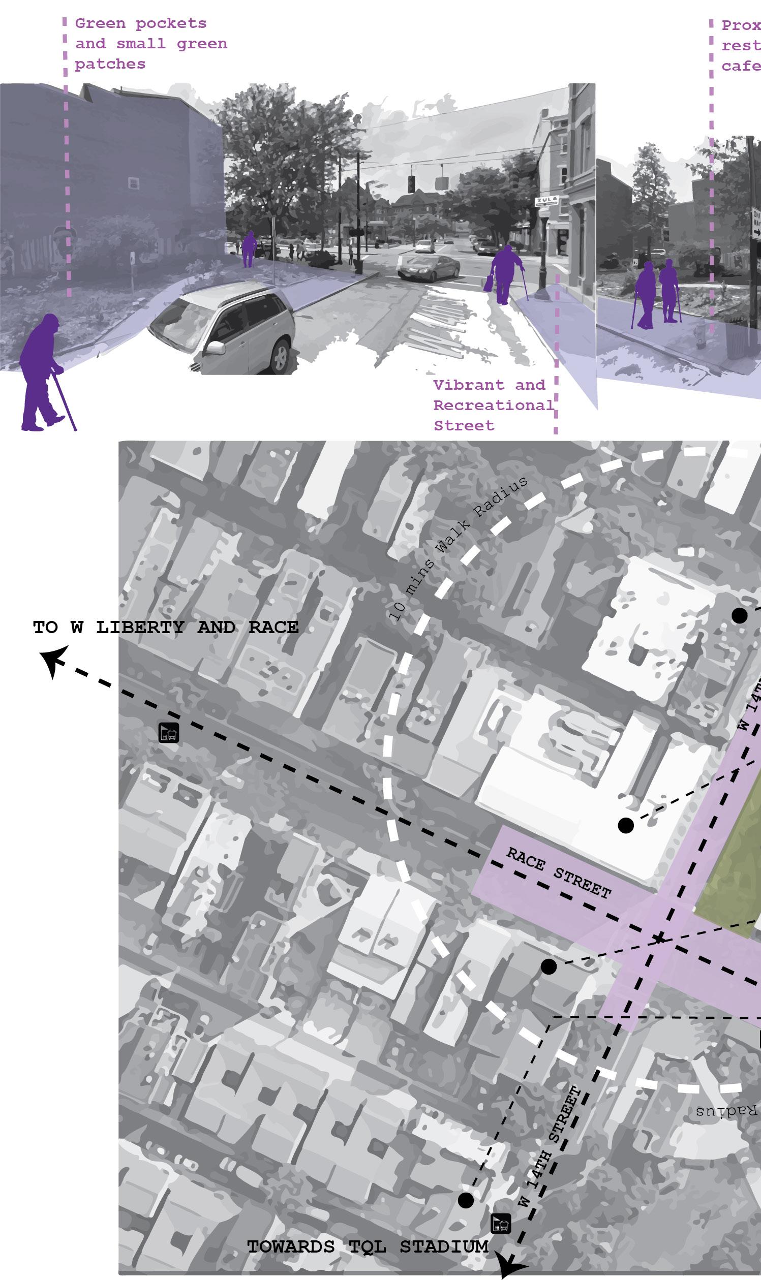
There is a wide range of public spaces apart from the basic idea of public parks or plazas or grounds.
Public spaces can be used by anyone anywhere and how these public spaces will be meaningful to elderly people.
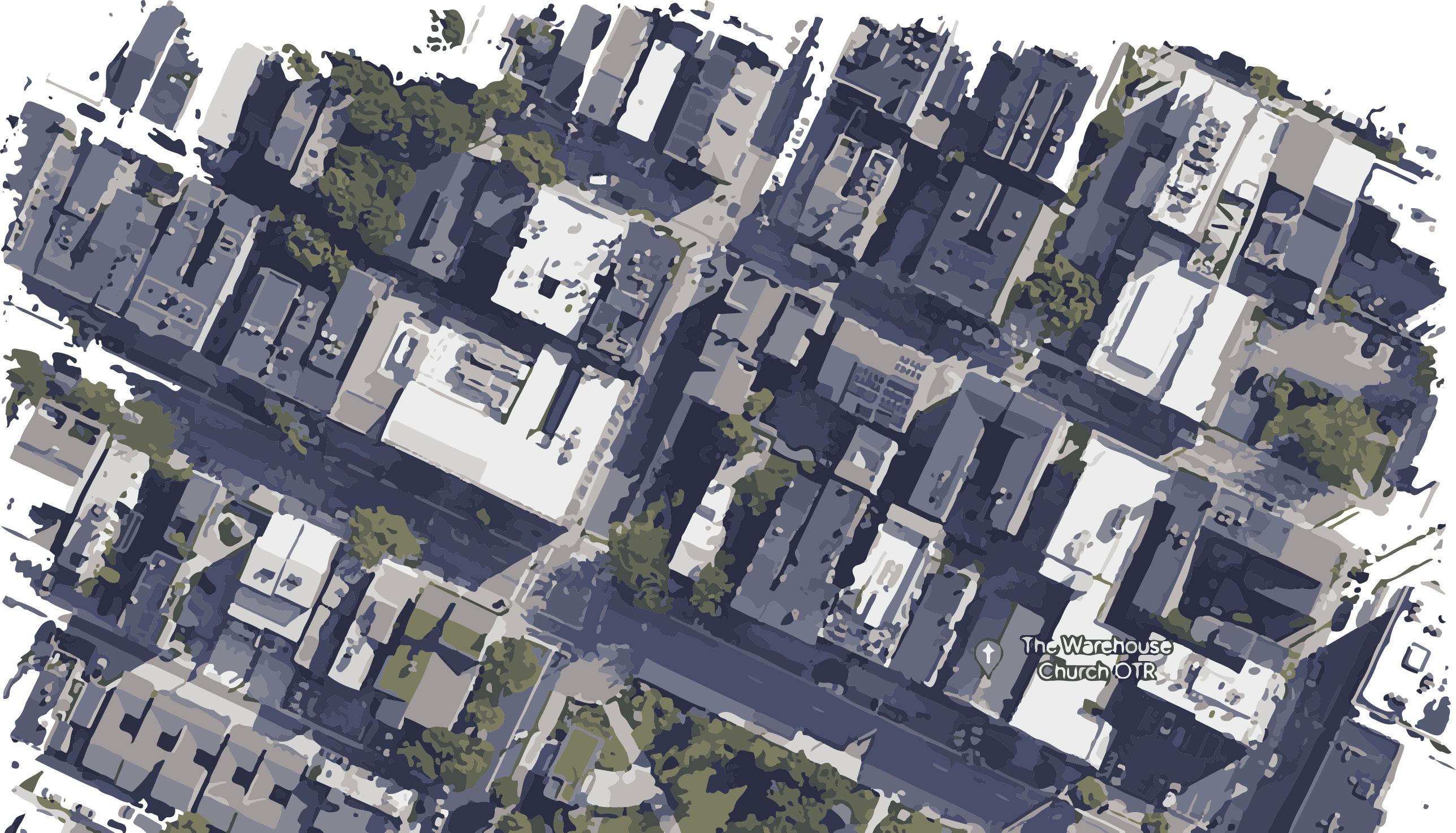
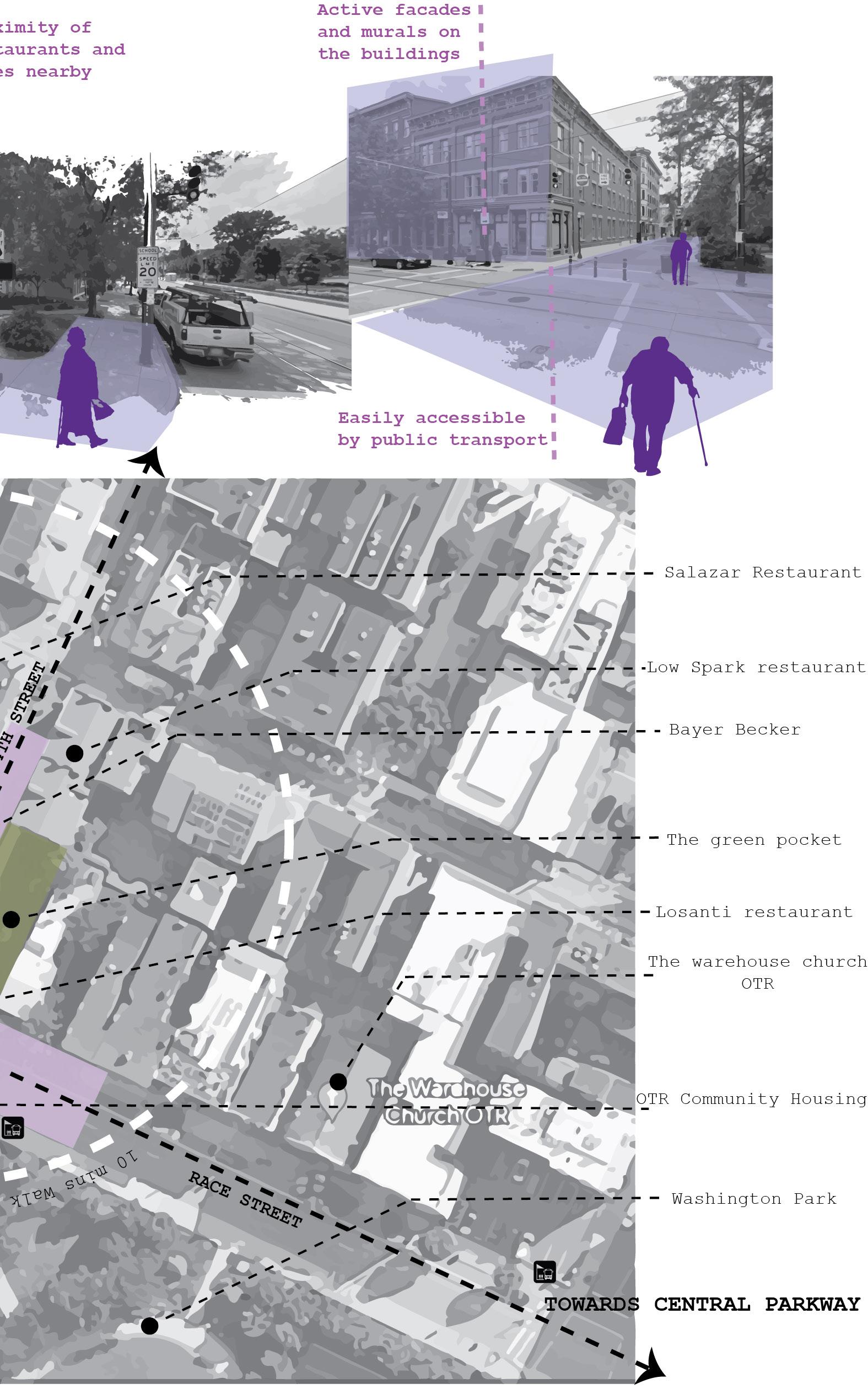
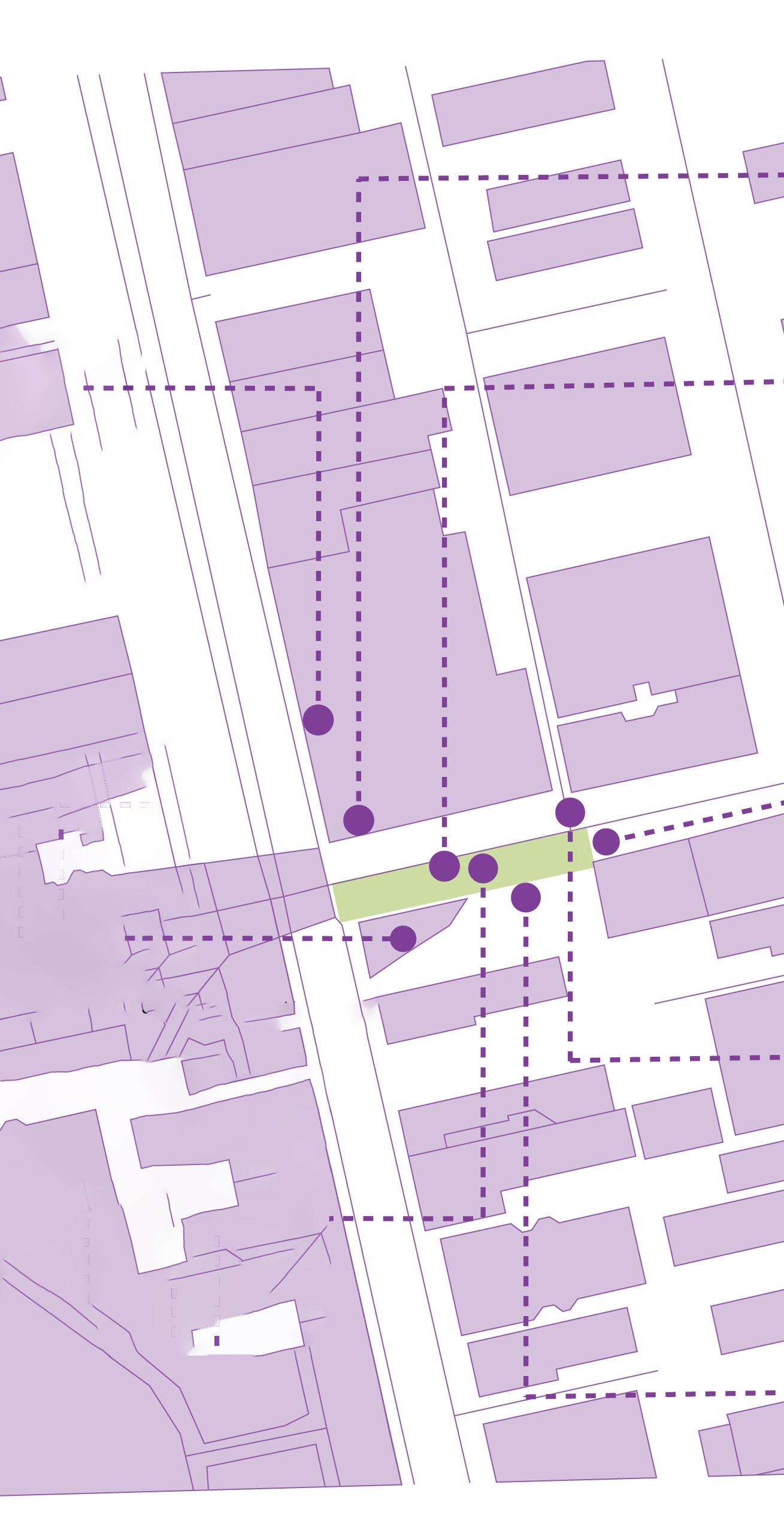
SITE CONTEXT
• Restaurants and cafes
• Washington park
• Cincinnati Music hall
• Residential buildings
• Church
• Community Centre
• Metro Transit System
• Old Heritage Buildings
DEMOGRAPHIC ANALYSIS
Nearly as many as elderly men were seen as elderly women, but percent of men is more.
Majorly, 50% elderly people were from the age group of 60 to 70 years, followed by 35% of elderly people who came to this space were between the age group of 50 to 60 years. Only 4 people whom I interviewed were above 70 plus age.
Out of 12 elderly people, 6 were white Americans followed by 3 black or African American , 2 Indian American and so on.
Almost 2/3 rd of the people are retired and 1/3 rd are still working.
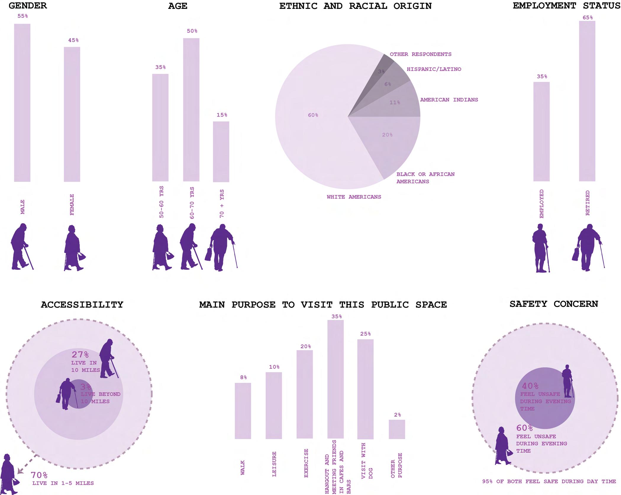
Morethan half percent ofelderly live in nearby residential area and only 3% of the people interviewed said they live far and visit once in a while.
• Elderly people are visiting this space mainly for going and meeting with their friends in the restaurants whereas 25% od people said they come here with their dog and others for different activities.
• Most of the women respondents feel unsafe during the night and 40% of men respondents feel unsafe during the night.
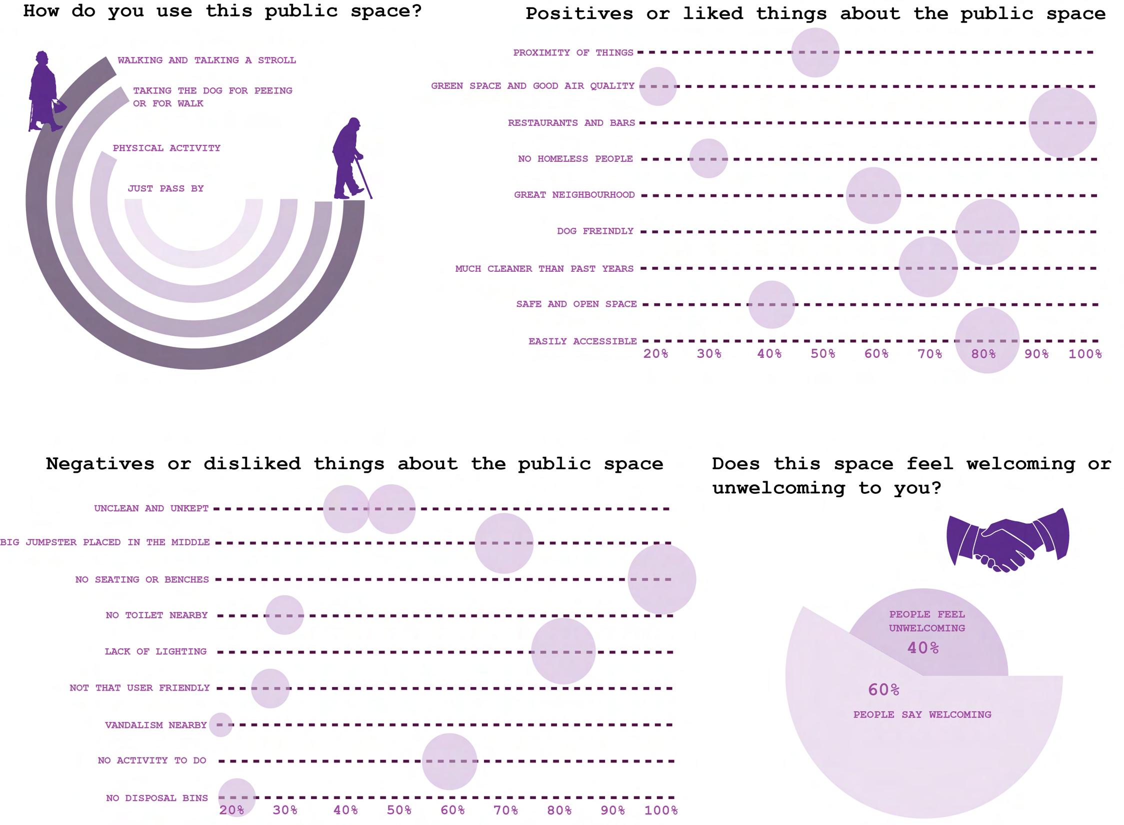
From the interviews, concluding that this space is not clean or not visually pleasing, not user friendly for everyone, it lacks sense of comfort and has less environmental quality.
The negative point is the dumpster should be removed as well as there is no place to sit or just relax for a while on the whole street.
But yes, this space has a nice green pocket around the corner which gives fresh air and is useful for the people who have a dog.
It lacks the fun and activity part to make the space livelier and inviting.
Elderly people generally pass by this space and also go to the restaurants nearby that are good for hanging out which fosters social interaction.
Overall, it is concluded that the space is welcoming and has green portions with colorful buildings which is visually pleasing, also good place for social interaction because of the outside dining areas.
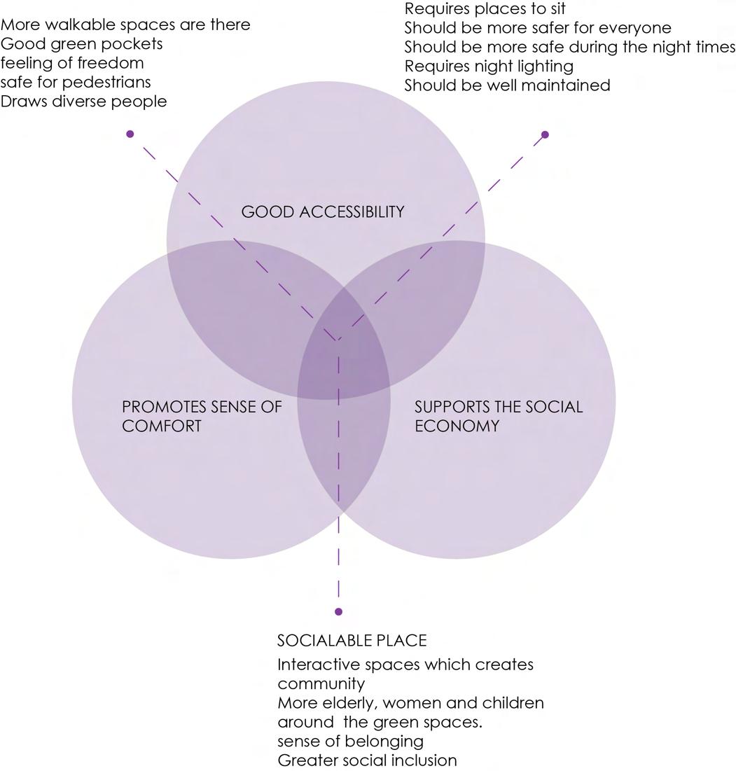
Well, adding trash bins and maintaining the space will make it more attractive and nicer.It’s a good place to walk by and take the dog around to pee.
Provide shelter and different options for waiting on the nearby bus stops as well as adding lighting to this space because it gets pretty much darker in the night.

Making the facades of the nearby building more active so as to increase the quality of the space.
Making the space more vibrant and environment friendly.
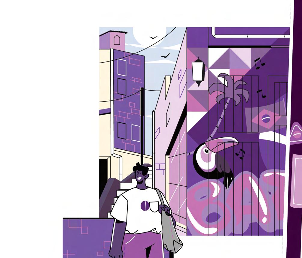
Adding more murals and paintings on the walls of the buildings to enhance the beauty of the street and the space.
Enhancing the green corner by adding more landscaping features and community garden.


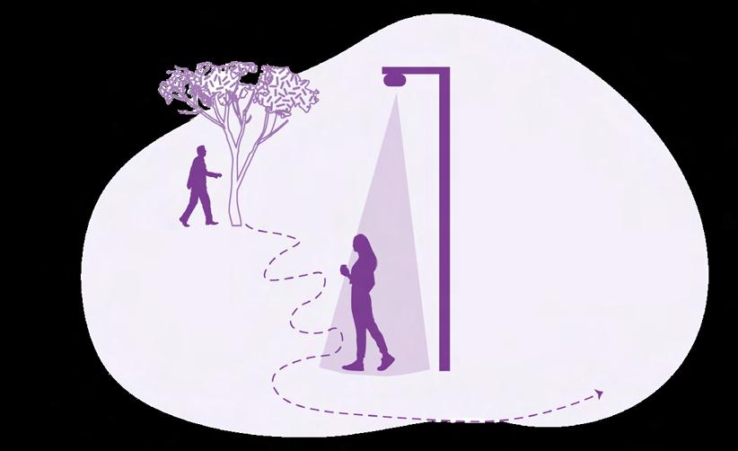

Adding lighting would make that space safer and elderly people would use that space often.
Ensuring the environmental quality, easy pedestrian access and flow by introducing places to sit and relax such as adding benches or sit outs.
Provide mobility options like giving the bike options nearby.
Providing more green pockets, street elements and walkable spaces along the sidewalk.
Giving various options for making the space lively and adding different activities like open cafes, playing areas, spaces to sit and relax, giving food trucks options and other fun activities .
06
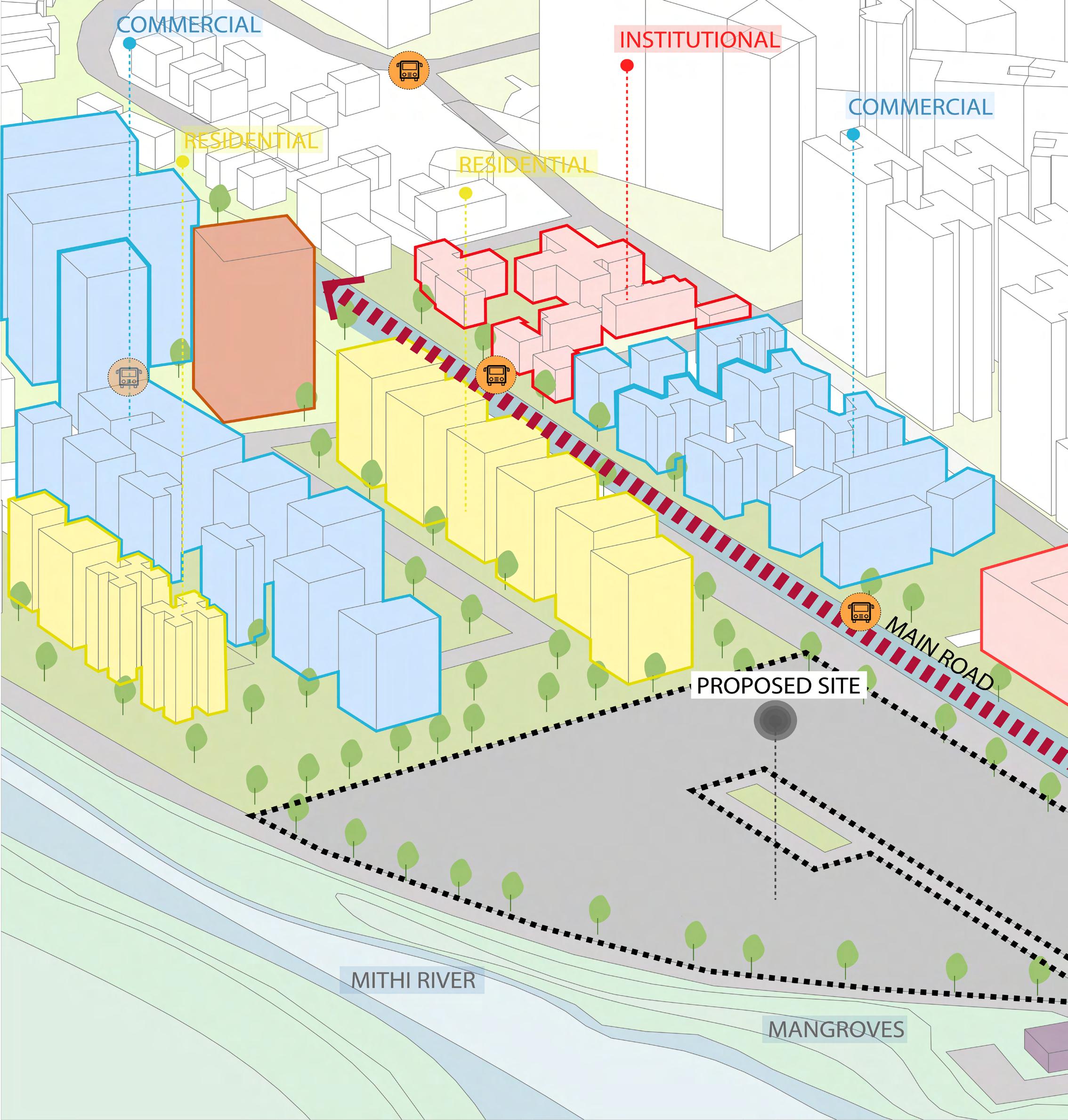
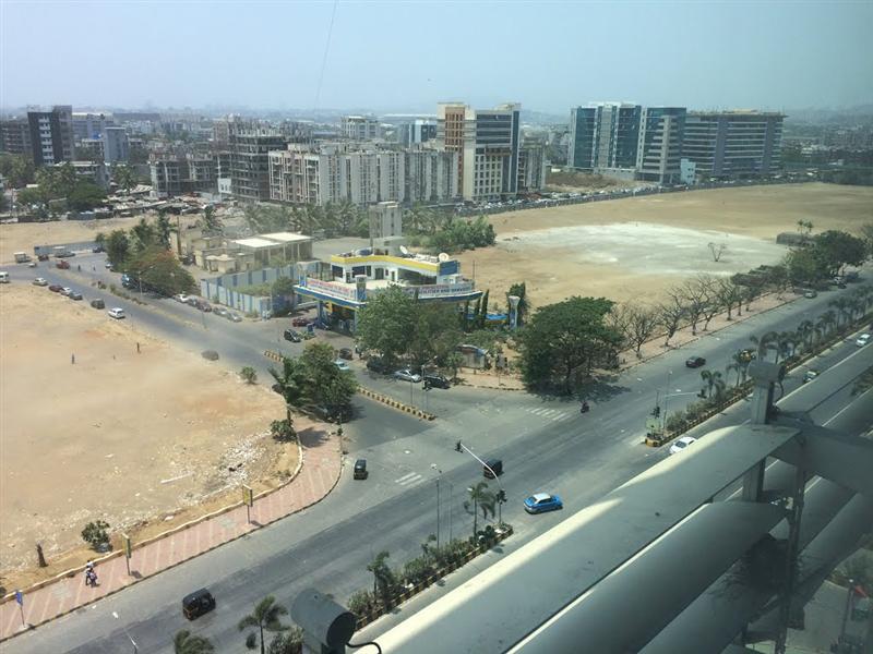
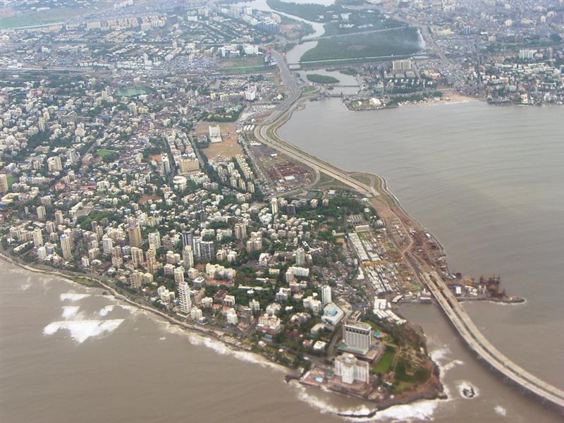
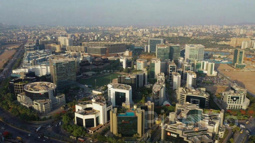
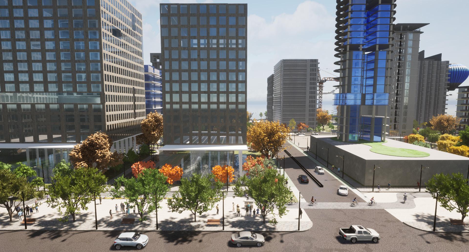
#THE URBAN SPRAWL
(URBAN) isation of Bandra Kurla Complex
Type : Urban Design (Group Work)
Name : Urban Design of Mumbai
Location : Bandra Kurla Complex (BKC), Mumbai, India
Year : Semester 9, 2021
Abstract :
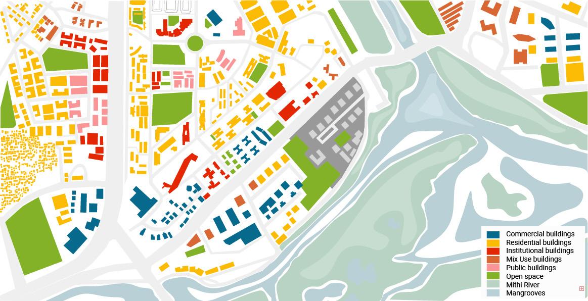
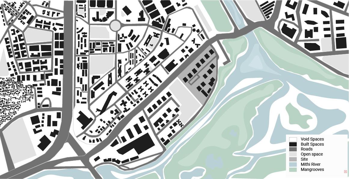
BKC is located between K U R L A
B A N D R A .BKC sits on marshy land on the north side of Mahim Creek and either side of the Mithi River.The aim to develop BKC: To decongest and decentralize south Mumbai.The entire BKC area is divided into various blocks from A to I and spread across an area of 370 hectares. 19 hectares of land is developed out of 25 hectares of marshy land for E Block.
The Bandra Kurla Complex includes business, residential district, transit hubs, public grounds institutional buildings, private, bank, retail, government offices (state and central). Land allocated was placed for the requirements which included parking facilities and open spaces. Effective land allocation policy and complete ownership of land gave MMRDA the much-needed flexibility to carry out requisite infrastructure works.

ORIGIN AND HISTORY
MMRDA was appointed as the Special Planning Authority for planning and development of this complex.
Land was offered at 3000/- per sq.m, but not many took it, though idea to set up a diamond bourse and shift gen traders from panchratna was set in motion.
RBI. Income tax and labour departments, MMRDA, Family court, Nabard bought the land, rates had doubled by this time.
Decade of action for BKC. Is cont`our beginning to change as liberalization unchained the financial sector and banks needed space to expand.
Fancyapartment, complexes came up, with an asking price of 30-55 cr per flat, and high-end bars and restaurants opened-100 at the last count.

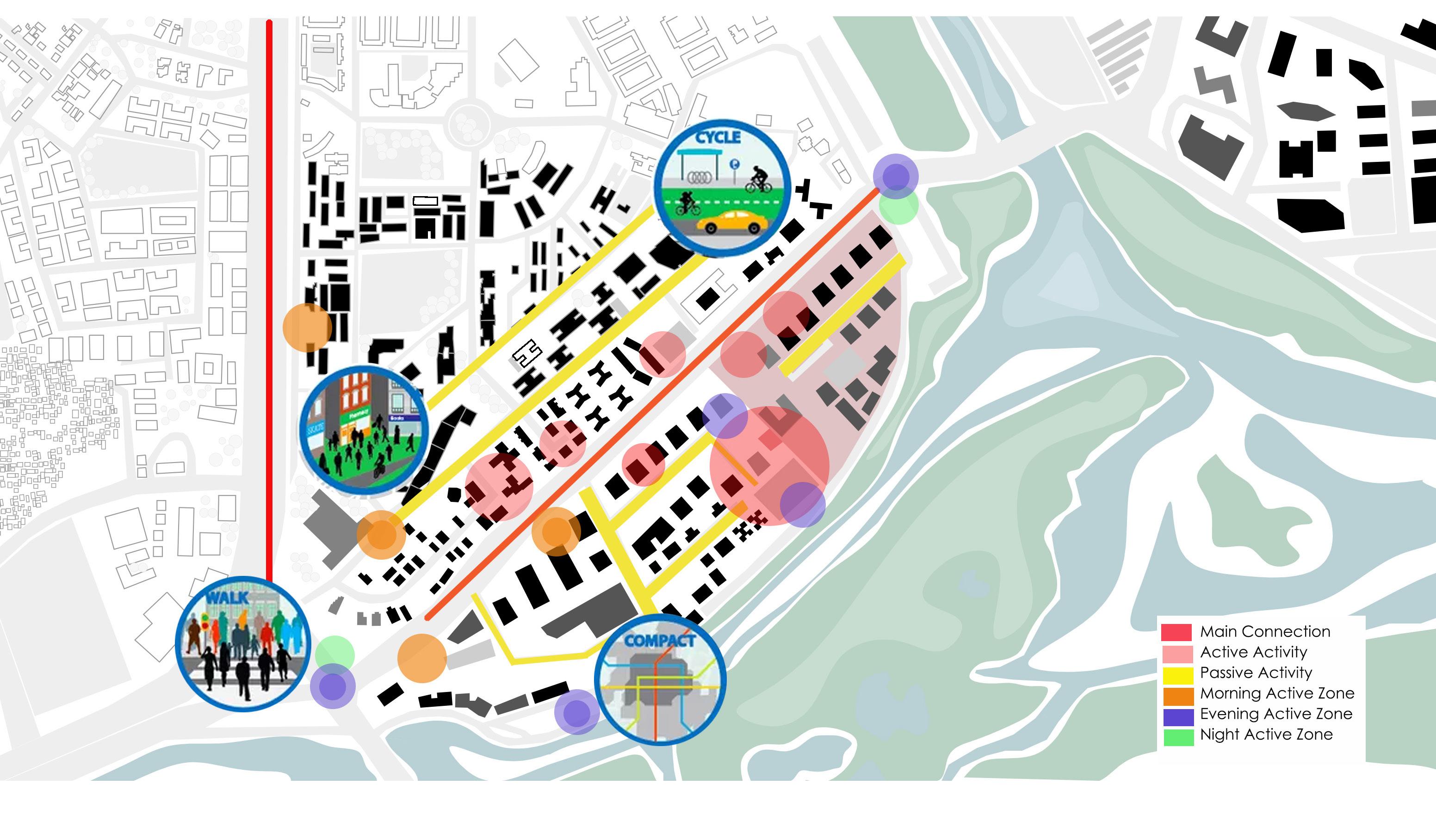
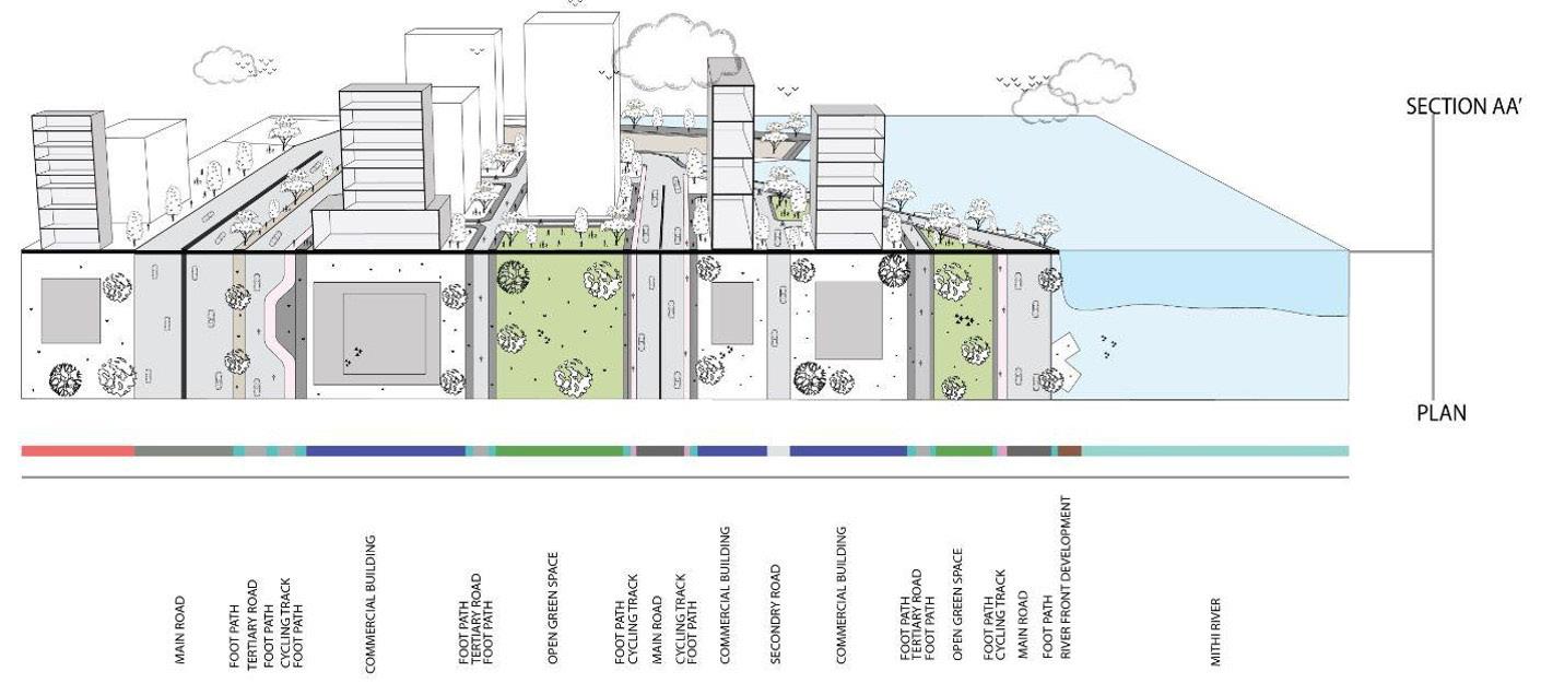
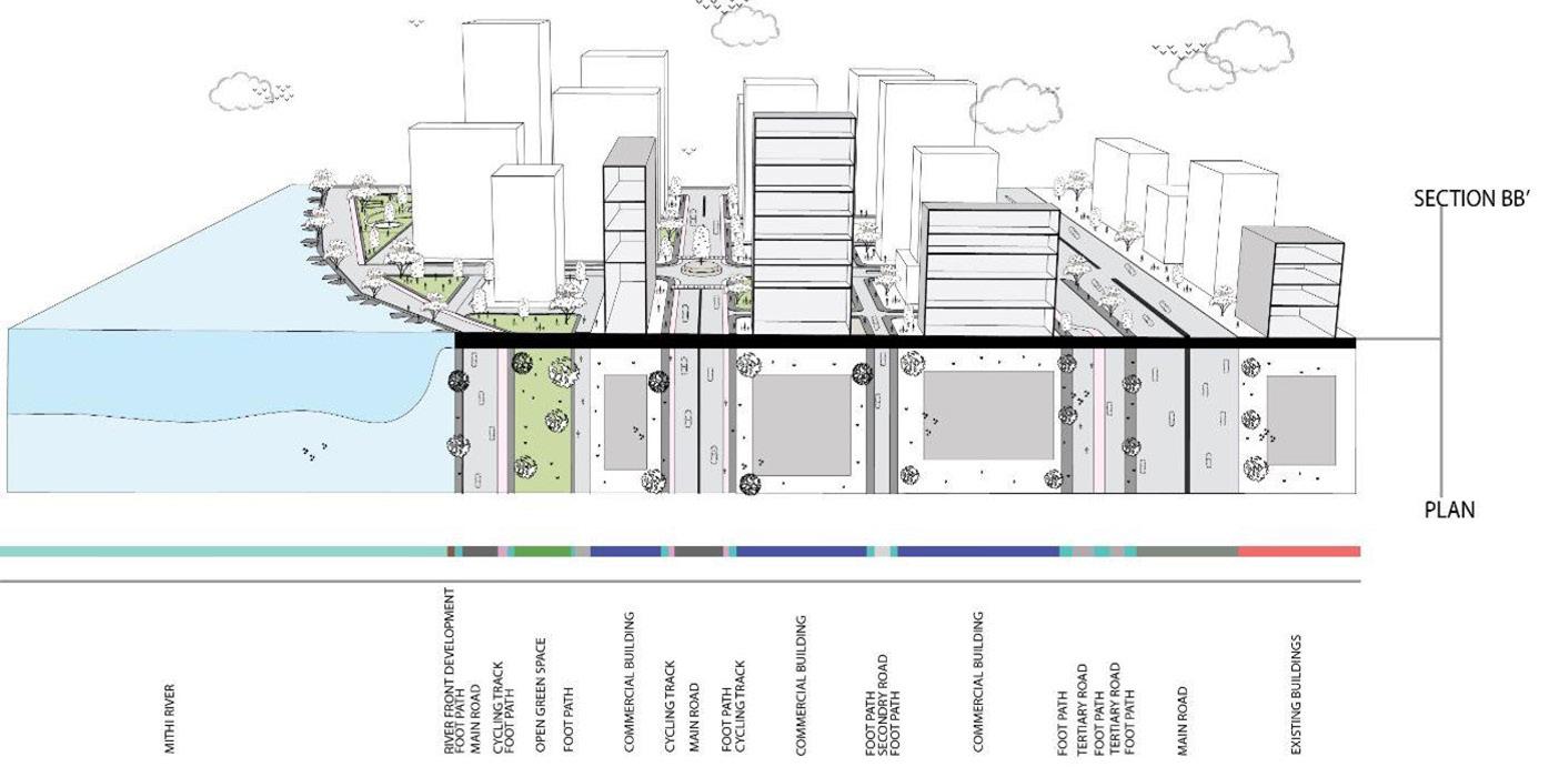
Principle 1 : Enhancing the livable Environment
The pattern of development, public spaces and urban facilities can help improve the quality of the environment with minimum disruption.
Principle 2 : Enhancing the face of the street and interaction with built facades.
The characteristic of the structure presently in BKC are isolated, having interactive facades which can reflect the sense of the neighbourhood would build up a great atmosphere to this place.

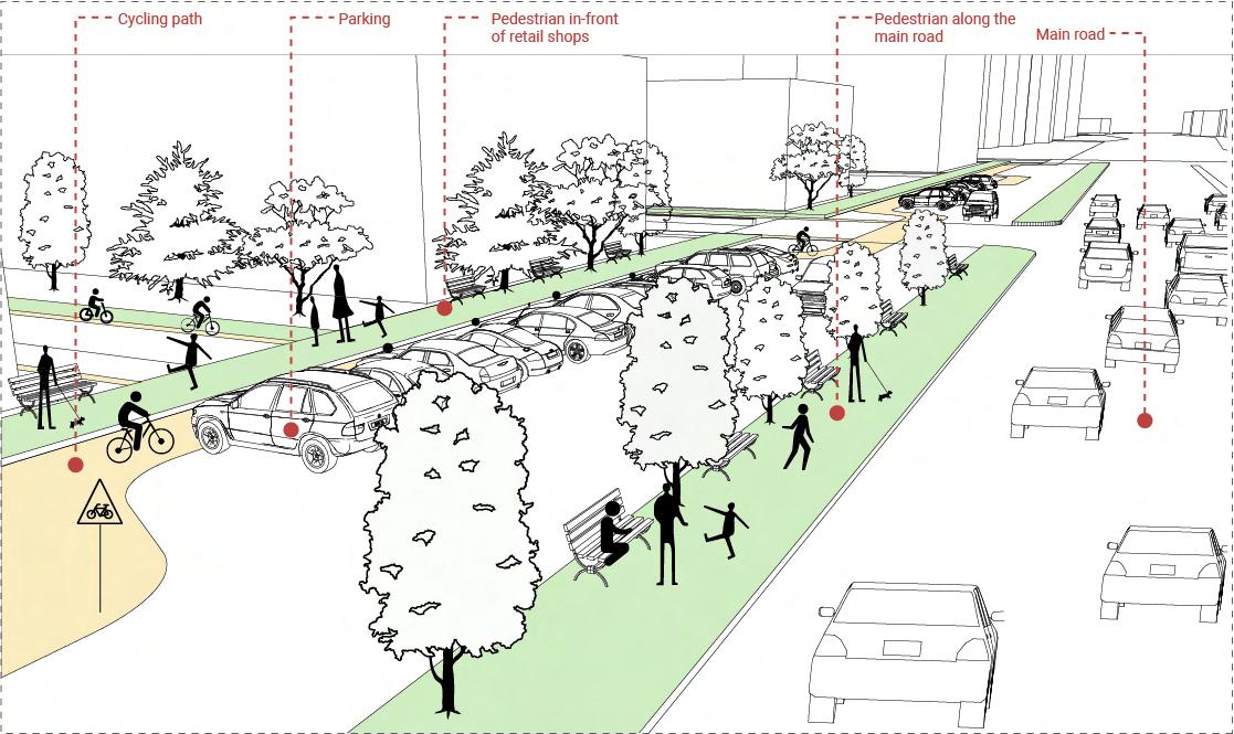
Principle 3 : Reforming the future of mobility by promoting non motorized transport (NMT)
1. Due to the presence of more public amenities such as the bus stops, parks promoting non-motorized transport is one of the major aspect as it requires low cost, less human resource, easy and quick to implement, scalable and also its environment-friendly.
2. To achieve the sustainability goals of the transport sector, it is necessary to promote use of NMT.
Principle 4 : Adaptive and Flexible Planning
Adaptability and flexibility with respect to sustainability in urban design creates a relationship between user and the buildings.
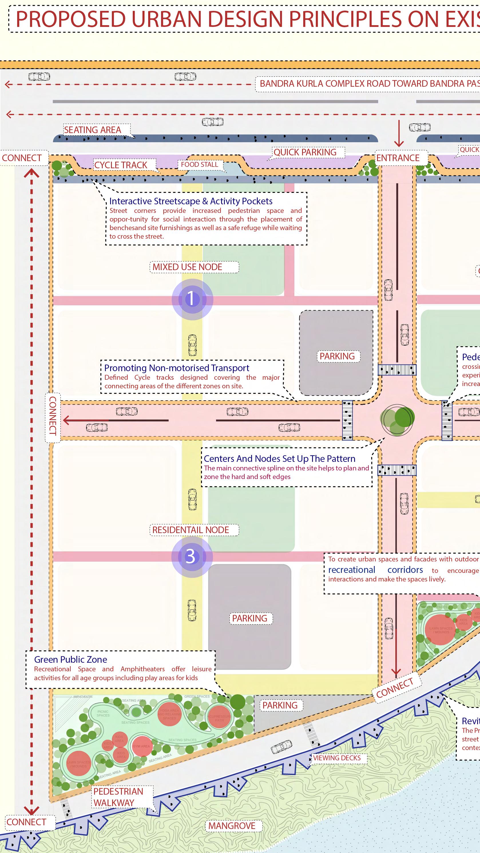
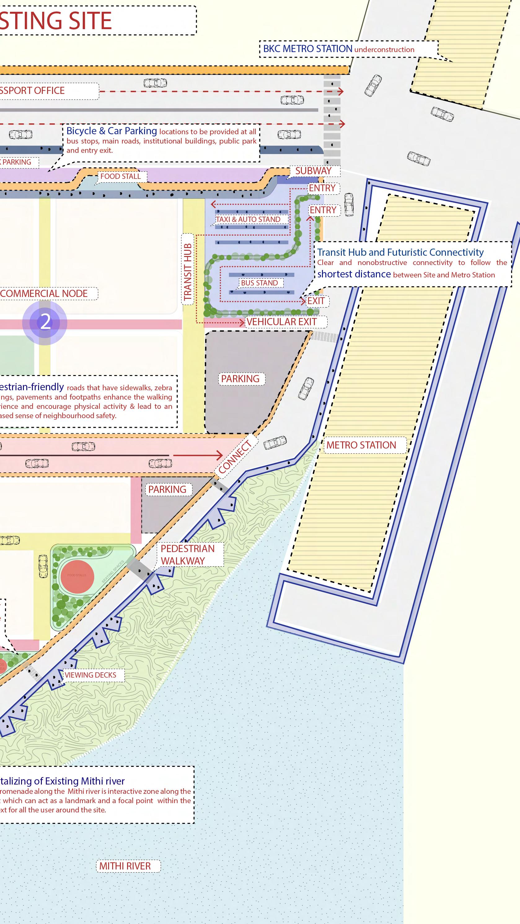

The viewing deck and Mithi river
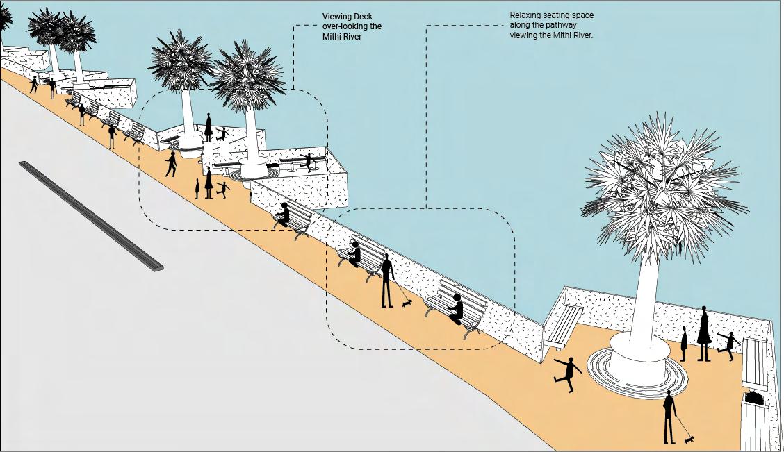
View of the buildings and the pathways