Minnesota Trails magazine is a continuation of Minnesota Bike Trails & Rides, published quarterly in cooperation with the Parks & Trails Council of Minnesota, a nonprofit organization that acquires, protects and enhances critical lands for public enjoyment. Your $35 membership subscription supports this work.
Minnesota Trails is not responsible for the return of unsolicited materials and reserves the right to reject unsuitable advertising. Information in this publication is as accurate as possible. Opinions expressed are those of the authors and not of Minnesota Trails.
A boutique hotel just blocks from downtown Crosby and the bike trails
124 W Main St, Crosby (218) 545-1000 www.shopvictual.com
cream, cheese, charcuterie, deli meat,
bread, gourmet
(
534-3489
22640 MN-6, Crosby (218) 546-6912
www.oarsnmine.com
Docks, lifts, bait and tackle
BANK 21236 Archibald Rd, Deerwood (218) 534-3111
www.deerwoodbank.com Banking Made Nice & Simple
MINNESOTA FEDERAL CREDIT
117 West Main St, Crosby (218) 546-5428 www.mmfcu.org Member owned and working for you
Cuyuna
PHOTO:
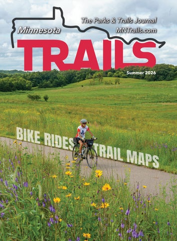
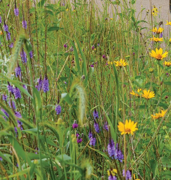
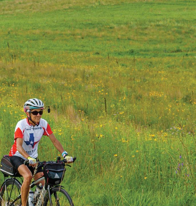
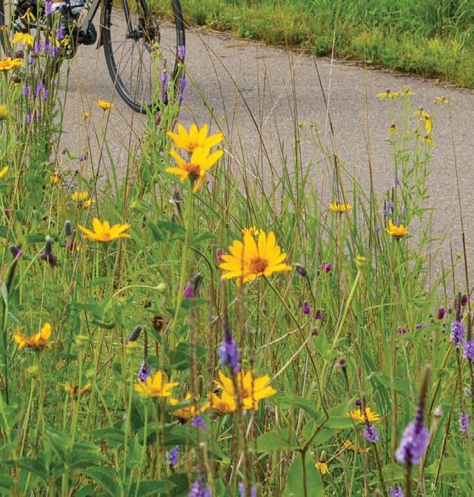
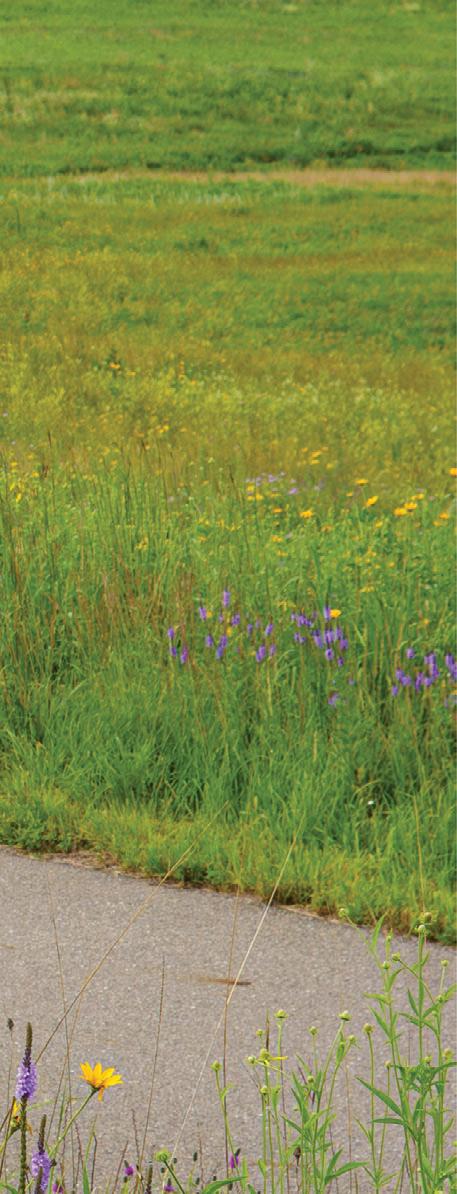
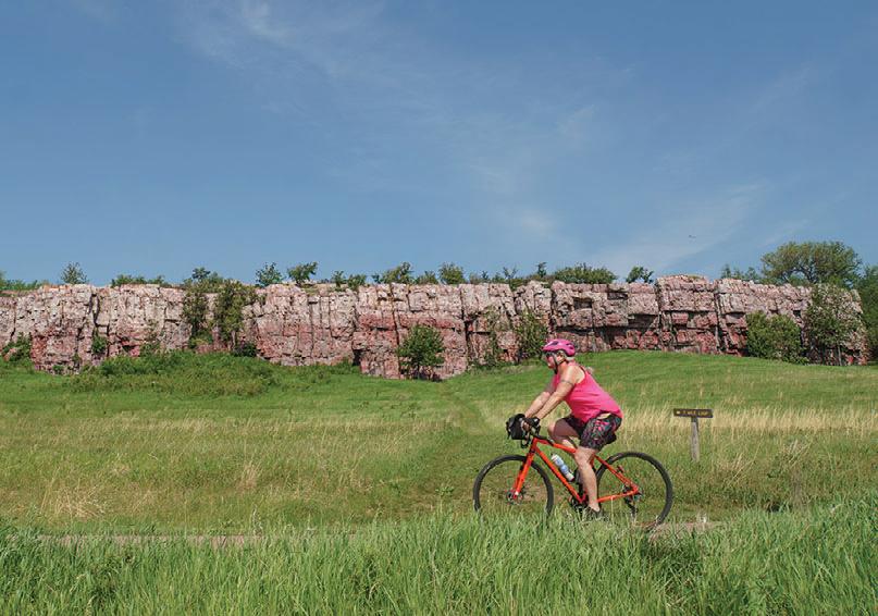
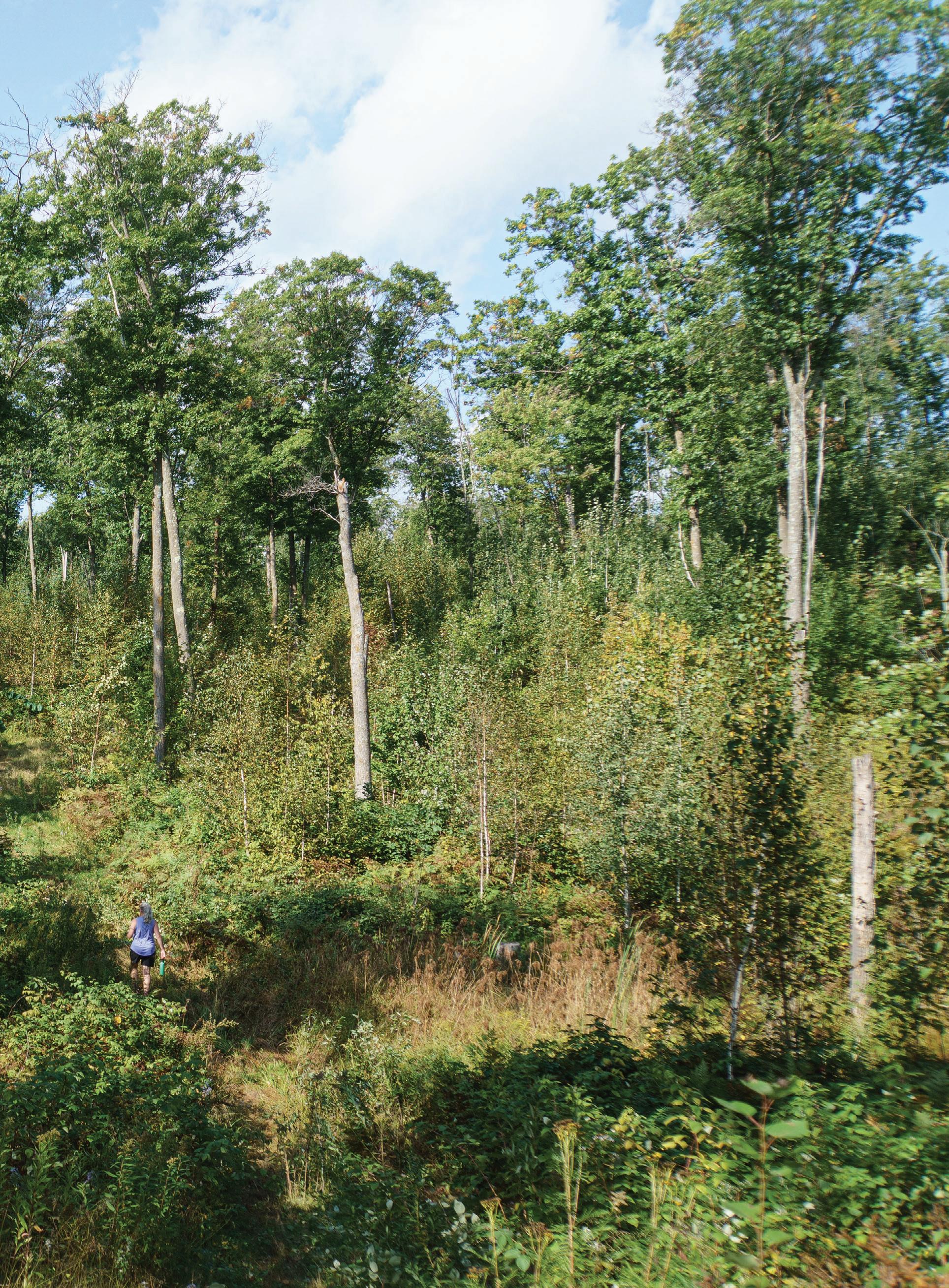
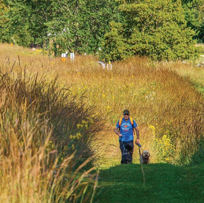
COVER: Inside Sibley State Park, fields of wildflowers line the trail. Jan Lasar
CLOSING THE GAP AT CUYUNA
A SHORT STRETCH OF TRAIL—AND YEARS OF COLLABORATION—ARE UNLOCKING SAFER ACCESS TO CUYUNA’S SAGAMORE UNIT
Most of Minnesota’s 25 long-distance bicycling adventures, connecting cities and—when you’re lucky—parks. The Cuyuna Lakes State Trail does all that, but it also serves a more dynamic role: it acts as a central artery running through the 70-mile mountain bike trail system within Cuyuna Country State Recreation Area in central Minnesota.
Cyclists traveling the paved trail end-to-end encounter a distinctive energy along the way, as mountain bikers of all skill levels hop on
The state trail currently stretches roughly nine miles, though a halfmile gap between the eastern edge of Crosby and western Deerwood
onto a county highway.
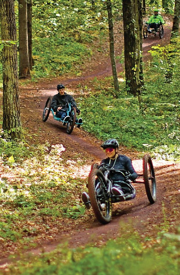
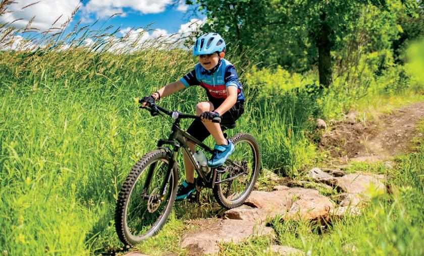
While the state trail winds through much of the state recreation area, it stops just short of one of its most exciting additions: the Sagamore unit. Opened in recent years, Sagamore features 7.5 miles of adaptive mountain biking trails— purpose-built to accommodate three-wheeled bicycles used by riders with physical disabilities. Designed with gentle grades and free of ride-stopping obstacles or tipping hazards, these trails are ideal for beginners, families, and anyone seeking a more relaxed riding experience.
Currently, the Riverton Trailhead marks the western end of the state trail. “Right now, trail users need to navigate their way from the Riverton Trailhead along two county roads for approximately one-third of a mile,” explains Chuck
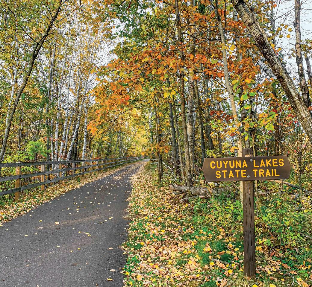
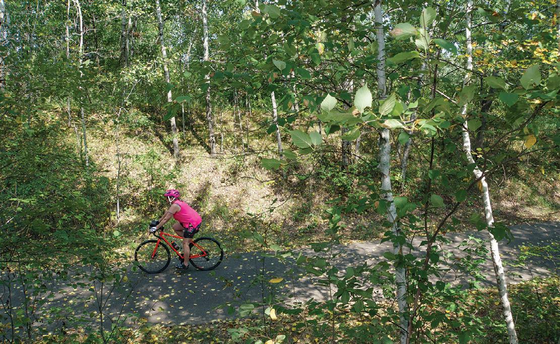
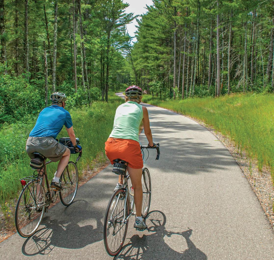
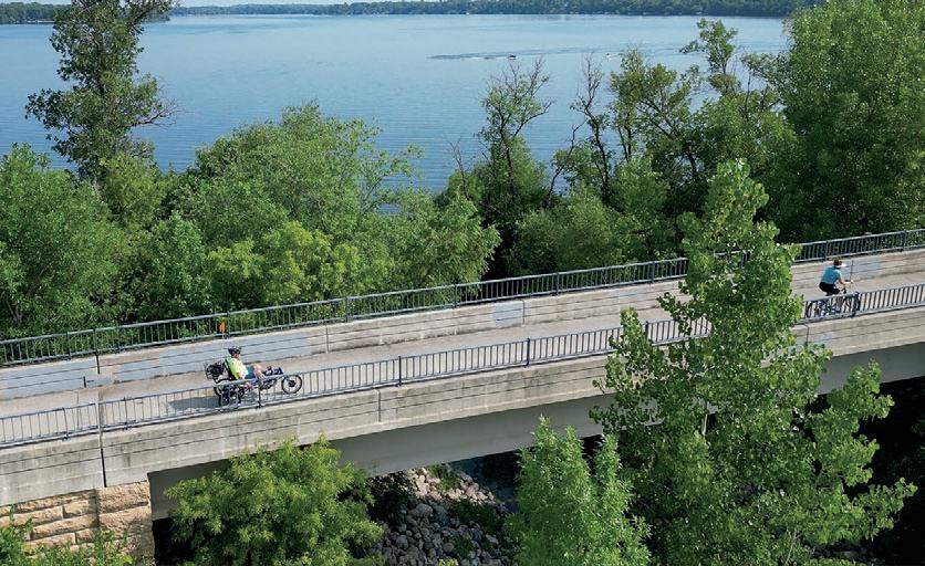
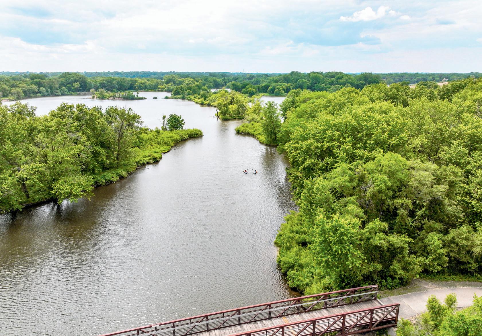
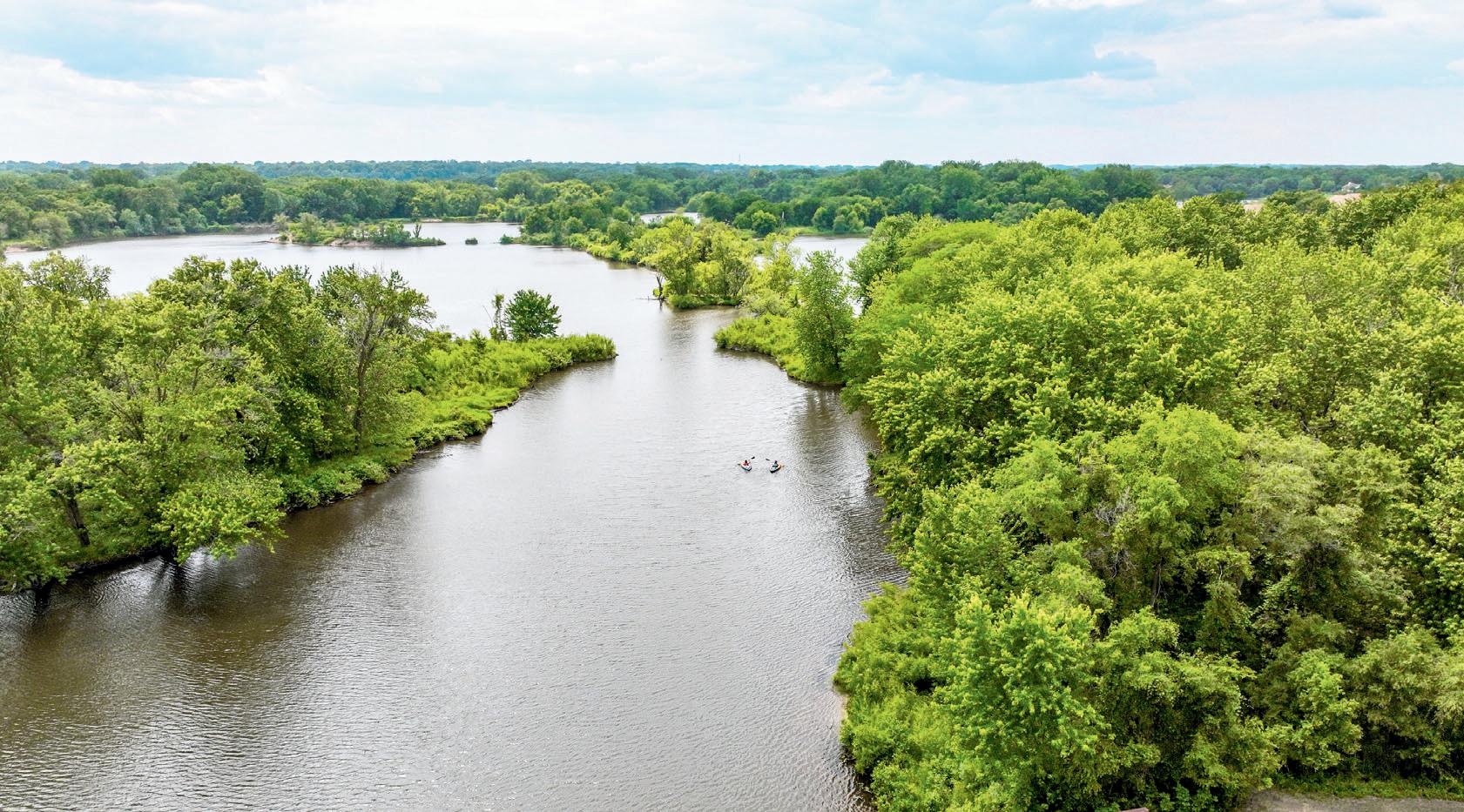
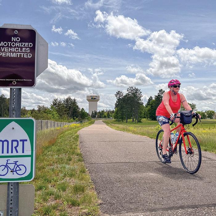
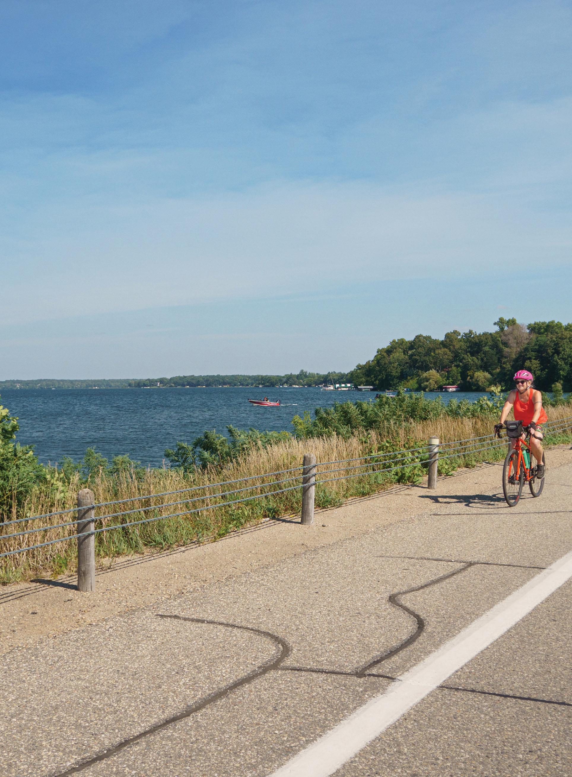
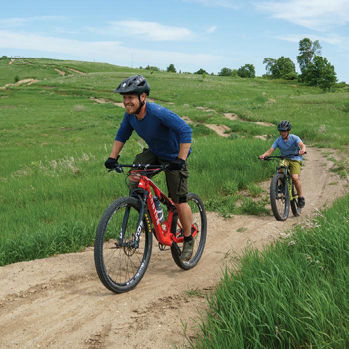
The paved Cuyuna Lakes State Trail runs through and connects the network of natural surface trails within Cuyuna Country State Recreation Area and will soon connect to the newest unit that features trails for adaptive bicycles.
Carlson, vice president of the Cuyuna Lakes Trail Association. “We’ve been working with local landowners to secure the land needed to make a safe connection.”
Parks & Trails Council of Minnesota
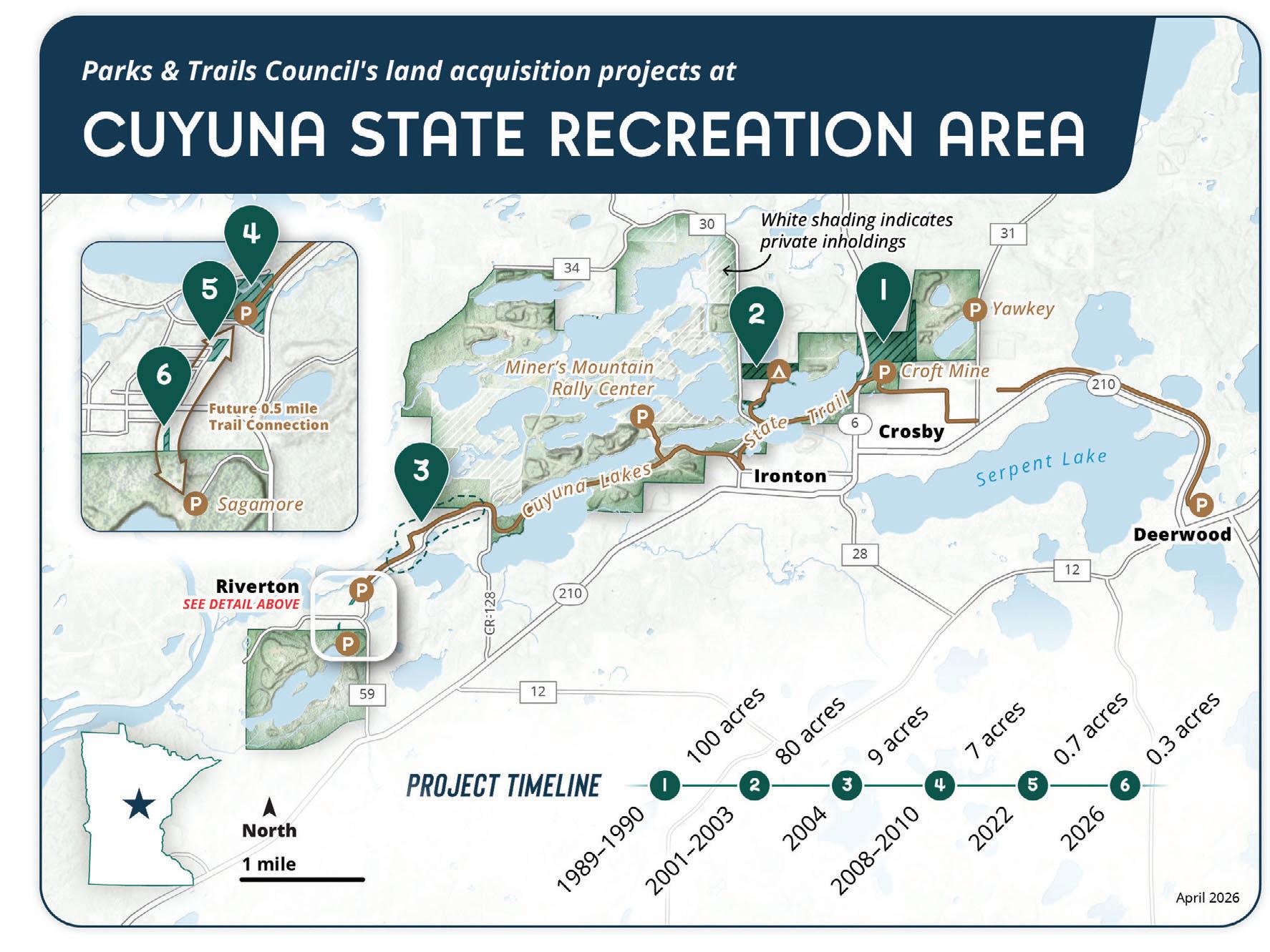
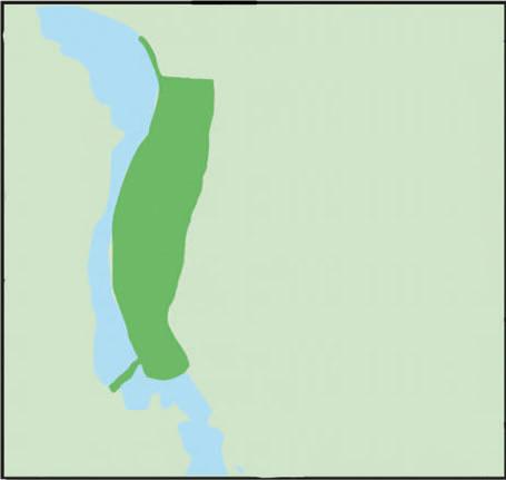
between the Riverton Trailhead and the Sagamore Unit. Combined with a nearby parcel Parks & Trails Council acquired in 2022, as well as land owned by the DNR and city of Riverton, the pieces are now in place to extend the trail.
“These are small parcels that will have a big connectivity impact,” says Brett Feldman, Parks & Trails Council president. “That’s ultimately the purpose of state trails—
Left: Cuyuna Lakes State Trail courtesy of Kimberly Anderson. Right: Cuyuna Country SRA courtesy of Cuyuna.com
connecting people to high-quality outdoor experiences.”
Unlike many state trails built on former railroad corridors, this connection required assembling land from multiple private owners—often the most complex and time-consuming part of trail development. These behind-thenegotiation, coordination, and due diligence, work that Parks & Trails Council is uniquely equipped to lead.
“Our member-supporters make this work possible by sustaining our operations,” Feldman adds. The organization also draws on its dedicated land fund to cover acquisition costs, which are replenished once the land is transferred to public ownership.
Looking ahead, the Cuyuna Lakes Trail Association is working with the through town. If all goes as planned, a natural-surface connection could be in place as early as 2026. “At
the same time, we’ll begin securing funding to pave this segment,” says Carlson, “creating a continuous route through downtown Riverton and into the Sagamore Unit.”
Since 1954, Parks & Trails Council has helped to acquire more than 9,000 acres of land for 50 parks and trails. Explore our projects: PARKSANDTRAILS.ORG/IMPACT/ LAND-PROJECTS/
STORY BY LISA FILTER/P&TC
This is the sixth land acquisition project that Parks & Trails Council (P&TC) has undertaken for Cuyuna Lakes State Trail and Cuyuna Country State Recreation Area.
Map by Andrew Oftedal / P&TC
New Ground COVERING
If you have a great team to back you up, nothing is impossible. It sounds corny, like the motivational poster in your high school counselor’s office.
But, because of the professionals that do much of the behind-thescenes work at Minnesota Trails, I am more than proud to share an accomplishment that's been two years in the making.
In 2023, Minnesota Trails Magazine partnered with the Southwest Minnesota Tourism Association on a very special project. Our mission: Visit all nine of their member counties, take a deep dive into each place, and tell their story in words and pictures. The organization felt there was more to the region than most of us know, and, after spending some time there, I know they’re right. Between 2024 and 2025, my wife, Jen, and I visited Cottonwood, Jackson, Lincoln, Lyon, Murray, Nobles, Pipestone, Redwood, and Rock counties during the snowless parts of the year. We made some incredible discoveries.
Have you ever had Aebleskiver? We hadn’t either, until we visited tiny Tyler, Minnesota, for their annual town festival and tried the spherical Danish pancake celebrated there for over 145 years.
Our motto -always read the plaque-also led us to a real-life working cannon in Fulda, MN. The 800-pound, three-inch ordnance rifle from 1855 sits on a concrete pad in the city park and was last fired in 2021.
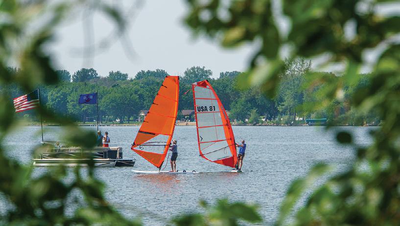
Wind turbines are a common sight in the lower third of the state, but in Worthington, the wind generates more than electricity. The annual Windsurfing Regatta and Music Festival is a big deal that’s been drawing crowds to Okabena Lake for over 25 years.
Crowds also flock to Redwood Falls, where 100 volunteers string up half a million lights at Minnesota’s largest municipal park each May. The after-dark NightFalls spectacle at Cansayapi/Ramsey Park illuminates miles of trails and two
waterfalls and is something you have to see to believe.
We had heard of the Jeffers Petroglyphs, but we didn’t know that at certain times a year visitors get to go behind the ropes and walk among the sacred, ancient rock carvings, barefoot, when the light of the low sun makes them come alive. “Feeling the warm rock under our feet and hearing the rustling of the prairie grasses, it seemed like the walls between now and then became thin enough to see through,” I wrote of the experience.
Jan Lasar Trails Editor/Publisher
In Rock County, Luverne’s annual Hot Dog Nite celebrates wieners like no other event, and local businesses dispense enough of the humble wurst to stretch nearly a mile if laid end to end. If you’re having trouble picturing this, it means 15,000 sausages. While in town, we were roped into acting as judges in a wiener dog competition and saw a lot of can-do spirit trapped in those little can’t-do bodies. It was definitely a first for us.
We’ve visited many local history museums over the years but did not expect to come across a 1950s replica ice cream parlor with checkered floors and a jukebox, that actually served ice cream. At the Lyon County Historical Society in Marshall, they defied convention and celebrated their Schwan’s ice cream heritage with whipped cream and a cherry on top.
In Pipestone, we had an aha moment when a local told us the “highest court of the land” was the county court building. With a wink, he then disclosed that in the land of Minnesota, Pipestone’s elevation of over 1,700 feet does indeed make this statement technically true (and now you can dazzle your friends with this factoid).
When we travel, we always stop at a local bakery, but we had never seen one with a drive-through window, like we did in Lakefield. Simply Sweet Cheesecake has taken dessert to another level and dispenses personal-sized custard pies to those on the go. Drive-through cheesecake windows should be everywhere!
Our travels wrapped up last October, then the real work
began. After coming up with pages and pages of itineraries, traveling a couple thousand miles, writing and rewriting for hours, sifting through more than 5,000 photos, and, finally, making sure the result was presented in an accessible format, we now have a 40-page magazine devoted to an often-overlooked part of the state. I chose a first-person, long-form story-style approach, which I think does a far better job of telling the reader what a place is really about, more so than just a highlight reel, or the dreaded listicle. Did I take a gamble doing so in the age of endless scrolling and gossamer-thin attention spans? Yes, but I trust that people will continue to read travel stories, even if it means having to blink a couple of times before moving on to the next thing.
It was a lot of work, but I also had lots of help. My wife, Jen, exhibited the patience of a saint during all of this. Yes, it was fun, but it was also a lot of prep, logistics, flat tires, mosquitoes, last-minute changes, and eyes brimming with sweat and sunscreen.
Karen, the keen eye behind Minnesota Trails’ beautiful pages, was also the graphic designer for this special project and delivered a crisp layout matching the client's style guide.
Pat, who made sure none of my typos survived her oldschool red pen, proofed 40 pages over a weekend, like she’s done with each issue of Minnesota Trails for years.
Of course, no special project of this size makes sense if the numbers don’t, and Joyce, who keeps the purse for Trails, always makes sure it all works out.
Give it a read!
Explore Southwestern Minnesota—Nine Counties, Nine Stories is available through all nine counties that make up Explore Southwest Minnesota Tourism and online at www. exploreswmn.com, under the Publications tab on the bottom.
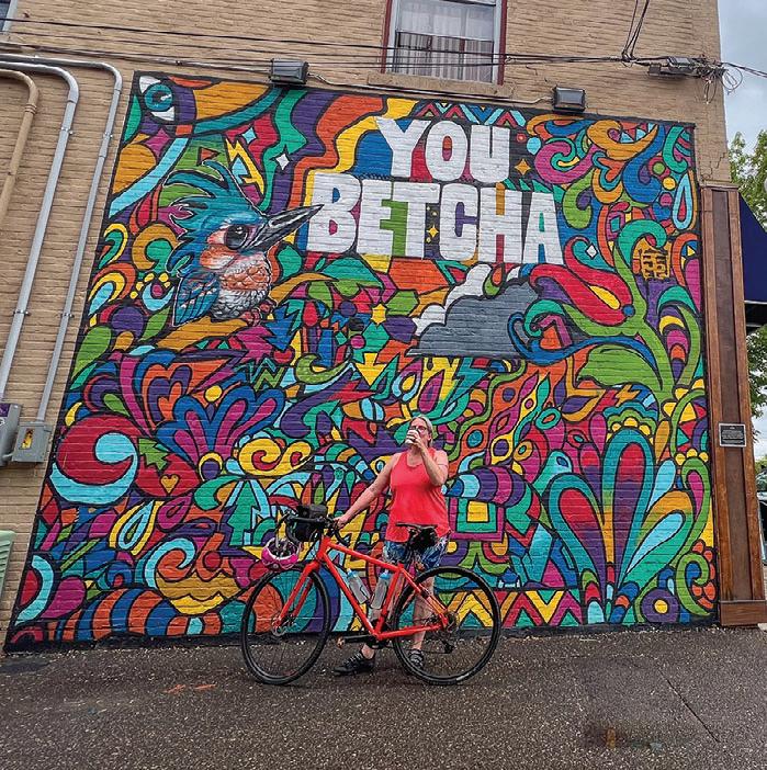
Snapshots of people we meet along the trail Trails
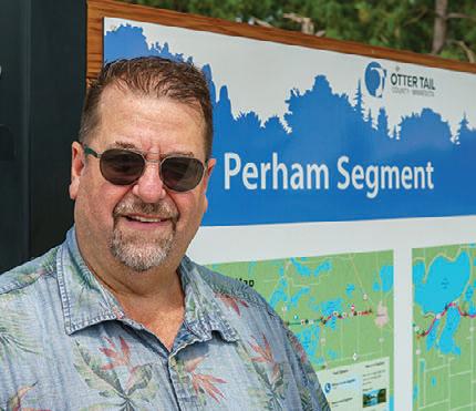
Detroit Lakes, MN
Occupation: Sales manager
Seen: Taking a break from biking the Heart of the Lakes Trail in Perham, MN.
Gear: Pro Cycle folding e-bike
How many miles do you bike per year? Not enough, but probably 200.
What does being outdoors mean to you? It means change of scenery and a little adventure.
Favorite Minnesota park or trail? I like the North Shore.
Best Minnesota trail experience? Riding around Dunton Locks Park near my house.
Advice for the novice? Just get something, then find out what works for you.
What's on your Minnesota bucket list? I want to do more of these Minnesota Trails.
What would you do with $1,000? I would spend it on trips.
Trail Treat? A big ol’ steak.
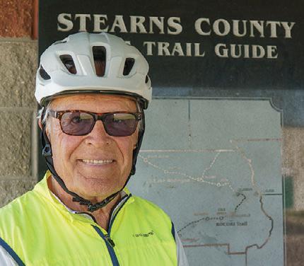
Cold Spring, MN
Occupation: Retired State Farm Agent
Seen: Riding the RoCoRi Trail in Richmond, MN.
Gear: Salsa Fargo touring bike
How many miles do you bike per year? It varies, but last year it was around a thousand.
What does being outdoors mean to you? It’s my happy place.
Favorite Minnesota park or trail? I like the ride from Albany to Bowlus on the Lake Wobegon and Soo Line trails. It’s a nice ride for a windy day and I love riding in the trees.
Best Minnesota trail experience? My wife and I like riding the Root River Trail. I love seeing all the economic growth as a result of this trail.
Advice for the novice? Pick your bicycle seat well, start small, and stick with it.
What’s on your Minnesota bucket list? Exploring the northwestern part of the state.
What would you do with $1,000? I’d donate it to a local trail organization.
Trail Treat? Chocolate ice cream.
Occupation: Teacher at Worthington Middle School
Seen: Riding the Worthington Hike and Bike Trail around Lake Okabena.
Gear: Gary Fischer Nirvana trail bike
How many miles do you bike per year? I ride almost every day, so several thousand, if I had to guess.
What does being outdoors mean to you? I enjoy the fresh air, and seeing people.
Favorite Minnesota park or trail? The Paul Bunyan Trail and Wilderness Drive inside of Itasca State Park.
Best Minnesota trail experience? Camping at Judge C.R. Magney State Park in Grand Marais with my dog Einstein and seeing the beautiful Devil’s Kettle.
Advice for the novice? Go out to the garage, because you probably have a bicycle in there.
What’s on your Minnesota bucket list? Riding the Mesabi Trail.
What would you do with $1,000? I’d fix up some bikes for the kids in my school that don’t have one. Hopefully there’s a Billionaire who hears this.
Trail Treat? A quick one would be ramen noodles, but I also like mashed potatoes and gravy.
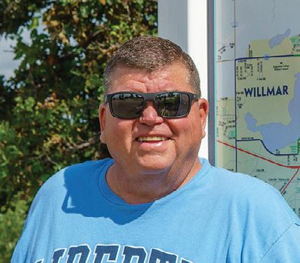
Occupation: Superintendent for an electrical contractor
Seen: Biking the Glacial Lakes State Trail in Willmar, MN. Gear: Aventon 8-speed e-bike
How many miles do you bike per year? I’ve had this bike for two months now and I’ve put on 160 miles now. What does being outdoors mean to you? I’m a Christian, so it’s enjoying to see all the creation that God has for us.
Favorite Minnesota park or trail? Probably Itasca State Park. The state has done a pretty good job preserving that area.
Best Minnesota trail experience? My wife and I took a trip up Highway 61 and visited all the state parks on the north shore a couple of years ago.
Advice for the novice? Get a quality bike, and maintain it.
What’s on your Minnesota bucket list? I would like to ride the Lake Wobegon Trail in Holdingford.
What would you do with $1,000? I’d go on a houseboat trip at Voyageurs National Park. That is the most beautiful place on earth.
Trail Treat? Hand-scooped cherry or raspberry ice cream in a waffle cone.
Scott Burns
Worthington, MN
Tom Grahm
Jeff Byrd
Larry Davis
Blomquist, MN
GLACIAL LAKES
& BEYOND
Oneof the best things about writing for this publication is discovering new trails and byways, moving beyond my usual routes and exploring new parts of Minnesota from the seat of my bicycle. Such was the case with the Glacial Lakes State Trail and Rocori Trail. Even though the area was only an hour and a half from the western suburbs of the Twin Cities, the two trails traversed a region that was largely unfamiliar to me.
10,000 years ago, this area of central Minnesota was covered by ice sheets several thousand feet thick. As they eventually retreated, these glaciers left behind a smattering of lakes, pockets of grasslands, prairies and deciduous woodlands. A blank canvas that now shares space with cultivated farmland and small towns.
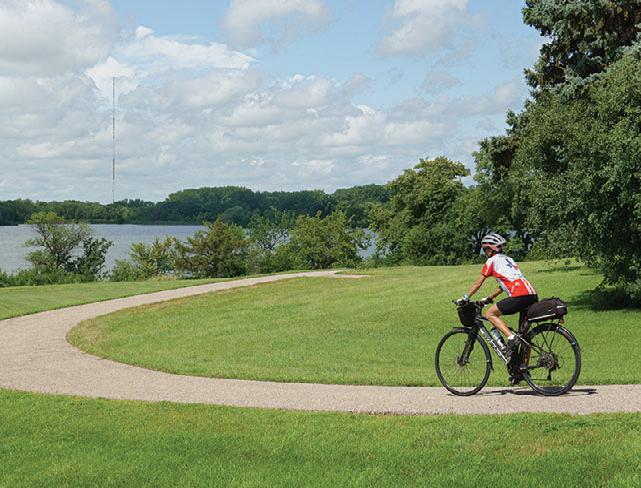
The Glacial Lakes State Trail starts at a trailhead near the Civic Center on the north side of Willmar, then heads northeast through scenic farmland and prairie. Along the way, it passes through Spicer, New London, Hawick, and Paynesville, where the longest paved segment currently concludes at 22 miles. After a seven-mile gap, it picks up again in Roscoe and continues for another eight miles to Richmond. Here, it flows into the Rocori Trail, which travels on, passing through Cold Spring and reaching Rockvillle after eight miles. Add a relatively new three-mile leg inside of New London’s Sibley State Park, and the total mileage comes to about 33, not including any side trips like the Eagle Lake Loop or the Lake Koronis Trail. I felt I had a solid plan to explore this new to me trail system over a sunny July weekend.
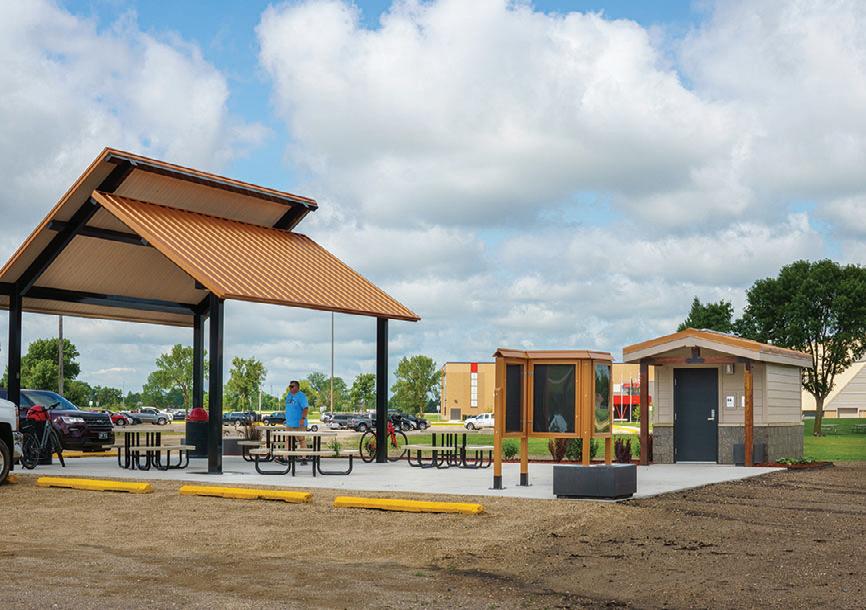
The brand-new trailhead for the Glacial Lakes State Trail at the Civic Center in Willmar was a great start to my trip. Besides ample parking it offered a covered picnic space, restrooms, even bicycle tools. A map showed additional trails winding through Willmar, and I couldn’t resist a preliminary detour to cycle around the scenic parks and lakes on that edge of town. It was well worth the added miles, particularly the spree through Robbins Island Regional Park. Surrounded by lakes with trails that wind through forested rolling hills, I hardly felt like I was in town.
Back at the trailhead, it was time I got back to the original plan and headed north toward Paynesville. Far from roads and flanked by farms and silos, I passed fields thick with wildflowers including bee balm, blacked-eyed susans, clover and pea plants – a sea of pink and yellow. Because the trail is built on a former Burlington Northern railway, the terrain is mild and accessible and the segment from Willmar to New London even includes a grassy track for equestrians next to the paved trail.
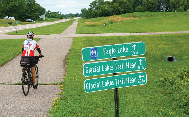
An alternate trail, the Eagle Lake Loop, leads out of town, past the high school and views of wind turbines. From there a bike path cuts through vast expanses of tall grasses and leads to Eagle Lake, which is ringed by big lake homes with attractive landscaping. Turning at the Glacial Ridge Trail Scenic Byway, it parallels the road passing a wetlands and pond, then meets up with the Glacial Lakes State Trail at a parking area about two and a half miles north of the Willmar trailhead.
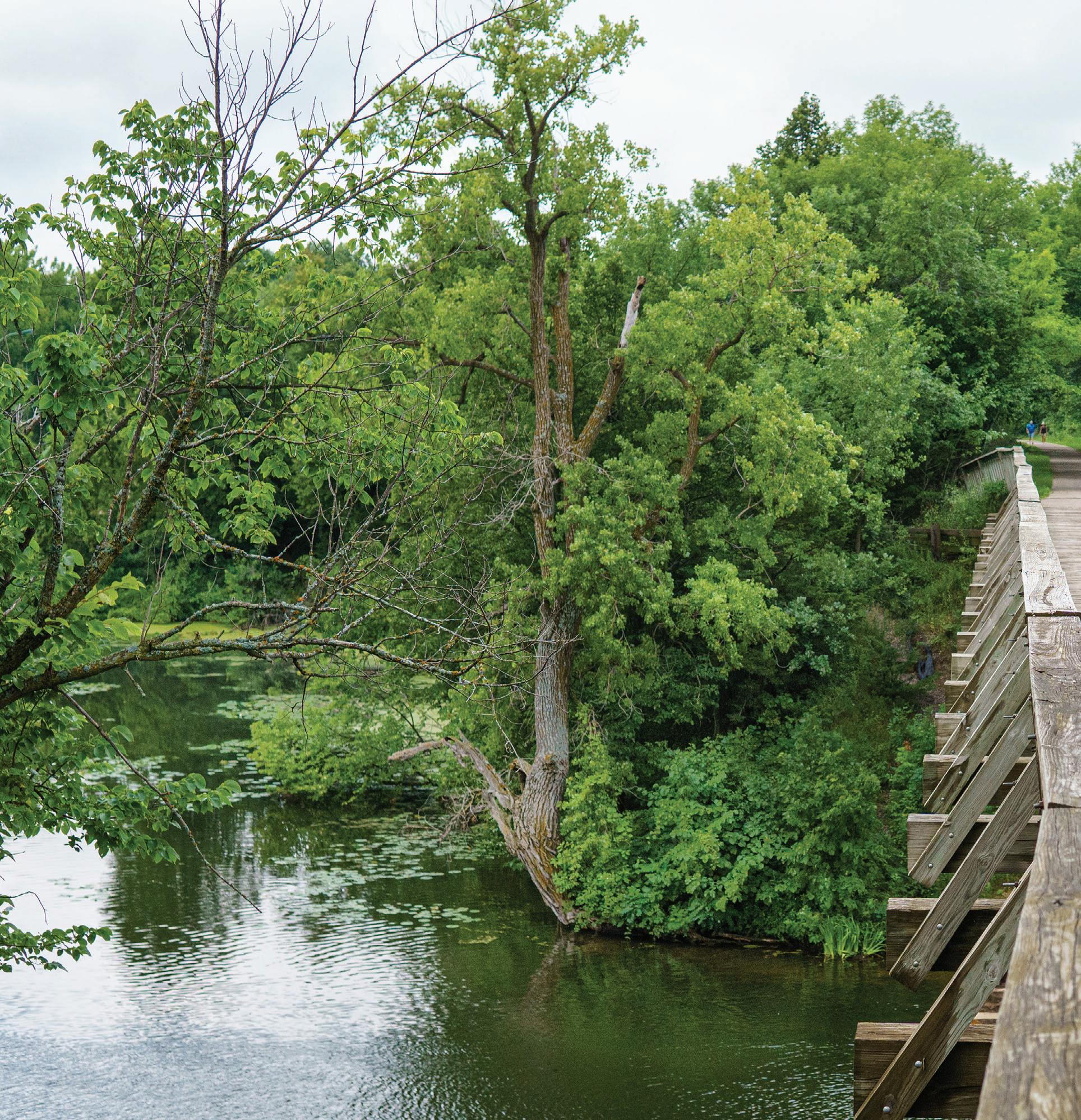
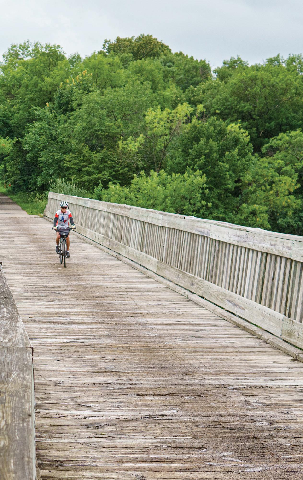
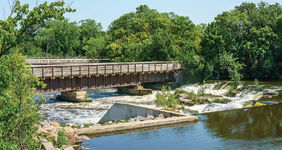
After a few more quiet miles, the trail cozied up to Highway 23 and took me up to Spicer which had plenty of options for shops and refreshments. I crossed over to Saulsbury Beach County Park on Green Lake to enjoy views of the lake and take advantage of the picnic tables and nice restrooms. It was a great spot for a little break and the sunny summer weather had the beach packed with people. At the northern end of Spicer I passed Dilly Lake, a picturesque scene with the Spicer water tower in the distance. The trail then crossed a long, wooden railroad bridge over Nest Lake, which was named for the abundant nests of double-crested cormorants.
It was a short distance from there to New London where I detoured into a busy town. As I crossed the bridge on Main Street by Mill Pond I saw kids’ foot races in progress, with joyful cheers and excitement and it looked like there was more going on than just the normal summer lake town traffic. I had stumbled on the New London Water Days in full swing. The four-day festival held annually on the third weekend of July included a craft sale, kids’ carnival, pancake and omelet breakfasts, tournaments for tennis, fishing and bean bags,
(TOP) Bridge over Nest Lake on the Glacial Lakes State Trail; (BOTTOM LEFT TO RIGHT) The Glacial Lakes State Trail seamlessly flows into the RoCoRi Trail in Richmond; the Willmar trailhead offers restrooms, parking, water, bike tools and a shelter; much of the southern segment of the Glacial Lakes State Trail is flanked by trees.
music and theater in the evenings, fireworks and more. The town was buzzing! I was sorry to miss the Rubber Duck fundraiser race the next day, but I did stroll the local vendors’ market.
Reluctantly leaving the excitement behind, I followed County Road 40 out of town for three miles to Sibley State Park.
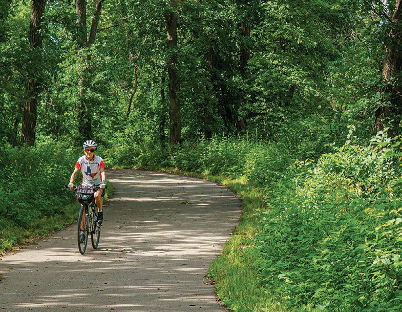
down the embankment into the river. This was a particularly attractive stretch of trail, lined with shade trees that nearly touched overhead.
At Rockville’s Mill Street, there was no second-guessing the sign that read “End.” Mill Creek lay in the woods just beyond, obscured by decades-old brush that had swallowed the old tracks.
We all dream of that day, when this and other bike trails guide us across increasingly long distances in Minnesota. But, for now, I had to turn around and bike back.
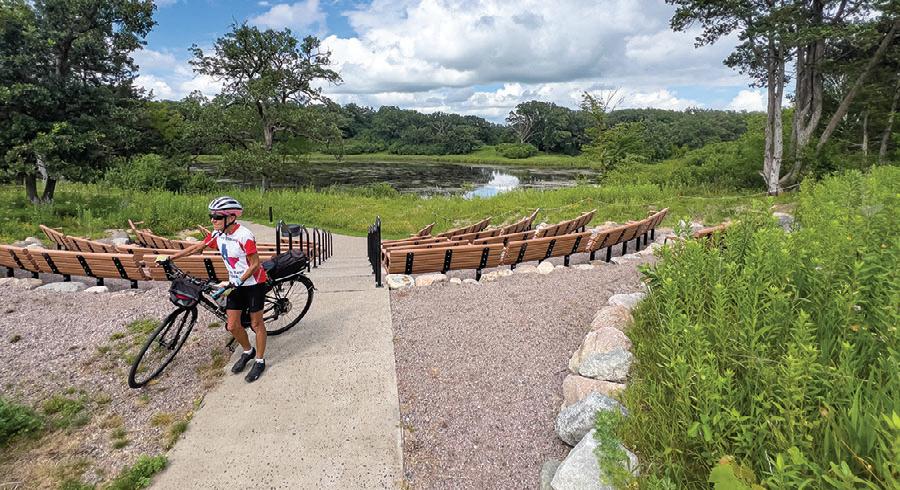
Where the road reached Highway 71, I met the smooth new bike trail that travels through the park and will soon connect to New London. A long downhill ride through native prairie grasses and woodlands took me to the Interpretive Center, then Andrew Lake and the Oak Ridge campground tucked into the woods.
To my relief, the return trip was far easier than expected, and the inclines were reasonably gradual.
Editor’s Note: There’s potential for a mind-boggling trail network here. Long-term plans include dropping the Lake Wobegon Trail down about eight miles from Waite Park to connect in Rockville, which also means a link to the Central Lakes State Trail in the west and a route to Fergus Falls. From there, the planned Glacial Edge Trail will hook up to the existing Heart of the Lakes Trail which makes its way through Maplewood State Park and links Perham with Pelican Rapids. But that’s not all.
I spent the night in the area, and thanks to some local intel I ventured over to New London’s Neer Park to take in a free waterski performance by the Little Crow Ski Team. I marveled at the stunts and the pyramids of skiers as they passed the spectator area and relished the day’s local flavor that slow travel by bicycle brings.
Northeast of New London, the trail parallels Highway 23 beyond Hawick, then returns to quieter territory before ending at the Stearns and Kandiyohi county line near Paynesville.
For those looking for additional miles, a city bike trail leads to the 16-mile Lake Koronis Recreational Trail which circles the lake. A combination of paved trail and signed shoulder riding on a quiet road, it provides nice views of the lake. I admit to skipping this part, heading up to Roscoe to park near the ball fields where the Glacial Lakes Trail resumes. From there it was quiet riding through rural farmland with corn fields and other crops, but also marshy areas and wildflowers persisting alongside the trail.
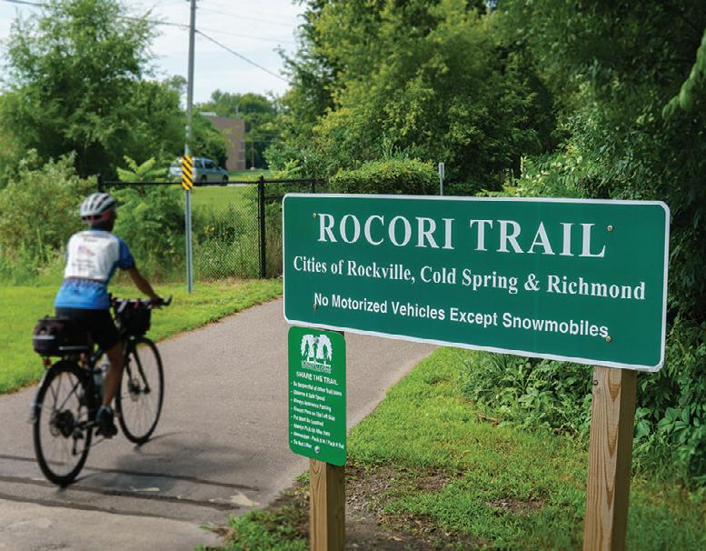
In Richmond, beyond a well-appointed trailhead, the trail seamlessly transitions into the Rocori Trail, named for the three small towns it connects – Rockville, Cold Spring, and Richmond. After nearly two decades of efforts by local residents and Stearns County, it was finally completed in June of 2023.
With the Wobegon’s existing tie to the Soo Line Trail in the north, the planned Camp Ripley/Veterans State Trail will one day bridge the gap between it and the Paul Bunyan and Heartland State Trails, meaning a link to Bemidji, Cass Lake and Park Rapids. The picture gets even bigger when you consider that the Heartland Trail’s final destination is Moorhead, and the master plan for the Glacial Lakes State Trail calls for it to travel from Sibley State Park through Glacial Lakes State Park and end at Lake Carlos State Park.
Continuing on to Cold Spring, newly developed Alexander Park jumped out at me. Built on the former site of Cold Spring Granite, it was filled with colorful playground equipment, a splashpad, water and restrooms. I couldn’t help but stop, and as I was admiring the scene I spotted the Red Truck Ice Cream parlor across the road. It was too much of a draw to resist, and their creative flavors and quiet backyard patio were a welcome, delicious respite. Continuing beyond the playground, I found a modern bandstand surrounded by a large grassy seating area. The park clearly paid homage to the granite deposits in the area. I especially appreciated the unique bike rack, made of a large granite slab that appeared to be emerging from the earth. It had slots for bike tires and large loops for bike locks in between.
The Sauk River and its dam define the eastern edge of the park where a bridge took me across the undulating river. A lovely viewing area overlooks the dam, and, judging from the bobber dangling from a high tree branch, it must also be a good fishing spot. Crossing over the river on the bike trail bridge came with great straighton views of the dam.
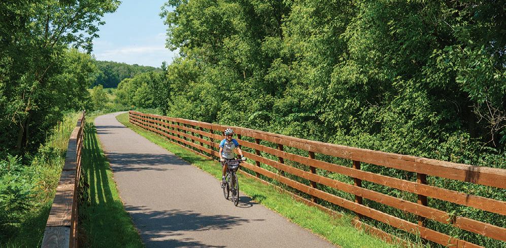
I followed the Sauk River for quite a distance as it snaked eastward, though it stayed hidden behind the trees along the trail. Eventually the path veered away from the highway to get to Rockville. That is the newest section of the trail, and the flawless pavement showed it. Along one stretch, a wooden fence stood guard to keep cyclists from pitching
Northeast of Cold Spring on the RoCoRi Trail.
The amphitheater at Sibley State Park.
A city trail skirts Willmar Lake on the way to Robbins Island Regional Park.
Views of the Sauk River Dam on the RoCoRi Trail in Cold Spring.
(LEFT) Alternate route: The Eagle Lake Loop splits off from the main trail just outside of Willmar.
TOUR DE LOOP
Trail | Luverne, MN
June 4, 2026
Enjoy a leisurely spring loop around Luverne, register for fun prize drawings, and gather for a sweet treat afterward!
Stay for the weekend and dive into Luverne’s lively Buffalo Days, featuring a classic car show, parade, craft fair, and tons of family-friendly fun. www.luvernechamber.com
KKD Gravel
Gravel | Farmington, MN
June 6, 2026
www.mntrails.com/event/kkd-gravel
Tour de Lucé
Road/Trail | Various Twin Cities Locations
June 6, 2026
www.mntrails.com/event/tour-de-luce
TOUR DE PEPIN
Road | Lake City, MN
June 6, 2026
Experience one of the Midwest’s most unique and beloved cycling tours, the Tour de Pepin. Choose your route and explore the captivating terrain and historic river towns surrounding beautiful Lake Pepin. www.lakecity.org/tour-de-pepin
TOUR OF LAKES
Road | Crosby, MN
June 6, 2026
This ride promises an abundance of beautiful scenery, fresh air and terrific rest stops. The Tour of Lakes is a one day recreational, not for-profit bicycle tour hosted by the Paul Bunyan Cyclists Bicycle Club. www.paulbunyancyclists.com
THE
SPRING BIKE FLING
Trail | Walker, MN
June 13, 2026
Hop on the Paul Bunyan Trail from Walker to Hackensack and pedal through the stunning forests and lake country of Paul Bunyan’s own backyard. www.leech-lake.com/event/spring-bikefling-62754/
CARAMEL ROLL RIDE
Trail | Albany, MN
June 13, 2026
Choose from three options: East to Avon, Collegeville and Saint Joseph, west to Freeport, and of course, north to Holdingford and the covered bridge, then on the Soo Line Trail to Bowlus and Blanchard Dam on the Mighty Mississippi River. As always, the best caramel rolls you can find anywhere will be available at all the rest stops along the way!
www.lakewobegontrail.com/lwta-rides
Bike MS: MS 150
Road/Trail | Saint Peter, MN
June 13-14, 2026
www.mntrails.com/event/bike-ms-ms-150
The Hotdish
Gravel | Winona, MN
June 13-14, 2026
www.mntrails.com/event/the-hotdish
THE TOUR OF MINNESOTA
Road/Trail | Mankato, Faribault, Albert Lea, MN
June 13-19, 2026
Celebrating over 50 years of adventure, this iconic Minnesota ride continues to inspire cyclists with its mix of scenic roads, rolling trails, and lasting camaraderie.
www.tourofminnesota.com
MICKELSON SUMMER TRAIL TREK
Trail/Gravel | Custer, SD
June 19-21, 2026
Discover the heart of the Black Hills on the Mickelson Trail, pedaling through valleys, tunnels, and historic mining towns on this 119-mile bucket list adventure. www.mickelsontrail.com
MIDWEST MOUNTAIN BIKE FEST
Mountain Bike | Cuyuna, MN
June 19-21, 2026
A rider-driven, non-competitive festival in the legendary red dirt of Cuyuna, built for mountain bikers, by mountain bikers. Explore over 60 miles of iconic red dirt singletrack that makes Cuyuna a true bucket-list destination. www.midwestmountainbikefest.com
LOOP THE LAKE RIDE
Trail | Bemidji, MN
June 20, 2026
Take a fun bike cruise around Lake Bemidji with the whole family and experience the charm of the first city on the Mississippi from the seat of your bike. Enjoy beautiful lakeside views, community spirit, and plenty of family-friendly activities.
www.bikebemidji.com
SWISS CHEESE AND SPOTTED COWS BIKE TOUR
Road | Sauk City, WI
June 26-July 1, 2026
This fully supported bike tour explores the best of southern Wisconsin, from the rolling hills of the Driftless region to the gentle countryside beyond, along quiet pastoral roads lined with small farms and charming towns.
www.scscbiketour.com
Bike to Duluth
Road/Trail | Minneapolis, MN
June 27, 2026
www.mntrails.com/event/bike-to-duluth
Lutsen 99er
Mountain Bike | Lutsen, MN
June 27, 2026
www.mntrails.com/event/lutsen-99er
Bike Rides & Tours
WoodTickr Gravel Fondo
Gravel | Hawley, MN
June 27, 2026
www.mntrails.com/event/woodtickr-gravelfondo
GREAT SCOTT CLASSIC BIKE RIDE
Road | Prior Lake, MN
July 4, 2026
Savor the sights and sounds of rural Scott County on this welcoming ride hosted by the Great Scott Cycling Club. Choose from 25 or 50-mile routes, enjoy SAG support and rest stops, and cap off the day with a delicious post-ride lunch. www.bikereg.com/great-scott-classic-bikeride
Freedom From Pants Ride
Road | Minneapolis, MN
July 4, 2026
www.mntrails.com/event/freedom-frompants-ride
The Wolf Gravel | Finland, MN
July 10-12, 2026
www.mntrails.com/event/the-wolf
Freedhem 76
Gravel | Freedhem, MN
July 11, 2026
www.mntrails.com/event/freedhem-76
BLUENOSE GOPHER 50
Gravel | Granite Falls, MN
July 11, 2026
This gravel ride explores the challenging ups and downs of the Minnesota River Valley in search of the route of a longforgotten 1890s bike race. Breathtaking views, billion-year-old granite and quiet back roads steeped in history are the backdrop for a unique ride.
www.bluenose.coop/bluenosegopher50
RIDE ACROSS WISCONSIN
(RAW)
Road | Eau Claire, WI
July 11, 2026
Riders from across the country come together to tackle epic distances, cruise through breathtaking countryside, and discover the hospitality of small-town USA.
www.wisconsinbikefed.org/ride-acrosswisconsin-raw
Bike.Build.Home 500
Road/Trail | Mankato, MN
July 14-19, 2026
www.mntrails.com/event/bike-buildhome-500
Tour de SAVE
Road | Northfield, MN
July 18, 2026
www.mntrails.com/event/tour-de-save
TOUR OF SAINTS
Road/Trail | Saint Joseph, MN
July 19, 2026
It’s not a race. It’s a heavenly little ride. From cities across Minnesota and neighboring states, each year 1,000 or more cyclists gather in St. Joseph to wind their way along quiet byways and rolling hills of central Minnesota.
Distances: 18, 35, 50 miles.
www.bikemn.org/all-events/tour-of-saints
TOUR DE BUN BICYCLE CLASSIC
Road/Gravel | Montgomery, MN
July 25, 2026
Pedal through the heart of Minnesota Czech Country in scenic Le Sueur County, where refreshment stops, quiet rural roads, and two adventurous gravel routes make for an unforgettable day on the bike.
www.montgomerymn.org/tour-de-bun-bikeclassic
SCENIC SHORE BIKE TOUR
Road | Mequon, Manitowoc, Sturgeon Bay, WI
July 25-26, 2026
The Scenic Shore Bike Tour delivers two days and 150 miles of pure cycling joy along the sparkling shoreline of Lake Michigan. With full support and over 1,500 enthusiastic riders, it’s a weekend that blends challenge, beauty, and community.
While you pedal fully supported along one of Minnesota’s premiere paved bike trails, you’ll encounter historic and scenic points of interest, and enjoy food and music at rest stops. In 2026, the ride will travel between Embarrass and McKinley, with multiple ride options. www.mesabitrail.com/events/annual tour
TOUR DE TONKA
Road | Minnetonka, MN
August 1, 2026
The Tour de Tonka is a Minnesota classic. Roll through the Lake Minnetonka area and its surrounding communities on your choice of routes, there’s a perfect distance for every rider. www.tourdetonka.org
CANDAK
Road | Velva, ND
August 1-8, 2026
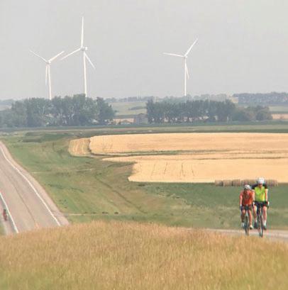
This ride carries on the tradition of the CANDISK ride of North Dakota with daily routes ranging from 35 to 70 miles and a century option. This is a multi-day tour through North Dakota with terrain varying from flat fields to steep hills. www.candak.net
River Towns on the Mississippi Road/Trail | Cottage Grove, MN
Whether you’re chasing gravity in thrilling downhill runs, tackling timed enduro stages across increasingly technical terrain, cruising cross-country loops, or testing your endurance on adventurous trail courses, there’s a challenge waiting for you.
www.duluthtrailsfest.com
Hollo
Gravel Classic
Gravel | Battle Lake, MN
August 8, 2026
www.mntrails.com/event/hollo-gravel-classic
PEDALS FOR POLLINATORS
Trail | Holdingford, MN
August 8, 2026
Art in Motion, a Bee & Butterfly Habitat Fund (BBHF) habitat site along the Lake Wobegon Trail, is hosting this new ride. Participants may choose 21, 32, or 56 miles with a caramel roll breakfast, a postride gathering, and a silent auction. https://art-in-motion-web-store.square.site
Join the Stillwater Sunrise Rotary Club on an epic trip through the hills and valleys around Stillwater, MN. Part of the Rivers, Lakes, Fields Ride Series, including the Northfield Rotary Bike Tour. Ride both for extra swag and prize drawings. www.bridgethevalley.org
BICYCLING AROUND MINNESOTA
(BAM)
Road/Trail | Detroit Lakes, MN
August 13-16, 2026
BAM riders enjoy rolling over paved, lowtraffic roads and bikeways in Minnesota, and each year the route moves to a different region of the state to promote the wonderful communities there. www.bambiketour.org
Apple Blossom Bike Tour
Road | La Crescent, MN
August 15, 2026
www.mntrails.com/event/apple-blossombike-tour
Bike Rides & Tours
GITCHI-GAMI
NORTH SHORE RIDE
Trail | Gooseberry Falls State Park
August 15, 2026
Enjoy a supported, recreational ride on the Gitchi-Gami State Trail along Lake Superior’s spectacular North Shore. Get up close to breathtaking shoreline views, listen to the rhythm of rushing waterfalls, and wind your way through beautiful state parks. www.ggta.org/support/annualbikeride
ROCK-N-ROLL THE LAKES
Road | Albert Lea, MN
August 15, 2026
Albert Lea knows how to rock! Riders can choose from one of three different routes of SAG-supported, “rolling” fun around town. All three courses hug picturesque lake shores and offer beautiful southern Minnesota scenery. www.bikemn.org/all-events/rock-n-roll-thelakes
Part of the Sounds of Summer celebration, this free ride travels the scenic Camden Trail into nearby Camden State Park. Rest stops along the way keep you fed, and the first 50 riders receive a free water bottle. www.visitmarshallmn.com/sounds-ofsummer
Gray
Duck Grit
Gravel | Cannon Falls, MN
September 5-6, 2026
www.mntrails.com/event/gray-duck-grit 2026 USA Cycling Gravel
There’s a route for everyone: Road, gravel or family. Part of the Rivers, Lakes, Fields Ride Series, including Bridge the Valley Bike Rally. Ride both for extra swag and prize drawings.
As always, Classic riders enjoy the scenic and historic Grand Round in Saint Paul. Enjoy a delightful tour of five regional parks, plus a jaunt over the Mississippi River over to lovely Lilydale Park. Live music at every rest stop! www.bikeclassic.org
RIDEMN1
Road | Fargo, ND to Duluth, MN
September 13-19, 2026
Join RideMN1 on their inspiring ride across Minnesota to raise awareness about cancer. This year’s route visits Fargo, Detroit Lakes, Itasca State Park, Federal Dam, Crosslake, Cromwell, and Duluth, with optional pre-ride camping and dinner to kick off the journey. www.ridemn1.org
North Star Bicycle Race
Road | Saint Paul, MN to US-Canada border
September 16, 2026
www.mntrails.com/event/north-star-bicyclerace
Tomassoni Tour
Trail | Biwabik, MN
September 17-19, 2026
www.mntrails.com/event/tomassoni-tour
MICKELSON TRAIL TREK
Trail/Gravel | Custer, SD
September 18-20, 2026
Discover the heart of the Black Hills on the Mickelson Trail, pedaling through valleys, tunnels, and historic mining towns on this 119-mile bucket list adventure. www.mickelsontrail.com
MORA BIKE TOUR
Road | Mora, MN
September 19, 2026
Join the annual Mora Bike Tour, starting and finishing at the Vasaloppet Nordic Center. With two beautiful rural routes, well-stocked rest stops, and mobile repair support, it’s a perfect blend of Minnesota charm and cycling spirit. www.vasaloppet.us/mora-bike-tour
Ride to End ALZ
Road | Stillwater, MN
September 19, 2026
www.mntrails.com/event/ride-to-end-alz
RIDE THE RIDGES
Road | Winona, MN
September 19, 2026
Ride the Ridges takes cyclists through some of the most scenic areas in southeastern Minnesota, from lush valleys along winding streams to bluffs overlooking the Mississippi River. Every route features well-stocked rest stops with local delicacies to keep you fueled and happy.
www.ridetheridges.bike
ROSEWOOD GRAMBLE
Road, Gravel | Thief River Falls, MN
September 19, 2026
Join Bike Thief River Falls on this ramble on gravel (Gramble) and see rural Pennington and Marshall Counties. You’ll ride the former beach ridges of Glacial Lake Agassiz, minimum maintenance roads and a bit of trail.
www.bikemn.org/all-events/rosewoodgramble
IWP Ride Against Suicide
Road | Zumbrota, MN
September 23-26, 2026
www.mntrails.com/event/iwp-ride-againstsuicide
Headwaters 100
Road | Park Rapids, MN
September 26, 2026
www.mntrails.com/event/headwaters-100
Heck of the North
Gravel | Two Harbors, MN
September 26, 2026
www.mntrails.com/event/heck-of-the-north
WHEELIN’ TO WALL
Road/Gravel | Wall, SD
September 26, 2026
Experience the magic of Badlands National Park and its striking rock formations during this cycling celebration. Both road and gravel routes are available on this fully supported ride through one of America’s most dramatic landscapes. www.wheelintowall.com
KATO BIKE FALL FEST
Road, Trail | Mankato, MN
September 26-27, 2026
The Kato Bike Fall Fest is a weekendlong celebration highlighting the vibrant bike culture of the greater Mankato area. Expect spectacular routes, tasty treats, and plenty of fun surrounded by the serenity of a southern Minnesota autumn.
www.bikemn.org/all-events/kato-bike-fallfest
DIRT BAG GRAVEL GRINDER
Gravel | Clearwater, MN
October 3, 2026
This central Minnesota fall ride on the backroads around Clearwater honors the memory of the late John Egbers. In the spirit of gravel riding, it’s free and unsupported.
Visit the ride’s Facebook page for more details.
The Gunflint Scramble!
Mountain Bike | Grand Marais, MN
October 3, 2026
www.mntrails.com/event/the-gunflintscramble
Old Fashioned Gravel
Gravel | Hokah, MN
October 3, 2026
www.mntrails.com/event/old-fashioned-gravel
TWIN CITIES BIKE TOUR
Road/Trail | Minneapolis, MN
October 10, 2026
Celebrate the trails and communities that power Minnesota’s cycling culture. With support vehicles, mechanics, and rest stops along the way, all you need to do is ride, smile, and soak up the scenery. www.bikemn.org/all-events/tcbt
THE FILTHY 50
Gravel | Lanesboro, MN
October 10, 2026
Pedal through rolling Bluff Country roads and vibrant autumn hues in Lanesboro’s iconic gravel ride where challenge meets community spirit. With miles of scenic terrain and a lively race-day atmosphere, it’s a fall biking tradition you won’t want to miss.
www.the-filthy.com
Gritty Goose Gravel Grinder
Gravel | Monticello, MN
October 24, 2026
www.mntrails.com/event/gritty-goose
Pasta, PASTIES
STO RY BY J ENNIFER KIMBALL GASPERINI
MyattempttoridetheMesabiTrail
My attempt to ride the Mesabi Trail years ago didn’t go so well. Our family was picking up our daughter Elle from YMCA Camp Warren in Eveleth one summer and thought it would be a fun family activity to go for a bike ride. But, after two weeks at camp she just wanted to go home to see her friends, and her bad humor convinced us to just head home.
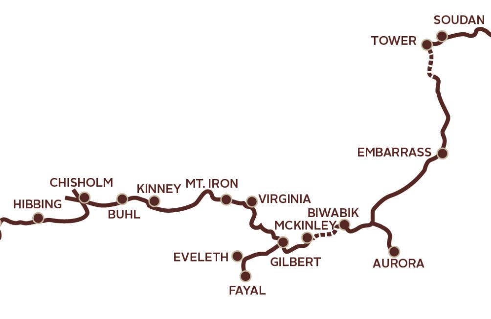
Now an empty nester, I’ve been excited to return to fully enjoy the trail, and 2025 was the year it finally happened. My partner, Jeff, and I studied the trail map and considered the mechanics of riding end to end without having to double back. After lots of deliberation, we decided to ride the middle segment of the trail between Hibbing and Aurora, and invited our friend, Eileen, to join us. We agreed to leap-frog two cars to avoid long drives, and cover about 100 miles in two days. It was an ambitious goal on a trail that can have up to an eight percent grade. While part of it is built on former railroad beds, the real story is one of engineering ingenuity and also includes former logging and mining roads, pieces of abandoned highway, and other creative ways to stretch a trail between Grand Rapids and Ely.
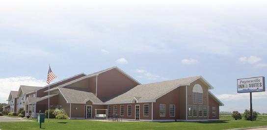
We checked in at the Chisholm Inn and Suites the day before the ride and found the place to be very accommodating. The hotel had a bike storage room and allowed us to leave one
car in their lot during our ride.
carintheirlotduring
The plan for day one was to drive east to Biwabik to deposit the other car, bike 40 miles back west to Chisholm, continue west for an evening trip to Hibbing, then return to Chisholm, collect the second car from Biwabik, and move camp to the Quality Inn and Suites in downtown Virginia. It sounds complicated, but it worked like a charm.
100 miles of local flavor on the Mesabi Trail
100 loc on th T
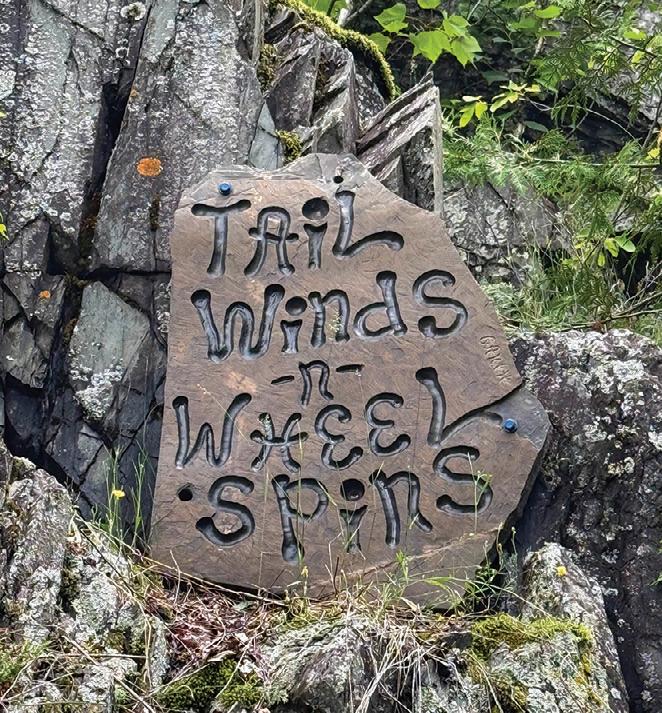
Nearly the entire trail was lined with flowering native prairie plants, like colorful blazing star, lupine, anemone and goldenrod; goldfinches and nuthatches darted over our heads and butterflies flitted among the tall flowers. We spotted bald eagles, red-tailed hawks and even an owl. Just south of Biwabik, we stopped to photograph a variety of art pieces tucked along a rock wall. A large, bright blue clay bird caught our attention. Then we noticed messages carved in slices of rock: one read “Tail Winds ’n’ Wheel Spins,” another “Happiness Never Decreases by Being Shared.” A historical marker identified the area as Pike Rock Cut, a section blasted in the 1800s to make a
passage for the Mesabi Railway.
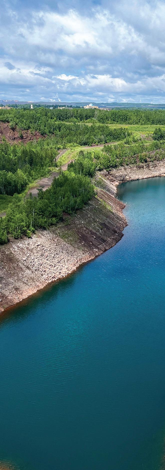
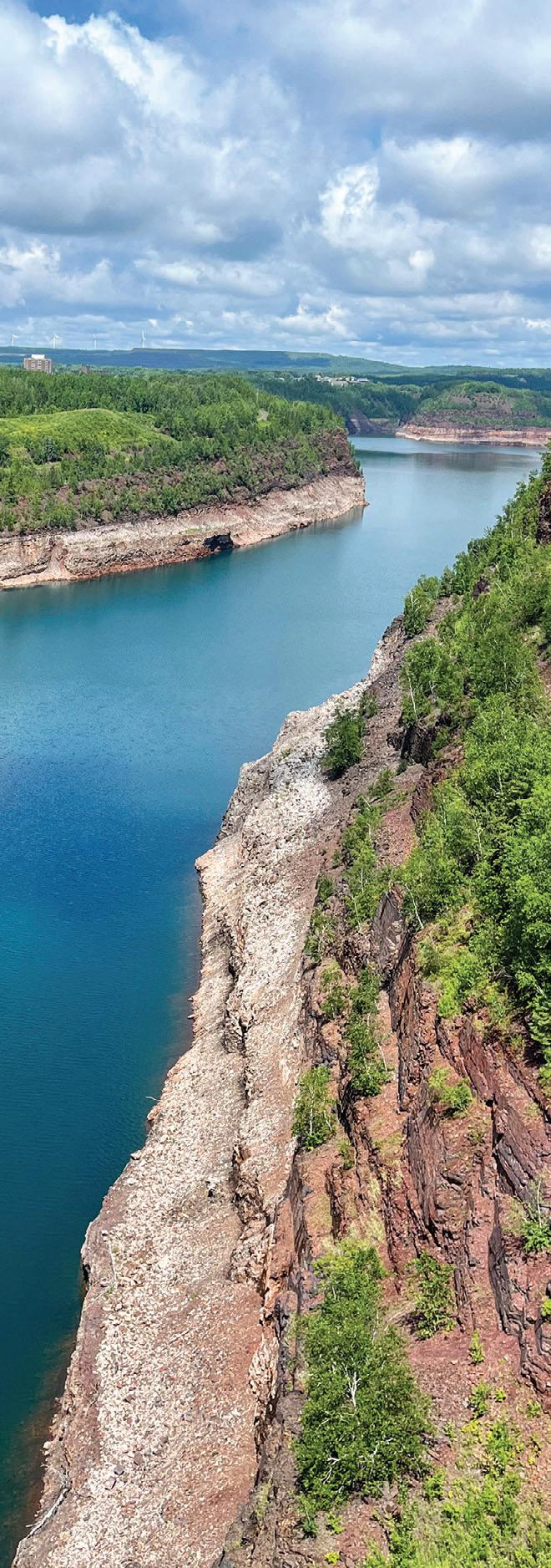
Entering Virginia, we crossed the Rouchleau Mine Pit on the Thomas Rukavian Memorial Bridge. We later learned it’s Minnesota’s tallest at over 200 feet. Nearly a quarter-mile across, it was also impressive in length. We were lucky to find Pep’s Bake Shop, a staple in downtown Virginia, where we tasted a very good Slovenian pastry called potica.
In Mountain Iron, the self-proclaimed Taconite Capital of the World, we stopped at a lookout over the Mountain Iron Mine, a National Historic Landmark near the site where iron ore was first discovered in the late 1800s. On display
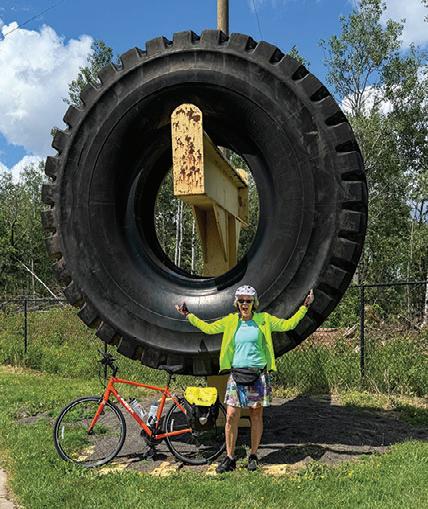
was a Baldwin 1910 steam locomotive and decommissioned mining equipment. Interpretive panels described the mining process and the mind-boggling size of today’s earth-moving equipment. We took photos with a 10-foot truck tire and 7-foot ore shovel, which we all thought were huge, but these relics were diminutive in comparison to the equipment in use now.
Back in Chisholm after 40 miles, we were ready for a longer rest and turned into Valentini’s Supper Club, another long-time family business on the Iron Range. Of course, pasta was on the menu and that gave us enough energy for the last leg of the trip.
In Hibbing, we admired the historic 1923 Hibbing High School with its cut glass chandeliers, posh red velvet auditorium seats and vaudeville organ. Just down the street, we rode past Bob Dylan’s childhood home, which was marked by a small lawn sign. We finished our detour with a stop at a place called Scoops, and their homemade ice cream carried us all the way back to Chisholm as the sun began to set. We had logged 60 miles, the most I’ve ever ridden in a day, but it didn’t feel strenuous because we made so many stops along the way. The power of pasta, pastries and ice cream really worked its magic.
The next day involved a similar shuttle shuffle. We dropped one car at the Mesabi Trailhead in Biwabik, drove the other to a trailhead south of Tower, and hit the trail going south.
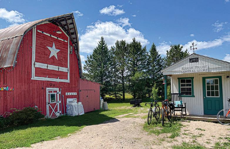
Coming into the tiny town of Embarrass on a hot, sunny day, we were thrilled to find ourselves in a stretch of cool, dark pine forest that I wished would have lasted for miles. Just past the town, a sign advertised ice cream and cold drinks. Perfect timing! At the end of a long dirt driveway, we found Early Frost Farms. Besides chickens clucking in a large pen, we saw no signs of life, but discovered homemade chocolate-covered ice cream bars and cold drinks in a small outbuilding. A wooden payment box and a link for electronic payment was provided and a sign invited us to sit in the gazebo to enjoy our snacks. We were three
happy bikers.
Leaving the idyllic setting, we rode three-quarters of a mile on a floating boardwalk lined by blue flag iris, water lilies and cattails, through the Embarrass Wetland Complex. Clearly, this section was not a rail trail conversion. To get out of the bog, the trail climbed a steep hill to the crest of the Laurentian Divide. We followed it all the way to Giants Ridge Resort, where a beautiful bridge took us over the narrows of Wynne Lake.
To our surprise, we found ourselves in Aurora a little while later, when we were expecting to end up in Biwabik. Turns out we had gone east instead of west at the last trail junction and missed a detour sign. That error added quite a few extra miles of riding to our day. We later learned that a heavy rainstorm had washed out part of the trail from Giants Ridge to Biwabik and we ended up taking the road for about a mile and a half to get back to the car. But we had a big appetite and The Hive Bakeshop in Aurora was still open, so we enjoyed homemade wraps and cold drinks on their patio.
When we finally arrived at our car, we had logged 40 miles and were pleased to find Carlson’s Sausage and Pasty Kitchen still open at 6 p.m. We noticed the store earlier in the day and had been dreaming about those pasties all day. Just 30 minutes later, we had collected the second car and arrived in Ely where we spent the night and celebrated our successful bike adventure at a friend’s lake home.
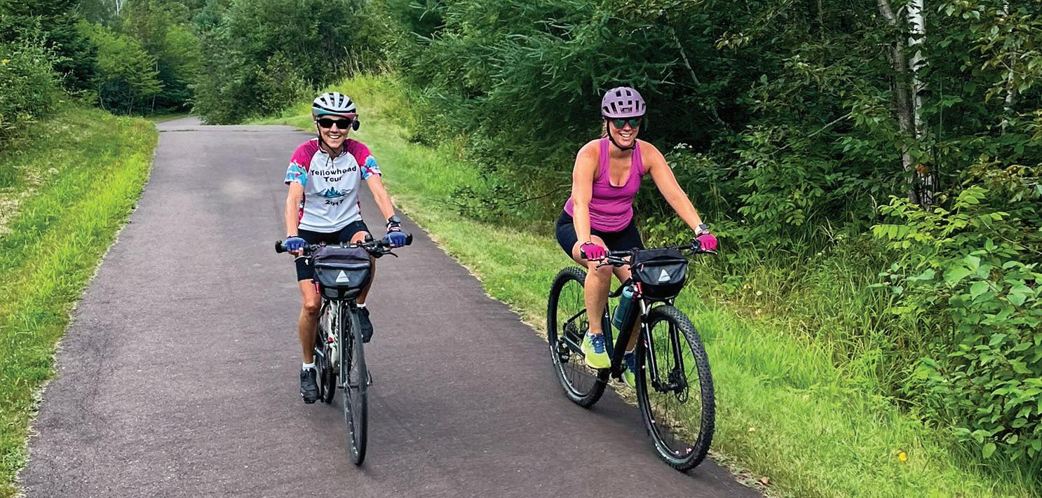
Having biked many rail trails, the three of us agreed the Mesabi Trail is one of the most interesting. Not only does it vary in elevation, but we felt like we had stepped back in time as we ventured off the trail for refreshments and a bit of history in each mining town.
We purchased an annual wheel pass so we can return to finish the trail segments we missed, and stock up on potica and pasties.
Maybe Elle is ready for the Mesabi trail now.
Editor’s note: the section of damaged trail near Giants Ridge will be repaired in May of 2026.
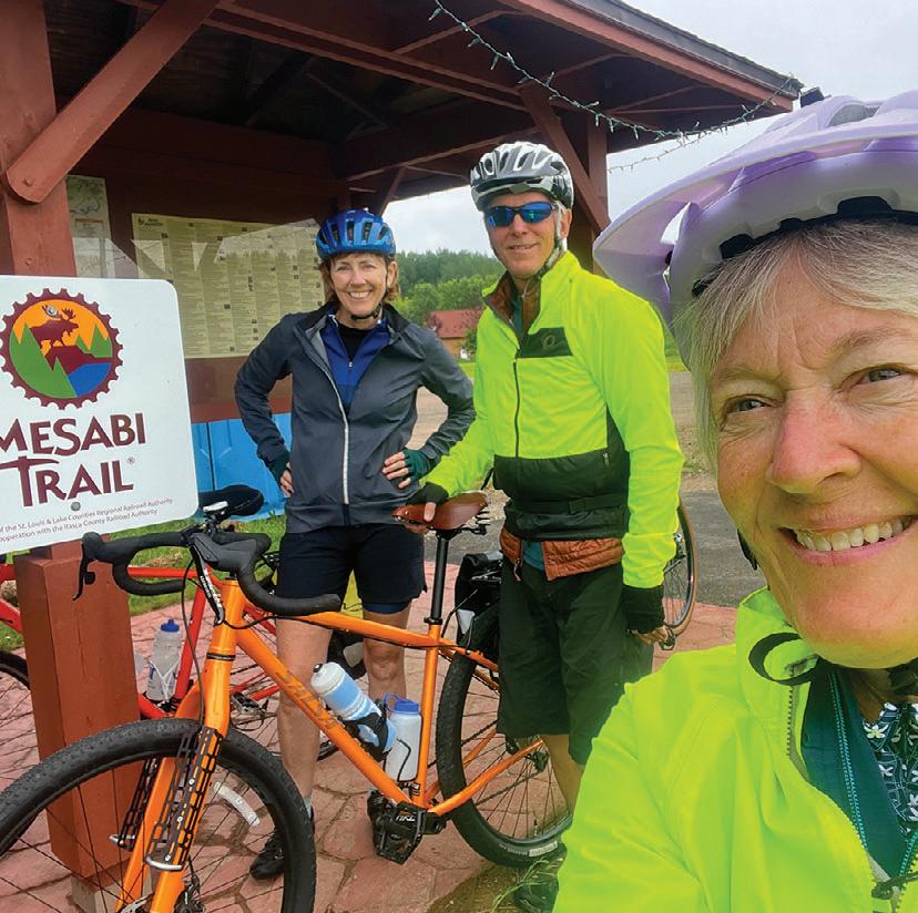
(INSET) At the Biwabik trailhead on the Mesabi Trail JENNIFER KIMBALL GASPERINI PHOTO
(BELOW) Early Frost Farms in Embarrass JENNIFER KIMBALL GASPERINI PHOTO
(BELOW RIGHT) The author poses for a picture at the scenic overlook in Mountain Iron. JEFF BERNARDY PHOTO
The R Rouchleau au mine pit in n Virginia ia is about 3 miles s long, one-half mile w wide, and d 450 50 feet deep.
JEN NIF N ER KIM M BAL L GAS A PER R INI PHOTO
WILLARD MUNGER STATE TRAIL
Willard Munger State Trail
The Willard Munger State Trail stretches continuously from Hinckley to Duluth, offering a ride that changes in character along the way. The southern portion, from Hinckley to Carlton, is mostly flat and straight, with some sections running through open countryside.
Known as the Hinckley Fire Trail, this section follows the former railroad line that carried local residents to safety during the devastating Hinckley Fire. It extends about 55 miles from Hinckley to Carlton, with access points in Finlayson, Willow River, Sturgeon Lake, and Moose Lake.
Most of this stretch remains flat and straight, following the abandoned railroad grade. Along the way, the trail crosses several bridges, passes ponds, and winds through
wooded areas, with a few segments running alongside a highway. Highlights on this section include the Hinckley Fire Museum near the trailhead, as well as the historic depots in Finlayson and Moose Lake. Riders can also take a two-mile road detour into Moose Lake State Park.
The northern segment drops 15 miles from Carlton to West Duluth, passing through forested terrain and rock cuts while offering scenic views of the St. Louis
River and the twin ports of Duluth and Superior. Near Carlton, riders can pause on a high railroad trestle for sweeping views of the river and watch kayakers navigate the rapids below. Soon after, a short, paved spur leads into Jay Cooke State Park. Farther along, the trail passes a hydroelectric power plant, winds through uncommon stands of hemlock, and reaches a hillside rest area with views over western Duluth and Lake Superior. From Bardon Peak, the route descends to its endpoint near the Lake Superior Zoo.
Connections: The 16-mile Alex Laveau Memorial Trail segment links Carlton with Gary-New Duluth, although not all of it is paved. Beginning in Carlton at the intersection of the main trail and County Road 1, the first six miles are paved as the trail heads south through Wrenshall to Highway 23. From there, bike routes continue along paved road shoulders and city streets.
The 2.5-mile St. Louis River Trail between Carlton and Scanlon can be reached by a short ride on city streets.
At the Duluth end of the trail on Pulaski Street, riders can connect to the five-mile Western Waterfront Trail. This packed gravel route follows the shoreline of the St. Louis River from Spirit Lake Marina to near Fremont Street in Duluth’s Irving neighborhood.
Between Friesland and Groningen at Grindstone Lake Road, a paved spur heads east toward Sandstone but ends just west of I-35. From there, a four-mile ride along the shoulder of Highways 61 and 23 through Sandstone leads to the western edge of Banning State Park, where another paved bike trail of less than a mile ends near the park office.
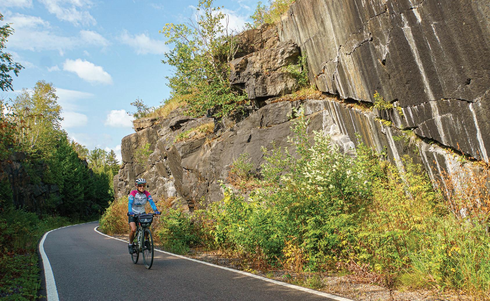
Rock cut near Duluth. Jan Lasar photo
GITCHI-GAMI STATE TRAIL
State Trail
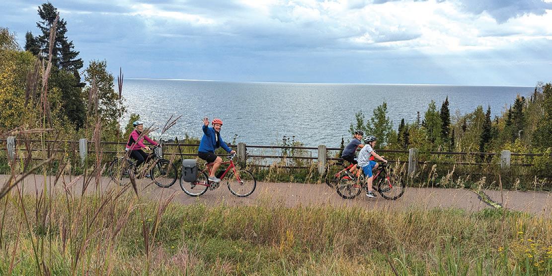
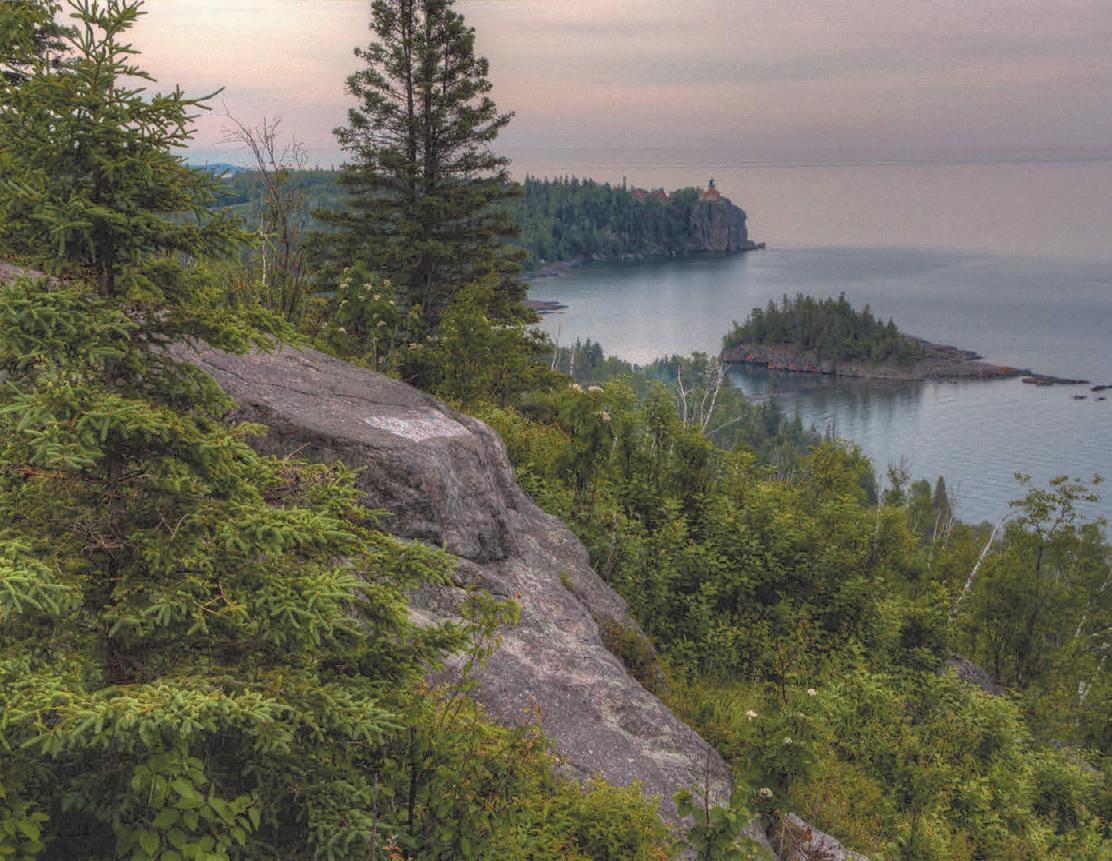
Destined to become one of the most scenic paved trails in the nation, the GitchiGami State Trail follows Minnesota’s North Shore alongside the North Shore Scenic Drive Byway, the Superior Hiking Trail, and the Lake Superior Water Trail. It offers an active and immersive way to experience the North Shore, with sweeping views of Lake Superior. When complete, the trail will extend 86 miles from Two Harbors to Grand Marais, weaving through five state parks. The longest continuous segment currently stretches more than 17 miles, connecting Gooseberry Falls State Park, Split Rock Lighthouse State Park, and Silver Bay.
Along the Trail:
Two Harbors: A recently completed 0.9-mile segment connects trail users to the Burlington Bay wayside and the nearby Sonju Trail, which leads to the historic Two Harbors Lighthouse at Agate Bay. Future construction will extend the trail to Flood Bay State Wayside.
Silver Creek Cliff : This short but striking one-mile section follows a portion of the original North Shore Drive, running 4,000 feet around the Silver Creek Cliff Tunnel northeast of Two Harbors. While not yet open for through travel, visitors can park just east of the tunnel and walk across the trail bridge to take in expansive views of Lake Superior. This area is also popular for spotting rock climbers and capturing memorable travel photos.
Gooseberry Falls State Park to Silver Bay: Seven miles east of Silver Creek Cliff, the next 17.3-mile segment begins at Gooseberry Falls State Park. Access the trail near the visitor center. From there, the route passes Iona’s Beach Scientific and Natural Area, continues through Split Rock Lighthouse State Park, and connects the communities of Beaver Bay and Silver Bay.
Schroeder to Lutsen: This 12.7-mile segment connects Schroeder, Tofte, and Lutsen. Beginning at the east parking lot in Schroeder, the trail travels through Temperance River State Park on its way to Lutsen. Along the route, it crosses the Temperance River gorge, offering dramatic views of the river and surrounding rock formations. Between Tofte and Lutsen, the Ray Berglund State Wayside provides a convenient rest stop. In Lutsen, a tunnel beneath Highway 61 connects directly to the town center.
Grand Marais: The 5.1-mile segment between Grand Marais and Cut Face Creek State Wayside features a smooth, flowing ride with frequent views of Lake Superior. A highlight is a wooden arched bridge with observation platforms, offering views of the
NORTH SHORE
BASE CAMP
GET GUIDES, ITINERARIES, TRAIL MAPS AND MORE TO PLAN YOUR NEXT NORTH SHORE ADVENTURE.
Participants in the annual Gitchi-Gami Trail North Shore Ride travel between Gooseberry Falls State Park and Silver Bay. Carl Shaffer photo
Fall River on one side and the lake on the other. This segment connects to the Grand Marais Corridor Trail, a one-mile paved route that travels through the heart of downtown Grand Marais.
MESABI TRAIL
Mesabi Trail 162 miles Grand Rapids to Ely
Discover one of Minnesota’s most remarkable outdoor adventures, the Mesabi Trail. This scenic, paved route stretches from the Mississippi River in Grand Rapids to the breathtaking Boundary Waters in Ely. When completed at the end of 2026, the paved trail will span about 162 miles, offering an unforgettable journey through everchanging landscapes. Today, more than 100 continuous miles extend from Grand Rapids to north of Embarrass, while another 35 miles run from Tower to Ely through Lake Vermilion Soudan Underground Mine State Park. Along the way, riders experience a rich variety of scenery, from dramatic views of active mining operations to peaceful, secluded woods, lush vegetation, sparkling mine lakes and tranquil reservoirs. The trail winds through forests, meadows, rivers, streams and lakes in a region framed by the Boundary Waters Canoe Area Wilderness to the east and the Mississippi River to the west. Between these landmarks, the Mesabi Trail reveals the rugged beauty of the Iron Range, where wildlife thrives and the legacy of hardy pioneers lives on.
Unlike many paved trails in the state, the Mesabi Trail follows a unique path built from former logging and mining roads, old roadways, sections of abandoned rail grade and newly constructed trail. Riders can even cross a three-quarter mile floating bridge across the Embarrass Wetland Complex and the Darwin Meyers Wildlife Management Area, and ride across Minnesota’s tallest bridge just outside of Virginia. Stretching 1,132 feet, this impressive structure rises 200 feet above the Rouchleau Mine lake, delivering spectacular views from the saddle. Additional spurs connect riders to vibrant
communities such as Chisholm, home to Redhead Mountain Bike Park, and Eveleth, where you can visit the US Hockey Hall of Fame and see the world’s largest hockey stick sculpture. Beyond the trail, even more experiences await. Tour a historic mine or logging camp, explore the International Wolf
Center in Ely, or visit the childhood homes
and
in Hibbing. Campgrounds and local parks are easily accessible from the trail, as are nearby highways and welcoming communities. Dining, lodging, shopping, antiquing, golfing, fishing, camping and swimming are
all conveniently located near trail segments, with services available at nearly every access point.
Before you set out, check for trail updates at mesabitrail.com and start planning your cycling adventure.
The Vermilion segment of the Mesabi Trail travels from Tower to Ely. Jan Lasar photo
of Judy Garland in Grand Rapids,
Bob Dylan
Paul Bunyan State Trail
120 miles
Crow Wing State Park to Lake Bemidji State Park
Minnesota’s longest rail trail and the longest in the country, is a designation that has earned its place in the Rails to Trails Conservancy Hall of Fame and recognition as a Signature Minnesota Destination. Its name is no accident. The towering legend of Paul Bunyan reflects the deep logging history of the region, and reminders of that heritage appear all along the route, from roadside statues to playful tributes to Babe the Blue Ox.
Stretching from Crow Wing State Park near Brainerd to Lake Bemidji State Park near Bemidji, the trail covers roughly 123 miles when including short on-road connections. It’s a route defined by variety, where dense pine forests, open farmland, and lake country scenery blend into a continuous ride through northern Minnesota.
Trail Sections:
Crow Wing State Park to Walker: The trail rolls out of Crow Wing State Park with occasional views of the Mississippi River before reaching Brainerd and the Northland Arboretum. This section introduces the Brainerd lakes area, a well-developed destination where resorts, campgrounds, and hotels sit conveniently close to the trail. North of Brainerd, the setting shifts to wetlands and quieter stretches, linking together towns like Merrifield and Nisswa.
BIKE TRAIL GUIDE
Nisswa brings a burst of activity, with a lively downtown full of shops and restaurants, along with its well-known pioneer village and summer turtle races. Farther along, the Pequot Lakes Visitor’s Center offers a natural stopping point. In Pine River, the information center adds a
touch of humor and history with oversized relics like Paul Bunyan’s baby shoes.
The personality of the trail continues in Backus, where Colonel Cobber, a towering chainsaw carving, stands just off the route. In Hackensack, Lucette, Paul Bunyan’s companion, keeps watch over a town known for its annual chainsaw carving festival. Beyond Hackensack, riders choose their approach to Walker. A hillier route winds through the Chippewa National Forest to the shared Heartland and Paul Bunyan segment, while the Shingobee Connector provides a shorter, more forgiving path into town.
Walker to Bemidji: North of Walker, the trail settles into a quieter rhythm. It crosses the Kabekona River and threads through Benedict, Laporte, and Guthrie, where farmland, lakes, and forest intermingle. The approach to Bemidji feels gradual, building toward one of the region’s anchor destinations.
Bemidji sits on the south shore of Lake Bemidji, bordered by the Mississippi Headwaters State Forest and Lake Bemidji State Park. The city marks the first major stop along the Mississippi River and is home to one of the most recognizable Paul Bunyan and Babe the Blue Ox statues. From here, riders can continue to the state park or take on a 17-mile loop around Lake Bemidji for a scenic extension.
Connections: North of Hackensack, the trail reaches a Y intersection within the Chippewa National Forest. The left fork leads through a more demanding, hilly section toward the Heartland Trail west of Walker, while the right fork follows the Shingobee Trail into Walker on an easier grade.
After crossing Paul Bunyan Drive in Bemidji, riders can connect to the Lake Bemidji Trail, a 17-mile loop that circles the lake and ends at Lake Bemidji State Park
Paul Bunyan
Colonel Cobber stands guard near the trail in Backus. Jan Lasar photo
regardless of direction. The trail is also part of the Mississippi River Trail Scenic Bikeway, linking the headwaters of the Mississippi River to the Gulf of Mexico.
History: Beneath the smooth pavement lies the path of a former railroad line first constructed in 1893. After its abandonment by Burlington Northern in 1983, the corridor found new life. The first 50-mile segment between Brainerd and Hackensack opened in October 1992, and the trail has since expanded to more than double that original length, evolving into one of the premier railtrail experiences in the United States.
On the Paul Bunyan Trail near Nisswa, MN. Jan Lasar photo
Photo Credit:
Explore MN
Heartland
Heartland State Trail
54 miles
In the heart of Minnesota’s lake country, the Heartland State Trail delivers mile after mile of classic Northwoods riding. This wellloved route threads together small towns, quiet forests, and open stretches of lakeside scenery, with plenty of places to pause and refuel.
Trail Sections:
Park Rapids to Dorset: The journey begins in Park Rapids at Heartland Park, where a full set of amenities sets the tone for an easy start. After crossing the Fish Hook River, the trail rolls out into a changing landscape of dense woods and open grasslands dotted with water. The six-mile stretch to Dorset feels like a sampler of the region. In Dorset, the lively trailhead offers shops, restaurants, and shaded picnic spots, while a parallel unpaved track accommodates horseback riders.
Dorset to Nevis: The next five miles to Nevis settle into a relaxed rhythm beneath a canopy of trees. Pines and poplar line the trail, with birch adding flashes of contrast. Occasional ponds appear through the woods, and just before Nevis, the crossing between Shallow and Belle Taine Lakes provides one of the more memorable views on the route.
Nevis to Akeley: Nevis makes for a natural pause, with water, restrooms, and
a chance to see the World’s Largest Tiger Muskie. From there, the ride continues toward Akeley, where Paul Bunyan’s oversized hand invites a quick stop and photo.
Akeley to Walker: From just northeast of Akeley to Walker, the Heartland Trail shares its path with the Paul Bunyan Trail. Riders looking for variety can branch off near Akeley onto an eight-mile segment through
the Chippewa National Forest, where paved former logging roads introduce grades of up to 8 percent before connecting to the Shingobee Connection Trail into Walker. Staying on the main route offers a more direct approach into town. Near Walker, the two trails split, with the Paul Bunyan heading northwest to Bemidji and the Heartland turning northeast toward Cass Lake.
Walker to Cass Lake: Leaving Walker, a short two-mile stretch on a paved shoulder links trail segments. Beyond that, the trail hugs the western edge of Leech Lake before slipping into a mix of woods and marshland. For the next ten miles, it parallels Highway 371 en route to Cass Lake. Around mile 41, a large steel bridge spans the Steamboat River, a reminder of the corridor’s railroad past. Frazee to Detroit Lakes: On the western extension, the ride from Frazee to Detroit Lakes begins near the World’s Largest Turkey statue. The trail follows Highway 10, curves past Acorn Lake, and passes beneath the highway through a tunnel before tracing the northern edge of Detroit Lake. The public boat landing marks the official trailhead on the Detroit Lakes end.
Connections: In Walker, the Shingobee Trail near Chase on the Lake Resort provides a seven-mile link of road and trail that crosses Shingobee Bay and connects to the Paul Bunyan Trail. From there, riders can head south toward Hackensack or west through the Chippewa National Forest and loop back to Walker. Near Cass Lake, a short, signed route leads to the Mi-Gi-Zi Trail, a 14-mile loop around Pike Bay through forested shoreline. From its northern trailhead, quiet city streets guide riders back to the Heartland Trail.
Looking ahead, planned expansions include a 20-mile extension north from Park Rapids to Itasca State Park and an 86-mile corridor west toward Moorhead. Portions of that western segment are already paved, including about nine and a half miles northwest from Frazee that tie into the trail system in Detroit Lakes.
The Heartland Trail between Dorset and Park Rapids. Jan Lasar photo
TRAIL MAP
Glacial Lakes State Trail
33 miles
Willmar to Paynesville and Roscoe to Richmond
The area surrounding the Glacial Lakes Trail is defined by a landscape shaped more than 10,000 years ago, when retreating glaciers left behind countless lakes. Today, this scenic region is a popular destination where communities welcome visitors to enjoy time on the water, on the bike, or both.
The trail begins at a trailhead near the Civic Center on the northern edge of Willmar. From there, it travels northeast through picturesque farmland and prairie, passing through the communities of Spicer, New London, Hawick, and Paynesville, where the trail currently ends after 22 miles. After a seven-mile gap, the paved trail resumes and continues for eight miles from Roscoe to Richmond, where it transitions seamlessly into the RoCoRi Trail at 178th Avenue.
Connections: From Richmond, continue onto the RoCoRi Trail and ride seven miles through Cold Spring to Rockville. Just northeast of Willmar, the five-mile Eagle Lake Loop Trail branches off and circles back to the Civic Center. A citydesignated bike route also provides access to downtown Willmar.
In Spicer, riders can circle Green Lake using a combination of trails and signed routes. At the eastern end of the Glacial Lakes Trail, a connector route in Paynesville links to the Lake Koronis Trail.
Within Sibley State Park, a newly completed three-mile segment of the trail winds from the park boundary at Highway 71 through prairie and woodland landscapes. It passes the visitor center, the beach, and a new amphitheater located near the trail center before ending at the boat landing. A future connection from Highway 71 to nearby New London is currently in development.
The Eagle Lake Loop on the Glacial Lakes State Trail. Jan Lasar photo
CENTRAL LAKES
Central Lakes State Trail
55 miles
Fergus Falls to Osakis
The Central Lakes State Trail follows a former railroad grade through west-central Minnesota. Stretching from Fergus Falls to Osakis, it travels through the communities of Dalton, Ashby, Melby, Evansville, Brandon, Garfield, Alexandria, Nelson, and Osakis. With its generally flat and level terrain, it offers an accessible and enjoyable ride through a diverse landscape of woodlands, grasslands, lakes, wetlands, and farmland. Communities with rest stops and amenities are typically spaced seven to ten miles apart, making it easy to plan a comfortable outing.
The official Fergus Falls trailhead is located near the intersection of Minnesota Highway 210 and 19th Street. Visitors will find parking, restrooms, picnic facilities, a bike repair station, and a play sculpture. Camping is available at DeLagoon Park, located about one mile from the trailhead. This expansive park also features a swimming beach and additional picnic areas.
As you travel south from Fergus Falls, you will cross the Continental Divide. Keep an
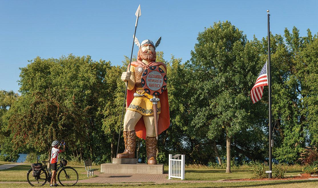
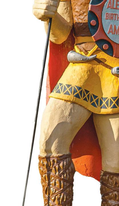
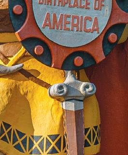
eye out for the marker along the route. The trail continues through a scenic blend of reed-lined lakes and farmland, with frequent opportunities to stop for camping, dining, and rest. In Alexandria, a popular photo stop is the statue of Big Ole the Viking, located near the Runestone Museum at the north end of downtown. In early summer, the trail is also a great place to spot pink or yellow Lady’s Slipper orchids blooming along the route.
Connections: Just east of Osakis, the Central Lakes State Trail connects to the 65-mile Lake Wobegon Trail. In Fergus Falls, a city bike route from the trailhead provides access to Grotto Lake Park, home of the statue of Otto the Otter. Planning efforts are underway for the Glacial Edge Trail, a future connection between Fergus Falls and Pelican Rapids. Another proposed trail would link
Ashby to Battle Lake and Glendalough State Park.
A Combined History: The Central Lakes State Trail and the Lake Wobegon Trail both follow a former rail corridor once owned by the Burlington Northern Railroad Company. As rail traffic declined, Burlington
Northern leased portions of the line to short line railroads. One of the last operators was the Otter Tail Valley Railroad, which ran trains between Moorhead and Avon from 1986 until 1991, when the line was officially abandoned. The Lake Wobegon Regional Trail opened in 1998, followed by the Central Lakes State Trail in 2005. The two trails were formally connected near Osakis in 2007.
Glacial pothole lakes dot the landscape on the westernmost part of the Central Lakes State Trail. Jan Lasar photo
LAKE WOBEGON REGIONAL TRAIL
Lake Wobegon Regional Trail 65 miles
Waite Park to Osakis
This 10-foot-wide, bituminous surfaced hike-and-bike pathway winds through the central Minnesota counties of Stearns and Todd, stretching from Waite Park to Osakis. A northern extension continues from Albany through Holdingford to the Stearns and Morrison County line. The trail offers a relaxed, scenic journey through small towns, open farmland, and quiet natural areas.
Beginning at Rivers Edge Park in Waite Park, the route crosses the Sauk River before continuing toward St. Joseph. Along this stretch, riders pass through a blend of natural landscapes and working farmland. A few miles beyond St. Joseph lies the former town of Collegeville, now home to only a few residences. Historically, it featured a train depot, boarding house, post office, and store. A left turn at Collegeville leads to a short side trip to Saint John’s University.
In Avon, trail users will find convenient amenities, including shelters, restrooms, and a water fountain, as well as a lookout tower reminiscent of a steam train water fill station. In May and June, keep an eye out for pink Lady’s Slipper orchids along the trail as you continue on your journey from here. West of Albany is Freeport, known for its distinctive smiley face water tower.
Next is Melrose, where you can find the official trailhead near the feed mill. In Sauk Centre, a detour to the original Main Street offers a glimpse into the setting made famous by Sinclair Lewis in his novel Main Street. Farther along, a city trail leads to Sinclair Lewis Park, which offers camping, restrooms, and parking. Between Sauk Centre and Osakis, the trail meanders through open countryside and the small community of West Union. At Osakis, the Lake Wobegon Trail connects seamlessly with the Central Lakes State Trail.
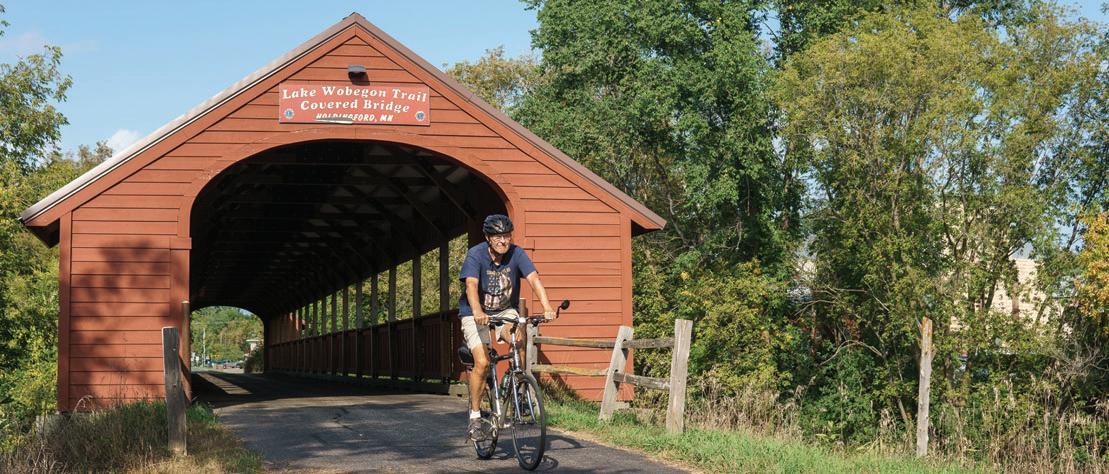
Connections: Just outside of Osakis, the trail continues onto the Central Lakes State Trail, a 55-mile paved route leading to Fergus Falls. West of Albany, a spur extends north to Holdingford, home of Minnesota’s longest covered bridge. This spur connects with the Soo Line Trail at the county line, offering pastoral scenery as it passes through Bowlus, crosses the Mississippi River at Blanchard Dam, and ends at a trailhead on Highway 10.
In Waite Park, a paved city trail begins at Rivers Edge Park and provides a connection toward Saint Cloud. In the future, the RoCoRi Trail is planned to continue from its current northern terminus in Rockville and connect to the Lake Wobegon Trail in Waite Park.
The Holdingford railroad bridge was covered in 2008. Jan Lasar photo
SOO LINE TRAIL
Soo Line Trail (South) 13 miles Stearns/Morrison County line to Highway 10
This scenic trail begins at the northern end of the Lake Wobegon Trail near the Stearns and Morrison County line between Holdingford and Bowlus. From there, it heads northeast across a quiet, pastoral landscape dotted with farmland and wetlands.
In Bowlus, the trailhead is designed to reflect the look of the former railroad stop and includes parking, restrooms, and water. About four miles to the northeast, the route crosses a railroad trestle just downstream from Blanchard Dam on the Mississippi River, where a hydroelectric station dating to the 1920s remains in operation. Cyclists can access Charles A. Lindbergh State Park via the Mississippi River Trail Scenic Bikeway on the west side of the river.
The paved portion ends at a trailhead along Highway 10 near Royalton. Beyond that point, the Soo Line Trail continues as an unpaved route all the way to Superior, Wisconsin, with another paved 11-mile segment located between Isle and Onamia near Mille Lacs and Father Hennepin State Parks (Soo line Trail South).
Connections: Just north of Holdingford, the trail links with the Lake Wobegon Trail in Stearns County. Plans are in place for a future connection to the Paul Bunyan Trail via the Camp Ripley/Veterans State Trail. This planned route will begin at Blanchard Dam, pass through Charles A. Lindbergh State Park, continue through Camp Ripley, and ultimately connect to the southern end of the Paul Bunyan State Trail at Crow Wing State Park.
When completed, the Camp Ripley/ Veterans State Trail will serve as a key link between several major systems, including the Central Lakes, Lake Wobegon, Paul Bunyan, Heartland, and Mi Gi Zi trails, creating a continuous corridor between central and northern Minnesota. The first mile of this future trail, between Little Falls’ Mill Ruins Park and the state park, has already been constructed.
The Soo Line Trail crosses the Mississippi River at Blanchard Dam. Jan Lasar photo
STATE TRAIL
Luce Line State Trail 66 miles Plymouth to Cosmos
The Luce Line State Trail stretches west from the Twin Cities suburb of Plymouth to the small community of Cosmos in west-central Minnesota. Beginning in a metropolitan setting and gradually transitioning into open countryside, the trail offers a diverse and scenic experience as it passes through Wayzata, Watertown, Winsted, Hutchinson, Silver Lake, and Cedar Mills.
Built along a former railroad corridor, the trail features a variety of surfaces. Riders will find crushed limestone from Plymouth to
Winsted, pavement from Winsted to just west of Hutchinson, gravel from Hutchinson to Cedar Mills, and a mowed grass path extending to Cosmos. The western trailhead is located just beyond Cosmos in a county park on Thompson Lake.
Despite its suburban starting point, the Luce Line State Trail quickly immerses users in natural surroundings. The route passes through woodlands, marshes, and lakes, including sections of the historic Big Woods, where stands of maple and basswood create a shaded, tranquil ride. A parallel horse trail runs alongside the main route between Hutchinson and Plymouth, adding to the trail’s versatility.
Connections: The Luce Line State Trail provides access to several trail systems in the Twin Cities region. In Plymouth, the natural surface segment connects to the paved Luce Line Regional Trail, which continues east to the area near Sweeney Lake in Golden Valley, with additional connections planned.
In Wayzata, a short ride on city streets links to the Dakota Rail Regional Trail, a paved route that travels approximately 26 miles southwest to Lester Prairie.
SAKATAH SINGING HILLS STATE TRAIL
Sakatah Singing Hills
State Trail:
39 miles
Mankato to Faribault
The Sakatah Singing Hills State Trail offers a scenic journey through southern Minnesota, following a paved, former railroad corridor between Mankato and Faribault. Along the way, the trail passes through the communities of Madison Lake, Elysian, Waterville, Morristown, and Faribault, providing a relaxing and accessible ride for visitors of all abilities.
Travelers will experience a diverse landscape that shifts between shaded woodlands and open farmland. Nearly three-fourths of the trail is covered by a canopy of tall trees, creating a boulevardlike atmosphere in some areas and a more secluded, forested feel in others. The route features several river crossings, fields of sumac, numerous ponds, and several lakes, along with plenty of benches for resting and taking in the scenery.
In Madison Lake, a historical marker highlights Charles Lindbergh’s early aviation career, when he offered rides in his Jenny aircraft for five dollars in a nearby field. Near Waterville, the trail passes through Sakatah Lake State Park beneath a dense canopy of trees. The park offers a dedicated bicycling campground, picnic areas, lake access, and hiking trails, making it an ideal stop along the route. The Faribault access point is located at the White Sands trailhead, approximately one-half mile north of Highway 60.
Connections: On the Mankato end, the Minnesota River Trail serves as a key link to the city’s extensive trail network, including the scenic Red Jacket Trail and the South Route Trail, which leads into Minneopa State Park. In Faribault, a 1.5-mile segment of the Mill Towns State Trail begins at White Sands Park and is planned to one day reach Cannon Falls and the Cannon Valley Trail.
Mankato Trail System
22.4 miles
Mankato offers one of southern Minnesota’s most versatile trail systems, where paved paths link river valleys, wooded landscapes, and open prairie. Whether you're looking for a short scenic ride or a longer loop connecting multiple routes, the network makes it easy to explore the area by bike while enjoying views of the Minnesota and Blue Earth rivers.
Trail Sections:
Minnesota River Trail: 5.3 miles
The Minnesota River Trail serves as a key connector within the system, continuing where the Sakatah Singing Hills State Trail ends on the north side of Mankato. This paved route follows the Minnesota River, showing off the city’s location within a broad river valley. It also links to Minneopa State Park via the West Mankato, Red Jacket, and South Route trails, creating extended riding opportunities.
West Mankato Trail: 1.25 miles
The West Mankato Trail begins at its junction with the Minnesota River Trail near the North Star Bridge, where US 169 crosses the river. From there, it winds through quiet West Mankato neighborhoods and parallels Highway 66 before connecting to the Red Jacket Trail at Indian Creek Road near Carney Park. While relatively short, this segment plays an important role in the system by linking to the Red Jacket Trail and helping create a continuous loop. It also comes within a half mile of the Minneopa Trail, which can be reached via a short ride along South Riverside Drive.
Red Jacket Trail: 5 miles
Stretching between Mankato and Rapidan, the Red Jacket Trail is known for its impressive river crossings. The route travels over three railroad trestles, including the
A route with an urban feel, Mankato’s Minnesota River Trail follows its namesake river past the iconic murals on the Ardent Mills grain silos. Jan Lasar photo
historic Red Jacket Trestle, which rises 80 feet above the Blue Earth River and spans 550 feet, offering striking views of the valley below. The trail begins at Indian Creek Road, continuing from the West Mankato Trail, and connects to the South Route Trail while also providing a paved link into Minneopa State Park.
South Route Trail: 8.25 miles
The western end of the South Route Trail begins in the southern section of Minneopa State Park, where ample parking and picnic areas are available. Near the intersection of Highways 90 and 66, the trail briefly runs alongside the Red Jacket Trail. Riders will encounter several challenging hills in the western portion before the terrain gradually levels out approaching Highway 22 to the east. The route alternates between wooded areas and open prairie, offering a varied and scenic ride.
Minneopa Trail: 2.6 miles
Despite its name, the Minneopa Trail does not extend fully into Minneopa State Park. It runs from near the Williams Nature Center, just east of the park boundary, to Riverfront Drive south of Sibley Park in Mankato. Although it is not directly connected to other trails, short on-road segments at either end allow riders to travel between the state park and downtown Mankato.
Shooting Star State Trail
28.75 miles
Austin to Leroy
The Shooting Star State Trail offers a scenic ride through southern Minnesota’s remaining tallgrass prairie, where native wildflowers create a vibrant landscape throughout the warmer months. Much of the paved trail follows a former railroad grade, providing a
shooting starTRAIL
smooth and gently graded route for a variety of users.
Beginning at the Jay C. Hormel Nature Center in Austin, the trail connects with the city’s network of paths just north of Interstate 90 and heads south to Rose Creek. From there, it continues southeast through the communities of Adams and Taopi, then passes through Lake Louise State Park before reaching its eastern terminus in LeRoy, locat-
ed along Minnesota Highway 56 just west of its junction with US 63 near the Iowa and Minnesota state line.
Along the route, riders will encounter several interpretive and recreational areas, including Rustic Retreat Wildlife Management Area, Shooting Star Prairie Scientific and Natural Area, Taopi Prairie Interpretive Area, and Mower County Natural and Scenic Area.
Connections: Future plans call for extending the trail south from Austin to the community of Lyle on the Minnesota and Iowa border, although a timeline has not yet been established. A separate proposed extension near Taopi would add a four-mile segment connecting the trail to the Wapsi-Great Western Line Trail at the state border. This paved 27-mile trail continues southeast to Elma, Iowa. Combined with Austin’s existing trail system, these connections would create a regional network totaling approximately 72 miles.
Another long-term goal is a connection to the Blazing Star State Trail in Albert Lea. When complete, the combined system will stretch to about 50 miles, creating a continuous corridor between Myre-Big Island and Lake Louise State Park.
Blazing Star State Trail
8 miles
Albert Lea to Hayward
The Blazing Star State Trail offers a quiet, nature-focused ride through southern Minnesota, linking Albert Lea to Hayward by way of Myre-Big Island State Park. The route moves through open countryside and into the rich habitats surrounding the state park, where wetlands and woodlands create ideal conditions for wildlife. This stretch is especially popular with birdwatchers, who gather during migration seasons when the skies and marshes come alive with activity. Even as plans for expansion look ahead, the Blazing Star State Trail already stands on its own as a peaceful and rewarding ride.
Connections: Though modest in length, the trail carries a sense of purpose, forming part of a larger vision that will one day have it tie into the Shooting Star State Trail to the east. Another link, the Songbird Trail, will travel north from Albert Lea and connect to the Sakatah Singing Hills State Trail. When complete, the combined system will create a continuous corridor between Myre-Big Island, Lake Louise, Sakatah Lake, and Minneopa State Park. See Sakatah Singing Hills State Trail for more possible connections.
The Blazing Star State Trail at Myre-Big Island State Park. Jan Lasar photo
Albert Lea
LUVERNE TRAILS
Luverne Loop Bike Trail (7.4 miles)
Hwy 75 Bike Lanes
Blue Mounds Trail (4 miles)
Christopher Martin Ashby Memorial Trail (2 miles)
Luverne Loop Trail
13 miles with Blue Mounds Trail and Christopher Martin Ashby Memorial Trail
This paved trail system in the far southwestern corner of Minnesota circles Luverne and connects many of the town’s parks and sights. Downtown and its many shops and restaurants are never far away, and the scenery varies between prairie views, quaint neighborhoods, and the meandering Rock River. The trail wraps around the city, offering a harmonious mix of scenic nature and easy access to urban areas. As you explore, you'll come across numerous parks and attractions, such as the Children's Remembrance Garden, and you'll also pass through wildlife habitats and native grasslands.
Start your trip at the modern trailhead building on the southeastern edge of town, and connect to other trail segments from there.
In the north, the Luverne Loop connects to the Blue Mounds Trail, which adds another paved four-mile leg into Blue Mounds State Park. See the striking rock formations of the park rise up from the ground as you travel north across the prairie. At the park, you can discover miles of hiking trails winding through tallgrass prairie, see a herd of bison, and take in the stunning scenery of Sioux Quartzite cliffs.
The two-mile Christopher Martin Ashby Trail starts on the east bank of the Rock River by the main trailhead, crosses the river, and winds through Luverne City Park. It then continues east out of Luverne along Rock River Road, ending at Rock County Road 9. The Ashby Trail provides a peaceful ride through lush green areas with few road crossings, perfect for a relaxing bike ride.
Parts of the Luverne Loop make use of the town’s flood diversion infrastructure. Jan Lasar photo
at CASEY JONES STATE TRAIL
Casey Jones State Trail
17 miles total
Pipestone, Woodstock, Lake Wilson, Currie
The Casey Jones State Trail holds a special place in Minnesota’s outdoor history as the state’s first rails-to-trails conversion, authorized in 1967. Today, the trail is made up of three distinct segments that are not yet connected. Riders can enjoy 10 paved miles between Pipestone and Woodstock, 1.5 miles of natural surface west of Lake Wilson, and a 5.5-mile paved loop between Lake Shetek State Park and Currie.
From the Pipestone trailhead, an outand-back ride offers a close-up look at farm fields and wind turbines, creating an easy and scenic afternoon outing. The Currie Loop does not have a designated trailhead, but convenient parking is available at Forman Acres County Park just outside Lake Shetek State Park or at End-O-Line Railroad Park and Museum. Another option is to park at the picnic area within the state park, follow the park road, and access the trail near the park office.
Traveling counterclockwise from the park office, riders pass the Lake Shetek State Monument and continue between Smith and Shetek lakes. At the southern tip of Lake
Shetek, a dam marks where the Des Moines River emerges. About a mile farther, the trail turns sharply left at End-O-Line Railroad Park before making its way back toward the park. When complete, the Casey Jones State Trail is planned to span more than 100 miles, connecting Luverne, Pipestone, and Redwood Falls.
Connections: In Pipestone, the Indian Lake Trail is planned to form a loop of approximately four miles along the north side of town when completed. Currently, the 2.6mile trail begins near the city campground, travels north, then turns west along the northern edge of a wildlife refuge adjacent to Pipestone National Monument. This stretch features expansive views of restored prairie and Indian Lake, with several places to stop and take in the scenery. At present, the trail ends at 9th Street NW. Future phases will extend the route through Hiawatha Pageant Park to complete the loop back to the campground, with a later extension planned south into downtown Pipestone.
The Casey Jones State Trail travels travels Lake Shetek State Park. Jan Lasar photo
SAINT JAMES & WATLINE
Saint James and WatLine Trails
9 miles total Saint James
The four-mile St. James Bike Trail circles Saint James Lake and connects to the 5-mile WatLine Trail. Start at Memorial Park, which is close to the town's attractions and restaurants, as well as the municipal pool, Tiell Park Campground, and the Saint James Railroad Museum Park. A ride in either direction will take you to the connection to the WatLine Trail. This southern leg takes you through open farm country to Long Lake County Park, which has a swimming beach. An extension of the trail farther south into Ormsby is in the works.
View of the city’s grain elevator from the southern end of Saint James Lake. Jan Lasar photo
Root River/Harmony-
Preston Valley State Trail
64 miles
Fountain to Houston and Harmony to Preston
In the heart of southeastern Minnesota’s Bluff Country, the Root River and HarmonyPreston Valley State Trail system stands out as one of the state’s premier trail destinations. Known for its scenic beauty, historic charm, and welcoming small towns, the network draws visitors from across the region. Along the trails, communities offer a wide range of amenities, including campgrounds, bed and breakfasts, restaurants, museums, outfitters,
and unique local shops.
The Root River State Trail extends 42 miles from Fountain through Lanesboro, Whalan, Peterson, Rushford, and Houston. Built on a former railroad grade, the trail follows the winding Root River through dramatic limestone bluffs, rolling farmland, and picturesque towns. The route is mostly flat and level, with only a few short stretches of elevation change on the eastern end.
At Isinours Junction, the trail connects with the nearly 22-mile Harmony-
Preston Valley State Trail, which links the communities of Harmony and Preston.
The northern two-thirds of this trail follow an abandoned railroad corridor and offer a relatively gentle grade. In contrast, the southern segment leaves the former rail bed and climbs to the top of the valley, rewarding riders with sweeping views of the surrounding countryside.
The Root River Trail is groomed for crosscountry skiing between Isinours Junction and Houston.
Details at www.mntrails.com/bike-trails/
Isinours Trail Junction
Carimona
Along the Trail:
Fountain: Official Sinkhole Capital of the United States. View them from the trail. Harmony: Home of Niagara Cave, which has an underground waterfall. Houston: International Owl Center with live owls on display. Lanesboro: The Commonweal Theatre and public art displays make Lanesboro a destination for the art lover. Peterson: Peterson Station Museum of Norwegian culture. Preston: Minnesota’s Trout Capital has the National Trout Center, and is close to Forestville/Mystery Cave State Park. Rushford: The historic train depot on the trail houses a museum and rest area. Whalan: A small town with a world-famous pie shop.
Connections: A four-mile extension of the Harmony-Preston Valley State Trail is nearing completion, continuing south toward Niagara Cave and the Iowa border. On the Iowa side, trail groups are working to connect the Prairie Farmer Trail from Cresco to the Minnesota system, creating a larger interstate network.
Another planned segment will link Preston to Forestville/Mystery Cave State Park. A short portion of this connection, less than one mile in length, has already been completed on the southwestern edge of Preston.
Rush hour in Harmony, Minn. Jan Lasar photo
LYON COUNTY
BASE CAMP: Camden State Park, Lynd, MN
CAMDEN STATE PARK HIKING TRAILS
The Hiking Club Trail covers only a fraction of the 16 miles of trails at Camden State Park, but it was a great introduction into what makes the place so special. On top of the Redwood River valley, we saw grasses taller than the average hiker, and once we dropped into the dell, hardwoods dominated, growing right up to the river's edge. On the Dakota Valley and Bluebird Trails, we found both, standing in stark contrast on opposite sides of the path.
MOUNTAIN BIKING AT CAMDEN STATE PARK
We then set out for a mountain bike ride and looped through forest and prairie. A steep climb out of the river valley led to sweeping views, and wide, grassy trails carried us across the ridge before we ducked back into dense woods near the ravine for a rousing descent.
CAMDEN REGIONAL TRAIL RIDE
Switching to trail bikes, we also rode the Camden Regional Trail, which makes its way to nearby Marshall, MN. The paved 15-mile trail stretched out in front of us, and a light tailwind kept us rolling easily past fields and neighborhoods. It was one of those peaceful rides where every hilltop revealed a new view of golden fields and blue sky, and the going was easy. At the end of the day, we screamed back down the steep hill to the campground and even passed a bewildered party crew on a hayride.
GARVIN COUNTY PARK
At Garvin County Park, a few miles north of its namesake town, fall colors were in full splendor, and the Cottonwood River sparkled between golden leaves. We climbed the trail to Merton’s Lookout and climbed the wooden tower, then followed the River Trail for a short while.
FULL STORY: mntrails.com/fall-trails-in-lyon-county
BASE BASE SOUTHWEST
STORY & PHOTOS
BY JAN LASAR
REDWOoD COUNTY
BASE CAMP: Cansayapi/Ramsey Park, Redwood Falls, MN
NIGHTFALLS EVENT AT CANSAYAPI/RAMSEY PARK
We timed our visit perfectly for a very special event at Minnesota's largest municipal park. At dusk, the annual NightFalls event turned Cansayapi/Ramsey Park into an after-dark extravaganza that involved 100 volunteers and nearly half a million lights. Inside the park, we strolled four miles of lit, hilly trails and walked across eight illuminated bridges. Two waterfalls, Redwood and Ramsey Falls, were bathed in multi-colored lights, and from the observation platforms, everyone watched, transfixed, as the colors changed and the falls roared. It was a party.
KAYAKING LAKE REDWOOD
PLUM CREEK PARK
On the quieter side, 215-acre Plum Creek Park near Walnut Grove was in full bloom, with bluebells carpeting the forest floor in a stunning display of this Minnesota native wildflower.
LOWER SIOUX AGENCY
The historic Lower Sioux Agency in Morton, MN, enshrines the 1862 site where the US-Dakota war broke out that involved Dakota warriors, settlers, and United States soldiers. It lasted six weeks and cost hundreds of lives. In the mid-1800s, the agency was a bustling place, bringing together Dakota people, traders, farmers, and settlers at the edge of the Minnesota River valley. Today, all that remains of the former agency is a stone warehouse near the modern-day interpretive building. It's hard to imagine what happened here over 160 years ago, and we highly recommend a visit to this historically important place.
FULL STORY: mntrails.com/where-they-mark-the-trees-red
Westside Park serves as the official boat landing for Lake Redwood, just upstream of the dam that turned the Redwood River into a lake. With the roaring of the falling waters behind us, the noises of the city soon faded away, and our surroundings turned more natural. It was warm, the winds were calm, and owed gently. Trees had just begun to unfurl their fresh leaves and it was a perfect
ing the waters behind us, the noises of the city soon faded away, and our surroundings more natural. It was warm, winds were the water flowed had just to their fresh leaves and it was a spring day.
LAST SUMMER, THE TRAILS TEAM VISITED SOUTHWESTERN MINNESOTA IN SEARCH OF ADVENTURE AND NEW DISCOVERIES. WE FOUND WHAT WE WERE LOOKING FOR IN THE AREA’S PEACEFUL PARKS AND TRAILS, AND WE MADE MANY MEANINGFUL CONNECTIONS TO HISTORY, NATURE, AND THE OUTDOORS. OF COURSE, THERE'S MORE TO THE STORY THAN THE CONDENSED VERSIONS BELOW, AND YOU CAN READ OUR FULL TRIP REPORTS ON WWW.MNTRAILS.COM. THIS OFTEN OVERLOOKED CORNER OF THE STATE WILL SURPRISE YOU.
ROCK COUNTY
BASE CAMP: GrandStay Inn, Luverne, MN
LUVERNE LOOP BIKE RIDE
This paved trail makes a seven-mile circle around town, and additional spurs going north and east make for 15 miles of scenic riding through prairie, neighborhoods, and open sky. On the Ashby Trail, we caught a faraway glimpse of the blue and purple quartzite cliffs of Blue Mounds State Park. Heading north on the Blue Mounds Trail, we saw them up close as they emerged dramatically from the surrounding prairie.
BISON TOUR AT BLUE MOUNDS STATE PARK
The herd was a little shy the day we boarded the tour vehicle for a trip into the bison enclosure, but naturalist Tiffany Muellner filled our ride with stories and facts that made the trip worthwhile. We learned about prairie restoration, native wildflowers, the role bison play in the ecosystem, and just what it takes to manage a captive herd.
KAYAKING
THE ROCK RIVER
On our final morning, we traded pedals for paddles and took a float down the undulating Rock River in perfect kayaking weather. The calm water twisted and meandered gently, flanked by tall grasses and wide skies. We passed the Rock River Wildlife Management Area and heard nothing but birds and the breeze. The longer version of this trip runs nearly five hours from Blue Mounds State Park, but this shorter float was perfect.
PIPESTONE COUNTY
BASE CAMP: Pipestone Family Campground Pipestone, MN
INDIAN LAKES TRAIL AND CASEY JONES STATE TRAIL RIDE
We took the Indian Lakes Trail from the campground, which rewarded us with glimpses of Pipestone National Monument, a place we visited later. A short ride on city roads took us to the Casey Jones State Trail. On its way to Woodstock, MN, it slices through a rare and beautiful geological region known as the Prairie Coteau and features wide, undulating hills clad in grass and farm fields. The air up on the coteau is different, cooler, and always moving. That’s why, like steel giants slowly spinning their arms through the sky, wind turbines dot the landscape.
PIPESTONE NATIONAL MONUMENT
At this sacred and historic site, American Indian tribes have quarried soft red pipestone for centuries and still do so today. The monument protects both the ancient quarries and the surrounding tallgrass prairie, offering visitors a glimpse into Indigenous culture, natural beauty, and spiritual tradition. We walked the Circle Trail, a serene loop that skirts an impressive quartzite outcropping and leads to picturesque Winnewissa Falls. It's a landscape steeped in centuries of tradition that's been visited by people for thousands of years.
SPLIT ROCK CREEK STATE PARK
At Split Rock Creek State Park, the Hiking Club Trail led us through forest and wildflowers, tracing Split Rock Lake for about two and a half miles. We paused on top of a hill in the shade of the historic water tower. This trail offered postcard-perfect views, especially of the dam over the creek.
FULL STORY: mntrails.com/discovering-pipestone-county
FULL STORY: mntrails.com/rolling-in-rock-county
NOBLES COUNTY
BASE CAMP: Olson Park Campground, Worthington, MN
WORTHINGTON HIKE AND BIKE TRAIL
Mere feet from our campsite, the Worthington Hike and Bike Trail was easily accessible. Looping around Okabena Lake, it connects ten city parks and is a favorite with locals. We found the trail made for a perfect way to get around town on the weekend of Worthington's Windsurfing Regatta. Pedaling along the wide, paved path that curved gently through parks and greenways, we were swept into the bustle at Lake Front Park, where the smell of barbecue hung in the air and colorful sails drifted across the lake in silence. Observed from shore, it was a tranquil scene, but out on the water the competition was fierce.
KAYAKING AT MAKA-OICU COUNTY PARK
At Maka-Oicu County Park, a little-known 45-acre gem tucked into the farm fields near Kinbrae, we slipped our kayaks into West Graham Lake and paddled quietly along the shore. Birds flew overhead, and frogs plunked into the water without another soul in sight. The gentle breeze barely rippled the surface of the lake while the late afternoon light cast a warm glow across the water. Every so often, we paused just to listen to the steady hum of insects and the distant rustle of wind through the fields. After a busy weekend of regatta activities, it was a wonderful way to decompress on a Sunday.
In 1935, a journey from Marshall, MN, to the newly established Camden State Park was an adventure. It meant taking your horse-drawn wagon or your automobile, if you had one, and slowly rumbling along country roads, hoping not to break a spoke or blow a tire. The 1950s brought paved Highway 23, and the connection to the area’s most popular park became much easier and faster. Today, however, things are moving slower again, and people are loving it.
Riders, runners, and walkers on the Camden Regional Trail don’t mind taking their time getting to the state park, and they enjoy a variety of terrain along the 15-mile paved route, which had its official ribbon cutting in 2017. It skirts Lyon County’s largest town before winding along the Redwood River, past rural farm fields, and through the former railroad stop of Lynd. Users say it offers one of the best cycling experiences in southwest Minnesota.
Retired dentist Paul Johnson of Marshall is a regular on the Camden Trail, riding most months of the year. “It’s so nice to be off, away from the direct traffic, and have access right to the trail system at Camden Park. I think it’s a great resource for the community,” Johnson said.
Fellow longtime cycling enthusiast Robert Jahn of Marshall is pleasantly surprised by how much use the trail sees. “It’s just the right length to push people a little bit. There’s a goal at the end; there’s the swimming hole and other things to do,” Jahn said. “It’s doable, very doable. If you go to Camden [state park] and back, you’ve done something.”
The Camden Regional Trail is easily accessible from several locations to fit the mileage preferences of users. It starts on the east end of Marshall, offering ample parking at the Red Baron Arena. Heading toward Camden State Park, the path takes riders along the flood control diversion channel on the northern edge of town, past Southwest Minnesota Regional Airport and the Marshall Golf Club, then along the scenic Redwood River, through the town of Lynd, and finally reaches Camden State Park, where it terminates at the contact station.
Sherwin Skar and his wife, Kathy Jones, live right on the trail and see firsthand how popular it is. Skar remembers what a trip to Camden State Park was like before the trail was built. “When our daughter was young, we used to take a ride out to Camden, usually once a summer on bikes, and I was a little bit nervous because she would have some of her friends along and we’d ride out there on the road,” he said. “Kathy would usually go in front, and then I would go in back to make sure that they stayed way over on the shoulder.” The pair has seen an increase in bike rider traffic on the trail in their backyard over the years, and official traffic count numbers collected by Marshall’s parks department in 2025 show 18,000 uses in one spot and 26,000 in another.
The paved trail is a testament to cooperation among government and private entities that began to take shape following construction of a flood control diversion channel by the U.S. Army Corps of Engineers in 1996. It slices through town west to east from the Lyon County Fairgrounds to Justice Park, and, topped with a simple gravel path, it marked the establishment of today’s Camden Regional Trail. It took several more years
IF YOU GO:
Start at the Red Baron Arena and Expo on the southeastern edge of town, where a tunnel takes you safely under Highway 23 and onto the campus of Southwest Minnesota State University. The route first heads north, then cuts west across the northern outskirts of Marshall. After passing the airport and the golf course, the trail turns southwest through a scenic stretch along the banks of the Redwood River, then continues along Highway 23. Riders pass through the small town of Lynd before beginning a gradual ascent to the edge of Camden State Park. After another mile on a winding and scenic section, the trail reaches the park office and its endpoint. There are plenty of benches along the Camden Regional Trail for resting, and interpretive kiosks with maps share the natural and historical story of the area.
The Camden Regional Trail connects many of Marshall’s city parks. JAN LASAR PHOTO
Heading toward the trailhead at the Red Baron Arena in Marshall. JAN LASAR PHOTO
Rural scene along the Redwood River. JAN LASAR PHOTO
to finish, but it set the wheels in motion.
“As biking became more popular, especially road biking, there’s some obvious safety conflict with having bikes on county state-aid highways,” Marshall Mayor Bob Byrnes said. He credits former community services director Harry Weilage with developing a comprehensive plan focused on outdoor life in the city, saying Weilage worked with community partners and the University of Minnesota landscape architecture program on a larger vision for outdoor recreation around Marshall.
“The plan…really is having this loop around Marshall and then having spokes going into the activities,” Byrnes said. “So that was part of it, but then the other part of it was how you connect to Camden State Park, …take advantage of this system we have, and then connect everything up.”
Several phases of the Camden Regional Trail build followed that initial paving along the diversion channel, and he attributes the success of the project to Lyon County, the cities of Lynd and Marshall, and the Minnesota Department of Natural Resources. “To put this portion together, none of us could’ve done it on our own,” Byrnes said.
One of the recreational assets made more accessible by the trail is Victory Park, which marks the point where the Redwood and Cottonwood River watersheds converge. A newly constructed bridge takes path users to a wooded mountain bike area that makes use of a floodplain within the Redwood River watershed.
The trail ends at Camden State Park, where there are even more recreational opportunities, according to park manager Adam Kurtz. “One of our largest draws is our swimming pond. It’s such a unique feature,” he said. “The swimming pond is spring-fed; it’s 58 degrees. It feels really good on those hot summer days.”
The 1,800-acre park also features 16 miles of trails for mountain biking, running, hiking, and horseback riding. It’s also a popular site for camping, family gatherings, stargazing events, and weddings, and Camden’s Redwood River draws fly-fishing crowds each April.
“It is very popular from what we can see, at least based off of people entering the park through the bike trail,” Kurtz said. “I think part of that popularity…coincides with the popularity of e-bikes. That gets a bigger audience of people who are capable of biking the trail in its entirety.”
The state park sits on the downward slope of the Buffalo Ridge, a highland ridge of glacial deposit in the southwestern corner of the state, so a trip to Marshall from the state park means a downhill cruise. “We always joke that it’s a lot easier to get to Marshall than to get back just because at least when you’re going to Marshall you have that elevation…helping you,” Kurtz said.
The Camden Regional Trail is a great example of how a recreational trail can connect people to their parks, and almost a century later, a trip to Camden State Park can still be an adventure.
Sherwin Skar and Kathy Jones take a break at a rest stop during the Camden Cruise cycling event at the entrance to Camden State Park in August. LARRY P. MAGRATH PHOTO
BIKING THE PAUL BUNYAN STATE TRAIL
From there, we shifted gears and headed out on the Paul Bunyan State Trail. Leaving downtown, we biked west on Laurel Street, crossed the Mississippi River bridge, and picked up the trail at the corner of West Laurel Street and Northwest 4th Street. A sign pointed us toward Crow Wing State Park, and with sunshine overhead and a tailwind at our backs, we rolled into the outskirts of neighboring Baxter.
Within minutes, the setting changed completely. We slipped into the woods and quickly forgot how close we were to Highway 371. Through the trees, glimpses of large homes lined the trail, but it was the small details that stood out. Fairy houses tucked at the base of trees caught our attention, complete with tiny doors and toys inside. One young boy examined them closely while his parents waited patiently nearby. A little farther along, we came across
something neither of us had seen before, a rainbow-colored bench set up perfectly for watching goats play in a nearby fenced yard. As soon as we stopped, the goats came trotting over, clearly expecting attention. We have ridden plenty of trails over the years, but this was our first goat-viewing bench.
Beyond that, the trail passed through a part of Baxter that felt ready for growth. Wide roads and quiet roundabouts suggested more development was on the horizon. Eventually, the trail dipped under Highway 371, crossed the Mississippi River on a separated path, and delivered us to the entrance of Crow Wing State Park.
The six miles of trail inside the park were a highlight. Free from the constraints of an old railroad grade, the path curved naturally through the woods, rising and falling over gentle terrain. The turns came quickly, with limited sightlines that kept us focused on what was
just ahead. It made for a more engaging ride, one requiring riding single file as the trail wound forward. Near the end, the trees opened briefly into prairie before we reached the contact station.
On another ride, we headed north from Lum Park toward the town of Merrifield. Getting to the trail meant biking through a neighborhood before turning onto Mill Avenue and following low traffic roads with wide shoulders. Once we connected with the Paul Bunyan Trail, it was easy rolling.
This stretch brought back memories. Nearly 20 years ago, we had ridden this same section on our first multiday bike trip together. As we pedaled along, we compared notes on what we remembered. Not surprisingly, the details didn’t always match, but we agreed on one thing, it had been an adventure. Merrifield marked our turnaround, and we retraced our path through the same familiar north woods scenery.
Paul Bunyan's
BACKYARD
KAYAKING
The next day, we stayed close to camp and spent time on the water. Rice Lake, just steps from our campsite, made for an easy launch. Even better, we didn’t need to bring our own gear. A self-service kayak rental station sat near the beach, and after downloading the app and entering our information, the system unlocked with a whir and click.
Within minutes, we were paddling. Rice Lake connects directly to the Mississippi River, which flows through Brainerd from northeast to southwest. Heading downstream, the route eventually ends at the Brainerd Dam, but paddling upstream opens up a range of possibilities, with small islands and sandbars to explore along the way. We took our time, enjoying the change of pace before returning the kayaks just as easily as we had checked them out.
HIKING
We set aside time for hiking as well, starting with Pillsbury State Forest northwest of town. Covering 25,000 acres, the forest includes about 30 miles of trails that wind through a combination of deciduous and coniferous trees. Even driving the forest roads can be scenic, but we opted to get out and explore on foot.
Most of the trails we found were wide, grassy paths shared with horseback riders, though occasional narrow footpaths branched off into the woods. Without much of a plan, we let curiosity guide us through rolling, rocky terrain. At times, glimpses of lakes shimmered through the trees, while other sections opened into recently logged areas that reflected the forest’s ongoing management.
Eventually, we reached a familiar intersection and realized we had unknowingly completed a large lollipop loop. It was a pleasant surprise, though it also reminded us that trail signage can be limited and cell service unreliable. Next time, we agreed, we’d bring a paper map.
We also spent time at Crow Wing State Park, located about nine miles
south of Brainerd at the meeting point of the Crow Wing and Mississippi rivers. The park takes its name from a wing shaped island formed at the confluence. With 18 miles of hiking trails, the landscape shifts between oak forest, open prairie, and river views.
Some trails follow historic routes once used by fur traders, including sections of the old ox cart trails that predate the railroad. A boardwalk with interpretive signs passes through the site of the former village of Crow Wing, offering a glimpse into life during the early settlement period.
We had not previously explored the southern portion of the park, where the Red River Trail passes near the site of an 18th century conflict between the Dakota and Ojibwe. Starting from a picnic area, we created a loop that carried us through the woods and along the Mississippi River. It was just enough distance to earn a long break. At a picnic table, we unpacked sandwiches and lingered. A light breeze moved through the oak leaves, and the river flowed quietly nearby. It was one of those moments that’s easy to stretch out, if only to delay the inevitable return to everyday routines.
STORY & PHOTOS BY JAN LASAR
PHOTOS
Pillsbury State Forest offers many miles of hiking trails.
FROM TOP: The Paul Bunyan Trail in Baxter. The Mississippi River Trail bikeway (MRT) follows the trail on its journey from Minnesota to Louisiana; kayak rental station at Lum Park; and mural in downtown Brainerd.
My wife, Jen, and I find ourselves returning to Alexandria again and again. It’s close to home, easy to reach, and somehow never feels the same twice. You would think we would have checked every box by now, but each visit manages to surprise us. These are our recommendations for outdoor activities using nearby Lake Carlos State Park as a base camp.
CENTRAL LAKES STATE TRAIL BIKING, AND THEN SOME
The town was just beginning to stir on a quiet summer morning, but the Central Lakes State Trail at Big Ole Park was already alive with movement. Before the trip, we had connected with Jake Capistrant, owner of Jake’s Bikes, who helped map out a route using resources from the Big Ole Bike Club. The plan was simple: ride the paved trail, explore the lakes, then branch off onto gravel roads to take in the area’s rolling terrain.
The local moraines and drumlin fields translate into hills and we were about to get a taste of it. Heading toward the town of Garfield on the paved trail, we picked up the Garfield Giddy Up route and immediately hit a punchy climb that woke up the legs. One roller followed another as we worked our way up hills, then coasted down the other side past farms, country churches, and scattered
lakes. Traffic was nearly nonexistent, leaving us alone with the crunch of the gravel and the buzz of the red winged blackbirds in the reeds. With hundreds of miles of routes like this across Douglas County, it’s easy to build a ride that keeps things interesting.
Eventually, we found our way back to the Central Lakes Trail, where the gentle grade gave our legs a break. By then, the day had fully arrived. The trail filled with bikers, runners, dog walkers, and rollerbladers, all spilling out from nearby neighborhoods and resorts to take advantage of a perfect summer day.
Another ride took us in a clockwise loop on roads around sparkling Lake Carlos. Leaving camp, we followed a short grassy path near the lower campground that led us to County Road 38, part of the Glacial Lakes Trail Scenic
Byway. It was one of those bluebird days where the sky stretches endlessly and traffic all but disappears. Mother Nature threw in a tailwind, and we didn’t dare ask for more. The road traced the shoreline through quiet neighborhoods before reaching the natural rock dam at the outlet of the Long Prairie River. From here, the designated state water trail begins a 96-mile journey to the Crow Wing River near Motley. We made note of this for a future visit.
Crossing the narrow isthmus between Lake Carlos and Lake Le Homme Dieu, we paused at Rotary Beach, watching pontoons drift lazily across the water. Not far beyond, another land bridge carried us between Lake Carlos and Lake Darling. From there, it was an easy spin back to camp, the kind of relaxed riding that rounds out a day on the bike.
Big Ole's
STORY & PHOTOS
BY JAN LASAR
BACKYARD
MOUNTAIN BIKING
Douglas County Parks offers a different kind of ride at Runestone, Spruce Hill, and Lake Brophy County Park, where multi use trails mix with purpose-built singletrack. At Lake Brophy, a new visitor center and updated beach facilities set the stage for a growing trail system just a few miles from downtown Alexandria.
The park features 6.5 miles of gravity flow singletrack with about 200 feet of elevation change, all set against an open prairie backdrop. From the top, the view stretches across the park and into town. On the west side, the trails turn technical with features like drops, rock gardens, and dock jumps. On the eastern side, trails flow in a different way, with longer straightaways and sweeping turns that invite a steady pace. The Central Lakes Trail runs right past the park, making it easy to roll in on two wheels.
Jake’s Bikes outfitted us with Trek e-mountain bikes, which gave us just enough boost to explore without overcommitting to the more technical features. We kept our distance from the jumps, instead
watching others launch side by side down the hill. From the top, a steady breeze rolled across the lake, and the trails below stayed busy with riders grinding their way up or carving their way down.
At Kensington Rune Stone Park, 17 miles southwest of Alexandria, the experience shifts again. Built on the former farm of Olof Öhman, the site ties directly to the discovery of the Kensington Rune Stone, now displayed at the Runestone Museum in Alexandria. Beyond the history, the park offers eight miles of trails that wind through forest, lowland, and prairie. We eased into the ride with a few laps on the Olof Öhman Trail before stepping up to the intermediate Berserkr. From there, the Viking-themed progression continued onto Ragnarok and Bifrost as we grew more comfortable with both the terrain and the bikes. The trails flowed well, and the mix of landscapes kept things interesting at every turn. The pedal assist helped smooth out the climbs, but only when we kept working. After nearly two hours on the Runestone trails, we had covered plenty of ground and were ready to call it a day.
KAYAKING
With so many lakes surrounding Alexandria, choosing where to paddle can feel like the hardest part of the day. Wind made that decision easier for us. After driving from lake to lake and finding whitecaps almost everywhere, we finally came across a sheltered stretch on Lake Cowdry. The difference was immediate. Calm water replaced the chop, and we were able to paddle without problems. It felt good to give the legs a break and work the upper body with the fishing rod for a while. For more than two hours, we explored the shoreline, casting as we went and pulling in sunfish and crappies along the way.
TRAIL PARTNERS
Need a place to eat, stay, play and upgrade your gear? Our Trail Partners are here to help!
BIKE SHOPS
FITZHARRIS BIKE & SPORT
320-251-2844 105 7th Avenue S, St. Cloud www.fitzharrismn.com
JAKE’S BIKES
419 N. Nokomis Street, Alexandria www.jakesbikes.com
REVOLUTION CYCLE AND SKI
320-219-7433
320-251-2453 160 29th Avenue S, St. Cloud www.revolutioncycleandski.com
TOURIGHT BICYCLE SHOP
320-639-2453 124 2nd Street NE, Little Falls www.tourightbicycleshop.com
BIKE KING
651-457-7766 6489 Cahill Avenue, Inver Grove Heights www.bike-king.com
CARS BIKE SHOP 763-784-6966 2661 Co Road I & Old Hwy. 10, Mounds View www.carsbikeshop.com
EXPLORE ALEX 320-763-0102 203 Broadway Street, Alexandria www.explorealex.com
HUTCHINSON CHAMBER 320-587-5252 2 Main Street, Hutchinson www.explorehutchinson.com
VISIT BRAINERD 800-450-7247 214 S 7th Street, Brainerd www.visitbrainerd.com
LOVIN’ LAKE COUNTY 218-595-2800 1330 MN-61, Two Harbors www.lovinlakecounty.com
From your first mile off pavement to your five-hundredth, gravel riding ignites something inside us that’s hard to tap into anywhere else. Visit your authorized Trek retailer today to learn all about our gravel bikes and the gear you’ll need to explore what’s waiting for you down the road less traveled.