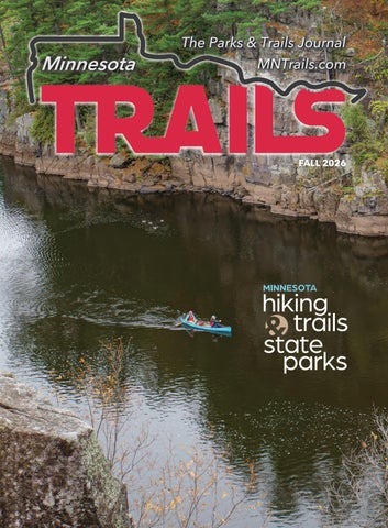
FALL 2026
MINNESOTA
hiking trails state parks
Fall 2026 | MINNESOTA TRAILS 1
Crosby | Ironton Deerwood | Bay Lake Cuyuna | Emily 522 Sinclair Lewis Avenue Sauk Centre, MN 56378
www.MnTrails.com Minnesota Trails Staff Jan Lasar Editor/Publisher Joyce Frericks Accounting Karen Knoblach Page Layout & Design Graphic Design
Editorial Board Brett Feldman Executive Director Parks & Trails Council of Minnesota
Vol. 31, No. 3 August 2026 Minnesota Trails magazine is a continuation of Minnesota Bike Trails & Rides, published quarterly in cooperation with the Parks & Trails Council of Minnesota, a nonprofit organization that acquires, protects and enhances critical lands for public enjoyment. Your $35 membership subscription supports this work. Minnesota Trails is not responsible for the return of unsolicited materials and reserves the right to reject unsuitable advertising. Information in this publication is as accurate as possible. Opinions expressed are those of the authors and not of Minnesota Trails.
Continuing the
SERVICES SPECIALTY STORES EAT / DRINK CANA WINE BAR 64 1st Ave SW, Crosby (218) 772-0086 www.canawinebarmn.com Self-service wine bar Live music Saturdays
COMMON GOODS 27 W Main St, Crosby (218) 772-2999 www.commongoodsmn.org
CRMC Services: Hospital, Emergency Department, Pharmacy & Clinics: Crosby, Baxter, Longville & Nisswa Coming Soon!
Thrifting for the greater good! Crosby, Baxter, Crosslake
DEERSTAND RESTAURANT & BAR NORD HUS SCANDINAVIAN GOODS 24188 Mohs St, Deerwood 28 W Main St., Crosby (218) 534-9253 (218) 545-0110 www.deerstandrestaurant.com www.nordhusmn.com Meat Raffle Thursdays 6pm, Saturdays 2pm
A curated collection of Scandinavian favorites
LODGING
CUYUNA LAKES CHAMBER 21236 Archibald Rd, Deerwood (218) 546-8131 www.cuyunalakes.com
OARS-N-MINE 22640 MN-6, Crosby (218) 546-6912 www.oarsnmine.com Docks, lifts, bait and tackle
21704 Dewing Road, Crosby (218) 228-2991 www.cuyunarangecampground.com Full hookup RV sites in the Cuyuna woods!
23457 Co Rd 31, Crosby (218) 838-6858 www.redriderresort.com Cabins and camping right off t e MTB trails. the ai
222 2nd St NW, Crosby (218) 622-0321 www.thesanctuarycrosby.com
VICTUAL 124 W Main St, Crosby (218) 545-1000 www.shopvictual.com Ice cream, cheese, charcuterie, deli meat, fresh bread, gourmet gifts, spirits
SPORTS
CUYUNA ROLLING HILLS GOLF COURSE 24410 MN-210, Deerwood (218) 534-3489 www.cuyunarollinghillsgolf.com
FINANCIAL DEERWOOD BANK 21236 Archibald Rd, Deerwood (218) 534-3111 www.deerwoodbank.com Banking Made Nice & Simple
MID MINNESOTA FEDERAL CREDIT UNION 117 West Main St, Crosby (218) 546-5428 www.mmfcu.org Member owned and working for you
Resort quality golf without resort price
A boutique hotel just blocks from downtown Crosby and the bike trails
218-546-8131
www.CuyunaLakes.com 2 MINNESOTA TRAILS | Fall 2026
CLINIC – PHARMACY Inside Crosby Super One Store (218) 545-5350
Cuyuna Lakes Chamber members are ready to serve you!
FALL 2026
Contents FEATURES
8 Trail Talk:
Minnesota Hiking Trail News 8 North Country National Scenic Trail Matt Davis & Kate Lemon 10 Superior Hiking Trail | Mackenzie Foley 12 Minnesota Driftless Hiking Trail Alexa Shapiro
CULTIVATE THE BEST HIKING, BIKING & OUTDOOR EXPERIENCES THIS FALL.
16 Paddling Through Fall Colors Tom Watson
20 The Wild Will Never Leave Us Boundary Waters Volunteer Trip Stacy Dahl
24 Minnesota Park Adventures 24 North Shore: A Family Tradition Cecilia Wallace 26 Taylors Falls: First Time on the Saint Croix | Stacy Dahl 28 Mille Lacs Kathio: Trails Through Time Stacy Dahl 30 Theodore Wirth Regional Park: When Clouds Hide the Moon, This Park Still Shines | Summer Rabold 32 Afton State Park: Minutes Away, Worlds Apart | Joseph Krattley
Home of Camden State Park & Camden Regional Bike Trail
34 Rolling Through the Heart
of The Lakes Jan Lasar
DEPARTMENTS
4 Parks & Trails THE Council News BEST LTIVATE 7 Trails Q&A ING, BIKING, 14 Bike Rides & Tours UTDOOR 38 MN Trails Map PEREINCES 39 Trail Partners S FALL. Lisa Filter
Conversations with Trail Users
Minnesota Events September-October Minnesota’s Trails At-A-Glance Find Trail-Friendly Businesses
COLUMNS
me of6 Camden State Park & The Minnesota Miles Jan Lasar Camden Regional Bike Trail COVER: Interstate State Park, Taylors Falls Jan Lasar photo ABOVE: East Silent Lake, Otter Tail County Jan Lasar photo
FOLLOW US ON:
MNTRAILS
VISITMARSHALLMN.COM
MINNESOTA_TRAILS_MAGAZINE
THANK YOU:
Fall 2026 | MINNESOTA TRAILS 3
2026 PHOTO CONTEST WINNERS The votes are in—and the results are stunning. We’re thrilled to announce the 2026 photo contest winners. This year, 393 photographs poured in from across four regions of Minnesota, each one a testament to the extraordinary landscapes waiting just outside our doors. To everyone who picked up a camera and ventured out: thank you. Your images don’t just capture Minnesota’s parks and trails—they make the case for protecting them. View all the 24 winners: PARKSANDTRAILS.ORG/OUR-EVENTS/2025-PHOTO-CONTEST/
Northwest
EDIE THIEL— GLENDALOUGH STATE PARK
SOUTHWEST
LARRY PAULSON — FORT RIDGELY STATE PARK
The photo of “Maestro” was taken in November as I hapSHQHG XSRQ D ODUJH ȵRFN RI Trumpeter Swans on the ice near open water with good light. I shot hundreds of frames, staying in my car to not disturb the swans. The situation has not happened again, but I’ll keep trying. I guess that’s the lesson… you need to keep “showing up” to get the “good” shots. Living near a state park that conserves and preserves nature is truly a gift. Thank you to the people and organizations that care for these parks. The parks really are Minnesota. ~ Edie Thiel I took this photo at mid-day near my campsite—a site I chose for its proximity to Ft. Ridgely Creek. I thought that the babbling stream would make for a good night’s sleep. I was right! Near here, I noticed a small nest MXVW IHHW RII WKH JURXQG LQ the shrubs. A yellow warbler VRRQ IOHZ LQ DQG VHWWOHG KHUVHOI RQWR WKH QHVW Ζ ILJXUHG her mate must be nearby and sure enough I found KLP IOLWWLQJ LQ WKH FDQRS\ ΖW was pure luck that he found that green caterpillar when he was in the open. ~ Larry Paulson
4 MINNESOTA TRAILS | Fall 2025 2026
NORTHEAST
KEN HARMON — JAY COOKE STATE PARK
Since moving to Minnesota in 1981, Jay Cooke, with its wild and rugged terrain, has always been a favorite of mine. I took this photo on Nov. 11, 2025. I hiked down below the bridge so it would be silhouetted skywards. Then I sat there and waited hoping the red glow of the Northern Lights I saw earlier would return. Within a half hour it did. ~ Ken Harmon
SOUTHEAST
TED NARVESON — FORT SNELLING STATE PARK I’m drawn to the variety of wildlife at Fort Snelling; with its confluence of the Minnesota and Mississippi rivers, there is always something unexpected to discover. I took this photo on a May morning. I was looking for Killdeer chicks after noticing the parents guarding the area. I spotted them the same moment a &RRSHUȇV KDZN GLG ΖW ȵDUHG as if to grab the chick, but at the last moment pulled up, and the chick survived. ~ Ted Narveson Fall 2025 2026 | MINNESOTA TRAILS 5
Minnesota Miles boots cover most of my activities from Before you read this paddling to fatbiking. I love gear that can do column, I’d like you to double duty, but I have a pair of Giro cycling turn your attention to shoes that are only for clipped-in road the facing page. The biking. • My bicycle stable includes a Salsa Trails Q&A has been a Vaya (Dave), a Trek Marlin+ 8 mountain bike fixture in this publication, (Rosie), and a Surly Pugsley (Max). • On the predating my tenure at water I use an Old Town Trip Angler 10 kayak Minnesota Trails Magazine with built-in fishing rod holders and a large by I don’t know how many dry hatch. The hatch is not so dry anymore, years. Asking complete so I like to haul my stuff in a Breakwater strangers questions about Jan Lasar Supply Fogland waterproof backpack— their Minnesota outdoor Trails Editor/Publisher another great piece of multipurpose gear. experience has yielded • My cross-country ski setup consists of some very interesting ancient waxless Fischer Jupiter Control, with bent results and I always enjoy hearing poles and deep, deep scars from too many road everyone’s answers. crossings. For backcountry exploration I strap on As I approach my 150th Q&A, I thought a pair of 36” Tubbs snowshoes which have carried I’d turn the tables and interview myself for a change. Typically, interview answers need to me through snow as deep as they are long. • I wear an Osprey hydration pack for most of my outdoor be abbreviated and distilled to fit the format adventures, and if I feel cheeky, I bring a coffeeof the Trails Q&A page, but for the sake making kit with a DIY beer can alcohol stove. • How of this column I’ll use my bully pulpit and many miles do you hike, bike, ski, snowshoe, attempt to give some in-depth answers. paddle a year? The only thing I keep a record of is my cycling, and I manage to clock about 500 miles Name: Jan Lasar • Occupation: Magazine a year. • What does being outdoors mean to publisher and editor • From: Bowlus, MN • you? It’s the antidote to the poison I have to take Seen: Hiking, biking, skiing, snowshoeing, every day, sitting in an office chair. When I’m out on and paddling somewhere in Minnesota, with the trails, phone calls, emails, duties, and worries his wife, Jen, and a camera, ideally. But begin to fade away and all I have to do is take one most of the time I sit in my office chair at more step, make one more pedal revolution, or take my desk doing riveting things like writing, another paddle stroke. That brings me back to my editing, planning the editorial calendar, center. • Favorite Minnesota park or trail? The talking to people on the phone, and finding Cuyuna Lakes State Recreation Area is on top of my advertisers. If I want a real vacation, I have list right now. I’ve been following the development of to leave the state so I don’t feel compelled that area since the beginning, since before I became to bring the camera and the notebook. editor of Trails. It’s where I first used my mountain Welcome to the dark side of the outdoor bike for its intended purpose, and it’s where I drew magazine publisher universe. • Gear: first blood with a spectacular wipeout. • Best Several pairs of Keen sandals, shoes, and
Minnesota Experience? Dogsledding with Chilly Dogs Sled Dog Trips in Ely. I can’t begin to tell you what a transformative experience it was to drive a team of sled dogs by myself. Dogsledding is hard work, not a leisurely jaunt through the woods. Think three hours of cardio packed into one hour, getting pulled by dogs that have only two speeds, full throttle, and off.• Worst Minnesota Experience? Crashing my Salsa Vaya while on a gravel road. I went down a ditch, hit the bottom, flipped over the handlebars and landed on my back. It took eight weeks to fully recover and I needed help to get dressed in the morning. The bike was toast. • Advice for the novice? Rent equipment before you buy. When you buy, get the best you can afford. That’s my practical advice. On the philosophical side, turn off the GPS device, forget about Strava, and just have fun with whatever you do. Bring someone you love and share the experience. • What’s on your Minnesota bucket list? Isle Royale National Park is closer to Minnesota than it is to Michigan, so I’m counting a visit there by seaplane as a Minnesota thing. Honorable mention goes to trying rock climbing, and talking Jen into whitewater rafting the Kettle River with me. • What would you do with $1,000? While my selfish side whispers “Spend it on an item from the bucket list,” the altruistic creature on my other shoulder has a hold of both my ears, screaming “Donate to one of the many outdoor volunteer organizations in Minnesota!” • Trail Treat? A good old-fashioned tailgate party with friends after a day out on the trails. The other day Jen and I brought our pizza oven to the Sagamore unit trails near Crosby and made some après mountain bike pies. At the very least, we always get ice cream from Victual in town.
IT'S A MINNESOTA CYCLING ADVENTURE UNLIKE ANYWHERE ELSE. But don't take our word for it. Come see for yourself.
MesabiTrail.com
IronRange.org
6 MINNESOTA TRAILS | Fall 2026
2026
Trails
Seth Dokken Ottertail, MN Occupation: Optometrist Seen: Biking the Heart of the Lakes Trail through Maplewood State Park with his wife, Brooke Gear: Gazelle e-bike How many miles do you bike per year? Around 1,000 What does being outdoors mean to you? It helps my mental health. Favorite Minnesota park or trail: The Boundary Waters. It's just a special place in Minnesota. Best Minnesota experience: Time with family. Worst Minnesota experience: Having to wait out a storm to be able to paddle out of the Boundary Waters. Advice for the novice cyclist: Get an e-bike. What’s on your Minnesota bucket list? I need to get the family to the Boundary Waters. What would you do with $1,000? Go to the Boundary Waters, of course. Trail Treat: Cherry dipped cones from Dairy Queen.
Trails Q & A Snapshots of people we meet along the trail
Aracelys Manzo
Venezuela, now living in Mendota Heights Occupation: Assistant Manager at a car wash Seen: Biking the Blazing Star State Trail at Myre-Big Island State Park in Albert Lea with husband Emmanuel and son Marcos Gear: Trek, Specialized and Co-Op brand bikes How many miles do you bike per year? Around 400 What does being outdoors mean to you? Freedom, tranquility, peace and quiet, and having fun. Favorite Minnesota park or trail: We really love Ninemile Lake Campground in Finland, MN. I saw my first loon there. Best Minnesota experience: Camping at Ninemile Lake and doing day trips in the area by car and bringing the bikes. Advice for the novice: Bring water and sun protection. What’s on your Minnesota bucket list? I want to visit all state parks. I’m at 19 today. What would you do with $1,000? We’d buy a new bike carrier for the back of the car. Trail Treat: Mandarin oranges, because they are super refreshing. It’s easy.
Tiffany Muellner
Sarah Timmerman
Luverne, MN
Sioux Falls, SD
Occupation: Interpretive Naturalist with the Minnesota Department of Natural Resources (MNDNR) Seen: Leading the bison tour at Blue Mounds State Park Gear: MNDNR uniform and a Ford F350 truck outfitted to carry 12 passengers How many tours do you lead per year? Between me and the other Naturalist, we schedule 10 per weekend between Memorial Day and Labor Day. What does being outdoors mean to you? It really helps keep me out of the office and that sedentary lifestyle. What’s your favorite part of your job? Being a part of people’s core memories. What’s your favorite way to recreate outdoors? I love to go on hikes. Favorite Minnesota park or trail: Soudan Underground Mine State Park for the mine tour, Glendalough for the heritage lake, and Glacial Lakes for the prairie and unique geological features. Advice for the novice: Always have water with you. Get some good socks. What’s on your Minnesota bucket list? Visiting all Minnesota state parks. I’m at number 17 now. What would you do with $1,000? Spend a week on the North Shore. And get some new socks. Trail Treat: Sour gummy worms during and ice cream after a hike.
Occupation: Associate at Great Outdoor Store and manager of Coffea coffee shop in Sioux Falls Seen: Rock Climbing the ivy right route at Blue Mounds State Park with friends Noah and Gabby Gear: Harness, ropes, climbing shoes, cams, nuts and slings for traditional (trad) climbing How many times do you climb per year? As a beginner, I’ve been out five times so far this year. What does being outdoors mean to you? Being a part of nature and enjoying it. Being on the rocks is really fun no matter what the level of climbing is. Favorite climbing area: Tettegouche State Park, because it’s beautiful climbing on the lake and easily accessible. Best Minnesota experience: Climbing here at Blue Mounds. I climbed outdoors for the first time here. Advice for the novice: Do your research. Read stuff. Watch videos. Ask people in your community that climb. What would you do with $1,000? I want a full set of trad climbing gear. Trail Treat: A light lager from Take 16 Brewing in Luverne and a juicy burger.
Fall 2026 | MINNESOTA TRAILS 7
TRAIL UPDATE TRAIL TALK
North Country Trail News
Volunteers from the Arrowhead Chapter build new sidehill trail near Remer, MN · MATT DAVIS PHOTO 8 MINNESOTA TRAILS | Fall 2026
By Matt Davis | NCTA Regional Trail Coordinator and Kate Lemon | NCTA Marketing and Communications Manager
The North Country Trail is the longest National Scenic Trail in America, traversing nearly 5,000 miles across eight states. Minnesota’s 900 miles offer trail users wetlands and old growth forests, evidence of historic mining and logging operations, agricultural valleys, glacial lakes, and craggy rocks. The trail leads you through a variety of iconic land units and features, including the Boundary Waters Canoe Area Wilderness, Chippewa and Superior National Forests, Tamarac National Wildlife Refuge, and multiple state parks. The North Country Trail also shares its Minnesota route with the rugged Border Route and Kekekabic Trails, and the famed Superior Hiking Trail along the North Shore of Lake Superior. The North Country Trail Association (NCTA) is the nonprofit partner of the National Park Service in building, maintaining, and protecting the trail. The Association’s staff organize and equip volunteers, collaborate with land managers, and advocate for support. The goal is to provide all trail users with a safe and enjoyable experience. Trailwide, the Association has organized its volunteers into regional Chapters. These groups are the main caretakers of the trail, alongside partner organizations such as the Superior Hiking Trail Association, U.S. Forest Service, and the Minnesota Department of Natural Resources. You can see some recent fruits of this volunteer labor at Frazee’s Wannigan Regional Park, where the Laurentian Lakes Chapter built a new segment you can use to visit the Jacob Everear troll, installed by artist Thomas Dambo. The Itasca Moraine Chapter built a scenic 1.5-mile spur trail from Amikwik shelter and campsite near Lake George to Deep Lake Regional Park, a developing 440-acre, year-round recreation area in Hubbard County, about 16 miles east of Park Rapids. This is only the tip of the iceberg, of course. More volunteers are needed, particularly across northern Minnesota. Not only are chapters seeking help to construct new North Country Trail segments, but to continue the maintenance of existing segments so the trail remains open, navigable, and safe.
The Star of the North Chapter and Chippewa National Forest staff are currently building 11 miles of trail in eastern Cass County. This segment will also feature two new backcountry campsites and two new trailheads. The Arrowhead Chapter has been chipping away at 13 miles of new trail in Itasca County. While several miles have been completed, along with the installation of a 40-foot bridge, two trailheads, and two campsites, there is still plenty to be accomplished. The North Country Trail Association's newest Chapter—Ely Northwoods—kicked off the construction of their first new trail segment this spring. Their neighbors, the Kekekabic Trail Chapter, are digging into 14 miles of new trail in the Superior National Forest.
Matt Davis and his son, Teddy, pose with the troll statue at Wannigan Park in Frazee, MN · MATT DAVIS PHOTO
Volunteers from the Itasca Moraine Chapter staff the NCTA booth at a community event in Backus, MN · NCTA PHOTO
love it.
Build it.
THE NORTH COUNTRY NATIONAL SCENIC TRAIL (NCNST) IS THE LONGEST OF THE 11 NATIONAL SCENIC TRAILS IN THE UNITED STATES, WINDING NEARLY 5,000 MILES ACROSS EIGHT STATES FROM NORTH DAKOTA TO VERMONT. TRAIL USERS ARE TREATED TO A WIDE VARIETY OF LANDSCAPES, INCLUDING WILDERNESS, PRAIRIE, WETLANDS, MOUNTAINS, FARMLAND, AND URBAN COMMUNITIES. THE NCNST IS AN OFFICIAL UNIT OF THE NATIONAL PARK SYSTEM. THE NATIONAL PARK SERVICE MANAGES THE TRAIL IN COLLABORATION WITH ITS NONPROFIT PARTNER, THE NORTH COUNTRY TRAIL ASSOCIATION (NCTA), AND THE VOLUNTEERS WHO BUILD AND MAINTAIN THE TRAIL. LEARN MORE AT NORTHCOUNTRYTRAIL.ORG
Trail building seems like it requires strength and a unique skillset, doesn’t it? It’s true this work can get tough, dirty, and technical, but fortunately, NCTA Chapter leaders don’t expect new volunteers to have any experience at all. Training, mentoring, tools, and safety equipment are all provided to those willing to lend a hand. There is also no time requirement. Whether you can attend only for a couple of hours or see a project through its completion, any time and effort you want to contribute makes a difference. It doesn't matter if you prune branches or paint blazes, dig new trail tread or help organize a hike, you help improve the longest National Scenic Trail in the country. Browse the NCTA Event Calendar today at northcountrytrail.org/events to see what hikes, workdays, and other events are scheduled in your neck of the woods. Contact a Chapter directly or fill out a Volunteer Interest Form so staff can guide you through the process. In 2025, nearly 1,300 volunteers reported contributing more than 80,000 hours to the North Country Trail. You’re invited to become a part of this legacy, to help ensure the North Country National Scenic Trail and its surrounding landscape will remain available and protected forever.
HIKE it.
Volunteers from the Arrowhead and Star of the North Chapter mow new trail corridor near Remer, MN · MATT DAVIS PHOTO
Northcountrytrail.org Fall 2026 | MINNESOTA TRAILS 9
TRAIL TALK
PHOTOS FROM TOP:
Volunteers place boards during the 2026 County Road 6 puncheon replacement project. JOHN STORKAMP PHOTO
A volunteer crew works on the Cascade River Loop in 2024. The multi-year Cascade River Loop renewal project that addresses flood damage from 2022 is scheduled to wrap this summer. SHTA PHOTO
Volunteers carry a heavy load during a project on the Cascade River Loop in 2025 SHTA PHOTO
Volunteers at a Cascade River Loop project in 2025. SHTA PHOTO
10 MINNESOTA TRAILS | Fall 2026
Superior Hiking Trail News
THE REAL TRAIL MAGIC How the Superior Hiking Trail Has Been Bringing People Together for Forty Years By Mackenzie Foley | SHTA Development and Communications Director
In January 1986, a group of 30 land managers, business owners, and community members gathered at Bluefin Bay Resort in Tofte with a dream: build a long-distance hiking trail along the rocky ridgeline of Minnesota’s North Shore. At the time, a few sections of trail already existed, and the idea for a more extensive trail had been included in state outdoor recreation and Forest Service plans. However, it was these determined visionaries who drove the project forward, and in 1986 the Superior Hiking Trail Association (SHTA) was born. After securing funding from founding members and the Legislative Commission on Minnesota Resources, construction of the Superior Hiking Trail (SHT) began. Volunteers, laid-off steelworkers from the Reserve Mining plant in Silver Bay, and Finnish farmers were some of the many hands that helped construct the trail’s earliest sections with the tools they had available. Mile by mile, the vision became reality. As each new section opened, hikers and backpackers discovered the magic of the Superior Hiking Trail and the remarkable ecosystems of northeastern Minnesota. The trail’s rugged terrain, steep climbs, descents, and roots posed a challenge that adventurers embraced. The journey rewarded hikers with many stunning vistas, unexpected wildflowers, roaring rivers, cascading waterfalls, and glimpses of wildlife, leaving them with both a sense of peace and accomplishment. However, hikers found something even more enduring—a sense of connection with nature, with themselves, and with one another during their time on the SHT. The miles accumulated with every new section, and it became clear that the trail’s impact extended far beyond what its founders had imagined. It had become a conduit for community. The SHT continued its expansion until 2017, when the final section near the Red River completed the longenvisioned border-to-border route. What began as a grassroots idea had grown into a 300-mile footpath stretching from the
Minnesota-Wisconsin border south of Jay Cooke State Park to the 270-Degree Overlook near the Canadian border, encompassing 94 backcountry campsites and 64 trailheads. But completing the trail wasn’t the end of the story. A 2017 assessment revealed the need for a more strategic approach to maintaining the trail and its infrastructure. Boardwalks, staircases, and signage were showing wear, sections of tread were muddy and in desperate need of more adequate drainage, and areas suffering from erosion required more sustainable solutions. In 2018, the SHTA launched the Trail Renewal Program, focused on maintenance, sustainability, resilience, and stewardship. Attention quickly turned to the sections most in need of restoration, affectionately nicknamed “The Big Bad Five,” which included the Split Rock River Loop (including its bridge), the Bean and Bear Lakes Loop, the infamous Gooseberry Gap, Britton Peak to Oberg Mountain section, and areas between Oberg Mountain and Lutsen. How did the trail community rise to meet the new needs of the SHT? The answer was the same as it had been in 1986: Together. As a result of the 2017 assessments, and subsequent completion of the Trail Master Plan in 2024, the SHTA has led volunteers and partnered with contractors to carry out ambitious renewal projects across the trail. In 2025 alone, more than 600 volunteers contributed over 10,000 hours of labor, while thousands of members donated generously to support these efforts, continuing the legacy established by the early trailblazers. So far this year, volunteer crews have been busy. They’ve replaced puncheon near County Road 6 in Finland, MN, completed work on the newly restored Bean and Bear Lakes Loop, and an allfemme volunteer crew repaired portions of the Cascade River Loop damaged by flooding. These projects improve the trail while simultaneously strengthening the community that cares for it. “I feel lucky to be a volunteer crew leader with the SHTA and be part of trail building events on the SHT,” says Stephanie Hoff. “The all-femme backpack events are my favorite of the year. Everyone brings their own personal touch, character, and joy to the project. It is fun to see people try new things, help others learn trail-building skills, and work together. There is truly a place for all abilities. During the recent Cascade project, we cleared more than 500 feet of trail, added a rock ford crossing at
one low point, and built a stone crossing at another. It is fun to see the same people returning year after year while welcoming new faces into the mix.” In 2026, major projects on the SHT focus on addressing persistent muddy conditions caused by inadequate drainage and replacing aging infrastructure. Contractor Trails Anonymous is nearing completion of reshaping the tread, installing drainage features, and replacing 1,000 feet of puncheon and boardwalk. This summer also marks the completion of the multiyear Cascade River Loop project, where contractor Trail Logic is improving the tread and constructing three staircases while volunteer crews add the finishing touches. Additional projects include replacing the Onion River bridge with a new 50-foot fiber-reinforced polymer bridge, installing a new bridge across the Devil Track Tributary near Grand Marais to eliminate a five-mile reroute that means walking three miles along Highway 61, constructing 500 feet of puncheon in the Magney-Snively Natural Area in Duluth, and rerouting a 250-foot section through Hartley Nature Center in Duluth.
Looking ahead to 2027, the bridge theme continues. The Baptism River Bridge near Finland was damaged by severe flooding two years ago and needs replacement. Planning is also underway for the highly anticipated 55-foot Split Rock River Bridge after the previous bridge was removed nearly a decade ago. While the river is often shallow enough to ford safely, many trail users eagerly await the convenience of crossing without getting their feet wet. These efforts continue to bring people together—from the folks who hike, backpack, run, snowshoe, or saunter beneath the trees, to the volunteers who move rock, reshape tread, and build bridges. Over time, the Superior Hiking Trail has grown from a bold idea into a free, permit-less Minnesota treasure hundreds of miles long, yet its greatest achievement isn’t measured in miles. It is found in the dedicated people who built it, care for it, love it, and share it with others. It has connected people with nature and with one another for forty years. It will continue to do so and ensure that future generations can discover the same trail magic that inspired its founders.
Fall 2026 | MINNESOTA TRAILS 11
TRAIL TALK
Minnesota Driftless Hiking Trail News
Marty Walsh (foreground), MDHT founder and landowner, during a site visit in the summer of 2025. ALEXA SHAPIRO PHOTO
LOCAL EFFORT UNDERWAY By Alexa Shapiro | Minnesota Driftless Hiking Trail Director
In southeastern Minnesota, a local effort is underway to develop an ambitious backpacking trail of more than 100 miles, stretching east from Chatfield to the Mississippi River, terminating just south of Brownsville. Currently, no long-distance trails of 25 miles or more exist anywhere in southern Minnesota. Once developed, the Minnesota Driftless Hiking Trail (MDHT) will be the first long-distance footpath in the region and will increase access to hiking, camping, trail running, and even trout fishing as it passes through the Driftless Region. This ambitious project has been in
the works since 2018 after a demand for more hiking trails in Fillmore and Houston counties became evident. What began as a grassroots effort led by passionate people from the area, officially became a nonprofit organization when we received 501(c) (3) tax-exempt status from the state of Minnesota in 2023. The following year we were awarded a grant from the Legislative-Citizen Commission on Minnesota Resources (LCCMR) to support the ongoing development of the trail. With this funding, we hired a director, purchased the equipment needed to build the trail,
and now have funds available to work with contractors on new build projects. Making this trail a reality relies heavily on willing private landowners, because approximately 50% of the path is projected to be on private land. MDHT is also working with the Minnesota Department of Natural Resources to explore routes through local state parks and forest parcels, specifically in the Richard J. Dorer State Forest and at Beaver Creek Valley State Park, just outside of Caledonia. Local city governments are an important partner in developing routes that will take hikers through the downtown areas of rural communities. These sections will allow safer highway crossings while also bringing more tourism dollars to towns along the route. At the end of 2025, we secured our first official stretch of 8.75 miles in Chatfield, in partnership with the Bluff Country Hiking Club and the City of Chatfield. This includes the existing 6.5mile Lost Creek Hiking Trail and a 2.25mile stretch through town. We expect to install signage along this section and open it for public access before the end of this summer. As summer approached, the trail project saw another success when the board of directors at Eagle Bluff Environmental Learning Center voted to approve a management agreement with MDHT. This agreement will lead to an additional 2.5 miles of access for the trail on Eagle Bluff’s campus just outside of Lanesboro. We’re grateful for the continued partnership with Eagle Bluff, who have served as our fiscal sponsors for the LCCMR grant through the Environment and Natural Resources Trust Fund (ENRTF). Other route developments have happened so far this summer, including expanded landowner outreach in the Lanesboro and Whalan area. By meeting
STEP INTO ADVENTURE.
HIKEBIKEFISHEATSHOPGOLFSTAY 12 MINNESOTA TRAILS | Fall 2026
with local stakeholders and continuing discussions about the trail, we’re expanding our outreach and building relationships that will be crucial to its development. Outside of route development, we also hosted our first trail project on June 20, 2026. Working with our partners at the Bluff Country Hiking Club (BCHC), we trained ten volunteers on trail maintenance basics and safety. They cleared a mile of the Lost Creek Hiking Trail and helped restore the entrance of that section back to its original path. These volunteers were later invited to join a new pilot program we launched this year to develop chapter volunteer groups who will maintain sections of trail. This program will reduce the burden of ongoing routine maintenance on BCHC, who have managed the needs of the trail with only a small group of dedicated volunteers for the last fifteen years. It will also be an opportunity to develop systems to support long-term sustainability of the entire trail once it’s developed. We celebrated the progress on the trail in late May at our second annual Trail Days event in Chatfield. Throughout the day, large numbers of curious visitors from parts of upper Iowa, the Twin Cities, western Wisconsin, and southern Minnesota came to learn about the project and participated in a variety of nature-based activities. A raffle with amazing prizes from companies like Garage Grown Gear, Abode Outside, Smooth Toe, Damselfly Forest Therapy, Whitewater Guiding, and Storm Sporting Events was a great success. We are also grateful for the community engagement, which showed widespread support for this project and the excitement in the region for a new long distance hiking trail. Our organization raised over $3,000 through these Trail Days so far this year. As the end of the year approaches, we’re offering more opportunities to get outside and connect with the trail. This fall, we’ll launch Driftless Discovery, a free guided hike series. On the second Saturday of each month, starting in September, the public will have an
opportunity to learn more about the region and the Minnesota Driftless Hiking Trail at one of three locations across the trail corridor. With LCCMR funding set to expire in June 2027, we’re working on bringing sustainable revenue sources to the organization. With support from other regional trail systems like the Superior and North Country Hiking Trail Associations, we’ve been able to learn what’s worked well for our peers
and strive to replicate those successes in the southeastern corner of the state. This includes developing membership programs, expanding donation avenues, and pursuing strategic financial opportunities. Following these steps, we hope to build an organization that can continue working toward the development of a long distance hiking trail in southeastern Minnesota and make it sustainable for the long term.
(LEFT) The MDHT board of directors poses for a photo at Eagle Bluff Environmental Learning Center after their first in-person board meeting in 2025 · MDHT PHOTO | (RIGHT) Volunteers clear a section of the Lost Creek Hiking Trail near Chatfield. HEATHER VINGE HANSON PHOTO
AS A NON-PROFIT ORGANIZATION, WE RELY ON SUPPORT FROM THE HIKING COMMUNITY. THERE ARE MANY WAYS TO SUPPORT MDHT– FROM DONATIONS TO VOLUNTEERING, OR SPREADING THE WORD TO CONSIDERING LAND ACCESS. LEARN MORE AT MNDRIFTLESSHIKINGTRAIL.ORG Fall 2026 | MINNESOTA TRAILS 13
2026
Bike Rides & Tours Gray Duck Grit
SAINT PAUL CLASSIC BIKE TOUR
Gravel | Cannon Falls, MN
September 5-6, 2026
Tomassoni Tour Trail | Biwabik, MN
September 17-19, 2026
www.mntrails.com/event/gray-duck-grit
Trail/Road | Saint Paul, MN
2026 USA Cycling Gravel National Championships
As always, Classic riders enjoy the scenic and historic Grand Round in Saint Paul. Enjoy a delightful tour of five regional parks, plus a jaunt over the Mississippi River to lovely Lilydale Park. Live music at every rest stop!
Gravel | La Crescent, MN
September 12, 2026
www.mntrails.com/event/tomassoni-tour
September 13, 2026
MICKELSON TRAIL TREK Trail/Gravel | Custer, SD
September 18-20, 2026
www.bikeclassic.org
Discover the heart of the Black Hills on the Mickelson Trail, pedaling through valleys, tunnels, and historic mining towns on this 119-mile bucket list adventure.
Mountain Bike | Duluth, MN
RIDEMN1
www.mickelsontrail.com
September 12, 2026
Road | Fargo, ND to Duluth, MN
www.mntrails.com/event/2026-usa-cyclinggravel-national-championships
Race Across Duluth www.mntrails.com/event/race-across-duluth
NORTHFIELD ROTARY BIKE TOUR Road/Gravel | Northfield, MN
September 12, 2026
There’s a route for everyone: Road, gravel or family. Part of the Rivers, Lakes, Fields Ride Series, including Bridge the Valley Bike Rally. Ride both for extra swag and prize drawings.
www.northfieldrotary.org/page/northfieldrotary-bike-tour
September 13-19, 2026
Join RideMN1 on their inspiring ride across Minnesota to raise awareness about cancer. This year’s route visits Fargo, Detroit Lakes, Itasca State Park, Federal Dam, Crosslake, Cromwell, and Duluth, with optional pre-ride camping and dinner to kick off the journey.
www.ridemn1.org
MORA BIKE TOUR Road | Mora, MN
September 19, 2026
Join the annual Mora Bike Tour, starting and finishing at the Vasaloppet Nordic Center. With two beautiful rural routes, well-stocked rest stops, and mobile repair support, it’s a perfect blend of Minnesota charm and cycling spirit.
www.vasaloppet.us/mora-bike-tour
North Star Bicycle Race Road | Saint Paul, MN to US-Canada border
September 16, 2026
www.mntrails.com/event/north-star-bicyclerace
Ride to End ALZ Road | Stillwater, MN
September 19, 2026
www.mntrails.com/event/ride-to-end-alz
As of deadline, the information in this calendar was accurate.
Rides MANKATO
SUNDAY, SEPT. 27 TWIN CITIES
Eco Fair
at Como Lake! BikeClassic.org
Septe mber 1 3-19
RIDEMN1.ORG
PAYNESVILLE INN & SUITES
SAT., OCT. 10 Register Early & Save: bikemn.org/all-events/rides-events
14 MINNESOTA TRAILS | Fall 2026
Crossing Minnesota to End Cancer
6R
2026
202
FAMILY FRIENDLY
IDEMN1
For Up-To-Date Information & Details Check WWW.MNTRAILS.COM/EVENTS
Right on the Bike Trail Ride the Glacial Lakes & Lake Koronis Trail
700 Diekmann Drive Paynesville, MN 56362 320-243-4146 www.paynesvilleinn.com
2026
Bike Rides & Tours
RIDE THE RIDGES
Heck of the North
Road | Winona, MN
Gravel | Two Harbors, MN
September 19, 2026
September 26, 2026
Ride the Ridges takes cyclists through some of the most scenic areas in southeastern Minnesota, from lush valleys along winding streams to bluffs overlooking the Mississippi River. Every route features well-stocked rest stops with local delicacies to keep you fueled and happy.
www.ridetheridges.bike
ROSEWOOD GRAMBLE Road, Gravel | Thief River Falls, MN
September 19, 2026
Join Bike Thief River Falls on this ramble on gravel (Gramble) and see rural Pennington and Marshall Counties. You’ll ride the former beach ridges of Glacial Lake Agassiz, minimum maintenance roads and a bit of trail.
www.bikemn.org/all-events/rosewoodgramble
IWP Ride Against Suicide Road | Zumbrota, MN
www.mntrails.com/event/heck-of-the-north
WHEELIN’ TO WALL Road/Gravel | Wall, SD
September 26, 2026
Experience the magic of Badlands National Park and its striking rock formations during this cycling celebration. Both road and gravel routes are available on this fully supported ride through one of America’s most dramatic landscapes.
www.wheelintowall.com
KATO BIKE FALL FEST Road, Trail | Mankato, MN
September 26-27, 2026
The Kato Bike Fall Fest is a weekendlong celebration highlighting the vibrant bike culture of the greater Mankato area. Expect spectacular routes, tasty treats, and plenty of fun surrounded by the serenity of a southern Minnesota autumn.
www.bikemn.org/all-events/kato-bike-fall-fest
DIRT BAG GRAVEL GRINDER
September 23-26, 2026
Gravel | Clearwater, MN
www.mntrails.com/event/iwp-ride-againstsuicide
October 3, 2026
September 26, 2026
This central Minnesota fall ride on the backroads around Clearwater honors the memory of the late John Egbers. In the spirit of gravel riding, it’s free and unsupported.
www.mntrails.com/event/headwaters-100
Visit the ride’s Facebook page for more details.
Headwaters 100 Road | Park Rapids, MN
The Gunflint Scramble! Mountain Bike | Grand Marais, MN
October 3, 2026
www.mntrails.com/event/the-gunflintscramble
Old Fashioned Gravel Gravel | Hokah, MN
October 3, 2026
www.mntrails.com/event/old-fashioned-gravel
TWIN CITIES BIKE TOUR Road/Trail | Minneapolis, MN
October 10, 2026
Celebrate the trails and communities that power Minnesota’s cycling culture. With support vehicles, mechanics, and rest stops along the way, all you need to do is ride, smile, and soak up the scenery.
www.bikemn.org/all-events/tcbt
THE FILTHY 50 Gravel | Lanesboro, MN
October 10, 2026
Pedal through rolling Bluff Country roads and vibrant autumn hues in Lanesboro’s iconic gravel ride where challenge meets community spirit. With miles of scenic terrain and a lively race-day atmosphere, it’s a fall biking tradition you won’t want to miss.
www.the-filthy.com
Gritty Goose Gravel Grinder Gravel | Monticello, MN
October 24, 2026
www.mntrails.com/event/gritty-goose
E/ = ?aMG i] /? i] =a
Ê Ç ´·ÊÊíű aÙûõ´ ÇÙõ kj s X [ : b| m P Nb | ] 9 [THb T\ D a X : b
:ûÒ£ ĝĥƇĞĜű ĞĜĞģ Ò a£åõ ĝģƇĝĥű ĞĜĞģ ; ^ a ^ a: > ] ; ^ aBP c > ^ C X b > c X R @T [ H ^] a6 X A t 8^ \ Fall 2026 | MINNESOTA TRAILS 15
through fall colors Cuyuna Lakes State Rec Area • STEVE WEBER PHOTO
STORY BY TOM WATSON
From the brilliant fall flora along the North Shore to the blaze of colors that sets the hills and rivers of southeast Minnesota aglow, our state’s waterways offer uniquely stunning perspectives to
enjoy nature’s seasonal showcase of autumnal shades.
Whether you’re drifting on a quiet lake to enjoy a 360-degree view of oranges and yellows gracing the shoreline or floating a lazy river lined with ribbons of crimson and scarlet, fall paddling in Minnesota is one of the most vibrant ways to enjoy fiery foliage across the state. Any of our 64 state parks with a lake or river within or near their boundaries provide a front seat to the spectacle and, with some planning, you can enjoy color changes all across the state from midSeptember to the end of October. Let’s start with northern Minnesota, from Arrowhead country down to
Canoe access for the Long Prairie River State Water Trail at Lake Carlos State Park • JAN LASAR PHOTO 16 MINNESOTA TRAILS TRAIL | Fall 2026
Duluth and points west, where fall colors begin in mid-to-late September and run through mid-October. Maples and some understory foliage glow in vibrant burgundy and orange, followed by the canary and golden birch and aspen that contrast nicely with prolific evergreens. While the entire 175-mile Lake Superior State Water Trail provides an on-water vantage point of the entire shoreline, a few key areas, accessible from a lakeside state park, are exceptionally good for fall colors. The shoreline launch sites at Gooseberry, Tettegouche, and Split Rock Lighthouse State Parks offer North Shore color-viewing on short out-and-back trips along the coastline. The St. Louis River that rages through Jay Cooke State Park becomes a mellow waterway just before it enters Lake Superior at Duluth, forming one of the largest freshwater estuaries in the Great Lakes region. White and red oaks, silver, red, and sugar maples, as well as basswood, ash, birch, and even tamarack contribute splashes of reds and daffodil hues to this water-rich, autumn landscape within just a few miles of downtown Duluth. Further west, state parks such as Lake Vermilion, Crow Wing, Lake Bemidji, and Itasca all offer color paddling opportunities in a classic Northwoods setting. Lake Itasca is always a popular canoeing lake and its display of fall colors set against a backdrop of red pine is a
Savanna Portage State Park • KRISTINE LEUZE PHOTO
Annie Battle Lake at Glendalough State Park • GREGORY GERHART PHOTO
special autumnal treat. Most other lakes in the region will likely reward paddlers with wondrous fall color displays as well. In the far west tall grass and aspen parkland biome, Hayes Lake State Park shows off its birch and aspen fall colors in an idyllic small lake setting. Featuring a camper cabin south of the main campground complex, Hayes Lake’s rental cabin can add an overnight stay to a well-rounded weekend of paddling and leaf-peeping. Peaking in early to mid-October, the Central Lakes Region between Duluth and the Twin Cities offers some exceptional paddling and color-viewing options. Beginning on the MinnesotaWisconsin border formed by the St. Croix River, a succession of riverside state parks provide a colorful selection of river scenery with brilliant displays of autumnal golds, yellow, tangerine, and ruby tones. Wild River, St. Croix, Interstate, and William O’Brien State Parks line up along the river like pearls in brilliant maple, ash, and aspen colors. Further west, consider the mixed hardwoods and pine segments of the Snake and Kettle Rivers, the latter a destination for whitewater enthusiasts at Banning State Park. The forested sections of the 145-mile Rum River State Water Trail are recognized as a prime fall color paddling corridor, especially the
M Minnesota
AUTUMN ADVENTURE AWAITS
From wooded trails to waterfront views, plan your lake country escape at ExploreAlex.com Fall 2026 | MINNESOTA TRAILS 17
The Minnesota Department of Natural Resources’ (MNDNR) Fall Color Finder makes it easy to see how colors are developing in your favorite state park or paddling waters.
www.dnr.state. mn.us/fall_colors/ index.html
Lac Qui Parle • TOM WATSON PHOTO
,,ưŬĈůħĈŅýĈ ưŬĈůħĈŅýĈ IIDOO FRORUV DOO FRORUV ōōŅ ĤƁŅăůĈăŵ Ņ ĤƁŅăůĈăŵ ōōĝ ńħĽĈŵ ōĝ ĝ ńħĽĈŵ ōĝ Ĥ ħĺħŅĞ áŅă üħĺħŅĞ ĤħĺħŅĞ áŅă üħĺħŅĞ WWUDLOV UDLOV ááŵ ƫĈĽĽ áŵ ǎNjNjȞ ŵ ƫĈĽĽ áŵ ǎNjNjȞ Z DWHUZD\V ZDWHUZD\V
ǍnjǓǹǒǎǍǹǏnjnjnj
Little Forks State Water Trail • MNDNRPHOTO
ƫƫƫǧŬáůĺůáŬħăŵǧýōń Lake Carlos and Lake Le Homme Dieu • MNDNRPHOTO
18 MINNESOTA TRAILS | Fall 2026
namesake lake where pockets of giant, gilded cottonwood trees and radiant cardinal hues of sumac line its banks prior to blending into the rusts, ambers, and browns of late autumn on the prairie. By mid to late October, from the Twin Cities to the Iowa border, southern Minnesota easily holds its own with glowing stands of autumnal canary-leaved forests of birch covering the bluffs and valleys through the region. Backwater sections of the Mississippi River between Red Wing and Winona are lake-like waterways that beam with bursts of color along the edges of the main river channel, sometimes offering glimpses of color high atop the towering bluffs that line the river. Typically, the rich maroon of oaks along these waters hold on to their color
longer than other regions of the state. A dozen designated Minnesota state water trails flow through southern Minnesota, each with its own degree of coloration in the fall and each with a state park nearby. Both the Root River’s namesake bike trail and water route have made it a prime destination in southeastern Minnesota. Whether by foot, by bike, or by canoe, the entire course of the Root unfolds through a rich, scenic display of fall colors along its route. Many of the 35 state water trails flow through or near our state parks. With more than 4,500 miles of paddling waters and a myriad of lakes, the seat of your canoe can easily become a front row seat to Minnesota’s greatest natural fireworks show.
Photo Credit: Explore MN
Walker, MN is connected to more than 150 miles of paved trails!
stretch north of the Twin Cities, in the Cambridge-Milaca area. Reliably one of the best fall color state parks in the state, Maplewood in westcentral Minnesota offers rings of rich colors around the many lakes within the hardwood-forested hills of this popular park. The colors begin to glow in earnest by early October. A less obvious and definitely more subtle theater of colors is along Minnesota’s western prairie landscape, dotted with lakes and rivers. The Minnesota River’s Lac Qui Parle State Park provides access to the park’s
leech-lake.com | 218-547-1313 3
Fall 2026 | MINNESOTA TRAILS 19
WILL NEVER LEAVE US
the
ST OR
Y
&
PH
OT OS
BY
ST AC Y
DA
HL
Wild I CA M E O N
20 MINNESOTA TRAILS | Fall 2026
T
T HI S
T RIP
O G I V E BA C K
, AN
D TO
IN TEACH. BUT
T R U T H, I
WA
S TH
E O N E WH
OL
R EA
NE D
THE MO
ST
If you had told me a year ago that I’d be hauling canoes through mosquitoinfested woods while seven middle schoolers battered me nonstop with questions about bears and bathrooms, I would have laughed. And yet, here I was—sleep-deprived, bug-bitten, yet surprisingly content, somewhere deep in the Boundary Waters, guiding a group of kids I had just met through the most unplugged, off-grid week of our lives. In fact, a year ago I most likely would not have been able to handle a trip of this magnitude. Since I was a toddler, I have suffered from a condition called hip dysplasia, which means the bones in my hip joint didn’t fit together correctly. The condition has affected almost every aspect of my life, from participating in sports to walking and running in general. In January of 2025, I received a full hip replacement. Before the surgery, I struggled to take ten steps without feeling immense pain in my left leg. Postsurgery, I’ve been running 5Ks almost every weekend. The difference is massive. The difference is real. And the difference made me want to push myself as far as I possibly could to make an impact in ways I never imagined possible. Last June, I volunteered with Project Success, a nonprofit that has helped connect students to their purpose for over 30 years. When I was a middle schooler, roughly 18 to 20 years ago, Project Success came to my class to give a presentation about the work they do. When I recently learned they were searching for Volunteer trip leaders for a week-long trip to the Boundary Waters, I knew it was the right opportunity for me to give back while being outdoors. With my new hip, I felt strong enough to take this on. I applied for the position and was accepted. I prepared myself mentally and physically for this trip for months. Friends and family warned me about the challenges they thought I’d encounter in the Boundary Waters. The list was long and included portaging heavy canoes, getting attacked by mosquitoes and horseflies, and the ominous presence of black bears and moose. Every possible scenario entered my mind far before the trip ever took place. I ordered camping supplies ahead of time, and biked and walked daily until it was finally time to go. The first night was the hardest because I was not prepared for the weight of the emotions that would hit me. Our group stayed in a cabin at the Wilderness Canoe Base, a Christian youth camp on
Fish Hook Island about 20 miles north of Tofte and seven miles south of the USCanada border. Our cabin had no indoor plumbing—no toilets, showers, or sinks. Potty trips meant a hike to the nearest outhouse. Day one was all about preparation. We spent the morning packing and learning new skills for the week ahead. The Swim and Swamp test was an essential step in preparing for a week in the wilderness. It meant jumping in the lake fully clothed, including socks and shoes, to get a taste of what it’s like to be in a lake by accident and not for pleasure. The swamp part of the test involved us working in teams of four to get a flipped, or swamped, canoe back upright and bring it to shore without paddles, another what-if scenario. We also practiced portaging a canoe, including a technique called bridging, where you find a tree limb or similar support to temporarily park your canoe, keep it off the ground and rest your shoulders. We planned our meals for the week and decided which ingredients to pack and which to leave behind. Under the watchful eye of our Wilderness Guide, Cailan, we used the same process to decide on our gear for the week and slowly filled our Duluth bags with essentials like a first aid kit, rain gear,
and eating utensils. Finally, after all the practice, packing, and preparation, it was time for bed. The cabin had two large rooms with bunk beds. I stayed in one room with half the campers, and the guide stayed in the other room with the remaining kids. Lying in bed, I thought about my 4-year-old daughter, Brynlee, at home with her sitter. What if she was missing me? What would people think of me for leaving her behind to go on this trip?
PHOTOS AT LEFT:
Sunset view of Alpine Lake from Alpine Island and Group picture at Eddy Falls Fall 2026 | MINNESOTA TRAILS 21
Every guilty question possible ran across my mind, but I had no way to contact either of them and I just had to put the worried thoughts out of my head. Before going to sleep, I told the group that they could wake me up if they needed anything. Sure enough, around 2 a.m. I was roused by a tap on the shoulder. “I can’t do this. I want to go home,” a little voice whispered in the darkness. One of the campers, Victoria, was homesick and close to tears, and I did my best to calm her. “I know it feels impossible right now, but the trip will go by fast and by the end you’ll be proud of yourself,” I told her, and she eventually settled back into bed. Early the next morning, three large canoes carrying the nine of us and our Duluth bags, equipment bag, and bear barrel full of food, pushed off into Seagull Lake. We waved goodbye to the staff at Wilderness Canoe Base and steadied ourselves for a week in the Boundary Waters. By days two and three, we had settled into a rhythm. Paddle, portage, set up camp, cook, sleep, repeat. Each day brought its own challenges. Heavy rain, soaked gear, and windy canoe rides made things difficult, but we met them individually and as a team. I discovered that I was far stronger than I expected. I always knew I was strong emotionally, but it was a beautiful experience to learn that I could also be strong physically. We encountered abundant wildlife. At our first campsite, Alpine Island, a beaver circled our camp, not amused by our intrusion. We also spotted geese, 22 MINNESOTA TRAILS | Fall 2026
loons, yellow warblers, and a variety of insects. When we needed water, someone had to swim to the middle of the lake to fill the “dirty” filter bag and bring it back to camp and let it drain into the “clean” bag we’d drink from. My rule of thumb was to swim until the water felt cold. That’s where I considered it to be the freshest and cleanest. Having to put in that much effort for my water made me realize just how spoiled I am in my daily life, and that cold water is quite a treat. Our best scenario was to get to Eddy Falls, a scenic spot that features a waterfall and a natural pool you can swim in. The turning point came on Ogishkemuncie Lake, where we found a campsite for the night and weighed whether we should still embark on our day excursion to Eddy Falls, or cut the trip short. The previous days had been sunny but now the sky was filled with grey clouds threatening to burst open at any moment. We were exhausted from paddling and portaging and could not fathom taking on three more portages to get to Eddy Falls, even short ones. But Eddy Falls beckoned. While we were discussing our options, a small voice filtered through the commotion. “Come on, guys, we can do this.” It was Victoria, the homesick girl that woke me the first night and she was now encouraging the other campers to keep going. She flipped the script entirely and made me proud and speechless. In the end, we decided to keep going. The next three portages were shorter
than anticipated and as a team we made it to Eddy Falls through the misty rain. Sitting at the base of the falls, the water felt like a tepid hot tub, but after the canoe trip, it felt like bliss. We all cheered when we made it and spent the next half hour relaxing before we had to make our way back. The final day was bittersweet. We returned to Fish Hook Island tired, sun-kissed, and full of bug bites, but also connected to nature, to each other, and maybe even to ourselves. In a world dominated by social media and screens, it’s easy to forget what it means to be young and present. For one week in the Boundary Waters, I got to remember this feeling while leading seven middle schoolers through a challenging trip. Later, as the forest faded behind me and our van rumbled down a forest road back toward civilization, I found myself staring out the window lost in thought. I came on this trip to give back, and to teach. But in truth, I was the one who learned the most—about patience, leadership, and the quiet strength that lives inside all of us when we’re given space to grow. The wild doesn’t just begin in the woods. It begins in the moments we step outside our comfort zones and discover what we’re capable of. And in that sense, it will never leave us. PHOTOS AT TOP CLOCKWISE FROM LEFT:
The author standing beside a canoe with the group’s Duluth packs; Camp at Alpine Island on the first night of the trip.; and Team-building moment at Wilderness Canoe Base.
GET YOUR GRAVEL ON! From your first mile off pavement to your five-hundredth, gravel riding ignites something inside us that’s hard to tap into anywhere else. Visit your authorized Trek retailer today to learn all about our gravel bikes and the gear you’ll need to explore what’s waiting for you down the road less traveled. Adventure Cycle & Ski
Ramsey Bicycle
advcycle.com | Winona
ramseybicycle.com | Ramsey
All Seasons Sports
Revolution Cycle and Ski
allseasonssports.net | Delano
revolutioncycleandski.com | St. Cloud
DL Bike Shop
Rick’s Cycling and Sports Center
dlbikeshop.com | Detroit Lakes
rickscycling.com | Willmar
Downtown Bicycles
Rydjor Bike Shop
downtownbicyclesllc.com | Northfield & Lakeville
rydjor.com | Austin
Gateway Cycle
The Bike Shop
gatewaycycle.com | Oakdale
thebikeshopmarshall.com | Marshall
Jake’s Bikes
Touright Bicycle Shop
jakesbikes.com | Alexandria
tourightbicycleshop.com | Little Falls
Outdoor Motion outdoormotionbikes.com | Hutchinson
Fall 2026 | MINNESOTA TRAILS 23
NORTH SHORE The author at Middle Falls at Gooseberry Falls State Park and Split Rock Lighthouse
A Family Tradition STORY & PHOTOS BY CECILIA WALLACE
Fall is generally considered the peak time to visit the North Shore with its array of autumn foliage and the cool lake breeze. But there’s something just as magical about a summer trip to Minnesota’s North Shore, which can be a cooling oasis in the thick summer heat. I visited Silver Bay every fall with my family when I was growing up. Together, we explored the area’s parks and trails, and created memories I cherish to this day. Becoming an adult meant increasing obligations; my free time dwindled, and our tradition faded. When my Grandpa Ray, a selfproclaimed North Shore enthusiast, recently pitched a two-day trip to Silver Bay and beyond, I was all in. My brother, Travis, was, too. On a warm August morning at 9 a.m., we gathered at my family’s house in White Bear Lake under a sunny sky, excited to rekindle this tradition. Grandpa was quick to get in the passenger seat, ready to go. He rummaged through his bag, pulled out a brand-new copy of “61 Gems on Highway 61” and handed it to me over the center console. “This is for you,” he said. “Find us some cool places to see.” Travis took the wheel, I began thumbing through the pages as we pulled out of the driveway, and with Jimmy Winchell singing “Moving Right Along,” we made our way toward the North Shore. We listened to the other songs my brother queued and drove by destinations like the Glensheen Mansion, the French River and Tom’s Logging Camp. Each time I travel that way and leave Glensheen behind to travel up Highway 61, I make a mental note that I’m actually on the North Shore now. Our next out-of-the-car stop was on Stoney Point Drive—a scenic piece of gravel country road between Duluth and Two Harbors that dips down toward the shore of Lake Superior and eventually leads back to
Highway 61. It’s only about a mile long, but very picturesque. There’s a scenic overlook and we felt lucky to have great views of the lake as the sky was mostly sunny and only occasional stratus clouds passed by in waves. Walking along this stretch brought on a flashback to when I was five years old. I remembered visiting for the first time, and running along the pebbled shoreline in my purple paisley tracksuit. The lake’s cerulean blue shade and the silky-smooth rocks on the beach fascinated me— then, and now. I remember holding a monarch butterfly on the palm of my hand as I watched the waves crash into the shore. Stoney Point Drive is truly a sight to see if you have the opportunity to make it up the North Shore. Next up was Gooseberry Falls State Park, one of my favorites. I have a thing for waterfalls, and this park has three of them: the upper, middle, and lower. Travis and I explored the upper and middle falls, and watched the Gooseberry River roar down toward Lake Superior. My grandpa walked through the visitor center to read about the Conservation Corps that built a lot of the facilities at Gooseberry. It was of special interest to him because his father was a part of it in the 1930s. The hike to the upper falls took about five minutes, and we could see all the visitors at the walking bridge
over the middle falls down below. We waved at the hikers as we carried on. We spent the rest of the day following Highway 61 with no agenda, stopping randomly to stretch our legs or check out particularly scenic spots. Sitting in the backseat of the car with my head resting against the window, I watched the road wind on. Lake Superior was always on my right, sometimes close enough to see its waves lapping the shore, sometimes hidden behind birches and pines, a great blue expanse in the distance. I felt like a kid. It took a while to get to Grand Portage, where we checked into our hotel for the night. 12 hours later, we were back at it with new energy to explore. The first stop on our trip back to White Bear Lake was Naniboujou Lodge. My Grandpa had been raving about this hotel and restaurant to me for the longest time, and it was time to find out why. The lodge originated as an ultra-exclusive private club in the late 1920s, named after a Native
American spirit, that much I knew. I stepped inside and immediately saw what the fuss was all about. The dining room was unlike anything I had ever seen, with intricately patterned designs in striking shades of red, yellow, blue, orange, and green. A stone fireplace was the centerpiece at the far wall, stretching from the floor to the top of the vaulted ceiling. Seeing it in person, I finally understood why it was a necessary stop. We moved on to Palisade Head, but stopped at World’s Best Donuts in Grand Marais, which lived up to its name because my donut, with chocolate frosting and sprinkles, was fresh and delicious. Growing up, Palisade Head was an assembly point for my family. I always treasure visiting this place because it reminds me of my great aunt and grandma, who have now passed away. Palisade Head is part of Tettegouche State Park and offers a spectacular view of Lake Superior from its 330-foot rhyolite bluffs. To get to Palisade Head, you enter a separate marked drive from Highway 61 that is not directly connected to the park. Looking over the edge on the top gives you some of the best panoramic views on the North Shore and the rugged coastline. To the northeast, Tettegouche’s Shovel Point
is clearly visible as it juts out into Lake Superior. Some people climb the sheer cliff faces for sport. I was happy to take in the views and revel in the memories of my youth. Further down Highway 61 was Split Rock Lighthouse State Park, which also made it onto our itinerary. Construction on the engineering feat that is the Split Rock lighthouse took only 13 months and was wrapped up by the summer of 1910. By the 1930s, it was advertised as “probably the most visited lighthouse in the United States,” a sign at the lighthouse read. It was originally built to improve maritime safety on Lake Superior after a catastrophic 1905 storm damaged 29 ships and caused numerous deaths along the remote Minnesota coastline. In 1969, new technology made the lighthouse obsolete and it eventually became the popular attraction we know today. We took our time exploring the visitor center, which offered a 12-minute movie on the destination, then climbed to the top of the lighthouse, where we watched a demonstration of the lighthouse’s Fresnel lens, which focuses light into a beam that can be seen miles away. It was fascinating to see the hard labor that goes into operating
a lighthouse as we watched the attendant crank a weight to the top floor, about 50 feet up, which powered the turning of the lens.
The dining hall at Naniboujou Lodge
After our Split Rock visit, it was time to head home, and I was sad to do so, but also hopeful that this trip might just rekindle our old family tradition. There are so many hidden gems in Minnesota that we don’t marvel at enough, and I was grateful my grandpa gave me the gift of seeing some of them. I left with a full heart, a camera roll filled with memories, and a deeper appreciation for the magic tucked away in my own backyard. If you’re looking for a Minnesota getaway, these Highway 61 sites are unforgettable—full of history, beauty, and wonder. I will forever treasure this trip and look forward to the day I can make it back, because 48 hours on the North Shore is just not enough.
your next great ride.
Fresh Air, Wide-Open Landscapes and Miles of Trails to Discover:
BikeMankatoMN.com L E AG U E O F A M E R I C A N B I C YC L I S T S B RO N Z E B I C YC L E F R I E N D LY CO M M U N I T Y Fall 2026 | MINNESOTA TRAILS 25
TAYLORS FALLS
First Time on the Saint Croix
STORY & PHOTO BY STACY DAHL
In mid-July 2025, my good friend Jeannie organized a group kayaking trip down the St. Croix River. She periodically invites me to get-togethers like trivia nights, weekend cabin trips to Lutsen, girls’ game nights, and now kayaking in Taylors Falls. If there’s Jeannie, there’s adventure on the horizon. This time, I took my daughter, Brynlee, along. I was a bit anxious since I’d never kayaked at Taylors Falls before. I’m the type of person who overanalyzes every situation and every scenario, especially one I’ve never been in before. Questions about kayak rentals and what the route would be like plagued my mind days before the trip. We were the first on the scene at the boat landing in Taylors Falls. With time to spare, we walked up to the
kayak rental kiosk. I was instantly intrigued since I’d never used one before. Although the kiosk was convenient and easy to navigate, there were still half a dozen workers nearby in case customers needed assistance. Turns out it was just as easy as sliding in a credit card and punching some buttons. The cost included the kayak, life jackets, paddles, a small booster pillow for younger children, and a shuttle bus to take us back to our starting point after we reached the landing in Osceola, Wisconsin. Our group was made up of adults, teenagers, and younger children, with Brynlee being the youngest of the lot. She was both nervous and excited about the experience. She had kayaked with me at Bde
Maka Ska previously, but that was the extent of her experience. Eventually, everyone had their rentals figured out and gear in place, and we pushed off into the river. There were groups of kayakers ahead of us and behind us. It felt as though we were all part of an unspoken community that shared a love for the same sport. Brynlee waved at and greeted each person we passed, which is one of her habits I love. As my paddle dipped rhythmically into the current, I found myself getting lost in the color of the St. Croix River. The current was gentle but steady, carrying us past tall sandstone bluffs and shaded forests.
Above us flew a large, confident bird, although I couldn’t tell if it was an osprey, an eagle, or something else altogether. Nevertheless, it was now a part of our outdoor community. The trip from Taylors Falls to our landing in Osceola, Wisconsin, took roughly two hours. About halfway there, Brynlee grew fussy from hunger. I quickly realized she had already eaten every snack I packed, and a wave of panic set in. Just as I was wondering how I’d make it through the rest of the float with a cranky toddler, Jeannie paddled up beside us, ready as always to save the day. Pulling two snacks from her bag, she asked, “Do you want one of these?” Brynlee happily chose a bag of chips and was content for the remainder of the trip. From a distance, I spotted the Osceola Bridge connecting Minnesota and Wisconsin across the river. When we reached the sandy shore, several of the kayak rental workers came to help us retrieve our paddles and kayaks from the river. From the trailhead information board, I learned that Osceola Landing is part of the St. Croix National Scenic Riverway, a protected stretch of river managed by the National Park Service. Standing on the sandy beach,
I admired how the riverbanks were framed by bluffs and lush greenery, making it a picturesque and peaceful spot. Children played on the beach with buckets and shovels. We rode the shuttle bus back to Taylors Falls after waiting roughly 15 minutes and enjoyed scenic views of the bluffs on the way back to where we started. Aside from kayaking and canoeing on the St. Croix River, Taylors Falls offers many other opportunities to explore the area. Another favorite of mine is the scenic excursions provided by Taylors Falls Scenic Boat Tours. Their river trips run every year from May through October. Exploring the St. Croix River by paddlewheel boat and viewing the scenery in the fall or at sunset is an unbeatable experience. Taylors Falls also has plenty of campsites, hiking trails, and beautiful natural areas if you want a nature experience without a long commute. And, of course, there’s Interstate State Park. Just a short distance from where we launched our kayaks, Interstate State Park protects one of the most scenic stretches of the St. Croix River. Here, the river squeezes through the rocky St. Croix Dalles, creating towering cliffs, deep glacial potholes, and dramatic overlooks that can be ex-
plored on several hiking trails throughout the park. The area is also popular with rock climbers and wildlife watchers, making it another great way to experience the natural beauty that makes Taylors Falls such a special destination. Going into this kayaking adventure, I was riddled with anxiety. Not knowing what the route would be like or what renting a kayak would entail left me with more questions than answers. But I quickly learned how easy it was to navigate thanks to how organized and high-tech the process was. I am deeply grateful to have experienced the St. Croix River in such a memorable way, surrounded by my family, close friends, and even new friends made along the way. This trip was just one chapter in what I know will be many more adventures exploring everything the St. Croix has to offer.
As my paddle dipped rhythmically into the current, I found myself getting lost in the color of the St. Croix River.
SEE STATE PARKS AT
THEIR PEAK
When cooler weather comes around, there’s no cozier place to be than Minnesota state parks and trails. Start planning your trip and see the best times to find spectacular fall colors at mndnr.gov/fallcolors Fall 2026 | MINNESOTA TRAILS 27
MILLE LACS KATHIO
Trails Through Time STORY & PHOTOS BY STACY DAHL
When I’m craving a weekend escape that’s equal parts relaxing, scenic, and rich in history, Mille Lacs Kathio State Park is on top of my list. Tucked along the southwest edge of Mille Lacs Lake near Onamia, Mille Lacs Kathio is a picturesque state park that’s far more than your typical, peaceful spot for nature lovers. One weekend in July, I spontaneously decided to explore the park with my 4-year-old daughter, Brynlee, and began peeling back the layers of this popular central Minnesota destination.
THE PARK’S HISTORY Mille Lacs Kathio State Park is a place with deep roots. About 9,000 years ago, Mille Lacs Kathio State Park was home to some of the earliest known inhabitants of Minnesota, the Paleoindians. They were followed by Archaic peoples and, eventually, the Dakota and Anishinaabeg. One of the first things I learned during my visit was that the park’s name is symbolic of its history. Mille Lacs, a French term used by early explorers and fur traders, translates to Thousand Lakes, most likely in reference to the many lakes in the area, including Mille Lacs Lake. The word Izatys appears in the letters and reports of the French explorer Daniel Greysolon, who documented the Dakota people in the 17th century. According to one theory, the garbled transcription of the term the Dakota used to describe themselves eventually morphed into the word Kathio.
CLIMBING THE FIRE TOWER Our first stop was the parking lot near the fire tower. It’s open to the public, and we were looking forward
Looking north from the fire tower offers views of Minnesota's second largest lake, Mille Lacs.
to a view from above the treetops. “Have fun on your walk,” said an elderly man as we tied our hiking shoes. “The climb up that tower will be a different story altogether,” he added with a grin. After a short walk, we eventually caught a glimpse of the base of the tower and had to get up close to see the rest. Standing right next to this impressive metal skeleton, I had to crane my neck to see the top of it disappear into the treetops. I took a deep breath. Walking the length of a basketball court isn’t a big deal, but flip it up 90 degrees and that 100-foot stroll becomes a workout. The metal stairs rang hollow with every step I took, 137 altogether, and I finally reached the walled-in observation platform. The reward was worth it: sweeping views overlooking the lush green forests, a clear blue sky, and gorgeous Mille Lacs Lake in the distance. Standing at the top of the fire tower, surrounded by miles of forest and the shimmer of Mille Lacs Lake, I realized this park is more than a stop on a map—it is one of Minnesota’s hidden gems.
TRAILS, TRAILS, AND MORE TRAILS Some people never go any farther than the fire tower, but they’re missing out on a wonderful experience. Thirty-five miles of hiking trails meander through hardwood forest, pine stands, ponds, marshes, and bogs along the Rum River and the shores of Mille Lacs, Ogechie, and Shakopee Lakes. Visitors can learn about Kathio’s unique natural and human history on two self-guided interpretive trails, and, of course, the Interpretive Center near the mouth of the Rum River. The Touch the Earth Trail is a short learning experience about the park’s plant and animal life. The Landmark Trail makes for a slightly longer hike and features more in-depth reading, and I had brought enough time for both. As we reached the Landmark Trail, the morning sun shone through a canopy of maple and birch, and each interpretive sign felt like a portal telling stories of the Dakota people who once made their homes along these very ridges.
Brynlee ran ahead of me, with her arms out like airplane wings, while I walked behind her, slowly taking in the stillness and letting the history around me soak in. Did a Dakota woman walk here with her child centuries ago? I could vividly imagine what this park might have looked like in the past, and I felt more present than ever.
WATER AND WILDLIFE During my hike through the park, I discovered serviceberries, also known as Juneberries, or Saskatoon berries. They’re slightly larger than blueberries, red to purple in color, and have historically been used in jams and pies, dried for storage, and made into teas. Dotted throughout the forest during my walk to the fire tower, there were beautiful lavender-colored flowers called naked-flowered tick-trefoil. These perennial wildflowers are an important source of food for native bees, and I felt lucky to have spotted this rare specimen.
ACTIVITIES My visit to the state park took place on a hot summer day and I stuck to climbing the fire tower and walking the interpretive trail. If you have more time to spend here, your options broaden. Horseback riding is especially popular in the fall and is allowed on 27 miles of trails shared with hikers. Mille Lacs and the smaller lakes within the park are great for paddling and fishing, and the Rum River State Water Trail begins its 150mile journey here. If you’re not ready to leave after a day on the trails, the campground, hike-in sites, and rustic cabins can be your home away from home. Winter is a quieter time in the park, but some of the trails are groomed for cross-country skiing, snowshoeing is allowed throughout the park, and the sledding hill is a favorite with the locals. Whether you’re a seasoned hiker, a curious history buff, or simply in need of fresh air and quiet trails, Mille Lacs Kathio has something for every adventure seeker. Pack your boots and water bottle, and discover a place where nature and history speak in harmony.
Fall 2026 | MINNESOTA TRAILS 29
THEODORE WIRTH
When Clouds Hide the Moon, This Park Still Shines STORY BY SUMMER RABOLD ARTWORK BY GREG FEINBERG
Even without the moon, the guided hike at Theodore Wirth Regional Park included ecology lessons, storytelling, and moments of connection that drew more than 80 participants out of their routines and into the park’s rhythm at night. The cold hit first–sharp on my cheeks, needling the tips of my fingers–as I stepped out of my warm car at Theodore Wirth Regional Park. I had arrived just 10 minutes before the hike was set to begin and saw dozens of people bundled in winter gear outside Wirth Beach House, far more than I anticipated. Kids ran around on the pavement in the darkness, leaves crunching beneath their feet, and a golden retriever pulled at its leash, wagging its tail and sniffing the shoes of the humans in sight. Our group, about 80 strong, eventually coalesced into a loose semi-circle around Eloise Butler garden program specialist, Kimberly Ishkov, who was standing on a park bench beneath the building’s white pillars. “Put your deer ears on,” she called, her voice clear and cheerful. We obliged, cupping our hands behind our ears. We looked like a crowd of makeshift deer. It was the first full moon hike of November, hosted by the Eloise Butler Wildflower Garden and Bird Sanctuary–though tonight, under thick November clouds, the moon was nowhere to be seen. This free, drop-in hike was created to give people a chance to experience the Eloise Butler Wildflower Garden and Bird Sanctuary at Theodore Wirth Regional Park after dark and learn about nighttime ecology from trained naturalists. We split into three groups. Two followed trails around Wirth Lake, while the other walked through wooded paths on the other side of Glenwood Avenue.
I joined the first group, led by Ishkov, a former Floridian with a degree in wildlife ecology and conservation. New to Minnesota, she found its glacier-shaped ecosystems and three overlapping biomes fascinating, and her first year at Eloise Butler quickly expanded her understanding of local flora. “Being a naturalist is like reading a different language,” she told me later. “You’re interpreting the natural world for people so they can feel connected to it.” That night, she translated the dark. I wasn’t entirely sure what to expect from a full-moon hike without a full moon, but the crisp 40-degree air, the reflection of downtown Minneapolis on Wirth Lake, and the sound of dozens of strangers chatting made the mood energized, yet intimate. We started west on the walking trail around Wirth Lake. Ishkov called the November moon by its traditional name: the Beaver Moon. The name reflects the time of year when beavers are actively preparing their lodges for winter and were historically trapped by Indigenous people and early settlers. She also discussed torpor, a hibernation-like state that some mammals, such as bears and other small animals, enter temporarily to conserve energy. Further along the walk, we stopped to admire a large bur oak, nicknamed Rockwood Oak. The tree survived a tornado in May of 2011, and the Minneapolis Parks and Recreation Board says at an estimated 300 years old, it might be the oldest living thing
in Minneapolis. Ishkov pointed out the dried needle-like leaves of an eastern tamarack that padded the ground beneath our feet and explained how this type of conifer is often found around sources of water because of their need for wet roots. She talked more about the different types of trees around us, including invasive buckthorn among the smaller brush – a species that Eloise Butler staff is working to eradicate. Ten minutes into our walk, a muskrat appeared at the water’s edge. Later in the walk, we startled another one. These sightings led into Ishkov’s lesson on animal behavior and seasonal life cycles. She explained that animal activity patterns have changed due to human behavior: many species are now more active at night to avoid humans. Their eyes are better adapted to seeing in the dark than ours. This is not a local phenomenon. According to Ishkov, 70% of animals worldwide are nocturnal, and she posed an interesting question to the group: if more diurnal species shift to nighttime hours to avoid humans, will all animals eventually become nocturnal? Learning how humans have impacted animal behavior in so many ways, I began to consider what I could do to lessen my negative impact on the environment in the future. As we continued along the trail, the conversation shifted to how our own eyes work in the dark. “Pay attention to how your eyes perceive color,” Ishkov said, pointing out how blues and reds stand out in low light while many greens and browns slip toward grayscale.
She then stopped the group and asked us to pair off for a vision exercise. She instructed us to look at our partner's face for about a minute and observe how their facial features appeared fuzzy and blended. Oddly, I saw more in my peripheral vision than in my partner’s facial features when looking at them close up. Looking down, it was difficult to see my own feet in the dark, but easier to see the ground and the surrounding environment. Simply put, it's because our own eyes have more photoreceptors around the outside of our field of vision-an evolutionary edge we have to detect danger, and a reminder that our senses don’t always function the way we assume. During the last half of the hike, we crossed a bridge over a portion of Wirth Lake, which lay quiet and peaceful. Looking out from the middle of the bridge, the reflection of the trees and Minneapolis' skyline spread across the water. The sky looked bright, but once we stepped off the bridge and back under the trees, the darkness closed in again. The night vision conversation continued with another activity. Ishkov asked everyone to cover one eye and keep the other focused on the flame of a lighter she held out in front of the group. We stared at it for about a minute, letting our uncovered eye adjust to the light. She then turned the lighter off and had us switch eyes. The eye that had been covered and guarded from the bright flame adjusted more quickly to the dark around us. Ishkov explained that this is why pirates historically wore eye patches: to keep one eye ready for daylight and the other prepared for darkness, so they could move below deck without having to wait for their eyes to adjust. Who knew? We kept walking as the trail began to arc back toward the starting point. When the parking lot came into sight,
the crowd dispersed. Hikers drifted toward their cars, talking, laughing, and sharing their thanks with the hike guides and other volunteers as they passed by. One attendee, who had come with her partner and two children, was standing with our guide. “What you guys are offering is really important,” she said to Ishkov. “I think a lot of people feel like me. I just wanted to get out of the house, get my kids out of the house.” Vanessa Knapp and her daughter, Margot Sullivan, attended after Knapp’s sister, a Mankato master naturalist, recommended the event. “I think it's a really cool experience to get to see a piece of land throughout the year, from year to year, to learn the sounds that are there seasonally, or just to have some intimacy with the land, because we're really disconnected from it,” Knapp said. Sullivan attended a private school in St. Paul from kindergarten through eighth grade, where environmental education was a key component of the curriculum. “Getting outside feels kind of nostalgic,” she said. “It definitely was fun to be out and about at a time I’m usually in bed.” After the hike, Ishkov told me Eloise Butler aims to create accessible
outdoor experiences that encourage curiosity and connection. “There are so many studies that show the benefits of connecting with nature,” Ishkov said. “Anything that gets people outside, having a magical and inspiring encounter with nature that’s positive and completely different, perhaps, from their day-to-day, is something we want to pursue.” Driving back home toward the glow of the city, the contrast hit me. I had just stood by the oldest living thing in Minneapolis and startled a muskrat in the dark, and now I was back in a densely populated territory of headlights and towering concrete. It struck me how much of my life unfolds indoors and through the blue light of my phone screen. The full moon hike pulled me out of that routine and reminded me what it feels like to pay attention to the air, sounds, critters, and people walking beside me. On the way home, I made a decision: I’m going to spend more time outside each week, even if it’s just a short walk after work or class, so I don’t lose that feeling of being connected to the real world. About 30 minutes after the hike ended, the moon peeked out from behind the clouds.
Fall 2026 | MINNESOTA TRAILS 31
AFTON
Minutes Away, Worlds Apart STORY & PHOTOS BY JOSEPH KRATTLEY
People often imagine the most beautiful state parks to be hours removed from big cities, tucked deeply into sparsely developed country where visitors can enjoy nature without the chaos of traffic, construction, and all the other things that come with living in a city. In most cases, this is true. Many of Minnesota’s state parks lie far away from major population centers, but just a short drive from downtown St. Paul you can find one of the exceptions, Afton State Park. With rolling hills, the St. Croix River’s sandy beaches, and miles of hiking trails that weave together underneath the treetops, there’s so much to explore. For those who live in the Twin Cities, like me, it’s an incredible opportunity to become fully immersed in nature without having to carve an entire day out of a busy schedule. My girlfriend, Madison, and I love to explore nature in new places, so when an opportunity came up to break away and visit a state park, we jumped at it. Especially when it’s only a 40-minute drive from my college house in Dinkytown. Both of us were amazed to see how quickly the scenery changed from jampacked interstates and bustling strip malls to quiet county highways and fields with grazing cattle. The drive was peaceful, but we were looking forward to visiting a park we hadn’t been to before.
32 MINNESOTA TRAILS | Fall 2026
We’d seen much of what Minneapolis has to offer. Minnehaha Falls, the Mississippi River Gorge Regional Park, and so many other trails along the river had been our go-to for outdoor recreation, so expanding our range had us chatting excitedly on the drive toward Hastings. Also, a nice car ride was a great way to clear our minds of all the noise that comes with being university students. It was an early-October afternoon, no clouds in the sky, and the sun felt gentle and warm on our skin as we got closer to our destination. The fall colors were not as vibrant as we had hoped for at that time of year, but the few trees that were beginning to show oranges, reds, and yellows were wonderful to see. After getting to the park, the first thing we noticed was—nothing. It was quiet. In Minneapolis, no matter where you are or what time it is, there is always noise around you. Whether it’s the drone of cars zooming down a distant road, or the incessant beeping of a tow truck, something is always present. Out there, we heard nothing but the wind in the treetops and the chirping of birds. Armed with a map we picked up at the contact station, we began plotting our route for the day. We decided to start at the main parking lot alongside Afton Alps, a neighboring ski resort, and loop northeast towards the river, then head northwest to explore the numerous trails that intertwine in the northern section of the park. There are miles and miles of trails, and we decided that it’d probably be best to explore the southern and western areas of the park on future visits. Afton State Park was opened to the public in 1982, 13 years after it was authorized by state legislation in 1969. Within its 1600 acres, the park holds over 20 miles of hiking trails,
numerous backpack camping sites, and a beach open for swimming. In addition to hiking, select trails can be used for biking or horseback riding, and during the winter some trails remain open for snowshoeing and cross-country skiing. The Afton Interpretive Trail winds along under a canopy of trees packed with birds we could hear but not see. As we walked further we heard a tapping sound that stood out from the chirps and tweets around us. We finally spotted a small woodpecker only a few feet off the trail. Its black wings and white belly stood out among the brown and green scenery, once we locked onto it. Bouncing from branch to branch, it seemed unbothered by us and only momentarily stopped to check us out before flitting to another tree and flying out of sight. Further down, the trail made a switchback loop that turned us back northeast towards the river. As we walked, the trees to our left parted, revealing a clearing with massive hills and ski lifts that laid dormant. Afton Alps would soon be filled with people excited to make the most of the Minnesota winter. It was so interesting to see massive hills not only without snow, but also without people, and we paused for a moment to admire the stillness of it all. Suddenly, there was movement on one of the hills. A doe and her fawn dashed up one of the hills, paying us
no mind as they ran out of sight. We passed a few picnic sites on the edge of meadows bordering the trail. Splitting one of these meadows right down the middle was a shallow creek no more than ankle deep, where we stopped to just sit and watch it flow for a little while. We soon passed another creek, and while not as large as the first one, it was just as pretty. Before we knew it, we reached the end of the Interpretive Trail and arrived at the beach. The first thing that struck me was how massive it was. As we began to walk north along the shore on fine powder sand, it felt like no matter how far we went, there was more ahead. The next thing I noticed was the gulls circling above the river, but it was difficult to tell what kind of gulls they were at that distance. It was very fun to watch their pristine white silhouettes glide just above the water, scanning the ripples for their next meal, the sound of their squawks filling our ears all the while. The river was beautiful, with water as clear as I’ve seen within the greater metro area. The tree line along the river was incredible, too, and I imagined it would look even better later on in the season, with
the autumn colors in full force. Near the beach more picnic sites, benches, and gazebos invited us to take a rest and enjoy scenic views of the river. A lone dock jutted out into the current, patiently waiting for someone to come cast a line. The beach kept curving along the river and finally revealed a path back to the North River Trail. It led us to a steep set of stairs. Earlier, a park attendant had told us about a staircase that led up to a beautiful overlook, but we were warned that there were roughly 100 steps to climb. While there were a lot of stairs, the work felt well worth it once we saw the view from the top. A seemingly endless sea of trees lay before us, broken up only by the vibrant blue of the river and the sandy shores that bordered it. Fall colors poked through here and there within the landscape, making it clear that soon the entire area would be covered in the rich, warm colors that a Minnesota fall brings. Standing up there, it was almost impossible to imagine that somewhere beyond those hills lay anything but trees, let alone two large cities. Neither Madison nor I had hiked in some time, so we decided that after climbing the stairs, the view from the
top was a great highlight with which to wrap up our journey. We checked the map and began walking down the South River Loop back towards the parking lot, thankful to have been able to spend time together in such an amazing place.
As students at the University of Minnesota, it can be hard to find time between classes and work to experience the outdoors, but visiting Afton State Park reminded us of just how important it is to get outside and enjoy nature. We both went home feeling rejuvenated, and also excited to explore more of what the park has to offer in the future. We’ll definitely need another visit after we wrap up our finals.
! " # $% ! & ' ( ( )% * +
Fall 2026 | MINNESOTA TRAILS 33
Rolling Through THE HEART OF THE LAKES STORY & PHOTOS BY JAN LASAR
Unlike many of Minnesota’s paved bike trails that follow abandoned railroad grades, the Heart of the Lakes Trail rolls with the landscape, embracing its natural contours instead of cutting straight through them. It rises and falls over rolling hills, winds through hardwood forests and open farmland, skirts sparkling lakes, and links welcoming small towns with one of Minnesota’s most beautiful state parks. It’s a trail that rewards every climb with a sweeping descent and another postcard view waiting around the bend. My wife, Jen, and I have explored it more than once, returning in different seasons to experience its changing character. Summer brings lush green woods and bustling trailheads. Autumn transforms the same route into a diorama of blazing reds, oranges, and golds. Both visits showed us that the Heart of the Lakes Trail isn’t just a way to get from
Gentle grades on the East Silent Lake segment. 34 MINNESOTA TRAILS | Fall 2026
one town to another. It’s the reason to come. Our first base camp was the Whistlestop Bed & Breakfast in New York Mills. We stayed in the cottage, tucked away among the property’s restored railroad cars that have been converted into guest suites. It was quiet, comfortable, and perfectly positioned for a weekend centered on exploring Otter Tail County by bike. Saturday morning started early. Lakes Café in Perham was already humming with conversation when we walked in. Locals greeted one another across the room while servers kept coffee cups full and breakfasts moving from kitchen to table at remarkable speed. We fueled up, knowing we had a full day ahead on the trail. The Heart of the Lakes Trail connects Perham to Pelican Rapids by way of Maplewood State Park, creating a 32-mile ribbon of pavement through some of western Minnesota’s finest lake country. Otter Tail County’s 2,200
square miles contain nearly 1,100 lakes, so water is never far away. The route constantly alternates between wooded glades, open fields, rolling farmland, and shimmering shorelines. The first thing we noticed wasn’t the scenery. It was the terrain. Because the trail isn’t built on an old railroad bed, every mile revealed itself slowly. Instead of long, flat stretches, we encountered one gradual climb after another before coasting effortlessly into the next valley. The changing elevation kept both our legs and our attention engaged. Every uphill climb led to an exhilarating descent, and the path stretched toward the horizon before disappearing over the next rise. It was the bike therapy we sorely needed. Just us, our steeds, and a few other lucky riders who had discovered this relatively new trail. The trail itself deserves high marks. Directional signs make navigation effortless, and thoughtfully placed rest
FROM LEFT: Mural on Main Street in Perham; Pelican Pete watches over Pelican Rapids; and “It’s real cold” sealed the deal.
areas appear just when they’re needed. Some offer little more than a bench beneath a shade tree, while others include water spigots, repair stations, and picnic tables. Whether you’re out for an afternoon ride or tackling the entire route, it’s clear it was designed with cyclists in mind. As we pedaled farther from Perham and Highway 10, bird song replaced engine hum. Farmsteads appeared in the distance, surrounded by fields beginning to green under the summer sun. Lakes flashed between the trees before vanishing again behind another stand of hardwoods. One of the joys of riding here was that the scenery kept our senses engaged. Every hill opened another window to the landscape we rolled through. Eventually, we reached the Blackboard Restaurant, a former country schoolhouse that now welcomes hungry travelers. The old bell tower still stands, a reminder of its past life when its cast iron call summoned kids from the surrounding farms. Inside, the atmosphere was warm and unpretentious, with intentionally mismatched plates and flatware adding to the charm. Jen ordered the sunfish sandwich while I chose the burrata board with pesto and baguette slices. Before leaving, we noticed a simple sign that read, “See the good.” That seemed like fitting advice for both the restaurant and the trail we’d been enjoying all morning. We were about six miles away from Maplewood State Park, but decided to save the rest of the trail for another visit. Back on our bikes, we retraced our route toward Perham. Families pedaled together. Couples rode side by side. Even the most intense, fully kitted riders on racing bikes had time for a smile and a wave on this beautiful summer day. Near one trail crossing, a young entrepreneur had set up a lemonade stand. His sales pitch was simple. “It’s real cold.” We couldn’t argue with that. Back in Perham, we spent the afternoon wandering through downtown. A colorful mural celebrated the community’s history, while turtle sculptures scattered around town paid tribute to Perham’s annual turtle races. Perhaps the most unexpected sight was
Alexa the Troll. Although the full-sized Thomas Dambo troll lives in nearby Detroit Lakes, one of her enormous hands appears to reach through a magical portal in downtown Perham, creating one of those delightfully odd roadside attractions that always make us smile. We browsed a handful of downtown shops before eventually settling into Brew Ales & Eats for a pair of creative cocktails and a chance to rest our legs after a rewarding day in the saddle. The following morning rewarded our patience. Breakfast arrived at our cottage door at exactly 9 a.m. Raspberry-rhubarb bread pudding, fresh fruit, orange juice, coffee, and even a tiny bouquet of flowers transformed breakfast into one last memorable moment before we packed up. Months later, we found ourselves back in Otter Tail County, ready to ride the rest of the trail where we had left off, and
make our way through Maplewood State Park to Pelican Rapids. This time, autumn had arrived. Our home for the weekend was East Silent Lake Resort, a family-owned retreat with more than a century of history near Dent, MN. After turning off the Otter Trail Scenic Byway, we followed a quiet gravel road beneath a canopy of brilliant yellow and orange leaves until we reached the resort and checked into our guest house. The timing couldn’t have been better. Summer’s crowds had faded, but warm afternoons still invited long hours outdoors. That first evening, after dinner at nearby Bell’s Resort Bar and Grill, we returned to East Silent Lake carrying fishing rods instead of bike helmets. Standing on the dock as the sun slipped behind the trees, we caught a few sunfish while the shoreline glowed in shades of crimson and gold. By the time darkness settled over the lake, only the stars
SAY YES TO RIVER VIEWS! THE TRAILS ARE CALLING.
VISITSTCLOUD.COM Fall 2026 | MINNESOTA TRAILS 35
FROM LEFT: Rest area on the Perham section of the Heart of the Lakes Trail; Fall colors at Maplewood State Park; and farm stand along the Pelican Rapids segment.
remained overhead. The next morning, coffee in hand, we watched sunrise shimmer across the still water before preparing for another ride on the Heart of the Lakes Trail. This trip would take us farther than before. After a short ride on local roads, we joined the trail once again—very close to where had left off in the summer—and pointed our bikes toward Pelican Rapids. Unlike rail-to-trail routes that prioritize efficiency, the Heart of the Lakes Trail follows the natural contours of the countryside, climbing wooded hills clad in autumn colors before rewarding riders with long, exhilarating descents. The early morning carried just enough chill to remind us summer was over, and the near-frosty air made our eyes water with each downhill. Before long, however, climbing the rolling hills warmed us again, and the ride settled into the comfortable rhythm we knew. Conversation came easily and
the miles began to melt away as the sun rose higher. Soon we entered Maplewood State Park, one of Minnesota’s crown jewels for fall color. Here the trail shifted character once again, meandering through rolling hills beneath a canopy of blazing maples and bronze oaks. In summer, these same hills are lush and green. Now every bend meant another splash of scarlet, orange, and yellow. The trail center buzzed with activity. Families unloaded bicycles, hikers laced up boots, and an enterprising ice cream vendor was doing brisk business. We joined the line without hesitation. Ice cream before lunch is completely acceptable when you’ve been climbing hills on a bicycle. Leaving the trail center behind, we continued through the heart of the park. The route flowed naturally with the terrain, dipping into wooded hollows before climbing to broad overlooks
where patches of blue water appeared among the trees. Every crest was another postcard view, and more than once we stopped simply to admire the scenery. Beyond Maplewood State Park, the Heart of the Lakes Trail follows the Otter Trail Scenic Byway for part of its journey toward Pelican Rapids. The views opened into sweeping hills dotted with farmsteads and lakes that reflected the autumn sky. The farther we rode, the more it felt as though the trail had been designed not simply to connect communities, but to show off everything that makes Otter Tail County unique. By lunchtime we rolled into Pelican Rapids, pleasantly tired after another memorable morning in the saddle. A stop at South Broadway Hydration provided a welcome boost before lunch, and we soon found ourselves enjoying pizza at Big John’s Pelican Pizza, a longtime local favorite. Refueled, we wandered down to the Pelican River to visit Pelican Pete, the town’s fifteen-foot mascot who has welcomed visitors since 1957. We never pass up the chance to visit a wonderfully quirky roadside attraction. After a brief stroll through downtown, it was time to ride back toward East Silent Lake. The return trip offered an entirely different perspective. The morning light had given way to the rich warmth of afternoon, and the landscape seemed to glow even more intensely. Summer was hanging on, if only for this afternoon. We made a couple of stops along the way, including Central Lutheran Church, one of nineteen interpretive sites along the byway. Following our usual travel philosophy of “always read the plaque,” we lingered long enough to dial the number on the interpretive panel Central Lutheran Church near Pelican Rapids.
36 MINNESOTA TRAILS | Fall 2026
the Heart of the Lakes Trail ties together
SO MUCH OF WHAT MAKES THIS PART OF MINNESOTA SPECIAL and listen to the narrated history of the church and its role in the community. Later, we paused again at Gordy’s Gardens, where pumpkins and other late-season produce filled the roadside stand. Riding makes us notice places we’d otherwise speed past in a car, and this was the kind of unplanned stop that always happens naturally on our bicycle trips. Back at East Silent Lake Resort, comfortable couches beckoned after nearly forty miles in the saddle, but the lake won the argument. We carried our kayaks to the shoreline and paddled across the calm water with fishing rods balanced across our laps. The trees surrounding the lake blazed with fall color, their reflections broken only by the occasional paddle stroke. The fish weren’t especially cooperative, but we landed several sunfish and a couple of small bass, celebrating each catch with a laugh and a carefully executed kayak high-five. After a full day outdoors, dinner in nearby Vergas was the perfect way to end the evening. Billy’s Corner Bar was alive with conversation as The Cropdusters filled the room with a lively mix of country, rock, and bluegrass. The walls and ceiling reflected generations of patrons, from mounted wildlife to countless dollar bills tacked overhead. We lingered over dinner, content to soak up another slice of small-town Minnesota before heading back to the resort beneath a crescent moon. The next morning began much more slowly. At the Cornfield Café inside Lakeland General Store, breakfast arrived with friendly conversation that seems to come naturally in small-town cafés. Nearby,
locals discussed the best routes for viewing fall colors, confirming what we’d already discovered ourselves. Autumn had transformed Otter Tail County into one of Minnesota’s finest cycling destinations. Before heading home, we returned to Maplewood State Park one final time, this time on foot. Our legs still carried the pleasant ache from the previous day’s ride, so we chose an easy hike to loosen things up. Maplewood’s remarkable landscape shifted constantly between hardwood forest, prairie, and lakeshore. We followed trails around Lake Lida before climbing the Ironwood Trail, where the forest briefly closed around us. Eventually, we found ourselves back in the open, reconnecting with the same paved trail we had ridden the day before. Standing there, it struck us how perfectly the Heart of the Lakes Trail ties together so much of what makes this part of Minnesota special. It links
welcoming communities like Perham and Pelican Rapids. It carries riders through Maplewood State Park, one of the state’s most beautiful landscapes. It winds past quiet lakes, resorts, family farms, roadside cafés, and scenic overlooks that reward those who trade the car seat for a bike seat. During our first visit, summer painted the countryside in deep greens on long, warm days. Families filled the trail, and every hill seemed to lead to another inviting lake. When we returned in autumn, the same route had transformed completely. Crisp air replaced summer humidity, maples blazed with color, and the hills we had climbed months before felt entirely new. The trail hadn’t changed, yet it offered an entirely different experience. From the saddle, Otter Tail County showed itself one hill at a time. That’s the beauty of the Heart of the Lakes Trail. We’ll be back. Probably hungry. Definitely on bikes.
MORE.
WillmarLakesArea.com | 320-235-3552 Fall 2026 | MINNESOTA TRAILS 37
Garden Island Rec. Area
Minnesota’s bike trails, long distance hiking trails, water trails, state parks, state recreation areas and biomes
Lake of the Woods
Zippel Bay Lake Bronson
Red River of the North
Rainy River
Hayes Lake
Franz Jevne
75
International Falls
Old Mill
Red Lake
59
Crookston
Lake Bemidji Lake Cass Winnibigoshish Lake Paul Bunyan Migizi Schoolcraft
Bemidji
La Salle Lake Rec. Area
75
Moorhead
Heartland Park Buffalo River Detroit Rapids Lakes North Heart Country 59 of the Trail Crow Pelican Lakes Wing Perham Rapids
North Paul Country Bunyan Trail
Brainerd Glendalough
Fergus Falls
Glendalough
Alexandria
75
Glacial Lakes Pomme de Terre
Big Stone Lake 12
Chippewa
59 71
Lake Rec. Area
Minnesota
Fair Ridge
Fort Marshall Ridgely Camden Cottonwood
14
75
Lake Shetek Pipestone National Monument
Split Rock Creek
Pipestone Casey Jones
Blue Mounds
Blue Mounds Luverne
59
Des Moines
90 Worthington
Watonwan St. James
Kilen Woods
DECIDUOUS FOREST
Banning
35
North Branch Sunrise Prairie Hardwood Creek
CONIFEROUS FOREST
St. Croix River
STATE PARKS
Grand Rounds Hugo Saint Paul
STATE RECREATION AREAS
Wild River
BIKE TRAILS Interstate
ROADS
William O’Brien Marine on St. Croix Brown’s Creek Stillwater Gateway
Afton
Hastings Fort 52 Snelling Cannon Red Wing Minnesota Valley 61 Frontenac Valley Cannon
New Ulm Mankato
Sakatah Lake
MAP LEGEND PRAIRIE
Rum
Rec. Area
Flandrau
Moose Lake
Alex Laveau Segment
TALLGRASS ASPEN PARKLAND
Minneapolis
212
Gitchi Gami Trail Two Harbors
St. Croix Snake
Luce Line Hutchinson Crow, Dakota LRT South Fork Greenleaf Rail
212
Camden
12
Split Rock Lighthouse
Gooseberry Falls
Hinckley
Lake Maria
George H. Crosby Manitou Silver Bay
Sandstone
Father Hennepin
Charles A.
Willmar
Lac qui Parle
Kettle
Mora
169 Lindbergh Sauk Sauk Centre Soo Line Albany Saint Cloud St. Joseph ROCORI 94 Mississippi Paynesville Sibley Crow, Glacial North Fork Lakes
Monson Lake
Redwood
Mille Lacs
Soo Line Little Falls
Lake Carlos Lake Wobegon
Munger
Mille Lacs Lake Kathio
71 Long Prairie 10
Central Lakes
Jay Cooke Savanna Portage Willard
Crosby
Crow Wing
Lake Superior
Superior Hiking Trail Lake Superior Duluth
2
Cuyuna Country Rec. Area
Monument
Tofte
Tettegouche
Cloquet
169 Mississippi
Maplewood
Otter 94 Tail
St. Louis
Grand Marais
Temperance Cascade River River
Chisholm Iron Range
Grand Rapids
Pine
Bear Head Lake
OHV Rec. Area
Leech Lake Walker
Itasca
Judge C.R. Portage Magney Grand National
Kekekabic Trail
Eveleth
Mesabi
Grand Portage
BWCA
Ely
Lake Vermilion /Soudan Undergound Mine 169
McCarthy Beach
Scenic
Erskine
2
Border Route Trail
53 Vermillion
Big Fork
71
Lower Red Lake
Red River Rec. Area
Voyageurs National Park
Little Fork
Big Bog Rec. Area
Upper Red Lake
Rainy Lake
Rainy Lake
35 Falls Cannon
Goodhue
STATE WATER TRAILS CITIES LONG DISTANCE HIKING TRAILS Not for Navigation April 202
Lake City
Mississippi Pioneer 63 Nerstrand Great Zumbro Big Woods River Carley
Faribault Straight Douglas Ridge John A. Latsch Sakatah Singing Hills Whitewater 14 Winona Owatanna Rice Lake Great River Bluffs Rochester Whitewater Root 52 Cedar Root River Myre Blue Blazing 90 Lanesboro Big Island Earth Star Shooting Beaver Creek Valley Preston Star 63 Blue Austin Shell Albert Harmony-Preston Valley Earth Rock Lea Lake Louise Harmony Forestville /
Minneopa
Mystery Cave
18 HOLE C COURSE O MANY ACTIVITIES
MILES OF TRAILS
ExplorePaynesville.com 3 MINNESOTA 38 MI NES MIN NE OTA TR TRAIL TRAILS A S | Falll 2 2026
LAKE KORONIS
TRAIL PARTNERS
Minnesota Trails Directory Regions
Northwest Region
Need a place to eat, stay, play and upgrade your gear? Our Trail Partners are here to help!
Northeast Region
2
Bemidji
61
71 2
BIKE SHOPS FITZHARRIS BIKE & SPORT
SPECIALTY STORES 320-251-2844
105 7th Avenue S, St. Cloud www.fitzharrismn.com
JAKE’S BIKES
COMMON GOODS
218-772-2999
27 W Main Street, Crosby www.commongoodsmn.org
320-219-7433
419 N. Nokomis Street, Alexandria www.jakesbikes.com
35
Central Region
94
Duluth
St. Cloud
LITTLE ROCKS DESIGN STICKERS Sauk Centre 320-333-2520 www.littlerocksdesign.com
Southern Region
Metro Region Mankato
71 35
REVOLUTION CYCLE AND SKI
320-251-2453
160 29th Avenue S, St. Cloud www.revolutioncycleandski.com
TOURIGHT BICYCLE SHOP
218-545-1000
763-784-6966
763-323-6666
6825 Hwy. 10 NW, Ramsey www.ramseybicycles.com
EXPLORE ALEX
SERVICES
BIG RIVER RESORT
2 Main Street, Hutchinson www.explorehutchinson.com
DEERWOOD BANK
214 S 7th Street, Brainerd www.visitbrainerdbaxter.com
218-534-3111
21236 Archibald Road, Deerwood www.deerwoodbank.com
www.mmfcu.org
OARS-N-MINE 651-565-9932
HUTCHINSON CHAMBER
CUYUNA REGIONAL MEDICAL CENTER 218-546-7000
320 E Main Street, Crosby www.cuyunamed.org
MID MINNESOTA FEDERAL CREDIT UNION 117 W Main Street, Crosby 218-546-5428
LODGING/B&Bs/ CAMPING
INFORMATION 320-763-0102
203 Broadway Street, Alexandria www.explorealex.com
651-457-7766
2661 Co Road I & Old Hwy. 10, Mounds View www.carsbikeshop.com
RAMSEY BICYCLE
VICTUAL 124 West Main Street, Crosby www.shopvictual.com
6489 Cahill Avenue, Inver Grove Heights www.bike-king.com
CARS BIKE SHOP
90
90
www.nordhusmn.com
320-639-2453
124 2nd Street NE, Little Falls www.tourightbicycleshop.com
BIKE KING
NORD HUS SCANDINAVIAN GIFTS 28 W Main Street, Crosby 218-545-0110
218-546-6912
22640 MN-6, Crosby www.oarsnmine.com
VISIT BRAINERD
LOVIN’ LAKE COUNTY
320-587-5252
800-450-7247
218-595-2800
1330 MN-61, Two Harbors www.lovinlakecounty.com
See more details at: www.mntrails.com/trail-partners
1110 Hiawatha Drive E, Wabasha www.bigriverresort.com
BATTLE LAKE INN
218-862-2500
102 Glenhaven Drive, Battle Lake www.battlelakeinn.com
CUYUNA RANGE CAMPGROUND 218-228-2991
21704 Dewing Road, Crosby www.cuyunarangecampground.com
RED RIDER RESORT
ALBANY · AVON · BOWLUS · FREEP PORT HOLDINGFORD · MELROSE · OSAKIS SAUK CENTR RE · WAITE PA ARK · WEST UNION
218-838-6858
23457 Co. Rd. 31, Crosby www.redriderresort.com
THE SANCTUARY
218-622-0321
222 2nd Street NW, Crosby www.thesanctuarycrosby.com
EAT & DRINK THE DEERSTAND RESTAURANT AND BAR 218-534-9253
24188 Mohs Street, Deerwood www.deerstandrestaurant.com
CANA WINE BAR
218-772-0086
64 1st Ave SW, Crosby www.canawinebarmn.com
GEAR RENTALS GALLOPING GOOSE RENTALS 218-731-7181 Glendalough State Park and Battle Lake MN www.gallopinggooserentals.net
SPORTS CUYUNA ROLLING HILLS GOLF COURSE 24410 MN-210, Deerwood 218-534-3489
Ride
Lake Wobegon Country LakeWobegonTrail.com
www.cuyunarollinghillsgolf.com Fall 2026 | MINNESOTA TRAILS 39
LYON
REDWOOD
^ Camden Regional Trail
^ Ramsey/Cansayapi Park
PIPESTONE
MURRAY NOBLES
JACKSON
^ Jeffers Petroglyphs
ROCK
^ Split Rock Creek State Park ^ Casey Jones Trail
COTTONWOOD
LINCOLN ^ Hole in the Mountain Trail
^ Luverne LOOP
^ Maka-Oicu Park
^ Loon Lake Pipestone National Monument
www.exploreswmn.com