The Michigan Geological Survey is building tremendous momentum, with a wide array of exciting initiatives underway. Our dedicated team of geoscientists, each bringing expertise across various fields, is pushing the boundaries of what we know about Michigan's geology. Through cutting-edge research and the development of forward-thinking strategies, we are making significant strides in carbon capture, utilization, and storage (CCUS) essential steps toward environmental sustainability. Additionally, our focus on 3-D subsurface mapping and the latest technologies is revealing Michigan’s geological resources with an unprecedented level of detail, providing insights that will inform critical decisions about the state’s future. Water resources remain a key priority for us. We are committed to deepening our understanding of water availability, quantity, and soon, water quality, ensuring Michigan’s communities are supported with reliable data for sustainable management. Our work is made possible through strong partnerships with local, state, and federal agencies, universities, NGOs, and industry. This collaboration is vital as we continue to expand our research and strengthen Michigan’s geological knowledge base. It's an exciting time for the Michigan Geological Survey, and we are moving forward with purpose and passion.
~ Sara Pearson
For more information go to https://wmich.edu/geologysurvey
https://wmich.edu/michigangeologicalrepository
Triage Validates
MGS's Triage project working with the Michigan Department of Environment, Great Lakes, and Energy (EGLE) Drinking Water and Environmental Health Division (DWEHD) has recently made a major accomplishment. Since 2019, research assistants on the project have manually validated the information and locations of water wells in the state's Wellogic database as well as entered missing water well information from historical scanned records. This summer, the team officially hit the milestone of validating over 1 million well records. Ensuring these records are entered and verified provides an accurate and reliable source of groundwater and geologic information for the state of Michigan.
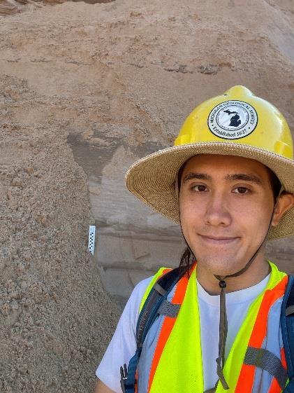
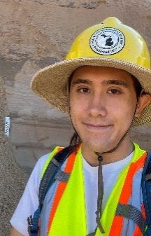
Augustine Lodise (he/they) is an early-career geoscientist with a Bachelor’s degree in Geology and History from Pitzer College. His undergraduate research investigated the paleoecology of a fossil site in Nevada using sedimentology/stratigraphy, zircon geochronology, vertebrate paleontology and ichnology, soil science, and the statistical analysis of multivariate geochemical datasets. After graduating, they worked abroad in Central Asia, first conducting paleoecological field research in Kyrgyzstan and then working at Nazarbayev University in Kazakhstan on a copper ore geochemistry project. Augustine currently works as a Geosciences Specialist for the Michigan Geological Survey on the Aggregates Project, validating and mapping the state’s aggregate resources for further protection and management. In their free time, Augustine enjoys hiking, rock climbing, reading sci fi novels, and taking care of their house plants.
Linda Zabik – Geoscience Specialist, Aggregates
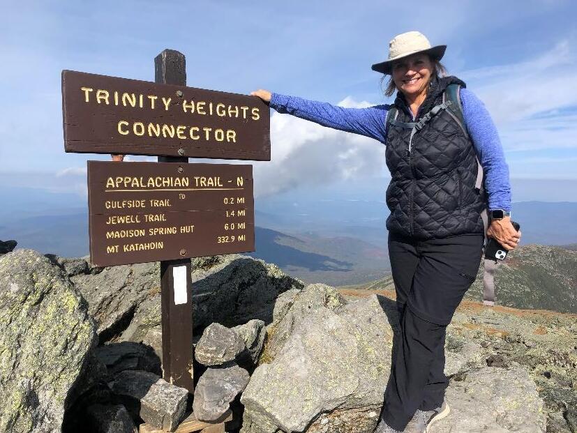
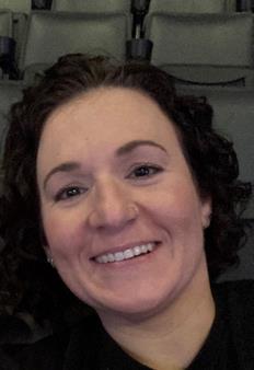
Linda joined the MGS Aggregate team as a Geosciences Specialist, bringing a diverse set of skills to the group. She earned her BS in Geology from Bridgewater State University in Massachusetts. After four years as a field geologist and program manager in the environmental site assessment program at an engineering firm in New Bedford, MA, Linda moved to Kalamazoo, Michigan. There, she attended Western Michigan University, where she completed her master’s degree in Geology. During her time at WMU, she served as a graduate assistant with the WMU Institute for Water Sciences and Groundwater Education in Michigan. Following her studies, Linda spent another decade as a senior geologist and project manager in environmental consulting before transitioning to groundwater and resource protection in agriculture with the Kalamazoo Conservation District. Fast forward 20 years, and Linda is back at WMU, working with the Survey to expand her skills in ArcGIS, glacial geology mapping, and aggregate resource identification.
Eric Schuemann – Geologist,Aggregates
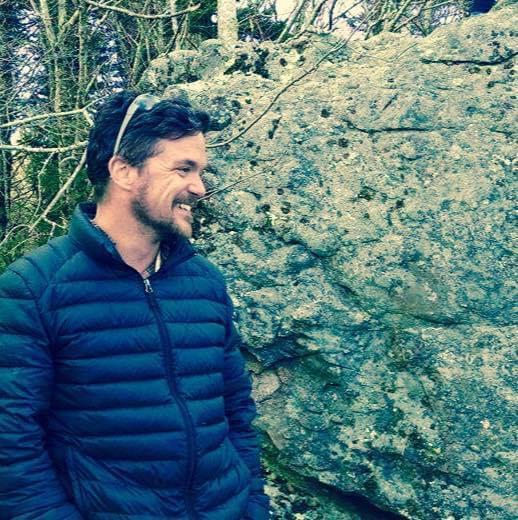
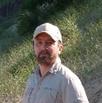
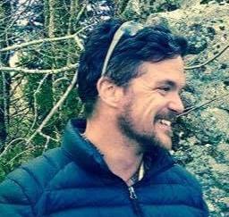
After a variety of interesting jobs and travel in Eric’s earlier career, he returned to academics in 2013 at Grand Rapids Community College, where he also worked as a professional tutor and student mentor. He then received his BS in Geology at Grand Valley State University, working with Dr. Ginny Peterson on Keweenawan rhyolites and rift basin conglomerates and was also fortunate enough to TA for a number of classes, including Structural Geology and Aqueous Geochemistry. In 2022, he completed his M.S. in Geoscience at UW-Milwaukee, working on shear fabrics as kinematic indicators in the Nemo area of the Black Hills, SD. He completed this work under Dr. Dyanna Czeck (Professor and Chair, UWMilwaukee) and Dr. Stephen Allard (Winona State University, MN). He now splits his time between being a husband, stepfather, musician, and Geoscience Specialist with the MGS in the aggregate field-mapping project. When he has time, he also teaches physical and environmental geology at Grand Rapids Community College’s Lakeshore Campus in Holland, MI.
Introducing New Staff
Lauren Clippinger –Administrator
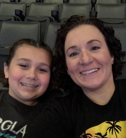
I am a Western Michigan University alum, earning a B.S. from WMU. I started my career here at WMU two years ago with the Office of Admissions. I have experience working in the administrative field for 10+ years. When I am not at work, I am spending time with my husband, our two kids, and three dogs. We are constantly busy, but any free time I have you will find me curled up reading a book. We love to
travel, although these days it depends on what we can fit into our teenagers’ busy schedules. But we are always looking to explore and experience unfamiliar, unique places. I am so excited for this new adventure with the Michigan Geological Survey and I can’t wait to see what the future holds!
Joanie Barnard (she/her) joined the Michigan Geological Survey as Budget Analyst in October of this year, bringing a strong background in finance and a passion for community-focused work. With experience in grant management, contract processing, and financial analysis, Joanie is eager to support the MGS’s mission and contribute to the important geological research and projects underway. After spending several years in Portland, Oregon, she’s excited to be back in Michigan and apply her skills in a role that aligns with both her professional expertise and personal commitment to service. Joanie is a graduate of Western Michigan University with a degree in Business Administration and focus in Finance. Outside of work, Joanie enjoys hiking, camping, and playing tennis. She’s also volunteered with human rights organizations focused on the Philippines. After moving back to Michigan during the pandemic to be closer to family, she’s excited to plant roots here and contribute to the great work happening at MGS.
MGS Wins $5M CCUS Grant from DOE
The U.S. Department of Energy announced the selection of nine awardees under the Regional Initiative for Technical Assistance Partnerships (RITAP) to advance the deployment of basin-scale carbon transport and storage and community engagement. MGS was one of the selected institutions, with their project titled “RITAP – A Roadmap to CCUS in Michigan.” MGS will receive approximately $5M from DOE and contribute an additional $1.25M in cost share, for a total project value of $6.25M. The overall objective is to aid in the acceleration and growth of the carbon management industry while being equitable and environmentally responsible. The project team consists of Carbon Solutions, Battelle, University of Michigan, Miami University, Michigan Technological University, Rock Locker, and the National Tribal Energy Association. Key project goals include:
➢ Technology transfer, outreach, engagement, and education
➢ Development of community benefits plan, implementation, and assessments
➢ Build understanding of storage resource management including storage resources, reservoir management, pore space usage, cross-cutting opportunities, and induced seismicity risks
➢ Provide technical assistance by conducting data gap analysis and site readiness, technology matching and direct-air-capture siting, transportation routing, policy and regulatory frameworks, utilization synergies, life-cycle analyses, and developing a CCUS directory
➢ Development of a CCUS roadmap to provide public information, guidance, and resources
We anticipate the project will start in the first quarter of 2025.
Joanie Barnard –
Outreach and Education Activities
MGS Attends Geological Society of America (GSA) Connects 2024 Conference
Written By: Amber Conner
The Advancing Carbon Capture, Utilization, and Storage (CCUS) in the Michigan Basin project is a Department of Energy funded project aimed to reduce risk, advance understanding of CCUS within communities, and ensure long-term, safe, and equitable storage of CO2. This project has several research tasks and areas of focus all with the goal to evaluate geologic storage, pressure management solutions, confining system efficacy, building wellbore integrity database, and building robust relationships with communities and stakeholders. Projects like these not only help study new opportunities for geologic storage assessments, but also offer opportunities to professionals and students to present their work at national and international conferences. These kinds of outreach experiences are important for students to learn about current geological projects and experience professional conferences.
On September 21st-27th, Amber Conner, MGS Paleozoic geologist, and Max Copus and Alex Kominek, Western Michigan University students, set out on a trip to Anaheim, CA, Figure 1, to present their research at the Geological Society of America (GSA) Connects 2024 conference. Max and Alex, first time presenters and attendees, presented their work on the “Development of a Wellbore Integrity Database to Aid CO2 Storage Site Screening.”
Max said, “For my first conference, it was a great experience presenting our work and seeing the interest from experts in our research. It was really inspiring to see how so many other geology students were passionate about their research on numerous different topics.” Alex said, “My experience at GSA was great. There were lots of opportunities to meet new people and learn about what the other research geologists are working on. I think presenting for the first time was fun and it was inspiring to hear so much positive feedback about our research.” Amber Conner commented, “They were the quintessence of the student talent we have working on these projects. Geologists, government, and industry partners were really interested in their work, and they handled the questions and presentation like rock stars!” Amber Conner presented her work on “Characterizing and Mapping the Lithological and Petrophysical Diversity of Potential Confining Units in the Michigan Basin ” Her work focuses on characterizing and identifying various key properties of confining units for the Michigan Basin which have not been fully explored for CCUS storage sites.
MGS Goes Viral!
Written By: Shelby Hurst
In a remarkable achievement this past quarter, the Survey’s YouTube channel celebrated its first viral video, thanks to the dedicated efforts of staff member Nathan Van Alstine. Nathan invested countless hours crafting engaging animations that illustrate the formation of the Michigan Basin, accompanied by a concise overview of the state's stratigraphy. Since its release a month ago, the video has garnered over 140,000 views and contributed to a surge of more than 1,000 new subscribers to the channel. This milestone represents a significant advancement for our outreach team, broadening our audience and enhancing our educational impact. To watch the video and explore more upcoming content on Michigan geology, visit our YouTube channel!
Figure 1. Presentation trip to the Geological Society of America (GSA) Connects 2024 conference in Anaheim, CA. Left image shows the Anaheim Convention Center where the GSA conference was hosted. Upper right image shows Max (left) and Alex (right) playing "rock, paper, scissors" to determine who will do the introduction slide. Lower right image shows Max and Alex presenting their work to the GSA audience.
Carbon Capture, Utilization, and Storage (CCUS) Captures Statewide Interest
Written by: Dr. Autumn Haagsma
Carbon Capture, Utilization, and Storage (CCUS), has gained significant interest over the past several months due to new grant wins, project announcements, and Michigan’s first Class VI permit application. Dr. Autumn Haagsma was interviewed by multiple entities to discuss the feasibility and safety of CCUS in Michigan. This included interviews with:
➢ Crain’s Grand Rapids News
➢ Fox 17 news
➢ Stateside with April Baer
➢ Detroit News
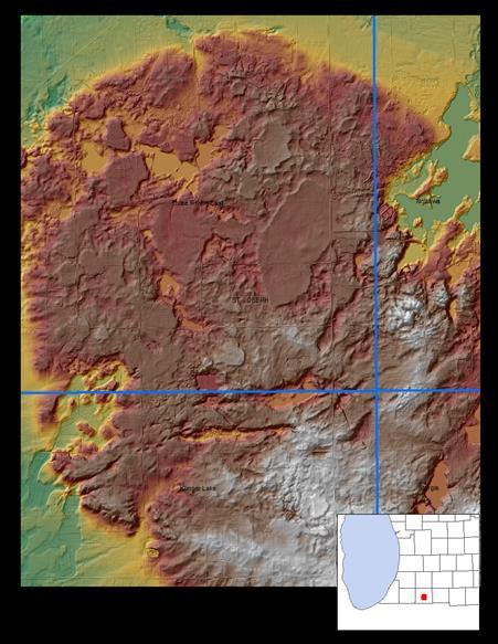
Location – Two miles south of Centerville, St. Joseph County Image Source – 2-foot pixel LiDAR Digital Elevation Model How to View - USGS The National Map-Advanced Viewer:
Interpretation – Ice-Walled Lake Plains! These supraglacial ice stagnation features, appear as relatively flat to slightly bowl-shaped plateaus minimally elevated above the surrounding morainal uplands. They have steeper outward facing ice-contact slopes down the surrounding land surface.
Where can they be found? Look for hummocky uplands and moraines. Or less common, look for ground moraines and till plains
Generally flat topped or saucer shaped, these landforms represent the formation of a short-lived lake that existed while glacial ice was still in the area. Stagnant ice masses formed the boundary of the lake and left the flat-topped lake deposits of sand to clay-size material in a relatively high position on the landscape.
These features were not recognized in Michigan until LiDAR became available. In most cases, they are only visible in the LiDAR data and are not visible on topographic maps, aerial photos, or soil surveys. In most cases, you wouldn’t know you were in one even if you were standing in one!
Reference Esch, J.M., Kehew, A.E., Esch, G.A., Yellich, J.A., 2020, Ice-Walled Lake Plain Distribution in Michigan, (abs.) Geological Society of America, paper No. 94-4, Geological Society of America Abstracts with Programs. Vol 52, No. 6, doi: 10.1130/abs/2020AM-359963
National Geological Map Database Program Update
Written by: Dr. Nathan Erber
The Michigan Geological Survey (MGS) has two ongoing projects funded by the United States Geological Survey (USGS) National Cooperative Geologic Mapping Program (NCGMP) under the STATEMAP program. Their objectives are 1) to update the National Geologic Map Database (NGMDB) catalog to include citations and links to downloadable files for all MGS published maps and related reports, and 2) to create a downhole stratigraphic tabular dataset of subsurface formation, marker bed tops, and structure elevation; and structure elevation raster grids of 12 marker beds in the Lower Peninsula of Michigan listed in Table 1.
NGMDB Catalog Update:
MGS updated the NGMDB Catalog to include citations and links to downloadable files for all published maps and related reports for Michigan. Necessary corrections were made to existing records (e.g., to make sure those records in the NGMDB are up to date). Updates were made to existing entries in the NGMDB to appropriately tag these items to ensure that they are searchable in the Catalog. An additional 175 NGMDB map entries were made for Michigan, either STATEMAP, Great Lakes Geologic Mapping Coalition, EDMAP or other significant published or unpublished geological maps. In addition, MGS supplied significant updates and corrections to the
Figure 2: Screenshot of the NGMDB Catalog results for the Michigan Geological Survey. existing records in the NGMDB, including 123 author corrections, numerous map title, map location, map latitude and longitude, and county corrections. MGS publications in the NGMDB Catalog can be found here. This project was undertaken to document and standardize data historically published by MGS and was also a necessary step in developing a geologic status map. The status map will be a valuable resource for those seeking geologic data in Michigan.
Downhole Stratigraphic Data and Raster Grids:
MGS created a tabular dataset of subsurface formation and marker bed tops and structure elevation on 12 marker beds in the Lower Peninsula of Michigan. The tabular dataset for each marker bed includes a unique well API number identifier, measuring point elevation (in meters), total depth, deviation angle, and downhole unit tops (depth in meters, increasing downward from surface or measuring point), data source, latitude and longitude coordinates for the formations and marker beds listed in Table 1. All formal formation names were standardized to GeoLex nomenclature, and non-formal formation names and marker beds not in GeoLex were flagged.
National Geological Map Database Program Update
Written by: Dr. Nathan Erber
This project was proposed because the 12 marker beds are important stratigraphic picks to provide a geologic framework helpful for developing projects such as oil and gas exploration, subsurface disposal of liquid wastes, location of evaporite deposits (salt, potash, gypsum, etc.), reservoir characterization for carbon capture utilization and sequestration (CCUS), and land-use planning. These two projects are currently in their final stages and, once completed, will be made available in the coming months. The NGMDB Catalog updates are made live after review from USGS staff. The downhole stratigraphic data will be made available via the NGMDB and the MGS website once an internal review is complete.
Figure 3: Michigan Formation, Brown Lime marker bed structure grid, the available control points and the Michigan Formation subcrop in light blue
Core Stories
1.1 Billion-year-old Mystery Solved by Michigan’s Deepest Well – the McClure Sparks et al., 1-8 well, 17,466 feet deep
Written and Interpreted by: Linda Harrison and Dr. William Harrison
In October, 1973, the country’s reliance on foreign oil hit home when the Organization of Arab Petroleum Exporting Countries (OAPEC) announced a total oil embargo against the United States and several other countries. Americans quickly experienced major gas price fluctuations and long lines at the gas station. In response, President Nixon launched “Project Independence,” reducing speed limits nationwide to 55 miles per hour, and strongly encouraging “our American science, technology and industry” to find more domestic reserves.
McClure Oil in Michigan took up the challenge by exploring for reserves in deeper formations. McClure began drilling the Sparks well (API 21057297390000) in June 1974. Industry partners, including Shell and Amoco Development, later joined the effort. What they would learn from that well far surpassed anything that could have been imagined at the time, pioneering research into a totally unknown Michigan geological puzzle and discovering the solution to a billionyear-old mystery.
The well was often referred to as the “Ithaca Community Deep Test” because, as the local newspaper reported, “more than 98% of the land area in the city, including all the residential property, all of the business places, all churches and schools, all city-owned property, the County Road Commission grounds, industrial plants, and the former site of the county infirmary, along with nearly every farm . . . was leased for drilling in what may be the greatest community cooperative effort in history.” McClure’s president, Harold McClure, was quoted, “If there’s a barrel of oil under the Court House in Ithaca, we should go after it.”
An information center was set up, right next to the well, with closed-circuit TV and samples from the well. Open every day, the center kept everyone informed about the well’s history-making progress.
They initially planned to drill to 11,000’. Bill Roth was in charge of exploration. He thought that “hard rock was somewhere between 11,000’ and 15,000’. They suspected that some dense, iron-rich rocks must exist beneath the sedimentary rocks in that area because gravity measurements had shown this anomaly for decades. But no wells had been drilled deep enough to provide direct data about those rocks. The deepest Michigan well drilled before 1974 reached 12,966,’ and the rock was still sedimentary at that depth.
The Sparks, et al., 1-8 well penetrated the entire sedimentary sequence and then found igneous intrusions near the total depth of 17,466’ it was the first time a Michigan well was drilled deep enough to recover those deep iron-rich rocks
Core Stories
1.1 Billion-year-old Mystery Solved by Michigan’s Deepest Well – the McClure Sparks et al., 1-8 well, 17,466 feet deep
Written
and Interpreted by:
Linda Harrison and Dr. William Harrison
At 12,200’, the driller’s bit penetrated a formation of red shale and sandstone. These “red beds” had never before been seen in the mid-Michigan area. On April 5, 1975, they reached a record depth of 13,000’. At that point, Bill Roth said, “As long as we find sedimentary rock, we will continue to drill. If we hit crystalline rock, there is no hope for any oil or gas.”
Drilling ever deeper, they were amazed that the “red beds” continued to a depth of 16,306’, where the drill bit broke into finely crystalline, dark gray to green diorite. Red beds with some diorite continued to a depth of 17,218’. From that depth to 17,466’, the samples coming up the drill pipe showed only green and black crystalline igneous rock.
At that point, in October 1975, they stopped drilling. No oil or gas could be found in crystalline rocks. The well was declared dry. But that was not the end of the story. News of the deep well spread to the academic world that cores, long sections of the rock formations, had been brought to the surface. The prospect of actually sampling and testing those rocks lured university scientists to the well site, funded by $250,000 from the National Science Foundation (NSF).
McClure and their industry partner scientists worked with NSF scientists and researchers from Western Michigan University, the University of Wisconsin, Northwestern University, and Purdue University, giving them full access to samples and data that yielded essential data for future geological evaluation.
Once the research was underway, the Alma Daily Record, quoted Harold McClure, “This marked the first time that members of the industry and the academic community have cooperated in conducting scientific tests at an active well site. Even though we didn’t find oil or gas, these scientific studies will benefit all involved. This is a fine example of the good that can result when industry, the academic world, and the local community take part in cooperative efforts.”
Western Michigan University researchers, John Fowler and David Kuenzi, shared their research in a 1978 issue of Journal of Geophysical Research, which published an entire edition about the Michigan “failed rift.”
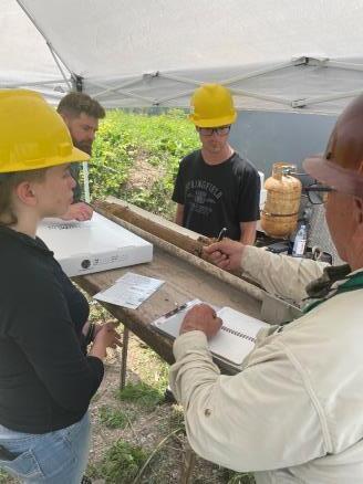
Photograph from 1974 of Mike Barratt, Bill Roth, Herbert Ilfelder, and Harold McClure Jr. interpreting core
Core Stories
1.1 Billion-year-old Mystery Solved by Michigan’s Deepest Well – the McClure Sparks et al., 1-8 well, 17,466 feet deep
Written
and
Interpreted by: Linda Harrison and Dr. William Harrison
Data from the Sparks well cores showed, for the first time, that these dense, iron-rich crystalline rocks were the source of the anomalous gravity readings discovered so long ago. Only the Sparks well was drilled deep enough to penetrate these dense, igneous rocks, formed 1.1 billion years ago.
In fact, data from the well cores answered far more questions than expected. Scientists conducted tests that determined their age and physical characteristics, and showed where Michigan was located relative to the magnetic North Pole when the rocks were formed. This partnership between industry and scientists yielded data and research, resulting in numerous scientific publications.
Using samples from the well, scientists would show that these deep rocks were formed by a “failed rift system” that was active more than one billion years ago. This rift was a place where the Earth’s crust was pulling apart and igneous rocks were welling up from a much deeper source. If the crustal separation had continued, it would have divided the North American continent, resulting in the formation of an ocean between them, in the same process that produced the Atlantic Ocean.
We also learned that this rift is part of the much larger Midcontinent Rift which is now known as one of the world’s best examples of a “failed rift.” Through rock exposures in the Upper Peninsula and rock cores from this very deep Sparks well, we have gained knowledge about the early stages of rift formation in continents.
Economic benefits from this Michigan failed rift include the rich metallic deposits of copper and nickel in the Upper Peninsula and some of the oil and gas reservoirs in the Lower Peninsula. Additionally, the landscape of many of the beautiful parks around Lake Superior, like Pictured Rocks and Apostle Islands National Lakeshores, Isle Royale National Park, Interstate Park, and Porcupine Mountains Wilderness State Park, are products of this period in Michigan’s geologic history (see Using Lake Superior parks to explain the Midcontinent Rift (U.S. National Park Service).
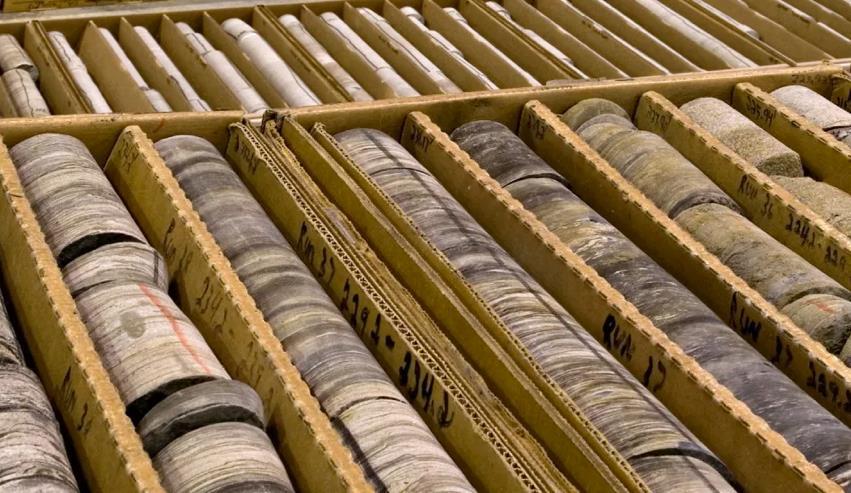
These core photos from the Sparks well, as well as hundreds of other wells, were created by Michigan Geological Repository for Research and Education (MGRRE) staff and students, thanks to funding from the USGS National Geological and Geophysical Data Preservation Program. Those photos are all freely available by API number from ScholarWorks at https://scholarworks.wmich.edu/core_photos/
The Sparks well is still the deepest well ever drilled in Michigan. McClure, Shell Oil and Bill Roth kept core sample sets from the well. All that core is now preserved at MGRRE, part of the Michigan Geological Survey (MGS). Those cores and our MGS researchers stand ready to address newly emerging critical issues as technology evolves, to yet again provide answers to questions that we cannot even imagine today
Red beds at 15,083ft to 15,085 ft well depth
Diorite at 17,445 ft to 17,447 ft well depth
Field Stories Geologic Mapping near Watersmeet, MI
Written by: Nolan Gamet
The U.P. team laced up their boots and hit the ground running in early July as they transected across hummocky terrain, bushwhacked through dense forests, weaved through cedar swamps, and swatted away clouds of mosquitoes in search of outcrops. The seasonal streams and pools of stagnant water created the perfect spawning conditions for these pesky flying insects. For those familiar with early summer conditions in the U.P., bug nets were just as important as rock hammers for our team while exploring the forest (Fig. 1). The lush green foliage made spotting outcrops on foot difficult; however, iPads loaded with 1-m LiDAR-derived DEMs made rock exposures stick out like sore thumbs. The ESRI Field Maps application enabled us to have a full range of DEM data, topographic maps, arial imagery, natural resource layers, and feature classes at our finger tips even when there was zero cell signal (Fig. 2). A Bad Elf Bluetooth receiver was also utilized to increase the GPS accuracy of the tablet in order to field truth outcrops and other surface features in real time.
Most outcrops required minor excavation because they were often hidden beneath a layer of moss, lichen, or other forest debris, whereas other outcrops formed extensive ridges and gorgeous waterfalls (Fig. 3). Once a good portion of an outcrop was unearthed, the team hiked around the entire exposure while randomly breaking off small hand samples along the way. These hand samples were described based on their unique characteristics and examined with a hand lens to identify minerals and other small-scale structures. Orientation measurements were taken whenever possible to capture foliation and structural trends. When rock specimens displayed a mineral of interest, such as fluorite, they were carefully sampled and packed away for future lab analyses (Fig.4). Later in the field season, the team acquired a very useful surveying device that was needed to collect data not visible to the naked eye.
4. Fluorite-bearing, magnetic, quartz-feldspar-biotite schist collected by the mapping team this season. Fluoritebearing samples are especially interesting because they may indicate the presence of rare Earth elements (REEs).
Figure 1. Nolan Gamet formulating a rock description that best depicts the large ridge-forming outcrop beside him. The rock appeared to be interlayered amphibolite and felsic gneiss. Photograph by Hayden Chaisson.
Figure 2 Bob Mahin and geologic technician Beth Buyze use ESRI Field Maps on their field tablet to navigate and orient themselves in the field. Photograph taken by Nolan Gamet.
Figure 3 Ashley Quigley and Nolan Gamet examining a large, fractured outcrop of gneiss at Ajibikoka Falls, working to interpret its complex structure and geological history. Photograph taken by Jillian Cain.
Figure
Photograph by Nolan Gamet.
Field Stories
Geologic Mapping near Watersmeet, MI
Written by: Nolan Gamet
The U.P. team purchased a RS-230 BGO Super-SPEC handheld Gamma-Ray Spectrometer from Radiation Solutions, Inc. with Watersmeet dome mapping grant funds. (Fig. 5). This device is equipped with large a Bismuth Germanate Oxide (BGO) detector allowing for extreme sensitivity. With this tool, our team can survey and assay outcrops of interest with the simple push of a button (Fig. 6). The survey mode provides a total count readout in CPS while auto-stabilizing on naturally occurring radio elements. The assay mode readout, on the other hand, provides percent K and concentrations of U and Th in parts per million. The goal is to collect RS-230 data on every outcrop described this season before the exposures are covered in a mix of dead leaves and fresh snow.
A beautiful palette of earthy red, orange, and yellow spread out across the tree line and an aroma of decomposing leaves in the air are both reminders that the U.P. field season is quickly waning (Fig. 7). As the mix of lowland conifers, hardwoods, and old growth white pines of the Ottawa National Forest prepare for winter, the U.P team follows suit by directing their focus towards laboratory work. Snow will soon cover the entire U.P. like a thick blanket hand crafted by Mother Nature herself, leaving the project area practically inaccessible. Over 100 rock samples were collected from different outcrops throughout the season. Our sampling strategy focused on rocks that were magnetic, displayed visible alteration or mineralization, and those that had interesting minerals like fluorite. The resulting collection of Early Archean to Early Proterozoic samples now residing in our U.P. office encompasses the geologic history of the unique geology near Watersmeet.
It is now time to examine the samples and determine what analyses are needed to help make updated interpretations of the local bedrock geology. We plan to combine geochemical analyses, transmitted light microscopy, petrography, and scanning electron microscopy (SEM) coupled with energy-dispersive X-ray spectroscopy (EDS) to confidently identify alteration indicators, unknown minerals, and other microscopic features. The data produced by the lab analyses will guide our current understandings in a direction that will result in high quality cross sections across the entire project area. Sample data, field observations, and structural interpretations are all needed to further assess the critical mineral and rare earth element (REE) potential within the northern margin of the Watersmeet dome. More exciting updates and photos will be shared as more goals are achieved.
Figure 7. Fall showing its true colors across the Ottawa National Forest near Watersmeet, MI as the 2024 field season comes to an end. Photograph by Nolan Gamet.
Figure 5. Geologic technician, Hayden Chaisson, using the newly acquired RS230 Gamma-Ray Spectrometer to obtain gamma counts per second and concentrations of K, U, and Th. Photograph taken by Jillian Cain.
Figure 6. RS-230 BGO SuperSPEC Handheld Gamma-Ray Spectrometer. Top photographs of assay mode (left) and survey mode (right) taken by Nolan Gamet. Bottom photograph taken from Mount Sopris.com shows gamma spectrometer along with its rugged field case.
Honoring the Legacy of JohnA. Yellich
- Certified Professional Geologist and Former Director of the Michigan Geological Survey
We celebrate the remarkable career and retirement of John A. Yellich, who served as the Director of the Michigan Geological Survey (MGS) from 2013 to July 1, 2024. With over 50 years of expertise in geology, Yellich’s contributions have left an indelible mark on Michigan’s understanding and management of its natural resources, particularly in geologic mapping, groundwater research, and environmental sustainability.
A Career of Dedication and Achievement
Mr. Yellich earned both his Bachelor’s and Master’s degrees in Geology from Western Michigan University and has held certification as a Certified Professional Geologist for over 35 years. His professional journey includes a variety of roles across more than 30 states and internationally in Canada, Australia, and China. As a seasoned expert, his focus areas have spanned mineral exploration and development, environmental consulting, land development, stormwater management, and OSHA safety compliance. In addition to his time at MGS, Yellich held senior management roles in both Fortune 100 corporations and consulting firms, demonstrating his versatility and leadership in both corporate and public sectors.
A Visionary at the Michigan Geological Survey
Yellich’s directorship at MGS is particularly notable for his relentless pursuit of funding and data-driven insights to support Michigan’s geology and water resources. He reestablished geological mapping priorities, developing innovative 3D geologic mapping products to meet United States Geological Survey (USGS) standards. His initiatives aimed to provide essential insights into Michigan's subsurface geology, enabling better resource management and public safety. In 2022, after 11 years of advocating for stable funding, Yellich secured $3 million in annual funding from the Michigan Legislature, a significant milestone for the state’s geological programs.
Expanding Research and Outreach
Yellich also spearheaded various county-focused groundwater studies across Michigan, with particular attention to counties such as Ottawa, Cass, St. Joseph,
Calhoun, and Hillsdale. His leadership was instrumental in using cutting-edge remote sensing and geologic data to assess bluff stability along Lake Michigan’s coastline. Beyond Michigan, Yellich’s expertise benefited state and federal agencies on mine permitting, environmental assessments, and resource evaluations. His international experience, spanning continents, adds a global dimension to his leadership in resource management and sustainable practices. Professional Service and Recognitions
In addition to his work with MGS, Yellich served as President of the Association of American State Geologists from 2020-2021 and as Secretary of the Michigan Basin Geological Society from 2017-2024. His efforts in professional organizations, including the American Institute of Professional Geologists and the Society of Mining, Metallurgy & Exploration, underscored his commitment to advancing the field of geology. Yellich’s dedication earned him numerous accolades, including the Western Michigan University College of Arts and Sciences Alumni Achievement Award, the Geosciences Department’s Outstanding Alumni Academy Award, and Distinguished Advisory Council member recognition. His service as a lobbyist for the Atomic Industrial Forum and his participation in President Clinton’s Roundtable on Technology Transfer showcase his engagement in public policy and advocacy for geologic sciences.
A Lasting Legacy
As we bid farewell to John A. Yellich in his role as Director, the Michigan Geological Survey stands poised to continue his vision of sustainable resource management, geological exploration, and public service. His legacy will endure as MGS builds on the foundations he laid, continuing to advance Michigan’s geological understanding and protect its natural resources for generations to come.
Congratulations, John, on a distinguished career and a well-deserved retirement!
Sara Pearson MGS Director CPG Geologist 269-387-8611
Sara.Pearson@wmich.edu
Geologist
269-387-8691
William.Harrison_III@wmich.edu
Jennifer Trout Research Associate Geologist MGRRE Collections Manager 269-387-8633
Jennfier.L.Trout@wmich.edu
Peter Voice Research Associate Teaching Faculty Specialist 269-387-5486
Peter.Voice@wmich.edu
Upcoming Events
>>>
Ashley Quigley
Senior Research Associate Precambrian Geologist 269-387-8634
Ashley.Quigley@wmich.edu
Linda Harrison Administrator Geologist Industry Outreach Coordinator 269-387-8642
Linda.Harrison@wmich.edu
Nathan Erber Senior Research Associate Geomorphologist 269-387-8604
Nathan.R.Erber@wmich.edu
Amber Conner Senior Research Associate Paleozoic Geologist 269-387-8641 Amber Conner@wmich.edu
Nolan Gamet Research Assistant Geologist 969-412-0723 (M) Nolan.Gamet@wmich.edu
Garrett Ringle Research Assistant Geologist 517-677-6367 (M) Garrett.Ringle@wmich.edu
Gregory Anderson Research Associate GIS Specialist 269-567-8742 Gregory.Anderson@wmich.edu
Richard Haagsma Geotechnician
3D Scanning Specialist 269-387-8689 Richard Haagsma@wmich.edu
Libby Ives Research Associate Upper Peninsula Geologist Elizabeth.Ives@wmich.edu
John Esch
Senior Research Associate 269-387-8626 John.m.esch@wmich.edu
Robb Gillespie Senior Research Associate Dinosaur Park Manager 269-387-5364
robb.gillespie@wmich.edu
Sophia White Triage Project Manager Geologist 269-387-5486 Sophia.F.White@wmich.edu
Thomas Valachovics Senior Research Associate Aggregates 231-670-1634 thomas.r.valachovics@wmich.edu
Trent Adams Research Associate Aggregates 269-387-8689 trent.adams@wmich.edu
Sam Zink Research Associate Samantha.Zink@wmich.edu
Augustine Lodise Research Associate Aggregates 269-387-8633 augustine.lodise@wmich.edu
Linda Zabik
Geoscience Specialist
Aggregates
269-387-5486 linda.zabik@wmich.edu
Lauren Clippinger Administrative Assistant
269-387-2000 lauren.r.clippinger@wmich.edu
Eric Schuemann Geoscience Specialist Aggregates 269-387-8633 eric.schuemann@wmich.edu