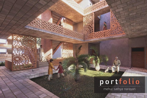
Hinge 01.
Graduate Project | Cornell University | 2026
ULI Hines Competition | Group Project
Project Team : Site
My Role
Hyejo Choi, Yi-Wei Chen, Mandira Pai Hancock Center, Austin, TX
Concept design, GIS Mapping, test-fitting, 3D modeling, graphics, and renders
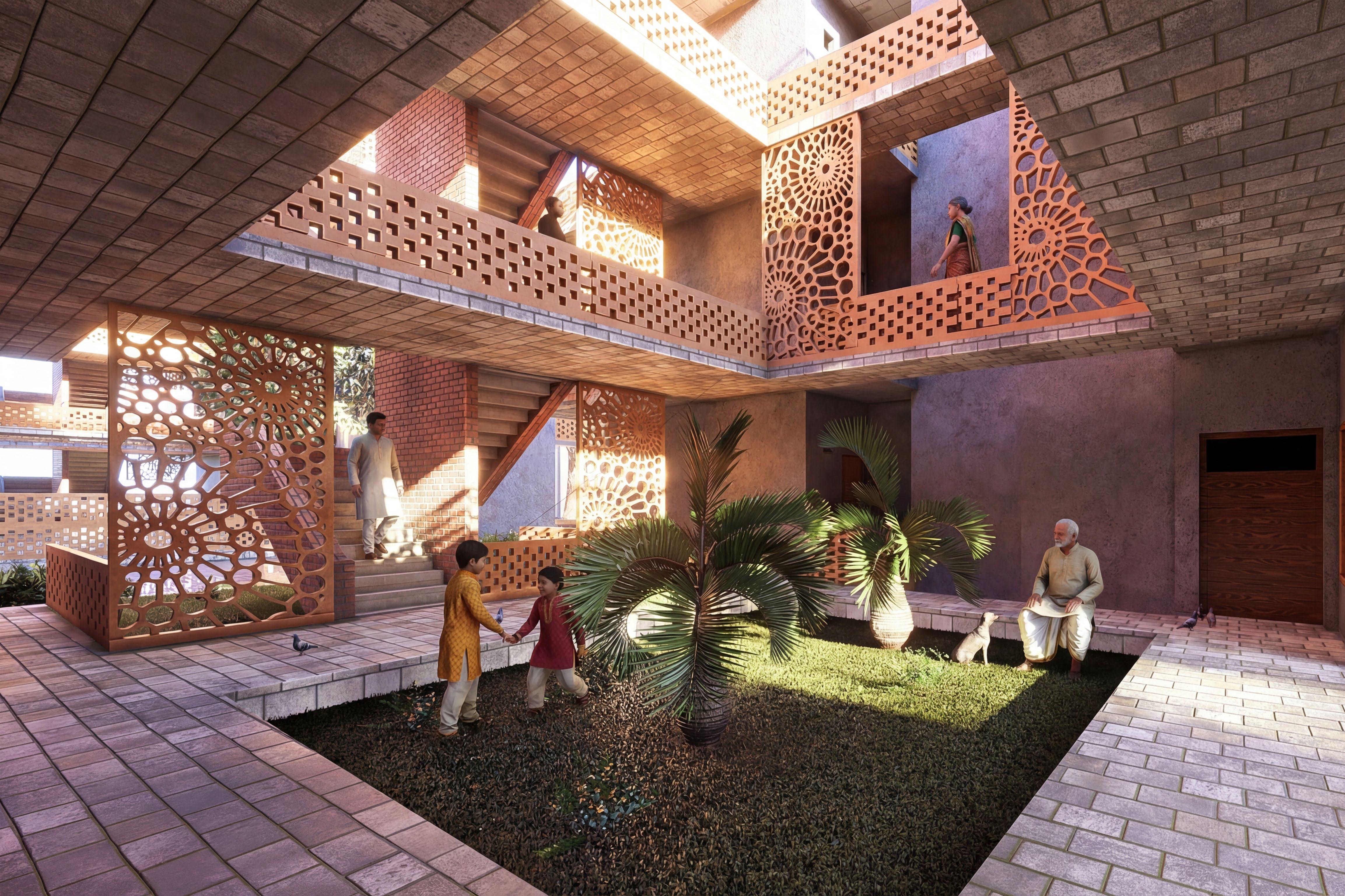
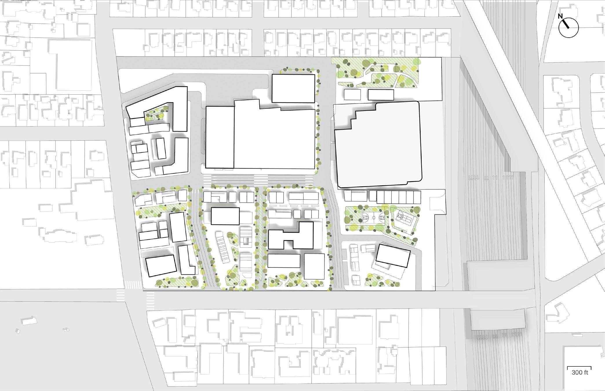
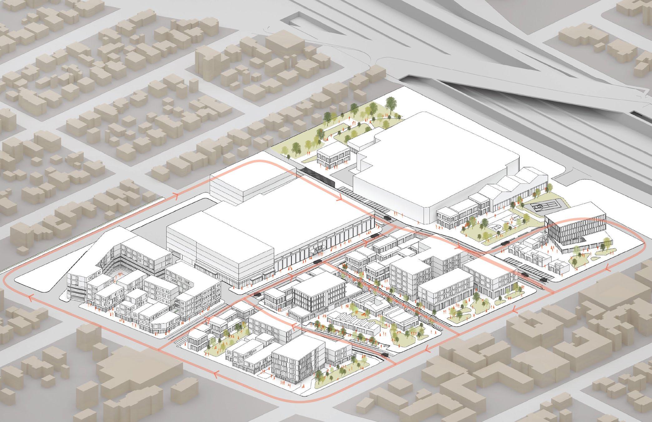
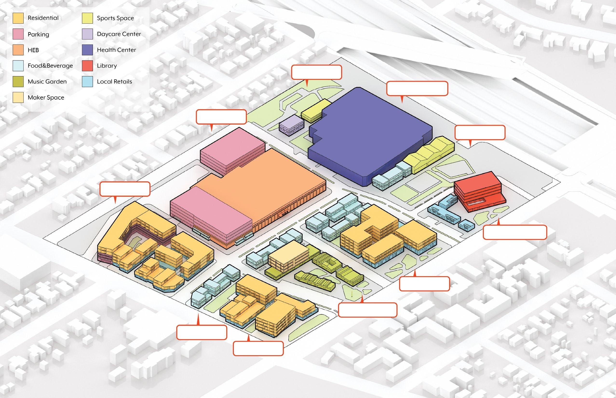
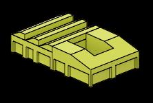
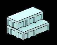
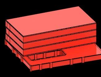
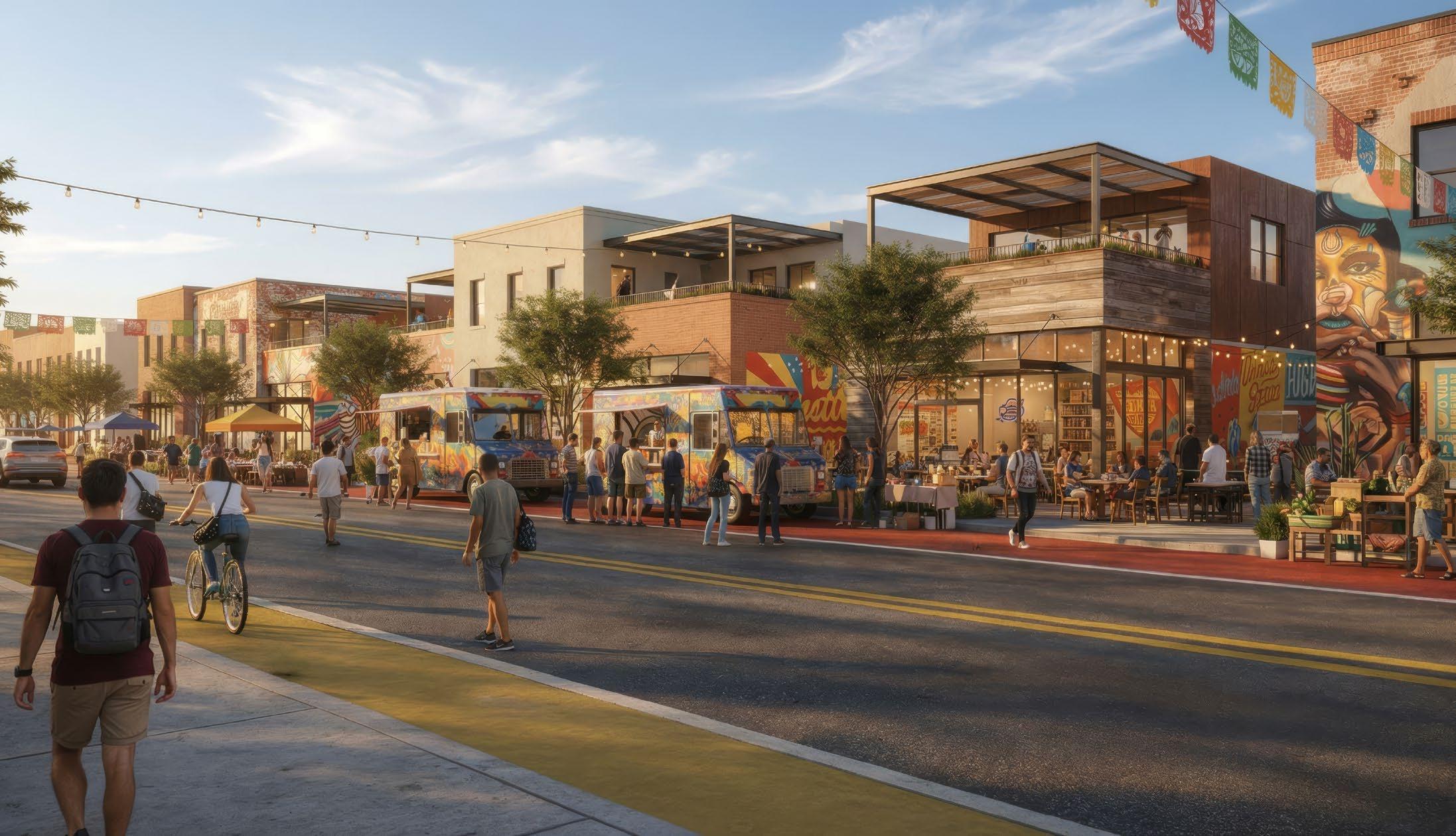
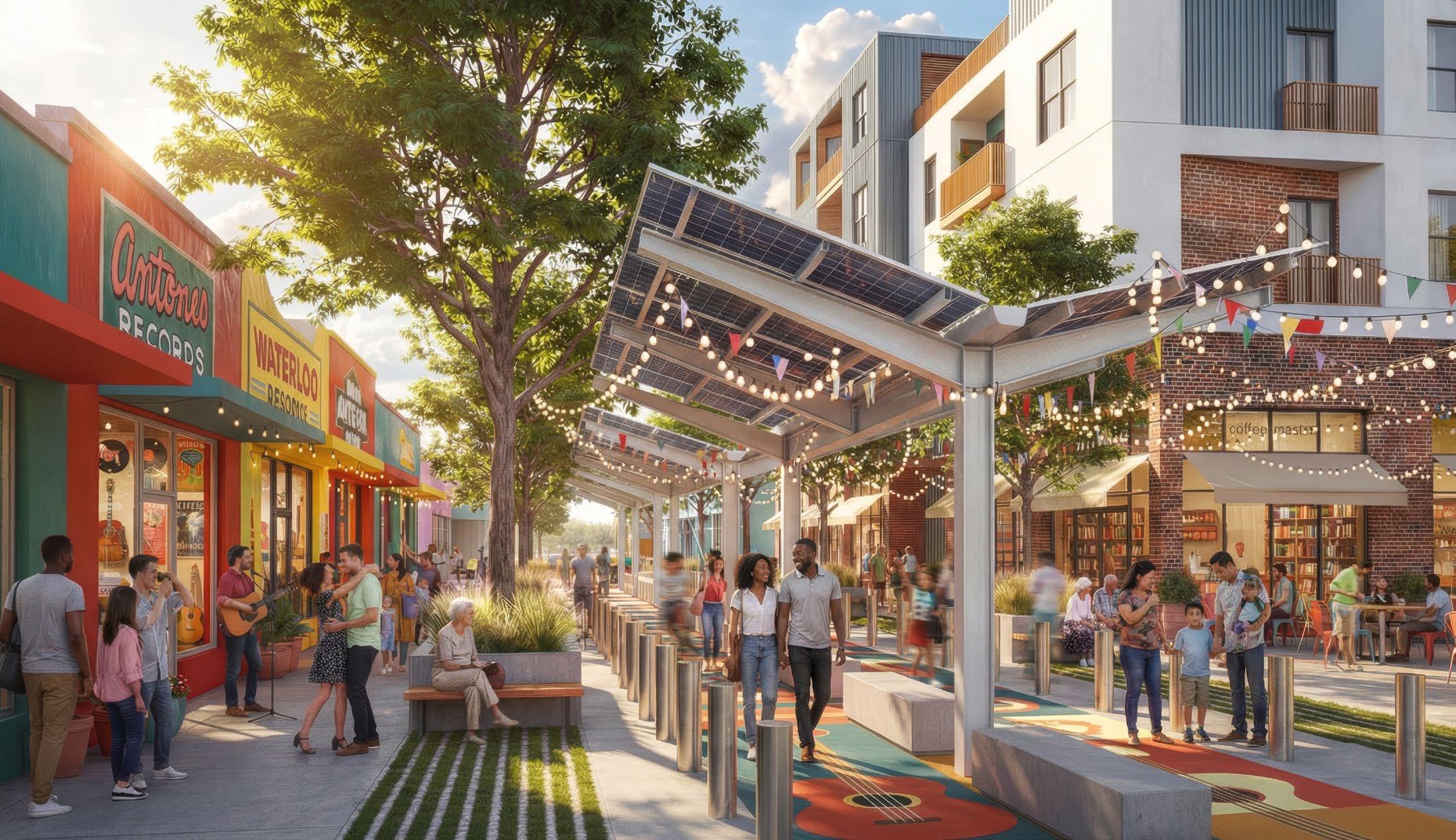
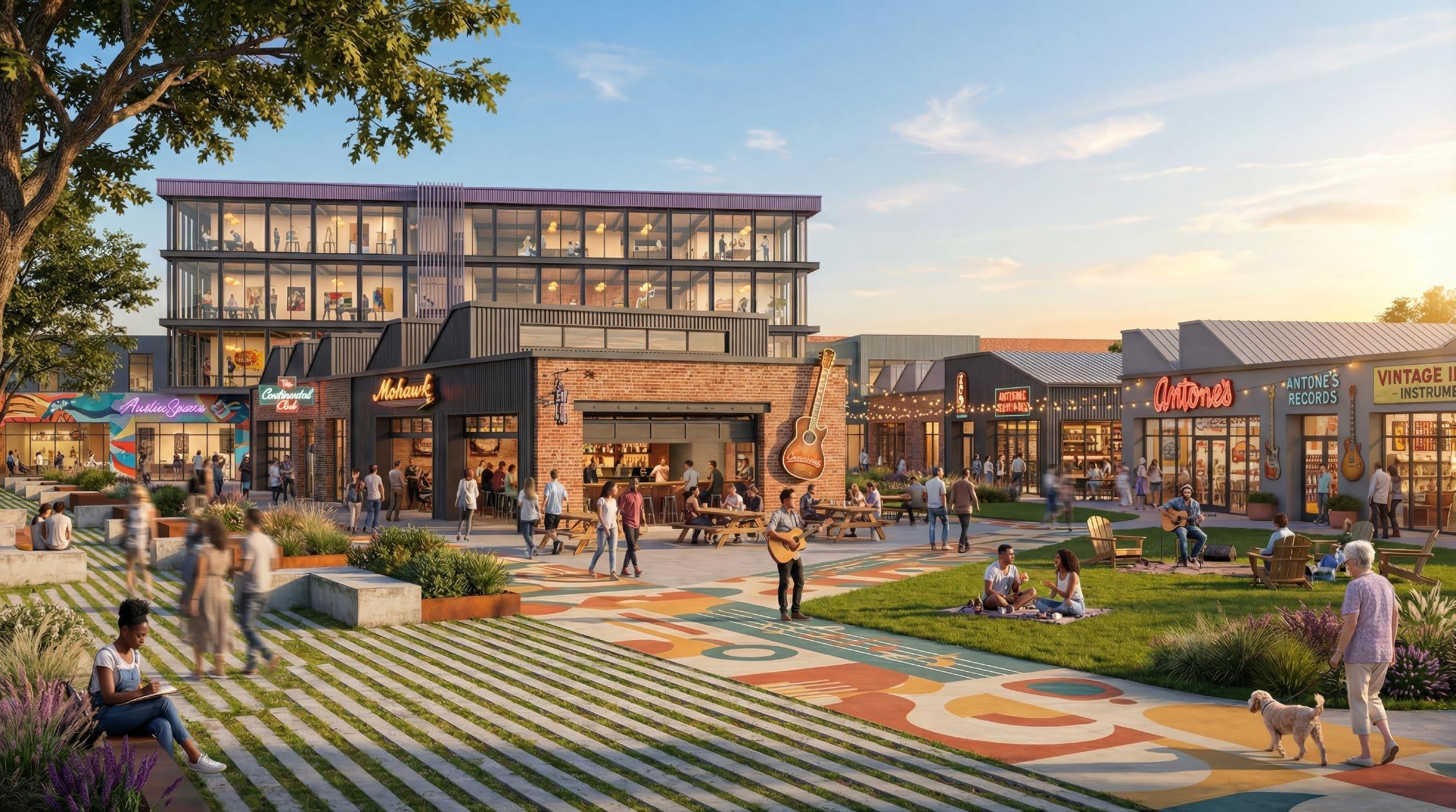
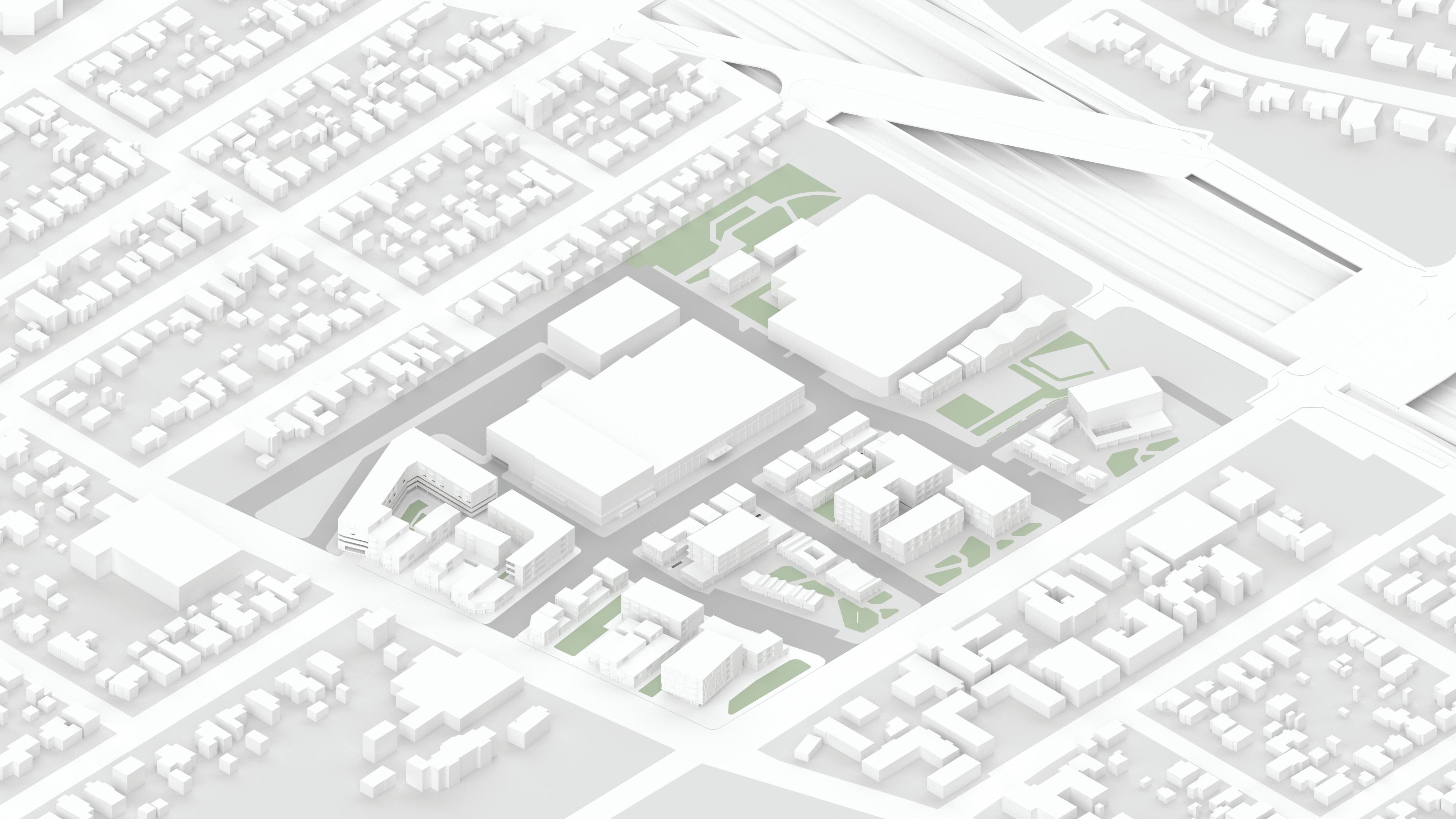
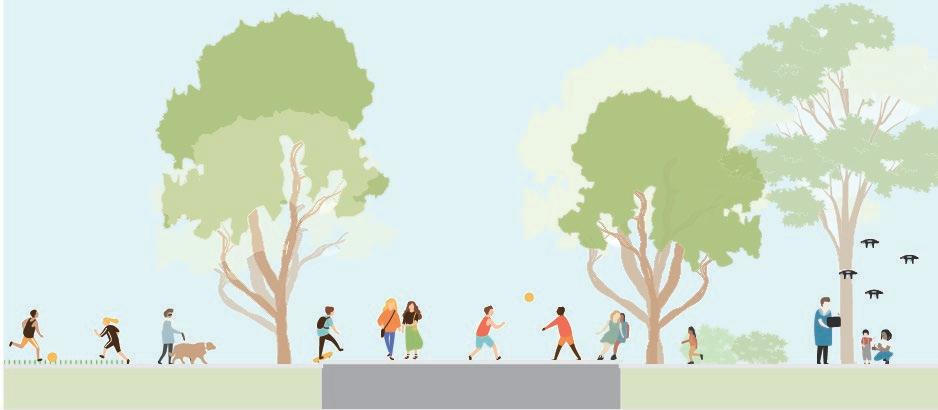
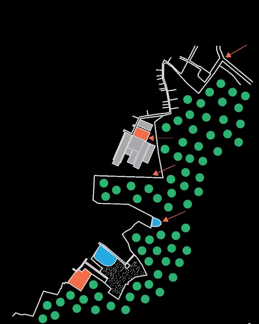
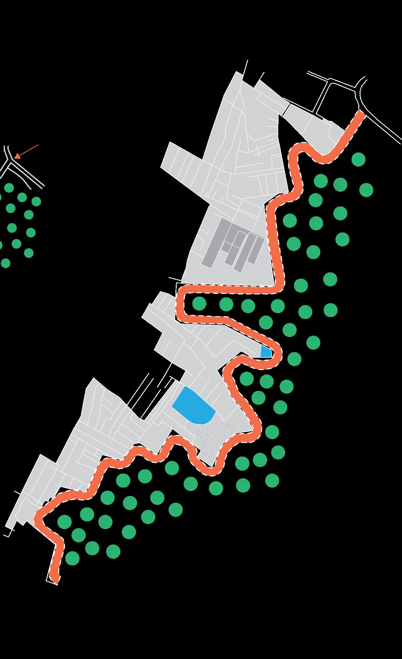
HINGE reimagines the 29-acre Hancock Center site in East Austin, transforming an automobile-oriented shopping center into a mixed-use neighborhood that bridges the historic divide between East and West Austin while preserving the community’s cultural identity.
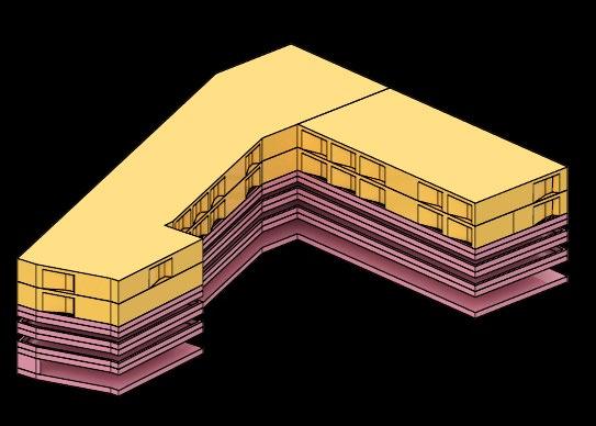
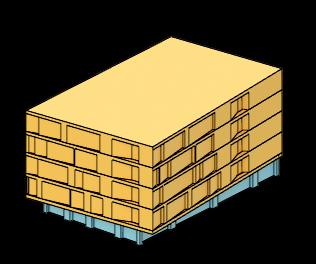
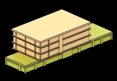
The proposal delivers 683 residential units (20% affordable) 231,000 GSF of ground-floor programming, and 75,000 SF of public open space. An existing H-E-B is renovated as a grocery anchor, joined by 34,950 SF of flexible retail designed to support local merchants through below-market leases. A community library, daycare center, and recreation complex strengthen institutional programming.
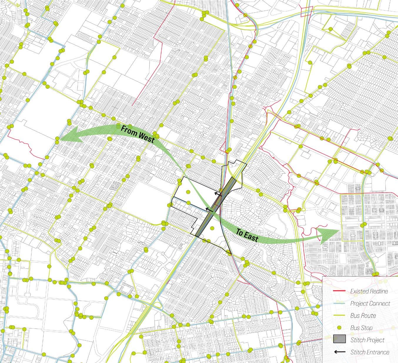
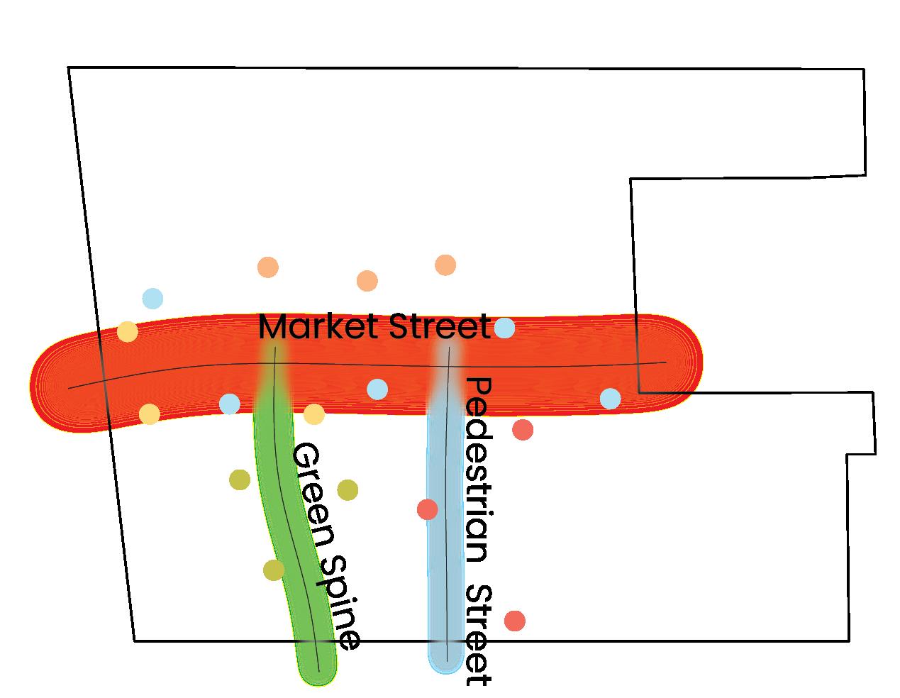
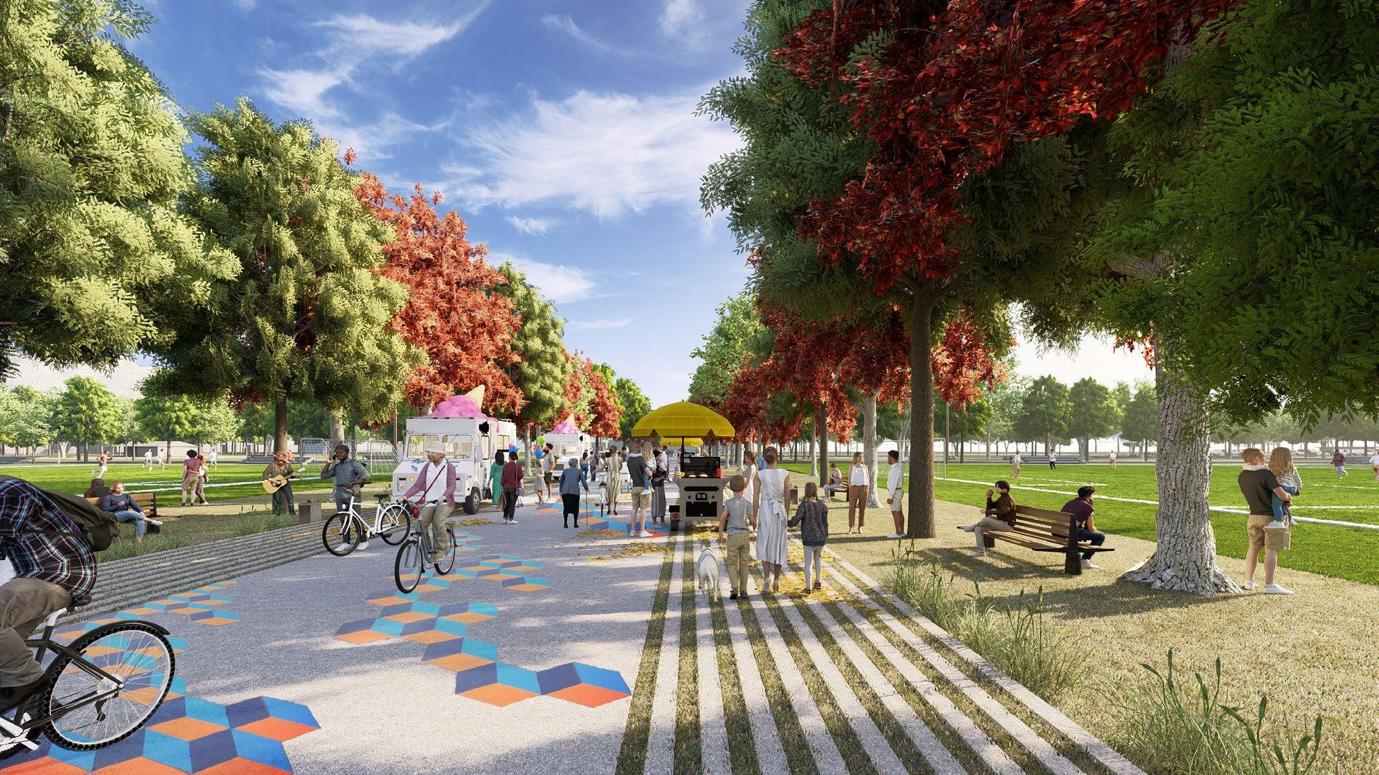
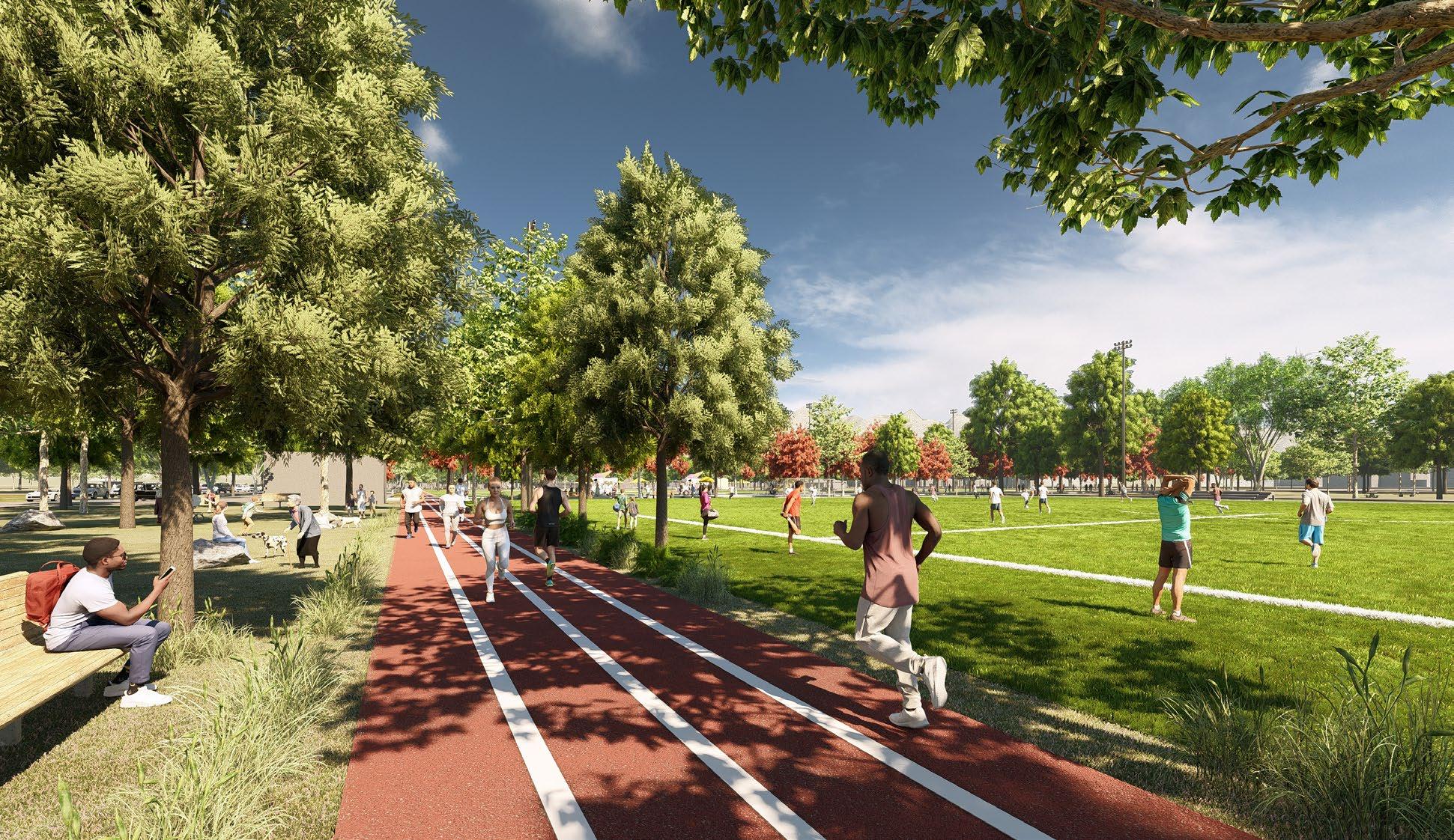
Three street typologies, the Green Spine, Market Street, and Pedestrian Streets, create varied mobility experiences that prioritize walking, biking, and future transit connections adjacent to the proposed I-35 Stitch and Red Line station. Stormwater is managed 100% on-site through rain gardens and porous pavement.
The phased development generates $586.6 million in total project value while demonstrating that equitable, transitoriented growth is financially viable.
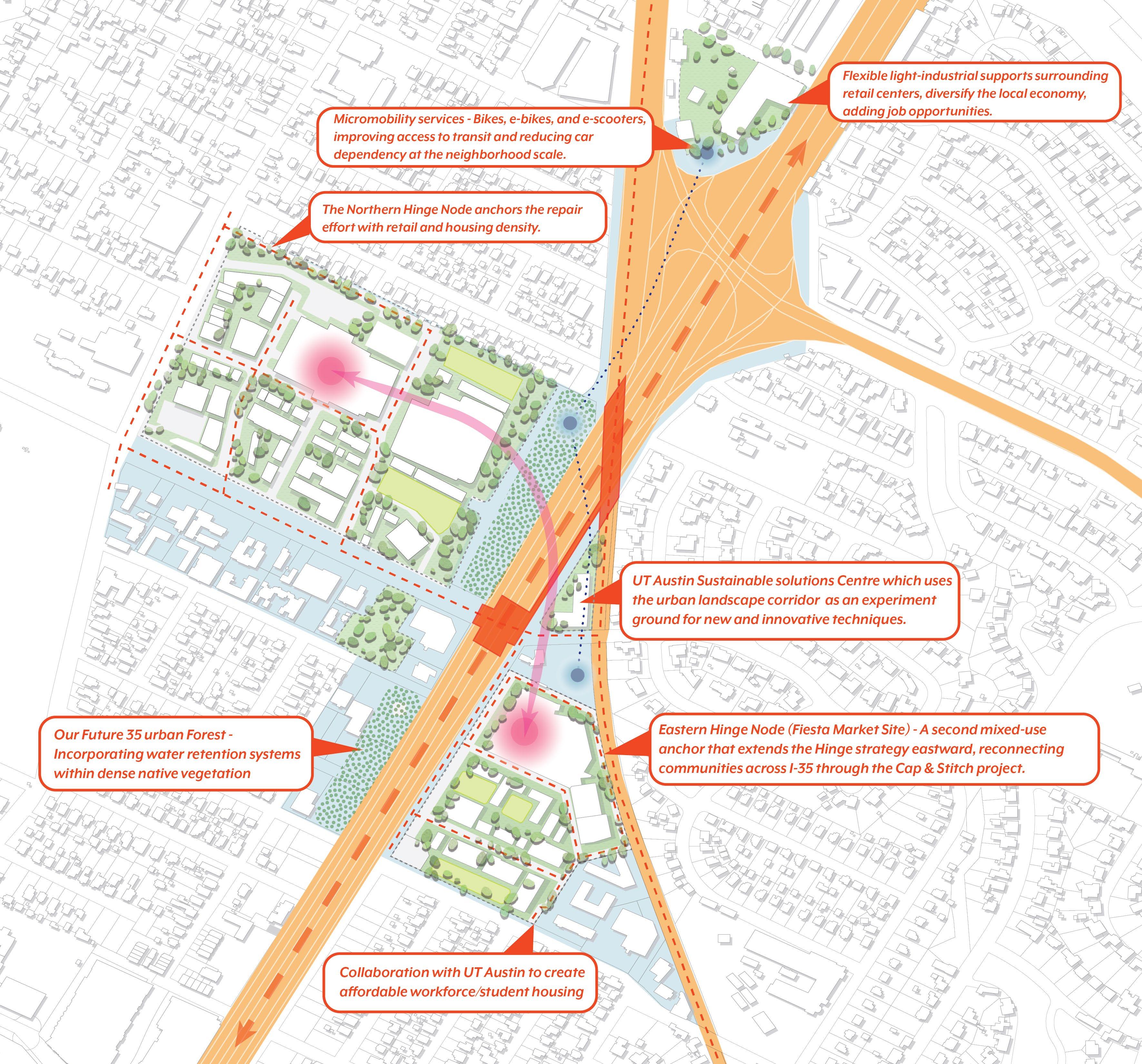
Our Future 35 Urban Forestincorporating water rentention systems within dense native vegetation.
Micromobility services - Bikes, e-bikes, and e-scooters, improving access to transit and reducing car dependency at the neighborhood scale.
The Northern Hinge node anchors the repair effort with retail and housing density.
Collaboration with UT Austin to create affordable workforce/student housing.
Flexible light-industrial supports surrounding retail centers, diversify the local economy, adding job opportunities.
UT Austin ‘Sustainable Solutions Center’ which uses the urban landscape corridor as an experiment ground for new & innovative techniques.
Eastern Hinge node (Fiesta Market Site) - A second mixed-use anchor that extends the hinge strategy eastward, reconnecting communities across I-35 through the Cap & Stitch project.
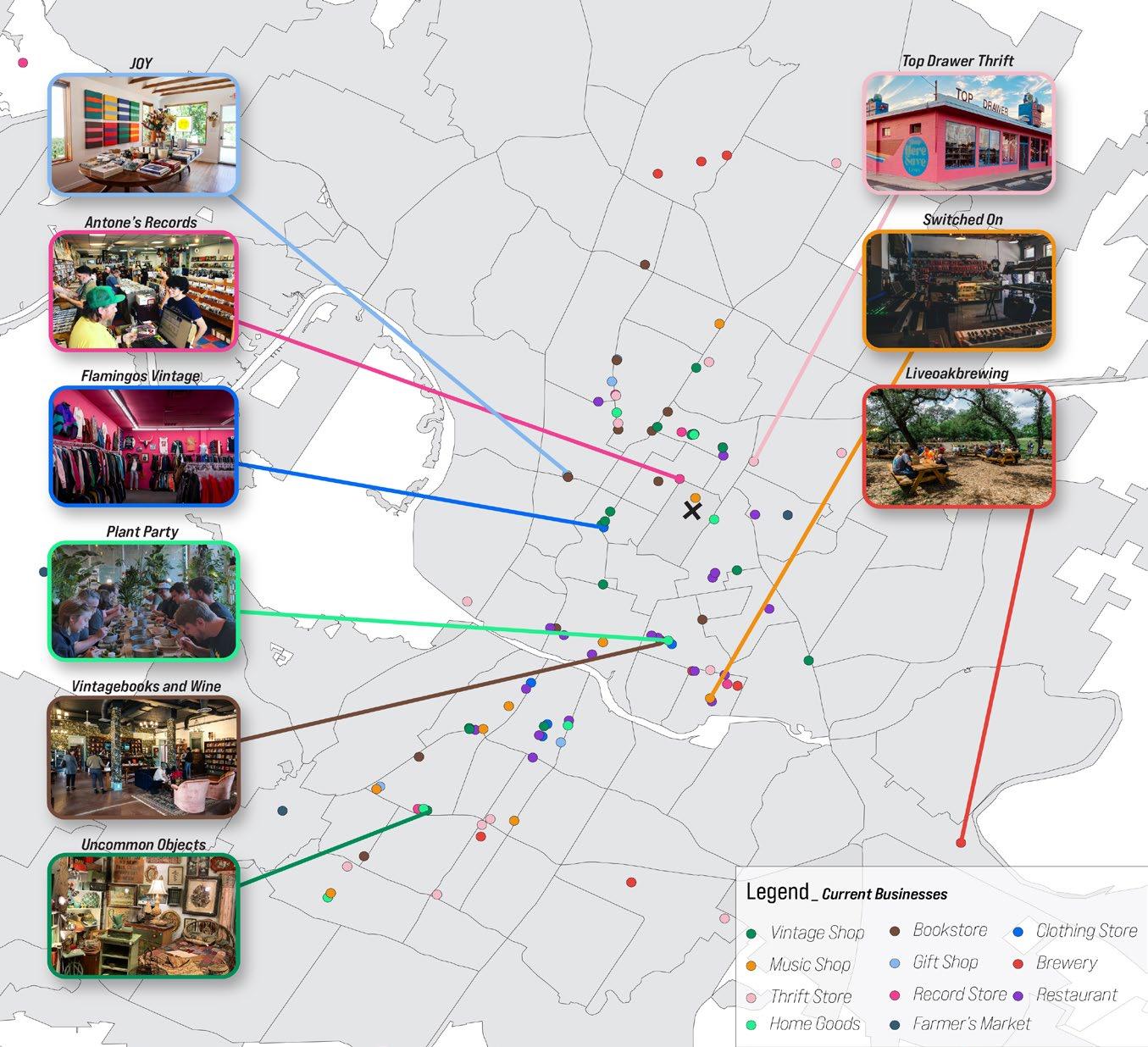
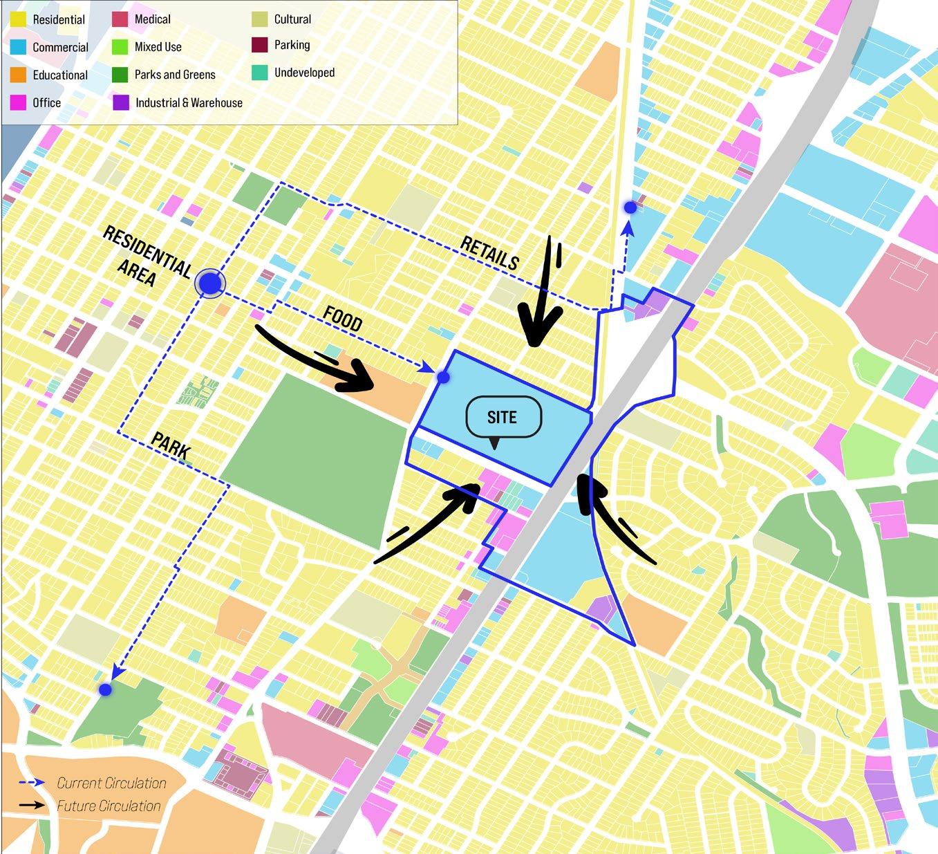
REVIVING LOCAL BUSINESSES
Identifying diverse local businesses that embody Austin’s identity as key existing assets, the project aims to revive these disappearing cultural anchors and integrate them into the neighborhood.
CONVERGENCE OF EAST & WEST
The site’s strategic location amid multiple transit systems positions it as a critical link bridging East and West Austin across I-35, leveraging enhanced connectivity.
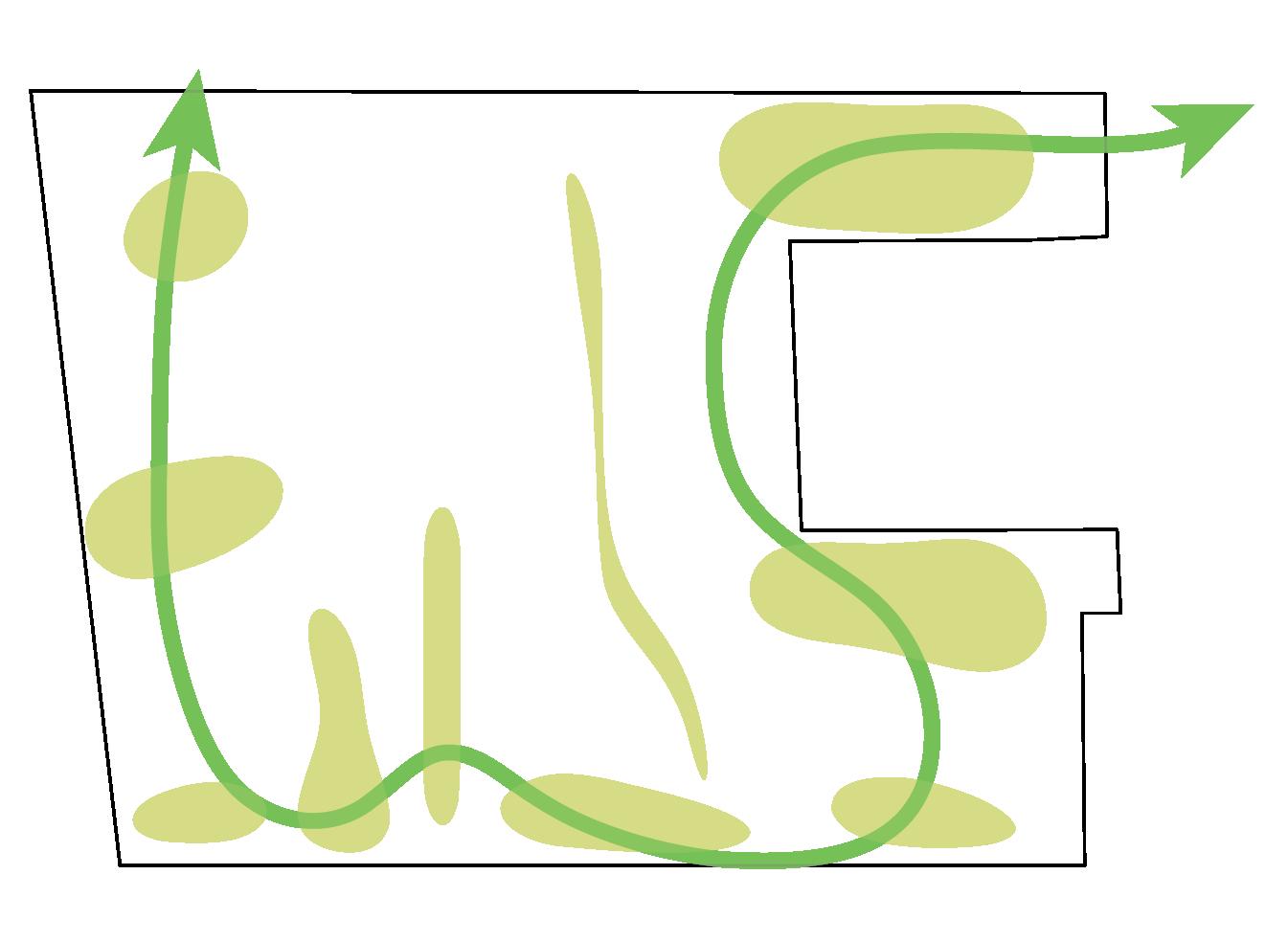
CURRENT CIRCULATION FUTURE CIRCULATION
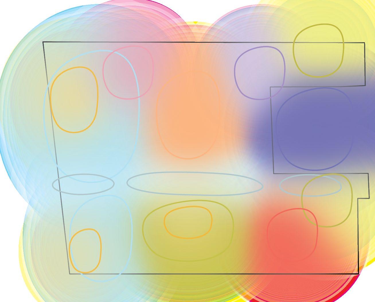
ANCHORING THE NEIGHBORHOOD
Surrounded predominantly by residential areas lacking diverse mixeduse spaces, the site provides a public hub that accommodates varied community needs and encourages prolonged engagement.
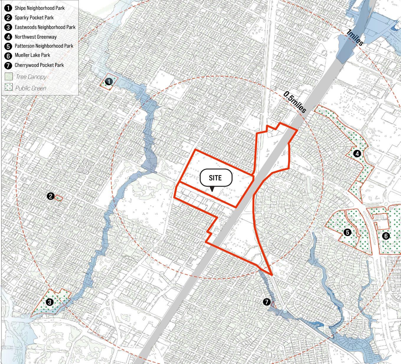
BUILDING CLIMATE RESILIENCE
With limited public green space within a 0.5-mile radius, particularly to the west, and nearby flood risk areas, the project integrates green infrastructure to enhance climate resilience.
Diverse Street Characters MIXED-USE PROGRAMS
SITE
MARKET STREET MUSIC GARDEN & GREEN STREET
PEDESTRIAN STREET
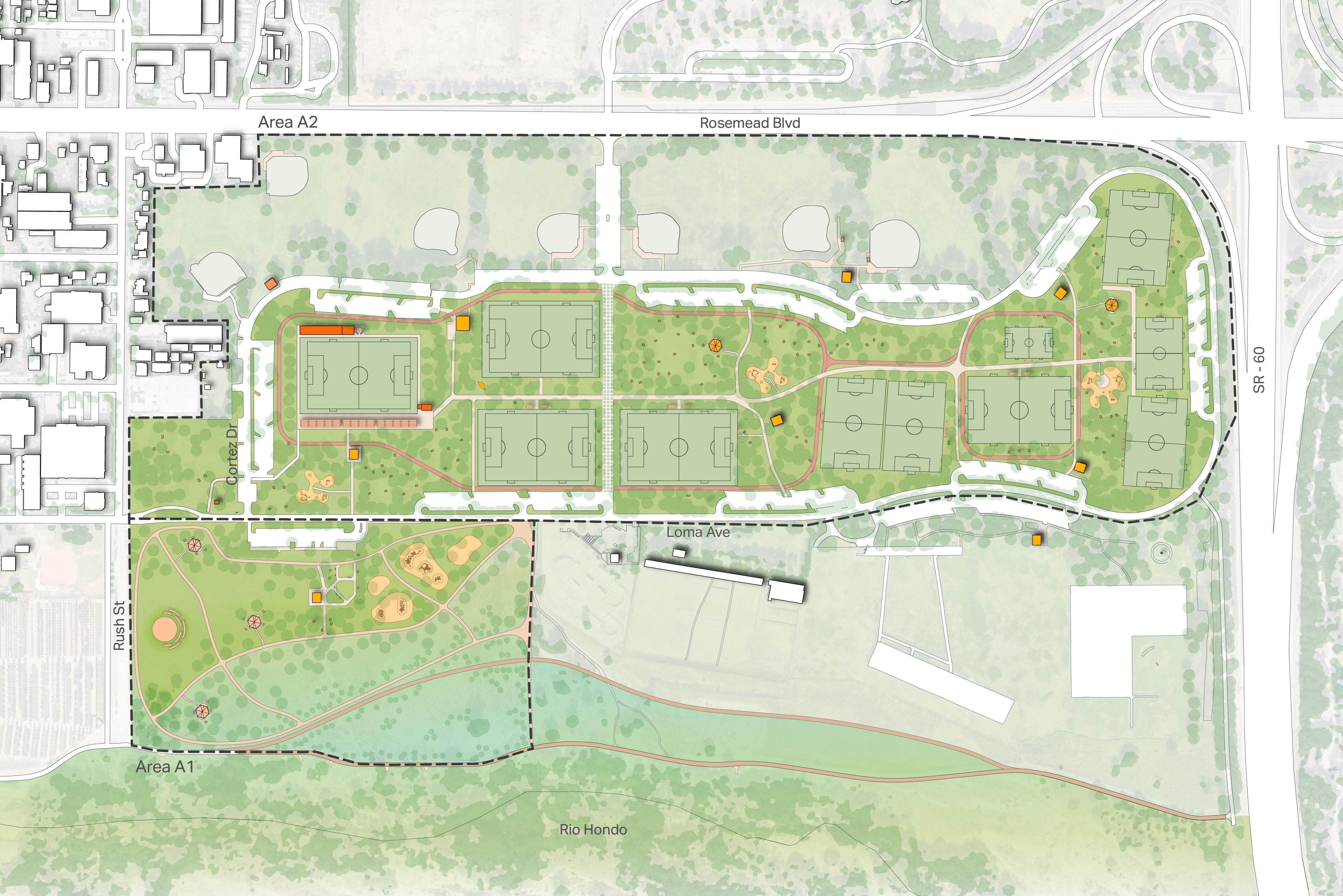
WNRA Soccer Fields Master Plan
Professional Work 2024 | AECOM, Los Angeles
Project Team : Client : My Role
AECOM, Urban Design & Landscape Team
LA County Department of Parks & Recreation
SD Phase Drawings & Production Renders
The County of Los Angeles Department of Parks and Recreation supported by the LA84 Foundation, conducted a master plan for a new community soccer facility at the Whittier Narrows Recreation Area (WNRA), capable of hosting global soccer events. The plan envisions a hybrid infrastructure combining the urban wilderness of the Rio Hondo River with soccer fields running tracks, playgrounds, and community amenities. The design was shaped by constant workshops with stakeholders and the local community.
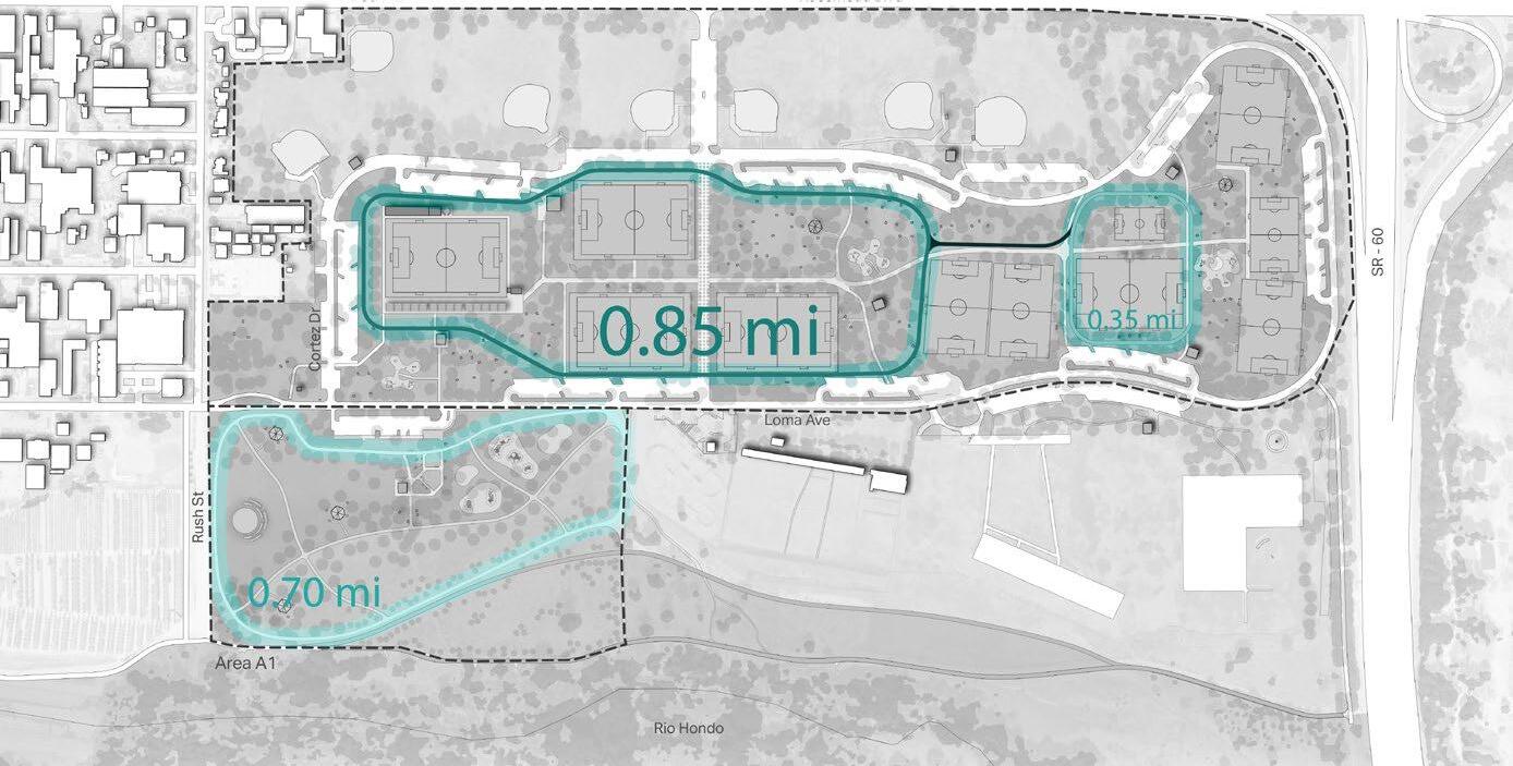
Site analysis revealed that portions of Area A1 are flood-prone, leading the plan to concentrate all active programming within Area A2 while transforming A1 into a restorative landscape. The Main Core Community Facility anchors the northern edge of A2, serving as the starting point of a central spine linking the soccer fields throughout the site. A new multimodal street, the Flex Zone, extends from Rosemead Blvd to divide A2, allowing the Core Facility to be self-contained during hosted events while functioning as an adaptable public space on regular days.
As part of the project I worked directly with the senior urban designer and senior landscape architect to create production drawings and renderings for client meetings.
Site Plan
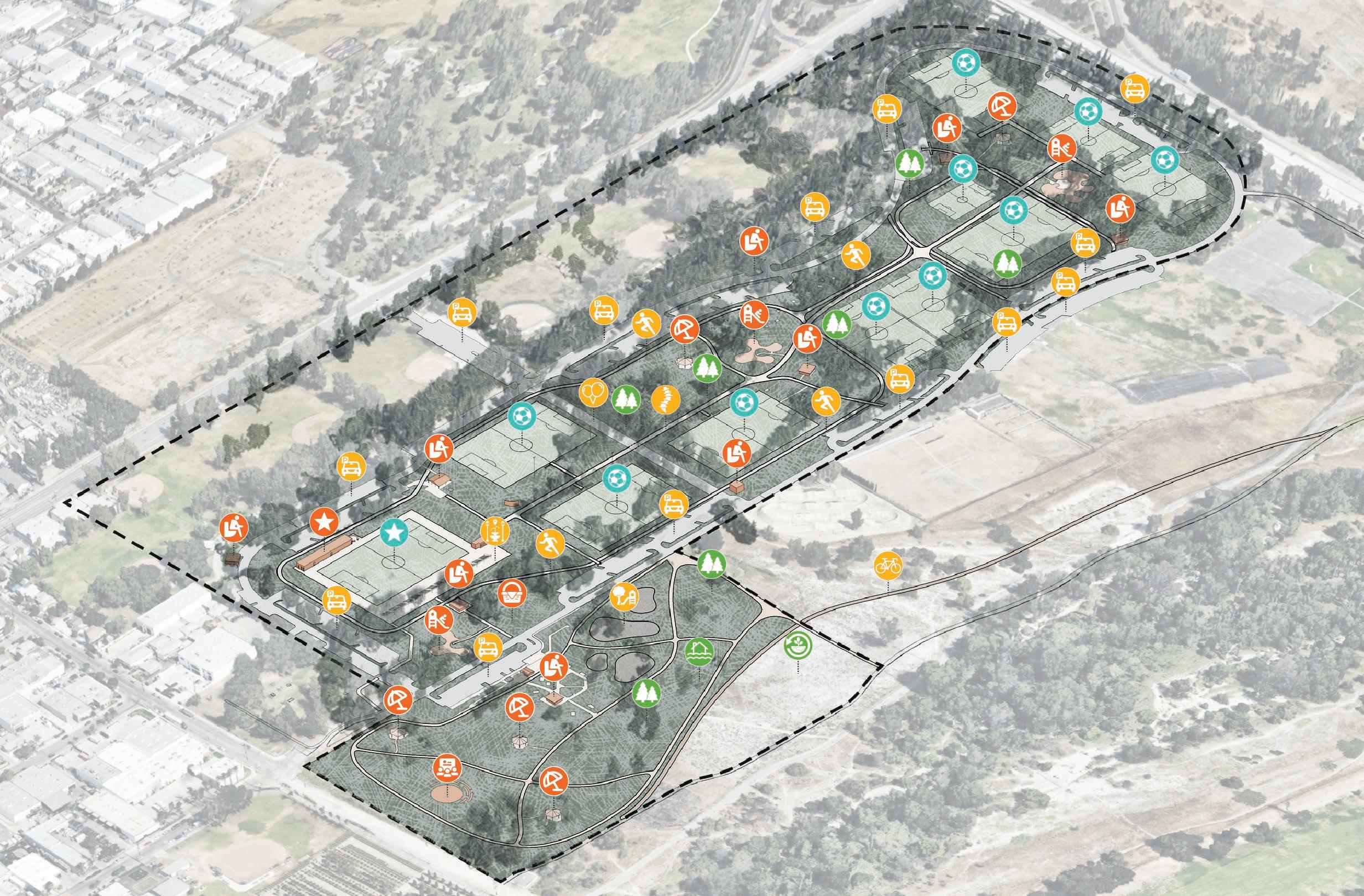
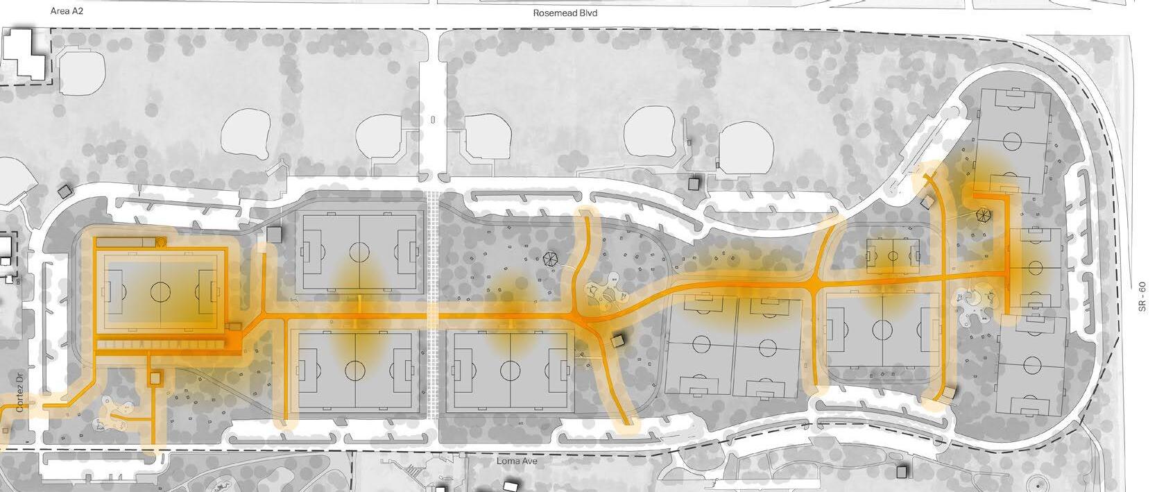
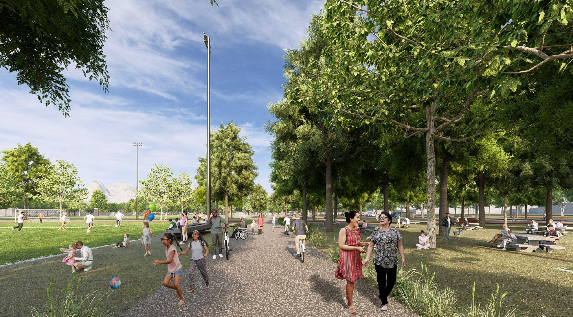
The SPINE
The Spine is the central promenade through Area A2, beginning at the Community Core Facility and connecting all major programmatic elements across the site It threads through pocket areas that link to soccer fields, playgrounds, and running tracks, extending into the restoration zone in Area A1.
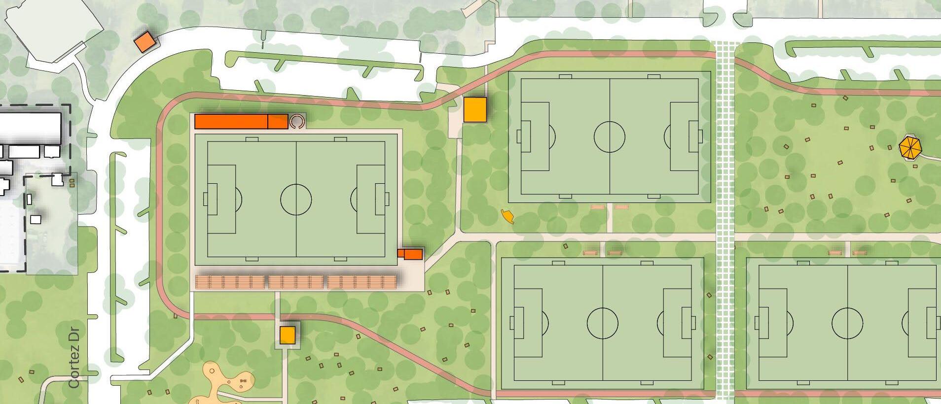
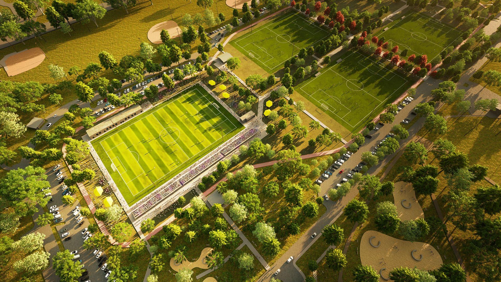
Community CORE Facility
The Community Core Facility is the focal point of the complex, positioned at the northern edge of Area A2 with a capacity of 3,000 spectators for larger soccer events. The facility includes the main soccer field, a central building with changing rooms, offices, a medical center, grandstand, food stands, and an arrival plaza.
The FLEX Zone
The Flex Zone is a shared street extending from the Rosemead Blvd entrance, dividing Area A2 into two parts. Designed to prioritize pedestrians and low-speed traffic, it functions as a multimodal street for cars, bikes, and pedestrians on regular days. When needed, it can be fully closed to traffic and converted into event space for food trucks, markets, and community gatherings.
RUNNING Loops
Area A2 features two running tracks a 0.85-mile loop encircling the Community Core Facility and a 0.35-mile loop along the southern soccer fields, connected by a shared warming zone Area A1 includes a 0.70-mile walking loop with softer pavement.
The Spine
FLEX Zone
Running Loops
Community Core Facility
Los Angeles Superior Court
Long-Range Planning Study 03.
Professional Work | 2023 | AECOM, Los Angeles
Project Team
Client : My Role : AECOM Buildings + Places Judicial Council of California
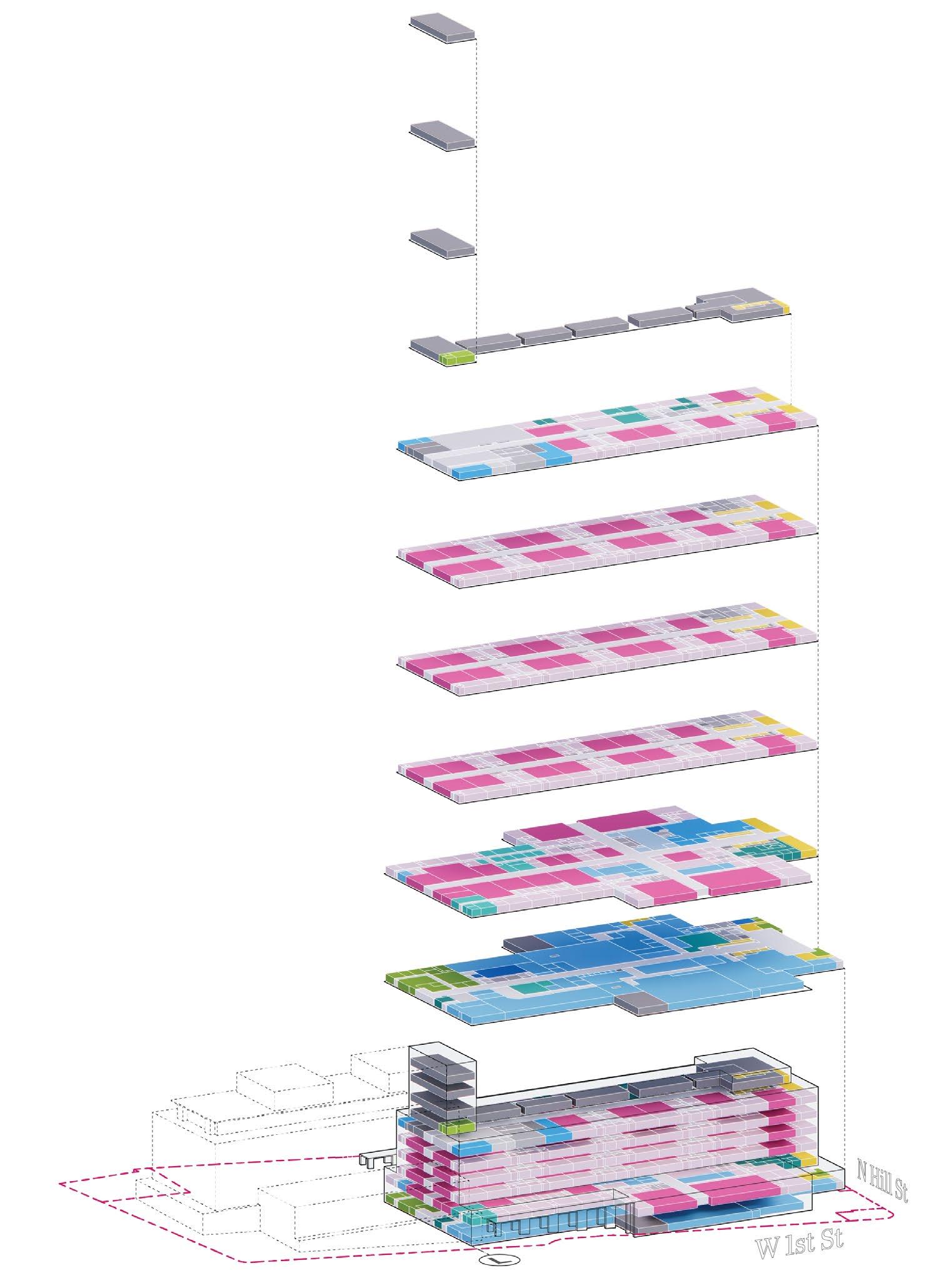
Technical diagrams and analysis of existing Downtown LA Courthouses
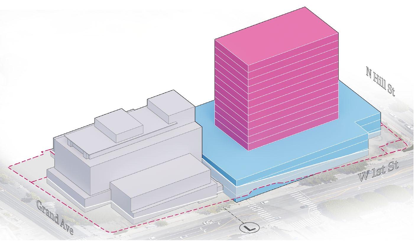
The Los Angeles Superior Court Long-Range Planning Study evaluates 17 courthouse facilities across LA County and recommends strategies for renovation or replacement of aging judicial infrastructure The two flagship courthouses, Stanley Mosk and Clara Shortridge Foltz, are the largest civil and criminal courthouses in the nation, both over 50 years old and facing seismic, safety, and operational deficiencies.
The study assesses each facility’s condition and outlines frameworks for either phased renovation or new construction, with a focus on de-densifying the Downtown LA courthouses by redistributing courtrooms across the county. Aging infrastructure, including failing pipes, HVAC systems, and elevators, has created significant ongoing costs for the Court and the state, making intervention urgent.
I worked directly with the project manager and senior architect to produce technical diagrams, spatial analysis drawings, and test-fit feasibility studies for the Downtown LA courthouses using REVIT, Rhino, and Enscape.
Next 20 Years: Maintenance and Modifications
Next 20 Years: Consider Replacement
Next 5-10 Years Consider Replacement
Facility Not Part of Study (Leased, Closed, or Repurposed)
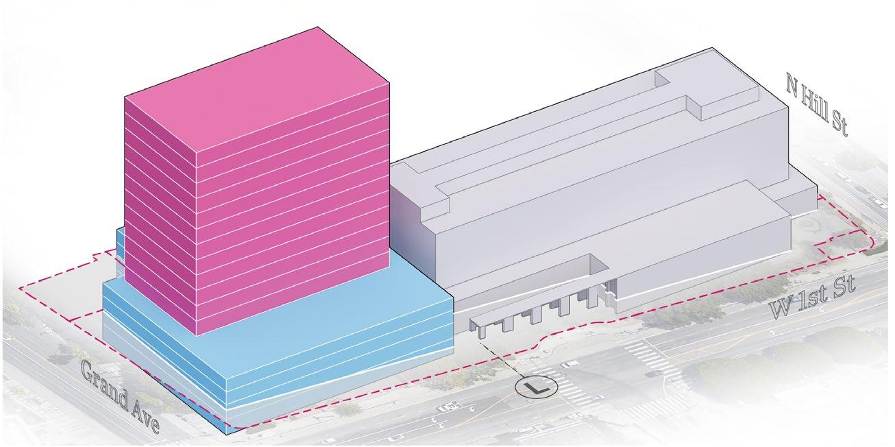
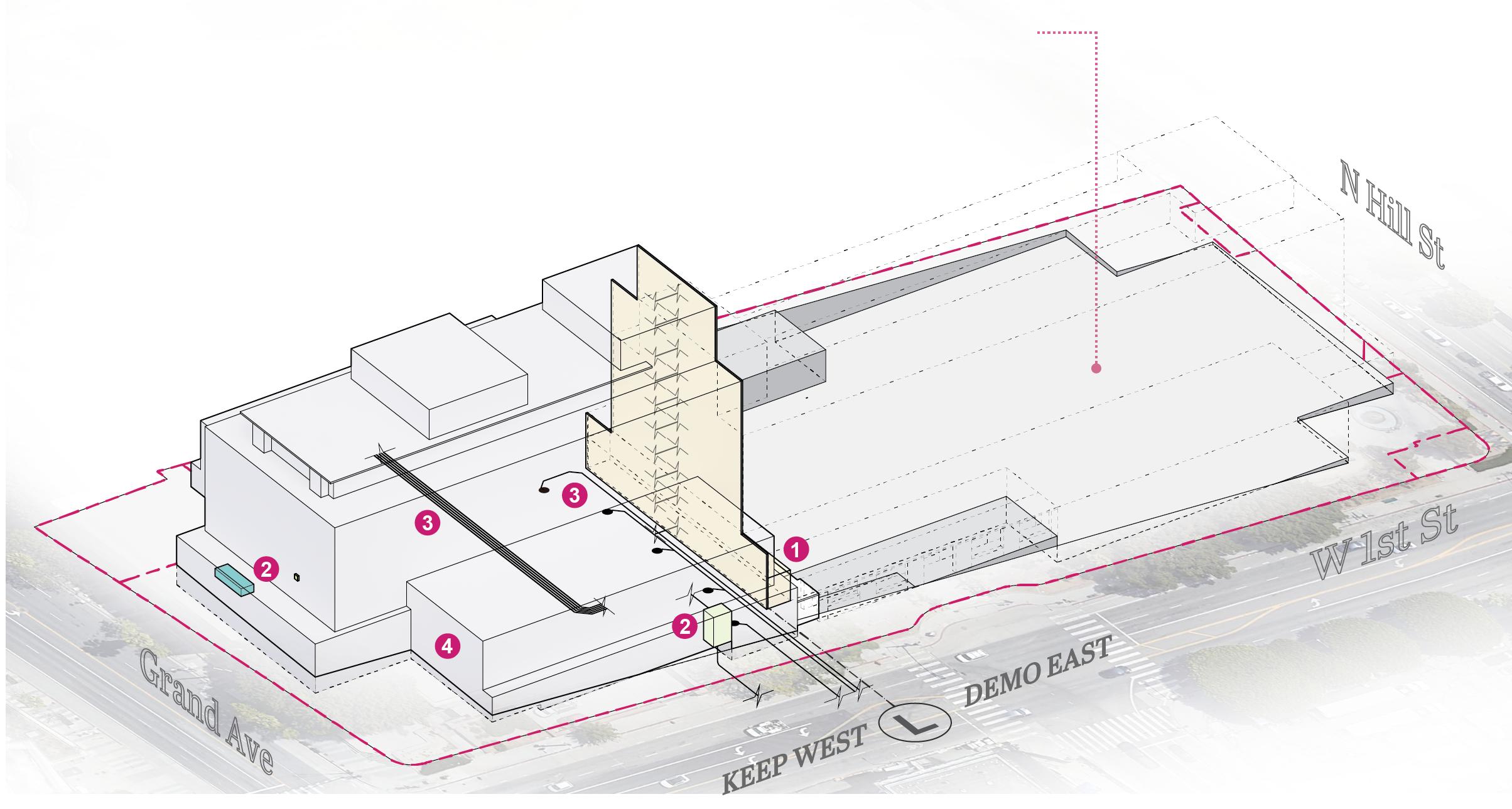
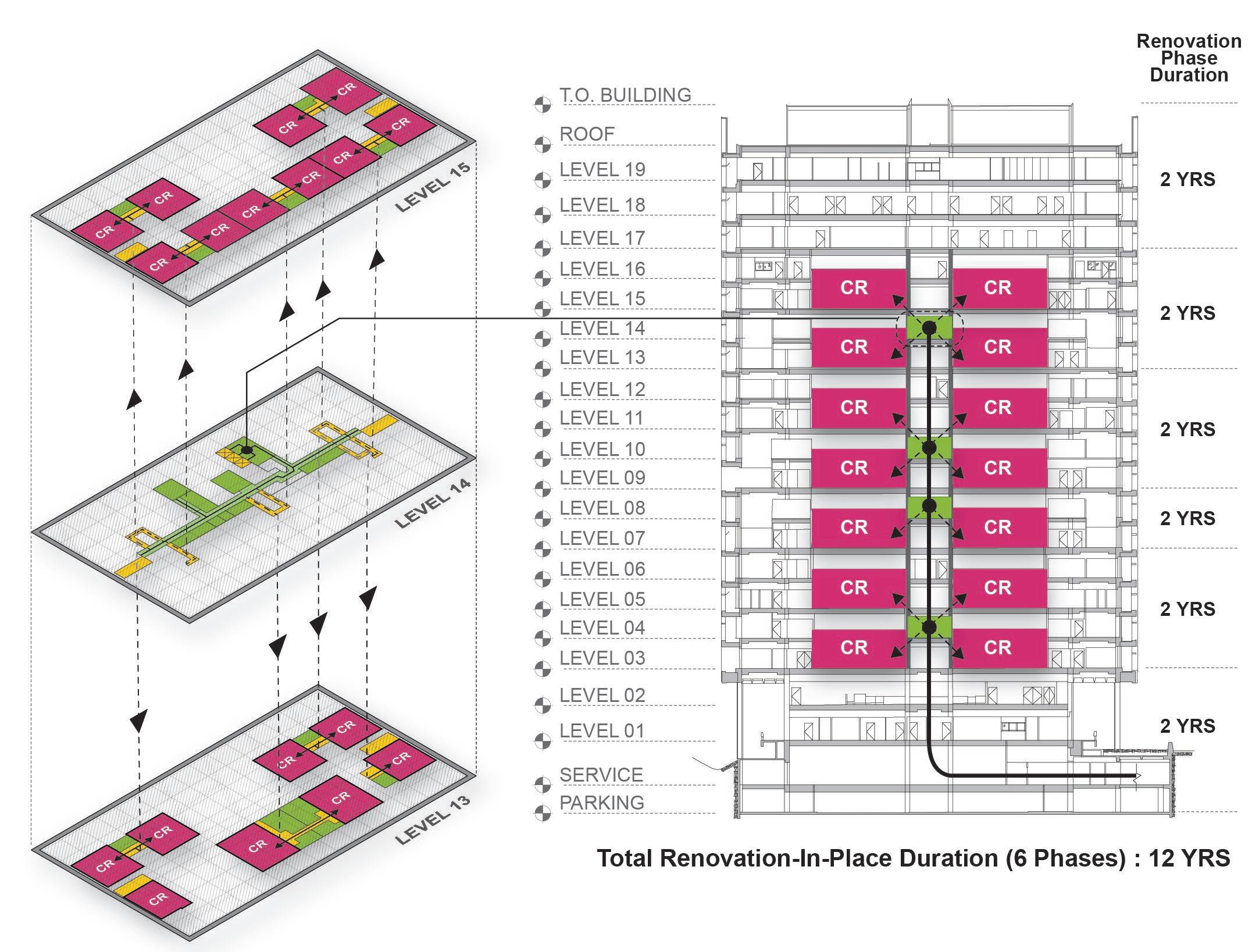
The Clara Shortridge Foltz Criminal Justice Center is composed of 19 floors, 7 of which contain courtrooms. The 2019 Prioritization Plan suggested a phased renovation of the project while maintaining ongoing operational capability.
It is important to note that in Foltz, a pair of courtroom floors share one floor of secure, in-custody defendant holding and circulation (seen in the diagram). Due to this, during a renovation-in-place scenario, only three floors can be renovated at a time to keep the number of necessary courtrooms in use. This would push the entire renovation-in-place schedule to take at least 12 years. In addition, Foltz currently supports 61 courtrooms. However, due to the increased courtrooms’ sizes per court facilities standards, a renovated Foltz would only be able to support 49 courtrooms, a deficit of 12 courtrooms.
COURTROOM
IN-CUSTODY
VERTICAL CIRCULATION
Groupings of In-Custody Circulation and Courtrooms Diagram
Fifth Year Thesis | Cal Poly | 2023
Undergraduate | Individual Project
Student Design Award
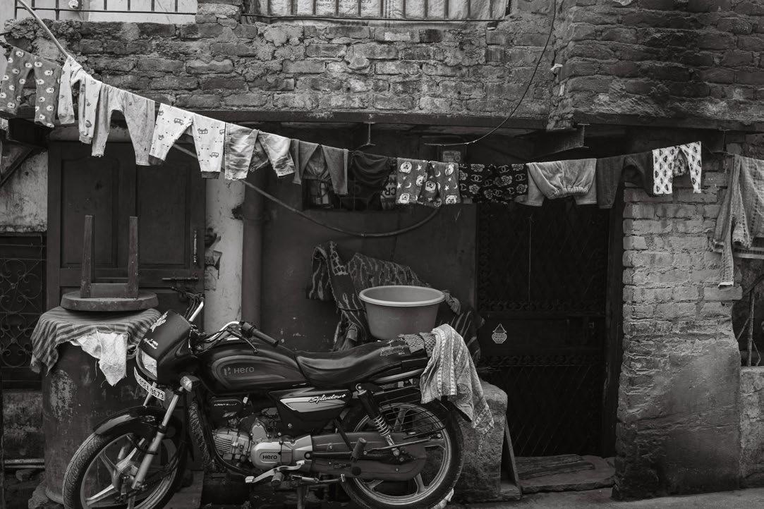
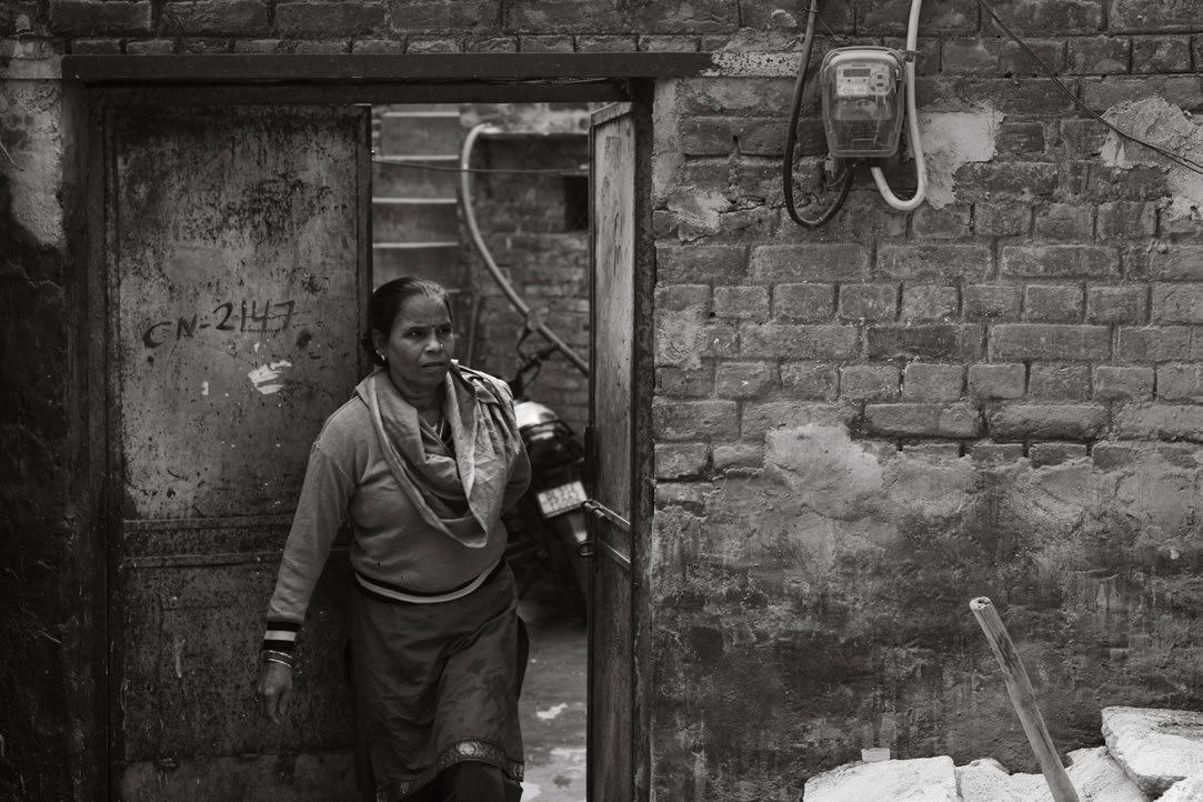
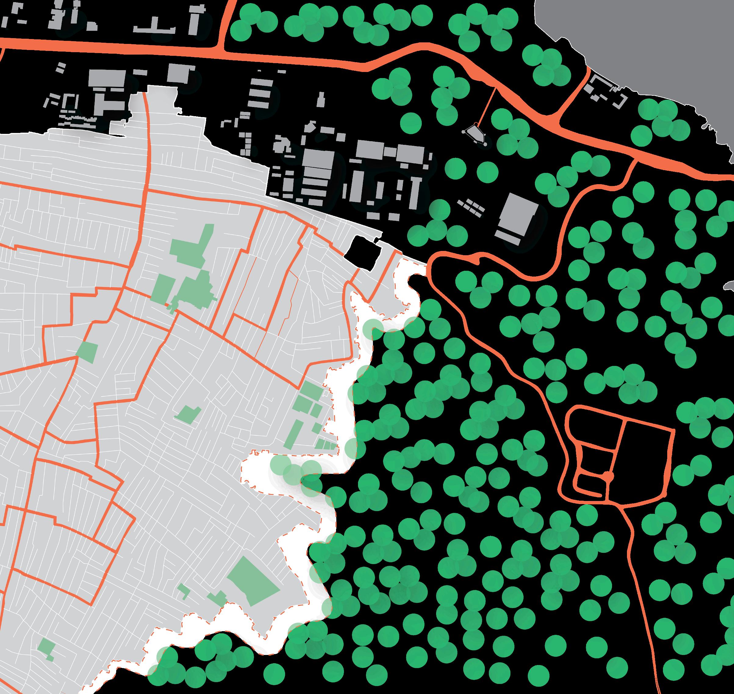
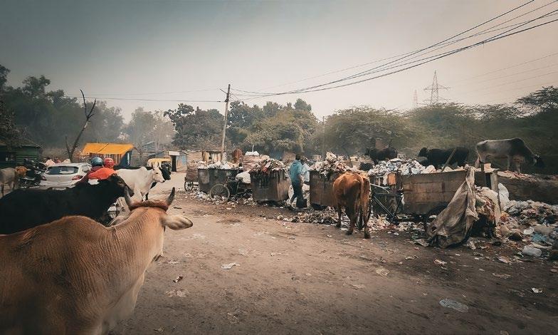
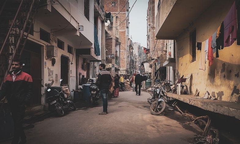
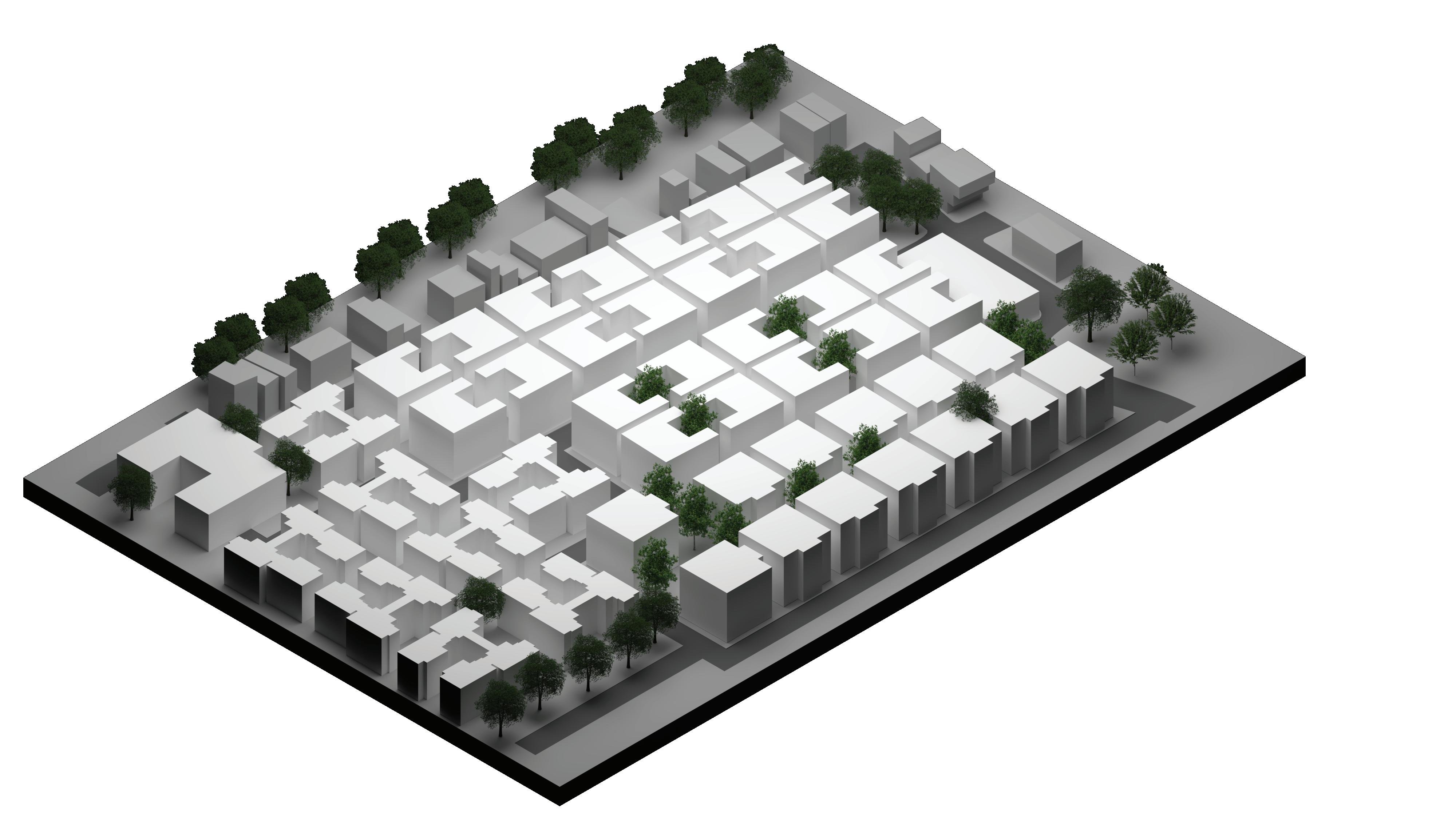
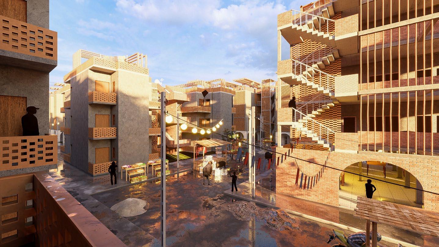
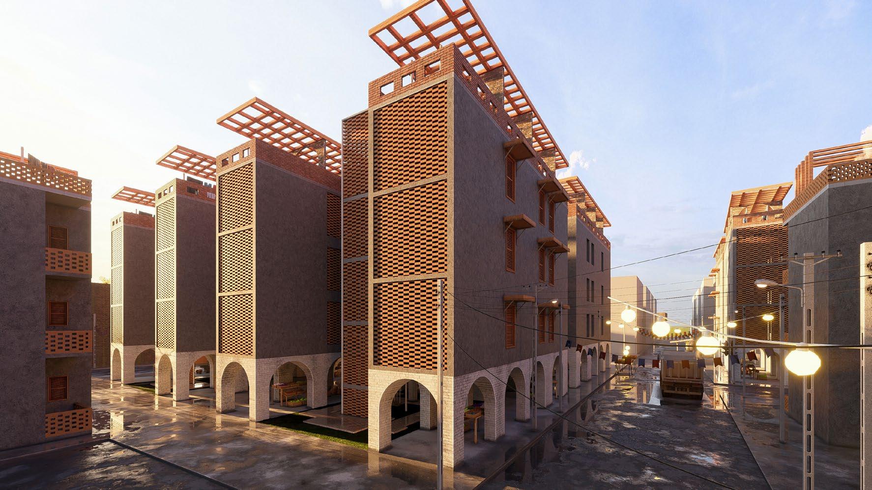
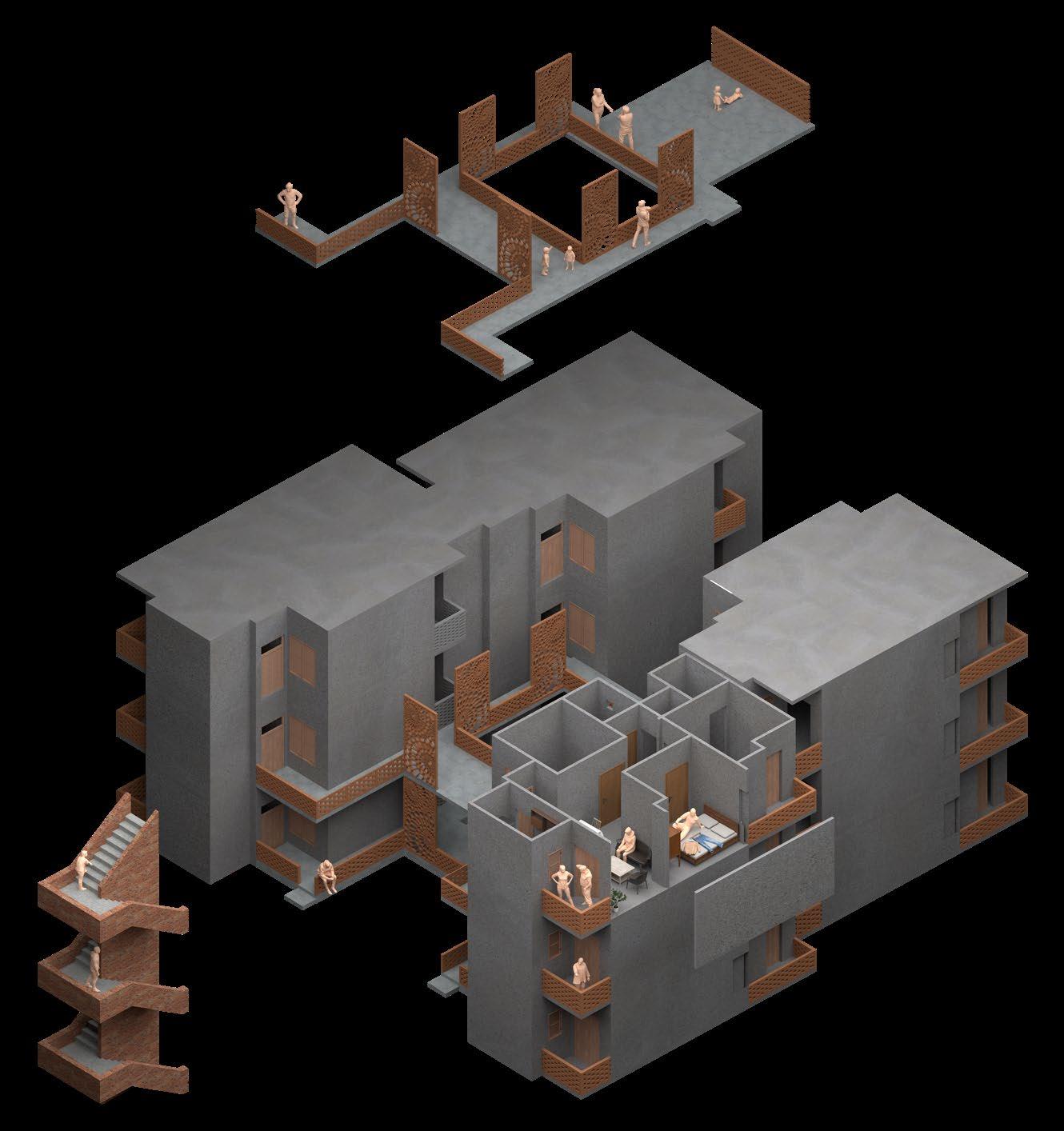
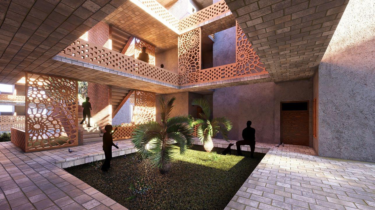
“Revive” (पुनर्जीवन - to restore to life) is a slum redevelopment and rehabilitation project for Sangam Vihar, one of Asia’s largest unauthorized settlements, located in Delhi. Home to millions and representing Delhi’s largest voting municipality, the region faces critical challenges in housing infrastructure, accessibility, and urban recreational space. The project operates in two phases: urban regeneration and reconfiguration of a specific area as a replicable template, followed by micro-level housing upgrades Both phases are driven by extensive community participation.
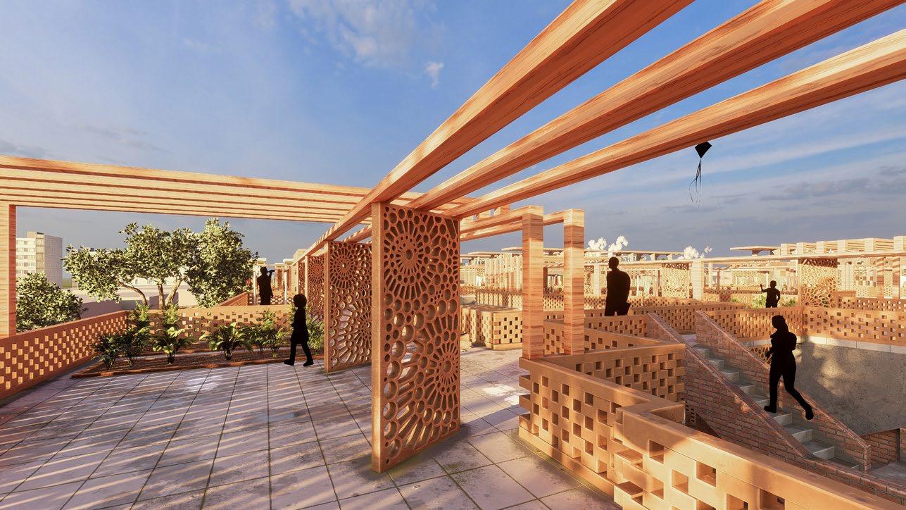
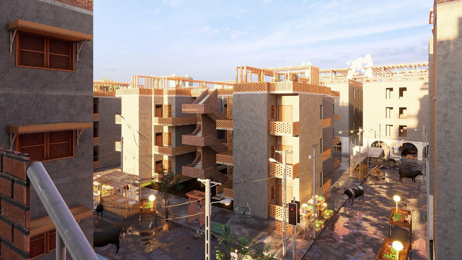
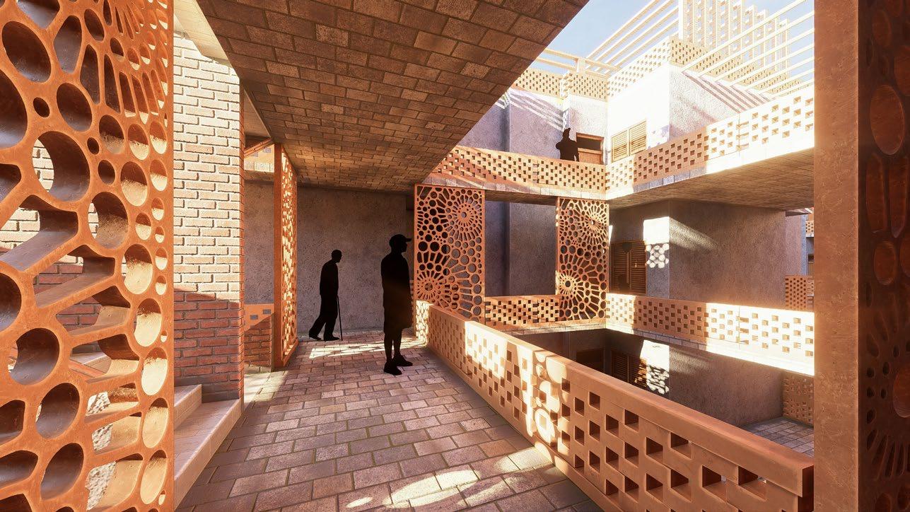
The design preserves residents’ informal lifestyles by restoring open spaces and maintaining existing dwelling footprints. The micro-scale housing incorporates traditional Indian architectural principles in particular the Jaali system inspired by nearby historical monuments, creates passive lighting and ventilation systems that make the housing environmentally sustainable while remaining culturally rooted.
The project aims to reshape perspectives on informal settlements, encouraging these communities to be recognized as integral parts of Delhi’s urban fabric.
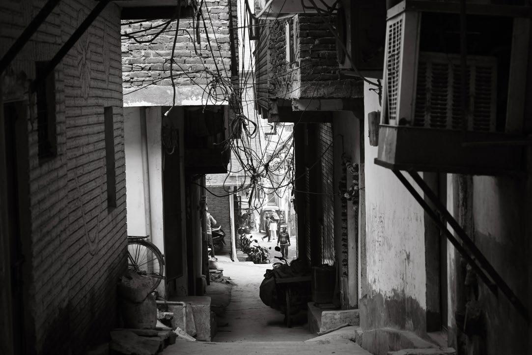
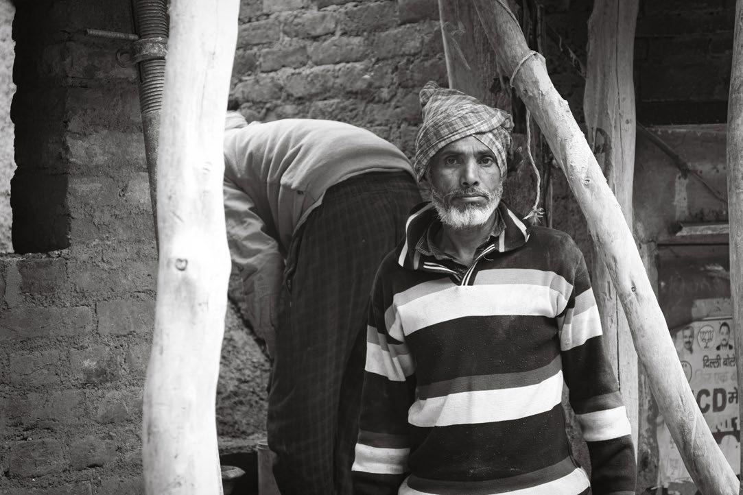
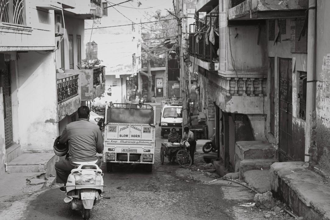
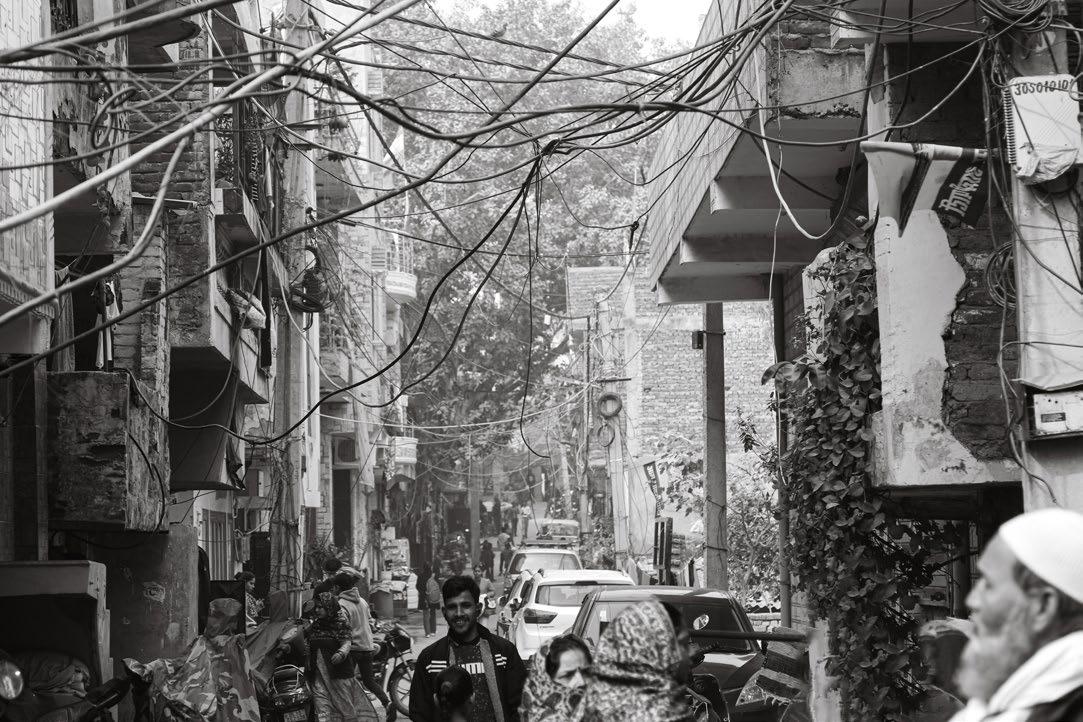
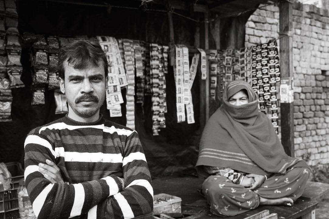
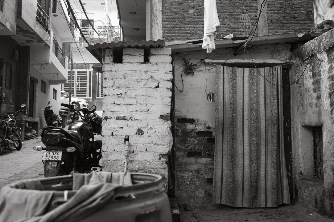
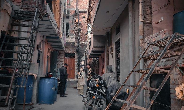
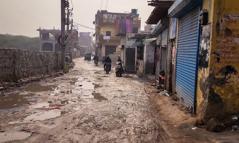
PERSONAL PHOTOGRAPHY (captured on-site)
Instructor Site Ansgar M. Killing Sangam Vihar, Delhi, India
Wildlife Sanctuary (Protected Area)
INCREASING ACCESSIBILITY ALONG THE
This proposal extends the road network along Sangam Vihar’s perimeter, adjacent to the Asola Wildlife Sanctuary. Currently, the settlement’s interior has no public transportation access, and residents rely on a single bus station at the far periphery on Mehrauli-Badarpur Road, despite serving as the workforce for major institutions in the surrounding context. The narrow interior streets also prevent essential resources like water from reaching much of the population. The proposed perimeter pathway aligned with existing major landmarks, improves public transit access and resource delivery while preserving the settlement’s existing urban fabric.
SANGAM VIHAR BUS STOP
TUGHLAQ’s
HOUSING UNIT TYPE 3
Interior courtyard spaces with units facing each other, retail spaces at street level and green spaces at rooftop
Larger square footage, connected terraces, open green spaces at street level
Exterior community spaces as corridors, occupiable rooftop green spaces, green spaces & retail spaces at street level
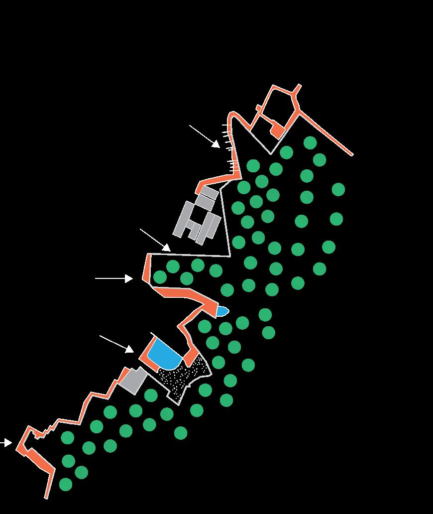
• Maintain similar footprint of housing units while opening up space at the street level.
• Uniformity of the heights of buildings (limited maximum to 4 floors)
• Increased porosity of the area to allow for increased vehicular circulation providing access to essential daily resources.
• Giving back space to the residents in the form of functional rooftop spaces.
• Addition of Community Center at the entry point to the site.
• Maintining similar square footage of housing units.
SCALE 1” = 45’
HOUSING UNIT TYPE 2
HOUSING UNIT TYPE 1
COMMUNITY CENTER
Master Plan
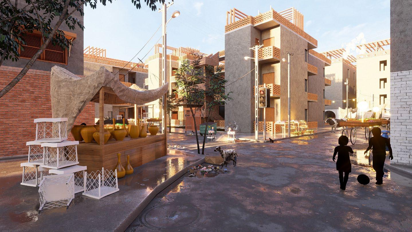
Street Level Views (based on the Master Plan)
. micro-scale development - housing upgrade typology-1 (site exterior location, heavy retail traffic)
ROOFTOP SHADING
*Diagrams Created using VRay
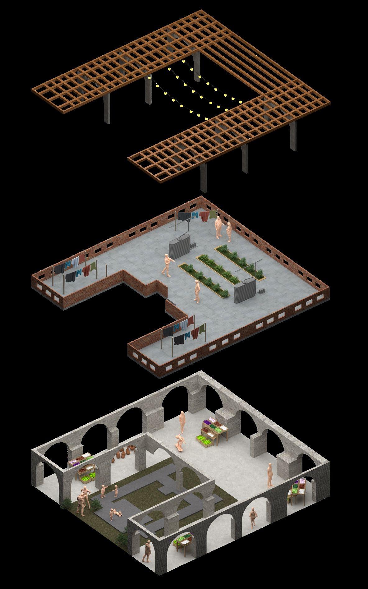
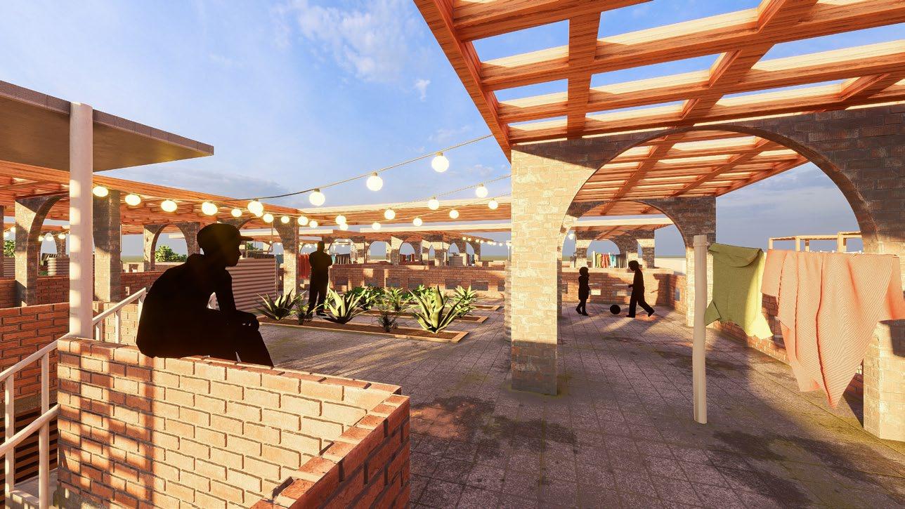
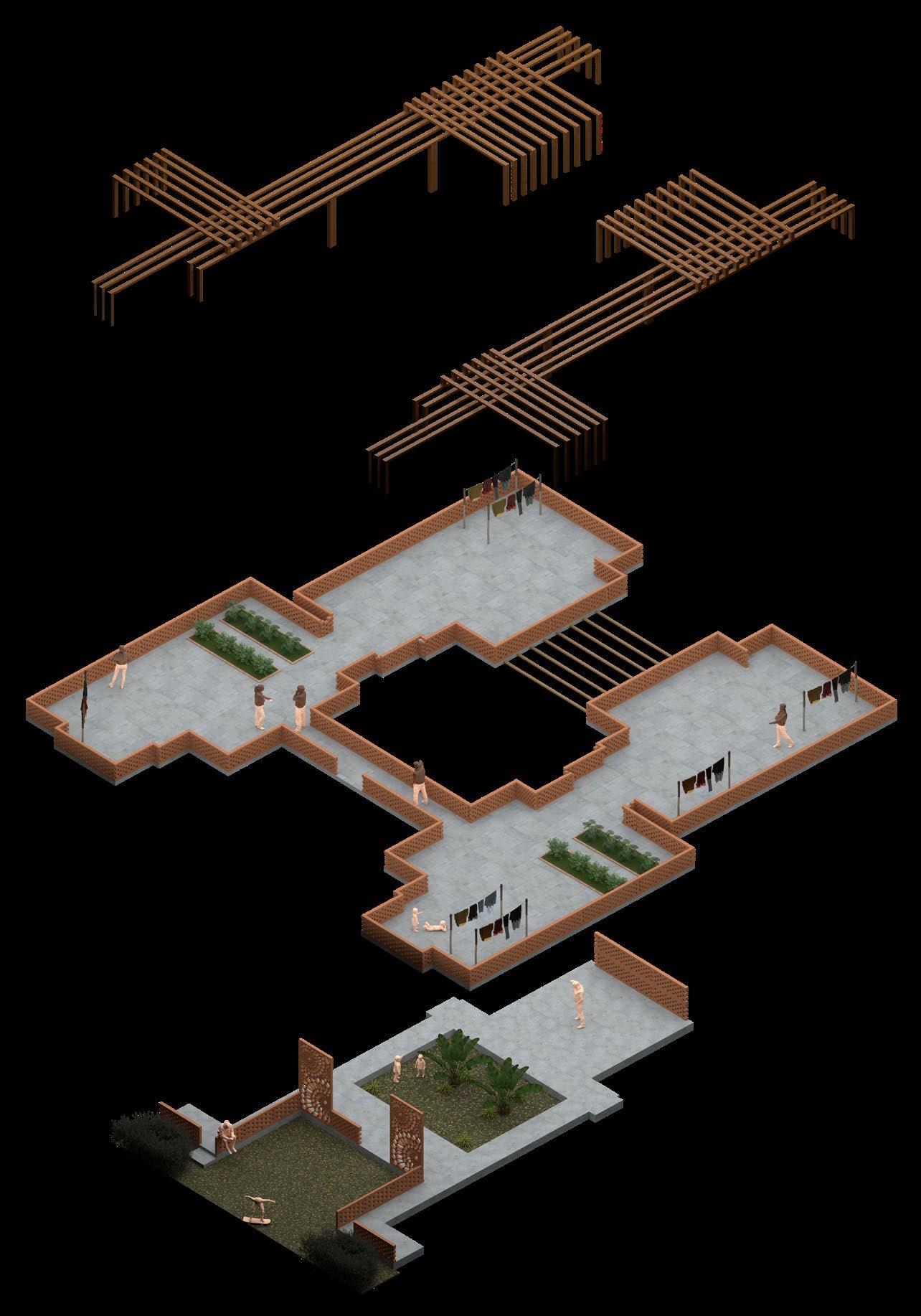
ROOFTOP
Community space with gardening spaces with rainwater harevsting systems and traditional uses of the local community
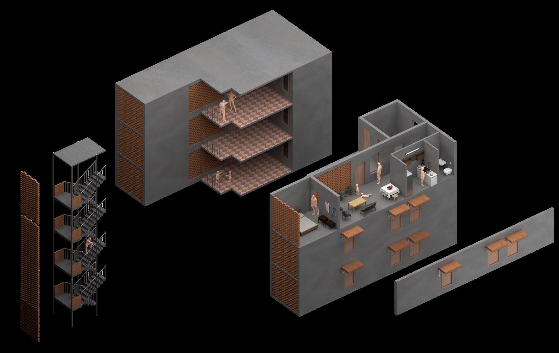
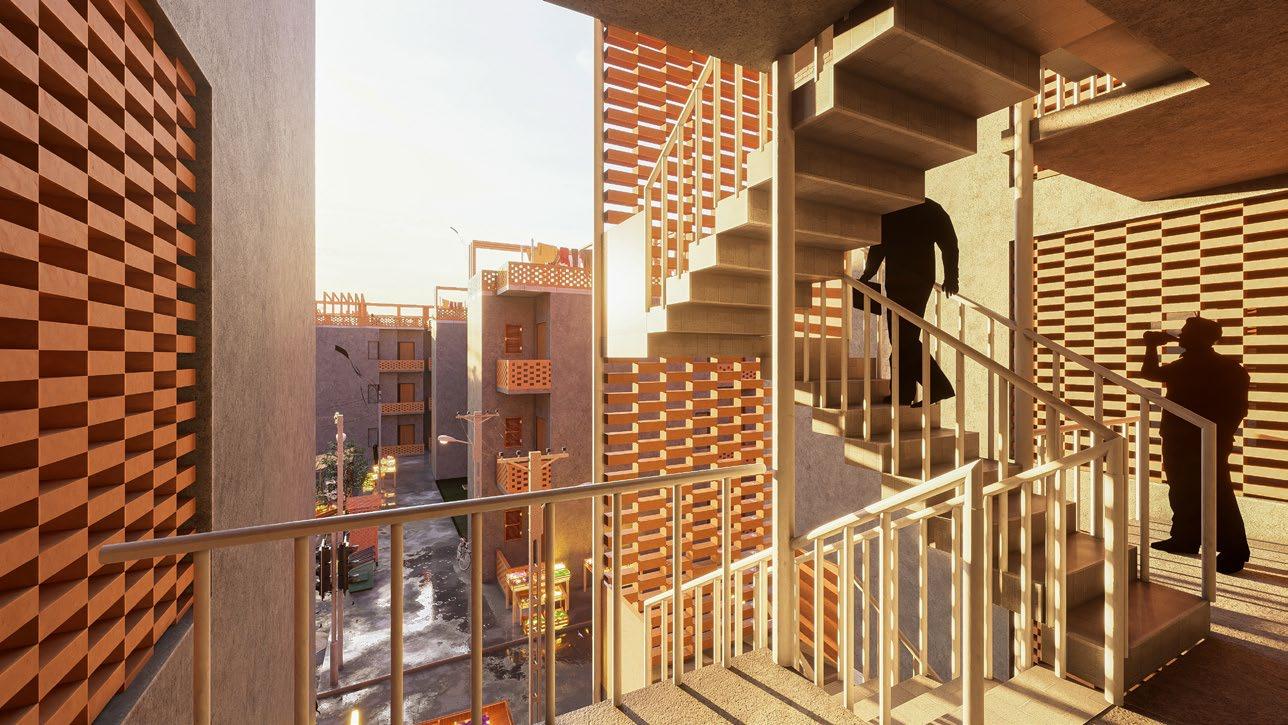
Exterior Common Corridor (Cross communication between residents)
EXTERIOR Vertical Circulation (Increasing living space in units)
BRICK JAALI System (Harsh Sunlight Barrier and Passive Ventilation System)
SEMI-PRIVATE & PRIVATE
Unit Size - 500 sq.ft (Maintained with origaainal slum housing size)
Community Rooftop
System for Units (Harsh Sunlight Barrier and Passive Ventilation System)
Housing Typology in Context Rendered Using Lumion
Shared Corridor with ‘Jaali’ System
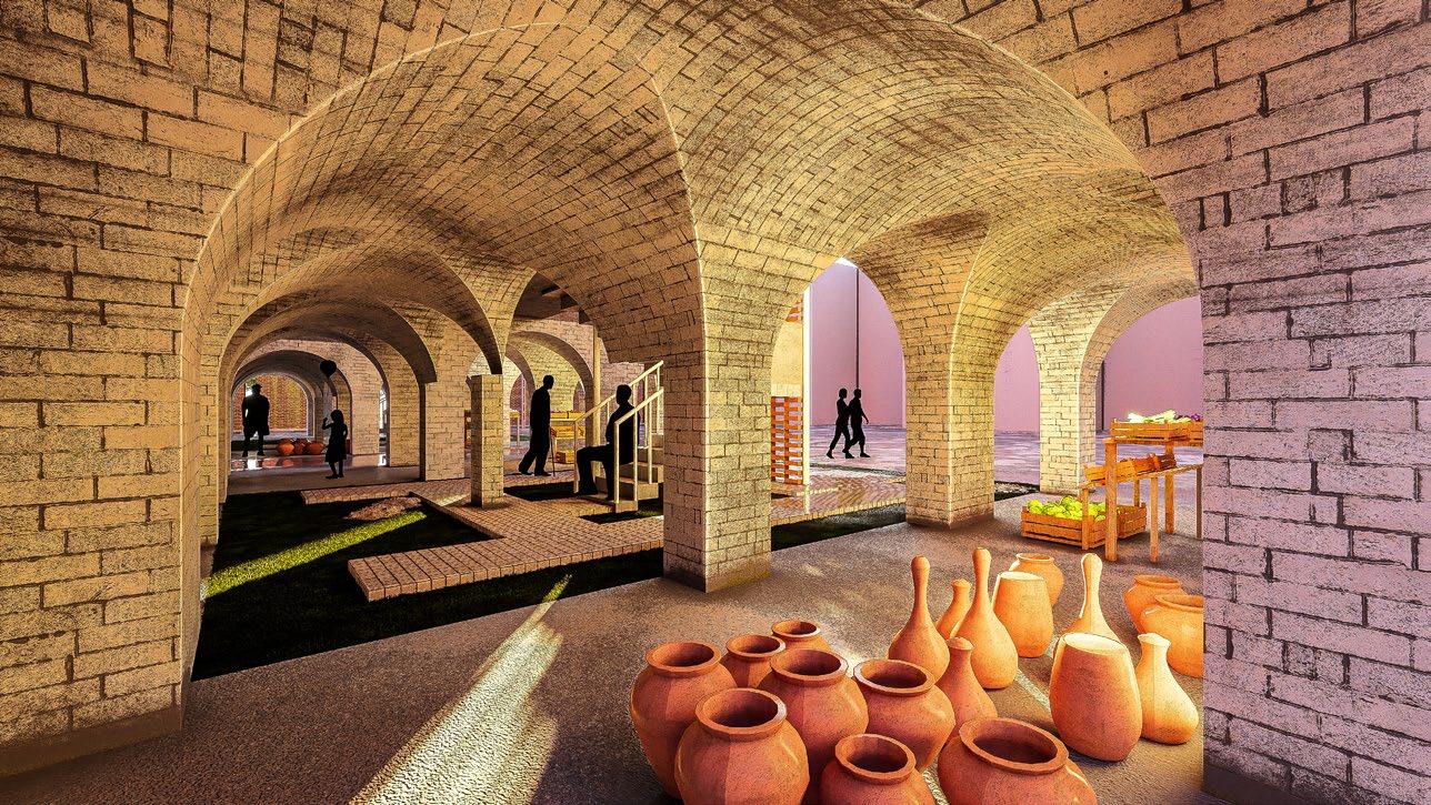
Arcade/Bazaar Level
*Diagrams created using VRay
*Renders created using Lumion
BRICK JAALI
. micro-scale development - housing upgrade typology-2 (site interior location, core residential zone)
MULTI-LEVEL TERRACES
COURTYARD
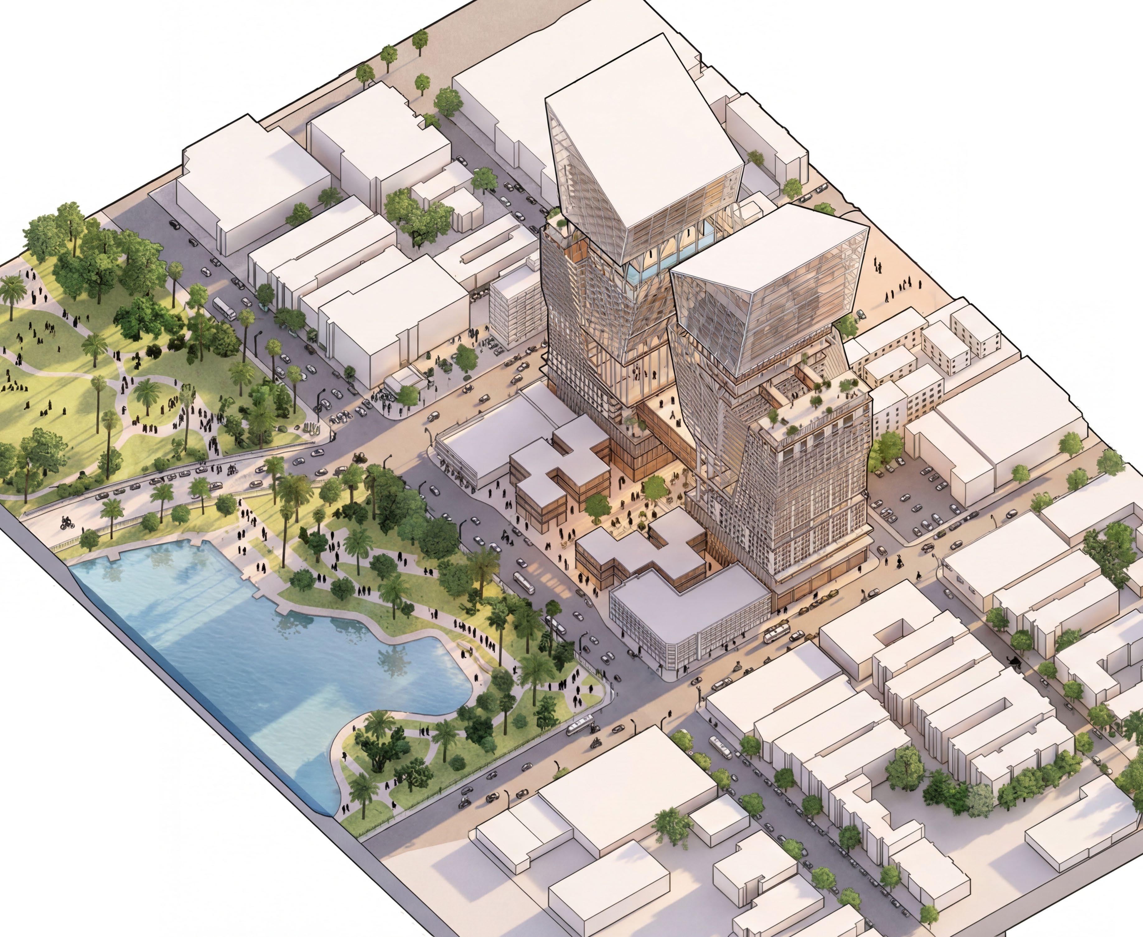
valley at McArthur 05.
Fourth Year Studio | Cal Poly | 2022
Undergraduate | Individual Project
: Site : Stephen Phillips, Pavel Getov, Jimenez Lai McArthur Park, Los Angeles, CA
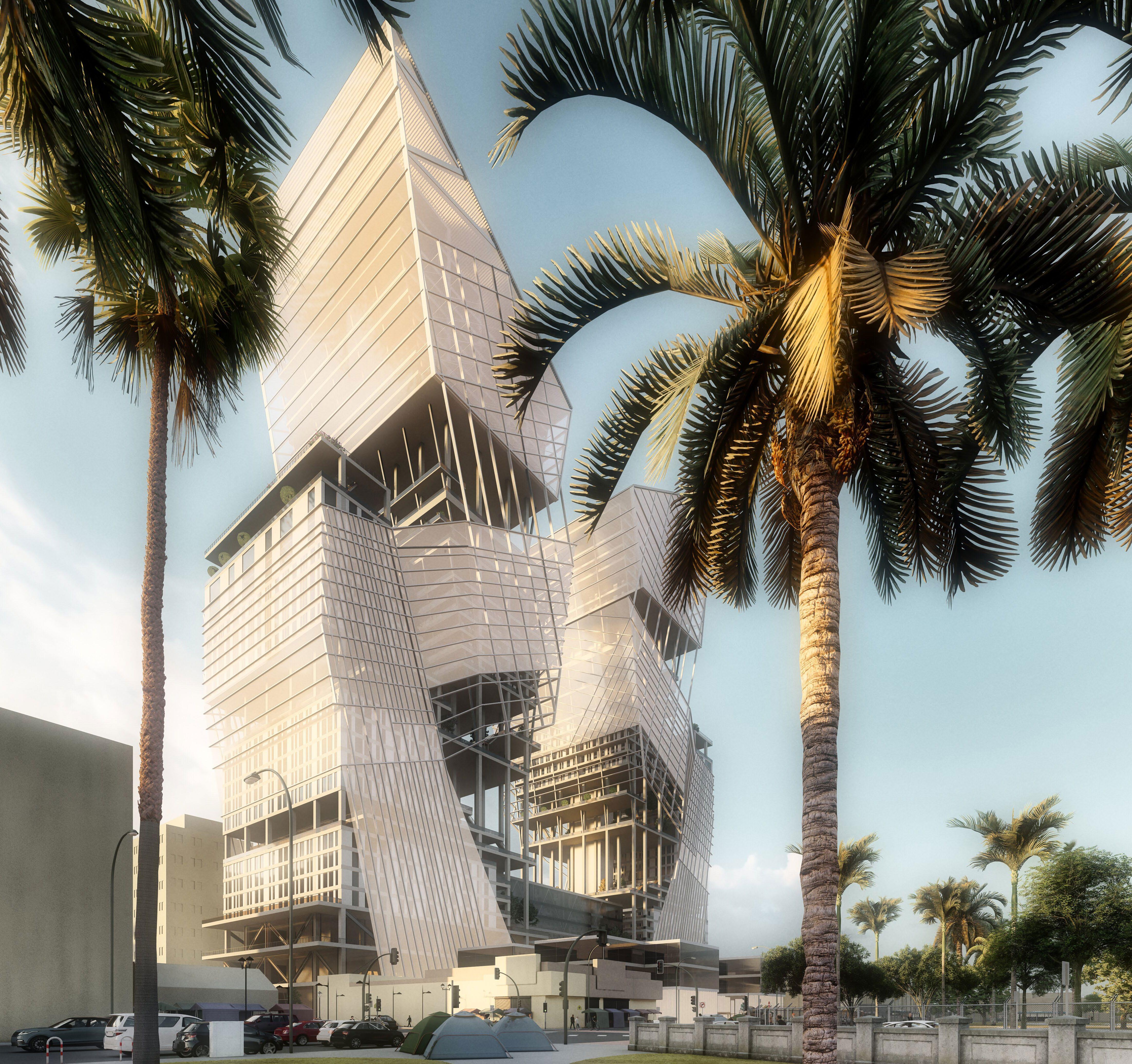
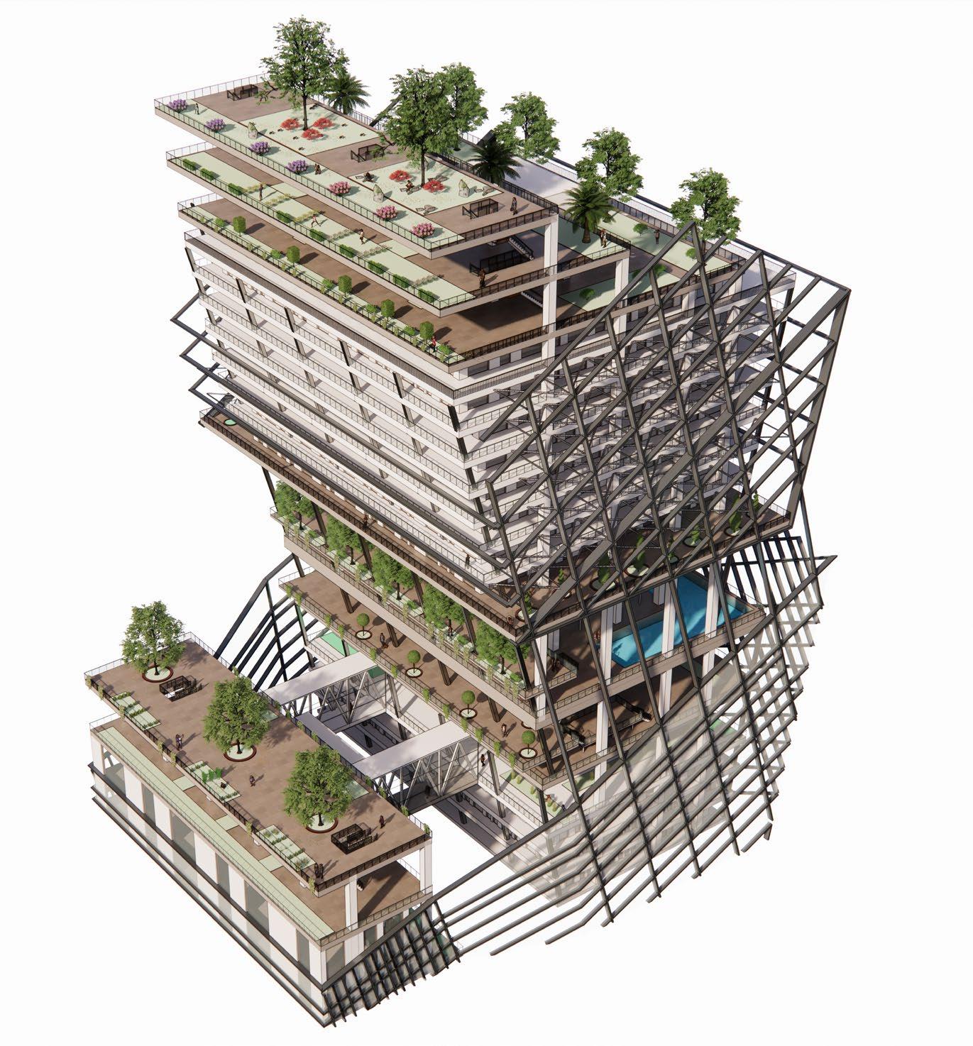
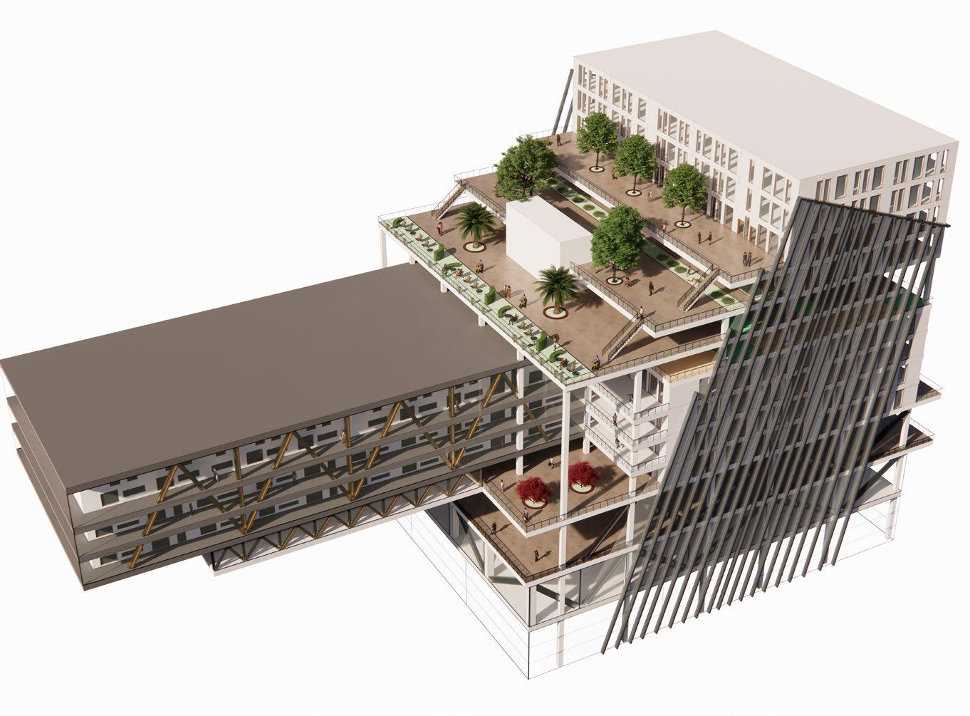
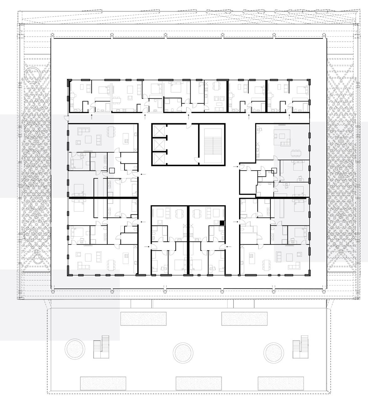
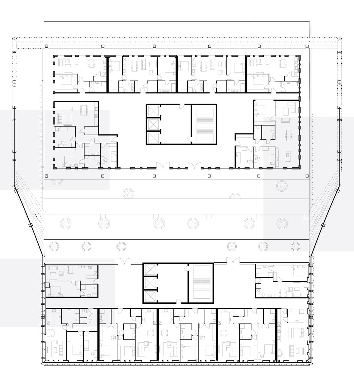
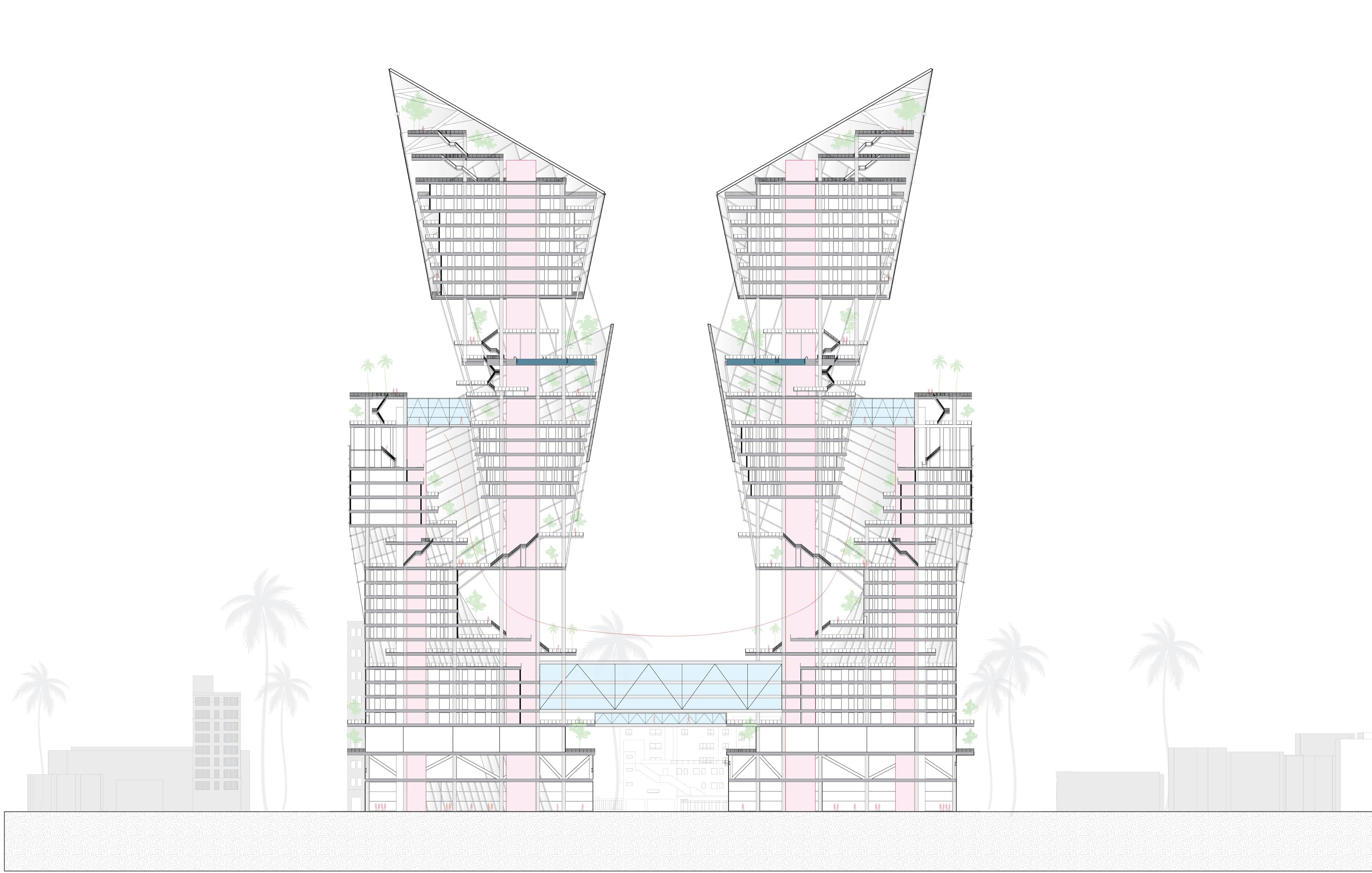
“Valley at McArthur” rethinks high-rise living by distributing public outdoor spaces throughout the height of a skyscraper, rather than confining community areas to ground-level plazas Each tower is split to create open-air terraces at multiple levels, connected by a bridging hotel that forms the lower trough of the “valley.” This central space acts as a gathering point for residents, keeping them connected to the outdoors and the city at every level.
The project is situated adjacent to MacArthur Park in one of Los Angeles’ most diverse neighborhoods, predominantly home to Hispanic and Latino communities. The mixed-use program responds to this context by integrating street-level retail, a hotel, and a combination of market-rate and affordable residential units The proposal aims to foster an inclusive community while resisting gentrification-driven displacement of existing residents.
Instructor
Upper Building Chunk with Rooftop Community Spaces & Circulation Bridges
Lower Building Chunk with Community Space & Hotel
VALLEY LINE
Third Year Studio | Cal Poly | 2021
Undergraduate Individual Project
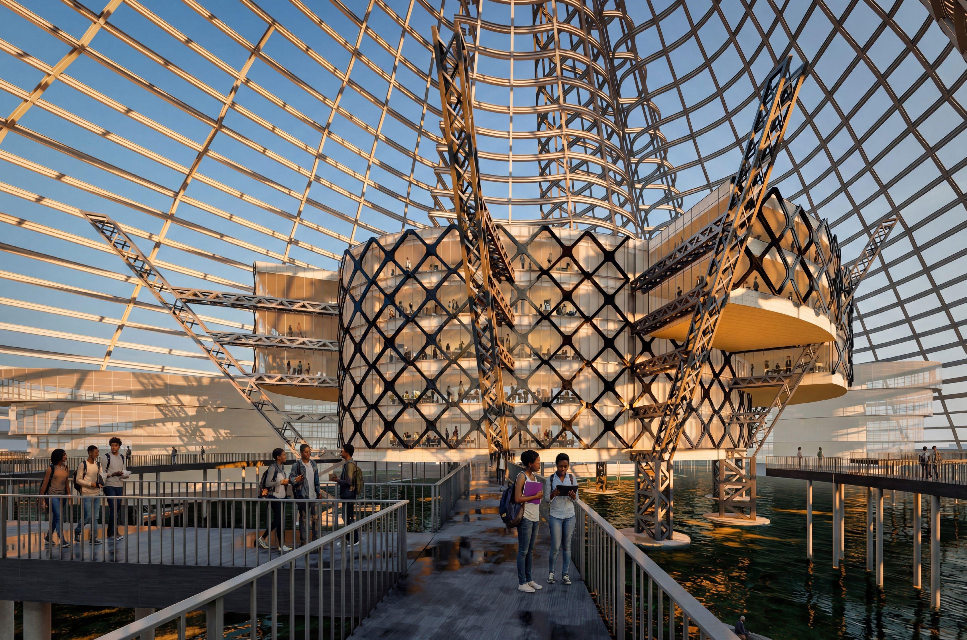
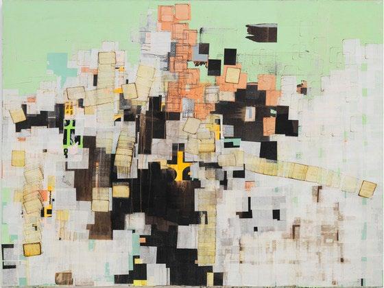
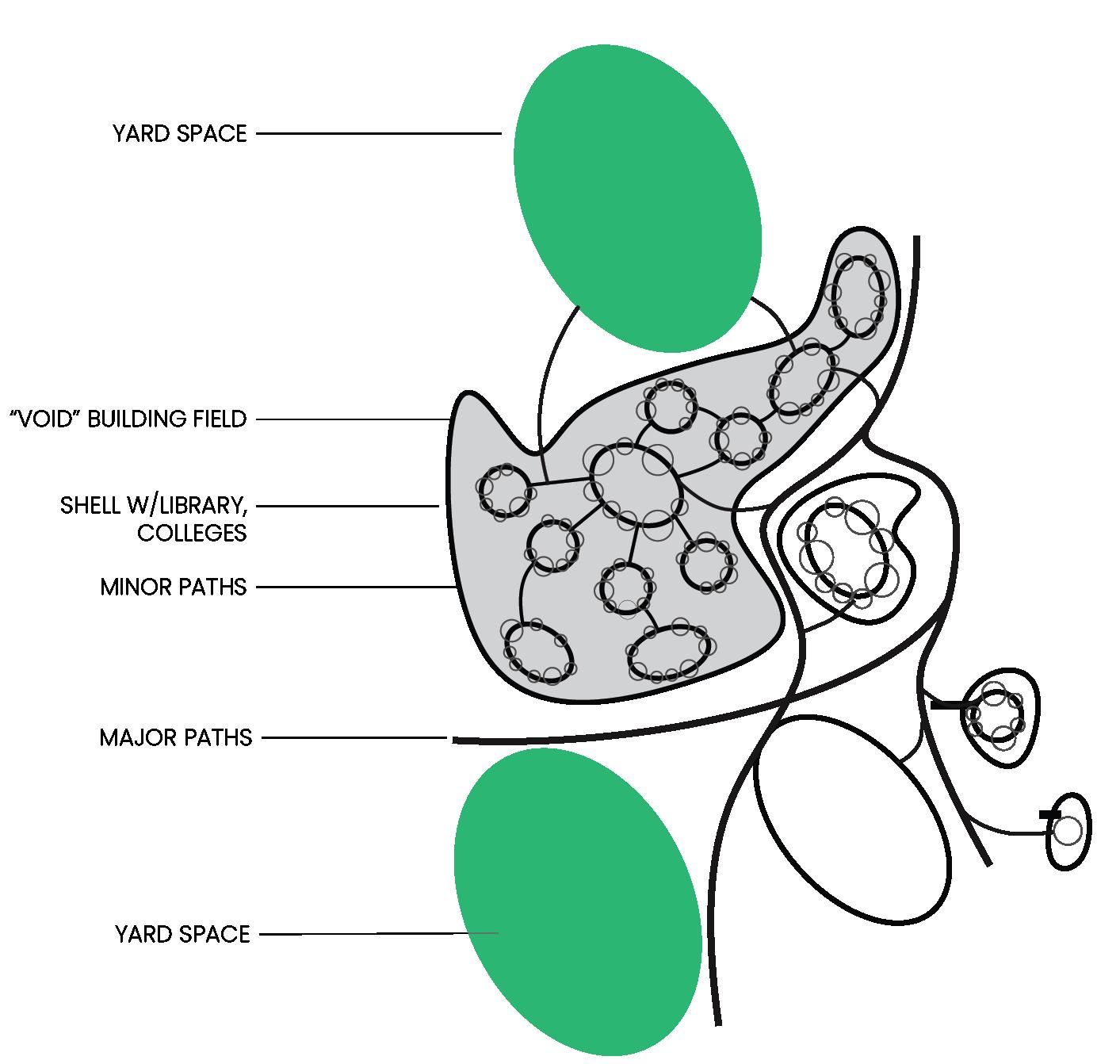
Historically, Black communities formed into isolated urban enclaves that face systemic challenges rooted in discriminatory policies. HBCUs emerged as sanctuaries from these struggles. Drawing from Mark Bradford’s BIGGIE BIGGIE BIGGIE cultural mapping, this design translates that history into two architectural elements: a protective grid-shell “Veil” that envelops the campus, and educational “Voids” that create spaces for learning and collaboration
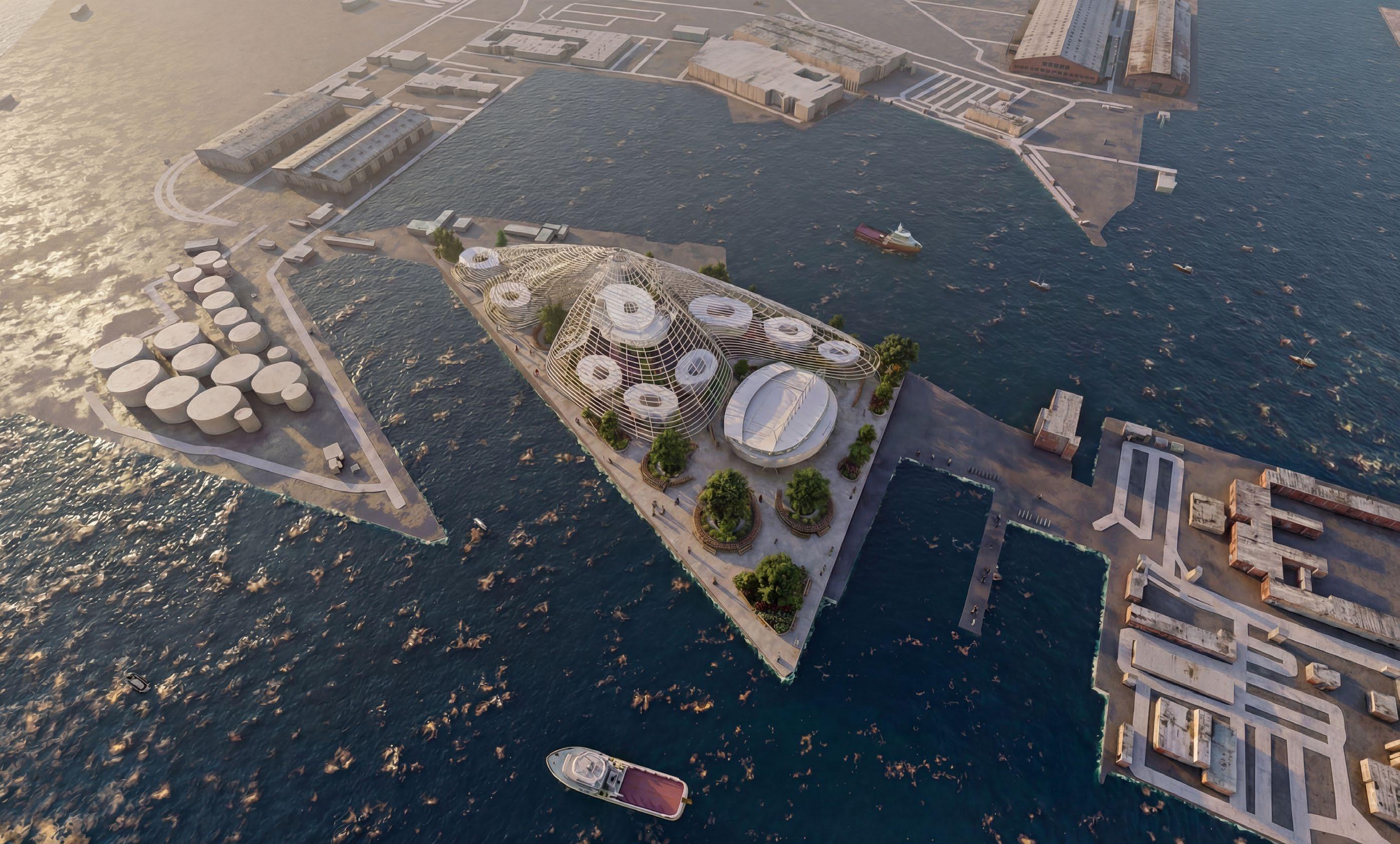
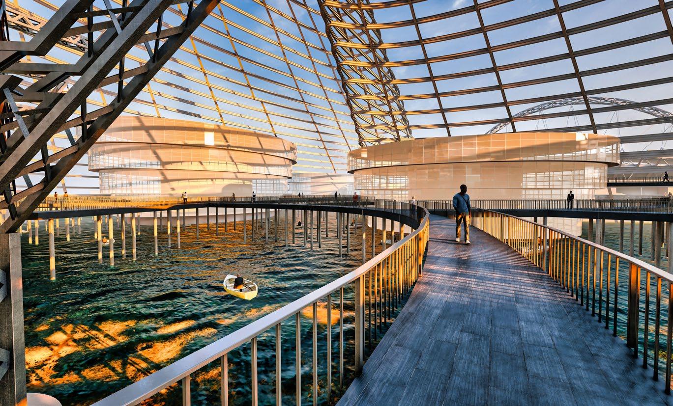
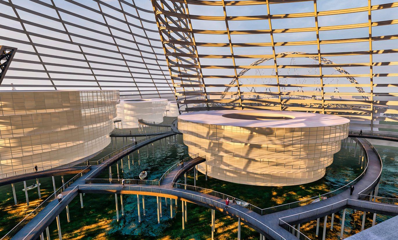
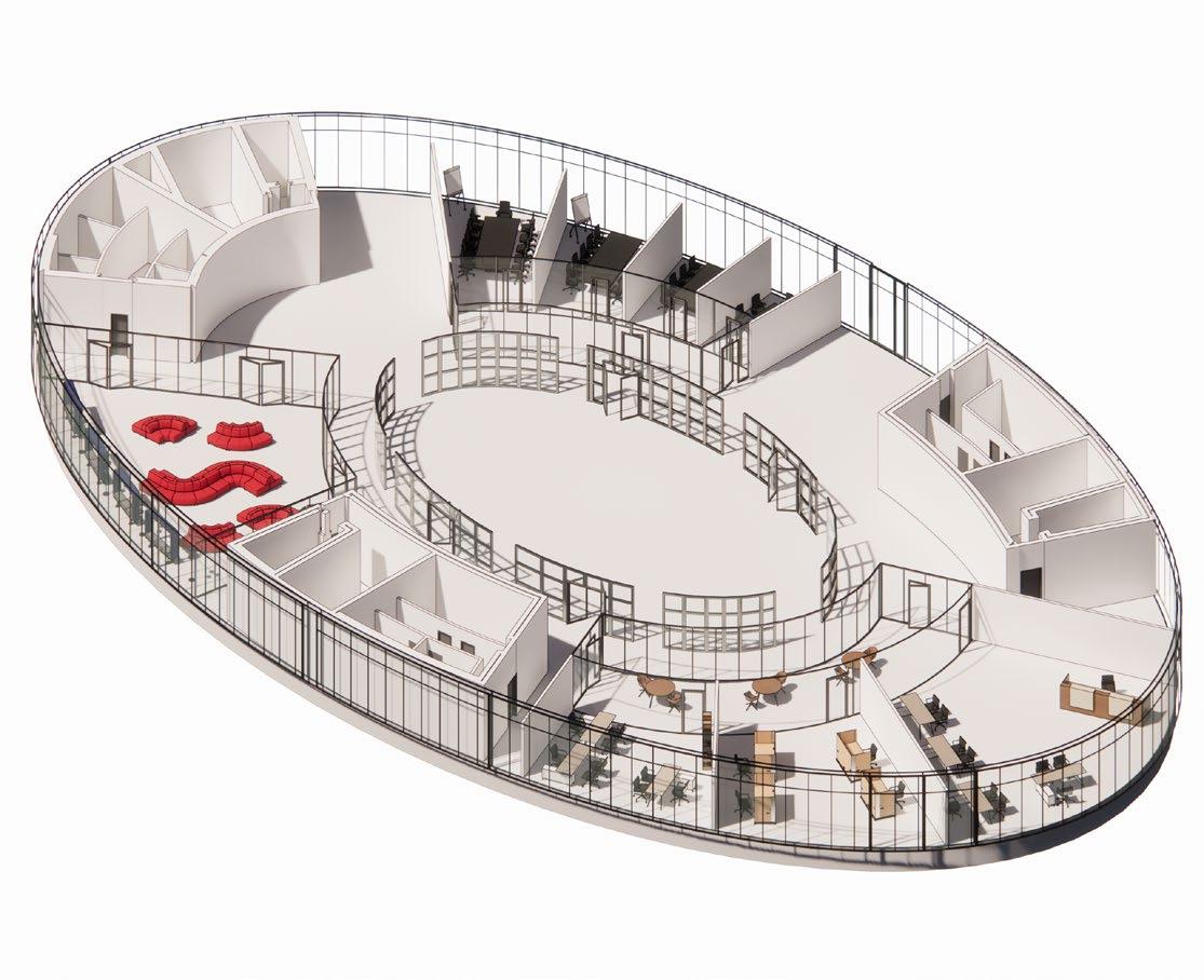
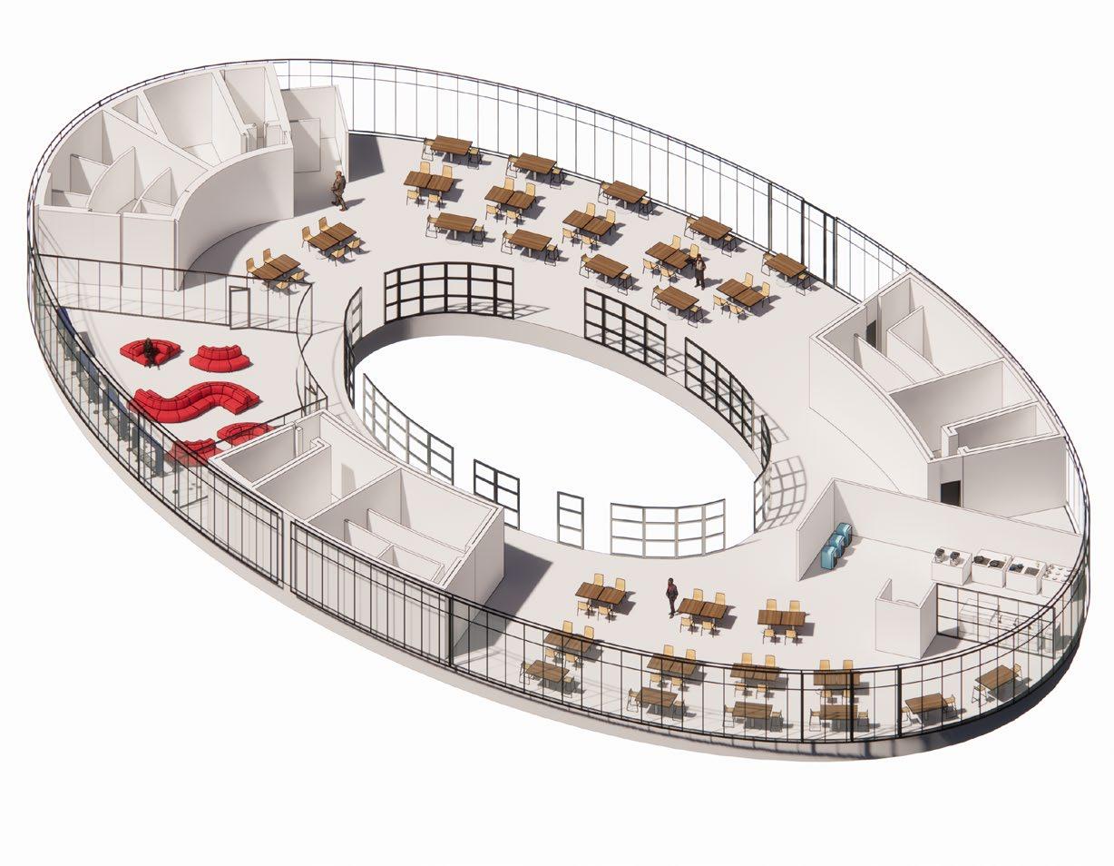
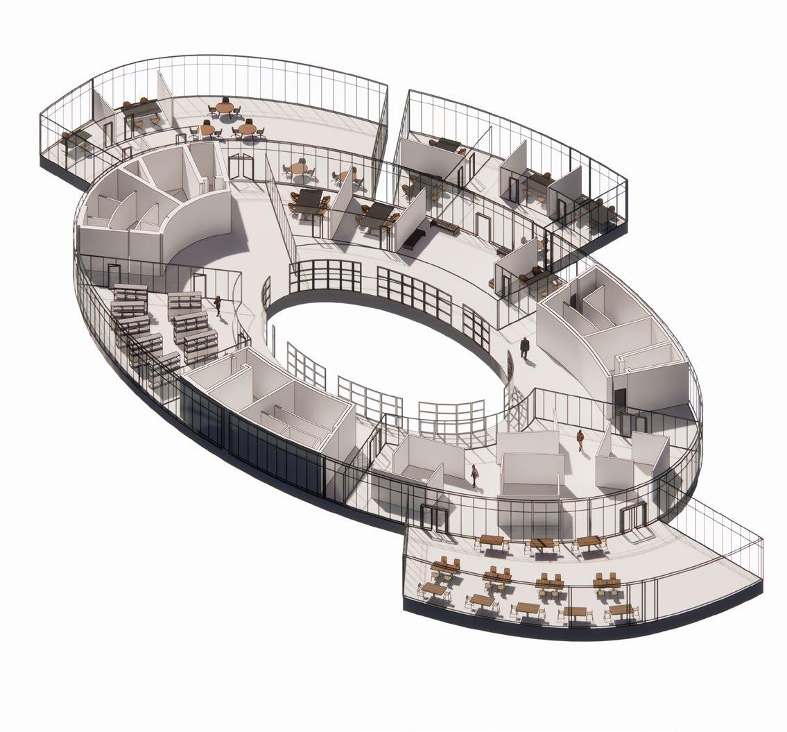
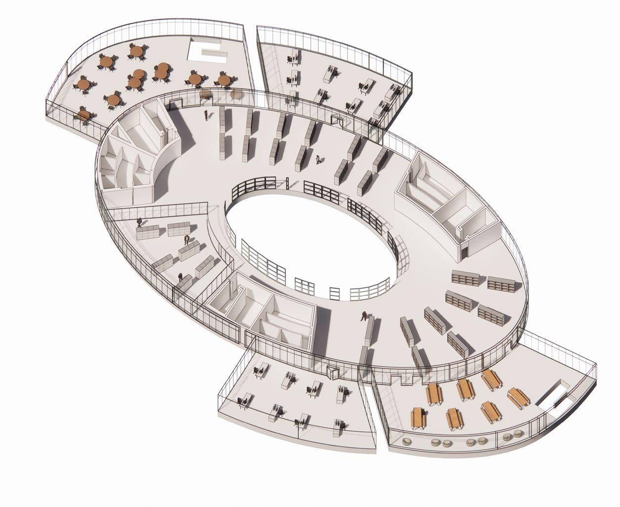
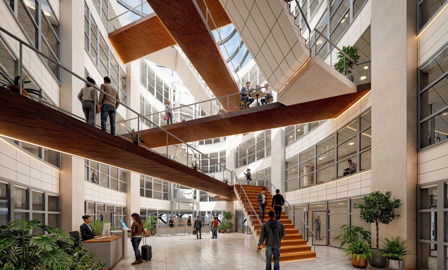
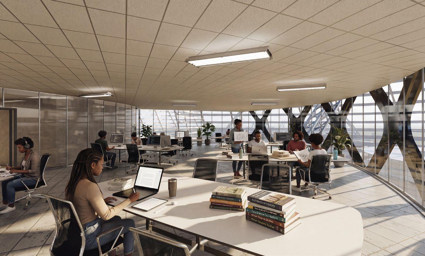
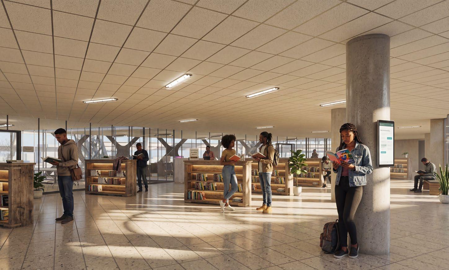
The proposal is situated on Terminal Island near the Los Angeles port and unfolds in two phases. The 1.2 million squarefoot HBCU campus houses six colleges and recreation spaces across eleven buildings. At its center, the 85,000 square-foot multilevel Student Union serves as the campus hub featuring a library, reading rooms, study spaces, faculty offices, cafes, and exhibition galleries. The Student Union is designed to empower African American students to celebrate their culture, advocate for change, and build community in a purpose-built environment.
Instructor Site Thomas Fowler Terminal Island, Los Angeles, CA
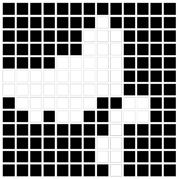
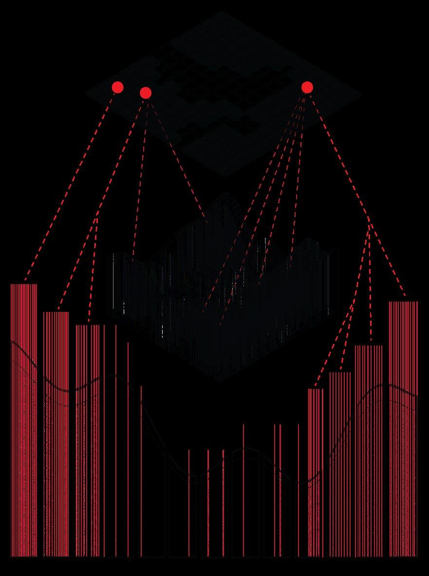
Cultural Mapping & Pattern Extraction
Using photograms and various diagramming techniques to observe patterns and create a campus plan that guides the placement of the buildings on-campus. The final proposal involves intentional flooding of the site in order to create a relationship with the surrounding context.
Bird’s Eye View of Campus
Elevated Walkways
Aerial View from within the ‘Veil’
BIGGIE BIGGIE BIGGIE, Mark Bradford, 2002
Book Stacks