Income-Producing Timberland for Sale | Southern Oregon
897.32± Acres · Jackson County, Oregon · Forest Reserve (FR) · Rogue Hunting Unit
The Four Corners Ranch is a rare 897.32-acre timberland investment property for sale on the south side of Mount Ashland, near the California border in Southern Oregon. This is a genuine income opportunity and legacy landholding, combining a substantial standing timber inventory with year-round live water, established improvements, and exceptional recreation. Elevations range from 3,600 to 4,900 feet across varied topography, creating the kind of diverse, productive landscape that appeals to a timber buyer, investor, and recreational landowner alike.
Timber
This income-producing timberland carries a multi-species inventory composed of an estimated 7.7 MMBF Douglas fir, 4 MMBF white fir, 5.9 MMBF pine, and just under 1 MMBF incense cedar. The stand is weighted toward mature, merchantable Douglas fir and white fir, reflecting the property's elevation range and consistent growing conditions, and offering real income potential. These figures are believed to be accurate and are supported by ongoing tracking of growth and harvest; however, a current timber cruise is recommended for any buyer seeking to confirm standing volume for valuation or transaction purposes.
Improvements
The home ranch features a main cabin with a full kitchen, two bedrooms, a full bathroom, and basement storage, served by spring water, along with multiple storage buildings and a dedicated shop building. The Hungry Creek tract includes a historic cabin and outbuildings, and the Grouse Creek tract contains a historic cabin as well. All of these cabins are recognized on the tax rolls of Jackson County, Oregon as residential improvements, adding both practical utility and potential options to the holding.
Outdoor Recreation
Recreation on this Southern Oregon ranch is anchored by outstanding big game hunting, primarily for blacktail deer and black bear. Located in the Rogue hunting unit, the property offers late-season archery rut hunt tags available over the counter, a significant draw for hunters. Beyond hunting, the ranch's terrain and trails lend themselves to hiking, horseback riding, ATV riding, and more, making this recreational ranch a genuine year-round destination for outdoor enthusiasts.
Location
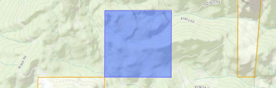
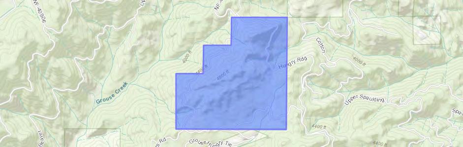
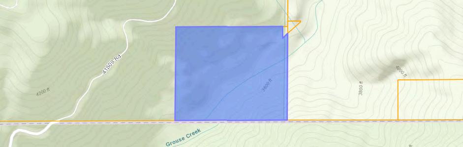
Set against the back of Mount Ashland and surrounded by national forest lands, the Four Corners Ranch enjoys a setting of remarkable privacy and natural beauty. Its diverse topography, year-round live water from Grouse Creek and Hungry Creek, and sweeping views combine to create a landscape of rare quality. Positioned in Jackson County near Mount Ashland, this timber ranch sits in one of the region's most scenic and sought-after corridors.
Property Details
Access Access is from a gravel Forest Service road.
Present Land Use Rural timber tract and recreational property.
2026 Taxes
2026 property taxes are $7,333.14.
Zoning Forest Reserve (FR).
Elevations
Topography
Domestic Water
Sanitation
Power Service
Gas / Propane
Approximately 3,600 to 4,900 feet.
Highly varied, with predominantly moderate to steep slopes, plus areas of rolling to level terrain, canyons, and benches.
Provided by a spring at the main cabin.
Served by a standard septic system.
Fully off-grid, with a generator at the main cabin.
Propane service in place, with a tank at the main cabin.
Internet Provided by Starlink.
Parcel & Tax Detail
Zoning: Forest Reserve (FR). Acreage and tax figures per Jackson County records.
Improvements
Main Cabin
Hungry Creek Cabin
Grouse Creek Cabin
Other
A three-story structure with kitchen, living room, bedroom, and bathroom on the main level. The upper level includes an additional bedroom, and the lower level includes basement storage.
Additional cabin and multiple storage sheds.
Additional historic cabin at the creek.
Additional improvements include multiple sheds, an equipment garage at the main cabin site, a shop located on the home ranch tract, a pond at the Hungry Creek tract, and significant internal road development throughout the property.
Information
Location & Access
Ashland & Mount Ashland
The property sits just above Ashland, one of Southern Oregon's most beloved towns, known for its walkable downtown, the Oregon Shakespeare Festival, Southern Oregon University, and Lithia Park. Rising directly behind it is Mount Ashland, the recreational heart of the area. The Pacific Crest Trail crosses the mountain, and the surrounding slopes offer year-round activity: hiking and mountain biking through the warmer months, and in winter the Mount Ashland Ski Area brings downhill and Nordic skiing, snowboarding, and snowshoeing right to the doorstep of the region.
The Southern Oregon Lifestyle
Beyond the mountain, the property is set within the broader Southern Oregon outdoor lifestyle that draws people to this part of the state. The region is defined by the Rogue River, celebrated nationally for its fishing and whitewater rafting, and complemented by endless hiking, camping, and backcountry exploration. Add to that a thriving wine country of award-winning vineyards and tasting rooms, farm-to-table dining, and a mild, four-season climate, and it is easy to see why the Rogue Valley has become one of the West's most sought-after places to live and play.
Access & Connectivity
Geographically, the ranch enjoys a rare combination of seclusion and connectivity. It sits on the West Coast's I-5 corridor, roughly midway between the Pacific Northwest metros of Portland and Seattle to the north and the San Francisco Bay Area to the south, with the Oregon and California coastlines an easy drive to the west. Air travel is equally convenient: Rogue Valley International-Medford Airport offers non-stop service to destinations including Seattle, Portland, San Francisco, Los Angeles, San Diego, Denver, Salt Lake City, Phoenix, and Las Vegas, connecting the property to major hubs across the Western United States.
Distances
Distances are approximate driving miles.
Timber Stocking Estimate
Disclosure, Methodology & Supporting Data
The timber stocking figures for the Four Corners Ranch are estimates derived from a model, not from a current physical measurement of standing timber. The following describes how the estimate was produced, the assumptions it relies on, and the year-by-year data supporting it.
Disclosure and Methodology
Original cruise data (2016). The baseline timber volumes originate from a professional timber cruise conducted by the original crew in 2016. These figures are the foundation for all subsequent calculations, and the accuracy of the current estimate depends in part on the accuracy of that original cruise.
Assumed growth rate (3%). No new full cruise has been performed since 2016. An annual growth rate of 3% has been assumed and applied to the inventory each year for modeling purposes. Actual growth varies by species, site conditions, stand density, and management, and this assumed rate is not a guarantee of realized volume.
Harvest accounting. All harvest volumes are recorded and subtracted in the year the harvest occurred, before growth is applied for that year. The model rolls the inventory forward year by year, netting out harvested volume and adding assumed growth, to arrive at the current standing estimate.
True-up adjustment. The 2016 cruise recorded merchantable timber as it stood at that time. Because a significant cohort of trees was pre-merchantable in 2016 and has since grown into merchantable size, an in-house true-up adjustment has been applied to the baseline inventory to reflect this additional volume. This adjustment is based on the owner's direct experience harvesting these tracts, and the adjusted figures have proven consistent with actual logged volumes on this ground. The true-up is applied as a one-time adjustment to the baseline and is distinct from the assumed 3% annual growth rate, which models ongoing growth of standing merchantable timber. As with the overall estimate, these figures are believed to be reasonably accurate but are not a substitute for a current timber cruise.
Purpose and limitations. This estimate is provided for general informational purposes to convey the approximate scale and species composition of the timber resource. It should not be relied upon for valuation or transaction decisions without an independent, current timber cruise. Additional documentation is available upon request.
IMPORTANT: The information contained herein has been provided by sources deemed reliable and is presented in good faith by Martin Outdoor Property Group and John L. Scott Real Estate, who believe it to be accurate. However, neither Martin Outdoor Property Group nor John L. Scott Real Estate warranties or guarantees the accuracy or completeness of this information, including but not limited to timber volumes and estimates, acreage, boundaries, improvements, water rights, and access. All information is subject to change, prior sale, or withdrawal without notice. Buyer is responsible for conducting complete and independent due diligence on all components of the property, including the timber, and should not rely on the information presented herein without independent verification.
Current Stocking Summary
The table below reflects the current estimated standing inventory by species. All volumes are expressed in thousands of board feet (MBF).
Estimated current standing inventory by species, in thousands of board feet (MBF).
Year-by-Year Roll-Forward
The following tables document how the inventory has been carried forward each year from the adjusted 2016 baseline. Each year begins with the prior year's final volume, subtracts any harvest recorded in that year, applies the assumed 3% growth, and arrives at a final standing volume. The 2022 table includes the one-time true-up adjustment described above. All volumes are in thousands of board feet (MBF); species are Douglas fir (DF), white fir (WF), pine, and incense cedar (IC).
2022 (baseline true-up year)
South Mining Claim (Hungry Creek Tract) — 60 ac
Values in thousands of board feet (MBF). Top row = property totals; blank harvest cells indicate no harvest recorded for that tract and species.
Corners (Grouse Creek + Home Ranch) — 680 ac
South Mining Claim (Hungry Creek Tract) — 60 ac
Values in thousands of board feet (MBF). Top row =
Values in thousands of board feet (MBF). Top row = property totals; blank harvest
Values in thousands of board feet (MBF). Top row = property totals; blank harvest cells indicate no harvest
2026
Values in thousands of board feet (MBF). Top row = property totals; blank harvest cells indicate no harvest recorded for that
and
Timber Valuation Summary
The summary below presents an estimated valuation of the standing timber inventory by species. Values are derived from estimated volumes, estimated delivered (pond) values, and estimated harvest costs. All figures are estimates for general informational purposes and are subject to market conditions and independent verification.
Basis of the Valuation
Pond value — The estimated value of the timber delivered to the mill, stated per thousand board feet (MBF). The valuation is built on estimated pond values for each species; actual delivered prices fluctuate with the timber market and mill demand.
Gross value — The estimated volume of each species multiplied by its estimated pond value.
Harvest rate — The estimated cost to harvest, stated per thousand board feet (MBF). The harvest rate includes both estimated logging cost and estimated haul (trucking) cost.
Harvest cost — The estimated volume of each species multiplied by the harvest rate.
Net value — The estimated gross value less the estimated harvest cost, representing an approximate net timber value before taxes, road work, permitting, and other costs of sale.
Disclosure
This valuation is presented in good faith and is believed to be accurate, but is not warranted or guaranteed. Timber volumes are model-based estimates and are not a substitute for a current timber cruise. Pond values and harvest costs are estimates that will vary with market conditions, site access, and operating factors. Buyer is responsible for completing independent due diligence on all components of the property, including timber, and should independently verify all information prior to purchase. Additional documentation available upon request.
Table of Exhibits
The following exhibits accompany the property summary and supporting documentation for The Four Corners Ranch.
Presented by Martin Outdoor Property Group and John L. Scott Real Estate. Information is provided in good faith and believed to be accurate, but is not warranted or guaranteed. Buyer is responsible for completing independent due diligence on all components of the property. Additional documentation available upon request.
Oregon
E X H I B I T
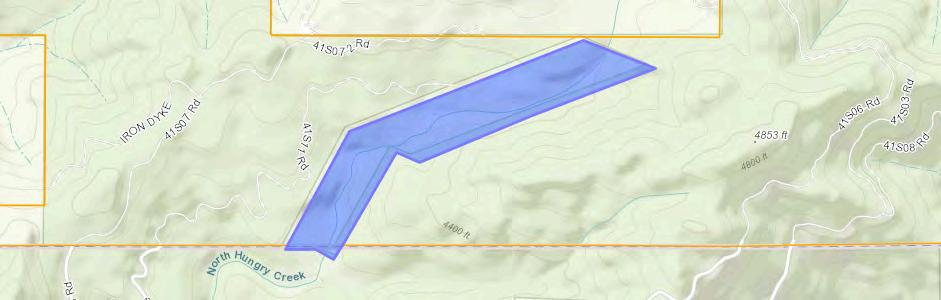
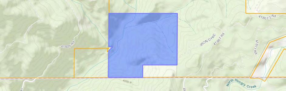
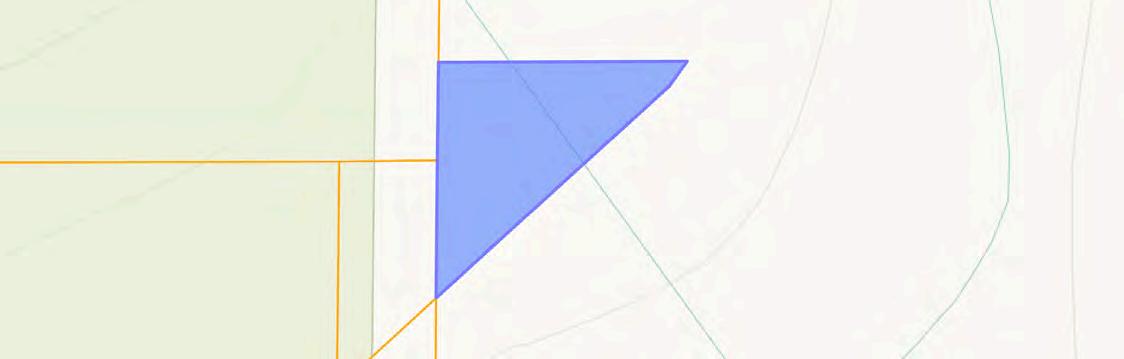
Mapping
Presented by Martin Outdoor Property Group | John L. Scott Real Estate
Boundary Forest Service
|
Polygons 904.82 ac
(*) Total acres may differ in the second decimal compared to the sum of each acreage soil. This is due to a round error because we only show the acres of each soil with two decimal.
| Boundary 159.71 ac
(*) Total acres may differ in the second decimal compared to the sum of each acreage soil. This is due to a round error because we only show the acres of each soil with two decimal.
| Boundary 518.55 ac
(*) Total acres may differ in the second decimal compared to the sum of each acreage soil. This is due to a round error because we only show the acres of each soil with two decimal.
| Boundary 60.26 ac
(*) Total acres may differ in the second decimal compared to the sum of each acreage soil. This is due to a round error because we only show the acres of each soil with two decimal.
| Boundary 132.53 ac
(*) Total acres may differ in the second decimal compared to the sum of each acreage soil. This is due to a round error because we only show the acres of each soil with two decimal.
|
Boundary 33.62 ac
(*) Total acres may differ in the second decimal compared to the sum of each acreage soil. This is due to a round error because we only show the acres of each soil with two decimal. | Boundary 0.15 ac
(*) Total acres may differ in the second decimal compared to the sum of each acreage soil. This is due to a round error because we only show the acres of each soil with two decimal.
Boundary Stream, Intermittent River/Creek Water Body
Boundary Wetlands Riparian
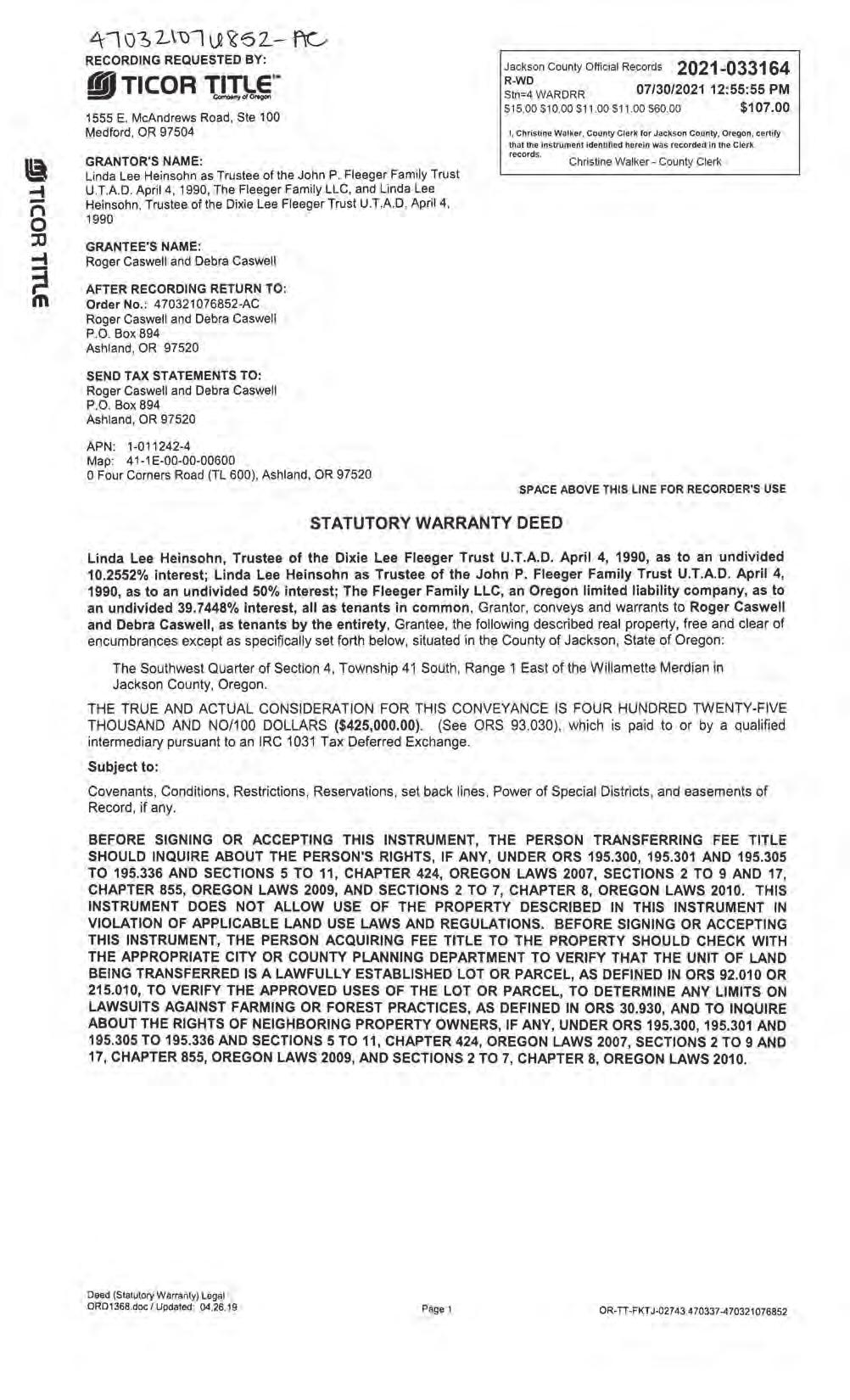
Preliminary Title Report (Coming
Soon)
Presented by Martin Outdoor Property Group | John L. Scott Real Estate
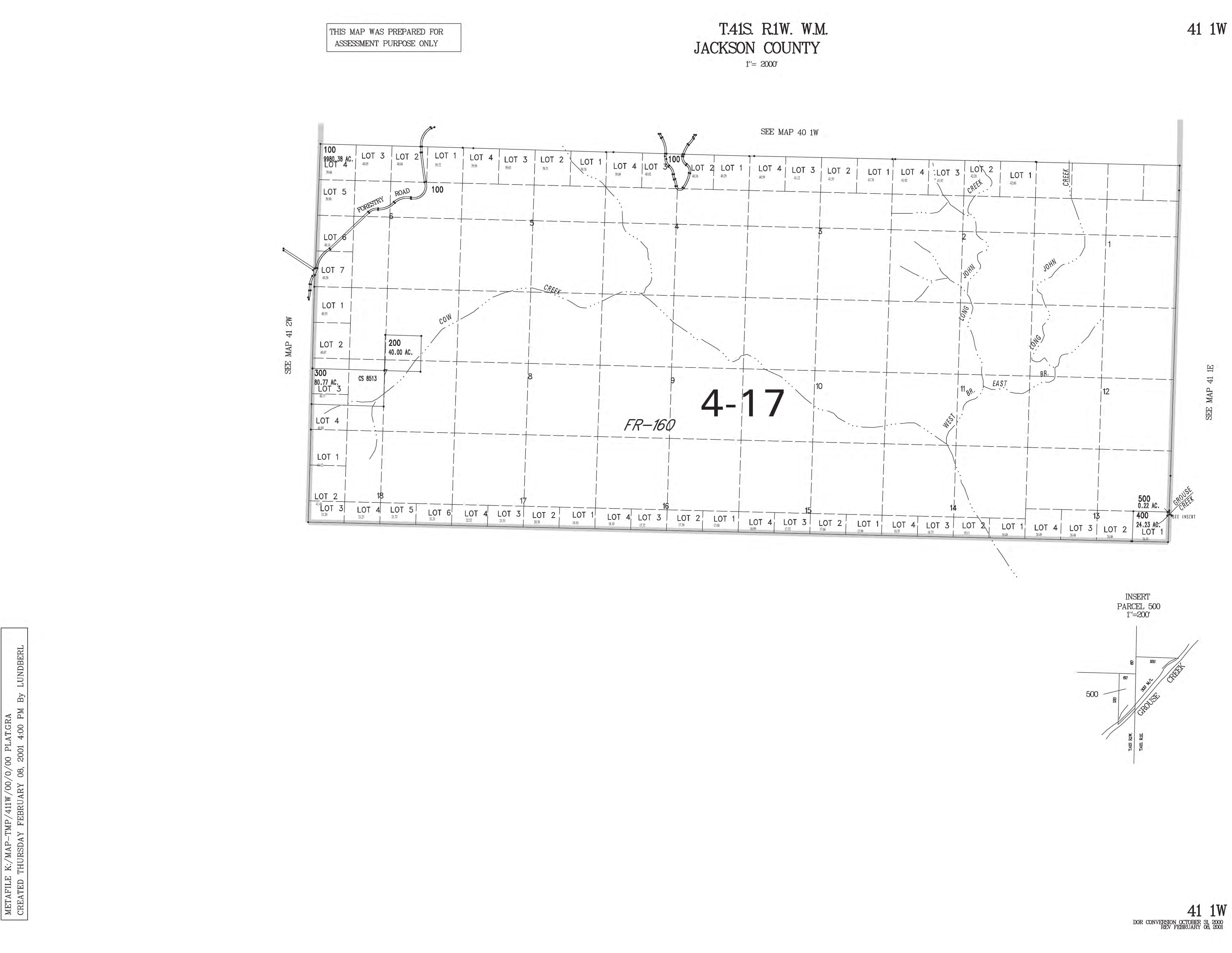
Jackson County Tax Records
Presented by Martin Outdoor Property Group | John L. Scott Real Estate
Owner CASWELLROGER
CASWELLDEBRA
SitusAddress
FOURCORNERSRDASHLAND/COUNTY R
MailingAddress
Appraiser
CASWELLROGER/DEBRA POBOX894
ASHLANDOR,97520
County of Jackson, OR, Bureau of Land Management, State of Oregon, State of Oregon DOT, State of Oregon GEO, Esri Canada, Esri, HERE, Garmin, I… Powered by Esri
CloseWindow PrintWindow
STATEMENT OF TAX ACCOUNT
MEDFORD, OR 97501
Owner
SitusAddress
HUNGRYRIDGERDASHLAND/COUNTY R
MailingAddress CASWELLROGERA/DEBRA POBOX894
OR,97520-0030
Appraiser
County of Jackson, OR, Bureau of Land Management, State of Oregon, State of Oregon DOT, State of Oregon GEO, Esri Canada, Esri, HERE, Garmin, I… Powered by Esri
County of Jackson, OR, Bureau of Land Management, State of Oregon, State of Oregon DOT, State of Oregon GEO, Esri Canada, Esri, HERE, Garmin, I… Powered by Esri