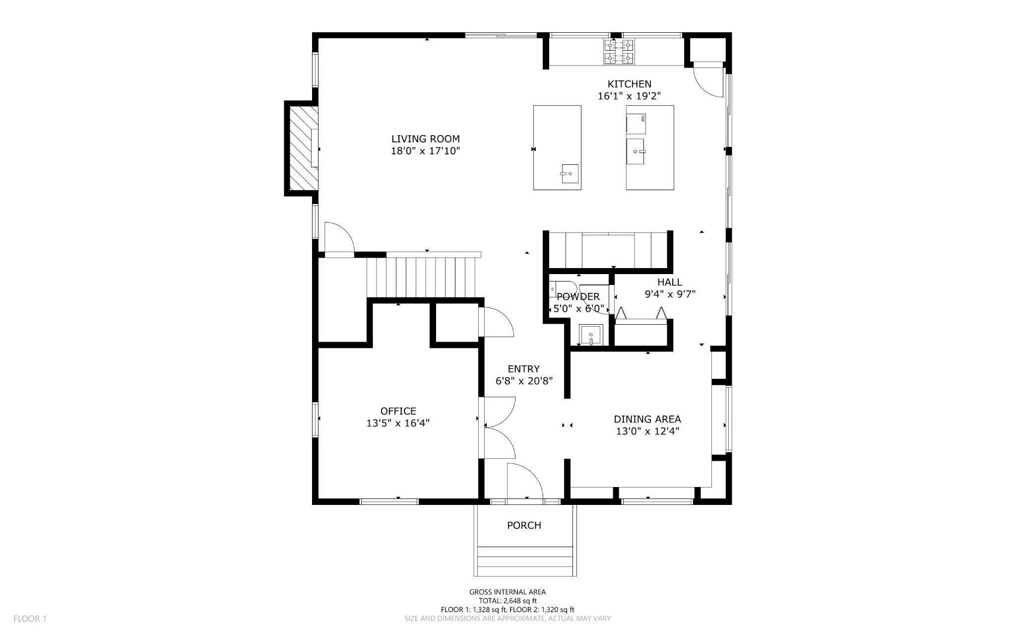
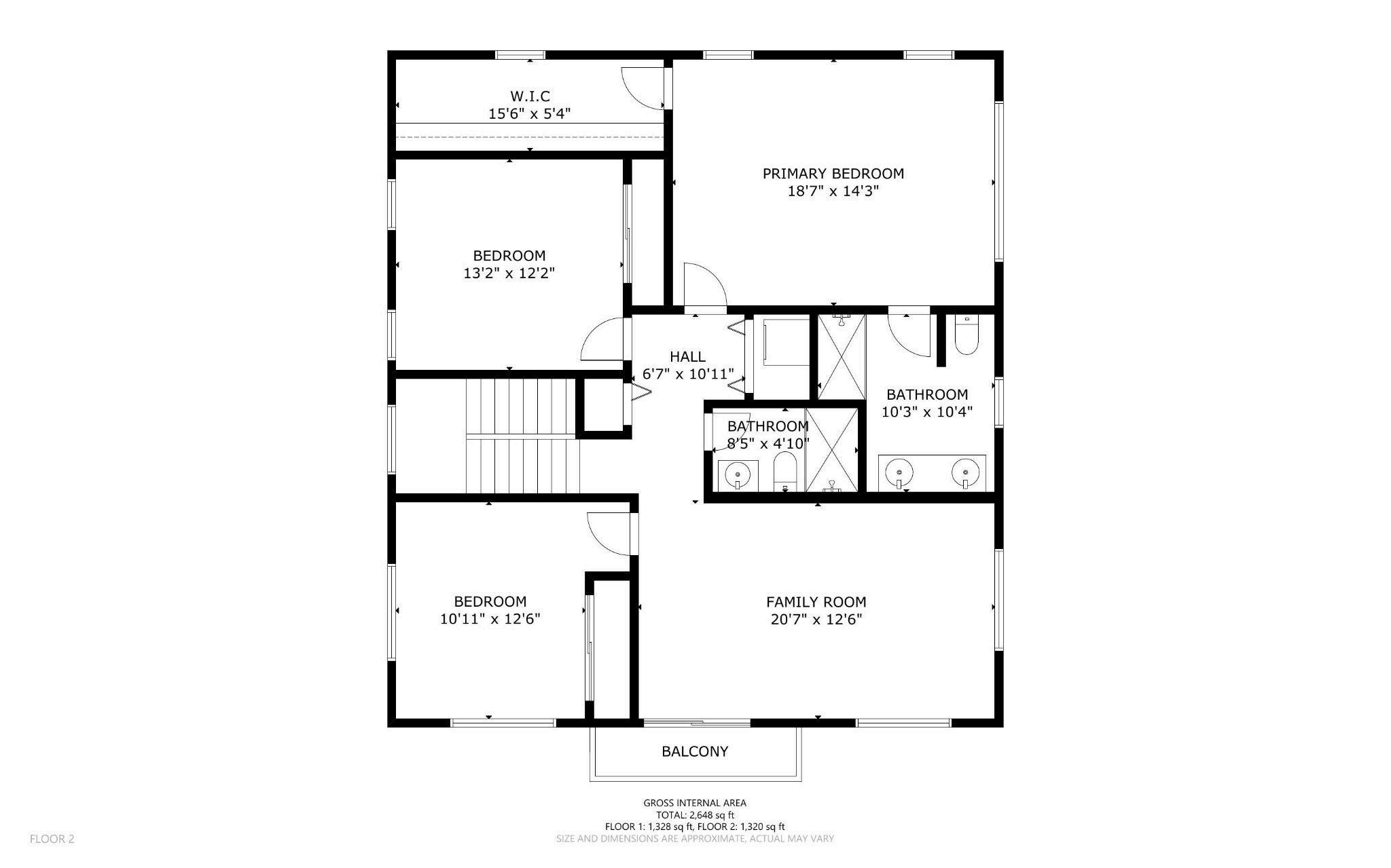
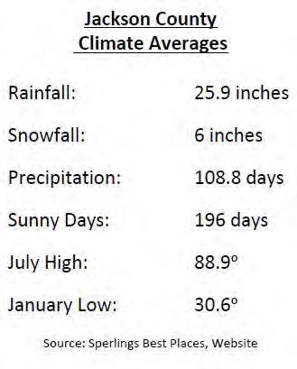
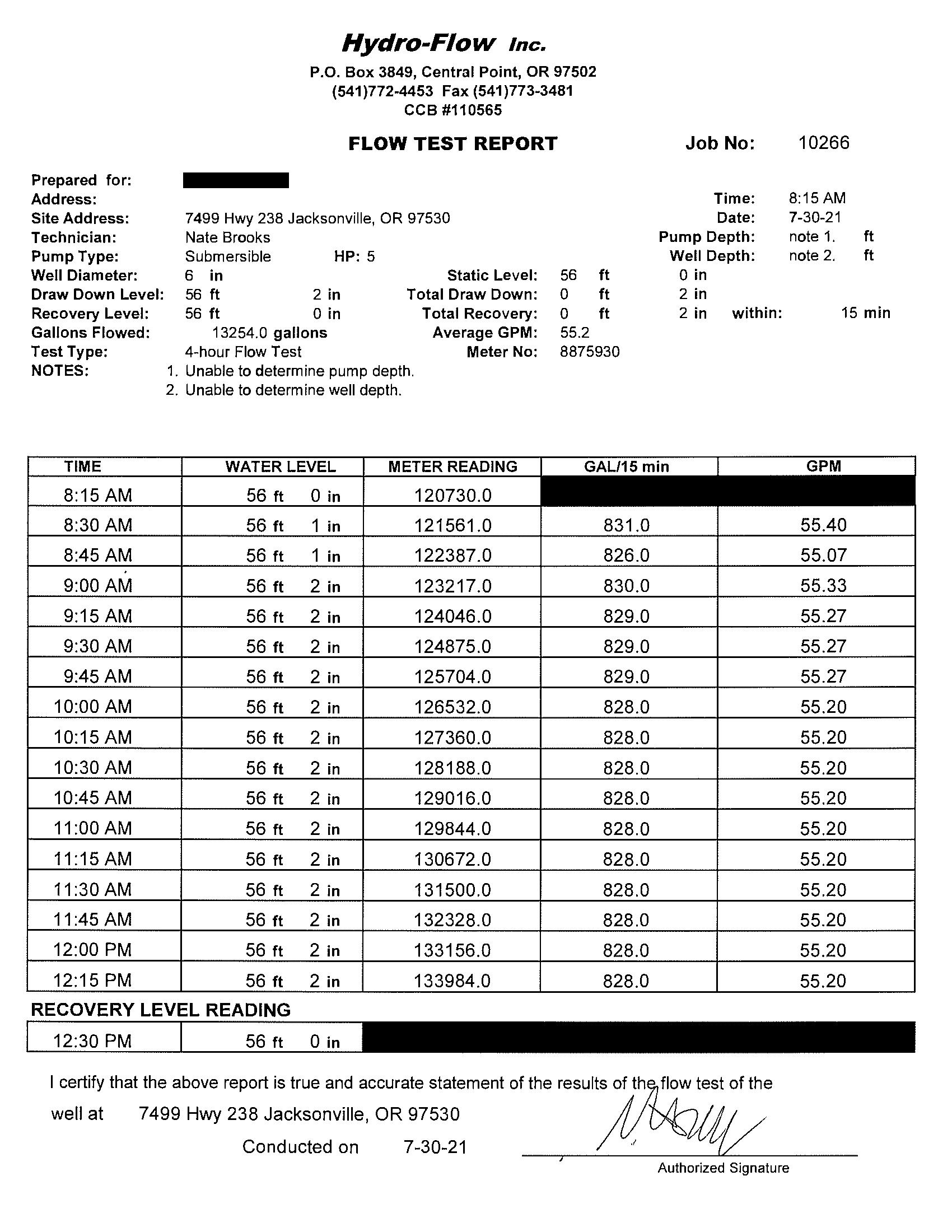
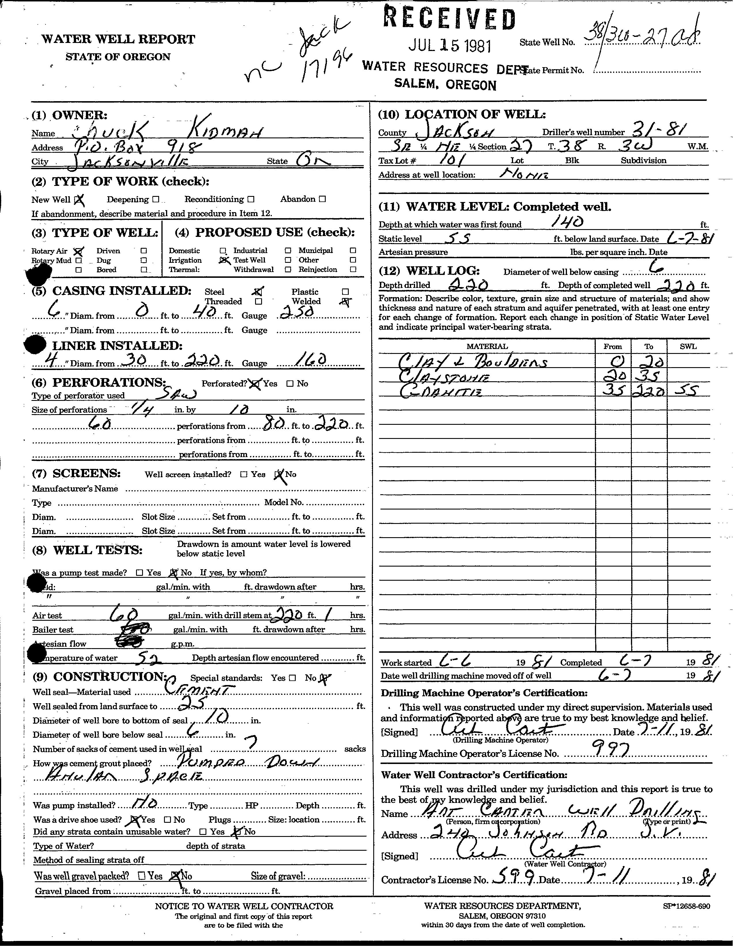
year-round outdoor enjoyment. The estate’s custom home is a stunning blend of Mediterranean architecture and modern elegance. Surrounded by mature landscaping, sprawling lawns, and multiple patio spaces, the home seamlessly integrates indoor and outdoor living. The domestic well boasts over 50 gallons a minute based upon the last flow test.
Lifestyle
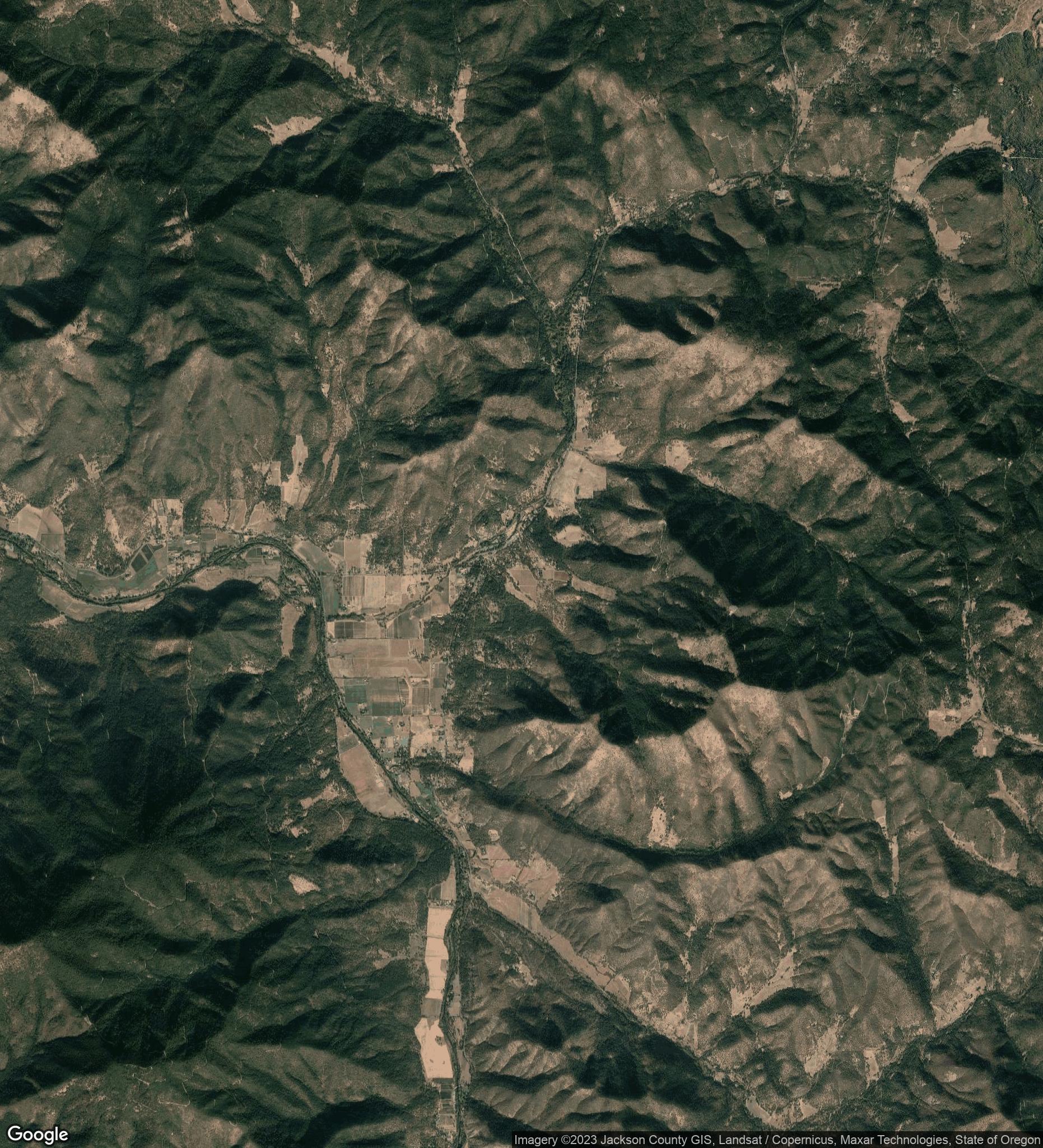
Beyond the property’s boundaries, the Applegate Valley offers a lifestyle defined by natural beauty and recreation. The Applegate River and nearby Applegate Lake provide endless opportunities for outdoor adventures, from fishing and kayaking to hiking and camping. The Applegate Valley Wine Trail is a must, offering intimate tasting experiences, great food and events at great local wineries. A short drive brings you to Jacksonville, where historic charm runs deep and includes boutique shopping, fine dining, and the celebrated Britt Festival.
This estate is a rare opportunity to own a piece of Southern Oregon’s vibrant wine country, complete with a turnkey luxury home and limitless potential for a fulfilling and tranquil lifestyle.
Applegate Valley
Nestled in the heart of Southern Oregon, the Applegate Valley is a haven of natural beauty and outdoor adventure. This picturesque region is framed by lush forests, rolling hills, and the serene Applegate River, which flows gracefully through the valley, offering excellent opportunities for fishing, kayaking, and swimming. Outdoor enthusiasts will also appreciate the nearby Applegate Lake, a stunning reservoir perfect for boating, hiking, and camping. The area is equally known for its thriving wine scene, with the Applegate Valley Wine Trail featuring a collection of boutique wineries that produce exceptional, small-batch wines. With its blend of scenic landscapes and recreational opportunities, the Applegate Valley offers a quintessential Pacific Northwest experience.
Jacksonville
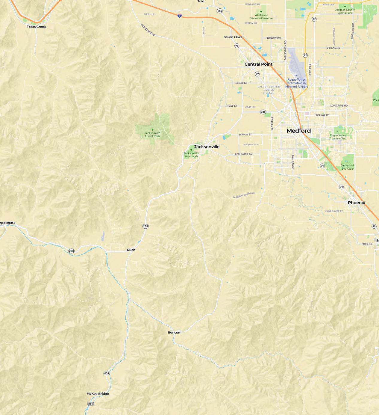
Located just 8 miles from the property, the historic town of Jacksonville is a charming destination that effortlessly blends its rich Gold Rush heritage with modern amenities. Recognized as a National Historic Landmark, Jacksonville boasts beautifully preserved 19th-century architecture, quaint shops, and an array of fine
dining and casual eateries. The town is home to the renowned Britt Festival, a summer concert series that attracts top musical talent to its outdoor amphitheater. With its friendly community and vibrant cultural scene, Jacksonville provides a perfect balance of small-town charm and sophisticated living, making it a coveted destination in Southern Oregon.
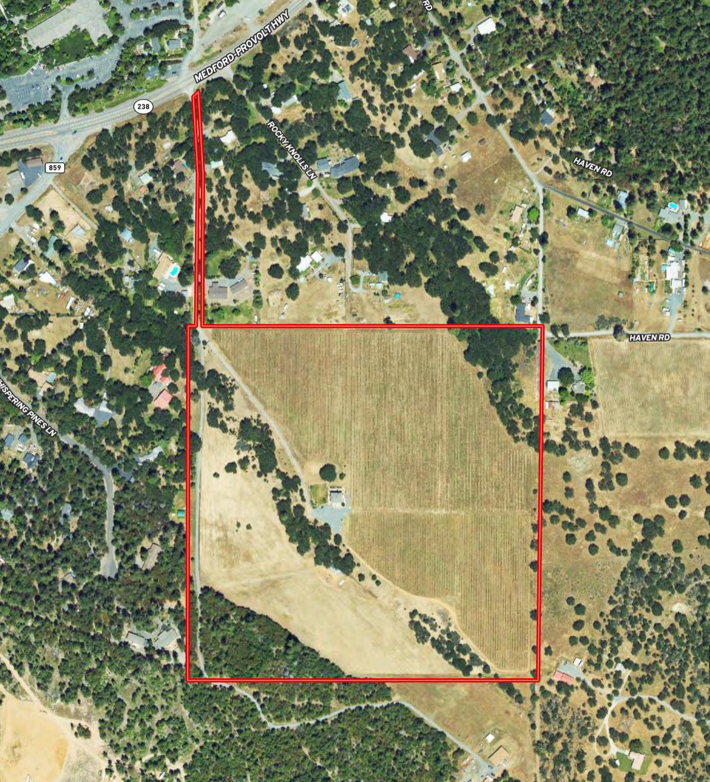
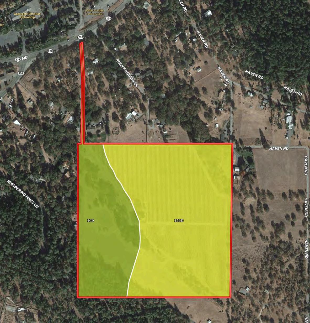
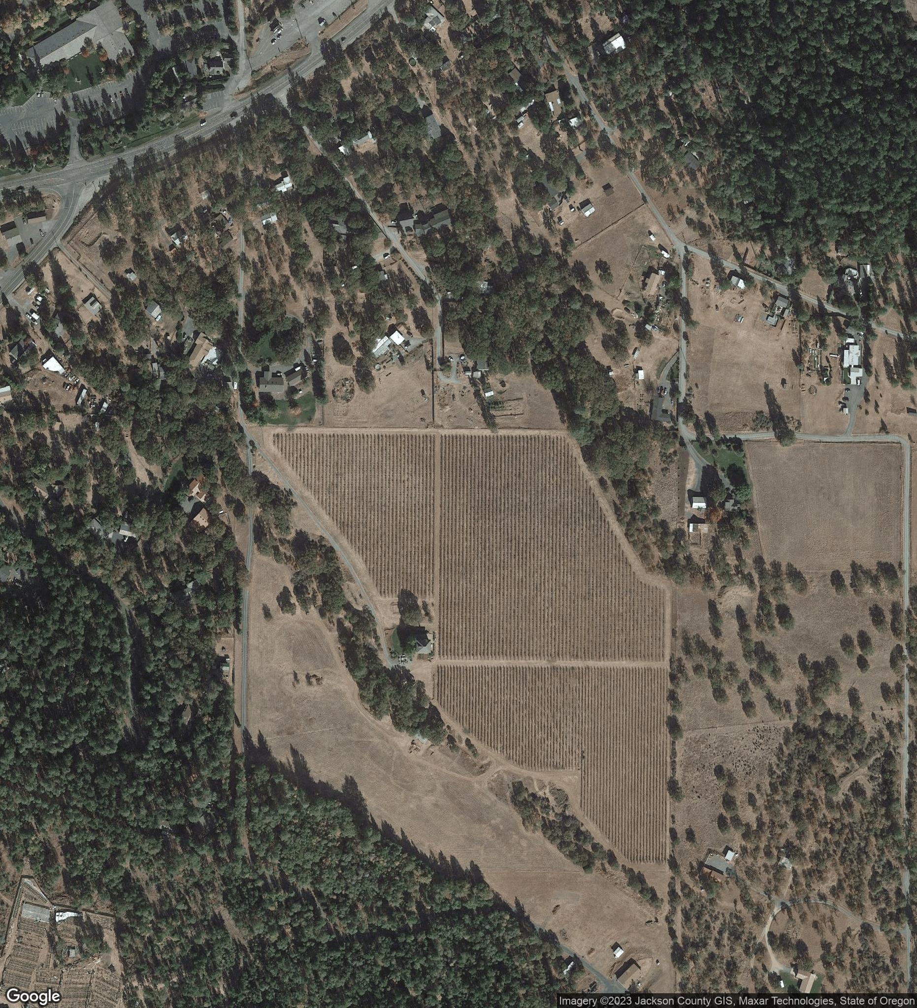
Aerial Map
Property Details
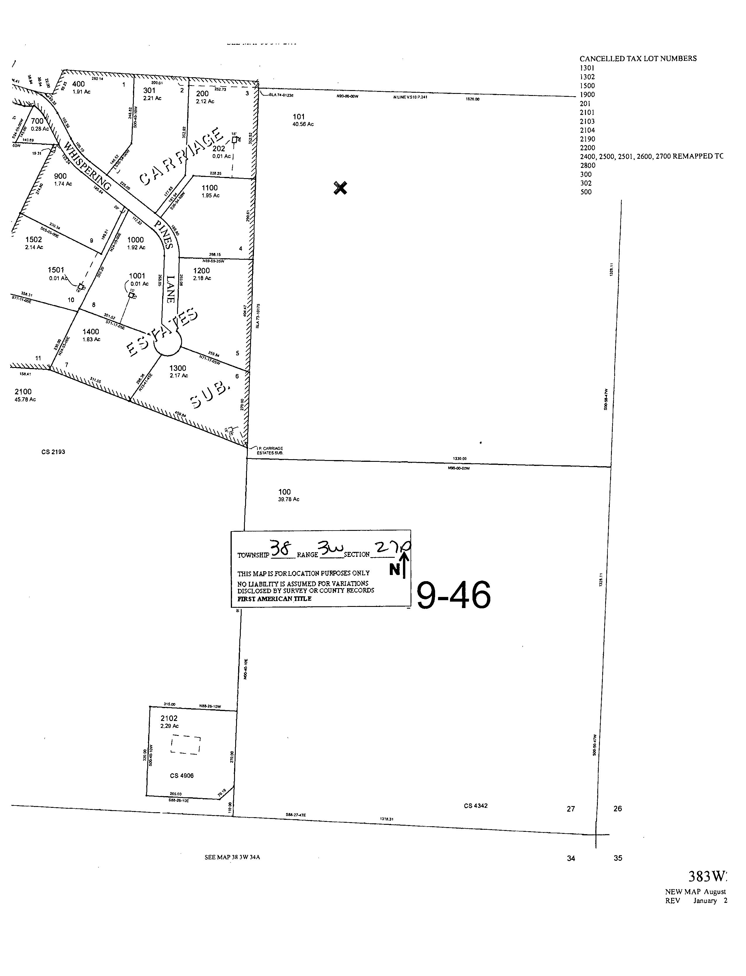
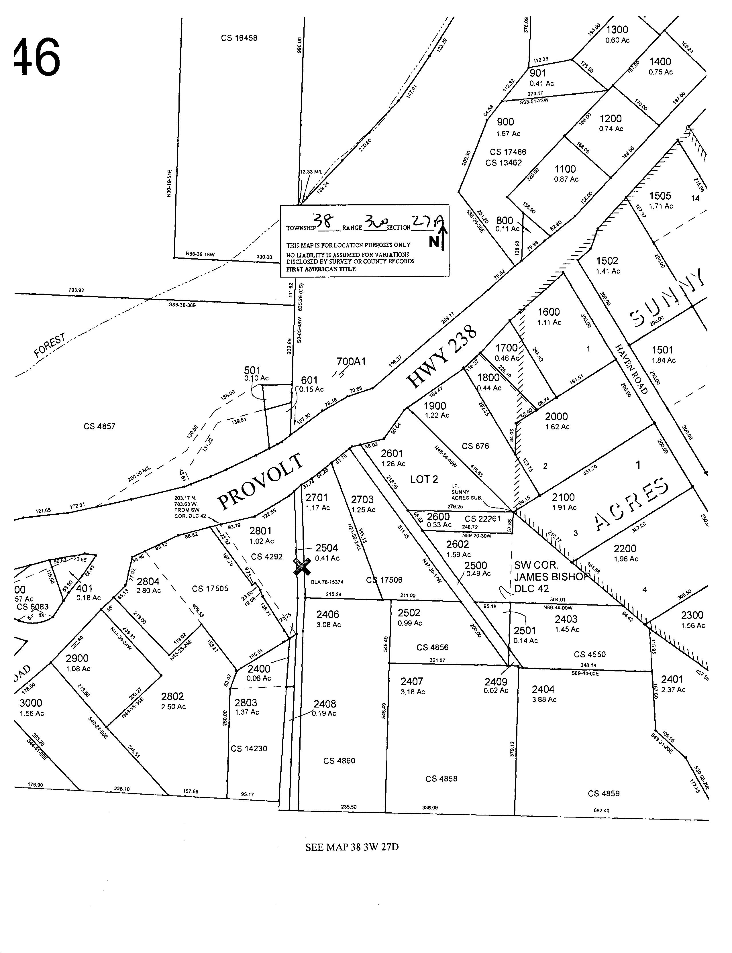
The property has a physical address of 7499 Highway 238, Jacksonville, Oregon 97530. It is made up of 2 tax lots and 2 account numbers as shown below.
Access: Access is via a dirt/gravel driveway off of paved Highway 238
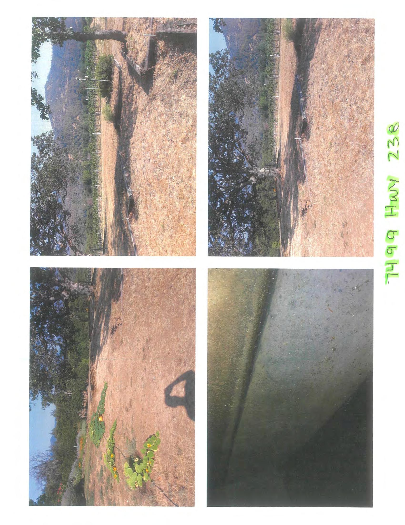
Present Land Use: Private rural estate with vineyard and pasture
2025 Taxes:
Zoning:
$3,879.40
EFU/RR-2.5 (Exclusive Farm Use/Rural Residential)
Elevations: +/- 1,600’ to +/-1,760’ above sea level
Topography: Gently sloping
Water Rights: None at this time
Domestic Water: 55.2 GPM domestic well (Per flow test 7/30/21)
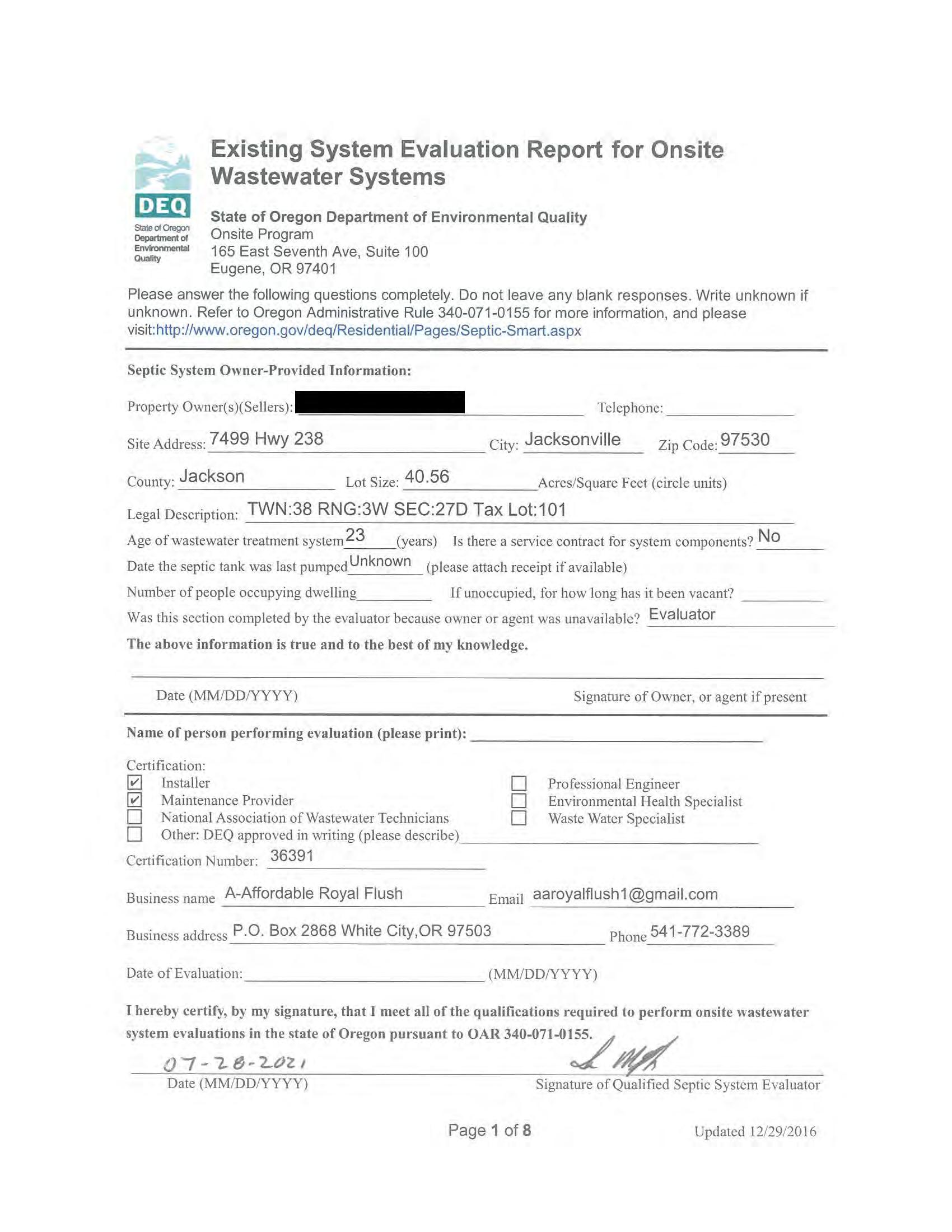
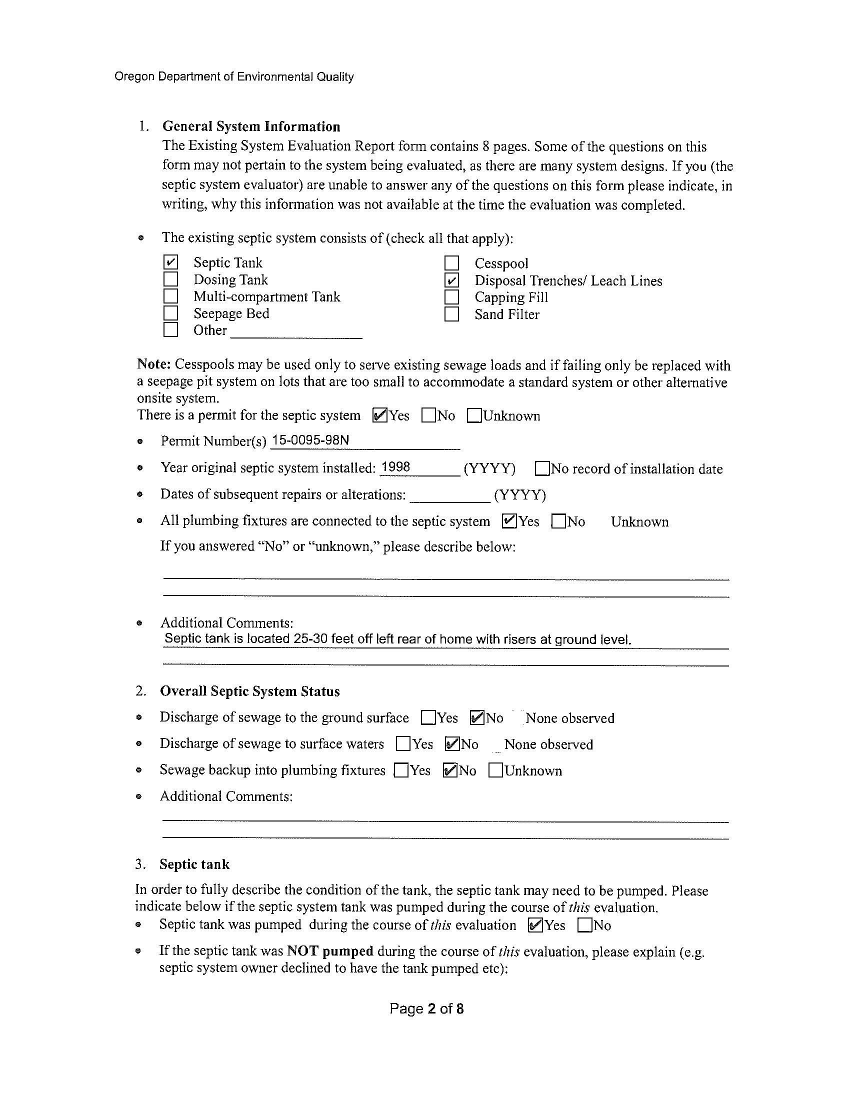
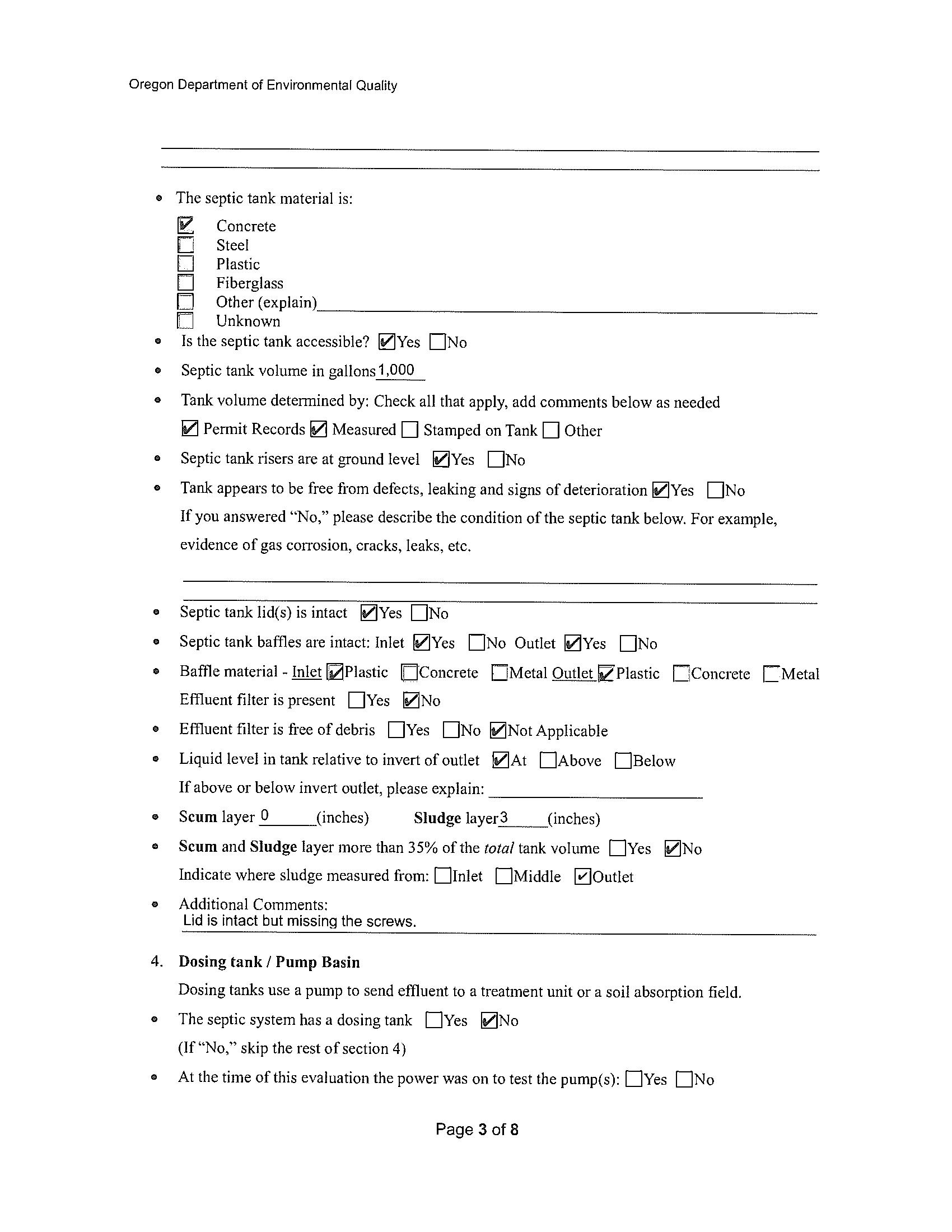
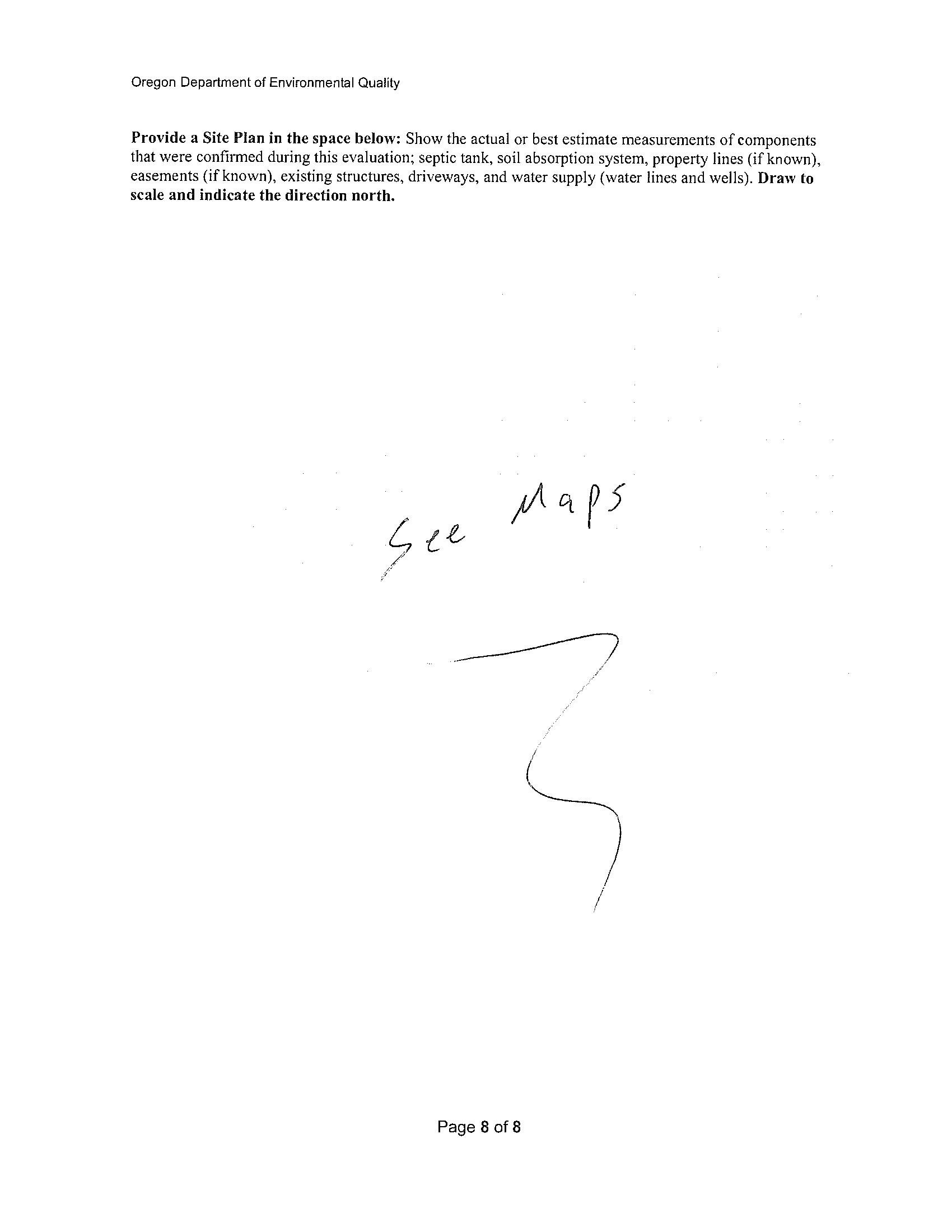
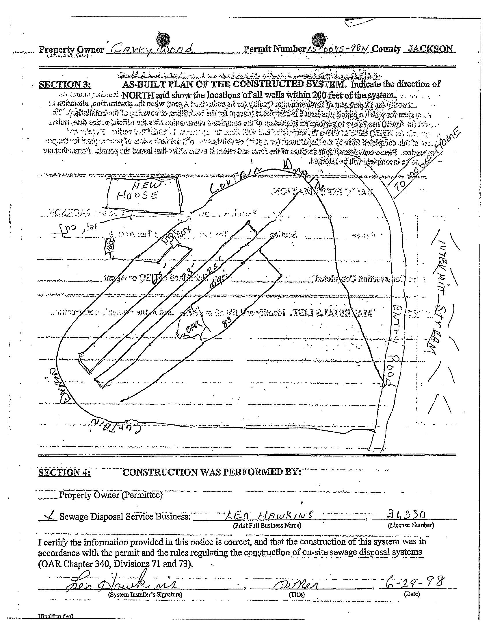
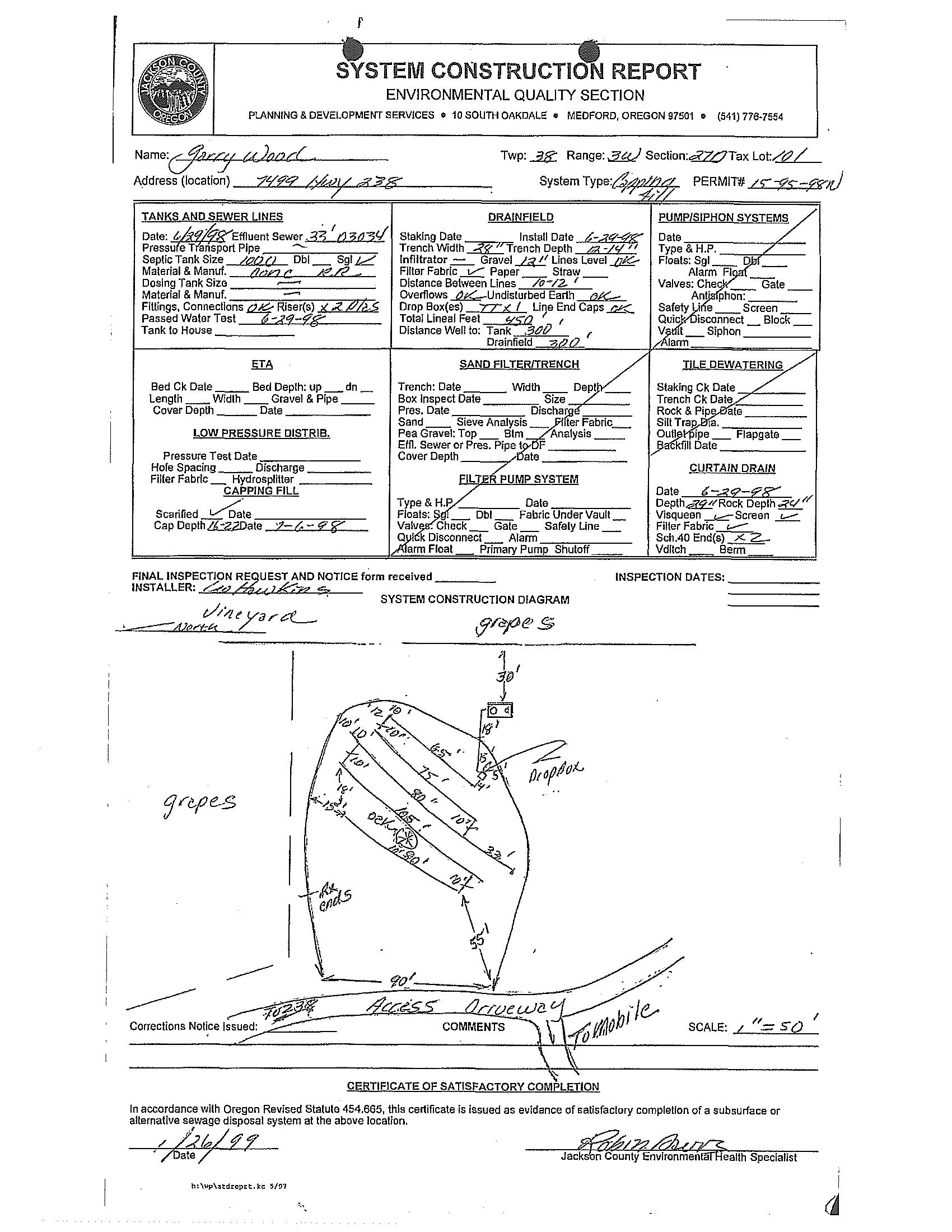
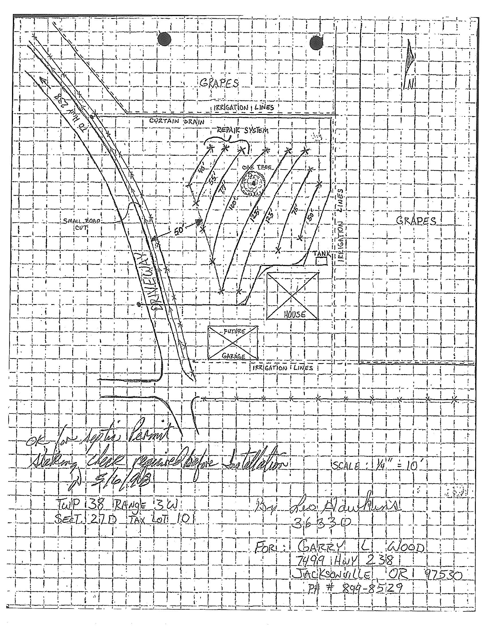
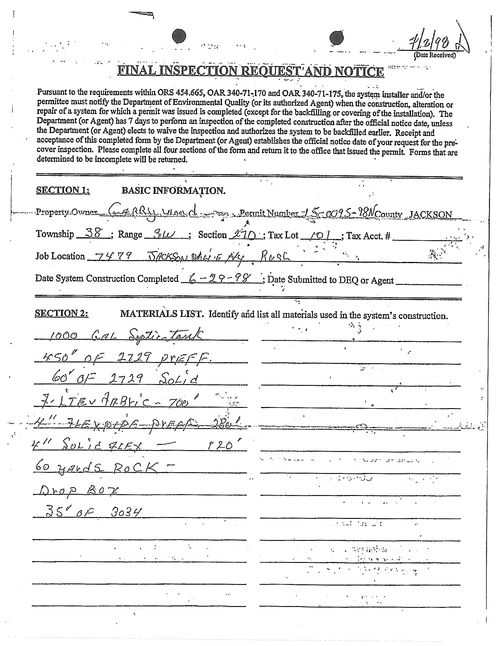
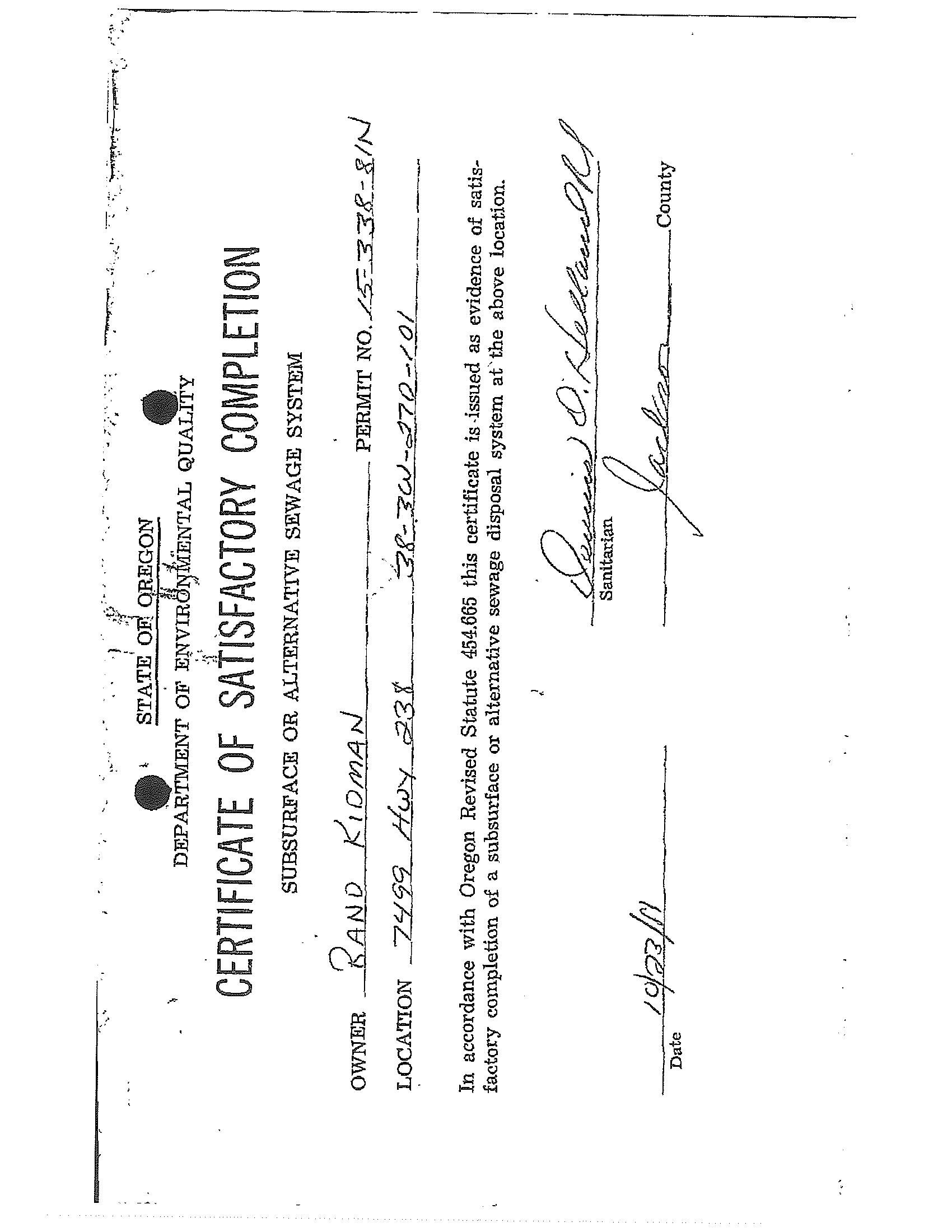
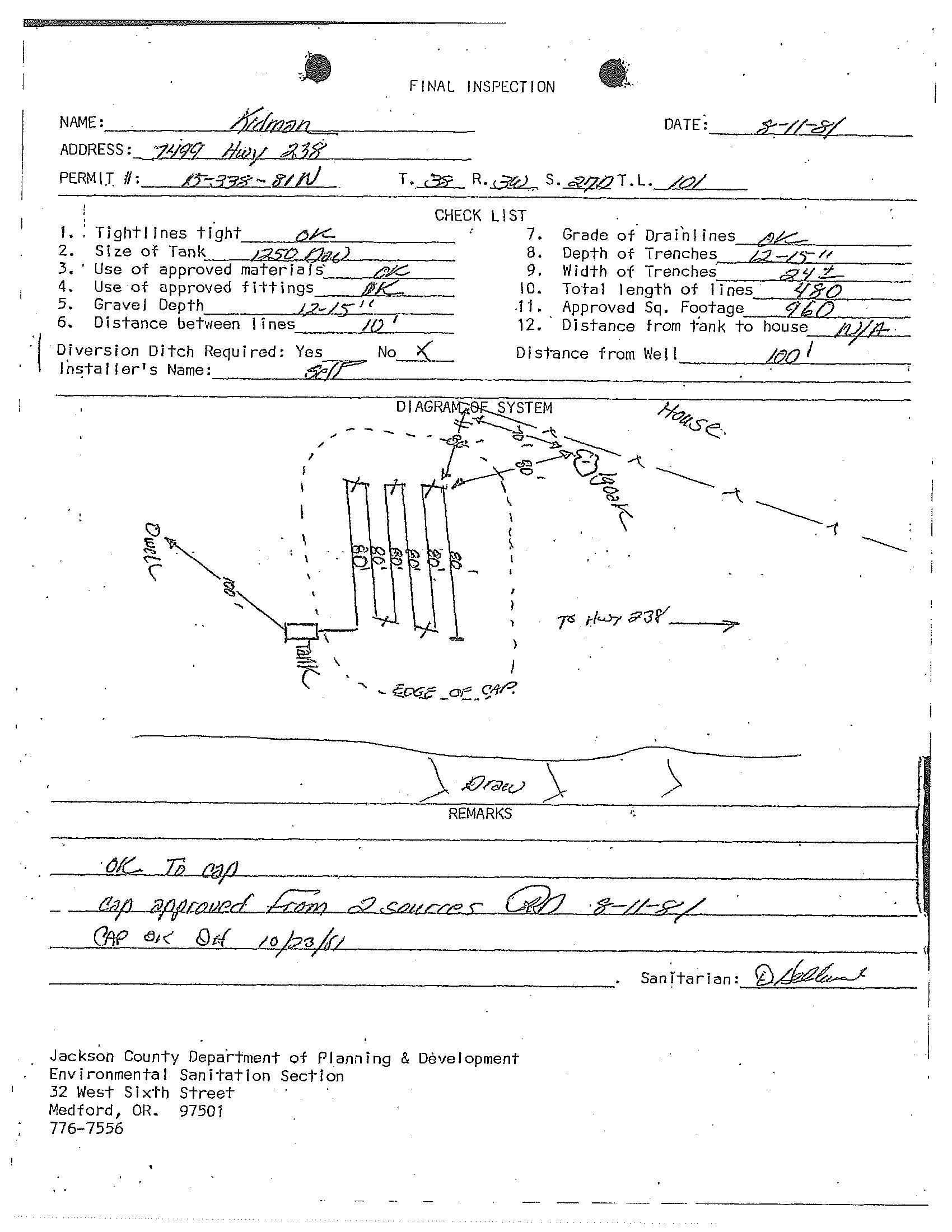
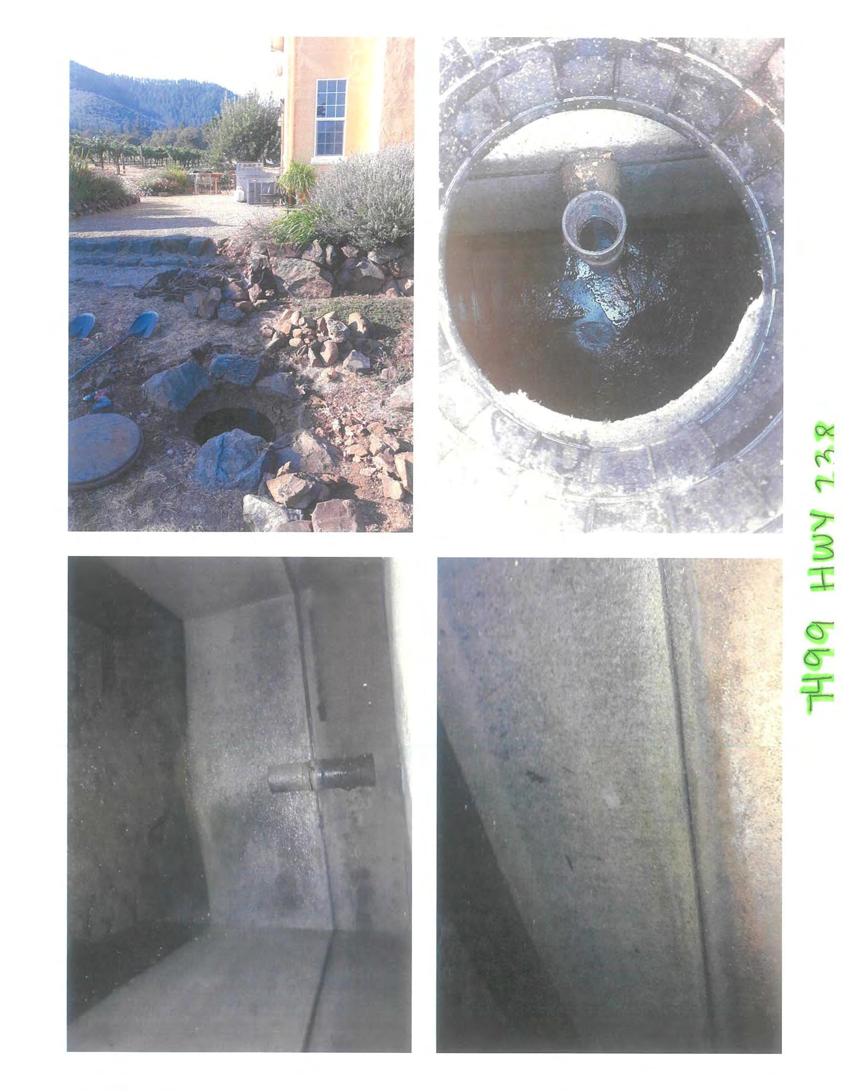
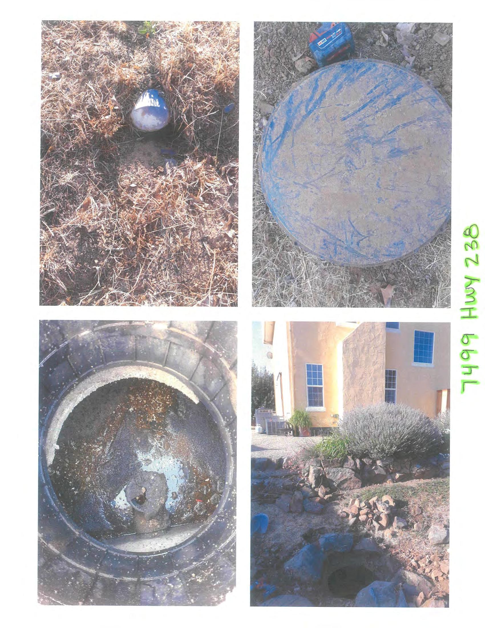
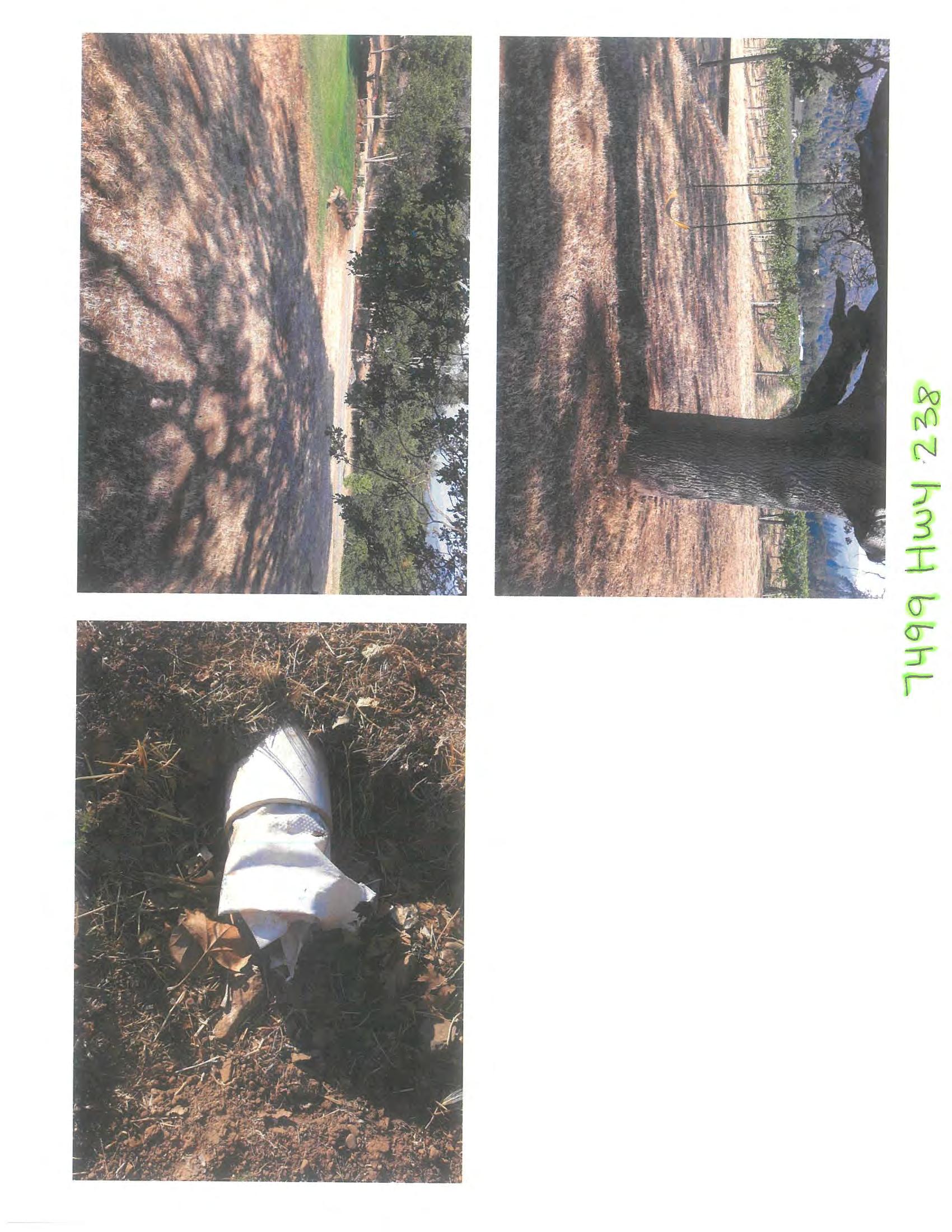
Sanitation: Standard septic system
Electric/Power: 200-amp service for the home and separate 200 amp service for the shop
No warranty or representation, express or implied, is made as to the accuracy of the information contained herein; all information contained herein is subject to change, errors, and omission and is subject to your independent verification. John L. Scott/Martin Outdoor Property Group assumes no liability for inaccuracy contained herein. The information contained in and transmitted with this communication is strictly confidential, is intended only for the use of the intended recipient, and is the property of the Sender or its affiliates and subsidiaries. If you are not the intended recipient, you are hereby notified that any use of the information contained in or transmitted with the communication or dissemination, distribution, or copying of this communication is strictly prohibited by law. If you have received this communication in error, please immediately return this communication to the sender and delete the original message and any copy of it in your possession.
ExhibitA
JACKSON
MEDFORD, OR 97501
STATEMENT OF TAX ACCOUNT
JACKSON COUNTY TAX COLLECTOR
MEDFORD, OR 97501
ExhibitB
(PropertyMaps)
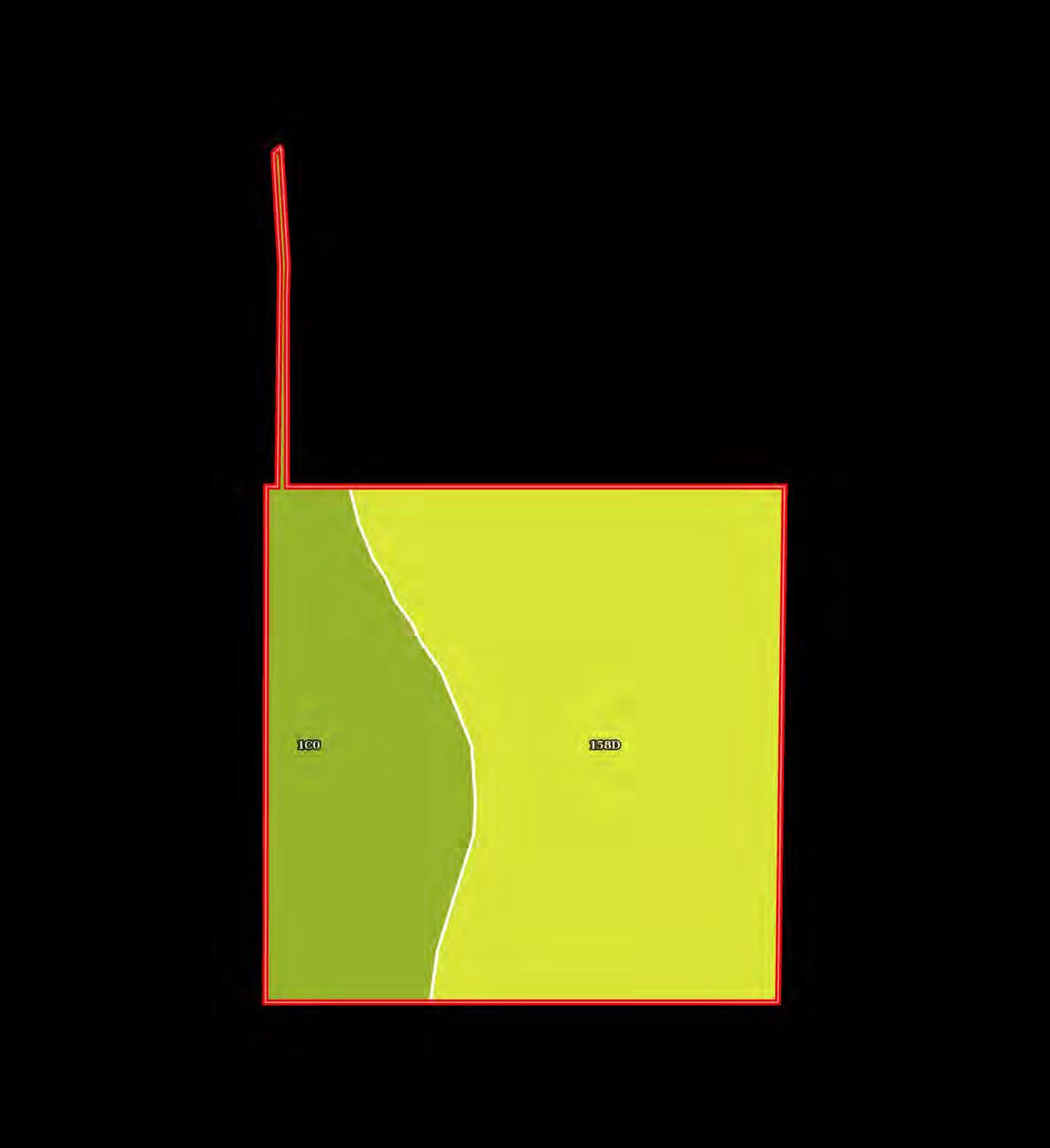
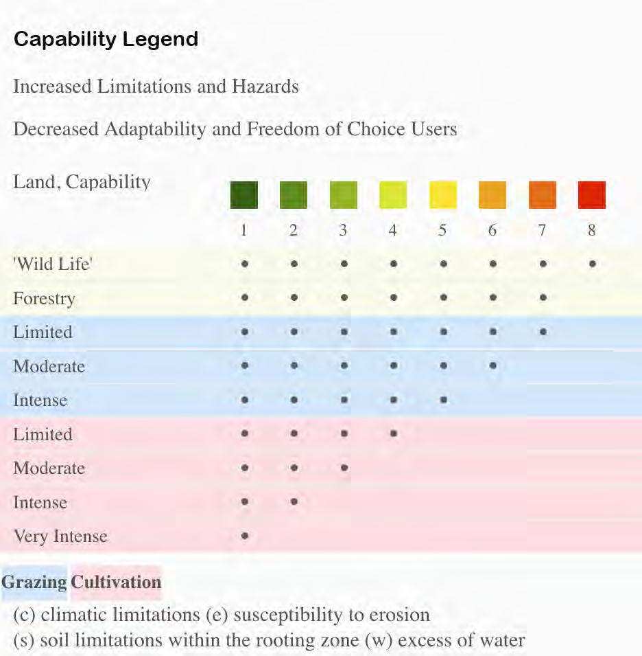
Boundary Wetlands Riparian Stream, Intermittent River/Creek Water Body
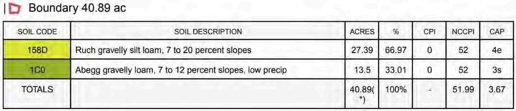
| Boundary 40.89 ac
(*) Total acres may differ in the second decimal compared to the sum of each acreage soil. This is due to a round error because we only show the acres of each soil with two decimal.
(PreliminaryTitleReport)
1225 Crater Lake Avenue, Suite 101
Phn - (541)779-7250
Fax - (866)400-2250
Order No.: 7161-4219014
November 08, 2024
FOR QUESTIONS REGARDING YOUR CLOSING, PLEASE CONTACT: LISA TATE, Escrow Officer/Closer
Phone: (541)779-7250x5435 - Fax: (866)839-7125- Email:LTate@firstam.com First American Title Insurance Company 1225 Crater Lake Avenue, Suite 101, Medford, OR 97504
FOR ALL QUESTIONS REGARDING THIS PRELIMINARY REPORT, PLEASE CONTACT: Gary Laney, Title Officer
Phone: (541)779-7250 - Email: glaney@firstam.com
Preliminary Title Report
This report is for the exclusive use of the parties herein shown and is preliminary to the issuance of a title insurance policy and shall become void unless a policy is issued, and the full premium paid.
Please be advised that any provision contained in this document, or in a document that is attached, linked or referenced in this document, that under applicable law illegally discriminates against a class of individuals based upon personal characteristics such as race, color, religion, sex, sexual orientation, gender identity, familial status, disability, national origin, or any other legally protected class, is illegal and unenforceable by law.
Situs Address as disclosed on Jackson County Tax Roll: 7499 Highway 238, Jacksonville, OR 97530
We are prepared to issue Title Insurance Policy or Policies of First American Title Insurance Company, a Nebraska Corporation in the form and amount shown above, insuring title to the following described land:
The land referred to in this report is described in Exhibit A attached hereto. and as of October 31, 2024 at 8:00 a.m., title to the fee simple estate is vested in:
Subject to the exceptions, exclusions, and stipulations which are ordinarily part of such Policy form and the following:
1. Taxes or assessments which are not shown as existing liens by the records of any taxing authority that levies taxes or assessments on real property or by the public records; proceedings by a public agency which may result in taxes or assessments, or notices of such proceedings, whether or not shown by the records of such agency or by the public records.
2. Facts, rights, interests or claims which are not shown by the public records but which could be ascertained by an inspection of the land or by making inquiry of persons in possession thereof.
3. Easements, or claims of easement, not shown by the public records; reservations or exceptions in patents or in Acts authorizing the issuance thereof; water rights, claims or title to water.
4. Any encroachment (of existing improvements located on the subject land onto adjoining land or of existing improvements located on adjoining land onto the subject land), encumbrance, violation, variation, or adverse circumstance affecting the title that would be disclosed by an accurate and complete land survey of the subject land.
5. Any lien, or right to a lien, for services, labor, material, equipment rental or workers compensation heretofore or hereafter furnished, imposed by law and not shown by the public records.
The exceptions to coverage 1-5 inclusive as set forth above will remain on any subsequently issued Standard Coverage Title Insurance Policy.
In order to remove these exceptions to coverage in the issuance of an Extended Coverage Policy the following items are required to be furnished to the Company; additional exceptions to coverage may be added upon review of such information:
A. Survey or alternative acceptable to the company
B. Affidavit regarding possession
C. Proof that there is no new construction or remodeling of any improvement located on the premises. In the event of new construction or remodeling the following is required:
i. Satisfactory evidence that no construction liens will be filed; or
ii. Adequate security to protect against actual or potential construction liens;
iii. Payment of additional premiums as required by the Industry Rate Filing approved by the Insurance Division of the State of Oregon
6. Water rights, claims or title to water, whether or not shown by the public record.
7. Any claim to (a) ownership of or rights to minerals and similar substances, including but not limited to ores, metals, coal, lignite, oil, gas, uranium, clay, rock, sand, and gravel located in, on, or under the Land or produced from the Land, whether such ownership or rights arise by lease, grant, exception, conveyance, reservation, or otherwise; and (b) any rights, privileges, immunities, rights of way, and easements associated therewith or appurtenant thereto, whether or not the interests or rights excepted in (a) or (b) appear in the Public Records.
8. Taxes for the year 2024-2025 Tax Amount $ 3,742.52
Unpaid Balance: $ 3,742.52 , plus interest and penalties, if any Code No.: 49-46
Map & Tax Lot No.: 383W27D 101
Property ID No.: 1-064204-3
9. Taxes for the year 2024-2025
Tax Amount
Unpaid Balance:
$ 18.99
$ 18.99 , plus interest and penalties, if any Code No.: 49-16
Map & Tax Lot No.: 383W27A 2504
Property ID No.: 1-047416-3
10. The assessment roll and the tax roll disclose that the within described premises were specially zoned or classified for Farm use. If the land has become or becomes disqualified for such use under the statute, an additional tax or penalty may be imposed.
11. The effect of the herein described property being within the boundaries of the Applegate Valley Irrigation District, organized pursuant to and with the powers vested in such irrigation district by virtue of the laws of the State of Oregon, as proclaimed and declared by Proclamation of the County Court of the State of Oregon, for the County of Josephine, recorded as Document No. 68-12013, Official Records of Jackson County, Oregon.
12. The rights of the public in and to that portion of the premises herein described lying within the limits of streets, roads and highways.
13. Easement, including terms and provisions contained therein:
14. Right of way, including terms and conditions contained therein: Granted to: The Pacific Telephone and Telegraph Company For: Right of way for pole, tower and wire line facilities, and rights in connection therewith
Recording Information: Volume 413, Page 11 and Volume 413, Page 12 (Affects Parcel 2 and 3)
15. Easement, including terms and provisions contained therein: Recording Information: June 26, 1972 as Document No. 72-08233 (Affects Parcels 2 and 3)
For: road purposes
16. Easement, including terms and provisions contained therein: Recording Information: June 25, 1979 as Document No. 79-12907 (Affects the West 60 feet of Parcel 1 and all of Parcels 2 and 3)
For: ingress and egress
17. Easement, including terms and provisions contained therein: Recording Information: Document No. 81-21754
In Favor of: Pacific Power and Light Company
For: transmission and distribution of electricity
18. Easement Agreement and the terms and conditions thereof:
Between:
And: Anthony Barbara Roth
Recording Information: April 12, 2005 as Document No. 2005-020266 (Affects Parcel 3)
19. Easement Agreement and the terms and conditions thereof:
Between: , husband and wife
And: Richard W. Smandra and Diane Smandra, husband and wife
Recording Information: August 18, 2017 as Document No. 2017-028529
20. Deed of Trust and the terms and conditions thereof.
Grantor/Trustor: , as tenants by the entirety.
Grantee/Beneficiary: Mortgage Electronic Registration Systems, Inc., ''MERS'' solely as a nominee for Umpqua Bank, its successors and assigns
Trustee: First American Title Insurance Company Amount: $1,260,000.00
Recorded: September 20, 2021
Recording Information: Document No. 2021-039911
21. Unrecorded leases or periodic tenancies, if any.
22. This Preliminary Title Report does not include a search for Financing Statements filed in the Office of the Secretary of State, or in a County other than the County wherein the premises are situated and no liability is assumed if a Financing Statement is recorded in the Office of the County Clerk (Recorder) covering timber, fixtures or crops, on the premises wherein the lands are described other than by metes and bounds or under the rectangular survey system.
- END OF EXCEPTIONS -
NOTE: We find no matters of public record against TBD that will take priority over any trust deed, mortgage or other security instrument given to purchase the subject real property as established by ORS 18.165.
NOTE: According to the public record, the following deed(s) affecting the property herein described have been recorded within 24 months of the effective date of this report: NONE
THANK YOU FOR CHOOSING FIRST AMERICAN TITLE! WE KNOW YOU HAVE A CHOICE!
GARY LANEY TITLE OFFICER
RECORDING INFORMATION
As of March 1, 2023 Jackson County recording fees are as follows:
Recording Fees: $ 104.00 All Deeds 1st page
$ 5.00 All Deeds for each additional page
$ 121.00 All Other Document Types
$ 5.00 All Other Document Types for each additional page
Additional Fees will be imposed by the County Clerk of a document presented for recording fails to meet the requirements established by ORS Chapter 205.
cc: Lender To Be Determined ,
cc: Chris Martin, Land Leader NW, LLC
3811 Crater Lake Highway, Medford, OR 97504
cc: , Additional Information Required ,
Exhibit "A"
Real property in the County of Jackson, State of Oregon, described as follows:
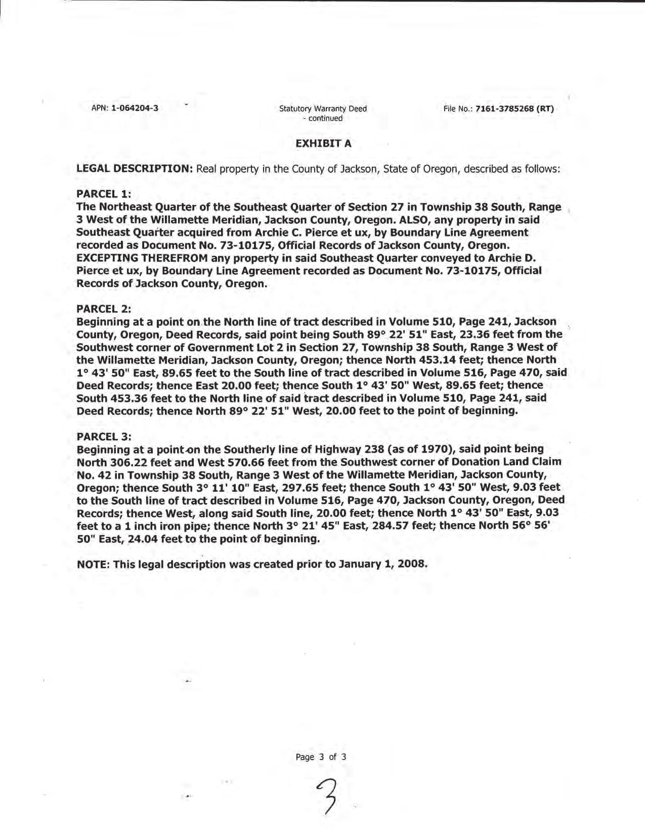
PARCEL 1:
THE NORTHEAST QUARTER OF THE SOUTHEAST QUARTER OF SECTION 27 IN TOWNSHIP 38 SOUTH, RANGE 3 WEST OF THE WILLAMETTE MERIDIAN, JACKSON COUNTY, OREGON. ALSO, ANY PROPERTY IN SAID SOUTHEAST QUARTER ACQUIRED FROM ARCHIE C. PIERCE ET UX, BY BOUNDARY LINE AGREEMENT RECORDED AS DOCUMENT NO. 73-10175, OFFICIAL RECORDS OF JACKSON COUNTY, OREGON. EXCEPTING THEREFROM ANY PROPERTY IN SAID SOUTHEAST QUARTER CONVEYED TO ARCHIE D. PIERCE ET UX, BY BOUNDARY LINE AGREEMENT RECORDED AS DOCUMENT NO. 73-10175, OFFICIAL RECORDS OF JACKSON COUNTY, OREGON.
PARCEL 2:
BEGINNING AT A POINT ON THE NORTH LINE OF TRACT DESCRIBED IN VOLUME 510, PAGE 241, JACKSON COUNTY, OREGON, DEED RECORDS, SAID POINT BEING SOUTH 89° 22' 51" EAST, 23.36 FEET FROM THE SOUTHWEST CORNER OF GOVERNMENT LOT 2 IN SECTION 27, TOWNSHIP 38 SOUTH, RANGE 3 WEST OF THE WILLAMETTE MERIDIAN, JACKSON COUNTY, OREGON; THENCE NORTH 453.14 FEET; THENCE NORTH 1° 43' 50" EAST, 89.65 FEET TO THE SOUTH LINE OF TRACT DESCRIBED IN VOLUME 516, PAGE 470, SAID DEED RECORDS; THENCE EAST 20.00 FEET; THENCE SOUTH 1° 43' 50" WEST, 89.65 FEET; THENCE SOUTH 453.36 FEET TO THE NORTH LINE OF SAID TRACT DESCRIBED IN VOLUME 510, PAGE 241, SAID DEED RECORDS; THENCE NORTH 89° 22' 51" WEST, 20.00 FEET TO THE POINT OF BEGINNING.
PARCEL 3:
BEGINNING AT A POINT ON THE SOUTHERLY LINE OF HIGHWAY 238 (AS OF 1970), SAID POINT BEING NORTH 306.22 FEET AND WEST 570.66 FEET FROM THE SOUTHWEST CORNER OF DONATION LAND CLAIM NO. 42 IN TOWNSHIP 38 SOUTH, RANGE 3 WEST OF THE WILLAMETTE MERIDIAN, JACKSON COUNTY, OREGON; THENCE SOUTH 3° 11' 10" EAST, 297.65 FEET; THENCE SOUTH 1° 43' 50" WEST, 9.03 FEET TO THE SOUTH LINE OF TRACT DESCRIBED IN VOLUME 516, PAGE 470, JACKSON COUNTY, OREGON, DEED RECORDS; THENCE WEST, ALONG SAID SOUTH LINE, 20.00 FEET; THENCE NORTH 1° 43' 50" EAST, 9.03 FEET TO A 1 INCH IRON PIPE; THENCE NORTH 3° 21' 45" EAST, 284.57 FEET; THENCE NORTH 56° 56' 50" EAST, 24.04 FEET TO THE POINT OF BEGINNING.
NOTE: This Legal Description was created prior to January 01, 2008.
FirstAmericanTitleInsuranceCompany
SCHEDULE OF EXCLUSIONS FROM COVERAGE ALTA LOAN POLICY (07/01/21)
The following matters are excluded from the coverage of this policy, and the Company will not pay loss or damage, costs, attorneys’ fees, or expenses that arise by reason of:
1. a. any law, ordinance, permit, or governmental regulation (including those relating to building and zoning) that restricts, regulates, prohibits, or relates to:
i the occupancy, use, or enjoyment of the Land;
ii the character, dimensions, or location of any improvement erected on the Land;
iii the subdivision of land; or
iv environmental remediation or protection.
b. any governmental forfeiture, police, regulatory, or national security power.
c. the effect of a violation or enforcement of any matter excluded under Exclusion 1.a. or 1.b.
Exclusion 1 does not modify or limit the coverage provided under Covered Risk 5 or 6.
2. Any power of eminent domain. Exclusion 2 does not modify or limit the coverage provided under Covered Risk 7.
3. Any defect, lien, encumbrance, adverse claim, or other matter:
a. created, suffered, assumed, or agreed to by the Insured Claimant;
b not Known to the Company, not recorded in the Public Records at the Date of Policy, but Known to the Insured Claimant and not disclosed in writing to the Company by the Insured Claimant prior to the date the Insured Claimant became an Insured under this policy;
c resulting in no loss or damage to the Insured Claimant;
d attaching or created subsequent to the Date of Policy (Exclusion 3.d. does not modify or limit the coverage provided under Covered Risk 11, 13, or 14); or
e. resulting in loss or damage that would not have been sustained if consideration sufficient to qualify the Insured named in Schedule A as a bona fide purchaser or encumbrancer had been given for the Insured Mortgage at the Date of Policy.
4. Unenforceability of the lien of the Insured Mortgage because of the inability or failure of an Insured to comply with applicable doing-business law.
5. Invalidity or unenforceability of the lien of the Insured Mortgage that arises out of the transaction evidenced by the Insured Mortgage and is based upon usury law or Consumer Protection Law.
6. Any claim, by reason of the operation of federal bankruptcy, state insolvency, or similar creditors’ rights law, that the transaction creating the lien of the Insured Mortgage is a:
a fraudulent conveyance or fraudulent transfer;
b voidable transfer under the Uniform Voidable Transactions Act; or
c. preferential transfer:
i. to the extent the Insured Mortgage is not a transfer made as a contemporaneous exchange for new value; or
ii. for any other reason not stated in Covered Risk 13.b.
7. Any claim of a PACA-PSA Trust. Exclusion 7 does not modify or limit the coverage provided under Covered Risk 8.
8. Any lien on the Title for real estate taxes or assessments imposed by a governmental authority and created or attaching between the Date of Policy and the date of recording of the Insured Mortgage in the Public Records. Exclusion 8 does not modify or limit the coverage provided under Covered Risk 2.b. or 11.b.
9. Any discrepancy in the quantity of the area, square footage, or acreage of the Land or of any improvement to the Land.
ALTA OWNER’S POLICY (07/01/21)
The following matters are excluded from the coverage of this policy, and the Company will not pay loss or damage, costs, attorneys’ fees, or expenses that arise by reason of:
1. a any law, ordinance, permit, or governmental regulation (including those relating to building and zoning) that restricts, regulates, prohibits, or relates to:
i. the occupancy, use, or enjoyment of the Land;
ii. the character, dimensions, or location of any improvement on the Land;
iii. the subdivision of land; or
iv. environmental remediation or protection.
b. any governmental forfeiture, police, regulatory, or national security power.
c. the effect of a violation or enforcement of any matter excluded under Exclusion 1.a. or 1.b.
Exclusion 1 does not modify or limit the coverage provided under Covered Risk 5 or 6.
2. Any power of eminent domain. Exclusion 2 does not modify or limit the coverage provided under Covered Risk 7.
3. Any defect, lien, encumbrance, adverse claim, or other matter:
a created, suffered, assumed, or agreed to by the Insured Claimant;
b. not Known to the Company, not recorded in the Public Records at the Date of Policy, but Known to the Insured Claimant and not disclosed in writing to the Company by the Insured Claimant prior to the date the Insured Claimant became an Insured under this policy;
c. resulting in no loss or damage to the Insured Claimant;
d. attaching or created subsequent to the Date of Policy (Exclusion 3.d. does not modify or limit the coverage provided under Covered Risk 9 or 10); or
e. resulting in loss or damage that would not have been sustained if consideration sufficient to qualify the Insured named in Schedule A as a bona fide purchaser had been given for the Title at the Date of Policy.
4. Any claim, by reason of the operation of federal bankruptcy, state insolvency, or similar creditors’ rights law, that the transaction vesting the Title as shown in Schedule A is a:
a fraudulent conveyance or fraudulent transfer;
b voidable transfer under the Uniform Voidable Transactions Act; or
c. preferential transfer:
i. to the extent the instrument of transfer vesting the Title as shown in Schedule A is not a transfer made as a contemporaneous exchange for new value; or ii. for any other reason not stated in Covered Risk 9.b.
5. Any claim of a PACA-PSA Trust. Exclusion 5 does not modify or limit the coverage provided under Covered Risk 8.
6. Any lien on the Title for real estate taxes or assessments imposed or collected by a governmental authority that becomes due and payable after the Date of Policy. Exclusion 6 does not modify or limit the coverage provided under Covered Risk 2.b.
7. Any discrepancy in the quantity of the area, square footage, or acreage of the Land or of any improvement to the Land.
SCHEDULE OF STANDARD EXCEPTIONS
1. Taxes or assessments which are not shown as existing liens by the records of any taxing authority that levies taxes or assessments on real property or by the public records; proceedings by a public agency which may result in taxes or assessments, or notices of such proceedings, whether or not shown by the records of such agency or by the public records.
2. Facts, rights, interests or claims which are not shown by the public records but which could be ascertained by an inspection of the land or by making inquiry of persons in possession thereof.
3. Easements, or claims of easement, not shown by the public records; reservations or exceptions in patents or in Acts authorizing the issuance thereof; water rights, claims or title to water.
4. Any encroachment (of existing improvements located on the subject land onto adjoining land or of existing improvements located on adjoining land onto the subject land), encumbrance, violation, variation, or adverse circumstance affecting the title that would be disclosed by an accurate and complete land survey of the subject land.
5. Any lien" or right to a lien, for services, labor, material, equipment rental or workers compensation heretofore or hereafter furnished, imposed by law and not shown by the public records.
NOTE: A SPECIMEN COPY OF THE POLICY FORM (OR FORMS) WILL BE FURNISHED UPON REQUEST Rev. 07-01-21
Effective: October 1, 2019
Notice Last Updated: January 1, 2022
Privacy Notice
This Privacy Notice describes how First American Financial Corporation and its subsidiaries and affiliates (together referred to as “First American,” “we,” “us,” or “our”) collect, use, store, and share your information with the exception that a subsidiary or affiliate has their own privacy policy, that policy governs. This Privacy Notice applies to information we receive from you offline only, as well as from third parties, when you interact with us and/or use and access our services and products (“Products”). For more information about our privacy practices, including our online practices, please visit https://www.firstam.com/privacy-policy/. The practices described in this Privacy Notice are subject to applicable laws in the places in which we operate.
What Type Of Information Do We Collect About You? We collect a variety of categories of information about you. To learn more about the categories of information we collect, please visit https://www.firstam.com/privacy-policy/.
How Do We Collect Your Information? We collect your information: (1) directly from you; (2) automatically when you interact with us; and (3) from third parties, including business parties and affiliates.
How Do We Use Your Information? We may use your information in a variety of ways, including but not limited to providing the services you have requested, fulfilling your transactions, comply with relevant laws and our policies, and handling a claim. To learn more about how we may use your information, please visit https://www.firstam.com/privacypolicy/.
How Do We Share Your Information? We do not sell your personal information. We only share your information, including to subsidiaries, affiliates, and to unaffiliated third parties: (1) with your consent; (2) in a business transfer; (3) to service providers; and (4) for legal process and protection. To learn more about how we share your information, please visit https://www.firstam.com/privacy-policy/.
How Do We Store and Protect Your Information? The security of your information is important to us. That is why we take commercially reasonable steps to make sure your information is protected. We use our best efforts to maintain commercially reasonable technical, organizational, and physical safeguards, consistent with applicable law, to protect your information.
How Long Do We Keep Your Information? We keep your information for as long as necessary in accordance with the purpose for which it was collected, our business needs, and our legal and regulatory obligations.
Your Choices We provide you the ability to exercise certain controls and choices regarding our collection, use, storage, and sharing of your information. You can learn more about your choices by visiting https://www.firstam.com/privacypolicy/.
International Jurisdictions: Our Products are offered in the United States of America (US), and are subject to US federal, state, and local law. If you are accessing the Products from another country, please be advised that you may be transferring your information to us in the US, and you consent to that transfer and use of your information in accordance with this Privacy Notice. You also agree to abide by the applicable laws of applicable US federal, state, and local laws concerning your use of the Products, and your agreements with us.
We may change this Privacy Notice from time to time. Any and all changes to this Privacy Notice will be reflected on this page, and where appropriate provided in person or by another electronic method. YOUR CONTINUED USE, ACCESS, OR INTERACTION WITH OUR PRODUCTS OR YOUR CONTINUED COMMUNICATIONS WITH US AFTER THIS NOTICE HAS BEEN PROVIDED TO YOU WILL REPRESENT THAT YOU HAVE READ AND UNDERSTOOD THIS PRIVACY NOTICE.
Contact Us dataprivacy@firstam.com or toll free at 1-866-718-0097.
For California Residents
If you are a California resident, you may have certain rights under California law, including but not limited to the California Consumer Privacy Act of 2018 (“CCPA”). All phrases used in this section shall have the same meaning as those phrases are used under California law, including the CCPA.
Right to Know. You have a right to request that we disclose the following information to you: (1) the categories of personal information we have collected about or from you; (2) the categories of sources from which the personal information was collected; (3) the business or commercial purpose for such collection and/or disclosure; (4) the categories of third parties with whom we have shared your personal information; and (5) the specific pieces of your personal information we have collected. To submit a verified request for this information, go to our online privacy policy at www.firstam.com/privacy-policy to submit your request or call toll-free at 1-866-718-0097. You may also designate an authorized agent to submit a request on your behalf by going to our online privacy policy at www.firstam.com/privacypolicy to submit your request or by calling toll-free at 1-866-718-0097
Right of Deletion. You also have a right to request that we delete the personal information we have collected from and about you. This right is subject to certain exceptions available under the CCPA and other applicable law. To submit a verified request for deletion, go to our online privacy policy at www.firstam.com/privacy-policy to submit your request or call toll-free at 1-866-718-0097. You may also designate an authorized agent to submit a request on your behalf by going to our online privacy policy at www.firstam.com/privacy-policy to submit your request or by calling toll-free at 1-866-7180097.
Verification Process. For either a request to know or delete, we will verify your identity before responding to your request. To verify your identity, we will generally match the identifying information provided in your request with the information we have on file about you. Depending on the sensitivity of the information requested, we may also utilize more stringent verification methods to verify your identity, including but not limited to requesting additional information from you and/or requiring you to sign a declaration under penalty of perjury.
Notice of Sale. We do not sell California resident information, nor have we sold California resident information in the past 12 months. To the extent any First American affiliated entity has a different practice, it will be stated in the applicable privacy policy. We have no actual knowledge of selling the information of minors under the age of 16.
Right of Non-Discrimination. You have a right to exercise your rights under California law, including under the CCPA, without suffering discrimination. Accordingly, First American will not discriminate against you in any way if you choose to exercise your rights under the CCPA.
Notice of Collection. To learn more about the categories of personal information we have collected about California residents over the last 12 months, please see “What Information Do We Collect About You” in https://www.firstam.com/privacy-policy. To learn about the sources from which we have collected that information, the business and commercial purpose for its collection, and the categories of third parties with whom we have shared that information, please see “How Do We Collect Your Information”, “How Do We Use Your Information”, and “How Do We Share Your Information” in https://www.firstam.com/privacy-policy.
Notice of Sale. We have not sold the personal information of California residents in the past 12 months.
Notice of Disclosure. To learn more about the categories of personal information we may have disclosed about California residents in the past 12 months, please see “How Do We Use Your Information” and “How Do We Share Your Information” in https://www.firstam.com/privacy-policy.
Neilson Research Corporation received 1 sample(s) on 7/30/2021 for the analyses presented in the following report.
The results relate only to the parameters tested or to the sample as received by the laboratory. This report shall not be reproduced except in full, without the written approval of Neilson Research Corporation. If you have any questions regarding these test results, please feel free to call.
Sincerely,
Neilson Research Corporation
Tamra Schmedemann Senior Project Manager
245 S Grape St
Medford, OR 97501
CLIENT: Hydro-Flow Inc
Project: 7499 Hwy 238
Neilson Research Corporation 245 S Grape St Medford, OR 97501
TEL: (541) 770-5678 FAX: (541) 770-2901
Website: www.nrclabs.com
Case Narrative
Date: WO#:
21071479
8/6/2021
The analyses were performed according to the guidelines in the Neilson Research Corporation Quality Assurance Program. This report contains analytical results for the sample(s) as received by the laboratory.
Neilson Research Corporation certifies that this report is in compliance with the requirements of NELAP. No unusual difficulties were experienced during analysis of this batch except as noted below or qualified with data flags on the reports.