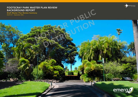
FOOTSCRAY PARK MASTER PLAN REVIEW BACKGROUND REPORT
C I L B U P N R O I O T F U T B I O N ISTR D
Draft Master Plan Review Summary Draft V3.1 - September 2026
Maribyrnong City Council Footscray Park Draft Master Plan - Summary Background Report | i
Acknowledgement of Country Council is proud to represent a municipality filled with important and significant Aboriginal history. It acknowledges the Traditional Custodians of this land, the Kulin Nation, and acknowledges the rich culture and considerable contributions Aboriginal and Torres Strait Islander Peoples have made and continue to make to this City. We recognise and celebrate the enduring connection of First Nations peoples to the lands, waters, and skies. We are committed to working in partnership with First Nations communities to foster a future grounded in equity, respect, and shared prosperity. Footscray Park sits within the traditional lands of the Kulin Nation and its connection to the Maribyrnong River reflects deep cultural significance, including as a place of gathering and refuge.
Disclaimer This Draft Master Plan Background Report has been prepared in good faith by Emerge Associates for Maribyrnong City Council, in collaboration with Council officers and the Community Advisory Committee, to support the Footscray Park Master Plan Review. The information contained in this document is a summary only and has been informed by a review of existing plans, strategies and policy documents, available data and research, stakeholder and community consultation undertaken to date, and professional judgement. Some information has also been derived from anecdotal evidence and secondary sources and should be interpreted accordingly. The content of this report reflects conditions, information and understanding at the time of preparation and may not account for events, decisions or circumstances that occur after the stated date. The Draft Master Plan Background Report is exploratory in nature and is intended to inform discussion, testing and refinement of future Master Plan directions. All concepts, opportunities, diagrams, illustrative plans, images, artisitic impressions and recommendations contained in this document are indicative only and are not intended to represent final outcomes. Any future actions will be subject to further technical investigation, detailed design, statutory approvals, funding considerations and ongoing consultation. This document has been prepared solely for the use of Maribyrnong City Council for the purposes for which it was commissioned and in accordance with the Terms of Engagement. It should not be relied upon by any other party. Emerge Associates, its employees and consultants accept no responsibility or liability for any loss, damage or claim arising from the use of this document by third parties. Unauthorised use, reproduction or distribution of this document, in whole or in part, is prohibited.
Cover image by Finn Davies (Aged 10)
Maribyrnong City Council Footscray Park Draft Master Plan - Summary Background Report | ii
CONTENTS
Section 1: Introduction ............................................................01 Section 2: Site Context and Analysis........................................05 Section 3: Issues and Opportunities.........................................16
Image: Iconic Footscray Park sign from Ballarat Road
Maribyrnong City Council Footscray Park Draft Master Plan - Summary Background Report | 1
SECTION 01: INTRODUCTION
Footscray Park view towards the heritage gardens
Maribyrnong City Council Footscray Park Draft Master Plan - Summary Background Report | 2
INTRODUCTION This Draft Master Plan Review has been prepared following detailed site investigations, technical analysis and extensive community and stakeholder engagement to help guide the future of Footscray Park, one of Maribyrnong’s most significant and valued open spaces. Located on the southern bank of the Maribyrnong River approximately 8.3 kilometres from Melbourne’s CBD, the 22hectare park serves the municipality and broader region as a place for sport, informal recreation, heritage appreciation, environmental connection and everyday community gathering. Footscray Park sits on the traditional lands of the Wurundjeri Woi Wurrung People and within an area of Aboriginal Cultural Heritage Sensitivity associated with the Maribyrnong River corridor. The park also holds recognised state heritage significance, with the gardens permanently reserved since 1911 and included on the Victorian Heritage Register. These values require careful consideration of cultural heritage, statutory obligations and the long-term stewardship of the park’s significant landscape character. Community connection and stewardship are also central to the future of Footscray Park. An established Community Advisory Committee, active Friends groups, sporting clubs and local stakeholders bring deep place knowledge, strong advocacy and high expectations for the park’s future. First Nations voices, alongside broader community input, have played an important role in shaping directions that are both ambitious and achievable, while grounded in the park’s unique identity and community value. This Draft Master Plan sets out how Footscray Park will be planned, managed and invested in over the next ten years. It has been developed through technical assessment, community and stakeholder engagement, and strategic review. The plan comes at a critical time. The Maribyrnong municipality's population is forecast to grow by more than 51% between 2026 and 2051. The park is already under pressure from ageing infrastructure, the impact of the 2022 flood events, and growing community expectations around active living, heritage, ecology, safety and access. A clear, practical and well-governed response is needed. At the same time, there is real opportunity. The Edwardian heritage gardens, expansive riverfront setting, multipurpose lawns, iconic water features and strong community connections make Footscray Park an irreplaceable civic asset. With thoughtful investment and careful management, it can continue to serve future generations of Maribyrnong residents as a welcoming, resilient and culturally meaningful public landscape.
About this Document This Summary Background Report is the first of two documents that together form the Footscray Park Draft Master Plan Review. It provides the summary evidence base, site analysis, technical findings and community engagement insights that have informed the preparation of the Draft Master Plan Review.
MARIBYRNONG CITY COUNCIL
FOOTSCRAY
155,006 ( 50.98%) by 2051
41,943 ( 60.85%) by 2051
The second document, the Draft Master Plan Report, builds directly on these findings to present the Vision, Design Framework and Directions for the park. Both documents should be read together for a complete picture of the Master Plan Review process and its outcomes.
Growth Trend: The Maribyrnong Municipality has a significant growth forecast, with Footscray leading the municipality’s growth.
Growth Trend: Footscray is identified as having the largest increase in the number of residents in the municipality.
PACKAGE 1 BACKGROUND REPORT The Background Report documents the summary evidence base for the Footscray Park Master Plan Review, bringing together technical assessments, strategic context, site analysis and community engagement findings to identify the key issues and opportunities that have shaped the directions of the Draft Master Plan.
WE ARE HERE
PACKAGE 2 DRAFT MASTER PLAN The Draft Master Plan Report sets out the Vision, Guiding Principles, Design Framework and Directions for Footscray Park, translating the findings of the Background Report into a clear, practical and community-informed plan to guide the park's future over the next ten years.
Growth Rate: Footscray is expected to see a sharp increase in population, with high-density development fuelling this growth, impacting existing open space.
Maribyrnong City Council Footscray Park Draft Master Plan - Summary Background Report | 3
Why Now?
Key Directions To assist navigation and implementation, the Master Plan organises the park into seven key areas, each with a distinct character, function and tailored design response.
1
The Riverfront and Boat Club: To be restored and activated as the leisure and movement spine of the park, working to build upon existing infrastructure and riparian revegetation. To also enhance respectful access to the Maribyrnong River edge with an improved shared path.
The primary actions investigated throughout this Draft Master Plan Review are wide-ranging, but they share a common purpose. Each one is aimed at continuing the process of bringing Footscray Park to life, creating a richer, more connected and welcoming place that gives people reason to explore, stay and enjoy.
3 The Western Lawn: To be maintained as the park’s most
Footscray Park already has the bones of something exceptional, shaped by its landscape, heritage and layers of past investment. What follows builds on that foundation, proposing new opportunities across the park’s landscape areas, from restored heritage gardens and nature-inspired play to improved river access, new walking loops, activated sporting precincts, event flexibility and quiet places for reflection and gathering.
flexible community space, enhanced for everyday recreation, informal play, community sport and appropriately scaled events, with clear reinstatement standards, and including the introduction of a new playspace integrated within the broader landscape setting and supported by complementary amenities.
The actions presented are not exhaustive, but they are purposeful. Together they are intended to unlock the park’s potential, address longstanding gaps and ensure that Footscray Park continues to serve its community in ways that are meaningful, equitable and enduring.
Henry Turner Reserve South: To be reinforced as the
2 park's dedicated precinct for organised sport, active
recreation and education, with facilities and connections appropriate to its active character.
4 The Heritage Gardens and Thomson Water Gardens: To be progressively restored and conserved as the historic and cultural heart of the park, with the Thomson Water Gardens rehabilitated and safely reopened as a heritage destination.
5 The Eastern Lawn: To be enhanced as a family-friendly community space with continued opportunity for use as community event space. To also enhance community amenities such as an upgraded playspace on the hillside, improved service amenities and stronger connections to the Ballarat Road Frontage and the broader pedestrian network.
6 The Community Park Gateway: To be improved as the
park’s primary arrival experience and community hub, creating a welcoming and accessible entry space with clearer orientation, upgraded paths, signage, seating, shade and landscape treatments that support gathering and everyday use.
7 The Ballarat Road Frontage: To create a strengthened civic and landscape edge that improves the park’s presentation to Ballarat Road and reinforces its heritage character. Improvements will focus on enhancing visibility, legibility and landscape quality, creating a more cohesive frontage and a stronger sense of identity for Footscray Park. Across all areas, the plan prioritises safety and inclusive access, expanded tree canopy, upgraded amenities and a clear framework for managing use that maximises public access and protects park character. First Nations voices, heritage conservation, climate resilience and shared community priorities are embedded throughout, not treated as additions.
The primary actions investigated throughout this Draft Master Plan include, but are not limited to, the following: Integrate Drew Walk back into the pedestrian network to reconnect the Heritage Gardens with the Maribyrnong River Trail. Deliver a high-quality, landscape-integrated replacement playspace and supporting amenities near the Western Lawn. Progressively restore the Heritage Gardens guided by a Conservation Management Plan. Strategically expand tree canopy and riparian revegetation along the river corridor.
This Master Plan Review comes at a critical time for Council and the community. Across the sector, councils are responding to familiar challenges: rapid growth and densification, competing land use demands, heightened expectations around accessibility and equity, and increasing urgency around biodiversity protection and climate resilience. These pressures are compounded by a shifting policy and funding environment, including changes to state planning guidance, evolving approaches to open space strategies, and increased scrutiny on investment justification, benefits and delivery. Localised risks within Maribyrnong, particularly flooding, urban heat and asset vulnerability along the river corridor, further emphasise the need for adaptive, resilient and practical open space planning. At the same time, this context presents clear opportunities. The Draft Master Plan Review explores how different areas of the park support a range of uses, from everyday sport and recreation and community activity to ecological restoration and heritage conservation. It can guide the protection, restoration and interpretation of valued heritage assets, such as the Thomson Water Gardens, while improving clarity, safety and connectivity across walking, cycling and vehicular networks. There are also opportunities to strengthen relationships with local institutions, schools, traders, Traditional Owners and community organisations, helping to embed Footscray Park more deeply within the social, cultural and economic fabric of the area.
DRAFT MASTER PLAN ZONES
Optimise and strengthen the carrying capacity of active recreation spaces to support community sport, informal recreation and everyday park use, balanced with the park’s landscape, environmental and heritage values. Improve the Boat Club precinct, including access, circulation, amenity and its relationship to the riverfront.
B A
Upgrade and complete the pedestrian and cycling network across the whole park. Improve amenities including toilets, seating, shade, signage and BBQ infrastructure.
C
Improve safety and connectivity across walking, cycling and vehicular networks. Create a sense of arrival from the north and south approaches and improve park navigation. Integrate climate-resilient design and water-sensitive urban design where possible across the park.
A D F
E G
A
Maribyrnong City Council Footscray Park Draft Master Plan - Summary Background Report | 4
ABOUT THE DRAFT MASTER PLAN REVIEW This Draft Master Plan Review has been prepared by Emerge Associates on behalf of Maribyrnong City Council to guide the longterm planning, management and enhancement of Footscray Park. The plan builds on the foundations of the Footscray Park Master Plan (2011), responding to over a decade of change, investment, community feedback and evolving strategic priorities. It reflects the outcomes of detailed technical investigations, stakeholder input and Phase 1 community engagement, while recognising the park’s important role as a regional open space destination, historic cultural landscape and valued everyday community asset. The Draft Master Plan Review adopts a balanced and measured approach focused on improving the park's functionality, accessibility, resilience and visitor experience while respecting its environmental, landscape and heritage values. It seeks to strengthen Footscray Park as a place for recreation, connection, relaxation and community life, and to activate it as a vibrant everyday destination that draws people in not just for events, but for the park itself and what it has to offer.
Purpose and Scope
Master Plan Review Process
Community and Stakeholder Engagement
This Draft Master Plan has been prepared to:
The review was structured across three stages running from October 2025 to November 2026.
Community and stakeholder engagement has played a central role in shaping this Draft Master Plan Review.
Establish a shared long-term vision and guiding principles for Footscray Park. Identify and prioritise capital works, landscape improvements and management actions across the park. Support heritage conservation and climate-resilient design. Clarify the roles, character and function of different areas within the park. Improve accessibility, connectivity and the quality of visitor experiences.
STAGE 1 Analysis and Vision October 2025 - February 2026 Understanding the challenges, opportunities, considerations and insights.
Define usage areas that balance activation with protection of park character and public access. Support coordinated decision-making, staged implementation and long-term shared-stewardship of the park. The plan applies to the full extent of Footscray Park, including the Riverfront and Boat Club, Heritage Gardens and Thomson Water Gardens, Western Lawn, Eastern Lawn, Henry Turner Reserve South, Community Park Gateway and Ballarat Road Frontage.
Engagement Phase 1 STAGE 2 Draft Master Plan March 2026 - September 2026 Developing the draft Master Plan for Footscray Park.
It also considers the park’s relationship with surrounding streets, adjoining reserves, institutions and the broader Maribyrnong River corridor.
WE ARE HERE
Engagement Phase 2 THE OBJECTIVE A Park for Everyone that continues to serve the local community and wider region as a welcoming, active, resilient and culturally significant public landscape, now and for generations to come.
STAGE 3 What the Master Plan Delivers A clear vision: A Park for Everyone, grounded in active living, landscape character, ecology, heritage and everyday community life. Nine guiding principles to inform future planning, management and investment decisions. A spatial framework across seven distinct zones that responds to the park’s varied character, functions and opportunities. Strategic directions to guide the ongoing improvement, connectivity and experience of the park. A governance framework that supports coordinated decision-making, transparency and long-term sharedstewardship. Alignment with Council’s statutory obligations, operational responsibilities and strategic directions for the park.
Final Master Plan and Publication October 2026 - November 2026 Finalising the Master Plan for Footscray Park.
Phase 1 engagement was undertaken between November 2025 and March 2026 and engaged a broad and diverse range of residents, park users and stakeholders through online surveys, reply-paid postcards, community drop-in sessions, Community Advisory Committee workshops and targeted stakeholder meetings. The engagement process generated significant community interest and participation, with approximately 810 pieces of feedback collected, 364 postcards returned, and the project webpage attracting 1,768 views from 896 individual visitors. The Footscray Park Master Plan Review Community Advisory Committee, comprising local residents, sporting clubs, cycling representatives, Friends groups, heritage advocates and Victoria University, has provided ongoing input throughout the project, helping to translate community priorities, values and aspirations into practical planning directions. Early engagement with the Wurundjeri Woi Wurrung Cultural Heritage Aboriginal Corporation has also informed the development of the Draft Master Plan and established a foundation for continued collaboration through future design and implementation stages.
Maribyrnong City Council Footscray Park Draft Master Plan - Summary Background Report | 5
SECTION 02: SITE CONTEXT AND ANALYSIS
Historical Photo of Footscray Park
Maribyrnong City Council Footscray Park Draft Master Plan - Summary Background Report | 6
SITE CONTEXT AND ANALYSIS
This section summarises the key findings captured during the technical assessments, community engagement and strategic review. Together, these findings form the evidence base for the vision, framework and design directions set out in the accompanying Draft Master Plan Report.
Strategic Context
Regional Context
Footscray Park sits within a layered and fast-changing strategic environment. More than 30 strategic documents, policies and plans were reviewed as part of the Master Plan Review, spanning local, state and national directions for open space, heritage, climate resilience, biodiversity and urban liveability.
Footscray Park sits within a strategically important and rapidly evolving precinct in Melbourne’s west, linking the Maribyrnong River corridor with surrounding education, health, recreation and residential destinations.
Policy Alignment The Draft Master Plan directly supports the Maribyrnong City Council Plan 2025-29 and the Maribyrnong 2040 Community Vision, particularly the objectives relating to Wellbeing and Safety, Environmental Sustainability, Thriving Community and Connected Community. State policy reinforces the importance of maximising the function and quality of existing open space in inner-urban areas experiencing population growth, where new land is scarce. Population Growth and Open Space Pressure Maribyrnong already has a constrained supply of public open space relative to its growing population, with provision currently estimated at approximately 31.2 square metres per person in 2026. If no substantial new public open space is delivered, this is projected to decline to around 20 to 21 square metres per person by 2051.
Its close relationship with Victoria University, the new Footscray Hospital, Quarry Park, Henry Turner Reserve, Footscray City High School, the Footscray Activity Centre and surrounding neighbourhoods reinforces its role as a key civic, recreational and landscape asset for both the municipality and broader region. Highly accessible by road, public transport, walking and cycling connections, the park plays an important role within the wider open space and movement network of Melbourne’s west. As surrounding development intensifies and the precinct continues to evolve, Footscray Park will become increasingly important as a place for recreation, respite, community connection, events and everyday outdoor activity.
Between 2026 and 2051, Maribyrnong’s population is forecast to grow by more than 51%, driven largely by higher-density residential development. Footscray is a major focus of this growth, with its population forecast to increase by more than 60% over the same period. Footscray Park is not peripheral to this pressure. It sits at the centre of it.
Key Strategic Findings Master Plan Alignment: The Master Plan must directly align with the Council Plan 2025-29 and Maribyrnong 2040 vision, with actions mapped to strategic outcomes. Informed by Past Plans: The 2011 Master Plan remains partially relevant but requires reassessment, prioritisation and updating. Future Planning: Population growth, participation demand, increasing density and cultural diversity will continue to intensify park use. Policy: Strong policy support exists for active living, biodiversity, climate resilience, heritage and health outcomes but is changing. Prioritisation: Competing demands on finite public open space require honest prioritisation and realistic staging.
PLANS Plan 01 - Regional Context (page 7) Plan 02 - Footscray Park Existing Conditions (page 8)
Footscray Park garden bed and stonework
Maribyrnong City Council Footscray Park Draft Master Plan - Summary Background Report | 7
PLAN 01: REGIONAL CONTEXT WHERE DOES FOOTSCRAY PARK SIT IN THE OPEN SPACE NETWORK
Maribyrnong City Council Footscray Park Draft Master Plan - Summary Background Report | 8
PLAN 02: FOOTSCRAY PARK EXISTING CONDITIONS WHAT THE PARK LOOKS LIKE TODAY
LEGEND 01 Henry Turner South Pavilion
QUARRY PARK
02 Tennis Courts 03 Maribyrnong Boulevard Entry 04 Footscray Boat Club
03
05 River Edge
04
06 Community Use Facilities 07 War Memorial FLEMINGTON RACECOURSE
13
08 Existing Public Toilet (Closed) 09 Community Shelter
05
10 BBQ Shelter and Toilets
HENRY TURNER SOUTH RESERVE
11 Ballarat Road Frontage 12 Thomson Water Gardens
13
02
13 Car Parks
01
14 Edwardian Gardens WESTERN LAWN
10
VICTORIA UNIVERSITY
12 06
09
05
EASTERN LAWN
14
07 08
11
13
FOOTSCRAY HOSPITAL
MELBOURNE CBD Ballarat Road
0
50
100m
Section
War Memorial
Heritage Gardens
Western Lawn
Western Lawn
Maribyrnong City Council Footscray Park Draft Master Plan - Summary Background Report | 9
SITE ANALYSIS AND EXISTING CONDITIONS The following sub-sections summarise the findings across six areas of technical analysis, identifying the key conditions, opportunities and constraints that have informed the development of the Draft Master Plan.
Landscape Character Footscray Park is structured around two broad landscape character areas, each with a distinct history, spatial logic and function.
Recreation and Activation The northern portion of the park runs along the Maribyrnong River and is defined by expansive, flat lawns. This area has a contemporary character, shaped largely by the 1998-2011 capital works program. It functions as a flexible, multipurpose space for events, informal recreation, community sport and river access. Henry Turner Reserve South, located along the western edge of the Footscray Park precinct, functions as the primary organised sport and active recreation area, supporting cricket, rugby and gridiron activities. The precinct also includes publicly accessible tennis courts and plays an important role in supporting both structured sport and broader community recreation opportunities. The Western Lawn is one of the park’s most heavily used and flexible open spaces, valued for its expansive and unencumbered character that supports a wide range of activities, including informal recreation, community sport, social connection, relaxation, events and everyday park use.
Eastern Lawn
Maribyrnong River
The Maribyrnong River Trail is the movement spine through this part of the park, generating high volumes of walking and cycling and connecting Footscray Park north and east to Henry Turner Reserve (North and South) and the broader river corridor.
Formal Gardens The southern portion is the historic heart of Footscray Park. This is where the Edwardian Heritage Gardens, the Thomson Water Gardens, terraced garden beds, axial pathways, pergolas, memorials and significant tree collections are concentrated. The formal layout reflects the original 1911 competition design and its significant expansion through the 1930s Depression-era Unemployment Relief Works. The character here is formal, layered and place-specific. The terraced design, the axial pathways descending toward the river, the stonework infrastructure and landmark features such as the Ballarat Road entry and the memorial obelisk are central to the park’s cultural significance and unique identity.
Footscray Park Upper Terrace
Footscray Park Heritage Gardens and Stonework
Maribyrnong City Council Footscray Park Draft Master Plan - Summary Background Report | 10
SITE ANALYSIS AND EXISTING CONDITIONS Topography and Views
Vegetation
Users and Programs
Furniture and Amenities
The park occupies a gently sloping river floodplain, with the upper garden terraces elevated above the river edge lawns.
The park contains a significant collection of heritage trees, including rare specimens reflecting the original Edwardian planting intent.
Key vistas include elevated lookouts from the heritage garden terraces toward the river and the city skyline.
Phoenix palms and Washingtonia palms along former path alignments mark historic layers of design that have since been removed or altered.
Organised sport, including rugby, football, cricket, soccer, rowing and paddle sports, is concentrated in Henry Turner Reserve South and the Western Lawn, and demand is growing.
The Ballarat Road approach frames an important arrival sequence, with significant heritage trees marking the entry.
Riparian vegetation along the river edge is fragmented and largely exotic, with limited understorey planting.
Community events, cultural festivals and markets are hosted primarily on the Western Lawn, Eastern Lawn and river frontage.
The eastern garden areas, with their bluestone retaining walls and stepped paths, have an intimate, enclosed character distinct from the open riverfront.
Less than 1% of remnant indigenous vegetation remains onsite and ecological value comes primarily from connectivity to the broader river corridor.
School groups and Victoria University students use the park regularly for outdoor education and informal activities.
Low-lying areas along the river edge and through the eastern lawn are subject to periodic inundation, shaping vegetation patterns and constraining land use.
The heritage garden contains wisteria pergolas, rose beds, formal hedging and botanically significant specimens in varying states of condition.
The Thomson Water Gardens and Heritage Gardens attract walkers, picnickers and people seeking heritage and natural amenity.
Canopy cover is uneven, with gaps along paths, gathering spaces and the river edge where shade is most needed.
The Maribyrnong River Trail generates consistent through-traffic of cyclists and joggers along the northern river edge.
The playspace that previously occupied the Eastern Lawn near the water gardens has been removed, leaving a gap in family-oriented recreation that was consistently identified as a priority by the community throughout engagement.
Community Event on Eastern Lawn
Flowers in Bloom
Community event on Western Lawn
Henry Turner Reserve South Pavilion
Stairs looking back towards Ballarat Road
Flowers in Bloom
Walking, relaxing, socialising and passive recreation are the dominant activities across the park.
Community event on Eastern Lawn
Amenities are unevenly distributed, with the bestserviced areas concentrated near Henry Turner Reserve South and the northern areas of the lawns. Toilet facilities are limited, outdated and in some cases closed. Public toilets were the single most consistently raised issue across all community engagement channels. Seating, picnic tables and shade structures are insufficient relative to the scale of visitation. BBQ facilities and water bubblers are present but limited. Signage and wayfinding are inconsistent and confusing, with no clear distinction between pedestrian footpaths and shared-use cycling paths.
Memorial featured in Heritage Gardens
Maribyrnong City Council Footscray Park Draft Master Plan - Summary Background Report | 11
HERITAGE AND CULTURAL LAYER Footscray Park is a place of layered heritage significance. Footscray Park is located on the Traditional Lands of the Wurundjeri Woi Wurrung People. The gardens are listed on the Victorian Heritage Register for their historic, aesthetic, scientific (horticultural) and social significance, and are also included in the Heritage Overlay of the Maribyrnong Planning Scheme and the National Trust Heritage Register. Heritage controls across Footscray Park are extensive, covering significant landscape areas, built elements, pathways, views, archaeology and other identified cultural landscape features.
European Heritage The park's heritage significance is derived from its Edwardian design, landmark structures, rare plant collections, axial views, river setting and long-standing social role. Key elements include the terraced garden layout, the T.B. Drew Memorial Walk (1933), the Thomson Water Gardens and lily ponds, the pergolas, the memorial obelisk (1921), the Victory statue (1922), and the stone infrastructure constructed during the Depression-era Unemployment Relief Works. Several supporting technical documents, including tree, stonework and asset assessments, are now more than a decade old and need updating before they can reliably inform future works. All works within the extent of registration require approval from Heritage Victoria under the Heritage Act 2017.
The map below shows the extent of registered heritage and cultural heritage.
First Nations Cultural Heritage Footscray Park sits on the traditional lands of the Wurundjeri Woi Wurrung People and falls within an area of Aboriginal Cultural Heritage Sensitivity due to its proximity to the Maribyrnong River. While no registered Aboriginal places are currently recorded within the park boundaries, multiple sites of significance exist in close proximity, including artefact scatters along the river corridor and the former home of Aboriginal rights leader William Cooper at Quarry Park. Ethnohistorical evidence confirms intensive and ongoing Aboriginal use of the Maribyrnong River floodplains for thousands of years. The Wurundjeri Woi Wurrung Cultural Heritage Aboriginal Corporation (WWCHAC) is the Registered Aboriginal Party for this area and a key partner in the Master Plan process. Future works involving significant ground disturbance within areas of cultural heritage sensitivity may require a Cultural Heritage Management Plan. Early and proactive engagement with WWCHAC will be important.
Key Heritage Considerations Clarify the Victorian Heritage Register extent and identify which projects require Heritage Victoria approval before design development begins. Update outdated heritage assessments and technical studies (where required). Engage proactively with Heritage Victoria through pre-application meetings to de-risk approvals and improve design outcomes. Recognise heritage as a key design and stewardship framework that informs high-quality, place-responsive outcomes and reinforces the unique identity of Footscray Park. Work collaboratively with WWCHAC to embed First Nations cultural heritage into all planning and design from the outset. Prepare a Conservation Management Plan to guide long-term conservation, renewal and maintenance. Use the park as a platform for heritage storytelling across its full layered history, from deep Aboriginal history through to the Edwardian design tradition, Depression-era construction and contemporary community connections. Improvement Plans for Thomson Water Gardens
Thomson Water Gardens
Maribyrnong City Council Footscray Park Draft Master Plan - Summary Background Report | 12
ENVIRONMENTALLY SUSTAINABLE DESIGN (ESD)
Footscray Park sits within a highly modified urban landscape on the Maribyrnong River floodplain. Historic quarrying, landfill, urban development and hydrological alteration have significantly reduced the site's natural ecological values over time. Less than 1% of remnant indigenous vegetation remains onsite. Despite this, the park holds real potential as an environmentally sustainable landscape. It sits within a broader network of high-value biodiversity assets, including Newell's Paddock Wetlands, Frog Hollows, Pipemakers Park and Burndap Park, and is well-positioned to contribute meaningfully to habitat connectivity and riparian function at a landscape scale. Strengthening that contribution in appropriate areas will be a key opportunity for Footscray Park. Low-lying riparian planting along the river's edge will be pursued progressively, designed with careful consideration of the Significant Landscape Overlay, existing overhead powerlines and the future infrastructure needs of the park.
Key Environmental Findings Coode Island Silt and Newer Volcanics soils limit infiltration, reinforcing the importance of surfacebased water-sensitive urban design, detention basins and vegetated drainage systems. The Maribyrnong River corridor, floodplain terraces, swales and ponds play a critical role in habitat provision, flood storage and water quality. Existing projects nearby, including Frog Hollows and Burndap Park, demonstrate what is achievable through naturalised, multi-use landscapes that combine recreation, biodiversity and water management. Footscray Park is identified by Greater Western Water as a priority location for stormwater harvesting and alternative water supply. Council's Nature Plan and SDAPP obligations establish clear expectations for net-zero operational energy and integrated sustainability outcomes for all future built assets.
Place-Based Environmental Opportunities
Over time, this approach will improve water quality, support biodiversity, build climate resilience and enhance the everyday experience of the river corridor for park visitors.
River edge: riparian revegetation and bank stabilisation using multilayered indigenous planting to reduce erosion, improve habitat and enhance flood resilience.
The goal is a park that not only responds to its environmental context, but actively improves it.
Heritage Gardens: restoration of historic planting themes using waterwise and botanically significant species consistent with original design intent, alongside selective canopy enhancement.
Pipemakers Park
Park-wide: Where possible, aim for net-zero operational energy upgrades to buildings, lowembodied-carbon materials, and community stewardship nodes for Friends Groups and school programs.
Footscray Park
Newells Paddock
Maribyrnong City Council Footscray Park Draft Master Plan - Summary Background Report | 13
HYDROLOGY AND FLOODING
Rather than treating flooding as a problem to be engineered away, this Draft Master Plan takes a landscape-led approach, designing with the floodplain rather than against it, and using flood behaviour to inform land use, material selection and the location of built infrastructure across the park.
Intermediate river terraces (moderate hazard): subject to inundation during significant events; suitable for robust paths, simple shelters and landscape elements designed to tolerate periodic flooding. Upper river terraces (low hazard): limited flood risk; the appropriate location for higher-value infrastructure such as toilets, pavilions and service buildings. Amendment VC278 has introduced a Significant Landscape Overlay (SLO3) along the Maribyrnong River corridor, expanding the landscape protection area from 30 to 50 metres from the top of bank. This increases planning scrutiny for all works within the river interface.
G E ST
Lower river terraces (high hazard): subject to frequent inundation; appropriate only for flood-compatible uses such as open lawn, riparian planting and passive recreation.
QUARRY PARK
FOOTSCRAY HIGH SCHOOL
K IN N E
JENSEN RESERVE
HENRY TURNER RESERVE NORTH
FARN
SWOR
TH AV
E HENRY TURNER RESERVE SOUTH
A R ST
FLEMINGTON RACECOURSE
SUBJECT SITE: FOOTSCRAY PARK
MA
BAL
LAR
AT
RD
RIB
YR
NO
VICTORIA UNIVERSITY
L
Large parts of the park fall within the Land Subject to Inundation Overlay (LSIO), which triggers Melbourne Water referral requirements for all buildings and works within the affected area. All future infrastructure proposed within these areas must demonstrate no adverse impact on flood levels, velocities or storage, and finished floor levels of any proposed buildings must be set above the 1% AEP flood level with appropriate freeboard.
The park can be broadly divided into three terrace types based on flood risk:
M IL LS C
The significant flooding that occurred in October 2022, which inundated the majority of the park, brought the scale and consequences of riverine flooding into sharp focus for the community and for Council. The extent of inundation experienced is broadly consistent with the modelled 1-in-100year flood event, meaning the park should be planned and designed with this scenario as a baseline condition, not an outlier.
Flood Hazard Zoning
EL D RI D
Footscray Park forms part of the active Maribyrnong River floodplain and plays a critical role in accommodating floodwaters during major flood events.
M YE RS RD
O W EN ST
FOOTSCRAY HOSPITAL
G
EE
LO
N
G
RD
Image: Footscray Park and Surrounds River Terraces
Key Flooding Considerations All future works proposed within LSIO areas will need to demonstrate that they will not cause adverse impacts on flood levels, velocities or flood storage, and may be subject to permits and approvals. Buildings should be located outside flood-prone areas where possible. Finished floor levels for buildings and critical infrastructure must be set above the 1% AEP flood level with appropriate freeboard. Early engagement with Melbourne Water is essential to de-risk approvals. Flood response, closure protocols and post-flood recovery planning should be embedded into the Master Plan and ongoing park management from the outset.
Image: News.com 18 October 2022, Maribyrnong River Flood Event.
BA LL AR AT
RD
NG
RIV
ER
Maribyrnong City Council Footscray Park Draft Master Plan - Summary Background Report | 14
ACCESS AND MOVEMENT
Access and movement across Footscray Park is shaped by a legacy of incomplete master plan delivery, historic design, flood constraints and staged capital investment. The result is a network that works reasonably well in some areas and not at all in others. Several of the most significant access gaps have existed for years and are now embedded in how people use the park.
Key Movement Findings The Maribyrnong River Trail is the primary movement spine, supporting high volumes of walking and cycling and connecting the park to the broader river corridor network. Missing path links, informal desire lines and unclear circulation patterns exist, particularly in the eastern garden areas. The existing shared-use path width of 2.5m along the river does not meet Austroads minimum of 3.5-4m for recreational shared paths, creating growing conflict as visitation increases. Farnsworth Avenue and Ballarat Road present significant barriers to safe access, particularly for families, older adults, people living with disabilities and cyclists. Car parking is generally adequate off-peak but under pressure at peak times and during events; the eastern car park has reduced in capacity due to use by adjacent apartment residents. Wayfinding and signage are inadequate across the park, with no clear distinction between pedestrian and shared-use cycling paths.
Access and Movement Opportunities Complete the missing path connections identified. Strengthen entry gateways, arrival experiences and wayfinding at key access points. Upgrade crossings, path widths, lighting and signage for safety and legibility. Formalise established informal routes where they align with long-term park objectives. Better connect the park to surrounding streets, schools, activity centres and the broader open space network.
Maribyrnong City Council Footscray Park Draft Master Plan - Summary Background Report | 15
COMMUNITY AND STAKEHOLDER INSIGHTS
Community Perspectives: Key Themes, Needs and Priorities
Groups and Representatives Involved Phase 1 Engagement
Community engagement for Footscray Park reveals a highly informed, deeply invested community with strong expectations around stewardship, transparency and long-term care.
The following organisations, groups and representatives provided input through the Community Advisory Committee and targeted engagement during the first stage of the project:
Feedback reflects a desire for a clear purpose, consistent governance and heritage-informed evolution, supported by everyday usability, environmental repair and inclusive access.
BikeWest
Community perspectives consistently emphasise public benefit over private or commercial gain, flexibility over intensification, and design responses that reinforce trust through delivery rather than aspiration.
Druids Cricket Club
Multiple Community Representatives (local residents and park users)
A Community Advisory Committee was established to guide the development of the Footscray Park Master Plan, while the broader community provided views and feedback through a comprehensive engagement period.
Footscray Park Master Plan Community Advisory Committee - Role and Function A new Footscray Park Master Plan Review Community Advisory Committee was established to provide informed, place-based input into the master planning process for Footscray Park. The Committee plays a critical advisory role, offering local knowledge, historical context, user perspectives and constructive feedback to help shape priorities, identify issues and test emerging directions. Members act as a conduit between Council, project partners and the broader community, ensuring that diverse voices, values and lived experiences are reflected in the first stage of engagement and analysis. The group meets every two months throughout the life of the project.
Community Survey As part of the review, Council asked the community what improvements or new opportunities they’d like to see, and what is important. The community was encouraged to share their ideas on the future of Footscray Park from 10 November to 14 December 2025. Feedback could be shared online using a survey on Your City Your Voice (YCYV), by email or phone to the Recreation and Open Space team, by attending an in-person event, or by completing a postcard and sending back to Council via reply-paid postage.
Community Consultation Period: 10 November 2025 to 14 December 2025 and targeted engagement continued to March 2026,
810
364
Pieces of feedback
Postcards with written responses
217
100
Online survey responses
Pins dropped on an online map
100 In-person conversations
Footscray Boat Club Footscray Cricket Club Footscray City High School
While Footscray Park carries a heightened sensitivity due to its heritage status and past planning history, it is viewed as offering opportunities for thoughtful optimisation, provided its character is retained.
Community Consultation Activity
Footscray Historical Society / Heritage Advisory Committee Footscray Rugby Union Club Western Crusaders Gridiron Club Friends of Footscray Park Victoria University Korean Consulate and Melbourne Korean War Memorial Committee Wurundjeri Woi Wurrung Cultural Heritage Aboriginal Corporation
Promotion
1,768
A variety of promotional methods were used including the Maribyrnong Messenger, social media posts, site signage throughout the park, eNewsletters to Your City Your Voice users, emails to local clubs / groups, posters at community venues and the Your City Your Voice Newsletter.
PAGE VIEWS The project page had 1,768 views during the consultation period from 896 individual visitors.
Social Media
Newsletters
Three social media posts shared on Council’s corporate social media accounts reached 12,314 people and were viewed more than 21,000 times (21,677) resulting in 207 interactions (likes, comments, shares, link clicks).
The Maribyrnong Messenger (Council’s quarterly magazine) and a reply-paid feedback postcard were delivered to 42,000 households, and the Your City Your Voice November Newsletter was sent to 920 recipients.
Key Insights Community and stakeholder feedback consistently reinforced Footscray Park’s role as a highly valued regional park focused on sport, recreation, everyday community use, heritage appreciation and connection to the Maribyrnong River, with strong support for improving comfort, accessibility, greening, informal recreation and play opportunities. The community strongly supported a balanced and measured approach to future improvements, including restoration of the Thomson Water Gardens, enhancement of biodiversity and river health, improved paths and amenities, and the return of high-quality play opportunities, while protecting the park’s heritage character, open landscape qualities and public accessibility. Feedback highlighted the importance of clear governance, ongoing shared-stewardship and transparent decisionmaking, with strong expectations that future investment prioritises long-term care, maintenance and community benefit over intensive development or high-impact commercial activation.
42,000
920
600
3
1
Postcard Drop to homes
Your City Your Voice Newsletter recipients (Nov)
eNewsletters to Your City Your Voice users
High-profile electronic board locations
Media release published on 10 November 2025
100
23
8
3
14
Contributions at a Drop-In Session at Footscray Park
Submissions to an online gather board
Emails sent to the Recreation and Open Space team
Recordings on Speakpipe feedback as a voice message
Community Advisory Committee Members
Maribyrnong City Council Footscray Park Draft Master Plan - Summary Background Report | 16
SECTION 03: ISSUES AND OPPORTUNITIES
Footscray Park heritage gardens and pathways
Maribyrnong City Council Footscray Park Draft Master Plan - Summary Background Report | 17
ISSUES AND OPPORTUNITIES PLANS This section identifies the key issues and opportunities for Footscray Park, drawing on technical analysis, policy review and extensive community and stakeholder engagement undertaken throughout earlier stages of the project. The section is intended to inform and guide the development of the Draft Master Plan by identifying the park’s key strengths, challenges, constraints and future opportunities. Rather than prescribing fixed outcomes, it establishes a framework for testing priorities, balancing competing needs and shaping a coordinated long-term direction for the park. To support clarity and place-based decision-making, the park has been organised into a series of distinct areas that reflect the differing roles, character, functions and capacity of each part of the park. This approach responds directly to community feedback seeking clearer differentiation between areas focused on passive recreation, informal leisure, active living, heritage, environmental values, reflection and organised community sport. It also acknowledges the need for a more integrated and coordinated approach to future planning and management across the park. Each area has been considered on its own terms, recognising its unique identity, heritage significance, landscape qualities and environmental context, while responding to contemporary needs relating to access, amenity, safety, climate resilience and everyday community use. Together, these issues and opportunities form a shared reference point for the Draft Master Plan and provide the foundation for the directions, priorities and spatial responses presented for further community review.
Plan 03 - Overall Master Plan Opportunities: Footscray Park - Henry Turner Reserve South and Western Lawn (page 18) Plan 04 - Overall Master Plan Opportunities: Footscray Park - Thomson Water Gardens and Eastern Lawn (page 19) Index of Master Plan Opportunities for Footscray Park (Pages 20 - 21) Plan 05 - Zone 1: The Riverfront and Boat Club - Opportunities Inset (page 22) Plan 06 - Zone 2: Henry Turner Reserve South - Opportunities Inset (page 23) Plan 07 - Zone 3: Western Lawn - Opportunities Inset (page 24) Plan 08 - Zone 4: Heritage Gardens and Thomson Water Gardens - Opportunities Inset (page 25) Plan 09 - Zone 5: Eastern Lawn - Opportunities Inset (page 26) Plan 10 - Zone 6: Community Park Gateway - Opportunities Inset (page 27) Plan 11 - Zone 7: The Ballarat Road Frontage - Opportunities Inset (page 28)
Maribyrnong City Council Footscray Park Draft Master Plan - Summary Background Report | 18
LEGEND
PLAN 03 - MASTER PLAN OPPORTUNITIES FOOTSCRAY PARK - HENRY TURNER RESERVE SOUTH AND WESTERN LAWN
JENSEN RESERVE
Q
B
3
1
Henry Turner South Pavilion
7
War Memorial
2
Tennis Courts
8
Public Toilets (closed)
3
Maribyrnong Boulevard Entry
9
Community Shelter / Stage
4
Footscray Boat Club
10
BBQ Shelter and Toilets
5
River Edge
6
Community Hub and Depot
DOUG MILLS RESERVE HENRY TURNER RESERVE SOUTH
Outdoor Fitness Stations
Proposed Light Tower Location P*
C
SUBJECT SITE: FOOTSCRAY PARK
D
O*
21 12 G
+
13
MA
5
18
RIB
YR
NO
N
1
14
OPTION 1
WESTERN LAWN
6
NG
RIV
2 15*
Existing Feature
1
Opportunity
A
Access and Movement Opportunity
M
L J
F
THOMSON WATER GARDENS
7*
9*
MILLS C
1
5
7
OPTION 2
VICTORIA UNIVERSITY
ABC Large Area
ER
8*
17
LEGEND
Index of All Master Plan Opportunities for Discussion can be found on pages 20 - 21
Temporary Main Stage Area
19
A
2
INDEX
Shelter / seating 4
11
* Denotes an opportunity that may be applied across multiple areas of the park, rather than a single location.
3
6
10
EASTERN LAWN
E
9
*
20
16
HERITAGE GARDENS
7
BALLARAT
21 1
8
RD
K
4
PLAY SPACE
10
Maribyrnong City Council Footscray Park Draft Master Plan - Summary Background Report | 19
LEGEND
PLAN 04 - MASTER PLAN OPPORTUNITIES FOOTSCRAY PARK - THOMSON WATER GARDENS AND EASTERN LAWN
8
Public Toilets (closed)
11
Eastern Play Space
9
Community Shelter / Stage
12
Eastern Floating Pontoon
10
BBQ Shelter and Toilets
13
Lynch’s Bridge
Outdoor Fitness Stations
Shelter / seating
INDEX Index of All Master Plan Opportunities for Discussion can be found on pages 20-21.
14
WESTERN LAWN
SUBJECT SITE: FOOTSCRAY PARK
8*
2
10
THOMSON WATER GARDENS
MA
F
9
3
RIB
E
EASTERN LAWN
YR
NO
NG
RIV
ER
20
HERITAGE GARDENS 1 8
11 12 PLAY SPACE
BALLAR
LEGEND
ABC Large Area 1
Existing Feature
1
Opportunity
A
Access and Movement Opportunity
AT RD
10
L
H
PRIVATE DWELLINGS
10
13 I
Maribyrnong City Council Footscray Park Draft Master Plan - Summary Background Report | 20
INDEX OF MASTER PLAN OPPORTUNITIES FOR FOOTSCRAY PARK 11. Heritage Gardens Restoration Program
66. New Play Space
11. 11 Henry Turner Reserve South Optimisation
17 Western Lawn Capacity 17.
Location: Central and eastern garden precincts
Location: To be determined within Footscray Park. See options 1 and 2.
Location: Henry Turner Reserve South
Location: Western Lawn
Progressive restoration of Edwardian garden themes (botanical collections, waterwise planting, succulents, natives).
New playspace integrated into landscape, away from water hazards.
Repair and conservation of pergolas, stonework, paths and garden edges.
Multi-age, with some nature-based play design elements.
Reinstate historic planting structure and spatial clarity.
Family-friendly picnic and shade zones with safe play-tolawn spill-out areas (where possible).
2. Thomson Water Gardens Renewal and Safety Upgrade
Collective preference for new playspace to be located near Western Lawn (connection to and interface between Western Lawn and Henry Turner Reserve South).
2
Location: Thomson Water Features / ponds precinct Ecological rehabilitation of ponds (water quality, duckweed management).
77. Shade and Social Infrastructure Upgrade Location: Picnic areas, BBQ zones, key paths
Realign playing fields to maximise use by rugby, cricket and gridiron and improve carrying capacity for sport and recreation while maintaining flexible use and open space feel.
Formally designate the Western Lawn for active use, sport, recreation, leisure and events.
Improve supporting infrastructure and sports lighting to meet contemporary needs.
Support community sport use.
12. 12 Maribyrnong River Riparian Restoration Corridor Location: River edge Flood-compatible planting and landform.
Explore more landscape-integrated shade (where possible).
Interpretive signage explaining original design intent and contemporary function.
Introduce seating using stone, timber and landform (where possible).
13 River Learning and Research Corridor 13.
Improve winter usability (drainage, surfacing).
Location: River edge, nodes near schools / university
Location: Heritage Gardens to River interface Restore and reopen Drew Walk as a key heritage and movement connection.
Partner with Victoria University and Footscray High School to connect with learning opportunities.
Location: Park-wide
Support EnviroScience, river health monitoring and citizen science.
Improve accessibility while retaining original alignment and character.
Stories covering First Nations culture, Edwardian heritage, flora / fauna and contemporary use. Durable, elevated signage to reduce vandalism.
44. Ballarat Road Vista and Lookout
Opportunity for a Yarning Circle at the site of the former play space.
Restoration Location: Upper slope / Ballarat Road interface Strategic canopy planting to improve historic vistas to the river and city.
Balance recreation and access with ecological protection (e.g. explore formalising specific fishing nodes).
88. Interpretation and Storytelling Network
Low-impact interpretation (bollards, plaques, QR codes).
99. Community Park Custodian
Use simple field infrastructure and interpretation.
14 River Trail Management and Wayfinding 14. Location: Shared-use paths Clarify SUP vs pedestrian zones. Improve signage, markings and behaviour cues. Manage speed and conflict through design.
Location: Operational, site-wide
Viewpoint interpretation highlighting landscape history and design intent.
Establish a visible community-led stewardship presence within Footscray Park, with a focus on the Heritage Gardens.
Investigate potential entry improvements from Ballarat Road frontage (including demolishing / re-purposing the old toilet).
Act as a connector between Council, community, Traditional Owners and Friends groups, supporting shared care, education and interpretation.
55. Event Management and Protection Zones
Champion heritage values, horticultural excellence and place-based storytelling through collaborative partnerships.
Location: Defined event-capable areas only. Develop a policy around Event Management at Footscray Park including:
15 Safety Through Design Initiative 15.
20. 19 Footscray Boat Club Location: Boat Club Support boating events and paddle sport infrastructure (e.g. expand storage and improve connection with river frontage). Improve boat / craft launching area and storage. Improve parking and access (e.g. trailers, car parking, bus and event parking and temporary storage).
21. Climate-Responsive Landscape and 20 Urban Cooling Location: Whole park Integrate climate-resilient design and infrastructure across the park, including canopy expansion, water-sensitive urban design and sustainable water management including stormwater harvesting to enhance comfort, environmental performance and long-term adaptability.
Pair design with service-based responses.
Enhance diverse planting (grasslands, wetlands, sensory areas and shade trees) and strengthen garden and riverbank landscapes.
16. 16 Community Hub Activation
Map event footprints.
Location: Eastern Lawn
Café, community or business opportunity
Explore alternative vehicle access through eastern lawn car park for bump-in, bump-out and service vehicle access.
Upgrade tennis courts with surface renewal, new nets, lighting, seating and shade.
Blend native and heritage planting to support biodiversity and character.
Location: Near Ballarat Road / Victoria University interface
Upgrade local playspace on Eastern Lawn (existing).
Location: Tennis Courts
Reduce desirability for rough sleeping without displacement or harm.
Eastern Lawn
Event reinstatement standards embedded into design.
18 Tennis Courts Upgrade 19.
Improve sightlines, lighting and activation.
10
Formally designate the Eastern Lawn for events and passive recreation.
Introduce supporting infrastructure such as lighting and spectator amenity.
Increase canopy and revegetation to provide shade along the river corridor (low lying), paths and key activity areas, while maintaining CPTED principles.
Location: Underused or poorly surveilled areas
Review event infrastructure requirements to support events in the park. Define exclusion zones for gardens and sensitive landscapes.
Improve transition between car park and lawn to support accessibility and equipment access.
Indigenous revegetation and habitat repair.
Heritage-sensitive safety upgrades (subtle barriers, edges, visibility and pond treatment).
33. Drew Walk Reinstatement
Increase carrying capacity of the Western Lawn for community sport, recreation and leisure (including lighting).
Activate the space with a: Informal gathering area Improve safety and activation of a currently under-utilised area and increase the street presence / approach from Ballarat Road.
22. 21 Comfort and Amenity Upgrades Location: Between car park and river edge Improve public toilets (including signage and the potential for a Changing Places facility), seating, picnic tables, drinking fountains, bins and shaded BBQs. Explore more landscape-integrated shade and furniture with a focus on natural materials (where possible). Improve safety and legibility through lighting and clearly defined amenity nodes (e.g. paths, toilets, seating, BBQs).
Maribyrnong City Council Footscray Park Draft Master Plan - Summary Background Report | 21
Access and Movement Opportunities AA: Upgrade Maribyrnong Boulevard intersection Upgrade the Maribyrnong Boulevard intersection to improve safety and legibility, including construction of more prominent signage, missing pedestrian paths and formal crossing points. This will improve connections to surrounding reserves and reduce vehicle and pedestrian conflict.
H I: Review and expand eastern car parking:
Formalise pedestrian access paths connecting from the Farnsworth Avenue footpath adjacent to the bridge to improve safe and direct access into the park.
CC: Improve internal vehicle circulation: Create an additional vehicle access connection between car parking areas within the sports precinct to improve circulation and reduce congestion during peak periods.
D: Strengthen pedestrian links to on-street parking:
D
Provide a pedestrian connection between the Farnsworth Avenue on-street car parking, the southern footpath and the Pavilion to improve accessibility for park users and sporting clubs.
EE: Monitor trail demand and performance: Collect and monitor pedestrian and cyclist usage data along the Maribyrnong River Trail to inform future design responses that improve comfort, safety and user experience, including consideration of widening or separating users in high-demand sections.
F: Formalise east - west pedestrian connection near linear car park:
F
Investigate a pedestrian connection between the eastern end of the linear car park and the toilet facilities, continuing east across the open grassed area to reconnect with the Maribyrnong River Trail. An informal vehicle route currently used during events is also being used by pedestrians and could be formalised.
assessment:
Review the capacity and function of the eastern car park and increase capacity if required based on future demand, including improved east - west pedestrian connections. See also Opportunity No. 10.
I L
Improve underpass safety: Review lighting, warning signage and other safety measures at the Ballarat Road underpass and implement improvements as required.
BB: Formalise pedestrian links from
Farnsworth Avenue
O S Undertake car parking demand
J
Complete a detailed car parking demand assessment to understand peak use, user types, and the suitability of existing supply and parking restrictions, and to inform future parking provision and controls.
P T Improve signage and line marking: Undertake a comprehensive signage and line marking audit across the park, including wayfinding, shared use path signage (such as SUP start and end signs), dismount signage, pavement markings and treatment of SUP intersections.
Improve pedestrian protection and descent into the park at Mills Close: Investigate the installation of pedestrian protection measures, such as bollards, at the corner of Ballarat Road and Mills Close in partnership with the Department of Transport and Planning (DTP).
Q
Improve wider precinct connections Strengthen links between Footscray Park, Henry Turner Reserves and surrounding parklands.
Improve access from Ballarat Road and Mills Close. Explore an alternative, accessible pathway descent into Footscray Park, while retaining the existing stair connection with a bike channel as an active, fitnessoriented route.
KN Strengthen Ballarat Road interface: Engage with DTP to review opportunities to improve the Ballarat Road interface. Options may include widened footpaths, separated bicycle lanes, and/or combined path treatments.
LO Improve eastern access into the gardens: Provide a new at-grade pedestrian access point from Ballarat Road in the eastern area of the park and connect it into the internal path network.
MP: Increase western garden connectivity:
Community Event on Eastern Lawn
Provide an additional pedestrian connection on the western side of the gardens to improve internal circulation.
NR: Assess circuit running path: Create a circuit running / walking track appropriate for broader park use.
GG: Provide additional river trail connections: Deliver an additional pedestrian connection between the linear car park and the Maribyrnong River Trail to improve permeability and access.
Western Lawn
Maribyrnong City Council Footscray Park Draft Master Plan - Summary Background Report | 22
LEGEND EXISTING FEATURES
PLAN 05: ZONE 1 - MARIBYRNONG RIVER EDGE AND BOAT CLUB OPPORTUNITIES MAPPING
01
Footscray Boat Club
02
Car Park
03
River Edge
04
Western Pontoon
05
Eastern Pontoon
Existing Shelter
03
Existing Outdoor Fitness Station
OPPORTUNITIES
04 UPGRADE SHARED PATH CONNECTION
01 01 02
ENHANCE RIVER EDGE PLANTING
02 02
01
Improve storage, river interaction and craft-launching infrastructure
02
Parking upgrades
03
03 04
PROPOSED PONTOON
Improve East-West pedestrian connections and widen the shared-trail, subject to the final path arrangement, to support pedestrians and cyclists Explore opportunities for additional fishing nodes
ACCESS AND MOVEMENT OPPORTUNITIES Upgrade the Maribyrnong Shared-use River Trail Signage and Wayfinding
04 Existing Tree
03
05 03
0
50
100m
Maribyrnong City Council Footscray Park Draft Master Plan - Summary Background Report | 23
LEGEND
PLAN 06: ZONE 2 - HENRY TURNER RESERVE SOUTH - OPPORTUNITIES MAPPING CURRENT SPORTSFIELDS ARE NOT EFFICIENTLY LAID OUT AND ORIENTED WITHIN THE RESERVE
GATEWAY TREATMENT TO ENHANCE ENTRY EXPERIENCE IMPROVE SAFE CROSSING FOR PARK VISITORS
UPGRADE SHARED PATH CONNECTION
05
04
01
Sportsfield
02
Car Park
03
Tennis Courts
04
Maribyrnong Boulevard Entry
05
Henry Turner Reserve South Pavilion
OPPORTUNITIES
06 07
04
01 01
EXISTING FEATURES
02 02
01
Sportsfields Realignment
02
Improve Internal Vehicle Circulation
03
Refurbish Tennis Courts
04
Traffic Safety Upgrade
05
Formalise Pedestrian Links
06
Pedestrian links to On-Street Parking
07
New entry signage
ACCESS AND MOVEMENT OPPORTUNITIES TRAFFIC AND PEDESTRIAN SAFETY TO BE IMPROVED. RETAIN EVENT VEHICLE ACCESS
Destination Entry Strengthen Ballarat Rd Interface Proposed Pedestrian Paths Proposed Pedestrian Crossing
03 03
IMPROVE PEDESTRIAN CONNECTION TO FARNSWORTH AVE
05 TENNIS COURTS REQUIRE RESURFACING WITH THE ADDITION OF SHADE PROVISION
Proposed Roundabout to Enhance Traffic Safety at the Intersection Upgrade the Maribyrnong Shared-use River Trail Proposed Vehicle Access Existing Vehicle Access Signage and Wayfinding
Existing Tree
0
50
100m
Maribyrnong City Council Footscray Park Draft Master Plan - Summary Background Report | 24
LEGEND
PLAN 07: ZONE 3 - WESTERN LAWN - OPPORTUNITIES MAPPING
EXISTING FEATURES
01
Western Lawn Sportsfield
Temporary Main Stage Area
UPGRADE SHARED PATH CONNECTION
02
OPPORTUNITIES
IMPROVE CARRYING CAPACITY WITH IMPROVED LIGHTING
01
Sportsfield Upgrade and Lighting
02
Increase Western Lawn connectivity and circulation
03
New Play Space
ACCESS AND MOVEMENT OPPORTUNITIES Proposed Pedestrian Paths Proposed Light Tower Locations Signage and Wayfinding
01 01 Existing Tree
03
02
0
50
100m
02
IMPROVE PEDESTRIAN CIRCULATION. CREATE CONNECTED LOOP
Maribyrnong City Council Footscray Park Draft Master Plan - Summary Background Report | 25
LEGEND
PLAN 08: ZONE 4 - HERITAGE GARDENS AND THOMSON WATER GARDENS - OPPORTUNITIES MAPPING
EXISTING FEATURES
01
Thomson Water Gardens and Drew Walk
Existing Shelter
OPPORTUNITIES
01
Thomson Water Gardens Renewal and Safety Upgrade and Drew Walk Reinstatement
02
Playspace Upgrade
03
Improve Entry Signage
ACCESS AND MOVEMENT OPPORTUNITIES Proposed Pedestrian Paths Signage and Wayfinding
01 01
Heritage Signage
Existing Tree
03
02
IMPROVE EXISTING PLAYGROUND. POSSIBLE EXPANSION OF NATURE PLAY ITEMS.
0
50
100m
IMPROVE PEDESTRIAN ACCESS FROM BALLARAT ROAD
Maribyrnong City Council Footscray Park Draft Master Plan - Summary Background Report | 26
LEGEND EXISTING FEATURES
PLAN 09: ZONE 5 - EASTERN LAWN - OPPORTUNITIES MAPPING
01
Council-owned Car Park
Existing Shelter CONNECTION TO PROPOSED YARNING CIRCLE
Existing Outdoor Fitness Station Existing Seating Existing Toilet Block
PROPOSED YARNING CIRCLE
OPPORTUNITIES
IMPROVE INTERNAL PARK PEDESTRIAN CIRCULATION
01 02
Explore Alternative Vehicle Access Through the Car Park Improve Eastern Access into the Gardens
ACCESS AND MOVEMENT OPPORTUNITIES Proposed Pedestrian Paths and Service Connection Signage and Wayfinding
02 Existing Tree
02
01 01
0
50
100m
IMPROVE PEDESTRIAN AND MAINTENANCE VEHICLE ACCESS FROM EASTERN CAR PARK
Maribyrnong City Council Footscray Park Draft Master Plan - Summary Background Report | 27
LEGEND
PLAN 10: ZONE 6 - COMMUNITY PARK GATEWAY - OPPORTUNITIES MAPPING
EXISTING FEATURES
01
Existing buildings and storage compound
02
War Memorial
OPPORTUNITIES
IMPROVE INTERNAL PARK PEDESTRIAN CIRCULATION
01
Activate the space with a potential community hub and café.
02
Create an entry plaza that improves legibility and connection into the park.
ACCESS AND MOVEMENT OPPORTUNITIES Destination Entry Proposed Pedestrian Paths Signage and Wayfinding
Existing Tree
MIL
LS
CLO
SE
01 01
02 02
BALLAR
0
25
50m
AT ROA
D
Maribyrnong City Council Footscray Park Draft Master Plan - Summary Background Report | 28
LEGEND EXISTING FEATURES
PLAN 11: ZONE 7 - BALLARAT ROAD FRONTAGE - OPPORTUNITIES MAPPING
01
Public Toilets (Closed)
02
Council Car Park Entry
OPPORTUNITIES
01
Remove the old toilet block and replace it with a seating node and park entry
02
Improve Access and Legibility into Council-owned car park
ACCESS & MOVEMENT OPPORTUNITIES Proposed Pedestrian Paths Signage and Wayfinding
Existing Tree
01 01 REMOVE EXISTING TOILET BLOCK. PROPOSED SEATING NODE IMPROVE PEDESTRIAN ACCESS FROM BALLARAT ROAD
02 02 IMPROVE PEDESTRIAN AND MAINTENANCE VEHICLE ACCESS FROM EASTERN CAR PARK
0
50
100m