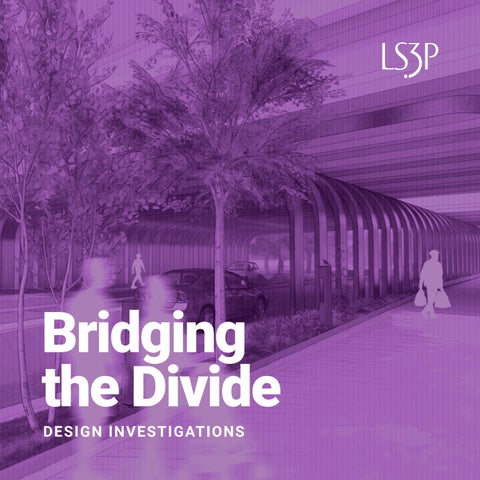
Bridging the Divide DESIGN INVESTIGATIONS
The summer internship is a rite of passage in architecture. It’s a winwin situation; energetic students eager to apply their design thinking skills in a professional environment join firms who are committed to developing the next generation of designers. Senior Architect Ryan MacCrea brings an even richer vision to the summer intern program in LS3P’s Raleigh office rooted in wrestling with real-world challenges. In the summer of 2026, MacCrea spearheaded a collaborative, multidisciplinary intern project that examined a key gateway under development for one of Raleigh’s crown jewels: Dorothea Dix Park. The students engaged community and civic stakeholders, conducted historical and site research, and proposed design solutions that address a complicated (in every sense of the word) threshold. The City of Raleigh, Dix Park, and others have been working with a team including SfL+a Architects, Surface 678 and landscape architect Preston Montague to create create a conceptual plan for a better connection between Downtown Raleigh and Dix Park called the Oak Line. The intern project dives further into the existing constraints where the proposed Oak Line terminates and offers suggestions on how to bridge between the urban experience and entry to the park.
A Multi-Disciplinary Task Force Raleigh’s 2026 intern cohort, one of the largest and most diverse yet, included seven students from architecture, interiors, historic preservation, geography, and data science. The team included:
Christian Beatty
Pearson Foster
Student Intern | Architecture NC State University
Computational Design Intern | Architecture NC State University
Tyler Costa
Jose Gonzalez
Student Intern | Architecture NC State University
Student Intern | Interior Architecture University of North Carolina - Greensboro
Isabella Cooper
Kayla Sparks
Research + Innovation Intern | Management, Society, Geography, and Data Science University of North Carolina
Preservation Intern | Interior Architecture Savannah College of Art and Design
Ella Drew Dodd Student Intern | Architecture, City Planning, and Urban Development Clemson University
This mix of perspectives proved especially relevant for a site where mobility, landscape, infrastructure, public history, and human experience overlap. Their proposal, appropriately titled Bridging the Divide, imagines the area not simply as a route into the park, but as a welcoming public threshold shaped by safer movement, clearer wayfinding, community gathering, and visible connections to history.
Layers of History The project began with research. Dix Park occupies the grounds of North Carolina’s first state psychiatric hospital, established in 1856 and influenced by mental health reformer Dorothea Dix. The large (308 acre) city park has many gateways and thresholds, but one key approach to the park at the easternmost point is unusually complex. The students reviewed development and transportation plans; walked the site; interviewed community voices and local professionals, and considered how existing and future trail, transit, and development systems might converge. Site challenges included major roadways, changing infrastructure, disconnected trails, and difficult pedestrian conditions that make the short geographic distance feel much greater.
The team also studied the histories of Dorothea Dix Park and the adjacent Fourth Ward, a historic Black community deeply affected by urban renewal and transportation projects that segregated the neighborhood. Author and historian Carmen Cauthen, community activist and historian Octavia Rainey, Nick Neptune of the Dix Park Conservancy, Mitchell Silver, and Willie Rowe, along with representatives of local restaurants and businesses, contributed their perspectives to the research. These conversations expanded the brief. It was clear that the challenge was not only to improve circulation; the team also needed to consider how people would feel arriving at the park, how public space could support gathering, how design might improve visibility and safety, and how the story of Fourth Ward could become part of the everyday experience of the site.
Boots on the Ground Research Walking the site (during Raleigh’s hottest summer yet) translated the team’s historical and planning research into immediate, human-scale observations. The interns documented limited access to Western Boulevard, insufficient lighting, inconsistent landscaping, inadequate trail wayfinding, and unsafe or missing pedestrian crossings. They also found that the Rocky Branch Trail becomes difficult to follow through the project area, requiring sharp turns and movement along a side street before reconnecting to the greenway. These conditions revealed a larger issue: individual pieces of infrastructure had evolved over time, but the experience of moving among them had not been unified. A park visitor, cyclist, transit rider, or nearby resident might encounter each system separately, with little indication that the routes belong to one connected public realm.
The team organized its response around four linked objectives:
Welcoming
Accessible
Honorable
Collaborative
Create a gateway to Dorothea Dix Park through a safe, memorable, and welcoming arrival.
Improve access and connectivity for pedestrians, cyclists, transit riders, and surrounding neighborhoods.
Honor history and reconnect communities by acknowledging the corridor’s past while supporting new relationships.
Build a people-first public space that encourages gathering, orientation, and community
Turning Infrastructure Into Arrival The interns created a concept that works across several scales. At the city scale, the proposal connects a bus rapid transit (BRT) station, the existing underpass, the Rocky Branch greenway trail, future development, and the park. At the pedestrian scale, the design introduces clearer paths, protected walkways, improved crossings, lighting, planting, seating, signage, and a public plaza. The proposed BRT station is placed in the center of the roadway, bringing inbound and outbound service together and creating a more direct relationship between transit and the park entrance. Stairs and an elevator connect the platform with the public space below. Wider sidewalks, raised pedestrian routes, and planted buffers help separate people from moving vehicles while making the station and underpass feel like a recognizable destination rather than leftover infrastructure. A complementary branding and signage system builds on colors, typography, and imagery associated with Dorothea Dix Park. The interns imagined oversized entrance markers that would be highly visible, easy to understand, and distinctive enough to become meeting points or photo opportunities. The strategy treats wayfinding as more than directional information. It is part of the arrival experience and part of the park’s public identity.
History in Motion The most site-specific element is a proposed series of etched metal lenticular panels beneath the roadway. Their angled surfaces would reveal different content depending on the direction of travel; for example, one view could show a historic map of Fourth Ward, while others could present text and community stories. The team described this as a way to communicate history through “layering perspectives and shifting perspectives,” allowing the installation to change as people move through it. The form does not end at the underpass. Its angled geometry expands into the landscape as a recurring bench and shade motif, carrying the story toward the plaza and nearby paths. This continuity connects interpretation, seating, shelter, and placemaking in one visual language. The proposal is particularly effective because the interpretive element serves several purposes at once. It marks a threshold, provides a buffer from traffic, supports wayfinding, and gives pedestrians a reason to slow down. History is not confined to a plaque at the edge of the project. It becomes part of movement through the site.
A Plaza for Connection The circulation terminates in a plaza which brings the project’s systems together. The concept preserves the natural and ecological qualities of the park, strengthens pedestrian crossings, extends the historic motif into seating and shade, and introduces a bridge connection over the stream. A stepped landscape responds to the site’s grade change and creates places to pause, gather, and approach the water. The entire concept led the students to new questions. Are the additional stream crossings the best use of finite financial resources? Would the proposed amphitheater near the plaza function as intended, given traffic noise and sun exposure? What types of programming would best serve Dix Park’s neighbors as well as visitors? The design investigation is a conversation as much as a studio project, one that asks how mobility infrastructure, landscape, public art, historic interpretation, and community space might all work together rather than compete for attention.
What’s Next? Before returning to school, the students delivered their conceptual design twice: once to Mayor Janet Cowell, and once to to LS3P’s Raleigh office. Special guests included representatives from Dix Park, the City of Raleigh, and the Fourth Ward community. Their hard work helped them build research skills, design thinking, and presentation At the end of August 2026, the City of Raleigh and Dix Park unveiled the official design proposal for a linear trailway called the Oak Line, developed by Sfl+a Architects, Surface 678 and landscape architect Preston Montague. The proposal aims to better connect downtown Raleigh with Dix Park through an elevated landscape trail that terminates at the overpass and future BRT station that our interns investigated. These ambitious projects won’t be built overnight, but echo the City’s emphasis on building a strong connection to Dix Park and creating an interconnected city fabric that seamlessly bridges the urban landscape and the park.
Designing the space between. These spaces may appear to be infrastructure problems, but they are also humanexperience problems. They shape who feels welcome, who can move safely, which histories remain visible, and whether two nearby places truly feel connected. By beginning with history and community knowledge, then working across disciplines and scales, the intern team transformed a complicated intersection into an opportunity. Their concept imagines a gateway where arrival is intuitive, movement is safer, public space is generous, and the past is not separated from the future. That is the promise of thoughtful design: not simply to bridge a road, stream, or transit line, but to help people see connections that have been obscured and create new ones where they are needed most.
About the Author
Ryan MacCrea AIA, NCARB Ryan MacCrea is a Senior Architect in LS3P’s Raleigh office focused on design and human experience. After more than a decade of practice, Ryan’s expertise spans multiple markets but is also routed in design research and education. Having led multiple research grants both professionally and academically, Ryan is passionate about bringing design thinking to the forefront of every challenge. As a part-time adjunct professor, he is also focused on growing the next generation of designers and leaders to help tackle the complex challenges of the future.