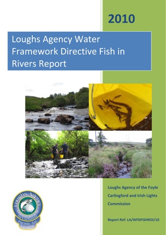
2010 Loughs Agency Water Framework Directive Fish in Rivers Report
Loughs Agency of the Foyle Carlingford and Irish Lights Commission
Report Ref: LA/WFDFISHROI/10
Loughs Agency of the Foyle Carlingford and Irish Lights Commission
Loughs Agency Water Framework Directive Fish In Rivers Report 2010
For Inland Fisheries Ireland 2011
For further information contact: Art Niven (Fisheries Research Officer) Written and prepared by:
Loughs Agency 22, Victoria Road
Art Niven Londonderry
Maps Prepared By Rico Santiago
BT47 2AB 028 71 34 21 00 art.niven@loughs‐agency.org 2
Loughs Agency of the Foyle Carlingford and Irish Lights Commission
Table of Contents
Executive Summary ................................................................................................................................. 5 1.0
Introduction ................................................................................................................................ 6 Figure 1. WFD river fish surveillance monitoring stations within the Loughs Agency jurisdiction (Foyle area only, there are no WFD river fish surveillance stations within the ROI component of the Carlingford area). ...................................................................................................................... 6
2.0
Basis for Loughs Agency Water Framework Directive Fish Monitoring...................................... 7 Table 1. Habitat classification based on Department of Agriculture for Northern Ireland (Fisheries Division) advisory leaflet on the evaluation of habitat for salmon and trout ................ 8
3.0
Classifications .............................................................................................................................. 9 Table 2. Removal sampling results.................................................................................................. 9 Fig 2. Total catch ............................................................................................................................. 9 Fig 3. Density/m² ............................................................................................................................. 9 Fig 4. Length weight relationship of all age classes of trout (this can be used to visually assess the presence of different age classes/cohorts) ............................................................................ 10 Fig 5. Length frequency distribution for all trout caught (this can also be used to assess the presence of different age classes/cohorts)................................................................................... 10 Table 3. Removal sampling results................................................................................................ 12 Fig 7. Total catch ........................................................................................................................... 12 Fig 8. Density/m² ........................................................................................................................... 12 Fig 9. Length weight relationship of all age classes of salmon (this can be used to visually assess the presence of different age classes/cohorts) ............................................................................ 13 Fig 10. Length weight relationship of all age classes of trout ....................................................... 13 Fig 11. Length frequency distribution for all juvenile salmon caught (this can also be used to assess the presence of different age classes/cohorts) ................................................................. 14 Fig 12. Length frequency distribution for all trout caught ............................................................ 14 Fig 13. 01S020200 ......................................................................................................................... 15 Table 4. Removal sampling results................................................................................................ 16 Fig 14. Total catch ......................................................................................................................... 16 Fig 15. Density/m² ......................................................................................................................... 16 Fig 16. Length weight relationship of all age classes of trout (this can be used to visually assess the presence of different age classes/cohorts) ............................................................................ 17 Fig 17. Length frequency distribution for all juvenile trout caught (this can also be used to assess the presence of different age classes/cohorts) ............................................................................ 17
3
Loughs Agency of the Foyle Carlingford and Irish Lights Commission 4.0
Conclusion ................................................................................................................................. 19 Table 5. WFD fish surveillance stations surveyed by the Loughs Agency 2008‐2010 .................. 19 Fig 19. WFD Fish surveillance river and lake sites within the Foyle area, Northern Ireland and Republic of Ireland ........................................................................................................................ 21 Fig 20. WFD Fish surveillance river and lake sites within the Carlingford area, Northern Ireland. There are no sites within ROI in the Carlingford area .................................................................. 22 Fig 21. WFD Fish surveillance river and lake sites within the Carlingford area, Northern Ireland. There are no sites within ROI in the Carlingford area .................................................................. 23 Fig 22. WFD fish surveillance river classifications within the Carlingford area, Northern Ireland 2010. There were no sites surveyed within ROI. .......................................................................... 24 Fig 23. WFD fish surveillance river classifications within the Foyle and Carlingford areas 2010. 25
The Loughs Agency sponsoring departments and staff are gratefully acknowledged for the assistance provided to conduct Water Framework Directive fish monitoring in the Foyle and Carlingford areas. 4
Loughs Agency of the Foyle Carlingford and Irish Lights Commission
Executive Summary Eight Water Framework Directive fish surveillance monitoring stations were surveyed within the Loughs Agency jurisdiction in 2010. Three of these were in the Republic of Ireland and five were in Northern Ireland. This report presents the results for the monitoring stations within the Republic of Ireland. An overview of the Loughs Agency Water Framework Directive fish monitoring programme is provided and a synopsis of the biological and habitat data presented. Additional data and information has been presented in a series of excel spreadsheets submitted to Inland Fisheries Ireland (IFI). All data reported is stored within the Loughs Agency Geographical Information System (GIS) and is available upon request. Photographs of each site have been included where available and outline recommendations made for consideration as part of any programme of measures.
5
Loughs Agency of the Foyle Carlingford and Irish Lights Commission
1.0 Introduction This report is submitted to Inland Fisheries Ireland (IFI) by way of fulfilling the Loughs Agency agreement to survey and provide data for Water Framework Directive river fish monitoring. The report provides summary data for monitoring stations within the Loughs Agency jurisdictions of the Foyle and Carlingford areas for 2010. Additional information has been provided in electronic format. A synopsis of targeted Water Framework Directive river fish sampling within the Foyle and Carlingford areas has been provided below for fieldwork conducted in 2010. Other sites outside of the Foyle and Carlingford areas have been monitored by Inland Fisheries Ireland.
Figure 1. WFD river fish surveillance monitoring stations within the Loughs Agency jurisdiction (Foyle area only, there are no WFD river fish surveillance stations within the ROI component of the Carlingford area).
6
Loughs Agency of the Foyle Carlingford and Irish Lights Commission
2.0 Basis for Loughs Agency Water Framework Directive Fish Monitoring In the absence of a finalised fish in rivers classification tool (currently under development) no classification has been assigned to the fish surveillance monitoring stations included in this report. The Northern Ireland Water Framework Directive Fish Group which consists of members from Northern Ireland Environment Agency (NIEA), Agri Food and Bioscience Institute (AFBI), Department of Culture Arts and Leisure (DCAL) and the Loughs Agency has assigned provisional classifications for sites within Northern Ireland based on professional assessment of the data collected. Once available the new fish classification system will be used to derive WFD compliant classifications. Data collection was conducted in the field during July 2010 and involved the use of a quantitative electrofishing methodology commonly used for wadable rivers. This technique requires the netting off of a small section of river approximately 100m² using stop nets. Removal sampling is then conducted utilising electrofishing equipment with the numbers, age class and species of each fish being recorded for each pass. After an appropriate depletion has been achieved, which facilitates a density estimation to be made all fish are returned alive to the river. Additional habitat variables were recorded and the exact location of upstream and downstream stop nets were recorded using a Trimble Geo HX hand held GPS unit. Additional in-channel habitat variables were recorded using the DANI habitat classification system outlined.
7
Loughs Agency of the Foyle Carlingford and Irish Lights Commission
NURSERY AREA • 50 -80mm water depth • 0.5 – 8% gradient • Stable cobble/boulder substrate > or = 70% bed cover • Providing adequate cover Marginally outside grade 1 on one count only
Grade 1
Grade 2
Grade 3
Well outside grade 1 on one or more counts
Grade 4
Absent, deep, channelized, silty etc.
SPAWNING AREA • Flow 300 – 600mm/sec • Water depth 150 – 700mm • 70% substrate 30-80mm diameter • Gravel depth: Trout = 50-150mm
Grade 1
Salmon = 200-500mm Grades 2-4
Failing as for nursery habitat above
HOLDING AREA • Depth minimum m ideally > or = 2m • Suitable cover • Bankside/substrate stability Failing as for nursery habitat above
Grade 1
Grades 2-4
Table 1. Habitat classification based on Department of Agriculture for Northern Ireland (Fisheries Division) advisory leaflet on the evaluation of habitat for salmon and trout
8
Loughs Agency of the Foyle Carlingford and Irish Lights Commission
3.0 Results 3.1
01M010100 Mournebeg at Red Burn Bridge Derg Catchment Co Donegal
FISHING 1st 2nd TOTAL
Trout 0+
Trout 1+ 11 5 16
Eel 10 3 13
Total 1 4 5
22 12 34
Table 2. Removal sampling results
Number of Fish
Number of Fish Caught, Mournebeg 2010 18 16 14 12 10 8 6 4 2 0
16 13
5
Trout 0+
Trout 1+
Eel
Species
Fig 2. Total catch
Density Estimate of Fish Species, Mournebeg 0.12 0.10
No. of Fish/1m²
0.10 0.08 0.06
0.06
0.04 0.04 0.02
0.01
0.00 Eel
Trout 0+
Trout 1+ Fish Species
Fig 3. Density/m²
9
Total Trout
Loughs Agency of the Foyle Carlingford and Irish Lights Commission
Length Weight Relationship Trout 0+ and 1+ Mournebeg (N=29) 60 y = 3E‐05x2.7488 R² = 0.9687
50
Weight (g)
40 30 20 10 0 0
20
40
60
80
100
120
140
160
180
200
Length (mm)
Fig 4. Length weight relationship of all age classes of trout (this can be used to visually assess the presence of different age classes/cohorts)
Length Frequency Trout 0+ and 1+ Mournebeg (N=29) 4.5 4 3.5 Frequency
3 2.5 2 1.5 1 0.5 176
171
166
161
156
151
146
141
136
131
126
121
116
111
106
101
96
91
86
81
76
71
66
61
56
51
0
Length (mm)
Fig 5. Length frequency distribution for all trout caught (this can also be used to assess the presence of different age classes/cohorts)
10
Loughs Agency of the Foyle Carlingford and Irish Lights Commission
This site is composed predominantly of grade 3 nursery habitat (50%) with grade 3 spawning habitat (10%) and grade 1 holding habitat 40%. Additional biological data and habitat data is available in the spreadsheets provided. This site is located on a tributary to Lough Mourne, which in turn feeds into the Mournebeg River, a tributary of the River Derg. A “V” notch weir is currently present on the Mournebeg River near Lough Mourne and may act as a barrier to certain migratory fish entering Lough Mourne and its tributaries/feeder streams. Donegal County Council has received planning permission to impound Lough Mourne to increase water abstraction. This development will increase the area of Lough Mourne and drown out the lower reaches of any feeder streams. A large impounding structure will be constructed at the outflow to Lough Mourne (Mournebeg River). Migratory fish passage suitable for eels and salmonids has been incorporated into the design.
Fig 6. 01M010100
11
Loughs Agency of the Foyle Carlingford and Irish Lights Commission
3.1
01SO20200 U/S of Finn River Confluence Finn Catchment Co Donegal
FISHING 1st 2nd 3rd TOTAL
01M010100
Salmon 0+ Salmon 1+ Trout 0+ Trout 1+ Eel Total 18 7 0 2 2 8 5 1 0 0 6 4 1 0 0 32 16 2 2 2
29 14 11 54
Table 3. Removal sampling results
Number of Fish Caught, Stranagoppoge 2010 35
32
30 No. of Fish
25 20
16
15 10 5
2
2
2
Trout 0+
Trout 1+
Eel
0 Salmon 0+
Salmon 1+
Species
Fig 7. Total catch
Density Estimate of Fish Species, Stranagoppoge 0.80
No. of fish/m2
0.70
0.68
0.62
0.60 0.50
0.38
0.40
0.28
0.30 0.20 0.10
0.02
0.02
0.02
0.06
0.00 Eel
Salmon 0+ Salmon 1+
Total Salmon
Trout 0+
Species
Fig 8. Density/m²
12
Trout 1+ Total Trout
Total Salmonids
Loughs Agency of the Foyle Carlingford and Irish Lights Commission
Length Weight Relationship of Salmon 0+ and Salmon 1+, Stranagoppoge (N=48) 14 12
y = 7E‐06x3.1307 R² = 0.977
Weight (g)
10 8 6 4 2 0 0
10
20
30
40
50
60
70
80
90
100
Length (mm)
Fig 9. Length weight relationship of all age classes of salmon (this can be used to visually assess the presence of different age classes/cohorts)
Length Weight Relationship of Trout 0+ and 1+, Stranagoppoge (N=4) 25
y = 2E‐05x2.9455 R² = 0.9985
Weight (g)
20
15
10
5
0 0
20
40
60
80
Length (mm)
Fig 10. Length weight relationship of all age classes of trout
13
100
120
140
Loughs Agency of the Foyle Carlingford and Irish Lights Commission
Length Frequency of Salmon 0+ & 1+, Stranagoppoge (N=48) 10 9 8
Frequency
7 6 5 4 3 2 1 0 44 46 48 50 52 54 56 58 60 62 64 66 68 70 72 74 76 78 80 82 84 86 88 90 92 94 Length (mm)
Fig 11. Length frequency distribution for all juvenile salmon caught (this can also be used to assess the presence of different age classes/cohorts)
Length Frequency of Trout 0+ and 1+, Stranagoppoge (N=4) 1.2
Frequency
1 0.8 0.6 0.4 0.2 0 55
60
65
70
75
80
85
90
Length (mm)
Fig 12. Length frequency distribution for all trout caught
14
95
100
105
110
115
120
Loughs Agency of the Foyle Carlingford and Irish Lights Commission
This site has been moved slightly upstream to accommodate access requirements for survey. This site is composed predominantly of grade 3 nursery habitat (70%) with grade 3 spawning habitat (10%) and grade 3 holding habitat 20%. Additional biological data and habitat data is available in the spreadsheets provided. This site is located within the River Finn and Tributaries SAC. The surrounding land use is dominated by upland grazing and coniferous forestry plantations. The catchment could benefit from native riparian buffer zone creation, catchment scale native planting and cleaning of spawning gravels. The catchment is also impacted upon by insensitive planning and poor riparian stewardship in places.
Fig 13. 01S020200
15
Loughs Agency of the Foyle Carlingford and Irish Lights Commission
3.1
40B020400 Bredagh Catchment
FISHING 1st 2nd 3rd TOTAL
U/S of Moville Bridge Co Donegal
Trout 0+
Trout 1+ 7 2 2 11
40B020400
Eel 70 26 13 109
Total 5 2 1 8
82 30 16 128
Table 4. Removal sampling results
Number of Fish Caught, Bredagh 2010 120
109
Number of Fish
100 80 60 40 11
20
8
0 Trout 0+
Trout 1+
Eel
Species
Fig 14. Total catch
Density Estimate of Fish Species, Bredagh 1.00
0.91
0.90
0.83
No. of Fish/1m²
0.80 0.70 0.60 0.50 0.40 0.30 0.20 0.10
0.06
0.09
Eel
Trout 0+
0.00 Trout 1+ Fish Species
Fig 15. Density/m²
16
Total Trout
Loughs Agency of the Foyle Carlingford and Irish Lights Commission
Length Weight Relationship, Trout 0+ & 1+, Bredagh (N=85) 200 y = 2E‐05x2.9156 R² = 0.9743
180 160 Weight (g)
140 120 100 80 60 40 20 0 0
50
100
150
200
250
300
Length (mm)
Fig 16. Length weight relationship of all age classes of trout (this can be used to visually assess the presence of different age classes/cohorts)
Length Frequency Trout 0+ and 1+ Bredagh (N=85) 5
Frequency
4 3 2 1 0 53 63 73 83 93 103 113 123 133 143 153 163 173 183 193 203 213 223 233 Length (mm)
Fig 17. Length frequency distribution for all juvenile trout caught (this can also be used to assess the presence of different age classes/cohorts)
17
Loughs Agency of the Foyle Carlingford and Irish Lights Commission
This site has been moved slightly upstream to accommodate access requirements for survey. This site is composed predominantly of grade 3 nursery habitat (30%) with grade 3 spawning habitat (10%) and grade 1 holding habitat 60%. Additional biological data and habitat data is available in the spreadsheets provided. This site is located upstream of the town of Moville which is currently without adequate waste water treatment facilities. Untreated effluent is known to enter the Bredagh River downstream of the sampling location. This may have hampered migratory fish movements and colonisation of the lower part of the Bredagh River through Moville. Waste water treatment is the key priority for any programmes of measures. In addition to the water quality issues a number of in-channel alterations may be creating barriers/partial barriers to migration. Assessment of these structures is required. Riparian management is poor with significant tunnelling in places.
Fig 18. 40B020400
18
Loughs Agency of the Foyle Carlingford and Irish Lights Commission
4.0 Conclusion In 2010 within the Loughs Agency jurisdiction in addition to the three WFD fish surveillance sites surveyed in the Republic of Ireland five WFD fish surveillance sites were surveyed in Northern Ireland. Twelve other sites were surveyed within the Loughs Agency jurisdiction using similar methods. This data has also been made available in electronic format as part of the WFD fish reporting procedure. There are no planned WFD river fish surveys in Loughs Agency ROI jurisdiction in 2011.The majority of sites to be surveyed in 2011 are large river sites in Loughs Agency Northern Ireland jurisdiction where a multi method approach will be utilised as agreed by the Northern Ireland Water Framework Directive Fish Group. Site Code
Year Surveyed
01M010100 01S020200 40B020400 F10086 F10089 F10076 F10020 F10014 F10626 F10644 F10077 F10763 F10022 F10049 F10079 F10115 F10170
2010 2010 2010 2008 2009 2009 2009 2009 2009 2009 (AFBI) 2009 2009 2010 2010 2010 2010 2010
Catchment
Provisional Classification Derg (ROI) N/A Finn (ROI) N/A Bredagh (ROI) N/A Strule (NI) Good Strule (NI) Moderate Owenkillew (NI) Good Burndennet (NI) Good Glenmornan (NI) Moderate Newry (NI) Moderate Killbroney (NI) Moderate Owenkillew (NI) Good Skeoge (NI) Poor Burndennet (NI) Good Derg (NI) Good Glenelly (NI) Good Camowen (NI) Good Roe (NI) Good
Table 5. WFD fish surveillance stations surveyed by the Loughs Agency 2008‐2010
In addition to the seventeen WFD fish monitoring stations quantitatively surveyed from 2008-2010 as outlined in the table above the Loughs Agency has conducted similar quantitative surveys at an additional 65 stations throughout the Foyle and Carlingford areas between 2005 and 19
Loughs Agency of the Foyle Carlingford and Irish Lights Commission
2010. The potential use of semi quantitative data collected in the Foyle and Carlingford areas at approximately 500 stations annually is currently being investigated by the Northern Ireland Water Framework Directive Fish Group for use in operational monitoring classification. A number of lakes will be surveyed as part of WFD fish monitoring requirements in Northern Ireland. The N/S SHARE methodology will be used. In 2010 two lakes were surveyed in the Loughs Agency jurisdiction, Lough Carn in NI and Lough Mourne in the ROI. In addition to meeting requirements under WFD the Loughs Agency Corporate and Business plans 2011-2013 highlight the need to survey lake fish populations within the Foyle and Carlingford jurisdictions. Reports on these surveys will be available in 2011.
20
Loughs Agency of the Foyle Carlingford and Irish Lights Commission
Fig 19. WFD Fish surveillance river and lake sites within the Foyle area, Northern Ireland and Republic of Ireland
21
Loughs Agency of the Foyle Carlingford and Irish Lights Commission
Fig 20. WFD Fish surveillance river and lake sites within the Carlingford area, Northern Ireland. There are no sites within ROI in the Carlingford area
22
Loughs Agency of the Foyle Carlingford and Irish Lights Commission
Fig 21. Provisional WFD fish surveillance river classifications within the Foyle area, Northern Ireland and Republic of Ireland 2010
23
Loughs Agency of the Foyle Carlingford and Irish Lights Commission
Fig 22. WFD fish surveillance classifications within the Carlingford area, Northern Ireland 2009‐2010. There are no sites within Carlingford area lying within ROI.
24
Loughs Agency of the Foyle Carlingford and Irish Lights Commission
Fig 23. Provisional WFD fish surveillance classifications within the Foyle area 2008‐2010.
25