UPDATED 2015
Carry adequate basic safety equipment – spare clothes, extra food, warm drink, bivvi bag, compass and means of communication (waterproofed VHF radio or mobile phone, flares etc), first aid kit. Remember – a canoe may be difficult to see from a larger craft so carry a whistle.
Please note: Lough Foyle is an important shellfish fishery – primarily mussels and oysters. In places, oysters are cultivated in cages on trestles along the shore. These are submerged at high water and should not be disturbed. Watch out for mussel boats manoeuvring – they will turn sharply when fishing.
T. +44 (0) 28 9146 3933 T. +353 (0)74 9370103
Happy paddling!
Carry and know how to use a map and compass. It is not recommended to canoe alone. A group of three paddlers is the minimum recommended number to be safe. Stretching over 53km from the start of the River Foyle to the Atlantic Ocean, the Foyle Canoe Trail dips in and out of both Northern Ireland and the Republic of Ireland. From Lifford, this unique trail runs through rural countryside, the historic city of Derry~Londonderry, along Lough Foyle’s varied coastline to the bustling seaside town of Moville. Paddlers will enjoy a mix of water conditions, from flat water to sea lough and - since the trail is tidal the river section can even be paddled upstream!
Canoe Trail
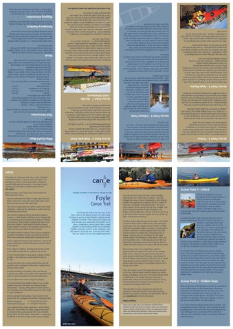
Foyle
The River Foyle is tidal along its entire length - from Lifford to Culmore Point where it spills into the vast sea lough of Lough Foyle. The river ranges from 50 to 900 m in width with some remarkably shallow stretches at various points. It offers a selection of camping opportunities and some excellent chances to explore this unfrequented part of Ireland. At places such as ‘the islands’ (on the upper stretch) look out for kingfishers, sand martins, otters and even sometimes seals. On the broader parts of the river, huge flocks of whooper swans, herds of geese, drifts of waders and rafts of duck can be seen in the winter months. This river and sea canoe trail offers varied paddling opportunities for a wide range of abilities. Running through the centre of Derry~Londonderry, the trail gives paddlers the opportunity to explore the city’s wealth of attractions, hospitality and entertainment. The city is quite majestic when viewed from the river. Paddlers will gain a unique perspective of Gothic buildings, vast bridges, and riverside trains and can avail of secure tie-up at the Foyle Marina Pontoon, right in the heart of the city (prior arrangement necessary).
Finding freedom in Northwest Ireland on the
It is 11km to the next official access point at Prehen. This is the widest section of the river, with a number of scenic stopping points. Look out for the two art installations near New Buildings (one on each side of the river) which reference the community’s historic involvement with the salmon industry. Mid-way between Lifford/Strabane and Derry~Londonderry is the Gribben Quay, an old fishing station which once operated a fish smoking chimney. The site access has a vehicle barrier (arrange entry in advance with site manager at the Loughs Agency +44 (0)28 7134 2100) and offers car parking, a stone jetty, slipway, a lean-to canoeist camping shelter and wild camping.
Access Point 2 - Gribben Quay It is 11km to the next official access point at Gribben Quay. The section between these points is picturesque and home to a wealth of biodiversity. In summer, watch the sand martins flitting after winged insects and hurtling into their nests tunnelled into the sand banks that edge much of the river. The river splits into two channels: the Backwater (to the east) and the Frontwater (to the west) running either side of a 106 hectare island called Islandmore. After the island the river quickly widens. At low water, watch out for sandbanks on the right side, just before Gribben Quay. Canoeists should be aware that the steps are not at a perfect height above the level of water in the river – a problem compounded at low tide! However, paddlers should set off downriver at or close to high water to take advantage of the ebbing tide. Remember that since the river is tidal, there is a tidal time difference of approximately three hours at Lifford (compared to Lisahally, just south of Culmore Point) and there is a tidal range of approximately one metre. Car parking is available nearby (30m or so) and there is convenient access from the street. Lifford is a small town in County Donegal (connected with Strabane in County Tyrone by road bridge). It has the usual array of cafes, shops, pubs etc and an interesting old court house which is open to visitors. Access to the River Foyle is via a concrete path and set of wooden steps just downstream of the bridge.
T R A I L S
can o e
Red Bridge
Moville Coastline Carrigans
Red Bridge
Derry~Londonderry
Access Point 6 - Redcastle Hotel
Other Useful Maps
Irish Cruising Club “East and North Coasts of Ireland Sailing Directions” ISBN 978 0 9558 199 1 9 (excellent information on tides, tidal streams and navigation points) OSNI Discoverer Series: sheet 4, 7, 12 Ordnance Survey Ireland: sheet 3 Admiralty Chart no 2510 East Inishowen Sea Kayak Trail Guide (contains charts of the lough)
The nice pebble beach below the Redcastle Hotel is a good place to pull ashore – whether for a rest or to avail of some hotel comforts. The hotel welcomes paddlers coming ashore and up to the hotel. Redcastlehoteldonegal.com or T. +353 (0) 74 938 5555
Access Point 5 - Culmore Point
Tidal Information
Lough Foyle and the entire River Foyle are tidal! Tidal range: up to 3.08m (at Lisahally) and approximately 1-1.5m at Lifford Average flood time: 6 hours 7 minutes Average ebb time: 6 hours 17 minutes Tide tables are available for Lisahally (near mouth of River Foyle) from Foyle Port londonderryport.com Approximate time differences - Moville - 45 mins - Derry~Londonderry city + 35 mins - Northern tip of Islandmore + 2.5 hrs - Lifford/Strabane + 3.0 hrs Tidal stream: - streams in the entrance to Lough Foyle run at 3.5 knots at springs - streams between Moville and Culmore reach 2.5 knots - the river runs on average at 4.5 knots – bear in mind the river is tidal and flow can be ‘upriver’! On an ebbing tide the current will be strongest... and even stronger if the wind is from the southwest. Take care in southwesterly winds on a flooding tide when the effect of wind against tide can produce short, steep waves all along the river and in the lough.
Access Point 7 - Moville - Inish Adventures
Culmore Point Lighthouse
It is 3.7km to the next official access point at the Foyle Marina pontoon. As you paddle through the city you will see the Guildhall, church spires, four hundred year old city walls, the 32m air draught Foyle Bridge, the low Craigavon Bridge, the impressive Peace Bridge and the riverside trains on one of the BBC’s Great Railway Journeys of the World.
Access Point 4 - Foyle Marina
Derry~Londonderry
Access Point 3 - Prehen
It is 6.2km to the next official access point at Culmore Point, with the landscape being fairly built up and industrial at the start and then progressing to beautiful woodland and some palatial houses on the west bank! The river is deep here and narrows between rocky shores to produce a strong current, especially midstream. Watch out for eddies and choose landing spots with care – some soft mud in places!
At Prehen there is a car park, concrete slipway and wooden steps (the latter used by the local rowing club). There is a small pontoon nearby which is operated by Foyle Search and Rescue – private access unless in an emergency! Nearby is Prehen wood, a remnant of the ancient woodland that once flanked the Foyle valley. Learn about the natural life of river and sea at the Loughs Agency’s Riverwatch Visitor Centre and Aquarium just a 5 minute walk southwards along the cycle path (opening times: T: +44 (0)28 7134 2100 or loughs-agency.org ). There is also a slipway at the back of the Loughs Agency premises.
It is 6.7km to the next official access point at Moville. The paddling along this section of the lough is past low cliffs with wooded coves and small beaches. The hills to the south and east are the Sperrin Mountains. These form part of the watershed of the Foyle. The hill with a distinctive stepped profile is Binevenagh, formed from lava eruptions millions of years ago.
The sandy beach and old medieval castle at Culmore Point mark the place where the River Foyle discharges into Lough Foyle. Roadside parking is available and access is via a small sandy beach. There is a pub and a shop in the village, a short stroll away. Across the river is Lisahally, an important commercial dock operated by Foyle Port. The old wooden jetties still visible here were the location for a mass surrender of the German U-boat fleet in 1945 - chosen because of the importance of Derry in the Battle of the Atlantic.
Montgomery Terrace, Moville
The marina is made up of a visitor pontoon, cruise ship quay and a larger pontoon designed as a maritime event platform which has hosted the Clipper Round the World yacht race. It is operated by Foyle Port. The marina is busy, attracting many sail cruisers from other parts of Ireland and from Scotland. The pontoons are secured by gated gangway with intercom connecting to the harbour office. Access is only by prior arrangement. For further information, please contact: Harbour Radio T: +44 (0)28 7186 0313 or email harbourradio@londonderryport.com
There is a boatyard at the castle which is tenanted by Lough Foyle Yacht Club. Paddlers may be permitted secure boat storage here during operating hours. (Please visit lfyc.co.uk or just ask a member on site. Unfortunately pre-booking is not available). Please do not park on the grassy area above the beach as this will block access frequently used by the emergency services, RNLI, Search & Rescue etc.
From here you will have access to the bustling city of Derry~Londonderry. There are many tourist attractions, 400 year old intact city walls, accommodation options and great places to eat and drink. Tie your boat up and have peace of mind that it is behind locked gates!
Moville is a quaint Victorian seaside resort with the usual array of shops, cafes, pubs, hotels, B&Bs etc. In addition to the 2 public slipways in the town (one in the main harbour and another beside the old pier with a monument on it), the Inish Adventures slipway offers direct access to a host of facilities including lean-to camping shelter, camping, showers, toilets, fresh water and secure boat storage. Prior arrangement is recommended. Contact Inishadventures.com T: + 353 (0) 87 2202 577 or +44 (0) 7752 194 414
It is 14.6km to the next official access point at Redcastle. Paddlers should stay outside and to the west of the shipping channel. Be aware of fishing boats (including tightly manoeuvering mussel dredgers) that may not notice a canoe or kayak in the sea. Depending on wind direction, a paddler can enjoy a lee shore along this side of Inishowen or may be challenged by waves fetching across from the other side of the lough! Some small streams spill on to the shore off the hills and there are stretches of shingle, interspersed with sand grading to silt. Watch out for oyster cages along the shore that may be hidden at high water. Some are unmarked.
There are concrete canoe steps at Fort George (once a World War Two naval base), downstream of the marina on the western bank of the river. Access is via a gate with a combination code lock. Call +353 872 202 577 for access code.
Belfast Coastguard Malin Head Coastguard
CANI recommends that paddlers leave details of their journey with the coastguard and another responsible adult.
This trail guide has been designed by canoeists for canoeists. It provides practical information including official access points, campsites and tidal details. Please see CanoeNI.com for more information.
It is recommended that paddlers obtain an up-to-date weather forecast as the Foyle can become rough in strong winds. Carrying rafting poles for open canoes is also a sensible precaution (rafted canoes are more stable in rough conditions).
From the northern end of the lough seasoned canoeists can link up with the North Coast Sea Kayak Trail, which begins at Magilligan Point only 4.7 km from Moville (with an additional 1.2 km paddle across the Narrows at Greencastle, taking care to avoid the regular car ferry). The East Inishowen Sea Kayak Trail also follows the peninsula concluding at Malin Head.
Consider attending a Foundation Safety and Rescue training course which covers safety and awareness of all types of canoe and kayak and environmental issues. You do not need to be a strong swimmer but you will need the water confidence to deal with a capsized boat and get ashore safely.
Downstream of the city is Lough Foyle, which is approximately 179 square km in size with an average depth of 5m. The trail runs up the west coast of the lough along the Inishowen Peninsula, a key element of the Wild Atlantic Way offering an attractive mix of woods, sandy beaches, wavecut platforms and streams. The eastern side of the lough is very shallow, with a lot of it drying at low water.
Wear adequate clothing. Prolonged immersion in cold water leads to hypothermia – hypothermia can kill. Wear an approved buoyancy aid at all times. Canoes and kayaks should have sufficient buoyancy to remain afloat if you capsize. The lough and lower reaches of the river are sailing and boating recreational areas and you should be aware of other users, especially sailing boats competing in races. The Foyle Port shipping channel (maintained depth 8 metres) is a short distance offshore on the Donegal side. It is marked by port and starboard pile beacons flashing red and green. Depth reduces rapidly either side of this often busy channel. Small vessels (including canoes/ kayaks) should be aware of the limitations and needs of larger craft that are restricted to this channel. The river is a large spate river which comes from a wide catchment – watch out for rapid rises in water level and flood debris such as trees. There are extensive mud flats in Lough Foyle and sand banks on the river – please be aware that some access points are best used at high water only. When canoeing on the Foyle Canoe Trail consider the following safety advice:
Access Point 1 - Lifford
Canoeing is an adventure sport and, as such, should be treated with respect. If you are new to the sport, it is advisable to contact a Canoe Association of Northern Ireland (CANI) approved provider or club where expert coaching can be provided. Details can be found at cani.org.uk
Safety Winds
Remember that the River Foyle can become choppy, particularly if wind is against tide. On the upside, paddlers can harness favourable winds by rigging a sail to help them on their way. Treat Lough Foyle as the sea – it is, after all, a large enclosed bay on the Atlantic coast, reaching 15km width in places. Tides, winds, and sea conditions generally must be considered in planning a trip. Watch out for winds from south through east to northeast licking the water up into steep waves.
Foyle Marina Pontoon
From here, canoeists can paddle across the lough to Magilligan Point. The preferred route is to go north via a pleasant landscape of woods with rocky offshore reefs to Greencastle (a busy fishing port and ferry terminal). Slightly north of here is a jumping-off point for the run across the Narrows to Magilligan Point. Paddlers should be aware that this can be a ferry glide rather than a straight paddle, dependent upon the state of the tide. This is the start of the North Coast Sea Kayak Trail, which runs approximately 90km to Waterfoot.
Emergency Numbers
In the event of an emergency use the following number: 999 (from all phones) police, ambulance and coastguard
Shipping Information
BBC Radio 4 (198 KHz AM in Irish waters) broadcasts a shipping forecast four times a day – 00:48hrs, 05:20hrs, 12:00hrs and 17:55hrs. Sea area Malin covers the Foyle.
For an interactive trail guide visit www.CanoeNI.com
Glennagivenny Bay
Bat
38
St
n
Jetty/Pontoon Access
t eS
yl Fo
7
GR C612 382
om
M
CRAIGCANNON
Portkilarue
White Strand
St ay
Camping shelter - access by prior arrangement T. +353 (0) 8722 02577
Port Nola
r ive
Qu
Camping
tg on
hR
Caravan & Camp Site
MOVILLE - INISH ADVENTURES
‘Just Kayak’ Centre
e rac Ter ery
Stroove Beach White bay Inishowen Lighthouse Fl (2) WRG. 10s18-14M Horn (2) 30s
Breda
ag ed Br
er Rivow R
Parking
Portnocker
er gh Riv
AD
L ws Me
HE
Main
IN
38
ce Terra
R2
Step Access
Inishowen Head
AL
Bath
Shore Access
Portkill
M
Ma
e rrac
h Te
t Sq
rke
Slipway Access
ATLANTIC OCEAN
R2
Key to Symbols
Cockle Rock
CROCKAULIN
Cornashamma Bay
uay
Greencastle
ry
White Bay
Fresh water
MOVILLE
Moville Access Map
Telephone
6
Shower
13
MOVILLE HARBOUR
14
Magilligan Point
Glenburnie or Riverfoot Bay
¬ « 15
14
Moville Light FL WR
13
GR C610 381
REDCASTLE HOTEL
Public house
« ¬ «¬ ¬ « ¬ «
e ut Ro
Toilets
Carrickarory Pier
GR C557 348
Cafe/restaurant
un
Hospital
gR
ive
r
¬ « ¬ « Redcastle Pier 11 11
GR C517 313
Basking Sharks Ca b
Towns or Residential areas
ry
Beaches
l A2 30
BINEVENAGH
Aught Ri ve
e
r Roe Estuary
Rineore or Leper’s Point
Ture Point
Myroe Level
55
60
SCALP MOUNTAIN
Council Car Park No Public Access
SWANN’S BRIDGE
GR C670 297
ESKAHEEN MOUNTAIN
Pon too n
The Pro me nad
Binevenagh Forest
50
Lough Foyle RSPB Reserve
9
BALLYKELLY ive
r
GR C476 223
LIMAVADY
r ive
˜R
Power Station Lisahally Port
Access Code required T. +353 (0)8 7220 2577
A2
C
Ballykelly Forest
Mu
GR C439 183
5 Kilometres
Longÿeld Level
¬ «
CULMORE POINT
FORT GEORGE
3 Nautical miles Donnybrewer Level
ank
ly B
kel
ly Bal
R lly ke lly Ba
EmBlack ba Br nk ae me nt
The Promenad e
y Qua
Culmore
25
r ive
en’s
Que
5
Foyle Marina Access Map
oe
Mu˜
ank
dB
ÿel
tR foo rn
g Lon
R er Riv
ASDEVLIN HILL
Bu
ad
LOUGH FOYLE
Balls Point
Pre Booking Required T. +353 (0) 7493 83786
Ro
an Ch
10 Quigley’s Point
GR C513 308
A2
i Sh
¬ «
g
in
pp
FOYLESIDE CARAVAN AND CAMPING PARK
Shipping Channel
oad
35
ne
Ferry Routes
Stran dR
1m high dorsal fins - these belong to basking sharks which, although strikingly large, are totally harmless to humans. These plankton-eating fish are regularly seen in the currents between Moville and Inishowen Head and are typically 6-8m in length.
ve r
Access points
St ra nd
Look out for...
Ri
Areas exposed at low tide
City Centre
(Start of North Coast Sea Kayak Trail) GR C659 387
BASKING SHARKS
2 112
QUIGLEY’S POINT
Nesting/Wintering Birds
¬ «
R2
Dr
Tourist Information
Benone Beach
MAGILLIGAN POINT
16
38
Historical Building
1
Army Firing Range Contact Belfast Coastguard before crossing
r Fe
Old
Shop
Warren PortvevaLight Warren Bay
Skate Rock Colaways
Fish Q
Suitable Picnic Site
Balbane Haed
IN E OLERA
Greysteel Eglinton
n
4
DERRY CITY
River F augha
GR C435 176 * Access Code required T. +44 (0)28 7186 0313 *City Walls (and other historic buildings) 850m away
ANTRIM DONEGAL
T Y RO N E
BATTLE OF THE ATLANTIC
¬ «
Look out for...
8
HOLYWELL HILL
D OW N
¬ « 7
Access from Roe Estuary
The Roe Estuary is best accessed by canoe steps at Swann’s Bridge (C670 297). A 3.5km paddle downstream leads towards Lough Foyle through a pleasant pastoral landscape with the distinctive outline of the cliffs and crags of Binevenagh in the background.
A6
¬ « 6
3
FO YL E R VE RI
« ¬ «¬ 55
Also located here:
Magheramason
Foyle Search & Rescue T. +44 (0)28 7131 3800
rn
DUNNALONG
Jo int Sa
During World War Two, aircraft patrolled the shipping lanes of the north Atlantic, taking off from airfields on the level land along Lough Foyle. Several aircraft wrecks lie offshore, some exposed by the dropping tide.
Foyle Paddlers Canoe Club (Toilets, changing facilities and secure boat storage available - Please contact us for more info.) foylepaddlersisfun.net
hn
sto wn
Bu
GR C378 105
¬ «
Riverwatch Aquarium and Visitor Centre T. +44 (0)28 7134 2100
R236
4
From the mouth of the Roe, experienced paddlers can further explore Lough Foyle. A 9km trip across the lough connects with the main stem of the trail at Moville. Do not attempt the lough crossing unless the passage is well planned and led by an experienced and qualified paddler.
Bready
GORTMONLY HILL
2
Mongavlin Castle
BINNION HILL
HAILING GROUNDS
GRIBBEN QUAY
Look out for...
GR C356 081
3
RED BRIDGE Swilly
Wooden posts in the middle of the river - these are the remnants of old ‘hailing grounds’ - points from which salmon fishing nets were hauled (hence ‘hailing’ or hauling grounds).
This site has a vehicle barrier – arrange access in advance Camping Shelter – pre booking required T. +44 (0)28 7134 2100
¬ « GR C348 021
The lower reaches of the river are tidal and bound by salt marsh with the river flowing around some islands. Large areas at the mouth of the river dry out at low water creating deceptively enclosed waters that can become rough.
PREHEN BOATHOUSE
GR C427 154
GR C372 110
Saint Johnstown
Burn
River
LOUTH
Canoe Hire and Canoe Tours
For up-to-date canoe hire and guiding please visit www.canoeni.com
Camping
For details of official campsites and rough camping opportunities please visit CanoeNI.com
Further Information
Tourist Information Centres: Strabane +44 (0)28 7138 4444 discovertyroneandsperrins.com Derry City +44 (0)28 7137 7577 visitderry.com Limavady +44 (0) 28 7776 0650 limavady.gov.uk Carndonagh +353 (0) 74 9374933 visitinishowen.com Letterkenny +353 (0) 74 9121160 visitinishowen.com Buncrana +353 (0) 74 9362602 visitinishowen.com Police (NI) – non emergency
101
Trail updates Any changes to the canoe trail that may occur will be updated on CanoeNI.com Other Resources Canoe Trails CanoeNI.com Canoe Association of Northern Ireland cani.org.uk Loughs Agency loughs-agency.org
et
Earning a Welcome
1. Please be friendly and polite to local residents and other water users. 2. Drive with care and consideration and park sensibly. 3. Change clothing discreetly, preferably out of public view. 4. Gain permission before going on to private property. 5. Minimise your impact on the natural environment and use recognised access points. There are also many unofficial access points on the river and lough, which may be used with the owner’s consent. 6. Be sensitive to wildlife and other users regarding the level of noise you create. 7. Observe wildlife from a distance and be aware of sensitive locations such as bird nesting or bird roosts and wintering flock concentrations. 8. CanoeNI supports the principles of Leave No Trace and encourages others to do the same when taking part in outdoor recreation. For more information please visit leavenotraceireland.org. 9. Keep the numbers in your party consistent with safety, the nature of the water conditions and the impact on your surroundings.
«¬ 22
Transport available. Pre-booking essential. www.thehallgreen.co.uk
Ballymagory
Islandmore
River Deele
nm
orn
« LIFFORD ¬
an
Riv er
1
STRABANE CRAIGNAGORE
OWENREAGH HILL
1 OMAGH & DUBLIN
Main
N1
eD Th
St
te r
oa
iam
eS t
Bu
d
Br
ny R
tch er
ke n
d
on
St
idg
4L et
N14
Li˜o
rd B r
N15 Townparks
A5
idge
A5 A38
STR Li˜ ord
AB
Roa
d
AN
E
Lifford Access Map
This guide is designed to be used in conjunction with relevant OSNI 1;50,000 maps and UKHO Admiralty Charts.
Gle
LIFFORD
M O N AG H A N
C AVA N
Denn
Additional facilities available 800m from the river (GR C341 022)
GR C333 983
Republic of Ireland
T
Carrigans
AS
GR C413 132
LF
DOOISH MOUNTAIN
CARRIGANS
BE
Monreagh
NEW BUILDINGS
B E L FA S T
A R M AG H
LOUGHERMORE MOUNTAIN
Nixon’s Corner
Northern Ireland
F E R M A N AG H
Old wooden jetties at Lisahally Port this was the location of the mass surrender of the German U Boat fleet in 1945, at the end of World War II.
LONDONDERRY
Kildrum
L O N D O N D E R RY
N O RT H O F I R E L A N D
FOYLE MARINA
Accommodation
A range of self catering, B&B and hotels are available along the trail. For a full list of accommodation providers please visit CanoeNI.com or discovernorthernireland.com 0r discoverireland.ie
Wildlife Sightings
Basking sharks, whales, porpoises and dolphins have all been sighted in Lough Foyle. Canoeists are encouraged to report significant wildlife sightings at iwdg.ie Provision for people with disabilities All sites with slips cater for disability access with varying degrees depending on the water level. It is recommended to check before starting a journey
Disclaimer Every effort has been taken to ensure accuracy in the compilation of this publication. Outdoor Recreation Northern Ireland and its partner organisations cannot, however, accept responsibility for errors or omissions but, where such are brought to our attention, future publications will be amended accordingly. Canoeing is an adventure sport and can involve risk; training is essential for safe participation. It is recommended in such cases to take out personal accident insurance. Users must undertake and act on their own risk assessments prior to use of any site or waterway and review and update during use. The guide must be used in conjunction with an ordnance survey 1:50,000 map and an accurate navigation chart. Neither the publishers, funders, contributors, landowners, site managers, riparian owners nor agents of the aforementioned can be held responsible for any loss, injury or inconvenience sustained by any person or persons as a result of information, guidance or advice given in or omitted from this guide.
Design & Photography
thinkstudio.co.uk
Canoeists and Anglers
The Foyle river system is a fantastic salmon and wild brown trout fishery and angling is an important element of the rural economy, attracting many tourists to the area. Paddlers are asked to afford anglers the customary courtesies. Where possible, try and stop upstream of an angler until (aware of your presence) the angler proceeds to wave you by. Take special care when approaching wading anglers. If you see someone fishing, consider how you can pass them with minimal disturbance. The game fishing season runs 1st March to 15th September on the Finn and Foyle and 1st April to 20th October on other rivers in the Foyle catchment. Sea angling takes place on Lough Foyle and on the lower sections of the river all year round. This project has been developed by
Loughs Agency
Other partners include: Limavady Borough Council, Inish Adventures and Canoe Association of Northern Ireland