Here'sHowtoSelecttheRightWindLiDARArchitecture
Haveyoueverwonderedhowadvancedhigh-precisionpulsedcoherentDopplerwindLiDAR systemsmanagetomapcomplexwindbehaviourinthreedimensions,eveninextreme environments?Orhowwindenergyoperatorsconfidentlyoptimiseturbineperformance whenthewinditselfisunpredictable?Andwhenaviationsafetydependsonearlydetection ofwindshear,howdothesesystemscontinuetoperformreliably,dayafterday?
ThankstothedevelopmentofadvancedDopplerwindLidarsystems,theselectionofthe appropriateLiDARconfigurationisastrategicchoicemorethanaquestionofhardware availability.Buthowdoyoudeterminewhichconfigurationisactuallyappropriateforyour task?Ground-based,nacelle-mounted,orscanningwindLiDAR?Eachhasitsown advantages,addressingadifferentproblem.Letusexaminethetopchoicesinthemarket today,fromLiDARLasers,toknowhowtheyperform.
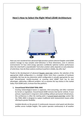
1.Ground-basedWindLiDARTDWL-300G
Erectingmeteorologicaltowersisexpensive,time-consuming,andoftenrestricted byterrainorregulations.Ground-basedLiDARremovesthatbarrierentirely.Ifyour primaryrequirementislong-termwindprofilingwithoutpermanentinfrastructure, thisarchitectureisoftenthestartingpoint.Agroundbasedwindlidarsystemlike theTDWL-300Gisdesignedtoreplacetraditionalwindmeasurementtowerswhile offeringfargreaterflexibility.
Installeddirectlyontheground,itcontinuouslymeasureswindspeedanddirection profilesacrossmultipleheights.Thissystemoperatescontinuouslyinallweather
conditionsandiswell-suitedforwindresourceassessment,powercurveverification, andwindshearanalysisincomplexterrain.Itscompactsizeandlowpower consumptionmakeiteasytodeployacrossvariedlandscapes,whethercoastal,hilly, orremote.
2.NacelleMountedWindLiDARTDWL-800T
Whyisthisforward-lookingmeasurementsovaluable?Becauseturbinesreactto windafteritarrives,unlesstheyaregivenadvanceinformation.Thissystemenables feedforwardcontrolbydetectingwindspeedanddirectionbeforeitreachesthe blades.Anacellemountedlidarsystemservesaveryspecificpurpose.Insteadof measuringwindwhereitis,itmeasureswindwhereitisabouttobe.Installedontop oftheturbinenacelle,theTDWL-800Tlooksforwardintotheincomingwindfield. Withconfigurationssupportingmulti-beammeasurement,itcaptureswinddataup to50metresahead,withhighaccuracyinbothspeedanddirection.Thisallowsfor yawalignment,pitchcontrol,andloadreduction,directlyimprovingturbine efficiencyandreducingmechanicalstress.
3.ScanningWindLiDARTDWL-012A
Whatifyourrequirementgoesbeyondpointmeasurementsandyouneedto understandhowwindbehavesacrossanentirearea?Thisiswherescanningwind lidarsystemsstepin.TheTDWL-012Aisbuiltforintelligentlong-rangewindfield measurement.UsingpulsedcoherentDopplerdetectionandmulti-beamscanning,it reconstructsatmosphericwindfieldsinthreedimensions. Insteadoflookingonlyuporforward,itscansacrossspace.BydetectingDoppler frequencyshiftsfromaerosolsandcombiningthemwithprecisepointingcontrol,it generatesdetailedwindfielddata,includingradialvelocity,spectralwidth,and signalintensity.
Windinsightsthatactuallywork.
Product Bestusedfor Whyitworkswell
Ground-basedWindLiDARTDWL300G Long-termsitestudies Easysetup,notowers needed
NacelleMountedWindLiDAR TDWL-800T Turbinecontrol Seeswindbeforeithits blades
ScanningWindLiDARTDWL-012A Area-widewind mapping Capturesfull3Dwind behaviour
Conclusion:
Attheendoftheday,technologyshouldsupportoutcomes,notcomplicatethem.Andthat iswherecarefullyengineeredsolutionsfromLiDARLasercontinuetosupportwind measurementacrossdemandingreal-worldenvironments.
BlogSource: https://frequencyfiberlaser.blogspot.com/2026/02/heres-how-to-select-rightwind-lidar.html