


The journey is better on board!


HOW TO GET TO:

Swords in Rock (Sverd i fjell)
• Bus 16 towards Madlasandnes from stop M – every hour XX:12 & XX:42 / weekend XX:42
• Stop at Madlaleiren and walk 5 min. towards Møllebukta beach
• Return bus departs every hour weekdays XX:08 & XX:38 / weekend XX:08
Iron Age farm (Jernaldergården)/ Ullandhaugtårnet (viewing point)
Bus 5 from stop M every 15 min. / weekends once or twice an hour, or every 15 min, during peak hours.
Stop at Jernaldergården. Follow the road signs to Ullandhaugtårnet.
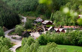
Sandnes every hour weekdays XX:43, less departures weekends. Get off at Gramstad and walk up Fjogstadveien (1,6 km) and follow the signs. You can also continue to Dale and start hiking there. Several return times from Gramstad or Dale.
IN CASE OF EMERGENCY:
in direction
Well-marked parking area. From Egersund, take RV. 42 in direction E39. After passing Slettebøvatnet (lake), turn right at Sletteidveien.
Other alternatives are getting there by bike or foot from Egersund centre or by taxi. Bike rental or guide booking at Egersund Tourist Information Office.