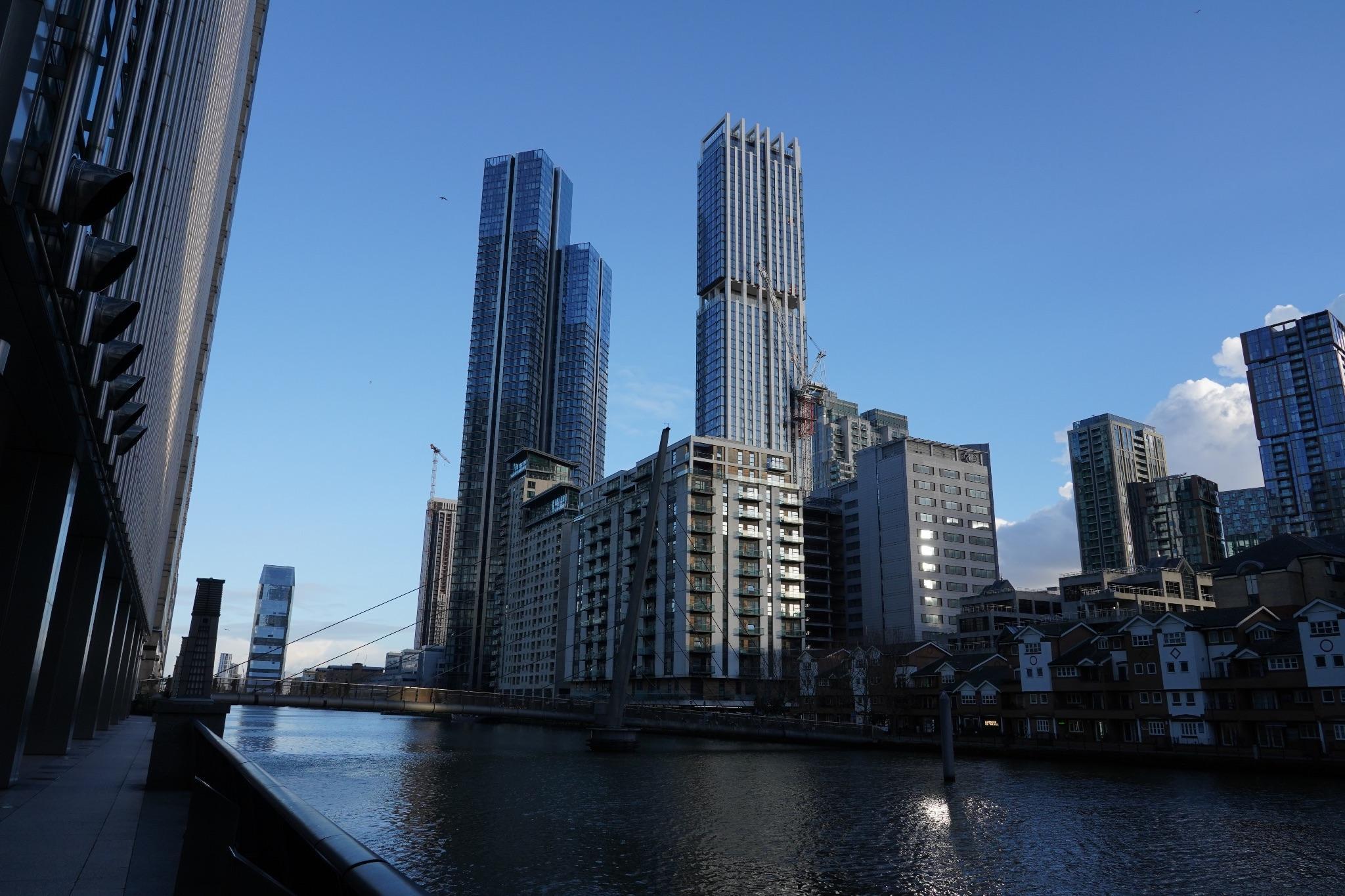
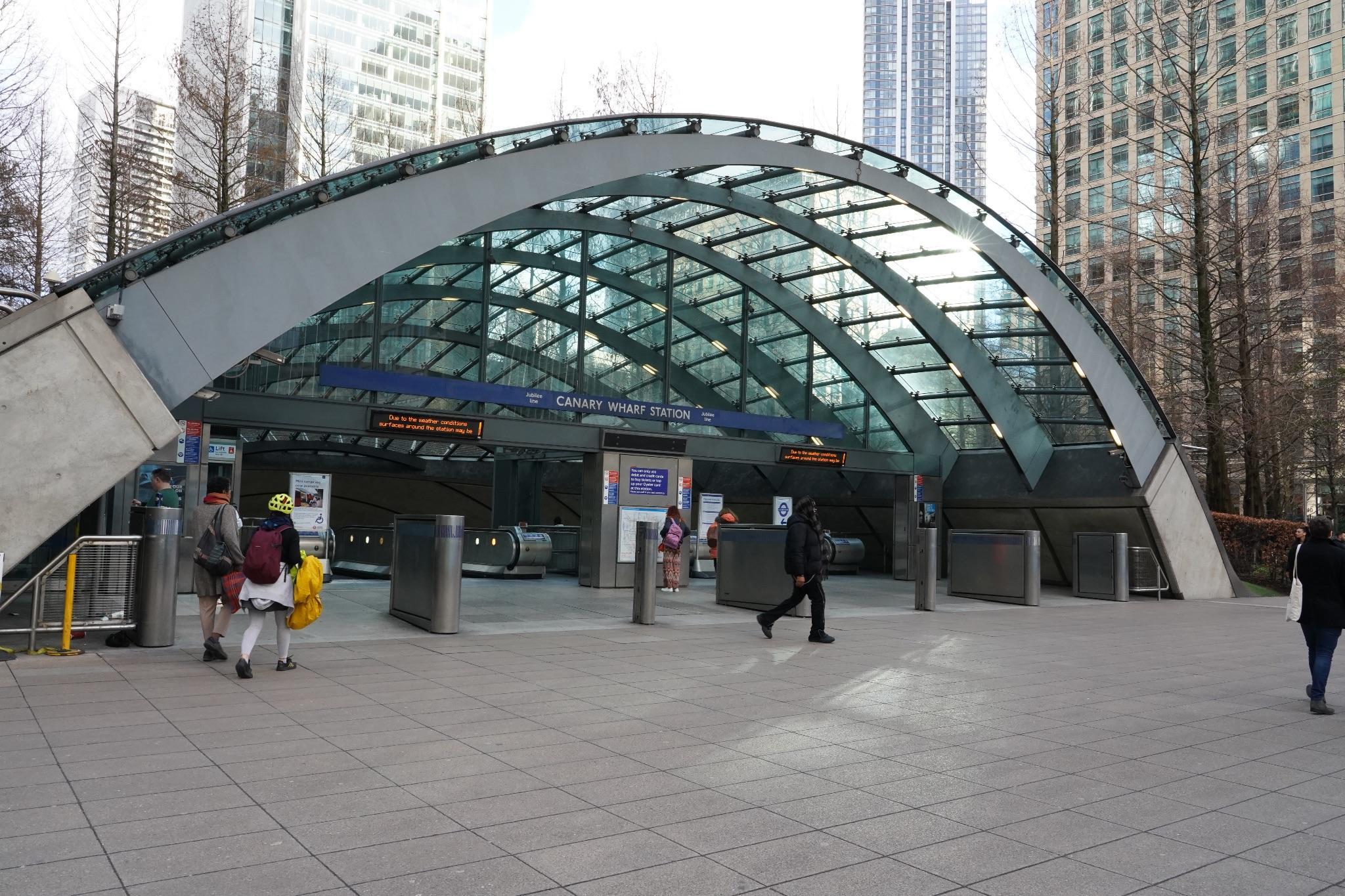
INTRODUCTION-CANARYWHARF

RESEARCH, SENSEMAKING
AreasCoveredinPublication:
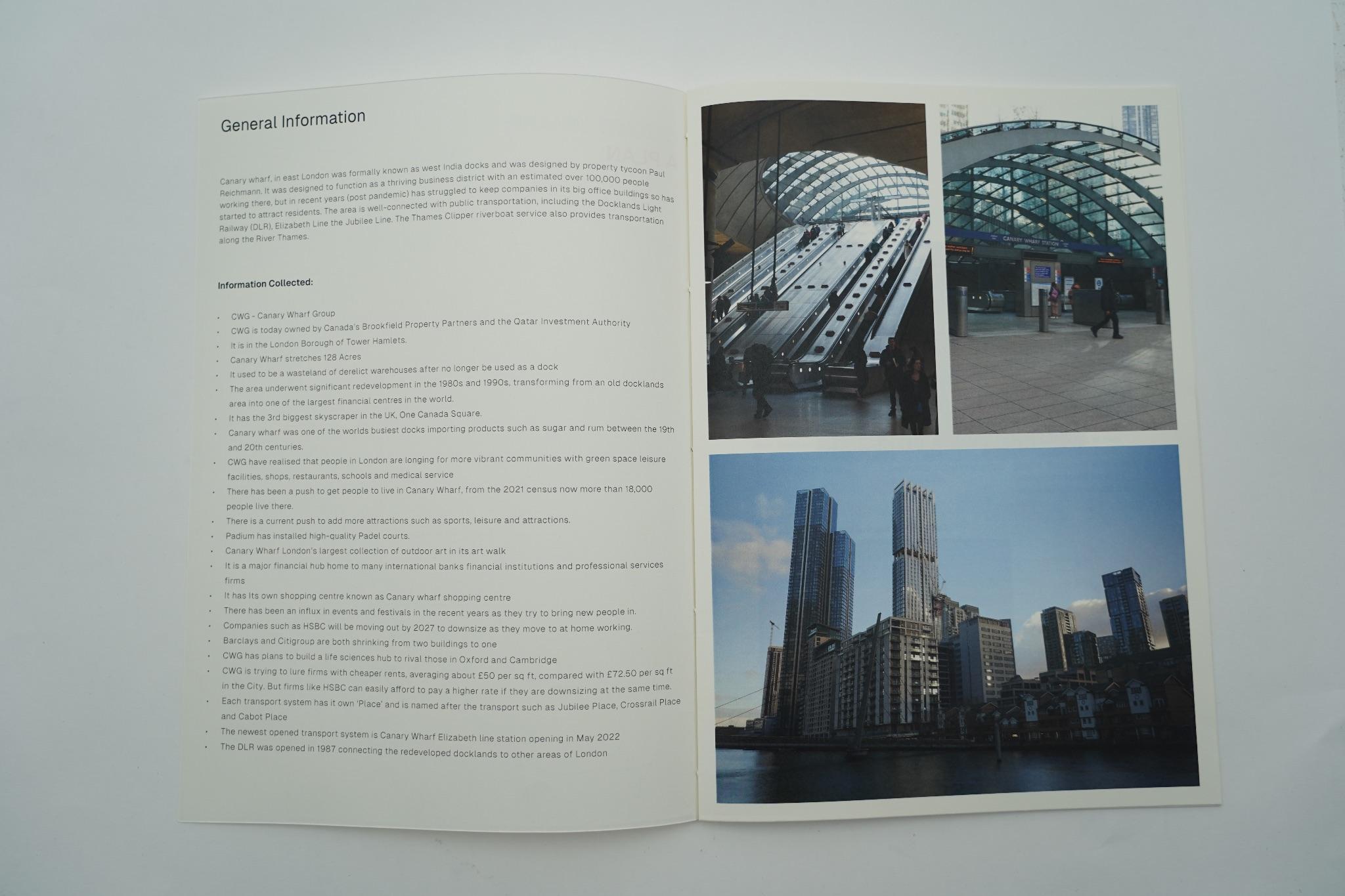
- GeneralInformation
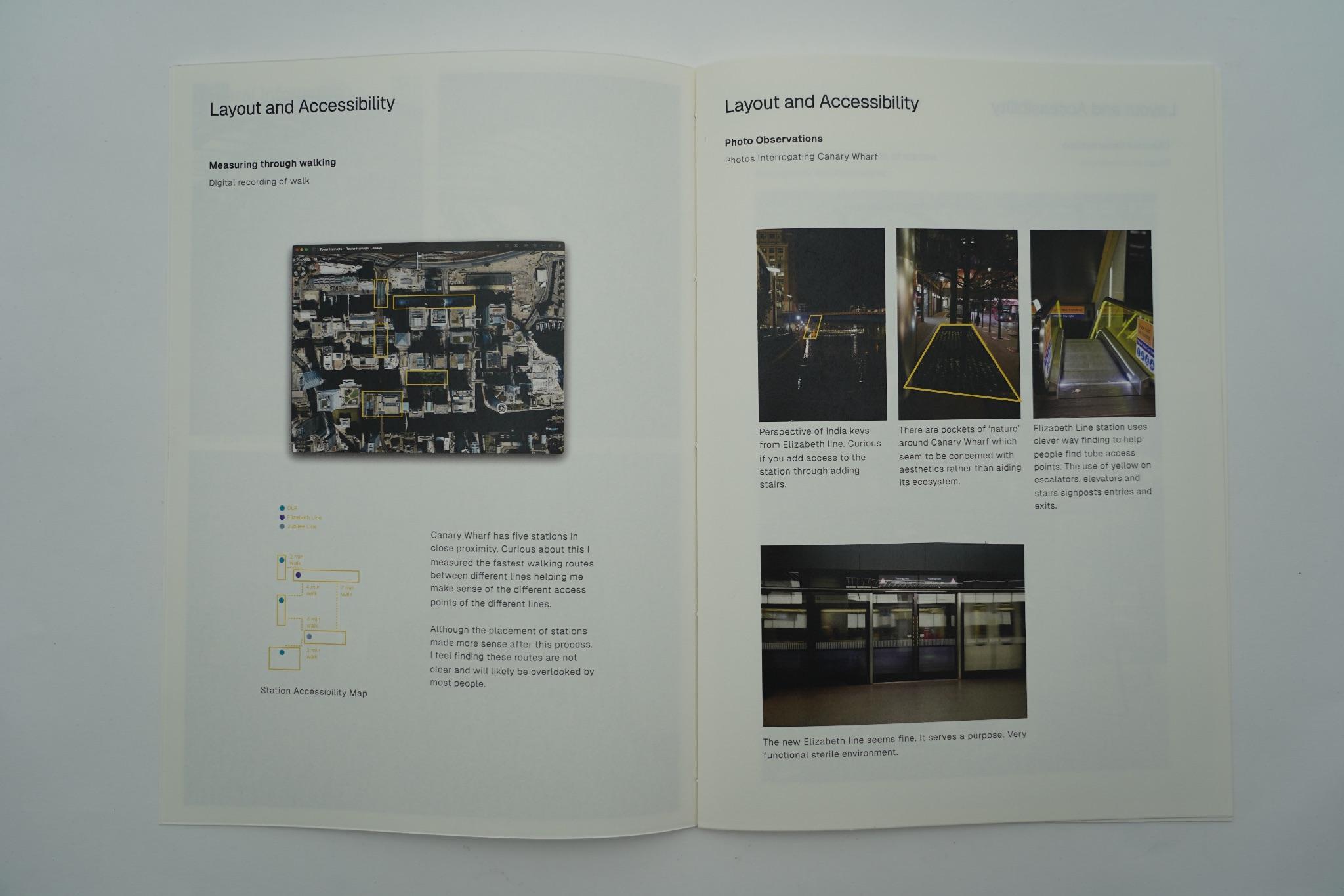
- LayoutandAccessibility
- WalkingandCycling
- Environment
- DLREnvironment
- PainPoints
- Context
- CultureandCommunity
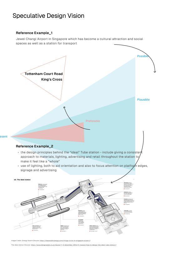
- SpeculativeDesignVision

WIP: Need better image
FUTURECASTINGWORKSHOP
5Year
10YEAR 30Year~
10-30Year
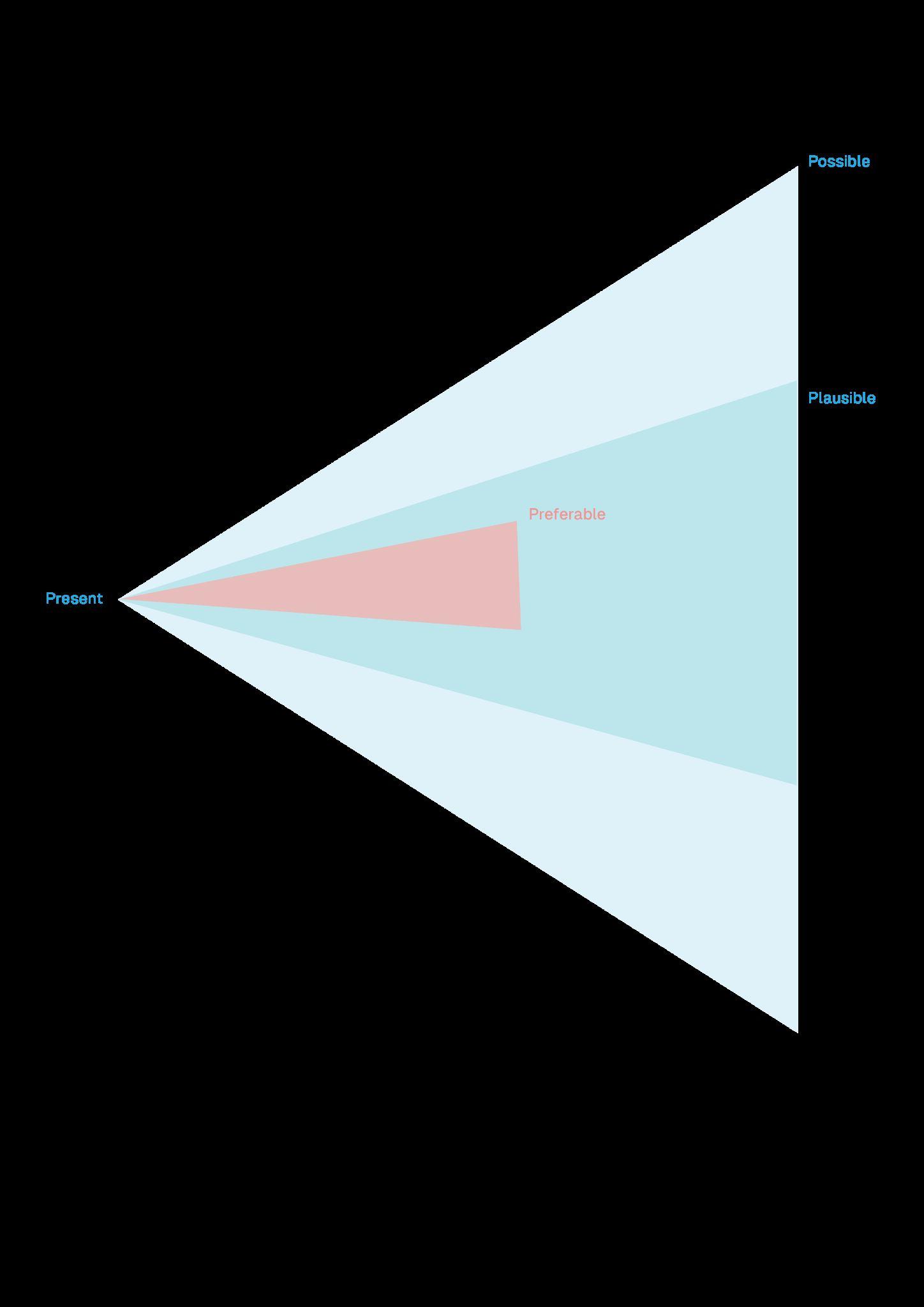
>CONECHARTOFSPECULATION
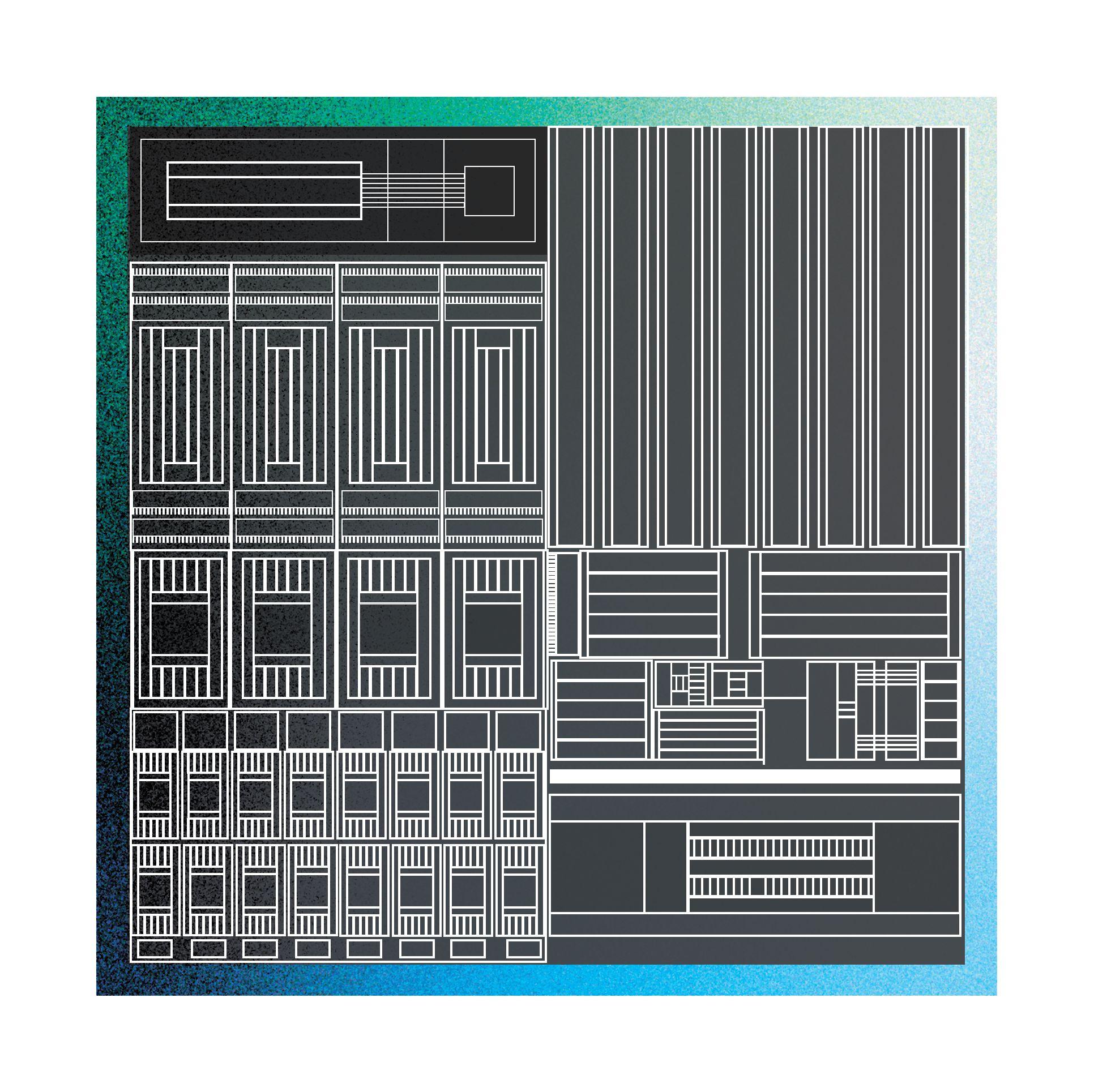
SPATIALSTATIONGUIDE
RATIONAL:
ThefutureofCanaryWharf,abusinesshubareainEastLondon,has beenenvisionedthroughatimeline,withtheintroductionofour innovativespatialsystem,whichourgroupcreatedforthisspeculative stationproject.CanaryWharfissettobecometheinauguralstationto implementthissystem.Utilisingambientsoundandvisuals,weaimto guideindividualsseamlesslythroughoutthestation.
>TIMELINEOFSPECULATION
2030:SpatialAudio
2060:NeuralChips
2090:SpatialLighting
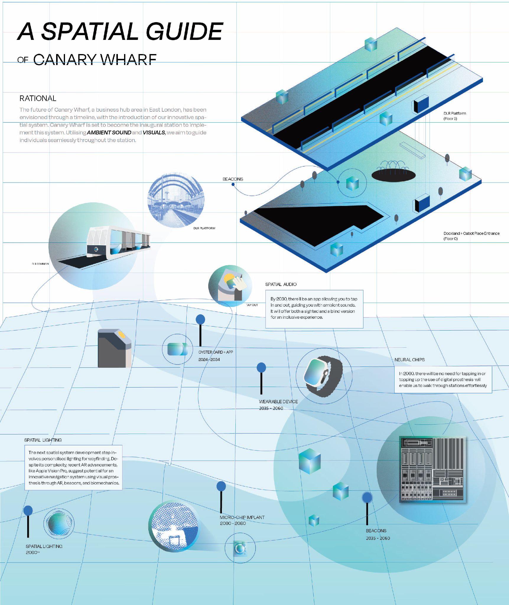
SPATIALSTATIONGUIDE
BEACON IDEATION
- Beacons utilise a variation of UW1 chip to communicate to other audio devices and other beacons.
ULTRAWIDE BAND

BEACONS, SPATIALAUDIO, SPATIAL
LIGHTING,
Speculativetechnologythatthespatialsystemwouldutiliseinthe future.Beaconsbeingthecentraltechnologywithinthesystem.

BEACON
BENEFICIALPOINTS:MACHINELEARNING
Withthepowerofplatform-levelspecificcommuterdata,wewillhave accesstohyper-specificrealtimeinformation.Thisinformationwilloffer thefollowingcapabilitiestousersandinternally:
- Alternativerouteroutingtoavoidbusiestpartsofthestation,downtothe busiestescalatorsorbusiestcorridors
- Alternativetraindivertingandlinediverting,toavoidthebusiestpartsof thenetworkbutstillgetacommuterfromAtoB
- Bettertrafficandcrowdcontrolthroughdeployingstaffinrealtimetothe busiestexactpoints
- Fasteraccesstohelpwithbeaconsbyidentifyingauser’sexact positioninginthestationwithoutthemevenneedingtoheadtoaHelp Point
- ThroughMachineLearningandtheSpatialSystem,userswillhavethe confidencethatitstartstolearntheirjourney,creatingapersonalised experiencegettingthemfromAtoBinthemostefficient,andleast crowdedmannerpossible.Withambientcomputing,thisexperiencewill evenbelessstressfulwithchimesgracefullyhelpingusersreroutetheir journey,knowingthattheintelligenceofTfLwillstillgetthemtotheir destinationontime,evenwhenusingunfamiliartransportmethods.

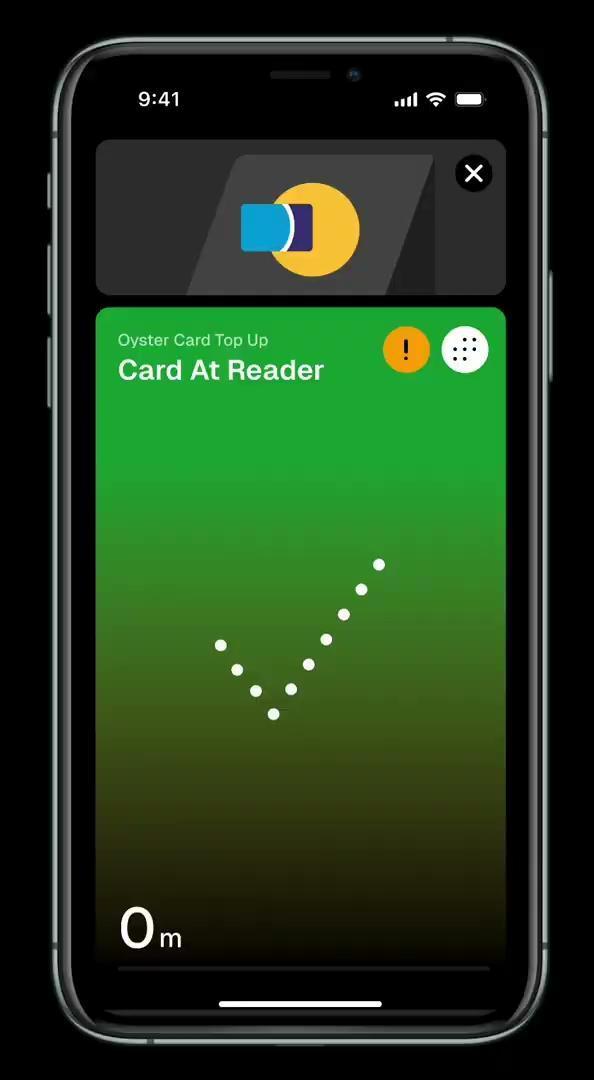
CardTopUp SpatialExperience1
ThisSpatialExperienceuses soundandon-screenvisualsto guidetheuserphysically.
ThisSpatialExperience: -guidestheuserholdingtheir card, -totheCardTopUpterminal -topsuptheirCardwithanew value -confirmssuccessfulTopUp
Real-timedistancedatafrom beaconsandtheUltra Widebandchipinthecardand theterminal
Real-timepositiondatafrom beaconsandtheUltra Widebandchipinthecardand theterminal
On-screendot-basedvisuals groundtheuserateverystep oftheprocess
ATopUpcardpopsupasthe userapproachesthereader, allowingthemtoseamlessly topup
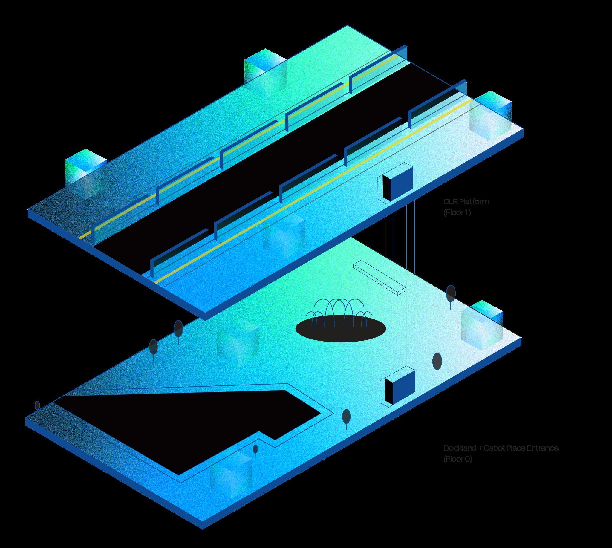
SpatialStation
Beacons
TheSpatialSystemuses beaconstohelpdeterminea user’spositioninthestation.
Beaconsareplacedatentry andexitpointsthroughoutthe stationtotrackpositioningand relaytheinformationtothe user,eithervisuallyorthrough sound.
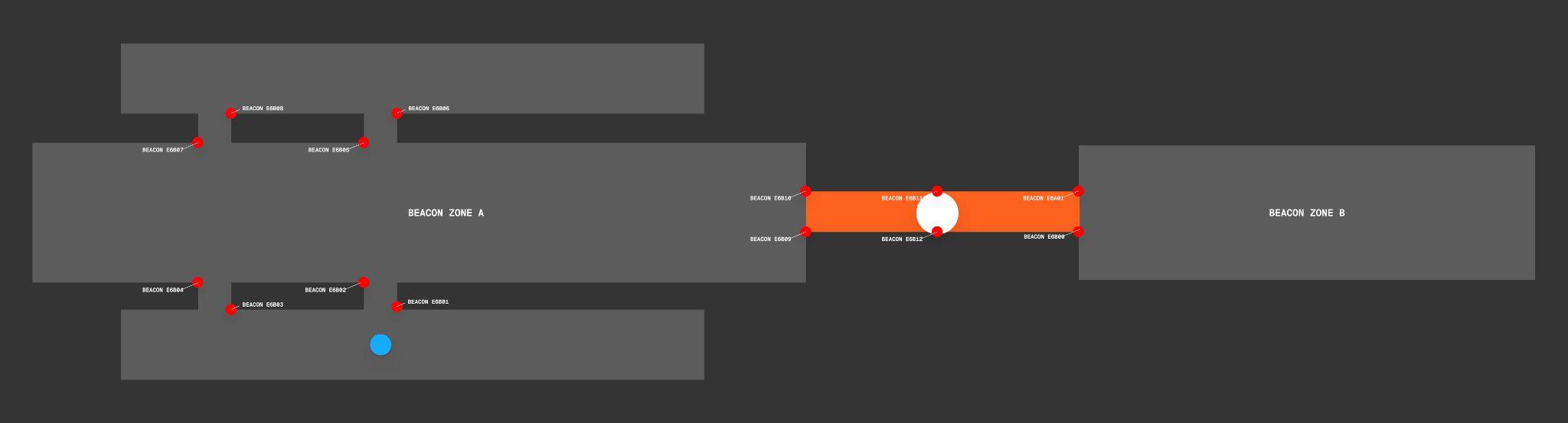
Thereddotshereareexamplesof wherebeaconswouldbe positioned,andhowastation wouldbesplitupintoBeacon Zones
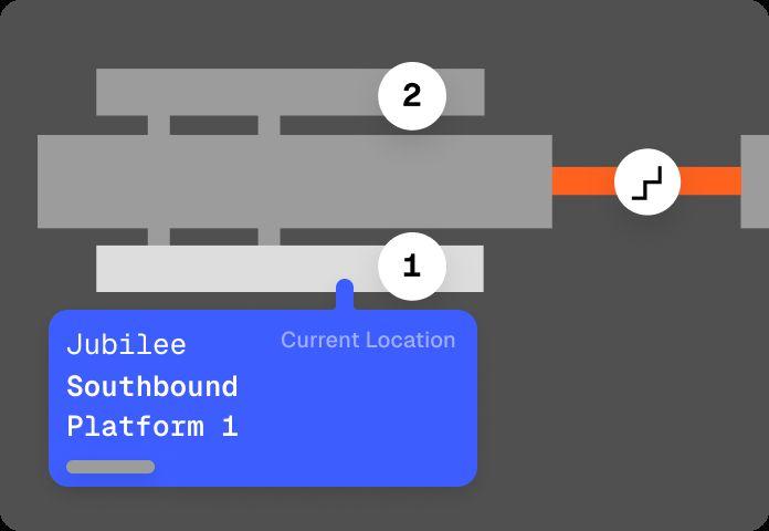
In-appReal-timedistancedata frombeaconsandtheUltra Widebandchipinthecardand theterminal,allowstheuserto quicklyseewheretheyarein thestation,andwhereother platformsandexitsarerelative tothem
Lifts,stairwaysandescalatorsare examplesofkeybeaconlocations thattriangulatetheuserinthe space,calculatingtheuser’s direction(in/outofthestation)and likelyfinaldestination(whichlinks withtheSmartMachineLearning)
SpatialSystem
PrimaryApp Interface
ThisSpatialExperienceuses soundandon-screenvisualsto guidetheuserphysically.
Theappoffers: -livepositioningthrough differenttypesofmapsfor eachstation(platformlevel, stationlayoutandexterior) -directionstoconvenient placesforfunctionslikeTopUp Card,TapIn/Out,LiftsandHelp Points -livelocationsharingwith friendsandstaff,withaclosed beaconnetworkinthestation
Real-timepositioncodecanbe sharedwithstaffquicklyto provideemergencyassistance
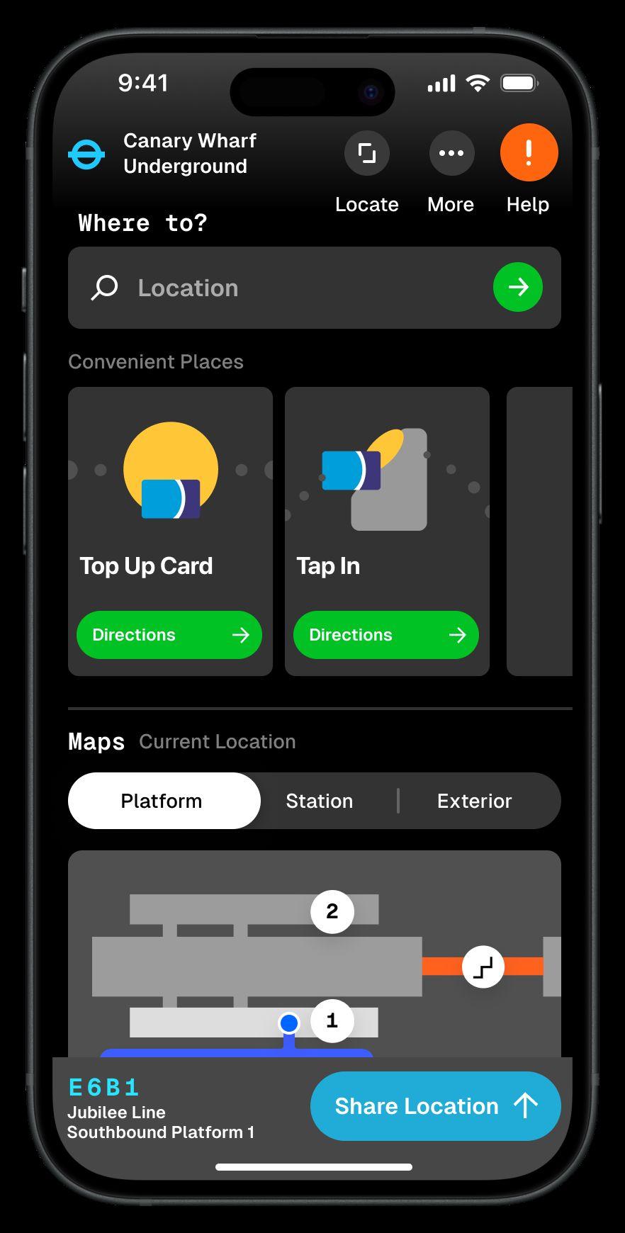
Quickaccesstohelpbysending yourreal-timepositioncode,and beacondata,tostaff,toget assistancetoyouquickly.
LiveDirectionstoplatforms(through thesearchbox)ortoconvenient placesforTopUp,TapIn/Out,Lifts, EmergencyExitsandHelpPoints
Mapsprovidingdetailedlayout informationonPlatformLevel,Station LayoutandExterior.Thesemapscan showbusiestpoints,currentlocationand accessibleroutesaround.
ShareLocationupwithfriendsandfamilyin aclosedsystem,connectingwithoutside cellulartowers,andinsidethroughthe beaconstoabeacon-specificlocation
FINALOUTCOME
PaymentPoints
NFCTagsInside-Youcantapyourphoneandan animationwillsimulateour‘SpacialSystem’

Tapinpoints

ThankYou!
 Team3B: Louie,Jackson,Ejae,Rory