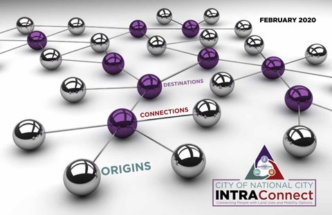
National City INTRAConnect

Page 1


DESTINATIONS

CONNECTIONS

ACKNOWLEDGEMENTS

CITY OF NATIONAL CITY

Stephen Manganiello, Director of Public Works / City Engineer

Brad Raulston, City Manager

Martin Reeder, AICP / Principal Planner

Raymond Pe, Principal Planner

Megan Gamwell, Economic Development Specialist / City Managers Office

KTUA

Michael Singleton, AICP-CTP, PLA and LEED AP / Principal in Charge

Tom Bertulis, PTOE / PE / Project Manager

Alex Samarin, GIS Technical Manager

Jacob Leon, ASLA / Associate

Silvia Fang, GIS Analyst / Mapping Coordinator

Juan Alberto Bonilla, Urban Designer / Document Production

Chris Stebbin, ASLA Mapping / Research

CIRCULATE SAN DIEGO

Juan Antonio Ramirez, Outreach Coordination

LIST OF FIGURES

Figure

Figure

Figure 5-3: Public Input Map with All Potential Projects .................................................................

Figure 5-4:

Figure

LIST OF TABLES

Table

Table

Table

Table

Table

Table

Table

Figure

Figure

Table 5-17: “D” Avenue Cost Estimate ...................................................................................................

Table 5-18: General Adjustments to Connections, Destinations and Origins to be Considered per Neighborhood .................................................................................................................

Table 5-19: Recommended Infill Development and Infill Park Projects

Table 5-20: Recommended Transit Improvements and Shuttle Projects

Table 5-21: Federal Funding Sources .....................................................................................................149

Table 5-22: State Funding Sources

Table 5-23: Local Funding Sources.........................................................................................................

01 Introduction

1.1 PROJECT DESCRIPTION

The Integrating Neighborhoods with Transportation Routes for All Connections (INTRAConnect) project is about connecting people who would like to live in a healthy and vibrant environment to areas of National City that can best support this lifestyle. Improvements in safety and healthy activities are important aspects of this project.

The City of National City has consistently taken an active role in improving public safety, health, and mobility options for its citizens. One method of obtaining real on the ground improvements has been the pursuit of local, state and federal grant programs. The INTRAConnect project is a result of obtaining a Caltrans Sustainable Transportation Planning Grant in 2018. The intent of these grants is to provide assistance for the planning of community’s transportation elements that are more centered on sustainable practices.

This Sustainable Community Caltrans grant has been used to identify the specific areas of National City that should be considered for a higher level of transportation investment, as well as to identify future opportunities for compact mixed-use infill development near transit services. This analysis is consistent with the San Diego Association of Governments (SANDAG) direction on the Smart Growth Framework and specifics indicated in the Land Use and Sustainability Communities Strategies identified in San Diego Forward. Although certain areas warrant investment based on their existing conditions and concentration of origins and destinations, the project will also identify improvements throughout all neighborhood areas so that safety and access can be improved.

The focus of the grant funded efforts is not on land use planning and regulatory changes, although it is discussed. Some level of land use analysis is essential to identify the best locations for future investments as well as to make general recommendations of areas that need increases in destination options or origin densities.

Three additional aspects need to be noted:

1. First, the more you concentrate alternative modes and programs in areas of mixed use (that are of appropriate walking or biking scales), the more people will self-select these communities to live in.

2. Second, better the investment of public funds for street improvements along with the leadership the city can provide in these areas, the more likely private investments will follow.

3. Third, innovative developers want to build where millennials and retired baby boomers want to live. So why not attract them with a quality of life and ability to live in a car light environment, where healthy activity and alternative transportation options exist?

The INTRAConnect project will result in a product that allows the City of National City, to direct future expenditures on transportation initiatives, roadway travel lane improvements, and public realm street spaces that will help initiate the development of private properties with the types of development that will be supportive of transit, walking, biking, and shorter vehicle trips. These efforts will require the coordination of land uses, street investments, and program development that may include Transportation Demand Management (TDM) and Parking Demand Management (PDM) efforts.

1.2 COMMUNITY AND STUDY AREA OVERVIEW

National City is located in San Diego County, California. The city is approximately five miles south of downtown San Diego and eleven miles north of the Mexico-United States border. It is bordered by the City of San Diego to the north and east, San Diego Bay to the west, and the City of Chula Vista to the south. Both Interstates 5 and 805 cross National City from north to south, and State Route 54 traverses the southern edge of the city. In addition, a small incorporated community known as Lincoln Acres, is located to the southeast of National City, north of State Route 54 and east of Interstate 805.

National City is home to roughly 61,000 people over approximately nine square miles. According to SANDAG’s 2010 estimates, the city’s median income is the lowest in the county at $43,168, with 74 percent of households making less than $60,000. The entirety of the city is located in census tracts scoring in the 81-85 percent disadvantaged category or worse using CalEnviroScreen 3.0. The median age is 32.5 years old.

The city has a large minority population where the majority come from a Hispanic or Latino background. The low socio-economic status of National City residents has led to overcrowded households (the highest persons per household average in the county) and a disproportionate share of under-utilized land uses. The poverty rate is 22.7 percent. The median property value is $345,400.

The city’s socio-economic status lends itself to be a very transit oriented and multi-modal community. According to the American Community Survey’s 2010 estimates, 13 percent of employed residents either bicycle, walk, or use public transit to commute to work. SANDAG estimates that San Diego County’s average is 7 percent for these three modes of transportation. Thus, National City has almost double the amount of alternative transportation users as the rest of the county. Twenty-three percent of the residents are 16 years old or younger, and the city has a high rate of children walking to school, roughly double the national average based on preliminary evaluation efforts conducted by Rady Children’s Hospital.

According to 2010 Census data, there are approximately 15,502 occupied households in which 1,486 are without vehicles (nearly 10 percent). Those households with vehicles often face above-average length commutes, averaging 24 minutes as per the 2014 ACS. This fact, in two-parent households, often leaves one parent at home with no vehicle during working hours. These factors combine to create an extremely walk, bike, and transit-dependent community, and it is imperative that safe, convenient, and high-quality active transportation connections exist to serve local residents. This effort will provide the backbone upon which National City residents can access the schools, shopping, jobs, and transit services necessary to live in San Diego County.

Regarding safety, the high rate of pedestrian and bicycle activity unfortunately has brought high collision rates. The city has traditionally been one of the worst in California among cities its size in terms of bicycle and pedestrian collision rates.

In 2008, the California Office of Traffic Safety (OTS) began ranking 103 cities in California with a population similar to that of National City. Since that time, the city has never ranked better than 14th-worst for pedestrian collisions, and in 2013, the last year for which records are available, National City’s pedestrian collision rate was fifth-worst in the entire state. Bicycle collision rates are slightly better, but still rank in the lowest third of all cities in the category between 2008-2013.

Regionally, the development and improvement of additional transportation options are necessary to address several challenges– converting single-occupant vehicle trips to bicycle and pedestrian trips and combating the 23 percent increase in hours of delay on the region’s freeways from 2013 to 2014 as measured by SANDAG.

The city has begun to address this through an aggressive approach towards securing infrastructure grants for intersection treatments, including curb extensions, bike boxes, sidewalk infill, and other improvements, and is looking to this INTRAConnect planning effort to identify the next generation of bicycle and pedestrian improvements, particularly connected corridors which will create a safe, convenient, and seamless active transportation network throughout high-activity areas of the city.

A successful assessment and expansion of transportation options as identified in the INTRAConnect plan will develop blueprints to plan, expand, and fund corridor improvements, including bicycle and pedestrian improvements, potential mobility hubs featuring enhanced transit connections, additional bicycle parking, carshare and bikeshare services, and Safe Routes to School Improvements. This effort has made use of extensive community input from a diverse cross-section of residents and stakeholders and help National City plan for a sustainable future.

1.3 PROJECT PURPOSE

The purpose of the INTRAConnect plan is to provide a guide for improving neighborhoods so that its residents can walk, take transit, bike, or take a short drive to meet their daily trip needs. A complete community must consist of complete streets, compact development for housing, and a wide variety of retail, services, and employment.

Reaching aggressive climate action goals required under state mandates for Green House Gas (GHG) emission and Vehicle Miles Travelled (VMT) related reductions will be difficult for cities to meet without looking seriously at evolving the placement of transportation and land uses. There are a large number of transportation options that can work, if they are placed in areas where the underlying land use and street design is supportive. Spending money on innovative transportation improvements throughout a city may equitably improve safety and benefits city wide, but the funding limitations warrant finding the best locations where these monies should be used.

These Climate Action goals can only be accomplished if a full suite of Transportation Demand Management tools (TDM) are used. TDM measures are normally in addition to ridesharing partnerships, regional incentives, transit investments, and active transportation facility development. Often, the mixture of land uses, and distribution of origins and destinations, as well as the existing street grid, will determine success and failure more than the presence or absence of active transportation facilities. Putting programs and facilities in the right places is not only good public policy, it is critical for meeting the GHG mandates.

Many of the existing problems and community constraints were addressed in previous efforts by the SMART Foundation project. This acronym stands for Safe Multi-modal Accessible Routes to School, Work, Shopping, Parks, Services and Transit. This effort will build on those successes.

1.4 OBJECTIVES SUPPORTING THE PROJECT PURPOSE

1. Provide incentives to neighborhoods that are willing and able to support appropriate infill development that will in turn support business self-sufficiency and neighborhood cohesion.

2. Support local trips and travel versus regional trips and long-distance commutes by providing mobility options such as transit use, walking, biking, rideshare, and ride hailing services.

3. Evolve land use planning efforts to support smart infill growth by using the concept of a 10-minute neighborhood where overall Green House Gas (GHG) and Vehicle Miles Travelled (VMT) would be less.

4. Accommodate a car-lite lifestyle for those that chose this option.

5. Increase the use of transit and other modes of transportation.

6. Develop placetypes that represent the right mixture of land use, transit support, public facilities, housing options, and street patterns that support active transportation and transit investments.

7. Classify all of the city into the various placetypes and develop a menu of improvements for transportation, public space, land uses and plan processing that would result in the greatest GHG/ VMT reduction.

8. Provide equitable distribution of transportation and public space improvements for all 12 neighborhoods, with increased investment for areas that are or can be structured with sufficient local services.

9. Build upon previous investments in transportation, transit, parks, and public spaces that in turn encourage people to want to live, work, learn, or shop in these neighborhoods.

10. Support the use of planning tools such as complete streets, universal access, active transportation, healthy communities, placemaking, climate action initiatives, and other adopted policies and plans.

1.5 PROJECT FOCUS

The INTRAConnect project expands upon an earlier initiative called SMART FOUNDATION (Safe Multi-modal Accessible Routes to School, Work, Shopping, Parks, Services and Transit) that focused on providing a strong circulation foundation for the city. INTRAConnect builds on this foundation with suggested changes to origins and destinations as well as continued improvements to important connections. This strategic approach supports infill development as well as localized self-supporting neighborhoods that keep vehicular miles travelled (VMT) down, reducing GHG emissions and VMT simultaneously.

All of this effort should result in reduced VMT and associated GHG. The program has identified and suggested several TDM measures that can support car-lite and healthy transportation choices. Public investments in the identified areas will help to develop partnerships with developers who are interested in contributing to this lifestyle. Streamlining of the California Environmental Quality Act (CEQA) and permitting in these areas, as allowed for by state legislation, can also help to attract needed investment. All of these aspects allow the City of National City to partner with SANDAG, the San Diego Metropolitan Transit System (MTS), Caltrans and the State of California in meeting statewide SMART Growth, sustainability, energy conservation, air quality, and congestion management mandates.

1.6 COMMUNITIES AND NEIGHBORHOODS

As identified in the city’s General Plan, the city is divided into three communities based on their community parks (El Toyon Park, Kimball Park, and Las Palmas Park (see Figure 1-2). The three community areas are similar in size and relatively similar in population and population per acre (see Table 1-1). These community areas are further defined by 13 individual neighborhoods (see Figure 1-3). These neighborhoods are close to the scale of a 10-minute neighborhood, so this is ideal for setting the basic unit of measure for a neighborhood.

Neighborhood units guide the development and equitable apportionment of resources and amenities throughout the city. The “Neighborhood Unit Concept” encourages residential portions of the city to become identifiable neighborhoods focused on their local public elementary schools. The National City School District consists of ten public schools.

The neighborhoods vary in size from 138 acres to 698 acres and vary in residential populations from 0 persons per acre to 9,152 persons per acre (see Table 1-1). Projected populations have also been shown with the highest population anticipated at 13,467 by 2050 and the lowest remaining at 0. By percentage increase, the downtown area is expected to grow in 2050 by 410 percent to a decrease of only 66 percent of the current population for the Mile of Cars neighborhood. The highest density is currently in Rancho de la Nacion with nearly 24 units per acre, but will become nearly 47 units per acre in the Downtown area by 2050.

TABLE 1-1: Population Density per Neighborhood
FIGURE 1-2: Schools and Community Parks that Define Neighborhoods
FIGURE 1-3: National City Neighborhoods

1.7 “SHORT TRAVEL” NEIGHBORHOODS

This plan merges previously SANDAG identified “SMART GROWTH” infill areas with new opportunities for car-lite and walkable neighborhoods by identifying the mixture of current land uses (or the potential of future land uses) that can help to create self-sustaining SMART neighborhoods, SMART centers, and SMART districts. The foundational concept is the enhancement and creation of 10-minute neighborhoods where many of the day-to-day or weekly services and destinations can be walked to in 10 minutes. Assuming the low end of speeds for cycling, a 5-minute bike ride is considered to be an equivalent metric compared to the 10-minute walk time, taking into account getting a bike ready and finding parking. The actual distance travelled, however, is more than double what you can cover while walking. Using a 5-minute drive time, (which assumes getting loaded up in a car, backing out, finding parking, and unloading) is the third metric being considered. The actual driving portion is considered to be three minutes. The full distance covered is closer to how far you can get using a bike. Finally, a combination of a 2-minute walk, 10-minute wait and 3-minute transit ride has been considered as a typical local transit trip and has been shown on the accompanying map (see Figure 1-4).

1.8  DEFINITION OF A TEN-MINUTE NEIGHBORHOOD

A 10-minute neighborhood is a community where most daily trips and many weekly trips can be made by foot within ten minutes, or by bike in five minutes, or by driving in three minutes. Monthly or special occasion uses are generally considered to require further distances than what is suggested. If an individual does not work in the area, then this destination would not meet this standard. The intent of these metrics is not that all of the destinations are possible for people living in the neighborhood to reach for all of their uses. However, if any of the typical daily uses are in the area, then these trips will be shorter than in areas where there are few destinations.

When a concerted effort is made to provide or encourage mixed land uses and higher concentrations for infill residential uses, then the result is a mixture of uses that are based on the needs of a neighborhood and not the regional needs of a highly spread out community that needs to rely on long distances of commuter travel patterns.

Where can you go in a 10-minute neighborhood?

Restaurants / Breweries / Cafés

For those that desire to have a car-lite or car-free lifestyle, then they would likely self-select a 10-minute neighborhood to live in so that this lifestyle is possible. For those that are economically disadvantaged, long distance travel patterns are expensive and these individuals are likely to use transit, walk, or ride a bike to save on costs. For seniors with lower skills of driving or that no longer drive, these services and destinations are even more critical to be close. This type of neighborhood even helps those that drive regularly as long as some of their trips become shorter as a result of having various destinations closer by.

Commercial retail and services that rely on customers visiting their stores and businesses need a critical mass of citizens living nearby as well as those that visit their area or are in the area based on employment locations. These are the drop-in customers during workday hours, especially on trips heading home or at lunch time. Likewise, employees like working in areas where there are destinations to go to during their short breaks. So, employers, employees, and businesses benefit from this co-location.

DE LA NACION
Rancho
l a Nacion

1.9 PROJECT SCOPE REQUIREMENTS

1. Research and summarize the previous National City adopted policies and plans, SANDAG San Diego Forward, and other related sustainable communities, Smart Growth, and Smart Mobility studies so that previous efforts are not ignored but built upon.

2. Identify and summarize the best planning practices that encourage the development of 10-minute neighborhoods and associated VMT reductions, access to transit, and other active transportation trends. The objective is to make sure that recommendations are informed, realistic, effective, and current.

3. Highlight the most important and relevant elements that are transferable to other communities since part of the project commitment is to complete research and recommendations that can be used throughout California.

4. Complete a GIS analysis of land uses, development intensities, street grids, active transportation services, street stress levels for walking and biking, transit services, and development opportunities for underutilized properties. The objective is to identify, early on, the types of opportunities that transportation investments will be able to use to support positive development in these opportunity areas.

5. Provide an initial city-wide outreach program to help determine the best areas for future new compact infill development (given previous land use plans and policies), as well as associated supporting transportation improvements. The objective is to provide an opportunity for the city-wide public to suggest opportunities or concerns on where these prioritized areas should be further investigated.

6. Provide a second level robust outreach effort for individuals and stakeholder groups within the selected priority areas so that a more detailed level of opportunities, priorities, and concerns can be documented.

7. Develop educational and workshop materials to help provide the TAP and the public a positive perspective on compact infill development and the associated investments that could be provided to generate public improvements that would benefit the local community. The objective would be to help educate stakeholders on the benefits of integrated land use and transportation and how the benefits of proper planning and design can result in an improved quality of life and economic stability for their neighborhoods.

8. Provide clear and concise recommendations about plans and policies that will be put into place to provide incentives and guidance to public and private

1.10 COMMUNITY BENEFITS FROM 10-MINUTE NEIGHBORHOODS

The following benefits could occur for residents and visitors of National City’s 10-Minute Neighborhoods:

1. Improve the health of residents.

2. Reduce traffic volumes and associated traffic.

3. Encourage smooth flowing and calmed traffic.

4. Increase mobility options for older non-drivers.

5. Work towards cleaner air and less greenhouse gas emissions.

6. Encourage social connectivity and open interactions.

7. Encourage business expansion, stability, and recruitment.

8. Provide incentives and investments in neighborhoods that support business self-sufficiency and neighborhood cohesion.

9. Strengthen the local economy by capturing local spending.

10. Foster small scale start-up businesses that tend to be local and new.

11. Improve access to affordable housing in conjunction with affordable transportation.

1.11 SPECIFIC ELEMENTS TO BE ADDRESSED

Several ongoing efforts and local factors need to be taken into account. The following elements need to be integrated into the overall plan:

1. The project must improve connections to the 8th Street entrance to Naval Base San Diego and leverage existing Highway Safety Improvement Program (HSIP) grants to refine and improve traffic signal management and evacuation plans.

2. Reduce private-vehicle congestion on major roadways that support freight movement, transit, and military access.

3. This plan will develop strategies to encourage new development and transportation investments in sustainable areas, which will lower GHG emissions and conserve energy.

4. The project needs to develop enhanced corridors designed to connect residents and land uses within and to National City with an emphasis on those areas that are close to already being a 10-minute neighborhood.

5. Identify and plan for the integration of emerging transportation technologies.

6. Efforts from this project will also help to preserve the capacity of regional facilities by shifting local trips to local assets.

1.12 MAJOR STUDY COMPONENTS

The three elements that this study considers when discussing the importance or the context of land use planning and transportation planning for 10-minute neighborhoods are:

1. Origins – Where people live or temporarily live such as lodging.

2. Destinations – The broad array of land uses that include employment, schools, general public services, retail, parks, recreation, and other government services.

3. Connections – These are the physical connections between origins and destinations and can include roads, trails, and rail lines that are either public or private.

All three of these elements are critical in creating a 10-minute neighborhood (see Figure 1-5).

FIGURE 1-5: Diagram of the Three Major Components of this Plan

1.13 OVERALL APPROACH

The INTRAConnect Plan will guide development of bicycle, pedestrian, school, and ADA/transit access improvements so that residents may make local trips using alternatives to privately-owned vehicles. This will be done through the following steps:

1. By reducing trips and improving transportation choices for local trips, congestion on regional transportation could be lowered. Lowering demand is more cost effective than building new supply.

2. Internalizing trips will encourage the development of local services and local destinations, which will in turn increase reliance on locally owned businesses and services resulting in a stronger economy.

3. INTRAConnect corridor improvements will be focused on high-collision corridors and will prioritize bicycle and pedestrian safety countermeasures while ensuring vehicular circulation is maintained.

4. The outreach program will focus on the General Plan’s “neighborhood unit” concept and will ensure outreach is conducted at the neighborhood level, promoting outcomes consistent with local values and norms.

5. The INTRAConnect Plan provides for lifestyle choices that lower vehicle miles travelled and GHG. The project will focus on the existing public ROW.

6. The project connects local destinations and origins, which results in decreasing the number and length of vehicle trips. Residents’ transportation costs savings could then be reinvested in the local area.

7. The project will calm traffic and create safer intersections and bikeways. The addition of new sidewalks will provide safe access to attractive destinations and improved transit opportunities.

1.14 PROJECT PARTNERSHIPS AND ROLES

There are several key player groups and stakeholders that need to be integrated with each other in order to have a relevant and coordinated effort.

One group is associated with National City officials, staff, and other government institutions. See the INTRAConnect partnerships figure.

A second group is associated with business owners or developers that are creating future origins or destinations within the City of National City.

The third but equally important group is individual property owners and other citizens of the City of National City. All three need to relate to each other in terms of this project process as well as how they each have a role in the future of National City and that role is best accomplished through cooperative partnerships with each other (see Figure 1-6).

To summarize the City of National City’s quality of life initiatives, “Together We Can” is more than just a brand byline, it is a willingness to work with the state, the region, its citizens living and working in National City, as well as with development partners, agencies, and public non-profit groups, all for the betterment of the community. The INTRAConnect Plan is another sample of how this effort can result in benefits for the entire community.

FIGURE 1-6: INTRAConnect Partnerships Diagram

1.15 OVERALL PROCESS

This type of project needs a sequential and logical process to be able to arrive at realistic and relevant recommendations. The project has identified nine major steps for completing the study. Step 1 simply divides the study area up into communities and neighborhoods that have already been described in the General Plan. Step 2 identifies the scale of various modes of transportation to help define the 10-minute zones. Step 3 is used to capture the mixture of each of the neighborhoods in the study area based on land use diversity, density of origins, and the concentration of destinations. Step 4 looks at categorizing the neighborhoods into typologies that have overall dominance in the neighborhood. The elements that are compared include land use, origins, destinations, and circulation improvements. Step 5 includes the review of potential treatments that can be applied to neighborhoods that are not performing well for the density and distribution of origins, destinations, and connections. Step 6, although occurring throughout the process, represents community input. This input will be used to determine the types of improvements that are needed to move any particular area into a better 10-minute neighborhood. Step 7 identifies improvement plans for one project per neighborhood and eight community-wide projects. Step 8 will prioritize and narrow down the projects that are to move forward with more specific improvements. Improvements will be conceptual, but up to 20 projects will receive some level of analysis and recommendations. The final step will include getting consensus from the community on the recommendations (see Figure 1-7).

Map Current Neighborhood Typologies and Potential 10-minute Neighborhood Centers

Expand Toolbox of Treatments per Typology to Improve Connectivity & Sustainment of Businesses

Summarize Land Use Characteristics of a 10-minute Neighborhood

Meet with Community to Determine Areas of Improvement in Streets, Public Spaces and Mobility Options

Summarize Walking, Biking, Transit, Street Characteristics of a 10-minute Neighborhood

Define Current Districts / Neighborhoods

Recommend Changes in Land Use, Policies, or Programs to Implement

Prepare Project Improvement Plans for 1 Project per Neighborhood & 8 Community Wide

Prioritize Projects based on Community Suggestions

FIGURE 1-7: Project Process Diagram

1.16 RANGE OF POTENTIAL IMPROVEMENTS

The majority of the recommendations that a government agency can support and invest in tend to relate to transportation elements. Cities without large financial sources also tend to obtain transportation grants for these improvements. However, land use changes are equally important under the 10-minute neighborhood concept. Only when land uses evolve in locations of mixed use or that support higher density housing and a variety of destinations, will trip reduction be feasible. These changes are well within the authority of local jurisdictions, but they take a lot longer to change and they can often not dramatically change existing use patterns.

There are categories of treatments that address a particular shortfall in each neighborhood. Under connections, the categories are grouped as Active Transportation, Roadway, or Mobility Option Elements. Under Origins, the treatments are limited to Appropriate Housing Elements. Under destinations, the treatments are mixed use land use elements. Finally, to help businesses and investments in the City of National City, the final elements are either processing streamlining elements or other assistance tools so that the City can assist applicants, landowners, and developers (see Figure 1-8).

1.17 IMPORTANCE OF THESE EFFORTS

Climate change, resiliency, and sustainability are interchangeable terms regarding the current situation that society finds itself in today. Although a variety of traffic flow technologies, Transportation Demand Management (TDM) policies, renewable energy sources, transit options and vehicular efficiencies may help to reduce green house gas emissions, none of these will be successful without overall reductions in Vehicle Miles Travelled (VMT).

As long as we continue to allow land use patterns and development trends to create sprawl and separate the distance between our origins and destinations, we will not adequately address climate change. As typical in regions like Southern California, 48% of all GHG emissions are coming from transportation. Total vehicles on the road today increase with population and economic growth. The number of miles per vehicle continue to go up as people increase wages and desire more mobility. Perhaps the largest factor contributing in to these mileage trends are changes over the last 75 years of development patterns. Growth has resulted in not only rural and suburban sprawl, but also the centralization of destinations away from where we live.

INTRAConnect Treatments

If

difficult, Then Consider:

If there are not enough people to support businesses, transit & services , Then Consider:

To encourage and assist changes in land use and business development, Consider:

Regional employment centers, regional retail, regional schools, regional entertainment, and regional parks have all shifted our local travel patterns to regional patterns. Early man’s movements were limited by physical capabilities and transportation options, technologies, and infrastructure. Villages were appropriately scaled, towns were well mixed with land uses, and cities were reasonable in size. For survival purposes, humans evolved to walking or running up to ten-miles a day. Transportation modes changed and provided opportunities to travel more but walk less. As human health and fitness declines, it is very appropriate to start scaling our communities to reverse the sprawl and regionalization of our land uses and accommodate shorter driving trips and encourage active transportation and transit use.

If there are not enough destinations or jobs near populations , Then Consider:

The proliferation of roadway systems accommodated this type of behavior over this 75 year period. However, it is the lack of control of land uses that is also to blame. Planners have often followed the principles of “Make no Little Plans” and “Keep it Simple”. The Daniel Burnham quote from City Planning in the early 20th century encouraged large scale development that was often single purposed and well beyond human walking scales. The planning profession over simplified planning, which resulted in large scale single purpose districts and regions. Although there was originally good health and nuisance reason for zoning, a new look at land use planning and integration is needed. Looking at the scale of our neighborhoods is perhaps the best place to look for real changes. This is not social engineering, it is planning that integrates transportation and land uses in a manner that will result in lower GHG through reduced VMT.

FIGURE 1-8: INTRAConnect Treatment Diagram

02 Existing Conditions

2.1 NATIONAL CITY DEMOGRAPHICS

Understanding the people of National City, in terms of quantity, geographic distribution and ethnic and age backgrounds, is an important first step in understanding the dynamics of origins, destinations, and the connections between them.

2.2 CURRENT POPULATION CHARACTERISTICS

SANDAG estimates that the population of National City in 2020 will be 62,342 (SANDAG Series 13 Regional Growth Forecast). Table 2-1 shows the population density for 2020 per Master Geographic Reference Area (MGRA), a spatial unit based on Census blocks that is maintained by SANDAG for regional transportation modeling.

Population density in 2020 is highly variable among National City neighborhoods, with pockets of dense population interspersed in low- to medium-density neighborhoods. Neighborhoods with large areas of industrial, military, or commercial land uses (Harbor, Mile of Cars, Plaza Bonita) have isolated pockets of low-density population (see Figure 2-3). The Plaza Bonita neighborhood has no population in 2020 because it is a single-use regional commercial center. Future densities out to 2050 are shown on Figure 2-4. The percent changes of density are shown on Figure 2-5 on page 17

The average population density per community and neighborhood in National City for 2020 and 2050 is 13.3 people per acre, increasing to 18.1 people per acre in 2050 (see Table 2-1). The neighborhoods vary in size from 138 acres to 968 acres and vary in residential populations from 0 persons per acre to 9,152 persons per acre. By 2050,

the population of National City is forecast to increase 37 percent to 85,121 (SANDAG). Spatial trends in population density remain largely the same as 2020, with pockets of dense population among low- and medium-density areas. The areal extent of low- and medium-density increases, along with significant high-density growth in the Downtown, Central, Las Palmas, Rancho de la Nacion, and Ira Harbison neighborhoods.

Projected populations have also been shown with the highest population anticipated at 13,467 by 2050 and the lowest remaining at 0. By percentage increase, the downtown area is expected to grow in 2050 by 410 percent to a decrease of only 66 percent of the current population for the Mile of Cars neighborhood. The highest density is currently in Rancho de la Nacion with nearly 24 unit per acre, but will become nearly 47 units per acre in the downtown area by 2050.

2.3 POPULATION AGE DYNAMICS

Figure 2-2 displays a population pyramid for 2020, showing the percent of the population per age group for males and females in National City. The population age structure in 2020 is skewed toward younger age groups, with 21.5 percent of females and 26.6 percent of males under age 30. In contrast, 10.2 percent of females and 7.5 percent of males are over age 60. The 20-29 age group is the highest percentage of the 2020 population for both females and males, with 8.0 percent and 12.4 percent, respectively. For males, this age group has approximately double the percentage representation of the next oldest and youngest age groups, possibly due to the representation of the military population.

Tables 2-1 and 2-2 summarize the estimated population changes in National City for 2020 and 2050 for population groups that are important to this study: youth, working age adults, and seniors. Youth and working

adult age categories experience minor decreases as a percent of total population for both forecast years. By 2050, each group experiences significant population growth, notably the working age and senior population (28 percent and 95 percent growth, respectively).

2.4 SOCIO-ECONOMIC FACTORS

Although income is not a great predictor in determining who is likely to walk, bike or take transit, there is a correlation for that segment who have little choice but to travel by less expensive means. Figure 2-6 on page 18 shows the 2017 median household income and Figure 2-7 on page 19 shows the 2017 percent of population below the poverty level.

TABLE 2-1: Existing and Future Populations per Neighborhood
TABLE 2-2: Existing and Future Age Distribution
FIGURE 2-1: Population Age Distribution for 2020
FIGURE 2-2: Population Age Distribution for 2050
FIGURE 2-3: Population Density per MGRA based on 2020 Population
FIGURE 2-4: Population Density per MGRA based on 2050 Population
FIGURE 2-5: Population Density Changes Between 2020 and 2050 Conditions

Only 4 percent of National City workers aged 16 and up did not have access to a car (see Chart 2-4). Most workers (56 percent) had ac-

National City Me dian Househo ld I nco me (2017 ACS Blo c

City

Perc ent o f Po pulatio n B elo w Pover ty Level (2017 ACS Blo c k G roup )

3

2-7: Percent of Population Below Poverty Level

¨ ¦ 5

R a n c h o d e l a N a c i o n

H a r b o r I r a

L a s P a l m a s C e n t r a l M i l e

O l i v e w o o d

H a r b i s o n

P a l m e r W a y

L i n c o l n A c r e s

L i n c o l n A c r e s P l a z a B o n i t a

¨ ¦ 805

FIGURE

cess to 1 or 2 cars,

2.5 CAR OWNERSHIP FACTORS

Car ownership levels are measured by some as a sign of success or mobility independence. But looking at this from another perspective, it provides a determination of how other modes might be used and the potential for increased transit, walking, and biking use.

Figure 2-8 provides an indication of the mode splits for National City residents for getting to work. Figure 2-9 shows the percentage of workers above the age of 16 that have access to a vehicle to get to

work. Figure 2-10 shows this ownership pattern by neighborhood, with Central, Downtown, and Olivewood having the highest percent of workers with no vehicle access (9.7 percent, 6.4 percent, and 6.0 percent, respectively). Neighborhoods with lower population density and predominance of residential land uses such as Lincoln Acres, Palmer Way, Ira Harbison, and Rancho de la Nacion have lower percentages of workers with no access to vehicles (1.0 percent, 2.0 percent, 1.6 percent, and 2.5 percent, respectively). As seen on Figure 2-11, many households have multiple vehicles available to its occupants, including up to five vehicles. This high vehicle ownerships may indicate the number of residents per dwelling unit as well as the number of extended family members living together in these units.

2.6 TRAVEL PATTERNS

In 2017, National City had an estimated 25,531 working residents (US Census Bureau, ACS 2017). An estimated 88.7 percent of these residents travelled to work by car, while 6.9 percent commuted to work using public transit.

Of the 21,091 commuters traveling by car, 81.6 percent travelled in single-occupancy vehicles. About 18.4 percent of commuters carpooled, with most of these commuters in a carpool with two occupants (see Chart 2-6).

As seen on Figure 2-12, 21,276 persons per day come into National City for jobs while 24,252 of National City residents travel outside of National City for their employment destinations. Only 2,590 residents both live and work in National City .

FIGURE 2-8: Commuter Mode Share
FIGURE 2-9: Vehicle Ownership Levels per Household
FIGURE 2-10: Access to Vehicles by Workers per Neighborhood
FIGURE 2-11: Personal Vehicle Commuter Driving Patterns
FIGURE 2-12: Import and Export of Jobs and Commute Patterns

2.7 BUSINESS DESTINATIONS

Chapter 3 will discuss the dynamics of travel patterns as they relate to origins and destinations. Just as is the case that populations represent origins in the city, businesses represent employment and retail destinations. Both topics are discussed here in Chapter 2 for an understanding of how the existing conditions set the foundation for trips and 10-minute neighborhoods.

Figure 2-13 on page 22 displays the general land uses of some of the major destinations for National City residents. Although many of the daily or weekly destinations for most people may be out of the city, it is important to map the local destinations so that existing 10-minute neighborhoods can be identified as well as the potential for more transit supportive, walkable, and bikeable neighborhoods identified for improvements.

Many of National City businesses generate trips for jobs as well as for customer services and purchases. Through a variety of sources, SANDAG maintains mapping locations of businesses and employment centers. The data is site specific instead of polygon based, which is valuable for determining specific connections between the origins and destinations.

Table 2-3 is a summary of the types of business that are found in National City. The destinations have been sorted into one of three categories of frequency of possible visits. Destinations could be a daily, weekly, monthly, annually, or as needed access requirement. Typical daily activities are related to the education, child care, employment, and fitness facilities. Most retail functions are more on a weekly basis, although many can be pushed into a monthly requirement if planned out well. Monthly trips are recurring infrequent activities for needed services, appointments, or for larger volumes of supplies. Trips associated with a business on an annual basis are typically appointments for car maintenance, dentists, doctors, or for public services.

The types of trips that are most important for 10-minute neighborhoods are typically daily and weekly visits. The types of businesses or other destinations that are most likely capable of being obtained by walking, cycling, or transit use are those that do not require larger packages or those that allow some flexibility in attire or time of day for the appointments or visits. The table also displays the most likely mode or capable mode for conducting each trip type.

Finally, all destinations have been categorized into neighborhood or community destinations, which are the focus of this study. Regional destinations, although used by some National City residents, are not generally the focus of this study. Figures 2-14 through 2-15 show the schools, public services, parks, and business locations, as well as several other destination choices for each of the three community areas found in National City. Figure 2-16 shows these destinations on a city-wide basis.

TABLE 2-3: Business Destinations Frequency of Use and Likely Mode
FIGURE 2-13: Major Destinations Based on Schools, Parks and Commercial Districts

¨ 5

R a n c h o

d e l a N a c i o n

H a r b o r I r a H a r b i s o n

D o w n t o w n

National

Numb er of co -lo cated ne ighbo r hoo dser ving businesse s ! 1

! 2 - 3

! ( 4 -5

! 5 -1 0

! ( 10 - 16

Note: Co-loc ation is d efined as b us ines ses at th e s am e ad dr es s, in de pe nde nt of s uite num b er.

Natio nal City Neighb o rho o ds

FIGURE 2-14: Map Showing the Location of Neighborhood Business Destinations

C e n t r a l M i l e o f C a r s

J o h n O t i s

P a l m e r W a y O l d To w n

L a s P a l m a s

O l i v e w o o d

L i n c o l n

A c r e s

L i n c o l n A c r e s

¨ ¦ 805

P l a z a

B o n i t a

0 0 25 0 5 M l es

National City

Numb er of co -lo cated c ommunity-ser v ing businesses

! 1 b us ines s

! 2 - 1 0

! ( 11 - 30

! 31 - 60

! ( 61 - 98 b usin ess es

Note: Co- oc ation is d efined as b us ines ses at the sam e a dd re ss ind ep end ent of suite nu m ber.

Natio nal City Neighb o rho o ds

2-15: Map the Location of Community Business Destinations

R a n c h o

d e l a N a c i o n

H a r b o r I r a

D o w n t o w n

O l i v e w o o d

L a s P a l m a s

H a r b i s o n

C e n t r a l M i l e o f C a r s P a l m e r W a y O l d To w n J o h n O t i s

L i n c o l n A c r e s

L i n c o l n

A c r e s

¨ ¦ 805

P l a z a

B o n i t a

0 0 25 0 5 M l es

FIGURE

National City

Numb er of co -lo cated r egion- ser ving businesses

! 1 b us ines s

! 2 - 3

! 4 - 5

! ( 6 - 8 bu sine ss es

Note Co-loc ation is d efined as b us ines ses at the sam e a dd re ss, ind ep end ent of suite nu m ber

Natio nal City Neighb o rho o ds

2-16: Map Showing the Location of Regional Business Destinations

H a r b o r

D o w n t o w n

P a l m e r W a y O l d To w n J o h n O t i s R a n c h o d e l a N a c i o n

L a s P a l m a s C e n t r a l M i l e o f C a r s

I r a

H a r b i s o n O l i v e w o o d

L i n c o l n

A c r e s

L i n c o l n

A c r e s

¨ ¦ 805

P l a z a

B o n i t a

0 0 25 0 5 Mil es

FIGURE

2.8 ROADWAY REGULATORY OVERVIEW

Since this study will be making recommendations for the connections between origins and destinations, it is important to understand the adopted policies and goals for the street network found in National City.

2.8.1 FUNCTIONAL CLASSIFICATIONS

2.8.1.1 National

City General Plan (2011)

Functional classifications are focussed on the amount of traffic and the likely destinations of vehicular movements. The following are definitions of roadway classifications from the General Plan (see Figure 2-21 on page 28):

Freeway: A state-designated, high-speed, high capacity route with limited direct access that serves statewide and interregional transportation needs.

Arterial: A major local traffic channel providing circulation across the city and access to major destination points throughout the region. These are usually comprised of four to six driving lanes, often with synchronized signals to help traffic flow.

Collector: A local conduit that distributes vehicular traffic from neighborhoods or business districts onto arterials and sometimes to other collectors. These may serve as alternate routes to arterials for movement across the city.

Local: A low capacity, low-speed road providing direct access to individual properties within neighborhoods. These roads usually consist of two driving lanes.

2.8.2 COMMUNITY CORRIDORS

The National City street system plan also includes a community corridor street typology in addition to the functional classifications. Community corridors are those street where the primary focus is not on throughput, but on other functions related to streets. This street type is intended to increase the comfort of walking and/or bicycling on these roads through traffic calming measures such as on-street parking, bulb-outs, or gloriettas; streetscape improvements such as landscaping, street trees, and medians; pedestrian enhancements such as wider sidewalks and street furniture; and bicycle improvements such as designated bicycle lanes and bike rack facilities. These streets are also designated to not require the use Traffic Level of Service analysis to determine CEQA impacts. State law allows local communities to not use LOS as the basis for determining impact. Often mitigations may in fact improve flows, but typically at the expense of other functions and modes along the street. Figure 2-22 on page 29 shows the location of all Community Corridors throughout the city.

2.8.2.1 General Plan Community Corridor Policy LU-9.1:

Design developments along mixed-use and “community corridors” for the comfort and enjoyment of pedestrians and bicyclists. This includes features such as street trees, placing buildings close to the street, de-emphasizing parking lots and garages, limited driveway cuts, traffic-calming features, clearly defined street crossings, adequate lighting, and street furnishings where appropriate.

2.8.2.2 General Plan Community Corridor Policy LU-9.3:

Support form-based zoning for areas along mixed-use and community corridors to guide physical form, achieve predictable built results, and foster a high-quality public realm.

2.8.2.3 South County Economic Development Council

Highland Avenue Community Corridor - This project will improve traffic and pedestrian safety by achieving the following:

⊲ Reduce travel lanes to two lanes with protected left-turns pockets

⊲ Enhance signing and striping, corner bulb-outs, and refuge islands

⊲ Construct islands mid-block to calm traffic and beautify the corridor

⊲ Convert parallel parking to angle parking on the east side of the street

2.8.2.4 Downtown Specific Plan (2017)

This document further subdivides the community corridors into four new categories (see Figures 2-17 through 2-20):

⊲ “Main Street” Commercial Districts

⊲ “Main Street” Commercial Corridors

⊲ Multi-modal Streets

⊲ Green Streets / Urban Trails

Figure 2-23 on page 30 shows the location of some of these more detailed community corridors for the Downtown Specific Plan and for the West Side Specific Plan.

2.8.2.5 Final

Westside Specific Plan (2010)

In an effort to buffer pedestrians from vehicles, encourage walking, biking and transit use, and reduce vehicle speeds and cut-through traffic, the concept of Community Corridors has been implemented (see Figure 2-23 on page 30). Traffic calming measures include, but are not limited to:

A) Corner bulb-outs at specific intersections to narrow the roadway width to reduce vehicle speeds and pedestrian crossing distances.

B) Angled parking and wider sidewalks to provide a larger buffer between vehicles and pedestrians and narrower travel lanes to reduce speeds.

C) Striping enhancements at crosswalks.

D) Flashing beacons to improve driver awareness of school zones and reduce vehicle speeds.

FIGURE 2-17: “Main Street Commercial District” Community Corridor

The following four corridors, which provide walking and/or biking opportunities between residences and major points of attraction such as Kimball School, Paradise Creek Park, the 24th Street Trolley/ Transit Station, and Downtown National City, have been classified as Community Corridors:

⊲ Coolidge Avenue between W. Plaza Boulevard and W. 18th Street

⊲ Wilson Avenue between Civic Center Drive and W. 24th Street/ Mile-of-Cars Way

⊲ Civic Center Drive between Wilson Avenue and Roosevelt Avenue

⊲ W. 18th Street between Wilson Avenue and National City Boulevard

2.9 STRAHNET

2.9.2.1 Status of the Nation’s Highways, Bridges, and Transit: Conditions and Performance

The Strategic Highway Network (STRAHNET) is critical to the Department of Defense’s (DoD) domestic operations. STRAHNET is a system of roads deemed necessary for emergency mobilization and peacetime movement of heavy armor, fuel, ammunition, repair parts, food, and other commodities to support U.S. military operations. The Surface Deployment and Distribution Command Transportation Engineering Agency (SDDCTEA) is the DoD designated agent for public highway matters, including STRAHNET and STRAHNET Connectors.

According to the STRAHNET Atlas, Highways for National Defense, Military Surface Deployment and Distribution Command (2013), the designated routes can be found on Figure 2-24 on page 31).

2.10 TRUCK ROUTES

2.10.2.1 The National City General Plan (2011)

National City has designated trucking routes originating mainly from the Marine Terminal and linking to regional highways (Refer to Figure C-8). The truck routes through National City are either classified as “primary” or “alternate” routes. Primary routes are generally described as the most direct routes to freeways and are used for regional delivery. Alternate routes are those roads used to move trucks through the city to local destinations (see Figure 2-24 on page 31).

FIGURE 2-18: “Main Street Linear Commercial” Community Corridor
FIGURE 2-19: “Multi-Modal” Community Corridor
FIGURE 2-20: “Green Street or Urban Trail” Community Corridor
FIGURE 2-21: Citywide Street Classification
FIGURE 2-22: Citywide Community Corridors
FIGURE 2-23: West Side and Downtown Specific Plan Community Corridors
FIGURE 2-24: Truck Routes and Other Designations

2.10.1 WALKING, TRANSIT AND BIKING CONDITIONS

Walking is a critical basic function of a 10-minute neighborhood. There are a lot of factors that come into play that determine if people will walk to a destination. Distance is one of the key ones, most people do not desire to walk for more than ten minutes. The actual distance covered depends on speed of walking and impediments like long traffic lights or heavily used streets. Generally, people can walk from a high speed of 15 minute miles or 4 miles per hour to a slow speed of 30-minute miles or 2 miles per hour. The average speed would generally be a 20-minute per mile or 3 miles per hour, but when calculating for traffic signals and other impediments, the modeling used is 2.5 mile per hour. So, it is common to consider that a 10 minute walk will get you somewhere between 1/4 mile and 1/2 mile in distance, one-way.

Other major factors in walking generally relate to perceived or real safety issues associated with fast moving vehicles or perceived or real fear of crime. Areas with lower collision or crime rates can be perceived as dangerous.

Environmental factors should also be taken into account. Providing protection from the elements, such as sun, wind, or rain, can create a pleasant environment to walk through.

A final factor to consider for walkability is related to the number of destinations that a person can walk to within this walking distance. There may not be anything worth walking to, or the type of trip may require the purchasing and moving of heavier or clumsy items. The more destinations along a route, the more likely a person can chain this series of destinations together.

This study will show rankings of walkability in Chapter 3. As a starting point, Figure 2-25 has been included to show a ranking score for the study area from Redfin’s Walk Score mapping tool. A variety of factors are included in Redfin’s walk scoring algorithms that are generally a good predictor of walkability. However, since accurate mapping of pedestrian facilities and infrastructure is generally not included, some assumptions may not be correct.

WalkScore also provides information on transit services with a Transit Score (see Figure 2-26), as well as bikeability (see Figure 2-27). Transit is closely correlated to walking since greater than normal distances for walking are required. The beginning and end of each transit trip, referred to as First Mile and Last Mile, are important aspects in making transit feasible. Bus level of service (frequency) and reliability are also important to consider.

2.10.2 SUMMARY OF STREET CONFIGURATIONS FROM A 10-MINUTE NEIGHBORHOOD PERSPECTIVE

Another important factor for determining a successful 10-minute neighborhood is to look at the physical arrangement of the street network system. A walkable community is generally one that has shorter blocks and more options to walk down adjacent streets, meaning the more intersections per mile, the better. Pedestrian scale is such that having to go out of direction and double-back convinces some people not to walk in the first place. Generally, short straight blocks with a lot of options for taking short cuts with many intersections is the best for walking (see Figure 2-28 on page 34).

Curvilinear streets will often result in additional walking distances from origin to destination. Wide, high speed streets are generally

considered to be a barrier to walking. Not only does it take more time to cross and to wait at signals, but there is both a perceived and real safety concern as well. Finally, streets with dead ends or cul-de-sacs are not good for walking since they can often result in a person investing time to go down this street, with the need to backtrack once they discover the dead end nature of the street.

Finally, most cities have a number of barriers that make walking difficult. These can be land uses such as the fenced in nature of Naval Base San Diego. Or they can be rail lines, powerlines, or natural features such as canyons and creeks that may be difficult to traverse as a pedestrian.

FIGURE 2-25: National City Walk Scores

2.11 BIKE FACILITIES

All streets except limited access highways and freeways should theoretically be accessible by bike given US and State of California vehicle codes. However, there is even greater diversity in physical capabilities for riding a bike and an equal amount of diversity in skills for riding alongside traffic. People on bikes can go from a sustained upper speed of 25 miles per hour, down to as slow as 8-10 miles per hour. Some riders have a great deal of experience and resulting comfort for riding with traffic, while others will not go close to a moving vehicle except for maybe on streets with low volumes and low speeds.

Most roadway segments can accommodate most cyclists with varying physical and skill levels if there is enough room in the lanes to allow vehicles to comfortably pass with at least three feet of clearance. Most of the safety concerns and lack of comfort with riding in the same lanes as vehicles is the speed differential between the moving vehicle and the bike. In situations where the speed of the bike is less than one-third of the speed of the vehicle, safety comfort is reduced. In these situations, buffers and barriers are needed to make the user feel comfortable.

Figure 2-29 on page 35 shows the currently built bike facility network. Bikeway projects that are underway are also shown on Figure 2-30 on page 36. Although they are not currently in existence, most on this map have either been funded for design / engineering or at least funded for eminent implementation in the next few years.

FIGURE
FIGURE

National City

Do minant Street Pa tter ns

Hig h s treet d ens ity, c onnec te d gr id p atter n

Low s tree t den sity, s up er b oc k p atter n

D ead -en d or c irc uitous str eet p atter n

Ba r rier s (Fr eew ay, R ail Ca ny on, or Non -Pub lic Sp ac e)

Natio nal City Neighb o rho o ds

H a r b o r

§ ¨ 5

D o w n t o w n

O l d To w n

C e n t r a l M i l e o f C a r s

J o h n O t i s

R a n c h o

d e l a N a c i o n

O l i v e w o o d

L a s P a l m a s

I r a

H a r b i s o n

P a l m e r W a y

L i n c o l n A c r e s

L i n c o l n A c r e s

P l a z a

B o n i t a

FIGURE 2-28: Assessment of Streets for 10-minute Neighborhoods.
FIGURE 2-29: Existing City-wide Bike Facilities
FIGURE 2-30: Programmed City-wide Bike Facilities

2.12 PARKING POLICIES

2.12.2.1 The

National City General Plan (2011)

⊲ Goal C-5: Parking provided and managed in a way that balances economic development, liveable neighborhoods, environmental health, and public safety with a compact, multi-modal environment.

⊲ Policy C-5.1: Ensure balance among visitor, business, and residential parking needs.

⊲ Policy C-5.2: Require new development and redevelopment to locate off-street parking facilities behind storefronts to create a more inviting environment adjacent to the street, where feasible.

⊲ Policy C-5.3: Require parking lots to provide shade through the use of landscaping (i.e., a tree canopy) and additionally encourage the use of solar photovoltaic shading to reduce the heat island effect, where feasible.

⊲ Policy C-5.4: Where appropriate, provide on-street diagonal parking to increase the number of spaces and slow traffic to create more pedestrian-friendly streets.

⊲ Policy C-5.5: Require the use of universal design standards in parking design and compliance with the Americans with Disabilities Act accessibility guidelines.

⊲ Policy C-5.6: Provide clearly marked pedestrian paths between on-street parking, off-street parking facilities, and the buildings they serve, where feasible.

⊲ Policy C-5.7: Allow for shared parking and parking requirement reductions for mixed-use and transit-oriented development.

⊲ Policy C-5.8: Establish parking time limitations, where appropriate.

⊲ Policy C-5.9: Establish public parking fees, where appropriate.

Policy C-5.10: Requires new development and redevelopment to provide sufficient parking. In determining what constitutes sufficient parking, the city may take into consideration:

1. the overall effectiveness of the circulation system as a whole (i.e., pedestrians, bicyclists, motorized vehicles, etc.);

2. the particular needs of a specific location and/or project, and 3. the need for increased densities and mixed-use development intended to aid in the reduction of personal vehicle use and the corresponding reduction in air pollution, energy consumption, greenhouse gas emissions, and other environmental effects.

2.12.2.2 Downtown Specific Plan (2017)

This Specific Plan is consistent with and serves as an extension of the National City General Plan, which provides both policy and regulatory direction. The Specific Plan’s purpose is to provide a guiding policy document to support smart growth and the revitalization of downtown.

This Specific Plan introduces Transportation Demand Management (TDM) Measures. These measures are required if the developer wants to obtain a parking reduction lower than the standard off-street parking rates generally required in the downtown area. The following elements will result in lowered trip generation or mode-shifts to transit, walking, biking, carshare, or hail-sharing options.

2.12.2.3 Site

Design Measures

⊲ For employment uses, provide a changing room/shower

⊲ Provide secure bike parking internal to building

⊲ Widen adjacent public walkways beyond 8’ in total width

⊲ Provide work lofts with flex space for “at-home” work or small business

2.12.2.4 Land Use / Tenant Mix Measures

⊲ Include mixed use for local serving retail and services in building

⊲ Provide senior housing or assisted care housing

2.12.2.5 Programmatic Measures

⊲ Provide cash out (money back if parking not used) for owners, renters or tenants

⊲ Unbundle parking from leases or sales and require pay parking

⊲ Unbundle free parking for commercial leases

⊲ Provide priority parking for certified vanpool or carpool users

⊲ Provide reserved space for carshare

⊲ Tenant obtains rent credit for each employee allowed to telework

2.12.2.6 Near Site Feature Measures

⊲ Provide a drop-off zone for ridesharing such as Uber/Lyft/taxis

⊲ Finance improvements for an enhanced transit stop

⊲ Provide carshare reserved spaces on street (such as Zipcar)

⊲ Provide small parking for NEV, motorcycles or scooters

⊲ Provide additional off-site bike parking beyond on-site bike parking

2.12.2.7 Funding Measures

⊲ Provide membership in carsharing programs, if available

⊲ Provide membership in bike-sharing programs, if available

⊲ Property manager to subsidize (75 percent) transit passes for one car tenants

⊲ Property manager to subsidize (75 percent) transit for on-site employers

⊲ Property manager to subsidize (75 percent) passes for tenants to give to customers

⊲ Property manager to offer links to SANDAG rideshare/iCommute/ RideMatcher

Key recommendations as they relate to parking include:

⊲ Ensure consistent enforcement and invest in enforcement technology to make data driven decisions for implementing future regulations.

⊲ Implement an online permit management system to improve customer service and transition to digital permitting and automated enforcement.

⊲ Convert on-street parallel parking to angled parking where appropriate to increase parking supply and safety.

⊲ Suggest parking ratio reductions through a bonus system that assures the implementation of parking demand management programs that will result in a lower demand for parking.

⊲ Continue to review and update parking regulations and fines to encourage compliance and reach the city’s occupancy goals.

⊲ Implement paid parking in high occupancy areas, if required for obtaining turnover rates.

⊲ Establish a framework where off-street shared parking agreements can be negotiated in areas with high parking demand.

⊲ Integrate parking equipment and infrastructure needs in the city’s capital improvement planning and budgeting process.

⊲ Establish a downtown parking benefit district.

2.12.1 NATIONAL CITY DOWNTOWN PARKING ACTION PLAN

In order to achieve its smart growth vision, the city is undertaking a number of initiatives, including the preparation of a comprehensive Parking Management Plan as part of an update to the Downtown Specific Plan. In order to provide a proactive approach to parking management for Downtown National City, the following Parking Action Plan or “PAP” has been prepared to initiate the first phase of implementation. The PAP is designed as a two-year parking pilot program that considers unique local conditions and national best practices to address existing and future parking demand.

2.12.1.1 PAP Strategies

The following parking management strategies are recommended for implementation over the next two years as part of a pilot program for Downtown National City:

2.12.1.2 Parking Enforcement

⊲ Route Management – develop a schedule to maximize coverage and frequency considering existing staff resources and hierarchy of duties to ensure consistent and efficient enforcement.

⊲ Enforcement Technology – purchase new electric parking enforcement vehicle equipped with license plate recognition technology to provide more efficient parking enforcement.

2.12.1.3 Parking Capacity

⊲ Angled Parking – convert parallel parking to angled parking to increase parking capacity.

⊲ Oversized Vehicle Parking Prohibitions – prohibit oversized vehicle parking on Roosevelt Avenue to increase parking capacity for employees and customers of local business and future residents.

2.12.1.4 Parking Utilization

⊲ Online Permit Parking Management System – implement an online system to better facilitate the issuance of parking permits, customer service, and database management.

2.12.1.5 Downtown Parking Action Plan

⊲ Residential Permit Parking – expand residential permit parking zones within the neighborhoods north and south of E. 8th Street to reduce spillover parking from businesses along E. 8th Street.

⊲ Parking Meters – install single space parking meters on E. 8th Street between National City Boulevard and “D” Avenue, and “A” Avenue between E. 7th Street and E. 9th Street to increase parking turnover for local businesses and allow for more efficient enforcement.

2.12.2 Westside

Specific Plan (2010)

One of the primary concerns from the community is the lack of available on-street parking due to vehicle storage from auto-related industries and residents having multiple vehicles per unit. To address community concerns regarding existing conditions and begin to plan for future redevelopment, the following parking management strategies will be implemented:

⊲ Increase parking supply by striping angled parking on select east-west local streets.

⊲ Implement a comprehensive residential permit parking district to combat vehicle storage.

The existing parking districts are described below:

⊲ Residential Permit Parking District C includes Hoover Avenue between 9th Street and 11th Street. Only vehicles displaying District C permits are permitted to park between the hours of 7:00 AM and 7:00 PM, Monday through Friday.

⊲ Residential Permit Parking District D includes Roosevelt Avenue between 11th Street and 12th Street. Only vehicles displaying District D permits are permitted to park between the hours of 7:00 AM and 7:00 PM, Monday through Friday.

⊲ Residential Permit Parking District E includes Roosevelt Avenue between Civic Center Drive and 14th Street. Only vehicles displaying District E permits are permitted to park between the hours of 7:00 AM and 7:00 PM, Monday through Friday.

⊲ Residential Permit Parking District J includes Hoover Avenue between 14th Street and 15th Street. Only vehicles displaying Distrtict J permits are permitted to park.

⊲ Reduce off-street parking ratios to encourage higher-density, mixed-use development to support the Westside Specific Plan’s land use strategy.

These parking standards are intended to provide flexibility and offer alternatives for new development for Westside. The following standards apply to:

⊲ Single-family Residential-4 (RS-4) Westside zone.

⊲ Multi-use Commercial – Residential and Limited Commercial (CR1, MCR-2, and the CL) zones.

The following table, Off-street Parking Ratios, provides parking standards in addition to those contained in the Land Use Code, Chapter 15.58. Where these standards differ, the standards in the Specific Plan take precedence.

National City

2018 Land Use ( SANDAG)

RE S IDEN TIA L

Sp ac ed Rur al R es ide ntial

S ng le Fam ily D etac hed

S ng le Fam ily Attac hed

Mob ile H om es

Multip le Fam ily

M ixe d Us e

CO M ME RC I AL A N D O FFIC E

Sh opp in g Center s

Com m er c ia l and O ffic e

IN DUS TR IA L

Heav y I nd us tr y

Lig ht In dus tr y

PU BLI C FAC IL ITIES AN D U TILITI ES

Tran sp or tation, Com m unic ations , U tilit e s

Ed uc ation

Ins titutions

M ilita r y

PA R K S A N D R E C R EATIO N

Rec r eation

Op en Sp a ce Pa r ks

AG R IC ULT UR E

Intens ive Agr ic ulture

UN DE V ELO P ED

Und evelop ed

Water

Tran sp or tation R g hts -of -Way

Natio nal City Neighb o rho o ds FIGURE 2-31: Existing Land Uses

c r e s

H a r b o r I r a H a r b i s o n O l i v e w o o d L a s P a l m a s

i n c o l n

c r e s

¨ ¦

o n i t

2.13 LAND USES

Subsequent chapters will discuss the importance of land uses for the development of 10-minute neighborhoods. What is important to support these types of neighborhoods is a diversity of land uses that support the inter-mixing of residential land uses with destination based land uses, all in a fine grain of mixture without great distances between these uses.

Figure 2-32 shows the current distribution of land uses throughout National City. Compared to most land use maps, bigger blocks of similar color or land uses exist. However, in a well mixed community like National City, there is a fine-grained nature to the sizes of the land uses the amount of diversity of land uses.

All residential uses are critically important in supporting 10-minute neighborhoods. Commercial and office uses, as well as all public facilities, infrastructure, and other institutions, including park and recreation, are important to these neighborhoods.

FIGURE 2-32: Existing Land Use Distribution
FIGURE 2-33: Mixture of Land Use per Neighborhood

03 Community Analysis

3.1 CITYWIDE CHARACTERIZATION

Computer modeling of the neighborhoods and communities can provide a great deal of insight into how they match the characteristic features of what is normally expected in a 10-minute neighborhood. Table 3-1 shows the typical characteristics of different suburban and urban typology types. This general table informed the GIS model that ranked or graded the conditions found in each community and neighborhood.

3.2 COMMUNITY CHARACTERIZATION

3.2.1 ORIGINS

Origins are areas of residential population that serve as the starting place of trips. Higher residential population contributes to increased usage of infrastructure that promotes the structure of 10-minute neighborhoods. National City has a range of residential land uses within each neighborhood that contribute to various population densities. Residential place-types and their associated population densities from the Southern California Association of Governments (SCAG) Regional Transportation Plan / Sustainable Communities Strategy (RTP/ SCS) were used as a basis in the data classification for population density. Population data was used at the level of Master Geographic Reference Areas (MGRA) modelled by the San Diego Association of Governments for 2016 and 2035. Composite origin model scores represent the additive score per MGRA from 2016 and 2035.

3.2.2 CONNECTIONS

Connections are represented by the built infrastructure and urban form of a city that contribute to mobility via active and public transit modes. For public transit, walksheds for 2.5-, 5-, and 10-minute walk times from bus and trolley stations were given decreasing scores with increased walk time. Proximity to bicycle facilities was represented as a quarter-mile buffer from a given facility and scored according to the appeal of the facility type to bicyclists, with Class I multi-use paths given the highest model score. Walkable urban forms were represented in the Connections model by intersection density and block length. High intersection density and short block length represents opportunities for pedestrians to reach destinations while minimizing out-of-direction travel, and potentially slower vehicular traffic speeds and volumes.

3.2.3 DESTINATIONS

Destinations are the end points of trips, with the focus of trips for this analysis being destinations within a 10-minute walk. Employment density is included as a destination because high employment densities may have the highest draw for both work travel and other er-

rands. Employment data was used at the level of Master Geographic Reference Areas (MGRA) modelled by the San Diego Association of Governments for 2016 and 2035. Businesses are represented as a separate component within the Destinations model, with model score being assigned based on business type (neighborhood-, community-, and regional-serving businesses) to a 10-minute walkshed from each business type. Neighborhood- and community-serving businesses were assigned the highest model scores because these businesses provide goods and services that are amenable to active

modes of travel and are visited most often. Ten-minute walksheds to parks, schools, and public services were included as destinations with a model score equal to community-serving businesses because destinations are considered to be visited with the same frequency.

Land use mix is a factor in the Destinations model because it represents the variety of land uses typologies that occur in a given area that may attract a vibrant business community and high number of destinations within walkable distance.

TABLE 3-1: Framework for Neighborhood Typologies
FIGURE 3-1: National City Model Inputs
FIGURE
FIGURE 3-1: National City Model Inputs (Cont.)

3.2.4 LAND USE MIX

Land use mix is a measure of urban form that represents the variety and “evenness” of distribution across land use types for a given area (Frank et al, 2004). A high degree of land use mix is the condition where multiple land uses are represented, and no single land use dominates. A high degree of land use mix is positively correlated with pedestrian activity (Saelens et al, 2003) and negatively correlated with health factors such as body mass index (Frank et al, 2004).

Land use mix analysis is scale-dependent. At the scale of a city, land uses may be represented in equal percentages. This does not, however, mean that land uses are equally distributed in all places in a city. Single-use zoning policies can lead to segregated single-use areas that occupy equal areas in a city but occur as monolithic, spatially disparate districts dedicated to commercial, residential, and other single-uses. Smaller spatial units like neighborhoods are suitable for assessing intra-city differences in land use mix, but can still be too large to represent the mixture of uses that occur within walkable distances. At even smaller spatial units – like an urban city block – land use may be homogeneous and therefore land use mix may be systematically low across a city if assessed at this scale.

For this land use mix analysis, National City was divided into a grid of 600-foot cells (360,000 square feet) that is not aligned with the city block grid. Land use mix is measured within each grid-cell, rather than being measured at the city- or neighborhood-scale. This allows for a measure of land use mix at a scale that is meaningful to urban form at the pedestrian scale. Disassociation from the city block grid allows variation in land uses to be captured among multiple blocks, avoiding the predetermination in land use that blocks and lot parcels present. The 600-foot cell size was decided first on the principle of a “walkable” distance; 600 feet is a roughly 3-minute walk in urban en-

vironments. Secondly, based on trial-and-error, it was found that cells smaller than 600 feet capture relatively few land uses compared to the total number of possible land uses, resulting in a lower range of land use mix. This grid size does not assume that all areas are equally walkable within 600 feet, but instead that a higher mixture of land use in a cell will be more attractive for pedestrians and other active travellers (Saelens et al, 2003).

Land use mix within each 600-foot cell was calculated by the Entropy Index formula:

where p is the proportion of acreage for land use i, and n is the number of possible land uses (Frank et al, 2004; Zagorskas 2016).

The Entropy Index formula returns a number between 0 and 1, where 0 represents no mixing of land uses and 1 represents a mixing of land uses where all possible land uses are present in equal proportions.

Land use mix analysis is also factor-dependent; it is sensitive to the number of land uses entered in the formula. Including a high number of specific land uses as factors will cause exclusion error, where there is opportunity to systematically exclude more land uses within small units of analysis. Conversely, over-generalization of land use categories will cause inclusion error, where land uses that are not similar to each other are grouped for analysis. At small scales, both exclusion and inclusion error can result in a systematically low measure of land use mix because the represented variation in land use may not occur over small distances and areas. It is important to aggregate land uses that in a way that is meaningful to both the scale (walkable distances) and purpose of analysis (assessing intra-neighborhood land use mix). For this analysis, the 600-foot grid-cell unit of analysis presents the need to aggregate land uses based on urban form and services that – if highly-mixed – may encourage pedestrian trips.

In 2018, National City had 56 land uses (SANDAG 2018 Current Land Use). These land uses are variably defined by the degree of use (e.g. light industry, heavy industry), context (e.g. arterial commercial, neighborhood shopping center), or distinct uses (e.g. elementary school, fire / police station, golf course). For this land use analysis, SANDAG land uses were grouped into 13 aggregate categories representing locally-important urban forms and services, as well as regionally-important commercial and industrial uses.

The 13 aggregate land use categories are as follows, with example constituent land uses:

1. Local commercial: Arterial commercial, community- and neighborhood shopping centers

2. Office commercial: Low-rise office buildings

3. Regional commercial: Automobile dealerships, public storage, regional shopping centers

4. Industrial: Heavy industry, warehousing, military use

5. Institutional: Hospitals, group quarters facility, religious facilities

6. Mixed-use: Residential-commercial mixed-use development

7. Open Space/Agriculture/Undeveloped: Intensive agriculture, landscape open space, vacant land

8. Public Services: Schools, libraries, post offices

9. Recreation: Golf course, active parks

10. Low-density residential: Single-family detached and rural residential dwellings

11. Medium-density residential: Single-family multiple-unit dwellings, mobile-home parks

12. High-density residential: Multi-family residential dwellings

13. Transportation: Road right-of-way and surface parking lots

Land use mix was incorporated into the IntraConnect 10-minute neighborhood model with the spatial distribution and scoring of Entropy Index values in Figure 3-2. The 600-foot grid cell and aggregate land uses captured expected areas of high land use mix (Downtown, Central, John Otis, and Las Palmas neighborhoods) and low land use mix (Harbor, Mile of Cars, and Plaza Bonita), with sufficient variation within each neighborhood to enhance other model factors representing urban form and destinations.

WORKS CITED

1 Frank, L. D., Andresen, M. A., & Schmid, T. L. (2004). Obesity relationships with community design, physical activity, and time spent in cars. American Journal of Preventive Medicine, 27(2), 87–96. doi: 10.1016/j. amepre.2004.04.011

2 Saelens, B. E., Sallis, J. F., & Frank, L. D. (2003). Environmental correlates of walking and cycling: Findings from the transportation, urban design, and planning literatures. Annals of Behavioral Medicine, 25(2), 80–91. doi: 10.1207/s15324796abm2502_03

3 Zagorskas, Jurgis (2016). GIS-based Modelling and Estimation of Land Use Mix in Urban Environment. International Journal of Environmental Science, 1, 284 – 293.

FIGURE 3-2: National City Land Use Mix

3.3 NEIGHBORHOOD CHARACTERIZATION

The composite of the model adds all of the individual layers of geographic data into a composite score and ranking. Generally, all of the following maps utilize a color range with yellow and oranges having the best scores for land use mix with high origins (places where people live), high destinations (work, school, parks, retail, services, etc.), and high number of connection options (street grid layout, street access and safety, transit connections, bike facilities, and walking facilities. This composite score was used to grade each neighborhood overall. It should be noted that parts of a neighborhood may very well match characteristics needed for a good 10-minute neighborhood. The grade ranking is for the overall average ranking of neighborhood and not specifically of these areas with a higher score.

Since land use mixture is a very important aspect of 10-minute neighborhoods, this study looked at how well mixed each neighborhood is. The index shown below goes from not mixed with a 0, and highly mixed with a 1, with all other combinations being a decimal point of 1.

Finally, the performance of the three factors affecting 10-minute neighborhoods are shown individually with radar charts, so the reader can see what aspects are negatively or positively affecting the overall neighborhood grade and how balanced a neighborhood is with origins, destinations and connections. Figure 3-3 should be used as a guide on how to read these maps. Figure 3-4 is the composite summary of all GIS layers that best characterize how each area meets the definition of a 10-minute neighborhood. Figures 3-5 through 3-30 represent the summary for each neighborhood. Figure 3-31 on page 76 is a composite of the grades per neighborhood.

At a Glance

HOW TO READ RADAR CHARTS

The vertices of the charts labeled by factor 'Origins', 'Connections', and 'Destinations' represent the highest average score by neighborhood for each factor.

The vertices of the blue triangle within the chart represent the average score per neighborhood relative to the highest average neighborhood score in National City.

The following charts illustrate example high-score cases for each of the 10-minute neighborhood factors.

High Origins

Neighborhoods with dense population centers currently and in the future will have a high score in the 'Origins' factor. In this example graph, 'Connections' and 'Destinations' have relatively low scores compared to those seen for all other neighborhoods in National City.

High Connections

Neighborhoods with good access to transit, close proximity to bike facilities, and pedestrian-friendly urban form will have a high score in the 'Connections' factor. In this example graph, 'Origins' and 'Destinations' have relatively low scores compared to those seen for all other neighborhoods in National City.

High Destinations

Neighborhoods with well-mixed land uses and a large number of businesses, schools, parks, and public services within a 10-minute walking distance will have a high score in the 'Destinations' factor. In this example graph, 'Origins' and 'Connections' have relatively low scores compared to those seen for all other neighborhoods in National City

Balanced Neighborhood

A balanced triangle represents neighborhoods with nearly equal high scores in all three 10-minute neighborhood factors. Conversely, a balanced triangle with nearly equal low scores represent opportunity for improvement in all three factors.

FIGURE 3-3: Guide To Land Use Mix, Origin, Destination and Connection Scoring Legends
FIGURE 3-4: National City Model Results

CENTRAL

Central is a well-balanced 10-minute neighborhood that benefits from proximity to neighborhood-, community-, and regional-serving businesses in the adjacent Downtown neighborhood. Central also has businesses along major corridors within the neighborhood that serve dense population nearby. These major corridors also have high-quality bus service contributing to the balance between origins, connections, and destinations.

FIGURE 3-5: Central Neighborhood Model Components
FIGURE 3-6: Central Neighborhood Composite Model Results

DOWNTOWN

Downtown has the highest average score for connections and destinations compared to other National City neighborhoods. It has a high density of neighborhood-, community-, and regional-serving businesses, and is proximal to quality transit. Population density in Downtown is an area for growth, but the neighborhood is relatively balanced between origins, connections, and destinations. The urban form is favorable to pedestrians and there are many nearby jobs and destinations accessible by foot and high-quality transit, which present opportunities to support higher population density.

FIGURE 3-7: Downtown Neighborhood Model Components
FIGURE 3-8: Downtown Neighborhood Composite Model Results

HARBOR

Harbor is not a well-balanced neighborhood because it lacks sufficient population density and nearby local- and community-serving destinations. Transportation access in the neighborhood is buoyed by proximity to transit stations and bicycle infrastructure. Destinations along the southern waterfront and Sweetwater Channel could be supported by future increased population density, as could destinations in Downtown and Old Town accessible by future improved connections. Harbor has the lowest composite model score among all neighborhoods.

FIGURE 3-9: Harbor Neighborhood Model Components
At a Glance
FIGURE 3-10: Harbor Neighborhood Composite Model Results

IRA HARBISON

Ira Harbison has large areas of lower-density population with small pockets of dense population. The highest-density areas have moderate levels of transportation connections. There are relatively few businesses in the neighborhood, with a small percentage accessible to these businesses within a 10-minute walk. To become a more balanced 10-minute neighborhood, the residential population of this neighborhood could benefit from neighborhood-serving businesses and services, and better transit service on major corridors.

FIGURE 3-11: Ira Harbison Neighborhood Model Components
FIGURE 3-12: Ira Harbison Neighborhood Composite Model Results

JOHN OTIS

The John Otis neighborhood benefits from a high concentration of community-serving businesses along major corridors, high population density, and proximity to quality transit in Downtown and along major corridors. Improved transit and active transportation connections would make John Otis a more balanced 10-minute neighborhood.

FIGURE 3-13: John Otis Neighborhood Model Components
At a Glance
FIGURE 3-14: John Otis Neighborhood Composite Model Results

LAS PALMAS

Las Palmas has moderate population density throughout much of the neighborhood, though this population relies on destinations along the neighborhood boundary or in adjacent neighborhoods. A large area of park and recreation space in the neighborhood is destination that, while an asset, detracts from the possible contribution of other destination types. Transportation connections are mostly limited to transit major corridors.

FIGURE 3-15: Las Palmas Neighborhood Model Components
At a Glance
FIGURE 3-16: Las Palmas Neighborhood Composite Model Results

LINCOLN ACRES

Lincoln Acres is a low-density residential neighborhood that has low transit service, few active transportation connections, and small pockets of moderate-density destinations. This neighborhood has the second-lowest composite model score among all neighborhoods. The low-density residential urban form lends itself to improved active connections, while improved transit could be focused along major corridors. Potential future neighborhood-serving businesses and services could serve populations within a short distance that are accustomed to driving longer distances to everyday destinations and services.

FIGURE 3-17: Lincoln Acres Neighborhood Model Components
FIGURE 3-18: Lincoln Acres Neighborhood Composite Model Results

MILE OF CARS

Mile of Cars is not a balanced neighborhood because of low population density. Potential future higher population density here could benefit from the proximity to destinations and connection opportunities in Old Town and Downtown. Existing regional-serving businesses in this neighborhood could provide local jobs, but more varied land-use and neighborhood-serving business would be needed to support potential residential infill opportunities in this neighborhood.

FIGURE 3-19: Mile of Cars Neighborhood Model Components
At a Glance
FIGURE 3-20: Mile of Cars Neighborhood Composite Model Results

OLD TOWN

Old Town is a relatively balanced neighborhood that could benefit from higher population density. This neighborhood has a high concentration of community- and regional-serving businesses that could support more population, and the proximity to quality transit for access to destinations and employment.

FIGURE 3-21: Old Town Neighborhood Model Components
FIGURE 3-22: Old Town Neighborhood Composite Model Results

OLIVEWOOD

Olivewood has a relatively high population-density and a high number of community-serving businesses along major corridors. This population could benefit from more neighborhood-serving businesses, as well as transit and active connections to destinations and employment. Regional-serving businesses in adjacent Mile of Cars present nearby destination and employment opportunities.

FIGURE 3-23: Olivewood Neighborhood Model Components
At a Glance
FIGURE 3-24: Olivewood Neighborhood Composite Model Results

PALMER WAY

Palmer Way has a high range of population densities, with low degree of transportation options and destinations. Connections and destinations in the neighborhood would have to be improved to transition to a 10-minute neighborhood.

FIGURE 3-25: Palmer Way Neighborhood Model Components
FIGURE 3-26: Palmer Way Neighborhood Composite Model Results

PLAZA BONITA

Plaza Bonita is primarily a regional shopping center that has numerous neighborhood- and community-serving business serving a relatively small area within the neighborhood. The shopping center supports car-centric business, though it does have good transit service and active transportation connections. Population density is lacking within pedestrian-accessible distances. The neighborhood has potential to become more balanced by provided high-density housing near the shopping center.

FIGURE 3-27: Plaza Bonita Neighborhood Model Components
FIGURE 3-28: Plaza Bonita Neighborhood Composite Model Results

RANCHO DE LA NACION

Rancho de la Nacion has high potential to become a 10-minute neighborhood. This neighborhood has moderate population density throughout, with a range of business and destination densities accessible within short walkable distances. The areas of densest population could benefit from proximal neighborhood and community business destinations. Areas of low population in the eastern part of the neighborhood are already close to the densest concentration of business, suggesting that population density could be increased here, and mixed-uses encouraged. Transit access and active transportation infrastructure could also be improved to provide more connections to the nearby Downtown and Central neighborhoods.

FIGURE 3-29: Rancho de la Nacion Neighborhood Model Components
FIGURE 3-30: Rancho de la Nacion Neighborhood Composite Model Results
FIGURE 3-31: National City Model Grades

04 Future Direction

4.1 FUTURE DIRECTIONS

This chapter discusses the changes and movement that could happen in the City of National City, direction that can come from the general public, staff, and the consultant team, direction that matches current industry standards and best management practices

4.2 COMMUNITY OPINIONS

4.2.1 COMMUNITY OUTREACH OVERVIEW

The outreach process for INTRAConnect was designed to engage and involve residents, businesses, community organizations, government agencies, and other stakeholders. The goal was to ensure the community’s input was incorporated in the planning process to create 10-minute neighborhoods that encourage compact development, enhanced transit use, increased multi-modal transportation, and subsequently, reduced GHG emissions by lower VMT.

A range of outreach strategies were developed to engage the public that strived to reach under-represented communities and non-traditional stakeholders, including residents from different backgrounds. To achieve this, all outreach events were conducted at the neighborhood level, promoting outcomes consistent with local values and norms. This provided opportunities to inform the public about the project, actively engaging community members and stakeholders in the process, and provide meaningful input.

As part of the community outreach strategy, social media was actively used to engage the community in the planning process and promote upcoming workshops and project updates over the course of the project.

A total of 18 community outreach events and engagement activities were held between September 2018 and September 2019, including:

⊲ 3 community meetings

⊲ 3 facilitating workshops

⊲ 10 school-based events

⊲ 2 community breakfasts

4.2.2 COMMUNITY WORKSHOPS

A total of 17 workshops were conducted throughout the initial planning process. Residents and various stakeholders were engaged in open discussions regarding the community’s needs, which facilitated discussions on the priorities for the proposed projects. In order to maximize public participation, a workshop was held at each of National City’s communities, which include Kimball, Las Palmas, and El Toyon.

The workshops were designed to encourage participation and inform the public about the INTRAConnect initiative. As part of this format, a short presentation to explain the “ten-minute neighborhood” concept was also included. After this, participants were invited to walk around and visit the different interactive stations that were set up to collect specific information. This included general routes used daily, modes used to access schools, retail, public spaces and work, land use needs and priorities in the neighborhood, as well as perceived barriers to active and public transportation. To ensure that the community workshops were accessible to all residents and to maximize participation, childcare, translated materials, and simultaneous interpretation for non-English speakers were provided.

One final citywide effort was facilitated during the September Quarterly City Breakfast to allow the community to prioritize their favorite proposed projects.

4.2.3 WORKSHOP RESULTS

A total of 272 residents provided feedback. As a result of this initial community feedback, a list of 35 potential projects was developed. Additionally, an online survey was developed to provide the community with the opportunity to share the improvements that they would like to see in the neighborhoods identified by local schools. The desired improvements fall under the following categories:

⊲ Pedestrian

⊲ Bicycle

⊲ Transit

⊲ Placemaking

⊲ Services

A total of 40 people provided feedback and this data was incorporated into the prioritization process that was used to develop the final list of proposed projects.

4.2.4 SURVEY RESULTS

Resident and business surveys were developed as a data collection tool that would reach residents and businesses that were not available to participate in the in-person activities. Paper copies of the surveys were distributed to residents and businesses at different community and business events. A link to an online survey was also distributed at large to other groups and via the project website. The online and paper tools were available in English and Spanish. A total of 157 surveys were completed, including 147 resident surveys and 10 business surveys. Out of the total resident surveys, 54 surveys were answered in English and 93 in Spanish.

4.2.4.1 Resident

Survey

The resident survey focused on identifying the preferences, needs, and interests of residents in relation to access to businesses, transportation, and the built environment. These preferences helped determine potential infrastructure improvement projects.

The following five figures depict results from the resident survey. The majority of respondents believe that interactive and attractive streets together with support to improve businesses façades are the main area of improvement that the city should focus on. The most popular common local destinations for National City residents are trips to mini-markets, liquor stores, corner stores, supermarkets, and convenience stores, as well as trips to recreational sites such as the gym or parks. Likewise, respondents selected supermarkets, movie theaters, parks and gyms, among other facilities, as destinations that they would like to access within a 10-minute walk, bike, or transit ride. Additionally, respondents identified better streets and walkway lighting as ways to encourage people to walk, bike, or take transit. In contrast, some of the barriers for walking, biking, or taking transit include fear over traffic safety and personal safety.

4.2.4.2 business Survey

The business survey included questions focused on preferences and interests that related to transportation and the built environment around commercial streets and neighborhoods. It aimed to provide an understanding of needs and preferences regarding transportation, land use, and the use of the public space in National City’s commercial areas.

The following seven figures depict results from the business survey. About 68 percent of respondents drive to get to their business, while 17 percent walk and 17 percent use other means of transportation. Among business owners, 63 percent of respondents owned the land or building where the business is located. About 67 percent of business owners said that their customers drive to their business, while only 11 percent of customers walk to business locations. Shaded bus stops, traffic calming measures, and cleaner streets were considered by respondents as the best ways to encourage customers to walk, bike, or take transit to their businesses with four votes each. In contrast, concerns over night-time dark areas were identified as the main deterrent for walking, biking, or taking transit to businesses with five votes. Additionally, respondents prioritized the improvements that they would like to see near their businesses, including improved vehicular and parking infrastructure, better transit service, and more local services. Lastly, the majority of respondents indicated they would be willing to improve their business outdoor and indoor environments to support 10-minute neighborhoods.

TAbLE 4-2:
FIgURE 4-2: Business Related Survey Question Results
TAbLE 4-3: Various Customer Mobility Survey Question Results

4.3 MOVINg TOWARDS 10-MINUTE NEIgHbORHOODS

A variety of factors need to align in order to make a 10-minute neighborhood function as a locally serving community. The following principles are included here to provide catalysts and methods for evolving our car-centric communities to become more neighborly.

4.3.1 Think globally but stay locally

Since such a large part of our GHG production relates to transportation, and the largest factor affecting the quantity of GHG is length of travel, then more attention needs to be focussed on integrating land uses and transportation by providing more services, destinations, and employment areas closer to where people live. Or, conversely, more housing needs to be co-located with more destinations. Most people are willing to change some behavior patterns, however, cur-

rent regional based land use patterns are so spread out and centralized, that avoiding longer trips is still difficult. Encouraging more people to take transit, walk or bike to destinations is ideal. Even under the best of situations, the combined non-single drive alone vehicle driver is not likely to drop below 75%. The 25% is important to continue to work on, but the other 75% GHG production could result in more return on lowered GHG. If all trips could be cut by 10%, then that would result in a significant reduction in GHG. So, the more local trips that can replace regional trips, the better. The majority of the public is interested in thinking globally and acting. However, in many cases, they are hostage to land use patterns and economic conditions that require them to drive many more miles than they would like. But a local focus that moves away from centralization and regionalization of all destinations could result in more services and destinations created locally. A distributed land use pattern with horizontal or vertical mixed uses will always reduce trips and VMT.

4.3.2  The evolution of suburban to mixed use urban neighborhoods

Land uses change so neighborhoods can change as well. The scale of development generally increases in more urban areas based on land value and the desire to be near things. The compactness of the use is related to land cost. The primary factor that makes a 10-minute neighborhood is the mixture of uses coupled with the intensity of development and the connections that support many modes of travel. Land uses change slower than other infrastructure. They require regulatory documents that encourage more mixed use. They require financial investment by private parties who want to make the change. Finally, they need to build on other development or momentum. Figure 4-2 below shows the typical transects or land use typologies found in most areas. The land use divide represents where sprawl or isolated land uses become more compact and have a much greater variety of uses that will help support 10-minute neighborhoods.

FIgURE 4-3: Evolving Neighborhoods

4.3.3 Where investment should be made

Some neighborhoods are smart and some are not-so-smart from a mobility and planning perspective. The parcel size, the grid network, and the single purpose neighborhoods are very hard to change. Other neighborhoods may already have most of what is needed to become a 10-minute neighborhood. Generally, smart areas can easily become smarter with the introduction of better connectivity or an increase in density or mixed uses. A great catalyst for change can often start out by using vacant lands or underutilized lands within the context of urban or semi-urban areas (see Figure 4-3). These “catalyst” projects can kick start new development. They should be located in areas where new development is logical and where densities can be supported by transit and good walking and biking facilities

In the grading of neighborhoods, an “A” neighborhood often does not need much except for some small missing pieces or additional infill opportunities. By definition, they are already there and public and private investments are not really essential, but can enhance the neighborhoods. A grade of a “B” or a “C” indicates that this area should be looked at for resolving any of the known deficiencies such as connections, increased density of origins, and increased mixture and quantities of destinations.

4.3.4 Where

investments should not be made

Areas that are graded as a “D” or “F” would not be a good candidate to turn into a 10-minute neighborhood. The investment will be too great and the likelihood that the citizens in these areas are not likely to have a high desire level for taking transit, walking or biking. the circulation systems are generally out of scale with walking and biking, and transit service is not warranted to provide anything other than standard low headway and spaced bus services. It is also not a good idea to invest public monies to encourage private money if this investment would cause gentrification issues, where renters and tenants have a high chance of becoming displaced by more intensive developments that require higher rents and leases. It is also not a good idea to start a 10-minute neighborhood in areas that have significant environmental health problems (unless they resolve the problem) or in areas with significant historical resources.

4.3.5 Its not for everyone but it is for many

The idea of a 10-minute neighborhood is not social engineering designed to get the masses to change their lifestyle. It is meant to provide options for people that are looking for options. In addition, this type of neighborhood is generally more social, lively and active, which attracts individuals to want to live here, including the option of having a car-lite lifestyle and for saving money and time by no longer driving far distances and spending a lot on transportation.

FIgURE 4-4: Available Development Areas / Vacant Lands

If even a small percentage of the population chooses to live in these areas, then the demand on our freeways and major arterials can go down enough to make a difference. So even for a person not wanting to live in a 10-minute neighborhood, they receive benefits of lower congestion and local destinations that will help them save money as well, while helping to support their local neighborhoods and community.

Harbo

4.3.6 What can the City do to encourage changes?

On the following pages are the improvements and changes in policies or processes that can be done to help make neighborhoods more like 10-minute neighborhoods (see Figure 4-4 and 4-5). Some of these improvements make more sense in different areas. The “T” number shown under the icons relate to the transects shown in Figure 4-2).

Generally, the City of National City can offer changes in all of the roadway, active transportation, mobility options, and community facilities shown on Figure 4-4. They can also provide direction for more mixed land use areas, and to encourage a greater variety of housing types and price-points (see Figure 4-5). Only the city can provide incentives and streamlining for processing projects and for providing various financial incentive programs.

4.3.7 What can the public do to encourage changes?

Members of the public can help support change in their communities by encouraging change from new projects. Public support can allow elected officials to back new infill development that will in turn support investments in the community. The public can influence changes by:

⊲ Living in working in the same area

⊲ Supporting local business

⊲ Taking public transit

⊲ Walking and biking more

⊲ Activating social and public spaces

Typical public concerns include roadway infrastructure, active transporting options, as well as community facilities.

4.3.8 What

can developers do to encourage changes?

Developers complete projects and invest money for a return on that money. They are generally interested in the presence of parks, schools, park amenities, and streetscape improvements because they attract people to live in the area and to use the facilities. They also benefit by the mixture of uses and land values of adjacent projects. They are generally interested in stability and in understanding where trends, demands, and economic returns are going. They are certainly interested in the adjacent community facilities under item #4. They are also very interested in item #7 for processing elements and item #8, miscellaneous assistance and financial support elements.

NEIGHBORHOOD IMPROVEMENTS

FIgURE 4-6: Categorized Neighborhood Land Use / Processing Elements

IMPROVEMENTS

MIXED LAND USE ELEMENTS

4.3.9 How do you know when you have a 10-minute neighborhood?

Encourage Local Retail Food

APPROPRIATE HOUSING ELEMENTS

Encourage Compact In ll Housing Encourage Housing Options

Encourage Local Grocery Stores

Encourage Local Retail Services

Encourage In ll Near Transit

Encourage Jobs Housing Balance

Encourage Institutional Uses Recruit Neighborhood Businesses Pursue Grant Opportunities PROCESSING ELEMENTS

Look for people! People are there because they visit the stores and the rely more on walking than they do on driving. Look for diversity, in people, in businesses, housing types and mobility types. Look for things to do, you shouldn’t have to walk too far. Certainly not more than 10-minutes. MISC. ASSISTANCE ELEMENTS

05 Plan Recommendations

5.1 SUMMARY OF PREVIOUSLY PROPOSED PROJECTS

In order to address the comments received from the public on needed improvements, it is critical that there is an understanding of the projects that have been funded, are under design, or that were previously recommended but have yet to be funded. It is not the intent of this study to replicate or summarize any project that is already being considered under another CIP project or other identified project not yet programmed. Some of these previously proposed projects are in the National City Bike Master Plan, and the SMART Foundation project. Figure 5-1 includes a map showing the general location for a variety of projects proposed throughout National City. The City of National City has a list of several projects that have been designed, approved, and funded or are to be considered for funding. These projects already include solutions for the area that include bicycle and pedestrian improvements, such as:

⊲ 30th Street Bicycle Corridor - The project includes traffic calming, pedestrian, and bicycle enhancements on 30th Street between “D” Avenue and “N” Avenue and 2nd Street, with connections to the Sweetwater River Bikeway.

⊲ Division Street Traffic Calming (Phase II) - The project includes traffic calming, pedestrian, bicycle, and Safe Routes to School enhancements on Division Street between Euclid Avenue and Harbison Avenue.

⊲ El Toyon- Las Palmas Bicycle Corridor - The project includes construction of a new bicycle corridor parallel to the east side of I-805 connecting El Toyon Park and Las Palmas Park.

⊲ Euclid Avenue Bicycle Corridor - The project includes traffic calming, pedestrian, and bicycle enhancements on Euclid Avenue between Cervantes Avenue and E. 24th Street.

⊲ Safe Routes to School Pedestrian and Bicycle Safety Enhancements - Projects include various infrastructure improvements citywide to enhance access and safety for children walking and biking to school.

⊲ Sweetwater Road Safety Enhancements - The project provides safety enhancements for drivers and pedestrians along Sweetwater Road between Plaza Bonita Road and Plaza Bonita Center Way. Improvements include street resurfacing, ADA upgrades, buffered bike lanes with signage, new street lights, and raised medians for traffic calming.

5.2 RECENTLY COMPLETED NATIONAL CITY PROJECTS

Below is a list of the recently completed projects (between 2011 and 2019) as listed by the National City Engineering Department:

⊲ 8th Street Safety Enhancements

⊲ 4th Street Community Corridor Improvements

⊲ Coolidge Avenue Safe Routes to School

⊲ “D” Avenue Community Corridor Improvements

⊲ Plaza Bonita Road Bike Path

⊲ 8th Street Smart Growth Revitalization

⊲ WI-TOD Housing Project

⊲ “A” Avenue “Green” Street Project

⊲ 12th Street and “D” Avenue Roundabout and War Memorial

⊲ Highland Avenue Safety Enhancements

⊲ Kimball and El Toyon Park Improvements

⊲ Citywide Mid-block Pedestrian Crossing Enhancements

⊲ Highland Avenue Traffic Signal Improvements

⊲ Citywide Traffic Signal and ADA Improvements

⊲ 28th Street and Highland Avenue Traffic Signal

⊲ Paradise Creek Restoration

⊲ 18th Street Community Corridor Improvements

⊲ Paradise Valley Road Safe Routes to School

⊲ Downtown/Westside Community Connections

⊲ Division Street Traffic Calming (Phase 1)

⊲ Paradise Creek Educational Park Expansion

⊲ Wayfinding Signage and Community Gateways

⊲ Westside Mobility Enhancements

5.3 SMART FOUNDATION PROJECTS

National City was awarded a Community-Based Transportation Planning Grant (CBTP) from Caltrans in November 2012. The National City SMART Foundation (Safe, Multi-modal, Accessible Routes to…Transit, Works School, Services and Recreation) is based upon improvements to the walkability and bikeability of a community.

The focus of this planning study was on integrating pedestrian access, neighborhood enhancements, and Safe Routes to School and improvements with a variety of ongoing studies, regulations and opportunities. The SMART Foundation is the basis on which non-motorized mobility and land use improvements can be made at a neighborhood level.

Proposed improvements were based on public input, walk audits, GIS analysis, crime and collision analysis, connectivity and accessibility to schools, parks and healthy food sources, and Safe Routes to School surveys. Since completion of the plan, the city has used the priority projects identified in the plan to secure more than $10M in grants to fund construction.

Walk audits were conducted in each of the nine neighborhoods to identify deficiencies and public safety concerns. The residents were an integral part of this data collection, which served as the basis for physical improvements. The final plan identified one community-supported project for each neighborhood.

The proposed projects in this chapter are in addition to any remaining projects identified in the SMART Foundation that have not yet been built. SMART Foundation projects are categorized into Tier One, Tier Two, and Tier Three, as follows:

⊲ Tier One projects were identified at high priority projects and moved forward with conceptual designs. These conceptual designs will allow the city to immediately apply for grant funding to further study and install these improvements.

⊲ Tier Two projects are secondary priorities with recommendations identified and located on maps along with planning level-cost estimates.

⊲ Tier Three projects range from widening or improving sidewalks to installing crosswalks or maintenance. While not high priority projects, they provide the framework to identify improvements when/if other improvements are made in the area.

5.4 SUMMARY OF PUBLIC INPUT FOR POSSIBLE PROJECTS

Collaboration with the community was integral to the planning process, which is why input from the public was solicited and incorporated at specific points in the development of this plan. Community workshops provided much of the input used to develop this plan’s project recommendations. A total of 18 workshops, including one final recommendations workshop, took place during the planning process. During these workshops, attendees identified improvements for the selected routes, which allowed the team to develop actual corridor projects throughout National City.

Figure 5-2 displays the location of specific public comments in National City. These comments were received during the community outreach process and were classified into different categories, including bike, pedestrian, placemaking, transit, land use and services, and infrastructure (see Chapter 4 and the Appendix). Most of these comments were reformulated and served as the basis for several recommended projects. The corridors with most comments included:

⊲ E. 18th Street (70 comments)

⊲ E. Division Street (65 comments)

⊲ “D” Avenue (25 comments)

⊲ “F” Avenue (25 comments)

⊲ S. Harbison Avenue (24 comments)

Bicycle and pedestrian improvements were proposed for all of the aforementioned corridors.

5.5 PROJECT PRIORITIZATION

Community comments were grouped into corridors, resulting in 38 potential projects. These projects were then compared against previously identified and programmed projects (funded for design or under construction) and unfunded projects. Table 5-1 is a summary of the recommended projects resulting from the ranking of community identified areas of concern. The community identified these through the community outreach, surveys, workshops, and walk audits. Abbreviated comments from outreach efforts are listed on Table 5-1 with full comments included in the appendices. Figure 5-3 shows the comments and the 38 corridors overlaid with the previously proposed projects. Figure 5-4 shows how the 38 projects disbursed across several different neighborhoods.

5.6 RECOMMENDED CONNECTION PILOT PROJECTS

The next step in the process looked at identifying sample projects called pilot projects. These projects received a level of design and engineering, as well as background information that could be used for the pursuit of grants. The projects are shown on Table 5-2 and Figure 5-5. The projects on this table have been ranked through a project prioritization process. That process involved giving higher priority to projects with more public comments and more injury crashes. There was also a GIS analysis of the projects with the highest potential to improve network connectivity receiving the highest GIS score. Finally, a “professional score” was given to each project to further rank each of the projects. When funding becomes available for improvements, the highest priority projects should be considered first.

Once the prioritization process was completed, a total of 15 priority projects were selected. These projects will create a network of complete streets that will improve non-motorized and transit use throughout National City. Each priority project represents a variety of street types that currently have safety and access issues and limited mobility for pedestrians, bicyclists, and other non-motorized modes. The following sections highlight each of the corridors proposed rec-

ommendations. Design concepts, cost estimates, and characteristics are included for each corridor. Other metrics were included to characterize the conditions along the proposed corridor of the project, including collision data. Pedestrian and bicycle collisions were derived from data one-quarter mile from the corridor. It also noted missing curb ramps and missing crosswalks for the study corridor. Each project includes a 10-minute neighborhood letter grade for the full neighborhood. Identification of projects for each neighborhood is suggested to ensure equity in capital investments for individual neighborhoods.

The key map included on the first page shows the variation in points derived from origins, destinations, and connection conditions. Investments in connections may help to improve the overall grade of the corridor and the neighborhood. Connections should be used to connect pockets of land use (origins or destinations) with each other. Figures 5-6 through 5-20 show Connection Projects 1 through 15 related to improved connections between important origins and destinations.

FIGURE 5-1: Previously Proposed Projects
FIGURE 5-2: Public Input Map
FIGURE 5-3: Public Input Map with All Potential Projects
FIGURE 5-4: Recommended Top 38 Projects
FIGURE 5-5: Recommended 15 Pilot Projects

5

4

Traffic calming and signals retimed for pedestrians, add LPI and crosswalks

COST ESTIMATE: $53,496

PROJECT DESCRIPTION

A common public comment on the “F” Avenue corridor was that there are issues with pedestrian and bicyclist safety and comfort. Given the width of the street, and the potential to lower speeds at a low cost, it was recommended to install Edge Lane Road (ELR) markings, formerly known as Advisory Bicycle Lane markings, on the street. Typical bike lanes would require the removal of parking, but given the desire to keep parking on this street, the recommendation is to install ELRs. Research has shown that ELRs without centerlines improve safety and the comfort of the people walking and decrease motor vehicle crash rates. They are also effective at lowering motor vehicle speeds.

TABLE 5-3: “F” Avenue Cost Estimate

Estimating Notes: The table above is a summary of the expected costs for this project. The assumptions for the 35% construction costs (contingency 25% and traffic control 10%) and soft costs (22%) are shown to the right, although not itemized on all of the conceptual cost estimates shown on the project summary sheets.

FIGURE

S. HARBISON AVENUE

COST ESTIMATE: $101,893

PROJECT DESCRIPTION

The prevailing public comments for S. Harbison Avenue from E. 5th Street to E. Plaza Boulevard are that it is challenging for pedestrians to cross and there is not enough time allotted for people to cross from north to south on E. 8th Street. The recommendations include traffic calming measures, such as speed tables, speed cushions, chicanes, or chokers, as well as high-visibility crosswalks. The signals should be re-timed with more crossing time for pedestrians and 5 to 7 seconds of Leading Pedestrian Intervals (LPI) and countdown pedestrian signals should be installed.

Traffic Calming such as:

• Speed tables

• Cushions

• Chicanes

• Chokers

SIGNAL TIMING OPTIONS

1. Coordinate signals to manage speeds and calm traffic.

2. Add 5-7 second Leading Pedestrian Interval (LPI).

3. Add countdown signals to all traffic signals, starting with high priority walking locations.

4. Consider Right-Turn-On-Red (ROTR) restrictions at signalized intersections when warranted by pedestrian volumes.

5. Consider shorter cycle lengths to reduce pedestrian delay and shorten queue lengths.

6. Consider implementing pedestrian recall at high pedestrian volume crossings.

FIGURE

COST ESTIMATE: $27,789

E. 24th Street at Highland Avenue recently had left turn phasing installed, but it still needs added improvements. Several commenters mentioned that there were issues with motorists failing to yield to pedestrians. This project will add high visibility crosswalks and make several traffic signal changes, including adding LPIs and countdown pedestrian signals, as well as coordinate the signals along Highland Avnue for a slower speed.

Install high-visibility pedestrian crossings

Install countdown pedestrian signals

Add 5-7 second leading pedestrian interval (LPI)

SIGNAL TIMING OPTIONS

1. Coordinate signals to manage speeds and calm traffic.

2. Add 5-7 second Leading Pedestrian Interval (LPI).

3. Add countdown signals to all traffic signals, starting with high priority walking locations.

4. Consider Right-Turn-On-Red (ROTR) restrictions at signalized intersections when warranted by pedestrian volumes.

5. Consider shorter cycle lengths to reduce pedestrian delay and shorten queue lengths.

6. Consider implementing pedestrian recall at high pedestrian volume crossings.

FIGURE 5-8: East 24th Street Proposed Improvements
SCALE: 1” = 40’-0”

PLAZA BOULEVARD

COST ESTIMATE: $83,367

PROJECT DESCRIPTION

Plaza Boulevard from “C” Avenue to “L” Avenue was cited for the difficulty that young and old pedestrians, and students in particular, had in crossing the street, given the wide street and the short crossing time period of the signal cycles. The recommendation is to install high visibility crosswalks and have the signals re-timed for pedestrians, including coordinating the signals to calm traffic, adding countdown pedestrian signals, and adding Leading Pedestrian Intervals (LPIs). Other signal timing options include considering Right-Turn-On-Red (ROTR) restrictions, when warranted by pedestrian volumes, considering shorter cycle lengths to reduce pedestrian delay and shorten queue lengths, and considering implementing pedestrian recall.

SIGNAL TIMING OPTIONS

1. Coordinate signals to manage speeds and calm traffic.

2. Add 5-7 second Leading Pedestrian Interval (LPI).

3. Add countdown signals to all traffic signals, starting with high priority walking locations.

4. Consider Right-Turn-On-Red (ROTR) restrictions at signalized intersections when warranted by pedestrian volumes.

5. Consider shorter cycle lengths to reduce pedestrian delay and shorten queue lengths.

6. Consider implementing pedestrian recall at high pedestrian volume crossings.

FIGURE

E. 16TH STREET

COST ESTIMATE: $129,996

PROJECT DESCRIPTION

The remarks from the public noted that it was challenging for pedestrians to cross the street at this intersection, and that an enhanced crossing across 16th Street was needed. A block to the east of this intersection there is a new refuge island and crossing and a block to the west there is a traffic signal. However, this is a school zone with a significant pedestrian volume during school times. There is a desire line for pedestrians to cross E. 16th Street at “E” Avenue. Consequently, the recommendation is to add crosswalks, curb extensions, and a median island to facilitate those pedestrian movements. The design will reduce the speed of motor vehicles while reducing the exposure of the pedestrians by decreasing the crossing distances.

5-7: E. 16th Street Cost Estimate

Install high-visibility pedestrian crossing

Install pedestrian refuge island with high-visibility crosswalks and truncated domes

FIGURE 5-10: E. 16th Street Proposed Improvements
Install curb extensions and ADA curb ramps
SCALE: 1” = 20’-0”

COST ESTIMATE: $87,920

PROJECT DESCRIPTION

Wilson Avenue from Civic Center Drive to 17th Street is to receive added crosswalks. The recommendation is to add high visibility crosswalks along the corridor, as needed. Wilson Avenue has a new bike box at Civic Center Drive, as well as new curb returns and tactile markings at several of the intersections, so it has many recent improvements for vulnerable road users. However, it is still lacking high visibility crosswalks along most of the intersections. There are destinations on both sides of the street, implying latent demand for pedestrian crossings, and since it is a single lane roadway, it means added traffic control devices are not needed in addition to the crosswalks.

TABLE 5-8: Wilson Avenue Cost Estimate

FIGURE 5-11: Wilson Avenue

NATIONAL CITY BOULEVARD

COST ESTIMATE: $63,428

PROJECT DESCRIPTION

National City Boulevard is a high-volume multi-lane roadway along a busy commercial corridor, which makes vertical traffic calming infeasible. National City Boulevard at E. 1st Street is challenging from a design perspective due to the skewed crossing. There were numerous comments on the National City Boulevard corridor from E. 1st Street to E. 4th Street. They ranged from complaints of the multiple crashes along the corridor to issues with the lack of accommodations for walking and biking. National City Boulevard is a large roadway that is both high volume and high speed, limiting the number of crosswalks that can safely be placed on the roadway. Any crosswalks would require signalization; hence, the high-visibility crosswalks being proposed at the signalized intersections of National City Boulevard at E. 1st Street and E. 4th Street. Also recommended for this corridor are countdown pedestrian signals, Leading Pedestrian Intervals (LPIs) to give pedestrians a head start over motor vehicles at the signals, and expanded bike boxes so the bike boxes cover the left turn lane, not just the through lane.

SIGNAL TIMING OPTIONS

1. Coordinate signals to manage speeds and calm traffic.

2. Add 5-7 second Leading Pedestrian Interval (LPI).

3. Add countdown signals to all traffic signals, starting with high priority walking locations.

4. Consider Right-Turn-On-Red (ROTR) restrictions at signalized intersections when warranted by pedestrian volumes.

5. Consider shorter cycle lengths to reduce pedestrian delay and shorten queue lengths.

6. Consider implementing pedestrian recall at high pedestrian volume crossings.

FIGURE

E. DIVISION STREET

COST ESTIMATE: $155,383

PROJECT DESCRIPTION

This IntraConnect project has a special focus on schools given their importance as destinations and the number of vulnerable road users they attract. Rancho de la Nación Elementary School is no exception. There were many comments received from the public regarding unsafe conditions between the school and E. Division Street, from N. “R” Avenue to N. “U” Avenue. Recommendations for safety improvements include installing green conflict striping, LPIs, countdown pedestrian signals, and adding an enhanced barrier for the cycle track so motor vehicles are not able to enter the bicycle facility.

FIGURE

COST ESTIMATE: $281,801

PROJECT DESCRIPTION

Civic Center Drive from Cleveland Avenue to McKinley Avenue is located in a car-centric urban environment near an on-ramp and off-ramp to I-5. It was given a lower safety and comfort score from the PEQI assessment and rated “not suitable for pedestrians.” Complaints from the public include “long distances between painted crosswalks with high ped crossing volumes.” The proposed project will increase the number of pedestrian crossings, calm traffic, improve the corridor for walking, biking, and driving, and add bicycle approaches on all legs. Proposed signal improvements include adding LPIs to the traffic signal, as well as countdown pedestrian signals. This project would complement another project which includes a bi-directional cycle track on Harbor Drive, crossing over Civic Center Drive. That project reconfigures the slip lane from Harbor Drive onto Civic Center Drive and is shown in our proposal

Add 5-7 second leading pedestrian interval (LPI)

SIGNAL TIMING OPTIONS

1. Coordinate signals to manage speeds and calm traffic.

2. Add 5-7 second Leading Pedestrian Interval (LPI).

3. Add countdown signals to all traffic signals, starting with high priority walking locations.

4. Consider Right-Turn-On-Red (ROTR) restrictions at signalized intersections when warranted by pedestrian volumes.

5. Consider shorter cycle lengths to reduce pedestrian delay and shorten queue lengths.

6. Consider implementing pedestrian recall at high pedestrian volume crossings.

$66,568 PROJECT DESCRIPTION

Hoover Avenue from W. 14th St to W. 17th St has on-street parking and bike lanes and makes an important network connection to downtown. However, there were several comments from the public that there were no painted crosswalks and they were desired. This proposed project will add high visibility crosswalks along several intersections along the corridor. The single lane roadway and relatively low volumes mean that crosswalks can be installed without an added traffic signal.

FIGURE 5-15: Hoover Avenue Proposed Improvements
SCALE: 1” = 50’-0”
Install high-visibility pedestrian crossings
Sharrow pavement markings
Install sharrow pavement markings

COST ESTIMATE: $27,789

DESCRIPTION

E. 20th Street at Euclid Avenue was pointed to by several members of the public as an intersection with several pedestrian issues, especially noting that it was difficult for pedestrians to avoid right turn conflicts with motor vehicles. The proposed countermeasure for this street is to add high visibility pedestrian crosswalks, LPIs, and countdown pedestrian signals.

Euclid Avenue

Install high-visibility pedestrian crossings

Add 5-7 second leading pedestrian interval (LPI)

E 20th Street

Install countdown pedestrian signals

SIGNAL TIMING OPTIONS

1. Coordinate signals to manage speeds and calm traffic.

2. Add 5-7 second Leading Pedestrian Interval (LPI).

3. Add countdown signals to all traffic signals, starting with high priority walking locations.

4. Consider Right-Turn-On-Red (ROTR) restrictions at signalized intersections when warranted by pedestrian volumes.

5. Consider shorter cycle lengths to reduce pedestrian delay and shorten queue lengths.

6. Consider implementing pedestrian recall at high pedestrian volume crossings.

FIGURE

NATIONAL CITY BOULEVARD

COST ESTIMATE: $394,400

PROJECT DESCRIPTION

National City Boulevard, as previously discussed, is a high-volume multi-lane roadway along a busy commercial corridor referred as the Mile of Cars. Many sections of it could use an upgrade. In addition to the previously mentioned corridor, the corridor from E. 18th Street to E. 22th Street received several comments from the public regarding the fast moving cars and the uncomfortable crossings. They found the intersection of National City Boulevard at E. 18th Street especially “confusing and intimidating.” The recommendation is to add LPIs, count down pedestrian signals, high visibility crosswalks, and bicycle facilities with green markings that will calm the traffic, making the area safer for walking and driving as well as biking.

TABLE 5-14: National City Boulevard Cost Estimate

Install green bicycle markings

Add 5-7 second leading pedestrian interval (LPI) Install countdown pedestrian signals

SIGNAL TIMING OPTIONS

1. Coordinate signals to manage speeds and calm traffic.

2. Add 5-7 second Leading Pedestrian Interval (LPI).

3. Add countdown signals to all traffic signals, starting with high priority walking locations.

4. Consider Right-Turn-On-Red (ROTR) restrictions at signalized intersections when warranted by pedestrian volumes.

5. Consider shorter cycle lengths to reduce pedestrian delay and shorten queue lengths.

Install high-visibility pedestrian crossings

Install curb extensions and ADA curb ramps

6. Consider implementing pedestrian recall at high pedestrian volume crossings.

Install high-visibility pedestrian crossings

Install signalized crossing (HAWK signal or traffic signal, if warranted)

Install curb extensions and ADA curb ramps

VALLEY ROAD

ESTIMATE: $153,420

PROJECT DESCRIPTION

Valley Road from Calle Abajo to Sweetwater Road experienced a pedestrian fatality in 2019 when a person parked their vehicle on the south side of Valley Road, and then started walking across the street to the Bonita Paradise Mobile Home Park at Abajo Road. Although there is no designated parking on the south side of the road, and there is no desire to install a pedestrian crossing, all modes would be safer with traffic calming. The proposed project is to install one or more traffic chokers along Valley Road to slow down the motor vehicles. The choker would be designed in such a way that it would appear from a distance that it is wide enough for only one vehicle, but if one vehicle does not yield to the other vehicle, there is enough width for two vehicles to pass each other safely while in the traffic choker. The signing will require one direction of traffic to yield to the other direction. Although this type of facility has not been installed in Southern California on a high-speed street, they are quite common in Europe in countries such as Switzerland, the Netherlands, or the UK. Valley Road is the ideal location for this traffic calming measure.

FIGURE 5-18: Valley Road Proposed Improvements
SCALE: 1” = 40’-0”
Install multiple traffic chokers to reduce vehicular speed

COST ESTIMATE: $219,887

PROJECT DESCRIPTION

“B” Avenue from E. 1st Street to E. 5th Street has been identified by the public as “unsafe for drivers and pedestrians” with many drivers speeding. Although it is a low volume street, it is possible to make a significant modification at a relatively low cost. The option here is to add bicycle lanes without a centerline which would visually narrow the street, slowing down the traffic while improving the roadway for walking and biking. Additional recommendations include curb extensions and high-visibility crosswalks.

TABLE 5-16: “B” Avenue Cost Estimate

FIGURE 5-19: “B” Avenue Proposed Improvements
SCALE: 1” = 50’-0”

COST ESTIMATE: $197,349

PROJECT DESCRIPTION

“D” Avenue from E. 5th Street to E. 9th Street received public comments regarding “speeding traffic and several car accidents.” The proposed project would install traffic speed cushions to lower speeds. Vertical traffic calming measures such as speed cushions have been found to be more effective as slowing motor vehicles than horizontal traffic calming measures. Additional recommendations include curb extensions and high-visibility crosswalks. As with other signalized intersections in this IntraConnect project, there are several pedestrian-friendly traffic signal changes that have been listed on the plans as possible options.

high-visibility

Add 5-7 second leading pedestrian interval (LPI)

SIGNAL TIMING OPTIONS

1. Coordinate signals to manage speeds and calm traffic.

2. Add 5-7 second Leading Pedestrian Interval (LPI).

3. Add countdown signals to all traffic signals, starting with high priority walking locations.

4. Consider Right-Turn-On-Red (ROTR) restrictions at signalized intersections when warranted by pedestrian volumes.

5. Consider shorter cycle lengths to reduce pedestrian delay and shorten queue lengths.

6. Consider implementing pedestrian recall at high pedestrian volume crossings.

5.7 RECOMMENDED PROJECTS FOR ORIGINS AND DESTINATIONS

The end products of this study are more than just showing bike and pedestrian projects for the City of National City. The IntraConnect project also has focussed on changing the land use mix and intensity of an area’s origins and destinations. Although land use decisions are generally guided by private development interests as well as zoning and land use regulations, there are areas within neighborhoods that if developed by smart or infill mixed uses, would improve its 10-minute neighborhood character.

Generally, neighborhoods with a dominance of origins or destinations need to have a greater mixture of land uses. Typically, businesses and retail establishments benefit by the close proximity of a higher residential population. Employers also benefit from a closer and more enthusiastic pool of employees that want to work in their local community. If a higher intensity and greater diversity of land uses result in any of these neighborhoods, the chance of lower VMT and GHG production would result.

Table 5-18 can be used as a general guidance on how to consider changes in the future that may help certain areas become a 10-minute neighborhood or if an area already has an A or B grade, become a better one. In general, neighborhoods with a grade of D or F are not good candidates for becoming 10-minute neighborhoods since the amount of investments in infrastructure and land use changes would be unrealistic and likely cost prohibitive. It is not the intent of the study to try to get all areas of National City to have 10-minute neighborhoods. It is to simply offer choices for people to live in more compact and mixed use areas so that they can have a car-lite lifestye where many of their daily trips can be a lot closer. Capital investments to enhance safety and mobility should still be considered for all areas even though they do not have a higher grade. Table 5-18 should be used for potential projects that could be considered only. They are opportunities that could be considered when future land use changes are being anticipated, including updated general plans and specific plans.

Table 5-19 shows the recommended changes and encouragement of more intensive developments recommended by this study. Projects MX-1 through MX-10 are land use and intensity projects that will help to change the characteristics of a neighborhood from a poor 10-minute walk neighborhood to a better neighborhood. Figure 5-21 shows the locations of these projects throughout National City. The projects are shown on Figures 5-22 to 5-31.

5.8 RECOMMENDED PROJECTS FOR NEW PARK SPACES

Table 5-19 also shows four park projects (PR-1 through PR-4) that are recommend for consideration. An updated park and recreation master plan should be prepared to determine the equity of park facilities throughout the neighborhoods. However, certain areas seem to have below average access to nearby parks. The projects will need to have more detailed analysis, programming and feasibility studies prior to any implementation of these recommendations. These park projects are shown on Figures 5-32 through 5-35.

5.9 RECOMMENDATIONS FOR TRANSIT, MICRO-TRANSPORT AND SHUTTLES

Table 5-20 shows the improvements recommended for transit systems, micro-transit improvements (curbside management, bikeshare, carshare and eScooters), and parklands. SR-1 through SR-5 are recommendations for a Neighborhood Electric Vehicle (NEV) shuttle system. This shuttle system was identified in the General Plan and in the Downtown Specific Plan. The intent of the system was to be a regularly scheduled service during morning and afternoon commute patterns, especially tied to NAVBASE San Diego personnel. In addition, the service would be structured as an on-demand service throughout the rest of the day. Staffing levels could include early morning and afternoon collateral positions, with mid-day tasks assigned to more fully utilize the drivers/staff during the lower use levels expected throughout the non-commute period of the day.

Although the City of National City cannot directly control the scheduling of bus services through MTS, they can help to influence route and service changes. TR-1 through TR-3 are areas of the community that would benefit for improved transit and that are approaching the definition of a 10-minute neighborhood with grades of B or C, indicating that investments are warranted. These projects are shown on Figure 5-36.

Old Town A 74% 85%

Add shuttle and continue to make improvements to 8th Street Trolley, expand on bikeshare and scooter programs.

Add shuttle and continue to make improvements to 8th Street Trolley, expand on bikeshare and scooter programs.

Add shuttle and continue to make improvements to 8th and 24th Street Trolleys as well as connections to I-5

Continue to implement community corridor streets that do not focus on speed or volume throughput.

Continue to implement more multi-modal community corridors, especially to NAVBASE San Diego.

Add more high visibility cross walks and median refuges where ever possible, especially on National City Boulevard.

Add signals to slow traffic and provide more crossing points on arterials or collectors.

Continue to implement more multi-modal community corridors, especially to back gate of NAVBASE San Diego.

Add more high visibility cross walks and median refuges where ever possible, especially on National City Boulevard. 81%

Although increased connectivity to the freeway on-ramps is important, provide traffic calming to slow entry speeds on local streets. Continue to implement more multi-modal community corridors, especially to back gate of NAVBASE San Diego.

Add more high visibility cross walks and median refuges where ever possible, especially on National City Boulevard. 100%

Employment opportunity is very important for the downtown area and should be a mixed use requirement for infill projects. Customer experience and personal services would be the most likely retail successes.

Small scale start up home businesses should be encouraged.

May not be compatible with the neighborhoods. Close enough to retail.

Only compatible low impact businesses. Local jobs are good to keep or encourage here as long as business is not a nuisance for neighbors.

Ground floor retail with high and mid density mixed use projects.

Close enough to other services.

Consider a neighborhood park or mini-park in the neighborhood. 92%

Child care facilities and charter schools may be feasible under current market demands and supply. Look at expanding more linear parkland and open spaced from Kimball Park to Paradise Creek and Lagoon. 67%

Assure that new housing units result in an increase in the # of persons living in this area, which requires reasonable home costs and rents.

Some increase needed, but not as important as retail and employment opportunities.

Encourage accessory dwelling units in this area since many properties have enough lot size to accommodate.

Not compatible with the existing scale of the neighborhood.

Can accommodate up to 4 story units, but to be as compatible with the neighborhood scale, should encourage 2-3 stories.

Assure integration of middle-housing / work force housing into this area.

Not compatible with the existing scale of the neighborhood.

Can accommodate up to 4 story units, but to be as compatible with the neighborhood scale, should encourage 2-3 stories.

John Otis B 49% 71%

C 51% 75%

Some increased transit service, frequencies and routes would be helpful in this area.

Some higher volume and speed on streets may warrant additional pedestrian safe crossings. Neighborhood streets are low volume & speed and therefore work well for cyclists. Look at making connections where streets currently end.

Transit service is limited in this area and should be expanded if possible. I-805 represents a major barrier or perception as a barrier in the region.

Division Street serves as a good spine through this area for cyclists. Minor additions are needed.

Only a few more major streets may require additional pedestrian improvements. 91%

The I-805 is a walking barrier due to out of distance travel. If any 805 bridge is rebuilt, make sure they are made more ped. friendly 72%

Retail big-box stores could evolve into more employment centers.

Consider eventual evolution of big box retail into more community serving retail including grocery stores, health clubs

Some additional employment opportunities should be encouraged.

Additional retail is warranted, especially those that are local neighborhood and community serving functions.

Could utilize more servies including medial and dental as well as health maintenance.

Consider a neighborhood park or mini-park in the neighborhood. 81%

Park services are close, but perhaps additional governmental services could be located in the future, to expand access to needed services.

Other than 805 acting as a barrier, El Toyon is centrally located and the neighborhood does not need new parks. 100%

Some slight increase in housing would be good, but generally well balanced.

Look for increased density as older affordable units become outdated and may need to be replaced.

Near Kimball Park with other Sr. Towers would be appropriate

Yes, 2-4 stories would generally be within the character and scale of the neighborhoods.

Some increase needed, but not as important as retail or employment opportunities.

Assure integration of middle-housing / work force housing into this area.

Not compatible with the existing scale of the neighborhood.

Can accommodate up to 4 story units, but to be as compatible with the neighborhood scale, should encourage 2-3 stories.

Rancho de la Nacion

FINAL PROPOSED INFILL DEVELOPMENT AND INFILL PARK PROJECTS

ROUTES AND

National City

Proj ec t Type

Par k and R ec reation a dd ition

Pr ojec t to p rovid e m ixed la nd -use ba lanc e

Natio nal City Neighb o rho o ds

§ ¨ ¦ 5

5-21: Land Use and Park Infill Project Locations

o w n t o w n

w n J o h n O t i s R a n c h o d e l a N a c i o n

H a r b o r I r a H a r b i s o n O l i v e w o o d L a s P a l m a s C e n t r a l M i l e

f

a r s P a l m e r W a y

i n c o l n

c r e s

L i n c o l n A c r e s

FIGURE

LINCOLN ACRE MX-1.2: REZONE LOW-DENSITY HOUSING TO HIGH-DENSITY HOUSING, AND MIXED USE

In the Lincoln Acres neighborhood, 98 percent of workers have two or more vehicles available, indicating a high dependency on vehicular modes. Proximity to transit within a 10-minute walk is low in residential parts of this neighborhood. The proposed project site is in a low-density residential area of Lincoln Acres adjacent to a major arterial road and a state highway, and is an opportunity to provide local services within a short distance of single-family detached residences. High-density housing on-site could benefit from proximity to the freeway and potential future regional transit through this intersection of major transportation corridors.

PLAZA BONITA MX-1.1: ENCOURAGE MIXED-USE INFILL MULTI-FAMILY HOUSING PROJECTS

Encouraging multi-family housing immediately adjacent to the regional shopping center at Plaza Bonita and allowing for mixed-uses that are focused on neighborhood-serving commercial space can result in a self-contained neighborhood that has a variety of uses, jobs, and services within a 10-minute walk. Higher population density within a short distance of the regional shopping center may encourage a robust mix of businesses beyond that of regional shopping centers. With most goods and services available within a short distance, external trips from Plaza Bonita to other regional centers may be reduced, with the possible net result that vehicle miles travelled and greenhouse gas emissions from transportation are reduced.

Plaz a B onita
Lin coln Ac res
MX- 1

DOWNTOWN MX-2: ENCOURAGE MIXED-USE OFFICE, HOUSING, AND RETAIL

Downtown has the elements of a 10-minute neighborhood that are needed to support population and employment growth in the neighborhood that are forecast by 2035. Mixed uses for office, housing, and retail combines well with proximity to high-quality transit and support for local job growth. Business growth supported by mixed-uses for office and retail in this area will serve the increased population density in the adjacent Central neighborhood, as well as the neighboring military base by improving circulation via local transit and active modes.

FIGURE 5-23: Downtown Proposed
John O tis
Nacion

This project site benefits from excellent access to parks, schools, and public services, a high number of businesses, and good transit service. The surrounding neighborhood has a high degree of land use mix, and the site is in close proximity to other areas of high land use mix in the Central and Downtown neighborhoods. It is currently zoned for very-high density multi-unit residences (RM-3). A mixed-use development with office, housing, and retail on this site would contribute to the existing mixture of land uses and the strengths of the 10-minute neighborhood that already exist. Although senior housing exists on site, additional development is suggested.

FIGURE 5-24: John Otis Proposed
John
tis
JOHN OTIS MX-3: ENCOURAGE REDEVELOPMENT AND INFILL OF SENIOR HOUSING

LINCOLN ACRES MX-4: REZONE LOW-DENSITY HOUSING TO MIXED-USE OFFICE AND HOUSING

This site is currently a low-density shopping center with significant area devoted to surface parking. Although the site has low transit service, it is proximal to businesses within a 10-minute walk off-site and has access to a regional multi-use path for active transportation modes and recreation. Moderate population and job growth on and near the site would need to be supported by access to increased transit service, as well as nearby recreation and open space needs by building neighborhood parks.

FIGURE 5-25: Lincoln Acres
Lin coln Acres
MX- 4
MX- 4
Olivewood
Palmas

RANCHO DE LA NACION MX-5: REZONE LOW-DENSITY HOUSING TO MIXED-USE OFFICE AND HOUSING

Rancho de la Nacion has moderate population density with a high number of businesses and other destinations accessible within a 10-minute walk. Parcels of vacant land in this neighborhood that are currently zoned for small-lot residential should be rezoned to moderate density multi-family housing, with some lots including small business office space. Both uses would take advantage of this proximity to destinations and provide a local customer base to encourage neighborhood-serving businesses. Retail uses on these parcels is not appropriate due to the neighborhood character and context.

FIGURE 5-26: Rancho De La Nacion
R ancho de la Nac ion

PALMER WAY MX-6.1: REZONE LOW-DENSITY HOUSING TO MEDIUM DENSITY MULTI-FAMILY HOUSING

This proposed project site in the Palmer Way neighborhood is located adjacent to a transit corridor zoned for mixed-use. Bus stations within a 10-minute walk of this area provide service every 10-20 minutes. The vacant lots that make up this project site should be rezoned to high-density multi-family housing in order to place a larger population in close proximity to future commercial land uses and high-quality transit. Mixed uses are not appropriate on the vacant parcels because of the neighborhood context and character.

LINCOLN ACRE MX-6.2: REZONE LOWDENSITY HOUSING TO HIGH-DENSITY MULTIFAMILY HOUSING

The northeast section of Lincoln Acres has moderate readiness for 10-minute neighborhood improvements, in contrast to other areas of Lincoln Acres with characteristic low-density and poor transit service. This project recommendation to rezone from low-density housing to high-density housing places a larger future population near a zoned mixed-use transit corridor and the area of Lincoln Acres with the highest 10-minute neighborhood readiness. The residential character of the neighborhood surrounding these project parcels means that mixed-uses should not be encouraged.

FIGURE
Lin coln Ac res

LAS PALMAS MX-7.2: ENCOURAGE MIXED-USE OFFICE, HOUSING, AND RETAIL

This project area is adjacent to existing low-density small-lot residences, institutional services, and a regional-serving shopping center that is zoned for future mixed-use. It is within a 10-minute walk to a major transit corridor with two bus lines providing service every 10-20 minutes. Mixed-use at this project site could provide neighborhood services that the regional-serving businesses along Plaza Boulevard do not provide. Housing at this site should be moderate density to fit with the character and context of the surrounding neighborhood.

PALMER WAY MX-7.1: ENCOURAGE MIXED-USE OFFICE, HOUSING, AND RETAIL

This area is adjacent to existing low-density small-lot residences, institutional services, and a regional-serving shopping center that is zoned for future mixed-use. Mixed-use at this project site could provide neighborhood services that the regional-serving businesses along Plaza Boulevard do not provide. Housing can be of mixed densities that fit with both lower-density residential neighborhood and the commercial aspect of the site. The site has 10-minute walk access to bus stations with service every 10-20 minutes on east-west corridors, though the service could be improved by increasing bus frequency, running north-south near the project site.

FIGURE
Palmas/Palmer
Las Palmas
Palm er Way
John O tis
7
MX- 7

PALMER WAY MX-8.1: REZONE LOW-DENSITY

HOUSING TO MODERATE-DENSITY HOUSING

This site is in the Palmer Way neighborhood along Plaza Boulevard with easy access to Interstate 805. It has good transit service via bus stations within a 10-minute walk that have 10-20 bus frequency and two bus lines. Moderate-density residential development will fit the character and context of the adjacent residential neighborhood.

LAS PALMAS MX-8.2: REZONE LOW-DENSITY

HOUSING TO MODERATE-DENSITY HOUSING

This site is characterized by proximity to low-density housing and neighborhood-serving businesses. Transit-service is poor, as is 10-minute walk access to parks, schools, and public services. Although the neighborhood character is low-density residential, the adjacent higher-density residential uses would make moderate-density housing for this site appropriate.

FIGURE 5-29: Las Palmas/Palmer Way Proposed Land Use
MX- 8
Palm er Way
Las Palmas
R ancho de la Nacion

OLD TOWN/MILE OF CARS MX-9: REZONE AND ENCOURAGE MIXED-USE

This site borders the Old Town and Mile of Cars neighborhoods. It has excellent transit service within a 10-minute walk via bus and trolley at the 24th Street Transit Center, and moderate access to on-street bike facilities. It also has a moderate mix of businesses within a 10-minute walk, with most being regional-serving. Neighborhood-serving businesses could fill commercial space on-site to provide goods and services to the surrounding homes and businesses. Recreation opportunities could be improved by providing passive parks built within a mixed-use complex since the site falls in the lower range of access to parks, schools, and public services within a 10-minute walk.

FIGURE 5-30: Old Town/Mile of Cars
MX- 9
1
Mile of Cars
Old Town
Harbor
Olivewood
Kim ball

OLIVEWOOD MX-10: ENCOURAGE MIXED-USE HOUSING, OFFICE, AND RETAIL

This project site is in an area of the Olivewood neighborhood that has low 10-minute neighborhood readiness. It has poor transit access and no public services or parks within a 10-minute walk. Although it is adjacent to a regional multi-use path, access to this facility should be improved to encourage use by National City residents. The site is adjacent to Sweetwater Union High School, which can possibly provide the residents of this site with education, employment, and recreation opportunities. It has low access to businesses, with most being regional-serving. This can be remedied by providing commercial space for neighborhood services within the mixed-uses on-site.

Olivewood

FIGURE 5-31: Olivewood

OLIVEWOOD PR-1: USE FOR OPEN SPACE OR PARKLAND WITH PLACEMAKING

This site is a small canyon open space adjacent to regional commercial, low-density residential, and Sweetwater Union High School. Site improvements that include signage, benches, and a trail would bring a recreational opportunity to a part of the Olivewood neighborhood that is missing this element.

National City 2018 Land Use (SANDAG)

ed

Proje c t Type

Par k and R ec rea tion ad d ition

FIGURE 5-32: Olivewood Proposed Land Use
1
Mile of Cars
Olivewood

LAS PALMAS PR-2: REZONE FOR PARK ALONG WITH MIXED-USE TO ADDRESS PARK SHORTAGE

This site is located along the 8th Avenue corridor in an area with a high degree of land use mix. A mixed-use development here would continue to contribute employment, housing, and population density to a part of the Las Palmas neighborhood that has high readiness for 10-minute neighborhood improvements. Incorporating a park into the site design would address a park shortage.

FIGURE 5-33: Las Palmas Proposed Land Use
Las Palmas
R ancho de la Nacion

IRA HARBISON PR-3: REZONE FOR NEIGHBORHOOD PARK

This site in the Ira Harbison neighborhood is currently designated as vacant land although it has an existing historic home on-site. There is a large area of adjacent open space with trees that could be improved as a passive neighborhood park with signage and benches. If the property owner wanted to pass the property on to the city (with the adjacent larger open space) for tax reduction purposes and ultimate protection of the historic site, this parcel would make a good urban park that relates to the historic structure.

FIGURE 5-34: Ira Harbison Proposed Land Use
Ira H arbis on

OLD TOWN PR-4: REZONE FOR NEIGHBORHOOD PARK WITH PUBLIC PLAZA AND OFFICE SPACE

This parcel is located in Old Town and borders Downtown to the north. The location has excellent transit service and 10-minute accessibility, making this an ideal location for office space with public park and plaza. The location along National City Boulevard and proximity to National City Library, Kimball Park, and a community performing arts center make this location ideal for a street-facing public plaza to serve as additional community gathering space as this area south of Downtown develops further.

FIGURE 5-35: Old Town

SR-1: Navy/Trolley Freedom Path

SR-2: Waterfront to Kimball Park

SR-3: Downtown to 8th Street Trolley Loop

SR-4: West Side Loop

SR-5: Paradise Creek to Pepper Park Loop

TR-1: 8th St. (Highland to Paradise Valley)

TR-2: “L” Ave. (8th to 30th)

TR-3:

Shuttles Separated
Shuttles Separated from Vehicles

5.10 OVERVIEW OF FUNDING SOURCES

Federal, state, and local government agencies invest billions of dollars every year in the nation’s transportation system. Only a fraction of that funding is used to develop policies, plans, and projects to improve conditions for bicyclists and pedestrians, yet alone for integrating land use and reduced GHG and VMT reduction strategies.

Appropriate funds are available, although they are limited and often hard to obtain. Desirable projects sometimes go unfunded because communities may be unaware of a fund’s existence or may apply for the wrong type of grant. In addition, there is increasing competition between municipalities for the limited available funds.

Whenever federal funds are used for bicycle and pedestrian projects, a certain level of state and/or local matching funding is generally required. State funds are often available to local governments on similar terms. Almost every implemented active transportation or complete street program and infrastructure in the United States has had more than one funding source, and it often takes a good deal of coordination to pull the various sources together.

According to the publication by the Federal Highway Administration (FHWA), An Analysis of Current Funding Mechanisms for Bicycle and Pedestrian Programs at the Federal, State and Local Levels, where successful local bicycle infrastructure programs exist, there is usually an active transportation coordinator with extensive understanding of funding sources, such as Caltrans. City staff are often in a position to develop a competitive project and detailed proposal that can be used to improve conditions for bicyclists and pedestrians within their jurisdictions. Some of the following information on federal and state funding sources was derived from the previously mentioned FHWA publication.

5.10.1 FEDERAL SOURCES

5.10.1.1 MAP-21 versus the FAST Act

The legacy of MAP-21 (Moving Ahead for Progress in the 21st Century) has ended and has been replaced by the FAST Act (Fixing America’s Surface Transportation Act) as of December 2015. The FAST Act provides funding through the year 2020 for surface transportation infrastructure planning and investment. The Surface Transportation Block Grant Program was created with the passage of the FAST Act in 2015. It provides funding to state and local agencies for maintenance and development of surface transportation infrastructure, including bridges, tunnels, bus terminals, federal-aid highways, and other capital projects.

5-37: MAP-21 vs. FAST Act Comparison Chart

MAP-21

(MOVING AHEAD FOR PROGRESS IN THE 21ST CENTURY)

Passed in 2012

Authorized $105 billion from FY13-FY14 for highway and transit programs

Decreased funding available to locally owned highways and bridges

States must sub-allocate half of their funds to local areas

The bill also contains a small step forward on complete streets and requires states and localities to consider the needs of all users on the road. In addition, the FAST Act creates a priority safety fund to reduce bicycle and pedestrian fatalities. This new bicycle and pedestrian education program will focus on education for law enforcement, motorists, drivers, bicyclists and pedestrians. Overall, the FAST Act is an improvement on MAP-21 for pedestrian and bicycling infrastructure projects.

States can elect to opt out of using up to half of the Transportation Alternatives Program (TAP) money for bicycling and walking

FAST ACT

(FIXING AMERICA’S SURFACE TRANSPORTATION ACT)

Passed in 2015

Authorizes $305 billion in spending from the Highway Trust Fund over FY16-FY20 for highway and transit programs

Makes more federal-aid available for the Surface Transportation Block Grant Program (STBGP), including locally owned highways and bridges

Increases the amount of Surface Transportation Program (STP) funding that is sub-allocated to local areas from 50% to 55%

Authorizes an increase in funding for bicycling and walking and makes nonprofits eligible for these funds

FIGURE

5.10.2 STATE SOURCES

National City should continue to pursue state level grants through programs such as Caltrans’ Active Transportation Planning (ATP) and Sustainable Transportation Planning grants, the Strategic Growth Council’s Sustainable Community Planning Grants, Urban Greening Grants, California Department of Parks and Recreation (DPR), and through the Highway Safety Improvement Program (HSIP).

5.10.2.1 Caltrans’ Active Transportation Program (ATP)

The Active Transportation Program was created by Senate Bill 99 (Chapter 359, Statutes 2013) and Assembly Bill 101 (Chapter 354, Statutes 2013) to encourage increased use of active modes of transportation, such as biking and walking. The ATP consolidates existing federal and state transportation programs, including the Transportation Alternatives Program (TAP), Bicycle Transportation Account (BTA), and State Safe Routes to School (SR2S), into a single program with a focus to make California a national leader in active transportation. The ATP is administered by the Division of Local Assistance, Office of Active Transportation and Special Programs.

This is a competitive program to:

⊲ Increase biking and walking trips

⊲ Increase safety

⊲ Increase mobility

⊲ Support regional agencies greenhouse gas reduction

⊲ Enhance public health

⊲ Benefit disadvantaged communities

⊲ Include a broad spectrum of projects

Projects that are not awarded funding through the Caltrans ATP cycles are sent to the San Diego Association of Governments (SANDAG), the local Metropolitan Planning Organization, for consideration for funding through their programs. It will be important to coordinate efforts with adjacent jurisdictions on projects that affect and benefit both cities. Coordination and joint efforts also strengthen an application due to combined benefits for multiple jurisdictions.

5.10.3 LOCAL SOURCES

Local sales taxes, fees, and permits may be implemented as new funding sources for bicycle projects. However, any of these potential sources would require a local election. Volunteer programs may be developed to substantially reduce the cost of implementing some routes, particularly multi-use paths. For example, a local college design class may use a multi-use route as a student project, working with a local landscape architectural or engineering firm. Work parties could be formed to help clear the right-of-way for the route. A local construction company may donate or discount services beyond what the volunteers can do. A challenge grant program with local businesses may be a good source of local funding, in which the businesses can “adopt” a route or segment of a route to help construct and maintain it.

5.10.3.1 San

Diego Association of Governments (SANDAG) TransNet

TransNet is the voter approved half-cent sales tax for transportation projects in the San Diego region. It is administered by SANDAG. During the 60-year life of the program, funds will be generated and distributed among highway, transit, and local road projects in approximately equal thirds. So far, more than 650 highway, transit, bike and pedestrian, habitat conservation, and local street repairs have been completed.

Tables 5-21, 5-22 and 5-23 identify potential federal, state, and local funding opportunities that may be used from design to maintenance phases of projects. Due to trends in Low Impact Development (LID) and stormwater retention street designs, funding sources for these improvements not only increase the chances for first and last mile improvements, but can also be incorporated into streetscape and development projects. Refer to funding sources for specific details on funding cycles.

FUNDING ORIGIN

Federal 23

Land and Water Conservation Fund (LCWF)

Urban Community Forestry Program

Surface Transportation Program (STP)

Highway Safety Improvement Program (HSIP)

Transportation Alternatives Program (TAP)

Recreational Trails Program

EPA Brownfields Clean Up and Assessments

Sustainable Communities Planning Grant and Incentive Program

Urban Revitalization and Livable Communities Act

Community Development Block

U.S. National Park Service/California Department of Parks and Recreation

U.S. National Park Service

Federal Highway Administration (FHWA)/ Caltrans

Federal Highway Administration (FHWA)

Federal Highway Administration (FHWA)/ Regional agency may also contribute

U.S. Environmental Protection Agency

U.S. Department of Housing and Urban Development (HUD)

Urban and Community Forest Program Department of Agriculture, Forest Service

Community Forest and Open Space Conservation

Choice Neighborhoods Implementation Grants

Safe Routes to School, Mini-grants

Safe Routes to Parks, Activating Communities Program

Transit and Intercity Rail Capital Program (TIRCP)

Department of Housing and Urban Development, Office of Public and Indian Housing

Surface Transportation Program (STP)

Sustainable Communities Planning Grant and Incentive Program

Urban Revitalization and Livable Communities Act

U.S. Department of Housing and Urban Development (HUD)

Community Development Block Grants

ACHIEVE Centers for Disease Control and Prevention (CDC)

Urban and Community Forest Program Department of Agriculture, Forest Service

Community Forest and Open Space Conservation

Choice Neighborhoods Implementation Grants Department of Housing and Urban Development, Office of Public and Indian Housing

Safe Routes to School, Mini-grants National Center for Safe Routes to School and Caltrans

Safe Routes to Parks, Activating Communities Program

Transit and Intercity Rail Capital Program (TIRCP)

Metropolitan and Statewide and Non-metropolitan Transportation Planning

Mobility of Seniors and Individuals with Disabilities

Grants for Rural Area

Aquatic Center Grants Department of Boating and Waterways

Community Based Transportation Planning, Environmental Justice and Transit Planning

Active Transportation Planning Grants (ATP)

Transportation Development Act (TDA) Article 3 (SB 821)

Sustainable Transportation Planning Grants

Regional Improvement Program

Safe Routes to School Programs (SR2S)

Traffic Safety Grants

Local Partnership Program - Competitive and Formulaic

California Department of Transportation (Caltrans)

California Transportation Commission (SB 1 funds)

Coastal Conservancy Grants California Coastal Conservancy

Non-point Source

Pollution, Watershed Plans, Water Conservation (Props 13, 40, 50 and 84)

State Water

Control Board

Sustainable Communities Planning, Regional SB 375 Strategic Growth Council/Department of Conservation

Environmental Enhancement and Mitigation (EEMP)

California River Parkways and Urban Streams Restoration Grant

California Natural Resources Agency and Caltrans

California Natural Resources Agency/ Department of Water Resources

Strategic Growth Council Urban Greening Program California Natural Resources Agency

California Cap and Trade Program Cal EPA, Air Resources Board

Urban Forestry Program

(Leafing Out, Leading Edge and Green Trees Grant)

California Department of Forestry and Fire Protection (CAL FIRE)

06 Appendix

6.1 BUSINESS SURVEY RESULTS

The following pages summarize all the public input received through the business survey for National City INTRAConnect.

Q1 Name/Business (optional):

Answered: 7 Sk pped: 3

Q2 Address of business (optional):

Answered: 5 Sk pped: 5

National

Q3 What is the closest intersection to your business?

Answered: 8 Skipped: 2

ANSWER CHOICES RESPONSES

CHOICES

Q4 How do you get to your business?

Q5 Do you own the land or building where this business is located at? Answered:

Q7 What do you think would encourage your customers to walk/bike/take transit in order to get to your business? (Check the top 3 options)

Answered: 9 Skipped: 1

Q8 What do you think are the main deterrents for walking, biking, or taking transit to local businesses, parks, visit friends, etc? (Check the top 3 factors)

Answered: 7 Sk pped: 3

Perce

Stree

Q9 Of the following, what would you like to see around your business? (Check the top 3 factors)

Answered: 8 Skipped:

Q10 What would you be willing to do to support 10 minute neighborhoods? (Check the top 3 factors)

Answered: 7 Sk pped: 3

6.2 RESIDENT SURVEY RESULTS

The following pages summarize all the public input received through the resident survey, both in English and Spanish, for National City INTRAConnect.

Q1 Name (optional):

Answered: 28 Sk pped: 26

Q2 What is the closest intersection to your residence?

Answered: 51 Sk pped: 3

Q3 How often do you go to get the following goods and/or services in National City?

Answered: 53 Sk pped: 1

National City's INTRAConnect Survey
National City's INTRAConnect Survey SurveyMonkey

National City s INTRAConnect Survey SurveyMonkey

/

National City s INTRAConnect Survey SurveyMonkey

Super market convenience stores (Wa mar , Dol ar Store, etc )

Specia is (gi t shops ga er es, jewe ry s ore, urn ture etc )

Hea th (c n c, dent st, doc or etc )

Financ al (banks, axes pay b ls etc )

C o h ng serv ces (dry c eaners, aundromat etc )

Repa r shops (shoe, cars, e c )

Brewery restaurants coffee shops, e c

Mov e thea er thea er etc

Parks, gyms, etc 6 / 12

Q4 What kind of goods or services that are not currently available within a 10 minute walk/bike or public transit ride would you like to see within this reach? (Check the top 3 factors)

Answered: 41 Sk pped 13

Q5 What factors would encourage you to walk/bike/take transit to go to those places? (Check the top 3 factors)

Answered 48 Sk pped 6

Q6 What do you think are the main deterrents for walking, biking, or taking public transportation to local businesses, parks, visit friends, etc? (Check the top 3 factors)

To a Respondents:

CHOICES

Not enough t me

D stance ( oo ar) Fear over traf ic sa e y

Fear over persona safety (cr me levels)

Lack of nfrastructure

Deteriorated infrast uc ure

Answered: 44 Skipped: 10 To a Respondents: 44

Q7 How do you think the City could improve your community environment? (Check the top 3 factors)

Answered: 46 Sk pped: 8

Q8 What are 2 of the streets on which you would like to see these improvements?

Answered 28 Sk pped

Respondents

Q1 Nombre (opcional):

Answered: 70 Skipped: 23

/ 10

Q2 ¿Cuál es la intersección más próxima a su lugar de residencia?

Answered: 82 Skipped: 11

ANSWER CHOICES

RESPONSES E emp o: P aza Blvd & High and Avenue

/ 10

Encuesta del Proyecto INTRAConnect de National City
SurveyMonkey
Encuesta del Proyecto INTRAConnect de National City
SurveyMonkey

Encuesta del Proyecto INTRAConnect de National City SurveyMonkey

Q3

¿Qué tan seguido sale por los siguientes bienes y/o servicios dentro de National City?

Answered: 90 Sk pped: 3

T end tas de la esqu na, .

Tiendas de ropa, .

Súpermercados tiendas t po

Espec al zadas como ga ería

Salud (C ínicas,

F nancieros (banco

L mpiaduría lavamát ca

Ta leres de reparac ón

Cervecería restaurantes

C nes teatros

Parques, g mnas o, etc.

Diario 2-3 veces por semana 1 vez por semana 1-2 veces por mes De vez en cuando

T endi as de a esqu na, min -marke , corería, pescaderías, abarro es etc

T endas de ropa cosmé icos zapatos, ce ular, e c

Súper-mercados iendas ipo Wa mar 99Cents, e c

Espec a zadas como ga erías, oyer as mueblerías, e c 3 / 10

Encuesta del Proyecto INTRAConnect de National City SurveyMonkey

Sa ud (C ín cas dent stas doc ores)

F nancieros (banco, mpues os pago de luz, agua etc

L mpiadur a avamát ca, etc

Tal eres de reparac ón (zapa os carros, etc )

Cervecer a restaurantes, ca e er as etc

C nes teatros, even os comun tarios

Parques gimnasio, e c 4 / 10

Encuesta del Proyecto INTRAConnect de National City

SurveyMonkey

Q4 ¿Qué tipo de bienes o servicios que actualmente no están disponibles dentro de una distancia de 10 minutos caminando, en bicicleta o en transporte público le gustaría que estuvieran dentro de este alcance (10 minutos)?

Answered: 73 Skipped: 20

T enditas de a esquina, .

Tiendas de ropa, .

Súper-mercados t endas t po

Espec al zadas como galer a. .

Salud (C ín cas

F nancieros (banco,

L mpiadurias, avamáticas

Talleres de reparac ón d

Cervecerías, restaurantes

C nes teatro, eventos

Parques, er as .

Gimnasio

Otro (especif que):

ANSWER

Tiend tas de a esquina, m ni-market icorería, pescaderías, abarrotes, e c

Tiendas de ropa, cosmét cos, zapa os, ce u ar, etc

Súper-mercados, t endas t po Walmar, 99Cents etc

5 / 10

Encuesta del Proyecto INTRAConnect de National City

Especia izadas como galerías, joyerías, mueblerías, e c

Sa ud (C ínicas, dent stas, doctores)

Financ eros (banco mpuestos, pago de ut idades como uz gas, etc

L mp adur as avamát cas, etc

Ta eres de reparac ón de calzado veh cu os, etc

Cervecerías, restaurantes, cafeter as etc

C nes, tea ro, eventos comun tar os, etc

Parques, ferias comun tar as etc

Gimnasio

Otro (espec f que):

To a Respondents: 73

6 / 10

SurveyMonkey

Encuesta del Proyecto INTRAConnect de National City

Q5 ¿Cuáles serian los factores que le motivarían a usted a caminar/andar en bicicleta/tomar el transporte publico para ir a esos lugares?

Answered: 76 Sk pped 17

Mas/mejor infraestruct. .

Mas/mejor infraestruct. .

Cal es más imp as

Mas/me or serv cio de. .

Mas/me or alumbrado

Mas t end tas de la esquin

Mas v v enda para que ex Otro (espec fique):

ANSWER CHOICES RESPONSES

Mas

Mas

o conf

Mas me or alumbrado púb ico en as cal es y andadores pea onales

Mas t endi as de a esqu na y comerc os con me or v sta

Mas viv enda para que ex s a una mejor base de c entes

Total Respondents 76

Otro (espec f que): 7 / 10

Encuesta del Proyecto INTRAConnect de National City SurveyMonkey

Q6 ¿Cuáles cree usted que son las principales barreras para caminar, andar en bicicleta, o tomar el transporte publico para ir a comercios locales, parques, visitar a amigos, etc?

Answered 76 Sk pped 17

No hay suf ciente .

Distancia (es mucha la. .

Miedo a la insegur dad .

Miedo a nseguridad ..

Fa ta de infraestructura

n raestructura deter orada

Cal es suc as Otro (espec fique)

ANSWER CHOICES RESPONSES

No hay suf ciente t empo

D stancia (es mucha la d stancia)

Miedo a la nseguridad v a

Miedo a insegur dad po de tos cr minales

Fal a de nfraes ructura

Infraes ruc ura deter orada

Ca les suc as Otro (espec f que)

Total Respondents 76

8 / 10

Encuesta del Proyecto INTRAConnect de National City SurveyMonkey

Q7 ¿Cómo cree usted que la ciudad puede mejorar el entorno de su comunidad?

Answered: 70 Skipped: 23

Asoc ándose con .

Reduc endo el número de. .

Hac endo cal es que s. .

Apoyando los comercios. .

L mpieza en las calles

Trayendo desarrol os

Crec miento en la econom a

Motivando que haya zonas p

ANSWER CHOICES RESPONSES

Asoc ándose con comerc an es y res dentes oca es para mejorar el área (por ejemplo, reduciendo os requer mientos en los permisos)

Reduc endo e número de vehícu os en las ca es

Haciendo ca les que sean más n e ac ivas y a rac ivas para las personas

Apoyando los comercios oca es para que se mejoren las achadas y as áreas alrededor de es os

L mp eza en as cal es

Trayendo desarro los de mayor cal dad

Crecim en o en a economía

To a Respondents: 70

Mot vando que haya zonas para abordar/desabordar de Uber Ly t/b cis de uso compart do 9 / 10

Encuesta del Proyecto INTRAConnect de National City SurveyMonkey

Q8 ¿Cuáles son las 2 calles en las que a usted le gustaría ver mejoras?

Answered: 57 Skipped: 36

ANSWER CHOICES RESPONSES

E emp o: Ma n St entre 1st y 2nd St

E emp o: H gh and en re 10 y 11 10 / 10

6.3 SCHOOL OUTREACH RESULTS

INTRODUCTION

Integrating Neighborhoods with Transportation Routes for All (INTRA‐Connect) is a project funded by Caltrans Sustainable Communities grant program. The INTRA‐Connect project aims to develop“10‐minute” neighborhoods, where residents have access to everyday goods and services within a 10‐minute walk or bike ride from their home. The INTRA‐Connect study will result in a plan that allows the City of National City to direct future expenditures on transportation improvements that will be supportive of transit, walking, biking and shorter vehicle trips.

A key element of the program includes comprehensive resident, school and business community engagement. Our goal is to ensure the community’s input is reflected in order to plan for 10‐minute communities that encourage more compact development, enhance transit use, increase multi‐modal transportation, reduce the distance and time people need to travel, and subsequently, reduce GHG emissions. Circulate San Diego has developed a range of outreach strategies to engage the public that strive to reach under‐represented communities and non‐traditional stakeholders from diverse backgrounds who may otherwise not have had the opportunity to participate or provide input on the planning process of the future of National City’s neighborhoods.

The Project Team collected community feedback from every part of the City by coordinating and facilitating workshops in each of the 10 public elementary schools within the City. This outreach effort allowed the community to express their infrastructure needs in relation to INTRA‐Connect project. A second objective of the workshop was to support the City’s Safe Routes to School program by updating a report produced in 2017 that listed improvements and opportunities to improve walking and biking conditions around the schools.

Methodology

Each workshop focused on the school site where the event was taking place, but community members had access to other schools reports and maps, and were able to provide feedback about any area of the City.

The main outreach tools included, for each school:

- Maps that allowed community members to identify the needs and opportunities related to pedestrian, bicycle, transit, commercial and institutional, and placemaking improvements).

- A table extracted from the 2017 Walk Audit Report that allowed the community to update the status of the conditions and needs identified as part of walk audits led in 2016 by Circulate San Diego as part of the City’s Safe Routes to School Program.

The following maps and tables provide an overview of the discussion that took place during the workshops.

Central Elementary School

Infrastructure Concerns / Preocupaciones de Infraestructura

Location / Ubicación

Crossings / Cruce Peatonal

E Avenue and E. 8th

Street National City CA 91950

F Avenue and E. 8th

Street National City CA 91950

E Avenue and E. 9th

Street National City CA 91950

1434–1510 D

Avenue National City CA 91950

E Avenue and E. 7th

Street National City CA 91950

Condition / Condición Status / Estado Actual

Crosswalk Condition ‐ The crosswalk on E Avenue is faded, there is no countdown timer, and the pedestrian push button does not work./ Condición del Cruce Peatonal – El cruce en E Avenue esta desvanecido, no hay contador regresivo y el botón para el semáforo peatonal no sirve.

Crosswalk Condition ‐ Faded crosswalk on E. 8th Street./ Condición del Cruce Peatonal – Cruce peatonal desvanecido en E. 8th Street.

Crosswalk Condition ‐ Faded Crosswallk on E Avenue. Families use this crosswalk to get to the entrance of the school./ Condición del Cruce Peatonal – Cruce peatonal desvanecido en E Avenue. Las familias usan este cruce peatonal para accesar a la entrada de la escuela.

Crosswalk Condition ‐ No painted crosswalk. The entrance to the parking lot of the Boys and Girls Club does not have a painted crosswalk. A lot of students walk in this area to get to Kimball Park and cars do not always yield to them when entering the parking lot./ Condición del Cruce Peatonal –No hay cruce peatonal pintado. La entrada al estacionamiento del Boys and Girls Club no tiene el cruce peatonal pintado. Muchos estudiantes caminan en esta área a Kimball Park y los automovilistas no siempre ceden el paso cuando entran al estacionamiento.

Crosswalk Condition ‐ No painted crosswalk located at this intersection in all directions./

Condición del Cruce Peatonal –No hay cruce peatonal pintado ubicado en esta intersección en todas direcciones.

Fixed. Thanks to the volunteer mothers at Central./ Arreglado. Gracias a las mamas voluntarias de Central

It still has not been painted, it is needed./ Todavía no lo han pintado, lo necesita

It is needed. We need to improve the crosswalk at Central Elementary./ Si se necesita. Necesitamos mejorar el cruce peatonal en Central Elementary.

Need more effective crosswalk for seniors with hearing impairments./ Se necesitan cruces más efectivos para gente de la tercera edad con necesidades auditivas.

The crosswalk lights do not work. Sometimes cars do not stop./ No funcionan las luces del cruce. A veces los carros no paran.

(Still) needed./ Si se necesita.

National City Walk Audit Report 1

Location / Ubicación

Crossings / Cruce Peatonal

E Avenue and E. Plaza

Boulevard National City CA 91950

Crosswalk Condition ‐ No painted crosswalk. People are discouraged from crossing E. Plaza Boulevard at this intersection because there is a controlled intersections at the nearby intersection of D Avenue and E. Plaza Boulevard that can be used. However, the entrance to Central Elementary is located on E Avenue and parents can easily park on E. Plaza Boulevard, which is leading to frequent jaywalking during pick up/drop off hours./

Condición del Cruce Peatonal –No hay cruce peatonal pintado. La gente se desmotiva para cruzar E. Plaza Boulevard en esta intersección porque hay una intersección controlada en cada intersección de D Avenue y E. Plaza Boulevard que pueden ser utilizadas. Sin embargo, la entrada a Central Elementary está ubicada en E Avenue y los padres pueden estacionarme fácilmente en E. Plaza Boulevard, lo que lleva a cruces inadecuados frecuentes durante horas de entrada y salida de la escuela.

We need this crossing and parking to pick up our children./ Si se necesita este cruce y estacionamiento para recoger a nuestros niños.

We need a way to control traffic in the Plaza Blvd and to avoid a collision with 2nd & 3rd lines (away from the sidewalk) when drop off and pick up times on Plaza Blvd. westbound. Necesitamos una manera de controlar el tráfico en Plaza Boulevard y para evitar choques en el 2do y 3er carril (alejados de la banqueta) durante horas de entrada y salida de la escuela en Plaza Boulevard con sentido al oeste.

Infrastructure Concerns / Preocupaciones de Infraestructura

Location / Ubicación

Condition / Condición Status / Estado Actual Crossings / Cruce Peatonal

E Avenue and E. 7th

Street National City CA 91950

Signage Condition ‐ Stop sign desired. There is no stop sign on E Avenue and this makes crossing at this intersection challenging for pedestrians./ Condición de las Señales – Se desea señal de alto. No hay señal de alto en E Avenue y esto hace que el cruce en esta intersección se difícil para los peatones.

Still needed./ Si se necesita.

Roadways (curb to curb) / Vialidad (de una orilla de la banqueta a la otra orilla)

343–369 E. 12th

Street National City CA 91950

E. 6th Street and F Avenue National City CA 91950

D Avenue and E. Plaza Boulevard National City CA 91950

Crosswalk Condition ‐ No painted crosswalk located at this intersection in all directions./ Condición del Cruce Peatonal –No hay cruce peatonal pintado ubicado en esta intersección en todas direcciones.

Crosswalk Condition ‐ Short cross time. Young kids and older adults have a hard time crossing at this intersection because the road is wide and there is not enough time given for pedestrian crossings./ Condición del Cruce Peatonal – Tiempos de cruce cortos. Niños pequeños y adultos de la tercera edad tienen dificultad para cruzar esta intersección porque la calle es amplia y no hay suficiente tiempo para que crucen los peatones.

Still needed./ Si se necesita.

Still needed. Sometimes cars do not stop. Needs (longer crossing) times./ Si se necesita, a veces los carros no paran. Se necesita más tiempo (de cruce).

Talking stop lights with longer crossing time would be (beneficial) here for pedestrians (seniors) and people with vision and hearing impairments. Semáforo con sonido con mas tiempo para cruzar serían (beneficiosos) para los peatones (seniors) y gente con necesidades visuales y auditivas.

1434–1510 D

Avenue National City CA 91950

Visibility Condition  ‐ Parking: There is a parking lot that extends all the way around the corner on Kimball Way on the downhill, which creates a visibility challenge for cars exiting the lot./ Condición de Visibilidad – Estacionamiento: Hay un estacionamiento que se extiende hasta la esquina de Kimball Way en la bajada, lo que crea limitaciones de visibilidad para los vehículos que salen del estacionamietno.

High Speeds. The Boys and Girls Club is on the west side of the street and a senior center is on the east side of the street. Cars accelerate in this area due to a downhill slope which causes high speeds in this area./

Altas Velocidades – El Boys and Girls Club está en la parte oeste de la calle y en centro para la tercera edad está en el lado este de la calle. Los vehículos aceleran en esta área por la bajada que causan altas velocidades en el área.

Seniors cross all over the place when shopping at Walmart, area is not safe for seniors or pedestrians. Should be fully and effective planned./ La gente de la tercera edad cruza por todas partes cuando van de compras a Walmart, el área no es segura para la gente de la tercera edad y para los peatones. Debería ser planeado completa y efectivamente.

No share the road culture. Education, especially with reverse parking./ No hay cultura de compartir la calle, educación especialmente con estacionamiento de reversa.

Cars are speeding and do not stop./ Los carros van muy rápido y no paran.

Infrastructure Concerns / Preocupaciones de Infraestructura

Location / Ubicación

Condition / Condición

Roadways (curb to curb) / Vialidad (de una orilla de la banqueta a la otra orilla)

E Avenue and E. Plaza

Boulevard National City CA 91950 High Speeds ‐ On E. Plaza Boulevard./ Altas Velocidades – En E. Plaza Boulevard.

619 E Avenue

National City CA 91950

1001–1191 D

Avenue National City CA 91950

E. 15th Street and D Avenue

National City CA 91950

923 D Avenue National City CA 91950

420 E. 9th Street National City CA 91950

901‐933 E Avenue National City CA 91950

553‐599 E. 6th

Street National City CA 91950

Sidewalk Condition ‐ Narrow and uneven sidewalks. Parkways are very wide, while the sidewalks are narrow./ Condición de las Banquetas – Banquetas angostas y desniveladas. Las áreas de jardinería de la banqueta son amplias, mientras que las banquetas son angostas.

Sidewalk Condition ‐ Uneven sidewalks. Parents with strollers have a hard time navigating the uneven streets./ Condición de las Banquetas – Banquetas desniveladas. Los padres de familia con carriolas tienen dificultad para navegar en calles desniveladas.

Sidewalk Condition ‐ Uneven sidewalks./ Condición de las Banquetas – Banquetas desniveladas.

Sidewalk Condition ‐ Uneven sidewalks along the whole corridor./ Condición de las Banquetas – Banquetas desniveladas en todo el corredor.

Sidewalk Condition ‐ Uneven sidewalks./ Condición de las Banquetas – Banquetas desniveladas.

Status / Estado Actual

(Need) speed signage./ (Se necesita) señal de velocidad.

Very true./ Muy cierto.

Still needed./ Si se necesita.

Non‐Infrastructure Concerns / Preocupaciones de NO‐Infraestructura

Location / Ubicación

Crossings / Cruce Peatonal

E. 12th Street and D Avenue

National City CA 91950

E Avenue and E. Plaza

Boulevard National City CA 91950

Still needed./ Si se necesita.

Still needed./ Si se necesita.

Still needed./ Si se necesita.

Still needed./ Si se necesita.

Sidewalk Condition ‐ Uneven sidewalks./ Condición de las Banquetas – Banquetas desniveladas. Still needed./ Si se necesita.

Sidewalk Condition ‐ Uneven sidewalks./ Condición de las Banquetas – Banquetas desniveladas.

Condition / Condición Status / Estado Actual

Crosswalk Condition ‐ Failure to yield. Cars do not yield for pedestrians on D Avenue./ Condición del Cruce Peatonal – No ceden el paso. Los automovilistas no ceden el paso a los peatones en D Avenue.

Behavior Condition ‐ Jaywalking: During drop off/pick up hours, families cross at this intersection. There is no painted crosswalk and families are discouraged to cross with “No Pedestrian Crossing” signs. However, parking is available on the south side of E. Plaza Boulevard and families find it easy to park and walk their kids to school from there./

Condición Relacionadas a la Conducta – Cruces indebidos: Durante las horas de entrada y salida, las familias cruzan en esta intersección. No hay cruce peatonal pintado y se desmotiva a cruzar con señales de “No Cruce de Peatones”. Sin embargo, el estacionamiento esta disponible en la parte sur de E. Plaza Boulevard y es fácil para las familias estacionarse y caminar a sus hijos desde allí.

Roadways (curb to curb) / Vialidad (de una orilla de la banqueta a la otra orilla)

415 E. Plaza Boulevard National City CA 91950

1120 D Avenue National City CA 91950

Other / Otros

200 E. 12th Street National City CA 91950

Still needed./ Si se necesita.

Behavior Condition ‐ Parents park in this alleyway in order to walk to school with their kids or for pick up./ Condiciones Relacionadas a la Conducta – Los padres de familia se estacionan en el callejón para caminar a la escuela con sus niños o para recogerlos de la escuela.

Behavior Condition ‐ Parking./ Condiciones Relacionadas a la Conducta – Estacionamiento

Behavior Condition ‐ Loitering: Families are concerned about the safety of the park since there is a lot of loitering in the area./ Condición Relacionadas a la Conducta – Vagabundear: Las familias están preocupadas por la seguridad en el parque porque hay muchos vagabundos en el área.

Still needed./ Si se necesita.

Still needed./ Si se necesita.

Still needed./ Si se necesita.

Still needed./ Si se necesita.

Yes, many homeless people between 8th Street and Highland and all (over) Plaza Blvd. It is scary./ Si, mucho indigente entre la calle 8th y Highland y toda la Plaza Blvd. Da miedo.

Sidewalks / Banquetas

Additional concerns provided during the workshop / Preocupaciones adicionales incorporadas en el taller

Location / Ubicación

Crossings / Cruce Peatonal

E Avenue and Plaza Blvd.

intersection

Condition / Condición

E Avenue and Plaza Blvd need an urgent solution because cars make a turn towards Central Elementary and this is where something needs to be done./

En E Avenue and Plaza Blvd se necesita urgentemente una solución porque los carros dan vuelta a la Escuela Central y ahí se necesita hacer algo urgente.

Plaza Boulevard ‐  You cannot walk safely starting on L Ave towards Highland. Small sidewalk, no trees, bus and cars go to fast and street is in bad conditions. It was only fixed from the freeway entrance on I‐805 to N Avenue, starting there the sidewalks and streets are bad./ No se puede caminar seguro empezando en la L Ave hacia Highland la banqueta muy pequeña no hay árboles, el bus pasa muy rápido y todos los carros la calle está en muy mal estado arreglaron solamente de la entrada del freeway 805 a N Ave solamente de ahí en adelante las banquetas y calle muy mal.

Recommendation / Recomendación

Consider evaluating the intersection dynamics to solve identified issues./ Considerar evaluar las dinámicas de la intersección para identificar los problemas y buscar las soluciones específicas.

Consider making this segment a more pedestrian friendly street and incorporate traffic calming solutions./ Considerar hacer este segmento mas amigable para los peatones e incorporar elementos para reducir las velocidades vehiculares.

El Toyon Elementary School

Infrastructure Concerns / Preocupaciones de Infraestructura

Location / Ubicación

Crossings / Cruce Peatonal

S. U Avenue and E. Division Street, National City CA 91950

Crosswalk Condition ‐ No painted crosswalk in any direction at this intersection. Cars do not yield for pedestrians because they have to drive past the stop sign to be able to see oncoming traffic./ Condición del Cruce Peatonal – No hay cruce peatonal en ninguna dirección de esta intersección. Los automovilistas no ceden el paso a los peatones porque tienen que manejar más adelante de la señal de alto para poder ver el tráfico vehicular que se aproxima.

Fixed. No crosswalk needed pedestrians can walk to T Avenue crosswalk./ Se arregló. No se necesita cruce peatonal las personas pueden caminar al cruce peatonal de T Avenue.

We would like flashing lights similar to the ones at schools. Needed because there are many people crossing with children./

Nos gustara que hubiera luces de precaución como los que están en las escuelas. Es necesario porque hay muchas personas que se cruzan con niños.

Fixed./ Se arregló.

S. Euclid Avenue and E. Division Street National City CA 91950

Crosswalk Condition ‐ No painted crosswalk located at this intersection in all directions. High speeds in both directions and people making all sorts of turns./ Condición del Cruce Peatonal – No hay cruce peatonal en ninguna dirección de esta intersección. Hay altas velocidades vehiculares en ambas direcciones y los automovilistas giran en todas direcciones.

Crosswalk needs to be repainted./ Volver a pintar los cruces peatonales.

*CSD ‐ there are conventional White crosswalks in every direction, ramps are under the process of being fixed./ *CSD ‐ hay cruces peatonales blancos estilo convencional en cada dirección, las rampas peaonales están en proceso de arreglarse.

Infrastructure Concerns / Preocupaciones de Infraestructura

Location / Ubicación

Crossings / Cruce Peatonal

N. U Avenue and E. Division

Street

National City CA 91950

1‐19 N. T Avenue

National City CA 91950

2309 E. 1st Street

National City CA 91950

Crosswalk Condition ‐ No painted crosswalk./ Condición del Cruce Peatonal –No hay cruce peatonal pintado.

Signage Condition – “No Pedestrian Crossing sign” should be facing a different direction./

Condición de las Señales – La señal de No Cruce Peatonal debería verse en diferentes direcciones.

Visibility Condition ‐ Insufficient lighting located at El Toyon Park which leads to the neighborhood being very dark at night./ Condición de Visibilidad – Insuficiente alumbrado público en el Toyon Park lo cual hace que el vecindario sea muy oscuro en la noche.

Roadways (curb to curb) / Vialidad (de una orilla de la banqueta a la otra orilla)

2334 E. Division Street

National City CA 91950

High Speeds on East Division Street./ Altas velocidades en East Division Street.

/ Estado

No crosswalk./ No hay cruce peatonal.

Fixed./ Se arregló.

*CSD – No painted crosswalk./ *CSD – No hay cruces peatonales pintado.

Traffic light takes too much time to change./

Semáforo toma mucho tiempo en cambiar.

(Need better) public lighting./ (Necesita mejor) alumbrado público.

Infrastructure Concerns / Preocupaciones de Infraestructura

Location / Ubicación

Condition / Condición Status / Estado Actual

Roadways (curb to curb) / Vialidad (de una orilla de la banqueta a la otra orilla)

2117 E. Division Street

National City CA 91950

2334 E. Division Street

National City CA 91950

Sidewalks / Banquetas

2025 E. Division Street National City CA 91950

West side of N. U Avenue and E. Division Street, National City CA 91950

2117 E. Division Street National City CA 91950

Yes, (drivers) do not respect traffic lights. Install speed limits./ Sí, (los conductores) no respetan los semáforos. Poner límites de velocidad.

Fixed./ Se arregló

*CSD – 35mph zone, cars might be driving faster./

*CSD – zona de 35mph, puede que haya vehículos a más altas velocidades.

2123 E. 1st Street National City CA 91950

Roadway Condition ‐ Uneven roadway./ Condición de Vialidad – Vialidades desniveladas.

Fixed./ Se arregló.

Roadway Condition ‐ Uneven roadway./ Condición de Vialidad – Vialidades desniveladas. Fixed./ Se arregló.

Maintenance Opportunity ‐ Crack in the sidewalk is a tripping hazard./ Oportunidad de Mantenimiento – Las banquetas rotas pueden generar peligro de tropiezo.

Fixed./ Se arregló.

Sidewalk Condition ‐ Uneven sidewalks and high curb ramp. The curb ramp is high, which makes it difficult for people on a wheelchair or with a stroller to cross comfortably./ Condición de la Banqueta – Las banquetas desniveladas y las rampas muy elevadas. La rampa es muy elevada, lo cual hace que gente en silla de ruedas o con carriolas tengan dificultad para cruzar. Yes. Okay./ Si. Okay.

Sidewalk Condition ‐ Uneven sidewalk, failure to yield for pedestrians, and absence of curb ramp for the disabled. People with wheelchairs or strollers use the parking lot entrance to enter the shopping center, which is difficult to maneuver since drivers do not to yield for pedestrians./ Condición de la Banqueta – Banquetas desniveladas, no ceden el paso a los peatones y la falta de rampa peatonal para gente con discapacidades. La gente en silla de ruedas o con carriolas usa la entrada al estacionamiento del centro comercial, lo cual dificulta manubrear ya que los automovilistas no ceden el paso a los peatones.

Sidewalk Condition ‐ Uneven sidewalks./ Condición de la Banqueta – Banquetas desniveladas.

Non‐Infrastructure Concerns / Preocupaciones de NO‐Infraestructura

Location / Ubicación

Crossings / Cruce Peatonal

S. U Avenue and E. Division

Street, National City CA 91950

Condition / Condición

Behavior Condition‐ Pedestrians are not supposed to cross at this intersection but it is so close to the school that people use it often. Cars often drive past the stop sign, not yielding for pedestrians, to see oncoming traffic. High speeds and fast turns onto E. Division Street are common./

Condiciones Relacionadas a la Conducta – Se supone que los peatones no deben cruzar en esta intersección, pero está muy cerca de la escuela que muchas veces es utilizada. Los automovilistas generalmente manejan hasta pasar la señal de alto, sin ceder el paso a los peatones, para ver el tráfico que se aproxima. Es común que haya altas velocidades y vueltas a altas velocidades hacia E. Division Street.

Status / Estado Actual

Non‐Infrastructure Concerns / Preocupaciones de NO‐

Location / Ubicación

Other / Otros

Infraestructura

Condition / Condición

Status / Estado Actual

22 S. U Avenue National City CA 91950

Behavior Condition ‐ Jaywalking. People find it challenging to cross at the E. Division intersection, therefore they cross closer to the park. However, they are crossing on a downhill slope with lower visibility./ Condiciones de Conducta – Cruces indebidos. Es difícil para la gente el cruzar en E. Division, por lo que cruzan más cerca al parque. Sin embargo, cruzan en una bajada con poca visibilidad.

Drivers (need) to slow down when there are kids present. Very necessary./ Los conductores (necesitan) reducir velocidad por haber presencia de niños.

Fixed./ Se arregló.

Fixed./ Se arregló.

*CSD – There is a T‐intersection (S.U Avenue & Melrose Street). Lots of traffic during pick up times./

*CSD – Hay una intersección tipo T (S. U Avenue y Melrose Street). Hay mucho trafico durante la hora de salida.

42 S. U Avenue, National City CA 91950

Maintenance Opportunity ‐ Loitering/ trespassing and overgrown foliage.

Homeless people sleep in the bushes behind the football field. This is next to the school playground of the school./ Oportunidad de Mantenimiento – Vagabundear/traspasar propiedades y vegetación sobrecrecida. Los indigentes duermen en los arbustos detrás del campo de football. Esto está detrás del área de juego de la escuela.

Shopping carts are left on the street with trash and no body picks them up. That is why many kids and youth do not go to El Toyon Park. (Also needs some maintenance).

Dejan carros del super en la calle y nadie los recoge con mucha basura. Por esto no van muchos niños y jóvenes al Parque de el Toyon. También necesita mantenimiento.

Fixed./ Se arregló.

*CSD – Homeless people and shopping carts were seen in the area, did not see an overgrown foliage issue./

*CSD Se miró a indigentes y carritos de mercado en el área, no se miraron problemas de vegetación sobrecrecida.

2000 Division Street National City CA 91950

Behavior Condition‐ Idling cars on‐sight. Parents do not respect the loading zone./

Condiciones de Conducta – Vehículos sin avanzar a la vista. Los padres de familia no respetan el área de abordaje y desabordaje.

Fixed./ Se arregló.

Additional concerns provided during the workshop / Preocupaciones adicionales incorporadas en el taller Location / Ubicación Condition / Condición Recommendation / Recomendación

N. U Avenue and E. Division

Street National City CA 91950

2309 E. 1st Street

National City CA 91950

No sidewalks so people must walk on the Street./ No hay banquetas por lo que la gente debe caminar en la calle.

More patrol at El Toyon parks. Install exercise equipment in El Toyon Park. Very necessary to exercise in the park, it would be safer since it attracts more people./

Más patrullaje en el Parque El Toyon. Instalar máquinas para hacer ejercicio en el parque del Toyon. Muy necesario para hacer el parque más seguro y a traer más personas.

Consider installing sidewalk./ Considerar la instalación de banquetas.

Consider adding police enforcement and installing exercise equipment./ Considerar agregar más presencia policiaca e instalar equipo de ejercicio.

CSD – Circulate San Diego verified the area and provided additional comment(s) to complement or clarify residents’ feedback.

CSD – Circulate San Diego verifico el área y bridó comentario(s) adicionales para complementar o clarificar el comentario de los residentes.

() – Circulate San Diego complemented the resident comment.

() – Circulate San Diego complemento el comentario del residente.

Ira Harbison Elementary School

Infrastructure Concerns / Preocupaciones de Infraestructura

Location / Ubicación

Crossings / Cruce Peatonal

Rachael Avenue and E. 8th Street National City CA 91950

Condition / Condición

Crosswalk Condition ‐ No painted crosswalk and sight lines are blocked by big bushes and create a visibility barrier./

Condición del Cruce Peatonal – No hay cruce peatonal pintado y la línea de visibilidad son obstruidas por arbustos y crean una barrera de visibilidad.

E. 8th Street and S. Harbison

Avenue National City CA 91950

Crosswalk Condition ‐ Faded crosswalk on S. Harbison Avenue./ Condición del Cruce Peatonal – Cruce peatonal despintado en S. Harbison Avenue.

Crosswalk Condition ‐ High speeds on E. 8th Street make it challenging for pedestrians to cross. Also, there is not enough time allotted for people to cross from north to south on E. 8th Street./

E. 8th Street and S. Harbison Avenue National City CA 91950

Condición del Cruce Peatonal – Las altas velocidades en E. 8th Street dificultan el cruce para los peatones. También, no hay suficiente tiempo para que la gente cruce la calle de norte a sur en E. 8th Street.

(Need to) add crosswalk and cut down the branches/ (Se necesita) agregar cruce peatonal y cortar las ramas (de los arboles) Bushes still there blocking visibility./ Todavía hay arbustos bloqueando la visibilidad

Good, crosswalk is painted now./ Bien, el cruce peatonal si está pintado ahora

Longer cross time is (needed)./ Mas tiempo en el cruce (se necesita)

High speeds, add (traffic) lights and speed bumps (in front of the school.)/ Altas velocidades, agregar semaforos y (topes enfrente de la escuela).

Salot Street and Tolas Court National City CA 91950

E. Plaza Boulevard and Manchester Street National City CA 91950

Crosswalk Condition ‐ No painted crosswalk. Kids cross at this intersection often. Cars park next to curb ramp located in this area and block pedestrian access./ Condición del Cruce Peatonal – No hay cruce peatonal pintado. Los niños Cruzan seguido en esta intersección. Los vehículos son estacionados unto a la banqueta ubicada en esta área y obstruyen el acceso peatonal.

Crosswalk Condition ‐ Countdown timer pointing the wrong way./ Condición del Cruce Peatonal – El contador regresivo en el semáforo está apuntando al lado equivocado.

Still happening./ Sigue sucediendo.

(Timer is now) facing in the right direction/ (El contador esta) apuntando en la dirección correcta

Infrastructure Concerns / Preocupaciones de Infraestructura

Location / Ubicación

Crossings / Cruce Peatonal

E. 7th Street and S. Harbison Avenue National City CA 91950

Crosswalk Condition ‐ No painted crosswalk in any direction at this intersection./

Condición del Cruce Peatonal – No hay cruce peatonal pintado en ninguna dirección de esta intersección.

E. 6th Street and S. Harbison Avenue National City CA 91950

Crosswalk Condition ‐ No painted crosswalk in any direction at this intersection./

Condición del Cruce Peatonal – No hay cruce peatonal pintado en ninguna dirección de esta intersección.

Thelma Way and E. 4th Street National City CA 91950

Crosswalk Condition ‐ No painted crosswalk in any direction at this intersection./

Condición del Cruce Peatonal – No hay cruce peatonal pintado en ninguna dirección de esta intersección.

Shell Avenue and Mariposa Place National City CA 91950

Crosswalk Condition ‐ No painted crosswalk in any direction at this intersection./

Condición del Cruce Peatonal – No hay cruce peatonal pintado en ninguna dirección de esta intersección.

Crosswalk Condition ‐ No painted crosswalk. This intersection is close to the back entrance of the school and would be a desirable place for students to cross but due to lack of signage, a lot of families jaywalk on the way to school./

Still needed./ Todavia se necesita.

Still needed./ Todavia se necesita.

Infrastructure Concerns / Preocupaciones de Infraestructura

Location / Ubicación Condition / Condición Status / Estado Actual

Crossings / Cruce Peatonal

Olive Avenue and E. Plaza

Boulevard National City CA 91950

Crosswalk Condition ‐ No painted crosswalk in any direction at this intersection./

Condición del Cruce Peatonal – No hay cruce peatonal pintado en ninguna dirección de esta intersección.

Thelma Way and E. 4th Street National City CA 91950

Signage Condition ‐ Stop sign desired by parents./ Condición de las Señales – Los padres de familia desean una señal de alto.

Still needed./ Todavia se necesita.

Still needed./ Todavia se necesita.

No sidewalks, no speed bumps./ No hay banquetas, no hay topes

Shell Avenue and Mariposa Place National City CA 91950

Signage Condition ‐ Stop sign desired by parents./ Condición de las Señales – Los padres de familia desean una señal de alto.

(Still needs a stop sign or a) speed bump. People speed down the hill./ (Todavía necesita una señal de alto o ) topes para la velocidad. La gente acelera en la subida/bajada.

Salot and E. 7th

Street National City CA 91950

801 Olive Avenue National City CA 91950

Paradise Valley Rd. / Plaza

Boulevard & E. 8th Street

National City CA 91950

Condición del Cruce Peatonal – No hay cruce peatonal pintado. Esta intersección esta cerrada hasta la entrada trasera de la escuela y podría ser un lugar adecuado para que los estudiantes crucen, pero debido a la falta de señales, muchas familias cruzan indebidamente para llegar a la escuela.

Crosswalk Condition ‐ Crosswalk is hard to see./ Condición del Cruce Peatonal – Es difícil ver el cruce peatonal.

Crosswalk Condition ‐ No painted crosswalk on E. Plaza Boulevard. This intersection is also wide./

Condición del Cruce Peatonal – No hay cruce peatonal pintado en E. Plaza Boulevard. Esta intersección también es muy amplia.

Still needed./ Todavia se necesita.

Still needed./ Todavia se necesita.

Crosswalk painted/ Cruce peatonal pintado

Need to reduce speed limit (during) school hours (and add a) “no turn on red” r(restriction)./

Se necesita reducir el límite de velocidad en horario escolar (y agregar restricción de) “no dar vuelta en rojo”.

E. 5th Street and Shell Ave. National City CA 91950

Lou Street and Shell Avenue National City CA 91950

Signage Condition ‐ Stop sign desired by parents./ Condición de las Señales – Padres de familia desean una señal de alto.

Signage Condition ‐ Stop sign desired by parents./ Condición de las Señales – Los padres de familia desean una señal de alto.

Salot Street and E. 7th Street National City CA 91950

Signage Condition ‐ Stop sign desired by parents./ Condición de las Señales – Los padres de familia desean una señal de alto.

Need (bollards) to prevent cars from making a left turn (like at Rancho de la Nacion)./

Se necesitan conos permanentes para evitar que los vehículos den vuelta a la izquierda (como en Rancho de la Nacion).

424 Shell Avenue National City CA 91950

E 8th & E Plaza Blvd intersection

Signage Condition ‐ More signage desired by parents./ Condición de las Señales – Padres de familia desean una señal de alto.

Signs needed for people not turning right on red light for at least thirty minutes so parents can exit the driveway at dismissal times./

Se necesitan senales para que la gente no de vuelta a la derecho en luz roja por lo menos treinta minutos de hora de salida para que los padres de familia puedan salir de la escuela en carro.

Infrastructure Concerns / Preocupaciones de Infraestructura

Location / Ubicación

/ Condición

Roadways (curb to curb) / Vialidad (de una orilla de la banqueta a la otra orilla)

3239 E. Plaza

Boulevard National City CA 91950

E. 8th Street and Rachael

Avenue National City CA 91950

Bicycle Facility Condition ‐No bike lane in an area where people ride their bikes./

Condición de las Instalaciones para Ciclistas – No hay carril ciclista en el área donde la gente pedalea su bicicleta.

High speeds ‐ High speeds on E. 8th Street and the school sign blinker is currently not working./

Altas velocidades – Altas velocidades en E. 8th Street y la señal parpadeante de zona escolar no esta funcionando actualmente.

High speeds‐ Left turn conflicts are common at this intersection.

High speeds on E. Plaza Boulevard create a challenging environment for all parties that are making left turns.

/ Estado

Still needed./ Todavía se necesita.

Infrastructure Concerns / Preocupaciones de Infraestructura

Location

Sidewalks / Banquetas

3109 E. 8th Street

National City CA 91950

Olive Avenue and E. Plaza Boulevard

National City CA 91950

3401 E. 8th Street

National City CA 91950

Drivers trying to make a left turn off of E. Plaza Boulevard have a hard time seeing drivers on Olive Ave. who are trying to make left turns onto E. Plaza Boulevard and vice versa./

Altas velocidades – Conflictos en la vuelta a la izquierda son comunes en esta intersección. Las altas velocidades en E. Plaza Boulevard crean dificultades para todos los usuarios que van a dar vuelta a la izquierda. Los automovilistas que intentan dar vuelta a la izquierda desde E. Plaza Boulevard tienen dificultad para ver a los automovilistas sobre Olive Ave. Quienes intentan dar vuelta a la izquierda hacia E. Plaza Boulevard y vice‐versa.

Roadway Condition ‐ Uneven roadway due to pothole./ Condiciones de la Vialidad – Vialidades desniveladas debido a los baches.

Very dangerous, maybe there could be a no left turn restriction during school hours. (Need to) add speed bumps./ Muy peligroso, tal vez durante horario escolar no permitir dar vuelta a la izquierda. (Se necesita) agregar topes.

700‐748 S. Harbison Avenue

National City CA 91950

E. 8th Street and Olive Avenue National City CA 91950

3207 E. 8th Street

National City CA 91950

Rachael Avenue ‐ Shell Avenue on Mariposa Place National City CA 91950

E. 8th Street and S. Harbison Avenue, National City CA 91950

566‐698 S. Harbison Avenue National City CA 91950

949‐977 Olive Avenue National City CA 91950

920 Olive Avenue National City CA 91950

Maintenance Opportunity ‐ Dirt on pavement can be a tripping hazard./

Oportunidad de Mantenimiento – Basura en el pavimento puede generar peligros de tropiezo.

Maintenance Opportunity ‐ Overgrown foliage pushes pedestrians towards the street. Theft of registration stickers have also been reported in this area. People leave abandoned cars on the street./

Oportunidad de Mantenimiento – Vegetacion sobrecrecida hace que los peatones se bajen a la calle. Tambien se ha reportado el robo de las calcomanías de las placas de registro vehicular. La gente deja autos abandonados en las calles.

Maintenance Opportunity ‐ Fence to canal is broken./ Oportunidad de Mantenimiento – La cerca al canal esta rota.

Maintenance Opportunity ‐ Overgrown foliage. When the brush gets too big it pushes people towards the road./ Oportunidad de Mantenimiento – Vegetación sobrecrecida. Cuando la vegetación esta sobrecrecida hace que los peatones se bajen hacia la vialidad.

Still needed./ Todavía se necesita.

Sidewalk Condition ‐ Missing Sidewalks./ Condición de la Banqueta – Falta de Banqueta. Still needed./ Todavía se necesita.

Sidewalk Condition ‐ Sidewalk obstructed by electricity pole./ Condición de la Banqueta – La banqueta es obstruida por el poste de electricidad.

Sidewalk Condition ‐ Sidewalk obstructed by electricity pole./ Condición de la Banqueta – La banqueta es obstruida por el poste de electricidad.

Sidewalk Condition ‐ Uneven sidewalks. Uneven ramp on both sides of Olive and E. Plaza Boulevard/. Condición de la Banqueta – La banqueta esta desnivelada. Rampas desniveladas en ambos lados de Olive y E. Plaza Boulevard.

Sidewalk Condition ‐ Uneven sidewalks./ Condición de la Banqueta – La banqueta esta desnivelada.

National City Walk

Non‐Infrastructure Concerns / Preocupaciones de NO‐Infraestructura

Location / Ubicación

/ Condición

Roadways (curb to curb) / Vialidad (de una orilla de la banqueta a la otra orilla)

Shell Avenue and E. 7th Street

National City CA 91950

3223‐3399 E. 8th

Street National City CA 91950

Behavior Condition ‐ Jaywalking. There is an ADA ramp where the street curbs, which suggests to people that they can cross here, but this area has narrow sight lines./ Condiciones de Conducta – Cruce peatonal indebido. Hay una rampa para discapacitados (ADA), lo cual sugiere que la gente puede cruzar por allí, pero esta área tiene una línea de visibilidad muy estrecha.

/ Estado Actual

Add a no left turn restriction (sign)./ Agregar una restricción (señal) para que no den vuelta a la izquierda.

Behavior Condition ‐ Neighborhood congestion/off‐site pickup. A lot of congestion as parents drop off their kids in the red zone./ Condiciones de Conducta – Congestionamiento en el vecindario/recogen estudiantes fuera del sitio. Mucho congestionamiento ya que los padres de familia dejan a sus hijos en zona roja. Still a problem./ Todavía es un problema.

John Otis Elementary School

Infrastructure Concerns / Preocupaciones de Infraestructura

Location/ Ubicación

Crossings / Cruce Peatonal

E. 18th Street and Highland Avenue National City CA 91950

E. 8th Street and S. Harbison Avenue National City CA 91950

3239 E. Plaza Boulevard National City CA 91950

Homeless population intimidates pedestrians./ La población de indigentes intimida a los peatones.

Add “reduce speed limit” sign/ Agregar señal para reducir velocidad vehicular.

() – Circulate San Diego complemented the resident comment.

() – Circulate San Diego complemento el comentario del residente.

Consider increasing police surveillance in this area./ Considerar incrementar la vigilancia policiaca en esta área.

Consider adding a speed limit sign./ Considerar agregar una señal de límite de velocidad.

D Avenue and E. 18th Street, National City CA 91950

J Avenue and E. 18th Street

National City CA 91950

Condition / Condición

Crosswalk Condition ‐ Crosswalk Condition ‐ Faded crosswalk and no curb ramp. This is a main intersection used by families to cross Highland Avenue. Also, while there is a ramp on E. 18th Street, parents with strollers have to walk on the street to access the curb ramp./ Condiciones del cruce ‐ Cruce despintado y no hay rampa en la esquina. Esta es una intersección principalmenteutilizada por familias para cruzar Highland Avenue. También, aunque hayrampa en E. 18th Street, la gente con carriolas tiene que caminar a la calle para accesar a la rampa.

Crosswalk Condition ‐ No painted crosswalk on D Avenue./ Condiciones de/ Cruce ‐ No hay cruce peatona/ pintado en D Avenue.

Crosswalk Condition ‐No painted crosswalk. E. 18th Street has long blocks and there is a large gap between pedestrian crossings. Families often cross at this intersection where there is no painted crosswalk./ Condiciones de/ cruce ‐ No hay cruce peatonal pintado. E.18th Street es una cuadra muy larga y hay un espacio muy grande entre cruces peatonales. Las familias regularmente cruzan en esta intersecci6n donde no hay cruce peatonal.

Status / Estado Actual

Not solved (faded crosswalk)./ No resuelto (los cruces desvanecidos)

Ramps have been re‐done./ Rehicieron las rampas

Drivers do not respect speed limits at stop signs. My son and I were hit on the traffic light on 18th. It was on our way from school./ Los conductores no respetan los límites de velocidad no respetan los altos. A mi niño y a mi nos atropellaron en la luz de la 18 fue cuando voy por el a la escuela.

Painted crosswalk in good condition./ La pintura del cruce peatonal en buenas condiciones.

Painted crosswalk./ Cruce peatonal pintado.

Pedestrian crossing light is very dim./ La señal de luz peatonal está muy oscura.

Highland Avenue and E. 18th Street

National City CA 91950

Crosswalk Condition ‐ Right turn conflict. There are right turn conflicts with pedestrians as cars on Highland turn right onto 18th street./ Condiciones del Cruce ‐ Conflicto al girar a la derecha. Hay conflictos con los peatones cuando las vehículos giran a la derecha específicamente cuando las vehículos en Highland giran a la derecha hacia la 18th Street.

Not solved. Drivers don’t always yield to pedestrians. I would like to be a crosswalk between Highland Avenue and the following crosswalk (F Ave) to safely cross with the children. No solucionado. Gente/conductores no siempre ceden el paso a los peatones. Me gustaría que hicieran un cruce peatonal entre la Highland Avenue y el cruce peatonal siguiente (F Ave) para cruzar la calle segura con los niños.

Location/ Ubicación

/ Estado Actual Crossings / Cruce Peatonal

F Avenue and E. 18th Street

Maintenance Condition ‐Drainage conditions: This whole intersection floods during the rainy season. It makes it difficult for people to cross the street. The water pools on the east side of the street and drains down to the west side of the Street./ Condiciones de Mantenimiento ‐ Las condiciones de/ drenaje Toda esta intersecci6n se inunda durante las lluvias. Hace difícil para que la gente cruce la calle. El agua se estanca en la parte este de la calle y se va al desagi.ie en el lado oeste de la calle

It has improved because there are new lights better than it was but it still floods and when it rains we can’t walk.

Ha sido mejorado por que hay nuevas luces pero todavía se inunda cuando llueve y no podemos caminar.

Infrastructure Concerns / Preocupaciones de Infraestructura

Location/ Ubicación

Crossings / Cruce Peatonal

474–616 E. 18th Street

National City CA 91950

Condition / Condición Status /

Signage Condition ‐ Missing speed limit and school signs. For cars that are traveling from the west side to the east side on E. 18th Street, there are no speed limit signs or school signs. Cars drive at high speeds in this area./ Condiciones de los señalamiento – Hacen falta señales de limite de velocidad y de zona escolar. Para los vehículos que van de oeste a este sobre la E. 18th Street, no hay señalamientos de límite de velocidad o de zona escolar. Los vehículos son conducidos a altas velocidades en esta área.

(Signs are) covered by trees./ (Las señales están) cubiertas por los árboles.

Signage Condition ‐ Missing school signs./ Condiciones de las señales ‐ Hacen falta señalamientos de zona escolar.

Not resolved. We have signs but would like to see one minute drop‐off instead of 3. Parents think they have time to get out of their vehicle to walk their kids. People also do not respect the signals (when) they cross the Street with the kids. / No resuelto, Tenemos señales pero me gustaría ver un minute para desabordar en lugar de 3. Los padres de familia creen que tienen el tiempo para bajarse y encaminar a sus hijos. La gente también no respeta también las señales (cuando) cruzan las calles con los niños.

F Avenue and E. 19th Street

National City CA 91950

Signage Condition ‐ Stop sign desired. The T‐shape intersection makes it challenging for pedestrians to cross./ Condiciones de los señalamientos – Se desea que haya señal de alto. La intersección tipo “T” hace que sea difícil cruzar para los peatones.

Roadways (curb to curb) / Vialidad (de una orilla de la banqueta a la otra orilla)

621 E. 18th Street National City CA 91950

Sidewalks / Banquetas

621 E. 18th Street National City CA 91950

Alley between D Avenue and E Avenue on E. 20th Street, National City CA 91950

High Speeds ‐ Cars drive at high speeds in front of the school./ Altas velocidades – Los vehículos son conducidos a altas velocidades en frente de la escuela.

Same. Stop sign still needed./ Igual. Se necesita una señal de alto.

Same. Not solved. Even the public bus goes over the speed limit./ Igual. No solucionado. Inclusive el autobús público va a exceso de velocidad.

Maintenance Opportunity ‐ This patch of sidewalk is constantly leaking water and no one is sure where it is coming from./ Oportunidades de Mantenimiento – En este pedazo de banqueta constantemente sale agua y nadie esta segur de donde viene.

Same./ Igual

Maintenance Opportunity ‐ This alley floods when it rains./ Oportunidad de Mantenimiento – Este callejón se inunda cuando llueve.

Same./ Igual

National

Infrastructure Concerns / Preocupaciones de Infraestructura

Location/ Ubicación

Condition / Condición

Status / Estado Actual Sidewalks / Banquetas

D Avenue and E. 18th

Street National City CA 91950

1947 D Avenue National City CA 91950

In front of N. C. Middle

525 E. 18th Street National City CA 91950

E Avenue and E. 18th

Street National City CA 91950

474–616 E. 18th

Street National City CA 91950

1919 E Avenue

National City CA 91950

1845 E Avenue

National City CA 91950

Alley between D Ave. and E Ave. on E. 20th St

National City CA 91950

619–632 E. 18th Street

National City CA 91950

Maintenance Opportunity ‐ There is a crack located on the curb ramp which makes it difficult for those in a wheelchair or with a stroller./ Oportunidad de Mantenimiento – Hay una zanja en la rampa la cual hace difícil para aquellos que van en silla de ruedas o que llevan carriola.

Maintenance Opportunity‐ Overgrown foliage. A lot of overgrown foliage in this area./ Oportunidad de mantenimiento – Vegetación sobrecrecida. Hay mucha vegetación sobrecrecida en esta área.

(Partially) fixed. The access ramps for wheelchairs are full of dirt./ (Parcialmente) corregido. Sucios y llenos de tierra los accesos para sillas de ruedas.

Same, not solved./ Igual, sin solución.

Maintenance Opportunity ‐ the drainage is clogged and could use maintenance./ Oportunidad de Mantenimiento – El drenaje se tapa y podría necesitar mantenimiento. Fixed./ Corregido

Maintenance Opportunity ‐ Animal control. There is a beehive located in a tree. It looks like someone tried to close the hole to the beehive with cement./ Oportunidades de Mantenimiento – Control de animal. Existe una colmena de abejas en un árbol. Parece que alguien intento tapar el hoyo con cemento. It’s mostly gone./ Casi extinto.

Maintenance Opportunity ‐ Overgrown foliage. The shrubs on the parkway are overgrown. This is especially common during rainy season./ Oportunidad de Mantenimiento – Vegetación sobrecrecida. Los arbustos en la banqueta están sobrecrecidos. Esto es especialmente común durante la temporada de lluvias.

Same. Not solved./ Igual. Sin solución

Maintenance Opportunity ‐ Overgrown foliage. The leaves from the palm trees fall on the street and sidewalk creating debris on the street./ Oportunidad de Mantenimiento – Vegetación sobrecrecida. Las hojas de las palmeras caen a la calle y a la banqueta creando basura en la calle.

Maintenance Opportunity – Overgrown foliage. The foliage in the parkway grows high, especially when it rains. Residents would like to see more maintenance./ Oportunidad de Mantenimiento – Vegetación sobrecrecida. La vegetación de la banqueta crece mucho, especialmente cuando llueve. Los residentes quisieran ver más mantenimiento.

Visibility Condition ‐ Inadequate lighting in the alley./ Condiciones de visibilidad – El alumbrado en el callejón es inadecuado.

Sidewalk Condition ‐ Uneven sidewalks – The uneven sidewalks make it challenging for the parent volunteers to bring out the cones that are placed around the school./ Condición de la banqueta – Banqueta desnivelada – Las banquetas desniveladas hacen que sea difícil que los padres voluntarios saquen los conos que se ponen alrededor de la escuela.

Same. Not solved./ Igual. Sin solución

Same. Not solved./ Igual. Sin solución

Same. Not solved./ Igual. Sin solución

Same./ Igual.

Infrastructure Concerns / Preocupaciones de Infraestructura

Location/

Sidewalks / Banquetas

474–616 E. 18th Street

National City CA 91950

Visibility Condition ‐ Inadequate lighting around the school. This makes it challenging for families to come to school in the evenings when it is dark./ Condiciones de visibilidad – el alumbrado alrededor de la escuela es inadecuado. Esto lo hace difícil para que las familias vengan a la escuela durante las tardes cuando esta oscuro.

Not solved. Needs more light. Kids from EACH program need more light when they are dismissed. During Winter and fall light saving Schedule, its gets dark early and the crosswalk of B Ave. and 18th is dangerous. We need a crosswalk light button like B Ave and 16th Street (intersection). Sin solución. Se necesita luz. Los niños del programa EACH necesitan más luz cuando salen. Durante la temporada de ahorro de luz en el invierno y otoño el cruce de B Ave. y 18th Street es peligroso. Necesitamos luz en el cruce como en B Ave y 16th Street.

1947 D Avenue National City CA 91950

Sidewalk Condition ‐ Uneven sidewalks../ Condici9ones de la banqueta – banquetas desniveladas.

Non‐Infrastructure Concerns / Preocupaciones de NO‐Infraestructura

Location / Ubicación

Crossings / Cruce Peatonal

D Avenue and E. 18th Street National City CA 91950

Condition / Condición

Crosswalk Condition ‐ Crossing guard desired. There are so many students crossing the street during pick up hours that it is causing drivers to turn onto E. 18th Street on the red light./ Condiciones del Cruce Peatonal – Se desea que haya un guardia de cruce. Hay muchos estudiantes cruzando la calle durante la hora de la salida de la escuela que causan que los conductores que dan vuelta a la E. 18th Street en rojo.

Same. Not solved./ Igual. Sin solución

Status / Estado Actual

Drivers are not respecting the flashing light at crosswalk and ignore the crossing guard./ Los conductores no respetan la luz parpadeante en el cruce e ignoran al guardia de cruce.

‐Infrastructure Concerns / Preocupaciones de NO‐Infraestructura

Location / Ubicación

Condition / Condición

Status / Estado Actual Sidewalk / Banqueta

Alley between D Avenue and E Avenue on E. 20th Street National City CA 91950

Behavior Condition ‐ Loitering/trespassing. Fights are common in this alleyway. Kids from the local middle school come here to confront one another./ Condiciones de Conducta – Gente merodeando el área/brincándose cercas. Es muy común que haya peleas en este callejón. Los niños de la escuela secundaria local vienen aquí a confrontarse.

Roadways (curb to curb) / Vialidad (de una orilla de la banqueta a la otra orilla)

Behavior Condition ‐ Parking issues and jaywalking. People park and double park in the red area. People also jaywalk in this area despite all the signs around the area and visible crosswalks./

Not relevant any longer. Only concern with alley occasionally flooding when it rains./ Ya no es relevante. Solo preocupa con el callejón ocasionalmente se inunda cuando llueve.

Additional concerns provided during the workshop / Preocupaciones adicionales incorporadas en el taller

Location / Ubicación Condition / Condición Recommendation / Recomendación

E. 18th Street and 1720 C Avenue, National City CA 91950

At E. 18th St. and 1720 C Ave. a pedestrian light is needed because many kids cross there to school./ En la calle E. 18th St y 1720 C. Ave. Hace falta luz de cruz peatonal ya que por ahí cruzan muchos niños en la mañana para la escuela.

Consider installing a pedestrian signal./ Considerar instalar semáforos peatonales.

621 E. 18th Street National City CA 91950

Other / Otro

619 E. 18th Street

National City CA 91950

621 E. 18th Street

National City CA 91950

Condiciones de Conducta – Problemas de estacionamiento y la gente cruza a la mitad de la cuadra. La gente se estaciona en áreas con cordón rojo, a veces hasta en doble fila. La genta también cruza a la mitad de la banqueta a pesar de que todas las señales y cruces peatonales son visibles.

True. We need parent patrol to assist students in and out of the vehicle to assist with the flow./ Verdadero. Necesitamos patrulla de padres para asistir a los estudiantes dentro y fuera del vehículo para ayudar con el flujo vehicular.

D Avenue and E. 18th Street, National City CA 91950 Trees on 18th Street cover signs –school speed limit & zone./ Los arboles del a 18th Street cubren la señal de límite de velocidad y de zona escolar.

Consider trimming trees./ Considerar podar los árboles.

CSD – Circulate San Diego verified the area and provided additional comment(s) to complement or clarify residents’ feedback.

CSD – Circulate San Diego verifico el área y bridó comentario(s) adicionales para complementar o clarificar el comentario de los residentes.

() – Circulate San Diego complemented the resident comment.

() – Circulate San Diego complemento el comentario del residente.

Behavior Condition ‐ Kids pick up rocks from the bios well and throw them into the street. The cars drive over the rocks, and sometimes the rocks shoot back to the sidewalk./

Condiciones relacionadas al a Conducta – Los niños toman rocas y las avientan a la calle. Los vehículos pasan por encima de las rocas y algunas veces las rocas son proyectadas a la banqueta.

Behavior Condition ‐ Students swinging on signs. School children swing and hang on the base of the school sign. Children also swing on the pole located at the school and the pole has become loose./ Condiciones relacionadas a la Conducta – Estudiantes colgándose en las bases de los señalamientos. Los niños también se cuelgan de los postes ubicados en la escuela y los postes están aflojándose

Has not been resolved./ No resuelto.

Fixed./ Solucionado

Kimball Elementary School

Infrastructure Concerns / Preocupaciones de Infraestructura

Location/ Ubicación Condition / Condición Status / Estado Actual Crossings / Cruces peatonales

National City Boulevard and E. 18th Street National City CA 91950

Crosswalk Condition ‐ Conflicting interaction due to confusing intersection crossing./

Condiciones del Cruce Peatonal– Conflicto en la interacción debido a que es confuso cruzar la intersección.

Great improvement has been seen, it has been fixed/

Se han visto grandes mejoras, ya se arregló (Needs) more paint on the street lines and (need to) make the signs more visible/ (Necesita) marcar más las líneas de la calle y (se necesita) que las señales estén más visibles.

302 W. 18th Street National City CA 91950

W. 19th Street and Wilson Avenue National City CA 91950

W. 18th Street and Wilson Avenue National City CA 91950

Crosswalk Condition ‐ Faded crosswalk. The crosswalk in front of the school gets a lot of use and has become faded./ Condiciones del cruce – Cruce desvanecido. El cruce en frente de la escuela tiene mucho uso y se ha desvanecido.

Is good, great work on the improvement only concern is with parents at time of drop off and pick up of students

Está bien, gran trabajo en las mejoras, la única preocupación es con los padres de familia a la hora de entrada y salida.

(Needs) more visible school signs and street lines better painted./ (Necesita) señales escolares más visibles y que pinten mejor las líneas de la calle.

Crosswalk Condition ‐ Painted crosswalk desired./ Condiciones del cruce –Se desea un cruce peatonal. Crosswalk is still needed/ Todavía se necesita cruce peatonal

Crosswalk Condition ‐ crosswalk desired on W. 18th Street./ Condiciones del cruce – se desea un cruce en W.18th Street.

(Community) desires painted lines in the crosswalk./ (La comunidad) desea líneas en los cruces pintados.

(Need) safe and visible (crosswalks) for pedestrians./ (Necesita) cruces peatonales seguros y visibles

*CSD – There is a crosswalk only on south leg of the intersection. /

*CSD – Solo hay cruce peatonal en el lado sur de la intersección.

Infrastructure Concerns / Preocupaciones de Infraestructura

Location/ Ubicación Condition / Condición Status / Estado Actual

Crossings / Cruce Peatonal

E. 15th Street Street and National City Boulevard National City CA 91950

Crosswalk Condition ‐ National City Boulevard has long distances between painted crosswalks. Pedestrians often cross at this intersection./

Condiciones del cruce – Las distancias entre cruce peatonales pintados en National City Boulevard son largas. Los peatones regularmente cruzan en estas intersecciones.

Hoover Avenue and W. 17th Street National City CA 91950

Hoover Avenue and W. 16th Street National City CA 91950

Harding Avenue and W. 19th Street National City CA 91950

Crosswalk Condition ‐ No painted crosswalk on W. 17th Street.

Condiciones del Cruce Peatonal – No hay cruce peatonal pintado en W.17th Street.

Crosswalk Condition ‐ No painted crosswalk./ Condiciones del Cruce Peatonal –

Signage Condition ‐ Stop sign desired. There is a yield sign at this intersection but drivers do not respect the sign. Participants would like to see a formal stop sign. This intersection also doubles as an informal afterschool pick up./ Condiciones de las Señales – Se desea una señal de alto. Existe una señal de “ceder el paso” en esta intersección, pero los conductores no respetan la señal. A los participantes les gustaría ver una señal de alto formal. Esta intersección también funciona como un área informal para recoger a los estudiantes después de escuela.

1600 Hoover Avenue National City CA 91950

Visibility Condition ‐ Blocked sight lines. Angled parking limits drivers from being able to see cars coming from the right./ Condiciones de Visibilidad – Líneas de visibilidad bloqueadas. El estacionamiento en ángulo limita la habilidad de los conductores para ver a lo vehículos que se aproximan del lado derecho.

Yes, solved between Civic Center and 16th/ Yes, solucionado entre Civic Center y 16th

Still needed, a crosswalk is very needed./ Todavía se necesita, es muy necesario un cruce peatonal

Need stop signs and pedestrian signals./ Hay necesidad de señales de alto y peatonales.

A stop sign or school crossing signal is still needed./ Se sigue necesitando señal de alto y de cruce escolar.

Infrastructure Concerns / Preocupaciones de Infraestructura

Location/ Ubicación Condition / Condición Status / Estado Actual

Roadway (curb‐to‐curb) / vialidad (de una banqueta a la otra banqueta)

301‐319 W. 18th Street National City CA 91950

Alley: 201‐249 W. 18th Street National City CA 91950

Signage Condition ‐ More disabled parking desired in front of the school. Participants noted that there is no disabled parking nearby./

Condiciones de los señalamientos – Se desea más estacionamiento en frente de la escuela para gente con discapacidades. Los participantes notan falta de estacionamiento para discapacitados en las cercanías.

High speeds ‐ People speed up and down the alley. The incline makes it more challenging to see when cars are coming./ Altas Velocidades – La gente maneja a altas velocidades en ambas direcciones en el callejón. La inclinación hace más complicado para ver cuando los vehículos se aproximan.

1518 Roosevelt Avenue National City CA 91950 High speeds./ Altas Velocidades.

300‐368 W. 19th Street National City CA 91950 Roadway Issue ‐ Uneven roadway. Large pothole./ Problemas en la Vialidad – Vialidades desniveladas. Baches grandes.

Sidewalk / Banqueta

347 W. 19th Street National City CA 91950

Sidewalk Condition ‐ Missing Sidewalks ‐ There is a house with lots of weeds leading into the pedestrian area. A park is opening nearby and pedestrian activity is likely to increase./

Condiciones de la Banqueta – Falta de Banqueta – Hay una casa con mucha hierba que llega hasta el área peatonal. Se abrirá un parque en la cercanía y es muy probable que haya más actividad peatonal.

Problem still present, it is very needed to install signs/

Sigue el problema, es muy necesario instalar señales.

Problem still present. Need to create more driver awareness./ Sigue el problema. Crear más conciencia en los conductores.

Infrastructure

Concerns / Preocupaciones de Infraestructura

Location/ Ubicación

Sidewalk / Banqueta

1616‐1640 Hoover Avenue National City CA 91950

1751‐1891 Harding Avenue National City CA 91950

Condition / Condición

Sidewalk Condition ‐ Obstructed sidewalk. Cars block sidewalk forcing people to walk on the street./ Condiciones de la Banqueta – Banquetas obstruidas. Los vehículos bloquea la banqueta forzando a la gente a caminar en la vialidad.

Sidewalk Condition ‐ Uneven sidewalks. There are several uneven sidewalks on this corridor./

Status / Estado Actual

302 W. 18th Street National City CA 91950

1821 Wilson Avenue National City CA 91950

1726 Hoover Avenue National City CA 91950

W. 16th Street and West Avenue National City CA 91950

Condiciones de la Banqueta – Banquetas desniveladas. Hay muchas banquetas desniveladas en este corredor. Still needs more maintenance./ Necesario tener más mantenimiento

Sidewalk Condition ‐ Uneven sidewalks. The trees surrounding the school on the parkways are causing significant uneven sidewalks./ Condiciones de la Banqueta – Banquetas desniveladas. Los árboles en el área de jardinería pegado a la banqueta alrededor de la escuela están causando desniveles significativos en las banquetas.

Sidewalk Condition ‐ Uneven sidewalks./ Condiciones de la Banqueta – Banquetas desniveladas.

Sidewalks (still) needs to be fixed./ Necesita arreglar la banquetas.

Sidewalk Condition ‐ Uneven sidewalks./ Condiciones de la Banqueta – Banquetas desniveladas. Yes, (problem still present)./ Si, (el problema sigue presente).

Visibility Condition  ‐ Lighting is considered insufficient by participants./ Condiciones de Visibilidad – El alumbrado publico fue considerado como insuficiente por los participantes.

Needs more lighting for the safety of every resident./ Se necesita más alumbrado por seguridad de cada habitante

1839 Wilson Avenue

National City CA 91950

Sidewalk Condition ‐ Missing Sidewalks ‐ Red paint is faded./ Condiciones de la Banqueta – Falta de Banqueta – La pintura roja esta desvanecida.

Still needs to be painted./ Hace falta pintar.

1751‐1891 Harding Avenue National City CA 91950

Maintenance Opportunity ‐ Overgrown foliage. The parkway has overgrown weeds in many places. Oportunidad de Mantenimiento – Follaje sobrecrecido. El área de jardinería de la banqueta tiene hierba sobrecrecida en muchos lugares.

301‐379 W. 19th Street National City CA 91950

Maintenance Opportunity ‐ Overgrown foliage. Overgrown weeds are found in several of the parkway./ Oportunidad de Mantenimiento – Follaje sobrecrecido. Se encuentra hierba sobrecrecida en muchas áreas de jardinería en la banqueta.

There is some overgrown foliage./ Si hay algo de follaje crecido

Infrastructure Concerns / Preocupaciones de Infraestructura

Location/ Ubicación Condition / Condición Status / Estado Actual Sidewalks / Banquetas

418‐420 W. 20th Street

National City CA 91950

Maintenance Opportunity ‐ Overgrown foliage. Overgrown weeds in the parkway./

Oportunidad de Mantenimiento – Follaje sobrecrecido. Follaje sobrecrecido en el área de jardinería de la banqueta.

405 W. 18th Street

National City CA 91950

Maintenance Opportunity ‐ Overgrown foliage. Overgrown weeds along this entire corridor./

Oportunidad de Mantenimiento – Follaje sobrecrecido. El área de jardinería tiene hierba sobrecrecida en muchos lugares.

Yes, (problem still present)./ Si, (el problema sigue presente).

(Problem present) In some gardens./ (El problema está presente) en algunos jardines

Non‐infrastructure Concerns / Preocupaciones de NO Infraestructura

Location/ Ubicación Condition / Condición Status / Estado Actual Crossings / Cruces

Roosevelt Avenue and W. 18th Street National City CA 91950

Behavior Condition ‐ Failing to stop. Drivers do not stop on the designated stop line. Many children cross at this intersection to get to and from school./ Condiciones de Conducta – No paran. Los conductores no paran en la línea designada para hacer alto. Muchos niños cruzan en esta intersección para ir y regresar de la escuela.

Problem still present, very dangerous. Risky spot./ Sigue el problema, es muy peligroso. Un espacio muy riesgoso.

Please improve biking and pedestrian access to adult school./ Por favor mejore el acceso ciclista y peatonal hacia la escuela de adultos.

323 W. 18th Street

National City CA 91950

Maintenance Opportunity ‐ Overgrown foliage. Overgrown weeds along this whole corridor./

Oportunidad de Mantenimiento – Follaje sobrecrecido. El área de jardinería tiene hierba sobrecrecida en todo el corredor.

(Problem present) In some gardens./ (El problema está presente) en algunos jardines

302 W. 18th Street

National City CA 91950 Behavior Condition ‐ Neighborhood congestion/off‐site pickup. During drop off/ pick up hours, the portion of W. 18th Street in front of the school becomes very congested as parents park along the curb and do not follow loading and unloading signs./ Condiciones de Conducta – Congestionamiento en el vecindario/recogen a los estudiantes. Durante las horas de dejar y recoger a los estudiantes, la porción de W. 18th Street en frete de la escuela se congestiona ya que los padres de familia se estacionan sobre la banqueta sin respetar los señalamientos de abordar/desabordar.

Signs/signals are not respected by both pedestrians and drivers/ No se respetan los señalamientos. Muchos personas tanto peatonales como drivers

Please improve the bridge between McKinley and 18th due to safety for pedestrians. Potential spot to incorporate cultural identity elements./ Por favor mejorar el puente entre McKinley y 18th por seguridad a los peatones. Posible lugar para incorporar elementos de identidad cultural.

Lots of traffic and a more visible “no parking” sign during school hours./ Se hace mucho tráfico y un anuncio más visible de “no estacionarse) en horas de escuela

Roadway (curb‐to‐curb)

General Concerns / Preocupaciones Generales Location/ Ubicación Condition / Condición Status / Estado Actual

1929 Harding Avenue National City CA 91950

Behavior Condition ‐ Loitering/trespassing. Abandoned home that gets transient is really close to the school./ Condiciones de Conducta – Vagabundear/traspasar propiedades. Una casas abandonada utilizada por vagabundos se encuentra muy cerca de la escuela.

Problem still there. There still a lot of loitering/trespassing./ Sigue el problema. Hay mucho vagabundear y transpaso de propiedades. Poor signage, no crosswalks lines, consider (installing)/ Mal señalamiento, no hay líneas de cruce peatonal considere (instalar)

Additional concerns provided during the workshop / Preocupaciones adicionales incorporadas en el taller Location/ Ubicación Issue / Problema Recommendation / Recomendación

18th Street Flooding on lower end of school on rainy season. / Se inunda la parte baja de la escuela en temporada de lluvia

General Can the city place signs up for?: Podría la ciudad poner señales de:

‐ No littering/No tirar basura

‐ No loitering/ No vagabundear

‐ Fines fo littering/ Multas por tirar basura

‐ Pick up after pet droppings/ Recojan los desechos de sus mascotas

‐ Fines for not stopping at red lights/ Multas por no para en luz roja

‐ Neighborhood watch/ Vigilancia vecinal

Consider looking into the condition of the drainage system./ Considerar ver cual es la condición actual del sistema de drenaje.

Consider installing more signage as necessary./ Considerar la instalación de más señales según sea necesario.

Additional concerns provided during the workshop / Preocupaciones adicionales incorporadas en el taller

Location / Ubicación Condition / Condición Recommendation / Recomendación

General Can the City create bike paths?/ ¿Podría la ciudad crear senderos ciclistas?

Designated area for safe biking./ Áreas designadas para andar en bicicleta de manera segura

General Clean sorroundings/ LImpiar los alrededores

Clean up trash in surrounding areas/ Limpiar la basura en areas circunvecinas

Add grass/ Mas césped

16th Street and National City Boulevard, National City CA 91950

Soccer fields/ Canchas de futbol

Consider installing more and safer bike paths. Use the current appropriate plans and future plans such as IntraConnect to prioritize bike infrastructure./ Considerar continuar buscando fondos para instalar áreas designadas para ciclistas mas seguras. Utilizar los planes actuales apropiados así como futuros planes como son el Plan IntraConnect para priorizar la infraestructura ciclista.

Consider increasing trash clean up and looking into adding more green areas./ Considerar aumentar la limpieza de basura y ver si se pueden agregar más áreas verdes.

Consider installing soccer fields. / Considerar la instalación de canchas de futbol.

CSD – Circulate San Diego verified the area and provided additional comment(s) to complement or clarify residents’ feedback.

CSD – Circulate San Diego verifico el área y bridó comentario(s) adicionales para complementar o clarificar el comentario de los residentes.

() – Circulate San Diego complemented the resident comment.

() – Circulate San Diego complemento el comentario del residente.

Las Palmas Elementary School

Infrastructure Concerns / Preocupaciones de Infraestructura

Location / Ubicación Condition / Condición Status / Estado Actual

Crossings / Cruce Peatonal

Newell Street and E. 18th Street National Cty CA 91950

E. 18th Street and Palm

Avenue National City CA 91950

Crosswalk Condition ‐ Faded crosswalks on both Newell Street and E. 18th Street./ Condiciones del Cruce Peatonal – Cruce peatonal desvanecido en ambos, Newell Street y E. 18th Street.

Fixed. Paint was added. It is done but does not function as expected, people do not use it. People rather cross the street without waiting for the light because it takes too long to change./ Se arregló la pintura. Si se cumplió, pero no funciona como se esperaba. La gente no lo usa. La gente opta en cruzar la calle sin esperar la luz porque tarda mucho cambiar la luz

There was an intervention, but situation has worsened. The crosswalk on the other side was better, now we have to cross 3 different crossings legs. That is why a lot of people cross between cars without waiting for the traffic light./ Hubo intervención pero empeoro el tráfico y el cruce a la otra calle estaba mejor si no cruzamos en 3 pasos (3 calles) y por eso muchos se van entre los carro sin semáforos.

Fixed. Paint was added and they also painted a bike path./

Crosswalk Condition‐ No painted crosswalk at this intersection. Participants noted that many students who live in the area cross Palm Ave. to access the school./ Condiciones del Cruce Peatonal –No hay cruce peatonal pintado en esta intersección. Los participantes notaron que muchos estudiantes que viven en esta área cruzan Palm Ave. Para llegar a la escuela.

Se arregló. Se pintó y también se agregó un carril ciclista pintado.

Not fixed. Needs more signs indicating “pedestrian crossing” and better reinforced./ No se arregló. Se necesitan letreros que indiquen el cruce a los peatones y más reforzados./

*CSD – Site visit confirms the crosswalk is painted

*CSD‐ La visita de campo confirma que el cruce peatonal está pintado.

Infrastructure Concerns / Preocupaciones de Infraestructura

Location / Ubicación

Crossings / Cruce Peatonal

E. 18th Street and N Avenue National City CA 91950

Crosswalk Condition ‐ No painted crosswalk at this intersection. However, families often use this intersection to cross E. 18th Street since it is less busy than other cross sections. Other reasons for crossing at this street include a bus stop located on either side of the street that takes parents directly to the National School District Services Center that families often need to visit./

Condiciones del Cruce Peatonal – No hay cruce peatonal pintado en esta intersección. Sin embargo, las familias constantemente cruzan la intersección de E. 18th Street ya que esta menos congestionada que la otra intersección. Otra razón para cruzar en esta calle es que hay una parada de autobús ubicada en cada lado de la calle que los lleva directamente al Centro de Servicios del National School District al cual la familias visitan regularmente.

Fixed. There is paint, but needs a stop sign or pedestrian light. Done, but drivers do not respect the signs./

Si hay pintura pero falta un alto o un poste con luces de cruce peatonal. Si se cumplió. Los conductores no respetan las señales.

There are accidents constantly due to drivers on 18th Street turning towards N Avenue without a stop sign. In few words, 18th Street needs a stop sign. Pedestrians and drivers conflicts especially when vehicles make a right turn. Reduce speed limit, cars driven approx. at 40mph, when it rains car slip when they brake because of their speed and have invaded crosswalk./ Constantemente hay accidentes debido a que todos los que transitan 18th St. a la N ave. Al no tener alto 18th. en pocas palabras la 18th necesita un alto. Conflicto entre peatones y vehículos especialmente cuando los vehículos dan vuelta a la derecha. Bajar la velocidad para los vehículos, van a 40 mph aproximadamente, cuando llueve al lugar a las intersecciones por frenar tan rápido y traer una velocidad alta, patina el vehículo y han invadido, cruce de peatones.

It’s important to have easy access to the bus stop because many families and residents take the 13 bus (route). The crosswalk accommodates car traffic (cars stop on the crosswalk) instead of foot traffic because of this, families are J‐walking to hurry and catch the bus./

Es importante brindar un acceso fácil para que las familias tomen el autobús, muchos toman la ruta 13. El cruce acomoda el trafico pero no al peatonal por eso las familias Cruzan a media calle para alcanzar el autobús.

Infrastructure Concerns / Preocupaciones de Infraestructura Location / Ubicación

1845‐1999 Via Las Palmas National City CA 91950

Crosswalk Condition‐ No curb ramp./ Condiciones del Cruce Peatonal – No hay rampa en la esquina.

Not fixed. Very needed for strollers, wheelchairs, etc. Remains without a ramp and needs a stop sign./

No arreglada. Muy necesaria para subir carriolas, sillas de ruedas, etc. Continúa sin rampa y hay necesidad de un alto.

Infrastructure

Concerns / Preocupaciones de Infraestructura

Sidewalks / Banquetas

1900 E. 18th Street National City CA 91950

E. 18th Street and N Avenue National City CA 91950

Maintenance Opportunity ‐ The drainage openings located on the curb of the sidewalks are very large. Participants reported that a skateboard and other items have made it down the drainage./

Oportunidad de Mantenimiento – Las entradas de drenaje ubicadas en la orilla de la banqueta son muy grandes. Los participantes reportaron que una patineta y otras cosas se han ido por el drenaje.

Roadways (curb to curb) / Vialidad (de una orilla de la banqueta a la otra orilla)

Not fixed. Needs a metal cover./ No se cumplió. Hay falta de una cobertura de malla metálica.

Add (school zone) signs or staff it during dismissal because kids cross when cars are driving by(it is dangerous). Clean the surroundings./ Colocar señales o personal a la hora de salida de los niños porque se cruzan cuando pasan los carros. Y sobre todo limpieza a sus alrededores.

1439 E. 18th

Street National City CA 91950

Maintenance Condition ‐ Foliage. Participants noted that the standard height of the bushes near the schools side exit is high. The current height makes it difficult for both drivers and pedestrians to see small children that are exiting the school./ Condiciones de Mantenimiento – Vegetación. Los participantes notaron que la altura estándar de los arbustos cerca de la salida de la escuela es alta. La altura actual hace difícil para que ambos, conductores y peatones, vean a los niños que salen de la escuela.

Fixed. The foliage has been solved. The foliage should be trimmed regularly./ Solucionado. Si se ha solucionado lo de los arbustos. Que las ramas sean cortadas regularmente

Remains the same, has not been solved./ Están igual. No se cumplió.

CSD – Looked good at the time of the site visit

CSD – Se miraba bien al momento de la visita de campo

Sidewalk Condition ‐ Obstructed sidewalks. This whole street has narrow sidewalks with various poles that make it challenging for people on wheels to navigate the area./

Condiciones de la Banqueta – Banquetas obstruidas. Toda esta calle tiene banquetas muy angostas con varios postes que hacen que sea difícil para que la gente en silla de rueda puedas pasar por el área.

Not fixed. Remains the same. Trash on the sidewalk by the school. Dangerous for the kids, they could slip, need to be leveled./ No se cumplió. La condición sigue igual. La banqueta para caminar entre escuela y banqueta de las Palmas hace basura. Peligro para los niños, se pueden resbalar, necesario emparejar

1439 E. 18th Street National City CA 91950

Signage Condition. The roadway is constantly dirty. There is a street sweeper that visits the street but there is currently no signage along this road to tell people when the street sweeper is schedule to come by. Therefore, people are not moving their cars on street cleaning days, which prevents sweeping./ Condiciones de las Señales – La vialidad está constantemente sucia. Hay una barredora que pasa, pero no hay señalamientos en la calle que indiquen a la gente los días y horarios en que pasa. Por tal razón, la gente no mueve sus vehículos los días que se limpia la calle, lo cual evita que se limpie.

Not fixed. Still the same. No sign indicating sweeping days on the Street./ No solucionado. Sigue igual. No hay señal de los días de limpieza en la calle.

Also add signs for trash, pick up after your dog, etc./

Pero igual poner letreros por basuras, popos de perro, etc.

1602 E. 18th Street National City CA 91950

Sidewalk Condition ‐ Obstructed sidewalks. City trashcans are on the sidewalk creating a narrow walking space. This makes it challenging for those on wheels./

Condiciones de la Banqueta – Banquetas obstruidas. Los botes de basura están en la banqueta reduciendo el espacio para caminar. Esto hace que sea difícil para la gente en silla de ruedas.

Not fixed. Remains the same. Also, the dim lighting does not allow to walk late./ No se cumplió. La condición sigue igual. También la poca luz evita caminar más tarde.

Infrastructure Concerns / Preocupaciones de Infraestructura

Location / Ubicación Condition / Condición Status / Estado Actual

Sidewalks / Banquetas

1900 E. 18th

Street National City CA 91950

1400–1416 E. 18th

Street National City CA 91950

Sidewalk Condition ‐ Uneven sidewalks. The sidewalk is cracked./

Condiciones de la Banqueta – Banquetas desniveladas. La banqueta esta rota.

Sidewalk Condition ‐ Uneven sidewalks. Community members shared that the state of the sidewalk has caused people to trip in this area./

Condiciones de la Banqueta – Banquetas desniveladas. Los miembros de la comunidad compartieron que el estado de las banquetas han causado que la gente tropiece en esta área.

1443 E. 18th

Street National City CA 91950

Sidewalk Issue ‐ Uneven sidewalks/ Problemas con la Banqueta – Banquetas desniveladas.

Not fixed. Remains the same. Driveway at Las Palmas Elementary should be developed so traffic / drop off students can be done without disrupting traffic on Newell. Needs more maintenance and to be cleaned./

No se cumplió. Sigue las mismas condiciones. La entrada/salida vehicular de Las Palmas Elementary debería ser desarrollada para que el tráfico no afecte el tráfico en Newell. Necesita más mantenimiento y limpieza.

Infrastructure Concerns / Preocupaciones de Infraestructura

Location / Ubicación

Sidewalks / Banquetas

1801‐2063 Newell Street

National City CA 91950

2064‐2258

Newell Street

National City CA 91950

Condition / Condición Status / Estado Actual

Sidewalk Condition ‐ Uneven sidewalks./ Condiciones de la Banqueta – Banquetas desniveladas.

Signage Condition ‐ Missing school signs./ Condiciones de las señales – No hay señales escolares.

Remains the same./ Sigue en las mismas condiciones.

Not fixed. Only one (school zone sign) but its close to the school. Remains in the same condition. (Need) school signs, light and the area to be cleaned./

No se cumplió. Solo una (señal de zona escolar) pero está muy cerca de la escuela. Sigue las mismas condiciones. (se necesita) señales escolares, luz y limpieza en esta área.

1439 E. 18th Street

National City CA 91950

Signage Condition ‐ There are no school signs or speed limit signs./ Condiciones de las señales – No hay señales escolares o señales de límite de velocidad.

Not fixed. Remains in the same conditions./ Sin solución. Sique las mismas condiciones.

Not fixed. Remains in the same condition. Need to be leveled because kids trip when they are walking and several people have fallen. Sin solución. Sique las mismas condiciones. Necesitamos que las anivelen por que los niños cuando caminamos se andan tropezando y muchas personas se han caidoo.

Not fixed. Remains in the same condition. Needs speed limit signs./ No se cumplió. Sique las mismas condiciones. Necesitamos señales de límite de velocidad

There are no signs like those (school zone) but there should also be more “pick your trash”, “pick up after your dogs” signs, and there should be fines./

No hay señales de esas (escolares) pero debe haber más señales como recojan su basura, popo de perro y deba haber sanciones.

1439 E. 18th

Street National City CA 91950

1900 E. 18th

Street National City CA 91950

Behavior Condition ‐ Loitering/trespassing. A hole has been made on the fence of the golf course. This acts as a shortcut for the community./

Condiciones Relacionadas a la Conducta – Vagabundear/ traspasar propiedades. Se le hizo un agujero en la reja del campo de golf. Esto sirve para que la comunidad corte camino.

Behavior Condition ‐ Blocked driveways. The school driveway is used as an emergency entrance and is clearly marked by red paint. However, the gates of the parking lot are closed and drivers park in the red zone on school property inside the gates ‐  blocking the emergency entrance./

Condiciones Relacionadas a la Conducta – Entradas vehiculares bloqueadas. La entrada vehicular de la escuela es utilizada como entrada de emergencia y está claramente marcada con pintura roja. Sin embargo, las puertas del estacionamiento están cerradas y los conductores se estacionan en zona roja en propiedad escolar dentro de las puertas – bloqueando la entrada de emergencia.

On E. 18th Street between Palm Avenue and Newell Street National City CA 91950

Behavior Condition ‐ Jaywalking. People are jaywalking to get to the apartments across the street because they do not want to wait at the stop light located on Newell St. and E. 18th Street./ Condiciones Relacionadas a la Conducta – Gente cruzando la calle donde no debe. La gente cruza la calle donde no debe para llegar a los departamentos al otro lado de la calle porque no quieren ir hasta el semáforo ubicado en Newell St. y E. 18th Street.

Not fixed. A lot of loitering by homeless. Remains the same./

No se cumplió. Sique las mismas condiciones. Need a dog park, maintenance signs and more lighting./

Necesitamos parque para perros y letreros de mantenimiento y mucha luz.

Not fixed. Cars still parked by the red school bus dropping (zone). (Needs) more signs indicating fines and more police presence during drop off and pick up hours.

Sin solución. El problema continúa pero es por los mismos padres que se estacionan en la zona roja para el autobús escolar. Más letreros que indiquen sanciones y el paso de algún oficial de policía en casi todo el tiempo escolar a la hora de entradas y salida de la escuela.

Not fixed. Add crosswalk on west side 18th Street & Newell near Las Palmas E.S. Problem remains because a crosswalk side was removed on 18th Street & Newell Street and we need to cross before the bridge. This problem is because the traffic light takes too much time to change. We need the crosswalk again. Sin solución. Agregar un cruce peatonal en el lado oeste de 18th Street y Newell Street cerca de Las Palmas E.S. El problema es porque les quitaron un cruce, en 18th & Newell y necesitamos cruzar antes del puente. Este problema es resultado de que la luz dura mucho para cambiar. Pienso ocupamos ese cruce de nuevo por favor.

Additional concerns provided during the workshop / Preocupaciones adicionales incorporadas en el taller Location / Ubicación Issue / Problema Recommendation / Recomendación

Las Palmas Park

Lighting at Las Palmas Park near sidewalk at Newell Street is very dark at night and dangerous./ El alumbrado en el Parque Las Palmas cerca de la banqueta en Newell Street está muy oscuro por la noche y es peligroso.

In front of Las Palmas Elementary (Need) more school signs and speed limit signs in front of Las Palmas Elementary. / (Se necesita) Mas señales escolares y de límite de velocidad frente a la escuela Las Palmas.

Consider installing more lighting at Las Palmas Park./ Considerar instalar más alumbrado en El Parque Las Palmas.

Consider evaluating school zone around Las Palmas Elementary for the need of school zone and speed limit signs./ Considerar la evaluación de zona escolares alrededor de la Escuela Primaria Las Palmas para ver si se necesitan señales de zona escolar y de limites de velocidad.

CSD – Circulate San Diego verified the area and provided additional comment(s) to complement or clarify residents’ feedback.

CSD – Circulate San Diego verifico el área y bridó comentario(s) adicionales para complementar o clarificar el comentario de los residentes.

() – Circulate San Diego complemented the resident comment.

() – Circulate San Diego complemento el comentario del residente.

National City Walk Audit Report 8

Lincoln Acres Elementary School

Infrastructure Concerns / Preocupaciones de Infraestructura

Location / Ubicación Condition / Condición Status / Estado Actual

Crossings / Cruce Peatonal

S. Lanoitan Avenue and E. 18th Avenue

National City CA 91950

Crosswalk Condition ‐ No painted crosswalk located on S. Lanoitan Avenue at this intersection and the street is very wide./

Condiciones del Cruce – El cruce peatonal en S. Lanoitan Avenue no está pintado en esta intersección y la calle es muy amplia.

Now it is marked. It is painted. Improvements have been done. The width of the Street has been reduced and now is painted./ Ya está marcado. Ya está pintado. Ya hicieron mejorías. Se redujo el ancho de la calle y ya está pintado.

*CSD – There is a high visibility crosswalk./ *CSD – Si hay cruce peatonal de alta visibilidad

Same. Repaint the crosswalks. Igual. Volver a pintar los cruces Does not have lines./ No tiene las líneas.

E. 20th Street and S. Lanoitan Avenue

National City CA 91950

Crosswalk Condition ‐ Right‐turn conflicts./ Condiciones del Cruce – Conflictos al girar a la derecha.

Civic education people remains poor./ Educación cívica la genta sigue siendo pobre.

*CSD – There is a faded crosswalk, needs to be repainted./

*CSD – Si hay cruce peatonal que esta desvanecido, necesita volver a pintarse.

Infrastructure Concerns / Preocupaciones de Infraestructura

Location / Ubicación Condition / Condición Status / Estado Actual Sidewalks / Banquetas

1925 Granger Avenue National City CA 91950

2027 La Siesta Way National City CA 91950

Visibility Condition  ‐ Inadequate lighting./ Condiciones de Visibilidad – Alumbrado público inadecuado.

(Still an issue). Needs Street light to work. Needs more markings and light. Still needs improvements./ Todavia es un problema. Necesita que las luces funcionen. Necesita más marcado y necesita luz.. Aún falta mejora.

Maintenance Opportunity ‐ Overgrown lawn and debris./ Oportunidad de Mantenimiento – Vegetación sobrecrecida y basura.

1840 S. Lanoitan Avenue National City CA 91950

Maintenance Opportunity ‐ Debris on the sidewalk./ Oportunidad de Mantenimiento – Vegetación sobrecrecida y basura.

2226‐2398 S. Lanoitan Avenue National City CA 91950

2130 S. Lanoitan Avenue National City CA 91950

Maintenance Opportunity ‐ Debris on the sidewalk./ Oportunidad de Mantenimiento – Basura en la banqueta.

Maintenance Opportunity ‐ Furniture located on the sidewalk./ Oportunidad de Mantenimiento – Muebles en la banqueta.

Same. Remains the same. (Maintenance still neded)./ Igual. Sigue igual. (Se necesita mantenimiento). Does not have vegetation./ No tiene vegetación.

*CSD – Upon site visit, the condition seem to have been resolved.

*CSD – En base a la visita de campo, la condición parece haber sido resuelta.

Maintenance needed at the front of the gate (notices) to clean up. Weeds needs to be removed./

Mejorar la limpieza en frente de la entrada. Aviso de que limpien. Si necesitan que deshierben

We don’t think it is bad and there has been no changes./ No nos parece que este mal y no ha habido cambios

More cleaning./ Limpiar más.

The same. No changes there is still old furniture on the sidewalk./ Lo mismo. Sin cambios siguen poniendo muebles viejos en la banqueta

Concerns / Preocupaciones de

Location / Ubicación Condition / Condición

Sidewalks / Banquetas

1926 Granger Avenue National City CA 91950

2729 E. 18th Street National City CA 91950

2016 S. Lanoitan Avenue National City CA 91950

2707 E. 20th Street National City CA 91950

Maintenance Opportunity ‐ Dirt on the sidewalk causes a challenge when walking. The dirt is extending from someone’s home./

Oportunidad de Mantenimiento – Basura en la banqueta hace que sea difícil caminar. La basura se extiende desde la casa de alguien.

/ Estado Actual

Yes. Occasionally there has been trash which needs to be cleaned. Notice to homeowners to keep their sidewalks clean. Trash on the parking lot right next to the school./

Si. En ocasiones si ha hablado basura la cual ocupan limpiar. Notificar a los residentes que mantengan sus banquetas limpias.

No problem anymore./ Ya no hay problema

*CSD – Based on site visit. The problem seems to have been resolved./

*CSD – En base a la visita de campo. El problema parece haber sido resuelto.

Sidewalk Condition ‐ Uneven sidewalks. Condición de la Banqueta – Banqueta desnivelada.

Sidewalk Condition ‐ Obstructed sidewalks./ Condición de la Banqueta – Banqueta obstruida.

Sidewalk Condition ‐ Obstructed sidewalks due to overgrown foliage./ Condición de la Banqueta – Banqueta obstruida debido vegetación sobrecrecida.

Same. Yes, needs to be fixed./ Igual. Si, ocupan arreglarlo

Yes, needs to be fixed. Cars block sidewalks./ Si, ocupan arreglarlo. Carros bloquean la banqueta

Occasionally there are plants obstructing blocking the sidewalk, (but there has been improvement)./ En ocasiones si hay plantas que obstruyen el paso, (pero ha habido mejoras).

Infrastructure Concerns / Preocupaciones de Infraestructura

Location / Ubicación Condition / Condición Status / Estado Actual

Sidewalks/ Banquetas

2325 La Siesta Way National City CA 91950

2535 E. 18th Street National City CA 91950

Sidewalk Condition ‐ Obstructed sidewalks due to overgrown foliage and dirt./ Condición de la Banqueta – Banqueta obstruida debido vegetación sobrecrecida y basura.

Occasionally there are plants obstructing the sidewalk for people. Needs improvements./ En ocasiones si hay plantas que obstruyen el paso de las personas. Necesita mejoras.

la banqueta a la otra orilla)

High Speeds ‐ All along E. 18th Street./ Altas Velocidades – Sobre toda la E. 18th Street.

Same. Install (speed) bumps and more police (presence). Need a new stop sign. Speed signs./ Igual. Poner topes y más policías. Se necesitan una nueva señal de alto. Señales de velocidad.

It is good. It has the signals ok. Due to the crossing with the light that was installed the issue was partially resolved./ Está bien. Tiene los señalamientos bien. Debido al cruce con luz que se instaló ya se corrigió medianamente.

*CSD – Street infrastructure was improved, still some vehicles speeding.

*CSD – Se mejoró la infraestructura, aun algunos vehículos van altas velocidades.

Roadways (curb to curb) / Vialidad (de una orilla de

Crossings / Cruce Peatonal

2226‐2398 S. Lanoitan Avenue National City CA 91950 U

Behavior Condition ‐ Jaywalking: The crosswalk located on this corridor is not directly in front of the school. Parents park across and do not use the nearby infrastructure to cross./ Condiciones Relacionadas a la Conducta – Gente cruza a la mitad de la banqueta: el cruce peatonal ubicado en esta calle no está directamente frente a la escuela. Los padres de familia se estacionan del otro lado de la calle y no utilizan la infraestructura adecuada para cruzar.

Same. The same, needs improvement. Needs more parking. Too many red painted curbs. Yes, unfortunately the crosswalk is not always respected and cross at places where it is not safe for the kids./ Igual. Sigue igual y necesita mejoras. No hay suficiente parking. Muchos bordes de banquetas en rojo. Si, desafortunadamente no siempre respetan el cruce peatonal y se cruzan por donde no es seguro para los niños y pues para ellos.

CSD – Circulate San Diego verified the area and provided additional comment(s) to complement or clarify residents’ feedback.

CSD – Circulate San Diego verifico el área y bridó comentario(s) adicionales para complementar o clarificar el comentario de los residentes.

() – Circulate San Diego complemented the resident comment.

() – Circulate San Diego complemento el comentario del residente.

Olivewood Elementary School

Infrastructure Concerns / Preocupaciones de Infraestructura

Location / Ubicación Condition / Condición

Crossings / Cruce Peatonal

F Avenue and E. 26th Street National City CA 91950

Crosswalk Condition ‐ Faded crosswalk on F Avenue and no painted crosswalk located on E. 26th Street. Many families park on E. 26th Street during pick up/drop off hours and walk to school with their kids./ Condición del Cruce Peatonal – Cruce peatonal desvanecido en F Avenue y no hay cruce peatonal pintado en E. 26th Street. Muchas familias se estacionan en E. 26th Street durante horas de entrada y salida escolar y caminan con sus hijos.

Fixed. Crosswalk to school is painted./ Se arregló. Se pintó el cruce.

Need Crosswalk on F Avenue on both sides (one full group agreed on this). There is a crosswalk on one side but needs it on all four sides for parents and children to walk safely)./ Se necesita cruce peatonal en ambos lados de F Avenue (todo el grupo está de acuerdo con esto). Hay un cruce peatonal pero se necesita que los cuatro lados tengan para que los padres y niños puedan caminar con seguridad.

Traffic and high speeds./ Tráfico y alta velocidad.

Does not have school zone sign./ No tiene señalamiento de zona escolar

Add signs or a traffic signal at the hill on 26th and F Avenue to reduce speed. Se pongan avisos o semáforo en el cruce de la subida de la 26 y F para bajar la velocidad.

Double parking, no crosswalk signs./ Doble fila, no hay señalamiento de cruce peatonal.

2588 Highland Avenue National City CA 91950

Crosswalk Condition ‐ Long blocks. Families have to walk a long way to be able to cross Highland Avenue at a controlled intersection./

Condición del Cruce Peatonal – Cuadras largas. Las familias tienen que caminar largas cuadras para poder cruzar en una intersección controlada en Highland Avenue.

Need brighter crossing lights. No school zone signage./

Se necesitan luces de cruce más brillosas. No hay señalamientos de zona escolar.

E. 24th Street and F Avenue

National City CA 91950

East 24th St and D Avenue.

National City CA 91950

Crosswalk Condition ‐ No painted crosswalk on F Avenue south of E. 24th Street. Participants noted that families often cross at this intersection./

Condición del Cruce Peatonal – No hay cruce peatonal pintado en F Avenue al sur de E. 24th Street. Los participantes notaron que las familias regularmente cruzan en esta intersección.

Not fixed, it is very dangerous for children to cross due to high traffic. A stop light or stop sign should be put here. Need painted crosswalk on all three crossing sections (4 different people indicated this). Traffic, high speeds, no crosswalk, no school zone signs./ No se arregló, es muy peligroso para que crucen los niños porque hay mucho tráfico. Necesita pintura en el crucee peatonal en las tres secciones del cruce (4 personas indicaron esto) Tráfico, velocidad, no cruce peatonal, no hay señalamiento de zona escolar.

We need a traffic light on 24th Street and F for a safer crosswalk./ Necesitamos un semáforo en la calle 24 y F para seguridad del cruce escolar

Crosswalk Issue ‐ No painted crosswalk in any direction at this intersection, which has constant activity. This intersection is close to Olivewood Elementary and is often used by pedestrians to cross the street./

Problemas en el Cruce Peatonal – No hay cruce peatonal pintado en ninguna dirección, que tiene actividad constante. Esta intersección está cerca de Olivewood Elementary y continuamente es utilizada por los peatones para cruzar la calle

Nothing was fixed. There were incidents with students that walk to the high school. Please review with the planning department. Need arrow traffic lights and pedestrian signal needs to be green at a different times (than arrow traffic lights) not at same time./ No se arregló nada. Ha habido incidentes con estudiantes que van a la escuela preparatoria. Por favor revisar con el departamento de planeación. El semáforo necesita flechas y el cruce peatonal necesita estar en verde en diferentes tiempos, no al mismo tiempo.

Speed traffic. No school zone sign./ Tráfico, velocidad. No hay señalamiento de zona escolar.

Infrastructure Concerns / Preocupaciones de Infraestructura

Location / Ubicación Condition / Condición Status / Estado Actual

Roadways (curb to curb) / Vialidad (de una orilla de la banqueta a la otra orilla)

E. 24th Street

National City CA 91950

Sidewalks / Banquetas

2700 Highland Avenue National City CA 91950

516 E. 24th Street National City CA 91950

2705 F Avenue National City CA 91950

High speeds ‐ participants noted that cars drive at high speeds on E. 24th Street./ Altas Velocidades – los participantes notaron que los vehículos son conducidos a altas velocidades en E. 24th Street. An arrow turn signal should be placed here. A lot of cars have crashed here. Need speed bumps on street. No crosswalk (sign)./ Una flecha para dar vuelta debería instalarse aquí. Muchos autos han chocado aquí. Necesita topes en la calles. No hay cruce peatonal. (señalamiento)

Maintenance Opportunity ‐ Utility lid is broken and has a large hole./ Oportunidad de Mantenimiento – Las tapaderas de lectura de los servicios utilitarios están rotas y hay hoyos grandes.

Maintenance Opportunity ‐ Faded paint. The red paint along this corridor is faded./

Oportunidad de Mantenimiento – Pintura desvanecida. La pintura roja en este corredor vial esta desvanecida.

Maintenance Opportunity ‐ Broken sidewalks. Broken sidewalk is a tripping hazard./

Oportunidad de Mantenimiento – Banquetas rotas. Las banquetas rotas crean peligro de tropiezo.

Maintenance Opportunity ‐ There are stakes that were placed in this area for gardening. They are close to the school and easily accessible by anyone who is walking on the sidewalk./

Still needs to be leveled./ Necesita emparejarse.

2505 F Avenue National City CA 91950

2440 D Avenue National City CA 91950

Oportunidad de Mantenimiento – Hay estacas que fueron puestas en esta área para la jardinería. Están cerca de la escuela y son accesibles para cualquiera que camine en la banqueta.

Sidewalk Condition ‐ The curb ramp is a bit high and parents with strollers and wheelchairs get stuck as they try to go up the ramp.

This area also has uneven sidewalks./

Condiciones de la Banqueta – La rampa de la banqueta es un poco alta y los padres de familia con carriolas y sillas de rueda para para poder subir la rampa. Esta área también tiene banquetas desniveladas. Still needs to be leveled./ Necesita emparejarse.

/ Ubicación

Sidewalks / Banquetas

608 E. 24th Street National City CA 91950

Orrell Drive and D Avenue National City CA 91950

2600 F Avenue National City CA 91950

/ Condición

Sidewalk Condition ‐ The curb ramp is a bit high and parents with strollers and wheelchairs get stuck as they try to go up the ramp./ Condiciones de la Banqueta – La rampa de la banqueta está un poco alta y los padres de familia con carriolas y sillas de rueda se les dificulta cuando intentan subir la rampa.

Sidewalk Condition ‐ Obstructed sidewalks. The bush from the blue house on the corner protrudes onto the sidewalk./ Condiciones de la Banqueta – El arbusto de la casa azul en la esquina sale hasta la banqueta.

Sidewalk Condition ‐ Uneven sidewalks./ Condiciones de la Banqueta – Banquetas desniveladas.

415 E. 26th Street National City CA 91950 US Sidewalk Condition ‐ Uneven sidewalks along the corridor./ Condiciones de la Banqueta – Banquetas desniveladas en el corredor vial.

/ Estado

Non‐Infrastructure Concerns / Preocupaciones de NO‐Infraestructura

Location / Ubicación

Condition / Condición Status / Estado Actual Crossings / Cruce Peatonal

Behavior Condition ‐ Failure to yield. Drivers do not yield for pedestrians at this intersection. Furthermore, during the middle school pick up hours, students walking home disregard the pedestrian light and continue crossing the street. Drivers often become frustrated and try to get through the intersection even though pedestrians are still in the crosswalk./

E. 28th Street and Highland Avenue National City CA 91950

Condiciones Relacionadas a la Conducta – No ceden el paso. Los automovilistas no ceden el paso a los peatones en esta intersección. Mas allá, durante las horas en que recogen a los estudiantes de secundaria, los estudiantes caminan a casa sin respetar los semáforos peatonales y continúan cruzando la calle. Los automovilistas se frustran y tratan de cruzar la intersección aun cuando hay peatones en el cruce.

Needs stop sign./ Necesita señal de alto.

2440 Highland Avenue National City CA 91950

Sidewalk Condition ‐ Obstructed sidewalks due to electricity box./ Condiciones de la Banqueta – Banquetas obstruida por la caja de electricidad. Nothing has been fixed./ Nada se ha arreglado.

Sidewalk Condition ‐ Obstructed sidewalks. The city garbage cans are placed in the middle of the sidewalk and create a barrier for those walking with strollers and using wheelchairs./

2530 Highland Avenue National City CA 91950

Condiciones de la Banqueta – Banquetas obstruidas. Los botes de basura de la ciudad están a la mitad de la banqueta y crean una barrera para quienes caminan con carriolas o usan silla de ruedas.

405 E. 26th Street National City CA 91950

Behavior Condition ‐ Failure to yield./ Condiciones Relacionados a la conducta. No ceden el paso.

Behavior Condition ‐ Failure to yield. Failure to yield for pedestrians on right turns. Also, drivers enter the 7 eleven parking lot at high speed from E. 24th Street without looking for pedestrians on the sidewalk./

E. 24th Street and Highland Avenue National City CA 91950

Condiciones Relacionados a la conducta. No ceden el paso.

Automovilistas no ceden el paso a los peatones cuando dan vuelta a la derecha. También los automovilistas entran al estacionamiento del 7 eleven a altas velocidades desde la E. 24th Street sin fijarse si hay peatones en la banqueta.

Additional concerns provided during the workshop / Preocupaciones adicionales incorporadas en el taller Location / Ubicación Condition / Condición Recommendation / Recomendación

El Toyon Community The community needs a pet park (dogs). There is not any around the library, only at El Toyon. Please help with this, thanks./ La comunidad necesitamos un parque para mascotas (dogs). Por la biblioteca no hay ninguno, solo en El Toyon. Por favor ayuda con este asunto, gracias

24th Street and Highland intersection./

Add traffic lights with turn arrows on 24th Street and Highland intersection./ Poner semáforos con flecha para dar vuelta en calle 24 y Highland.

Consider creating a dog park area around the library./ Considerar crear un parque para perro alrededor de la librería.

Consider installing traffic light arrows on this intersection./ Considerar instalar flechas en los semáforos en esta intersección..

405 E. 26th Street National City CA 91950

Need better parking./ Necesita mejor estacionamiento.

Consider evaluating parking infrastructure./ Considerar evaluar la infraestructura de estacionamiento.

Palmer Way Elementary School

Infrastructure Concerns / Preocupaciones de Infraestructura

Location / Ubicación Condition / Condición

Crossings / Cruce Peatonal

E. Plaza Avenue and S. Harbison Avenue National City CA 91950

Crosswalk Condition ‐ No painted crosswalk. There is no painted crosswalk located on the east side of S. Harbison Avenue but there are pedestrian push buttons and countdown timers. This is a busy intersection with high speeds./ Condiciones del Cruce Peatonal – No hay cruce peatonal pintado. No hay cruce peatonal pintado ubicado en la parte este de S. Harbison Avenue, pero hay botón para activar semáforo peatonal y contadores regresivos en el semáforo. Esta es una intersección ocupada con altas velocidades. (There are) still drivers speeding drivers even with lights and crosswalk./ Sigue habiendo conductores manejando a altas velocidades aun con semáforos y cruces peatonales.

National City Walk Audit Report 6

Earle Drive and S. Harbison Avenue National City CA 91950

Crosswalk Condition ‐ No painted crosswalk on Earle Drive or S. Harbison Avenue. Many families cross S. Harbison Avenue which is challenging, since the street is at an incline and cars are picking up speed on the downhill. Drivers sight lines are compromised on the downhill./

Condiciones del Cruce Peatonal – No hay cruce peatonal pintado en Earle Drive o en S. Harbison Avenue. Muchas familias cruzan S. Harbison Avenue la cual es difícil de cruzar, ya que hay una inclinación en la calle y los vehículo suben su velocidad en la bajada. La visibilidad de los conductores se ve limitada en la bajada.

(Need to add) flashing light to (let drivers know) that pedestrians are crossing the street. (Add painted crosswalk with) color line to identifying school. (Add) Bright color or orange or green flashing lights./ (Agregar) luces parpadeantes para avisarles a los conductores que niños o peatones están cruzando la calle. (Agregar cruce peatonal con) líneas de color amarillo para identificar la escuela. (Agregar) luces parpadeantes o brillosas color naranja o verde.

*CSD – There is not a painted crosswalk

*CSD – No hay cruce peatonal Luce bien, no parece haber problema

E. 16th Street and Earle Drive National City CA 91950

Crosswalk Condition ‐ No painted crosswalk on Earle Drive./ Condiciones del Cruce Peatonal – No hay cruce peatonal pintado en Earle Drive.

Better condition now with the crosswalk painted. Still have drivers (speeding) even with lights and crosswalk./ Mejores condiciones ahora con el cruce peatonal pintado. Todavía hay conductores a altas velocidades aun con el semáforo y el cruce peatonal.

There is no pedestrian activated light to warn drivers that someone is crossing. Need another at E. 16th St and S. Lainoitan Ave./

No hay semáforo peatonal con luces para que los automovilistas lo vean cuando alguien cruza, activado por peatones. Falta otro en E. 16th St. Y S. Lainoitan Ave.

*CSD – There are high visibility crosswalks only to cross 16th Street

*CSD – Hay cruce de alta visibilidad solo para cruzar 16th Street

Infrastructure Concerns / Preocupaciones de Infraestructura

Location / Ubicación Condition / Condición

Roadways (curb to curb) / Vialidad (de una orilla de la banqueta a la otra orilla)

2939 E. Plaza Boulevard National City CA 91950

High speeds ‐ all along E. Plaza Boulevard./ Altas Velocidades – En todo E. Plaza Boulevard.

1505 S. Harbison Avenue National City CA 91950

E. Plaza Boulevard and S. Harbison Avenue National City CA 91950

Maintenance Opportunity ‐ Overgrown foliage hinders visibility of speed limit sign./

Oportunidad de Mantenimiento – Vegetación sobrecrecida limita la visibilidad de las señales de límite de velocidad.

Sidewalk Condition ‐ Long curb cuts. The Arco on E. Plaza Boulevard and S. Harbison Avenue has three large curb cuts that make it challenging for pedestrians walking on the sidewalk./

Condiciones de la Banqueta – Cortes largos en los bordes de la banqueta. El “ARCO” en E. Plaza Boulevard y S. Harbison Avenue tiene tres cortes largos en los bordes de la banqueta que hacen complicado caminar en la banqueta para los peatones.

Still the same condition. Need more stop signs. Still have drivers speeding even with lights and crosswalk./ Mismas condiciones. Necesitan más señales de alto. Todavía hay conductores a altas velocidades aun con el semáforo y el cruce peatonal.

E. 16th Street and S. Harbison Avenue National City CA 91950

Crosswalk Condition ‐ No painted crosswalk on S. Harbison Avenue./ Condiciones del Cruce Peatonal – No hay cruce peatonal pintado en S. Harbison Avenue.

Crosswalk is good. Still have drivers speeding even with lights and crosswalk./ El cruce peatonal está bien. Todavía hay conductores a altas velocidades aun con el semáforo y el cruce peatonal.

*CSD – Faded crosswalk only to cross 16th Street./

*CSD – Cruce peatonal desvanecido solo para cruzar 16th Street

3013 E. Plaza Boulevard National City CA 91950

1404 Earle Drive National City CA 91950

Sidewalk Condition ‐ Obstructed sidewalks. Pedestrians have to maneuver around an electricity pole. The city garbage cans are also in the middle of the sidewalk./

Condiciones de la Banqueta – Banquetas obstruidas. Los peatones tienen que manubrear alrededor del poste de electricidad. Los botes de basura de la ciudad también están a mitad de la banqueta.

Sidewalk Condition ‐ Uneven sidewalks./

Condiciones de la Banqueta – Banquetas desniveladas.

Still the same condition. Need more stop signs. Still have drivers speeding even with lights and crosswalk./ Mismas condiciones. Necesitan más señales de alto. Todavía hay conductores a altas velocidades aun con el semáforo y el cruce peatonal.

Sidewalks / Banquetas

Non‐Infrastructure Concerns / Preocupaciones de NO‐Infraestructura Location / Ubicación Condition / Condición Status / Estado Actual Other / Otro

E. Plaza Boulevard and S. Harbison Avenue National City CA 91950

Behavior Condition ‐ Loitering/trespassing. Lots of homeless congregate at the parking lot of 7 eleven and Yum Yum Donuts./ Condiciones de Conducta – Vagabundear/Transpasar propiedades. Muchos indigentes se juntan en el estacionamiento del 7 Eleven y de Yum Yum Donuts.

Still have high speed drivers even with lights and crosswalk./ Todavía hay conductores a altas velocidades aun con el semáforo y el cruce peatonal. Additional concerns provided during the workshop / Preocupaciones adicionales incorporadas en el taller

National City needs/ National City necesita:

 Trader Joes and Costco/ Trader Joes y Costco

 (Vehicless) must be parked in driveways or homeowners/business owners’ property/ Deben estacionarse en la entrada vehicular o en la propiedad del dueño del negocio o residencia

 Consider attracting this kind of businesses to the City if consistent with City of National City plans./ Considerar atraer a este tipo de negocios en caso de ser consistente con los planes de la ciudad.

 Consider the implementation of a more robust enforcement measures for cars not parked according to law./ Considerar la implementación de medidas para que los vehículos seestacionen deacuerdo a la ley.

 See click fix is great and should be advertised more to parents./

Ver See Click Fix ya que es muy Buena y debería ser promocionado con los padres de familia.

 Consider advertising the “SeeClickFix” application for the community to use it./ MConsiderar la promoción de la aplicación “SeeClickFix” para que sea utilizada por la comunidad. Plaza Boulevard between Euclid Avenue and Harbison Avenue

Parent J‐walk with students to save time not waiting at crosswalk./ Padres de familia cruzan a media cuadra con los estudiantes para ahorrarse tiempo sin tener que esperar en el cruce peatonal.

Consider increasing police surveillance and giving warnings to discourage jaywalking./ Considerar incrementar la vigilancia policiaca y dar avisos de multa para desmotivar el cruzar a media cuadra.

Crosswalk and access to school on Plaza Boulevard

 Stairs from plaza to school (by crosswalk) consistent graffiti and often after weekend there are marijuana containers condoms cigarettes and alcohol bottles./

Las escalera de Plaza hacia la escuela (por el cruce peatonal) consistentemente tiene grafiti y seguido después de los fines de semana hay mariguana, condones, cigarros y botellas de alcohol.

 Crosswalk signs at Plaza Boulevard should be changed to neon to match other signs that have been changed./ Las señales de cruce en Plaza deberían ser cambiadas a color neón para que sean consistentes con otras señales que ya fueron cambiadas.

 Running red light still an issue in the AM hours. Often cars will run through it as cross guard is about to cross with students./ Todavía es un problema cuando se Cruzan el semáforo en rojo durante la mañana. Generalmente se pasan cuando hay un guardia de cruce a punto de cruzar con estudiantes.

 Flashing lights that tell drivers their speed do not work./ No funcionan las luces parpadeantes que indiquen la velocidad a los conductores

Inside School drop‐off and pick up area School speeding in roundabout./ Altas velocidades en la glorieta dentro de la escuela.

 Consider cleaning area on Monday mornings before school starts./ Considerar limpiar esta área los lunes por la mañana antes del inicio de clases.

 Consider updating signs if appropriate./ Considerar actualizar las señales en caso de ser apropiado.

 Consider increasing police surveillance./ Considerar incrementar la vigilancia policiaca.

 Consider fixing flashing lights./ Considerar arreglar las luces parpadeantes.

Consider the use of cones to act as traffic calming measure./ Considerar el uso de conos para que actúen como medida para reducir las velocidades.

CSD – Circulate San Diego verified the area and provided additional comment(s) to complement or clarify residents’ feedback.

CSD – Circulate San Diego verifico el área y bridó comentario(s) adicionales para complementar o clarificar el comentario de los residentes.

() – Circulate San Diego complemented the resident comment.

() – Circulate San Diego complemento el comentario del residente.

Additional concerns provided during the workshop / Preocupaciones adicionales incorporadas en el taller Location / Ubicación Condition / Condición Recommendation / Recomendación

Rancho de la Nacion Elementary School

Infrastructure Concerns / Preocupaciones de Infraestructura

Location / Ubicación Condition / Condición Status / Estado Actual

Crossings / Cruce Peatonal

R Avenue E. 4th Street

National City CA 91950

Division Street and N. R Avenue

National City CA 91950

Crossing Condition ‐ There are large gaps between safe crossings. There is no painted crosswalk at this intersection./

Condiciones del Cruce Peatonal – Hay espacios muy grandes entre los cruces peatonales seguros. No hay cruce peatonal pintado en esta intersección.

No painted crosswalk. Need more painted crosswalks, have it painted to have more and make it safer and to have a faster access to school./

No ha cruce marcado. Se necesitan más cruces peatonales, que lo pinten para tener más y sea más seguro y rápido la entrada la escuela.

Low priority./ Baja prioridad.

Low priority. Still the same./ Baja prioridad. Continúa igual.

Crossing Condition ‐ Busy intersection for cars that creates challenges for both drivers and pedestrians./

Condiciones del Cruce Peatonal – Es una intersección muy utilizada por los vehículos lo que crea dificultades para automovilistas y peatones.

Need safer conditions for pedestrians and remove the signals towards the parking lot that it is not being used by the school anymore./ (Necesita) condiciones seguras para los peatones quitar la señalización hacia estacionamiento que ya no está en uso por la escuela.

Implement stop signs./ Implementar altos.

Extend the time for the person that helps student to cross the street./ Extender la hora de la persona encargada de cruzar a los estudiantes

Maintenance Opportunity ‐ It is hard for people driving down the hill to see people turning into the main road from E. 1st Street and vice versa. The light on the flashing speed sign on Palm Avenue is currently not functioning./

E. 1st Street and Palm Avenue National City CA 91950

Oportunidad de Mantenimiento –Es difícil para los automovilistas yendo de bajada el poder ver a la gente que da vuelta hacia la calle principal de E. 1st Street y viceversa. La luz parpadeante en la señal de velocidad en Palm Avenue actualmente no esta funcionando.

It has happened to me, the light needs to be fixed./ Si me ha pasado necesita arreglar esta luz.

A more visible “stop sign” is needed in this zone and a crosswalk./ Se necesita un “stop” más visible en esta zona y un cruce peatonal.

Does not apply./ No aplica

Infrastructure Concerns / Preocupaciones de Infraestructura

Location / Ubicación Condition / Condición Status / Estado Actual

Crossings / Cruce Peatonal

School Entrance and Drop off/Pick up area. National City CA 91950

Maintenance Opportunity ‐ There is no barrier between children and the road./ Oportunidad de Mantenimiento – No hay barreras entre los niños y la vialidad.

There is not. High priority. Suggestion barrier on sidewalk by school entrance and exit. Still unsafe. There is a need for a barrier or protection between the road and the kids, still the same./ No hay. Alta prioridad. La sugerencia de una barrera en la banqueta por la entrada y salida escolar. Sigue siendo inseguro. Si hace falta una barrera o protección entre vialidad y niños sigue igual.

Murals as traffic calming murals to mitigate graffiti murals to beautify./ Murales como medida para reducir las velocidades para mitigar el grafiti para embellecer los murales.

In front of Rancho de La Nacion on Division Street National City CA 91950

High speeds ‐ Cars drive at a high speed./ Altas velocidades – Los vehículos son conducidos a altas velocidades.

Still an issue. High priority. Maybe add speed bumps. Always happens and it is dangerous at dismissal time. Yes, the drivers do not respect the school zone speed limit. Art to slow traffic. Cultural murals./ Sigue siendo un problema. Alta prioridad. A lo mejor poner topes. Siempre pasa esta y es peligroso a la salida de los estudiantes. Si, los conductores no respetan el nivel de velocidad marcado para zona escolar. Arte para reducir la velocidad vehicular. Murales culturales.

I think it is good during school hours./ En horarios escolares creo que está bien.

Roadways (curb to curb) / Vialidad (de una orilla de la banqueta a la otra orilla)

Infrastructure Concerns / Preocupaciones de Infraestructura

Location / Ubicación Condition / Condición Status / Estado Actual

Sidewalks / Banquetas

Pedestrian Path between school and I‐805 entrance. National City CA 91950

Maintenance Opportunity ‐ The pedestrian path runs from E. Division Street to E. 4th Street. Participants noted that the trees along the path are well kept but the brush at the base is not and this is where loitering occurs. Children walk up the hill next to the freeway to avoid people in encampments./ Oportunidad de Mantenimiento –El camino peatonal que va de E. Division Street a E. 4th Street. Los participantes notaron que los árboles en ese camino están en buenas condiciones pero no la base y ahí es donde se vagabundea. Los niños caminan en el cerrito pegado al freeway para evitar a la gente acampando.

High priority. Still the same problem and it is very dangerous that kids walk alone. It is still a dangerous area because there are homeless in the area. Search for a solution for the homeless situations for a safer area./ Sigue el mismo problema y es peligroso que niños caminen solos. Sigue siendo una zona insegura por indigentes en esta zona. Buscar mejora de situación para esas personas homeless sería más segura esa área.

2003 Division Street National City CA 91950

2‐30 Palm Ave

National City CA 91950

Sidewalk Condition ‐ Obstructed sidewalks. Electricity pole in the middle of the sidewalk./

Condición de la Banqueta – Obstrucción en las banquetas. El poste de electricidad a mitad de la banqueta.

Sidewalk Condition ‐ Obstructed sidewalks by electricity pole./ Condición de la Banqueta – Banqueta obstruida por el poste de electricidad.

High priority. Still the same. Some people and kids have crashed. Pedestrian obstruction due to the traffic light. / Alta prioridad. Sigue igual. Algunas personas y niños han chocado. Obstrucción peatonal por semáforo.

High priority. Still the same./ Alta prioridad. Sigue igual

Infrastructure

Concerns / Preocupaciones de Infraestructura

Location / Ubicación Condition / Condición Status / Estado Actual

Sidewalks / Banquetas

1311 E. 1st Street

National City CA 91950

Visibility Condition ‐ Inadequate lighting. There is no street lighting along E. 1st Street. This is concerning since there are several three‐ way intersections on this stretch that are challenging for pedestrians./

Condiciones de Visibilidad – Alumbrado inadecuado. No hay alumbrado público sobre E. 1st Street. Es preocupante ya que hay muchas intersecciones de 3 sentidos que resultan difíciles de cruzar para los peatones.

More lighting./ Mayor alumbrado.

This is a reason accidents happen./ Esto hace que haya accidentes.

Low priority after hours./ Baja prioridad después de horas de escuela.

Non

‐Infrastructure Concerns / Preocupaciones de NO‐Infraestructura

Location / Ubicación Condition / Condición Status / Estado Actual

Crossings / Cruce Peatonal

1404 E. Division Street

National City CA 91950

Sidewalk Condition ‐ Uneven sidewalks./ Condición de la Banqueta –Banquetas desniveladas.

This makes people to sometime loose balance, needs improvements./ Esto hace que uno a veces pierda el equilibro necesitan arreglos.

Issue around community and a lot of other places in community need sidewalks./ Problema alrededor de la comunidad y muchos otros lugares en la comunidad necesitan banquetas.

1815 E. Division Street

National City CA 91950

Crosswalk Condition ‐ Failure to yield and distracted driving. Drivers are not stopping at the intersection for children crossing the street. Cars coming in from the east side have a hard time getting inside the school because cars coming from the west side do not yield to let them in for drop off and pick up, causing a traffic jam./

Condición del Cruce Peatonal – No ceden el paso y automovilistas distraídos. Los automovilistas no paran en la intersección para que los niños crucen la calle. Lo vehículos que se aproximan del lado este de la calle tienen dificultades para entrar a la escuela porque los vehículos que vienen desde el oeste no ceden el paso para dejarlos entrar al área de abordar y desabordar, causando congestionamiento vehicular.

High priority. Still the same./ Alta prioridad. Sigue igual.

Still the same./ Sigue igual.

Non

Infrastructure Concerns / Preocupaciones de NO‐Infraestructura

Location / Ubicación Condition / Condición Recommendation / Recomendación Crossings / Cruce Peatonal

Palm Avenue and E. Division Street National City CA 91950

Crosswalk Condition ‐ Failure to yield. Drivers do not yield for pedestrians at this intersection. Cars also drive at high speeds./

Condición del Cruce Peatonal – No ceden el paso. En las intersecciones, los automovilistas no ceden el paso a los peatones.

High priority. An elevated crosswalk would allow pedestrians flow with safety. Provide traffic calming like public art cultural murals to slow and reclaim the area for pedestrian use. Still need an improvement to make the drivers to stop, a speedbump would be ideal. Needs a yield sign to prioritize pedestrians./ Alta prioridad. Un cruce peatonal elevado permitiría que los peatones crucen seguros. Incluir elementos para reducir la velocidad como murales de arte publica cultural para reclamar área para los peatones. Todavía falta que pongan algo para que los carros paren un tope sería lo ideal. Poner algún letrero de preferencia de peatón yo si sedo el paso

It would be good to have a sign indicating the fine amounts for drivers./ Estaría bien poner algún letrero con la cantidad de las multa para los automovilistas.

Additional concerns provided during the workshop / Preocupaciones adicionales incorporadas en el taller Location / Ubicación Issue / Problema Recommendation / Recomendación

Rancho De La Nacion Elementary School

Outside on the sidewalks there is only one disabled parking spot. Not enough, they should have add one more on the other side of the Street in front of the school./ Afuera sobre la banqueta solo hay un espacio para incapacitados. No es suficiente debieron poner otro al cruzar la calle enfrente de la escuela

Consider to evaluate disabled parking needs./ Considerar evaluar las necesidades de estacionamiento para incapacitados.

Rancho De La Nacion Elementary School

Alleyways / pathway trail to el Toyon park

Shade for the rain for kids. High priority./ Cobertizo para los niños para cubrirse de la lluvia Alta prioridad.

Consider working with MTS and National City School District to evaluate opportunities./ Considerar trabajar con MTS y el Distrito Escolar de National City para evaluar las oportnidades.

When it rains, the trail floods and we cannot walk to El Toyon Park. It is also often littered with trash. Perhaps trash cans should be places along trail and emptied regularly./ Cuando llueve, el sendero se inunda y no podemos caminar al Parque El Toyon. Continuamente también tiene basura. Tal vez botes de basura pueden ponerse sobre el sendero y vaciarlos continuamente.

Consider looking into drainage and clean up intervention in the area. /

Considerar una intervención en el drenaje y en la limpieza del área.

Division Street / Palm Ave 805‐ overpass

Every time drive by I wish I could see art, plants, and kids enjoying a nice clean day at the park, but what I actually see are a trash polluted area. I also see homeless doing drugs and graffiti which is making that spot unwelcoming. Creating a park, skatepark and an area where people can enjoy themselves would be great./

Cada que manejo por aquí me gustaría ver arte, plantas y niños disfrutando de un día limpio en el parque, pero lo que veo es basura contaminando el área. También veo indigentes drogándose y grafiteando lo que hace este espacio no grato. Seria grandioso crear un parque, parque para patinar y un área para que la gente disfrute entre ellos.

Consider looking into a placemaking intervention in the area./

Considerar una intervención de placemaking en el área.

Additional concerns provided during the workshop / Preocupaciones adicionales incorporadas en el taller Location / Ubicación Issue / Problema Recommendation / Recomendación

Division Street / Palm Ave

805‐ overpass

1815 E. Division Street National City CA 91950

Dirt lot has been this way for years. Would love to see dog park, art, gathering place for families to hang out./ El lote baldío ha estado así por años. Me gustaría ver un parque para perros, arte, lugar para que las familias convivan.

Identify vandalized walls and replace art./ Identificar paredes vandalizadas y remplazarlas con arte.

Our proposal to develop an Art & Cultural park in this Green area. Environmental plants and cultural landscape, the pillars could include murals that represent the people of our area. We need more volunteers./ Nuestra propuesta es un parque de Arte y Cultura en esta área verde. Plantas y un entorno cultural, los pilares pueden incluir murales que representen a las personas de nuestra comunidad. Necesitamos más voluntarios.

Consider looking into a placemaking intervention in the area and installing a dog park in the area./ Considerar una intervención de placemaking en el área y la instalación de un parquet para perros en el área.

Consider looking into a placemaking intervention in the area./

Considerar una intervención de placemaking en el área.

CSD – Circulate San Diego verified the area and provided additional comment(s) to complement or clarify residents’ feedback.

CSD – Circulate San Diego verifico el área y bridó comentario(s) adicionales para complementar o clarificar el comentario de los residentes.

() – Circulate San Diego complemented the resident comment.

() – Circulate San Diego complemento el comentario del residente.

1 Many kids and mothers cross the street. 2-3 Wish for beter signage. Many issues with visibility.

Many people cross in the middles where there are no signage. High vehicular speeds.

Not safe. 6 Small sidewalk.

Many kids and parents cross at locations where there is no traffic light. Not enough parking to pick children. Not enough parking.

Results from Community Outreach - El Toyon

Number on Map Community Feedback

1 Wish for sidewalks

2 Wish for sidewalks

3 Wish for crosswalk for students

4 No comment

5 Hard to walk, people don’t stop

6 No comment

Results from Community Outreach - Ira Harbison

7 Wish for speed bumps for high velocity cars

1 Wish for bushes to be trimmed for visibility

2 Behavior issues with homeless

3 Homeless camp in ravine

4 Homeless issue

5 Behavior issues with homeless

Number on Map Community Feedback

1 Wish for bike lane

2 No comment

3 No comment 4 No comment

5 Wish for bike lane

6 Wish for bike lane

7 No comment

8 No comment

9 No comment

1 Wish for better restaraunts. Trader Joe’s? Number on Map Community Feedback

and

Number on Map Community Feedback

Otis Elementary School

Number

on Map Community Feedback

1-2

Results from Community Outreach - John Otis

Number on Map Community Feedback

Need more supervision for more safety/ Se necesita supervision para que aiga mas seguridad

3 Need to slow down close to the crosswalk/ Se necesita dismuir la velocidad por la cruce

4-5 Wish for speed limit signs, stop signs, and better lighting

6 Wish for a sidewalk

7-8 Wish for right turn arrow on street light

9 Need a stop (sign) at the crossing/ Se necesita un (señal de) alto cruce

10 Respect the crosswalk. This place is dangerous at the crossing/ Respetar el cruze peaton. Este lugar es muy peligroso en el cruce

11 Wish for better lighting and a crosswalk.

12 I would like a crosswalk because it is next to Highland Ave. all the way to F Ave in order to cross to the school/ Aqui me gustaria el cruce peatonal porque esta al lado de la Highland Ave hasta la F Ave para cruzar y llegar a la escuela.

13 Parents should not cross here with the kids, should cross on the traffic light/ Los padres que no crucen las calles con los ninos, que crusen en los semaforos

14 Wish for striping for parking.

15 Issue with speeding. Wish for speed bumps/humps

16-17 Wish for a marked crosswalk

18 Wish for pedestrian and pothole improvements for alley between E & D ave

19 Wish for a stop sign

20 Issue with pedestrian and bicyclist safety on F Ave corridor. Wish for better lighting, visibility, signage and bike lanes

21 Wish for safe crossing at 18th & Highland No comment

1 Opportunity for development No comment

Number on Map Community Feedback No comment

Number on Map Community Feedback

1 Need trees / Se necesitan arboles

2 Would be nice to have an arts and activity center for us and our children to learn/ Estaria bien un centro de arte y actividade para poder aprender y que nuestros hijos tambien aprendan

3 Wish to make Stein Family Farms into a placemaking area No comment

Number on Map Community Feedback

1 Wish for bike lane

2 Wish for safer streets or wider sidewalks No comment

Results from Community Outreach - Kimball

Number on Map Community Feedback

1 By 30th Street/ Por la calle 30th Street

2 We need by 30th Street/ Por la calle 30th necesitamos No comment Number on Map Community Feedback

1 Pedestrians and drivers do not respect signals/ No se respetan los señalamentos peatones y drivers

2-4 Wish for signage and lighting for visibility. and pedestrian safety. Potential cultural spot.

5 Very dark below the bridge/ De bajo del puente esta muy oscuro.

6 Zone crosswalk

7 Wish for bridge extension for students walking to school

8 Lighting at night/ Lamparas para el noche

9 Lighting at night/ Lamparas para el noche No comment

Number on Map Community Feedback

1 Sport fields/ Canchas para deporte

2 Healthy food stands/ Puestos de comida saludables No comment

Number on Map Community Feedback

1 Issue with drivers not yeilding to pedestrians

2-6 Soccer field/ Cancha de futbool

7 Possibly a sports rec center? Wish for no more housing and a safe place for seniors to walk.

8 Issues with parking

9 Sport fields/ Canchas de deporte

10-11 Wish for Paradise Creek Community Garden No comment

Number on Map Community Feedback No comment

Palmas Elementary School

Number on Map Community Feedback

1 A crosswalk/ Un cruce

Results from Community Outreach - Las Palmas

Number on Map Community Feedback

1 Wish for more lights

2 Wish for crosswalk. Lots of jaywalking. No comment

2 Lighting/ Illuminacion

3 Slow down speeds/ Bajar velocidad

4 Park needs more lighting/ Parque necesita mas luz

2 Lighting / Luz

3 Bike route around the park/ Ruta de biciceltas alrededor del parque.

4 Widen and pave sidewalk from the park all the way to the school / Amplear y pauimentar en banqueta desde el parque hasta la escuela

comment

5 Wish for more lighting in park

6 Wish for more lighting in Butterfly Park

7 Unsafe feeling. Needs lighting/ Ambiente inseguro. Falta de luz.

8 Vandalism/ Vandalisimo

9 Dog park. More lightin and sidewalks/ Parque para perros. Mas luz y banquetas

10 Improve the park/ Mejor el parque

11-19 Wish for more organic vegeation along the 805 for air quality and noise mitigation

No comment

Results from Community Outreach - Lincoln Acres

1 Wish for a lighted crosswalk. Issues with blind spots

Wish for a stop sign

1 Lighting / Alumbramiento

2 Lots of dog’s poop/ Mucho popo de perro

3 Lots of dog’s poop/ Mucho popo de perro

/ Alumbramiento

4 Lighting and unsafe/ Alumbrado y seguridad

5 Lighting and unsafe/ Alumbrado y seguridad

6 Potholes on the street marked with arrows/ Hoyos en las calles marcados con flechas

7 Safety during the day and night/ Seguridad dia y noche

8-11 Wish for more organic vegeation along the 805 for air quality and noise mitigation

Number on Map Community Feedback

Results from Community Outreach - Rancho de la Nación

1 Wish for shade for bus stop No comment Number on Map Community Feedback

1 Wish for school sign

2 No crosswalk

3 Wish for crosswalk

4 Safety concerns for crossing children. Wish for stop signs or traffic lights

5 Wish for stop signs or traffic lights

6 Wish for crosswalk

7 Issue with motorists failing to yield to pedestrians. Wish for a turn signal.

8 Issue with motorists failing to yield to pedestrians and children. Wish for a turn signal.

9 Crosswalk No comment

1 Wish for a shopping center No comment

on Map Community Feedback

1 Wish for a pocket park

2 Issue with trash

3 Wish for a pocket park

4 Wish for more vegetation on Highland Ave No comment Number on Map Community Feedback

1 Wish for better bike facilities. Lots of children bike to school here.

2 Many bicycles 3 Wish for better bike facilities. Lots of children bike to school here.

4 Many bicycles and no bicycle signage No comment

Results from Community Outreach - Palmer Way

1 Issue with homeless

1 Cars speeding/ Carros alta velocidad

2 Wish for more transportation

3 Wish for more transportation

Map Community Feedback

1 Issue with high speeds

2 Wish for pedestrian crossing

3 Wish for crosswalk to be moved because of speeding.

4 Pedestrian activated signal/ Semaforo de boton / peatones

5 Possible flashing sign

6 Wish for better crosswalk with lights

7 Needs pedestrian activated signal/ Se requiere semaforo peatonal activado por peatones

8 Pedestrian activated signal/ Semaforo de boton / peatones No comment

2 House with suspicious addiction activities/ Casa sospechosa adictos

1 Wish to limit street parking before school from 7:30-8;30

2 House with suspicious activities/ Casa sospechosa

3 Issue with homeless

comment

de la Nación Elementary School

Number on Map Community Feedback

Results from Community Outreach - Rancho de la Nación

Number on Map Community Feedback

1 Wish for a safe crossing. Issue with drivers not yeilding

2 Dangerous curve, sometimes vehicles do not stop/ Curva peligroso los carros a veces no paran

3 Wish for better crosswalk visibility

4 Wish to extend crossing guard hours

5 Wish for crosswalk or signage

6 Wish for a safer crossing

7 Cars are not stopped where they must/ Los carros no se paran donde deben

8-10 Traffic light/ Semaforo

11 Wish for crosswalk or signage

12 Wish to repair walk path

13 Wish for a sidewalk

14 Issue with homeless making trail unsafe for kids and parents No comment

Number on Map Community Feedback

1 Wish for a pharmacy or clinic

2 Wish for a filtered water station No comment

1 Wish for more parking

2 Wish for community garden shared with the school 3 More surveilance in this area since it is very vulnerable so that homeless people camp and get close to the school/ Mayor vigilancia en esta zona ya que queda muy expuesta para que los indigentes acampen y se acerquen al cerco de la escuela

4 Make a community garden/ Hacer un jardin communitario

5 Wish for a garden/pocket park

6-8 Wish for murals on pillars, bridges, and underpasses

9 Wish for park, youth center, murals, or cultual art No comment Number on Map Community Feedback

1 Wish for bike parking in the school No comment

Number on Map Community Feedback

1-2 Wish for a bus stop No comment

Turn static files into dynamic content formats.

Create a flipbook