URBANDESIGN PORTFOLIO
CAMILANARVAEZARIAS
SELECTEDACADEMICANDPROFESSIONALWORK
SELECTEDACADEMICANDPROFESSIONALWORK
03
ECHOESOFWATER
Landscape Design
01
Design Codes for a dynamic and resilient place
02
CLIMATERESILIENCEIN
04
CAESARBAYLAGOON
Landscape Consultancy Professional Work
RODINGRIVER ion
ThisisasummaryofmyUrbanDesignporfolio,tosee adetailedversionofmyworkcontactmeat: CAMILANARVAEZARIAS

05
MARGINALNATURE
Urban Rehabilitation
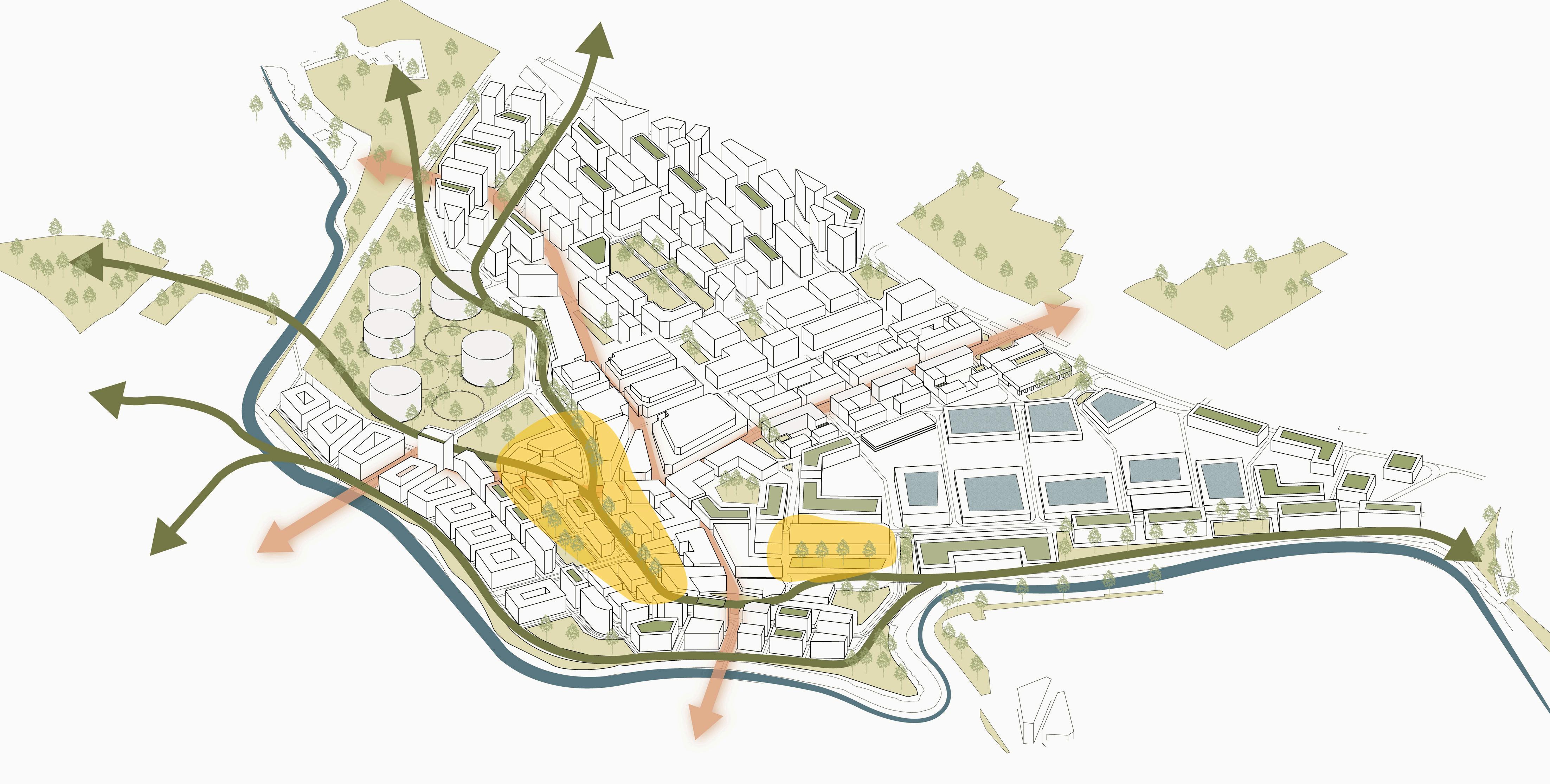
Prior tise wa king, cyc ing, and pub ic transport as the primary movement framework across the site
Strengthen north–south and east–west connect ons to surround ng ne ghbourhoods, the river corr dor, and wider publ c rea m networks
Separate pedestrian, cycle, servicing, and freight routes where safety and operat onal effic ency require it.
Establ sh building typo og es that respond to ndustrial and mixed-use demands and support long-term adaptab lity.
Use he ght and massing strateg cally to integrate the site with surround ng ne ghbourhoods and create clear transit ons between uses.
Ensure built form supports effect ve dayl ght, natural venti at on and safe access for servic ng and emergency response.
ThisvisionofthefutureofNorthCanningTownisdynamicand resilient:aplacewhereindustry,housingandcommunitylifecoexist andanimatetheurbanenvironment.Itsgrowingcommunitywithinand beyonditsedgescanthriveinaspacethatiscontinuouslyadaptingto climatechange,social,andeconomictransitions.Byintegrating industrialrootswithconnectivity,thisneighborhoodisnotjustbuiltfor today,butmeanttoensurelong-termvitality.
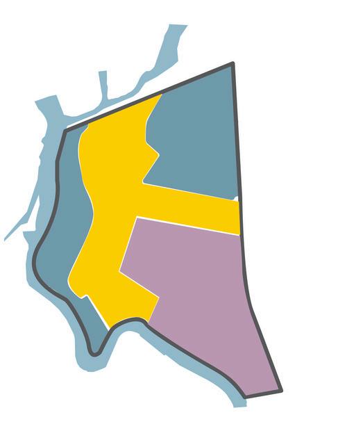
CodyDock
District
BowCreek
Waterfront
Residential
Strengthen eco og cal connection to the East London Green Grid through cont nuous landscape corridors
Use c imate-res lient plant ng to support ong-term adaptation wh le retain ng and enhancing va uab e habitat areas across the s te
Integrate green infrastructure across the site to support a m nimum Urban Greening Factor of 0.3 and improve biodiversity, coo ing, and flood resil ence
TwelveTrees
Residential
GasworksIndustries
Create clear and legible pub ic spaces that support easy movement and or entation across the site
Respond to local dentity by re nforcing re ationships w th key assets such as Cody Dock.
Provide safe communal spaces w th active res dential over ooking.
Integrate seating and l ghting to support comfort, safety, and everyday use
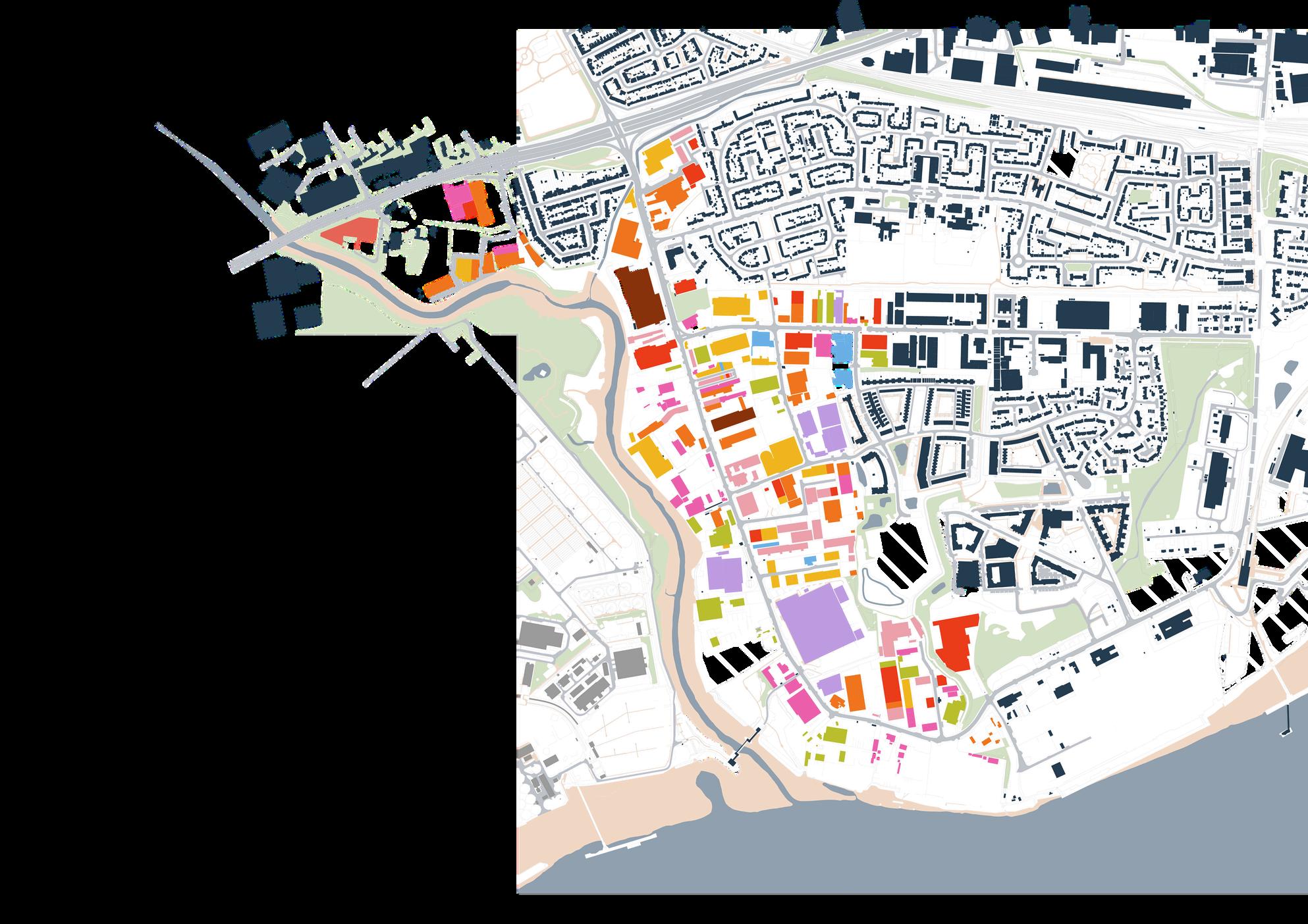
BarkingRiverside,ahistoricallyindustrialarea,iscurrentlybeing reworkedthroughtransport-leddevelopmentprojects.Adependance oneconomicgrowth,fastertransportationofgoods,andconsumption
1 Reducerecyclingsitefootprintneedsthrough mage recognitionmodelsandmachinelearning
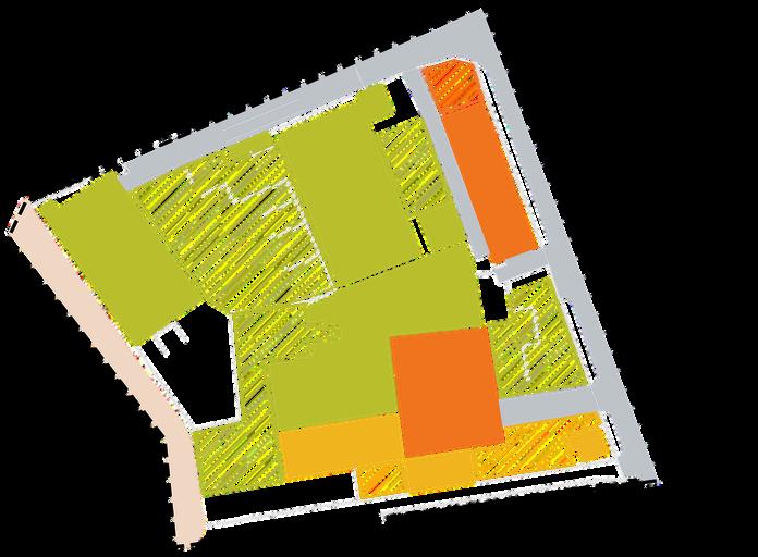
Logist cs Automot ve Services
Food Production and Wholesale
Construction Material ndustry
Furniture and Construction
Wholesa e Storage Office
Recyc ing and Waste
Res dential and community spaces
Sui Gener s
Chosen Site
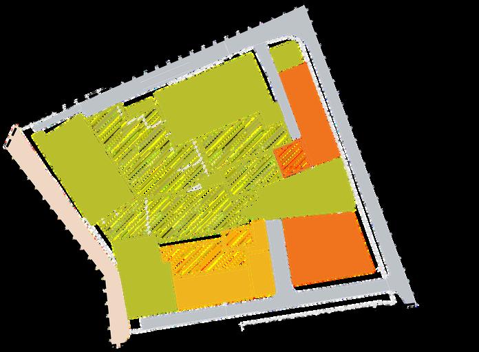
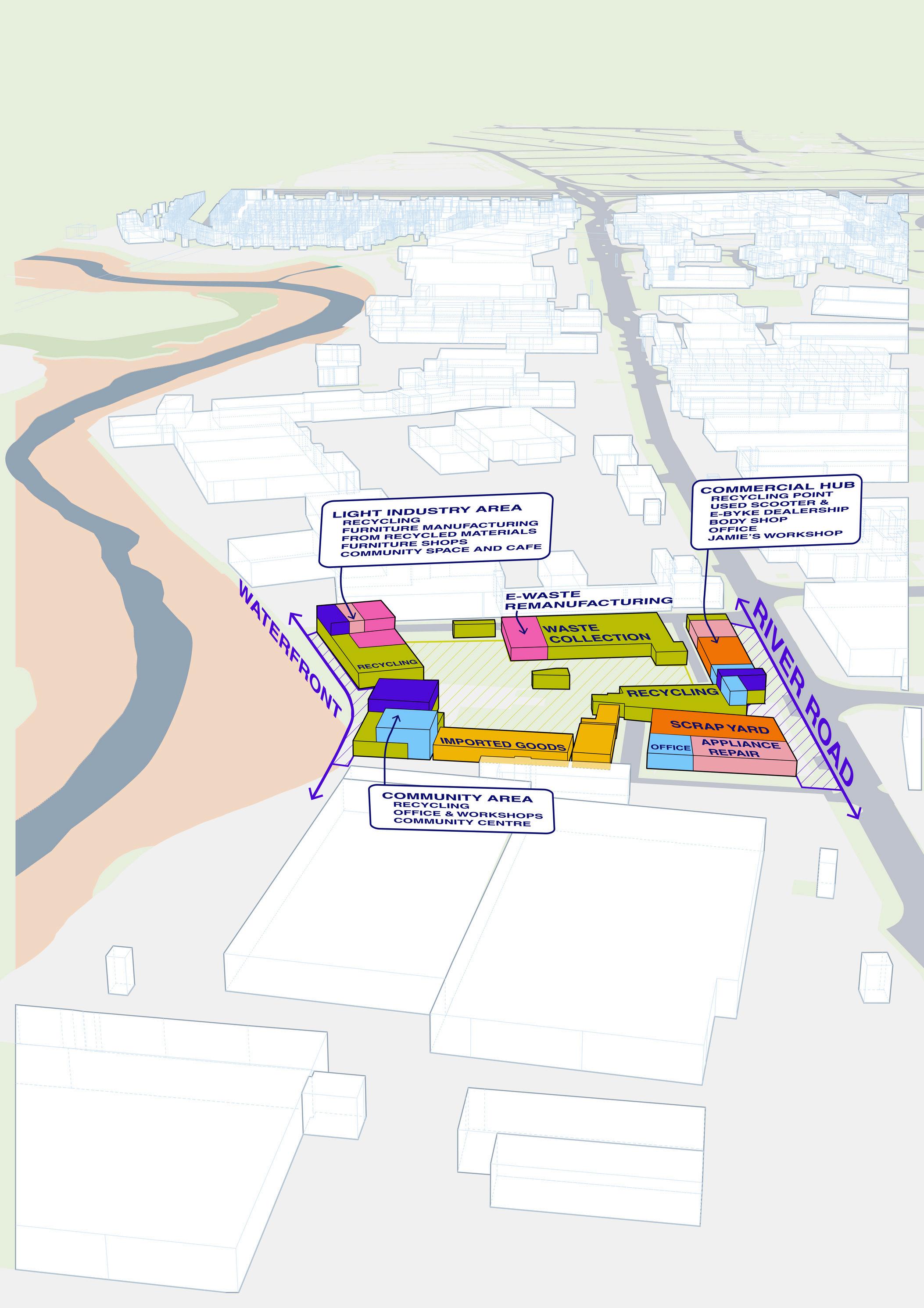
2. ndustrial ntensficaton acheved sharing access roadsandlocatingyardspacesonthecenterofthe bocktodefnetheurbantissue
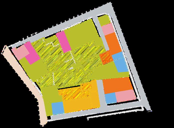
3. ndustrydiversifcation andco-locatonto ntroduce avatietyofcompementingusesonthegroundleve andonnewfloors.
4.Negotiatingcommuntyspacesonsitetoactivate theriverfrontandRverRoad
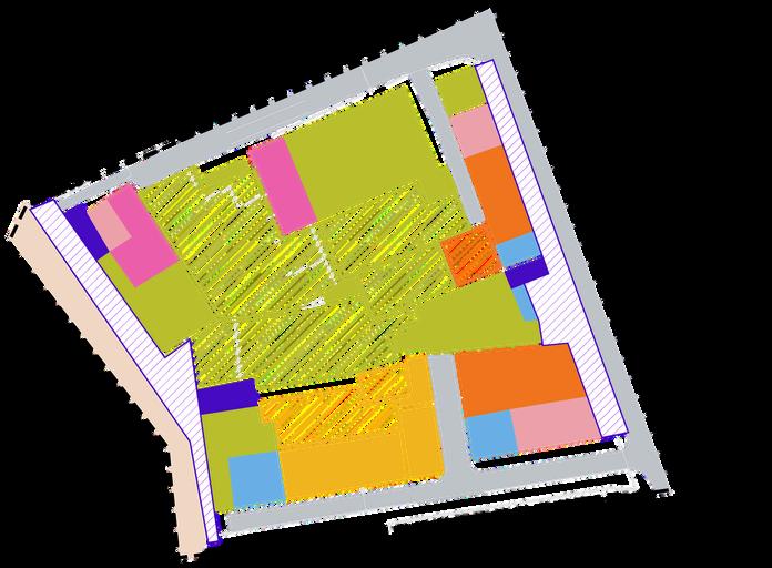
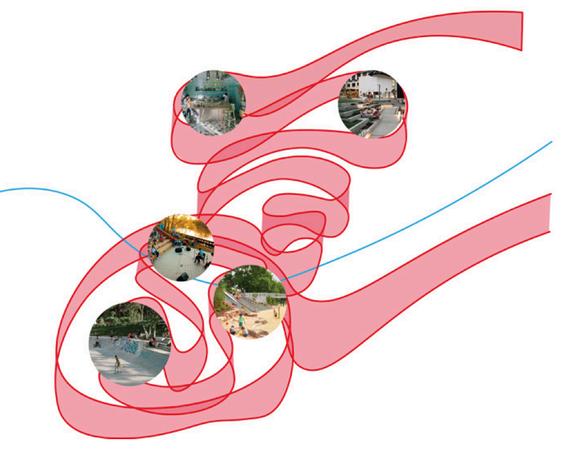
Circulareconomiesinindustryaimtoextendaproduct’slifeaslongaspossible.Remanufacturing takesthisideaastepfurtherbyreturningproductsfromtheirendoflifestatetoanimproved condition,thusmaximizingtheirvalue.BarkingRiverside’sautomotiveindustryholdsqualitiesof circulareconomies,withamultitudeofservicesthatlengthenthelifespanofcars.Thiscapacityto repairandrepurpose makeitasuitablespacefortransitioningtoamodelofremanufacturing vehicles. Thistransitionmustbesupportedbyspatialplanningstrategiestoensurethatthenewurbantissue enhanceswalkabilityandactivation,makingthewaterfrontandRiverroadasettingforsocial interaction.Thecombinationofusesgivescharactertotheareaandencouragessustainable industriestodevelop.
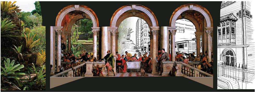
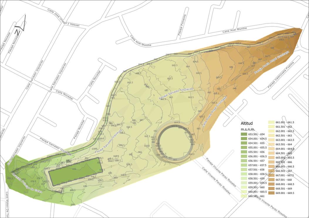
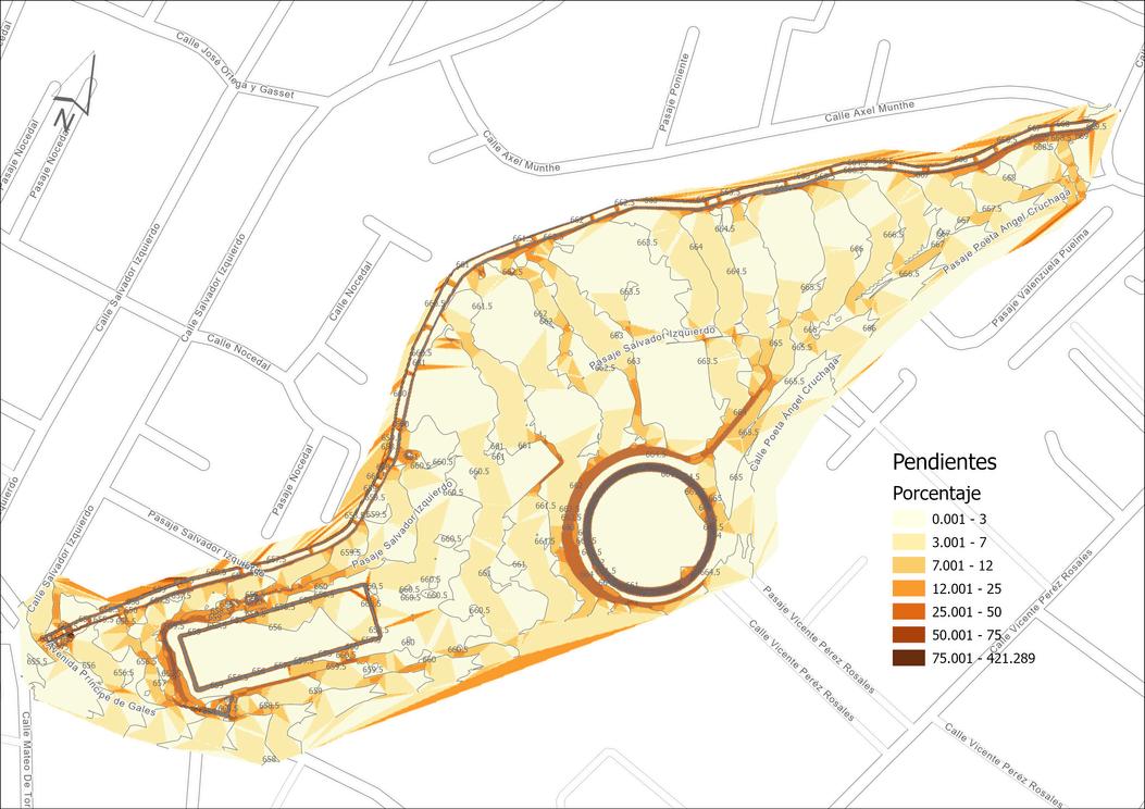
Duetothedifferentdisciplinesofthedesignteammembers,thesite analysiswasmadethroughthelensoftopography.Outliningthefactors thataffectgroundlevelandthustheperceptionofthesitefrom residents.Weusedamethodologyofcollage,sketching,mappingand research.
Theseresourceswouldleadtothediagnosisofthesite,highlightingthe derelictstateofthewaterretentioninfrastructure,whichwasnolonger inuseanddisconnectedbetweenthesiteandtheriver.
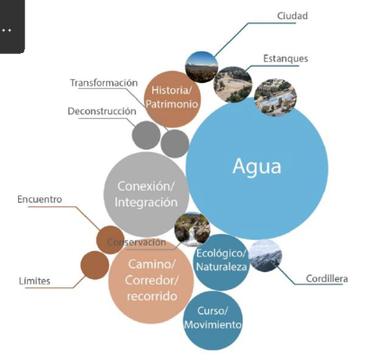
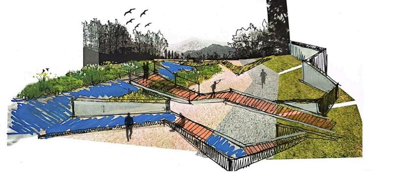
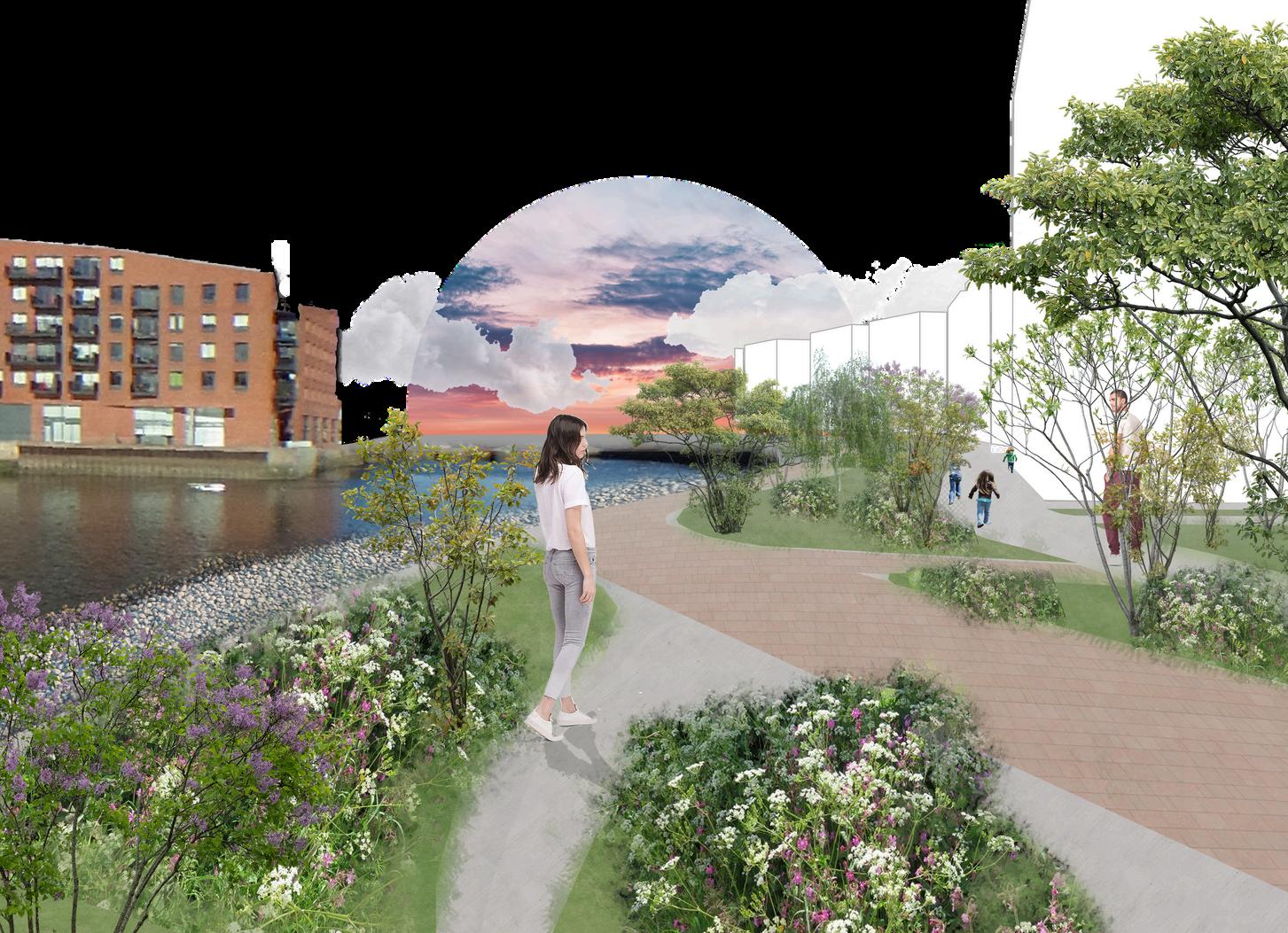
Aparkof5hectareswasproposedbythelocalcouncilatthetimeand theacademicassignmenthadtobedeliveredwithinthoseconstrains. Theguidingprincipaloftheproposalwasexpressedinacollageform whichportrayedthevisionofaparkthatusedtheriverasthetoolfor connectingthespaceandthecommunity.Thiswouldbeachievedwith aninterventionoffiveelements:topography,water,paths,and vegetation.
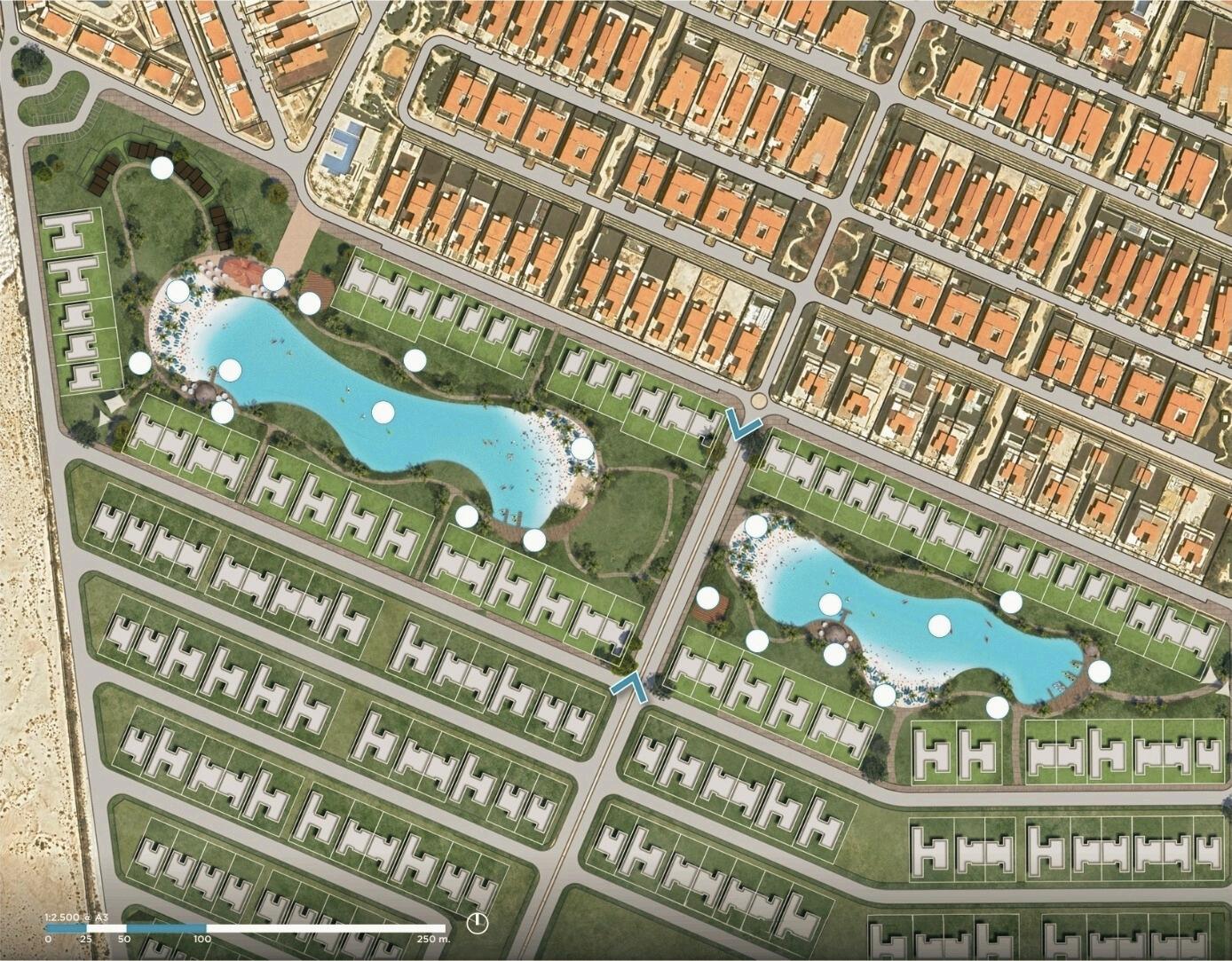
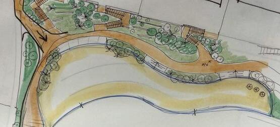
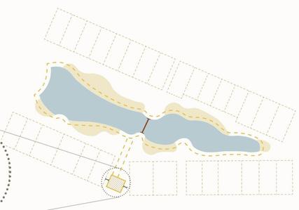
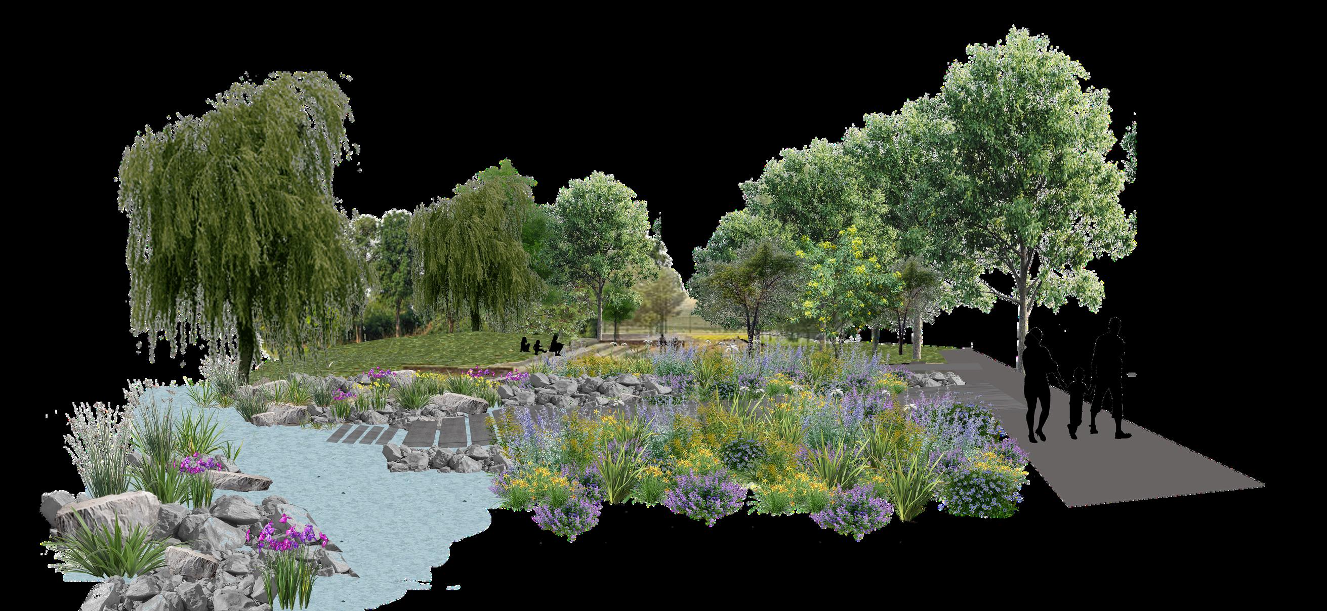
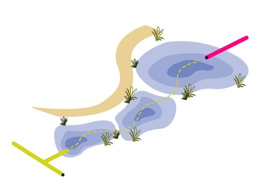
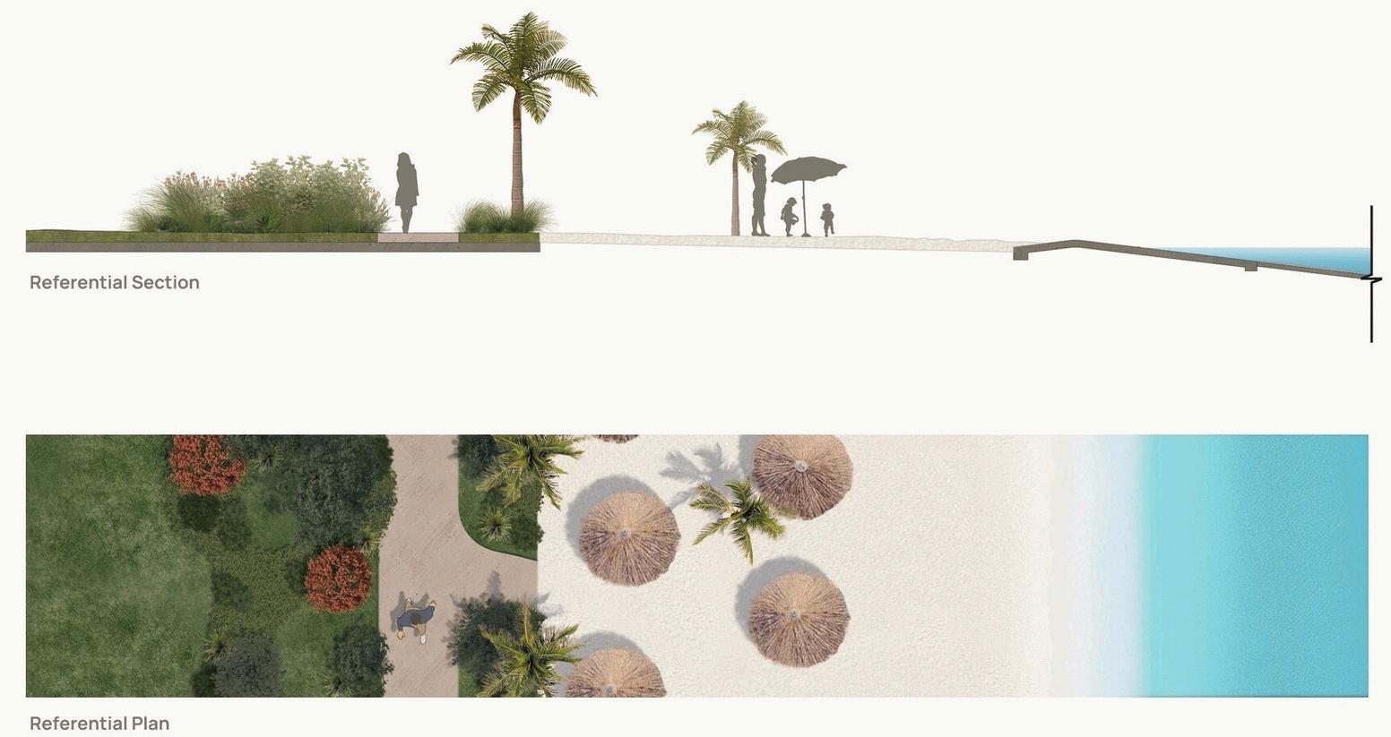
TheCaesarBayLagoonprojectstartedin2023atacommercial stage.Thelagoonplansfeaturearenderstyle,accompaniedwith marketingmaterialthatsupportedthesaleofthelagoonasan amenityforthedevelopment.Thesefirstdesignsfocusondisplaying ahighlevelofactivationonsite,makingthemostofthelagooninthe contextofahigh-endresidentialdevelopment.
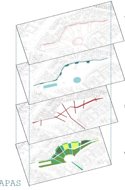
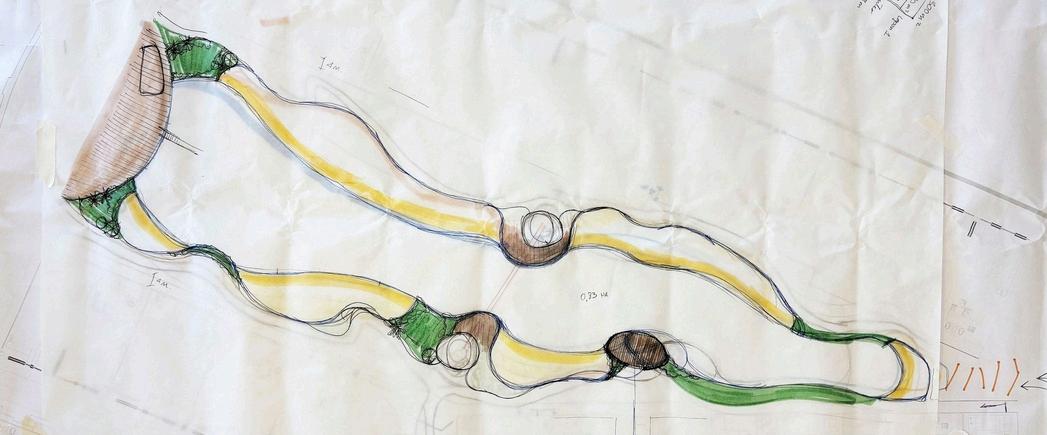
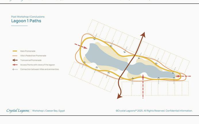
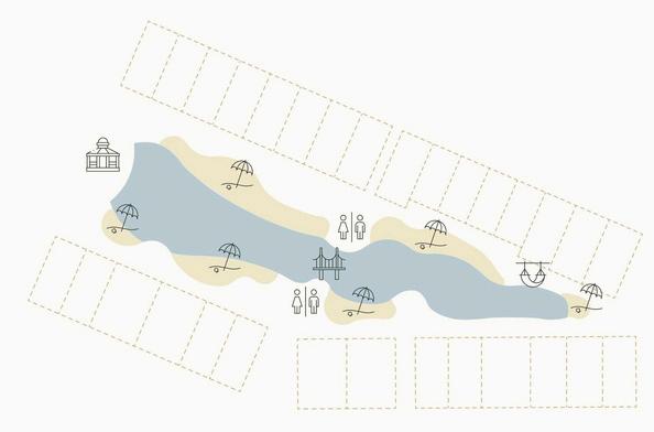
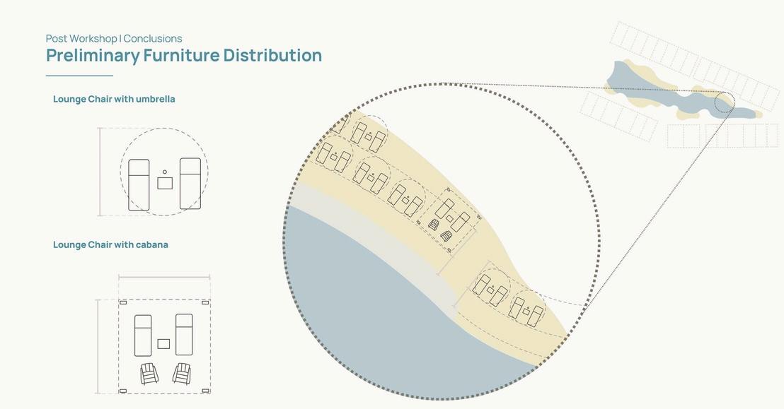
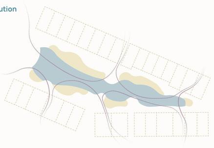
Followingthesuccessofthesale,acollaborativedesignprocesstook placewiththedeveloperteam.Atthisstagedifferentdrawingsand diagramswereusedtohelpdefinethecharacterareas,mobility, ownershipandtechnicalconstraintsforthelagoonproject.
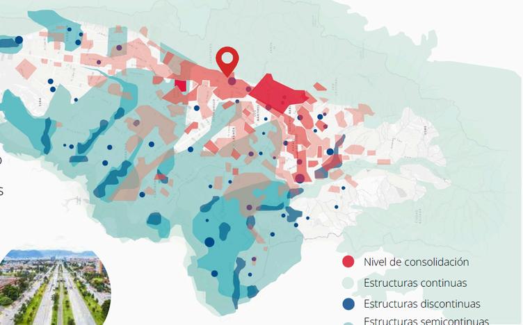
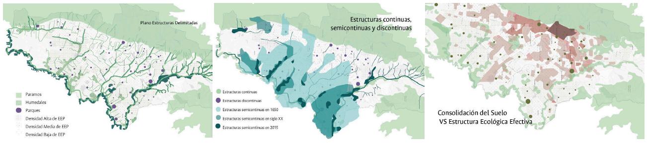
Asaresearchproject,thefirststagewasmappinggreeninfrastructure inthecityofBogotaandanalyzingthefactorswhichaffectedthe connectionbetweengreencorridors. Theresultsofthisworkrevealed thatthelackofgreeninfrastructurewasmoreprevalentinmore consolidatedurbantissues.Thisledtothedecisiontousethethird landscapeasacategoryofspacesthatcouldbeusedforincreasing greeninfrastructureintheseareas.
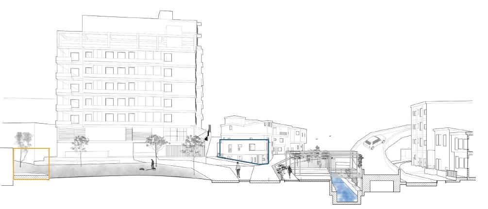
MappingthedifferentcategoriesofthesethirdlandscapesorMarginal Natures,showedanumberofurbanareaswheretheconnectionofthe urbantissueandprotectednaturalareascollidedcreatinguninviting, derelictspace.ThechosensitewastheconnectionbetweenLas Deliciascreek,toanumberofresidentialareasofdifferentlevelsof income.Thecomplexityofthehousingsituation,roadnetwork,andthe valueoftherecentlyrehabilitatedriverhadmanyopportunitiesfor reconnectionandactivation.
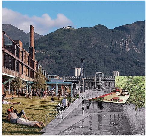
Theideaforthesitewascreatedandpresentedinvisualsshowcasingatransition betweenbuiltandunbuiltspace.Thecommunitywasalwaysatthecenterofthe design,understandingthataninterventiononsitehadtobesmallinscaleand usefultotheresidents.
Consolidated and ConnectedGreen nfrastructure solatedGreenInfrasructure