ARCHITECTURE PORTFOLIO
JUGAL MERCHANT
B.ARCH & M.S.AUD SELECTED WORKS | 2019-2026
B.ARCH & M.S.AUD SELECTED WORKS | 2019-2026
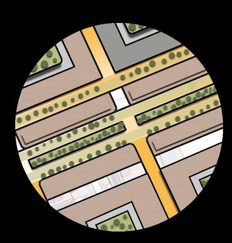
I. Brooklyn Marine Terminal
Reimagining the industrial waterfront through strategic voids that connect public space, ecology, and infrastructure.
II. São Cristóvão
Designing a resilient green corridor that links neighborhoods and anticipates a future stadium as a civic anchor.
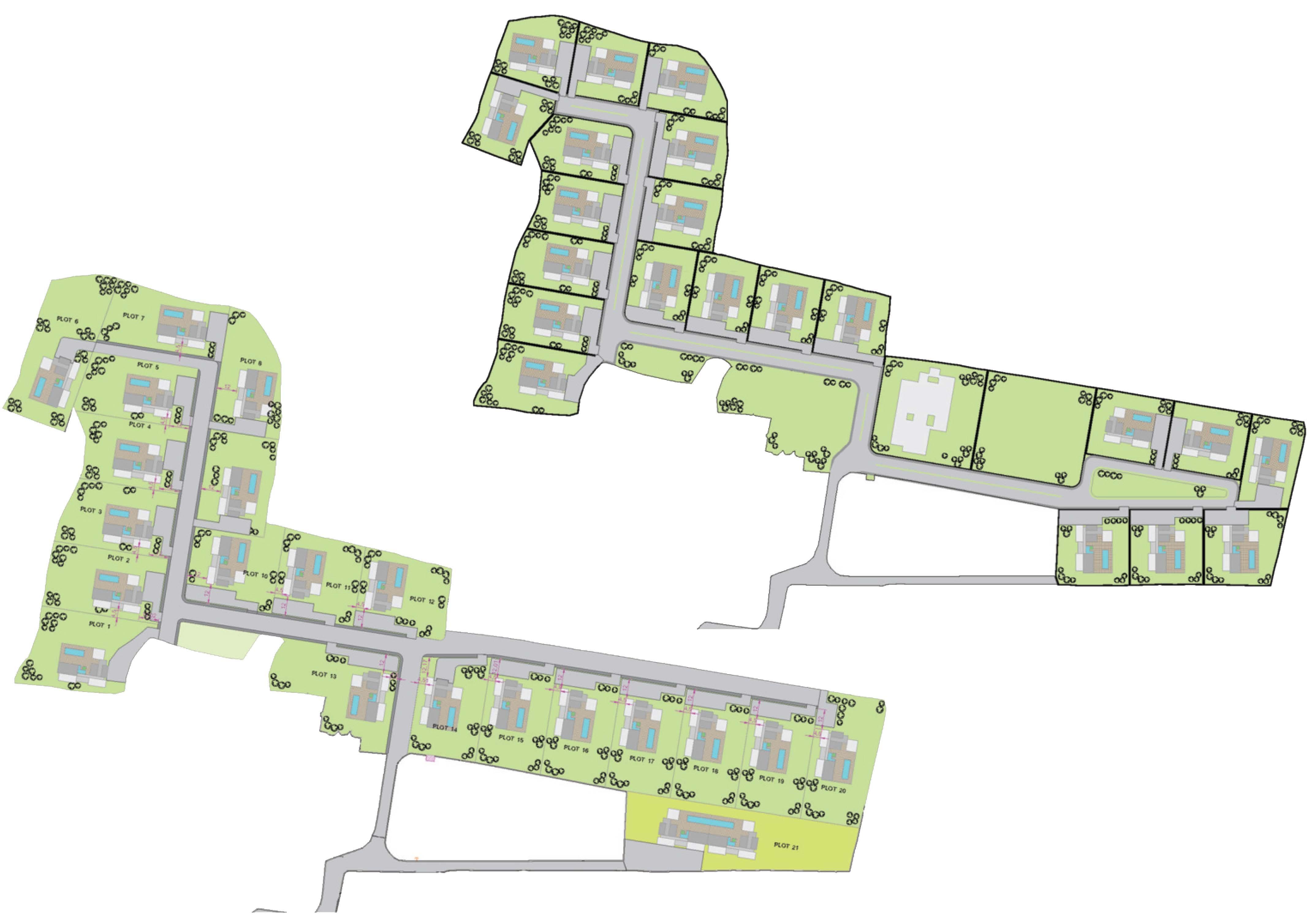
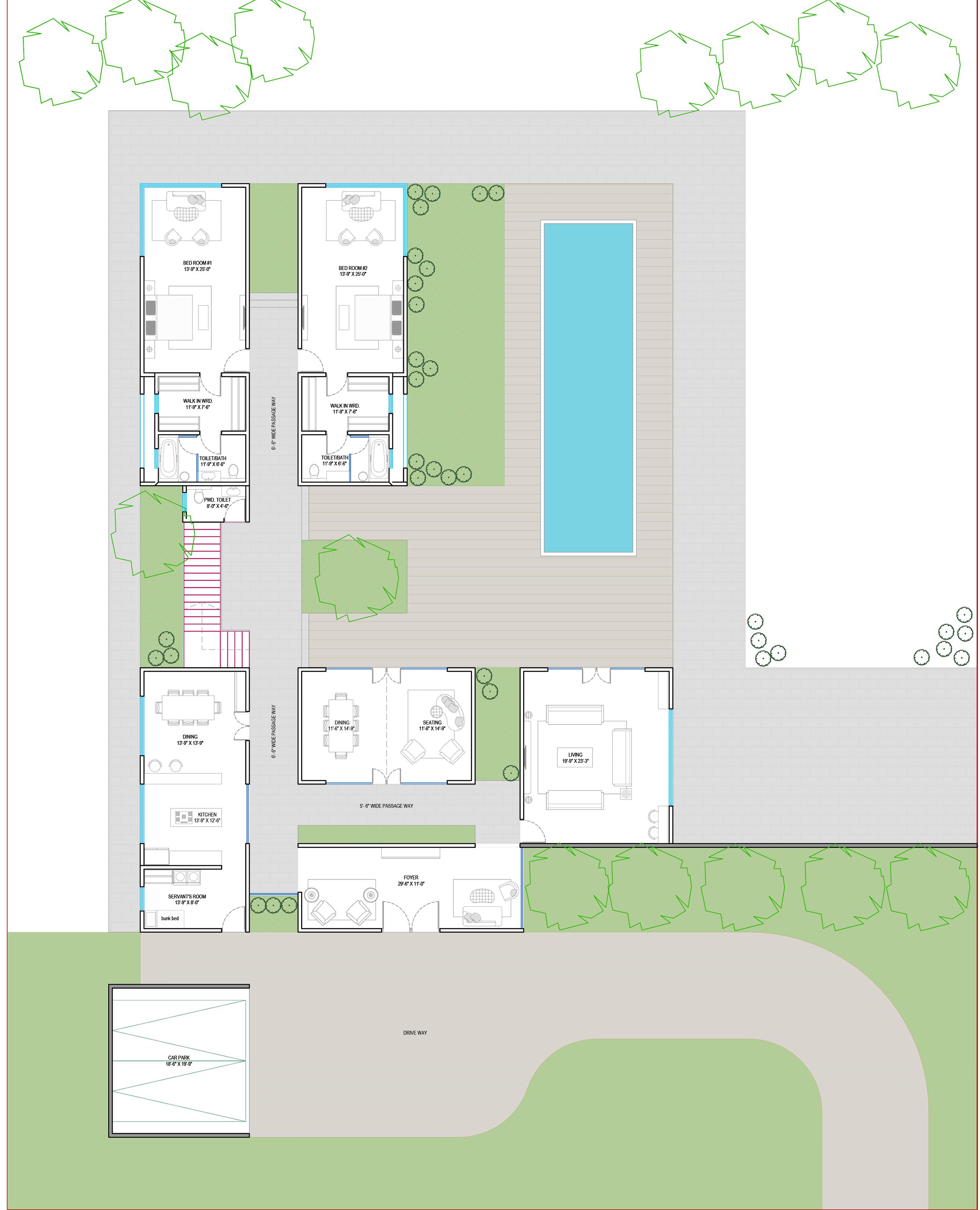
III. Contemporary Bungalow Housing
Exploring the balance between private and shared spaces to create cohesive, context-responsive individual housing within a larger community.
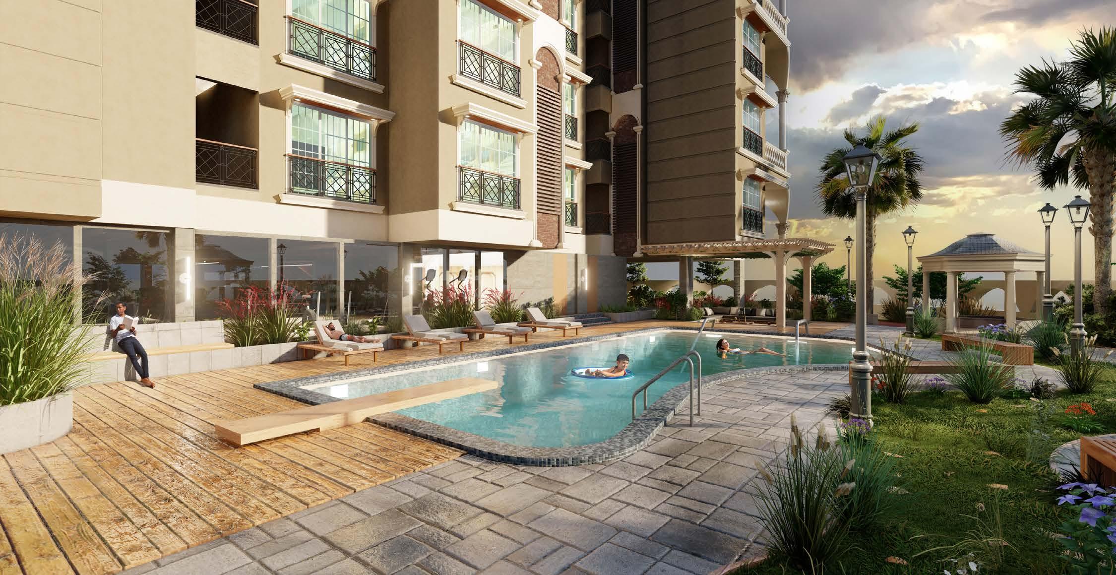
IV. Fair Feilds Apartment Building
Designing a mixed-use building with commercial podium and varied residential units, emphasizing efficient layouts and clear separation of public and private spaces.
V. Technical Drawings
Focused on technical clarity, this section showcases detailed working drawings, centerline planning, and sectional coordination for accurate handover.
VI. Apartment Housing Project
Showcasing individual explorations in spatial design, light, and materiality to highlight personal creativity and architectural experimentation.
VII. Renders
Showcasing individual explorations in spatial design, light, and materiality to highlight personal creativity and architectural experimentation.
As an architecture graduate with a masters degree in Urban Design, I strive to create purposeful designs that go beyond aesthetics to enhance user experience. From homes to public spaces, my aim is to craft environments that enrich lives. I’m passionate about 3D digital design. I am actively exploring how AI can be integrated into architectural workflow to enhance the design process.
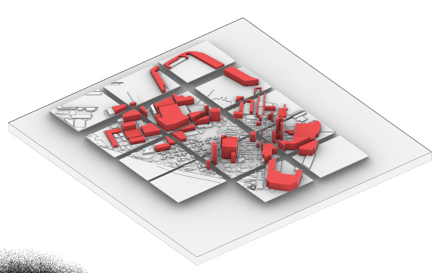
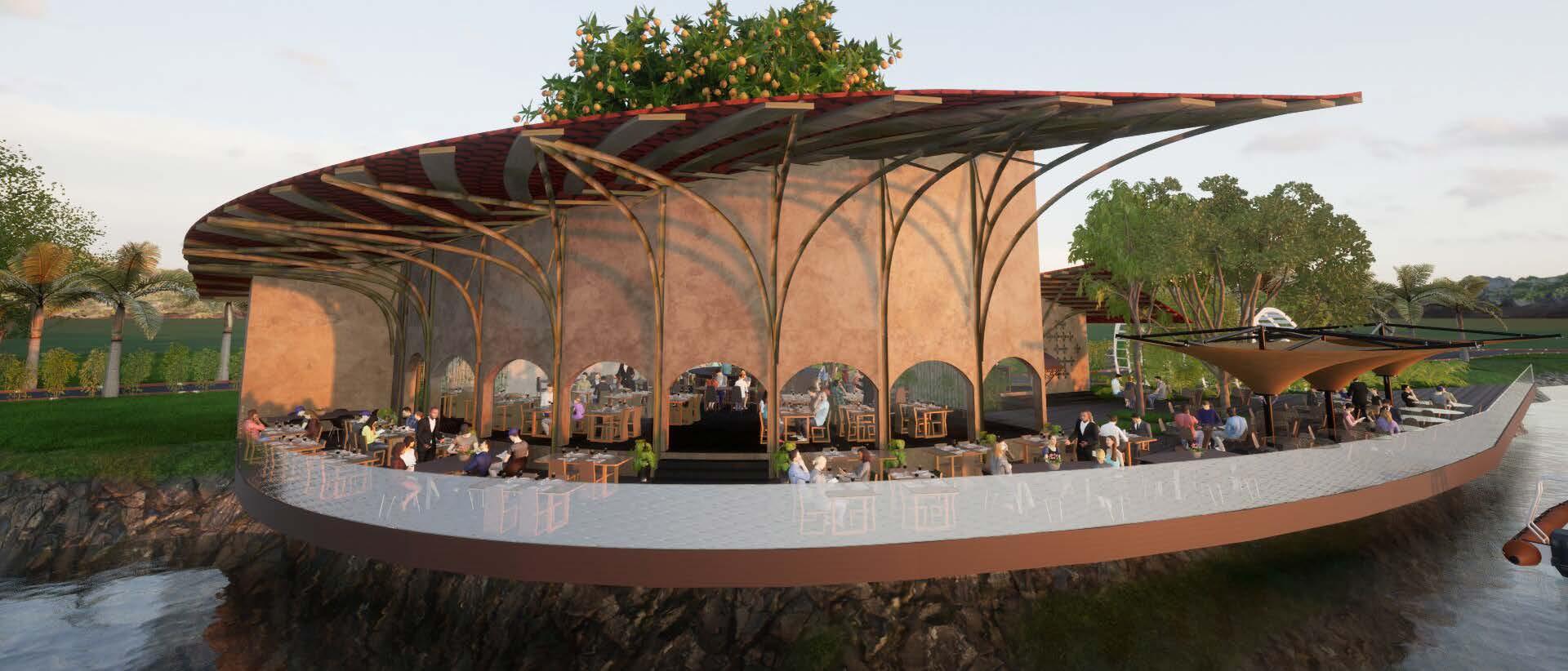
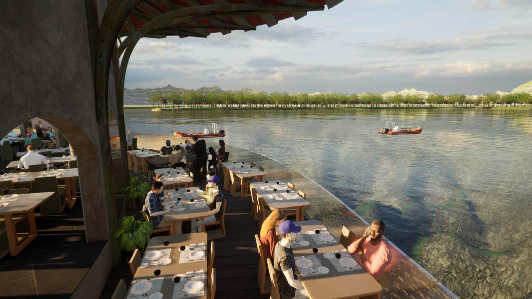
This project reimagines the Brooklyn Marine Terminal by using voids as an intentional design strategy rather than residual space. Carefully placed voids carve through the industrial fabric to bring light, air, water, and public access into a traditionally closed working waterfront. Operating across multiple scales, these spaces mediate between infrastructure, ecology, and public life while preserving the site’s industrial identity. The proposal transforms the terminal into a porous, resilient waterfront system capable of adapting over time.
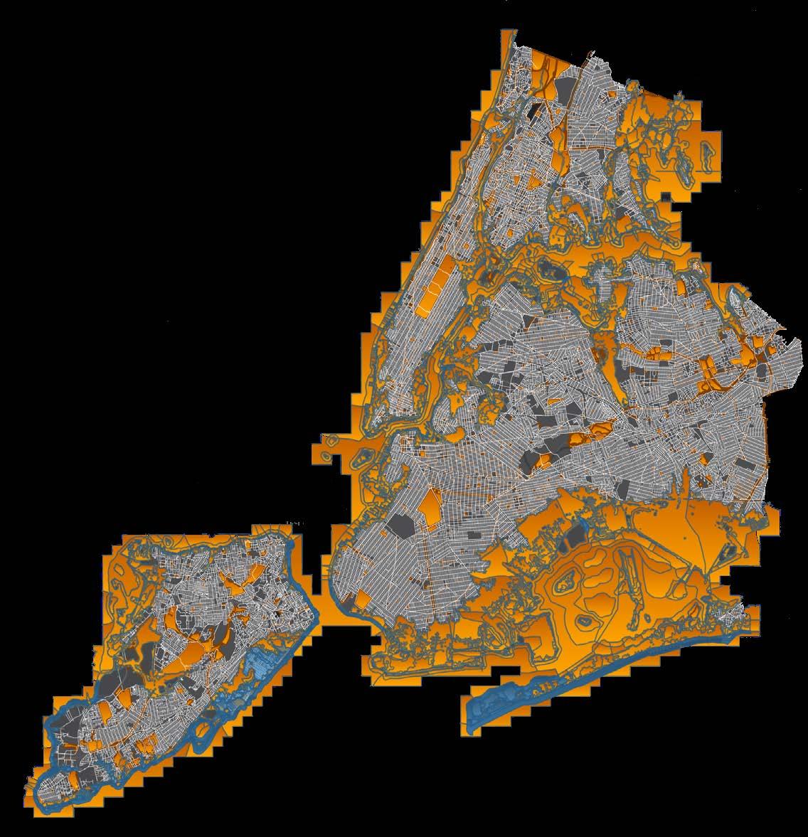
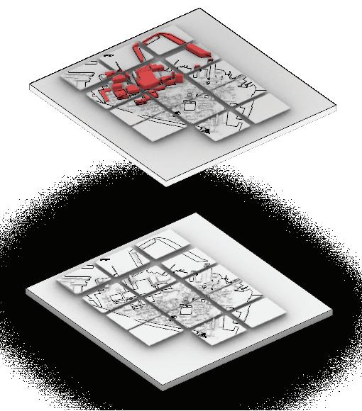
The project evaluates projected 2050 flood extents under a “business as usual” scenario and translates this data into a spatial framework to inform urban design decisions.
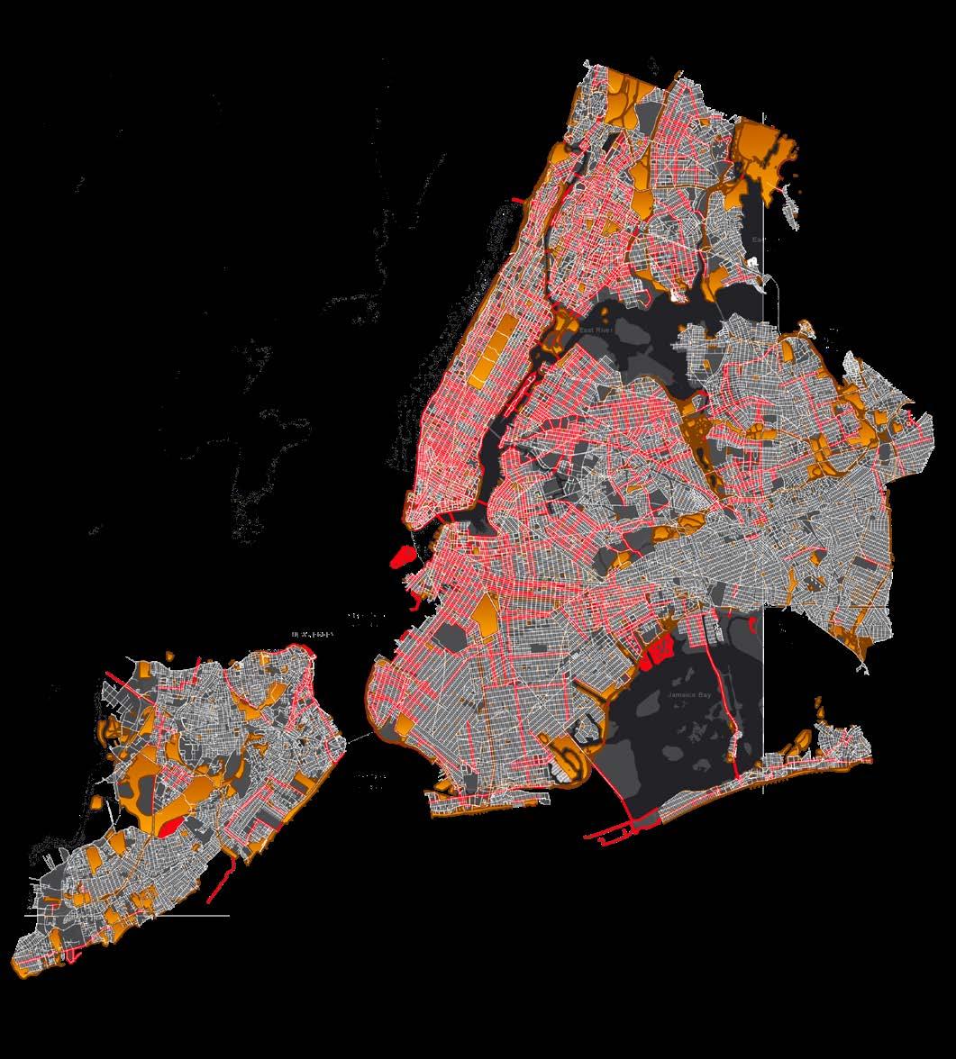
This mapping study analyzes the pedestrian and bicycle networks across the urban fabric to evaluate the site’s connectivity to Red Hook’s piers and waterfront.
Street Network Barriers
This map explores city-making as an urban game, where zones are distributed among players who strategically activate assigned voids through resilient intervention cards.
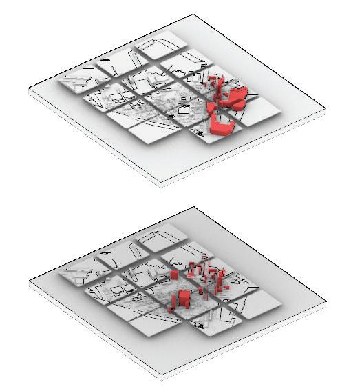
Each card deploys a specific intervention to activate urban voids, followed by a flood event introduced after two rounds that compels players to implement resilient infrastructure to protect their existing interventions
“ GIS mapping formed the foundation of this project by helping understand the site in relation to 2050 flood projections. Network analysis, land-use mapping, and Nolli studies revealed key spatial relationships that informed the initial master plan.
A game-based framework was then used to speculate on future interventions and adaptive possibilities across the site. The project moves forward by scaling up to a macro perspective and developing these ideas into more detailed spatial strategies.”


Introduction
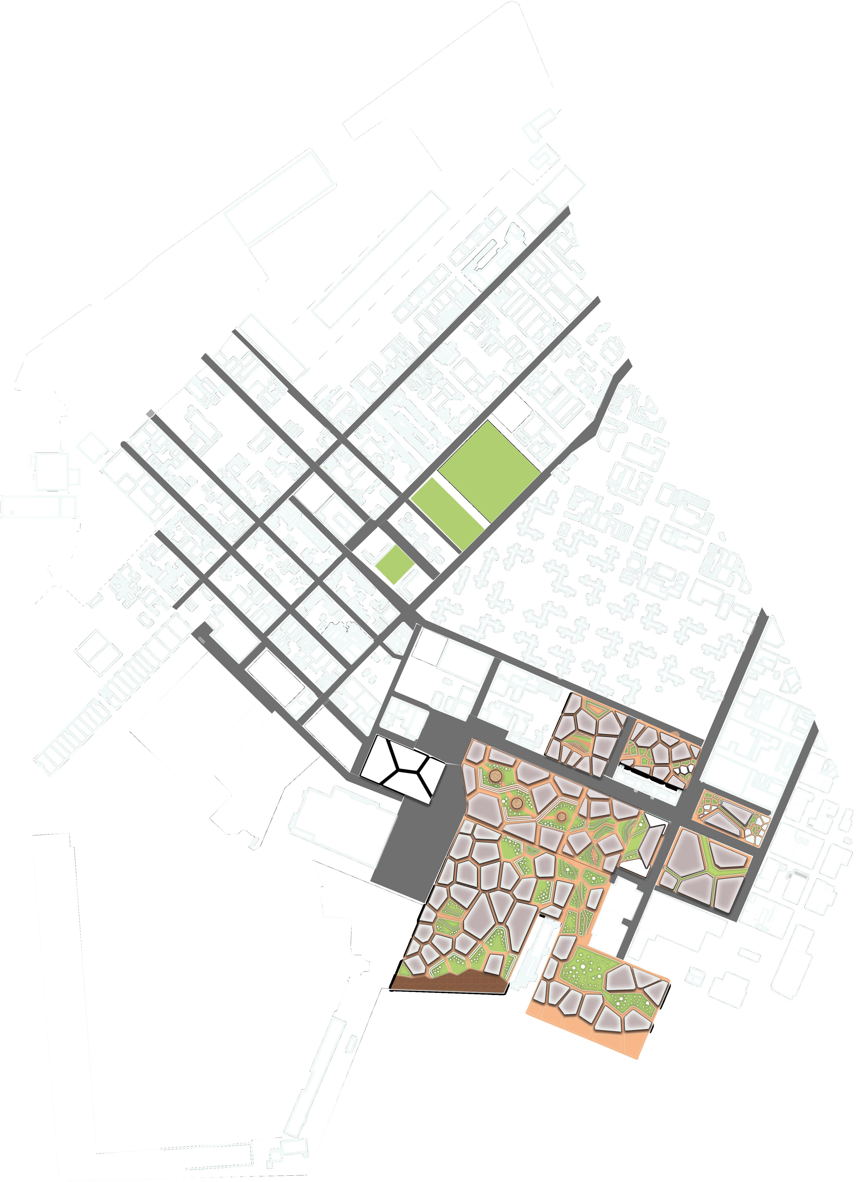
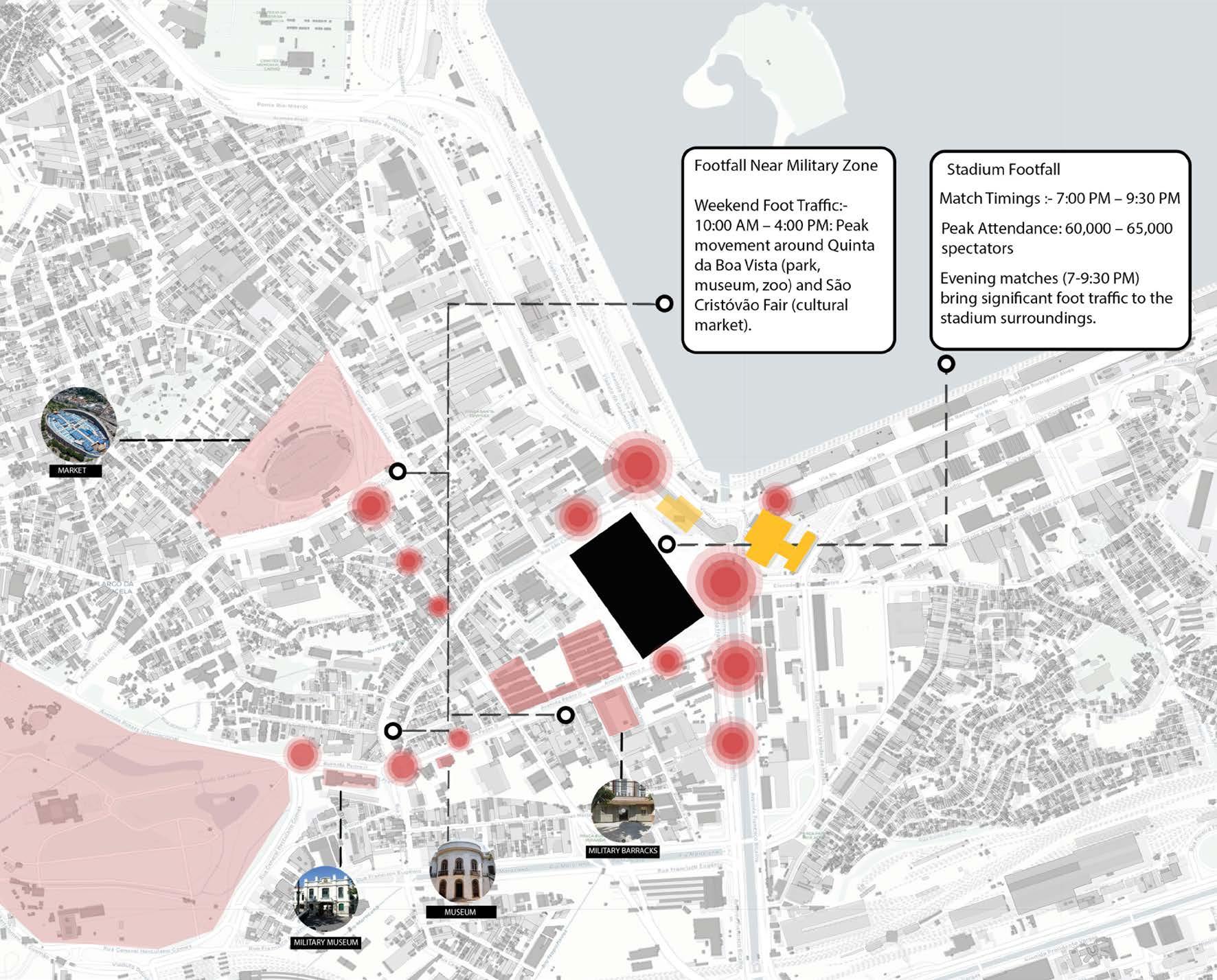
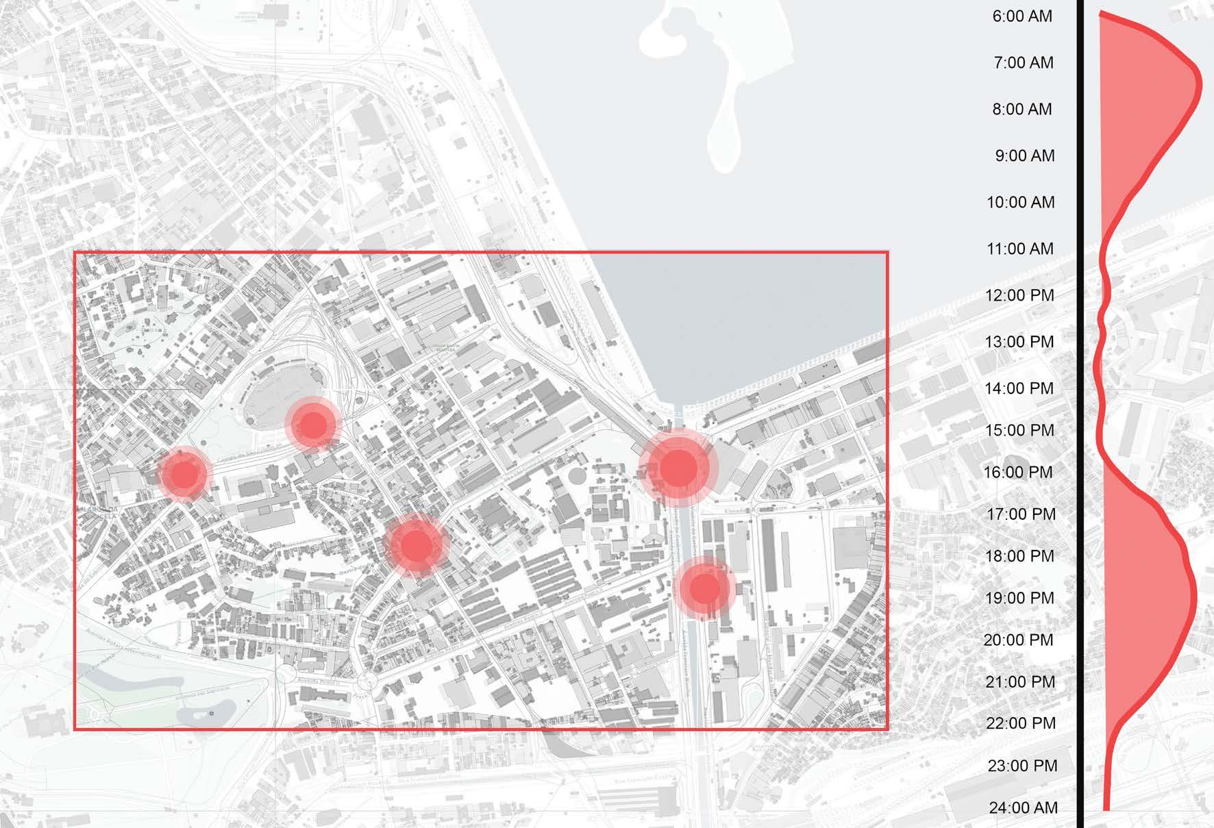
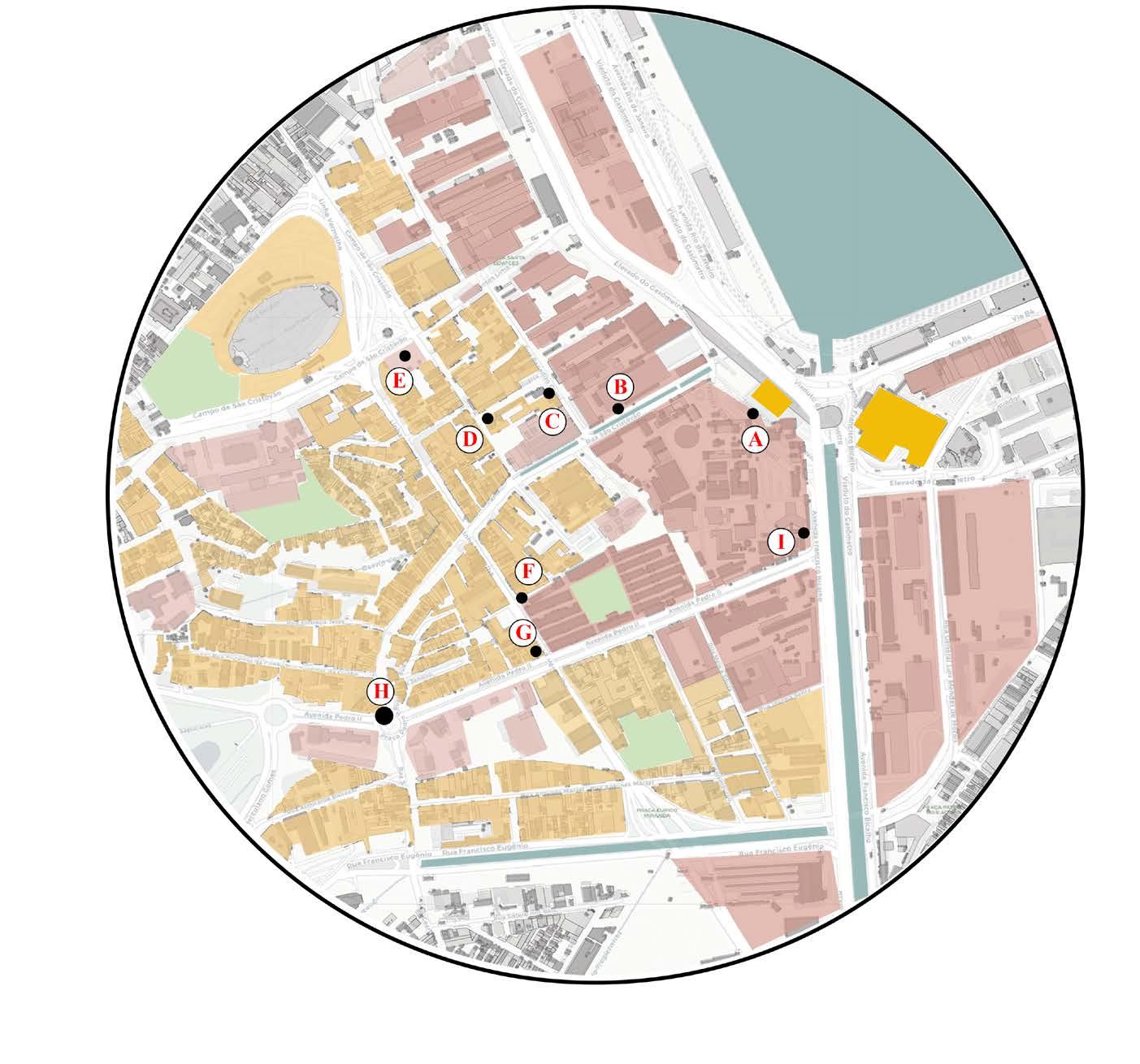
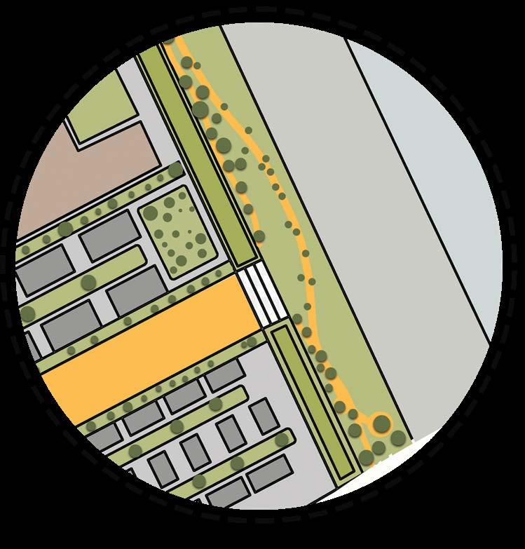
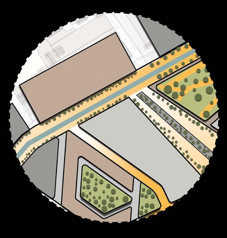
This project proposes a continuous green corridor in São Cristóvão to reconnect fragmented neighborhoods and underutilized urban land. The corridor is designed to support everyday public use while anticipating the future development of a football stadium as a major civic anchor.
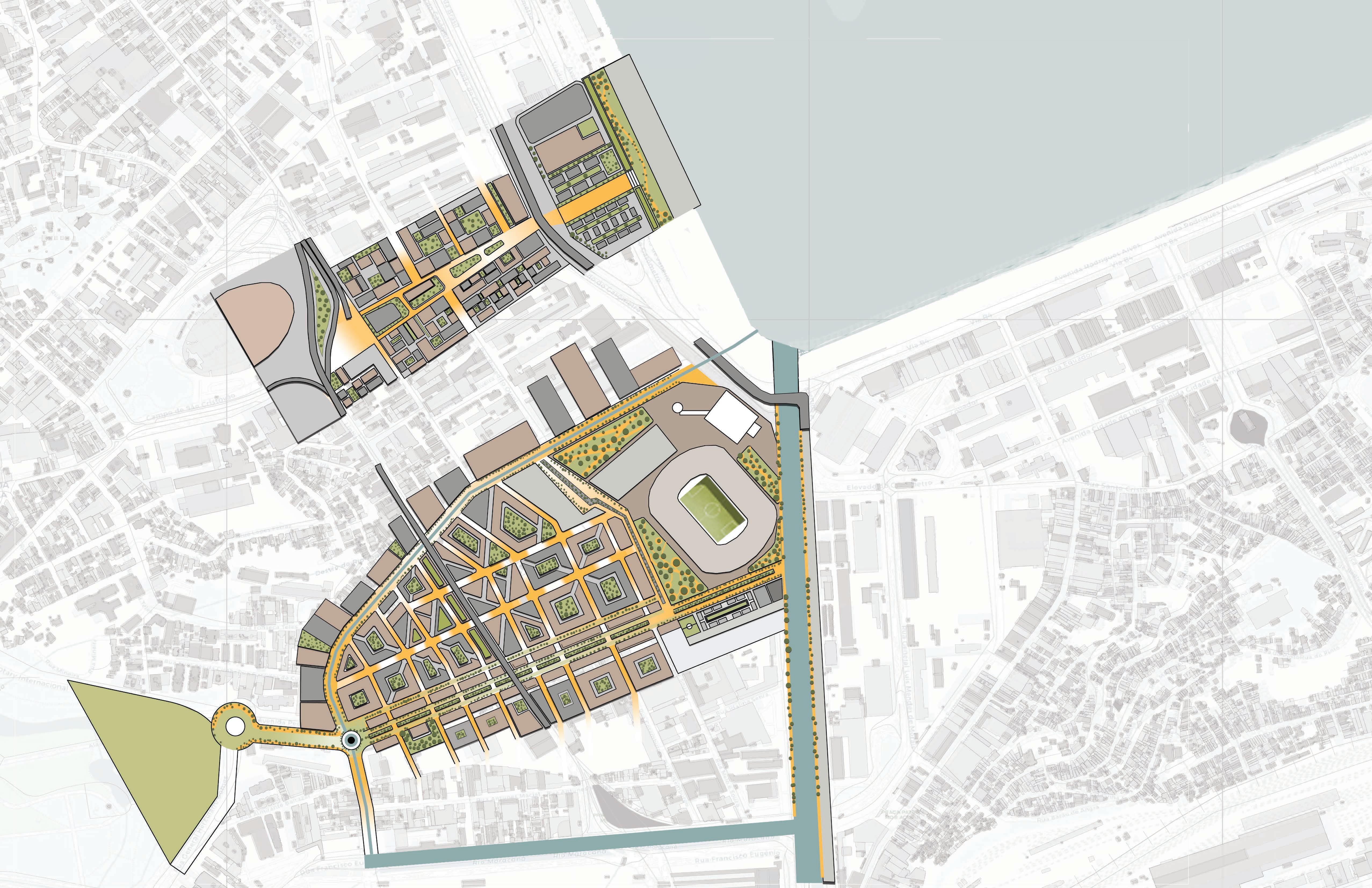
Landscape, mobility, and open space strategies work together to manage crowds, improve walkability, and enhance environmental performance. The proposal positions green infrastructure as a flexible framework capable of adapting to large-scale urban change over time.

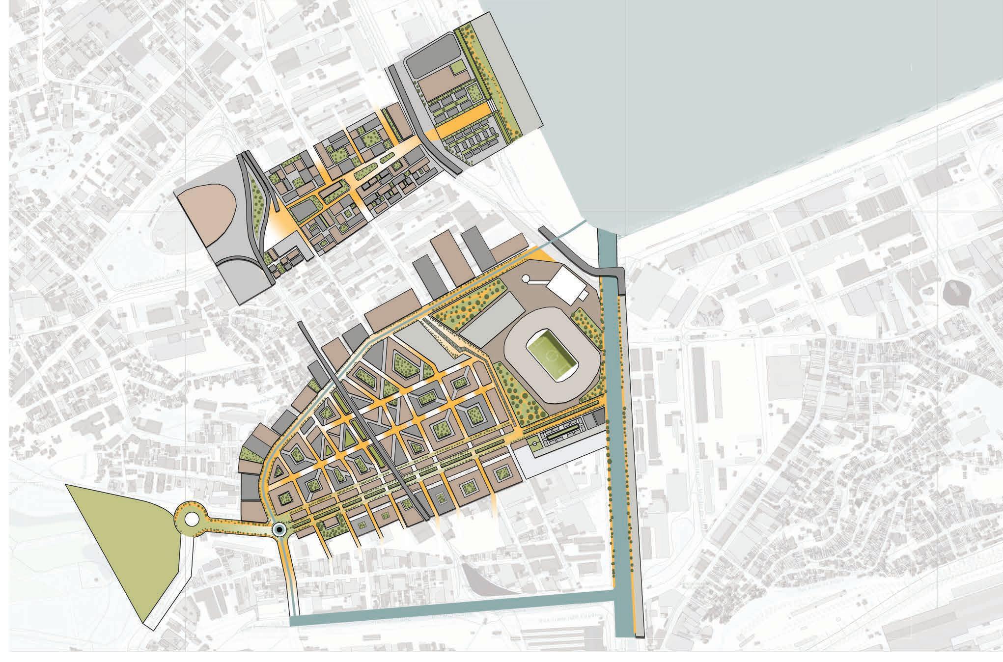
The page illustrates the working logic of the proposed master plan across the urban fabric.It identifies key spatial anchors that stitch surrounding neighborhoods through a continuous green corridor.
The plan responds to the football stadium as a fixed, business-as-usual condition shaping movement, program, and density.
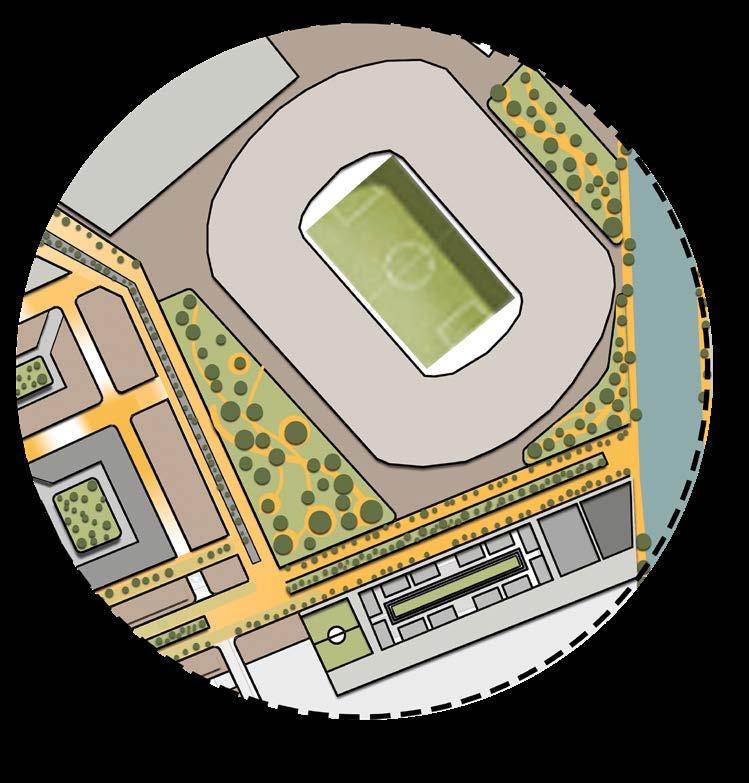
Existing and emerging neighborhoods are evaluated based on how they support and are impacted by this anchor.
Together, these moments articulate a future scenario that strategically builds upon present urban conditions.
Introduction
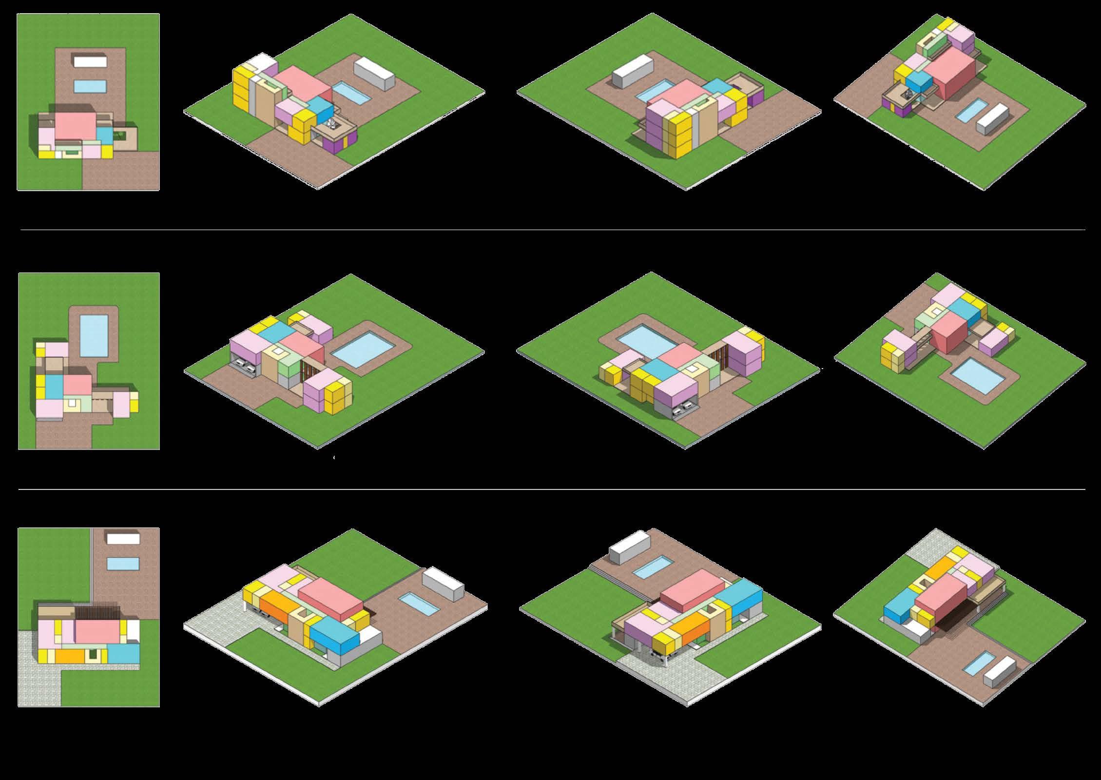
Understanding how individual housing units related with a larger community fabric. Exploring the harmony between private and shared spaces through elements like backyards and courtyards.
The aim was to create a sense of cohesion while preserving inviduality. Conceptual layouts played a key role in shaping spatial relationships, leading tao the development of refined individual unit designs that respond to both context and community.
Introduction
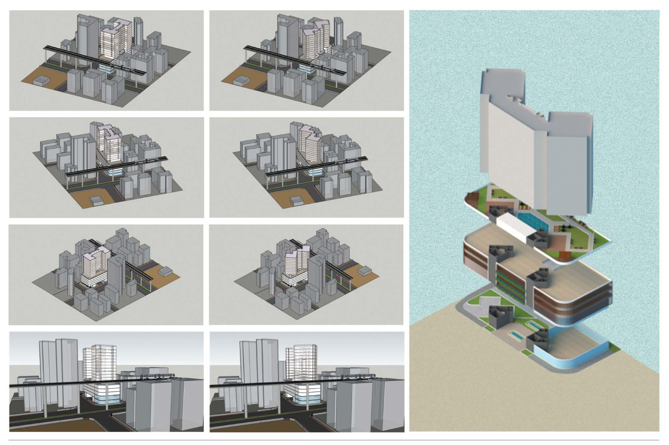
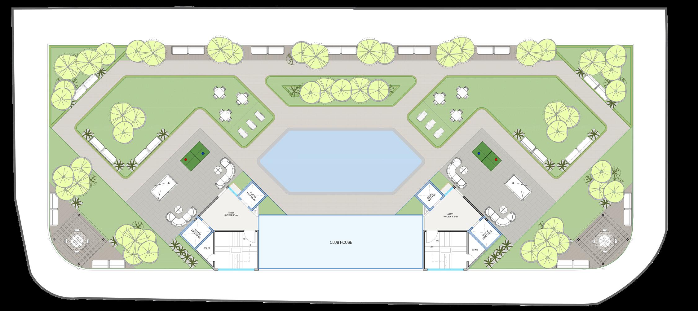
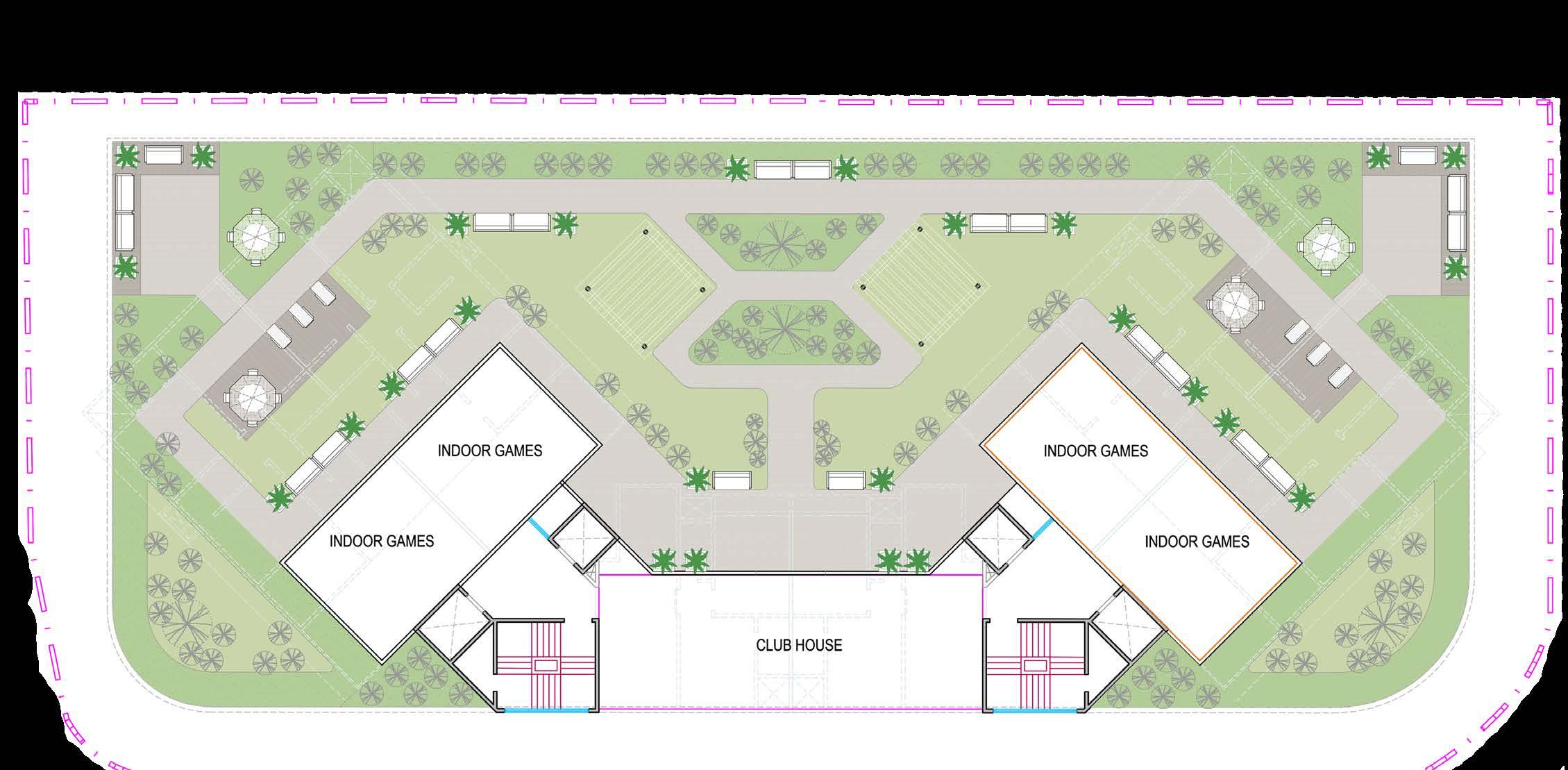
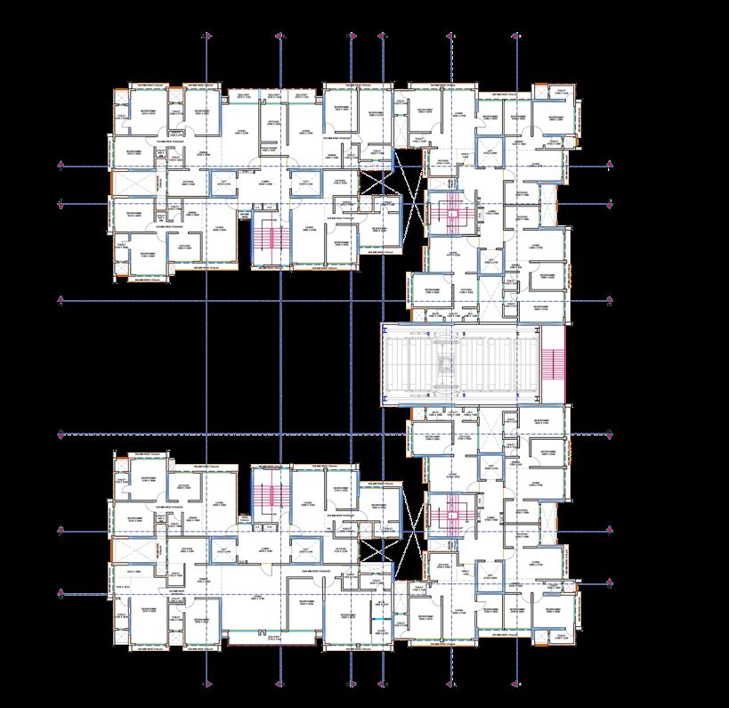
Exploring the relationship between residential units, podium design, and shared amenity spaces through coordinated 2D and 3D workflows. Typical floor plans, podium levels, and amenities layouts were developed in AutoCAD, focusing on clarity, efficiency, and spatial organization. In parallel, SketchUp massing studies were used to evaluate scale, form, and how the proposed building interacts with its surrounding urban context, supporting a cohesive and context-responsive design approach.
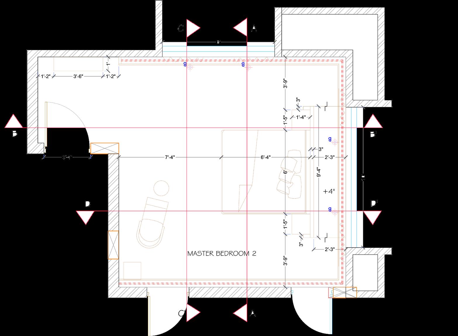
Typical Floor Plan
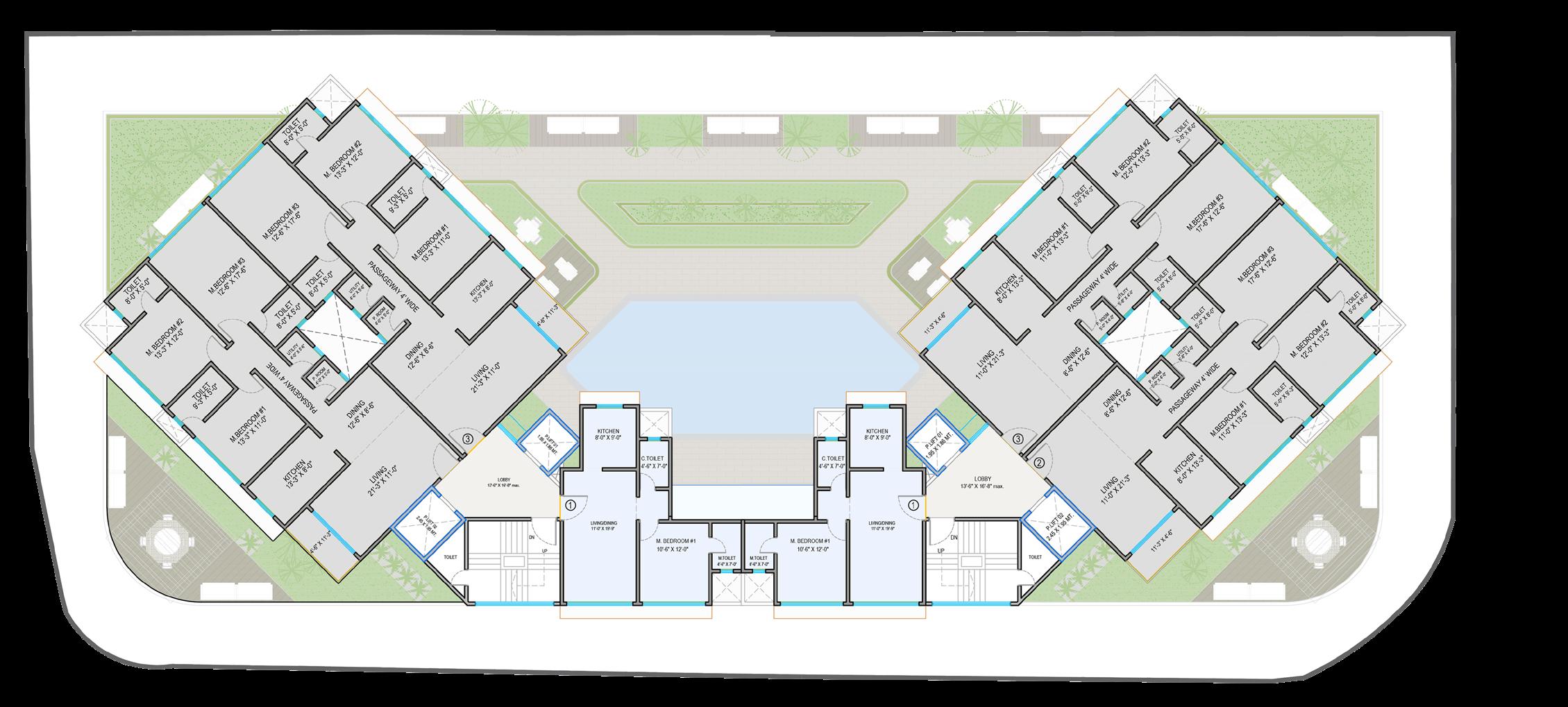
Floor Plan
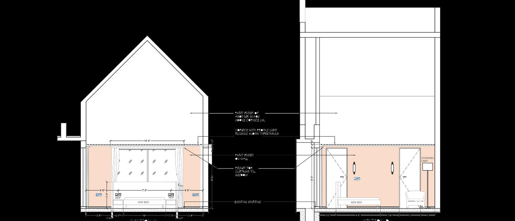
Massing & Spatial Development
Floor Plan
Center Line Layout (Typical Floor Plan)
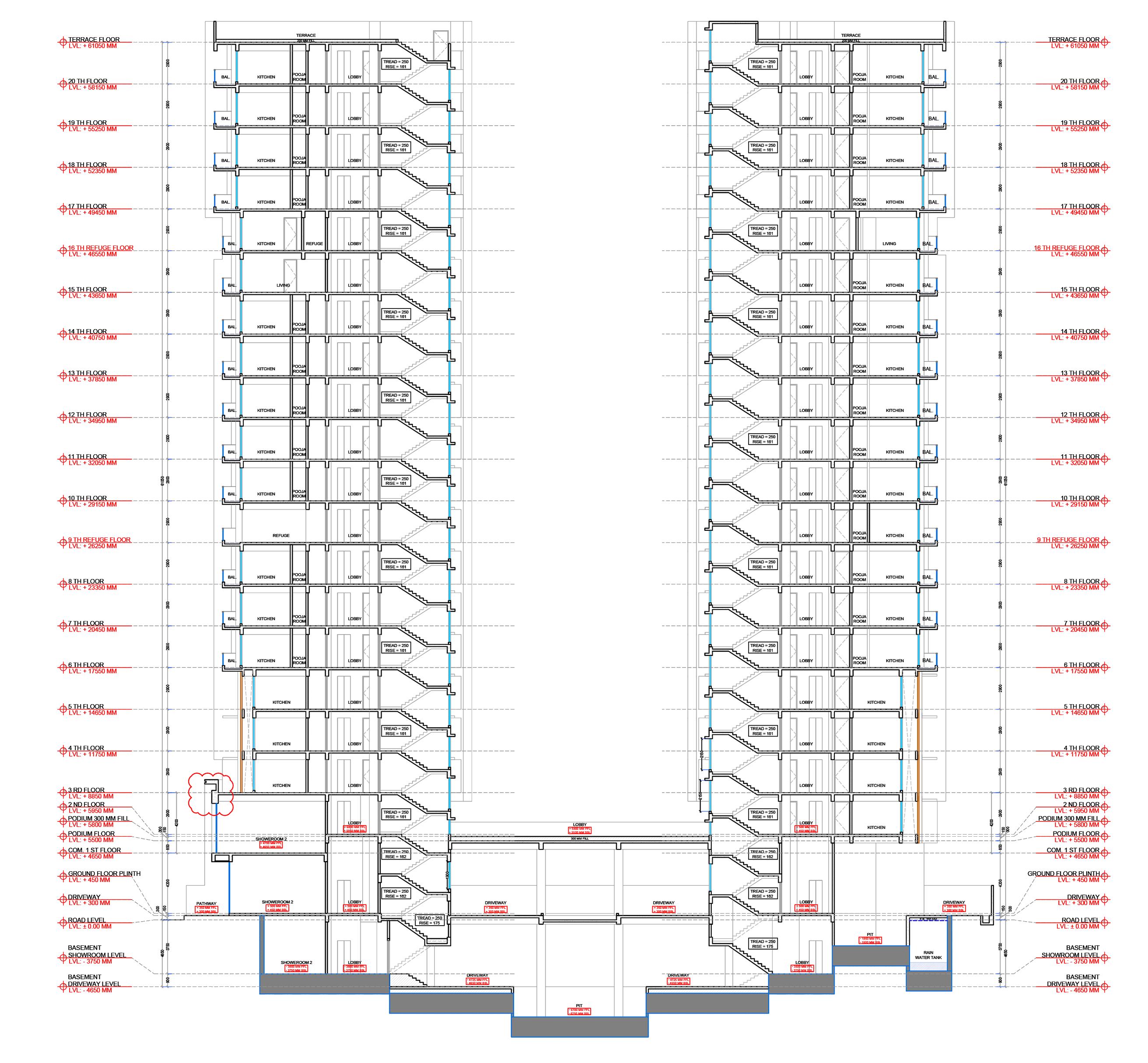
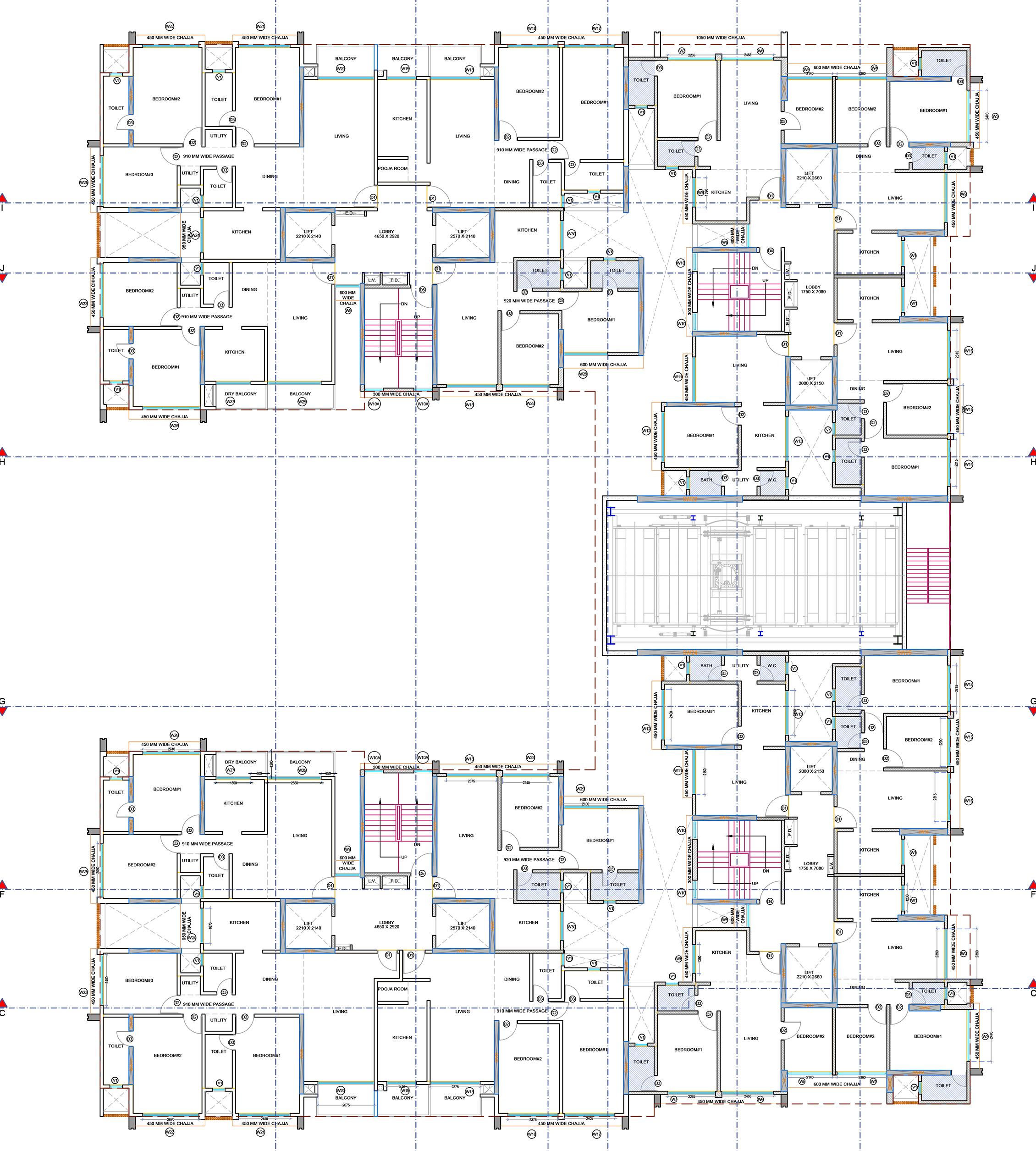
This section showcases technical drawings developed during my internship, focusing on the creation of a centerline layout for an apartment building.
The drawings demonstrate understanding of technical drafting standards, coordination, and precise layout planning.
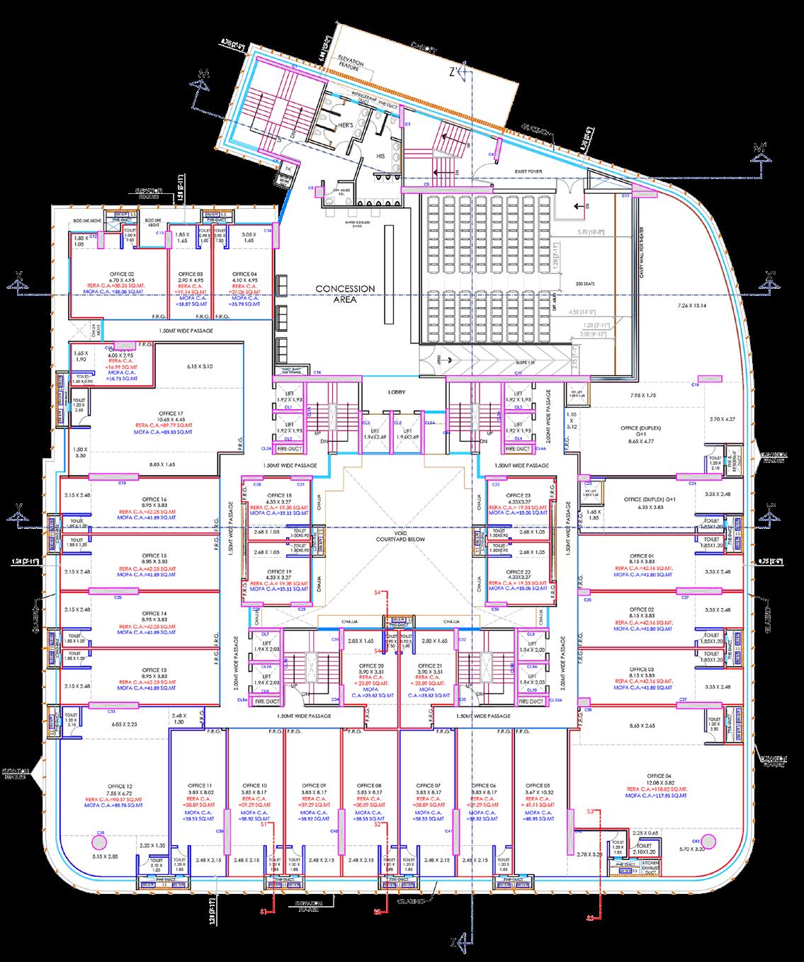
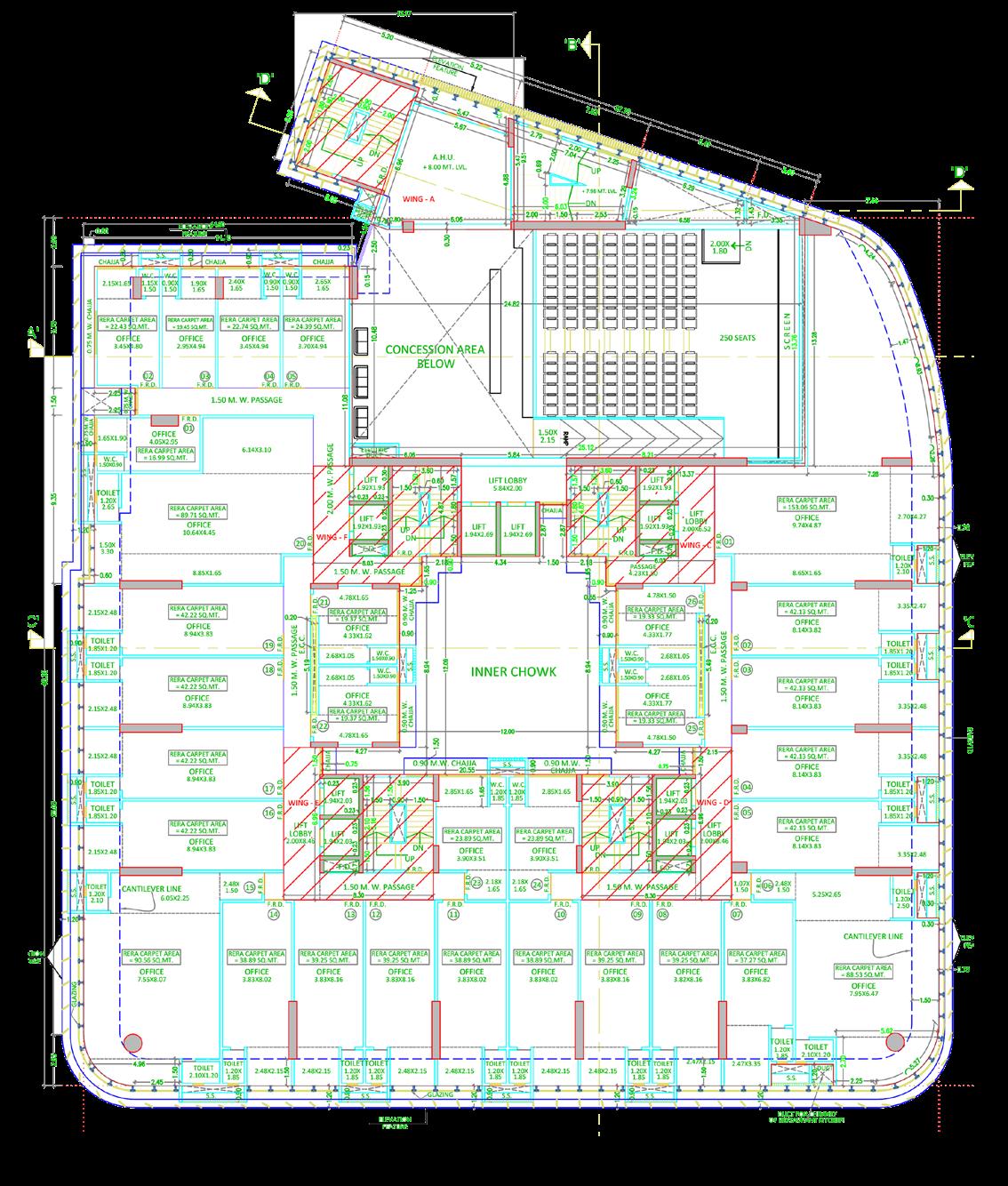
I contributed to layout planning and assisted in developing section drawings that highlight specific interior details, supporting clear technical communication of the design.

Introduction
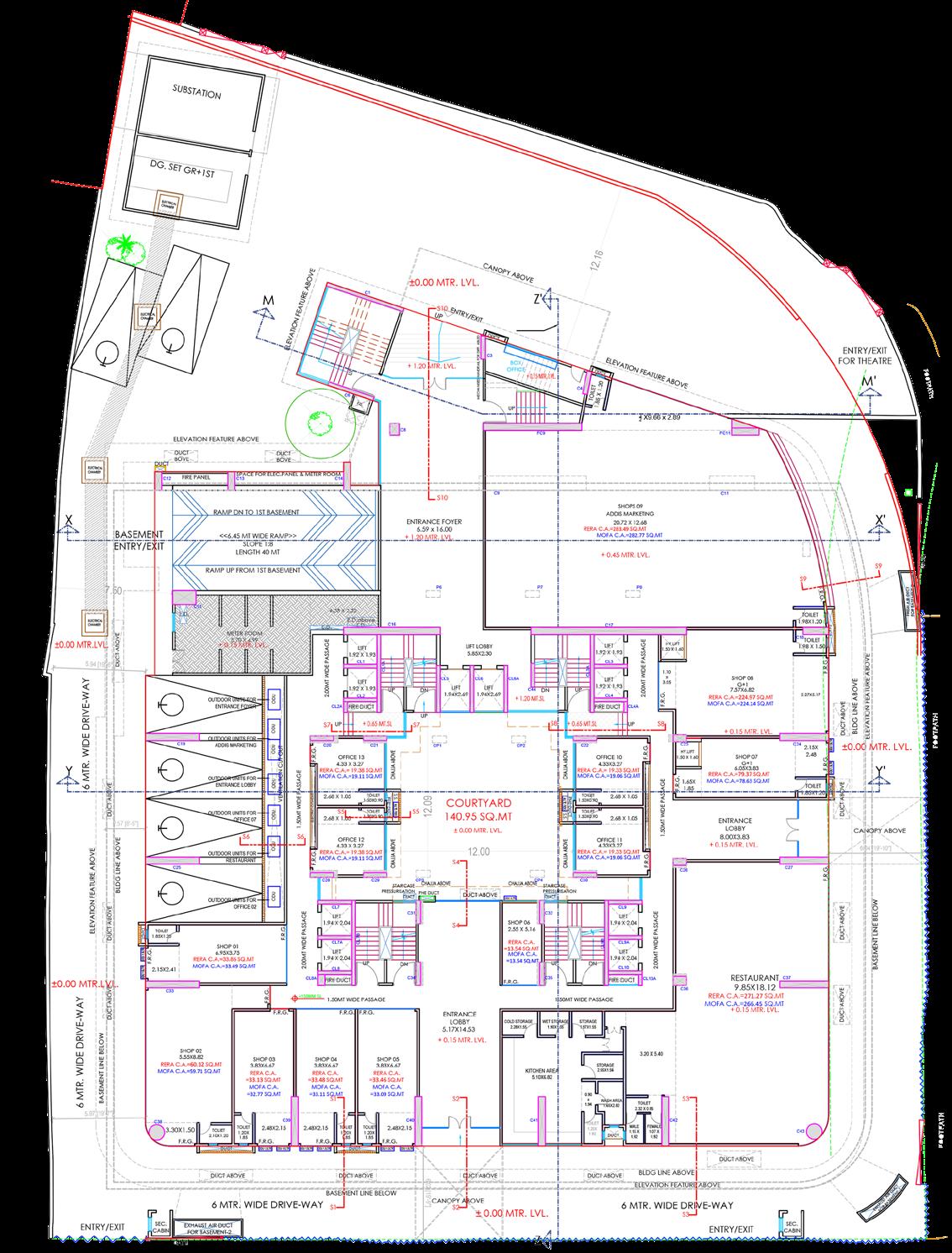
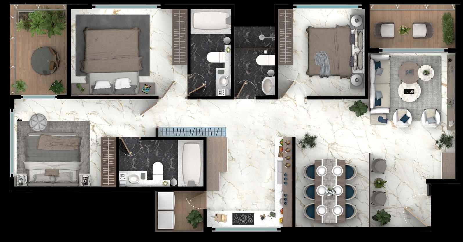
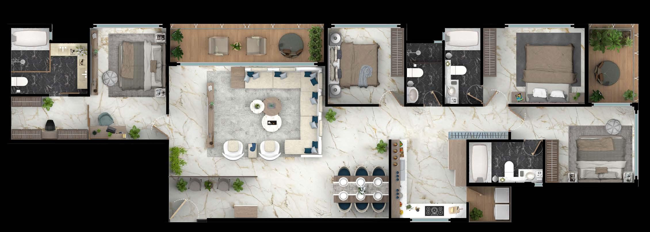
This project explores a mixed-use building organized around a three story commercial podium with residential apartments above. The residential program is composed of three unit typologies 2BHK, 3BHK, and 4BHK designed to accommodate varied household needs. The proposal emphasizes efficient planning and clear separation between public commercial functions and private living spaces. Architectural drawings and 3D visualizations were used to communicate spatial organization and key design views.
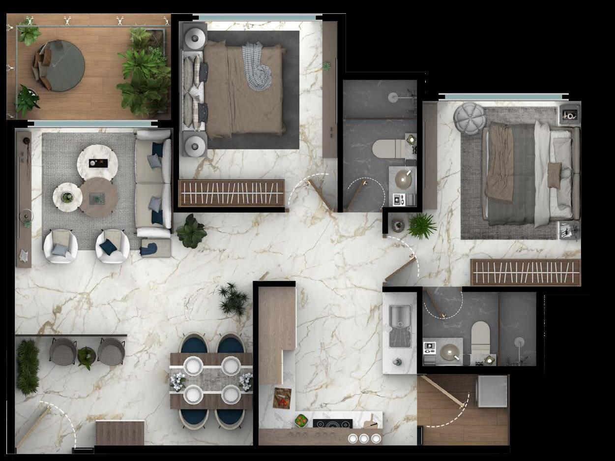
This panel showcases rendered floor plans across three unit types, highlighting spatial organization and furniture layout.
Work demonstrates Photoshop-based visualization skills used to clearly communicate design intent.
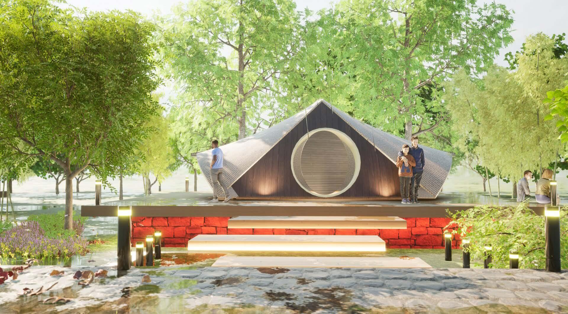
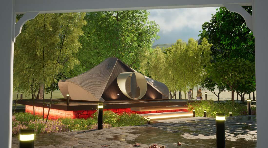
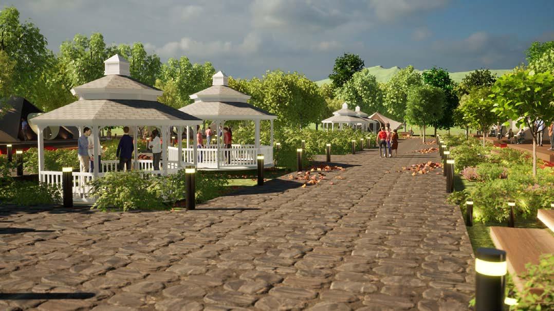
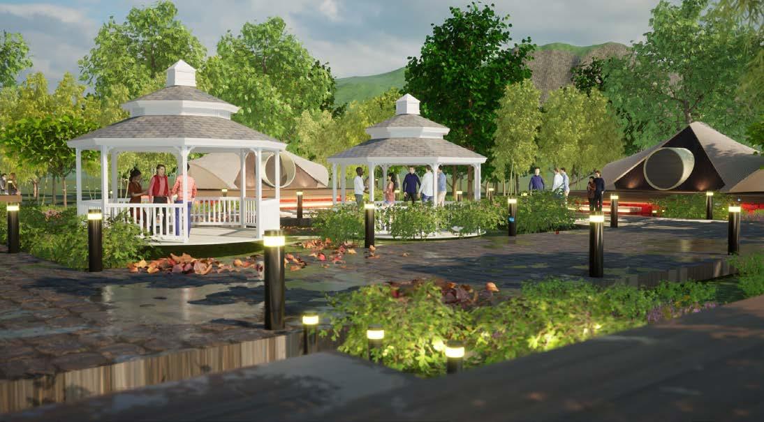
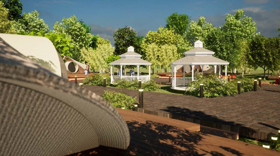
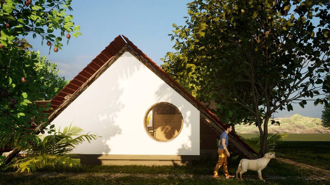
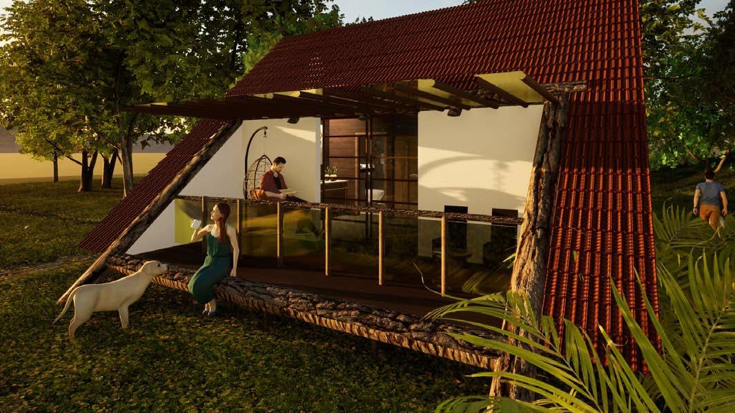
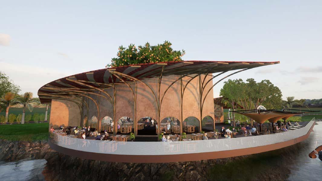
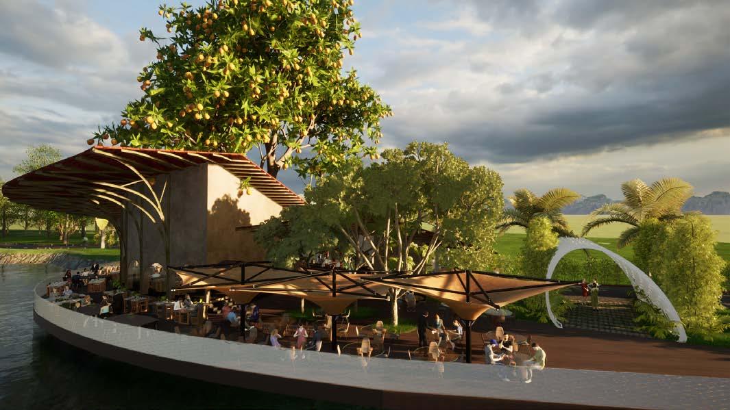
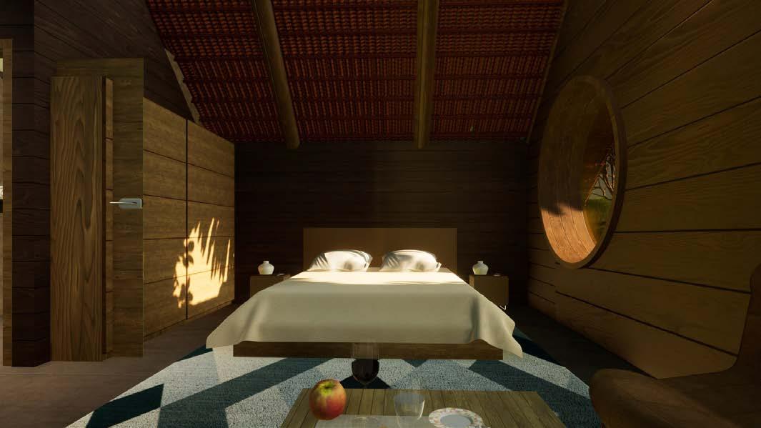
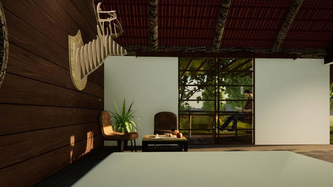
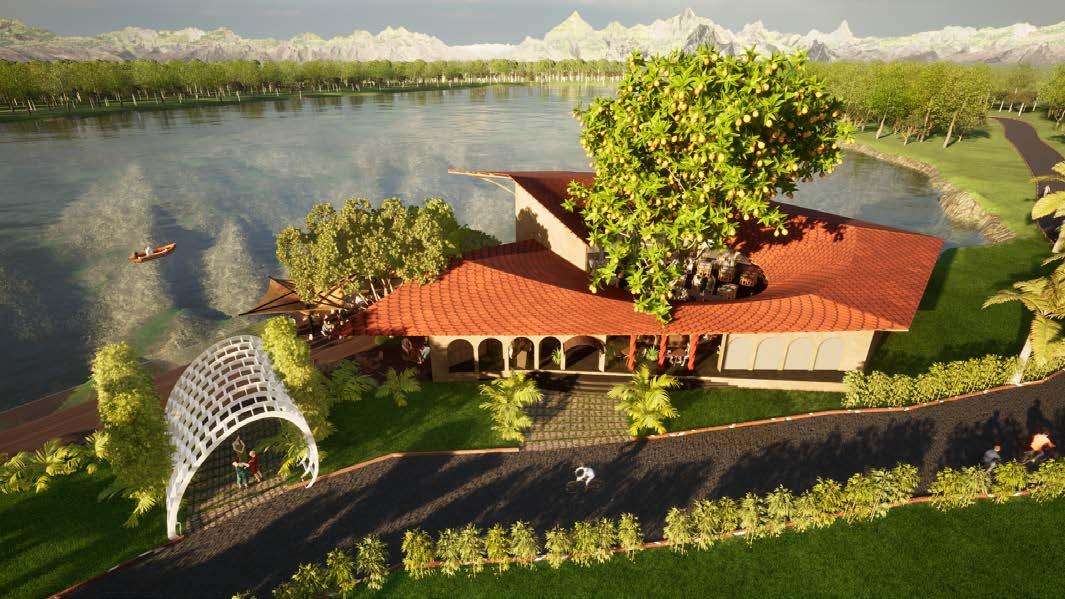
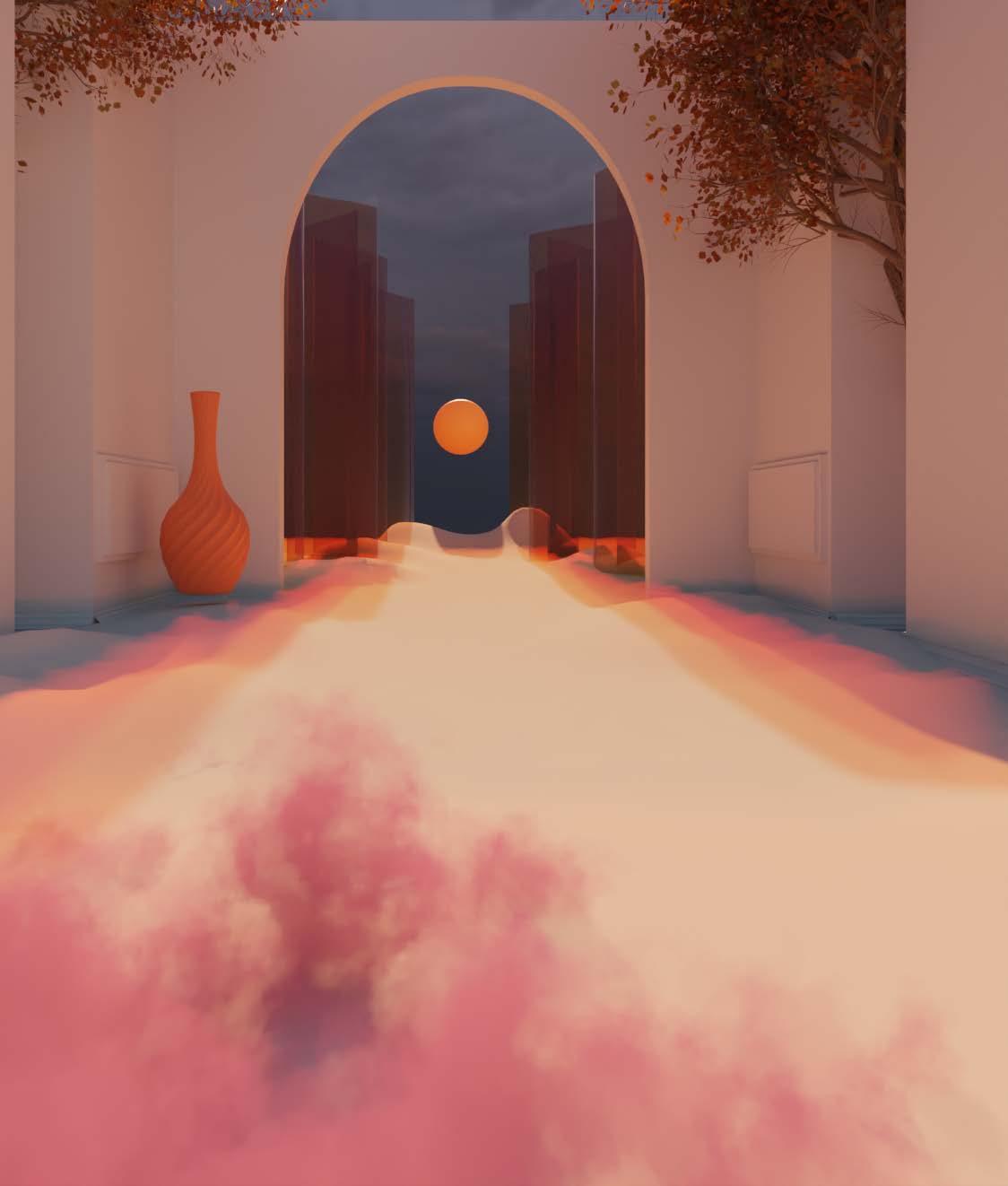
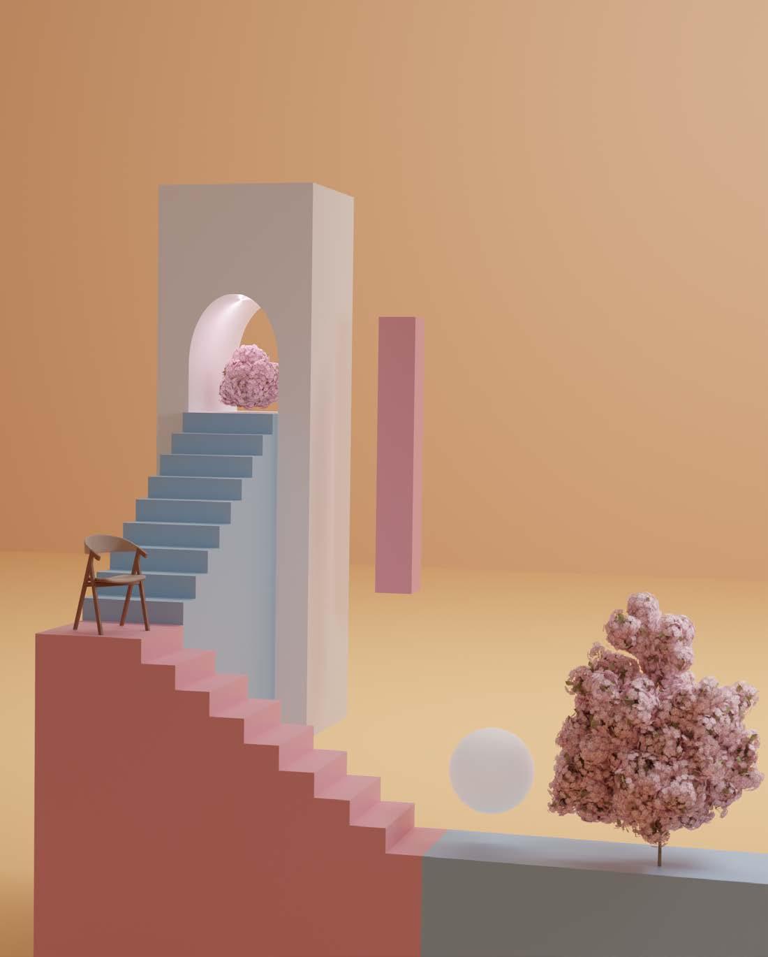
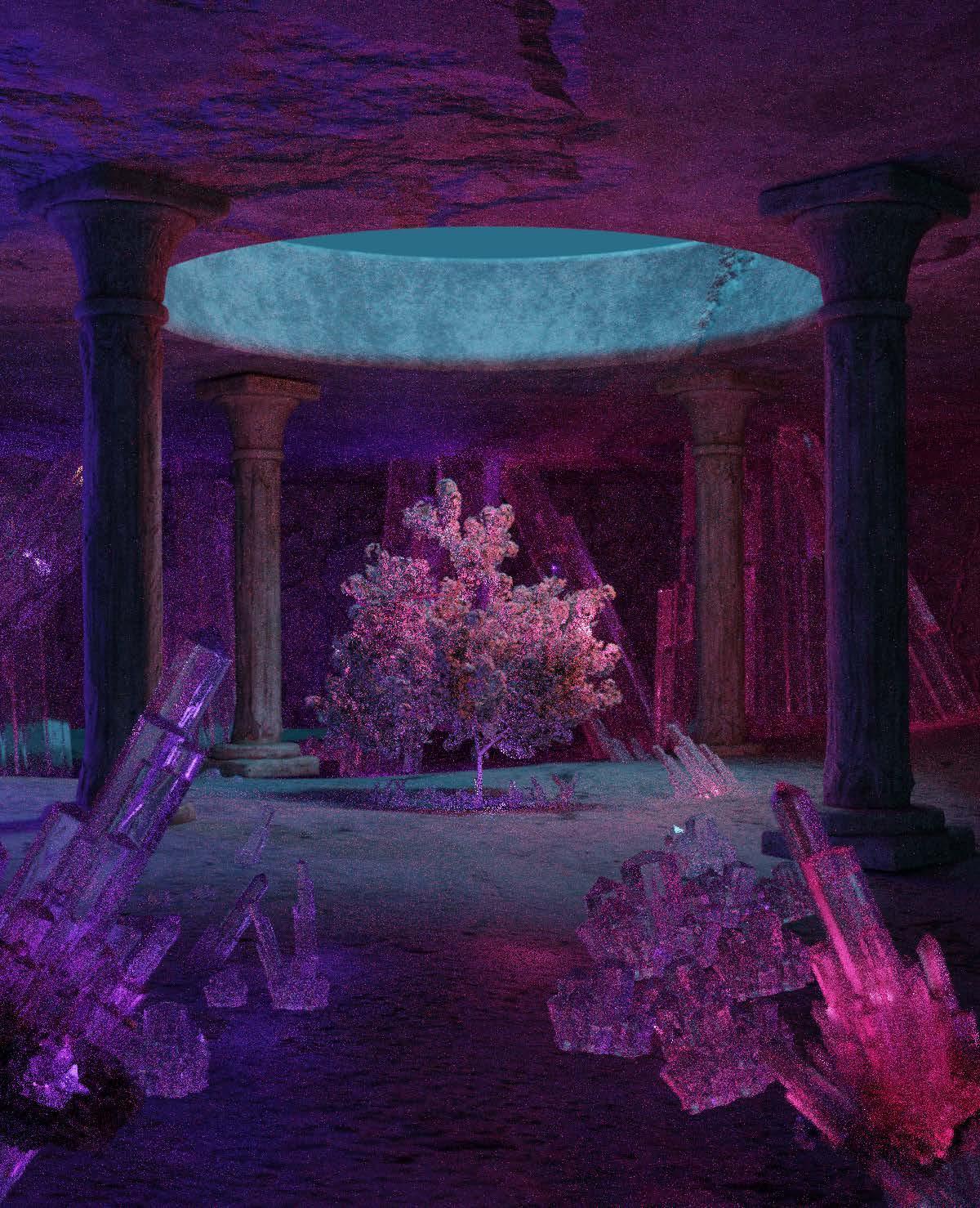
This page presents a selection of personal rendering studies exploring light, materiality, and spatial atmosphere. These works serve as a platform for visual experimentation and conceptual thinking beyond academic and professional projects. The studies reflect an ongoing interest in architectural representation as both a design and storytelling tool.
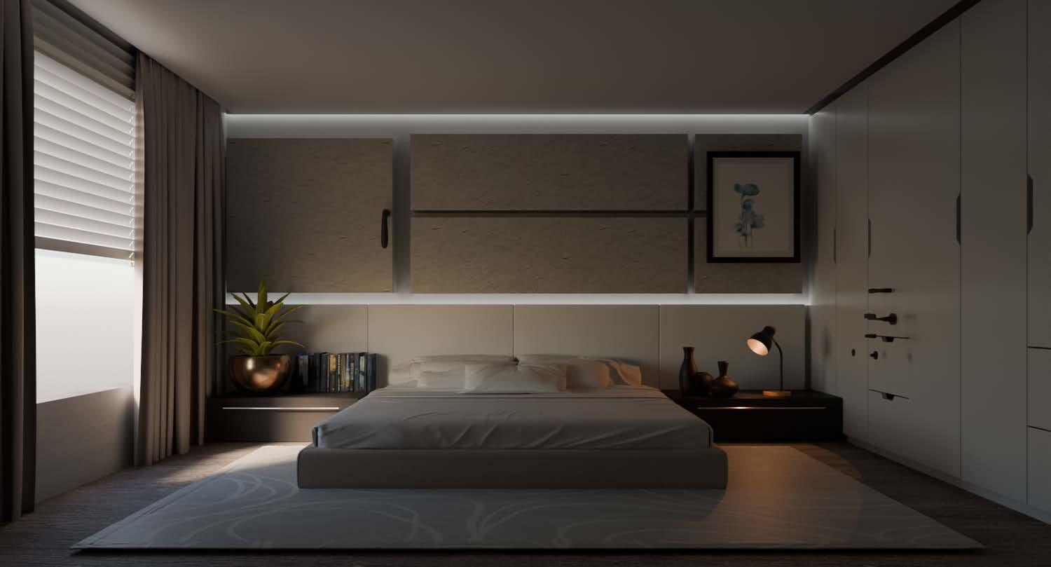
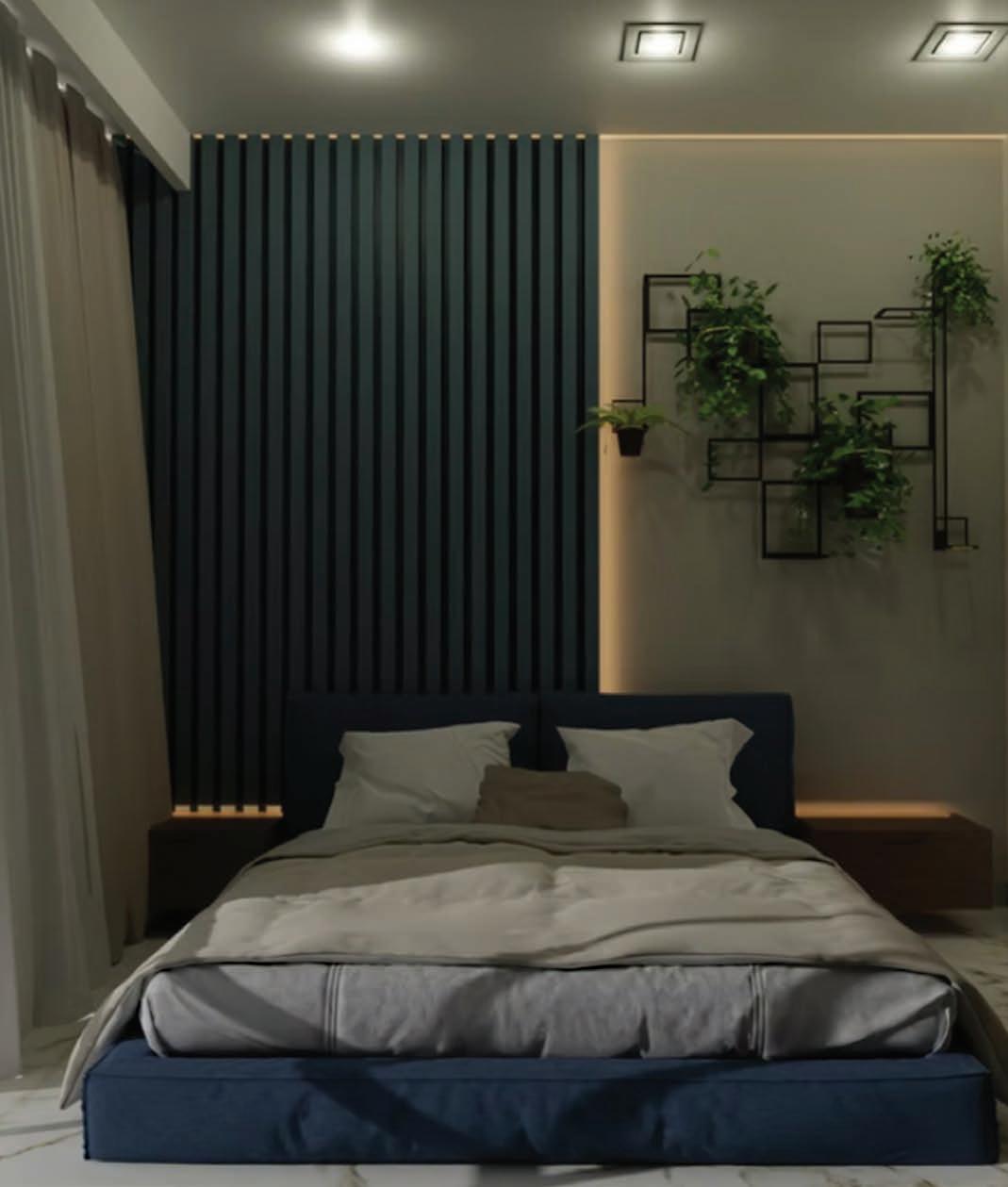
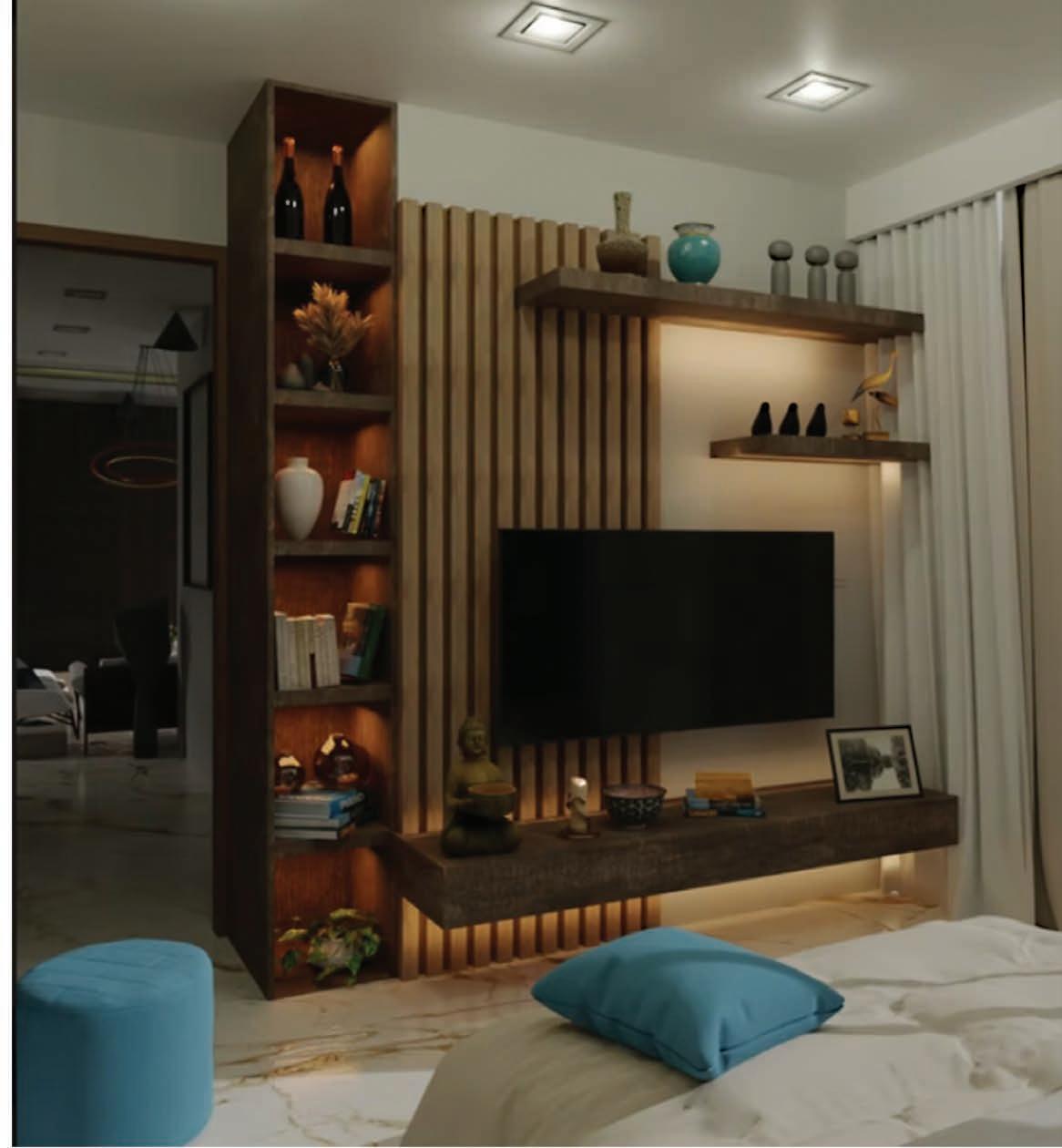
This page presents a selection of personal rendering studies exploring light, materiality, and spatial atmosphere. These works serve as a platform for visual experimentation and conceptual thinking beyond academic and professional projects. The studies reflect an ongoing interest in architectural representation as both a design and storytelling tool.

B.ARCH & M.S.AUD SELECTED WORKS | 2019-2026