Auburn University, School of Architecture, Planning, and Landscape Architecture
Bachelor of Landscape Architecture, August 2021 – May 2025
• GPA: 3.52, Cum Laude
• Honors: Dean’s List (3 Semesters) 2024-2025
• Sigma Lambda Alpha Honor Society (2025-Present)
• Institute of American Universities, Aix-en-Provence, France (Summer 2023)
Landscape Architecture Intern, Kimley-Horn (2024)
• Collaborated in a multidisciplinary office on a range of projects— including streetscapes, commercial design, and community development— while strengthening communication, teamwork, and professional skills.
• Engaged in community outreach initiatives across the Atlanta area to better understand local needs and priorities, integrating community input into the design process.
• Enhanced design and technical proficiency in Rhino and AutoCAD through real-world projects, addressing practical constraints and engaging with clients throughout the design process.
Council Member, Student Government Association (2023-2025)
• Represented the School of Landscape Architecture as a student liaison, advocating for classmates by voicing concerns and feedback related to the program, faculty, and broader CADC initiatives.
• Organized and participated in community events within the College of Architecture, Design, and Construction to encourage student involvement.
Member, Prader-Willi Association (2016-Present)
• Support ongoing fundraising initiatives for the Prader-Willi Foundation through event participation, outreach, and awareness efforts.
• Coordinate and lead meetings to streamline event logistics and strategic planning.
• Hosted outdoor events, including kickball tournaments, to raise funds and increase awareness for charitable causes.
Member, Save a Child’s Heart Foundation (2019-2022)
• Organized basketball tournaments as fundraising events to provide financial support for children in need of heart surgery.
• Managed event logistics, promotional campaigns, and community outreach to maximize participation and impact.
Member, National ASLA (2024-Present)
Member, Lambda Chi Alpha (2021-2025)
Member, Auburn University Chapter of ASLA (2023-2025)
• Participated in a mentorship program supporting new landscape architecture students by providing guidance on technical tools, design processes, and general academic or studio needs.
• ArcGIS Pro
• Rhino
• AutoCAD
• Adobe Photoshop
• Adobe Illustrator
• Adobe InDesign
• Adobe After Effects
• Twin Motion
• D5 Render
• Sketch Up
• 3D modeling
• Hand Graphics

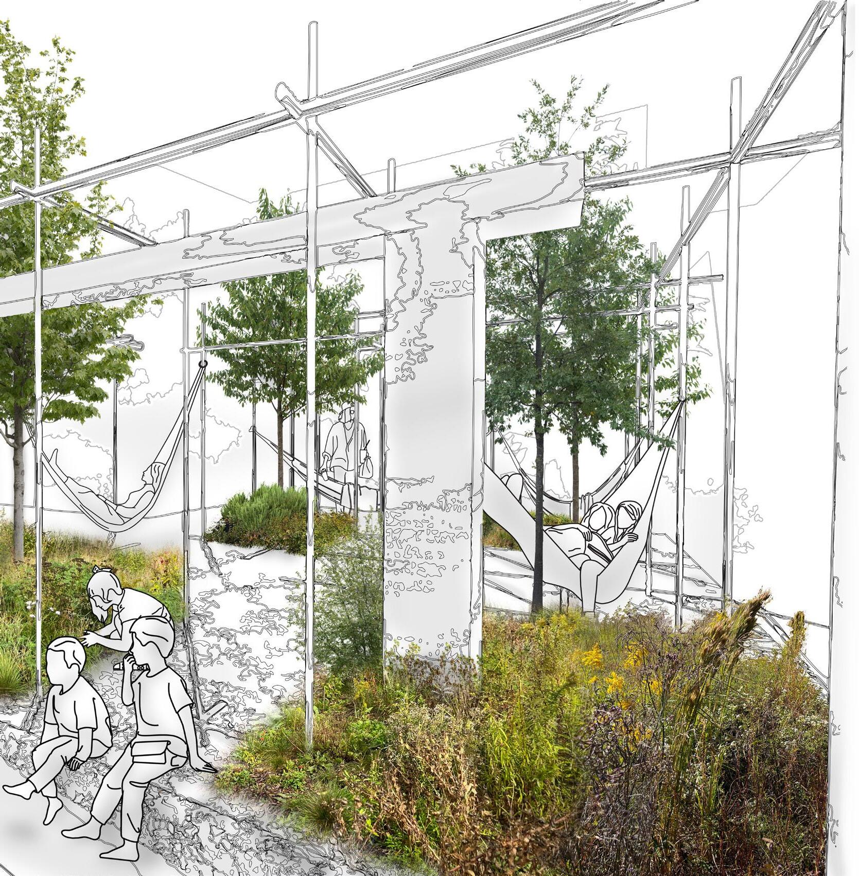
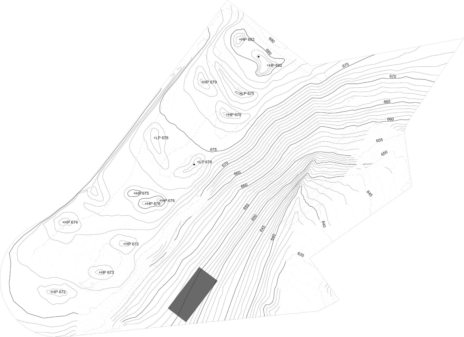
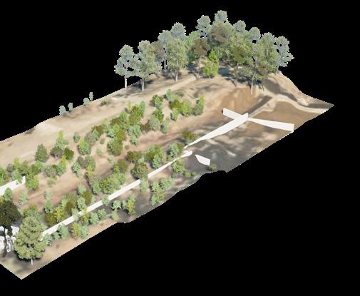
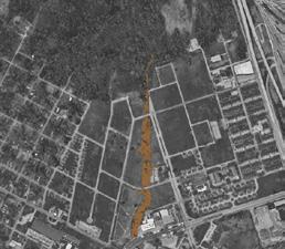
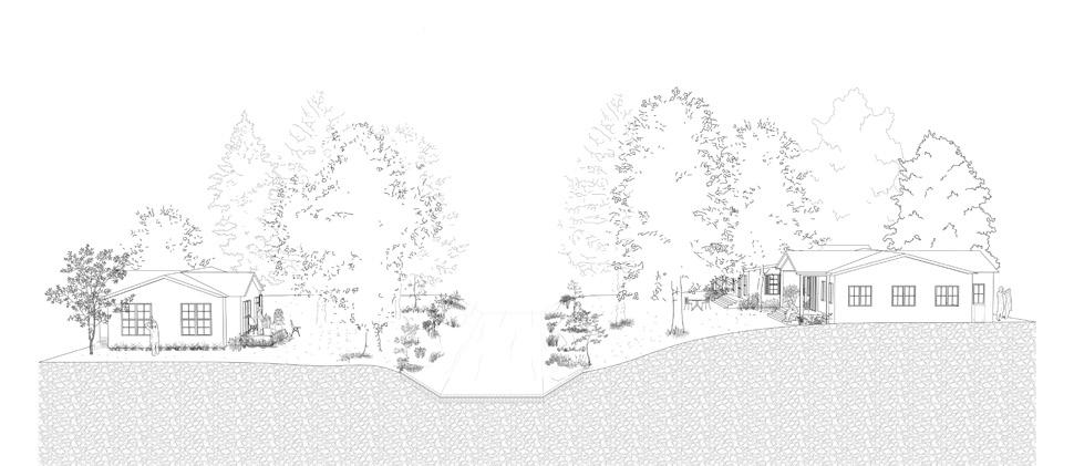
Investigating the future of southern urban forests through the reimagination of the Fairfax Mill site in Valley, Alabama. Beginning with group analysis and site-wide planning, developing a masterplan aimed at reforesting the mill grounds as a multifunctional landscape that responds to ecological, cultural, and infrastructural needs. Four tree species are assigned to structure the design; in this case, Kentucky coffeetree, longleaf pine, sweetgum, and blackgum.
The masterplan explores how these species can work together to define spatial legibility, support diverse habitats, manage stormwater, and establish meaningful connections to the surrounding neighborhood. Considerations of site history, landform strategy, and forest succession over time are embedded in the large-scale design.
Following the group phase, individuals focus on smaller, nested site designs that interpret the masterplan at the human scale. These interventions aim to shape immersive and functional forest experiences while reinforcing the larger ecological framework.
Location: Valley, Alabama
Date: Fall 2023
Project Type: Group (3) / Individual
Programs: Adobe Suite, Rhino 3D, Hand Graphics, D5 Render
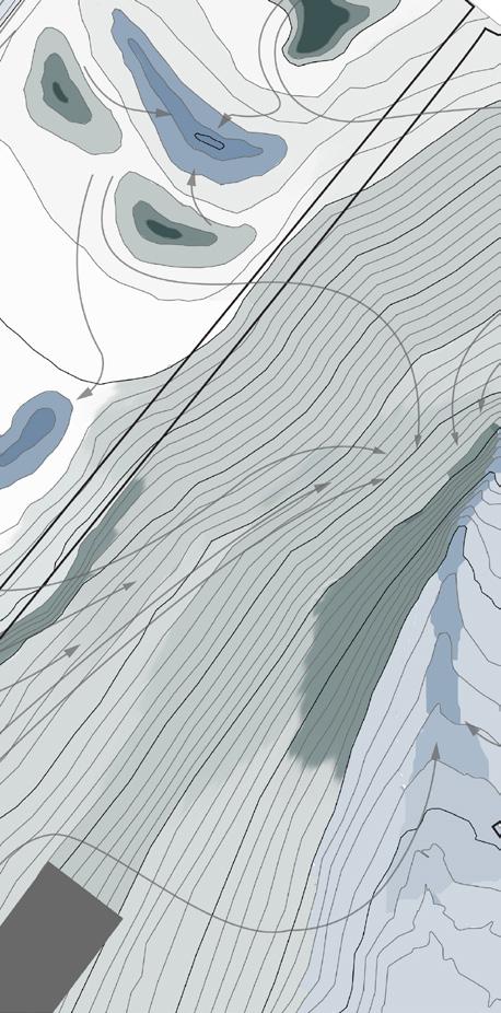
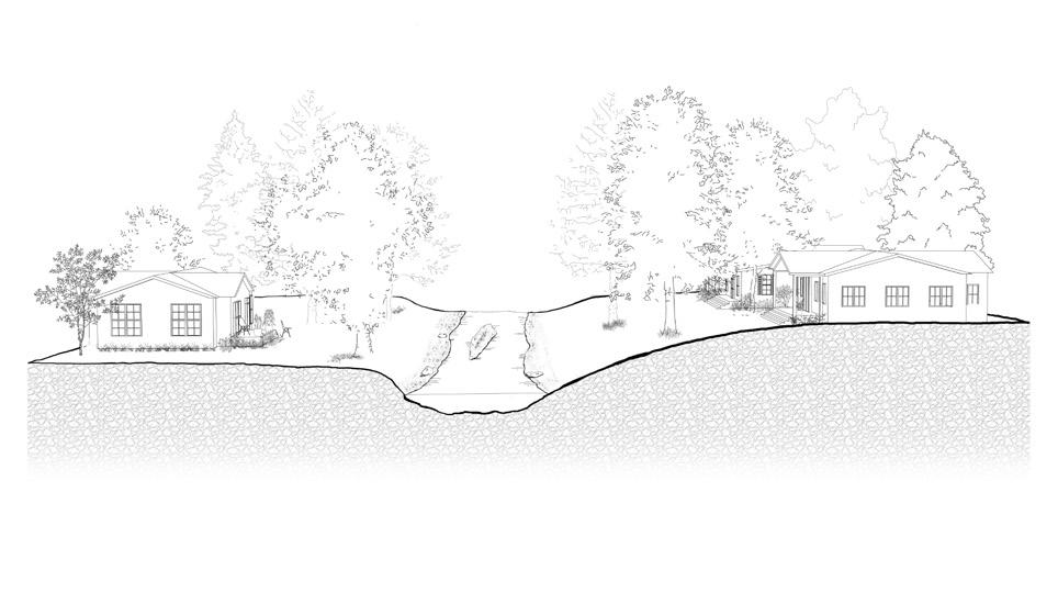
Topographic adjustments and hydrologic strategies shape the site through mounds and valleys that mimic Alabama’s pine landscapes. These landforms direct water flow and create species-specific planting zones— drier mounds for pines, wetter valleys for blackgums. Water is guided to floodplains for runoff absorption and resilience, while varied paths support access and management.
Mound: Elevated areas that strengthen the gridded planting, mimic Alabama’s pine landscapes, and support dense pine growth.
Valley: Hydrological features that guide water flow, form small floodplains, and create conditions for blackgum trees, mimicking natural pine forest landforms and integrating hardwoods near water.
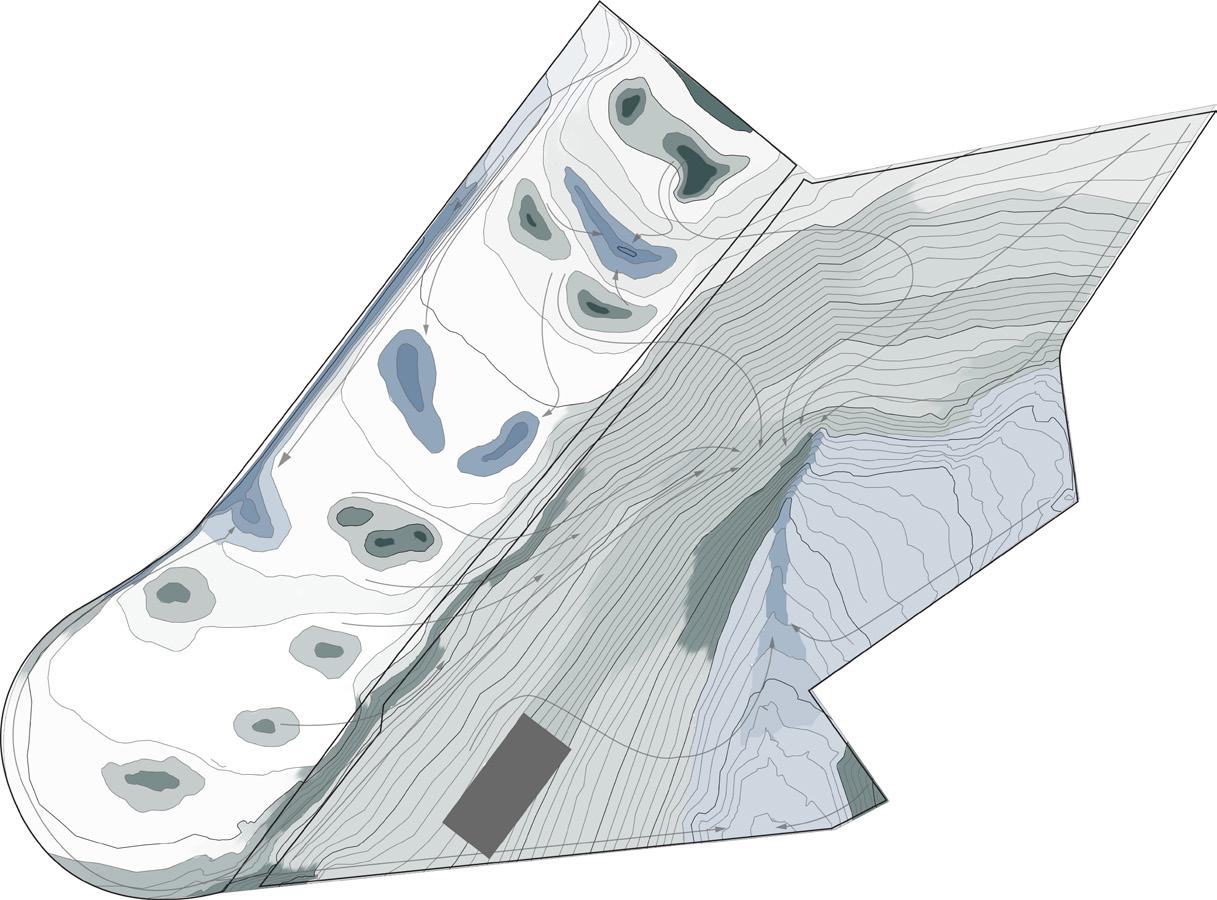
Dry | Moderately Dry | Moist | Saturated
Connections: A network of paths links the site’s ecologies—concrete routes through public areas, raised wooden walkways across floodplains, and soft trails in meadows and pine forest—ensuring access while fitting each landscape.
Water: Shapes site topography and ecology by creating floodplains, enhancing biodiversity, improving soil, and supporting tree health.
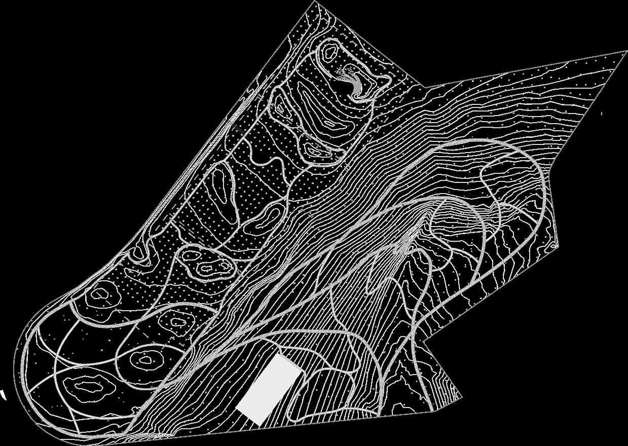

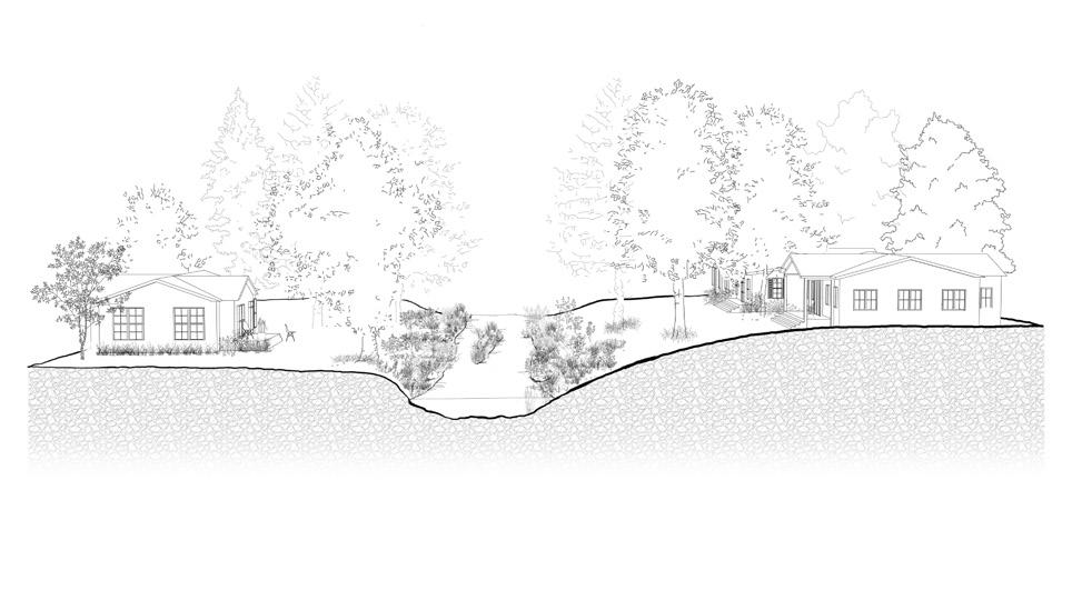
- Vegetation planted
- Thinned
- Mowed
- Prescribed burn
- Dominant plants
- Nondominant plants
Longleaf pine: A fireresilient species adapted to poor soils, sustained by regular burns and open topography to form a lasting forest system.
Kentucky coffee tree: Thrives with intentional spacing and long-term management, where thinning supports canopy health and allows the meadow below to mature.
Mixed planting: Layers sweetgum, blackgum, and Kentucky coffee trees with managed thinning and underplanting, while meadows and thickets create a balance of open space and habitat.
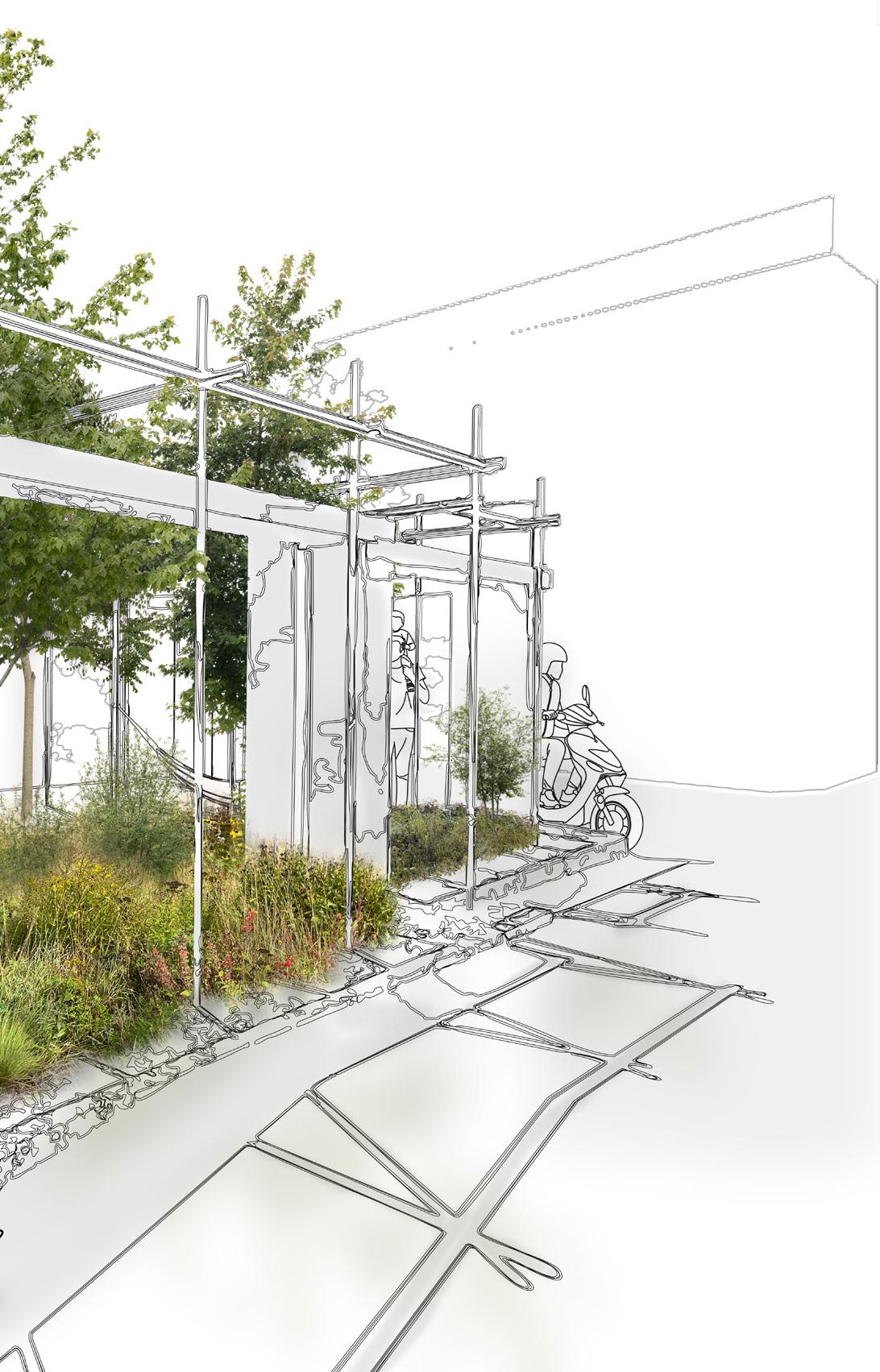
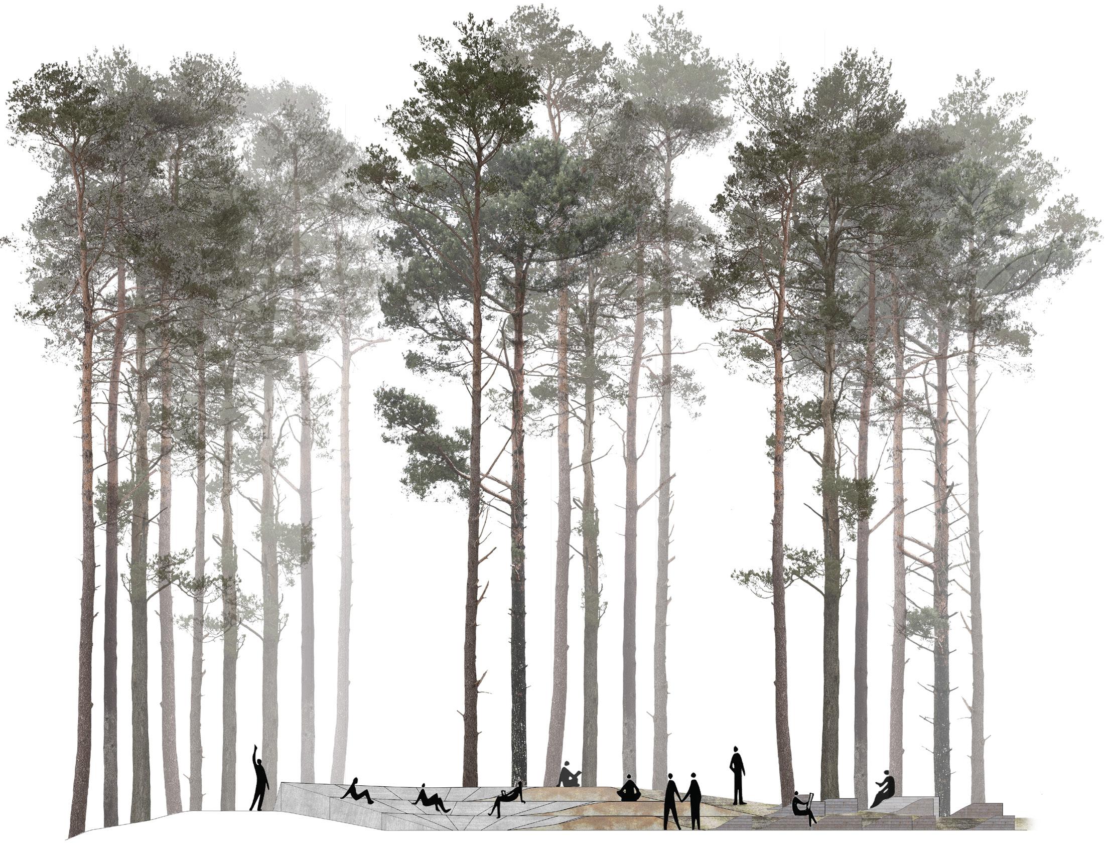
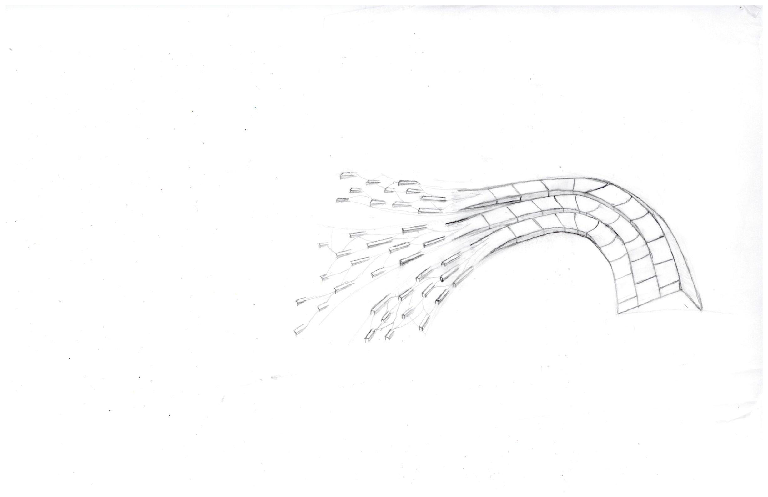
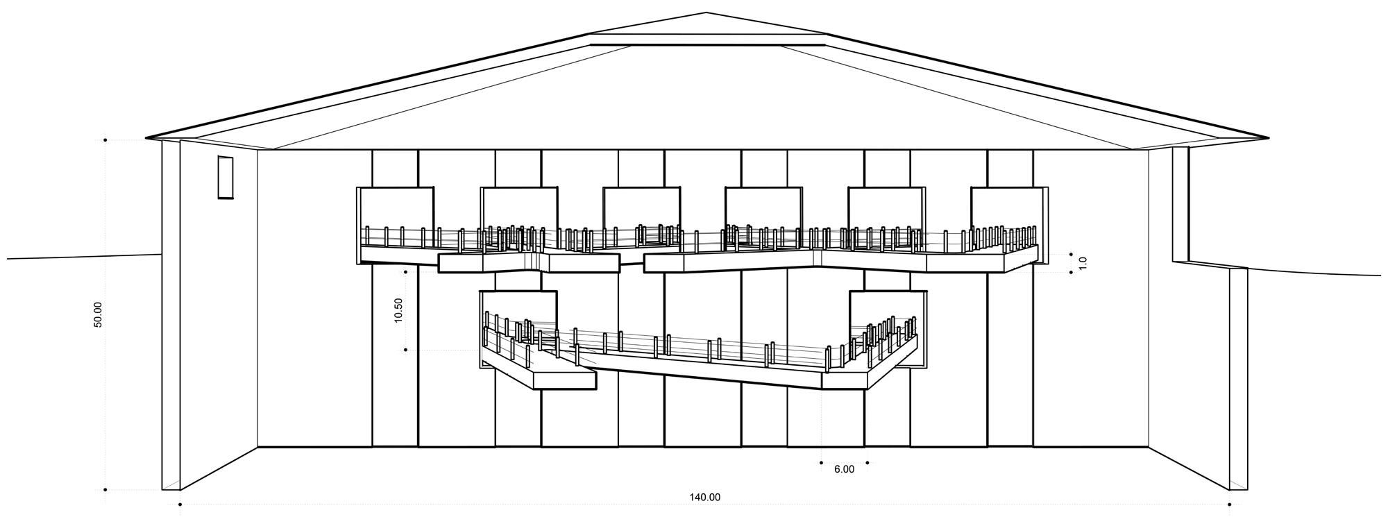
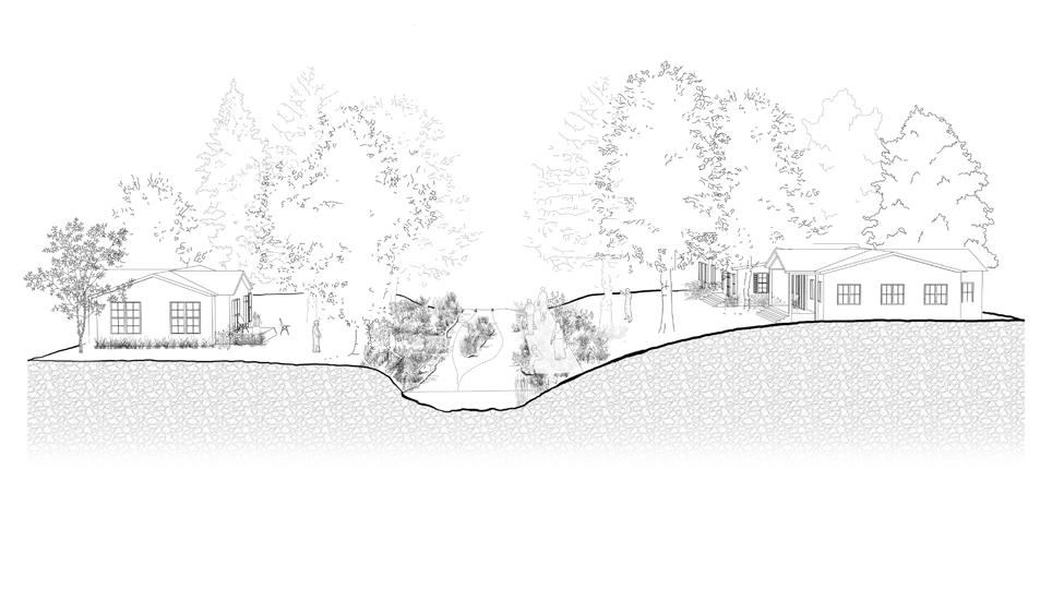
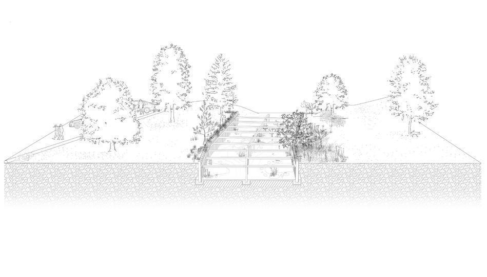
This intervention envisions a community amphitheater woven into the longleaf pine forest, offering a flexible outdoor gathering space for schools, churches, and public events. Carved into a reshaped hillside, the design responds to forest succession and natural topography, allowing the amphitheater to merge seamlessly with its surroundings. The stepped blocks create a range of spatial experiences—from enclosed, intimate settings in the forest’s early growth to open, expansive spaces as the pines mature— ensuring the site evolves with the landscape over time.

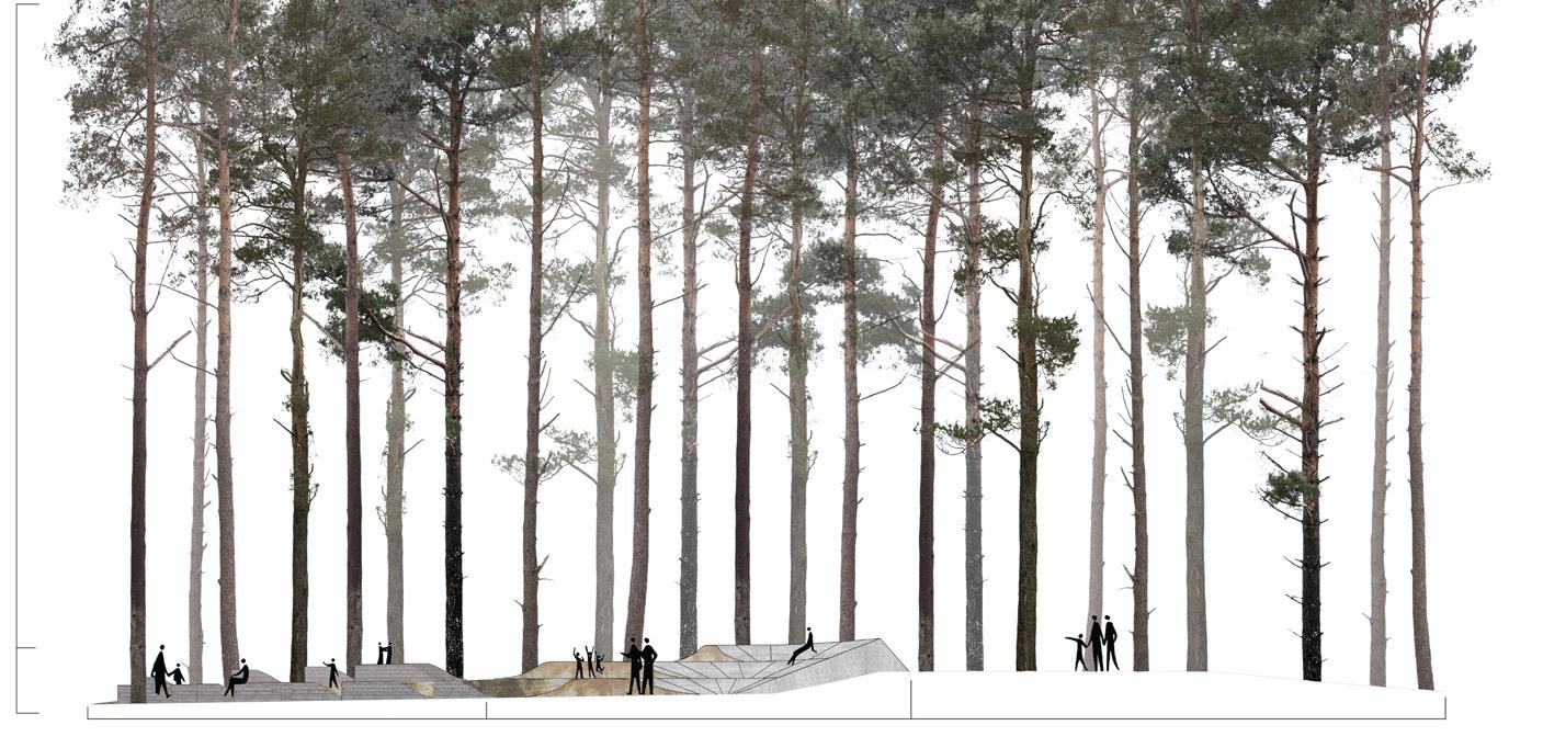
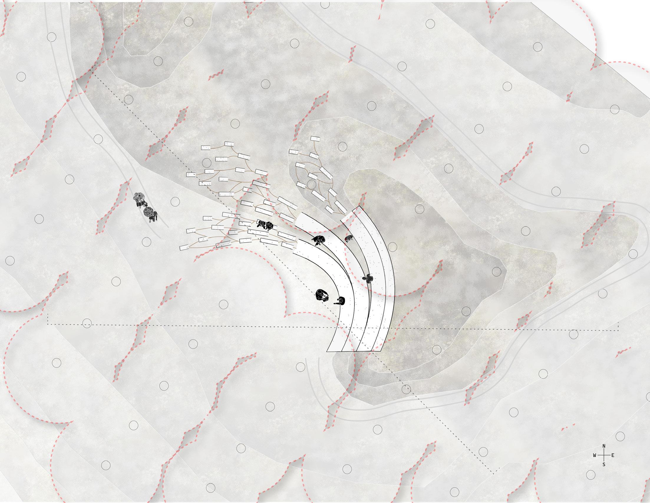
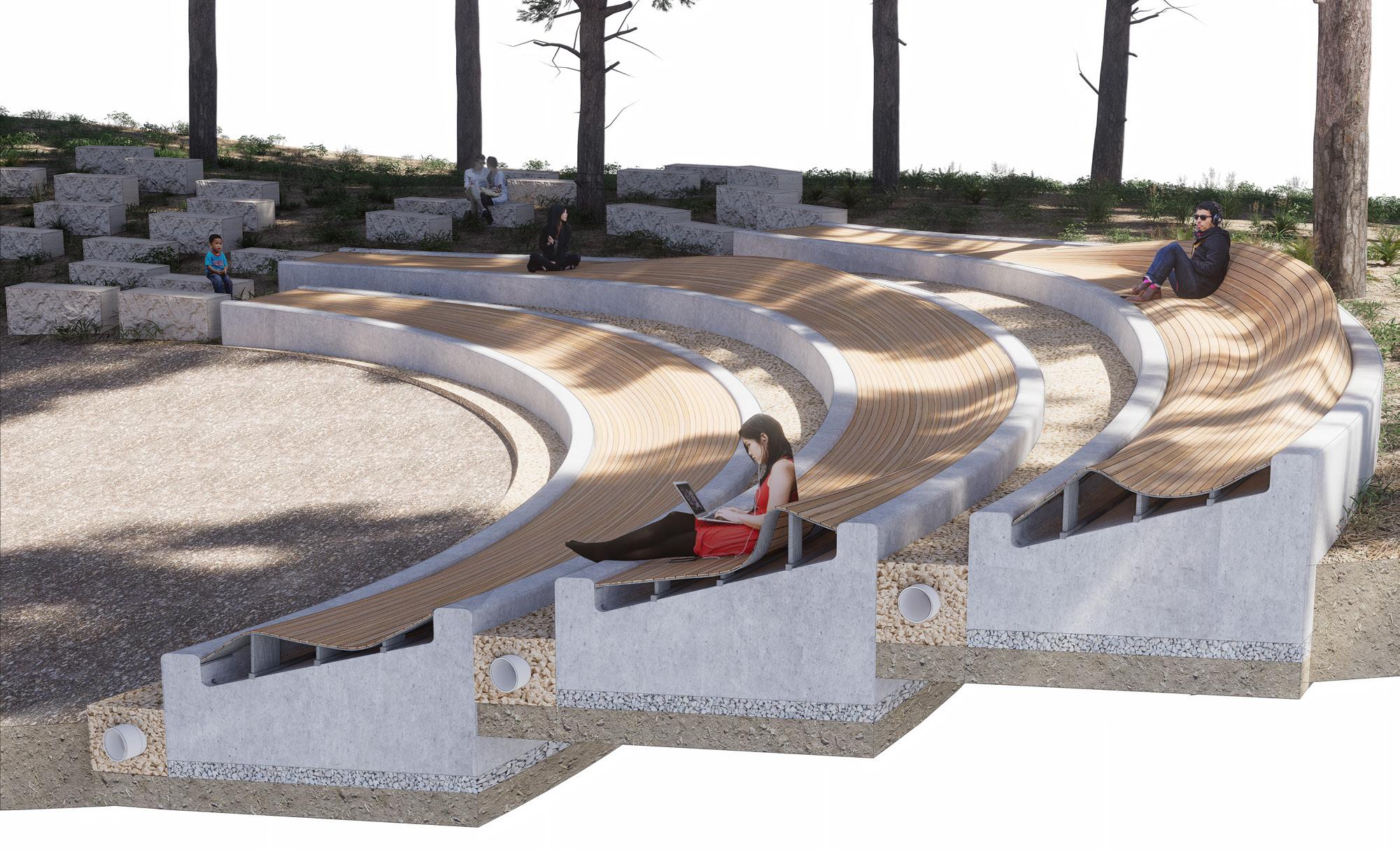
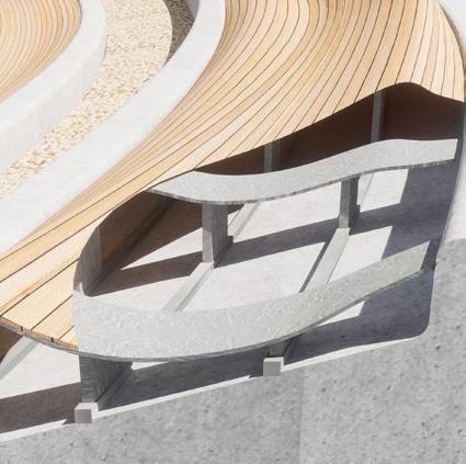

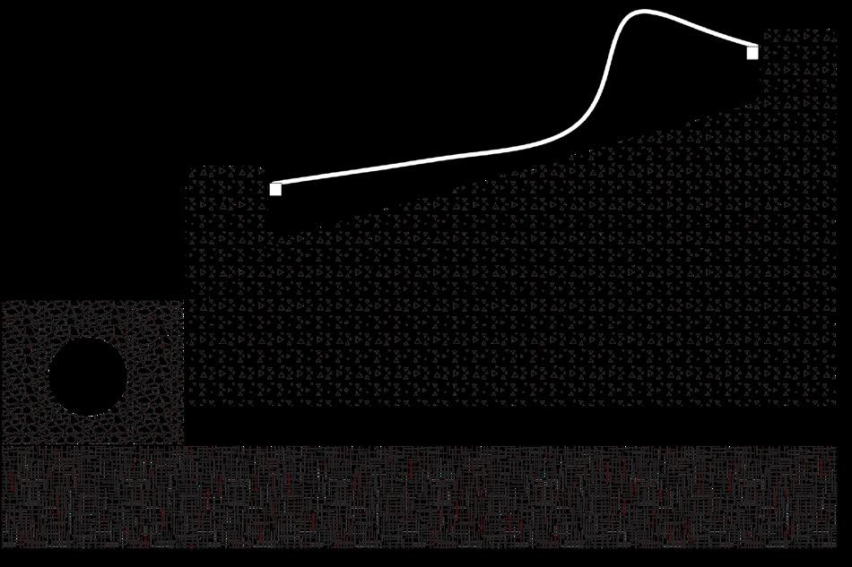

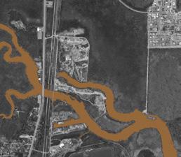
Location: Elba, Alabama
Date: Spring 2023
Project Type: Individual
Programs: Hand Graphics, Adobe Suite, Rhino 3D, TwinMotion, ArcGIS
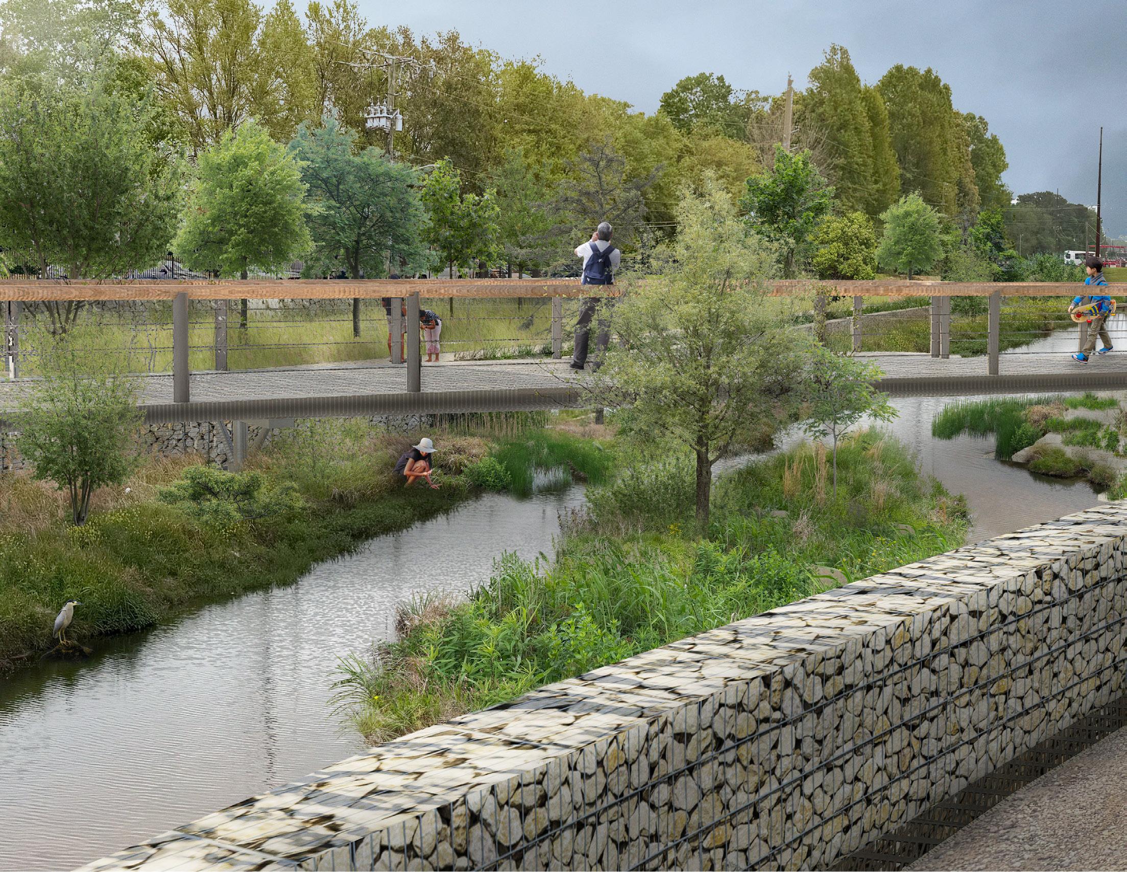
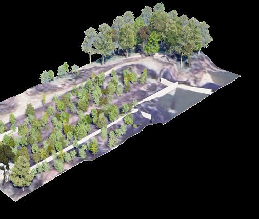
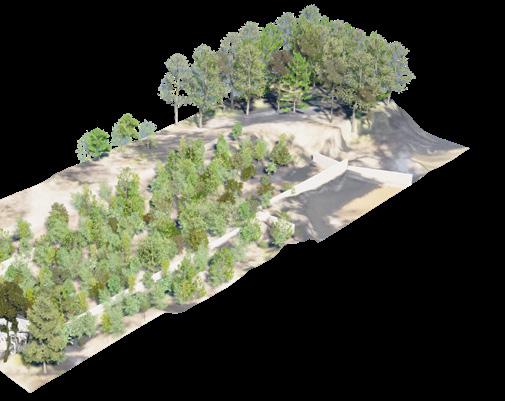
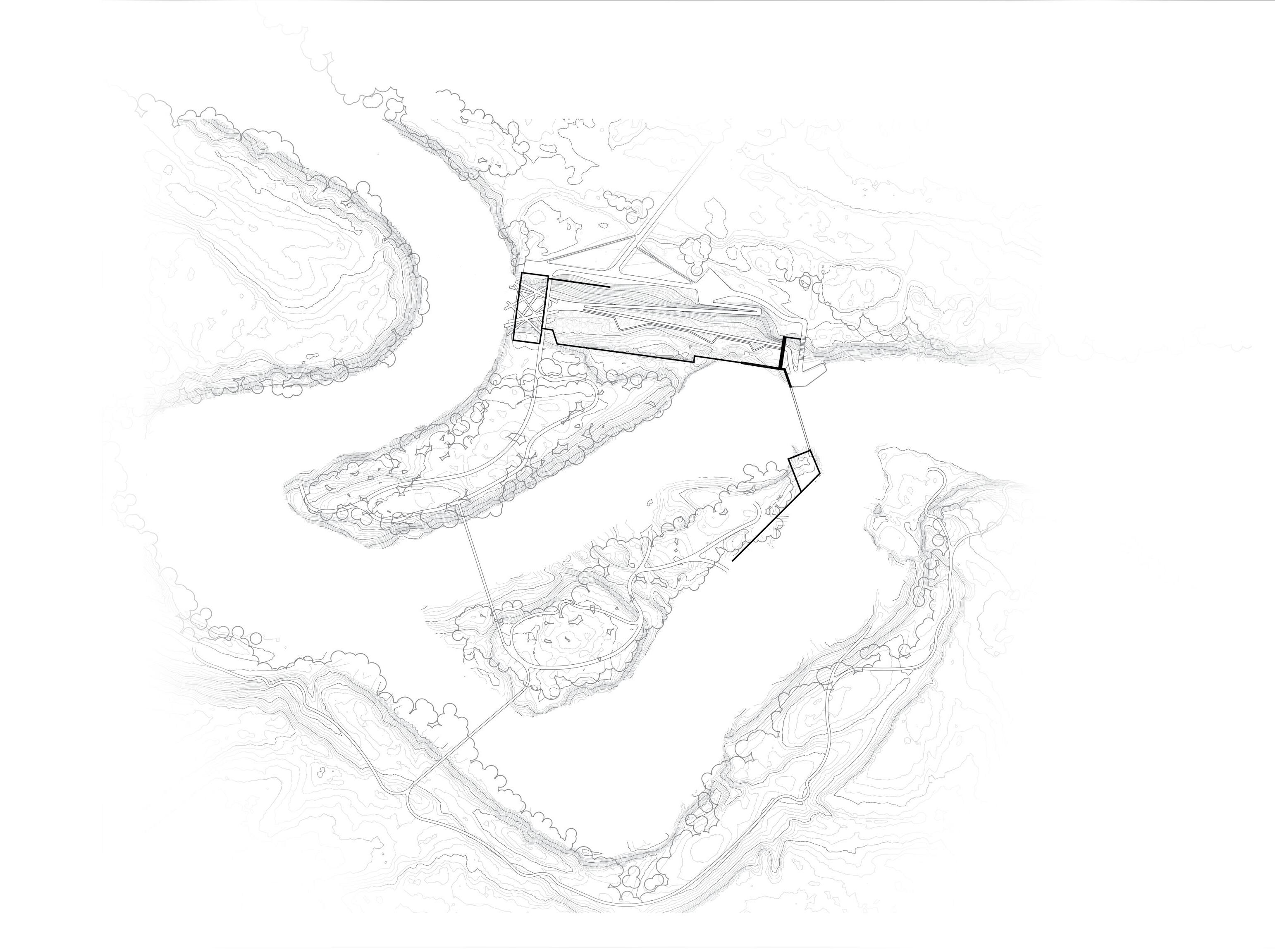
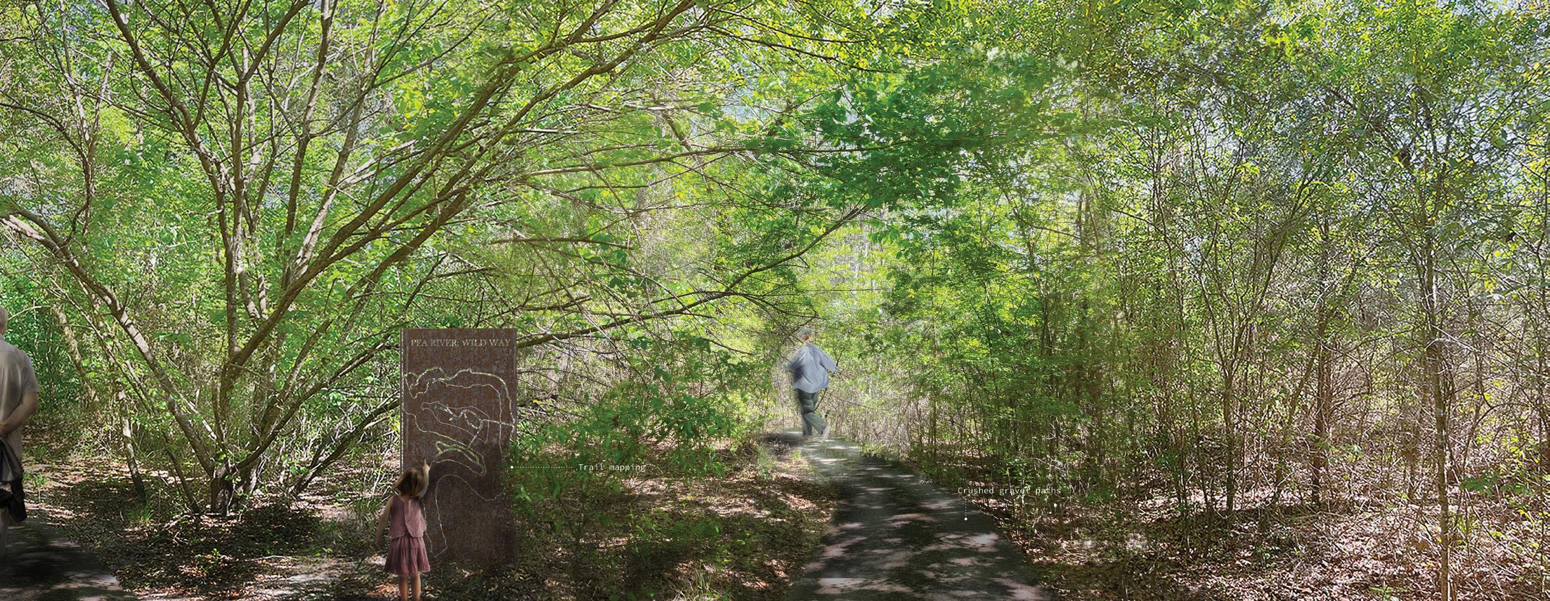
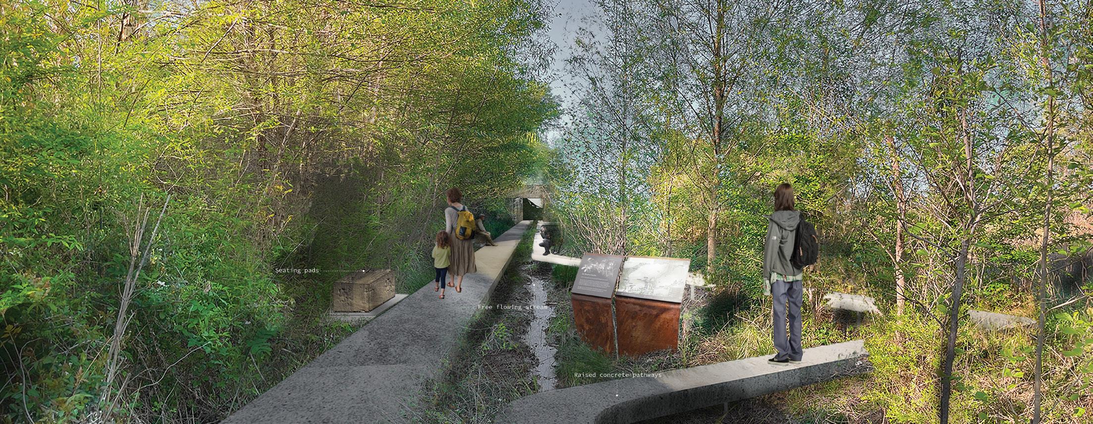
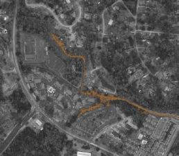
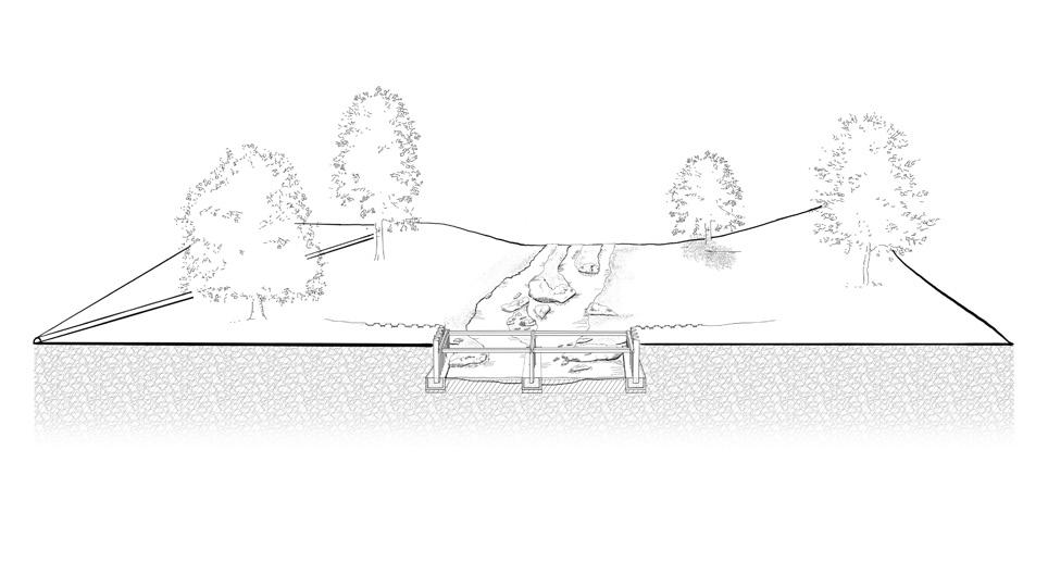
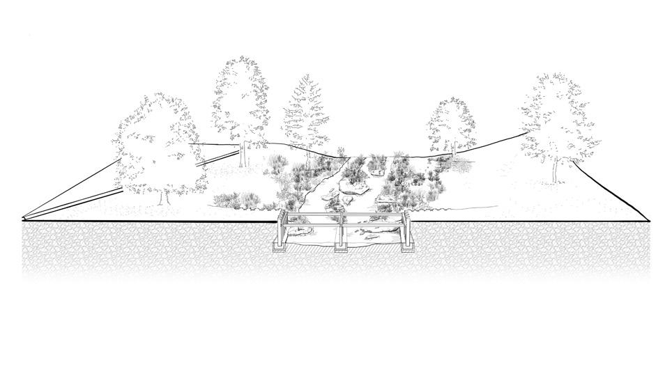
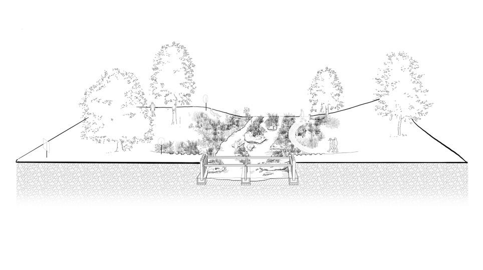
Engaging the small river town of Elba, Alabama, exploring multiscalar design strategies that respond to its unique cultural, ecological, and topographic conditions. Situated within a levee system that protects the community from seasonal flooding of the Pea River, Elba carries a layered history—from floodplain neighborhoods shaped by recurring floods to an abandoned dam site and other underused spaces that reflect the town’s shifting relationship with the river. Collaborating with Restoration 154, the National Park Service, and the city of Elba, this project explores ways to reconnect the town to its riverfront, enhance ecological resilience, and create meaningful public spaces. Through mapping, hydrologic analysis, and digital modeling, the work bridges large-scale systems with human-scale experiences, proposing designs that unify ecological performance with community value.
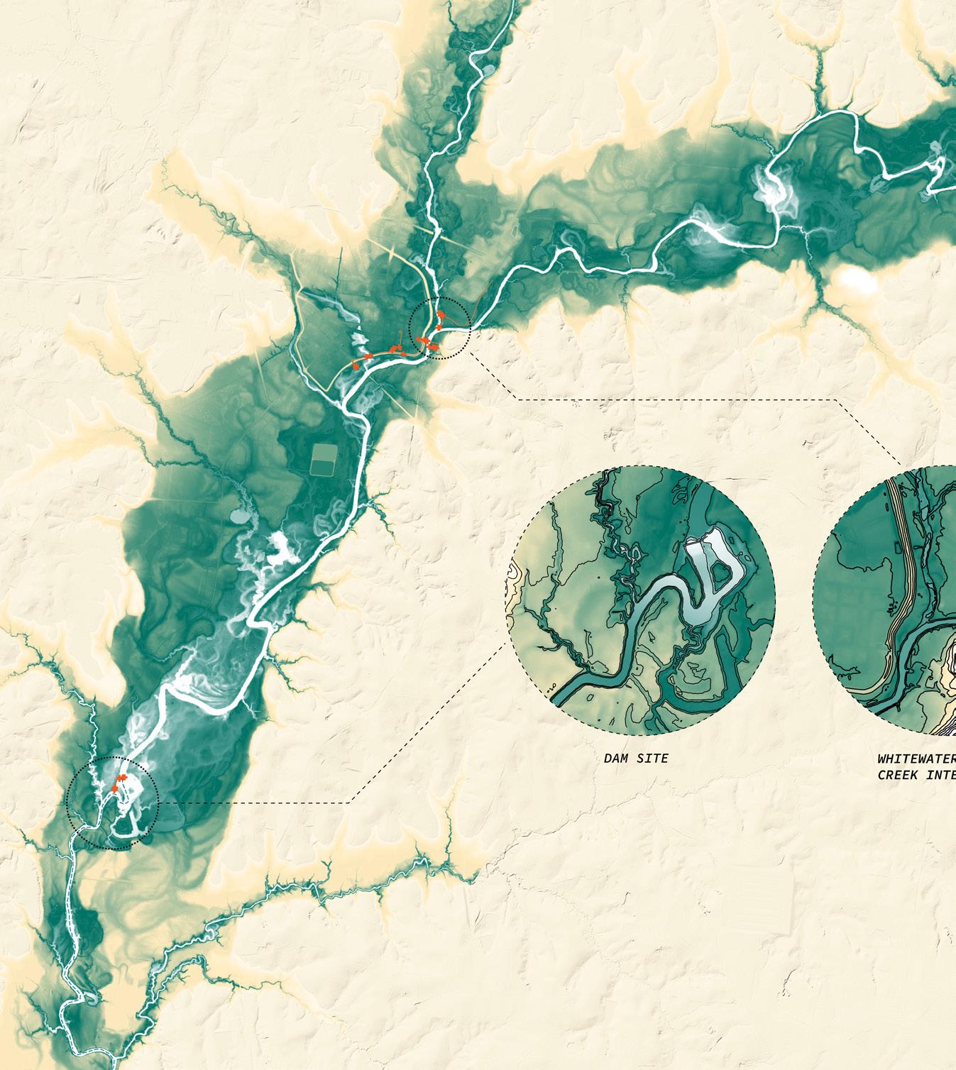
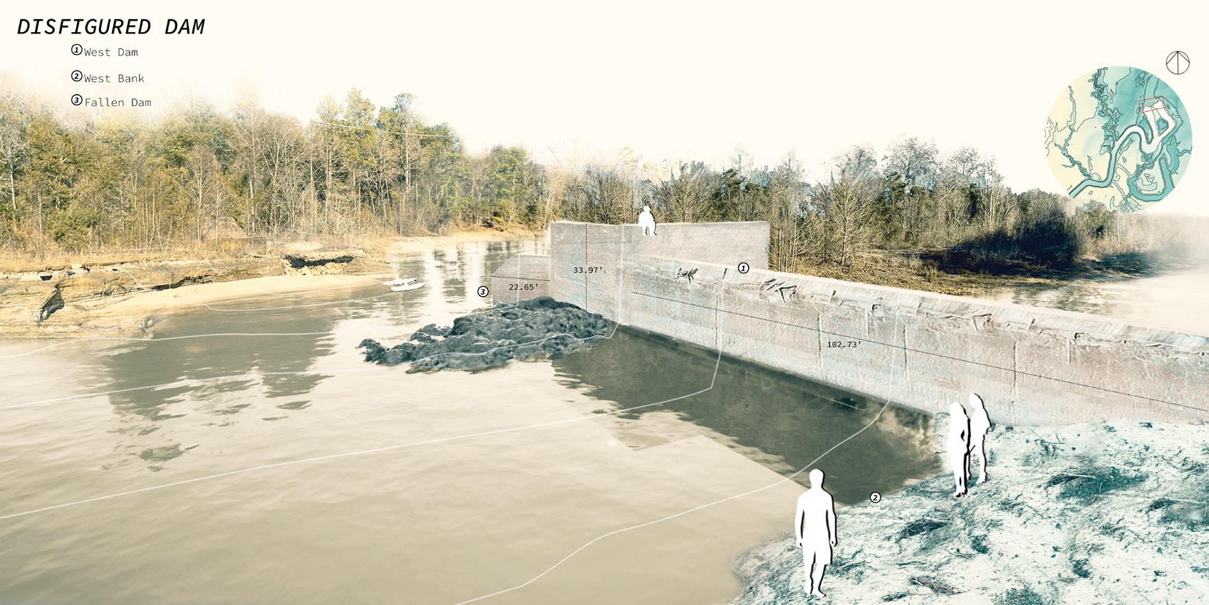
Research began by mapping the Pea River’s physical and ecological systems, then focusing on the 1911 dam site for its history and potential to reconnect the town to the river. Analysis combined hydrology, vegetation, and fluvial processes with community input, supported by Restoration 154, while site visits revealed patterns that shaped opportunities to reimagine the dam as both an ecological resource and public space.
Restoration 154: A non-profit revitalizing Elba, Alabama through community engagement, tourism, and retail growth, supported by nationwide collaboratcion in research and funding.
Vegetation: Mid-tolate successional growth surrounds the dam site, with hardwoods thriving in wetter soils near riverbanks and pines clustering in mesic interior soils.


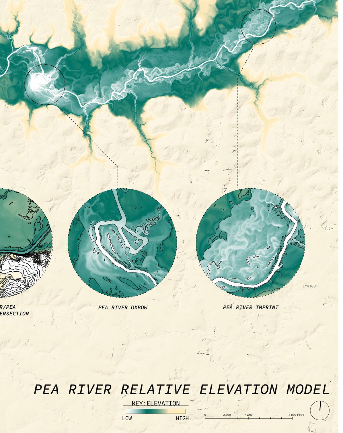
RIVER THROUGH TIME
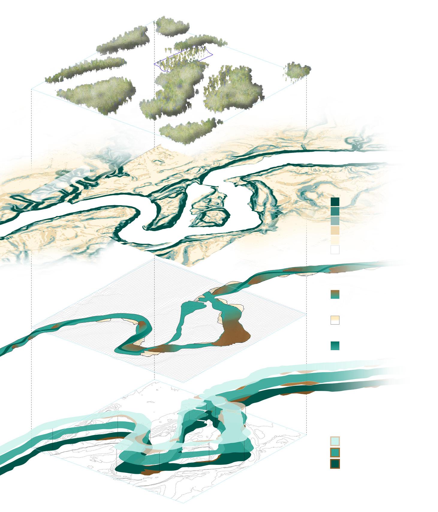
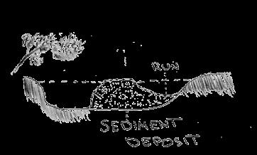
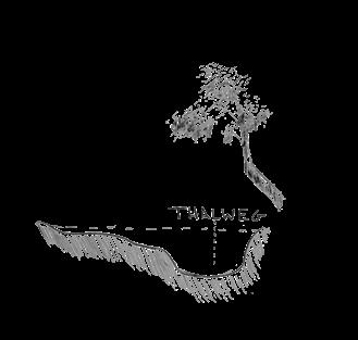
Hydrological analysis: River gage data and erosion surveys reveal cycles of point bar formation and loss, showing the balance between deposition and erosion. Fluvial process: Slowing river flow deposits sediment into sandbars and point bars, while erosion forms cut banks; the thalweg marks the deepest, fastest channel.


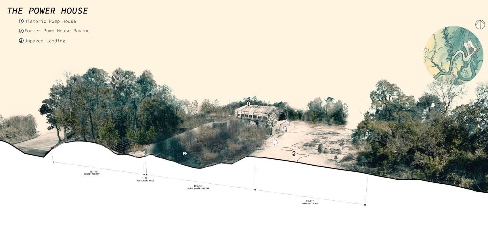
Accessibility: A network of paths links site zones— from ravine to riverfront—guiding visitors through the landscape and its constant changes.
Drawing from ecological insights provided by Restoration154 and community input, the design process aimed to align with natural systems while responding to local values. The dam site itself presents a unique landscape of wetlands, steep banks, dense forest, point bars, and the Pea River, offering countless moments of natural beauty. Yet, accessibility to these areas remained limited. The goal of the design was to work with the existing landforms rather than against them, creating opportunities for the river to flow naturally while enhancing access to the site’s ecological richness. By fostering conditions for native ecosystems to thrive and reconnecting the community to the site’s history and ecology, seeking to transform the dam landscape into both an ecological resource and a meaningful public space.
Public space:
Reconnecting
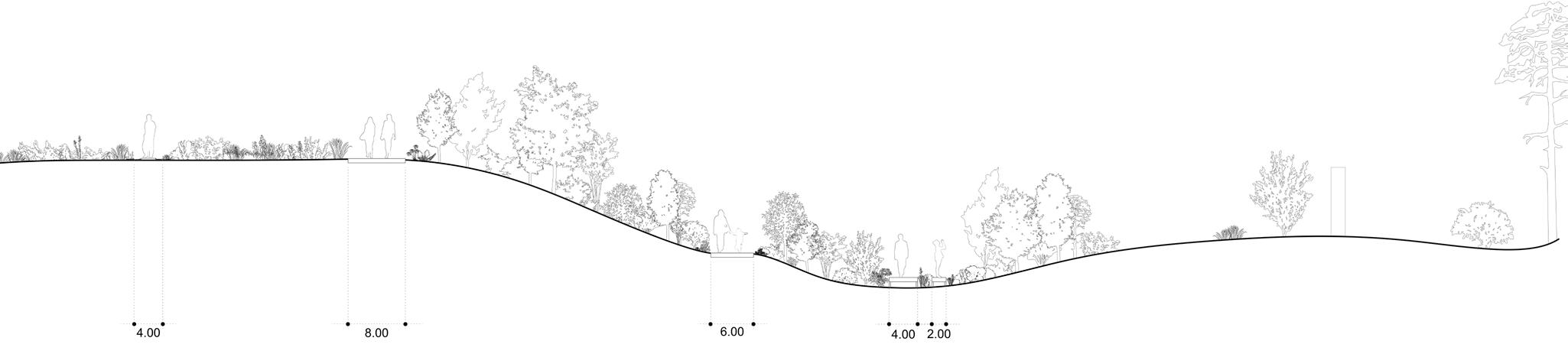
Flooding: A common condition at the site, addressed by placing key areas such as the meadow and pump house on higher ground for safe viewing, while adaptive trails respond to shifting riverbanks and changing fluvial forms.
Ecological performance: Dam reduction restores natural flow, reactivates riverbanks, supports species like the Gulf sturgeon, and allows meadows to grow into diverse habitats.
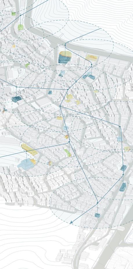
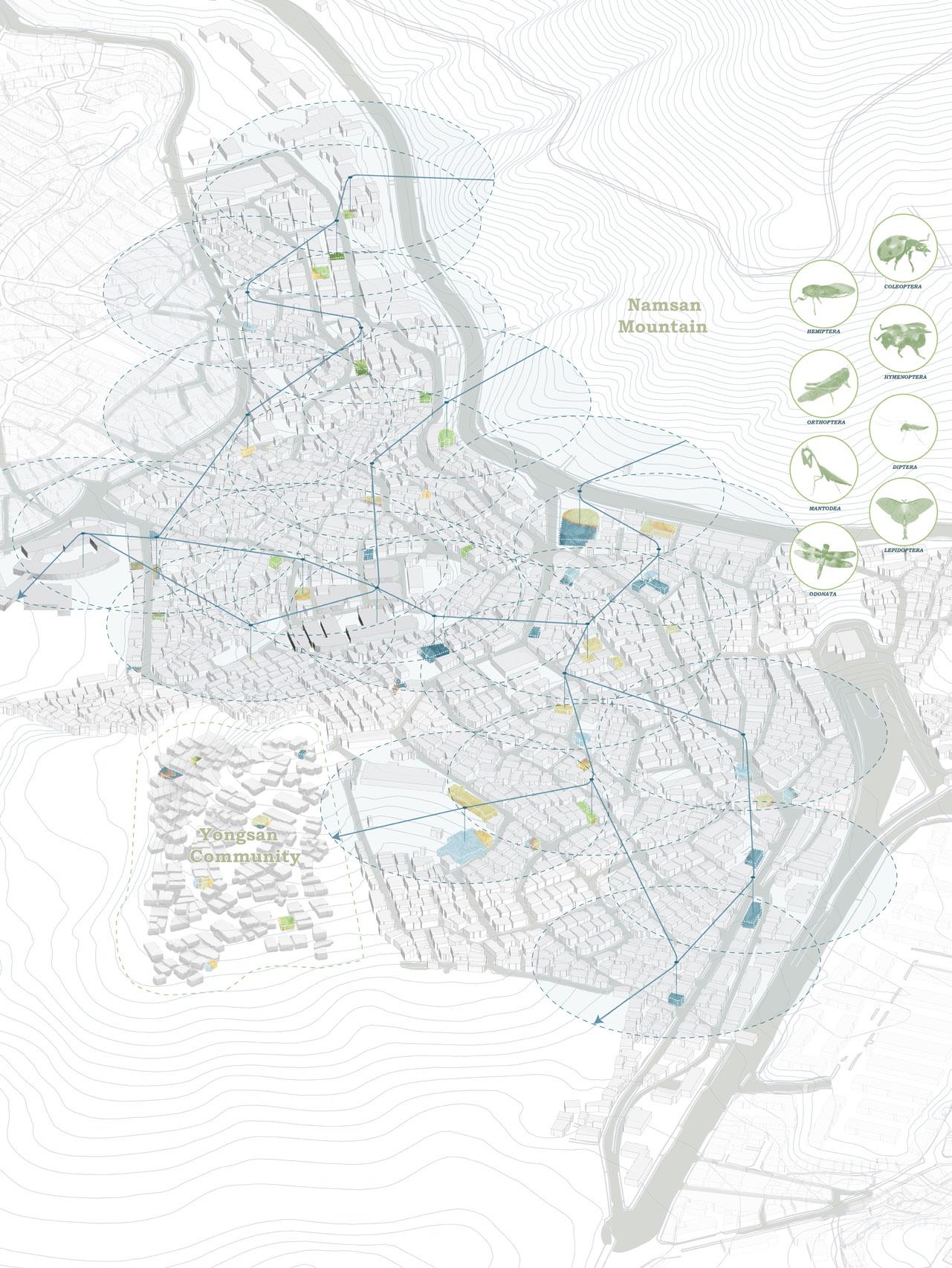
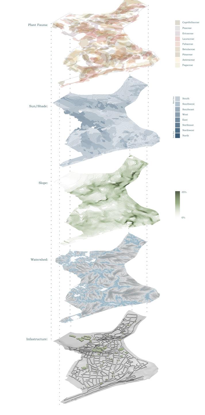
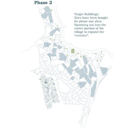
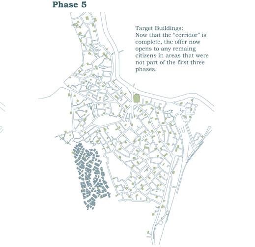
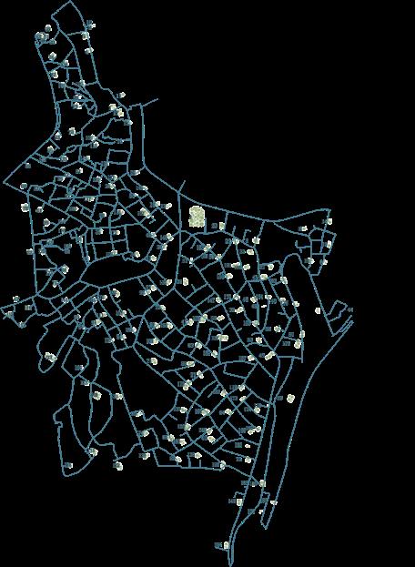
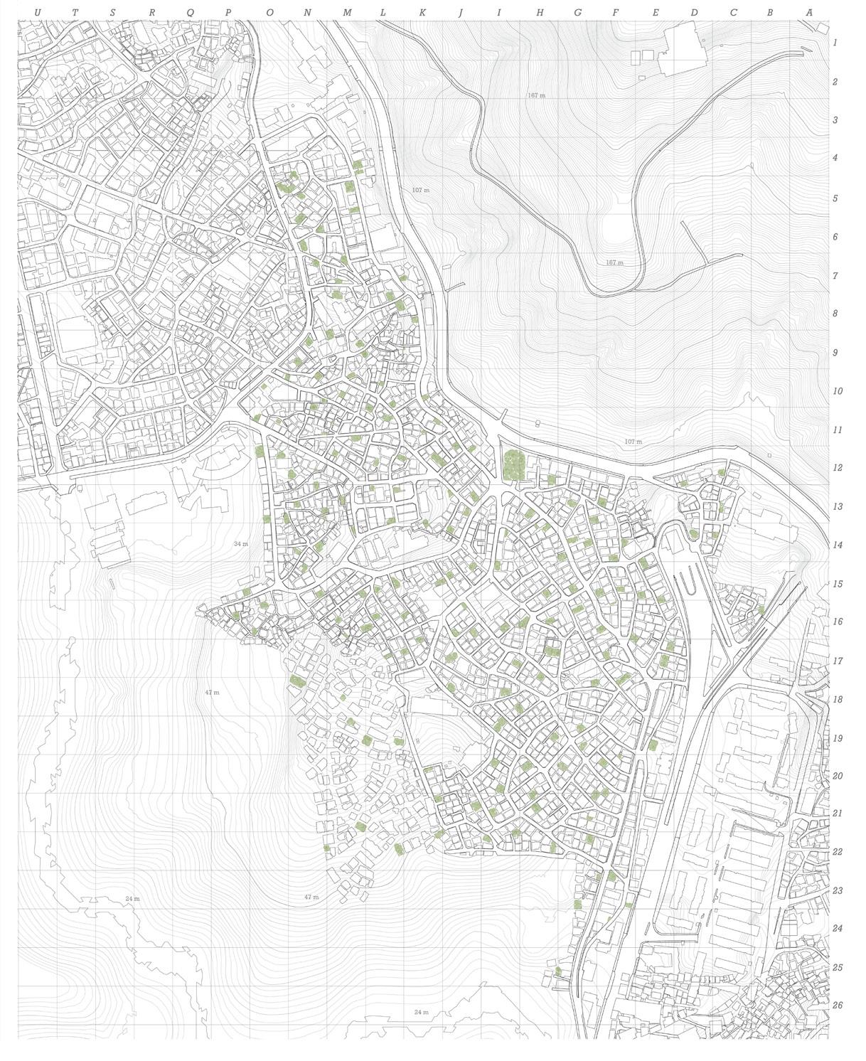
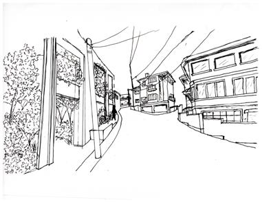
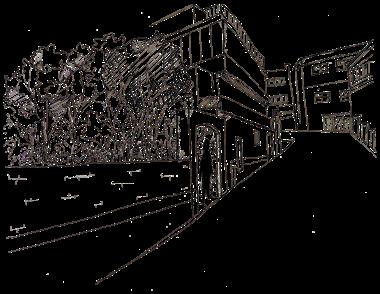
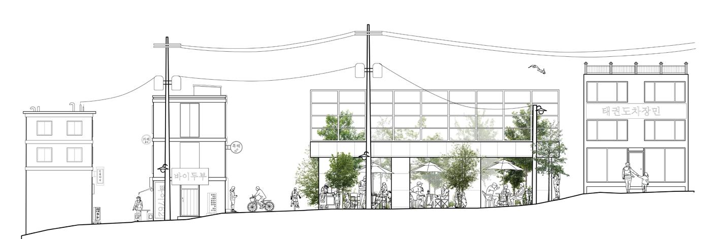
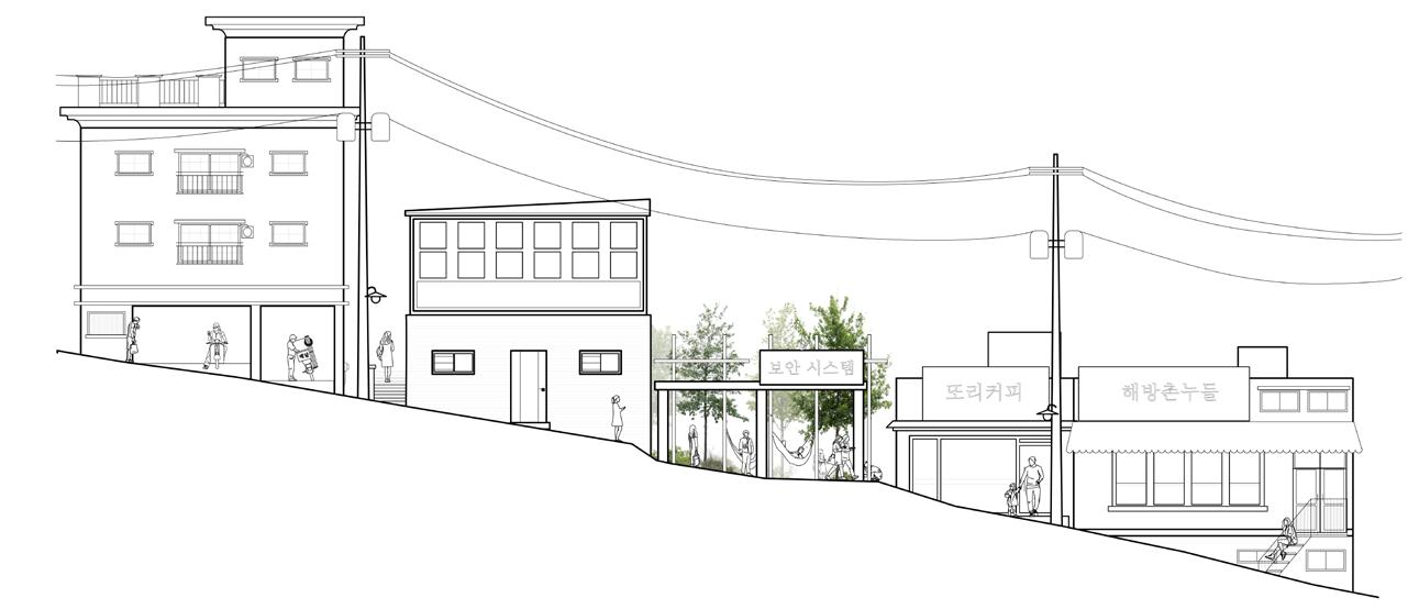
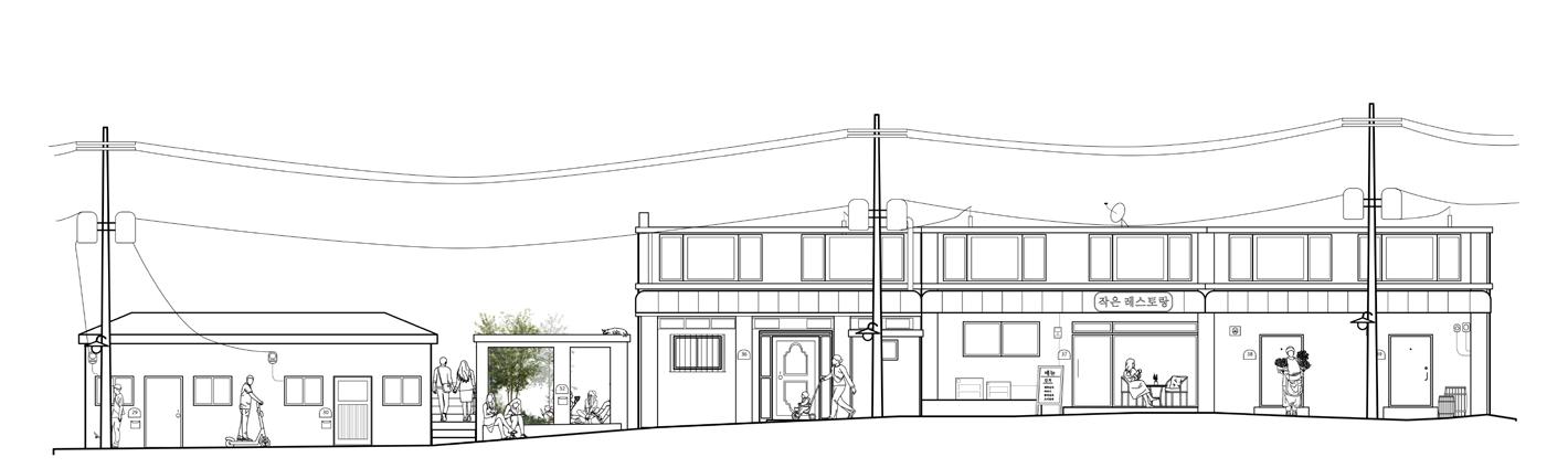
Tasked with restoring green space in Haebangchon by creating an ecological corridor that links Namsan Mountain to the Yongsan Garrison. This initiative calls for reintroducing landscape systems into the dense, irregular urban fabric of HBC, using greenways to stitch together distant habitats and strengthen biodiversity. At the same time, the project must provide accessible public spaces that improve the quality of life for residents while honoring the neighborhood’s cultural history and diverse community.
Location: Haebangchon, South Korea
Date: Fall 2024
Project Type: Individual Programs: Adobe Suite, Rhino, ArcGIS, Hand graphics
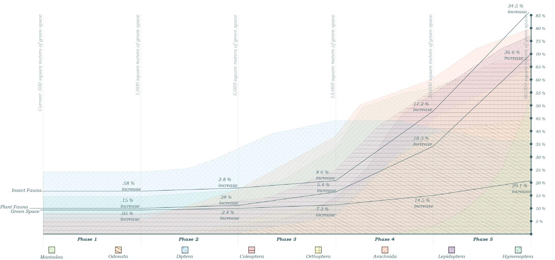
Restoring native insect and plant species in HBC strengthens biodiversity and ecological balance. Strategies such as urban green spaces and corridors support insect migration and plant dispersal, while community-led education and sustainable gardening engage residents in conservation.
Insect migration: A multi-generational process essential to reproduction and ecological balance, supported by sanctuaries spaced within 50 meters to create continuous habitat linkages.
Plant dispersal: Extending Namsan Mountain’s conditions—shade, runoff, slope, and sunlight—into Haebangchon through dense plantings that strengthen resilience and livability.
Quality of life: Is enhanced through accessible green spaces that provide shade, cleaner air, and opportunities for recreation and social connection. The network of sanctuaries in Haebangchon introduces these benefits into daily life, creating a healthier urban environment.
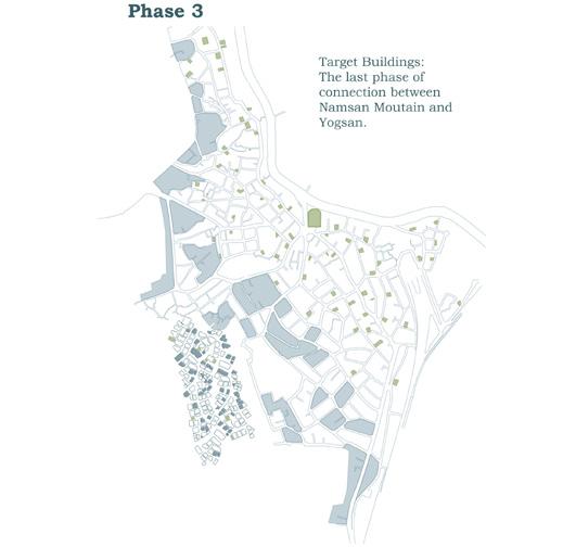
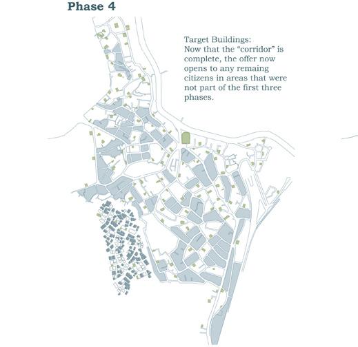
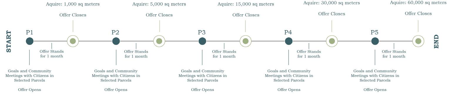
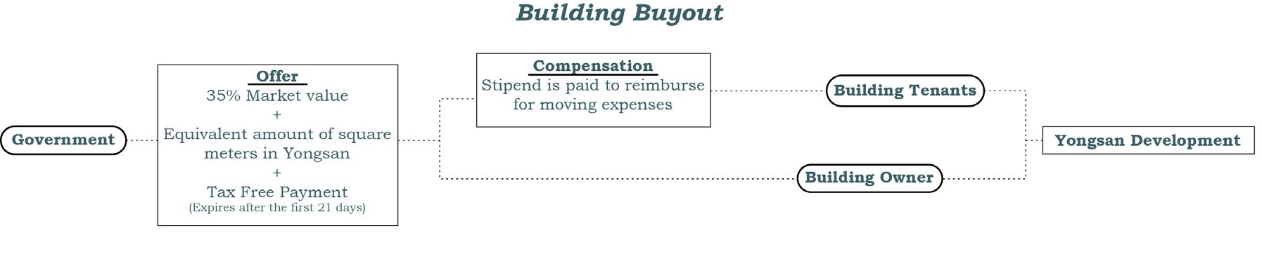
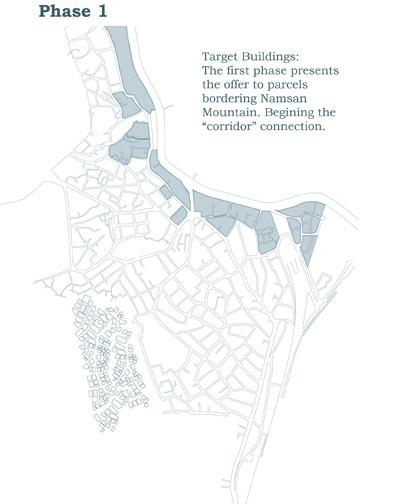
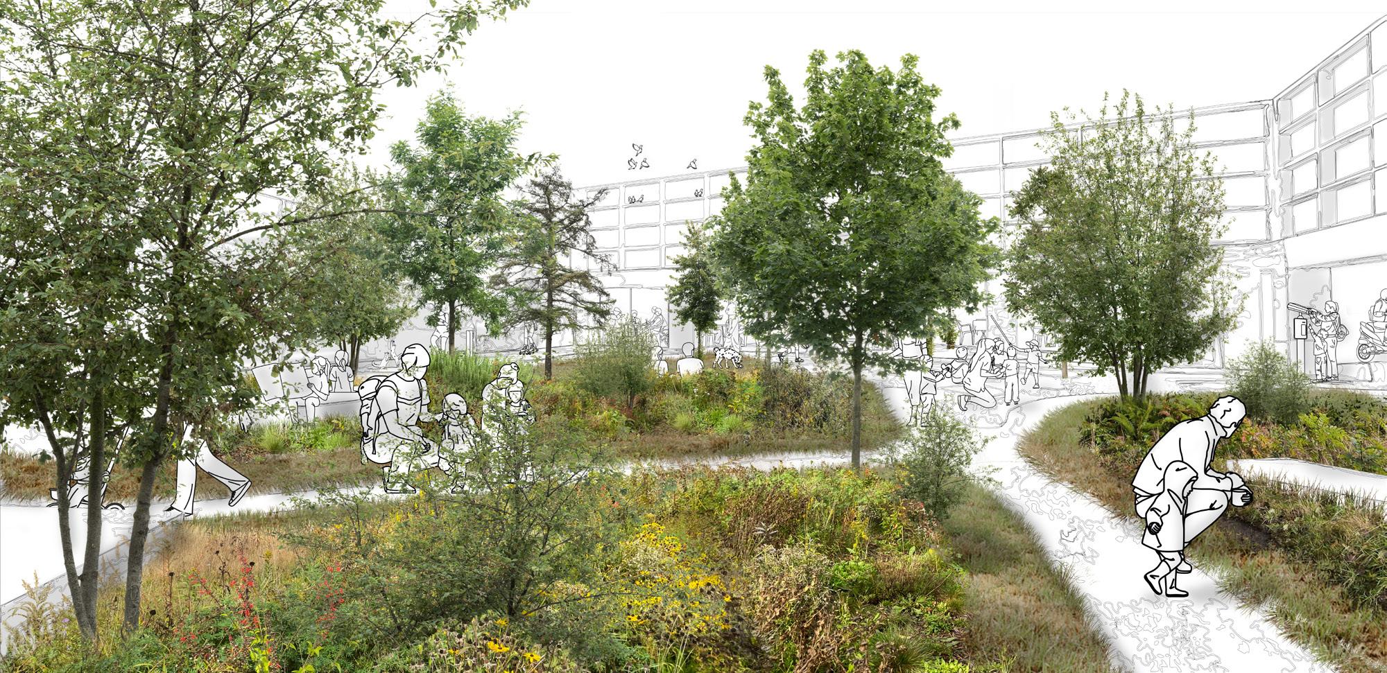
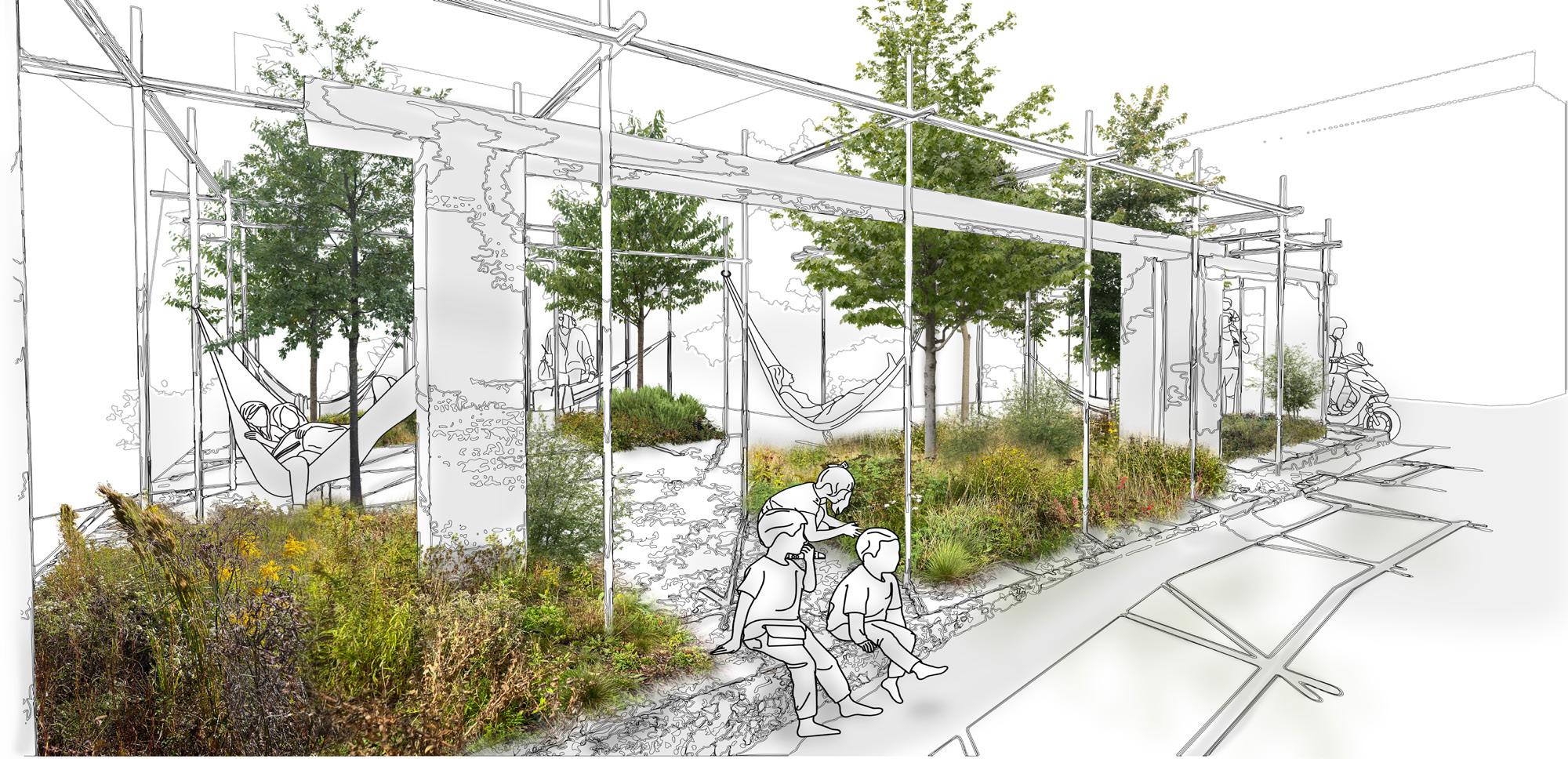
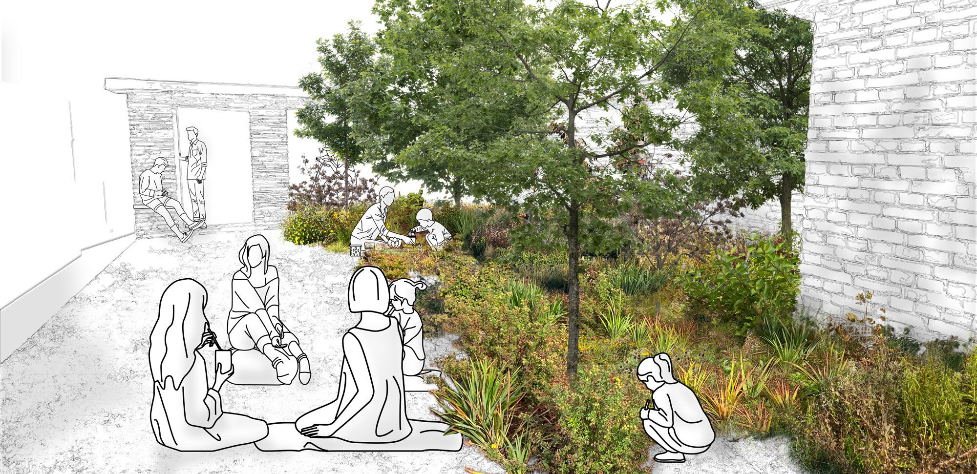
Working as a phased, voluntary process, tenants and owners are given the opportunity to transition into nearby Yongsan, opening space in Haebangchon for ecological restoration. As properties are gradually converted, they become sanctuaries that provide habitat for native insects and plants, supporting pollination, soil health, and ecological balance. Each phase is guided by community conversations to ensure the process reflects shared values and priorities. Over time, these linked sanctuaries form a thriving green corridor between Namsan Mountain and the Yongsan Garrison, embedding biodiversity, public space, and ecological vitality into the heart of the neighborhood.
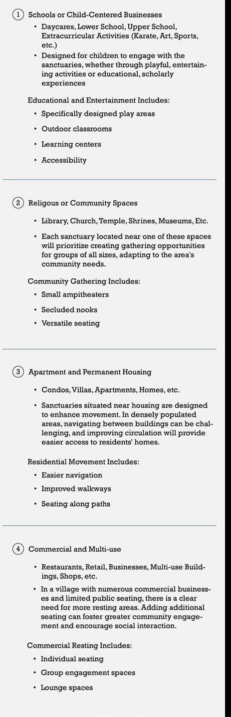
Sanctuaries are designed to reflect the character of its surroundings, with programs shaped by nearby buildings and community needs. Categories such as education, religion, residential, and retail guide the type of spaces created, ensuring each sanctuary serves a distinct role. The scale and location of the site determine the mix of programs, allowing every sanctuary to engage its local community in meaningful ways.
Community
Conversations:
Ensuring that residents shape the sanctuaries according to their needs and aspirations. These dialogues provide space for people to express what they want in new parks, while also addressing questions about the volunteer process, making the transformation both transparent and collaborative.
A20.5
76 sq meters
Surrounded by residential homes and near a popular retail strip this small space offers a gateway for insects into Yongsan and a much-needed greenspace for those around it.
Program: Seating Accessibility
G13
62 sq meters
Located less than a hundred feet away from the sanctuary, this space provides a gathering and meeting place for the community.
Program: Private nooks Group seating
K16.5
54 sq meters
In the vicinity of a high school, this space can be used to teach students about the targeted native insects and plants.
Program: Education Outdoor class
F20
90 sq meters
Located in a multiuse residential area, this space provides a great way to accommodate the retail center’s customers while also providing a break from the urban density of the area.
Program: Various seating

76 sq meters
As the largest of the sites, this former civic center on the edge of Namsan Mountain will serve as a vital hub for insect migration into the village and Yongsan. Transforming the civic center revitalizes a busy area of Haebang chon, addressing the needs of nearby businesses, schools, and residences while fostering ecological connectivity.
Program: Education
61 sq meters
Currently wrapped in scaffolding, this under-construction site lies in the heart of a densely populated residential area. Transforming it into a green space would bring nature to a community isolated from parks and forests, improving the quality of life for nearby residents.
Program: Gathering Resting
29 sq meters
Nestled against a steep slope at an access point to the base of Namsan Mountain, this compact site is divided into two zones: one dedicated to biodiversity and the other to rest and movement. To enhance accessibility and create more gathering space, the rightside wall will be opened up, seamlessly connecting the site to its surroundings.
Program: Movement
Resting
Sanctuaries along the perimeter of Namsan
are especially critical, serving as gateways into the village for insects
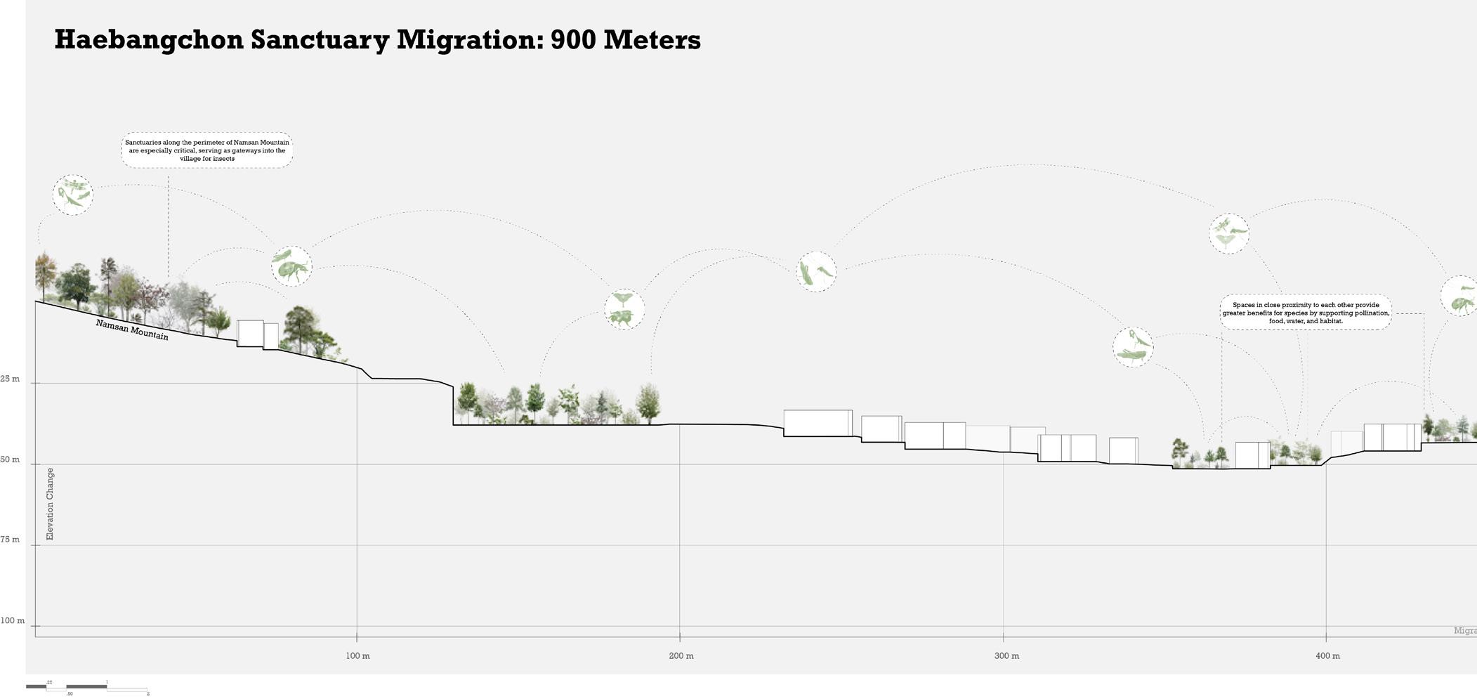
Spaces in close proximity to each other provide greater benefits for species by supporting pollination, food, water, and habitat.
Ecological corridor: A network of sanctuaries across Haebangchon forms stepping stones that reconnect Namsan Mountain and Yongsan Garrison, enabling species movement within the urban fabric.
Sanctuaries are distributed throughout the village, 100 meters apart, aligning with the average travel distance of insects, whether within a day or their lifetime.
These sanctuaries bridge the final gap through the village into Yongsan, fostering new species and experiences.
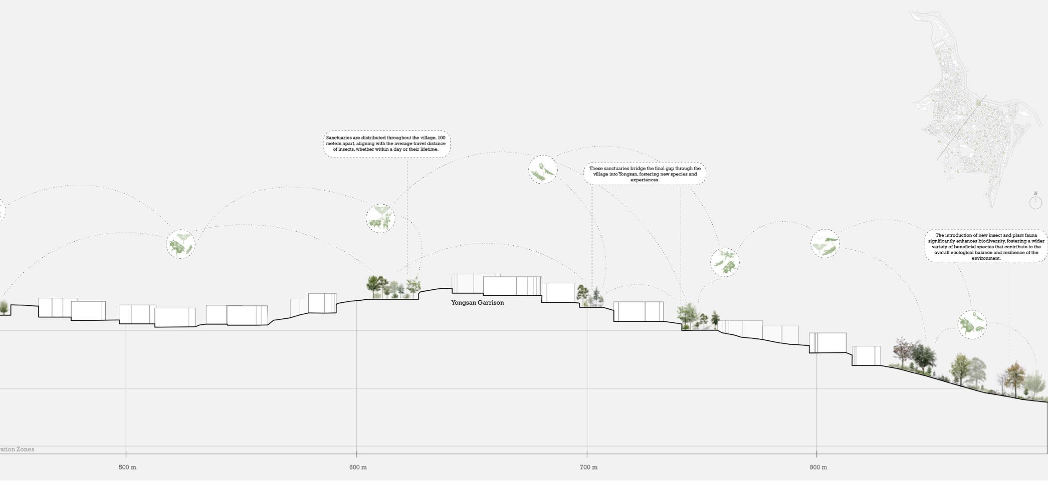
The introduction of new insect and plant fauna significantly enhances biodiversity, fostering a wider variety of beneficial species that contribute to the overall ecological balance and resilience of the environment.
A single square meter of greenspace can support an average of 100-1,000 insects and 10-20 plants.
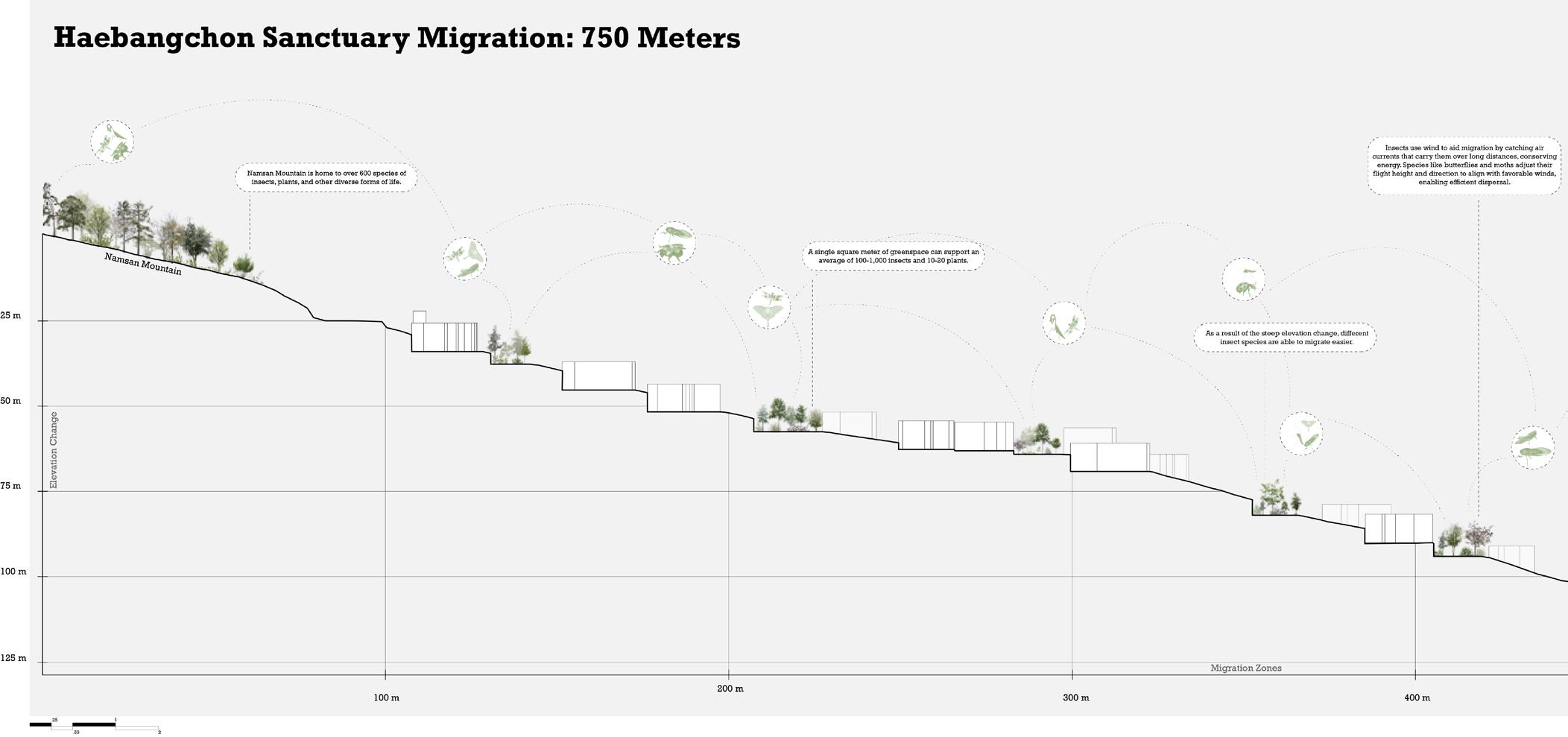
Insects use wind to aid migration by catching air currents that carry them over long distances, conserving energy. Species like butterflies and moths adjust their flight height and direction to align with favorable winds, enabling efficient dispersal.
As a result of the steep elevation change, different insect species are able to migrate easier.
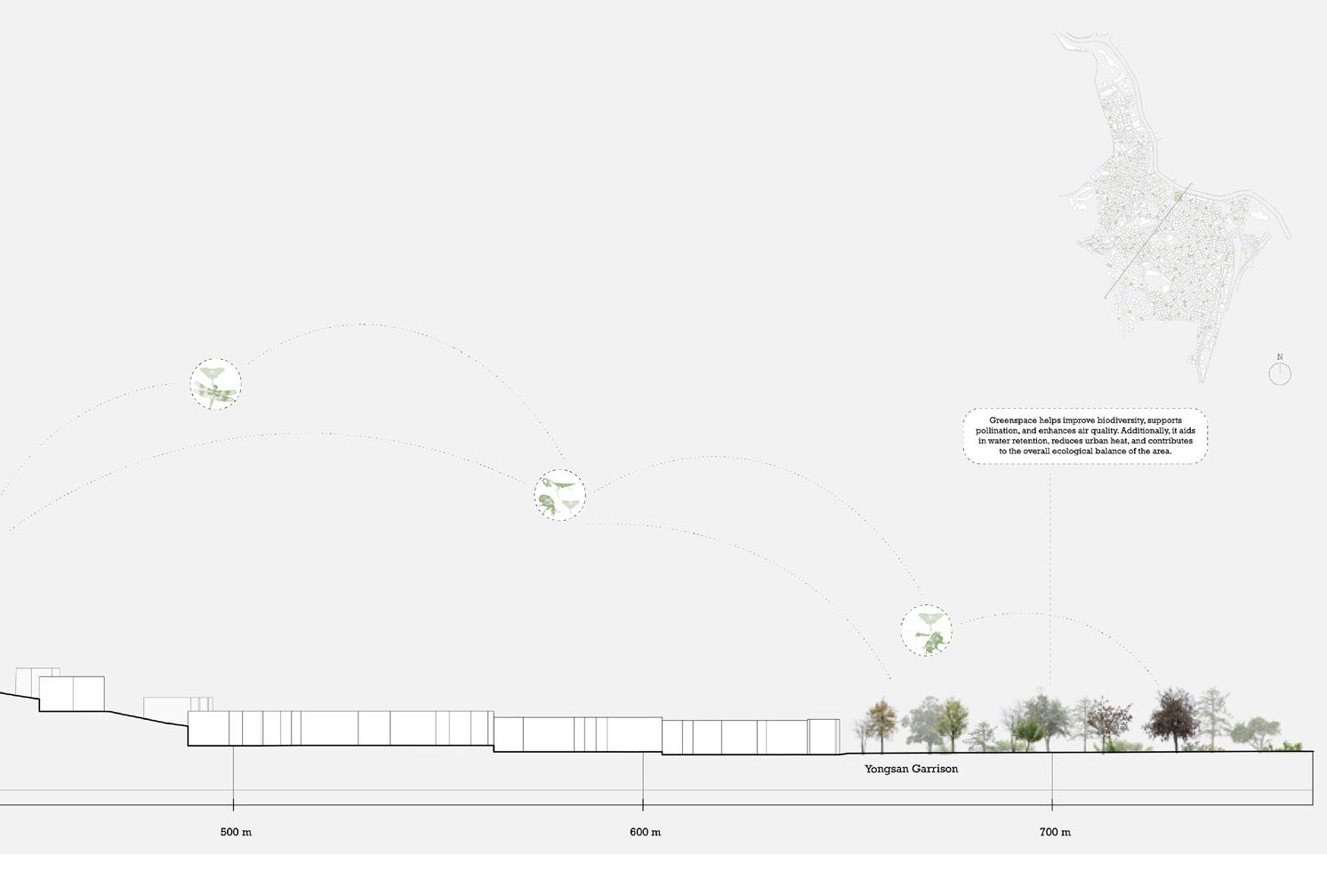
Greenspace helps improve biodiversity, supports pollination, and enhances air quality. Additionally, it aids in water retention, reduces urban heat, and contributes to the overall ecological balance of the area.
Sancturaries: Unique to their communities and settings, each supports biodiversity and, together, they form a network that strengthens ecology and neighborhood life.
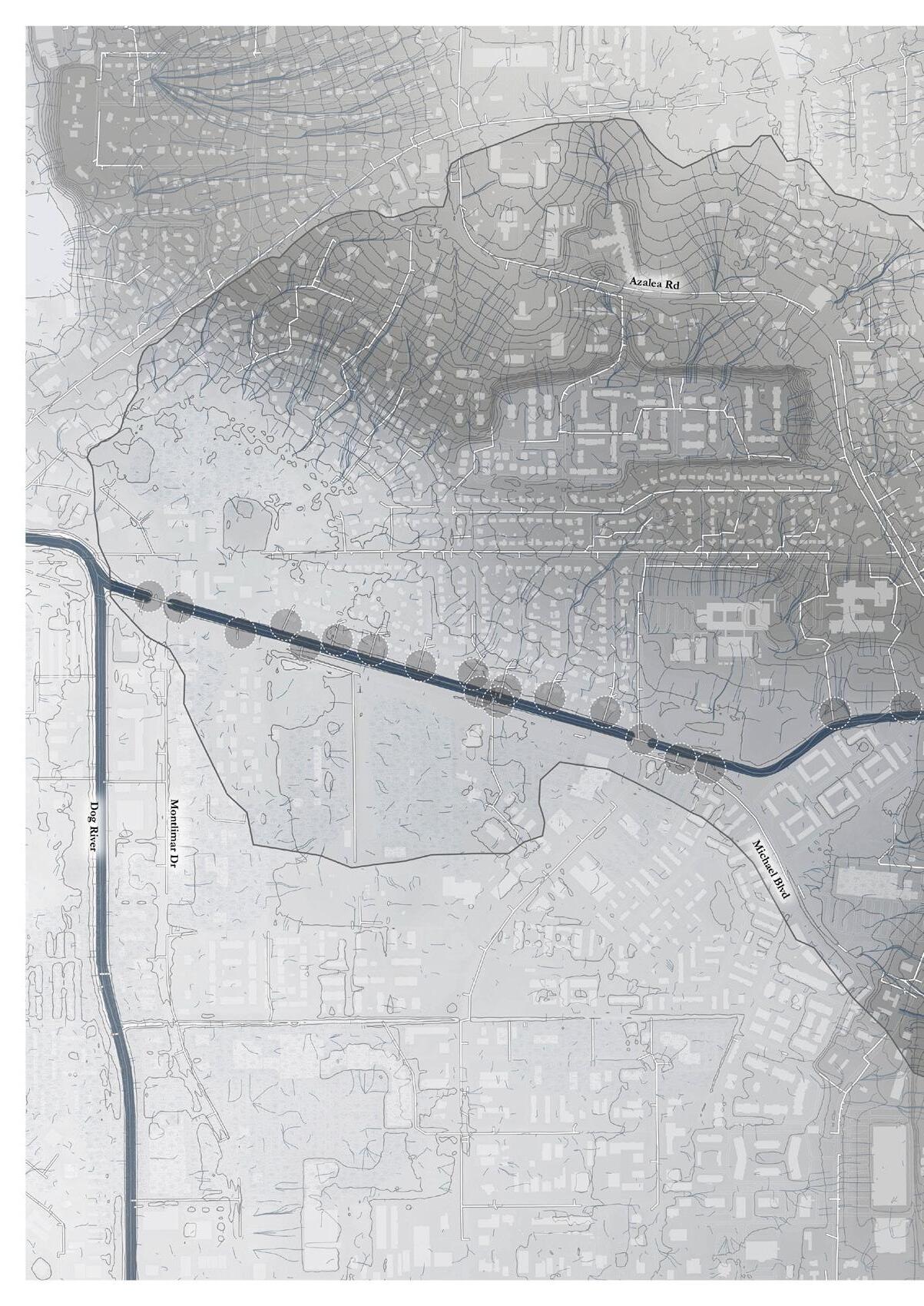
Location: Mobile, Alabama
Date: Spring 2025
Project Type: Individual Programs: Adobe Suite, Rhino, ArcGIS, Hand graphics
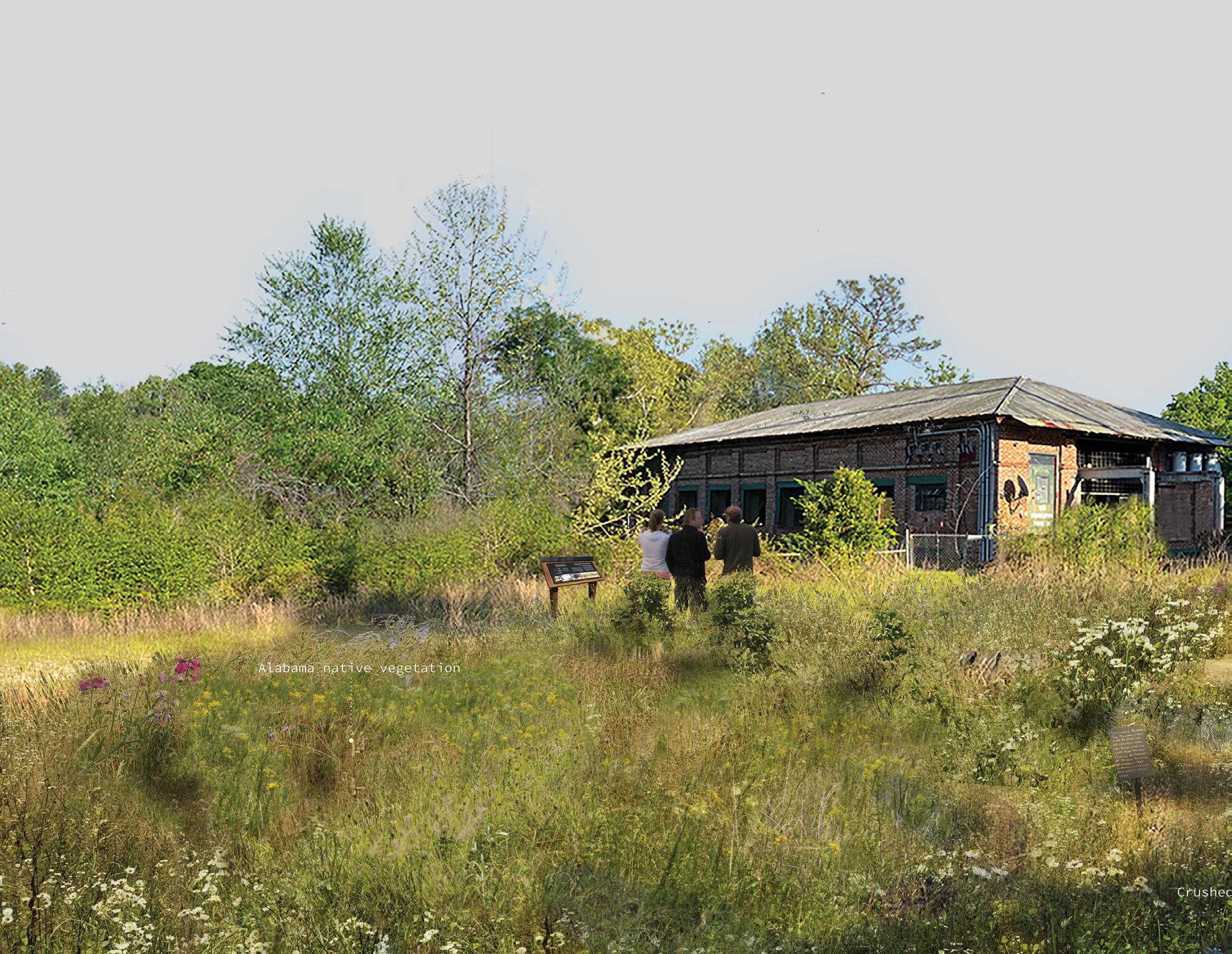
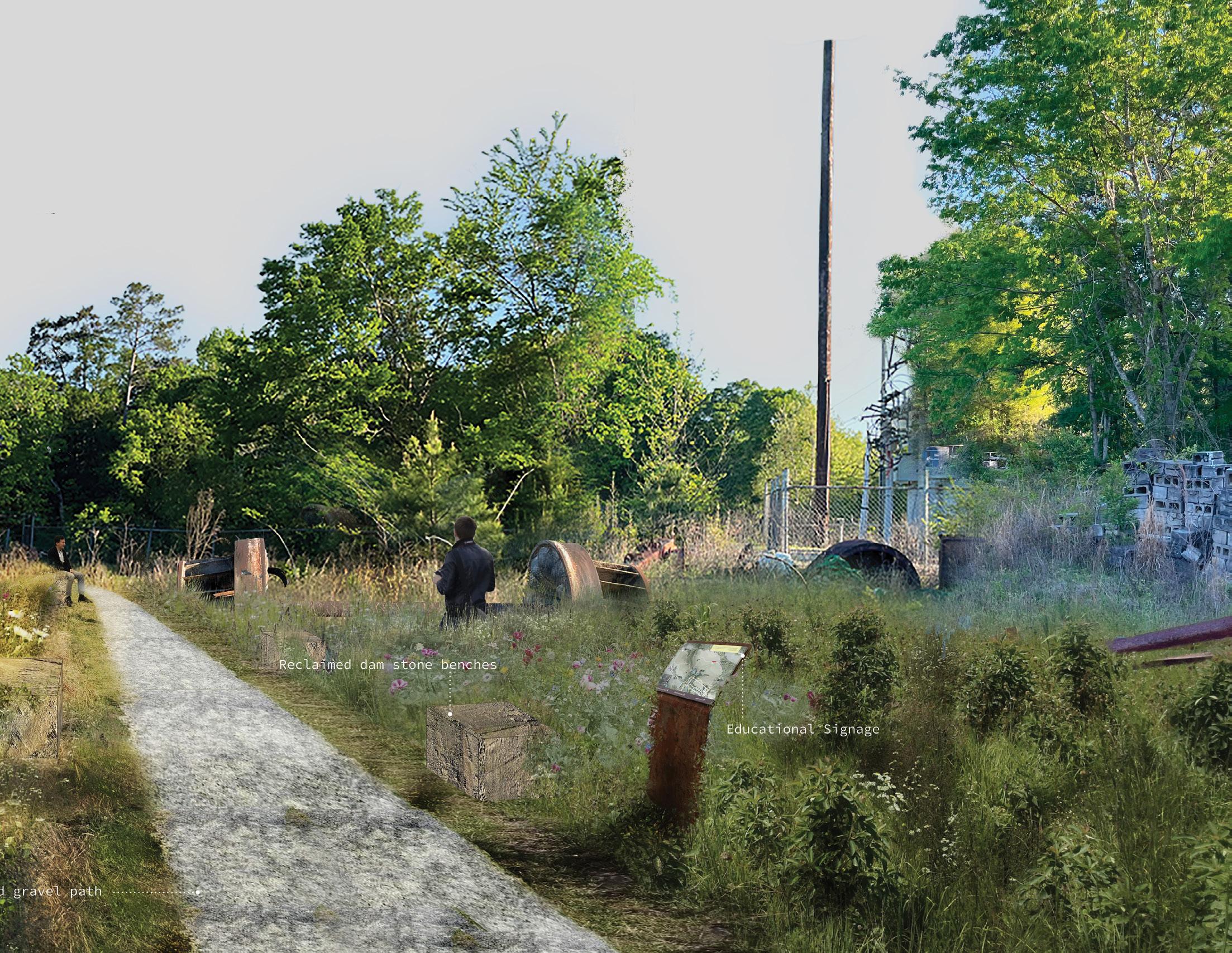
Marking the first phase of a three-year effort funded by the Gulf Research Program, focused on building relationships with communities and organizations in Mobile, Alabama. Using a research-by-design approach, it applies the tools of landscape architecture to explore the question: How can design reimagine our relationship with water while contributing to systemic change? A theory of change framework guides the work, mapping how early interventions and community partnerships can connect to long-term transformation. The selected site in Mobile serves as a testing ground for these ideas, inviting critical questions about water, place, and systemic futures.

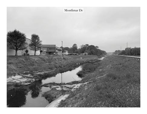
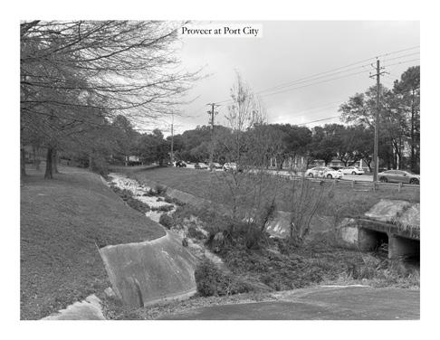
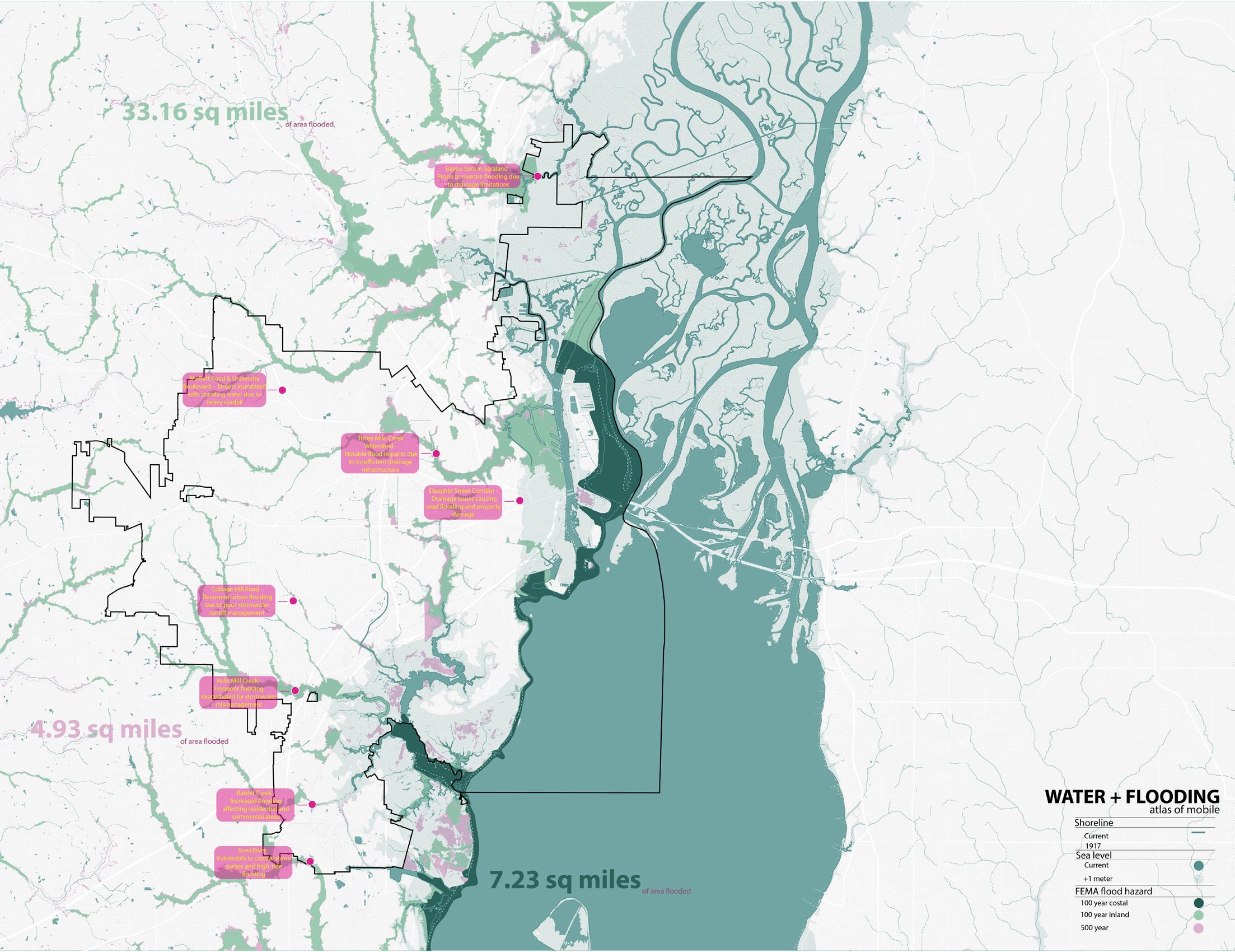

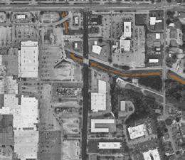
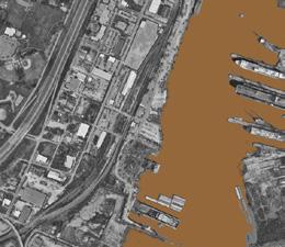
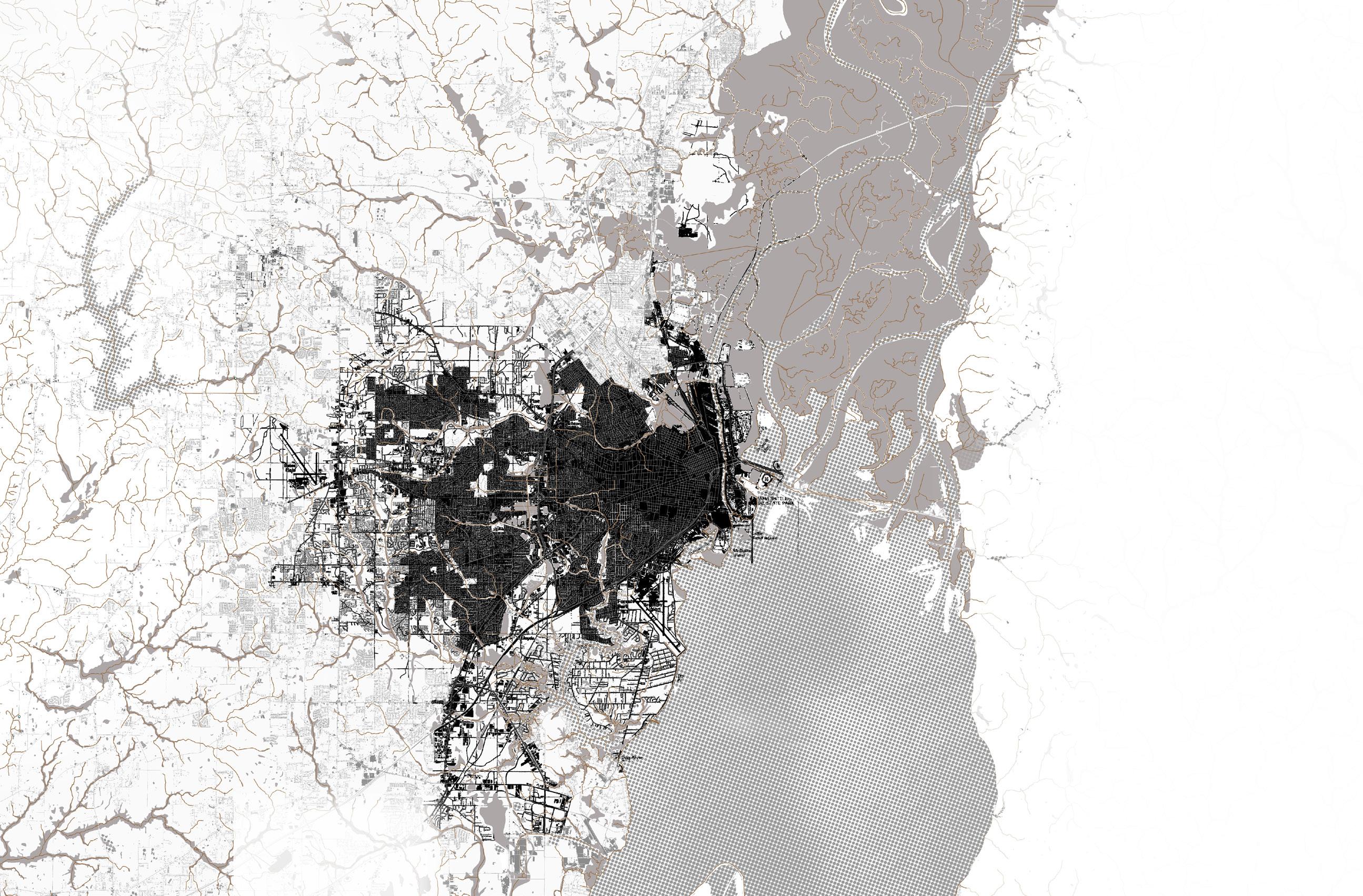
This phase considers the haunting legacy of past decisions, tracing how they continue to shape Mobile’s water systems and its relationship with the community. Decades of industrial and population growth have erased and fragmented wetlands, marshes, and creeks—once critical for flood control, water filtration, and habitat. Urban expansion replaced these systems with concrete, industry, and housing, leading to stormwater runoff, pollution, and ecological loss.
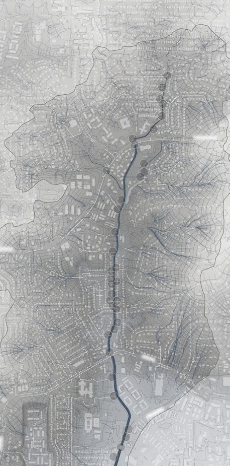
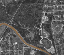
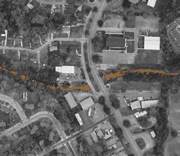
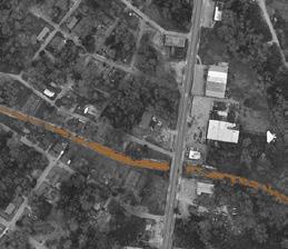
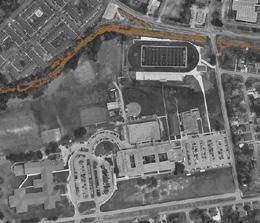
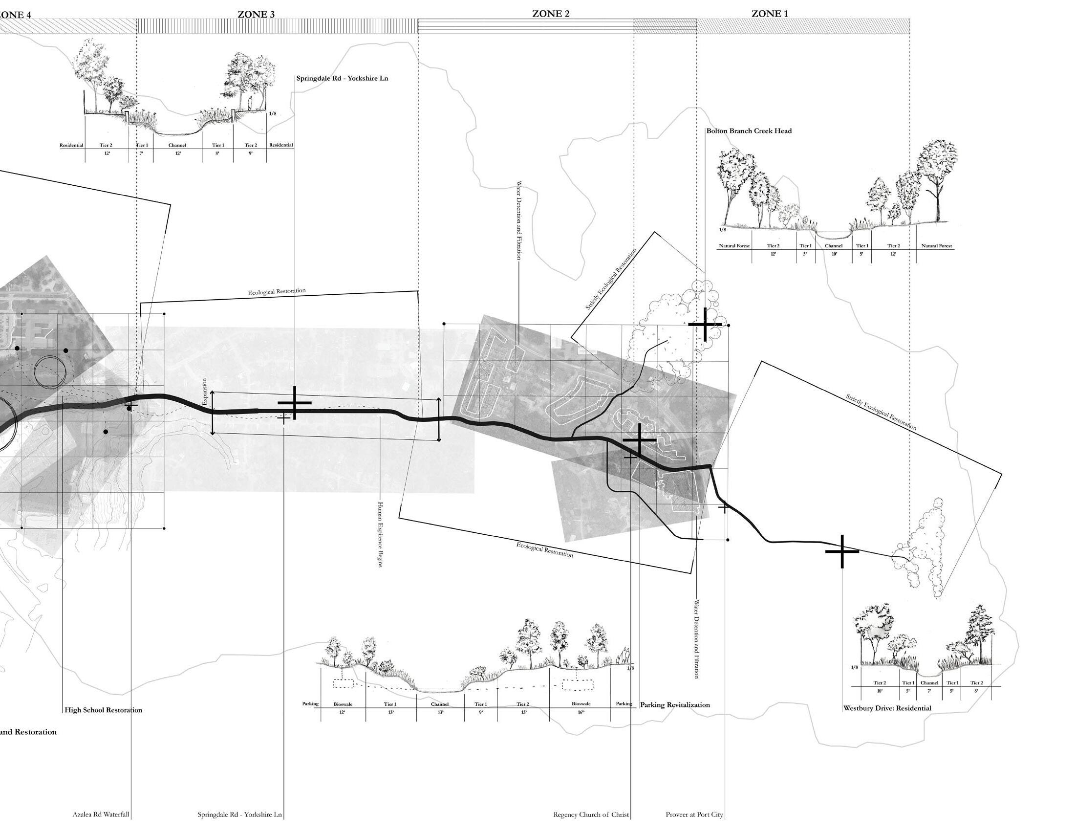
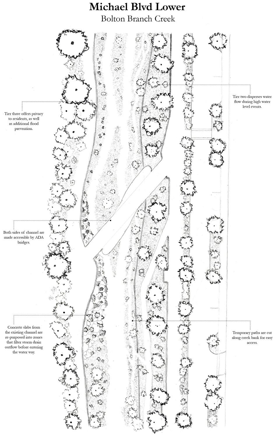
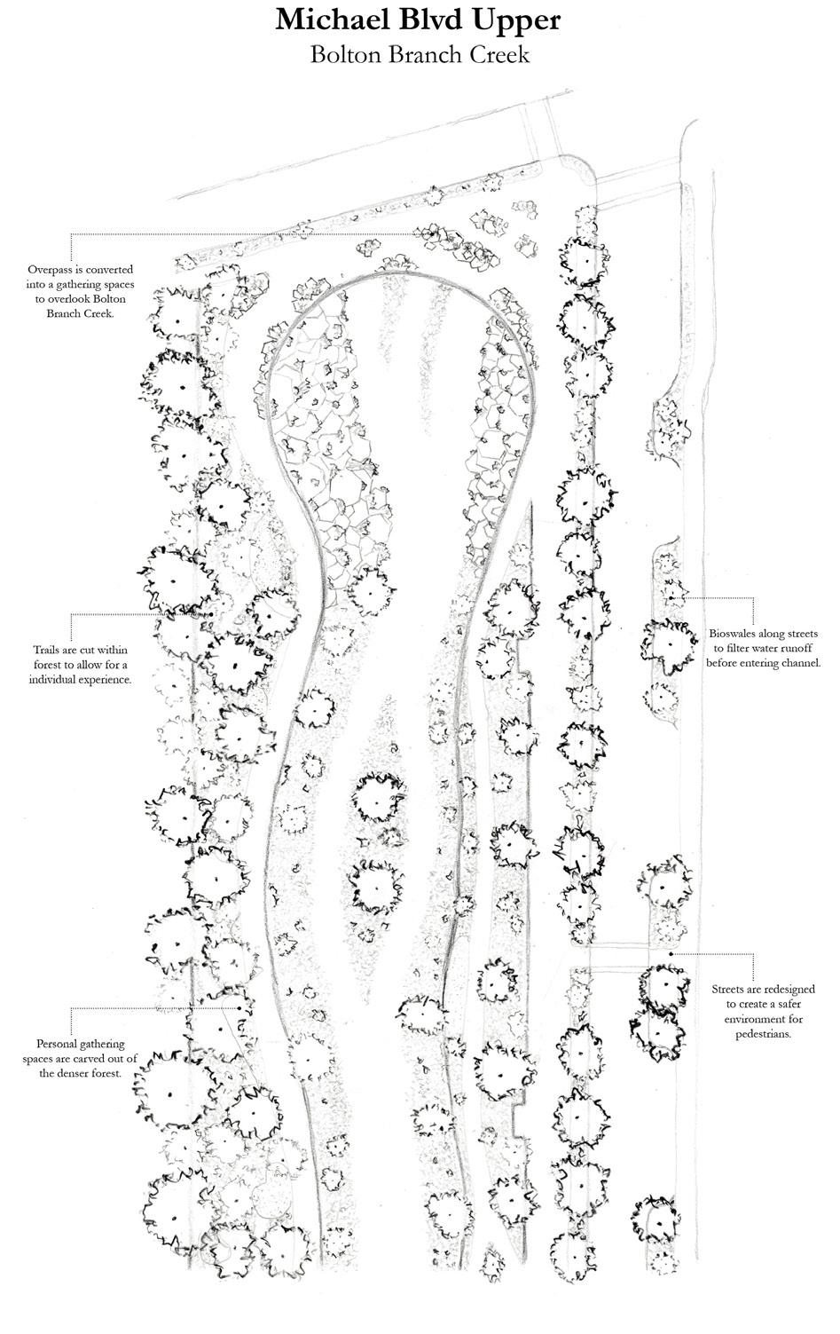
Bolton Branch, a 3.52-mile urban creek flowing into Dog River, exemplifies this legacy. Channelized in the 1970s for flood control, it lost its natural form, habitat value, and community connection. By 2009, it was declared critically polluted, burdened with pathogens from its watershed. The project begins to imagine a staged system of resilience, ecological repair, and community reconnection challenging how Mobile can confront its haunted waters and restore balance between city and environment.
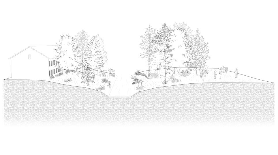
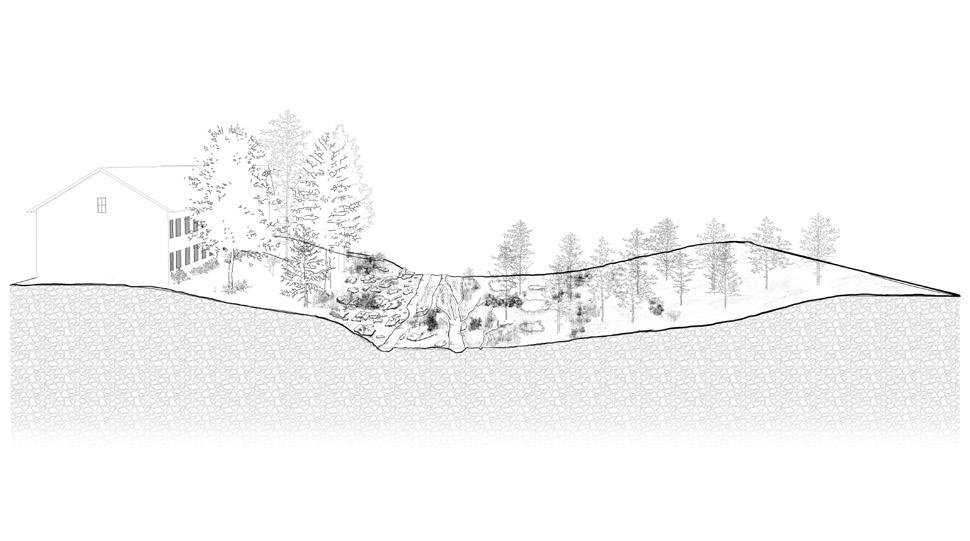
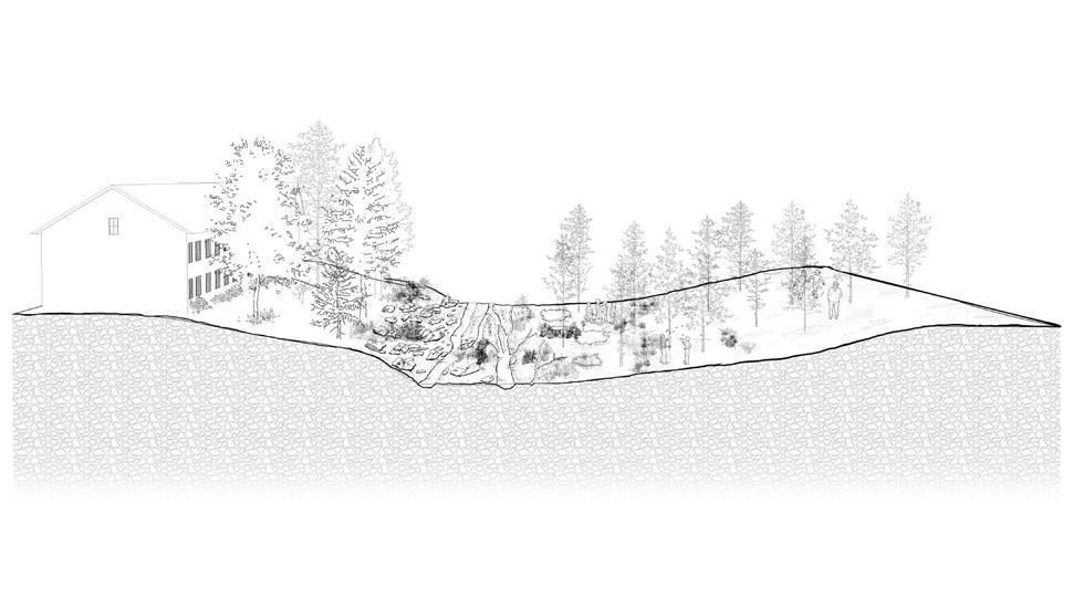
SECTION SYSTEM: BOLTON RESIDENTIAL
Analysis:
Flowing behind homes as a boundary, the creek remains disconnected from the community.
PHASE 1: Resilience
Regrading the creek to accommodate highwater events without a concrete channel.
PHASE 2: Ecology
Introducing native vegetation that stabilizes banks and supports wildlife.
PHASE 3: Experience
Connecting the creek to nearby homes and providing broader community access via a blueway.
Analysis:
Existing roadway infrastructure forced significant alteration and over-excavation of the creek.
PHASE 1: Resilience
Removing excess infrastructure and regrading to restore natural flow and flood capacity.
PHASE 2: Ecology
Year 1-3
Ecological repair:
Ecology
Year 3-6
Experience Current
Reestablishing native vegetation lost to the channelized environment.
Reestablishing the flow, habitat, and balance of waterways disrupted by human alteration. Analysis Resilience
PHASE 3: Experience
Improved water quality creates new opportunities for community use and education.
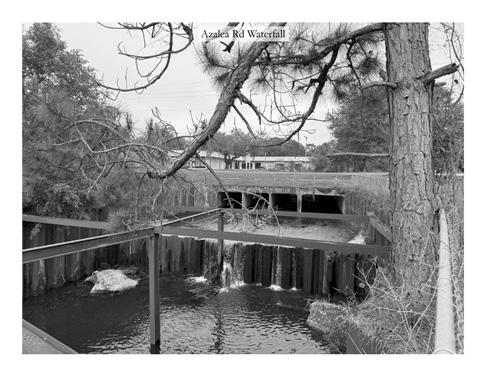
SECTION SYSTEM: AZALEA ROAD
Year 6-9
Analysis:

Water filtration:
Using buffers, wetlands, and filtration systems to reduce pathogens and pollutants from the watershed before they reach the creek.
Long-term transformation:
Phased restoration that returns ecosystems to natural form and builds resilience for generations..
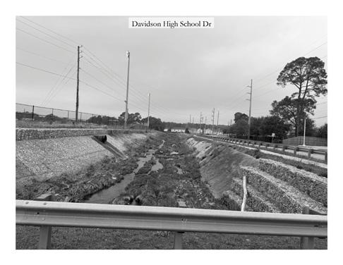
Lack of access leaves the creek dividing the school and adjacent residences.
PHASE 1: Resilience
Regrading to create wetlands and buffer apartments, while reusing materials to stabilize creek banks.
PHASE 2: Ecology
Creek bed restoration with native plants and wetland-tolerant trees for flood protection.
PHASE 3: Experience
Students benefit from educational use of the creek, which also serves as flood storage for community safety.
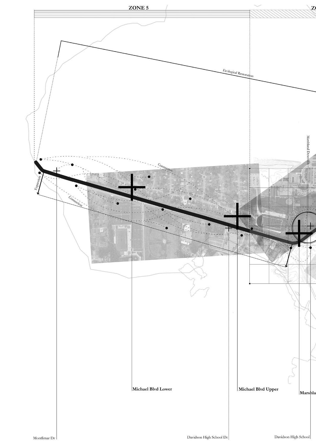
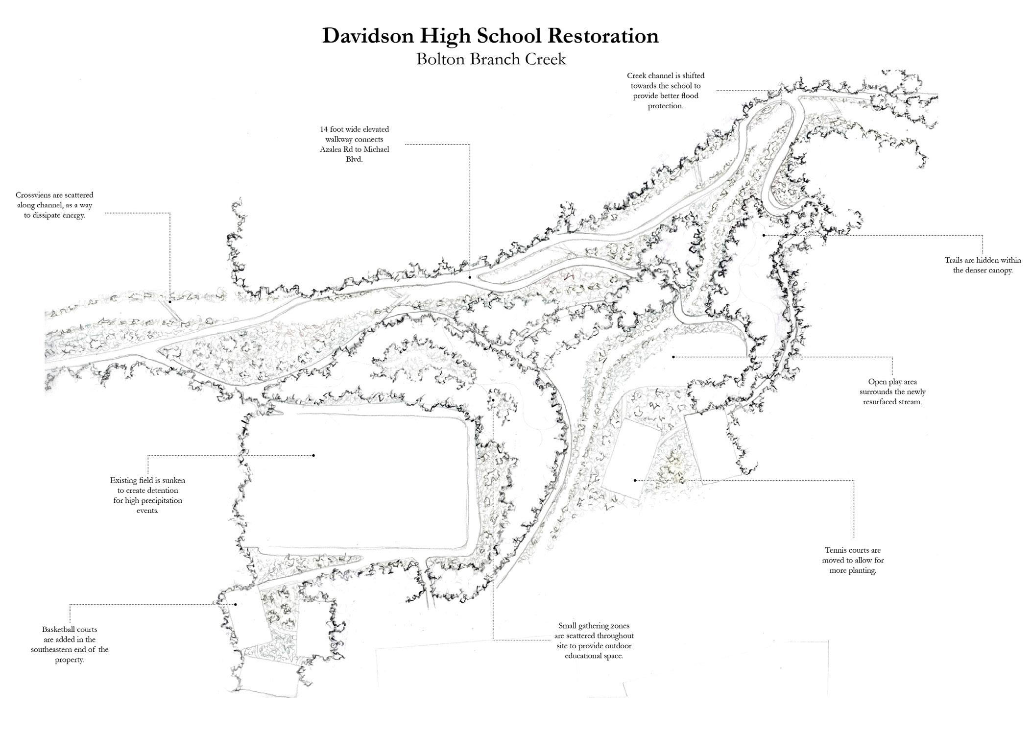
SECTION SYSTEM: DAVIDSON HIGH SCHOOL
1-3 Year 3-6
Year 6-9
Creek Channel
Storm Drains
Watershed Boundary
Storm Water Outfall
Flood Control: Using channels, detention ponds, and wetlands to manage flooding and protect surrounding communities.
Watershed: The land area that drains into Bolton Branch, carrying pollutants through runoff, storm drains, and surface flows.
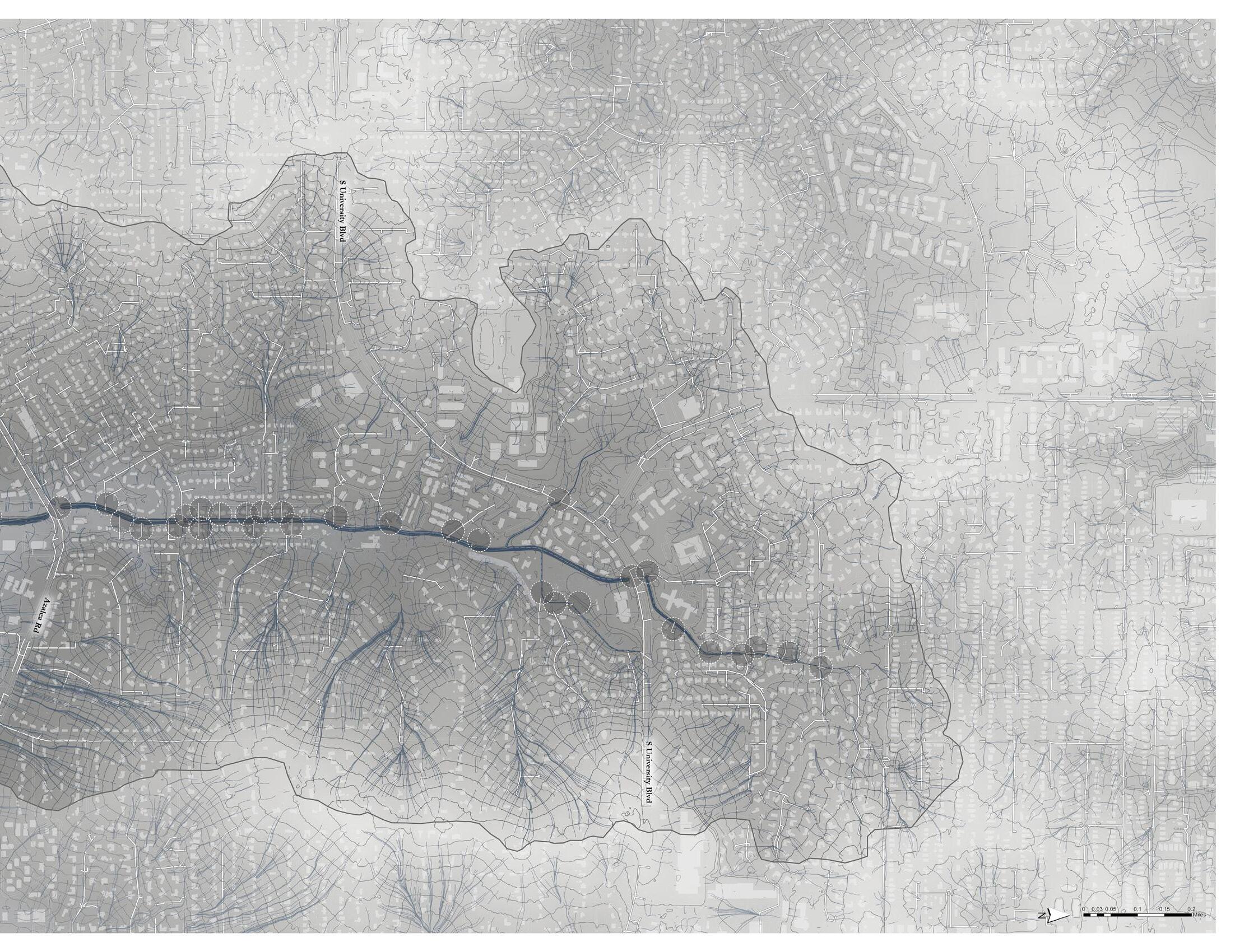
Proposing a comprehensive restoration of Bolton Branch—reimagining it not simply as an infrastructural corridor, but as a resilient ecological and social asset. The design organizes the creek into distinct zones, each addressing specific goals: improving water quality, reintroducing native habitats, managing stormwater, and creating meaningful public spaces.
Beyond the channel itself, the proposal extends to the broader watershed, introducing vegetated buffers, constructed wetlands, and stormwater filtration systems to reduce pollution at multiple scales. By restoring ecological function while fostering public engagement, the project positions Bolton Branch as both a healthier waterway and a community catalyst. Ultimately, it serves as a model for how urban creeks can be reclaimed to generate systemic change—benefiting people, ecology, and the city together.
Systemic Futures: A forward-looking approach that links ecological repair with community needs to build enduring, sustainable systems.
Research by design: Applying tools of design work to the investigation of research questions.

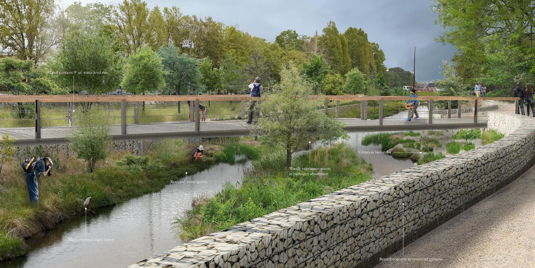

Native habitats: Restoring balance through native vegetation that revives wetlands, riparian buffers, and streambank habitats for fish, birds, and pollinators.
Public engagement: Connecting the community to the creek through access, recreation, and education on restoration benefits.