International Research Journal of Engineering and Technology (IRJET) e-ISSN: 2395-0056

Volume: 09 Issue: 12 | Dec 2022 www.irjet.net p-ISSN: 2395-0072
International Research Journal of Engineering and Technology (IRJET) e-ISSN: 2395-0056
Volume: 09 Issue: 12 | Dec 2022 www.irjet.net p-ISSN: 2395-0072
1, 2, 3
1Cumhuriyet University, Department of Energy Science and Technology Engineering, Sivas, Türkiye.
2Cumhuriyet University, Renewable Energy Research Center (CUYEM), Sivas, Türkiye 3 Cumhuriyet University, Coordination of Sustainability Office, Sivas, Turkey ***
Abstract - The World has reached a tipping point in recent years due to the adverse effects of technological advancements. In tandem with the escalating use of technology, global temperatures continue to rise, with grave ramifications for the viability of many things that are regarded as natural. This paper examines the benefits of unmannedaerial vehicles(UAVs)intermsofsustainabilityand renewability, which are crucial to technological advancements. Due to their position at the vanguard of the technological change, unmanned aerial vehicles (UAVs) can evolve to collect data for environmental protection projects. UAVs, which contain technology that can support the work of climate change andenvironmental researchers, play a crucial role in the implementation of sustainable solutions, and serve the renewable energy infrastructure, cando allofthesethings better, easier, faster, less expensively, and more safely. UAVs can be used in the sky for a variety of purposes, including increasingthe efficiency ofsolarpowerplantsorphotovoltaics (PVs) and wind power plants (WPPs), supporting the use of cleanenergy, increasingthe efficiencyofagriculture,remotely monitoringendangeredanimalspecies,andassistingscientists around the world in their research. It is crucial to build and implement UAVs inorder to give renewable energycompanies with a potent productivity tool and to assist scientists in preparing for the complicated effects of climate change and environmental degradation.
Key Words: RenewableEnergy,Sustainability,SmartGrid, UnmannedAerialVehicles.
Ourplanetiscontinuallysubjectedtoglobalclimatechange. Theuseoffossilfuels(coal,oil,andnaturalgas)asasource ofenergyforelectricitygeneration,transportation,industry, and residential use increases the emission of greenhouse gasescausedbyhumans.Inaddition,itaddstothealteration of land use and the enhancement of waste's greenhouse effect. Consequently, the world faces a worldwide threat. Each year, the repercussions of global climate change intensify.Inordertodevelopsolutionstothechallengesthat may emerge in the coming years, it must utilize modern technology. Thanks to technology, humanity is always evolvingandbecomingmoreaware.Innovativeapplications are developed to leave future generations with a better world. Unmanned aircraft systems are examples of these
inventiveapplications.Unmannedaerialvehicle(UAV)isthe abbreviation for a type of aircraft that does not contain humans[1].
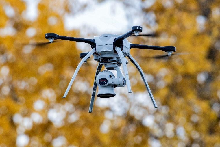
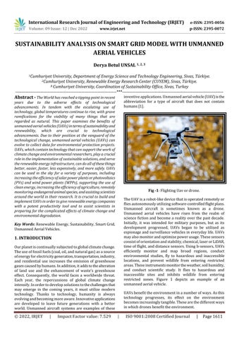
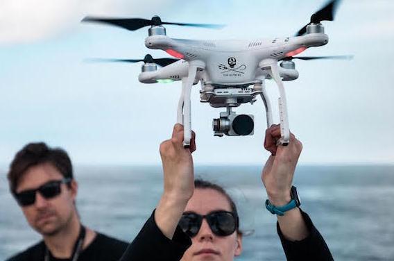
Fig -1:FlightingUavordrone.
TheUAVisarobot-likedevicethatisoperatedremotelyor fliesautonomouslyutilizingsoftware-controlledflightplans. Unmanned aircraft is sometimes known as a drone. Unmanned aerial vehicles have risen from the realm of science fiction and become a reality over the past decade. Initially, it was intended for military purposes, but as its development progressed, UAVs began to be utilized as espionageandsurveillancevehiclesineverydaylife.UAVs mayalsomonitorandoptimizepowerusage.Thesesensors consistoforientationandstability,chemical,laserorLiDAR, timeofflight,anddistancesensors.Usingb-sensors,UAVs efficiently monitor and map broad regions, conduct environmental studies, fly to hazardous and inaccessible locations, and prevent wildlife from entering restricted areas.Theseinstrumentsmonitortheweather,soilhumidity, and conduct scientific study. It flies to hazardous and inaccessible sites and inhibits wildlife from entering restricted zones. Figure 1 depicts an example of an unmannedaerialvehicle.
UAVsbenefittheenvironmentinanumberofways.Asthis technology progresses, its effect on the environment becomesincreasinglytangible.Thesearethedifferentways inwhichdronesbenefittheenvironment.
International Research Journal of Engineering and Technology (IRJET) e-ISSN: 2395-0056
Volume: 09 Issue: 12 | Dec 2022 www.irjet.net p-ISSN: 2395-0072
• Transportationandshipping,
• Monitoringandprotectionofwildlife,
• Monitoringofrenewableenergy;
• Creatingintelligentapplicationsfortheagriculture sector;
• Rehabilitationofforests;
• Mappingandenvironmentalmonitoring;
• Monitoringofoceanhealth;
• LandManagement.
Transportationandlogisticsaretheprimarybeneficiariesof UAVtechnology.ThisisduetothefactthatUAVscanaccess inaccessible regions, such as warehouses, terminals, and shippingcontainerports.
Unmanned aerial vehicles are beginning to emerge as a sectorthathasdrasticallyalteredthedeliveryofcommercial items. Unmanned aircraft use less energy per packagekilometer than delivery trucks. It is anticipated that this function will cut greenhouse gas emissions and energy consumption.
Forexample,productgenerators;Amazontesteditsdrone deliveryservicesforthefirsttimewithsuccessinDecember 2016 and has announced that it would continue to investigatethistechnology.
Amazon[2],Google[3],UPS[4],andDeutschePostDHL[5] are among the organizations implementing programs for package delivery with drones. The trucking business accountsfor24%oftransportation-relatedgreenhousegas emissionsand23%oftransportationenergyconsumptionin the United States [6], therefore improvements in the industryarecrucialfortheenvironmentandenergysystem [7].
As power systems grow, the environmental benefits of charging drones with electricity will rely on the environmentalaspectsofelectricity'slife-cycle,vehicleuse, andbatterymaterials.
Previous research has demonstrated that delivering commoditiesperton-kilometerbyconventionalairplaneis approximately four times more carbon-intensive than by truck,whichisaroundtentimesmorecarbon-intensivethan by rail [8]. Using drones to transport packages instead of truckscancutemissionsconnectedwithpackagedelivery. Dronedeliverymakesitpossibletomakedeliveriesfastand efficiently.
Figure 2 depicts delivery UAVs. However, their carrying capacityislimited.Despitethis,thismeansoftransportation isenvironmentallyfriendly.
Unlikeair,rail,road,andseatransportvehicles,dronesare poweredbybatteriesandemitnohazardousgasesintothe atmosphere. Additionally, drone transport and delivery reducestrafficcongestiononourroadways.
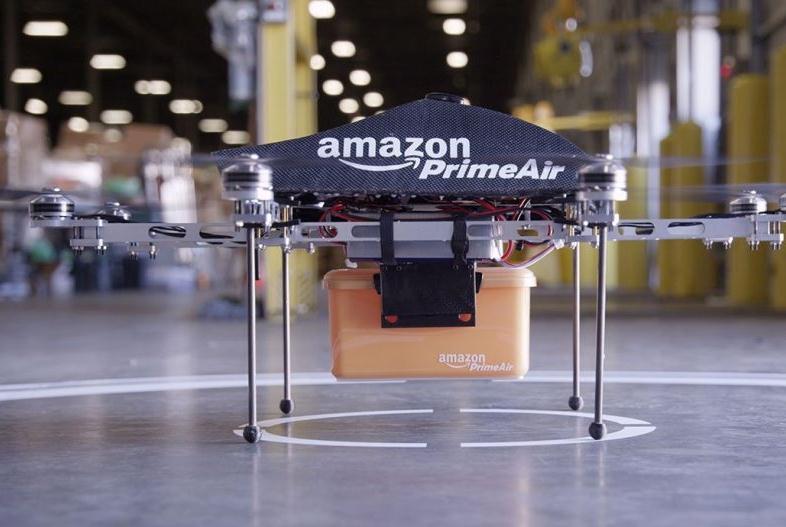
When evaluated within these scopes, unmanned aerial vehicles can be used in university campuses for environmental protection also helping for university studentslivinginthecampusareinthesmartsocietyclassin termsoftheirabilitytobothuseIoTtechnologyandadaptto innovations. This concept was implemented to adapt the smartgridmodelforsmartcampuses.Whendesigningthe smart campus for this study, a Matlab campus model was constructed, and the needs of the smart grid concept CO2 level,asillustratedinFigure3andcalculatedonthismodel, werereviewed[9].
Fig -3:BasicInfrastructureDesignofSmartGrid
International Research Journal of Engineering and Technology (IRJET) e-ISSN: 2395-0056
Volume: 09 Issue: 12 | Dec 2022 www.irjet.net p-ISSN: 2395-0072
Therewillbefewertruckscarryingsolelyheavycargoonthe road.Thegreatestdrawbackofthismodeoftransportation isthatitcanonlyconveylesslargeobjects.Asthetechnology advances, it is anticipated that both the device's carrying capacityanditsrangewillrise.Consequently,therewillbea huge decrease in atmospheric carbon, especially if the drone's batteries are charged with renewable energy. However,therateofclimatechangewillmoderate,andthe qualityoflifeonEarthwillimprove.
Dronesareutilizedforemergencyenvironmentalmissionsin addition as supplying researchers with data to boost conservation initiatives. In wildlife management, drones assist with animal counting, research, and protection. Sometimes,wildlifeandweatherconditionscanbehazardous anddemanding.Dronescanpreventhumanlifefrombeing endangered.Duetothedrones'overheadperspective,objects thatcannotbeseenproperlyfromthegroundcanbeseen clearly.
Figure 4 depicts the group application for Sea Shepherd's oceanconservationcampaignacrosstheIndianOceanand South China Sea, which employs drones to monitor illegal fishing.Poacherskillbetween20,000and40,000elephants annually, or one elephant every 15 minutes. In the past decade,poaching-relatedelephantfatalitieshaveoutpaced theirreproductionrate.Theillegaltradeinivoryhasreduced theAfricanelephantpopulationfrom1.3millionin1970to only400,000today[2-8].
Inrecentyears,anti-poachingdroneshavemadeasignificant andnoveladditiontonumerousanti-poachingstrategies.The MaraElephantProjectfocusesonelephantconservationin theMasaiMara,Kenya,anddeploysconservationdronesto preventpoaching. Dronesequippedwithspecializedthermal cameras send live video to teams, often miles away, and recordphotosforsubsequentanalysis.Organization,Ithas apprehended hundreds of poachers and seized over one thousand kilograms of ivory since its beginning. The percentageofillegallymurderedelephantshasfallenfrom 83%to44%duetotheMaraElephantProject[9].
Fig -4:SeaShepherd’sOceanconservationgroup[8].
It can be seen with the Mara Elephant Project and Sea Shepherd’s Group, unmanned aerial vehicle technology is usedtomonitoranimalspeciesindangerofextinction.
2.2.
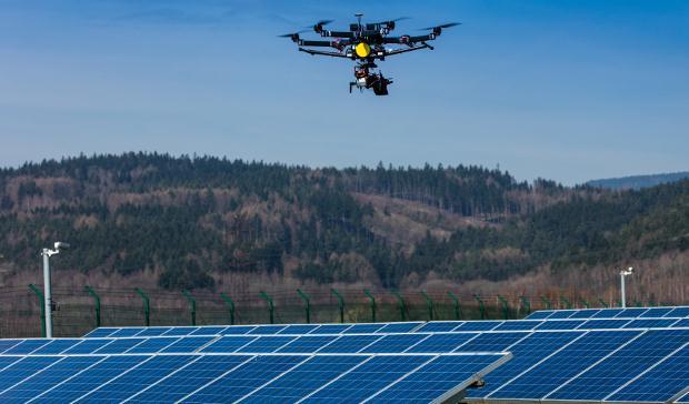
The capacity of a drone to span vast areas and offer highresolution overhead photos has enabled numerous businesses to increase their efficiency when undertaking hazardous or time-consuming activities. By giving correct data to solar farm management via new technology innovationssuchasdronesandthermalsensors,everyday activities can be conducted more efficiently. The Energy Industrycombinescutting-edgetechnologywithdronesto increasetheefficiencyofpowerplantoperations,anddrones play a crucial role in their efforts to offer customers with dependable and economical energy. Many countries throughout the world are boosting their investments in renewableenergyprojectsinresponsetogrowingworries about climate change and carbon emissions. Among numerousrenewableenergysources,solarenergyhasbeen deemed the best option. During the recent decade (20092019),globalinvestmentsinsolarenergysurpassedUS$1.3 trillion, representing half of all assets contributing to the expansionofrenewableenergy[10].
Installation costs have decreased significantly, which has contributed to the widespread adoption of solar solutions (Photovoltaics).Forinstance,solarinstallationcostsdecrease by roughly 73% between 2010 and 2019, from $4,622 to $1,210[11].Thecurrentobjectiveistocontinuemakingsolar energy globally cheap. To accomplish this, solar managers mustoptimizeoperationsandcreatevaluethroughoutthe entireprocessofpowergeneration.Solarenterprisesmust installthousandsofsolarpanelsacrossexpansive,generally heavily irradiated areas in order to meet their electricity needs.Asolarfarmwouldneedroughly2,500acrestopower 100,000homes[12].
International Research Journal of Engineering and Technology (IRJET) e-ISSN: 2395-0056
Volume: 09 Issue: 12 | Dec 2022 www.irjet.net p-ISSN: 2395-0072
Traditional solar field assessments, It involves inspecting eachpanelwithhandheldthermalcamerastocheckforfaulty cells or cables. During this process, the worker must manuallymonitorthepositionsofthedefectivepanelsand perform maintenance later. Given the size of most solar power plants, this method of inspection is inefficient and resultsinaheavierandsometimesdangerousworkloadfor maintenance and operations teams. Drones are constantly beingusedinsolarfarmstoimproveinspectionoperations, particularly in areas with high radiation exposure and creatingahostofproblemsforfieldcrews.Theuseofdrones shortens the inspection time of solar farm crews by 70%, providing a significant reduction compared to traditional methods.Figure5showsSolarUAVmonitoringapplications.
UAVscanbeusedtocollectdataortransmititinrealtimeto teamsontheground.Detailedreportsdetectturbineblade corrosionandmalfunctions,enablingwindfarmmanagersto reduce both efficiency losses and maintenance costs. To overcomekeychallengessuchaslowefficiency,highcosts andpoorinspectiondataquality,manywindfarmoperators aroundtheworldhavestartedusingdronesforwindturbine inspections. Tripoli, Greece, a drone services provider founded in Athens,Greece in 2017 “IDS - Industrial Drone Services” Company, together with its customers Eunice Energy Group (EEG), one of the pioneers in the field of renewableenergyinGreece,hasatotalcapacityof34.They usedDJIdronesfromtheirdroneplatformtoinspecta5MW wind farm. With winters providing less than 10 hours of daylight on average, using traditional inspection methods wouldhavebeenextremelytimeconsumingandtherefore expensive.
Normally, a full inspection of a single wind turbine with inspectorsworkingatheightcantakebetween3and6hours. This does not include lengthy security procedures and preparation time. On the other hand, with DJI being windproof,itonlytakes45minutesforRTKdronestofully examineaturbine.Thisallowstheentire15turbinefarmto beinspectedwithinthreedays[13].
Agricultural drones are unmanned aerial vehicles used to assist conventional agricultural labour and optimize the agricultural process, thanks to their sensor and image tracking capabilities. They have integrated GPS systems, trackingmechanisms,andmoresuitableforfarming.These systemswilltakeweeksforafarmertoassessconclusively. Itprovidesacompleteviewoffieldsandcrops.Thisnotonly increases productivity, but also increases crop yields and overallproduction.Agriculturaldronesinsmartagriculture obtaina3Dmapthankstogroundmapping,canplantcrops, areusedforsprayingcrops,obtainresultdatabymonitoring the field, and provide a healthy evaluation of crops by tracking irrigation and fertilizer. Drone technology has recentlybeenusedinalmosteveryfieldofagriculture.There are specially programmed drones used in soil analysis, planting, pesticide spraying, monitoring and many other partsofagricultureandfarming.InTurkey,thefirstAUAV (agriculturalunmannedaerialvehicle)soldintheregionwas deliveredbySilivriAgriculturalCreditCooperativeaffiliated to Tekirdağ Regional Union of Agricultural Credit Cooperatives.Whiletheuseofagriculturalunmannedaerial vehiclesinagriculturemakesagriculturallifeeasier,drones thatcantakeupto30litersofpesticidesarepreferredby farmerswhowanttosavetime,waterandpesticides.With the increase in the use of drones in agriculture, both the countryandthefarmersaremakingseriousgainsintermsof productivity. UAUVs,whichsprayina shorttimewithout damagingtheplants,canspray30decaresoflandbystaying intheairforanaverageof12minutes.Withpesticidesmade fromtheair,pesticidesareappliedquicklyandefficientlyin the detected diseased areas [14]. Overall productivity is increasing thanks to agricultural drones. The human workforceisdeclining.Itresultsinbettercropproduction andhigheryieldsinthelongrun.
International Research Journal of Engineering and Technology (IRJET) e-ISSN: 2395-0056
Volume: 09 Issue: 12 | Dec 2022 www.irjet.net p-ISSN: 2395-0072
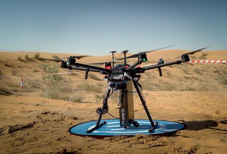
AlsointheUAE,oildistributiongroupCAFUhasuseddrones ateverystageofanambitioustreeplantingproject.InMarch 2021,10,000Ghaftreesweresuccessfullyplantedbydrone intheDubaidesert.Theprocessstartedwithdronesusedto scanpotentialplantingsitesandmeasurethesuitabilityof soil,windandmoisture.Dronewasusedtodeterminethe bestspotsforseedstoplantandamapwascreatedwithGPS markers for drone-enabled seed drops. Monthly drone inspectionsareconductedtomonitortheprogressofeach tree[15].
UAVsaredevelopingrapidlyinparallelwiththeadvancesin electronicsandsoftwaretechnologies.AlthoughUAVswere developedonlyformilitarymissionsintheearlydays,their useforcivilandcommercialpurposeshasalsoincreasedtoa greatextent.
UAVsystemshavebecomeveryusefulthankstotheirability to stay on. It can carry a large payload. Thanks to this logisticsfeature,ithasbecomethechoiceofmanycargoand deliverycompanies.In recentyears,wehavecomeacross UAVsinmanyfieldsapartfromthemilitaryfield.Scientific research, delivery, and UAVs are used in places where manpower is limited and there is a safety hazard, such as mapping and smart agriculture. Climate change is now becoming a global problem all overthe world.This global problemhasledtechnologycompaniestochangetheirvision and mission. It aims to support technology with green energy resources by making use of sustainable and renewableresources.
Fig -6: SolarUAVMonitoring[10].
Reforestationistimeconsuming,costlyandlaborintensive whenrelyingonhumanlabor.Unmannedaerialvehiclesfor reforestation,itcanmapandidentifyareaswheretreesneed tobeplantedandmakeplantingfasterandmoreefficient. First,thedronesmapthespacetogivealayoutforplanning and implementation to begin. Second, drones monitor the growthofnewtrees.Third,theymapanddropseedswhere they don't germinate. Unlike the natural afforestation method, where animals leave seeds through feces, drone afforestationtechnologyismoreadvanced.
Drones are also incredibly good at mapping and tracking. They can gather information from large coastal areas, allowing specialists to use photogrammetric image processing tools to create detailed maps. Poaching and unlawfulactivitymonitoring;changetrackingovertime;and othertypesofmappingandmonitoring,Protectionofplants and riverbanks; monitoring of coastal management; evaluationofriversandfloods;managementofanimalsand their habitats; modelling of land and hydrology; and managementandmonitoringofforests.Dronesareequipped with cameras, pressure and humidity sensors, thermometers, wind gauges, and other equipment to effectivelygatherimportantenvironmentaldata.Thegood newsisthattheycanenterevendangerousenvironments.
Ifthebatteryandload-carryingcapacityofunmannedaerial vehiclesareincreased,itmaybepossibletoencountermore UAVs in the sky in the coming years. In the coming years, landvehicleusewilldecrease,andunmannedaerialvehicles withrenewablebatterycapacitywilltaketheirplace.UAVs willsupportsustainableagriculturewiththehelpofspecial sensors, irrigation, spraying, and visual tracking and increaseefficiency.Agriculturewilldevelop;animalspecies in danger of extinction will be protected; the challenging conditions of scientific research will be overcome; the maintenanceofrenewableresourcessuchassolarandwind powerplantswillbedonebysavingtimeandcostwithout endangeringhumanlife.Manycountries,includingTurkey, areworkingonthisissue.andleadingtechnologycompanies alsosupportcountries.
[1] Sharma, Abhishek; Basnayaka, Chathuranga M.Wijerathna;Jayakody,DushanthaNalinK.(Mayıs2020). "CommunicationandnetworkingtechnologiesforUAVs:A survey".JournalofNetworkandComputerApplications.168. s.102739.
[2] CBS News. Amazon unveils futuristic plan: delivery by drone. 60 Minutes Overtime. https://www.cbsnews.com/news/amazon-unveilsfuturistic-plandelivery-by-drone/A.T.30.07.2022
[3]2022,ElifEceELMAS,MustafaALKAN,Birinsansızhava aracısisteminintasarımı,benzetimivegerçekleştirilmesi,s. 4PoliteknikDergisiISSN:1302-0900
[4] UPS. UPS tests residential delivery via drone launched from atop package car. United Parcel Service. https://pressroom.ups.com/pressroom/ContentDetailsView
International Research Journal of Engineering and Technology (IRJET) e-ISSN: 2395-0056
Volume: 09 Issue: 12 | Dec 2022 www.irjet.net p-ISSN: 2395-0072
er.page?ConceptType=PressReleases&id=1487687844847162A.T.02.08.2022
[5] Wohlsen, M. The next big thing you missed: Amazon’s deliverydronescouldwork theyjustneedtrucks.Wired https://www.wired.com/2014/06/the-nextbig-thing-youmissed-delivery-drones-launched-from-trucks-are-thefuture-ofshipping/A.T.03.08.2022
[6]Davis,S.E.,Williams,S.E.&Boundy,R.G.Transportation EnergyDataBook35thedn(OakRidgeNationalLaboratory, OakRidge,TN,USA,2016).
[7]Grenzeback,L.R.etal.“FreightTransportationDemand: Energy-Efficient Scenarios for a Low-Carbon Future” (Cambridge Systematics, Inc./the National Renewable Energy Laboratory for the U.S. Department of Energy, Washington,D.C.,USA,2013).
[8] Elephants For Africa. Save For Elephant Of Uav https://www.elephantsforafrica.org/A.T.05.08.2022
[9]WorldElephantDay. https://worldelephantday.org/A.T. 05.08.2022
[10]Unenvironment.NewsAndStories.DecadeRenewable Energyİnvestmenthttps://www.unenvironment.org/newsand-stories/press-release/decade-renewable-energyinvestment-led-solar-tops-usd-25-trillionA.T.12.07.2022
[11]https://www.irena.org//media/Files/IRENA/Agency/P ublication/2019/Nov/IRENA_Future_of_Solar_PV_2019.pdf A.T.15.08.2022
[12]https://greencoast.org/solar-farm-land-requirements/ A.T.15.08.2022
[13]Enterprise.WindTurbineInspectionhttps://enterpriseinsights.dji.com/user-stories/wind-turbine-inspection-ids A.T.15.08.2022
[14]https://www.tarimkredi.org.tr/gundem/haberler/tarim da-drone-kullanimi-yayginlasiyor/A.T.31.08.2022
[15]Wired.Environment.CafuDeploysSeedSpittingDrones Https://wired.me/science/environment/cafu-deploys-seedspitting-drones-ghaf-tree/E.T.31.08.2022
2022, IRJET | Impact Factor value: 7.529 | ISO 9001:2008 Certified Journal |