RURAL ROAD DESIGN ENHANCEMENT USING CIVIL 3D
1234Diploma In Civil Engineering, Adichunchanagiri Polytechnic, Chikkamagalur, Karnataka, India
5Head of Department, Department of Civil Engineering, Adichunchanagiri Polytechnic, Chikkamagalur, Karnataka, India ***
Abstract- Efficiently designing rural roads is crucialfor the Indian road network, despite their lower traffic volume. Ensuring the safety of commuters requires proper road design. Developing these roads, which constitute a significant portion of the overall road network, will contribute to the country's overall development. In this research paper, we utilized Civil 3D software to design a 600-meter road, generating outputs such as tabular columns for curves, profile sections, and road alignment. The objective of this work is to demonstrate the user-friendly nature of Civil 3D in rural road design. By improving transportation infrastructure nationwide, the economic activities of the country will be greatly enhanced

Key Words: AutoCAD Civil 3D, Geometric Design, Total Station
1. INTRODUCTION
The geometric design of roads is crucial as it involves determiningthedimensionsandvisiblefeaturesoftheroad. This design plays a critical role in establishing the requirements for drivers and vehicles, with a focus on efficiencyandsafety.Elementssuchascross-sections,sight distance, intersections, vertical alignment, and horizontal alignment are key considerations in geometric design. Implementing proper geometric design significantly contributes to reducing accidents and their severity. The primary objective is to achieve optimal traffic operation efficiency and ensure maximum safety while being costeffective. This paper demonstrates a typical road design usingAutoCADCivil3D,asoftwaretoolthatofferstimeand energy-saving capabilities. By utilizing 3D modeling, challengesinroaddesign,particularlyincomputingcutand fillvolumes,canbeeffectivelyaddressed.AutoCADCivil3D enables more efficient and accurate volume calculations, enhancingoveralldesignprecision.
2. SURVEYING AND DATA COLLECTION
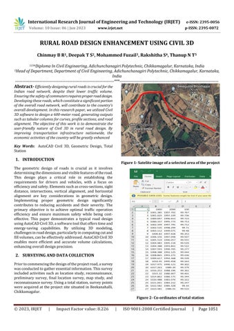
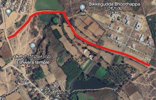
Priortocommencingthedesignoftheprojectroad,asurvey wasconductedtogatheressentialinformation.Thissurvey included activities such as location study, reconnaissance, preliminary survey, final location survey, map study, and reconnaissancesurvey.Usingatotalstation,surveypoints were acquired at the project site situated in Beekanahalli, Chikkamagalur.

3. DESIGN CRITERIA


ThefollowingdesigncriteriabasedontheGeometricdesign standardsmanual(IRC:SP:20–2002)wereassignedtothe horizontal geometry of the center line and the profile and cross-sectionoftheroadway.
I. Designspeed=80km/h
II. Superelevationrate=max5%
III. CoefficientofFriction=0.15
IV. MinimumKforsagcurves=21
V. MinimumKforcrestcurves=15
VI. Roadwaywidth=3.75m
VII. Carriagewaywidth=1.875m
VIII. Shoulderwidth=1.000m
4. Methodology
Although AutoCAD Civil 3D initially requires some effort, withrepeatedpracticeandtraining,itbecomeseasiertouse. Becoming proficient in this technique requires dedication andawillingnesstoinvesttimeinlearningandperfecting thesoftware.Thefollowingflowchartprovidesanoverview ofthegeneralprocessinvolvedinreviewingAutoCADCivil 3Ddesigns
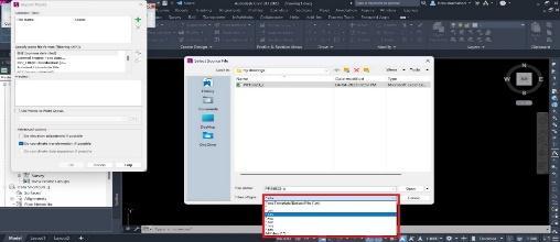
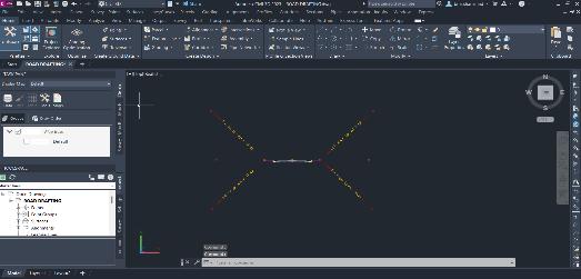
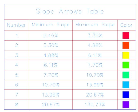
Thesurveypointsareimportedwithacompatiblefileformat such as CSV, TXT, or LAND XML files. Using this survey points surface were created which represents terrain or groundmodel,analignmenthasbeencreatedonthesurface, andexistingandproposedprofilearecreatedWiththehelp of various tools inside Civil 3D cross-section, assembly, corridorswerecreated.Thebelowfiguresshowthedesign procedure;




6. CONCLUSIONS
ThegeometryoftheroadisinaccordancewithIRCandall safety measures are considered. Horizontal alignment, vertical profile, cross-section, and superelevation was calculated and implemented. To streamline the design processandtosavetimeAutoCADCivil3Dhasbeenfoundto beanefficienttool.ThecapabilityofAutoCADCivil3Doffers agreateradvantageformanualdesign,withitsuser-friendly interfacedesignerscanworkinthree-dimensionalroadway design.Hencefromthisstudy,ithasbeenprovedthatCivil 3Disahighlyeffectivetoolforhighwaygeometricdesign.

REFERENCES
[1] HongS,andOguchiS-2005“EvaluationofHighway GeometricDesignandAnalysisofActualOperating Speed” Journal of the Eastern Asia Society for TransportationStudies,1048-1061.
[2] S.A. Raji, A. Zava, K. Jirgba, A.B. Osunkunle- June 2017, “Geometric Design of a Highway Using
AutoCAD Civil 3d”, Journal of Multidisciplinary Engineering Science and Technology (JMEST), Volume4,Issue6.
[3] IRC:38-1988.“Guidelinesfordesignofhorizontal curve”.
[4] IRC-SP: 73-2015. “Manual for Specification and Standards for two lining of Highways with Paved Shoulder”
[5] IRCSP23“VerticalCurvesforHighways.”
[6] Reddy M.S., et.al, (2019), "Geometric Design of HighwaysbyUsingCivil3D",InternationalJournal of Management, Technology, and Engineering, Volume9,Issue1,January,PP:2943-2951.
BIOGRAPHIES
DeepakTS
DiplomaInCivilEngineering
AdichunchanagiriPolytechnic Chikkamaggaluru-577102


MohammedFuzail
DiplomainCivilEngineering
AdichunchanagiriPolytechnic Chikkamagaluru-577102
ChinmayBR
DiplomaInCivilEngineering
AdichunchanagiriPolytechnic Chikkamagaluru-577102
RakshithaS
DiplomaInCivilEngineering
AdichunchanagiriPolytechnic Chikkamagaluru-577102
Mr.ThanupNT
HODDept.ofCivilEngineering


AdichunchanagiriPolytechnic Chikkamagaluru-577102