Inhwi Hwang
B.S. in Architecture
University of Virginia
2016-2020
Post-industrial Cityscapes
Michigan
Flint, MI
Lansing, MI
Post-industrial Cityscapes
Detroit
Post-industrial Cityscapes
Dequindre Cut


Inhwi Hwang
B.S. in Architecture
University of Virginia
2016-2020
Post-industrial Cityscapes
Michigan
Flint, MI
Lansing, MI
Post-industrial Cityscapes
Detroit
Post-industrial Cityscapes
Dequindre Cut
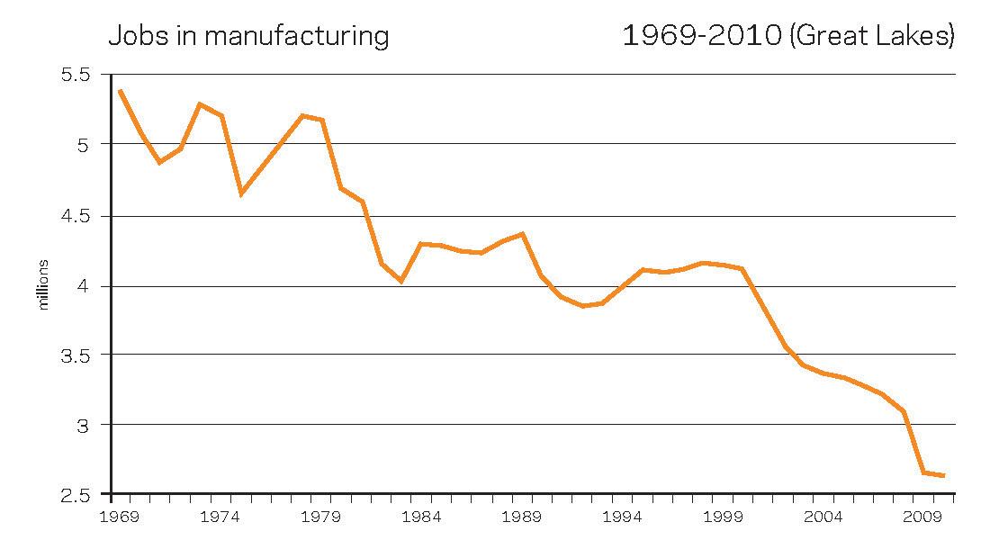
http://www.brookings.edu/research/reports/2006/07/useconomics-wial
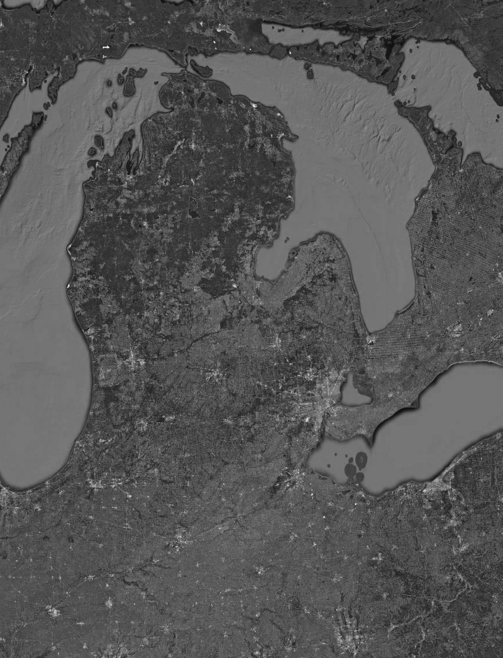
The Great Lakes region, which includes the states of Michigan, Illinois, Minnesota, Ohio, Indiana, Pennsylvania, New York, and Wisconsin, has been an epicenter of the American industrial revolution ever since the early 1800s. Those states had grown rapidly during the 19th century. Abundant natural resources, well-organized land and water transportation infrastructure, and constant influx of immigrants enabled unprecedent development of the region. Especially the state of Michigan became home of American automobile industry as Ford, Chrysler, and General Motors, the three big names of the industry, had settled their main plants and headquarters in the cities such as Detroit, Dearborn, Flint, and Lansing. Automobile industry produced and facilitated other manufacturing industries related to it. By beginning of the World War 2, Michigan was a region with most developed automobile and supplement industries in the world.
However, in the early 1970s, the global oil crisis and growing competition from foreign manufacturers, especially Japanese companies, severely affected American automobile industry. Also, unemployment crisis has severed as more and more companies moved their plants outside of the US, where they can cut the production cost by utilizing cheap labors. Federal safety regulation also increased the manufacture cost. 1980s was a doom decade for American automobile industry, as there were several recall incidents due to the poor quality, increased competition with worldwide incorporations such as Toyota and Volkswagen, and high oil price. In 1990s the situation worsened. Foreign companies began to set plants on the American soil, meaning that they have even more low-price advantage. By the beginning of the new century, many of Michigan-based automobile corporations were on the verge of bankrupt. Bad economic siuations of the big corporations severly affected small business related to them.
Due to such collapse in manufacturing industries, cityscapes of Michigan altered significantly, especially in the cities highly relied on the automobile industry such as Flint and Detroit. Deteriorated economic situations of local governments resulted in poor maintenance of urban infrastructure. Ever-increasing unemployment rate caused people to immigrate to other states, which leads to the vacated cities. Nowadays, it is not hard to find huge vacated parcel once plants and factories stood. Public service buildings such as schools, churches, and hospitals are no exception. Many of the buildings built in Michigan’s economic heyday are now completely abandoned or demolished, symbolizing the economic downfall of the state and the subsequent post-industrial landscapes.
Counties which their economies rely on manufacturing industry
The map on the right shows the counties where their the most prominent type of job is industrial manufacture. Many Midwest counties’ economy relies heavily on industrial manufacture, especially in the states of Wisconsin, Illinois, Michigan, Indiana, and Ohio.


which their economies rely on manufacturing industrySevere vacancy problem
In those counties, urban vacancy has been a huge problem for the last few decades. The right map showing how severe such problem indicates among the Midwestern states, Michigan’s situation is really severe, as higher parcel vacancy rates are shown in darker orange.


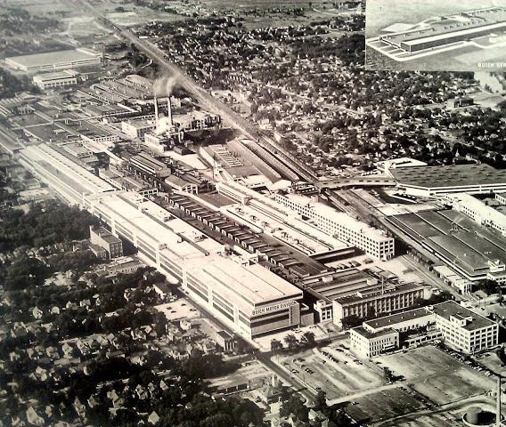
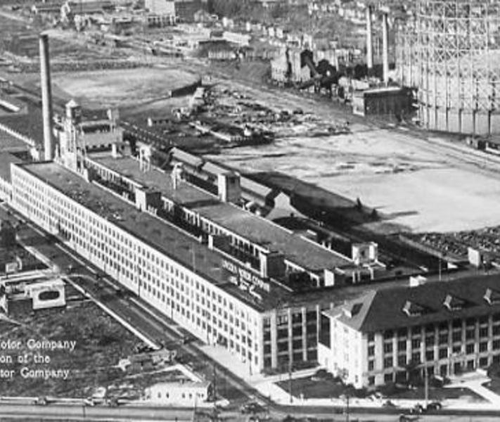
Major buildings/facilities demolished or vacated due to the decline of manufacturing industries



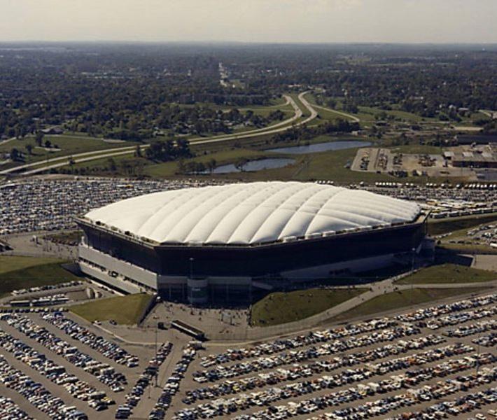


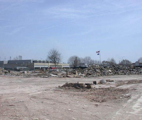


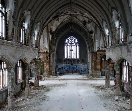


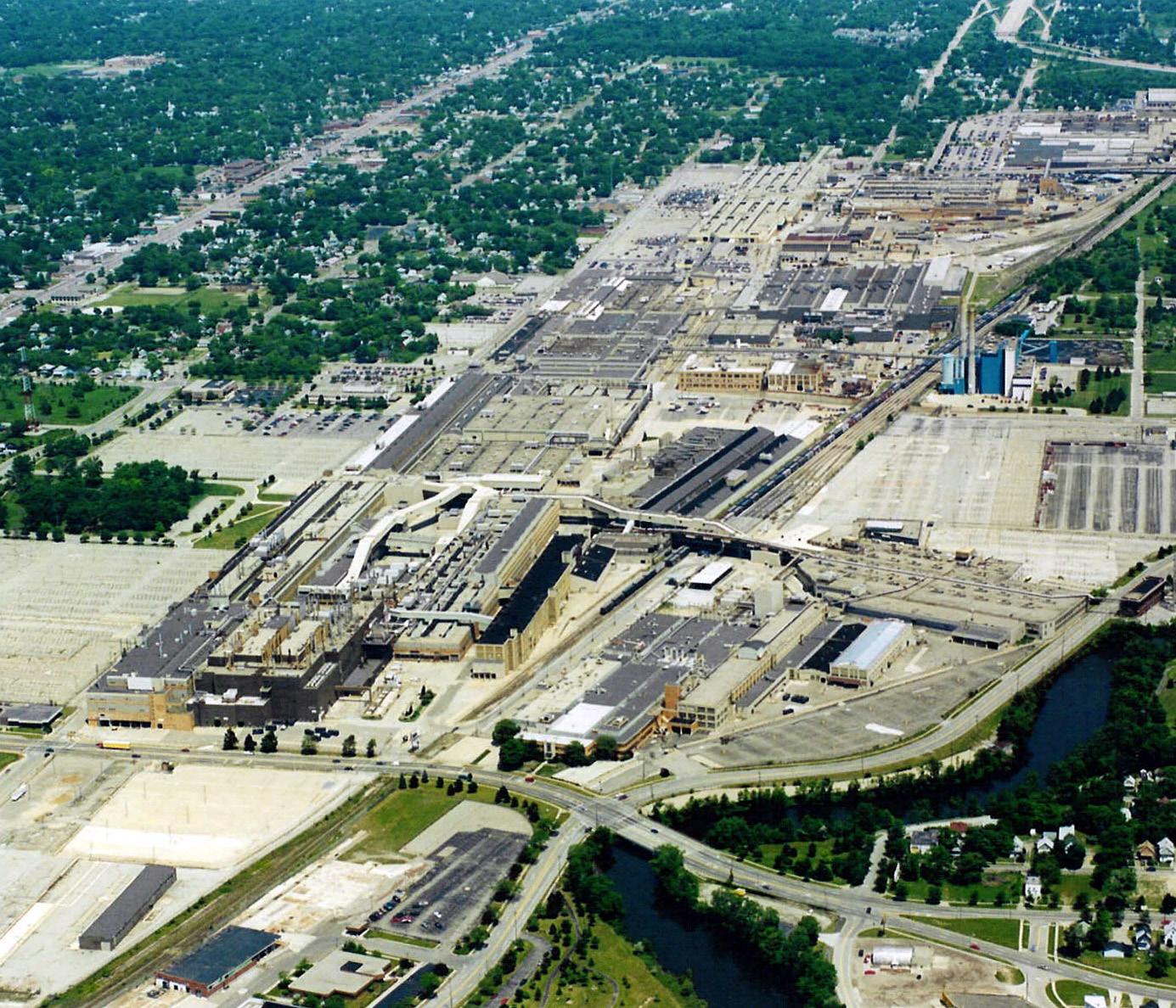
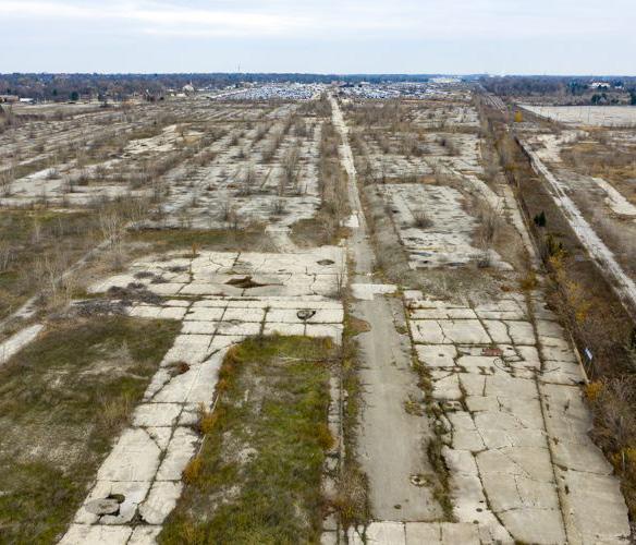
Manufacturing began in 1904
Once the biggest automobile factory in the world
Ceasing the main assembly line in 1999
Demolition began in 2002
Completely vacated in 2010
Subject of EPA’s cleanup (soil, underground water supplies)


Manufacturing began in 1919
Craft Center produced General Motors Automobile cars
Metal Center was specified in manufacturing jet engines
Ceasing the main assembly line in 2006
Demolition began in 2008
Completely vacated in 2009


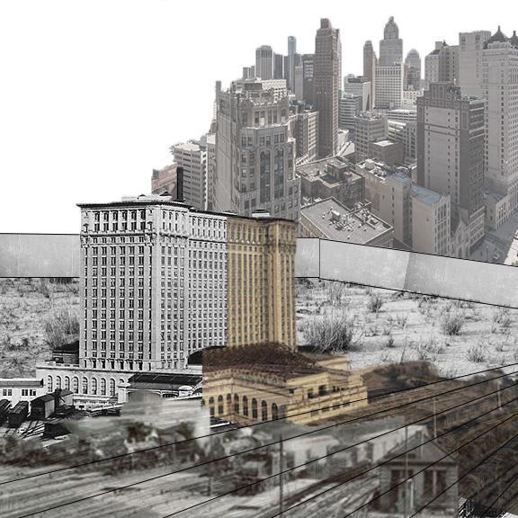


Ever since its first establishment in the early 18th century, Detroit has been a central city of both the state of Michigan and Midwest. Detroit’s strategical location on narrow neck of the Great Lakes Waterway made it one of the most important transportation and trade hub in entire continent. in 1908 Henry Ford found Ford Motor Company in Detroit, followed by other major automobile manufacturers such as Durant, Packard, and Chrysler. Founding of major automobile plants worked as a catalyst for other businesses, such as refinery for oil, gas station, business, and manufacture of parts and tires. In 1920, Detroit became the America’s 4th largest city just after New York, Chicago, and Philadelphia, showing the importance of its role in the first half of the 20th century.
Decline of automobile industry beginning in the late 1960s corresponded to decline of Detroit city itself. Prolonged unemployment forced mid-income levels to move out of city thus facilitated gentrification. Many people moved out of the state to find jobs, and the city goes under steady population decline. Bad financial situation of the city led to no or minimal investment in its infrastructure, resulting in vacated cityscapes. Most of the automobile factories have been vacated. Iconic buildings in downtown such as Hudson department store and Statler Hotel have been completely demolished. Once the symbol of Detroit’s prosperity, Michigan Central Station has been haunted since 1988. Huge public housing projects like Brewster-Douglass Project became completely ruined. As a industrial center and flagship city of Michigan, Detroit showed deteriorating urban condition for the last few decades, corresponding with decline of automobile industry.
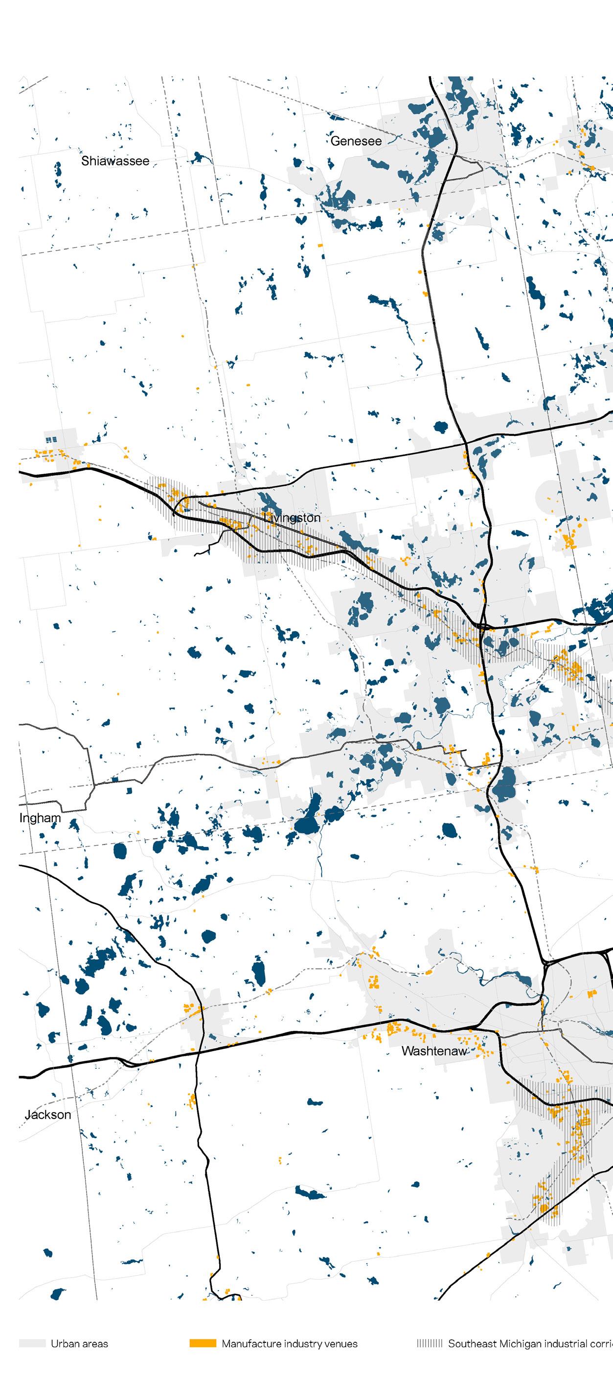
Locating on the narrow waterway between lake Huron and like Erie, Detroit plays critical role in linking great lakes to naviganle water body. As it has been a center of transportation and trade, Detroit has been a center for manufacture business, and allowed nearby regions to grow. Below map shows the industrial venues of the Southeast Michigan Industrial Corridors (Wayne, Washtenaw, Livingston, Oakland, Macomb). Venues are mostly near the highways and railways, forming several industrial corridors that sprawling out from Detroit.

Huge proportion of Detroit’s parcels are vacated since the decline of automobile industry. It is most common in residential areas. Below map shows vacant city parcels in gret hatch. Industrial zonings are not exception. Though not as harsh as residential zones, industrial zones are also highly vacated. Empty parcels and vacated buildings around the city make the cityscapes pathetique and miserable, and facilitate crime rate of the city.


Deteriorated financial situation of Detroit resulted to the completely different cityscapes compared to nearby affluent suburbs. Probably the most stark contrast can be seen on the border between Detroit and Grosse Pointe, a city in Wayne county, MI. On the west of the border, there is Detroit, where about more than 80% of residential parcels has been emptied and public services were ruined. On the east, well-funished housings and well-funded public services buildings can be found. Income level of residents is starking, as Grosse Pointe’s residents make far much money than the Detroit’s.


Running from the east edge of the Detroit’s historic Eastern Market to the riverfront area of Jefferson Avenue, Dequindre Cut has both physically and mentally divided multiple neighborhoods on its way. It has served as a spine for the railway lines connecting factories in the riverfront area to a broader rail network outside of the city until its abandonment in the early 1980s.
Derelict path of infrastructure has been regenerated as a greenway for pedestrians and bikers. The first portion opened in 2009, and subsequent parts has been developed respectively in 2013 and 2016. Now, 1.5 mile-long Dequindre Cut greenway encompasses three major neighborhoods east of the downtown, Eastern Market, Lafayette Park, and the Eastern Riverfront.


General timeline of evolution of the Dequindre Cut


the Sections
The cut begins south of Mack Avenue and continue towards the Detroit river. The cut gets deeper as it proceeds to south, eventually reach 25 feet below ground level. It meets ground again at the north of the Jefferson Avenue. The average deep of the cut is about 20 feet below ground.
Currently, there are only five entry points to the greenway including both ends. The lack of connection isolates the cut from adjacent neighborhood, thus hampers interaction between people and the landscape. Despite of various sectional conditions, current greenway does not fully engage with such variations. Therefore, the first step I took after examining the history and culture of the area was to design series of interventions tailored to different sectional conditions, especially the ones in Eastern Market, Lafayette Park, and Eastern Riverfront districts.


This project explores the use of Architecture as a spatial medium to reinstate physical and mental connections of the neighborhoods severed by a defunct infrastructure. Through a series of design intervention, the project rethinks the extent of the existing development plan, and further examines potential of outdated infrastructure as a vibrant urban spine. These compositional strategies are tailored to demands from adjacent neighborhood, which reflect specificity of history and culture. Also, by introducing novel ways to link both horizontal and vertical gaps, the project aims to reshape the place of disconnection into a space of reconciliation. Thus, this project questions the way we consider post-industrial landscapes in urban context, and investigates how they can propose new civic identity.
The primary objective is to overcome physical gaps caused by 20-feet deep cut. Relationship between ground-level and below-grade cut level is extremely week due to the lack of connections between those two levels. Separation of neighborhoods has to be addressed. Also, built environment should render the needs of both locals and visitors. By attempting to use Architecture as medium, we can reshape defunct infrastructure into a vibrant urban spine.
Catalog of design interventions tailored to 3 specific sectional conditions
Eastern Market
An active meatpacking district, Eastern Market area is one of the most vibrant neighborhoods in the city of Detroit. Food-related industries such as wholesale market, small food processing companies, and restaurants are the main businesses of the area. On Saturday, farmer’s market opens, where local farmers from all over Michigan sell their own products.
Under Maurice Cox, a former planning and development director of Detroit, the city has undergone series of redevelopment projects. According to the plan tailored to the Eastern Market neighborhood, the major goals are:
1. Create jobs for Detroiters
2. Improve quality of life of residents
3. Keep the authenticity and function of Eastern Market
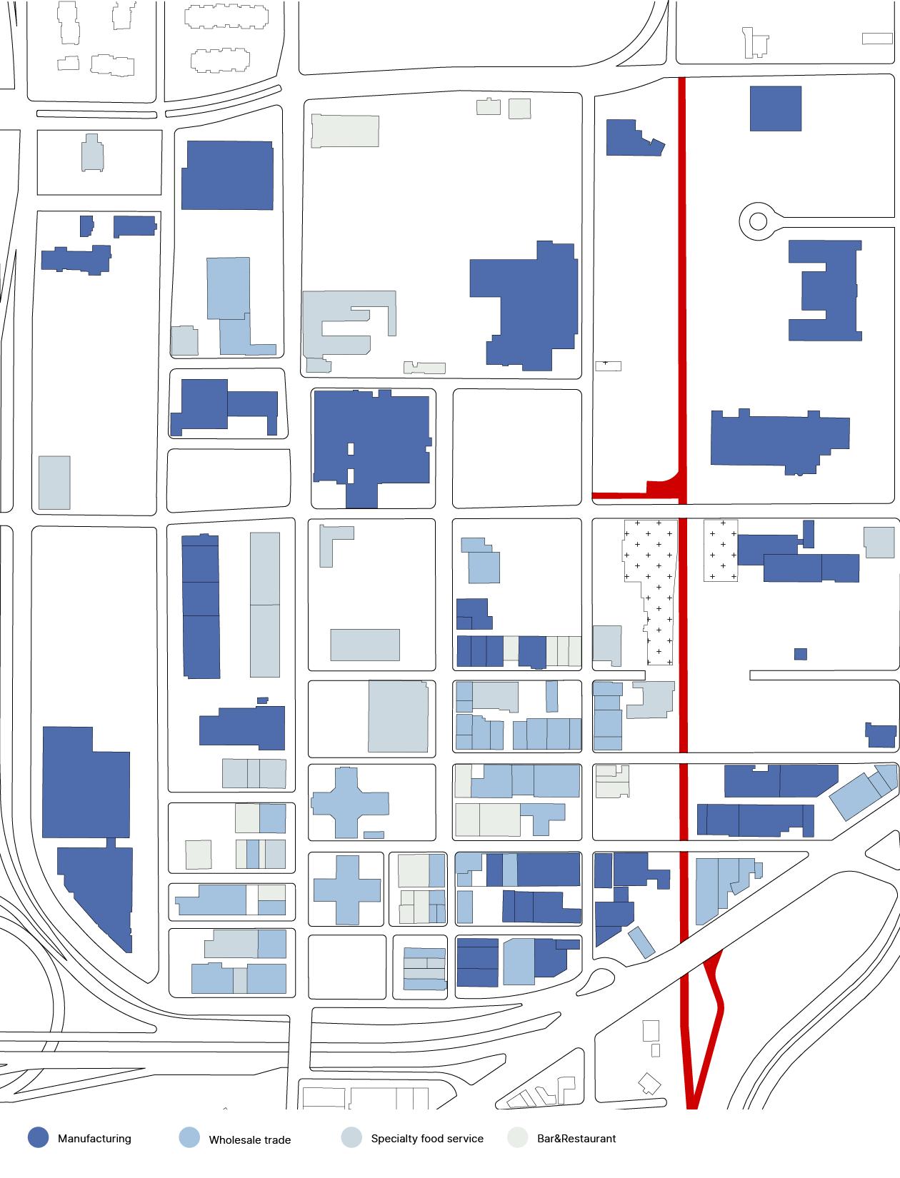


Largely famous thanks to Mies van der Rohe’s housing projects, Lafayette Park is an area predominantly occupied by residential buildings. Urban renewal projects took place in this area during 1950s-1960s include various types of housing such as apartment and townhouse. Because the Dequindre cut cuts through the entire neighborhood into a half with inadequate connections, the neighborhood is fragmented and isolated.
Also, lack of recreational and cultural amenities in the area is a prominent issue. Maurice Cox’s development plan does not cover the Lafayette Park area, so my design intervention will particularly concentrated on this neighborhood.


Section perspective drawing shows vertical variations in the new recreational tower as well as slanted branch library; which connects the greenway to the adjacent urban contexts.
Lafayette Park district shows incredibly huge concentration of residential buildings. Despite of such high population density, recreational and cultural programs are lacking in this area. Lafayette tower pool is private; it is only available for the residents of the towers. Also, basic cultural amenities such as library and auditorium are not within close proximity to most of the residents. Thus, I introduced recreational tower and branch library over the existing greenway, stitching fragmented parts of the neighborhood.
I focused on the spatial experience within the design such as views, because Detroit lacks public observation points where citizens can freely access and enjoy the view of their own city. Slanted piece for branch library provides connection between the greenway, ground level, and the recreational tower. Elevated bridge connects the two most prominent green spaces in the area, Lafayette Park and Elmwood Central. While doing so, it also suggests a connection between private pool of tower residents, the greenway, and the recreational tower.
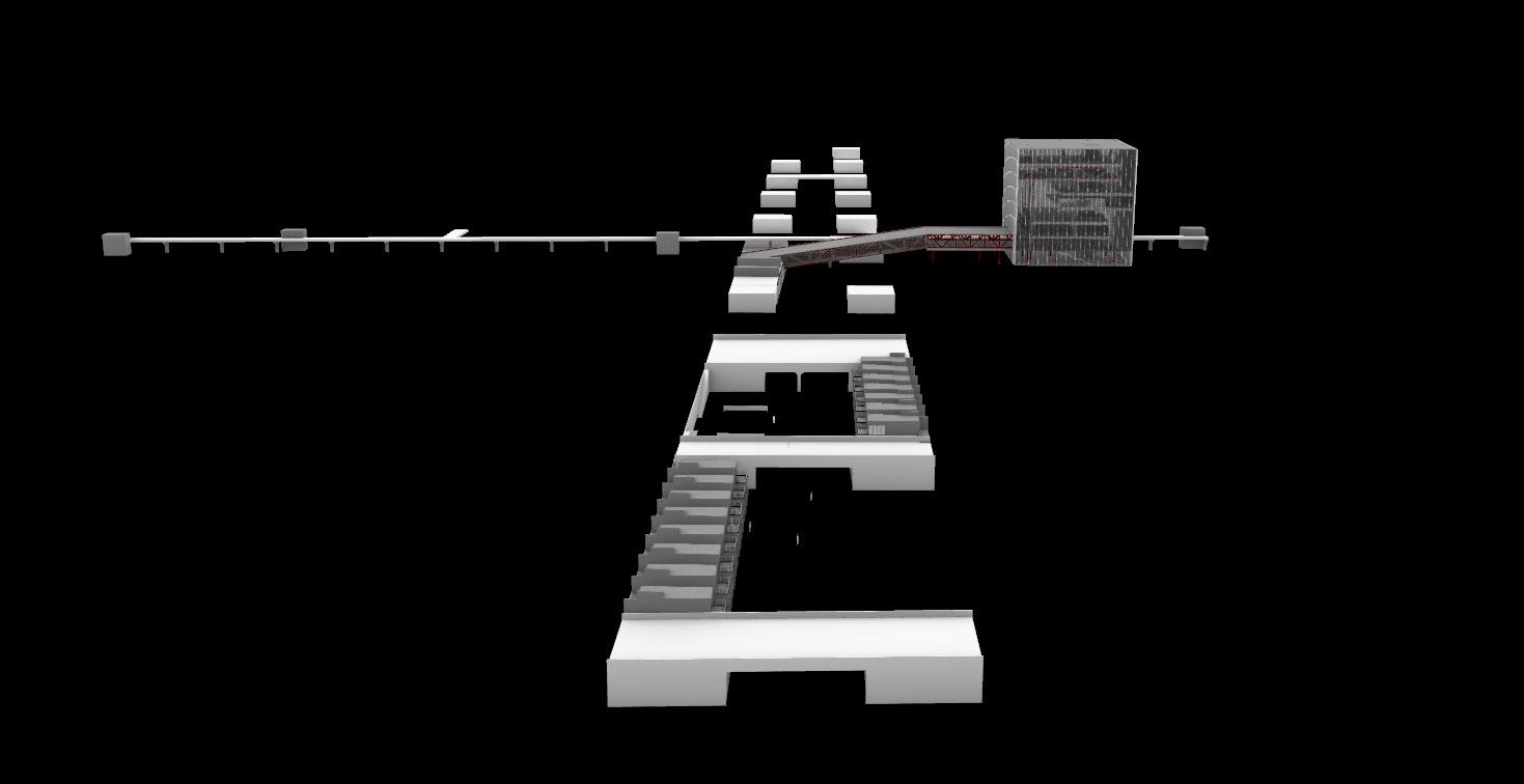
Aerial view show schematic design of the recreational tower and architectural pieces connecting the cut and the city

Exploded isometric showing structural construction of the design intervention and how it interacts with surrounding urban context


Eastern Riverfront
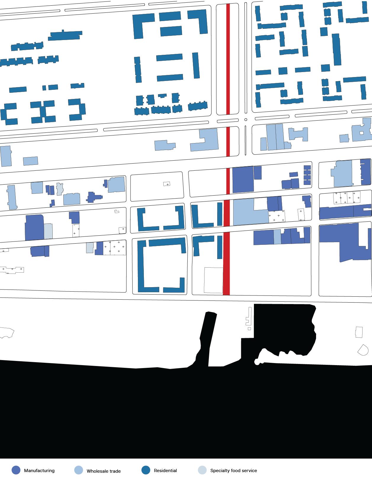
Eastern Riverfront is a terminal point of the current Dequindre cut greenway. It is the most impoverished area among the three neighborhoods, but also a subject of the most ambitious redevelopment projects. It was a warehouse district when the dequindre cut railway is active, and there are still lots of abandoned warehouses along the Franklin street.
Maurice Cox’s plan suggested large-scale redevelopment plan on the area. Specific goals are including:
1. Increase green space & Recreational capacity
2. Renovation of outdated buildings
3. Focusing on connection - from Downtown to Belle isle, from Eastern Market to the river


A view looking towards the housing complex from the greenway
To address a problem regarding access points to the greenway and to improve the quality of streetscapes of the cut, I introduced units of housing with commercial and workshop space facing towards the greenway. The model I looked at was Shinola, a Detroit-born hand craft business which hires workers formerly worked in automobile industry and trains them as craftsmen. Despite the Eastern Riverfront district is currently seeing huge scale developments especially in housing, they are not truly suggesting how to deal with dwindling economic situation of the area. Also, even though the Dequindre Cut greenway is a spine connecting the area all the way up to active industrial districts such as Eastern Market and Hamtramck, development is majorly taking place at the riverfront.
I expect the stairs to provide ample vertical connection to bring people down to the cut, and maker space/commercial spaces on the first floor will promote interaction between the neighbors. Most importantly, this design intervention will offer interesting and vibrant streetscapes along the cut.

The view shows horizontal and vertical connections reinstated by newly built working/living complex in the Eastern Riverfront area


Isometric diagrams show how to connect street level to the below-grade cut level by introducing new streetscapes along the existing greenway


This project is to reshape derelict piece of infrastructure into an active object that can provoke further developments in the economically dwindling city. By doing so, design interventions were focused on how to stitch physical and mental disconnection between the neighborhoods, and to reinstate linkages. While addressing the goals set by existing development plan, I tried to add on my insights on the plan. The derelict infrastructure and its vague utilization are not only specified in the Dequindre Cut and the city of Detroit. By rethinking its identity, I think such spaces can be turned into vibrant urban spines.
Inhwi Hwang
B.S. in Architecture
University of Virginia
2016-2020