A-201
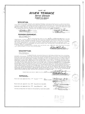
PLAT
OF
RIVER TERRACE BEND OREGON ROBERT B. GOULD CIVIL ENGINEER
DEDICATION Know all men by these
nat
Angust
the
antohed biatted shown on this plat, caused said lanas to be surveyed and platted
shown on this blat. as shown
on
said plat:
into streets, alleys, lots and blocks hereby submits for approval and record said plat: and hereby dedicates to the all streets and alleys as shown on said plat, and heraby declares sara
and
use of the public forever blat to be a blat of River Te
plat
lleys
as showu on saa plat
and herabn henceforth to be so known ana designated. bitness whereof I have hereunto set my hand and seal this 30day of Hobe
to be
In
th
s
a
plat of
River
lerrace
ana
and
engustus
-witne
Dair sullwWitness
1915
Stouder
.
Ecuter
by
fact.
ACKNOWLEDGEMENT. seate of Deegon s.s. County of Crook. Be it remembered that on this 3 day of evembe4915. before me the undersigned, a notary public in and for said County and state, personally appeared the witnin and seate, personally appeared the within and above namad Augustus G. Stouder bu nts and above namad Augustus G. Stouder by his attorney in fact, the within and above named D.E. Hunter, to me known to be the identical individual deseribed in and who executea for and on behalf of said Augustus G. Stouder ano and plat the above dedication
atottnts
the above
leased
purposes
atlon
chat
therein
he
and plat for and on behal
execut
same
mentioned.
In testimony whereof I have
last
above weLsten in this mu sten
my
in this
freely
voluntarily
and
hereto set my hand certificate certiflcate
and
and
for the
uses
official seal the day TARY
and
ana
PUBLIE POR ORESON16.
DESCRIPTION State ofo
State of Oregon S.S. County of crook I, Robert B. Gould, being first duly sworn do hereby certify th menuments thel bresenta on thie bk that ot t and marked with proper monuments the lands represented on this plat: That at the Southwest corner of the Northeast Quarter of the Northwest auarter of Section 32,Township 17 South, Range 12. East,W.TM I buried a two inch galvanized iron pipe, three feet in length at a depth of six inches below ground for the initial point of said plat and that the Pollowina is a correct deseribtion of the land e a Beainnin ced in sgid blat embraced in said plat. Beginning at the south west corner of the north-east Quarter of the northwest Quarter of Section 32, T. 17 S., R. 12 E., W.M., which corner is marked by a 2" galvanized iron pipe driven below ground; thence s.0° 01' 30"w. for a distance of 126.08 feet along the west rked
with brober
line of the the S.E. 4 4 of of the N.W. N.w. 4 4 of said
Section 32; 32; thence thence
east east for 701.38 701.38 feet; feets thence thence 5.62°28'40°E. 5. 62°28'40"E.
feet; thence east 137 peet more less to the west high water mark of the Deschutes River; thence following the west high water line of the Deschutes River northeasterly, northerly ana northwesterly ly for for a & distance of 2150 feek more or Less to the intersection of the west highnorthwester distance of 2150 for 173.13
or
feek more or less to the intersection of the west highof the Deschutes River with the north line of said Section 32; thence westerly along the nortn line of said section 32 to the North west corner of the northe ast /4 of the lns ht 4 of said sectien 32: thence southerly along the west line of the northeast 1/4 northwest /4 of said secti ast1/4 on 32; thence southerly along the west line of the y of the northwest14 of said water line
section 32 to the point of beginning. vorn
before me this
e
day of915
Loatonl
trmOregon
My Commission Expires January 8
APPROVAL Ixam
approvea this
2N
Examined and approved this 2N Examined and I hereby
approved this
2Nd
day of DECEMAER
COUNTY COURT.
day of December 1915. day of December
1915.
certify that all taxes on this property have been paid.
1916.
Afringer qudg aCouCn t y ou nt
y Surveyos.
County Ass
essor.
county sheri
ff.
FILED Wa Eovd Cocaty Cork