HANYU ZENG
Urban Planning Portfolio
Master of Regional Planning
Cornell University
2019-2025
Urban Planning Portfolio
Master of Regional Planning
Cornell University
2019-2025

I am a Master of Regional Planning graduate from Cornell University with handson experience leading community planning, stakeholder coordination, and equity-focused planning and research. I bring strong project planning, communication, and design skills to translate complex planning initiatives into accessible, actionable outcomes for diverse communities.
01.
Delivery Accessibility Research
ARPA Funding Allocation Research
02. Analysis
GIS Regional Analysis
Demographic & Housing Analysis
03. Planning 05.
Land Use Prioritization via GIS & groundtruthing
Environmental Planning
04. Design
Urban Capacity Research
Rural Revitalization
Other
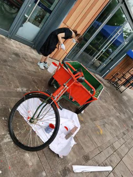
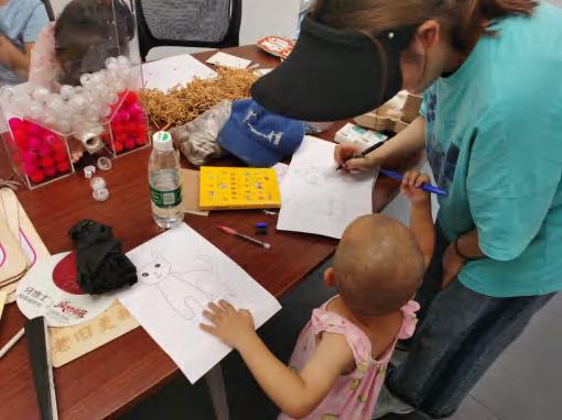
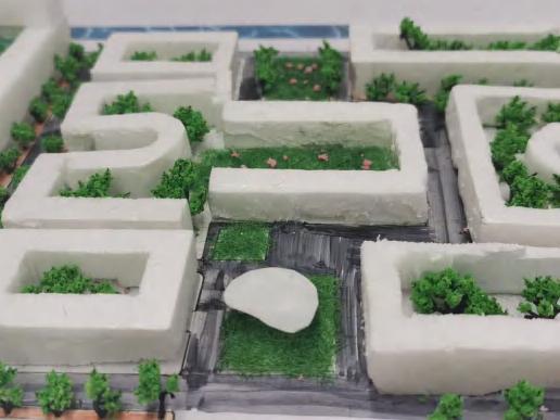
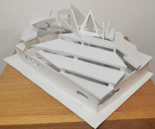
Crafting + Community Engagement
Model Making
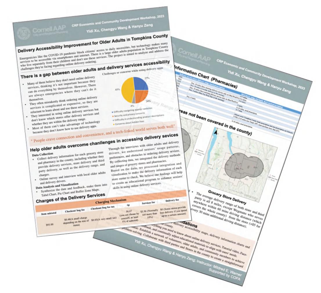
Project: Delivery Accessibility Improvement for Older Adults in Tompkins County
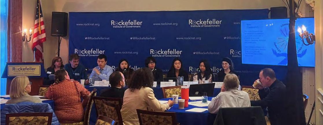
Overview: We conducted primary research to identify delivery coverage gaps by calling stores, interviewing staff and drivers, and surveying 200 seniors to understand delivery barriers. Our findings were first presented at the Tompkins Center for Aging, which led to the development of a brochure to help seniors navigate delivery apps. The project continued into the spring semester, culminating in a presentation to local professionals at the Rockefeller Institute of Government.
Instructor: Prof. Mildred Warner, Cornell University
Team: Hanyu Zeng, Chengyu Wang MRP ‘25
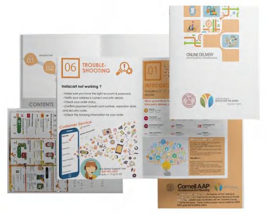
Contribution: We obtained primary data on delivery coverage by conducting phone inquiries to verify the delivery range. We also worked together on GIS mapping and interviewed staff and drivers. We co-wrote thereport, where I contributed to the analysis, methodology, and recommendations sections. Additionally, we collaborated on creating anissue brief. I also independently developed a handbook, which I distributed at the Tompkins County Office for the Aging (COFA) to gather feedback from local planners and senior adults for revisions. Finally, my teammate and I presented our work at the COFA and the Rockefeller Institute of Government. The brochure was adopted by COFA to enhance senior digital literacy.
This work has been posted on the Local Government Restructuring Lab at https://lnkd.in/ei-kPWW6 under Prof. Mildred Warner's guidance
Over 16,000 older adults, accounting for 15% of Tompkins County's population, faced significant challenges in accessing daily necessities and medicine remotely during the COVID-19 pandemic, making them among the most vulnerable.
Stage 1 – First-hand data collection & GIS Mapping
Each pharmacy and grocery store in Tompkins County: whether delivery
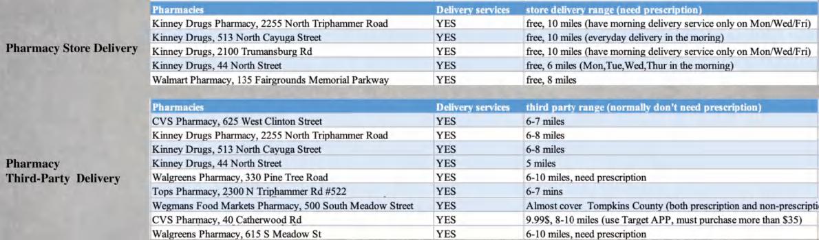
Stage 2 - Identify issues through interviews: What prevents older adults from using online delivery services services are provided, delivery methods, and delivery coverage
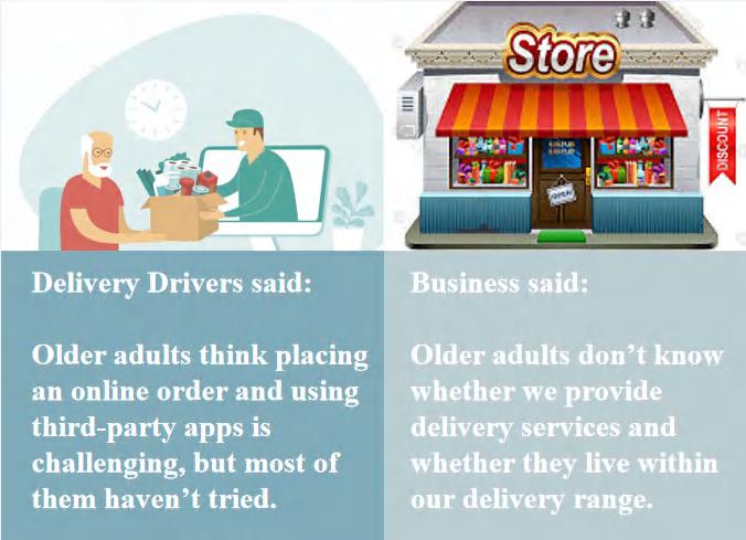
Delivery Drivers said:
Older adults think placing an online order and using third-party apps is challenging, but most of them haven’t tried yet.
Businesses said:
Older adults don’t know whether we provide delivery services and whether they live within our delivery range.
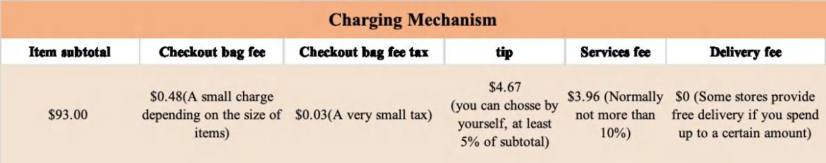
Stage 3 - 200 Surveys show: 29% of older adults use delivery services, and 12.4% use weekly. 78% of older adults faced challenges using online delivery services.
1. Concern about the cost and hidden fees
2. The lack of knowledge about online delivery services
3. Confusion about how to use online delivery apps
Stage 4 - Important cost concerns
Stage 5 - Addressing the lack of knowledge & Training to use online delivery apps
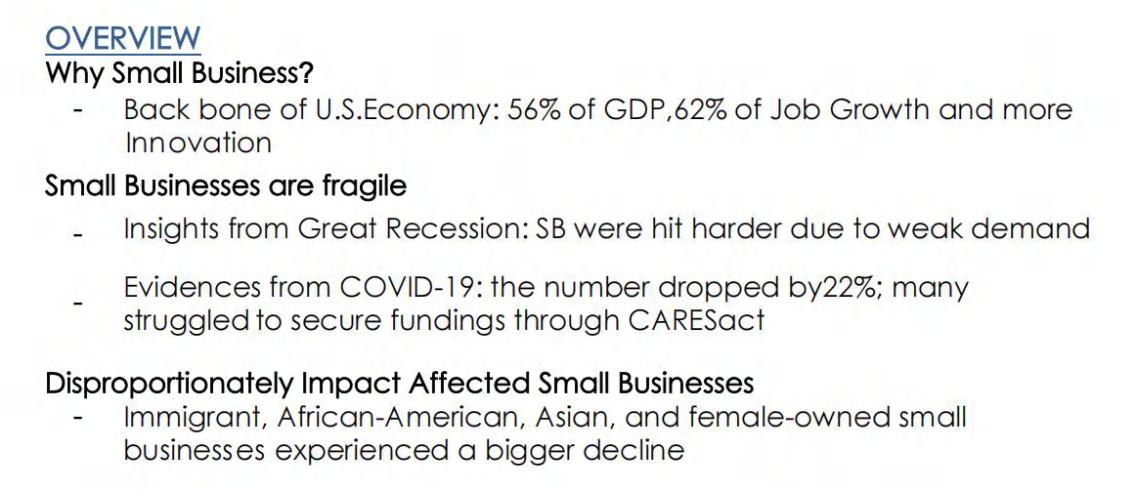
Project: Small Business Revitalization in ARPA Plans
Overview: The project focuses on how local governments use their ARPA funding to support small and micro-businesses that were subjected to operational hardship during COVID-19. We conducted comparative case studies among three counties to explore the motivations, approaches, and outcomes of their assistance to small businesses. We also developed a conceptual framework to evaluate the equity focus of these initiatives, offering a model for assessing other ARPA economic recovery programs.
Instructor: Prof. Mildred Warner, Cornell University
Team: Hanyu Zeng, MRP ’25; Jiahe Liang, MRP ’25; Yucheng Zhang, MRP ’25; Diego Onofri, URS ’26
Contribution: I discussed and developed an equitable framework with my teammates. I personally conducted interviews with three professionals specializing in small business-related ARPA projects in Cleveland, documented and analyzed the interview content, and led the research direction for this project.
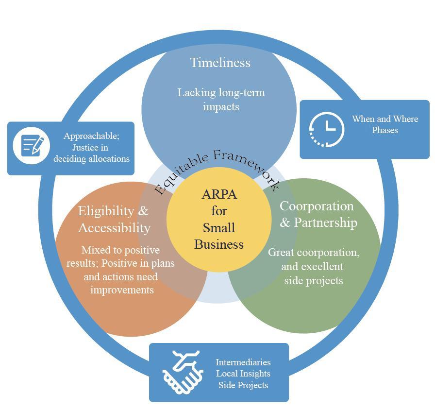

Accessibility evaluates how a project can be approachable to individual owners, regardless of existing language,technology, or information gap; Eligibility - Fair and Justice in deciding the allocation of funds
Timeliness is defined by when and where the funds were allocated
Different phases to ensure both timely support and long-term operation?
Partnership with other intermediaries with local knowledge and capacity for action?
Side projects that ensurethe revitalization of small businesses, considering their domestic duties, etc.

Overview: This GIS course provided a comprehensive introduction to GIS, covering spatial data structures, data collection, mapping, visualization, and geoprocessing techniques. I gained hands-on experience in ArcGIS Pro, ArcGIS Online, and network analysis, while also learning location-allocation modeling, site suitability analysis, scenario planning, and environmental justice analysis. The course equipped me with practical GIS skills, allowing me to tackle real-world planning challenges using spatial analysis techniques.
Instructor: Gina Park, PhD, Cornell University
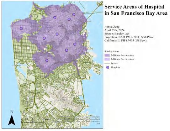
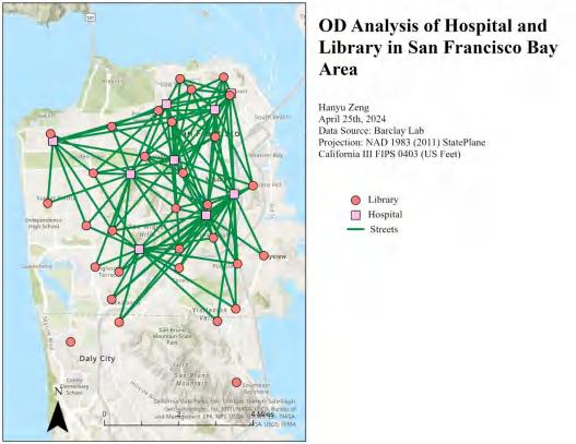
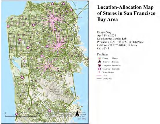
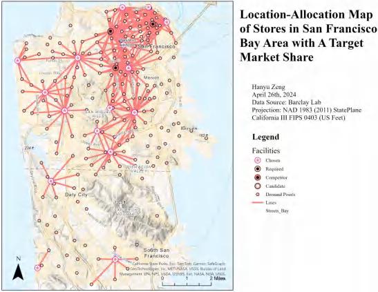
This study applies GIS-based spatial analysis techniques to evaluate healthcare accessibility, transportation networks, and commercial service optimization in the San Francisco Bay Area. I applied service area modeling, origin-destination (OD) analysis, and location-allocation modeling.
Findings: Figure 1 assesses healthcare accessibility within 3-minute and 5-minute service areas. Figure 2 examines connectivity between hospitals and libraries. Strong service links exist. Figure 3 optimizes retail store locations to maximize population coverage. While distribution is balanced, southern areas remain underserved. Figure 4 identifies the minimum number of stores needed to serve 70% of market demand. Increasing service distance thresholds optimizes store placement, reducing redundancy and improving efficiency.
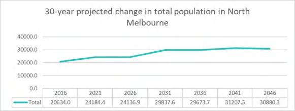
Project: Future outlook for North Melbourne (SA2): Gentrification trends and projections
Instructor: Associate Prof. Sophie Sturup, XJTLU
Overview: This research explores future envisioning for North Melbourne, focusing on social transformation. It analyzes gentrification using census data through a gentrification framework, as well as spatial and temporal analyses. We examined the area's gentrifying patterns and provided implications for housing development.
Team: Hanyu Zeng B.Eng. ‘23; Jiahe Miao B.Eng. ‘23; Qiaorui Yang B.Eng. ’23
Contribution: I developed the analytical framework for gentrification, conducted census data analysis on population data (population, age, income, occupation, rent), created visual representations, and assisted my teammate in the population projection.
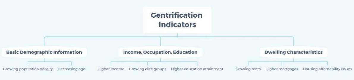
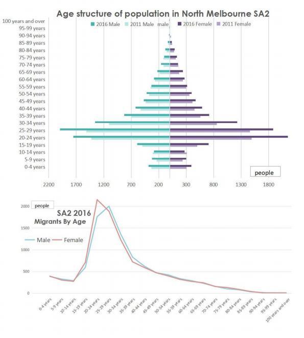
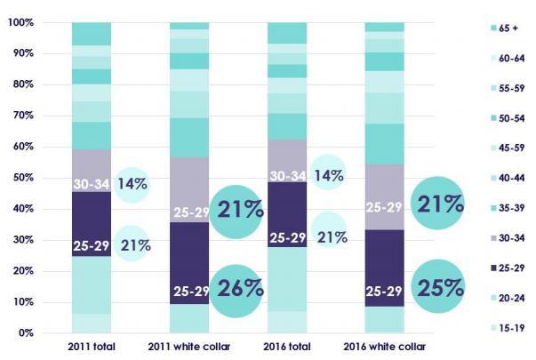
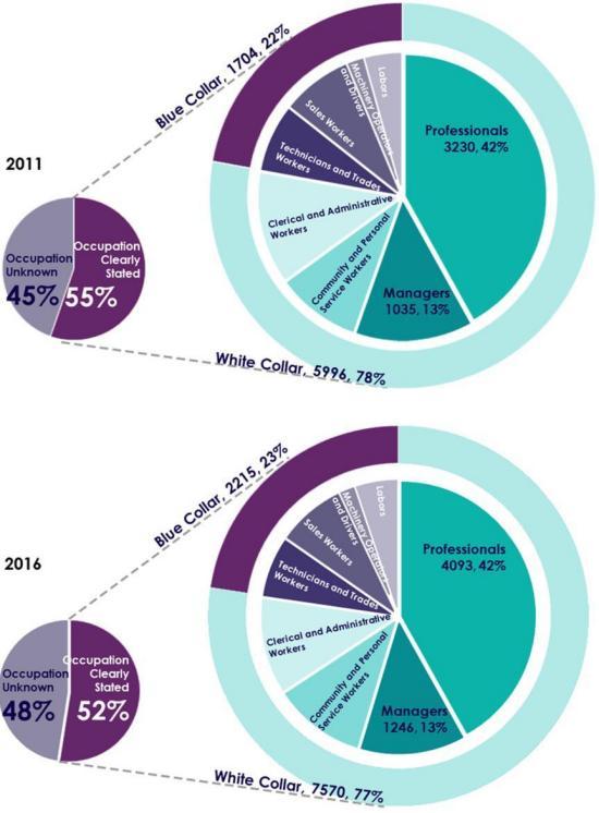
The research utilizes census data from North Melbourne (SA2) in Victoria, located in southeastern Australia. Drawing from previous literature on gentrification, I developed a theoretical framework to analyze statistical data through the lens of gentrification's degree and effects. Existing studies on identifying gentrification highlight several key demographic indicators, including increased population density, a declining average age, rising income levels, a higher proportion of white-collar jobs, greater educational attainment, and escalating rent and mortgage costs (Bousquet, 2017; Atkinson et al., 2011).
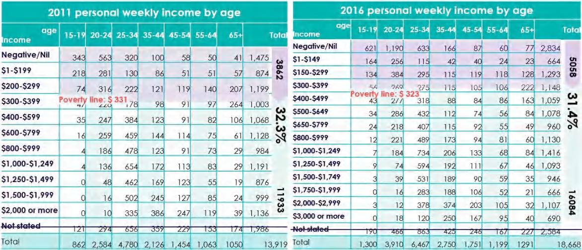
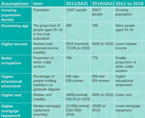

I conducted both temporal and spatial assessments at the SA2 level, evaluating the aforementioned demographic factors. I conducted a census analysis using Excel and PowerPoint, and created infographics with Illustrator.
I found that from 2011 to 2016, the population increased, with more young people, a lower median income, fewer white-collar workers, a higher proportion of highly educated individuals, lower rental costs, and fewer mortgage repayments
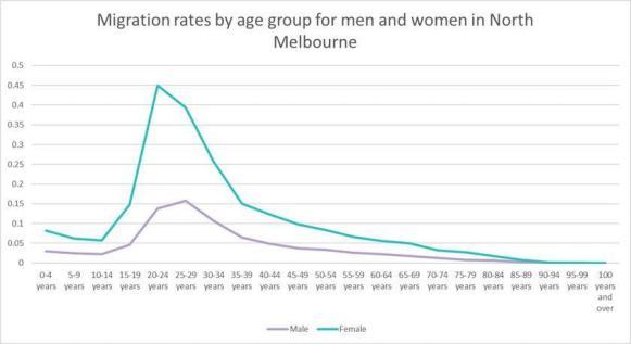
My teammate and I also used Excel to apply a stochastic modeling approach to calculate fertility, mortality, and migration rates to project the population by age and sex.
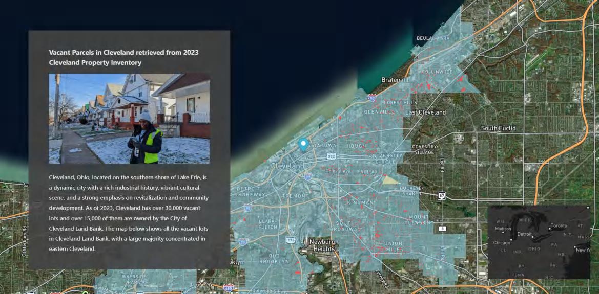
Project: Repurposing Vacant Parcels Using a GIS-based Decision Model in Cleveland, Ohio
Overview: In the summer of 2024, I interned with the Western Reserve Land Conservancy (WRLC) and helped with developing and implementing a GIS-based mapping model with the Cleveland Planning Commission and other community development corporations (CDCs) like Burten, Bell, Carr (BBC).
I authored a 30-page report detailing the methodology and recommendations behind a decision-making model designed to prioritize vacant land use recommendations within three months. This structured approach integrated data-driven mapping, community engagement, and policy alignment to support strategic land use planning. It also incorporates accessibility, walkability, and connectivity considerations when assessing scenarios. The report was submitted to the Cleveland Planning Commission and CDCs for future reference.
Client / Supervisor: Matthew Moss, Manager, City of Cleveland Planning Commission; Samia Azizuddin, Cleveland Foundation Public Service Fellow; Madison Newingham,City Planner, Cleveland Planning Commission; Tim Dehm, Planning and Design Specialist, Western Reserve Land Conservancy
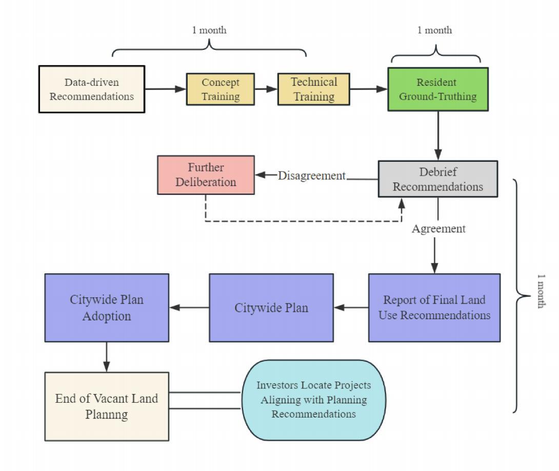
Planning experts generate preliminary land use recommendations using GIS-based analysis, incorporating insights from the City, City Council, internal departments, and Community Development Corporations (CDCs). Residents receive training on planning concepts and learn how to use tools for groundtruthing vacant parcels. Groundtruthing begins, where residents survey vacant parcels in-person to verify whether the data-driven recommendations align with local realities.
Residents assess the data-driven land use recommendations and provide feedback. They either validate the proposed land use or suggest modifications based on firsthand neighborhood knowledge.
Stakeholders and residents review the groundtruthing results to discuss and reconcile discrepancies. Finalized land use recommendations are compiled into a formal City report. The City’s final report provides approved land use recommendations that guide development visions and investment decisions
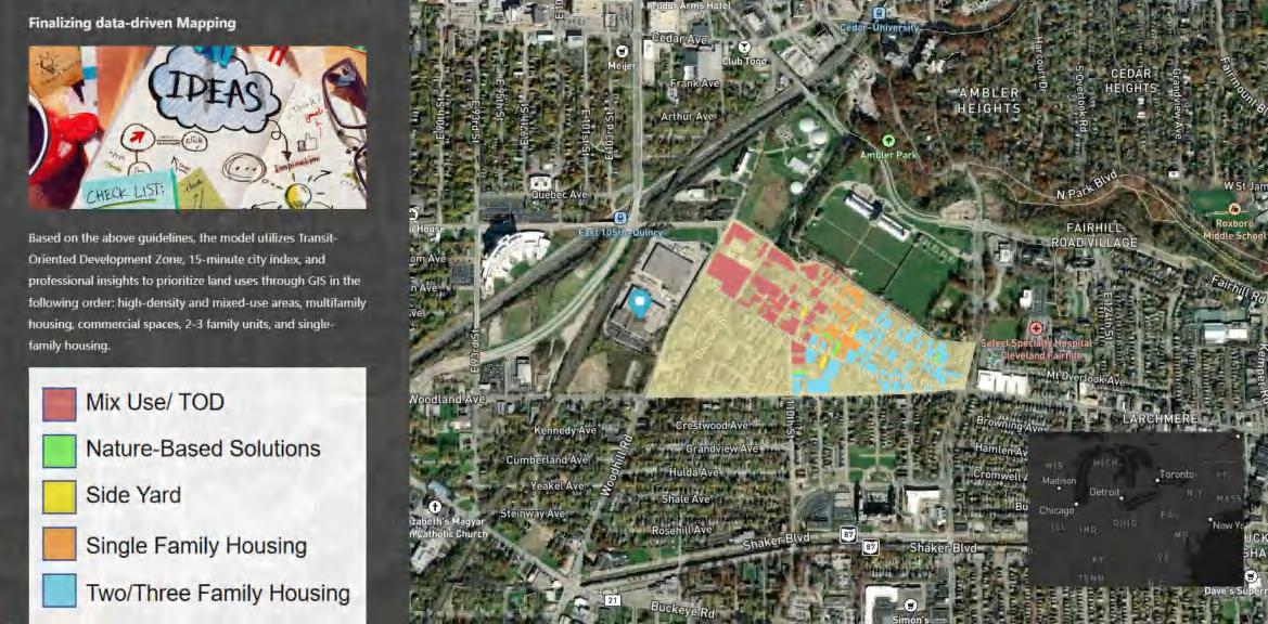
I developed a StoryMap to help non-experts navigate and understand the GIS-based methodology used to prioritize vacant land uses with ground-truthing.
My internship provided firsthand exposure to the complexities of urban revitalization and procedural land-use planning. I observed the delicate balance between policy, community needs, environmental constraints, and economic realities. These experiences underscored both the challenges and opportunities in reshaping Cleveland’s urban landscape.
Building on this experience, I am further exploring this innovative decision-making model in my master’s exit project, examining its innovative rationale, feasibility, stakeholder dynamics, and potential for broader application in urban planning.
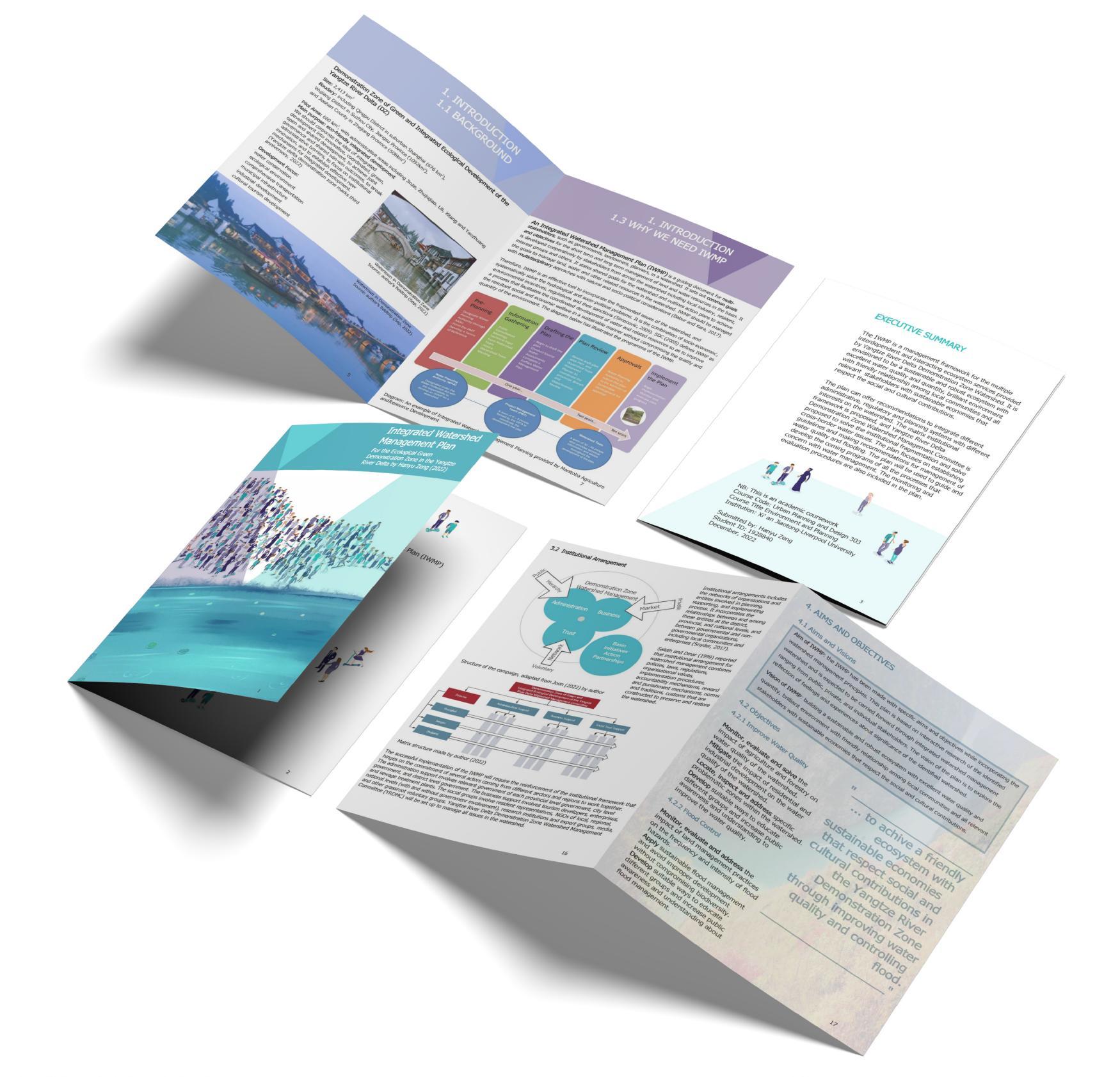
Project: Integrated Watershed Management Plan
Overview: The Integrated Watershed Management Plan provides a management framework for the Yangtze River Delta Demonstration Zone Watershed, ensuring sustainable ecosystem services and a balanced relationship between local communities, stakeholders, and the environment. The plan integrates diverse administrative, regulatory, and planning systems, proposing a matrix institutional framework and a Watershed Management Committee to address institutional fragmentation and cross-border water issues. It analyzes environmental features such as water quality, flooding, land use, stakeholders, and legislation, identifying water quality and flood control as core issues. It also establishes guidelines for water quality and flood management, providing recommendations for future programs. Additionally, it incorporates monitoring and evaluation procedures to ensure effective implementation.
Instructor: Prof. Joon Sik Kim, XJTLU
Individual Work: Hanyu Zeng, B.Eng ‘23
Contribution: I created the report with local governments in the Yangtze River Delta as the target audience, demonstrating my policy development skills. I conducted on-site field assessments, capturing photographic documentation to support my findings and provide visual evidence. For water quality, flooding, land use, and stakeholder dynamics, I incorporated external research, while I conducted legislative analysis, showcasing my strategic planning abilities in situational research, analysis, and policy communication.
The successful implementation of the IWMP requires a strengthened institutional framework that depends on the commitment of various stakeholders across different sectors and regions to collaborate effectively.
Administrative support includes relevant agencies at the provincial, city, and district levels.
Business sector involvement consists of tourism developers, enterprises, and sewage treatment facilities.
Social groups encompass resident representatives, NGOs at local, regional, and national levels (both government-affiliated and independent), research institutions, expert groups, media, and grassroots volunteer organizations.
To ensure effective watershed management, the Yangtze River Delta Demonstration Zone Watershed Management Committee (YRDMC) will be established to oversee and coordinate all related issues.
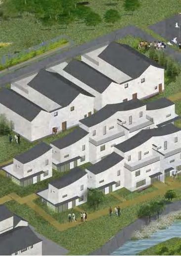
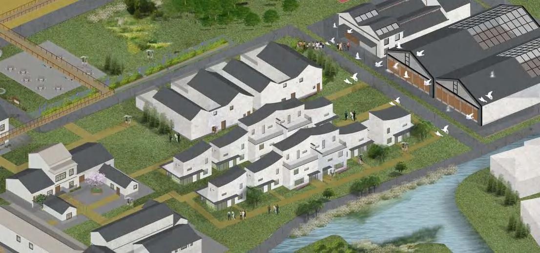
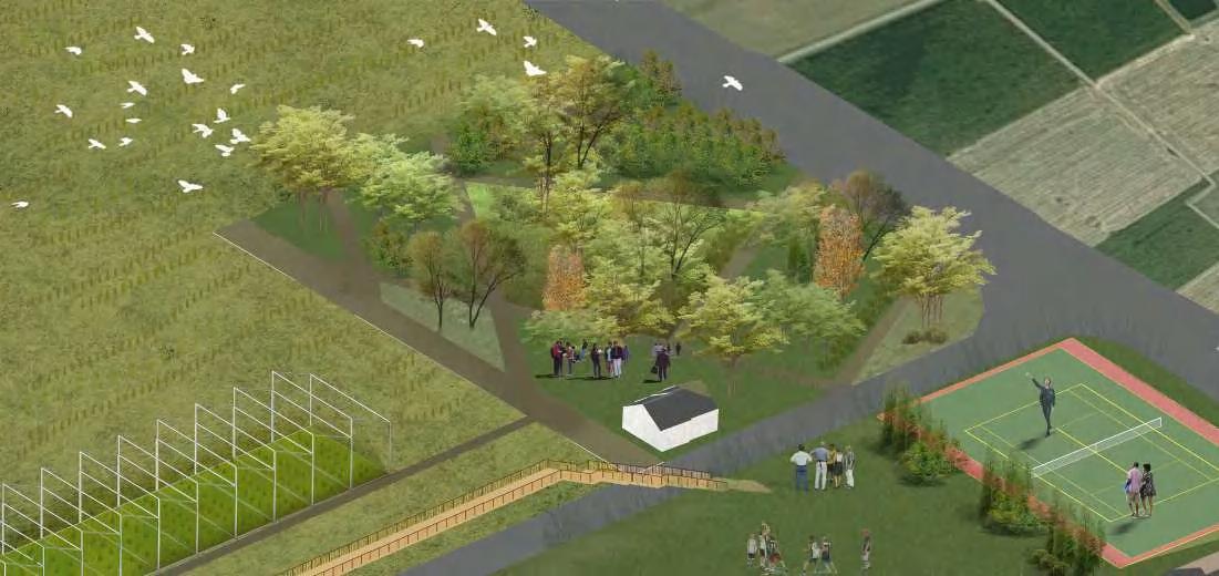
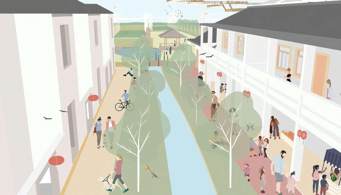
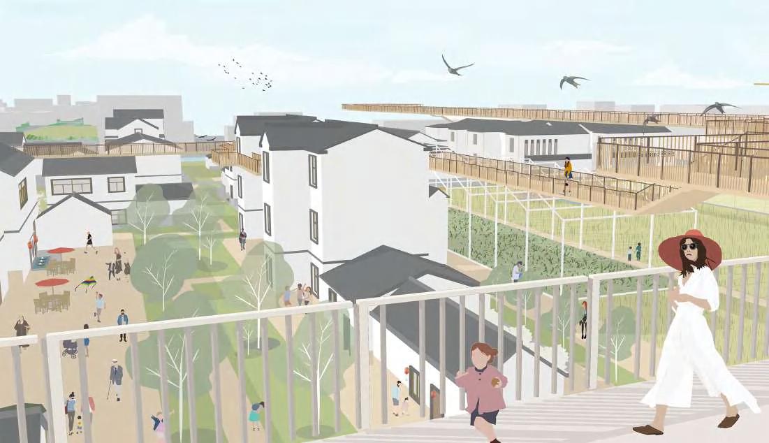
Project: Rural Revitalization Led by Industry Integration
Overview: During my junior year, I worked on a studio project for the Spatial Design and the Built Environment course, which was selected as the best of the year and featured on my department’s website. Rapid urbanization in China has caused an unbalanced transfer of resources from rural to urban areas, leading to rural decline. Addressing this urban-rural divide is key to revitalization. As Winston Churchill said, "We shape our buildings; thereafter, they shape us." Rural design is not just about the built environment but about shaping lifestyles. My project envisions the future of rural living and proposes a series of interventions—not just architectural solutions but also online and offline initiatives, programs, and activities—to facilitate a transition toward this vision. I aim to create a process-oriented rural revitalization strategy rather than a fixed product, ensuring adaptability to evolving lifestyles.
Instructor: Prof. Bing Chen, XJTLU
Individual Work: Hanyu Zeng, B.Eng. ‘23

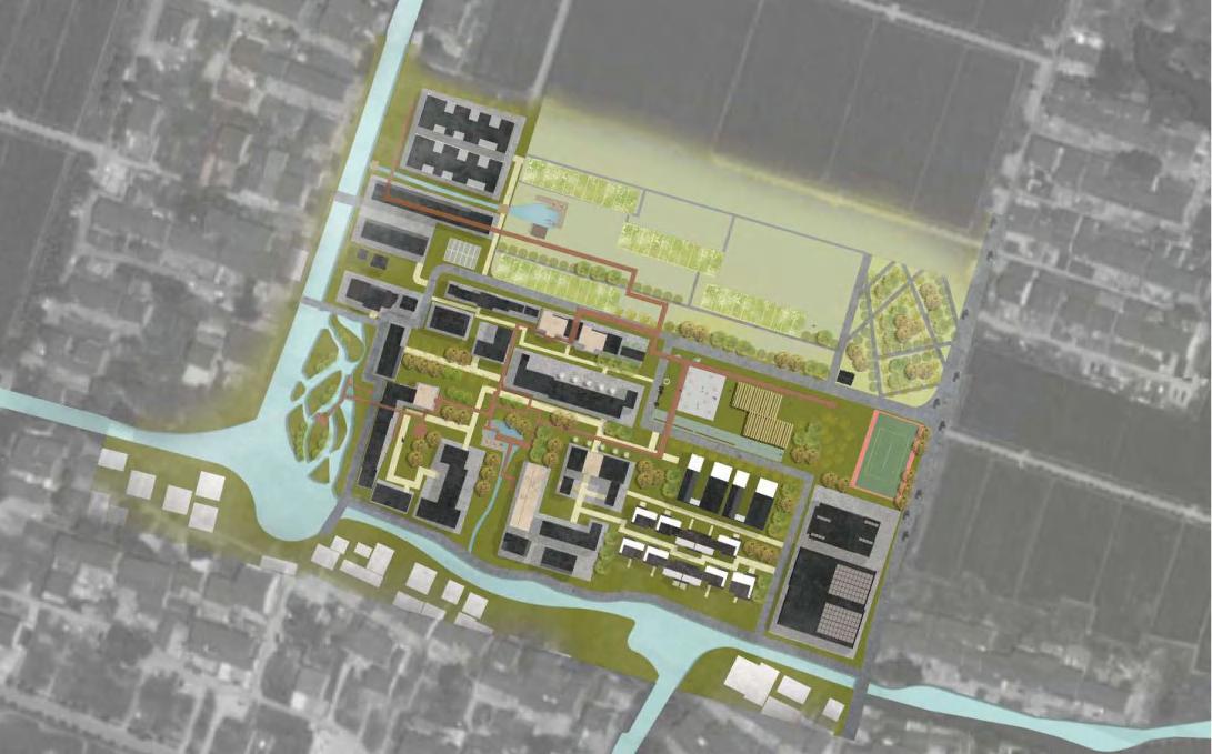
Rural Revitalization Led by Industry Integration in Xushuguan Town, Northwest of Suzhou City
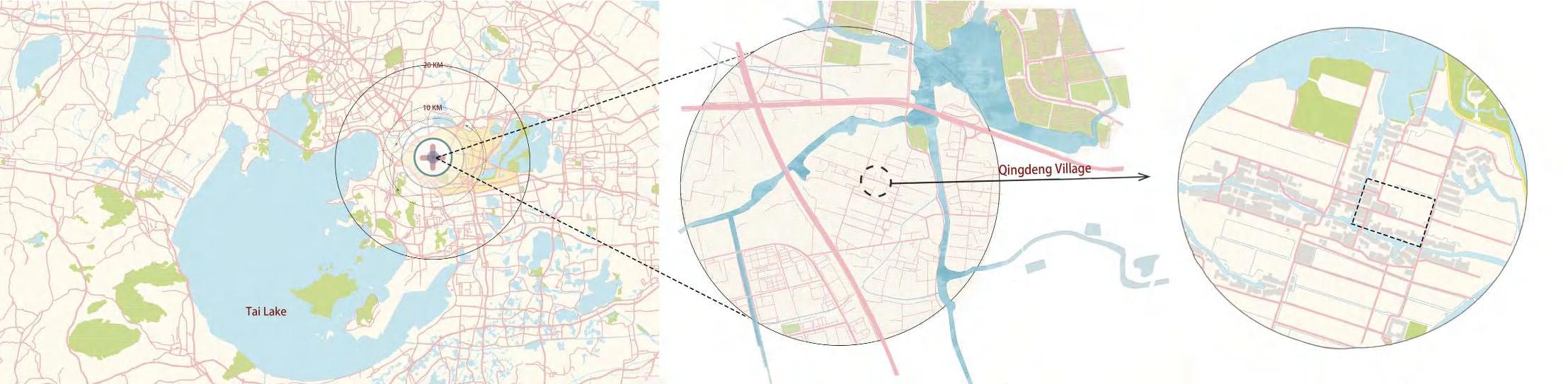
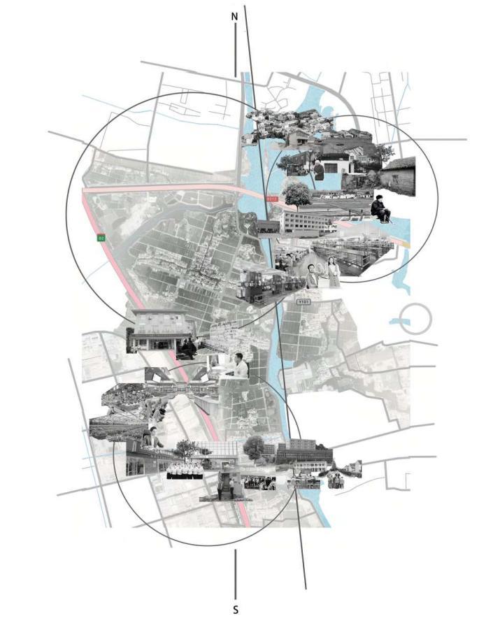
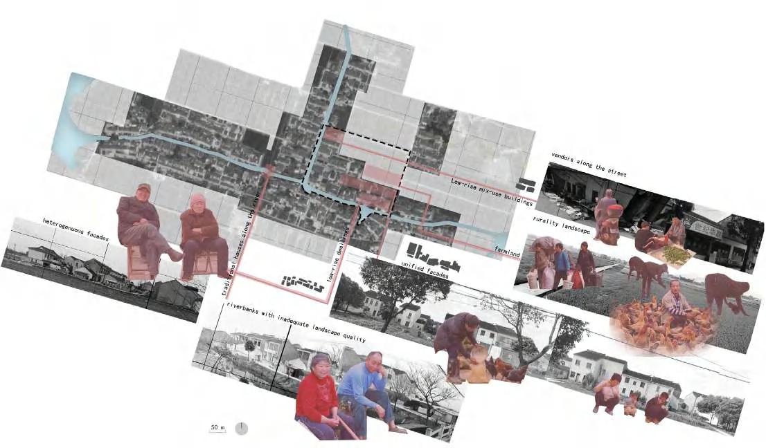
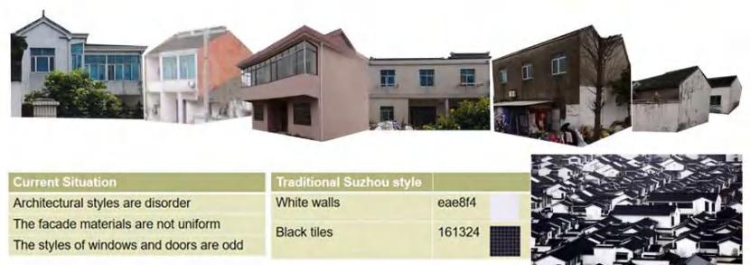
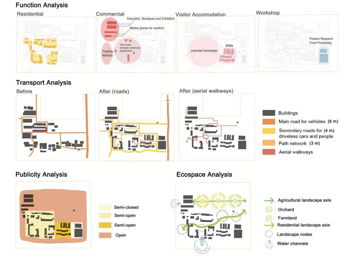
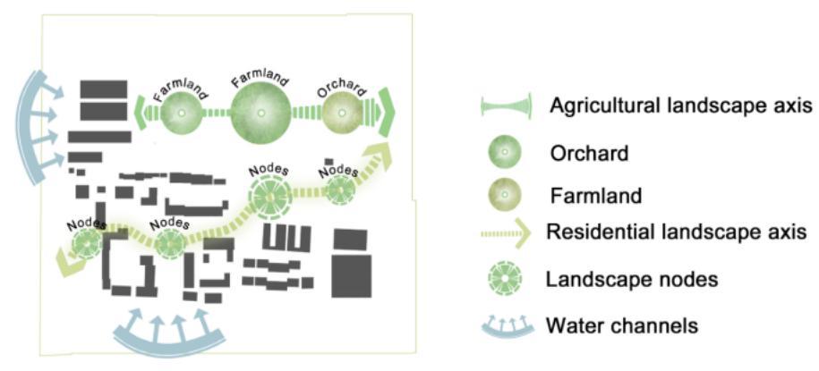
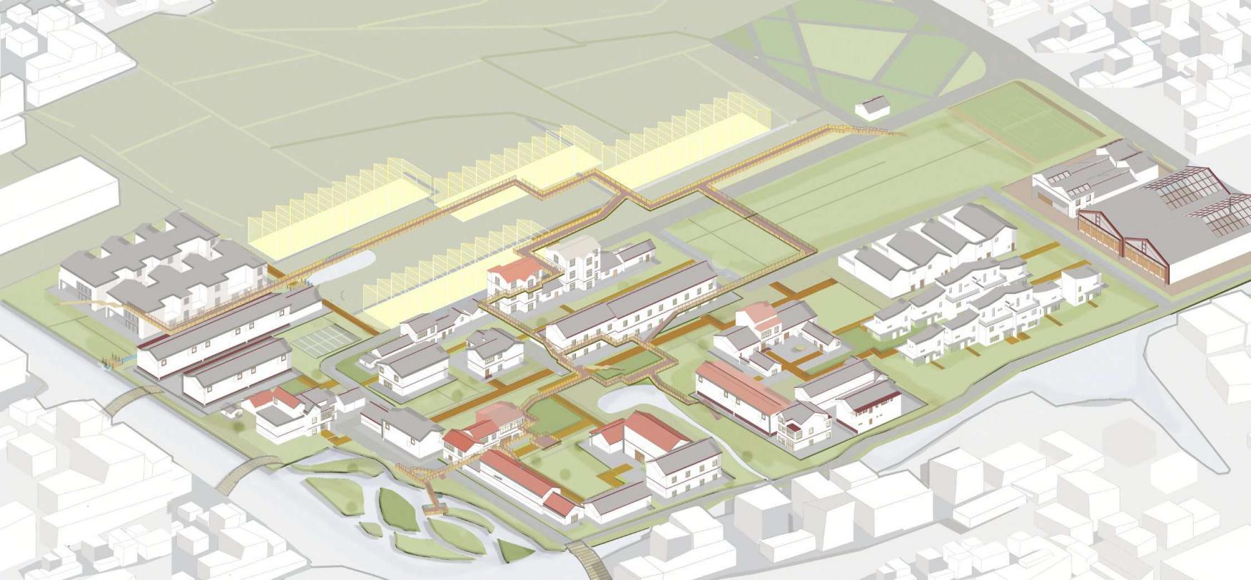
The site features bluegreen infrastructure but faces aging, migrant influx, and weak agriculture. I identified issues in agricultural inefficiency and proposed an integrated strategy to activate the secondary and tertiary sectors, boosting income and rural vitality.

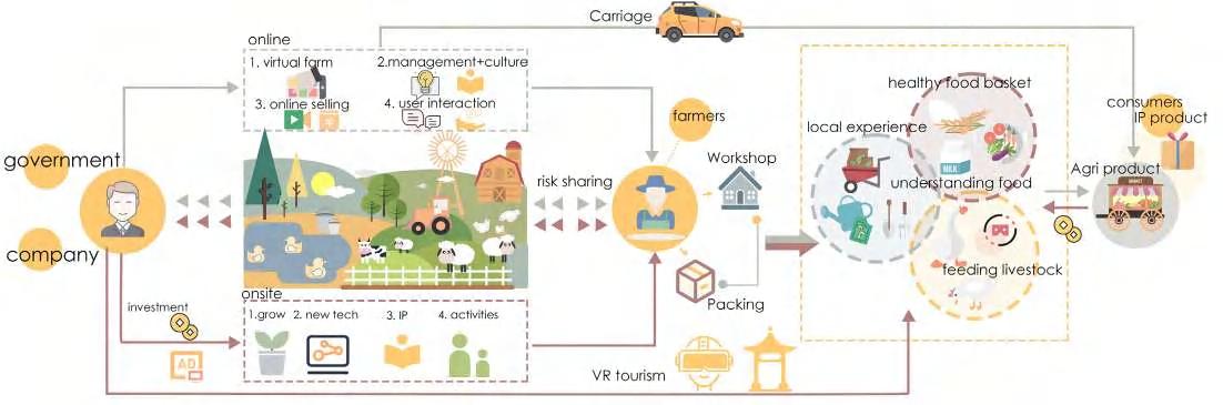
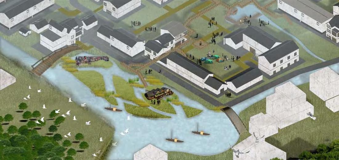
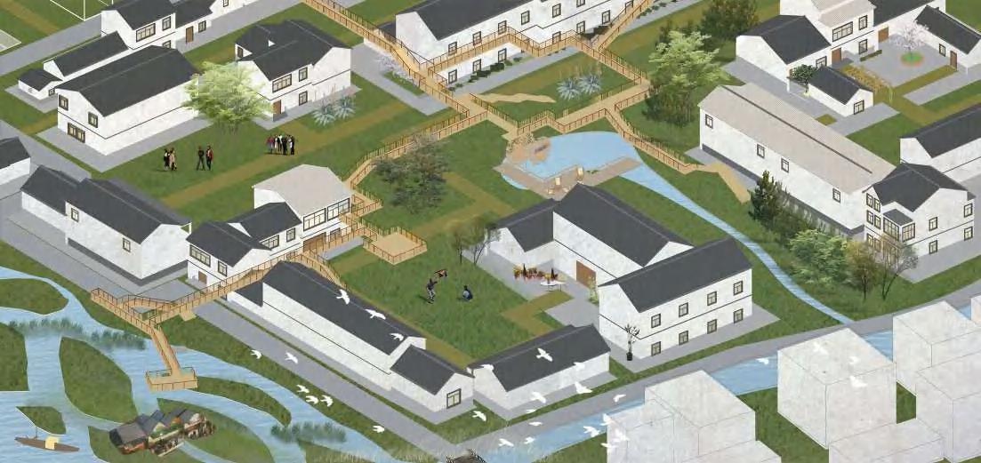
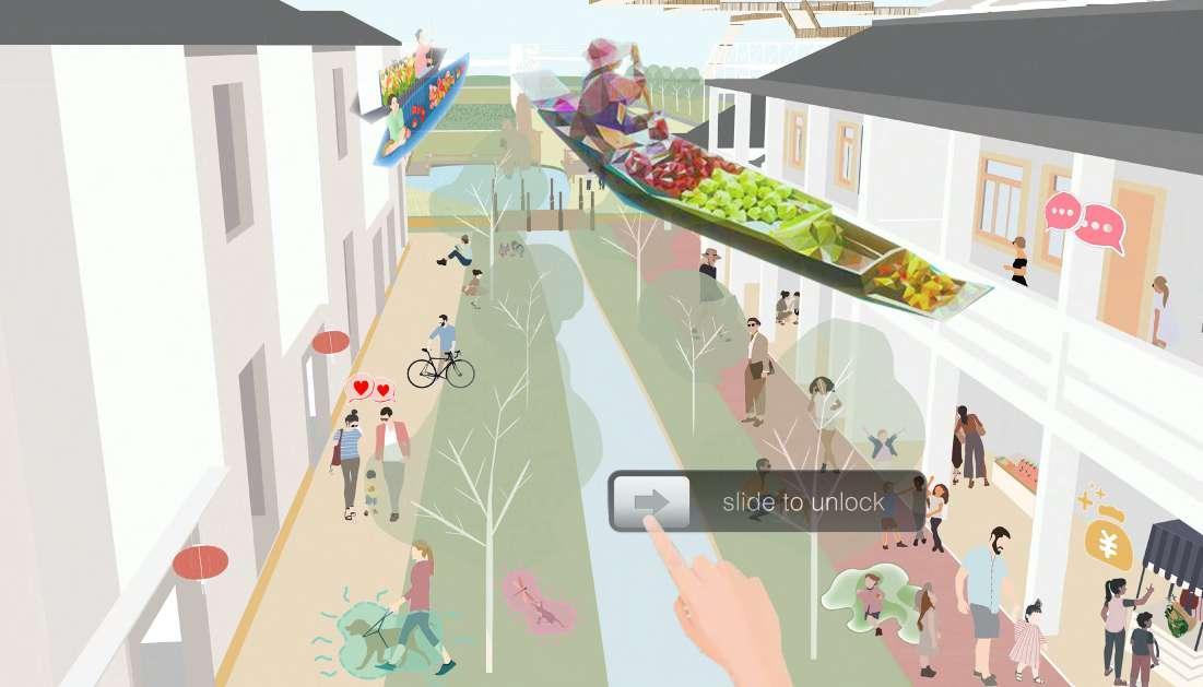
I developed a metaversebased concept integrating virtual and real-world experiences to stimulate rural tourism and local economies. The diagram illustrates a rural development model that integrates online platforms with on-site experiences. The system supports rural identity, boosts local economies, and strengthens urban-rural synergies.
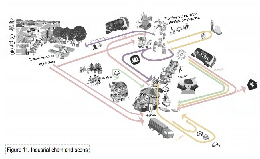
Industrial chain and scenes
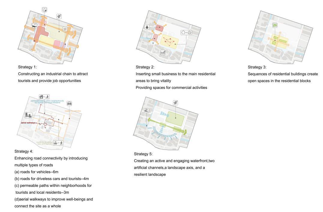
The design strategies follow a people-oriented approach by integrating dynamic industries, promoting mixed land use, fostering open communities, improving roads, and optimizing eco-space.
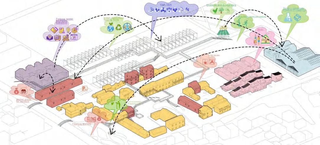
Training Center
Workshop
B&B
Commercial
Residential
Before After


Building typology
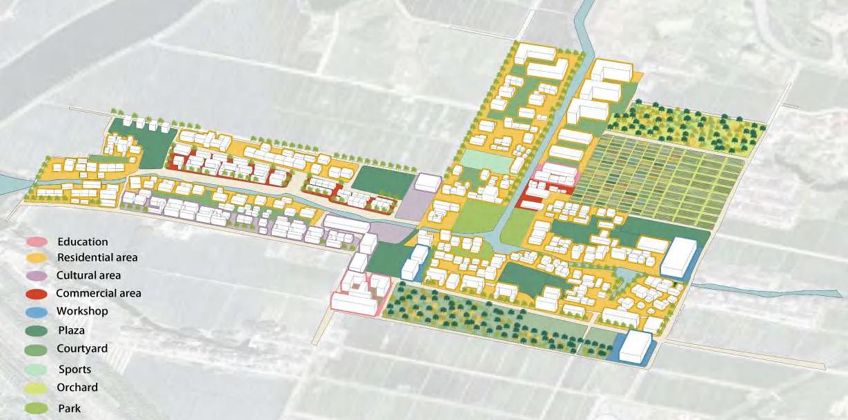
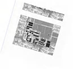
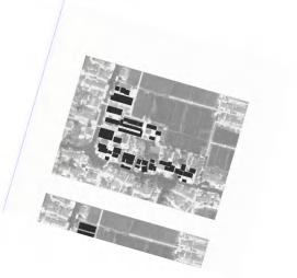
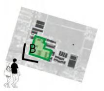
Comparison of master plan and chosen site

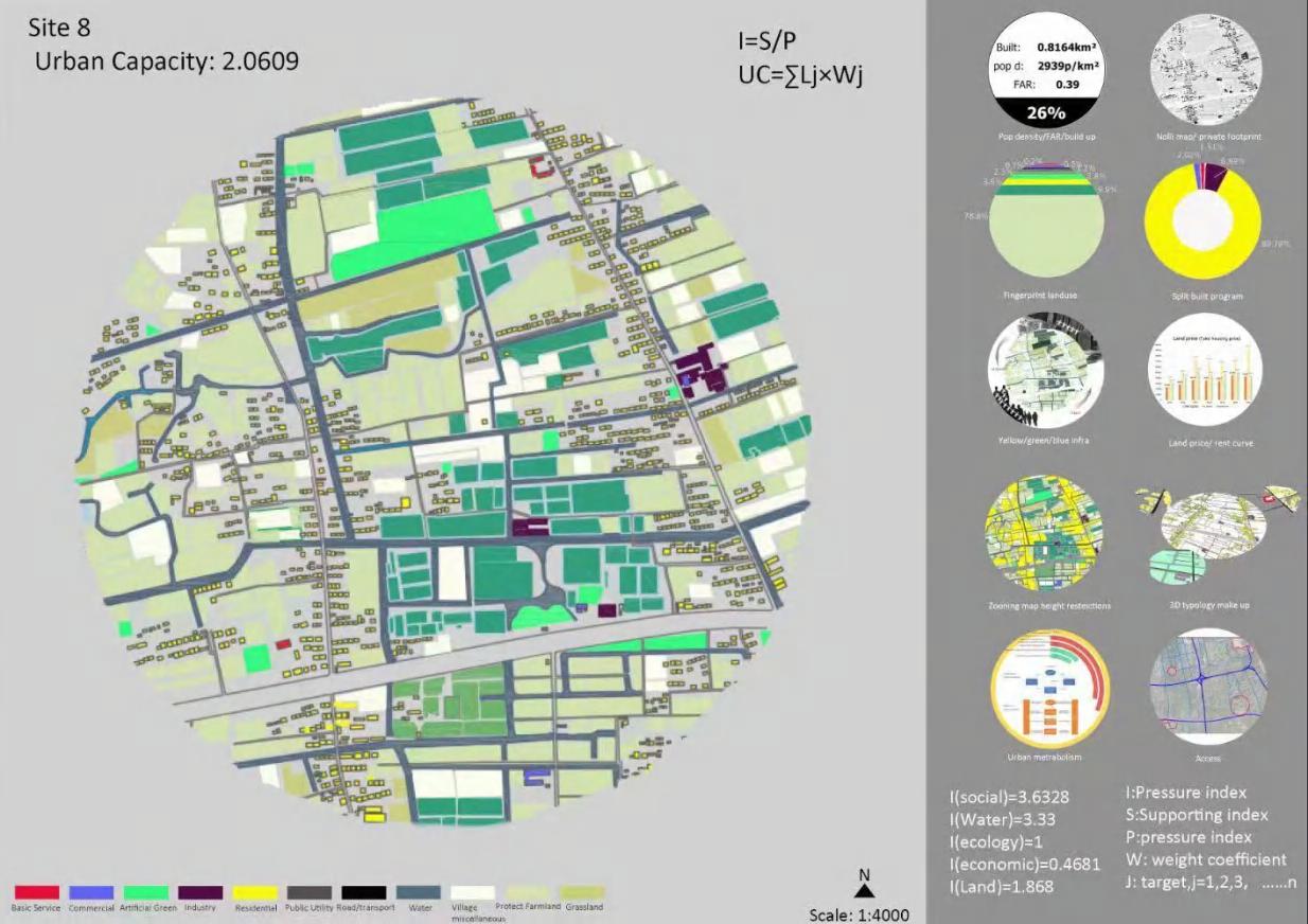
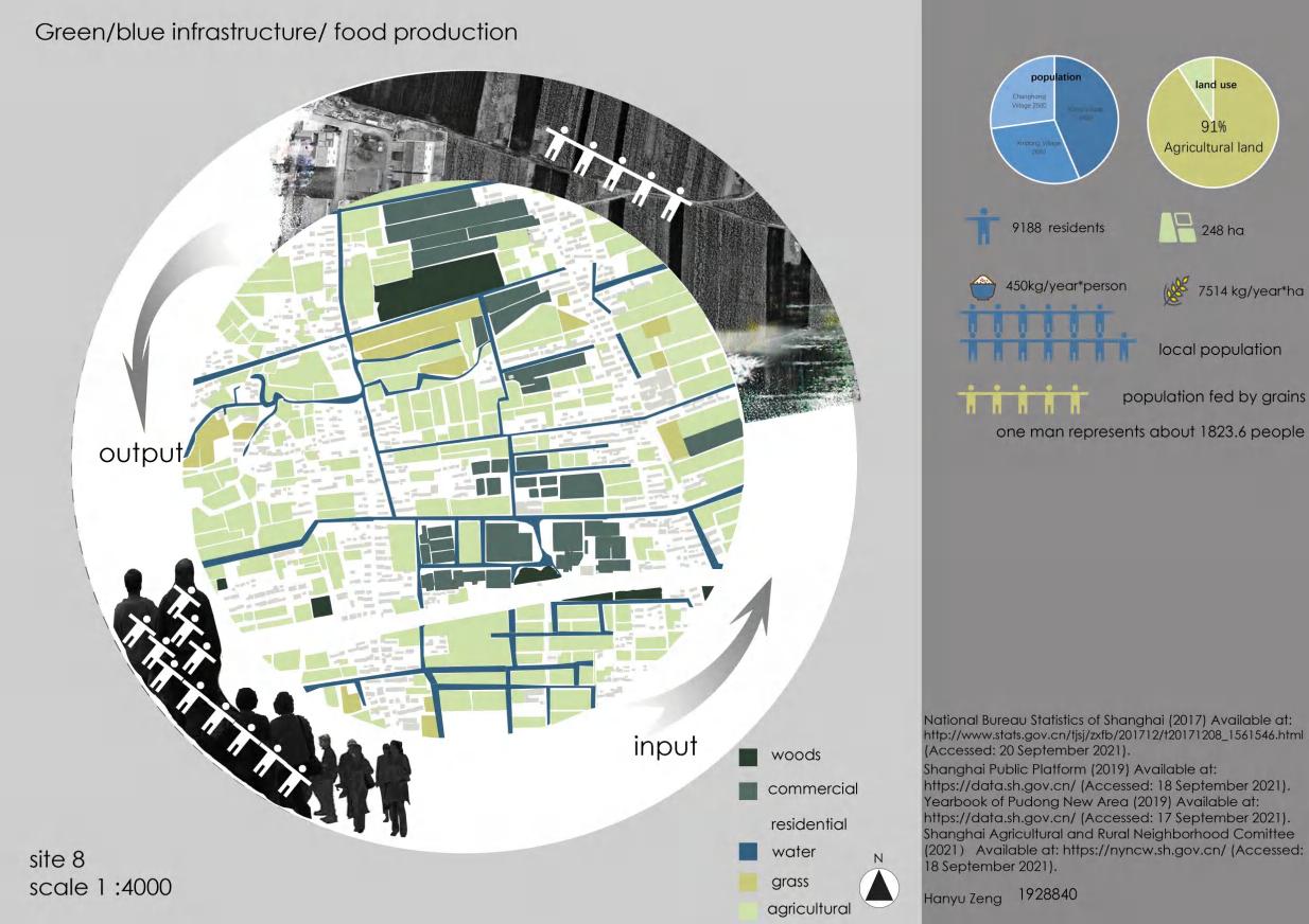
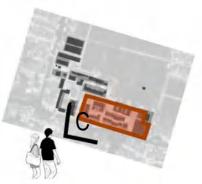
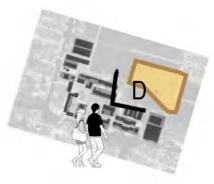
Project: Calculating Urban Capacity
Overview: The project examines the urban carrying capacity of a site in the suburban area of Pudong District in Shanghai. This capacity represents the maximum value that can be sustained in a given environment, considering the pressure factors of the resources and services within the framework of sustainable development.
Instructor: Jing Lu, Lecturer, XJTLU
Team: Hanyu Zeng B.Eng ‘23; Junyan Zhou, B.Eng. ’23; Xiaoning Zhu MUP ‘25
Contribution: I created the CAD base map of the site with my teammates. We collaborated on data collection and urban capacity calculation using the entropy weighting method. I independently researched and analyzed agricultural and water resources in relation to food production and created the accompanying visualizations.