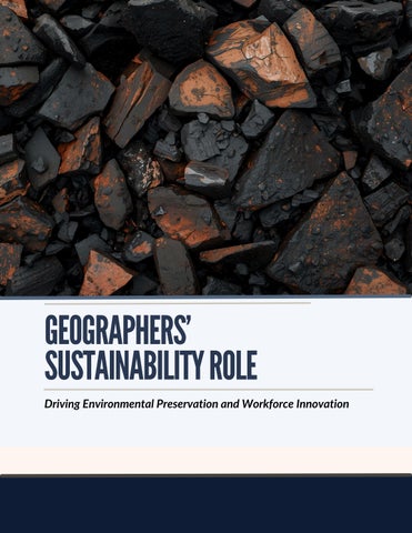
GEOGRAPHERS’ SUSTAINABILITYROLE
GEOGRAPHERS’ SUSTAINABILITYROLE
Introduction:TheStrategicRoleof Geography
The United States faces a defining challenge: balancing the extraction of vital natural resources with the imperative of environmental preservation This balance carries profound implications for economic competitiveness, workforce resilience, and ecological sustainability. Geography offers the methodological and intellectual bridge to meet this challenge By combining soil science, vegetation analysis, mineral research, andenvironmentalpolicy,geographers provide systemic insights that connect the micro-dynamics of ecosystems with the broader economic and securityneedsofthenation
Workforce data underscores the nationalimportanceoftheseroles.The Bureau of Labor Statistics (2025) projects employment for environmental scientists and specialiststogrowby4%by2034,with geoscientists and conservation scientistseachincreasingby3% While modest at face value, these percentages translate into tens of thousands of openings annually when retirements and occupational mobility are included The steady demand signals the strategic value of geography-trained professionals in land reclamation, mineral security, and climateadaptation.
Geographyhasshifted fromanacademicfield intoastrategicscience underpinningnational competitiveness.

Damaris Gomes Rocha Vieira
Driving Environmental Preservation and Workforce Innovation

Critical Minerals and Workforce Innovation
Geography is equally central to resource security. The Energy Act of 2020 codified critical minerals as those essential to economic and national security, vulnerable to supply disruptions, and indispensable to advanced manufacturing. USGS maintains assessments that guide exploration and recovery strategies for minerals essential to clean energy technologies, defense systems, and electronics Professionals trained in reclamation science, soil rehabilitation, and vegetation monitoring ensure that extraction is balanced with ecological restoration. Their dual capacity identifying resource potential while designing post-extraction recovery makes them indispensable to U.S. competitiveness.
MARKETTRENDS& INDUSTRYANALYSIS
EnvironmentalPreservationNeeds
The United States requires experts capable of mitigating land degradation, protecting biodiversity, and preparing communities for climate-driven disruptions Erosion, deforestation, and declining ecosystem services imperil food systems, water security, and infrastructure Geographers and environmental scientists contribute essential expertise in soil classification, vegetation monitoring, and conservation planning skills directly tied to national resilience.
Federal agencies provide the technical foundation for these efforts. Remote sensing, as defined by the U.S. Geological Survey (USGS), enables monitoring of deforestation, postmining recovery, and urban expansion. Geographic Information Systems (GIS) support land managers and policymakers by integrating ecological and regulatory data into actionable strategies The Natural Resources Conservation Service (NRCS) maintains Soil Taxonomy, ensuring uniformity in land-use assessments nationwide. These standards transform geography from an academic discipline into an operational tool for governance and environmental management.
LABORMARKETDYNAMICS
BLS projections illustrate the scale of workforce demand: environmental scientists and specialists (+4%), geoscientists (+3%), and conservation scientists (+3%) from 2024 to 2034 Replacement needs add thousands of annual openings. The National Science Board (NSB) reports that STEM employment encompassed 36 8 million workers, or 24% of the U S workforce, in 2021 Geographybased competencies spatial analysis, soil classification, environmental monitoring are embedded across this talent base, often categorized under adjacent occupational titles in engineering, planning, and environmental science.
POLICYCHANGES&WORKFORCE IMPLICATIONS
NEPA, enacted in 1969, remains the foundation of environmental review, requiring expertise in soil science, land-use mapping, and geospatial modeling SMCRA (1977) formalized reclamation responsibilities for active and abandoned mines, generating demand for skills in soil stabilization, revegetation, hydrology, and habitat restoration
The Energy Act of 2020 elevated critical minerals to national priority, charging USGS with maintaining updated lists vital to U S energy and defense competitiveness
Together, these frameworks institutionalize geography’s role in advancing climate resilience, infrastructure delivery, and industrial strategy They also guarantee durable demand for professionals capable of turning spatial and ecological evidence into lawful, practicable action
DAMARISGOMES ROCHAVIEIRA
In Brazil’s mineral sector, Damaris Gomes Rocha Vieira demonstrated how geography reconciles industrial development with environmental stewardship Her work centered on soil, vegetation, and mineral analysis, ensuringcompliancewithenvironmental standards while supporting ecological resilience. Through rigorous field monitoring, she showed that extraction could proceed without irreversibly damagingsurroundingecosystems
Her contributions extended beyond technical science to biodiversity preservation initiatives in forestry reserves, as well as workforce education programs that embedded sustainability into organizational culture By linking environmental monitoring with professional training, Rocha illustrated geography’s dual identity as both a technicalandsocialdiscipline.
Her expertise directly parallels US needs in reclamation science, soil management, and vegetation monitoring. Federal initiatives under NEPA, SMCRA, and the Energy Act of 2020 all require professionals with Rocha’scapacitytoalignextractionwith restoration Furthermore, her commitment to workforce education reflects U.S. priorities in scaling the STEM labor force, which encompassed 36.8millionworkersin2021,accordingto NSB Her career exemplifies how geography-trainedexpertscontributeto both ecological integrity and national competitiveness

Q&A DAMARIS GOMES ROCHA VIEIRA Expert
02 03 04 01 05
Howisgeography evolvinginthe sustainabilityera?
Geography has shifted from an academic field into a strategic science underpinningnational competitiveness By integrating soil science, vegetation monitoring, and geospatial technology, the discipline now informs real-time decision-making for governments and industries USGS increasingly relies on geospatial analysis to prioritize mine-land restoration, while NRCS standards in soil classification guide conservation practices nationwide BLS data confirm the importance of these roles, projecting steady occupational growth and thousands of openingsannually
Whatstrategieshelp balanceresource extractionand environmental preservation?
The United States faces a dual imperative: secure resources while safeguarding ecosystems Rocha emphasizes the integration of conservation planning, GIS-based monitoring, and workforce education. Federal models, such as NRCS’s nine-step conservation planning framework and OSMRE’s administration of SMCRA, institutionalize practices that align production with ecological resilience Embedding environmental literacy into the workforce ensures monitoring tools translate into transparent, accountable operations.
Howdogovernment policiesshape opportunitiesfor environmental scientists?
US environmental statutes sustain consistent demand for geographytrained professionals NEPA requires expertise in spatial andecologicalreview, SMCRA institutionalizes reclamation science, andtheEnergyActof 2020 anchors critical mineralmanagement Together, these frameworks guarantee labor demand across environmental science and geoscience occupations BLS estimates nearly 20,000 annual openings across these roles, reflecting the structural role of policy in defining labormarketneeds
Whatroledoes technologyplay?
Technology has transformed geography into a precision tool for policy and industry USGS defines remote sensing as the detection of earth-surface changes from satellites or aircraft, essential for tracking vegetation recovery and land degradation GIS integrates ecological and regulatory data into decisionmaking, while ecological monitoring systems establish baselines forclimateresilience. In 2024, USGS launched applications providing measurable recovery targets nationwide, underscoring geography’s central role as both a science and a policy instrument
Whatworkforce strategiesshouldthe U.S.adoptforthenext decade?
Geography must be treated as a pillar of the STEM workforce Priorities include aligning curricula with NEPA, SMCRA, and EnergyActmandates; embedding geographers in crosssector teams spanningengineering, planning, and policy; and expanding public-private partnerships for training in reclamation, biodiversity monitoring, and climate adaptation. With 368 million US workers already in STEM, these strategies would rapidly scale environmental expertise into areas vital to national resilience and security
RECOMMENDATIONSFOR U.S.LEADERSHIP
TheUnitedStatescansustaingloballeadershipinsustainabilityandresourcemanagement byadvancingthreepriorities First,expandtrainingpipelinesingeography,geoscience,and reclamationscienceatundergraduateandgraduatelevels,coupledwithappliedlearning throughacademic-industrypartnerships Second,incentivizepublic-privatepartnershipsfor explorationandreclamationthattiesupplychainresiliencetoconservationoutcomes.Third, embedgeographyinclimateadaptationstrategies,ensuringthatgeospatialanalysis,remote sensing,andsoil-vegetationmonitoringinformland-useplanningandinfrastructure investmentacrossagencies.Byinvestinginhumancapitalandinstitutionalizinggeography’s roleingovernance,theU.S.positionsitselfasaglobalmodelforbalancingeconomicgrowth withenvironmentalstewardship.
CONCLUSION
Geography provides the connective tissue between environmental obligations and economic imperatives. Statutes such as NEPA and SMCRA, combined with USGS and NRCS technical standards, sustain durable demand for professionals who can transform spatial evidence into actionable strategies. Labor projections and STEM workforce data confirm a steady pipeline of opportunities. Professionals like Damaris Gomes Rocha Vieira exemplify how geographic expertise advances U.S. national interests by safeguarding ecosystems, strengthening supply chains, and preparing a workforce capable of addressing the sustainability challenges of the coming decade.
References
BureauofLaborStatistics (2025) Environmentalengineers:Occupationaloutlookhandbook
https://wwwblsgov/ooh/architecture-and-engineering/environmental-engineershtm
BureauofLaborStatistics (2025) Environmentalscienceandprotectiontechnicians:Occupationaloutlook handbook https://wwwblsgov/ooh/life-physical-and-social-science/environmental-science-andprotection-technicianshtm
BureauofLaborStatistics (2025) Environmentalscientistsandspecialists:Occupationaloutlook handbook https://wwwblsgov/ooh/life-physical-and-social-science/environmental-scientists-andspecialistshtm
BureauofLaborStatistics (2025) Geoscientists:Occupationaloutlookhandbook
https://www.bls.gov/ooh/life-physical-and-social-science/geoscientists.htm
CouncilonEnvironmentalQuality.(n.d.).Lawsandregulations.https://ceq.doe.gov/laws-regulations/ NationalScienceBoard.(2024).TheSTEMlaborforce:Scientists,engineers,andskilledtechnicalworkers (NSB-2024-5).NationalScienceFoundation.https://ncses.nsf.gov/pubs/nsb20245/ NaturalResourcesConservationService.(1999).Soiltaxonomy:Abasicsystemofsoilclassificationfor makingandinterpretingsoilsurveys(2nded.;USDAHandbook436).U.S.DepartmentofAgriculture. https://www.nrcs.usda.gov/resources/guides-and-instructions/soil-taxonomy
NaturalResourcesConservationService (2024) Nationalplanningprocedureshandbook(currented) US DepartmentofAgriculture https://directivesnrcsusdagov/
NaturalResourcesConservationService (2024) Conservationplanning Nine-stepprocess US DepartmentofAgriculture https://wwwnrcsusdagov/getting-assistance/conservation-technicalassistance/conservation-planning
OfficeofSurfaceMiningReclamationandEnforcement (nd) ProgramsandinitiativesunderSMCRA US DepartmentoftheInterior https://wwwosmregov/programs
US GeologicalSurvey (2024) Remotesensingformonitoringminelandsandrecoveryefforts(Circular 1525) https://pubsusgsgov/circ/1525/cir1525pdf
US GeologicalSurvey (nd) Whatisremotesensing?https://wwwusgsgov/faqs/what-remote-sensingand-what-it-used
US GeologicalSurvey (nd) Whatisageographicinformationsystem(GIS)? https://wwwusgsgov/faqs/what-a-geographic-information-system-gis
US GeologicalSurvey (nd) Whatisacriticalmineral?https://wwwusgsgov/faqs/what-a-critical-mineral US GeologicalSurvey (2025) DepartmentoftheInteriorreleasesdraft2025listofcriticalminerals[News release].https://www.usgs.gov/news/science-snippet/department-interior-releases-draft-2025-listcritical-minerals