Francois Valentijn His massive, encyclopaedic study of the East and West Indies, including important early accounts of western Australia 1724-1726
Black swans and Tasman: the Dutch in Australia and the Indies VALENTIJN, Francois. Oud en Nieuw Oost-Indiën, vervattende een Naaukeurige en Uitvoerige Verhandelinge van Nederlands Mogentheyd… Hordern House Occasional Papers
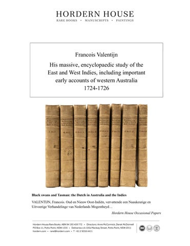
Five volumes in eight, folio, with an engraved allegorical frontispiece, engraved vignette on general title, engraved dedication leaf, folding engraved portrait of the author, and a magnificent series of some 367 various other images (comprising 24 engraved maps, most of them folding, 265 engraved plans, views, portraits and plates of plants, animals, costumes, etc., of which many are double-page and/or folding and 78 engravings in the text), eight folding printed tables; an excellent copy in contemporary Dutch vellum, blind-
stamped medallions to sides, spines with contemporary manuscript titling in ink. Dordrecht and Amsterdam, Joannes van Braam and Gerard Onder de Linden, 1724-1726. Published in 1726, François Valentijn’s five-part, 3,500-page Oud en Nieuw Oost-Indiën was the most ambitious account of the Dutch East India Company’s eastern world ever to appear in print. Drawing upon exceptional access to official VOC archives, it preserved an extraordinary body of geographical, cartographic, and visual material that transformed European understanding of Australia, New Zealand, and the wider Pacific. In quietly breaching the Company’s long-standing culture of secrecy, it replaced speculation surrounding the Terra Australis Incognita with an unprecedented documentary record more than seventy years before the voyages of James Cook. It stands as one of the great monuments of global exploration literature and the foundation of Australasian visual history.
Its greatest significance lies in preserving the history of the Dutch discovery of Australia and New Zealand. Central to this achievement is its publication of Willem de Vlamingh’s expedition of 1696–1697. A magnificent three-panel copperplate engraving records the voyage from the sub-antarctic staging points of Amsterdam and Saint Paul Islands to the Swartte Swaane Drift at Rottnest Island and the Swan River. While the upper panels chart
the expedition’s remote navigational waypoints, the expansive lower panel presents the earliest printed view of inland Australia and the first European depiction of the remarkable black swan. Executed from the watercolour sketches of expedition artist Victor Victorszoon under the scientific direction of Amsterdam burgomaster Nicolaes Witsen, the engraving transformed an observation made on a distant shore into one of the defining scientific images of the age. To European audiences, long accustomed to the classical belief that all swans were white, the image became at once a geographical revelation and a challenge to accepted natural philosophy. The work further preserves the expedition’s natural history by recording the rare shells collected along the Southland coast for the celebrated cabinet of curiosities assembled by Simon Schynvoet.
The work is equally fundamental to the history of the South Pacific. It published the second comprehensive public account of Abel Tasman’s voyages of 1642–1644, intertwining the early histories of Australia and New Zealand through the celebrated Kaart der Reyse van
Abel Tasman and the first detailed coastal charts adapted from Tasman’s manuscript journals. Together these maps demonstrated the navigator’s route along the western and northern coasts of Australia, the southern coast of Tasmania, and the western shores of New Zealand. Among the accompanying engravings appears the remarkable Staeten Landt bezylt en ontdekt met de Schepen Heemskerck en Zeehaen, marking the beginning of New Zealand’s visual history in European print. It simultaneously introduced European readers to the coastal profiles of Tasmania, the earliest published ethnographic representation of Māori, and the fatal encounter at Moordenaars Bay. By bringing these closely guarded VOC records into print, the work demonstrated that the lands encountered by Tasman were distinct and navigable territories rather than the uncertain margins of a vast southern continent. The volume also preserves some of the defining episodes of Australia’s earliest recorded history. Drawing upon the journals of Commander Francisco Pelsaert, it recounts the wreck of the Batavia on the Houtman Abrolhos in 1629 and the notorious mutiny led by Jeronimus Cornelisz. It likewise records Willem Janszoon’s voyage of the Duyfken to Cape York in 1606, preserving the earliest documented European encounter with the Australian mainland and establishing Cape Keerweer as the starting point of Australian coastal cartography. Yet Oud en Nieuw Oost-Indiën extends far beyond Australasia. Encompassing Java, China, Japan, Ceylon, South Africa, and the wider Dutch East Indies, it became the great encyclopaedia of the VOC world, bringing together geography, commerce, natural history, ethnography, and colonial administration on an unprecedented scale. Its historical importance has only increased with time. Much of the VOC archive once preserved at Batavia was destroyed during the Second World War, leaving many of its transcriptions, maps—including the celebrated Java chart—and documentary extracts as the sole surviving witnesses to lost originals. Its incorporation of Georg Eberhard Rumphius’s unpublished Amboinsch Dierboek likewise preserved zoological observations from a manuscript that has since disappeared. Illustrated by leading Dutch engravers including Ottens, Philips, and Goeree, Oud en Nieuw Oost-Indiën remains one of the greatest documentary monuments of the Dutch Golden Age: an enduring record of early modern Asia and an indispensable source for the history of exploration, science, and empire.
The Cradle of Australasian Discovery: The Historical Significance of Valentijn’s Oud en Nieuw Oost-Indiën
François Valentijn’s monumental 1726 work, Oud en Nieuw Oost-Indiën, stands as one of the most critical and comprehensive foundational texts in the history of global maritime exploration. Often described as the “encyclopaedia of the Dutch East Indies” and widely regarded as the most comprehensive work on Asia published in Europe during the early colonial period, this massive publication represents both an extensive historical survey of the regions where the Dutch East India Company (VOC) established dominion and an extraordinary visual record of trade, natural history, and empire. Most famously, Valentijn’s work single-handedly transformed Europe’s vague, mythical understanding of the Terra Australis Incognita into a documented, geographically charted reality more than seventy years before the voyages of Captain James Cook. Reflecting the intense European interest in the “Southland” during the early eighteenth century, these compiled records breached the VOC’s strict policy of commercial secrecy, bringing classified logs, maps, and illustrations to the public to create some of the very few surviving records of Australia and the Pacific before British settlement.
Part I: The History of Australian and New Zealand Discovery The publication is perhaps most celebrated for containing the landmark three-panel copperplate engraving documenting Willem de Vlamingh’s 1696–1697 expedition, which serves as the genesis of Western Australia’s visual history. While the top two panels map critical Indian Ocean navigational waypoints at Amsterdam and Saint Paul Islands, the crowning bottom panel features the iconic Swartte Swaane Drift at Rottnest Island and the Swan River. This specific illustration holds great significance as the earliest printed view of inland Australia and the first European depiction of the black swan, a depiction of Australian fauna preceded only by Dampier’s. Promoted heavily by Nicolaes Witsen, Burgomaster of Amsterdam and a VOC director whose objectives combined scientific curiosity with commercial interests, the expedition was ordered to have an artist accompany the fleet to record the natural and ethnographic curiosities encountered. The resulting visual record consists largely of watercolour sketches of the Western Australian coast by Victor Victorszoon, which were translated into print for Valentijn’s book. While the physical collections returned to Holland included plants, timber, fruits, and unique shells, no live land-animal specimens survived the gruelling voyage; several captured black swans tragically died before reaching Europe. Nevertheless, by accurately illustrating the birds that gave the Swan River its name, the print shattered the long-held European philosophical paradigm that all swans were white, forever linking the region’s unique ecosystem to global scientific curiosity. Valentijn also recorded the aesthetic impact of this voyage, remarking on the “rare and beautiful shells” gathered from the beaches of
the Southland that ultimately found their way into the celebrated Amsterdam curiosity cabinets of Simon Schynvoet.
Beyond its Western Australian visual triumphs, Valentijn’s work serves as a monumental milestone in broader regional cartographic history by publishing a comprehensive, publicly accessible account of Abel Tasman’s historic 1642–1644 voyages—intertwining the earliest foundational histories of Australia and New Zealand in a single breath. Bound directly into the text is a series of charts adapted directly from the navigator’s journals, spearheaded by the famous general map Kaart der Reyse van Abel Tasman. This map laid bare the discoveries of Australia’s southern maritime boundaries alongside New Zealand’s western coastline, known initially as Staeten Landt. This chapter functions as the genesis of New Zealand’s visual and cartographic history, publishing the country’s first detailed charts and the iconic engraving Staeten Landt bezylt en ontdekt met de Schepen Heemskerck en Zeehaen. This landmark image simultaneously introduced Europeans to the earliest coastal profiles of Tasmania (Van Diemen’s Land), the first Western ethnographic depiction of the indigenous Māori people, and a visual record of the tragic, violent cultural misunderstanding at Moordenaars Bay (Murderers Bay / Golden Bay). By synthesizing Tasman’s highly guarded navigation charts and journal entries into a single, cohesive narrative, Valentijn proved to the Western world that these vast South Pacific territories were independent, navigable landmasses rather than an endless polar continent. Complementing these narratives of triumphant exploration, Valentijn also preserved the darker, cautionary tales of the treacherous Australian coastline by including the horrific
account of the 1629 Batavia shipwreck. Drawing heavily from Commander Francisco Pelsaert’s official journals, Valentijn details the flagship striking the Houtman Abrolhos reefs off Western Australia, Pelsaert’s desperate open-boat voyage to Java, and the subsequent bloody reign of terror led by mutineer Jeronimus Cornelisz against the stranded survivors. By publishing this tragic narrative alongside the discoveries of Tasman and de Vlamingh, Valentijn preserved a vital piece of Australia’s earliest maritime history while cementing the continent’s 18th-century reputation in Europe as a profoundly dangerous, isolated, and unforgiving frontier. In addition to these famous voyages, Oud en Nieuw Oost-Indiën also serves as a vital archive for the very earliest chapters of European contact, preserving foundational details of the historic 1606 expedition of the Duyfken under Willem Janszoon. Valentijn’s work provides a narrative account of this momentous voyage along the western coast of the Cape York Peninsula, highlighting Cape Keerweer (Cape Turn-around) as the exact geographic pivot point where the crew turned back, marking the dawn of recorded Australian coastal cartography. By summarising these early 17th-century logbooks alongside official portraits of VOC Governors-General like Pieter de Carpentier—the namesake of the Gulf of Carpentaria—Valentijn seamlessly bridged the gap between raw maritime exploration and formal global geography. Not until Melchisédech Thévenot’s monumental work Relations de divers voyages curieux, which was not fully published in its complete, definitive form until 1696, did European scholars see a unified map of this “Hollandia Nova,” but it was Valentijn who finally gave those raw coastlines a comprehensive, living history for the entire world to read.
Part II: The Global Scope, Natural History, and Scholarly Significance of the Work While its value to Australasian discovery is unparalleled, the true scholarly weight of Oud en Nieuw Oost-Indiën lies in its sweeping, global geographic breadth and its role as a primary archive. Valentijn’s text stretches far beyond the East Indies and the Moluccas to provide exhaustive descriptions of China, Japan, Cambodia, Siam, Bali, the Philippines, and Ceylon. It further traces colonial networks across the Indian Ocean to Mauritius, parts of the Near and Middle East, the Cape of Good Hope, and South Africa. It serves as an invaluable repository of economic and ethnographic information, containing dense statistics on trade commodities, deep analyses of Dutch commercial networks throughout Asia, accounts of colonial administration, and detailed histories of individual settlements and isolated trading posts. Crucially, one of the work’s greatest scholarly values lies in its accidental preservation of historical information from manuscript sources that have subsequently disappeared or been destroyed. Because Valentijn spent years living and working in the East Indies, he made extensive, unfettered use of the official VOC archives, government records, and private journals. A catastrophic portion of these original archives—including many of the original papers relating to early Australian navigation—were later destroyed at Batavia during the
Second World War. Consequently, parts of Valentijn’s cartographic and text material survive as the sole remaining records of lost history; the highly important “Java” map is especially notable in this regard, alongside several maps of Australia believed to derive from entirely lost manuscript originals.
This preservation of lost knowledge is equally profound within the realm of natural history, particularly regarding the detailed treatment of Ambonese botany and zoology. Valentijn’s scientific achievements were heavily strengthened and guided by the assistance of the renowned naturalist Georg Eberhard Rumphius (Rumpf). To construct his precise descriptions of Ambon’s unique flora and fauna—including its fishes, shells, birds, and land animals—Valentijn drew directly upon Rumphius’s unpublished manuscript, the Amboinsch Dierboek. By integrating these scientific notes into his own publication, Valentijn preserved priceless data from a biological masterwork that has itself since been lost to time. Beyond its immense textual and scientific importance, the work is universally admired for the sheer beauty and museum-grade quality of its illustrations. Executed by the leading Dutch artists and copperplate engravers of the early eighteenth century—including F. Ottens, J. C. Philips, J. Goeree, G. Schoute, and J. Lamsvelt, working frequently after detailed original designs by M. Balen—these engravings form one of the finest visual records of the Dutch colonial world ever printed. Their maps, coastal profiles, city plans, and natural history plates provide an exceptionally rich, unified portrayal of early modern Asia and the European charting of the South Pacific. Because complete sets in clean
contemporary condition are exceptionally scarce, Oud en Nieuw Oost-Indiën remains an indispensable, treasured cornerstone for historians, cartographers, and bibliophiles worldwide. Provenance: Dr. Oscar I. Norwich (1910-1994, Johannesburg, South Africa; book and map collector, map collection now at Stanford University Library; with bookplate); Lionel B. Goldschmidt (d.1955, Cape Town senior doctor and early promoter of the College of Physicians and Surgeons of South Africa). Bibliography: Bastin-Brommer, n11-12 (incorrect plate count); Landwehr, ‘VOC’, 467; Mendelssohn, IV, 594; Nissen ZBI, 4213; Tiele, II, 1121.
6000079 at hordern.com