Preserving Kakogawa’s Kofun for the Future through Digital Technologies Implementing “As-built Verification / Earthwork Volumes / Information Sharing” with Point Clouds in a High-School PBL Programme
Activity Report 2025–26: Construction Digital Transformation Project Team (FabLab Studio)
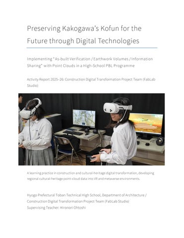
A learning practice in construction and cultural-heritage digital transformation, developing regional cultural-heritage point-cloud data into VR and metaverse environments.
Hyogo Prefectural Toban Technical High School, Department of Architecture / Construction Digital Transformation Project Team (FabLab Studio) Supervising Teacher: Hironori Ohtoshi