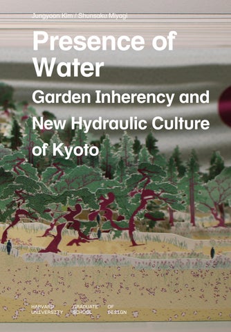
Jungyoon Kim / Shunsaku Miyagi
Presence of Water Garden Inherency and New Hydraulic Culture of Kyoto
Fall 2025
Studio Report
Jungyoon Kim / Shunsaku Miyagi
Presence of Water Garden Inherency and New Hydraulic Culture of Kyoto
Presence of Water: Garden Inherency and New Hydraulic Culture of Kyoto This report presents the process and results of the design studio offered by the Department of Landscape Architecture at Harvard University Graduate School of Design (GSD) in fall 2025, which aimed to reexamine and reevaluate the value of Kyoto’s environmental culture as shaped by its long history, seeking to update the city’s landscape culture for a sustainable and resilient future that moves beyond its tradition and style. Kyoto’s exceptional water resources—known as the “Kyoto Water Basin”—have made it famous for its historic gardens and the nickname “Sansui City.” This abundance of pure water has supported both beautiful landscapes and thriving traditional industries, shaping the city’s unique cultural heritage and boosting tourism. Yet the prominence of traditional gardens sometimes limits innovative design, leaving many new projects formal and disconnected from Kyoto’s changing urban context. In addition, most of Kyoto’s advanced hydraulic systems are hidden from view, so they do not enhance people’s experience of public spaces. As climate change intensifies, Kyoto urgently needs adaptive strategies rooted in local resources and knowledge. The 13 students of the studio traveled to Kyoto to perform field research and acquire local knowledge. The thoughts and ideas
they had initiated before departure, through their mapping exercise and research on transitional gardens, were reviewed and shared on site. The workshop with YKK AP’s associate members was a valuable opportunity to share insights into the various aspects of Kyoto’s hydrological culture. After returning to Cambridge, students developed their individual designs into detailed spatial designs. On December 10, the works were shared with prominent experts and YKK AP delegations during the final review. On behalf of the studio, the instructors thank the Dean of the GSD Prof. Sarah Whiting and the Chair of the Department of Landscape Architecture Prof. Gary Hilderbrand, for their care and support. The continued support from the YKK AP was, once more, essential this semester. Their unwavering professionalism and hospitality made the studio’s members pursue their best. We are very much looking forward to the continued mutual learning and growth together with YKK AP. The studio invite all the readers to the studio’s journey to Kyoto’s envisioned future, which will guide our second exploration of Kurobe next year.
Studio Instructor Jungyoon Kim, Associate Professor in Practice of Landscape Architecture, GSD Shunsaku Miyagi, Visiting Professor in Landscape Architecture, GSD
Teaching Assistant Ryota Sunakawa Students Taichi Aritomo, Darius A-L Bottorff, Racha Doughman, Miriam Hernandez Medina, Aisha Iyengar, Lauren Jasper, Michelle Li, Cecelia Liu, Chutong Liu, Cynthia Liu, Jagger Sun, Savalee Tikle, Molly Zhang
7
Introduction
10
Foreword
11
Course Overview
13
Mapping Kyoto
41
Garden Typology Studies
69
On Site
81
97
109
127
Spatialization / Elaboration Revitalizing Urban Blocks THE HYDROLOGICAL COMMONS: Reimagining Kyoto’s Water and Connectivity in Community Grounds Cecelia Liu AFTER RAIN-MAKING: Turtle Ritual Continuum Miriam Hernandez Medina
163
171
185
197
HANDS OF MAKING Darius A-L Bottorff Landscape of Hydraulic Dynamism EPHEMERAL GROUNDS: Re-defining the Connection with Water Confluences within the Everyday Savalee Tikle
213
225 141
153
A FLOW SHAPED BY THE FLOWS: Designing Hydrological Flows that Structure Human Motion Molly Zhang New Landscape Features of Kamogawa River 100 YEARS: A Centennial Reflection on Design Futures centering on a CommunityDriven Cultural Identity for the Kyoto Botanical Garden Aisha Iyengar
HOVERING WATER: Constructing Microclimates with Flowing Water in the Center of Kyoto City Taichi Aritomo Canal System and Canal Front Restoration WATER AS CALENDAR: Reinterpreting the Biwako Canal as a Cultural Corridor through Changing Sceneries Chutong Liu MOVING THROUGH THE WET & THE DRY: Reactivating Kyoto’s Canals as a Slow Mobility System Connecting People, Water, and Landscape Lauren Jasper New Aspects of Fushimi District COMPOSITIONS FOR WATER: Soundwalks for Fushimi Sake District Michelle Li MACHIYA LAYERED · VISIBLE CANAL: Revoke Fushimi Canal with Machiya Design Language Jagger Sun Culturalizing Natural Phenomena REACTIVATING THE OTAWAGAWA RIVER: From Water Infrastructure to Cultural Corridor Cynthia Liu
235
AFTER LIGHT: The Moon Catcher Reimagining the Rice Field as a Nocturnal Landscape of Ritual Racha Doughman
259
Contributors
Option studios in the Department of Landscape Architecture at Harvard Graduate School of Design provide a platform for collaborative investigations into the urgent environmental, social, and climate issues of our time. They fall typically in the final year of the MLA program. For the second consecutive year, the department has partnered with YKK AP Corporation on an option studio in Japan, this time in the nation’s ancient capital city, Kyoto. What could the YKK AP community learn from examining land and water relationships and traditions in Kyoto? There was indeed so much to learn for the students, teachers, YKK leadership, and YKK Associate Members, who were designated to follow along and participate in the studio’s several phases of work. The Kyoto project followed the prior year’s studio in Kurobe, home to extensive YKK management, housing, and manufacturing facilities. Projects in that studio speculated on proposals to address matters of the shrinking workforce population in the city, the city’s lack of connective public realm space, and several scales of infrastructure projects aimed at making Kurobe more resilient in the face of the climate crisis. Our idea for moving to Kyoto for this next studio was a way of expanding the realms of study towards even more ambitious projects related to storm water management and vegetative cover in the city. We believe firmly that speculative projects in Kyoto are equally relevant to YKK’s ambitions to ensure a bright and resilient future for Kurobe. I wrote this in the preface to last year’s report. It bears repeating. “YKK’s founder, Tadao Yoshida, committed his firm to the “Cycle of Goodness” which claims that “no one prospers without rendering benefit to others.” Today’s YKK leadership honors this axiom as an ethic of care and stewardship for the city that supports the company and its people. This care is manifested through commitments to sustainable manufacturing processes and continued research and innovation on
Gary Hilderbrand
materials, carbon drawdown, urban forestry, and more. It extends to housing and sustainable urbanism and real estate development. The company’s ongoing housing efforts at K-Town, K-Hall, and especially PASSIVETOWN, now completing its fifth phase of construction, are achieving and exceeding sustainability benchmarks, with renewable energy, water management and reuse, low-carbon strategies, and naturebased resilient landscape solutions.” We heartily salute our partners at YKK for these important ambitions, and we are proud to be on this journey together to stimulate even greater ambitions for resiliency in design action. On behalf of the Department and the students, I am more than grateful to Associate Professor in Practice Jungyoon Kim and Visiting Professor Shunsaku Miyagi for the precise structure and program of the studio. The combination of these two remarkable teachers was a joy to observe for a second time, and the outcomes prove its great benefit. It was my immense pleasure to accompany Professors Kim and Miyagi on portions of the field visit to Kyoto. It was a memorable trip for all, and it deeply informed so much of what we can envision for the future. I wish to thank Chairman Hori, his wonderful senior colleagues, and the associate members at YKK AP for their fellowship and their hearty embrace of our students and our community. It was nothing short of extraordinary that Chairman Hori and his leadership team, along with several Associate Members, traveled to Cambridge for an all-day review of the students’ work in early December. That too remains a great memory and a lasting bond for us. Finally, I congratulate the students on their projects and on their deep learning of history, urbanism, hydrology, cultural values and practices, and more. And we look forward to our next adventure in this remarkable partnership.
10
Foreword
11
Course Overview
Kyoto’s exceptional water resources, known collectively as the “Kyoto Water Basin,” are unmatched elsewhere in Japan, if not in the world. This richness, both in quality and quantity, has enabled the creation of numerous historic gardens in varied styles, earning Kyoto the nickname “Sansui City”—the city of “Mountain and Water.” The city’s plentiful, pure water has not only supported scenic landscapes but also traditional crafts and industries, greatly enriching its cultural fabric. Today, these assets continue to attract millions of tourists and bolster the local economy. However, the strong presence of historic gardens and landscapes can at times hinder the development of new spatial expressions that reflect contemporary urban life. Many current designs remain formal and isolated, rarely engaging with Kyoto’s evolving context or environmental challenges. As a result, opportunities for innovative, practical responses to global issues and local demands for public pleasure through landscape design are limited. Furthermore, as in many cities worldwide, Kyoto’s sophisticated hydraulic infrastructures are mostly invisible and thus have not fully contributed to citizens’ experience of public spaces. The city is increasingly affected by the impacts of climate change—hotter summers,
torrential rainfall, increased risks of flooding and landslides, and shifting mountain vegetation. Although local action alone cannot resolve these issues, new adaptive strategies rooted in local resources and knowledge are urgently needed. This studio invited students to engage with Kyoto’s unique historical, cultural, and natural resources, seeking sustainable and resilient design scenarios that transcend traditional styles. By harnessing Kyoto’s water and landscape resources at multiple scales, participants will be challenged to reveal and enhance the presence of water—long invisible—to offer holistic approaches to sustainability and resilience. These strategies would reconsider water both as operational infrastructure and as a defining element of public space. The studio traveled to Kyoto to perform field research and acquire local knowledge. Thoughts and ideas were tested and developed through various lectures and workshops during the semester, including the topics of Japanese urban landscape, traditional and contemporary Japanese landscape language, environmental engineering, and model making.
12
This studio aims to reexamine and reevaluate the value of Kyoto’s environmental culture as shaped by its long history, seeking to update the city’s landscape culture for a sustainable and resilient future that moves beyond its tradition and style. Kyoto, renowned for the Kyoto Protocol and its legacy of environmental stewardship, serves as an ideal site for this inquiry. Its natural wealth derives from distinctive topography and abundant water resources, nurtured by a culture that has managed these resources responsibly and in such elaborate forms for centuries.
13
Mapping Kyoto
15
Vegetation + Water Taichi Aritomo
17
Settlement Pattern Darius A-L Bottorff
19
Vegetation + Traditional Scrolls Racha Doughman
21
Invisible Hydrology Miriam Hernandez Medina
23
Hydraulic Engeneering Aisha Iyengar
25
Tourism + Mobility Lauren Jasper
27
Local Industry Michelle Li
29
Traditional/Contemporary Architecture Cecelia Liu
31
Garden Style Chutong Liu
33
Micro Topography Cynthia Liu
35
Urban Grids + Settlement Pattern Jagger Sun
37
Urban Grids+Social Demographics Savalee Tikle
39
Tourism + Community Molly Zhang
14
In the first four weeks of the semester, each student chose a theme to explore Kyoto and map the city through a hydrological lens. They utilized the GIS resources and literature. Before visiting Kyoto, the studio had a pin-up to share the 13 maps to learn about each other’s findings.
15
16 Swampy environment of Midorogaike Pond
Vegetation & Water in Ground, Surface, and Air by Taichi Aritomo
17
18 The area between Kyoto Station and Kamogawa River
Settlement Fringe Heian-Kyo to Present by Darius A-L Bottorff
19
bamboo rice field red pine solidago altissima community konara oak community pasture/grassland for grazing reed community weed community tea plantation open water zone industrial zone artifically modified site built-up area
The edge between Shugakuin Villa and rice field
Vegetation Mapping by Racha Doughman
20
forest of cedar, cypress, and sawara
21
22 Seismic Reflection Survey (1988) Fire Department, Kyoto City
The hanging river near Nanzanji where the invisible becomes visible
Invisible Hydrology by Miriam Hernandez Medina
23 Biwako Lake Canal System
24 The statue of Sakuro Tanabe, the pioneer behind the birth of the Biwako Lake Canal
Hydraulic Engineering by Aisha Iyengar
25
26 Fushimi Canal’s boat traffic as an inspiration
Over Tourism & Mobility by Lauren Jasper
Water-dependent Traditional Industries in Kyoto
<25
25-50
50-100
Takanogawa
Water Yield (m3/day x m) 100-500 500-1000 >1000
Groundwater Flow unconfined/shallow (20m) confined/deep (30m) Kyoto Famous Waters : Natural Spring/Well Local Industies Sake Breweries Tofu/yudofu/yuba Shop Kyo-Yuzen (dyeing) Studio 0.5
1
Mitarai-mizu Shimogamo Shrine
2 Kilometers
Hirano Shrine 100m well Kitano Tenmangu Shrine
27
0
Nishijin District textiles
Asukai = Senryui Shiramine Shrine 35m well + 50m well Seimei Shrine Somei Well Fukano Shigenoi 60m well Shimogoryō Shrine Mibu kyo-yuzen
"Willow water" - Yanagi no Mizu 25m well - tea + 90m well - dye
Kinshi Masamune
Mitarai Well Nishiki Tenmangu Shrine Yasaka Shrine
Samegai Well 80m well
Matsunoo-taisha Shrine
“Amano Manai” - Ichihime-jinja Shrine
Otowa-no-taki Fal
“Divine Water” - Wakaichi Shrine 20m well
Kamogawa
Jōnangū Shrine
Fujinomori Shrine 90m well
Tokiwainomizu - Kinshi Masamune Kinun-shimizu Spring Gokousui - Gokōnomiya Shrine Fushimi Sake Brewers Association Fushimi Sake District Fushimizu - Kizakura Kappa Country 60m well Akasui - Chokenji Temple
Shiragikusui - Torisei Honten Sakamizu - Gekkeikan Ōkura Sake Museum
50m well
Katsuragawa Ujigawa
Kizogawa
28
lls
Sake Brewery in Fushimi Canal Area
Kirihara-sui
Water Dependent Traditional Industries by Michelle Li
29
30 Temporary Terrace along Kamogawa River
Traditional/Contemporary Architecture & Proximity to Water by Cecelia Liu
飛鳥井
弘法水 閼伽井
染殿井
31
白雲水
霊泉
錦の水 亀の井
音羽の滝
満仲誕生水
一不二の水 菊水若水
白菊水
石清水
石清水
01 GARDEN STYLES & HYDRAULIC CULTURE
32
PRESENCE OF WATER OF KYOTO
白雲水
Biwako Lake Canal
Biwako Lake Canal
Water circulation of Saihoji Temple
Pure land Garden
Pond-Strolling Garden
Dry Garden
Borrowed Landscape Garden
Villa Garden
Tea Garden
Contemporary Gardens
Chutong Liu HARVARD GSD | OPTION STUDIO Kyoto | FALL 2025
桐原水
Garden Styles & Hydraulic Culture by Chutong Liu
33
34 Gentle water flow in Murinan Villa Garden
Geographical Distribution of Gardens-Topography by Cynthia Liu
35
36 Typical Machiya in Kyoto
Settlement Pattern-Machiya by Jagger Sun
37
38 Small grid in the old Heian-kyo area
Land Penetration Ability Larger Amount of Land Penetration (5 × 10 cm/s) Medium Amount of Land Penetration (3 × 10 cm/s) Les Amount of Land Penetration (1 × 10 cm/s) None
Urban Grids+Social Demographics Savalee Tikle
39
40 Houseboat for tourism in Ujigawa River Area
Streams of Movement: Reimagining Kyoto’s Watershed of Tourism by JMolly Zhang
41
Garden Typology Studies
42 This studio used tunnel books as both a research and design tool, as well as a mode of representation. In order to deeply examine how Kyoto’s aboveground and underground hydrology has shaped the city’s culture and society—and to propose new futures for Kyoto’s public spaces—the tunnel book, which can represent the cross-section of a site along with foreground, middleground, and background all in a single model, served as an ideal medium.
43
Ninnaji Temple Taichi Aritomo
45
Tofukuji Temple Hojo Garden Darius A-L Bottorff
47
Shugakuin Imperial Garden Racha Doughman
49
Higashihonganji Shoseien Miriam Hernandez Medina
51
Nijojo Castle Aisha Iyengar
53
Heianjingu Shrine Garden Lauren Jasper
55
Murinan Michelle Li
57
Ryoanji Temple Cecelia Liu
59
Saihoji Temple Chutong Liu
61
Ginkaku-ji Temple Gardens Cynthia Liu
63
Daitokuji Daisenin Temple Jagger Sun
65
Katsura Imperial Villa Garden Savalee Tikle
67
Chion-in Temple Molly Zhang
43
Ninnaji Temple Plan 重森三玲・重森完途『日本庭園 史大系・15』社会思想社 Mirei Shigemori / Kanto Shigemori “The Encyclopedia of Japanese Garden History” No.15, Shakaishisousha
44 Ninnaji Temple Tunnel Book
45
Tofukuji Temple Hojo Garden Plan 重森三玲・重森完途『日本庭園 史大系・27』社会思想社 Mirei Shigemori / Kanto Shigemori “The Encyclopedia of Japanese Garden History” No.27, Shakaishisousha
46 Tofukuji Temple Hojo Garden Tunnel Book by Darius A-L Bottorff
47
Shugakuin Imperial Garden Plan 西澤文隆実測図集刊行会『日本 の建築と庭』中央公論美術出版 Publication Committee for Fumitaka Nishizawa’s Survey Drawings “Japanese Traditional Architecture and Historic Gardens” Chuo-koron Bijutsu Shuppan
48 Shugakuin Imperial Garden Tunnel Book by Racha Doughman
49
Higashihonganji Shoseien Plan 西澤文隆実測図集刊行会『日本 の建築と庭』中央公論美術出版 Publication Committee for Fumitaka Nishizawa’s Survey Drawings “Japanese Traditional Architecture and Historic Gardens” Chuo-koron Bijutsu Shuppan
50 Higashihonganji Shoseien Tunnel Book by Miriam Hernandez Medina
51
Nijojo Castle Plan 重森三玲・重森完途『日本庭園 史大系・9』社会思想社 Mirei Shigemori / Kanto Shigemori “The Encyclopedia of Japanese Garden History” No.9, Shakaishisousha
52 Nijojo Castle Tunnel Book by Aisha Iyengar
53
Heianjingu Shrine Garden Plan 重森三玲・重森完途『日本庭園 史大系・27』社会思想社 Mirei Shigemori / Kanto Shigemori “The Encyclopedia of Japanese Garden History” No.27, Shakaishisousha
54 Heianjingu Shrine Garden Tunnel Book by Lauren Jasper
55
Murinan Villa Plan 重森三玲・重森完途『日本庭園 史大系・27』社会思想社 Mirei Shigemori / Kanto Shigemori “The Encyclopedia of Japanese Garden History” No.27, Shakaishisousha
56 Murinan Villa Tunnel Book by Michelle Li
57
Ryoanji Temple Plan 西澤文隆実測図集刊行会『日本 の建築と庭』中央公論美術出版 Publication Committee for Fumitaka Nishizawa’s Survey Drawings “Japanese Traditional Architecture and Historic Gardens” Chuo-koron Bijutsu Shuppan
58 Ryoanji Temple Tunnel Book by Cecelia Liu
59
Saihoji Temple Plan 重森三玲・重森完途『日本庭園 史大系・3』社会思想社 Mirei Shigemori / Kanto Shigemori “The Encyclopedia of Japanese Garden History” No.3, Shakaishisousha
60 Saihoji Temple Tunnel Book by Chutong Liu
61
Jishoji Temple Gardens Plan 重森三玲・重森完途『日本庭園 史大系・5』社会思想社 Mirei Shigemori / Kanto Shigemori “The Encyclopedia of Japanese Garden History” No.5, Shakaishisousha
62 Jishoji Temple Gardens Tunnel Book by Cynthia Liu
63
Daitokuji Daisenin Temple Plan 重森三玲・重森完途『日本庭園 史大系・5』社会思想社 Mirei Shigemori / Kanto Shigemori “The Encyclopedia of Japanese Garden History” No.5, Shakaishisousha
64 Daitokuji Daisenin Temple Tunnel Book by Jagger Sun
65
Katsura Imperial Villa Garden Plan 西澤文隆実測図集刊行会『日本 の建築と庭』中央公論美術出版 Publication Committee for Fumitaka Nishizawa’s Survey Drawings “Japanese Traditional Architecture and Historic Gardens” Chuo-koron Bijutsu Shuppan
66 Katsura Imperial Villa Garden Tunnel Book by Savalee Tikle
67
Chion-in Temple Plan 重森三玲・重森完途『日本庭園 史大系・4』社会思想社 Mirei Shigemori / Kanto Shigemori “The Encyclopedia of Japanese Garden History” No.4, Shakaishisousha
68 Chion-in Temple Tunnel Book by Molly Zhang
69
On Site
10/4
In flight to Kyoto
10/5
Arrived in Kyoto
10/8- 10/9
Individual site excursion
10/10
At Byodoin, Uji
10/11
Depart to/ arrived in Boston
10/6 - 10/7 The studio, accompanied by YKK AP’s associate members, visited some of the destinations that are crucial to understand the city’s water resources in and around Kyoto where the possibility of enhancing the presence of water is high. The destinations are mapped in map below. A : The most upstream area including Kamigamo Jinja Shrine, Midorogaike swamp and Kyoto Botanical Garden. B : The area closely related Biwako Lake Canal and its sub channels which form complex but sophisticated water network system. C : The area in the middle of ancient Heiankyo grid, a typical urban setting including several vacant lots (old grade school sites) and public open spaces. The area is also well known for its rich ground water resources. D : The area between JR Kyoto Station and Kamogawa River, including newly developed campus of Kyoto Municipal Collage of Art, a group of open space, riverfront parks. E : The area most vulnerable to flooding due to three major rivers merging in the low-lying land conditions. F : The most downstream area where network of canals creates unique urban fabrics. The are is also rich in high quality ground water for Sake breweries.
Map of the destinations © Shunsaku Miyagi
70
The eight-day trip to Kyoto provided an opportunity to test the findings of the initial analysis and to conduct field research. Engagement with the associate members of YKK AP provided students with an opportunity to exchange their findings and gain exposure to local knowledge.
71 © YKK AP
© YKK AP
72 © YKK AP
© YKK AP
73 © YKK AP
© YKK AP
74 © YKK AP
© YKK AP
75 © YKK AP
© YKK AP
76 © YKK AP
© YKK AP
77
Spatialization/ Elaboration
81
97
109
127
141
153
163
AFTER RAIN-MAKING: Turtle Ritual Continuum Miriam Hernandez Medina
171
185
HANDS OF MAKING Darius A-L Bottorff Landscape of Hydraulic Dynamism EPHEMERAL GROUNDS: Re-defining the Connection with Water Confluences within the Everyday Savalee Tikle
197
A FLOW SHAPED BY THE FLOWS: Designing Hydrological Flows that Structure Human Motion Molly Zhang
213
New Landscape Features of Kamogawa River 100 YEARS: A Centennial Reflection on Design Futures Centering on a CommunityDriven Cultural Identity for the Kyoto Botanical Garden Aisha Iyengar
225
HOVERING WATER: Constructing Microclimates with Flowing Water in the Center of Kyoto City Taichi Aritomo
235
Canal System and Canal Front Restoration WATER AS CALENDAR: Reinterpreting the Biwako Canal as a Cultural Corridor through Changing Sceneries Chutong Liu MOVING THROUGH THE WET & THE DRY: Reactivating Kyoto’s Canals as a Slow Mobility System Connecting People, Water, and Landscape Lauren Jasper New Aspects of Fushimi District COMPOSITIONS FOR WATER: Soundwalks for Fushimi Sake District Michelle Li MACHIYA LAYERED · VISIBLE CANAL: Revoke Fushimi Canal with Machiya Design Language Jagger Sun Culturalizing Natural Phenomena REACTIVATING THE OTAWAGAWA RIVER: From Water Infrastructure to Cultural Corridor Cynthia Liu AFTER LIGHT: The Moon Catcher Reimagining the Rice Field as a Nocturnal Landscape of Ritual Racha Doughman
78
Revitalizing Urban Blocks THE HYDROLOGICAL COMMONS: Reimagining Kyoto’s Water and Connectivity in Community Grounds Cecelia Liu
79
1
THE HYDROLOGICAL COMMONS: Reimagining Kyoto’s Water and Connectivity in Community Grounds Cecelia Liu
8
WATER AS CALENDAR: Reinterpreting the Biwako Canal as a Cultural Corridor through Changing Sceneries Chutong Liu
2
AFTER RAIN-MAKING: Turtle Ritual Continuum Miriam Hernandez Medina
9
3
HANDS OF MAKING Darius A-L Bottorff
MOVING THROUGH THE WET & THE DRY: Reactivating Kyoto’s Canals as a Slow Mobility System Connecting People, Water, and Landscape Lauren Jasper
4
EPHEMERAL GROUNDS: Re-defining the Connection with Water Confluences within the Everyday Savalee Tikle
10
COMPOSITIONS FOR WATER: Soundwalks for Fushimi Sake District Michelle Li
11 5
A FLOW SHAPED BY THE FLOWS: Designing Hydrological Flows that Structure Human Motion Molly Zhang
MACHIYA LAYERED · VISIBLE CANAL: Revoke Fushimi Canal with Machiya Design Language Jagger Sun
12
REACTIVATING THE OTAWAGAWA RIVER: From Water Infrastructure to Cultural Corridor Cynthia Liu
13
AFTER LIGHT: The Moon Catcher Reimagining the Rice Field as a Nocturnal Landscape of Ritual Racha Doughman
6
7
100 YEARS: A Centennial Reflection on Design Futures Centering on a CommunityDriven Cultural Identity for the Kyoto Botanical Garden Aisha Iyengar HOVERING WATER: Constructing Microclimates with Flowing Water in the Center of Kyoto City Taichi Aritomo
80
Project Location
81
THE HYDROLOGICAL Cecelia Liu COMMONS: Reimagining Kyoto’s Water and Connectivity in Community Grounds Situated within the urban grid of Kyoto, this project explores how water can be re-established as a shared civic resource within everyday community spaces. While Kyoto’s urban form has long been shaped by springs, canals, and groundwater systems, much of this hydrological infrastructure now operates invisibly beneath the city. Hydrological Commons proposes a framework that brings these hidden water systems back into public life, allowing water to once again structure spatial and social relationships. The project is anchored at Kyogyo Primary School, located between Shinsen-en Garden and the moat of Nijo Castle. Rather than treating the school as an isolated institution, the proposal reimagines it as a communal ground that mediates between subterranean aquifers, neighborhood water networks, and larger urban hydrological systems. Design interventions adapt existing structures to surface water in legible and experiential ways. Rainwater collected from roofs flows through gutters and rain chains into retention basins and water platforms, while sectional moments reveal underground flows connecting geological layers to everyday occupation. Organized through a five-senses framework—sound, touch, scent, sight, and movement—the project transforms water from hidden infrastructure into a lived communal presence, reconnecting Kyoto’s hydrological heritage with contemporary urban life.
82
83
Un-used Elementary School Map
84 Spatial Strategies
85
86 Proposed Design Plan and Urban Context
87
Reconstructing Kyogyo Primary School through a sectional continuum of hidden waters This long section situates Kyogyo Primary School within Kyoto’s layered hydrological system, tracing connections between groundwater, historic canals, and adjacent sites such as Shinsen-en and the Nijo Castle moat. The drawing reveals how water continues to move beneath the city, despite its limited visibility on the surface. Rather than treating the school as an isolated site, the section frames it as part of a continuous hydrological corridor that links cultural, ecological, and urban conditions. Hidden water processes into spatial and sensory experiences, repositioning the school as a shared ground where water becomes present, collective, and lived.
88
89
90
91
92
93
94
95
96
97
AFTER RAIN-MAKING: Miriam Hernández Medina Turtle Ritual Continuum
Turtles have played an important role in Japanese water rituals, symbolic representations of them moving water with their bodies, their shells transformed into basins that hold and carry the flow. In Japanese legends, the turtle is associated with longevity and represents a strong link between the ground and water. The turtle becomes a living metaphor for the slow, patient rhythm of water and the connection between what is visible and what lies beneath the surface: invisible hydrology. This project envisions the next ritual after the ancient rain-making rituals: what comes after the rain. It imagines the turtle emerging during or after rainfall, becoming a portal between the surface world and the underground waters. Its slow, concentric movement mirrors the sacred flow of water, evoking patience, longevity, and the deep temporal cycles of the landscape. Shinsen-en, a remnant of the Imperial garden of Heianera Kyoto, was once centered on spring waters and sacred rain-making rituals. These rituals echo into the design of this reimagined garden, forming a continuum with the historic site. Each turtle “calls” water back to the aquifer through seepage, pooling, rain gardens, and baths, renewing Shinsen-en’s ancient bond with water and weaving a new ritual of reconnection between the visible and invisible hydrology of Kyoto
98
99
100 N
0
10
25
E
W S
101
From Rain Making Ritual to Turtle Ritual Continuum This section presents a vision of water operating across multiple scales: from Nijo Castle, where it functions at a territorial and defensive scale, to Shinsen-en, where it shapes the urban landscape, and finally to a new ritual element: the turtle, through which water is experienced at a human scale. To the right, these new landscape interventions come into view. The turtles embody the processes that follow rainfall, facilitating the reinfiltration of water into the aquifer and making this otherwise invisible cycle perceptible and tangible. Proposing new frameworks for interaction that elevate water into a ritualized element of the landscape
102
103
104 Tunnel Book
105
106
107
108 Left: Spatial Model of Turtle Right: Concept Model showing reinfiltration of water into the aquifer
109
HANDS OF MAKING
Darius A-L Bottorff
The Hands of Making develops an arts-and-crafts ecology on vacant parcels of land near the Kamogawa and Takase Rivers, east of Kyoto Station. The proposal interweaves the presence of Kyoto City University of Arts and the Bank of Yanagihara Memorial Museum with historical narratives to amplify the region’s hydrological and craft heritage through site-specificity. The design intervention achieves this by improving subsurface water conditions, creating habitat, and providing spaces for artists to exhibit, work, engage, and reflect on craftmaking within the landscape. Improvements to the hydrological landscape result in strategic topographical shifts, groundwater recharge, mitigation of urban heat, and expansion of the Takase River canal system. Further, Hands of Making reuses the footprints and structural remnants of demolished buildings to foreground the site’s complex history through preservation of cultural heritage.
110
111
112 Research Book
113
114
Site map indexing present-day site strengths, weaknesses, opportunities, and constraints towards improving connections with the hydrological landscape.
115
Top: Estimated Existing Soil Permeability Matrix Bottom: Estimated Directional Drainage
116 Top: Estimated Critical Areas for Intervention Bottom: Estimated Proposed Soil Permeability Matrix
117
The planting model explores vegetational density as a means to orient visitors through the landscape from the built environment to the Kamogawa River.
118
119
Materiality Study Painting
120 Materiality Study Painting
121
122
123
124 Tunnel Book
125
126
127
Savalee Tikle EPHEMERAL GROUNDS: Re-defining the Connection with Water Confluences within the Everyday
Ephemeral Grounds explores how river confluences can become catalysts for everyday ritual, collective memory, and adaptive ecological life. The project originates from the intersection of the Kamo and Takano Rivers in Kyoto, where children play, elders rest, cyclists pass, and visitors pause. This ordinary scene reveals how the same ground is continuously reinterpreted by people, seasons, and changing water levels. Expanding from this observation, the project examines four confluences within Kyoto’s delta system. Each site reflects different hydrological and cultural conditions. Rather than introducing monumental interventions, the design focuses on small, resilient programs that reconnect communities with water while supporting ecological processes. The pilot site at the Kamo and Takano confluence responds to dramatic seasonal fluctuations. Instead of resisting floods, the landscape adapts to them. At low water levels, the riverbank becomes a generous commons for leisure, play, and gatherings. As water rises, circulation shifts to higher terraces while lower areas function as a floodplain and habitat. Through terraced ground, adaptive planting, and flexible public spaces, the project restores riparian continuity and encourages everyday rituals. Over time, the confluence becomes a shared landscape where ecology, culture, and daily life coexist within Kyoto’s living river system.
128
129 Ritual Origin, Confluence
A) Kamo and Takano River Intersection
Floodplain negotiation
B) Katsura and Kamo River Intersection
Delta Ecology
C) Katsura, Uji, and Kizu River Intersection
Watershed Recharge
D) Yamashina and Uji River Intersection
The four river intersections form a connected Kyoto River Bio-Loop, tracing the city’s original delta where each confluence, with its distinct landscape and urban role, contributes to a larger temporal ecology in which water, land, and culture continually reshape one another.
130
131
Kamo and Takano River Intersection A. Wegtern Teraced oge (Urban Fringe + Poaket Greene) B. Levee and Floodpair Toe (Linear Vegetation Belr) C. Inner Floodplain / Abandoned Channel Zone D. Aotive Kamo River Channel E. Urban Promenade F. Aotive Takano Rnver Channet G. Levee Green with [rass cover H. Secondary Riparian
132
133 Left: Concept Ideation Right Top: Temporality of the River Right Bottom: Temporal Adaptability as Design Strategy
134
135
136
137
Ephemeral Grounds’ Re-defining the connection with water confluences within the everyday sectional strategy This section illustrates shifting water levels and a gradual slope transitioning from the river confluence to Shimogawa Shrine, extending from dense forest into a sensitive hydrological landscape. It reveals a spectrum of vegetation and ecological conditions unique to this site, framing key views across the terrain. The sectional study captures topographic and elevational shifts, where the site operates as an adaptive floodplain during monsoon seasons and transforms into an amphitheater and events plaza in winter. A boardwalk overlooks expansive vistas while connecting seamlessly to adjacent roads and the surrounding urban fabric, creating an organic, continuous linkage between the shrine and the dynamic water confluence.
River Bed Riparian Edge
Low flood bed with silt clay and sand deposits
Adaptive floodplain zone
Boardwalk Flood step garden Open play and recreational spaces Amphitheatre
10 M 7.5 M 5.0 M 2.5 M
Winter Dry Season - January to March Rainy Season - June - August Typhoon Season - October to December
Play and events
138 Native grass garden
Willow Gardens
Play Zone and sand garden Cycle Park and Existing Greens Dense vegetation & buffer greens
Road Edge Old Mitsui Family Shimogamo Villa
0
Urban Fabric of the City
Shimogamo Shrine
50
100m
139
140
141
Molly Zhang A FLOW SHAPED BY THE FLOWS: Designing Hydrological Flows that Structure Human Motion
A Flow Shaped by the Flows begins with a simple question: what happens when the flow of people and the flow of water no longer align? In Kyoto, tourism and urban life concentrate in the historic center, while the city’s rivers move steadily southward. This project explores whether water’s shaping power can reorganize human movement and reconnect people with the river landscape. The site lies at the confluence of the Katsura, Uji, and Kizu Rivers south of Kyoto. Although this one-kilometer-wide zone is both a hydrological threshold and an infrastructural crossroads, the rivers today act as barriers rather than connectors. Hydrological analysis shows that the Katsura River is particularly vulnerable to extreme discharge due to its shallow riverbed. To relieve pressure, the design introduces new channels upstream of the confluence, allowing part of the Katsura River to enter the Uji River earlier and redistribute flow. Physical modeling and geo-table experiments explore how channel geometry generates erosion and deposition over time. These processes guide the formation of new riverbanks, where ecological habitats and public spaces emerge together. Pedestrian bridges and riverside paths reconnect the landscape, transforming the fragmented river edge into a continuous corridor shaped by water and human movement.
142
143
Existing Condtion Map
144 Proposed Water Flow of Katsura River, Uji River, and Kizu River
145
146 Hydrological Analysis of Katsura River, Uji River, and Kizu River
147
Understanding Water’s Own Movement through Geo-table Experiments Through physical hydrology modeling and geo-table experiments, I simulated three river flows to examine how channel angle, width, and sequencing influence the formation of cut banks and point bars, allowing landforms to be shaped by the river’s own movement over time.
148
These experiments inform a design that embraces controlled change, enabling the river to shift and reshape its edges over time. The channel design not only relieves flood stress but also uses erosion as a generative force to open the river’s edge, allowing the riverfront and human activity to interweave and create new spaces of encounter.
149
150
151
Where River Meets, Flow Remains
Oyamazaki Station
Tokaido Shinkansen
National Route 171
River Walk Path
Human Flow Intersection
Underbridge Space
Corridor
Mixed Experiences through Different Elevated Spaces
Floodab
152
This one-kilometer-wide zone is both a hydrological threshold and an infrastructural crossroads, carrying major rail lines between Kyoto and Osaka. Yet despite this richness, the rivers function more as barriers than connectors: visually close, yet spatially distant.
The design intervention introduces a continuous bridge linking the three rivers through varied edge conditions and bridge forms. This cross-river walk unfolds as a sequence of encounters with nature, moving from an intimate water-led corridor near the station, to expansive views along a traditional floodable bridge, and finally to delta spaces shaped by vegetation into more private or public atmospheres.
ble Pedestrian Bridge Over Katsura River
Bridge as Boundary and Transition
Enclosed Asymmetry Space
the Tea Room
Floodable Pedestrian Bridge Over Uji River
Yodogawa Kasen Recreation Park
Visual Openess and Lively Experience
153
100 YEARS: Centennial Aisha Iyengar Reflections on Design Futures Centering on a Community-Driven Cultural Identity for the Kyoto Botanical Garden Centennial Reflections on Design Futures centering on a Community-Driven Cultural Identity for the Kyoto Botanical Garden The Kyoto Botanical Garden emerges as the central site of intervention, an expansive, century-old institution that currently functions primarily as a traditional, ticketed viewing garden. Despite its prime adjacency to the Kamogawa River and its role as a major node within Kyoto’s green network, the garden remains largely disconnected from the daily life occurring along the active riverside pedestrian path. Dense vegetation, underutilized spaces, and heavy infrastructural barriers contribute to an inward-facing environment that limits resonance with local residents. The proposed design transforms this underutilized river edge into a culturally and ecologically dynamic threshold inspired by the origins of Kabuki theater, which historically took shape along the dry banks of the Kamogawa.
154
155
Tracing the journey of the Kamogawa River from its headwaters near Mt. Sajikigatake, 19 miles north, this study explores how water shapes Kyoto’s landscape and identity. Flowing south through mountain terrain into the alluvial basin, the river’s course has been carefully manipulated over time to form the system we recognize today. As a vital urban waterway bordering the Kyoto Botanical Garden, the Kamogawa becomes a framework for reimagining connection: linking ecological systems, cultural spaces, and community life. 100 Years envisions a strengthened relationship between river and garden, expanding access, resilience, and the presence of water throughout Kyoto.
Left: Botanical Garden in Relation to Kamogawa River Right: Kamogawa River Basin
156
100 Years
157
Deep Section Research
158 Site Master Plan
159
In section and perspective, this connection is made tangible through the creation of an outdoor amphitheater inspired by the site specific cultural practice of Kabuki theater. Embedded within the landscape, the intervention weaves seamlessly into existing trails while expanding opportunities for public programming and strengthening access to the interior zones of the botanical garden.
160
Ecologically, the design acts as a protective threshold, buffering garden infrastructure, increasing flood capacity, and fostering diverse habitats in a dynamic river edge environment.
161
162
163
HOVERING WATER: Constructing Microclimates with Flowing Water
Taichi Aritomo
This project concerns a site east of Kyoto Station, where public space and circulation is fragmented by train tracks, roads, and rivers. Through the site, a shallow, obsolete canal called Takase River flows with cool, clean water diverted from the Kamo River. The design proposal for the site involves creating varying microclimates, visual encounters, and urban connections. An existing park is regraded so that the canal spreads out into a pond surrounded by hills, evoking distant landscapes of mountains and water. Pedestrian paths hover over the canal and through dense canopies, pass under elevated train tracks, skate over the surface of the pond, and jump over the Kamo River with a new pedestrian bridge. The bridge provides the only pedestrian crossing for more than a kilometer, completing a path between Kyoto Station and the Sennyuji Temple, and forming a cusp for a viewpoint at the center, oriented toward Mt. Hiei. The interest in microclimates and visual encounters was informed by my research and site visit. Kyoto is known for the presence of water not only in the ground, but in the air, as fog and mist. When warm air meets Lake Biwako, it cools rapidly, forming a thick layer of fog that rolls over the mountains and into the city. During our site visit in Kyoto, we walked the approach of the Shimogamo Jinja, a path shaded by tall trees and surrounded by two parallel constructed streams, creating a radically cool microclimate compared to that outside of the temple grounds. And, by surprise one night, on the Togetsukyo bridge, I saw the moon rise from behind the peak of Mt. Hiei, blurred by mist and reflected in the water.
164
165 Tunnel Book
166 Top: View of the new pedestrian bridge over Kamo River Bottom: New pedestrian bridge completes path between Kyoto Station and the Sennyuji Temple
167
To Tokyo
T4 To Kyoto Station
Public Bath
T2
T1
T5
T6
T3
31.25
0%
.0 25
8.0
31.10
0%
31.10 0% P1
.0 25
S1
25.90 B1
6.25%
S1
P2
28.10
2.0
29.10
0%
27.10
20
.0
0% B2
C1
B3
32.10
S2 27.50 30.25 27.10
To Sennyuji
1.0
0%
8.0
0%
28.60
Municipal Housing
26.90
To N a
ar
0
100
200
300
400
500m
1:500
N
168
Between Body and Water Like a pool of water collected in the palm of your hand, the proposed intervention stretches open the defunct Takase canal to form a star-shaped pond of water held between five hills. Pedestrian paths radiate outward, offering new urban connections and relationships between body, water, infrastructure, and landscape. The path of stepping stones floats over the pond and continues along the valleys, the boardwalk hovers over the canal and under the railroad, and the bridge gently ascends over the Kamo River, pausing with a cusp at the middle to turn the body toward Mt. Hiei.
+32.00 +30.00 +28.00 +26.00 +24.00
0
100
200
300
400 m
Section drawing through Kamo River and site
169
170 Left: Misty morning in Kyoto Middle: Walk over the pond Right: Moon rise from Mt. Hiei
WATER AS CALENDAR:
Chutong Liu
171
Reinterpreting the Biwako Canal as a Cultural Corridor through Changing Sceneries Kyoto’s water system embodies a sophisticated integration of infrastructure, ecology, ritual, and seasonal temporality. From the Biwako Canal to garden hydraulics and festival calendars, water has historically functioned not only as a material resource but also as a cultural medium through which time, climate, and human activity have been perceived and organized. However, in contemporary urban life along the Sosui Canal, this layered hydraulic culture has become increasingly invisible and fragmented. This project proposes Water as Calendar - a landscape framework that reinterprets the Biwako Canal as a cultural - ecological corridor structured by seasonal water rhythms. By translating the 24 Solar Terms into spatially legible water expressions and employing the Japanese concept of Ma as an intermediate spatial strategy, the project reconnects historical hydraulic knowledge with everyday urban experience. Water is reimagined not as static scenery, but as a dynamic temporal system through a sequence in which climate, culture, and public life unfold. This design approach restores the presence of water’s cultural significance and also provides a spatial strategy for adapting to climatic uncertainty through heightened environmental perception. Through the integration of temporal water expressions, layered experiences, and intermediate spatial conditions, the Sosui Canal is reimagined as a cultural and ecological corridor rather than a linear infrastructure. Historical hydraulic knowledge is not preserved as static heritage but re-embedded into everyday life, allowing water to once again function as a mediator between climate, culture, and public space.
172
W R TE IN
ts u Ha d mö w Ne e(
i (N -sa ya
Jo
’s ar
is it sV
Ye
ar’
Ye
ew
)
e Ev
173
u-
Rit
Grea t Co
er
lllu
na
tio
in W
mi
old
int
ld
iW
rC
ak
no
az
Mi
Ok
te
n
e
ic
st ol
rS RY
no
枯
DE
CE
MB
ER
Ra in
Ligh
Dry
on
Pre ci pi ta ti
w
t Sno
霜
w
t
yS
Fro s
av
UA
N
JA
He
NOVEMBER
湿
stu Moi
re
Beginning of Winter
t
scen
Mi st
w BE
R
De
Eq
Rather than treating water as a scenic or technical element, this project frames water as a temporal structure - a living calendar through which seasonal change becomes spatially legible. Drawing from East Asian cosmology, the 24 Solar Terms offer a culturally embedded system that links climate, agriculture, ritual, and everyday life. Water, in its multiple states and behaviors, becomes the medium through which these temporal shifts can be perceived.
Gozan no okuribi (Five Mountain Bonfres)
Conceptual Framework: Water as a Temporal and Cultural Medium
AUG End
of He at
ew ite D
Jid ai M at su ri (F es tiv al
of th e
A ge s)
Wh
A ut
um
n
nt) ea ag lP a ric isto (H al v i t s i Fe ak Em
Beginning of Autumn
ai Jid
UST
ui
no
x
SE
PT
EM
ld
Co
霧
s De
Frost’
雨
Ra in
Pu r
RC H
A
M
ri eB gh
APR
渗
t Infl
n ratio
蒸 E
vap
ora t
ion
Dew 露
Gr ain tne
in ss
IL Grain
Grain Rain
MAY Start of Summer Aoi Matsuri (Hollyhock Festival)
JU
Full
NE Ea r
t
ea
rH
no Mi e ic
st ol
S er
m
m
Su
LY
JU
at
t He Grea
shi go
Na
no
mm (Su
er
ER M
M
SU
l)
ua
Rit
tion
rifca
ion
at
rifc Pu
d Pu
elate
uri (R Mats
rae
Ha
Gion
)
Rites g
Sp rin Eq ui no x
ing
ke n
Aw a of
Ok
g
ra
C he rry
ku
tiv al (C
C on ce rt)
Fe s
yB
he rr
Mara thon
lo s
so
m
Fe s
tiv al)
Sesubun-sai (Bean-Throwing Festival)
Kyoto
i Sa
ee pi n
az ak
er t( W
C on c
174
ur a
ak
ez
ar
id
Sh
ec ts
Wate r
Ins
Rain
FEBRUARY Beginning of Spring
175
CULTURE HERITAGE IN CENTRAL KYOTO
BIWAKO CANAL Kyoto's hydraulic heritage
DISCONNECTIVITY URBAN TRAIL
MA Urban Intermediate Space Ambiguity, Flexibility, Provisionality, Fluidity
SEASONALITY 24 Solar time
Persence of Water 8 Forms of Water States
Changing Sceneries &Temporal Sequence Water Feature
CULTURE CORRIDOR
Daily Life & Celebration of festivals, rituals, and historic water uses.
CONCEPTUAL DESIGN STRATEGY Multilayered Design Framework
176
Abstraction
Concretion
177
178
DETAILED PLAN SITE 1
Takeyamachi Dori 竹屋 Pocket Garden * Micro Water Cascade
* Water Feature
Gallary 京都徳力版画館
Fire Equipment Cabinet 消防団 器具庫 Rain Garden * Bioswale Weatland Planting
Accessable Platform
Reeds Planting
BoardWalk
Seasonal Retention Pond * MIst Fountain
179
Overflow Stream
Pocket Garden
Kansai-electric-power Ebisugawa Power Plant 関西電力 夷川発電所
* Bioswale
Kyotoshi Jogesuidokyoku Sosuijimusho 京都市疏水事務所
Stone-lined Pathways
Rain Garden
* Statue of Kitagaki Kunimich 北垣国道銅像
Reisen Dori 冷
06 DETAILED PLAN SITE 3
Canal Side Seating
Kyoto City Zoo 京都市動物園
Tree Buffer
Rain Garden Grandstand
Canal Side Seating
Viewing Deck *
Accessable Platform
* Okazaki Jikkokubune Boat Ride 岡崎さくら回廊十石舟めぐり
Okazaki S
Niomon Dori 仁王門通
Muri
屋町通
Shogoin Nursery 聖護院保育園 Pocket Garden
Inlet Channel * MIst Fountain
Accessable Platform
180
* Bioswale
* Bamboo Drainage Pipe
Ebisugawa Ship reservoir 夷川船溜
hi Rain Garden
冷泉通
Keage Incline Drum Plant 蹴上インクライン工場
Kyoto City Zoo 京都市動物園
BoardWalk Amphitheatre
Amphitheatre
Nanzenji Boat Reservoir 南禅寺船溜
Lake Biwa Canal Museum 琵琶湖疏水 記念館
Water Stage
Sakura Corridor
in-an Garden 無鄰菴
Shirakawa Dori 白川通
ine sh 之 ge 瀬富 Hu of 」宮 tue 輝き ta * S 大な 巨 「
Top: Detailed Plan of Ebisugawa Ship Reservoir Area Bottom: Detailed Plan of Nanzenji Boat Reservoir Area
181
182 Serial section showing Biwako Canal as cultural-ecological corridor
WATER AS CALENDAR
183
Reinterpreting the Biwako Canal as a Cultural Corridor through Changing Sceneries
184
MOVING THROUGH THE WET & THE DRY:
Lauren Jasper
185
Reactivating Kyoto’s Canals as a Slow Mobility System Connecting People, Water, and Landscape Moving Through the Wet & the Dry reimagines Kyoto’s historic canal network as a contemporary slow-mobility system. The project proposes a public ferry network integrated with canaledge landscapes and existing transit corridors, transforming underutilized waterways into a secondary transportation spine. By formalizing canals that already act as informal cycling and pedestrian corridors, the proposal relieves transit congestion while reconnecting fragmented parks, rivers, and green spaces into a continuous blue-green network. Focusing on the Fushimi Canal Corridor, the design introduces strategically placed boarding points near major transit hubs, including Kyoto Station and Inari. Two ferry lines—an express commuter route and a slower experiential route—serve both residents and visitors without conflating their needs. Canal edges are redesigned to support widened pedestrian and cycling paths, private residential boat docking, terraced seating, and ecologically sensitive planting. At its core, the project reframes mobility as both infrastructural and experiential. Movement along water becomes quieter, more intimate, and more connected to the landscape. Kyoto is rediscovered not through speed, but through a rhythm that alternates between wet and dry, compression and release, and where slow mobility becomes a way of seeing.
186
187
188
189
190 Proposed Ferry Dimensions: Length: 13 m Width: 2.9 m Draft: 0.6 m Capacity: 22 passengers Electric propulsion Space for 2 3 bicycles Express Route: Point A to B in 25 minutes Scenic Route: slower; more ideal for tourists looking to see the city by boat
191
192
A Slow-mobility Network on Kyoto’s Historic Canal System This project proposes a slow-mobility network for Kyoto built around its historic canal system. The goal of this work is to relieve tourist pressure on public transit through a new ferry system, while re-weaving water back into daily life to make movement through the city simultaneously more efficient, more experiential, and more connected to the waterways. These drawings illustrate the four proposed boarding points for the ferry system and their conditions along the Fushimi Canal corridor.
193
194 Tunnel Book of Fushimi Canal Corridor
195
196
197
COMPOSITIONS FOR WATER: A Soundwalk for Fushimi Sake District
Michelle Li
Compositions for Water is a design proposal for a soundwalk in Kyoto’s Fushimi Sake District that foregrounds the presence of water, both aboveground and underground, through a cross-modal experience of place. The project emphasizes the textuality, seasonality, and materiality of sound as a way of sensing local terroir. Inspired by the musicality of Japanese gardens such as Murinan Villa Garden, where water is revealed through carefully placed stones and cascading falls, the design draws from sequences of enclosure and openness to heighten multisensory awareness. The soundwalk celebrates Kyoto’s water culture by mapping practices shaped by groundwater, including sake brewing, tofu and yuba making, and kyo yuzen dyeing. It also engages the Japanese calendar’s seventy-two microseasons and twenty-four solar terms, connecting environmental sound to seasonal change. Geophonic sounds such as thunder, wind, rain, cracking ice, and rustling grain are paired with biophonic cues, such as cicadas in summer and bush warblers in early spring. Drawing on R. Murray Schafer’s concept of the soundwalk, water becomes Fushimi’s keynote sound, articulated through soundmarks such as suikinkutsu and the soft seseragi of flowing streams. Walking loops link breweries, canals, and train stations, connecting four historic springs through a sequence of listening gardens, riverside platforms, forest paths, mist pavilions, and rain shelters. Streetscape interventions such as bioswales and permeable paving slow and expose water’s movement. Infrastructure becomes an instrument, and listening becomes a practice of environmental awareness.
198
下弦の月(kagen-no-tsuki)
(fuke 更待月
w
an
in
寝
g
gib
bo
(ne 月 待
us
ma
ch
izu
ki)
machiz
uki)
199
i) k izu ac
im
有
(im 月 待
ch
居
待 月 (ta
i)
uk
hiz
ac
h
ki)
tsu
o-
-n
ke
ria
(a 月 の
明
立
ayoi)
夜(iz
十六
晦日月(misokazuki, or tsugomori)
満月(mangetsu) full moon
新月(shingetsu) new moon
お月見 Otsukimi harvest moon viewing festival kom 小望月(
二日月 (Fu tsuk
ochizu
azuki)
ki)
三日 月(m
ika
上弦の月(jogen-no-tsuki)
a)
ny
sa
(ju
夜
三
十
diurnal cycle
lunar cycle
zuk
i)
200 h
ted
生
小 Le Shō 満 sse m r R an ipe nin g
生
笋
竹
Silk wo
芒種 Bō Grain shu in Ea
r
蚕
起
食
紅 B
桑
花
栄
en Sa fflo iban wer a sa s b kau loo m rm Kaik s st o art okite fea ku stin w go ao n m ham ulb u Ba Ta err m ke bo n y le o oko av sh es oo shō ts zu sp ro ut
麦秋
至
Whe Mug at rip i no ens toki and itaru is ha rves
蟷螂
腐草 為螢
Pray Kamak iri ing man shōzu tises hatc
Kusar Firefl etaru ku ies rise sa from hotaru to the rot na ten graru ss
乃東枯
梅子黄
Natsukarekusa karuru Self-heal withers
Ume no mi kiba Plums mu turn yello w
sprouts
菖蒲華
Ayame hana saku Irises bloom
Crow-dipper
温風至
itaru Atsukaze s blow Warm wind
blo Hasu lotus First
学習 鷹乃 Hange shōzu
夏至 Geshi Summer Solstice
暑 大 ho at is Ta er He t ea Gr
Co
en
Th Fuk ick ak fo i kir g im de a sc tō en ds
Ev
小暑 o Shōsh eat rH Lesse
学習
鷹乃
開hiraku 蓮haj始 imete ssoms
u nara za o i wa fly wach rn to suna s lea Taka Hawk
結花
桐始
土潤
溽暑
i sush id i at sh hum mu te air is ruō p, i u dam ch Tsu rth is u Ea usub s o m e seed hana uc ete s prod hajim tree Kiri ownia Paul
行 時 i furu 雨 kidok s fall 大TaiuGtoreat rain o
至ru 風ze ita blow 涼Suzukl awinds
鳴ku ing 蝉shi nadas s 寒Higuinrag cica
出ru 蚓u izu rface 蚯Mimoizrms su
始
蛙
m 夏 立 ka Sum k Ri of g in n in eg
Summer
蒙
立 ni Riss 秋 ng h of ū
Te n Hea chi h t st ajim arts et to e sa die mu do shi W wn ata Co no tto ha n fl na ow shib ers e blo hira om ku
開
柎
綿
gi n
Be
降
升
霧
n
um
Au t
B
鳴
ku na g ete in jim ng ha si u art az s st aw g IK Fro
W
er
華ku 丹na sa m 牡otan hnaies bloo B eo P
出苗
ru w izu ae gs gro en mit edlin o ya se im rice Sh ost, fr
霜止
生
Last
葭始
u shōz ete rout hajim s sp Ashi t reed Firs
雨 穀 uu k in Ko Ra ain Gr
見 aru 始 araw 虹 ete ws hajim inbo
Niji
First
粛
始
地
天
処 暑 S En hos d o ho fH ea t
清明 ei Seim clear and
e
gees
鳥e 至 玄bam kitaru rn
inor
mon o su Rice naw rip achi ens m
Koku
登
禾乃
s
i gras
Ku Dew sa no glist tsuyu ens sh white irosh on
草露 白
Sekir Wagtaei naku ils sin g
鳴
鶺鴒
白露 Haku White ro Dew
Pure
Tsu ws retu Swallo
雷乃発声
Tsubame Swallow saru s leave
玄鳥去 chi koe o Thunder ceases osamu
achi Koe o Hassu Kaminari Sunaw its voice Thunder raises
IKaminari sunawa
雷乃収声
Autumn
春分 Shunbun Spring Equinox
Spring
ra
北 雁 eru 鴻 n ka rth Kōga fly no
Wild
櫻始開
Sakura hajimete saku First cherry blossoms
雀始巣 Suzume
秋分 Shūbun Autumnal Equinox
Mushi kakurete to o fusagu Insects hole up underground
蟄虫坏戸
Mizu hajimete karuru Farmers drain fields
hajimete sukū Sparrows start to nest
菜虫化蝶
水始涸
啓蟄 Ke Insect ichitsu s Awak ening
笑
啓戸
Sugi Hibe mori m us rnat ing hito o inse hira cts surfa ku ce
草木
u Kōgan kitar rn e retu Wild gees
寒露 Kanro Dew Cold
鴻雁来
aku na hir om no ha ms blo Kiku mu anthe Chrys
菊花
開
Crick
ari or to ni the do risu nd Kirigi arou chirp ets
Fir
蟋蟀
降 霜 ō t k Sō Fros st
B
在戸
fu ete jim o ha t frost Shim Firs
霜始
降 ru
eg in R 立冬 ni itt ng ō of W
Kas
Be
r 春 n 立 hu f Sp ss o Ri ing nn
土
gi
h
萌動
Sō Gra mok ss sp u m rout ebae s, tr izur eeds u bu d
霞
始
靆
um Mis i haj t st imet art e to tan lin abik ger u
脉
Fis
Tsu ch Ra i n in o sh m ois ō u te ru ns oi th oko e so ru il
魚
上
潤
起
g Bu
睆 睍an su sing 鶯kenk lers 黄 Kōōsh warb
U em o k erg ōri e fr o iz om uru th e ic
氷
e
東
乳
始
鶏
凍
解
風
華
款冬
saku hana bud no rs Fuki tterbu Bu
腹堅
水沢
eru um s am ri ts kō stre izu s on wam ken Sa thic Ice
雊
水泉動
雉始
naku kk ete ca hajim rt to Kiji nts sta sa Phea
芹乃栄
um o fuk taka w u ata Shimiz Springs tha
u
u wachi saka s Seri suna flourishe Sarsley
麋角解
雪下出麦
nobir Yuki watarite mugi snow under Wheat sprounts
乃東生
Sawashika no tsuno otsuru Deer shed antlers
鱖魚群
Natsukarekus a shōzu Self-heal sprout s
熊蟄 穴
Sake no Salmon uo mur gather aga and swim ru upstrea m
ku to ice o ri the kō lts ze e ka m ru ind ku Ha w tsu st ni Ea ya gs to eg ete g m yin aji rt la ri h sta ato ens Niw H
小寒 n Shōka old rC Lesse
冬至 Tōji Winter Solstice
大雪 Taiset Heavy su Snow
冬
Kuma an Bears a ni komo hibern ru ate
黄
閉塞 成
橘始
Sora Cold samuk u sets in, w fuyu to inte na r be ru gins
Tach ib Citr ana ha us tree jimet turn e ki ba s
ru i fu ok kid fall e to rains sam Ko Light
霎時
施
Ma T
C
u am llow kib ye ta rn tsu y tu iji m d iv Mo s an ple
楓
蔦
開 aku 始 te hir m 茶i hajimiaes bloo k ell 山 ba su am
ru e kō ez e ete fr m to aji rts i h ta Ch d s n La
地
yello mu w 朔 No rth Kitak 風 win aze d b ko 払 low noh 葉 s le a o av har es 虹 fro au m Nij 蔵 tree ik s Ra aku 不 inb re ow te m 見 s h ie ide zu 金 盞 香
K Da inse ffo nk dil a s b sak lo u om
大寒 an ld ik Da er Co at
in
Gre
小 Sh 雪 Lig ōset s ht Sn u ow
r
te
in
節気 24 solar terms
桃始
Momo hajim First peach ete sak blosso u ms
蟄虫
雨水 Ra Usui in Wa ter
Winter
Nam Caterpilla ushi chō to naru rs beco me butt erflies
七十二候 72 microseasons
Sound Seasonability Diagram
始
凍
黄
201
HIGASHITAKASEGAWA
SAKE BREWERY TOUR
SHOPPING LOOP
FUSHIMI SOUNDWALK
1 JIKKOKUBUNE
2
CHUSHOJIMA STATION
FUSHIMI CANALWALK AND
JIKKOKUBUNE
MISU LOCK GATE MUSEUM
SOUNDWALKS IN FUSHIMI DISTRICT
FUSHIMI SOUNDWALK CANAL + RIVER WALK SHOPPING LOOP SAKE BREWERY TOUR
202
WALKING LOOP HIERARCHY
MOMOYAMAGORYOMAE STATION
4
WELL / NATURAL SPRING TRAIN STATION
SAKE EXPERIENCE
1
COMMERICIAL BUILDING SHOPS AND RESTAURANTS RAILROAD
KANGETSUKYŌ STATION
FUSHIMI WATERS / SAKE BREWERY TOUR
HIRATA FLUME
UJIGAWA LOOP
N 0
50
100
250M
SOIL LAYERS
YAMAMOTO HONKE
FUSHIMIZU KIZAKURA KAPPA COUNTRY
FILLED SOIL, TOPSOIL SILT
(sake brewery)
CLAY
FUSHIMI OTESUJI SHO (shopping arcade)
SAND GRAVEL SILTY CLAY SANDY CLAY SANDY
203
CONFINED AQUIFER
20M
20M
0
10
20
50M
MIST PAVILION
FOREST PATH
Compositions for Water Compositions for Water is a soundwalk for Fushimi Sake District in Kyoto that foregrounds the presence of water running both above and below ground. Inspired by the musicality of Japanese gardens and the 72 micro-seasons (Shichijuni ko) of the Japanese calendar, the landscape is framed as a cross-modal experience that emphasizes the textuality, seasonality, and materiality of sound. As a slow choreography through the district, the soundwalk unfolds as a sequence of sonic scenes such as natural springs, a listening garden, suikinkutsu (water music device), seseragi (the sound of a babbling brook), rain-listening pavilions, and biophonic sounds: the chirping of cicadas associated with summer, and birdsong that accompanies the beginning of spring.
AKASU
STREETSIDE BIOSWALE
FUSHIMI CANAL
DRAGONFLY POND
MIST PAVILION
FOREST PATH
AKASUI CHOKENJI TEMPLE
KAWADOKO (canal dining)
204
OTENGAI
UI CHOKENJI TEMPLE
KAWADOKO
FUSHIMI CANAL
SONIFEROUS GARDEN & SUIKINKUTSU
(canal dining)
seseragi (murmuring brook)
(garden ornament and music device)
SAKAMIZU GEKKEIKAN ŌKURA SAKE MUSEUM
RAIN PLAZA
RAIN LISTENING PAVILION
Fushimi Yume Hyakushu Cafe +
PERMEABLE PAVING
SHIRAGIKUSUI TORISEI HONTEN
205
4
6
3
2
N
0
50
100M
5
206 1
1
Soniferous Garden + Suikinkutsu
2
Forest Path
3
Mist Pavilion
4
Waterfall Wall
5
Rain Pavilion
6
Dragonfly Pond
207 Soniferous Garden + Suikinkutsu Section and Plan
0
10M
Forest Path Section and Plan
0
10M
209 Mist Pavilion Section and Plan
0
10M
210 0
10M
Watefall Wall Section and Plan
211 Rain Pavilion Section and Plan
212 Dragonfly Pond Section and Plan
213
MACHIYA LAYERED · VISIBLE CANAL: Revoke Fushimi Canal with Machiya Design Language
Jagger Sun
This project explores how the spatial logic of machiya, Kyoto’s traditional townhouse, can be translated into a landscape framework to revitalize the Fushimi Canal. Historically, machiya combined living and working spaces while creating semi-public thresholds between private houses and the street. These transitional spaces contributed to the vitality of Kyoto’s urban life. The project reinterprets this spatial pattern at the urban scale in order to make the canal more visible, accessible, and socially active. Through field research and spatial analysis, the machiya was studied as a sequence of four key spaces: mise, toriniwa, nakaniwa, and okuniwa. These architectural elements were abstracted into landscape strategies along the canal. The canal itself is reimagined as the “street” of the machiya, while surrounding urban blocks become the “rooms” that structure spatial experience. Each element informs a specific intervention. Toriniwa becomes a sunken corridor that guides movement along shaded paths. Mise is translated into open waterfront platforms that connect the city to the canal. Nakaniwa becomes a green passage that introduces light and vegetation. Okuniwa forms quieter community gardens with greater privacy. Through canal redesign and new urban connections, the project transforms the Fushimi Canal into an accessible and vibrant public landscape inspired by Kyoto’s traditional living patterns.
214
215
216
217
218
219
220
221
The project translates the Machiya prototype (Toriniwa , Mise, Nakaniwa and Okuniwa) from architecture scale to urban scale, and uses them to reshape Fushimi Canal through sectional thinking, making it more visible and accessible.
222
223
224
225
REACTIVATING THE OTAWAGAWA RIVER: From Water Infrastructure to Cultural Corridor
Cynthia Liu
Located on the northeastern edge of Kyoto near Shugakuin Imperial Villa and Mount Hiei, this project reimagines the Otawa River as a cultural and ecological landscape. Despite the area’s rich heritage, visitors arriving at Shugakuin Station must walk nearly twenty minutes through residential streets and farmland to reach nearby cultural destinations, with little spatial guidance or engagement along the way. At the same time, the Otawa River sits four to five meters below street level within a deeply engineered channel, making the presence of water almost invisible and inaccessible. The river functions primarily as flood control infrastructure rather than as a public landscape. The project responds by balancing recreation in the downstream section with ecological safety upstream. Near Shugakuin Station, a new entrance sequence guides visitors from the station toward the river through a stepped landscape that redistributes the existing channel depth and creates direct access to the water. Further upstream, selective tree trimming and elevated viewing decks frame views toward surrounding landmarks, reconnecting the river with Kyoto’s cultural geography. Across the watershed, interventions such as step pool systems, contour ditches, and small retention basins reduce erosion and regulate water flow. Together, these strategies transform the Otawa River into a continuous cultural landscape that reconnects people, water, and ecology.
226
227
228 0
0.5
1.0km
Watershed Structure from Shugakuin to Lake Biwa The map shows concentrated valley flow paths and the historic mountain hiking trail that connect Shugakuin with Lake Biwa.
229
230 0
100
500m
Otawa River Corridor Ecological and engineering intervention are proposed to make the downstream area more open and enjoyable, while redistributing safety responsibilities upstream
231
0
50
100m
Site 1 Shugakuin Station
232 0
50
100m
Site 2 Upper Stream of Otogawa River
233
234
235
AFTER LIGHT: The Moon Catcher Reimagining the Rice Field as a Nocturnal Landscape of Ritual
Racha Doughman
At night, Kyoto’s rice fields dissolve into near-black horizontal, vast planes where light fades, and the edges of cultivation soften. Beneath this darkness lies a submerged memory. These fields were once water. The project is situated on a reclaimed paddy built over the former Ogura Ike pond, a hydrologic landscape whose ecological and ritual histories have been compacted but not erased. Historically, rice cultivation followed lunar cycles, and tsukimi, or moon viewing, marked the full moon as both an agricultural marker and a ceremonial time. Since the 1960s, rice production in Japan has declined by nearly sixty percent, leaving many paddies underused and raising questions about their future beyond productivity. Drawing from seventeenth-century Edo-period scrolls, the project traces how vegetation in Kyoto was embedded within ritual cycles linking earth, sky, season, and moon. Plants such as susuki, known as moon grass, were paired with the full moon, while others were burned or offered in seasonal rites of purification. Vegetation functioned not simply as botanical matter, but as a ceremonial and cosmological mediator. This research is mapped onto the contemporary site through transects that locate ritual ecologies within the reclaimed paddy. The proposal returns tsukimi to the agricultural field, transforming the rice paddy into a nocturnal ritual ground. A continuous moonwalk moves through tree-lined berms, moon basins, and tall susuki meadows. Oriented through lunar analysis, these elements capture long shadows and subtle reflections across shallow water. Rather than restoring the pond, the project activates hydrologic traces as spaces where moonlight, vegetation, water, and shadow interact, allowing lunar time and water memory to re-emerge within the field.
236
237
m
mu
mo
m
lmatu
er pa
ca mp ku ho s r ca unok mp i, c ho ra inna
maple momi ji, ac
chrysanthemum kiku
rice a sativa oryz
ss gra st is ho ens -g in ki us s su su canth mis
er
mb
pte
no
ve
100m
se
100m
b ha ush gi, c le lov sp e ed r ez a
mb
er
m
100
gu
st
200m
er
mb
30
0m
au
ce
de
snow lanter hōzu ki, ph n flower ysalis alkek engi
500m
500
150m
feb
e
100
m
50m
250m
pine matsu, pinus spp.
july
50m
m
january
moso, madake
0m
jun
20
ru
m
300
ary
300m 200m 50m
ma
y
rch
ma
ra
a
on
ia
la
cti
flo
april spp. ry cher , prunus ra saku
ki keria ker rria yama bu
tea cam el
lia si
nens
is
sce
ns
c su eda gi, r cr
futa as ba-a aru m oi ca ule
nic
po
ja
p bo eon ta y n, pa e
ia
er
m
yp to
ta
ba
Iris kitsu ka
nts Pla o’s t o Ky Moo r of n, M enda ounta in, and Water : A Ritual Cal inner circle : altitude bands (mountain → field → water)
middle circle : months/seasons (with harvest icons)
outer circle : ritual symbols (moon, sky, earth, water, fire)
Top: Ritual Calender of Kyoto Plants
238
7:27 am 01/14
02 /1
oo n
rm
m
oo n
11 /0 r
51
0:2 0
pm
mbe
dece
y
fe
br
b
em
v
no
januar
er
ua
ry
03/14
3:55
n moo
10/07 12:48
pm
sept
apri l
embe
r
ch
octobe
mar
r
hunter ’s moon
pm
worm
av e
w
2
sn o
10 :5
4
pm
m a :15
58 12/0
oon
dm
wolf moo n
col
be
04/13 9:23 moo n june
0a 3:1
m
oo
n
oo n
m
m
lp
on
w er
08 /0 9 4:
ur ge
1:
58
am
lf
0 09/1
july
13
57
fu l
st
gu
au
04 /
ry
n moo
st
ber raw
6 pm
buck
1 4:4 06/1
8 am
inner circle : altitude bands (mountain → field → water)
07/22 6:3
moon
am
st
pink
ay
m
pm
m
corn
oon
middle circle : months/seasons (with harvest icons)
outer circle : ritual symbols (moon, sky, earth, water, fire)
Top:Moon Calender
239
bamboo rice field red pine solidago altissima community konara oak community forest of cedar, cypress, and sawara pasture/grassland for grazing weed community tea plantation open water zone industrial zone artifically modified site built-up area
240
reed community
241
242 Left: Rice Fields at Night/Blackout Landscape Righ Top: Hydrological Vulnerability Map Right Bottom: Former Ogura Ike Pond
center of old pond
243
244
old fishermen’s village
245
246 Left: Scene from Tunnel Book Right: Spatial Configuration of Moon Catcher
247
248
249 Left: Conceputal Model-after light fields Right: Photographic Study-the moon catcher
250
02
01
251
03
07
ing
spr full on
mo 0pm
8:3
er
m
m
su
oo n
ll m
fu 30 pm
8:
after-light : the moon catcher
06
05
0
30
252
04
50
80
100
02 berm 03 rice field 04 river water leading to site 05 barm walkway 06 moon catcher flooded rice paddy 07 susuki field ( tall grass meadow)
01 old fishermen’s village
m
253
5
10
15 meters
moon grass susuki field
moon catcher | flooded rice paddy
river pulled in
2.5
trees - “hasaki”
close-up plan - winter full moon light 0
moon walk “rin - untei” neighboring clouds
moon catcher | flooded rice paddy
close-up plan - spring first quarter light 0
2.5
5
10
15 meters
N
close-up plan - full moon spring moon light
0
2.5
5
10
15 meters
N
N
close-up plan - full moon spring moon l
0
2.5
5
10
15 meters
N
light
254 2.5
5
10
15 meters N
close-up plan - full moon spring moon light 0
2.5
scale 1:150
5
10
15 meters N
moon grass susuki field
river pulled in
close-up plan - autumn first quarter light 0
moon walk
trees - “hasaki”
moon catcher | flooded rice paddy
“rin - untei” neighboring clouds
moon grass susuki field
river pulled in
trees - “hasaki”
“rin - untei” neighboring clouds
t
moon walk
255
Re-situating Tsukimi: Lunar Rituals in the Rice Landscape Beginning at the former fishermen’s village and extending toward the center of the historic pond, the project aligns celestial cycles with agricultural rhythms, positioning the moon as a co-creator of space. The proposal re-situates tsukimi (moon-viewing) from the interior of shrines back into the agricultural field, transforming the rice paddy into a nocturnal ritual landscape. A continuous “moonwalk” unfolds through a sequence of tree-lined berms, moon basins, and tall susuki meadows. Oriented through lunar analysis, these elements capture elongated full-moon shadows and subtle reflections across shallow water surfaces. Rather than restoring the pond as a fixed form, the project activates its hydrologic traces as light collectors, sites where moonlight, shadow, vegetation, and water enter into dynamic exchange.
256 Long Section from Old Fisherman’s Village Towards Moon Catcher
257
258
259
Contributors
Jungyoon Kim Jungyoon Kim is the founding principal and design leader of the landscape architecture design office PARKKIM, located in Seoul and Boston, and Associate Professor in Practice at the GSD. Her design work encompasses landscape territories, civic parks, riverfront regeneration, and climate change adaption, across both public and private realms. Jungyoon has taught a series of option studios and elective seminars centering around urban subterrains, landscape practices in Asia, contested political borders, and sustainable visions of cities since 2018. Shunsaku Miyagi Shunsaku Miyagi is a founding partner of PLACEMEDIA, a landscape and urban design firm based in Tokyo and Kyoto, Japan. He has worked on numerous projects of various scales and locations ranging from small-scale housing complexes to largescale urban and resort redevelopment, that harmoniously preserves and enhances value of historic and natural environments. Shunsaku has also extensive experience in design education at academic institutions in Japan including The University of Tokyo and Chiba University
Mid Review / Pinup Critics Yoonjin Park, Yona Chung, Mark Mulligan, Tom Oslund Final Review Critics Gary Hilderbrand Lorena Bello Alistair McIntosh Mark Klopfer Mark Mulligan Tom Oslund Special Guests for the Mid and Final Reviews Hidemitsu Hori Junji Nakae Masato Shinozuka Akiko Ichikawa Akiko Tsukamoto Shigekazu “Leon” Yagi Hironori Sasatsuki Chikako Yamamoto Ayumi Sato Keiko Sugiyama Hidedisa Kita Makoto Shihara Tadahisa Akiyama Teaching Assistant Ryota Sunakawa
Students
Taichi Aritomo Darius A-L Bottorff Racha Doughman Miriam Hernandez Medina Aisha Iyengar Lauren Jasper Michelle Li Cecelia Liu Chutong Liu Cynthia Liu Jagger Sun Savalee Tikle Molly Zhang
260
Tunnel Book Workshop Lara Trimarco Prebble
261
Colophon
Presence of Water: Garden Inherency and New Hydraulic Culture of Kyoto Instructors Jungyoon Kim, Associate Professor in Practice of Landscape Architecture Shunsaku Miyagi, Visiting Professor in Landscape Architecture Report Design Ryota Sunakawa Dean and Josep Lluís Sert Professor of Architecture Sarah Whiting Chair of the Department of Landscape Architecture and Peter Louis Hornbeck Professor in Practice of Landscape Architecture Gary Hilderbrand
Image Credits Cover: Racha Doughman Acknowledgements The studio was made possible by the generous support of YKK AP. Copyright © 2026 President and Fellows of Harvard College. All rights reserved. No part of this book may be reproduced in any form without prior written permission from the Harvard University Graduate School of Design. Text and images © 2026 by their authors. The editors have attempted to acknowledge all sources of images used and apologize for any errors or omissions.
Harvard University Graduate School of Design 48 Quincy Street Cambridge, MA 02138 gsd.harvard.edu
262
Studio Report Fall 2025
Harvard GSD Department of Landscape Architecture
Students Taichi Aritomo, Darius A-L Bottorff, Racha Doughman, Miriam Hernandez Medina, Aisha Iyengar, Lauren Jasper, Michelle Li, Cecelia Liu, Chutong Liu, Cynthia Liu, Jagger Sun, Savalee Tikle, Molly Zhang