GEOLOGY AND MINERAL RESOURCES OF TASMANIA EDITED BY C. F. BURRETT AND
GEOLOGICAL SOCIETY OF AUSTRALIA INC. SPECIAL PUBLICATION 15
SP 15
GEOLOGY AND MINERAL RESOURCES OF TASMANIA Editors: C.F. BURRETT and E.L. MARTIN
A BICENTENNIAL VOLUME generously supported by the Tasmania Department of Mines, University of Tasmania, Exploration Companies and other organisations
1989 SPECIAL PUBLICATION 15 Geological Society of Australia Incorporated
18357—Geological Soc.
This volume commemorates the publication of R.M. Johnston's pioneer volume A systematic account of the Geology of Tasmania, in 1888, and is dedicated to Samuel Warren Carey.
BURRETT, C.F.; MARTIN, EL. (editors) 1989 Geology and mineral resources of Tasmania Special Publication Geological Society of Australia 15. ISBN 0 909869 69 3 ISSN 0072-1085
© Geological Society of Australia
Series Editor: P.J.G. FLEMING cl- Queensland Mines Department G.P.O. Box 194 Brisbane 4001 Australia Fax (07) 221 9517
Preface
Even before Captain Arthur Phillip landed in Sydney Cove 200 years ago, William Anderson, a surgeon with Captain James Cook, made an accurate geological deduction at Adventure Bay in southern Tasmania. One hundred years after Phillip's landing, Robert Mackenzie Johnston published A Systematic Account of the Geology of Tasmania, based on work by visiting naturalists and by professional geologists, such as Charles Gould. This volume, which became a classic in Tasmanian geological work, included the first adequate geological map of the island, based largely on Gould's mapping. Since the publication of this volume much geology has been done by both professional and amateur geologists in Tasmania. Two works published since have approached Johnston's in scope and detail — Geology and Mineral Deposits of Tasmania by P.B. Nye and F. Blake, which appeared in 1938, and The Geology of Tasmania edited by A.H. Spry and M.R. Banks and published in 1962. In the quarter of a century since the publication of the second of these works much has been done, almost entirely by professional geologists and geomorphologists. New understandings have been reached, new syntheses made and new problems posed. There may well have been as much geological work done in this quarter century as in the previous 185 years. At this time of celebration and assessment of 200 years of Australian history, it is peculiarly appropriate to compile and synthesise what is known of the geology — including geochemistry, geomorphology and geophysics — of this island State and the surrounding sea floor. Co-ordinators, mainly from the Geological Survey of Tasmania and the University of Tasmania, have sought and obtained written contributions from officers of the
Survey, and other State instrumentalities, from officers of the Bureau of Mineral Resources, Geology and Geophysics, a Commonwealth authority, from staff and former staff of the University of Tasmania, from staff of the mining and oil companies and from consultants. The co-ordinators have compiled these contributions to make available new facts and to show or produce new syntheses. All groups involved in this project have contributed to the flood of new knowledge and ideas over the last 25 years. The idea for this volume came independently and almost simultaneously to Dr J.B. Jago and the writer in the first half of 1980. The Tasmanian Division of the Geological Society of Australia launched the project when it set up an Editorial Sub-committee which met for the first time on 1 May 1981. Dr M. Solomon, Dr E. Williams and the writer, as Convenor, were present. Soon thereafter Dr C.F. Burrett and Mr E. Martin joined the Sub-committee as Editor and Assistant Editor respectively. Early in 1984 Dr R. Large joined the Sub-committee when Dr Solomon moved to Canberra and the economic geology side was boosted by the addition of Mr T. Dickson early in 1984. When, about a year later, Mr Dickson transferred to Melbourne, his place was taken by Mr J.K. Davidson. Help in the project was received from the Tasmanian Government through the Department of Mines, the State Government authorising the reprinting of the 1:500,000 geological map, and the preparation and printing of mineral deposit and gravity maps on the same scale. The Federal Government, through the Bureau of Mineral Resources, Geology and Geophysics made available the master copy of a newly compiled aeromagnetic iii
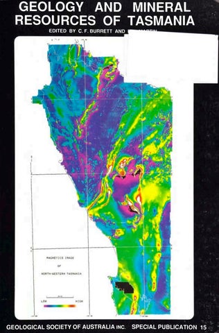
map also at 1:500,000, thus allowing presentation of what should be a valuable set of maps, all on the one base. Carpentaria Exploration Company kindly made available the negative of the coloured version of the magnetic intensity contour map of northwestern Tasmania used on the dust jacket. The Editorial Sub-committee was anxious to provide maps, diagrams and all line drawings to a uniform standard and style. To this end, and generally for illustration of the volume, donations were sought from companies. The companies which generously provided these donations were: Aberfoyle Resources AMOCO Production Company Bridge Oil Ltd Broken Hill Proprietary Company Ltd Comalco Aluminium Ltd Cornwall Coal Company N.L. Conzinc Riotinto of Australia Exploration Pty Ltd Colonial Sugar Refining Ltd Electrolytic Zinc Company of A/Asia Esso Australia Ltd Goldfields Exploration Pty Ltd Paringa Mining and Exploration Co. P.L.C. Savage River Mines Shell Company of Australia Ltd
Editor, Special Publications, Geological Society of Australia Mr P.J.G. Fleming; the co-editor of the volume on the Geology of Victoria, Dr J. Douglas; Mr D. Sprod of Blubberhead Press, Hobart; Dr A.J. Finney, Acting Director, Tasmanian University Research Company, and others. To all of these and to all others who helped, the Sub-committee is grateful. Special mention should be made of the typing and compositing work of Ms J. Pongratz and the drafting of Mrs J. Turner. Our aim in producing this volume has been in part to honour a pioneer — Robert Mackenzie Johnston, in part to commemorate the work of naturalists and geologists over two centuries — with particular note of the work of S. Warren Carey, but especially to present a contemporary account of the geology and mineral deposits of the island of Tasmania and its surrounding sea floor. We have aimed at a comprehensive treatment of facts and explanations. Despite our best efforts we have not achieved a consensus, a situation indicative of vigorous growth. M. R. Banks Convenor
Useful advice has been received by the Editorial Sub-committee from many people: former Presidents of the Geological Society; the former Federal Treasurer of the Society, Dr J.W. Hunt; the Honorary
Dr C.F. Burrett (Editor), Mr J.K. Davidson, Dr R.R. Large, Mr E. Martin (Assistant Editor) and Dr E. Williams — the Editorial Sub-committee.
and
iv
Editorial Introduction
Terminology In this volume we have attempted to standardise stratigraphic nomenclature in accordance with the recommendations and philosophy of the International Stratigraphic Guide (Hedberg, 1976), the Australian Guide (Staines, 1985) and with the suggestions of Haile (1987) and Owen (1987). A clear distinction between chronostratigraphic and geochronological units and their adjectival modifiers is maintained, we hope, consistently through the volume. To quote the International Stratigraphic Guide, "... each chronostratigraphic unit (interval of rock strata) has a corresponding geochronologic unit (interval of geologic time). ... To illustrate the difference, a chronostratigraphic unit can be likened to the sand that flows through an hourglass during a certain interval of time, while the corresponding geochronologic unit can be compared to the interval of time during which the sand flows." Thus the Silurian System is the interval of rock strata deposited between the time of deposition of the 'golden spike' bed of Dobb's Linn in Scotland and the time of deposition of the 'golden spike' bed at Klonk, Czechoslovakia. The Silurian Period is the corresponding time interval — currently between 438 ± 12 Ma and 408 ± 12 Ma. Early and Late are used for geochronological units (periods, epochs etc.) whilst Lower and Upper are used for chronostratigraphic (systems, series etc.), lithostratigraphic (groups, formations etc.) and biostratigraphic units (zones). To quote Haile (1987, p.257), "A simple guide to usage may be stated thus: Time-rock (chronostratigraphic) units (lower/ upper) should be used for attribution of age to rocks, formations, biostratigraphic zones, unconformities, and seismic reflectors and, consequently, on well logs, columnar and seismic sections, crosssections, and stratigraphic correlation diagrams.
Time-rock units have a base, a top, and a thickness. Time (geochronological) units (early/late) should be used for describing the time of occurrence of historical events such as periods of erosion, transgression, folding, faulting, faunal extinction, and oil generation and migration and, consequently timing of events shown on graphical representations of geological history. Time units have a beginning, an end, and a duration. We have used lower case for informal (undefined) chronostratigraphic units and their geochronological equivalents, e.g. lower Ordovician, early Ordovician, middle Palaeozoic, upper Cambrian but where international or national committees have defined the units, upper case initials have been used, e.g. Upper Silurian, Late Silurian, Middle Devonian. Thus only the Silurian and Devonian have been defined — the Silurian into Lower (consisting of the Llandovery (three stages) and Wenlock (two stages) Series and Upper consisting of Ludlow (two stages) and Pridoli (no stages). Note that Middle Silurian no longer exists (Holland, 1985). The Devonian consists of the Lower with Lochkovian, Pragian and Emsian Stages, Middle with Eifelian and Givetian Stages and the Upper with Frasnian and Famennian Stages. Because of its popularity with a few of the major authors the term Eocambrian is (unfortunately) retained as an informal term 'eo-Cambrian' for rocks of uncertain age within the range late Precambrian (?Riphean, ?Vendian) to ?lower Cambrian. A more satisfactory and internationally understandable method of indicating this uncertainty would be to write ?Vendian-?lower Cambrian.
Lithostratigraphic Terms Lithostratigraphic units include Supergroup, Group, Subgroup, Formation and Member. The term
Acknowledgements
beds is also available and is written with a lower case initial (Staines, 1985, p.96). For igneous and metamophic units the terms Complex, Suite and Supersuite are available. The formal term Sequence is not recommended as it is used as the basic, informal, unit in seismic stratigraphy and in a variety of other informal senses. Thus the "central volcanic sequence" of the Mt Read Volcanics is termed the Central Volcanic Complex throughout this volume and the "western sequence" is treated informally. Structural terms such as pluton and batholith are not formalised, e.g. the Lottah pluton whereas the mappable unit is formal, e.g. Lottah Granite or Lottah Alkali-Feldspar Granite. We have attempted to remove the last vestiges of the geosynclinal hypothesis from Tasmanian geology by avoiding, where possible, the term geosyncline and removing the inappropriate term geanticline. The noun uplift is probably the best term available for what is usually thought of as the palaeogeographically positive feature — the Tyennan geanticline (e.g. Tyennan uplift, Rocky Cape uplift). Considerable problems emerged concerning the nomenclature of the major areas of Tasmanian Precambrian rocks and the need for both nongenetic and genetic terms to describe them. The following (albeit unsatisfactory) terms were adopted. Region: a descriptive term for a major area underlain predominantly by Precambrian rocks as in Tyennan region, Jubilee region, Rocky Cape region etc.For definitions see Fig. 2.1). Other smaller areas of Precambrian rock are termed inliers (e.g. Glovers Bluff inlier). If parts of or one of these regions are thought to have behaved as a relatively competent unit during tectonic activity, bounded by zones of continuous or discontinuous deformation then the term block is recommended (e.g. the Prince of Wales Range block and the Cradle Mt block during the Devonian). Fault-bounded areas with a distinctive tectono-stratigraphic history are terranes, e.g. the Western and Eastern Tasmanian Terranes. Following Owen (1987, p.370) Ma = millions of years ago, ka = thousands of years ago and m.y. = millions of years duration.
The editors thank all 76 authors for their contributions and a large number of reviewers for their constructive comments. We are indebted to the editorial committee for their help and support particularly to Max Banks who has organised most of the financial aspects and advised us on innumerable matters. For 25 years we have been using the excellent geographic index compiled by Doris Banks for the previous Geology of Tasmania. We are indebted to her and Max Banks for compiling the much larger and, with grid co-ordinates more useful, geographic index for this volume. We thank June Pongratz for typing most of the manuscripts and preparing many versions of each, up to and including the final type-set, cameraready copy. The majority of diagrams were drafted by Judith Turner. Alison Jones checked the 7500 literature citations and consolidated an enormous pile of incomplete and contradictory references into a readable and reliable format. Clive Burrett Ted Martin December 1988 Hobart
Clive Burrett December 1988 Hobart. vi
Contributing Authors
J. A. Anderson, Aberfoyle Resources, 123 Camberwell Rd, Hawthorn East, Melbourne, Vic. 3123 C. A. Bacon, Mines Department of Tasmania, PO Box 56, Rosny Park, Tas. 7018 P. W. Baillie, Mines Department of Tasmania, PO Box 56, Rosny Park, Tas. 7018
J. T. Carswell, Renison Gold Fields, Wau, Papua Niu Gini. M. J. Clarke, Mines Department of Tasmania, PO Box 56, Rosny Park, Tas. 7018 E. A. Colhoun, Geography Department, University of Newcastle, Newcastle, NSW 2308
D. M. Banks, 38 View Street, Sandy Bay, Tas. 7005
P. L. F. Collins, Department of Geology and Geophysics, Curtin University, Kent St, Bentley, WA 6102
M. R. Banks, Geology Department, University of Tasmania, GPO Box 252C, Hobart, Tas. 7001
K. D. Corbett, Mines Department of Tasmania, PO Box 56, Rosny Park, Tas. 7018
C. A. Boulter, Geology Department, University of Nottingham, University Park, Nottingham, UK NG7 2RD
S. F. Cox, RSES, Australian National University, PO Box 4, Canberra, ACT 2601
A. V. Brown, Mines Department of Tasmania, PO Box 56, Rosny Park, Tas. 7018 S. G. Brown, 33 Alton Rd, Raymond Terrace, NSW 2324 C. F. Burrett, Geology Department, University of Tasmania, GPO Boc 252C, Hobart, Tas. 7001 C. R. Calver, Mines Department of Tasmania, PO Box 56, Rosny Park, Tas. 7018 A. Comacho, Northern Territory Geological Survey, Darwin, NT 0800 S. P. Carey, Department of Geology, Ballarat CAE, Ballarat, Vic. 3350
W. C. Cromer, PO Box 382, Sandy Bay, Tas. 7005 J. K. Davidson, Arabex Petroleum NL, PO Box 9209, Bagdad, Tas. 7404 E. V. Dronseika, Aberfoyle Resources, Hellyer Division, Private Bag 4, Burnie, Tas. 7320 J. L. Everard, Mines Department of Tasmania, PO Box 56, Rosny Park, Tas. 7018 A. Ewart, Department of Mineralogy, University of Queensland, St Lucia, Qld. 4067 R. J. Ford, deceased. S. M. Forsyth, Mines Department of Tasmania, PO Box 56, Rosny Park, Tas. 7018
P. Komyshan, 126 Varden St, Kalgoorlie, WA 7430
R. D. Gee, Reynolds Australia Mines, Griffin Building, 28 The Esplanade, Perth WA 6000
R. R. Large, Geology Department, University of Tasmania, GPO Box 252C, Hobart, Tas. 7001
A. Goede, Geography Department, University of Tasmania, GPO Box 252C, Hobart, Tas. 7001
D. E. Leaman, 21 Zomay Avenue, Dynnyrne, Tas. 7005
D. C. Green, Geology Section, Cambridge College of Arts & Technology, East Road, Cambridge UK CB1 2AJ
T. C. Lees, PO Box 288, Tenterfield, NSW 2372
D. H. Green, Geology Department, University of Tasmania, GPO Box 252C, Hobart, Tas. 7001
A. Luskin, Bridge Oil Ltd, 60 Margaret St, Sydney, NSW 2000
G. R. Green, Mines Department of Tasmania, PO Box 56, Rosny Park, Tas. 7018
E. Martin, Mines Department of Tasmania, PO Box 56, Rosny Park, Tas. 7018
J. M. Hergt, RSES, Australian National University, PO Box 4, Canberra, ACT 2601
W. L. Matthews, Mines Department of Tasmania, PO Box 56, Rosny Park, Tas. 7018
N. C. Higgins, Bureau of Mineral Resources, PO Box 378, Canberra, ACT 2600
G. J. McArthur, Aberfoyle Resources, Hellyer Division, Private Bag 4, Burnie, Tas. 7320
R. S. Hill, Botany Department, University of Tasmania, GPO Box 252C, Hobart, Tas. 7001
M. P. McClenaghan, Mines Department of Tasmania, PO Box 56, Rosny Park, Tas. 7018
P. B. Hills, Mt Lyell Mining & Railway Co., PO Box 257, Queenstown, Tas. 7467
W. D. McDonough, Institute fiir Geochemie, Max Planck Institut, Mainz, W. Germany
D. K. Hobday, Australian Bank, 17 O'Connell St, Sydney, NSW 2000
I. McDougall, RSES, Australian National University, PO Box 4, Canberra, ACT 2601
J. D. Hollis, The Australian Museum, 6-8 College St, Sydney, NSW 2000
A. W. McNeill, Aberfoyle Resources, Exploration Division, PO Box 952, Burnie, Tas. 7320
J. W. Howarth, 74 Bathurst St, Cobar, NSW 2835
W. R. Moore, Mines Department of Tasmania, PO Box 56, Rosny Park, Tas. 7018
J. W. Hudspeth, Tasmania Department of Health, Hobart, Tas. 7000
R. Morland, PO Box 65, South Broken Hill, NSW 2880
G. D. Iliff, 14 Hey St, Rosebery, Tas. 7470 K. C. Morrison, 190 Macquarie St, Hobart 7000 J. B. Jago, Department of Applied Geology, South Australian Institute of Technology, The Levels, SA 5095
W. D. Parkinson, Geology Department, University of Tasmania, GPO Box 252C, Hobart, Tas. 7001
M. Kamperman, Kalgoorlie Mining Associates, PO Box 105, Fimiston, WA 6430
S. J. Patterson, Geology Department, Hydro-Electric Commission, GPO Box 388D, Hobart, Tas. 7001
D. J. Kennedy, Department of Geological Sciences, Brock University, St Catherines, Ontario, Canada L2S 3A1
C. M. Powell, Geology Department, Macquarie University, North Ryde, NSW 2113
viii
P. G, Quilty, Deputy Director, Antarctic Division, Channel Highway, Kingston, Tas. 7150
V. Threader, Mines Department of Tasmania, PO Box 56, Rosny Park, Tas. 7018
C. P. Rao, Geology Department, University of Tasmania, GPO Box 252C, Hobart, Tas. 7001
N. J. Turner, Mines Department of Tasmania, PO Box 56, Rosny Park, Tas. 7018
L. R. Raynor, deceased.
R. Varne, Geology Department, University of Tasmania, GPO Box 252C, Hobart, Tas. 7001
E. J. Reid, 167 George Street, Launceston, Tas. 7250
D. B. Wallace, Aberfoyle Resources, PO Box 952, Burnie, Tas. 7320
R. G. Richardson, Mines Department of Tasmania, PO Box 56, Rosny Park, Tas. 7018
N. Weatherstone, 5 O'Connor Way, Kalgoorlie, WA 6430
D. Seymour, Mines Department of Tasmania, PO Box 56, Rosny Park, Tas. 7018
P. Wellman, Bureau of Mineral Resources, PO Box 378, Canberra, ACT 2600
M. Solomon, Bureau of Mineral Resources, PO Box 378, Canberra, ACT 2600
E. Williams, Mines Department of Tasmania, PO Box 56, Rosny Park, Tas. 7018
P. C. Stevenson, Mines Department of Tasmania, PO Box 56, Rosny Park, Tas. 7018
P. R. Williams, Bureau of Mineral Resources, PO Box 378, Canberra, ACT 2600
F.. L. Sutherland, Australian Museum, 6-8 College St, Sydney, NSW 2000 S. Taylor, Electrolytic Zinc Co. of Australasia Ltd, 476 St Kilda Rd, Melbourne, Vic. 3004
ix
Contents
Preface Editorial Introduction Contributing Authors
page
page
iii v vii
Correlates of the Success Creek Group 52 Crimson Creek Formation 54 Correlates of the Crimson Creek Formation 55 Poorly constrained Upper Proterozoic-Cambrian successions 58 Adamsfield area 58 Port Davey-Ironbound Range-South Coast area 59 Bathurst Harbour area 59 Southeast coast of King Island 60 Eo-Cambrian-middle Cambrian volcanic rocks 61 Introduction 61 Dundas Trough 61 Smithton Basin 67 Fossey Mountain Trough 67 Classification of the mafic volcanic successions 68 Eo-Cambrian-Cambrian gabbroic rocks 69 Eo-Cambrian-Cambrian ultramafic rocks 71 Middle to upper Cambrian fossiliferous sedimentary rocks 74
1. History of Geological Work in Tasmania
1
2. Precambrian Summary Introduction Distribution Orogenic events The Rocky Cape region and nearby inliers North coastal section Extensions of the Rocky Cape Group Correlates of the Rocky Cape Group Correlates of the Burnie Formation Rocks of uncertain age Arthur Lineament/Arthur Metamorphic Complex The Badger Head region The Modder River inlier The Cape Sorell inlier King Island Bathurst Harbour-Ironbound Range The Jubilee region Small southern and eastern regions The Forth region and Goat Island inlier Small northern inliers The Tyennan region Quartzite-chloritic pelite assemblage Garnetiferous schist-quartzite assemblage Concluding remarks
5 5 6 7 7 11 11 14 15 17 20 22 24 25 25 26 27 27 30 30 32 33 34 38 44
3. Eo-Cambrian-Cambrian Summary Introduction Eo-Cambrian successions Success Creek Group
47 47 49 49 49
x
4. Cambrian Mt Read Volcanics and Associated Mineral Deposits 84 Summary 84 Stratigraphy, palaeogeography and geochemistry of the Mt Read Volcanics 86 General penological features 87 Stratigraphy and palaeogeography 88 Geochemistry of the Mt Read Volcanics 106 Summary of important elements in the Darwin-Hellyer area 115 Correlates of the Mt Read Volcanics in the Elliott Bay-D'Aguilar Range area 116 Mt Read-type volcanics in the Sorell Peninsula area H8 Correlates of Mt Read Volcanics in the Sheffield-Middlesex-Dial Range area 118 The mineral deposits of the Mt Read Volcanics 119 Discovery
Cambrian vs Devonian mineralisation The Cambrian ores Mt Lyell Rosebery Hercules Que River Hellyer The genesis of the mineral deposits
page
page
120 122 125 132 137 139 144 149
Wurawina Supergroup (the western Tasmania terrane) 183 Introduction 183 Biostratigraphy 185 Denison Group 185 The Gordon Group (early Ordovician to Early Silurian) - mainly platform carbonates 201 Mineralisation 221 Silurian and Devonian sediments 224 Summary 233 The eastern Tasmania terrane 234 Ordovician unit 234 Siluro-Devonian unit 235 An outlier west of the Tamar 236 Devonian volcanic units 236 Summary 237
Early Palaeozoic Deformation and Tectonics 154 Introduction 154 154 The major stratotectonic elements The Dundas-Fossey Trough' and associated elements 156 Introduction 156 Early 'trough' deposits and associated elements 156 Ultrmafic-mafic complexes and associated rocks 157 Dundas Group sediments, Mt Read Volcanics and related events 160 Sticht Range beds 162 Sub-Ordovician unconformities, late Cambrian events and Denison Group deposition 162 Cleavage development in the Cambrian 165 Structural relationships in the Sorell Peninsula area 165 Gravity interpretations of the Dundas Trough 167 Summary of features from the Dundas167 Fossey Trough The Adamsfield area 168 Unfossiliferous rocks 169 Middle to ?upper Cambrian fossiliferous sequences 172 Late Cambrian deformation 173 Summary of features of the Adamsfield district 174 South coast areas 174 Tectonic models 175 Introduction 175 Rift models 177 Problems with rift models 177 Plate tectonic models 177 Problems with plate tectonics models 178 The allochthon model 179 Problems with the allochthon model 179 Conclusions 180 Late Cambrian to Devonian Summary
7. Mid-Palaeozoic Deformation, Granitoids and Ore Deposits 238 Summary 238 Mid-Palaeozoic deformation 239 Pre-granitoid emplacement deformation 239 Deformation associated with granitoid emplacements and post-emplacement structures 250 Tamar Fracture System 253 Pre-mid-Palaeozoic deformation areal distribution of rock-units 253 Mid-Palaeozoic granitoids 253 Introduction 253 Western Tasmania 254 Eastern Tasmania 257 Furneaux Islands 261 Geochemistry and pedogenesis 266 Mid-Palaeozoic ore deposits 270 Introduction 270 Endogranitic greisen-vein tin deposits 271 Tin-tungsten skarn and carbonate-replacement deposits 274 Tin-tungsten vein deposits 284 Silver-lead-zinc vein deposits 288 Gold deposits 291 8. Late Carboniferous-Triassic Summary and Structural Development Lower Parmeener Supergroup Introduction and general biostratigraphy Hellyerian and lowest Tamarian stages Lower Tamarian stage Middle and Upper Tamarian Stage Lower Bernacchian non-marine interval
182 182 xi
293 293 295 295 297 299 300 302
page
Main Bernacchian marine interval Lower and Middle Lymingtonian Stage Upper Lymingtonian Stage Summary Upper Parmeener Supergroup Nature of the Lower/Upper Parmeener Supergroup boundary Unit 1: Upper Permian coal measures and associated rocks Unit 2: Quartz sandstone sequence and associated rocks (Griesbachian-preAnisian?) Unit 3: Sequence with quartz and lithic sandstone (pre Anisian? to Ladinian) Unit 4: Volcanic lithic sandstone and coal measure sequence (Carnian) Volcanic rocks Economic Geology Metalliferous deposits Non-metallic minerals Fuel minerals Construction materials Jurassic-Cainozoic Summary Introduction Tectonic and depositional framework Late Jurassic-early Cretaceous Late Cretaceous Paleocene-early Eocene Eocene Oligocene-Recent The Basins Bass Basin Booby alia Sub-basin The Tamar Graben Devonport-Port Sorell Sub-basin West Tasmania region Southeastern Tasmania East Tasmania region Tin fields of northeastern Tasmania Scottsdale Sub-basin Longford Sub-basin Tertiary cover rocks Brown coal Palaeobotanical aspects Igneous rocks Jurassic dolerite Cretaceous alkaline rocks Tertiary volcanism Tertiary basaltic magmas and the Tasmanian lithosphere
303 305 306 307 309 309 309
315
Macquarie Island Cainozoic geomorphology Late Palaeozoic to early Tertiary landscape development Effects of structure and faulting Development of erosion surfaces Drainage patterns and origins Age and significance of Tertiary volcanic extrusions Pliocene-early Pleistocene landscape modification Development of limestone areas and caves Conclusions on pre-Quaternary evolution
323 329 333 335 335 335 335 337 339 339 340 341 343 343 345 345 345 347 347 356 358 361 361 365 367 369 369 370 372 373 374 375 375 381 383 386
10. Quaternary Introduction Glacigenic deposits Organic deposits Slope deposits Coastal deposits Aeolian deposits Fluvial deposits Cave deposits Geomorphic effects of settlement Economic minerals 11. Metallic Mineral Exploration Models and Case Histories Introduction Exploration for polymetallic massive sulphide deposits Key geological exploration factors Key geophysical exploration factors Key geochemical exploration factors The use of isotope geochemistry Application of the zinc ratio to exploration An exploration model for polymetallic massive sulphides in Tasmania Potential for further discoveries Exploration for massive pyrrhotote-cassiterite deposits Key geological exploration factors Key geophysical exploration factors An exploration model for pyrrhotite-cassiterite deposits in Tasmania Potential for further discoveries Exploration case history of the discovery of the Hellyer polymetallic massive sulphide deposit Introduction History of exploration in the Hellyer-Que River area The discovery of Hellyer
page
Geology Conclusions Case History of the Zeehan tin field Introduction Geology Characteristics of the mineralisation Early tin discoveries Discovery of the Queen Hill and Montana deposits Conclusions
433 434 434 434 434 436 436
12. Engineering Geology Case histories in engineering geology in the Hydro-Electric Commission Devils Gate arch dam site The landslide above Fisher Tunnel outlet portal Engineering geology in the Department of Mines, 1964-1987 Foundation for buildings and bridges Dam site investigations Cemeteries and disposal sites Quarries and rock faces Other studies
439
13. Geophysics Summary Introduction The gravity field The magnetic field Aspects of interpretation of aeromagnetic surveys The relationship between basement in western and northeastern Tasmania Basement structure in western Tasmania Igneous rocks Heat flow and heat production in Tasmania Tasmanian seismicity Crustal structure
450 450 451 451 455
page
Smithton Basin Adamsfield Trough Cambrian deformation Earlier deformation Tectonic development Later deformation and the siliciclastic Denison Group Tasmanian terranes Western Tasmanian Terrane Gordon Group dominantly of platform carbonates Eldon Group of shallow-marine deposits Middle Palaeozoic deformation Middle Palaeozoic granitoids Eastern Tasmanian Terrane Pre-granitoid emplacement deformation Middle Palaeozoic granitoids Tamar Fracture System Tasmania B asin Lower Parmeener Supergroup Upper Parmeener Supergroup Jurassic dolerite Gondwana dispersion Mesozoic-Cainozoic depositional basins and volcanism Otway and Sorell Basins and South Tasman Rise Southeastern Tasmania Graben Gippsland Basin and eastern Tasmania Bass Basin and adjacent onshore basins Other onshore Cainozoic deposits Tertiary onshore basalts
436 438 439 439 441 443 443 445 446 447 448
459
Stratigraphic and Structural Index Palaeontological Index Place Name Index
459 460 460 461 463 465
14. Summary and Synthesis 468 Abstract 468 Pre-Tamar Fracture System 468 Post-Tamar Fracture System 469 Precambrian rocks 470 Rocky Cape region and other similar regions and inliers 470 Tyennan and Forth regions 471 Precambrian tectonometamorphic events 471 Early Palaeozoic troughs 476 Dundas, Dial Range and Fossey Mountain Troughs 476
481 481 482 482 484 485 486 486 486 487 488 488 489 489 490 491 491 491 492 493 494 494 495 495 495 498 498 499 500 508 516
MAP 1 - Geological map of Tasmania, 1:500,000 Department of Mines, Tasmania. First edition 1976, reprinted 1988. MAP 2 - Mineral deposits and metallogenic map of Tasmania. 1:500,000. Department of Mines, Tasmania. First edition 1988. MAP 3 - Gravity map of Tasmania. 1:500,000. Department of Mines, Tasmania. First edition 1987.
xiii
MAP 4 - Total magnetic intensity contours, Tasmania. 1:500,000. Bureau of Mineral Resources, Canberra and Department of Mines, Tasmania. First edition 1988.
1
1. History of Geological Work in Tasmania M. R. Banks
Just a hundred years ago A Systematic Account of the Geology of Tasmania written by Robert Mackenzie Johnston was published. A measure of its stature is that it was still influencing geological thought about Tasmania seventy years later. It was written by an amateur geologist, neither the first, nor the last such to make a distinct contribution to the geology of the island. Only one full-time professional geologist, Charles Gould, had made a significant contribution earlier and only one amateur, Arndell Lewis, made one later. As in many other societies which arose outside Europe from European roots the early geological observations were made by transient marine explorers. Subsequently the torch of the search for geological knowledge passed to residents who made geological explorations incidental to their other professional duties. Such people were followed by others, the first of them Gould, who had been trained as and were employed full-time as geologists. The professional line was not, however, unbroken as the termination of Gould's contract by the Tasmanian Government in 1869 left a vacuum ably filled by Johnston and the decline in the strength of the Geological Survey of Tasmania during and after the economic depression of the early 1930's provided the opportunity for Arndell Lewis to make a noteworthy contribution. The earliest geological deduction was that of William Anderson, surgeon on James Cook's vessel Resolution, when he deduced in 1777 that the sand of the beach at Adventure Bay was derived from the sandstone cliffs to the north (Beaglehole, 1967, pp.783, 789, 790). Expeditions under the command of Captain John Hayes, Bruni D'Entrecasteaux and Nicholas Baudin made many records of rock types at particular places. For
example the earliest record of coal in Australia is that by Labillardiere (1800), a Triassic seam discovered at South Cape Bay in 1793 (coal had been discovered earlier in New South Wales but the discovery not published until much later). The Baudin expedition is noteworthy for the fact that two of the many scientists aboard, Joseph Bailly and Louis Depuch were trained mineralogists, Bailly being a student of the crystallographer, Hauy. It is also noteworthy for the interest shown in the great columns of dolerite seen in coastal cliffs and on Table Mountain, later Mt Wellington. The recorder of the Baudin expedition, Francois Peron, was astounded and delighted by the evidence provided by the columns for previous volcanic eruptions half a world away from those of Auvergne and the Giants Causeway (Peron, 1807). He also spoke with awe of the vista on the eastern side of Tasman Peninsula seen from the ship's deck at dawn and rhapsodically referred to the giant dolerite columns at Cape Hauy as 'an organ reposing on the surface of the sea'. Incidentally the description (Peron, 1807, p.261) of the geology of Maria Island by Bailly and Depuch was remarkably good even though they gauged the granites as being very old because of the coarseness of their grainsize thus applying in Tasmania an assumption common in Europe at the time. William Patterson took with him to the mouth of the Tamar, Robert Brown, subsequently famous as a botanist, and late in 1803 Brown may have collected, probably on the shores of Middle Arm, the fossil brachiopod, later to become the first fossil, Trigonotreta stokesi, described from Australia (Koenig, 1825; Brown, 1953; Clarke, 1979; but see Vallance & Moore, 1982, pp.34-37). A few weeks later Brown accompanied David Collins when
2 Hobart Town was established. Brown made some geological observations as he travelled up the Derwent, went by land from Hobart Town to the mouth of Browns River and to the Huon River (Brown diary, m.s.). On some of his expeditions from Hobart Town, Brown was accompanied by A.W.H. Humphreys, sent with Collins as His Majesty's Mineralogist to New South Wales. Regretably, Humphreys made few significant geological discoveries (Vallance, 1981). During the first thirty years of settlement in Tasmania some attention was given to finding deposits of limestone, coal and sandstone. One of the more interesting discoveries was that of iron ore at Andersons Creek, a discovery which lead to the first mining licence in Tasmania. This licence to mine the iron ore was issued by Governor King to Simeon Lord, trader of Sydney, in 1812 (Historical Records of Australia 111(1), p.758). Charles Darwin visited Hobart Town briefly in 1836 where he observed the rocks astutely and deduced accurately the geological history of the area (Banks, 1971b). Subsequently, 1842, J.B. Jukes (1847) made coastal observations, mostly correct but one of which laid the foundation of the concept adopted by Johnston in 1888 and others earlier than the dolerite (now known to be Jurassic) was pre-Permian. He rightly warned local observers of the dangers of applying European stratigraphic names to Tasmanian rocks. The celebrated Polish explorer, P.E. von Strzelecki (1845) spent two years in Tasmania, made many observations, very early if not the first chemical analyses of Tasmanian rocks, water and soils, and collected fossils later described by English palaeontologists. His work is marred by his interpretations made using Wernerian and pre-Wernerian concepts. Development of steam ships led LieutenantGovernor William Denison to instruct Joseph Milligan, a resident surgeon, to report on Tasmanian coals. This instruction led to a series of four excellent papers (Milligan, 1849b). The first of these reports contains the earliest published correct record of the contribution of ice to formation of a sedimentary rock in Australia. The necessity in the mid-1850's to reverse the rush of young energetic people to the newly discovered goldfields in Victoria and New South Wales persuaded the Tasmanian Government in 1859 to appoint Charles Gould, as the first fulltime professional geologist on the island; his title was Geological Surveyor (Banks & Yaxley, 1972).
Gould made three famous exploratory trips to western Tasmania but worked as a geologist in many parts of the island. He was apparently highly regarded by prospectors for alluvial tin in northeastern Tasmania as his advice usually proved correct but he is probably best remembered by geologists for establishing correctly the sequence of Ordovician to Devonian formations in western Tasmania (Gould, 1866b). He was the first observer of Tasmanian geology to have any sense of structural geology and it was more than 80 years before another came onto the scene. Gould was also widely known as the initiator of the practice of naming mountains in western Tasmania after contemporary British geologists, e.g. Murchison. Although Gould was recruited as a geological surveyor, the government really wanted him to find gold. In this he failed. This failure and an economic recession allowed the government to terminate his contract. The torch of search for geological knowledge so ably held by Gould passed to Robert Mackenzie Johnston (Wettenhall, 1983), a railway booking clerk and accountant and for many years Tasmanian Government statistician who had studied geology briefly in Glasgow. Johnston was stationed at first in northern Tasmania and contributed a series of useful descriptive papers on Tertiary rocks and fossils in northern Tasmania such materials being readily at hand. With his move to Hobart in 1880, he switched his attention to the Upper Palaeozoic sedimentary rocks and dolerite so prominent around Hobart. His work drew the attention of the Government who commissioned him to write a geology of Tasmania. This he did, basing his work partly on Gould's papers and maps, partly on his own work and partly on older published material. The sections on the Upper Palaeozoic and later rocks are very good but those on older rocks are confused. Not until the 1940's did a coherent picture emerge from the Lower Palaeozoic and Precambrian. Shortly after publication of A Systematic Account... the state government instituted a geological survey within the Department of Mines. One of the early Government Geologists to lead the survey was W.H. Twelvetrees. During his tenure of office, 1899-1919, geological work concentrated on mining areas and some very good bulletins resulted. The Zeehan work by Twelvetrees & Ward (1910) was widely noticed in Australia and overseas for the evidence it advanced for zonal distribution of ore bodies. Twelvetrees was not only a good
3 geologist but also a good administrator with the ability to organise effectively the efforts of his officers. Absence of some of these officers at the First World War slowed down the rate of work. Hills, who followed Twelvetrees, instituted statewide studies on coal resources and groundwater (e.g. Hills et al., 1922; Nye, 1921), oddly enough without refining and generalising the stratigraphy of the coal-bearing rocks, understanding of which was still largely that of Gould and Johnston. He did however, make an imaginative survey of Tasmanian mineral deposits (Hills, 1923) in which he postulated a relationship between ore deposits and cupolas rising from a shallow granitic basement beneath western Tasmania. After Hills' resignation late in 1923 the Geological Survey went into a period of decline occasioned by decreasing manpower resources and later also by a period of official policy on nonpublication of geological work which was mainly concentrated on assessment of individual prospects. A notable exception to this policy was the publication of Bulletin 44 (1938), on The Geology and Mineral Deposits of Tasmania by P.B. Nye and F. Blake. This bulletin summarised knowledge to that time but provided no real framework for pre-Carboniferous rocks. During the period of decline of the Survey, a gifted amateur, Arndell N. Lewis, became interested in and made real contributions to knowledge of the Lower Palaeozoic and to Pleistocene glaciation. His outstanding contribution was the erection of the Junee 'Series' (Lewis, 1940a) to accommodate the Upper Cambrian to Upper Ordovician conglomerate to limestone sequence. His work on glaciation was somewhat marred by too great a reliance on a three-fold glacial scheme fostered by Edgeworth David. Lewis's posthumously published Geology of the Hobart District (1946) and his other papers reflect a general lack in Tasmanian geology since the days of Charles Gould, i.e. no clear sense of structural geology. During the Second World War Dr David Thomas became Chief Government Geologist bringing with him a good understanding of structure and knowledge of Lower Palaeozoic fossils. The first of these allowed the elucidation of the structure in the Florentine Valley-Adamsfield area, the second the discovery of the first clear evidence of Cambrian fossils, at Dundas (Thomas & Henderson, 1945). Thomas' stay in Tasmania was short and he was followed by Dr S.W. Carey who re-assessed and
synthesised correctly the framework of the Precambrian and Lower Palaeozoic stratigraphy prior to leaving to become the Foundation Professor of Geology at the University of Tasmania. In that position he encouraged regional geological mapping by staff and students. Although such work is not normally seen as appropriate for a university department, it was both logical and necessary in the Tasmanian context where such mapping had been virtually dis-continued fifteen to twenty years before. The mapping, allied with Carey's thorough knowledge of the literature of Tasmanian geology, allowed his publication in 1953 of the first islandwide synthesis of the structure of the Lower Palaeozoic rocks. It has been convenient up to this point to deal with the history of geology in Tasmania in terms of the contribution of a limited number of individuals. For the last part of this history, the last 35 years, such an approach is not appropriate. It is not appropriate partly because the events are too close to us and partly because the tempo of geological work increased dramatically during that time. The Geological Survey has grown in number almost ten-fold and specialist officers — a petrologist, a geochemist, a palaeontologist, engineering geologists and geophysicists have been appointed. The Department of Main Roads and Hydro-Electric Commission have had active geological sections, the Tasmanian Museum and Queen Victoria Museum have appointed geologists and the geological staff at the university has increased in number and range of specialisation. The Geological Survey and the university have been active in regional mapping leading to production of a series of 1:50,000 maps on the one hand and to research by staff and students on Tasmanian problems on the other. Mining companies operating within the State have maintained geological staffs, in some cases and at some times of considerable size, and in the minerals, coal, water and oil areas been supported by resident as well as interstate or overseas consultants. The results of the increase in tempo have been refinements in understanding of virtually every geological system and most aspects of the geology of Tasmania and a few major developments. An area in which understanding has increased significantly is that of Precambrian and Cambrian stratigraphy, structure and mineralisation. The important base-metal deposits of western Tasmania have increasingly been seen as Cambrian and
4 syngenetic. A series of aeromagnetic surveys of Tasmania and Bass Basin starting in 1956 and including a high-level comprehensive survey by the Bureau of Mineral Resources in 1966 (Finney & Shelley) have allowed delineation of fundamental structures. The increasing importance of geophysics in Tasmania is reflected in the fact that the Hellyer deposit was discovered entirely by geophysics. The tectonic integrity of the island has been challenged by suggestions of, but not agreement on, subduction zones in western Tasmania in the Cambrian, of different terranes in western Tasmania and by the suggestion of a fundamental structure separating eastern from western Tasmania, a suggestion supported by geophysical data. Thirty-five years
ago the concept of a Bass Basin was in the future. Recently oil and gas in significant quantities have been found therein and its stratigraphy, structure and tectonic history are becoming increasingly well known. The Geological Society of Australia published The Geology of Tasmania in 1962 (Spry & Banks). In the intervening quarter of a century, geological work in Tasmania has produced a new depth of understanding and allowed a wide synthesis of Tasmanian geology and some integration with geology beyond the island. Perhaps a hundred years after Johnston's work we can claim a close approach to a solidly-based framework of geological knowledge of Tasmania.
5
2. Precambrian N. J. Turner with contributions from C. A. Boulter, C. R. Calver, S. F. Cox, R. D. Gee, P. Komyshan, A. W. McNeil and N. Weatherstone Summary
N. J. Turner
This chapter deals with those Precambrian rocks which are regarded as being stratigraphically below unconformities which crop out in the lower reaches of the Black River, east of Smithton, and in the Pieman River. These unconformities overlie different parts of the group of inliers of Precambrian rocks which occupy most of northwestern Tasmania and which is given the collective name of Rocky Cape region. The minimum age for the commencement of the polyphase Penguin Orogeny which is believed to have caused the Black River and Pieman River unconformities is 700-750 Ma. Several lithological associations are present in the Rocky Cape region. In the west is a shallow marine association of relatively unmetamorphosed quartzarenite, siltstone, mudstone and subordinate dolomite which has been stratigraphically subdivided near the north coast (Rocky Cape Group) and near the Pieman River (Interview Siltstone). In the eastern part of the Rocky Cape region there is a probably younger, deeper water association of turbiditic quartzose sandstone, slate and minor mafic lava (alkali basalt). Near the north coast this association is known as the Burnie Formation whilst in western Tasmania it is called the Oonah Formation. Separating the eastern and western lithological associations is a tectonic feature called the Arthur Lineament which is a belt of relatively high strain and greenschist to amphibolite facies metamorphism produced during the Penguin Orogeny. The metamorphic complex which occupies
this linear belt displays structurally and metamorphically transitional boundaries with the western and eastern lithological associations but much of the complex is derived from a third lithological association. This third association comprised mafic intrusives and extrusives (tholeiitic) together with sediments of pelitic, dolomitic and quartzose compositions. The iron ore deposit at Savage River occurs within this association. Chemical similarities between the mafic rocks in the association, in the adjacent Bernafai Volcanics and in mafic volcanics occurring above the Black River and Pieman River unconformities suggest that these various rocks may be correlates. Such a correlation would require revision of the stratigraphic position of at least part of the folding and metamorphism in the Precambrian rocks of the Rocky Cape region. Correlation of events in the Rocky Cape region with events in other Precambrian inliers and groups of inliers (regions) is uncertain. It has been suggested that deposition and orogenesis in the Tyennan and Forth regions and some other inliers occurred before deposition and orogenesis in the Rocky Cape region and other relatively unmetamorphosed inliers. However, interpretation of fairly sparse and generally complicated Rb-Sr and K-Ar data indicates that rocks within the Tyennan region exhibit syndeformational (D, ) meta-morphic ages that are close to, or within, the range assigned to the Penguin Orogeny. Also, the tectonic transport pattern of over-riding from the west that is evident in the Rocky Cape region is evident in the Tyennan, Jubilee and Badger Head regions. 2
6
Chapter 2
There is little direct evidence upon which to base correlations of depositional events but it is probably significant that lithological associations similar to the association in the western part of the Rocky Cape region form much of the metamorphosed Tyennan and Cape Sorell regions and the relatively unmetamorphosed Jubilee region. Lithological associations similar to the Burnie Formation underlie the Badger Head region and a number of small inliers, for example, those at Dundas and Mt Bischoff. The metamorphics in the Tyennan and Forth regions have been subdivided into quartzite-chloritic pelite assemblages of lower greenschist facies and garnetiferous schist-quartzite assemblages of upper greenschist to eclogite facies. Some transitional contacts are known between the two types of assemblage but many boundaries are thought to be major movement zones. Pressure-temperature determinations indicate that disruption of the original orogenic pile, probably largely due to D2 thrusting, has juxtaposed rocks drawn from depths ranging from about 12 km to well in excess of 30 km. In comparison the component of vertical displacement necessary to juxtapose the lower grade metamorphic rocks with rocks classed as relatively unmetamorphosed would be small. Unfortunately the known boundaries between these types of assemblage display ambiguous relationships. On balance, a reasonable assessment of the Precambrian rocks is that they display relationships which are consistent with their derivation from a single orogenic pile. Two lithological associations are predominant, namely, a shallow marine association characterised by quartzarenite and a deeper water, probably younger association characterised by turbiditic quartzose sandstone. A third association involving tholeiitic mafic rocks is present within the Arthur Lineament. The possible correlation of these mafic rocks with other mafic sequences in western and northwestern Tasmania may indicate that revision is needed of the stratigraphic position of at least part of the Precambrian deformation and metamorphism.
Introduction The time range during which the predominantly metasedimentary Precambrian rocks in Tasmania were deposited is uncertain but may have been from about 1100 Ma (Raheim and Compston, 1977)
to latest Precambrian (Vidal in Corbett et al, 1977). In both the Smithton district and in the middle reaches of the Pieman River the possibly latest Precambrian rocks overlie older rocks at angular unconformities (Taylor, 1954; Gee, 1967 a, b; Brown, 1986), which are attributed to the Penguin Orogeny (E. Williams et al, 1976; E. Williams, 1976), a period of polyphase deformation and metamorphism which apparently commenced 700-750 Ma (Adams et al., 1985). This chapter deals with the rocks which are thought to be older than the unconformities in the Smithton and Pieman River districts whilst the younger rocks are discussed in Chapter 3. Discussion of the possibly youngest Precambrian rocks is deferred because they have been interpreted as the initial deposits in essentially early Palaeozoic sedimentary basins (E. Williams, 1976) although a previous interpretation of the sequence in the Smithton district (Gee, 1967a) assigned it a pre-Penguin Orogeny age. The major economic resource in rocks older than the Penguin Orogeny is the iron ore deposit at Savage River. Dolomite units at Mt Bischoff and Zeehan are hosts to historically very important tin and silver-lead replacement deposits of Devonian age. Potentially economic deposits of silica, in the forms of quartzarenite and residual sand, are present in several areas and substantial magnesite deposits are present in northwestern Tasmania. Small occurrences of gold in quartz veins occur near Savage River and small epigenetic copper lodes are known in several areas, notably Balfour. Because there is doubt about the overall stratigraphy of the rocks which predate the Penguin Orogeny, they are not dealt with in stratigraphic order in the following description. Instead the chapter is organised according to the geographic distribution of the rocks. Thus the rocks in, for example, northwestern Tasmania are described separately from rocks in other parts of the island. Discussion relating to the possible relative ages of the rocks in the various areas recurs throughout the chapter. In the selection of the source material upon which this chapter is based there has been particular emphasis on field-descriptive work and on work carried out since the publication of the last Geology of Tasmania (Spry & Banks, 1962). Edited contributions from several workers have been included and are acknowledged by inclusion of their name against the first heading of the relevant section or by personal communication.
Precambrian
7
Distribution About one fifth of Tasmania is underlain by rocks that are older or probably older than the Penguin Orogeny. The rocks occupy inliers which are separated by belts of either folded strata of latest Precambrian to Devonian age or relatively flatlying Carboniferous to Cainozoic strata. Inliers separated by narrow belts of Carboniferous to Cainozoic strata have been grouped as 'regions' (E.Williams et al., 1976), apparently on the basis that subsurface continuity of the Precambrian rocks may reasonably be assumed. The same approach is adopted in this work (Fig. 2.1). Where inliers or regions are separated by folded strata there are generally no assumptions made concerning subsurface continuity and correlation of depositional, structural and metamorphic events is regarded as conjectural. The Jubilee and Tyennan regions are a special case amongst the Precambrian regions in that they are apparently contiguous. However, the boundary between these tectonometamorphically different terranes is poorly known. In part it is occupied by extensively faulted lower Palaeozoic deposits (Turner et al., 1985). Several of the major regions correspond closely in area to inferred early Palaeozoic geanticlines (see E. Williams, 1976) or uplifts and they may be conveniently referred to by employing the already established geanticline name. Hence the name Tyennan region (Fig. 2.1) finds its origin in Tyennan Geanticline and similarly the Rocky Cape, Forth and Badger Head regions. The term Tyennan Geanticline was itself derived from the term Tyennan Nucleus of Carey (1953). Other major regions are King Island and the Jubilee region which is named after the Jubilee Block of Corbett (1970). Small inliers are specified by local geographic names (see Fig. 2.1).
Orogenic Events Although substantial progress has been made in mapping the various Precambrian inliers since publication of the last Geology of Tasmania (Spry & Banks, 1962), many problems of stratigraphic, structural and metamorphic relationships within and between the inliers remain unresolved. Of particular importance in the determination of these relationships is the the number and timing of major Precambrian tectonometamorphic events.
KING ISLAND ROCKY CAPE REGION
Fig. 2.1 Distribution of rocks which are older than the Penguin Orogeny. The 'regions' shown in the figure are areas in which subsurface continuity of the Precambrian rocks is thought to be very likely (see text). The surface geology in these regions comprises discrete Precambrian inliers separated by belts of relatively flat-lying, Carboniferous and younger rocks. Subsurface continuity between the various regions is not assumed nor is it assumed between the regions and the many smaller occurrences of Precambrian rocks which are numbered in the figure. These latter include the following inliers: Modder River (1), Cape Sorell (2), Dundas (3), Ramsay River (4), Mt Bischoff (5), Welcome-Montagu (6), Briant Hill and Lake Mikany (7), Goat Island (9), Great Bend (10), The Avenue Road (11), Native Hop Hill (12), Glovers Bluff (16) and Hastings (17). Precambrian rocks occur on several islands in the Hunter Group (8) and have been encountered in bore holes at Ross (13), Interlaken (14) and Woodbridge (15).
8
Chapter 2
Rocks in all the Precambrian inliers are folded and regionally metamorphosed. They are almost entirely of sedimentary origin and they range from relatively unmetamorphosed subgreenschist facies sequences in which pelite is generally slaty through greenschist and amphibolite facies sequences containing phyllitic and schistose pelite to sequences in which there are kyanite- and sillimanite-bearing gneisses and eclogite. Relatively unmetamorphosed sequences which appear to be entirely of subgreenschist facies or very low greenschist facies underlie large areas and particular significance has been attached to the difference between them and the more intensely deformed greenschist facies and higher grade rocks. Spry (1962b) tentatively proposed a general relationship in which the more intensely deformed and metamorphosed rocks were interpreted as belonging to an older stratigraphic unit that had • • K-Ar
•<> Rb-Sr
• • Igneous
|meta
Ma
O •SedimentaryJ
Histograms-
Rocky Cape region 5 and King Island Tyennan and Forth regions
T"
800
been subjected to a major orogenic event (Frenchman Orogeny) prior to deposition of the relatively unmetamorphosed rocks. This older unit included the Whyte Schist in the southern part of the Rocky Cape region, the rocks in the Tyennan and Forth regions also small inliers at Great Bend and Native Hop Hill and the Concert Schist at Dundas. Areas underlain by possibly younger rocks included most of the Rocky Cape region and the Jubilee region as well as some smaller regions. The rocks in these regions were thought to have been deformed by the Penguin Movement, a late Precambrian folding event which was later renamed the Penguin Orogeny (Gee, 1967a). Subsequently the Whyte Schist has been shown to be part of a belt of greenschist to amphibolite(?) facies rocks occupying the Arthur Lineament (Gee, 1967a) which on field evidence are transitional with adjacent less deformed and relatively unmetaO
Precambrian T 700
-1
1 1S I
500
600
1
Dr
400
D1-2 of Penguin Orogeny
1
h-i
5
King Island
Rocky Cape Group
• •
a> Arthur Lineament o-i o U o o
.Cooee Dolerite
Burnie and Oonah Formations Tyennan Forth
region
4V* V
1
o o
•
o
<>0 • o ^m u +O
O
O
region
Badger Head region Fig. 2.2 Radiometric data from the various regions. Error bars are shown for the oldest age determinations. Sources: 1. McDougall after McDougall & Leggo (1965); Raheim & Compston (1977); Adams et al. (1985); Richards in Crook (1979). All measurements have been recalculated to the decay constants of Steiger & Jaeger (1977). The time scale is from Harland et al. (1982).
Precambrian morphosed sequences (Gee, 1967a; Turner, 1984). The setting of the Concert Schist at Dundas is similar (Turner, 1979). Thus, these metamorphic rocks are not old basement. Instead they are products of the Penguin Orogeny. Matching biotite and hornblende, K-Ar ages (Fig. 2.2) of 744 ± 22 Ma and 744 ± 15 Ma respectively have been obtained from amphibolite in the Whyte Schist at Savage River (after Coleman in Green, 1975) but no description of the sample or its setting is available. The hornblende and biotite may be a peak metamorphic assemblage, alternatively they may be a relict primary assemblage since the usual amphibolite assemblage is of lower rank (actinolite-epidote-albite-chlorite) and both hornblende and biotite occur as primary minerals in relatively unmetamorphosed dolerite outside the Arthur Lineament. The age given by the two minerals compares closely with the K-Ar wholerock age of 725 ± 35 Ma for the Cooee Dolerite (revised by Richards in Crook, 1979; see also McDougall & Leggo, 1965) which intrudes relatively unmetamorphosed, sedimentary rocks near Burnie. The age of the Cooee Dolerite has long been taken as the minimum age of the Penguin Orogeny (Spry, 1962b; Gee, 1977). Unfortunately the timing of intrusion of the Cooee Dolerite relative to the early phases of deformation in its host-rocks (Burnie Formation) is uncertain, although intrusion is known to have predated the third deformation phase (Gee, 1977). Because some dolerite contacts show features which strongly indicate intrusion into wet, relatively unconsolidated sediments (Gee, 1977; Crook, 1979) it has been suggested that the age of emplacement of the dolerite closely approximates the depositional age of the sediments rather than the age of early deformation (Crook, 1979). Whilst it seems likely that the dolerite was emplaced shortly after deposition of the sediments it also appears that orogenesis was initiated at much the same time because maximum K-Ar slate ages obtained from the host sequence of the Cooee Dolerite and from similar rocks (Oonah Formation) are thought to indicate the age of the third deformational event of the Penguin Orogeny and at about 690 ± 10 Ma (Adams et al., 1985) the oldest slate ages are not much younger than the hornblende/biotite and dolerite ages. Direct evidence of the occurrence of an orogenic event at about 730 Ma is provided by relationships at Cape Wickham, King Island. Granitic rocks in this locality were emplaced during a polyphase
9
tectonometamorphic event. They were intruded after the major initial phase and mainly before the second phase (Cox, 1973). Rb-Sr muscovite ages of 730 Ma and 725 Ma have been obtained from one of these granitoids (McDougall pers.comm. after McDougall and Leggo, 1965) and very similar muscovite ages of 724 ± 16 Ma (K-Ar) and 735 Ma (Rb-Sr) were obtained from pegmatite of unknown structural relationships outside the Cape Wickham area. The Cape Wickham muscovite (granitoid) ages are concordant with the hornblende and biotite ages from the Whyte Schist and with the whole-rock age of the Cooee Dolerite. Thus an approximate age for the early part of the Penguin Orogeny appears to be preserved by different mineral systems in three different geological settings in the Rocky Cape region and King Island (Turner, 1982). Slate ages indicate that tectonometamorphic activity recurred over an extended period of perhaps 100 Ma in the Rocky Cape region (Adams et al., 1985). Strong resetting of radiometric systems to much younger, Palaeozoic ages is evident on King Island and in the Tyennan and Forth regions. Because of isolation and because of inadequate radiometric data the relationship between metamorphic and structural events in the other Precambrian inliers and those in the Rocky Cape region and King Island has not been established. Evidence of an early tectonometamorphic event at about 780 Ma is provided by a detailed but preliminary radiometric evaluation of the Strathgordon and Lyell Highway areas in the Tyennan region (Raheim & Compston, 1977). However, the error limits of the age determinations are large and they overlap with the data from the Rocky Cape region and King Island which give the age of the Penguin Orogeny. Thus no unequivocal support for the occurrence of an old Frenchman Orogeny is provided. Field relationships are equally uncertain. Metamorphic rocks of the Tyennan and Forth regions have boundaries with relatively unmetamorphosed rocks of Precambrian and possibly Precambrian age near Ulverstone (Goat Island), southeast of Lake Pedder and at Bathurst Harbour. However, none of these areas provides conclusive evidence either that there are two age groups of Precambrian rocks characterised by different metamorphic rank or one group showing transitional variations in rank. Because there is no strong, direct evidence supporting subdivision of the Precambrian rocks in Tasmania into younger and older sequences, the
Chapter 2
10
Cape Wickham
Upper Carb. and younger Devonian Precambrian
Flat-lying cover rocks Granitoids Granitoids Upper subdivision Lower subdivision I Quartzarenite and mainly qtz arenite, 2-Siltstone and mudstone,3"2with (?subordinate) quartzarenite
n
Burnie and Oonah Fms and correlates Rocky Cape Group and correlates, King Island
CURRIE
Ettrick River
Arthur Lineament (King Island metamorphics uncorrelated) Bernafai Volcanics, Savage DoL#etc.
Cataraqui Pt
Precambrian - Cambrian
Hunter Is.
Dolerite dyke, amphibolite _o—o— Transitional metamorphic contact —
Walker Is.
"jr Fault; faulted synclinal hinge
xxxxxxxxx Line of Cu lodes
Robbins Is. Studland Bay
Black River SMITHTONU-^
/
^ _
.
-
^/c5^>-rf\Rocky Cape fAV^-.r
Green Pt
Gardiner Pt
Eastern (= Oonah Fm) Western(amphibolite, etc.) Conglomeratic turbidite, dolomite, mafic volcanics
SS
P
VOT,YARD
BURNIE lPENGUIN ^ULVERSTONE
A-J
|
T
f.
/
My
Ordnance Pt\BALFOUR^iV:.w/ ' 0 '
'
P
Mt Bischoff
/
SAVAGE RIVER MINE
Elizabeth RidgeDONALDSON FAULT^r*fV^ DUCK CREEK FAULT"
1?
GRANVILLE H A R B O U R \ ^ T ZEEHAN
20
30
40 Km
Precambrian 11 age categorisation of Spry (1962b) is not employed Formation) to the east, now separated by a discrete in the following description of the various inliers. metamorphic shear zone. Possible alternative interpretations of the relationships within and between the Precambrian inliers are discussed in the concluding remarks. Rocky Cape Group
The Rocky Cape Region and Nearby Inliers Geological map coverage of the Rocky Cape Region is variable. Geological Survey maps at scales of 1:63,600 and 1:50,000 cover the northern coastal section (Smithton, Table Cape, Burnie, Devonport) and parts of the southern area (Zeehan, Pieman Heads) whilst 1:50,000 maps are in preparation for the far northwestern area (Woolnorth), the middle reaches of the Arthur River (Trowutta) and the Corinna district (Corinna). In the large central area of the Rocky Cape region (Fig. 2.3) detailed work has been carried out in only a few places and regional coverage is mainly limited to reconnaissance work (Williams & Turner, 1974). Detailed analysis (Gee, 1967a, b) of the excellent exposures of Precambrian rocks which occur along much of the north coast between Black River and Sulphur Creek, just west of Penguin, has provided a soundly based cross-section of a large part of the Rocky Cape region. Despite the incompleteness of the section due to cover by younger rocks and possible large scale faulting, the relationships that are shown by it are essential to an understanding of the Rocky Cape region. NORTH COASTAL SECTION
R. D. Gee
In essence, this important reference section reveals a moderately deformed clastic-carbonate sequence (Rocky Cape Group) to the west and a more strongly deformed greywacke trough sequence (Burnie
Stratigraphy and Sedimentation The stratigraphy after Gee (1968) is summarised below: Jacob Quartzite — supermature quartz sandstone (quartzarenite) with silica cement, well bedded with abundant planar cross bedding 1100m Irby Siltstone — dominantly siltstone with black shale, dolomite, sub-greywacke and hematitic breccia 750m Detention Subgroup — dominantly supermature crossbedded quartz sandstone with interbedded siltstone 1400m Cowrie Siltstone — black pyritic shale, with siltstone increasing to the top 2450m (No base exposed) Gee (1971) considered the initial basin to have formed on a stable shelf starved of clastic input. The nature of basement is unknown. Clastic input increased with time, culminating in the accumulation of unusually thick blankets of shallow marine mature sands, from which all labile components had been removed. Bimodal palaeo-current patterns indicate northwesterly and southeasterly directed dispersal currents. Deformation The main structural feature (Figs 2.3, 2.4) is a series of northeasterly trending folds which are generally broad and open, but become tighter and
Fig. 2.3 Geology of the Rocky Cape region and King Island. Sources are numerous and are cited in the text. Note that the fault pattern in the lower Arthur River is more complicated than is shown here (see Longman & Matthews, 1961). Also dolerite dykes are much more numerous between Rocky Cape and the Pieman River heads than is shown. Mafic intrusive bodies in western King Island are amphibolite and altered dolerite whereas the tabular and ellipsoidal bodies in eastern King Island are massive, coarse-grained, igneous-textured hornblendite. The letters A, B, B', C give the positions of the cross-sections in Fig. 2.4.
Chapter 2 asymmetrical toward the metamorphic belt. The style of major folds reflects the controls of lithology, being characterised by nearly planar limbs, high strain in siltstone beds, and high-angle thrusts in the quartzites. Some of these faults are break-thrusts in anticlines, but most seem unrelated to major folds, and probably relate to movement of basement blocks. Burnie Formation
Lithology and Sedimentation The Burnie Formation is a monotonous sequence of grey wacke and slaty mudstone with minor altered mafic pillow lava, at least 4500 m thick. Neither the base nor the top is exposed and the true thickness may be far greater. The greywackes consist of predominantly quartz grains with minor detrital muscovite and chert fragments, in a chloritic-sericitic matrix which may be up to 40%. Broken remnants of once-rounded quartz grains, some still with corroded quartz cement overgrowths are relatively common. Detritus from volcanic or metamorphic terrain is absent, and the chemical maturity, as distinct from the textural maturity, may indicate a provenance from the Rocky Cape Group. Greywacke beds abound in flute marks, load casts, repeated grading, shale intraclasts, planar wavy and convoluted lamination, and linguoid and rectilinear ripples. These sedimentary structures indicate deposition by northeasterly directed turbidity currents and reworking by transverse traction currents. Little mineralisation of economic interest is present in the Burnie Formation. Previously mined hematite lodes occur south of Penguin (Burns, 1964). Their contacts transgress the enclosing strata, therefore the lodes are probably fissure-vein rather Fig. 2.4 Composite cross-section of the northern part of the Rocky Cape region. Segment AB extends ESE of Smithton from near South Forest to near Kellatier (see Fig. 2.3). The view is towards 42° at an elevation of 0°. Segment B'C extends from near Wynyard to near Penguin. The view is towards 33° at an elevation of 0°. Sources include Lennox et al (1982) and Burns (1964) but the cross-section is predominantly derived from Gee (1967b, 1977). The cross-section is after a compilation by Turner (1980).
Precambrian than stratiform deposits. A small iron deposit occurs at Highclere and is probably also epigenetic as are pyrite-chalcopyrite deposits near Cuprona (G.R. Green in Gee, 1977).
Deformation At the mesoscopic scale, folding of the Burnie Formation is complex and relates to progressive deformation involving five phases (Gee, 1977). The early and most penetrative deformation was characterised by tight folds, slaty cleavage and dewatering structures, whereas the later phases are characterised by crenulation cleavages, buckling and kinking. At Sulphur Creek, Powell (1974) interpreted early folds and cross-cutting cleavage as synchronous strain features or 'transected folds'. However, Duncan (1985) considered that these folds have a weakly developed slaty cleavage parallel to their axial surfaces and are transected by a later crenulation cleavage. All phases of deformation are approximately on the same northeast trend and mesoscopic structures of one phase form in zones that are spatially segregated from those of other phases. The radiometric ages from the Burnie Formation (Fig. 2.2) were determined on slates from areas where D3 is well developed and are thought to give the age of that event (Adams et al., 1985). Overall the fold profile in the Burnie Formation is east facing with the major folds ranging from recumbent in the west to overturned in the east (Fig. 2.4).
13
(Adams et al., 1985). This may indicate that emplacement of both types closely bracketed cleavage formation or, alternatively, that a later event reset their initially different ages to the same, younger value. In the Burnie Formation, sills and transgressive sheets are the principal intrusive forms of dolerite and dykes are minor. Emplacement predated the later deformation (Fig. 2.4), but the timing in relation to the early major deformation is uncertain. Contact features associated with the largest body at Cooee suggest intrusion into wet, partly lithified sediment (see Fig. 2.5). These features include sinuous, vesicular apophyses into greywacke that displays contorted lamination and cherty recrystallisation, without significant contact metamorphic effects. Gee (1977) favoured emplacement during the early, major, penetrative deformation, based on the evidence of syn-deformational intrusion in the Rocky Cape Group. Crook (1979) argued for a synsedimentary emplacement, and interpreted a revised K-Ar age of 725 ± 35 Ma, for data on dolerite
Dolerite Dolerite intrusions occur throughout the Burnie Formation and Rocky Cape Group (Spry, 1957a; Gee, 1967a). In the Rocky Cape Group the dolerite bodies are mainly steeply dipping dykes which were emplaced in faults that trend northeast, subparallel to the main fold trend. The dykes form part of a swarm of similar bodies which extends from near the Pieman River northeast to Rocky Cape (Fig. 2.3). Near Rocky Cape some of the dykes are cleaved whilst others are massive (P. Lennox, pers.comm.) and some appear to have been emplaced syntectonically (Gee, 1971). A few K-Ar age determinations for massive and cleaved dykes give indistinguishable results of about 590 Ma
Fig. 2.5 The intricately disrupted, apparently scoriaceous upper part of a sill of Cooee Dolerite (light colour) overlain by mudstone (dark colour) of the Burnie Formation which has become intermixed with the dolerite. The lower part of the sill (not shown) is relatively massive. The photograph is reproduced with permission from Crook (1979) who illustrates, describes and interprets the various textural and contact features displayed by the Cooee Dolerite at a foreshore locality beside the eastern access road to West Park carpark, Burnie. Scale is given by the coin which is 31.5 mm across. Gee (1977) and Crook (1979) consider that the enclosing sediments were still wet and relatively unconsolidated at the time of dolerite intrusion.
14
Chapter 2
originally reported by Spry (1957a), as the approximate depositional age of the Burnie Formation. Spry (1957a) and Gee (1967b) recognised considerable chemical and petrological variations in the dolerite in the Burnie Formation and the Rocky Cape Group but considered that only one phase of igneous activity was represented. They classed the intrusive rocks in general as deuterically altered sodic dolerite and recorded considerable variation in the degree of alteration, grainsize, texture and colour. The most altered dolerites are in the eastern part of the Rocky Cape Group near the edge of the metamorphic belt. Silica values in the dolerite range overall from less than 45 wt % to about 60 wt % and colours range from mafic to leucocratic. Primary minerals include titanaugite, hornblende, remnants of plagioclase (up to An65), biotite, sphene, ilmenite and magnetite, and in places quartz-potash feldspar intergrowths are present. Secondary minerals include abundant albite in xenoblastic mosaics, zoisite, prehnite, calcite and fibrous amphibole. A.V. Brown (pers. comm.) subdivides dolerite in the western part of the Rocky Cape Group into two magmatic types, a relatively unaltered, low silica, mafic type and an extensively altered, high silica, leucocratic type. Low silica, mafic dykes in this area and to the south west may belong to the same magmatic phase as the latest Precambrian Smithton basalt (A.V. Brown, pers. comm.; A.J. Crawford, pers. comm.). Chemical characteristics of some dolerite bodies at Cooee indicate magmatic equivalence with the altered mafic pillow lava that is interbedded in the host Burnie Formation (A.J. Crawford, pers. comm.).
Keith Metamorphics Lithologies A metamorphic belt up to 10 km wide separates the Rocky Cape Group and Burnie Formation (Figs 2.3 & 2.4). It contains pelitic, calcic, and basic schists of greenschist facies. The main pelitic assemblages are quartz-muscovite-albite-biotitechlorite(-calcite). Basic schists contain albite-epidotechlorite-actinolite-calcite assemblages with ilmenite and sphene. The more massive varieties have textures identical to the altered Cooee Dolerite (Gee, 1977). Along the western contact, Rocky Cape Group rocks are seen to progressively take on cataclastic
and phyllitic fabrics, and metamorphic assemblages. The boundary is conveniently taken as the 'albite l i n e ' _ the first appearance of albite porphyroblasts. The eastern contact is covered.
Structural
Relationships
Metamorphic foliations within the belt are largely vertical with a sub-horizontal lineation that is interpreted as the bedding intersection. Over the extent of the western contact from Wynyard to Arthur River the foliations and lineations parallel those structural elements in the Rocky Cape Group, and the uppermost unit of the Rocky Cape Group (Jacob Quartzite) is slightly overturned and faces into the metamorphics (Fig. 2.4). This configuration is complemented by relations near the eastern contact zone where the Burnie Formation faces away from the metamorphics. This simple asymmetrical arrangement provides a coherent picture of the shelf facies moving east and partly over-riding the turbidite formation. The Keith Metamorphics appears to mark an important crustal lineament which initially acted as a sedimentary hinge line, then as a conduit for mafic magmas, and finally as a zone of high strain and metamorphic recrystallisation in the axial zone of the Rocky Cape region.
EXTENSIONS OF THE ROCKY CAPE GROUP N. J. Turner The Detention Subgroup and the Jacob Quartzite extend southwest from the coastal area to underlie respectively the Dip Range and the Meunna Hills. Rocks in these areas have previously been incorporated into the Neasy Quartzites and Slates, one of several Precambrian formations underlying the middle reaches of the Arthur River (McNeil, 1960). As well as containing quartzite the Neasy Quartzites and Slates also contain slate, phyllite and quartz phyllite. Although the eastern part of the formation is formed by the Jacob Quartzite, the equivalent position of the western boundary of the formation in the stratigraphy of the Rocky Cape Group is unknown. The Dip Range and the Meunna Hills have been prospected for high grade quartzite and the presence of silica of high chemical quality and variable physical character has been demonstrated
Precambrian (Longworth and McKenzie Pty Ltd, 1981). Variable physical character poses a difficulty for the general nomenclature of the arenaceous rocks in the Rocky Cape Group and correlates. They have been variously called quartzite, orthoquartzite, quartz sandstone and quartzarenite. The rocks are commonly hard and quartzitic due, sometimes, to metamorphism but more often to strong silica cement. However, in places the cement is weak and the rocks readily become disaggregated during weathering. Irrespective of the cement, quartzarenite is the most widely used lithological term for mature, quartzose, sandy sediments (Pettijohn et al., 1972), thus the most satisfactory general name for the arenaceous rocks is variably silicified quartzarenite. The sequence in the Arthur River west of the Neasy Quartzites and Slates is called the Lawson River Siltstone and is almost certainly largely equivalent to the sequence further south in the Rapid River and Little Rapid River (Matthews, 1960). Lithologies include laminated and uniform siltstone, slate, pyritic slate, impure quartzite and subordinate, but locally common, 'greywacke'. The latter term was used to describe rocks containing degradable (lithic) clasts and included siltstone and fine sandstone with abundant shale clasts (W.L. Matthews, pers.comm.) but poorly sorted, graded sandstone is also present in places (D.B. Seymour, pers. comm.). Siltstone colour varies and may be grey, light green, light blue or brown with black and white being the common colours in banded varieties. Except for the impure quartzite and 'greywacke' the lithologies in the Lawson River Siltstone are much like those in the Cowrie Siltstone which is contiguous to the north (Lennox et al., 1982).
CORRELATES OF THE ROCKY CAPE GROUP Continuity and possible continuity of the stratigraphic units in the Rocky Cape Group has not been traced beyond the middle reaches of the Arthur River. However, lithologically similar sequences which display a similar, low level of regional metamorphism occur throughout the north western and western parts of the Rocky Cape region. Sparsely distributed observations indicate that folds in these sequences are open structures like those in the western part of the Rocky Cape Group. They have domal and dome and basin form in
15
places (Carey, 1981; D.B. Seymour, pers. comm.). Northerly trending folds are present on Hunter Island (D.J. Jennings, pers. comm.) but early, north westerly trending folds and primary cleavage occur at Bluff Hill Point together with later north easterly trending folds and weak crenulation cleavage (Lennox, 1980). Similarly trending, cross-cutting cleavages are present at Balfour (Heithersay, 1982) but Gee et al. (1969) identified first generation folds and cleavage displaying domainal northwesterly and northeasterly trends near Pieman Heads. Minor evidence of second generation structures was recorded in this latter area.
Northwestern Area Sequences that are similar to the thick units of cross-bedded and ripple marked quartzarenite in the Rocky Cape Group underlie much of the Hunter Group of islands (D.J. Jennings, pers. comm.; W.L. Matthews, pers. comm.) They also occupy an inlier between the Montagu and Welcome Rivers west of Smithton and extend south along the west coast from Green Point near Marrawah to West Point (D.B. Seymour, pers. comm.) thence through Bluff Hill Point to Gardiner Point just south of the mouth of the Arthur River (Lennox, 1980). Near Green Point D.B. Seymour (pers. comm.) recorded sedimentary features including trough crosslamination in which individual troughs are commonly erosively based and consecutively stacked thus dominating parts of the sequence. In these stacks frequent current reversals are indicated by the cross-lamination thus suggesting tidal influences. Bedding surfaces between the cross-laminated units may show extensively developed oscillation (wave) ripples with typical symmetric cross-sections and tuning fork bifurcations (see Fig. 2.9). Internal lamination which is sub-parallel but oriented at a very low angle to the bounding bedding surfaces in some beds may represent swash (beach) lamination. Overall, the implied sedimentary environment of the quartzarenite is shallow-water marginal marine. Lithological units associated with the quartzarenite include a relatively thick (125+ m), mainly mudstone sequence that is intercalated with the quartzarenite north of Bluff Hill Point (Lennox, 1980). Sedimentary features in the unit include graded bedding, scour and fill structures, pseudonodules and clastic dykes. There are also load
16
Chapter 2
cast structures of various morphologies. Polygonal patterns displayed on a bedding surface by clastic dykes imply that the dykes formed in mudcracks and thus that the depositional environment was sufficiently shallow to allow periodic emergence and desiccation. Associated with the quartzarenite elsewhere are black shale, banded siltstone, dolomite (Robbins Island) and other types of sandstone. North of Green Point between Mt Cameron West and Studland Bay there is a sequence which contains intervals of typical quartzarenite and a variety of other facies (D.B. Seymour, pers. comm.). These include a thin bedded siltstone/mudstone facies similar to that described by Lennox (1980) north of Bluff Hill Point. In addition to sedimentary structures similar to those recorded by Lennox, large-scale convolute folds at some horizons are erosionally truncated at the base of overlying beds, implying that the folds were open-cast, softsedimentary structures. The facies commonly includes individual thin lenticular beds of quartzarenite which commonly have oscillation (wave) ripples developed on their upper surfaces. This implies that the siltstone/mudstone facies was also deposited in a shallow water environment. In the uppermost part of the exposed section in this area a conglomerate unit rests with apparent structural conformity on the sequence described above. This unit consists over most of its exposed strike length of coarse clast-supported monomict conglomerate derived dominantly from a quartzarenite source (? from the underlying sequence). At its southernmost exposure on the coast some 3 km north of Mt Cameron West the conglomerate is in part polymict, clast compositions including quartzarenite, siltstone and oolitic carbonate. Preliminary work on a sequence probably overlying the conglomerate in the Welcome River to the northeast of this area (D.B. Seymour, pers.comm.) suggests that the conglomerate may be a correlate of the Forest Conglomerate, the basal unit of the latest Precambrian sequence of the Smithton district. If this is so, the Forest Conglomerate rests on lithologically dissimilar sequences to the east and west of Smithton. East of Smithton at Black River (Fig. 2.3) and in the Briant Hill-Lake Mikany Inlier (Fig. 2.1) it rests on Cowrie Siltstone.
Western Area Longman and Matthews (1961) identified a conformable marker 'horizon' of black siltstone which extends east southeast from near Gardiner Point through the lower reaches of the Arthur and Frankland Rivers (Fig. 2.3). It separates a northern sequence apparently equivalent to the dominantly quartzarenite, coastal sequence north of Gardiner Point from a largely pelitic southern sequence apparently equivalent to the coastal sequence south of Gardiner Point (Lennox, 1980). The southern sequence forms part of the 'Balfour slates and sandstones' of Ward (1911). This informally named unit extends south from the lower reaches of the Arthur and Frankland Rivers through Balfour and the Norfolk Range to the lower Pieman River. The characteristic slate is banded and ranges in colour from very dark grey to white or green whilst the characteristic sandstone is similar to the quartzarenite of the Rocky Cape Group. The sandstone is fine- to coarse-grained, usually white and displays cross-bedding almost ubiquitously and excellent ripple marking in places. Regional variations in the predominance of the two main lithologies have not been established and thus only a general comparison can be made with the Rocky Cape Group. Comparison is further hampered by the lack of geological information in the intervening country, in particular from the Norfolk Range east to the upper Donaldson River and north to the Rapid and middle Arthur Rivers. Work in the northern part of the Balfour slates and sandstones has focussed on the belt containing copper lodes which extends south southeast from the Frankland River at The Clump through Balfour to near Mt Hazelton in the Norfolk Range (Fig. 2.3). The rocks in this belt comprise carbonaceous shale and chloritic siltstone with subordinate thin strata of siltstone, quartzite, sandstone and conglomerate (Mclntyre, 1973). Three lithofacies have been recognised in the sequence near Balfour (Heithersay, 1982). Lowermost is a unit of crossbedded and ripple-marked, submature quartzarenite with interbedded ferruginous sandstone and carbonaceous shale. This unit is transitionally overlain by interbedded banded, graded siltstone, thin blanket sandstones and carbonaceous shale which collectively display mudcracks, possible evaporite casts, flaser bedding, channel scour-and-fill and load casts. Rare thin layers of possible andesite are present. Uppermost in the sequence is a unit of green, finely
Precambrian laminated, chloritic shale and slate in which grading may be apparent. Overall the sequence implies a very shallow depositional environment. The copper-bearing lodes in the Balfour district (Ward, 1911a; Mclntyre, 1973) mostly occur in a discordant system of veins which has a strike length of some 25 km. Quartz with dolomite, chlorite and pyrite comprises the veins and the gangue in the lodes. Chalcopyrite and small amounts of other sulphides occur in the lodes. Production of copper has been small and mainly occurred before 1920. However, there has been sporadic production of alluvial tin in a small area near Balfour from late last century to the present. The alluvials were probably derived from quartz veins around Specimen Hill which contain cassiterite, rare wolframite and sulphides (Ward, 1911a; Heithersay, 1982; Yaxley, 1981). In the southern part of its outcrop area near the Pieman River the Balfour slates and sandstones were defined as the Interview Slate and Quartzite by Spry (1962b, 1964). In its type area along the southern bank of the lower Pieman River this formation consists mainly of chloritic slate with thin quartzite bands. Cross-bedded quartzarenite conformably overlies the formation on Mt Donaldson. Gee et al. (1969) have shown that rocks similar to the Interview Slate and Quartzite extend from the type area southwards to Ahrberg Bay and northwards to Lagoon River. They renamed the formation the Interview Siltstone and found its principal lithologies to comprise finely laminated siltstone and mudstone with thin quartzite units. Near Lagoon River there are extensive, un-named units of cross-bedded and well-sorted quartzite which are conformable beneath the Interview Siltstone. One of these passes transitionally and conformably down through interbedded siltstone, quartzite and minor conglomerate into a distinctive unit of dominantly dark-grey siltstone which outcrops to the north at Pedder River (Bell, 1972). Further north near Ordnance Point there is a pelitic sequence in which thin bands of cross-bedded quartzarenite occur. Between Pieman Heads and Rupert Point there is a sequence of quartzite, black mudstone, siltstone and conglomerate with rare dolomite known as the Rupert beds (Spry, 1964; Gee et al., 1969). The quartzite in the sequence is quartzarenite (N.J. Turner, pers. obs.). The conglomerate occurs in discrete bands several metres thick and consists of well-rounded pebbles and cobbles of highly
17
siliceous quartzite and subordinate angular fragments of pelitic rocks which form a fairly continuous framework. Ward (1911a) included the sequence in the Balfour slates and sandstones but Spry (1964) and Gee et al. (1969) correlated it with a conglomeratic sequence which extends from Ahrberg Bay to Mt Donaldson and beyond. However, at Mt Donaldson this conglomerate is interbedded with poorly sorted sandstone which unconformably overlies the sequence that contains quartzarenite. Therefore correlation with the Rupert beds is doubtful.
CORRELATES OF THE BURNIE FORMATION Goat Island Inlier and Forth Region Beds correlated with the Burnie Formation occur in the Goat Island inlier just west of Ulverstone and around the western and southern edge of the Forth region to the east of Ulverstone (Burns, 1964). They comprise monotonously interbedded mudstone and poorly-sorted sandstone consisting of quartz and abundant rock fragments in a sericitic matrix. The sandstone beds display turbidite features.
Oonah Formation A 20 km wide belt of upper Palaeozoic rocks (Parmeener Supergroup) extending south from Wynyard separates the Burnie Formation in its type area from other Precambrian rocks to the south west (Fig. 2.3). Gee et al (1967) identified beds on the south western side of the belt at the confluence of the Hellyer and Arthur Rivers as lithological correlates of the Burnie Formation and P.R. Williams (in Baillie et al., 1986) groups similar, contiguous beds with beds in the Mt Bischoff Inlier, some 22 km to the south. Beds at both Mt Bischoff (Groves & Solomon, 1964) and in the upper reaches of the Savage River, about 20 km southwest of the Arthur-Hellyer confluence, are regarded as equivalent to the Oonah Formation of Spry (1958a, 1964) in the Zeehan district. In the latter case continuity has been established by mapping (Blissett, 1962; Brown, 1986; Turner, 1984; R.H. Roberts, Comstaff, pers. comm.). The oldest K-Ar slate ages in both the Burnie and Oonah Formations support the correlation of the
18
Chapter 2
formations, being very similar at about 690 Ma (Adams et al., 1985).
Waratah Highway to Lower Pieman Road The Oonah Formation is more varied than the Burnie Formation, consisting of a number of subdivision which have only been partly delineated. Between the Heazlewood River east of Savage River township and the Lower Pieman Road around Whaleback Ridge, the Oonah Formation consists largely of poorly sorted sandstone beds which commonly contain mediumto coarse-grained, graded (Bouma A) units. The sandstone units are interbedded with dark grey slaty mudstone and are predominantly siliceous. Some beds contain the same distinctive detritus that occurs in the Burnie Formation, that is, composite fragments consisting of well-rounded quartz grains together with authigenic overgrowths. However, there appears to have been more than one provenance since other beds, particularly those near the top of the succession in the Heazlewood River area, contain monocrystalline, angular quartz grains with minor feldspar and abundant coarse flakes of muscovite and subordinate biotite. Overlying the sandy subdivision with apparent conformity is a subdivision of laminated slaty mudstone which is richly pyritic in places and contains minor chert, dolomite and dolomitic conglomerate.
Stanley River to Pieman River Between the Stanley River east of the Whaleback Ridge and the Pieman River there are also two subdivisions in the Oonah Formation (Brown, 1986). The lower subdivision is a monotonously interbedded succession of dominantly fine- to very fine-grained, muscovitic quartz sandstone with medium- to coarsegrained quartzwacke and mudstone. Its relationship to the sandy subdivision in the Waratah Highway to Lower Pieman Road has not been established but the predominance of finer grainsizes in the arenaceous beds which commonly display Bouma B and C units suggests that the subdivision represents a more distal turbidite facies. The upper subdivision contains carbonate, sandstone, fine conglomerate and volcaniclastic lithic wacke interbedded with laminated siltstone and mudstone. Where mudstone is dominant the beds
are usually contorted and the sandy units exhibit soft-sediment brecciation and/or boudinage. The subdivision is correlated with a similar succession in the Oonah Hill, Queen Hill, Montana Hill area near Zeehan where numerous basaltic lava flows are also present. Hills & Carey (1949), used the term Montana Melaphyre Volcanics for the part of this succession around the Montana Mine. Chemically the volcanics are high titanium, alkali basalts (Brown, 1986; A.J. Crawford, pers. comm.). Carbonate replacement lodes (Brown, 1982) and fissure vein lodes, both of Devonian age (Blissett, 1962), occur in the succession at Zeehan and these contain either cassiterite or argentiferous galena and sphalerite. Regional metamorphism in both the upper and lower subdivisions is minor. Up to five cleavages may be present. The first surface is a slaty penetrative cleavage associated with mesoscale isoclinal folding and the second is a cross-cutting crenulation cleavage associated with refolding of the isoclinal folds (Fig. 2.6). The third surface is dominantly in the closure zones of large scale folds which produce regional anticlinorial-synclinorial folding. The trends of the fourth and fifth surfaces are consistent with the regional trends of Devonian cleavages.
Pieman River to Trial Harbour Blissett (1962) grouped the Oonah Formation in the area south of the Pieman River and west to Granville Harbour and Trial Harbour under the general description of pale grey, saccharoidal, quartzitic sandstone or quartzite, thin-bedded micaceous quartzite and siltstone and laminated, hard, greenish-grey or black shale. Near Granville Harbour stratabound massive magnetite and pyrite are present along with carbonate rocks (Norris, 1985). Minor tin and copper mineralisation is associated with these rocks and in the nearby area of St Dizier cassiterite occurs in granite-related carbonatereplacement lodes (Brown, 1982).
Dundas Inlier In the inlier at Dundas there are metamorphosed and relatively unmetamorphosed rocks. The former comprise mainly mica phyllite with subordinate micaceous quartzite and are known as the Concert Schist (Blissett, 1962). Quartz, muscovite, chlorite
Precambrian
19
and pyrite are the principal minerals in the unit. The relatively unmetamorphosed rocks are transitional with the Concert Schist (Turner, 1979a; Brown, 1986) and are correlated with the Oonah Formation at Zeehan although volcanic rocks appear to be absent (Blissett, 1962). Slate from the sequence has a K-Ar age of 684 ± 10 Ma which is in good agreement with an age of 690 ± 10 Ma obtained from slate in the Oonah Formation northwest of Zeehan (Adams et al., 1985). The relatively unmetamorphosed rocks consist of thinly bedded mudstone and siltstone containing rare beds of medium-grained, poorly sorted sandstone and interbedded poorly sorted, fine-grained micaceous sandstone and black shale. The sandstones are quartzose and display turbidite features. They contain a few examples of the distinctive composite grains, seen elsewhere in the Oonah formation, which consist of rounded quartz grains with quartz overgrowths. An impersistent conglomerate comprising rounded quartz pebbles in a dolomitic matrix occurs in the sequence and there are fissure-vein and carbonate replacement lodes of argentiferous galena and galena-sphalerite of Devonian age.
Ramsay River Inlier Rocks in the upper Huskisson River and in the Ramsay and Coldstream Rivers are correlated with the Oonah Formation on the bases of similar lithology and the presence of refolded isoclinal folds (Brown, 1986). There is a central belt which is correlated with the lower subdivision in the Stanley River-Pieman River area and which is dominated by clean quartz sandstone and turbiditic quartzwacke with subordinate mudstone and laminated siltstone and mudstone. To the west of the central belt there are hornfelsed beds of dominantly carbonate with interbedded mudstone, sandstone and calcareous conglomerate. East of the central belt calcareous beds are again prominent in a sequence of calcareous siltstone and conglomerate with minor muscovitic quartzwacke. Both the eastern and western sequences are correlated with the upper subdivision in the Stanley River-Pieman River area although no volcanic units have been found. The overall sequence extends northwards beneath cover of Tertiary basalt and may have continuity with the Mt Bischoff inlier.
Fig. 2.6 Refolded isoclinal folds in the 'upper' Oonah Formation. Misty Valley area (CP634774). Isoclinal folds on limb of refolding fold. Present-day 'up', to right of photograph. From Brown (1986).
Mt Bischoff Inlier P. R. Williams (1982a; in Baillie et al, 1986) grouped the sequence in the Mt Bischoff inlier with sequences in the Arthur River near its junction with both the Wandle and the Hellyer Rivers. In each area there are monotonously interbedded siltstone, mudstone and fine- to medium-grained, quartzose lithic arenite which collectively display features that suggest deposition in a distal turbidite environment. Carbonate rocks occur in the sequence near the Hellyer River and at Mt Bischoff and they include finely laminated dolomite with interstitial quartz, pure dolomite and thin bedded dolomitic shales. Rich tin lodes developed in the Mt Bischoff sequence in Devonian times, partly by replacement of dolomite and partly in fissureveins and greisen (Groves et al., 1972).
Chapter 2 presence of additional formations has not been excluded. From the unconformity on Mt Donaldson up to the Bernafai Volcanics there is a transition from a conglomeratic and sandy fades (?proximal turbidite) through probably-intertidal carbonate facies into volcanics. Detritus in the sandstone of the lowest unit largely comprises angular quartz grains with some consisting of authigenic material surrounding well-rounded clastic cores. There are also angular fragments of silty mudstone. The widespread presence of the former type of detritus in the Burnie and Oonah Formations has already been noted and it may be that the conglomeratic ROCKS OF UNCERTAIN AGE (Corinna and sandy unit at Mt Donaldson is a proximal district) equivalent of the sandy subdivisions of the Oonah Formation. The overlying mudstone and Savage A sequence of uncertain age outcrops in the Corinna Dolomite may be equivalent to the upper subdivision district. It was subdivided by Spry (1962b; 1964) of the Oonah Formation in the Stanley River-Pieman into the Savage Dolomite, Bernafai Volcanics and River area and at Zeehan. However, preliminary several other formations, some of which made up work on rock chemistry indicates that the low the Donaldson Group, but further work has failed potash, tholeiitic Bernafai Volcanics are unrelated to substantiate a number of the formations (Turner, to the high titanium, alkali basalts which occur 1984). The Savage Dolomite and Bernafai Volcanics in the upper Oonah Formation. Instead, the chemistry are recognised here as formations and their suggests a grouping of the Bernafai Volcanics with stratigraphic order is the reverse of the previously the possibly latest Precambrian basaltic rocks in suggested order, that is, the volcanic formation the Smithton district and in the Crimson Creek rather than the dolomite is uppermost. Formation (A.J. Crawford, pers. comm.). A large part of the sequence is represented Some stratigraphic support exists for correlation between Mt Donaldson and Elizabeth Ridge (Fig. of the Smithton, Bernafai and Crimson Creek 2.3). It begins at an unconformity on Mt Donaldson volcanics in that each volcanic formation is in which is transgressive across a quartz-arenite unit a succession in which shallow-water or basinand the Interview Siltstone. The dominant cleavage margin, siliceous clastic formations pass up through in the rocks above and below the unconformity intertidal or supratidal carbonate or carbonate/ is the same, strongly developed surface. Above clastic formations into tholeiitic lavas and fragmental the unconformity there is inter-bedded quartzose, volcanics. However, deformation and metamorphism graded sandstone and slaty to phyllitic pelite. Poorly in the Bernafai Volcanics are more intense than sorted and well sorted conglomerate occurs in the in the Smithton and Crimson Creek volcanics. lower part of this unit whilst grey, slaty Furthermore this deformation and metamorphism mudstone with chert overlies it. The mudstone appears to be equivalent to deformation and passes up into partly silicified dolomite (Savage metamorphism inside the adjacent Arthur Lineament Dolomite) in which there are rare stromatolites and in the Oonah Formation which, in both cases, and ooliths. Overlying the dolomite on Elizabeth is attributed to the Penguin Orogeny. Thus the Ridge are mafic lavas, fragmental volcanic rocks structural relationships suggest that the Bernafai and mudstone of the Bernafai Volcanics. These Volcanics predate the Penguin Orogeny whereas volcanics range from finely schistose to, the Smithton and Crimson Creek volcanics are uncommonly, massive and consist mainly of thought to be younger (E. Williams et al., 1976; actinolite, epidote, albite and chlorite. Lithologies E. Williams, 1976). similar to those in the Mt Donaldson-Elizabeth Some doubt exists as to the timing of the Ridge succession occur elsewhere in the Corinna Penguin Orogeny relative to the formation of the district and are thought to be repetitions sequence containing the Smithton volcanics. Gee due to faulting and/or folding but the possible (1967a, b) thought that the unconformity beneath
20
Four deformation events have been distinguished in the Mt Bischoff inlier (P.R. Williams, 1982a). The earliest caused large scale overturning and produced tight to isoclinal folds with intense cleavage subparallel to bedding. The second phase produced tight to open conjugate folds and weak cleavage whilst the third phase generated the main regional structure, an antiform with associated upright, flexural slip, conjugate and kink-like minor folds with moderate cleavage. Upright folds with well developed cleavage were produced by the fourth deformational phase.
Precambrian 21 the Smithton sequence at Black River east of deformation and metamorphism in the Bernafai Smithton was unrelated to folding and suggested Volcanics was younger than that in the Oonah that the relatively small discordance of 22° with Formation. This would imply that the Bernafai the Rocky Cape Group could be attributed to the Volcanics occupied a zone of relatively high strain depositional angle of the conglomerate. However, during a later event than the Penguin Orogeny. both E. Williams (pers. comm.) and P.W. Baillie The presently available evidence is inadequate to (pers. comm.) believe that the unconformity assess this possibility. In particular, more radiometric represents a major structural break during which data are needed. the Rocky Cape Group was folded, cleaved and In summary, the correlation of the Mt faulted. South of Black River near Trowutta there Donaldson-Elizabeth Ridge sequence with the appears to be little evidence of angular discordance possibly latest Precambrian sequences in the between the two sequences (Longman & Matthews, Smithton district and middle Pieman River is 1961) and west of Smithton near Woolnorth there supported by stratigraphic similarities and by is apparent structural conformity (D. Seymour, this chemical similarities of the tholeiitic volcanics that chapter). In the latter area the lithologies making are present in each sequence. However, reconup the older sequence are different from those ciliation of the relatively highly deformed nature at Black River (Fig. 2.3) thus implying either erosive of the Mt Donaldson-Elizabeth Ridge sequence transgression by the younger sequence or lateral requires changes in the current interpretations of facies variations in the older sequence. either the equivalence of deformation in the Bernafai Because of the apparent lack of strong regional Volcanics and the Arthur Lineament/Oonah Formation/Rocky Cape Group or of the relative discordance it is not certain that the unconformity beneath the sequence containing the Smithton age of the Penguin Orogeny to the Smithton volcanics corresponds to the Penguin Orogeny and sequence and the Success Creek Group/Crimson thus the volcanics may be older than the Penguin Creek Formation. Reinterpretation of the relative Orogeny and therefore may be equivalent to the timing of the deposition of the Smithton sequence Bernafai Volcanics. The difference in degree of and the Penguin Orogeny seems possible but redeformation and metamorphism evident in the two interpretation of the relative timing of the deposition volcanic sequences might correspond to the of the Success Creek Group/Crimson Creek intensification of deformation evident in the Formation is difficult. From Mt Donaldson, the unconformity, at the underlying Rocky Cape Group as the Arthur base of the east-dipping Mt Donaldson-Elizabeth Lineament is approached (Fig. 2.4). Ridge sequence, is offset 8 km to the northeast If the deformation and metamorphism in the Bernafai Volcanics is equivalent to that in the (Fig. 2.3). The type of fault movement which has Oonah Formation, it is impossible to correlate the caused the apparent right-lateral displacement has Bernafai Volcanics with the volcanics in the Crimson not been established. Both dextral wrenching and Creek Formation given Brown's (1986) seemingly overthrusting from the west or northwest are well-supported conclusion that the main deformation possibilities. The fault causing the displacement and metamorphism in the Oonah Formation occurred appears to be a continuation of the fault which prior to deposition of the Success Creek Group/ forms the southeastern boundary of the granite Crimson Creek Formation sequence. It is possible at Conical Rocks (Gee et al„ 1969). This fault to reinterpret Brown's (1986) unconformable was called the Donaldson fault by Spry (1964). relationship in terms of a faulted contact along From Savage Creek the formations equivalent to which the less deformed sequences moved from the Mt Donaldson-Elizabeth Ridge sequence trend a low strain part of the Penguin orogenic belt north to beyond the Little Donaldson River into juxtaposition with highly deformed Oonah (Shannon, 1985) where they probably terminate Formation. However, the reinterpretation seems against another northeasterly trending fault which unlikely, particularly in view of the apparent absence has been mapped near Interview Pinnacle (Turner, of fault-related features in the vicinity of the almost- pers.obs.) and which corresponds to the inferred exposed, strongly discordant contact with the Oonah Pieman fault of Carey (1981). Both the Donaldson and Pieman faults appear Formation in the Pieman River. Correlation of the Bernafai Volcanics with the Crimson Creek to be major regional structures which not only Formation volcanics would be possible if the cause displacement of very old features, but also
Chapter 2 22 displace Devonian-Carboniferous granite at the west appears to be buried beneath upper Palaeozoic strata coast and Permo-Carboniferous strata north of and most of the Keith Metamorphics are probably Savage River. The magnitude of displacement of equivalent to the western sequence of the Whyte the older features appears to be relatively large Schist. and pre-Devonian movement is indicated by the The eastern sequence in the Whyte Schist presence of Precambrian-Cambrian dolerite in the consists predominantly of quartz-mica rocks Pieman fault near Interview Pinnacle. Thus the including thin micaceous quartzite beds, schist and faults are viewed as structures which have phyllite whilst units characterised by amphibolite, experienced periodic reactivation. They post-date chlorite and albitic schist or quartz-muscovite schist folding in the Precambrian rocks because they comprise the western sequence. The grade of metatransect fold trends in the south, but their trends morphism reaches upper greenschist facies to are subparallel to folds and faults in the north, possibly amphibolite facies (Spiller, 1974). Dolomite near Rocky Cape. Thrust faults in this latter area is a common mineral in the western schists and may be related to the same system as the Donaldson biotite is sometimes present. Accessory minerals and Pieman faults rather than being break thrusts include magnetite, rutile, sphene and tourmaline. caused by folding thus explaining the common Pyrite is widespread. Amphibolite and related rocks lack of a relationship between the faults and their vary from schistose to massive, with the massive position in the fold profile (see Gee, p. 11 herein). types often occurring as boudins. Massive amphiOther major faults in northwestern Tasmania which bolite may display fragmental (?tuffaceous), pillowed are of similar trend and regional extent to the or coarse-grained, intrusive (gabbroic) textures but Donaldson and Pieman faults and which may be commonly it is fine- to medium-grained with distinct related are the Henty fault east of Rosebery and mineral alignment and may be after either extrusive the large inferred fault that extends from the or shallow-intrusive rocks. Common minerals in Frankland River NNE to the coast near Smithton amphibolite are actinolite, epidote, albite, chlorite, (Fig. 2.3). Northwest to southeast overthrusting on carbonate, pyrite, magnetite and quartz. Spry (1964) such a family of faults could have contributed identified crossite in a schistose amphibolite from to the structural setting inferred by Leaman (1986a) the site of the Reece Dam (Stringer Creek). However, in which Precambrian rocks of the Rocky Cape Green & Spiller (1977) consider that this is region overlie adjacent Cambrian strata. magnesio-riebeckite which is known to occur in the Savage River mine sequence. Hornblende is also present in the mine sequence. Most amphibolite in the Whyte Schist is chemically equivalent to ARTHUR LINEAMENT/ tholeiitic basalt and displays affinities with the ARTHUR METAMORPHIC COMPLEX Bernafai Volcanics (A.J. Crawford, pers. comm.). Trending southwest across the Rocky Cape region Lithological boundaries and compositional is a linear belt of regionally metamorphosed and banding in the western sequence are subvertical relatively highly deformed rocks (Fig. 2.3) called and subparallel to the main cleavage thus implying the Arthur Lineament by Gee (1967a). This name very tight folding. However lack of repetition of is a tectonic rather than a stratigraphic term and unusual lithologies suggests that deformation has the rocks within the lineament or belt are here not caused major duplications within the sequence. referred to as the Arthur Metamorphic Complex. Microtextures in the metasedimentary rocks Near the north coast they include the Keith demonstrate three phases of deformation with the Metamorphics of Gee (1967a, b, 1971, 1977) and second phase very dominant (Spry, 1964). they include the Keith Beds at the Arthur River Metamorphism accompanied the first and second (McNeil, 1960). The Whyte Schist forms the south- deformational phases. western end of the complex (Blissett, 1962; Spry, Sedimentary features preserved in parts of the 1964; Urquhart, 1966). The Whyte Schist consists eastern sequence show the quartzite beds to be of eastern and western sequences (Turner, 1984) turbidite deposits and thus the sequence is correlated which can both be traced northwards past the Little with the adjacent Oonah Formation. On the Lower Donaldson River (Shannon, 1985) and which are Pieman Road (Turner, 1984; Brown, 1986) and on present at the Arthur River (V. Williams, 1983). the Waratah Highway (Turner, 1984) there appears North of the Arthur River the eastern sequence to be a gradational transition from the Oonah
Precambrian Formation into the Whyte Schist. In both areas the overall change is from relatively massive quartzite interbedded with pelite that is slaty or poorly cleaved to quartzite, schist and phyllite in which cleavage is generally strong and commonly accompanied by metamorphic differentiation. Kink bands are common in the more metamorphosed rocks but are rare in the less metamorphosed rocks. Similar, apparently transitional structural and metamorphic changes occur at the western edge of the Whyte Schist and thus the western schist sequence may be equivalent to the adjacent basaltic volcanics (Bernafai Volcanics), pelite and carbonate. Lithological boundaries in the eastern and western sequences of the Whyte Schist and in the Oonah Formation are subparallel, therefore the sequences are possibly conformable. However, there may be continuity between the Duck Creek fault (Fig. 2.3) and the boundary between the eastern and western sequences. The Duck Creek fault is a major structure which terminates the northerly dipping, 1—1.5 km thick section of the Wurawina Supergroup that is north of Granville Harbour (Blissett, 1962b; N.J. Turner, pers. obs.), Like the Donaldson and Pieman faults to which it is probably related, the Duck Creek fault may have caused substantial dislocation of the Precambrian rocks during several periods of activity. A very distinctive formation occurs along the eastern edge of the western sequence in the Whyte Schist and is present in the equivalent stratigraphic position in the Keith beds between the Lyons, Keith and Arthur Rivers. In the Whyte Schist it is bounded to the west by a relatively thin band of siliceous quartz-mica schist. The formation consists of bands and lenses of widely variable thickness of amphibolite, chloritic and albitic schist and magnesite. Near the Arthur River the magnesite has its maximum development at the eastern edge of the formation (V. Williams, 1983) whereas near Savage River, it is developed near the western edge (Woodman et al., 1982; Urquhart, 1966) as well as the eastern edge (Frost & Matzat, 1984; Matzat, 1984). In both areas the magnesite deposits have economic potential. They are thought to have been formed by Mg metasomatism of dolomite (Frost, 1982). Chalcopyrite occurs in small quantities in pyrite/magnetite lodes that are part of an amphibolitic sequence (Porter, 1971) which forms the western footwall of the Lyons RiverArthur River magnesite horizon. These lodes have given rise to the extensive Keith River gossan
23
in which the small Victory mine was located. Chalcopyrite occurs with bornite and sphalerite in pyrite/magnetite/hematite lodes in schists in much the same stratigraphic position south west of the Reece Dam (Caithness, 1985). Auriferous quartz veins (Julen, 1981) occur in the formation at Specimen Reef and similar veins at Golden Ridge occur very close to its eastern boundary. McGinty's big nugget (7.5 kg) and much other coarse gold came from gravel in the Rocky River where the river crosses the formation. In addition to the various occurrences of gold, copper and magnesite, the formation is host to the Savage River iron ore deposits.
Savage River Iron Ore Deposits N. Weatherstone The magnetite deposits at Savage River represent the largest of a series of discontinuous lenses which extends within a narrow belt from some 25 km south of Savage River township. The orebody comprises a vertical sheet of magnetite-silicatesulphide rock, up to 150 m thick, currently mined in two open pits with a combined strike length of 3 km. Down dip, ore is indicated to at least 100 m below planned pit bottom and may extend much deeper. Ore reserves are defined by current economic pit designs and at 1 April 1984 stood at 28.4 million tonnes of crude ore at a grade of 35.6% Fe. Additional reserves of 32.7 million tonnes at 35.6% have been outlined. The mine sequence is a series of metamorphosed basic volcanics and intrusives, serpentinites, ores and carbonates bounded by the Whyte Schist. Mafic lithologies include fine- to coarse-grained intrusives, tuffaceous deposits, massive greenschists and minor pillow lavas (Fig. 2.7). Serpentine occurs as concordant barren bands to the east of the main ore zone and as the most common gangue mineral. Regional metamorphism of middle to upper greenschist facies (and ?amphibolite facies) is indicated by mineral assemblages (Spiller, 1974). Sediments comprise quartz-actinolite, quartz-chlorite and quartz-sericite schists (Coleman, 1975) whilst a typical basic assemblage is actinolite-epidote-chlorite-albite. Ore-associated silicates include tremolite, antigorite and talc. Metamorphism has resulted in coarse recrystallisation and some remobilisation of ore and sulphides.
24
Chapter 2 & Solomon, 1962; Matzat, 1984), hydro- thermal replacement (Urquhart, 1966; Jennings et al, 1967) and tectonic emplacement (Gee, 1967b) have largely been discounted in recent years. These proposals are difficult to explain in terms of orebody dimensions, the association of magnetite and pyrite with each other and the silicate phases, the lack of wall rock alteration and evidence for the pretectonic nature of the ore. Current evidence points to a marine volcanogenic origin (Spiller, 1974; Coleman, 1975) which resulted in stratiform ore bodies, with sheet-like style and associated with carbonate sediments and pillow lavas, deposited in a shallow-water, shelf environment.
The Badger Head Region P. Komyshan
Fig. 2.7 Rounded mafic bodies exposed on the fifth bench of the Savage River Mine (central deposit) at the approximate mine co-ordinates of 6600N, 6380E. The photograph is from Spiller (1974) who interprets the bodies as probable pillowed lava.
Evidence indicates that all lithologies predate the late Proterozoic Penguin Orogeny with subsequent relatively minor deformation in the Devonian (Spiller, 1974). Original rock textures are largely obscured by metamorphism and dislocation but relict textures in the mafic rocks indicate an olivine tholeiite origin (Coleman, 1975). Serpentinites show no pre-metamorphic textures and have been attributed to metamorphosed siliceous dolomites on the basis of their unusual trace element geochemistry (Spiller, 1974). A number of genetic models for the ore have been proposed, but only since the start of mining operations in 1967 has sufficient detail been available to formulate currently accepted ideas. Theories on the origin of the deposits ranging from magmatic segregation (Reid, 1919b; Hughes, 1958) through late magmatic residual liquid injection (Hall
The Badger Head region (Fig. 2.1) is underlain by a structurally complex, relatively unmetamorphosed sequence of monotonously interbedded psammite, phyllitic pelite and occasional orthoquartzite lenses with a minimum estimated overall thickness of 900 m (Gee & Legge, 1974). The psammite consists of detrital angular quartz and muscovite in a chloritic-sericitic matrix. It displays common graded bedding and small, loadcasted scour structures on the soles of beds. Pelite from a zone in which there is overprinting of first phase deformation features gave a K-Ar age of 512 ± 7 Ma (Adams et al., 1985). Small mafic dykes in the sequence were emplaced prior to the onset of deformation. Chalcopyrite occurs in small quantities west of Badger Head. Deformation in the Badger Head region can be subdivided into at least four phases (Komyshan, 1977). A complex first phase produced the major mesostructure and involved eastward tectonic movement which caused large scale recumbent folding and synchronous metamorphism of lower greenschist facies. The mesoscale folds are coupled, asymmetric folds which show pronounced thickening of pelite beds within the fold cores. Associated cleavage is slaty in pelite and appears as fanned, stylolitic seams in psammite. The second deformation event produced minor conjugate kinks and associated crenulation cleavage. The third phase of deformation produced regional folds, refolded earlier mesofolds and generated widespread crenulation cleavage. Only minor refolding occurred in the fourth phase which produced conjugate folds,
Precambrian kinks and spaced crenulation cleavage. Later structures may include poorly developed cleavage, kinks and faults. Lithologically the rocks at Badger Head resemble the Burnie Formation, both successions exhibiting similar sequences and styles of deformation. Komyshan (1977) proposed that the Burnie Formation and the Badger Head rocks are both part of a refolded nappe which involved eastward movement with associated thrusting over the metamorphosed Precambrian rocks of the Goat Island inlier and Forth region. On the basis of gravity data, Leaman et al. (1973) proposed that the outcropping rocks in the Badger Head region have limited vertical extent and are underlain by rocks equivalent to the younger, ?Cambrian strata in the adjacent Port Sorell area.
The Modder River Inlier N. J. Turner
A sequence of relatively unmetamorphosed Precambrian rocks extends south west from Macquarie Harbour to the west coast north of Point Hibbs. On the southwest shore of Macquarie Harbour the sequence consists of relatively thinly interbedded sandstone and pelite (M.P. McClenaghan, pers. comm.). The sandstone is poorly sorted and contains muscovite, feldspar and quartz. It displays grading and is regarded as turbiditic. Five deformation phases are present and thus on structural and lithological grounds the sequence resembles the Oonah Formation. To the south west near the Modder River there is possibly similar, interbedded siliceous sandstone and slate in which upright southwest trending folds are dominant (R.H. Findlay, pers. comm.) whilst schist and quartzite occur between the Modder River and Hibbs Bay (Hall et al., 1969). Limestone in this latter area may be part of a succession of Cambrian age (M.P. McClenaghan, pers. comm.).
The Cape Sorell Inlier S. F. Cox
A polyphase deformed and low grade metamorphosed orthoquartzite (metaquartzarenite)siltstone-mudstone sequence is developed in the Cape Sorell area. The quartzites are usually wellbedded, with planar laminated to cross-laminated
25
units up to several tens of centimetres thick being well developed throughout the sequence. The much less abundant meta-siltstones and phyllites are usually finely laminated, and may be interbedded with thin quartzite units. A localized lens of clastsupported conglomerate comprised of well rounded orthoquartzite cobbles is present near Cape Sorell itself. Similar conglomerate also occurs further to the south (R.H. Findlay, pers. comm.). Five major deformation events have been recognised in the sequence. The earliest episode produced essentially isoclinal, major and minor folds which are presently upright. An associated penetrative cleavage is present in pelite, semipelite and micaceous quartzite but is only weakly developed in pure orthoquartzite. The related metamorphic assemblage is quartz + phengite + chlorite, though small, partly chloritised biotite porphyroblasts in some areas overprint the cleavage but are apparently deformed by later structures. Second generation folds are open to tight, having upright axial surfaces with which crenulation cleavage in pelite may be locally associated. Third phase open to tight folds and crenulation cleavage occur in localised zones in phyllite whilst fourth phase, rounded- to chevronstyle folds and associated crenulation cleavage also show local development in phyllite and micaceous quartzite. Throughout the area there are late gentle to open folds in quartzite and phyllite with associated crenulation cleavage in phyllite. The stratigraphy and structural style of the sequence on Cape Sorell suggests possible affinities with sequences in the Tyennan region to the east, though there are also marked sedimentological similarities to sequences devel-oped in the Rocky Cape region. The Cape Sorell sequence overlies a probably younger (? Cambrian) sequence to the southeast thus indicating a thrusted relationship (M.P. McClenaghan, pers. comm.). Gravity and magnetic data also suggest a thrusted relationship (Leaman, 1986a). The inferred faulted boundary between the two sequences trends northeast and may be related to the Donaldson, Pieman and similar faults in northwestern Tasmania.
26
Chapter 2
King Island N. J.
Turner
With the possible exception of its southeastern part, King Island (Fig. 2.3) is underlain by rocks of Precambrian age (Gresham, 1972; Jennings & Cox, 1978). The western part of the island is underlain by granitoids, relatively high grade metasedimentary rocks and minor amphibolites whereas in the central and eastern parts of the island there are no Precambrian granitoids and the metasedimentary rocks are of relatively low rank. A dyke-like body of coarse-grained, igneous textured hornblendite intrudes the lower grade sequence. Metamorphosed quartzarenite appears to be absent throughout and there are monotonously interbedded sequences of micaceous quartzite, schist and phyllite in most western areas and massive, banded or laminated, cleaved or fissile siltstone and mudstone in the east. Grading is preserved in places in the western rocks (Gresham, 1972) including the northern side of the mouth of the Ettrick River where strongly recrystallised rocks exhibit apparent relict grading and possible sole marks. Cross-bedding is evident at Cape Wickham (Cox, 1973).
Cape Wickham S. F. Cox
In the Cape Wickham area of northwestern King Island a sequence of polyphase deformed amphibolite facies metasediments and minor mafic intrusives form a pendant or screen in granitic rocks (Cox, 1973) which have Rb-Sr ages of around 730 Ma (I. McDougall, pers. comm. after McDougall & Leggo, 1965). The metasedimentary sequence comprises in excess of 1000 m of dominantly quartzofeldspathic schist with minor quartzite, micaceous quartzite, pelitic schist, and rare thin calcareous lenses. The quartzofeldspathic schist occurs as massive to finely laminated units up to several metres thick. Quartzite and micaceous quartzite are also massive to finely laminated, or rarely cross-laminated. The typical mineral assemblage in the schists is quartz+muscovite+biotite(+plagioclase). Pelite may locally contain garnet and minor potash feldspar and andalusite occurs in alumina-rich rocks. Hornblende amphibolite bodies, having compositions similar to tholeiitic basalt, occur as discontinuous concordant to subconcordant lenses
at several stratigraphic levels. The smaller lenses are clearly boudinaged, and it is probable that the large lenses are boudinaged fragments of originally continuous sheets. Some small scale transgressive relationships suggest that the amphibolite bodies were probably emplaced as sills prior to regional deformation. Polyphase deformation of the Precambrian metasediments was in part broadly synchronous with the period of Precambrian granitic intrusive activity and metamorphism to amphibolite facies. The first major deformation phase (D1} produced large, tight to isoclinal folds, associated minor folds, and a penetrative axial surface cleavage. Prograde metamorphism, though probably associated with emplacement of the granitic complexes to the east and west, appears to have commenced during D, and S, microfabrics are defined by amphibolite facies mineral assemblages. Nevertheless, crosscutting relationships at the margin of the pluton indicate that at the presently exposed structural level, major granitic intrusive activity post-dates D, folding, and probably did not commence prior to the late stage of D r The dominant and earliest granitic intrusive phase is an S-type, K-feldspar porphyritic biotite adamellite. Later minor associated intrusives include S-type biotite granodiorite, even-grained biotite adamellite, biotite-muscovite granite, aplite and pegmatite. Rb-Sr muscovite ages of 730 Ma and 726 Ma were obtained by I. McDougall, pers. comm. after McDougall & Leggo (1965), from an evengrained biotite-muscovite granite which occurs near the western margin of the pluton. Minor dykes of epidote amphibolite, having a tholeiitic composition, post-date the metamorphic peak, but predate D2 and minor granitic intrusive activity. Second generation (D2) structures have deformed the metamorphic assemblages as well as many of the granitic rocks. However, minor granitic intrusive activity and veining post-dates D2 folding. Within the granitic pluton D2 has deformed xenoliths, produced a foliation in some of the granitic rocks, and produced some mylonite zones. Small scale D2 folds in the western aureole are open to tight structures which fold the penetrative S, cleavage. Third generation folds, which are also cut by minor granitic sheets and veins, are moderately to gently inclined, open structures. Upright D4 folds post-date all granitic intrusive activity, but are apparently cut by dykes of tholeiitic dolerite which form part
Precambrian of an extensive and dominantly north-south trending dyke swarm in the Cape Wickham area. These extensively altered dolerites are probably related to the ?Cambrian mafic extrusives on the east coast of King Island.
Central and Southern West Coast N. J. Turner
The granitoid mass which outcrops at Cape Wickham extends down the west coast of the island to south of Currie and reappears again farther south at Cataraqui Point (Gresham, 1972). Its boundaries trend parallel to the northerly strike of the country rocks which display metamorphism comparable with the sequence at Cape Wickham along the eastern or inland boundary of the pluton. A small belt of country rock west of the granitoid mass near Currie contains pale- and dark-grey, interbedded siltstone of low metamorphic rank, thus indicating that the western granite contact is a major fault. South of Currie only the eastern boundary of the granitoid mass is present and the adjacent metasedimentary lithologies are much like those at Cape Wickham, comprising mainly quartzofeldspathic and pelitic schists and phyllites with mafic rocks and very minor carbonate (Blackney, 1982). Garnetbiotite geothermometry indicates temperatures of 470-580°C whilst the presence of andalusite and rare phengite suggest low pressures of 100-300 Mpa. Mafic rocks include intrusive and possibly, extrusive tholeiitic types with subordinate intrusives of alkali basaltic character. Throughout the granitoid mass the rocks are deformed, exhibiting common shear surfaces and cataclastic microtextures (McDougall & Leggo, 1965). The range of granite types is similar to the range at Cape Wickham. Pegmatite veins occur in the country rock and muscovite from a vein at the mouth of the Ettrick River gave K-Ar and Rb-Sr ages of 724 Ma and 735 Ma respectively (I. McDougall, pers. comm., after McDougall & Leggo, 1965). However, most age determinations of the granitic rocks are much younger (Fig. 2.2), indicating extensive leakage of radiogenic material (see also Gleadow & Lovering, 1978).
27
Bathurst Harbour-Ironbound Range A thick, deformed sequence of relatively unmetamorphosed conglomerate, sandstone and shale crops out around Bathurst Harbour (P.R. Williams, 1979; 1981) in southwest Tasmania (Fig. 2.7). It contains disoriented quartzite, phyllite and schist clasts derived from the surrounding sequences of the Tyennan region, against which it is faulted. The rocks are inferred to be unconformably overlain by correlates of the late Cambrian-Ordovician Owen Conglomerate. They were assigned a ?Cambrian age by Jennings (1960) and a Precambrian age by E. Williams (1976). They show similarities to middle Cambrian strata east of Strathgordon (Turner et al., 1985) as well as to the Burnie Formation in the Rocky Cape region. In the absence of slate ages the assigned Precambrian age is dependent on no fossils having been found in the sequence although arguments based on structural style have also been used. The latter depend on the view that the structural complexity evident in the Bathurst Harbour rocks could only have been produced by Precambrian deformation and not by early Palaeozoic deformation. The Bathurst Harbour rocks may be correlated on lithological grounds with sequences 40 km to the south east at the Ironbound Range (Jennings, 1960; P.R. Williams, pers. comm.) and at Mt Louisa (P. Lennox, pers. comm.). At Ironbound Range the sequence contains ultramafic detritus and part of it is correlatable on lithological grounds (R.H. Findlay, pers. comm.), with the Cambrian Tyler Creek beds (Berry & Harley, 1983) which outcrop 10 km further to the east. Thus there is a good basis for regarding the relatively unmetamorphosed rocks at Bathurst Harbour as being of probable Cambrian age and they are therefore described in Chapter 3.
The Jubilee Region C. R. Calver
The Jubilee region (Fig. 2.8) is underlain by multiply deformed, essentially shallow-water sequences dominated by quartzarenite, pelite and carbonate. Metamorphic grade decreases northwards from the Schnells Ridge-Lake Judd area, where the pelitic lithologies include chloritic phyllite, to
28
Chapter 2
the Mt Bowes and The Needles areas where poorly cleaved mudstone is common. Sequences in the Jubilee region may overlie the rocks of the Tyennan region unconformably (Godfrey, 1970; E. Williams, 1976) or they may be transitional with them. A transitional relationship is suggested by the slight differences in metamorphic rank and by the similarity of some lithological associations, particularly the occurrence in both regions of thick quartzarenite-dominated sequences. Structural comparisons of limited areas suggest that both regions have experienced a similar number of cleavage forming events (Duncan, 1976).
Mainly
dolomite
P e l i t e a n d siltstone, minor c a r b o n a t e I * ; ' - . - M a i n l y
quartzarenite
g
Garnetiferous
W
Weld
River G r o u p
C
Clark
Group
P
Pandani
A
Mt
quartzite,conglomerate
quartzite
-
Lithology
1
1 . . , r Lithology 1 &2, minor Group J
Anne
Bedding;
and
schist
Group -
. 3
Lithology 2 & 3
upright, overturned, facing
unknown
Fault Linear
feature
—v—Unconformity
Fig. 2.8 Geology of the Jubilee region. Sources are numerous and are cited in the text.
Stratigraphy Northern Area Only the northern part of the region has been mapped in detail (Brown et al., 1987; Turner et al., 1985). Two broad stratigraphic divisions have been made, the older division comprising the Mt Anne, Pandani and Clark Groups, and the younger composed of the dolomite-dominated Weld River Group (C.R. Calver, in prep.). The Weld River Group unconformably overlies the Pandani Group, and is tentatively correlated with the Smithton Dolomite and other sequences that are thought to be younger than the Penguin Orogeny (see next section). The Mt Anne Group consists of an approximately 1 km thick unit of cross-bedded and ripple marked, supermature quartzarenite, underlain by a somewhat greater thickness of laminated, commonly graded, quartz siltstone and phyllite. Carbonaceous and dolomitic phyllites occur low in the sequence. The Pandani Group is faulted against the Mt Anne Group and is probably younger. The succession consists of dolomite with subordinate phyllite and limestone, overlain by phyllite, slate and mudstone with intercalated dolomite and rare quartzarenite, followed by relatively immature quartzarenite with red siltstone and mudstone. Oolitic, cross-bedded, stromatolitic and intraclastic beds occur in the carbonates and testify to very shallow depositional conditions. Dessication cracks are evident in the uppermost unit. The Clark Group (Carey & Banks, 1954) outcrops in the northern part of the Jubilee region at the Needles. Although assigned a younger (eoCambrian) age by Brown et al. (1987) and Turner et al (1985), the Clark Group is included with the older rocks because of lithological similarity, particularly with the Pandani Group. It consists of laminated quartzite and dolomite (Spry, 1962) overlain by a thick (0.5 km) quartzarenite unit followed by an approximately 1 km thick sequence of interbedded carbonate, mudstone and chert passing up into massive mudstone. The carbonates contain stromatolites, mudcracks and evaporite indicators (Calver, in prep.). Rocks similar to the Clark Group occur southwest of The Needles.
Precambrian
29
Northeastern Area
Structure
In the northeastern part of the Jubilee region quartzite, ferruginous sandstone and siltstone crop out around Pine Hill (Jago, 1972a) and further south, cross-bedded quartzite crops out extensively on the Jubilee Range (Hall et al., 1969) but the entire area is poorly known. In the Weld River, west of the Jubilee Range there is interlaminated quartz siltstone and grey-green mudstone (Turner et al., 1985) whereas south of the range the river section contains quartzite, siltstone, shale and quartzitecobble beds (Boulter, 1971). Lewis (1940a) noted grey slate in this part of the Weld River.
Generally, major folds (wavelengths of a few kilometres) plunge steeply north-northwest, are upright or overturned to the northeast and are thoroughly dismembered by major faults. On Schnells Ridge, four phases of deformation are recognised, the first two being the most significant (Duncan, 1976). D, produced a slaty cleavage in pelites and steeply plunging, west-verging isoclines; D2 produced coaxial upright folds. Syntaxial overgrowths in the quartzarenite are usually
Southern Area Schnells Ridge is underlain by a 1-2 km thick quartzarenite formation (Duncan, 1976) that is very similar to the quartzarenite formation in the Mt Anne Group (Fig. 2.9). Thinner quartzite units occur to the south (Hall, 1968). Reconnaissance mapping by Godfrey (1970) revealed a probably conformable sequence, a few kilometres thick, to the south of Scotts Peak consisting of limestone, siliceous argillite, massive quartzite, dolomite, laminated siltstone and argillite with minor sandstone and conglomerate, and graphitic phyllite. This sequence may represent the northern limb of a major northwest-plunging anticline (Hall, 1968; Godfrey, 1970) that is truncated to the east by the Lake Edgar Fault. An isolated zone of garnet-mica schist may be an inlier of older Precambrian rocks. Scotts Peak is an isolated bluff of crossbedded orthoquartzite (metaquartzarenite) associated with pelite of higher metamorphic grade than the general sequence to the south (Godfrey, 1970). Blake (1935) recorded slate, fine-grained siliceous conglomerate and massive quartzite along the Huon River at Arthur Plains. He also briefly outlined the geology along a reconnaissance traverse between B lakes Opening and Arthur Plains. At Blakes Opening, dolomite (see next chapter) is underlain by steeply northeast-dipping grey-green and black slate with numerous intercalations of grey and pink quartzite and minor conglomerate. This sequence passes west into a broad zone of schist, quartzite and quartz breccia. Further west, at the south end of the Razorback, there is steeply southwest-dipping limestone interbedded with red and black slate and argillaceous quartzite.
Fig. 2.9 Sedimentary structures in quartzarenite on Schnells Ridge, reproduced with permission from Duncan (1976). Similar structures are common in quartzarenite in the Rocky Cape region and are often well-preserved in quartzarenite in the quartzite-chloritic pelite assemblage of the Tyennan region. Lens cap is 53 mm in diameter, (a) approximately planar crossbedding showing truncation of fore-set and bottom-set beds and left-to-right current direction. Current direction reversals are common in successive beds thus causing herringbone or chevron styles and suggesting tidal influences, (b) loose block showing bifurcating, symmetrical ripples probably produced by oscillating currents (waves).
30
Chapter 2
recrystallised. In the Mt Anne Group and the southern part of the Pandani Group, at least three phases of deformation are present, and rare reversals of younging direction in the Mt Anne Group suggest an additional earliest isoclinal fold phase with no known associated cleavage. The earliest cleavage (S,) is a penetrative slaty cleavage in phyllites and slates, and consists of spaced, anastomosing seams in carbonates. Later surfaces are crenulations in pelites. Quartzarenites are not recrystallised. Northwest-plunging major folds are both early (F,) and late (F3). Mesoscopic folding is usually restricted to the axial regions of major folds. An extensive area of overturned bedding south of Mt Bowes which includes the Pandani Group and lower part of the Weld River Group is probably the overturned limb of a major tight F, anticline. In this area, S, is a weak bedding-parallel fabric, and there is only slight recrystallisation of phyllosilicates so that the pelite is mudstone rather than slate or phyllite. Crenulation of the early fabric is usually present, associated with upright folds at Mt Bowes. Although the Weld River Group is moderately discordant on the Pandani Group, no major fold phase in the Pandani Group has been demonstrated to predate deposition of the Weld River Group.
Small Southern and Eastern Regions N. J. Turner
A narrow belt of poorly known Precambrian and other rocks extends along the southeastern edge of the Tyennan region (Fig. 2.10) from the upper reaches of the Cracroft River (Fig. 2.8) south along the New River (Farmer, 1979a). East of the junction of the West Cracroft and South Cracroft Rivers the rocks comprise quartz schist, mica schist and sheared conglomerate (Stephenson, 1954). Further south around New River Gorge there is interbedded conglomerate and associated banded grey, green and pink phyllite which exhibits at least two generations of folds (Dixon & Sharpies, 1986). To the west, near the New River Depression and possibly down-faulted into the metamorphosed rocks, is a sequence of unknown age consisting of silty dolomite with interbeds up to 3 m thick of closed framework, quartz-cobble conglomerate. Although flattened, these rocks are much less deformed than the phyllite and quartzite. They may be related
to the grey, massive, strongly recrystallised dolomite on the south coast near Point Vivian (Berry & Harley, 1983). Quartzarenite and dolomite are found in an isolated inlier at Glovers Bluff on the lower Weld River. Diopside and serpentine are associated with the dolomite and were probably produced by thermal metamorphism (and subsequent retrogression) accompanying emplacement of the surrounding Jurassic dolerite. The quartzarenite has undergone limited development as a source of lump silica (Summons, 1985). Other occurrences of relatively unmetamorphosed probable Precambrian rocks east of Glovers Bluff are indicated by intersections in boreholes (Fig. 2.1) at Woodbridge (Farmer and Clarke, 1985) and at Ross and Interlaken (S.M. Forsyth, pers. comm.). Dolomitic limestone at Hastings (Farmer, 1979a) is possibly a correlate of the Weld River Group (C. R. Calver, pers. comm.)
The Forth Region and Goat Island Inlier The regionally metamorphosed Precambrian rocks in the Forth region and Goat Island inlier (Fig. 2.10) are overlain by the previously discussed Bumie Formation correlate (Burns, 1964). The boundary between these upper and lower sequence is exposed at Goat Island where it is regarded as a gently dipping thrust and thus the stratigraphic relationship between the sequences is uncertain. Possibly the thrust has obscured an unconformity since there are clear differences in the degree of metamorphism and the number and intensity of deformations experienced by each sequence. Alternatively, the thrust may have juxtaposed rocks from different tectonic environments but not necessarily of significantly different depositional ages.
Ulverstone Metamorphic Complex The Ulverstone Metamorphics (Burns, 1964) or Metamorphic Complex extends from Picnic Point south east past Ulverstone and Spalford. The complex consists of massive and flaggy quartzite with interlayered fine-grained, muscovite-chlorite schist and subordinate conglomerate. Competent lithologies are commonly lenticular due to boudinage and isoclinal folds are widespread.
Precambrian
31
A distinctive conglomerate occurs near Spalford and consists of rounded, subspherical, slightly flattened pebbles and cobbles of white, red, black and banded quartzite. It may be equivalent to conglomerate in the Goat Island inlier between Singleton Point on the Leven River and Goat Island. This conglomerate is the unit that is overthrust by the Burnie Formation correlate. It is a strongly deformed, schistose rock in which the clasts are triaxial ellipsoids with parallel long axes and common transverse tension fractures, hence the name of stretched pebble conglomerate. The extension direction plunges about 30°S. Small amounts of pebbly metasandstone are associated with the conglomerate.
ULVERSTONE
Ulverstone M.C.
Mersey V
Dove M.C.
__ Fisher M.C. v Howell M.C.
Cradle Mt"
Forth Metamorphic Complex On a regional scale, the Forth Metamorphics (Burns, 1964) or Metamorphic Complex is essentially a mechanically interlayered succession of massive to schistose, micaceous quartzite units and pelitic schist units which have thicknesses of the order
Collingwood R Lyell Hwy area
Mt Fincham
Franklin M.C. Mary M.C. Joyce M.C. ^>®7^rtists
Hill
A Frenchman?,Cap Scotchfire M.C
Fig. 2.10 Geology of the Forth and Tyennan regions. Sources are numerous and are cited in the text. The letters M.C. are an abbreviation of Metamorphic Complex. Note that the small inlier to the west of Ulverstone is part of the Goat Island inlier (Fig. 2.1).
'giAlgonkian Mt
Mt McCall
Denison Gap y North Star ^ C e n t r e Star Strathqordon M.C,
Devonian Granitoids STRATHGORDON
? Cambrian Granitoids Clytie Cove Group and correlates Jane Dolomite Quartzite-chloritic pelite assemblage, //si'//.
with carbonate.
.Davey R.
Mainly carbonate
? n BATHURST ^ fl HARBOUR
Garnetiferous schist-quartzite assemblage g, ?g
Garnet present or suspected
—o—o—
Transitional metamorphic boundary
—
Davey
Fault Lithological/structural trend
-J-
Port
Devonian syncline, anticline
Iron bound
32
Chapter 2
of 1 km. The succession is structurally concordant with the Ulverstone Metamorphic Complex, underlies it and displays a higher rank of regional metamorphism. Quartzite is more coarsely recrystallised and schists may contain porphyroblasts of almandine, albite and possibly kyanite. Hornblende-garnet amphibolite is present as well as actinolite-chlorite amphibolite which is sometimes serpentinous.
Structure and Metamorphism The dominant structural surface in most outcrops in both the Forth and Ulverstone Metamorphic Complexes is interpreted as the second tectonic surface. It is generally parallel to compositional banding. However, near Abbotsham it lies in the axial plane of small, upright, symmetrical folds which refold earlier, reclined, isoclinal folds in compositional banding. An early cleavage is axial surface to the isoclinal folds. Elsewhere in both the Forth and Ulverstone Metamorphic Complexes early folds and cleavage are rarely recognisable in outcrop but fabric remnants may be evident in thin section. Crenulation cleavage which is younger than the dominant cleavage occurs in places. In the schists of the Forth Metamorphic Complex the dominant structural surface is defined by alignment of coarsely recrystallised muscovite and biotite flakes whilst in the Ulverstone Metamorphic Complex it is also a muscovite (and chlorite) alignment but the grains are finer. In quartzite in the Forth Metamorphic Complex there is a mica flake alignment which may be axial surface to folds in compositional banding and there is a foliation due to the dimensional elongation of quartz grains. Usually, compositional banding and the mineral grain alignments are parallel. Garnet growth is thought to have accompanied development of the earliest tectonic surface in the Forth Metamorphic Complex whilst metamorphism associated with development of the dominant, second surface was of lower grade. Burns (1964) suggested that the correlate of the Burnie Formation which is thrust over the metamorphics may have experienced the deformations which produced the second and third surfaces in the metamorphics but not the deformation which produced the first surface.
Small Northern Inliers An inlier of quartzite and quartz-sericite schist occupies an area around the Great Bend (Fig. 2.1) on the Mersey River (Jennings, 1979). Some 20 km to the southeast at The Avenue Road near Elizabeth Town there are two tiny inliers of crenulated quartz-mica schist (Gulline, 1981). Another 20 km to the southeast along the north side of Native Hop Hill between the Meander River and Golden Valley there is a belt of regionally metamorphosed psammite and pelite (Pike, 1973). The pelite includes phyllite, mica schist and quartzmica schist containing 'snowball' garnets and biotite with ?andalusite as an accessory. The psammite includes schistose micaceous quartzite also massive, platy and banded quartzite with stretched pebble conglomerate.
-hedenbergite A= AIJ0 3 - K 2 0 - NQ 2 0 (moles) K = K 2 0 (moles) F = total Fe as Fe0+Mn0 + Mg0(moles) C = CaO (moles) In AKF diagram: garnetiferous schist assemblage © chloritic pelite assemblage
Fig. 2.11 AKF (pelite) and ACF (amphibolite) diagrams for the Tyennan region. Sources: P.R. Williams (1982a), Spry & Baker (1965), S.J. Williams (1976), Spry (1963a,b), Raheim (1976) Raheim & Green (1974), Gee et al. (1970). Data collated and diagrams prepared by Everard (1987).
man
The Tyennan Region The term Tyennan region is derived from the Tyennan Nucleus of Carey (1953) and applies to the substantial belt of country underlain by metasedimentary and minor metaigneous rocks which extends from the Cradle Mountain area in the northwestern part of the central highlands to the south coast (Fig. 2.10). Continuity of the belt is broken at Eldon Range by a narrow neck of flat-lying late Palaeozoic rocks but there is little doubt that the Precambrian rocks are continuous beneath these. About half of the belt is covered by 1:63,360 and 1:50,000 geological maps which include Middlesex, Mackintosh, Du Cane, Lyell, St Clair, Huntley, Pedder and Davey. Elsewhere geological coverage is limited and large areas are poorly known. The Jubilee region which is treated separately in this chapter, was part of the original Tyennan Nucleus' concept. Early workers, principally A.H. Spry, showed that the rocks in the northern, western-central and
33
southern parts of the Tyennan region may be subdivided into a quartzite-chloritic pelite assemblage and a garnetiferous schist-quartzite (-amphibolite) assemblage (Fig. 2.10) similar to the subdivisions made by Burns (1964) in the Forth region. Other workers have shown that the eastern and south eastern parts of the Tyennan region are underlain almost entirely by the lower rank, quartzitechloritic pelite assemblage. It appears that the lower rank assemblage in most, if not all, areas is derived from a suite of lithologies characterized by quartzarenite like that in the Rocky Cape Group and elsewhere in the relatively unmetamorphosed western part of the Rocky Cape region. Evidence of the type of sedimentary association from which the higher rank assemblage was derived has been destroyed by metamorphism. However, the chemical composition of the pelitic rocks in each metamorphic assemblage is similar (Fig. 2.11) and pure quartzite is present in each, thus they may be derived from similar sedimentary suites.
Fig. 2.12 Photomicrographs (plane polarised light) of quartzarenite from the Frankland and Wilmot Ranges reproduced with permission from Boulter (1978). Both photomicrographs are of fields 5.5 mm across, (a) extremely well-rounded, monocrystalline quartz grains with low axial ratios in a very lowly strained specimen. Boundaries of detrital grains are clearly marked by black, hematite-dust trails. Quartz overgrowths fill most of the original pore space. Similar texture and grain shapes are displayed by quartzarenite in the Jubilee and Rocky Cape regions, (b) a thick mica seam shows a probable transition in the lower right corner to a 'micro-mylonite' zone containing sub-parallel, elongate, strongly recrystallised quartz grains. This S2 fabric cuts across the S, fabric which is defined by elongation of original, well-rounded, detrital quartz grains and strong preferred orientation of tiny quartz grains in the pore spaces which were originally occupied by quartz overgrowths. The S, texture, developed with varying degrees of preferred orientation, is commonly the mortar texture referred to in the text.
Chapter 2
34 QUARTZITE-CHLORITIC PELITE ASSEMBLAGE Eastern and Southeastern Area Wilmot and Frankland Ranges C. A.
Boulter
Sedimentary structures and textures, and gross lithological style indicate deposition in a tidally dominated shallow-shelf sea (Boulter, 1978). Detailed sedimentological and stratigraphic analysis is impossible because of the complex structural history and near pervasive high strain in all micaceous rocks. However, super-mature quartzarenite (quartzite) is a common rock type which displays sedimentary structures typical of marine deposition (less than 1 m scale herringbone cross-stratification and current patterns of bipolar modal and polymodal types) but texturally the axial ratio/orientation characteristics of constituent grains are those generated by extensive abrasion in a desert environment (Fig. 2.12a, see Fig. 2.9). These features may have been created by a marine transgression over an aeolian setting (cf. break-up unconformity during continential rifting). Predominantly metamudrock (schist/phyllite) with minor metasiltstone (quartzose schist/phyllite) may reflect tidal flat or deltaic depositional environments. Tholeiitic dolerite dykes, now mainly amphibolite, form a very minor lithology. Only greenschist facies mineral assemblages have been recorded in the region with most pelite containing quartz + tourmaline ± chlorite. A narrow zone (400 m) west of Strathgordon contains incipiently crystallised garnet in which the dominant almandine content is diluted by up to 20% grossular and 8% spessartine. Chloritoid and albite occur sporadically in pelite from the Gordon Dam region. The metadolerite commonly has actinolite + albite + zoisite + chlorite + opaques ± carbonate assemblages though some relict igneous mineralogies have survived. Textural analysis of garnet porphyroblasts shows that west of Strathgordon the peak-metamorphic conditions occurred just before or during D2 Peak temperatures of 400 ± 50°C at 300 ± 100 MPa have been determined from the stability of almandinespessartine-grossular garnet, Fe-Mg partitioning between garnet and phengite, and the chemistry of phengite produced during D2 (Raheim, 1977). RbSr geochronology on phengite-total rock pairs and
whole-rock isochrons suggest an age of approximately 780 Ma for peak metamorphism and that isotopic disturbance attributed to S4 development has an age between 620 and 540 Ma (Raheim & Compston, 1977). The Rb-Sr data also place an age of about 1100 Ma on the time of sedimentation. Within the multiphase deformation history, D, and D4 are responsible for the most widespread effects and largest structures (Fig. 2.13). D, to D5 are essentially coaxial with sub-horizontal plunges which trend north-south in the north (Gordon Dam) and continuously swing to be east-west at the southern termination of the Frankland Range. There is a similar, but less marked, progressive change of structural trend such that the Arthur Range, to the southeast, trends 120/300°. First generation folds (see Fig. 2.16a) were originally recumbent, isoclinal fold nappes with inverted limbs up to five kilometres in length; this fold style has produced an almost ubiquitous parallelism of bedding and Sr All D, folds constantly face east or northeast, presumably away from the metamorphic core of a now dismembered orogen. This sense of overriding from the west was continued in D2 as shown by the asymmetry of associated folds and may suggest a progressive evolution from D, to D2. One D2 fold has an amplitude around 1 km but folds of this event are normally on a scale of one metre to several tens of metres. S2 has a wide range of morphologies (e.g. Fig. 2.12b) but in the mica-rich rocks it is commonly a distinctive, well differentiated crenulation cleavage (similar to Fig. 2.14). D3 folds have a similar size range to those of D2 but are less common and indicate a sense of overriding from the opposite direction. The fourth deformation event created major close to tight steeply-inclined folds with amplitudes up to 4 km and an overall symmetry. Post-D4 effects include minor folds and associated crenulation cleavage (D5) and two generations of minor conjugate kink sets, all of which have been dispersed by the regional swing in structural trend.
Lake Pedder to North Star and Prince of Wales Range N. J. Turner
Rocks on the Frankland and Wilmot Ranges are similar to those extending northwards to North Star and the Prince of Wales Range (S.J. Williams, 1976; Brown et al1987; Turner et al., 1985).
Precambrian The entire assemblage is referred to here as the Strathgordon Metamorphic Complex. Comparison of phengite compositions in rocks at McPartlans Pass with those west of Strathgordon indicates a decrease in peak metamorphic temperature of about 100°C from west to east across the complex (Raheim, 1977). Between Lake Pedder and the northern Pleiades the predominant rock types are quartzite, mainly derived from quartzarenite, and quartz-dominant to phengite-dominant phyllite. There is an unusual occurrence of amphibolite east of Twelvetrees Range (J. & M. McClenaghan in Brown et al, 1987). The amphibolite has a phyllitic texture and consists of chlorite, actinolite, epidote and albite. Its chemical composition corresponds to tholeiitic basalt and its mode of occurrence suggests that it may be extrusive because it is interbanded with thin quartzite, minor banded ironstone and epidote-albite-chloritequartz-mica phyllite. Quartz and hematite are the principal constituents of the banded ironstone which may also contain albite, chlorite and apatite. Blue amphibole of crossite composition occurs locally in the ironstone. Around North Star, in the southern Pleiades and near McPartlan Pass carbonate units are interlayered with the quartzite and phyllite. They comprise relatively thinly interbanded, massive to cleaved dolomite and phyllite. The dolomite is mainly fine-grained and contains impurities of quartz, mica, calcite and carbonaceous material. No biogenic structures have been recognised in it. Dolomite also occurs in the Denison River, east of Prince of Wales Range. Three major phases of deformation (D, 3) and later minor phases have been recognised between Lake Pedder and North Star. Phyllite may display microscopic and macroscopic features related to each major deformation phase and usually the D2 cleavage is dominant. In phyllite west of Twelvetrees Range D3 structures are strongly developed (J. McClenaghan, pers. comm.). The dominant quartzite cleavage in many places is probably related to D2 although the first cleavage may be prominent, particularly in thin-section where it is related to mortar texture. Folds on The Pleiades face east and the degree of overturning increases northwards so that at North Star the folds are reclined. These reclined folds appear to be composite structures recording both D, and D2 strain. D3 at North Star is upright. D, and D2 at North Star are probably equivalent to D, and
35
Si
trend
.. $3
trend
S4
trend
.
B e d d i n g trace in quartzite •Z-
0
1
A s y m m e t r y of Di minor fold Direction of younging_ i n d i c a t e d by single bar - based on sedimentary features ] KM
•
I
Fig. 2.13 Down-plunge profile (looking west) between Terminal Peak and Greycap on the Frankland Range, southwest of Lake Pedder showing an interpretation of major structures in part of the Strathgordon Metamorphic Complex. The planes of projection of the profile are shown in the figure. The heavy dashed line gives the trace of what is believed to have been a thrust or metamorphic slide that was active during D r
D2 on the Frankland ^nd Wilmot Ranges but D3 is probably equivalent to D4 in the latter area. Pelitic rocks west of Strathgordon and at McPartlan Pass give K-Ar ages which probably reflect the event identified as D3 between Lake Pedder and North Star. The age range is 547 Ma to 599 Ma (Adams et al., 1985) which is similar to the span of Rb-Sr ages attributed to D4 of the Frankland and Wilmot Ranges.
Wedge River to Denison Gap Along the eastern edge of the Strathgordon Metamorphic Complex between the Wedge River near Sentinel Range and Denison Gap north of Denison Range (Turner et al., 1985; Brown et al., 1987) there is a slightly lower apparent metamorphic rank in rocks that are either demonstrably, or probably, part of the quartzarenite-pelitecarbonate association between Lake Pedder and North Star. In particular, the pelitic rocks that
Chapter 2
36
are interbanded with dolomite south of North Star and which are associated with quartzite east of Mt Cullen and Junction Range are less phyllitic (less extensively recrystallised) and often have a slaty or silty appearance. These pelitic rocks consist almost entirely of quartz and muscovite but contain a proportion of porphyroblasts consisting of chlorite or intergrown chlorite and muscovite. In addition to the slight decrease in metamorphic rank there are changes in parent rock type. The Wedge River beds (Corbett & Banks, 1974; Turner et al., 1985) north of Sentinel Range consist of metamorphosed and strongly deformed equivalents of boulder conglomerate, thin graded sandstone, mudstone and pebbly or cobbly, muddy sandstone. Detritus in the beds is similar to the quartzarenite in the adjacent quartzarenite-pelite-carbonate association and thus an unconformity is inferred between the two sequences. However, similar numbers and types of cleavages appear to be present in each sequence and they are therefore thought to be of broadly similar age (S. Williams, 1976). Isolated clasts in meta-sandstone are possibly icetransported dropstones (Jago, 1981) but strong cleavage development causes uncertainties of interpretation. Alternatively, the poorly sorted rocks may be density flow deposits. Deformed, poorly sorted conglomerate overlies the quartzarenite-phyllite-carbonate sequence with observable angular unconformity near Denison Gap. It contains metamorphic chlorite and is associated with phyllite. Again there appears to be no difference in cleavage development between the two sequences. However, disoriented foliated fragments in possibly equivalent conglomerate near Centre Star may indicate an intervening period of penetrative deformation and metamorphism (Brown et al., 1987). Lithic sandstone and chert which extend from near Centre Star to Wings Lookout are probably of much the same age as this conglomerate.
Arthur Ranges to Port
bands of chloritic phyllite and are interlayered with pale green, sericite-quartz schist which in places displays metamorphic differentiation laminae. The laminae are alternately quartzose and micaceouschloritic with biotite usually being present in the latter. Stretched conglomerate occurs near the Solly River (Hall et al., 1969). In the adjacent Mt Norold and Ray Range the quartzite is mostly massive, non-micaceous and ripple marked. Large scale cross-bedding may be present and may be of herringbone style (P. Lennox, pers. comm.). Phyllite, schist and massive to schistose quartzite occur around the north side of Bathurst Harbour and in the North River (Spry & Baker, 1965). The pelitic rocks contain chlorite, albite and graphite. Some of the chlorite may have been derived by retrogressive metamorphism of biotite and incipiently crystallised garnet. Rocks on the northeastern side of Port Davey consist of quartzite and minor phyllite (P.R. Williams, 1982a).
Southwestern Area Between the De Witt Range and the Charles Range there is a generally northerly trending belt of massive quartzite, quartz-mica schist and phyllite (Scott in Spry, 1962b) which is the Precambrian core of an anticlinorium of Devonian age. Quartz-chloritemuscovite schist and black chloritic phyllite are present in the belt (Hall et al., 1969). Schists of higher metamorphic rank occur in the eastern and western limbs of the anticlinorium. On the western limb the higher- and lower-grade metamorphic assemblages occur as thin faulted strips near and to the north of Nye Bay and west of Mt Lewis in the Charles Range (Hall et al, 1969). Northwards, along the crest of the anticlinorium, the low rank quartzite of the Elliot Range occurs as an inlier in Palaeozoic strata north of the Charles Range.
Davey
Between Federation Peak at the eastern end of the Arthur Ranges and the upper reaches of the Old River the quartzite units are schistose, micaceous and, in places, hematitic (Taylor, 1959). Typically they consist of medium to coarse, rounded (?detrital) or irregularly shaped quartz grains in a fine-grained, commonly granoblastic quartz and sericite matrix (mortar texture). They contain minor
Central Area Assemblages of quartzite and chloritic pelite occur at Mt McCall (P.R. Williams, 1971), in the Andrew River and on Engineer Range (Mather, 1955), at Mt Fincham (McLeod, 1955), Mt Mary (Spry, 1957b), Flat Bluff (Turner, 1971; Gee, 1963), Mt Mullens (Spry & Zimmerman, 1959),
Precambrian Collingwood Range (Mclntyre, 1964) and Frenchmans Cap (Spry, 1963a). These lower rank rocks form two units called the Fincham and Mary Metamorphic Complexes, which are separated and underlain by units of higher metamorphic rank known respectively as the Franklin and Joyce Metamorphic Complexes. The structural order is Joyce (base), Mary, Franklin and Fincham Metamorphic Complex. The terms Metamorphic Complex (M.C.) are substituted for the term Group which was invalidly used by previous workers. Similar lithologies comprise both the lower rank units, though the successions differ. The successions also vary laterally in each unit due to structural factors such as folding, faulting and boudinage. Massive and schistose quartzite, phyllite and fine-grained quartz-mica schist (quartzose phyllite) are the constituent lithologies of the lower rank units. The quartzites commonly have mortar texture and consist of quartz and minor phengite with a little albite and chlorite. In places the purer, massive varieties display cross-bedded layers up to about 0.5 m thick and symmetrical ripple marks (similar to Fig. 2.9). Schistose quartzites and phyllites contain variable amounts of quartz and phengite with minor chlorite and occasional biotite and albite. Phyllite and dolomitic schist near Frenchmans Cap (Duncan, 1974) appear to be structurally lower than the main part of Mary M.C. They are correlated with the Scotchfire M.C. of phyllite, schist, quartzite and dolomite to the southeast (B. Wells, 1957; Spry, 1963 a) and with phyllite, quartz-chlorite schist, slate, quartzite and dolomite east and north of Artists Hill (Gulline, 1965; Calver et al, 1987). The dolomitic units in the latter areas comprise massive dolomite, limestone, black chert and shale beds, black coarsely crystalline limestone, dark grey dolomitic limestone with lenses of spherulitic chert and dolomitic breccia. Other dolomitic sequences at Carbonate Creek near Artists Hill and near the Jane River (Jane Dolomite) are thought to be considerably younger than the Scotchfire M.C. (Spry, 1963a) and have been grouped with the rocks discussed in the next chapter. On Mt Arrowsmith, a series of boulder conglomerate, pink and white quartzite and ferruginous grey wacke occurs adjacent to Scotchfire M.C. dolomite but the stratigraphic relationship is unknown (Gulline, 1965). The series may be
37
equivalent to the regionally metamorphosed Lachlan Conglomerate of the Jane River area (Spry, 1963a) which overlies the Scotchfire M.C. and underlies (?unconformably) the Jane Dolomite. This conglomerate consists of angular to rounded quartz and quartzite fragments in a foliated, abundant sandy matrix of elongate quartz, flattened pelitic fragments, sericite, chloritoid and hematite. Strongly cleaved, ferruginous, subgreywacke sandstone is associated with the conglomerate. The dominant tectonic surface in the low rank pelitic rocks between Mt Fincham and Artists Hill and probably elsewhere in the Fincham, Mary and Scotchfire Metamorphic Complexes is an intensely developed crenulation cleavage (similar to Fig. 2.14) which is generally parallel to compositional layering and to the axial surfaces of mesoscopic isoclinal folds. This surface carries a strong lineation which represents the intersection of an earlier penetrative cleavage which is generally only apparent as a microfabric, though both cleavages may be evident in quartzite. A third cleavage of spaced crenulation style is common and K-Ar slate and phyllite ages may reflect the event which produced it. Four ages fall in the range 540-610 Ma (Adams et al., 1985) which is similar to the K-Ar and Rb-Sr age ranges that may reflect the development of D4 of Boulter (1978) in the eastern part of the Tyennan region and the probably equivalent D3 of Turner et al (1985) and Brown et al (1987). One age of 442 ± 6 Ma is substantially younger and may reflect the influence of Devonian deformation. Northern Area In the valleys of the Mersey and Arm Rivers north of Walters Marsh there are two regional Precambrian units of low apparent metamorphic grade that were called the Fisher Group and the Magg's Quartzite by Spry (1958b). They are interlayered with three other regional units characterised by garnetiferous schist and called the Howell Group, the Arm Schist and the Dove Schist. Jennings (1963) incorporated the Magg's Quartzite into the predominantly quartzitic Fisher Group and the Arm Schist into the Howell Group. He also renamed the Dove Schist the Dove Group. The Fisher Group and Dove Group extend westward into the Cradle Mountain area where the Dove Group terminates against a cleavage-parallel, garnet 'isograd' which separates it from pelitic rocks
Chapter 2 38 whose metamorphic rank is similar to that of the which there was essentially post-metamorphic Fisher Group (Gee et al, 1970). Rocks similar faulting. (Gee et al, 1970). to the Howell and Fisher Groups extend south into the higher reaches of the Mersey, Arm and Forth Rivers (Macleod et al., 1961). In the following GARNETIFEROUS SCHIST-QUARTZITE description of these various rock units the term ASSEMBLAGE Group is substituted by the terms Metamorphic Western Central Area Complex (M.C.). Quartzite in the Fisher Metamorphic Complex generally contains only a few per cent of minerals Most work on the higher rank metamorphic rocks other than quartz (Gee et al., 1970) although Spry of the Tyennan region has focussed on the Franklin (1958b) reports examples from the Mersey River Metamorphic Complex (Spry 1957b, 1963a, b) in which contain up to 20% feldspar of possibly clastic the area west from the lower Collingwood and origin. Original sedimentary structures including Inkerman Rivers (Mclntyre, 1964) along the Lyell large scale cross-bedding and ripple marking are Highway (Paxton, 1965; Raheim, 1976; widespread though the microfabric of the quartzite Kamperman, 1984) to the Raglan Range is a recrystallisation, mortar texture. In the Mersey (Gee, 1963) thence south via Mt Madge (Turner, River section of the Fisher M.C. the pelitic rocks 1971; Calver et al, 1987) and the Franklin River are phyllitic and consist of quartz and sericite with (McLeod, 1955; Mather, 1955) to Mt McCall (P.R. accessory zircon and opaque minerals but chlorite Williams, 1971). The Franklin M.C. underlies and has not been recorded. In the Cradle Mountain overlies the lower rank Fincham and Mary area the pelitic rocks are phyllitic and schistose Metamorphic Complexes respectively whilst the and there is a mineralogical segregation parallel similar, higher rank unit called the Joyce M.C. to the main foliation. The principal constituent underlies the Mary M.C. (Spry, 1957b, 1963a; minerals are quartz and muscovite with albite, Turner, 1971). Although garnetiferous rocks are present chlorite, tourmaline and biotite. Amphibole schist consisting of albite, actinolite, biotite and epidote throughout the Franklin M.C. there are consideroccurs near Crater Lake and its chemistry suggests able petrological variations, in particular metasedimentary and metaigneous rocks near the that it was an albitised olivine dolerite. In the Cradle Mountain area the dominant, Collingwood River east of Cardigan Flats and metamorphically-differentiated foliation in the downstream from the Inkerman River confluence pelitic rocks of the Fisher M.C. is a strongly display metamorphic assemblages of unusually developed, crenulation cleavage. The earlier, high grade. Conversely, pelitic rocks near the base crenulated surface is parallel to compositional of the Franklin M.C. on the south side of the banding and since no folds are known to be Raglan Range and extending to near the Franklin associated with it, it may be a bedding fissility River are fine grained (phyllitic) and only sparsely (see discussion of Dove M.C., p. 43 herein). A garnetiferous. These fine-grained rocks were cleavage which is later than the main cleavage distinguished as the Governor River Phyllite by occurs in particular zones. It is a spaced, crenulation Gee (1963) and form part of the Canyon Creek cleavage with which there is little associated type of McLeod (1955). On Raglan Range, the Franklin M.C. recrystallisation. Folds associated with the main foliation are represented by detached fold cores comprises about equal proportions of massive in pelite. In quartzite they are open to highly flattened to schistose quartzite and coarse grained, often folds which are commonly bounded on one limb knotted, schist. Quartz, muscovite, albite and garnet by a thrust plane parallel to the foliation. Although (almandine) are the predominant minerals in there is generally a lineation parallel to, and within, the schist and biotite is common. Primary chlorite the axial zones of these folds there is also a common, is widespread and secondary chlorite is common oblique quartz-fibre lineation elsewhere in as an alteration product of garnet. Clusters of small the area which appears to be unrelated and is fragmentary grains of kyanite are uncommon. In of unknown affiliation. Zones in which the late the Joyce Group, to the southeast, they are usually crenulation cleavage is intensely developed are surrounded by muscovite, suggesting retrogression. interpreted as near vertical shear zones along Quartzite generally contains altered garnet and may
Precambrian contain chlorite. The quartzite units are thick, often discontinuous, slabs which in some cases are detached fold cores. No sedimentary structures have been recorded in the quartzite. Amphibolite forms less than 1% of the sequence. It occurs either as boudins, in which it is mainly massive, or as schistose tabular bodies concordant with the main foliation. Constituent minerals are actinolite, almandine and quartz with biotite, albite, sphene and ilmenite. Relict calcic plagioclase is present in amphibolites in the Joyce Group. The_ petrological features and conditions of metamorphism of the Franklin M.C. in the Lyell Highway-Collingwood River area (Fig. 2.10) are summarised by M. Kamperman (pers. comm.) as follows: The metasediments consist of garnet-mica schist, mica-schist and garnet-mica-kyanite gneiss which contains migmatite veinlets. Eclogite and garnet amphibolite boudins (? after basaltic lavas) are present in the metasediments with the dominant eclogite mineral assemblage being garnet, clinopyroxene (omphacite/jadeite), amphibole, phengite and quartz with lesser amounts of zoisite, rutile and zircon. The dominant schist assemblage is garnet, phengite, quartz, biotite and albite with tourmaline, zircon, apatite and graphite and secondary biotite and chlorite. The kyanite-bearing gneiss occurs as blocks within the fine grained schist. A distinctive augen texture is present in the gneiss and within the augen, large muscovite grains occur which in the presence of pyrope have been altered to more phengite-rich mica and kyanite.' 'Peak metamorphism may have accompanied mylonitisation (D2) which produced an LS fabric in the metasedimentary rocks with a generally southeastwards sense of over-riding (R. Berry, pers. comm.). The conditions of peak metamorphism have been determined from the temperature and pressure of crystallisation of the eclogite and adjacent rocks using the garnet-clinopyroxene geothermometer (Ellis & Green, 1979), the garnetphengite geothermometer (Krogh & Raheim, 1978), jadeite content of clinopyroxene (Holland, 1980) and Si4+ content of phengite (Velde, 1967). The calculated conditions of peak metamorphism in the eclogite are 715-730°C at 1560-1700 MPa (Kamperman, 1984) which are notably higher than the 670 ± 20°C at 1100 ± 100 MPa of Raheim (1976). The particularly high pressure value given here is derived from the jadeite geobarometer. The presence of talc-garnet-kyanite-quartz schists in the area (Raheim & Green, 1974) appears to confirm
39
the higher metamorphic conditions. Both Raheim (1976) and Kamperman (1984) inferred that the metasediments adjacent to the eclogite had experienced the same prograde metamorphic conditions as the eclogite. Such high P-T conditions indicate that the eclogite and adjacent rocks have experienced depths of burial in excess of 30 km and perhaps as much as 50 km. The nearby garnet amphibolite appears to have been derived by retrogressive metamorphism of eclogite (Raheim, 1976).' In the schist of the Franklin and Joyce Metamorphic Complexes the earliest tectonic surface (S,) may be evident in outcrop as a mineral alignment parallel to compositional banding but it is often best preserved as a microfabric (Fig. 2.14). The microfabric is defined either by an oblique alignment of fine muscovite flakes in quartzose lenticules bounded by coarse muscovite folia defining the dominant, second tectonic surface (S2), or as inclusion trails within garnet and albite. In quartzite, however, the layer-parallel fabric is commonly dominant and the second tectonic surface is subordinate. A late, spaced, zonally developed, crenulation cleavage (S3) is common in the schist. Both schist and quartzite generally exhibit a strong lineation due to the intersection of S, and S2 or extension. Folds related to S, can rarely be identified with confidence whereas folds apparently related to the second surface are common (Fig. 2.16). Closures of second generation folds range from open to isoclinal. Gee (1963) and Spry (1963b) have determined crystallisation sequences for the Franklin M.C. based on criteria developed by Spry (1963b, 1969) after Zwart (1960) and others. They conclude that garnet growth was syntectonic with respect-to the earliest deformation and that both albite and garnet grew between the first and second deformations. Gee (1963) postulated a phase of Na-metasomatism to account for albite crystallising after garnet. P.R. Williams (1971) and Turner (1971) identified post52 garnet in the Franklin and Joyce Metamorphic Complexes respectively thus implying that two garnet-grade maxima may have occurred. A simpler crystallisation sequence follows from the criteria of Bell et al. (1986) who analyse porphyroblast development in terms of deformation partitioning during foliation development. Specifically, they reappraise the significance of curved inclusion trails in Spry's (1963b) 'snowball' garnet from Raglan Range (Fig. 2.15), interpreting them as remnants of a partially developed
40
Chapter 2 crenulation cleavage over which the garnet grew. Employing a similar interpretation Turner (1971) concluded that a single prograde metamorphic event had occurred in the Franklin and Joyce Metamorphic Complexes, commencing near the beginning of crenulation associated with the second deformation and persisting until after maximum cleavage development. The implication that little metamorphic crystallisation accompanied the first deformation appears to be supported by the fine grainsize of quartz and mica grains that define the relicts of S . The inferred close association of peak metamorphism with the second deformation is consistent with the relative timing of metamorphism and deformation in the Frankland and Wilmot Ranges (Boulter, 1978). Interpretation of complex Rb-Sr data from the Lyell Highway-Collingwood River area (Raheim & Compston, 1977) also indicates consistency with events in the eastern part of the Tyennan region, implying that peak metamorphism (D, 2) occurred at approximately 780 Ma and that a later, lower P-T event (?D3) occurred in the interval 540-620 Ma.
Fig. 2.14 Textural relationships in quartzose phyllite from a low-grade part of the Franklin Metamorphic Complex northeast of Mt Fincham which is apparently continuous with the Governor River Phyllite and Canyon Creek type. The dark bands are rich in carbonaceous material, (a) cut slab showing the nose of a D2 fold with an associational, strongly developed crenulation cleavage. Fold closures and boudins in quartz veinlets (white) demonstrate an earlier phase of isoclinal folding (D,). The slab is 9 cm across. Similar fabric relationships are present in micaceous rocks in the lower greenschist facies Mary and Fincham Metamorphic Complexes. In the upper greenschist to amphibolite facies, micaceous schists of the Franklin and Joyce Metamorphic Complexes, the extent of recrystallisation associated with D2 was much greater and S, is preserved in quartzose lenticules and as inclusion trains in porphyroblasts (see Fig. 2.15). (b) photomicrograph of part of the slab showing detail of a quartz vein closure and the penetrative S, cleavage parallel to its axial surface. Removal of quartz and concentration of mica along the spaced S2 surfaces is distinct. The field of view is 1.5 mm across.
Fig. 2.15 A garnet porphyroblast from schist in the Franklin Metamorphic Complex on Raglan Range. The core displays a complex pattern of inclusions (mainly quartz). Spry (1963b) interprets the pattern as the result of garnet growth combined with rotation during D, whereas Bell et al. (1986) interpret it as overgrowths on a crenulated S, fabric during D2. The photomicrograph is reproduced with permission from Spry (1963b).
Precambrian The close regional association of rocks with such apparently large contrasts in metamorphic grade as occur between the Franklin M.C. and the adjacent Fincham and Mary Metamorphic Complexes and within the Franklin M.C. seems to demand the presence of structural dislocations of great magnitude. Gee (1963) interpreted the fine-grained, lower part of the Franklin Group (Governor River Phyllite) as a phyllonite caused by over-riding of the Mary M.C. by the Franklin M.C. after peak metamorphism. McLeod (1955) identified more discrete movement zones between the Franklin M.C. and the overlying Fincham M.C. which he regarded as thrust faults. These zones contain possible mylonite and bands of intense contortion and fracturing. Further south Mather (1955) described the upper and lower boundaries of the Franklin M.C. as transitional metamorphic boundaries. Spry (1957b) and Turner (1971) regarded the boundary of the Mary M.C. and the underlying Joyce M.C. as a moderately southerly dipping fault, possibly a thrust. Spry (1963a) proposed that the overall interlayering of the various units in the central western part of the Tyennan region might represent a series of nappes or, more probably, a single large recumbent fold.
41
Southwestern Area A. W. McNeill On the western limb of the DeWitt Range-Charles Range anticlinorium near Nye Bay the high grade Precambrian metasediments comprise schists and gneisses containing quartz, biotite and garnet with or without kyanite and albite, and with minor muscovite and sillimanite (McNeill, 1985). Pegmatitic quartz-muscovite-albite-tourmaline segregations are present and there are boudins of clinopyroxene-bearing orthoamphibolite. Thin quartzite units are also present. These various high grade rocks are separated from adjacent quartzmuscovite-albite-chlorite phyllite and quartzite by a west-dipping, 60 m wide mylonite zone in which there is a well developed LS fabric and microtextures which indicate a normal sense of movement under chlorite to biotite zone conditions. The schists and gneisses were deformed in two major episodes which produced early isoclinal folds and later open, upright folds. These episodes may have been separate events or parts of a phase of continuous and increasing simple shear. A weak mylonitic fabric associated with the second episode and the presence of large garnet porphyroblasts
Fig. 2.16 Isoclinal folds in different lithologies in metamorphic complexes of different grade in the Tyennan region, (a) asymmetric, coupled, parasitic D, folds in quartzite in the lower greenschist facies Strathgordon Metamorphic Complex on Frankland Range. Each fold is isoclinal and the common limb is considerably thickened relative to the external limbs. Scale is provided by the 40 cm long hammer. The photograph is reproduced with permission from Boulter (1978). (b) interbanded mica quartz schist (light colour) and mica schist (dark colour) of upper greenschist or amphibolite facies in the Joyce Metamorphic Complex northwest of Frenchmans Cap. The limb that originally linked the two prominent fold closures has been completely disrupted by shearing of apparently dextral sense. There is very considerable relative thickening at the apices of the closures and at parasitic closures on the lower limb of the left-hand fold. S2 is the main foliation and is parallel to the fold axial surfaces but the folds may be isoclinally refolded D, structures. Photograph covers a field about 2 m across.
42
Chapter 2
up to 52 mm across in a finely recrystallised matrix suggest the latter mechanism, but are not conclusive. Peak metamorphic conditions, coincident with the formation of sillimanite, occurred late during the first deformation or following it. Conditions of pressure and temperature in aluminous lithologies were determined using the garnet-biotite geothermometer (Ferry & Spear, 1978), the garnet-plagioclase-aluminium silicate-quartz geobarometer (Newton & Haseiton, 1981) and the garnet - muscovite - plagioclase - biotite barometer (Ghent & Stout, 1981). The calculated conditions of 630 ± 50°C at 750 ± 10 MPa are supported by the garnet-phengite geothermometer (Krogh & Raheim, 1978) and biotite geo-thermometer (Luhr et al., 1984). Non-ideality corrections to the garnetbiotite geothermometer (Hodges & Spear, 1982; Pigage & Greenwood, 1982) increase calculated temperatures by 10-35°C, that is, within the estimated uncertainty of the geothermometer. However, chemical zoning patterns in garnet, developed preferentially adjacent to biotite, are consistent with retrograde Fe-Mg exchange and thus calculated temperatures may underestimate the metamorphic maximum.
Southern Area N. J. Turner
Port Davey Relatively high grade metamorphic rocks outcrop west of Port Davey where they form part of the southern closure of the De Witt Range - Charles Range anticlinorium (P. R. Williams, 1982b; P.R. Williams & Corbett, 1977). Rocks on the northeastern side of Port Davey may be part of the same structure but are of low apparent metamorphic grade. Quartz-albite-muscovite schist and chlorite schist of possibly intermediate metamorphic rank are associated with predominant quartzite and quartzmica schist southeast of Port Davey and extend to the southern coast where garnetiferous rocks occur sporadically between Wilson Bight and Red Point thence north to Bathurst Harbour (Spry & Baker, 1965). West of Port Davey garnetifeous pelite exhibits a considerable range in grainsize, varying from phyllite with small (<3 mm) garnet and albite porphyroblasts to coarse schist with garnet up to
30 mm across and albite laths up to 25 mm long (P. R. Williams, 1982b). Minerals in the finer grained pelite are principally quartz, muscovite, garnet, albite, biotite and chlorite. In the coarser grained pelite quartz and opaque minerals are ubiquitous and garnet (almandine rich), biotite, muscovite and chlorite are almost so. Albite is of more localised occurrence and zoisite is uncommon. Quartzite is a subordinate rock type and is extensively recrystallised whilst quartz-mica schist is more common. Schistose and massive amphibolite bodies occur within the coarse, pelitic schist. These rocks are mineralogically variable, consisting of some, or most, of actinolitic hornblende, actinolite, ferroactinolite, garnet, epidote, plagioclase, quartz, secondary chlorite, biotite, ilmenite, sphene, clinozoisite, muscovite and zoisite. Chemically the pelitic schists lie in the muscovite-biotite-almandine stability field (AKF) being too poorly aluminous to enter the kyanite field, whereas the amphibolite falls in the zoisitealmandine-hornblende field (ACF). In most amphibolite bodies the lack of primary chlorite, the hornblende cores of compositionally zoned actinolitic amphiboles and the presence of oligoclase (An19) indicate amphibolite facies metamorphism. Aspects of the mineral assemblages of the amphibolite and pelitic schist respectively suggest peak metamorphic conditions of 450-500°C and about 400°C, both at 400 MPa. Discontinuities in the Ca and Mn zonation in garnet imply that metamorphism occurred under two distinct sets of chemical conditions. The earliest tectonic surface evident in quartzite is a near perfect alignment of muscovite flakes and dimensional and crystallographic alignment of quartz grains, both parallel to the axial surfaces of isoclinal folds. Truncation of the limbs of these folds is common, showing that large scale translation has occurred parallel to the fold axial surfaces. The movement zones are often sites of intense deformation as evidenced by folded, rodded quartz veins. In schist and quartz schist the dominant layering is parallel to the cleavage produced in the second deformation. This cleavage is a crenulation cleavage showing intense metamorphic differentiation and associated with tight to moderately tight, reclined to recumbent folds with S and Z profiles. Third phase folds are upright, flattened structures with an associated crenulation cleavage. Minor events post-date this phase.
Precambrian Using textural criteria similar to those of Spry (1969) three episodes of metamorphism and their relationship to deformation have been inferred. The earliest metamorphic episode coincided with the first deformational event and generated garnet, zoisite, biotite and muscovite. The second metamorphic episode produced low Mn garnet rims which are optically distinct from the cores and grew before the second deformational event. The third episode involved retrogression of biotite and garnet to chlorite and occurred after and probably during the second deformational event.
Davey River In the lower reaches of the Davey River south of the Crossing River confluence the Precambrian metamorphic rocks are much less coarsely recrystallised than the schists west of Port Davey (Maclean, 1974; Maclean & Bowen, 1971). However, they appear to occupy a broadly similar structural position, being on the southeastern limb of the De Witt Range-Charles Range anticlinorium (P. R. Williams & Corbett, 1977). The principal rock-types are fine- to medium-grained quartzmuscovite schist, containing albite and less common biotite, garnet and graphite, together with welllayered, slabby quartzite and less pure schistose quartzite which contains albite, muscovite and hematite. Neither carbonates nor amphibolites are known in the area. Three phases of deformation (D, 3) of probably Precambrian age have been identified in the area plus another three phases (D4 6) which may be of Precambrian or Palaeozoic age (Maclean & Bowen, 1971). The first deformation (D,) was a major event and may itself have been polyphase. It produced a bedding-parallel microscopic mica-quartz lamination and mica foliation in schist and a quartzmica grain alignment in quartzite which are both generally parallel to the major lithological boundaries. Folds are isoclinal and intrafolial. According to the criteria of Spry (1969) prograde metamorphism during D, produced quartz, garnet, albite, biotite and muscovite (Maclean, 1974). Albite continued to crystallise in the following intertectonic period. The second deformational phase (D2) was also major and produced a crenulation cleavage which is developed in zones of closure of folds but may be entirely absent elsewhere. The folds are isoclinal or tight and may be of regional scale.
43
Growth of muscovite, biotite and quartz accompanied and followed D2. A locally developed, penetrative alignment of quartz and muscovite reflects the third deformation but no folds have been recognised. Widespread spaced cleavage reflects D4 whilst regional folds, sometimes forming domes and basins, were caused by the major D5 phase. Minor late structures such as kink bands are categorised as D6 structures.
Northern Area Interlayered higher and lower grade metasedimentary units are again a feature in the Cradle MountainMersey River area where the garnetiferous Dove and Howell Metamorphic Complexes overlie and underlie respectively the previously described, lower grade Fisher Metamorphic Complex (Jennings, 1963; Gee et al., 1970). Near Cradle Mountain the Dove M.C. is transitional with phyllite that is of similar apparent grade to the Fisher M.C. Fine- to medium-grained pelitic schist is the predominant rock type of the Dove M.C. and consists of quartz and muscovite, commonly with albite and less commonly with biotite. Almandine-rich garnet (with spessartine and grossular) occurs sporadically and is fine-grained (0.5-2 mm). Quartzite is a minor rock type and varies from schistose to platy. The platiness is parallel to a weak colour banding which is correlated with a poorly preserved, early, mica-quartz alignment (S,) in the schist. This early surface in the schist was intensely crenulated during the production of the strongly metamorphically differentiated main foliation (S2) and is preserved either in quartzose laminae between the S2 mica-rich laminae or as inclusion trails in porphyroblasts. As in the Fisher M.C., there are no known folds associated with S, in the Dove M.C. and the surface is interpreted as a bedding fissillity. Elsewhere in the Tyennan region surfaces in schist displaying the same morphologies and relationships as S, and S2 are regarded as having been produced during the first (D,) and second (D2) deformational periods. However, near Cradle Mountain the intense crenulation cleavage (S2) is regarded as a product of D r Although it has not been disproved this anomalous conclusion seems unlikely and contrasts with Spry's (1963b) view of fabric development in the Howell M.C. (see p. 44). The main schist foliation is correlated with
44
Chapter 2
an alignment in quartzite of muscovite, chlorite and, occasionally, quartz. This alignment is parallel to the axial surfaces of isoclinal folds and is cut by a spaced parting associated with late folds that is correlated with a weak widespread, crenulation microfabric (S3) in the schists. Major regional dislocation of the sequence seems to have occurred during this event. According to the criteria of Spry (1963b) metamorphism that caused the growth of quartz, muscovite and chlorite persisted from the formation of S, until after the formation of S2 and recurred again during and after S3. Biotite and garnet grew synchronously with S2 formation but most garnet grew in the period prior to S2. Albite crystallised before and during S2 but most grew in the S2-S3 intertectonic period. For schist in the Howell M.C., Spry (1963b) gave an average composition of 50% quartz, 25% muscovite, 20% albite, 5% garnet and 4% chlorite, with accessory rutile, apatite and tourmaline. Quartzite is interbanded with the schist and comprises about half the sequence. As in the Dove M.C. the main foliation in the Howell M.C. schist is a strongly differentiated crenulation cleavage whilst an earlier surface is preserved as contorted relicts and within porphyroblasts. A later surface is defined by sporadic fractures. All three surfaces are regarded as the products of folding. Metamorphism began during the formation of the earliest surface (S and persisted until after formation of the second surface (S2). Garnet, biotite and albite grew during and after formation of S, with further biotite and albite growth after S2. Quartz, muscovite and chlorite crystallised after S3.
Concluding Remarks After a quarter of a century there has been no final resolution of the problem posed by Spry (1962) as to whether the rocks which are older than the Penguin Orogeny represent two time intervals separated by a relatively high-grade tectonometamorphic event called the Frenchman Orogeny, or comprise dismembered parts of an orogenic pile that was produced by the Penguin Orogeny alone. Work since 1962 indicates that the varied metamorphic characteristics evident in the Rocky Cape region, King Island and the Dundas inlier are attributable to the Penguin Orogeny. Thus, the original problem has reduced to whether or not the metamorphic rocks in the Tyennan and Forth
regions and Cape Sorell inlier and in the small northern regions are significantly older. An age difference is not clearly apparent from either geochronology or stratigraphy nor do the tectonometamorphic differences in themselves indicate an age discrepancy. Therefore, the view favoured here is that the generally more highly deformed and metamorphosed rocks in these areas were not produced during an earlier orogeny. Although it is a distinction which may be made in a number of areas, Spry's (1962b) subdivision of the Precambrian rocks in general into relatively unmetamorphosed, less deformed (?younger) sequences and metamorphosed, more deformed (?older) sequences is imprecise. It tends to obscure the fact that large parts of each category are made up of the same distinctive suite of parent lithologies, namely, silicified quartzarenite, siltstone, mudstone and, locally, carbonate. It also tends to obscure the considerable and almost overlapping tectonometamorphic variations that may occur within rocks of each category. For example, from north to south in the relatively unmetamorphosed western part of the Rocky Cape region there is an increase in metamorphic grade represented by a change from pelite consisting of quartz and sericite to pelite rich in lepidoblastic and porphyroblastic chlorite and composite chlorite/muscovite grains. Little variation in the open style of folding accompanies this change. In contrast, folding in parts of the relatively unmetamorphosed Jubilee region approaches the complexity apparent in the adjacent Tyennan region but the grade of metamorphism is generally lower. However pelite in the region shows a range in metamorphism, becoming chloritic and phyllitic around Lake Judd and Schnells Ridge and thus resembling the lowest-grade pelite within the Tyennan region. There are much greater variations in metamorphic grade within the Tyennan region than there are between the lowest grade rocks in the Tyennan region and the relatively unmetamorphosed regions. Determinations of pressure and temperature illustrate the range within the region is from low grade to high grade (Fig. 2.17b), corresponding to variations from greenschist facies through almandineamphibolite facies to eclogite facies. Pressuretemperature pairs for the Strathgordon area, Port Davey and Nye Bay indicate that a relatively high temperature, relatively low pressure geothermal gradient (Fig. 2.17a) may have existed at the time of equilibration of the metamorphic mineral
Precambrian 45 systems in these areas. The substantially higher- necessary to juxtapose the shallowest of grade conditions (notably pressure) recorded by these rocks in the Tyennan and Forth regions with the eclogite in the Collingwood River-Lyell Highway the less metamorphosed rocks that occur in other area may represent an earlier stage in orogenesis, regions (see also Boulter, 1978). In the particular particularly in view of the apparently relict nature case of the enigmatic contact at Goat Island, of the eclogite when compared with the nearby where the tectonometamorphic contrast appears garnet amphibolite (?after eclogite) and in view to be considerable, it seems that relatively little of the presence of relict blocks of gneiss with movement could have brought together the migmatite veinlets in the adjacent schists. The single Burnie Formation correlate and the correlate (P,T) pair from south-western King Island is of the greenschist facies Ulverstone Metamorphic consistent with shallow contact metamorphism. Complex since similar tectonometamorphic In most parts of the Tyennan and Forth regions °c o 50 Km the earliest phase of orogenesis produced isoclinal 800 to tight folds and commonly layer-parallel mineral fabrics. The second phase appears to have produced isoclinal folds in some areas and open folds in 600 other areas. Metamorphically differentiated crenulation cleavage associated with this second phase is the dominant surface in most pelitic rocks 400 though the first cleavage may be dominant or wellpreserved in quartzite. In the Strathgordon Metamorphic Complex in the eastern Tyennan region 200 folds belonging to the first (Fig. 2.13) and second phases indicate a repeated sense of over-riding from a generally westerly direction. This may indicate 500 1000 1500 MP a progressive evolution from the first phase deformation into the second (Boulter, 1978; this 600 700°C chapter). A similar sense of movement is shown by the D mylonite in the Lyell HighwayCollingwood River area of the Franklin Metamorphic Complex in the western central Tyennan region. (R. Berry, pers. comm.). The sense of movement displayed by folds in the Rocky Cape region (Fig. 2.4), the Badger Head region (Komyshan, 1977; this chapter) and in the Jubilee region (Fig. 2.8) is also of over-riding from generally westerly directions. Mylonitic fabrics and the common occurrence of faults which are subparallel to the axial surfaces of isoclinal to tight folds, and which often form the boundaries of major lithological units, indicate that widespread translation occurred in the D, period in the Tyennan and Forth regions. The interlayering Fig. 2.17 Determinations of pressure and temperature of metamorphic complexes drawn from different of metamorphism. The bars represent the uncertainty levels in the orogenic pile almost certainly occurred ranges of the determinations. during this time through the stacking of thrust K - southern King Island (Blackney, 1982); sheets. However, more work on mylonitic fabrics, S - Strathgordon (Raheim, 1977); N - Nye Bay extension lineations and their associated senses of (McNeill, 1985); C/L - Collingwood River-Lyell movement is necessary to confirm this. Rocks, with Highway area (Kamperman, 1984); D - Port Davey depths of burial varying from about 12 km to (P.R. Williams, 1982a). (a) - relative to part of Fig. well in excess of 30 km, were brought into close 12-16 of Verhoogen et al (1970); (b) - relative to proximity. Relatively little translation would be Fig. 1.1 of Winkler (1979). 2
2
46
Chapter 2
contrasts occur over only a few kilometres along the boundary between the Arthur Metamorphic Complex and the adjacent Oonah Formation (a Burnie Formation correlate). The range in ages of events attributed to the Penguin Orogeny in north-western and western Tasmania and King Island is relatively long at c. 630 Ma to c. 750 Ma (Adams et al, 1985). As well, the geological features in these areas that are assigned to the Penguin Orogeny are diverse. They range from felsic and mafic igneous intrusion on King Island and mafic igneous intrusion in the Burnie and Oonah Formations to folding and formation of the dominant cleavage in the Rocky Cape Group, metamorphism and polyphase deformation within the Arthur Lineament and on King Island and three (or more) episodes of folding and cleavage formation in the Burnie and Oonah Formations. The perceived unity of these geological features is dependent partly on the coherent nature of the structural cross-section of the Rocky Cape region (Fig. 2.4) and partly on geochronology. However, a contradiction arises out of the apparent equivalence in the Corinna district of the dominant cleavage in the Rocky Cape Group correlate and within the Arthur Lineament with the schistosity in the Bernafai Volcanics. This equivalence is countered by a correlation based on the chemistry and stratigraphic setting of the Bernafai Volcanics which equates them to the possibly latest Precambrian (post-Penguin Orogeny) volcanics in the Smithton district and in the Crimson Creek Formation. Uncontradicted correlation would follow from either the Bernafai Volcanics containing a schistosity that is younger than the Penguin Orogeny or from the Smithton and Crimson Creek volcanics being older than the Penguin Orogeny. Further radiometric dating is needed to test these possibilities or to show that the Bernafai Volcanics are older than either of the other volcanic sequences. Events that are presently grouped as the Penguin Orogeny may be of considerable complexity, particularly if the possibility of large strike-slip movement and suspect terranes is acknowledged (C.A. Boulter, pers. comm.). Structures such as the De Witt Range - Charles Range anticlinorium (Fig. 2.10) clearly demonstrate the very considerable effects of Devonian orogenesis (c. 400 Ma) on the Precambrian rocks. So too does the extensive resetting of granitoid ages on King Island (Fig. 2.2). However, there are major structures which do not appear to be related to
either Devonian orogenesis or to the Penguin (or earlier) Orogeny. Major faulting which is evident at the eastern edge of the Tyennan region near Lake Pedder (Fig. 2.10) apparently occurred in the interval middle to late Cambrian (c. 520 Ma). At least some of the large faults in the adjacent Jubilee region developed at the same time or earlier. Substantial movement on various faults in the Rocky Cape region seems to have occurred in latest Precambrian to Cambrian times and subsequently. Dolerite was emplaced in some of these faults and the radiometric ages (c. 590 Ma) of similar dolerite bodies west of Rocky Cape fall within the range of ages (c. 540-c. 620 Ma) attributed to D3 in the Tyennan region by Raheim & Compston (1977). At Cradle Mountain, major faulting appears to have been related to the development of S3 and the thrusting at Goat Island was associated with the development of late crenulation cleavage (S3) in the Ulverstone Metamorphic Complex. The age of the fault along which the Precambrian rocks of the Cape Sorell region overthrust the younger sequence to the southeast is unknown. Combining all available data suggests a tectonically active interval between roughly 500 Ma and 600 Ma (Fig. 2.2). The first half of this interval apparently coincided with a world-wide phase of rifting which marked the breakup of a Proterozoic super-continent to form the lesser continents of the earliest Palaeozoic (Bond et al, 1984).
47
3. Eo-Cambrian-Cambrian A. V. Brown with contributions from J. B. Jago, P. R. Williams, C. R. Calver and N. J. Turner Summary
A. V. Brown
In the elongate area defined as the Dundas Trough, eo-Cambrian-Cambrian volcanic and sedimentary rock successions occur within and between areas of Precambrian rocks. The existence of Precambrian rocks underlying the Dundas Trough is implied by the presence of two inliers of relatively unmetamorphosed Precambrian rocks correlated with the Oonah Formation: one near Dundas and the other in the upper reaches of the Huskisson River. The earliest post-Penguin Orogeny deposits on the western side of the Dundas Trough (the Success Creek Group) consist of 1000 m of shallow water, fluviatile, sedimentary rocks which unconformably overlie the Precambrian basement. The lower part of the succession is dominated by siliceous sandstone. The upper part consists of siliceous siltstone, mudstone, dolomite and stromatolite clastbearing, oolitic, chert breccia units. This siliceous, shallow water succession is conformably followed by the Crimson Creek Formation which consists of a mafic volcaniclastic, sedimentary rock succession with both olivine and quartz normative basaltic lavas. The basalt flows are interbedded with turbiditic, volcaniclastic, lithic wacke, derived from the basaltic lavas, siltstone, mudstone and minor carbonate horizons. Successions, similar to those on the western side of the Dundas Trough, formed within the Smithton Basin. These successions also unconformably overlie Precambrian rocks deformed during the Penguin Orogeny. In the Cleveland-Waratah area, on the eastern side of the Huskisson Syncline, and in the Devonport-Sheffield area, a basaltic lava-volcani-
clastic succession exists which is similar, in some characteristics, to the Crimson Creek Formation. The sedimentary rock succession in the above areas, however, has a far higher percentage of mudstone and interbedded ribbon chert units compared with the Crimson Creek Formation. The basaltic lavas within the former successions tend to occur in thick piles and are dominated by interbedded pillow flows, with red chert interstices. Associated volcanic breccia and agglomerate units are interbedded with volcaniclastic lithic wacke, red-brown mudstone and chert units. Lavas from two other volcanic suites, one producing high-magnesian andesite (HMA) and the other low-titanium tholeiite (LOTI) lavas, are associated with the basaltic rocks in the ClevelandWaratah area. The HMA lavas are older than the LOTI lavas but both are younger than the basaltic rocks in this area. In the Ring River area, to the east of Dundas, LOTI lavas interdigitate with conglomerate units of the Red Lead Conglomerate, giving an approximate age for these lavas of 535 Ma. When chemical data are considered in isolation, trace element-tectonic regime discriminant diagrams indicate that the basalt in the Crimson Creek Formation and Smithton Basin have affinities to Within Plate Tholeiite-Alkaline Basalt. Basalt samples from the Cleveland-Waratah area and Fossey Mountain Trough, however, are subalkaline basalt to basaltic andesite, with chemical affinities closer to Ocean Floor Basalt than to Within Plate Basalt. Field evidence on the western side of the Dundas Trough and in the Smithton Basin is consistent with the chemical data from the basalts
48
Chapter 3
within the successions in indicating a Within Plate setting. In the Smithton Basin, the basalts have been shown to have extruded through a Precambrian basement and to have been deposited on top of a shallow water, carbonate succession. In both the Dundas Trough and the Smithton Basin successions there is evidence of an unstable tectonic environment before the extrusion of the first volcanic phase. The combined evidence suggests that the tectonic setting of the western side of the Dundas Trough and the Smithton Basin, during eoCambrian-Cambrian time, was an intracontinental or continental margin rift. The field associations and chemical characteristics of the basalts in the Cleveland-Waratah area, combined with the presence of the HMA and LOTI suite lavas and the known lithology of the associated sedimentary rocks, suggest that an original Ocean Island or Island Arc setting is probable for these successions. This indicates, therefore, that two separate basaltic suites, now occupying areas which constitute western Tasmania, formed during eo-Cambrian-Cambrian times. One suite formed in a Within Plate rift environment, while the other, associated with HMA and LOTI lavas, formed in an Ocean Island/Island Arc environment. Three different ultramafic-mafic rock successions occur in western Tasmania. Each succession is considered to be a magma chamber cumulate from one of the three mafic lava suites with Ocean Island/Island Arc affinities. All the successions are orthopyroxene-rich. Experimental work indicates that they all formed under low pressure (<7 kbar) and high temperature (~1250°C) conditions. The oldest ultramafic rocks consist of a layered pyroxenite-dunite (LPD) succession that is considered to have crystallised from the parental fluid which resulted in the production of the basaltic rocks in the Cleveland-Waratah area. The second and third ultramafic rock sequences consist of a layered dunite-harzburgite (LDH) and layered peridotite-gabbro (LPG) succession. The former is considered to have crystallised from the fluid responsible for the HMA lavas while the latter crystallised from the fluid which formed the LOTI lava suite. The fossiliferous Cambrian rocks can be divided into two divisions. The first division is interbedded with oceanic, mafic volcanic rocks and primary lavas of the Mt Read volcanism. The second contains those successions associated with siliceous
clastic sequences which gradationally and conformably extend from the Cambrian into the Ordovician and younger periods, the lithobiostratigraphic correlates of the Wurawina Supergroup in the Dundas Trough. One fossiliferous succession belonging to the first division is the 'lower' Dundas Group. This succession contains faunas which range from the Ptychagnostus gibbus Zone (middle middle Cambrian) to the Erediaspis eretes or Cyclagnostus quasivespa Zone at the middle to upper Cambrian boundary. Other sequences belonging to the first division include: the Tyndall Group; the felsic, volcaniclastic part of the Huskisson Group; the Que River Formation; sequences around St Valentines Peak; the sequences containing the Native Track Tier fauna; and most of the Dial Range Trough felsic, volcaniclastic sequences. The second division contains all the sequences which gradationally and conformably grade upwards into the siliceous clastic successions associated with sedimentation during late Cambrian and younger times. This includes all biostratigraphic correlates of the Denison Group. The second succession also includes all the sequences which contain faunas younger than the Glyptagnostus stolidotus Zone. Within the Dundas Trough this includes the 'upper' Dundas Group, the siliceous clastic sequences at the top of the Huskisson Group and the quartzwacke conglomerate sequence in the Howards Road area. If the evidence for the summary presented above is accurate, the juxtaposition of volcanosedimentary successions which formed in two distinctly different tectonic environments, may also indicate that the structural histories and depositional environments of the Rocky Cape and Tyennan regions were distinct and that deformational episodes recorded within rocks in these regions belonged to different events. This could explain the structural features contained within the Clytie Cove Group in the Port Davey area and the poorly constrained successions along the northeastern side of the Adamsfield Trough. The characteristics of the sedimentary rock successions within the Adamsfield Trough also suggest that the Tyennan region had a separate history to the Rocky Cape region up to late middle Cambrian times. The middle Cambrian Trial Ridge beds are a siliciclastic sequence derived from the Tyennan region. They were deformed by an event which emplaced ultramafic material into the
Eo-Cambrian-Cambrian depositional environment before early late Cambrian times. The ultramafic rocks in the Adamsfield Trough are part of the LPD and LDH successions found within the Dundas Trough. This indicates that whatever the nature of the tectonic activity which produced the juxtaposition of the units that now form the Dundas Trough-Mount Read volcanic belt, it also affected the Adamsfield Trough, as material similar to that in the Dundas Trough occurs on the eastern side of the Adamsfield area within successions with early late Cambrian fossils.
Introduction The eo-Cambrian-Cambrian rock successions of western Tasmania can be divided into two associations. The older of these associations unconformably overlies rocks deformed during the Penguin Orogeny and contains the basal units of the Dundas Trough and Smithton Basin succession. This association consists of a shallow water, terrigenous sequence, the Success Creek Group (Taylor, 1954) and correlates which is conformably and gradationally followed by a succession of turbiditic, volcaniclastic, sedimentary rocks, interbedded with basic volcanic lava flows: the Crimson Creek Formation (Taylor, 1954) and correlates. The younger of the two associations consists of those rock sequences which contain fossil assemblages of middle middle Cambrian-late late Cambrian age, the Dundas Group (Elliston, 1954) and correlates. The upper formations of the Dundas Group biostratigraphically overlap the lower formations of the Wurawina Supergroup (Banks & Williams, 1986) (see Chapter 6). To date, no rock successions in Tasmania have yielded fossil faunas of early Cambrian to early middle Cambrian ages. In the areas so far mapped in the Dundas Trough, all contacts between the two associations are faulted. In the Smithton Basin, however, a combination of geological and geophysical evidence indicates that the correlates of the two associations are conformably separated by a carbonate sequence. To date, structural data obtained from rocks within the two associations in the Dundas Trough indicate that they are dominated by the fold phases and associated cleavages produced during Devonian deformation. The presence, however, of technically emplaced, layered, orthopyroxene-rich, ultramafic
49
rocks and volcanic rock sequences considered to be their extrusive equivalents, within the Dundas Trough, provides evidence that tectonic activity occurred some time during the middle to late Cambrian (Brown, 1986). In a review of the lithostratigraphic nomenclature used for sequences formed in the Dundas Trough during eo-Cambrian-Cambrian times, Brown (1986, pp. 10-12) concluded that many of the existing stratigraphic terms were inappropriate. The following terms were considered to be more suitable and their continued use was recommended: the Dundas Group; Huskisson Group; Crimson Creek Formation; Success Creek Group and the Oonah Formation. Details of the development of lithostratigraphic nomenclature for successions within the Dundas Trough are presented in Table 3.1. Detailed descriptions of the successions can also be obtained from the references listed in Table 3.1.
Eo-Cambrian Successions SUCCESS CREEK GROUP Rock units of the Success Creek Group crop out over approximately 35 km2 in an elongated area between Mt Lindsay and Renison Bell (Map 1). The boundary with the Oonah Formation, along the southwest margin of this area, is dominated by faulted contacts developed during Devonian deformation. Along the northeastern margin, the uppermost rock units of this group are either conformable or in faulted contact with the Crimson Creek Formation. In the Pieman River (around CP 621744), the basal rocks of the Success Creek Group unconformably overlie rock sequences of the Oonah Formation. If the contact between the two successions is followed northwards, the transgressive onlap nature of the unconformity becomes apparent. The unconformity represents a structural and lowgrade metamorphic break as well as a hiatus in sedimentation (Brown, 1986). The basal formation of the Success Creek Group is a mixtite consisting of poorly sorted, immature, polymict conglomerate with sandstone lenses (Taylor, 1954; Brown, 1986). The main exposure of this formation is along the Pieman River where it is 50 m thick and, dominantly, consists of locally derived material from the Oonah Formation, intermixed with minor, well-rounded
Chapter 3
50
cobbles of quartzite and chert. Lenses of silt to coarse, sand-grade material occur throughout the mixtite. These lenses are subparallel to bedding in the overlying sandstone sequence. The mixtite is followed gradationally by the Dolcoath Formation (Gilfillan, 1965; Collins, 1972; Patterson, 1980; Brown, 1986) which is characterized by interbedded, clean, shallow water, quartz sandstone and minor siltstone, pebbly sandstone and conglomerate. In the type area along the Pieman River, the Dolcoath Formation is approximately 550 m thick (Taylor, 1954; Brown, 1986). In the Renison Mine sequence it is 800 m thick (Collins, 1972; Newnham, 1975; Patterson et al, 1981). Individual beds vary in thickness from a few millimetres up to approximately 300 mm and are dominantly very fine- to fine-grained quartz sandstone, with minor siltstone, mediumgrained lithic sandstone, quartz wacke and granule to pebble conglomerate. Towards the top of the formation, calcareous siltstone and laminated muscovitic mudstone appear. Orthoquartzite and protoquartzite have been recorded in the Renison Mine area (Patterson, 1980; Patterson et al., 1981). Deep drilling in the mine area has shown that a granitic body has intruded the succession at depth and that it is in contact with the Dolcoath Formation (L. Newnham, pers. comm.). This granitic body has replaced the lower members of the Success Creek Group as well as the original basement. The Dalcoath Formation grades rapidly into a third formation which is dominated by laminated Brown, 1986
Dundas Group
Blissett, 1962 b
Dundas Group
Crimson Creek Formation
Taylor, 1954
Dundas Group
Crimson Creek Formation
Ellis ton, 1951, 1954
Dundas Group
Carey, 1953
Hiatus
mudstone and siltstone, which contains soft sediment deformation, with minor sandstone and conglomerate units (Taylor, 1954; Brown, 1986). In the Pieman River section and along the Argent Road to the west of Renison Bell, the formation is characterized by pervasive intraformational, soft sediment deformation. This formation appears to have reacted incompetently during later, localised, large scale, slump movements which indicate tectonic instability of the depositional basin. The formation crops out as areas of highly disturbed sedimentary rocks which show every degree of deformation from soft sediment slumping to large scale sliding which resulted in localised, highly deformed, melange zones. The uppermost formation of the Success Creek Group, the Renison Bell Formation, consists of two very distinct members. The lower member is a sequence, up to 100 m thick, of thinly bedded, siliceous siltstone with mudstone partings, interbedded with minor sandstone, calcareous siltstone, laminated mudstone, pebble conglomerate and calcareous units (Collins, 1972; Newnham, 1975; Patterson, 1980; Patterson etal., 1981; Brown, 1986).The upper member is a sequence, up to 50m thick, of hematitic chert and mudstone with minor carbonate, lithic wacke and conglomerate units which in the Renison Bell mine area is known as the 'red rock' member (Conder, 1918; Djakic, 1981). This unit is fairly uniform in character, but variations in thickness and rock type occur along strike from the Renison mine area to the
Crimson Creek Formation
Success Creek Group
Unconformity
Oonah Formation*
- Oonah Quartzite and Slate Success Creek Group
Unconformity
?
Carbine Group ?
Dundas Group
Concert Schist
"Davey Group" ?
Davey Group
Carbine Group
Hills & Carey, 1949
Pieman Group
?
Davey Group
Carey, 1947c
Dundas Series
?
Davey System
Reid, 1925 Twelvetrees & Ward, 1910
?
Dundas Series
Bischoff Series
? Proterozoic Rocks
Dundas Slates —
Ward. 1909a
Dundas Slates
Waller, 1905
Dundas Group
? ?
* The Oonah Formation includes Oonah Quartzite and Slate, Nubeena Quartzite, Montana Melaphyre Volcanics, Carbine Group.
Table 3.1 Schematic chart of nomenclature used in previous literature.
Eo-Cambrian-Cambrian Mt Lindsay area. In the Renison Mine area (Gilfillan, 1965; Collins, 1972; Newnham, 1975; Patterson, 1980; Patterson et al., 1981) the original 'Renison Bell Shale' is considered to follow conformably the Dolcoath Formation, the basal bed being the 'No. 3 carbonate/dolomite' of the mine sequence. The latter is a 4-8 m thick sequence of poorly laminated, calcareous siltstone and dolomite. Volcanic detritus in granule and pebble conglomerate units found within the Renison Bell Formation (Djakic, 1980; Brown, 1986) is consistent with derivation from the volcanic units within the upper successions of the Oonah Formation. It is dissimilar to the basic volcaniclastic detritus from the Crimson Creek Formation (Brown, 1986). The volcanic detritus was not formed during a volcanic phase as hypothesized by Hutchinson (1979) and Djakic (1981) who believed that such a phase generated the hematitic chert and mudstone by volcanic, exhalative processes. A lateral continuation of the Success Creek Group occurs to the north of the Pieman River between Lone Ridge and Salmon Creek. With surface mapping it is not possible to differentiate, in detail, specific formations. Numerous carbonate beds and zones of laminated siltstone and mudstone, some containing soft sediment deformation, are found within the lower, dominantly quartz sandstone, part of the sequence (Dalcoath Formation). Zones of well-bedded, clean sandstone occur in the upper, dominantly siliceous siltstone part of the sequence (Renison Bell Formation). The basal mixtite has been removed by faulting and the maximum total thickness of the succession in this area is 750 m (Brown, 1986). It is thought that the the whole 1000+ m of the Success Creek Group was deposited in a shallow water environment with the topmost member being a tidal flat-flood-plain environment. This assumption is based on its lithological character, its sedimentary structures and the presence of worm burrows and stromatolite clasts. The presence of mudflow conglomerate, containing detritus from at least two different sources, plus intraformational, soft sediment structures and later, large scale, but short distance, slumping in the finer units, suggests that deposition was within a relatively unstable environment which was subsiding at the time. The areal distribution of the rock units indicates that the depositional environment was one of localised basin infills, spreading out around the hills of the Oonah Formation successions.
51
To date, the only non-trace fossils found within the Success Creek Group are stromatolite fragments within recrystallised, brecciated and oolitic chert units. These units occur within the 60 m thick sequence of mudstone, carbonate, chert and siltstone in the Mt Lindsay area. The stromatolite fragments belong to Baicalia cf. B. burra (W. V. Preiss, pers. comm., 1984) and are similar to those obtained from stromatolitic breccias associated with the Black River Dolomite in the Smithton Basin near Trowutta (Griffin & Preiss, 1976) and in a breccia obtained from a drill hole 40 km to the north of Trowutta, near Forest (W.V. Preiss, pers. comm., 1984; Brown, 1985). The structural hiatus between the Oonah Formation and the unconformably overlying Success Creek Group is well demonstrated in Fig. 3.1, which shows that the successions within the Oonah Formation have been affected by multiple phases of folding. Data from the Success Creek Group successions, however, show that this group has been deformed predominantly by a north-westerly trending fold phase which was later modified by a minor fold phase that produced a spread of both bedding and cleavage. The extra phases of
Fig. 3.1 Comparison of stereographic plots of bedding and cleavage readings from the Success Creek Group (a,b) and Oonah Formation (c,d).
52
Chapter 3
deformation within the Oonah Formation are considered to have occurred during the Penguin Orogeny.
Fossiliferous middle-upper Cambrian (Dundas Group correlate) — Unproven relationship but most probably conformable —
CORRELATES OF THE SUCCESS CREEK GROUP
Smithton Dolomite — Unknown relationship — Volcaniclastic lithic wacke, basalt and mudstone
Smithton Basin
(Crimson Creek Formation correlate)
Carey & Scott (1952) correlated all carbonate sequences in the Smithton Basin with the Smithton Dolomite, in the belief that there was only one carbonate succession in the basin. Work done in areas west and south of the Smithton Quadrangle (Carey, 1981; Large, 1982; Pemberton, 1983; Baillie & Crawford, 1984; D.B. Seymour, pers. comm., 1986) and an interpretation of the geophysical data (Richardson, 1987) has provided evidence that Carey & Scott's original correlation is not valid. Recent mapping on the Welcome Quadrangle (Pemberton, 1983; D.B. Seymour, pers. comm., 1986) indicates that two distinct carbonate successions exist. The lower one is usually silicified and lithologically similar to the Black River Dolomite (Spry, 1957c; 1964; Gee, 1968) which underlies a correlate of the Crimson Creek Formation in the Trowutta (Griffin & Preiss, 1976) and Forest (Brown, 1985) areas. The upper carbonate succession underlies the fossiliferous middle-upper Cambrian sequence and occupies the Montague River drainage basin. This succession is lithologically similar to the carbonate succession which occupies the Duck River drainage basin (D.B. Seymour, pers comm., 1986) and which contains the type area of the original Smithton Dolomite (Spry, 1957c after Carey & Scott, 1952). In this summary, Black River Dolomite (after Spry, 1964; Gee, 1968) is used for the dominantly silicified carbonate succession with stromatolitebearing breccias and mixtite units which unconformably overlies the Precambrian Cowrie Siltstone and conformably underlies a correlate of the Crimson Creek Formation. Smithton Dolomite (after Nye et al, 1934; Carey & Scott, 1952; Spry, 1957c) is used for the upper dolomitic sequence which occurs in the Duck and Montagu River basins and which conformably underlies the fossiliferous middle-upper Cambrian successions to the north and south of Christmas Hills. On present knowledge the sequence in the Smithton Basin is:
Black River Dolomite and Forest Conglomerate and
— Conformable and gradational contact — Quartzite (Success Creek Group correlate) — Unconformity — Cowrie Siltstone (Precambrian basement, Rocky Cape region)
In the Smithton Basin the correlate of the Success Creek Group consists of the Forest Conglomerate (Spry, 1964) and Black River Dolomite (Gee, 1968). These successions unconformably overlie the Cowrie Siltstone. Continuations of this unconformable relationship can be found west of Black River in the Smithton Quadrangle (Lennox et al., 1982) and to the south in the Trowutta area (McNeil, 1961; Longman & Matthews, 1962). The unconformity between the Forest Conglomerate and the underlying Cowrie Siltstone is exposed on both sides of the Black River, downstream from the Bass Highway bridge (CQ573767). In another exposure 2.5 km upstream (CQ557760) the unconformity has an angular discordance of 22° and the base of the conglomerate transgresses 1 m of siltstone over 4.6 m of exposure (Gee, 1968). The basal part of the formation consists of a siliceous boulder conglomerate which contains clasts of laminated or massive quartzite, some of which are angular. The upper part of the formation in the Black River area consists of cross-bedded siliceous sandstone and minor conglomerate. The contact between the Black River Dolomite and the underlying Forest Formation is exposed in a disused gravel quarry near Wiltshire (CQ567768). Here, cross-bedded orthoquartzite is conformably overlain by thinly bedded, fine-grained sandstone which is, in turn, conformably overlain by chert (silicified carbonate). In the Black River area (CQ565767) the sequence consists of massive dolomite with nodular chert, cryptalgal-laminated dolomite and stromatolitic cherty dolomite. In areas now assigned to the Black River Dolomite (i.e.
Eo-Cambrian-Cambrian east of the Scotchtown-Nabageena ridge) in the Smithton Quadrangle only laminated chert crops out. In a stratigraphic drill hole near Forest (Brown, 1985) however, only 150 mm of chert were intersected in over 290 m of the Black River Dolomite succession, drilled beneath the Crimson Creek Formation correlate. This indicates that silicification is, most probably, only a near-surface, groundwater effect. The Black River Dolomite contains an upper succession of stromatolite-bearing, mixtite units with clasts of Baicalia cf. B. burra in the Forest (Brown, 1985) and Julius River areas (Griffin & Priess, 1976). Similar sequences are found in the Jims Plain area to the southwest of Montagu on the Welcome Quadrangle (D.B. Seymour, pers. comm., 1986).
Dial Range-Fossey Mountain Troughs A possible correlate of the Success Creek Group in the Dial Range-Fossey Mountain Trough is the Barrington Chert (Jennings et al., 1959; Jennings, 1979) which is considered to be the 'lowest Cambrian formation exposed'. Burns (1964) correlated a 'thick tongue shaped body' of chert in the Dial Range Trough to the north of the Fossey Mountain Trough, with the Barrington Chert. Jennings (1979) described the Barrington Chert as being approximately 1000 m thick, 'fairly pure, often finely-laminated and somewhat brecciated'. In other areas, flaggy bedding and interbedded chert breccia units are recorded. The chert sequence ranges in colour from grey to black, white or red, with the colour boundaries being irregular and unrelated to bedding. The presence of intraformational slumping (Burns, 1957a) and small scale, soft sediment deformation (Jennings, 1979) suggests an unstable basin of deposition similar to that postulated for the Success Creek Group. Although the actual nature of the base of the succession is not known it is conformably overlain by the 'Motton Spilite'. On the basis of limited major element chemistry, the 'Motton Spilite' has been correlated with the Crimson Creek Formation (e.g. E. Williams, 1978), implying a stratigraphic position similarity to the Success Creek Group for the Barrington Chert. Other chemical data from the 'Motton Spilite' (pp.57, 68) however, do not support a correlation with the Crimson Creek Formation.
53
The Jubilee Region C. R. Calver Northeast of Mt Anne, a thick sequence of white to pale-grey dolomite with a thin basal conglomerate, the Weld River Group (Calver et al., in prep.), unconformably overlies the Precambrian Pandani Group (Calver et al., in prep; Turner, Chapter 2). The basal conglomerate consists of well-rounded pebbles and cobbles in closed framework, derived entirely from the underlying Pandani Group lithologies. The lower 800 m of the dolomite sequence is predominantly fine-grained and massive. The succeeding 2-3 km is mostly well bedded, with cross-bedded grainstone alternating with finegrained dolomite. Grainstones are composed of catagraphs, oolites and intraclasts and are, frequently, partly quartz cemented. The same sequence occurs in the eastern part of the upper Weld Valley. In faulted juxtaposition with the bedded dolomite sequence in the Weld Valley, is a second thick (at least 2 km) dolomite sequence which is distinguished by a strong predominance of massive dolomite and the presence of several mixtite units. The mixtite units vary from a few metres to hundreds of metres in thickness. They are massive, contain angular to rounded clasts (rarely up to boulder grade) and are composed dominantly of dolomite identical to the enclosing sequence but with minor extra-basinal constituents (mainly orthoquartzite). They have abrupt top and bottom contacts and, in some cases, appear to be laterally impersistent. These units are considered to be debris flows although a glacial origin is possible. To the north of Mt Bowes, sandstone, mudstone and chert are commonly interlayered with the dolomite. Although no conformable relationship is known between the dolomite-mixtite sequence and the ?older grainstone-dominated dolomite sequence, they have been unified by a stratigraphic name of group rank: the Weld River Group. This is because of their gross lithologic similarity, their similar metamorphic rank (subgreenschist-facies) and their widespread juxtaposition. Elsewhere in the Jubilee region, possible lateral equivalents of the Weld River Group include the dolomite cropping out on the southern slopes of Tim Shea (Calver et alin prep.); a massive, fine-grained, white to pale-grey dolomite which crops out at Blakes Opening; and similar rock sequences east of the Cracroft River, south of the Razorback (Blake, 1935). The Precambrian dolomite
54
Chapter 3
at Hastings is another possible correlate. On broad lithostratigraphic grounds, the Weld River Group is correlated, tentatively, with the Success Creek Group, the Black River Dolomite and the Jane Dolomite. All these sequences are thick, carbonate-bearing, shallow water successions possibly of latest Precambrian age which rest unconformably on older rocks.
Tyennan Region The Jane Dolomite is another possible correlate of the Success Creek Group. Like the Success Creek Group, the Black River Dolomite and the Weld River Group, it consists of great thicknesses of clean dolomite with thin basal siliciclastics, resting unconformably on older Precambrian rocks (Hall et al., 1969; Gee, 1968) and has associated mixtite units (Spry & Zimmerman, 1959).
CRIMSON CREEK FORMATION A. V. Brown
The 'Crimson Creek Argillite' was defined by Taylor (1954, p.23) as that succession of rocks, dominated by compact mudstone with volcaniclastic and lava horizons, which occurs near the Owen Meredith Mine (CP670731). The succession continues down Crimson Creek, along the Pieman River to the east, then along the Huskisson River to a contact with ultramafic rocks at CP706753. The section is approximately at right angles to the general strike of the beds and Taylor gives an average dip of 72° to the northeast and a thickness of 12,000 feet (3656 m). Both Taylor (1954) and Blissett (1962) considered that the boundary between the Success Creek Group and the Crimson Creek Formation occurred along the Pieman River near the confluence of the Wilson River (CP646763) and that the contact was conformable. Brown (1986) demonstrated that the rock sequences at that site belonged to the siliceous siltstone member of the Renison Bell Formation (Success Creek Group). The first volcaniclastic lithic wacke, typical of the Crimson Creek Formation, was found on the northern bank of the Pieman River, opposite to, and a few metres downstream from, the mouth of Success Creek. The rocks between the two locations belong to the Success Creek Group, giving a
thickness of approximately 3950 m for the type section of the Crimson Creek Formation. The contact between the two rock successions north and south of the river section is conformable. The formation to the north, in the Mt Lindsay-Parsons Hood area, appears to have a thickness of approximately 5000 m. The sequence exposed within the type area, as well as a northern extension along the strike, has a wacke-tuff, siltstone-mudstone ratio of at least 60:40 (Brown, 1986). The percentage of basalt in the sequence increases on a regional basis from south of the type area, north towards Mt Lindsay. Colour variation within the succession represents iron oxidation-reduction activity which is controlled by the amount of volcaniclastic material present. Mauve-purple to red-brown represents units with a high degree of volcaniclastic material while buffgreen represents sedimentary rock units with a low volcanic component. The sand-grade units are bluegrey when fresh and the siltstone-mudstone beds are dark-grey to black. The buff-green parts of the succession are dominantly compact, laminated siltstone and mudstone. They are relatively resistant to weathering in comparison with the coarser, sandgrade units and crop out more prominently (Brown, 1986). As the Crimson Creek Formation conformably follows 1000+ m of shallow water successions (Success Creek Group) the depth of deposition of the volcaniclastic, turbidite units may not have been in very deep water. This fact possibly invalidates the assumption of many writers that the succession was deposited in 'deep water' or in an ocean-floor environment, due to the turbiditic nature of the coarser grained units. Similar volcaniclastic, turbidite-lava successions have been demonstrated to be under- and overlain by shallow water sedimentary sequences (Withnall, 1984). Turbidite flows have also been described within shallow water successions (Fenton & Wilson, 1985). Depending on their proximity to volcanic vents and the rate of volcanic activity, the sand-grade grains vary in proportion throughout the whole succession. They form a range of epiclastic rock types from hyaloclastite to tuffaceous wacke, or volcanic, feldspathic (or lithic) greywacke to volcaniclastic lithic wacke. Although the majority of tuffaceous wacke units are epiclastic and have turbiditic characteristics, some units are better described as a vitric crystal lithic tuff and probably
Eo-Cambrian-Cambrian formed as a flow head in an ash turbidite, similar to that associated with the eruption of Santorini, Greece (Sparks & Wilson, 1982). The main characteristic of the coarser grained beds within the Crimson Creek Formation is rapid sedimentation by turbidity currents, plus fast burial of immature and poorly sorted material. The latter is probably derived from shallow water volcanic activity by quench spalling and mechanical disintegration of lava flows. Numerous lava horizons and associated intrusive sills occur within the succession. The lavas are either aphyric or plagioclase and/or clinopyroxenephyric, tholeiitic basalt. They have chilled margins and, in places, contain ripped up sedimentary clasts in the basal parts. Sills have chilled margins and a gradation in grain size from fine-grained basalt through doleritic to granophyric, depending on the thickness of the sill. The type section of the Crimson Creek Formation was flooded by Lake Pieman early in 1986, preventing further study of the area. Access to a 3000 m section of the Crimson Creek Formation, similar to that of the type area, can be gained from the HEC Lower Pieman Dam Road (LPDR). In the upper part of the succession, as exposed between the LPDR 27 km and the LPDR 29 km marks, volcaniclastic wacke units are dominantly medium grained and are derived from tholeiitic lavas. In the lower part of the succession, as exposed between the LPDR 25 and 27 km marks, the volcaniclastic lithic wacke units are fine to medium grained with minor tuffaceous horizons. Thin tholeiitic basalt flows occur in the lower part of the sequence. Overall, the succession is a turbidite sequence, but the presence of thin, inter-bedded, tuffaceous horizons and interbedded lava flows leaves the question of water depth unanswered. Some sequences contain only multiple-graded wacke without laminated siltstone. In other sections the wacke units are separated by laminated mudstone interbeds. These sequences contain multiple, truncated, cross-bedding and occasional intraformational soft sediment slump structures. Flame structures are common throughout the sequence. In the Mt Lindsay area, three thick carbonate horizons and a number of thinner horizons have been found approximately in the middle of the Crimson Creek Formation (Newnham & Schellekens, 1978; Schellekens, 1979). Outside the Mt Lindsay Mine area, carbonate units rarely crop
55
out, although one weathered carbonate unit, possibly a continuation of the 'No. 2 skarn-carbonate' from the Mt Lindsay Mine area, crops out in a cutting on the LPDR at the 26.65 km mark (CP628811). Thin beds of calc-silicate hornfels have also been observed at the base of a waterfall on the Harman River near CP630834 (Brown, 1986).
CORRELATES OF THE CRIMSON CREEK FORMATION Smithton Basin The Crimson Creek Formation is unfossiliferous. Correlation with it can be made by using three criteria: the lithological and sedimentological nature of the sedimentary rocks; the chemistry of the interbedded basalt flows; and stratigraphic position. Over the years, numerous writers have commented on the lithological similarity of the Success Creek Group-Crimson Creek Formation and the lithostratigraphically similar, shallow water, siliceous, clastic and carbonate succession and the basaltic, volcano-sedimentary succession in the Smithton Basin. The pre-Penguin Orogeny basement in the Smithton area is the Cowrie Formation. This is unconformably overlain by a succession of shallow water conglomerate and sandstone with an overlying carbonate-mudstone succession which contains stromatolitic breccia (Griffin & Preiss, 1976; Brown, 1985): the Forest Conglomerate and Quartzite and Black River Dolomite (Gee, 1976). This basal sequence is gradationally and conformably followed in the Forest (Brown, 1985) and Trowutta (Griffin & Preiss, 1976) areas, by a volcaniclastic lithic wacke, siltstone and mudstone succession with intercalated, tholeiitic basalt. This sequence contains sedimentary rocks which are lithological correlates of those within the Crimson Creek Formation, as well as interbedded tholeiitic basalts which are petrographic and chemical correlates of the tholeiitic basalt within the Crimson Creek Formation (Foden, 1973; Griffin, 1974; Griffin & Preiss, 1976; Baillie & Crawford, 1984; Brown, 1986). Griffin & Preiss (1976) erroneously correlated the volcaniclastic succession in the Smithton Basin with the Dundas Group on the basis of a 'sedimentologically similar sequence ... ten
56
Chapter 3
kilometres to the west at Christmas Hills'. The latter rock sequence contains late middle Cambrian fossils (Gulline, 1959; Jago & Buckley, 1971) which are a biostratigraphic correlate of part of the Dundas Group. The Christmas Hills sequence is also lithologically dissimilar to the volcanosedimentary succession and does not contain basaltic rocks. As in the Dundas Trough, different areas of the correlate in the Smithton Basin are dominated by either thick sequences of basalt with minor sedimentary rocks, or sequences of turbiditic, lithic wacke, siltstone and mudstone with minor basalt flows. The main area of interbedded basalt forms a ridge from north of Smithton, south through Trowutta, and then across the Arthur River to the Frankland River. Preliminary work on the western side of the Smithton Basin (Large, 1982; Pemberton, 1983; D.B. Seymour, pers. comm.) indicates that a similar sequence of tholeiitic lavas and associated turbiditic lithic wacke, siltstone and mudstone underlie the area of country west of the Montagu River between Redpa and Togari and extending north from the Arthur River to Robbins Island. This outcrop pattern gives, overall, a simple, open, synclinal structure to the Smithton Basin. The youngest rocks, which belong to the fossiliferous middle-upper Cambrian successions to the north and south of Christmas Hills, are in the core of the syncline. Details of regional mapping in the Smithton Basin can be found in Gulline (1959); Longman & Matthews (1962) and Lennox et al (1982). Description of basalts from the Smithton area can be found in Twelvetrees & Petterd (1898), Ward (1911a), Nye et al (1934), Carey & Scott (1952), Foden (1973) and Griffin (1974). Although Nye et al (1934) considered the basaltic rocks to be intrusive as a 'broad dolerite dyke' they described all the main petrographic and physical features of the basaltic sequence and they also recognised that the igneous rocks contain porphyritic and non-porphyritic sections (the phenocrysts being clinopyroxene and/or plagioclase) and described the presence of native copper and amygdales. Carey & Scott (1952) recognised pillow structures, volcanic breccias and volcanic bombs within the succession and recognised the extrusive nature of the basalt flows. North of Smithton to south of Trowutta, initial volcanism produced a thin basal pile of olivine-
phyric lavas along a feeder zone which was probably linear, with off-axis turbidite and mass flows of volcanic material. Sedimentation of carbonate continued during the build-up of at least the lower 235 m of volcaniclastic sediments to the east of the feeder zone in the Forest area (Brown, 1985). Evidence of the instability of the basin, similar to that found in the Dundas Trough, can be inferred from the mass and debris flows within the carbonatemudstone sequence which conformably underlies the basal, basic volcaniclastic rocks in the Julius River and Forest areas (Griffin & Preiss, 1976; Brown, 1985). The lower part of the succession, as exposed along the foreshore to the north of Smithton, consists of interbedded, laminated siltstone, mudstone and mass flow breccia units composed of irregular fragments of basalt and associated sedimentary rocks. Foden (1973) recorded the presence of 'lithic tuff, 'ash fall tuff and volcanic agglomerate in the sedimentary sequence underlying the main basalt pile. This indicates that volcanism commenced in a shallow water to sub-aerial environment which deepened with time, to the extent that interbedded, turbiditic, volcaniclastic, lithic wacke units dominated the growing sediment pile. This gradation from shallow water conditions to a water depth where turbidite flows occurred is also recorded in the lower part of the succession in the Forest area (Brown, 1985).
Dundas Trough Blissett & Gulline (1962) followed by Corbett & Lees (1987) correlated rocks in the Colebrook HillRing River area with the Crimson Creek Formation. An extension of the Crimson Creek Formation to this area is not valid, however, because the rock successions in the area consist of interbedded units mainly derived from metasedimentary and felsic volcanic terrains. They are not a sequence of basalts with genetically related volcaniclastic lithic wacke and interbedded mudstone (Brown, 1986; P. L. F. Collins, pers. comm.). Along the eastern side of the Huskisson Syncline, from north of the Pieman River (around CP750750) to east of Mt Ramsay, a sequence of rocks exists with a similar lithology to the Crimson Creek Formation. It also contains areas of basaltic rocks. These rocks have been correlated
Eo-Cambrian-Cambrian with the Crimson Creek Formation on the basis of lithological similarities and the presence of interbedded basaltic flows with a similar, albeit varied, chemistry to those in the Crimson Creek Formation (Brown, 1986). In the Cleveland-Waratah area, to the north and west of the area of Tertiary basalt between Mt Ramsay and Waratah, the succession of basalt and associated volcaniclastic sedimentary rocks, the 'Luina Beds' of Rubenach (1973); the 'Deep Creek Volcanics - Halls Formation - Crescent Spur Sandstone' of Cox & Glasson (1971) and Collins (1983); the 'Arthur River Sequences' of Groves (1968); and the successions to the north of Waratah into the upper reaches of the Hellyer River (Baillie et al., 1986) have been correlated with the Crimson Creek Formation by those writers. In this area, the rock successions alternate from dominantly pillow lava flows with intercalated chert and red mudstone to dominantly volcaniclastic lithic wacke and siltstone with red mudstone-white chert interbeds. The presence of many different lithological units which do not occur within the Crimson Creek Formation (i.e. interbedded chert and red mudstone and areas of massive pillow basalt flows with intercalated chert and red mudstone) indicates that correlation on lithological grounds alone may not be valid. Dial Range-Fossey Mountain Troughs Within the Dial Range-Fossey Mountain Troughs the association of the Barrington Chert (Jennings et al., 1959) and the basalt-volcaniclastic lithic wacke-mudstone sequence, the 'Motton Spilite' (Burns, 1965) indicates a possible correlation with: the Success Creek Group; the Crimson Creek Formation in the Dundas Trough; and correlates in the Smithton Basin. The 'Motton Spilite' was reported originally from east of Penguin (Nye 1931) and was described by Scott (1952b) as a sequence of pillowed and massive lavas with associated sedimentary rocks. The volcanic pile is reported to have a maximum thickness of 500 m at North Motton (Burns, 1964). The lavas are fine- to medium-grained, augitebearing, tholeiitic basalts (Scott 1952b; Everard in Hughes, 1953b). Jennings (1979) considers that the Beulah Formation is a lateral equivalent of this sequence. The areas mapped as 'Motton Spilite' consist of altered, usually massive, dark-green, fine-
57
grained basalt with clinopyroxene (augite) and/or plagioclase phenocrysts interbedded with 'tuff and breccia' (Scott, 1952b; Everard in Hughes, 1953b). In some areas the volcanic rocks contain abundant chert fragments (Burns, 1957a; Jennings, 1979). On the basis of limited chemical and petrographic evidence derived from samples of the 'Motton Spilite' (five major element analyses, Scott, 1952a; Spry, 1962c; Burns, 1964) a correlation has been made with the basaltic rocks within the Crimson Creek Formation. Using the chemistry of clinopyroxene phenocrysts obtained from samples of the 'Motton Spilite', Hashimoto et al. (1981) considered that the lavas had Ocean Floor Basalt affinities. The basaltic rocks in the Crimson Creek Formation and Smithton Basin have Within Plate Basalt affinities so that the validity of the correlation is questionable.
Mainwaring River Area Cropping out along the west coast, south of Sassafras Creek to near Abo Creek and continuing inland to the north as far as the Urquhart River area, is a succession of volcano-sedimentary rocks which has been called the 'Mainwaring Group' (Hall & Corbett, 1968; Corbett, 1968). Although never properly defined, the term has been used in numerous reports since 1968 by mining company personnel (see Large, 1981 for a literature review). Earlier geological reconnaisance mapping of this area was undertaken by Blake (1936). The 'Mainwaring Group' has been correlated with the Crimson Creek Formation on the basis of the enclosed volcanic rocks (Hall & Corbett, 1968; Large, 1981; Jackson, 1985) but both structurally and lithologically the succession is unlike the Crimson Creek Formation. The 'Mainwaring Group' (as described by Hall & Corbett, 1968; Corbett, 1968; and later workers summarised in Large, 1981) consists of a lower sequence 'of black and green-grey argillite which is strongly phyllitic in the south, and grades into a grey wacke-argillite sequence north of the Urquhart River.' The lower sequence is said to vary in thickness from 1000 m in Copper Creek to 3000 m in the upper Urquhart River. The upper part of the succession consists of dominantly thick basaltic to andesitic tuff, 'which in places contains bands of highly sheared, phyllitic purple, green, maroon and buff conglomerate in which the pebbles are
58
Chapter 3
often completely flattened.' The 'tuffs' are recorded as varying from 1050 m thick near the mouth of Copper Creek, to 3750 m in the Mainwaring River, and to approximately 1750 m thick in the Urquhart River. The relationship of this succession to those to the east and west has been reported as being conformable and continuously west facing. The contact with the acid-intermediate volcanic rocks to the east, although faulted at the coastal exposure to the south of Sassafras Creek, was considered to be conformable on a regional scale (Hall & Corbett, 1968; Corbett, 1968, and by later workers; see Large, 1981 for a review). Recent mapping (Montgomery 1:50,000 sheet, Brown, 1988a) agrees with the basic rock descriptions of earlier workers but the stratigraphic and structural relationships are not as earlier reported. At least three fold phases have now been recorded within the rocks of the 'Mainwaring Group' and areas of this sucession facing both to the east and west have also been recorded. The contact between this volcano-sedimentary succession and the felsic volcanic succession to the east, is considered to be a major fault. The contact with the succession to the west, considered to face west and correlated with the Dundas Group by early workers, on the basis of lithological similarities, is also faulted. This western succession is now known to face east, to be lithologically dissimilar to the Dundas Group and contains clinopyroxene-phyric, andesitic lava flows. With the exception of a structural grouping, relative ages of the successions are unknown as, to date, there has not been a fossil fauna located south of Pt Hibbs.
Poorly Constrained Upper Proterozoic-Cambrian Successions INTRODUCTION In the Adamsfreld and Port Davey-Ironbound RangeSouth Coast areas and on south-eastern King Island there are numerous unfossiliferous sedimentary sequences which unconformably overlie metamorphosed Precambrian rocks. These sequences are either unconformably or conformably overlain by siliceous, clastic units of the basal Wurawina Supergroup. They are not easily correlated with any specific period of deposition or orogenic event but they usually contain pre-Devonian penetrative deformation features.
ADAMSFIELD AREA In the Centre Star-Denison Plain area, seven sedimentary rock successions are aligned in approximately north-south oriented, steeply eastdipping, fault-bounded slices (Brown et al., 1982, 1988b). The age of these successions is unknown but they are younger than the metamorphosed Precambrian successions of The Pleiades range to the west and older than the fossiliferous middle middle Cambrian Trial Ridge beds to the east. A grouping of these successions can be made even though they are fault-bounded and their original stratigraphic relationships are unknown. Using structural criteria they can be divided into a western foliated group and an eastern unfoliated group. An angular unconformity is inferred between the two groups on structural and lithological grounds (Brown et al., 1982, 1988b). Spatially, the west to east stacking of the successions, considered in conjunction with their lithological and internal structural characteristics, suggests that the successions are a group of stacked, east-dipping, thrust fault slices. The most westerly succession belonging to the foliated group consists dominantly of schistose, micaceous quartzwacke with minor phyllite, interbedded with a sequence of schistose, indurated siltstone. This succession is followed to the east by a sequence of schistose, pebbly sandstone and conglomerate. The conglomeratic sequence is a possible correlate of a lithologically similar succession in the Denison Gap area (Turner, Chapter 2 herein) where it is inferred that it unconformably overlies the quartzite-phyllite sequences (S. Williams, 1976). To the east of the conglomeratic sequence, but within the schistose group, are two interrelated sequences. The first is dominated by a massive, monotonously uniform and cryptocrystalline chert which has minor, interbedded, grey wacke siltstone and mudstone. The other mainly consists of lithic sandstone and contains minor interbedded muscovitic greywacke, siltstone, mudstone and chert units. An angular unconformity is inferred between the schistose group and the successions to the east. This is due to the presence of an unfoliated mixtite on the southwestern slopes of South Star which contains angular clasts of the foliated successions, as well as material derived from the metamorphosed Precambrian sequences of The Pleiades range. The successions to the east of the mixtite
Eo-Cambrian-Cambrian consist of two related sequences which pass conformably from one to the other. The lower sequence is one of dark red siltstone and mudstone with interbedded white sandstone and conglomerate units. The upper sequence is a massive quartz sandstone. The red colouration of the lower sequence is due to the pervasion of the units by secondary iron oxide minerals. The uppermost successions consist of interbedded, banded chert, lithic sandstone, siltstone and pyritic mudstone. Structurally, the succession has been folded, tightly in some places, before deposition of the unconformably overlying local basal siliceous clastic units of the Wurawina Supergroup, the Singing Creek Formation (Banks, Chapter 6 herein). This succession is a stratigraphic correlate of the middle middle Cambrian Trial Ridge beds. The Trial Ridge beds to the north of the Gordon River are composed of siliceous clastic units. The successions in the Pedder area to the south (Turner et al., 1985) which are biostratigraphic correlates of the Trial Ridge beds, contain lithologically similar units to the chertsandstone-siltstone-mudstone succession.
PORT DAVEY-IRONBOUND RANGE-SOUTH COAST AREA Two more poorly constrained successions are: the Clytie Cove Group at Bathurst Harbour (P.R. Williams, 1979, 1981); and a succession in the Ironbound Range-Havelock Bluff area (Jennings, 1960; R.H. Findlay, pers. comm.) which contains sequences with lithological similarities to the Tyler Creek beds and Point Vivian Formation (R.H. Findlay, pers. comm.). There is very little age control for the Clytie Cove Group; E. Williams (1976) ascribed a Precambrian age to the group, while Corbett & P.R. Williams (1977) and P.R. Williams (1979) considered it to be (?)upper Precambrian, although P.R. Williams (1981) later assigned it to the Proterozoic. Jennings (1960) postulated an age of (?)Cambrian for the group. On structural/ sedimentological evidence it has been inferred that the group unconformably overlies metamorphosed Precambrian rocks of the Tyennan region and it contains at least two deformation events which occurred before Devonian deformation (P.R. Williams, 1979, 1981). The group is older than correlates of the lower siliceous clastic sequences
59
of the upper Cambrian-Ordovician Wurawina Supergroup which, it has been inferred, overlie it unconformably in the Bathurst Harbour area (P.R. Williams, 1979). The late Proterozoic age ascribed to the Clytie Cove Group has, however, been questioned on the basis of several tentative correlations (Turner, Chapter 2). The successions at Bathurst Harbour are considered to exhibit similarities to middle Cambrian sequences east of Strathgordon (N.J. Turner, pers. comm.). They are also believed to be correlates of sequences 40 km to the southeast at the Ironbound Range, both on lithological grounds (Jennings, 1960; P.R. Williams, pers. comm.) and sedimentological character (R.H. Findlay, pers. comm.). Lithologically, they are thought to be similar to sequences at Mt Louisa (P. Lennnox, pers. comm.). The upper part of the Ironbound Range succession contains two sequences, both of which contain ultramafic and (?)acid volcanic detritus, which are considered (R.H. Findlay, pers. comm.) to be lithologically similar to rocks 10 km further along the South Coast: the (?)Cambrian Tyler Creek beds and the Point Vivian Formation (Berry & Harley, 1983; Bischoff, 1983). This is despite the fact that R.H. Findlay (pers. comm.) considers the upper two sequences in the Ironbound Range to be lateral equivalents, whereas the formations on the South Coast are separated by an unconformity (Bischoff, 1983). In the Ironbound Range, one of the upper formations is considered to pass conformably and gradationally up into correlates of the basal part of the Wurawina Supergroup (R.H. Findlay, pers. comm.), whereas Jennings (1960) recorded an unconformity between these formations at the western end of Prion Bay.
BATHURST HARBOUR AREA P. R. Williams
The Clytie Cove Group (P.R. Williams, 1979; 1981) crops out around Bathurst Harbour. It is a thick, deformed succession of relatively unmetamorphosed conglomerate, sandstone and shale. This group comprises five formations and is between 1750 and 1850 m thick. It is composed of quartzite, phyllite and schist clasts derived from the surrounding metamorphosed, Precambrian sequences of the Tyennan region, against which it is in faulted
Chapter 3 60 contact. At Bathurst Harbour the rocks are presumed fourth event (D ) produces small scale, box folds to be unconformably overlain by correlates of the and chevron folds and an east-west crenulation upper Cambrian-Ordovician Wurawina Supergroup. cleavage but no macrofolds. All four events postThe basal formation of the Clytie Cove Group, date metamorphism and the three earliest structural the Mt Rugby Conglomerate, is composed of events recorded in the rocks of the adjacent Tyennan conglomerate with subordinate intercalations of region. The fourth event may have post-dated breccia and interbedded, graded, lithic greywacke, deposition of the overlying upper Cambrian strata. siltstone and mudstone. This formation conformably Folds produced during D have an east-west grades into the overlying Mt Mackenzie Formation trend but in places have been rotated into subover a 10 m interval. The Mt Mackenzie Formation parallelism with D folds. Cleavage, which formed is dominated by lithic greywacke, mudstone and axially to second event folds, is a penetrative siltstone with intercalations of lenticular fine-grained structure which, in turn, was deformed during the conglomerate. Overall, this formation fines upwards. third deformation event to produce a widespread The third formation, the Long Bay Shale, differentiated crenulation cleavage. This cleavage conformably follows the Mt Mackenzie Formation. cross-cuts many D folds. The present synclinal It consists of a classic, turbidite greywacke and nature of the basin is a result of the regional interbedded mudstone succession, showing typical fold formed during D Bouma sequences in most greywacke beds. The unconformably overlying siliceous, clastic In places, the Long Bay Shale interdigitates rocks, correlated with the Denison Group, were with a lithologically similar sequence, the Narrows affected by only one penetrative deformation event. Formation, which is distinguished from the former This event formed a series of shallowly plunging by the presence of several levels of lenticular, upright anticlines and synclines with a half wavefine-grained and coarse-grained conglomerate which length of 0.25 km. They are not concordant with contains both continuous- and open-framework types. folds in the Clytie Cove Group. The top formation, the Joan Point Sandstone, overlies From the sequence of events it is clear that the Narrows Formation with a sharp contact. It an orogenic episode, consisting of at least two consists of medium-grained sandstone interbedded deformation events, affected the Clytie Cove Group with mudstone which increases in proportion, before the Devonian orogenic episode. The Clytie upwards. Cove Group is, therefore, considered to have been The sedimentological character of the Clytie deposited after the Frenchman Orogeny (Chapter Cove Group indicates that it was deposited in deep 2)) and before the upper Cambrian-lower Ordovician water while the conglomeratic and breccia units siliceous, clastic successions of the Denison Group. were deposited from debris and gravity flows. The The most likely deformational episode to produce environment of deposition is at the base of a the deformation sequences within the Clytie Cove submarine slope with sediment accumulation on Group is the Penguin Orogeny. This indicates a a series of coalescing, channelized, sediment lobes late Proterozoic age for the deposition of the Clytie fed by a number of small canyons (P.R. Williams, Cove Group. 1979). Four deformation events are recorded in the Clytie Cove Group. The earliest (D,) resulted in SOUTHEAST COAST OF KING ISLAND isoclinal and more open folds. The absence of A. V. Brown axial cleavage and the variation in style and orientation of these folds indicates that they may A well-exposed section of volcano-sedimentary be soft sediment, slump folds. The regional rocks occurs along the southeast coast of King orientation of bedding and cleavage in the group Island (Scott, 1951; Solomon, 1969; Waldron, 1977; is ascribed to two later events (D and D ) which Waldron et al., in press). This coastal section produced steeply plunging, macroscopic folds over contains a succession of sedimentary rocks which the whole region. The folds are either co-axial is composed of interbedded sandstone, siltstone, or slightly oblique with axial surfaces at various mixtite and dolomite, overlain by three mafic, angles. volcano-sedimentary successions. Generally, they produce basin-and-dome The earliest of the volcanic phases gradationally interference patterns or co-axial refolding. The and conformably follows the lower sedimentary 4
2
3
2
3
2
3
Eo-Cambrian-Cambrian 61 succession and consists of tholeiitic basalt. The Eo-Cambrian-Middle Cambrian second volcanic phase produced picritic lavas which Mafic Volcanic Rocks were followed by a second tholeiitic, basalt sequence. The contact between the lower basalt and the A. V. Brown picritic lavas is an angular discordance. Waldron et al. (in press) have demonstrated INTRODUCTION that the sedimentary rock sequences (previously During eo-Cambrian-Cambrian times at least three mapped as 'unmetamorphosed Precambrian') which different phases of basaltic-andesitic (mafic) have been inferred as resting unconformably on volcanism and an unknown number of phases of the metamorphosed Precambrian rocks to the west andesitic-rhyolitic (felsic) volcanism occurred in (Danielson, 1975), are conformably and, appar- the areas which now constitute western Tasmania. ently, gradationally overlain by the succession of The felsic volcanic rocks belong to the Mt Read sandstone, siltstone, mixtite, dolomite and mafic, Volcanics and are discussed in Chapter 4. tuffaceous rocks and lavas. The latter succession The earliest of the mafic volcanic phases has been regarded as a lithological correlate of resulted in the sub-alkaline to tholeiitic basalt suite the siliceous, clastic dolomite and basaltic within the Crimson Creek Formation and correlates successions of the Smithton Basin and, by in the Smithton Basin. Basaltic rocks with petroimplication, the Success Creek Group and the graphic similarities, but some chemical differences, Crimson Creek Formation. to those within the Crimson Creek Formation, The basaltic rocks in the volcano-sedimentary occur in the Cleveland-Waratah area, within volcanosuccession consist of pyroxene tholeiites. These sedimentary successions which have been lavas have a similar chemistry to the basalts in correlated with the Crimson Creek Formation. the Smithton Basin and the Crimson Creek Associated with the basaltic lavas in the ClevelandFormation. The second mafic volcanic suite consists Waratah area are a suite of high magnesian, of intercalated picritic flows, breccias and andesite (HMA) lavas and a suite of low titanium, hyaloclastite. Intruding both the earlier tholeiitic tholeiitic, basalt-andesite (LOTI) lavas which, resbasalt and the picritic sequences on King Island pectively, represent the second and third volcanic are dykes of a second tholeiitic suite. The age phases. of the picritic and the second tholeiitic lava suites is not known (Waldron et al., in press). To the south of Cumberland Creek a thin DUNDAS TROUGH Cretaceous lamprophyre dyke cross-cuts the regional successions. This dyke contains small Basaltic rocks which occur in the Crimson Creek (10-20 mm) xenoliths of two pyroxene-garnet Formation, on the western side of the Dundas granulite, indicating a metamorphic, Precambrian Trough, as well as those in the Cleveland-Waratah area, are described in this section. The high basement for the area. The only evidence of picritic lavas in the magnesian, andesite suite (HMA) and the low Smithton Basin is two feeder dykes in the South titanium, tholeiite suite (LOTI) as well as their Forest area which intrude the Smithton basalt associated gabbroic and ultramafic rocks, are also succession. The only evidence of picritic magmatism described. Primary chemical data for these suites in the Dundas Trough is in the Luina-Waratah can be found in Scott (1952b); Spry (1962c); Burns area, where feeder dykes exist (similar to those (1964); Foden (1973); Rubenach (1973); Griffin at South Forest), and at Belmont Plains, where (1974); White (1975); Creenaune (1980); Brown picritic lava flows underlie Tertiary Basalt (Brown (1985); Corbett & McClenaghan (1985); and Brown (1986). Petrological descriptions and field in Seymour & Everard, 1988). relationships can also be obtained from most of these works. Typical and average analyses from the three suites, encompassing the range of chemistry observed within them, are given in Table 3.2. The range and typical patterns of Rare Earth Elements (REE) analyses for the different lava suites are given in Fig. 3.2.
Chapter 3 The lower one (the Judith Formation) has a fauna belonging to the Ptychagnostus gibbus Zone while the upper one (the Hodge Formation) has a fauna belonging to the Ptychagnostus nathorsti Zone. This indicates an age of extrusion for the LOTI lavas of c.535 Ma (Harland et al, 1982). In the Stonehenge area, to the west of Zeehan, gabbroic rocks associated with the LOTI suite lavas intrude the edges and base of an area of interbedded HMA lavas.
62
Basaltic Rocks within the Crimson Creek Formation
La Ce
Nd
Sm Eu Gd Tb
Ho
Tm Yb
Lu
Fig. 3.2 Range and characteristic patterns of chondrite-normalized Rare Earth Element values for: (a) basaltic rocks from the Crimson Creek Formation and Smithton Basin; (b) high-magnesian andesite suite lavas; (c) low-titanium tholeiite suite lavas.
Field relationships in the Cleveland-Waratah area indicate that the basalts are the oldest of the mafic volcanic suites and that both the HMA and LOTI suites intruded and extruded through the lithic wacke-mudstone-chert-basalt succession in that area. No rocks belonging to the HMA or LOTI suites have been found intruding the Crimson Creek Formation in the type area, or into correlates in the Smithton Basin. On field evidence, the HMA suite is older than the LOTI lavas, as in the Cleveland area lavas of the LOTI suite intrude and overlie an area of HMA to the south of the Heazlewood River Ultramafic Complex (Brown, 1986). In the Black Hill-Ring River area a conglomerate unit belonging to the Red Lead Conglomerate of the Dundas Group interdigitates with LOTI lavas. The Red Lead Conglomerate was formed between two fossiliferous sequences.
In the Crimson Creek Formation type area only minor basalt flows occur within a dominantly sedimentary rock succession. The predominant rock type of the succession is a volcaniclastic lithic wacke or greywacke. The proportion of basalt in the succession increases from the type area, along the Pieman River, north to the Mt Lindsay area. Here, the lowest basalt flow is 50 m above the transitional base of the Crimson Creek Formation and the shallow water Success Creek Group (Brown, 1986). Petrographic variations between basalt samples from different areas within the Crimson Creek Formation are fairly small. The main variations are in grain size and groundmass texture. Samples of basalt from the Mt Lindsay-Mt Ramsay areas are usually pale- to medium-grey when fresh, but have a purple to green tinge when altered. They are predominantly porphyritic with black clinopyroxene and/or white plagioclase phenocrysts and/or glomerocrysts. A few of the flows are aphyric. Original labradoritic plagioclase phenocrysts have been altered largely to albite. Clinopyroxene phenocrysts vary from chrome-diopside to chromium-bearing augite along an iron-enrichment trend, but it is one which appears to be depleted in calcium at a greater rate than the normal tholeiitic trend (Brown, 1986). The phenocrysts occur in an intersertal groundmass which contains a relatively high percentage of iron-titanium oxide mineral. Typically, the groundmass clinopyroxene and glass are altered to chlorite and/or actinolite which gives the rock a greenish tinge. The purplish tinge of some samples is due to oxidation of the iron-titaniurji oxide minerals. Other secondary mineral phases include chlorite, calcite, epidote and quartz.
Eo-Cambrian-Cambrian Thin flows (less than 2 m thick) are usually tabular and are found interbedded within thick piles of sedimentary rocks. Thicker flows are found within areas where interbedded basalt flows predominate. In these areas, the volcanic pile consists of tabular and pillowed flows, interbedded with lapilli and crystal tuff units, volcanic breccia, and
63
minor amounts of sedimentary rocks. Chemically, when data for the basaltic rocks from within the Crimson Creek Formation are plotted on discrimination diagrams, the samples indicate an affinity to Within-Plate tholeiite or alkaline basalt lavas. An example of such a plot is given as Fig. 3.3a.
Table 3.2 Average analyses of eo-Cambrian-Cambrian mafic volcanic rocks. 1 Group
2
3
4
CCKF CCKF CCKF CCKF I II III IV
5
6
7
8
9
10
11
CCKF V
C-W I
C-W II
C-W III
C-W IV
HMA I
HMA LOTI II I
12
13
14
LOTI II
LOTI III
No. of analyses
3
7
3
5
6
11
12
3
5
6
7
9
4
5
Si0 2 Ti0 2 AI 2 O 3 FeO* MnO MgO CaO Na 2 0 K20 P2P5 H20 C0 2
49.29 0.71 15.42 9.76 0.18 10.88 10.63 2.63 0.33 0.16 4.60 0.10
50.90 1.75 14.88 12.78 0.20 6.56 9.99 2.46 0.27 0.19 3.99 0.27
49.44 2.16 13.69 14.81 0.29 5.95 9.76 3.56 0.08 0.24 4.20 0.30
50.41 2.44 14.02 13.27 0.21 6.21 9.72 3.12 0.31 0.27 3.00 0.10
50.03 3.07 14.18 14.61 0.22 6.42 8.02 2.45 0.68 0.31 3.98 0.26
50.41 1.59 14.56 12.77 0.21 6.94 9.52 2.83 0.92 0.17 2.95 nd
48.94 1.59 14.56 12.77 0.21 6.94 9.52 2.83 0.92 0.17 2.95 nd
50.45 3.28 13.89 15.37 0.42 5.05 7.40 3.17 0.60 0.36 3.13 0.13
48.82 3.91 13.18 16.37 0.48 5.48 7.34 1.82 1.92 0.68 3.30 nd
58.31 0.08 9.56 9.74 0.24 17.13 4.39 0.13 0.38 0.04 7.05 2.30
57.73 0.17 7.40 9.58 0.22 17.14 7.00 0.52 0.21 0.03 5.23 1.00
51.80 0.23 14.65 9.90 0.18 9.76 11.37 1.69 0.37 0.05 1.81 nd
55.44 0.37 14.64 10.54 0.18 6.78 7.53 4.27 0.19 0.06 4.30 nd
57.48 0.44 15.56 11.83 0.16 5.29 6.70 2.10 0.78 0.05 4.08 3.10
Cr Ni Sc V Zr Ti Y Nb
881 266 51 229 74
209 91 nd nd 101
89 69 41 437 134
171 87 nd nd 146
172 104 32 322 205
131 68 48 404 100
131 68 48 404 100
109 56 55 452 210
55 41 nd 543 168
-
-
-
-
-
-
-
-
-
19 15
23 6
32 12
24 16
33 21
29 10
29 10
51 7
64 22
1801 451 26 116 18 492 7 <4
1891 391 31 191 8 997 6 <4
nd 111 nd 437 11 1377 13 <4
158 90 43 313 17 2208 12 <4
126 78 60 370 13 2274 11 <4
Mg#
66
48
42
46
44
49
49
37
37
75
76
64
54
45
FeO* = total Fe as FeO. Mg# = molecular proportion 100 MgO/(MgO+FeO). Analyses are recalculated volatile-free (H 2 0+C0 2 or LOI) to 100%. Columns 1-5 contain analyses of basalt samples from the Crimson Creek Formation and Smithton Basin (Brown, 1985, 1986). Columns 6-9 contain analyses of basalts from the Cleveland-Waratah area (Collins, 1983; Williams & Brown, 1983; Brown, 1986). Columns 10 & 11 contain analyses of high-magnesian andesite samples from the Cleveland-Magnet and Stonehenge areas (Brown, 1986). Columns 12-14 contain analyses of low-titanium tholeiite samples from the Cleveland (col. 12), Waratah (col. 13) and Black Hill (col. 14) areas (Creenaune, 1980; Williams & Brown, 1983; Brown, 1986). Explanation of groupings for columns 1-9 can be found in Jenner & Brown (in press) and for columns 10-14 in Brown & Jenner (1988).
64
Chapter 3 of basalt in the succession along the eastern side of the Huskisson Syncline increases from south to north. In the Lynch Creek area thin flows and feeder dykes occur. To the north near Mt Ramsay, the sequence is dominated by intercalated basalt flows. Areas of predominantly basalt flows also occur south of Luina and northeast of the Heazlewood ultramafic body as well as in the Arthur River area. The largest concentration of basalt within these areas occurs in the vicinity of the Cleveland Mine, where it is known as the 'Deep Creek Volcanics' (Cox, 1968; Cox & Glasson, 1971; Collins, 1983). Petrologically, the basalts from the Cleveland area are similar to those within the Crimson Creek Formation. On chemical discrimination diagrams, however, they exhibit a range in geochemistry which indicates different tectonic environments of formation. The majority of the samples from the Luina mine area (Collins, 1983) have trace element values which place samples within the Ocean Floor Basalt field, with a spread into the Within-Plate Basalt Field (Brown, 1986) (Fig. 3.3b). A reevaluation of the chemistry of these lavas indicates that they are subalkaline basalt to basaltic andesite lavas with Ocean Floor Basalt affinities (Jenner & Brown, in press). This fact, together with the variation in lithology from that found within the Crimson Creek Formation, casts doubt on the validity of the correlation of these successions with the Crimson Creek Formation.
High-magnesian Andesite (HMA)
Fig. 3.3 Ti~Y~Zr discrimination diagrams for: (a) basaltic lavas from the Crimson Creek Formation and Smithton Basin; (b) basaltic lavas from the ClevelandWaratah area.
Basaltic Rocks in the Cleveland-Waratah Area Successions of volcano-sedimentary rocks north of the Meredith Granite in the Cleveland-Waratah area and along the eastern side of the Huskisson Syncline have been correlated with the Crimson Creek Formation (Groves & Solomon, 1964; Groves, 1968; Rubenach, 1973; Groves et al., 1973; Williams, 1978; Collins, 1983; Brown, 1986). As in the Crimson Creek Formation, the percentage
The first description of a Tasmanian sample of HMA was made by the German petrographer Rosenbusch, using a sample collected from the western side of the Magnet Mine (Twelvetrees, 1900). The first 'modern' recognition of HMA lavas in Tasmania was made by Rubenach (1973) who mapped the northern tip of the body of HMA south of Thirteen Mile Creek. This body (approximately 15 km2 in area) is the largest so far mapped in the Dundas Trough (Brown, 1986) and extends from north of the Meredith Granite, in a northeasterly direction, to north of the Corinna Road where it was reported by Rubenach (1973). Although outcrops of HMA vary (from those in the area bounding the Meredith Granite which have been totally metamorphosed and replaced by silica, to those which are heavily weathered in
Eo-Cambrian-Cambrian the northern part of the body) a wide range of textural varieties are observable. This is especially so in the area accessible by Betts Track. Textural variations include: orbicular or spherical ball structures up to 200 mm in diameter (Fig. 3.4) which are probably equivalent to the 'spheroidal websterite' from the Magnet area (Twelvetrees & Petterd 1898; Twelvetrees, 1900b; Nye, 1923); interbedded breccia and agglomerate flows with flow banding; and vesicular to fine-grained lavas with flow banding which at times have a coarsegrained flow interior consisting of a crystal mush with minor basaltic material in the interstices. Most flows are porphyritic, the original phenocrysts being euhedral to subhedral clinoenstatite and orthopyroxene, while all flows contain ubiquitous chrome spinel grains (Brown, 1986). Samples from the road cutting near Thirteen Mile Creek (Rubenach, 1973; Creenaune, 1980; Brown, 1986) contain: phenocrysts of pleochroic green to light-brown amphibole pseudomorphs, after subhedral orthopyroxene; multiple-twinned, clinoenstatite crystals (Fig. 3.5); and euhedral chrome spinel grains set in a groundmass which originally had a felty texture of pyroxene crystals and intersertal glass, but which is replaced now by a uniform composition of chromian actinolite and chlorite. In some of the amygdaloidal and breccia flows the phenocrysts are partially deformed and altered to chlorite and the groundmass is replaced by quartz and calcite. The pyroxene phenocrysts occur as single crystals, as cruciform twins, or in glomeroporphyritic clots (Brown, 1986). Samples of lavas from all areas of HMA are remarkably uniform in mineralogy. Neither in hand specimen nor in thin section of any of the samples studied from western Tasmania is there any evidence that olivine, clinopyroxene or plagioclase phenocrysts had ever been present. Small areas of HMA also occur in the zone commonly known as the 'Magnet Dyke' which lies between the Magnet and Persic Mines. The zone is composed mainly of LOTI lavas with small areas of HMA lavas at the southern end, around the Magnet Mine (Twelvetrees, 1900b; Nye, 1923; Brown, 1986) and at the north-east end, around the Persic Mine (Nye, 1923). An area of volcanic rocks in the valley of the Whyte River to the west of the Magnet Range, often termed the Whyte River Complex (e.g. Rubenach, 1973; Collins, 1983) contains a mixture of various igneous rock suites including areas of HMA and LOTI lavas.
65
Areas of HMA lavas have also been found approximately 4 km east of Zeehan, in the Stonehenge area (Brown, 1986). Here, interbedded, pillowed, brecciated and massive flows overlie structurally controlled depressions within the Precambrian Oonah Formation. These flows, in turn, appear to be overlain by a sedimentary successsion with lithological characteristics similar to the Razorback Conglomerate of the Dundas Group. A fault-bounded block of HMA occurs a further kilometre to the west of Stonehenge. The dominant flows are pillow lavas, with subsidiary breccia and porphyritic flows with minor
Fig. 3.4 'Cannon Ball' texture in high-magnesian andesite [Location CQ653037].
Fig. 3.5 Clinoenstatite and orthopyroxene phenocrysts in high-magnesian andesite, now pseudomorphed by amphibole-group minerals, Dept Mines specimen no. 850031 [Location - CP569597]. Field of view 2.5 x 3.5
66
Chapter 3
intercalations of sedimentary rock units. These consist of epiclastic material spalled from the surrounding flows and composed of broken phenocrysts and groundmass material. In the area to the east of the old Nubeena mine, tectonized flows of HMA lavas (associated with tectonized, siltstone-mudstone and minor, quartz-sandstone units belonging to the upper part of the Precambrian Oonah Formation) have been intersected by an exploration company drill hole.
Low Titanium, Tholeiitic, Basalt-Andesite (LOTI) Volcanic rocks belonging to a phase of volcanism which produced low titanium, dominantly quartznormative, tholeiitic lavas have been identified in two main areas. The first is in the Black HillRing River area (Rubenach, 1973, 1974; Brown, 1986). The second is in the Mt Youngbuck-Mt Cleveland area (Rubenach, 1974; Creenaune, 1980). The exact areal distribution of rocks from this volcanic phase is still unknown but basaltic rocks belonging to this suite of lavas are also found in the so-called 'Whyte River Complex' and 'Magnet Dyke' (Brown, 1986) and in the Arthur RiverWandle Road area (Williams & Brown, 1983). In the Harman River area, small areas of LOTI rocks intrude and overlie ultramafic rocks (Brown, 1986). Originally, in the Black Hill area, rocks belonging to the LOTI suite were mapped as part of the ultramafic rocks at Serpentine Hill (Blissett & Gulline, 1962). Later they were mapped as a separate entity by Rubenach (1967) who included them as part of the Serpentine Hill Complex. He interpreted the latter as a dismembered ophiolite and considered that it was unconformably overlain by the Dundas Group. The assumption of an unconformity between the LOTI lavas and the Dundas Group has since been shown to be incorrect as, in the Ring River, LOTI lavas and basal Dundas Group conglomerate interdigitate (Brown, 1986). The best exposure of the LOTI sequence in the Black Hill area is along a spur ridge running north-east from Black Hill towards Confidence Saddle (Brown, 1986). Massive flows of pillow lava with red chert interstices are abundant here and are interbedded with pillow breccia and agglomerate. The main components of the volcanic pile are massive, bottle-green flows which weather to a pale yellow-green. The rocks are highly altered and usually carry a well-developed, penetrative
cleavage, consistent with the main phase of Devonian cleavage formation. They have also been affected by fluids which produced a high, secondary pyrite content. Rubenach (1967, 1974) recognised the extrusive nature of the rocks but he considered that pillow lavas were rare and recorded the relatively coarse-grained subophitic to ophitic flow interiors as dolerite. He interpreted these as being intruded into the lavas and not part of the flows. In the Ring River area, subaqueous flows of pillowed and massive lavas, with intercalated volcanic agglomerate and thin sedimentary rock units, interdigitate with mass-flow, conglomerate units belonging to the middle middle Cambrian Red Lead Conglomerate of the Dundas Group. The best exposure of the interdigitating relationship is along the Ring River. Evidence exists here that flows of LOTI lava and flows of a sedimentary mixtite collided, which resulted in an intermixing of lava and sedimentary rock with fragments of each of the rock types being incorporated in the other. The interdigitating nature of the contact can also be seen along Colebrook Creek. Remnant blocks of conglomerate are also associated with lava flows which crop out on the northern face of Black Hill. LOTI lavas vary from vesicular and amygdaloidal to aphyric and ophitic. In grain size they vary from quenched, through fine- to mediumgrained (1-3 mm) basaltic with subophitic textures, to coarser grained (3-5 mm) with granophyric textures. The medium-grained parts of the lava flows have previously been described as dolerite and the very coarse-grained parts as gabbro (Rubenach, 1967, 1974) causing confusion as to the exact nature of the body. Thick flows vary, from pillowed tops down into fine-grained basalt with variolitic texture, to subophitic medium-grained basalt through a coarse-grained zone into a chilled base. The very coarse-grained, ophitic-textured parts of the flows contain areas of granophyric intergrowths of quartz and feldspar set in an ophitic texture of plagioclase and pyroxene intergrown with skeletal iron-titanium oxide grains (Rubenach, 1974; Brown, 1986). Volcanic breccia and agglomerate flows are composed of pillow lava fragments, microphenocrystic lava and fine- to medium-grained basalt with a rock flour matrix. The present mineralogy is actinolite, chlorite, albite, quartz and secondary euhedral pyrite. Areas of LOTI suite lavas occur to the south of the Savage River road on the southern margin of the Heazlewood River Ultramafic Complex
Eo-Cambrian-Cambrian (Brown, 1986). The largest single body of LOTI lavas so far mapped, however, occurs on the western slopes of Mt Cleveland (Rubenach, 1973; Creenaune, 1980). This body is composed of northsouth striking, easterly dipping, subaqueous flow units and associated breccias, agglomerate and sedimentary rocks. It is in fault contact with a rock succession correlated with the Crimson Creek Formation to the east, an area of HMA lavas and Siluro-Devonian sedimentary successions to the south, ultramafic rocks to the west, and a tonalitic complex and an ultramafic melange to the north. Originally, this area was studied by Rubenach (1973) and the basaltic suite re-examined by Creenaune (1980). Creenaune established that all of the LOTI suite rocks on the western slopes of Mt Cleveland are a single sequence of differentiated basalt flows with interbedded hyaloclastite, fine-grained, volcaniclastic, sedimentary rock and mudstone. It is not two discrete areas, one of basaltic flows and the other of dolerite dyke swarms, as concluded by Rubenach (1973) who had used this conclusion to postulate an ophiolite model for the Heazlewood River Ultramafic Complex. Numerous pillow lava flows were mapped by Creenaune (1980) in the area previously mapped as dolerite dyke swarms by Rubenach (1973). Texturally, the basalts vary from variolitic, amygdaloidal or fine-grained ophitic within the finer grained parts of flows, to subophitic and ophitic in the coarser zones. There are rare granophyric textures in the very coarse-grained parts of the flows (Creenaune, 1980). In the Cleveland area, the degree of alteration of the lavas is medium to high but not as high as at Black Hill. In thin section, LOTI lavas from the Cleveland area (Creenaune, 1980) are similar to those at Black Hill (Rubenach, 1974; Brown, 1986) and to basaltic rocks which have comparable field relationships and chemistry, from Wandle River (Williams & Brown, 1983) and from the Mt Youngbuck and Whyte River areas (Brown, 1986). Pillow lavas in the Cleveland area are usually tightly packed, irregular in shape, with vesicular fringes and containing only a small amount of hyaloclastite material between separate pillows (Creenaune, 1980). Pillow fields at Black Hill, however, have a high amount of inter-pillow material and contain numerous interbedded breccia and agglomerate flows. The brecciated nature of the flows can also be observed in the Persic mine area north-east of the 'Magnet Dyke' and to the
67
south of the Heazlewood River in the area around the Old Jasper mine. LOTI flows with a range of textures from variolitic to granophyric exist around the Magnet mine (Brown, 1986).
SMITHTON BASIN Lithostratigraphic and chemical correlates of the basalts within the Crimson Creek Formation are found in the Smithton Basin. Primary field, petrological and chemical data can be found in Carey & Scott (1952), Foden (1973), Griffin (1974), Brown (1985, 1986). Generally, the lavas are clinopyroxene and/or plagioclase-phyric and, petrographically, are very similar to those in the Crimson Creek Formation. Flows of olivine-phyric lavas occur at the base of the volcanic pile in the Smithton area (Brown & Waldron, 1982). These flows are chemically more 'primitive' than the clinopyroxene and/or plagioclase phyric flows and, stratigraphically, occur below them. Aphyric lavas, with a similar chemistry to the olivine-phyric ones, also have been recorded in the Smithton area (Foden, 1973) and at the base of the succession in the Trowutta area (Griffin, 1974). Lavas with olivine phenocrysts and/or comparable chemistry have not been found in the Dundas Trough. Chemically, with the exception of abnormally high Rb and Ba contents which pervade all lava suites in the Dundas Trough, trace element patterns for the olivine and pyroxene/plagioclase lavas from the Smithton area are very similar to those found in the samples from the Crimson Creek Formation (Brown, 1986). This similarity is also reflected in the Rare Earth Element (REE) content. Chondritenormalised REE patterns (Waldron & Brown, 1985) for the pyroxene/plagioclase lavas in the Smithton Basin overlap the patterns obtained from the basaltic rocks within the Crimson Creek Formation (Waldron & Brown, 1985) (Fig. 3.2). Patterns for the olivinephyric lavas are concave and have similar light and heavy REE abundances to the pyroxene/ plagioclase lavas, but have lower abundances of middle REE.
FOSSEY MOUNTAIN TROUGH. Basalt lavas with a petrographic similarity to those within the Crimson Creek Formation and Smithton Basin, the 'Motton Spilite', occur in the Devonport-
68
Chapter 3
Sheffield area. These lavas have been correlated with the basaltic rocks in the Crimson Creek Formation and Smithton Basin (Jennings et al., 1959; Burns, 1963a, 1964). The correlation was on the basis of: the petrography of the basalts; their areal association with a carbonate succession (the Barrington Chert, correlated with the calcareous phases of the Success Creek Group and Black River Dolomite); and five major element analyses (Scott, 1952b; Spry, 1962; Burns, 1965). On the basis of the chemistry of the clinopyroxene phenocrysts and because of the style of chemical and mineralogical alteration which the lavas have undergone, Hashimoto et al. (1981) classified these basalts as having an Ocean Floor Basalt affinity. The major element chemistry, plus the data on the clinopyroxene phenocrysts, suggest, however, that the lavas in this area have characteristics more akin to those in the ClevelandWaratah area than to the lavas within the Crimson Creek Formation.
CLASSIFICATION OF THE MAFIC VOLCANIC SUCCESSIONS A comprehensive classification of the volcanic rocks of western Tasmania was undertaken by Varne (1978) and later by Varne & Foden (in Brown et al., 1980) and Varne & Foden (1987). Primarily, their classification is based on chemical data obtained from unpublished theses (e.g. Foden, 1973; Rubenach, 1973; Griffin, 1974; White, 1975). It is, therefore, a classification established predominantly on chemical criteria, with minimal stratigraphic control. Varne & Foden's classification has five volcanic associations, three of which occur in the Dundas Trough and two within the Mt Read volcanic belt. The first of the mafic associations in the Dundas Trough has been described as an 'alkaline basalt association'. The writers suggest that this association was an alkalic volcanic phase at the onset of continental rifting during the early Cambrian. The lavas which constitute this association occur, however, in the upper part of the Precambrian Oonah Formation which was deformed during the Penguin Orogeny (c. 725 Ma) so that neither the early Cambrian age nor a genetic association with the rift-related lavas in the Crimson Creek Formation is considered to be tenable.
Varne & Foden's second association is an 'Olivine tholeiite' or 'Tholeiitic Basalt Association' which encompasses the basaltic rocks within the Crimson Creek Formation, correlated basalts in the Smithton Basin and those within the ClevelandWaratah area. The chemical range of the volcanic rocks included in this 'association' has been extended by recent work (Collins, 1983; Brown, 1985, 1986). When Pearce & Cann type discriminant diagrams are plotted, using the new chemical data as well as the old (Fig. 3.3a), the basaltic rocks in the Crimson Creek Formation and the Smithton Basin show affinities to Within Plate Basalt. The majority of the lavas from the ClevelandWaratah area, however, show affinities with Ocean Floor Basalt (Fig. 3.3b), with a few overlapping into the Within Plate Basalt field (Collins, 1983; Brown, 1986). A recent re-evaluation of the chemistry of all the basaltic rocks within the Crimson Creek Formation and those previously correlated with it (Jenner & Brown, in press) shows that there are two distinct basalt suites, rather than one as previously thought. The first suite contains the lavas within the Crimson Creek Formation and the Smithton Basin which have Within Plate affinities. The second group consists of: those lavas within the Cleveland-Waratah area; those on the eastern side of the Huskisson Syncline; and those in the Dial Range Trough. These lavas have affinities with Ocean Floor Basalt. The third association of Varne & Foden is a 'Low-titania Ophiolite Association' which includes lavas from both a high-magnesian, andesite suite (HMA) and low-titanium, tholeiitic basalt suite (LOTI). Using both field and chemical criteria, these two suites were shown to belong to two distinct, but probably related, volcanic phases (Brown & Waldron, 1982; Brown, 1986). The HMA and LOTI lavas are spatially associated with the basaltic rocks with Oceanic Floor Basalt affinities. No lavas of the HMA or LOTI suites are found in association with the Crimson Creek Formation or in the Smithton Basin (Brown & Jenner, in press; Jenner & Brown, in press). Varne & Foden (1987) postulated that the volcanic rocks in their three mafic and two felsic 'associations' 'may have formed during a long-lived period of crustal thinning, punctuated by episodes of crustal rupturing, magmatism, and small scale rifting' and that 'such extensional tectonism could occur in an active continental margin associated
Eo-Cambrian-Cambrian with strike-slip faulting of regional scale, and that the volcanic associations may together constitute an igneous assemblage characteristic of magmatism in a transcurrent tectonic regime within an active continental margin undergoing break-up. Since the early 1970's, subduction-related models for western Tasmania (Solomon & Griffiths, 1972, 1974; Corbett et al., 1972; Crook, 1980; Corbett & Lees, 1987) mention the presence, but ignore the chemical and mineralogical characteristics, of the mafic volcanics and associated ultramafic rocks. The writers assumed that they indicated either an ocean ridge, back arc basin or fore arc/accretionary complex, depending on which model was being advocated. A further model for western Tasmania is that of an intracontinental rift (Campana & King, 1963; Williams, 1978; Brown et al., 1980; Collins & Williams, 1986; Brown, 1986). This model is valid for the Smithton Basin and the western side of the Dundas Trough as in both areas the succession clearly overlies a Precambrian basement. The basaltic lava-volcaniclastic successions also conformably and gradationally follow a shallow water, terrigenous, siliceous, clastic-carbonate succession which contains evidence of deposition in an unstable tectonic environment. The recognition of two distinct basaltic groups (Jenner & Brown, in press) and the association of HMA and LOTI lavas with one of these groups, means that none of the above models explains the present juxtaposition of mafic lavas formed in an intracratonic rift, with lavas and associated ultramafic rocks formed in an ocean island/island arc setting. A re-evaluation of the different Cambrian volcano-sedimentary successions is necessary to answer these questions. This re-evaluation must consider the sedimentological characteristics and environment of formation of the successions as well as highlight proven field associations, in order to establish what successions formed in which environment. One model which could explain some of the present relationships is that of a sheet of oceanic material being obducted from the east over the Tyennan region (Berry & Crawford, 1988). While some features of this model have merit, it does not explain how the Tyennan region could rise through a sheet of oceanic material without causing large sedimentary piles of volcaniclastic rocks to form. Nor does it explain how all the overlying material was removed without leaving any evidence,
69
particularly when active sedimentation was taking place in the Adamsfield Trough. Although an accurate tectonic model for western Tasmania has not been formulated, it is certain that continual adjustment of the Tyennan region occurred after a collision event in early late Cambrian times. It is considered that these adjustments caused the local unconformities and breccias within the siliceous clastic successions on the western side of the Tyennan region. These include the Haulage Unconformity and the Jukes Breccia. On the northwest coast, the collision event which juxtaposed the two pre-late Cambrian basaltic successions, and probably the Rocky Cape and the Tyennan regions, is considered to be resposible for the thrust faults in the Devonport-Penguin area and the associated megabreccias described by Burns (1964) and Jennings (1979).
Eo-Cambrian-Cambrian Gabbroic Rocks Rocks which have been described as gabbro intrude many different eo-Cambrian-Cambrian volcanosedimentary successions as dykes, sills and stocks and as irregularly shaped bodies. These rocks consist of plagioclase and pyroxene, with or without an opaque mineral phase. Two distinct groups of gabbroic rocks have been identified while many other samples form a third, unassigned, group (Brown, 1986). The oldest recognised group of gabbroic rocks is associated with the basaltic volcanism within the Crimson Creek Formation. These rocks probably represent feeder dykes and/or hypabyssal stocks of the basaltic magma. The second gabbroic group is associated with the LOTI volcanic suite at the base of the Dundas Group. This second gabbroic phase is considered to have formed the Mclvor Hill Gabbro and the gabbroic rocks within the Serpentine Hill Ultramafic Complex (Rubenach, 1974; Brown, 1986). These rocks have a chemical affinity with the LOTI lavas. Texturally, however, they vary considerably from the coarser interior parts of flows as they have a granular mosaic texture (not an ophitic one) and consist of two pyroxenes and plagioclase without opaque oxide grains. Gabbroic rocks within the unassigned group are relatively enriched in plagioclase and are found intruding the fossiliferous Cambrian sequences (Dundas Group and correlates). The tectonic
Chapter 3
70
Smithton' Basin
Mathinna beds (Ord-Dev.) ROCKY CAPE REGION
LAUNCESTON
TYENNAN eREGION
POST-DEVONIAN COVER
"Adamsfiei^J4y HOBART •
O r d o v i c i a n - Devonian eo-Cambrian — Cambrian M V V 4 A t^
Mt Read Volcanics and correlates Precambrian- comparatively un metamorphosed
60 km
Precambrian - metamorphosed Ultramafic — mafic complex
Fig. 3.6 Schematic geological map of Tasmania showing location of ultramafic-mafic complexes. Rock distribution after Williams (1976). Numbered locations: 1 - Andersons Creek, 2 - Forth, 3 - Heazlewood River, 4 - Mt Stewart, 5 - Wilson River, 6 - Huskisson River, 7 - Serpentine Hill, 8 - Dundas, 9 - Mclvors Hill, 10 - Trial Harbour, 11 - Cape Sorell, 12 - Spero Bay, 13 - Boyes Bay, 14 - Adamsfield, 15 - Rocky Boat Harbour.
Eo-Cambrian-Cambrian 71 significance and origin of these rocks is unknown Hill in the Huskisson River Complex (No. 6, but they may be associated with volcanic phases Fig.3.6) and forming the Colebrook Hill and Dundas of the Mt Read Volcanics. bodies (No. 8, Fig. 3.6). Another area occurs at Adamsfield (No. 14, Fig. 3.6) where rafts of the LPD succession are surrounded by serpentinitic Eo-Cambrian-Cambrian Ultramafic sheaths and are fault juxtaposed against blocks of the LDH succession. Rocks The LPD succession consists of thin, uniform Within Tasmania, there are fifteen separate areas layers of orthopyroxenite, olivine orthopyroxenite of ultramafic-mafic rock (Fig. 3.6). Descriptions and dunite (Fig. 3.7). Harzburgite has not been of these rocks can be found in Twelvetrees (1914), found in this succession. Orthopyroxene grains Reid (1921), Nye (1929), Blake (1938), Taylor range in composition from En to En , with (1955), D.H. Green (1959), T.H. Green (1966), calcium contents varying between 0.6 wt% and Rubenach (1973, 1974), Varne & Brown (1978), 2.0 wt%. Olivine grains vary between Fo and Brown et al.{ 1980) and Brown (1986). FO , usually having the same Mg number At times, the importance of ultramafic rocks (100 Mg (Mg+Fe) = Mg*) as coexisting orthoin the tectonic modelling of western Tasmania has pyroxene. Minor chrome diopside (Ca:Mg:Fe = been over-emphasised. At other times, they have 47:49:4) and chrome spinel grains, average been misinterpreted due to lack of factual inform- 100 x Cr (Cr+Al) ratio, Cr* = 64 also occur. ation about the nature of the different complexes. Areas of the LDH succession occur in the Although the ultramafic rocks appear to be similar, western side of the Heazlewood River Complex; they belong to three different magmatic phases the Nineteen Mile Creek Dunite (Rubenach, 1973) and can be distinguished by using field and/or mineral chemistry criteria. All the ultramafic rocks of western Tasmania are orthopyroxene-rich and this feature alone separates them from the dominantly clinopyroxene-rich, world-wide sequences which are usually associated with mid-ocean ridge and back-arc environments. In the past, the ultramafic complexes of western Tasmania have been described as both disrupted ophiolites (Solomon & Griffiths, 1972; Corbett et al, 1972; Rubenach, 1973, 1974) and 'ophiolitic' (Varne, 1978; Varne & Brown, 1978; Brown et al., 1980). No ultramafic rock complex within Tasmania can be described as an ophiolite or 'ophiolitic' based on the Penrose Conference definition of the term nor can it be inferred that the tectonic environment for the formation of these bodies was part of a mid-ocean ridge or backarc setting (Brown, 1986). The three ultramafic-mafic rock associations which have been recognised in western Tasmania are: a Layered Pyroxenite-Dunite (LPD) succession; a Layered Dunite-Harzburgite (LDH) succession; and a Layered Pyroxenite-Peridotite and associated Gabbro (LPG) succession (Brown, 1986). Generally, the LPD succession occurs as faultbounded blocks intermixed or fault juxtaposed with areas of LDH succession in the northern (Harman River) and southern (Riley Knob) parts of the Fig. 3.7 Igneous layering in the LPD succession at Riley Wilson River Complex (No. 5, fig.3.6) near Lynch Knob. [Location: (a) CP699765, (b) CP700764]. 85
89
87
90
Chapter 3 72 (No.3, Fig. 3.6); the whole of the Mt Stewart complex (No. 4, Fig. 3.6); and form the major part of the Wilson River and Huskisson River Ultramafic Complexes (Nos 5 & 6, Fig. 3.6). The LDH succession also forms a large part of the Adamsfield and Boyes River Complexes (Nos 13 & 14, Fig. 3.6) and the small body near New River Lagoon. The LDH succession consists of interlayered dunite, orthopyroxene bearing dunite and harzburgite, depending on the percentage of orthopyroxene present in any specific layer (Fig. 3.8). These rocks are only composed of olivine, enstatite and chrome spinel. The chemical range of the components is and very restricted, olivine being Fo orthopyroxene En with a calcium content of less than 0.5 wt %, which indicates a clinoenstatitelike composition. Chrome spinel has a Cr* of 87-93. Late-stage, coarse-grained orthopyroxenite contains orthopyroxene crystals of En _ , chrome spinel with a Cr* of 92-94 and minor olivine of Fo86-89. The third succession (LPG) is a multi-phase ultramafic-mafic succession consisting of two, layered, plagioclase-bearing, ultramafic phases and a third phase of gabbroic rocks. This succession forms the Serpentine Hill Complex and its extension in the Kapi Creek-Ring River area, as well as a large part of the Heazlewood River Complex (Nos 7 & 3, Fig. 3.6). At Serpentine Hill the LPG succession consists of fault-disrupted blocks of what originally was a layered, plagioclase-bearing, orthopyroxene-rich sequence, with numerous sedimentary-like structures (Fig. 3.9). Later, this sequence was intruded and dismembered by a plagioclase-bearing, olivinerich sequence. This formed a layered succession, incorporating blocks of the orthopyroxene-rich sequence (Fig. 3.9) and contained zones rich in chrome spinel. Both of these ultramafic sequences were then intruded by a phase of massive, twopyroxene gabbro. Although the mineral chemistry of the constituent mineral phases of the ultramafic rocks in the LPG succession have a similar range to those in the LPD succession, the LPG succession contains plagioclase as a major post-cumulus phase and has a different layering style. The degree of serpentinisation of the LPG succession rocks at Serpentine Hill has frustrated attempts to gain a full range of silicate mineral Fig. 3.8 Igneous layering in the LDH succession, chemistry. Only pyroxenite samples from within upper Harman River area. [Location: (a) CP612870; the orthopyroxene-rich sequence were found to (b) CP621859] 93 9 4
93 9 4
93
94
Eo-Cambrian-Cambrian contain primary silicate mineral cores. Orthopyroxene grains average (Ca:Mg:Fe = 2:87:11) with coexisting clinopyroxene being (Ca:Mg:Fe = 48:48:4). Associated chrome spinel grains have an average Cr* of 62. The only relict primary phase in the olivine-rich sequence is chrome spinel. The composition of the disseminated grains within this sequence has a slightly lower average Cr* = 59, compared with those in the orthopyroxene-rich sequence, but chrome spinels from within a 5 m thick zone which is rich in chrome spinel pods and lenses, have an average Cr* of 69 (Brown et al, 1988).
Mineralisation Associated with the UltramaficMafic Rock Complexes Platinum Group Elements (PGE) Os-Ir-Ru alloys have been mined from alluvial and eluvial deposits associated with the LDH succession in the Heazlewood, Mt Stewart, Huskisson River, Adamsfield and New River Lagoon areas (Twelvetrees, 1914; Reid, 1921; Nye, 1929; Elliston, 1965; Cabri & Harris, 1975; Ford, 1981). Bulk rock samples from all three of the Tasmanian ultramafic-mafic successions have detectable PGE values, especially platinum (Brown et al., 1988; Table 3.3). Chondrite-normalized PGE plots for bulk rock samples from Tasmanian ultramafic bodies have a similar slope to that obtained from chromitite samples associated with ophiolite bodies but, in comparison, have anomalously high Pt values. One sample of chromitite, obtained from the Melba Flat area of the Serpentine Hill Complex, had Pt values similar to those recorded in chromitite samples for the ultramafic complexes in the Urals. This possibly indicates that the distribution of PGE in the Tasmanian ultramafic-mafic complexes does not correspond to any specific ultramafic type defined on tectonic grounds. Preliminary work indicates that the PGE minerals are inclusions in chromite grains and are disseminated throughout the successions, as well as being concentrated in chromitite pods and lenses within the LDH and LPG successions. In the past, small amounts of platinum and palladium have been recorded in association with copper-nickel mineralisation in the Cuni area near Serpentine Hill (Elliston, 1965).
73
Chromite, Asbestos and Nickel Chromite-rich Tertiary sands have been mined from the Andersons Creek Ultramafic Complex (Summons et al., 1981). This deposit and the small deposits associated with the Adamsfield Ultramafic Complex appear to be the result of the reworking of lateritic profiles, developed on the ultramafic rocks during Tertiary times. Asbestos occurs throughout most of the Tasmanian ultramafic bodies, but because of the size and nature of the occurrences and the difficulty of access, production has been limited to small scale operations associated with the Andersons Creek and Serpentine Hill complexes (Gould 1866; Twelvetrees, 1917; Reid, 1919a; Taylor, 1955). Minor nickel mineralisation associated with ultramafic rocks has been prospected or mined in the Heazlewood Complex (Lord Brassey mine) and the Trial Harbour serpentinite body; and associated with the gabbro at Cuni (Five Mile) (Petterd, 1910; Twelvetrees & Ward, 1910; Waterhouse, 1916; Stillwell, 1935; Taylor & Burgess, 1952; Hughes, 1957; Williams, 1958b). The gabbro at Cuni is
Fig. 3.9 Igneous layering and structures in the LPG succession, Serpentine Hill [Location, CP680677].
74
Chapter 3
Table 3.3 Average platinum group element analyses for different Tasmanian ultramafic-mafic complexes. Area or lithology
Pd (ppb)
Pt (ppb)
Rh (ppb)
Ru (ppb)
Ir(ppb)
Anderson Creek Heazlewood River - north Heazlewood River - south Wilson River - Serpentine Ridge Wilson River - Riley Knob Huskisson River - Lynch Hill Huskisson River - 14 km quarry Serpentine Hill - opx-rich sequence ol-rich sequence gabbroic sequence chromitites dunites Melba Flat Layered dunite-harzburgite (av.) Layered pyroxenite-dunite (av.)
<1 KD <1 1.3±0.6 (3) 1.5±0.7 (2) 1(3) 1(2) 1.7±0.6 (3) 2.3±1.6 (9) 10.3±6.1 (4) 3.4±1.3 (5) 1.8+1.8 (5) 4.5±0.7 (2) 1.510.71 (2) 1.110.4 (7)
29.0110.3 (4) 16.014.2 (4) 18.312.3 (6) 16.218.5 (5) 41.512.1 (2) 16.311.2 (3) 22.5110.6 (2) 36121.3 (4) 33.4116.1 (12) 36.0119.6 (4) 44.5111.8 (6) 22.3111.6 (6) 1240 (1) 13.712.5 (6) 23.6112.2 (7)
<1 <1 <1 6.517.8 (2) <1 1(2) 2(1) 2.011.0 (3) 5.012.8 (6) 1(1) 6.212.1 (6) <1 54(1) 1 1.310.6 (3)
<100 <100 <100 150(1) <100 <100 <100 <100 <100 <100 2701112(6) <100 180(1) <100 <100
<20 <20 <20 40(1) <20 <20 <20 <20 <20 <20 68.3119.4 (6) <20 70(1) <20 <20
Number of samples in brackets. Table after Brown et al. (1988b)
associated with the Serpentine Hill ultramafic-mafic complex. A small deposit of nickeliferous laterite plus lateritic clay deposits have been recorded in association with the Andersons Creek Ultramafic Complex (Hughes, 1961; Noldart, 1976).
Middle to Upper Cambrian Fossiliferous Sedimentary Rocks J. B. J ago and A. V. Brown
INTRODUCTION Middle to upper Cambrian fossiliferous sequences are found in the Dundas, Fossey Mountain, Dial Range, Beaconsfield and Adamsfield Troughs. They are also found in the Smithton Basin, the Rocky Boat Inlet-Surprise Bay area of the south coast and within sedimentary rocks associated with the Mt Read Volcanics. The faunas range in age from middle middle Cambrian (Ptychagnostus gibbus Zone) to the late late Cambrian (Payntonian Stage) with some possibly spanning the Cambro-Ordovician boundary (Fig 3.10). The faunas show affinities with those of Queensland, China, Kazakhstan, the northwest Siberian Platform, New Zealand and Antarctica (Jago, 1979).
Dundas Area Thomas and Henderson (1945) described the first recorded Tasmanian Cambrian fauna which was found near the Razorback mine at Dundas. Subsequent fossil discoveries and mapping led Elliston (1954) to define the Dundas Group as consisting of 13 formations and an estimated total thickness of 3525 m. Banks (1956, 1962a) slightly amended Elliston's work while Blissett (1962a) rejected some of the original formations. Recent mapping in the type area at Dundas suggests that the Dundas Group consists of two distinct successions which are now fault juxtaposed, but which may have been separated originally by a break in sedimentation or a period of shallow water deposition (Brown, 1986). The difficulties of tracing Elliston's original formations away from their type area have been noted by Blissett (1962a), Brown (1986) and other workers. Correlation of specific formations of the Dundas Group with other areas of Tasmania (even those areas close to Dundas) can only be made on biostratigraphic evidence because of rapid lithological changes. Nevertheless, apart from its historical significance, the Dundas area has one of the best known successions of Cambrian faunas in Tasmania and, as the main reference area, it is described below.
DUNDAS < 5 3 O G co u
D
I I
bicuspatus/simplex
QUEENSTOWN TYNDALL RANGE
CO UJ UJ (3 U-
O 5 OJ < Q- PC
TROUGH
FARRELL RIVULET
Z
DUNDAS
HOWARDS TRAM
<
z oI—
DIAL RANGE TROUGH
z s < co co
X — to
M O I N A SANDSTONE
proavus perplex
0
z<
!o
< U
_?
ticulatus
?
?
£
5
LU UJ
tertia/quarta secunda
REEDS CONGLOMERATE WIERAH
7
GREAT
DOME
Dundas
°
FORMATION O
Upper CLIMIE
SANDSTONE
FORMATION
Group
zS
/glabella
?
MISERY
equivalent's
o p
iota/apsis
FERNFLOW
"post-irvingella Zone"
FORMATION
tropica/inconstans )
di/oma sentum cryptic
FLORENTINE VA. F M
CONGLOMERATE
prolatus/secatrix patu/us/squamosa
CO
CONGLOMERATE
and ?
bifax/den
COAST
SANDSTONE
imp ages maximus/papi!
SOUTH
TROUGH
§2
DUNCAN
SILTSTONE
a
billobus/nomas
ADAMSFIELD K Z g
0
3 POINT
COMET FORMATION
a
FERNFIELDS
reticulatus
FORMATION
•
S I N G I N G CREEK
1
FORMATION
O
VIVIAN
FORMATION
3
quasivespa
OSL CO <
u
BREWERY Quartzwacke
eretes passage laevigata
zone 111 11 1
TYNDALL GROUP
Conglomerate Sequence
nathorsti nota/ibrae
W h i t e Spur
punctuosus Q Q
opimus
•
JUNCTION
•
FORMATION
RADFORDS C R E E K GROUP TRIAL RIDGE S
RAZORBACK CO.
RED
ata vus
MT
VOLCANICS
READ
0
TYLER
LEAD
JUDITH FORMATION
BEDS
and c o r r e l a t e s
O
0 HODGE S L A T E
CATEENA
CONGLOMERATE
gibbus long in qua
I
S'
sto/idotus
z<
S' s ^
GROUP
CREEK BEDS
•
(O)
Accurately (approximately) dated fo ssil horizon in well d e v e l o p e d sequence.
Fig. 3.10 Palaeontological correlation chart.
• I s o l a t e d fossil locality-accurately dated. • Isolated fossil locality - a p p r o x i m a t e l y dated fauna showing probable age limits
Ltx
76
Chapter 3
Nowhere is the base of the Dundas Group clearly defined. Although all known boundaries between the Dundas Group and the Crimson Creek Formation are faulted, it is probable that the units in the lower part of the 'lower' Dundas Group succession were deposited on technically emplaced ultramafic bodies in an area of active low titanium, tholeiitic volcanism (Brown, 1986). The 'lower' Dundas Group succession of Brown (1986) encompasses five formations of Elliston (1954): the Judith Formation, Red Lead Conglomerate, Hodge Formation, Razorback Conglomerate and the lower part of the Brewery Junction Formation. Although the basal formation of the Dundas Group is not clearly defined, Brown (1986) agrees with Elliston (1954) and Blissett (1962a) that the Judith Formation is the oldest unit since the oldest known Tasmanian Cambrian macrofossils come from this formation. It consists of interbedded siltstone, sandstone and granule conglomerate with minor lithic wacke and cobble conglomerate, of turbidite origin. Opik (1951) recorded Lorenzella, Peronopsis, Ptychagnostus and other trilobites and suggested correlation with the Ptychagnostus gibbus Zone. The specimens, however, came from a boulder embedded in the bank of South Comet Creek (M.R. Banks, pers. comm.) and have since been destroyed by fire. Although fossil fragments have been found in this vicinity the fauna has not been relocated. The overlying Red Lead Conglomerate consists of a series of poorly sorted, volcaniclastic, polymict conglomerate units of mass flow origin, interbedded with lenticular siltstone and sandstone horizons. Pillowed flows of a low titanium, tholeiitic basalt interfinger with the Red Lead Conglomerate in one locality (Brown, 1986). The lithology of this formation is extremely variable, with angular to rounded clasts (up to boulder size) of quartzite, jasper, chert, siltstone, carbonate and basalt set in a silt to coarse sand matrix. Detrital chromite grains and serpentinite pebbles occur in the formation at Mt Razorback (Rubenach, 1974; Padmasiri, 1974). Conformably overlying the Red Lead Conglomerate is the Hodge Formation. This formation consists of dark-grey to black indurated siltstone and minor lithic sandstone horizons, some of which are graded. The amount of sandstone increases up the succession. Fossils from the Hodge Formation which have been documented include several dendroids and hydroids (Thomas &
Henderson, 1945; Quilty, 1971). At a locality on the North-East Dundas Tram, a siltstone of the Hodge Formation contains the agnostoids Hypagnostus, Ptychagnostus, Goniagnostus, Diplagnostus, as well as rare polymeroid trilobites including Pianaspis, hydroids, dendroids, inarticulate brachiopods, sponge spicules and gastropods (Jago, 1973). Within the siltstone are rare, quite thin (5-6 mm) layers of sandstone and fine conglomerate which contain fossils. These include the trilobite Kootenia, probably transported from a shallower water environment. The conformably overlying Razorback Conglomerate is a well-bedded sequence of grey, green and greyish-white, turbiditic, chert-clast conglomerate with interbedded siliceous sandstone and siltstone. The basal part of the formation on Mt Razorback comprises interbedded granule conglomerate and sandstone beds cut by channelfilled, chert conglomerate. Blocks of Hodge Formation occur in the basal part of the Razorback Conglomerate. In the Dundas Rivulet, to the southeast of Mt Razorback, a stratigraphic equivalent of the Razorback Conglomerate consists of a sequence containing well-bedded acid to intermediate crystal vitric lithic tuff horizons, interbedded with granule chert conglomerate (Banks, 1956; Brown, 1986). Considerable lateral and vertical changes within the Razorback Conglomerate have been recorded (Brown, 1986). Gradationally overlying the Razorback Conglomerate is the Brewery Junction Formation (Elliston, 1954). In the type section along the Dundas Rivulet, it consists of two distinct sequences separated by a fault (Brown, 1986). The 'lower' sequence consists of unfossiliferous, thinly bedded (5-10 mm) and laminated (0.5-1 mm) grey and grey-green siltstone and sandstone with minor granule conglomerate lenses. Brown (1986) considers that the 'upper' Brewery Junction Formation is the start of a continuous succession which includes the six formations mapped by Elliston (1954) and Blissett & Gulline (1962) overlying the Brewery Junction Formation along the Dundas Rivulet, up to, and including, the Misery Conglomerate. The basal part of the 'upper' Brewery Junction Formation consists of interbedded, purple, sandy siltstone and minor, green sandstone lenses. Near the base of the sequence is a 10 m thick lens of acid to intermediate tuff. Just above this horizon is a poorly preserved late middle Cambrian fauna
Eo-Cambrian-Cambrian including pagetiid and dolichometopid trilobites. Fine conglomerate horizons become more frequent up the section. About 30 m above the fauna already noted is a fauna including Clavagnostus, Aspidagnostus, Bergeronites, nepeids and other trilobites of either Erediaspis eretes or Cyclagnostus quasivespa Zone age (Jago, 1979). The top 50 m of the Brewery Junction Formation is dominantly siltstone and sandstone, some beds of which are quite calcareous — the only known calacareous horizon in the Cambrian sediments of the Dundas area. This part of the sequence has some richly fossiliferous horizons of early late Cambrian, Glyptagnostus stolidotus Zone age. Trilobites recorded by Jago (1979) include Rhyssometopus, Aulacodigma, Bergeronites, nepeids, Idolagnostus and Aspidagnostus. The Fernfields Formation (Elliston, 1954) overlies the Brewery Junction Formation. It consists of about 600 m of an irregularly alternating succession of coarse (up to 3 m thick) and fine (up to 1.5 m) pebble conglomerate grading to granule conglomerate and sandstone (up to 75 mm thick) with interbeds of siltstone which contain sandstone laminae. The thicker conglomerate units have scoured tops infilled by coarse-grained sandstone. Clasts within the conglomerate increase in size up the section. They comprise mainly quartzite boulders up to 250 mm long and mudstone clasts up to 50 mm long. One indeterminate olenid trilobite from near the middle of the Fernfields Formation has been recorded (Jago, 1972b). The overlying Comet Slate is about 250 m thick; it mainly consists of thinly interbedded grey siltstone and mudstone with minor green sandstone. It contains rare, indeterminate brachiopods. Most of the fossil horizons reported in the Dundas area by previous workers (e.g. Banks, 1962; Blissett, 1962b) are now believed to be from correlates of the Brewery Junction Formation rather than from the Comet Formation (Jago, 1979). The overyling unfossiliferous Fernflow Formation is about 200 m thick and consists of pebble to boulder conglomerate interbedded with purple siltstone. Clasts are mainly pink and white quartzite boulders up to 250 mm long and red and green mudstone. Sedimentary structures include internal deformation of bedding in the conglomerate units, scour surfaces and graded bedding. The Climie Formation (Elliston, 1954) conformably overlies the Fernflow Formation. It consists
77
of about 450 m of laminated purple and green siltstone with thinly interbedded grey and greygreen lithic wacke and a few conglomerate units. There are two known fossil horizons containing poorly preserved brachiopods and trilobites. The lower one (200 m below the top) contains acrotretid and lingulid brachiopods, as well as Olenus, ceratopygids, Neoagnostus, and other trilobites. The upper fauna comprises acrotretids, lingulids and the trilobites Agnostus, (l)Lotagnostus and (l)Peltura. Jago (1978) suggested that both faunas are of early post-Idamean age, but now prefers a pre-Payntonian age. Conformably overlying the Climie Formation is the Misery Conglomerate (Elliston, 1954; Williams, 1975). It is approximately 150 m thick and consists mainly of thick-bedded red pebble to boulder conglomerate, interbedded with graded sandstone, siltstone and mudstone units. The rounded clasts are mainly Precambrian quartzite, but also include chert, quartz, siltstone and minor volcanic material. They are set in a poorly sorted, hematite stained, quartz and chert sand matrix. The upper part of the Misery Conglomerate includes conglomerate units interbedded with coarse-grained sandstone and pebbly sandstone. The conglomerates generally show a strong alignment of pebbles and have a closed framework. Load casting and graded bedding are common. On the west flank of Misery Hill, the Misery Conglomerate is succeeded by a unit of interbedded green siltstone and white cross-bedded siliceous sandstone with minor conglomerate lenses. This unit and the Misery Conglomerate are structurally conformable and the contact between them is probably a fault (Brown, 1986) although an angular discordance of bedding is reported at the southern end of Misery Hill (Corbett & Lees, 1987). Recently discovered fossils (K.D. Corbett, pers. comm.) from within this sequence include a saukiid trilobite, brachiopods and a large gastropod. This fauna is of latest Cambrian age.
Farrell Rivulet-Howards Road In the Farrell Rivulet-Howards Road area, about 8 km SSE of Dundas, a new unit, the White Spur Formation, has been defined (Corbett & Lees, 1987). This formation rests unconformably on the central volcanic complex of the Mt Read Volcanics
78
Chapter 3
and is postulated as the base of the Dundas Group correlate in this area. The White Spur Formation consists of interbedded, felsic, epiclastic tuff, siltstone, greywacke and slate. The lower part of the formation (about 1 km thick) consists of about 50% tuffs but in the upper part the tuff units make up less than 10% of the sequence. In the Howards Road area, the base of the formation is a black shale-grey wacketuff unit which thins out to the north where a composite tuff unit forms the base. In one locality, north of Howards Road, the base of the formation consists of a coarse basal breccia of a flow unit. The breccia includes large fragments of shale and tuff plus numerous clasts of pyrite up to 0.4 m across, as well as small clasts of hematite, galena and sphalerite, and rare, sometimes schistose, clasts of mineralised rock, presumably derived from an exhalative, massive sulphide system (Corbett & Lees, 1987). Above the basal units is a second shale and greywacke unit overlain by a thick upper tuff unit. Many individual tuff units are several tens of metres thick and are mostly quartz-feldspar-phyric crystal-vitric-lithic tuff. No fossils are recorded from the lower part of the White Spur Formation. Sedimentary structures which are present within the formation suggest a submarine mass flow origin (Corbett & Lees, 1987). In the Howards Road area the upper part of the White Spur Formation consists of siltstone and slate interbedded with volcanogenic greywacke turbidites and minor felsic tuff and granule conglomerate. To date, a few small inarticulate brachiopods are the only fossils known in this part of the formation. Athough reliable chronostratigraphic correlation with the Dundas Group can only be made on biostratigraphic evidence, Corbett & Lees (1987) regard the White Spur Formation as a probable correlate of the Judith Formation in the Dundas area, even though this formation and the following ones are dominantly derived from siliceous and felsic volcanic rocks. The White Spur Formation is conformably overlain by approximately 1 km of a quartzwackeconglomerate sequence. A basal conglomerate of this sequence which has a conformable to locally eroded contact on the White Spur Formation, is regarded by Corbett & Lees (1987) as a probable correlate of the Red Lead Conglomerate in the Dundas area. An overlying 50 m unit of black slate, siltstone and quartzwacke is correlated with
the Hodge Slate and an upper 50-100 m thick conglomerate unit is correlated with the Razorback Conglomerate of the type area (Corbett & Lees, 1987). The top 800 m of the quartzwacke-conglomerate sequence consists of quartzwacke, siltstone and fine conglomerate. Near the top of this sequence in Tom Creek are poorly preserved trilobites of the early late Cambrian Glyptagnostus stolidotus Zone (Jago, 1986) which indicates correlation with the upper part of the Brewery Junction Formation in the Dundas area. Using lithological criteria only, the sequence above the quartzwacke-conglomerate in the Howards Road area is considered to be a correlate of the upper units of the Dundas Group, as seen in the type area. In the Howards Road area a noticeably angular discordance between the Dundas Group and the overlying Gordon Group has been reported, although the contact is faulted (Corbett & Lees, 1987). Near the Henty River Bridge over the Murchison Highway, there is an angular unconformity between the Cambrian sequence and a thin conglomerate-sandstone unit which conformably underlies the Gordon Group (Corbett in Baillie and Corbett, 1985).
Professor Range Area
In the Professor Range area, 15 km south of Zeehan, there is a succession of interbedded siltstone, fine sandstone, lithicwacke, quartzwacke, siliceous conglomerate, pebbly mudstone and minor tuff horizons (Baillie & Corbett, 1985). Abundant graded bedding and sole markings within the sandstone and conglomerate beds suggest deposition as a submarine fan complex. This succession rests unconformably below a siliceous conglomerate which is a correlate of the Mt Zeehan Conglomerate (Blissett & Gulline, 1962; Baillie et al., 1978). In a strongly cleaved, laminated, green siltstone several hundred metres below the unconformity there are poorly preserved late Cambrian trilobites, including Pseudagnostus and other agnostoids, a probable Hedinaspis and asaphiscids. The succession noted above corresponds, at least in part, to the upper part of the Dundas Group as exposed in the Dundas area.
Eo-Cambrian-Cambrian Huskisson River Area The Huskisson Group was defined along the Huskisson River as consisting of 19 unnamed formations (Taylor, 1954). Although these units cannot be used as mapping units outside the type section (Brown, 1986) they have been used in the past for reference purposes (Blissett, 1962b, Fig. 4). Generally, the group is a clastic sedimentary sequence where background sedimentation consists of laminated and thinly bedded siltstone and mudstone units into which numerous horizons of mass-flow conglomerate and sandstone units were deposited. The conglomerate units in the lower 1000 m of the sequence were derived from a mixed metasedimentary and active acid to intermediate terrain, whereas those in the upper 300 m are from a dominantly metasedimentary source, with minor reworked volcanic material. The dominance, in most of the sequence, of acid to intermediate volcanic detritus is the main difference between the Huskisson and Dundas Groups (Brown, 1986). The base of the Huskisson Group is in faulted contact with an ultramafic body. Formation 1 (Taylor, 1954) starts with thinly bedded, laminated, siliceous siltstone, mudstone and subordinate sandstone. About 80 m above the base of the succession is a chert-clast conglomerate which has been correlated with the Razorback Conglomerate of the Dundas area (Brown, 1986). The first unit to contain a mixture of metasedimentary and volcaniclastic material occurs about 150 m above the base of the section in Taylor's Formation 1. Volcanic detritus, derived from andesitic to dacitic lavas and tuffs, continues through the succession up to Taylor's Formation 13. Opik (1951) considered that brachiopods, dendroids, hydroids and sponge spicules from three horizons within units 1-13 of Taylor were of middle Cambrian age. This has been confirmed by two recent fossil discoveries about 5 km northwest of the river section (Brown, 1986). The older of these discoveries occurs along Merton Road (CP679793) in a black, pyritic siltstone unit which occurs between felsic, volcaniclastic, lithic wacke units. It contains the agnostoids Ptychagnostus and Diplagnostus, dendroids and inarticulate brachiopods. This fauna may be a correlate of that found in the Que River Formation which has a late middle Cambrian Ptychagnostus punctuosus or P. nathorsti Zone age (Jago, 1977). At the second locality (CP682788) there are
79
two faunas. One fauna is in a mudstone, which represents the background sedimentation. The other is within the interbedded, volcaniclastic sandstones which were probably deposited as turbidites. The mudstone contains well-preserved agnostoids including Ptychagnostus, Diplagnostus and Grandagnostus, as well as dendroids and acrotretid brachiopods. The fossils within the interbedded sandstones are much more fragmentary. Most of the fossils are trilobite fragments which include ('l)Peronopsis, a dolichometopid and a (?)dorypygid. Echinodermata and inarticulate brachiopod fragments are also present. The age of the faunas is within the late middle Cambrian Lejopyge laevigata Zone. The lower, 1000 m thick, volcanic-derived sequence of the Huskisson Group is in faulted contact with the upper 300 m which is derived largely from a metasedimentary source. The exposed part of the upper sequence commences with at least 55 m of interbedded, fine-grained, pebble conglomerate and sandstone of turbiditic origin (Brown, 1986) overlain by a black pyritic shale and siltstone which contains Glyptagnostus reticulatus, Pseudagnostus, dendroids, inarticulate brachiopods, and sponge spicules. This indicates the early Idamean Glyptagnostus reticulatus Zone age (Quilty, 1971; Jago, 1974, 1979). The shale is overlain by a sequence approximately 200 m thick which is dominated by turbiditic chert and quartzite clast conglomerates (Formations 15-17 of Taylor, 1954). This sequence is in probable fault contact with Gordon Group limestone (Brown, 1986).
St Valentines Peak Area Near St Valentines Peak, at the northern end of the Dundas Trough, Cambrian rocks are exposed in the core of an anticline (Baillie et al., 1986). They consist of siliceous siltstone, chert, sandstone, rhyolitic welded tuff and an impure limestone metamorphosed by Devonian granite (Jago et al., 1975). A siliceous siltstone which is probably near the base of the exposed sequence is richly fossiliferous at one locality. Trilobites which are present include Nepea, dolichometopids, Helepagetia, Tasagnostus, Valenagnostus and others (Jago, 1972c, 1973, 1976a; Jago & Daily, 1974). This indicates a late middle Cambrian, Lejopyge laevigata III or 'Passage Zone', age. Poorly preserved trilobite
80
Chapter 3
and inarticulate brachiopod fragments are found in a micaceous siltstone about 2 m below the top of the Cambrian sequence on Companion Hill. The sequence is overlain with probable disconformity by a chert-quartzite conglomerate.
Macquarie Harbour Area The only Cambrian fossils reported from the Macquarie Harbour area occur 8 km west of Birch Inlet (Quilty, 1971; Jago, 1972b). In this area the Cambrian sediments occur in a narrow belt, with the base being faulted against Precambrian slate and quartzite. The lower 425 m of the sequence is poorly known but consists of siltstone with minor tuff and greywacke conglomerate, overlain by purple and grey-green siltstone and fine breccia. This sequence is followed by 30 m of fine green sandstone and siltstone. The upper 305 m of the succession is composed of fine sandstone and siltstone which is micaceous in places. Fossils occur in three horizons within the upper 280 m of the sequence (Jago, 1972b). The abundance and variety of fossils increase up the section. Trilobites present include: Geragnostus, Lotagnostus, Pseudagnostus and other agnostoids, Charchaqia, kainellids, ceratopygids and other polymeroids. Inarticulate brachiopods, hyolithids, and dendroids including Dictyonema are also present (Quilty, 1971). These late Cambrian faunas are of post-Idamean-pre-Payntonian age. The top 60 m of the succession is unfossiliferous siltstone. Within the top 10-12 m there are some beds of quartz sandstone and siliceous conglomerate up to 60 m thick. The fossiliferous sequence is overlain, probably with disconformity, by 120 m of quartz sandstone and conglomerate which contains some heavy mineral banding. This in turn, is overlain by the Gordon Group.
Smithton Basin Large areas of Cambrian sedimentary rocks crop out in the Smithton Basin. They consist of siltstone, mudstone, greywacke, conglomerate and minor tuff (Lennox et al., 1982)). Fossiliferous sequences are found in the Montagu-Christmas Hills area (Gulline, 1959). Two different late middle Cambrian faunas occur in siltstone near Christmas Hills (CQ 312679)
(Gulline, 1959; Jago & Buckley, 1971). The lower fauna (Lejopyge laevigata I Zone) contains: Peronopsis, Tasagnostus, Valenagnostus, Clavagnostus, Nepea, agraulids and other trilobites; inarticulate brachiopods, hyolithids, and rare hydroids. The upper fauna (L. laevigata I or II Zone) which directly overlies the lower fauna is a more open marine fauna (Jago, 1973). It includes Centropleura, Amphoton, Pianaspis, Hypagnostus cf. brevifrons, Grandagnostus, and Ptychagnostus cf. aculeatus, as well as acrotretids, dendroids, hydroids, hyolithids and sponge spicules (Jago, 1973, 1976a, 1979; Quilty, 1971). Other fragmentary faunas from several localities near Christmas Hills have been noted. An early late Cambrian (Idamean) fauna occurs in a sequence of thin bedded, often calcareous, quartzwacke turbidites and interbedded mudstones at Scopus (CQ335806) (Baillie, 1981). Dendroids, including Dictyonema, Desmograptus, Dendrograptus and Mastigograptus, are common (P. W. Baillie, R. B. Rickards, pers. comm.). Trilobites include Pseudagnostus, (l)Connagnostus, Corynexochus and cf. Olenus. Many of the trilobites are fragmentary and are found in a succession of 100-150 mm layers of graded sandstone of turbidite origin, whereas the dendroids and other trilobites are found in interbedded, very dark, siltstone horizons. Inarticulate brachiopods and sponge spicules are also present. At Stony Point NNE of Montagu (CQ292876) fragmentary fossils from a siltstone, within a sequence of siltstone, sandstone and conglomerate which is at least partly of turbiditic origin, have also been recorded by J.B. Jago.
Dial Range Trough The Dial Range Trough is a narrow, northerly extension of the Dundas Trough. It lies between rock successions of the Burnie Formation to the west and metamorphosed rocks of the Forth region to the east (Jennings et al., 1959; Burns, 1964). Burns (1964) distinguished five major stratigraphic units within the Cambrian rocks of the Dial Range Trough. a. Lobster Creek Volcanics at the base; b. the Cateena Group of late middle Cambrian age; c. the Barrington Chert correlative and overlying Motton Spilite which Burns thought was
Eo-Cambri separated from the Cateena Group by the Hardstaff Unconformity; d. the Radfords Creek Group of late middle to early late Cambrian age; and e. megabreccias and chaos structures which overlie the Motton Spilite on the north coast. It is probable that the presence of the chert and spilite (unit c) between the fossiliferous Cateena and Radfords Creek Group is due to tectonic emplacement and that the Barrington Chert and Motton Spilite (unit c) are older than the fossiliferous sequences. The Lobster Creek Volcanics is a 300+ m thick succession of massive, unstratified, medium-grained, feldspar-phyric andesitic to dacitic volcanic rocks (Burns, 1964). Correlates of this formation on the Sheffield quadrangle contain agglomerate and lapilli tuff (Burns, 1957a) and the formation has been correlated with rocks of the Mt Read Volcanics (Campana et al., 1958; Solomon, 1960). The Cateena Group consists of about 1000 m of mudstone, lithic wacke conglomerate and minor volcanics. At the base there is a distinctive argillitic clast conglomerate which rests with angular unconformity on rocks of the Forth region. The lowest fossil horizons on the Isandula Road contain: inarticulate brachiopods, echinoderms, including Cambraster and Ctenocystis (Jell et al., 1985); and trilobites, including Peronopsis, a pagetiid, and Penarosa. The age is probably within the Ptychagnostus atavus - P. punctuosus Zone (Jago, 1979). At Cateena Point, a fauna with dendroids and hydroids (Quilty, 1971) acrotretid and possible orthid brachiopods, molluscs and trilobites (including Peronopsis, a corynexochid, a solenopleurid, (l)Amphoton and others) is probably of P. nathorsti Zone age (Jago, 1979; Jago in Shergold et al., 1985). The relationship between the Cateena and Radfords Creek Group is not clear, but it is thought that they are possibly part of a continuous sedimentary succession. The Radfords Creek Group consists of several hundred metres of mudstone, lithic wacke and minor volcanics, with spilite-rich and chert-rich conglomerate at the base. A fauna from the Leven Gorge includes Hypagnostus cf. brevifrons, Lejopyge and (T)Pianaspis and is of Lejopyge laevigata II or III Zone age (Jago, 1974, 1976b). Fossils from the western side of Leven Gorge include Nepea, Clavagnostus, Aspidagnostus and acrotretids and indicate the L. laevigata III, or 'Passage Zone' (Jago & Daily, 1974). The youngest
i-Cambrian
81
faunas are from Riana and include Ferenepea, other polymeroids, Clavagnostus, and Aspidagnostus which probably indicates a late Mindyallan age. These faunas come from within 120-200 m of the top of the Radfords Creek Gorge (Jago, 1979). The Radfords Creek Group is unconformably overlain by the Duncan Conglomerate. Burns (1964) defined and described the Beecraft and Teatree Point Megabreccias from the western margin of the Dial Range Trough along the coast between Penguin and Ulverstone. Basal units of the Beecraft Megabreccia rest with angular unconformity on Burnie Formation successions along the foreshore at Penguin (Burns, 1965). Both units are about 150 m thick and consist of blocks of chert and other lithologies up to 120 m long, set in a matrix of lithic wacke and conglomerate. The breccias appear to have been formed by gravity sliding of large masses of semi-indurated material from unstable flanks of the trough (Burns, 1964). The megabreccia units may be older than, or partly age-equivalent to, the Radfords Creek Group.
Fossey Mountain Trough The Cambrian succession in the Fossey Mountain Trough is poorly known. It consists of a complex sequence of greywacke, mudstone, chert and acid to basic volcanic rocks which are part of the Mt Read Volcanics (Jennings, 1958, 1963, 1979). Rich, very late Middle Cambrian faunas of either Lejopyge laevigata III, or Passage Zone' age, occur at the western end of the Fossey Mountain Trough, on Native Track Tier. Trilobites include the agnostoids Valenagnostus, Aspidagnostus, Clavagnostus, Peronopsis and Tasagnostus, a pagetiid and the polymeroids Nepea and Amphoton; hyolithids are common (Baillie & Jago, 1985). This fauna is similar to that described by Jago (1972c, 1976a) in the St Valentines Peak area at the northern end of the Dundas Trough. Apart from this fauna, only two poorly known faunas which are probably late Cambrian, have been recorded from the central part of the Fossey Mountain Trough (Jago, 1979). The Cambrian rocks are overlain unconformably by the siliceous Roland Conglomerate.
82
Chapter 3
Beaconsfield Area Gee and Legge (1974) mapped the Cambrian sedimentary rocks of the Beaconsfield area, to the east of the Badger Head region, as a series of thrust slices. The main lithologies present are greywacke, mudstone, chert, slate and sandstone. One oolitic chert unit, to the west of the ultramafic rocks at Andersons Creek, contain columnar stromatolites (M.R. Banks, pers. comm.). In the structural slice furthest east there is a sequence of at least 370 m of interbedded slate and sandstone, with a 70 mm lens of altered pyroxene andesite. Green (1959) found poorly preserved late middle Cambrian fossils in this sequence about 140 m below the siliceous conglomerate and sandstone of the overlying Cabbage Tree Conglomerate. The latter, in turn, is overlain by Gordon Group limestone. These fossils include an orthid brachiopod and trilobites. Trilobites include Nepea, a damesellid, and agnostoids (Jago, 1980).
Adamsfield Trough J. B. Jago, A. V. Brown and N. J. Turner
The fossiliferous sequences in the Adamsfield area include the Trial Ridge beds and correlates which overlie metamorphosed rocks of the Tyennan region with angular unconformity near Sentinel Range. The Trial Ridge beds, as exposed in the type area on Trial Ridge in the northern part of the Adamsfield area, consist of at least 500 m of siliceous conglomerate, sandstone and siltstone (Corbett, 1975b). The lower part of the sequence is of shallow water origin, whereas the middle and upper parts appear to be proximal flysch deposits. The middle part of the Trial Ridge beds is fossiliferous (Brown et al., 1982, 1988). Fossils include the trilobites Tasagnostus, Hypagnostus, Clavagnostus and Goniagnostus, as well as inarticulate brachiopods. This indicates a late middle Cambrian Lejopyge laevigata Zone age (Jago, 1979). In the southern part of the Adamsfield area there are two associations of Cambrian rocks (Turner et al., 1985) one of which is, at least in part, equivalent to the Trial Ridge beds. The relative age of the other association is uncertain. The correlate of the Trial Ridge beds consists of siliceous wacke, siliceous conglomerate, siltstone and mudstone with clasts of quartz, quartzite, schist and other rocks. This indicates a source area in
the underlying low grade metamorphic terrain. A fine, micaceous sandstone which is low in the sequence, contains poorly preserved fossils which are possibly of late middle Cambrian age. A fauna from a siltstone, which is also probably towards the base of the succession, at the eastern end of Wedge Inlet on Lake Gordon (DN370570) contains the trilobites Tasagnostus, Peronopsis, Nepea, agraulids, dorypygids and others. This indicates a late middle Cambrian Lejopyge laevigata I Zone age. Several other fossil localities in the siltstone of this association also contain late middle Cambrian trilobites as well as hyolithids, inarticulate and articulate brachiopods. The second association in the southern part of the Adamsfield area rests, with probable unconformity, on relatively unmetamorphosed rocks of the Jubilee region (Turner et al., 1985). It is composed mainly of coarsely muscovitic wacke, mudstone and chert (Turner, 1979b). Basic igneous extrusives and shallow intrusives are common. Ultramafic detritus occurs in a number of localities. This suggests that the rocks which now occupy faults and shear zones were exposed during the deposition of this association. A siltstone unit along the Scotts Peak road, which is probably within this succession, contains hydroids, dendroids and inarticulate brachiopods of either middle or late Cambrian age (Quilty, 1971). The contact between the succession and the correlate of the Trial Ridge beds appears to be faulted and the relative age of the two successions is unknown. Rocks of the Denison Group overlie both successions with angular unconformity. Unconformably overlying the Trial Ridge beds in the Denison Range is the basal unit of the Denison Group, the Singing Creek Formation. This formation, plus the gradationally and conformably following Great Dome Sandstone and the Reeds Conglomerate, constitute the Denison Group and are of late Cambrian-(?)early Ordovician age. These successions, together with the rest of the Wurawina Supergroup, are discussed in Chapter 6.
South Coast J. B. Jago and A. V. Brown
In the Rocky Boat Inlet-Surprise Bay area the (?)Cambrian sedimentary succession commences with the Tyler Creek beds which, it has been inferred, rest unconformably on ultramafic rocks
Eo-Cambrian-Cambrian (Bischoff, 1983). The Tyler Creek beds consist of serpentinitic conglomerate, sandstone and laminated mudstone (Berry & Harley, 1983; Bischoff, 1983). Banks (1959) reported sponge spicules in this sequence, indicating a (?)Cambrian or even (?)late Precambrian-Cambrian age. The Tyler Creek beds were folded and eroded before the deposition of the overlying Point Vivian Formation (Berry & Harley, 1983) and the conformably following Wierah Formation. These two formations are biostratigraphic correlates of the lower part of the Wurawina Supergroup and are discussed in Chapter 6.
84
4. Cambrian Mt Read Volcanics and Associated Mineral Deposits K. D. Corbett and M. Solomon with contributions from M. P. McClenaghan, J. T. Carswell, G. R. Green, G. Iliff, T: C. Lees, J. W. Howarth, G. J. McArthur and D. B. Wallace Summary K. D. Corbett and M. Solomon
The Mt Read Volcanics form an important belt of felsic, intermediate and minor mafic volcanics extending from Elliott Bay in the south through Queenstown, Rosebery and Que River to the Sheffield and Dial Range areas in the north. The volcanics overlap the margin of the Tyennan Precambrian rocks to the east, interfinger with Cambrian sedimentary sequences to the west, and are overlain by the upper Cambrian-lower Ordovician siliciclastic sequence of the Owen Conglomerate (Denison Group). A smaller separate belt of andesitic to rhyolitic volcanics, similar to the Mt Read Volcanics, occurs some 10 km west of the main belt in the Macquarie Harbour area. The Mt Read belt is one of the most intensely mineralised metal provinces of its kind. It contains the base and precious metals orebodies of the Hellyer, Que River, Rosebery, Hercules and Mt Lyell mines. The belt is best known between Mt Darwin and Hellyer mine, where all the major mines occur but where the stratigraphic and structural complexities are such that many facets of the evolution of the belt remain unresolved. The belt in this area is bisected longitudinally by the NNEtrending Henty Fault system, a major structure which splays at its southern end into two faults that enclose a misfit wedge of sedimentary, volcanic and mafic-ultramafic intrusive rocks (the Henty Fault Wedge). To the northwest of the Henty Fault the
volcanic belt comprises an earlier sequence of mainly feldspar-phyric lavas and ignimbrites, the Central Volcanic Complex (CVC), overlain by a volcano-sedimentary sequence of tuff, greywacke, siltstone and shale containing middle to late Cambrian fossils. The latter sequence constitutes the Dundas Group and its correlates, and includes a large lens of andesitic and basaltic volcanics containing the Que River and Hellyer orebodies. The Rosebery and Hercules orebodies are contained within a pyroclastic-rich sequence in the basal western part of the CVC, in an area where the complex has been thrust over, or underthrust by, the Dundas Group sequence along the Rosebery Fault. To the east and south of the Henty Fault, the CVC is dominated by feldspar-phyric lavas and pyroclastics and contains the Mt Lyell orebodies. It is flanked to the west by a volcano-sedimentary 'western sequence' of tuff, shale and greywacke with intercalated felsic to mafic lavas and intrusives. An unusual sequence of tholeiitic basalt flows and breccias occurs at the base of the 'western sequence' at Miners Ridge, near Lynchford. Overlying the CVC and 'western sequence' southeast of the Henty Fault is a third volcanic sequence, the Tyndall Group, comprising quartzfeldspar-phyric lavas and pyroclastics and locally abundant volcaniclastic conglomerates. Late middle Cambrian fossils occur in the basal part of this group at Queenstown, and fossils of middle or late Cambrian age occur in a sedimentary correlate, the Sticht Range beds, which rests unconformably on the Precambrian basement in the Lake DoraLake Selina area.
Cambrian Mt Read Volcanics and Associated Mineral Deposits
85
Sore 11 ^ Peninsula PCm Fig. 4.1 General geology of central western Tasmania showing Mt Read Volcanics belt between Hellyer and Mt Darwin, and associated sequences in the Dundas Trough. Modified after Corbett & Lees (1987).
Geochemically, the bulk of the Mt Read Volcanics are high-K to medium-K calc-alkaline volcanics similar to Andean-type continental margin orogenic suites, with generally high Ba (500-3000 ppm) and Zr (mostly > 150 ppm)
contents. Exceptions to this are the tholeiitic Miners Ridge basalts, a series of tholeiitic basalts and pillow lavas associated with gabbros and ultramafic rocks in the western part of the Henty Fault wedge, and a series of mafic tholeiitic dykes
86
Chapter 4
which intrude along the Henty Fault Zone and throughout the northern CVC. These tholeiitic rockp possibly indicate the presence of an oceanictype substrate beneath the western part of the Mt Read belt. The Mt Read metal province includes numerous small deposits, two or three of moderate dimensions and three major deposits, viz. Mt Lyell with >1 million t of Cu and Rosebery and Hellyer each with about 4 million t of Zn, 2 million of Pb, 100,000 of Cu, 60 t of Au and 3,000 t of Ag. Each of the major deposits is distinctive, though they all have many of the features of the group described as volcanic-hosted massive sulphide deposits, which are believed to have formed on the seafloor during volcanism. These orebodies are generally stratiform, massive sulphide lenses overlying well defined feeder pipes or zones of sericite-chlorite-quartz and minor sulphides. Their composition is dominated by pyrite, sphalerite, galena and chalcopyrite with basal portions Curich, and upper portions Pb-Zn-rich and containing barite. The Hellyer deposit is similar in many respects to the stratiform Kuroko deposits of Japan though it is much larger, and the Rosebery deposit is typical of a group of large, banded, stratiform deposits found elsewhere in eastern Australia and eastern Canada (Rosebery-type ores). However, the Mt Lyell deposit is unusual in that most of its metal reserve is in disseminated, epigenetic, replacement-type ore probably formed beneath the seafloor. Its place within the massive sulphide group is justified by the presence of small massive sulphide and barite lenses, and its similar age and lead and sulphur isotope compositions to the other major deposits. The sulphur isotopes in the major deposits clearly show that Cambrian seawater sulphate is a major source of sulphur in the ore fluids. The Hellyer deposit, which occurs in the QueHellyer Volcanics, appears on present understanding to be younger than that at Rosebery (in the CVC) and the relative age of Mt Lyell (also in CVC) is uncertain. Only minor deposits have been found in the Tyndall Group. Near each of the major deposits are smaller ones (e.g. Que River south of Hellyer, and Hercules south of Rosebery) that appear to be approximately coeval with their larger neighbours and have similar form and composition. These features are typical of massive sulphide provinces and may be an inevitable result of convective circulation of modified
seawater in the underlying volcanic rocks and possibly also in rocks beneath the volcanic pile. Devonian deformation together with coeval fluid circulation has resulted in considerable modification of the ores at Mt Lyell and Rosebery. Fluid circulation related to Devonian post-kinematic granitoid magmatism has introduced Pb-Zn ores like those near Mt Farrell.
Stratigraphy, Palaeogeography and Geochemistry of the Mt Read Volcanics K. D. Corbett
INTRODUCTION The 10-15 km wide belt of volcanic rocks lying along the eastern margin of the Dundas Basin was referred to as the 'Mt Read Volcanics' by Campana & King (1963). Earlier work on the volcanics, or 'porphyroids', was summarised in that paper. The volcanic rocks crop out continuously from South Darwin Peak to Hellyer mine (Fig. 4.1), and thence intermittently to the Sheffield area in the north. The belt reappears from beneath cover rocks around the D'Aguilar Range and Elliott Bay in the southwest. Similar felsic to intermediate volcanic rocks occur within Cambrian sequences in the Macquarie Harbour-Sorell Peninsula area and in the Dial Range Trough, and there is a minor occurrence in the Beaconsfield area. Felsic volcanic rocks discovered in the Adamsfield trough and thought to be possibly related to the Mt Read Volcanics (Corbett, 1970; Corbett et aL, 1972) are now known to have been boulders derived from basal PermoCarboniferous beds, and outcrops have not been found (Turner et al., 1985). Schistose altered maficintermediate volcanic rocks which form the basement to the Permo-Carboniferous sequence in a drill hole at Hobart were correlated with the Mt Read Volcanics by Everard (in Leaman, 1976) and Solomon & Griffiths (1974), but the true affinities and age of these rocks are still to be determined. The Mt Read Volcanics are predominantly rhyolites, dacites and andesites, with basalts being relatively rare. Granitic bodies of probable subvolcanic type occur at Mt Murchison and Mt Darwin. The volcanics are altered, folded and cleaved to varying degrees, with highly schistose and altered rocks developed in some hydrothermal alteration zones and adjacent to major faults.
Cambrian Mt Read Volcanics and Associated Mineral Deposits Where exposed along the eastern margin, the contact of the volcanic sequence with the Precambrian rocks of the Tyennan region is an angular unconformity, marked by a thin clastic sedimentary sequence (Sticht Range beds and correlates) containing Precambrian-derived siliciclastic conglomerates. Relationships within the volcanic pile, and with the other sequences of the Dundas basin to the west are complex and in some cases difficult to resolve because of the lack of age control and the presence of major faults. The complex interfingering and the uncertainties in the relationships make it difficult to define the Mt Read Volcanics in a formal stratigraphic sense, and usage of the term tends to be in a geographic sense for the general volcanic belt, with more specific terms applied to particular sequences or units. This summary follows the usage suggested by Corbett (1986b), with the Mt Read Volcanics consisting of the northern and southern Central Volcanic Complexes, 'western sequence', Tyndall Group, and part of the Dundas Group. The volcanic belt hosts the massive polymetallic sulphide orebodies at Hellyer, Que River, Rosebery and Hercules, and the disseminated to massive copper-rich orebodies at Mt Lyell, as discussed later in this chapter. GENERAL PETROLOGICAL FEATURES The Mt Read Volcanics are typically grey or green rocks, commonly weathered to pink or reddish colours, and display a wide range of primary and secondary textures. Massive, vesicular, flow-banded, autobrecciated and occasionally columnar-jointed lava flows can be recognized, but may be difficult to distinguish from the many intrusive bodies of similar composition. The range of pyroclastic and epiclastic types includes welded ignimbrites with flattened pumice clasts, coarse to fine breccias of polymictic to monomictic composition, massive to well-bedded crystal tuffs, crystal-lithic tuffs, crystal-vitric tuffs and chert-like vitric ashes, and graded mass-flow units interbedded with marine sedimentary rocks. Volcaniclastic conglomerates, with rounded to sub-angular clasts up to boulder grade, are a significant component of the Tyndall Group. The volcanics have undergone regional lower greenschist facies metamorphism and considerable
87
deformation in the Devonian, as well as locally intense alteration in the Cambrian and at least some deformation in Cambrian-Ordovician times. Thus primary textures, mineralogy and chemical compositions have been modified to some degree in virtually all rocks. The volcanics are typically porphyritic, although phenocrysts do not generally constitute more than 50% by volume of the rocks (except in crystal tuffs) and may be sparse and small in some units. Phenocrystic plagioclase is universal, and is commonly glomerophyric. Quartz is an abundant phenocryst type in some sequences, but surprisingly uncommon in many of the rhyolites and dacites of the CVC. The quartz is commonly embayed, and may include large quartz 'eyes' up to 8 mm across. Lava ground masses are commonly recrystallised to a fine felsic mosaic or granular texture, but pilotaxitic textures are locally preserved. Pyroclastic rocks show a variety of textures and degrees of preservation of primary features, ranging from well-preserved shards and pumice to complete replacement by secondary sericite and/or chlorite in which cleavage is usually prominent. Devitrification textures are common, reflecting the original glassy nature of many of the rocks, with spherulitic and snowflake types being most abundant. Spherulites or snowflakes with a core of clear quartz or graphic-textured quartz are common in rhyolitic rocks of the Mt Jukes-Mt Darwin area (White, 1975). Axiolitic texture is preserved in some shards (e.g. Green et al., 1981). Primary phenocryst types in the felsic rocks are quartz, plagioclase, apatite and rarely hornblende and biotite. The plagioclase, which is commonly zoned and extensively altered, is almost always albite, although the presence of calcic alteration products suggests originally more calcic compositions in some cases. Primary K-feldspar is very rare as a phenocryst component, although it does occur in the groundmass of some units. It is recorded as a secondary phenocryst phase in hydrothermally altered rocks in the Hercules mine footwall sequence (Green et al., 1981) and at Red Hills and near Mt Farrell (Eastoe, Solomon & Walshe, 1987). In the andesites and basalts, primary phenocrysts are of hornblende, clinopyroxene, plagioclase (albite, rarely andesine), ilmenite, magnetite, and rarely quartz. Analyses of the clinopyroxene from basaltic rocks at Lynch Creek, near Queenstown, indicate a diopside composition (Scott, 1954).
Chapter 4 The secondary mineralogy is typical of lower last decade or so (e.g. Corbett, 1986a; Corbett greenschist facies metamorphism. Sericite and & McNeill, 1986; Komyshan, 1986a; McNeill, chlorite are ubiquitous as alteration products of 1987; Corbett & Jackson, 1987; Calver et al., 1987; phenocrysts and groundmass components, calcite Corbett, 1979), and has resulted in recognition of and epidote are common, and tremolite-actinolite several major volcanic and volcano-sedimentary occurs in some intermediate-mafic rocks. The rare sequences or associations of regional extent (Fig. occurrence of secondary biotite in an ENE-trending 4.1). A major NNE-trending fault structure, the zone passing through Rosebery probably reflects Henty Fault Zone, obliquely bisects the volcanic the presence of a ridge of Devonian granite (Eastoe, belt from south of Mt Read to near Hellyer Mine, Solomon & Walshe, 1987). Pumpellyite is common and significant differences in the successions are in the basalts and andesites of the Que-Hellyer evident across this structure (see correlation diagram, area (Whitford et al., 1983) and has also been Fig. 4.2). To the northwest of the fault, an older noted in some mafic-intermediate rocks of prob- Central Volcanic Complex dominated by feldsparable Dundas Group age in the Henty River area. phyric volcanics (particularly lavas and ignimbrites) is overlain by, or faulted against, the younger Dundas Group volcano-sedimentary sequence of STRATIGRAPHY AND PALAEOGEOGRAPHY middle to late Cambrian age. In the Hellyer mineMt Charter area, the lower part of this Dundas Group succession includes the andesites and basalts General Outline which host the Que River and Hellyer orebodies. The main Henty Fault Zone divides or splays Semi-detailed mapping (mostly 1:10,000 scale) has been carried out over most of the volcanic belt southwards into three major faults — the Great between Mt Darwin and Hellyer mine over the Lyell Fault and the North and South Henty Faults.
88
Fig. 4.2 Correlation diagram for the Mt Read Volcanics and associated sequences, viewed generally from north to south across the Henty Fault Zone.
Cambrian Mt Read Volcanics and Associated Mineral Deposits The latter two structures enclose a wedge of sedimentary, volcanic and intrusive rocks in the Henty KEY River area, including gabbros, ultramafic rocks, pillow lavas and andesites. This sequence is difficult | Q u a t e r n a r y - m o s t l y Pleistocene glacial deposits to relate to those on either side, but the presence 1 T b j s | Tert iary basalt, Tertiary sediments of middle Cambrian fossils at one locality near ~ J I Permo-Triassic sediments, Jurassic dolerite the Henty River (Banks, 1982a) indicates at least + Devonian granite(Dg), Devonian dolerite partial biostratigraphic equivalence to the Dundas S ~ D I S i l u r o - D e v o n i a n Eldon G r o u p clastics Group. i i I O r d o v i c i a n limestone ( G o r d o n Group) The the east and south of the Henty Fault g o ' d Owen Conglomerate and c o r r e l a t e s - upper Zone, the volcanic belt contains three major • C a m b r i a n - lower O r d o v i c i a n sequences or associations, the youngest of which CAMBRIAN- NW of HENTY FAULT ZONE (Tyndall Group) has middle Cambrian fossils and DUNDAS GROUP & CORRELATES I I Undifferentiated, mainly sedimentary sequences must be laterally equivalent to at least part of Fossil l o c a l i t y shown / S the Dundas Group. The complex of extrusive and N" —. *^ v'J^ quartz F l volcano-sedimentary sequences, including porphyry intrusives intrusive rocks underlying the Tyndall Group ! > > » ! Basaltic- feldspar - andesitic sequences between Mt Murchison and Mt Darwin was referred to as the central volcanic sequence by Corbett "CENTRAL VOLCANIC COMPLEX" (1979), being flanked to the west by a volcanoA A | Andesite sedimentary succession and to the east by mainly M I S h a l e - s a n d s t o n e - t u f f lenses Tyndall Group rocks. The term was subsequently I^VVN^ Felsic l a v a s and pyroclastics extended to the belt of similar rocks northwest — F e l s i c pyroclastic sequences of the Henty Fault Zone (Corbett, 1981a), and is equivalent to the Central Volcanic Complex SE of HENTY FAULT ZONE TYNDALL GROUP & CORRELATES (CVC) as used herein. Calver et al., 1987, have used the term 'King River association' for these |+ + + | G r a n i t e Farrell slates rocks on the Lyell Sheet. The flanking volcanosedimentary sequence ('Western Sequence' of I* N i l Felsic volcanic & volcaniclastic sequences Corbett, 1986b; 'Lynchford association' of Calver |°o o o°| Sticht R a n g e beds et al., 1987) underlies and partly interfingers with "CENTRAL VOLCANIC COMPLEX" the CVC, and includes abundant epiclastic tuffs as well as lavas, intrusive porphyries, greywacke, I W I G r a n i t e shale and mudstone. | A A | Andesite Overlapping all three units southeast of the | ff | Shale - sandstone - tuff lenses Henty Fault Zone is the upper Cambrian to lower f V j ' x ' r l Felsic l a v a s & pyroclastics Ordovician Owen Conglomerate, a mountain"WESTERN VOLCANO-SEDIMENTARY forming unit of siliciclastic conglomerate and |_ < < ^^ < | Basaltic - andesitic volcanics S E Q U E N C E " sandstone of mainly Precambrian derivation (Figs | 0 [ Miners Ridge Sandstone 4.1, 4.2, 4.3). P
1
1
C _el . s :i -c
I
i-
.
^
4
0 0
\\| Volcano-sedimentary & sedimentary sequences U n a s s i g n e d Cambrian sedimentary sequences
Central Volcanic Complex Northwest of Henty Fault Zone Introduction The volcanic sequence between Mt Read and Mt Block is dominated by plagioclase-phyric extrusive rocks of rhyolitic to andesitic composition, with lavas and ignimbritic tuffs being most abundant. The sequence is discordantly overlain by the basal
|VyVyV| Basalts & andesites of lower King
River
U l t r a m a f i c - m a f i c complex and gabbro f j - j l Z - ^ Crimson Creek
Formation
l \ V • I Success
Group
Creek
PRECAMBRIAN 177^ Tj Q u a r t z w a c k e - q u a r t z i t e - slate sequences |J rt-Q )| 0 j p u n c j a S j Ramsay River area L P € m J Metasedimentary sequences of Tyennan region
Legend for Figs 4.3 and 4.4 (following pages).
90
Chapter 4
Mt Cripps
KQUE
RIVER,
Sock Creek
(A Mt Charter-
Pi nnaciesJ^II T :: .v • Chester} \ /V /
EW
LAKE X MACKINTOSH)
_ /
M
TULLAH A ' |^>00| (J/ KTAMt Farrell
Granite Tor
• Mt Black, ROSEBERY
TK^V/ FT
RENISOI - - J ? / • .:' W 1 f c ' A
/Wtv-x / / m u rc h i s on y + + +
Serpentine
Hill^ r
• hercules MURCHISON
•'
/ • ; T<iv,i7Mt Read • f e T - t ^ / j H i I L i
10 Km
'•Misery S^Hill ;
DundasV
jk^f;
\ Q
P
(nX© TYNDALL Lake SPoro
Fig. 4.3 Geology of northern part of Mt Read Volcanics belt, Hellyer to Mt Dundas, and associated sedimentary sequences. Adjoins Fig. 4.4. Adapted from Komyshan (1986a), Corbett & McNeill (1986), Corbett (1986a), Brown (1986), McNeill (1987). See separate legend (p.89 herein).
Cambrian Mt Read Volcanics and Associated Mineral Deposits
Basin , [• Lake
Eldon
Range
voir SIDING FAULT
1
MT LYELL" '
QUEENSTOWI 10 Km
V 'vx\ A M t Owen Lynchford
S'VfeWj
21*17/ .l\°°.<Zm<
'o'Mt Jukes! King
Macquarie Harbour
Fig. 4.4 Geology of the southern part of the Mt Read Volcanics belt, Lake Margaret to South Darwin Peak, and associated sedimentary sequences. Adjoins Fig. 4.3. Adapted from Calver et al. (1987), Corbett & Jackson (1987), Corbett (1979, 1986a), Baillie et al (1977). See separate legend (p.89 herein).
92
Chapter 4
unit of the Dundas Group (White Spur Formation) between Howards Road and Hercules (Fig. 4.3), but from Hercules northwards to The Pinnacles the contact is formed by a major east-dipping thrust fault, the Rosebery Fault (Corbett & Lees, 1987). A projecting 'finger' of lava forms the core of an anticlinal structure in Dundas Group rocks at The Pinnacles, east of the Rosebery Fault, where the contact assumes a northeasterly trend. The CVC terminates in a nose-like anticlinal structure wrapped around by Dundas Group rocks at Mt Charter, and has not yet been recognised further north. Stratigraphic subdivision of the complex is difficult because of the massive nature of the volcanics, the paucity of bedding and facing data, and the general lack of marker horizons. Three major units have been distinguished (Corbett, 1986b): the basal Rosebery-Hercules pyroclastic sequence, the overlying lava-rich sequence between Mt Black and Mt Block, and an unusual lava-tuff-shale unit in The Pinnacles area. The age of the sequence has not been clearly established, since it is unfossiliferous and radiometric ages have been affected by younger events (Adams et al., 1985). Its position beneath the Dundas Group suggests an early middle Cambrian or early Cambrian age.
rocks interpreted as ignimbrites (Green et al., 1981), followed by lenses of fine-grained tuffaceous host rocks containing the massive sulphide bodies, overlain by black shale and hangingwall tuff. Three separate shale lenses have been mapped in the Hercules-Dallwitz area, but the relationship of these to one another and to the Rosebery shale remains unclear because of lack of facings and disruption by a suite of felsic intrusives. The Hercules mine shale is terminated at its southern end by an erosive quartz-phyric tuff which in turn is apparently truncated by the sub-Dundas Group unconformity (Fig. 4.6). The Rosebery host-rock horizon is truncated 2 km northwest of the mine by the Rosebery Fault, which also truncates the hangingwall unit. The hangingwall sequence is a distinctive quartz-feldsparphyric crystal-lithic tuff containing rafts of shale up to 10 m long and also clasts of massive sulphide, and was deposited as a series of submarine massflows (Green et al., 1981). It thickens markedly northwards from Rosebery before terminating abruptly against the Rosebery Fault at Bastyan Dam (Fig. 4.5).
Lava-rich Sequence Between Mt Black and Mt Block Rosebery-Hercules Pyroclastic Sequence A sequence of felsic (rhyolitic to rhyodacitic) pyroclastic rocks and shale lenses, of the order of 500 m thick (base not exposed), lies at the western margin of the complex and contains the Rosebery and Hercules orebodies (Figs 4.3, 4.5, 4.6). The sequence includes part of the 'Primrose Pyroclastics' of Brathwaite (1974), but this term originally applied to rocks mainly west of the Rosebery Fault (Corbett & Lees, 1987). The sequence dips and faces east for the most part, and thus probably represents the oldest exposed part of the succession. Its position immediately underlying the Dundas Group implies that a considerable thickness of originally overlying rocks must have been removed by erosion prior to deposition of that group in about the middle middle Cambrian. The sequence interfingers with lavas in the Hercules-Mt Read area, where the upper boundary is difficult to define, but in the Rosebery area the top is defined by a distinctive quartz-phyric tuff. The sequence at Rosebery mine comprises a footwall unit of mainly feldspar-phyric pyroclastic
An extensive sequence of massive grey dacitic lavas with lesser andesites and rhyolites and a variable proportion of pyroclastic rocks (mainly fiamme-rich and/or block-rich ignimbritic(?) flows with some vitric tuff and agglomerate), overlies the hangingwall tuff at Rosebery and extends into the Tullah-Mt Block area (Fig. 4.3). Sedimentary rocks are extremely rare in this sequence, being limited to a few small lenses of shale and laminated ash, and much of the sequence may have been erupted subaerially. The lavas show flow-banding, autobrecciation and vesicular textures in places, and typically have phenocrysts of albite in a felsic groundmass which may show snowflake or spherulitic texture. Quartz and hornblende are less common as phenocrysts. Epidote is a widespread alteration phase. Andesite flows occur throughout the sequence, and are the predominant rock type adjacent to the Henty Fault Zone in the Sterling Valley area. A distinctive unit of massive crystal-rich feldspar-hornblendephyric lava of andesitic-dacitic composition crops out in the vicinity of the Mackintosh Bridge, 2 km
Cambrian Mt Read Volcanics and Associated Mineral Deposits north of Tullah (McNeill, 1986). Both easterly and westerly dips have been recorded in the sequence between Rosebery and Tullah, and several broad north to NNE-trending folds are probably present (e.g. Sainty, 1986). A broad, gently north plunging anticline has been mapped to the north of Mt Block, in a sequence characterised by thick units of lava and tuff with low to moderate dips (McNeill, in Corbett & McNeill, 1986).
93
gradational, appear to be present. One of these consists of medium- to coarse-grained quartz-feldspar porphyries with sub-equal amounts of quartz and albite phenocrysts, while the second type is more variable but commonly has less abundant and smaller quartz phenocrysts (commonly with reaction rims), small blebs of quartz, and a spherulitic groundmass. Flow-banding is common in the latter type, and parts of some of the bodies may be extrusive. Intrusives of this type are particularly abundant on Mt Read (Fig. 4.6).
Chester-Pinnacles Area A 1 km long lens of bedded pyrite and chert occurs at Chester mine, associated with a large chlorite-sericite alteration zone within a sequence of felsic lavas, ignimbrites(?) and tuffs (Collins et al., 1981; Corbett, 1986b). The chert-pyrite sequence is complexly folded on a local scale, but appears to dip southeastwards. A change to northwest dips and facings occurs 2 km further north at Hollway Rivulet. Here, a large lens of plagioclase-pyroxene-phyric andesite has a basal lens of shale and sandstone and is overlain by a complex northwest-facing sedimentary unit of interbedded shale, sandstone, quartz-phyric tuff, mass-flow breccia and chert, with intercalations of ignimbritic tuff and felsic lava. This unit is probably continuous around two northeast-trending fold axes to the Pinnacles workings, where it is host to several small massive sulphide bodies in a structurally complex area above the east-dipping Rosebery Fault (Corbett, 1986b; Gregory, 1986). The intercalated and overlying lavas are in part quartz-phyric, and form the prominent finger-like ridge to North Pinnacles. This ridge appears to have formed a topographic high during deposition of the overlying Dundas Group sequence, as evidenced by the onlap wedging of younger units against its western flank (Corbett & McNeill, 1986).
Mafic Dykes in the Northern Central Volcanic Complex Basaltic to gabbroic dykes intrude the felsic volcanic rocks of the northern CVC, and appear to increase in abundance to the south and east, being particularly common close to the Henty Fault Zone southeast of Mt Read. Swarms of dykes, some of them intruding other dykes, were recorded near the fault zone in the vicinity of the upper Henty River by Corbett (1975a). Most of the dykes are dark green, chloritised and epidotised rocks, with small plagioclase phenocrysts usually evident and relict pyroxene occasionally preserved. Coarser varieties are ophitic textured. The dykes range from small irregular bodies less than a metre across to bodies several tens of metres across and hundreds of metres long. Geochemically, the dykes appear to be mainly tholeiitic in character, unlike the host volcanics, as discussed later. Similar dykes occur within correlates of the Dundas Group in the Henty Fault wedge, but have not been recorded intruding the Dundas Group elsewhere.
Central Volcanic Complex Southeast of Henty Fault Zone Introduction
Felsic Intrusives Within the Northern Central Volcanic Complex Intrusive bodies of quartz-feldspar porphyry and feldspar ± quartz porphyry occur throughout the northern CVC. They are rhyolitic to rhyodacitic in composition, and range from small irregular dykes to large masses up to a kilometre or more across. Two sub-suites, which may be inter-
The CVC between Mt Murchison and Mt Darwin is a narrow belt (less than 5 km exposed width in most areas) largely obscured by Tyndall Group volcanics and Owen Conglomerate. The northern end of the complex is considered to be represented by the narrow wedge of typical feldspar-phyric volcanics at Red Hills (Fig. 4.3). This belt is apparently truncated against the Henty Fault on
Chapter 4
94
Pleistocene
glacial
deposits
0
•WLake 1 / ^^Rosebery J
1 Km
CAMBRIAN DUNDAS
GROUP Undifferentiated Quartz - feldspar porphyry Gabbro Dolomitic siltstone, sandstone Conglomerate with sandstone, siltstone Felsic tuff Quartzwacke, slate, siltstone White Spur Formation — siltstone and greywacke, felsic tuff and epiclastics
CENTRAL
VOLCANIC
COMPLEX
Bobadil Plain
Qpg
Qpg
Undifferentiated Quartz - feldspar - phyric intrusives G a b b r o - dolerite intrusives Mainly lavas-rhyolitic - andesitic Quartz - phyric tuffs Shale — sandstone lenses Pyroclastics, feldspar - phyric
Ultramafic - mafic rocks Crimson Creek
Formation
Mine or prospect Facing of sequence Drillhole (projected)
- Bedding i Section line
Qpg
Qpg Qpg
^Koonya) Qpg
Fig. 4.5 Geology of the Rosebery area (after Corbett & Lees, 1987). Adjoins Fig. 4.6.
Cambrian Mt Read Volcanics and Associated Mineral Deposits
Fig. 4.6 Geology of the Hercules area (after Corbett & Lees, 1987). Adjoins Fig. 4.5. See Fig. 4.5 for legend.
Chapter 4
96
the northwest flanks of Mt Murchison (McNeill, 1987). To the south, the complex plunges beneath Owen Conglomerate at South Darwin Peak (Fig. 4.4). The volcanic rocks of the complex are predominantly feldspar-phyric rhyolites and dacites, with andesites being relatively common in the northern part but rare or absent south of Queenstown. A prominent feature of the belt, first recognized by Solomon (1960), is the occurrence of large masses of pink-weathering potash-rich lava (5-9% K 2 0) cut by hematite-magnetite veins. Radiometric dating of the complex has not yet produced meaningful ages because of overprinting effects (Adams et al., 1985), and the age remains uncertain.
Red Hills-Mt
Murchison Area
The isolated window of feldspar-phyric rocks at Red Hills includes an eastern belt of pink-weathering, fine-grained potassic rhyolite lavas (Corbett, 1975a) cut by hematite-magnetite veins. These rocks host a number of small chalcopyrite-pyrite occurrences associated with chloritic alteration. A palaeo-ridge of these lavas is expressed as onlap wedging of Owen Conglomerate units on the southwest flank of Mt Murchison. Flanking the potassic lavas to the west is a sequence of grey feldspar-phyric and feldspar-quartz-phyric lavas and pyroclastics containing two lenses of black shale. The largest shale lens, which is 45 m thick and 1 km long, dips steeply west and overlies a small massive sulphide body (Purvis et al., 1983). The sequence is faulted against Tyndall Group quartz-feldsparphyric lavas further west near the Gooseneck.
The andesites are typically porphyritic in hornblende, clinopyroxene and plagioclase, with quartz phenocrysts also present in some intrusives. A sericite-pyrite alteration zone occurs in felsic tuff and adjacent andesite at Leech Hill (Corbett, 1985a), and disseminated and minor massive sulphides occur in altered andesitic rocks near the base of the Tyndall Group, e.g. at Howards Anomaly prospect.
Mt Sedgwick Area Rocks correlated with the CVC occur at Mt Sedgwick (Fig. 4.4), and include a large domelike mass of pink, fine-grained spherulitic rhyolite cut by hematite-magnetite veins up to a metre wide (Corbett, 1982). This unit has a prominent magnetic signature, and a larger aeromagnetic feature 3 km to the north probably represents a similar magnetitebearing body beneath the Owen Conglomerate (Corbett et al., 1982). Flanking the rhyolite body to the west is a sequence of feldspar-phyric lava and tuff, with intercalated lenses of shale and vitric ash. Sphalerite-rich clasts occur in breccia overlying shale (Eastoe, Solomon & Walshe, 1987). Overlying this sequence is a large body of flow-banded quartz-feldspar-biotite porphyry with some minor intercalations of shale and pyroclastic rocks. This body appears to be partly intrusive and partly extrusive, and may represent a feeder volcano for the Tyndall Group volcanics (Corbett, 1982). Immediately west of the porphyry body are felsic lavas, some showing columnar jointing and welldeveloped spherulitic texture, with intercalations of vitric ash.
Queenstown Area Tyndall Range Area A complex sequence of andesitic and felsic volcanic and intrusive rocks on the western side of the Tyndall Range (Figs 4.3, 4.4) is underlain by the 'western sequence' to the west, and overlain by the east-facing Tyndall Group to the east. The contact with the western sequence is partly interfingering, with feldspar-phyric lavas, ignimbritic tuffs and andesites being intercalated with shale, bedded tuff and vitric ash. Andesitic rocks form the bulk of the sequence, and include crystal tuffs, breccias, vesicular flows and massive intrusives.
The highly complex sequence around Queenstown is dominated by feldspar-phyric lavas, intrusives and coarse to fine pyroclastics of rhyolitic to dacitic composition, with andesites occurring both as small intrusive bodies and irregular areas of extrusive lavas, breccias and pyroclastics. Several lenses of interbedded shale, sandstone and tuff are present, the largest being some 80 m thick and 2.5 km in strike length. Lateral impersistence of units, and the paucity of facings and marker horizons, combined with structural complexity and extensive alteration, make establishment of stratigraphic sequence
Cambrian Mt Read Volcanics and Associated Mineral Deposits particularly difficult. Easterly facings are present in the East Queen River (Corbett, 1981b), and the sequence in the vicinity of the Mt Lyell mine is also considered to face east (Cox, 1981). However, the major shale unit at Little Owen Spur faces west, and appears to lie on the east flank of a synclinal structure (Corbett, 1979). Bedding and layering in the volcanics generally strike NNW to NNE, with steep dips, but a zone of east-west strikes is present in the Mt Huxley area (Corbett, 1979). The sequence overlies the western volcanosedimentary sequence south of Queenstown, but has a partly interfingering contact with it to the north of Queenstown (Corbett, 1979; Calver et al, 1987). One of the most abund^t rock types is a grey, green or pink albite-phyric lava which may be vesicular and/or spherulitic and may show flowbanding, autobreccia texture or columnar jointing. This rock type occurs as small tabular flows, domelike to irregular masses, small dykes and sills, and large intrusive bodies. Albite-phyric crystalvitric tuffs, with a prominent eutaxitic texture formed by flattened pumice clasts, are also abundant. Some of these contain deformed and welded shards, indicating that they are true ignimbrites. Pyroclastic rocks range from massive coarse-grained varieties, with abundant to sparse clasts up to a metre or more long (usually of feldspar porphyry), through lapilli tuffs and crystal tuffs to fine vitric ash. An unusual variety noted in several areas is a basaltic-andesitic agglomerate consisting of small glassy and vesicular clasts which have been moulded against one another as though plastic or molten when deposited. The rock is interpreted to be an agglutinate or spatter rock formed by aggregation of hot, freshly erupted clasts (Corbett, 1979), implying deposition in a subaerial environment. The host unit for the Mt Lyell orebodies is a complex sequence of felsic lava, breccia and tuff ('mine sequence' of Cox, 1981) which, although strongly altered and cleaved, has some primary textures preserved. On Philosophers Ridge these include irregular lobes, lenses and pillow-shaped bodies of flow-banded lava contained in a coarse to fine-grained clastic matrix. These distinctive rocks resemble the irregularly brecciated flow fronts of submarine felsic flows, with associated hyaloclastites, such as described from the Archaean Rouyn-Noranda sequence of Canada (de RosenSpence et al., 1980). The andesitic rocks include high-level intrusive
97
bodies of hornblende-clinopyroxene-plagioclase porphyry showing spectacular autobreccia textures in places (e.g. Crown Hill), and mixed sequences of lavas, breccias and tuffs which in some cases probably represent volcanic centres (e.g. Agglomerate Hill). Thin flows and pyroclastic units of andesite are interbedded with felsic volcanics in some areas, indicating contemporaneous rhyolitic and andesitic volcanism. Andesites are apparently absent from the sequence south of Mt Owen.
Mt Jukes-Mt Darwin Area Excellent exposures of the CVC occur in the King River gorge and along the spine of the West Coast Range between Mt Jukes and Darwin (Fig. 4.4). Descriptions are given in Solomon (1960), White (1975) and Corbett (1976a,b,c; 1979). Predominant rock types are a pink to green feldspar-phyric rhyolite lava with prominent spherulitic texture in places and zones of flow-banding and columnar jointing, and eutaxitic feldspar-phyric ignimbritic tuffs. Hematite-magnetite veining is common, giving the rocks a prominent aeromagnetic signature (Corbett et al., 1982). The Darwin Granite, which intrudes the volcanics on the South Darwin Plateau, is a tabular mass of pink to white coarse-grained granite 5 km long by 800 m wide. This granite was unroofed and exposed to erosion prior to deposition of the Tyndall Group correlates at South Darwin Peak, as evidenced by the occurrence of granite clasts in the basal part of the latter sequence (White, 1975; Corbett, 1976a). Disseminated chalcopyrite mineralisation occurs within discrete zones of chlorite-altered schistose volcanics at a number of prospects along the JukesDarwin range. Several of these are located at the contact with the overlying Tyndall Group rocks (e.g. Jukes Pty, Lake Jukes, East Darwin), the basal part of which is also altered and mineralized in some cases.
'Western Sequence' Southeast of Henty Fault Zone Introduction Flanking and underlying the southern CVC between the Yolande River and Mt Darwin is an extensive sequence of interbedded sedimentary and
98
Chapter 4
volcanic rocks intruded by tabular porphyry bodies. The sequence is bounded to the west by the South Henty Fault in the Yolande River area, but is overlain by Tyndall Group or younger rocks in the area south of Queenstown (Fig. 4.4). The only fossils so far recovered are Chondrites-type trace fossils of indeterminate age (Corbett, 1979), and the relationship of the sequence to other Cambrian sedimentary units is problematical. It is compositionally and sedimentologically similar to the Dundas Group. The volcanic rocks in the northern part of the sequence are predominantly epiclastic, whereas primary lavas and pyroclastics occur to the south in the King River-Mt Darwin area. Most of the volcanic rocks and intrusive porphyries are prominently quartz-phyric, in contrast to the predominantly feldspar-phyric nature of the CVC.
Yolande River Area The oldest part of the sequence exposed in the Yolande River-Anthony Road area consists of interbedded shale, siltstone, volcanic-wacke turbidites and vitric-crystal tuff exposed in the core of an anticlinal structure. Overlying this is a sequence dominated by epiclastic quartz-feldspar-phyric tuffs and vitric tuffs, including graded units with shale clasts and erosional soles which are clearly submarine mass-flows. To the west of the Zeehan Highway the sequence becomes richer in siltstone and greywacke, and includes graded units up to 10 m thick of polymict pebble- to boulder-grade conglomerate containing clasts of felsic volcanics and Precambrian-type quartzite. A number of large bodies of felsic porphyry occur within the sequence, and include quartzfeldspar-biotite porphyry, feldspar-pyroxene-quartz porphyry, and spherulitic feldspar-hornblende porphyry. The bodies are locally cross-cutting and appear to be mainly intrusive. Available chemical analyses indicate dacitic to rhyodacitic compositions (e.g. Corbett, 1979). Several andesitic intrusives occur near the contact with the CVC, and some mafic intrusives occur near the faulted contact with Siluro-Devonian rocks to the south.
Lynchford-Miners
Ridge Area
The oldest part of the sequence in this area is exposed in the core of an anticline at Miners Ridge (Fig. 4.4), and comprises unusual basaltic lavas and breccias with some associated intrusive bodies (Corbett, 1979). The altered, ophitic-textured basalts have distinctive low-potash compositions and tholeiitic trace element affinities (see later discussion). Overlying the basalt is a sequence of interbedded siltstone, greywacke, and felsic tuff, including a mappable unit of micaceous quartzwacke sandstone of Precambrian origin (the Miners Ridge Sandstone, Corbett, 1979). A tabular body of quartz-feldspar-biotite porphyry, containing large xenoliths of sandstone in places, intrudes the sequence and truncates the southern end of the Miners Ridge Sandstone at the King River (Calver et al., 1987). Near the western margin of the sequence at Lynchford, immediately beneath the Tyndall Group correlates, is a 3 km x 1 km lens of plagioclasepyroxene-phyric basaltic to andesitic lavas, breccias, pyroclastics and intrusives referred to as the Lynch Creek basalts (Solomon, 1960; Corbett, 1979). The lens has discordant contacts with the surrounding sedimentary rocks, and is interpreted to be a marine volcano which erupted through the earlier seafloor sediments (Corbett, 1979). Abundant clastic detritus derived from this basaltic sequence occurs in the lower part of the adjacent Tyndall Group, which appears to have been deposited on the eroded flank of the volcano.
Mt Darwin Area Quartz-feldspar-phyric volcanics with intercalated siltstone, slate and greywacke, correlated with the 'western sequence', occur in the Clark River valley immediately west of Mt Darwin (Corbett, 1976a). The volcanics include flow-banded and autobrecciated lava flows, vitric-crystal tuff, mass-flow lithic-crystal tuff with shale fragments, and massive porphyry units which may be intrusive. The sequence interfingers with the CVC to the east, and basalt occurs locally near the contact area. However the facing direction of the sequence is not known. To the west the sequence is overlain by massive volcaniclastic conglomerate correlated with the Tyndall Group. A similar sequence rich in quartzfeldspar porphyries has been mapped in the Garfield
Cambrian Mt Read Volcanics and Associated Mineral Deposits River area southwest of Mt Jukes (Calver et al., 1987).
Dundas Group Volcano-Sedimentary Sequences Northwest of Henty Fault Zone Introduction The extensive volcano-sedimentary sequence which overlies the CVC northwest of the Henty Fault Zone contains middle Cambrian fossils at several localities (e.g. Que River, The Pinnacles, near Williamsford, and southwest of Mt Dundas), indicating time-equivalence with the Dundas Group (Fig. 4.2). No sedimentary base is known for the Dundas Group in its type area at Dundas, where the basal Judith Formation is in fault contact with either ultramafic rocks or the inlier of Precambrian rocks (Brown, 1986; Jago & Brown, Chapter 3 herein). However, a complete conformable sequence through the lower part of the Dundas Group is available on Howards Road, a few kilometres to the southeast (Fig. 4.2), where lower upper Cambrian units are underlain by a quartzwacke sequence and a basal volcano-sedimentary formation which rests at an exposed unconformable contact on the CVC. This contact is regionally recognisable, and the overlying sequence either contains fossils of Dundas Group age or interfingers with known Dundas Group rocks. It is logical, therefore, to place the base of the Dundas Group at this contact (Corbett & Lees, 1987), although elsewhere the group may rest on other rocks.
Howards Road Area The basal unit of the Dundas Group in this area, the White Spur Formation (Corbett & Lees, op. cit.), dips and faces west, and is of the order of 3 km thick (Figs 4.3, 4.6). It comprises a lower unit rich in felsic epiclastic tuffs, with interbedded volcanic-lithic-wacke, siltstone and shale, and an upper part dominated by siltstone and greywacke with relatively minor tuff units. The basal contact shows considerable local relief and transgresses various units in the CVC, including the east-facing footwall and hangingwall units of the Hercules mine area. Clasts of massive pyrite up to boulder size, together with clasts of hematite, galena, sphalerite and altered volcanics, occur in a coarse
99
graded unit at the base of the sequence near Howards Road (Corbett, 1984, 1985b), suggesting erosion of exhalative massive sulphide mineralisation. Many of the tuffs in the lower part of the White Spur Formation are single flow units showing grading from coarse lithic breccia at the base, with clasts of shale and volcanics up to 5 m long, through lithic-crystal lapilli tuff and crystal-vitric tuff to laminated vitric ash at the top. Erosional bases are evident to some of these units, which represent large submarine mass-flows. Most of the tuffs are quartz-feldspar-phyric, and clasts of quartzfeldspar porphyry are abundant in some units. Other components include clasts of feldspar porphyry, fine-grained felsic volcanics, and juvenile pumice clasts. The abundance of quartz-phyric detritus suggests that the source volcanoes may have been located in the belt of quartz-rich Tyndall Group volcanics east of the Henty Fault Zone (Corbett & Lees, 1987). The White Spur Formation is conformably overlain by a sequence of interbedded micaceous quartzwacke, black slate and siliciclastic conglomerate in the Farrell Rivulet near the Zeehan Highway (Corbett, 1984; Corbett & Lees, 1987). Fossils of early late Cambrian age occur at the top of this sequence at Tom Creek (Jago, 1986).
Rosebery-Moores Pimple Area The age and relationships of the volcano-sedimentary sequence abutting the CVC at Rosebery ('Rosebery Series' of Finucane, 1932; Campana & King, 1963; Loftus-Hills et al., 1967; 'Rosebery Group' of Brathwaite, 1974; Green et al., 1981) have been debated for many years. Recognition of the eastdipping Rosebery Fault between the volcanics and the sedimentary sequence by Corbett & Lees (1987) has clarified the relationship, and mapping has shown that the sequence belongs to the Dundas Group (Corbett & McNeill, 1986; Corbett & Lees, 1987). The geology is shown on Figs 4. 5 and 4.6, and cross-sections are given in Fig. 4.7. As recognised by Green (1984a,b), and confirmed by later detailed mapping, the sedimentary sequence at Rosebery has been strongly disrupted, with many faulted boundaries, tectonic interleaving of lithologies, and extensive overturning of bedding (Corbett & McNeill, 1986; Corbett & Lees, 1987). The sequence faces west adjacent to the Rosebery
Chapter 4
100
Fault, but there is repetition of units across a complex, overturned synclinal structure further west. The oldest unit exposed is a 'window' of interbedded quartz-feldspar-phyric tuff, shale, siltstone and greywacke bounded by the arc of the Rosebery Fault to the east. This unit is correlated with the White Spur Formation, and persists eastwards for at least 1.5 km beneath the Rosebery Fault, as shown by deep drilling east of Rosebery mine (Corbett & Lees, 1987). It is conformably overlain by a 300 m thick unit of interbedded quartzwacke, black slate, siltstone and minor conglomerate (Stitt Quartzite of previous authors) similar to that which overlies the White Spur Formation on Howards Road. This unit can be traced along the footwall of the Rosebery Fault from Rosebery to The Pinnacles (Corbett & McNeill, 1986), and generally shows considerable tectonic disruption and overturning. A similar sequence ocurs beneath the probable continuation of the Rosebery Fault at Silver Falls (Fig. 4.3). A local lens of quartz-feldspar-phyric crystal-vitric tuff (Natone Volcanics) separates the Stitt Quartzite
from an overlying sequence of green dolomitic siltstone with interbedded greywacke and lenses of polymict conglomerate (Westcott and Salisbury Formations). The conglomerate reaches maximum development on Moores Pimple, where it contains abundant clasts of dolomite, felsic to mafic igneous rocks, quartzite, sandstone and fuchsite (Corbett, 1984). A repetition of the quartzwacke facies occurs in a fault slice adjacent to a larger fault-bounded strip of Crimson Creek Formation rocks on Colebrook Hill, and also in smaller fault slices within the disrupted belt (Figs 4.5, 4.6). Altered gabbroic dykes intrude the sequence in a number of areas, and intrusive quartz-feldspar porphyry bodies occur adjacent to the Rosebery Fault at Moores Pimple. Fossils of late middle to early late Cambrian age occur in the sequence on the North East Dundas Tram west of Williamsford (Blissett, 1962), and Elliston (1954) reports unidentified trilobite fragments from the ridge northeast of Moores Pimple, in the dolomitic facies as now mapped. Highly altered intermediate to mafic volcanic rocks occur within the Dundas Group sedimentary
A
ROSEBERY Ml
PIEMAN RIVER
r
c
COLEBROOK HILL
VA/CCT™T
NATONE CREEK
WESTCOTT HILL
ROSEBERY SALISBURY^-xLO LODES DES
t-Stefs-Vi* MT
n
****** MT READ ROAD Jp
lkm 1km
Fig. 4.7 Cross-sections of the Rosebery-Hercules area (after Corbett & Lees, 1987). Legend as in Fig. 4.5. See Figs 4.5 and 4.6 for locations of sections.
Cambrian Mt Read Volcanics and Associated Mineral Deposits 101 sequence 2-3 km northwest of Moores Pimple, and in the Bulgobac area is intruded by several large have been referred to as the Curtin-Davis Volcanics sub-concordant masses of quartz-feldspar porphyry (Elliston, 1954; Scott, 1954). Lavas, breccias and up to 1.5 km wide and 10 km long. A quartzprobable pyroclastic rocks are evident at feldspar-phyric lava unit located between two of Montezuma Falls, and Elliston estimates a thick- those masses at Bulgobac Siding may be an extrusive ness of the order of 300 m on the adjacent Godkin phase of the porphyries (Collins et al., 1981). Thick Ridge. The lavas are highly vesicular, with vesicles sedimentary sequences of mudstone, greywacke, filled mainly with carbonate. Samples examined quartzwacke and conglomerate occur further to the show no primary mineralogy except for ilmenite west in the Hatfield River area (Barton et al., grains, being dominated by secondary carbonate, 1966; Collins et al., 1981), and appear to also quartz, chlorite and tremolite-actinolite. An original be correlates of the Dundas Group. porphyritic texture in plagioclase is evident. A chemical analysis (No. 61 in Table 4.1) shows an andesitic composition, with calc-alkaline Mt Charter-Hellyer Mine Area affinities. The rocks are apparently not related to the low-Ti basalts which occur in the basal part The basal greywacke unit of the Dundas Group of the Dundas Group a few kilometres further west wraps around an anticlinal nose of CVC rocks at near Serpentine Hill (Brown, 1986; and this volume, Mt Charter, and occupies a major synclinal structure p.66). to the east against the Henty Fault Zone (Figs 4.3, 4.8; Komyshan, 1986a; McNeill in Corbett Pinnacles-Boco-Bulgobac Area & McNeill, 1986). Some shearing is evident at the contact with the rhyolitic central volcanics, Correlates of the Dundas Group occur in synclinal but some discordance of units against the contact folds to the east and west of the anticlinal ridge suggests it is a faulted unconformity (Komyshan, of lavas at North Pinnacles (Fig. 4.3), and comprise 1986b). interbedded grey siltstone, greywacke, vitric tuff, Conformably overlying the greywacke and some quartz-feldspar-phyric crystal tuff, crystal-vitric tuff, associated felsic epiclastic tuffs in the core of the and crystal-lithic tuff. Late middle Cambrian trilo- eastern syncline are the Que-Hellyer Volcanics bites have been recovered from two localities near (McArthur, 1986), a sequence of predominantly the base of the sequence on the eastern side of andesitic and basaltic volcanic rocks of the order the ridge. Many of the tuffaceous units are graded, of 600-1000 m thick. These volcanics form a 7 km and some contain large clasts and rafts of shale, x 3 km lens which plunges gently NNE beneath indicating an origin as submarine mass-flows. younger volcanic and sedimentary rocks near Hellyer In the Boco Siding-Sock Creek-Murchison mine (Fig. 4.8). The underlying greywacke unit Highway area, a lower sequence of some is exposed to the east of Que River mine, and 300-400 m of micaceous and tuffaceous greywacke, has been intersected in drill holes to the west with interbedded siltstone and vitric ash ('Animal of the mine and to the west of Mt Charter (A.M. Creek Greywacke' of Collins et al., 1981), is Hespe, Aberfoyle Exploration, pers. comm., 1987). overlain by an unusual 200 m thick unit of felsic Thus the Que-Hellyer Volcanics, although clearly lava with intercalations of siltstone, sandstone and part of the Mt Read arc, lie within the Dundas breccia. The pale grey lava is feldspar-phyric to Group part of the sequence, rather than in the feldspar-quartz-phyric, and is variably flow-banded older CVC as earlier suggested (Corbett, 1981a). and vesicular. A distinctive perlitic texture is A radiometric Pb-Pb age of 540 ± 30 Ma has evident in the groundmass in some areas. The lava been recorded from the Que-Hellyer Volcanics has a strongly sodic (6-7% Na 0) rhyolitic to (from dacites within the 'mixed sequence', Whitford rhyodacitic composition (Nos 58, 59 in Table 4.1). et al., 1983). Komyshan (1986b) has suggested that this Sock The Que-Hellyer Volcanics terminate abruptly Creek lava may be a correlate of the felsic lavas to the southwest against the northwest-trending Mt which occur in the ore host horizon of the Que- Charter Fault (Fig. 4.8), a possible splay structure Hellyer basalt-andesite sequence. off the Henty Fault (Corbett, 1986b). Equivalent The sequence of northwest-dipping siltstone, mafic-intermediate volcanics are not seen within greywacke and epiclastic tuff above the lava unit the Dundas Group succession to the southwest of 2
Chapter 4 102 this structure, suggesting that the fault was active this volume). The 'mixed sequence' varies from at the time of deposition and may have formed a few metres to about 300 m in thickness, and the margin of the basin or tectonic depression in is characterised by the occurrence of vari-coloured heterolithic breccias with clasts up to 300 mm which the basalts and andesites were erupted. The lower part of the Que-Hellyer Volcanics across of felsic lava, basalt, andesite, altered consists of poorly-exposed and generally deeply volcanics and massive sulphide, in a tuffaceous weathered basaltic-andesitic lavas, breccias and tuffs, matrix. Such breccias occur in the immediate passing up into a distinctive feldspar-phyric andesite hangingwall of the mineralisation at both Que River unit which forms the footwall to the orebodies. and Hellyer Mines (e.g. McArthur, this volume). The basalts and andesites are typically strongly Thin units of bedded tuff and vitric ash are vesicular, dark grey to pale grey rocks porphyritic interbedded with the breccia in places. Also in plagioclase and clinopyroxene. Overlying the characteristic of the 'mixed sequence' are flows feldspar-phyric unit is a distinctive 'mixed sequence' and dome-like bodies of pale felsic lava (feldspar of epiclastic breccias and tuffs with intercalated ± quartz-phyric) of dacitic to rhyolitic composifelsic and mafic lavas, within which the Que River tion, in some cases showing marginal breccias of and Hellyer orebodies are contained (Komyshan, probable hyaloclastic origin which grade into 1986b; McArthur, 1986 and this volume; Wallace, the heterolithic breccias. Sericite-pyrite-carbonateTERTIARY
CAMBRIAN DUNDAS GROUP >'v\v'V£\H Tuffs & sediments
. MAINLY L
S TYNDALL S GROUP ^ CORRELATES
Basaltic & andesitic tuffs, lavas, breccias V rri Felsic lavas, epiclastics, II basalt lavas, tuffs & massive sulphides
I
Felsic tuffs
HELLYER
—
(Projected)
Greywackes Tyndall Group I J r I correlates [N V " I Central Volcanic I ^ . * I Complex, lavas,tuffs +
+
+
f
C Portal
FAULT
Intrusives
K Q U E RIVER - HELLYERVOLCANICS OR DOVICIAN-SILURIAN SEDIMENTS
/ Mt Charter CENTRAL VOLCANIC -1 COMPLEX V
Fig. 4.8 Simplified geology of the Hellyer-Mt Charter area (after Komyshan, 1986a,b).
Cambrian Mt Read Volcanics and Associated Mineral Deposits fuchsite alteration is widespread within the 'mixed sequence' in the vicinity of the Hellyer and Que River orebodies. The upper part of the Que-Hellyer Volcanics comprises some 100-200 m of basalt and lesser andesite, and is dominated at Hellyer mine by a thick basalt flow showing spectacular pillows and pillow breccias. Inter-pillow spaces are filled with dark, chert-like material which grades into black mudstone at the top of the flow, where there is 'peperitic' mixing with the overlying shale. Conformably overlying and blanketing the QueHellyer Volcanics is an extensive unit of pyritic black shale with interbedded siltstone and minor greywacke. This unit, referred to as the Que River shale, is 150-300 m thick, and contains fossils of late middle Cambrian age at the Que River bridge (Gee et al., 1970; Quilty, 1971, 1972a; Jago, 1979). At its base in several localities is a thin unit (10-20 m) of epiclastic breccia containing clasts of felsic and basaltic-andesitic lava, altered and mineralized volcanics, and pyrite. The Que River shale apparently marks the close of the basaltic-andesitic volcanism in the HellyerMt Charter area, and indicates a significant period of volcanic quiescence. The volcanic activity which followed was of quite different character, being typified by epiclastic quartz-feldspar-phyric felsic tuffs of mainly mass-flow origin, similar to those which occur in many other Dundas Group sequences. Spectacular examples of graded tuffs containing pumice clasts and shale clasts up to a metre long are exposed on the Hellyer Portal Road, and appear to be mass-flow deposits initiated by pyroclastic eruptions. Some 500 m of these tuffs, with interbedded siltstone and greywacke, overlie the Que River shale, and are followed conformably by a sequence of greywacke and siltstone with less abundant tuffaceous units. The Que-Hellyer Volcanics and overlying units are intruded by a series of quartz-feldspar porphyry and quartz porphyry bodies. These appear to increase in abundance near the Henty Fault Zone, which is marked by strong cleavage development and steep to overturned bedding. Also present in the Que-Hellyer area are a series of intrusive dolerite bodies, mostly occurring within the Que River shale (Fig. 4.8). The dolerite is uncleaved, and a KAr age of 396 ± 10 Ma (Devonian) has been recorded from the largest body near Mt Charter (A.M. Hespe, pers. comm., 1986).
103
Dundas Group Correlates Between North and South Henty Faults The narrow northeastern part of this fault wedge (Figs 4.1, 4.3, 4.4) contains a folded sedimentary sequence of interbedded greywacke, siltstone and mudstone with rare tuff units, conglomerate beds and carbonate-rich units (Corbett, 1984). Many of the greywackes are volcanic-lithic wackes derived from felsic and intermediate-mafic volcanics, but quartzwackes of largely Precambrian derivation also occur. A major sequence of andesitic volcanics occurs in the central part of the wedge near Hall Rivulet, and includes hornblende-plagioclase-phyric lava and breccia as well as bedded agglomerate and tuff. Felsic vitric tuff, siltstone and greywacke are interbedded with the andesites, and dykes of basalt and dolerite intrude the sequence. A poorly exposed sequence of siltstone, greywacke, felsic tuff and andesitic tuff occurs further west, and contains fossils of middle Cambrian age at a locality near the Henty River (Banks, 1982a; Blissett, 1962b). The sediments interfinger with a basaltic-andesitic complex further west at the Zeehan Highway, containing pillowed and massive basaltic flows, mafic-intermediate breccias and tuffs, felsic tuffs, and intrusive gabbros and basalts. Many of the lavas are plagioclase-pyroxenephyric, and those analysed are predominantly tholeiitic in character (see Chapter 3). However, at least one of the tuffs, from the bed of the Henty River, is calc-alkaline like the Hall Rivulet andesites to the east. Basaltic pillow lavas and pillow breccias, together with abundant thin basalt dykes, were intersected in a drill hole adjacent to the South Henty Fault (Corbett, 1985c). The felsic tuffs include units of massive, pumice-bearing feldspar-phyric tuff resembling the ignimbritic rocks of the CVC. Ultramafic rocks which occur near the North Henty Fault at Hall Rivulet are mainly highly altered and serpentinised pyroxenites, with abundant intrusive gabbros. Schistose talc-carbonate rocks are associated with serpentinite lenses along the fault zone to the east.
104
Chapter 4
Tyndall Group Volcanic and VolcanoSedimentary Sequences The Tyndall Group was defined by Corbett et al. (1974) as the sequence of crystal tuff, lava, breccia, shale and volcaniclastic conglomerate overlying the mineralised central volcanics at Queenstown and near the Tyndall Range. Subsequent mapping has shown that correlates of the group extend southwards at least to South Darwin Peak and northwards at least to Mt Cripps near the Hellyer mine (Figs 4.1, 4.3, 4.4).
At Lynchford, brown-weathering tuffs and agglomerates of the Tyndall Group overlie the 'western sequence' with apparent conformity, and overlap the Lynch Creek basaltic sequence. The tuffs in this area are locally rich in basaltic detritus, and have an overall andesitic composition (Corbett, 1979). Tyndall Group rocks are also exposed beneath the Owen Conglomerate at the eastern end of Mt Lyell, and comprise a lower unit of quartz-feldsparphyric volcanics and associated intrusives overlain by volcaniclastic conglomerate and sandstone.
Mt Jukes-Mt Darwin Area Queenstown Area The sequence at Queenstown comprises a lower unit of quartz-feldspar-phyric crystal-lithic tuff, breccia, agglomerate, shale and sandstone (Comstock Tuff of Corbett et al., 1974), about 300 m thick, and an upper unit of volcaniclastic conglomerate and sandstone, with minor tuffs, at least 250 m thick. The latter unit was referred to as the 'Jukes Formation' (Corbett et al., op. cit.) from an inferred correlation with a volcaniclastic conglomerate which occurs at the base of the Owen Conglomerate in some areas (Jukes Breccia of Hills, 1914a). Subsequent work has shown that the true Jukes Formation is younger than the Tyndall Group, as argued by Solomon (1979), and the term is therefore inappropriate for that group. The Tyndall Group in most areas is internally complex and laterally variable, and formal subdivision into formations is not practicable. Near the base of the group in the Comstock Valley (Fig. 4.4) is a 40 m thick lens of recrystallised limestone containing a varied fauna (trilobites, hyolithids, gastropods, echinoderm plates, inarticulate brachiopods) of late middle Cambrian age (Jago et al., 1972). The limestone probably represents a near-shore shallow-bank deposit, and is one of the very few limestone occurrences known from the Mt Read Volcanics. Coarse mass-flow breccias containing lithic clasts up to 3 m long are interbedded with the characteristic pink and green banded tuffs, with minor sandstone and shale, in the lower part of the sequence, and a shallow marine to possibly subaerial environment is suggested. A well-preserved welded tuff occurs within the upper volcaniclastic conglomerate unit (Corbett et al1974; Adams et al., 1985).
Correlates of the Tyndall Group ('Fish Creek association' of Calver et al., 1987) are well exposed along the eastern flank of the West Coast Range between Mt Jukes and South Darwin Peak (Fig. 4.4). In this area, the east-facing sequence was apparently deposited against an erosional scarp of CVC rhyolites (Corbett, 1976a,b,c; 1979). The base of the group rests directly on the Darwin Granite and contains eroded blocks of the granite at South Darwin Plateau, indicating a considerable erosion period prior to deposition. Disoriented blocks of well-cleaved porphyry also occur within the sequence at South Darwin Peak (Corbett, 1976a), indicating that at least some of the earlier volcanics had been cleaved by this stage. The sequence in most places is a complex mixture of quartz-feldsparphyric lavas, tuffs and breccias intercalated with volcaniclastic conglomerate, sandstone and minor shale. Pumice-bearing ignimbritic tuffs occur in places, and flow-banded and autobrecciated lavas are well exposed near Lake Jukes. The sequence is overlain with apparent conformity by Owen Conglomerate along its eastern margin, but the Owen Formation transgresses unconformably across the group at South Darwin Peak (White, 1975; Corbett, 1976a), and rests directly on the CVC along the spine of the range. A second belt of Tyndall Group correlates occurs west of Mt Darwin and Mt Jukes, where it dips west and overlies the 'western sequence'. Brown-weathering volcaniclastic conglomerate and sandstone dominate the sequence in this area, where there is a conformable and apparently gradational relationship with the overlying Owen Conglomerate (Corbett, 1976a; C.R. Calver, pers. comm., 1986).
Cambrian Mt Read Volcanics and Associated Mineral Deposits Tyndall Range-Gooseneck
Area
A narrow, east-facing belt of Tyndall Group rocks extends along the foot of the Tyndall Range from Lake Margaret to The Gooseneck, on the western side of the Great Lyell Fault (Figs 4.3, 4.4). This belt joins with a broader belt north of the Gooseneck, bounded by the Henty Fault to the west and another fault to the east. The sequence includes banded pink and green crystal tuffs and volcaniclastic conglomerates similar to those of the Comstock Tuff, as well as a lower unit of pink-weathering quartz-feldspar-phyric rhyolitic lavas. Lavas dominate the sequence north of The Gooseneck (Corbett, 1975a; McNeill, 1987). An unusual unit of andesitic tuff with lenses of shale, hematitic jasper arid minor carbonate occurs near the base of the group at Howards Anomaly prospect, where it contains disseminated sulphides and sub-economic silver mineralisation (Corbett, 1986a,b; Purvis et al., 1983). A small massive sulphide body and an associated zone of gold mineralisation occur within Tyndall Group rocks adjacent to the Henty Fault Zone at The Gooseneck (Reid & Meares, 1981; Corbett, 1986b).
Lake Dora-Lake Selina Area The contact zone between the Mt Read Volcanics and the Tyennan Precambrian rocks is exposed from the vicinity of Mt Sedgwick northwards (Figs 4.3, 4.4), and is an unconformity surface overlain by a west-facing volcano-sedimentary sequence correlated with the Tyndall Group (Corbett & Jackson, 1987; McNeill, 1987). This sequence is overlain to the west by the Owen Conglomerate except to the southeast of Mt Sedgwick, where it abuts the CVC. The contact with the CVC is poorly exposed, but at least the upper part of the volcano-sedimentary sequence (mostly volcaniclastic conglomerate) overlaps the central rhyolitic rocks with apparent unconformity. Forming the base of the sequence is the Sticht Range beds, a discontinuous unit up to 500 m thick of interbedded grey sandstone, micaceous siltstone and siliciclastic pebble to boulder grade conglomerate derived largely from the Precambrian. This sequence includes both cross-bedded and graded-bedded facies, arid work by P.W. Baillie (pers. comm., 1987) suggests a variety of fiuviatile and shallow marine depositional environments.
105
Poorly preserved trilobites of middle or late Cambrian age have been recovered by Baillie from a locality near Lake Spicer. Overlying the Sticht Range beds at Lake Spicer are volcaniclastic conglomerates and sandstones which interfinger northwards with a complex volcanic sequence of quartz-feldspar-phyric lavas, tuffs and intrusives at Lake Dora (Corbett, 1982). Numerous small occurrences of pyrite-chalcopyrite mineralisation, associated with chloritic alteration, have been prospected in the vicinity of Lake Dora and Walfords Peak. A similar mixed sequence of volcaniclastic rocks, quartz - feldspar - phyric volcanics, and intrusive quartz - feldspar - biotite porphyries, with a number of small bodies of altered granite, extends into the Lake Selina area, where several zones of pyritic mineralisation have been explored.
Murchison Gorge-Tullah Area A complete section of the eastern volcanic belt between the Precambrian basement and the Henty Fault Zone is exposed through the Murchison River gorge, now partly inundated by Lake Murchison (Fig. 4.3; Polya et al., 1986b; McNeill, 1987). The sequence generally appears to face west, and comprises basal Sticht Range beds (20-250 m) followed by some 3 km of rhyolitic and rhyodacitic volcanics (Murchison Volcanics) intruded by the Murchison Granite, followed by the Farrell Slates (about 700 m of slate, tuffaceous sandstone, tuff, minor micaceous sandstone). The Murchison Volcanics are predominantly quartz-feldspar-phyric, and include lavas, breccias, intrusives, pyroclastic and volcaniclastic rocks. The rocks vary from pink to green or grey in colour, and are extensively altered and cleaved. The Murchison Granite, a large tabular mass of graniteadamellite, is probably responsible for much of the alteration (Polya et al., 1986b). A K-Ar age of 524 ± 15 Ma has been obtained from this body (McDougall & Leggo, 1965; Adams et al., 1985). The Murchison Volcanics are correlated with the Tyndall Group on the basis of their quartzphyric nature and relationship to the Sticht Range beds, in contrast to Polya et al. (1986) who have assumed they are equivalent to the CVC. Most of the sequence is transgressed by the Owen Conglomerate, which rests directly on the Murchison Granite southeast of Mt Farrell.
106
Chapter 4
The Farrell Slates form a linear belt 20 km long from just northwest of Mt Murchison to Mt Charter, bounded to the west by the Henty Fault (Fig. 4.3). The rocks dip steeply west and face west, and are strongly cleaved, crenulated and lineated within the fault zone (McNeill, 1986). They are host to a number of small fissure-type lodes of sphalerite-galena-chalcopyrite which have been mined in the Tullah area. Mt Cripps Area Mapping by Komyshan (1986a,b) indicates that the volcano-sedimentary sequence east of the Henty Fault Zone in the Hellyer-Mt Cripps area (Figs 4.3, 4.8) is a lithostratigraphic correlate of the Tyndall Group. The sequence dips and faces east, and is intruded by small to large bodies of quartzfeldspar porphyry. The lower part of the sequence comprises some 600 m of quartz-feldspar-phyric tuffs and minor lavas interbedded with siltstone and greywacke. The tuffs are lithologically similar to those in the upper part of the Dundas Group sequence around Hellyer mine. Forming the top of the sequence is a 500 m thick unit of purplish volcaniclastic conglomerate with interbedded sandstone and siltstone, resembling the upper part of the Tyndall Group at Queenstown. The sequence is overlain with apparent conformity by the Owen Conglomerate on Mt Cripps, but in the area adjacent to the Henty Fault Zone the Owen Conglomerate rests directly on massive porphyry intruding the lower greywacke sequence. This suggests that the Owen Formation is regionally transgressive across the sequence. GEOCHEMISTRY OF THE MT READ VOLCANICS
K. D. Corbett
Introduction A systematic geochemical study of the Mt Read Volcanics is presently being undertaken as a joint project by the Department of Mines and the University of Tasmania, based on the regional mapping and sampling coverage now available. Studies of rare earth elements are included in the project, but no published results were available at the time of writing.
Representative chemical analyses of major and trace elements of 80 rocks from the Mt Read Volcanics are given in Table 4.1. The analysed samples are from the following units: northern CVC (Nos 1-11, comprising four andesites, four dacites, and three rhyodacites-rhyolites); mafic dykes from the northern CVC (Nos 12-19); southern CVC (Nos 20-29, comprising four andesites, three dacites, three rhyolites); Western Sequence excluding Miners Ridge basalts (Nos 30-39, comprising four lavas and six intrusives); Miners Ridge basalts (Nos 40-46); Que-Hellyer Volcanics (Nos 47-57, comprising six basalts-andesites, four dacite-rhyolite lavas, one rhyolite intrusive); Dundas Group felsic lavas and intrusives in Bulgobac-Sock Creek area (Nos 58-60); Curtin-Davis Volcanics (No. 61); Henty Fault Wedge (Nos 62-70, comprising three mafic lavas and two gabbros from the western area, and three andesites from the central area); and Tyndall Group (Nos 71-80, comprising two from Comstock Tuff, two lavas from Newton Creek and The Gooseneck, two Lynchford tuffs, two lavas from Lake Jukes, and two lavas from Lake Dora). These 80 analyses, plus another 49 analyses available at the Department of Mines, have been used to prepare the accompanying plots: AFM diagram (Fig. 4.9), FeO* vs FeO*/ MgO (Fig. 4.10), Si0 vs K 0 (Fig. 4.11), Ti vs Zr (Fig. 4.12) and Ti/100 vs Zr vs Y x 3 (Fig. 4.13). All analyses have been recalculated volatile-free for the plots. Locality details are given in the notes accompanying the table. 2
2
General Geochemical Features Some salient features evident from the diagrams and analyses are: 1. The majority of the rocks are of calc-alkaline type, including those from the northern CVC, southern CVC, most of the 'western sequence', the Que-Hellyer Volcanics and other Dundas Group rocks, the Tyndall Group, and those andesites from the central part of the Henty Fault Wedge (Hall Rivulet area). These groups show the typical lack of iron-enrichment trend (Figs 4.9, 4.10), and a horizontal Ti vs Zr trend (Fig. 4.12). On the TiZr-Y diagram (Fig. 4.13), basalts and andesites from these groups plot either within or adjacent to the calc-alkaline basalt field of Pearce & Cann (1973). Early studies which recognised the general
Cambrian Mt Read Volcanics and Associated Mineral Deposits
107
Table 4.1 Representative chemical analyses of major and trace elements of 80 rocks from the Mt Read Volcanics. Analyses prefixed T carried out at Geology Department, University of Tasmania, and show re-calculated major element values. All other analyses determined by Department of Mines Laboratories, Launceston, and show original values. Analyses are grouped as follows: Northern Central Volcanic Complex: No.l - andesite at Holloway Rivulet (CP 788836); No.2 - andesite, Sterling Saddle (CP 821715); No.3 - andesite, south shore Lake Rosebery (CP839784); No.4 - andesite, south shore Lake Rosebery (CP841777); No.5 - dacite, top of Mt Sale (CP828778); No.6 -dacite, south shore Lake Rosebery (CP835786); No.7 -dacite, Pieman Road junction (CP853786); No.8 -dacite, Sterling Saddle (CP825720); No.9 -rhyodacite, Boco Road (CP812854); No. 10 -rhyolite, North Pinnacles track (CP783852); No. 11 -rhyolite, Mt Block (CP872872). Mafic Dykes in northern CVC: No. 12 - gabbro, Dallwitz prospect, Mt Read (CP810677); No. 13 -gabbro, Howards Road (CP792625); No. 14 - dolerite, W of Lake Johnston (CP778657); No. 15 -basalt, Howards Road at Jones Creek (CP782620); No. 16 - basalt, Howards Road (CP790625); No. 17 -basalt, Boco Road (CP831869); No. 18 - basalt, Howards Road (CP796627); No. 19 - basalt, Chester-Pinnacles track (CP782822). Southern Central Volcanic Complex: No.20 - andesite, Tyndall DH1 near Anthony Road (CP810556); No.21 - Reservoir andesite intrusive, Queenstown (CP815401); No.22 - andesite intrusive, Crown Hill (CP795461); No.23 - andesite intrusive, near Leech Hill (CP796532); No.24 - dacite lava, Conglomerate Creek (CP829400); No.25 - pink dacite, Whip Spur (CP832355); No.26 - rhyodacite, Whip Spur (CP820363); No.27 - rhyodacite lava, Intercolonial Spur (CN831261); No.28 - pink lava, crest of Red Hills (CP825652); No.29 - pink rhyolite, Conglomerate Creek bridge (CP809406). Western Sequence: No.30 - basaltic intrusive, Madam Howard Plains (CP781423); No.31 - Lynch Creek basalt (CP791365); No.32 - Lynch Creek basalt (CP795367); No.33 - Lynch Creek basalt (CP788364); No.34 - andesite intrusive, Lake Margaret Road (CP791438); No.35 - dacite porphyry intrusive, Lake Margaret powerline (CP793475); No.36 - dacite porphyry intrusive, Zeehan Highway (CP778445); No.37 - porphyry intrusive, north of Davies Hill (CP778468); No.38 - porphyry intrusive east of Strahan turnoff (CP794424); No.39 - rhyolite porphyry lava, Garfield River (CP802237).
Mineral Ridge basalts: No.40 - lava near track (CP808362); No.41 - lava, west flank of Miners Ridge (CP804350); No.42 - lava, west flank of ridge (CP805361); No.43 - intrusive east of Miners Ridge (CP811360); No.44 - lava, west flank of ridge (CP805360); No.45 - lava, core of anticline (CP809362); No.46 - as for No.44. Que-Hellyer Volcanics: No.47 - basalt in mixed sequence, Haulage Road (CP925944); No.48 -Hellyer basalt, transmission line (CP913959); No.50 - andesite, transmission line near Mt Charter (CP896925); No.51 - andesite near Mt Charter (C0891910); No.52 - andesite, near Que River portal (CP915933); No.53 - dacite lava in mixed sequence, Hellyer portal road (CP929944); No.54 - dacite lava in mixed sequence (CP930944); No.55 - rhyolitic intrusive porphyry, Hellyer Tunnel (CP942957); No.56 - altered dacite lava in mixed sequence, portal road (CP927955); No.57 - dacite lava, transmission line (CP915952). Dundas Group in Sock Creek area: No.58 - rhyolite lava, Sock Creek forestry track (CP868928); No.59 -rhyolite lava northwest of Boco (CP824876); No.60 -quartzfeldspar porphyry intrusive, Sock Creek (CP866928). Curtin-Davis Volcanics: No.61 - vesicular andesite, foot of Montezuma Falls (CP734668). Henty Fault Wedge: No.62 - basalt 600 m N of Zeehan Highway (CP748509); No.63 - pyroxene basalt, Zeehan Highway (CP743502); No.64 -andesitic lava, Zeehan Highway (CP742503); No.65 -gabbro, Zeehan Highway (CP746502); No.66 -gabbro, Howards timber tram (CP752556); No.67 -andesite, Henty River south of Hall Rivulet (CP776544); No.68 - andesitic tuff, lower Henty River (CP742511); No.69 - andesite, Hall Rivulet track (CP768557); No.70 - andesite, Hall Rivulet track (CP772552). Tyndall Group: No.71 - Comstock tuff, old tram at ZigZag Hill (CP822463); No.72 - Comstock tuff, Zig-Zag Hill (CP820460); No.73 - quartz-feldspar-phyric lava near Newton Creek (CP813588); No.74 -quartz-feldsparphyric lava, north of Gooseneck (CP812660); No.75 Lynchford tuff on Huxley track (CP800376); No.76 Lynchford tuff on South Queenstown road (CP792381); No.77 - grey quartz-phyric lava, Lake Jukes (CN833283); No.78 - pink quartz-phyric lava, Lake Jukes (CN835282); No.79 -andesitic lava or intrusive, canal at northwest end of Lake Dora (CP873554); No.80 - dacitic lava, west of Lake Dora (co-ordinates not available).
Chapter 4
108 3
2
1
5
4
MR654 MR651
Field No. MR574
MR396
Si0 2 Ti0 2 A1 2°3 Fe 2°3 FeO MnO MgO CaO Na 2 0 K2O P2P5
57.85 0.79 16.26 1.67 6.48 0.55 2.75 4.18 3.72 1.70 0.32 2.60
59.16 0.68 16.78 3.89 2.38 0.12 1.55 9.44 3.47 0.84 0.15 1.65
61.37 0.61 15.52 1.64 4.25 0.11 2.49 3.71 4.06 2.16 0.15 2.03
61.41 0.75 16.86 2.27 3.76 0.80 2.18 4.99 5.22 0.34 0.16 2.13
co2 SO 3
0.12
0.33 0.08
1.39
0.12
Total Loi
98.99
100.52 200 27 390 33 11 210 13 10 145 145 13 10 23 38
99.49 530 89 200 28 10 220 13 3 60 140 13 13 8 47
100.99 160 29 280 30 11 240 12 3 62 140 14 26 6 46
6
7
MR485 MR655
MCT1
64.15 0.64 15.22 2.41 3.21 0.10 1.53 4.61 4.63 1.40 0.13 1.60
64.70 0.60 15.22 1.44 3.47 0.07 0.62 3.24 3.74 4.36 0.15 1.02
64.90 0.56 15.22 2.14 3.15 0.06 1.39 3.08 4.67 2.89 0.16 1.47
0.08
1.21
0.11
100.01 410 56 280 34 11 220 13 6 89 95 14 16 8 80
99.84 1250 165 180 30 12 220 12 <3 70 115 13 13 <4 51
99.80 750 105 220 30 11 230 10 6 120 105 16 12 28 73
10
11
12
13
14
MR401 MR671
MR617
A201
MR337
84/25
84/25
67.88 0.51 14.46 1.97 2.19 0.08 0.91 3.65 3.78 2.90 0.11 1.29
70.11 0.42 14.79 1.09 2.11 0.09 1.13 2.06 2.37 3.52 0.10 1.64
73.86 0.09 14.22 0.49 1.75 0.07 0.73 0.19 4.97 2.41 0.03 0.91
75.74 0.25 12.48 0.57 1.00 0.01 0.13 0.07 0.90 8.20 0.04 0.41
47.14 1.80 15.22 4.73 9.62 0.30 6.49 6.73 2.80 1.50 0.09 3.64
47.70 0.83 21.0 3.1' 3.7 0.18 5.0 9.5 3.5 1.1 0.08 3.6 0.36
0.68
0.09
0.11
0.06
0.03 0.12
48.7 0.84 16.9 3.2 6.3 0.16 7.0 7.4 4.2 0.29 0.11 3.6 0.44 0.07
100.51
0.07 99.59
99.83
99.86
100.21
99.65
99.21
1800 175 500 38 12 230 10 3 110 54 <10 17 19 86
2100 90 260 49 15 190 5 4 175 14 <10 15 12 105
640 47 200 22 <3 42 55 10 75 840 55 180 38 155
711 33 393 22 <4 66 17 38 61 155 17 69 107 133
147 <3 264 26 <4 59 38 43 50 228 19 <4 23 128
8
730 97 240 27 12 185 7 <3 98 51 8 19 17 28
9
1180 240 77 40 11 230 5 5 155 <3 <10 13 <4 14
Ba Rb Sr Y Nb Zr Co Ni Cr V Sc Cu Pb Zn
2380 53 730 34 4 160 12 <3 59 135 26 30 430 1750 15
16
17
18
19
20
21
22
23
24
25
26
27
28
Field No.
T5
T6
MR682
84/24
MR572
84/4
C26
B9
84/5
C18
C22
C23
J26
84/1
Si0 2 Ti0 2 Al20 3 Fe2p3 FeO MnO MgO CaO Na 2 0 K20 P2P5
49.8 1.02 16.7
50.8 1.32 15.9
} 10 5 0.19 11.25 6.84 4.09 0.1 0.07
} 10 1
52.03 0.93 16.61 3.28 7.51 0.23 3.93 8.17 1.94 1.54 0.24 2.92
53.2 1.6 15.4 3.9 7.9 0.32 4.1 5.2 4.8 0.74 0.19 2.2
54.95 0.98 17.26 2.59 6.54 0.19 3.79 4.10 4.15 2.00 0.33 2.97 0.07
57.0 0.52 14.9 1.1 6.1 0.12 5.4 5.7 2.9 2.0 0.33 3.4 0.22 0.01 0.69
60.86 0.33 14.30 2.14 3.81 0.11 3.32 5.55 2.32 2.97 0.19 2.19 0.09 1.44 0.39
66.4 0.37 14.7 1.5 3.8 0.08 2.2 0.23 3.5 3.6 0.08 2.9 0.37 0.00 0.04
66.6 0.41 13.7 2.0 2.5 0.09 1.8 1.4 4.3 4.0 0.08 1.9 0.16 0.60 0.02
69.7 0.39 13.0 1.2 2.1 0.06 0.78 2.1 3.6 3.4 0.06 1.5 0.42 1.7 0.34
72.5 0.23 11.4 1.6 3.4 0.07 0.74 0.05 0.15 7.5 0.05 1.4
0.08 0.01
56.6 0.57 14.3 1.9 5.4 0.15 6.9 3.9 3.4 3.6 0.26 3.0 0.34 0.04 0.02
72.27 0.27 12.33 3.12 1.23 0.02 0.47 0.05 0.27 7.91 0.01 0.95
0.38
55.3 0.54 16.0 3.1 5.4 0.14 4.2 3.6 5.0 2.4 0.19 2.6 0.21 0.12 0.11
0.21
0.22 0.01
0.19 7.47 9.59 4.16 0.33 0.13
H20co2 SO 5 3 Total Loi
100 4.3
100 2.64
99.71
99.64
99.92
98.91
100.38
100.39
100.01
99.77
99.56
100.35
99.11
100.32
Ba Rb Sr Y Nb Zr Co Ni Cr V Sc Cu Pb Zn
132 3 415 22 0
188 9 255 32 0 84
150 40 224 46
1670 50 519 20 6 181 22 19 36 150 13 7 8 93
1360 96 235 25 <5 165 21 49 155 194 23 53 <6 67
2230 61 661 24 7 197 25 48 147 203 17 65 <6 87
1050 84 460 16 3 115 17 22 51 130 18 27 6 48
1430 94 67 39 13 320 <11 9 <10 8 9 <4 7 244
1060 92 126 25 9 232 17 14 26 53 6 25 <6 167
1950 220 61 29 9 250 <4 3 80 12 <10 67 10 55
5300 163 101 27
40 118 241 32 51 3 118
1120 54 540 28 4 110 16 4 26 175 26 10 <4 180
1180 88 98 36
202 528 218 42 43 20 105
950 65 550 17 4 80 26 6 59 380 32 87 36 180
152 32 12 84 165 <5 123 306
263 9 15 129 22 <5 7 85
246 12 <4 46 <13 8 12 71
Cambrian Mt Read Volcanics and Associated Mineral Deposits 29
30
31
32
33
34
35
36
37
38
109
39
40
41
42
Field No.
C24
T3
C10
Cll
C8
B6
B5
B7
T74
T80
G195
LEI 87
LEI 96
CI
Si02 Ti02 M2O3 Fe2p3 FeO MnO MgO CaO Na 2 0 K20 P2P5 H2O+ H^C02 SO 3
74.5 0.22 12.2 1.0 1.9 0.07 0.47 0.00 2.8 3.6 0.04 2.0 0.29 0.40 0.01
49.5 0.32 8.94
51.4 0.44 14.6 1.7 6.8 0.13 5.7 8.1 2.4 2.7 0.29 3.9 0.36 1.9 0.06
53.0 0.55 17.5 1.2 7.1 0.18 4.9 5.0 4.2 2.3 0.34 3.6 0.26 0.04 0.16
54.8 0.45 15.2 1.8 6.0 0.14 6.0 5.5 3.2 2.5 0.27 3.4 0.33 0.11 0.03
58.5 0.50 14.4 1.8 5.3 0.26 3.4 4.3 4.5 2.5 0.28 2.7 0.22 0.04 0.04
65.0 0.60 12.3
65.5 0.58 13.1 1.4 3.5 0.20 3.0 2.0 3.0 4.1 0.11 2.6 0.23 0.04 0.15
71.0 0.33 14.3
72.8 0.52 14.3
} 4.51
} 3.07
0.09 0.73 1.1 3.92 4.4 0.11
0.01 0.96 0.07 4.36 3.81 0.05
73.14 0.22 13.83 1.12 1.33 0.07 0.69 0.27 2.94 3.85 0.02 0.55
46.36 0.48 12.70 3.28 5.45 0.19 16.56 7.0 2.36 0.55 0.08 5.15
46.57 0.39 16.07 4.47 5.29 0.18 10.01 10.60 3.17 0.33 0.08 3.87
0.28
0.10
0.14
47.8 0.49 15.1 3.6 5.4 0.19 10.7 8.7 3.4 0.85 0.03 4.2 0.21 0.03 0.01
Total Loi
99.50
100 3.28
100.48
100.33
99.73
98.74
100.1 1.6
99.51
100 1.72
100 1.49
99.31
100.26
101.15
100.71
Ba Rb Sr Y Nb Zr Co Ni Cr V Sc Cu Pb Zn
596 102 29 39 11 279 <11 6 <10 5 8 <4 <6 20
382 155 182 34 4 53
1500 58 272 29 <5 97 37 47 74 257 23 134 11 67
1740 45 516 25 6 130 26 39 74 300 26 125 7 87
1650 34 636 24 <5 137 27 57 152 227 21 105 <6 80
1500 63 696 23 6 147 24 19 20 256 20 76 93 317
1460 120 390 33
1900 156 225 32 10 257 16 37 98 99 11 <4 513 746
1200 145 220 32 8 230
946 120 86 34 14 251
2 5 29 8 20 44 84
10 39 84 16 7 5 84
1200 230 82 44 12 180 5 <3 57 10 <10 11 9 80
320 35 44 13 <3 24 48 250 3500 220 37 18 4 81
170 41 150 12 <3 27 49 160 470 290 43 46 <4 80
237 36 356 18 <5 19 58 182 376 253 33 132 <6 54
43
44
45
46
47
48
49
50
51
52
53
54
55
56
Field No.
C4
C3
T1
C2
P196
MR437
T20
PI 94
P218
P149
PO88
PI 99
MR435
P211
Si02 Ti02 A l ^ Fe2p3 FeO MnO MgO CaO Na 2 0 k2o P2P5 H2O+ H^-
48:0 1.2 13.7 3.3 7.4 0.20 7.5 12.1 3.2 0.13 0.12 2.6 0.34 0.05 0.21
48.2 2.44 13.6 6.2 9.1 0.26 5.7 4.2 5.2 0.32 0.26 3.3 0.22 0.00 0.19
48.7 0.71 15.3
49.3 0.49 14.3 3.3 8.5 0.22 9.8 4.1 3.8 1.1 0.05 4.4 0.35 0.05 0.02
51.66 0.63 16.26 0.90 5.87 0.13 2.67 6.33 1.29 2.90 0.53 2.61
54.07 0.54 12.45 0.78 7.90 0.19 7.95 7.72 2.72 1.19 0.35 2.88
55.6 0.77 18.6
57.3 0.67 15.19 1.52 5.67 0.16 5.56 8.00 1.81 0.90 0.21 2.86
58.21 0.35 18.27 1.38 6.77 0.21 3.49 0.54 5.02 1.39 0.11 3.27
58.98 0.54 14.89 1.39 5.84 0.26 4.26 6.33 3.15 1.47 0.26 2.32
68.34 0.26 13.25 2.91 2.78 0.37 0.76 2.38 1.34 2.25 0.09 2.61
72.99 0.25 12.86 0.63 1.04 0.10 0.39 2.61 1.81 2.60 0.08 1.42
74.86 0.11 11.67 0.50 0.97 0.06 0.47 2.91 1.53 2.45 0.03 1.28
75.30 0.28 15.44 1.37 0.36 0.01 0.15 0.04 0.18 3.98 0.03 2.31
s
co2 SO3 S Total Loi Ba Rb Sr Y Nb Zr Co Ni Cr V Sc Cu Pb Zn
} 10.5 0.2 16.4 11.9 1.35 0.7 0.17
303 819 221 49 12 5 64
} 11.4 0.2 12.7 6.28 3.07 1.56 0.06 -
-
-
-
0.16
-
-
-
-
99.10
100.00 3.99
0.08 100.09
99.19
100.00 4.3
99.78
-
-
136 8 33 48 8 132 39 42 26 814 45 716 <6 171
730
430 37 60 18 <5 19 52 52 21 279 41 137 <6 96
930 115 135 22 9 185 14 10 29 22 25 62 12 89
1130 32 610 17 6 150 36 85 430 310 32 110 7 75
.
-
-
-
<26 <3 290 31
87 7 110
0.23 4.6 3.08 4.12 1.93 0.57
0.36
100.05
177 365 254 78 30 3 60
J 10.5
-
0.09 99.98
_
250
-
-
51 40 90 371 328
0.20 4.05 3.72 3.05 3.59 0.65
8.11
-
-
} 5.34
3407 46 595 32 11 187 -
17 5 302 31 58 33 224
0.07
0.14
2.04
2.93
2.31
0.15
0.08 99.16
0.20 100.03
0.08 99.46
0.08 99.79
0.09 99.24
0.60 100.20
1050 73 240 16 7 200 9 24 31 91 15 8 <4 74
910 67 650 17 6 135 24 52 180 250 28 180 11 300
550 82 53 25 8 140 8 5 46 20 14 11 6 28
500 99 135 12 8 150 6 4 82 26 11 9 7 17
360 79 72 34 10 120 8 17 140 11 <10 24 120 290
420 145 11 21 9 160 <4 3 39 39 12 12 7 16
-
660 52 660 18 8 130 24 45 320 260 28 57 35 110
110
Chapter 4 57
58
59
60
61
62
63
64
65
66
67
68
69
70
P222
P209
MR687
P210
MR391
HR126
84/11
84/9
84/12
84/13
84/8
84/10
T37
T38
55.30 0.99 18.50 2.2 5.3 0.18 4.7 0.87 5.2 1.3 0.17 4.30 0.73 0.01
60.34 0.70 15.13 2.27 4.45 0.14 3.66 4.11 3.09 2.44 0.21 3.00 0.15 0.10 0.24
60.40 0.75 14.7
60.50 0.76 14.7
} 8.72
} 742
0.10 5.72 3.46 2.36 3.67 0.13
0.10 4.53 6.68 1.95 3.24 0.12
76.50 0.19 12.80 0.30 1.68 0.07 0.23 0.41 7.16 0.23 0.03 0.75
74.20 0.26 13.40 0.84 1.78 0.06 0.33 0.14 4.13 3.58 0.04 1.10
0.14
0.24
0.17
Loi
0.07 100 57 -
0.07 100 12 -
0.03 100.62 -
0.07 100.10 -
Ba Rb Sr Y Nb Zr Co Ni Cr V Sc Cu Pb Zn
640 115 32 23 11 185 7 6 82 23 <10 10 12 26
250 105 7 30 12 135 4 3 62 6 <10 10 6 11
280 16 280 18 8 155 4 4 140 6 <10 12 6 29
1650 89 130 23 7 175 5 <3 110 26 <10 9 9 35
P2P5
77.97 0.27 13.59 0.85 0.65 0.01 0.03 0.03 0.33 3.27 0.03 2.33
73.85 0.61 14.19 0.18 1.33 0.04 0.27 0.30 7.28 0.93 0.13 0.80
UQOco2
0.14
Si02 Ti02 A1
2°3 Fe203 FeO MnO MgO CaO Na20 K2O
-
SO 3 S Total
71
_
49.23 1.34 14.62 2.78 8.37 0.17 8.27 7.45 3.13 1.07 0.11 3.70
4.77 0.22 100.40 -
0.14 0.19 . 100.57 -
320 50 140 22 7 266 37 190 640 22 29 60 18 100
410 34 220 28 3 95 40 92 250 350 30 93 39 140
-
-
-
-
. 100.45
99.22 -
-
-
-
100.00 3.24
100.00 2.71
371 57 89 38 4 179 16 33 41 217 16 33 12 354
770 79 390 30 6 175 16 8 20 165 17 31 100 230
1316 93 192 58 11 194
901 100 375 30 13 183
-
-
-
-
-
-
-
-
560 64 320 13 <3 30 31 71 145 145 27
76
77
78
734
84/7
84/6
C13
C14
J-79-2
J-79-1
T50
3481
69.98 0.46 14.16 0.18 2.45 0.11 1.26 0.81 4.01 4.25 0.08 1.35
75.20 0.17 13.00 0.58 1.00 0.02 0.30 0.19 3.60 5.70 0.02 0.54
75.40 0.19 11.30 0.48 1.40 0.08 0.31 1.20 3.60 3.70 0.03 1.20
} 6.03
0.17 4.92 3.43 2.79 3.37 0.19
0.22 2.48 2.45 2.70 5.18 0.18
-
-
-
-
1.20 0.02
69.10 0.28 12.40 0.84 0.94 0.17 0.32 3.20 0.32 6.80 0.07 1.50 0.56 2.33
} 9.49
0.18 0.02
68.90 0.42 13.60 1.30 2.10 0.12 0.77 2.20 3.10 3.80 0.07 1.70 0.38 0.60
64.80 0.61 15.30
0.42 0.09
58.40 0.80 14.70 2.40 5.60 0.19 4.50 3.50 5.30 1.10 0.19 2.90 0.27 0.03 0.21
58.90 0.83 15.90
1.25 0.10
56.90 0.99 15.20 3.10 6.10 0.22 4.40 3.60 4.80 1.80 0.15 2.70 0.25 0.08 0.21
-
-
-
-
-
-
Total Loi
100.30
100.24
99.52
100.11
100.50
100.09
99.06
98.83
100 3.33
100 3.00
Ba Rb Sr Y Nb Zr Co Ni Cr V Sc Cu Pb Zn
1450 62 120 33 14 165 11 <3 86 75 14 18 12 72
1100 86 85 56 16 270 4 <3 65 21 10 12 15 46
1750 128 109 54
1750 83 100 41
549 48 267 20 6 151 18 11 25 229 28 10 <6 66
660 29 265 21 9 164 23 16 50 201 25 18 6 58
1190 155 207 32 14 280 <9 20 <13 29 5 <4 19 58
3530 235 123 34 17 197 <9 22 <13 21 <2 <4 36 120
1105 91 231 32 14 155
1385 182 255 26 14 168
-
-
186 <6 9 50 <13
-
-
<5 <6 37
<5 7 120
79
-
100.30
-
185 17 220 48 <3 89 22 <3 <5 200 28
-
-
99.75 -
59 11 96 7 <3 18 39 280 580 80 30 13 4 56
590 34 290 35 <3 105 33 11 <5 380 29
80
-
_
28 128 202 29 50 6 150
8 23 127 15 6 5 207
-
-
-
100.35 -
735
189 <6 28 18 <13
75
-
. -
69.70 0.46 12.66 0.54 3.44 0.08 1.98 1.79 3.81 2.89 0.02 1.58
2°3
74
-
. 99.19 -
51.09 0.16 14.55 0.98 5.41 0.11 12.78 9.46 0.70 0.23 0.06 4.50 0.17 0.12 0.03
47.72 0.42 18.80 2.07 4.53 0.10 6.42 11.01 2.20 2.02 0.07 3.72 0.08 0.06
Si02 Ti02
FeO MnO MgO CaO Na20 K20 P2P5 H2O+ H^co2 SO 3 0c
73
56.43 1.54 17.39 2.90 7.97 0.14 3.89 1.17 4.00 0.36 0.17 4.09 0.32 0.08
50.79 1.53 14.84 5.24 8.65 0.25 4.85 5.76 3.39 1.25 0.20 2.75 0.16 0.13
Field No.
A1
72
57.67 0.71 11.17 0.50 7.34 0.14 5.06 6.42 1.40 1.08 0.36 3.56
-
40 166 183 26 60 16 260
45 182 184 27 19 24 115
Cambrian Mt Read Volcanics and Associated Mineral Deposits calc-alkaline nature of the Mt Read Volcanics, particularly from trace element ratios, include those of Solomon & Griffiths (1974) and White (1975). 2. Several of the groups have distinct tholeiitic affinities, particularly the mafic dykes, Miners Ridge basalts, and the basaltic rocks and gabbros from the western part of the Henty Fault Wedge (Zeehan Highway area). These groups show iron-enrichment trends typical of tholeiitic rocks (Figs 4.9, 4.10), have steep Ti-Zr trends (Fig. 4.12), and plot separately from the calc-alkaline rocks, mainly in the 'ocean-floor basalts' field, on the Ti-Zr-Y diagram (Fig. 4.13). 3. The calc-alkaline rocks show a fractionation trend of increasing K 0 with increasing Si0 (Fig. 4.11), and fall predominantly within Ewart's (1982) fields of high-K to medium-K orogenic lavas. The average trend appears to closely approximate that of Andean continental-margin volcanics. Similar conclusions were earlier reached for the Que-Hellyer Volcanics by Whitford & Wallace (1984). The 2
2
111 wide spread of K 0 values is probably mainly a function of alteration and metasomatism. 4. 13a values are almost uniformly high in the calc-alkaline rocks, in the range 500-3000 ppm, and again suggest affinities with Andean-type continental margin volcanics rather than islandarc suites (Solomon & Griffiths, 1974). Zr values are also generally high — mostly greater than 150 ppm — as in Andean volcanics. 2
Comments and Between-Group Comparisons 1. The northern and southern CVC are generally similar geochemically, although the southern group includes some more mafic andesites and extends to lower FeO*/MgO values. Highly potassic rocks (>5% K 0) are more prevalent in the southern belt, with only one example so far recorded from the northern belt (No. 11, from Mt Block, with 8.2% K 0). 2
2
F(Fe0+ 0 9 F e 0 ) 2
3
A N. CVC A
Mafic dykes
V S. CVC •
"Western Sequence"
q
Henty Fault wedge - central
•
•
Miners Ridge
Henty Fault wedge- west
O Que-Hellyer volcanics (!) Sock Creek area
-O Curtin Davis
+ Tyndall Group
-f Lynchford tuffs ± Lake Dora
A
(NojO-I Ko0)
Fig. 4.9 AFM diagram for Mount Read Volcanics. Field of Hawaiian tholeiites, and calcalkaline-tholeiite boundary, from Irvine & Barager (1971). Field of north and east Pacific calcalkaline series from Ewart (1982). Fields of Crimson Creek Formation tholeiites from McClenaghan & Corbett (1985). All analyses re-calculated volatile-free for plotting.
M (MgO)
Chapter 4 112 2. The 'western sequence' contains an unusual composition to the Miners Ridge basalts (e.g. variety of extrusive rocks, including the basal No. 43) intrude the overlying sequence, implying Miners Ridge tholeiites, the calc-alkaline Lynch that the basalts are not separated by a major break Creek basalts and basaltic andesites (Nos 31-33), from the younger rocks. The significance of these and calc-alkaline rhyolitic lavas (No. 39) and extraordinary rocks is still being evaluated. pyroclastics. Also present, particularly in the area 4. Within the Que-Hellyer Volcanics, there is northwest of Queenstown, is an array of porphyritic a clear division or gap between the basaltic-andesitic intrusives ranging from basaltic (No. 30) to andesitic rocks and the dacitic-rhyolitic rocks. This is evident (No. 34), dacitic (Nos 35, 36) and rhyodacitic- as a silica gap in the 65-72% Si0 range (e.g. Fig. 4.11), but is also evident on the AFM and rhyolitic (Nos 37, 38). 3. The Miners Ridge basalts are distinctly tholeiitic FeO* vs FeO*/MgO diagrams (Figs 4.9, 4.10), in character, with low K 0 values and strong iron- where the two groups are clearly separated. The enrichment trends. Preliminary work on rare earth basalts and andesites show some overlap with the elements indicates that they are strongly depleted tholeiitic groups on the latter diagrams, and also in LREE, whereas all other rocks so far analysed a slight tendency towards an iron-enrichment trend. from the Mt Read Volcanics show slight to strong However, they clearly plot with the calc-alkaline enrichment in LREE (A. J. Crawford, pers. comm., rocks on the Ti vs Zr and Ti-Zr-Y diagrams (Figs July 1987; Whitford et al., 1983). Dykes of similar 4.12, 4.13). Such a tendency towards bimodalism 2
2
Miners
Ridge
/
/
A N. CVC
j
•
^"Mafic
dykes
Mafic
dykes
7
S. C V C
•
"Western Sequence"
•
Miners Ridge
°
Henty Fault wedge-central
•
Henty Fault wedge-west
O Que - Hellyer volcanics (b Sock Creek a r e a - O Curtin Davis + Tyndall G r o u p * lynchford
tuffs
Lake Dora
Que-Hellyer basalts & andesites
++6 + 3
Fe0*/Mg0
4
Fig. 4.10 FeO* vs FeO*/MgO plot for Mt Read Volcanics. Skaergaard trend and calcalkaline-tholeiite boundary from Miyashiro (1974). Analyses re-calculated volatile-free for plotting.
Cambrian Mt Read Volcanics and Associated Mineral Deposits 113 in the Que-Hellyer Volcanics was also noted by Hellyer situation, with the implication that the Komyshan (1986b), but has not been recognized distinctive 'dacite' lavas and fragmentals, and the in any other Mt Read Volcanic group. associated orebodies, might be related to a significant Although the silica gap is above that commonly event involving rapid magma chamber depletion found in andesitic stratovolcanoes of island arcs, and associated subsidence. at around 56-62% Si0 (e.g. Wheller & Varne, 5. The felsic lavas within the Dundas Group 1986), the general coherence of the Que-Hellyer volcano-sedimentary sequence in the Sock Creeksequence, where most of the original volcanic pile Bulgobac area (Nos 58, 59) plot closely with the is probably still preserved, suggests the gap may Que-Hellyer 'dacites' on the diagrams, and are be related to magma chamber evolution. The Que- probably related as suggested by Komyshan Hellyer 'dacites' do not occur at the top of the (1986a,b). Their somewhat higher Na 0 contents basalt-andesite sequence, as might be expected in may reflect a lesser degree of alteration than in a 'normal' volcanic cycle (MacDonald, 1972), but the Que-Hellyer area. The quartz-feldspar porphyry in a particular horizon (also containing the two intrusive at Sock Creek (No. 60) is part orebodies) beneath some 100-200 m of later basalt of a large body extending into the Bulgobac and andesite. Wheller & Varne (1986) described area, and appears to be geochemically similar a stratovolcano of similar stratigraphy, and suggest to the felsic porphyries in the 'western sequence' a mechanism whereby fractional crystallisation near (e.g. No. 38). the walls of the magma chamber led to early 6. The single sample of carbonate-altered vesicular production of siliceous magmas which erupted in lava from the Curtin-Davis Volcanics (No. 61) a caldera-forming event to be followed by post- is moderately Cr-rich and Zr-rich, and plots with caldera basalts from the undifferentiated core liquids. the calc-alkaline andesites of the Que-Hellyer area Such a mechanism might be relevant to the Que- and central Henty Fault Wedge. 2
2
A N.CVC A Mafic dykes 7 S. CVC • "Western Sequence" • Miners Ridge o> Henty Fault wedge-central Henty Fault wedge - west O Que-Hellyer volcanics 6 Sock Creek area -O-Curtin Davis + Tyndall Group •T- Lynchford tuffs ± Lake Dora
o CN
Que Hellyer basalts & andesites•
•+
•...HIGH-K a-
MEDIUM-K o
,;
Que Hellyer "dacites"
LOW- K
Fig. 4.11 K 0 VS Si0 plot for Mt Read Volcanics. Low-K, medium-K, high-K boundaries, and trends for Andes and Pacific suites, from Ewart (1982). Analyses re-calculated volatile-free for plotting. 2
2
114
Chapter 4 with which they overlap on the diagrams, strongly suggests a genetic relationship, as suggested by McClenaghan & Corbett (1985). When compared with the Miners Ridge basalts, the mafic dykes show similar K 2 0 and Ba values but have lower Cr, Ni and Co contents and higher Zr and Sr values. Rare earth element patterns show mild LREE enrichment, unlike the strongly LREEdepleted patterns shown by the Miners Ridge rocks (A. J. Crawford, pers. comm., July 1987). 9. Of the Tyndall Group samples, the four felsic lavas (Nos 73, 74, 77, 78) and two Comstock tuffs (Nos 71, 72) plot generally with the other felsic calc-alkaline groups. The lavas tend to be K 2 0-rich, with high Ba values. The hybrid Lynchford tuffs (Nos 75, 76) plot with the calc-alkaline andesites, reflecting their partial derivation from the underlying Lynch Creek basalts. The Lake Dora samples (Nos 79, 80) are andesitic to dacitic in composition, and also rich in K 2 0 and Ba.
7. Of the Henty Fault Wedge rocks, the andesites from the central area (Nos 67, 69, 70) and one from the lower Henty River (No. 68) are geochemically similar to the Que-Hellyer andesites and group closely with them on all diagrams. However, the basalts and andesites from the western area (Nos 62-64) are distinctly different, with higher Ti0 2 and lower K 2 0, Ba, Rb and Zr values, and strong iron-enrichment trends. When compared with the Miners Ridge basalts, the western Henty Fault Wedge rocks show slightly higher K 2 0 values, and lower Cr and Ni values, but this relationship needs further evaluation. 8. The mafic dykes intruding the northern CVC are distinct from the calc-alkaline basaltic rocks from the Mt Read Volcanics (e.g. those from QueHellyer) in their higher Ti0 2 contents, lower K 2 0, Ba, Rb and Zr values, and their iron-enrichment trends. The general chemical similarity with the western Henty Fault Wedge basalts and gabbros,
A
N. CVC
A
Mafic
dykes
V
S. CVC
•
"Western
•
Miners Ridge
o
Henty Fault wedge - central
Sequence"
m Henty Fault wedge-west O Q u e - H e l l y e r volcanics (!) Sock Creek area - O Curtin Davis +
Tyndall Group -T- Lynchford t u f f s dr Lake Dora
150
200 Zr
ppm
Fig. 4.12 Ti vs Zr discrimination diagram for Mt Read Volcanics. Basalt fields A, B, C, D from Pearce & Cann (1973): A + B = low-K tholeiites, B + C = calcalkaline basalts, B + D = ocean-floor basalts.
Cambrian Mt Read Volcanics and Associated Mineral Deposits SUMMARY OF IMPORTANT ELEMENTS IN THE DARWIN-HELLYER AREA K. D. Corbett 1. The Mt Read Volcanic Belt between Mt Darwin and Hellyer mine is a highly complex sequence of mainly calc-alkaline high-K to mediumK dacites, rhyolites and andesites, similar to Andeantype continental margin volcanics. The belt is apparently composite in nature, with early arc sequences (northern CVC, southern CVC, 'western sequence') overlain by younger arc and forearclike sequences of middle to late Cambrian age (Dundas and Tyndall Groups). Tholeiitic rocks occur in several places along the western side of the belt, and also as dykes within the belt, to further complicate the picture. 2. The Central Volcanic Complexes contain abundant lavas and ignimbrites but only minor sedimentary lenses, and have a largely subaerial aspect. However, fluvial deposits have not been recognized. The Tyndall Group is more sedimentrich, but possibly still partly subaerial, whereas the Dundas Group sequences, including the Que-
115
Hellyer Volcanics, appear to be entirely marine. 3. The 'western sequence' appears to represent the early basinal deposits of the initial Mt Read volcanism southeast of the Henty Fault, and contains a confusing array of mafic, intermediate and felsic volcanics and intrusives mixed with marine sediments partly of Precambrian derivation. The oldest rocks exposed, the Miners Ridge basalts, are LREE-depleted low-K tholeiites, quite unlike the calc-alkaline andesites and felsic rocks which occur above them. It is possible that the Miners Ridge tholeiites represent an oceanic-type forearc substrate to this part of the Mt Read belt, but further studies and possibly drilling will be needed to establish this. 4. Considerable erosion, at least some deformation, and possibly considerable uplift of the western flank of the northern CVC occurred prior to deposition of the Dundas Group sequence in the Howards Road-Williamsford area, where the basal Dundas Group was deposited directly on the oldest exposed part of the complex. A similar phenomenon is evident in the southern part of the southern CVC, where the Darwin Granite was Ti/100
Fig. 4.13 Ti-Zr-Y discrimination diagram for basalts and andesites from the Mount Read Volcanics. Fields for Crimson Creek Formation tholeiites and low-Ti basalts from Dundas Trough after Brown (1986). Symbols as for Fig. 4.12.
116
Chapter 4
unroofed and eroded, and clasts of cleaved porphyry and granite were deposited in the basal Tyndall Group. By contrast, an apparently conformable and gradational contact between the CVC and Tyndall Group is preserved in the Tyndall Range-Howards Anomaly area. 5. A complex tectono-stratigraphic situation is evident in early Dundas Group time. In the QueHellyer area, a discrete pile of submarine calcalkaline andesite and basalt was erupted off the northern end of the north-plunging CVC, probably within a fault-controlled volcano-tectonic depression which may well have been related to the protoHenty Fault. Elsewhere along the northwestern and western margins of the CVC, the earliest deposits were of submarine mass-flows of felsic quartzrich detritus interbedded with greywacke and siltstone partly of Precambrian derivation. The source of the abundant quartz-rich volcanic detritus is uncertain, since proximal volcanics of this type are rare to the northwest of the Henty Fault. Corbett & Lees (1987) have suggested that much of the detritus may have come from the Tyndall Group volcanoes, which developed along, and to the north of, the earlier central volcanics to the east of the fault. Further out in the basin, a basal sequence of low-Ti tholeiitic basalts was erupted above an ultramafic complex at Serpentine Hill, near Dundas, and interfingered with basal Dundas Group sediments (Brown, 1986). East of this, calc-alkaline andesites — the Curtin-Davis Volcanics — were erupted within the sedimentary sequence closer to the main Mt Read arc. Tholeiitic rocks were also erupted at about this time in the western part of the Henty Fault Wedge, and possibly interfinger with calcalkaline andesites which occur within the central part of the wedge sequence to the east. A pattern is suggested of tholeiitic basalt eruption in the deeper part of the trough, possibly associated with ultramafic rocks, passing east into local calc-alkaline andesite-rich eruptions, reaching their maximum development at Que-Hellyer in association with the Henty Fault System, and a main volcanic arc further east erupting mainly felsic quartz-rich volcanics. Abundant epiclastic deposits from the main arc form an extensive forearc-type wedge or apron enclosing the other volcanic types to the west. An equivalent forearctype sequence did not develop to the east of the arc, where the arc volcanics are separated from the Precambrian basement by only a thin, discontinuous sedimentary unit, the Sticht Range beds.
This pattern apparently developed after the eruption of the earlier, massive CVC. 6. The abundant tholeiitic dykes which intrude the northern CVC, particularly near the Henty Fault Zone, indicate a period of tensional activity, possibly in early Dundas Group time. This tensional period may be related to that in which the QueHellyer volcano-tectonic depression formed, and also points to early movements on the Henty Fault System. The dykes imply the existence of a tholeiitic substrate to at least part of the Mt Read belt. 7. Volcanism on the arc was brought to a close in the late Cambrian, when the Tyndall Group volcanics and some still-exposed spines of CVC rocks were largely buried under an influx of gravel and sand (Owen Conglomerate) from the uplifted Tyennan Precambrian region. Graben development along the Great Lyell Fault and probably other faults accompanied deposition of this molasse-type sequence.
CORRELATES OF THE MT READ VOLCANICS IN THE ELLIOTT BAYD'AGUILAR RANGE AREA K. D. Corbett The apparent continuation of the north-south trending Mt Read Volcanics belt appears beneath Ordovician-Devonian cover rocks 30 km south of Mt Darwin, and extends to Elliott Bay on the southwest coast (Fig. 4.14). The eastern margin of the belt in this area abuts Precambrian rocks, while the western margin abuts other Cambrian sequences and is partly overlapped by the Owen Conglomerate (Large et al., 1987; White, 1975). The main volcanic sequence is dominated by calcalkaline quartz-feldspar-phyric rocks and intruded by several Cambrian granitoid bodies. At the base of the sequence in the northern part of the area is a west-facing unit of epiclastic tuff, shale, sandstone and siliciclastic conglomerate which appears to be partly faulted against, and partly unconformable on, the Precambrian basement (Martin, 1974). To the south, a large intrusive body of quartz-feldspar-biotite porphyry forms the eastern margin and is faulted against the Precambrian (Fig. 4.14). Adjacent to the porphyry body is a sequence of tuffaceous sandstone and shale intercalated with tuffs, volcaniclastics and rhyolitic lavas (Hudson River Pyroclastics of Large et al
Cambrian Mt Read Volcanics and Associated Mineral Deposits 117 1987), probably equivalent to the upper part of which passes west into a basaltic volcanothe basal clastic sequence at D'Aguilar Range. Con- sedimentary sequence referred to as the Mainwaring formably overlying this, and forming the bulk of Group. the belt, is a sequence of massive pyroclastics A large composite granite body intrudes the and lavas associated with lensoid bodies (intrusives volcanic sequence at Low Rocky Point, and two ?) of fine-grained quartz porphyry and quartz- smaller bodies have also been mapped (Fig. 4.14). feldspar porphyry (Wart Hill Pyroclastics of Large One of these is possibly a marginal phase of the et al., 1987). Several thin shale lenses and three eastern porphyry body (Large et al1987) unusual horizons of siliciclastic Precambrian-derived Underlying the siliciclastic Owen Conglomerate conglomerate and micaceous sandstone occur within at Mt Osmund and along the D'Aguilar Range, this sequence. The latter occur towards the western and resting unconformably on the volcanic rocks, margin, where one unit shows cross-bedding and is a sequence about 300 m thick comprising basal channelling indicating west-facing. volcaniclastic conglomerate and sandstone followed A sequence of bedded epiclastic rocks, shales, by black shale, siltstone and sandstone. This mud-flow breccias and minor quartz-phyric volcanics sequence has been termed the Waterloo Creek (Pleasant Creek Formation of Large et al., 1987) Group (Large et al1987). conformably overlies the Wart Hill Pyroclastics Correlation of the Elliott Bay sequences with at the western margin of the belt. This unit is those in the Darwin-Hellyer area is subject to some in fault contact with a sequence of interbedded uncertainty because of the geographic separation black shale and dolomite (Sassy Creek Argillites) and lack of age control. Correlation of the main TERTIARY |;.;Q'.| Marine
gravels
UPPER C A M B R I A N - L O W E R
ORDOVICIAN
fcffi&j-j Owen Conglomerate [ I
| Waterloo Creek Group - rhyolitic epiclastics, toffaceous I sandstones and Black Shale
C A M B R I A N MOUNT R E A D V O L C A N I C S L E W I S RIVER V O L C A N I C S Wart Hill Pyroclastics - rhyolitic volcaniclastics, lavas, sediments quartz porphyries and i
E3
Hudson River Pyroclastics - rhyolitic volcaniclastics, lavas and tuffaceous sediments
t'-r';-';'---^ Elliott Point Porphyry - massive and foliated q u a r t z feldspar-biotite porphyry +
Foliated and massive granitoids
WESTERN EPICLASTICS [ | Pleasant Creek Formation - shales, sediment breccias, I I conglomerates and rhyolitic epiclastics p5525| Sassy Creek Argillites - phyllitic shales, greywackes and dolomite BASIC V O L C A N I C S & A S S O C I A T E D R O C K S OF T H E * M A I N W A R I N G GRP* THE SHANK
v
DIORITE
jyvvvvj Basaltic lavas, epiclastics, conglomerates, shales and dolomites POINT *
|
u | Undifferentiated
UNDIFFERENTIATED VERIDIAN
POINTt
STONEY CREEK G R A N I T I C PORPHYRY
CAMBRIAN
SEDIMENTS
[.* * • .'j Turbiditic greywackes and shales PRECAMBRIAN Metamorphics (quartzite, schist, phyllite) of the Tyennan
LOW R O C K Y POINT GRANITE s24oooomN LOW ROCKY POINT
Fig. 4.14 Geology of the Elliott Bay-Mt Osmund area (after Large et al1987).
region
Chapter 4 118 sequence with the Tyndall Group is favoured because of the main Mt Read belt. Basaltic rocks of tholeiitic of the predominance of quartz-phyric rocks, the character occur east of the Noddy Creek Volcanics apparent absence of the typical feldspar porphyries at Birch Inlet. Andesites and basalts of unknown geochemical of the CVC, and the similarity of the basal sequence to the Sticht Range beds. The Waterloo Creek afffinities occur within a Cambrian sequence on Group is correlated with sandstone-siltstone units the north side of Macquarie Harbour at the lower which occur at the base of the Owen Conglomerate King River and near Strahan (Cox, in Baillie & in several other areas (e.g. Corbett, 1975a). An Corbett, 1985), and continuation of the belt of alternative view favoured by Large is that the main volcanic and intrusive rocks into this area and volcanic sequence is equivalent to the CVC, and to the northwest of Strahan, is suggested by the Waterloo Creek Group to the Tyndall Group aeromagnetic surveys (Corbett et al., 1982). (Large et al., 1987). A number of prospects associated with alteration zones, geochemical anomalies and outcropping CORRELATES OF MT READ VOLCANICS mineralisation or gossan were investigated in the IN THE SHEFFIELD-MIDDLESEX-DIAL Elliott Bay area by Geopeko, resulting in the RANGE AREA discovery of two small massive sulphide lenses K. D. Corbett and a zone of stratabound gold mineralisation in the Wart Hill Pyroclastics (Large et al, 1987). Felsic volcanics of the Mt Read belt, mainly in the form of massive quartz-feldspar porphyries, extend continuously around the arcuate margin of the Tyennan region from east of Tullah through MT READ-TYPE VOLCANICS IN THE Bonds Hill and Cethana to Mt Roland and the SORELL PENINSULA AREA Gog Range. Much of the belt in this area is covered M. P. McClenaghan and K. D. Corbett by younger rocks, particularly Owen Conglomerate Two NNE-trending belts of Cambrian rocks, separated by a fault-bounded block of Precambrian metasediments, occur on Sorell Peninsula south of Macquarie Harbour (White, 1975; Hall et al., 1969). The sequences have been strongly disrupted by NNE-trending faults (Fig. 4.15). The western belt comprises a carbonate-mudstone-rich sedimentary sequence and a greywacke-mudstone sequence containing tholeiitic pillow lavas. The broader eastern belt continues southwards into the Elliott Bay area, and includes fault slices of ultramafic rocks, gabbro 5300 and Ordovician limestone. The Cambrian sequence consists mainly of greywacke, siltstone and conglomerate associated with felsic-intermediate and mafic volcanics. Late Cambrian fossils occur in one area near the western margin of this belt (Quilty, 1971; Jago, 1972c). A 2-3 km wide strip of rhyolitic to andesitic volcanics, the Noddy Creek Volcanics, occurs within Mafic volcanics Ordovician sediments CAMBRIAN the eastern belt, and is associated with a series Carbonate-mudstone Noddy Creek Volcanics sequences of dioritic intrusive bodies. The rhyolitic rocks and related intrusives Greywacke- mudstone Ultramafic-mafic rock are mainly quartz-feldspar-phyric lavas and tuffs, sequences and the andesites include augite-albite-phyric lavas P€q Precambrian quqrtzite P€s Precambrian sandstone and breccias. The rocks are of calc-alkaline type, similar to the Mt Read Volcanics (White, 1975; McClenaghan & Corbett, 1985), but probably Fig. 4.15 Geology of the Sorell Peninsula area represent a smaller, separate arc or sub-arc west (M.P. McClenaghan). Double
Cove
Macquarie Harbour
Birthday Bay
Cambrian Mt Read Volcanics and Associated Mineral Deposits and Tertiary basalt. Extensive volcano-sedimentary and sedimentary sequences flank this main volcanic belt to the north and west, but only a thin sedimentary sequence (probably equivalent to the Sticht Range beds) is present between the volcanics and the Precambrian basement. The volcanics and associated rocks are shown on the Sheffield, Middlesex, Mackintosh and St Valentines map sheets (Jennings & Burns, 1958; Jennings et al., 1959; Barton et al., 1966; Baillie et al., 1986). The volcanic sequences for the most part have not been subdivided into lithological units, and the paucity of age control (particularly in the Sheffield-Middlesex area), makes detailed correlation with the Hellyer-Darwin sequence difficult. The sequences are mostly quartz-feldspar-phyric, however, and known fossil horizons are in the middle to late Cambrian range (Jago, 1979), suggesting that most of the sequences are chronostratigraphic correlates of the Dundas and Tyndall Groups. Small intrusive bodies of quartzfeldspar porphyry occur within the Precambrian in the Mt Remus area, and several stocks of granite on the Precambrian margin at the Dove River are probably also of Cambrian age (McDougall & Leggo, 1965). Andesitic and basaltic rocks, including pyroxene-phyric lavas and breccias, occur within the volcanic pile in the Mt Roland area south of Sheffield ('Beulah Formation' of Jennings et al., 1959; Jennings, 1979). Felsic, intermediate and mafic volcanic and intrusive rocks occur in the complex Cambrian succession in the Dial Range Trough (Burns, 1963a, 1964). The mafic rocks include abundant pillow lavas (Motton Spilite and correlates) and are mainly tholeiitic in character. A massive andesitic unit of plagioclase-pyroxene-hornblende porphyry, the Lobster Creek Volcanics, forms an 8 km x 1 km body in the central part of the trough. Although Burns (op. cit.) suggested an extrusive origin for this body, Jago et al. (1977) considered it more likely to be intrusive on the basis of its massive nature, lack of intercalated sediments or pyroclastics, associated marginal mineralization, and an early Ordovician radiometric age (Rb-Sr; 490 ±18 Ma) obtained from a dyke of similar lithology at Gunns Plains. Adams et al. (1985) also obtained an early Ordovician Rb-Sr age for the main Lobster Creek mass, but considered it to be a minimum age only.
119
The Mineral Deposits of the Mt Read Volcanics M.
Solomon
DISCOVERY Largely covered in dense rain forest and lying in the path of the 'Roaring Forties', the Mt Read Volcanics have been slow to reveal their mineral riches. The first major prospecting programme was carried out in this hostile environment by Charles Gould in 1862 as a result of a request to Sir Roderick Murchison by the Tasmanian government (Blainey, 1954). Although it camped near Mt Lyell, the expedition failed to find the gold it sought, and prospecting in the volcanic terrain languished. However, it soon began to flourish in other parts of western Tasmania following the finding of cassiterite at Mt Bischoff by 'Philosopher' Smith in 1871. By the early 1880's prospectors were panning gold from the creeks near the Mt Lyell mine and by 1885 the gold-bearing gossan over the massive pyrite ore was revealed. Within ten years, gold and silver had been discovered in the Rosebery district and the first attempts were being made to work the Zn-Pb ores of that area. The massive pyrite body of the Chester mine, north of Rosebery, was found in 1896, and in the following year the Ag-Pb veins of the Tullah (Mt Farrell) area. Many other pyrite, Cu, and Zn-Pb deposits were worked in the period 1885 to 1895, e.g. Red Hills, Prince Darwin and East Darwin (Fig. 4.16), but mining gradually declined until the advent of flotation in the 1930's allowed economic recovery of the metals from the Rosebery and Hercules ores. By World War 2 only four mines were working (Mt Lyell, Rosebery, Hercules and Mt Farrell), and the first two of these have remained in continuous production to the time of writing. Despite intensive prospecting no new economic deposits were found until 1974 when the Que River Zn-Pb ores were detected by both aerial electromagnetic and soil geochemical surveys undertaken by the Aberfoyle group of companies. In 1983 the same group located a large hidden polymetallic orebody, Hellyer, located 3 km north of the Que River mine.
120
Chapter 4 Fig. 4.16 Location of the major and minor mineral deposits in the Mount Read Volcanics. 1 - Hellyer (sp, gn, ccp); 2 - Que River (sp, gn, ccp); 3 - Mt Charter (barite); 4 - Mt Block (barite); 5 - Boco (py); 6 - Silver Falls (gn, barite); 7 - Brown's, Thomas' (sp, gn, py); 8 - The Pinnacles (py, gn, sp); 9 - Chester (py); 10 - Langdons (sp, gn); 11 -Cutty Sark (py, ccp); 12 - Rosebery (sp, gn, ccp); 13 - Salisbury, Chamberlain (py, ccp, gn); 14 -Rosebery lodes (sp, gn, ccp, barite); 15 - Koonya (sp, gn); 16 - Grand Centre (py, ccp); 17 - Jupiter (sp, gn); 18 - Ring P.A. (sp, gn, ccp); 19 - East Hercules (sp, ccp); 20 - Hercules (sp, gn, ccp); 21 - Tullabardine (py, ccp, ga); 22 - New North Mt Farrell and North Mt Farrell (gn, sp); 23 - Murchison (gn, sp, ccp); 24 - Thomas Blocks (gn, sp, ccp); 25 - Sterling Valley (sp, gn, ccp); 26 -Red Hills (sp, gn, ccp); 27 - Henty Fault (gn, sp, py); 28 - Henty Gorge (gn, sp); 29 - Tyndall (gn, sp, ccp); 30 - Howards Anomaly (ag, barite, mt); 31 -Lake Selina (py, ccp); 32 - Lake Dora (ccp, py, mt); 33 - Basin Lake (py); 34 - Mt Sedgwick (sp, gn); 35 - Mt Lyell deposits (mainly py, ccp); 36 - Huxley Saddle (py, gn); 37 - Jukes Pty (py, ccp, mt); 38 - Lake Jukes (bn, ccp); 39 - Bean & Thow (py, ccp); 40 - Hydes (py, ccp); 41 - Taylours Reward (barite); 42 - East Darwin (gn, sp, ccp);
CAMBRIAN vs DEVONIAN MINERALISATION A summary of the size, grade and history of mining of the main deposits in the Mt Read mineral province between Hellyer and South Darwin is given in Table 4.2, and the location of these and the more important smaller deposits in Fig. 4.16. Though by no means the largest province of its type in the world, the high grade of the major deposits makes it one of the richest, comparable to the Iberian pyritite belt (Strauss & Madel, 1974), the Scandinavian Caledonides (Stephens 1986), and the New Brunswick area of eastern Canada (Davis & McAllister, 1980). The presence of mineral deposits in the volcanics does not necessarily imply that they are genetically related to the formation of the volcanic rocks. Ever since the first discoveries, opinions on ore genesis have varied widely, the main controversies concerning the age of the mineral-
Cambrian Mt Read Volcanics and Associated Mineral Deposits 121 isation in relation to the two major magmatic events this chapter). Several small deposits in the Rosebery in the area, viz. Mt Read volcanism and the area (e.g. quartz-tourmaline-pyrite-chalcopyrite veins intrusion of the Devonian granitoid plutons. For at Salisbury and Chamberlain) are also probably example, the Mt Farrell lodes are discordant to Devonian in age, as are the numerous quartzbedding and, though deformed, are at least in part tourmaline veins in the Rosebery mine. Another later than the Devonian cleavage. Lead isotope deposit of composite origin is Mt Lyell, where ratios indicate a Devonian age (Gulson & Porritt, the richest ores are bornite-chalcopyrite-chalcocite 1987) but the sulphur isotopic composition is so assemblages with local barite and pyrophyllite that similar to that of Cambrian massive sulphide deposits have in part replaced Ordovician sediments. The (Solomon et al., 1969) that it must be assumed acid, oxidised fluids related to this mineralisation that Devonian solutions have dissolved Cambrian are thought to be Devonian in age and to have sulphides. The Farrell line of deposits lie in an leached copper from the Cambrian sulphide ENE-trending zone between Mt Farrell and Zeehan assemblages (Arnold & Fitzgerald, 1986; Solomon, beneath which Devonian granitoids lie at shallow Vokes & Walshe, 1987; Arnold & Carswell, in depth and are probably the source of the ore press). solutions (Solomon, 1977; Eastoe, Solomon & Other deposits having only remote connections Walshe, 1987). The Rosebery mine also lies within with Mt Read volcanism include quartz-barite veins this zone, and small parts of the Cambrian massive at Madam Howard in the 'western sequence' (Groves, sulphide deposit have been replaced by a pyrrhotite- 1963) and at numerous localities south of Mt Lyell pyrite-chalcopyrite-tourmaline assemblage probably in rocks of the Tyndall Group and the CVC (e.g. derived from Devonian magmatic solutions Taylours Reward, Prince Darwin, and Huxley (Solomon, Yokes & Walshe, 1987; Green & Iliff, Saddle; White, 1975).
Table 4.2 Statistics for major and medium deposits, Mt Read Volcanics. Deposit
Discovery Start of MiningClosure
Production* Reserves
Approximate average grade
(million metric tonnes)
Cu Zn Pb Ag (wt%) (wt%) (wt%) g/t
Au g/t
0.4 160 7 8.3 0.4 223 37% sulphur 21.1% sulphur >20% sulphur 450 15
2.3 3.9
Hellyer Que River Chester
1983 1974 1896
19811909-1920
0.8 0.04 0.07
New North Mt Farrell North Mt Farrell Rosebery
1897
1897-1973
0.3
1897
1897-1933
0.5
1893
1905-
13.8
Hercules Mt Lyell
1891 1883
1900-1986 1885-
2.3 100.0
15 1.7
13 14.9
2.8 -
-
7.7 0.38 10.4
16.3 15.1 17.3
10
320
5.0 4.8 5.5
0.7 166 0.6 119 0.4 172 1.18 7.1 3.0 1.8
2.8 2.7 2.8 0.4 0.55
* Production to end 1986. Data from mining companies for Hellyer, Que River, Rosebery, Hercules and Mt Lyell; Burton (1975) for the Mt Farrell mines; and Collins et al. (1981) for Chester.
Chapter 4 Flat and Woodlawn) and in the New Brunswick area of eastern Canada, defining a subgroup among the massive sulphide deposits of the world (the General Rosebery type of Solomon, 1981). They tend to The major probable Cambrian ores in the Mt Read be large in size (Rosebery was about 20 million belt (Mt Lyell, Hercules, Rosebery, Chester, Que tonnes containing 28% lead+zinc), have high zinc/ River, and Hellyer) belong to the class known copper contents, have a sheet-like form, and show as volcanic-hosted massive sulphide deposits, of prominent, fine layering. Though Hellyer is equally which the type examples are the Kuroko deposits large and of similar composition it appears to be of Japan (Lambert & Sato, 1974; Ohmoto & Skinner, a transitional variety between Rosebery-type and 1983). These are stratiform, pyritic, sphalerite- Kuroko-type in being massive and generally not galena-chalcopyrite lenses of proven syngenetic banded. The current view that the banding is a origin lying within marine volcanic sequences of primary, essentially sedimentary feature (Brathwaite, varying type. The Hellyer, Que River, Rosebery 1974; Green et al., 1981) is accepted here though and Hercules deposits are massive, stratiform, it is recognised that there is need for more detailed polymetallic lenses having many features of this work into the possibility that it is all or partly class, and a syngenetic origin has been established due to diagenesis or deformation. If the banding at Hellyer, Que River and Rosebery, where fragments is primary and sedimentary then vertical variation of massive sulphide occur in overlying sediments. in the composition of the ore (e.g. mineralogy In contrast to these deposits, most of the Cambrian and sulphur isotopes) must reflect variation of the ores in the Mt Lyell field are pyrite and chalcopyrite composition of the ore fluid with time rather than disseminated in altered volcanics that probably lay reworking within the sulphide lens as proposed just beneath the sea floor at the time of for the Kuroko deposits (Eldridge et al., 1983) mineralisation. Various chemical parameters and and Hellyer (McArthur, this chapter). Support for the presence of massive pyrite (e.g. the Mt Lyell variation in ore-fluid composition with time at or Blow orebody) and polymetallic sulphide lenses Rosebery is indicated by the apparent occurrence within the field establish the genetic connection of the barite-rich section as a lens stratigraphically to the other volcanic-hosted massive sulphide above the pyritic lead-zinc-copper ore and separated deposits. Massive pyrite was worked at the Chester from it by shales and tuffs. mine for sulphur, and although lower in copper There are many small versions and variants content it has many similarities with the Mt Lyell of the major deposits along the Mt Read belt orebody (Collins et al, 1981). The style of (Bamford & Green, 1986; Solomon, Eastoe & mineralisation seen in the Mt Lyell field is most Walshe, in press; Fig. 4.16) and also in Mt Read unusual in the world context. correlates south of Mt Darwin (the Lewis River The polymetallic stratiform ores (Hellyer, Que Volcanics; Large et al., 1987) and north of Hellyer. River, Rosebery and Hercules) are high grade, Stratiform massive pyrite-sphalerite-galena lenses have high Zn/(Zn+Pb) ratios (Huston & Large, occur at The Pinnacles, Jupiter, Williamsford and 1988) and contain significant gold and silver Red Hills, and also at Wart Hill near Elliott Bay. (2-4 g/t Au and 100-170 g/t Ag). All these deposits Pyrite and chalcopyrite occur as disseminations and have stratiform barite lenses or barite-rich sections. veinlets in quartz-sericite-chlorite rocks at Dalmeny, Vertical zoning from copper-rich at the base Grand Centre, Findons and East Darwin. In addition through lead-zinc-rich to barite-rich at the top is there are stratiform lenses of massive hematite and also characteristic. Arsenopyrite is ubiquitous and hematite, pyrite and barite at Howards Anomaly, Hellyer ore averages 1% As (McArthur, this chapter). and massive barite at Mt Charter. Gold occurs in various intra-ore environments but Campana et al. (1958) pointed out the different it is most common near the hanging wall of the styles of massive sulphide mineralisation between stratiform lenses, and also at Rosebery in the barite the northern and southern parts of the Mt Read lenses and parts of the pyrite-chalcopyrite zones belt. Copper-rich, replacement type deposits domin(Huston & Large, 1986; McArthur, this chapter). ate in the southern CVC and zinc-lead, stratiform The Rosebery and Hercules deposits have several deposits in the northern CVC and the Que-Hellyer unusual characteristics seen also in examples Volcanics. It has been suggested that this might elsewhere in the Tasman Fold Belt (e.g. Captains be partly accounted for by the relative depths of 122 THE CAMBRIAN ORES
Cambrian Mt Read Volcanics and Associated Mineral Deposits erosion in the two areas (Solomon, 1979). The copper-dominated deposits to the south (e.g. East Darwin, Findons) are characteristic products of footwall-type mineralisation, and it is likely that related zinc-lead, stratiform ore has been eroded, as suggested for Mt Lyell. In contrast, the postore successions in the northern CVC are more abundant than pre-ore successions (Eastoe, Solomon & Walshe, 1987). However, it seems more likely that the deposits of the three subdivisions owe their individuality to slightly different styles of mineralisation resulting from variation in temperature, salinity, mass flux, depth of water, nature of the source rocks and other factors.
Wall-rock Alteration Rocks beneath orebodies commonly contain feeder zones via which the ore solutions have reached the seafloor. The five major Tasmanian deposits all show footwall alteration to quartz + sericite + chlorite ± carbonate ± apatite ± magnetite assemblages and at Mt Lyell the subsurface alteration zone occupies at least 5 km3. The Hellyer and Que River deposits have well defined feeder zones with sulphide-bearing veinlets (McArthur, this chapter; Large et al., 1987). A quartz-chlorite pipe occurs beneath the Hercules deposit and there is another at Red Hills where minor sulphide lenses overlie a well defined chlorite alteration zone that extends downward for at least 300 m (Eastoe, Solomon & Walshe, 1987). There is no clearly identified feeder zone beneath the Rosebery orebodies but the footwall zone is pervasively altered to a quartz-chlorite-sericite-pyrite-chalcopyrite assemblage. Weak, sericitic alteration extends up to about 200 m into the hanging wall at all the major deposits. Eastoe et al (1987) have noted that on a regional basis pre-ore volcanics are typically nonsodic and non-calcic, with sericite and local Kfeldspar, while post-ore volcanics have both abundant albite and epidote. The pre-ore alteration is thought to result from seawater circulation related to ore formation. Pre-ore volcanics of the southern CVC are characterised by hematite, magnetite and wide variation in Na/K, with fine-grained K-feldspar a likely phase in K-rich rocks. The relationship of this alteration to ore-forming fluid circulation, and other processes such as submarine and pre-Tyndall Group and pre-Owen Conglomerate weathering, is
123
not clear though there is some evidence at Mt Lyell that the quartz-sericite-chlorite-pyrite alteration overprints the hematite-magnetite alteration. Footwall and hangingwall alteration at Rosebery was characterised by local enrichment in Si02, K, Rb, Mn, Mg, Fe, S and H 2 0 and depletion in Al, Na, Ti, Ca, Sr, Zr, Y and Nb (Green et al., 1981; Naschwitz, 1985). The development of fuchsite above and below ore at Hellyer (McArthur, this chapter) probably reflects the basaltic composition of the wall rocks.
Fault Control Faults have been important in focussing fluid flow in many massive sulphide deposits and a particularly clear example is seen at the Hellyer deposit. Here the Jack Fault shows displacements coeval with mineralisation and is coincident with the feeder zone already mentioned. Fault control has been inferred for the Mt Lyell orefield which lies at the intersection of two complex fault zones, one north-south (the Great Lyell Fault) and the other east-west (the Linda Fault zone). Each of these has had a profound effect on sedimentation of the Owen Conglomerate, and earlier movements during and/or prior to mineralisation seem likely (Solomon, 1976; Walshe & Solomon, 1981).
Deposit Distribution The distribution of the deposits in the Mt Read belt shows similar patterns to those observed in other massive sulphide provinces. For example, there are a large number of occurrences, they vary dramatically in size, and there are few large ones. The neighbours to the large bodies are invariably much smaller. An interesting pattern is seen between Rosebery and Hercules where a number of minor occurrences, an order of magnitude smaller than Hercules, lie relatively closely spaced between the two larger deposits. The distribution of massive sulphide deposits in any given terrain is a function of such factors as the original distribution, subsequent deformation, erosion and extent of younger cover so that the pattern outlined above is of doubtful significance. However the similarity to other terrains encouraged Solomon, Walshe & Eastoe (1987) to interpret some of the features in terms of the physics of convection in porous media.
124
Chapter 4
Relative Ages Volcanic-hosted massive sulphide deposits occur in each of the main subdivisions of the Mt Read Volcanics but mostly in the Que-Hellyer Volcanics (e.g. Hellyer and Que River), the northern CVC (e.g. Rosebery and Hercules), and the southern CVC (e.g. Mt Lyell). On present evidence the Hellyer and Que River deposits, which are probably much the same age, are younger than those in the Rosebery-Hercules district but the relative age of those in the southern CVC is not clear (Fig. 4.2). In the southern CVC most of the deposits occur in felsic volcanics which include lavas, probable lava domes, and pyroclastic and epiclastic rocks. At Mt Lyell the Tyndall Group unconformably overlies the altered and mineralised CVC, providing an upper age for the ore deposits in this area (Jago et al., 1972). However the CVC for the most part is dominated by pre-ore rocks, judging by their secondary minerals (Eastoe, Solomon & Walshe, 1987) and many sulphide deposits (e.g. Mt Lyell, East Darwin) lie close to the converging unconformities beneath the Tyndall Group and the Owen and/or Jukes Conglomerates. Development of these unconformities followed phases of deep erosion and it is remarkable that so many deposits were preserved. It is suggested (Solomon & Carswell, this chapter) that much of the Mt Lyell deposit was removed by erosion prior to Owen deposition. Within the southern CVC it is possible to follow one horizon only for short distances away from individual deposits and it is not clear whether there is one or more than one ore horizon. The northern CVC is dominated by felsic volcanics that have alteration assemblages typical of post-ore rocks, and pre-ore rocks crop out mainly along the western flank of the volcanic belt. Using alteration criteria in conjunction with structural data it is possible to trace the ore horizon between Rosebery and Hercules with reasonable certainty, a distance of 7 km (Figs 4.5, 4.6; Solomon, Walshe & Eastoe, 1987). On or close to this horizon there are seven minor occurrences of massive sulphide type but variable style. Though the horizon may be diachronous it seems likely that the deposits are more or less coeval. It is not clear whether The Pinnacles deposits north of Rosebery (Gregory, 1986) are of the same age because faulting has interrupted the continuity of the ore horizon south
of the deposits (Fig. 4.3). The Que River and Hellyer deposits, which probably are of similar age, lie in a complex zone of felsic lavas and epiclastics sandwiched between sequences of andesitic and basaltic volcanics (Fig. 4.8; Komyshan, 1986a,b). The slightly higher 206 Pb/204Pb ratios of these deposits compared to those of Rosebery and Hercules may reflect their apparent younger age (Gulson & Porritt, 1987). There are a few deposits in rocks younger than the CVC on either side of the Henty Fault Zone, apart from those in the Que-Hellyer area. Part of the Jukes Pty deposit, consisting of chalcopyrite-rich pods with minor pyrite and sphalerite, lies in the Tyndall Group and appears to be pre-Owen Conglomerate in age (Solomon et al., in press). Similar sulphides occur in the Tyndall Group at Lake Dora and some of the Howards Anomaly deposit may be in the basal Tyndall Group (Corbett, 1986). West of the Henty Fault Zone, the Chester pyrite body appears to be in rocks younger than the Rosebery host rocks. It may be an exotic raft, a Cambrian deposit remobilised in the Devonian (Solomon, Vokes & Walshe, 1987), or be derived from a late Cambrian, more oxidising, lower temperature fluid circulation (Solomon, Eastoe & Walshe, in press).
Environment of Ore Deposition The Que-Hellyer Volcanics contain pillow lavas and are immediately overlain by the extensive Que River shale containing marine fossils, so that a widespread marine environment at the time of this mineralisation is likely. The depositional environment is not so clear for the Rosebery-Hercules and Mt Lyell deposits though the presence of shales in each area and the sulphur isotope ratios in the shale pyrites at Rosebery and Hercules indicate subaqueous environments (Schwarcz & Burnie, 1973). The bulk of the successions both at Lyell and Rosebery appear to be of subaerial origin (Cox, 1981; Green et al., 1981) and the shale lenses are mostly of limited extent, features which led Solomon et al. (1976) to suggest an environment of lagoons marginal to terrestrial volcanoes. The northern part of the Taupo Volcanic Zone in New Zealand is a possible analogue, and the similarities of the Mt Read belt to this zone are discussed later in this chapter. The identification
Cambrian Mt Read Volcanics and Associated Mineral Deposits of a dominantly terrestrial terrain is very much dependent on the correct identification of ignimbrites, and further work is required to fully substantiate the presence of such rocks. Another likely feature of such a volcanic province is the presence of cauldron structures, as suggested by Corbett (1981a) and Green et al. (1981). The explosive formation of calderas might well be the mechanism to provide the apparently deep but localised basins such as are apparent at Rosebery and Hercules. However no cauldron or caldera structures have as yet been positively identified.
125
MT LYELL M. Solomon and J. T. Carswell The Mt Lyell orefield lies northeast of Queenstown (Fig. 4.4). By the end of 1984 the Mt Lyell field had produced 1.18 million tonnes of copper, 712 tonnes of silver, and 40 tonnes of gold. Proven and probable reserves are given in Table 4.2. The field has been in more or less continuous operation since about 1883. Previous published work on the field has been summarised by Wade & Solomon (1958), Markham (1968), Reid (1975), Cox (1981), Hendry (1981), Walshe & Solomon (1981),
Table 4.3 Stratigraphic succession, Mt Lyell.
QUATERNARY
Glacial till, alluvium, up to 100 m thick
DEVONIAN(?)
Lamprophyre dykes in cleavage formed during the mid-Devonian orogeny
LOWER DEVONIANSILURIAN
Sandstones, shales, minor limestone of the Eldon Group, about 3 km thick
ORDOVICIAN
Grey limestone and dark grey shales of the Gordon Group, about 300 m thick
UPPER CAMBRIAN
(?)Owen Conglomerate: siliciclastic conglomerates and sandstones, 10 to 1000 m thick, subdivided into — Upper Owen - mainly grey, fine to medium grained conglomerates and sandstones, locally with detrital chromite, and minor shales (Pioneer beds), overlying with local discordance (the Haulage Unconformity) purple to red sandstones with local oolitic hematite beds Middle Owen - coarse to medium grained conglomerates and sandstones, mainly reddish in colour and locally with pebbles of hematite Lower Owen - coarse grained grey conglomerate, pebbles and boulders mainly of quartzite, quartz schist, and vein quartz Jukes Conglomerate: breccia and conglomerate, poorly sorted, largely of volcanic rock fragments Jukesian Unconformity -
MIDDLE TO UPPER CAMBRIAN
Mt Read Volcanics, at least 1500 m thick, subivided into — Tyndall Group - locally variable, composed of talus-like conglomerates mainly of volcanic fragments, tuffs and lavas, and minor, fossiliferous limestone unconformity 'Central Volcanic Complex' (CVC) - including mainly rhyolitic to dacitic lavas and pyroclastics of the "mine sequence" (Cox, 1981), overlain and underlain by unmineralised volcanics 'Western Sequence' - consisting of mainly felsic volcanics lying west of, and possibly of similar age to, the Central Volcanic Complex
Chapter 4 126 Solomon, Vokes & Walshe (1987) and Arnold & of the Owen basin. The stratigraphic succession in the mine area is shown in Table 4.3. Carswell (in press). The mine sequence (unit D of Cox, 1981), is up to about 800 m thick and contains almost Stratigraphy all the mineral deposits of the field. It consists of discontinuous, open-framework breccia lenses, The orefield occupies most of the divide between agglomerates, lapilli tuffs and lavas that are locally Mt Owen and Mt Lyell and is defined by a zone flow banded. These are largely felsic though minor of sericitic and chloritic alteration containing a mafic volcanics occur in the Prince Lyell area. variety of pyrite and copper orebodies (Fig. 4.17). At the southern end of the mine area, in The alteration covers an area of about 5 km and Conglomerate Creek, the mine sequence is overlies mainly in the CYC along the western margin lain by up to 120 m of siltstone. The mine sequence 2
QUATERNARY o o
Moraine, alluvium
ELDON G R O U P - SILURIAN Crotty Quartzite DENISON & GORDON G R O U P S O R D O V I C I A N to UPPER C A M B R I A N
c<7oo oo
Ordovician limestone, shale (Gordon Group I imestone) Owen Conglomerate: Pioneer beds Owen Conglomerate
MT R E A D
PI ! 1
VOLCANICS-UPPER
Tyndall
CAMBRIAN
Group
Felsic pyroclastics, post-mineralization Siltstones, tuffs
VV
Altered felsic volcanics(the "mine sequence") Intermediate and felsic volcanics and intrusives, p r e - m i n e r a l i s a t i o n Chert Ore body Siltstone, felsic and mafic (the western sequence )
volcanics
Fig. 4.17 Geological map of the Mt Lyell mine area (after Walshe & Solomon, 1981). Line of section A-B (Fig. 4.18). Grid is the Australian Map Grid (northing is approx. true north). Orebodies and prospects as follows: 1 - Tasman and Crown Lyell Extended; 2 - Lyell Comstock; 3 - Cape Horn; 4 - Western Tharsis; 5 - North Lyell; 6 - Twelve West; 7 - Lyell Tharsis; 8 - Royal Tharsis; 9 - 'A' lens; 10 - Prince Lyell; 11 - Mt Lyell (Blow); 12 - Lyell Reserve; 13 - Copper Estates; 14 - Great Lyell. The contact between the mine sequence and the Owen Conglomerate (more or less from point 13 to point 5 and point 3 to point 1) is essentially the line of the Great Lyell Fault. The axis of the West Coast Range Anticlinorium extends north-south along the western side of the map area.
Cambrian Mt Read Volcanics and Associated Mineral Deposits here is altered to quartz-sericite-chlorite assemblages and this alteration, with minor copper-lead-zinc deposits, extends some 200 m above the siltstone unit (cf. Cox, 1981). The Tyndall Group, which is relatively unaltered compared to the mine sequence, unconformably overlies the CVC near the Lyell Comstock mine, providing evidence for the Cambrian age of the mineralisation (Jago et aU 1972). In the Mt Lyell area, the western margin of the basin containing the bulk of the Owen Conglomerate is marked by the Great Lyell Fault (Gregory, 1905), a longitudinal structure displaying west-sideup movement in late Cambrian-early Ordovician time and also during the Devonian orogeny. The Owen Conglomerate thins to almost zero across the fault, the only units in the Queenstown area being correlates of the Pioneer beds (see Table 4.3). These extended westwards over the fault zone following the local Haulage deformation.
127
disseminated pyrite-chalcopyrite ore lenses have been elongated in this direction and also flattened in the plane of the cleavage. Some of the westnorthwest faults show apparently late sinistral displacements, e.g. on the North Lyell and Lyell Comstock Faults. Both of these structures are important in that they appear to have focussed flow of copper-rich solutions during the midDevonian orogeny. An isometric diagram adapted from Cox (1981) displays the main structural elements of the Mt Lyell area (Fig. 4.20) and a reconstruction of the orefield in late Cambrian time is shown in Fig. 4.19.
Structures The present distribution of the orebodies is essentially the result of Devonian deformation on early northsouth and later west-northwest structures (Dt and D2 respectively, of Cox, 1981). D, folding produced a major north-south anticlinorium (the West Coast Range Anticlinorium of Bradley, 1956) and probably thrusting on the Great Lyell Fault (Figs 4.17, 4.18). Some of the complexity of the D, structures is probably due to east-directed thrusting and upturning on the fault prior to deposition of the Pioneer beds (local movements associated with the Haulage Unconformity; Arnold & Carswell, in press). The steeply overturned volcanics on the eastern limb of the anticlinorium are cut off in depth by the Great Lyell Fault (Fig. 4.18) though this discordance may in part reflect unconformable relationships at or near the base of the Owen Conglomerate. The West Coast Range anticlinorium is disrupted by cross-cutting D2 structures that include folds and faults observed in the Owen Conglomerate and the Great Lyell Fault, and axial surface cleavage and minor folds in the altered volcanics. Major D2 faults of the Linda Fault Zone (Fig. 4.17) are part of a zone of disruption extending some 100 km across western Tasmania. The D2 cleavage dips steeply southwest and has a pronounced steeply pitching stretching lineation. Most of the
Fig. 4.18 Northeast-southwest cross-section A-B through Prince Lyell (for location see Fig. 4.17).
Fig. 4.19 A speculative reconstruction, highly simplified, of the probable geology of the Mt Lyell sequence immediately following mineralisation. Orebodies and prospects numbered as in Fig. 4.17; unnumbered orebodies shown are speculative Pb-Zn-rich stratiform ores that are supposed to have been removed by later erosion. Legend as in Fig. 4.17. The entire section lies within the Linda Fault Zone and is approximately along the line of the Great Lyell Fault.
128
Chapter 4
Mineral Deposits The main ore types are as follows (see Table 4.4): (A) Disseminated pyrite and chalcopyrite in a silicate assemblage mainly composed of quartz, sericite and chlorite with local magnetite and apatite, e.g. Prince Lyell, Royal Tharsis, Western Tharsis; some ores are particularly siliceous, e.g. Crown Lyell No.3. (B) Lenses of massive pyrite with chalcopyrite, enargite, and other minor phases, e.g. Mt Lyell, South Lyell; (C) Lenses of massive pyrite, sphalerite, galena and chalcopyrite, e.g. Tasman and Crown Lyell Extended, at Lyell Comstock, and in Prince Lyell; (D) Patchy replacement of cherty quartz by bornite, chalcopyrite, chalcocite and phyllosilicates, e.g. North Lyell, Twelve West; Crown Lyell No.2; and possibly the Mt Lyell Bonanza; (E) Native copper and cuprite in goethite and clays (the 'copper clays'), e.g. Lyell Blocks, King Lyell. Type A: The Prince Lyell and associated type A lenses have yielded most of the copper produced from the field. Production to 1984 amounts to about 85 million tonnes of 0.91% copper, 9% pyrite, 0.3 g/t gold and 2.2 g/t silver. The ore lenses, assuming a lower limit of 1.0% copper, are more or less conformable and occur in largely fragmental, altered felsic volcanic rocks (Figs 4.21, 4.22). The most common host rock consists of grey or pink siliceous fragments in a greenish matrix of quartz, chlorite and sericite. The ore consists of quartz, sericite, chlorite, pyrite, chalcopyrite and minor phases (Table 4.4). At least some of the hematite and rare earth phases (Hendry, 1981) formed during cleavage development. The northern lens in Fig. 4.22 is rich in sericite and pyrite while the southern lens is rich in chlorite and poor in pyrite. The ore zone includes a stratiform band about 150 m in strike length and 20 cm thick of massive pyrite with sphalerite (10-15% zinc) and galena (2-5% lead). Massive magnetiteapatite bands up to 1 m thick occur in a chloritic unit in the ore zone. Type B: The Tertiary (?) gossan overlying the Mt Lyell orebody was probably the source of the first gold found in the area and its discovery led to the eventual mining of the pyrite-chalcopyrite ore. The pyrite mass lies within altered volcanics but its relationship to the bedding is not known. The success of the relatively low grade (0.7% copper) mine was assured by the discovery within it of
an 850 tonne bonanza carrying copper, gold and silver (Wade & Solomon, 1958). Solomon (1967) suggested this may be the result of secondary enrichment related to late Cambrian weathering which was also supposed to have formed the baritebearing massive hematite body that once lay adjacent to the pyritic ore. However, Arnold & Carswell (in press) believe the bonanza formed by enrichment during mid-Devonian fluid circulation. Type C: The lenses in this group are so small as to be of little economic importance. However, they are of considerable scientific interest in that they are stratiform within shales or tuffs and show colloform textures. In addition, the Tasman and Crown body is very similar in mineralogy and texture to the zinc-lead parts of the sulphide lens at Rosebery, differing only in having a relatively high galena content (Pb 28%, Zn 20% and Cu 0.5%). Type D: In the early years of the field the high grade siliceous ores in the North Lyell area were the backbone of the North Lyell Mining Company, the chief rival to the Mount Lyell Mining Company, which was mining type B ore. However, they only proved to be economic when smelted with the pyritic ore, a factor which lead to the merger of the two companies in 1903. Most of the ores of this type lie within the North Lyell Corridor, a down-faulted zone south of the North Lyell Fault (Figs 4.17, 4.19). In the North Lyell, 12 West, and Crown Lyell 2 orebodies bornite and chalcopyrite with other sulphides occur in irregular masses of cherty quartz that is commonly brecciated and veined by hematite and barite. Much of this material is localised at the Owen Conglomeratevolcanic contact and it is clear that the ores have replaced Owen Conglomerate. Variants of this ore type in the North Lyell corridor area include those with more pyrite and less bornite, e.g. Crown Lyell 1 and Lyell Tharsis. Type E: These deposits occur in shales and limestones at the base of the Gordon Group where it is preserved in synclinal structures between the North Lyell and Mt Lyell mines. Though production has been small they contained boulders of cuprite and native copper up to 30 kg in weight. The host to the boulders consisted of goethite, sericite, kaolinite, and carbonate together with numerous minor phases (Table 4.4).
Cambrian Mt Read Volcanics and Associated Mineral Deposits Table 4.4 Minerals of the main ore lenses, Mt Lyell. OREBODY
MAJOR MINERALS
MINOR MINERALS
RARE MINERALS
TYPE A Prince Lyell, A lens, Razorback, Royal Tharsis
-Pyrite, chalcopyrite, quartz, sericite, chlorite, siderite
-Gold, pyrrhotite, anhydrite, tennantite, mawsonite, electrum, stromeyerite, rare earth phosphates
Western Tharsis
-Pyrite, chalcopyrite, quartz, sericite
Cape Horn
-Pyrite, hematite, chalcopyrite, quartz, sericite, chlorite, barite -Pyrite, chalcopyrite, quartz, sericite, chlorite
-Barite, apatite, magnetite, hematite, sphalerite, galena, bornite, molybdenite, zircon, monazite, rutile, fluorite -Bornite, magnetite, chlorite, carbonate, barite, zircon, monazite(?), rutile -Magnetite, rutile, bornite, apatite, chlorite, carbonate
Lyell Comstock Crown Lyell No.l, Crown Extended, Lyell Tharsis Crown Lyell No.3 TYPE B Mt Lyell (Blow) South Lyell TYPEC Tasman and Crown Lyell Extended; Prince Lyell TYPED North Lyell, Crown Lyell 2,12 West, Lyell Tharsis (part), Lyell Comstock (part) Mt Lyell Bonanza (?) TYPE E Lyell Blocks, King Lyell
-Pyrite, chalcopyrite, quartz, chlorite -Pyrite, chalcopyrite, quartz, carbonate (mainly dolomite) -Pyrite, chalcopyrite, quartz, sericite, chlorite -Pyrite, quartz
-Bornite, magnetite, hematite, apatite, sphalerite, galena, fluorite, molybdenite, barite, fuchsite, carbonate -Bornite, barite, apatite, rutile, monazite, galena, sphalerite, sericite, carbonate -Galena, sphalerite, hematite rutile -Sphalerite, galena, enargite, tetrahedrite, bornite, chalcocite hexastannite, arsenopyrite, molybdenite, barite -Chalcopyrite, sericite, chlorite, barite, tetrahedrite
-Pyrite, sphalerite, galena
-Tennantite, bournonite(?), chalcocite, covellite
-Bornite, quartz, sericite
-Chalcopyrite, chalcocite, digenite, pyrite, pyrophyllite, fuchsite, sphalerite, galena, betechtinite, tennantite, enargite, mawsonite, linnaeite, stromeyerite, magnetite, hematite, gold, rutile, barite -Chalcocite, tetrahedrite, stromeyerite, barite, pyrite, gold, electrum
-Quartz, argentite, bornite, chalcopyrite (av. 21%Cu, 30,000 g/tAg) -Goethite, kaolinite, native copper, cuprite
-Sericite, carbonate, pyrite, chalcocite, digenite
Main sources: Markham (1968), Bryant (1975) and Walshe & Solomon (1981).
-Hematite, tennantite, pyrrhotite, gold -Gold -Gold -Gold -Bornite, hexastannite, mawsonite, tennantite, molybdenite, gold -Gold -Gold
-Bornite, chalcopyrite, sphalerite, galena
129
Chapter 4
130 The Origin of the Mt Lyell Ores Cambrian Mineralisation
Ore types A, B, and C are thought to be of Cambrian age for the following reasons: 1. They are markedly deformed, the disseminated types in particular having undergone marked flattening and stretching in the cleavage. This indicates the ores are earlier than the mid-Devonian, D2 deformation. 2. The massive bodies, particularly the stratiform examples, are like other volcanic-hosted massive sulphides at Rosebery and in the Iberian pyrite belt that are thought to have been formed at much the same time as the host rocks. The similarities to the Rio Tinto (Spain) ores were noted by Gregory (1905). 3. Lead isotope ratios from galena in the Tasman and Crown Lyell Extended ore are similar to those from the Rosebery, Hercules, Que River and Hellyer ores which from geological evidence
appear to be in large part syngenetic and of Cambrian age (Richards, 1967; Gulson & Porritt, 1987). 4. At Lyell Comstock altered and mineralised volcanics are overlain by a sequence of less altered and unmineralised volcanics and sediments of the Tyndall Group. A limestone in this younger sequence contains marine fossils of late middle or early late Cambrian age (Jago et al., 1972). 5. Other less compelling lines of evidence include a thin layer of cuprite-rich pellets near the base of the Pioneer beds at North Lyell (Solomon, Vokes & Walshe, 1987a). The pellets indicate a prePioneer age for copper mineralisation though they could conceivably have formed by later replacement. Similarly, pebbles of hematite in the Owen succession, and the massive hematite-barite body at the Mt Lyell mine, may have formed from Cambrian sulphides undergoing weathering and erosion, but a post-Owen, replacement origin cannot be eliminated. The high 834S values (+36.6 to 41.1 %c) of the barite in the Mt Lyell hematite
North
Lyell
Corridor
Crotty Sandstone ( S i lurian) Sandstone
ES •
Conglomerate & sandstone Tyndall
lOwen J Fm
Group
Ore body Younging
direction 1 Km
Fig. 4.20 Isometric diagram displaying structure of the Mt Lyell mine area (after Cox, 1981).
Cambrian Mt Read Volcanics and Associated Mineral Deposits
Fig. 4.21 Geological plan of 14 level, Prince Lyell orebody. The numbered lines are drill holes.
MAIN SOUTH LENS Geological IT^Ref. Line MAIN NORTH LEf
4 3 8 ® 439 ' >443
+ 10% PYRITE
©436
+1%COPPER
©448
i >437
+ 1% ZINC
Fig. 4.22 Plan of 14 level, Prince Lyell mine showing zinc, copper, and pyrite distribution.
132
Chapter 4
suggest the sulphate was probably derived by partial reduction of Cambrian sea water (Green et al, 1981). Cambrian mineralisation probably resulted from fluids circulating in subsurface flat-lying permeable pyroclastics located at the junction of two major fault systems (the Great Lyell Fault and the Linda Fault Zone, Fig. 4.17). Shallow fluid circulation took place in a slab extending along the Great Lyell Fault, and having an area of about 5 km2 and being about 1 km thick. The disseminated ores probably resulted from localised replacement of more permeable (?) horizons in the volcanic pile, and the massive lenses by quenching of fluids emerging at the rock-water interface. A speculative reconstruction (Fig. 4.19) shows the approximate stratigraphic position of a number of the orebodies. It is suggested that an additional number of Pb-Zn-rich bodies were present at about this time, but that most of them were removed by weathering and erosion prior to Owen deposition.
Post-Cambrian Mineralisation Some of the bornite-chalcopyrite-chert-hematitebarite ores (type D) at North Lyell are clearly post-Owen Conglomerate, though it is not completely certain that the Pioneer beds are mineralised. The silicified and hematitised Owen Conglomerate is earlier than the D2 cleavage (see also Arnold & Carswell, in press) and the mineralisation may be pre-D2, post-D r There remains the possibility that it is wholly or partly pre-Pioneer beds, a possibility that provides a ready explanation for the copper pellets in the basal Pioneer beds. The mineral assemblage indicates deposition from solutions more acid and oxidised than those forming the Cambrian ores, solutions that possibly derived their high copper content by selective dissolution of Cambrian chalcopyrite. A relatively high oxidation state is also indicated by the low 534S values (-10.5 to +3.5%o) for sulphides, compared, for instance, to values between +5.5 and +10.0%o for the massive ores and Prince Lyell. Other late modifications include the hematite-barite replacement along the Great Lyell Fault, and there may have been remobilisation of copper in the Prince Lyell area before and during Devonian deformation.
The copper-rich clays of type F probably formed by any or all of the following processes: 1. Syngenetic deposition in Gordon Group shales as a result of weathering of nearby Cambrian sulphide deposits. 2. Deposition from oxidised fluids during the Devonian (linked with formation of type D ores). 3. Oxidation of copper-rich deposits during postDevonian weathering. 4. Surface adsorption of copper onto clay from surface waters draining the ore field.
ROSEBERY G. R. Green and G. Iliff The Rosebery ore deposit is the major volcanichosted Zn-Pb-Cu-Ag-Au mine of Australia. It was discovered by prospector Tom McDonald in 1893, but lack of adequate metallurgical technology prevented fulfilment of the mine's potential until 1936 when the commissioning of a flotation plant by the Electrolytic Zinc Company enabled the successful separation of the fine grained sulphide minerals. Production and reserves are given in Table 4.2. Earlier papers are referred to in recent work by Brathwaite (1972, 1974), Adams et al (1976), Green et al (1981), Green (1984a), Naschwitz (1985), Sainty (1986) and Aerden (1987).
Geological Setting The ore lies conformably within a well bedded, lenticular unit of siltstone, slate, tuff and epiclastic sandstone, locally termed the host rock, which occurs within the following volcano-sedimentary sequence (Figs 4.5, 4.23). TOP 2500 m Mt Black Volcanics: dominantly felsdspar-phyric rhyolite lava with subordinate felsic pyroclastic units and andesite lava and tuff. ^500m Massive pyroclastics: basal quartzfeldspar-phyric rhyolitic tuff and breccia with quartz porphyry clasts, common outsize black shale rafts and rare, local, massive sulphide detritus (an epiclastic submarine mass flow deposit). Succeeding units include felsic pyroclastics.
Cambrian Mt Read Volcanics and Associated Mineral Deposits — local erosional unconformity; in places faulted contact (Aerden, 1987) 0-30 m Black slate: dominantly dark grey siltstone and slate containing biogenic pyrite and minor units of quartz-feldspar-phyric tuff and sandstone turbidites containing Precambrian-derived quartzite and quartz-mica schist detritus. 0-70 m Host rock: bedded siltstone, tuff and sandstone. 400 m+ Footwall pyroclastics: feldspar-phyric welded and unwelded ignimbrite. Little difference between the primary chemical compositions of the pre- and post-ore pyroclastic units is apparent although the appearance of quartz phenocrysts and the wider variety of rock types in the hangingwall units are characteristic. The area of host rock and ore is roughly coincident and it is apparent that the ore was deposited in a local submarine(?) topographic depression. The host rock strikes at 345° and dips 45° east on average, while the cleavage has a fairly uniform strike of 350° and dip of 60° east. The cleavage is probably of middle Devonian age (Brathwaite, 1972; Adams et al., 1976). A major parasitic fold defined by the host rock-black slate contact is the dominant fold structure in the mine area. This deformation is reflected in the massive ore by the G lens, which is a prong of ore lying approximately parallel to the cleavage (Figs 4.23,
133
4.24). This lens of ore has been interpreted as a parasitic fold with its eastern limb strongly attenuated during deformation (Brathwaite, 1972) or as a syn-sedimentary slide (Adams et al., 1976). Recent work by Aerden (1987) has demonstrated that the host rock-massive pyroclastics contact is the locus of reverse dip slip shear movement in a zone parallel to, and with the same sense of movement as, the Rosebery Fault 500 m to the west. Shearing in the mine area appears to be responsible for much of the structural complication including the diverse plunges of fold axes noted by Brathwaite (1972). Also dilational zones produced within, and adjacent to, the massive ore during the shearing may have played an important role in focussing Devonian metasomatic fluids, for example, those that produced pyrrhotite-bearing assemblages (see later). The Orebody The ore lenses loosely define a broad apex-upward horseshoe shape, truncated by erosion (Fig. 4.24), that separated the ore into a northern zone (A and B lenses) and a southern zone (C through H lenses). The ore occurs at two distinct horizons: a lower massive sulphide zone separated from an upper barite-rich horizon by barren sericitic host rock and chert (Fig. 4.23). In some areas the bariterich horizon is of ore grade (H lens).
i 1 350mS 200mS
r R L -3250n\
/
f\
1 V
)
v-j
C
i \ — 9 level \-12 \-l 5
-2750m
c
— y
^
\(
F
/' /
-2500m i
Fig. 4.23 Cross-section of the Rosebery ore deposit at lOOmN. Co-ordinates refer to local mine grid.
\—18 \ ~
i
i
Fig. 4.24 Longitudinal projection of the Rosebery mine, showing extent of the individual ore lenses. Solid line - A and B lenses; dash-dot pattern - C lens; coarse dash pattern - D and E lenses; fine dash pattern F lens; dots - G lens; dash-two dot pattern -H lens.
-
134
Chapter 4
The massive sulphide ore generally displays the stratigraphic zonation typical of volcanic-hosted massive sulphide deposits, with a number of lower pyrite-chalcopyrite-rich zones passing upward into sphalerite-galena-pyrite-rich ore. The exception to this scheme is the G lens, in which the zonation is inverted, but this is attributable to deformation. The massive sulphide ore consists predominantly of pyrite, sphalerite, galena, chalcopyrite and tetrahedrite-tennantite, with widespread minor arsenopyrite. Dominant gangue minerals include sericite, chlorite, quartz, and a wide variety of carbonate minerals: dominantly kutnahorite and rhodochrosite, but with minor calcite, dolomite, ankerite and siderite . Albite is developed sporadically and barite is rare and appears to postdate massive ore. A large number of minor and trace minerals have also been documented (Table 4.5). The barite lenses differ in the abundance of barite, relative paucity of chalcopyrite and chlorite, and absence of arsenopyrite. A striking feature of the ore is fine compositional banding developed on a scale of 1 to 100 mm thickness. This is present throughout the mine with the exception of compact Pb-Zn-rich ore at the southern end of the F lens. The layering parallels ore-host rock contacts and bedding in the surrounding rocks and is believed to be of primary origin. In minerals less prone to recrystallisation, such as pyrite, and in carbonate gangue there is local preservation of primary colloform and framboidal textures, but most microscopic features are consistent with post-deformational static annealing of the ore (Stanton, 1964; Brathwaite, 1974). There is little evidence of post-depositional clastic reworking of the sulphide bodies. In addition to the stratigraphic mineralogical zonation discussed above there is a well developed lateral metal zoning developed in the southern section of the mine (Green et al, 1981; Green, 1984a). Pb, Zn and Ag display near concordant patterns on a longitudinal projection with a maximum towards the south, Fe shows an inverse trend and Cu shows a maximum in the lower central portion of this section. Au has a more complex pattern: broadly similar to Pb, Zn and Ag but with a subsidiary high near the Cu maximum. In the northern A and B lenses recent work by Naschwitz (1985) has demonstrated a central zone rich in Fe and Cu flanked by zones of Pb-Zn-Ag-rich ore. The Fe- and Cu-rich zones are believed to
represent hydrothermal vents but additional vents may occur at depth in the F lens (Green, 1984a; Sainty, 1986). The broad lateral zonation in the southern section of the mine is reflected in the composition and distribution of ore and gangue minerals and of sulphur isotope compositions. Chlorite is more abundant and Fe-rich in the D and G lenses compared with the F lens and sphalerite is richer in Fe (Green et al., 1981). Although the composition of individual minerals may reflect re-equilibration during metamorphism, the overall trends probably reflect primary depositional zonation (Green, 1984a; McLeod & Stanton, 1984). Dixon (1980) and Brathwaite (1974) studied the composition of carbonate minerals in the ore. Carbonates occur mainly near the strike limits of the orebody and as local concentrations below the massive ore adjacent to the presumed areas of hydrothermal discharge and, to a lesser extent, within the barite-rich horizons. The carbonates are generally Ca-Mn-rich but Mn-Fe-rich types occur near the feeder zones with dolomite being developed distally to these zones (Dixon, 1980). The pattern of sulphur isotope zonation is also distinctive. Pyrite and sphalerite from the D lens have 534S values of +7.8 to +9.4%o with a locally high value of +13.4%c in pyrite from the top of the lens, while samples from the F lens have values of +13.0 to +17.2%o with the exception of a few samples from depth which display values of +7.1 to +10.1%o. The latter samples come from near one of the inferred feeder zones of Sainty (1986). Samples from the G lens have intermediate values of +9.3 to +12.1 %o (Green et al., 1981; Green, 1984a). The barite lens sulphides show values of +14.5 to +19.8%o for sphalerite and pyrite; barites have a range of +35.5 to +41.2%o (Solomon et al, 1969; Green et al1981).
Hydrothermal Alteration The orebody is underlain by an extensive zone of sericitisation in the footwall pyroclastics. A localised zone of strong silicification (the quartz schist of Hall et al., 1953, 1965) is developed in the footwall pyroclastics below the massive sulphide ore, but stockwork veining is rarely present. Rather, chlorite and disseminated pyrite ± chalcopyrite occur below Fe-Cu-rich sections of
Cambrian Mt Read Volcanics and Associated Mineral Deposits Table 4.5 Minor metallic minerals in the Rosebery orebody. Mineral
Occurrences
References
Boumonite
(a) remobilised veinlets
Stillwell (1934), Williams (1960), Huston & Large (1986)
(b) rimming tetrahedrite in galena-rich ore Boulangerite Quartz vein Meneghinite Coarse grained quartz-carbonate bodies Jordanite As above, in dilational zones
Williams (1960) Williams (1960), Brathwaite (1974) Brathwaite (1974)
Aikenite (and kobellite?)
Inclusions in chalcopyrite in Cu-rich ore and in footwall pyroclastics
Brathwaite (1974), Green et al{ 1981), J.F. Stephens (pers. comm.)
Pyrargyrite
(a) in fine grained Pb-Zn ore (b) in coarse grained carbonate pyrite grain
Williams (1960), Brathwaite (1974)
Argentite and unidentified Ag-Au-S compound or mixture
In crack between recrystallised pyrite grains
Hematite
With magnetite and pyrite locally at top of sulphide and barite orebodies
Brathwaite (1974), Green (1984a)
Magnetite
(a) as for hematite (b) in sulphide orebody concentrated in individual lamellae (c) with massive pyrrhotite-rich bodies
Brathwaite (1974), Green et al{ 1981), Green (1984a), Solomon, Vokes & Walshe (1987)
Pyrrhotite
(a) large metasomatic replacement bodies at southern end of orebody (b) small blebs in chalcopyrite replacing pyrite
Williams (1960), Brathwaite (1974), Green (1984a), Solomon, Vokes & Walshe (1987)
Gold, electrum
(a) in tetrahedrite or pyrite in massive sulphide ore (b) at pyrite-chalcopyrite contact in banded pyritesphalerite (c) in chalcopyrite (±arsenopyrite) veinlets cutting massive Fe-Zn-Cu or Fe-Cu ore (d) associated with chalcopyrite or galena in barite ore (e) as free grains or inclusions in pyrite at fringes of massive ore (f) in post-cleavage quartz-carbonatechalcopyrite veins (g) in bismuth-rich Devonian vein
Stillwell (1934), Williams (1960), Green (1984a), Huston & Large (1986)
Bismuthinite, maldonite, bismuth
Devonian(?) bismuthinite vein in pyritechalcopyrite ore containing minor maldonite, bismuth and gold
Huston & Large (1986)
Huebnerite
Euhedra associated with magnetite in magnetite-pyrrhotite-tourmaline-biotite assemblages of Devonian age
this volume
Meliphanite
In garnetiferous marble with carbonate, sphalerite, magnetite and galena
D. Cowan (1985)
Helvite
With pyrrhotite in biotite veins
D. Cowan (1985)
Huston & Large (1986)
135
136
Chapter 4
the massive ore in subconformable zones. Naschwitz (1985) has recently demonstrated that separate zones of sericitisation occur beneath the northern and southern sections of the orebody, suggesting at least two independent hydrothermal vents. Principal chemical changes accompanying the alteration are strong depletion in Na, Ca, and Sr and patchy enrichment in Mn, Fe, Mg, S and H 2 0. Hangingwall alteration is more difficult to recognise although Green (1984a) and Eastoe, Solomon & Walshe (1987) have identified sericitisation of feldspars in the massive pyroclastics above massive ore which is expressed chemically by zones of Na-depletion (Naschwitz, 1985).
Metamorphism and Metasomatism Much of the earlier controversy regarding the origin of the orebody may have arisen largely because of the effects of Devonian deformation and metasomatism on a Cambrian ore deposit. These effects may be grouped into three categories. 1. Coarsening of grainsize during post-deformational annealing. This process was important in the production of ore with a grainsize sufficient to allow mineral separation by flotation. In particular, recrystallisation and remobilisation of Au was a process which has important implications for the recovery of this metal (Huston & Large, 1988). 2. Formation of new mineral assemblages by local mobilisation of non-volatile ore components. The most common expression of this phenomenon is the formation of patches and veins of coarsegrained,undeformed quartz + carbonate + sulphides + rare fluorite in dilational zones during deformation and metamorphism. Brathwaite (1974) noted that the sulphide mineral assemblages in these bodies reflected the local mineralogy of the surrounding ore, suggesting local remobilisation of the ore components, although some of the rarer sulphosalts occur dominantly or exclusively in these veins (Table 4.5). The second example involves the occurrence of galena-chalcopyrite veinlets in post-cleavage dolerite dykes regarded by Hall et al. (1965) as pre-ore. However, Brathwaite (1974) observed chilled margins of the dykes against ore and displacement of banding in the ore across the dykes. He interpreted the veinlets as products of mobilisation of a sulphide melt into fractures in the cooling intrusives.
3. Introduction of new material during Devonian metasomatism. The peak of Devonian metamorphism at Rosebery post-dated deformation as evidenced, for example, by spessartine-biotite-tourmalinebearing mineral assemblages mimetically overprinting cleaved chlorite-rich host rocks (Green et al., 1981). There is also evidence to suggest that there was an important phase of metasomatism at this time. The best studied example is a body of massive pyrrhotite which appears to be a constant volume replacement of folded, fine-grained ZnPb-rich massive sulphide ore at the southern end of the F lens (Brathwaite, 1974). The contact is relatively sharp and involves coarsening of the ore over a few centimetres and increase in abundance of pyrite (as coarse porphyroblasts), chalcopyrite and arsenopyrite and introduction of magnetite, pyrrhotite, biotite and tourmaline at the expense of sphalerite, galena, tetrahedrite and carbonate (Green, 1984a; Solomon, Vokes & Walshe, 1987). Relatively coarse-grained electrum was observable in most sections but mine assays indicate there has been no net addition of Au compared with the adjacent Pb-Zn ore (J.G. Purvis in Huston & Large, 1988). Also, the similarity between the sulphur isotope compositions of the two ore types suggests little additional sulphur can have been introduced (Green, 1984a; Solomon, Vokes & Walshe, 1987). Recent mapping by geologists of the Electrolytic Zinc Company indicates that these metasomatic assemblages become more important at depth, particularly in the F lens, as the Rosebery Fault is approached. Various assemblages rich in pyrrhotite ± magnetite ± tourmaline ± biotite display complex interfingering relationships with Pb-Zn ore. The Zn-rich ore near these zones is locally coarsely crystalline with clear evidence of hydrothermal leaching of sphalerite to produce a texture similar to Swiss cheese with the holes filled with chlorite. Additional minerals in these zones include hulsite and helvite (D. Cowan, 1985) which are typical of high temperature tin skarn deposits, and heubnerite. Temperatures of post-ore metasomatism, metamorphism and mineral re-equilibration are believed to cover a wide range, but probably peaked within the range 370° to 450° as indicated by the compositions of arsenopyrite coexisting with pyrite (Green et al., 1981). Of more importance to mine exploration are the implications of the various metasomatic changes.
Cambrian Mt Read Volcanics and Associated Mineral Deposits Clearly the use of major element ratios in the massive ore to define the hydrothermal vents needs to be approached with caution in the lower levels of the mine. Further, because post-cleavage quartz-tourmaline-pyrite veins are common in the footwall schist at depth and these veins commonly contain chalcopyrite, any identification of stockwork feeder zones must be supported by detailed textural studies.
Genesis of the Deposit Rosebery is typical of many deformed massive sulphide deposits in that the overprinting deformation, metamorphism and metasomatism provide difficulties and introduce uncertainty in any attempt to understand the detailed chemistry of ore formation. The mean value of sulphides in the deposit of about 13%o is typical of Phanerozoic volcanichosted massive sulphides in that it is about ll%o lower than the ambient seawater (cf. Sangster, 1968), and suggests that seawater was a significant component of the ore-forming fluid. The presence of arsenopyrite in the sulphide ore suggests ore formation from relatively reduced solutions in which H2S was the dominant sulphur species. This in turn indicates that the 534S values of pyrite and sphalerite in this ore closely approximate that of the ore-forming solution. Consequently, the wide range of 834S values of sulphides in the southern section of the mine suggest that ore formation was a series of diachronous processes (Green et al., 1981) rather than the ore being deposited as a single thin sheet as inferred by Brathwaite (1974). A suggested time sequence of deposition of D lens, the (topographically) lower part of F lens, then G lens and the bulk of the F lens as proposed by Green et al (1981) is consistent with an increase in the S^S values of the ore solution sulphur through time. This may reflect an increased proportion of sulphur of seawater origin compared with sulphur of ultimate magmatic origin leached from the underlying rocks. The mineralogy of the H lens is in accord with more oxidised solutions containing both sulphate and sulphide species of largely seawater origin. The switch in the redox state of the ore fluid may reflect the progressive oxidation of ferrous iron in the footwall rocks by sulphate during convection
137
of seawater (Green, 1984a). Carbon and oxygen isotope studies of carbonates are consistent with an ore fluid containing carbon and oxygen of dominantly seawater provenance, although minor contributions of magmatic and/or meteoric fluid cannot be ruled out (Dixon, 1980). Thus, the stable isotope evidence supports a dominantly seawater origin of the ore-forming fluid. The apparent occurrence of the Rosebery and the nearby Hercules deposits within palaeotopographic depressions; the lack of evidence for the importance of clastic reworking processes on ore accumulation, and the fine primary banding displayed by the Rosebery ore are all features consistent with some mechanism of deposition from a hydrothermal fluid ponded after discharge into the sea, as recognised by Solomon & Walshe (1979). A difficulty is that this model required either very shallow water depths (a few tens of metres; Solomon & Walshe, 1979) or very high salinities (greater than 3.5 m NaCl; Green, 1984a) to produce the reversing-buoyancy behaviour of discharging plumes, both difficult concepts to reconcile with the geological constraints, in particular the relatively deep water environment inferred at the time of ore formation (Green et al., 1981) and the paucity of evidence for nearby evaporites. However, Campbell et al. (1984) have indicated that a plume of fluid of only 15% greater salinity than seawater may exhibit reversing buoyancy behaviour providing it is constrained within a local topographic depression a few hundred metres deep. Such a condition is consistent with the geology at Rosebery and Hercules and may explain the size of these deposits compared with the paucity of massive ore at other locations (e.g. the Jupiter mine) which are also associated with major alteration zone, but which do not occur in significant thicknesses of clastic sedimentary rocks.
HERCULES T. C. Lees and J. W.
Howarth
The Hercules orebody lies on the western flank of Mt Hamilton (1006 m) some 7 km south of Rosebery, above the township of Williamsford (Fig. 4.6). Earlier descriptions have been given by Hall (1967) and Burton (1975).
138
Chapter 4
fiamme in a siliceous matrix; feldspars have been obliterated.
Stratigraphy The sequence in the immediate mine area may be summarised as follows (Fig. 4.25): Epiclastics: Lithic tuff: Lithic-crystal tuffs with black slate fragments and quartz crystals in a siliceous matrix. The base is commonly lithic-rich. Black slates: Thinly bedded black slates with thin lithic wacke bands and minor other clastics. Pyrite, as disseminations, bands and nodules, is locally abundant. Host rocks: These are approximately 100 m thick and consist of poorly bedded psammitic to pelitic ash tuffs. Main components are quartz, variably carbonated feldspar, and felsic tuffs and lava fragments, in a sericite-chlorite matrix. Various forms of carbonate are present. Diagenetic nodules of intergrown quartz and carbonate are common in unmineralised host rocks. Carbonate accretionary spheroids from 1 to 10 mm diameter are common in a 'halo' around the ore lenses, tightly packed when close to ore and seldom more than 10 m from ore. Dolomite rhombs are known but are of limited extent. The host rocks contain a number of lenses of massive sulphide ore. Footwall pyroclastics: Strongly silicified and variably chloritised tuffs with chloritic, pyritic
Structure The structure seen in the black slates is dominated by a syncline-anticline fold pair (Fig. 4.25). Folds are open to moderately tight, with strong axial plane cleavage at 60-75°E. All ore lenses at Hercules strike close to north and dip 60-70°E, parallel to the cleavage. They are obviously not stratiform but are grossly stratabound (within the host rock). The ore is contained within strongly deformed zones, enclosed by either sericite-chlorite schists, disrupted pisolitic or massive carbonate, or strongly deformed (faulted, non-sensically folded) host rocks. Several faults are present in the mine area. The steeply dipping Mt Hamilton Fault is present locally as a fault breccia or shear zone near the contact of black slates and hangingwall lithic tuffs, but the fault is not persistent and may have only a small displacement. The Bakers Creek Fault is the major fault of a northwest-southeast trending set of faults that have little or no displacement, but contain thin fault gouge or breccia.
Fig. 4.25 East-west cross-section of the Hercules mine at mine grid 600 ft N.
Cambrian Mt Read Volcanics and Associated Mineral Deposits The Ore Lenses The Hercules deposit consists of a large number of lenses of massive sulphide which are, in most cases, joined at some point to the neighbouring lens. The lenses vary from sheets to pods but consistently dip east at 70°, parallel to the cleavage. Massive to disseminated galena-sphalerite-rich ore forms the bulk of the mineable lens, and grades down into pyrite-rich, commonly massive sulphide, which then becomes chalcopyrite-pyrite-rich while becoming stringery and petering out near the host rock-footwall pyroclastic contact. Intense alteration of the host rocks to form massive, colloform or pseudo-pisolitic textured carbonates adjacent to the hanging wall of the ore lenses is in contrast to the strongly silicified footwall pyroclastics. Annealing textures in the ores give massive high grade ore a porphyroblastic appearance. Coarse sphalerite is surrounded by galena commonly with chalcopyrite at grain boundaries. In lower grade disseminated ores, sphalerite or galena porphyroblasts generally have a selvage of quartz and muscovite, and may be either isolated or joined, in a matrix of either silicified tuff, chlorite-sericite schist or pyritic quartz-sericite schist. G lens is the only barite lens, consisting of laminated but tightly and complexly folded barite (with pyrite and sphalerite). 5 S values range from +10.3%o (galena) to +15.6%o (sphalerite), similar to those obtained from the Rosebery sulphides (Solomon et al., 1969; Green, 1984a; Solomon, Eastoe & Walshe, in press). Three analyses of pyrite nodules from black slates overlying the host rocks range from -3.8 to 9.7%o, possibly indicating a derivation by biogenic seawater sulphate reduction. A single barite sample has a 5 S value of +42.7%o, similar to values obtained at Rosebery, the Mt Lyell mine and Que River. 34
34
Ore Genesis Many of the features of Hercules may be explained by the structural transposition of at least one stratiform ore sheet into a number of lenses oriented within the cleavage. All ore lenses, with the exception of baritic G lens, are composed largely of porphyroblastic ore showing evidence of annealing, while G lens is the only one to consist of folded, laminated baritic pyrite-sphalerite ore akin to the Rosebery barite lens. Analogy with
139 Rosebery would suggest that G lens was originally a separate, stratigraphically higher, ore lens. The presently observed geometry of the major ore lenses, from stringer-like chalcopyrite at the base, then massive pyrite-chalcopyrite and pyritesphalerite-galena, overlain in places by baritic ore, is thought to have resulted from deformation of a stratiform ore sheet with a footwall stringer zone. The lenses that are composed of disseminated sulphides are probably of replacement origin. QUE RIVER D. B. Wallace Introduction The Que River base metal sulphide deposit is located about 60 km south of Burnie (Figs 4.1, 4.26). It was discovered in 1974 by diamond drill testing of coincident electromagnetic and soil geochemical anomalies (Webster & Skey, 1979). Underground exploration had produced 9500 t of ore by 1978 and following metallurgical testing, agreement was reached with the Electrolytic Zinc Company to mill Que River ore in the Rosebery concentrator. Construction of mine facilities commenced in 1979 and deliveries to EZ at Rosebery began in 1981. Production and reserves are given in Table 4.2. Structure The structure of the Que River deposit was initially interpreted by Webster & Skey (1979) to be a west-facing sequence of stacked lenses hosted by altered andesitic and dacitic volcanics (Figs 4.27 and 4.28). A re-interpretation of the structural setting was undertaken by Young (1980) following relogging of some 108 diamond drill holes. He proposed that the two major Pb/Zn lenses (PQ, P North) occur at the same stratigraphic horizon and now represent the limbs of a north-plunging syncline. He cited as evidence, stockwork sulphide mineralisation below PQ lens, mirrored silver zoning in the two lenses and the synform geometry of the mineralisation. The initiation of a collaborative geochemical, petrological and isotopic research programme by the CSIRO and Aberfoyle prompted a structural study by Cox (1982). He supported the west-facing
Chapter 4
140
model based on an analysis of cleavage/bedding vergence relationships measured on both sides of PQ lens. The results of the research programme were interpreted by the CSIRO as supporting a simple west-facing sequence. This conclusion was based firstly on an increase in the 534S values for pyrite in the ore lenses going east to west (Whitford, Sun & Gulson, 1982; Whitford, Sun & Togashi, 1982), suggesting an increasing seawater source of sulphur with time, and geochemical differences of the more mobile elements suggesting that the rocks west of PQ lens were less altered than those to the east. The discovery of the Hellyer deposit and recognition of its relatively simple structure enabled company mine geologists at Que River to make comparisons between the stratigraphy and alteration assemblage of the two deposits which supported the synclinal model at Que River. The comparisons include the chlorite zone west of PQ lens, which
Tertiary Basalt 1 X x l Dolerite a I Intrusive rhyolite I
A|
Upper rhyolitic =J sequence
t r - I r l Que River Shale f5~Pj] Basalt, basaltic andesite I =J lavas, breccias 1° o QUE-HELLYER VOLCANICS '
Volcaniclastics Docite lava and breccia
R \ S J Very altered rock | Andesite lavas, breccias
Fig. 4.26 Regional geology of the Que River-Hellyer area.
is very similar in character to the Hellyer stringer zone, the polymict volcaniclastic occurring between the dacite wedge and the ore lenses which can be correlated with the Hellyer hangingwall volcaniclastic sequence, and the fuchsite carbonate alteration at Que River which in the synclinal model occurs in the same position as similar alteration at Hellyer. Large & McGoldrick (1986) and Large et al. (in press) also concluded that the lens geometry, metal zonation and the distribution of the alteration assemblages indicate that the ore lenses were folded into a tight syncline during the Devonian. Geology The oldest rocks in the Que River mine area are calc-alkaline andesite lavas and volcaniclastics (Fig. 4.28). Outside the alteration zone they occur as green, weakly altered breccias and as volcaniclastics with angular to subrounded lithic clasts set in a fine-grained quartz chlorite groundmass. Glassy clasts were common as evidenced by relict perlitic fracturing. The volcaniclastics appear to be the result of both autoclastic and hyaloclastic fragmentation. Mineralogically the andesites are veined and commonly complex and include albite, quartz, chlorite, calcite, sericite, prehnite, pumpellyite, epidote, sphene and relict calcic clinopyroxene (Whitford, Sun & Gulson, 1982). The regional metamorphic grade is characterised by the presence of prehnite and pumpellyite, and appears to be lower than that observed at Mt Lyell and Rosebery. Within the alteration zone, lapilli-sized volcaniclastics predominate. Depending on the degree of alteration their primary textures are variably obscured by hydrothermal metasomatism, however, where observed, clasts are generally angular to subrounded and matrix supported. Lavas also occur within the alteration zone and exhibit a characteristic crackle texture as a result of fracturing. These fractures are normally pyrite filled and are logical channel ways for hydrothermal solutions. Breccias with pull-apart or jigsaw textures commonly occur at the margins of these flows and probably represent quenching of the lava when it came in contact with cold seawater. The mineralogy of the altered volcaniclastics and lavas is relatively simple and comprises quartz, sericite, carbonate, chlorite, disseminated pyrite and minor albite and epidote (Whitford, Sun & Gulson, 1982).
Cambrian Mt Read Volcanics and Associated Mineral Deposits The chemistry of these altered rocks has been substantially modified by hydrothermal fluids, however the elements Ti, Zr, Y and Nb appear to have remained relatively immobile during alteration (Whitford & Craven, 1983). Using the Zr/Ti02 scheme of Winchester & Floyd (1977) the altered footwall volcaniclastics and lavas plot in a tight field defined by modern andesites (Whitford & Craven, 1983). Intercalated within the altered volcaniclastics and commonly associated with the ore lenses are units of polymict volcaniclastics. These rocks vary from lapilli to ash sized and contain several different lithic types including variably altered andesite, dacite, minor chert and other indeterminate lithologies. The clasts are rounded to subrounded and mostly poorly sorted, however some intervals which generally occur on the eastern side of the dacite wedge are graded and face west. These rocks are very probably epiclastics and represent a significant hiatus in volcanism. The mineralogy of these rocks is similar to the altered volcaniclastics. Immediately overlying the ore mineralisation at Que River is a coarse polymict volcaniclastic of quite different character to the ore host. This rock contains angular clasts to 20 cm of amygdaloidal basalt, dacite and base metal sulphides in a fuchsite-carbonate (ankerite)-minor pyrite altered matrix. The basalt clasts have been thoroughly fuchsite-carbonate altered, while the dacite clasts exhibit sericite-carbonate alteration. Microprobe analyses of fuchsite grains within this rock are in the order of 1-2% Cr203 (Offler et al., 1987). This unit is situated around the base of the dacite wedge and represents a mass flow of predominantly basaltic rocks into a palaeotopographic trough. The provenance of these basalts is outside the mine environment. The youngest rocks in the Que River sequence are the dacites. They are easily distinguishable by the light colour and range from cream to fawnbrown. This coloration is due to the distribution of ultrafine iron oxides throughout the rock. They have been thoroughly altered and mineralogically comprise quartz, sericite and carbonate (ankerite) with minor epidote, albite and chlorite (Whitford, Sun & Togashi, 1982). They are generally massive with rare relict porphyritic textures where plagioclase has been altered and replaced by calcite, white mica and albite. The dacites occur as elongate wedges within the Que River alteration zone (Fig. 4.27) and are generally massive with some flow
141
layering. At the margins brecciation of the dacite is common, producing both matrix and clast supported clastics and jigsaw textures indicative of quenching (hyaloclastites). The dacite overlying the altered breccia and ore formed as a viscous lava dome fed by a feeder dyke observed in the northern part of the mine. The elongate shape of the domes suggest they were extruded into the same confining palaeotopographic trough that contained the ore mineralisation and host epiclastics. A zone of chlorite-carbonate-pyrite alteration occurs immediately to the west of both PQ and P North lenses (Fig. 4.28). This zone is lenticular in shape and appears to be conformable with the massive sulphides. The chlorite is a black, highMg variety (Whitford & Craven, 1983) and
I
I Andesitic lavas 8 | volcaniclastics Altered pyritic volcaniclastics
I ~ |
I Dacite lavas 8 | lava breccias Qre
Fig. 4.27 Interpreted geological plan, Que River mine area.
Chapter 4
142
|A A |
Andesitic lavas & fragmentals
Epiclastics
|| vv vy vV| |
Dacite lavas lavas & & lava lava breccias brecci< Dacite
Fuchsite-carbonate-altered polymict breccia
Altered pyritic volcaniclastici
Chlorite sericite carbonate alteration
j
Fig. 4.28 Cross-sections of the Que River deposit at mine grid lines 7700mN and 7400mN.
Cambrian Mt Read Volcanics and Associated Mineral Deposits constitutes from 50-80% of the rock. The carbonate occurs as nodules to 2 mm and as fine stringerlike veinlets throughout. This zone represents the most intense footwall alteration within the Que River alteration system and can be compared both mineralogically and geochemically with the feeder stringer zone at Hellyer.
The Ore Lenses The mineralisation at Que River occurs as a series of five near-vertical, sub-parallel lenses striking NNE (Figs 4.27, 4.28), of which only two are currently economic. The most easterly of these, S lens, is approximately 250 m long, 150 m deep and averages 6 m in thickness (Fig. 4.27). The lens can be divided into two discrete mineralogic zones comprising the northern zinc zone where the mineralogy is characterised by pyrite, sphalerite, galena and chalcopyrite, and the southern copper zone where pyrite and chalcopyrite dominate with very minor sphalerite and galena. S lens is relatively precious metal-poor, and no gold minerals have been observed. Silver-bearing minerals of the tetrahedrite-tennantite series have been observed. Most of the S lens mineralisation occurs as disseminated or stringer sulphides, and massive sulphides are not common. The sulphide minerals exhibit a significant degree of recrystallisation and are generally coarser than observed in the other lenses; however, primary textures are observed on both the micro- and macro-scale and include framboidal pyrite, colloform sulphide banding and slump textures. Geological evidence from S lens indicates that there was only a short break in volcanic deposition during the formation of the lens, and that ongoing hydrothermal activity significantly modified the mineralogy and textures of the buried deposit (Gardner, 1986). Approximately 100 m west of S lens is PQ lens, the major lens of the Que River system (Fig. 4.28). It is 600 m long, 100-200 m wide and averages 9 m in thickness, reaching a maximum of 39 m near the centre. The long axis of the lens plunges north at 18° reflecting the plunge of the syncline structure. The composition of the ore in order of abundance is pyrite, sphalerite, galena, chalcopyrite with minor arsenopyrite and barite. Silver occurs mainly in the sulphosalt tetrahedrite-tennantite series minerals and as a minor
143
constituent of galena. Silver sulphide minerals have been observed but are rare (Whitford et al., 1984). Gold most commonly occurs as grains of native gold variably alloyed with silver in the base metal sulphides. The coarser gold in the 10-100 micron range is generally associated with galena and to a lesser extent sphalerite, while grains less than 10 microns are usually associated with pyrite. Microprobe analyses indicate that significant submicron gold occurs in pyrite, probably in solid solution (Whitford et al., 1984). Three major textured varieties of sulphide ore occur in PQ lens. They are: 1. Disseminated ore — coarse recrystallised sulphides occur in a sericite ± silica matrix. Some stringer vein textures occur in the more siliceous varieties. This ore type is more common around the lens margins. 2. Fragmental ore — discrete clasts of base metal sulphides may occur in either sericitic matrix or a sphalerite, galena annealed sulphide matrix (Large et al., 1987). This ore type constitutes only a minor part of the ore zone. 3. Banded ore — layered and recrystallised sphalerite, galena and pyrite originally interpreted as primary layering but considered by Large et al. (in press) to be the realignment of sulphides parallel to the axial plane cleavage during deformation. This is the dominant ore type at Que River. Pyrite is the most common constituent of the ore (-30%) and occurs as four textural varieties (Whitford & Creelman, 1984). Colloform textures are common in the ore and have a strong association with framboidal pyrite. Framboids also occur scattered through sphalerite-galena-pyrite assemblages. Discrete pyrite crystals are common as fragments or euhedral cubes. Pyrite overgrowths also occur as multiple rimming on a core of subhedral to euhedral or colloform pyrite. Sphalerite is the most common ore mineral in PQ lens and comprises approximately 24% of the lens. It varies in colour from honey-brown through red-brown to dark-brown depending on the iron content, which varies from 0.9-8% and averages around 3% (Ramsden & Creelman, 1984). Some crystals occurring in vughs, however, are virtually colourless. A feature of the sphalerite at Que River is the abundant 10-50 micron inclusions of chalcopyrite commonly referred to as chalcopyrite disease (e.g. Eldridge, Barland & Ohmoto, 1983). Galena generally occurs in coarse recrystallised
144
Chapter 4
bands and constitutes around 10% of the ore. P North lens is situated on the western side of the dacite wedge and is interpreted by Large et al. (in press) to be the western limb of the synclinally folded PQ lens. The ore textures and mineralogy in this lens are very similar to those in PQ lens. A feature of P North not recognised elsewhere at Que River is boudins of massive sulphide residing in a highly altered and cleaved sericite pyrite host. These are the result of deformation of the ore lens during folding and associated shearing. Two other smaller lenses, P West and N lens, occur further to the west and are spatially associated with dacite (Fig. 4.27). Their mineralogy is similar to PQ lens, but they are dominated by stringer and breccia textures, and massive sulphides are uncommon. P West contains significantly more barite than other lenses. A study of the metal zoning within PQ lens at Que River (Large et al., 1987) has demonstrated detailed stratigraphic sulphide facing around a fold structure. A classic zoning pattern of copper enrichment in the footwall through lead-zinc enrichment toward the hangingwall and silver-gold enrichment at the hangingwall describes a tight to isoclinal 'W' fold on 7550N section at the base of the dacite wedge.
(1983). Prior to the formation of PQ lens, volcanicderived clastics were deposited, which in part are rounded, sorted and graded. While the PQ mineralising system was active, a poorly-sorted, relatively coarse mass flow of dominantly basaltic and dacitic origin covered most of the lens. This unit was subsequently altered by the hydrothermal solutions. The provenance of this rock is not known but similarly altered basaltic breccia containing massive sulphide clasts does occur some 800 m northeast of Que River mine. Finally, the extrusion of an elongate dacite dome, fed by a dyke cutting through the massive sulphide lens, buried both the mineralisation and basaltic epiclastics. The dacite effectively sealed the hydrothermal system and only minor sericitepyrite alteration is evident along fractures and joints around the margins of the dome. The confined elongate geometry of the ore, epiclastics and dacite dome suggests these units were deposited in a palaeogeographic trough which now trends NNE and plunges north at 18°. The trough is probably related to the deep-seated structure responsible for the venting of hydrothermal solutions on to the seafloor and subsequent precipitation of the massive sulphides at Que River.
HELLYER G. J. McArthur Ore Genesis Support for the synclinal structure model at Que River has developed through detailed underground mapping, logging of production-assistance drill core and the detailed metal zoning study. This has enabled a reconstruction of the geological events associated with the formation of the Que River deposit. The first mineralising event resulted in the accumulation of S lens hosted by andesitic lavas and volcaniclastics. This was overlain by 100 m of andesitic volcaniclastics and lavas. Hydrothermal activity continued after burial of the deposit as solutions passed through the lens to form crosscutting veins and stringers (Gardner, 1986). The second mineralising event resulted in PQ lens, where economically significant sulphides accumulated at the rock-seawater interface. During sulphide accumulation, redistribution of metals took place according to the metal zonation model described by Large (1977) and Eldridge, Barton & Ohmoto
The Hellyer massive sulphide deposit is 3 km north of Que River mine (Fig. 4.26). It contains 15 million tonnes at 0.4% Cu, 7% Pb, 13% Zn, 160 g/t Ag, 2.3 g/t Au, 3% Ba and 1% As as an indicated geological resource and a further 4 million tonnes as an inferred resource. Hellyer was discovered in August 1983 (Sise & Jack, 1984) by drilling at a UTEM geophysical anomaly (Eadie & Silic, 1984) which was supported by Pb soil geochemistry and favourable hanging wall alteration features. The Hellyer and Que River deposits lie within a felsic horizon between suites of mafic to intermediate lavas known as the Que-Hellyer Volcanics (Komyshan, 1986). In contrast to Que River, where vertical stratigraphy with interpreted tight isoclinal folding is seen, at Hellyer the dips are more gentle and the folding broad. To the north of Hellyer the mafic to intermediate lavas plunge beneath younger Cambrian rhyolitic volcaniclastics and Tertiary basalt cover.
Cambrian Mt Read Volcanics and Associated Mineral Deposits
145
Stratigraphy
The Orebody
At Hellyer, a clearly defined stratigraphic sequence of volcanics and interbedded sediments is well preserved as a result of the lack of deformation and low metamorphic grade:
The deposit lies near the axial plane of a broad anticline which plunges at 20-35° NNE (Figs 4.3, 4.26). The western limb has only gentle dips but the eastern limb steepens to vertical as the Henty Fault Zone is approached. A major north-south fault, the Jack Fault, acutely cuts the deposit with a measured horizontal displacement of 130 m, east block north (Fig. 4.29). Beneath the deposit an extensive but only weakly mineralised footwall alteration zone cuts through the andesites of the feldspar-phyric sequence. Above the deposit, the pillowed basalts are widely altered by carbonate and locally by fuchsite. The base metal sulphides are located within one single body (although faulted) which is characterised by rapid east-west terminations and a lack of internal waste. The economic mineralisation is known to occur over 750 m north-south, 200 m east-west with true thicknesses up to 75 m. At its southern extremity the orebody is 90 m below the surface while at the open northern end it deepens to 500 m.
Upper rhyolitic sequence — 500 m (average true thickness): Rhyolitic lithic/crystal volcaniclastics, graded greywackes, shale, siltstone. Basal polymict breccia. Que River shale — 100 m: Shale. Pillow lava sequence — 220 m: Pillow basalt and associated hyaloclastites, sheet basalt, chert. Hanging wall volcaniclastic — 10 m: Polymict breccias, ash, shale. Hellyer mineralised sequence — 40 m: Base metal sulphides, barite. Feldspar-phyric sequence — 170+ m: Andesite lavas, volcaniclastics. Rhyolite dykes and irregular sill-like bodies intrude the Que River shale and upper rhyolitic sequence rocks. WEST
E A S T
STRATIGRAPHIC UNITS A| U p p e r r h y o l i t i c | u r | Que
River
sequence
Shale
[ • • | Pillow lava
sequence
j y T ^ l H a n g i n g w a l l v o l c a n i c l a s t i c sequence Fu
Fuchsite
Si
Silica
Ab
Albite
CI
Chlorite
CO
Carbonate
Se
Sericite
Q
Q u e l l i t e (Seri<
F.W. enriched
Fig. 4.29 Schematic cross-section of the Hellyer deposit.
H ^rite I
1
1
Base metal
sulphides]
| Feldspar phyric
^Mineralised Sequence
sequence
Stringer
zone
Stringer 0 1
envelope
zone •
100 M.
146
Chapter 4
The deposit averages 54% pyrite, 20% sphalerite, 8% galena, 2% arsenopyrite and 1% chalcopyrite with minor tetrahedrite, with trace boulangerite, bournonite, gudmundite, geochronite, owyheeite, pyrrhotite and electrum. The remaining 15% is quartz, barite, calcite, chlorite, sericite and siderite. In hand specimen the sulphides display diverse textures but could be systematically classified as follows: 1. Planar banded sulphides with alternating layers <5 mm thick of fine grained pyrite and sphalerite/ galena. 2. Contorted and discontinuously banded sulphides as above, set in a generally massive fine grained pyrite/sphalerite/galena matrix. 3. Massive featureless fine grained pyrite/ sphalerite/galena locally with coarse sphalerite and/ or chalcopyrite gashes. 4. Reworked fragmental ore with sub-rounded clasts to 10 mm diameter of varied textured sulphides set in a massive fine grained pyrite/sphalerite/ galena matrix. 5. Disseminated partially recrystallised pyrite/ sphalerite/galena set in a sericite-rich matrix. 6. Recrystallised and locally porous pyrite-rich ore with minor fine grained sphalerite/galena. Pyrite euhedra are commonly 0.5-2 mm in size. 7. Irregular pyrite/sphalerite/galena/tetrahedrite masses set in a dominant glassy quartz matrix.
Fig. 4.30 Stratigraphic metal zoning, Hellyer deposit.
Microscopically, the ores are very fine grained with many delicate pristine textures well preserved. Pyrite occurs as compact microcrystalline masses, spongy and colloform areas and as melnikovite (amorphous pyrite of colloidal origin). Consequent ultrafine intergrowths are common with the other sulphides but especially with galena and arsenopyrite. An important aspect of pyrite is its close association with auriferous arsenopyrite (up to 300 ppm) occurring as rims or on pyrite grain boundaries. Sphalerite occurs as fine grained masses commonly intergrown with pyrite and galena. The most significant microscopic feature of the sphalerite is the ultrafine (<1-20 microns) 'chalcopyrite disease' which is most strongly developed towards the footwall. Fe content of sphalerite averages 3.5% but varies between 6% just below the hanging wall enriched zone to 0.5% in the barite ore. Galena occurs as coarse, partly recrystallised patches, thin veins, minute blebs throughout the sulphide matrix and as complex intergrowths with pyrite. The Ag content in galena varies up to 1100 ppm in the hanging wall enriched zone. Tetrahedrite is concentrated in the hanging wall enriched zone as ultrafine intergrowths with galena, veins cutting galena, sphalerite and pyrite, shells around colloform pyrite or as minute crystals with sphalerite. The deposit exhibits distinct metal zoning throughout. This is particularly evident in a vertical across-dip direction where the upper hanging wall portion is clearly enriched in Zn, Pb, As, Ag and Au while the footwall portion is enriched in Fe and Cu (Fig. 4.30). Ag and As show the greatest relative variation and the lower boundary of the hanging wall enrichment is sharply defined by a sudden decrease in grade of these two elements. Locally the footwall is enriched similarly to the hanging wall. These enriched zones are mostly banded while the lower grade areas are massive. Capping the massive sulphides centrally is a bed up to 15 m thick of massive barite ore. This in turn is overlain locally by a thin layer of glassy quartz ore. Lateral zonation is centred on an area of poorly developed hanging wall enrichment with porous recrystallised ore towards the footwall at 1085N, east of the Jack Fault. Ore grades tend to increase in all directions away from this area. Coincident moderately mineralised footwall alteration beneath this zone of grade depletion indicates this may have been the centre of most intense hydrothermal activity. It is possible that metal has been leached
Cambrian Mt Read Volcanics and Associated Mineral Deposits from the footwall sulphides by ongoing percolating hydrothermal solutions and redeposited at the upper/ outer margins as hanging wall enriched banded ore, as proposed by Eldridge et al. (1983) for some Kuroko massive sulphide deposits. The footwall alteration zone occurs throughout the entire length of the deposit with an east-west width slightly larger than that of the massive ore. In dip and strike the footwall alteration zone is sub-parallel to the Jack Fault. Alteration mineralogy shows spatial zonation with a central upper core of quartz-barite giving way in all directions to concentric shells of chlorite, chlorite-sericite, sericite and finally sericite-quartz alteration on the margins. Pyrite is common throughout as a stringer stockwork, reaching a maximum in the quartzbarite inner core where pyrite content exceeds 30%. Below 150 m under the massive ore, pyrite content decreases quickly to <5%. Sub-economic base metal veins, mostly <10 cm in width, are associated with the pyrite stockwork, particularly in the inner quartz-barite and chlorite zones. Some individual veins show metal zonation with chalcopyrite
Ore Genesis Reconstructions of the footwall to pre-Jack Fault situations show a north-south ridge coinciding with the Jack Fault position (Fig. 4.31). A broad basinal feature lies immediately to the west. It is concluded that the Jack Fault was an existing deep structure expressed as a seafloor escarpment with an adjacent basin on the downthrown western side, and providing plumbing for the ore solutions. The adjacent basin acted as a structural trap for the vented solutions. The ridge to the east appears to have also acted as a structural trap by damming sulphides and leaving a sub-vertical eastern termination. The centre of hydrothermal activity has been mapped as an area of most intense footwall alteration and recrystallisation of massive sulphides above. It plots very close to the Jack Fault palaeo-escarpment. Footwall fragmental
Stringer envelope zone Stringer zone Intense stringer zone with porous recrystalised sulphides above Fragmental massive sulphide on footwall Drillhole
147
centres and sphalerite-galena selvedges but overall metal distribution within the alteration system is unclear.
intersection
Fig. 4.31 Structure contours of the footwall, Hellyer deposit (contours in metres).
148
Chapter 4
sulphides concentrating on the western flanks of the escarpment also support the interpretation. The pre-Jack Fault massive sulphide hanging wall structure contours (Fig. 4.32) show a quite different topographic picture. The western basin has been largely filled by sulphide accumulation and a large sulphide mound straddles the centre of hydrothermal activity. Hanging wall barite occurrences, although centrally located, do not show any particular control. However, the few occurrences of glassy quartz-pyrite capping plot very close to the underlying linear Jack Fault structure. This suggests that the very latest mineralising events emanated directly from the fault. The large sulphide mound acting as a seafloor topographic high is seen to have controlled initial deposition of volcaniclastics over the massive sulphides. Isopachs of the hanging wall volcaniclastic sequence show the greatest thickness coinciding with the topographic lows and a circular onlapping arrangement surrounding the main
sulphide mound. It is clear that the large accumulation of sulphide immediately above the centre of hydrothermal activity was gradually buried by continuing basalt extrusion. In conclusion, data available so far indicate the Hellyer massive sulphide deposit is a classic example of a Kuroko-style volcanogenic seafloor vent deposit. Controlled by a deep fracture system, pregnant hydrothermal solutions vented rapidly on the seafloor, accumulating in adjacent structural and topographical traps. Solutions passing through existing sulphides leached metal from the lower footwall ore and reprecipitated metal above, producing a hanging wall enriched zone. The deposit was preserved soon after normal termination of mineralisation by high energy volcaniclastics and extrusion of pillow and sheet basalts. Some hydrothermal activity continued well after mineral deposition ceased by percolation through permeable interpillow areas to locally alter the cover rocks above the deposit.
Fig. 4.32 Structure contours of the hanging wall, Hellyer deposit (contours in metres).
Cambrian Mt Read Volcanics c THE GENESIS OF THE MINERAL DEPOSITS M. Solomon The Seawater Convection Model The earliest ideas on the genesis of the volcanichosted massive sulphide deposits in the Mt Read province involved sedimentary processes, several writers recognising the stratiform nature of the orebodies and in the case of Mt Lyell, their similarity to the pyritic ores of southern Spain (see review in Gregory, 1905). Then followed a period in which hydrothermal replacement or magmatic processes held sway (e.g. Gregory, 1905; Hills, 1914a; Connolly, 1947; Hall et al., 1965). Following the work of Stanton (1955) and others on similar deposits elsewhere an exhalative origin for most of the deposits became widely accepted (e.g. Solomon et al., 1969, and Brathwaite, 1974, on Rosebery) and later explanations for the origin of the deposits invoked magma-driven convective circulation within a rock pile saturated with seawater, accompanied by the leaching of metals from the rocks, and exhalation of the hot fluid on to the seafloor (Solomon, 1976; Green et al., 1981; Solomon, 1981; Large et al., 1987). Magmatic heating was invoked to satisfy energy requirements. A Cambrian age was indicated by the stratiform, apparently syngenetic, nature of the deposits lying within Cambrian volcanic sequences, the fact that they were deformed by Devonian structures, and the unusually high 834S values for the sulphides and sulphates in the ores. Supporting evidence for circulation in, and leaching of metals from, the volcanics appeared in the Pb isotope ratios of the volcanic rocks at Que River (Gulson & Porritt, 1986, p. 170). They are largely the same as, or fall on a line that intersects, the ratios for galena in the ore, indicating that the lead in the volcanics and the ore had a common source. The role of seawater in the origin of massive sulphide deposits generally was first highlighted by Sangster (1968), who noted the correlation between the &4S values of the deposits and coeval seawater sulphate. The unusually high 834S values for barite sulphur in the major Tasmanian deposits and in metal-free stratiform barites (+33 to +47%c; Solomon et al., in press) can be linked to the abnormally high 834S values for early and middle Cambrian anhydrites generally (Claypool et al.,
Associated Mineral Deposits 34
149
1980). 8 Sbarite values greater than the estimated +30%<? of late Cambrian seawater sulphate (Green et al., 1981) are probably due to partial reduction of seawater sulphate. The 634S values for the massive sulphide ore at Rosebery (Green et al., 1981; Green, 1984a) indicate a mixed origin for the sulphur, partly from reduction of seawater sulphate and partly from sulphur leached from the volcanic rocks or possibly supplied directly from a magmatic source. Note that at the relatively low oxidation state of the ore fluids the sulphur is present as H2S and the S34S values of the sulphides will more or less reflect those of the aqueous sulphur. The increasing 534S values upward through the Rosebery deposit and the late appearance of barite can be interpreted as resulting from a decreasing contribution from rock or magmatic sulphur combined with a declining efficiency of seawater sulphate reduction as reductants in the rock column are progressively consumed (Green, 1984a; Solomon, Eastoe & Walshe, in press). There is a slight increase in S34S value from S lens to PQ lens at Que River (+6 to +l%o to +7 to +8%o\ and a substantial increase for pyrite (+12%o) in massive barite, following the pattern at Rosebery (Whitford, Sun & Gulson, 1982; Whitford, Sun & Togashi, 1982). Stratiform barite is generally in the upper parts of the ore in other deposits (e.g. Hellyer) and similar explanations for this zoning may apply. However McArthur (this chapter) has interpreted the metal zoning at Hellyer as the result of reworking of the basal part of the sulphide mound at elevated temperature, as proposed for Kuroko deposits (Eldridge et al., 1983). Sulphur isotope data for this deposit may assist in refining the process of ore formation. The relatively low 834S values in the Mt Lyell sulphides of Cambrian age (+6 to +10%c, Walshe & Solomon, 1981), whether subsurface disseminations or exhalative lenses, suggest rock sulphide as the dominant sulphur source, raising the possibility of sulphur-rich and Fe2+-rich rock such as basalt beneath the deposit (Solomon et al., in press). Polya et al (1986b) and Eastoe, Solomon & Walshe (1987) attempted to predict the mineralogy likely to be developed in subsurface felsic volcanic rocks during seawater circulation driven by an underlying pluton or sill, and to apply these predictions to the Mt Read belt. The Murchison and Darwin Granites were pinpointed as possible heaters driving the proposed fluid circulation.
150
Chapter 4
Observations in the 3 km succession of the Murchison Volcanics exposed above the Murchison Granite showed the following generalised zonation of secondary minerals deemed to be unrelated to later Devonian metamorphism: TOP Zone 4: sericite, chlorite, quartz, K-feldspar, calcite, hematite, chalcopyrite and pyrite; Zone 3: chlorite, sericite, albite and calcite; Zone 2: epidote, chlorite, calcite and magnetite; BOTTOM Zone 1: chlorite, epidote, calcite, KThis pattern matched predictions and strongly indicated that the sequence (including the granite) had been affected by magma-driven fluid circulation. The 534S values of the sulphides in the zones, from +7.7 to +13.9%o, are very similar to those in the Rosebery ore, indicating circulation of Cambrian seawater. However, current stratigraphic interpretations place the Murchison Volcanics in the Tyndall Group (Corbett, this chapter) so the circulation could not have been involved in generating ores in the CVC. The Darwin Granite and host rocks are older than volcanics correlated with the Tyndall Group and are thus more suitable for study. However, because the stratigraphy and structure in the volcanics is not known it is only possible to note that (a) the mineral assemblages observed are similar to those in the Murchison Volcanics, (b) the volcanics some distance from the granite contain sulphide bodies (e.g. East Darwin, Findons), and (c) the 834S range in sulphides is like that in and above the Murchison Granite. Eastoe, Solomon & Walshe (1987) also suggested that the deposits at Lake Selina adjacent to Murchison-like intrusives, and the deposits at Red Hills, are disconnected parts of a similar section through a Cambrian ore-forming circulation system. Supporting evidence is found in the similarity of the Pb isotope ratios in both areas to those at Rosebery (Gulson & Porritt, 1987) but the proposed link is unlikely if the volcanics at Lake Selina are now correctly placed in the Tyndall Group and the Red Hills deposit in the CVC (Corbett, this chapter). In the Elliott Bay area a Cambrian granite pluton that has intruded volcanics is interpreted as younger than the local small stratiform massive sulphide lenses because granite-related sulphides have higher 206Pb/204Pb ratios than those in the massive sulphides (Gulson et al., 1987). However,
the granite-related Pb isotope values are similar to those for the Rosebery galenas.
Involvement of the Basement Clearly there is much to learn about the ore-forming fluid circulation but if the exposed granites are not the heaters driving the circulation then the required heaters most likely lie beneath the exposed volcanics, possibly in the Precambrian basement rocks. The only Palaeozoic, preDevonian plutons found so far in Precambrian rocks are those in the Dove, Forth and Mersey Rivers in northern Tasmania and these have minimum ages of 455 to 500 Ma (McDougall & Leggo, 1965). Similar plutons could well exist beneath the Mt Read belt. Some support for circulation in the Precambrian basement is given by strontium isotope compositions of stratiform barites from the major deposits (Whitford, Gulson, Korsch & Solomon, 1985). Most of the 87Sr/86Sr values observed are greater than either those obtained for the Que River host rock or Cambrian seawater, indicating that circulation may have extended below the Mt Read Volcanics to more radiogenic Precambrian basement. This implies magmatic heaters within the basement rather than within the volcanics because circulation will not extend beneath the heaters. The argument is not clear cut, however, as it is possible that the isotope ratios were altered by radiogenic fluid circulating during Devonian deformation, even though very high water-rock ratios are required. Circulation through Precambrian basement has also been proposed for the fluids that deposited the small massive sulphide lenses at Elliott Bay (Gulson et al., 1987). This is based on a 1000 Ma age for lead in the deposits calculated by projecting the line containing the Tasmanian results back to the growth curve. However this projection has no validity and it can be shown that lead of this age would have ratios plotting above the growth curves. An older, unknown age for the lead is indicated (Shen-Su Sun, pers. comm., 1987).
Cambrian Mt Read Volcanics and Associated Mineral Deposits
151
Deposit Distribution
Ore Deposition
The distribution patterns of the deposits, their large number and their spacing in relation to size7, are in many respects like those predicted by models involving convection over a horizontal or gently dipping sill, in which fluid flow is largely selffocussing. The continuity of mineralisation between Hercules and Rosebery, for example, requires a continuous heater over this distance. Deposits will not form outside the horizontal limits of the heater, whatever its shape. The varying sizes and the spacings between the deposits lying between Rosebery and Hercules have been interpreted from experimental observation as representing the various metastable growth phases of an eventually large, Rosebery-forming convection system (Solomon, Vokes & Walshe, 1987; Fig. 4.33). To derive sufficient base metal to form the Rosebery deposit in such a convection system from say, 4 km of underlying volcanics and granite (allowing onethird of the metal lost to solution, no loss at the surface and no magmatic solution input) requires a convection cell some 100 km2 in area. This calculation may explain why large coeval deposits cannot form close together. Direct contribution of metal-bearing fluids exsolved from the magmas reduces the requirements given above. Some metal contribution from the magma seems inevitable as the exsolving fluids probably condense into and mix with the overlying groundwater (see Solomon, Walshe & Eastoe, 1987). However, in the few massive sulphide deposits outside Tasmania where suitable isotopic tracer techniques can be, and have been, applied the magmatic contribution appears to be small or is swamped by seawater tracers (Heaton & Sheppard, 1977; Pisutha-Arnond & Ohmoto, 1983). The cauldron model for the heaters suggested by Ohmoto & Skinner (1983) for the Hokuroku deposits in Japan, provides flow paths focussed around the margins of, or over, the central magmatic core. Corbett (this chapter) has suggested that the unusual dacitic horizon that envelopes the Que River and Hellyer deposits might reflect a phase of caldera formation (by analogy with an Indonesian stratovolcano, Wheller & Varne, 1986), and both deposits might be related to a single cauldron structure. Clearly there are several possibilities for the structure of the magmatic heater, and some of these are shown in the speculative cartoon of Fig. 4.33.
As there is as yet no direct information on the fluid temperatures and compositions involved in ore transport and deposition the following discussion is essentially speculative. The mode of formation of those deposits that formed on the seafloor probably varies between deposits. For example, the Hellyer ore lens appears to have grown over a fault scarp (McArthur, this chapter), possibly from buoyant solutions trapped beneath a cap of anhydrite as envisaged by Campbell et al. (1984). In contrast, the Rosebery deposit is thin, sheetlike and finely banded (presumed primary), and lies within a shale band probably defining a fossil basin. Previous workers have assumed that the solutions had moderate buoyancy, became negatively buoyant on reaching the seafloor and mixing with seawater, and then flowed into the basin where settling of the precipitated sulphides took place (Green et al., 1981). Double diffusive effects become important in such systems (Turner & Gustafson, 1978). Solutions showing such reversing buoyancy may pulsate in the manner investigated by Turner (1966) and this process could account for the presence of the thin, variable, discontinuous layers in the deposit. Each pulse could spread a thin layer of quenched sulphide particles across the floor of the basin. The relatively low buoyancy suggested above implies high salinities at the the temperatures postulated for the ore fluids (Green et al., 1981) but no confirmatory evidence for this postulate has been found. Green & Iliff (this volume) have referred to an ingenious model of Campbell et al. (1984) which involves an ore solution having only a slightly higher salinity than seawater entering a basin in which a saline brine is already present. Mixing of ore solution with this reservoir of relatively dense fluid provides a possible mechanism for reversing the buoyancy, one that requires only a moderately saline ore fluid. Another style of mineral precipitation occurred in the Mt Lyell orefield where deposition probably took place by pore filling and replacement of permeable fragmental volcanic rocks within one kilometre of the seafloor (Fig. 4.33). This subsurface precipitation may have been induced by boiling of the ore fluid or by extensive wallrock reaction during shallow circulation in highly permeable fragmental volcanics when the surface was sealed (Walshe & Solomon, 1981) or as a result of fluid mixing (J.L. Walshe, pers. comm.,
Chapter 4
152
1987). The lack of obvious feeder pipes at Mt Lyell, and also Rosebery, may reflect very high permeabilities in the sub-seafloor rocks at the time of mineralisation, allowing only moderately buoyant fluids such as predicted for Rosebery to spread laterally and form wide, diffuse alteration zones. A feature of the deposits at Hellyer, Que River, Rosebery and Hercules that is unusual in massive sulphide deposits generally is the presence of arsenopyrite. This is not necessarily associated with anomalously high arsenic but the Hellyer deposit averages 1% As. The presence of arsenopyrite is a function of the low f0 2 of these systems, a parameter possibly determined by the presence of graphite-bearing sediments in the porous medium. Green et al. (1981) estimated for the early ore solutions at Rosebery a temperature range of 250-300°C, pH below neutral and f0 2 conditions close to the pyrite/pyrrhotite boundary. However lower temperatures and higher oxidation states prevailed in the final stages of mineralisation.
Similar conditions probably prevailed at Mt Lyell except for a likely higher initial temperature and somewhat higher f0 2 (Walshe & Solomon, 1981). In contrast, some of the uneconomic deposits, like Chester, have no arsenopyrite and relatively low 834S values. These features may reflect even higher f0 2 conditions at temperatures too low to carry significant metal (Green, 1986; Solomon, Eastoe & Walshe, in press). High oxidation conditions are indicated for the stratiform hematite-baritepyrite deposits at Howards Anomaly. These non ore-forming styles of mineralisation were probably related to late,low temperature fluid circulation not necessarily related to the main ore-forming events.
Tectonics There has been much discussion, reviewed elsewhere in this volume, concerning the tectonics at the time of Mt Read volcanism but several authors
EAST
WEST future m O w e n ' basii
caldera
felsic volcanics
felsic volcanics ( 2 - 3 k m ) fic volcanics & sediments (2km?) Proterozoic schists, quartzites
granitoid pluton ^ 1 0
gm
pluton >10
magmatic metal/sulphur
gm
QUE - HELLYER
MT LYELL NORTH
SOUTH Rosebery
vi Is*
v
A —
V"
>
relics of
' A
early small cells
Hercules A
v w
IX \ Ik * 1 '! /
V
^
- V
v felsic
Z| y
—
volcanics
sediments
v
ROSEBERY-HERCULES
^ v
f
v ^ ^
V
V
& volcanics
g r a n i t o i d sill
Fig. 4.33 Three possible reconstructions of the geology at the time of mineralisation, displaying fluidflowpaths and the possible form of the heat sources.
Cambrian Mt Read Volcanics and Associated Mineral Deposits have followed Campana et al. (1958) in suggesting that the Mt Read Volcanics were formed within an extensional rift or rifts (Corbett et al., 1972; Corbett, 1981a; Sawkins, 1984; Large et al., 1987). The rift hypothesis is clearly a simplification. The early Mt Read volcanic belt probably lay within a wider zone of mid-Cambrian extension, the Dundas Trough, in which extension and sedimentation were interrupted prior to Dundas Group deposition by a compressional phase that brought the ultramafic bodies of the Dundas Trough to the surface (Brown, 1986; Collins & Williams, 1986). Presumably the rocks and ore deposits of the CVC were deformed at this time. Mt Read-style volcanism then resumed largely within the original belt to form the QueHellyer volcanics and possibly the Tyndall Group. Berry & Crawford (1988) have suggested the compressional phase was one of large scale, east to west thrusting during which the ultramafic rocks were emplaced in their present sites. Varne & Foden (1987) have drawn attention to the similarities between Cambrian volcanism in western Tasmania and volcanism in both intracontinental rift environments and Archaean greenstone belts. However they conclude by speculating that the volcanism may be broadly related to that in continental margins undergoing extensional thinning and strike slip faulting. The suggestion by Corbett (1981a) that the Taupo Volcanic Zone in New Zealand is an analogous situation is worthy of amplification as it fits with the suggestions of Varne & Foden (1987). The Taupo Zone is occupied by calcalkaline andesitic and felsic volcanics, felsic plutons and cauldron structures (Cole, 1986) though the volcanics are not strictly comparable (R. Varne, pers. comm., 1988). It is about 50 km wide compared to 20 km for the Mt Read belt and say, 70 km for the Dundas Trough, and the northern part of it is below sea level. The Taupo Zone is one of recently active extension but there is evidence of transcurrent movement, particularly on the eastern flank (Smith & Webb, 1986). The crust is thought to be only about 15 km thick within the rift zone increasing rapidly to the east to 35 km and also to the west, indicating a pronounced and localised thermal bulge beneath the rift (Stern et al., 1986). Geothermal fluid circulation is probably related to felsic plutons at several kilometres depth and faults may control the pluton positions as well as the location and form of the convection cells (Hedenquist, 1986). The Kermadec Trench lies
153
some 400 km to the east, related to west-dipping subduction of the Pacific Plate. It seems possible that the early Mt Read arc had a similar tectonic setting, the profusion of silicic volcanics representing high level crustal melting within a complex rift that at times probably also embraced all or part of the Dundas Trough. The basement of the rift was composed of Proterozoic rocks and the volcanic belt may have more or less coincided with the boundary between the Tyennan and Rocky Cape terranes (Williams, 1978). The rift structure may have been related to a north-south trending subduction zone several hundred kilometres distant, perhaps to the east.
Late Cambrian and Devonian Ore Formation As pointed out earlier, some of the deposits in the Mt Read Volcanics are of Devonian age and probably related to metamorphic fluid circulation or post-kinematic granitoid intrusion, e.g. the bornitechalcopyrite orebodies at Mt Lyell, the pyrrhotitepyrite-tourmaline bodies at Rosebery, the line of Mt Farrell galena-sphalerite lodes and many small deposits. These are particularly common along the NNE-trending granite ridge passing beneath Rosebery and most of the deposits in this area were formed from acid, reduced solutions of probable magmatic derivation. In contrast, the Devonian fluids circulating during deformation in the Mt Lyell area were acid and oxidised. High 87Sr/86Sr ratios in several barite + quartz ± sulphide veins (e.g. Taylours Reward, Madam Howard, Fig. 4.16), that occur mainly east and south of the Henty Fault indicate that they also may be Devonian (Whitford et al., 1985). Fluid circulation in this part of the Mt Read belt seems to have involved mainly oxidised solutions remote from the granite surface; depths to granite in the Mt Lyell region were estimated by Leaman et al. (1980) from gravity data to be greater than 4 km. The full extent of reworking of the Cambrian ore deposits is not yet known. While some of the minor epigenetic deposits in the Tyndall Group (e.g. Lake Dora, Jukes Pty) could be much younger than the host volcanics, there is evidence of a Cambrian age at Jukes Pty where some of the sulphides appear to have been weathered immediately prior to deposition of the Owen Conglomerate (Solomon et al., in press).
154
5. Early Palaeozoic Deformation and Tectonics K. D. Corbett and N. J. Turner with a contribution from M. P. McClenaghan
INTRODUCTION The pre-Carboniferous rocks of Tasmania are divided by the Tamar Fracture System into an eastern province consisting essentially of a folded Ordovician-Devonian turbidite-mudstone sequence (Mathinna beds) on unknown basement, intruded by Late Devonian granitoids, and a more complex western province containing Precambrian regions and inliers, Cambrian basins or troughs infilled with various sedimentary and volcanic sequences and ultramafic-mafic complexes, late Cambrianearly Ordovician siliciclastic sequences, Ordovician carbonates, Siluro-Devonian clastic sequences, and scattered Late Devonian granitoid bodies. Both provinces were folded during one or more events in the Early to Middle Devonian, but directions of tectonic transport are opposed across the Tamar Valley, indicating that the two provinces have probably been juxtaposed by movements on the Tamar Fracture System (Fig. 5.1). The tectonic development of the lower Palaeozoic sequences of western Tasmania has been the subject of much speculation and argument over several decades, and a number of different tectonic models have been proposed. Consensus has not yet been achieved, and some fundamental problems remain unresolved. New features of the geology are emerging as mapping and re-mapping of the complex sequences proceeds in conjunction with various geophysical and geochemical studies. This section outlines the major tectonic elements and relationships so far recognised, and summarises the available data relevant to possible modes of tectonic evolution. The various tectonic
models which have been proposed are briefly reviewed at the end of the chapter.
The Major Stratotectonic Elements K. D. Corbett
The Precambrian elements have been described by Turner (Chapter 2), and comprise the Tyennan, Rocky Cape, Forth, Badger Head and Jubilee regions, and a number of smaller inliers (Fig. 2.1). The three main areas of Cambrian rocks (Smithton, Dundas-Fossey, Adamsfield) have generally been referred to as 'troughs' or basins, although their original form is not known with certainty. The largest area comprises a continuous belt of Cambrian rocks extending around the western and northern sides of the Tyennan region from south of Sorell Peninsula through Queenstown, Zeehan and Waratah to Sheffield, Deloraine and probably Beaconsfield in the north. This belt has been referred to as the 'Dundas Trough' in the west and the 'Fossey Mountains Trough' in the north, but is probably best regarded as a single unit (Corbett, 1988). The arcuate zone of the Mt Read Volcanics forms the eastern margin of this belt, and extends from Elliott Bay to near Deloraine, where it disappears under cover rocks. Cambrian rocks of the belt extend to the north coast between Dial Range and Beaconsfield, and to the west coast south of Zeehan. The belt is probably continuous beneath cover rocks to the window of Cambrian (?) volcanics exposed at O'Connors Peak southeast of Deloraine. The Smithton Trough, within the Rocky Cape
Early Palaeozoic Deformation and Tectonics
146°
155
148°
147°
0
50
100 Km
FORTH REGION BADGER HEAD \ REGIONS
DIAL RA. •TROUGH'
''•Dtloroin*
LAUNCESTON
O'Connors <£\Peak
DUNDAS^ 'TROUGH'
POST -
DEVONIAN
COVER
ROCKS
& D.H.
SorelI Peninsul 'ADAMSFIELD 'TROUGH' Devonian granitoids HOBAR1
Mathinna beds Middle to late Cambrian volcano-sedimentary & sedimentary sequences and correlates Cambrian
"JUBILEE REGION
granite
Mt Read Volcanics Ultramafic-mafic complexes Early trough deposits - Crimson Crk Fm, Success Crk Grp and correlates Precambrian
Fig. 5.1 Simplified geological map showing present distribution of major early Palaeozoic tectonic elements of western Tasmania. Wurawina Supergroup rocks and much of younger cover not shown.
156
Chapter 5
region, is open to the north and may connect with an area of similar Cambrian rocks on the southeast coast of King Island, 100 km to the northwest. The main exposed part of the Adamsfield 'Trough' lies between the eastern margin of the Tyennan region and the adjacent Jubilee region, with some of the Cambrian sequences overlapping, or faulted into, the Jubilee region. Other Cambrian rocks occur on the south coast in the New RiverIronbound Range area, and possible correlates of these occur at Bathurst Harbour, within the Tyennan region (Fig. 5.1). A basic two-fold stratigraphy appears to be common to the three main troughs, viz.: (i) early trough sequences of shallow marine dolomite, sandstone, siltstone and mixtite conglomerate (Success Creek Group and correlates) followed by deeper-water greywacke-mudstonechert sequences with tholeiitic basalts (Crimson Creek Formation and correlates); (ii) fossiliferous middle to late Cambrian sequences, usually rich in conglomeratic flysch deposits (Dundas Group and correlates). Ultramafic-mafic complexes occur throughout the Dundas-Fossey Trough and the AdamsfieldNew River area, but are apparently absent from the Smithton Trough. Felsic volcanics are apparently restricted to the Dundas-Fossey Trough, where they form the Mt Read Volcanics belt, but are not known from either the Adamsfield or Smithton areas. The late Cambrian-early Ordovician siliciclastic sequences (Denison Group) overlap most of the major Precambrian elements and the Cambrian troughs in at least some areas, although much of the deposition was concentrated near the margins of the Tyennan region. These rocks are not known from the Rocky Cape region northwest of the Arthur Lineament. The Ordovician limestone (Gordon Group) and Siluro-Devonian (Eldon Group) sequences are mostly preserved in large Devonian synclines, and also overlap most of the Precambrian and Cambrian elements to some extent. The tectonic development of the Cambrian troughs has generally been considered as beginning after the Penguin Orogeny, with those units such as the Success Creek Group and Crimson Creek Formation which are considered to rest unconformably on Proterozoic rocks folded in that orogeny. These early deposits may in part be of latest Precambrian age. The realisation that mafic rocks
in the Corinna district which are geochemically similar or identical to those in the Crimson Creek Formation have apparently been deformed and metamorphosed at the same time as the Arthur Lineament, raises some doubts as to the position of the Penguin Orogeny in the stratigraphy of western Tasmania (Turner, Chapter 2). Pending further clarification of the problem, the following discussion assumes that the Success Creek and Crimson Creek units post-date the Penguin Orogeny (Brown, 1986).
The Dundas-Fossey 'Trough' and Associated Elements K. D. Corbett
INTRODUCTION This 'trough' is most simply viewed as a single structure which wraps around the western and northern margins of the Tyennan region and contains a concentric arrangement of stratotectonic elements (Corbett, 1988), the most obvious of which is the Mt Read Volcanics belt (Fig. 5.1). The axial region of the 'trough' is occupied mainly by sedimentary and volcano-sedimentary sequences of the Dundas Group and correlates, while the western or 'outer' margin of the trough comprises early trough sequences interleaved with ultramafic-mafic bodies, Dundas Group sediments, and blocks of Precambrian rocks. The general stratigraphic arrangement of 'trough' units is indicated in Fig. 5.2, and a generalised cross-section of the 'trough' is given in Fig. 5.3.
EARLY 'TROUGH' DEPOSITS AND ASSOCIATED ELEMENTS The Success Creek Group and Crimson Creek Formation of the Dundas 'Trough' are apparently 'tied' to the Rocky Cape region via the unconformity surface described from the lower Pieman River (Brown, 1986; and Chapter 3), and represent the earliest deposits recognised in the trough. A shallow marine environment of unstable shelf type is indicated for the Success Creek Group, which contains stromatolites of probable late Proterozoic age and is correlated with the lower carbonate unit (Black River Dolomite) of the Smithton sequence (Brown, Chapter 3). The known outcrop
Early Palaeozoic Deformation and Tectonics of the Success Creek Group is limited to a narrow strip between Zeehan and west of Waratah (Brown, 1986). The overlying Crimson Creek Formation, of the order of 5 km thick, is a marine turbiditemudstone sequence with a variable content of tholeiitic basalt flows and associated breccias and hyaloclastites. Greywacke in the sequence contains abundant basaltic detritus, including juvenile basaltic glass, as well as metaquartzite detritus of probable Precambrian origin. Detrital biotite and garnet have also been recorded from the Waratah area (Williams & Brown, 1983). A seafloor environment of sufficient depth to produce turbidites, and with associated basaltic volcanism, is indicated. The only indication of age is a spiny acritarch of possible early Cambrian age recorded by Vidal (in Cooper & Grindley, 1982). Correlates of the sequence in the Cleveland-Waratah area contain abundant cherts, and cherts are also abundant within correlated sequences in the Dial Range-Sheffield area (Barrington Chert) and in the Adamsfield Trough. The olivine tholeiites of the Crimson Creek Formation were identified as 'abyssal tholeiites' on trace-element ratios by Foden (1973). Recent work by Brown (Brown & Jenner, 1988a; this volume) and Brown & Jenner (1988b) involving rare-earth elements and Sm-Nd isotopes, indicates that the tholeiites in the Cleveland-Waratah area, and those in the Dial Range-Sheffield area (Motton Spilite), are sub-alkaline with 'Ocean Floor Basalt' affinities, whereas those from the lower Pieman River and from the Smithton Trough are sub-alkaline to alkaline with affinities closer to 'Within Plate Basalts'. The significance of this distinction is still being assessed. In general, the Crimson Creek Formation basalts are enriched in LREE, suggesting derivation from a fertile mantle. Most workers have suggested an early rifting or spreading phase to explain the presence of abundant tholeiites (and associated ultramafics) in the lower sequences of the Dundas 'Trough' (e.g. Solomon & Griffiths, 1972, 1974; Corbett et al., 1977; Williams, 1978; Brown, 1986). The small Precambrian blocks which occur around the outer margin of the Dundas-Fossey Trough between Sorell Peninsula and Beaconsfield include both Tyennan type (Cape Sorell, Forth, part of Goat Island, Great Bend) and Rocky Cape type (Modder River, Dundas, Waratah, Ramsay River, part of Goat Island, Badger Head). All
157
appear to have faulted contacts with adjacent Cambrian rocks. The Cape Sorell block is clearly a low-angle thrust sheet (McClenaghan, 1988), and the Modder River block, plus those at Dundas and Waratah, are also detached fragments, as indicated by gravity data (Leaman, 1986b). The margin of the Waratah block against correlates of the Crimson Creek Formation at Mt Bischoff is an exposed fault zone, but the occurrence of large blocks of the older rocks in the enclosing greywackes suggests some syn-depositional erosion (Groves, 1971). Gravity data are as yet insufficient to define unambiguously the nature of the Forth and Badger Head regions.
ULTRAMAFIC-MAFIC COMPLEXES AND ASSOCIATED ROCKS The nature and origin of the ultramafic-mafic complexes which occur within the Dundas 'Trough' are critical to the interpretation of the early
——^—•^TV-TV n«uLH\jc
• Upper ' - S s t ' : : UNCONFORMITY
•'•
}A . A A I A
A^ u
O W E N CONGLOM. sDENISON GRP
A
-JUKESIAN A UNCONFORMITY A A
A
T Y N D A L L GRP & DUNDAS GRP VOLCS & VOLCANIC L A S T ICS
1
Jk^lCHT
A A A A A - ^ f . ' i RANGE A < Junconformities-^^^BEDS
A AT W H I T E SPUR Unconformity A ^ A & SOUTH DARWIN
A 5 A A A A A
J'MAFIC-
A
A
A CENTRAL VOLC. COMPLEX
/MAFIC
- UNCONFORMITYP E N G U I N OROGENY
ROCKY
CAPE
PRECAMBRIAN WEST
I I I TYENNAN
un
PRECAMBRIAN
1 I I r
Fig. 5.2 Stratigraphic diagram for late Proterozoic-early Palaeozoic sequences in the Dundas Trough area.
Chapter 5
158
Palaeozoic evolution of western Tasmania, but are still controversial at the time of writing. Particular interest has been generated by the discovery of mafic-intermediate volcanic rocks, including highMg andesites of boninite type, and low-Ti basalts, associated with some of the complexes (Brown, 1986). These unusual rocks, known only from oceanic forearc areas, are difficult to reconcile with a simple intra-cratonic rift setting for the Dundas Trough, and have prompted suggestions that the ultramafic complexes were derived from an exotic terrane and technically introduced to western Tasmania. The main occurrence of ultramafic rocks is in an S-shaped belt between Waratah and Zeehan (Fig. 5.1), and in another belt across Sorell Peninsula. However, ultramafic rocks also occur on the North Henty Fault north of Queenstown, within the Forth region Precambrian rocks, at Beaconsfield, and in the Adamsfield area. Such complexes appear to be absent from the Smithton Trough. Three different ultramafic associations have been distinguished by Brown (1986), and up to two of these types occur in several of the mapped complexes (see Chapter 3). Possibly the oldest type is a layered pyroxenite-dunite succession (LPD) occurring as fault-bounded blocks within the Wilson River and Huskisson River complexes and forming all of the Colebrook Hill and Dundas complexes. Brown (Chapter 3) has suggested a genetic relationship with the tholeiites of the ClevelandWaratah area. The second type is a layered duniteharzburgite succession (LDH) which occurs in the Heazlewood River, Mt Stewart, Wilson River and Huskisson River complexes, and has high-Mg andesite flows (boninites) associated with it at Heazlewood River. The third type consists domin-
ROSEBERY FAULT
PRECAMBRIAN
HENTY FAULT ZONE
^ "CENTRAL V VOLCANIC ' ^ COMPLEX"
Crimson ROCKY CAPE V
antly of layered pyroxenite and dunite intruded by two-pyroxene gabbro (LPG), and forms the Serpentine Hill Complex and part of the Heazlewood River complex. This type is considered to be related to the distinctive LREE-depleted low-Ti basalts which overlie the complex at Serpentine Hill and also occur in the Cleveland-Waratah area. The ultramafic complexes are fault bounded in nearly all areas, and have evidently been tectonically dismembered and re-emplaced. Only at Serpentine Hill, northeast of Zeehan (Fig. 5.4) is an original sedimentary contact preserved with overlying rocks. The presence of ultramafic detritus at several localities indicates that at least some of the bodies had been emplaced high into, or above, the Crimson Creek Formation and subject to erosion in the middle middle Cambrian. Further tectonic mobilisation occurred during the Devonian orogeny, resulting in some of the bodies being emplaced into the Dundas Group. Much of the tectonic deformation has been concentrated in serpentinite sheaths around blocks of less deformed and altered ultramafics. Rocks of the LDH succession show a pervasive tectonic foliation marked by elongate and strained olivine grains, kinked orthopyroxene grains and pull-aparts in spinels. This foliation is attributed by Brown (1986) to plastic to solid state deformation at high temperatures during tectonic dismembering, presumably in the Cambrian. Lenses of foliated amphibolite showing cataclastic textures occur along the western margins of the complexes at Serpentine Hill, Wilson River, Heazlewood River and Beaconsfield, in association with sheared serpentinite. These lenses appear to have formed during the early (pre-Devonian) stages of tectonic mobilisation, and suggest the possibility
Q ULTRAMAFIC COMPLEXES
Dundas
Owen Conglomerate , .. /Zc Tvndall oo
T
Group^/fe
Tynda "Group
TYENNAN Wto I tKN •]' \ ' ' I S^PRECAMBRIAN "WESTERN SHcht SEQUENCE"/' "CENTRAL Range beds VOLCANIC COMPLEX"
Fig. 5.3 Diagrammatic cross-section of Dundas Trough to show relationships of major units. Not to scale. Extends approximately from Pieman River to Mt Read thence across the Tyndall Range.
Early Palaeozoic Deformation and Tectonics
159
Tertiary, Quaternary P e r m o - C a r b o n i f e r o u s beds and J u r a s s i c dolerite Devonian
granite
S i l u r o - D e v o n i a n Eldon G r o u p Ordovician Gordon G p Limestone Upper Cambrian-Lower Ordovician Z Owen Conglomerate and correlates Middle - Upper Cambrian Dundas G p Quartzwacke sequence at Farrell Rivulet Mafic
volcanics
Ultramafic-mafic complexes & gabbros Crimson Creek Formation Success Creek
Group
Precambrian
ZEEHAN
SOUTHERN\ OCEAN
WESTERN SEQUENCE
\
Fig. 5.4 Geological map of the Henty River-Zeehan-Pieman River area (after Blissett & Gulline, 1962; Baillie et al., 1977; Brown, 1986; Corbett & McNeill, 1986; Corbett, 1986a). Asterisks indicate unconformity localities referred to in text.
160
Chapter 5 DUNDAS GROUP SEDIMENTS, MT READ VOLCANICS AND RELATED EVENTS
of significant tectonic transport (Berry, 1988; Berry & Crawford, 1988). Brown (1986) concluded that the ultramaficmafic complexes and associated lavas were probably not ocean-crust fragments (ophiolites) or islandarc rocks but remnants of high temperature-low pressure cumulate magma chambers formed originally within stretched continental crust of the Dundas 'rift', above a rising mantle diapir. The Cleveland-Waratah tholeiites, high-Mg andesites and low-Ti basalts were considered to represent three successive melting stages in the evolution of the diapir, the last occurring at the beginning of Dundas Group deposition. However, following further geochemical studies (Brown & Jenner, 1988b) this interpretation has been revised and an island arc or ocean island origin for the boninitic rocks and associated ultramafics is now favoured (Brown & Jenner, 1988a). Varne & Foden (1987) recognised the island-arc affinities of the Tasmanian 'ophiolites' and boninites, although they suggested an extended period of continental rifting (associated with strike-slip faulting) to account for the Cambrian troughs. An allochthonous origin for the ultramaficmafic complexes has recently been proposed by Berry & Crawford (in press; also Berry, 1988; Crawford & Berry, 1988), who suggest that the complexes are remnants of a large overthrust sheet (or sheets) derived from a forearc region somewhere east of the Tyennan and emplaced during the middle Cambrian. This model is based on the allochthonous ophiolite sheets described from Oman (e.g. Lippard et al., 1986) and western Newfoundland (e.g. Williams & Smythe, 1973), and is discussed in more detail later. A critical problem for the allochthon interpretation concerns the apparent interbedding of the low-Ti basalts of the Serpentine Hill complex with the overlying basal Dundas Group sedimentary sequence. Although Rubenach (1974) interpreted this contact as an unconformity, citing the presence of clasts of basalt, gabbro and ultramafics in support, re-mapping by Brown (1986) indicated that the basalts and conglomerates were in fact interfingering, i.e. basalt eruptions were occurring during deposition of the conglomerates. This problem is further discussed in the section dealing with tectonic models.
There is considerable uncertainty about the nature and position of the eastern margin of the early Dundas Trough during deposition of the Crimson Creek Formation. The exposed boundary between the Cambrian rocks and the Precambrian basement of the Tyennan region is overlain by the middle Cambrian Sticht Range beds, considered to be younger than the Crimson Creek Formation. Hence the early trough margin is probably buried somewhere beneath the Mt Read Volcanics belt. On the other hand, Berry & Crawford (1988) have argued that the early trough sequence may originally have extended more or less continuously between Smithton and Adamsfield, and that the Dundas Trough is essentially a later, middle Cambrian feature as discussed later. The Dundas Group in the central part of the trough was deposited, at least partly, on a substrate of ultramafic-mafic rocks and Crimson Creek Formation, and limited outcrops suggest that tholeiites and ultramafics also underlie at least part of the western flank of the Mt Read belt. The tholeiitic Miners Ridge basalts, exposed beneath the volcano-sedimentary sequence at Queenstown, have LREE-depleted patterns which are unlike the typical Crimson Creek Formation tholeiites but resemble those of the low-Ti basalts at Serpentine Hill and some picritic lavas in correlates of the Crimson Creek Formation on Sorell Peninsula and King Island (A.J. Crawford, pers. comm.). The tholeiites in the western Henty Fault wedge are interbedded with felsic tuffs and minor calc-alkaline andesites, and have mildly LREE-enriched patterns approaching those of Crimson Creek tholeiites (preliminary data from Mines Department analyses and A.J. Crawford, pers. comm.). The tholeiitic dykes which occur abundantly along the southern part of the Henty Fault System and sparsely throughout the northern Central Volcanic Complex (CVC) appear to be closely related to the tholeiites of the western Henty Fault wedge, and also suggest a tholeiite-rich substrate. The exposures of pyroxenites and serpentinites on the North Henty Fault suggest that ultramafic rocks also form part of this substrate. Accumulations of proximal andesitic to basaltic, mainly calc-alkaline, volcanics also occur along the western flank of the Mt Read belt. These are generally surrounded by, and in some cases
Early Palaeozoic Deformation and Tectonics 161 interfingering with, sedimentary sequences, and are the fault do not appear to be very significant. closely associated with tholeiitic rocks in some A two-fold stratigraphy is evident to the northwest areas. Some examples include the Lynch Creek of this fault, where the earlier CVC is separated basalts at Queenstown, andesites in the central from the overlying sediment-rich Dundas Group Henty Fault wedge, the Curtin-Davis volcanics, by a discordance which, in some areas at least, the Que-Hellyer Volcanics, Beulah Formation, appears to have involved folding, uplift and erosion. Noddy Creek Volcanics, and possibly the Lobster To the south and east of the Henty Fault Creek Volcanics at Dial Range and a small andesite system, the early 'western sequence' resembles the occurrence at Beaconsfield. These rocks suggest Dundas Group but passes up into a CVC similar that early eruptions along this western part of the to that to the north, and thence into the sparsely Mt Read belt were largely intermediate in character, fossiliferous Tyndall Group volcanics. Rates of as opposed to the predominantly felsic character volcanic accumulation can be very rapid, and hence of the central and eastern parts of the belt, where it is possible that all of the pre-Tyndall Group a substrate of Precambrian crust is indicated. volcanic sequences were erupted in the middle Geochemical data (Crawford & Berry, 1988) indicate Cambrian. A significant erosional discordance, that a few of these western andesitic-basaltic apparently preceded by some cleavage formation occurrences are of high-K to shoshonitic type, in the volcanics, is evident at the base of the interpreted to be similar to post-collision lava Tyndall Group in the Mt Darwin area, where the suites elsewhere, but further work is needed to Darwin Granite was unroofed and eroded, and establish the full extent and significance of such clasts of granite and cleaved porphyry were shed rocks. into the Tyndall Group. The Dundas Group in general is an extensive The eastern part of the Mt Read belt is conglomeratic flysch sequence, at least 3 km thick, characterised by abundant quartz-phyric volcanics containing abundant felsic volcanic detritus derived (mostly Tyndall Group) and more particularly by from the Mt Read belt. It interfingers in complex numerous large sub-concordant intrusive bodies of fashion with the felsic volcanics, such that no quartz-feldspar (± biotite ± hornblende) porphyry. distinct boundary can be drawn between the two Some of these bodies are closely associated with in most areas, and has many of the characters granites (e.g. Murchison and Elliott Bay), and of a forearc sequence. The occurrence of small gradations from porphyry to granite occur in some areas of fossiliferous Dundas Group sediments west areas. A number of the bodies have direct intrusive of Zeehan (Fig. 5.4), overlying both Crimson Creek contacts with Tyennan Precambrian rocks (e.g. Formation and Rocky Cape basement (Blissett, Elliott Point, Fury River, Back Peak), having 1962b), indicates that the sequence probably transgressed the volcanic sequence and Sticht Range extended across the full width of the Dundas beds (where present). Some of the bodies are over Trough at the time. There is no equivalent 10 km long and 2 km wide (e.g. between Fury development of a thick volcano-sedimentary River and Bonds Range), with numerous smaller sequence on the eastern side of the Mt Read belt. dykes and apophyses extending into the Precambrian The main Mt Read Volcanic belt is a complex, basement rocks. This distinctive association of composite association of mainly high-K to medium- massive porphyries, granites, and related quartzK calc-alkaline dacites, rhyolites, andesites and phyric volcanics is continuous around the Tyennan minor basalts, with distinct similarities to Andean margin from Elliott Bay to where the belt disappears continental-margin orogenic volcanics. There is a beneath younger rocks south of Sheffield. Thus notable lack of any of the features regarded as the Mt Read belt is truly arcuate in shape, and typical of anorogenic rift associations, e.g. alkaline should not be considered as a linear feature trending rocks, undersaturated or feldspathoidal varieties, towards the Dial Range area. Clearly also, the bimodal suites, flood basalts or trachytes, large eastern part of the belt was developed on Tyennan dolerite dyke swarms (Carmichael et al., 1974; Precambrian crust. Varne & Foden, 1987). Hence, many authors have suggested that generation of the Mt Read Volcanics must be related in some way to subduction. The Mt Read belt is divided structurally by the Henty Fault, but geochemical differences across
162
Chapter 5
STICHT RANGE BEDS Directly overlying the Tyennan Precambrian rocks along the eastern margin of the Mt Read belt is a thin, discontinuous sequence of clastic sedimentary rocks constituting the Sticht Range beds and correlates. These beds dip and face away from the Precambrian in all areas, and comprise conglomerates, sandstones and siltstones derived predominantly from the underlying Precambrian terrain. Volcaniclastic detritus, probably from contemporaneous eruptions, tends to increase in abundance up the sequence, to a gradational contact with the overlying volcanics. A middle Cambrian age is indicated by a trilobite recovered by P.W. Baillie (1987), who gives details of the fluvial to shallow marine sedimentary features of the sequence in the Lake Dora area. The distribution of the Sticht Range beds shows the same arcuate pattern as the Mt Read Volcanics belt, swinging from N-S to E-W trend before disappearing under younger rocks in the Lorinna area south of Sheffield (Jennings, 1963).
SUB-ORDOVICIAN UNCONFORMITIES, LATE CAMBRIAN EVENTS, AND DENISON GROUP DEPOSITION Introduction Major volcanism appears to have ceased in the Dundas Trough in the middle part of the late Cambrian, when the Mt Read Volcanic belt was progressively buried by a siliciclastic sequence (Denison Group or Owen Conglomerate) derived from renewed uplifts of the Tyennan Precambrian rocks. Much of the siliciclastic deposition was concentrated around the margins of the Tyennan region, in fault-controlled graben structures. Best known of these is that related to the Great Lyell Fault (Fig. 4.1; Campana & King, 1963) in the Queenstown-Tyndall Range area. Recent mapping of the Tyndall Range shows a westwards-thickening wedge of conglomerate and sandstone with a maximum thickness of about 2 km against the Great Lyell Fault (Corbett & Jackson, 1987), indicating syn-depositional trapdoor-style subsidence on the fault. Only the uppermost 10-20 m of the Owen succession (Pioneer beds) appears to have transgressed west of this fault scarp in the Queenstown area (Corbett et al., 1974).
The siliciclastic detritus, and associated overlying Ordovician Gordon Group limestone and SiluroDevonian Eldon Group beds, transgress across the Dundas 'Trough' and rest with erosional unconformity on the various Cambrian units. At least some tectonism and deformation of the Cambrian sequences in the late Cambrian can be implied from these relationships, and from other features within the sequence.
Central and Western Dundas Trough Near the western margin of the Dundas Trough, Gordon Group and Eldon Group rocks in a NNWtrending Devonian syncline transgress the complete width of the Crimson Creek Formation in the Cuni area, northeast of Zeehan (Fig. 5.4). The contact, although not exposed, is perpendicular to the strike of the northeast-trending belt of Crimson Creek rocks, implying significant angular discordance. Similarly, in the Cleveland-Heazlewood River area near Waratah, Gordon and Eldon Group rocks occupy a NNW-trending syncline which is discordant to the northeasterly trends in the underlying Success Creek Group and Crimson Creek Formation correlates (Brown, 1986). Distinct angular unconformities between Dundas Group rocks and overlying Denison Group siliciclastics have been mapped near the Henty bridge on the Zeehan Highway (Fig. 5.4; Baillie & Corbett, 1985), and at the eastern end of the Professor Range (Fig. 5.4; Corbett, 1984), and can be inferred from opposed dips and facings in the Henty River at The Sisters (Fig. 5.4). Spectacular angular discordance is apparent at the Farrell Rivulet southwest of Mt Dundas, where a quartzwacke sequence in the Dundas Group is overturned and tightly folded on NNE-trending axes, in contrast to the adjacent Gordon-Eldon Group rocks which occupy an open NNW-trending syncline (Fig. 5.4). Although the contact in this area is faulted, the fact that the regional overturning and NNEtrending folding is not expressed in the younger rocks strongly implies that this deformation predates the Gordon Group deposition (Corbett & Lees, 1987). Only slight discordance is evident at Misery Hill (Fig. 5.4), where the northwest-striking, steeply west-dipping Misery Conglomerate, a flysch unit in the upper part of the Dundas Group, is abruptly overlain by a west-dipping sequence of
Early Palaeozoic Deformation and Tectonics grey sandstone and green siltstone containing late late Cambrian fossils (Corbett, 1984). The sandstone unit shows abundant cross-bedding and bioturbation structures indicative of a shallow marine environment, and has a concealed, possibly faulted contact with Gordon Group limestone to the west.
'Rosebery Tectonic Zone' Considerable deformation, marked by folding, overturned bedding, faulting and shearing, is evident in the Dundas Group sequence in a zone 2-3 km wide extending between Moores Pimple, Rosebery and The Pinnacles (Figs 4.1, 4.3-4.6). Ordovician or Siluro-Devonian rocks are not known from within this zone, and it is therefore difficult to determine how much of the deformation is Devonian and how much possibly Cambrian. The zone, referred to as the 'Rosebery tectonic zone' by Corbett & Lees (1987), is bounded to the east by the Rosebery Fault, a major thrust which dips 40° east beneath the CVC and has a throw of at least 1.5 km. The occurrence of abundant fuchsite, a hydrothermal mineral common in Cambrian rocks but not known to be associated with Devonian hydrothermal activity in the area, on this fault suggests that the early movements were Cambrian. The fault curves westwards south of Moores Pimple and trends towards the Precambrian inlier at Dundas. It has been mapped as far north as Silver Falls (Fig. 4.3). A complex system of faults is evident within the deformed zone, where many of the major lithological boundaries are faults. Melange-like zones, in which bedding has been completely destroyed, occur within some of the fault packets (Corbett & Lees, 1987). Folding is variable in style, and includes box-folds, isoclinal folds, and considerable soft-sediment folding. Two major folds, both overturned from the east, have been mapped in the bed of the Pieman River west of Bastyan Dam (Fig. 4.6; Green, 1984a,b; Corbett & McNeill, 1986). Cleavage within the deformed zone is generally steeply dipping with a meridional trend. Three slates from within the zone at Rosebery have given K-Ar whole-rock ages in the 475-485 Ma range, implying that at least some cleavage formation occurred in the Cambro-Ordovician (Adams et al, 1985). However, the possible presence of unequilibrated detrital mica of Precambrian
163
origin in the slates raises some doubts as to the significance of these ages. The pattern of complex faulting, melange-like disruption and overturned folding within this zone is not typical of the Devonian deformation seen elsewhere in the Dundas 'Trough'. It is likely that at least some of the deformation occurred prior to Gordon Group deposition, and is related to the sub-Ordovician unconformities previously described.
Unconformities on the Mt Read Volcanics Angular unconformities beneath the Denison Group siliciclastics are present in many places along the Mt Read Volcanics belt, but conformable contacts also occur. Basal Owen Conglomerate rests unconformably on CVC rocks near the Jukes Pty workings on the north face of Mt Jukes (Fig. 4.4), and this may be considered the type area of the 'Jukesian Unconformity' and 'Jukesian Movement' of Carey & Banks (1954). Columnar-jointed rhyolite in this area is intruded by a quartz-porphyry dyke which is truncated at the unconformity, where the base of the Owen sequence locally consists of coarse volcaniclastic breccia and conglomerate (the'Jukes Conglomerate' of Hills, 1913). The Owen Conglomerate also transgresses the Tyndall Group correlates lying east of the CVC in the Jukes-Darwin area. This transgressive unconformity is exposed at South Darwin Peak (Corbett, 1976a), where the relatively flat-lying conglomerate truncates the steeply east-dipping volcaniclastic beds of the Tyndall Group, and overlaps onto the Darwin Granite and other rocks of the CVC (Fig. 5.5). A right-angle unconformity between northstriking subvertical Tyndall Group volcaniclastics, and east-striking, steeply south-dipping upper Owen Conglomerate (Pioneer beds) is well exposed at the Mill area west of the Mt Lyell mine (Corbett et al., 1974; Corbett, 1981b). This unconformable contact has been traced southwards across various units to the King River (Corbett, 1979; Calver et al., 1987). In the vicinity of Lake Dora (Fig. 4.4), an apparently conformable contact between westdipping siliciclastics and Tyndall Group volcaniclastics is evident west of the lake. However, to the east of the lake, the Owen Conglomerate is east-dipping and sits directly on
164
Chapter 5
Precambrian basement exposed beneath the westdipping Sticht Range beds (Corbett, 1982; Corbett & Jackson, 1987). This implies that the base of the Owen Conglomerate is unconformably transgressive across the entire thickness of the Sticht Range beds, which must have been moderately west-dipping at the time of deposition of the siliciclastic sequence (Fig. 5.3). In the Red Hills area (Fig. 4.3), the base of the Owen Conglomerate discordantly transgresses the CVC and rests on Tyndall Group volcanics at The Gooseneck. An apparently conformable contact is evident in the Mt Julia area, south of The Gooseneck, where both sequences dip steeply east. In the Mt Farrell-Murchison Gorge area, the Owen Conglomerate rests discordantly on Murchison Granite, Tyndall Group volcanics and probably Farrell Slates, although contacts with the latter have been modified by Devonian faulting (McNeill, 1987; Berry, 1988). High-angle unconformities between volcanic sequences and Denison Group siliciclastics are evident in several areas around Black Bluff, east of Waratah, e.g. in the Winter Brook inlier (DQ170110, Baillie et al., 1986), southern Black Bluff Range (DQ060020), and on Bonds Range (DQ140050, Seymour, 1980). In the Cethana area, southwest of Sheffield, angular unconformity between the Roland Conglomerate and underlying Cambrian volcanic sequences has been documented by Jennings (1958).
500m
SCALE V = H
OWEN
CONGLOMERATE
WEST
SOUTH DARWIN PEAK I
EAST
"HUMPTY DUMPTY"/
_
I
A TYNDALL GRP ^CENTRAL" + + + + VOLCANIC DARWIN ^ S A CORRELATES 'COMPLEX GRANITE +
Fig. 5.5 Cross-section at South Darwin Peak (after Corbett, 1976), showing unconformable relationships between Owen Conglomerate, Tyndall Group correlates and CVC.
Events Within the Denison Group A number of discordant contacts and angular unconformities are now known from within the Denison Group siliciclastic sequence. On the east face of Mt Jukes (Fig. 4.4), C.R. Calver (pers. comm.) has mapped a large open fold in the lower Owen Conglomerate which is truncated by the middle Owen member. In the Tyndall Range-Mt Sedgwick area, a low-angle erosional discordance has been mapped at the base of a massive conglomerate unit in the lower part of the sequence, and another discordance, associated with local deep channelling and hematite development, at the base of a regionally transgressive upper sandstone unit (Corbett & Jackson, 1987). The best known intra-Owen disturbance is the Haulage Unconformity between the Pioneer beds, which form the uppermost part of the Owen sequence (usually about 10 m thick, of early Ordovician age, gradationally overlain by Gordon Group limestone), and underlying folded upper Owen sandstones (Figs 5.6,5.7). This angular unconformity is best developed and exposed in the area east of the Mt Lyell opencuts, where the Owen sequence abuts the Mt Read Volcanics on a complex, westdipping contact representing the Great Lyell Fault (Wade & Solomon, 1958). Both the unconformity surface and the Great Lyell Fault have been refolded and affected by later faults in the Devonian. Folding of the Owen strata beneath the unconformity was attributed by Wade & Solomon (op. cit.) to contemporaneous movements on the Lyell fault, and by Solomon (1969) to large-scale slumping of volcanic material into the Owen basin during sedimentation. The large recumbent folds, with overturned western limbs, which constitute the Haulage fold phase have recently been mapped by Arnold (1985) and E. Williams (pers. comm.), who conclude that the folds were produced by west-side-up reverse or thrust movement on the Great Lyell Fault system (Fig. 5.6). Williams (1988) argues that the folded beds were coherent but probably unconsolidated at the time, and that the folding was not accompanied by cleavage formation. The relationship to the Great Lyell Fault is indicated by the apparent dying out of the folds a few hundred metres to the east of the fault, where the basal Pioneer beds contact becomes more or less conformable. At least some deformation of the volcanic sequences west of the fault would be expected
Early Palaeozoic Deformation and Tectonics to be associated with the thrusting, as noted by Arnold {op. cit.), and the unconformities below the Pioneer beds correlates between the Mill area and the King River probably reflect this. The unconformities mentioned previously in the central parts of the Dundas Trough may also be partly related to this event. However, detailed studies by Williams (1988 and pers. comm.) indicate that the only cleavages preserved in the volcanic sequences at Mt Lyell (the 'Lyell schists') are of Devonian age. CLEAVAGE DEVELOPMENT IN THE CAMBRIAN Although unconformable relationships between Cambrian rocks and overlying Denison Group siliciclastics are evident in many areas of the Dundas Trough, with significant angular discordance due to folding in some localities, evidence for the regional development of a penetrative cleavage during the Cambrian has not been found. Up to three cleavages have been mapped in Cambrian rocks in some areas, but these are generally parallel to cleavages in post-Cambrian rocks and have been attributed to Devonian deformation events (e.g. Seymour, 1980; Brown, 1986; Calver et al., 1987; Williams, 1988). However, two examples are known which demonstrate that at least local cleavage development occurred in the Mt Read Volcanics during the Cambrian. At South Darwin Peak, near Mt Darwin (Fig. 4.4), volcaniclastic conglomerate within the Tyndall Group correlate contains abundant disoriented clasts of well-cleaved porphyry (Fig. 5.8). The penetrative cleavage in the porphyry clasts (S.F. Cox, pers. comm. in Corbett, 1979) was clearly developed prior to their deposition. A second example is known from near Mt Sedgwick, where strongly disoriented blocks of cleaved volcanics occur in a basal conglomerate unit of the Denison Group sequence. The K-Ar dates of 475-485 Ma obtained from three slates in the Dundas Group at Rosebery have already been mentioned, and Adams et al. (1985) give several other examples of similar ages obtained from Cambrian slates in the Dundas 'Trough'. They conclude that the ages are indicative of cleavage formation and tectonothermal activity in the late Cambrian-early Ordovician period. However, other Cambrian rocks from the area gave ages reflecting
165
the Devonian deformation, and some doubt exists as to the possible influence of detrital micas of Precambrian origin in these rocks. Evidence for Cambrian cleavage development is more pronounced on the Sorell Peninsula and in the Adamsfield area, as discussed below.
STRUCTURAL RELATIONSHIPS IN THE SORELL PENINSULA AREA M. P. McClenaghan and K. D. Corbett
Two fault-bounded belts of Cambrian rocks occur on Sorell Peninsula (Figs 5.1, 5.9, 4.15), in an area dominated by NNE-trending faults. The western belt contains both carbonate-rich sequences and greywacke-mudstone sequences associated with tholeiitic volcanics, and may be correlated in general terms with the Success Creek Group and Crimson Creek Formation. The eastern belt contains the calc-alkaline Noddy Creek Volcanics, fault-bounded strips of ultramafic-mafic rocks, a fossiliferous late Cambrian unit and extensive greywacke-mudstone sequences, and has affinities with the Dundas Group. However, mafic tholeiitic volcanics occur at the eastern margin of the latter belt at Birch Inlet, and extensive mafic volcanic rocks occur further south in the Mainwaring River area (Brown, Chapter 3; Williams & Corbett, 1976). Recent mapping by McClenaghan (1988) has shown that the Cambrian sequences on Sorell Peninsula have been affected by several deformation events, and show up to three cleavages. The cleavage orientations and probable relative ages are shown diagrammatically on Fig. 5.9. In the eastern part
Fig. 5.6 Diagrammatic cross-section showing relationship between Haulage Unconformity and Great Lyell Fault (from Arnold, 1985).
166
Chapter 5
of the area (Domain 1), Cambrian sedimentary rocks and Noddy Creek Volcanics are overlain with angular unconformity by Ordovician sediments occupying a northwest-trending Devonian syncline. A single well-developed subvertical cleavage in this domain trends northwest, and is almost certainly related to the Devonian folding. However, bedding in the Cambrian rocks defines several large-scale folds which pre-date the Devonian cleavage but do not have a cleavage associated with them. In Domain 2, a series of fault-bounded blocks of Cambrian rocks show a single well developed cleavage of NNE trend, parallel to the faults. Domain 3 comprises the fault-bounded block of Precambrian sandstone, in which five deformation phases are recognised. The fourth event is dominant, and is associated with a northeast-striking cleavage.
Fig. 5.7 The Haulage Unconformity in Bradshaws quarry, Mt Lyell. Pioneer beds on right, upper Owen sandstone to left. Height of section about 10 m.
Fig. 5.8 Clasts of porphyry with pre-depositional cleavage, in Tyndall Group correlates at South Darwin Peak. Long edge of matchbox is parallel to Devonian cleavage.
The fifth event produced minor folds with northwesttrending axial planes, and probably represents the Devonian event. Domain 4 comprises the Cambrian rocks between the two Precambrian blocks. The dominant cleavage in this area trends northeast, and in places crosscuts earlier folds which are probably related to an earlier cleavage seen in parts of the area. A faintly developed late cleavage seen in one area has a northwest trend and probably represents the Devonian northwest trend. The boundary of the Precambrian rocks in the northwest part of the area is a major low-angle thrust fault dipping northwest at 5-10° and affected by later northeast-trending steep faults in Domain 4. A second major thrust fault defines the eastern boundary of Domain 2, and is terminated by one of a series of steep NNE-trending faults in that domain. The contrast in cleavage directions between Domains 1 and 2 suggests that these two domains have been juxtaposed after development of the latest northwest-trending cleavage, implying that the thrust which forms the boundary of the domains is also of Devonian age. The NNE-trending faults which truncate the thrust would therefore also be of Devonian (or later) age, as is also indicated by the occurrence of a fault-affected NNE-trending strip of Ordovician rocks within Domain 2. The coincidence of the faulting direction with the dominant northeast-trending S2 cleavage in the Cambrian rocks of Domain 4 strongly suggests that the faulting and cleavage development are related, and that much of the faulting pre-dates the Devonian northwest event. The age of the S2 cleavage has not been clearly established, and could be Devonian or Cambrian. It may be related to the folding and unconformity development seen beneath the Ordovician rocks in Domain 1, and therefore of Cambrian age, but further studies are required to establish this. Evidence for a Cambrian age for some of the faulting is provided by the fault in the southeast part of Domain 1, which affects the Cambrian rocks but appears not to cut the Devonian syncline to the south. The earlier cleavage seen in Domain 4 is most likely Cambrian.
Early Palaeozoic Deformation and Tectonics GRAVITY INTERPRETATIONS OF THE DUNDAS TROUGH Gravity data from surveys of much of the Dundas Trough and adjacent areas, mainly at 1 km grid spacing, have recently become available. The data have been interpreted by D.E. Leaman but to date the interpretations have only been presented as abstracts (Leaman, 1986a, 1988a) or in consultant's reports to the Mines Department from Leaman Geophysics (Leaman, 1986b, 1988b). The interpretations are of a preliminary nature, and include speculative conclusions on tectonic evolution, some of which are contrary to known geological constraints. Significant changes in interpretation are apparent between first and second reports. Some of the recent conclusions (Leaman, 1988b) are as follows: 1. The Rocky Cape and Tyennan regions represent true basement, each with a 'core' area and areas of lesser density. The Rocky Cape 'core' lies west of the Arthur Lineament, and the Burnie and Oonah Formations form a deep (12+ km) northeastsouthwest oriented basin between it and the Tyennan 'core'. Other similar northeast-oriented basins also developed at this time. 2. Large piles of ultramafic rocks lie within the lower part of the Burnie-Oonah Formation beneath the Arthur Lineament, and the ultramafic complexes seen in Cambrian sequences (particularly the Heazlewood Compllex) may be remobilised from these Precambrian rocks. 3. The Cambrian troughs formed by a continuation of subsidence along the axes of the earlier deep basins. The Dundas Group was deposited mainly in a trough bounded by the Tyennan region to the east (boundary at Lyell-Henty fault system) and the Dundas-Waratah Precambrian blocks to the west. 4. The Mt Read Volcanics developed on shallow Precambrian basement at the margin of the Tyennan region, where the latter is overlapped by equivalents of the Burnie-Oonah Formations on the eastern side of the original basin. These interpretations have yet to be properly assessed by the geological community. There are clearly difficulties involved, for example, with the proposed age and generation of the ultramafic rocks, with the non-recognition of the Penguin Orogeny and its effects, and with the unexplained origin of the Mt Read Volcanics. The lack of
167
density contrast between the early trough deposits (Success Creek and Crimson Creek fades) and underlying upper Proterozoic units (Burnie and Oonah Formations, etc.) introduces considerable uncertainties to the interpretations, and a more rigorous treatment of the data which takes account of all possible alternatives would appear to be necessary before such interpretations can be accepted.
SUMMARY OF FEATURES FROM THE DUNDAS-FOSSEY TROUGH 1. The Dundas-Fossey Trough comprises an arcuate arrangement of elements paralleling the western and northern margins of the Tyennan region. From east to west these elements are: Sticht Range beds; main Mt Read Volcanics belt marked by granites and quartz-feldspar porphyry bodies; western flank of Mt Read belt marked by Dundas Group volcanosedimentary sequences with local andesite accumulations, resting at least partly on a tholeiitic
Fig. 5.9 Major cleavage trends and structural relationships in the Sorell Peninsula area. Circled numbers indicate structural domains referred to in text.
168
Chapter 5
substrate with ultramafics; axial region of trough occupied by Dundas Group locally overlying ultramafic-mafic complexes; western or outer margin marked by early trough sequences with rift-type tholeiites, tectonically interleaved with ultramaficmafic complexes, Dundas Group sequences, and small blocks of Precambrian rocks, and locally resting on Rocky Cape basement. Viewed in this way, it is apparent that the Dial Range Trough, on the north coast, is not necessarily the logical continuation of the western part of the Dundas Trough, as has been assumed by some workers (e.g. Williams, 1978). This narrow structure could be one of a series of basins of various sizes, such as those at Beaconsfield, Port Sorell and Trial Harbour, which developed in a radial or peripheral fashion to the major trough. 2. Whether the 90° bend in the Dundas-Fossey structure represents a primary palaeogeographic feature or a later impressed strain is uncertain. However, the fact that the major lithological trends (S0-S,) in the Tyennan Precambrian rocks also show the same swing in trend, from north-south in the Murchison-Tullah area (McNeill, 1987) to eastwest in the Cradle Mountain area (Barton et al., 1966), strongly suggests that the bend is an impressed strain, possibly of Devonian age. 3. The ultramafic-mafic complexes and associated boninitic and low-Ti lavas form an association known only from oceanic forearc regions, and are difficult to account for by any simple rift origin. However, their apparent interbedding with basal Dundas Group sediments which contain Tyennantype detritus and do not appear to be exotic, presents a major difficulty for interpretations involving allochthonous emplacement of the ultramafics. 4. The Mt Read Volcanics are a calc-alkaline, orogenic, continental-margin type association lacking the expected features of anorogenic rift volcanics. They would appear to be subduction-related, if modern theories relating such rocks to subduction zones are correct and are applicable to the Cambrian. The occurrence of some high-K to shoshonitic basalts in the western part of the belt has led Crawford & Berry (1988) to suggest a possible origin as post-collision volcanics. 5. Unconformities developed beneath and within the Denison Group siliciclastics imply significant deformation of the Cambrian sequences in the late Cambrian to early Ordovician period. Cleavage development appears to have been patchy, how-
ever, and much of the Cambrian deformation may have been accomplished by movements on relatively narrow fault zones.
The Adamsfield District N. J. Turner
INTRODUCTION In the Adamsfield district, the late Cambrian to Devonian Wurawina Supergroup overlies fossiliferous rocks of middle to ?late Cambrian age, and older unfossiliferous rocks, with angular unconformity. The rocks of middle to ?late Cambrian age are correlated with the Dundas Group of western Tasmania but appear to have been deposited in palaeogeographic settings marginal to an uplift, more akin to the setting of the Sticht Range beds. These fossiliferous rocks were moderately folded, locally cleaved and extensively faulted prior to deposition of the Wurawina Supergroup. Correlation of the older, unfossiliferous rocks, both within the Adamsfield district and with rocks elsewhere in Tasmania, is less certain than correlation of the fossiliferous rocks due to extensive faulting and to variations in metamorphic grade and degree of deformation. Brown et al (1982, 1988a), Turner et al (1985) and Calver (Chapters 2, 3) provide interpretations of the stratigraphy and structural history of the unfossiliferous rocks in the northern and southern parts of the Adamsfield district. Taken together, these interpretations are confusing and suggest depositional and structural histories that are substantially different from those in western Tasmania. The interpretation of the unfossiliferous rocks presented in this review takes into account relationships throughout the Adamsfield district and suggests a depositional sequence which more closely resembles that in western Tasmania. However, unlike current interpretations for most parts of western Tasmania, it is concluded that correlates of the Success Creek Group and the Crimson Creek Formation were deposited before the major orogenic phase which affected the underlying rocks rather than after it. A similar conclusion was drawn in respect of rocks in the Corinna district of western Tasmania (see Chapter 2).
Early Palaeozoic Deformation and Tectonics 169 UNFOSSILIFEROUS ROCKS Mafic igneous rocks are common in some successions in the Ragged Basin Complex, and Weld River Group and Ragged Basin are usually associated with red-brown mudstone. Complex They include volcanics and shallow intrusives. A single chemical analysis of the latter (Table 5.1) The oldest known unfossiliferous rocks in the indicates an altered tholeiitic composition. Adamsfield district have a depositional age of Serpentinite and minor amphibolite bodies with c. 1100 Ma and occur in the metamorphosed faulted margins consistently occur either within, association of quartzarenite, pelitic rocks and or in contact with, the Ragged Basin Complex. dolomite in the Tyennan region (Fig. 5.10). This Fragments (?clastic) derived from these bodies are association is thought to be of broadly similar present in adjacent rocks of the complex on the age to the relatively unmetamorphosed association Gordon River Road (K.D. Corbett, pers. comm.) of quartzarenite, pelitic rocks and dolomite in the and on the Scotts Peak Road, WSW of Mt Bowes. Jubilee region (see Chapter 2). Both associations The Ragged Basin Complex is a probable reflect deposition in tectonically stable, shallow correlate of the part of the Crimson Creek Formation marine to littoral conditions. Both associations are which outcrops in the Mt Cleveland-Waratah area thought to have been deformed by the same of western Tasmania, though the Ragged Basin polyphase orogenic event (?Penguin Orogeny), with Complex contains less volcanic and volcaniclastic the metamorphic rocks representing a deeper level material. Turner et al. (1985) assigned a possible in the orogenic pile. middle Cambrian age to the Ragged Basin Complex Unconformably overlying the association of on the basis that a part of the complex on the quartzarenite, pelitic rocks and dolomite in the Scotts Peak Road appeared to be concordant with Jubilee region, but containing the same major fold fossiliferous rocks. However, near the contact the phases, is a thick unit of predominantly shallow rocks of the complex are a melange, thus indicating marine dolomite, known as the Weld River Group that the contact is faulted. (Calver, Chapter 3), which is correlated with the Throughout the Ragged Basin Complex there Success Creek Group of western Tasmania. The are structures at both outcrop and regional scales unit contains intervals of poorly sorted conglom- which allow comparisons with some aspects of erate (mixtite) and there is interlayered sandstone, several of the types of melange described by D.S. mudstone and chert north of Mt Bowes. It is Cowan (1985). These structures suggest that overlain with uncertain relationship by a correlate mechanisms ranging from progressive stratal of the Ragged Basin Complex, an extensively extension of relatively unconsolidated sediments to disrupted (broken) formation which outcrops widely progressive slicing in brittle fault zones have been near Ragged Range (Fig. 5.10). The Ragged Basin operative in the complex. Particularly distinctive, Complex consists of successions dominated by in places, is an anastomosing or 'scaly', shear cleaveither greywacke (labile sandstone) or banded chert age which also affects the ultramafic bodies. The or in which red-brown mudstone is abundant. The consistent occurrence of serpentinite either within, chert and mudstone resemble pelagic deposits, al- or in contact with, the Ragged Basin Complex and though radiolarians have not been identified in the correlates suggests a direct association between the chert. Greywacke beds may exhibit grading but it is commonly hard to detect. The predominant type Table 5.1 Analysis of dolerite from Ragged Basin of greywacke contains substantial quartz, rock Complex, Island Road, Adamsfield (DN395589). fragments, carbonate and a distinctive suite of other Zr 43 Na 0 3.11 detrital minerals including feldspar, biotite, SiO„ 49.19 Nb <3 p2o5 0.11 chlorite, garnet and abundant, coarse-grained AI2O3 14.61 Ni 105 0.08 so 2.18 Fe 0 muscovite. These latter minerals do not appear Ba 310 co 0.12 8.25 to have been derived from the low greenschist FeO Cr 210 0.15 H O 0.86 facies Strathgordon Metamorphic Complex. A Ti0 V 390 3.67 H O 0.20 MnO few carbonate units occur in the Ragged Basin CaO Co 44 230 Sr 8.86 Complex. Thin quartzarenite units occur on Ragged MgO 7.76 15 Rb Range and a similar unit exposed on Scotts Peak K O 17 Y 0.53 Road is interpreted as an olistolith. 2
2
3
3
2
2
2
2
2
+
Chapter 5
Unconformity
Unspecified boundary
Trend of bedding (with dip direction)
.50
--A--
Generalised strike and dip of beds Inferred fault » ,with dip direction
-J- Devonian syncline; ar Scline Z <
z o > z<
Wurawina
£<
Supergroup
CXL CO
u
Quartzose conglomerate, turbiditic quartzose sandstone, siltstone, mudstone Mainly quartzarenite and haematitic siltstone
-ynr
Labile sandstone, chert, mudstone and basaltic rocks(A) with small ultramafic bodies(B) Large ultramafic bodies C, D - strongly deformed conglomeratic sequences E - mainly dolomite
F,G - quartzarenite, pelite and dolomite. G is less metamorphosed
Fig. 5.10 Interpretive map of the pre-Carboniferous geology of the Adamsfield district (based on Brown et al., 1982; and Turner et al., 1985). Blank areas with question marks mostly represent areas where younger deposits totally obscure the older rocks, though small patches of outcrop of uncertain affiliation occur in the area north of Mt Cullen. Faults with their approximate dip direction shown are shallowly dipping (<20°), as determined from fault traces on the topography.
Early Palaeozoic Deformation and Tectonics serpentinite and this stratigraphic unit. The unit may represent an original ophiolitic association which was extensively disrupted by melange formation, partly associated with extensive faulting in early late Cambrian times.
Problematic Sequences Between Wings Lookout and Battlement Hills Fault-bounded rocks which extend from Wings Lookout to the west, and thence north to Centre Star and Battlement Hills (Fig. 5.10) are herein correlated with the Ragged Basin Complex on the basis that they comprise lithologies and successions similar or identical to those of the complex, although they generally exhibit a higher degree of deformation. They contain a welldeveloped crenulation cleavage (Brown in Brown et al., 1988), in addition to earlier, approximately layer-parallel fabric that is evident throughout the Ragged Basin Complex. They also exhibit an increase in metamorphism and deformation northwards from near Wings Lookout, where sandstone microtextures are similar to microtextures in greywacke of the Ragged Basin Complex, to Centre Star, where sandstone cleavage is intense and 'pressure shadows' occur adjacent to clastic grains. Chlorite porphyroblasts and a late, weak crenulation occur in low-grade metapelite in the Centre Star area, whilst near Battlement Hills chert is interbedded with phyllite. Brown (in Brown et al., 1988) considers that the higher degree of deformation and differences of succession in these rocks indicate that they are significantly older than rocks between Wings Lookout and Clear Hill which are continuous with the Ragged Basin Complex. However, comparison with other parts of the Ragged Basin Complex strongly supports correlation, and the structural and metamorphic differences, which are not great, are attributed to juxtaposition of rocks from different tectonic levels. The nature of the boundary between the relatively deformed correlate of the Ragged Basin Complex and the quartzarenite, pelite and carbonate association of the Strathgordon Metamorphic Complex is obscured by poor outcrop and faulting. Near Centre Star there is an intervening, faultbounded association of mainly matrix-rich, polymict conglomerate (mixtite). Detritus in the conglomerate resembles the adjacent quartzarenite,
171
pelite and dolomite, thus indicating local derivation and an unconformable relationship. An association of quartzwacke, low-grade metapelite and ripplemarked siliceous quartzite just west of the conglomerate association (Brown etal., 1982, 1988) is herein grouped with the main association of the Strathgordon Metamorphic Complex (Fig. 5.10), on the basis that microtextures in the quartzwacke and siliceous quartzite closely resemble microtextures in micaceous quartzite and metaquartzarenite respectively. The grade of metamorphism in this unit, in the conglomeratic association and in the nearby part of the relatively deformed correlate of the Ragged Basin Complex, is similar to the grade of metamorphism along the eastern edge of the metamorphic complex (see Chapter 2). So too is the fabric pattern of early cleavage (S{), dominant crenulation cleavage (S2), and late, weak crenulation cleavage (S3). S2 in each of the associations is approximately concordant with S2 in the metamorphic complex, thus implying structural equivalence. S2 in the metamorphic complex is thought to have an age of c.780 Ma. Matrix-rich conglomerate north of Sentinel Range (Wedge River beds), and at Battlement Hills, displays similar structural and metamorphic relationships with respect to the main association of the Strathgordon Metamorphic Complex. At Battlement Hills, an angular unconformity between the conglomerate and the older rocks is exposed. It thus appears that the boundary relationships between the conglomerate and the main association of the Strathgordon Metamorphic Complex are analogous with the basal relationships of the Weld River Group. That is, the boundary is an angular unconformity but does not correspond to the major deformational episodes in the older rocks. A possible inconsistency is provided by the presence of clasts with predepositional cleavage in the conglomerate near Centre Star (Brown in Brown et al., 1988). Such clasts appear to be absent from the conglomerate near Battlement Hills and the Wedge River beds. The origin of these cleaved clasts is clearly of critical importance in determining the stratigraphy and structure of the unfossiliferous rocks of the Adamsfield district. The sequence of quartzarenite and hematitic siltstone which occupies the fault block extending from Wings Lookout to Menkar (Fig. 5.10), shows little cleavage development compared with rocks to the west (Brown in Brown et al1988). Rounded and well-sorted grains of quartz and minor sub-
172
Chapter 5
angular chert grains comprise the quartzarenite. This detritus is similar to the detritus which comprises the small quartzarenite bodies in the Ragged Basin Complex and which comprises the quartzose beds in the Precambrian quartzarenite, pelite and dolomite associations. Because significant sedimentary structures are absent from the quartzarenite, its mode of deposition is unknown. Brown (op. cit.) groups the quartzarenitehematitic siltstone sequence with similarly undeformed, massive breccia-conglomerate which contains lenses of graded sandstone and siltstone. This conglomerate occurs in a small fault block (Fig. 5.10) 1 km north of Menkar. The conglomerate contains clasts typical of lithologies in the deformed Ragged Basin Complex correlate which exhibit predepositional cleavages, thus indicating an angular unconformity below the conglomerate. The conglomerate also contains clasts similar to deformed rocks in the Strathgordon Metamorphic Complex and angular clasts of purple mudstone. In terms of its sedimentological aspect and its detrital constituents, the breccia-conglomerate appears to have more in common with parts of the middle Cambrian sequence than with the quartzarenite-hematitic siltstone association. Poorly outcropping conglomerate on the northwestern slopes of Harlequin Hill (Godfrey, 1970) appears to be similar, and probably represents a local basal facies of the middle Cambrian sequence. In this interpretation the breccia-conglomerate north of Menkar is grouped with the middle Cambrian rocks, and the quartzarenite-hematitic siltstone association of Wings Lookout is regarded as older. On the basis of relatively simple structure and lack of metamorphism, the Wings Lookout unit is grouped with the Ragged Basin Complex, the Weld River Group and the relatively unmetamorphosed quartzarenite - pelite - dolomite association as part of the Jubilee tectonic unit. The stratigraphic consistency of this grouping is broadly supported by the character of the detritus in the quartzarenite. The deformed correlate of the Ragged Basin Complex and the underlying conglomeratic sequences (?Weld River Group correlates) are regarded as part of the Tyennan tectonic unit. The western edge of the quartzarenite-hematitic siltstone sequence marks the boundary between the two tectonic units. It is a major fault which appears to dip shallowly east. The fault appears to have moved both before and after deposition of the Wurawina Supergroup (Fig. 5.10).
MIDDLE TO 7UPPER CAMBRIAN FOSSILIFEROUS SEQUENCES An association of mainly sandy and conglomeratic, quartzose rocks occupies many of the fault-bounded blocks in the Adamsfield district. There are no clearly established sedimentary contacts between this association and the Ragged Basin Complex. Included in the association are the Trial Ridge beds (Corbett & Banks, 1974; Brown et al., 1988) in the northern part of the district, and the Island Road Formation and Boyd River Formation in the central area. The basal contact of the Trial Ridge beds on Trial Ridge is poorly exposed and may be either an unconformity (Corbett & Banks, 1974) or a fault (Brown et al., 1982). The Island Road Formation extends from around Mt Wedge west towards Mt Cullen and rests with inferred angular unconformity on the Wedge River beds north of Sentinel Range. The Boyd River Formation occupies a fault-bounded block south of Ragged Range. Fossils of late middle Cambrian age occur in the Trial Ridge beds and in the Island Road Formation (see Jago et al., Chapter 3). Fossils of probably similar age occur in the Boyd River Formation and in fault-bounded blocks at south Marsden Range (Godfrey, 1970) and Marsden Range. No fossils are known in the Harlequin Hill block, but fossils of suggested middle or late Cambrian age (Quilty, 1971) occur in the sequence northwest of Mt Bowes. Detritus in the sandy and conglomeratic rocks consists almost entirely of quartz, quartzite and micaceous phyllite similar to the multiply deformed materials in the Strathgordon Metamorphic Complex. In the upper part of the Trial Ridge beds there are common dolomite clasts similar to dolomite in the metamorphic complex, and rare fragments of deformed conglomerate similar to the conglomerate at Battlement Hills. The coarsemuscovite, biotite, chlorite and garnet grains which are a feature of sandstone in the Ragged Basin Complex are either absent from the middle Cambrian rocks or very rare. Ultramafic detritus is present in the sequence northwest of Mt Bowes (Corbett, 1970). Detrital chert is rare but is more common in the sequence northwest of Mt Bowes. Proximal to medial facies dominate the middle Cambrian association. Coarse alluvial fan deposits comprise the lower and upper members of the
Early Palaeozoic Deformation and Tectonics Trial Ridge beds (Turner & Seymour in Brown et al., 1988), and probably form part of the south Marsden Range block. Coarse submarine fan deposits make up the basal unit of the Island Road Formation north of Sentinel Range. Other areas are mainly underlain by sandstone and pebbly sandstone of marine turbidite origin with interbedded mudstone. No volcanics, volcaniclastics or shallow intrusives are known. Pebbly dolomite beds occur with quartzose turbiditic sandstone and pebbly conglomerate in the sequence northwest of Mt Bowes.
LATE CAMBRIAN DEFORMATION Folding The major problem in assessing the ages of folds and faults in the Adamsfield district is to distinguish structures related to Devonian and later deformation from those related to early Palaeozoic and older deformation. The very considerable effect of Devonian deformation is clearly evident within the Wurawina Supergroup (Fig. 5.10), which was folded into a large, northerly trending synclinorium with related subvertical cleavage of northerly to NNW trend developed in pelitic and carbonate lithologies. The middle Cambrian rocks do not contain folds of regular wavelength and orientation, nor is there strong cleavage development. Of the various structures, only a weak crenulation cleavage in parts of the Island Road and Boyd River Formations exhibits a generally northerly trend similar to fold and cleavage trends in the Wurawina Supergroup. This crenulation cleavage is interpreted as a Devonian structure. North of Mt Wedge, the scaly cleavage in the Ragged Basin Complex has a domain of northerly trend but in the adjacent block to the east, and generally its trend is northwest. The basal unconformity of the Wurawina Supergroup transects a long wavelength fold (>4 km) in the Trial Ridge beds. Thus the age of the fold is pre-middle late Cambrian and postlate middle Cambrian. A zone of similarly trending short wavelength (10-100 m) folds around Mt Wedge and northern Marsden Range may have formed at the same time, whilst ESE-trending slaty cleavage and minor folds in the Island Road Formation northwest of Mt Wedge, together with the general east to southeast trend of beds in the central and southern part of the Adamsfield district,
173
probably reflect another (?earlier) event during the same period of deformation. In the Ragged Basin Complex, open, moderate to long wavelength folds of northeast to easterly trend are transected by the basal Wurawina Supergroup unconformity at Ragged Range and west of Adamsfield. Because of the similarity of their trends to the fold at Trial Ridge and folds in the Mt Wedge-Marsden Range area, these folds are considered to have the same lower age limit, that is, they are post-late middle Cambrian, lack of continuity of the Mt Wedge-Marsden Range zone of folds across the shallowly-dipping, faulted contact with the Ragged Basin Complex east of Mt Wedge indicates that the fault has caused substantial dislocation of the pre-existing fold system. There are similar mismatches of fold patterns across faults in other parts of the Adamsfield district.
Faulting At least two groups of major faults displace the middle Cambrian and older rocks. One group of NNW to NNE trend affects the Wurawina Supergroup, whilst the other group, of more variable trend, is older. Unfortunately, the relative age of many faults is not directly known. However, it is clear that major faulting of the middle Cambrian and older rocks predated the Wurawina Supergroup because its basal unconformity transgresses faultbounded blocks of virtually all the older lithologies. There is also a general absence from the Wurawina Supergroup of major faults in the numbers and with the patterns of trend, dip and apparent displacement that feature in the older rocks. The faults which form the boundaries between the blocks of middle Cambrian and older rocks also transect folds of inferred late middle Cambrian to middle late Cambrian age. Therefore, they are thought to have formed late in this period. Brown (Chapter 3) considers that the pattern of distribution of pre-middle Cambrian rocks in the northern part of the district is consistent with an easterly dipping series of thrust faults, although no sense of displacement has been determined and the few dip estimates that can be made indicate both westerly and easterly dipping faults. A series of shallow east to northeast dipping faults are inferred in the central part of the district, but there are also steeply dipping faults. No senses of movement are known.
174
Chapter 5
South of Mt Wedge there are a number of inferred, shallowly-dipping faults. The fault west of Marsden Range (Fig. 5.10) thrusts Precambrian rocks over middle Cambrian strata. However, the overall rock distribution south of Mt Wedge is difficult to reconcile with a system of thrusts, and other types of fault may be present. Relationships between faults, the basal Wurawina Supergroup unconformity, serpentinite and other rocks are important in assessing the timing of the major period(s) of serpentinite emplacement in the Adamsfield district. Northwest of Reeds Peak the Wurawina Supergroup overlies serpentinite without attenuation of the basal sequence. Rocks immediately above the contact are considerably fractured thus implying some movement, probably during Devonian folding, but no major displacement is evident. Similarly, there is little evidence of attenuation of the basal sequence where it structurally overlies ultramafic rocks along the unexposed contact on the western side of Stepped Hills. Therefore this contact may also be an unconformity on which there has been little, if any, displacement. The implication of such a relationship in this area and near Reeds Peak is that the major phase of emplacement of serpentinite was pre-middle late Cambrian. Since serpentinite separates the late middle Cambrian rocks on Trial Ridge from their correlates on Centre Star (Fig. 5.10), the major phase of emplacement may have been post-late middle Cambrian. However, doubt remains as to whether the contact on Trial Ridge is a fault (Brown et al., 1982) or an unconformity (Corbett & Banks, 1974). Thus emplacement of the serpentinite may have predated the Trial Ridge beds with subsequent faulting along the western contact of the serpentinite body causing the present rock distribution. The presence of abundant serpentinite debris in the basal Wurawina Supergroup near the old Adamsfield townsite demonstrates that serpentinite had been emplaced into upper crustal levels before the middle late Cambrian. Serpentinite fragments in the middle or upper Cambrian rocks northwest of Mt Bowes and in the Ragged Basin Complex may indicate earlier emplacement as does the consistent association of serpentinite with the Ragged Basin Complex and its correlates.
SUMMARY OF FEATURES OF THE ADAMSFIELD DISTRICT 1. Two tectonic units are identified on structural and metamorphic grounds in the unfossiliferous rocks. They have similar stratigraphies and are thought to represent different levels in an orogenic pile of c. 780 Ma age (?Penguin Orogeny). 2. The relatively unmetamorphosed and less intensely deformed Jubilee tectonic unit includes a basal quartzarenite - pelite - dolomite association which is overlain unconformably by the dolomitic Weld River Group thence, with unknown relationships, by the Ragged Basin Complex and some of its correlates. The metamorphosed (low to very low greenschist) and more deformed Tyennan tectonic unit also includes an oldest quartzarenitepelite-dolomite unit and overlying correlates of the Ragged Basin Complex which have unknown basal relationships. However, the intervening rocks, which unconformably overlie the oldest unit, are conglomeratic rather than dolomitic. This may imply lateral facies variations in the Weld River Group or removal of part of the correlate in the Tyennan unit by faulting. 3. The middle to ?upper Cambrian formations reflect strong uplift of the older, multiply deformed rocks. It may be significant that the only known unit east of the Lake Edgar fault exhibits some differences in rock type and detritus. 4. The middle to ?upper Cambrian formations are correlates of the Dundas Group of western Tasmania, but felsic volcanic detritus and volcanic rocks like the Mt Read sequence are apparently absent from the Adamsfield district. 5. Moderate folding, local cleavage formation and extensive low- to high-angle faulting occurred prior to deposition of the basal Wurawina Supergroup in the middle late Cambrian.
South Coast Areas N. J. Turner
Cambrian rocks occur on the south coast from the mouth of New River east to Surprise Bay (Fig. 5.1), and include correlates of the Denison Group (Point Vivian and Wierah Formations) unconformably overlying an earlier conglomeratic unit, the Tyler Creek beds (Berry & Harley, 1983; Bischoff, 1983). A sponge spicule recovered from the Tyler Creek beds indicates a probable Cambrian
Early Palaeozoic Deformation and Tectonics age (Banks, 1959), and correlation has been suggested with the Trial Ridge beds of the Adamsfield area (Bischoff, 1983). The occurrence of abundant serpentinitic detritus in the conglomerates indicates an unconformable relationship with a nearby, poorly exposed serpentinite body. Other clast types include dolomite, altered basalt, chert, jasper and quartzite. Two major shear zones up to 400 m wide which occur within the Tyler Creek beds appear to have formed prior to deposition of the Point Vivian Formation (Bischoff, 1983). Two periods of movement are apparent in the shear zones — a left-lateral strike slip movement and a reverse movement, but the amount of displacement is not known. The matrix of the shear zones shows a scaly anastomosing foliation, and the shear zone boundaries are transitional to coherent Tyler Creek beds. Southeasttrending weak cleavage and inferred early folds occur within the coherent beds, and are also thought to pre-date the Denison Group deposition. The only basement rock exposed east of New River is a massive dolomite which is unconformably overlapped by the Point Vivian Formation. West of New River, on the Ironbound Range (Fig. 5.1), Denison Group correlates rest unconformably (Jennings, 1960) or possibly conformably (R.H. Findlay, pers. comm.) on a thick sequence of conglomerate, sandstone and siltstone which in turn rests unconformably on multiply deformed Precambrian quartzite of the Tyennan region (Jennings, 1961). The conglomeratic sequence at Ironbound Range is unfossiliferous, and its age is uncertain. Clasts in the conglomerates are largely of Precambrian derivation, but also include clasts of serpentinite, dolomite, chert and rare acid volcanics (R.H. Findlay, pers. comm.), suggesting correlation with serpentinite-bearing middle to late Cambrian conglomeratic sequences elsewhere (e.g. Tyler Creek beds, Dundas Group, beds on Scotts Peak Road). A conglomeratic sequence similar to that of the Ironbound Range occurs at Bathurst Harbour (Clytie Cove Group of Williams, Chapter 3). This sequence is also overlain unconformably by Wurawina Supergroup rocks, and has an implied unconformable relationship with underlying multiply deformed Precambrian rocks of the Tyennan region. Clasts in the conglomerates are entirely of Precambrian derivation. Some doubt exists as to the age of this unfossiliferous sequence, which exhibits two well-developed fold phases not present
175
in the overlying Wurawina Supergroup rocks (i.e. pre-Devonian). There are clear lithological and stratigraphic similarities with the Ironbound Range sequence and with middle Cambrian conglomeratic sequences of Precambrian derivation elsewhere (e.g. Trial Ridge beds, Island Road Formation, Sticht Range beds). However, in the absence of definitive clast types or radiometric age information, a Cambrian age for the Clytie Cove Group and for the deformational phases that affected it cannot be proven, although it is considered likely.
Tectonic Models K. D. Corbett
INTRODUCTION A large number of tectonic models have been proposed for the early Palaeozoic development of western Tasmania, particularly since the advent of the plate tectonic hypothesis in the late 1960's. New tectonic interpretations continue to be produced to the time of writing, as evident from a symposium held in Hobart in April 1988 (Turner, 1988), where five different models were presented. Although most proposals represent some advance in knowledge or understanding of the geology, it is clear that consensus is far from being reached. This reflects the great variety and complexity of the rock types, associations and structural features of western Tasmania, and indicates that there is no simple or obvious analogy with any known modern setting. Most of the tectonic models so far proposed fall into two basic groups - those involving a relatively simple rift origin based on the classical geosyncline interpretation of the Dundas Trough by Campana & King (1963), and those involving subduction or plate tectonics, with a subduction zone either within or outside the Dundas Trough. A third minor group involves suggestions relating the development of western Tasmania to movements (particularly strike-slip) on major fault systems such as the Tamar Fracture System (Varne & Foden, 1987; Baillie, 1985). One of the most recent models (Berry & Crawford, 1988) involves the allochthonous emplacement of the ultramafic-mafic bodies from a forearc region lying outside western Tasmania, with the latter seen as essentially a passive continental block involved in a subductionrelated collision with an exotic island arc.
Chapter 5
1. RIFT MODEL-after Corbett et al (1972), based on Campana & King (1963) ADAMSFIELD TROUGH
2. PLATE MODEL-SUBDUCTION ZONE IN DUNDAS TROUGH after Corbett & Lees (1987) and Green (1983) DUNDAS GROUP FOREARC B A S I N ACCRETIONARY COMPLEXCRIMSON CREEK FM ETC. INCLUDING EARLY ISLAND ARC
REMNANT I N T E R ARC B A S I N - H E N T Y FAULT S Y S T E M
T Y N D A L L GROUP ARC ON EARLY ARC SEQUENCE
3. PLATE MODEL •SUBDUCTION ZONE AT SITE OF TAMAR FRACTURE DUNDAS TROUGH BACK-ARC BASIN
4. ALLOCHTHON 4a. MIDDLE
MT READ ARC
ADAMSFIELD TROUGH
MODEL-after Berry & Crawford (in press)
M I D D L E C A M B R I A N - emplacement
PRECAMBRIAN
4b. L A T E M I D D L E C A M B R I A N to L A T E Tyennan Region and formation of
TROUGH
of
allochthon(s)
OVERTHRUST NAPPES OF ULTRAMAFIC-MAFIC ROCKS DERIVED FROM FOREARC REGION {TO EAST?)
EARLY u SHELF" DEPOSITSSUCCESS CRK GRP, CRIMSON CRK FM
DUNDAS
FUTURE SITE OF TAMAR FRACTURE
BASEMENT
C A M B R I A N - post-collision uplift of troughs.
MT READ VOLC ANICS ADAMSFIELD TROUGH
TYENNAN
REGION
Fig. 5.11 Some tectonic models proposed for western Tasmania and the Dundas Trough.
Early Palaeozoic Deformation and Tectonics
111
RIFT MODELS
PROBLEMS WITH RIFT MODELS
Campana & King (1963) developed the first detailed model for the evolution of the Dundas Trough, which they envisaged as a 'geosynclinal trough' with the Mt Read Volcanic arc developed at its eastern margin above deep-seated meridional rift faults (Fig. 5.11). Filling of the trough, mainly by Dundas Group sediments, followed uplift and erosion of the volcanic arc, and was followed by deposition of the Owen Conglomerate in a series of meridional rift valleys. This classical ensialic rift model was favoured by Corbett et al. (1972) in a comparison with various plate tectonic models, although they admitted that the origin of the (calc-alkaline) Mt Read Volcanics remained a problem. Further support for the rift model was given by Corbett et al. (1977) and Williams (1978), who suggested an early rifting stage (Crimson Creek tholeiites), with minor development of oceanic crust (ultramafic-mafic complexes), followed by a compressional phase beginning in the middle Cambrian associated with the tectonic emplacement of the ultramafic complexes and generation of the Mt Read Volcanics. Details of how the latter were generated were not given. This model was reiterated by Collins & Williams (1986). Brown et al. (1980) emphasised the similarity of the Crimson Creek Formation tholeiites to intracontinental rift-related basalts, and proposed a failed-rift model in which the ultramafic-mafic complexes were generated above a rising mantle diapir. Partial melting of Precambrian crust by this diapir was suggested as a possible origin for the Mt Read Volcanics. This rift model with mantle diapir was further developed by Brown (1986), following detailed studies of the ultramafic complexes and recognition of the associated highMg andesites and low-Ti basalts. Development of the Mt Read Volcanics as a rift-caldera association, with the CVC representing intra-caldera deposits, was suggested by Corbett (1979), and further expanded by Large et al. (1986) to account for the formation of various types of mineralisation.
1. The calc-alkaline Andean-type Mt Read Volcanics do not resemble rift-type volcanics, but appear to be subduction-related, as discussed earlier. 2. The location of the Mt Read belt on one side of the trough only is not easily explained by crustal melting associated with a mantle diapir beneath the Dundas Trough. Why were felsic volcanics not developed at the western side of the trough, where there was also Precambrian crust? 3. The association of high-Mg andesites (boninites) and low-Ti basalts with the ultramafic-mafic complexes is known only from arc-forearc settings, and requires a unique explanation for a rift origin.
PLATE TECTONIC MODELS The first such model to be applied to western Tasmania was that of Solomon & Griffiths (1972), who postulated a west-dipping subduction zone with associated trench lying between the Mt Read arc and the Tyennan region. This model was criticised by Corbett et al. (1972) on the basis of the lack of evidence for an ocean or trench in this position, and the contrary evidence (presence of Tyennan detritus in Sticht Range beds, dykes of porphyry in Precambrian) that the Mt Read belt had erupted on Tyennan basement. Two alternative plate models were briefly considered by Corbett et al. {op. cit.), one involving an eastdipping subduction zone in the Dundas Trough, and the other a west-dipping subduction zone in the Adamsfield-Beaconsfield area. The model of an east-dipping subduction zone in the Dundas Trough was supported in a later paper by Solomon & Griffiths (1974), who emphasised the calc-alkaline Andean nature of the Mt Read Volcanics, and suggested continuity of the volcanics across the Tyennan region to Hobart. They recognised that the origin of the Adamsfield Trough and associated ultramafics was a problem for this model. Crook (1980a,b) also proposed a model involving an east-dipping subduction zone in the Dundas Trough, contending that the ultramaficmafic complexes represented the forearc substrate for the Mt Read arc, overlain by forearc sediments (Dundas Group and Crimson Creek Formation) and underlain by a subduction complex consisting mainly of Burnie and Oonah Formation rocks. His
178
Chapter 5
linking of the Burnie-Oonah deformation (ascribed to the late Precambrian Penguin Orogeny by most workers) with generation of the Cambrian Mt Read Volcanics appeared to be at odds with the radiometric data, which indicated a time break of about 100 m.y. between these events (Cooper & Grindley, 1982; Adams et al., 1985), and the model did not receive general support. It is significant, however, in ascribing a forearc origin to the ophiolite complexes, presaging the later recognition of forearc-type boninites, and in relating these complexes to the Mt Read belt rather than to an exotic island arc. The model appears to agree with Leaman's (1988a, b) gravity interpretation of a thick slab of Burnie-Oonah Formation rocks descending beneath the Dundas Trough, although Turner (Chapter 2) has mapped an unconformity attaching this sequence to the central part of the Rocky Cape region. Green (1984a,b) argued that the ultramafic rocks and associated high-Mg andesites in the Dundas Trough required the existence of an oceanic island arc, which he considered to have been generated by westwards-directed subduction within an oceanic basin between the original Tyennan and Rocky Cape regions. Collision of the Tyennan region with the arc was followed by a reversal of subduction direction to generate the Mt Read Volcanics above an east-dipping Benioff zone. The Dundas Group formed a forearc sequence above an accretionary prism comprising fragments of the earlier oceanic arc, basinal sediments, and Precambrian blocks. Corbett & Lees (1987) also equated the strongly faulted and disrupted zone of Dundas Group and Crimson Creek Formation in the Rosebery area with a compressed forearc sequence above an accretionary complex (Fig. 5.11). They suggested that the east-dipping Rosebery Fault indicated underthrusting of the arc by the forearc sequence. The Henty Fault system and its associated misfit wedge of sedimentary, volcanic and mafic-ultramafic rocks was interpreted as a possible remnant interarc-basin. In a modification of this model, Corbett (1988) related the ultramafic complexes and boninites to a forearc belonging to the Mt Read arc (following Crook, 1980a,b), and suggested that the subduction complex might be partly buried beneath overthrust sections of the Rocky Cape region. Other variations on the plate tectonics theme for western Tasmania have been suggested by various authors, the most common being a west-
dipping subduction zone located somewhere east of the Tyennan region. This would make the Dundas Trough a marginal sea or back-arc basin (e.g. Solomon & Griffiths, 1974; Corbett, 1981a; Varne & Foden, 1987). The Tamar Fracture System represents an obvious site for such a subduction zone, and this possibility is illustrated in Fig. 5.11, after a suggestion by P. Roberts (pers. comm., 1987). This model has recently been supported by Williams (1988), and avoids the problem of finding a preserved suture zone. The unusual WSWdipping conductivity anomaly which spans the Tamar Fracture (Parkinson & Hermanto, 1986), may have some significance in this context, although the apparent shallow depth of this anomaly (2-3 km) argues against it being an early Palaeozoic feature.
PROBLEMS WITH PLATE TECTONICS MODELS 1. For models involving a subduction zone and suture in the Dundas Trough there is firstly the problem of creating an ocean basin wide enough to allow for at least several hundred kilometres of closure by subduction to generate the Mt Read Volcanics. Williams (1978, 1988) has argued that the original trough must have extended through the Dial Range area, following an original Precambrian boundary, and that the presence of Rocky Cape-type rocks on the eastern side of this trough, against the Forth region, precludes the possibility of large-scale separation and later juxtaposition. This argument is less relevant if it is assumed that the major trough axis extends eastwards through the Sheffield area, as previously outlined. There remains, however, the strong impression of limited intra-continental rifting of a relatively uniform Precambrian craton, rather than juxtaposition by closing of a broad oceanic area. 2. A second problem for models involving a suture in the Dundas Trough concerns the difficulty in locating the highly deformed subduction complex rocks which might be expected. If represented by the Crimson Creek Formation and associated ultramafic-mafic complexes, as suggested by Green (1984a) and Corbett & Lees (1987), then remarkably little deformation of the Crimson Creek sequence is evident from studies so far (e.g. Brown, 1986). Possible burial of the subduction complex by Rocky Cape rocks is not supported by Leaman's (1988a,b)
Early Palaeozoic Deformation and Tectonics most recent gravity interpretation, and Crook's (1980a,b) suggestion that the Burnie-Oonah Formations represent the complex is not supported by field evidence. 3. Boninitic and low-Ti lavas such as occur with the Dundas Trough ophiolite complexes are not known to occur in association with continental margin arcs (Crawford & Berry, 1988), as required by models involving a subduction zone in the Dundas Trough. 4. The origin of the Adamsfield Trough, with its associated ultramafic complexes and Crimson Creek Formation correlates, is not readily explained by this model. 5. Problems with the Tamar Fracture-subduction zone model include the difficulty in explaining why the Mt Read volcanism was so precisely positioned along the western margin of the Tyennan region rather than being spread broadly across the troughs and intervening Precambrian areas (this precise 'stitching' of the Mt Read belt to the margin of the Tyennan is one of the most distinctive features of western Tasmanian geology), and the problem in accounting for the forearc-type ultramafic complexes in the Dundas Trough.
THE ALLOCHTHON MODEL A recent interpretation by Berry & Crawford (1988; also Berry, 1988; Crawford & Berry, 1988) appears to overcome many of the difficulties involved with both the rift models and plate tectonic models for western Tasmania, but creates some difficulties of its own. In this model (Fig. 5.11) the whole of western Tasmania is envisaged as part of a single continental block underlain by Precambrian rocks folded in the Penguin Orogeny and overlain by a 'shallow shelf sequence containing large volumes of rift tholeiites (Success Creek Group and Crimson Creek Formation). This stretched and rifted passive continental margin was carried towards an eastwards-directed subduction zone above which an oceanic island arc and forearc had formed. Collision of the continental block with the island arc occurred in the middle Cambrian, resulting in emplacement of one or more extensive sheets of forearc ultramafics and boninites onto the underthrusting western Tasmanian block. These allochthonous sheets extended across the Tyennan region and Dundas Trough, but not as far as Smithton.
179
A post-collision extensional phase resulted in development of graben-like troughs in which the Dundas Group was deposited. The Mt Read Volcanics were erupted at this time as post-collision volcanics, generated by delayed partial melting of subduction-modified subcontinental mantle, or possibly by a short-lived reversal of the subduction zone. Continued rebound uplift of the Tyennan region resulted in stripping of the allochthonous cover rocks and considerable quantities of Precambrian material, ultimately in the form of coarse siliciclastic detritus (Denison Group) which flooded the volcanic belt and filled the trough. This arc-continent collision is considered to represent a middle to late Cambrian orogeny, with correlated events on mainland Australia and Antarctica.
PROBLEMS WITH THE ALLOCHTHON MODEL 1. The low-Ti basalts at Serpentine Hill are considered to be part of the allochthon, yet these basalts interfmger with basal Dundas Group sediments according to Brown (1986 and Chapter 3). Berry and Crawford attempt to reconcile this by incorporating part of the lower Dundas Group into the allochthon as arc-derived forearc volcanogenic sediment. This does not accord with the nature of the sediments as described, however. The interfingering sequence is described by Brown (1986) as part of the Red Lead Conglomerate in the Kapi Creek-Ring River area. It comprises some 25 m of irregularly mixed chert, white quartzite cobbles and boulders, and brecciated gabbro in a basaltic matrix, grading to intermixed sedimentary clasts and fragmented basalt flows in a volcaniclastic wacke matrix. The formation passes conformably upwards into the siltstone-rich Hodge Slate, followed by the Razorback Conglomerate, which also contains abundant chert detritus and rounded quartzite cobbles and boulders, as do other conglomeratic formations higher in the sequence. Thus quartzite detritus, of Tyennan type, occurs throughout the Dundas Group sequence, including the basal Red Lead Conglomerate in which there is also detritus from the underlying ophiolitic rocks. There is nothing to indicate that the lower part of the sequence is necessarily exotic, of oceanic forearc-arc derivation, as required by the allochthon model.
180
Chapter 5
2. Evidence is lacking for the former existence of a sheet of ultramafic-mafic rocks covering the Tyennan region, as required by the model. Erosion of such a sheet may have been rapid after uplift of the Tyennan region in the late middle Cambrian, yet sediments of this age containing the expected abundant ultramafic-mafic detritus have not been recognised. Of particular significance are the Sticht Range beds, of probable middle Cambrian age, which directly overlie the western margin of the Tyennan region in a number of places. Detailed petrographic analysis of this sequence at Lake Dora by Baillie (1987) shows the detrital components to be either of metasedimentary (Tyennan) origin or felsic volcanic origin (probably from contemporaneous Tyndall Group volcanism). There is no component in these sediments to indicate derivation from ultramafic-mafic rocks, including a complete absence of heavy minerals such as chromite. Correlates of the Sticht Range beds overlying Precambrian rocks in the Mt Remus area, northeast of Tullah, have been described in Collins et al. (1981) and recently examined by members of the Mt Read Volcanics Project mapping team, but again there is no evidence of derivation from mafic or ultramafic rocks. 3. The explanation of the Mt Read Volcanics does not account for the apparent restriction of the belt to the western-northern margin of the Tyennan region, and relies heavily on the correlation of limited occurrences of high-K to shoshonitic basalts and andesites in the western part of the belt with similar shoshonitic volcanics of the New Guinea Highlands and the Aeolian Islands (Crawford & Berry, 1988). CONCLUSIONS It is apparent that tectonic interpretations of western Tasmania are still evolving, and that a number of major issues and questions are still to be resolved. There is a trend away from simple, anorogenic rift models, since these do not adequately account for the geochemical nature of the Mt Read Volcanics and ultramafic-mafic complexes. Relevant new data are being accumulated at a rapid rate, and there is a clear need for all of the data from geological, geophysical and geochemical studies to be carefully integrated. In addition, there is an urgent need for geochronological studies to better constrain the ages of major pre-Devonian events.
Some major questions still to be answered include the following: 1. What significance and age is to be attached to the Penguin Orogeny, and how does it relate to the early trough sequences (Success Creek Group and Crimson Creek Formation and correlates), some of which appear to have been deformed by it? 2. What was the original form of the Dundas Trough, and how did it relate to the Dial Range Trough? If the 90° bend in the Mt Read Volcanics belt, and the parallel bend in the Tyennan Precambrian rocks and the main trough axis, is indicative of a later tectonic strain, when did this occur and what phenomena accompanied it? 3. What is the nature and significance of the many small Precambrian blocks around the perimeter of the Dundas-Fossey Trough from Cape Sorell to Beaconsfield? 4. If the ultramafic-mafic complexes and associated high-Mg and low-Ti lavas represent forearc substrate rocks, was this forearc attached to the Mt Read 'arc', to an exotic oceanic arc outside Tasmania, or to an oceanic arc formed within the original Dundas Trough? If exotic, why were so few, if any, of the covering forearc sediments carried in with the allochthon? Do boninitic rocks necessarily indicate oceanic forearc environments, or are other settings possible, e.g. continentalmargin arc, back-arc basins? 5. Is the 20 km-wide Mt Read belt truly comparable with modern continental-margin arcs of many hundreds of kilometres wide, and what is the significance of the andesitic-basaltic rocks along the western flank, some of which appear to have shoshonitic affinities? The following four phases appear to be generally accepted for the early evolution of western Tasmania: 1. An early period of crustal extension and rifting, accompanied by deposition of shelf carbonates and clastics and deeper-water greywacke-mudstone-chert sequences with associated rift tholeiites. The age of this phase is late Proterozoic to possibly early Cambrian, and there is conflicting evidence as to whether it was pre- or post-Penguin Orogeny. Also in doubt is the relationship of these early sequences to the Burnie and Oonah Formations and equivalents. 2. A period when ultramafic-mafic complexes, with associated boninitic lavas, were emplaced onto or near the seafloor in the Dundas and Adamsfield Troughs. Erosional detritus from the complexes
Early Palaeozoic Deformation and Tectonics first appears in middle middle Cambrian rocks, suggesting emplacement in the early middle Cambrian. Early eruptions of the Mt Read belt may have commenced at about this time (although age control is poor), and appear to have occurred partly on a tholeiite-ultramafic substrate and partly on shallow Tyennan basement. A significant hiatus between phases 1 and 2 is possible. 3. A period from the middle middle Cambrian to the late Cambrian when deposition of coarsegrained sequences of mainly proximal flysch facies occurred within the now tectonically active troughs. The sediments were derived partly from the coeval Mt Read Volcanics and partly from Precambrian (particularly Tyennan) and intra-trough sources in the Dundas Trough, but mainly from Precambrian and intra-trough sources elsewhere. Uplift and erosion of the Precambrian source areas appears to have continued, at least intermittently, throughout this period of Dundas Group deposition. 4. Volcanism on the Mt Read belt ceased in about the middle late Cambrian, when renewed or accelerated uplift of the Tyennan region resulted in a flood of siliciclastic detritus which progressively buried the volcanic pile. At least some folding and cleavage development, and extensive faulting, had affected the Cambrian rocks prior to the siliciclastic Denison Group deposition, resulting in widespread unconformities. Tensional subsidence on faults near the Tyennan margin, such as the Great Lyell Fault, resulted in deep graben-fills of siliciclastic material, but compressional thrust or reverse movements also occurred, such as that which produced the Haulage Unconformity in the early Ordovician. Marine transgression eventually covered the troughs and much of the Precambrian area with peritidal carbonates in the Ordovician.
182
6. Late Cambrian to Devonian M. R. Banks and P. W. Baillie with contributions from A. V. Brown, C. F. Burrett, C. R. Calver, S. P. Carey, P. Hills, J. B. Jago, D. J. Kennedy, C. M. Powell, C. P. Rao and S. Taylor Summary M. R. Banks
There is a marked contrast between the Western Tasmania and Eastern Tasmania Terranes in the interval from the late Cambrian to the Devonian (see Fig. 6.1). In the Western Terrane middle Cambrian and older volcanic, sedimentary and metamorphic rocks are overlain by slope deposits which on the Denison Range, on the south coast, and on the West Coast Range contain rock-types suggestive of instability. Probably late in the Cambrian, areas of predominantly Precambrian rocks were uplifted and extensive alluvial-fans and/or local scree breccias were deposited on the older rocks. A major uplifted area, the Tyennan region, was outlined to the west, north, and east by the fans derived from it. These fans were partially inundated from time to time by the sea and finally overlapped by shallow-water marine sands. The shallow sands covered most of the Western Terrane, including previously uplifted areas, prior to the Caradoc. There is evidence in the sedimentary rocks and successions of the alluvialfans and later shallow sandstones of local movements at several times and in many places. Movements associated with uplift in the late Cambrian produced folding and, at least locally, cleavage. These movements and those affecting the fan and shallow marine deposits have been used as evidence of the Jukesian Orogeny. Beginning in the Tremadoc, silts and then lime muds passed laterally west into, and rested on, the earlier shallow-water sands. Lime mud deposition continued with a minor interruption by clastic
deposition until about the beginning of Ashgill time, probably on a southeast-sloping carbonate ramp. Subsequently, increasingly-coarse clastic deposits were laid down culminating in shallow water gravel and sand deposition in about midLlandovery time. From Llandovery time to the Pragian, with a possible hiatus in the Ludlow, sand and silt were deposited alternately on a shallow sea-floor with minor local development of carbonate. Thus from Tremadoc to Early Devonian (except possibly during Ludlow time) the Western Terrane was the site of shallow water, platform deposition with only local and/or minor signs of instability. These rocks were folded prior to the Givetian and then intruded by granites of Late Devonian or younger age. In contrast, the Eastern Terrane has an early Ordovician lutite sequence, now strongly cleaved and in places recumbently folded. This sequence is probably a succession of distal turbidite deposits formed on a continental slope. The base of the sequence is unknown. The lutite sequence is faulted against a sequence of arenite and lutite, also turbiditic, which includes Early Devonian (Pragian) fossils. The arenite-lutite sequence was deposited in a NNW trending trough, turbidity currents bringing siliceous clasts (and fragmentary fossils) from the southwest, feldspar along the axis of the trough and lithic material possibly from the northeast. The Early Devonian rocks were folded and eroded to produce, in one area at least, surface breccias. These breccias were covered by rhyolitic flows early in the Middle Devonian, and then in the Late Devonian the lutite sequence, the arenite-lutite sequence, and the volcanics were intruded by granitic magmas.
Late Cambrian to Devonian Thus continental-slope deposits accumulated in the Eastern Terrane at times when platform deposits were accumulating on the Western Terrane. Vulcanism in the Western Terrane was widespread in the Cambrian, in the Eastern Terrane local and Devonian. The contrast applies also to the faunas preserved in the sediments, those in the Western Terrane rocks being numerous on many horizons and predominantly shallow benthos whereas those in the Eastern Terrane rocks are sparse transported shallow benthos, or plankton or autochthonous deep benthos. WESTERN
TASMANIA
W
granite
• . »i
TERRANE
W
conglomerate breccia
fossil control
©
radiometric
^ fly
sandstone continental
TASMANIA TERRANE
E
disconformity possible
Precambrian quartzite, phy I lite, schist $
=
EASTERN
o.D?
siltstone, mudstone
I
This supergroup in its 'type area' (south-central Tasmania) comprises the Denison Group, the Gordon Group, and the Tiger Range Group and is a concordant sequence predominantly of shelf sediments ranging in age from middle late Cambrian (Idamean) to Early Devonian. The Eldon Group
E
T.LTU j j l t j t o n e a n d sandstone
CONT. SLOPE
INTRODUCTION M. R. Banks
A A A limestone
183
Wurawina Supergroup (The Western Tasmania Terrane)
A'
date
r
a n g u l a r unconformity (limits indicated)
slope,
grapt. = g r a p t o l i t i c
uplift
instability of slope
S
rC^
volcanic
activity
granite
intrusion
cave
deposit
fauna
Fig. 6.1 Diagrammatic comparison between the geology and geological history of the Western and of the Eastern Tasmania Terranes. Vertical time scale proportional to intervals on the time scale of Snelling (1985, p.262).
BRITISH SERIES
GRAPTOLITE ZONES
NORTHEASTERN TASMANIA
SURPRISE BAY
ATL PROV ^COND j ZONE
AUNAL ASS./
Siltstone with Da/manitina sp
OT20 cf
LLANDOVERY ASHGILL
0T19
dingani
OT 18
| • ' m e
S \
0T17 0
CARADOC C.
wi/soni
C. pelt
N.
0T16 Limestone w i t h A. tvaer ens is P //rip/pus P. gerdae
ifer
n e
0T15 OT 14 1 OT13 j OT12
tvaer ensis
gracilis
e
S
OTll t 0 n e
LLANDEILO G.teretiuscufus
OTIO
D.murchisoni Limestone with
LLANVIRN D. bifid D.
D. D.
hirundo
deflexus
serratus
C. heres & 5. Dusi/la
5.
incipiens
D-flabelli
forme
Siltstone w i t h Guandacolithus synhomalonotid
Clathrodictyon spp,Aulaceic Ecc limadictyon spp, Favistina, Plasmoporella Favosites, Fa Is icatenipora Oulodus spp Bryan todina abrupta cf Ceraurinella Palaeophyllum
Eokosovopeltis
L ichenaria, Palaeophyllum Plectodina
siltstone
Bajgo
lia
sp.
nov.
with
Pliomer ina sp. Tetrad turn spp. iichenaria, Plectodina sp. nov. Chirognathus
NORTH AMERICAN STAGES
11
10
9 8 7
6
MAYSVILL I A N EDEN I A N
SHERMANIAN
KlRKFIELDlAN ROCKLANDIAN BLACKRIVERAN W H
5
UPPER
MIDDLE
OT 9 Wutinoceras
D
Megistaspis,Clonograptus,
C
Dikelocephalina,Psigraptus Hystricurus,
Apheoorthis
Lesueurilla
Biostratigraphic table showing successions and correlations of Tasmanian Ordovician faunas.
A
N
E
* Tritoechia lewisi OT 5 J Syntrophopsis karmbergi
0T4 O T 3 °n OT 2 e OTl
c
1 LOWER
1
Siltstone, sandstone Tasmanocepha/us, limestone w i t h E OT 8 Phyllograptus spp brachiopods Prionodus evae s trilobites OT 7 1 Tritoechia careyi conodonts D OT 6 | Tritoechia sp. nov
R 0 K
3
1
1 T
(=CHAZYAN)E
Madurites 4
inoceras conodonts
RICHMONDIAN
monodactylus
Orthonybyoceras tasmaniense Belodina a/abamensis
CAMBRIAN
Fig. 6.2
12
2
Slate with Loganograptus c.f. log an i P evae
nitidus
Tapproximatus A.
Wut and
us
igibberu/us
TREMADOC
&
ST1 G. persculptus D. a neeps D.complanatus P linearis
D.
ARENIG
FLORENTINE Q ! VALLEY t£j MOLE CREEK\
ool
TAS
BEACONSFIELD V
1 BEX I A N (= C A N A D I A N )
B
Late Cambrian to Devonian of western Tasmania is, by correlation with the Tiger Range Group, part of the supergroup. The supergroup and its lithostratigraphic equivalents outcrop over much of Tasmania west of 147°E with the possible exception of the area northwest of a line from the mouth of the Pieman River to Burnie. An angular unconformity separates older Cambrian rocks and Precambrian rocks from the basal beds of the supergroup. This is effectively the Jukesian Unconformity of Carey & Banks (1954). The youngest rocks beneath the unconformity are early late Cambrian (Mindyallan) in age (Brown & Jago, herein p. 74), the oldest rocks in the supergroup Idamean (Brown & Jago, herein p. 74). Within the supergroup are local angular unconformities along the West Coast Range, in northwestern Tasmania and near Surprise Bay in southern Tasmania. There are probably local disconformities in western Tasmania, e.g. Eldon Group on Gordon Group near Zeehan, and there may be a paraconformity within the Eldon Group (see Baillie, herein p.232). The rocks of the supergroup were folded prior to the late Middle Devonian as shown by the unconformity at Eugenana (Balme, 1960) and then intruded by granitic rocks, the oldest of which is 365 Ma old (i.e. earliest Famennian). The folded Wurawina rocks are overlain by sub-horizontal upper Carboniferous to Permian sedimentary rocks of the Parmeener Supergroup.
BIOSTRATIGRAPHY Correlation within the supergroup in Tasmania, and between units in Tasmania and those elsewhere, can be effected by using taxa of various groups of invertebrate fossils and, to a limited extent, plants. Single taxa or associations of taxa have been used to set up preliminary biostratigraphic units. The Cambrian rocks of the supergroup have been correlated within Tasmania, and with biostratigraphic units elsewhere by using agnostid and polymerid trilobites, brachiopods, and gastropods. The biostratigraphic units used as the standard are those proposed for northern Australia by Shergold et al. (1985) and are summarised in Fig. 3.10 (p. 75 herein). The Ordovician part of the supergroup contains some groups of fossils which allow ready correlation within Tasmania and limited correlation beyond
185
the island, e.g. stromatoporoids, corals, brachiopods, gastropods, cephalopods and trilobites. Other groups of fossils are of limited use in the field but allow good inter-basinal or interplate correlations, e.g. conodonts and graptolites. Even within conodont assemblages some are related to Atlantic province, others to North American Mid-continental faunas. Using the groups noted above, Banks & Burrett (1980) proposed a preliminary biostratigraphic system for the Ordovician of Tasmania and, for rapid reference, denoted the faunal assemblages OT (= Ordovician, Tasmania) 1 to 20. Stait & Laurie (1980, pp.203-6) detailed the faunal composition of Assemblages OT1 to OT7 inclusive. Using mainly conodonts and graptolites these assemblages may be correlated with North American Ordovician stages and indirectly placed within British Ordovician series (see Fig. 6.2). The correlations expressed in that figure are not all of the same precision and few, if any, could be regarded as exact. The Silurian and Lower Devonian sedimentary rocks of western Tasmania contain a predominantly shelly fauna, although graptolites are present on several horizons. Faunal relationships are strongly with Victoria, and correlations with European series and stages are effected through the Victorian units in which faunas and floras have been more thoroughly studied than have those in Tasmania. In the discussions which follow, correlations of Cambrian rocks will be expressed in terms of Fig. 3.10, of Ordovician rocks in terms of Tasmanian faunal assemblages (OT ...), the relationships of which are expressed in Fig. 6.2, and of Silurian and Devonian rocks in terms of standard European series and stages (Fig. 6.12). DENISON GROUP Stratigraphy Type Area - Denison Range, South-Central Tasmania A. V. Brown, J. B. Jago and M. R. Banks
In its type area, the Denison Group rests with angular unconformity on the middle Cambrian Trial Ridge beds (Corbett, 1975b; Brown et al., 1982) and comprises the Singing Creek Formation, the Great Dome Sandstone, Reeds Conglomerate and the Squirrel Creek Formation. Equivalent to the
186 Chapter 6 top of the Reeds Conglomerate and to the Squirrel bioturbated sandstones which suggest westward Creek Formation are the Tim Shea Sandstone and movement of a shoreline over the fan complexes. the Florentine Valley Formation of the Florentine The Reeds Conglomerate spans the CambroOrdovician boundary as it is overlain conformably Valley area to the southeast. The Singing Creek Formation comprises over by sandstone of the Squirrel Creek Formation, a 700 m of quartzwacke turbidite interbedded with lateral correlate of the Florentine Valley Mudstone fossiliferous siltstone, siliceous conglomerate and which contains a rich Tremadoc to Arenig fauna slump-sheet deposits formed as a submarine-fan (Corbett, 1975b; Banks & Burrett, 1980; Stait & complex in a fault-controlled basin (Corbett, 1970, Laurie, 1980; Jell & Stait, 1985a). The lowest 1973, 1975b; Brown et al, 1988). Fossils are found unit of the Squirrel Creek Formation has glauconitic over three stratigraphic intervals. All faunas fall horizons, is strongly bioturbated and contains some within the top three Idamean zones. Trilo-bites gastropods. The central member is siltstone, present include Micragnostus, Pseudagnostus idalis, calcareous in places, and is richly fossiliferous. Denagnostus, Eugonocare, Proceratopyge, The uppermost member is mainly sandstone with Aphelaspis, Pseudoyuepingia and others (Jago, common glauconitic horizons and a sparse marine 1987); brachiopods include Billingsella, Lingulella fauna. (?) and acrotretids; a few hyolithids are also present. Stait & Laurie (1980) regarded the Great Dome Near the base of the formation in the Ragged Sandstone and Reeds Conglomerate, when taken Range-Clear Hill area (Brown et al, 1982, 1988; together, as lateral equivalents of the Tim Shea Turner et al., 1985) there is a fauna containing Sandstone, which is composed of quartzose Billingsella, plus the trilobites Prochuangia and sandstone and minor conglomerate and red siltstone. Toxotis (?). Near Adamsfield, conglomerate, Recent mapping (Turner et al., 1985) has shown sandstone and siltstone are derived from, and rest that the sandy sequence below the Reeds unconformably on an ultramafic body (Carey & Conglomerate and the coarse cobble beds in the Banks, 1954). The siltstone contains the brachiopods conglomerate sequence are overstepped laterally Eoorthis and Billingsella (Opik in Banks, 1962c), around the southern edge of the Florentine Valley gastropods and trilobites and is a correlate of the Synclinorium, and that the Tim Shea Sandstone Singing Creek Formation. Other localities in the is lithostratigraphically equivalent to only the upper Adamsfield area have also yielded similar faunas part of the Reeds Conglomerate. (Brown et al1988). The Tim Shea Sandstone rests on an irregular The Singing Creek Formation grades upwards surface of Precambrian rocks. A channel cut in into the Great Dome Sandstone, which comprises Precambrian dolomite under Tim Shea is filled a 500 m thick sequence of sandstone, fine-grained with dolomitic breccia then dolomitic sandstone conglomerate and micaceous siltstone, deposited and red, richly bioturbated siltstone beneath the in shallow marine then deltaic then fluvial main sandy units (Corbett & Banks, 1974). The environments. It contains abundant trace fossils, Tim Shea Sandstone, like the upper part of the rare inarticulate brachiopods, and a gastropod similar Reeds Conglomerate, includes grey, flat-bedded, to Kobayashiella, suggesting a late Cambrian age strongly bioturbated sandstone with some gastropods, (Banks in Corbett, 1975b). as well as cross-bedded red sandstone and pebbly The Great Dome Sandstone is conformably sandstone. The cross-bedding indicates currents overlain by the Reeds Conglomerate (Corbett & flowing east and north at Tim Shea (Corbett & Banks, 1974), comprising up to 1560 m of usually Banks, 1974, p.215), and the environment is red to purplish quartzose conglomerate and reconstructed as a flat coastal plain seaward of sandstone. The conglomerate was deposited largely large alluvial fans (Corbett, 1970). A clast source by braided streams, probably in four large alluvial- in the Sawback Range area, Adamsfield, to the fan complexes (Corbett, 1975b), being constructed west is shown by the presence of chromite in of clasts derived from the Tyennan region by the Tim Shea Formation at Tim Shea (Corbett currents flowing east or northeast. Marine sands & Banks, 1974, p.217). with abundant worm burrows occur in the middle Because of its highly fossiliferous nature and of the sequence in the Clear Hill-The Thumbs the presence of both shelly and graptolitic fossils, area. The upper part of the Reeds Conglomerate the Florentine Valley Formation provides the best in many places contains grey, flat-bedded, strongly means of correlation of lower Ordovician rocks
Late Cambrian to Devonian with those outside Tasmania. The formation consists of three members, Churchill Sandstone, Pontoon Hill Siltstone and Mt Field Siltstone (Stait & Laurie, 1980). The basal member is bioturbated and contains the gastropods Lesueurilla, cf. Raphistoma and lingulids. Fossils are more abundant in the siltstones of the Pontoon Hill Member and include brachiopods, gastropods, trilobites, ostracodes and graptolites. Faunal assemblages 2 to 5 inclusive occur in this member. Assemblage 2 contains Hystricurus sp., Lesueurilla ? tasmanensis and Apheoorthis. The next higher assemblage, OT3, contains Hystricurus penchiensis, Tanybregma tasmaniensis, Dikelocephalina asiatica and Pilekia sp. as well as Psigraptus jacksoni. An age of Lancefieldian (La 1.5 - Early Tremadoc) has been suggested (Stait & Laurie, 1980, p.205; Rickards & Stait, 1984). Clonograptus rigidus which occurs in OT4, indicates a Lancefieldian 2 (Late Tremadoc) age (Quilty, 1971). It is accompanied by the trilobites Hystricurus lew is i, Asaphopsoides florentinensis, Protopliomerops hamaxitus and Megistaspis euclides and the brachiopod Nanorthis. These same trilobites also occur in OT5, 6 and 7. Assemblage 5 contains the brachiopods Tritoechia lewisi and Syntrophopsis karmbergi and trilobites Hystricurus sp., Chosenia adamsensis, Asaphellus sp., and Scotoharpes laurei (Jell & Stait, 1985a). Assemblage 6 also contains a new species of Tritoechia.. A Late Tremadoc to Early Arenig age has been suggested (Stait & Laurie, 1980; Banks & Burrett, 1980) for OT7 which contains T. careyi with Didymograptus gracilis, D. cf. mundus, Clonograptus sp. and Tetragraptus sp. The rock types and faunas suggest that the base of the Florentine Valley Formation was shallow-water (at or just below low-water mark) with increase in depth and decrease in slope of the sea floor until deposition of OT4 (Stait, 1976). The calcareous nature of the rocks with OT5, and their pyritic, carbonaceous character suggest decrease in clastic input and a reducing environment. Stait (1976) postulated a slight decrease in depth. Assemblage 6 in a nodular calcareous siltstone is postulated to have been deposited in a deep shelf environment and rocks with OT7 possibly formed in the deepest environment, but still on a shelf.
187
Other Sections M. R. Banks In areas outside the type area there are rocks which are either contemporaneous with (e.g. upper part of Dundas Group, part of Huskisson Group, rocks at Scopus in the Smithton area), show similar lithostratigraphy to (e.g. Ida Bay, part of the Tyennan region, southwestern Tasmania, Zeehan, Duck Creek, Mt Farrell, parts of Fossey Mountains Trough, Dial Trough), or are both contemporaneous with and show similar lithostratigraphy to the Denison Group (south coast, parts of southwestern Tasmania, north end of West Coast Range, Railton-Eugenana area). The first group above has been dealt with in Chapter 3 (herein, pp.74-83), the others are dealt with here. Maydena Near the top of the Group at Maydena are well-sorted, cross-bedded or worm-burrowed, locally glauconitic sandstones and minor siltstones containing fossils (Kobayashi, 1940b; Brown, 1948; Jell & Stait, 1985a) indicative of correlation with OT5, but T. ?careyi may suggest a slightly younger age. Southeastern Tasmania Well-sorted, cross-bedded, pale quartzites containing worm casts and gastropods with fragments of other invertebrates and associated minor conglomerates occur at the Hogs Back and just south of the Lune River near Ida Bay (Sharpies, 1979). A shallow marine environment with currents flowing east has been inferred. South Coast The Point Vivian Formation, which crops out in places between Rocky Boat Inlet and Surprise Bay on the south coast, rests on an erosion surface of folded Tyler Creek beds. This formation comprises a succession of dolomitic siltstone and matrix-rich polymict conglomerate and coarse lithic arenite which exhibits channels, graded bedding and slump features (Berry & Harley, 1983). Bischoff (1983) suggested that the Point Vivian Formation was deposited by sediment gravity flows moving southwest. R.H. Findlay (pers. comm.) reports that clast orientation and current structures in the formation both east and west of New River Lagoon indicate derivation from the southeast. The only fossils recorded to date are worm burrows, inarticulate brachiopods and Eoorthisl sp., suggesting a late Cambrian age
188
Chapter 6
(Bischoff, 1983) and possible correlation with the Singing Creek Formation. The Wierah Formation, disconformably over the Point Vivian Formation, comprises mainly thick, flat-bedded conglomerate with rare sandstone and siltstone layers 5 mm thick, with interlayered sandstone and conglomeratic sandstone up to 1 m thick (Berry & Harley, 1983). On Prettys Point a sequence which is 270 m thick with the lower half comprising laminated and bioturbated siltstone and subordinate sandstone, and a 30 m nodular limestone member near the base, and the upper half comprising bioturbated sandstone with interbedded mudstone and two siliceous conglomerate horizons may be correlated with the Wierah Formation. The nodular limestone noted above is richly fossiliferous with faunas between 8 m and 29 m above the base of the sequence including Pseudagnostus, Micragnostus, a saukiid, and other trilobites, conodonts Westergaardodina amplicava and Furnishina (Burrett in Bischoff, 1983) and brachiopods, e.g. Dactylotreta (Laurie in Bischoff, 1983). A very late Cambrian age is suggested by these faunas. However, a fauna 9 m higher in the section includes the conodonts Oneotodus datsonensis and O. gracilis, which suggest an earliest Ordovician (Datsonian) age (Burrett in Bischoff, 1983). Bischoff (1983) recorded abundant fossils (inarticulate brachiopods, trilobites, echinoderm plates) from nodular calcilutite within a probable equivalent of the Wierah Formation in a faultbounded block within the Cecil Shear Zone of Berry & Harley (1983) on Rocky Boat Inlet. Stait (in Bischoff, 1983) identified trilobites, including Rhaptagnostus, Richardsonella and Lorrettina and others, thus suggesting a post-Idamean to prePayntonian age. The lithological associations and fossils in the Wierah Formation suggest correlation with the Great Dome Sandstone and Reeds Conglomerate. Current structures in the Wierah Formation suggest derivation from an area north of Prettys Point (Bischoff, 1983, p.A9), and equivalent rocks west of New River Lagoon indicate derivation from the northwest (R.H. Findlay, pers. comm.). Boulders of reddish conglomerate occur in the New River for 3 km above the confluence of the Salisbury (Dixon & Sharpies, 1986) and resemble Denison Group conglomerates elsewhere. Rocks resembling units in the Denison Group outcrop
in the Ironbound Range-Havelock Bluff area (R. Findlay, pers. comm). Tyennan Region The Denison Group crops out in the Tyennan region in a number of places. On the Crossing River near its confluence with the Davey River, a conglomerate and sandstone sequence (units 1 and 2 of Bowen & Maclean, 1971) rests unconformably on older Precambrian rocks and is overlain conformably by a thick (up to 500 m) shale and graded sandstone unit which may be turbiditic. These lower units are overlapped by fossiliferous sandstone (75 m thick) with conglomeratic units to the west, shaly units to the east, and compared by Bowen & Maclean (op. cit.) to the Caroline Creek Sandstone. The units beneath the fossiliferous sandstone may be lower members of the Denison Group or even older (Williams & Corbett, 1977, p.7). The fossiliferous unit contains ribbed bivalves, abundant gastropods, worm casts and burrows, some perpendicular to bedding. Crossbedding and grainsize variations show a source to the west. Separating this unit from Gordon Group limestone is shale (15 rri) and sandstone (10 m). On the Giblin River siliceous sandstone (200 m) rests unconformably on Precambrian rocks (Williams & Corbett, 1977, p. 11). West of the Olga River (at about CN986683), a sandstone (300 m) has a basal 'tubicolar' unit (i.e. one containing vertical burrows, cf. Arenicolites sp.), followed by units with worm burrows, orthid brachiopods, gastropods, bivalves and pliomerid trilobites. Drilling along the Gordon River between the Franklin River confluence and Butler Island revealed a succession of limestone and sandstone (Butler Island Formation, Rao & Naqvi, 1981). A basal thin pebbly sandstone is overlain by a thick limestone and dolomite unit containing Arenig (OT8 or 9) conodonts. A thick unit of sandstone with minor mudstone and conglomerate follows. A second limestone, oolitic and oncolitic, contains conodonts of Llanvirn (OTIO) age and is in turn overlain by a thick sandstone unit grading up to limestone. This limestone appears from field mapping to be lenticular. This sequence represents a major westerly transgression followed by a prograding tidal complex culminating in an aeolian sandstone. Along and north of the Gordon River on the Elliott Range, white quartzite with some pebble beds is overlain by highly calcareous sandstone with lower Ordovician trilobites (Carey & Banks, 1954, p.254). Tubicolar sandstones vary
Late Cambrian to Devonian in thickness from 300 m (southern end) to 230 m (central) to 475 m at the northern end of the Engineer Range (Mather in Spry & Banks, 1962, p. 168). In one place on the Engineer Range the sandstone rests on siliceous conglomerate up to 25 m thick (Mather, 1955). In the Loddon Syncline siliceous conglomerate up to 180 m thick rests with angular unconformity on Precambrian rocks and is overlain by fine-grained, well-sorted, quartz sandstone with rare shelly fossils and pebble bands in the lower half, and intense bioturbation, including tubicolar bodies in the upper half (Ward, 1909a; Allen, 1983). Some glauconite is present. The presence of herringbone cross-bedding suggests tidal deposition. The thickness of the group in the northeastern part of the syncline is about 475 m (Gulline, 1965, p. 17). Warnes Lookout is capped with 275 m of siliceous conglomerate (Wells, 1955), and isolated outcrops of Denison Group occur on the Algonkian River south of Algonkian Mountain, at the northeastern end of The Spires, and on Mt Arrowsmith (Ward, 1909a). A few metres of sandstone with a basal pebbly horizon rests on Precambrian rocks on the southern side of Bubs Hill (Groves, 1972a; Allen, 1983). Southwestern Tasmania Several thick sequences of the group occur west of the Tyennan region south of Macquarie Harbour. Near Mt Osmund, Cambrian volcanic rocks are overlain unconformably by the Waterloo Creek Group and then by 'Owen Conglomerate' (Large et al., 1987), thin pebble to cobble conglomerate with some shale and micaceous sandstone having a total thickness of 2000 m. Elms (in Spry & Banks, 1962, p. 160) reported about 1700 m of siliceous conglomerate and associated rocks at Hazell Hill, but examination of the maps he used showed 'Hazell Hill' near Mt Osmund at CN7863 (Elms, 1959, Report 101). The Waterloo Creek Group consists of volcaniclastic conglomerate, sandstone and reworked acid volcanics (totalling 30-100 m thick), overlain conformably by 150-300 m of black shale and sandstone (Large et al., 1987, p.273). The succession in the 'Owen Conglomerate' may be seen as three fining-up sequences, the basal one 930 m thick with a basal pebble conglomerate passing up through quartz sandstone to shale, the second 410 m thick with basal pebble conglomerate overlain by quartz sandstone and the uppermost about 370 m thick with basal pebble conglomerate beneath a fine-grained conglomerate. The repetition of these
189
sequences suggests three uplifts of the source area. At Thirkell Hill there is a single cycle (750 m) from conglomerate (400 m) up to shale resting on a sandstone-shale-volcaniclastic sequence which is unconformable on Cambrian volcanic rocks (Corbett & Brown, 1976, p. 10). This type of sequence occurs also at Mt Lee, but further east on the D'Aguilar Range conglomerate rests directly and unconformably on Cambrian volcanics. In a syncline, 4.5 km west of Birch Inlet, Cambrian rocks are overlain unconformably by 600 m of sandstone and siltstone (Corbett & Brown, 1976, p. 10). The sandstone includes cavernous, siliceous units with rounded quartz pebbles up to 10 mm in diameter and contains gastropods, orthoconic nautiloids and possible asaphid trilobites. Stratigraphically higher are micaceous siltstones with brachiopods and a cystoid (Clarke, 1968, pp. 148-149). The brachiopods suggest correlation with the upper part of the Florentine Valley Formation. In a fault slice 8 km west of the inlet the siliceous rocks are underlain probably disconformably by Cambrian fossiliferous rocks (p.80 herein) faulted against Precambrian rocks. The siliceous rocks (120 m) consist of quartz sandstone and conglomerate, which contain some heavymineral banding. Western Tasmania The lithological and palaeontological correlatives of the Denison Group along the West Coast Range are the Jukes Breccia at the base and the Owen Conglomerate with its included Newton Creek Sandstone Member. The Comstock Tuff, a volcanic and at least partly-marine sequence, was deposited on the eroded surface of a rifted volcanic sequence. This formation was deposited west of what is now the Great Lyell Fault from Lynchford almost to The Gooseneck and at the east end of Mt Lyell, possibly in an embayment separating the northern and southern parts of what is now the West Coast Range. The Jukes Formation, a succession of volcaniclastic conglomerate and sandstone, was deposited on the Comstock and older rocks largely, if not entirely, as a series of alluvial and/or scree fans derived from a volcanic terrain within, in the case of the formation near Mt Darwin, or near the eastern margin of the volcanic belt in the case of the formation at Mt Jukes, Mt Lyell and Lake Dora. The formation spread west of the future Great Lyell fault zone near Mt Darwin and north of the Comstock Valley.
190
Chapter 6
The Owen Conglomerate is a formation comprising predominantly siliceous conglomerate and quartz sandstone, the former usually silicified to produce a tough rock. Although the colour varies, it is commonly strong-bright green, red or purple. The lower part is generally coarser than the higher and less well-bedded or with thicker bedding. Higher units show more cross-bedding. Thickness and grainsize variations (Banks in Spry & Banks, 1962, pp. 154-160) taken in conjunction with sedimentological character, suggest deposition as alluvial fans derived from the Precambrian rocks of the Tyennan region to the east, the main fans being between Mt Jukes and Mt Darwin, in the vicinity of Mt Lyell, near the northern end of the Tyndall Range and possibly near Mt Murchison. Near the top of the 'Middle Owen', at the western end of Mt Owen, merostome trails (Solomon in Spry & Banks, 1962, p. 157) suggest marine deposition. The 'Upper Owen' is predominantly sandstone, contains worm castings and burrows, coarsely costate brachiopods and euomphalid gastropods of Ordovician aspect and is a shallow marine deposit. On the northern flank of the Tyndall Range the lower part of the Owen Conglomerate correlative is represented by the Newton Creek Sandstone Member (Corbett, 1975a) which comprises quartzwacke, bioturbated thin-bedded sandstone, micaceous siltstone and grey siliceous conglomerate. The quartzwackes are proximal turbidites (Corbett, 1975a) which contain fragmentary fossils and are associated with slump sheets. Brachiopods, trilobites and cystoids occur, the trilobites suggesting a postIdamean pre-Payntonian age (Jago in Corbett, 1975a and herein, p.74). The overlying conglomerate includes sandstone with abundant worm burrows and casts and is, at least in part, shallow marine in contrast to the deeper marine sediments of the Newton Creek Sandstone. An island at the head of Lake Margaret contains calcareous siltstone (Bradley, 1954, p.203) with Eoorthis sp. and Billingsella sp. like those from the Singing Creek Siltstone. A deep basin older than or just offshore from the fan in the Tyndall Range, the site of deposition from turbidity currents during the late Cambrian subsequently shallowed and was covered by gravel and sand of prograding alluvial fans. The fans (noted earlier) of siliceous material spread out beside (southeast of Mt Jukes, and in the Tyndall Range) or over the earlier fans, e.g. eastern end of Mt Lyell. Part of the fan on Mt Owen may have
been temporarily flooded by shallow sea during deposition of the 'Middle Owen' Member. The alluvial fans of quartz-rich gravels and sands do not project beyond the present position of the Great Lyell Fault and several authors (e.g. Campana & King, 1963) postulate a fault scarp in that position acting as a barrier to westward development of the fans. This fault, and others nearby, may well have been active at the time as angular unconformities occur within the 'Lower' and 'Middle Members'. As the sea spread over the folded and eroded pre-Owen rocks and over the alluvial fans, possibly from the northwest, shelly sands were deposited and subsequently intensely burrowed. During deposition of the shallow-water sand further movement took place along the fault zone and produced the Haulage Unconformity which indicates upward movement to the west. The presence of chromite in the beds immediately above the unconformity suggests the contemporaneous erosion of an ultramafic body. Siliceous pebble to boulder conglomerate occurs around the margins of the structural basin at Zeehan, reaching a maximum thickness of at least 450 m close to Mt Zeehan, where the conglomerate is known as the Mt Zeehan Conglomerate (Blissett, 1962b). At two places southwest of Mt Zeehan, in Maclean Creek and near Fen Creek, the conglomerates are conformable with underlying rocks which are marine at Maclean Creek. A conformable if not continuous succession occurs also at Misery Hill (Brown, 1986, pp.44-45). The largest reported clasts (600 mm) occur in the westernmost (Fen Creek) and easternmost (The Sisters) outcrops. Elsewhere the maximum grainsize decreases from 300 mm near the Little Henty River, northwest to Mt Zeehan. Cross-bedding and imbrication have been observed in a number of outcrops, but only in the upper unit on Mt Zeehan has a current direction been reported, where both phenomena suggest south-flowing currents. There are insufficient grainsize measurements, cross-bedding readings and thicknesses recorded to allow a palaeogeographic reconstruction beyond suggesting a smallish alluvial fan near The Sisters, a larger one near Mt Zeehan and perhaps a third east of Duck Creek. Blissett (1962b, p.60) suggested a main depositional trough in the Mt Zeehan-Professor Range area with the basin margin near Misery Hill but Pitt (1962) suggested deposition south of an east-west fault running just north of Mt Zeehan. The conglomerate unit is overlain by well-
Late Cambrian to Devonian sorted siliceous sandstone with some conglomeratic beds, cross-bedding, ripple-marking and intensely bioturbated beds with worm-burrows perpendicular to bedding, probably Arenicolites sp. The abundance of Arenicolites sp. suggests a littoral or immediately sub-littoral marine environment. This sandstone unit has been mapped as Moina Sandstone (Blissett, 1962b). The thickness varies from 36 m at Duck Creek in the northwest to 53 m a little to the southeast, to 270 m at Misery Hill, 360 m at Mt Zeehan and along the eastern side of the structural basin and 1.5 km on the Professor Range, i.e. a general increase to the southeast. The fourfold increase in thickness (about 100 m/km) from Mt Zeehan to the Professor Range suggests very rapid downwarping or downfaulting contemporaneous with deposition, i.e. in the very late Cambrian or early Ordovician, possibly close to the line of the Little Henty Fault. Corbett (in Baillie & Corbett, 1985, p.62) noted that the Owen Conglomerate correlate was markedly thicker north of the Firewood Siding Fault, at the Professor Plateau and near The Sisters than to the south and therefore suggested activity on that fault in the late Cambrian and early Ordovician. Available evidence suggests, albeit not yet strongly, that during the very late Cambrian and/or Ordovician prior to the Caradoc an east-west trough was actively sinking relative to Mt Zeehan and the Professor Plateau. In the Howards Road area, southeast of Zeehan, an angular unconformity occurs between folded Cambrian rocks and a thin sequence of conglomerate and sandstone underlying limestone (Corbett & Lees, 1987, p.53), a situation also present at the eastern end of the Professor Range. Denison Group correlatives outcrop in an arcuate area from Mt Farrell in the southwest to the Vale of Belvoir in the northeast with an inlier further northwest at Mt Pearse (Collins et al., 1981). The lowest unit, on the western flank of Mt Farrell, is a volcaniclastic conglomerate (300 m thick) with a quartzo-feldspathic matrix; higher conglomerates, which are more widespread, are siliceous (Brooks, 1962). The maximum thickness of the siliceous conglomerates is about 500 m near Lake Herbert (Brooks, 1962) and decreases to both north and south. Boulder conglomerate occurs on Mt Farrell and as a bed in sandstone at Mt Pearse; cobble conglomerates crop out on Mt Farrell and on the Vale River. In general the grainsize decreases north away from Mt Farrell (Collins et al., 1981, p.41), and Brooks (1962, p. 127) noted a preponderance
191
of currents at Mt Farrell from the southeast. The main rock-type is sandstone with interbedded pebble or granule conglomerate and shale. The sandstone is siliceous, purple or red, grey or white and bioturbated, cf. Arenicolites being very common in places. At the Vale River the worm-burrow sandstone is almost at the base of the sequence. Although cross-bedding has been noted in the sandstone and illustrated (Moore in Collins et al., 1981, pl.5, p.45), no current directions have been reported. Northeast along strike from Mt Pearse the Denison Group crops out in the St Valentines Peak area (Pike, 1964; Baillie et al., 1986). Northwestern Tasmania Pebble and cobble conglomerates occur on St Valentines Peak and Companion Hill. The unit on St Valentines Peak appears to thin to the north and cross-bedding in an interbedded sandstone indicates a southerly source. The clast composition in the conglomerates, i.e. quartz, chert, microquartzite and jasper, suggests derivation at least in part from a Cambrian source, which could have been quite local. Basal breccias on Companion Hill and to the northwest are predominantly composed of chert fragments, probably locally derived. The Denison Group correlative occurs in a belt (Fossey Mountains Trough) bordering the Tyennan region, in the Dial Range Trough and in several outcrops, at St Valentines Peak, Eugenana and Railton and at Frankford. The Fossey Mountains Trough extends from Black Bluff in the west to Quamby Brook in the east. In this trough the Denison Group is represented by the Roland Conglomerate and the Moina Sandstone. The Roland Conglomerate is a reddish to white, well-sorted, highly siliceous conglomerate with associated quartz sandstone or quartzite. Although basal beds may reflect derivation from the underlying rocks (Jennings, 1963, p.56; 1979, p.26), the great majority of the clasts and matrix are derived from the Precambrian rocks of the Tyennan region to the south. The thickness of the group reaches maxima at two places: 800 m just south of Tiger Plain (Seymour, 1980, p.71) and 470 m at the eastern end of the Gog Range. It is also over 700 m thick at Mt Tor, northwest of Tiger Plain. Along much of the Fossey Mountains Trough the maximum thickness of Roland Conglomerate is 250-300 m, with rapid thinning away from the trough to north and south. Thickness variations, textures including
192
Chapter 6
grainsize variations, clast provenance and directions inferred from current structures suggest deposition of the conglomerate in alluvial fans, one originating south or southeast of the Black Bluff Range (Seymour, 1980, p.89), another south of the eastern end of the Gog Range. The Roland Conglomerate is overlapped to the south by the Moina Sandstone which rests directly in places on Cambrian and Precambrian rocks. The Moina Sandstone, close to 300 m thick over much of the trough, consists mostly of pale quartz sandstone with minor conglomerate and siltstone beds. Worm burrows, perpendicular to bedding, are common on some horizons leading to such names as 'Pipestem Sandstone', Tubicolar Sandstone', etc. (Jennings, 1963, p.56). Other fossils are rare, but costate brachiopods, gastropods and trilobite fragments have been noted. Cross-bedding has been reported in some places, pyritic spherulites in others. Burns (1964, p.79) postulated deposition of the Dial Group in an almost meridional (present orientation) trough just west of Ulverstone. The group rests unconformably on older rocks, and deposition was initiated by formation of a predominantly mudstone unit, the Gnomon Mudstone, up to about 10 m thick. Within the mudstone are thin beds of conglomerate which are similar to the overlying Duncan Conglomerate. On Mt Dial there is unconformity between the Gnomon and Duncan Formations (Burns, 1964, p. 161), but elsewhere there appears to be conformity. The Duncan Conglomerate, up to about 550 m thick (Burns, 1964, p.71 and Fig. 11), consists of siliceous clasts up to boulder size in a siliceous sand-grade matrix. The large clasts consist of quartzite and vein quartz from the Precambrian Rocky Cape Group, hematite from a Precambrian body, limonite from a Cambrian ironstone deposit, chert mainly from the Barrington Chert and some clasts of Cambrian lava and mudstone (Burns, 1964, p.67). The main source was to the east but there was a minor contribution from west of the trough. The basal conglomerates at Picnic Point, Sulphur Creek, on the western margin of the trough, are interpreted as beach deposits and the clasts have imbrication indicating wave attack from the southeast (R.H. Findlay, pers. comm.). Imbrication and clast composition suggest (Burns, 1964, p.79) formation of part of the conglomerate as a fan (or series of fans) built out into the trough from the east. The Moina Sandstone, which in general overlies, but may partly interfinger with the Duncan
Conglomerate (Burns, 1964, pp.73-76) includes mainly siliceous sandstone with minor conglomerate and shale. The sandstones include some beds with abundant Arenicolites sp., but branching worm 'casts' or burrows parallel to bedding have also been noted (Burns, 1964, p.78). At Loyetea, crossbedding indicates currents from the northeast. The maximum thickness of Moina Sandstone in the trough is about 250 m south of Mt Duncan, but in many places it is only about 15 m thick. Burns (1964, p.81) suggested that some of the components in the Moina Sandstone were derived from reworking of the Duncan Conglomerate. Both Burns (1964) and Seymour (1980, p.89) noted the probable presence of local angular unconformities within the Denison Group. Seymour (loc. cit.) further noted that the minor angular unconformities in the Black Bluff area were overlain by quartzose conglomerate derived from the Precambrian rocks, indicating the possibility of intermittent uplift of the Tyennan region during deposition. An andesitic intrusion into upper middle Cambrian sedimentary rocks within the Dial Range Trough has been radiometrically dated (Rb/Sr) at 490 ± 18 Ma (Jago et al., 1977) and was considered by them to be continental on geochemical grounds. This radiometric age falls within the limits of the late Cambrian to Llanvirn (Snelling, 1985, p.262). East of the Dial Range Trough, and probably separated from it by a topographically high area, was another depositional area around Melrose and Railton. The basal unit of the Denison Group correlative is a chert breccia in some places, a siliceous conglomerate in others, generally not very thick, e.g. 90 m on the eastern side of Denny Gorge and about 275 m on The Badgers (Jennings, 1979, p.26). The conglomerate was derived from the Precambrian rocks of the Forth region to the northwest (Scanlon, 1976, p.21). This basal unit is followed by well-sorted siliceous sandstone and bioturbated siltstone up to 310 m thick, representing an initial shallow marine transgression followed by a regression and then a further and deeper transgression (Scanlon, 1976). This sandstonesiltstone sequence which includes the type section of the Caroline Creek Sandstone, contains trace fossils (burrows both perpendicular and parallel to bedding) and body-fossils: species of several orders of brachiopods (Laurie, 1982), gastropods, a bivalve, cephalopods and trilobites (Jell & Stait, 1985b). The brachiopods indicate correlation with
Late Cambrian to Devonian part of the Karmberg Limestone in the Florentine Valley section (Laurie, 1982, pp.50-51). Jell & Stait (1985b, p.37) have suggested that the trilobites of the type Caroline Creek Sandstone suggest an Early Arenig (D. deflexus zone of Britain) age, consistent also with correlation with part of the Karmberg Limestone (OT8 assemblage). In several places in northwestern Tasmania siltstone lies between sandstones below and the Gordon Group above. On the Mersey Forestry Road south of Liena these siltstones contain bivalves, at Bell Mount the rocks include carbonaceous shales, chert seams, siltstone breccia with brachiopods and just northwest of Chudleigh siltstone overlies sandstone with Tritoechia sp. At Blenkhorns Quarry, Railton the siltstones are associated with sandstone and clay 'slates'. The uppermost claystone contains Tritoechia sp. and Tasmanocephalus stephensi. These fossils suggest a correlation with the lower part of the Karmberg Limestone. Northern Tasmania (M. R. Banks with D. J. Kennedy) At Frankford, reddish and pinkish conglomerate unconformably overlies Precambrian rocks (Gulline, 1981, p.8), and may be up to 510 m thick. The top of this unit includes sandstone beds. In a couple of places the conglomerate is followed by quartzite, fossiliferous sandstone and greenish siltstone (Gulline, loc. cit., pp.8-9), the fossils including gastropods and trilobites. A macrocystellid echinoderm (Jell et al., 1985) occurs in slaty siltstone with brachiopods, gastropods and trilobite fragments (Gulline, 1981, p. 10) northeast of Winkleigh. The siltstone may be of Tremadoc age. Columnal plates occur in a slate south of Winkleigh and may be part of the same sequence. There is extensive development of the Denison Group correlatives close to Beaconsfield (Gee & Legge, 1979) where it is represented by the Cabbage Tree Formation. This formation rests, presumably unconformably, on a variety of rock types, all considered Cambrian. The lower contact may well be a thrusted unconformity (Gee & Legge, 1979, p.27). The formation rests on different units in different thrust slices including a limestone unit in the Middle Arm slice and possibly also in the Cabbage Tree Hill slice (Green, 1959; D. J. K.). The formation commonly has a basal fine-grained unit, either carbonaceous slate or fine sandstone and increases in grainsize to a horizon some tens
193
of metres above the base after which it decreases so that near the top siltstone and carbonate beds occur. The sandstones are well-sorted, cross-bedded in places, and siliceous. The best exposed section is in the gorge of Middle Arm Creek. In two of the slices there is evidence of fining and increasing marine influence to the south. In the Andersons Creek slice to the north there is a 10 m thick conglomerate whereas near Holwell to the south the unit is mainly siltstone with thin beds of sandstone with perpendicular burrows (Gee & Legge, 1979, p.27). In the Cabbage Tree Hill slice the formation contains significant conglomerate units at Middle Arm Creek, and rare marine fossils have been found on only one horizon near the top (Green, 1959, p.7). East of Flowery Gully, in what is probably the same slice, the corresponding unit is fine-grained and has abundant marine fossils. The fossils which occur in outcrop include several species of brachiopods, a gastropod and several species of trilobites (Hills, 1982). Fossils from the Middle Arm Creek section, Cabbage Tree Hill and Andersons Creek include Hystricurus and Tritoechia (Green, 1959, p.7) suggesting correlation with OT5, 6 or 7 of the Florentine Valley Formation and the brachiopods in the unit east of Flowery Gully suggest a similar age (Hills, 1982, pp. 13,16). A thin limestone above the uppermost gravels (i.e. in the lower part of the formation) in Mines Department core B4 contains conodonts of North American conodont fauna C (Ethington & Clark, 1971; = mid-Tremadoc) (D. J. K.). Thin carbonate units, some oolitic, occur near the top of the formation in drill cores and these contain conodonts of Fauna E (uppermost Canadian/Ibexian = uppermost Arenig) (D. J. K.). The presence of chromite in the Cabbage Tree Formation and the abundance of chert clasts in the conglomeratic units suggests a westerly derivation from the Andersons Creek Ultramafic Complex and the cherts west of that complex. A few measurements of current direction based on cross-bedding in the Flowery Gully and Beaconsfield areas also suggest a derivation from WNW (Hills, 1982, p.33). The abundance of mica in the higher units of the formation (Green, 1959, p.5, referred to the higher units as Caroline Creek Sandstone) suggests that at the time those units were being deposited, the Precambrian micaceous schists of the Asbestos and Dazzler Ranges were contributing sediment. The thickness variation in the lower part of the Cabbage
194
Chapter 6
Tree Formation was plotted by Green (1959, p.6) as showing an axis of maximum thickness trending NNE from Blue Peaked Hill. This situation would be little different if the thicknesses of the higher unit were added. Gee & Legge (1979, p.27) warned of the dangers of using thickness variations in thrusted fold belts, but the removal of the effects of folding and thrusting will not entirely remove the relative values of thickness from one place to another but will twist the inferred axis of maximum thickness clockwise from a NNE to a northeasterly direction. The presence, noted by Green (1957, 1959), of worm-burrowed sandstone virtually throughout the lower part of the formation suggests deposition of those rocks under littoral conditions. The concentration of conglomeratic units somewhat above the base of the formation in several sections and above units with wormburrowing suggests a regression of the strand-line with possibly minor development of fluvial conglomerates or small alluvial fans close to sealevel. The littoral and fluvial conditions would allow or encourage the development of well-washed sands and gravels with the porosity and permeability to allow extensive silicification later. After the regression noted above, the shoreline again transgressed leading to deposition of micaceous sandstones, argillaceous sands and silts with shelly fossils deposited under subtidal conditions. The lower current strengths under these conditions produced rocks with lower porosity and permeability and therefore less prone to silicification. The thickness variation taken in conjunction with the stratigraphic distribution of worm-burrow beds suggests deposition in a trough, the floor of which sank most along a northeasterly axis (and more to the southwest than northeast), but one in which sediment supply matched subsidence so that by and large the upper surface of the sediment remained close to the same topographic level. Supply of siliceous sediment to this area presumably due to uplift of the Badger Head region, began at some time subsequent to the early Mindyallan and ceased late in the Arenig.
Palaeogeographic History M. R. Banks Five types of successions occur within the Denison Group and rocks synchronous with it (Fig. 6.3). The most complete (Fig. 6.31) begins with slope
or basinal deposits, passes up through shallow marine deposits into alluvial-fan associations, above which are littoral sands then shallow marine mudstones and/or limestones (Fig. 6.4). This type occurs marginal to the Tyennan and Rocky Cape regions (Fig. 6.5a), and represents a regression (late Cambrian) and then a transgression (early to middle Ordovician), due possibly to uplift of those regions, followed by erosion and possibly downwarping and/or rise in sea level. A second type of succession (Fig. 6.3II) shows a thin sequence, involving silts in most places, beneath the alluvialfan deposits above which the succession is like the first type and of about the same age. It might be expected that such a succession would occur closer to shore than Type I successions. This seems true near Zeehan (Fig. 6.5a) but the position is confused elsewhere. A third type of succession commences with conglomerates or breccias (alluvial fans or screes) resting unconformably on Cambrian or Precambrian rocks and the basal units pass up into littoral sands of Tremadoc or Arenig age. The screes (chert, dolomite or volcaniclastic breccias) are likely to be desert screes. This type of succession is marginal to or on the Tyennan, Rocky Cape, Forth and Badger Head regions (Fig. 6.5a). On, and close to, the regions just noted and south and southeast of Dundas (Corbett & Lees, 1987, p.53) the succession may start with littoral, siliceous sands resting unconformably on pre-Ordovician rocks (Fig. 6.3IV). The age of the littoral sandstones, forming the early part of the transgressive phase varies from very late Cambrian at Prettys Point and (?) Misery Hill to Tremadoc or older on the Denison Range and near Tim Shea to Arenig at Eugenana and possibly even later at Mole Creek, Mt Lyell and Bubs Hill. Too few ages are known for this sandstone to allow any pattern to be seen. The marine transgression began in the very late Cambrian and reached its culmination in the Caradoc (OT12) or later. The final type (Fig. 6.3V) shows rocks synchronous with the slope deposits overlain by or faulted against rocks younger than the Denison Group, the shallow marine and terrestrial deposits of that Group not being present. Angular unconformities are known below the conglomerate unit in places in the Dial Range, within the conglomerate near Black Bluff, and possibly at Prettys Point, and above the conglomerate at Mt Lyell (Haulage), and Mt Zeehan. The pattern of sedimentation at Adamsfield suggests repeated exposure and erosion of ultramafic rocks
CARADOC
T~T e z t
LLANDEILO
r r r i
LLANVIRN
Tivmvr p€
e z i Ezn ARENIG
i — r EZI "Fl*
r ~ r T~~T
* TREMADOC PAYNTONIAN
— — _ —
• —
I
e n Ezn
— —**
.U..U. . . *
A
*
o o o o o o o o o o o o o o o o o o OOP
U . u.. o o oo o o A A A TIMnvr p€
post- I D A M E A N pre - P A Y N T O N I A N >
o o o
o o oo o oo o o oo
rrvHTiRl
TVfTMT
€
p€
KEY
o o o o
*
V
A 1
€
^
r
rrvmvr p€
Slope deposit A A
B r e c c i a - scree C o n g l o m e r a t e - fan S a n d s t o n e - littoral
—
S i l t s t o n e - marine Limestone - marine Volcanics
^fl)^]
IDAMEAN
A n g u l a r unconformity Disconformity Fault
contact
Fossils
MINDYALLAN
Worm burrows pre - M I N D Y A L L A N
A
-
B
Denison — Dundas Range
Tim *Shea *
B
Dial, Range
A _ B , Hi n , Maydena Rail ton Area
A _ B IV Mole " B u b s Hill Creek
Fig. 6.3 Types of succession in the Denison Group and synchronous units.
A B V H u s k i s s o n - Scopus, River Smithton
196
Chapter 6
during deposition of the correlate of the Singing Creek Siltstone (late Idamean) probably due to uplift (Corbett, 1970). Near Mt Osmund deposition of three fining upwards cycles with basal conglomerate totalling 2000 m also suggests spasmodic uplift of the source area, part of the Tyennan region. The unconformities in the
Black Bluff area provide even more cogent evidence of such uplift (Seymour, 1980, p.89). Precise dating of most of the uplifts and unconformities is not available. Thick piles of sediment accumulated during the late Cambrian east of the Tyennan region in the Denison Range area and possibly near Rocky Boat Inlet, west of the Tyennan region
Fig. 6.4Evolution of the Denison Range Basin (after Corbett, 1970); n.b. the nature of the faults shown as normal has not been established; they may have been thrusts at the time of their formation and may have had some lateral movement; however the palaeogeographic and sedimentary environments and their relationships are regarded as valid.
Late Cambrian to Devonian 197 near Birch Inlet and between the Rocky Cape and Denison Group correlative rest on an eroded surface Tyennan regions at Dundas (Fig. 6.5b). These piles of folded rocks of a lower part of the probably represent filling of deep or rapidly sinking same group (first noted by S.B. Dickinson, first basins. Thick piles of conglomerate also accum- published by Bradley, 1954, p.209, and ulated near the margins of the Tyennan region subsequently named the Haulage Unconformity in the Denison Range, at Thirkell Hill and Mt by Wade & Solomon, 1958). It was attributed to Osmund, along the West Coast Range and near local movement on the Great Lyell Fault. Webby Black Bluff (Fig. 6.5c). These piles imply adjacent (1978, pp.46-47) regarded the movements which uplift to maintain the grainsize and possibly sinking produced the Jukesian and Haulage unconformities of the depositional floor to allow accumulation as expressions of the Delamerian Orogeny of of the thicknesses found. The rapid increase in southeastern Australia and attributed to the Haulage thickening of sands above the Mt Zeehan Movement a regional distribution (denied by Conglomerate and maintenance of a littoral character Solomon, 1979). south of Mt Zeehan implies active downwarping, The whole matter of angular unconformities probably in the early or middle Ordovician. associated with the Denison Group and synchronous Downwarping is also suggested by the rocks in Tasmania is more complex than has been superimposition of an Owen fan on a Jukes fan generally stated, and deserves detailed attention. at Mt Lyell. The geographical distribution of such unconformities The history which best accords with the known is shown in Fig. 6.5f on which are also shown facts is that the Tyennan and Rocky Cape regions the maximum known durations represented by the (Fig. 6.5a) began to rise in the late Cambrian, unconformities. In several places Undillan and shedding detritus into adjacent deep sea. The rise Boomerangian rocks were folded and east of the may have neither been general over the regions Tyennan region and on the northern end of the nor synchronous, and was certainly not continuous West Coast Range the folding occurred prior to in some areas; the Forth and Badger Head regions part of the Idamean or post-Idamean-pre-Payntonian. may have begun to rise later. The relative relief Elsewhere (in a zone from the northern end of reached a maximum late in the Cambrian or early the West Coast Range to south of Zeehan), rocks in the Ordovician with some areas near the margins of post-Idamean to Payntonian age were folded, of the Tyennan region actively sinking. Early in but seem not to have been covered until the Caradoc the Ordovician marine transgression began and or just earlier. Thus the age of any movement probably covered most of the Tyennan region by seems to have been variable from place to place. Caradoc time. The Rocky Cape region remained Further, on the West Coast Range, near Black Bluff, a more positive area, and the transgression affected and elsewhere, there were multiple movements. The pattern of deposition in the Osmund Syncline is only the margin of it. consistent with multiple movement as is the occurrence of ultramafic detritus on several horizons in the equivalent of the Singing Creek Formation Late Cambrian and Ordovician Movements at Adamsfield. M. R. Banks Multiple movements are also consistent with The grainsize and thickness of the siliceous con- the pattern of radiometric age determinations. Almost glomerate of the Denison Group have led 50 determinations are relevant to this discussion geologists since Hills (1914a) to postulate (McDougall & Leggo, 1965; Brooks, 1966a; Jago contemporary uplifts adjacent to outcrops of such et al., 1977; Raheim & Compston, 1977; Adams rocks. The angular discordance below such et al., 1985). A histogram (Fig. 6.6) of these conglomerates, or immediately underlying volcani- determinations suggests concentrations of ages at clastic conglomerates or breccias, was referred to about 510-515 Ma, the maximum concentration as the Jukesian Unconformity (Carey & Banks, around 475 Ma and another concentration 1954) and was interpreted as evidence of a 'Jukesian about 455 Ma, i.e. very late Cambrian or earliest Movement' (subsequently Jukesian Orogeny, Ordovician, and Arenig and Early Caradoc (using Solomon & Griffiths, 1974). Another, later, the time scale of Snelling, 1985, p.262) or angular discordance was recognised near approximately Payntonian to about OT2 of Gormanston, where the uppermost beds of the Banks & Burrett (1980), approximately OT8 and
Chapter 6
BADGER H E A D REGION. UlREGION I
J
/
ROCKY
m l
CAPE
/Hi
_
_
_
J
REGION
255
VAJ \M
ill
< 1
T T " "
i !
jjbr W 'its/f>680
_ IV
480
!m _
a
I
,'iv
KEY 255 Thickness(m)
1 7 .
W_
l - 7
IV
REGION
i
KEY ILL
Sequence type present at site indicated
®
?IV
m
<280
oV25
g
o 180 ooo 275o
g
Conglomerate
V.v
Sandstone
v."
Si It stone
v
? I « E ' '
f ^ j /5^0
ooo
^
\
jug i12r
/
1^8
ft p=!
—> Current direction :5
Conglomerate
x
Conglom. absent between older rocks and sandstone
8
<310 : V-:0300;';.^ 300
•V.475 < 5 ^ •1:230 ;i:J300 :T.
KEY Thickness (m.)
— * Current direction Sandstone
_-Siltstone Limestone
Limestone
1Sandstone
510 Thickness (m.)
pd
600 \
°\8o 1
, ?290
1200
Volcanic rock Slope deposit (not indicative of slope direction)
510
°%\300 mO
0(P
!
—> Current direction
l
KEY
'•'•'
R
]56
C
53
840
Maximum age of rock above conglomerate in rock type indicated Minimum age of rock below conglomerate
Late Cambrian to Devonian approximately OT12. The earliest of these ages could well correspond to the peak of conglomerate deposition east of the Tyennan region, the middle one to the deepening of the basin evidenced in the upper part of the Florentine Valley Formation and the Karmberg Limestone and the latest to a slight uplift or tilting which produced deposition of the Lords Siltstone. It will be seen (Fig. 6.5d) that it is not yet possible to put close constraints on the age of the siliceous conglomerate in various places. In many places the conglomerate is overlain by sandstone with or without fossils that have seldom provided precise age data and the sandstone by limestone which has been dated. The limestone is mid-Arenig only at Beaconsfield; elsewhere it is Late Arenig to as young as Caradoc at or near the base. In this situation a number of possibilities exist for the age of the conglomerate. The conglomerate may be essentially of one age, i.e. lower Ordovician and/or upper Cambrian as some of it certainly is. If that is so deposition of the overlying sandstone may have been (a) slow and continuous or (b) not slow but discontinuous with erosional intervals or there may have been a long non-depositional or erosional break between the conglomerate and the sandstone and/or between the sandstone and the limestone. At this stage no evidence is known of erosional breaks, rather the evidence is of gradation. In these circumstances the possibility that the conglomerate is different in age in different places cannot be ruled out and must be seriously considered. It seems possible, even likely, that uplift occurred at different times within the span latest Cambrian to Arenig in different places. In general terms the succession in the upper
199
part of the Denison Group and overlying Gordon Group is consistent with gradual erosion of the source area and marine transgression, oldest in the southeast. The period of crustal heating (leading to resetting of radioactive 'hour glasses') referred to by several authors (e.g. McDougall & Leggo, 1965; Raheim & Compston, 1977; Adams et al., 1985) and of intrusion of granitic rocks close to the Tyennan region as well as andesitic magma in the Dial Range (Jago et al., 1977) suggest some tectonic activity. But what was the nature of that activity? One commonly expressed view has been that the siliceous conglomerates were deposited in graben marginal to uplifted blocks such as the Tyennan region, Rocky Cape region, etc. Few, if any, doubt the uplift, but whether due to faulting or to folding is not so clear. The Great Lyell Fault was certainly active during the period concerned but its nature, at the time, has not been clearly established. It appears now (after Tabberabberan folding) as a steep thrust (west-side-up). Active sinking in a zone south of Mt Zeehan and another at Mt Lyell during this period has been postulated and these areas are close to a major WNW trending fault system (Baillie & Corbett, 1985, pp.52,62). These authors suggest the possibility of activity on that fault system within the period concerned (but note that these authors use as evidence pronounced thickening of the conglomerate north of the fault system near Zeehan, whereas this author uses evidence of pronounced southward thickening of the overlying sandstone near Zeehan and superimposition of thick fans at Mt Lyell). Banks (1956b) and Burns (1964) showed that some folding, even producing asymmetric folds of moderate amplitude,
Fig. 6.5 Palinspastic maps showing elements in the history of the Denison Group and contemporary units (base map after Williams, this volume, p.252). Numbers in italics (Figs 6.5d,f) refer to Ordovician Faunal Assemblage (OT) numbers of Banks & Burrett (1980) (see also Fig. 6.2, this volume). Arabic numerals in Figs 6.5d refer to Cambrian fossil zones (see Fig. 3.10, p. 75 herein), 6 - notalibrae, Undillan, 8 - laevigata, Boomerangian, 12 - stolidotus, Mindyallan, 13 - reticulars, Idamean, 19 - iota/aspis, 20 - secunda/glabella, 21 - tertia/quarta. 19, 20, 21 from post-Idamean/pre-Payntonian, 27 - bilobus/nomas Payntonian. (a) types of sequences (as in Figure 6.3) shown in position; (b) thicknesses, lithology and current directions in upper Mindyallan and higher Cambrian rocks; (c) thicknesses, lithology and current directions in upper Cambrian and Ordovician siliceous conglomerates and associated rocks; (d) age limits on siliceous conglomerates in Denison Group and correlatives; the number above the line refers to the oldest fossil assemblage above the conglomerate, that below the line to the youngest fossil zone below the conglomerate; (e) thicknesses, lithology and current directions in sedimentary rocks above siliceous conglomerates of Denison Group and correlatives; (f) position and age limits on angular unconformities at base of or within the Denison Group and its correlatives; the number above the unconformity symbol refers to the oldest fossil assemblage above the unconformity, that below the symbol to the youngest fossil zone below the unconformity.
200
Chapter 6
occurred prior to deposition of the conglomerate or sandstone of the Denison Group, and Corbett & Lees (1987, p.60) inferred folding with cleavage development at Howards Road, southeast of Dundas prior to deposition of sands of the upper part of the Denison Group. The instability for the region which is now Tasmania evidenced by the rocks of the Denison Group and correlatives and by the structures of and associated with these rocks overlaps in time the Delamerian Orogeny of southeastern Australia and the Ross Orogeny of North Victoria Land. The similarity in age is not unexpected in view of plate reconstructions but interpretations of the situation show little consensus (e.g. Findlay, 1987; Stump, 1987).
Economic Geology M. R. Banks
Although gold has been found at Adamsfield and in Conglomerate Creek, Queenstown, the total amount recovered has been small. The main significance of the gold at Adamsfield is that it
attracted prospectors to the area and led to the discovery of osmiridium. The gold at these two localities has been assumed to be recycled detrital gold from the Reeds and Owen Conglomerates, but the evidence is meagre. The more important gold deposits at Beaconsfield occur as auriferous quartz-veins in the Cabbage Tree Formation, but are regarded as Devonian (see Collins, p.291 herein). Although chromite occurs in the Denison Group at Adamsfield, Queenstown and Beaconsfield, only at Beaconsfield is it abundant enough to have been of economic interest. Hematite-pebble conglomerates in the Duncan Conglomerate have been of minor interest only (Burns, 1964, p.248). Quartzite and quartz conglomerate from the Cabbage Tree Formation are quarried on Cabbage Tree Hill west of Beaconsfield as a source of silica for the silicon and ferro-silicon production by TEMCO at Bell Bay. These rocks have a silica content of 98%. About 53,000 tonnes were quarried by open cut in the two years to 30 June 1985. Sandstones and conglomerates of the group have been used intermittently over many years as aggregate for roads in several parts of the state.
475 ± 5m.y. 10
RANDOM LEVEL
±2-5m.y.
Fig. 6.6 Histograms of radiometric ages derived from rocks of the Western Tasmania Terrane; data from Adams et al. (1985) and earlier authors (see text). Points on lower graph plotted every 5 m.y. and representing total number of ages within 2.5 m.y. of the age shown on the horizontal axis; points on the upper graph also plotted every 5 m.y. but representing total number of ages within 5 m.y. of the age shown on the horizontal axis. Ages at beginning of time intervals from Snelling (1985, p.262).
Late Cambrian to Devonian 201 and research students at the University of Tasmania, M. R. Banks company geologists and experts from beyond Tasmania have been numerous in the last twenty Discussion of the Denison Group and its correlatives years, and provide the basis for the palaeogeographic cannot be concluded without mention of its reconstructions outlined below. topographic expression and resultant scenic attraction. The occurrence of thick deposits of quartzite and conglomerate, resistant to erosion due The Lower Contact to silicification, has produced spectacular mountain ranges and peaks, e.g. Denison Range, West Coast In most places the group lies conformably or Range, Mt Zeehan (named by Abel Tasman in gradationally on the Denison Group, but rests 1642), Professor Range, Fossey Mountains, with directly on pre-Ordovician rocks north of Zeehan Black Bluff, Mt Roland, the Gog Range, the Dial (Blissett, 1962b, p.53). Where the group rests on Range. The Denison Range and the West Coast the Denison Group it rests on sandstone in most Range because of their height and aspect were places but it rests on siltstone in the Florentine subject to glaciation during more than one phase Valley, southwest and north of Mole Creek, at of the Pleistocene Ice Age and this event added Eugenana (Scanlon, 1976), Railton (Laurie, 1982) interest to the spectacular peaks and ranges. and Beaconsfield (Fig. 6.8a). The underlying sandstone in the northern part of the Rasselas Valley passes southeasterly into siltstone whereas the THE GORDON GROUP (EARLY underlying sandstone at Standard Hill, Mole Creek, passes southwesterly to siltstone south of Liena. ORDOVICIAN TO EARLY SILURIAN) MAINLY PLATFORM CARBONATES Topographic Expression
M. R. Banks and C. F. Burrett
Introduction
M. R. Banks
Historical Background Charles Gould introduced the term 'Gordon Limestones' in 1866. The subsequent history of the term was reviewed by Corbett & Banks (1974) who recognised a number of formations within the 'Gordon Subgroup' in the Florentine Valley. The subgroup was redefined in 1975 to include the overlying Westfield beds (Corbett & Banks, 1975). The subgroup (sensu Corbett & Banks, 1974) was renamed a group in 1984 (Burrett et al., 1984). The term Gordon Group (= Gordon Subgroup sensu Corbett & Banks, 1975, but not the Gordon Group of Burrett et al., 1984) covers a sequence of carbonate rocks with minor siliciclastics ranging in age from early Ordovician to Early Silurian and distributed widely in Tasmania west of 147°E. Over most of this area they are shallow-water deposits, but deeper-water deposits occur at Surprise Bay in southern Tasmania (Burrett et al., 1984) and possibly near Beaconsfield in northern Tasmania. Stratigraphical, palaeontological and sedimentological studies by staff of the Geological Survey, officers of the Hydro-Electric Commission, staff
The Upper Contact The top of the Gordon Group is taken here as the base of the Tiger Range Group (Baillie, 1979), i.e. the base of the Gell Quartzite, and of the Eldon Group, i.e. the base of the Crotty Quartzite (Gill & Banks, 1950), as these horizons are those most readily recognised in field mapping. In the Tiger Range the contact is marked by a change from sandstone to orthoquartzite (Baillie, 1979), possibly representing a change to an originally more permeable and porous rock which allowed ready access to siliceous solutions. In western Tasmania, the contact is more abrupt and is, in places such as Bubs Hill and Zeehan, a disconformity. At Zeehan the base of the Crotty Quartzite contains rolled fragments of Tetradium-bearing limestone (Blissett, 1962, p.63). As Tetradium-bearing limestone occurs about 300 m stratigraphically below the Crotty Quartzite, the rolled fragments suggest uplift and erosion of the limestone within the source area of the Crotty Quartzite. The base of the Silurian System in Tasmania lies within the Arndell (=Westfield) Sandstone (Banks, 1988, for summary), probably just below the horizon exposed in a road cutting immediately east of Westfield Quarry and containing a rich fauna including Akidograptusl, Atavograptus, Climaco-
202
Chapter 6 graptus normalis and Glyptograptus persculptus deposited under subtidal conditions, some of it possibly below wave-base, the upper under intertidal (Baillie et al., 1978). conditions (Weldon, 1974). A readily recognisable unit about 150 m thick, the Cashions Creek Limestone, lies above the Stratigraphy Karmberg Formation (Corbett & Banks, 1974). The Two sections of the group have been studied in Cashions Creek Formation contains abundant some detail, one in the Florentine Valley and one spherical to subspherical oncolites supported by near Mole Creek (Figs 6.7a, 6.7b). These will be intraclastic calcarenite. The unit is thickly-bedded, discussed first and other sections then related to but bituminous films and parallel or interlocking them. Summaries of stratigraphic aata will be found 'seismogram' stylolites are common. Dolomite occurs in the form of columnar sections (Figs 6.8a, 6.8b) along the stylolites — and more rarely filling and distributional data as a series of palinspastic burrows — especially in the upper part of the formation. Silicified fossils and oncolites occur in maps (Fig. 6.9). the upper part of the unit. Fine grains of detrital quartz, possibly wind-blown, are present in addition to some detrital grains of dolomite. The oncolites Florentine Valley Section which are commonly 10 or more mm across and, (Figs 6.7a and 6.8a) near the top of the formation, reach 40 mm across M. R. Banks and C. F. Burrett exceptionally, usually have as nucleus a fragment The lowest formation in the Gordon Group is the of a brachiopod or gastropod shell surrounded by Karmberg Limestone (Corbett & Banks, 1974). This concentric layers in which the filaments of the limestone is an impure micrite about 450 m thick alga Girvanella may be recognisable. Other fossils which is nodular, especially in the lower member; include stromatoporoids, brachiopods, the large the nodules being produced by intersecting stringers gastropod Maclurites and cephalopods, with other of argillaceous and dolomitic material (Weldon, groups poorly represented. The low faunal diversity 1974). The upper member, the Wherrets Chert has been taken to indicate an unstable depositional Member, is up to 180 m thick and consists of environment, and high-energy conditions are micrite with chert beds near the base and chert indicated by the spherical oncolites, fragmented nodules higher up. The chert nodules contain thick Maclurites shells, erosional contacts between dolomite rhombs and length-slow chalcedony, the beds and the grain-supported nature of the rock latter suggesting evaporitic conditions. Pyrite (Weldon, 1974). The abundance of algae in the spherulites occur in the lower member and oncolites suggests clear, shallow water. Weldon bituminous layers in the Wherrets Member indicate suggested a carbonate barrier as a likely modern reducing conditions at times. Algal oncolites occur analog, seaward from a tidal flat, but such a barrier near the top of the formation. Although fossils seaward from a shallow, clear, wind-agitated are not common stromatoporoids, brachiopods, lagoon bordered landward by tidal flats would gastropods, cephalopods, trilobites and echinoderms explain many of the features noted. The Cashions have been reported as body fossils and dolomitised Creek Formation contains faunal assemblage burrows as trace fossils. At the base of the formation OTIO. in the Florentine Valley conodonts of OT8 have The succeeding formation is the Benjamin been found, and at the base of a correlative unit Limestone, almost 1200 m thick, composed at Adamsfield hexactinellid sponges occur with a predominantly of micrite, but containing up to 14 cephalopod fauna, first noted by Teichert (1947) distinct lithofacies (Calver, 1977; Page, 1978). In and listed by Stait (1984) as the Piloceras- several sections it is divisible into three members, Manchuroceras Assemblage. A little higher in the a central siltstone unit, the Lords Siltstone in the formation in the Florentine Valley is the 9 Road Florentine Valley, separating two limestone units, fauna of Corbett & Banks (1974, pp.221-222) with the Lower and the Upper Limestone Members brachiopods, trilobites and graptolites. The Wherrets (Corbett & Banks, 1974). The Lower Limestone Member contains a cephalopod similar to one of Member is predominantly stylolitic and dolomitic those characteristic of OT9. The lower part of the micrite with rare bioclastic grainstone beds and Karmberg Limestone is thought to have been may be up to 600 m thick. Ten lithofacies can
Late Cambrian to Devonian
Outline geology of the Florentine Valley ( a ) •SETTLEMENT ; ROAD•
1 :• ' .'•• '• ' •V-l Post - Devonian cover Tiger Range Group (Silurian - Devonian) GORDON
GROUP
IvX'jvJ A r n d e l l
Sandstone
[ Benjamin
Limestone
I Cashions Creek 1 |
I i
I Karmberg
Limestone
Limestone
Undifferentiated limestone DENISON [iHI-j
GROUP
Florentine Valley Formation
| 0 0 ° 0 °| Tim Shea Sandstone PRECAMBRIAN
ROCKS
Outline geology of the Mole Creek area (b) |X-;.v/.y| Post - Devonian cover F.:;»'*.v| Q u a r t z i t e GORDON GROUP Siltstone •Wesffield . Quarry
|f ^ fl|| Richly coralline limestone | s,
/] Dolomitic
[Zr_iril| Siltstone 1
limestone and limestone
Fossiliferous
limestone
Micrite with stromatoporoids I; 1 j I j i| Nodular
limestone
1 O n c o l i t i c
limestone
DENISON {0°o°0°
GROUP
Sandstone
1
680N
Fig. 6.7(a) Generalised geological map of the Florentine Valley area after Corbett (1964). (b) Generalised geological map of the Mole Creek area showing formation boundaries (from Burrett, 1978).
204
TASMANIAN FAUNAL ASSEMBLAGES
FLORENTINE VALLEY
Picton Riverr Mt Bobs Judds Cavern
Salisbury River
Olga, ^Hardwood & Denison Rivers
Precipitous Bluff
Surprise Bay
Ida Bay Point Cecil
Lower Gordon R iver
KEY L i m e s t o n e (mainly micrite)
P e b b l y ^sancUt one
Sandy
Tubicolar
limestone
Oncolitic Cherty
limestone limestone
Coralline
limestone
Dolomite Conglomerate
sandstone
Sandstone Siltstone
or
Angular
unconformity
shale
D i s c o n f o r m ity Faulted
contact
"Equiv* i n d i c a t e s an a s s e m b l a g e different from but c o r r e l a t e d with the a s s e m b l a g e noted.
Gap
of
unknown
extent
Chapter 6
Bubs Hill
TASMANIAN FAUNAL ASSEMBLAGES SILURIAN Gunns Plains
Vale of BelvoirU
Queenstown Zeehan Modder River
Huskisson River . t
Railton
Melrose ' &
Eugenana
k
Beaconsfield
Late Cambrian to Devonian
Point Hibbs
MOLE CREEK
KEY L i m e s t o n e (mainly micrite)
Pebbly sandstone
Sandy
Tubicolar
limestone
Oncolitic Cherty
limestone
limestone
Coralline
limestone
Dolomite Conglomerate
sandstone
Sandstone S i l t s t o n e or Angular
shale
G a p of unknown extent
unconformity
Disconformity Faulted
contact
"Equiv." i n d i c a t e s an a s s e m b l a g e different from but c o r r e l a t e d with the a s s e m b l a g e noted.
205
Fig. 6.8 (a) Sections of the Gordon Group and Butler Island Formation in southeastern Tasmania and in the Tyennan region, (b) Sections of the Gordon Group in western, northwestern and northern Tasmania.
206
Chapter 6 be recognised and are detailed later (Calver, pp.215- and pyrite. Fossils are abundant especially in the 216 herein). The succession of lithofacies indicates silty bands. Corals and stromatoporoids are repeated cycles of progradation from subtidal to prominent, but brachiopods, bryozoans, molluscs, supratidal conditions, the cycles separated by sharp trilobites and echinoderms also occur. Near the contacts. Fossils vary in abundance from bed to top a thin bed with stromatoporoids in growth bed. Some beds are intensely bioturbated, others position occurs, and further up is a thick unit very not. Some of the grainstones contain an abundant rich in rolled coral colonies. Within the member and diverse fauna of shelly fossils, many of them assemblages OT16 to 19 occur. silicified. For example a crinoidal calcarenite from The Arndell Sandstone (= Westfreld Beds of about 330 to about 375 m above the base of the Corbett & Banks, 1974) consists of siltstone and member contains very abundant algae, including sandstone, the former predominating near the base, Calathium sp., stromatoporoids, corals, brachio- the latter further up. Two successive Ordovician pods, molluscs and trilobites, mostly silicified. assemblages can be recognised, a lower one with Conodonts from this spararenite characterise trinucleid and other trilobites and a higher one assemblage OT12. The lower member as a whole with brachiopods and trilobites (Corbett & Banks, contains assemblages from OT11 near the base 1974, p.226; Baillie & Clarke, 1976; Laurie, 1982; to OT14 near the top. Banks, 1988), both underlying the bed with basal Although thin (15 m) and apparently dis- Llandovery graptolites (Baillie et al., 1978). The continuous, the Lords Siltstone is an important assemblages were treated together as OT20 by member. It comprises micaceous siltstone and fine Banks & Burrett (1980). sandstone with calcareous nodules (Page, 1978) In the Florentine Valley area the upper and beds of dark grey to black micritic limestone part of the Denison Group and the Gordon with many bituminous films (Weldon, 1974). Group provide a record of shelly faunas Bedding is wavy. Most of the fossils are small (with rare graptolites) from the Tremadoc to the in size but there are some large cephalopods and Llandovery. trilobites. The fauna is not diverse, but includes bryozoans, orthid and rhynchonellid brachiopods, gastropods, bivalves and echinoderms in addition Mole Creek Section (Figs 6.7b and 6.8b) to those groups noted earlier. The faunal assemblage has been designated OT15. The consensus of views The best section through the group near Mole Creek is that the member was deposited below wave- is from the eastern end of Standard Hill to The base, the silt and sand grains having by-passed Den. This section has been measured and collected the shallower carbonate tidal flats and shallow sea in some detail, and the lithostratigraphy and structure floor. are discussed in Burrett et al. (in press). The thickest member in the Benjamin Limestone The lowest unit, separated from sandstone by is the Upper Limestone Member, estimated at less than 10 m of cover, is 135 m thick and 700 m thick. It is predominantly micrite but up an oncolitic, dolomitic limestone containing algae, to 14 lithofacies have been recognised in it, ranging stromatoporoids, strophomenids, gastropods, cephaas with the Lower Member, from sediments formed lopods and conodonts of assemblage OTIO. This at or below wave-base to those formed under formation at The Grunter, a few kilometres to the supratidal conditions (Page, 1978). In contrast to southwest contains thin beds of quartz sandstone the intertidal and supratidal conditions dominant and siliceous gravel. in the Lower Member, the predominant environment Above the oncolitic limestone is a unit, 114 m of deposition was subtidal to intertidal. It is thick, of micrites and nodular limestone, the nodules interesting to note that thin units lithologically in a matrix of black shale. Brachiopods and shell similar to the Lords Siltstone occur within the fragments as well as trace fossils are present. The Upper Member especially close to the Lords Siltstone next unit up, which is 130 m thick, has a calcarenite and just below the uppermost coral-rich horizon. (3 m thick) at the base with crinoidal fragments The lithofacies which occupies most of the Upper and conodonts close to those of OT12. The Member is an impure micrite with silty bands less calcarenite is followed by micrite and dolomitic than 20 mm thick. The micrite itself contains silt- micrite with a thin (1-2 m) oncolitic horizon and grade grains of quartz with carbonaceous matter a thin gastropod-rich bed at the top. Stromatolites
Sandstone
Shallow sub-tidal
y \
Deep s u b - t i d a l
Conglomerate
b
a
f
d
c
OT - 20
O T - 19
OT16-18
O T 15
e
? <3
Thickness (m) Supra and intertidal
g
Late Cambrian to Devonian
5
\
Siltstone
Limestone :
OT11-14
O T 10
OT8 & 9
OT5-7
h approx. palaeomagnetic north
207
Fig. 6.9 Palinspastic maps showing rock types, thicknesses and comparative water depths for Ordovician biostratigraphic intervals as indicated.
208 Chapter 6 and flat-pebble conglomerate occur in some horizons unfossiliferous micrite with birdseye structure and while at others stromatoporoids and corals are Favistina sp. The top unit of the group is a brown abundant representing OT13. siltstone with orthids, leptaenids and a proetid. The In the next, 440 m thick formation, micrite cf. Guandacolithus-cf. Calymene birmanica fauna is the dominant limestone type and fossils are very (OT20) of the Arndell Sandstone has not been abundant on some horizons. Algae, stromatoporoids, found at Mole Creek. Similar but unfossiliferous corals, brachiopods, bryozoa, gastropods, siltstones occur above the limestone just south of cephalopods, ostracodes and trilobites occur in it. Liena. Palaeophyllum sp. enters near the top of the Limestone also occurs at Moina (Banks, 1957b, formation with heliolitids. Conodonts near the top p.50; Hughes, 1957a, p. 153) where a bed of quartzite, of the unit include species characteristic of OT14. stromatoporoids, corals and bryozoans have been A significant component of fine clastic material reported and near Deloraine where several small enters the section in the next formation in the outcrops of stylolitic, bituminous grey limestone form of fossiliferous reddish siltstones and black occur but contain only indistinct fossils (Pike, 1973, shales interbedded with micrite and calcarenite. pp.22-23). Orthid brachiopods, stictoporid bryozoa, trilobites and an ostracod are abundant and show the presence of OT15. This unit is 83 m thick. Other Sections Near the base of the overlying 240 m thick unit micrites are the common limestone type, but Southeastern Tasmania (Fig. 6.8a) Limestones higher up dolomicrites, dolomitic micrites and up to, and including, the Lower Limestone Member dolomitic calcisiltites dominate. Some horizons are of the Benjamin Limestone have been traced from intensely bioturbated, the burrows being filled with the Florentine Valley to Maydena (Jago, 1966; dolomicrite. Through much of the unit thin (50 mm) Whyte, 1974 ). beds of micrite alternate with even thinner (10 mm) In the Picton River, Mt Bobs and Judds Cavern beds of dolomicrite. Small domal stromatolites are area, partial sections include oncolitic limestones common. Fossils are rare, and include a few small (>20 m thick) with Maclurites sp. and conodonts gastropods and some corals. Deposition in intertidal of Assemblage OTIO, with a separate outcrop over to supratidal saline lagoons is postulated (Basnayake, 100 m thick of micrite with Maclurites (Correy, 1975). 1983). Micrites occur in two outcrops on the Picton Fossils become more common near the top River the lower with Pliomerina sp. the higher of this formation, and in the overlying unit are with algae and corals {Palaeophyllum sp., heliolitids very abundant. The very fossiliferous unit is 55 m and Bajgolia sp.). The upper micrite contains thick and consists of coralline calcirudites and conodonts of the North American Mid-Continent sparsely-fossiliferous dolomitic micrites. Assemblage 10 (Burrett, 1978, p. 102). At Lake Stromatoporoids have been reported and corals — Sydney, near Mt Bobs, mudstones and siltstones rugose, heliolitid, favositid and halysitid — are with rare limestones contain fossils including Isorthis common (Kenna, 1978). Some colonies reach sp. (Correy, 1983, pp.30-32) indicative of correlation diameters in excess of half a metre. A large bivalve with the uppermost Ordovician assemblage in the (up to 80 mm long) is common on some horizons. Arndell Sandstone. Most of the corals and stromatoporoids are rolled A section in the Salisbury River below Vanishing colonies. The corals indicate the presence of OT19. Falls includes micrites, dolomicrites and It is probably from this horizon some 13 km to mudstones ('C' in this column on Fig. 6.8a) the WSW at Liena that Hill (1942, 1943) recorded containing conodonts, scolecodonts, chitinozoa and Favistina cerioides, Plasmoporella cf. graptolite fragments, then about 100 m of micrite, convexotabulata, Favosites marginatus and a coralline limestone ('B' in the column) and even Falsicatenipora (l)chillagoensis. Conodonts are higher micrites and siltstones with bryozoa, present in at least two horizons — Oulodus oregonia strophomenids, conularid scraps and the conodont in the lower and Belodina compressa, Plectodina Oulodus sp. ('A' in the column) (Dixon & Sharpies, and Phragmodus undatus in the higher. 1986). The coralline micrite is overlain by sparsely On and near Marble Hill, Ida Bay, shallowfossiliferous micrite, then a very pale almost water limestones at least 685 m thick occur (Sharpies,
Late Cambrian to Devonian 1979; Summons, 1981), neither base nor top being known. The basal part of the known succession is predominantly dolomitic, above which limestone with chert nodules occur (possibly a correlate of the Wherrets Chert Member). An oncolitic calcisiltite with a possible Maclurites follows and is overlain by granular dolomite thought to have been an oncolitic calcarenite, both units correlated by Summons with the Cashions Creek Limestone. Micrites, thought to be of intertidal and supratidal origin (Summons, 1981, p.28-7), form the major part of the next unit and contain fossils such as gastropods with a few other taxa, e.g. Calathium sp., stromatoporoids, Tetradium sp. and conodonts of the OT12 assemblage. The 'Upper Sequence' of Summons, which follows, has more variety of limestone types -calcarenites, calcirudites, calcisiltite, oncolitic limestones, chert nodule limestones, as well as biomicrites, and is richly fossiliferous. Algae, stromatoporoids, rugose and tabulate corals, brachiopods, cephalopods, trilobites and echinoderms as well as the rock types provide evidence of intertidal and subtidal origins. Conodonts (Burrett, 1978, pp.90-94) suggest the assignment of the faunas to Assemblages OT14 to OT19. From the eastern shore of New River Lagoon to high on the slopes of Precipitous Bluff a discontinuous section occurs (Burrett et al., 1981). Oncolitic, dolomitic limestones containing Maclurites sp. show the presence of Assemblage OTIO on the shoreline. Fossiliferous biomicrites and biocalcarenite constitute the New River beds with fossils of the OT11 assemblage near the base and the OT12 assemblage near the top. The Precipitous Bluff beds are predominantly siltstone with minor biomicrites and biospararenites. The basal siltstone, very like the Lords Siltstone, contains brachiopods which also occur in the Eastonian Fauna 3 in N.S.W. (Laurie, 1982) and trilobites of assemblage OT15. Conodonts near the base suggest the presence of the OT14 assemblage and near the top of assemblage OT19.
South Coast Thinly-bedded argillaceous micrite (Prion Beach beds) occur at the eastern end of Prion Beach and on Isle du Golfe. Sowerbyella cf. lepta, ostracodes, a trinucleid cf. Guandacolithus and conodonts of Caradoc age occur in this unit (Banks, 1962d; Burrett et al, 1981; Laurie, 1982).
209
In contrast to the Ida Bay shallow-water limestone section, the section at Surprise Bay consists of interbedded dark grey micrites with trilobites indicative of deeper water origin and shales with Climacograptus bicornis and Dicellograptus sp. (Burrett et al., 1983b). Some biocalcarenites are present and show grading in the basal part of beds and cross-bedding near the top suggesting a turbidity current origin. Two conodont faunas, both of the North Atlantic Province, occur, the lower of the gerdae Subzone of the A. tvaerensis zone, the higher of the alobatus Subzone of the same zone using the ranges derived by Sweet (1984) (see Fig. 6.2). Tyennan Region Isolated and more-or-less continuous outcrops of limestone occur on the Gordon River and its tributaries from just below the Denison River confluence to below the Franklin River confluence. In the Hardwood Saddle, Stait (1981) reported Wutinoceras cf. paucicubiculatum suggesting the presence of the OT9 assemblage. Also in the Hardwood Saddle a drill hole (HEC DH6736) cut coralline limestone with corals within 23 m of the surface which showed the limestone to be a correlative of the Upper Limestone Member. Lichenaria sp. in micrite about 200 m above the base of the limestone in the Olga River valley (at about CN992688) suggests correlation with the Lower Limestone Member and a similar correlation is indicated by the presence of Tetradium sp., Foerstephylluml sp. and other fossils in limestone cliffs bounding the Gordon River about 2 km below the junction with the Denison River. A little further downstream again a drill hole (HEC DH7060, coordinates DN026734) bottomed in sandstone overlain by limestone with Lichenaria, limestone with ostracods and conodonts and about 100 m above the Lichenaria, a Bajgolia sp. In this instance too, correlation with the Lower Limestone Member is indicated. Near the mouth of the Franklin River sandy limestone with conodonts of OT11 outcrops, and at Champ Cliffs Maclurites sp. and Girvanella sp. occur and indicate the presence of assemblage OTIO. A thin siltstone within the limestone 400 m downstream from Eagle Creek contains bryozoans, brachiopods and trilobites and may correlate with the Lords Siltstone (Gee et al., 1969, p.6). A thin unit of alternating micrite and dolomite cropping out in the Everlasting Hills (Allen, 1983) contains sponges, echinoderms and conodonts such
210 Chapter 6 as Tasmanognathus careyi, these last suggesting Ordovician occur. That on the Modder has a thin the presence of assemblage OT12 (Burrett, 1979). unit of quartz sandstone overlain by purple shale Precambrian rocks under Bubs Hill are overlain within the limestone. The sandstone thickens south by a very thin sandstone unit above which is at the expense of the underlying limestone. limestone, mainly micrite and dolomicrite, with a few thin beds of rippled and cross-bedded Western Tasmania Isolated outcrops occur within sandstone (Reid, 1964). The limestone itself contains the King Synclinorium (Hills, 1914a, p.54; Bradley, evidence, such as mudcracks, of very shallow-water 1954, p.203) but fossils have been noted in only deposition at some horizons. Corals, brachiopods, two outcrops — in a dolomitic limestone in a gastropods, cephalopods and conodonts occur in quarry just east of Darwin in which an aulacerid the limestone. The lowest richly-fossiliferous horizon and a stictoporid occur, and in a micrite interbedded has a conodont and brachiopod assemblage suggest- with siltstone on the Andrew River. Stromatoing correlation with the Lords Siltstone or the lower poroids, corals, brachiopods, cephalopods and part of the Upper Limestone Member. Close to conodonts occur in this micrite and suggest the top of the limestone a richly coralline bed correlation with the Lords Siltstone or base of occurs, the corals and conodonts in which indicate the Upper Limestone Member. the presence of assemblage OT19. The limestone At the Smelters Quarry, Queenstown (cois overlain disconformably by quartzite, probably ordinates CP804410), stylolitic micrite with a correlative of the Crotty Quartzite (Silurian). dolomitic bands appears to dip steeply under and At least 1000 m of limestone, presumably of pass up into brown and black shales with bryozoans, the Gordon Group, occupies the core of a synclinal brachiopods and trilobites. The limestone contains basin on the Giblin River (Williams & Corbett, corals (Hill & Edwards, 1941; Hill, 1955; Banks, 1977, p.ll). 1957b) and cephalopods (Teichert & Glenister, 1953). The corals and cephalopods (Stait, 1982) Southwestern Tasmania Gould (1862) reported suggest correlation with the upper part of the Lower limestones at Point Hibbs identical with those on Limestone Member. A few hundred metres east the Lower Gordon. Banks (1962e, p.185), follow- of the quarry (CP808409) carbonaceous siltstone ing coral determinations by Hill (1942) and field crops out as a low ridge. Amplexopora work regarded the limestone as Devonian. Recently, queenstownensis (Ross, 1961), stictoporids, both Ordovician and Devonian limestones have rhynchonellid and cheirurid, lichadacean and harpid been recognised as occurring in discrete thrust trilobites are present in it. It is possibly equivalent slices. Stephen Carey reports The Point Hibbs to the Lords Siltstone. Highly-weathered impure Limestone (Lower Devonian) of Banks (1962e, limestone occurs in the Linda Valley below 1970a) includes Lower Devonian and Ordovician Gormanston. Conodonts from the base of this rocks juxtaposed along thrust faults so that in places limestone suggest an approximately OT12 age. On Ordovician overlies Devonian. The Ordovician the northern side of Linda Valley bryozoan siltstone, limestones include girvanellid oncolites, fenestral possibly equivalent to the Arndell Formation, is packstones and dark lime mudstones. Intense overlain disconformably by Crotty Quartzite. The deformation and pervasive dolomitisation have siltstone may be equivalent to the rocks described occurred adjacent to the major thrust. Many small, from above the limestone near Rinadeena by Baillie low-angle, east-dipping faults are locally accom- & Corbett (1985, pp.26-27). panied by cleavage consistent with reverse West of the West Coast Range limestones and movement. Dolomitisation developed above each clastic rocks have been reported below the Crotty fault plane. Conodonts (including Belodina sp.), Quartzite in several places (Baillie & Corbett, 1985, Tetradium sp. and a brachiopod (Sowerbyites cf. pp.26-27). Some are fossiliferous, but ages have vesciseptus) establish a middle Ordovician age. not yet been determined for them. Correlation with assemblages OTIO and OT15 is In the Zeehan district, the Gordon Group is indicated.' widespread, but outcrop is limited. However, by In a syncline on Timbertops Creek just west combining drill-core with outcrop information, of Birch Inlet (Corbett & Brown, 1975) and in sections through the group can be compiled. At a fault slice in the upper reaches of the Modder Grieve Siding there is close to 600 m of limestone River (Hall et al., 1969) limestones considered and associated siltstone (Ellis, 1984). Dolomitised
Late Cambrian to Devonian 211 micrites and micrites are the commonest rock types; micaceous sandstone with stictoporid and trilobite there are two horizons of oncolitic biomicrites, fragments and is overlain by a dark grey 'pug', some micrites and biomicrites, at least one bed probably weathered silty limestone. The uppermost of coralline micrite (with Tetradium sp., about member is a quartz sandstone, friable in places 100 m above the base) and, at about 500 m above and with grains of unusually high roundness and the base, 60 m of siltstone and calcisiltite. Conodonts sphericity. Some beds are bioturbated. The member from near the base suggest the presence of an contains poorly-preserved brachiopods, bryozoans OT12 assemblage (Burrett, 1978, p. 114), and and gastropods. The contact with the overlying brachiopods and trilobites from the siltstones suggest Crotty Quartzite is a disconformity. correlation with the Lords Siltstone. Along the Taylor (pp.221-223 herein) reports limestone western limb of the Zeehan structural basin, the breccia from depth in the Oceana Mine area, group is divisible into seven members (Pitt, 1962). Zeehan, and suggests an origin as submarine debrisThe lowest member is sandstone showing, by cross- flow breccia, the flow triggered by faulting on bedding, derivation from the northwestern quadrant. the Oceana Fault in the Ordovician. This model A sandy, silty, carbonaceous limestone follows and requires further testing. passes south into micaceous siltstone with dendroids Near Duck Creek, a coastal exposure reveals and a trilobite (Quilty, 1971). The third member a little over 90 m of carbonaceous and calcareous is also clastic with grainsize decreasing to the siltstones and micrite (Blissett, 1962b, p.57). Many southeast. A friable sandstone in the Austral Valley of the siltstones are burrowed. About 65 m above (co-ordinates CP624584), probably this member, the base the siltstones contain stictoporids, the contains worm burrows, Tetradium sp., a stictoporid micrites rhynchonellids (very abundant in small and costate brachiopods. The central member is clusters) and low-spired gastropods. Conodonts from limestone with minor, thinly-bedded siliceous the base of the limestone suggest the presence siltstone. A core taken from this member at the of OT12. Oceana Mine contained Calathium, corals, least 550 m of limestone occur beneath brachiopods and gastropods (Hill, 1955) as well the At quartz sandstone of the Eldon Group as conodonts (Burrett, 1978, p. 114) which indicate in thebasal Huskisson area (Brown, 1986, correlation with the P. undatus or P. tenuis zones p.61). The main River are biomicrite of Sweet (1984), i.e. in the lower half of the alternating with beds ofrockblacktypes mudstone («15 mm Trentonian, a correlation consistent with that thick) but oolitic biomicrosparite also occurs. suggested by Hill. A similar coralline fauna occurs Conodonts in limestone low in the sequence suggest in the Smelters Quarry and also contains Batostoma an OT12 age (Banks & Burrett in Brown, 1986, sp. C and Stictopora zeehanensis (Ross, 1961), pp. 152-3). illaenids and asaphids. A correlation with the Lower Although fossiliferous limestones are known Limestone Member or perhaps a little higher seems to occur in the valley of the Sophia River indicated. Some calcarenites and calcirudites occur (Montgomery, 1895; Ward, 1908), in the valley in the upper part of the member which, near the of the Mackintosh (Collins et al., 1981, p.46), top, grades up into carbonaceous, calcareous siltstone on the Brougham River River {ibid.), on the Lea River just below the third clastic member. These siltstones (ibid., p.46) and north of Fury Flats (ibid., p.46), (incorrectly correlated with the Fenestella Siltstone all areas along the northwestern edge of the Tyennan by Banks, 1962d, p. 174) are richly fossiliferous region, information is sparse. and contain corals, strophomenid and other brachiopods, bryozoans (Batostoma sp. and Northwestern Tasmania Johnston (1888a, p.39) stictoporids), gastropods, Beloitoceras kirtoni and reported unfossiliferous limestone from the Vale of other cephalopods (Stait, 1981), ostracods and Belvoir Lake Lea, and Threader (1963, trilobites such as Eokosovopeltis sp., Bumastoides pp.65-66)near briefly on it. About 615 m sp., asaphids, pliomerids and harpids. This unit of limestonecommented are present. Dolomicrites with minor contains conodonts of Mid-Continent Fauna 10; channel calcarenites comprise the basal 100 m, and the total faunal assemblage suggests correlation contain some orthid brachiopods, gastropods and with assemblage OT17 or OT18 in the Upper echinoderm elements (Burrett, 1978). A limestone Limestone Member. within a few metres of the base contains a conoThe third clastic member is a calcareous, dont characteristic of OT12 and another, 80 m
212
Chapter 6
above the base, yielded several conodont species, the assemblage characteristic of OT12. Intensely bioturbated dolomicrites form the next 300 m of the succession and in these only one stromatoporoid was seen. The uppermost 200 m consists of micrite and slightly dolomitised micrite with abundant chert nodules and, above this, 20 m of calcareous mudstone. A few outcrops of limestone interbedded with calcsilicate hornfels near Hampshire may belong to this group (Hughes, 1957a, pp. 129-130). About 650 m of limestone occurs at Loongana (Hughes, 1957a, pp. 138-140). The base of the limestone contains a few oncolites and small Maclurites (Burrett, 1978, p.88). Girvanella sp. and a stromatoporoid were reported from this limestone by Banks & Johnson (1957, pp.633-634). Higher up is a thin bed of calcarenite and a considerable thickness of bioturbated dolomicrites and dolomites with one shell bed and a bed of algal-laminated dolomicrite. The calcarenite just above the oncolitic rocks contains two species of conodonts, which suggest correlation with assemblages OTIO or OT11. The base of the dolomicrite sequence also yielded two conodont species which suggest correlation with OT11. Although fossils are common on some horizons in the limestones at Gunns Plains, the ages of only two horizons have been determined. Samples from 200 m above the base yielded conodonts of the OT12 assemblage and samples from the top of the limestone five species which occur within the Upper Limestone Member (Burrett, 1978, p.86). The uppermost limestone contains abundant stromatoporoids and corals and a correlation with the OT18 or OT19 assemblages seems likely. The lowest known unit near Eugenana is a calcisiltite with brachiopods (Scanlon, 1976). Higher in the section is an oncolitic limestone with Stromatocerium sp. and Maclurites sp., probably equivalent to the Cashions Creek Limestone. Just to the south at Melrose are two, probably overlapping, sections; at the base of one is 100 m of biomicrite overlain by oncolitic micrite and both contain Maclurites sp. and stromatoporoids as well as conodonts indicative of correlation with the Cashions Creek Limestone (Burrett, 1979, p.73). The base of the other is oncolitic and also contains Maclurites sp. and is therefore also correlated with the Cashions Creek Limestone. Labechia sp. occurs halfway up this second section and Plectodina
sp.nov. A at the top and suggest correlation with the third formation at Mole Creek (Burrett, 1978, p.76). A small outcrop of biosparite near Lower Barrington contains Phragmodus flexuosus characteristic of the lowest formation at Mole Creek. At Railton the limestone overlies reddish slates with brachiopods, gastropods and trilobites. About 10 m above the base the limestone contains Wutinoceras paucicubiculatum and W. multicubiculatum (Stait, 1981) as well as Aporthophyla sp. (Laurie, 1982, Fig. 3.3). In the Goliath Cement Co. quarry a macluritid (Banks & Johnson, 1957, p.639) occurs in a bed about 6 m thick. GilbertTomlinson (1973, p.76) suggested that the macluritid might be Teiichispira. An oncolitic limestone occurs in the quarry. Other limestones in the quarry contain Calathium sp., sponges including Hudsonospongia (= Zittelella in Banks & Johnson, 1957), brachiopods, a bellerophontid, and cephalopods such as Anaspyroceras sp. The stratigraphically-highest beds contain conodonts suggestive of correlation with assemblage OT9 or OTIO (Burrett, 1978, p. 107). At Lorinna a 'dense grey limestone' (Gee, 1965) yielded conodonts of assemblage OTIO or OT11. A sample 15 m above the base of a 100 m thick limestone sequence at Moina yielded the same assemblage (Burrett, 1978, pp.90, 94). A thickness of 50 m of limestone at Claude Creek (Jennings, 1958; Seymour, 1975) contains oncolites, gastropods, pyritised trilobites and conodonts of the same assemblages (Burrett, 1978, p.70). Much of the limestone is bioturbated and some shows algal laminations. Northern Tasmania (with D. J. Kennedy and P. B. Hills) The Gordon Group is represented in the Beaconsfield-Flowery Gully area by a limestone possibly overlain by or faulted against a thin siltstone. David J. Kennedy reports on the limestones as follows: 'The Flowery Gully Limestone is conformable on the Cabbage Tree Formation. The base of the limestone is indicated by the last silty band of the Cabbage Tree Formation and a darkening of the limestone. The change occurs over several metres. The limestone is dark grey, finely crystalline (micrite) and very homogeneous. Thicknesses of 150 m in cores at Beaconsfield and 460 m at Flowery Gully have been reported. The only structures present are fine laminations caused by increase in clay content, chert nodules and dolomitised lenticular bodies from several mm
Late Cambrian to Devonian to 2 m in diameter (at Flowery Gully). The latter may represent algal/sponge bioherms. Deposition was probably on the outer edge of a subsiding shelf. Macrofossils are very rare, two specimens of cephalopods (one a Wutinoceras), one macluritid, one solenoporid alga and a silicified brachiopod have been collected. Conodonts from Flowery Gully indicate an Early Whiterock (Arenig) age near the base and a Late Whiterock (Chazyan; Llanvirn or Llandeilo) age near the top and are typical deep-water/offshore genera.' The upper part of this limestone at Flowery Gully is pale, almost white. Kennedy further notes 'a 30+ m black mudstone/ slate succeeds the Flowery Gully Limestone in cores and the contact is probably a disconformity. At the Flowery Gully Road-West Tamar Highway junction a weathered slate with a gastropod and fragments of a graptolite in scalariform view succeeds the Flowery Gully Limestone. At Flowery Gully slates with late Ordovician graptolites overlie disconformably or were faulted over the Flowery Gully Limestone.' This slate was a poorlyfossiliferous, fine grained and poorly-bedded micaceous, quartz siltstone (Peter Hills, pers. comm.) at least 20 m thick and contains rare Dalmanitina sp., brachiopods, IRetiograptus and IPleurograptus which indicate a late Ordovician or Early Silurian age. Hills (pers. comm.) interprets the upper contact (with a quartzite unit, ?Cabbage Tree Formation) as a thrust and the lower contact (with the Flowery Gully Limestone) as a disconformity. He correlates the unit with the Arndell Sandstone. The age and relationships of the unit require further work. Sedimentology and C. R. Calver
Palaeoenvironments
These aspects of the Gordon Group are still very incompletely known on a state-wide basis. The sheer thickness of the sequence, with its rapid lateral and vertical facies changes, and the problems of access, exposure and superimposed tectonic effects, have meant that detailed work is still very patchy; most of this work is unpublished. Karmberg Limestone and Correlates In the Florentine Valley, siltstone, sandstone, impure limestone and spicular chert of the uppermost Denison Group grades up into the Karmberg Limestone consisting dominantly of
213
argillaceous dark micrite and calcareous siltstone, in places pyritic, with a diverse assemblage of brachiopods, nautiloids, trilobites and rare graptolites. Typically, an anastomosing network of bedding-subparallel dolomitic and/or argillaceous layers imparts a nodular appearance to the rock. In the upper half of the formation, fossils are rare but still locally diverse; chert nodules become abundant, in places coalescing to form thin beds, and constituting up to 50% of the rock volume (Corbett & Banks, 1974). A tranquil, below wavebase environment may be inferred for the lower part, an intertidal for the upper (see p.202). Compaction and stylolitisation of alternating more argillaceous and more limy layers probably produced the nodular fabric (Weldon, 1974). At Beaconsfield, the Flowery Gully Limestone was deposited in a probably similar, deep-water outershelf environment (Kennedy, p.212 herein). Clastic deposition was widespread at this time ('Moina Sandstone' and similar sequences) and these rocks represent more proximal (shallow-marine to littoral) environments. Cashions Creek Limestone and Correlates In the type area, the Cashions Creek Limestone consists of thick-bedded oncolitic fine-grained calcarenite (Corbett & Banks, 1974). Oncolites are mostly 5-15 mm in diameter, attaining 40 mm near the top of the formation (Weldon, 1974) and typically contain microscopic filaments of the calcareous alga Girvanella (Banks & Johnson, 1957). The oncolites are supported by a matrix of fine-grained, intraclastic, slightly oolitic, slightly dolomitic grainstone (Weldon, 1974). Maclurites is common (Banks & Johnson, 1957); other fauna are sparse and fragmentary, but diverse. Near the top of the formation, in situ stromatoporoid mounds shelter a diverse shelly benthic fauna (Laurie, 1982). An agitated, shallow-subtidal environment of deposition, probably an offshore bar, is inferred (Weldon, 1974). The correlative at Mole Creek is lithologically and faunally very similar to, but more oolitic than, the type Cashions Creek Limestone (Burrett, 1978). Coeval, relatively thin developments of oncolitic limestone are widespread (Figs 6.7a, 6.7b). Siliciclastics, again probably representing more shoreward environments, continued to be
214
Chapter 6
deposited in areas flanking the northern Tyennan region (Fig.6.9a,(iii)). The Cashions Creek Limestone and its lithologic correlates appear to have been deposited mainly as extensive shallow-water offshore bars; westward the lithosome either thins rapidly or passes laterally into proximal siliciclastics.
Benjamin Limestone and Correlates The Benjamin Limestone comprises peritidal carbonates, and includes a variety of complexly interbedded lithofacies. The Lower Limestone Member (p.202 herein) can be divided into ten lithofacies listed in Table 6.1. Evidence for the placement of lithofacies in the indicated environmental zonation is based on widely applied sedimentological criteria (see James, 1979; Ginsburg, 1975), trends in faunal diversity (see Kendall & Skipwith, 1969), and on vertical facies relationships interpreted according to Walther's Law. The lithofacies tend to be arrayed in shallowingupward cycles (or 'punctuated aggradational cycles', Goodwin & Anderson, 1985), each defined at base and top by sharp breaks, rarely erosional, at which a shallower facies is abruptly overlain by a deeper facies. The cyclicity was probably developed by the repeated buildup to sea level and progradation of a tidal-flat complex (Calver, 1980). No observed cycle contains all lithofacies, only three to five being present in most. A modal cycle consisting of lithofacies 6 (base), 5, 4, 2 and 1 (top) predominates between 150 m and 500 m above the base of the member, and cyclicity is best-developed in this interval. Below 150 m, the shallower facies are relatively rare, and lithofacies 5 becomes predominant. High-energy subtidal lithofacies (9 and 10) are rare, and occur almost exclusively at the bases of a few cycles. They probably represent an offshore high-energy zone at the basinward margin of the micritic peritidal sediments, analagous to Irwin's (1965) zone 'Y' or Wilson's (1975) 'winnowed (platform-)edge sands'. Comparison of three measured sections through the Lower Limestone Member, spaced several kilometres apart, shows that the cycles have some utility in correlation over this distance, and that lateral facies variations indicate an overall westward-shallowing. The increased proportion of subtidal facies evident in the top 100 m of the Lower Limestone
Member is maintained throughout the Upper Limestone Member (p. 206 herein). This unit contains a very similar suite of lithofacies to the lower member, but algal-laminated and birdseye limestones are very rare, and a far greater proportion of the sequence consists of subtidal facies supporting a normal marine fauna with a diverse coralline component. Corals are rarely in growth position, and no reefs are developed. Shallowing-upwards cyclicity is developed in the Upper Limestone Member (Page, 1978). Separating the limestone members is a thin fossiliferous siltstone unit, the Lords Siltstone Member. The fauna and lithology suggest a relatively deep subtidal environment (Burrett, 1978). At most other localities, correlates of the Benjamin Limestone are thick peritidal carbonate sequences broadly similar to that in the Florentine Valley. At Mole Creek, the correlate consists (Burrett, 1978) dominantly of dolomitic micrites that are either essentially unfossiliferous or contain shelly horizons. Mudcracks, stromatolites and birdseye limestones are common throughout. Rare evaporite pseudomorphs occur (Clota, 1982). Oncolitic limestones and bioclastic grainstones are rare. Unlike the Florentine Valley sequence, there appears to be no well-defined deepening of facies until near the top of the succession, where a unit of richly-coralline calcirudite and micrite occurs. At Gunns Plains, microfacies analysis of part of the sequence by Khwaja (1980) indicates that tidal-flat facies were predominant, and were deposited in shallowing-upwards cycles 1-6 m thick. Dolomitisation is early diagenetic, the result of sabkha-type diagenesis, and preferentially affects the shallowest lithofacies. An overall shallowing to the south is indicated by lateral facies relationships between correlative sections. The Ida Bay Limestone (Burrett et al., 1984; Sharpies, 1979) is composed of a similar suite of lithofacies to the Lower Limestone Member (Burrett et al., 1984, Fig. 5). A thin oncolitic layer marks a change from predominantly supratidal/ intertidal deposition (characterised by abundant birdseye limestones) to predominantly intertidal/ subtidal environments (Summons, 1981). This transition is approximately coeval with the abovementioned deepening of facies in the Florentine Valley (Burrett et al, 1984, Fig. 3). At Bubs Hill, the lower half of the sequence consists dominantly of unfossiliferous dolomitic
Late Cambrian to Devonian
215
Table 6.1 Lithofacies of the Lower Limestone Member, Florentine Valley. ENVIRONMENT FAUNA UPPER INTERTIDAL
?
LOWER INTERTIDAL
LITHOFACIES
%
1. Birdseye limestone: pale grey micrite or fine packstone-grainstone; abundant irregular to laminoid coarse spar-filled fenestrae (Fig. 6.10a). Rare pseudomorphs after gypsum.
5%
Ostracodes, rare large hormotomids, spar-filled vertical borings.
2. Algal-laminated limestone: pale to dark grey micrite and pelmicrite; persistent cryptalgal lamination; domed stromatolites, mudcracks, flat-pebble breccias, lenses of skeletal debris common.
10%
Ostracodes, rare gastropods, allochthonous skeletal debris.
3. Peloidal grainstone: well-sorted, fine to coarse grained calcarenite, dominantly massive, rarely cross-bedded.
4%
Allochthonous skeletal debris.
4. Tetradium boundstone: in situ dendroidfasciculate Tetradium colonies in micrite, and reworked Tetradium-hch biomicrite.
5%
Tetradium. Other taxa rare.
5. Unfossiliferous dolomitic micrite: Thin to medium bedded, pale to dark grey micrite, with dolomite 'stringers'. Common random to vertical dolomitized burrows. Thin beds of intraclastic/bioclastic grainstone (channel lag deposits?) commonly developed on hardgrounds.
32%
Two or more trace fossil taxa; low-diversity molluscan assemblages in grainstone layers.
6. Horizontally burrowed micrite: Similar to 5 but with abundant dolomitized, Chondrites- like bedding-parallel burrows (Fig. 6.10c).
23%
Chondrites-\ike trace fossil; moderately diverse nuculoid-orthidgastropod-dominated assemblages in grain stone layers.
7. Argillaceous micrite: Massive, bioturbated, brown-weathering, black micrites with bituminous and terrigenous (mud, silt) impurities and pyrite.
5%
Unfossiliferous or with diverse cryptostome-dominated assemblage.
8. Fossiliferous micrite: Dark grey to black, massive or poorly bedded, bioturbated, sparsely to richly fossiliferous micrite (Fig. 6.10d).
11%
Very diverse assemblages: brachiopods, molluscs, trilobites, bryozoans, algae, corals; some in growth position.
9. Oncolitic limestone: Oncolites dispersed in fine grainstone to packstone matrix (Fig. 6.10e).
0.4%
Sparse fragmented fauna.
10. Bioclastic grainstone: coarse grainstone to packstone largely composed of crinoidal, coralline and algal debris (Fig. 6.10f).
2%
Diverse fauna dominated by Foerstephyllum, stromatoporoids and Calathium, some in growth position.
0
QUIESCENT SUBTIDAL
HIGH ENERGY SUBTIDAL
216
Chapter 6
Fig. 6.10 Photomicrographs of limestone types from Gordon Group. Photographs by C.P. Rao. (a) Algal dismicrite (birdseye limestone); Lower Limestone Member, Benjamin Limestone, Florentine Valley. UTGD42507, x25. (b) Dolomicrite; Gordon Group, top unit on Bubs Hill. UTGD71036, x~25. (c) Burrowed micrite; Lower Limestone Member, Benjamin Limestone, Florentine Valley. UTGD42483, xlO. (d) Biomicrite; Gordon Group, Mole Creek. UTGD71034, x25. (e) Oncosparite; correlate of Cashions Creek Limestone, The Grunter, Mole Creek. UTGD71035, xlO. (f) Biosparite; Upper Limestone Member, Benjamin Limestone, Florentine Valley. UTGD42528, x~25.
Late Cambrian to Devonian micrites; mudcracks, cryptalgal lamination, and dolomitized burrows are common. In the upper half of the sequence, brown-weathering, slightly impure (muddy, sandy, dolomitic) limestones predominate. In this unit a diverse fauna is present on some horizons, including corals near the top. Further west, impure limestones, calcareous siltstones and mudstones become a significant component, particularly near the top of the sequence, for example on the old railway siding at Rinadeena on the Strahan 1:50,000 Quadrangle (Baillie & Corbett, 1985), at Grieve Siding (Ellis, 1984), at Queenstown (Banks, 1962d, p. 173), and at Duck Creek (Blissett, 1962b). It is unclear at present whether the terrigenous-rich rocks in this area represent more proximal or more basinward environments. The lithologically similar Precipitous Bluff beds (discussed below) were deposited in a deep subtidal environment (Burrett et al., 1984). In southern Tasmania, the Benjamin Limestone correlates undergo a southwestward lateral transition from peritidal (Ida Bay Limestone) to shelf-edge to deep basinal carbonates (Burrett et al., 1984). At Precipitous Bluff, the New River beds, approximately equivalent to the Lower Limestone Member, were deposited in a high-energy basinward shelf-margin environment. They consist of bryozoan-algal-coralline grainstones with Calathium and corals particularly abundant at many horizons (note the similarity to Lithofacies 10, table 6.1). Minor Tetradium-bearing dolomitic micrite may represent intertidal environments (Burrett et al., 1981). About 10 km south of Precipitous Bluff, the coeval Shoemaker beds at Surprise Bay are composed of thin-bedded dark grey micrites and graptolitic shales, with a few graded biocalcarenite beds (probably turbidites) and two thin phosphatic ironstone beds (Burrett et al., 1983b). Faunal and sedimentological evidence suggests a deep basinal disphotic environment. Imploded Michelinoceras specimens indicate a depositional depth of 300 i 50 m (Burrett et al., 1984, p. 155). Near the top of the sequence, a shallowing of the environment is indicated. The New River beds are overlain by the Precipitous Bluff beds (Burrett et al, 1981), which are approximately contemporaneous with the Upper Limestone Member (Burrett et al., 1984) and consist of thin-bedded siltstone, calcareous shale and minor biosparite and biomicrite deposited in a deep subtidal environment (ibid.).
217
Synthesis M. R. Banks and C. R. Calver Taken together the upper part of the Denison Group and the Gordon Group form a classical syn- and post-orogenic succession — a coarse, clastic molasse is followed by finer and finer clastics (sandstones, then siltstones) and then limestone as the stream gradients on the uplifted area decrease during an erosion cycle. As noted earlier (p. 199), it is unlikely that uplift was synchronous over the whole of western Tasmania; certainly the onset of carbonate deposition was not. A thin limestone bed was deposited as early as early Arenig at Beaconsfield (Fig. 6.9a), carbonate was being deposited with clastics in the upper part of the Florentine Valley Formation (OT6, approx. D. extensus) in the Florentine Valley and limestone was forming in deepish water in that area as well as in the Beaconsfield area by about the beginning of the Whiterockian (OT8) (approx. D. nitidus). At this latter time clastic rocks, even coarse ones, were still being deposited less than 40 km from the Florentine Valley in the upper reaches of the Rasselas Valley. A little later, in the early Llanvirn, carbonate deposition had reached as far as Railton, Butler Island, the Hardwood Valley and Ida Bay (i.e. a southerly to southwesterly movement of lithofacies in terms of the palaeomagnetic maps of Smith et al., 1981, map 78, and Burrett & Stait, 1987, Figs 7, 8). Subsequently further southerly movement of the carbonate association occurred, reaching Mole Creek and possibly Loongana, Point Hibbs and New River Lagoon by the Late Whiterockian (OTIO). At that time areas in the Tyennan region with the exception of the Butler Island area were either being eroded or receiving clastic sediments. By the Caradoc (OT12) the carbonate association had reached its maximum extent, i.e. Zeehan, the Huskisson River and over much of the Tyennan region (Fig. 6.9). Superimposed on the general fining-upwards sequence and general palaeo-southerly carbonate lithofacies movement were episodes of clastic deposition. At Zeehan, the Gordon Group starts with thin sandstones and pebbly sandstones (OT12 or older). On the Gordon River, two further units of clastic rocks interrupt the carbonate sequence prior to deposition of the Lords Siltstone in the Caradoc (OT15). At Zeehan an extra clastic unit occurs in the limestone between Lords Siltstone
218
Chapter 6
and Arndell Formation (OT20) equivalents. At The Grunter, Mole Creek, sandstone interrupts deposition of the Standard Hill Formation (OTIO). Two clastic beds occur within the limestone succession on the Modder River, probably in an equivalent of the Benjamin Limestone. Sandstones or siltstones, correlates of the Lords Siltstone (OT15), occur in many sections (Fig. 6.9b). Differences in the ages of the clastic rocks within the Gordon Group in different places suggest local movements of source areas or of the sea floor at different times. A more widespread incursion of clastic material occurred in the Caradoc (OT15) and probably reflects a general uplift of the source regions. On available information from the Florentine Valley this incursion occurred during deposition of subtidal beds of limestone and did not affect significantly the progress of a punctuated aggradational cycle (Page, 1978, Fig. 2.23). The final and thickest clastic unit in the Gordon Group is the Arndell Formation, deposition of which commenced in the Florentine Valley area in the Ashgill (OT20) with precursors a little earlier. It may well have started earlier elsewhere but the coralline fauna (OT19) was widespread (Fig. 6.9g) suggesting rather rapid spread of the clastic blanket. There is some indication of a spread from the palaeosouth, leading to the possibility of uplift there more-or-less contemporaneous with the Benambran Orogeny of eastern Victoria (Cooper & Grindley, 1982, p.67). In this review clastic incursions into carbonate successions have been generally explained as due to local or regional tectonic uplift, rather than climatic changes leading to greater stream power on the source area or eustatic changes of sealevel. More work is needed on the sedimentology (e.g. grainsize distribution and provenance studies) and comparative ages of the clastic incursions before the uplift explanation can be confidently accepted. As noted earlier (p.200 herein) peaks in radiometric age determinations at about 475 Ma and at about 455 Ma suggest thermal resetting events at about the beginning of limestone deposition and at about the time of formation of the Lords Siltstone. The time of deposition of the Lords Siltstone was also partially synchronous at least with tilting of the depositional surface as shown by a comparison of depths of deposition before and after that event (Figs 6.9d, 6.9f). Within the limestone itself there is evidence of long-term changes in depth. In the Florentine Valley Formation, for example, the depth is thought
to have increased until deposition of OT4, decreased temporarily and then increased again to the top of the formation and on into the Karmberg Limestone (Stait, 1976). Depth began to decrease again in the upper part of the Karmberg (OT9) and deposition of the Cashions Creek Limestone occurred in shallow water (OTIO). Postulated relative depths for the Cashions Creek and Karmberg equivalents are shown in Fig. 6.9. It will be noted that shallow deposition is postulated for the Butler Island area in the Early Llanvirn (Rao & Naqvi, 1981), considered a possibility for the Ida Bay area (Summons, 1981, pp.28-9) with deeper water in the Florentine Valley and Beaconsfield areas. Conditions during the Late Llanvirn (OTIO) are thought to have been more uniform with widespread deposition of algal, oncolitic limestones. Depths during the Llandeilo to Early Caradoc (OT11-14) seem to have varied geographically (Fig. 6.9a) with subtidal conditions dominating in the west and northwest (present), shallow subtidal to intertidal conditions being prevalent on the Tyennan region, in the Florentine Valley and at Ida Bay. Within this interval very deepwater conditions occurred at Surprise Bay and shelf-edge reefal sands accumulated at Precipitous Bluff. After the temporary suppression of carbonate deposition by the blanket of clastic material (Lords Siltstone), the Mole Creek and other northwestern areas became predominantly intertidal to supratidal whereas at Bubs Hill, the Florentine Valley and Ida Bay conditions were predominantly subtidal and at Precipitous Bluff, rather deep subtidal. Conditions may have become somewhat shallower at Surprise Bay (Burrett et al., 1984, p. 155). Thus the Lords Siltstone and correlates seems to have marked a change in the depositional regimes (loc. cit., p. 156). Late Caradoc and Ashgill conditions seem to have been predominantly subtidal except at Mole Creek. The patterns of deposition of the Denison and Gordon Groups do not seem to reflect to any extent the patterns of global transgressions and regressions noted by Fortey (1984) but seem likely to have been under local tectonic control. At an even finer scale there are patterns in the order of deposition of limestone types (Calver, p.214 herein). The patterns, interpreted as due to progradation leading to decreasing depths at one place and then rapid marine transgression leading to deposition of subtidal limestones, have been noted in the Florentine Valley, Mole Creek, Ida Bay and Gunns Plains sections. The average
Late Cambrian to Devonian thickness of a single progradation-transgression pattern (cycle) varies from as low as 1.4 m at Gunns Plains to 37.5 m at Settlement Road. It also varies stratigraphically within one section being smaller in the Lower Limestone Member than in the Upper Limestone Member in the Florentine Valley (Table 6.2). The minimum thickness varies from one to about six metres. There is also variation in the proportions of the cycles occupied by subtidal limestones , e.g. from about a tenth at the minimum (Lower Limestone Member) to about a third at the maximum (Upper Limestone Member). A few of the patterns in the penultimate limestone formation at Mole Creek show increase in depth over a small stratigraphic interval and decrease over a similar interval (Burred: & Goede, 1987, p.20) without the abrupt changes in depth which are the norm, i.e. they are symmetrical and gradational. These may represent real changes in sea level. Other cycles at Mole Creek and Mayberry (Clota, 1982) have much longer average durations, of the order of 2.5 Ma, but have not yet received any explanation. The cycles are similar to the punctuated aggradational cycles (PAC's) of Anderson et al.
219
(1984) but those in the Florentine Valley seem on the average to be distinctly thicker and have not yet been demonstrated to be separated by basinwide isochronous surfaces although some of the surfaces can be correlated over a distance of 10 km in the Florentine Valley. Further, the average duration of a PAC was calculated by Goodwin & Anderson (1985, p.521) as less than 80,000 years, commonly about 50,000 years (loc. cit., p.522) (cf. those from Gunns Plains but contrast those from the Florentine Valley). Wilson (1975) noted similar cycles as repetitive, upward-shoaling peritidal sequences and Morrow (1986, pp.284-285) attributed them to uniformly oscillatory variation in sea level and a linear rate of subsidence. An autocyclic mechanism that embraces stable sealevel and steady subsidence has also been proposed (Mossop, 1974; Matti & McKee, 1976). The apparent variation in duration of cycles between Gunns Plains and the Florentine Valley and the rates of subsidence in the two areas is not in keeping with ideas of eustatic rises of sea level but more with episodic local subsidences or with an autocyclic mechanism. This cyclicity of deposition deserves specific and detailed attention.
Table 6.2 Punctuated aggradational cycles Locality
Unit
No. of cycles
Average thickness (m)
Minimum thickness (m)
Average duration xlO3 yrs
Minimum duration xlO3 yrs
ULM LLM ULM LLM
»21 »16 12 »20
<34 «19 37.5 «15
6 4
«470 «300 «520 «238
83 63
Ida Bay
»12
«16.6
Gunns Plains Loc. A Loc. B Loc. C Loc. D
»14 10 8 29
~2 3.7 3.4 1.4
Florentine Vly Westfield Settlement Rd 11 Road
4
)
) 1 )(max.=6)
)
47 86 79 33
63
23 (max.~140)
Florentine Valley figures from Calver (1977), Page (1978), Ida Bay from Sharpies (1979), and Gunns Plains from Khwaja (1980). ULM and LLM stand for Upper and Lower Limestone Members of the Benjamin Limestone respectively. Average durations based on time scale of Snelling (1985, p.262), correlations of Fig. 6.2 herein and estimated rates of net deposition from Fig. 6.11 herein.
Chapter 6 Subtidal conditions became widespread during are rare throughout. It is interesting to note (Fig. deposition of limestone with OT19 (late Caradoc), 6.8a, 6.8b) that oncolites are concentrated in but in the Zeehan area sands may have been limestones deposited during the time of slowest deposited. Subsequently, clastic deposition appears deposition in the Ordovician on the Tasmanian to have spread rapidly (Fig. 6.9), and by Ashgill shelf (Fig. 6.11). The predominance of micrite in time carbonate deposition had ceased. There may the Group suggests that much of the deposition have been some regression of the sea — compare occurred in environments protected from wave Figs 6.9g and 6.9h — from western Tasmania, action. C.P. Rao and his students (Rao, 1981) have but in Early Llandovery time marine sediments shown that manganese contents are generally low, were being deposited at Zeehan and in the Huskisson sodium contents moderate and strontium contents River area (Brown, 1986, p.63) about as far west high. These concentrations show a predominantly and northwest as limestone was deposited earlier. aragonitic initial mineralogy and peritidal conditions. It thus seems more likely that the clastic input Illite is thought to be the predominant clastic resulted from increase in relief not due to retreat mineral because of the correlation between the content of insoluble residue and of potash. The of the sea but to tectonic uplift. The predominant carbonate type in the Gordon clays are considered to be of marine origin because Group is micrite, and only on a few horizons are of correlation between Rb and K 0. Oxygen and coarser lithotypes found. Oncolites are present in carbon isotope studies suggest that the dolomite abundance in the Cashions Creek and equivalent was formed mainly in marine waters at temperlimestones, but rare at other levels, and oolites atures of about 25 °C and under oxidizing conditions
220
2
metres
above
base of
Florentine Valley
Formation
Fig. 6.11 Plot of cumulative thickness of Ordovician sedimentary rocks in the Florentine Valley and Mole Creek sections against age of unit boundaries. Thicknesses from Corbett & Banks (1974), Stait & Laurie (1980) and Burrett & Goede (1987). Correlations from Fig. 6.2 herein. Ages from Snelling (1985, p.262). Florentine Valley section - solid line. Mole Creek section - dashed line (dotted lines show corresponding positions on the Florentine Valley section). Thicknesses shown are present thicknesses; no attempt has been made to compensate for compaction, stylolitization, or tectonic thinning and thickening.
Late Cambrian to Devonian 221 as shown by the similarity in Mn content between Smith et al. (loc. cit.) but a higher latitude, 20° calcite and dolomite (Rao in Burrett & Goede, to 23° north. 1987, p. 14; Rao, in press). Calcitised evaporite crystals and length-slow chalcedony indicate the former presence of evaporites and suggest the presence of sabkha-like environments. MINERALISATION The limestone has a complex diagenetic and S. Taylor later history. Dolomitisation of inter- and supratidal rocks is widespread, the dolomite in many cases Galena has been known in Gordon Group limestone having later been dedolomitised. Stylolitisation due since Gould (1862, map) showed galena in limestone to super-incumbent load is present virtually near the Big Fall on the Franklin River, and in everywhere. It can be shown that silicification of two places on the Gordon River just above the fossils preceded stylolitisation. Chert nodules and confluence with the Franklin. Although galena occurs chert beds (probably silicified micrite) occur on in very small quantities in a number of places, several horizons not necessarily contemporaneous significant Pb-Zn-Ag mineralisation in the limestone from place to place. One unusual specimen, a coral is restricted to a crescentic area of northwestern replaced by galena, was found at the Oceana mine, Tasmania from Railton to Bubs Hill. Zeehan. In many places stylolites were developed The greatest concentration of such mineralat a high angle to the bedding as a result of stress isation is in the Zeehan Mineral Field (Both & during folding in the Tabberabberan Orogeny. Williams, 1968a; Williams & Both, 1971), where Rao noted (1981, p.206) that the biotic several deposits were large enough to support assemblages in the limestone are chlorozoan (Lees, mining operations. In contrast, the deposits elsewhere 1975). Calcareous green algae (as well as stromato- generally comprise minor epigenetic vein and cavity lite-producing organisms), corals, stromatoporoids, mineralisation, of erratic distribution and limited bryozoans, brachiopods, gastropods and echino- extent. derms are common on many horizons. Bivalves During the heyday of the Zeehan Field in the and cephalopods are usually present but less common 1890's a number of deposits in the Gordon Group although abundant in a few places. Graptolites are limestone were exploited for their Pb-Ag content rare, except at Surprise Bay. Trilobites are rarely in shallow workings. Of these the most significant seen in the peritidal limestones, but are relatively was the Oceana deposit (Jack, 1961; Blissett, common in associated siltstones. Conodonts are 1962b), some 3 km south of Zeehan. This was present on many horizons, but not as abundant initially mined on a small scale from 1890 until as expected in view of overseas experience. Burrett its closure in 1899 due to a shaft cave-in, then (1978, p.242) attributed the sparsity of conodonts supported further low output mining ventures in to the relatively high rate of accumulation of 1909 and 1925. Following successful drill testing limestone (e.g. in the Benjamin Limestone and by a North Broken Hill/Broken Hill South joint correlates; see Fig. 6.11). venture in the late forties, the mine was rehabilitated Rao & Naqvi (1977, pp. 1051,1053) postulated and extended to a depth of 197.5 m to yield a aeolian deposition of a sandstone unit within the total of 130,843 tonnes at 11.6% Pb and 14.66 Late Arenig to Early Llanvirn equivalent of the g/t Ag in the 1954 to 1960 period. Despite its Karmberg Limestone at Butler Island and aeolian high cut-off grade of 11% Pb and an excellent transport may well explain the silt-grade, angular mill recovery of 96%, the mine returned only a quartz grains in some of the subtidal limestones. small margin of profit due to high transport and A hot, rather dry area on the land adjacent to pumping costs and was eventually forced into the Tasmanian shelf in the Ordovician is a distinct closure in 1960 by a combination of water inflows possibility. Smith et al. (1981, map 78; approx. of 11.4 megalitres/day, falling metal prices and Arenig) showed Tasmania about 10°N of the equator, depletion of reserves. In 1978-1983 an exploration programme by ocean to the north, Victoria Land to the south, based on palaeomagnetic data from elsewhere in Amoco Minerals outlined a resource of 4 million tonnes at 2% Pb, 8% Zn and 80 g/t Ag to 320 m Australia. Burrett & Stait (1987, Figs 7, 8) assigned Tasmania a similar orientation and relationships depth in extensions of the old workings and defined to ocean and Victoria Land to those depicted by two separate areas characterised by different styles
222
Chapter 6
of mineralisation. In the northern area, between the southwest-trending Oceana Fault at its northern boundary and the north-trending 'Mine Fault', the mineralisation consists of generally coarse galena, sphalerite and siderite with minor quartz and calcite and traces of pyrite and chalcopyrite, as massive lenses of ubiquitous open-space infillings of veins, cavities and the intraclastic areas of tectonic and hydraulic breccias. The host rock, a grey recrystallized, silicified, dolomitised limestone, attains its greatest development adjacent to the Oceana Fault, then thins and lenses out to the southeast against unaltered limestone. Due to the paucity of borehole information, the strong dolomitisation and the typical decomposed nature of the core in this area, correlation between boreholes and structural interpretations is difficult, but is appears that the mineralisation is grossly discordant to the host rock. In contrast, the deposit south of the 'Mine Fault' comprises two separate stratiform horizons, which strike northwest and dip steeply northeast, conformable with the host sediments. The mineralisation comprises semi-massive beds of typically fine-grained galena, sphalerite and siderite, lying at the top and bottom of a 30 m true thickness of distinctive limestone breccia. This breccia, which has not been recorded in the Gordon Group succession outside the Zeehan area, comprises a chaotic accumulation of dolomitised limestone and fossil fragments, of a wide variety of shapes and sizes, of ragged to subrounded outline, set either in matrix or clast-supported fashion in a finegrained carbonate matrix. Of the two mineralised layers, the eastern, stratigraphically higher lens is thicker (max. 6 m true), but has limited strike and dip lengths of some 300 m and 180 m respectively, whereas the western lower horizon is only of 0.75-3 m true thickness, but can be traced over a strike length of some 450 m. In addition to its conformable nature, this southern mineralisation differs from the northern zone in having a lower Pb/Zn ratio, a lower Cu content, only patchy weak dolomitisation, and textures indicative of deposition by replacement rather than by open-space infilling. The new data on the Oceana deposit are incompatible with the previously accepted genetic model, which involved deposition in structurally controlled fissure veins, from mineralising fluids emanating from the Heemskirk Granite at the end
of the Devonian Tabberabberan Orogeny (Jack, 1961). Instead, the deposit is now regarded as a variant of the sedimentary exhalative class. The northern discordant, stratabound, epigenetic ore zone, occupying a zone of silicification and dolomitisation adjacent to the Oceana Fault, is thought to represent the channelway of mineralising fluids tapped from depth by the Oceana Fault. To the south, the stratiform mineralised layers are interpreted to be syndiagenetic replacements of sub-seafloor shallowwater carbonate muds prior to their lithification. The distinctive limestone breccias, previously regarded as tectonic breccias, are now thought to be submarine debris-flow breccias caused by gravity slides triggered by periodic movement on the Oceana Fault during deposition of the Gordon Group. Overall the mineralisation, tectonic setting and host lithologies resemble parts of the Irish Carboniferous sedimentary exhalative deposits at Silvermines (Taylor, 1984) and Navan (Andrew & Ashton, 1985). Supporting this new interpretation are Pb isotope determinations on galena samples from north and south of the Mine Fault by B. Gulson of the CSIRO (pers. comm., 1984). His results indicate that Oceana leads are less radiogenic than leads from Devonian granite-related mineralisation and suggest an Ordovician age for the Oceana mineralisation. Elsewhere in the Zeehan Mineral Field there was minor Pb-Ag production from Gordon Group limestone at a dozen sites, of which the Mariposa, Montagu, Despatch, Tasmanian Crown and Austral were the most significant (Blissett, 1962b). According to King & Blissett (1968), the carbonatehosted orebodies offered less attractive mining propositions than the other deposits of the Zeehan area, due to their lower silver content and the high production costs caused by poor ground and water inflows. Consequently they produced only 0.6% of the total tonnage output of the Zeehan area. Recently, exploration in the vicinity of these old workings by E.Z., Amoco, C.S.R. and Aberfoyle, has discovered low-grade subeconomic mineralisation in three stratigraphic positions at the base, middle and top of the Gordon Group sequence. In a number of these intersections the mineralisation is syndiagenetic, similar to the southern portion of the Oceana deposit. Outside the Zeehan area the only recorded underground production is from the Godkin lodes in the Heazlewood area north of the Meredith
Late Cambrian to Devonian Granite (Groves, 1966), where Pb-Zn mineralisation occurs within quartz-carbonate veins in limestone adjacent to its fault contact against Cambrian igneous rocks. Groves {ibid., pp.32-33) regarded the limestones as Silurian.The lodes, which were worked to a depth of 47 m, are thought to have been deposited in structural traps by mineralized fluids originating in the Meredith Granite. Other documented occurrences of minor vein and replacement Pb-Zn mineralisation in Gordon Group limestone include Blenkhorn's Quarry, Railton (Banks, 1962d), White Hawk mine some 8 km northeast of Tullah (Collins et al, 1981), Sandstone Hill, Queenstown (Murray, 1950) and other localities in the Queenstown area in the Halls Creek and Smelter Quarries, Linda Cemetery (Loftus-Hills, 1965) and Bubs Hill, adjacent to the Lyell Highway some 17 km to the east (Reid, 1964). At Bubs Hill, Mississippi Valley style mineralisation occurs in a fault-bounded block of gently-dipping Gordon Group limestone, which is in fault contact to the south against Precambrian schists along a northwest-trending fault of regional importance. The mineralisation comprises sphalerite with subordinate galena, barite and dolomite as open-space infillings of sporadic veinlets, cavities and intraclastic areas of tectonic breccias, in three distinct 2-3 m thick variably-dolomitized horizons in the upper part of the Gordon Group succession.
The Limestone as an Industrial Mineral M. R. Banks Limestones now known to be Ordovician have been utilised in Tasmania for about 160 years (at Chudleigh from 1826). Initially, quarrying operations were small and supplied only local markets for building lime and agricultural lime. Subsequently the high purity and availability in many areas allowed its use as a flux in smelting operations, as a source of calcium in carbide manufacture and in making bleaches for use in the paper industry, and as a component in cement (since 1923, at Railton). It has been used in a minor way as road aggregate. It remains an important industrial mineral. The limestone varies in purity from 50% calcium carbonate (exceptionally) to 99.5%. Consideration of 320 analyses of individual samples showed that
223
a quarter of them had calcium carbonate contents between 92.5 and 95.5%, over two-thirds had over 90% calcium carbonate and 6% had over 97.5%. The areas which stand out from the point of view of high CaC03 content are Precipitous Bluff, Ida Bay and Flowery Gully with the Florentine Valley also showing up well. Composite samples (e.g. those analysed by Summons, 1981) show the same sort of distribution of purity, although they are fewer in number. The commonest impurity of significance is magnesium carbonate. The range is from about 40% to about 0.4% but one eighth of the analyses have MgO close to 0.75% (the centre of the modal distribution) and more than a third have MgO contents less than this value. Another important impurity is silica, some as chert, silt-grade quartz grains, or silicified fossils, some as a component of clay minerals. The silica content ranges from 0.06% in one sample from Precipitous Bluff to well over 20% (e.g. at Railton where this high silica is not necessarily a disadvantage). It is commonly of the order of 5% or less. Iron and aluminium are usually present as minor siderite and pyrite and clays but are commonly less than 2% each, usually less than one. Acid insoluble material may reach 10% and in places more, especially near the margins of the depositional area, e.g. Railton, Paloona, Melrose, Gunns Plains and one quarry at Maydena. Content of alkalis, phosphate and sulphur are usually low to very low. Some limestone types are distinctly richer in lime than others as noted by the author and pointed out by Summons (1981). It is noticeable that where high-grade limestones are quarried there is usually a high proportion of coralline biomicrite which formed in subtidal conditions. Although the silica content is low in these limestones, it is higher than expected due to the presence of angular and subangular, silt-grade quartz fragments, probably wind transported. The purest limestone type is birdseye micrite thought to have formed under high intertidal or supratidal conditions (Burrett et al., 1984, Fig. 5). The reason for the high purity has not been established. Because in a limestone section there are usually a number of lithofacies (see Calver earlier, p.215) and because these are commonly individually not more than a few metres thick, most quarry operations will involve more than one lithofacies with concomitant variations in composition between beds and also variations induced by later diagenesis.
224
Chapter 6
The latest figures available for production of limestone (1985-86) show that 10,137 tonnes of limestone were produced as crushed stone, 66,660 tonnes for agricultural lime, 671,773 tonnes for cement, 123,514 tonnes for chemical and metallurgical uses and 29,842 tonnes for other purposes (Director of Mines Report, 1985-86) making a total of 901,926 tonnes. The bulk of this was from the Ordovician Gordon Group.
Topographic Expression M. R. Banks Whereas the Denison Group conglomerates and quartzites tend to form spectacular ranges or ridges, the Gordon Group tends to produce valleys, many of then swampy, because of the solubility of the limestones. In a few places, e.g. Gunns Plains, Loongana, Mole Creek to Chudleigh, and Flowery Gully, the valleys are used for agriculture, being the only or the main low, gently sloping areas in the region. In other places, e.g. the Florentine Valley, the limestone valleys are the sites of extensive forestry operations. The solubility of the limestone has caused concern in major dam building schemes for 60 years or so, e.g. Rasselas Valley, Lower Gordon, King River Valley, but the solubility has also resulted in several areas of tourist interest, i.e. cave areas. Areas of karst topography are common in the limestone. The karst includes some caves notable for depth (Growling Swallet, near Maydena; 342 m), or length (Exit Cave, Ida Bay; 16 km) (figures from A. Goede, pers. comm.) or spectacular deposits (Kubla Khan, Liena). The geomorphology of the karst in the Mole Creek area has recently been described by Goede (in Burrett & Goede, 1987). Some of these caves have long been tourist attractions in which context the Gunns Plains Caves, King Solomon and Marakoopa Caves warrant particular mention. Kutakina (formerly Fraser) Cave, by the Franklin River, and Beginners Luck Cave in the Florentine Valley were occupied by Tasmanian aborigines during the last ice age about 20,000 years ago (Kiernan et al., 1983).
SILURIAN AND DEVONIAN SEDIMENTS — Tiger Range Group, Eldon Group and Correlates P. W. Baillie Gordon Group sedimentary sequences in the Western Tasmania Terrane are overlain conformably or disconformably by shallow-marine interbedded quartz sandstone and mudstone with subordinate limestone. These latter deposits range in age from Early Silurian to Early Devonian (Banks, 1962e; Clarke, in Gee et al., 1969; Hood, 1974; Baillie, 1979) and attain their greatest thickness in the Strahan-Queenstown-Little Eldons area (at least 2.3 km thick, Baillie & Corbett, 1985; Calver et al., 1987). Clastic carbonates are best developed in the lower reaches of the Gordon River and also at Point Hibbs, but extensive leaching has removed much carbonate from the succession at many other localities.
Nomenclature P. W. Baillie Stratigraphic nomenclature of the Siluro-Devonian rocks of western Tasmania is summarised as Fig.6.12. The term 'Eldon beds' was used by Gould (1866b) for the rocks overlying the main limestone succession (i.e. Gordon Group) near the mouth of the Gordon River and its equivalents in the Eldon River. The Eldon Group was formally defined by Gill & Banks (1950) from the Zeehan area, where the following formations were recognised: Bell Shale Florence Quartzite Keel Quartzite Amber Slate Crotty Quartzite
420 m 490 m 120 m 240 m 490 m
(top)
The top 60 m of the Keel Quartzite was subsequently separated as the Austral Creek Siltstone (Blissett, 1962b). In a study of the rocks of the Lower Gordon River, Gee et al. (1969) showed the presence of over 1 km of Devonian rocks faulted against middle to upper Ordovician limestone. The Devonian rocks were differentiated into six lithological units, the oldest of which (Dl) was correlated with the Florence Quartzite and youngest (D6), although correlated lithologically with the Bell Shale of the Zeehan area, was considered to be younger (Clarke
Late Cambrian to Devonian 225 in Gee et al., op. cit.), and similar in age to Stratigraphy Devonian limestones of the Point Hibbs area. P. W. Baillie with M. R. Banks, C. R. Calver and At Point Hibbs fault slices contain limestone S. P. Carey and sandstone of Devonian age, part of the Spero Bay Group (Banks, 1962e; Talent & Banks, 1967). Florentine Valley Area In south-central Tasmania the Siluro-Devonian P. W. Baillie siliciclastic shallow-marine sequence is known as the Tiger Range Group (Baillie, 1979) and the In the Florentine Valley area siliciclastic marine following formations are recognised: sequences overlying rocks of the Gordon Group are known as the Tiger Range Group and range McLeod Formation 400 m (top) in age from Early Silurian to ?Early Devonian Currawong Quartzite (Baillie, 1979). The lowest formation, the Gell 150 m Richea Siltstone Quartzite, overlies the Arndell Sandstone which 220 m Gell Quartzite becomes increasingly sandy in the earliest Llandovery 130 m (Baillie et al., 1978; Sheehan & Baillie, 1981), The Eldon, Spero Bay and Tiger Range Groups and is in turn overlain by the Richea Siltstone and their correlates occupy the axial regions of which contains Late Llandovery fossils. The Gell synclinoria in the Western Tasmania Terrane. The Quartzite, consisting dominantly of orthoquartzite, distribution and thickness of the major stratigraphic contains abundant linguoid and oscillation ripple unit is shown as Fig. 6.13. marks, flaser-bedding and reactivation surfaces
Ma 390
400
TIGER
<Z z o > LU
Q
Od
o£
EMSIAN
5 POINT HIBBS
LOCHKOMcLEOD VI A N o_
o
Z>
°
LST. (<180m)
FORMATION oc (480m) LU a_ 00
CURRAWONG Q U A R T Z I T E (150m)
LUDLOW
Z>
WENLOCK cm
£ O
Z> O a_
Z AUSTRAL CK. SLTST O (60m)
on
^ KEEL Q ' Z I T E
O RICHEA SILTSTONE (220m)
^ AMBER SLATE (240m)
LU
UJ
430
LLANDOVERY
GELL
ORD.
ASHGILL
(60m)
CROTTY QUARTZITE 4 (490m)
QUARTZITE (130m)
GORDON
440
(420m)
O
Z< 3
CO
SHALE
on
RANGE
420
BELL
FLORENCE QUARTZITE (490m)
LU a_
a_
ZEEHAN
HIBBS
g RED REEF CLIFF SST. (70 m)
PRAGIAN
PRIDOLI
POINT
a. W H I T E H O R S E g B E A C H SST (60m)
LU
Q£
410
RANGE
GROUP
Arndell Sandstone = Westfield Sst total (900 m)
(?310 m)
(1760m)
Fig. 6.12 Stratigraphic table for Silurian and Lower Devonian formations in the Western Tasmania Terrane, time scale after Snelling (1985, p.262).
Chapter 6
226
Rc
z-J
" >400 ,.
f/550
'
""210
-R
sf"60 190- ~
S^24290r//?ct
490/ 500--
-~Ge
\>fT 240
"240 ':
IR Pr 600
Large crinoid
c
300 R ::CGe
:
"180 130
:=:Ge --"220
elements R t
Rostricellula Tubicolar trace fossils
\Y Sandstone
G
Gillatia
Ge
Graptolites
T
Tentaculitid
^120
or q u a r t z i t e
pd Limestone
"
Siltstone
24 Thickness (metres)
_60
. 75-100'30 <15 40)" '90 ; Ge
Sandstone quartzite
75
_
v60-110
r?330
or
J Ge
145
Sandstone quartzite "
Siltstone
210%
Si Itstone
60 Thickness (metres)
90 Thickness (metres)
,>120
..300-350
^950
N
P=690 __ ---1500
%N
..-300 \N
\ Y Sandstone or quartzite
W
Sandstone or quartzite
pd
pd
Limestone
Limestone
120 Thickness (metres) N
Notoconchidium
400 Thickness (metres) P
Vascular
plants
Fig. 6.13 Distributions and thicknesses of Silurian and Lower Devonian units in western Tasmania, on palinspastic base after Williams (p.252, herein), (a) Crotty Quartzite and correlates; (b) Amber Slate and correlates; (c) Keel Quartzite and correlates; (d) Austral Creek Siltstone and correlates; (e) Florence Sandstone and correlates; (f) Bell Shale and correlates (from Banks & Burrett, ms.).
Late Cambrian to Devonian (Baillie, 1979; J. Clarke, 1981). These features, together with a strongly bipolar palaeocurrent dispersal pattern (J. Clarke, op. cit.) suggest that the formation was deposited in very shallow water, probably on a sandy tidal-flat (e.g. Selley, 1968; Barnes & Klein, 1975; Klein, 1975). The overlying Richea Siltstone consists essentially of bioturbated siltstone and was deposited in a deeper, lower energy environment than the Gell Quartzite. Fossils are known from three horizons. The lower two horizons contain identical faunal elements including graptolites Monograptus priodon, M. cf. rickardsi, MP. parapriodon, Pristiograptus nudus, PI denemarkae and Monoclimacis; brachiopods Leangella ino, Strophochonetes infantilis, Meifodia tyro; trilobites including Dalmanites, Dicranurus and Harpidella; ostracodes (IGillatia), a carpoid Tasmanicytidium burretti and the asterozoan Stenaster obtusus (Baillie, 1979; Caster, 1983; Jell & Baillie, 1984). The age of the fauna is well dated as Late Llandovery in either the M. crenulata or M. griestoniensis Zones (R. B. Rickards in Baillie, 1979). A higher horizon has produced a single specimen of Dalmanites together with numerous specimens of the pristiograptid P. cf. dubius (R. B. Rickards, pers. comm., 1988). The age is probably Middle or Late Wenlock. Overlying the Richea Siltstone is the Currawong Quartzite which consists dominantly of fine-grained quartz sandstone with minor siltstone and mudstone. The environment of deposition was probably similar to that of the Gell Quartzite. The formation is poorly fossiliferous but Nucleospira, Lissatrypa, Leangella, Strophochonetes, Isorthis, IHowellella and corals are present. The fauna indicates a Late Silurian age (M. J. Clarke in Baillie, 1979). The uppermost formation in the Group is the ?Lower Devonian McLeod Formation which consists of interbedded mudstone and lesser sandstone. The formation is poorly fossiliferous, containing poorlypreserved or fragmentary dalmanitid trilobites, a possible chonetid brachiopod and indeterminate plant remains (J. Clarke, 1981).
227
Zeehan Area As previously mentioned, the type sections of the Eldon Group are in the Zeehan area, but little detailed work has been carried out following the initial work of Gill & Banks (1950) apart from the mapping of the Zeehan sheet (Blissett, 1962b). The basal formation, the Crotty Quartzite, is probably disconformable above the Gordon Group (Blissett, 1962b). The formation, although deeply leached, consists of quartz sandstone, conglomerate and mudstone. Fossils present include Rostricellula, echinoderm remains (especially large, circular elements), and worm castings. The Amber Slate consists of interbedded mudstone, siltstone and fine-grained sandstone. Tentaculitids are common together with ostracodes including Gillatia, rhynchonellid brachiopods, loxonemid gastropods and bryozoans (Blissett, 1962b). The Keel Quartzite forms characteristic hogback ridges south of Zeehan and consists of cross-bedded and ripple-marked, dominantly fine-grained quartz sandstone with rare tentaculitids. The Austral Creek Siltstone was defined by Blissett (1962) as a formation of mudstone occurring between the Keel and Florence Quartzites. Rocks belonging to the Florence and Bell Formations are similar to those in the Strahan-Queenstown area (see later p. 230). Faunal elements have been described by Gill (1950, 1951, 1952). Two faunas in the Bell Shale, one in a lower transitional unit, one in a higher, more silty unit, were noted by Banks (in Talent & Banks, 1967, pp. 157-8).
Other Areas Southeastern Tasmania Above the Ordovician rocks at Lake Sydney is a succession of biosparites, siltstones, biomicrite and micrite approximately 120 m thick. Corals, bryozoans, brachiopods and echinoderms occur in these rocks and the brachiopods suggest a correlation with the Silurian part of the Arndell Formation (Correy, 1983, pp.34, 49). An old record exists of the coral Strombodes sp. in limestone in the valley of the Cracroft River just north of the New River (Johnston, 1888a, p.63) suggesting an upper Ordovician limestone or, more probably, a Lower Silurian one like that noted by Correy above the clastic rocks at Lake Sydney.
228
Chapter 6
Tyennan Region Olga River area In the Olga River area of southwestern Tasmania correlates of the Eldon Group occupy a northerly-trending synclinorium, cut by a number of major strike faults (Rawlings, 1967a; Byrne, 1968; Roberts & Andric, 1972). Due to structural complexities the stratigraphy of the area is not fully understood but, in general, appears to be broadly similar to other western Tasmanian successions. Silurian rocks in the area have been defined somewhat arbitrarily on lithological and structural grounds (Roberts & Andric, 1972). The base of the sequence is taken as the point where limestone of the Gordon Group is succeeded by predominantly quartz sandstone. Thickness of the Silurian rocks is in excess of 1100 m, and the whole sequence may be a correlate of the Crotty Quartzite of the Zeehan area. The basal 600 m (formation SI of Roberts & Andric, op. cit.) consists dominantly of finegrained quartz sandstone with lesser coarser-grained beds and siltstone; cross-bedding is commonly developed. Calcareous horizons are known both from outcrop and drill holes. The only faunal elements known from the unit include the coral Quepora cf. rasmusseni and the coarse-ribbed brachiopod Rostricellula synchoneua, crinoid columnals, and bryozoans (Banks in Rawlings, 1967a; Roberts & Andric, 1972). The overlying unfossiliferous formation (S2 of Roberts & Andric, op. cit.) consists of approx. 180 m of thinly-bedded mudstone, siltstone and sandstone. Some beds are bioturbated (Rawlings, 1967). Succeeding this conformably is a formation (S3 of Roberts & Andric, op. cit.) approximately 330 m thick of thinly-bedded quartz sandstone and siltstone that becomes thicker-bedded and sandier upwards which is commonly cross-bedded (Rawlings, 1967a), and from which the only fossils known are small crinoid columnals. Devonian rocks overlie the units previously described. Correlatives of the Florence Quartzite and Bell Shale of the Zeehan area have been recognised, mainly on faunal grounds. Interbedded fine-grained quartz sandstone with subordinate coarser-grained sandstone, siltstone, limestone and mudstone contains two distinct faunal assemblages and is biostratigraphically correlated with the Florence Quartzite (Banks in Rawlings, 1967a; Roberts & Andric, 1972). The lower fauna consists
of the brachiopods Molongia cf. elegans, Phoenicitoechia, and Howellella together with tentaculitids and gastropods including Hormotoma. The upper fauna contains the corals Pleurodictyum megastomum and P. selcanum, together with brachiopods Howellella, Reeftonia alpha, Eatonia polynecta, Notoconchidium florencensis, Atrypa, Meristella, Parmorthis, Salopina and Nucleospira. Tentaculitids are also present. The age is ?latest Silurian to Early Devonian. The uppermost folded rocks in the Olga River area consist of strongly-cleaved siltstone and mudstone with occasional thin beds of quartz sandstone (Rawlings, 1967a). Fossils found include the brachiopods Eatonia, Meristella bellensis, Australocoelia polyspera, Eospirifer parahentius and Maoristrophial This fauna is correlated with the lower part of the Bell Shale correlate of the Strahan area (cf. Baillie & Williams, 1975) and is Lower Devonian. Lower Gordon River A total minimum thickness of a little over 1 km of Devonian rocks is exposed in the lower reaches of the Gordon River in the region of Horseshoe Bend and Expectation Reach. Six lithological units have been recognised (Gee et al., 1969): Top
D6 D5 D4 D3 D2
D1
Minimum thickness Mudstone Fine-grained sandstone Interbedded sandstone, siltstone and limestone Massive bioclastic limestone Interbedded sandstone siltstone, mudstone and limestone Well-bedded quartz sandstone with minor siltstone
300 m 90 m 75 m 24 m
290 m
265 m
The basal unit is a lithological correlative of the Florence Quartzite of the Zeehan area and the uppermost unit of the Bell Shale, although faunal considerations suggest that D6 may be younger than the Bell Shale (Clarke in Gee et al., 1969). The crinoidal limestone (D3) is a compact, massive, coarse-grained bioclastic limestone which contains well-rolled and poorly-preserved fragments
Late Cambrian to Devonian of reef-building corals including Plasmopora cf. gippslandica, IXystriphyllum and Favosites (Clarke in Gee et al., 1969). Clarke suggested the correlation of units D2, D3 and D4 with the Point Hibbs Formation, based on the occurrence of common elements of the Point Hibbs and Gordon River faunas in the Tabberabbera Formation (Wentworth Group) of eastern Victoria (Talent, 1963; VandenBerg et al., 1976). Conodonts, including Ozarkodina remscheidensis support this correlation (C. Burrett, pers. comm.) Loddon River area (M.R. Banks ) Thickly-bedded, cross-bedded, quartz sandstone lies above Ordovician limestone and is about 340 m thick (Allen, 1983). The sandstone contains the large echinoderm elements at Calder Pass which characterise an horizon of the Crotty Quartzite at Zeehan. The sandstone is overlain by about 200 m of slate with a few brachiopods near the base. This unit, lithologically like the Amber Slate, is faulted against sandstones. Cyrtograptus sp., figured by Thomas (1960, p.57), came from a sandstone in the Adam Range, and indicates the presence of Wenlock rocks. A conularid (Conularia banksi, Parfrey, 1982, p.71), brachiopods, trilobites and echinoderm plates have been reported from sandstones in the syncline and suggest correlation with the Florence Sandstone. Southwestern Tasmania Point Hibbs area (S. P. Carey) Banks (in Spry & Banks, 1962) defined the Spero Bay Group at Point Hibbs as comprising five formations consisting of quartz sandstone, siltstone, conglomerate and limestone. Age was determined as Early Devonian on the evidence of a diverse fauna in the single limestone formation, the Point Hibbs Limestone. The faunal elements include corals (Hill, 1942), brachiopods (Hood, 1974) and conodonts (Philip & Pedder, 1968). Recent preliminary work by Carey and Berry (1988) has thrown into doubt the validity of the definition of the Spero Bay Group. Around Hibbs Bay the 'Spero Bay Group' is a series of stacked thrust sheets composed of rocks of different ages. The Point Hibbs Limestone (sensu Banks) includes Lower Devonian limestone in juxtaposition with limestone of the Ordovician Gordon Group. 'Spero Bay Group' clastics have lithological similarities with Denison Group siliciclastic rocks. Furthermore it is likely that the series of thrust
229
sheets includes at least part of the Cambrian argillites mapped by Banks (1970a). Of the Spero Bay Group as originally defined, only part of the Point Hibbs Limestone, the Whitehorse Beach Sandstone, and possibly the Red Reef Cliff Sandstone are regarded as Lower Devonian. The Point Hibbs Formation in its type section at Hibbs Bay is a fault slice, and is separated from the other Devonian units by fault slices of older rocks. The Point Hibbs Limestone may also abut Whitehorse Beach Sandstone at Spero Bay (Banks, 1970a). The Point Hibbs Formation consists of interbedded limestone and calcareous mudstone with abundant coral heads in life position. The limestone is thinly-bedded fossiliferous packstone and the calcareous mudstone is also fossiliferous. The abundant invertebrate fauna has been the subject of a number of studies (Hill, 1942; Philip & Pedder, 1968; Jell & Pedder, 1969; Jell & Hill, 1970; Hood, 1974; Pedder & McLean, 1982). Corals include Martinophyllum approximans, Squameofavosites bryani, Rhizophyllum enorme, Peronophyllum tasmaniense, Cystiphylloides macrocystis, Favosites goldfussi, brachiopods Cymostrophia bellarugosa, Megastrophia hillae, Hipparionyx(l), Hebeotoechia hibbensis, Atrypa cf. reticularis, Cyrtina heteroclita, and Acrospirifer banksi; conodonts Eognathodus sulcatus, Ozarkodina remscheidensis, Belodella, and Panderodus unicostatus. Other faunal elements from the formation include bryozoans, echinoderms, tentaculitids, gastropods, bivalves, cephalopods, ostracodes, trilobites and fish fragments. The presence of Eognathodus sulcatus indicates the sulcatus Zone (Pragian) of the Lower Devonian. In terms of Australian biostratigraphy, the Point Hibbs fauna belongs to the lower part of conodontcoral fauna 'B' (Philip & Pedder, 1968), i.e. very low in the Pragian. The Whitehorse Beach Sandstone (Banks in Spry & Banks, 1962) consists of 60 m of wellsorted, cross-bedded quartz-sandstone with minor siltstone and conglomerate. Cross-bedding in the sandstones indicates derivation of sediments from the east. A fossiliferous bed near the top of the formation contains brachiopods, tentaculitids and orthoconic cephalopods. The Red Reef Cliff Siltstone (Banks in Spry & Banks, 1962) consists of 70 m of redbeds, predominantly fine-grained sandstone with subordinate coarser red sandstone and conglomerate,
230
Chapter 6
arranged in fining-upward sequences. The unit is unfossiliferous. Western Tasmania Upper King River-Crotty area (C. R. Calver) Correlatives of the Eldon Group in this area may be 5 km thick. Correlatives of the Crotty, Amber, Florence and Bell Formations are recognised (Calver et al., 1987). The base of the Crotty Quartzite correlative is disconformable on Gordon Group limestone near the summit of Bubs Hill (Reid, 1964). The formation consists of predominantly fine- to coarse-grained quartz sandstone, commonly cross-bedded. It is relatively thin (approx. 200 m) on the South Eldon River, but thickens southward (approx. 1 km near Crotty) where an upper, fine-grained sandstone and siltstone can be differentiated (Calver et al, 1987). Correlatives of the Amber and Florence Formations attain thicknesses of about 300 m and 1 km respectively in the Bubs Hill area. The Florence Quartzite correlative consists predominantly of fine- to very fine-grained quartz sandstone, usually thickly bedded and often bioturbated. The Bell Shale equivalent is lithologically very similar to that of the Queenstown-Strahan area. Rare horizons of impure limestone are present in the Bell and Amber correlatives. Strahan-Queenstown area (P. W. Baillie) More than 2 km of Siluro-Devonian rocks are exposed between Queenstown and Strahan (Solomon, 1964; Baillie & Corbett, 1985). Further exposures of Siluro-Devonian rocks occur to the east of the West Coast Range, in particular in the vicinity of the South Eldon, King and Andrew Rivers and also to the west of Mt McCutcheon. The lowest part of the Siluro-Devonian section is exposed between the old railway settlements of Dubbil Barril and Rinadeena, where a succession of orthoquartzite, sandstone, mudstone and grit conformably overlies mudstones which form the upper part of the Gordon Group (Baillie & Corbett, 1985). The formation is approximately 500 m thick and contains quartzose lithic sandstones that commonly have linguoid ripples developed on the upper surface of beds. Cross-bedding, including herringbone cross-bedding, is common in the sandstones which may also display concentrations
of chromite grains along individual bedding laminae. Limestone lenses from the Queenstown area previously placed in the Amber Slate (Banks in Spry & Banks, 1962) and Keel Quartzite (Wade & Solomon, 1958) occur in this succession (Calver et al, 1987). As noted for the Olga River area, the lowermost parts of the succession are characterised by a variability in lithotypes and it is not practicable to subdivide the sequence finely. Rostricellula, indeterminate rhynchonellid brachiopods, loxonemid gastropods, bivalves, together with abundant crinoid remains are the only known faunal elements in the sandstone sequence (Baillie & Corbett, 1985). Corals and tentaculitids are present in the limestone horizons near Queenstown (Banks, 1957b). The succession is a correlate of the Crotty Quartzite of the Zeehan area, although parts of the section, particularly around Queenstown are probably also correlative with the Amber Slate. The depositional environment was very shallow and probably part of a sandy tidal flat system, similar to the postulated environment of deposition of the Gell Quartzite. The most easily mapped Siluro-Devonian unit in the area is the correlate of the Florence Quartzite which reaches a maximum thickness of about 1.3 km on the King River (Baillie & Corbett, 1985). The formation has a strong positive topographic expression and clearly displays the gross geometry of the major folds in all the Eldon Group correlates of the area. The formation generally consists of massive or planar-laminated fine-grained quartz sandstone with minor mudstone interbeds. Towards the top of the unit the beds become thinner and less laterally persistent, and features suggestive of deposition resulting from storm activity may be present. As in the Olga River area, two diagnostic faunas are present. The stratigraphically lower fauna contains Phoenicitoechia, Molongia cf. elegans, Atrypa, Nucleospira, Trimerus (Trimerus), loxonemid gastropods, tentaculitids, bivalves, corals and bryozoans (Clarke in Baillie & Corbett, 1985). The higher fauna is characterised by the presence of Notoconchidium and Leptostrophia which occur with Eatonia, other brachiopods, loxonemid gastropods, bivalves and trilobites. The most likely depositional environment of the formation is within a barrier bar complex (cf. Moslow, 1984; Ramli, 1986).
Late Cambrian to Devonian Sandstone-mudstone and mudstone successions, correlative with the Bell Shale, conformably overlie the sandstone sequences previously described. A discussion of the sedimentary features of this formation has been presented by Baillie & Williams (1975). These authors noted a broad two-fold division, both lithologically and palaeontologically. The lower, more sandstone-rich sequence consists of thinly-bedded very fine-grained quartz sandstone, siltstone and mudstone. The sequence contains abundant heterolithic sand-rich, wavegenerated structures including flaser-bedding, lenticular bedding including bundled lenses, finingupwards micro-sequences and interwoven waveripple cross-laminations. Features similar to hummocky and swaley cross-stratification (e.g. Walker, 1984a) are present and are well exposed on the firebreak immediately north of Queenstown aerodrome. These rocks are interpreted as largely consisting of storm deposits formed by fluctuating storm-wave action and waning events (see also de Raaf et al, 1977; Ramli, 1986). Clarke (in Baillie & Williams, 1975) reported that the brachiopods Australocoelia polyspera and Meristella bellensis and the trilobite Trimerus (Trimerus) zeehanensis are characteristic of the lithofacies. The upper part of the sequence is dominated by mudstone. Only occasional thin beds of very fine-grained sandstone are present. This lithofacies was probably deposited in deeper water and is characterised by the presence of Chonetes, Maoristrophia, Notanoplia pherista and Plectodonta bipartita (Clarke, op. cit.). Huskisson River area — Within the core of the Huskisson Syncline the litho- and biostratigraphic correlative of the Eldon Group has been described by Brown (1986). Rocks correlated with the Crotty Quartzite are at least 400 m thick and consist of quartz sandstone with minor granule and pebble conglomerate, siltstone and mudstone units. Leaching of sandstone is common. Fossils found include abundant Rostricellula synchoneua and echinoderm ossicles (Clarke & Brown, 1980), and a Llandovery age is likely. Correlatives of the Amber, Keel and Austral Creek Formations are in the order of 400 m in thickness and consist of interbedded siltstone and mudstone with minor sandstone, and an horizon of highly fossiliferous limestone. Mudstone low in the sequence contains Leptostrophia, Ancillotoechia, Encrinurus, tentaculitids, Actinopteria,
231
loxonemid gastropods and ostracodes including Gillatia. The age of the sequence is considered to be Wenlock (Clarke in Brown, 1986). The limestone member of the formation contains a fauna which includes tabulate and rugose corals, dasyclad algae, bryozoa, brachiopods, bivalves, gastropods and echinoderms which are consistent with a Wenlock age (Banks & Burrett in Brown, 1986). A quartzite approximately 70-100 m thick correlated with the Keel Quartzite (Sas of Brown, op. cit.) occurs above the limestone. Faunas from above and below are of Wenlock age (Clarke in Brown, 1986). The correlative of the Florence Quartzite is between 300 and 350 m thick and is lithologically similar to the formation in the Zeehan area. Rocks correlated with the Bell Shale are 950+ m thick and consist of interbedded siltstone, mudstone and bioturbated muddy sandstone (Brown, 1986).
Northwestern Tasmania St Valentines Peak area Small areas of Eldon Group correlates crop out in the headwaters of Old Park Creek and the Blythe River area, southeast of St Valentines Peak (Pike, 1964; Baillie et al, 1986). The rocks, dominantly fine-grained sandstone, are correlated with the Florence Quartzite and Bell Shale. The former outcrops poorly and has not been studied in detail. The Bell Shale correlatives crop out well in several road sections and studies indicate that the faunas are younger than at Zeehan, and probably the same age as the Point Hibbs Limestone (M. J. Clarke, pers. comm., 1980). Faunal elements present include Isorthis, Hysterolites, Notanoplia pherista, Cymostrophial, Favo sites, Gravicalymene and Meristella bellensis. Mole Creek area On the hill NW of The Den, some sandstone occurs above the sequence of siltstone and sandstone containing abundant Isorthis (Laurie, 1982; Burrett & Goede, 1987). Jennings (1963) noted sandstone overlying limestone along the face of the Western Tiers. The maximum thickness exposed is 200 m.
Chapter 6 1948; Banks in Spry & Banks, 1962). The presence of Nucleospira in the Currawong Quartzite of the Tiger Range area and also in the Olga River area In all areas of the Western Tasmania Terrane there suggests a Late Silurian age (Clarke in Baillie, is abundant evidence that the Siluro-Devonian rocks 1979). Thus it is probable that the Florence and were deposited under shallow marine conditions correlatives elsewhere extend down into the Silurian. that varied from tidal-flat environments, through The only Ludlow fossil previously recorded is barrier bar systems to the deeper (but still 'shallow') Monograptus colonus from fawn siltstones near water in which the Bell Shale and its correlatives the old 15-mile peg on the Lyell Highway (Thomas, 1962; Banks in Spry & Banks, 1960). However, were deposited. Figure 6.14 is a time-space plot of the various the determination is an old one and much work sections described previously. Although the palaeo- has been done on monograptid taxonomy in the ntological control does not allow determination past two decades (see Rickards, 1976). In addition, with complete precision, it is probable that a hiatus this vital specimen is missing and probably lost involving most of the Ludlow occurs throughout (M. R. Banks, pers. comm., 1986). The Ludlow the terrane. Definitive graptolites are known from assignation should therefore be treated with the Tiger Range section and extend as high as caution. Middle or Late Wenlock. Correlatives of the Amber A considerable concentration of radiometric Slate are of Wenlock age in the Huskisson River dates from western Tasmania at about 420 to 415 Ma (Fig. 6.6) suggests a regional thermal area. The lower limit of the age of the Florence resetting event in the Ludlow, using the scale of Quartzite and its correlatives is uncertain. There Snelling (1985, p.262) (M. R. Banks, pers. comm.). If the postulated hiatus is genuine, then the is clear evidence of Early Devonian age (Gill,
232 Synthesis P. W. Baillie
Tiger Range
L O W E R
DEVON IAN
Ma
Olga River
l|l|l|l|*
400
LOCHKO-
-
- - - *
y
y ' y y *
VIAN
*
* U P P E R
?
Strahan/ Queenstown
? ? *
1
Huskisson River
Zeehan
?
?
L ,.I, J — • _ • _ • _ _ * _ • _ •
Valentines Peak
? ?
? *
-
?
: .•: $
?
*
*
?
~ 430
m
dominantly
dominantly siltstone
EE]
*
dominantly
?
* fossil control
420
VERY
::
sandstone
LI J D L O W
L L A N D O -
KEY
* limestone
-
W E N L O C K L O W ER
S I L U R I A N
410
Gordon River
?
?
?
EMSIAN
PRAGIAN
PIR I D O L 1
ORD.
Point Hibbs
390
*
I-I-I-I-*
-L—1—1
*
1
1
*
*
*
A S H G I L L 440
Fig. 6.14 Time-space diagram of Siluro-Devonian rocks of the Western Tasmania Terrane, compiled from various sources.
Late Cambrian to Devonian Siluro-Devonian clastic rocks of western Tasmania can be regarded as consisting of Llandovery and Wenlock fining-upwards cycles each of about 5 m.y. duration and separated by an hiatus of approximately 5 to 10 m.y. from a third Late Silurian and Early Devonian cycle of about 12 m.y. This Ludlow hiatus is possibly of tectonic origin.
SUMMARY M. R. Banks Folding in the late middle or early late Cambrian was followed by deposition of sediments on submarine slopes in south-central and southern Tasmania. During the late Cambrian sediments were also deposited on submarine slopes in western and northwestern Tasmania. Relative uplift of the Tyennan, Rocky Cape, Forth, and Badger Head regions late in the Cambrian or early in the Ordovician led to deposition of scree and alluvial fans marginal to these regions. The screes seem likely to have been formed under hot, dry rather than periglacial or other conditions. During deposition of these rocks, the lower part of the Denison Group, further movements produced angular unconformities within the succession, particularly in western Tasmania. The movements, which produced folding and at least locally cleavage in some places, have been referred to as components of the Jukesian Orogeny. Some of the fans were close to sea-level and were flooded from time to time by the sea. Deposition of an extensive blanket of shallowwater, siliceous sands began in the late Cambrian or earliest Ordovician, initially, it seems, east of the Tyennan region. The upward change from predominantly gravel to predominantly sand is likely to reflect a reduction in the gradient of streams supplying sediment to the sea, a reduction produced by erosion of the area which had earlier been uplifted. Further erosion of such areas produced an upward-fining reflected in the deposition of the Florentine Valley Formation and other silty units. The silty association, like the earlier sandy one, seems to have developed first in the southeast (present). Further reduction in gradient resulted in a very small clastic input into the sea, so that micritic and other limestones follow the siltstones. Yet again the new sedimentary association formed first in the southeast or east. Deepish subtidal limestones were the first carbonates formed and
233
later ones showed progressive shallowing until formation of widespread oncolitic limestones in late Llanvirn time. The rate of deposition of limestone appears to have been relatively rapid at first but reached a minimum during deposition of the oncolitic limestone. By early Caradoc time limestone was being deposited over most of the Western Tasmania Terrane, the wide distribution representing a marine transgression. Subsequently deep-water limestones (associated with graptolitic siltstones) were deposited in a small part of southern Tasmania (containing an Atlantic province conodont fauna) and shallower, mainly peritidal limestones on other parts of the Western Tasmania Terrane — these latter limestones with a North American mid-continental conodont fauna. The peritidal limestones show cyclicity, punctuated aggradational cycles, in most places, but the main carbonate types are micritic. Limestone deposition was interrupted over much of the terrane by a thin deposit of silt later in the early Caradoc. Syngenetic zinc-lead mineralisation has been recognised in several places near the northwestern and western margins of limestone deposition. The limestone is richly fossiliferous in many places, the biota being chlorozoan and indicative of deposition in warm, clear, shallow water. Evidence of evaporiteproducing conditions occurs in several places and wind transport of angular, silt-grade quartz grains in micrites is a possibility. Supratidal limestones were partially dolomitised soon after deposition. Slight uplift within and marginal to the limestone lithotope has been postulated but overall there was a large net subsidence as shown by 2 km of shallow water sediments. In the Ashgill, clastic material spread rapidly over the carbonates, signifying the beginning of another, and more significant uplift in the source area or a regression of the sea. This uplift culminated in the Llandovery in the wide spread of clastic sand and gravels on a shallow sea-floor. Within the Silurian and Lower Devonian sequence sand grade and silt grade, shallow marine, clastic sedimentary rocks alternate on several scales from a few millimetres up to over a hundred metres. Limestone is also present in the sequence but only as a minor component. The sequence may be seen as mainly siltstones but with major incursions of sand in the Llandovery (approx. mid-Llandovery), probably in the Wenlock and again in the Pridoli or Lockhovian. The incursions of sand are interpreted tentatively as resulting from uplifts of the source
234
Chapter 6
area(s). It is possible that no deposition took place on the terrane during the Ludlow or that any such deposition was subsequently eroded. Rocks of the Wurawina Supergroup including Pragian rocks, were folded prior to the Givetian and intruded by granitic rocks in the Late Devonian and early Carboniferous.
The Eastern Tasmania Terrane P. W. Baillie with C. M. Powell, and P. B. Hills
iA. R. Banks
MATHINNA BEDS The term Mathinna beds is applied to all preupper Carboniferous folded sedimentary rocks in northeastern and eastern Tasmania (Banks, 1962e; Williams et al., 1975). The rocks crop out from near Beaconsfield (Hills & Banks, this volume) to the northeastern coast and Furneaux Group (Baillie, 1986a; Cocker, 1980) and south to Maria Island (Clarke & Baillie, 1984). Sedimentary rocks similar in all respects to known Mathinna beds occurrences are recorded from a diamond drill hole at Eaglehawk Neck (Gulline & Clarke, 1984). Graptolites of early Ordovician age (Banks & Smith, 1968) have been found within the tract of Mathinna beds running through the Lefroy area, which approximates the 'Lutite Association' of Banks (1962e). In eastern areas the Mathinna beds contain fossils of Early Devonian age (Banks, 1962e; Rickards & Banks, 1979). A western outlier of Mathinna beds correlatives near Beaconsfield also contains Early Devonian graptolites (Hills & Banks, this volume). Although the Mathinna beds have previously been regarded as conformable, and consisting of interbedded 'quartzwacke, siltstone and mudstone' which filled the 'basin of deposition ... without any interruption' (Williams, 1978, p. 194), lack of Silurian rocks and structural evidence suggests the possibility of an unconformity, possibly an angular unconformity. In the St Marys region a folded turbidite succession overlain by a shallowly-dipping sedimentary breccia is concordantly overlain in turn by volcanic rocks (St Marys Porphyrite) dated at 388 ± 1 Ma.
ORDOVICIAN UNIT
('Lutite Association')
An argillaceous unit, consisting dominantly of lutite, with a subordinate arenite component was recognised from immediately east of the River Tamar between Nabowla and Lebrina, the western side of the Lisle Valley, Bangor and other minor areas (Banks, 1962e). The only fossils known from this sequence are two specimens of Loganograptus cf. logani, suggestive of a late Arenig age, found at Turquoise Bluff in the Back Creek area (Banks & Smith, 1968). Marshall (1969) described the rocks west of Pipers River as sparse laminae of sandstone and feldspathic siltstone interrupting an otherwise monotonous succession of slate and subordinate phyllite. Gee & Legge (1979) described arenites from the succession as varying from coarsegrained siltstone to medium-grained, or rarely coarsegrained sandstone. Although the grainsize is often fine, and individual bed thicknesses can exceed 2 m, it can generally be shown that grading is present and that the sandier beds are of turbiditic origin. The most distinctive feature of the rocks, however, is the presence of a strong tectonic cleavage. This cleavage, which is often flat-lying, predates a strong northwesterly-trending upright crenulation cleavage which is particularly well developed in the pelites. The earlier cleavage bears a remarkable resemblance to the 'stripey cleavage' described from Ordovician rocks on the southern coast of New South Wales (cf. Powell, 1984). The slaty cleavage is folded about the axis of upright Devonian folds seen further east (Marshall, 1969, Figs 20, 27), and is dated as of Silurian age (415 ± 6 Ma by K/Ar, 423 ± 22 Ma by Rb-Sr; Adams et al., 1985; Cocker, 1982). It is thus possible that an unconformity, if present within the Mathinna beds, is the result of a Silurian tectonic event. Such a tectonic event, if it occurred, would seem to have taken place within or close to the Ludlow hiatus postulated for the Western Tasmania Terrane (see p. 232) and a weak metamorphic event has been inferred for southeastern Australia at about this time (Webb, 1976; Milnes et al., 1977). Slate within this unit has been mined since 1872 in the Bangor and Back Creek districts (Noldart in Marshall, 1969).
Late Cambrian to Devonian SILURIAN-DEVONIAN UNIT ('Arenite-lutite association') P. W. Baillie with C. M. Powell
There are no known contacts exposed between the dominantly pelitic Ordovician rocks, and the more arenaceous ?Siluro-Devonian rocks to the east. On the basis of structural trends and apparent lithological change, Turner (1980) postulated the existence of a fault between the two units (Fig. 6.15). The eastern unit approximates the 'arenite-lutite association' of Banks (1962e) and includes the Fingal beds (Gould, 1866b), Mathinna Slate and Quartzite (Twelvetrees, 1904) and the Scamander Quartzite and Slate (Walker, 1957). No fossils unequivocally of Silurian age are known from the Mathinna beds. Devonian graptolites are known from near Scamander (Rickards & Banks, 1979) and Beaconsfield (Hills & Banks, this volume), and vascular plant remains, including Hostimella, are known from many localities (Fig. 6.15). In the Melbourne Trough, the earliest known vascular plants are Late Silurian (Ludlow) in age (Garratt, 1978), but Hostimella is not known from sediments older than Devonian (VandenBerg et al., 1976). Williams (1959) was the first author to recognise that the Mathinna beds sandstones had been deposited from turbidity currents, and deduced that the currents had originated from the southwestern margin of the basin of deposition. Marshall (1969) described the sedimentary features of the arenaceous sequence which crops out east of Pipers River. Sandstones are poorly sorted and graded; sole markings, slumping and convolute folds may also be developed. Using the terminology of Folk (1980) the majority of sandstones are sublitharenites, containing detrital grains of quartz, feldspar (plagioclase and orthoclase), chert, lithic fragments, clastic mica and heavy minerals in an argillaceous or siliceous matrix. Turner (in McClenaghan et al., 1982) correlated the Mathinna beds from the Ringarooma-Boobyalla areas of northeastern Tasmania with the east Pipers River sequence and described the rocks as consisting of alternating beds of quartzwacke or poorly-sorted siltstone and mudstone. Recent sedimentological analysis of Mathinna beds successions from the Scamander area, and also east of Pipers River, by C.M. Powell and colleagues has demonstrated important aspects about the deposition of the Mathinna beds in these areas.
235
Powell states: 'The overall aspect of the sections in the Scamander area is fairly proximal, belonging to the C-D facies-spectrum of Walker & Mutti (1973). Many of the individual units contain a fairly high proportion of beds starting with the Bouma-A division. Sections west of Bridport appear to have a greater range of aspect, with some units displaying repeated very thick amalgamated beds, and other sections dominated by very thin-bedded C-E beds, more typical of Walker & Mutti's facies D. All sections could fit into the mid-fan area (Walker, 1984b).' 'Restored palaeocurrents of the Scamander area, derived from top (Bouma-C) and bottom (flute cases and tool marks) indicate consistent patterns of flow (1) to the northeast and (2) to either the SSE or NNW. The first pattern indicates a northeasterly sloping palaeoslope whereas the second pattern probably represents axial transport in alternate directions. In any one logged exposure only one of the two possible axial transport directions has been encountered, but separate pockets of sediment can be seen to have gone either to NNW or SSE.' 'Only top structures were able to be measured west of Bridport, and they form a 180° fan directed towards NE. This, together with their generally more quartzose composition than the Scamander sections, suggests that the west Bridport sections were deposited on part of the downslope to the NE.'
KEY [ W V I St Marys V V V l Porphyrite [ • / ; • | Silurian-Devonian ^ * .'• »*'I s e d i m e n t a r y sequences k ^\ N \N O r d o v i c i a n k\ V A N s e d i m e n t a r y X D *
Vascular
sequences
plant fossil
locality
Devonian dacryoconarid Devonian g r a p t o l i t e Ordovician graptolite
locality
locality locality
Postulated f a u l t of Turner (1980)
50km
Fig. 6.15 Distribution of Ordovician to Lower Devonian rocks in the Eastern Tasmania Terrane (for stratigraphy see Fig. 6.1).
236
Chapter 6
'Most of the sandstones are quartzarenites (Q) or quartzose sublitharenites (QL) (terminology of Folk, 1980). A few contain some feldspar, and this may be associated with a different provenance from the main QL rocks. A reasonable interpretation, noting the association of the palaeocurrents and composition, is that a Q source was to the southwest, and that both Q and QL were distributed by axial transport along a NNW-SSE trough. The data on feldspar-bearing rocks are sparse, but it is possible that these were derived from the northeast, and were deposited in the Scamander area by axial transport from the NNW.' 'The Siluro-Devonian Mathinna beds appear to have been deposited in a basin elongate NNWSSE, and with a quartzose, cratonic source to the southwest. They occupy a foreland-basin position between the silicic magmatic province of the Lachlan Fold Belt and the Australian craton to the southwest. After allowing for the estimated 130 km of NNESSW extension in the Bass and Gippsland Basins combined (Johnson, 1973; Etheridge et al., 1985a,b; Veevers & Eittreim, 1988), the basin in which the Siluro-Devonian portion of the Mathinna beds was deposited lies along strike from the Melbourne Trough.' The unit contains fossils at a number of localities. As noted earlier, the known occurrences of vascular plant remains are shown on Fig. 6.15. Monograptus aequabilis cf. notoaequabilis in black mudstones from near Scamander suggests a Pragian age (Rickards & Banks, 1979). Grey cleaved mudstones close to Scamander contain styliolinids, Metastylioina, Nowakia matlockiensis, small brachiopods, orthoconic cephalopods including a genus close to Parakionoceras, and bivalves (M. R. Banks, pers. comm., 1986) indicative of an early late Pragian age (G. Alberti, pers. comm.). In the quarry at the south end of the Scamander River bridge at Scamander the quartz arenites contain fragmentary vascular plants, a coral possibly Syringaxon, brachiopod fragments possibly Notanoplia and Australoceolia, together with fragmentary corals, bryozoans and crinoids (Banks in Talent & Banks, 1967, p.158). Banks notes that 'the fossiliferous units in the arenite-lutite association show close sedimentological and faunal similarities with the Lower Devonian Walhalla Group of eastern Victoria' (VandenBerg, 1975).
AN OUTLIER WEST OF THE TAMAR P.W. Baillie with P. B. Hills and M. R. Banks A succession of interbedded poorly-sorted turbiditic siltstone and mudstone occurs east of Flowery Gully, in the Beaconsfield region. The dominant rock type in the turbidite succession is a poorly-sorted quartzose siltstone with which is interbedded grey mudstone. The unit displays a strong tectonic cleavage but sedimentary features recognised include grading, flute casts on the base of some beds, and slumping. Plant fragments occur in the middle of some massive units. Several horizons within the succession contain abundant Monograptus cf. thomasi and on one horizon vascular plant remains including cf. Baragwanathia occur with the graptolites. On a (?)slightly higher horizon the dacryoconarids Viviatellina and Metastyliolina sp. are extremely abundant. Also present is Nowakia matlockiensis together with indeterminate gastropods, a phacopid trilobite, orthoconic cephalopods including cf. Parakionoceras together with bivalves including Actinopteria and Praecardium. The unit is basal upper Pragian (G. Alberti, pers. comm.). The rocks clearly display sedimentological, floral, and faunal similarities with the ?SiluroDevonian Mathinna beds which occur east of the Tamar River. The eastern margin of the turbiditic unit is a fault (probably a thrust) against lower Ordovician rocks. The western contact is with an upper Ordovician siltstone and may be a low-angle unconformity or a thrust.
DEVONIAN VOLCANIC UNITS Walker (1957) used the term St Marys Porphyrite for an igneous body in the St Marys area, which he considered was either an extrusive or a highlevel intrusive. McNeil (1965) showed that the southwestern contact of the body was intrusive, and so the whole body was regarded as a highlevel intrusive; a view shared by subsequent workers (e.g. Groves, 1977). Recent work (Turner et al., 1986; Higgins et al., 1986; Turner & Calver, 1987), whilst confirming that the southwestern part of the body is intrusive, has shown that the northern and eastern parts of the body are extrusive and consist of
Late Cambrian to Devonian a pile of recrystallised ash-flow tuff units. These rocks are the only known Tasmanian Devonian volcanics, and are of the order of 1.4 km in thickness. A basal succession, which unconformably overlies Mathinna beds, is developed around the northern contact of the volcanics (Turner & Calver, 1987). The succession usually consists of breccia, but in one locality (FQ003042) consists of 3 m of graded sandstone, mudstone and breccia. Bedding in the sequence is concordant with the base of the volcanics. Features present in the northeastern portion of the porphyrite body suggest that it is a thick, shallowly-dipping sheet comprised of a pile of ashflows which cooled as a single unit (Turner et al., 1986). In particular, the northern basal zone displays: poor sorting of crystal and metasedimentary lithic clasts; an aphanitic matrix which may exhibit either poorly preserved vitroclastic texture or incipient recrystallisation; locally abundant pumicelike clasts; and a gently-dipping foliation, probably a compaction phenomenon (Turner et al., 1986). At least two eruptive phases are present in the pyroclastic pile, each commencing with a rhyolite (Higgins et al., 1986). Chemically, the porphyrite body is rhyolitic and dacitic in composition (Turner & Calver, 1987), and isotopic and geochemical studies suggest a genetic relationship with granite dykes in the Catos Creek and Scamander Tier areas (Higgins et al., 1986). The age of emplacement of the porphyrite body is dated at 388 ± 1 Ma, and limits the age of early magmatism in the Blue Tier batholith and also limits the earlier deformation of the Mathinna beds (Turner et al., 1986).
SUMMARY M. R. Banks The Mathinna beds, the known basement rocks in eastern and northeastern Tasmania, consist of an older, Arenig in part, suite of turbidites, predominantly lutite, and a younger, Early Devonian in part, turbiditic suite of arenite and lutite. The older suite occurs just east of the River Tamar and is now mainly slate. The younger suite is more widespread and has an outlier west of the River Tamar. An unconformable relationship between the two suites is a possibility. Only for the younger suite can any impression of a
237
palaeogeography be gained. This suite was deposited in a NNW (present) trending trough with the main slope down to the northeast. Turbidity currents brought quartz-rich sediments down this slope and then distributed it along the trough axis. Lithic fragments are thought to have been derived from one end of the trough and feldspar may have been derived from the east. The youngest sedimentary rocks known in the Mathinna beds are Pragian. These were folded and eroded prior to deposition on the eroded surface of a thin breccia derived from the underlying rocks. Rhyolitic lavas were erupted on to the breccia about 388 Ma. If the ages given by Snelling (1985, p.262) are reliable the folding and erosion occupied no more than 10 m.y.
238
7. Mid-Palaeozoic Deformation, Granitoids and Ore Deposits E. Williams, M. P. McClenaghan and P. L. F. Collins with contributions from S. G. Brown, A. Camacho, E. V. Dronseika, N. C. Higgins, R. Morland, E. J. Reid and D. B. Seymour
Summary E. Williams and M. P.
McClenaghan
The Lower Devonian and older rocks of Tasmania are extensively deformed by pre-granitoid emplacement folds and associated structures. In western Tasmania, which is west of the Tamar River, the deformation is earlier than undisturbed, upper Middle Devonian terrestrial cavern fillings. The pre-granitoid emplacement folds in northeastern Tasmania are apparently the same age as those affecting western Tasmania for they involve Lower Devonian beds and are separated by an angular unconformity from overlying acid pyroclastics that have an isotopic age of about 388 Ma. In western Tasmania the Cambrian uplifts, which consisted of Precambrian rocks, behaved as relatively competent blocks during the dominantly two phase Devonian deformation. During the earlier phase, folds and associated structures developed in zones of closure between converging blocks, the distribution of which largely determined the fold trends. In the later phase, folds and associated structures resulted from movements from the northeast. In contrast, the folding in northeastern Tasmania indicates a tectonic transportation from the southwest. Mid-Palaeozoic granitoid emplacements are essentially post-kinematic in that they truncate the fold structures of the surrounding country rocks. They were emplaced at high crustal level with narrow contact aureoles. The relatively large
granitoid occurrences in northeastern Tasmania have minimum isotopic ages ranging from about 348 to 395 Ma, and are regarded as significantly older than those of western Tasmania, which range from about 332 to 367 Ma. Granitoid intrusion appears to have been generally passive, rather than forceful, although local folding and regional doming of the country rocks occur in some areas In western Tasmania granitoids are mostly adamellite and granite, and the only granodiorite mass occurs on King Island. In comparison, granodiorite is more abundant in northeastern Tasmania, but to the east it decreases in proportion to adamellite and alkali-feldspar granite. In northeastern Tasmania the general intrusive sequence is granodiorite, followed by adamellite, and then alkali-feldspar granite. The granitoids have been grouped into suites characterised on chemical, isotopic and petrographic features, and the suites are classified into those considered to have been derived from igneous source rocks (I-types) and sedimentary source rocks (S-types). S- and I-type suites occur in western Tasmania as well as northeastern Tasmania, where the proportion of I-type decreases to the east. The suites indicate distinct magmas probably derived by partial melting of heterogeneous crustal material involving both igneous and sedimentary rocks. Hydrothermal alteration has been common in the main western Tasmania granitoids. Foliations, defined by mineral alignments, are common throughout large regions of the north-
Mid-Palaeozoic Deformation, Granitoids and Ore Deposits eastern granitoid bodies. Some foliations appear to have resulted from flow during emplacement, whereas in some localities those showing discordant relationships with respect to intrusive boundaries are considered to indicate tectonic flattening, similar in orientation to that responsible for some crenulation cleavage and deformation of cleavage around the metamorphic spots of contact aureoles of the country rocks. Late deformation is also indicated by the presence of a broad synclinal structure within the pyroclastic deposits overlying with angular unconformity the beds folded during the Devonian pre-granitoid emplacement deformation at St Marys. Mid-Palaeozoic mineral deposits are mostly spatially and genetically associated with the granitoid emplacements. In northeastern Tasmania there appears to be one northerly trending elongate subsurface mass, whereas in western Tasmania there are probably at least four, trending NNW. The distribution of all the major deposits in western Tasmania is spatially related to one of these subsurface masses. In northeastern Tasmania tin, tungsten and gold mineralisation is dominant, occurring as deposits of disseminated cassiterite in greisenised granite, quartz-wolframite-cassiterite veins and gold-quartz reefs. In comparison, tin and tungsten skarn and carbonate replacement deposits predominate in western Tasmania, but there are also small stanniferous greisen and quartz-wolframite-cassiterite vein deposits. The only large gold reef in western Tasmania is at Beaconsfield, which with the Lefroy gold fields of northeastern Tasmania are not obviously spatially related to granitoid bodies and are therefore possibly indicative of a relationship of processes other than magmatic. The contrast in sedimentary rock types, structural characteristics, granitoid intrusion ages and mineral deposits between western and northeastern Tasmania, indicates that the River Tamar is the site of a crustal dislocation along which the differing regions were juxtaposed. Post-granitoid emplacement deformation may be related to the development of this crustal structure.
239
Middle Palaeozoic Deformation E. Williams with D. B. Seymour
PRE-GRANITOID EMPLACEMENT DEFORMATION E. Williams
Introduction The Lower Devonian and older rocks of Tasmania are extensively deformed by parallel folds and associated structures. In western Tasmania, which is west of the Tamar River, undisturbed, sporerich, upper Middle Devonian, terrestrial cavern fillings at Eugenana contain blocks of deformed Gordon Group limestone that collapsed from the cavern walls (Fig. 7.4a; Balme, 1960; Burns, 1965). Deformation of the Gordon Group limestone, and the beds of Silurian to Early Devonian age which follow with structural conformity, where they are present (e.g. Flowery Gully: Gee & Legge, 1979; P.B. Hills, pers. comm., 1985), must have therefore ceased before accumulation of the cave deposits. Post-kinematic discordant granitoid masses in western Tasmania range in age from about 332 to 367 Ma (McDougall & Leggo, 1965; Brooks & Compston, 1965; Brooks 1966a; I. McDougall, pers. comm., 1983). Folds of the northeastern Tasmania Mathinna beds involve Lower Devonian, probably Pragian (Rickards & Banks, 1979), and older sequences and are discordantly intruded by granitic bodies of minimum ages ranging from about 348 to 389 Ma (McDougall & Leggo, 1965; Cocker, 1982; I. McDougall, pers. comm., 1983; Collins & Williams, 1986). Near St Marys, folded middle-Lower Devonian Mathinna beds are separated by an angular unconformity from overlying acid pyroclastic deposits of the St Marys Porphyrite that has a Rb-Sr isotopic age of 388 ± 1 Ma (Turner et aU 1985; Turner & Calver, 1987). Thus the pregranitoid folds in northeastern Tasmania are apparently the same age as those affecting the Lower Devonian and older rocks of western Tasmania. The effect of this pre-granitoid deformation of the mid-Palaeozoic may be reflected, in part, by the isotopic ages obtained in western Tasmania from the Silurian and older rocks which range within 400-420 Ma (Adams et al., 1985). Furthermore, K-Ar and Rb-Sr whole-rock determinations of many Cambrian rocks, including granitoids at the southern
240
Chapter 7
Loongana/ Wilmot
trend
West Coast Range/ Valentines Peak trend Deloraine/Railton
trend
Zeehan/Gormanston trend Undifferentiated trend in Western Tasmania Major, minor trend in north-eastern Tasmania Fault with Devonian movement dominant Inferred and concealed
Tamar Fracture
System
Fig. 7.1 Hinge traces of major Devonian folds and faults displaying Devonian movement as dominant. The grid of 20 km squares and boundaries of selected rock-units are for reference purposes (see Geological Map of Tasmania, 1:500,000, 1976, Tasmanian Department of Mines). Note that Cradle Mountain and Prince of Wales Range Blocks constituted the Tyennan Block during earlier Devonian fold phase.
Mid-Palaeozoic Deformation, Granitoids and Ore Deposits margin of the Fossey Mountain Trough, give an Ordovician age of 450-490 Ma, which may show the influence of the Devonian deformation as well as either the late Cambrian movements or possibly an Ordovician thermal event (McDougall & Leggo, 1965; I. McDougall, pers. comm., 1983; Adams et al., 1985). In northeastern Tasmania the younger Rb-Sr total rock age of 401 ± 7 Ma from eastern areas of the Mathinna beds appears to indicate the influence of late granitoid intrusions, whereas the significance of the older age of 423 ± 22 Ma of western areas is unclear (Cocker, 1982). The widespread pre-granitoid deformation in Tasmania has been correlated with the Tabberabberan Orogeny of eastern Australia (Browne, 1949). The following descriptions of the deformations are based on many studies (e.g. Carey, 1953; Bradley, 1956; Jennings, 1958,1963; Jennings et al., 1959; Solomon in Spry & Banks, 1962; Solomon, 1965; Burns, 1965; Williams, 1976a, b; 1978; Seymour, 1980). Western Tasmania In western Tasmania the Cambrian uplifts constituted of Precambrian rocks behaved as relatively competent blocks during the Devonian deformation (Williams, 1976a, b, 1978). Earlier folds and associated structures developed in zones of closure between converging blocks, and the competent behaviour of the Tyennan Block, which consisted of the Cradle Mountain and Prince of Wales Range Blocks behaving as a unit, largely determined the fold patterns of the easterly Loongana/Wilmot trend (see Fig. 7.1 for location of structural trends), and of the northerly West Coast Range/Valentines Peak trend. The dominantly later folds and accompanying structures in northern Tasmania are of the northwesterly and northerly Deloraine/Railton trend, which resulted from movement from the northeast. During this later deformation the Tyennan Block yielded in a narrow zone of folding and faulting separating the Cradle Mountain and Prince of Wales Range Blocks. The narrow deformation zone is of the northwesterly Zeehan/ Gormanston trend, which extends into the Rocky Cape Block. Cleavage is usually developed with the folds, and the first-formed cleavage is often of layer silicate films with grains of quartz and feldspar commonly showing beards of quartz and platy
241
mineral fibres. Later cleavages are of crenulation type.
Sequential Development of the Structural Trends D. B. Seymour Folds of all the main structural trends intersect in the Black Bluff-St Valentines Peak area (Fig. 7.2), where the sequential development of the structures has been determined (Seymour, 1980). Later mapping (in the northern part of Fig. 7.2 by P.G. Lennox, P.W. Baillie; to the west of Fig. 7.2 by P.R. Williams; Baillie et al., 1986) has supported the synthesis of Seymour. Folds of the various trends are generally upright to steeply inclined with horizontal to moderately plunging hingelines, and associated with axial plane cleavage. Dome and basin structures has developed in places from interference of the different fold trends. The relationship between Dt (regionally known as the Loongana/Wilmot trend) and D2 (not differentiated on a regional scale) is demonstrated in ?eo-Cambrian-Cambrian rocks in the Mt Bischoff area to the west of Fig. 7.2 where mapping (P.R. Williams in Baillie et al., 1986) appears to have indicated that the northeast-southwest trending structures are later. D2 may have regional significance outside the Black Bluff-St Valentines Peak area. More locally developed Devonian structures are exemplified by folds and cleavage of ENE-WSW trend which overprint D2 structures just ENE of Lake Lea, and have no apparent regional significance. North trending D3 (West Coast Range/Valentines Peak trend) upright minor folds and steeply dipping to vertical cleavage are widespread in the area. Overprinting relationships of D3 occur with D, structures in the north of the area, and with D2 structures in the south. D4 (Deloraine/Railton trend) minor structures overprint both D, and D3 structures in the north, and D3 structures across the centre of the area. Loongana/Wilmot Trend E. Williams Prior to middle Palaeozoic deformation the west trending early Palaeozoic Fossey Mountain depositional trough was formed parallel to the northern margin of the Tyennan Block, and there was some folding of the Cambrian filling (Jennings,
Chapter 7
242
1963). Movements uplifted the Tyennan region to the south, which became the source for upper Cambrian-lower Ordovician terrestrial gravels. These gravels, which are a correlate of part of the Denison Group, are followed at the site of the Cambrian trough by approximately 1200 m of Ordovician to Lower Silurian marine deposits. However, comparison with other western Tasmania regions indicates that some 2000 m Silurian-Lower Devonian may have been removed by erosion. At the site of the Fossey Mountain trough the general distribution of the lower Palaeozoic rocks shows east trending folds of some 5-10 km halfwavelength (Jennings, 1963, 1979; Jennings & Burns, 1958; Jennings et al., 1959). The correlates of the Denison Group behaved competently during
folding, which tightened earlier Cambrian folds. The folds of the Denison Group correlates are shallowly plunging, symmetrical and open with limb dips of the order of 20°. Cleavage associated with this fold trend is present in the Cambrian volcanic and volcaniclastic rocks immediately north of the Loongana Range (P.W. Baillie, pers. comm., 1985), and in Ordovician limestone at Loongana (D.B. Seymour, pers. comm., 1985). The folds may extend up to 50 km in length, and the synclinal troughs are occupied by rocks that may be as young as Early Silurian whereas Cambrian rocks are commonly exposed in the anticlinal crests. Smaller westerly trending folds of 500 m halfwavelength are notable at Stormont. These folds of the Loongana/Wilmot trend are considered to be the oldest Devonian folds in the region (Jennings, 1963), and they resulted from the initial convergence of the Tyennan Block and the northern blocks of Precambrian rocks.
West Coast Range/Valentines Peak Trend
LOCALITIES: 0 Black Bluff © St Valentines Peak © Lake Lea
5396
MAIN ROCK UNITS: Tertiary-Quaternary cover I+++++I
Post-kinematic Devonian granite
| QD I • '
(?) Upper Cambrian - Devonian sedimentary rocks
r~^
Middle-Upper Cambrian sedimentary and volcanic rocks
I
MAIN STRUCTURAL TRENDS: —
—
D1 (oldest)
D2 D3 D4 (youngest)
Fig. 7.2 Main fold trends in the Black BluffSt Valentines Peak area (Geology: D.B. Seymour, P.W. Baillie & P.G. Lennox).
In western Tasmania rocks older than Middle Devonian and younger than Precambrian extend as a meridional belt from the southwest to the north coasts. Distribution of the lithologically distinctive rocks within the Dundas trough and associated Mt Read Volcanics was largely determined during their accumulation parallel to the trough margins in eo-Cambrian and Cambrian times. However, the pattern of the distribution of rocktypes has been enhanced by north trending open folds of up to 15 km half-wavelength. To the south the fold belt divides with one branch along the Olga and Hardwood Rivers to near Bathurst Harbour, and the other across Cape Sorell to Elliott Bay. The branch along the Olga and Hardwood Rivers is a NNW trending syncline which, for most of its some 100 km length, has an average width of about 6 km. Near its southern termination the syncline plunges gently to the NNW and is approximately upright (Bowen & Maclean, 1971). Associated parasitic folds of about 1.8 km halfwavelength occur within the attenuated correlate of the Denison Group, which overlaps similarly deformed earlier sequences onto Precambrian rocks. The youngest rocks within the syncline are probably correlates of the Gordon Group. Primary cleavage has developed within the folds and generally dips steeply to the ENE. A profile of
Mid-Palaeozoic Deformation, Granitoids and Ore Deposits the syncline has been obtained at the confluence of the Olga and Gordon Rivers (Roberts & Andric, 1974). The central zone of the syncline is occupied by Lower Devonian sequences. Many orders of folds are present, but notable are the upright folds of about 1 km half-wavelength. The regional syncline of lower Palaeozoic sequences is bounded by Precambrian rocks — to the east at a faulted contact and to the west at an unconformity. Large steeplydipping stike faults appear to be associated with the folding. At the fork of the southern branches of lower Palaeozoic rocks, the syncline occupied by the Olga, Hardwood and a northerly section of the Gordon Rivers belongs to an order of folds of probably 7 km half-wavelength. West of the syncline the adjacent anticline is poorly exposed, but farther west the Gordon River exposes an 11 km cross section of a north trending syncline of the same fold order occupied by Devonian rocks, which are faulted against Ordovician Gordon Group to the east and bounded by Tertiary deposits to the west. The north trending regional syncline (Gee et al., 1969) has an approximately horizontal hinge line, and displays the higher orders of parasitic folds of half-wavelength commonly 0.5 km and 15 m. The larger folds are usually upright whereas the smaller folds are asymmetrical and plunge up to 20° in either northerly or southerly directions. Folds are parallel with little flattening, and they are associated with slaty cleavage and occasionally axial surface faults. Late ENE striking and steeply dipping crenulation cleavage occurs superimposed on the earlier northerly trending folds. At Point Hibbs on the west coast strata of different ages, ranging from Cambrian to Early Devonian, are juxtaposed along east dipping thrust surfaces (Carey & Berry, 1988), which appear to be associated with a north trending fold phase. Immediately east of Strahan a NNW trending synclinal structures with a half-wavelength of about 12 km is for the most part occupied by SiluroLower Devonian rocks. The dominant folds within the regional syncline (Baillie & P.R. Williams, 1975) are upright and have some 3 km half-wavelength. The folds plunge to the NNW between 30° and 90° and are associated with a steeplydipping axial surface cleavage. To the southeast the large synclinal structure is faulted against Cambrian sequences (Cox in Baillie et al., 1985). The fault is possibly itself folded and acted as a surface of detachment during folding. Cambrian competent units display open, upright and NNW
243
trending folds of about 3 km half- wavelength, and the folds are associated with a steeply dipping axial surface cleavage. The more incompetent sequences show open to tight NNW trending folds which have variable amounts of plunge and halfwavelengths ranging from several metres to some fifty or more. Some of the folds within the incompetent beds have developed break thrusts, and there are rare examples where they have refolded earlier minor folds which have NNW trending cleavage superimposed upon them. Occasionally the axial surface cleavage of the NNW trending folds crenulates an earlier cleavage, which suggests repeated folding with NNW trend. In the Mt Lyell-Queenstown area (S.F. Cox, pers. comm., 1985) the bedding geometry of the Cambrian volcanic sequence is controlled largely by large-scale, upright and tight folds which are NNW trending and are interpreted to have developed in response to the first phase of Middle Devonian deformation in the region. An axial surface cleavage associated with these folds is only sporadically developed. North, in the Huskisson River-Pieman River area (A.V. Brown, pers. comm., 1985) the steeply dipping to overturned ?eo-Cambrian-Cambrian Crimson Creek Formation on either side of a fault bounded syncline faces toward the synclinal core of Silurian rocks. The Crimson Creek Formation appears to have been folded initially in a north trend resulting in a regional syncline many kilometres in width. Deformation in the conformably underlying Success Creek Group is consistent with that recorded in the Crimson Creek Formation. The folding with a northerly trend tilted the Success Creek Group sequence to the east and produced a basal decollement surface with the originally unconformably underlying Oonah Formation to the west. The folds of the middle to upper Cambrian Dundas Group of the Dundas area are relatively open, but become tighter to the east and very tight and variable in trend near the eastern boundary of the sedimentary sequences with the rocks of the Mt Read Volcanics. In the Tyndall Range folds with this northerly trend within the Denison Group correlate are associated with renewed up-dip movements along the westerly dipping Great Lyell Fault (Corbett, 1975a). Farther north, in the Mackintosh region (Barton et al., 1966; Collins et al., 1981) the Cambrian rocks behaved more incompetently during deformation than the younger sedimentary rocks, for they
244
Chapter 7
display tight folds that contrast with the larger open folds of the relatively competent Ordovician and Silurian sequences. A faulted syncline with a half-wavelength of approximately 2 km is associated with a steeply dipping axial surface cleavage, and extends SSW from Mt Cripps to the Sophia River. At the Sophia River, the synclinal trough plunges gently to the NNE and is occupied by Ordovician Gordon Group. The eastern limb has probably been faulted out, whereas the western limb consists of siliceous clastic beds which become overturned at the western margin. Farther north, the synclinal trough plunges gently to the SSW and is occupied by Silurian and Ordovician rocks. To the east, there is a number of parallel trending folds of the same order. Renewed movements along NNE trending faults occurred during the Devonian. The NNE trending Henty Fault, which extends some 40 km or more from the vicinity of the Henty River to the Mt Cripps area, appears to have been significant during the Cambrian as a locus of igneous activity as well as controlling later depositional basins (Corbett, 1986b; Komyshan, 1986b). However, the fault is associated with zones of sheared rocks ranging from Cambrian to Silurian in age. Again, at Tullah, although early movements have been recognised along the Henty Fault, a northerly trending cleavage within the fault zone appears to be of Devonian age (Berry, 1988). A stretching lineation is often present plunging west down-dip of the steep cleavage (Berry, 1988), and the dominant movement along the Henty Fault is reverse with a relative displacement of west side up (McNeil, 1986). The West Coast Range/Valentines Peak trend includes symmetrical folds of 5 km half-wavelength at St Valentines Peak (Jago et al., 1975), where they may reflect a buried Precambrian basement margin (Williams, 1978). The Dial Range at the western margin of the Cambrian Dial Range trough is underlain by correlates of the Denison Group which display open folds with hinges that trend and plunge at about 4° to NNE (Burns 1965). The folds appear to be amongst the earliest of the region and the largest have a half-wavelength of about 1.5 km. At The Gnomon the folds are displaced by a dextral northwest trending transcurrent fault believed to be of similar age. The fault is within the correlates of the Denison Group and does not appear to penetrate the rocks below. To the south of the transcurrent fault the NNE trending folds are
associated with a thrust which dips up to 25° west and shows displacements of up to 300 m. The thrust extends for more than 8 km from the transcurrent fault to the south where it steepens, trends northwest and penetrates the underlying Cambrian rocks. Near Westbank on the north coast NNE trending reverse faults that dip steeply to the west may be asociated with the early folds of the region (Burns, 1965). At some localities along them sheared rocks may be associated with the faults, one of which is known to have a displacement of some 500 m. Some 2 km west flat-lying thrusts occur. These small thrusts contain chloritic mylonite and appear to have developed during early deformation (Burns, 1965). Northerly trending, often centroclinal, folds with a half-wavelength of up to 80 m occur at Sulphur Creek within correlates of the Denison Group which unconformably overlies the Precambrian Burnie Formation (Burns, 1965). The folds may have developed during the earliest phase of deformation. In general, the overall fold pattern of the West Coast Range/Valentines Peak trend indicates a zone of closure between the relatively competent Rocky Cape and Tyennan Blocks. The Rocky Cape Block was itself deformed, however, for broad northerlytrending folds, with locally developed cleavage (P.W. Baillie, pers. comm. 1985), affect the rocks of the Smithton trough situated within the Block. The youngest sequences known within the Smithton trough are of late-middle and early-late Cambrian age (Jago, 1979; P.W. Baillie, pers. comm., 1985). At the southeastern boundary of the Tyennan Block, northerly trending folds affect the deposits of the Adamsfield trough and a younger continuous conformable sequence over 5 km in thickness of the Denison, Gordon and Eldon Groups (Brown et al., 1982; Turner et al., 1985). The main structure (P.W. Baillie, pers. comm., 1985) in the region affecting the upper Cambrian to ?Lower Devonian rocks is an open, upright major syncline which plunges gently NNW and which has a halfwavelength of approximately 8 km. Smaller-scale folds which are well developed in the Gordon Group limestone also plunge gently to the NNW and have a half-wavelength of approximately 1 km. Cleavage is developed sub-parallel to the major fold trends. The cleavage is slaty in fine-grained rocks and often anastomosing in coarse sandstones. In some localities a later spaced cleavage has been
Mid-Palaeozoic Deformation, Granitoids and Ore Deposits recorded. The southern closure of the major syncline (Turner et al, 1985; N.J. Turner, pers. comm., 1985) is at Junction Hill where associated shorter wavelenth open folds of northerly trend and plunge occur. Cleavage is poorly developed in the Denison Group near the closure but in parts of the Gordon Group limestone farther north there is a welldeveloped cleavage defined by spaced stylolitic seams consisting mainly of carbonaceous matter. A major fault-zone producing repetition of the western limb of the syncline near Sawback Range may be associated with the deformation. Within the major syncline at Adamsfield (A.V. Brown, pers. comm., 1985), ultramafic rocks which underlie upper Cambrian fossiliferous calcareous sandstone and mudstone, were re-emplaced into a core of an associated northerly-trending, shorter wavelength anticline. Later faulting of this anticline juxtaposed the ultramafic rocks with down-thrown siliceous clastics of the Denison Group. In the Jubilee region to the southwest of the Adamsfield Trough, the Denison Group rests on dolomite and quartzite sequences of probable Precambrian age with an angular unconformity, known as the Tyennan Unconformity (Carey & Banks, 1954). To the south of the Jubilee region it has been suggested that a northerly trending, possibly transcurrent, fault extends from the Mt Bobs area to the south coast along the boundary between dominantly Precambrian rocks in the west and Palaeozoic rocks to the east (Corbett, 1970; Burrett et al., 1981; Correy, 1983; Dixon & Sharpies, 1986). At the south coast the inferred fault is considered to be represented by shear zones which were reactivated during the Devonian deformation, since one of the zones appears to have been initiated during Cambrian times (Berry & Harley, 1983). East of Prion Beach on the south coast, west and northeast trending folds have been noted within Cambro-Ordovcian rocks (Berry & Harley, 1983), whereas at Ida Bay northerly trending folds have been recorded in the Gordon Group limestone (Sharpies, 1979). The relationship of these folds to the regional fold belts elsewhere in Tasmania is unknown.
Deloraine/Railton Trend The folds of the northwesterly to northerly Deloraine/ Railton trend, which occur in northern Tasmania,
245
exhibit a consistent asymmetry with axial surfaces and associated thrusts dipping to the northeast indicating that they developed during transportation from this direction (Fig. 7.4b). Primary cleavage in the Cambrian to Lower Devonian rocks of northern Tasmania is usually associated with the folds. Near Deloraine a period of Cambrian deformation is indicated by the occurrence of an angular unconformity between beds of the Fossey Mountain trough and the Denison Group correlate (Pike, 1973). However, primary cleavage within the Cambrian rocks is geometrically consistent with its formation in Devonian folds, which are the product of the earlier folds of Loongana/Wilmot trend and the later folds of Deloraine/Railton trend that merge and share the same fold hinges. There, northwest trending folds have approximately horizontal hinge lines and a half-wavelength of about 1.2 km. The associated axial cleavage usually dips steeply to the northeast. The folds of the Loongana/Wilmot trend and the Deloraine/Railton trend diverge in the Fossey Mountains, and where they interfere with each other the later folds are doubly plunging, and show sigmoidal outcrop bounded by marginal thrusts (Jennings, 1963). The open folds of the northwest Deloraine/Railton trend swing to a NNW trend in the north of the region (Jennings, 1963, 1979; Jennings & Burns, 1958; Jennings et al., 1959). The larger folds have a half-wavelength of about 3.5 km but smaller 1 km half-wavelength folds are common. They are accompanied by an axial surface cleavage which usually dips steeply to the northeast. Quantification of strain in Gordon Group limestone near Mole Creek, associated with cleavage development, reveals that shortening normal to the cleavage varied between 19% and 71%, with vertial maximum extension of 26% to 163% (Fig. 7.4c; Seymour, 1975, 1980). In general, within the folds of the Deloraine/Railton trend, the siliceous clastic correlate of the Denison Group behaved competently and deformed by slip along bedding, which was accompanied by break thrusting. Most break thrusts usually dip at about 30-35° to the northeast and some to the southwest, and show displacements of up to a couple of hundred metres. A number of the thrusts pass laterally into north trending wrench faults with up to 500 m of displacements displayed. The northwest trending folds plunge at values up to 20°, which reflects the dips of the limbs of pre-existing folds.
Chapter 7
246
Cambrian rocks, already affected by Cambrian deformation and earlier Devonian folding, behaved incompetently during the later folding of Deloraine/ Railton trend, and have a well-developed primary cleavage related to it. The northerly trending folds of the Dial Range and Eugenana were considered by Burns (1965) to be of the same age. However, the Dial Range NNE trending folds and associated structures appear to be a continuation of the earlier West Coast Range/Valentines Peak fold belt, whereas NNW trending folds at Eugenana appear to be a continuation of the later fold system of the Deloraine/ Railton trend. The folds at Eugenana have a halfwavelength of about 3 km and are associated with an axial cleavage which dips at about 60° east. Distortion of fossils shows that there has been notable extension along the fold hinges. The largest fold structure is a faulted brachy-syncline occupied by Gordon Group limestone conformably overlying Moina Sandstone, which unconformably overlies Precambrian metamorphic rocks to the north and Cambrian volcanic rocks to the south. Folds of the NNW Deloraine/Railton trend of the Devonport region are associated with an axial cleavage usually dipping steeply to the ENE. At Wilsonia folds plunge at some 12° to the NNW (Burns, 1965) and are associated with similarly trending easterly dipping reverse faults with throws of the order of 350 m.
Immediately east of Mt Montgomery, to the southwest of Devonport, Cambrian rocks display minor plunging folds trending southwest, northwest and north within larger folds with hinges swinging in trend through large angles (Burns, 1964). Fold variations and rock distribution patterns may be attributed to interference of early NNE trending folds by later ones of NNW trend accompanied by an axial cleavage of fairly uniform strike throughout the region. Farther east, to the south of Ulverstone, and Forth, variations in the strike of foliations in the Precambrian metamorphic rocks have been attributed to mid-Palaeozoic deformation (Burns, 1964). The latest folds of the mid-Palaeozoic deformation in the Devonport region occur at a number of localities and are usually of conjugate sets varying in size from micro-crenulations to box folds of up to a metre or so in breadth. Small conjugate folds are found in rock types varying in age from Precambrian to Ordovician. An elongate ultramafic complex occupies a structural position close to the boundary between the Badger Head Block of Precambrian rocks to the west and a fold belt of ?eo-Cambrian to Lower Devonian rocks to the east (Gee & Legge, 1974; P.B. Hills, pers. comm., 1985). The mass is primarily a layered complex technically re-emplaced as an alpine-type body. The NNW trending fold belt (Fig. 7.3) is 7 km wide and consists of some four NNW trending fault-bound slices, which dip 48344Q
465434 DAZZLER RANGE
497447
PEAKED HILL
/\'/\H Cambrian a c i d - intermediate I volcanic rocks "Eo-Cambrian" - Cambrian sedimentary sequences Precambrian comparatively unmetamorphosed sequences
m
Silurian to Lower Devonian interbedded sandstone/mudstone Ordovician dominantly siliceous clastic deposits and limestone sequences Serpentinite and associated rocks
^mwmm I
I
RIVER TAMAR
I
500455
LEFROY
Lower Ordovician to Lower Devonian quartz - w a c k e sequences 0
1 i
i
i
5
. I
HORIZONTAL SCALE IN KILOMETRES V= H
Fig. 7.3 Vertical geological sections (co-ordinates of end points refer to Geological Map of Tasmania, 1:500,000, 1976, Tasmanian Department of Mines). Sections show Devonian deformation of dominantly later generation Deloraine/ Railton trend at Beaconsfield, based on Gee & Legge (1974), and Mathinna beds Devonian deformation based on Gee & Legge (1974) and Marshall (1969).
Mid-Palaeozoic Deformation, Granitoids and Ore Deposits and face ENE. Consideration of outcrop-distribution and the occurrences of younger beds structurally underlying older, indicate that the slices are of an imbricate thrust system, with thrust planes dipping steeply ENE. The NNW trending folds, which developed with the thrusts during the deformation, are controlled by a 280 m thick competent siliceous correlate of the Denison Group. Movements along the thrusts are up to approximately 2 km. Typically there is an axial surface slaty cleavage within the lutite sequence which strikes NNW and dips steeply ENE. High angle cross faults occur which are postthrust age and they have controlled the gold mineralisation of the region. This fold system, which is of the Deloraine/Railton trend, was formed when the lower Palaeozoic rocks were pushed against the Precambrian rocks of the Badger Head Block.
Zeehan/Gormanston Trend During the later Devonian deformation the Tyennan Block yielded in a northwest trending narrow zone and behaved as two blocks, the Cradle Mountain Block to the north and the Prince of Wales Range Block to the south. Within the zone separating these blocks folds of the Zeehan/Gormanston trend have deformed the Precambrian metamorphic rocks. A correlate of the siliceous clastic Denison Group overlies Precambrian metasedimentary rocks unconformably at a number of localities in the Frenchmans Cap area (Carey & Banks, 1954). The siliceous clastic basal beds and the conformably overlying Ordovician to Devonian sedimentary sequences together with the underlying Precambrian schists and quartzites are folded into a series of northwest trending anticlines and synclines. The large open folds and associated east trending faults affecting the Precambrian rocks are continuous with those in the overlying Palaeozoic successions. Analysis of Precambrian structures showed that the Precambrian rocks have been folded into broad open folds which geometrically match the upright northwest trending folds of the overlying Denison Group correlate, in which limb dips are about 30° (Spry & Gee, 1964). Unfolding of a Devonian fold indicates that prior to the deposition of the Denison Group correlate bedding and foliations in the Precambrian metasedimentary rocks were flat-lying and isoclinal folds, which were present, were recumbent. In the Denison Range-Battlement
247
Hills area (N.J. Turner, pers. comm., 1985) the Denison Group strikes north and dips east on Denison Range, but this orientation changes without transition across a major NNE trending fault, such that on Battlement Hills the strike is northwest and the dip is northeast. Major fold hinge lines in the underlying Precambrian stratified rocks on Battlement Hills plunge parallel to the dip of the Denison Group and show no evidence of regional lateral rotation. The fault separating the two areas appears to mark the edge of the Prince of Wales Block since neither area seems to have been affected by the fold trend present in the other (N.J. Turner, pers. comm., 1985). Near Queenstown (Solomon, 1965), the Zeehan/ Gormanston trend is represented by a 6 km wide fault-bounded structural trench, known as the Linda Disturbance, which deformed the northerly-trending Great Lyell Fault and its associated folds and the folds and associated cleavage of the West Coast Range/Valentines Peak northerly trend. These early folds are overprinted by a regionally penetrative cleavage which is upright, WNW trending and associated with a strong down-dip mineral elongation lineation and extensive reverse faulting in the volcanic sequence (Cox, 1981; S.F. Cox, pers. comm., 1985). Folding is associated with the WNW trending cleavage development in parts of the generally massive to poorly-layered volcanic sequence. Cleavage development has involved shortenings typically in the range 20-60% perpendicular to the cleavage and elongations up to 150% parallel to the lineation (Cox, 1981). Open WNW to west trending upright folds and an associated cleavage, are developed in the well layered sedimentary sequences overlying the Cambrian volcanic sequence to the east and west of the Mt Lyell Mines (Cox, 1981; S.F. Cox, pers. comm., 1985). WNW trending faults of the Linda Disturbance extend to the west and in some localities are associated with steeply plunging, west trending folds and assoicated axial surface cleavage (P.W. Baillie, pers. comm., 1985). Deformation associated with the development of the Linda Disturbance continues into the Zeehan district, northwest of Queenstown, where the zone broadens, and the folds are the product of movements of the earlier West Coast Range/ Valentines Peak trend as well as of the Zeehan/ Gormanston trend (Blissett, 1962b; Solomon in Spry & Banks, 1962). The structure of the Zeehan
248
Chapter 7
region (Blissett & Gulline, 1962; Blissett, 1962b) is dominated by faulted folds of the Zeehan/ Gormanston northwest trend, which are associated with a steeply-dipping axial surface cleavage. The largest folds have a half-wavelength of approximately 4.5 km and they are commonly accompanied by smaller folds of a half-wavelength of 1 km or less. The folds are of elongated basins and portions of domes, which plunge up to 40° at the end of the structures. Early Devonian sequences are commonly preserved in the synclinal troughs. In the Strahan-Zeehan region evidence of modification of earlier Devonian structures is common, as for example west of Queenstown where a fold hinge of a broad synclinal structure ranges in trend from NNW in the south to WNW in the north. The swing in fold trend is accompanied by crenulation of the primary cleavage near the WNW trending Devonian Firewood Siding fault system (Baillie & Williams, 1975), associated with the Zeehan/Gormanston trend. Immediately to the north of the Firewood Siding fault system (Corbett in Baillie & Corbett, 1985) the correlate of the Owen Conglomerate shows broad and open northwest trending folds, and the base of the Owen Conglomerate is an angular unconformity indicating an earlier deformation of the underlying Cambrian sequences, which also display northwest trending folds of a half-wavelength of some 0.5 km. The Firewood Siding fault system extends from Trial Harbour to the Queenstown area (Corbett, op. cit.), developing at the site of an appreciable change in thickness of the Owen Conglomerate correlate, and apparently controlling Devonian silverlead-zinc mineralisation (Green in Baillie & Corbett, 1985). Later movement along some of the faults displaced rocks as young as Jurassic. Total vertical displacements may be as much as 3000 m, and dextral movements have been noted at some localities. Faults along a number of trends are common in the Zeehan district. Movements along some of the faults, particularly those accompanied by shear zones, probably took place during Devonian deformation, but in many cases their significance has been masked by later post-Permian movements along them. The westerly-trending Little Henty Fault, which is more than 12 km in length, appears to be associated with similarly trending cross folds of Devonian age (Blissett, 1962b), although there are no offsets of the northwest trending regional fold hinges (Carey, 1953).
The large 17 km long and 7 km wide northwest trending syncline in the Huskisson River area has Siluro-Devonian rocks within the synclinal trough. The structure is considered to have resulted from the modification of a syncline of the West Coast Range/Valentines Peak trend by later movements associated with the folding of the Zeehan/ Gormanston northwest trend (A.V. Brown, pers. comm., 1985). Steep primary cleavage associated with the northwest fold trend developed throughout the Huskisson-Dundas region underlain by rocks of ?eo-Cambrian to late Cambrian age. In general, the cleavage appears to have formed after modification of the folds by the numerous faults occurring in the region, and the variations of the cleavage strike have been attributed to a stress field of varying regional orientation and a later imposed strain (A.V. Brown, pers. comm., 1985). Folding of the Zeehan/Gormanston trend extends northwest of Zeehan into the Rocky Cape Block (Williams, 1978). Near the mouth of the Pieman River these late folds are probably responsible for the change in trend of the metamorphic belt and of the fold hinges of the adjacent unmetamorphosed Precambrian rocks. At Duck Creek a northerlydipping sequence of Ordovician to Devonian strata crops out on the coast and unconformably overlies Precambrian metasedimentary rocks (Blissett, 1962b). Near an easterly trending fault at this locality open folds with plunges of up to 80° occur within the Palaeozoic rocks. The folds are associated with steeply dipping west trending cleavage developed throughout the Palaeozoic strata, which may be of the same age as a similarly trending spaced cleavage in the Precambrian rocks of the Duck Creek-Whaleback Ridge region (N.J. Turner, pers. comm., 1985).
Northeastern Tasmania The Mathinna beds of northeastern Tasmania vary in age from early Ordovician to Early Devonian and there is a regional younging of the sequence from west to east. The Mathinna beds are uniformly deformed by usually NNW trending folds with hinge lines that are often horizontal or gently plunging. The folds are typically asymmetrical, long-limbed with narrow hinge zones (Fig. 7.4d). Their axial surfaces usually dip steeply to the
Mid-Palaeozoic Deformation, Granitoids and Ore Deposits
249
Fig. 7.4 (a) Thinly bedded, tectonically undisturbed upper Middle Devonian cave deposits, filling a cavity in a collapse breccia containing disoriented blocks of cleaved Gordon Group limestone. Halletts Quarry, Eugenana. Photo: D.B. Seymour, (b) Open folds of the Devonian Deloraine/Railton trend, in thinly-bedded Moina Sandstone, Liena Gorge, Mole Creek district. Photo: D.B. Seymour, (c) Deformed oosparite from lower part of the Gordon Group at The Grunter, Mayberry area, near Mole Creek. Thin section is parallel to cleavage and shows down-dip stretching lineation defined by preferred orientation of ooid cross sections, which had a random fabric prior to the deformation. Field of view 3.5 x 5 mm. Present-day up is to left of photomicrograph. Photomicrograph: D.B. Seymour, (d) Asymmetrical, long-limbed syncline with narrow hinge zone in Mathinna beds, near Tullochgorum. View to southwest. Photo: P.W. Baillie. (e) Vertical alignment of feldspar phenocrysts in a granitoid, near Gladstone. Lens cap is 50 mm diameter. Photo: P.W. Baillie.
250
Chapter 7
southwest and a primary slaty cleavage associated with the folds, often displays divergent fans in the sandstone layers, and convergent fans in the relatively incompetent mudstone beds. The firstformed cleavage is often of layer silicate films with grains of quartz and feldspar commonly showing bands of quartz and platy mineral fibres. Folds are of many orders of size and the largest present have a half-wavelength about 20 km. An example of the larger regional folds occurs some 15 km east of the River Tamar (Fig. 7.3) where there is a northwest trending hinge zone of a recumbent syncline with an axial surface dipping to the southwest (Marshall, 1969; Gee and Legge, 1974; Turner, 1983). Structures within the comparatively shallowly dipping upward facing beds of the east limb may be observed at Bellingham and Stony Head. At Bellingham (Williams & Seymour, 1984) the beds are folded with an average attitude of axial surface dipping at 50° to 220° and fold hinge lines with a plunge of 10° to 135°. Two orders of open to tight folds are present with the lower order of an average half-wavelength of 165 m displaying east facing vergence. Characteristically, orthogonal thicknesses of the sandstone beds remain constant. Usually cleavage associated with the folds is primary and fanned about the fold hinges. The structures described at Bellingham are also developed at Stony Head (Jennings, 1967; Williams, 1970) but in addition there are well-developed lenticular and anastomosing kink bands comprising two-conjugate sets which were considered to have formed before a later tightening of the folds resulted in spectacular fanning of the axial surface cleavage. In contrast to the general disposition of the deformed sequences at Stony Head and Bellingham, the beds of the western limb of the regional recumbent syncline at Beechford (Gee & Legge, 1974) are overturned and dip shallowly to the southwest. Commonly fanned primary axial cleavage occurs dipping more shallowly than bedding to the southwest. In this western limb a steep northeast dipping crenulation cleavage is often present, which locally may itself be crenulated. The sense of fold vergence facing east at Stony Head and Bellingham continues east to a locality near the western margin of the Scottsdale batholith where folds are symmetrical and are in the hinge zone of a regional anticline. Farther east the preponderance of west dipping Mathinna beds (Turner in McClenaghan et al., 1982) throughout the regions they underlie implies
vergence to the east. Folds, which are accompanied by a primary steeply dipping cleavage, are open to tight and they may plunge shallowly. In the northerly trending belt of Mathinna beds between the Scottsdale and Blue Tier batholiths cleavage is oblique to fold trend which changes from northeast to NNW. This variation in fold trend may be due to regional buckling before emplacement of the Blue Tier batholith, the contact boundary trends of which do not reflect the changes in trends of the regional folds. Northeast of the Blue Tier batholith, in the Gladstone/Boobyalla area, the primary cleavage within the Mathinna beds is approximately parallel to the NNW trending folds. Regional buckling of the folded Mathinna beds has also been recorded from a small area to the southeast (Turner in Turner & Calver, 1987), near Elephant Pass, where intially north trending, east verging folds of shallow plunge are considered to have been bodily rotated to a northwest trend before emplacement of an adamellite body. The folds are associated with a fanned cleavage which has a steep westerly dip. In general, the folding in northeastern Tasmania indicates a tectonic transportation from the southwest. This direction of movement is opposite to that which resulted in folds of the similar aged Deloraine/Railton trend immediately west of the Tertiary Tamar Trough.
DEFORMATION ASSOCIATED WITH GRANITOID EMPLACEMENTS AND POSTEMPLACEMENT STRUCTURES Mid-Palaeozoic granitoid emplacements are essentially post-kinematic in that they truncate the fold structures of the surrounding country rocks. However, structures have developed within some granitoid masses and the adjacent country rocks that appear to have resulted from post-granitoid emplacement deformation. Granitoid masses with narrow contact aureoles were emplaced at relatively shallow depths within the folded rocks throughout Tasmania. The western Tasmania granitoids have minimum isotopic ages ranging from about 332 to 367 Ma (McDougall & Leggo, 1965; Brooks & Compston, 1965; Brooks, 1966; I. McDougall, pers. comm., 1983) and are regarded as significantly younger than the granitoids in eastern Tasmania which range from
Mid-Palaeozoic Deformation, Granitoids and Ore Deposits about 348 to 395 Ma (McDougall & Leggo, 1965; Cocker, 1982; I. McDougall, pers. comm., 1983). In northeastern Tasmania there is much evidence for passive, rather than forceful, emplacement of the granitic bodies (Gee & Groves, 1971). However, local folding is associated with the Blue Tier batholith at, for example, Dianas Basin (Gee & Groves, 1971) and with the intrusion of the Scottsdale batholith at Bridport. Furthermore, regional doming of the country rocks is indicated by the near vertical axial surface of the folds of the Mathinna beds near the western margin of the Scottsdale batholith. Foliations, defined by mineral alignments (Fig. 7.4e), are common throughout large regions of the northeastern granitoid masses. Some foliations within the Eddystone batholith are considered to have resulted from flow during emplacement (P.W. Baillie, pers. comm., 1985). Similarly, the steeply dipping foliation, defined by the alignment of potash feldspar, within the adamellite of the Eddystone batholith at Ansons Bay is regionally arcuate parallel to the southern intrusive boundary against the Mathinna beds and has been considered to have developed during adamellite emplacement (McClenaghan & P. R. Williams, 1983; McClenaghan, 1985). Within the porphyritic granite/ adamellite of the Blue Tier batholith two steeply dipping foliations of northwest and northeast trend, defined by potash feldspar alignment, are commonly present, and they are believed to be stress induced (P.R. Williams in McClenaghan et al., 1982). A foliation defined by the preferred dimensional orientation of grains in the equigranular granite/ adamellite (Turner in McClenaghan et al., 1982) shows in some localities discordant relationships with respect to intrusive boundaries, which was considered to indicate that they resulted from tectonic flattening. The foliation of the equigranular granite/adamelitte is concordant with the foliation resulting from the preferred dimensional orientation of all constituent minerals and xenoliths within the granodiorite (Turner in McClenaghan et al., 1982) of the Blue Tier batholith. The xenoliths in the granodiorite have their short axis perpendicular to the foliation, which is concordant with a foliation developed within the xenoliths. Foliations within some minor dykes are of similar trend to those in the surrounding granodiorite. Throughout most of the area occupied by granodiorite and equigranular granite/adamellite the dominant foliation is steep and trends
251
northwest to NNW. However, to the north of Sheoak Hill the foliation varies in trend to easterly in the vicinity of NNW and northeasterly trending mylonite zones, which are up to 15 m thick. Within the Scottsdale batholith (Turner in McClenaghan et al., 1982) a foliation defined by the preferred dimensional orientation of constituent grains is well developed within a few kilometres of the margins. At one locality ellipsoidal dioritic xenoliths occur and their short axis is perpendicular to the foliation, which is concordant to a foliation developed within the xenoliths. The foliation within the granitoid mass trends NNW to northerly. Although the foliation is generally sub-parallel to the contact with the Mathinna beds there are localities where it appears oblique to the contact and to the regional trends within the Mathinna beds. The foliation has been considered to have resulted from a regional tectonic stress. A change in the regional trend of the foliation within the Scottsdale batholith coincides with a similar change in the trend of the folds and cleavage in the adjacent Mathinna beds and may be due to later regional buckling. The Scottsdale and Blue Tier batholiths are accompanied by contact metamorphic aureoles within which the mudstone of the Mathinna beds has developed metamorphic spots (Turner in McClenaghan et al., 1982). A post-metamorphic deformation is indicated by the flattening of slaty cleavage around the spots, and the development of steeply dipping northwest trending crenulation in areas where the earlier slaty cleavage trends northeast. In general, the trend of crenulation cleavage is similar to that of the granitoid foliations considered to have resulted from a regional tectonic stress. Parellelism in trends of the northwest striking foliation in the Eddystone batholith and the crenulation cleavage developed in the adjacent Mathinna beds has also been noted (P. W. Baillie, pers. comm., 1985). Similar relationships have been recorded at Maria Island (Baillie in Clarke & Baillie, 1984) where NNE trending primary cleavage is crenulated by a northeast trending cleavage that also deforms the thermal metamorphic mineral spots caused by a granitoid intrusion within which the dominant foliation, defined by potash feldspar alignment, is of northeast trend. Immediately to the north of the St Marys Porphyrite (Turner in Turner & Calver, 1987) a syncline within the Mathinna beds is of
Chapter 7 252 about 3 km width and plunges at about 35° to the repeated application of a regional stress pattern the SSW. The syncline is unconformably overlain in which the maximum principal stress was oriented by pyroclastic deposits of the St Marys Porphyrite east-west (Turner in Turner & Calver, 1987). Pre-Permian faults are difficult to determine to the south. The syncline appears to have been tightened by later movements, which resulted in in regions underlain by Mathinna sequences, since a broad synclinal structure within the porphyrite they lack marker beds. However, near Lefroy defined by foliations believed to be a deflation auriferous lodes usually occupy steeply dipping, fabric. An adjacent and later-emplaced granodiorite east trending faults with sometimes up to 60 m has a steeply dipping, northerly trending foliation, wide shear zones (Broadhurst, 1935; Groves, 1965c). defined by mineral grain and xenolith alignment, The east trending faults are displaced by younger which is of constant orientation even within a northwest and northeast trending faults. Joints within folded sedimentary sequences are apophysis (Gee & Groves, 1974; Turner in Turner & Calver, 1987). The foliation and associated usually post-folding in age, and near Rossarden structures of similar trend in both the granodiorite and Avoca all the joints of the folded Mathinna and country rocks are believed to be due to post- beds have been shown to be pre-Permian and some emplacement flattening, these results of a later sets were pre-granitoid emplacement structures deformation are considered to have arisen from (Williams, 1967, 1969).
100 KM
Fig. 7.5 Unfolding of earlier and later phases of Devonian folding, and removal of possible 20% pre-folding flattening. Degree of unstraining indicated by distortion of a grid of originally 20 km squares and boundaries of rock-units with characteristic shapes due to folding retained for reference purposes (see Fig. 7.1 and Geological Map of Tasmania, 1:500,000, 1976, Tasmanian Department of Mines).
Mid-Palaeozoic Deformation, Granitoids and Ore Deposits TAMAR FRACTURE SYSTEM The Mathinna beds of northeastern Tasmania consist of lower Ordovician and Lower Devonian deeper marine turbidite quartzwacke sequences, which contrast with dominantly shelf deposits of similar age range in western Tasmania, which is west of the River Tamar. East of the River Tamar pregranitoid emplacement folds developed during tectonic transportation from the southwest, whereas immediately west of the River Tamar folds resulted from tectonic transportation from the northeast. Moreover, isotopic ages of the Devonian granitoid intrusions of western Tasmania are generally younger than those of the granitoid batholiths of northeastern Tasmania. The abrupt change in sedimentary rock-types and structural characteristics together with the difference in granitoid intrusion ages indicates that the River Tamar is the site of a dislocation along which lateral movements brought the contrasting regions into juxtaposition (Williams & Threader, 1971; Williams, 1978). Seismic and gravity investigations have indicated that the Tamar structure, which is buried beneath Permian and younger rocks at the Tamar River, extends through the crust (Richardson, 1981), and there are significant changes in magneto-variations across the structure (Parkinson et al., 1988). The distribution of the contrasting rock-types both in outcrop and drill holes (e.g. Clarke & Farmer, 1983; Gulline & Clarke, 1984) suggested that the inferred Tamar Fracture System probably continues to the southeast, passing between Forestier Peninsula and Hobart (Williams, 1978; Collins & Williams, 1986). A fracture of more-or-less similar location has been referred to as an extension of a mega-shear for a Palaeozoic re-assembly of Australia and Antarctica (Crawford & Campbell, 1973; Harrington et al., 1973). Lateral movement along the inferred Tamar Fracture System has been considered to be extensive (Baillie, 1985), although it should be noted that Lower Devonian sequences near Flowery Gully, west of the Tamar River, are similar to those at Scamander on the east coast (M.R. Banks, pers. comm., 1985). Some foliations in the batholiths of northeastern Tasmania, and some crenulation of the cleavage of the Mathinna country rocks indicate a northeastsouthwest to east-west flattening, which occurred after granitoid emplacement. The deformation may be related to the Tamar Fracture System. Such
253
a relationship has suggested that any lateral movement along the inferred northwesterly trending wrench fault would be sinistral (Williams, 1978).
PRE-MID-PALAEOZOIC DEFORMATION AREAL DISTRIBUTION OF ROCK-UNITS Flat-lying late Carboniferous and younger beds have undergone epeirogenic deformation. The upper Carboniferous to upper Triassic Parmeener Supergroup was intruded by substantial dolerite sheets and a period of normal faulting preceded Cainozoic deposition. These generally vertical movements have had insignificant effects, at the scale of reconstruction, on the areal distribution of rock units prior to mid-Palaeozoic deformation (Fig. 7.5). In the reconstruction, the regions of western Tasmania and north-eastern Tasmania have been treated separately (Williams, 1983). It should be noted that the post-granitoid emplacement deformation in north-eastern Tasmania is insufficiently known to be taken into account in the reconstruction, neither is D2 folding recorded in the Black Bluff-St Valentines Peak area in western Tasmania (Seymour, 1980).
Mid-Palaeozoic Granitoids M. P. McClenaghan with A. Camacho, N. C. Higgins and E. J. Reid
INTRODUCTION M. P.
McClenaghan
The Tasmanian mid-Palaeozoic granitoids were emplaced after the main Tabberabberan deformation at high crustal level with narrow contact aureoles. In eastern Tasmania, the granitoids intruded an Ordovician to Lower Devonian (Banks & Smith, 1968; Rickards & Banks, 1979) quartzwacke turbidite sequence (Mathinna beds) whereas in western Tasmania they intruded more variable successions ranging from Precambrian to Lower Devonian. In eastern Tasmania, intrusion took place in the Devonian from 395 ± 1 . 5 Ma to 348 ± 1 0 Ma whereas in western Tasmania intrusion was significantly later and took place in the Devonian and Carboniferous from 367 ± 1 0 Ma to 319 ± 10 Ma (Fig. 7.6). Intrusion appears to have been generally passive (Gee & Groves, 1971), mainly by upward displacement. The granitoids
254
Chapter 7
grouped into two types on more broadly based characteristics. 1. Mafic type (Wombat Flat Adamellite): this pluton consists of an equigranular fine- to medium-grained core comprising quartz, K-feldspar, plagioclase, biotite and amphibole with minor allanite, zircon, apatite, ilmenite and magnetite and a porphyritic rim with phenocrysts of quartz, K-feldspar, plagioclase (An20 30) and amphibole with the same groundmass mineralogy. These variants correspond to those recognised by earlier workers. 2. Felsic type: nine different plutons have been included within this type. The contacts between the plutons are masked by large areas of quartztourmaline greisen and hence the intrusive relationships are unknown. The felsic type differs from the mafic type in that it is more felsic, contains neither allanite nor amphibole, has monazite/xenotime and minor interstitial muscovite with red-brown biotites. Alteration minerals are fluorite, topaz and sericite. The plutons are distinguished from each other on both texture and proportions of different accessory phases, e.g. the monazite/apatite ratio. The contact aureole of the batholith is up to 2.5 km wide in plan and the hornfelses are predominantly of the albite-epidote, hornblende
range from granodiorite to alkali-feldspar granite with granodiorite being much more abundant in eastern Tasmania. The classification used is that of Streckeisen (1973) with the modification that the term adamellite is used for the part of the 'granite' field with over 35% plagioclase. Post-emplacement structures are described by Williams (pp.250-253 herein).
WESTERN TASMANIA Meredith Batholith A. Camacho
The Meredith batholith is a large composite body that underlies an area of 300 km2 southwest of Waratah. Contacts with the country rocks are irregular and discordant. It is composed predominantly of two textural types; an equigranular, fineto medium-grained grey biotite adamellite, and a porphyritic biotite adamellite, both with the same mineralogy (Reid, 1923; Groves, 1968; Stockley, 1972; Groves et al, 1973; Collins, 1983). Recent work by the author has resulted in the division of the batholith into ten plutons based on petrographic characteristics and these have been o
o
0
M A G
i .2 -o C c o O E * <> / — £ o>
o i
o
o
i
i
o
o
i
1
O O
i
f—1 1
|
o
i
i
,
i——•—, 1
1 I
c .a 2 O " E o
W
O
| I I
1I
, ,•
1 1
1I
. •
I 1 .
I
' j
1
1—'
I
J 1
n
I " ) ^-CARBONIFEROUS—
DEVONIAN
BODY
Heemskirk red Heemskirk white Pieman Meredith batholith Mt Bischoff Renison Complex Housetop G r a n i t e Tor Dolcoath Three H u m m o c k Island Grassy Sea E l e p h a n t Cox B i g h t South West C a p e Scottsdale b a t h o l i t h Blue Tier b a t h o l i t h Bicheno Coles Bay Ben L o m o n d Ansons Bay Boobyalla
I
C
E £ £w TS •S C S °
GRANITOID
i
>
Fig. 7.6 Maximum range of Rb-Sr and K-Ar ages for Tasmanian granitoid bodies. Data from McDougall & Leggo (1965), Brooks (1966a,b), Brooks (recalculated unpublished data, 1971), Cocker (1982), Turner et al (1986) and Mackenzie et al. (1987).
Mid-Palaeozoic Deformation, Granitoids and Ore Deposits and locally of the pyroxene hornfels facies (Groves et al., 1973).
Renison Complex A. Camacho
The Renison Complex is a composite granitoid stock that has been intersected below mineralised rocks in the Renison Bell Mine. The dimensions of the complex are unknown, but Patterson et al. (1981) related it to the strongly greisenised Pine Hill stock which crops out 2 km south of the mine. The complex intrudes both the Success Creek Group and Crimson Creek Formation of eoCambrian-Cambrian age. Ward (1981) identified three types of granite: (1) equigranular, (2) quartz feldspar porphyritic, and (3) feldspar porphyritic. Additional sampling and analytical work by the author, together with a re-interpretation of Ward's data, suggest a different division: (1) Renison type — this is equigranular and medium- to coarse-grained and consists of quartz, K-feldspar, plagioclase (An10 35) and biotite with minor apatite, zircon, monazite, tourmaline, magnetite, ilmenite and fluorite; (2) Melba type — this is porphyritic and consists of quartz, Kfeldspar, plagioclase (An10 35) and biotite with minor apatite, sphene, allanite, zircon, fluorite, tourmaline, magnetite, ilmenite and muscovite; (3) Fractionated type — this is equigranular and fine-grained consisting of quartz, K-feldspar, plagioclase and muscovite with minor monazite, zircon, apatite, tourmaline, ilmenite and with or without topaz. It occurs as a cap on the Melba type and they are separated by an aplitic layer 1 m thick.
Housetop Granite The Housetop Granite is a large red granitoid stock occupying an area of 120 km2 located 20 km south of Burnie. Little information is available on this body (McDougall & Leggo, 1965; Calcraft, 1980; Baillie, 1985). It exhibits sharp discordant contacts, which in some cases are fault controlled, against folded Precambrian-Devonian rocks (McDougall & Leggo, 1965). The stock is undeformed and schlieren are the only form of layering observed. Present work by the author has distinguished three major granitoid types on petrographic character: (1) Kara type — this is the least felsic at 73.5%
255
Si02 and is located in the western sector of the complex. Two textural variants are distinguished, a porphyritic and an equigranular type. Both types have the same mineralogy consisting of quartz, K-feldspar, plagioclase (An30), biotite and amphibole with minor allanite, zircon, magnetite, sphene, apatite and fluorite; (2) Natone type — this is located in the eastern sector of the body and is similar both in texture and mineralogy to the Kara type, except that it has very small amounts of amphibole and sphene; (3) Housetop type — this is located in the southern portion of the body, is equigranular and fine-medium grained and consists of quartz, K-feldspar, plagioclase and biotite with minor allanite, magnetite, apatite, zircon, fluorite and tourmaline. All three granitoid types exhibit miarolitic cavities and are intruded by porphyritic, aplitic and microgranitoid dykes, types 1 and 2 exhibit rapakivi textures. Heemskirk Granite M. P. McClenaghan
The Heemskirk Granite is a large elongate body occupying an area of 140 km2 on the Tasmanian west coast near Zeehan. It has steep, sharp intrusive contacts with Precambrian metasediments and the contact aureole, on the southern side, includes Cambrian and Silurian to Devonian sedimentary rocks (Brooks & Compston, 1965). The intrusion consists of red and white granites (Heier & Brooks, 1966; Klominsky, 1972; Hajitaheri, 1985). The red granite occurs at the top of the intrusion and has been intruded by the white granite which forms the western and major part of the body. On the contact between the red and white granite there is a tourmaline nodular facies in the white granite, suggesting the trapping of a fluidrich phase (Klominsky, 1972). The body has grown by intrusion of granite sheets into space created by subsidence within a semi-circular cauldron type structure (Hajitaheri, 1985). Isotopic dating shows that the two intrusions are almost contemporaneous (Fig. 7.6). The major mineralogy of both granite types is quartz, K-feldspar and plagioclase with varying amounts of biotite and tourmaline. Accessory minerals are apatite, zircon and fluorite in both granite types with hornblende, magnetite, sphene and allanite confined to the red granite and monazite,
256
Chapter 7
cassiterite and muscovite apparently only in the white granite. An additional distinction between the two granite types, apart from the red colour of the K-feldspar in the red granite, is their biotite composition. Biotites from the red granite are higher in Ti and lower in A1 than those in the white granite (Hajitaheri, 1985). The granite contact has produced a variety of mineral assemblages in the mafic and ultramafic country rocks which belong to the albite-epidote, hornblende and pyroxene hornfels facies (Green, 1966).
Other Granitoids The Pieman Granite is a small body occupying an area of 20 km2 and intruded into Precambrian rocks on the southern side of the mouth of the Pieman River 15 km north of the Heemskirk Granite (Spry & Ford, 1957; Brooks, 1966a). The granite is coarse grained, consisting of K-feldspar, plagioclase, quartz, biotite and muscovite with accessory tourmaline, zircon and apatite. Texture varies from equigranular to distinctly porphyritic with phenocrysts of altered perthitic K-feldspar. Tourmaline nodules are common and it is petrologically similar to the white Heemskirk Granite. The Interview Granite is an elongate body occupying an area of 120 km2, which extends from Pieman Head to Sandy Cape and is intruded along a faulted anticline in Precambrian rocks (Spry & Ford, 1957). It appears to be of similar mineralogy to that of the Pieman Granite (Spry & Ford, 1957) but chemical data (B.W. Chappell, pers. comm.) indicate that it is distinct from the Pieman Granite. At Mt Bischoff, northeast of the Meredith batholith, radiating quartz porphyry dykes intrude Precambrian and Cambrian rocks. It has been suggested that these dykes have emanated from the cupola of an underlying granitoid body (Groves & Solomon, 1964). Greisenisation of the porphyries is generally extreme with the formation of topaz, tourmaline, muscovite and cassiterite pseudomorphing primary feldspar. Northeast of Rosebery, the Granite Tor Granite intrudes Precambrian rocks and crops out over an area of 130 km2 (McDougall & Leggo, 1965). The rock consists of a coarse grained biotitemuscovite granite with megacrysts of K-feldspar. The Dolcoath Granite crops out as a small
(<10 km2) roughly circular body in the Forth Valley near Lake Cethana and intrudes folded Cambrian and Ordovician rocks (Jennings, 1963; Gee, 1965; Webb, 1974). The granite is medium- to coarsegrained consisting of quartz, perthitic microcline, plagioclase and biotite. Accessory minerals include zircon, apatite, fluorite, topaz, cassiterite and disseminated sulphides (molybdenite and pyrite). Contact metamorphic assemblages are characteristic of the amphibolite hornfels facies (Webb, 1974). The Three Hummock Island Adamellite lies 24 km off the northwest coast of Tasmania and consists of a feldspar porphyritic biotite and biotite-muscovite-tourmaline adamellite (McDougall & Leggo, 1965; Jennings, 1976). At Cox Bight and South West Cape, two small granite bodies occur intruding Precambrian rocks. The Cox Bight Granite is a coarse grained to sparsely feldspar porphyritic light coloured biotite granite with minor muscovite and the South West Cape Granite, is a coarse grained foliated biotite granite with phenocrysts of feldspar and biotite (D.J. Jennings, pers. comm.). Isotope ages for these bodies lie outside the range for other western Tasmanian granitoids (Fig. 7.6).
King Island A. Camacho Granitoid occurs in the eastern part of King Island and consists of the Grassy, Bold Head and Sea Elephant plutons. These are grouped together as the Grassy Suite on the basis of geological, petrographic and chemical characteristics. Information on the intrusives is sparse (Haynes, 1973; Tan, 1979; Calcraft, 1980; Wesolowski, 1981), most workers having concentrated on the tungsten mineralisation. The suite intrudes a Cambrian (?) sequence forming sharp discordant contacts. Based on modal analyses, the intrusives are classified as adamellite-granodiorite. Wesolowski (1981) suggests that the Bold Head intrusive is a faulted sliver of the Grassy intrusive. The Grassy and Bold Head Granodiorites have the lowest silica (av. 68.5% Si0 2 ) and are located in the southeast part of the island. The granitoids are porphyritic with large pink K-feldspar phenocrysts. The mineralogy consists of quartz, K-feldspar, plagioclase, biotite and amphibole with minor apatite, allanite, sphene, magnetite and zircon.
Mid-Palaeozoic Deformation, Granitoids and Ore Deposits The Sea Elephant Adamellite is the fractionated equivalent of the Grassy and Bold Head Granodiorites. It is more felsic (70.15% Si02) and is located in the northeast part of the island. It is texturally similar to the other bodies, and only differs in that it contains minor amounts of amphibole and sphene.
EASTERN TASMANIA M. P. McClenaghan
Introduction The granitoid plutons of eastern Tasmania occupy an area of 2500 km2 and form the Scottsdale, Blue Tier and Eddystone batholiths with a number of other disconnected lesser bodies extending south to Deep Glen Bay on the Forestier Peninsula (Fig. 7.7). The granitoids have been divided into four main types: granodiorite, biotite adamellite/granite, alkali-feldspar granite and biotite-garnet-cordierite adamellite.
Granodiorites The granodiorties show little variation being massive, medium- to coarse-grained, dark grey rocks commonly with abundant fine-grained dioritic enclaves. They consist of euhedral to anhedral amphibole and biotite, plagioclase and intergranular K-feldspar and quartz. Amphibole ranges in composition from actinolite in the core regions of some crystals to hornblende in the rims and in euhedral crystals. Amphibole and biotite are commonly present in intermingled clusters of crystals. Trace amounts of clinopyroxene are present in some of the granodiorite plutons in association with actinolite (e.g. Gardens, Piccaninny and Diddleum Granodiorites). Plagioclase commonly contains sericitised unzoned calcium-rich core regions (Ang0 70) which have sharp boundaries with the clear zoned rims (An60 25). Accessory minerals include apatite, zircon, sphene, allanite and ilmenite. Magnetite is present instead of ilmenite in the Pyengana Granodiorite. The St Marys Porphyrite occurs in the south of the Blue Tier batholith and is considered to be the extrusive equivalent of a granodiorite body (Turner et al., 1984). It consists of plagioclase,
257
quartz, biotite, augite, hypersthene and sanidine phenocrysts in an aphanitic groundmass. The pyroxene is pseudomorphed by amphibole at higher levels in the body and in the hypabyssal equivalent micro-granodiorite body; both orthopyroxene and clinopyroxene remnants are found in amphibole cores. Granodiorite forms nearly half of the Scottsdale batholith whereas in the Blue Tier batholith the proportion is reduced to less than a third. A very minor body of granodiorite occurs in the Eddystone batholith and a small body is also present on the eastern side of the Freycinet Peninsula.
Biotite Adamellite/Granites The biotite adamellites/granites show textural variations but all consist of plagioclase, biotite, quartz and K-feldspar with accessory zircon, monazite, ilmenite and apatite. The plagioclase is generally zoned (An4515), commonly has thin rims of albite, and the K-feldspar is coarsely perthitic. K-feldspar megacrysts (2-6 cm) are a common feature of these rocks and commonly contain up to five concentric zones of plagioclase inclusions (McClenaghan & Williams, 1982). The adamellites in the Scottsdale batholith form the Russels Road Adamellite and are coarseto very coarse-grained equigranular to sparsely porphyritic with megacrysts of K-feldspar (2-5 cm). In the southern part of the pluton, a small amount of amphibole is present in addition to the biotite. Adjacent to the Mt Stronach Alkali-Feldspar Granite, in the northern part of the body, a distinctive pink colour is present in the rock which may indicate metasomatic alteration. In the Blue Tier batholith the main adamellite bodies are the Poimena and Mt Pearson Adamellites. The Poimena Adamellite is a medium- to coarsegrained rock with abundant K-feldspar megacrysts (2-5 cm). It is probable that this is a composite body and recent mapping by the author suggests that the biotite adamellite southeast of Pyengana is a separate pluton. Detailed mapping in the central Blue Tier area near Lottah (McClenaghan & Williams, 1982) showed the presence of several small sheet and dome-shaped intrusions of similar composition but different texture within the Poimena pluton. The Mt Pearson Adamellite is compositionally similar to the Poimena Adamellite but is very coarse-grained with very abundant
Chapter 7
258
* EDDYSTONE LBATHOLITH
Mid- Palaeozoic granitoids 0
60 km
Mid-Palaeozoic Deformation, Granitoids and Ore Deposits K-feldspar megacrysts (2-6 cm). Recent work by the author has also shown that this body is composite and part of the adamellite of this type to the west of St Helens was probably intruded later than the mass centred on Mt Pearson. In the Coles Bay area, red adamellites occur which are believed to be later than the granodiorites in the Bluestone Bay and Wineglass Bay areas (Groves, 1965c). On Maria Island, two main granite types are present, a coarse-grained grey porphyritic granite with K-feldspar megacrysts and a later pink fineto medium-grained, variably porphyritic granite with phenocrysts of K-feldspar and quartz (Clarke & Baillie, 1984). At Deep Glen Bay on the Forestier Peninsula, fine- to medium-grained porphyritic granite occurs, with K-feldspar and quartz phenocrysts (Jennings, 1974). Alkali-Feldspar Granites The classification of some plutons as alkali-feldspar granite is dependent on the plagioclase being almost pure albite (An<5) (Streckeisen, 1973). In the case of the Lottah and Mt Paris plutons this is generally the case, though Higgins et al. (1985)
259
reported plagioclase phenocrysts with cores of An20. The plagioclase composition for other alkali-feldspar granite plutons is less well known but it seems useful to refer to them as alkali-feldspar granite to emphasise their marked compositional differences from the adamellites. In the Scottsdale batholith, there are two alkalifeldspar granite plutons, the Mt Stronach and Tombstone Creek, near the eastern margin. These are light coloured, pink, equigranular, coarse- to fine-grained rocks consisting of quartz, perthitic K-feldspar, plagioclase and biotite. In the Mt Stronach Alkali-Feldspar Granite the plagioclase is close to albite in composition and the biotite is annite. The Tombstone Creek Alkali-Feldspar Granite has plagioclase ranging in composition from albite to oligoclase and the biotite is more magnesium-rich. This pluton shows a range in composition, being most basic in the south. The Ben Lomond Granite lies to the south of the Scottsdale batholith and is separated from it by the Ben Lomond Plateau. The most abundant granite type is a coarse-grained, pink, porphyritic granite with K-feldspar megacrysts (Blissett, 1959). The granite consists of quartz, K-feldspar and albite with minor biotite, muscovite and accessory tourmaline and zircon. The main granite is intruded by irregular dykes of pale grey microgranite which
Fig. 7.7 Distribution of mid-Palaeozoic Tasmanian granitoids. Map number - rock body (suite/suite type): 1 - Grassy (Grassy/I), 2 - Sea Elephant (Grassy/I), 3 - Housetop (Housetop/I), 4 - Heemskirk red granite (Housetop/I), 5 - Dolcoath (Housetop/I), 6 - Meredith mafic phase (Meredith mafic phase/I), 7 - Renison Complex, Melba phase (Meredith mafic phase/I); Renison Complex, Renison and fractionated phase (Pieman/S), 8 - Pieman (Pieman/S), 9 - Heemskirk white granite (Pieman/S), 10 - Granite Tor (Pieman/S), 11 - Meredith felsic phase (Pieman/S), 12 - Interview (Interview/S), 13 - Three Hummock Island (Interview/S), 14 - Diddleum (Diddleum/I), 15 - Tulendeena (Tulendeena/I), 16 - Porcupine Creek (Tulendeena/I), 17 - Russells Road (Russells Road/I), 18 - Upper Blessington (Russells Road/I), 19 - Gardens (Gardens/I), 20 - George River (Gardens/I), 21 - Little Chalkey Island (Gardens/I), 22 - Pyengana (Pyengana/I), 23 - Scamander Tier, Catos Creek (Scamander Tier/I), 24 - St Marys (Scamander Tier/I), 25 - Poimena (Poimena/I/S), 26 - Lughratta, Modder River, Rooks River, Battery Hills, Patriarch Inlet (Poimena/I/S), 27 - Mussel Roe (Mussel Roe/S), 28 - Mt Pearson (Mussel Roe/S), 29 - Ansons Bay South (Mussel Roe/S); Ansons Bay North (Boobyalla/S), 30 - Martins Rise, Darling Range, Clarke Island, Passage Island (Mussel Roe/S), 31 - Wybalenna, Pats River, Chappell Island, Cape Sir John (Wybalenna/I), 32 - Boobyalla (Boobyalla/S), 33 - Mt Kerford, Franklin Sound, Strzelecki, Prime Seal Island, Hogans Hill, Loccota, Rum Island, Killicrankie (Boobyalla/S), 34 - Bicheno (Boobyalla/S), 35 - Coles Bay (Boobyalla/S), 36 - Maria Island (Boobyalla/S), 37 - Lady Barron, Puncheon Point, Fern Hill, Dover River (Lady Barron/S), 38 - Mt Stronach (Mt Stronach), 39 - Tombstone Creek (Mt Stronach), 40 - Lottah (Lottah), 41 - Mt Paris (Lottah), 42 - Little Mt Morror (Lottah), 43 - Mt Cameron (Lottah), 45 - Babel Island (Babel Island/S), 46 - Mt William (Babel Island/S), 47 - Piccaninny (Babel Island/S), 48 - Deep Glen Bay (Babel Island/S), 49 - South West Cape (Babel Island/S), 50 - Ben Lomond (Babel Island/S), 51 - Royal George (Babel Island/S), 52 - Mt Bischoff (Babel Island/S), 53 - Cox Bight (Babel Island/S).
260
Chapter 7
is commonly porphyritic and greisenised with accompanying tin, tungsten and sulphide minerals (Blissett, 1959). The Royal George Granite lies a short distance to the south of the Ben Lomond Granite and consists of a generally equigranular, coarse-grained granite with minor bodies of microgranite and granite porphyry (Beattie, 1967). The main granite is very similar to the nearby Ben Lomond Granite and Beattie (1967) reported topaz and fluorite as additional accessory minerals. In the Blue Tier batholith, the two main alkalifeldspar bodies are the Lottah and Mt Paris AlkaliFeldspar Granites lying near the centre of the batholith. Other smaller bodies occur at Little Mt Horror and Mt Cameron. These bodies together with the Lottah Alkali-Feldspar Granite have been described as having a sheet-like form (Gee & Groves, 1971) but in the case of the Lottah pluton detailed mapping (McClenaghan & Williams, 1982) showed that a steep-sided dome is more likely. The evidence for a sheet-like form for the body at Little Mt Horror is equivocal (McClenaghan et al., 1982). The Lottah Alkali-Feldspar Granite (McClenaghan & Williams, 1982) includes equigranular and quartz and K-feldspar porphyritic varieties which have gradational relationships with each other. The granites consist dominantly of Kfeldspar, albite and quartz with the mica content being less than 7%. The K-feldspar is present in perthitic and non-perthitic form with the non-perthitic feldspar commonly overgrowing euhedral K-feldspar cores. The perthitic K-feldspar is invariably more sodic than the non-perthitic K-feldspar (McClenaghan & Williams, 1982, Table 1). In the porphyritic granites the dark mica is annite or siderophyllite containing inclusions of zircon and apatite. This mica is replaced to varying degrees by zinnwaldite in the equigranular granites. Muscovite is minor and occurs as an alteration of K-feldspar or derived from the breakdown of annite. Additional accessory minerals are fluorite, cassiterite, topaz and tourmaline. The low temperatures calculated from equilibrium feldspar compositions in this granite suggest sub-solidus mineral-fluid reactions (McClenaghan & Williams, 1982) and zones of greisenisation in the Lottah area (Groves & Taylor, 1973) indicate local metasomatic alteration of the granite. The Mt Paris Alkali-Feldspar Granite, lying
a short distance to the west of the Lottah pluton, is very similar in form and lithology and is probably connected to it at depth. In the smaller Eddystone batholith, the Mt William Alkali-Feldspar Granite is the sole alkalifeldspar body which consists of an equigranular, pink, medium-grained biotite-muscovite granite of quartz, microperthitic K-feldspar, albite, biotite and muscovite with accessory apatite.
Biotite-Garnet-Cordierite Adamellites The major adamellite bodies in the Eddystone batholith are the Ansons Bay, Mussel Roe and Boobyalla Adamellites. The Ansons Bay Adamellite is similar in texture and mineralogy to the Mt Pearson Adamellite with the addition of garnet and cordierite. Garnet is generally an accessory phase associated with biotite and is most abundant in mafic schlieren. Cordierite is commonly pseudomorphed by sericite and secondary biotite and is rare (Cocker, 1977). Garnet and cordierite are commonly associated with biotite reaction rims to xenoliths, both of granite and Mathinna beds (Kitto, 1982). Minor textural differences between the northern and southern part of this body (Kitto, 1982) together with chemical and isotopic differences (Cocker, 1982) suggest that it is composite. The Boobyalla Adamellite is mineralogically and texturally similar to the Ansons Bay Adamellite but does not contain cordierite. In the Mussel Roe Adamellite, cordierite occurs as phenocrysts and garnet is rare (Cocker, 1977). The Bicheno Adamellite occurs on the east coast a short distance north of Coles Bay and consists dominantly of a coarse-grained biotite adamellite with minor cordierite and garnet (Cocker, 1977).
Minor Rock Types Minor intrusive bodies occurring throughout the granitoid areas include aplite, quartz-feldspar porphyry and dolerite dykes (McClenaghan, 1984). Some of the quartz-feldspar porphyry dykes are up to 250 m wide and can be traced for 5 km (McClenaghan & Williams, 1983). Several small (<1 km in length) bodies of diorite (Hogans Road Diorite) included within or associated with strongly hornfelsed Mathinna beds, occur as rafts in an
Mid-Palaeozoic Deformation, Granitoids and Ore Deposits adamellite pluton west of St Helens (McClenaghan, FURNEAUX ISLANDS 1984). E. J. Reid Order of Intrusion Gee & Groves (1971), on the basis of field evidence, postulated the intrusive sequence granodiorite, adamellites, alkali-feldspar granites for the Blue Tier batholith. More recent work in the Blue Tier and Scottsdale batholiths has tended to confirm this generalisation, however an exception occurs north of St Helens where there is clear evidence of chilling of granodiorite, believed to be part of the Scamander Tier dyke against the Mt Pearson Adamellite (Cocker in Groves et al., 1977). Isotopic Age of Intrusion Age data for eastern Tasmanian granitoids are summarised in Fig. 7.6. These data are in agreement with the geological relations, except for that between the Scamander Tier Granodiorite and the Mt Pearson Adamellite. The Scamander Tier Granodiorite has Rb-Sr biotite dates of 386.6 ± 1.5 Ma (Cocker, 1982) and 386 ± 5 Ma (Turner et al., 1986), while the Mt Pearson Adamellite is dated as 382.6 ±1.5 Ma (Cocker, 1982). This anomaly has yet to be resolved. Contact Metamorphism The granitoids have produced narrow (<2 km) metamorphic aureoles in the Mathinna beds country rocks. Hornfelses have granoblastic textures and are generally composed of quartz, K-feldspar, cordierite, biotite and muscovite with andalusite near contacts (Skrzecynski, 1971). Mineral assemblages indicate albite-epidote to hornblende hornfels facies metamorphism with possible local attainment of pyroxene hornfels facies metamorphism at Piccaninny Point (McNeil, 1965). Migmatite zones produced by partial assimilation of the country rock occur in some areas, e.g. Bridport (Skrzecynski, 1971).
261
Introduction Granitoids form -70% (-1300 km ) of the Palaeozoic basement of the Furneaux Islands and intrude the Mathinna beds quartzwacke turbidite sequence. Studies on the granitoids of the region were made by Cocker (1977) and Reid (1987). The following account is from Reid (1987) unless otherwise indicated. Twenty-two granitoid plutons and eight porphyritic microgranitoid intrusions have been identified. Most bodies can be assigned to one of six suites, following Chappell (1984), on the basis of chemical, petrographic and field characteristics. The Wybalenna and Lady Barron Suites are known only from the Furneaux Islands whereas the Mussel Roe and Boobyalla Suites occur in Victoria and in mainland Tasmania. The Poimena and Babel Island Suites occur in mainland Tasmania and the Furneaux Islands. 2
Description of Suites Wybalenna Rocks of this suite occur on islands distributed across a broad area on the western side of the Furneaux Islands. They have a penetrative foliation which is parallel to the slatey cleavage in the adjacent country rock. Most of these granitoids are granodiorite. Ovoid porphyritic inclusions are very common, are usually more mafic than their host granitoid and their matrices may attain the composition of basaltic andesite. Major rock-forming minerals include plagioclase (crystals with uniform An cores and zoned mantles with ~An rims), quartz, khaki-coloured low-Al biotite, hornblende, orthopyroxene and cummingtonite. K-feldspar is a phenocryst phase only in the felsic varieties where hornblende is scarce. Accessory phases are sphene, allanite, apatite, zircon and ilmenite; magnetite is absent. Rocks of this suite are richer in FeO* (total iron as FeO), MgO and CaO than other suites and they have metaluminous to weakly peraluminous compositions (Fig. 7.8). 50
10
Chapter 7
262
SUITE 2-88-
Diddleum Tulendeena Russells Road Mt Stronach
SY/ • + • A
Housetop
a
Meredith mafic phase
4
Interview
x
•
•
SUITE
SYMBOL
Gardens Pyengana Scamander Tier Poimena Musselroe Wybalenna Boobyalla Lady Barron Lottah Babel Island
• • 0 • * x A + O •
•
1. X 0
0
*
*
0
av 0
^
•>
<» •
• X* 24
3-6
FeO*
1 **
FeO*
D
AA FeO*
• •
2-4
I U
_ +
+
3-6
4-6 • . + D+++ ifb c ^ O qffb S 0 X ^ Q X
1 "t'iMi^'-s "/J
JJT^f.
Vi+s/' > " s 2-5
K,0
5-5
Fig. 7.8 Variation diagrams for various elements from mid-Palaeozoic Tasmanian granitoids. FeO* is total iron as FeO. Fields marked for I-type granitoids (I) and S-type granitoids (S) from the Lachlan fold belt (White & Chappell, 1983, Fig. 5) for the K 2 0-Na 2 0 plots. Sources of data: (a) Chappell (79, pers. comm.), McClenaghan (20, unpublished),
Mid-Palaeozoic Deformation, Granitoids and Ore Deposits
400
Rb
263
600
•
j : •
• 1 '
3-6 •xO > •0
•
•
n
X
+
•
V
A
X * \<x>
*
x
• * * * *
a
«
•••
*
1
1-2
2-4
FeO*
3
6
4
8
AA
•
iA
A
0
V
i i A AH
4
•
V ,
. 0
0 ° MO ^ 0
A
/ •„'. •
+
a -
0
4
. m
•
D
0
o
"
.•
• •
•
H
• •• °
*
1-2
2-4
FeO*
3-6
4-8
Camacho (22, pers. comm.), Collins (6, 1983b), Brooks & Compston (6, 1965); (b) Chappell (81, pers. comm.), McClenaghan (29, unpublished), McClenaghan (15, 1984), Higgins et al (12, 1985), Higgins et al. (12, 1986), Baillie (3, pers. comm.).
Chapter 7
264 Poimena
Granitoids of this suite are adamellite or granodiorite. However, their related porphyritic microgranitoid intrusions range from granite to tonalite. Basalt/ porphyritic microgranitoid, porphyritic microgranitoid/granitoid and granitoid/granitoid synplutonic rocks are abundant locally. Intricate sets of superposed biotite schlieren occur commonly in porphyritic microgranitoid and granitoid dykes. The major mafic mineral in the suite is brown, medium-A1 biotite. In felsic varieties more aluminous phases, i.e. garnet and even cordierite, occur. Allanite occurs as rare phenocrysts in porphyritic microgranitoids. Apatite, aluminous sphene, zircon and ilmenite are generally present. Magnetite is absent. Rock compositions for this suite yield largerange trends on chemical variation diagrams. Such trends may be curved (e.g. Rb vs Sr and Ba vs FeO*). Most rocks are weakly peraluminous (Fig. 7.8).
Lady
from segregations of mafic minerals, have cores which are more magnesian than those of other suites (Mg # <23). They may contain inclusions of cordierite, biotite, prismatic sillimanite, quartz, gahnitic spinel and ilmenite. Rock compositions yield A'F'M diagram data trends (Fig. 7.9) which lie en echelon to those of the Lady Barron Suite (which have higher Mg #) and the Boobyalla Suite which have lower Mg #). Garnets of the Musselroe Suite are richer in Mn at any Mg # than are those of other garnetbearing suites.
Boobyalla This suite consists of rocks which range from alkali-feldspar granite to adamellite. Porphyritic microgranitoid intrusions and inclusions are common and pegmatites are abundant. The granitoids are usually porphyritic and may contain phenocrysts of feldspar, quartz, pink-cored andalusite, red-brown Al-rich biotite, garnet and biotite-pseudomorphs after cordierite. Accessory minerals are apatite,
Barron
Granitoids of this suite are adamellite. Porphyritic microgranitoid intrusions are rare. The dominant mafic mineral was cordierite which has been pseudomorphed by an assemblage of muscovite, chlorite and green Ti-absent biotite. Brown titaniferous biotite is also present. Plagioclase phenocrysts have uniform An58 cores and normallyzoned mantles. Megacrystic K-feldspar is most abundant in felsic samples which rarely contain muscovite-mantled andalusite phenocrysts. Although A1203 is very high for rocks of this suite, they are not exceptionally peraluminous because they are also relatively calcic. They are more magnesian than are the rocks of the remaining peraluminous suites (Fig. 7.9).
Mussel
Roe
This suite consists of adamellite containing aluminous red-brown biotite, cordierite and garnet. Orthopyroxene occurs in Victorian volcanic rocks of this suite (the Violet Town Volcanics, Clemens & Wall, 1984). However, structured biotite-quartz pseudomorphs are the only evidence for the occurrence of this phase in the granitoids. Garnets
Fig. 7.9 Partial A'FM diagram on which six peraluminous granitoid suites from the Furneaux Islands are distinguished: 1 - Lady Barron, 2 - Mussel Roe, 3 - Boobyalla, 4 - Babel Island, 5 - Poimena, 6 - Wybalenna. (A' = mol. Al203-K20-Na20-Ca0, F = mol. FeO*+MnO, M = mol. MgO.)
Mid-Palaeozoic Deformation, Granitoids and Ore Deposits ilmenite, zircon, monazite and xenotime. Large (<200 m long) angular xenoliths of both felsic, equigranular textured granitoid and quartzwacke occur within the porphyritic variety. The xenoliths are commonly associated with abundant accumulations of the various phenocryst phases which occur in the adjacent porphyritic host. The rocks of the Boobyalla Suite are ironenriched and can be extremely peraluminous (Fig. 7.9). Plagioclase phenocrysts have An43 cores. Miarolytic cavities are common in the equigranular varieties.
Babel Island Granitoids of this suite commonly are equigranular alkali-feldspar granite and contain garnet, cordierite and andalusite. They occur on Babel Island in the Furneaux Islands and at Mt William on mainland Tasmania. Porphyritic microgranitoid intrusions and ovoid inclusions are widespread, as are pegmatites. Mineral bands of biotite and rarely garnet are also present. Non-quartzofeldspathic phases include biotite, cordierite, garnet, colourless andalusite, muscovite, tourmaline, topaz and fluorite. Intergrowths of quartz and hypersolvus feldspar occur in porphyritic microgranitoids; miarolytic cavities are common. Granitoids and minerals of this suite are extremely low in magnesium; some garnet rims lack magnesium and some biotite has an Mg # of 3.6. Granitoids commonly have an Mg # of less than 10 and are extremely peraluminous (Fig. 7.9). Their Y, Nb, Ga and especially Sc contents are greater than those of the other peraluminous suites at all FeO* values. Rb contents are -300 ppm, Ba from 10 to 290 ppm and Sr content is 5-26 ppm.
Intrusive Mechanisms Some plutons of the Poimena and Boobyalla Suites contain ring-dykes with capping sills and large angular inclusions. These are brittle crustal features which Pitcher (1979) ascribes to the shallow intrusion of magma at pressure less than -200 MPa, by mechanisms such as cauldron subsidence and stoping. The penetrative foliation in the Wybalenna Suite granitoids could indicate that they were deformed with the Mathinna beds before the intrusion
265
of the other suites. Alternatively, the Wybalenna Suite magmas may have intruded broadly at the same time as the magmas of the other suites by passive mechanisms (e.g. by diapirism, op. cit.) provided that the Wybalenna Suite magmas were hotter than the magmas of the other suites. Hotter magma could facilitate high-level ductile deformation of the rock it generates as well as the adjacent country rock.
Thermobarometry Estimates of equilibrium P-T conditions were made using compositional data of various sub-assemblages of Furneaux Islands and northeast Tasmanian granitoids. In rocks of the Mussel Roe and Boobyalla Suites, pressures of -600 MPa at ~850°C are indicated from the two-feldspar, the {sillimanitegarnet-plagioclase-quartz} and the {sillimanitebiotite-cordierite-garnet-alkali-feldspar-quartzvapour} thermometers, using the core compositions of the feldspars and garnets. The data give the estimates of the P-T conditions during formation of the initial magmas. Solidus pressures of -150 MPa at 700°C are indicated for the Boobyalla and Babel Island Suite rocks, using the aluminosilicate and the {andalusitebiotite-cordierite-alkali-feldspar-quartz-vapour} thermobarometers. Solidus pressures for the Poimena Suite rocks are probably similar because at one location these rocks are synplutonic with porphyritic microgranitoids of the Boobyalla Suite. Subsolidus FeO*Mg, exchange temperatures between -100°C and 8-600°C are indicated for garnet-biotite, garnet-cordierite, garnet-porphyritic microgranitoid matrix and cordierite-porphyritic microgranitoid matrix pairs from Mussel Roe, Boobyalla and Babel Island Suite rocks. These data reveal large parts of the petrogenetic P-T paths for granitoids of the Mussel Roe, Boobyalla and Babel Island Suites.
Magmas of the Mussel Roe, Boobyalla and Babel Island Suites Some rocks especially those of the Babel Island Suite are thought derived from the in situ crystallisation of crystal-poor to crystal-absent magmas, because the rocks have equigranular textures and (unlike the porphyritic rocks) their
Chapter 7 266 CIPW normative compositions project into the region is less advanced, making it difficult to group of low-pressure (-100 MPa P ) quinary cotectic chemical data, by rock body. The chemical diversity lines within the rhyolitic tetrahedron. However most of samples from the Meredith felsic type though strongly peraluminous rocks are considered to have they have not at this stage been separated, supports had crystal-rich magmatic precursors, as indicated the conclusion that it is not a single intrusive body by their porphyritic textures and by the presence and suggests that more than one suite is present. of early mineral assemblages which were stable Elsewhere in the Lachlan fold belt the restite at P-T conditions far removed from those of vapour- model (White & Chappell, 1977) has been used saturated granitic solidi. Published mineral diffusion to classify granitoids into those derived from igneous coefficients (Freer, 1981; Cygan & Lasaga, 1985) source rocks (I-types) and sedimentary source rocks indicate a range of diffusion rates in granitic magma (S-types) (Hine et al., 1978; Chappell, 1978; White phases and support the thermobarometric data given & Chappell, 1983). The Tasmanian suites have above. Using these diffusion data, two broad been classified into I- and S-types using the criteria categories of crystalline magmatic phase are of the restite model (Fig. 7.7). The classification proposed. Firstly restite [this definition is more in eastern Tasmania and the Furneaux Islands is specific than that used by White & Chappel (1977) clear, however, the Poimena Suite, which forms or by Chappell et al. (1987)] consisting of a large part of the Blue Tier and granitoids of disequilibrium high-pressure phases with the Furneaux Islands, has ambiguous I- and Scompositions unchanged from those which were type characteristics (McClenaghan, 1984). present in the region of partial-melting, e.g. the Mackenzie et al. (1987) classify the Poimena pluton cores of plagioclase, magecrystic K-feldspar, quartz, as an I-type body, however, granitoids in the garnet and zircon. Secondly, non-restite, consisting Furneaux Islands included within the Poimena Suite of near-equilibrium low-pressure phases which contain garnet and cordierite (Reid, this chapter, have no compositional links with the source region, pp.261-265) which are minerals typical of S-type e.g. biotite, cordierite, andalusite, orthopyroxene granitoids. and the mantles of the feldspar, quartz, garnet and In western Tasmania rock bodies in the Meredith zircon. Mafic Suite and the Housetop Suites are also The magmas of the Mussel Roe, Boobyalla difficult to classify. These bodies contain minor and Babel Island Suites are therefore considered hornblende and accessory sphene, allanite and to have contained variable proportions of restite, magnetite which are minerals characteristic of Inon-restite and melt. They evolved by processes types (White & Chappell, 1983), however, Ca is which had features resembling aspects of restite- low for an I-type for the Housetop Suite (Fig. unmixing and fractional crystallisation. The magmatic 7.7) and the K 0/Na 0 ratio for both suites is evolutionary processes of the other Furneaux also rather high compared with I-types elsewhere Islands suites are poorly known because distinction in the Lachlan fold belt (Fig. 7.8). The molecular of restite, non-restite and melt in them is still Al 0 /(Na 0 + K 0 + CaO) ratio ranges from 0.88 unclear. to 1.22 for the Housetop suite and from 0.97 to 1.14 for the Meredith Mafic Suite. These values include those characteristic of both I- and S-types, GEOCHEMISTRY AND PETROGENESIS however, the low end of the range may be more M. P. McClenaghan significant and suggest I-type character, as S-types elsewhere in the Lachlan fold belt do not Granitoid Suites have values as low as this (Hine et al, 1978). Low initial Sr/ Sr ratios tend to be characterThe Tasmanian granitoid plutons can be grouped istic of I-type suites (White & Chappell, 1983) into suites (Fig. 7.7) with distinctive chemical, and ratios of 0.710 ± 0.002 (McDougall & Leggo, isotopic and petrographic character. Two-element 1965) and of 0.7190 ± 0.0051 (Brooks, 1966b) plots (Fig. 7.8) generally show approximately linear, obtained from the Housetop and Heemskirk red en echelon trends for the suites which consist of granites are lower than the 0.7354 ± 0.0018 (Brooks, one or more plutons. In western Tasmania the range 1966a) and 0.7341 ± 0.002 to 0.7408 ± 0.0036 of composition of the granitoids is less than in (Brooks, 1966b) ratios obtained from the Pieman the east and the delineation of intrusive bodies and Heemskirk white granites, here classed H2Q
2
2
3
2
2
2
87
86
Mid-Palaeozoic Deformation, Granitoids and Ore Deposits as S-types, and may be consistent with an I-type character especially since the open-system behaviour of Heemskirk and Pieman Granites makes their initial 87Sr/86Sr ratios unreliable. Miarolytic cavities together with common tourmaline and fluorite in the Housetop and Meredith Mafic Suite granites indicates late magmatic vapour saturation and suggests there may have been metasomatic alteration which has tended to mask their original I-type characteristics. In western Tasmania there are about equal proportions of S- and I-type granitoids with no clear pattern to their distribution. However, in eastern Tasmania there is an increase in the proportion of S-type granitoids moving from west to east since the Scottsdale batholith is entirely I-type granitoids, the Blue Tier batholith has unequivocal S-type granitoids only on its eastern margin and the Eddystone batholith granitoids, Furneaux Island granitoids and the granitoids along the east coast are mostly S-type. Among the western Tasmanian and King Island suites the three I-type suites Grassy, Housetop and Meredith mafic, belong to the 'magnetite series' of Ishihara (1977) since they contain magnetite and the S-type suites appear to belong to the 'ilmenite series' though information on the minor mineralogy of some of the bodies is not available. An exception to this generalisation is the Renison type in the Renison Complex which contains magnetite but has been included in the Pieman S-type suite. In eastern Tasmania and the Furneaux Islands the Pyengana I-type Suite belongs to the 'magnetite series' whereas the other I-type and the S-type suites belong to the 'ilmenite series'.
Petrogenetic Models Less work has been done on the petrogenesis of western Tasmanian granitoids than on eastern granitoids. Groves et al. (1973) suggested that the western Tasmanian granitoids are closely related intrusions showing a sequence of increasing chemical fractionation which is parallel to their relative level of emplacement. The division into suites suggested here contradicts that model since it points to derivation from distinct melts derived from different source rocks. A model proposed for the derivation of the Heemskirk Granite (Heier & Brooks, 1966)
267
postulated that the white granite was intruded first as a highly differentiated magma which was then modified by a magmatic vapour phase and was intruded by the parental magma in a second pulse. The later intrusion constituted the red granite. This model is inconsistent with later work (Klominsky, 1972) which showed that the white granite was intruded after the red granite. The separation of the red and white granites into different suites suggested here also argues against them being originally part of the same magma. In eastern Tasmania, a cumulate fractional crystallisation model has been proposed for the Blue Tier batholith (McCarthy & Groves, 1979). This model envisaged that the batholith formed by fractional crystallisation of a single magma, of adamellitic composition, which underwent crystallisation in situ by progressive nucleation and solidification from the margins inwards. Progressive changes in liquids and the cumulate mineralogy during crystallisation led to the observed sequence of early granodiorites followed by biotite adamellites and then alkali-feldspar granites. This model has been criticised by Cocker (1982) on the grounds that the apparent unique mineral, chemical and isotopic composition of each pluton points to a number of separate magmas rather than an origin from a single magma. The division into suites suggested here based on chemical and petrographic character, though pointing to a connection between some plutons, also supports the conclusion that the granites have been derived from a number of distinct magmas. The descriptive grouping adopted for eastern Tasmanian granitoids, i.e. granodiorites, biotite adamellites/granites, alkali-feldspar granites and biotite-garnet-cordierite adamellites may reflect different modes of origin and petrogenetic models will be reviewed for these groups. Crystal fractionation models have been proposed to explain the chemical variation in the Pyengana and Gardens granodiorite plutons. McClenaghan (1984) suggested that fractionation in both plutons involved hornblende, plagioclase, biotite and minor amounts of apatite and sphene. Higgins et al. (1985) modelled the variation in the Pyengana Granodiorite using clinopyroxene, orthopyroxene, biotite and plagioclase as the fractionating phases. Work on the St Marys Porphyrite (Higgins et al., 1986) and Higgins (this chapter) supports a crystal fractionation model for the variation in bodies of granodiorite composition.
268
Chapter 7
McClenaghan & Williams (1982) suggested that chemical variation in the Poimena Adamellite could be explained by restite-unmixing or fractional crystallisation and Higgins et al. (1985) favoured a fractional crystallisation model involving clinopyroxene, biotite, plagioclase and K-feldspar. Mackenzie et al. (1987) considered the Poimena Adamellite was generated by partial melting of a source of basaltic andesite composition which underwent limited restite-unmixing. McClenaghan & Williams (1982) considered that the Lottah Alkali-Feldspar Granite could have been derived from the Poimena Adamellite by crystal fractionation or by a combination of restiteunmixing and crystal fractionation. Higgins et al. (1985) suggested that the derivation process was one of fractional crystallisation combined with variable metasomatism following aqueous fluid saturation of the magma. They advocated this process also for the derivation of the Mt William Alkali-Feldspar Granite from the Ansons Bay Biotite-Cordierite-Garnet Adamellite. McKenzie et al. (1987) concluded that the Lottah Alkali-Feldspar Granite formed from a different magma to the Poimena Adamellite. They based this conclusion on the lack of continuity of trends on variation diagrams, the 10 Ma difference in emplacement age, the difference in initial 87Sr/86Sr ratios, and the difference in eNd values between the two granite types. McKenzie et al. (1987) considered that the compositional variation in the Lottah AlkaliFeldspar Granite is consistent with fractional crystallisation of a felsic peraluminous melt rich in F, Li and B, to produce even more peraluminous residual melts, progressively further enriched in these components. They did not consider that there was a significant metasomatic component to the chemical variation. Reid (1987) and this chapter (pp.261-266) considers that the Mussel Roe, Boobyalla and Babel Island Suite granitoids have mineralogical features characteristic of both restite-unmixing and fractional crystallisation.
Petrogenesis of the St Marys Porphyrite N. C. Higgins The petrogenesis of most plutonic granitoids is obscured by late magmatic and subsolidus readjustment of minerals, however, volcanics like the St Marys Porphyrite preserve evidence of their
early magmatic history by quenching of mineral phases. Pressure and temperature conditions of phenocryst crystallisation indicate that the pyroclastic St Marys Porphyrite formed by sequential tapping of a shallow magma chamber, which, if prevented from extrusion would have slowly cooled to a Scamander Tier-like granitoid, like I-type granitoids of the Lachlan fold belt and elsewhere. The rapidly cooled porphyritic textures of the St Marys Porphyrite indicate that prior to eruption the magma consisted of crystals and high-silica melt, now glass. Thus, magma chamber crystalliquid relationships are preserved allowing a better chance to assess rival models for the cause of the chemical variation observed in the St Marys Porphyrite, namely, crystal fractionation, restite unmixing and magma mixing. Important chemical and textural features relevant to the assessment of these petrogenetic models include: 1. Ortho- and clinopyroxene crystallised together throughout the crystallisation sequence and zoned crystals exhibit Fe-enrichment trends. Plagioclase phenocrysts are zoned (An67 44), contain pyroxene, biotite and quartz inclusions, and rarely, corroded cores (An80 70). Alkali feldspar was the last phenocryst phase to crystallise and hornblende was a liquidus phase only during late magmatic conditions under which the plutonic units crystallised. 2. Two-pyroxene equilibration temperatures range from 1000°C to 900°C and the equilibrium assemblage clinopyroxene + orthopyroxene + plagioclase + quartz suggests that crystallisation of the phenocryst phases occurred at a pressure of 250-100 MPa, that is, in a shallow magma chamber underlying the eruptive centre. The high temperature of phenocryst crystallisation implies the magma was strongly water-undersaturated (<2.5 wt %) consistent with the absence of hornblende as a phenocryst phase. 3. Rhyolitic pyroclastics comprise only a minor part of the St Marys Porphyrite which is dominantly dacitic in composition. There was apparently two cycles of eruption, each phase initiated by rhyolite volcanism. Most major and trace element abundances within the pyroclasts decrease linearly with increasing Si0 2 between dacitic and rhyolitic compositions. As is typical of calc-alkaline rocks there is a low degree of Feenrichment in the melt, the Mg # remaining nearly constant because pyroxene and biotite
Mid-Palaeozoic Deformation, Granitoids and Ore Deposits 269 crystallisation is accompanied by ilmenite crystallisation. component involved in the generation of the eastern The pyroxene Fe-enrichment trend, accompanied Lachlan fold belt granites (Fig. 7.10). by falling temperature, and the low pressure conditions under which the phenocrysts formed, clearly point to a crystal fractionation mechanism. Synthesis Modelling suggests (Higgins et al., 1986) that the chemical variation within the St Marys Porphyrite The granodiorite and adamellite suites in both is due to 20% fractional crystallisation and eastern and western Tasmania show approximately separation of a cumulate composed of 1.3% linear trends which may be consistent with restite orthopyroxene, 9.4% clinopyroxene, 20.3% quartz, unmixing or crystal fractionation. Textural evidence 47.7% plagioclase and 21.2% biotite. A restite used to decide between these processes is difficult unmixing model could also be postulated for this to interpret due to re-equilibration of early-formed body. Possible restite phases include calcic cores mineral constituents during late magmatic or postto plagioclase phenocrysts and norite inclusions, magmatic crystallisation. Co-magmatic volcanic however, textural evidence points to an igneous and plutonic rocks provide an opportunity to study rather than a metamorphic origin (Vernon, 1983) the early magmatic history of the rocks retained for them and their abundance (<2%) is too low in the quenched mineralogy of the volcanics. For to explain the chemical variation. Though an origin this reason the work on the volcanic St Marys by magma mixing for these possible restite Porphyrite is important for understanding the components cannot be discounted on chemical and genesis of the granodiorite plutons of eastern textural evidence, the St Marys Porphyrite is Tasmania since there is clear structural and isotopically homogeneous (Turner et al., 1986) mineralogical evidence that it is co-magmatic with and this is unlikely if magma mixing was the Scamander Tier Granodiorite which has involved. mineralogical similarities with the other eastern Tasmanian granodiorite plutons. The chemical variation in the St Marys Porphyrite has been modelled by crystal fractionation (Higgins et al., Isotopic Variation 1986). The phenocrysts present, however, include M. P. McClenaghan the same phases that may form restite material Cocker (1982) showed that initial Sr/ Sr ratios during partial melting of an igneous source rock for some of the granitoids of the Blue Tier and (White & Chappell, 1977). Higgins et al. (1986) Eddy stone batholiths range from 0.7061 to 0.7136, which he attributed to different source rock compositions including both igneous and sedimentary source rocks. Variation in initial Sr/ Sr and oxygen isotope compositon within plutons was recorded (Higgins et al., 1985) which was attributed to inhomogeneity in the source rocks, and considered to imply an array of sedimentary sources mixing with a single 'mantle' component with high initial strontium ratio. Cocker (1982), using Sr isotope evolution curves and assuming sedimentary and igneous source rocks for the biotite-garnet-cordierite adamellite and granodiorite, estimated a range of 800 to 1700 Ma and 1250 to 1400 Ma, respectively, for the age Sr/ Sr of the source rocks. Fig. 7.10 Preliminary Nd isotope data for the Blue Tier Preliminary Nd isotope data (S-S. Sun, pers. comm.) for the Blue Tier and Eddystone batholiths batholith (S-S. Sun, unpublished data, 1985) compared to implies a common source age (1000-1500 Ma) I- and S-type granites of the Lachlan fold belt for all the granitoids, younger than the crustal (McCulloch & Chappell, 1982). 87
87
86
86
87
86
270
Chapter 7
present zoning and other textural evidence that strongly support the view that the phenocrysts are magmatic and not restite and they conclude that fractionation took place in a high level magma chamber. The conclusions drawn for the genesis of the granodiorite plutons probably cannot be applied to the other plutons. Both crystal fractionation and restite unmixing have been suggested to explain the variation in the Poimena pluton which can be considered representative of the biotite adamellite plutons (Higgins et al, 1985; Mackenzie et al., 1987) but it does not seem possible to decide conclusively between the two models on the evidence available. Both processes may have operated. Evidence presented by Reid (1987) for the evolution of the S-type granitoids of the Furneaux Islands also supports a combination of restiteunmixing and fractional crystallisation to explain the variation in these rocks. The extreme compositions of the alkali-feldspar granite plutons based principally on the Lottah pluton which has been the most studied, probably has been produced by extreme crystal fractionation with only minor metasomatic alteration (McClenaghan & Williams, 1982; Mackenzie et al, 1987). Hydrothermal alteration appears to have been common in the main western Tasmanian granitoids. The various suites recognised based on chemical, isotopic and petrographic character point to the existence of a number of distinct magmas. These were probably derived by partial melting of heterogeneous crustal material including both igneous and sedimentary rocks.
Mid-Palaeozoic Ore Deposits P. L. F. Collins with S. G. Brown, E. V. Dronseika and R. Mor land
INTRODUCTION Mid-Palaeozoic mineral deposits are found in rocks ranging in age from late Proterozoic to early Carboniferous, and most are spatially and genetically associated with emplacement of early Devonianearly Carboniferous granitoids (Fig. 7.11). The deposits lie mainly within two metallogenic provinces: northeastern Tasmania (east of the Tamar River) and western Tasmania; each with
markedly different styles of mineralisation (Figs 7.11, 7.12, Table 7.1), reflecting the pronounced heterogeneity in the geologic and metallogenic development of the host regions (Collins & Williams, 1986). In northeastern Tasmania, tin, tungsten and gold mineralisation is predominant, with disseminated cassiterite in greisenised granite (e.g. Blue Tier district), dilational quartz-wolframitecassiterite veins (e.g. Aberfoyle, Storys Creek) and gold-quartz reefs (e.g. Mathinna, Lefroy). In contrast, tin and tungsten skarn and carbonate replacement deposits are dominant in western Tasmania (e.g. Renison, Mt Bischoff, Cleveland, Zeehan, King Island, Kara) reflecting the high incidence of carbonate rocks in the late late Proterozoic and early to mid-Palaeozoic sediment-ary sequences (Fig. 7.2). There are also small stanniferous greisen and quartz-wolframite-cassiterite vein deposits in western Tasmania, but the only large gold reef is at Beaconsfield. Several exogranitic tin (-tungsten) deposits are clearly zoned, with outer haloes of argentiferous galena and sphalerite vein mineralisation (e.g. Zeehan, Moina, Scamander districts) but the largest Ag-Pb-Zn vein deposits are in western Tasmania (e.g. Zeehan field, Magnet, Mt Farrell). The distribution of middle Palaeozoic ore deposits presumably reflects an expanse of subsurface granitoids. Interpretation of gravity data (Leaman et al., 1980; Leaman, p.452 herein) indicates that the outcropping granitoids are only the roof projections of much larger 'batholiths' (Fig. 7.11). In northeast Tasmania there appears to be one major, meridionally elongate 'batholith' whereas in western Tasmania there appear to be at least four 'batholiths' aligned in a NNW-trending zone (Fig. 7.11; Leaman et al, 1980). Most midPalaeozoic ore deposits and all Devonian granitoids are located within the 1 km subsurface contour of the gravity-derived 'batholiths' (Fig. 7.11). The only exceptions are the Beaconsfield and Lefroy gold fields in Ordovician rocks on either side of the Tamar River (Fig. 7.11), possibly indicating that the gold mineralisation is related to metamorphic/ deformational processes rather than magmatic processes. All major mid-Palaeozoic ore deposits in western Tasmania are spatially associated with one 'batholith' and most deposits are clustered along either its northern or southern flanks (Fig. 7.11). The outcropping granitoids and the main Sn, W and Ag-Pb-Zn deposits form
Mid-Palaeozoic Deformation, Granitoids and Ore Deposits two ENE-trending zones (Solomon, 1977; Solomon et al., 1986), possibly reflecting subsurface ridges on the northern and southern margins of the 'batholith'. The King Island scheelite deposits occur on the flank of a second major 'batholith' encompassing King Island and the northwestern tip of Tasmania (Fig. 7.11).
111
moderate tonnage (Table 7.1). Similar deposits are found in the Ben Lomond pluton (Blissett, 1959) and at Royal George (Reid & Henderson, 1929) and in some of the western granitoids, such as at the South Bischoff mine (Jack & Groves, 1965).
Anchor Mine, Blue Tier District ENDOGRANITIC GREISEN-VEIN TIN DEPOSITS Most endogranitic tin deposits are either in small domal bodies of alkali-feldspar granite in the Blue Tier batholith in northeastern Tasmania, or localised at the southern margin of the Heemskirk Granite in western Tasmania (Figs 7.11, 7.12). They are generally low-grade (<0.5% Sn) and of small to
In the Blue Tier district, disseminated cassiterite is found in greisenised biotite-muscovite alkali feldspar granite (Lottah pluton) that was emplaced into larger bodies of biotite adamellite (Poimena pluton). The greisenised granite and greisens generally are confined to irregularities in the upper surfaces of alkali feldspar granites, in structural traps adjacent to overlying impervious biotite
Fig. 7.11 Mid-Palaeozoic mineral deposits and pre-Carboniferous geology. Gravity-interpreted contours at 1 and 4 km below sea-level of a granitoid/crust surface from Leaman et al. (1980).
Chapter 7
272
*
y
Hi^
w
/Mathinna
beds
+
^biotite-muscovite granite
x x x x x
X
x
x
Cambrian(?) sequence
x
granodiorite X
X
X
X
y / / quartz veins
ffift
greisen
>^^stockwork
biotite
granite/adamell ite +
Ordovician sedimentary
Mid-Palaeozoic Deformation, Granitoids and Ore Deposits adamellite that exhibit little, if any, hydrothermal alteration (e.g. Anchor mine, Groves, 1977; Moon mine, Ross, 1980; Fig. 7.12). The Anchor mine is the principal deposit in the Blue Tier tin field (Table 7.1). Cassiterite is disseminated throughout variably greisenised alkali feldspar granite containing muscovite, fluorite and topaz and accessory chalcopyrite, bornite, molybdenite and wolframite (Groves & Taylor, 1973; Groves, 1977; Everard, 1979). Highest tin, silver and copper grades are in the most intensely greisenised granite which is confined to the upper 50 m of granitoid. Greisenisation and tin mineralisation occurred during interaction between alkali feldspar granite and late phase or residual magmatic fluids, at a temperature of 300-350°C (Groves & Taylor, 1973; Sun et al, 1986). Elsewhere in the Blue Tier batholith there are small post-magmatic deposits of cassiterite in greisenised granite adjacent to narrow quartz-greisen veins penetrating alkali feldspar granite in the Mt Paris area (Fig. 7.12; Jack, 1966), and in older biotite granite in the Blue Tier area (Thomas, 1953) and at the Cambria mine (Green, 1974). Rex Hill Mine The Rex Hill deposit (Urquhart, 1967; Groves et al, 1970) is a steeply plunging pipe-like body in porphyritic biotite granite of the Ben Lomond Granite. It was originally mined to recover silver and lead, but subsequently produced about 8401 of cassiterite concentrate.
273
The pipe consists of a quartz vein-greisen core, surrounded by an irregular aureole of altered granite that contains most of the cassiterite which is disseminated as granular aggregates in regularly spaced quartz veins (3-25 mm thick) and as fine granular clusters with sulphides in later closely spaced (3-25 mm) hairline fractures that are concentric to the quartz-greisen core. Sphalerite, argentiferous galena, pyrite, chalcopyrite and arsenopyrite occur throughout the pipe as thin veinlets, as irregular disseminations, or as pockets of massive ore. The deposit was essentially an 'open system' during ore deposition, forming from magmatic aqueous solutions of variable salinity at a temperature of about 350°C (Groves et al, 1970).
South Heemskirk In the meta- to per-aluminous Heemskirk Granite, layered, biotite granite ('red' granite) is intruded by a sill-like body over 500 m thick, of more alkalic biotite muscovite granite ('white 'granite) (Klominsky, 1972; Wells, 1978). Tin mineralisation is associated with the 'white' granite, but most deposits are in overlying 'red' granite (Fig. 7.12). Cassiterite is disseminated in greisen veins, pipes and irregular zones of quartz-topaz-muscovitetourmaline alteration, located on fracture zones in argillised 'red' granite just above the 'red/white' contact (e.g. Federation mine; Wells, 1978). Fine grained (about 20 microns) cassiterite has also been
Fig. 7.12 Schematic representation of genetic types of tin and tungsten deposits and their host settings (modified after Collins, 1983b). 1. Mt Paris area: cassiterite in greisen associated with exogranitic alkali feldspar granite; 2. Mt Horror: wolframite and scheelite in sheeted quartz veins; 3. Anchor mine: cassiterite in greisen associated with endogranitic alkali feldspar granite; 4. Great Pyramid mine: cassiterite in sheeted quartz vein system; 5. Aberfoyle, Lutwyche, Storys Creek mines: cassiterite and wolframite in quartz veins; 6. King Island Scheelite mine: scheelite in andradite skarn; 7. Kara mine: scheelite in magnetite skarn; 8. Shepherd and Murphy mine: cassiterite, wolframite, molybdenite and bismuthinite in quartz veins; and Moina prospect: fluorite and minor cassiterite and scheelite in skarn; 9. Interview River mine: wolframite and scheelite in quartz-greisen veins; 10. Federation and Maynes mines, south Heemskirk: cassiterite in quartz-tourmaline-topaz±sulphides alteration veins, pipes and breccias (R = 'red' granite, W = 'white' granite of Heemskirk Granite); 11. Mt Lindsay prospect: cassiterite and Sn-bearing silicates in skarn; 12. St Dizier prospect: Sn-bearing silicates, borates, etc. in skarn; 13. Renison mine: cassiterite in carbonate replacement bodies and in fracture zones; 14. Cleveland mine: cassiterite, stannite and chalcopyrite in carbonate replacement lenses; and wolframite, molybdenite, cassiterite and fluorite in quartz vein stockwork (Foley Zone) centred on a quartz porphyry dyke; 15. Mt Bischoff: cassiterite in carbonate replacement bodies and in altered porphyry dykes; 16. Oakleigh Creek mine: wolframite in quartz veins.
Chapter 7
274 Table 7.1
Resource estimates for the principal types of mid-Palaeozoic ore deposits and their host sequences and granite associations.
Mine/deposit^
Type
Granitic Association
Resource^ Mt
Grade
Mt
Grade
1.13%Sn
5.59
1.56%Sn
Ore Minerals'(3)
TIN/TUNGSTEN DEPOSITS Upper Proterosoic Host Mt Bischoff
Carb.-rep W Alt. porph.
St Dizier
Skarn
5
0.5 %Sn
Oakleigh Creek
Vein
0.12
1. 1%WQJ
Mt Bischoff sequence (Oonah Fm corr.)
Porphyry dykes assoc.(?) with Meredith Granite
Cs
Oonah Formation
Heemskirk Granite
Sn-silic., Sn-bor.
0.02
0.4%W0 3
Tyennan region
Birthday Granite
Wo
8.70
1.23%Sn
Crimson Creek Fm Success Creek Gp
Porphyry dykes and granite associated with Pine Hill pluton
Cs
5.51
0.70%Sn 0.31%Cu
'Eo-Cambrian'-Lower Cambrian N *Renison
Carb.-rep. Fault lodes Fracture filling
Cleveland
Carb.-rep.
10.3
0.78%Sn 0.33%Cu
Foley Zone
Stockwork Alt. porph.
3.0
0.28%W03 0.05%Sn 0.02%MoS2
Hall Formation (Crimson Ck Fm corr.)
Porphyry dyke and Meredith Granite(?)
Cs, St, Cp
Crescent Spur Sandstone (Crimson Ck Fm corr.) and porphyry dyke
Meredith Granite(?)
Wo, Cs, Mo, Bis, Bi, F1
Crimson Creek Fm
Heemskirk Granite(?) and porphyry dykes
Cs, St
Grassy Granodiorite Bold Head Adamellite Pine Hill pluton(?)
Sch
Gordon Gp limestone
Dalcoath Granite
Cs, Sch, F1
0.23%Sn 0.1 l%WOg
Skarn (after Gordon Gp limestone) and Moina Sandstone
Dalcoath Granite
Cs, Wo, Bis, Mo
0.6
0.8%W0 3
Gordon Gp limestone
Housetop Granite
Sch
2.1
0.91%Sn 0.28%W03
Mathinna beds
Ben Lomond Granite
Cs, Wo Cs, Wo
Carb.-rep. Fault lodes Stockwork •King Island
Skarn
9.77
0.61% WO-
Grassy Group (Crimson Ck Fm corr.)
Carb.-rep. Fault lode
0.18
0.6%Sn
Dundas Ultramafic Complex
Ordovician-Lower Devonian Host 0.1 %Sn 0.1%WC>3 Shepherd & Murphy
Veins
0.23%Sn 0.18%W0 3
*Kara
Skarn
0.8%W03
Aberfoyle
Veins
Storys Creek
Veins
Mathinna beds
Ben Lomond Granite
Great Pyramid
Veins
Mathinna beds
Mt Pierson pluton(?)
Heemskirk Granite ('red' granite)
Heemskirk Granite ('white' granite)
Cs, Sp
Middle-Late Devonian Host Sweeneys
Greisen
0.6%Sn 1.9%Zn 37g/t Ag
Anchor
Greisen
5.44
0.25%Sn
1.94
0.2%Sn
Lottah pluton
Lottah pluton
Cs
Royal George
Greisen veins
0.32
0.5%Sn
0.16
0.4%Sn
Royal George pluton
Royal George pluton
Cs
found in small pipe-shaped bodies of polymetallic sulphide assemblages in 'red' granite, close to the southern contact of the Heemskirk Granite (e.g. Sweeneys, Globe mines; Wells, 1978; Roberts, 1984). The stanniferous sulphide-rich pipes are also surrounded by argillic alteration zones. The south Heemskirk cassiterite mineralisation apparently formed partly during magmatic hydrothermal activity accompanying intrusion of the 'white' granite (e.g. Federation mine) and partly from later circulation of groundwater through both granite and country rock (Hajitaheri & Solomon, 1984, 1986; Hajitaheri, 1985).
TIN-TUNGSTEN SKARN AND CARBONATE-REPLACEMENT DEPOSITS Of the primary tin deposits, the largest and most significant are stratabound, massive sulphidecassiterite ores that formed by replacement of carbonate beds in Proterozoic-lower Cambrian sedimentary sequences (Figs 7.11, 7.12). They include the Renison, Mt Bischoff, Cleveland and Zeehan deposits (Table 7.1) which contain in excess of 500,000 tonnes of tin. Although carbonate replacement ore is the dominant ore type at each of these mines, there are also significant additional
Mid-Palaeozoic Deformation, Granitoids and Ore Deposits
Mine/deposit
Type
275
Granitic Association
SILVER-LEAD-ZINC DEPOSITS Zeehan Western
Vein
8.7%Pb 480g/t Ag
Oonah Formation
Heemskirk Granite(?)
Gn, Sp
Oonah (Zeehan)
Vein
5.3%Pb 0.4%Cu 0.6%Sn 284g/t Ag
Oonah Formation
Heemskirk Granite(?)
Gn, Sp, Cp, Cs, St
Zeehan Queen
Vein
7.5%Pb 0.1 %Cu 0.1 %Sn 273g/t Ag
Oonah Formation
Heemskirk Granite(?)
Gn, Sp, Cp, St
Gn, Sp
Montana (Zeehan) Vein
5.3%Pb 1.0%Zn 143g/t Ag
Oonah Formation
Heemskirk Granite(?)
Zeehan Montana
Vein
0.5
9.7%Pb 420g/t Ag
Crimson Ck Fm and Oonah Fm
Heemskirk Granite(?)
Gn, Sp
Spray (Zeehan)
Vein
0.4
10.1%Pb 475g/t Ag
Oonah Fm and part Crimson Ck Fm
Heemskirk Granite(?)
Gn, Sp
„<5> Queensberry^
Vein
Heemskirk Granite(?)
Gn, Sp, Cp
11.5%Pb 8.8%Zn 0.32%Cu 52g/t Ag
North Mt Farrell New North Mt Farrell
11.5%Pb 4.8%Zn 0.22%Cu 371g/t Ag
Magnet
14.9%Pb 506g/t Ag
Farrell Slate
Gn, Sp
11.4%Pb 4.8%Zn 0.22%Cu 370g/t Ag
Farrell Slate
Gn, Sp, Cp
7.3%Pb 7.3%Zn 427g/t Ag
Magnet Ultramafic Complex
Meredith Granite
8.1%Pb 186g/t Ag 0.5g/t Au
Moina Sandstone
Dolcoath Granite
24g/t Au
Cabbage Tree Fm (Moina Sandstone corr.)
No associated granitoid
Au,Cp
Mathinna beds
No assoc. granitoid
Au
Gn, Sp
GOLD DEPOSITS Tasmania
Vein
Lefroy (7 mines)
Vein
0.08
31g/t Au
New Golden Gate
Vein
0.30
26g/t Au
Mathinna beds
Tas. Consols
Vein
14g/t Au
Mathinna beds
24g/t Au 4g/t Ag l%Cu
Blue Tier and Scottsdale batholiths
Au
* - operating mine. (1) Mine/deposits in northeastern Tasmania in italics. (2) Resource - estimated pre-mining size of deposit based on total production plus total reserves. Where no resource data are given, the size is equivalent to total production as there are no additional published reserves. (3) Ore minerals: Au - native gold, Bi - native bismuth, Bis - bismuthinite, Cp - chalcopyrite, Cs - cassiterite, F1 - fluorite, Gn - argentiferous galena, Mo - molybdenite, Sch - scheelite, Sp - sphalerite, St - stannite, Sn-bor - tin borates, Sn-silic. - stanniferous silicates, Wo - wolframite. (4) Carb.rep.: - carbonate replacement, alt.porph. - altered (topazised) porphyry dykes. (5) Silver grade is inconsistent with other granite-associated deposits. Data sources (resource/production data) based on Collins & Williams (1986, table 2). Cleveland and Foley Zone resource data from Cox & Dronseika (1984).
resources of Sn (and W) in other settings (e.g. fracture fillings, vein stockworks, altered porphyry dykes). The main primary tungsten deposits are scheelite-bearing endoskarns, including the King Island deposits which contain in excess of 130,000 tonnes W0 3 (Table 7.1) and the Kara deposits, near Hampshire (Figs 7.11, 7.12). In addition to the skarn and carbonate replacement deposits described here several other tin and tungsten-bearing skarns have formed adjacent to Devonian granitoids in western Tasmania, but they are generally very low grade (i.e. <0.2% Sn
or W) and much of the tin is in minerals other than cassiterite. Examples include a stanniferous magnetite-pyrrhotite-garnet skarn at Stanley Reward in Success Creek Group correlates, and magnetitescheelite skarn at Mt Youngbuck and tin-tungstenbismuth skarn at Mt Ramsay, both in Crimson Creek Formation correlates. Several authors (Hutchinson, 1979, 1980, 1982; Plimer, 1980; Lehmann & Schneider, 1981) have suggested a Cambrian syngenetic or volcanic origin for the stratabound, massive sulphidecassiterite deposits (i.e. Renison, Cleveland, Mt Bischoff) and Burchard (1972) considered that the
276
Chapter 7
King Island scheelite deposits are of sedimentary origin, with the tin or tungsten mineralisation associated with Cambrian volcanic activity. The geological evidence however (e.g. Solomon, 1981; Patterson et al1981; Collins, 1983; Davies, 1985; Halley, 1986) overwhelmingly indicates that these deposits are of epigenetic origin and genetically associated with emplacement of Devonian granitoids.
Renison Bell Tin Mine R. Morland Alluvial cassiterite was discovered at Renison Bell in the 1890's and hard rock mining began in 1900, but large-scale production did not commence until the 1960's. With a total resource of over 40 million tonnes of about 1% Sn, the Renison mine is one of the world's largest known primary tin deposits. Geology The Renison orebodies are located within a dolomitebearing sequence at a transitional boundary between subareal to shallow marine sedimentary rocks of the eo-Cambrian(?) Success Creek Group and deeper marine sedimentary and mafic volcanic rocks of the early Cambrian Crimson Creek Formation (Fig. 7.13). The mine sequence has been divided into seven lithostratigraphic units (Collins, 1972; Newnham, 1976; Patterson, 1976, 1980, 1982; Patterson et al, 1981; Morrison, 1982): Dreadnought Hill Member (1000+ m thick) — argillite, siltstone, volcaniclastic lithicwacke, mafic tuff, chert minor dolostone beds near base (equivalent to Crimson Creek Formation); gabbro and dolerite intrusions. No.l dolomite (8-25 m) — massive and laminated dolostone; minor siltstone interbeds. Red Rock member (25-35 m) — hematitic chert, chert-pellet sandstone, quartz sandstone, conglomerate, volcaniclastic lithicwacke, tuff, minor siltstone and thin dolomite beds. No.2 dolomite (5-30 m) — massive dolomite; locally laminated ferroan dolomite. Renison Bell member (35-85 m) — thinly bedded quartzite, quartz sandstone, siltstone and black pyritic shale with minor dolomite and chert-pellet pebble beds. No.3 dolomite (5-15 m) — massive, laminated dolomite; stylolitic; locally laminated ferroan dolomite.
Dolcoath member (900+ m) — bedded orthoquartzite, protoquartzite, quartz sandstone, siltstone, shale; minor dolomitic siltstone near top.
The mine is situated on the northeastern limb of a broad southeast-plunging anticline that formed during Devonian deformation. The other dominant structure is a northwest-trending normal fault, the Federal-Bassett fault, which has a throw of at least 1000 m at the mine (Fig. 7.13a,b) and apparently was active during the mineralisation episode (Patterson et al., 1981). The upthrown side is further disrupted by several major normal faults and numerous minor faults (Fig. 7.13a). Granitic rock is not exposed in the mine, but variably altered quartz-feldspar porphyritic granite and equigranular biotite granite has been intersected in drill holes at about 1000 m below surface (Fig. 7.13; Ward, 1981; Patterson et al, 1981). This granite connects with a steep-sided stock of similar but more intensely altered (quartztourmaline greisen) porphyritic biotite granite cropping out on Pine Hill, 2.5 km south of the mine (Fig. 7.13). Several quartz porphyry dykes radiate from the Pine Hill mass, including a greisenised dyke that intrudes the mine sequence less than 500 m west of the mine (Fig. 7.13) and is similar in age to the Meredith Granite (Brooks, 1966a). Mineralisation The mineralisation at Renison Bell is extensively developed within a wedge-shaped block of Success Creek Group rocks, bounded to the north by the Federal-Bassett fault. Four styles of mineralisation are distinguished (Fig. 7.13), each with markedly different metallurgical characteristics: 1. Stratabound carbonate-replacement ore (35% of ore reserves at 1.2% Sn) developed by replacement of dolostone, principally the No.2 and No.3 dolomite horizons, and is subdivided by faults and barren carbonate into over 30 large blocks. The ore is essentially massive pyrrhotite that is spatially controlled by proximity to mineralised faults. Other constituents of the ore include chalcopyrite, pyrite, arsenopyrite, quartz, tourmaline, tremolite, talc, phlogopite, siderite and fluorite, with galena and sphalerite common at the massive pyrrhotite/ dolomite interface. This has been the major ore source with tin principally in the form of cassiterite, as grains typically 150 microns in diameter.
Mid-Palaeozoic Deformation, Granitoids and Ore Deposits
277
Dreadnought Hill
OREZONE
STRATABOUNO (CARBONATE
OREZONE
REPLACEMENT)
2,000mft.L.
OREZONE l,800mR.L.
ST RATA FAULT OREZONE
Creek Formati
DREADNOUGHT
HILL
No. 1 D O L O M I T E
(8-25m)
MEMBER(1000m+) £ Z
RED R O C K
M E M B E R ( 2 5 - 35m)
^ O
Success Creek
No. 2 D O L O M I T E ( 5 - 3 0 m )
£
RENISON
Z ^ *
BELL
M E M B E R (35-85m)
RBP RB2 RBP ~ No. 3dolomite, DOLOMIT E ( tpebble o 15m) marker b e d DOLCOATH
M E M B E R (900m+)
Pyrrhotite - cassiterite mineralisation
replacement
DEVONIAN I+ + + I G r a n i t e CAMBRIAN [____! Dundas
Group
| Crimson Creek Formation M i n e sequence (cf. Fig 7.13a) Success Creek | O O J Serpentine Complex
Group
Hill
Ultramafic
L'&H Gabbro Jd
Jurassic
Dg
Devonian quartz porphyry
dolerite
— F a u l t — | — Anticlinal
axis
\\J * '
Fig. 7.13 The Renison Bell tin mine, (a) Generalised cross section of the Renison tin mine, (b) Surface geology of the Renison Bell area. (Both courtesy of Renison Ltd.)
Chapter 7 2. Fault ore (30% of reserves, 0.8% Sn) is only 4. Fracture ore is structurally and stratigraphically mined in the central Federal segment (where the restricted to a zone of recrystallised and tourFederal-Bassett Fault is up to 40 m thick), as this malinised quartzite within the Renison Bell Member, ore-type is less amenable to beneficiation than adjacent to the Federal-Bassett fault. It is stratabound ore. The ore consists of a succession characterised by abundant tourmaline with minor of vein systems containing quartz, pyrrhotite, pyrrhotite, arsenopyrite and cassiterite. arsenopyrite, tourmaline and phlogopite with minor pyrite, chalcopyrite, stannite, bismuth, ilmenite, Genesis fluorite and apatite. Cassiterite is the dominant tin mineral, as grains 100 microns to 1 mm across. The epigenetic Renison tin deposit formed from 3. 'Strata-fault' ore (30% of reserves, 1% Sn) low to moderately saline, acidic, stanniferous consists of inter-related fault ore and small faulted solutions at a temperature of 300-350°C and at blocks of stratabound replacement ore located in relatively shallow depth (1.5-3 km) (Patterson et the footwall of the Federal-Bassett Fault, where al., 1981; Davies, 1985). The Federal-Bassett Fault, the mine sequence has been subjected to subvertical and other faults in the mine sequence, were conduits reverse faulting. It is similar to the other major for ascending magmatic fluid derived from ore types, but is characterised by variable amounts underlying granite. On contact with the mine of wall-rock replacement mineralisation, consisting sequence, this fluid reacted with and selectively of pyrrhotite and minor cassiterite in fracture fillings, replaced the dolomite horions through precipitation of sulphides, silicates and cassiterite as a result grading 0.3-0.4% Sn. of changes in fluid chemistry. Increased pressure from evolved carbon dioxide and from boiling of NW the hydrothermal fluid may have promoted the mineralising process through increased fracturing and hence increased permeability, of the mine sequence (Davies, 1985). The 'fracture ore' may represent an early boron-rich fluid stage, though tourmalinisation of wall rocks is widespread and apparently occurred throughout the mineralisation episode (Davies, 1985).
278
CRESCENT HILL
HALLS OPEN
Cleveland Tramway
ML 1400m
Cleveland Mine
Crescent Spur Sandstone
•
Shale, t u f f Greywacke C h e r t ( s i l i c i f ied argillite) Sulphide
lode
D e e p Creek Volcanics
i development 100m
Fig. 7.14 Cross section of the Cleveland mine, at N section (after Collins, 1983b).
The Cleveland tin-copper deposit (Cox & Glasson, 1971; Collins, 1981, 1983b), located at Luina in western Tasmania, comprises several stratabound lenses of pyrrhotite-cassiterite-stannite- chalcopyrite mineralisation that replaced limestone beds within an early Cambrian marine succession of spilitic basalt, mafic pyroclastic, argillite, chert and limestone overlain by a sequence of turbiditic greywacke and argillite. Limestone is confined to a transitional sequence (Hall Formation) between the mafic volcanics (Deep Creek Volcanics) and turbidite sequence (Crescent Spur Sandstone) (Fig. 7.14). The stratabound lenses consist of interlayered chert-shale beds and mineralised units which commonly exhibit compositional banding representing original bedding in limestone. The tabular lenses are up to 550 m wide, 30 m thick and 800 m long down-dip but are disrupted by a series of sub-parallel reverse faults, dipping
Mid-Palaeozoic Deformation, Granitoids and Ore Deposits 279 40-60°SE (Fig. 7.14). These faults were active Massive pyrrhotite mineralisation has partially during the mineralisation episode and provided replaced a 40-60 m thick dolomite bed within a conduits for hydrothermal fluids (Collins, 1981, sequence of turbiditic quartzwacke, siltstone and 1983). shale that is correlated with the late Proterozoic Mineral zoning is well developed in the Oonah Formation (Groves, 1968; Groves et al., stratiform lenses (Cox, 1968; Ransom & Hunt, 1973). The sedimentary sequence, overturned during 1975; Palmer, 1976; Collins, 1981, 1983b; Jackson, Precambrian deformation (Williams, 1982b), was 1982; Barth, 1986) with a primary skarn assemblage folded during Devonian deformation into a broad at depth (that includes amphibole, garnet, danalite, antiformal flexure. Anastomosing quartz-orthoclase magnetite, scheelite) grading upwards and outwards porphyry dykes, similar in age to the Meredith through various hydrothermal alteration assemblages Granite (Brooks, 1966a), intrude the Mt Bischoff of chlorite-tourmaline-carbonate-sulphides to un- sequence near the crest of the antiform (Fig. 7.15). altered limestone. The alteration assemblage and Mineralisation at Mt Bischoff falls into three the distribution of cassiterite appear to be centred main types (Groves et al., 1973; Halley, 1986): on a quartz porphyry intrusive plug in the footwall 1. Stratabound deposits that represent replacement Crescent Spur Sandstone (see Foley Zone, p.279). of the dolomite horizon, mainly along its basal The Cleveland tin-copper-sulphide deposit contact (Fig. 7.15), and consist of massive pyrrhotite formed by metasomatic replacement of limestone with arsenopyrite, sphalerite, chalcopyrite, silicates, (and skarn) beds by moderately saline hydrothermal siderite, fluorite and cassiterite. fluids, at about 500°C, derived from a granitic 2. Topazised porphyry dykes that contain sulsource (Collins, 1981, 1983b). phides, cassiterite and minor wolframite and exhibit a zoned alteration pattern with the highest tin Mt Bischoff grades in the most altered central parts of the dykes. 3. Quartz-carbonate-fluorite fissure lodes occupyThe discovery in 1872 of rich cassiterite deposits ing late (post-porphyry) dominantly NNW-trending in gossans on Mt Bischoff was the first major fractures and containing minor proportions of metal find in Tasmania, after the gold rush of cassiterite, wolframite, silicates and sulphides the 1850's, and led to the opening up of western (including stannite, galena, jamesonite and Tasmania and discovery of other world renown bismuthinite). ore deposits at Zeehan, Mt Lyell, Rosebery, Renison, The Mt Bischoff deposit formed at a temperature Cleveland, Savage River and, more recently, Que of 350-450°C by metasomatic replacement of River and Hellyer. dolomite during reaction with Sn-F-B-bearing,
Fig. 7.15 Cross section of the Mt Bischoff tin deposit (modified after Groves et al., 1973).
Chapter 7 280 moderately saline hydrothermal fluids that permeated Lower C lens (6-15 m): banded andradite skarn through and altered/mineralised the quartz-orthoclase and pyroxene hornfels. porphyry dykes (Rafter & Solomon, 1967; Groves Banded footwall beds (7-30 m): interbedded et al, 1973; Halley, 1986). Tin mineralisation is (1-5 cm) marble and pyroxene-biotite-grossularite late in the paragenesis of the Bischoff deposit and, hornfels; variable scheelite. like Renison, it formed at relatively shallow depth Biotite pyroxene hornfels (20-30 m): thinly banded as indicated by boiling of the hydrothermal fluid (5-10 mm) biotite-pyroxene-actinolite hornfels. Lower metavolcanics (5-8 m): tremolite-phlogopite(Halley, 1986). chlorite-magnetite rock.
King Island Scheelite Deposits
S. G. Brown
Scheelite was discovered at Grassy in 1911 and almost continuous mining since 1937 has produced over 60,000 tonnes WO from the No.l/Dolphin deposit at Grassy and the Bold Head deposit, 3 km to the north (Figs 7.11, 7.16, Table 7.1). a
Geology The deposits formed adjacent to the Late Devonian Grassy Granodiorite and Bold Head Adamellite, within a 150-200 m thick sequence of contact metamorphosed and metasomatised pelitic and calcareous sedimentary rocks of the early Cambrian Grassy Group (Fig. 7.16; Nye & Knight, 1953; Edwards et al., 1956; Danielson, 1975). The host rocks are wedged between metamorphosed Precambrian sandstone and siltstone and an overlying metavolcanic sequence (2500+ m thick) (Fig. 7.16). The ore bodies are within andradite garnet skarn horizons, mainly at two levels (B lens and C lens) in the host sequence (Danielson, 1975; Fig. 7.16): B lens hanging wall hornfels (10-20 m thick): actinolite-biotite and biotite hornfels. B lens (25-30 m): banded sequence of biotitepyroxene hornfels, marble, grossularite; variable scheelite. Hangingwall hornfels (5-50 m): actinolite-biotite and biotite hornfels. Pyroxene garnet hornfels (2-15 m): diopside and grossularite hornfels; calcite ovoids up to 15 cm diameter; variable scheelite. Upper C lens (0-20 m): andradite skarn, marble, minor pyroxene-grossularite hornfels; principal ore horizon. Marble marker (1-5 m): barren or weakly mineralised marble and pyroxene-grossularite biotite hornfels.
Mineralisation The C lens primary skarn consists of andratitic garnet, pyroxene and scheelite, and superimposed on this is a complex secondary skarn assemblage of ferrohastingsite, epidote, calcite, quartz, sulphides, scheelite and minor molybdenite and rarely, magnetite (Kwak, 1978; Kwak & Tan, 1981). Most scheelite is fine grained (0.02-0.5 mm) and formed within and adjacent to the margins of andradite garnets (Danielson, 1975; Kwak & Tan, 1981). Coarse grained scheelite is found within pyroxene garnet hornfels above C lens, and in joint planes and quartz filled tension gashes (Danielson, 1975). Primary scheelite is enriched in molybdenum, with the equivalent of about 30% powellite (Kwak & Tan, 1981), but there is also some secondary Mo-poor scheelite, usually associated with molybdenite. Other late stage sulphides within the ore include pyrite, pyrrhotite, arsenopyrite and chalcopyrite with minor sphalerite, galena, bournonite and bismuthinite near major faults. Wolframite has been found in trace amounts at Bold Head. The No.l and Dolphin orebodies are confined to the C lens horizons, with additional tonnages in the pyroxene-garnet hornfels, and sub-economic mineralisation in B lens. The upper C lens contains most ore-grade mineralisation, generally greater than 1% W0 . This horizon varies in width from about 12 m in the open cut area (No.l orebody) to 20 m in the undergound area (Dolphin mine). The grade and thickness of C lens decreases downdip, where it terminates against granodiorite, whereas to the north and east, the mine sequence is cut by faults. The best ore development is within the hinge zones of two southeasterly plunging anticlines (Fig. 7.16), whereas within the intervening syncline, the ore horizons are narrow and weakly mineralised. The Bold Head orebody is confined to the stratigraphic equivalents of the B lens and pyroxene3
Mid-Palaeozoic Deformation, Granitoids and Ore Deposits
KING ISLAND
' BOLD HEAMfr ' • • OREBODY^""v
|v y V |
M I D D L E - L A T E DEVONIAN Grassy Granodiorite Bold Head Adamellite ? LOWER CAMBRIAN Mafic volcanics Grassy Group, mine *series" UPPER
P R E C A M B R I A N (?)
BOLD HEAD OREBODY
Sandstone, siltstone,quartzite
V
V V V V V
Upper
o
metavolcanics
| Garnet hornfels (scheelite) Lower
Middle metavolcanis (Bold Head) Calcite
hornfels
Pyroxene garnet hornfels
50 m
metavolcanics
b a l 1i Quartzite 1 M
Granodiorite/adamellite
No. 1 OREBODY
Fig. 7.16 The King Island scheelite deposits: cross section of the Bold Head orebody on mine section 10525N and plan of No.l and Dolphin orebodies at 75 m above sea level (after Danielson & Brown, 1976).
Chapter 7 282 garnet hornfels/C lens units at the No.l/Dolphin a trough-like pendant of skarn within the Housetop deposit, but on the opposite side of the Grassy Granite (Fig. 7.17). At Kara No.l (open pit), oreRiver Fault (Fig. 7.16). The Bold Head deposit grade scheelite mineralisation forms an irregularlylies within a down-faulted block, bounded by faults shaped blanket draped 15-25 m above the granite to the west, south and east, and in the north and (Fig. 7.17). Between the skarn and the granite west the host sequence terminates against biotite is a tungsten-poor, quartz-epidote reaction zone. Skarn lithologies are varied but there is a sharp adamellite (Large, 1971; Fig. 7.16). (economic and mineralogic) division between magnetite dominant and grossular-andradite Genesis dominant units. Scheelite is distributed through all The King Island scheelite deposits are considered lithologies, but higher grade ore is associated with by most workers to have formed by contact meta- magnetite-amphibole skarn. Garnet skarn is only somatic replacement of dolomitic limestone by strongly mineralised adjacent to magnetite-rich skarn. magmatic hydrothermal fluids derived from adjacent Whilst the overall shape of the scheelite distribution or underlying granitoid (Edwards et al., 1956; is an irregular tabular body, there is considerable Large, 1971; Kwak, 1978; Kwak & Tan, 1981). local enrichment in specific lithologies. Tin, in Contact metamorphism of the original sedimentary silicates, and molybdenum are minor components and mafic volcanic sequence resulted in a variety of the skarn, though scheelite concentrates contain of hornfels types, including marble, biotite hornfels 1-1.5% Mo. The skarn is deeply weathered and and grossular-diopside hornfels derived from much of the scheelite in the high-grade zone is sedimentary rocks, while the mafic lavas and altered to secondary hydrous tungsten minerals (e.g. pyroclastics were converted to actinolite-tremolite- anthoinite). forsterite-spinel assemblages. Subsequent diffusion and infiltration metasomatism of marble horizons formed skarns of Razorback andradite, diopside, quartz, epidote, actinolite, zoisite and scheelite (Large, 1971; Kwak, 1978). A general The Razorback tin mine (Blissett & Gulline, 1961b; increase in grade towards major faults indicates Padmasiri, 1974) situated near Dundas, about 7 km they served as conduits for ascending hydrothermal east of Zeehan, is located at a north-trending, nearfluids which then permeated through the reactive vertical faulted boundary between serpentinised marble. Replacement fronts of garnet skarn (with peridotite of the Dundas Ultramafic Complex and 1% W0 ) partially replacing barren marble are sedimentary rocks of the Dundas Group (Fig. 7.18). common at Bold Head. Where there was insufficient At its western margin, the ultramafic mass consists fluid to 'flood' the carbonate units, replacement of sheared serpentinite and talc-carbonate rock that has been confined to a transition zone between formed during early stages of steatisation of the marble and overlying pelitic hornfels. serpentinite. Most tin mineralisation is confined to the talccarbonate rock, adjacent to the faulted contact with Kara Tungsten Deposits the Dundas Group (Fig. 7.18). Sulphide mineralisation consists of lenses of massive and dissemSeveral scheelite-bearing garnet-diopside-magnetite- inated pyrrhotite with quartz and lesser amounts amphibole-vesuvianite skarns have formed at a of pyrite, arsenopyrite, chalcopyrite, sphalerite and transitional boundary between siliceous sandstone galena, and fine-grained cassiterite and minor and quartzwacke (Moina Sandstone) and overlying stannite. The ore also contains chromite and Gordon Group limestone (Figs 7.12, 7.17). Most platinoids, derived from the ultramafic rock, and deposits are within a synformal structure in the minor silver. Ordovician sedimentary rocks which are underlain and intruded by porphyritic and equigranular biotitehornblende granite of the magnetite-series Devonian St Dizier Housetop Granite (Barrett, 1980). The main deposits at Kara, located near A stanniferous magnetite skarn, located about Hampshire, 40 km south of Burnie, are within 18 km WNW of Zeehan has formed in Oonah 3
Mid-Palaeozoic Deformation, Granitoids and Ore Deposits Formation rocks on the northern contact of the Heemskirk Granite (Fig. 7.12). Deformed and tourmalinised metaquartzite is disconformably(?) overlain to the south by an east-west trending, near-vertical metasedimentary sequence consisting of a basal(?) dolomite unit, up to 40 m thick, andalusite-bearing black shale and tourmalinised turbiditic quartzite. The host sequence is confined to a shallowly east-plunging trough in the granite. The skarn horizon, interpreted as a metasomatic replacement of the dolomite unit, is composed mainly of serpentinised magnesium silicates (forsterite, diopside, tremolite), magnetite and pyrrhotite with pyrite, minor sphalerite and chalcopyrite, and rare wolframite and scheelite. Tin is found as cassiterite and as a variety of rare tin minerals, including hulsite and schoenfliesite.
283
Other Skarn/Carbonate-Replacement Deposits The Zeehan tin deposits (see Anderson, p.434; Table 7.1) consist of three discrete stratabound massive and disseminated pyrite-pyrrhotite-sideritecassiterite deposits (Queen Hill, Severn and Montana) that formed in the centre of the silverlead mining field at Zeehan (Fig. 7.11; Solomon, 1981). The Mt Lindsay skarn deposit (Eadington & Kinnealy, 1983; Kwak, 1983; Fig. 7.12) formed in the Crimson Creek Formation within 200 m of the southern contact of the Meredith Granite, about 15 km northwest of Renison Bell. The 'No.2 anomaly' horizon is the most extensive of three parallel skarn units in limestone/marble. The amphibole-rich (hastingsite, tremolite) skarn has
Conglomerate DEVONIAN Qtz epidote rock Skarn Housetop Granite ORDOVICIAN Gordon Group Moina Sandstone
Fig. 7.17 Cross sections of the Kara scheelite-magnetite deposits (courtesy of Tasmania Mines N.L.). Skarn has developed at a transitional boundary between the Moina Sandstone and Gordon Group limestone (e.g. L5 skarn zone, located about 2 km north of Kara No.l open pit). The high-grade tungsten zone at Kara No.l exhibits secondary alteration from oxidised anthoinite-rich 'ore' at the surface to unaltered scheelite at depth.
Chapter 7
284
undergone a complex sequence of metamorphic and metasomatic changes resulting in an irregular distribution of mineral assemblages. Cassiterite and scheelite are concentrated in a narrow primary magnetite-rich zone at the outer edge of the skarn, but most tin is in later calc-silicate minerals, principally in hastingsite and, to a lesser extent, in biotite, tremolite, sphene, vesuvianite and garnet. The Moina fluorine-tin-tungsten skarn (Kwak & Askin, 1981; Fig. 7.12) formed by metasomatic replacement of limestone and calcareous siltstone, at the base of the Gordon Group limestone, by magmatic fluids associated with emplacement of the Dolcoath Granite. The skarn is a sub-horizontal 7' '
I
'
(
I I/ °l 11 '°fe / / 1
I/
$
''''''
\ \
tabular body up to 100 m thick, and is separated from the granite's upper contact by about 200 m of indurated Moina Sandstone. The skarn has a complex mineralogy and paragenesis, but most cassiterite and scheelite are in finely banded, contorted fluorite-vesuvianite skarn. The Tenth Legion magnetite deposit, located about 6 km west of Zeehan, has been regarded as an altered ultramafic body (Hughes, 1958; Solomon, 1962; Blissett, 1962b), but is now considered to be a complexly altered magnetite-serpentinite skarn within dolomitic limestone in the Crimson Creek Formation in contact with, and associated with emplacement of, the Heemskirk Granite (Edwards, 1953a; Thomson, 1983). Cassiterite is rare and most tin is in magnetite (Thomson, 1983). At Colebrook Hill, 5 km east of Renison Bell, scheelite and minor chalcopyrite is disseminated within pyrrhotite-rich zones in actinolite-axinitechlorite-pyrrhotite skarns in near-vertical metasedimentary rocks correlated with the Crimson Creek Formation. The skarn and host hornfels are underlain by altered biotite granite at a depth of 1 km below surface. The granite is at a similar level to the granitoid underlying the Renison deposits but they are unlikely to be of the same granitic mass since Colebrook Hill is tungsten-dominated and Renison is a tin-dominant system.
TIN-TUNGSTEN VEIN DEPOSITS
Fig. 7.18 Plan and section (inset) of the Razorback tin deposit, Dundas. The cross section is based on drilling by CRA Exploration Pty Ltd.
Quartz-wolframite-cassiterite vein deposits, with only minor sulphides, are found in Precambrian to Late Devonian rocks throughout Tasmania, but most are relatively small (Table 7.1). The largest deposits are in the Rossarden district, on the northeastern margin of the Ben Lomond pluton (Blissett, 1959), where the Aberfoyle mine yielded about 20,000 tonnes Sn, 5000 tonnes W0 3 and the nearby Storys Creek mine yielded about 2000 tonnes Sn and 12, 000 tonnes W0 3 (Table 7.1). Most deposits form discrete veins or sheeted vein systems penetrating country rocks above an altered granitic cupola (e.g. Aberfoyle, Storys Creek, Shepherd and Murphy, Oakleigh Creek; Fig. 7.12), though the Foley Zone stockwork vein mineralisation (at Cleveland) is centred on an altered porphyry dyke (Fig. 7.12). Granitic cupolas are inferred to underlie several other vein systems, including Lutwyche (near Aberfoyle), Mt Horror, Great Pyramid and Balfour. Discrete veins have
Mid-Palaeozoic Deformation, Granitoids and Ore Deposits also formed within granite (e.g. Interview River, Ben Lomond, Gipps Creek).
Aberfoyle, Lutwyche, Storys Creek At the Aberfoyle mine (Connolly, 1953; Edwards & Lyon, 1957; Kingsbury, 1965) eight major quartzcassiterite-wolframite veins, up to 1.5 m thick, dominate a west-dipping, NNE-trending sheeted zone about 70 m thick and 500 m long. The veins are slightly arcuate, with dips of 60-65°W near the surface, flattening to 45-50°W in the lower levels, and passing over the top of a steep-sided greisenised aplite cupola, 320 m below surface (Fig. 7.19). Mineralised veins extend from the surface to below the lowest mine level, a distance of over 400 m down-dip. Cassiterite and wolframite occur throughout the vein systems, generally close to the vein walls and projecting into a quartz-(sulphide) core, but the Sn:W ratio decreases with depth, from about 15:1 near-surface to 1.5:1 in the lower levels (Edwards & Lyon, 1957). Muscovite commonly forms a selvedge on the vein walls, and the centre of veins is mainly quartz and an irregular assortment of cassiterite, wolframite, fluorite, pinite, siderite, triplite, sphalerite, chalcopyrite, pyrite and minor stannite and scheelite. The Aberfoyle vein system formed by precipitation of minerals on the walls of tensile fractures, from mainly magmatic solutions at high temperatures in the range of 300-500°C but at low pressure of the order of 200-500 bars (Collins et al, 1984). The Storys Creek deposit (Edwards, 1953b; Kingsbury, 1965), located about 3 km north of Rossarden, is a NNW-trending sheeted vein system that forms a zone 30-50 m thick and 300 m long, dipping 25-30°SW and passing over a greisenised aplitic cupola (180 m below surface). The morphology and mineralogy of the veins are similar to Aberfoyle, though the veins are less numerous but thicker (up to 2 m thick). Wolframite is predominant over cassiterite and, like Aberfoyle, the Sn : W ratio decreases with depth from 1:7 in the upper levels to 1:45 in the lower levels. Wolframite-cassiterite mineralisation extends from the surface to the deepest mine levels (200 m below surface), a length of 400-450 m down dip, but is more irregularly distributed than at Aberfoyle.
285
The Lutwyche deposit (Hellsten, 1979) is situated about 1 km north of Aberfoyle and the mine workings are accessed by a drive from 13 level of the Aberfoyle mine, 300 m below surface (Fig. 7.20). In contrast to a single set of sheeted veins at Aberfoyle and Storeys Creek, the Lutwyche mine has three sets of major veins (Fig. 7.20). The main Lutwyche vein system is a northwest-southeast trending sheeted zone with three main parallel veins, 0.3-0.8 m thick, which dips 40-50°SW toward the Aberfoyle mine. In addition, there is an earlier northeast-southwest trending vertical vein, 0.5-1 m thick (Battery vein) and a third set of narrower meridional veins which dip 65-75°W. The mineralogy is similar to Aberfoyle with relatively abundant wolframite and cassiterite in approximately equal proportions, but economic grades were only in excess of 200 m below surface.
PERMIAN [.'•.'.•'•'•] Aberfoyle Formation MIDDLE-LATE DEVONIAN | + + | Aplite ORDOVICIAN- LOWER DEVONIAN | | Mathinna beds ^ -Fault ^ 0
^
Quartz vein 100m
Fig. 7.19 Cross section of the Aberfoyle mine, Rossarden (modified after Blissett, 1959; Kingsbury, 1965).
286
Chapter 7 Great Pyramid, Scamander District Mineralisation in the Scamander district is dominated by small, discontinuous quartz and sulphide veins occupying tensional fractures in folded Mathinna beds and Devonian granite (Fig. 7.12). The lodes exhibit a marked mineralogical and temperature zonation peripheral to a differentiated biotitemuscovite-tourmaline alkali feldspar granite, that forms a contact phase rimming the Mt Pearson pluton (Fig. 7.21; Groves, 1972b; Ruxton & Plummer, 1984). An inner zone of widely spaced, 0.2-0.8 m thick quartz-wolframite-molybdenite veins, that formed at temperatures of 360-320°C is surrounded by a tin zone in which cassiterite is most common in narrow (0.1-5 mm), close-spaced fractures filled with quartz and minor sulphides and siderite, that formed in the range 320-200°C (Ruxton & Plummer, 1984). The tin zone grades through a copper zone into a broad, outer halo of low temperature (240-160°C) silver-lead-zinc deposits (Fig. 7.21). The Great Pyramid tin mine (Groves, 1972b; Ruxton & Plummer, 1984) is the only significant deposit in the Scamander district (Table 7.1). Thin veins of fine grained cassiterite, quartz and rare sulphides occupy a northeast-trending, near-vertical fracture set which is perpendicular to regional fold axes. Tin grades are highest in more continuous discrete fractures in silicified sandstone beds than in less competent interbedded siltstone and shale. The mineral zonation in the Scamander district apparently reflects decreasing temperature as ore fluids migrated further from their source. This was probably the marginal phase of the Mt Pearson pluton which most likely extends to the southeast beneath the field as a shallowly plunging ridge. The temperature control is well demonstrated at Great Pyramid, where high tin grades coincide with a limited temperature range of 280-220°C (Ruxton & Plummer, 1984).
Shepherd and Murphy, Moina District Fig. 7.20 Plan of the Lutwyche vein system (13 level), Rossarden, showing the four major veins hosted by the Mathinna beds, and their relationship to the Aberfoyle mine (cf. Fig. 7.19).
The Shepherd and Murphy mine is the largest of several Sn-W deposits in the Moina district that exhibit a zonal distribution around a biotite granite stock of the Dolcoath Granite. Wolframitecassiterite-(molybdenite) deposits are found in and adjacent to the Dolcoath Granite, cassiterite-
Mid-Palaeozoic Deformation, Granitoids and Ore Deposits wolframite-bismuthinite deposits are further out and in turn surrounded by an outer zone of bismuthgold and silver-lead deposits (Jennings, 1965). At the Shepherd and Murphy mine, a sheeted system of quartz-cassiterite-wolframite-bismuthinite veins are contained within magnetite-fluorite and garnet-pyroxene skarn (altered Gordon Limestone) and underlying indurated quartzite of the Moina Sandstone (Fig. 7.12). The vertical, east-west striking veins are up to 400 m long and extend to a depth of at least 100 m but do not penetrate underlying greisenised granite that is 150 m below surface (Kwak & Askins, 1981). The cassiterite: wolframite ratio decreases with depth (Williams, 1957), similar to the Aberfoyle and Storeys Creek deposits. Two kilometres east of Moina, at the All Nations mine (Collins, 1983a), there is an eastwest trending en echelon quartz vein that traverses Moina Sandstone, Roland Conglomerate and underlying Cambrian porphyry. The 20-50 cm thick vein dips 80°S and is over 350 m long and 200 m deep. The quartz lode contains wolframite and minor cassiterite, bismuthinite, pyrite and gold, and molybdenite at depth. Adjacent to the lode is a low-grade, weakly developed quartz vein stockwork with wolframite, molybdenite and scheelite.
287
this is reflected in a pronounced metal zonation (Fig. 7.22). Cassiterite-chalcopyrite mineralisation (vein phases 10 and 11) confined mainly to a central zone within and above the porphyry is surrounded by a concentration of wolframite-bearing veins (phases 7 and 8) and an outer shell of molybdenite, bismuthinite and native bismuth (vein phase 6). The Foley Zone mineralisation and associated alteration of the porphyry post-date formation of the stratiform tin lodes, though the relative timing of emplacement of the dyke is uncertain.
Other Deposits In the upper Forth Valley, several small quartzwolframite vein deposits have been found in Precambrian metasedimentary rocks, and are associated with small stocks of Devonian granite (Reid, 1919d). The largest deposit is at the Oakleigh Creek mine (Kuys, 1980) where a north-trending en echelon quartz vein, dipping 75-80°E, has penetrated Precambrian quartzite and garnet-biotite schist above and extending into a cupola of greisenised granite (150 m below surface) (Fig. 7.12).
Foley Zone (Cleveland Mine) E. V. Dronseika
An east-west trending, altered (topazised), cassiteritebearing quartz-feldspar porphyry intrusive tabular plug, dipping 80-85°N, is located in the footwall of the stratiform carbonate-replacement deposits at the Cleveland mine (Fig. 7.22), though it appears to terminate against Henry's lode at its eastern end. The porphyry dyke has a strike length of about 80 m, and narrows from about 30 m thick at depth to less than 5 m at the top of the plug which is about 400 m below surface. The dyke is surrounded by a tungstenmolybdenum-bismuth mineralised quartz-fluorite vein stockwork that weakens in intensity away from the intrusion, but extends for 300 m above the top of the porphyry. At least twelve different phases of veining has been recognised (Table 7.1) and these can be correlated with various pervasive alteration assemblages in the intrusive porphyry. There is a distinct zonation in the distribution of the mineralised veins centred on the porphyry, and
Fig. 7.21 Mineral deposits of the Scamander district, showing metal zonation about the marginal alkali granite phase of the Mt Pearson pluton (after Groves, 1972b; Ruxton & Plummer, 1984).
Chapter 7
288
The lodes of the Interview River tungsten deposits (Waller, 1902; Henderson, 1943; Fig. 7.12), located 12-14 km north of Pieman Head, are a series of en echelon quartz veins filling northeasttrending fractures in equigranular, fine-medium grained biotite granite of the Interview Granite. The veins are 0.1-0.3 m thick and crop out for up to 200 m along strike. In addition to milky grey quartz, the veins contain abundant muscovite and tourmaline with wolframite and scheelite and minor pyrite, arsenopyrite, chalcopyrite and secondary ferritungstite (Collins, 1982). At Balfour, in northwestern Tasmania, there is a quartz-cassiterite vein stockwork and rare quartz-wolframite veins in Precambrian sedimentary rocks (MacLeod, 1962; Yaxley, 1981). In southwest Tasmania, cassiterite, wolframite and molybdenite are found in narrow quartz veins in Precambrian rocks at Melaleuca Inlet and at Cox Bight where they also penetrate Devonian(?) granite (Stefanski, 1958).
DEVONIAN V / / y \ |
Hanging Wall (Halls) Lode* |
Cassiterite and wolframite-bearing quartz veins penetrate Mathinna beds at several localities throughout northeastern Tasmania, including a small quartz-wolframite-scheelite sheeted vein system on the southern slope of Mt Horror (Fig. 7.12).
SILVER-LEAD-ZINC VEIN DEPOSITS Most argentiferous lead and zinc sulphide vein deposits form the outer haloes of zoned mineral fields that are centred on exogranitic tin-tungsten deposits. The best known is the Zeehan field, yielding about 200,000 tonnes Pb and 826,000 kg Ag (Table 7.1) since its discovery in 1882. District zoning has also been defined at Mt Bischoff (Groves et al., 1973), Cleveland (Collins, 1983b) and MoinaRound Hill (Jennings, 1965) in western Tasmania and at Scamander in eastern Tasmania (Groves, 1973; Ruxton & Plummer, 1984).
CAMBRIAN
Crescent Spur Sandstone
Footwall (Henry's) Lode*
Hall
Topazised quartz-feldspar porphyry
Deep Creek
*Pyrrhotite - cassiterite replacement lenses
1 W h y t e
Formation
River
Volcanics Complex
Fig. 7.22 Foley Zone mineralisation, Cleveland mine (cf. Fig. 7.14). (a) Plan of 32 level (850 m ML), showing the high tungsten zone centred on the altered porphyry plug, (b) Longitudinal projection of the quartz porphyry intrusive confined to the Crescent Spur Sandstone, (c) Metal zoning about the porphyry plug as shown by assay data for DDH C1713. Courtesy of Aberfoyle Exploration Pty Ltd.
Mid-Palaeozoic Deformation, Granitoids and Ore Deposits Zeehan Mineral Field
289
al., 1969; Solomon, 1981), and it is now thought that most of the veins are genetically associated with, and centred on, the Queen Hill-Severn massive sulphide-cassiterite deposits (Solomon, 1981). A west to east zoning of pyritic to sideritic gangue ores, previously attributed to solution flow away from the Heemskirk Granite, most likely reflects the composition of the local host rocks, with the sideritic zone due to dissolution of Ordovician limestone which underlies the eastern part of the field.
Argentiferous galena, sphalerite, pyrite, siderite and quartz, plus several minor sulphide, arsenide and sulphosalt phases, occupy a complex system of faults and fractures that are apparently related to mid-Devonian deformation (Waller, 1904a; Edwards, 1953a; Blissett, 1962b; Both & Williams, 1968b; Williams & Both, 1971). The steeply dipping ore shoots trend generally between NNW and NNE and intersect rocks of late Proterozoic to Early Devonian age, though most deposits are in the Oonah Formation and Crimson Creek Formation. The lenticular or highly irregular ore shoots vary in width up to 5 m, but average less than 0.25 m. Their strike length rarely exceeds 100 m and they apparently pinch out at depths of 100-150 m. Zoning in the Zeehan mineral field has been the subject of much discussion (cf. Waller, 1904a; Ward, 1911b; Both & Williams, 1968b; Both et
Dundas District Most deposits of the Dundas field are similar to those of the Zeehan field, occupying fractures in late Proterozoic and Cambrian rocks, but several of the lodes are apparently replacement bodies in dolomitised serpentinite adjacent to faults (e.g. Comet-Maestries; Blissett, 1962b). Reid (1925)
Table 7.2 Mineralogy and paragenetic sequence of veins in Foley Zone mineralisation, Cleveland mine. Mineralogy
Quartz Fluorite Siderite Sericite Topaz Tourmaline Illite Beryl K feldspar Wolframite Cassiterite Molybdenite Bismuthinite Bismuth Arsenopyrite Pyrite Chalcopyrite Sphalerite
Vein Phase 1
2
3
^^^
^^^ **
4
5
6
7
8
9
10
11
12
^^^
^^^ ** T
*** ** ^
***
**
*
*** ** ^ *
*** ** **
* * *
*** ***
(*)T *T
** f *T
*
*
*** *** *** ** ** *** **
*** * * *
*
*** *
*
*** I *** 1 * * * (*)
*
* *
*
* *
** f
*T **4 * T *T *T *T *T *T * ^ *T (*)t m
*i **i
* **
*T *T
*
(*)T **
*
*
(*)/T
***
(*>T (*)t *T * * * T *** *** 1
(*)t *
*** = major mineral (>10% vol.), ** = minor mineral (2-10% vol.), * = accessory mineral (trace-2% vol.), (*) = rare mineral. Arrows = relative increase (|) or decrease (J) of minerals within individual vein phases away from the porphyry centre.
*** ***
T
290
Chapter 7
recognised two types of primary mineralisation: (1) argentiferous galena and manganosiderite lodes with minor sphalerite, pyrite and jamesonite; and (2) galena-sphalerite-manganosiderite lodes with minor pyrite and chalcopyrite. The upper parts of the lodes generally are oxidised to a ferromanganese gossan containing crocoite, melancroite, cerussite, dundasite and phosgenite in addition to sulphides, and at most deposits mining did not penetrate below the oxidised zone.
Mount Farrell Mines An enigmatic style of mineralisation occurs within the Mt Read Volcanics, near Mt Farrell, where there is a suite of Ag-Pb-Zn vein deposits along a 14 km NNE trending fracture zone (the Henty Fault). The deposits extend from the Sterling Valley mine (Reid, 1918) in the south to the largest deposits at the North Mt Farrell and New North Mt Farrell mines at Tullah, which have yielded about 95,000 tonnes Pb and 310,000 kg Ag (Table 7.1). On a regional scale, the steep west-dipping lodes are stratabound, being confined to the Farrell
Slate, but locally they are lenticular, bifurcating veins which acutely transgress the host rocks (Burton, 1975; Collins et al, 1981). The main ore shoots have strike lengths up to 125 m, average 1 m in thickness, and are up to 300 m deep. The ore shoots are thickest (up to 7.5 m) and richest at fracture intersections and where they cut more competent tuffaceous beds. The ore consists of argentiferous galena and sphalerite with minor pyrite, chalcopyrite, arsenopyrite, jamesonite and tetrahedrite in a quartz and siderite gangue. Arsenopyrite and pyrite are more common in the Murchison lodes in the centre of the field. The Murchison Granite crops out within 2 km of the line of mineralisation and a Cambrian volcanogenic origin has been suggested (Solomon, 1981; Polya et al., 1986b). But the mineralogy and grade of the Mt Farrell deposits are similar to other Devonian granitoid-related deposits (Table 7.1) and the Pb isotope composition (Gulson & Porritt, 1987) and Zn/Pb ratios (Large & Huston, 1986) are inconsistent with a Cambrian volcanogenic origin. The Mt Farrell deposits are most likely associated with emplacement of the Devonian granitoids, though apparently not part of a zoned mineral field. Although the deposits are of Devonian age, much of the sulphur may originally have been of Cambrian origin (Polya et al., 1986).
Magnet Mine
Fig. 7.23 Cross sections of the Tasmania Reef, Beaconsfield gold mine showing the northeast plunge of the main reef beneath Ordovician limestone (compiled from sections in Bates, 1979).
The Magnet Ag-Pb-Zn mine (Cottle, 1953; Groves, 1965c; Cox, 1975) is the largest of several silverlead-zinc and copper deposits in a NNE-trending zone along the northern flank of the Meredith Granite (Nye, 1923), and is located midway between the Cleveland and Mt Bischoff tin deposits (Fig. 7.11). The orebody occupies a steep west-northwest dipping fracture system within an up-thrust, early Cambrian mafic/ultramafic mass (the Magnet 'dyke') close to its discordant footwall contact with early Cambrian sedimentary rocks. There is a single ore shoot (up to 5 m thick) that is best developed at the intersection of two major fractures, and has been worked to a depth of 365 m. The ore consists of sphalerite and argentiferous galena with lesser amounts of arsenopyrite, pyrite, boulangerite, pyrargyrite, tetrahedrite and chalcopyrite in a gangue of manganosiderite (Edwards, 1960). Crustification textures are common, with
Mid-Palaeozoic Deformation, Granitoids and Ore Deposits interlayered sulphides and siderite, and cockade textures developed about fragments of host rock. Late-stage ankerite has cemented brecciated ore and has also penetrated the host rock forming a carbonatised alteration halo (Groves, 1965c).
Round Hill The Round Hill mine (Jennings, 1958, 1965, 1979) near Cethana, is the largest of several silver-lead deposits that form an outer zone of the Moina mineral district related to and centred on the Dolcoath Granite. The ore consists of fine to coarse grained galena with minor chalcopyrite, pyrite, sphalerite, bismuthinite, quartz, siderite and muscovite. It fills crudely-shaped saddle reefs in the crests of asymmetrical, northwest-trending anticlines in the Moina Sandstone. The main reef is about 7.5 m wide, 6 m thick and extends for at least 60 m along the pitch of a fold.
GOLD DEPOSITS Gold was the first metal discovered in Tasmania. Alluvial gold was discovered at Mangana in 1852 and within two years the source was found nearby in gold-bearing quartz veins, leading to numerous discoveries of primary gold deposits throughout Tasmania, but mainly in eastern and northern Tasmania. Although most gold currently produced is from Cambrian volcanogenic deposits, over 40,000 kg Au, or about 35% of Tasmania's total gold production, has been won from the midPalaeozoic deposits. Auriferous quartz veins rarely show a close spatial association with the mid-Palaeozoic granitoids, though Klominsky & Groves (1970) suggested a genetic relationship between most gold mineralisation and hornblende-bearing granodiorite. The principal deposits in northeastern Tasmania, for example, are confined to a 70 km long, NNW trending belt extending from Mangana, through Mathinna, to Lyndhurst on the north coast (Noldart & Threader, 1965) in a corridor of the Mathinna beds between the Blue Tier and Scottsdale batholiths (Fig. 7.11). Elsewhere, gold-quartz veins occur within, or adjacent to, biotite hornblende granodiorite, such as at Hogans Road (Fig. 7.21), Lisle and Golconda (Klominsky & Groves, 1970; Groves, 1972b, 1977).
291
Although a genetic relationship with granodiorite is apparent for some deposits, it is inconclusive, for some of the larger deposits, such as the auriferous quartz reefs in Ordovician rocks at Beaconsfield and Lefroy (Hughes, 1953a; Noldart & Threader, 1965), are remote from granitoid (Fig. 7.11) and a granitic source for this mineralisation is unlikely.
Tasmania Reef The largest gold reef is at the Tasmania mine, Beaconsfield, which produced more than 26,500 kg Au (Table 7.1). The auriferous quartz reef has filled a northeast-trending fault zone that dips 50-65°SE and transgresses sandstone and quartzite in the upper members of the early Ordovician Cabbage Tree Formation which has a northwesterly strike and dips 45-65°NE (Fig. 7.23). The Tasmania reef plunges at about 50°NE and apparently is lithologically controlled, for at its eastern end the reef terminates in brecciated zones in overlying Ordovician limestone (Fig. 7.23) and to the west it does not penetrate conglomerate and quartzite of the basal members of the Cabbage Tree Formation (Noldart & Threader, 1979). The 395 m long reef averages 2-2.5 m in width and was mined to a depth of 450 m (Hughes, 1953a). The mineralised quartz reef continues below this level, where it also contains silver and copper (Noldart & Threader, 1979; Table 7.1). Gold grades apparently decreased with depth (Hughes, 1953a), but this may only reflect changes in reef mineralogy. Most gold was free milling, but in the deeper mine levels it is associated with increasing amounts of pyrite, chalcopyrite, arsenopyrite, sphalerite and galena and thus was less amenable to benefrciation.
Lefroy Goldfield Some 30 auriferous quartz reefs have filled a series of broadly-spaced, en echelon, tensional fractures induced during folding of the Mathinna beds, in a 4 km long, NNW-trending zone centred on Lefroy. The field has produced in excess of 2400 kg Au (Table 7.1) from east-west striking, vertical to steep south-dipping reefs that have been traced on the surface for up to 1.5 km and proved to depths of up to 380 m. Most gold, however, is restricted to pockets of vuggy quartz on the walls
Chapter 7
292
of the reefs and commonly is associated with stibnite, cervantite and pyrite and rarely with chalcopyrite and arsenopyrite (Groves, 1965c). Surface enrichment appears to have concentrated the gold in the upper 30-100 m of the reefs (Noldart & Threader, 1965), as gold values decline sharply from about 30 g/t to less than 3 g/t below this level, except for isolated high-grade pyritic ore (Hughes, 1953a; Groves, 1965c). East
West
WESTERN REEF MAIN REEF 400 Level
Mathinna Goldfield The auriferous quartz reefs at Mathinna have filled numerous, randomly oriented, fractures that are apparently unrelated to pre-existing structures in the host Mathinna beds (Edwards, 1953c). The reefs range from 0.1-9 m in width and up to 300 m long, though most are less than 30 m in length. The largest deposit is at the New Golden Gate mine (Fig. 7.24; Table 7.1), where mining of six principal reefs, to a depth of 490 m, has produced 7895 kg Au. In addition to gold, the quartz reefs contain 1-2% auriferous pyrite and arsenopyrite and minor chalcopyrite, sphalerite, galena and silver. The gold distribution in New Golden Gate ore was remarkably uniform, averaging 24-26 g/t Au throughout the mine, though the silver content in the gold increases with depth (Edwards, 1953). Pyritic concentrates average about 300 g/t Au, though masses of pyrite and arsenopyrite from the lowest mine levels contain as much as 2400 g/t Au, similar to the Lefroy reefs.
800 Level V/H = 1
Other Gold Deposits
1200 Level
1600 Level
WEST REEF 1800 Level
Fig. 7.24 Cross section of the New Golden Gate mine, Mathinna showing the main reefs hosted by the Mathinna beds (after Finucane, 1935; Edwards, 1953).
Several small gold-quartz veins have been found in the Precambrian sequences in western Tasmania (e.g. Specimen Reef, Smith, 1897; Jane River gold field) but the age of these deposits is not known. A small quantity of gold was produced from narrow gossanous quartz reefs in Ordovician rocks east of Moina and on the Five Mile Rise, west of Lorinna (Jennings, 1965, 1979); and from a bismuth-gold-garnet-pyroxene skarn in Gordon Group limestone at the Stormont mine, 3.5 km west of Moina (Burns, 1959e; Webb, 1974).
293
8. Late Carboniferous-Triassic M. J. Clarke and S. M. Forsyth with contributions from C. A. Bacon, M. R. Banks, C. R. Calver and J. L. Everard
Summary and Structural Development M. R. Banks Rocks of the Parmeener Supergroup rest unconformably on Late Devonian granites and older folded rocks on a surface with a relief of about 1000 m. Highly metamorphosed Precambrian rocks of the Tyennan region and the folded Devonian rocks and granites of northeastern Tasmania stood up as positive features while the metamorphosed rocks of the Arthur Lineament, the faulted Linda Disturbance and the Tamar Fracture System were preferentially eroded by glaciers and formed low lying areas. Early deposition of glacigene rocks followed by carbonaceous muds then fossiliferous beds essentially filled the earliest hollows but the Tamar Fracture System and its prolongation seemed to sink more rapidly than other areas as shown by isopach maps. The Mersey Coal Measures spread as a thin sheet over earlier deposits. Faulting occurred near Sassafras during deposition of the Coal Measures but its significance is unclear. The pattern of deposition of the subsequent marine beds shows a lobe over the Tamar Fracture System suggesting gentle downwarping there. Vulcanism, probably distant, is suggested by meta-bentonite layers in the Berriedale Limestone and coeval formations. Very slight uplift in the Cygnet area may have been initiated during formation of the Mersey Coal Measures as shown by a widespread paraconformity there. Eastern Tasmania was slightly uplifted in the early Lymingtonian and generally received a smaller thickness of sediment in the later Permian and Triassic than areas further west.
During the Lymingtonian, the Tamar Fracture System again sank more rapidly than other parts of Tasmania. Rocks of this stage contain some cuspate shards and abundant feldspar in southeastern Tasmania indicative of contemporary nearby vulcanism. The predominant rock type in the lower part of the supergroup is siltstone, with coarser-grained rocks as marginal facies or as occasional more widespread incursions. The fine grainsize contrasts with the predominantly sand grade of the upper part of the supergroup. The change in predominant grainsize occurred in the late Permian and suggests uplift in the source areas around the basin. Intermittent uplift through the late Permian and Triassic rejuvenated stream gradients and led to successive phases of sand deposition. The relationship of the Upper to the Lower Parmeener Supergroup varies from gradational to disconformable where late Permian lagoonal sediments are overlain by late Permian fluviatile sediments, to disconformable or a slight angular discordance where the overlying sediments are early Triassic in age or younger. Fluviatile sediments of late Permian age are thinner in or missing from eastern and northeastern Tasmania suggesting uplift there. The coarser and thicker sediments in the Central Highlands and the easterly derivation of the sediments south of Zeehan are consistent with late Permian uplift west or northwest of Lake St Clair. The variation in feldspar content suggests vulcanism southeast of Tasmania decreasing in intensity with time. Another uplift in or beyond the area of the Central Highlands and their prolongations north and south (i.e. effectively of the Tyennan region)
294
Chapter 8
initiated in the early Triassic a new cycle of deposition of quartz sandstone by braided streams on a plain sloping SSE. Northeastern Tasmania was either an area of non-deposition or of deposition and subsequent erosion. Distant vulcanism is suggested by the occurrence of smectite in some sandstones of this cycle. A reversal of drainage in the Anisian is suggested by the presence of large clasts in the southeast and NW-NNW facing crossbedding in quartz sandtones in the Midlands. A change in provenance is also suggested by the sandstone composition and earlier Upper Parmeener Supergroup deposits were probably being reworked by the low sinuousity rivers. Streams later began to erode a volcanic source or sources from which fine-grained felsic rocks and basalt were derived. The sandstone type became lithic. In late Anisian or early Ladinian time, another slope change occurred and near St Marys and in the Midlands rivers flowed southwest or SSW, with perhaps easterly flowing tributaries in parts of the Midlands. At this time quartz sands were deposited directly on rocks of late Permian age at St Marys and near Apslawn and on earlier Triassic rocks on Schouten Island. Basalts flowed on to the surface at St Marys (233 ± 5 Ma). Subsequently, probably early in the Carnian, the intensity of vulcanism increased and volcanic lithic sands with lutites and peat were deposited from high sinuosity streams and in associated swamps. The pyroclastic material is mainly intermediate but silicic and mafic fragments also occur. In places rhyolitic ash flow tuffs have been found and one of these has been dated at 214 ± 1 Ma (Bacon & Green, 1984). Similar deposition continues into the Norian but in northeastern Tasmania there is an increase in the number and grainsize of conglomerates and introduction of clast types not known in earlier Triassic rocks, features which suggest renewed uplift in that area. The nature of the coal measures succession suggests rapid downwarping of the depositional floor. The Tasmania Basin was initiated in the late Carboniferous as glacially eroded lowlands along pre-existing structural weaknesses separating high areas some of which at least were rejuvenated early- to mid-Palaeozoic high areas. During the Permian the basin sank mainly along the Tamar Fracture System, the depression being the site of a marine gulf. The surrounding high areas to the northwest, northeast and perhaps west were uplifted at least three times to shed sand into a
predominantly silt basin. Sedimentation resulting from erosion after the third of these uplifts (in the late Permian) caused the basin to become the site of fluvial systems, initially braided but in the late Triassic epoch, meandering. Sand was the main sediment deposited in the fluvial systems, initially quartz-rich and of WNW derivation, later lithic and with an increasing volcanic component and derived from several sources. Vulcanism in the Permian was silicic and distant, in the early Triassic distant and possibly mafic and in the late Anisian both silicic and mafic and closer. Vulcanism reached a peak in the Carnian with predominantly intermediate but also both silicic and mafic pyroclastics. The Tasmania Basin now forms a broadly synclinal area plunging SSE in which the sedimentary rocks of the Parmeener Supergroup are sub-horizontal. These rocks generally dip away from areas of older rocks and in a few other places show low amplitude folds not clearly related to subsequent faulting. In a few places close to dolerite intrusions or to post-Triassic faults dips are steep, even overturned. Deposition in the basin started in the late Carboniferous under and marginal to an ice sheet. By early Permian time the sheet had retreated away from Tasmania and there is no evidence of glacial deposits in the Permian. On the other hand, floating ice moved over the seas or marginal salt or brackish lagoons until the late Permian (?Kazanian). The climate of Tasmania had changed from polar in the late Carboniferous to cold temperate in the Permian. Conditions were humid enough in the early Permian and again at the end of the Permian to allow the development of peat swamps. Early in the Triassic the humidity (effective rainfall) had dropped although rivers in the Tasmania Basin were subject to intermittent flooding. It was not until the late Anisian that effective precipitation became high enough and/or other factors became favourable enough to allow again the formation of peat swamps. Conditions of sufficient effective rainfall prevailed throughout the Carnian and into the Norian to allow widespread development of peat swamps but even then precipitation may have been seasonal.
Late
Carboniferous-Triassic
Lower Parmeener Supergroup M. J. Clarke INTRODUCTION AND GENERAL BIOSTRATIGRAPHY Upper Palaeozoic and lower Mesozoic rocks in Tasmania are very widespread, and are referred to as the Parmeener Supergroup (Banks, 1973a). They are almost everywhere sub-horizontal and rest with pronounced landscape unconformity on the basement. The Parmeener Supergroup is characterised by two major subdivisions (Forsyth et al., 1974). The Lower Parmeener Supergroup (upper Carboniferous-Permian) includes all glacigene and glaciomarine rocks and, in most places, contains one minor interval of coal measures and related freshwater rocks. The Upper Parmeener Supergroup (upper Permian-Triassic) consists wholly of rocks deposited in a non-marine environment and contains substantial developments of coal measures. Faunal and floral assemblages have very strong Gondwanan affinities but rare, more cosmopolitan elements also occur. Since the last major compilation of Tasmanian upper Palaeozoic stratigraphy (Banks, 1962f), substantial areas of outcrop have been mapped at a scale of 1:15,840 through an additional 31 map quadrangles of the 1:50,000 Geological Atlas Series. This mapping, together with certain large-scale civil engineering projects such as the Hydro-Electric Commission Fisher Tunnel and the Associated Pulp and Paper Manufacturers Mersey Great Bend-Wesley Vale pipeline, coupled with a systematic stratigraphic drilling programme by the Tasmania Department of Mines has provided a wealth of new information regarding detailed lithostratigraphy and stratigraphic relationships in many important areas. Diamond drilling of type sections at Golden Valley, Mt Nassau and Porter Hill (Grange) has necessitated significant redefinition of characteristic units such as the Quamby Mudstone, Golden Valley Group and Cascades Group. Thus the detailed lithostratigraphy of the Lower Parmeener Supergroup is now known for most areas. In contrast, a detailed correlation with sequences beyond Tasmania remains problematical. It should be noted that the world standard for the upper Palaeozoic is by no means universally agreed. It is, however, based on essentially warm-water sequences in the northern hemisphere which contain substantial evaporite developments. Diagnostic biotas
295
used for detailed subdivision are characterised by fusulinids, reef-building corals, goniatites and conodonts. None of these elements occur in Tasmania and they are rare to absent throughout the glacial, and cold-water and temperate Gondwanan Realm. Even with respect to other correlative eastern Australian sequences in New South Wales and Queensland, the Tasmanian marine invertebrate faunas are noticeably impoverished in taxo-nomic diversity. For example, the brachiopods Attenuatella, Martinia, Psilocamara, Stenoscisma, chonetids, marginiferids and overtoniids are absent, and Cleiothyridina, Spirigerella and Plekonella are very rare. Terebratulids, although locally abundant in the higher parts of the sequence, are restricted to the two genera Fletcherithyris and Gilledia. This extreme provincialism makes a meaningful correlation of the Tasmanian sequence with the world standard extraordinarily difficult. For this reason, work in recent years has centred on the establishment of a detailed local biostratigraphic framework. Ten broad faunal assemblages based on marine macroinvertebrates were recognised by Clarke & Banks (1975). Four formal subdivisions (the Hellyerian, Tamarian, Bernacchian and Lymingtonian Stages) based on rock sequences containing these assemblages were erected by Clarke & Farmer (1976) who also listed all known species of marine invertebrates. Preliminary palynological studies (Truswell, 1978; Truswell, in Calver et al, 1984) have allowed a broad synthesis with the eastern Australian sequence ('Stages') of microfloras (Kemp et al, 1977) although, even here, the Tasmanian palynofloras are similarly impoverished taxonomically. This framework is used herein and summarised below. The Hellyerian Stage is based on thick sequences as developed in the Wynyard-Hellyer Gorge area, and the deposits there (Wynyard Tillite) consist exclusively of glacigene rocks such as tillite, glaciomixtite and glacio-lacustrine rhythmite claystone with subordinate till-derived pebbly mudstone, turbidite sandstone and outwash conglomerate. The Hellyerian Stage is characterised by the range of the 'Stage' 1 Potonieisporites Microflora. The Tamarian Stage is based on sections (Masseys Creek Group) exposed about the Tamar Estuary near Beaconsfield. Biochronologically correlative sequences are very widespread and exceptionally well developed on Maria Island and in the Cygnet area. Tamarian rocks consist mainly
? K A Z A N IAN
MICROFLORAL STAGE
296
TASMAN IAN STAGE
3NOZ 31Vafl3ia3ANI
WORLD STANDARD
VtAYDENA
Femtree Fm
? KUNGURIAN
CYGNET WOODBRIDGE GRANTON -MARGATE
MARIA ISLAND
EAGLEHAWK NECK
Ferntree
Toarra
Ferntree
Fm
Fm
Fm
Abels Bay Fm
DOUGLAS RIVER
Siltstont
POATINA LAKE RIVER FFRANKFORD I N T E R - EB E A C O N S - LATROBE LAKEN FIELD
FISHER RIVER
Middle Arm Gp
Bogan Gap Gp
Kelcey Tier
WYNYARD -HELLYER GORGE
beds
LYMINGTONIAN
Poatina Marra
GP
Glauconitic Sst ,
Fm
;
? BAIGENDZHINIAN ? A K T A S T IN I A N
Berrie dale
Counsel Creek Fm
Chapter 8
BERNACCHIAN
Fm
Sandstone
? STERLITAMAKIAN ? TASTUBIAN
Bundella Fm
? ASSELIAN TAMARIAN
Spreytor
Arkose Siltstone
Inglis
beds
Fm
Woody Island Fm Tillite UPPER
Truro
Tasmanites
Shale
Fm Wynyard
CARBONIFEROUS
Fm
HELLYERI A N
Diagnostic Microflora
Fig. 8.1
fauna
Correlation chart of some of the most important Lower Parmeener Supergroup sequences at various localities throughout Tasmania.
Late Carboniferous-Trias sic of mudstone, siltstone and sandstone with subordinate limestone and conglomerate. Ice-rafted debris is often much in evidence. Glacigene rocks, a thin horizon of Tasmanites oil shale and abundant glendonites occur in the lower part of the succession. Palynomorphs are characterised by 'Stage' 2 and 'Substage' 3a Microfloras, and marine macroinvertebrate assemblages consist of three successive faunas dominated by the fasciculate spiriferid Trigonotreta stokesi and prolific Eurydesma, Deltopecten and Keeneia. The boundary between the Carboniferous and Permian Systems is provisionally placed at the base of the 'Substage' 3a Microflora (Balme, 1980) which occurs within the Quamby Mudstone and correlative horizons (Truswell, 1978). The Bernacchian Stage is based on sections exposed on north Maria Island (Clarke & Baillie, 1984). It commences with a thin sequence of nonmarine rocks (Boullanger Formation) which elsewhere sometimes contains coal seams (e.g. Mersey Coal Measures). This part of the sequence is characterised by a 'Substage' 3b Microflora (Truswell, 1978). The remainder of the Bernacchian is marine and consists of alternations of dark, calcareous siltstone and impure micritic limestone (Skipping Ridge Formation) followed by thickerbedded, pale grey limestone (often coarsely crinoidal) and subordinate shale (Counsel Creek Formation). Ice-rafted debris is ubiquitous in the marine beds. Faunas are rich and are characterised by the linoproductids Anidanthus and Cancrinella at first, followed by the large aulostegid Taeniothaerus and the linoproductid Terrakea in the higher beds. Marine Bernacchian rocks are also well developed on Forestier Peninsula, the Hobart area and northeastern Tasmania, but have a much smaller areal extent than older and younger beds. In the Cygnet area the entire Bernacchian Stage is absent due to overstep by younger Lymingtonian rocks (Farmer, 1981, 1985). The Lymingtonian Stage is based on a series of excellent shore platform sections opposite the settlement of Lymington at Port Cygnet. Rock types include mudstone, siltstone and sandstone with minor limestone and conglomerate (Deep Bay, Minnie Point and Abels Bay Formations). A coarsegrained, cross-bedded sandstone (Risdon Sandstone) occurs between the Minnie Point and Abels Bay Formations, and serves as an excellent marker horizon throughout much of southeastern Tasmania. On Maria Island and in northeastern Tasmania,
297
Lymingtonian sequences are much attenuated and contain characteristic developments of arkosic and glauconitic sandstone. Ice-rafted debris remains abundant throughout. Fossils are extremely common in the earlier parts of the Lymingtonian, but less so later on. The detailed subdivision of the Lymingtonian Stage is based on an important evolutionary lineage of the spiriferid Tomiopsis (plana - brevis - undulosa - isbelli), the strophalosiid Echinalosia ovalis, and various other spiriferids and molluscans (Clarke, 1987). The youngest faunas are characterised by species which attain exceptionally large dimensions such as Tomiopsis isbelli, Fusispirifer avicula, Sulciplica transversa, Megadesmus grandis, Merismopteria macroptera , Myonia spp., Etheripecten leniusculus and Stutchburia spp. The following account traces the progressive palaeogeographic development of the Tasmania Basin from the late Carboniferous glaciation through to the onset of non-marine sedimentation in the late Permian (Banks & Clarke, 1987). During this time Tasmania lay at high (75-80°) southern latitudes (Smith et al., 1981). Lithological details are broadly generalised but characteristic localised developments are referred to as necessary. The stratigraphic framework is provided by a correlation chart of some of the more important successions as developed at various localities throughout Tasmania (Fig. 8.1). HELLYERIAN AND LOWEST TAMARIAN STAGES (Stage 1 and Lower 'Stage' 2 Microfloras; Upper Carboniferous) Late in the Carboniferous Period ice covered much of Tasmania. Basement surfaces are often scoured, plucked and striated with exhumed roches moutonnees in rare instances (Banks, 1981a). A U-shaped valley within a probable nunatak is present near Cradle Mountain (Gee & Burns, 1968). The subglacial surface had a relief of the order of 1000 m with particularly low areas near WynyardHellyer Gorge, Point Hibbs and Maydena-CygnetWoodbridge, and high areas near Cradle Mountain, much of southwestern Tasmania and eastern Tasmania. Granitic terrains in eastern and northeastern Tasmania and quartzite and foliated quartzite terrains elsewhere provided considerable clastic detritus, whereas low-lying areas were
Chapter 8
298
particularly concentrated along passive zones of structural weakness in the basement, e.g. the Arthur Lineament (Savage River to Wynyard), the Linda Disturbance (south of Zeehan to north of Wylds Craig) and the Tamar Fracture System (east of Beaconsfield to east of Mangalore). Ice from a source west of Tasmania dispersed around the high area near Cradle Mountain. One lobe occupied a deep valley through Hellyer Gorge-Wynyard, and another fanned out south of the Cradle Mountain high area to occupy much of central and northern Tasmania, a deep depression through MaydenaCygnet-Woodbridge, and possibly covered parts of the east coast highlands. As the ice retreated to the west, thick sequences of massive and unbedded mixtite, tillite, glaciolacustrine rhythmite claystone, outwash conglomerate and minor turbidite sandstone were deposited. The thickest developments occur in areas of profound basement depressions. At WynyardHellyer Gorge there are at least nine tillite and four rhythmite claystone units interbedded with conglomerate, till-derived pebbly mudstone and minor turbidite sandstone (David, 1908; Banks et al., 1955; Gulline in Gee, 1977). Four angular
Approximate easternmost extent of g l a c i g e n e rocks
High areas without glacigene rocks Direction of ice movement. Thickness of glacigene rocks in metres
Fig. 8.2 Distribution of basal glacigene rocks.
disconformities occur where tillite rests on rhythmite claystone or conglomerate, and erratics of tillite and rhythmite claystone occur in some of the higher tillite intervals. Surfaces below tillite show striations which indicate ice movement to the NNE-northeast. This sequence (Wynyard Tillite) is the thickest known and exceeds 500 m. Other areas of substantial developments include the Henty Plantation area north of Strahan (300 m) where intervals of rhythmite claystone are well developed, Maydena (215 m), Cygnet-Woodbridge (Truro Tillite, 450 m) and Poatina and Lake River (Stockers Tillite, 110 m and 180 m respectively. At Latrobe, Frankford, Golden Valley, Lilydale-Karoola, Point Hibbs, Zeehan, Savage River, Mt Sedgwick, Ida Bay and elsewhere, developments are considerably thinner and rarely exceed 60 m in thickness. The Truro Tillite thins rapidly north of Woodbridge and is absent at Glenorchy. Recent deep drilling has, surprisingly, revealed the presence of substantial basal mixtite, tillite and other glacigene rocks in the lower Midlands area as far east as The Quoin. These include Tunbridge (202 m), Ross (90 m) and The Quoin (40 m). In general the mixtites are completely unsorted with clasts (sometimes striated in several directions) varying in dimensions from several metres to granule size, set in a clay grade matrix. True tillite is undoubtedly present at many localities but the presence of fragmentary marine fossils such as Trigonotreta, Deltopecten, Pyramus and stenoporids at Maydena (Runnegar, 1969; Jago, 1972) and Frankford, and spinose acritarchs such as Veryhachium in acid insoluble residues (Truswell, 1978), indicates that some occurrences are the products of wet-base ice discharging its debris at or below sea level (Carey & Ahmad, 1961). Glaciolacustrine rhythmite claystones in the WynyardHellyer Gorge area, the Henty Plantation area and Lake River are exceptionally well graded. Known periglacial effects include a bedded scree on basement at Cradle Mountain. In a borehole at Eaglehawk Neck (Gulline & Clarke, 1984), a thin sequence of sub-aqueous, possibly ponded, laminated siltstone is interrupted periodically by thin intervals of flowtill (E. A. Colhoun, pers. comm.). These beds underlie typical Woody Island Siltstone (Lower Tamarian) and were deposited on a surface which had undergone in situ mass-wasting and is characterised by intricate neptunean dyke systems. The situation is similar on south Maria
Late Carboniferous-Trias sic Island (where the unconformity is magnificently exposed in cliff sections) except that the overlying beds are slightly younger (Middle-Upper Tamarian). These occurrences suggest that these areas at least were peripheral to the main area of glaciation. Elsewhere in northeastern Tasmania, similar occurrences of reworked littoral and sub-littoral arkosic sandstone and conglomerate derived from in situ mass-wasting of a granite-Mathinna beds terrain, are widespread. However, these occurrences are more equivocal since the overlying marine beds are considerably younger (BernacchianLymingtonian), and the time factor is therefore less important. The provenance of clasts confirms and amplified the ice movement pattern derived from abrasion features (Fig. 8.2). Boulder pavements within tillite at Wynyard and the orientation of clasts in tillite there show movement directions consistent with those derived from abrasion features and provenances. Contrary ice directions are recorded by a U-shaped valley near Cradle Mountain (within a probable nunatak) and near Karoola. The latter may represent movement of a remnant glacier following the break-up of the main ice sheet. Erratics so far found in the basal glacigene sequences are mostly of rock types known in Tasmania. Gneissic granite and graptolitic black slate at Wynyard are exceptions. Erratics in the west coast mixtite developments in particular require further investigation for possible Antarctic rock types. Some erratics are of quite local derivation. For example, quartzite clasts with Eospirifer in the basal tillite at Maydena and Woodbridge which were previously thought to indicate a west coast origin, may have been derived from the Tiger Range area where similar rocks are now known to occur. Palaeontological data are sparse. As well as the marine invertebrates and spinose acritarchs already mentioned, the trace fossils Tasmanadia and Gyrochorte occur in rhythmite claystone at Hellyer Gorge and Wynyard respectively. At the former locality well preserved plants including Botrychiopsis plantiana occur with the neosecopteran insect Psychroptilus burrettae and a 'Stage' 1 Potonieisporites Microflora. 'Stage' 1 and early 'Stage' 2 Microfloras occur at Pine Point near Wynyard, Strahan, Lake River and elsewhere (Truswell, 1978). Palynological residues throughout the Cygnet-Woodbridge area are, unfortunately, completely carbonised.
299 All the available evidence strongly suggests that the late Carboniferous glaciation of Tasmania was predominantly sheet glaciation («contra Dickins, 1985). LOWER TAMARIAN STAGE (Faunizone 1 and Late 'Stage' 2 Microfloras, Upper Carboniferous-Lowest Permian)
The basal glacigene beds are almost everywhere succeeded by a remarkably uniform sequence of dark, massive-bedded, pyritic and carbonaceous siltstone with calcareous concretions, abundant glendonites and rare marine fossils (Quamby Mudstone in northern Tasmania, Woody Island Siltstone in southern Tasmania). Ice-rafted debris is generally uncommon. On weathering the siltstone has a tendency to break down into small cuboidal fragments which gives outcrops a characteristic fretted appearance. Glendonites are pseudomorphs composed of calcite which have long been thought to be after glauberite (David et al., 1905), but a more likely source is calcium carbonate hexahydrate which is currently forming at sub-zero temperatures in organic-rich muds on the Antarctic Shelf (Suess et al., 1982). They occur as single and twinned crystals, and in rosettes. In most outcrops the calcite is leached out, but moulds of the crystals are readily identifiable. An oil shale about 2 m thick occurs near the base of the sequence and consists of very abundant, flattened spheroids of the probable green alga Tasmanites punctatus in a sparse matrix of silt grade clastic material. It contains lonestones, glendonites, and clasts of polymict and unsorted clastic debris which must have been frozen when they were shed from melting ice. Marine fossils including Streptorhynchus, Deltopecten, Etheripecten, Eurydesma, Megadesma pristinus, Keeneia and foraminiferans are present at Latrobe. The oil shale is of shallow-water origin and represents a unique, and comparatively brief, interval when a series of algal blooms proliferated and accumulated about shorelines of the main basin and around islands in northern Tasmania, and within a narrow gulf at Douglas River, eastern Tasmania (Fig. 8.3). Away from the shoreline, or in areas of faster clastic sedimentation, the concentration of Tasmanites is rapidly diluted and the oil shale ceases to be recognisable. An example is in the lower parts of the Masseys Creek Group
Chapter 8
300
near Beaconsfield where Truswell (1978) noted abnormally high concentrations of Tasmanites in palynological residues through an interval of 28 m in the Andersons Creek borehole. It must again be emphasised that the Tasmanites oil shale is not a marine facies variant of the significantly younger Lower Bernacchian Mersey Coal Measures and their correlates which occur about 150 m higher in the sequence (Banks, 1958b et seq.). Only the deposits at Latrobe have been exploited commercially but overall production was small (see p. 362). Successions close to shorelines at FrankfordBeaconsfield, Point Hibbs, Douglas River and Eaglehawk Neck contain substantial developments of sandstone and conglomerate. At the latter two localities these are arkosic and represent the reworking of debris produced by in situ masswasting of an essentially granitic terrain, in a littoral to sub-littoral environment. From Woodbridge through Margate to Granton, the Woody Island Siltstone and the basal mixtite vary in thickness sympathetically, and in the Glenorchy Borehole the Woody Island Siltstone rests directly on basement. It is tempting to regard the lower parts of these abnormally thick
developments of Woody Island Siltstone at Glenorchy and Granton as the lateral time equivalents of the upper parts of the thick mixtite developments to the south. However, total carbonisation of the palynomorphs prevents proof. Overall the Lower Tamarian was deposited in a NNW-SSE trending trough the axis of which coincides with the old buried Tamar Fracture System (Fig. 8.3). Thicknesses along this axis are in excess of 265 m, but elsewhere the thickness is generally 80-100 m. The depositional environment is unusual but an analogy with the present day Antarctic Shelf is not unreasonable. Retreat of the ice was followed by rapid inundation of the lowlying areas. The lack of lithological variety for most part, and the general absence of sedimentary structures indicative of bottom traction or current movement of any kind, suggests deposition in the undisturbed waters of a barred basin or a series of interconnected barred basins with restricted circulation. The very limited fauna, both in variety and distribution, implies isolation from normal marine conditions. This possibly results from a chemical barrier such as hypersalinity. The abundance of pyrite in most occurrences and the presence of carbonaceous matter in some, has been interpreted as evidence of a reducing environment (Banks, 1962f).
MIDDLE AND UPPER TAMARIAN STAGE (Faunizones 2-3; Lowest Permian)
ir-* T
Land
area
Tasmanites
Shale
Isopach in metres
Fig. 8.3 Palaeogeography during the Early Tamarian.
The trough initiated during the Early Tamarian continued throughout the remainder of Tamarian time, but an overall shallowing is clearly indicated. Conditions became suitable for the establishment and proliferation of rich benthonic faunas. Lonestones, commonly large and demonstrably icerafted drops tones, are abundant. Spectacular examples (Fig. 8.11) occur on Maria Island (The Erratic Zone) where large blocks of granite and quartzite over 1 m in size, disrupt the bedding and crumple large bilaminar colonies of stenoporids. The change to an open shelf sea environment with its rich benthos may be attributed to a marine transgression which caused overlap of earlier sediments, and further inundation at the southern end of the previously emergent east coast landmass and elsewhere (Fig. 8.4). A small embayment was present at Mussel Roe Bay in the extreme northeast. Characteristic rock types include alternations
Late Carboniferous-Triassic of richly fossiliferous siltstone, calcareous siltstone, sandstone and subordinate micrite (lower parts of Golden Valley Group in northern Tasmania, Bundella Formation in southern Tasmania). In northern Tasmania (Lilydale, Beaconsfield, Western Bluff, Quamby Brook) the micrites are often richly foraminiferal with the miliolid Nubecularia encrusting lonestones and the larger faunal components. Bryozoans are often common in laminated siltstone and micrite. Most faunas show some degree of reworking, but biocoenotic assemblages of strophalosiids and spiriferids are not uncommon. Large specimens of Eurydesma hobartensis konincki, sometimes sponge-bored, occur in growth position on Maria Island. Infilled valleys draining to the southwest and southeast respectively are present on the southern margin of the land areas about Cradle Mountain and Mt Sedgwick. At the southern end of the east coast landmass a rugged topography is partly buried beneath littoral and sub-littoral sandstone and conglomerate of local derivation, and neptunean dykes are well developed. These basal beds are overlain by nearshore shell banks (Darlington Limestone) with an extraordinary profusion of Eurydesma, Trigonotreta, pectenids and other fossils. Exposures on Maria Island and Forestier Peninsula are particularly spectacular (Fig. 8.11). Upper Tamarian rocks indicate a gradual regression of the sea to the south and southeast. Over much of northern and central Tasmania the deposits become increasingly brackish with laminated mudstone and lighter-coloured siltstone with abundant hydroplastic structures (Clarke, 1968) predominating (Macrae Mudstone). Lonestones become rarer and the carbonaceous and pyritic content increases. Ostracodes are the only common fossils. Nearshore equivalents on north Maria Island consist of pebbly spiriferid sandstone and siltstone ('Spirifer Zone'), cross-bedded, impure limestone with much quartz and other clastic detritus on south Maria Island (Clarke & Baillie, 1984), and at Beaconsfield include richly fossiliferous, glauconitic and conglomeratic sandstone (Swifts Jetty Sandstone). The latter is of interest since it is the original type locality of the diagnostic Tamarian index fossil Trigonotreta stokesi Koenig, 1825, which is the first described Australian fossil taxon (Clarke, 1979). At Douglas River the Upper Tamarian is represented by carbonaceous mudstone, minor coal and coarse-grained, cross-bedded, quartz sandstone.
301
This development is the earliest proved onset of a non-marine environment anywhere in Tasmania. The very high frequency of the thick-walled trilete spore Verrucosisporites pseudoreticulatus in palynological residues suggests derivation from vegetation growing close to the depositional site (Truswell in Calver et al., 1984). Tamarian rocks are richly fossiliferous at many levels. Some important occurrences have already been mentioned, and others include Tomiopsis elongata, T. konincki, Notospirifer sp. nov., Pseudosyrinx allandalensis, Sulciplica sp. nov., Streptorhynchus sp. nov., Strophalosia subcircularis, Strophalosia sp. nov., Pyramus laevis, Schizodus australis, Myonia morrisi and M. elongata. The Tamarian offers a broad biochronological correlation with the lower part of the Dalwood Group in New South Wales, more particularly the Allandale and Rutherford Formations. It is wholly older than the Reids Dome beds and equivalent horizons in Queensland which are considered to be near the base of the Permian System by some authorities (Dear, 1972; Foster, 1983). As earlier, beds of the Middle and Upper Tamarian were deposited in a NNW-SSE trending
Land
area
Isopach
in
metres
Fig. 8.4 Palaeogeography during the Middle to Late Tamarian.
Chapter 8
302
trough coincident with the line of the old Tamar Fracture System. Thicknesses, however, are not so disparate as in the Lower Tamarian. Along the axis of the trough at Beaconsfield in the north and Granton in the south, thicknesses reach 135 m, but elsewhere they are typically 70-85 m.
LOWER BERNACCHIAN NON-MARINE INTERVAL ('Substage' 3b Microflora; Tastubian?) Fluviatile conditions affected the Douglas River area first but spread rapidly in northern Tasmania and elsewhere. The fluviatile beds are characterised by well sorted, quartz-rich, cross-bedded sandstone with washouts, pods of thin siliceous conglomerate and, in places, scattered siliceous pebbles (Liffey Sandstone, Central Plateau area-Western BluffBeaconsfield). The sandstone tends to be coarser around the margins of the basin and finer in the southeast where siltstone is important, even dominant. In the Hobart area the Faulkner Group consists predominantly of flaggy, micaceous siltstone with several thin intervals of very poorly-sorted,
Approximate brief marine C
Principal coal
maximum extent of incursion development
Fig. 8.5 Palaeogeography during the Early Bernacchian non-marine interval.
conglomeratic sandstone. Intervals of flaser-bedded dark mudstone and lighter-coloured siltstone with coal streaks and other carbonaceous matter are also present. Coal also occurs, particularly around the landward margins of the basin, in up to four seams aggregating just over 1 m (Mersey Coal Measures, Latrobe; Preolenna Coal Measures, Preolenna; Mt Elephant Sandstone, St Marys area). The alga Reinschia occurs in coal and carbonaceous shale and at Mt Pelion East is common enough to form torbanite. The main coals elsewhere are limnic. Only the coal deposits at Latrobe-Spreyton (Mersey Coal Measures) have been worked on any appreciable scale (see p.336). On Maria Island (Boullanger Formation) and at Eaglehawk Neck the non-marine beds are much reduced in thickness and consist mainly of dark, carbonaceous, micaceous and pyritic mudstone with subordinate lighter-coloured, flaser-bedded siltstone with much bioturbation and abundant hydroplastic structures. In southeastern and central Tasmania the nonmarine sequence contains a thin marine intercalation which produces two (sometimes symmetrical) cyclothems. The marine fossils include rare specimens of the large Paraconularia derwentensis and other conulariids, and fragments of Etheripecten, Eurydesma and others. Elsewhere the common order of deposition is the usual fluvial pattern. Near Latrobe symmetrical fluvial cycles also occur. Studies of cross-bedding have not been intensive enough to establish any regional pattern. However, C.R. Calver (pers. comm.) states that 'in the St Marys area currents from the north and north-west are tangential to localised basement highs'. In the Margate area south of Hobart, the lower parts of the Hickman Formation (Farmer, 1981; 1985) are the marine equivalents of the earliest Bernacchian freshwater deposits elsewhere. Faunas are rich and are characterised by an abundance of the linoproductid Cancrinella farleyensis and the important species Tomiopsis branxtonensis. The lowest Bernacchian therefore consists of a thin sheet (modally 21-25 m, range 6-50 m) of non-marine, fluviatile rocks over most of the basin. In broad terms the thicknesses decrease towards the centre of the basin from the southwest, west, northwest, north and northeast, and in the centre of the basin decrease to the east and southeast. Marked, but quite local, decreases occur and probably represent pinch-outs against residual
Late Carboniferous-Trias sic 303 basement highs. Syndepositional faulting occurs at Anidanthus and Cancrinella, a variety of spiriferids, Sassafras near Latrobe (Banks, 1979). Eurydesma, pectenids, Mastoids and abundant The rare marine fossils have already been bryozoans. Nearshore deposits on east Maria Island mentioned. Where sampled the earliest Bernacchian consist of coarse boulder beds and arkosic sandstone non-marine sequence always yields a 'Substage' and conglomerate, and at Maydena consist of poorly3b Microflora (Truswell, 1978) and thus the Mersey sorted sandstone. Coal Measures and their correlates are significantly In the Late Bernacchian a shallow shelf sea older than the lower and upper 'Stage' 4 Greta transgressed rapidly westwards and northwards from Coal Measures in New South Wales, and the Granton to Maydena and Waddamana and the Collinsville Coal Measures in Queensland. Palaeo- Pyramid Mountain area, on the one hand, whereas niscoid scales are abundant at The Quoin and in the Maria Island lobe progressed northwards at first, northeastern Tasmania. then advanced through northeast Tasmania and During the earliest Bernacchian, Tasmania westwards to Frankford (Fig. 8.6). For the most presented a broad fluvial plain, possibly with residual part the upper Bernacchian sequence consists of basement hills, bordered in the southwest, northwest, pale grey, coarse-grained crinoidal limestone with west and northeast by low hills from which sand subordinate micrite and shale, and is 60-75 m and some gravel were being shed (Fig. 8.5). At thick in total (Berriedale Limestone, Counsel Creek least one lake close to the landward margin of Formation, Peter Limestone and correlates). In the the plain supported a prolific algal flora. Abundant Hobart area and on Maria Island thin metabentonite and well preserved specimens indicate that the plain layers are present. Lonestones are larger and more itself was vegetated with Glossopteris, Gangamopteris and Noeggerathiopsis. Localised limnic coal-forming swamps bordered the plain at Preolenna, Latrobe, St Marys and elsewhere. The sea flooded the plain very briefly once. A palaeoniscoid fish lived in littoral, brackish or lagoonal waters. At its maximum extent the fluvial plain reached just south of Hobart with the sea lying to the south and southeast. MAIN BERNACCHIAN MARINE INTERVAL (Faunizones 4-5; Sterlitamakian-Aktastinian?) The onset of renewed marine sedimentation in the upper Lower Bernacchian marks a profound change in palaeogeography. The sea, which had been restricted to an area south of Margate in the earliest Bernacchian, transgressed northwards in two separate lobes. One lobe progressed northwards through the Hobart-Granton area, and the other followed a more easterly course through Forestier Peninsula to the western part of Maria Island. In the Hobart area and on Maria Island the basal metre or so consists of tough, indurated and very poorly-sorted sandstone (Rayner Sandstone), but thereafter deposition consisted of alternating dark calcareous siltstone and dark, impure micritic limestone some 30-40 m thick in total (Nassau and Skipping Ridge Formations). Lonestones are generally small and are never common. Faunas are rich and essentially biocoenotic with strophalosiids, the linoproductids
Land
area
Maximum extent of marine Lower Bernacchian rocks
100
63
Total thickness of marine Bernacchian rocks in metres Thickness of Upper Bernacchian rocks(m) Southern limit of Bernacchian rocks due to Lymingtonian overstep
Fig. 8.6 Palaeogeography during the main Bernacchian marine interval.
304
Chapter 8
abundant than in the underlying upper Lower Bernacchian, and some are demonstrably ice-rafted dropstones. Faunas are rich with most phyla represented. The linoproductid Terrakea appears for the first time, and the large aulostegid Taeniothaerus subquadratus is characteristic. Wyndhamia, a variety of spiriferids, Deltopecten, Eurydesma, the corals Euryphyllum, Cladochonus and Gertholites, bryozoans and various molluscans are also common. Crinoidal debris is abundant but articulated specimens are rare (Willink, 1980), the rostroconch Bransonia is relatively common on Maria Island, and the trilobite Doublatia occurs rarely in northeastern Tasmania (Wass & Banks, 1971). The transgression resulted in further burial of the previously emergent and rugged east coast landmass in northeastern Tasmania. Exposure on Maria Island is excellent and in the vicinity of several basement highs, the basal metre or so of coarse-grained crinoidal limestone is red in colour and studded with large fragments of feldspar, quartz and muscovite derived from in situ mass-wasting of the underlying granite. Further north at Saltwater Lagoon the limestone passes laterally into nearshore arkosic sandstone and conglomerate rich in the
pelecypod Megadesmus nobilissimus. Further localised basement highs occur near Bicheno, St Marys, Rossarden and elsewhere. In the MaydenaMisery Range area, at Waddamana and at Frankford, nearshore deposits include poorly-sorted sandstone, and conglomerate and carbonate rocks are absent. Exceptionally well preserved material of the brachiopods Tomiopsis ovata and Gilledia homevalensis occurs at Frankford. Previously it had been thought that the calcareous facies of the Upper Bernacchian passed southwards into a fine-grained clastic facies (Grange Mudstone of authors), but recent mapping and stratigraphic drilling has revealed that the latter sequence is wholly younger (Farmer, 1981, 1985). Stratigraphic drilling at Mt Nassau has demonstrated that the Grange Mudstone is absent in the type section of the Cascades Group (Clarke & Farmer, 1982a). The sequence at Porter Hill (Grange) is essentially similar to that at Mt Nassau (Clarke, 1985), and rock sequences which may have shown a possible southwards facies change have since been removed by the northward overstep of younger Lymingtonian rocks south and southwest of Snug (Fig. 8.7).
Fig. 8.7 Diagrammatic cross-section showing stratigraphic relationships, Lower Parmeener Supergroup, Cygnet to Granton. Diamond drill holes: A - Deep Bay, B - Silver Hill, C - Woodbridge, D - Palmers Road, E - Snug Tiers, F - Snug, G - Harts Hill No. 2, H - Harts Hill No. 1,1 - Margate, J - Porter Hill (Grange), K - Glenorchy, L - Mt Nassau (after Farmer, 1985).
Late Carboniferous-Triassic Using isotopic and geochemical data Rao (1981) and Rao & Green (1982) have proposed a depositional model for Upper Bernacchian carbonate rocks. Their model requires substantial meltwater dilution (>11%) of the sea water and postulates recurrent cycles of glaciation and deglaciation in a regressive environment. M.R. Banks (pers. comm.) suggests that the meltwater dilution may reflect melting of extensive winter snows. It should be noted that Upper Bernacchian faunas are those of a normal shallow-, cold-water marine shelf environment, and corals in particular are very sensitive to even very small changes in salinity. Furthermore Upper Bernacchian carbonate sequences are very transgressive and all true glacigene rocks in Tasmania are of late Carboniferous age; they are in no part the lateral time equivalents of Upper Bernacchian carbonate rocks. Their model is untenable for it does not take into account the established spatial and time relationships of Tasmanian upper Palaeozoic rocks (Clarke & Farmer, 1982b). In summary the marine Bernacchian represents shallow-water, marine sedimentation with a predominance of cold-water carbonate rocks. Thicknesses are very consistent except near basement highs and nearshore areas, and never exceed 90-100 m in total. Ice-rafted material was uncommon at first but increased later on. The Bernacchian can be broadly correlated biochronologically with the Farley Formation and Greta Coal Measures in New South Wales, and the Reids Dome beds, Cattle Creek Formation and Tiverton Subgroup in Queensland. Upper Bernacchian limestone deposits are the most substantial within the sequence and have been worked in several places for agricultural lime and cement (see p.338)
305
areas at Strahan, Bronte Park, Arcadian Siding, Preolenna and the lower Midlands, poorly-sorted siltstone, pebbly sandstone and impersistent pods of impure limestone (Apsley, Eastern Marshes, The Quoin, Interlaken) occur. Thick-shelled spiriferids and pelecypods are usually much broken and rolled, although complete specimens are also present. Later on, as the trough deepened, sedimentation became more uniform and more rapid (lower Malbina Formation) with very rare developments of turbidite siltstone and sandstone along the southern parts of the trough. In the Central Plateau area the deposits (Poatina Group and Springmount Mudstone) are those of a more restricted environment and are poorly fossiliferous for the most part. Instability is indicated by limited intervals of poorly-sorted sandstone and conglomerate (Dabool and Garcia Formations, Central Plateau area) within predominantly siltstone sequences. At Beaconsfield, fine-grained calcite mudstone with a rich molluscan fauna and hyolithids was deposited in quiet water, lagoonal conditions, and several localised disconformities are present. Approximately coeval
LOWER AND MIDDLE LYMINGTONIAN STAGE (Faunizones 6-9; Baigendzhinian-Kungurian?) Lower and Middle Lymingtonian deposits mark the re-establishment of sedimentation in a trough aligned with the course of the old Tamar Fracture System (Fig. 8.8). At first in southern Tasmania richly fossiliferous siltstone and minor fine-grained sandstone (Deep Bay Formation) progressively oversteps older deposits from southwest to northeast through the Cygnet area (Fig. 8.7). In nearshore
Isopoch
in
metres
Fig. 8.8 Palaeogeography during the Early to Middle Lymingtonian.
Chapter 8
306
calcareous siltstone with rich biocoenotic assemblages of strophalosiids, productids and spiriferids occurs in the Fisher River area (Clarke & Farmer, 1973). Maria Island and northeastern Tasmania behaved as a positive block and sequences there are much attenuated and consist of richly fossiliferous, shallow-water, arkosic sandstone and minor siltstone, and the sequence becomes increasingly glauconitic upwards. The burrowing clam Vacunella curvata occurs in life orientation and in great abundance on Maria Island together with many other molluscans, spiriferids and terebratulids. Further burial of the basement relief is evident in northeastern Tasmania, Maria Island and elsewhere. The incorrect record of Zeehan Tillite resting on basement at Mt Dundas (Blissett, 1961) is fossiliferous conglomeratic sandstone of Middle Lymingtonian age. Ice-rafted lonestones remain ubiquitous throughout. The last occurrence of the characteristic cold-water Gondwanan pelecypod Eurydesma is in the Middle Lymingtonian so that its range parallels that in the Sydney Basin, New South Wales. In Queensland, Western Australia and elsewhere it disappeared much earlier.
Isopach in metres Successive brief, more open marine incursions
Fig. 8.9 Palaeogeography during the Late Lymingtonian.
Thicknesses are greatest along the axis of the trough where they reach 180 m, but in northeastern Tasmania sequences are frequently only a few metres thick. Overall the Early and Middle Lymingtonian marks an interval of instability with rapid and frequent facies changes. The axial region of the trough appears to have been fed from source areas in the southwest, northwest and northeast at different times.
UPPER LYMINGTONIAN STAGE (Faunizone 10; Kazanian?) The Upper Lymingtonian marks the final phase of marine Permian sedimentation. At first, a brief marine transgression (M,, Fig. 8.9) produced a shallow shelf sea in southern Tasmania. Here the basal few metres (Malbina Member E) are characterised at first by molluscan-dominated faunas including the giant clam Megadesmus grandis in abundance, but these soon gave way to rich, biocoenotic assemblages of the spinose strophomenids Echinalosia ovalis and Terrakea brachythaera. The spiriferids Tomiopsis isbelli, Fusispirifer avicula, Glendonia duodecimcostata, Sulciplica transversa, the terebratulids Fletcherithyris parkesi and Gilledia ulladullensis, and the molluscans Astartila intrepida, Etheripecten leniusculus, Merismopteria macroptera, Myonia spp., Stutchburia spp., Vacunella curvata, Walnichollsia and Warthia are also characteristic (Clarke, 1987). Many of these species attain abnormally large size. Traced northwards the quiet-water siltstone environment is gradually replaced by shallower water, poorly-sorted sandstone and siltstone typical of the onset of the transgression to the south. North of Mangalore, through Bothwell, Oatlands, Interlaken to Lake River, the productids disappear and the faunas are dominated by pelecypods, gastropods, monoplacophorans (Warthia) and hyolithids. In the Central Plateau area and northern Tasmania the interval is represented by a characteristic, poorly sorted and essentially unfossiliferous sandstone (Palmer Sandstone). Retreat of the sea following this brief transgression led to the formation of an offshore barrier bar facies (Ridson Sandstone) in southern Tasmania. Cross-bedding in this coarse-grained, well-washed, quartz sandstone indicates derivation from the south and southwest (Farmer, 1985). Within the shallow-water embayment behind the
Late Carboniferous-Trias sic barrier bar, dark, often carbonaceous, fissile and non-fissile siltstone and fine sandstone [Abels Bay Formation of Farmer (1981, 1985); Ferntree Mudstone of authors] accumulated in a restricted, brackish estuarine or lagoonal environment. More or less normal salinities returned briefly, but each successive influx (M2, M3, Fig. 8.9) was restricted to a smaller area in the south and southeast, and the faunas are dominated by molluscan elements with subordinate spiriferids and terebratulids. Clusters of the pterioid Merismopteria are associated with logs and blocks of coalified wood at Blackmans Bay and elsewhere. Bioturbation is often intense. At Birchs Bay, south of Woodbridge, the higher part of the sequence contains a high proportion of silicic volcanic ash. Around the margins of the embayment, wave action or migrating channels on exposed shores may have produced thin, but laterally persistent units of conglomeratic sandstone. On Maria Island and at most other localities these units consist of poorly-sorted sandstone, but in the Central Plateau area and in northern Tasmania a thin, but characteristic horizon of well-washed, well-rounded, quartz pebble conglomerate (Blackwood Conglomerate) may represent a lag deposit. In the Latrobe area the higher parts of the Kelcey Tier beds are probably marginal marine. Ice-rafted dropstones, in places 2 m across, occur sporadically throughout the sequence and clearly indicate the presence of ice, probably packice, until the end of marine deposition. The zone of greatest thickness is in the south and southeast. Upper Lymingtonian faunas indicate a general biochronological correlation with those of the Peawaddy Formation in Queensland and the Muree Formation-Mulbring Siltstone in New South Wales.
Summary Locally thick to very thick (500+ m) basal glacigene sequences were widely deposited in the late Carboniferous from terrestrial sheet and shelf ice on a glaciated surface with a relief of the order of 1000 m (Fig. 8.10). They are overlain by a thin, 675 m succession of shallow-water marine rocks with abundant ice-rafted dropstones, with one thin interval of fluvial rocks which in some places contain coal seams, of late Carboniferous to late Permian age. The oldest marine rocks consist of carbonaceous and pyritic mudstone with glendonites. A thin, marine algal oil shale occurs near the base.
307
By about the beginning of the Permian, benthonic marine life was well enough established to produce cold-water coquinite limestone. The marine environment was temporarily interrupted by the formation of a low, coastal fluvial plain which built out from northwestern and northeastern uplands. A very brief marine incursion from the southeast interrupted fluvial deposition. A further transgression from the south and southeast led to the deposition of calcareous mudstone and limestone in a cold-water, shelf environment. Later, sandstone and siltstone overstepped the older rocks from southwest to northeast. A period of minor instability followed with the intermittent rise of source areas in the northeast and northwest. During the Late Lymingtonian several brief marine incursions from the south and southeast occurred over brackish estuarine or lagoonal siltstone. The clastic rocks are mineralogically and texturally immature; they approximate feldspathic or lithicwackes but very few are graded. Large megaclasts (up to 2 m) occur throughout the shallowwater, marine sequence and very shallow-water, brackish lagoonal or estuarine deposits. These megaclasts, usually lonestones, and in some cases demonstrably ice-rafted dropstones, are often faceted and/or sometimes striated. Siltstone sometimes has dispersed granule-sized debris of angular quartz, slate and other rock types, as well as the large megaclasts. The occasional clustering of megaclasts of different rock types indicates the presence of floating ice which also provides the best explanation of the scattered granule-sized debris. The texture and preservation of the immaturity suggests deposition below wave base, which is also consistent with the general lack of current structures, presence of carbonaceous matter, and in some places, abundant pyrite. Although bioturbation is intense at many intervals in the marine sequence, it is not sufficiently universal as to explain the general lack of current structures. The presence of ice-rafted megaclasts and faunas of very low taxonomic diversity in the marine limestone developments indicates a similar coldwater environment as for clastic deposition. Siltstone is the predominant rock type in the marine and freshwater sequences (excluding the basal glacigene rocks). Low down this may indicate some reworking of the finer-grained fractions from the glacigene rocks, but higher up probably suggests a source area of mostly low relief.
308
2. HOBART CYGNET
5. P O A T I N A GOLDEN VALLEY 3. MARIA
ISLAND 7 BEACONSFIELD
9. FISHER I
RIVER
10. WESTERN BLUFF J1. HELLYER GORGE. CRADLE M T N
Chapter 8
Hellyerian and Tamarian absent, remainder of sequence much attenuated
REFERENCE j Coarse-grained quartz sandstone, coal and other non-marine rocks Conglomerate^! ^sometimes arkosic; glauconitic where indicated
1 Sandstone
Botrychiopsis PsychroDtilus Tasmanadia
J
Limestone j Ill-sorted, pyritic siltstone and mudstone (poorly fossiliferous) j Richly fossiliferous, pebbly siltstone with subordinate limestone Fossiliferous siltstone and fine sandstone | Tillite Varved (rhythmite) clay Lithological correlation • Faunal correlation
Vertical Scale
Fig. 8.10 Correlation diagram of stratigraphic columns through the Lower Parmeener Supergroup. Modified and updated from Clarke & Banks (1975, Fig. 33.4).
Late Carboniferous-Trias sic some reworking of the finer-grained fractions from the glacigene rocks, but higher up probably suggests a source area of mostly low relief.
Upper Parmeener Supergroup S. M. Forsyth NATURE OF THE LOWER/UPPER PARMEENER SUPERGROUP BOUNDARY In northeastern Tasmania, the Upper and Lower divisions of the Parmeener Supergroup are separated by an hiatus spanning at least the lower Triassic (Fig. 8.14). Elsewhere, in the most complete sections, the boundary may be transitional. However, the transitional interval is generally eroded to some degree and the preserved part of the interval or older rocks are abruptly overlain by coarse-grained, often pebbly Upper Parmeener sandstone. Locally, the thickness of the transitional interval is inversely related to the thickness of the overlying Permian coal measure sequence. In western-central Tasmania, a second interval of strata similar to the transitional interval occurs stratigraphically lower, below a sandstone correlative of the regressive Blackwood Conglomerate. In the Midlands the transitional interval was initiated by a reduced frequency of dropstones and bioturbation with a corresponding decrease in bed thickness and increase in carbonaceous matter (Forsyth, 1984). At numerous localities from Adventure Bay (Rigg, 1970) to the southern Midlands (Forsyth, 1984), at Goulds Sugarloaf and possibly at West Arm (Gee & Legge, 1974) the glacio-marine rocks pass up into a few metres of uniform dark grey muddy siltstone that commonly contains light-coloured, coarser laminae. In a general way the coarser-grained laminae become more numerous, thicker and coarser up the sequence, with some being cross-laminated. Affinity with the Lower Parmeener Supergroup is indicated by the rare occurrence of large Foraminifera and bioturbation or occasionally by granules (dropstones?). In some thicker transitional intervals (Forsyth, 1987), thin interbeds of massive to ripple-laminated, well sorted sandstone are present and in places are dominant. Except for common bioturbation at the top of the thickest known transitional interval (11m) the lithologies are similar to, and perhaps indistinquishable from, higher lutite-rich intervals
309
in the overlying coal measure sequence. Following Farmer (1985), the base of the Upper Parmeener Supergroup in partly transitional intervals is taken at the lowest coarse-grained channel deposit or thick unit of well sorted, current-deposited sandstone. In the absence of such deposits the boundary is drawn where any persistent lithological change suggests a change to freshwater deposition. Crystal moulds and silicification of wood and sediment at or near the boundary may indicate a break in sedimentation and hypersalinity in some areas (Forsyth, 1984,1987). Regional thickness variations of the interval between the regressive Lower Parmeener Blackwood Conglomerate and the base of the Upper Parmeener Supergroup are noteworthy. This interval is about 30-40 m at Goulds Sugarloaf in the west, 23-33 m in the southern Midlands, but northward falls to about 15 m at Poatina, 4 m near Ross and 0-10 m west of the Tamar Estuary (Gee & Legge, 1974; Gulline, 1981; Forsyth, 1984,1987, 1988).
UNIT 1: UPPER PERMIAN COAL MEASURES AND ASSOCIATED ROCKS Introduction These sequences overlie glacimarine (estuarine?) rocks of the Lower Parmeener Supergroup and include carbonaceous rocks and coal measures associated with interbedded, well sorted, crossbedded or ripple-laminated sandstone and lutite. They contain a Permian flora. Near Cygnet, the coal-bearing facies (Cygnet Coal Measures) passes laterally into facies in which coal has not been found (Farmer, 1979b, 1985). Formations typical of the sequence in northern Tasmania include the Clog Tom Sandstone (Green, 1959) and Jackey Shale (McKellar, 1957); and, in southern Tasmania, the Cygnet Coal Measures and laterally equivalent rocks sensu Farmer (1985). The main coal basins occur in the CygnetBruny Island area (Cygnet Coal Measures, Adventure Bay Coal Measures) and near Mt Ossa (Farmer, 1985; Rigg, 1970; MacLeod et al., 1961; Gulline, 1965). The coals are generally too thin to be of economic value and production has been very small.
Chapter 8
Fig. 8.11 (a) Sparite cement bonding fossil shells; the sparite is low-Mg calcite such as now formed from water at <3°C; the cement shows two generations of borings, one dark, one light; Peter Limestone, lower Permian, Friendly Beaches, (b) Shells of Eurydesma sp. showing borings, with spiriferid and pectenacean shells; Darlington Limestone, lower Permian, Fossil Cliffs, Maria Island, (c) Granitic dropstone in fossiliferous siltstone just below base of Darlington Limestone, lower Permian, Fossil Cliffs, Maria Island, (d) Dropstone in fossiliferous siltstone, 'Grange' Mudstone, lower Permian, cliffs south of Blackmans Bay. (e) A microdelta in sandstone, Adventure Bay Coal Measures, upper Permian, Adventure Bay, Bruny Island, (f) Slump-folded foreset beds in microdelta shown in (e). Photos a-c, C.P. Rao; photos d-f, Department of Education, Tasmania.
Late Carboniferous-Trias sic Where coal is absent, the sequence may be distinquished from the overlying quartz sandstone sequence by the sandstone composition and the common presence of clayey or calcareous cement or matrix that has reduced the tendency for development of glistening quartz grain overgrowths. This is in contrast with non-carbonaceous, usually coarsergrained, more massive and thickly bedded glistening quartz sandstone of the overlying quartz sandstone sequence.
311
Lutite Lutite is usually micaceous and may be shaly, massive or interbedded to interlaminated with sandstone. It tends to be more common in the upper part of sections, in coal measures and at places along the Great Western Tiers. Coal measure lutite is usually medium to dark grey but elsewhere paler colours are common.
Basal Beds Lithology Sandstone In southern and central Tasmania, the sandstone is characteristic where it is of a carbonaceous, arkosic or richly feldspathic type. In northern Tasmania carbonaceous, micaceous, quartz sandstone is characteristic (Green, 1959; Gee & Legge, 1974). The sandstone composition varies in southern Tasmania. In places, quartz sandstone occurs especially near the top of the sequence (Rigg, 1970; Forsyth, 1984) or the sandstone may become generally less feldspathic up the sequence (Banks & Naqvi, 1967; Farmer, 1985). Banks & Naqvi (1967) indicated sandstone near Cygnet contained up to 31% feldspar (oligoclase and microcline where determinable), up to 7% muscovite, and much (usually 10-20%) sericitic or ferruginous matrix or cement even where quartz, which ranged between 50-80%, was relatively common. Beds at Mt La Perouse are especially feldspathic (up to 55% feldspar) with mostly orthoclase, some albite and lesser microcline (Davidson, 1969). Davidson considered much of the orthoclase was authigenic. Carbonate is common as concretions and/or cement in the southern Midlands and at Mt La Perouse, and siderite concretions occur in the Bruny Island-Cygnet-Huon area (Hale, 1953; Banks & Naqvi, 1967; Davidson, 1969; Rigg, 1970; Forsyth, 1984). Graphite, relatively prominent garnet and traces of rutile, limonite, zircon, tourmaline, melanite, topaz and black spinel occur in the Cygnet-lower Huon area (Hale, 1953; Banks & Naqvi, 1967). Garnet is also prominent in sandstone of the Midlands (eclogitic; Brown in Forsyth, 1984) and in possible correlates at Maydena (Jago, 1972a) and Collinsvale (Sutherland, 1964).
Lenticular quartz pebble conglomerate or pebbly sandstone occurs discontinuously in the basal few metres of the sequence throughout much of southern Tasmania (Basal grits; Hale, 1953; Rigg, 1970; Forsyth, 1984,1988; Farmer, 1985). These lithologies are prominent at Mt La Perouse and in far western Tasmania (Banks & Ahmad, 1962; Davidson, 1969), but have not been reported from northern Tasmania. Clasts include quartzite, slate, schist and granite. At Coal Hill in western central Tasmania, pebble beds that are probably part of the sequence, overlie the coal measures, but the basal beds of the sequence were deposited in a low energy environment.
Stratigraphy Southern Tasmania The Cygnet Coal Measures are typified by strata drilled at Mt Cygnet and exposed at Sandrock Bay (Farmer, 1979, 1985). These strata have also been described as the synonymous Barnetts Member of the Springs Sandstone (Banks & Naqvi, 1967). In the type area, the Cygnet Coal Measures vary between sections of predominantly cross-bedded sandstone to sections with significant interbedded micaceous carbonaceous siltstone, sandstone and coal (Farmer, 1985). The Cygnet Coal Measures sensu Farmer (1985) and sensu Banks & Naqvi (1967) are however, mutually exclusive. Elsewhere mapping practice has followed either one or both concepts. The Cygnet Coal Measures have also been restricted to exclude all rocks above the highest locally occurring coal seam. For example, strata correlated with the Cygnet Coal Measures by Jago (1972a) are correlatives of the Cygnet Coal Measures sensu Banks & Naqvi (1967).
312
Chapter 8
The Adventure Bay Coal Measures units 2-12 (Rigg, 1970), Cygnet Coal Measures correlative of Davidson (1969) and possibly some overlying rocks, and the Cygnet Coal Measures correlative of Forsyth (1984) equate with the Cygnet Coal Measures sensu Farmer (1985). Strata correlated with the Cygnet Coal Measures by Leaman (1976,1977c) and probably strata correlated with the Cygnet Coal Measures by Gulline (1965) include sequences of both concepts. Correlatives occur at Southport (Banks & Naqvi, 1967) and near Adamsons Peak (Hughes, 1955). Correlatives in the Hobart area include part of Cygnet Coal Measures (Leaman, 1976, 1977c), probably the basal part (>31 m) of the Springs Sandstone correlative (Sutherland, 1964), Cygnet Coal Measures correlative and possibly the lower member of the Springs Sandstone (Banks & Naqvi, 1967). Although the coal-bearing facies appears to be absent near Hobart, sandstone and siltstone are probably more widespread than mapped. A correlative of the Cygnet Coal Measures occurs in the Florentine Valley (Corbett, 1964; Brown et al., 1982). At Maydena Range the basal 15 m, or possibly 54 m of the Upper Parmeener Supergroup (Jago, 1972a) is comparable to the Cygnet Coal Measures. The sequence is probably present near Mt Lloyd and may extend eastward to Remarkable Cave on Tasman Peninsula (Cromer et al 1976). Strata correlated with the Cygnet Coal Measures in the southern Midlands mainly consists of characteristically mottled, cross-bedded, slightly carbonaceous sandstone with minor lenses of carbonaceous lutite. They fine upward to an upper part dominated by micaceous lutite with interbedded sandstone. Coalified logs and very thin lenticular coal seams occur. Comparable sequences extend from near Meadsfield Creek in the west to east of Whitefoord and north to Ross, where lutite dominates the upper half of the sequence. In the south, the sequence was intersected in diamond drill holes near New Norfolk and Pelham (Williams, 1984) and partly included in the Cygnet Coal Measures correlative (Leaman, 1977c), especially north of Elderslie and near Eldon. The distinctive feldspathic sandstone that forms much of the sequence occurs farther afield in the Jackey Formation near Parson and Clerk Mountain and at Goulds Sugarloaf and Mt Rufus in westerncentral Tasmania.
Western-central Tasmania In western-central Tasmania, between Lake St Clair and Pelion Range, massive cliff-forming arkosic or feldspathic sandstone, carbonaceous shale, subordinate thin coal seams and, in places, thin pebbly beds and lenses have been correlated with the Cygnet Coal Measures (MacLeod et al., 1961; Gulline, 1965). Feldspathic sandstone beds capping Mt Inglis further north may represent an isolated remnant (Gee & Burns in Collins et al1981).The base of the sequence at Goulds Sugarloaf and Mt Rufus consists of 10-15 m of carbonaceous fineto medium-grained sandstone, but a thin basal? pebbly bed occurs locally elsewhere (Gulline, 1965; Forsyth, 1987). At Coal Hill the correlative of the Cygnet Coal Measures sensu Farmer (1985) is not exactly equivalent to the correlative sensu Gulline (1965) and includes at least 15 m of the basal Ossa Formation correlative of Gulline (1965; see Forsyth, 1987). Equal proportions of feldspathic sandstone and shale occur at Pelion Range coincident with the thickest (530 mm) coal seams in this area, but further south massive sandstone predominates in units up to 5 m thick (MacLeod et al., 1961). The overlying Ossa Formation is lithologically similar but devoid of coal. The Cygnet Coal Measures correlative (MacLeod et al., 1961) appears to be 30 m thinner at Gould Plateau where it is overlain by the Gould Conglomerate. The Gould Conglomerate (92 m) is composed of massive cross-bedded sandstone, arkose and conglomerate. It may represent less mature basal beds of the lower Triassic quartz sandstone sequence (MacLeod et al., 1961) or, at least in part, be channel deposits of similar age to the Permian coal measures.
Western Tasmania Near the Henty River in western Tasmania, a small outlier of coal measures has been correlated with the Cygnet Coal Measures (Banks & Ahmad, 1962; Blissett, 1962; Baillie & Corbett, 1985). These coal measures are anomalous in generally showing easterly derived palaeocurrents, a more siliceous make-up and a higher proportion of coarse-grained sandstone and conglomerate than elsewhere (Banks & Ahmad, 1962). No younger Parmeener Supergroup rocks are known in the area and an alternative
Late Carboniferous-Triassic correlation may be possible. The sub-angular form of some pebbles (Blissett, 1962b) and marked disconformity with underlying rocks (Banks & Ahmad, 1962) may indicate a local provenance. Intrastratal brecciation and faulting, bioturbated horizons, slumping and other soft sediment deformation have been reported (Banks & Ahmad, 1962; Baillie & Corbett, 1985).
Northern Tasmania In the Tamar Estuary, the Clog Tom Sandstone near its type section at West Arm consists of thinto medium- bedded (<600 mm), fine- to mediumgrained micaceous quartz sandstone with shaly partings of micaceous and carbonaceous siltstone, some planar cross-bedding, mud pellets and fossil plants (Green, 1959; Gee & Legge, 1974). Rocks correlated with the Clog Tom Sandstone extend west to Parkham and Frankford, near where coaly matter occurs, and south towards Launceston (Gulline, 1981). Conglomerate at the base of the sequence has been correlated with the Blackwood Conglomerate (Lower Parmeener Supergroup). East of the Tamar, carbonaceous mudstone similar to cannel coal was tentatively regarded as the formation base at Tippogoree Hills (Gee & Legge, 1974). Further coal occurrences east of George Town were assigned to this formation (Bacon, 1986). Near Lilydale, the basal 7 m of the Upper Parmeener Supergroup may equate with the Clog Tom Sandstone (Longman, 1966). Correlatives of the Jackey Shale have been reported from discontinuous areas along the Great Western Tiers from Parson and Clerk Mountain to Western Bluff (McKellar, 1957; Jennings, 1963; Pike, 1973; Matthews, 1974). In some intermediate areas, Westmoreland Falls creek (Jennings, 1963) and near Quamby Bluff (Wells, 1957), the formation is absent or includes anomalously coarse basal granule rocks. Near its type section in Jackey Creek, the Jackey Shale contains subordinate sandstone and abundant plant remains (McKellar, 1957). Pike (1973) described the Jackey Creek section as commonly comprising cross-bedded quartz sandstone, 'grit' and carbonaceous feldspathic sandstone with some mud pellets, interbedded with thinly laminated dark grey shale. The sandstone is well sorted and micaceous. Coal occurs near the top of a grey-lutite-dominated interval
313
interval (26 m) with thin sandstone beds that forms the base of the sequence near Western Bluff (Jennings, 1963).
Thickness Variation Because of stratigraphic uncertainty, thickness variation in the sequence is difficult to determine. The coal measure thickness in the Pelion area (92-108 m; MacLeod et al., 1961) is the thickest known (Fig. 8.12a). Southward, although the coal seam bearing interval is progressively cut out by the Gould Conglomerate (MacLeod et al., 1961) or by correlatives of the Gould Conglomerate and Ossa Formation (Gulline, 1965), thinning of the sandstone envelope enclosing the coal measures may not be as marked (Forsyth, 1987 ). Easterly thinning of the sequence from 91 m to 53 m occurs across the southern Midlands (Forsyth, 1987). The sequence may be absent from Maria Island (Clarke & Baillie, 1984) and from east of Richmond (Gulline, 1984). North of the southern Midlands, the sequence is also thinner and may be absent in places. The thickest development in southern Tasmania is 78 m at Adventure Bay. In the Kingborough area a thickness of 30-40 m is typical, but may range between 20-60 m (Farmer, 1985).
Provenance Banks & Naqvi (1967) noted the abundance of feldspar contrasted with some older and younger rock units. Granitic terrain may have been the main source area, but metamorphics including high grade (eclogitic) rocks contributed to the detritus. Some rocks may be tuffaceous (Davidson, 1969). The Henty River sequence appears to be of different provenance. Depositional environment The depositional environment has generally been regarded as a freshwater, sandy, coastal plain. Sequences at Mt La Perouse and at Adventure Bay were considered to be deltaic (Davidson, 1969; Rigg, 1970) and those in the southern Midlands fiuviatile, deposited on an easterly dipping palaeoslope (Forsyth, 1984). Excluding some
314
Chapter 8 been an extremely restricted marine or lacustrine muddy lowland across which the deposits of sandladen rivers rapidly prograded. The rivers carried a pebble bed load and shallowly eroded the underlying deposits. The higher-energy channels carrying pebbles do not appear to have entered
southerly to westerly basal palaeocurrents attributed to local effects (Forsyth, 1984), palaeocurrents elsewhere (Fig. 8.12a) also suggest an easterly to southeasterly palaeoslope, except in far western Tasmania. The depositional environment appears to have
UPPER TRIASS/C ~OAL M E A S U R E S RECYCLED INTO CRETACEOUS 'STRATA
Upper I f t ^ l
Triassic
Middle Triassic Areas from which Lower Triassic quartz sandstone may have been eroded as indicated by occurrence of older Parmeener strata.
•40
Fig. 8.12a Thickness (metres),? indicates possible occurrence and inferred thickness. Fig 8.12b Thickness of dominantly sandstone interval of Lower Triassic quartz sandstone sequence, (280) total thickness of sequence. * •
Mean palaeocurrent vector, relative amplitude indicated, N>20 Mean palaeocurrent vector, N < 2 0 or unspecified.
•
Lower Triassic
• * A
Selected coal occurrence,(o)operating and selected old collieries Selected undifferentiated lithic sandstone localities. Selected M i d d l e Triassic localities.
hiatus
Fig. 8.12 Distribution, limits, palaeocurrents, thicknesses and coal occurrences of Upper Parmeener: (a) upper Permian coal measures and associated non-coal-bearing facies, (b) lower Triassic quartz sandstone sequences and (c) lithic sandstone sequences. After Anandalwar (1960), Anon. (1979a,b), Anon. (1983), Bacon (1985a,b, 1986), Banks & Ahmad (1962), Banks & Naqvi (1967), Banks, Cosgriff & Kemp (1978), Blissett (1959), Bravo (1968), Bornman (1981), Campana & Banks (1978), Clarke & Baillie (1984), Corbett (1964), Cromer et al (1976), Davidson (1969), Eggert (1983), Fairbridge (1949), Farmer (1985), Forsyth (1984, 1987, 1988), Gatehouse (1967), Gee & Burns in Collins (1981), Gee & Legge (1974), Green (1959), Gulline (1965, 1981), Hale (1953), Hills et al (1922), Hughes (1955), Jago (1972a), Jennings (1963), Johnston (1885b), Longman (1966), Mather (1955), McClenaghan et al (1982), McLeod (1961), McLeod et al. (1961), McKellar (1957), Morrison (1981), Pike (1973), Prider (1948), Read (1960), Rigg (1970), Sharpies (1984), Summons (1984), Sutherland (1964), Williams (1984).
Late Carboniferous-Triassic northern Tasmania. In southeastern Tasmania, their influence is rarely apparent above the basal 20 m of the sequence. Subsequent channel deposits consist of cross-bedded sandstone that tends to fine upward. In the Midlands, they were probably deposited by low-sinuosity rivers several hundred metres broad and at least 10 m deep (Forsyth, 1984). Williams (1984) considered the South Saskatchewan braided stream model best explained the distribution and composition of the coal measures. Peat-forming conditions may have existed from the cessation of marine influence (Gee & Legge, 1974), but the main coal basins appear to have formed coevally with, or, in some cases later, than the channel deposits elsewhere. The coal seams usually occur in intervals dominated by carbonaceous siltstone with interbedded sandstone. Such sequences usually contain layers with root systems (Vertebraria ) but extensive bioturbation has rarely been reported (Banks & Ahmad, 1962; Rigg, 1970). In the Midlands, bioturbation in dark lutite occurs as sparse burrows. Rigg (1970) considered that the coal facies was deposited in interdistributary bays of a delta complex. No definite marine deposits are known and the low sulphur content of the coals (Hills et al., 1922) favours a lacustrine or flood-basin environment. The proportion of overbank deposits in the fining upward fluvial cycles in the southern Midlands increases near the top of the sequence and pale green-grey siltstone becomes prominent. Purple mottling, red-purple mud pellets, possible bioturbation and dessication suggest a more exposed flood plain environment or changing climatic conditions at the closing stage of deposition.
315
regarded the microflora as being probably equivalent to the upper part of Stage 5. The rarity/absence of key species does not facilitate precise application of the zonal scheme of Price (1983). Didecitriletes ericianus, which appears at the base of lower Stage 5b, occurs below the sequence in Midlands (Forsyth, 1984) and in the sequences at Mt Cygnet, Mt Pelion East and Mole Creek and a comparable form occurs in coal at Western Bluff (Balme in Jennings, 1963; Banks & Naqvi, 1967). Moreover, spores probably referrable to Dulhuntyispora dulhuntyi, the lower Stage 5c index, occur near the Henty River (B.E. Balme, pers. comm.) and D. parvithola, the upper Stage 5 index, is present at Byatts Razorback in northeastern Tasmania. Better biostratigraphic control seems to be provided by Upper Lymingtonian fauna below the sequence throughout southeastern Tasmania (Clarke, p.306 herein). Microfloras about 40 m above the base of the sequence at Adventure Bay and at Mt La Perouse were assigned to Evans' (1966) palynological unit TRla (Davidson, 1969) and the presence of forms like Brevitriletes hennellyi occurring with numerous older Permian species suggests equivalence to the Protohaploxypinus microcorpus Zone (Helby, 1973; Foster, 1979). The microflora at the top of the sequence in the lower Midlands is of younger aspect containing Lundbladispora springsurensis and displaying a marked decrease in the diversity and abundance of species extending upward from Stage 5 and older microfloras. Forsyth (1984) assigned it to the upper P. microcorpus Zone indicative of a latest Chhidruan to early Griesbachian age (Foster, 1979).
Palaeontology and Age In western Tasmania, the flora includes Glossopteris, Gangamopteris, Vertebraria, Phyllotheca and Schizoneura. One or more of the first three typical Permian genera occur at Mt Cygnet, Adventure Bay (with Glossopteris indica), Southport, Mt La Perouse, Pelion Range, Bothwell, Poatina (smallleafed glossopterids) and possibly at Tippogoree Hills (Johnston 1889a; Lewis, 1940b; MacLeod et al., 1961; Banks & Naqvi, 1967; Davidson, 1969; Rigg, 1970; Forsyth, 1984, 1987). Kemp et al. (1977) in reference to their modification of the zonal scheme of Evans (1967, 1969) have
UNIT 2: QUARTZ SANDSTONE SEQUENCE AND ASSOCIATED ROCKS (GRIESBACHIAN-PRE-ANISIAN?) Introduction The quartz sandstone sequence consists mainly of well sorted, commonly cross-bedded and glistening, quartz sandstone, and feldspathic quartz sandstone and coloured lutite. The sequence rests on Permian coal measures or their lateral equivalents. Where the coal measures are absent as in parts of eastern
316
Chapter 8
Tasmania, the quartz sandstone sequence rests on the Lower Parmeener Supergroup. The top of the quartz sandstone sequence is drawn at the base of a lithic sandstone and siltstone sequence which locally contains a thin, discontinous, but distinctive basal quartzose interval; or at a marked hiatus in less complete successions. The distribution and thickness of the quartz sandstone sequence is indicated in Fig. 8.12b. The sequence is much thinner in the northeast and absent nearer to the east coast, but remote outliers probably occur in far northeastern Tasmania (Baillie in McClenaghan et al., 1982).
Stratigraphy In some areas the proportion of lutite, mica and feldspar tends to increase up the sequence (Rodger, 1957a; Gulline, 1965; Jago, 1972). Some subdivisions of the sequence based on the proportion of lutite are only locally applicable (e.g. those of Jennings, 1955; Anandalwar, 1960; Sutherland, 1964; Leaman, 1976). Regionally, the sequence may be divisible into a lower dominantly sandstone interval with various proportions of lenticular lutite and a much thinner top interval predominantly of lutite in most areas. At Poatina, this subdivision corresponds with the Ross Formation (200 m) and the basal part (approx. 40 m) of the overlying Cluan Formation (McKellar, 1957). In southern Tasmania, the upper member (Mountain Lodge Member 37.5 m), or the lower (unnamed member 55 m), of the Springs Sandstone (Banks & Naqvi, 1967) forms the basal part of the lower interval. The Knocklofty Sandstone and Siltstone (about 185 m; Camp & Banks, 1978) has been assumed to overlie the Mountain Lodge Member (Banks & Naqvi, 1967) and underlies a lutitedominated sequence. A significant lutite-rich unit (Poets Road Member; 35 m) occurs near the middle of the Knocklofty Formation (Camp & Banks, 1978), below about 120 m of sandstone. Mappers in some areas of southern Tasmania have equated the Knocklofty Formation with the Springs Sandstone and the Ross Formation. However there has been a tendency to correlate whole sequences, or parts of sequences, containing significant lutite, with the Knocklofty Formation. In western-central Tasmania, the quartz sandstone sequence is probably represented by the Ossa Formation and possibly part of the Gould
Conglomerate (MacLeod et al, 1961). Since 1963, formal stratigraphic names have not been applied to the sequence on quadrangle maps of the Geological Survey Atlas Series. Rock sequences included in the quartz sandstone sequence are listed by Forsyth (1987). Some sequences that have been regarded as correlatives of the Knocklofty Formation, Ross Sandstone, Ossa Formation or similar units, contain basal beds that now would be referred to the upper Permian coal measures or their laterally equivalent non-coal-bearing facies. The thickness (200-300 m) of the quartz sandstone sequence is such that its perceived 'continuous' distribution is little affected where allowance is made for these incorrect correlations. In contrast, the underlying upper Permian coal measures and equivalent strata are more widespread than once believed. However, the concept of a period of erosion prior to deposition of the quartz sandstone sequence (Banks in Spry & Banks, 1962) remains an appealing interpretation. The sequence tends to fine upwards from medium- and coarse-grained sandstone to fine- to very fine-grained sandstone. Basal beds in the Midlands and at Poatina may be more feldspathic (up to 15% feldspar) than overlying beds (Eggert, 1983; Forsyth, 1984). Generally, granules or small quartzose pebbles in places forming thin congomerate lenses or dispersed in sandstone, are common only in the basal few metres of the sequence and rare at higher horizons (Jennings, 1955, 1963; Banks & Naqvi, 1967; Forsyth, 1984, 1988). The distribution of the coarser horizons is imprecisely known where the top and bottom of the sequence are inadequately established (Prider, 1948; Wells, 1957; Anandalwar, 1960; Gulline, 1965). Pebbly beds are probably more common upstream, being recorded at horizons throughout the Ossa Formation at Mt Olympus (Gulline, 1965). Cross-bedded sandstone, arkose and quartz pebble conglomerate (Gould Conglomerate 92 m) have been considered to form the base of the sequence (MacLeod et al., 1961) but the age of this formation is unknown and correlatives further south (Gulline, 1965) mostly underlie the quartz sandstone sequence.
Late Carboniferous-Trias sic Lower Sandstone-Dominated
Interval
Thick intervals (60-80 m) consist only of sandstone (Jennings, 1955; McKellar, 1957; Bornman & Murphy, 1980; Sharpies, 1984). Such intervals are composed of cycles or eroded cycles that grade up from medium- to coarse-grained sandstone to finer, rarely muddy rocks. Mud-pellet conglomerate and less commonly quartz granules may occur especially in the bases of cycles. Typically, the basal beds of a cycle overlie an erosive break and may be massive, tabular-cross-bedded or in places contain cosets of festoons. They may also form almost planar-laminated scour fills. Low-angle cross-bedding occurs both high and low in cycles and fine-scale planar lamination and ripple crosslamination occurs high (Eggert, 1983; Forsyth, 1984). Current-drag overturned cross-bedding is very common. Most sandstone beds are <600 mm, rarely >1 m thick. Planar cross-bedded bars of height approx. 1.5 m are not common. Rare examples of deep (20 m) channelling (Davidson, 1969) and some mud-drapes on dunes occur. Locally, palaeocurrent directions show little dispersal and deposition from low-sinuosity rivers is indicated (Eggert, 1983; Forsyth, 1984). The average direction is usually to the southeast or east (Fig. 8.12b). Lutite occurs as isolated lenticular beds of mainly grey-green uniform claystone and siltstone, or in thicker intervals of more variable character with interbedded sandstone. In some sandstone intervals, mud pellets are the only lutite present. Mud pellets and associated bones and coprolites indicate mud deposits of various types were frequently disturbed and redistributed (Banks, Cosgriff & Kemp, 1978; Rigg, 1970; Forsyth, 1984). The proportion and position of the lutite-bearing intervals preserved in the dominantly sandstone part of the sequence is probably random. Above the basal beds near Hobart, the proportion of shale changes laterally and upwards from 10% to >25% (Leaman, 1976, 1977c). Near Bothwell, the thickest lutite interval (17 m) occurs in the lower third of the sequence and is only slightly bioturbated, whereas in the upper part, lutite beds <200 mm thick form 2% of the strata over an interval of 135 m (Donaldson & Forsyth in Sharpies, 1984).
317
Main Lutite-Rich Intervals In many areas, a transition to a lutite-dominated interval (20-60 m) occurs at or near the top of the quartz sandstone unit about 200 m above its base (Forsyth, 1987). The lutite is well developed in the southern Midlands. Similar rocks, which occur further north near Ross and at Poatina (basal 40 m of the Cluan Formation) and in the far south at Mt La Perouse, are palynocorrelates (Playford, 1965; Davidson, 1969; Forsyth, 1984, 1987, 1988). Although the Poets Road Member is >100 m stratigraphically lower and contains an older microflora, it is similar in many ways to the top lutite-rich interval. The lutite includes red, purple, grey carbonaceous and various mottled lithologies. Pale blue- grey and green-grey rocks in the Midlands weather orange on exposure. Mudcracks, lycopsid and seedfern flora and bioturbation occur. Tetrapod trace and body fossils are present in the Poets Road Member. The top lutite-rich strata differ from the Poets Road Member in showing features that suggest less frequent channel migration. These features include more intensely bioturbated layers, e.g. of orthoquartzite and possible palaeosols (Forsyth, 1984) and at Mt La Perouse, red beds interpreted as redeposited laterite (Davidson, 1969). Microfloras also differ but macrofloras are similar. The intensely bioturbated silicified beds are well developed and restricted to the top interval in the Midlands. If this is so regionally, correlation is indicated with similar rocks south of Hobart at Kaoota, in the far south at Mt Wylly and possibly near Orford in the east. At Poatina intensely bioturbated and silicified rocks occur in separate beds. Some silicified bioturbated beds with abundant microfossils and in places abundant conchostracans are widespread in the northern Midlands (Forsyth, 1988). Elsewhere, probable lithocorrelates are recognised by their stratigraphic position, whereas lutite-rich intervals with a Dicroidium zuberi Assemblage Zone macroflora (Retallack, 1977) are possible correlates. Probable correlates occur between Midlands and Mt La Perouse at Constitution Hill, Austins Ferry, Kaoota, Dalys Hill and nearby, and west of Hobart near Mt Lloyd and Hamilton. Possible correlates occur in the Derwent Valley possibly as far west as Lake St Clair, scattered east of Hobart to Dunalley and on Tasman Peninsula, and in the north near the Tamar Estuary. They are summarised by Forsyth (1987; based on data
Chapter 8
318
Quartz (including polycrystalline grains)
Feldspar
LEGEND V O L C A N I C LITHIC S A N D S T O N E SEQUENCE Volcanic lithic sandstone(field 4j)and quartz rich lithic sandstone (field 43) + average of field 4 1 ; average of field 42 X a v e r a g e of fields 42& 43but with chert included with lithics. S E Q U E N C E WITH Q U A R T Z & L I T H I C S A N D S T O N E * Younger interval with quartz sandstone (field 33) A A g e equivalents of younger interval with quartz sandstone(field 3J A average of field 34 o Lithic sandstone (field O average of field 32 • Basal interval with quartz sa nd stone (fie Id 3j) Q average of field 3i +
SEQUENCE W I T H Q U A R T Z S A N D S T O N E 0 Sandstone of upper lutite rich interval (field 2i) 0 average of field 7\ • Sandstone (field 2) # average of field 2.
Fig. 8.13 Compositional variation within Upper Parmeener Supergroup sandstones. Fields 1-4, after Eggert (1983); fields 42-43 after Bacon (1979).
Late Carboniferous-Trias sic in Jennings, 1955; Green, 1959; McDougall, 1959b; Gulline, 1965; Gatehouse, 1967; Gee & Legge, 1974; Anon., 1983; Farmer, 1985). The Cluan Formation extends along the Great Western Tiers from Palmer Rivulet to Drys Bluff and occurs on Cluan Tier and possibly near Mother Cummings Peak (McKellar, 1957; Burns in Jennings, 1963; Pike, 1973; Forsyth, 1987). The top lutite-rich interval is absent from Schouten Island.
Sandstone Composition Lower Sandstone-Dominated Interval and Unspecified Horizons Eggert (1983) described exposed sandstone rocks sampled from random stratigraphic horizons mostly within the quartz sandstone sequence with the following grain compositions: quartz 45-(84±10)-100%; feldspar 0-(ll+8)-47%; ii t h i c s 0-(5±3)-18% (see also Fig. 8.13); a low plagioclase to total-feldspar ratio (0.34); a low volcanic proportion of Iithics (0.31); a low polycrystalline quartz to total-quartz ratio (0.06). Locally, Cainozoic weathering has selectively destroyed labile grains, generally resulting in more quartzose, slightly ferruginous rocks, but non-sparkling rocks with much matrix or labile grains occur occasionally. Mica and graphite may be locally abundant. Rarely beds consist mainly of mica (Jennings, 1955). In borecore from near the top of the sequence, feldspar and especially lithic grains are more common and quartz falls below 70%. This may reflect stratigraphic position as much as reduced weathering. Strained and clear, unstrained quartz grains occur, some with vacuoles or inclusions of zircon, biotite, muscovite, apatite, green tourmaline, rutile and chlorite (Banks & Naqvi, 1967; Eggert, 1983). Lithic grains are mostly siliceous metasedimentary with only minor other metamorphic grains. In some beds, locally derived sedimentary rock fragments are common. Clay minerals include kaolinite, illite and mixed layer illite/smectite with chlorite near lutite rich associations (Sharpies, 1984). Gypsum and halite are present, their distribution appearing to be controlled by groundwater movement (Sharpies, 1984). Heavy minerals include magnetite, green and blue tourmaline, rutile, zircon, ilmenite, melanite, garnet, zoisite, clinozoisite and chromite (Banks
319
& Naqvi, 1967; Davidson, 1969; Eggert, 1983). Cassiterite-bearing Upper Parmeener rocks may belong to the quartz sandstone sequence (W.L. Matthews, pers. comm.)
Upper Lutite-Rich Interval Sandstone in the top lutite-rich interval varies from slightly feldspathic quartz sandstone to less quartzose micaceous rocks rich in ferruginous matrix and, at places, microcrystalline quartz. The less quartzose rocks at Poatina and Melton Mowbray contain 6580% monocrystalline quartz and at Poatina feldspar ranges up to 19% and lithic grains up to 26% (Eggert, 1983; Forsyth, 1984). Possible correlates of similar composition and stratigraphic position at Maydena Range contain 10% plagioclase, mostly albite (Jago, 1972a).
Lutite The lutite is generally micaceous, fissile to massive and silty, although a thick interval of indurated dark and mottled purple mudstone has been reported (Jennings, 1955). Near Both well, only the thicker lutite intervals contain redbeds and occur with green siltstone and chloritic sandstone (Sharpies, 1984). Purple and purple-mottled green and grey beds also tend to be found only in thick lutite intervals. Hematite occurs in some redbeds (Camp and Banks, 1978) along with limonite, chlorite, quartz and muscovite and minor chamosite, illite and apatite (Davidson, 1969). Concretions of siderite and phosphate nodules have been reported from siltstone; and green nodules, interpreted as filled amphibian burrows, contain chamosite and glauconite (Banks, Cosgriff & Kemp, 1978; Camp & Banks, 1978; Davidson, 1969).
Provenance Eggert (1983) suggested a provenance from a cratonic block and/or recycled orogen sensu Dickinson & Suczek (1979) situated in western Tasmania or beyond in Antarctica or southeastern Australia. The source included granite pegmatite and probably some sedimentary and volcanic rocks. Clay mineralogy indicates a basic volcanic
320
Chapter 8
tuff component may have been present (Sharpies et al., 1984).
Depositional Environment The quartz sandstone sequence was deposited primarily by low sinuosity rivers flowing on average towards the east or southeast perhaps with a slight swing towards more northerly flow during the closing phase of sedimentation. The lutite was probably deposited in abandoned channel, slackwater, lacustrine and overbank environments. Frequent reworking of the sandy plain destroyed most overbank or slack-water deposits but in some areas channel migration was infrequent enough for thick overbank deposits to develop. Such deposits became more extensive during later deposition probably as river size decreased. The floodplain became more vegetated and bioturbated, and silicified horizons and precipitates of siderite and phosphate were formed. Palaeosols and laterite horizons probably developed. Rocks of the upper lutite-dominated intervals and the Poets Road Member have been interpreted as the deposits of subaerial overbank environments that locally accumulated pond, sheetflood and crevasse-splay sediments (Davidson, 1969; Camp & Banks, 1978; Forsyth, 1984). Thick sandstone units enclosed in the lutite, for instance in the Poets Road Member and at Poatina and Melton Mowbray, are interpreted as channel deposits. Near Melton Mowbray, thick units of oxidised laminated lutite with minor sandstone were interpreted to be lacustrine deposits whereas thin organic rich deposits were probably deposited in small ponds of restricted circulation (Forsyth, 1984). Beds in the Poets Road Member were considered to be oxidised after deposition (Camp & Banks, 1978) Initially conditions may have been too severe for large plants to grow or to be preserved, but amphibians, probable lycopodiacean marsh plants (Balme, 1970), pteridophytes and reed-like sphenopsids lived. Later, seed-ferns, lycopsids and rarer ferns were preserved, in places abundantly, in small ponds, but larger lakes appear to have been too oxidising to preserve plant fossils. Mud cracks, conchostracan fauna (Tasch, 1975) and at times saline conditions (Davidson, 1969) indicate that shallow ponds on the flood plain evaporated to dryness. Halite and epsomite are probably secondary minerals and no definite evaporite or
aeolian sandstone is known. The varied life-forms including ferns, fish and reptiles indicate that extremes of temperature and aridity normally did not occur (Camp & Banks, 1978; Banks, Cosgriff & Kemp, 1978). Laterite high in the sequence suggests a low seasonal rainfall and temperatures >20°C (Davidson, 1969). Fluctuating, perhaps seasonal river flow is also indicated by sedimentological evidence.
Palaeontology and Age The fossils found in the sequence are almost entirely of freshwater character. They include macro- and microflora, freshwater fish, amphibians and a reptile, conchostracan and malacostracan arthropods, possible insects and various trace fossils including vertebrate footprints. Spinose acritarchs occur at one locality east of the southern Midlands. Microfloras are broadly grouped into an older assemblage in which Aratrisporites is absent or rare and a younger assemblage usually with common to abundant Aratrisporites. The older assemblage has been found at approximately similar horizons near the middle of the lower sandstone-dominated part of the sequence (Playford, 1965 — Ross Formation; Davidson, 1969 — unit 20, La Perouse Formation; Forsyth, 1984). It includes Densoisporites nejburgii, Marsupipollenites klausii, Grebespora concentrica and the species indicated in Fig. 8.14. Correlation of the older assemblage with the Kraeuselisporites saeptatus Assemblage Zone in the Perth Basin (Dolby & Balme, 1976), the combined Lunatisporites pellucidus Protohaploxypinus samoilovichii Assemblage Zones in the Sydney Basin (Helby, 1973) and the informally defined Lunatisporites pellucidus Aratrisporites wollariensis Interval Zone in the Bowen Basin (de Jersey, 1979) is indicated. On this basis it is assigned a Griesbachian to midSmithian (possibly pre-mid-Dienerian) age. Locally palynocorrelates occur on Schouten Island and near Ross. The distribution of individual species through the sequence is poorly known, but D. playfordii, K. saeptatus, Lunbladispora brevicula and ?Lunatisporites sp. occur in a microflora dominated by Limatulasporites fossulatus near the base in DDH Baden in the southern Midlands. Davidson (1969) reported a similar microflora containing Lundbladispora brevicula, Lundbladispora sp., Limatulasporites and
Late Carboniferous-Trias sic Kraeuselisporites sp. from near the base of the quartz sandstone sequence, i.e. about 47 m above the base of the La Perouse Formation. About 215 m above the base of the La Perouse Formation K. cuspidus, Lundbladispora brevicula, Aratrisporites banksii and A. strigosus occur above a data gap exceeding 100 m (Davidson, 1969). This microflora may represent a transition into the younger assemblage, as 6 m higher in the youngest bed, abundant Falcisporites australis is associated with Osmundacidites spp., A. strigosus and A. tenuispinosus; K. cuspidus and L. brevicula are absent. This microflora is typical of the younger assemblage that also occurs at similar stratigraphic horizons in the southern and northern Midlands (muddy fluvial plain facies TRm and TRp'; Forsyth, 1984, 1988) and at Poatina (basal Cluan Formation; Playford, 1965; Forsyth, 1987). The younger assemblage in the southern Midlands and at Poatina contain very common Aratrisporites spp. (including A. tenuispinosus). Osmundacidites spp., Limatulasporites limatulus and possibly A. strigosus occur in both areas. Aratrisporites wollariensis, A. rugulatus and D. playfordii occur in the Midlands and A. banksii, A. sp. cf. A. granulatus, Protohaploxypinus samoilovichii, Triplexisporites playfordii and very rare Semiretisporis denmeadii occur at Poatina. The microflora indicates correlation with part of the Aratrisporites tenuispinosus Assemblage Zone in the Sydney Basin (Helby, 1973), part of the upper Rewan Formation-Clematis Sandstone interval in the Bowen Basin (de Jersey, 1968, 1970) and part of the T. playfordii Assemblage Zone (mid-SmithianEarly Anisian?) of western Australia (Dolby & Balme, 1976). Macrofloras associated with younger microfloral assemblages are referrable to the Dicroidium zuberi Assemblage Zone (Retallack, 1977). In the Midlands they include D. dubium var. australe, D. zuberi var. zuberi, Karibacarpon feistmantelii, and cone scales of Skilliostrobus australis and Cylostrobus sydneyensis. From Mt La Perouse, Davidson (1969) listed C. sydneyensis, Lepidopteris madagascariensis, the frond 'Pterorrachis' barrealensis, D. feistmantelii, 'Cladophlebis australis' and Equisetites? roots. D.zuberi var. papillatum may also occur at Mt La Perouse. A similar D. zuberi Assemblage Zone flora that includes C. sydneyensis, occurs in the Poets Road Member, but the associated microflora contains Lundbladispora brevicula and lacks Aratrisporites
321
(Camp & Banks, 1978). The lack of Aratrisporites may be unusual (see Helby & Martin, 1965), but is consistent with the low stratigraphic position of the flora.. Other occurrences of the D. zuberi Assemblage Zone include localities at Baskerville with Skilliostrobus australis (Ash, 1979) and at Constitution Hill with C. sydneyensis — both included in Assemblage 5 of the Quartz Association TRlm of Leaman (1976, 1977c) — and shale with C. sydneyensis in Wayatinah village. M.R. Banks has recorded C. sydneyensis and D. zuberi in a sandstone, carbonaceous shale and red bed sequence on Tasman Peninsula (Forsyth, 1984). The D. zuberi Assemblage Zone ranges from mid-Smithian to mid-Anisian but the absence of Xylopteris spp. suggests a pre-Anisian age for the Tasmanian flora (Retallack, 1977). Amphibian faunas include a brachyopid, Blinasaurus townrowi and three rhytidosteids (Jupp & Warren, 1986) including Deltasaurus kimberleyensis which is also present in the Blina Shale (Cosgriff, 1974). Bone fragments occur from the base of the sequence into the interval with the younger microflora but the ranges of individual taxa are poorly known. Three taxa occur in assemblages from Coningham and Old Beach and all four occur together at Midway Point. Cosgriff (1974) considered the fauna younger than the Lystrosaurus Zone and older than the Cynognathus Zone of South Africa whereas faunas from the Gosford Subgroup were correlated with the Cynognathus Zone. This suggests the composite Tasmanian assemblage may be older than the A. tenuispinosus Assemblage Zone. D. kimberleyensis, present at Poatina (Cosgriff, 1974), probably in the Ross Formation, occurs between strata with the older microflora below and the younger microflora above (Forsyth, 1987). The presence of lycopsid remains at the Old Beach and Midway Point localities (Banks, Cosgriff & Kemp, 1978) may suggest these localities lie within the D. zuberi Assemblage Zone. This is certainly the case at Lime Bay (M.R. Banks, pers. comm.) and for part of the succession in the Poets Road Member where Chomatobatrachus halei, a proterosuchian reptile Tasmaniosaurus triassicus Camp & Banks, 1978) and B. townrowi occur in ascending order. Camp & Banks (1978) favoured correlation of the reptile-bearing strata with the Cynognathus Zone, the Blina Shale and the Gosford Subgroup. Conchostracans include three subgenera,
to to
TASMANIA
QUEENSLAND SYDNEY BASIN I N T E R V A L ZONES A S S E M B L A G E AND OTHER ZONES M I C R O F L O R A S o< Helby 1973
L I T H O L O G I C AL UNITS (RADIOMETRIC DATE) jS Sequence at
lower P crenulatus (Assemblage A)
Douglas River ~A
C. r o t u n d u s
1
A. parvispinosus ^
?
L. p e l l u c i d u s to
L. p e l l u c i d u s
A. wollariensis
L 5 b - U5c
I I I . . 1
I I I
11 5960 nc A
58
Pmicrocorpus^^ Dulhuntyispora
Sequence with quartz 233±5Ma and lithic sandstone
tHf-
II
K i
1 U.Permian coal A 3 measures and A l associated rocks A T LOWER
mm
C1
C2
11
£1. ) Upper lutite " rich interval B4 CBI Sequence of quartz sand- B 2 stone and associated rocks BI
PARMEENER
n
11
20 f 22 1819"!
I
11 J\Jc± M I I M I 31 33 35^ 37* I II 1 I I I 125 27 : 24 i 23
I I i I 1617 1415 O" I I I I I | | g 9 f 1112 13 I111167 I II A7 I
11 2 3 4
JLL
; I : I I
-f-r
IT
<
56
.,5455
P. samoilovichii
P.microcorpj^
! g | n11- 41
1-
A. tenuispinosus
?
TTT
n
214± IMa
Sequence with volcanic lithic sandstone & coal measures
A. g y r a t a Microflora
?
BASIN
Source: Balme in Jennings 1963; Playford 1965; Banks & Naqvi 1967; Playford In Threader 1968; Davidson 1969; Forsyth 1984, 1987 , 1988 .
O
z
(Duncan)
00
£ <
1152
6 u
O)
Oo
Late
Carboniferous-Triassic
Palaeolimnadia (Palaeolimnadia), P. (iGrandilimnadia) and Cyzicus (Lioestheria) found also in the Blina Shale; C. (Lioestheria) is also found in a Lystrosaurus Zone correlate in India (Tasch, 1975). P. (Palaeolimnadia) spp. occur in the Ross Formation. In the Knocklofty Formation, P. (Palaeolimnadia) and P. (Grandilimnadia) occur together and C. (Lioestheria) spp. occur near the Poets Road Member. P. (Grandilimnadia), and Palaeolimnadopsis and C. (Lioestheria) respectively, occur at the vertebrate localities at Old Beach and Tinderbox. The richest fossil fish faunas occur with the temnospondyls at Coningham and include species of Ceratodusy Cleithrolepis and Saurichthys. Acrolepis and a coelacanthid occur elsewhere (Dziewa, 1980).
323
UNIT 3: SEQUENCE WITH QUARTZ AND LITHIC SANDSTONE (PRE-ANISIAN? TO LADINIAN) Introduction The broad change in sandstone composition from the lower Triassic quartz sandstone to overlying sequences with lithic sandstone and some coal measures is punctuated by intervals with interbedded quartz sandstone and by hiatuses in some areas. The occurrence of these younger quartz sandstone intervals associated with lithic sandstone or with coal measures was commented upon by Gould (1869), Nye (1921), Hills et al (1922), Hale (1962) and Banks & Clarke (1973). The
Fig. 8.14 Composite spore/pollen range chart for Upper Parmeener Supergroup and relationships with palynological zones in eastern Australia. Queensland zones based on de Jersey (1975, 1976, 1979), Foster (1979), Playford et al. (1982) and Price (1983). p - microfloras indicated in Fig. 8.15. 1. Phaselisporites cicatricosus Striatopodocarpites fusus Bascanisporites undosus Striatoabieites multistriatus Granulatisporites trisinus Marsupupollenites tritadiatus Didecitrilites ericianus 2. Protohaploxypinus amplus P. limpidus Granulatisporites micronodus 3. Acanthotriletes tereteangulatus Horridotriletes ramosus 4. Scheuringipollenites ovatus 5. Dulhuntyispora dulhuntyi? D. parvithola 6. Brevitriletes hennellyi 7. Protohaploxypinus microcorpus 8. Weylandites lucifer Lundbladispora springsurensis Thymospora ipsviciensis 10. Cycadopites spp. 11. Limatulasporites fossulatus 12. Lundbladispora willmottii 13. Kraeuselisporites saeptatus 14. Lundbladispora brevicula
15. Densisporites playfordii 16. Polycingulatisporites dejerseyi 17. Lunatisporites noviaulensis 18. L.pellucidus 19. Kraeuselisporites cuspidus 20. Protohaploxypinus samoilovichii 21. Rewanispora foveolata 22. Aratrisporites spp. 23. A. strigosus 24. A. banksii 25. A. rugulatus 26. A. wollariensis 27. A. tenuispinosus 28. Limatulasporites limatulus 29. Triplexisporites playfordii 30. Semiretisporis denmeadii 31. Aratrisporites plicatus 32. A. sp. A. 33. Rugulatisporites stonecrofti 34. Lophotriletes bauhinae 35. Protohaploxypinus sp. cf. jacobae 36. Clavatitriletes conspicuus 37. Horriditriletes spp. 38. Equisetosporites spp. 39. Cadargasporites senectus
40. Aratrisporites paenulatus 41. Uvaesporites verrucosus 42. Asseretospora gyrata 43. Rugulatisporites trisinus 44. Kraeuselisporites verrucifer 45. Foveosporites moretonensis 46. aff. K. verrucifer-S. denmeadii 47. Apiculatisporites clematisi 48. Aratisporites parvispinosus 49. Annulispora folliculosa 50. Circulisporites parvus 51. Rogalskaisporites cicatricosus 52. Annulispora microannulata 53. Acanthotriletes bradiensis 54. Aratrisporites flexibilis 55. Cyathidites sp. 56. Craterisporites rotundus 57. Polycingulatisporites densatus 58. P. crenulatus 59. Densosporites raceviewensis 60. Retitriletes rosewoodensis
324
Chapter 8
association of quartz and lithic sandstone forms a useful mapping unit (Leaman, 1976, 1977c; Forsyth, 1984, 1988). The quartz sandstone has been found in two intervals; a basal interval from which it may be absent in places and a younger interval where on a sub-regional scale the quartz sandstone is lenticular and diachronous. Because of the hiatuses the upper interval with quartz sandstone occupies a basal stratigraphic position in northeastern Tasmania resting on lower Triassic sandstone, Lower Parmeener Supergroup strata and older rocks. The stratigraphic framework of the sequence is based on its occurrence in the southern Midlands (Forsyth, 1984) and elsewhere it is known mainly from scattered drill holes and surface outcrops.
Basal Interval with Quartz Sandstone Stratigraphy Southern Midlands and Poatina Near Melton Mowbray and 40-50 m above the base of the Cluan Formation at Poatina, discontinuous granule sandstone forms a convenient horizon to mark the base of the sequence containing both quartz and lithic sandstone (Forsyth, 1984, 1987). Probable correlates of the granule sandstone occur in the Midlands from Constitution Hill to west of Ross and at places contain red and pink quartz grains, some impregnated by hematite prior to deposition (Forsyth, 1987, 1988). The granule sandstone contains layers rich in labile grains and/or matrix at Poatina, and is of feldspathic quartzose composition near Melton Mowbray. The overlying strata (about 20 m near Melton Mowbray) contain several lenticular quartz sandstone units interbedded with rocks including lithic sandstone, pale bluegrey lutite and banded dark grey lutite and white sandstone. Much of this higher quartz sandstone is very mature with a low plagioclase to total feldspar ratio at Poatina (Eggert, 1983) and sharply defined lamination and silicified layers farther south. The lithic sandstone is quartz-rich and basal beds at Poatina contain much biotite. Possible Correlates in Southern Tasmania In southern Tasmania, granule sandstone or laminated quartz sandstone that may correlate with the quartzsandstone-bearing basal interval occurs near Hamilton, Hobart, Pelverata and other areas south
of Hobart and possibly near Dunalley (Farmer, 1985; Forsyth, 1987; Gulline, 1984). The most striking probable correlates are a siliceous sandstone unit at Dalys Hill that contains pebble sandstone and conglomerate with quartz clasts up to 100 mm size (Farmer, 1985) and its probable correlate of white and pink quartz pebbly sandstone at Raminea Plain (Hale, 1953). Interpretation Near Melton Mowbray, the granule sandstone unit (<5 m ) is probably the shoe-string deposit of an erosive low sinuosity river that flowed NNW. Palaeocurrents at Jericho and Constitution Hill were also between north and northwest. Similarly directed palaeocurrents are known from basal lithic sandstone at Poatina (J.W. Collinson, pers. comm.) and in some higher quartz sandstone units, some with lateral accretion (point bar?) structures, in the southern Midlands. Palaeocurrent directions, ferruginous grains and the very mature compostion of some sandstone are consistent with possible recycling of older (Upper Parmeener?) rocks. Palaeontology and Age The macroflora of the basal interval with quartz sandstone may include Dicroidium odontopteroides, thus perhaps indicating a late Anisian maximum age based on Retallack (1977). The microflora (Fig. 8.14) includes common Cycadopites follicularis and C. crassimarginis, Aratrisporites spp. and Protohaploxypinus sp. suggesting approximate correlation with the Aratrisporites tenuispinosus-A. parvispinosus Assemblage Zone boundary (Forsyth, 1984, 1987; Helby, 1973).
Interval with Lithic Sandstone and Lutite Stratigraphy Southern Midlands and Poatina The basal interval with quartz sandstone is succeeded in the southern Midlands by an interval (about 80 m) of interbedded quartz-rich lithic sandstone and mainly light to medium grey and grey green lutite. The sandstone usually consists of quartz (25-45%), feldspar, chert and other quartzose lithic grains, some fine-grained felsic igneous grains and rarely basaltic grains. At places, the interval consists
Late
Carboniferous-Triassic
mainly of fining-upward, lutite-dominated cycles with basal fine- to medium-grained sandstone (0.1-1 m). Thin erosive units of cross-bedded channel sandstone occur, but multistoreyed sandstone units up to 10 m thick are rare. Some carbonate concretions, bioturbated horizons and possible palaeosols with slight purple mottling occur. Waterescape structures are common but dessication cracks have not been observed (Forsyth, 1984, 1987). The litho- and palynocorrelate of the interval at Poatina is the Tiers Formation and the uppermost part of the Cluan Formation above the top quartz sandstone. The sandstone is less quartzose than in the Midlands (Fig. 8.13) with quartz (about 10%), feldspar (30%) and lithic grains (about 60%) of mostly volcanic type (Eggert, 1983). Lutite of grey green colour is more prominent at Poatina, but the scarcity of thick sandstone units is common to both areas. Coalified logs occur both in the Midlands and in the Tiers Formation. Dark grey lutite is not prominent except in the Cluan Formation. Correlated Strata Other palyno- and lithocorrelates include those indicated in Fig. 8.15, beds at Dunrobin Bridge in the Derwent Valley and beds west of Table Mountain with pebbles of metamorphic rock unlike rock found in eastern Tasmania (Forsyth, 1988). Lithocorrelates occur near Tunbridge, at Table Mountain (Forsyth, 1988) and in the Hobart and Brighton areas included in Assemblage 5 of Leaman (1976, 1977c) (especially at places noted by Forsyth (1987)), on Tasman Peninsula (Bacon, 1985) where beds with roots occur and possibly included in the 'Feldspathic Sandstone' near Wayatinah in the Derwent Valley (Jennings, 1955). An interval (45 m) of feldspathic sandstone and dark grey-green shaly mudstone near Walls of Jerusalem may correspond to the Tiers Formation (MacLeod et al.9 1961). The interval is represented by an hiatus near St Marys, Apslawn and on Schouten Island.
325
were not common, or seldom migrated far over the flood plain, or both. The basal thinly bedded sandstone layers of the lutite-dominated cycles tend to be non-erosive and to contain muddy partings and only small-scale bedforms such as ripples. These cycles were interpreted to have been deposited from sluggish water moving through swamps (Forsyth, 1984). Palaeosols may have developed from time to time. Palaeontology and Age Fossil fauna may include a fish from Granton (Dziewa, 1980). Macrofloras include Macrotaeniopteris, Equisetites, and Dicroidium sp. cf. D. dubium var. australe. D. odontopteroides, indicative of a post-middle Anisian age, was recorded about 40 m below the top of the interval (Forsyth, 1984; Retallack, 1977). Microfloras near the base contain Horriditriletes but otherwise resemble those in the interval with quartz sandstone. Species that appear in the upper half of the interval with lithic sandstone include and Neoraistrickia pickettii Helby, 1970, Equisetosporites steevesii, Aratrisporites paenulatus, Chordasporites australiensis and Pilasporites crateraformis and those indicated in Fig. 8.14. They occur with species recorded or possibly recorded from older horizons, including Converrucosisporites cameronii and Protohaploxypinus cf. jacobiae. Rugulatisporites trisinus is present near the top of the interval at Mt Lloyd. The microfloras from the upper half of the interval strongly suggest correlation with the Asseretospora gyrata Microflora of the Esk Formation (de Jersey, 1975; Playford et al., 1982) and the Aratrisporites parvispinosus Assemblage Zone in the Sydney Basin (Helby, 1973). C. senectus is confined to the higher part of the A. parvispinosus Assemblage Zone and occurs in the Midlands, at Mt Lloyd, and at Poatina almost to the top of the Tiers Formation. Younger Interval with Quartz Sandstone
Interpretation
Introduction
The lack of mudcracks suggest deposition probably took place in more or less continuously humid environment such as a swamp complex. However, the presence of ephedroid and taeniate pollen may indicate some areas were subject to aridity (Foster, 1979). Major channels that transported sand, either
The lithic sandstone and lutite interval is overlain by an interval showing considerable variation but including in many areas clean white quartz sandstone, associated with dark grey to black lutite or grey and green lutite in the St Marys area (Calver in Turner & Calver, 1987). This association
u> to ON
o
Oo
Fig. 8.15 Stratigraphic columns of Upper Parmeener Supergroup showing palyno-correlation and litho-correlation of main rock units. Data sources: (a) Catamaran area - Perkins (1982, 1983); (b) Mt La Perouse - Davidson (1969); (c) Kingborough area - Farmer (1985); (d) Hobart area - Banks & Naqvi (1967), Camp & Banks (1978), Forsyth (1987), Leaman (1976); (e) Mt Lloyd - Burns (1959), Forsyth (1987); (f) Oatlands area - Forsyth (1984); (g) Poatina - Forsyth (1987), McKellar (1957), Playford (1965); (h) Avoca D D H A V 1 2 - Bornman & Murphy (1981); (i) Royal George D D H ICE1 - Anon. (1979a); (j) Nicholas Range - Calver & Castleden (1981), Forsyth (1987), Hale in Spry & Banks (1962), Playford in Threader (1968); (k) Fingal Tier - Playford in Threader (1968), Threader & Bacon (1983); (1) Douglas River D D H GY27, D D H 10 - Bacon (1984), Sansom (1980); (m) Apslawn D D H 963/546 - Leaman & Richardson (1981); (n) Schouten Island - K.D. Corbett, pers. comm.); and Forsyth (unpublished data). 1-4 Main informal lithic units, Unit 1: Coal measures and associated rocks (upper Permian); Unit 2: quartz sandstone sequence and associated rocks (Griesbachian to pre-Anisian?); Unit 3: sequence with quartz and lithic sandstone (?pre-Anisian to Ladinian); Unit 4: volcanic lithic sandstone and coal measure sequence (Carnian).
Late Carboniferous-Trias sic is hereafter referred to as the quartz sandstone association. Thin coal seams occur in some areas. The quartz sandstone association is prominent in the southern Midlands (Forsyth, 1984) reaching a thickness of 100 m, but it is thinner at Mt Lloyd, Poatina and St Marys. Nevertheless, microfloral changes are separated by about equal intervals of strata at Mt Lloyd and in the southern Midlands, suggesting that the quartz sandstone association is diachronous, lenticular, or both. Sandstone composition varies laterally from quartzose to lithic or feldspathic. The lithic sandstone is in places quartz- or chert-rich and often contains biotite. Quartz Sandstone Association Stratigraphy Near St Marys and Apslawn, the quartz sandstone association (Sisters Granule Conglomerate, Walker, 1957; TRq, Calver, op.cit.; Threader & Bacon, 1983) forms the base of the Upper Parmeener Supergroup. A low angle (0.3°) erosive discordance between the Upper and Lower Parmeener Supergroup with Lower Parmeener derived lag deposits and progressive erosion in an easterly or northeasterly direction of underlying strata occurs near St Marys (Calver, op. cit.). Thickness variations of the quartz sandstone association (0-60 m), approximately correspond to irregularities (palaeovalleys?) in the discordant surface and SSW palaeocurrents at one locality (Calver, op.cit.) are consistent with this interpretation (Forsyth 1987). Southwest of St Marys, the deepest depressions contain thicker lutite lenses near the base. Two conformable units of very shallowly intrusive to extrusive basalt occur in the quartz sandstone north of St Marys (Calver & Castleden, 1981; Calver, op. cit.). The basalt may have occupied a depressed area on the old surface. South of St Marys near Apslawn, Lower Parmeener rocks either were not deposited or were stripped prior to deposition of the quartz sandstone association which occurs 10 m above Devonian granite in DDH Bicheno 8. Farther south on Schouten Island, the quartz sandstone association rests on Lower Triassic quartz sandstone but is readily distinquished by its rich Dicroidium flora, microflora and associated carbonaceous beds. Southwest from St Marys, the quartz sandstone association overlies an attenuated interval of the lithic sandstone and lutite part of the sequence near Royal George.
327
In the southern Midlands, the base of the quartz sandstone association includes discontinuous feldspathic quartz granule sandstone with some pink quartz possibly of granitic provenance (Forsyth, 1984, 1987). In this area, current directions of channel deposits are unimodal at outcrop scale but may be polymodal on a regional scale. Lack of currents towards the east and a possible predominance of currents towards the southwest (Forsyth, 1984) is consistent with flow away from St Marys. This is not the case north of Colebrook at the old Jerusalem Coal Pits, where flow is directed east. Litho- and palynocorrelates of the association also occur at Constitution Hill (Forsyth, 1984), in the basal part of the Brady Formation at Poatina and at Mt Lloyd. Litho-correlates occur at various places in the Coal River Valley (Townrow, 1966), near Claremont, Mt Hobbs? and Triabunna, in the Sorell Quadrangle (Forsyth, 1984), at Prices Bay on Tasman Peninsula and at Coal Bluff on the south coast, and possibly at Kaoota (Farmer, 1985) and near Dover (Hale, 1953). The association is probably present east of Wayatinah (BHP DDH 10, Anon., 1983) and near Hollow Tree. Traces of quartz sandstone at Table Mountain, Mike Howes Marsh, Tunbridge and possibly at Woods Lake where palaeocurrents are directed towards the southwest, may belong to the association (Forsyth, 1988). Sedimentary Features Sandstone- and lutitedominated intervals occur in about equal proportions.The thicker sandstone units show crossbedded layers, troughs often with large-scale primary current lineation?, rare bars >1 m in height and slumps, but overturned cross-bedding is extremely rare (Forsyth, 1984; Calver, op.cit.). Some beds (1-2 m) consist almost entirely of linguoid-rippled sandstone. Basal beds in the Midlands and near St Marys are granule- to very coarse sand-grade in places and in higher beds fine- to mediumgrained sandstone predominates. The dark-coloured rarely pyritic lutite usually occurs interbedded to laminated with sandstone, but some intervals up to 8 m thick consist entirely of mudstone. Mudstone drapes and partings occur over some bar laminae and in some main sandstone units. Carbonaceous matter is interlaminated with some toe-sets of crossbedding, particularly where they overlie lutite.
Chapter 8
328
Depositional environment Forsyth (1984) suggested some lutite units were channel-fill or flood-basin deposits and considered that the main sandstone units were of fluvial origin. The prevalence of dark lutite and only rare occurrence of desiccation cracks (Calver, op. cit.) may indicate deposition was deltaic into a freshwater lake or swamp complex. Some of the sedimentary features are similar to the deposits of tidally influenced estuaries. Toeset laminae may show spring tidal periodicity (R. Rahmani, pers. comm.) Some similarity with the upper Permian coal measure facies is shown and in this respect the occurrence of the unusual palynomorph Quadrisporites horridus at both horizons may be significant. Zygospores may indicate warm shallow water. Some plants (Johnstonia, Xylopteris) of probable xerophytic habit (Retallack, 1977) may have grown on well drained areas. Relationship of Biostratigraphy Lithostratigraphy
to
The degree to which facies control influenced the microfioral changes in the interval with quartz sandstone is unknown, but parallel changes in different areas shown by incomplete study are utilised to subdivide the interval (Forsyth, 1987). The preservation of acid-insoluble residues is very different from that of older intervals. Based on composite sequences the successive microfioral changes are indicated in Figs 8.14 and 8.15. Deposition of quartz sand commenced more or less synchronously near St Marys, at Poatina, and in the Midlands. The microflora beneath, and interbedded with the basalt near St Marys is the oldest recognised, being slightly older than the microflora at Fingal Tier. Semiretisporis denmeadii and Aratrisporires parvispinosus initially with Rugulatisporites trismus, occur near the base of the quartz sandstone in the Midlands, 20 m above the base of the Brady Formation, either at or near the base of the quartz sandstone association at Fingal Tier, and above the basalt near St Marys. Associated megaspores include Horstisporites microlumenus and Hughesisporites variabilis (Dettmann, 1961). In contrast S. denmeadii, A. parvispinosus, A. strigosus and Foveosporites cf. moretonensis occur 60 m below the quartz sandstone association at Mt Lloyd in an interval with black shale and quartz-rich lithic sandstone. This interval is distinquishable from the older lithic sandstone
and lutite interval by the change from grey-green lutite, by an increase in sandstone grainsize and a fourfold increase in the proportion of sandstone (Burns, 1959d). Annulispora folliculosa appears as a rare element about midway through the quartz sandstone association in the southern Midlands and more frequently through most of the quartz sandstone association at Mt Lloyd. Possibly because of the rarity of the species, it has not been found until about 87 m above the basalt north of St Marys and about 46 m above the quartz association at Fingal Tier. At Poatina, it has not yet been found in the interval exceeding 100 m that overlies the quartz sandstone association, but is present an estimated 130 m above the base of the Brady Formation. Probably, both in the Brady Formation and near St Marys, the appearance of A. folliculosa is closely followed by the introduction of elements (particularly A. microannulata ) of a younger microflora (Forsyth, 1987; M. E. Playford in Threader, 1968; Bacon & Calver, 1986). This microflora is recognised by the almost synchronous introduction of A. microannulata, Circulisporites parvus, Cyathidites sp. and Rogalskaisporites cicatricosus and is generally confined to the younger volcanic lithic sandstone and coal measure sequence. Some beds of lithic sandstone occur in the interval between the locally youngest quartz sandstone bed and the horizon biostratigraphically equivalent to the regionally youngest quartz sandstone.The composition of these lithic sandstone beds is too poorly known to determine whether such intervals can be lithologically distinguished from the overlying volcanic lithic sandstone sequence containing the younger microflora. Sandstone at Poatina and near St Marys tends to be more feldspathic than in the overlying sequence and the grain composition ranges quartz (9-33%), feldspar (19-46%), and lithics (21-63%) (Eggert, 1983). Intermediate and acid volcanic grains and biotite are present just above the basalt north of St Marys (Baillie, 1980). Many sandstone layers at Poatina contain abundant volcanic grains (Eggert, 1983), but some layers instead contain abundant chert and notable biotite. There appears to be a general tendency for the interval between the quartz association and the volcanic lithic sandstone sequence to contain a greater proportion of lutite or very fine-grained sandstone, to be thinner-bedded and to show a gradual upward increase in coal seam thickness
Late Carboniferous-Trias sic from a few tens of millimetres to about 1 m (Threader & Bacon, 1983; Forsyth, 1984, 1987; Summons, 1984). An apparent increase in dark igneous grains from this interval to the generally coarer-grained volcanic lithic sandstone sequence may be related to grain-size rather than provenance. Macrofloras Macrofloras from the quartz sandstone association include the lost lectotype and neotype (Townrow, 1966) of Dicroidium odontopteroides, and type specimens of Johnstonia trilobata, Cladophlebis australis and Heidiphyllum elongatum and elements of floras described by Morris {in Strzelecki, 1845), Johnston (1887a, 1894, 1896), Walkom (1925, 1926) and Townrow (1962) from Spring Hill, Triabunna? and probably Lords Hill in Hobart. Other typical genera include Xylopteris, Philophorosperma, Sphenobaeria, Taeniopteris, Linguifolium, ?Ginkophytopsis, ?Chiropteris, cf. Dicroidiopsis and ?Neocalamites. Species have been listed by Forsyth (1984) and Calver (in Turner & Calver, 1987) and include a form close to Dicroidium odontopteroides var. remotum for which a late Anisian to Ladinian age has been indicated (Retallack, 1977). Age The microfloras from the younger interval with quartz sandstone lack some species that occur in the microflora from the underlying lithic sandstone and lutite interval. The local ranges of Kraeuselisporites verrucifer (= K. differens), Rugulatisporites trisinus and Polypodiaceosporites sp. (Fig. 8.15), and other features, further distinquish the microfloras from the two intervals. Whereas the microflora from the lithic sandstone and lutite interval can be confidently correlated with the Aratrisporites parvispinosus Assemblage Zone of Helby (1973) and the Asseretospora gyrata Microflora of De Jersey (1975; Playford et al., 1982), the microfloras from successive horizons up the interval with quartz sandstone show less and less affinity with those zones. Indeed, the progressive upward reduction of species characteristic of the Aratrisporites parvispinosus Zone, and the appearance of Semiretisporis denmeadii, suggest microfloras above that horizon are younger than the Aratrisporites parvispinosus Assemblage Zone. This is despite the appearance
329
in the interval of Aratrisporites parvispinosus, as this species appears to be distinct from species in the Sydney Basin included in Helby's (1973) extended concept of Aratrisporites parvispinosus. Microfloras from above the appearance of Annulispora folliculosa are probably younger than the Asseretospora gyrata Microflora. In the Canning Basin S. denmeadii appears in the Staurosaccites quadrifidus Zone (Dolby & Balme, 1976). Correlates of the Staurosaccites quadrifidus Zone have been recognised in eastern Australia. These occur at horizons equivalent to the lower part of the Moolayember Formation, and in the upper part of the Moolayember Formation in the Mimosa Syncline within the range of Kraeuselisporites verrucifer and associated with Semiretisporis denmeadii (De Jersey & McKellar, 1980; De Jersey & Hamilton, 1967; J. L. McKellar, 1977). In New Zealand, Annulispora folliculosa appears in the Kaihikuan Stage (Ladinian) preceding A. microannulata in the Oretian Stage (Carnian) (N. J. de Jersey, pers. comm.). In the Carnarvon Basin, A. folliculosa appears in the Samaropollenites speciosus Zone (probably upper Carnian) (Dolby & Balme, 1976). Its first appearance in Tasmania is believed to be in the time interval occupied by the hiatus in Queensland, between the Asseretospora gyrata Microflora and the Craterisporites rotundus Zone of De Jersey (1975). In Tasmania, the introduction of Annulispora microannulata or Rogalskaisporites cicatricosus is equated with the base of the C. rotundus Zone. However, although the succeeding microflora shows much similarity with C. rotundus Zone assemblages in Queensland, the nominate species is not found until much higher in the succession. The palaeontological data suggest the younger quartz sandstone association ranges in age from late Anisian or Ladinian to Ladinian. This is supported by the minimum isotopic age of 233 ± 5 Ma for the lower basalt in the base of the association (Calver & Castleden, 1981; Webb, 1981).
UNIT 4: VOLCANIC LITHIC SANDSTONE AND COAL MEASURE SEQUENCE (CARNIAN) Introduction The sequence consists predominantly of volcanic lithic sandstone, lutite, coal seams and rare tuff
330
Chapter 8
and conglomerate beds. The economic value of some of the coal seams has led to a long history of exploration, drilling and intermittent coal production. The distribution of commonly isolated occurrences of the sequence is indicated in Fig. 8.12c. The sequence usually is preserved beneath Jurassic or Tertiary igneous rocks or in grabens, but near the Douglas River younger beds of Norian age (for convenience dealt with here) occur about 250 m above the sequence base. Sequences in the Midlands are about 270 m thick (Forsyth, 1984).
Stratigraphy No effective regional stratigraphic subdivision of the main coal-bearing interval has been achieved, but locally near St Marys correlation between coal exploration bores about 1 km apart usually enables individual coal seam groups to be recognised. The coal seam stratigraphy used by the Geological Survey (Threader & Bacon, 1983; Calver & Bacon in Turner & Calver, 1987) is based on the occurrence of eight seams or groups of seams distributed over an interval of about 220 m. These seams are present in most bores and named seam A to H from top to bottom. Thinner, less continous seams occur outside of this interval in some bore holes. An interval of about 40-50 m of strata separates H seam from underlying quartz sandstone. Part of this interval is probably of the same age as the quartz sandstone association elsewhere. In bores studied by Bacon (1979) that can be related to the coal seam stratigraphy, there is a pronounced quartz enrichment in sandstone layers just above seam D and apparently at a similar horizon elsewhere (field 4.3 in Fig. 8.13). Because Jurassic dolerite truncates the sequence, the youngest horizon known from Fingal Tier is a conglomerate layer (1-5 m) known informally as the Dalmayne Conglomerate, but further south and east, up to 100? m of strata overlie the conglomerate. Near the Douglas River these higher strata are predominantly dark grey and black lutite with some red and green mudstone. They contain a distinctive microflora. Calver (in Turner & Calver, 1987), suggests extrabasinal cobbles and boulders are absent in the lower 150 m interval above the quartz sandstone, i.e. in the interval up to about E seam. Tuff beds appear to be confined to above B seam. Tuffs also occur in the Midlands near Bothwell and
associated with silicified wood and extrabasinal clasts at Woodbury (Forsyth, 1984, 1988).
Lithology Sandstone On average, the sandstone composition is less quartzose or less feldspathic and contains a higher proportion of very fine-grained igneous grains than sandstone of older sequences. Chloritisation or sericitisation of labile grains and part replacement by calcite cement or the formation of calcite concretions is common. Quartz is usually 5-35% but may be >50%, generally subangular, less commonly rounded and usually strained (Bacon, 1979) or may be unstrained and include embayed grains (Forsyth, 1984). Feldspar usually forms <10%, ranging 6-18% and possibly up to 80%. At St Marys and Poatina, the basal beds are more feldspathic (Eggert, 1983). In core from low, or in some cases perhaps below the sequence at Poatina, Eggert (1983) indicated detrital grains as feldspar 18%, quartz 12% and lithics 70%, and similarly for more widely distributed surface samples biased towards low stratigraphic horizons (Fig. 8.13). Either K-feldspar or more usually plagioclase may dominate the feldspar fraction and orthoclase, microcline, rare perthite, oligoclase, andesine? and less commonly albite and labradorite occur. From northeastern Tasmania, Bacon (1979) reported plagioclase as <7% and K-feldspar generally 0-1% but up to 4%. Some feldspar is optically clear. Biotite is the dominant mica (up to 5%), but muscovite also occurs. Of the lithic grains, Bacon (1979) indicated lutite was often very prominent and that chert formed 4—13%. Calver (in Turner & Calver, 1987) considered volcanic grains to be conceivably the most common lithic component but often difficult to identify, Bacon (1979) indicating 1-10% and Eggert (1983) indicating about 50%. Except for minor granitic grains, the igneous and tuffaceous grains are very fine-grained to cryptocrystalline or devitrified glassy material. The igneous grains are often trachytic, some are flow-banded and some have a spherulitic fabric; they range from acid to basic with grains of intermediate composition probably most common. Dacite and alaskite occur. Other rock fragments include schist, slate, phyllite, chalcedony and coal. Heavy minerals include zircon, garnet, tourmaline,
Late Carboniferous-Trias sic
331
hornblende, ilmenite, topaz, rutile, epidote, apatite and sphene. (Lewis & Voisey, 1938; Hale, 1953, 1962; McNeil, 1965; Whitehead, 1963; Everard, 1970; Bacon, 1979; Eggert, 1983; Forsyth, 1984; Calver in Turner & Calver, 1987).
rhyolite clasts are chemically similar (Bacon & Everard, 1981).
Lutite
The proportion of sandstone varies (Bacon, 1979; Hale, 1962), but where the sequence is reasonably complete sandstone generally predominates over lutite and coal measures and averages about 70% of the sequence (Kind, 1980; Forsyth, 1984; Summons, 1984; Farmer, 1985; Calver in Turner & Calver, 1987). Mudstone beds and mudstonedominated intervals occur up to 5-10 m thick or rarely at Poatina up to 27 m thick. Lutite is generally most common near the top and near the base of the sequence, forming transitional boundaries with older sequences. The sandstone occurs predominantly as parts of fining-up fluvial cycles. Near St Marys, sandstone forms uninterrupted units 15 m thick and there are intervals mainly of sandstone up to 40 m thick (Threader, 1968; Bacon, 1979; Threader & Bacon, 1983; Forsyth, 1984; Calver in Turner & Calver, 1987).
Lutite is usually light grey to black with lesser grey-green and brown types. Lutite occurs interbedded to laminated with sandstone. Large Extrabasinal Clasts Many types of extrabasinal clasts occur in channel lags as scattered pebbles and cobbles, as thin conglomerate or as thicker 'Dalmayne Conglomerate'. Clasts are known throughout the northeastern coal field from Stanhope to Apslawn and at various localities in the Midlands where boulders up to 400 mm occur (Nye, 1921; Blissett, 1959; Bacon & Everard, 1981; Forsyth, 1984, 1988; Calver, op.cit.). Clasts were probably rafted by trees and clast size may not reflect nearness to source (Forsyth, 1984). Less common clasts include granitic rocks, pink garnetiferous and white quartzite, vein quartz, chert, metamorphosed silicified conglomerate and Lower Parmeener Supergroup lithologies. Clasts with Permian fossils include silicified limestone and conglomerate of volcanic constituents. Quartz feldspar porphyry clasts are more common and range from mediumgrained to rocks with devitrified glassy groundmass and show a variety of textures similar to andesites, dacites and rhylolites. Tuffaceous clasts include welded and other vitric types, coarse lithic crystal tuff with trachyte fragments, probably accretionary lapilli tuff and tuff with sodic plagioclase. Some clasts show a development of secondary spherulitic texture, whereas others are totally spherulitic or of myrmekitic texture. Bipyramidal quartz phenocrysts are common in some porphyries including probable rhyolite. A number of porphyry clasts contain abundant chlorite-epidote. Some clasts may be dropstones eroded from the Lower Parmeener. Clast lithologies can be matched with lower Palaeozoic rocks in western Tasmania, rock units in eastern Tasmania such as the Mathinna beds and Devonian dykes and contemporaneous Triassic tuffs, but many of the unsheared igneous rocks have no known source. Triassic tuffs and
Sedimentary Features and Architecture
Commonly, major fluviatile cycles begin with erosive basal very coarse-grained sandstone beds that contain mud clasts, or high in the sequence, extrabasinal pebbles, cobbles or small bouders. Mud-clast breccia lenses occur. In the Midlands the basal co-sets have a set amplitude of 1 m. They rapidly pass up into smaller-scale festoon cross-bedded sandstone and eventually into rippled fine-grained sandstone and lutite in complete cycles. Occasionally somewhat thicker cosets up to 1.5 m thick fill troughs near St Marys. Some beds contain coal and coalified wood. Large fossil logs up to 1 m across occur in sandstone, usually as uncompressed silicified wood rarely in upright position. In situ tree roots occur in the Duncan Colliery. (Townrow in Spry & Banks, 1962; Bacon, 1979; Kind, 1980; Forsyth, 1984; Calver, op. cit.). Bacon (1979) showed that lutite in places interbedded with sandstone, often separates major sandstone units. She showed further that the cycles that pass from sandstone into mudstone, or less commonly, mudstone interbedded with sandstone in most cases pass up into coal measures, often with a mudstone capping. Coal seams are often associated with claystone, seat earths being chiefly composed of Ca-montmorillonite with lesser kaolinite and illite, whereas the montmorillonite
332
Chapter 8
of interseam claystone is often aluminous or sodic. The claystone components of other lithologies throughout the sequence are of these types (Bacon, 1979). Provenance A major hiatus between the Upper and Lower Parmeener Supergroup occurs in northeastern Tasmania. This, and the presence of fossiliferous Lower Parmeener clasts in the upper part of the volcanic lithic sandstone sequence, and supportive palaeocurrent evidence, suggests that the provenance probably was to the east of the present distribution limit of the sequence. The exact nature of the source-rock composition is probably clouded by second cycle detritus from the Lower Parmeener. Eggert (1983) considered the provenance of Upper Parmeener lithic sandstone in general, to have been calcalkaline volcanic and plutonic rocks and speculated a magmatic arc source. Tuff beds were derived from rhyolitic and rhyodacitic volcanoes. Depositional Environment Based on the data of Threader and Bacon (1983), the cycles of the main coal-bearing interval south of St Marys show much uniformity: channel deposits were interpreted to form continuous sheets of sandstone over areas of many tens, perhaps hundreds, of square kilometres, in places containing isolated areas of finer-grained deposits that may be channel fills. The main sandstone sheets are punctuated by intervals of finer-grained rocks with coal seams that are continuous over areas of tens of square kilometres. Apart from some bioturbated mudstone and rare mudcracks, there is little evidence for subaerial exposure or thick palaeosols in these finegrained rocks. The latter were probably usually subaquaeous until the basins were sufficiently isolated from the main channels and infilled for peat swamps to develop. Coals examined by Bacon (1986) were deposited in dry forest moor environments affected by fluctuating water table conditions. Occasionally the finer-grained rock includes thin sandy wedges that may be crevasse splay deposits, and thicker (5 m) distributary? channel sandstone. Peat-forming conditions were often terminated by the introduction of thicker sand
deposits in mud and silt, heralding the reappearance of major channels that not infrequently stripped sediments down to cohesive peat layers that themselves were sometimes eroded (Kind, 1980). Townrow (1964) considered the climate to have been cool temperate. Conditions very favourable to seasonal growth are indicated (Morrison & Bacon, 1986). The rocks are probably the deposits of high sinuosity rivers (Bacon, 1979; Eggert, 1983; Forsyth, 1984; Calver in Turner & Calver, 1987). Palaeocurrent azimuths are widely dispersed and locally the directions of different channel reaches may be polymodal or even bimodal. In some subregions no preferred current direction has been detected (Calver in Turner & Calver, 1987). Amassed data from northeastern Tasmania and the northern Midlands (Eggert, 1983; Forsyth, 1988; R. H. Castleden, pers. comm.) suggests currents to the ENE quadrant occurred less commonly and this may have been the source direction. Near Oatlands, an average palaeocurrent to northwest has been determined (Forsyth, 1984). At Catamaran, slighty arcuate lateral accretion surfaces with northerly directed festoons may be part of a meander. The Duncan seam near Fingal is scoured by channels of linear, braided and less commonly meandrine tracts generally indicating flow towards the northeast or NNE (Kind, 1980), but these may not be the channels of the main rivers.
Palaeontology and Age There is only rudimentary knowledge linking palynomorph ranges to the coal seam stratigraphy (Fig. 8.14). An horizon at Mt Nicholas with Circulisporites parvus, Rogalskaisporites cicatricosus, Annulispora microannulata, Punctatisporites leighensis, Cyathidites sp. and Aratrisporites flexibilis (M. Playford in Threader, 1968) has been correlated lithostratigraphically with G seam (Bacon & Calver, 1986; Calver & Bacon in Turner & Calver, 1987). The Mt Nicholas horizon, and the interval from G seam to A seam and possibly the broader interval below the 'Dalmayne Conglomerate' from H seam to above A seam, may be correlated with the Craterisporites rotundus Zone (Carnian) of De Jersey (1975). In the Denison Rivulet, Semiretisporis denmeadii occurs immediately below a tuff (isotopic age 214 ± 1 Ma;
Late Carboniferous-Triassic Bacon & Green, 1984) and associated coal. A lithostratigraphic correlate of the coal in a borehole contains A. parvispinosus. Twenty metres higher in the bore the microflora of the C. rotundus Zone correlate is overlain by a younger microflora (F in Fig. 8.14) containing Camarozonosporites rudis, Discisporites psilatus and Cyathidites spp. This microflora is correlated with the lower P. crenulatus Zone of Norian age (De Jersey, 1975, 1976; Stevens, 1981; Tozer, 1984). The isotopic age is close to the 215 Ma age proposed by Webb (1981) for the Carnian-Norian boundary. Other correlates of the C. rotundus Zone include coal measures near Longford (Playford, 1965) and correlates indicated in Fig. 8.15. Probable correlates occur in the coal measures at Langloh (Morrison & Bacon, 1986) and at South Cape Bay (Forsyth, 1977). Megaspores recorded by Dettmann (1961) from low in the coal measures on the Mt Nicholas Range include Banksisporites pinguis, B. sinuosus, Nathorstisporites flagellatus and N. reticulatus and the older forms Horstisporites microlumenus and Hughesisporites variablis. N. reticulatus and H. variablis were only recorded from this basal interval which lies with in the C. rotundus Zone correlate. The megaspores support correlation with the coal measures at Langloh and the Brady Formation. The macroflora of the coal measures and some underlying rocks has been described by Johnston (1885b, 1887a, 1888a, 1894, 1896), Walkom (1925, 1926), Townrow (1962, 1965, 1966) and Townrow & Jones (1969) and the nomenclature revised (Jain & Delevoryas, 1967; Herbst, 1977; Retallack, 1977, 1980, 1981, 1983). The macroflora of the volcanic lithic sandstone and coal measures sequence includes mosses, bryophytes, leaves (Cladophlebis, Ginkophytopsis, Dicroidium, Johnstonia, Xylopteris, Pachydermophy Hum, 'Pachypteris', Dejerseya, Heidiphyllum, Ginkgoites, Sphenobaiera, Linguifolium and possible Rissikia), a microsporophyll (Townrovia), coniferous-type wood and tree ferns. Townrow (1966) suggested that two zones could be recognised based on the upward replacement of D. odontopteroides by D. obtusifolium. This now seems unlikely on absolute ranges but may reflect relative abundance of the species. Recent floral lists (Bacon, 1979; Forsyth, 1984; Calver in Turner & Calver, 1987) indicate occurrences of all varieties of D. odontopteroides (excluding D. var. remotum) and
333
Xylopteris elongata recognised by Retallack (1977). Other taxa include D. dubium var. dubium, D. cf. lancifolium, D. prolungatum, D. natalense, X. spinifolia, Johnstonia coriacea var. coriacea (in places as paper coal), 'Pachypteris crassa Cladophlebis australis, Ginkophytopsis cf. lacerata, Linguifolium tenison-woodsi, L. lilleanum and Heidiphyllum elongatum. Faunal remains are sparse but include conchostracans (Banks & Clarke, 1973) and a fossil cockroach Triasoblatta tasmanica and a heteropteran bug (Riek, 1962, 1967).
VOLCANIC ROCKS C. A. Bacon, C. R. Calver and J. L. Everard
Introduction Alkali-olivine basalt and acid tuff occur in the lithic sandstone section of the Upper Parmeener Supergroup. Two conformable units of shallowly intrusive and extrusive basalt, the lower of isotopic (K-Ar) age 233 ± 5 Ma, occur north of St Marys, partly within the younger quartz sandstone interval (Calver & Castleden, 1981). Tuff beds, of which one has an isotopic age of 214 ± 1 Ma (Bacon & Green, 1984), are more widely distributed in northeastern and midland Tasmania. The tuffs occur at several horizons towards the top of the volcanic lithic sandstone and coal measure sequence. Basalt The basalt units, each up to 30 m thick, are separated by a few metres of mudstone and sandstone. The lower basalt contains sparse plagioclase megacrysts and shows distinct minor differences in petrography and chemistry compared to the more widespread upper unit. At one locality a single unit is present that lacks megacrysts but is chemically similar to the lower unit (Calver, 1982). The central, thickest parts of the basalts are quite fresh but there is typically a broad (2-10 m) deuterically altered, amygdaloidal zone adjacent to the contacts. Amygdules are filled with coarse calcite spar or clay minerals, and less commonly quartz or goethite. The basalts were emplaced largely as very shallow intrusions into wet, unconsolidated sediments. Lower contacts tend to be undulose
334
Chapter 8
or lobate, with flame structures of baked sediment projecting up into the base of the flow. Upper contacts usually show similar hydroplastic and contact metamorphic effects. However, two or three exposures of upper contacts suggest that both units are locally extrusive. One of these (FPO16990) is overlain by an impersistent scoriaceous agglomerate. In a few places, anomalously steep dips (2040°) and gentle folding are observed in the few metres of sedimentary rock directly overlying basalt. This deformation probably originates from the time of intrusion. Petrographically, fresh specimens consist of a fine, intergranular to subophitic feldspar-rich groundmass of labradorite laths, titanaugite, interstitial sanidine and olivine with abundant accessory apatite, ilmenite and ulvospinel. Plagioclase megacrysts, which probably represent the low pressure liquidus phase, occur in the lower basalt unit, whilst olivine megacrysts, probaby xenocrysts, are very rare in the lower unit but abundant in the upper unit. Chemically the basalts are slightly nephelinenormative but strongly differentiated alkali olivine basalts with low Mg/Mg+Fe and CaO and high A1203, Ti0 2 , P205 and K 2 0. However, in at least major element chemistry, they are similar to some relatively differentiated Tertiary basalts from Tasmania. Consistent with their apparently limited extent and volume, they were probably produced by a low degree of partial melting of mantle, followed by substantial fractionation of olivine and pyroxene at moderate (5-10 kbar) pressures. Mostly rather subtle differences between the two units in major and trace element chemistry, megacryst assemblages and calculated magmatic densities suggest that the upper unit was derived from lower-unit magma by fractionation of plagioclase and irontitanium oxides, followed by mixing with a new batch of more primitive, olivine-bearing magma (Everard in Turner & Calver, 1987).
Tuffs Extensively altered pyroclastic rocks of rhyolitic to rhyodacitic composition occur near Bicheno, in eastern Tasmania (Bacon, 1979; Bacon & Everard, 1981). Similar rocks have been recognised in drill core from the adjacent Fingal Tier and Mt Nicholas regions. At Bicheno and Fingal Tier, the pyroclastic rocks are confined to the upper part of the volcanic
lithic sandstone and coal measure sequence (Unit 4; Forsyth, this chapter). With respect to the local coal seam stratigraphy at Fingal Tier (Threader & Bacon, 1983), the pyroclastic rocks occur above seam B (see p.330, this chapter). The tuff horizons are generally <1 m thick, and several may occur closely spaced within a very short stratigraphic interval, indicating that the explosive volcanic activity was intermittent. Individually, the tuff horizons are too patchy in areal distribution to be significant marker horizons. The most distinctive field characteristics of the pyroclastics are their hardness, and white or buff colour, in contrast to the associated softer and darker lithic sandstone, shale, siltstone and coal. The pyroclastics contain phenocrysts (5-15%) of embayed quartz, kaolinised feldspar and altered vermiculite in a well laminated, slightly compacted, devitrified matrix, of quartz and kaolinite, in which may be discerned relict glass shard and bubble structures (Fig. 8.11). The slightly deformed, relict vitroclastic texture indicates that the rock is a rather poorly welded ash-fall tuff formed by aerial deposition of ash. Minor lateral or vertical variations in grain size and mineralogy are attributed to aeolian sorting of ash. In some localities, the vermiculite has been thermally exfoliated, suggesting subsequent heating to more than 300°C during the intrusion of nearby Jurassic dolerite. A compacted? ashfall tuff from the Bicheno area contains biotite of isotopic (K-Ar) age 214 ± 1 Ma (Bacon & Green, 1984). The isotopic age is close to the Carnian-Norian boundary of 215 Ma as proposed by Webb (1981). Fragments of Dicroidium odontopteroides var. odontopteroides occur in one horizon of the ashfall tuff. This species has an age range of late Anisian to Norian (Retallack, 1977). A microflora referred to the Craterisporites rotundus Zone (Carnian) immediately underlies the tuff, and a microflora referred to the lower Polycingulatisporites crenulatus Zone (Norian) probably occurs about 20 m above the tuff (Forsyth, this chapter). The isotopic age agrees well with the palynological data and is an important contribution to the Mesozoic time scale.
Late
Carboniferous-Triassic
Economic Geology Af. R. Banks, C. A. Bacon and M. J. Clarke METALLIFEROUS DEPOSITS Uranium-bearing, pyritic black shale occurs in the lower part of the Aberfoyle Formation (upper Tamarian-lower Bernacchian) at Castle Carey Creek near Rossarden (Hughes, 1957c; Blissett, 1959) but no production has occurred. The uranium content is 0.03% U3Og or less. Heavy detrital minerals in basal conglomerate have been worked at several localities, as for example, gold at Mangana (Twelvetrees, 1907b), and cassiterite near Rossarden (Conolly, 1953), Roys Hill (Herman, 1914), and Brookstead (Reid & Henderson, 1929). Production, in all instances, has been small.
NON-METALLIC MINERALS Bricks were used at least as early as 1819 in Hobart (Prinsep, 1833). Shales and sandstones of the lower Triassic were quarried at the Brickfields in what is now North Hobart for brick-making. Subsequently bricks have been made from upper Carboniferous mudstones at Dulverton and near Wynyard and from Permian pebbly mudstones at Dover, Forcett, Loira near Exeter and briefly on Maria Island. A common source has been shale in the lower Triassic in several places near Hobart, e.g. West Hobart, Howden and Austins Ferry with a less important source in shales of the upper Triassic at New Town. All of the operations have had to contend with limited economic resources of shale due to facies changes and dipping shale layers overlain by sandstone beds in hilly areas. Almost 100,000 m3 of brick-making materials were quarried in Tasmania in 1985-86 with an estimated value of almost $500,000 (Report of Director of Mines, 1985-86, p.97). Permian limestones have been used since 1826 (McKay, 1962, p.35) as a source of agricultural lime and, for a short time on Maria Island, in cement manufacture. Although the limestone formations are thick (up to about 90 m) and widespread, the limestone is interbedded with thin siltstone beds, contains ice-rafted megaclasts and other ice-rafted debris in all localities and shows an irregular development of secondary silicification <ehert bodies) in many places. Although one or two analyses show over 90% CaC0 3 , many of
335
apparent limestones (carbonate-cemented siltstones) show less than 50% and the modal percentage is close to 75 (using analyses quoted in Hughes, 1957a). MgO varies from 0.1 to 1.5%, Fe203 from 0.2 to 4.1% and Si0 2 is up to 64.6%. The composition precludes the use of these limestones for chemical purposes and renders them unattractive for agricultural use. The megaclasts and chert bodies make crushing difficult and present uses, to be discussed later do not depend on composition on crushing.
FUEL MINERALS Oil Shale Oil shale occurs on two horizons in the Parmeener Supergroup, one in the upper Carboniferous Quamby Mudstone, the other in the lower Permian Mersey Coal Measures. The oil shale in the Mersey Coal Measures and correlates is a torbanite, with oil-producing organism being Reinschia australis, an analogue of the modern fresh-water alga Botryococcus. This fossil occurs in small quantities in coal measures at Nook, Karoola, Aberfoyle, St Marys and Bicheno in coal or carbonaceous shale. It is somewhat more abundant in such rocks in the Preolenna Coal Measures and Relapse Formation but not rich enough to be economically interesting. A torbanite which is almost pure Reinschia occurs in a thin (0.2 m) bed in the Lake Holmes Coal Measures near Barn Bluff but is too thin and too limited in distribution to be of economic interest. The older oil shale is marine, probably a nearshore, shallow deposit, and contains Tasmanites punctatus as the oil-producing organism. Tasmanites punctatus is thought (Wall, 1962) to be an analogue of the modern green alga Pachysphaera pelagica. The oil shale, called tasmanite, occurs over an interval of about 1.9 m (but up to 3 m) within which there is in most places an aggregate thickness of 1 to 1.3 m of tasmanite (exceptionally up to 2.2 m), interbedded with siltstone in layers from 0.8 mm to 0.75 mm thick. Within the tasmanite, the concentration of zoospores of Tasmanites may reach 37% with rare thin laminae of almost pure spores. The barren siltstone has a total organic carbon content from 0.5 to 1.3%, the kerogen of which is Type III (gas prone). The tasmanite itself, very predominantly Type I (oil prone),
336
Chapter 8
has a total organic carbon content of up to 21.5% at Latrobe. Alginite colour in transmitted light and Rock-Eval analysis shows that the tasmanite is immature, the maturity corresponding to a vitrinite reflectance of about 0.5. Vitrinite from the Preolenna Coal Measures a little over 100 m above the tasmanite has a reflectance of 0.52. The sulphur content of the tasmanite varies up to 2.9%. Some of the sulphide is present as fine-grained pyrite but some is not bound to iron and is presumably organic. The yield of oil from the tasmanite is up to 196 1/tonne with an average yield of about 140 1/t (Clementson, 1982). Reserves, at best regarded as 'indicated in situ\ are close to 43 million tonnes, giving a possible oil yield of about 6 gigalitres. A variety of retorts was used between 1910 and 1935, mostly in attempts to produce fuels. About 1.68 megalitres were produced (Clarke et al., 1976, p.54) from 34,500 tonnes of shale but none of the attempts were economically successful. Recently the deposits have been investigated as a possible source of bitumen. As the deposits are thin, usually buried, and scattered it is unlikely that the oil shale will be economic in the forseeable future.
Coal Coal occurs on three main levels in the Parmeener Supergroup — the oldest are the Mersey Coal Measures and correlates of early Permian age, younger are the Cygnet Coal Measures and correlates of late Permian age, and the youngest are the late Triassic Mt Nicholas Coal Measures and correlates. Although non-marine deposits equivalent to the Mersey Coal Measures are widespread in the Tasmania Basin, they form only a thin sheet, in few places exceeding 40 m thick. Coal occurs at this level in many places in northern Tasmania but only in the Preolenna and Mersey areas is it thick enough to be of interest. Indeed, only in the Mersey district near Devonport has there been any long-term attempt to mine coal. Mining started there in the 1850's and continued for about 110 years. In the Mersey area the seams are thin (<1.0 m), faulted and not laterally extensive (see Hills et al (1922) and Burns (1964) for details of colliery workings and borehole data). The coals are characterised by a high vitrinite content (40-60%), mostly desmocollinite, with exinite
15-20%. The main exinite is maceral sporinite but alginite (Reinschia) also occurs. Vitrinite reflectances between 0.31 and 0.58 have been measured. The coals have a low tissue preservation index (Diessel, 1986), the value being 0.25-0.75 and a gelification index (Diessel, 1986) of close to 1. These indices together suggest a relatively wet, open-moor habitat. Coals from the St Marys area plot as back-barrier coals (method of Diessel, 1986). The coals contain pyrite and are high in sulphur (3-5%) but typically low in ash (<8—12%) with a specific energy of the order of 29-30 MJ/kg. The upper Permian, Cygnet Coal Measures and equivalents have lower sulphur contents (<0.57%) than the lower Permian measures, consistent with lack of a marine overburden, an ash content of 17-23% and a specific energy of about 26 MJ/kg. Few maceral analyses have been done but they appear to be similar to upper Triassic coals in the high proportion of fusinite. Vitrinite reflectances of the order of 0.60 have been measured away from dolerite intrusions. These coals occur in a non-marine sequence overlying mid-Permian marine, lagoonal rocks and occur mainly in southeastern Tasmania, e.g. Cygnet, Adventure Bay, and in the Central Highlands, e.g. DuCane Range. Only intermittent and short-lived attempts have been made to mine these coals. Coal from the upper Triassic was not only the first to be reported from Australia (Labillardiere, 1800) but has been and is the main economic coal in Tasmania. It is widespread in eastern and southern Tasmania although individual mines and fields are limited to relatively small areas by faulting or dolerite intrusions. The coal occurs within a sequence of lithic or volcanic arenites associated with silts tones, carbonaceous shales and rare silicic tuffs. The sequence is fluvial with alluvial fining-upwards cycles (Threader, 1968). A meandering stream system of moderate to high sinuosity has been inferred for northeastern Tasmania as a result of Markov chain analysis of the succession (Bacon, 1979) and a similar result has been found for Langloh (Morrison & Bacon, 1986). Channel lag intraclast breccias and pebbly horizons pass up into channel arenites overlain by overbank lutites and coals formed on extensive floodplains. The main component of the coals is inertinite which constitutes 60-70% of most of the coals. Vitrinite makes up no more than 10% of the coal and exinites usually form only 5-10%. Cutinite is the main exinite maceral. The coals
Late Carboniferous-Trias sic have a high tissue preservation index, with half or more of the macerals being wood-derived; and a low gelification index, indicating a fairly dry environment of deposition. These coals formed in a 'dry forest' environment. Finely-dispersed mineral matter, mostly clays and quartz, fills cell lumens and is well-dispersed throughout the plant material. The coal cannot be washed to an ash content below 20% as the finely disseminated mineral matter cannot be removed. Most of the seams are banded; mudstone or claystone attesting to periodic inundation of the peat swamps with sedimentbearing floodwaters. Some of the bands are derived from ash-fall material. Paper coals occur in several seams and are composed of exinite (mainly cutinite), vitrinite and large quantities of clay particles. The cutinite consists mostly of Johnstonia leaves (or parts thereof). Maceral analysis of the Duncan Seam (Fingal), the Blue Seam (Mt Nicholas), the Merrywood Seam (Merrywood) and the Fenton Seam (Avoca) suggests that all were deposited in a dry forest moor environment. Deposition of the upper Triassic coals under conditions of seasonal high humidity and dryness are suggested by Morrison & Bacon (1986). The upper Triassic coals are mostly very dull, with ash content of 25-30%, low sulphur (about 0.5%) and specific energies, prior to beneficiation, of 20-24 MJ/kg. Seams vary in thickness up to 5 m, but most are just less than 1 m. Between two and ten seams occur in any one section but commonly number eight. Faulting and steep intrusions of dolerite disrupt the seams and are the main reasons for the relatively short life (almost half of the mines have had a life of two years or less) of most mines. Mines opened during years of economic depression, e.g. 1885-95, 1925-35, also tend to be short-lived. In few places are the seams shallow enough for open-cast mining and the overburden commonly includes dolerite. The dolerite has also locally produced semi-anthracite or anthracite at its contact with the coal from high volatile bituminous coal. The vitrinite reflectance is commonly within the range 0.55 to 0.65 but close to dolerite rises to 3.6. The most important coal fields are in or close to the South Esk valley in northeastern Tasmania and all of the long-lived mines (60 years or more) lie east of Fingal. Total in situ measured and indicated reserves of black coal are 530 million tonnes for the whole of Tasmania, the bulk of these reserves are in
337
the northeastern coalfields in the Fingal, Mt Nicholas and Dalmayne areas. The inferred black coal reserves are classed as 'large'. Two collieries currently produce coal in Tasmania: the Duncan Colliery near Fingal and the Blackwood Colliery on Mt Nicholas. Both are owned and operated by the Cornwall Coal Company NL. All production is by the bord and pillar method of extraction. Coal from both these collieries is treated at a jig washery near Fingal. The washed coal is used in a variety of domestic secondary industries as a boiler fuel, and in the making of cement. Raw coal production for 1984-85 was 495,726 tonnes.
CONSTRUCTION MATERIALS Hobart and the Midlands of Tasmania are known widely for their Georgian-style sandstone buildings. Use of local stone for building started within a few years of European settlement and Tasmanian sandstones have been used for public buildings as far afield as Melbourne and Auckland. A very few buildings have been constructed of fossiliferous Permian limestones or calcareous shales and it is interesting to determine palaeontologically the level in the Permian from which the walls of the dining room and outbuildings at the Fingal Hotel have been constructed. Most of the sandstones used in building are Triassic but thick beds of a good stone occur in the Liffey Sandstone (Permian) at Nunamara ('Patersonia Stone'). It, like many of the Triassic sandstones is a well-sorted quartz-rich, fluvial sandstone. It is better than many of the Triassic sandstones because it is free of smectite content (Sharpies et al., 1984, p. 177). The most commonly used stone has been and is a fluviatile sandstone of early Triassic age, which is widely distributed in southeastern Tasmania and the Midlands. The sandstones are quartz-rich, well-sorted, cross-bedded in many places and interbedded with very minor pebble conglomerates and more commonly with thick shales. Some rocks used in the past show 'overturned' cross-bedding, others sparse clay pellets. Staining by iron oxides and hydroxides is widespread in the form of concretions, iron spots and diffusion ('Liesegang') rings. Surfaces with parting lineations present in many places have been used to assist quarrying and splitting but not infrequently flags, slabs or blocks so produced have been lain on
338
Chapter 8
the exterior of buildings or walls with the lineation showing, i.e. with the bedding vertical. The clay and salt contents of these sandstones are variable even within one quarry (Sharpies et al, 1984) and the content of these constituents has led to breakdown of the faces of some structures by atmospheric weathering. The swelling clay content varies from 0.5 to almost 22%, the effective porosity from about 9% to about 17% (Sharpies et al, 1984, Table 5:1:1). Stones with low porosities have survived disintegration from wetting of swelling clays and salt attack better than those with higher porosities. In a few places upper Triassic sandstones have been used as building stones. This practice has not been successful as the sandstones are feldspar-rich and contain volcanic fragments and some original swelling clays. The feldspars and volcanic fragments break down readily into clays. In 1985-86, only 556 m3 of freestone were quarried (Director of Mines Report). Permian limestones and calcareous siltstones are still used to a minor extent for construction of retaining walls, pavements and as ornamental stones where the fossils therein provide points of interest. Both sandstone and limestone of the Parmeener Supergroup are used as crushed or broken stone. Berriedale Limestone from Granton and Glenorchy is used as aggregate in ready-mix concrete and Permian and Triassic sandstones are widely used as roadbase construction materials. Also used for such purposes are some of the tough Permian silstones, e.g. Ferntree Mudstone, either quarried from outcrop of such siltstones or from scree derived from the siltstones. The contacts between Permian siltstones and Jurassic dolerite or Cretaceous syenite have been quarried as source of aggregate for road making. Permian pebbly sandstone has been used, where deeply rotted, as a source of gravel and sand (e.g. Risdon Sandstone, Cygnet area; Permian sandstone, Southport). In a few places sand derived from weathering of Triassic sandstone has accumulated to sufficient depth to be a local source of sand. In 1985-86, construction material worth almost $23 million was produced in Tasmania but much less than half of this was derived from rocks of the Parmeener Supergroup. Although use of these rocks is geographically widespread, most operations involving them are small scale.
339
9. Jurassic-Cainozoic P. W. Baillie with contributions from C. A. Bacon, M. R. Banks, E. A. Colhoun, W. C. Cromer, J. K. Davidson, A. Ewart, R. J. Ford, S. M. Forsyth, D. H. Green, J. M. Hergt, R. S. Hill, D. K. Hobday, J. D. Hollis, J. W. Hudspeth, D. E. Leaman, A. Luskin, W. D. McDonough, I. McDougall, W. L. Matthews, W. R. Moore, K. C. Morrison, P. G. Quilty, L. R. Raynor, R. G. Richardson, F. L. Sutherland and R. Varne Summary
P. W. Baillie
The intrusion of the large volumes of tholeiitic dolerite of mid-Jurassic age which presently extend over half the area of Tasmania was probably related to tensional stresses between continental blocks within the Gondwana supercontinent. The dolerite was thus a precurser to the subsequent continental break-up and has a strong continental crustal-type signature. The magmas were silica-saturated on emplacement and so unlikely to have been derived, unmodified, by partial-melting of typical upper mantle. The Gondwana break-up resulted in the formation of a series of extensional sedimentary basins of late Mesozoic and Cainozoic age. In this chapter a common classification scheme has been used to summarise and compare the tectonic and depositional histories of each of the basins. The Sorell, Otway, Bass (including the Boobyalla Sub-basin) and Gippsland rift basins were established during the late Jurassic/early Cretaceous and rapidly filled with thick (up to 8 km) piles of alluvial-fan and fluviatile sediments, together with volcanics and pyroclastics. Subsequent fill (from about the midCretaceous) consists of variable successions of marine, marginal-marine, fluviatile and volcanic rocks.
Sub-economic petroleum accumulations are present in the Bass Basin, and minor hydrocarbon shows have been encountered during drilling in the Sorell Basin. A range of structural/stratigraphic features have been identified as potential traps on interpreted seismic sections within both the Bass Basin and the Boobyalla Sub-basin and are described herein. The onshore basins, largely made up of nonmarine and volcanic successions, comprise the Tamar (including the Longford Sub-basin), Macquarie Harbour, Derwent, Coal River and Oyster Bay graben, together with the Devonport-Port Sorell and the Scottsdale Sub-basins. It is probable that all the basins, both offshore and onshore developed on much older lines of weakness in the crust. Tasmanian onshore Tertiary basalts range in age from 59-8 Ma and currently occupy an area of about 400 km distributed across northern and eastern Tasmania. Numerous eruptive centres are recognised, and both subaerial and subaqueous volcanics are common. The rocks are variable in composition and range from highly-undersaturated to oversaturated: detailed petrological information relating to magma types and magma genesis is presented. Macquarie Island, Tasmania's southern outpost half-way to Antarctica, comprises fault-bounded blocks of oceanic lithosphere lifted and tilted during tectonic activity associated with the formation of the Macquarie Ridge during late Miocene times. 2
340
Chapter 9
Introduction This chapter is the first integrated account of the geology of the onshore and offshore late Mesozoic and Cainozoic rift basins of Tasmania. Knowledge of the geology of offshore areas was minimal when the previous version of the Geology Of Tasmania was published in 1962 (Spry & Banks, 1962). The first offshore oil well in the country was Esso Gippsland Shelf-1 (later renamed Barracouta-1), drilled in the offshore Gippsland Basin in 1965. The first well to be drilled in Tasmanian waters, Bass-1, was spudded the same year.
Since that time there has been a revolution in the geological sciences, and in particular in our knowledge of the geology of the areas of the world covered by seawater. These advances have accompanied, and in large part have been due to, the almost universal embrace of the concepts of plate tectonics. Huge volumes of data have been generated by modern seismic acquisition, the development of the principles of seismic stratigraphy, increases in knowledge and understanding of the processes involved in petroleum generation and migration through better understanding of the organic geochemistry of source rocks, maturation, and diagenesis.
Fig. 9.1 Regional locality map showing major tectonic elements.
Jurassic-Cainozoic This chapter also discusses, in some detail, the important advances made in the knowledge of Jurassic, Cretaceous and Tertiary igneous rocks which occur both in and around Tasmania, including Macquarie Island. These advances are due to the development of x-ray analytical techniques and the ability to manipulate and study these data with the aid of computers.
Tectonic and Depositional Framework K. C. Morrison, P. W. Baillie, J. K. Davidson and P. G. Quilty INTRODUCTION In the late Triassic, at about 200 Ma, Tasmania was part of Gondwana. The present continental shelf and the onshore Mesozoic and Cainozoic sedimentary basins (Fig. 9.1) evolved during the break-up of the eastern margin of the supercontinent. Litho- and biostratigraphic correlations of the major units of the region are shown in Fig. 9.2. The basins originated from the rifting of Australia and Lord Howe Rise-New Zealand from Antarctica during Cretaceous and Tertiary times; the timing of rift onset and continental separation are uncertain and there are differing views on the mechanisms involved. Carey (1970, 1986) discussed dextral wrench faulting associated with the rotational movements of the Antarctic, Australia, and Tasmania blocks relative to each other on an asymmetrically expanding Earth. Davidson (1980) extended Carey's wrench movements to the rotational separation of Antarctica from Australia and proposed a pole of rotation southeast of Tasmania. Falvey (1974) and Middleton (1982) emphasised the thermal effects of mantle upwelling on rifting and basin formation. Etheridge et al (1985a,b) and Williamson et al (1985) have proposed 60-80% lithospheric extension in Bass Basin along major early Cretaceous transfer (or transform) faults prior to the thermal sag or subsidence phase. The intrusion of large volumes of mid-Jurassic dolerite into the upper Palaeozoic to lower Mesozoic sedimentary basins of Tasmania and Victoria Land, Antarctica, appears to be related to tensional stresses between the continental blocks and is probably a precursor to the Gondwana break-up. Seismic evidence from the continental margin of western Tasmania (Hinz et al, 1986) suggests that
341
first stage rifting of the Tasmania Basin-Tasman Orogen region occurred at about 140 Ma. Mutter et al (1984) concluded from ocean-floor magnetic lineation data that separation between Australia and Antarctica commenced at least as early as 86 Ma, and possibly as early as 105 Ma. Veevers et al (1984) proposed a 95 Ma onset to sea-floor spreading, initially with a relatively slow spreading rate followed by faster separation of Australia and New Zealand between 82 and 57 Ma, at which time all sea-floor spreading in the Tasman Sea stopped. A faster spreading rate has continued between Antarctica and Australia for the past 55 m.y. The oldest known rift-fill sediments and pyroclastics in the region are the upper Jurassic Casterton beds and the basal Otway Group of the western onshore Otway Basin (Kenley, 1976), although non-marine mid-Jurassic shales were encountered in Jerboa-1 in the Eyre Basin off southern Western Australia (Bein & Taylor, 1981). Deep seismic reflection, gravity, and magnetic data in the Bass Basin indicate a thick ?JurassicCretaceous sedimentary and volcanic graben-fill in the basin depocentre (Etheridge et al, 1984, 1985), but the stratigraphy of the Tasmanian basins is essentially one of Cretaceous-Cainozoic fluviatile, deltaic, and marine shelf sediments, commonly with extrusive and intrusive basaltic rocks. The geological history of upper Mesozoic to Recent Tasmanian basins is best compared and contrasted using a common classification scheme. The scheme outlined below is followed by detailed basin analyses. A modified version of the Global Basin Classification System of Kingston et al (1983) has been used to summarise and compare the tectonic and depositional histories of the basins described in this chapter. Fig. 9.3 shows that for each basin there are three aspects of the geology which together summarise the structure and stratigraphy of the basins. The right column describes the basic tectonic control over basin geometry. There are three major categories of gross basin geometry, the differences between them reflecting varying degrees of rate of tensional stress and/or subsidence: (1) continental fracture (CF), a basinal depression dominated by normal faults which create horst and graben structures; (2) continental sag (CS), a depression in which normal faults and their throws are relatively minimal, and the rate of tensional stress is less;
AGE
CHRONO-
STRATIGRAPHY
Quaternary
Middle
Lower
24-6 1-30
Oligocene
Upper
38
Upper
Eocene
Middle
-50 54-9
Triporopollenites bellus
N8 N7
BAIRNSDALI AN BALC0MB1ANI BATESFORDIAN
AmtrotrfTTTr .Globigerinoides
Globigerinoides trilobus
N4
Proteacidites
P22
tuberculatus
Globoquadrina
P18
P 17
IP16Z _ P 15_
P14 P13 P12 P11 P10 P9
EPE P6
Upper
P4 P3 P2 PI
65
Upper Nothofagidite asperus
B
a> o
Middle N. asperus
OFFSHORE G I P P S L A N D BASIN stratigraphy
dehiscens
HEYTESBURY
TORQUAY
GIPPSLAND
GROUP
GROUP
LIMESTONE
conoidea
LONGFORDIAN
Globigerina
I inaperta
Globigerinatheka Hantkenina
index
ENTRANCE
JANJUKI AN
WILLUNGAN
NIRRANDA
DEMONS
GROUP
BLUFF
FORMATION
FORMATION
AL D I N G I A N
alabamensis
Lower N. asperus Proteacidites asperopolus
Upper Malvacopollis _Midd1e M. divertus Lower M. diversu*
diversus
WANGERRIP GROUP
Upper Lygistopollenites balmei Lower L. balmei
EASTERN
LATROBE
VIEW
GROUP
GROUP Tricolpites
-70
BASS BASIN STRATIGRAPHY
LAKES Victoriella
PI 9
Lower
Pale
h60
MITCHE L L I A N
P20 Lower
-40
CHELTENHAMIAN
N17
P21
OFFSHORE OTWAY BASIN STRATIGRAPHY
KALIMNAN
N18
N16 N9-15
SOUTHEAST AUSTRALIAN STAGES YATALAN
Nl9, 2^ Upper
-20
SPORE-POLLEN VICTORIAN FORAMZONES ASSEMBLAGE ZONES IN IFERAL
N 1
Plic
Miocene
PLANKTONIC FOR A M I N I F ERAL Z O N E S N22,23
longus SHER BROOK
Tricolporites lilliei -80
GROUP
Upper Cretaceous Nothofagidites senectus _Tricolpites
Clavifera
-90
pachyex inus _
triplox
Appendicisporites distocarinatus 97-5 -100
Lower Cretaceous
OTWAY GROUP
OTWAY GROUP
STRZELECKI GROUP
Fig. 9.2 Stratigraphic terminology of Tasmanian and Victorian upper Mesozoic and Cainozoic sedimentary basins (compiled from various sources).
Jurassic-Cainozoic (3) margin sag (MS), characterised by progradation across the subsiding continental margin onto cooling oceanic crust. Basin fill can be described as (1) non-marine, or (2) marine. Thus, CS121 is a basin (or a cycle within a basin), in which normal faulting is minimal, and in which basal non-marine deposits are overlain by marine and later non-marine deposits. Major igneous episodes are also indicated. The middle column depicts the stratigraphy, with major sediment types and major unconformities. Marine, marginal marine, and freshwater sediments are indicated. The left column accounts for structures formed by compressional events which modify the basin by forming anticlines, reversed normal faults, and wrench structures. Compressional events are denoted by 'F' for folding and are qualified by 'w,t' or 't,w', depending on whether wrench features prevail over thrust structures or vice versa. A thrust structure can be a reverse fault, a sledrunner thrust, or a reversal of movement on a normal fault. Structuring can be further described by a 1, 2 or 3, depending on intensity (1 is least intense). Thus Fwt2 denotes a compressional event in which wrench faulting is more common than reverse faulting and the intensity is moderate. The classification system and its use in identifying hydrocarbon plays in the Otway, Bass, and Gippsland Basins of southeast Australia and the Taranaki Basin of New Zealand is discussed by Davidson & Morrison (1986).
LATE JURASSIC-EARLY CRETACEOUS The Sorell, Otway, Bass, and Gippsland rift basins, and the main onshore Boobyalla Sub-basin were established during the late Jurassic/early Cretaceous and rapidly filled with thick piles of alluvialfan and fluviatile sediments, volcanics and pyroclastics (Fig. 9.1). A maximum thickness of 8 km was attained in the Bass Basin (Etheridge et al., 1985a). The early Cretaceous was the major time of crustal extension. Etheridge et al. (1984, 1985) and Williamson et al. (1985) recognised northwesterly- trending normal faults with up to 12 km throw which formed tilted half-grabens in the Bass Basin. In the Otway and Sorell basins the late Mesozoic shelf edge is preserved in the subsurface on the present continental shelf. Evidence for such large normal faults is obscured beneath
343
the later Cretaceous and Tertiary gravity-slump normal faults. Otway Group Neocomian to Albo-Aptian lithic sandstones, with interbedded mudstone, minor coal and weathered volcanics have been drilled in the Bass Basin (Durroon-1, Konkon-1). These rocks are lithostratigraphic correlates of the Otway Group of southern Victoria. The weathered volcanics and tuffaceous sandstone at the top of the Otway Group section in Durroon-1 (Esso, 1973) and the 98-102 Ma shoshonitic intrusives and extrusives which occur in northeastern Tasmania (Moore et al., 1984; Baillie, 1984) may correlate with the base Eastern View Group unconformity recognised on seismic lines in the Bass Basin, and its equivalent in the west Tasmania continental shelf. As the Otway rift valley (Griffiths, 1971) opened eastwards along the southern Australian margin, marine transgression followed. Hinz et al., (1986) suggested that marginal marine conditions started in the Sorell Basin by the Albian (late early Cretaceous). In the Otway Basin half-graben development had slowed by the Aptian and continental sag conditions controlled sedimentation (Davidson & Morrison, 1986).
LATE CRETACEOUS During the late Cretaceous continental breakup was again the major tectonic force. The Gippsland Basin opened to the developing Tasman Sea, but the sea did not penetrate westwards to the Bass Basin. Related late Cretaceous structures are preserved in the Boobyalla Sub-basin. Wedges of sediment prograded onto the newly-developed continental shelves of the Gippsland and Otway basins, and probably also onto the east and west Tasmanian continental margins. The dominant basin-forming regime through the late Cretaceous was one of marginal sag for those basins open towards the newly formed oceanic crust (Otway Basin) and continental sag for the land-locked basins such as Bass; the Gippsland Basin exhibited features of both, being a continental sag in the north-south direction and a marginal sag to the east (Davidson & Morrison 1986). The margin sags correspond to the onset of thermal subsidence after emplacement of oceanic crust and continued to the Miocene (Etheridge et al., 1985). Syndepositional slumping is apparent in the Otway and Sorell basins, especially in the western
344
Chapter 9
Fig. 9.3 Classification of Tasmanian Jurassic to Recent sedimentary basins.
offshore region. In the Bass and Otway basins there is seismic evidence for compression which commenced prior to the end of the early Cretaceous, and persisted to the middle late Cretaceous. Both wrench and basin inversion thrust structures occur, with the former being more prevalent. Several upper Cretaceous unconformities are recognised in the west Tasmania margin and may in part correspond to eustatic lowstands (Hinz et al, 1986). Folding, in part isoclinal, occurred in the region of the present Victorian Otway Ranges towards the end of the early Cretaceous and produced a barrier which separated the deposition of freshwater lower Eastern View Group sediments in the Bass Basin from the marine/marginal marine
Sherbrook/Wangerrip Group in the Otway Basin (Fig. 9.3). In the onshore extensions of the Bass Basin, the Tamar Graben and part of the Boobyalla Subbasin, graben-fill, fault-scarp, fluviatile sedimentation commenced. In the Boobyalla area (Moore et al., 1984), late Cretaceous conglomerates have been drilled to approximately 500 m below the present surface. In the offshore Bass Basin, major seismic unconformities are recognised at approximately the top of the T. lilliei Zone (Campanian) and at the top of the Cretaceous. Uppermost Cretaceous-basal Tertiary basalts have been encountered in several wells, including Aroo-1, Yolla-1, and Bass-2.
Jurassic-Cainozoic
345
PALEOCENE-EARLY EOCENE
EOCENE
Early Paleocene volcanism was widespread in the Bass Basin, and, under the continental fracture regime which continued to the early Eocene, a thick pile of low-energy fluvial and lacustrine sediments accumulated in deep troughs. The major Bass Basin source-rock units are considered to be carbonaceous claystones and coals of Paleocene and early Eocene age. In the late Paleocene-early Eocene the first marginal marine sediments were deposited in the northwest of the basin; marginal marine conditions extended towards the southeast through the mid-Tertiary. The Gippsland, Otway, and Sorell Basins were established as marginal sag basins at this time, and have remained so through to the present, with the exception of the western part of the Gippsland Basin which was partly a continental sag until the end of the Eocene. In the early Eocene a compressional event with pronounced wrench movement on faults occurred in the Gippsland and Bass Basins. Syndepositional and down-to-basin faulting and slumping continued in the Otway and Sorell Basins within thick wedges of marine sediments which were prograding onto subsiding oceanic crust. There is evidence of minor regressive depositional cycles, and on the west Tasmania continental margin seismic data and information from Cape Sorell-1 indicate that the section is predominantly non-marine (Hinz et ah, 1986). Three unconformities, recognised on the west Tasmania margin, are attributed to eustatic changes in sea level. At this time, Tasmania was still connected to both Antarctica and Australia, and the elevation of basement blocks exerted a major control on sedimentation in the continental shelf basins. In the Bass Basin, uplifted basement blocks controlled both sedimentation and intra-basin structuring of Paleocene and lower Eocene sediments. In the onshore troughs and sag basins, sedimentation was widespread by the Paleocene but the only known Paleocene basalt occurs in the Bream Creek area of southeastern Tasmania (Baillie, 1987a). At least 250 m of fluviatilelacustrine sediments of Paleocene-early Eocene age are preserved in the Devonport-Port Sorell Subbasin, and probable Paleocene fluvial sediments crop out on the flanks of the Derwent and Tamar graben.
An increase in the rate of spreading between Australia and Antarctica was accompanied by the onset of a major episode of wrench movement and resultant compressional anticlines and flower structures in all the offshore basins. The compression was oriented northwest-southeast and fault reactivation was more intense and widespread in the Gippsland and western Otway basins (Williamson et ah, 1987a) than in the Bass Basin. The lower Eocene yM. diversus Unconformity' is the major intra-Eastern View Group seismic horizon in the Bass Basin, and marks the change from lacustrine-fluviatile (lower Eastern View) to lower delta-plain/marginal marine (upper Eastern View) sedimentation (Aquing, 1980). In the Otway Basin, transgressive shallowmarine sedimentation (Nirranda Group) continued through the Eocene and into the Oligocene. In the Bass and Gippsland basins the Eocene sediments are mainly non-marine, but include a number of intervals with marine microfossils and glauconitic sands, increasing in frequency towards the top of the Eocene. Eocene fluviatile-lacustrine sediments with minor coals occur in the Longford Sub-basin and the Mt Cameron area. At the end of the Eocene and in the earliest Oligocene, northwesterly directed compression formed anticlinal features in the Gippsland Basin and also locally in the Bass Basin (Davidson, 1980). These structures, which were rejuvenated from the Miocene to the Recent, form the major hydrocarbon traps in the Gippsland Basin and the less important accumulation at Yolla in the Bass Basin (Davidson & Morrison, 1986). OLIGOCENE-RECENT Late in the Eocene (Middle N. asperus Zone; Fig. 9.2) the Eastern View Group in the Bass Basin was disconformably and locally unconformably overlain by finer-grained marine deposits, grading up to calcareous muds and carbonates in the Miocene to Recent. The latest Eocene/Oligocene Demons Bluff Formation is the time-transgressive correlate of the regional sealing unit in Gippsland Basin, the Lakes Entrance Formation (Fig. 9.2). Although marine sedimentation continued from the Oligocene to the
346
Chapter 9
Recent in the Bass Basin, and the Australian and Antarctic plates became fully separated during the Oligocene, Bass Basin did not experience progradation onto oceanic crust and has been a continental sag basin from the early Eocene to the present (Fig. 9.3). There are no petroleum exploration wells in offshore eastern Tasmania, but it is likely that marine sediments have been deposited continuously over the past 80 m.y., since the separation of New Zealand and Tasmania. (Hayes & Ringis, 1973). Seismic data (Esso in McEvoy, 1969; Shell, 1974) indicate that the continental basement forms a series of step-faulted blocks with occasional wedges of landward-dipping continental sediments. Sedimentation is well studied in DSDP sites but the continental shelf record is poorly known.
The onshore marine sediments of northern Tasmania are marginal to the Bass Basin, and are of earliest Miocene age (Quilty 1972b, 1974, 1980, 1982). The sediments are dominantly calcareous, with variable terrigenous content. The most extensive and best known occurrence is that at Table Cape near Wynyard, which has yielded an extensive invertebrate fauna with rare vertebrates including the wombat-like Wynyardia bassiana, the whale Prosqualodon davidi, the flathead Platycephalus (see Corbett, 1980) and shark teeth. The stratigraphy and fauna are discussed in more detail by Quilty (1972b). Tertiary marine sediments on Preservation and Cape Barren Islands in Bass Strait and Brittons Swamp, Redpa and Marrawah in northwest Tasmania consist of thin veneers of calcarenite, representing
Jurassic-Cainozoic a single episode of early Miocene deposition, but younger than that which formed the other deposits of northern Tasmania (Quilty, 1972b). Late Pliocene marine carbonates outcrop on Flinders Island (Darragh, 1985; Quilty, 1985a), and were deposited after the marked worldwide mid-Pliocene cooling. The marine Tertiary rocks indicate higher sea levels at times during the Mio-Pliocene; Sutherland (1980a) has related the abundant middle Miocene aquagene basalts, both onshore and in Bass Strait, in part, to marine transgressions. The major area of basalts is in northwest Tasmania where dates range from 38 to 8 Ma (Sutherland & Wellman, 1986; Baillie, 1986b). Offshore in the Bass Basin contemporaneous intrusive and extrusive basaltic rocks have been dated at 24 Ma (Sutherland & Wellman, 1986), straddling the Oligocene-Miocene boundary. On seismic sections, some volcanics can be shown to extend from the latest Oligocene to the present sea floor, and appear to be genetically related to wrench faulting which has extended from late Eocene to the Recent. The courses of some present rivers have been partly governed by the position of Miocene basalts, later flows of which in places have partly infilled the young river valleys. Many of these basalts and river valleys, are aligned in northwest-southeast and northeast-southwest directions, suggesting a relationship to faults reworked on trend with basement structures (e.g. Williams, 1969, 1978). There is evidence of post-late Oligocene uplift in northeast Tasmania which explains the separation of the Mt Cameron and Scottsdale basins and perhaps the Devonport-Port Sorell Sub-basin, from the Bass Basin. Present studies of Tasmanian Quaternary shorelines indicate the need to interpret emergent shorelines in terms of middle and late Quaternary uplift (Bowden & Colhoun, 1984; van de Geer et al1979). In the Derwent Graben, uplift also appears to be of Quaternary age. The uplift of Mt Wellington and the common level of around 1200 m ASL for many Tasmanian mountains may be a precursor to the wedge of ?Quaternary sediment, recognised on seismic sections as the offshore product of an eroded Derwent Graben.
347
The Basins BASS BASIN K. C. Morrison and J. K. Davidson
Introduction The Bass Basin is a late Mesozoic-Cainozoic intracratonic sedimentary basin, trending northwestsoutheast between Tasmania and Victoria (Fig. 9.4). It is separated from the Otway Basin to the west by the King Island-Mornington Rise, and from the Gippsland Basin to the east by the Bassian Rise through Flinders Island. The basin has an area of approximately 65,000 km2, and is almost entirely covered by the waters of Bass Strait, mostly between 30-90 m deep. Tectonic Setting Carey (1958) recognised three major Mesozoic structural elements in southeastern Australia and concluded deformation was by dextral shear: (1) northwest-southeast trending graben bounded by normal faults; (2) east-west trending shear zones; (3) northeast-southwest trending fold-axes. Griffiths (1971) described the Bass Basin as being essentially an elliptical graben produced by northeast-southwest tensional stresses at the time of Gondwana breakup, the initiation of which he related to intrusion of mid-Jurassic dolerites in Tasmania and Victoria Land, Antarctica. The oldest rift valley sediments and volcanics in the Bass Basin are probably late Jurassic-early Cretaceous correlates of those encountered in the Woolsthorpe-1 and Casterton-1 wells in the RobePenola Trough, southwestern Victoria, a subsidiary splay of the major 'Otway Rift Valley'. Davidson (1980) explained the origin of the southeastern Australian continental shelf basins (Otway, Bass and Gippsland), in terms of the Carey (1958, 1976) hypothesis of continental rotation during rifting. Initial divergent rotation, with a pole of rotation southeast of Tasmania, produced rightlateral displacement along the east-west trending shear known as the Gambier-Gabo Lineament in Southern Victoria. This lineament may have been a Precambrian/Palaeozoic fault zone (Harrington et al., 1973; Baillie, 1985) which opened to form the Otway Rift Valley. Due to the rotational component of the separation, the rift was wider to
Chapter 9
348
SPORE POLLEN
LITHOLOGY
SERIES A S S E M B L A G E ZONE
Upptr Nothofagiditts asptrus
N.
Middlt asptrus
N.
Lowar tspirus
Protaaciditas asparopo/us
U.
Lygistapollanitas balmai
Tricolpiles
Q_ <
3fc
A.
longus
distocarinatus
Limestone [t—Marl
| Siltstone. mudstone 1
1 Shale
Sandstone [_Z—| Coal
Volcanics Hiatus
Fig. 9.5 Bass Basin stratigraphy (after Williamson et a/., 1987).
the west and narrower to the east. This rift system was the precursor to the Otway and Bass Basins. The Gippsland Basin developed in the early Cretaceous under the same dextral rotational stress.
However, Griffiths (1971) related Gippsland development to the late Cretaceous opening of the Tasman Sea. Related structuring is preserved in the southeast of the Bass Basin where a separate
Jurassic-Cainozoic sub-basin has been suggested in the DurroonBoobyalla area, extending to onshore Tasmania (Moore et al, 1984, Etheridge et al, 1985a; Luskin, 1985). In the north of the Bass Basin, the GambierGabo shear zone was reactivated during the late Eocene-early Oligocene and the late Miocene-Recent by southeast-directed compression (Davidson, 1980). During the early Miocene in particular, the similar convergent rotation of the Tasmanian sub-plate relative to the main Australian plate, produced some compression and wrench-related structures which have been the target of petroleum exploration.
Stratigraphy Knowledge of the stratigraphy of the Bass Basin has been developed largely by petroleum exploration drilling. Correlation of rock-units and palynomorph assemblages have been with those in Gippsland Basin, and to a lesser extent with the Otway Basin (e.g. Dettman & Playford, 1969; Robinson, 1974; Partridge, 1973,1976,1979; Brown, 1976). Later workers have interpreted the basic data to explain the structural and depositional history of the basin (e.g. Nicholas et al, 1981; Moore et al, 1984; Davidson et al, 1984; Etheridge et al, 1984; Williamson et al, 1985, 1987b; Smith, 1986). The stratigraphy of the basin is shown on Fig. 9.2 and in detail on Fig. 9.5. Metamorphic basement rocks were encountered in Bass-3; the oldest basin sediments intersected are lithic sandstones which were assigned to the Otway Group (early Cretaceous) in Konkon-1 and Durroon-1. The deepest wells in the basin are less than 4.5 km subsea; gravity, magnetic and seismic data indicate an additional 10+ km of ?Jurassic to upper Cretaceous sediments in the basin depocentre, in the Pelican to Cormorant area (Fig. 9.4). In the Torquay-Otway Ranges region of southern Victoria, the Otway Group crops out as a sequence of lithic sandstone with subordinate lutite, minor conglomerate and thin coal beds. Offshore, a thin undated basalt occurs at the top of the Otway Group section (Brown, 1976; Williamson et al, 1985). Moore et al (1984) suggested that the 100 Ma intrusives and volcanics at Cape Portland, northeast Tasmania, may be related to the early late Cretaceous unconformity in Durroon-1. The upper Cretaceous to upper Eocene Eastern
349
View Group consists of a succession of 2500+ m of interbedded quartz sandstone, claystone, siltstone and coal, and extrusive and intrusive basaltic rocks. The Group can be sub-divided into a lower, more shaley, less coal-prone succession ranging in age from late Cretaceous to early Eocene, and an upper, Eocene succession, richer in coals, especially in the lower part, and more sandy than the lower division (Brown, 1976). An unconformity within the Lower M. diversus Zone, separating the upper and lower divisions of the Eastern View Group, is recognised by some workers (e.g. Brown, 1976; Nicholas et al, 1981; Davidson et al, 1984). Recent work by the Bureau of Mineral Resources (BMR) (Williamson et al, 1985, 1987b; Etheridge et al, 1985a) emphasises local facies variation within the Eastern View Group, and considers that numerous local unconformities exist. Petroleum exploration-derived palaeontology (Partridge, 1976, 1979) indicates that the pre-early Eocene Eastern View Group is entirely non-marine and the Eocene is dominantly non-marine to marginal marine. Eastern View Group sediments were deposited in fluvial, lacustrine and lower delta-plain/paralic environments. Evidence from the Booby alia Subbasin (Moore et al, 1984) demonstrates a southeasterly provenance for at least some of the Eastern View sediments. A regional disconformity and local unconformity separate the top of the Eastern View Group from the overlying Demons Bluff Formation. The Demons Bluff Formation is a late Eocene unit of marine claystone, siltstone and sandstone, up to at least 270 m thick (Brown, 1976). The rocks are typically carbonaceous and bioturbated. The Demons Bluff Formation has traditionally been considered a regional seal for Top Eastern View' petroleum accumulations. However, some of the siltstone and very fine-grained sandstone units towards the base of the sequence have high porosity and permeability and could be potential reservoirs. The Oligocene-Recent Torquay Group consists of up to at least 1650 m of claystone, marl and limestone (Brown 1976). The group comprises a lower, predominantly marl and limestone formation, the Jan Juc Formation, and an upper, dominantly claystone and marl sequence, the Puebla Formation. Both intrusive and extrusive basaltic rocks, ranging in age from late Cretaceous to Miocene, have been encountered in wells, and seismic interpretation of volcanic cones and high amplitude
Chapter 9
350
Table 9.1 Seismic sequence table for the Bass Basin (after Williamson et al.., 1985). Sequence Interval velocity range (km/s)
Maximum thickness (m)
Palaeoenvironment
Age
1.6-2.9
2400
Restricted marine basin grading up into a carbonate-rich open marine shelf
Late Eocene to Recent (Demons Bluff Fm and Torquay Gp)
2.5-3.1
1100
Non-marine basin: predominantly floodplain association including extensive coal swamps
Eocene (Eastern View Coal Measures)
3.1-5.5
8900
Non-marine basin: alluvial fan, floodplain and lacustrine associations
Late Cretaceous to Eocene (Eastern View Coal Measures)
Predominantly non-marine sediments unconformably on Palaeozoic and Precambrian
?Late Cretaceous and older (Otway Gp. and basement)
D
West
BASS-3
PELICAN x FIELD PELICAN-3 y~ Fwft P/P
^
D C I
0
M
^
YOLLA-1
DURROON -1
2
LK IU P/"R/J
BASS
BASIN
Fig. 9.6 Approximate east-west section, Bass Basin (after Davidson & Morrison, 1986).
Jurassic-Cainozoic concordant intrusives (e.g. Brown, 1976; Sutherland & Wellman, 1986), together with the results of petroleum drilling, suggest that two main episodes of igneous activity are indicated by the late Cretaceous to Recent section: (1) latest CretaceousPaleocene basaltic volcanics; and (2) early Miocene basaltic volcanics and dolerite-gabbro intrusives (e.g. Cormorant-1). In places the igneous activity is indicated on seismic data to the sea floor. Analysis of seismic stratigraphy by the BMR (Williamson et al, 1985) revealed four major seismic sequences, summarised as Table 9.1. Structure The dominant northwest-southeast structural grain in the basin appears to be basement-controlled, and is represented by magnetic intensity lineaments offshore (Brown, 1976). Strong northwest-southeast and northeast-southwest structural trends control the shape of much of the north coast of Tasmania (Moore et al., 1984). Early Cretaceous (late Jurassic?) to mid-Eocene normal faults are generally northwest-trending, especially in the southern third of the basin, with northeast-dipping fault planes dominant, suggesting an inherited lineation from the basement (Davidson et al., 1984). To the northwest there is an increasing tendency for faults to trend more northerly and have more equal distribution of easterly and westerly dipping fault planes (Fig. 9.4). Much of the structuring which forms potential petroleum traps originated at the intersection of northwest- and northeast-trending faults. Pre-middle Eocene normal fault structures abound in the basin. Relatively few, however, penetrate through to the top of the Eastern View Group, in contrast to the neighbouring Gippsland Basin. Studies by the BMR (Etheridge et al, 1984, 1985; Williamson et al, 1985, 1987b) have analysed the basin structure. Using deep penetration, highresolution, seismic reflection data they have recognised the pre-Eocene basin-forming extensional structures, and the pre mid-Cretaceous half-graben with up to 8 km of graben-fill sediments. Continued extension produced the regional mid-Cretaceous unconformity and largely established the normal fault-dominated structural style. A large-scale northeast-trending thrust zone, thrusting to the northwest, is defined in the north of the basin
351
(Williamson et al, 1985), and Davidson & Morrison (1986) have documented other smaller reverse and wrench faults throughout the basin. The BMR model involved basin initiation in the early Cretaceous by extension in the NNE-SSW direction, with the overall northwest-southeast trend of the basin achieved by transfer faulting. The result is a set of domino-style, tilted, normal fault blocks, elongated normal to the basin axis (Etheridge et al, 1985). BMR workers believe that significant structural leads in the Bass Basin rely on extensional, longitudinal, oblique and transverse faulting, or drape over fault-dependent structures, mobilised shale or possibly igneous bodies. They place little importance on reverse and wrench reactivated normal faults, an approach which contrasts with that of Davidson et al (1984) and Davidson & Morrison (1986). The structural and stratigraphic development of the Bass Basin is summarised on Fig. 9.6, which is based on interpretation of 1982 BMR seismic lines. The basin analysis or classification symbols shown, use the same nomenclature given on p.341. Although little is known about the pre-Otway Group geology, it is likely that continental sag conditions prevailed from the late Triassic to the middle Jurassic, at which time normal faulting and extensive dolerite intrusion into the Permo-Triassic Tasmania Basin commenced. It is possible that Jurassic volcanics and sediments underlie the early Cretaceous Otway Group in the basin, although few are preserved in onshore Tasmania. A late Jurassic continental fracture regime was modified by compressional events which spanned from late early Cretaceous to approximately midlate Cretaceous. Evidence for compression can be seen in the wrench structures (V) shown in the lower right of Fig. 9.6, and the basin inversion thrust structures ('t'), such as reversed earlier normal faults or eroded anticlinal features. During the early Eocene there was a further modifying compressional event, (designated Fwt2), which affected the pre-Af. diversus Zone section, especially evident in the Pelican area (Fig. 9.6, top right). This movement gave rise to the Pelican structure. Following this event, the basin became a continental sag, with very minor normal faulting. It is designated CS21, the 1' referring to the often-thin Eocene non-marine sediments, while from late Eocene to Recent there have been widespread marine conditions (2). Two structural
Chapter 9
352
Table 9.2 Drill stem test results, Bass Basin drilling. Well/Year
Reservoir Interval (m)
Choke Size
Gas (million cu.ft/day)
Oil (bbl/day)
API°
Yolla-1/1985
2818-2824.5 2809-2814
5/8"
15.1
580
51.2
Yolla-1/1985
1833.2-1833.8
1/4"
1
300
45.5
Yolla-1/1985
1813-1833
1 1/4"
11.8
892
50.6
0.35
441
56?
3/4"
2786-2790
Pelican-5/1986
* 4 oc
8 CM
CO
CO to
<
CO CO
CO
CO
1965 66
67
s
-0-
A 8< oc A •o- A
O 2
-0-
£< -
<z ±> <2 <
I
A
a * 9 G
79
82
84
85
CO
72
73
74
YEAR
Fig. 9.7 Drilling activity and petroleum occurrences, Bass Basin.
1 <
¥
<
70
A
YOLLACHAT-
z
-J
H-1-(J>- PELIC AN-5
AT
UJ CO
86
Jurassic-Cainozoic modifying events occurred during the CS21 cycle. The first began in the late Eocene and terminated in the middle Miocene. This was a relatively minor folding event (Fwl) which produced some basin inversion, especially in the north, and more prominent wrench faults, e.g. near Bass-3 and Yolla-1. The wrench faults and folds involve the lower of two closely spaced intrusions through to the Recent. The second period of compression commenced during the late Miocene and is still active. This compression is apparent in the Cormorant area where basin inversion is more prominent than wrenching (Ftw2).
Petroleum Exploration History of Exploration In 1965, the Esso-BHP consortium commenced exploration drilling in the continental shelf basins of southeast Australia. In the Bass Basin, BHP had previously flown an aeromagnetic survey in 1961, and shot a regional seismic survey in 1961-63, (Brown, 1976). As of June 1986, approximately 32,000 km of marine seismic had been shot by exploration companies and the BMR, and 27 wells had been drilled. A summary of drilling, together with the major hydrocarbon shows encountered, is shown as Fig. 9.7. In the same two decades, over 470 million m3 of recoverable oil and over 280 billion m3 of recoverable gas had been discovered in the neighbouring Gippsland Basin. Only two Bass Basin wells, Yolla-1 and Pelican-5, have flowed hydrocarbons during production testing (see Table 9.2). Some workers (e.g. Brown, 1976; Davidson et al, 1984; Smith, 1986; Williamson & Pigram, 1986) have attempted to explain the differences in discovery rate between the Gippsland and Bass Basins, which have similar stratigraphic sections, in terms of the different structural histories. Many questions regarding the timing of generation and migration of hydrocarbons, the development and preservation of reservoir porosity and permeability, and the development of effective seals, remain to be answered.
353
Geology of Petroleum Plays Suitable source-rocks, adequate maturity levels, together with reservoir, seal and structure requirements for petroleum generation and trapping exist in the basin (e.g. Brown, 1976; Nicholas et al, 1981; Davidson et al., 1984; Davidson & Morrison, 1986; Williamson et al., 1985, 1987b; Etheridge et al. 1984; Smith, 1986). In the upper Cretaceous-upper Eocene section, hydrogen-rich organic matter at vitrinite reflectance values ranging from 0.5-1.5%, is abundant and widespread in coal, claystone, and as disseminated fragments in siltstone and sandstone. Fluvial, lacustrine and deltaic sand bodies are abundant, and usually have adequate porosity above 4000 m (Meszoly et al, 1986). However, in many sands, permeability is extremely variable, both laterally and vertically. The role of hydrocarbons in porosity and permeability preservation, and the importance of secondary, diagenetic porosity and permeability is not yet adequately understood, although progress has been made in recent years (e.g. Bodard et al, 1984; Meszoly et al, 1986). Intraformational floodplain, lacustrine and lower delta-plain claystones provide seals for stratigraphic traps, and the marine lutites of the Demons Bluff Formation and Torquay Group provide a regional seal for any Top Eastern View Group' accumulations. A range of structural-stratigraphic features have been identified as potential hydrocarbon traps on interpreted seismic sections and are summarised below (Figs 9.8, 9.9, 9.10, 9.11). Fig. 9.8 shows a wrench-modified normal fault block, associated with a basement high and with structural closure at the top of the Eastern View Group. Miocene (and probably younger) volcanics are disturbed by the wrench fault to the right of the section. Velocity and frequency anomalies are present on the section and were interpreted as probable hydrocarbon indicators (see also Etheridge et al, 1984). Yolla-1 was drilled on this feature in 1985 and substantiated these anomalies. The Pelican structure (Fig. 9.9) is a large crestal horst-and-graben complex with structural closure at the lower Eocene 'M. diversus Unconformity' level. This complex anticlinal feature overlies a large half-graben on the upthrown side of a major normal fault (beneath the Pelican-3 well). It is likely that the crestal structuring was caused by (compression-induced) diapirism involving the thick claystone units in the underlying half-graben.
Fig. 9.8 Wrench-modified normal fault, eastern Bass Basin (after Davidson etal., 1984).
Fig. 9.9 Sequence analysis of part of BMR Line 4D-8 (modified after Williamson et al1985).
Jurassic-Cainozoic BASS-3
Fig. 9.10 Seismic section and interpretation of BMR Line 18, showing major transfer fault zone (after Etheridge et al 1985).
Fig. 9.11 Base-of-Tertiary tilted normal fault block, southwest Bass Basin (after Davidson et al., 1984).
Chapter 9
356 CHAT-1
Southwest Feet
0
Metres
Bark Graben
Northeast
DURROON-l
(PROJECTED) Tama
Spring Graben
Dump Graben
Fig. 9.12 Cretaceous development of Boobyalla Sub-basin (Bridge Oil Limited, unpublished data).
Fig. 9.10 shows early Cretaceous drape, and a younger, wrench-related compressional anticline over an uplifted and tilted basement block at Bass-3, the only well in the basin to intersect Palaeozoic basement. Fig. 9.11 shows an undrilled base -Tertiary lead in the southwest of the basin. This feature is a rotated normal fault block comprising an unconformity trap. Basal(?) Tertiary shales onlap a palaeo-erosional surface incised into an interbedded ?upper Cretaceous section.
BOOBYALLA SUB-BASIN A. Luskin, D. K. Hobday
and P. W. Baillie
The Boobyalla Sub-basin is located in the southeastern sector of the Bass Basin (Fig. 9.1) and is recognised on the basis of a different structural history to that of the Bass Basin proper (Luskin, 1985). Whereas the major rift episode in the main Bass Basin was early Cretaceous, in the Boobyalla Sub-basin it occurred in the late Cretaceous. Stages in the Cretaceous development
Jurassic-Cainozoic
357
DEPTH
Fig. 9.13 Seismic section showing interpreted alluvial fans, Boobyalla Sub-basin (Line BB85-28, courtesy of Bridge Oil Limited).
shown as Fig. 9.12, and its location may be approximately defined by a prominent gravity low (Leaman & Symonds, 1975; BMR, 1984). Lower Cretaceous Otway Group sediments in the sub-basin are time equivalent to rift-related sediments in the remainder of the Bass Basin to the northwest. The former are volcaniclastic sediments which were deposited in a low-energy environment and comprise lithic sandstone, together withfiner-grainedsediments and coal (Esso, 1973). The top of the Otway Group and its correlates are truncated by a regional unconformity which can be recognised in the Bass, Gippsland and Otway Basins (Etheridge et al., 1985). Durroon-1 data and stratigraphic interpretation of seismic data suggests that the major rifting episode in the Boobyalla Sub-basin was accompanied by widespread mid-Cretaceous basaltic volcanism (Fig. 9.12). This volcanic episode is represented onshore by the intrusive and extrusive shoshonites of the Cape Portland area of northeastern Tasmania and sporadic lamprophyre dykes over a wider area (Sutherland & Corbett, 1974; Moore et al, 1984; Baillie, 1984). Initial deposition was confined to narrow depressions between NNW-trending normal faults. The half-grabens so-formed were tilted to the south, and terminated in the north against a high block. During all of the late Cretaceous rifting episode, the northern high block and upthrown highlands to the west served as a source area for the lower
Eastern View sediments which accumulated in graben. Alluvial-fan systems adjacent to the basinmargin faults graded eastward into what have been interpreted as lacustrine shales (in part, the Durroon Formation of Smith, 1986), whereas to the east shales and subordinate sands were deposited on the gentle flanks of the half-graben. The cycle culminated with the deposition of shale over the graben-fill. At least three such tectonically controlled cycles of deposition are recognised on seismic sections (Fig. 9.13 and Bridge Oil Limited, unpublished data). The presence of late Cretaceous alluvial-fans was first demonstrated onshore in the Boobyalla area (Moore et al, 1984), where the sediments consist of poorly-sorted boulder conglomerate, often containing boulders of Jurassic dolerite several metres in diameter, pebble conglomerate and ferruginous sandstone. The trough margins are bounded by rotational faults, away from which the infilling sediments rapidly become finer-grained. Lower Eastern View Group sedimentation patterns were strongly influenced by the local horst and graben configuration of the Bass Basin, with complex palaeo-transport routes; by the end of the Cretaceous the major topographic highs had been buried by aggrading sediments, and a regional gradient towards the northwest was established by basin tilting. Upper Eastern View Group sediments thus correspond to the 'sag phase' of basin development, and were characterised by longitudinal
Chapter 9 358 transport through a range of bed-load to mixed- has been inferred (Blake, 1959), consisting of a load fluvial systems to delta-plain and delta-front central graben and a series of eastern flanking environments. At this stage the Boobyalla Sub- faults downthrown to the southwest. South of basin was no longer a separate entity, but was Evandale, gravity data (Longman & Leaman, 1971) and isopachs of the Tertiary sediments (Matthews, a proximal part of the Bass Basin. Several hydrocarbon plays have emerged as 1983) indicate an inflection of the trough to the a result of seismic structural/stratigraphic interpret- southwest, after which it again continues with a ation in the Boobyalla Sub-basin (Luskin, 1985): SSE trend to Epping Forest, and possibly beyond. Infill overlaps the central depressed area to (1) base-of-scarp fan play, involving lateral interfingering of coarse clastics and lacustrine source merge with the neighbouring Longford Sub-basin rocks (Fig. 9.13); (2) shale-cored compressional between Perth and Hummocky Hills. It extends anticlines along the southern margin of the Boobyalla up the valley of the South Esk River beyond Avoca Sub-basin; and (3) tilted fault blocks of upper and to and beyond the Macquarie River Valley Cretaceous sediments abutting against basement south of Ross. Some basement faults flanking the trough are oblique to the general trend. Their rocks. influence within the trough is unknown, but may be reflected by gravity anomalies. THE TAMAR GRABEN S. M. Forsyth
Introduction The Tamar Graben contains several hundred metres of latest Cretaceous and Tertiary non-marine sediments and basalt overlying a faulted basement consisting predominantly of Lower Parmeener Supergroup rocks and Jurassic dolerite. The trough is coincident with the NNW-trending Palaeozoic crustal structure, the Tamar Fracture System (Williams, 1978), and is partly occupied by the present Tamar Estuary. Structure The trough is formed near its seaward end by axially-dipping basement rocks with some faults parallel to strike. North of an east-west structure near Deviot the major structure is inferred to be a central graben abutted by dolerite (Gee & Legge, 1970; Leaman et al., 1973). Further south, dolerite becomes more prevalent, and consequently the structural features become more obscure. Beyond the southern extension of the Asbestos Range the western margin of the trough is marked by faults consistently with easterly downthrow into the trough (Gulline et al., 1973). From Rosevears to south of Launceston the structure has a regional southwesterly dip on both sides of the trough, with normal faults consistently downthrowing to the northeast (Longman et al., 1964; Longman, 1966); south of White Hills a more symmetrical structure
Stratigraphy The trough deposits consist predominantly of nonmarine sand and clay with granule beds, siliceous to doleritic conglomerate, carbonaceous beds, lignite, tuffaceous rocks and associated basalts. Sideritic hardbands, deeply-leached clays and laterite, some of which may be redeposited, are present at many localities. Some sandstone and well-sorted conglomerate exhibit cross-bedding, fining-upwards sequences, and mud-pellets characteristic of fluviatile origin; other beds of open-framework doleritic conglomerate may be slope deposits. Finer-grained sediments have usually been interpreted as lacustrine, but marine or brackish-water sedimentation may have occurred in restricted areas (Longman, 1966; Carey, 1947a; W.K. Harris, 1968; Sutherland, 1971a; Turner, 1975; Matthews, 1983). Microfloras are dated by reference to the zonal scheme of the Gippsland Basin (Stover & Evans, 1973; Stover & Partridge, 1973), the extension of these zones into the Bass Basin (Partridge, 1973), and correlation with the time scale (Partridge, 1976). The zones are shown on Fig. 9.2. The oldest known sediments are intersected in the Englewood Farm bore, drilled on a gravity low near Riverside. In the bore, fresh dolerite basement lies 160 m below sea level (BSL), and is overlain by about 100 m of variably-carbonaceous mudstone, sandstone and granule conglomerate that contain microfloras readily assignable to the T. longus and Lower L. balmei Zones (latest Cretaceous and Paleocene).
Jurassic Cainozoic In a diamond drill-hole at Bell Bay, dolerite basement (250 m BSL) is overlain by a younger succession (190 m) consisting of units of cream or khaki-coloured, labile-rich sandstone, siltstone, mudstone and minor lignite. Microfloras from the basal siltstone probably come from the L. balmei/ M. diversus Zone boundary, or alternatively, consist of an M. diversus Zone microflora and reworked L. balmei Zone elements. A latest Paleocene or early Eocene age is indicated. The sequence passes up through the Middle M. diversus Zone with Beaupreacidites elegansiformis (early Eocene) into Upper M. diversus or P. asperopolus Zone with Proteacidites pachypolus (early or middle Eocene). Resampling of W.K. Harris' (1968) 'Paleocene' localities at Legana (where Harris recorded marine or brackish-water microplankton), and in the lignite-bearing sequence in Rose Rivulet (approx. 90 m ASL) has yielded M. diversus microfloras. Freshwater dinoflagellates are often abundant in the Upper M. diversus and P. asperopolus Zone microfloras, and it is probable that the abundant freshwater mussels Prohyria johnstoni and Alathyria tamarensis at Spring Bay (McMichael, 1957; Sutherland, 1971a) belong to this interval. These sediments overlie a coarse olivine basalt body at Rowella that is possibly intrusive. Sequences containing Lower and Middle N. asperus Zone microfloras (middle to late Eocene) may be restricted to south of White Hills. In DH4 at White Hills a Lower N. asperus Zone microflora (middle Eocene) occurs at about 140 m ASL immediately above a probable hiatus and is overlain by basalt (Matthews, 1983). The hiatus may correspond to the period of erosion that produced the Marlin Channel in the Gippsland Basin (Partridge, 1976). N. asperus Zone sediments may be related to a high sea-level stand (Partridge, 1976), and although the sequences may extend outside of the dated parts, the general uniformity in topographic expression, including the Longford Sub-basin (Forsyth, in Matthews, 1983), suggests little subsequent differential subsidence. The sequence includes basalt flows or conglomerates and siliceous gravels. In the Bell Bay area (DDH-1) a hiatus corresponding to the N. asperus Zone immediately overlies an interval of severely disrupted carbonaceous sediments. Doleritic conglomerate (12 m) with rare basalt clasts occurs above the unconformity. The
359
conglomerate is overlain by sub-basaltic brown carbonaceous silts and sands (60+ m) with a Middle or Lower P. tuberculatus Zone microflora (Oligocene). Similar P. tuberculatus Zone microfloras occur across the Tamar at Beauty Point (DDH-6 Beauty Point; Jennings, 1964), and subbasalt Cyatheacidites annulatus-bearing microfloras (Oligocene) have been reported nearby in the Tamar Avenue bore and the Garden Island excavation (Sutherland, 1971a). The dolerite gravels and conglomerate may represent slope and alluviallyreworked deposits derived from the eastern flank of the trough during the cold period of the lowered sea-level during the Oligocene (Kemp, 1978; Keigwin & Keller, 1984) and probably include the deposits considered to be reworked fault-scarp material (Carey, 1947a). Deposits with 4m dolerite boulders at Whirlpool Reach may be similarly interpreted as slope-deposits, but derived from the western flank (Sutherland, 1971a). Probable post-basalt siliceous gravels (11 m, DDH-6 Beauty Point; Jennings, 1964) contain a similar microflora to that in late Pliocene sediments on Flinders Island. Post-basalt siliceous gravels elsewhere, such as at Perth (Jennings, 1965), are not well dated, and may range in age from middle Eocene to late Cainozoic. Similarly, lateritic surfaces such as the Woodstock Surface (Nicolls, 1960) that overlie middle-late Eocene sediments and basalts (probably of the same age), may be as young as late Cainozoic. Relative ordering of surfaces and some terrace deposits, suggested by Nicolls (1960) is incorrect in some aspects (Matthews, 1983). Relative ordering by reference to laterite horizons (Sutherland, 1971a) is complicated by the occurrence of sub-basalt groundwater ferricretes (W. L. Matthews, pers. comm., 1986) that postdate the basalt, and uncertainty regarding the number of laterites present.
Economic Deposits Mineral deposits are closely associated with Palaeozoic basement west of Beaconsfield, and include auriferous deep-lead deposits on the east flank of Cabbage Tree Hill, chromite deposits in siliceous gravels and chromium-rich laterite (Noldart & Threader, in Gee & Legge, 1979; Summons et al., 1981). Bauxitic laterites occur elsewhere in the trough (Owen, 1954; Edwards, 1955). Clay deposits are utilised for brick, tile
360
Chapter 9
Table 9.3 Stratigraphy summary, Devonport-Port Sorell Sub-basin. Approx. max. thickness (m)
Description
Age
Moriarty Basalt (Tm)
50
Lead and plateau capping of subaerial to locally aquagene alkali olivine basalt.
Late Oligocene
Wesley Vale Sand (Tw)
75
Mainly weakly consolidated sandstone, claystone, mudstone: minor conglomerates, volcaniclastics; fluviatile to lacustrine.
Early Oligoceneearly Miocene (possibly late Oligocene)
Thirlstane Basalt (Tt)
175
Basin infill of subaerial to locally aquagene (?) alkali olivine basalt
(?)Middle Eoceneearly Oligocene
Harford beds (Th)
>250
Carbonaceous claystone, fine sandstone, mudstone, lignite, minor conglomerate. Lacustrine fluviatile.
Palaeocene-early Eocene
Formation
MELBOURNE
Fig. 9.14 Geological sketch map and cross-section, Devonport-Port Sorell Sub-basin, showing residual Bouguer anomalies and location of oil wells and stratigraphic drill-holes.
Fig. 9.15 Locality map showing major structural elements of west Tasmanian continental margin and location of Figs 9.17,9.18,9.19 section lines.
Jurassic-Cainozoic and pipe manufacture. Sequences in the trough also provide a source of sand, siliceous and pisolitic gravels.
DEVONPORT-PORT SORELL SUB-BASIN W. C. Cromer Interbedded Paleocene to ?Miocene non-marine sediments and basalt flows, collectively 300-500 m thick, occupy a 200 km2 basin between Devonport and Port Sorell (Fig. 9.14). Ten unsuccessful oil wells were drilled in the 1920's, 1930's, and 1960's (Reid, 1924; Nye, 1928; Burns, 1963a, 1964, 1965; Leaman, 1974). Longman & Leaman (1971), Leaman (1973b), and Cromer (1977a) conducted geophysical surveys in the area. Cromer (1977b, 1979) drilled four stratigraphic diamond drill-holes (Fig. 9.14), and conducted regional groundwater investigations. The Tertiary succession has been formalised (Burns, 1965), and is summarised in Table 9.3. The Harford beds are not exposed, but extend to at least 300 m below present sea level. Core from near the the base of the formation in Findlays and Olivers drillholes (Fig. 9.14) contains Paleocene L. balmei Zone microfloral assemblages (Forsyth, in Cromer, 1980), and core from near the top of the formation in Findlay's and Wilson's bores contains Eocene (probably early Eocene) assemblages. The Thirlstane Basalt is a repetitious accumulation of thin flows of olivine basalt, locally strongly zeolitised and vuggy, and probably in part of aquagene origin. Diamond core from 100 m above the base of the formation in Findlays drillhole gave a late Eocene K-Ar age of 38 Ma (Cromer, 1980). The basalt extends to at least 100 m below present sea level and is largely unexposed. The Wesley Vale Sand in Wilson's drillhole contains a microflora belonging to the early Oligocene-early Miocene P. tuberculatus Zone (Forsyth, in Cromer, 1980), supporting a previous late Oligocene assignation (Cookson, in Burns, 1964) The Moriarty Basalt forms shallow leads and thin plateau cappings over the Wesley Vale Sand, and is probably partly aquagene in origin (Sutherland, 1980a). A surface sample from Sassafras gave a late Oligocene age of 25.9 Ma (Baillie, 1986a). The Devonport-Port Sorell Sub-basin is a
361
continental fracture (Fig. 9.3), structurally related to the offshore Bass Basin. Burns (1965) regarded it as a second-order horst and graben developed within the first-order Mersey Graben. The dominant structures are sub-vertical, en echelon normal faults which trend NNW-SSE. Deposition of the Harford beds probably accompanied basin subsidence, but started later than the late Cretaceous sedimentation in the adjacent Tamar Graben (Forsyth, p.358) and the Boobyalla Sub-basin (Moore et al, 1984). Gravity data (Fig. 9.14) suggest that the DevonportPort Sorell Sub-basin was land-locked, or did not have a major outlet, until at least the end of the Eocene. There are apparently no marine or marginal marine post-Eocene sediments in the sub-basin, but the Wesley Vale Sand may be the proximal, nonmarine equivalent of parts of the shallow-marine Torquay Group in the Bass Basin.
WEST TASMANIA REGION P. W. Baillie and J. W. Hudspeth
The continental margin of western Tasmania is part of a classic continental margin (sensu Eldholm & Montardet, 1981; Bally et al., 1981) which formed as a result of the separation of the Australian and Antarctic Plates during the breakup of eastern Gondwana. The resultant extensional basins, which include the Otway and Sorell Basins, began to form in Jurassic and early Cretaceous and contain sedimentary infill up to 8 km in thickness and range from late Mesozoic to Recent (Davidson, 1980; Willcox et al., 1985; Hinz et al., 1986; Williamson et al., 1987a). The distribution of the various structural units to be discussed in this section is shown on Fig. 9.15. Also shown are the location of four relevant offshore wells which will be further discussed in following sections: Esso Prawn-Al, Esso Clam-1, Amoco Cape Sorell-1, and Deep Sea Drilling Project (DSDP) Site 282 (Culp, 1967; Lunt, 1969; Amoco, 1982; Kennett et al., 1974). The stratigraphic sequences encountered in these wells are summarised in Fig. 9.16.
Otway Basin The main part of the Otway Basin is offshore and onshore in Victoria and South Australia. The southern portion of the basin is in Tasmanian
Chapter 9
362 ESSO Prawn-1
AMOCO Cape S o r e l l - 1
ESSO Clam- 1
DSDP SITE 282 U. P l e i s t o c e n e
Miocene
U.OIigocene
U.OIigocene
U.OIigocene
M.OIigocene L.OIigocene
L.OIigocene
L.OIigocene
U. Eocene Eocene
Av Av A V A V A? M . E o c e n e V A V AV flow
L. E o c e n e
Paleocene U.Cretaceous
Paleocene
Paleocene
LEGEND
?U.Cretaceous
|! i ! i 1 Limestone
U.Cretaceous
± | M a r l , c a l c a r e o u s ooze L.Cretaceous
I m u d s t o n e , silt
UQXflj Basalt -^'/J M e t a - s e d i m e n t I '^-i - n ary r o c k
|
-"] M u d s t o n e , s h a l e
l.'y.Xl S a n d s t o n e 0
|°o o°l Conglomerate
Fig. 9.16 Stratigraphy of Prawn, Clam, Cape Sorell, and DSDP-282 wells (after Hinz et al, 1986).
waters west of King Island and trends northwesterly, its southwest margin being the base of the continental rise at about 4.5 km water depth. To the northeast it is separated from the Bass Basin by the King Island-Mornington Rise which was probably uplifted in the Miocene. The geological development of the basin is discussed by Exon & Williamson (1987) and Williamson et al (1987a). The Otway Basin stratigraphic column is shown in Fig. 9.2. The Tasmanian sector of the Otway Basin is part of the Mussel Platform (Williamson et al., 1987a) and the most important well for correlative purposes is the Prawn-Al well which was drilled by Esso/Hematite in 1968 and penetrated the following sequence (all depths below mean sea level): Depth (m) 81-725 Carbonate sequence: marl, limestone, calcareous sandstone (MioceneOligocene Heytesbury Group). 725-766 Marl (upper Eocene Nirranda Group). 767-1237 Sand sequence (Eocene-Paleocene Wangerrip Group). 1238-2917 Interbedded sandstone, mudstone, calcareous sandstone and conglomerate (upper Cretaceous Sherbrook Group). 2917-3166 Lithic sandstone sequence (lower Cretaceous Otway Group)
Otway Group sediments, similar to equivalent rocks in the Bass and Gippsland basins, consist of fining-upwards sequences of volcaniclastic sandstone with subordinate mudstone (Baillie, 1987b). The remainder of the Prawn succcession is essentially sandy, and reflects proximity to the basin margin. Fining- and coarsening-upwards units are well developed in the Sherbrook Group, which is predominantly of marine origin. Subsidence history in the Prawn region is characterised by a period of generally rapid subsidence throughout the Cretaceous, with a period of relative uplift and erosion between the Otway and Sherbrook Groups , and a general slowing of subsidence from the Campanian to the present (Williamson et al., 1987a). Fig. 9.17 is a southwesterly-trending section through the Prawn well and was constructed from BMR seismic line 22/23 utilising stratigraphic control from the well (after Hinz et al, 1986). The major lithologic groupings within the Otway Basin have been related to four main transgressive/regressive cycles (Thompson, 1986), and these have been related to the world-wide sea level changes postulated by Vail et al (1977), although it is likely that the major control on facies development is at least in part due to tectonic processes.
Jurassic-Cainozoic
363 Prawn 1 owerOligocene_
=125 KM
Top Upper Cret. Lower C r e t Basement
Tertiary Upper Cretaceous(Sherbrook Grp equivalent) ? Lower/Upper Cretaceous Lower Cretaceous (Otway Grp equivalent)
I
1
[ifj|j
Palaeozoic basement
Fig. 9.17 Interpretation of BMR lines 40-22/23 (after Hinz et al., 1986) (see Fig. 9.15 for position of section A-B). WSW
ENE
I*/*::;] Tertiary | 1 Mesozoic |v I Volcanic Rock t ^ l Basement v
25KM
Fig. 9.18 Interpretation of Line S036 B-46 (modified after Hinz et al., 1986). WSW
Fig. 9.19 Interpretation of Line S036 B-44 (modified after Hinz et al., 1986) (see Fig. 9.15 for position of section C-D).
ENE Clam-1
-
364
Chapter 9
Sorell Basin The Sorell Basin (Fig. 9.15) is separated from the Otway Basin by a ridge of shallow basement which extends in a southwesterly direction from King Island. The northern part of the basin has been termed the King Island Sub-basin (e.g. Culp, 1967). Structural nomenclature for the basin has been confused in the past; the Sorell Basin has previously been referred to as part of the Otway Basin, the Sorell Sub-basin, and the West Tasmania Basin. Stratigraphic control for the King Island Subbasin is provided by the Esso Clam-1 well which encountered the following succession (all depths below mean sea level): Depth (m) 102-387 Carbonate sequence: limestone,marl, mudstone (Miocene-Oligocene Heytesbury Group correlate). 387-513 Quartz sandstone. 513-925 Interbedded sandstone and mudstone sequence with basal conglomerate (Paleocene-upper Cretaceous Wangerrip Group correlate. 925-1462 Sandstone, mudstone with basal ferruginous sequence (upper Cretaceous Sherbrook Group correlate). 1462-1592 ?Palaeozoic/upper Proterozoic basement.
The 'red-beds' encountered from 1272-1462 m have previously been regarded as Devonian?Carboniferous (Lunt, 1969); a correlation made with Victorian rocks because of a lack of known similar rocks in Tasmania. There are, however, similarities between these rocks and the Cretaceous rocks of the onshore part of the Boobyalla Subbasin (Moore et al., 1984) which were unknown at the time Clam was drilled, and it seems reasonable that the 'red-beds' are of Mesozoic rather than Devonian age. Fig. 9.18 is a stratigraphic/seismic section constructed in a WSW direction from the Clam well. The Sorell Basin has shallow en echelon onshore extensions including the Macquarie Harbour Graben which contains sedimentary infill having a minimum thickness of approximately 500 m near Strahan and 500 m southeast of Moores Valley (Baillie & Corbett, 1985; Leaman, 1986b). The oldest known sediments exposed onshore are early Eocene (Middle M. diversus Zone) in age and were deposited in a marginal marine environment
(Baillie et al., 1986). An unconformity is present between early Eocene sediments and overlying Plio-Pleistocene sediments in the Strahan region (Baillie & Corbett, 1985). The Cape Sorell-1 well, drilled by Amoco Australia Petroleum Company in 1982, is located about 13 km northwest of Cape Sorell, and shows a remarkable thickening of the Tertiary sequence as exposed onshore. The following is a log of the sequence penetrated (all depths below mean sea level): Depth (m) 94- 412
412-1759 1759-3528
Carbonate sequence: limestone, sandstone, mudstone, minor dolomite (Miocene-Oligocene Heytesbury Group correlate). Dominantly sandstone, minor mudstone, limestone (middle-lower Eocene). Interbedded sandstone, siltstone, conglomerate, with minor coal and tuff (Paleocene-upper Cretaceous).
The thick Eocene section contains glauconite, dinoflagellates, and foraminifera, suggesting that the depositional environment was marine. Rare arenaceous forams are also present in parts of the Paleocene and Cretaceous section (Amoco, 1982). A very thick sand body, nearly 1 km in thickness, is present near the top of the Paleocene section, and was deposited from dominantly northerlyflowing currents, perhaps influenced by the nearby Macquarie Harbour Graben (Baillie, 1987b). DSDP Hole 282 was drilled in the Magnetic Quiet Zone west of Tasmania in 4202 m of water, and penetrated 192 m of Pleistocene to Oligocene ooze which was underlain by 103 m of late Eocene organic-rich silty clay to clayey silt. The sediments were deposited upon fine-grained pillow basalt (Kennett et al, 1974). Fig. 9.19 is a seismic/ stratigraphic section constructed along an approximate line between Cape Sorell-1 and DSDP-282.
Petroleum Occurrences Hydrocarbons in commercial quantities have not yet been discovered in either the Tasmanian part of the offshore Otway basin or the Sorell Basin. Only four exploration wells have been drilled in
Jurassic-Cainozoic the region and only one of these, Cape Sorell-1, recorded minor oil shows (Amoco, 1982). The hydrocarbon potential of the West Tasmania margin is discussed by Hinz et al. (1986), who conclude that mature source rocks may be present beneath the continental margin and that areas of thick section and potential traps are present. SOUTHEASTERN TASMANIA P. W. Baillie and D. E. Leaman
In southeastern Tasmania deposits of Tertiary age are found in the Derwent and Coal River grabens, both of which are eroded wedge-shaped troughs which had been filled and lapped over (Gill, 1962; Leaman, 1976). Seismic evidence indicates that the grabens coalesced in the Tertiary in what is now Storm Bay. The principal deposits of both grabens are clay and fine sand, together with basaltic volcanics. Coarser deposits, including fault-scarp breccias and landslide deposits, are commonly developed near margin faults (Leaman, 1976). Lithological and structural patterns are repeated across the South Arm peninsula (including the Clifton and Hope Beach areas), the Lower Derwent (south of Bridgewater and including the ElwickMoonah channel, and Sandy Bay and Taroona areas) and North West Bay-D'Entrecasteaux Channel.
Derwent Graben The Derwent valley is controlled by early Tertiary first-order graben faulting, and the actual line of excavation by a series of north-south trending faults (Leaman, 1976). The age of the oldest deposits in the graben is problematical. Harris (1968) assigned aPaleocene age to plant-bearing siltstone in the Taroona area, but was not specific about the occurrence of the essential form Gambierina edwardsii, and the microflora may be as young as early Eocene. Fossil turtles from the same locality are similar to an extant species (Warren, 1969), and the microflora, which lacks G. edwardsii could be as young as Miocene (Duigan, in Warren, 1969). Harris (1968) also recorded 'Paleocene' sediments from Ouse. Volcanics comprise alkali basalts and fractionated alkaline lavas which form short valley flows and pyroclastic centres and have given radiometric
365
ages in the range 30.2 to 23.0 Ma, i.e. Oligocene to early Miocene (Tedford et al., 1975; Sutherland, 1977b; Sutherland & Wellman, 1986). More extensive tholeiitic basalts include lavas which erupted in, or flowed into water (Sutherland, 1980a). The oldest-known fossil marsupials in Australia occur within a travertine deposit at Geilston Bay which is most probably contemporaneous with basalt dated at 22.4 Ma (Tedford et al, 1975). Sediments which underlie volcanics at Plenty have yielded a microflora which has been assigned to the P. tuberculatus Zone (McPhail, in Hill, 1983a). The microflora is not diagnostic, and may be as old as Upper N. asperus (S. M. Forsyth, pers. comm., 1986). Sediments interbedded with basalt at New Norfolk contain the same microflora (S. M. Forsyth, pers. comm., 1986). Moore (1979) has demonstrated the presence of a valley cut into basalt at Kingston which was subsequently refilled. The geological history is complex, and at least two periods of erosion and deposition are inferred. An offshore seismic survey by Amoco (1971) shows the presence of a prism of Cainozoic sediments in Storm Bay, and extending down the continental slope. The maximum thickness of sediment developed is a little over 1 km, and basement is taken to be Jurassic dolerite or Parmeener Supergroup sedimentary rocks. In the area of the edge of the continental shelf many of the reflectors display onlap (,sensu Mitchum et al., 1977) and probably indicate deposition on a prograding delta. This wedge of sediment could be derived from Pleistocene erosion, or could be Pliocene, suggesting late (post-Pliocene?) uplift of at least southern Tasmania.
Coal River Graben The Coal River Graben has three main areas of infill; Penna-Sorell, Richmond-Campania, and Tea Tree-Seven Mile Beach. These contain the largest exposure of Tertiary materials in southern Tasmania (Leaman, 1971). Deposition was largely controlled by erosion of overlapping grabens and half-grabens, some of which were superimposed on older Jurassic structural features. Controlling faults trend from NNW south of Richmond to N-S north of Campania. PreTertiary rocks have regional dips of 20-25° to the west in the areas affected by half-graben faulting (Leaman, 1972).
366
Chapter 9
FOSTER
> Wilsons Promontory
VICTORIA TASMANIA
W-Bluebone;
Flinders • \
Highland area during Eocene Palaeozoic
Island
basement FURNEAUX
GROUP
Fig. 9.20 Locality map, southern Gippsland Basin (modified after Curnow, 1969). A
SOUTH
NORTH
-200m-
-400m-
595m
-600m-
+
+
+ Gippsland formation (Miocene) Lakes Entrance Formation (Oligocene); sandy f a d e s , muddy facies
-800m-
fcffiffl HI I
A
1
MULLET-1
BLUEBONE-1
Latrobe Group (Eocene) Palaeozoic basement; granite I and sedimentary rocks
Fig. 9.21 Geological cross-section, Groper-Mullet trend, Gippsland Basin margin (after Curnow, 1969).
Jurassic-Cainozoic The form of the basin fill (pre-early Miocene) has been controlled by erosion of interfering structures created by the two phases of pre-Oligocene faulting. Gravity data and drilling indicate that all the onshore deposits coalesce into a single channel which reaches Frederick Henry Bay at the western end of Seven Mile Beach (e.g. Fig. 9.10, Leaman, 1976). The relationship between base-levels and erosional notch connections indicates that the halfgraben structuring is younger than the earlier graben faulting which produced deep depressions occupied by lakes. In the Coal Valley, undated olivine tholeiitic basalt overlies an alkali basalt near Campania which has been dated at 24.2 Ma (Sutherland, in Leaman, 1977c). The tholeiites, which are probably latest Oligocene or early Miocene in age, are the most widespread of the volcanic rocks of the region.
EAST TASMANIA REGION P. W. Baillie, P. G. Quilty and R. G. Richardson
The east Tasmania offshore region consists of the southern sector of the Gippsland Basin and the narrow continental margin which lies east of northeastern and eastern Tasmania.
Gippsland Basin The Gippsland Basin underlies the continental shelf and slope between Victoria and Tasmania and extends onshore into the Latrobe Valley of eastern Victoria (James & Evans, 1971; Threlfall et al., 1976; Thompson, 1986). It is filled with at least 7.5 km of lower Cretaceous to Recent sedimentary infill. Three major structural elements of the basin are recognised, separated by bounding fault complexes: the North and South Platforms and the intervening Central Deep (James & Evans, 1971). Largely lying within Tasmanian waters is the South Platform, which is constrained to the north by the Foster Fault, and to the southwest by the Bassian Rise (Fig. 9.20). This platform forms the continental shelf of northeastern Tasmania. The Foster Fault is a normal fault system of variable strike and downthrown to the north; it acted as a reverse fault towards its western end in the Miocene (Evans, 1986). Seven offshore petroleum exploration wells
367
have been drilled on the South Platform, and of these, three (Mullet-1, Bluebone-1, Sailfish-1) were in Tasmanian waters. The Mullet and Bluebone wells were drilled in 1969 by Esso Australia Ltd to test stratigraphic plays near the basin margin, and Sailfish was drilled by NSW Oil & Gas NL to test a prominent seismic feature prognosed to be a reef, but which was found to consist of basalt (Gardner, 1972). All wells were plugged and abandoned without encountering any hydrocarbon shows. The stratigraphy of the Gippsland Basin is shown in Fig. 9.2. The thickness of the sedimentary pile on the South Platform is greatly attenuated with respect to the Central Deep, and Palaeozoic basement is relatively shallow (Fig. 9.21). The thickness of the pile increases in a northerly direction towards the Foster Fault. There was no major rift developed during Cretaceous and early Tertiary times in the area of the South Platform, which is in contrast to the Central Deep. Small half-graben developed along the edge of the shelf, but most of the structuring gave rise to tilted fault blocks dropping basement down to the northeast (Evans, 1986). In the Central Deep, the mid-Miocene to Recent phase of folding, related to convergent wrench movements along major faults, was the most significant in generating the northeasterly-trending fold structures which contain the main petroleum fields of the Gippsland Basin (Threlfall et al., 1976; Davidson, 1980). These folds are not well developed on the South Platform and structure is mainly related to basement fault blocks. Volcanics, possibly of several ages, occur throughout the South Platform and are related to the extensional phase of basin formation (Evans, 1986). Similar features to that encountered by Sailfish-1 can be seen on numerous other seismic lines. East Coast Shelf Province Very little is known of the geological development of the region; no upper Mesozoic or marine Tertiary deposits are known onshore and only a few samples have been taken offshore. The only seismic surveys are the BMR Continental Margin Survey of 1971, the 'Shell Petrel' Survey (Shell, 1974) which also investigated the continental margin of southern Australia from Perth (Western Australia) to Cape Howe (Victoria), a survey by Esso Australia in
368
Chapter 9
1969 (McEvoy, 1969), and the 'Cape Pillar' survey of Amoco (1971). It is probable that continuous marine sedimentation has occurred between Tasmania and New Zealand since they separated some 80 million years ago (Hayes & Ringis, 1973). The continental basement forms a series of linear north-south trending step-faulted blocks of pre-Mesozoic basement, with occasional wedges of landwarddipping continental sediments. At the base of the continental slope the basement changes abruptly to one of volcanic character and is buried beneath an abyssal plain (Shell, 1974). Lower Miocene sediments of outer-shelf aspect have been recovered from near the continental shelf edge of water depths of 800-1000 m, and probably represent outcrop (Quilty, 1985b). Eocene/ Oligocene marine rocks with good faunas of planktonic foraminiferids and calcareous nannoplankton have
been identified from the Soela Seamount on the East Tasmania Plateau.
Oyster Bay Graben The Oyster Bay Graben contains a maximum of approximately 300 m of Tertiary sediments (Leaman & Richardson, 1981; Shaw, 1982 ) which were deposited in a north-south trending structure that developed in response to the larger-scale movements responsible for the formation of the East Tasmania continental shelf. The graben lies between Freycinet Peninsula and Swansea and includes Great Oyster Bay and the Nine Mile Beach-Moulting Lagoon areas. The residual gravity anomaly over the area shows a major low over Moulting Lagoon and the eastern portion of Nine Mile Beach.
Fig. 9.22 Simplified geological map, northeast Tasmania.
Jurassic-Cainozoic TIN FIELDS OF NORTHEASTERN TASMANIA K. C. Morrison Placer cassiterite has been mined from Cainozoic sediments in northeastern Tasmania for over a century, with most of the production having occurred prior to 1940. Three types of tin-bearing deposit are recognised: (1) narrow, sinuous channels of probable Eocene age, especially in areas north and west of Mt Cameron; (2) late Oligocene braidplain deposits around the southeastern edge of the Ringarooma Valley; and (3) post-middle Miocene deposits in terraces of the present Ringarooma and Great Mussel Roe Rivers. Over 90% of recovered tin has been from Type 2 deep leads in the Ringarooma Valley ('Mt Cameron Basin' of Brown, 1978), the major deposits being Arba, Valley, Briseis, Pioneer and Endurance (Fig. 9.22). Several attempts have been made to reconstruct the palaeo-drainage system of the Ringarooma Valley prior to the extrusion of the middle Miocene basalts (Fig. 9.35) (Nye, 1925; Braithwaite, 1964; Jennings, 1975; Brown, 1978; Morrison, 1980; Yim et al., 1985). These basalts at least partly control the present course of the Ringarooma River (Fig. 9.22). Zircons from basal layers of several deposits have been fission-track dated at 47 Ma (Yim et a/., .1985), or approximately the same age as the oldest-dated basalt of the region (47 Ma — Blue Tier, Sutherland & Wellman, 1986). Macro- and microfloras from basal sediments in the Pioneer Mine indicate a late Oligocene age (Hill & McPhail, 1983), and probable Eocene floras have been documented from north and west of Mt Cameron (Bigwood & Hill, 1985). South of Mt Cameron there is evidence of 01igocene-?Miocene lacustrine and fresh-water deltaic sediments (Brown, 1978; Morrison, 1980), but Yim et al (1985) used heavy-mineral assemblages to locate distal fragments of pre-middle Miocene palaeo-channels, implying that the major drainage continued out beyond the present coast. In view of this evidence, and other suggestions that a large volume of high-energy sediments was deposited around the proximal edge of what is now a narrow 'Mt Cameron Basin' (Fig. 9. 22), it is likely that during pre-middle Miocene times this area was a source of Bass Basin sediments and not land-locked (cf. Brown, 1978). Post late Oligocene reverse faulting exists in
369
the basement granite at Pioneer (Morrison, 1980), and seismic sections through the Bass Basin show clear evidence of wrench movement and associated folding from the Miocene to the Quaternary (Davidson et al., 1984; Davidson & Morrison, 1986). The bodies of Tertiary sediment now mapped as land-locked 'basins' were probably isolated by tectonic movements which began in the Miocene.
SCOTTSDALE SUB-BASIN W. R. Moore The Scottsdale Sub-basin of northeastern Tasmania is a distinctive physiographic unit which forms a tract of low country up to 22 km wide between the high central section of the Devonian Scottsdale batholith and the coast some 20-25 km to the north (Fig. 9.1). It is bounded on either side by two conspicuous scarps (Sideling Range-Blumont in the west and the Billycock-Kamona-Williams Hill ridge in the east) which mark the boundary between metamorphosed sedimentary rocks of the Mathinna beds and the granitic rocks of the Scottsdale batholith. The baked, hard, contactmetamorphic rocks form ridges and scarps, while more easily weathered granodiorite forms a narrow belt of low country that borders the Tertiary infill of the basin. A granodiorite high separates the two major river-cut valleys in the granodiorite floor of the sedimentary basin. These leads, the Jetsonville to the west and Surveyors Creek to the east, have been traced from the basalt plateau to the coast by geophysical surveys, and confirmed by exploratory groundwater drilling. They form the groundwater drainage of the Scottsdale Sub-basin. The two leads swing in two wide arcs from Jetsonville and Surveyors Creek from the Scottsdale basalt plateau beneath the central hills of Tertiary sediment to join under the coastal plain south of the Great Forester River, 4 km from the coast. Here they form a single valley 2.2 km wide and 70 m deep extending in a northwesterly direction to the coast (Leaman & Jordan, 1973). Towards the plateau of Scottsdale the leads are narrow, steep-sided gutters with a high percentage of clay in the sediments. Beneath the basalt plateau the granodiorite has considerable relief, and the leads are difficult to define by geophysical methods. The total drilled thickness of Tertiary sediment in the Scottsdale Sub-basin is 225 m, and in two
370
Chapter 9
isolated areas of sediment in the Tonganah and Upper Springfield areas is 58 m and 76 m respectively. The sediments are dominantly angular quartz gravel and angular coarse sand mixed with a varying percentage of clay. The sediments are bimodal, with the clay percentage varying from less than 10% to greater than 80 %. Well-sorted coarse quartz sand and river gravel and white-buff kaolinite clay in thin lenses and beds are encountered at all levels. Basal conglomerates are found in specific areas, as are localised pools of green biotite and golden mica and black organic clay at the contact with basement granodiorite. Occasionally some thin carbonaceous muds were drilled higher in the sequence. Due to rapid lateral lithofacies variation, marker horizons have not been found, either lithologically or by electro-logging, to allow correlation between drill holes. The depth of weathering of the granodiorite often exceeds 30 m, especially on the margins of the basin. This deep weathering of the granite retains the granitic rock texture, and is dominantly a chemical weathering of the feldspars to clay. It is this deep weathering in the granite source area that gives the Tertiary sediments of northeast Tasmania their characteristic lithology. At the time of deposition, deeply-weathered source material was rapidly stripped off and deposited by streams and flash-floods into the basin. This cycle was repeated many times. High-energy stream, river and fan depositional periods were followed by long periods of still-stand when deep chemical erosion occurred. A ferricrete horizon occurs at the contact between sediment and overlying basalt at Bulger Hill near the eastern margin of the Scottsdale Sub-basin, at the edge of the coastal plain, and also around the the margins of the basalt plateau at Scottsdale. Similar ferricrete horizons and derived ironstonelag form an erosion-resistant protective surface cap 1.0 to 1.5 m thick on many of the hills of the central area. When this protective cap is removed the erosion of the underlying unconsolidated sediments is rapid, giving the hill its 'mesa' type of landscape, with wide shallow valleys and flattopped ridges and irregular-shaped small plateaux. Two basaltic sequences are present in the basalt plateau of Scottsdale. The lower sequence is 11 m thick at North Scottsdale, and formed in the headwaters of the Surveyors Creek lead. It is separated by 20-30 m of sediment from the upper, more extensive, sequence. At North Scottsdale the upper sequence is 47 m thick. The largest area
of continuous basalt (as indicated by the presence of red soil) is around Scottsdale, where it attains a maximum thickness of 44 m and covers about 18 km2. The eruptive centre for the upper sequence was probably just west of Scottsdale, with basalt flowing northwards towards the coast via the Jetsonville lead. The Jetsonville valley filled rapidly, and basalt spilled over the divide into the Surveyors Creek lead. As well as flowing north and northeast the flow spread to the west to flow directly onto granodiorite at West Scottsdale, and southwards to isolate the Springfield Basin. Individual flows of the Scottsdale basalt are thin and are very deeply-weathered. The basalts are alkali olivine basalts and olivine nephelinites. Because of the degree and depth of weathering no radiometric dating is currently available. The basalts are considered to be the same early to middle Miocene age as the other basalts of northeastern Tasmania which overlie similar sediments of late Oligocene to ?early Miocene age (e.g. Brown, in McClenaghan et al., 1982; Hill & McPhail, 1983). The only palynological evidence for the age of the Scottsdale Sub-basin is an early Miocene age for sediments at the Mt Stronach mine (W. K. Harris, 1968). The present Scottsdale Sub-basin is the remnant of a much deeper Tertiary sedimentary basin in which the higher sediments have been removed by erosion and deposited in Bass Strait. Evidence for this higher level of deposition is seen in the small remnant outcrops of Tertiary valley sediments on the Tasman Highway at Kamona Ridge, at Tulendeena on the railway line, and in the Cuckoo Hill area. After the Miocene, no further sedimentation occurred in the Scottsdale Sub-basin until the formation of the 4-8 km coastal plain during the Pleistocene. The coastal plain forms a wide sweeping coastal embayment between the two metamorphosed Mathinna beds ridges marking the boundary of the basin.
LONGFORD SUB-BASIN W. L. Matthews
Introduction The Longford Tertiary basin has been studied over along period of time, beginning with Strzelecki (1845) who made some observations on lignite
Jurassic-Cainozoic deposits in the region. Johnston (1874,1875,1888a) began a detailed study of parts of the basin, reported on drill holes in the Longford area and at Carr Villa, and described the flora and fauna. Later workers include Nye (1926), Nye & Blake (1938), Carey (1947a), McKellar (1957), Longman (1966), Sutherland (1971a), Gulline et al. (1973), and Pike (1973). Edwards (1950) described the petrology of basalts from various localities. Hinch (1965) and Longman & Leaman (1971) undertook gravity surveys in the basin. Extensive investigations involving drilling have been reported by Middleton (1973), Matthews (1983), and Carr (1984). Almost 200 boreholes, either to basement or greater than 50m depth (nearly 70 greater than 150 m) have been drilled in these surveys, with numerous holes at shallower depth. Two oil prospecting wells, in the deeper part of the basin near Bracknell and Hagley, were drilled to basement at 686 and 792 m respectively. Drilling associated with landslip investigations, contract water-boring, and foundation studies have added to stratigraphic knowledge. The main part of the Launceston Tertiary basin (the Longford Sub-basin) consists of a northwesttrending oval-shaped depression into which terrestrial sediments, largely of Paleocene to Eocene age, were deposited. A central discontinuous basement high, with the same trend, partially divides the basin into two parts. Narrower areas of Tertiary deposits extend away from the main basin area; north along the Tamar estuary, west along the Meander valley, east along the South Esk, and south towards Ross. Nature of the Deposits The sediments consist dominantly of clay and silty clay interbedded with well-sorted fine- and mediumgrained quartz sand beds, sandy clay, coarse sand to granule horizons, siliceous cobble beds, and conglomerate consisting mainly of rounded dolerite boulders. Rapid lateral variations in lithofacies have been noted since early investigations (e.g. Johnston, 1874). Basalt flows and associated tuffs occur towards the top of the succession, and siliceous cobble beds are present at the surface over extensive areas. Silcrete occurs in isolated areas south of Cressy, near Campbell Town, and north of Westbury. Kaolinite is the dominant clay mineral in the finer grained beds, although montmorillonite is present in some areas. Thin bands of siderite of
371
varying purity occur throughout the succession, particularly around Longford and Cressy. In addition, sand-grade siderite grains of probable diagenetic origin are abundant at some levels. Thin lignite bands, and fragments of lignitic material, are fairly common throughout, the only known relatively major occurrence being in the Rosevale area. Carr (1984) has reported low-grade oil shale zones in the Carrick area. Laterite, some bauxitic (Owen, 1954), and lag pisolitic gravel occurs over extensive areas. Vivianite and minor occurrences of barite nodules have been noted in the upper part of the succession. Conditions of Deposition The sediments were deposited under fluviatile/ lacustrine conditions, with the source of the material being largely from erosion of basement rocks at nearby margin locations. The dominant finer grained sediments were derived from weathering of dolerite, Triassic lutites and finer grained Permian formations; the even-grained sand beds were probably derived from Triassic quartz sandstones. Erratics in the Permian are a possible source of the siliceous cobble beds. Coarse sand to granule beds in the EppingConara area are probably derived from erosion of granite, and have been transported to the basin by the ancestral South Esk River. This can be deduced from the nature of the quartz, and the presence of zircon, topaz, and tourmaline. The extensive surface gravels are probably lowsinuosity stream deposits, and may have resulted from the blocking of river channels by basalt flows. Age of the Sediments Gill & Banks (1956) dated plant fossils in drillholes at Launceston, and from outcrop near Evandale, as Paleocene to early Eocene in age. Cookson (1957) on palynological evidence suggested a slightly younger age for sediments in the Evandale district. Later palynological studies indicate that the sediments in the basin are largely Eocene in age, but extend back to the Paleocene in the deepest part of the basin near Hagley (Matthews, 1983). A middle to late Eocene age has been determined for basalt in the northern part of the basin by dating of enclosing sediments (Forsyth, in Matthews, 1983). The age of basalt in the Campbell Town district is unknown.
Chapter 9 in previous sections, as have the cassiterite-bearing successions of northeast Tasmania. Highland areas such as the Central Plateau had been uplifted and stripped of their Parmeener Supergroup cover before sediments and basalt were deposited onto the dolerite surface, whereas erosion Structure and Formation of the Basin was not as advanced in the relatively downfaulted Carey (1947a) proposed a graben structure with marginal areas to the east and south. In northwest Tasmania, the sub-basalt draina central horst comprising Mt Arnon and Hummocky Hills. Longman (1966) and Longman age was influenced by basement structure and & Leaman (1971) proposed a model in which an lithology, but not markedly by Tertiary faulting. original surface with a constant southwest dip was Burns (1965) considered that the degree of dissection fractured by normal faulting downthrowing to the closely matched that of the present drainage. Some east. The simplest structure, from surface rock of the lead deposits now reach sea level inland distribution and borehole information, supports the of the present coastline. A major lead near Sheffield contains sub-basalt graben hypothesis, but the evidence is not sediments with a P. tuberculatus Zone microflora conclusive. Faulting associated with the formation of the of Oligocene aspect. Burns (1965) suggested that basin is probably related to the same forces which these sediments accumulated in 'Lake Sheffield' produced the Bass Basin. Although Cretaceous formed by downstream ponding of the lead by sediments have been noted in the Tamar Trough, pyroclastics. Sub-basalt mid-Tertiary microflora also the bulk of the Tertiary sediments of the region occurs in a tributary lead at Basalt Creek near are Eocene in age, suggesting that the major basin- Wilmot Dam (Harris, 1968). Nearby, a spectacular forming processes were later than those of the canyon extends 40 m below the Wilmot River, Bass Basin. Alternatively, earlier sediments were and is filled by lacustrine sediments capped with greybilly. Greybilly is widespread and includes eroded or occur in locations not yet studied. fluviatile and slope deposits (Rawlings, 1967; Paterson, 1967; Burns, 1965). In the Devonport quadrangle, a seaward-sloping TERTIARY COVER ROCKS surface truncates some basalt flows and is marked S. M. Forsyth by laterite in some areas (Burns, 1965). The age Tertiary sediments are not confined to the major of post-basalt sediments in that area is uncertain. onshore basins, and occur elsewhere as thin veneers, Inter-basalt sand is prominent along parts of the often of silica-stone or ferricrete, or as successions coast and may pass westward into lower Miocene several hundred metres thick. With the sole marine sediments (Burns, 1965). Basalt extends east of Sheffield but the boundary exceptions of L. balmei Zone sediments 120 m above sea level in the Franklin Rivulet catchment between these flows and the older middle or late south of Port Sorell and sediments near Buckland, Eocene flows of the Longford Sub-basin has not dated sequences are latest Eocene or younger. been established. Further west an extensive mass Outside of the main basins the only region lacking of basalt inundated the Tertiary topography and reliably-dated Tertiary sediments is southwest extends from near Waratah at heights in excess Tasmania, but Cainozoic silicified talus and gravel of 700 m to the coast at Burnie. Basalts of different deposits at Bathurst Harbour may be of Tertiary ages occur in this zone. The oldest associated dated age (Williams, 1982a). sediments near Waratah may be as old as Upper The latest Eocene and younger deposits postdate N. asperus Zone, and are overlain by further deep topographic dissection and fill old river valleys, interbasalt sediments with a Lower or Middle P. in places covering the interfluves as well. Deposition tuberculatus Zone microflora (Brown & Forsyth, of the sediments was often associated with 1984). Oligocene or early Miocene microfloras volcanism, and in many areas the sediments are also occur at Waratah and Guildford (Harris, preserved beneath capping basalt flows or occur 1968). marginally to flow remnants. Deposits coincident Further west, a large pre-basalt Tertiary valley with the main structural basins have been discussed in the Inglis River region contains over 60m of
372
The age of surface siliceous gravels is unknown, but a Tertiary age is likely, because at some localities they underlie laterised surfaces, and in other exposures show evidence of laterisation.
Jurassic-Cainozoic terrestrial quartz gravel and sand layers with wood and coal fragments and probable greybilly (Gee, 1971). Another large pre-basalt river probably flowed through Trowutta towards the Stanley Peninsula (Nye et al., 1934; Edwards, 1941a). Elsewhere Tertiary sands and gravels overlie probable lacustrine deposits. Sub-basalt lignite and probable lower Miocene marine deposits occur at similar topographic heights at Grooms landslip near Penguin. Sub-basalt lignite also occurs at Irishtown, and near Lileah, lignite and Oligocene or early Miocene microfloras with marine or brackish-water microplankton occur (Gill & Banks, 1956; Harris, 1968). Probable Oligocene P. tuberculatus Zone microfloras occur in carbonaceous deposits south of the Arthur River bridge south of Trowutta, near the Little Rapid River, and in probable sub-basaltic deep lead deposits near Corinna. Probable upper N. asperus Zone microflora occur west of the Lower Pieman Dam (Morgan, 1987) and on the Corinna Road near Doodie Creek. Extensive veneers of Tertiary sediment, in places capped by Tertiary basalt flows, occur in the Lower Pieman River and Granville Harbour areas (Blissett, 1962b). From Donellys Lookout to near the coast, and extending north to beyond Duck Creek, the semi-consolidated sediments consist of up to 60 m of sub-basaltic sand, silt, and clay. The relationship of these sediments to Miocene marine limestone 4.5 km west of Donellys Lookout is not known (Blissett, 1962b). Tertiary sedimentary sequences appear to be uncommon in the Central Plateau region. Acaciabearing P. tuberculatus Zone microfloras occur in sub-basalt sediments in Monpeelyata Canal and Prider (1948) reported inter-basalt sediments with leaves of the rFag us flora' near Tarraleah. Near Lake Sorell and also at Bothwell are found thin veneers of occasional sub-basalt sediments and probable sub-basalt silicastone and ferricrete. In the lower country of the Midlands, sediments, silicastone and ferricrete north of St Peters Pass may be considered as part of the Longford Subbasin, whereas only isolated remnants of ferricrete are found further south; Tertiary sediments near Jericho may be considered as structurally part of a northern extension of the Coal River Graben. Sub-basalt Tertiary sediments near Mangalore (Leaman, 1975b) and further south are probably tributary valley fills of the Derwent Graben.
373
Thin veneers of sub-basalt sediments occur in the Huon Valley (Mather, 1955; Farmer, 1985). Remnants of silicastone are far more widespread than the present distribution of basalt and also occur on North Bruny Island where ferricrete occurs marginal to basalt flows. Undated sediments found near D'Entrecasteaux Channel may be an extension of the Derwent Graben (Farmer, 1979a, 1985). Geophysical evidence suggests that the sequence may be several hundred metres thick near the Bruny Island isthmus (Leaman, 1975). Little is known of a sequence of boulder beds about 60m thick which was intersected in coal exploration bores in the Catamaran area. Silicifred tree ferns of possible Tertiary age from this area include the genus Cibotium, of tropical affinity (Gould, 1972) (but see p.377). In eastern Tasmania sediments with rich ?Eocene coniferous flora and a Nothofagidites microflora with Equisetosporites notensis occur in the Buckland area and are overlain by lateritic sediments (Goede, 1965; Townrow, 1965b). Tertiary sediments have also been documented from Dunalley (Gulline, 1984), Rheban, Orford (Blake, 1958), and with ferricrete at Maria Island (Clarke & Baillie, 1984). In the St Helens area Tertiary sediments on the south side of Georges Bay constitute a landslip hazard and contain a P. tuberculatus Zone microflora. A buried river channel known as Thureau's Deep Lead contains interbedded sediments and a single basalt flow: palynomorphs from above the basalt indicate a likely age of early Oligocene (Jack, 1963; W. K. Harris, 1968). In general, post basalt sediments throughout Tasmania are poorly dated except where a Quaternary or Plio-Pleistocene age has been demonstrated.
BROWN COAL C. A. Bacon
Lignite of Tertiary age has been found in small deposits in many places within Tasmania. The largest deposit is near Rosevale in northern Tasmania, where an indicated in situ reserve of 118 Mt of brown coal has been defined. Other smaller deposits of lignite are known from the northern shore of Macquarie Harbour, the Tamar and Derwent Valleys, King Island and a number of localities along the northwest coast.
374
Chapter 9
PALAEOBOTANICAL ASPECTS R. S. Hill Plant-bearing sediments are common in Tasmania, particularly in the Eocene and Oligocene. Analysis of leaf fossils allows a synthesis of vegetation and vegetation changes in Tasmania from the Eocene onwards, which at present cannot be attempted in any other part of Australia. The picture which emerges is consistent over Tasmania, although there is a strong bias toward vegetation which grew near water bodies. In the Eocene, vegetation in Tasmania was predominantly subtropical in nature. The physiognomy of the fossil leaves and the presence of Gymnostoma (currently the tropical-subtropical genus of the Casuarinaceae), Araucariaceae and broad-leaved podocarps (Hill, 1984; Bigwood & Hill, 1985) are all suggestive of subtropical forest. Similarly, the absence of temperate elements in early-middle Eocene sediments is a consistent feature. Temperate elements first appear in the fossil record around the Eocene-Oligocene boundary. The most obvious member of this element is Nothofagus, the leaves of which dominate macrofossil deposits from this time onwards (Hill, 1983b). The Oligocene vegetation in Tasmania is reminiscent of that now found in temperate rainforests in northern New South Wales. Nothofagus is dominant, with the families Escalloniaceae and Lauraceae prominent in the understorey. The presence of a diverse gymnosperm component in the Tasmanian Oligocene (Phyllocladus, Podocarpaceae, Athrotaxis, Araucar-iaceae) is a unique feature (Hill & Macphail, 1983). Subtropical elements are present with the temperate elements in the Oligocene, a situation which occurs today in New South Wales, where temperate rainforest often merges with subtropical rainforest, and in fact the two sometimes occur in apparently stable mixtures. By the end of the Oligocene, subtropical vegetation was disappearing from Tasmania, and from that time onwards rainforest is dominated by cool-temperate species. There was a gradual change in form of the temperate rainforest element which was typified by Nothofagus. When it first appeared in Tasmania, the dominant form of Nothofagus was represented by large-leafed species, which are very similar in form to the living N. moorei of New South Wales. However, there was a gradual reduction in leaf size (and other
morphological changes) during the Tertiary which culminated in the extant Tasmanian species N. cunninghamii by the end of the Tertiary (Hill, 1983b). Many other present Tasmanian rainforest species were also in existence by the end of the Tertiary (Hill & Macphail, 1985). There are at least two possible reasons for the general reduction in leaf size of temperate rainforest species in Tasmania during the Tertiary. Firstly, there was a general decrease in temperature during the Tertiary, and leaves of plants growing in relatively cool climates tend to have smaller leaves. Secondly, the temperate rainforests of northern New South Wales which the early Tertiary temperate rainforests of Tasmania most closely resemble, exist in a summer rainfall area, whereas Tasmania today occurs under a winter rainfall regime. It is possible that Tasmania had a summer rainfall in the early Tertiary, but this changed during the Tertiary. This would undoubtedly have affected the plants present in Tasmania, although the response of plants to differing rainfall regimes is not well known. The Quaternary saw major changes in rainforest distribution, but recent evidence suggests that there was little change in the species present. The evolution of non rainforest vegetation in Tasmania is not as well understood. There is evidence to suggest that a diverse subalpine flora was in place at Monpeelyata on the Central Plateau by the beginning of the Miocene (Hill & Gibson, 1986a). Although the presence of logs in the deposit demonstrates that this was not a true alpine flora (since trees were present), the predominance of microphyllous leaves similar in form to those now found in alpine Tasmania suggests that these plants would have adapted quickly to alpine conditions. Nothofagus is present in this deposit in two forms, one resembling N. cunninghamii to some extent and the other with leaves that are indistinguishable from the living Tasmanian winter-deciduous species N. gunnii. Other forms identified include megaspores and leaves of Isoetes (now common in alpine and subalpine lakes), twigs of Podocarpaceae and possible leaves of Epacridaceae. Therefore it is probable that when an alpine climate developed in Tasmania, shrub species of Gondwanan origin, which could tolerate such conditions, were already present. Some sclerophyll elements (in particular Banksia and the Casuarinaceae) have a long fossil record in Tasmania, and almost certainly had their
Jurassic-Cainozoic origins in rainforest. These plants must have adapted relatively quickly to the climatic and edaphic conditions which characterise sclerophyll habitats today. It is notable that Eucalyptus does not yet have a proven Tertiary occurrence in Tasmania. Evidence from other parts of Australia suggest that Eucalyptus was a relatively minor component of the flora until the arrival of humans and the subsequent increase in fire frequency due to the use of fire-stick farming. This was probably the case in Tasmania as well, and it is likely that Eucalyptus was a very minor component of the vegetation prior to the Quaternary glaciations (see, however, Colhoun herein, p.413). However, it should be noted that Eucalyptus leaves are very poorly transported (Hill & Gibson, 1986b) and are therefore likely to be under-represented as macrofossils.
Igneous Rocks JURASSIC DOLERITE J. M. Hergt, I. McDougall, M. R. Banks and D. H. Green
Introduction M. R. Banks with D. H. Green, J. M. Hergt and I. McDougall
By the early Jurassic, the Tasmanian crust had acquired many of its present geological characters. There was a basement of folded and faulted Precambrian to Lower Devonian metamorphic, sedimentary and igneous rocks intruded by Late Devonian granites. The Arthur Lineament, the Linda Disturbance and the Tamar Fracture System were major weaknesses in this cratonised block picked out by pre-Permian glacial erosion and operative in controlling the distribution and thicknesses of late Carboniferous to late Triassic sedimentary rocks (the Parmeener Supergroup). This supergroup, by the early Jurassic, was a pile, up to about 1.5 km thick, mainly in a shallow synclinal basin plunging SSE, with possibly some gentle folds in an otherwise subhorizontal succession. After deposition in the Norian of the youngest known rocks in the Tasmania Basin, about 40 to 50 m.y. elapsed before the intrusion of dolerite into the rocks of the supergroup. It may well be that these youngest rocks, volcanolithic sandstones and associated fluviatile sedimentary rocks were covered
375
with further volcaniclastic rocks, now eroded, in this interval. When the dolerite intruded, the oldest rocks in the Tasmania Basin were about 130 m.y. old and compacted enough to act under stress as brittle material (Leaman, 1975b) but the Norian rocks, with an age of only 40-50 Ma and a small load on them could well have been much less compact and capable of acting in a somewhat plastic fashion. They may well have had then comparable physical properties to those of the Tertiary fluviatile sediments now in the Longford Sub-basin. Attempts have been made to determine the amount of cover lost from the upper Triassic rocks by co-occurrence of zeolites in the dolerite (Sutherland, 1977a), by conodont alteration index (CAI) of conodonts in Ordovician limestone immediately below the Parmeener Supergroup (based on determinations by Burrett, 1978), by vitrinite reflectances in Permian (based on determinations by A. Bennett, M. Smyth and others) and Triassic coals and by colour of spores in upper Triassic coals (based on observations by S.M. Forsyth) and yield answers ranging from about 0.5 km up to about 3.5 km. Until the thermal gradient through the Parmeener Supergroup is established, these results are of dubious value. An average K-Ar age on feldspar and wholerock samples from five dolerite bodies yielded a spread of ages with a mean of 170.5 ± 8.0 Ma (Schmidt & McDougall, 1977), recalculated to 174.5 ± 8.0 Ma based upon the currently recommended decay constants (Steiger & Jager, 1977). A significant scatter of ages measured for samples from the same intrusion suggests geological perturbation of the K-Ar system in these samples, presumably because of variable leakage of radiogenic argon, Schmidt & McDougall (1977) concluded that it was only possible to state that emplacement probably occurred over an interval of less than 20 m.y. The average is middle Jurassic according to the time scale of Harland et al. (1982). Dolerite rose through the basement rocks into the Parmeener Supergroup rocks. Although dykes and pipes of Jurassic dolerite are known in prelate Carboniferous rocks, they are rare, and it seems likely that the main conduits were beneath the Parmeener Supergroup. If so, the concentration of the conduits may have been controlled by the weaknesses beneath the Parmeener Supergroup, e.g. Tamar Fracture System, Arthur Lineament or others (Fairbridge, 1949) or by the depression of the crust
376
Chapter 9
and consequent rise of the isogeotherms beneath the supergroup (Sutherland, 1966). The Parmeener Supergroup in the Hobart area may have been affected by a compressive field with the maximum stress from 315° (Berry & Banks, 1985) prior to dolerite intrusion. Attempts by several workers (e.g. Banks, 1958a; Forsyth, 1984) to determine the stress-field affecting the Tasmania Basin during intrusion of the dolerite from strikes of dykes and steep, straight, intrusive contacts have not been entirely successful, probably due to inhomogeneities (e.g. joints, faults) in the basement rocks and in the Parmeener Supergroup, and to local stress fields above irregular dolerite intrusions (Forsyth, 1984). The only feature which seems to have emerged from such studies is the importance of trends centred around 80° (55° to
Fig. 9.23 Dolerite dyke cutting metamorphosed Grange Formation south of Blackmans Bay. Drag dip indicates that the dyke intruded from above. Sill at bottom of photograph. Field of view about 3 m high. Reproduced by permission of Education Department, Tasmania.
105°) as exclusively associated with dolerite in the Oatlands area (Forsyth, 1984). Forsyth concluded that the stress-field which produced these structures operated prior to, or during dolerite intrusion, but not subsequently. Leaman (1975b) plotted centres of intrusion and feeder axes in the Brighton and Hobart areas as derived from a gravity survey. The spacing of the centres varies from 1.5-15 km, with 1 centre/56 km2 on average, which gives an average spacing (assuming it is uniform) of about 8 km. The feeder axes show a strong NNW to NNE preference. In a more detailed study in the Fingal area, Leaman & Richardson (1981) identified both major and minor feeders. The major feeders were spaced from approximately 1-10 km apart with an average spacing of approximately 4 km. Minor feeders have about the same spacing. These authors also noted the likely complex nature of some feeders. In the rocks immediately subjacent to the contact with the Parmeener Supergroup, the magma tended to spread out as a cone sheet (e.g. Eureka Cone Sheet, Spry, 1958a). Similar structures may occur at The Quoin (Clarke & Farmer, 1983) and Cape Surville (Gulline, 1984). More commonly, the magma intruded the sedimentary pile before spreading from the conduit. In those cases it tended to spread along bedding before rising through the pile along dykes to spread on higher horizons (see Leaman, 1975, for an extensive treatment of the forms of intrusion). Intrusion occurred generally by magma wedging and the development of vertical and horizontal dilatancy (Leaman, 1975b). Thus movement of magma was upwards and outwards, with little magma pressure applied to the rocks being intruded. Leaman (1975b) showed the possibility of downward intrusion to form dolerite arches. At least one clear case of downward intrusion is well-exposed in a cliff exposure south of Blackmans Bay (Fig. 9.23). Furthermore, compressional structures have been noted close to dolerite intrusions in a number of places. South of Blackmans Bay, low-angle thrusts with small displacements in lower Permian rocks dip towards the inferred feeder. In the Collinsvale area, Sutherland (1964) recorded three thrusts dipping towards the probable centre of the dolerite structure, also in lower Permian rocks. Near Granton and Mt Direction almost-recumbent folds and low-angle thrusts occur in upper Triassic coal-measures. In both cases, dolerite bodies occur nearby and may have been the causal agent (Leaman, 1977a).
Jurassic-Cainozoic Folding in lower Permian rocks on the Boyer road close to Bridgewater may have been due to a forcible intrusion (Leaman, 1977c). Leaman infers the possibility of compression in the sedimentary rocks surrounding roof plugs. Recently, S.W. Carey (pers. comm.) suggested that the folded to overturned Permian rocks between National Park and Arcadian Siding had been distorted by pressure from a dolerite intrusion southwest of Westerway. Leaman (1975b) suggested at least four, and perhaps five, pulses of intrusion in some successions separated by a time long enough for significant crystallisation of the last previous intrusion. Gill (1955), and many later authors (e.g. Leaman, 1976, 1977c; Forsyth, 1984; Gulline, 1984), commented on and illustrated dilatation with dykes of finegrained dolerite in coarse dolerite, implying a separation in time of some thousands of years (Jaeger, 1958). The dykes commonly have glassy margins implying that the earlier dolerite had cooled well below the temperature at which the later dolerite intruded. Well-preserved fossil wood has been known from the Ida Bay area in southern Tasmania for some years, presumably shed from fine-grained sediments beneath basalt (Gould, 1972). Gould on the advice of M. R. Banks and E. Williams thought the sediment and the basalt likely to be of Tertiary age. In the early 1970's G. B. Everard, and more recently F. L. Sutherland, raised the possibility of a Mesozoic age for the basalt and M. E. White (1986, p.222) suggested a Jurassic age without further comment. More fossil woods have been described from the sediment by Tidwell (Tidwell & Jones, 1987; Tidwell, in press) and some fossil leaves have been recorded (Tidwell et al., 1987), e.g. Pachypteris sp. cf. indica, Cladophlebis indica, Otozamites sp., Pterophyllum sp., Conites sp. and Coniopteris sp. nov., which suggest a 'mid-Mesozoic age'. These fossils are dispersed in clayey sediments and/or in a basalt overlying the sediments containing the fossils on an irregular surface. The basalt is one of a number of flows and associated pyroclastic rocks characterised in the field by abundance of siliceous amygdules. Thin-sections reveal the presence of basaltic vitrophyres with pigeonite, augite and plagioclase microphenocrysts and of aphyric, holocrystalline basalts with late-stage mesostasis containing quartz, K-feldspar, apatite, biotite and chlorite. Petrographically, the samples reproduce mineralogies and features shown by
377
chilled-margin samples of Jurassic dolerite intrusions — specifically more evolved compositions saturated at emplacement with pigeonite, augite and plagioclase (D.H. Green). Chemical analyses (specimen EQ4) gave typical evolved tholeiitic basalt to andesite compositions (S. Eggins): Si0 2 Ti0 2 AI2O3* Fe203* FeO* MnO MgO
54.90 0.72 14.35 1.07 8.65 0.18 5.49
CaO Na 2 0 K2O PA LOI
10.03 0.49 0.49 0.11 2.13
Total
99.86
* total Fe adjusted to Fe2+:Fe3+ = 9:1.
Two samples (UTGD68682 and UTGD68693), analysed for isotopes of Rb, Sr, Sm and Nd, were 'entirely consistent with data ... for the dolerites. The marked similarities between the isotopic compositions of dolerites and these extrusives, coupled with the fact that these features are most unusual in basaltic systems leads to the ... conclusion that we are dealing with the same magma' (J. M. Hergt):
Rb ppm Sr ppm Sm ppm Nd ppm 87 Rb/86Sr 87 Sr/»6Sr (present) 87 Sr/*6Sr (175 Ma) 147 Sm/144Nd 143 Nd/144Nd eNd (175 Ma)
UTGD68682 29.3 132.9 3.42 14.84 0.637
UTGD68693 40.7 138.3 3.23 14.12 0.850
0.71158±5
0.71270±4
0.71000 0.1395 0.511444±18 -6.4
9.71059 0.1385 0.511474±31 -5.8
Amygdules filled with calcite and quartz have been noted near Rosegarland (Anandalwar, 1960; Forsyth, 1984) suggesting low superimcumbent pressures. As the dolerite cooled after emplacement it began to develop joints. Close to contacts the joints were closely spaced (a few tens of millimetres), perpendicular to the contact and, in one or two places, columnar (Forsyth, 1984). The result is commonly referred to as platy jointing. Further away from the contacts the cooling joints are much more widely spaced (order of 3-5 m or more)
378
Chapter 9
and accompanied by sheet joints parallel to subparallel to the contact (commonly horizontal to sub-horizontal). In many places joints dipping at 45-60° have been noted (Caine, 1983; Banks et al., in press). Usually regarded as later are steep, widely (1-5 m) spaced joints which continue for tens to hundreds of metres horizontally and commonly form two sets at high angles to one another. These major joints may show gradual changes in direction over several kilometres as shown by Caine (1983) and Forsyth (1984, p. 126). The dolerite is a very noticeable feature of the Tasmanian landscape producing plateaux and flat-topped mountains bordered by steep escarpments characterised by high joint-bounded columns at the foot of which are talus slopes (ploughed fields) of very small to very large dolerite blocks (Caine, 1983; and many others). The southeastern coastline is spectacular as there also in many places are cliffs hundreds of metres high of columnar dolerite, as noted by early explorers (e.g. Hinders, 1801; Peron, 1807) and plunging straight into deep water. Surface exposure of dolerite now extends over about 30,000 km2, approximately half the area of Tasmania and has an estimated volume of the order of 15,000 km3. The physical and chemical properties of the dolerite make it much sought after as an aggregate in road-making and in concrete. There are quarries for this purpose in many parts of the island. Particularly favoured sites are those close to contacts where platy jointing occurs. The granophyric phase of the dolerite decomposes somewhat more rapidly than the more mafic phases and produces kernels of more-or-less fresh rock in a clayey matrix. The decomposed granophyric dolerite is easy to quarry and produces with minimum subsequent treatment a very suitable material for surfacing unsealed roads.
magma, of quartz tholeiite composition, underwent marked differentiation following emplacement, controlled mainly by crystallisation of pyroxenes. Away from contacts, dolerite is medium-grained and dominated by pyroxene, plagioclase, iron oxide and usually has a significant proportion of mesostasis. When well crystallised, the mesostasis consists mainly of quartz and feldspar (including alkali feldspar), but when altered, it contains appreciable chlorite. Over much of the crystallisation history a Ca-rich pyroxene (augite series) and a Ca-poor pyroxene (pigeonite series) crystallise together. In the lower one-third of the dolerite sheets, pigeonite has often inverted to orthopyroxene and a wide range of exsolution textures is observed in both pyroxene series. The early crystallising pyroxenes are Mg-rich and are concentrated in the lower parts of the bodies. Owing to fractional crystallisation, the pyroxenes produced in the magma become progressively more Fe-rich in the upper levels of the intrusions. The abundance of pyroxene and plagioclase decreases in later differentiates, being balanced by a marked increase in the amount of mesostasis. In those bodies where extreme fractionation and differentiation has occurred, fayalitic olivine enters as a crystallising phase at the expense of Ca-poor clinopyroxene, and coexists with ferroaugite and more sodic plagioclase. In the Red Hill intrusion, a large dyke-like body in southern Tasmania, fayalite granophyre or ferrodolerite passes upward into a granophyre in which the mafic minerals are ferrohedenbergite and iron oxide, with quartz and alkali feldspar comprising >50% of the rock. Apart from iron oxides, accessory phases include pyrite, chalcopyrite, hornblende, biotite, apatite, rare fluorite and zircon, and in some cases carbonate, chlorite and zeolites are also found. Geochemistry and Differentiation
Petrography J. M. Hergt and I. McDougall
The petrography of the Tasmanian dolerites has been well documented (Edwards, 1942; McDougall, 1961a, 1962, 1964) so that only a brief outline is given here. The dolerite magma was emplaced as a liquid, judging from the glassy to finely crystalline chilled margins of the intrusions, containing only a few per cent of microphenocrysts of augite, pigeonite and plagioclase (An65 70). The
Detailed geochemical investigations of the Tasmanian dolerites, mainly utilising major element analyses, were undertaken by Edwards (1942) and McDougall (1962, 1964) on a number of sheets and dyke-like intrusions. Some trace element data were provided by McDougall & Lovering (1963). These studies showed that the magma was remarkably homogeneous on emplacement, and enriched in Si0 2 , A1203, and CaO with lower abundances of FeO, Ti0 2 , Na20,
Jurassic-Cainozoic 379 K,0 and P O compared with other tholeiites of Table 9.4 Geochemical analyses of Jurassic intrusives mainly Mesozoic age in Gondwana, although a close match was demonstrated with the Ferrar 1 2 3 dolerites of Antarctica (Table 9.4). Recent work confirms the small variability in composition of Si0 54.12 67.29 54.61 the chilled contacts (Table 9.4). Ti0 0.64 0.83 0.63 From the geochemistry, Edwards (1942) AI O 14.59 11.09 14.93 demonstrated that marked differentiation had 1.25 3.51 9.99(T) 2°3 7.66 5.32 occurred within the sheets (Mt Wellington and Mt FeO MnO 0.18 0.14 0.16 Nelson in particular) and dyke-like bodies (Gunnings MgO 6.59 0.20 6.97 Sugarloaf), and explained it in terms of fractional CaO 10.57 3.60 10.81 crystallisation with settling of Mg-rich pyroxene Na O 1.95 2.89 1.97 toward the floor of the bodies, resulting in Fe K 0 0.88 3.08 0.87 and alkali enrichment in the residual liquid, P A 0.10 0.19 0.08 especially in the sheets. Although Edwards (1942) s 0.05 0.05 did not find Fe-enrichment in the dolerites from Ba 224 635 157 Gunnings Sugarloaf dyke-like body, the study of Rb 32.5 121 34 the Red Hill dyke by McDougall (1962) showed Sr 136 101 125 that in such bodies similar trends occur in the Pb 6 17 13 higher levels. The range of compositions was greatly Th 4.0 14.0 3.71 extended by the study of samples from the Red U 1.0 2.0 95 334 Hill dyke, in which coherent chemical trends were Zr 82 4.5 16.0 4.0 found through to rocks as Si0 -rich as Nb Y 20 59 22 67 wt% with high alkalis and MgO contents as La 10.84 40 8 low as 0.2 wt% (Table 9.4). McDougall (1962) Ce 24.0 88 22 argued that the extreme compositions were produced V 225 <1 by diffeerentiation of the dolerite magma, rather Cr <1 108 97 than being the result of metasomatism of Si0 - Mn 1372 1060 64 1 78 rich sedimentary rocks of the intrusion, a conclusion Ni 2
s
2
2
2
F
3
e
-
z
2
-
-
2
-
-
2
Cu Zn Sc Cs Nd Sm Eu Tb Ho Yb Lu Hf Ta
Fig. 9.24 AFM diagram showing chemical variation in the Tasmanian dolerites; FeO* represents total Fe calculated as FeO. (Analyst: J.M. Hergt).
73 79 41 1.5 13.1 3.1 0.83 0.60 0.76 2.42 0.37 1.3 0.61
19 111
46 72
-
11 2.9 0.79
-
-
-
-
0.70 2.17 0.32 2.56 n.f.
1. Average chilled margin composition for the Tasmanian dolerites (based on 37 samples for most elements). Major elements determined by XRF; Sc, Cs, La, Ce, Nd, Sm, Eu, Tb, Hb, Yb, Lu, Hf, Ta, Th and U obtained by INAA; other trace elements by XRF; 2. A silicic differentiate from the Red Hill dyke, Tasmania. Major and trace elements determined by XRF; 3. Analysis of dolerite 3 m above the lower contact of the Basement Sill, Wright Valley, Antarctica. (Sample GFB S3, Thompson et al.., 1983). This sample chosen because of the presence of trace element data. n.f. = not found, - = not given, (T)= total as Fe Q . Analyst: J. M. Hergt. 2
3
Chapter 9 380 further buttressed by additional geochemical data clearly evident, reflected also in the high concentrations of Cr and Ni, and to a less extent presented by Heier et al (1965). The complete range of compositions is shown CaO, with impoverishment in elements predictably in an AFM diagram (Fig. 9.24) in which the marked concentrated in the residual liquids. Progressively Fe-enrichment with differentiation is observed, more /Silicic, iron and alkali enriched rocks followed by strong enrichment in alkalis in the characterise the upper parts of the sheet. /There is wide agreement that the differentiation later stages. New data from a dolerite sheet at least 400 m thick near Fingal, northeastern Tasmania, repealed by the geochemical data is controlled by well illustrates the variation observed for some fractional crystallisation. In other occurrences of of the elements (Fig. 9.25). These data were obtained differentiated intrusions, this is often accompanied from a drill-core that penetrated the sediments by macrosopic layering, a feature absent in the below the sheet; unfortunately the upper part of Tasmanian dolerites. Application of fluid dynamical the drill-core was too weathered to be sampled. models in future may help to elucidate details of The zone of enrichment in Mg-rich pyroxene is the physical processes involved (Campbell, 1978; McBirney & Noyes, 1979). Petrogenesis A major question to be addressed relates to the origin of the voluminous magma that gave rise to the Tasmanian dolerites. Geochemical data, especially measurement of trace elements and isotopic ratios, have provided a wealth of somewhat enigmatic information. These measurements reveal that the Tasmanian dolerite magma possessed a most unusual geochemical signature, with trace element patterns and isotopic ratios more akin to those of the continental crust rather than the upper mantle, from where such large volumes of magma might be expected to have been derived. Thus, Heier et al (1965) found that initial Sr/ Sr ratios of samples from the Red Hill dyke and the Great Lake sheet lay in the range 0.7106 to 0.7123, remarkably high values for basaltic magma. Brooks & James (1978) and Allegre et al (1982) confirmed that high initial Sr/ Sr values for the Tasmanian dolerites, extending the range to a lower value of -0.7095. Pb and Nd isotopic data reported by Allegre et al (1982) was also regarded as more typical of continental crust, although oxygen isotopic results indicated 5 0 in the range 6.2 to 6.4%o, interpreted by Brooks & James (1978) as consistent with the upper mantle values. Philpotts & Schnetzler (1968) analysed a single sample of Tasmanian dolerite and showed that it possessed a LREE enriched pattern with a small negative Eu anomaly, similar to that found in other continental tholeiites. Recent work demonstrates that this pattern is characteristic of the whole province. Virtually all these geochemical features, including much additional trace element data, emphasise the continental crustal type signature 87
87
86
18
4r 120
180
240
DEPTH
300
(m)
360
420
Fig. 9.25 Element versus depth plot for the basal section of a strongly-differentiated sheet near Fingal. Circle represents the chilled margin. (Drill core from GY68 courtesy of Mines Department; Analyst J.M. Hergt).
86
Jurassic-Cainozoic for the Tasmanian dolerites. In addition, the major element data show that the magma was silicasaturated on emplacement and is most unlikely to have been derived unmodified by partial melting of typical upper mantle compositions, as olivine would be expected to be a liquidus phase. Alternative explanations for the unusual composition of the Tasmanian dolerite magma include (1) derivation from an atypical upper mantle source strongly enriched in incompatible elements over a long period to allow the isotopic systems to evolve, (2) derivation from a normal upper mantle source followed by marked fractionation and removal of olivine, concomitant with extensive contamination by crustal materials, or (3) by partial melting of crustal rocks. Resolution of the questions of genesis of the Tasmanian dolerite magma and similar magmas in Antarctica remains an outstanding problem, and it is anticipated that studies currently underway will provide further insights. It is likely that the generation of these voluminous magmas was related in some way to the initiation of fragmentation of Gondwana. As early as 1968, Compston et al. showed that 87Sr/86Sr initial ratios similar to the Tasmanian dolerites characterised the Jurassic Ferrar dolerites of Antarctica and interpreted these results as reflecting a common source and history for the magmas prior to the breakup of Gondwana, when the two provinces were adjacent.
CRETACEOUS ALKALINE ROCKS R. J. Ford Port Cygnet Alkaline igneous rocks of proved Cretaceous age occur in two principal areas. The largest development is in the Port Cygnet-Oyster Cove district of southeastern Tasmania, and the other occurs in the area around Cape Portland in the extreme northeast. The Port Cygnet rocks were first recorded by Johnston (1888a,b) who thought that they were overlain unconformably by flat-lying upper Palaeozoic rocks in the Gardners Creek area. More generally, they were considered to be of PermoCarboniferous age following Twelvetrees & Petterd (1900), until Skeats (1917) showed that they also intruded Jurassic dolerite near Kettering. Radiometric dates by Everden & Richards (1962) and
381
McDougall & Leggo (1965) range from 95 to 109 Ma, with a preferred age of 99 Ma. The alkaline rocks occur as a series of substantial sheet-like bodies with a dispersion of numerous associated smaller dykes and sills (Farmer, 1981, 1985). The first formal description of the rocks was given by Twelvetrees & Petterd (1900). Twelvetrees (1903) recognised both over- and undersaturated types, and Edwards (1947) and Farmer (1981, 1985) were able to demonstrate the formation of hybrid rocks due to the reaction with Jurassic dolerite by the alkaline magma at Regatta Point, Port Cygnet. The Port Cygnet Alkaline Complex is miaskitic, consisting of an oversaturated group of rocks (syenite porphyries) in which phenocrysts of oligoclase (5-25 mm) occur in a groundmass of quartz and K-feldspar crystals. In some rocks the groundmass can be quite coarse with a grainsize approaching that of the primary phenocrysts. In others the groundmass is much finer grained and contains inclusions of quartzite, marble and quartz. Amphibolite inclusions are relatively abundant in some zones of the syenite porphyry, particularly on the northwest slope of Mt Windsor. The syenite porphyry has been intruded by dykes of sanidine porphyry; an undersaturated rock containing phenocrysts of sanidine with nepheline, haiiynite, and analcime, together with variable amounts of melanite and minor pyroxenes. Aegirine may be present as a closely-interwoven mesh of fibrous crystals in the feldspathic groundmass, giving the rock a distinctive green colour. Another suite of sanidine porphyries lacking aegirine has a grey groundmass. Greater quantities of melanite occur in these rocks giving them a distinctive spotted appearance, referred to as 'magpie' rocks by the early miners. On the basis of Sr-isotope data, the Port Cygnet alkaline rocks form a mixing-curve ranging from the green groundmass rocks through the grey groundmass rocks and syenite porphyry to the feldspathic matrix of the amphibolite inclusions. Evidence from strontium and rare-earth element patterns suggests that the Port Cygnet rocks were formed by partial-melting and mixing of an undersaturated alkali basaltic parent and amphibolite (Ford 1983). In addition to the main rock-types described above there are some poorly-preserved fine-grained feldspathic dykes and some derived rocks. A group referred to as brown groundmass rocks has phenocrysts of oligoclase-andesine with potash
382
Chapter 9
feldspar overgrowths, relatively low Sr, high Cs and chrondite-normalised rare-earth patterns with negative Eu anomalies. These occur in drill holes as reddish rocks with an apparent intrusive relationship to the syenite porphyry and are considered to be late-stage differentiates of the syenite porphyry. A dyke of hornblende porphyry containing spectacular columnar ferroan-pargasite phenocrysts up to 25 mm long occurs at Petcheys Bay. The rock has a patchy appearance due to the presence of disaggregated salitic pyroxene grains. Finer grained varieties of this rock occur in other parts of the district. This rock is regarded as a partially recrystallised component from the parent amphibolite. A unique rock from Langdon's Point, Port Cygnet is that originally described as a garnet trachyte by MacLeod & White (1900), and has the distinction of being one of the first rocks collected by the European settlers of Van Diemen's Land (Ford, 1983). The garnet trachyte has brown phenocrysts of spessartine garnet and less-abundant green phenocrysts of epidote (up to 10 mm), each with white rims of potash feldspar, embedded in a fine-grained pilotaxitic mass of sanidine crystals. Epidote may overgrow the spessartine garnets, but not the reverse. The spessartine frequently has overgrowths of pyrite. The presence of 1.89% MnO, 2552 ppm Pb and 2030 ppm Zn in the rock suggests that this rock formed from contamination of a sanidine porphyry-type melt by assimilation of mineralised carbonate similar to that now exposed at Zeehan. The hybrid rocks consist of melanocratic or leucocratic types, depending on the dominance of ferromagnesian or feldspathic minerals. The essential alteration process was one of potassium metasomatism producing biotite and minor hornblende by reaction with magnetite and pyroxene, with pyroxene recrystallised to salitic types and melanite; the latter incorporating lime from feldspar breakdown, while the sodic part recrystallised to nepheline and zeolite. The hybrid rocks are also characterised by dykes with exsolved potash feldspars. A small amount of gold, presumably derived from the complex, was obtained from the Cygnet district (Twelvetrees, 1907a).
Northeast Tasmania Cretaceous alkaline rocks from Cape Portland were first reported by Jennings & Sutherland (1969)
who described an appinitic suite comprising andesite, lamprophyre and porphyrite, occuring as small flows, dykes and irregular plug-like intrusions in the area. These were dated at 101.3-102.3 ± 2.6 Ma by McDougall & Green (1982). Due to poor relief, most outcrop is confined to the coastal strip where lamprophyre dykes and a few andesite flows occur within 5 km (south and east) of Cape Portland. The porphyrite outcrops further inland, where it has the form of small irregular discordant intrusions, the largest of which is about 500 m across. The porphyrite rocks of the complex have plagioclase phenocrysts (labradorite-andesine, Ab35Ab75) while the appinites are those with groundmass plagioclase. The porphyrites have varying amounts of hornblende, augite and biotite. The lamprophyre dyke-rocks are classified as plagioclase-spessartites (phenocrystal plagioclase) with hornblende and/or augite, spessartites (groundmass plagioclase only) with hornblende and/ or augite, and kersantites (groundmass plagioclase only) with biotite. The lavas are andesites with groundmass plagioclase only. The rocks range from sodic types with minor or absent potash feldspar (Na > K) to potassic types with biotite or significant potash feldspar in the groundmass (K > Na). Rarer rocks with no plagioclase, but having potash feldspar in the groundmass with augite, are named vogesites. During drilling of Permian rocks at Mussel Roe Bay, about 15 km southeast of the Cape Portland Complex, intrusive igneous rocks of age 98.7 ± 0.8 Ma were revealed (Baillie 1983, 1984). Three samples were analysed of which two were classified as basalts with one containing phenocrysts of zoned calcic plagioclase (bytownite An77 86) (<1.5 mm) in a felted groundmass of plagioclase laths (An59 68), iron oxides and altered glassy material. The other specimen consisted of euhedral augite (<4 mm) in a felted groundmass of augite, labradorite, biotite, iron oxides and apatite. These have K 2 0/Na 2 0 >1 and are probably related. The third sample was hornblende-bearing lamprophyre similar to those of the Cape Portland area. The lack of trace elements from the Cape Portland rocks is unfortunate and such data must wait until fresher samples become available. However, the following can be noted for the Mussel Roe rocks; the basalts have Ni at <3 ppm and Cr <5 ppm whereas the lamprophyre has 55 ppm Ni and 180 ppm Cr (Baillie, 1984). These
Jurassic-Cainozoic data suggest that a wider occurrence and complexity of such rocks may be concealed by poor outcrop. The presence of lamprophyre dykes from scattered localities throughout western Tasmania may also represent Cretaceous igneous activity (Sutherland & Corbett, 1974). However, until reliable data become available for these rocks, this must remain conjectural.
TERTIARY VOLCANISM F. L. Sutherland
Introduction and General Setting The Tasmanian Cainozoic volcanic rocks are dominantly mafic, and lack the trachyte-rhyolite and olivine leucitite suites that typify 'central volcano' migrational volcanism in much of mainland Eastern Australia (Sutherland, 1969a,b, 1981,1983; Wellman & McDougall, 1974; Wellman, 1983). Compared to mainland volcanics the Tasmanian basalts show some unusual features in relation to petrological lineages, xenolith-bearing hosts, and isotopic characteristics (Sutherland, 1974, 1980b, 1984; McDonough et al., 1985). Exposures are dominated by subaerial flows, which fed into the Tertiary drainages from numerous scattered eruptive centres. About 400 km2 of basalts are distributed across northern and eastern Tasmania, with no proven occurrences in southwest Tasmania (Fig. 9.26). The largest volume of basalt is found in northwest Tasmania. Early Tertiary drainages were overtopped to form lava plains extending over 250 km2, and are now dissected by twinned, displaced and diverted drainages (Mersey-Forth, Leven, Blythe, Emu and Hellyer Rivers). Many valleys along the north coast became blocked with basalt before the marine high-stands of the Miocene (Sutherland, 1973). The Tamar drainage in northern Tasmania is unusual in recutting along axes of thick flow fillings, exhuming the old valley. This forms flanking bluffs of basalt, characterised by forward toppling and rotational slippage of blocks (Sutherland, 1971a). The Ringarooma drainage shows a later Tertiary fill, after capture of older Tertiary leads descending Blue Tier (Yim et al, 1985). Basalts lying on the massive dolerites of the Central Plateau show relatively subdued topographic expression. Inverted
383
topography becomes more pronounced where softer sedimentary Triassic and Tertiary beds are more prevalent in the surrounding Midlands and Derwent Valley regions. In southeast Tasmania, the basalts reach extremes of differential topographic elevation, indicating an irregular landscape developed prior to eruption; flows infill outlets in the Derwent Estuary, Sorell and Dunalley regions to below sea level, while other nearby basalts reach up to 300-1200 m above sea level. Rubbly or vesicular flow-tops, and interbedded pyroclastic units, provide more easily erodible surfaces amongst the more repetitive flow sequences. These can erode into stepped, often asymmetrical profiles, locally as much as 400 m thick (Nive and Ouse Rivers). Segregation vesicles, including subvertical vesicle 'pipes' are common in the more saturated flows (Sorell foreshore). More massive flows, 50 to 180 m thick, cooled sufficiently slowly to develop marked changes in coarseness and texture, and in some cases to differentiate chemically (Brighton Basalt, McDougall, 1959; East Arm Basalt, Sutherland, 1969c, 1971a; Table Cape Teschenite, Gee, 1971). Individual flows can be traced up to 15 km distance (Forth-Don Heads lherzolitebearing olivine nephelinite) and some flows must have travelled 40-50 km from eruptive points at the head of drainages (Ringarooma and Nive Rivers). Aquagene volcanics are quite common in some coastal regions and inland rivers, and form the best examples of such volcanism in eastern Australia (Sutherland, 1980a). They coincide with the midTertiary peak of volcanism, partly as the result of interaction with high sea levels in Bass Strait. Not only did they erupt into marine waters, but the reduced erosive base-level of rivers would allow water bodies to stand longer in flow-blocked valleys, before breaching or overtopping of aquagene fillings by lava. The most complete evolution of coastal aquagene emergence (pillow lavas, hyaloclastite tuffs,flow-footbreccias and subaerial capping flows) forms the Flat Topped Bluff volcano. The most complete exposure of inland river aquagene development is found at Gads Hill, one of a series of aquagene centres formed in the ancestral MerseyForth drainage. The Bass Basin contains a similar volume of basalts to onshore Tasmania (Fig. 9.26), interbedded with both non-marine and marine successions (Brown, 1976) but the age span is greater (late Cretaceous to Pleistocene, Robinson, 1974; Etheridge
Chapter 9
384
BASS
BASIN
KEY Alkali basalt/ alkaline centre Tholeiitic centre Aquagene centre
\\
Inferred centre
\
Main basalt area Tholeiitic
association
' Alkaline
association
Limit of alkali basaltic assoc iat ion
Fig. 9.26 Distribution of Cainozoic basalts, Tasmania and Bass Strait, showing known volcanic centres, including sites of aquagene activity, and main regional associations of basalt types.
Jurassic-Cainozoic et al., 1984; J. K. Davidson, pers. comm.). Substantial cones drilled in the Oligocene-Miocene marine sequences proved to be aquagene hyaloclastite tuffites (Bass-1). Late Cretaceous-Early Paleocene volcanics and pyroclastics at the base of the Tertiary sequence in Aroo-1 well appear to be tholeiitic, but may be as old as late Cretaceous. Basalts also lie on the Cascades Plateau southeast of Tasmania on the East Tasman Rise where they form volcaniclastic fragments in sediments on the Soela seamount (43°56'S, 150°21'E). These volcaniclastic sandstones from depths of 823-990 m contain late Eocene foraminiferal faunas giving a minimum age for underlying basalts (P.G. Quilty, pers. comm.).
Physiographic Implications The basalts were erupted significantly after the latest Cretaceous/earliest Tertiary epeirogenic faulting and uplift and date from the Paleocene to late Miocene, (59-8 Ma; Sutherland & Wellman, 1986; Baillie, 1986b, 1987a). The oldest basalts in northeast Tasmania are substantially eroded, and early Tertiary valleys fills (38-31 Ma) also extend well below sea level. Extensive laterites (and some bauxites) are developed on some basalts older than the 8-16 Ma flows. Average rates of river lowering were estimated from dated Ringarooma-Weldborough basalts (6-7.2 m/m.y. since 47 Ma; 1.2-4.4 m/m.y. since 16 Ma) and Jordan Valley-Oatlands basalts (6.9 m/m.y. since 36 Ma; 5.3 m/m.y. since 28 Ma), with downcutting rates through the basalt fills averaging 9-10 m/m.y. (Sutherland & Wellman, unpublished data). This suggests downcutting may have followed isostatic rebound from erosion of the already uplifted highlands, but incomplete information and effects of later uplifts make the model uncertain. Eruptive Centres Over 120 identified and inferred centres (Fig. 9.26) are exposed as lava cones, plugs and dykes and a variety of more complex centres associated with pyroclastic or aquagene activity. Large feeders have been defined by regional gravity surveys (Cocked Hat Hill; Longman & Leaman, 1971) and others intrude at inclined angles (Corra Lynn plug; C. J. Eastoe, pers. comm.).
385
Pyroclastic-producing centres are common, ranging from simple monogenetic explosive vents feeding a flow (Campania; Sutherland, 1977b) to large dyke-intruded pyroclastic infills up to 150 m thick, capped by flows to form eroded edifices over 380 m thick (Blue Tier; Brown et al, 1977). Volcanic bombs are a feature in the tephra centre at Margate (Sutherland, 1985a). At Kingston, a pyroclastic fissure burst through a flow from an unrelated older centre (Sutherland, 1976). Large blocks torn from underlying Jurassic dolerite appear in basal fault-bounded breccias at Cape Contrariety, and are intruded by a plug, probably a feeder for capping lava (Green, 1961; Sutherland, 1985a). Diatreme intrusions are best represented in the Apsley-Rutland area (Butters, 1970; Forsyth, 1984). Maar-like features are not preserved to any extent, but may be represented by disjunctive dune-like bedding in pyroclastics underlying a basalt flow below Iron Creek bridge, Tasman Highway. The large neck forming The Nut at Stanley (Gill & Banks, 1956; Cromer, 1972; Baillie & Leaman, 1978) is isolated from later flows of the adjoining peninsula. Table Cape, another young prominent neck, shows basal partly 'welded' pyroclastics overlain by 165m of massive thick lava, perhaps a crater fill. Composite volcanoes include successions built up around the centre by alternating explosive and effusive (sometimes aquagene) eruptions, like those which bury fossil forests at Glenora-Macquarie Plains (Banks, 1955; Anandalwar, 1960). More complex, collapsed volcanoes formed when lavas fell back into the vents while still in plastic condition, as at Sandy Bay, Rokeby, Tasman Peninsula and Doctors Hill (Brill & Hale, 1954; Spry, 1955; Sutherland, 1976). This happens mostly in highly explosive, fractionated alkaline centres. The vents for aquagene centres are inferred from average flow directions in proximal pillow lavas and flow-foot breccias, but dykes cut a centre at Reynolds Island, Great Lake and single dykes are seen in limited exposures of the Redpa and Gads Hill centres. Over 200 m of hyaloclastite tuffs and breccias succeed a basal flow in the West Ridgley section (Gee, 1977) and suggest a close-by vent. Offshore volcanic centres in Bass Basin have been identified by aeromagnetic anomalies (east of Cape Portland and on the Bassian Rise, Beattie, 1978) and seismic records (Etheridge et al., 1984). A young pipe (?) intrudes the PliocenePleistocene sequence near Yolla-1 (J. K. Davidson,
386
Chapter 9
pers. comm.). An intrusion of picrite-gabbro was penetrated in Eocene non-marine sediments in Cormorant-1 and gave a Miocene age of 24 Ma (Sutherland & Wellman, 1986). Considerable hydrous alteration of the picritic phase suggests the magma absorbed water from unconsolidated sediments. An early Eocene or younger intrusion was drilled in Tarook-1 and is probably teschenite.
Contact Effects These are most pronounced around intrusions. They can include fusing of rocks to form buchites and associated cooling columns in Triassic sandstones (Apsley plug; Spry & Solomon, 1964). Sanidine hornfels (xenoliths?) are associated with the thick Mt Cameron West flow, but contact effects with the underlying Tertiary limestone are not great (Sutherland & Corbett, 1967). A quartz-orthoclase contact rock in Jurassic dolerite under basalt is described near Allenvale, Derwent Valley (Anandalwar, 1960). A small basalt outcrop adjacent to a basanite plug at Eldon shows unusual exsolution of iron oxides in olivine and orthopyroxene mantles which suggest roasting by contact metamorphism (Sutherland, 1977b). In several places, sub-basaltic sediments or tuffs have been baked into cherty hornfels, sometimes utilised as sources of stone implements by Tasmanian aborigines (Geilston Bay travertine, Wattle Hill tuffs; Sutherland, 1972). Structural Features Minor folding, faulting and sedimentary intrusive structures are observed in bedded hyaloclastite tuffs (Cape Grim and Flat Topped Bluff volcanoes; Sutherland & Corbett, 1967; Sutherland, 1980a). They are probably soft-sediment deformations. Faulting was suggested in some basalt sequences (Hobart, Midlands, Pipers River), but combined field and penological work suggest that the drops in basalt base-level are unrelated to faulting (Sutherland, 1971b). Faults, displacing basalts can be seen in some exposures (Perth, west of Fulham Point), but do not represent substantial movements. Many eruptive points are located in or near faults, fault intersections and intrusive dolerite margins (Tasmanian Geological Survey mapping). At Forest Lodge, Blue Tier, a breccia vent has intruded up a small dolerite pipe. Some centres
show alignment along fault and graben systems (Tamar Graben, Sutherland, 1971; Derwent Graben, Anandalwar, 1960; Apsley-Bothwell graben, Forsyth, 1984). Other centres are aligned besides major dolerite feeders (Great Lake, Sutherland & Hale, 1970); Mt Rumney, Sutherland, 1976), but do not pierce the massive feeders themselves (Sutherland, 1977b). A few centres show a circular arrangement, or lie on a circular feature identified from satellite imagery. At Sandy Bay, and possibly Tasman Peninsula, these may relate to ring structures developed with collapsing volcanic centres (Burns & Shepherd, 1976; Sutherland, 1976). Major basement features appear to control the distribution of eruptive sites for considerable distances. A fundamental basement fault identified along the Tamar rift (Williams, 1978) may form a locus for volcanic centres over 550 km, from southern Bass Strait through to southeast Tasmania.
TERTIARY BASALTIC MAGMAS AND THE TASMANIAN LITHOSPHERE F. L. Sutherland with A. Ewart, L. R. Raynor, J. D. Hollis and W. D. McDonough.
Introduction Soon after Johnston's (1888a) summary of field aspects of Tasmanian basalts, Twelvetrees (1902) stated 'The recent discoveries show that the basalts of the Island are far more varied than has been anticipated and the relations of their magmas to each other demand rigid study'. More extended petrology (Edwards, 1950; Spry, 1955,1958b, 1962c; Sutherland & Corbett, 1967; Sutherland, 1969a, c, 1971a; Sutherland & Hale, 1970; Frey et al., 1978 and various Geological Survey of Tasmania Reports and Bulletins) has elaborated the range of basalt types, identified some as primary melts, and shown most to be evolved types (>90%). This section discusses the geochemical and geographical spread in magma types, relates them to lithospheric sources, and suggests possible thermo-tectonic controls for their genesis. Basalt Compositions The rocks range from highly undersaturated to oversaturated compositions (Table 9.5). Nephelinenormative rocks are grouped into olivine melilitite-
Jurassic-Cainozoic 387 olivine melilite nephelinite (cs), olivine nephelinite Evolved Magma Types ( >5* <5 )> basanite (ne ab ) and alkali basalt (ne ) lineages (Fig.9.27). These are classified into Basalts that show more-reduced Mg values and increasingly alkaline members (Fig. 9.28). Saturated buildups of incompatible elements relative to the rocks pass through transitional olivine basalts (hy primary rocks (Table 9.7), probably stem from ) into olivine tholeiites (hy ) and quartz tholeiites crystallisation of olivine (± opx, cpx, amph) on (qtz). Studies on southeast Australian basalts (Frey the liquidus of the initial melts (Green et al, 1974; et al., 1978) suggest that the main stem of increasing Frey et al, 1978). However, melting of Fe-enriched saturation of relatively unevolved magmas results mantle peridotite (Mg 80-86) was also proposed from increasing degrees of partial melting of mantle for generation of apparently evolved basalts, peridotite (up to 6% olivine melilitites and including some Tasmanian types (Wilkinson, 1977; nephelinites, up to 11% basanites, up to 17% alkali Wilkinson & Binns, 1978). In considering these basalts, up to 20-25% olivine tholeiites and quartz alternatives and which high-pressure phases are tholeiites). involved in the genesis of Tasmanian magmas, the presence of related inclusions are important Primary Magma Types factors. Abundant examples (Table 9.8) demonstrate that crystal fractionation was instrumental in Tasmanian primary magmas, largely unmodified developing much of the Tasmanian basalt spectrum. by fractionation or contamination processes, are Rarity of Ti-amphibole inclusions (four known summarised in Table 9.6. Such melts, formed in sites) suggests fractionation by its high-pressure equilibrium with mantle peridotite, are diagnosed removal was restricted, compared to some other by Mg value, compatible element contents (Ni, Australian regions (cf. Green et al, 1974; Wilkinson, Cr, V, Co, Sc) and Ni-Mg ratios. Mg values 1977). (100Mg/Mg+Fe ratio) around 66-75 are derived from melting of typical mantle (olivine Mg/Mg+Fe ratios 0.86-0.90; Frey et al, 1978). As mantle peridotite xenoliths in Tasmanian basalts contain olivine Mg ^ (Varne, 1977; Brown & McClenaghan, 1982; Sutherland et al, 1984 and unpublished data), those basalts with Mg values >67 probably represent mantle melts. Some examples containing excessive olivine xenocrysts are probably not true primary melts (e.g. picritic nepheline hawaiite, Mg value 72, Cape Contrariety; Sutherland, 1986). Other primary basalts in southeastern Australia contain Ni (298^96 ppm) and Cr (310-540 ppm) (McDonough et al, 1985) and NiO-MgO mass % ratios (K^._ ~ ) of around 2.6 (Brown & McClenaghan, 1982). Mantle xenoliths indicate rapid magma ascent from source regions (Irving & Green, 1976; Wass, 1980; McDonough et al, 1985), but not necessarily primary melts as such inclusions occur in many fractionated basalts in Tasmania (Sutherland, 1974 and Fig. 9.28). Primary Tasmanian Fig. 9.27 Normative olivine (Ol)-diopside (Di)magmas include olivine melilitite, olivine nepheline (NEPH) triangle with plots of Tasmanian nephelinite, basanite and alkali basalt and degrees alkaline volcanic rocks (dots). Lineage fields are based of partial melting of mantle estimated to form them on olivine melilitite-olivine melilite nephelinite (dotted are listed (Table 9.6). enclosure), olivine nephelinite (dashed-dotted enclosure), ne
ab
%
>5%
>5%
<5%
0
10%
>l0%
2+
Di
87
Mg
01
mag
basanite (dashed enclosure) and alkali basalt (unbroken enclosure). The 1 bar and 8-30 kbar (ol+opx+cpx) cotectic projections (solid lines) follow Sack et al (1987). Mantle xenolith-bearing rocks are circled.
Chapter 9
388
Table 9.5 Representative major element analyses and CIPW norms. New or unpublished analyses, Tasmanian Cainozoic volcanic rocks. Analysis
1
2
3
4
5
6
7
8
9
10
11
12
39.27 3.03 8.60 5.07 8.34 0.23 13.21 14.69 3.36 1.25 1.51 0.93
42.46 2.32 12.39 4.59 8.30 0.20 10.13 8.92 5.08 2.26 1.32 1.71
42.08 2.73 12.79 4.19 10.69 0.27 7.27 9.82 5.38 1.57 1.13 2.10
44.46 2.00 13.25 3.63 9.41 0.18 9.63 8.57 3.85 1.53 0.70 2.14
44.96 2.22 13.27 4.41 9.34 0.18 6.65 7.87 4.45 2.36 1.27 2.03
47.00 1.71 14.12 3.77 7.93 0.23 7.98 7.22 6.48 2.14 0.81 1.29
44.55 2.21 14.61 4.70 7.26 0.17 8.68 11.03 2.55 0.79 0.42 2.39
44.52 3.07 12.56 5.86 7.05 0.18 9.72 8.42 4.08 1.20 1.02 1.79
48.85 2.45 14.39 2.28 9.58 0.17 6.30 6.92 4.88 1.85 0.68 1.90
50.05 1.69 13.93
LOI
36.69 2.71 9.32 5.44 8.44 0.21 14.91 13.23 3.82 1.44 1.32 1.76
6.66 10.00 2.70 0.80 0.28 2.74
51.73 1.57 13.14 1.73 9.51 0.16 8.79 8.86 2.60 0.31 0.21 1.07
Total
99.29
99.69
99.68 100.20
99.35
99.01 100.68
99.36
99.47 100.25
100.04
99.68
13.61 3.00 4.62 22.21
9.28 5.05 6.60 21.92
9.30 14.96 14.77 10.05
14.38 17.52 9.55 1.54
12.65 15.08 3.12 21.53
4.81 16.72 26.90 3.00
7.26 20.20 12.71 8.20
10.93 29.98 11.90 6.13
0.14 4.86 23.48 24.18
2.05 1.86 22.31 23.59
20.45 20.15
15.98 27.97
2.78 3.30 0.68
2.75 3.02 0.50
Si0 Ti0
2 2
AI 2 O 3
FeO MnO MgO CaO Na 0 2
K2O P
2°5
qtz or ab an ne lc di hy ol mt il ap
4.13 17.95 6.84 13.64
4.76 15.63 5.88 31.02
25.31
28.66
19.78
18.30
22.41
21.75
18.86
14.78
34.01 3.44 5.28 3.21
23.64 3.29 5.84 3.63
20.49 3.18 4.49 3.19
15.19 3.60 5.18 2.68
22.33 3.24 3.91 1.71
17.90 3.43 4.35 3.10
16.65 2.83 3.25 1.92
18.51 2.98 4.33 1.03
21.19 3.19 5.97 2.47
15.53 2.87 4.65 1.61
11.57
6.41
11.19
nd
1 - olivine melilitite, Laughing Jack Marsh; 2 - olivine melilite nephelinite, Boat Harbour; 3 - olivine nephelinite, Table Cape, basal pyroclastics; 4 - basanite, Runnymede; 5 - nepheline hawaiite, Table Cape, flow; 6 - K-rich nepheline hawaiite, Barwicks Hill, Oatlands; 7 - nepheline mugearite, Boat Harbour; 8 -alkali olivine basalt, Weldborough Pass; 9 - nepheline hawaiite, Pipers River; 10 - nepheline mugearite, Margate; 11 - olivine tholeiite, Milford, Avoca; 12 - quartz tholeiite, north Pipers Brook. Analyses 1, 2, 5, 6, 8, 12 (A. Ewart); analyses 3, 9 (F.L. Sutherland); analyses 4, 7, 10 (Tasmanian Department of Mines Laboratories); analysis 11 (Beattie, 1967). CIPW norms per R.E. Pogson (Australian Museum, Sydney) calculated at Fe 0 Fe0 at 0.2. 2
In some evolved rocks, sporadic Fe-enriched mantle pyroxenites (± garnet) appear with moremagnesian mantle peridotites (Bow Hill nepheline hawaiite, Table Cape olivine nephelinite). However, they also appear in primary rocks (Ringarooma olivine nephenlinite), so that their presence in the mantle is not critical for generation of the evolved series. Rare garnet (± spinel) peridotites and pyroxenites in evolved rock (Bow Hill) appears to show some fractionation of primary basanite within the garnet lherzolite mantle zone (Sutherland et al., 1984). Alternatively, deeper
3/
outgassing may carry up such inclusions, and trigger eruption of higher magma already fractionating within the spinel lherzolite mantle (Sutherland et al., 1985). Transitional and tholeiitic basalts in Tasmania (Mg <62) require addition of olivine (± opx, cpx) for their melts to match primary compositions (Frey et al., 1978). Compositions of olivine phenocrysts (Mg ) and comparative Ni-MgO abundances are too low for equilibration with typical mantle peridotite (Ewart, 1987; F.L. Sutherland, unpublished data). The unusual mantle peridotite xenoliths <76
Jurassic-Cainozoic
389
Table 9.6
Primary and near-primary basalt compositions, Tasmania.
Rock type
Locality
Mg Ni value
Cr
V
Sc
% Reference melting
Olivine nepheline melilitite
Laughing Jack Marsh, Bronte
72-73 315-458
366-510
196-296
20-24
5-9
1,2,3
Shekleton Creek, Olivine Boat Harbour melilite nephelinite
67-68 246
521-548
238-254
5-9
2,3
Ringarooma Olivine nephelinite (6 analyses)
69-71 351-390
500-630
5-10
4
Basanite
Vincents Hill, York PL Rosehill Farm, Jericho Sally Peak, Buckland Blessington Mt Lloyd hamlet
69 67 71 68 67
353 430 245 265 265
501
162
429 348 269
160 162 154
5-9 8-9 8-10 8-9 7-8
5 5 2 2 2
K-rich basanite
Snows Hill, Colebrook
67
309
393
123
8-9
6
Alkali basalt
Ringarooma
67
261
300
-
10-11
4
15-20
26
Mg values of basalts calculated at Fe 0 /Fe0 = 0.2. References: 1 - Frey et al. (1978); 2 - F.L. Sutherland, unpublished data; 3 - A. Ewart, unpublished data; 4 - Brown & McClenaghan (1982); 5 - Sutherland, in Forsyth (1984); 6 - Sutherland, in Leaman (1977c). Trace element values in ppm. 2
3
in the Andover olivine tholeiite show olivine Mg (Sutherland, 1974), suggesting derivation from similar Mg-rich peridotite to that of the undersaturated basalts. It involved a greater degree of partial melting (Frey et al., 1978), followed by some mantle fractionation (Ol, cpx; Table 9.8). Some transitional basalts (Dogs Head Point) contain orthopyroxene megacrysts (+ spinel) with moderate Al contents (A1 0 = 3%) consistent with lower crust fractionation, but orthopyroxene phenocrysts found in the quartz tholeiites have lower A1 0 (<1%) consistent with higher level crustal fractionation. 89
2
3
2
3
Fractionated Lineages In general, extent of fractionation increases with order of undersaturation of the parental melts, aside from the olivine melilitite-olivine melilite nephelinite series (Fig. 9.28). The latter may trend into the olivine nephelinite field, as continued separation
of calcic pyroxene decreases Ca/Na+K ratios in the melt and inhibits crystallisation of melilite. Tasmania is unusual for its extended lineage derived from olivine nephelinite (Sutherland, 1974) and the amount of fractionation of alkaline magmas within the mantle (Fig. 9.28). This also shows in normative di-ol-ne plots of magmas in relation to low and high pressure experimental cotectic compositions (Fig. 9.27). Such diagrams are useful in sorting out polybaric fractionation histories of volcanic provinces (Sack et al1987). The strong concentration of magmas bearing mantle xenoliths lying below the 1 bar cotectic and extending to the 8-30 kbar cotectic for melts saturated with ol, cpx and opx demonstrates considerable high pressure fractionation for these basalts. Plots close to the 1 bar cotectic, without mantle inclusions, suggest higher level crustal fractionation. This seems relatively subdued in Tasmanian alkaline lavas but is best developed in the alkali basalt series. The 1 bar plot for Sandy Bay mafic nepheline benmoreite
390
Chapter 9
Table 9.7 Selected minor and trace element ranges, Tasmanian basalt groups. Rock groups
Na 2 0 K 2 0
P205
Ti0 2
Ni
Cr
V
Sr
Rb
Ba
Y
Zr
Primary rocks (Mg values 67-73)
2.54.2
1.2 2.0
0.51.4
1.53.0
240460
270630
90230
7001440
534
190530
2342
100500
Evolved rocks (Mg values 70-43)
1.16.9
0.33.2
0.22.0
1.73.4
55540
80700
50340
902430
470
1001040
1964
1101070
Unsaturated rocks (norm. Ne)
1.16.9
0.43.2
0.22.0
1.53.4
55540
80700
50340
902430
470
1001040
2364
1001070
Saturated rocks (norm. Hy±Q)
2.42.9
0.30.9
0.20.4
1.51.9
100190
210400
120160
160380
220
20140
1927
80150
Sodic rocks (Na 2 0/Na 2 0+K 2 0 >0.5)
1.66.9
0.32.7
0.22.0
1.53.2
100540
80700
50340
902430
260
201040
1964
1001070
Potassic rocks (K 2 0/K 2 0+Na 2 0 >0.5)
1.15.5
1.33.2
0.51.7
3.4
440
610
85-
55290
5002430*
1262*
240191040* 42*
1101070*
Most sodic endmembers (Na20 > 6.0%)
6.0-
2.1-
0.6-
6.9
2.6
0.9
1.21.8
110210
160nd
125nd
9701150
1724
165210
2224
390730
Most potassic endmembers (K 2 0 > 2.6%)
2.73.2
2.73.2
1.11.7
1.72.0
120200
110180
5070
12802430*
5060*
600930*
38-
550-
1.6-
115-
Compiled from 80 analyses. Sources: Frey et al.. (1978), Sutherland in Forsyth (1984), Sutherland in Farmer (1985), F.L. Sutherland, unpublished data, A Ewart, unpublished data, F.L. Sutherland & S. Forsyth, unpublished data, nd - not determined, * - probable minimum value, as trace elements in more evolved rock not determined. Minor oxides as wt %, trace elements as ppm.
suggests extensive fractionation of olivine nephelinite in a high-level crustal chamber. Crustal fractionation was probably a prominent process in tholeiitic magmas, but did not continue to more extreme compositions. Neither amphibole, nor Mg-Fe micas appear to be important phases in the evolution of Tasmanian lineages, though they appear on the liquidus in some sodic and K-rich basanite compositions in experimental runs (Jakobsonn & Holloway, 1986). Relative depletions in Ba, Rb, Sr and Zr appear in the more extreme sodic end-members in Tasmanian nepheline mugearites (Table 9.7). This suggests late involvement of mica (± amph, zircon) as a crystallising phase, increasing the Na/K ratio in the melt and favouring the unusual appearance of anorthoclase megacrysts. This trend is not so devel-
oped in the olivine nephelinite series, where endmember mafic nepheline benmoreite becomes Krich, strongly enhanced in Ba, Rb, Sr, Zr and radiogenic elements (Compston et al., 1968; Table 9.7) and shows the highest enrichments for La (173 ppm), Ce (298 ppm) and Nd (140 ppm) known in Tasmanian lineages (F.L. Sutherland, unpublished data). Mantle Sources Primary and calculated primary melts for Tasmanian basalts vary in Na/K ratios and in incompatible element contents (Frey et al., 1978; Brown & McClenaghan, 1982; Sutherland et al, 1984; Table 9.7). This variability characterises some southeast Australian provinces and is related to
Jurassic-Cainozoic
391
Table 9.8 Host volcanics containing cognate or related inclusions. Rock type
Locality
Inclusions
Mg value
Level
Quartz tholeiite
Skittleball Plains SE Pipers Brook
opx, ol opx-cpx-pl-sp
58 63
crustal crustal
Olivine tholeiite
Upper Mersey Cape Grim Claremont Andover
cpx, pi cpx, ol, sp ol cpx, ol cpxt
nd nd nd 61
crustal crustal crustal mantle
Olivine basalt
Grays Hill East Arm NE Lake Sorell
dolerite pl-cpx-ol, ol opx, sp
nd 61 55
crustal crustal mantle?
Alkali basalthawaiite
Westwood N Melton Mowbray Ragged Tier Dunalley Cape Contrariety Warrentinna, Hampshire
cpx, ol-pl ol, cpx, pi cox, pi, sp amph, pi. mt ol cpx, sp cpx
nd nd nd nd 70 nd
crustal crustal crustal crustal mantle crustal?
Basanite
East Arm, Corra Lynn NW Nugent S Richmond King Island
ol-cpx-pl, dunite ol-cpx-pl cpx-sp sp wehrlite, sp cpxt
nd nd nd 62
crustal crustal crustal crustal
Nepheline hawaiite
Butlers Hill The Nipples, Bow Hill Iron Creek
ol-amph, cpx, sp ol, cpx, sp; sp wehrlite sanidine
57 60 61
mantle mantle mantle?
Nepheline mugearite
Boat Harbour E Lake Crescent
anorthoclase cpx, sp
57 51
crustal? mantle
Olivine nephelinite
SW Lake Sorell N Lake Sorell
cpx, ol sodalite malignite, ijolite sp cpxt albite, mt sanindinite cpx, sp
64 66
crustal crustalmantle mantle? mantle? mantle
Mt Phipps Scottsdale Table Cape
49 66 63
opx - orthopyroxene, ol - olivine, cpx - clinopyroxene, cpxt - clinopyroxenite, pi - plagioclase, sp - spinel, mt - magnetite, amph - amphibole. Phenocryst, glomerophenocryst and megacryst species are separated by commas, composite species are linked by hyphens, and cumulate and plutonic rocks are named, nd - not determined. metasomatic enrichments in mantle sources (Kesson, 1973; Wass, 1980; Wass & Rogers, 1980; Wass et al., 1980), but views conflict on whether this metasomatism initiates alkaline magmatism (c/. Menzies & Wass, 1983; Fitton & James, 1986). From a broad study, Wilkinson & Le Maitre (1987)
concluded that modal mantle metasomatism was insignificant in comparison to heterogeneous enrichments of Fe-Ti rich amphibole and mica (± apatite) related to previous alkaline metasomatism. Tasmanian K-rich primary magmas (Tables 9.6, 9.7) probably reflect greater incorporation of mica
392
Chapter 9
Fig. 9.28 Plots of Tasmanian basalts in a Differentiation Index (I qtz, or, ab, ne, Ic) versus Normative Plagioclase (lOOAn/An+Ab) diagram. Nomenclature is based on Coombs & Wilkinson (1969) and Sutherland (1974, 1976) and relates to alkaline rocks (dots), not olivine and quartz tholeiites (crosses). Basalt lineage fields as for Fig. 9.27; mantle xenolith-bearing rocks are circled.
Fig. 9.29 Comparative minor and trace element contents for selected Tasmanian basalts, normalised to primitive mantle values after McDonough et al (1985). Olivine melilitite (OM)-olivine nephelinite (ON) field (shaded zone) is compared with Table Cape basanite (B, starred line), Weldborough alkali basalt (AB, large dotted line), Andover olivine tholeiite (OT, small dotted-dashed line), Pipers Brook quartz tholeiite (QT, small cross-dotted line) and Bow Hill K-rich nepheline hawaiite (NH, solid line). Results from Frey et al. (1978), McDonough et al (1985), A. Ewart, pers. comm., and F.L. Sutherland, K.H. Wedepohl & K. Mengel, unpublished data).
Jurassic-Cainozoic relative to amphibole into melts and probably in part reflects this mineral's greater stability in deeper sources (Perchuk, 1984; Wilkinson & Le Maitre, 1987). Stronger enrichments of Sr, Rb and Ba in K-rich rocks and V in sodic rocks (Table 9.7) are compatible with such signatures being carried through from initial melting of more Ti phlogopite-rich and Ti amphibole enriched sources for these separate series. Comparisons of variability of Na, K, P and Ti with primary and evolved Mg values (Table 9.7) show some, but not pronounced exaggerations, with fractionation. The primary erratic distribution of these elements presumably also reflects different degrees of melting within the inhomogeneous source regions. Rare-earth data on Tasmanian basalts are limited, but combined with other incompatible element data show relatively high values for minimal melting rocks such as melilitites and nephelinites; these are normalised to primitive mantle chondrite values (McDonough et al., 1985). Primary melilitite is marginally enriched over slightly evolved nephelinite, and their element patterns resemble those for slightly fractionated members of the basanite, alkali basalt, olivine tholeiite and quartz tholeiite lines (Mg 61-63, Fig. 9.29). However, a progressive depletion of incompatible elements accompanies increasing saturation of melts showing that increased source melting has diluted incompatible source element enrichments. Some exceptions within the general pattern, such as enriched Rb, Ba relative to Sr in the Weldborough alkali basalt compared to the Table Cape basanite, probably reflect local source differences (perhaps reflecting amounts of amphibole metasomatism; O'Reilly & Griffin, 1984). A major exception is abnormal enrichments in many elements, apart from Ti and HREE depletion, in some K-rich nepheline hawaiites. These match or exceed values in the olivine melilitites and nephelinites and are not solely results of fractionation. LREE values in the Bow Hill rock almost double those of Krich nepheline hawaiite of similar Mg value and bulk composition in Victoria (Fig. 9.29; cf. Frey et al., 1978) and suggest either unusual highly enriched sources or incorporation of a fractionated LREE-rich fluid (Sutherland et al., 1985). Isotopically, Tasmanian undersaturated basalts show low 87Sr/86Sr ratios (0.7026-0.7034) and eNd = +7.5 to +5.8 (Compston et al, 1968;
393
McDonough et al., 1985; Ewart, 1987). These are more restricted values than in adjacent southeastern Australian regions (87Sr/86Sr = 0.7028 - 0.7054, eNd = +7 to -2; Menzies & Wass, 1983; O'Reilly & Griffin, 1984; McDonough et al., 1985). Tasmania's low 87SrA6Sr ratios indicate mantle sources relatively impoverished in amphibole metasomatism, on correlations found in other southeastern Australian regions (O'Reilly & Griffin, 1984). This paucity of amphibole would inhibit generation of more sodic hydrous parental magmas, and in turn inhibit widespread crystallisation of high-pressure amphibole as melts fractionated in mantle regions. Tasmania's 'mantle signature' overlaps the MidOcean Basalt/Hawaiian field and lies between the Mid-Ocean Ridge and St Helena-Tubaii Ocean Island Basalt fields and probably represents mixing of plume and sub-continental lithosphere sources in the melting zone (McDonough et al., 1985; Ewart, 1987). Some Pb isotope results (pb206/pb204 = 19.141-19.464; Pb207/Pb204 = 15.548-16.633; Pb208/Pb204 = 36.643-39.336; A. Ewart, unpublished data) support a distinctive Tasmanian mantle. It is more enriched in Pb207 and Pb208 relative to Pb204 than western Victoria (McDonough et al., 1985). Tholeiitic basalts in Tasmania range into higher 87 Sr/86Sr ratios (0.7032-0.7078; Compston et al., 1968; McDonough et al., 1985; Ewart, unpublished data). The higher values may arise from crustal contamination, but they also approach values for Jurassic tholeiites of the Tasmania-Antarctic region (0.709-0.715) which are assigned to mantle effects (Heier et al., 1965; Compston et al., 1968; Brooks & Hart, 1978). The relatively more radiogenic and LIL element enriched TasmaniaAntarctic Jurassic rocks are thought to reflect anomalous material introduced into the mantle by subduction, metasomatism or other causes (Kyle, 1980). More detailed trace element and isotope studies of Tasmanian Tertiary tholeiites are needed to resolve their respective contamination and source region effects. Distribution of Magmatic Associations Basalt types are irregularly distributed through the island and some individual centres show evolution of magmas during their growth. One trend successively erupts olivine nephelinite, basanitenepheline hawaiite and in some cases alkali basalt-
394
Chapter 9
Fig. 9.30 Tasmanian basalt age-tectonic reconstruction. Basalt ages after Sutherland & Wellman (1986) and Baillie (1986a,b, 1987b) are projected back at Southern Ocean spreading rates to 43 Ma point (16° NNE-SSW central volcano trend, Sutherland, 1983). They then trend northeast back to match amended Apparent Polar Wander path (thicker line) of the two possible Polar Wander curves (see inset, after Idnurm, 1986). Dated undersaturated rocks are shown as dots with youngest set (<20 Ma) circled and dated tholeiites are shown as crosses. Alkali basaltic and tholeiitic fields for which approximate ages are available (±2 Ma, based on palynology; Matthews, 1983; Brown & Forsyth, 1984) are shown as large open circles and squares respectively. The older basalt plots are projected to 95 Ma positions in relation to the restored older Tasman and Clarence-Moreton rifts (hatched lines, after Veevers, 1984). The younger basalt plots are projected to 65 Ma positions relative to the end-stage North Tasman rift (Shaw, 1978). The present positions of the original triple point Coral Sea spreading rifts in relation to Tasmania (from central volcano migration trends; Sutherland, 1983) is outlined by double lines.
Jurassic-Cainozoic hawaiite (Table Cape, East Arm, east Risdon centres). Another trend goes from K-rich nepheline hawaiite/mugearite to sodic hawaiite/mugearite (Iron Creek, Oatlands centres). These sequences and xenoliths within, suggest increasing melting and fractionation as batches of magma rise from mantle to crustal levels. On a broad scale, the basalt magmas group into three separate geographic associations (Fig. 9.26). The alkaline association includes restricted areas of fractionated lineages, with abundant pyroclastics, many K-rich members and common mantle inclusions. It marks limited mantle melting (up to 17%), but much stagnation and fractionation of magmas in the mantle before further ascent or eruption. The alkali basalt association shows only slight evolution (rarely beyond calcic hawaiite) and is widespread in northern regions. Partial melting up to 17% provided relatively rapid rise and eruption of melts. The tholeiitic association includes rocks of the other associations to form thick eruptive sequences in the far northwest, Mersey-Forth, Central and Derwent regions. Greater partial melting (over 17-25%) introduced much tholeiitic magma into the crust, but rapid flood eruptions prevented any significant fractionation. The distribution of magmas has structural connotations. They rarely erupted through older Precambrian metamorphosed blocks. The alkaline association lies in Permian-Mesozoic cover, but relatively unmetamorphosed Precambrian is drilled below Great Western Tiers and appears in a vent near Coal Hill (S. M. Forsyth, pers. comm.). The alkali basalt association commonly overlaps granitic blocks. Tholeiitic centres intrude folded Palaeozoic rocks or faults related to Tertiary rifts. These relations assist in predicting hidden basement below basaltic centres. The broad structural features exercise a control over underlying mantle melting, which increases under areas more responsive to tensional extension and magmatic penetration. A second-order control on eruptive sites is imposed by smaller scale bodies, structural lines and fault intersections. Origin of Volcanism The structural control only partly explains basalt distribution, as there is also progressive southwestward disappearance of more saturated types. Moreover, the oldest Tasmanian basalts (59-46 Ma) lie to the east and the latest basalts
395
(16-8 Ma) young to the west along the north coast. The main basalt fields could result from a slow upward mantle phase-change related to the thermal upwelling and subsidence of the Bass Basin and Tasman margin (Middleton, 1982), following the mechanism advocated for east Australian volcanism by Smith (1982). However, the typical transition from deep to more extensive high-level melting observed over the last 40 to 5 Ma for volcanic sequences in Africa (Wendlandt & Morgan, 1982) is not apparent. On the contrary, the youngest basalts are typical minor melting, mostly mantlederived types. Basalts were related to uplifts in southeastern Australia (Veevers, 1984), but in Tasmania itself they are much later than the major Cretaceous/ early Tertiary uplifts and faulting. Migration over hot spots was proposed for large southerly progressing volcanoes in eastern Australia (Wellman & McDougall, 1974; Wellman, 1983; Sutherland, 1983), but Tasmania is yet to cross their path. A migratory scheme, extended to southerly hot spots along the Tasman Sea margin (Sutherland, 1981) is examined here in relation to Tasmanian volcanism (Fig. 9.30). Dated Tasmanian basalt sites are projected along lines of reversed continental motion, using the Southern Ocean opening rates and a NNE trend derived from north Australian migratory volcano chains (Sutherland, 1983). The projected lines change to a northeast trend at the 43 Ma point, to accord with such a change in the bias-corrected polar wander path for Australia (Idnurm, 1986). Each locus passes through the older basaltic fields of eastern Australia and is extended to times of Tasman Sea openings (95 Ma, central-southern Tasman rift, Veevers, 1984; 65 Ma, north Tasman rift, Shaw, 1978). The projected span of Tasmanian volcanism (59-8 Ma) shows remarkable coincidence with the original Tasman rift (Fig. 9.30), a zone of strong thermal flow (Moore et al., 1986). The main tholeiitic melting (38-21 Ma?) projects along the central rift, a zone of maximum thermal imprint and double rifting, which hived off the Dampier Ridge (restored in Fig. 9.30). The youngest, minor-melting basalts (17-8 Ma) fall along the 65 Ma North TasmanCapricorn triple-point rift section. This is compatible with Tasmania and the preceding east Australian margin moving across an asthenospheric thermal upwelling that initiated the Tasman rift and spreading ridge and remained extant as a line of thermal cells. Thermal decay with time would give decreasing melting under Tasmania compared to
Chapter 9 the mainland, producing the southwesterly disappearance of saturated melts, greater amounts of low melting products (olivine melilitites and nephelinites) and extensive mantle fractionation (alkaline association). In this petrogenetic model, where volcanism reflects Australia's motion over a series of hot spots left from thermal rifting and spreading, the Coral Sea triple-point rift forms the northern extension of the system. If it persists as a decaying thermal zone, marking the southerly migration seen in larger eastern Australian volcanoes (Sutherland, 1983, 1985a), then its projected position now lies under Tasmania, Bass Strait and Tasman Sea (Fig. 9.30). The model makes Tasmanian volcanism still potentially resurgent. The high heat-flow within the island (Cull, 1982), the discharge of mantle C0 in deep mine waters (Green, 1982), the recent uplifts of part of northern Tasmania (Bowden & Colhoun, 1984), an apparent ascent of basalt to the Bass Strait floor (Davidson & Morrison, 1986), and seismic zones off the east coast (Denham, 1985) may all manifest impending volcanism. The likelihood of future eruptions depends partly on the state of regional stress, as tensional fields favour eruption. An analysis of stress in the Australian plate (Cloetingh & Wortel, 1986) models a tensional component in eastern Australia through the Furneaux Islands, but gives compression through King Island. This predicts a favoured zone for eruption extending from northern to northeastern Tasmania.
396
2
Tasmanian Tertiary Geotherms Fig. 9.31 PT fields for garnet - two-pyroxene xenoliths from Tasmanian basalts, based on Wood (1974) P kbar and Ellis & Green (1979) T°C (Bow Hill BH, Table Cape TC) with Fe and Fe results indicated. A Tasmanian geotherm based on BH and TC Fe results (heavy dashed line) is compared with the southeastern Australian geotherm (E and G/W, solid line), defined by Griffin et al. (1984) and O'Reilly & Griffin (1985). PT fields for Tasmanian suites, based on Wells (1977) T/ Wood P (small dashed enclosures; bh Bow Hill, tc Table Cape) are compared to the southeastern Australian geotherm based on these methods (small dashed line, W/ W). The spinel-garnet lherzolite transition is after O'Neill (1981). 2+
3+
3+
Thermobarometry on Tertiary xenolith suites can be used to reconstruct palaeogeotherms at two sites in Tasmania, the 25 Ma Bow Hill flow and the 13+ Ma Table Cape centre. Pressure-temperature estimates (Fig. 9.31) are based on garnet-two pyroxene assemblages, using the Ellis & Green (1979) garnet-clinopyroxene thermometer and Wood (1974) barometer for comparison with the southeastern Australian geotherm defined by Griffin et al (1984) and O'Reilly & Griffin (1985). The Wells (1977) thermometer with Wood (1974) P results are also plotted, but give lower temperature results. The Ellis & Green geothermometer provides separate results based on the amount of Fe and Fe assigned to the mineral phases, the former being more realistic if FeO is less than 5% in clinopyroxenes (Griffin et al., 2+
3+
t
Jurassic-Cainozoic 1984). Both sets are plotted for the Table Cape xenoliths, but the high FeOt in the clinopyroxenes favour the Fe3+ results and fits the likely position within the spinel lherzolite-garnet lherzolite mantle zones (Fig. 9.31). The data suggest a hotter geotherm for Tasmania in the mid-late Tertiary than for the standard southeastern Australian Quaternary 'hot' geotherm and other eastern Australian Tertiary results (Sutherland, 1985a; Griffin etal., 1987). Tasmanian results are as much as 100° higher and are not elevated due to radioactive heat produced from S-type granites (Sawka & Chappel, 1986) as they come from mantle samples originally at least 40-70 km deep (Sutherland et al, 1984). Some additional heat might be added to the Tasmanian lithosphere from the U, Th, K enriched radiogenic source region assigned to the Jurassic dolerites (and Tertiary tholeiites?) by isotopic studies, but the exact nature and relative depth of this source is uncertain (Kyle, 1980). Elevated heat flows (perhaps resulting from passage over underlying hot spots and a radiogenic mesosphere) would cause widespread incipient to enhanced melting from Tasmania's low velocity zone. It could explain the diverse penological range from olivine melilitites to quartz tholeiite and some unusual hosts for xenoliths from the garnet and spinel lhezolite zones (Bow Hill nepheline hawaiite, Andover olivine tholeiite). Sub-Volcanic Lithosphere Xenolith suites in Tasmanian basalts assist in reconstructions of PT profiles through the underlying lithosphere to at least 75 km depth (Sutherland & Hollis, 1982; Sutherland et al, 1984). A predominantly dry, granulitic lower crust passes down into a rarely hydrous spinel lherzolite mantle and deeper garnet lherzolite zone. New results, using the refined barometer of Nickel & Green (1985) on garnet-spinel lherzolites and websterite xenoliths from Bow Hill (F.L. Sutherland & L.R. Raynor, unpublished data), place the garnet-spinel transition zone at a maximum 70-75 km (Ellis and Green Fe2+ T) and a minimum 50-55 km (Wells T) depth. Above the garnet lherzolite (+ garnet websterite) zone with its transitional overlying garnet-spinel assemblages, is the spinel lherzolite zone containing a variety of metapyroxenites (websterite and clinopyroxenites
397
± spinel and garnet websterites at Table Cape). In composition these span the Cr diopside and Al augite groups of Wilshire & Shervais (1975) and include transitional assemblages. Temperature estimates for accompanying lherzolites (Varne, 1977) range from 890-974°C (Sachtleben & Seek, 1982 method; Sutherland et al, 1984). Projected to the elevated Tasmanian geotherm (Fig. 9.31) they place the Moho around 25-30 km depth (c/. 35^40 km on the southeastern Australian geotherm). This matches seismic Moho depths of 27-35 km for most Tasmanian profiles (Johnson, 1973; Shirley, 1980). Two-pyroxene xenolith assemblages can be correlated with garnet-bearing assemblages by upgrading results from the Wood & Banno (1973) thermometer (Wood and Banno T + 40°C; Griffin et al, 1987). On this basis two-pyroxene granulites and metawebsterites from Tasmanian suites give equilibration temperatures ranging from 865-1000°C and 885-1160°C respectively (F.L. Sutherland & R. E. Pogson, unpublished data). These overlap the spinel lherzolite range, and their projections onto Tasmania's geotherm (Fig. 9.31) suggest transitional mantle-lower crust profiles extending up from 45 km depth into the base of the lower crust. Such transition zones are typical of eastern Australian profiles (Griffin & O'Reilly, 1986). The base of the lower crust estimated from gravity data lies at 27 ± 4 km depth (Leaman et al, 1980) which matches temperatures for a granulite- dominated window (875-885°C; Fig. 9.31). The lower crust and mantle transition is marked by calcic granulites and gabbros, pyroxenites and metapyroxenites which accompany spinel lherzolites (Scottsdale, west Campania, east Andover, West Dunalley, Bow Hill, Table Cape). Hydrous phases of any note are confined to the Table Cape Suite, as micas and amphibole in microfractures in some of the other assemblages are possibly introduced by reactions with host magmas. The Table Cape examples include sparse Ti-pargasite - Tiphlogopite - two-pyroxene granulite (915°C, top of transition zone) and phlogopite (± apatite) websterite (1095°C, base of transition zone). Fluid inclusion trains (C02) in garnet lherzolite xenoliths at Bow Hill suggest volatiles are active in basaltic source regions below the relatively dry petrology in the upper 80 km profiles. The presence of both olivine nephelinites and olivine melilitites in Tasmania suggest variable C02/H20 volatile activity
398
Chapter 9
in the Low Velocity Zone, with melilitites developing under higher C0 2 pressures (Brey and Green 1975; Frey et al, 1978).
MACQUARIE ISLAND R. Varne
Introduction Tasmania's southern outpost, Macquarie Island, lies about 1500 km SSE of Tasmania near 54.35°S and 158.55°E (Fig.9.32), and was discovered by Captain Fred Hasselborough in 1810. Unlike other islands of the major ocean basins, which grow in the main as volcanic structures, Macquarie Island is unique in being composed of oceanic crust, lifted above sea-level by tectonic activity, and forming a part of the Macquarie Ridge (Varne et al., 1969; Varne & Rubenach, 1972), a narrow arcuate welt of ridges and trenches that runs southward from New Zealand to join the IndianPacific mid-ocean ridge system. The first geological map of the island was produced by L. R. Blake, a surveyor with the 1911-14 Australasian Antarctic Expedition led by Sir Douglas Mawson. More recent geological mapping, including that of Varne et al. (1969), Varne & Rubenach (1972), Christodolou et al. (1984), Crohn (1986) and T.R. Lees (pers. comm., 1987) generally confirms the lithological distributions recorded in Blake's map. Blake was killed in the First World War, and his map was published by Mawson (1943) who also based his account (the first) of the geological history of the island, on Blake's work. Mawson (1943) assigned the extrusive rocks to two broad groups: (1) an older basic group of lavas, in places intensely folded and intruded by peridotites and gabbros, overlain unconformably (following a period of erosion which exposed the intrusive rocks) by (2) a younger basic group of pillow-lavas and extrusive fragmental rocks. Varne et al. (1969) showed that the island is formed from uplifted oceanic crust, also pointing out that Mawson's (1943) older basic group is made up of dolerite dyke-swarms and not of extrusive rocks. They also argued that the extrusive rocks of Mawson's younger basic group might be intruded by the dyke-swarms, the gabbros and the serpentinised peridotites, and could therefore be the oldest rocks exposed on the island.
Varne & Rubenach (1972) presented new maps and geological data showing that Macquarie Island seems to be composed of a number of faultbounded blocks, probably on all scales, derived from different layers of the oceanic lithosphere. This interpretation implies that all of the igneous rocks of the island could have been formed at much the same time, in a spreading zone in an oceanic environment. Geochemical and geophysical data have supported the identification of Macquarie Island as uplifted oceanic crust. The basalts and dolerites are compositionally very like ocean-floor basalts from the Mid-Atlantic Ridge (Griffin & Varne, 1980), and pillow lavas have magnetic properties which correspond well with those of ocean-floor basalts (Banerjee et al., 1974; Butler et al., 1976; Levi et al., 1978). A magnetic profile across the island (Williamson, 1974) shows a broad anomaly which has been correlated with similar anomalies in marine magnetic profiles around the island, and may form part of Anomaly 7 (Williamson et al 1981). Selkirk et al. (1986) provide a useful annotated bibliography of Macquarie Island. Geology Macquarie Island, elongated NNW along the axis of the Macquarie Ridge, is about 35 km long but less than 6 km wide. As Mawson (1943) pointed out, it may be conveniently regarded as a mountain range rising abruptly from the sea and is topographically defined by an elevated and undulating lake-studded summit plateau, standing about 300 m above sea level and cut off seaward by steep cliffs. A marked coastal platform with relict sea stacks occurs in places at the base of the cliffs on both sides of the island, with its greatest development at Handspike Point (Fig. 9.32), where it is a kilometre wide and rises to an elevation of about 15 m above sea level (Mawson, 1943). The northern part of Macquarie Island is formed mainly of intrusive igneous rocks, whereas the southern part is formed mainly of extrusive volcanic rocks and associated sedimentary rocks (Fig.9.32). The contact zone between the mainly intrusive rocks of the northern part of the island and the mainly extrusive rocks south of Bauer Bay and Sandy Bay corresponds in part with the northwesttrending fault zone which is marked by mylonites
Jurassic-Cainozoic
Fig. 9.32 Interpretative geological map of Macquarie Island with superficial deposits omitted, compiled from the mapping of Varne et al. (1969), Varne & Rubenach (1972), Griffin (1982), Christodolou et al (1984), Crohn (1986) and Lees (1987). In general, there is little outcrop inland on Macquarie Island, and the map is therefore more reliable along the coast: the maps of Crohn (1986) and Lees (1987) indicate areas of the northern part of the island where outcrop is good. The structural lineaments are from Ledingham & Peterson (1984). Serpentinised peridotite bodies are marked by an ornament of open triangles; the layered gabbro complex by diagonal crosses; other gabbro bodies by vertical crosses; dolerite dyke swarms by diagonal lines; extrusive volcanic rocks and associated sedimentary rocks by vees. Major faults are drawn as heavy dashed lines, and minor faults as light dashed lines; gradational or uncertain geological contacts are drawn as dotted lines; major structural lineaments are drawn as heavy dashed-dotted lines, minor structural lineaments as light dashed-dotted lines. Strikes on lavas are shown with a single tick, and strikes on dykes with a double tick.
399
NORTH HEAD
HANDSPIKE
POINT
LANGDON POINT
DOUGLAS POINT
MAWSON
POINT
AURORA POINT ^ SOUCEK
BAY
SELLICK
BAY
GREEN GORGE
DOUBLE
POINT
I SADDLE DAVIS
POINT
POINT SANDELL BAY
CAPE TOUTCHER
ROCKHOPPER POINTS
LUSITANIA
PRECARIOUS
POINT
CAPE
STAR
CAROLINE
BAY
COVE
SOUTH WEST POINT
HURD POINT
Chapter 9 400 Sheeted dyke complexes, composed of dipping and flaser gabbros (Varne et al, 1969), and invaded by gabbroic veins, and therefore unlikely to be series of parallel to sub-parallel dolerite dykes, due to near-surface neotectonic movements. Other occur mainly in the north of the island, associated northwest-striking faults in the northern part of with gabbros and peridotites, but are also exposed the island also appear to be older than the generally on the coasts north of Cape Toutcher and Lusitania north-trending fault lines recorded by Ledingham Bay (Fig. 9.32). Screens of gabbro, serpentinised peridotite, brecciated dolerite, and very rarely, pillow & Peterson (1984). The extrusive volcanic rocks are basaltic. Pillow lava, have all been found within the dyke complexes, lavas are common, and volcanic breccias, but no screens are identifiable over large areas. Varne et al (1969) reported that in the north hyaloclastites, and massive lavas are also present (Mawson, 1943; Varne & Rubenach, 1972; of the island, the dykes are distributed around a Christodolou et al, 1984; Crohn, 1986). Thin lenses near-horizontal axis trending 300°, with most dipping of volcaniclastic sediments, ranging from mudstone at about 50° to the west, and commented that to conglomerate, tend to be associated with volcanic these reversals in dyke dips were taken by Blake sequences which contain massive lavas, as at (in Mawson, 1943) to be due to folding of originally Mawson Point. Calcareous oozes occur between horizontal lava-sheets. No systematic study has yet pillows, and are widely distributed although not been made of the orientations of the dykes, of abundant. Volcanic activity therefore occurred in their thicknesses, or of the facings of their chilled a submarine setting, but the water depths at the edges. At Double Point a transition may occur time of deposition are unknown, and may have between extrusive rocks cut by many basaltic dykes ranged from deep to relatively shallow. Little is into sheeted dolerite dyke complexes. also known as yet of the volcanic successions or stratigraphy. An angular discordance may occur just east of Mawson Point (Varne & Rubenach, Petrology and Geochemistry of the Igneous Rocks 1972). Foraminifera from the oozes suggest a late Gabbros and peridotites are restricted to the northern Miocene or younger age (Varne et al., 1969), but third of the island. The peridotites are serpentinised; poorly-preserved coccoliths of early or middle most were originally harzburgitic assemblages of Miocene age were recovered from oozes associated olivine, orthopyroxene and spinel (Varne & with North Head pillow lavas (Quilty et al., 1973). Rubenach, 1972), although dunite has been found These biostratigraphic ages are similar to those as loose blocks (Mawson 1943) and may outcrop obtained by radiometric dating (K-Ar, Ar/ Ar) northwest of Sandy Bay (T. R. Lees, pers. comm., which shows the crystallisation ages of little-altered 1987). Layered sequences of gabbroic rock are basalts to range from 11.5 Ma at Mawson Point exposed at Handspike Point and along Half Moon and Pyramid Peak to 9.7 Ma at North Head (Duncan Bay (Varne & Rubenach 1972; Crohn 1986). At Handspike Point (Fig. 9.32), olivine gabbro is & Varne, 1988). The volcanic rocks are cut by many high and common, although troctolite and dunite are the low-angle faults. Two strike directions are common; dominant rock types (Christodoulou et al 1984). south of Mawson Point and near Green Gorge, Olivine and orthopyroxene in the harzburgites are the dominant strike trends are westerly, but elsewhere Mg-rich (FO and En ), and spinel is Cr-rich. The lie in the northwest quadrant. Dips range from layered gabbros are composed mainly of olivine, shallow to steep, and are variable even in areas plagioclase and clinopyroxene. Chrome spinel of constant strike. Narrow basaltic dykes cut the appears in Mg-rich compositions, whereas rare extrusive rocks. South of Brothers Point, dykes orthopyroxene is restricted to Fe-rich compositions. form as much as 40% of the coastal outcrop, but Olivine and plagioclase form euhedral to subhedral are generally less abundant elsewhere. The volcanic crystals, but clinopyroxene is anhedral and interrocks may have first been tilted around axes that sertal. The layering is not continuous. Several massive gabbro bodies are exposed were near-horizontal and parallel to dyke-bedding plane intersections, causing variations in dip, and along the north and east coast, and gabbro probably later rotated about vertical axes, causing variations underlies much of the northern plateau (Fig. 9.31), in strike (Varne & Rubenach, 1972; Williamson, although exposures there are poor. Mawson (1943), Varne & Rubenach (1972), 1978). 40
39
91
91
Jurassic-Cainozoic 401 Cameron et al (1981), Griffin & Varne (1980) (Mg/Mg+Fe) values range from about 0.72 to 0.51. and Griffin (1982) have described the petrography When the group of dykes is compared with the and chemical compositions of some basalts, dolerites groups of lavas, the dykes tend to be less rich and gabbros. Basalts and dolerites range from in ol and ne, to include the few Q-normative rocks, coarsely porphyritic to aphyric, and from almost and to have lower (Mg/Mg+Fe) values, than the wholly crystalline to almost wholly glassy. Euhedral lavas, implying that dykes were more-differentiated to subhedral plagioclase (An ) is the most than lavas. abundant phenocryst phase, followed by olivine A summary of the major element compositions (FO ), rare clinopyroxene (Ca Mg Fe of Macquarie Island lavas and dykes is provided Ca Mg Fe ), and tiny euhedra of chrome spinel. in Table 9.9, from Griffin (1982), which gives Phenocryst compositions of the basalts and dolerites means, standard deviations and ranges for closely resemble mineral compositions of the 68 lavas and 29 dykes. Table 9.10, also from gabbros, particularly in the layered rocks, showing Griffin (1982), provides major and trace element that the igneous rocks are all related. Many of data for three lavas and one dyke, selected to the extrusive rocks have been altered and include compositions with high Ni and Cr contents metamorphosed, although fresh glass is also and high (Mg/Mg+Fe) values and to exclude widespread. Where alteration is slight, crystalline differentiated compositions believed to have been groundmasses are mainly composed of clino- affected by low-pressure fractional crystallisation. pyroxene, plagioclase, opaques, and recrystallised These compositions range from ol- and /z_y-normative glass, with pseudomorphs after olivine and rare tholeiitic compositions with low Nb contents to amphibole in relatively alkaline varieties (Griffin ne-normative alkaline compositions with high Nb & Varne, 1980). contents. G.A. Jenner (pers. comm., 1987) reported On North Head, Mawson Point and Pyramid that the Sr and Nd isotopic compositions of littlePeak, the rocks are relatively fresh and have suffered altered Macquarie Island rocks fall within the range only the smectite-carbonate alteration that is defined by southwest Pacific ocean floor and characteristic of ocean-floor weathering. Elsewhere volcanic island basalts, and tholeiitic varieties tend they were metamorphosed at higher grades, and to have slightly lower Sr/ Sr and higher Nd/ Nd values than alkaline varieties. Griffin (1982) described a section from the south of the island where the volcanic succession is about 1.4 km thick, and passes from zeolite facies Summary assemblages through to lower greenschist facies assemblages. Intense veining and alteration is Macquarie Island is made up of fault-bounded associated with fault zones (Crohn, 1986). The blocks of oceanic lithosphere, planated by marine dolerites are compositionally similar to the basalts erosion as they were lifted and tilted during tectonic (Griffin & Varne, 1980), but tend to be more activity associated with the formation of the altered, displaying a widespread replacement of Macquarie Ridge. Radiometric ages for basalts primary mafic minerals by actinolite, although range from 11.5 Ma to 9.7 Ma, broadly compatible plagioclase survives little-changed in the dolerites, with the Miocene ages of fossils in intercalated as do the doleritic textures (Varne & Rubenach, sedimentary rocks. The volcanism may have 1972; Banerjee et al, 1974; Griffin, 1982). Locally occurred at the Indian-Antarctic-Pacific spreading the metamorphic grade lay within the amphibolite centre. When the Macquarie Island lava pile was facies. Oxygen and carbon isotopic compositions formed, it may have been about 1.6 km thick, of altered basalts, dolerites and gabbros resemble overlying dolerite dyke swarms that graded those of ocean-floor rocks (Cocker et al., 1982). downwards into massive and layered gabbros, and Chemical and normative analysis of Macquarie serpentinised peridotites. This comagmatic Island basalts, glasses and dolerites shows them association of basaltic extrusive rocks with sheeted to range from ol- and /ry-bearing varieties to mildly dolerite dyke complexes, massive and layered ne-bearing and rare Q-bearing varieties (Griffin gabbros, and peridotites is typical of ophiolites. & Varne, 1980). The normative transition from ol- and /ry-bearing to Aze-bearing compositions corresponds approximately with the appearance in the rocks of groundmass amphibole and olivine. 87 70
89 8 5
38
45
50
55
5
12
87
144
86
,43
Chapter 9
402
Table 9.9 Macquarie Island lavas and dykes: major and trace element data (from Griffin, 1982). Sample No. Type Si0 Ti0
2 2
AI 2 O 3
Fe 0 FeO MnO MgO CaO Na 0 2
3
2
K2O
P
2 0 5
Mg/Mg+Fe Ni Cr Zr Y Nb Rb Sr
236
38188
220
234
lava
lava
lava
47.83 0.80 20.31 1.17 5.95 0.10 8.41 12.82 2.40 0.09 0.12 0.716 207 523 46 18 8 0 171
50.23 1.10 17.32 1.25 6.40 0.13 9.45 10.46 2.79 0.66 0.21 0.725 158 652 69 28 16 16 219
48.89 0.70 20.14 1.02 5.21 0.09 7.99 12.36 2.90 0.60 0.09 0.732 164 663 27 11 3 3 322
48.42 1.29 16.40 1.36 6.93 0.15 11.17 10.71 2.89 0.39 0.28 0.742 199 514 84 27 30 7 232
dyke
Table 9.10 Macquarie Island lavas and dykes: major element data summary (from Griffin, 1982). Means and Standard Deviations Lavas (68) Si0 49.53 ±1.10 Ti0 1.36 ±0.37 A1 0 17.95 ± 1.90 FeO 7.78 ±1.31 Mg07.68 ± 0.99 MnOO.15 ± 0.03 CaOll.27 ± 1.18 Na 03.18 ± 0.52 K 0 0.68 ± 0.41 P 0 0.26±0.12 2
2
2
3
2
2
2
5
Dykes (29)
49.96 ± 1.29 1.41 ±0.41 16.58 ±1.85 8.60 ±1.74 8.08 ±1.52 0.16 ±0.04 11.42 ±1.03 3.07 ±0.67 0.38 ± 0.34 0.23 ±0.14
Combined 49.66 ±1.17 1.38 ±0.38 17.54 ±1.98 8.02 ± 1.49 7.80 ±1.18 0.15 ±0.03 11.31 ±1.13 3.13 ±0.57 0.59 ±0.41 0.25 ±0.12
Ranges Lavas 46.35 - 52.95 0.61 -2.13 14.22 - 23.33 5.33- 10.79 6.19- 11.17 0.09 -0.22 7.77- 13.17 0.10 -1.60 0.04 -2.06 0.06 -0.95
Dykes 46.92 - 52.25 0.61 -2.61 14.22 - 21.80 4.44- 11.76 6.43- 14.14 0.06 -0.20 9.54- 13.62 0.08 -1.23 0.07 -1.23 0.07 -0.82
Jurassic-Cainozoic
Cainozoic Geomorphology
403
LATE PALAEOZOIC TO EARLY TERTIARY LANDSCAPE DEVELOPMENT
E. A. Colhoun INTRODUCTION Tasmania, including the Bass Strait islands and the submerged South and East Tasman rises, is separated from the East Australian Highlands in Victoria by the Bass Basin which has been a low area at least since early Cretaceous times (Fig.9.33; Davidson et al., 1984). Like the East Australian Highlands, Tasmania has a long and complex geothermic history that extends from before the early Mesozoic times to the present. Structurally, Tasmania is connected to Australia beneath Bass Strait. However, the continental crust beneath the strait (20-25 km) is thinner than in adjacent parts of Victoria (45 km) and Tasmania (30-35 km) (Johnson, 1972). The island is separated from New Zealand and the Lord Howe Rise by the 4000-5000 m-deep oceanic Tasman Sea. The outlines of this partly submerged southern peninsula became defined broadly in mid-Cretaceous times when the Australian-East Antarctic craton separated from Gondwana and in more detail in late Cretaceous-Paleocene times when between 82 and 60 Ma the Tasman Sea opened (Weissel & Hayes, 1977). An outline that approaches the present was attained by 55 Ma when the Australian Plate separated from East Antarctica and began to drift NNE. As a result of this macro-structural history the boundaries of the Tasmanian peninsular region are mainly faulted, the shelves off the west and east coasts are narrow, and the continental slopes leading to the deep ocean floors are steep. Bass Strait is a shelf sea that is underlain by a central northwest trending structural basin, the Bass Basin, that is separated by the King Island Rise from the Otway Basin to the west and the Flinders Island Rise from the Gippsland Basin to the east. A small stuctural basin, the Torquay Basin, occurs north of the Bass Basin adjacent to the Otway coast of Victoria. From time to time Bass Strait has been transgressed by the sea to separate Tasmania from Victoria.
A widespread unconformity representing a prePermian surface is exhumed in several places; for example, below the dolerite summit capping of Mt Sedgwick in the West Coast Range. This erosional surface represents a widely developed late Palaeozoic landscape of >1000 m relief (see Clarke, p.297) that is only occasionally coincident with the present land surface as it is largely buried beneath the Mesozoic cover rocks. When the ice sheet and cold seas of the late Carboniferous and Permian retreated, Tasmania was not extensively transgressed by the sea again; the Tertiary and Pleistocene marine incursions being confined to the present coastal fringes and island margins in Bass Strait. During most of the Mesozoic and Tertiary, Tasmania was, therefore, subject to the processes of subaerial weathering and erosion, fluviatile and lacustrine deposition, tectonism and igneous activity. Erosion and deposition from braided and meandering streams during the Triassic produced extensive fluviatile deposits throughout much of eastern Tasmania. Mid-Jurassic (c. 175 Ma, see p. 375 herein) intrusion of dolerite sills up to 500 m in thickness was associated with faults developed mainly along NNW trends. Some of these late Mesozoic faults such as the Tiers and Cascade faults were probably reactivated during the more widespread faulting of the early Tertiary. The tectonic history suggests that, while some of the present patterns of relief may have originated in middle Jurassic times, most components of the present landscape are Tertiary.
EFFECTS OF STRUCTURE AND FAULTING Two major structural provinces can be recognised in Tasmania (Davies, 1965). In the west, northwest and northeast the pre-Carboniferous formations are strongly folded and in places are extensively intruded by granites. The folded siliceous rocks, mainly quartzites and conglomerates, form high and sometimes jagged ridges that are separated by deep broad valleys often floored with limestone or schist. This relationship between structure and form is so strongly developed in western Tasmania that it may be regarded as a ridge and valley fold structure province similar to the classical ridge
Chapter 9
404
TORQUAY BASIN BASS
BASIN
\
LEGEND Main fault system vwv^www Main fold trend Basalt lava field
\
Dolerite sills and dykes in stratified cover -2oom^ 200metre isobath
1 0 0 km
Fig. 9.33 Major geological structures that have influenced Tasmania's Cainozoic geomorphological development.
Jurassic-Cainozoic and valley topography of the Appalachian Mountains in eastern U.S.A. (Davis, 1889). In Tasmania the orientation of the ridge and valley pattern changes from north-south in the west to WNW-ESE in the central northwest, and to northwest-southeast in the northeast (Fig. 9.33). Prolonged erosion of the Permian, Triassic and Jurassic cover rocks from the ridge and valley province contrasts strongly with their preservation throughout central northern, eastern and southeastern Tasmania. In these regions Permian and Triassic sediments overlie deeply buried basement rocks, are horizontal to gently inclined, and are faulted. The Jurassic dolerite sills have protected large areas of these sediments from erosion and, together with them, form the rocks of the blockfaulted structure province. Faulting affected both provinces during the late Mesozoic-early Tertiary. However, because Mesozoic rocks are generally absent from the west it is more difficult to differentiate faulting of this general age from that of earlier periods than it is in the east where the Mesozoic rocks are dislocated. The faulting, associated with the fragmentation of Gondwana, the intrusion of dolerite, and separation of the Australian and East Antarctic plates, resulted in the development of normal faults that generally trend from northwest to southeast and produced major graben and horst structures related to tensional forces that operated in an ENE to northeast direction (Fig. 9.33). The Macquarie Harbour Graben, approximately parallel to the west coast, contains more than 200 m of deposits with plant fossils that indicate deposition between the Paleocene and Plio-Pleistocene (Sutherland, 1971b; Hill & Macphail, 1985). The occurrence of part of the Macquarie Harbour beds at 300-360 m above sea level suggests that faulting may have continued and some uplift of the West Coast Range may have occurred while the deposits were accumulating (Gill in Spry & Banks, 1962). East of the 1000 m-high dolerite scarp of the Great Western Tiers the structural continuation of the Bass Basin is reflected in the Port Sorell and Tamar grabens which merge as the Midlands Graben. The Oyster Bay Graben trends north-south, parallel to the east coast, and together with the Midlands Graben merges with the northwestsoutheast trending Derwent Graben in the structurally complex Storm Bay area. The Tamar Graben contains Paleocene-Eocene and the Derwent Graben Paleocene sediments that indicate the faulting is
405
early Tertiary or older. The tectonic movements that produced the grabens also formed the many horst blocks such as Ben Lomond in the northeast, the Central Plateau, Mount Field East and the Mt Dromedary-Mt Wellington horst in the southeast. Thus, it would appear that by early Tertiary time the structure of Tasmania was similar to today. Because of the absence of Cretaceous deposits it is difficult to assess the degree of relief that may have been developed by early Tertiary times. The extrusion of lavas, mainly basaltic, throughout northern and east-central Tasmania during the Tertiary with little evidence for major faulting associated with the volcanism (Banks, 1958a), resulted in partial burial of many old river valleys.
DEVELOPMENT OF EROSION SURFACES The subaerial development of the landscape was mainly accomplished by river erosion under relatively warm humid climatic and predominantly forested conditions. The patterns of the drainage networks with both their adjustment to and disregard of lithological and tectonic structures indicate a long and interesting history. The development of widespread erosion surfaces that cut across different lithologies indicates that major river systems were degrading the landscape to sea level which for most of the Cainozoic did not exceed present sea level. Davies (1959a) reviewed existing data on erosion surfaces and presented a map (Fig. 9.34) which shows the highest surfaces preserved in the mountainous cores of the island around Mt Ossa in the west centre and Ben Lomond in the northeast, with lower surfaces approximately concentrically distributed. The heights of the surfaces decrease from 1615-1340 m in the High Monadnocks through 1340-1190 m for the Higher Plateau, 1070-915 m for the Lower Plateau, 820-730 m for the St Clair, 460-370 m for the Higher Coastal, and 275-90 m for the Lower Coastal surfaces. All the surfaces are regarded as the result of subaerial denudation at different base levels with each succeeding partial cycle of erosion having been interrupted by intermittent uplift or by acceleration of a slow continuous uplift. They are believed to be of late Cainozoic age except for the High Monadnocks which may preserve relics of a Mesozoic surface and the Lower Coastal Surfaces that may be partly a result of marine planation of late Tertiary and Quaternary age.
406
Chapter 9
Fig. 9.34 The major high-level erosion surfaces of Tasmania. Redrawn from Davies (1959) with permission from thcAusatralian Geographer.
The extensive distribution of the erosion surfaces with no apparent dislocations argues for the surfaces having been developed largely after the late Mesozoic-early Tertiary faulting and indicates that there was little faulting during late Cainozoic times (Davies, 1959a). In northeastern Tasmania, however, the St Clair surface has been widely developed about 800 m and the higher summits rise above this surface. Caine (1983) has determined that the St Clair and the higher older surfaces are tilted towards the ESE at approximately 10 m/km"1 which suggests that uplift and tilting continued to occur during the late Tertiary.
DRAINAGE PATTERNS AND ORIGINS In western and northern Tasmania the drainage lines frequently form a trellised pattern that reflects the ridge and valley structure of the preCarboniferous fold province. Long sections of the main rivers and tributary streams may follow the rock strike of the valleys but may then turn at right angles to cut across anticlines and ridges in deep gorges. All the major rivers that drain towards the west coast have steep gorge sections that are discordant both with the geological structure and the present topography. The Gordon River, with Australia's second largest discharge, cuts
Jurassic-Cainozoic spectacular gorges in the upper part of its course west of Gordon Bend in the Rasselas Valley and through the Splits in the lower part of its course. The King River cuts a 900 m-deep gorge across the West Coast Range to Macquarie Harbour, and the Henty, Pieman and Arthur rivers all exhibit deep gorge sections where the river is discordant to the geological structures, including long sections where they are incised into the Lower Coastal Surface near the west coast. In northern Tasmania the Leven cuts the deep Leven Canyon and the Mersey flows northwards across the Magog Range north of Chudleigh in a deep gorge at Great Bend. This gross disregard of parts of the main river courses for the underlying geological structures, yet their close adjustment to much of the structure, suggests that the original river courses were mainly established on the Jurassic dolerites or on associated post-Carboniferous cover rocks. During the course of landscape development the rivers were able to maintain their courses by cutting gorges across the anticlines as the ridges were accentuated by differential erosion. The superimposition of the drainage network onto the Palaeozoic and Precambrian basement rocks may have been accentuated by uplift. This is suggested not only by the great thickness (>200 m) of sediments in the Macquarie Harbour graben and the altitude to which they extend (360 m) but also by the great depth of the King Gorge, and by the deeply incised sections of the Henty and Pieman Rivers being very close to the coast. Thus, the western and probably also the northern drainage patterns may in part be antecedent to the present relief. In northern Tasmania the river valleys are ancient and have a long history. Large-scale faulting in the late Mesozoic-Paleocene produced northwesttrending rift wedges and grabens such as the Mersey and Tamar (Sutherland, 1973). These depressions, and others at Pardoe Beach, Port Sorell, and north of Gladstone in the northeast, were major drainage outlets to Bass Strait and were partially infilled by fluviatile sands and gravels as deep leads. The leads have been preserved by the late extrusion of lavas that choked the valleys and formed a minor basalt plateau in the northwest. Most of the leads and some of the lavas extend below present sea level as confirmed by offshore drilling which indicates that during the early Tertiary Bass Strait was not flooded by the sea to its present extent.
407
AGE AND SIGNIFICANCE OF TERTIARY VOLCANIC EXTRUSIONS The Paleocene floras in the sediments of the Tamar and Derwent grabens indicate that these valleys had been formed before extrusion of the middle Tertiary lavas. The deposition of early Tertiary organic sediments at Pioneer (Oligocene, Hill and Macphail, 1983) in northeastern Tasmania and at several other localities before the widespread extrusion of lavas, mainly basalts, occurred in northwest Tasmania, in the Scottsdale-RingaroomaWeldborough areas of the northeast, in the South Esk and Macquarie valleys of the northern Midlands, adjacent to Great Lake and Lake Echo on the Central Plateau, and in the Derwent Valley, indicate the occurrence of a long period of erosional and depositional modification of the landscape. K-Ar dates indicate that the oldest lavas are of Eocene age (46-47 Ma) in the Weldborough area southeast of the Ringarooma Valley which contains lavas of middle Miocene age (16 Ma). Other dates indicate that the volcanism was mainly of Oligocene to Miocene age (Sutherland & Wellman, 1986). Fission track dating of zircons from near Mt Cameron (46.7 ± 0.6 Ma) confirms the age of the Weldborough lavas (Yim et al., 1985). The difference in relief between the base of the volcanics on the hills (800-500 m) of the Weldborough area and the lava flows in the Ringarooma valley (300-160 m) indicate that about 500-340 m of erosional relief was developed in about 30 m.y. The lavas that occupied the Ringarooma Valley diverted several headwater streams to the Ringarooma River (Fig. 9.35) and established a morphology similar to the present. In northwestern and northern Tasmania the middle and lower courses of many of the early Tertiary deep leads are blocked by extensive lava flows. In some cases the lavas, which range in age from 13+ to 38 Ma (Sutherland & Wellman, 1986) and border the present coast of Bass Strait, are aquagenic in origin. On the mid-northwest coast they prevented the deposition of lower to middle Miocene marine limestones which occur on Cape Barren and Preservation islands in the northeast and between Wynyard-King Island-Cape Grim and Granville Harbour in the west (Sutherland & Kershaw, 1971; Quilty, 1972b; Sutherland, 1973, 1980). Because of subsequent epeirogenic movements, the positions of shorelines associated with the early and middle Miocene transgressions
408 Chapter 9 The consequences of plugging the valleys with (Quilty, 1972b) cannot be plotted accurately. The marine limestones occur at different levels, the lavas was to cause some rivers to alter or cut highest being about 105 m at Granville Harbour new courses. The Mersey and Forth Rivers east and >120 m at Marrawah and Redpa which compare and west of the Borradaile volcanics became twin with the altitude of the possible, though uncertain, rivers and the Ringarooma was displaced to the beach gravels recorded at 120 m at Corinna southeastern margin of the lava flows (see Spry (Sutherland, 1973; Twidale, 1957). The only evi- & Banks, 1962 p. 240) in addition to inheriting dence for these warm-temperate to tropical seas the diverted headwater streams (Fig. 9.35; Yim occurs on the northwestern and Bass Strait shores et al, 1985). On the Central Plateau and in southeastern of Tasmania. The absence of similar marine deposits in southeastern Tasmania suggests that these shores Tasmania, the lavas are Oligocene to early Miocene have been drowned by later Tertiary faulting or in age (35-22 Ma, Sutherland & Wellman, 1986). tilting towards the southeast which would accord Those on the Central Plateau occupy extensive with Caine's suggestions for the erosion surfaces. depressions that had been eroded in the surface of the Jurassic dolerite after the late MesozoicPaleocene faulting. Great Lake was probably formed in early Miocene times and there has been limited erosional modification of the landscape since. The Derwent Valley was formed first after the dolerite had been faulted to produce a series of flood plains with some small lakes along the floor of the trough. These lakes were infilled during the early Tertiary (Jennings, 1955). The middle Tertiary lavas (30-22 Ma) were partly aquagene and the valley form became similar to present by middle Miocene times. PLIOCENE-EARLY PLEISTOCENE LANDSCAPE MODIFICATION
Fig. 9.35 Sketch map showing probable former drainage extensions before diversion by the WinnaleahRingarooma basalts, and the present-day drainage pattern in the Blue Tier-Mt Cameron area, northeastern Tasmania (redrawn from Yim et al1985) with permission of the Geological Society of London.
Very little is known about the development of the landscape during the Pliocene because there are no known datable lavas and few sediments that contain organic materials of this age. However, study of the extensive Woodstock erosion surface, that occurs between 320 m and 170 m and is developed across Jurassic dolerite, Tertiary sediments and volcanics in the Launceston Basin, indicates a Pliocene age. A Pleistocene age is suggested for Brickenden and Brumby terraces that occur at lower levels within the Woodstock surface (Nicolls, 1960). These surfaces and terraces, like similar features that are well developed in the lower part of the Derwent Valley around New Norfolk, indicate that modification of the lower levels of the landscape continued to occur by subaerial weathering processes and fluvial erosion during the late Cainozoic. In the Launceston Basin, the level of degradation and deposition was controlled by the Cataract Gorge at Hadspen while in the lower Derwent Valley sea level acted as base level.
Jurassic-Cainozoic There is also very little information on the position of sea level during the Pliocene. The only record of shelly middle-upper Pliocene marine deposits that indicates transgression is the Cameron Inlet Formation which occurs on the east coast of Flinders Island and extends to 6.5 m above MHWS (Sutherland & Kershaw, 1971). The general absence of such deposits indicates that the sea level was at or below present levels during most of the Pliocene and early Pleistocene.
DEVELOPMENT OF LIMESTONE AREAS AND CAVES Major carbonate areas occur west of Smithton where Precambrian dolomites mainly underlie extensive groundwater swamps. The dolomites contain some caves that are difficult of access. In the north-central ridge and valley area around Mole Creek, over 200 caves occur in Ordovician Gordon Group limestones. More than 300 caves occur in the Florentine Valley, and many others in the Nelson, Franklin and lower Gordon valleys of the southwest where some have been found to contain abundant aboriginal artifacts. There are also several caves in the Precambrian dolomites of the southeast, in the Weld Valley and at Hastings (Goede, 1971; Kiernan, 1983; Kiernan et al., 1983). There is little information on the development and ages of the cave systems. Some are very extensive like Herberts Pot near Mole Creek with 5.7 km of passages, Growling Swallet in the Florentine Valley with 12 km of passages and the Exit Cave system of the D'Entrecasteaux Valley with 16 km. Others are very deep like Annakananda on the northeastern ridge of Mount Anne which, with a vertical extent of 373 m, is Australia's deepest cave. Several, such as Kubla Khan in Gordon Group limestones near Mole Creek and Hastings Cave in Precambrian dolomite near Dover, have extensive decorations. As decorations are likely to be very much younger than the time of initial cave development, the oldest ages obtained by the U-Th dating of speleothems probably represents only a fraction of the real age. The oldest date yet obtained from a speleothem is >400 ka at Exit Cave (Goede & Harmon, 1983). Complex underground drainage systems have been developed within the Gordon Group Limestones. West of Caveside, the Westmorland Falls Creek follows an underground course that
409
crosses the surface divide and becomes Mole Creek (Jennings & Sweeting, 1959; Jennings & James, 1967). In southeast Tasmania, the D'Entrecasteaux River has captured Mystery Creek from the Lune River (Goede, 1969). The number, size, lengths and depths of Tasmanian cave systems, and the quantities of decorations and complexities of underground drainage development point to a long history. The early stages of this history may well be of preQuaternary age (e.g. the Devonian caves in the Ordovician limestone at Eugenana — Fig. 7.4a) but most of the cave fills, speleothems and drainage diversions are probably Pleistocene.
CONCLUSIONS ON PRE-QUATERNARY EVOLUTION The two approaches referred to here from which the evolution of the pre-Pleistocene landscape surface has been reconstructed, viz. the widespread development of subaerial erosion surfaces and the interrelationships of biostratigraphically dated freshwater and marine sediments with radiometrically dated volcanic rocks, seem to present contrasting temporal pictures. Analysis of the erosion surfaces suggest that much of the landscape form was developed during late Cainozoic times after the extrusion of the middle Tertiary lavas and presumed coeval faulting. However, the recently obtained KAr and fission track dates when coupled with the biostratigraphic data suggest that there has been only relatively minor modification of the landscape since middle Miocene times. Apart from the Lower Coastal Surface and terraces developed within the major valleys it seems probable that the development of the higher erosion surface levels occurred not only during early Cainozoic but also during later Mesozoic times.
410
10. Quaternary E. A. Colhoun with contributions from A. Goede and V. Threader Introduction Climatic changes during the Quaternary caused the development of distinctive suites of landforms and deposits due to the effects of glaciation, the development of bogs and swamps, the frost disturbance of soils and slope mantles, and the development of cave fill deposits throughout the humid western, central and northeastern parts of Tasmania. In addition, climatic variations with attendant stresses on vegetation caused marked variations in the geomorphic effects of aeolian and fluvial erosion and deposition, while changes in sea level, largely controlled by the formation and decay of Northern Hemisphere ice sheets, influenced the landforms and deposits of coastal regions. The unconsolidated rock formations of Quaternary age include glacigenic, slope, coastal, aeolian, fluvial and cave deposits. Animal fossils occur in the organic and cave deposits. Aboriginal artifacts occur in the aeolian, fluvial and cave deposits. Some deposits have limited economic value. This chapter uses the divisions of Table 10.1 as a temporal framework.
Glacigenic Deposits
greater, some deposits having been formed during earlier glaciations (Derbyshire, 1972). The stratigraphy of the glacial deposits can be tentatively correlated as in Table 10.2 (Banks et al, 1977; Caine, 1983; Kiernan, 1983a; Colhoun, 1985a; Augustinus & Colhoun, 1986; Hannan & Colhoun, 1987). Where known (Fig. 10.1), the limits of Margaret Glaciation ice are marked by largely undissected end-moraines. These moraines separate the regions of heavily ice-scoured rock, with thin till deposits and weakly developed soils, from outwash plains of sand and gravel. They also exclude older surface deposits that have moderately to strongly developed soils. The 300 m-high Hamilton End Moraine west of Lake Margaret is Australia's largest moraine. Ice probably reached this limit about 18.8 ± 0.5 ka, when meltwater commenced deposition of the Dante outwash fan. Approximately contemporaneous end-moraines were deposited 1-1.5 km south of Lake St. Clair, with an outwash plain that extends to Derwent Bridge. End-moraines of Margaret age also occur north of Rowallan Dam at Dublin Bog, and at the confluence of the Arm and Mersey valleys. Ben Lomond and the southwestern mountains had only cirque and short valley glaciers. Numerous C dates indicate that glaciation had ended by 10 ka (Macphail & Peterson, 1975). Older glaciations include the Henty and Linda glaciations the limits of which have not yet been differentiated in all areas. The maximum limit of all glaciation is shown on Fig. 10.2. The Henty Glaciation preceded the last interglaciation (>128 ka). The landforms and deposits show that during this middle Pleistocene glaciation ice was much more 14
The Glacial Map of Tasmania (Derbyshire et al., 1965) shows the general extent of glaciation and the deposits associated with the Central Plateau, West Coast Range and Ben Lomond ice caps, and with the cirque and valley glaciers of the southwestern mountain ranges. About 1280 km of terrain were glaciated during the last glaciation (~25-10 ka) but the maximum extent of ice was 2
Quaternary
Table 10.1 Period
Epoch
Quaternary
Holocene Pleistocene
Basis for Division 0-10 ka by 14C (Hageman, 1969) late Last major rise of sea level above present - 128 ka (Shackleton & Opdyke, 1973) middle Brunhes-Matuyama polarity reversal - 730 ka (Mankinen & Dalrymple, 1979) early Base of Quaternary 1.8 Ma; not determined in Tasmania (van Eysinga, 1975)
Table 10.2 Correlation of glaciations in Tasmania. West Coast Ranges
Late Pleistocene Middle Pleistocene Early Pleistocene or older
Margaret Henty Linda
Central Plateau Southern
Northern
St Clair Butlers Gorge
Rowallan Arm Croesus
Ben Lomond
Cirque Plateau
Chapter 10
412
KEY Glacial
Area
Interglacial marine and coastal dune deposits Linear terrestrial dunes Lunettes and lee-shore dunes Valley dunes Megafaunal site Pleistocene archaeological site
Fig. 10.2 Selected Quaternary geomorphological features and deposits in Tasmania. Based on many sources.
Quaternary
413
extensive than during the Margaret Glaciation in western Tasmania, in the upper Derwent, and in the Mersey Valley. The Ben Lomond Plateau was extensively glaciated at this time. Ice of the Linda Glaciation of western Tasmania and the Croesus Glaciation of the Mersey Valley was still more extensive than that of the Henty Glaciation. The deposits are chemically very strongly weathered. Reversed magnetisation of association glaciolacustrine deposits at Gormanston and in the middle Pieman Valley indicate an age of >730 ka. In the Que Valley glacial drift with extreme weathering characteristics may indicate still older glaciation. In marked contrast to Tasmania, Macquarie Island appears to have had little or no Pleistocene ice cover (Ledingham & Peterson, 1984). This recent view is now generally accepted but deviates from earlier views which suggested the presence of a considerable ice cover (Blake, in Mawson, 1943; Colhoun & Goede, 1974; Loffler & Sullivan, 1980).
rainforest flora dominated by Nothofagus with Eucryphia, that is probably older than that at Langdon River, has been recorded from fluviatile deposits beyond all ice limits at the Pieman Dam (Colhoun, 1980a). At about 730 ka, an extraterrestrial bolide excavated the 1 km diameter Darwin Crater (Ford, 1972; Fudali & Ford, 1979). The impactite covers an area of 420 km2 and is known as Darwin Glass. A very long record of vegetation history is being obtained by pollen analysis of 61.5 m of lake sediments from the crater. Analysis of the first 20 m (perhaps covering 0-400 ka) has revealed five phases of temperate rainforest development, interpreted as interglacial stages, separated by five major phases when heath plants, herbs and alpine shrubs formed the vegetation of the glacial stages (Fig. 10.3). The interglacial stages differed in length, the last three being shorter than the previous two. The glacial stages appear to be of more equal length. The most important taxa in the temperate rainforests differed between the interglacials. During
Organic Deposits
predominate; during the Last Interglacial Lagaro-
the
Holocene
strobos franklinii
Numerous cores of Holocene and late Pleistocene deposits of <18 ka age have been taken from cirque lakes in southwestern Tasmania. Bog, lake and river-swamp deposits in northwestern and western Tasmania have given longer Pleistocene records of sedimentation and vegetation history determined by pollen analysis. The post 18 ka records show that a cold flora of grasses, alpine herbs and shrubs, and subalpine shrubs was successively replaced by Eucalyptus spp., Phyllocladus
aspleniifolius
and
Nothofagus
cunninghamii to form temperate rainforest which was optimally developed between 10 and 6 ka. After 6 ka Eucalyptus increases in some records (Macphail, 1979). Prior to the Margaret Glaciation maximum, grasses, herbs and subalpine shrubs dominated the lowland vegetation between 20 and 28 ka at Henty Bridge (Colhoun, 1985b). Subalpine shrub vegetation was present between 26 and 50 ka at Tullabardine Dam (Colhoun & van de Geer, 1986). Both sites occur between the Margaret and Henty ice limits as does a site at Langdon River, where the sequence Casuarina-Phyllocladus-Nothofagus is believed to represent the Last Interglacial forest succession (Colhoun et al., 1987). A temperate
Nothofagus
and
Phyllocladus
(Huon pine), Nothofagus
and
Phyllocladus predominate; while during the secondlast interglacial Casuarina and Lagarostrobos exceeded Nothofagus
and
Phyllocladus.
The third-last interglacial has three phases of forest development: an early phase characterised by Casuarina, Phyllocladus and Nothofagus, a long
middle phase with abundant Eucalyptus, and a late phase dominated by Nothofagus. The very strong peak of Eucalyptus in the middle of the interglacial indicates that rainforest was replaced by wet sclerophyll forest which was succeeded by rainforest. The sequence suggests climatic change from very wet (-2500 mm p.a.) to wet (-1250 mm p.a.) to very wet conditions. The prolonged phase of Eucalyptus wet sclerophyll forest development (?250ka) long preceded the advent of aboriginal peoples who have been considered responsible for the spread of sclerophyll forests and woodlands during the late Pleistocene through their burning practices. The fourth-last interglacial is the longest encountered so far. The vegetation consists overwhelmingly of Lagarostrobos but there are short phases when Casuarina and Eucalyptus become important. Pollen analysis of peats on Macquarie Island indicate that the flora throughout the Holocene
Chapter 10
414 <f * PRESENT INTERGLACIAL
was similar to present, and that though local vegetation changes occurred, there were no significant climatic changes (Selkirk et al., 1983; Selkirk et al., 1984).
Slope Deposits
Fig. 10.3 Provisional summary of vegetation changes at Darwin Crater, 0-20 m depth (prepared by E. A. Colhoun and G. van de Geer).
Outside the Margaret Glaciation ice limits, the plateaux and upland slopes are mantled with detritus that was partly formed and largely moved by frostinduced processes, and at lower levels by colluviation. Three zones of landforms and deposits can be recognised which include, with decreasing altitude, rock glaciers, block fields, block streams and glacis above about 900-1200 m, talus and solifluction deposits above 450 m, and stratified screes and colluvium extending to sea level (Colhoun & Peterson, 1986). Rock glaciers occur on Mt Olympus, Mt Gell and Ben Lomond (Derbyshire, 1973; Caine, 1983). Blockfields are widespread on the plateaux of Jurassic dolerite, with impressive block streams on Mt Barrow, Ben Lomond, Mt Wellington and Mt Field East. A glacis occurs west of Pine Lake. Talus, now largely stable, is widespread on the lower parts of steep slopes, and sheets of solifluction deposits are well developed on Mt Field and parts of the Central Plateau (Davies, 1967). Grezes litees (rhythmically bedded fine screes) occur at 300 m in the Wilmot and St Patricks valleys, stratified screes near sea level at New Norfolk, and debris flow deposits in the lower Derwent Valley (Colhoun, 1978; Wasson, 1977a). Where dated by 14C, most slope deposits were either formed or were added to during the Margaret Glaciation. However, the largest block accumulations and thickest solifluction deposits were probably partly formed during earlier glacials. Below the bounding scarps of the dolerite plateaux dolerite columns lie in fragmented form but with the originally adjacent columns clearly discernible. Such large rockfalls are occasionally accompanied by toppled masses where a fragment of the original scarp has been tilted and moved both vertically and horizontally away from the face. Topples are well developed near Carr Villa north of Ben Lomond (Caine, 1982). Contemporary erosion by long-lying winter snow patches has smoothed rock surfaces at 920 m on Mt La Perouse and at 1444 m on Frenchmans Cap (Lewis, 1925b; Caine, 1983; Peterson 1977),
Quaternary and has formed small nivation cirques at 1250 m on Mt Eliza Plateau (P. Sansom, pers. comm.). Frost-induced sorting of surface detritus has formed small stone nets and stripes on Ben Lomond, and has formed non-sorted solifluction steps above 900 m on Moonlight Ridge and the Boomerang (Colhoun and Peterson, 1986; Kirkpatrick & Harwood, 1980). Similar modern sorted stone nets and stripes occur on the plateau of Macquarie Island, which also exhibits impressive turf-banked solifluction terraces on leeward slopes, especially east of Mt Hamilton (Loffler et al., 1983).
Coastal Deposits Extensive Holocene swell wave-aligned beach and dune complexes occur intermittently around Tasmania and the Bass Strait islands (Davies, 1960). They were formed mainly after 6 ka when the Holocene transgression had attained present sea level (±1 m) (Colhoun, 1983). Broad marine sand plains occur behind the Holocene barriers and extend to 21-22 m at Strahan Airport, south of Smithton, around Ulverstone, on the northeast coast, on King and Flinders Islands and in the Derwent Estuary (van de Geer et al., 1979). At Stumpys Bay broad beach ridges occur up to 32.5 m (Bowden & Colhoun, 1984). These emergent marine deposits and associated coastal landforms antedate the limit of 14C dating. They are believed to belong to the maximum transgression of the Last Interglacial Stage (-120 ka) (Shackleton & Opdyke, 1973). The Christmas Hills are interglacial coastal dunes from which the sea withdrew gradually across the Mowbray Plain and Robbins Island leaving many stranded beach ridges (van de Geer et al., 1979). Marine deposits are known from levels of 21-32 m on King and Flinders islands (Jennings, 1959b; Kershaw & Sutherland, 1972), and from northeastern Tasmania where at Rockbank they attain 49 m and 71m. These deposits are suggested to belong to the two preceeding interglacial stages. The heights attained by the emergent marine deposits suggest possible uplift at 0.11-0.35m/k.y. during the middle Pleistocene and 0.21 m/k.y. during the late Pleistocene (Bowden & Colhoun, 1984). All of Tasmania's large rivers have buried rock channels in their lower courses. The deep channel of the Gordon exceeds -59.3 m at the lower Gordon
415
damsite, while the Derwent is at -49 m at Bowen Bridge and -85.3 m at Tasman Bridge (Colhoun, 1983). The Derwent estuary contains thick (30-50 m) sediments of Last Interglacial and Holocene age. The Holocene trangression at -42.5 m has been dated at 9390 ± 110 BP at Bowen Bridge (Colhoun & Moon, 1984). Carbonate sediments occur below 30 m on the shelf around Tasmania with mud and sand in shallow water areas. Holocene micrite, sand-size grains, and reef-like bryozoan carbonates are formed in water with winter temperatures of 7-11°C. Below -130 m depth they pass downwards into glacial age bryozoan carbonates that were formed in water with winter temperatures of 3-7°C. These cold water bryozoan carbonates now on the outer shelf indicate the approximate limit of sea level lowering around 18 ka (Rao, 1981; Rao & Green, 1983) (Fig. 10.4). During the last glacial maximum the Bass Basin was occupied by a brackish-water lake and there were land connections with Victoria via the submarine rises to west and east that now include King and Flinders Islands (Blom, 1988). Late Quaternary raised beaches have been recorded at 260-270 m, 180-210 m, 90-100 m and at 10-15 m on tectonically active Macquarie Island which is seamed with young faults and lineaments (Ledingham & Peterson, 1984). These neotectonic features follow northerly trends, are associated with the formation of topographic depressions and lakes, and are well represented by the fault lineament that trends north-south to the west of Brothers Point.
Aeolian Deposits Terrestrial sand dunes occur throughout the Midlands and eastern Tasmania, and on the Bass Strait islands (Davies, 1967). Most dunes in the Midlands are lunettes associated with former lagoons. Low-relief dunes and sand sheets occur on the pre-Holocene terraces of the South Esk, Lake and Macquarie Rivers in the Launceston Tertiary Basin, and in the Derwent and Coal valleys of the southeast (Nicolls, 1958). In northeast Tasmania linear dunes that resemble desert dunes, extend from Bridport to Cape Naturaliste and occur around Memana on Flinders Island (Bowden, 1983; Colhoun, 1975). The dunes were all formed by prevalent westerly winds which varied from
416
Chapter 10
Water temperature Surface ~ H ° - 1 5 ° C Bottom - 3 ° - 5 ° C I Quartz
sand
I Q u a r t z / c a r b o n a t e sand I Mud Carbonate
Fig. 10.4 Distribution of sediments on the Tasmanian shelf. Map supplied by C. Prasada Rao based on Davies & Marshall (1973), Rao (1981) and Blom (1988).
Quaternary northwest in southwestern Tasmania to WSW on Flinders Island. Few dunes are dated, though a 14C date of 15,740 ± 700 BP on charcoal at Malcolms Hut Road near Richmond suggests that most are probably of late Pleistocene age. However, a date of 8300 ±80 BP on the innermost of three lunettes at Rushy Lagoon shows that some lunettes are of Holocene age (Cosgrove, 1985). Aboriginal artifacts in low-relief dunes at Old Beach on the Derwent River are probably of late Pleistocene age (Sigleo & Colhoun, 1975).
Fluvial Deposits The river networks of western Tasmania were developed during the Tertiary. They have patterns that are largely related to fold structures, and courses that have been superimposed from old erosion surfaces,. In eastern Tasmania they are adjusted to faults, joints and minor lineaments (Davies, 1959a, 1965). During the Quaternary some rivers were locally diverted by ice into new courses, while most deposited alluvium on their valley floors. In north-central Tasmania ice diverted the drainage of the Cradle and Dove valleys through the Dove Gorge, while in western Tasmania ice diverted the Que and Bulgobac Rivers from the Boco to the Huskisson Valley via the Que Gorge (Colhoun, 1980b; Colhoun & Augustinus, 1984). In the Nelson Valley, ice diverted the drainage underground (Kiernan, 1983b). The large rivers of western and northern Tasmania have sand and gravel terraces, some being glacial outwash deposits, of Pleistocene age. At Blakes Opening on the Huon River, extensive coarse gravels antedate 53.4 ka, and are overlain by sands, silts and clays (Colhoun & Goede, 1979). Within the limits of Holocene flooding, 1—4 m of orange-brown alluvial fine sand and silt overlie the older sands and gravels, and has been largely derived from the erosion of such deposits. At Stanley River 4.5 m of alluvium contain abundant logs which are dated from 12,870 ± 90 to 100 ±60 BP (Francey et al., 1984). Holocene backswamps have formed behind levees on the lower Gordon. They contain meromictic lakes that are maintained by the salt water wedge that ascends the river estuary from Macquarie Harbour (Bowling & Tyler, 1984).
417
Most alluvial deposits in eastern Tasmania are of Holocene age. They consist of overbank fine sand, silt and clay deposits with some channel gravels that choke the floors of valleys which mainly have underfit streams. At Tea Tree Rivulet deposits that contain aboriginal artifacts and burnt horizons are dated to 6000 to 3000 BP, and show at least three phases of aggradation. A single phase of aggradation occurred about 4160 ± 160 BP at Native Hut Rivulet in the middle Coal Valley, while meander incision occurred about 5480 ±130 BP in the lower Coal Valley (Goede, 1973a). Locally, Pleistocene age alluvial deposits underlie the Holocene deposits as at Curries River, where wood from a low terrace is dated at 12,570 ± 240 BP, and at Limekiln Point and Red Gum in the lower Derwent Valley where weathered fan deposits underlie a marked reddish-brown palaeosol (Colhoun, 1977; Wasson, 1977b).
Cave Deposits A. Goede and E. A. Colhoun
Tasmanian caves occur in Ordovician Gordon Group limestone and Precambrian dolomites. They have a long history in which the most recent events resulted in the deposition of river gravels, cave breccias and speleothems. The river gravels have not been dated but most are probably of Pleistocene age. The cave breccias formed at different times, with substantial amounts having been derived from cave roofs and entrances during the maximum of the Margaret Glaciation. A cryoclastic origin has been suggested (Goede & Murray, 1977; Kiernan et al, 1983). U-Th dating of calcite stalagmites has indicated intermittent deposition for 400 k.y. with maxima during interglacial and minima during glacial stages (Goede & Harmon, 1983). Oxygen isotope analysis of a uniform diameter stalagmite from Lynds Cave dated by 230Th/234U, 14C and ESR methods to between 12,600 and 2800 BP suggests that late Pleistoceneearly Holocene temperatures were slightly higher than present between 12,000 and 9,300 BP. Since 9,300 BP temperatures may have been lower than present with a minimum at 3800 BP (Goede & Hitchman, 1983). Many cave deposits contain abundant faunal remains that include large species now extinct. Most bone-bearing deposits are undated but are probably mainly Pleistocene. In Titans Shelter in
Chapter 10
418
the Florentine Valley and in Pleisto Scene Cave near Montagu, the Pleistocene megafauna include Macropus titan, Protemnodon anak, Sthenurus occidentalis, Palorchestes azael, Zygomaturus sp., Diprotodon sp., Thylacoleo carnifex and Zaglossus robusta (Murray & Goede, 1977; Goede & Murray, 1979). Stone tools, and split and burnt bones, in the cave deposits at Beginners Luck and Kutikina indicate that man occupied the Florentine and Franklin valleys during the maximum of the Margaret Glaciation. The occupation at Kutikina is 14C dated to 15 to 20 ka (Kiernan et al., 1983). At the same time man occupied a fossil sea cave at Cave Bay on Hunter Island (Bowdler, 1974). GEOMORPHIC EFFECTS OF SETTLEMENT The consequences of aboriginal and later of European settlement is generally to increase the efficiency of erosional processes and produce sedimentation problems. The effects of firing by aborigines did little more than remobilise surface sands in terrestrial dunes (Sigleo & Colhoun, 1975), disturb soils and sands in coastal areas where they left numerous middens, and contribute to the clastic fill of caves, as seems possible for Kutikina Cave (=Fraser Cave) where occupation horizons and angular fragmental detritus are coeval (see Kiernan et al., 1983). Europeans, with their far more advanced technology, have cleared land and burnt forests for agriculture. This has caused sheet erosion and both gullying and tunneling in weak sediments and soils particularly in the Midlands and eastern Tasmania (Goede, 1972). Commercial timber extraction, which often involves burning before replanting, may cause enhanced erosion especially
along haulage ways and may cause depletion of some nutrients. The development of hydro-electric power schemes has involved dam construction and river course modification. This has reduced the flow of water in the river courses below dams, and in the lower Gordon enhanced saltwater incursion will probably alter the meromictic structure of the backswamp lakes (Bowling & Tyler, 1984). In addition, the use of powerful tourist boats is likely to contribute to increased bank erosion. The operation of mines has increased siltation in the Ringarooma Valley (Knighton, 1987). The clearing of forest combined with the building of roads, railways, towns and cities has caused the widespread development of landslides, especially in the Launceston and northwest coast regions (Stevenson, this volume). The development of holiday home settlements combined with the over intense use of preferred dunes and beaches has lead to serious coastal erosion at Nine Mile Beach near Swansea, and at Seven Mile Beach adjacent to and including Lewisham. To prevent the adverse consequences of enhanced erosion by increases in density of settlement and scale of development requires that geomorphic effects be considered during planning.
Economic Minerals V. Threader
The resources that have been used are summarised in Table 10.3. In addition, beach deposits around Tasmania all contain sub-economic grade ilmenite, rutile and zircon, and in the northeast cassiterite. Some alluvial cassiterite has been reworked from Tertiary deposits in the northeast. Gravels containing cassiterite, chromite, gold and rutile occur on the southwest boundary of Montagu Swamp.
Table 10.3 Location
Minerals
Production and Reserves
King Island, East Coast
Ilmenite Rutile Zircon
not available 40,027 (35,000) t 27,596 (70,000) t
Mined 1930's to 1969. Rutile and zircon mined 1969 to 1977. Offshore reserves known but not assessed.
Adamsfield, Savage and Whyte rivers
Osmiridium
31,100 oz
Sources: river gravels and talus. Mined 1925 to 1940's.
Comment
419
11. Metallic Mineral Exploration Models and Case Histories Ross R. Large with contributions from J. A. Anderson and the staff of Aberfoyle Resources Ltd
Introduction R. R. Large Over 20 major ore deposits have been discovered in Tasmania during the last 120 years. The discovery dates and production periods of the principal deposits are shown in Fig. 11.1 (modified after Reid & Meares, 1981). The first major prospecting and discovery period occurred between 1871 and 1890 following the discovery of Mt Bischoff by 'Philosopher' Smith. A second period of discoveries in the modern era of exploration occurs from 1974 to the present, and includes the Que River, Severn and Hellyer deposits. Detailed case histories for the latter two deposits are outlined later in this chapter. Exploration parameters for Tasmanian mineral deposits are listed in Table 11.1, including age, ore type, size range and average ore grades. Locations are given in Map 4 (rear envelope), and for the West Coast deposits in Fig. 11.2. The exploration rating given in Table 11.1 is very subjective, reflecting the writer's prejudice, and will vary according to metal prices, mining method, labour considerations, corporate priorities and a range of other factors. In terms of their high average grades and tonnage, the Cambrian polymetallic massive sulphide deposits and the Devonian pyrrhotite-cassiterite deposits are of world class, and represent very attractive discovery targets for modern explorers. Details of the exploration models developed for these deposits are outlined below. However, in addition to the base metal and tin targets there has been increased exploration
activity in recent years for gold and platinum group elements. Gold was the mainstay of the mining industry in Tasmania between 1880 and 1915 with the majority of production coming from auriferous quartz veins hosted by the Ordovician-Devonian Mathinna beds in the northeast of the state. The largest deposit, the Tasmania mine at Beaconsfield, yielded 1.07 million tonnes of ore grading 24g/t (Noldart & Threader, 1965). Additional gold production came from the Lefroy area (0.17 mt grading 27 g/t) and from a series of small vein systems extending along a 90 km line from Mangana to Lyndhurst (0.36 mt grading 25 g/t). In the last 70 years the only significant gold production in Tasmania has been as a by-product from mining the volcanogenic massive sulphide ores. The deposits at Rosebery, Hercules, Que River and Hellyer are rich in both gold and silver, averaging 2.3 to 3.9 g/t Au and 160 to 223 g/t Ag (Table 4.1), and stand out as a particularly high-grade target when compared to other volcanic- or sedimenthosted massive sulphide ores in Australia (Large et al., 1987). Total production from the volcanogenic ores has been 65.5 tonnes of gold, with a geological reserve in 1986 of 70.7 tonnes of gold (Large et al., in press). In recent years exploration for gold has intensified in the northeast of Tasmania, around the old mining centres of Beaconsfield, Lefroy and Mathinna. Significant gold prospects have also been defined in western Tasmania, particularly adjacent to major fault zones within the Mt Read Volcanics (e.g. Henty Fault prospect and Sterling
Chapter 11
420
able mineralised stratigraphy in the Mt Read Volcanics. 2. Geophysical surveys, especially electromagnetic surveys, have been shown to be successful in defining drill targets related to polymetallic massive sulphide deposits. 3. Soil geochemical surveys (especially for lead) provide supporting evidence for near-surface mineralisation, but by themselves are not a positive indicator of ore.
Valley prospect, see Fig. 4.1; prospects 25 and 27, and Voyager 24, Elliott Bay). Other areas of active gold exploration include the late Proterozoic Arthur Lineament (Chapter 2) and the early Cambrian ultramafic complexes and their alluvial products (Chapter 3).
Exploration for Polymetallic Massive Sulphide Deposits Several case histories of mineral exploration for polymetallic volcanogenic massive sulphides in western Tasmania have been published, in particular: geophysical and geochemical case studies of the Que River deposit (Webster & Skey, 1979; Skey & Young, 1980), exploration in the Mt Darwin-Red Hills area (Reid & Meares, 1981), and exploration in the Elliott Bay area (Large et al., 1987). These studies, together with the exploration history of the Hellyer massive sulphide discovery described herein, emphasise the importance of a multi-disciplinary approach to exploration, and highlight the following features. 1. Regional geology, geochemistry and alteration studies are important in the definition of the favour1
I
1
•
I
I
•
1
KEY GEOLOGICAL EXPLORATION FACTORS Studies on the relationship between the geology of the Mt Read Volcanics and the position and style of mineralisation by White (1975), Corbett (1979, 1981a), Green et al. (1981), Green (1984a), and Large et al. (1987) suggest the following important exploration criteria. 1. All the major polymetallic deposits (Rosebery, Hercules, Que River and Hellyer) lie on the western side of the Mt Read Volcanics within 1 to 2 km of the contact with the western volcano-sedimentary rocks of the Dundas Group and correlates (Fig. 4.1; Fig. 11.2). T
1
1
HELLtER (Zn L Ag-Au)*
|
SEVERN-Zeehan(Sn) * KARA (W) * QUE RIVER Zn-Pb-Ag-Au) *
H
i
• • •
ROSSARDEN (Sn-W) » KING ISLAND (W) *
•
CLEVELAND Sn-Cu • CHESTER (FeS2)«
H
Au ONLY
SAVAGE RIVER (Fe)*
mmmsmm
MANGANA-
—1i
1850
11— 1860
1I 1870
1i 1880
1i 1890
1i 1900
1i 1910
iI 1920
I- J 1930
I
L I1940
1950
Fig. 11.1 Discovery dates (*) and production periods for the major ore deposits in Tasmania.
iI I i I 1960 1970
iI 1980
. 1988
Metallic Mineral Exploration Models and Case Histories
421
Table 11.1 Exploration parameters for the principal orebody targets in Tasmania. Age
Host Rock
Late Devonian
Granite related
Type of Mineralisation Pyrrhotitecassiterite stratabound lenses and fissure lodes Garnet-pyroxene scheelite skarn Magnetite tin skarns Cassiteritewolframite quartz
Mathinna beds Late Ordovician Middle? Cambrian
Early Cambrian
Gordon Gp limestone Mt Read Volcanics
Serpentinised dunite and alluvials Late Arthur Proterozoic Lineament
Intramagmatic tin greisens and sulphide pipes Pb-Zn-Ag sulphide fissure lodes Gold-quartz veins
Examples
Size Range mt
Typical Ore Grades
Exploration Rating
Renison Bell Cleveland, Mt Bischoff, Severn King Island Kara St Dizier Mt Lindsay Aberfoyle Storys Creek
4 to 40
0.5 to 1.1% Sn
high
4 to 12
0.8% WO,
medium
0.1 to 5
-0.5% Sn
low
0.5 to 2
> Sn
0.5 to 2
0.2 to 0.5% Sn
0.1 to 0.5
16% Pb+Zn low 350 g/t Ag 20-30 g/t Au high
Anchor Federation Sweeneys Mt Farrell Zeehan, Magnet Tasmania mine Lefroy ManganaLyndhurst Stratabound Pb-Zn Oceana Sunny Corner Polymetallic Rosebery stratiform massive Hercules sulphides Que River Hellyer Stockwork and Mt Lyell massive pyritedeposits chalcopyrite Stratiform and/or Henty Fault stratabound fault related gold- Sterling Valley pyrite Voyager 24 Platinum group Adamsfield Bald Hill elements and Wilson River chromite Beaconsfield Savage River Stratiform Main Creek magnetite lenses
0.001 to 1.0
medium low
0.1 to 2
12% Pb+Zn
medium
2 to 25
20% Pb+Zn 160 g/t Ag 3 g/t Au
high
0.2 to 100
-1.3% Cu 0.4 g/t Au
low
unknown
0.5 to 10 g/t Au
medium
31,000 oz of osmiridium is the total past production
medium
-100
69% Fe
low
Chapter 11
422
2. The large polymetallic deposits only occur north of the Henty Fault zone whilst small sub-economic deposits at Red Hills, the Comstock Valley and Voyager 19 lie within the volcanics to the south of the Henty Fault zone. 3. The polymetallic massive sulphide deposits occur locally within a narrow horizon of shales (e.g. Rosebery, Hercules) or epiclastics (e.g. Que River, Hellyer) which form part of a sequence of submarine volcanics, epiclastic tuffs and minor sediments.
4. Thick sequences of rhyodacitic ash flows underlie some of the deposits (e.g. Hercules and Rosebery), which suggests a change from subaerial to submarine conditions prior to mineralisation. 5. The silicate chemistry of the host volcanics is not related to size or grade of the deposits. High-grade deposits are associated with host rocks of rhyodacite composition (Rosebery), daciteandesite composition (Que River) or andesite-basalt composition (Hellyer).
ROCKY CAPE REGION
Savage River:
INTERVIEWV GRANITE * Mt Lindsay
HEEMSKIRK* GRANITE
KEY
Renison j
Federation-
CAMBRIAN VMS DEPOSITS Polymetallic massive sulphide Stockwork/massive pyritechalcopyrite DEVONIAN GRANITE RELATED DEPOSITS Pyrrhotite - cassiterite replacement deposit Magnetite-cassiterite ± scheelite skarn Tin-tourmaline greisen Lead - zinc-silver vein Devonian Granite Tertiary Basalt Fig. 11.2 Location of major mines and mineral occurrences in western Tasmania.
TYENNAN REGION
Metallic Mineral Exploration Models and Case Histories 6. Recent mapping (Komyshan, 1986a) and Pb isotope studies (Gulson et al., 1987) suggest the possibility that the polymetallic deposits are hosted by progressively younger volcanic sequences passing north along the Mt Read Arc. The Voyager 19 massive sulphide lenses (Large et al., 1987) are possibily the oldest deposits, followed by Rosebery and Hercules, and then Que River and Hellyer (the youngest).
KEY GEOPHYSICAL EXPLORATION FACTORS In general terms the polymetallic massive sulphides are non-magnetic, weakly conductive, variably chargeable, with a high density contrast. Although the known deposits do not have a distinct magnetic signature, aeromagnetics has been used to assist with stratigraphic and structural interpretation of the volcanics. For example, the magnetic nature of the Comstock Tuff (lower unit in the Tyndall Group) and lenses of andesite within the Central Volcanic Complex (CVC), enables these units to be used as marker horizons. Leaman (1986a,b) reports that the polymetallic ores sit within regional aeromagnetic lows. These features probably relate to the break-down of primary volcanic magnetite within the hydrothermal alteration aureole around each deposit. Unlike the massive sulphides, subeconomic stockwork and disseminated sulphide systems in the Jukes-Darwin, Red Hills and Lake Dora-Lake Selina area give rise to broad aeromagnetic anomalies due to minor amounts of associated magnetite. Webster & Skey (1979) and staff of Aberfoyle Resources Ltd (this section) describe the importance of electromagnetic surveys in the discovery of the Que River and Hellyer deposits. The near-surface copper-rich S lens at Que River was initially detected by an airborne EM survey. The deeper lead-zinc-rich PQ lens, subsequently discovered by drilling, gave no airborne and ground EM responses (Webster & Skey, 1979). However testing with the large loop UTEM system in 1983 produced a distinct EM anomaly over the PQ lens, and this EM system was subsequently employed in the discovery of Hellyer. Induced polarisation (IP) surveys have been used extensively during exploration of the Mt Read Volcanics especially through the 1965 to 1983 period. As expected, this technique appears to give
423
strong responses over disseminated and stockwork sulphides (Reid & Meares, 1981) and has recently lost favour to the large loop transient EM systems which are more suited to polymetallic massive sulphides. However diamond drilling of coincident IP and EM anomalies lead to the discovery of the Crown Lyell and Cape Horn disseminated pyrite-chalcopyrite deposits in 1956 and 1967 (Reid, 1975). IP was also successful in defining a number of sub-economic pyrite and base metal prospects in the Tyndall-Darwin area (Reid & Meares, 1981). Gravity surveys have not played a role in the discovery of massive sulphide ores in Tasmania, however the strong density contrast between massive base metal ore (s.g.~4.5) and host volcanics (s.g.~2.8) indicates the potential for this technique to detect the presence of near-surface and/or large deposits. A recent survey by Hudspeth (1986) indicates the presence of a distinct gravity anomaly over the centre of the Hellyer deposit.
KEY GEOCHEMICAL EXPLORATION FACTORS Stream sediment geochemistry has been used as a reconnaissance tool in the initial stages of exploration throughout the Mt Read Volcanics (Reid & Meares, 1981). The method is commonly used in conjunction with airborne EM and regional mapping. For example, the ground follow-up of an EM anomaly in the area of anomalous Pb, Zn, Cu stream geochemical responses resulted in the discovery of the Que River deposit (Webster & Skey, 1979; Skey & Young, 1980). Since 1980, analysis of stream sediments for gold has become a more common procedure. The western Tasmanian massive sulphides are particularly enriched in gold (2.5 to 4 g/t Au with high-grade sections averaging 15 g/t Au — Large et al, in press), and consequently near-surface deposits are likely to give a significant gold drainage anomaly. At Elliott Bay, anomalies for gold in stream-sediment minus-80 mesh fraction, and panned concentrates, led to the discovery of a zone of low-grade gold mineralisation along strike from massive sulphide mineralisation (Large et al., 1987). Recent work by Hamdorf (1986) suggests that panned concentrate sampling for gold in the Elliott Bay environment is a superior technique to minus-80 mesh sampling or the bulk leach method. Detailed soil geochemical surveys have proved
424
Chapter 11
successful in screening geophysical anomalies and alteration zones (e.g. Webster & Skey, 1979; Reid & Meares, 1981; Large et al, 1987). C-horizon sampling is the most reliable method and Pb is the best indicator element, showing the least secondary dispersion. Recent trial studies by Baker (1986) indicate that the analysis of humic substances extracted from A-horizon soils produces geochemical anomalies for Cu, Pb and Zn with a similar magnitude to those produced by the conventional analysis of C-horizons. Baker (1986) considers that the Ahorizon humic extraction technique offers a cost effective alternative to C-horizon soil sampling, which is more expensive, and often difficult to accomplish in the strongly dissected, heavily vegetated terrain of western Tasmania.
THE USE OF ISOTOPE GEOCHEMISTRY Since 1982 considerable research has been carried out on the use of lead, oxygen and sulphur isotope geochemistry as guides to exploration for Tasmanian massive sulphides. Studies by Gulson & Porritt (1987) indicate that the known massive sulphides have a particular lead isotope signature which can be distinguished from that of other styles of mineralisation. This technique was used at Elliott Bay by Gulson et al (1987) to place priorities on soil geochemical anomalies and partly drilled base metal prospects. This Pb isotope 15 8
_Q Q_
approach indicated that geochemical anomalies due to massive sulphide mineralisation may be distinguished from those due to non-economic Devonian and Cambrian vein systems at an early stage in the exploration programme (Fig. 11.3). Sulphur isotope studies on pyrite and base metal sulphides have generally proved less successful as an exploration indicator. All the polymetallic massive sulphide deposits have a spread of 534S values in the range +5 to +20%o. Green et al. (1981) report a general increase in 834S stratigraphically upwards with the most positive values (14.1 to 20%o) in the uppermost, high-grade Zn-Pb-Ag ore. On the other hand Green (1986) demonstrates that some barren sulphide systems such as the Boco prospect and Chester pyrite body (Fig. 4.2) exhibit distinctly lower 5*4S values (-2 to +5%o). Thus a potential discrimination between barren and ore-grade systems is suggested: (i) ore-grade massive sulphides (534S = 5 to 20%o) and (ii) barren pyrite zones (834S < 5%6). However sub-economic Cambrian pyrite vein deposits such as Prince Darwin have similar 534S values to the massive sulphides (e.g. Eastoe et al., in press) as do some of the Devonian Pb-Zn-Ag vein deposits (e.g. Both et al1969). Recent studies by Green (1986) indicate the potential use of whole-rock oxygen isotope analyses in exploration. Initial studies in the Hercules area suggest that oxygen isotope analyses of surface rocks and drill core may be employed to define the extent, and central focus, of hydrothermal
DEPOSITS IN MT READ VOLCANICS
Voyager 19 Massive sulphides Elliott Bay
15 7
o Disseminated Pb-Zn associated with porphyries V9,19, 29,30,33 and 34
GRANITE RELATED DEVONIAN MINERALISATION a Vein-style
Pb-Zn-As
o
CM
oCM
15 6
* Rosebery Hercules
1
Hellyer Que River
Renison Bell
Queen Hill
15 5
180
181
18 2
18-3
18 4
206,P b / 2 0 4 P b Fig. 11.3 Pb isotope ratio plot of western Tasmanian ore deposits (from Gulson et
18 5
al1987).
18 6
187
Metallic Mineral Exploration Models and Case Histories
CAMBRIAN STRATIFORM SULPHIDES
DEVONIAN VEIN DEPOSITS FARRELL
ROSEBERY ? 2 < H >
z
LU D
O
10
I
I
20
I
HERCULES
I
40
MINE
>•
z
LU
o
li
60
ZINC
80
RATIO
i i
100
0
i i 20
MONTEZUMA
MINE
16-
*
_
> 12u z D 8-
LU
o LU
at U-
Mean 40*4 S.D. 31 2 N. 35
u
Mean 71-99 S.D. 1 1 8 3 N. 2039
u
425
i i i ti il i l ii
i l l 40
100
60
M e a n 40-6 S.D. 29 N. 6 2
>
u
Mean 75'5 S.D. 14 3 N. 5 6 9
4-
z
LU
=> o
.i VOYAGER 33 DDH ] ELLIOTT BAY
15 VOYAGER 19 ROCKS ELLIOTT BAY Mean 63-9 5 »• S.D. 19 Z N. 51
M e a n 41 • 8 S.D. 18 7 N. 24
>-
u
z
LU
Z>
O
LU
8
II 40
ZINC
60
RATIO
80
L E W I S RIVER PROSPECT DDH 6, ELLIOTT BAY
20 -| DRAKE
CK PROSPECT DDH3, ELLIOTT BAY
>
u
z
M e a n 27- 4 S.D. 19- 2 N. 82
>-
u
Mean 66-5 S.D. 14 1 N. 78
z
LU
3 o
. 1—i—i r ' ] ~ ZINC
RATIO
100
20
40
• l ~l i J U i — 'L 1 60
ZINC
RATIO
Fig. 11.4 Zinc ratio histograms for Cambrian and Devonian style mineralisation and prospects, western Tasmania.
80
1
r
~l
100
426
Chapter 11
GENETIC
MODEL
STUDY KNOWN DEPOSITS Rosebery Hercules Que River Hellyer
POLYMETALLIC MASSIVE SULPHIDE EXPLORATION MODEL GEOCHEMICAL CRITERIA stream/Soil Cu, Pb, Zn, Au footwall Na depletion zinc number pattern Pb isotope signature S and O isotope patterns
GEOPHYSICAL CRITERIA conductors (depends on Cu/Cu+Zn) non magnetic variable LP. positive gravity regional magnetics-alteration halo -defines stratigraphy
GEOLOGICAL CRITERIA western side of Central Volcanic Complex north of Henty Fault Zone adjacent to Tyndall Group adjacent to major N-S and N-N-E faults shale or epiclastic host footwall ash flows massive/stringer form metal zonation Cu-(Zn,Pb,Ag)-Au-Ba extensive footwall alteration host volcanics become younger north along the arc Fig. 11.5 Exploration model for polymetallic volcanogenic massive sulphides, western Tasmania.
Metallic Mineral Exploration Models and Case Histories alteration systems related to massive sulphide deposits (Green, 1986).
APPLICATION OF THE ZINC RATIO TO EXPLORATION Studies by Large & Huston (1986) and Huston & Large (1987) have revealed that the zinc ratio [mass ratio 100Zn/(Zn+Pb)] is an extremely useful parameter to consider during the investigation of bedrock anomalies and drill intersections at an early stage of exploration. Use of this simple technique is based on the fact that assay files on each of the massive sulphide deposits in the Mt Read Volcanics generate extremely consistent zinc ratio histograms in terms of shape, mean and standard deviation, which are very different from those exhibited by other styles of mineralisation of Cambrian, Devonian or Ordovician age (Fig. 11.4). The economic sulphide deposits exhibit a restricted range of mean zinc ratio values (60 to 77) and low standard deviations (<15). Other, nonvolcanogenic and uneconomic lead-zinc mineralisation is commonly lead-rich with a zinc ratio less than 50 and large standard deviation (>15). In combination with other geophysical and geochemical techniques the zinc ratio provides an excellent (fast and cheap) early screening of prospects.
AN EXPLORATION MODEL FOR POLYMETALLIC MASSIVE SULPHIDES IN TASMANIA The genetic model for massive sulphide mineralisation described by Large et al. (1987) has been combined with the key geological, geophysical and geochemical exploration factors discussed above to produce the exploration model shown in Fig. 11.5.
427
2. In the CVC south of the Henty Fault from Red Hills through Howards Anomaly to Mt Lyell (Figs 4.2, 4.3). 3. Within the epiclastic host horizon of the QueHellyer sequence (Fig. 4.7). 4. In the Elliott Bay area where initial exploration has located high-grade massive sulphide lenses in altered rhyolitic pyroclastics (Large et al., 1987). 5. Northwards along The Pinnacles ridge to the Bulgobac area (Fig. 4.2) where the CVC plunges shallowly northwards forming an anticlinal structure below the Dundas Group. 6. NNE of Hellyer along the centre of the volcanic arc extending easterly through Cethana and Beulah. The volcanics in this area are considered to be Tyndall Group (Corbett, Chapter 4) and younger than the CVC. However the possibility that the massive sulphide deposits are hosted by progressively younger volcanics passing northwards (Gulson et al., 1987) makes this area an attractive target.
Exploration for Massive PyrrhotiteCassiterite Deposits The massive pyrrhotite-cassiterite deposits at Renison, Cleveland, Mt Bischoff and Zeehan represent a major source of both past production and future reserves of tin in Australia. No detailed case studies have been published previously on the exploration for, or the discovery of, these Tasmanian deposits. Ransom & Sale (1980) and Ross & Schellekens (1980) report on the importance of soil geochemistry in the evaluation drilling of the Cleveland and Mt Lindsay deposits, while Webster (1984) outlines the use of regional aeromagnetics in defining granite-related magnetic aureoles in the vicinity of known tin deposits.
POTENTIAL FOR FURTHER DISCOVERIES
KEY GEOLOGICAL EXPLORATION FACTORS
Good potential exists for new discoveries of Cambrian volcanogenic massive sulphide deposits in the following areas. 1. On the western side of the CVC extending from the Henty Fault (south of Hercules) through to Rosebery, Chester and The Pinnacles to the Mt Charter area (Fig. 4.2).
Based on the geology and geochemistry of the known deposits (Collins, Chapter 7) it is reasonable to conclude that the ore solutions were released during intrusion and crystallisation of Late Devonian granites, and moved through the adjacent rock sequence to precipitate pyrrhotite, cassiterite, plus minor other sulphides and silicates during the
Chapter 11
428
(a) RENISON
(b) MT BISCHOFF
c) ZEEHAN
d) ST DIZIER
Contour Interval 50nT
Contour
I n t e r v a l 5nT
Contour
Interval
Contour Interval
01
50nT
5nT
1
'
(e) CLEVELAND Contour
Interval
5nT
Fig. 11.6 Aeromagnetic patterns associated with some known tin deposits in western Tasmania.
2km
I
Metallic Mineral Exploration Models and Case Histories replacement of favourable carbonate horizons (also see Groves & Solomon, 1969; Groves et al., 1973; Newnham, 1976; Collins, 1981; Patterson et al., 1981). A volcanic exhalative origin for the deposits has been suggested by Hutchinson (1979) however this proposal is not supported by the geological or geochemical data (e.g. Solomon, 1980; Patterson et al1981). Important geological features of the deposits which must be considered during exploration are listed below. 1. Pure carbonate horizons of moderate thickness (10-15 m) that are suitable host rocks for pyrrhotitecassiterite replacement occur at three stratigraphic levels within the Dundas Trough: — Upper Oonah Formation (dolomites host Mt Bischoff, St Dizier and Queen Hill deposits) — Success Creek Group (dolomites host Renison Bell and Montana deposits) — Crimson Creek Formation (limestones and sediments host Cleveland, Mt Lindsay and Severn deposits). 2. High-grade massive pyrrhotite deposits are developed 500-1500 m from the Devonian source granites (e.g. Renison, Cleveland, Mt Bischoff, Severn). At distances of less than 500 m, magnetite skarns and magnetite-pyrrhotite skarns (e.g. St Dizier and Mt Lindsay deposits) are dominant (Fig. 12.2), with the tin occurring as tin-bearing silicates and tin sulphides (e.g. Eadington & Kinnealy, 1983; Kwak, 1983). These skarns are of a lower grade and present major metallurgical problems for tin recoveries, and are therefore a less attractive exploration target. 3. All the significant known deposits are confined to two NNE trending zones, one including Cleveland and Mt Bischoff, and the other Zeehan and Renison Bell (Solomon, 1977). 4. Presence of major faulting is considered important in the development of a plumbing system for the migration of fluids away from the source granites, and into the host carbonates. Fluid overpressures in early fault systems may cause brecciation and the propogatation of new faults which then create greater fluid access (Holyland, 1985). Mineralised faults represent a major part of the ore resource at Queen Hill and Renison (Bassett and Federal orebodies). 5. There is a general zonation of metals passing from the centres of the pyrrhotite lenses to their extremities (e.g. Patterson et al., 1981; Collins, 1981) and also regional zonation of galena-sphalerite veins surrounding the centre of tin mineralisation
429
(e.g. Both & Williams, 1968a,b; Groves, 1968; also see Fig. 11.2). The zonation pattern is outlined in Table 11.2. Table 11.2 Summary of vertical and outward zonation in the Mt Bischoff, Zeehan and Renison tin districts Veining
Pb-Zn-Ag±As
Pyrrhotite lenses
Zn-As { Sn-As Sn
Porphyry stockwork (not always present)
Sn-W W-Mo
KEY GEOPHYSICAL FACTORS
EXPLORATION
Webster (1984) points out that the two major Tasmanian tin granites, the Heemskirk and Meredith Granites, are non-magnetic and belong to the ilmenite series of Ishihara (1978). They stand out clearly on the aeromagnetic map of western Tasmania as non-magnetic areas (see cover). Surrounding the granites are complex magnetic patterns related to a number of sources. The tin deposits, which are moderately magnetic due to their high pyrrhotite content, are localised within the zones of complex magnetic response. Some of the deposits have discrete magnetic anomalies (Fig. 11.6), which provide an excellent exploration focus. The magnetic anomaly over the Severn deposit was the key factor which led to the discovery of this blind deposit (see case study, this chapter). Although the pyrrhotite-cassiterite deposits are good conductors, electrical geophysical techniques do not appear to have played a major role in exploration discoveries. One problem is the abundance of conductive black shale horizons in the Dundas Trough sediments, which lead to a multiplicity of false EM targets, closely associated with the mineralisation. Regional gravity studies of western Tasmania by Leaman et al. (1980) indicate a northeast trending gravity trough feature connecting gravity lows over the Heemskirk Granite and Granite Tor. The major tin deposits of the Zeehan, Dundas and Renison districts occur in a NNE belt (Solomon, 1977)
430
Chapter 11
along the margins of this gravity feature (Fig. 11.7) and Large (1986a) suggests that both the gravity pattern and the distribution of the tin deposits relate to a subsurface granite ridge connecting the Heemskirk Granite and Granite Tor Granite. Independent work by Poly a et al (1986b) on the metamorphic grade of the Mt Read Volcanics supports the granite ridge theory. It is noteworthy that the tin-tungsten deposits at Cleveland, Mt Bischoff, Kara and in the Dial Range Trough all lie on a NNE trending line that parallels the gravity trough structure through the Zeehan-Renison district. Although this line of mineralisation has no associated regional gravity (Fig. 11.7) or magnetic feature it may relate to a deep-seated crustal fault which acted as a plumbing system for tin mineralising fluids. AN EXPLORATION MODEL FOR PYRRHOTITE-CASSITERITE DEPOSITS IN TASMANIA An exploration model is developed from the study of known deposits, by combining a genetic model with the key geological, geophysical and geochemical factors useful to exploration. The model developed for pyrrhotite-cassiterite deposits in Tasmania is shown in Fig. 11.8.
POTENTIAL FOR FURTHER DISCOVERIES Good potential exists for new discoveries of pyrrhotite-cassiterite deposits in the following areas. 1. The upper Oonah Formation and Success Creek Group along the gravity trough structure extending from the Heemskirk Granite to the Granite Tor Granite (Fig. 11.4). The northern and southern margins of the gravity trough would have highest priority as they represent the edges of the granite ridge, where fluid circulation was probably most active. 2. Northeast along the line joining Mt Bischoff and Cleveland to Kara and the Dial Range Trough. Much of this area is covered by Tertiary basalt and requires a commitment to deep drilling. 3. South of Macquarie Harbour on the Sorell Peninsula. Devonian granite outcrops offshore at the northwest corner of the peninsula may be part of a larger granite body interpreted to intrude beneath Precambrian and Cambrian sediments which are correlates of the Oonah and Crimson Creek Formations.
Exploration Case History of the Discovery of the Hellyer Polymetallic Massive Sulphide Deposit Staff of Aberfoyle Resources Ltd, Exploration Division
INTRODUCTION The Hellyer deposit is located within the Cambrian Mt Read Volcanics, 3 km north of the Que River mine. The body was discovered in August 1983 at a depth of 120 m by drilling a conductive target in an area of interesting geology and geochemistry (Sise & Jack, 1984; Eadie et al, 1985; Silic et al., 1984). The geological resource now stands at 15 million tonnes of 0.4% Cu, 7% Pb, 13% Zn, 160 g/t Au (Aberfoyle Ltd Annual Report, 1984).
HISTORY OF EXPLORATION IN THE HELLYER-QUE RIVER AREA Fig. 11.7 Relationship of reduced gravity contours (Leaman et al., 1980) to location of major tin deposits, western Tasmania.
Modern exploration in the Hellyer-Que River area for lead and zinc dates back to the 1960's when the volcanics (Fig. 11.9) were recognised as being
Metallic Mineral Exploration Models and Case Histories
431
Pb - Zn veins ' stratabound Sn ore
STUDY K N O W N DEPOSITS Renison Bell Cleveland Mt Bischoff Severn
PYRRHOTITE - CASSITERITE EXPLORATION
GEOCHEMICAL
CRITERIA
• stream tin (-80^pan.con.) • soil Sn,As, Cu • regional zonation(Pb,Zn, A g ) around tin centres
GEOLOGICAL
MODEL
GEOPHYSICAL
CRITERIA
magnetic ore (except Queen Hill) good conductors non magnetic granites regional gravity lows define subsurface granite CRITERIA
• carbonate hosts • stratigraphic position-upper Oonah Fm -Success Crk Group -Crimson Crk Fm • • • •
500 to 1500m out from granite major faulting for fluid access metal zonation W - S n - C u - A s - Z n - P b gangue mineral pattern
Fig. 11.8 Exploration model for pyrrhotite-cassiterite replacement deposits, western Tasmania.
Chapter 11
432
similar to those hosting the Mt Lyell and Rosebery ore bodies. In 1970, the Aberfoyle group commenced a regional stream sediment geochemical survey followed in 1972 by coverage of a 400 km2 block with helicopter-borne electromagnetics (EM). Ground follow-up of one of the few good discrete conductors, which was in the vicinity of a large area of anomalous stream sediment geochemistry, resulted in the 1974 discovery of the Que River ore deposit. Post-discovery orientation tests showed that lead in minus-80 mesh C-horizon soil samples outlined the orebody best, but that soil geochemistry alone was not an adequate tool for the identification of drill targets (Webster & Skey, 1979). The 1970's generation of ground EM equipment was not sensitive enough to detect the zinc-rich lens that is now the orebody. It could only detect the shallow pyrite-rich body that represented the airborne EM anomaly. Consequently, the high-grade ore was considered to be effectively non-conductive. However, induced polarisation (IP) appeared to detect both lenses. Because of these tests, the exploration approach became multi-disciplinary with outcrop mapping and blanket coverage of the prospective volcanics by soil geochemistry and IP being used to identify prospects. In the nine years following the Que River discovery in 1974, a total
DOLERITE I »
I RHYOLITE, SHALE • & SANDSTONE
I'.-:-:--:-./.'-! hw.-ivl ] * 0
DACITES (OFTEN PYRITIC) ANDESITE Diamond drillhole 2 Km
Fig. 11.9 Regional geology and drill hole locations as at 1985, Que River-Hellyer area.
of 14 diamond drill holes were drilled outside of the immediate Que River deposit area, all of which were targeted on IP and/or geochemical anomalies. These anomalies were explained by uneconomic concentrations of sulphides. New light was shed on the exploration problem when a new generation EM system, UTEM (West et al., 1984), was tested at Que River. This system clearly detected the ore lens and proved that it had been missed by earlier EM surveys not because of lack of conductivity, but because of its relatively large depth-to-top and its proximity to the other uneconomic sulphides. However, this interpretation also implied that only the deeper, thicker part of the zinc-rich ore lens was conductive or that it was not connected to its shallow, thinner part. Subsequent mine development drilling showed the latter to be the case.
THE DISCOVERY OF HELLYER With new faith that a target orebody was likely to be conductive, the northern two-thirds of the andesite unit (Fig. 11.9) was covered with UTEM in 1983. The grid was extended far enough north to determine the UTEM response of some disseminated sulphides encountered when drilling an IP/geochemical anomaly in 1982. This was done because it was believed that the disseminated sulphides encountered in the drill hole may not be the total explanation for the source of a northerly plunging IP trend. The last line to the north was placed at 10300N (Fig. 11.9), where an anomaly was detected which was recognised to be as strong as the one over Que River. This was the only moderately strong response on the whole grid of over 100 line kilometres. Concurrently with the geophysical programme, new detailed geological mapping revealed a pod of barite and intense hydrothermal alteration concentrated into the nose of an anticline, just north of the grid. The large fuchsite component of the alteration was similar to the Que River environment. Another possible similarity to Que River was the location with respect to folding; Que River had been hypothesised to be within the nose of a syncline. Following up the UTEM anomaly, the grid was immediately extended 400 m to the northern extent of the outcropping volcanics. Detailed UTEM work in the area defined a deep, moderately
Metallic Mineral Exploration Models and Case Histories
433
conductive body, part of which lay directly beneath the most intense alteration. This whole area of interest was known from past geochemical surveys to have anomalous lead and zinc in soils. The combination of all these ingredients (Figs 11.10 and 11.11) made this a very high priority target, which merited three drill holes totalling 1000 m. The first of these holes, HL3, was aimed at the interpreted EM conductor. It intersected 24 m of base metal mineralisation, the Hellyer orebody. The third hole of the initial programme, designated HL5, was also a very important intersection, particularly after the preceding second hole missed the orebody. It showed that the mineralisation had a substantial strike length of at least 300 m. The lateral position of the targer for HL5 was located by the UTEM anomaly which corresponded well with the alteration in the nose of the anticline at surface. The depth of the target was determined by extrapolation of the geological plunge from the ore position of HL3. The plunge had been obtained from surface mapping. Forty-
The geology of the Hellyer ore body is illustrated in Figures 11.12 (Section 10400N) and 11.13 (Section 10700N), which are the sections drilled by the first and third drill holes, HL3 and HL5. Both sections show the north-south striking fault that cuts the orebody and is considered to have earlier served as a conduit for the ore-forming hydrothermal fluids (McArthur, Chapter 4). Footwall to the ore position is a feldspar-phyric andesite unit. The ore position itself contains texturally diverse massive sulphides with mineral constituents averaging 56% pyrite, 20% sphalerite, 8% galena, 8% silicate and carbonate gangue, 5% barite and 2% arsenopyrite. The immediate hangingwall is a thin sequence of polymict volcaniclastics which is overlain by a thick sequence of basaltic pillow
Fig. 11.10 Geochemical anomalies in the Hellyer area and position of discovery drill holes.
Fig. 11.11 UTEM anomaly over the Hellyer deposit and position of discovery drill holes.
four metres of base metal sulphides were intersected in HL5.
GEOLOGY
Chapter 11 434 lavas. The youngest unit in the area contains shales Case History of the Zeehan Tin and rhyolitic epiclastics. This whole sequence forms Field a broad anticline that plunges to the north. J. A. Anderson
CONCLUSIONS A multi-disciplinary exploration approach using the most modern geophysical techniques and fresh geological ideas has led to the discovery of a large and rich orebody. The discovery was in an area that had previously been explored by mapping, soil geochemistry, IP, airborne EM, magnetics and even some drilling. This has implications for other properties that are presently thought to be well explored.
INTRODUCTION The Zeehan tin deposits comprise three undeveloped bodies of sulphide-cassiterite mineralisation: Queen Hill, Montana and Severn, which together represent a geological resource of 7.3 million tonnes averaging 0.7% Sn, including 3.6 million tonnes of 1.2% Sn with a higher cut-off grade (Skey, 1983). Clustered beneath the flanks of Queen Hill on the western outskirts of the township, the deposits are central to an historical silver-lead mining field of 50 km area (Fig. 11.14). A total production of 84,000 kg Ag and 200,000 tonnes Pb was recovered from narrow but numerous pyrite-siderite veins largely between 1887-1913. The Queen Hill and Montana bodies were discovered during 1965-71 by the recognition of cassiterite in massive pyrite mineralisation exposed in old underground developments by the early silver-lead miners. The larger Severn body was detected in 1976 as the blind source of a magnetic anomaly 500 m from the other deposits. 2
GEOLOGY
Fig. 11.12 Hellyer - geological cross section 10400N. 5600E
5800E
RL. 700
BLACK SHALE | V V V | VOLCANICLASTICS I;;. '.VI MASSIVE ORE V / / A STRINGER I
IVOLCANICS
10700N
Fig. 11.13 Hellyer - geological cross section 10700N.
The epigenetic sulphide-cassiterite mineralisation is contained as semi-conformable bodies within subvertical sedimentary hosts of diverse character and age (Figs 11.14, 11.15). Carbonate-, pyriteand pyrobitumen-bearing constituents of the host sequences, provided reducing environments conducive to mineral deposition from magmaticallyderived hydrothermal fluids of Devonian age. Quartzites and slates of the Proterozoic Oonah Formation form the crown and flanks of Queen Hill (Blissett, 1962b). The Queen Hill body crops out poorly on the western side of the hill and is superimposed on a sequence of dolomicrites, sideritised evaporites, cherts and pyritic shales, informally known as the 'Queen Hill Beds'. This sequence is enclosed within the mafic Montana Volcanics, which are coeval with the Oonah Formation (Blissett, 1962b; Anderson, 1986; cf. Lutley, 1975). Volcaniclastic sediments of the Cambrian Crimson Creek Formation are the host of the Severn mineralisation in the hangingwall above a pseudo-conformable fault contact with the
Metallic Mineral Exploration Models and Case Histories Oonah Formation. A sequence of massive dolomites and psammo-pelites, the 'Povery Point Beds', contains the small Montana body. As this sequence conformably underlies the Crimson Creek Formation, it is correlated with the Success Creek Group, which embraces the stratabound lenses of the Renison Bell pyrrhotite-cassiterite deposits situated 13 km northeast of Zeehan (Newnham, 1976). Geographical variation in the pyrite-siderite ratio of the silver-lead lodes led Twelvetrees & Ward (1910), then Both & Williams (1968a, b), to propose that an anomalous outlier of stanniferous pyrite-
435
dominant veins at Queen Hill was derived from a blind cupola related to the Devonian Heemskirk Granite. The granite crops out 7 km west of Zeehan with tin-bearing leucocratic phases (Klominsky, 1972). Although the only confirmed granitoid in the vicinity of Zeehan is a dyke of quartz-feldspar porphyry situated 1 km east of Queen Hill, the cupola model is supported by three coincident features now known to be centred on the hill: (i) the recently-discovered sulphide-cassiterite deposits, (ii) a 2 x 4 km Rb drainage anomaly, and (iii) a broad magnetic anomaly ('Zeehan
UTHOLOGY Z < Crimson Creek Formation
|
|
U I
£
1
^
'Poverty Point beds'
O o n a h Formation; including Montana
o
Volcanics
quartzite
Q_
SULPHIDE-CASSITERITE ^ ^
BODIES
outcrop or barren outcrop %
position
projection from sea level projection from 200m below
(
sea level
SILVER-LEAD
LODES siderite-dominant
'v-Ns^
pyrite-dominant, Sn-tin bearing
EXPLORATION
FEATURES
+50ppm Sn in bedrock aeromagnetic contour - total field, 1973 survey
ZEEHAN ANOMALY J_
—|
line of cross sect ion
Fig. 11.14 (a) Geology of the Queen Hill area with position of deposits, (b) Aeromagnetic contours and bedrock geochemical Sn anomalies in the Queen Hill area.
436
Chapter 11
anomaly'). The preferred model for the magnetic source is a contact metamorphic aureole above a cupola at 1000 m depth. Conduits for the mineralising fluids are now represented by the north- to northwest-oriented stannite-pyrite veins of which Clarke's Lode is the best example. Intersection of these east-dipping feeder fractures with the north- or east-striking host sequences, produced the short tabular morphologies and extended northeast to east plunges of the sulphide-cassiterite bodies. CHARACTERISTICS MINERALISATION
OF
THE
Cassiterite is present as fine-grained disseminations with modal ranges of 20-70 microns. It is embedded in stockworks and masses of fine-grained gangue comprising siderite, chlorite, silica, pyrite and pyrrhotite with variable accessories of sericite, sellaite, tourmaline, topaz, fluorite, phlogopite, apatite, stannite, base-metal sulphides and silver sulphosalts. Sulphide contents of 30-40% and densities in the range 3.3-3.9 are usual for the higher-grade zones, decreasing to 5-30% sulphides in the lower grade envelopes. Although pyrite is the dominant sulphide, micro-textural evidence demonstrates that a major pyrrhotite component was substantially replaced by pyrite and marcasite. The resulting magnetic susceptibilities are greatly variable. Only the pyrrhotitic core of the Severn body retains broad magnetic zones, including cored intervals of 1-5 m with magnetic susceptibilities exceeding 25,000 x lfr 6 SI units. The climatic and topographic conditions preserve sulphides to within 1 m of the surface.
EARLY TIN DISCOVERIES Mineral exploitation of the district commenced during the last quarter of the 19th Century, when small quartz-tourmaline-cassiterite veins and associated alluvial deposits were discovered and worked within the Heemskirk Granite. Several stanniferous pyritic veins were discovered by the silver-lead miners at the centre of the Zeehan field (Fig. 11.14). Clarke's Lode was located in the course of prospecting around the Queen No.4 shaft. Although the lode was mined predominantly for
galena, 45 tonnes of stannite ore were extracted between 1901-05. The Stannite Lode of pyritesilica-chalcopyrite-stannite yielded 14,900 tonnes of ore around 1897. Tin contents were also reported for the narrow Bradshaw's and Pastkuchen's Lodes (Twelvetrees & Ward, 1910). Following the large-scale development of the Renison Bell deposits from 1936 onwards (Newnham, 1984), cassiterite was first recognised on Queen Hill as a constituent of the Stormsdown pyrite-quartz lode from which 5.4 tonnes of contained tin were produced between 1938-59 (Blissett, 1962b). Prospectors failed to detect the cassiterite content of thick undeveloped zones of pyrite-silicasiderite, which were exposed at the turn of the century in the Montana No.2 mine (Fig. 11.14) and the No.2 Adit into Clarke's Lode (Fig. 11.15). DISCOVERY OF THE QUEEN HILL AND MONTANA DEPOSITS In conjunction with commercial investigations of several silver-lead lodes from 1946 onwards, the BMR and Tasmanian Geological Survey conducted a series of geophysical surveys which located SP and IP responses on the western flank of Queen Hill. Placer Development sampled exposures in the vicinity of the anomalies in 1965, revealing the tin contents of the pyritic mineralisation in the No.2 Adit (6.0 m assayed 3.46% Sn) and of the Payne's and Poverty Point Lodes (up to 0.88% Sn). The company completed one diamond drill hole to test an SP anomaly to the north of and across sequence from the Queen Hill position without gaining encouragement (Fig. 11.14). The carbonaceous shales and massive syngenetic pyrite of the Queen Hill beds and sheared carbonaceous slates of the Oonah Formation are considered to be the principal sources of the electrical anomalies. Gippsland Minerals achieved the first drill penetration of the Queen Hill body in 1969 with an oblique intersection of 38.1 m assaying 1.69% Sn beneath the adit exposure (DDH1, Fig. 11.15). Only two of the nine additional holes drilled on the prospect in that campaign made high-grade intersections with the body. The Aberfoyle Group and Gippsland Minerals established a Joint Venture on the project in 1971. Following the Queen Hill success, the reported pyrite-siderite mass in the Montana No.2 workings was tested by two drill holes. DDH20 intersected sideritic mineralisation
Metallic Mineral Exploration Models and Case Histories including 6.5 m of 1.57% Sn as cassiterite and 2.4% Zn. Subsequent drilling of the Montana body delineated a small stratabound resource. By the recognition of carbonate hosts at both the Queen Hill and Montana prospects, the potential for large-tonnage targets of the Reni son model became apparent by 1973. Assessment of this potential proceeded by three approaches: (i) additional drilling of the Queen Hill body, (ii) metallurgical investigations of the problems presented by the fine-grained ores, and (iii) a regional exploration programme preceded by the characterisation of the geophysical signature of the Queen Hill body. The metallurgical study led to the development of matte-fuming technology for tin (Foo & Floyd, 1980), which was succesfully tested on a 2900 tonne bulk sample of Queen Hill and Stormsdown ores in the early 1980's. Geophysical orientation established the conductivity of the Queen Hill body to be approximately 10 siemens over 200 m strike.
Discovery of the Severn Deposit Regional exploration for additional large conductive targets commenced in 1973 with an airborne EM survey over a 20 km2 area centred on Queen Hill. The survey was conducted with a helicopter-borne Scintrex Turair-II system, in conjunction with a magnetometer survey, on line spacings of 150 m and with a sensor height of 30^-75 m. Only disrupted EM and weak magnetic responses were detected over the Queen Hill body. However a 50 nT magnetic anomaly ('Severn anomaly') was delineated over the eastern flank of the hill, superimposed on a broader 130 nT anomaly ('Zeehan anomaly' — Fig. 11.14; Webster, 1984). During 1975, the Severn anomaly was characterised by a ground survey as a 300 nT total field anomaly (Fig. 11.15) with modelled source parameters of 50 m width, 100 m depth-to-top and a substantial depth extent. No coincident aerial nor ground EM response was obtained. The source of the Severn anomaly was investigated in 1976 by a 350 m drill hole (DDH39, Figs 11.14, 11.15). An intersection of 5.65 m averaging 1.95% Sn as cassiterite was achieved 140 m below the surface and within a i n m downhole section of pyrite-pyrrhotite-sideriteveined sediments. The three following holes intersected the Severn position 40 m above
437
BEDROCK GEOCHEMISTRY
GROUND MAGNETICSTOTAL
FIELD
NW + 200m-
-200m-
CAMBRIAN
1.• : • 1
PROTEROZOIC
1 |v
Crimson Creek Formation
| Oonah v 1
Formation; including
Montana
Volcanics
i r a i V I 'Queen Hill '.I •
beds'
Quartzite
Stannite-bearing pyrite lode Low-grade envelope to sulphide-cassiterite body
Fig. 11.15 Typical cross section of the Queen Hill and Severn ore deposits showing drill hole locations and ground magnetic and geochemical profiles.
and 100 m on either side of the discovery intersection without encountering ore grades. A fifth hole (DDH43) intersected 40 m of 0.89% Sn within a 130 m envelope of disseminated pyrite-pyrrhotite mineralisation situated below the intersection of DDH39. The discouraging results of the shallow drill holes dissuaded further drilling at Severn for three years. In that period, surface IP and EM and airborne Dighem surveys did not detect any anomaly attributable to the Severn mineralisation. Bedrock auger sampling on a 25 x 50 m pattern delineated linear +100 ppm Pb and +200 ppm Rb anomalies over the Severn position (Fig. 11.15). A parallel +50 ppm Sn anomaly exists further up the flank of Queen Hill (Fig. 11.14).
438
Chapter 11
Drilling of the Severn position recommenced in 1980 on the basis that the source of the Severn magnetic anomaly had a depth extent greater than that tested. DDH65 confirmed the results of the prior drilling by intersecting 19.8 m of 0.92% Sn between DDH39 and DDH43. After two more barren holes, the north-plunging continuity of the body was established by the intersection in DDH72 of 8.0 m assaying 1.88% Sn within 38.2 m of 0.48% Sn (Fig. 11.14). Another five holes provided ore-grade intersections in the Severn body, which continues 400 m beyond the surface without drill testing. Costeaning and drilling demonstrated that the body terminates within 100 m of the surface without any indication of mineralisation in the uppermost bedrock.
CONCLUSIONS In the period 1965-83, explorers discovered a cluster of three cassiterite deposits at Zeehan. With surmountable metallurgical difficulties, the deposits represent a major tin resource with few hardrock deposits offering better combined tonnage/grade characteristics (e.g. Renison, Dachang, Chacaltaya). However, the present downturn in the tin market is not favourable for the development of the deposits. The initial discoveries resulted from the investigations of historical reports and workings, whereas a magnetic signature led to the later discovery of the largest body of mineralisation. Neither electrical geophysics nor geochemistry contributed directly to the discoveries. The deposits offered medium- to large-tonnage targets within an historical mining centre, but the discoveries were retarded by the following factors. 1. A poor alluvial dispersion resulted from the weak outcrop and fine grainsize of the cassiterite mineralisation. 2. The fine-grained cassiterite was not recognised by early silver-lead miners in underground exposures. 3. Establishment of a local geological model by recent explorers was hindered by the poor outcrop of the host lithologies, the diverse ages and lithologies of the host sequences and the variable magnetic character of the mineralisation. Conversely, the discoveries revealed two aspects which are not evident for the type-occurrence at Renison Bell and improve the potential of the district, i.e. (i) substantial sulphide-cassiterite
mineralisation with poor magnetic signatures, and (ii) prospective host lithologies within the Proterozoic basement.
439
12. Engineering Geology S. J. Paterson and P. C. Stevenson Case Histories in Engineering Geology in the Hydro-Electric Commission
S. J. Paterson
For accounts of the engineering geology of hydroelectric developments see: Allen (1971), Andric et al (1976), Boughton & Hale (1967), Bowling & Neall (1982), Bowling (1983), Colebatch et al (1959), Endersbee (1969), Fitzpatrick & Liggins (1972), Fitzpatrick et al (1973), Giudici et al (1982), Jeffries (1972), Lack et al (1975), Maddox (1970), Maddox et al (1967a,b), Mitchell & Paterson (1970), Paterson (1971a,b, 1972, 1975a,b, 1976), Paterson et al (1975, 1979), Pritchard (1979), Rao & Naqvi (1977, 1981, 1982), Rawlings (1968), Roberts & Andric (1974, 1975), Roberts et al (1975), Roberts & Hale (1979), Sands & Wright (1981), Wilkins et al (1973). The following examples illustrate the role of the engineering geologist, the dependence of the integrity of engineering structures on foundation conditions and the control of an adverse condition created by system operation.
The dam site is located in an intensely deformed area between two major right lateral wrench faults that have strike slip displacement of up to 2600 m and crushed zones 25 m wide. The dam is situated immediately downstream of the fault-line scarp that forms the start of the gorge. Second order faults cross both abutments, and the weathered zones along these are up to 375 mm wide. Numerous micro-fault, joint and incipient fracture patterns
DEVILS GATE ARCH DAM SITE Situation The dam site (Figs 12.1, 12.2) (Paterson, 1971a) lies in a gorge cut by the Forth River through the low, rolling, basalt-covered, coastal plateau into Cambrian rocks. The right abutment and most of the left abutment are formed by chert, but siliceous argillite occurs in a fault block on the upper left abutment.
Fig. 12.1 Locality diagram for H.E.C. dam sites mentioned in text.
440
Chapter 12
CAMBRIAN BARRINGTON CHERT
PRESTRESSING CABLES
I RIGHT ABUTMENT
100-
EXCAVATION BEHIND SHELL
DEVELOPED ERSION ELEVATION TUNNEL - D O W N S T R E A M FACE DIV
Fig. 12.2 Devils Gate dam site.
LEFT ABUTMENT I
I
Chert
^ h A
M a j o r W r e n c h Fault 2nd& 3 r d O r d e r F a u l t s Block separated from *z80^ valley side by tension joints •
Core
DA
Drainage
Hole Adit
(Section)
Engineering Geology exist throughout the rock. The micro-faults have thinly brecciated surfaces, numerous small cavities and are in places graphite coated. Major stress relief cracking is present on the right bank, and part of the abutment and the area immediately downstream is formed by an 'onion' skin shell of rock that rests on a base 36 m long and is separated from the valley walls by the tension cracks that reach from the river bed to a height of 40 m. The average thickness of the rock shell is 9 m, and the openings along the tension cracks range up to 150 mm. The space is infilled with surface clay and rock chips. The chert at Devils Gate is a hard rock that is resistant to weathering, but because of the intense jointing it breaks down under mechanical stresses to small particles. As a result, when the dam was constructed, considerable care was necessary in barring down before placing concrete. For the same reason, the chert is not a satisfactory source of all sizes of aggregate. It is also weakly alkalireactive with cement. Because of these factors, an alternative source of aggegate was sought, and river gravels from the Mersey River were used. These gravels were largely composed of material derived from dolerite and quartzite.
Method of Investigation Initial surface mapping, followed by a limited core drilling programme, revealed the main structural features, which were further investigated by core drilling totalling 820 m in length, and eight investigation adits totalling 225 m in length. These were the first adits used by the Hydro-Electric Commission to investigate a dam site and, as well as providing a means of closely inspecting rock conditions, they were utilised to obtain in situ rock properties by means of 'Jack' tests and seismic (three-component geophone) observations. The left abutment was sluiced clean of debris for detail mapping. At the design stage three-dimensional 'perspex' models were made of each abutment showing the structural features. These were kept up to date during construction and were invaluable in providing an appreciation of the interaction of the dam with its foundations.
441
Engineering Aspects Because weathered fault zones crossing the middle and upper left abutment might permit reservoir water under pressure to reach the abutment and the area immediately downstream, a comprehensive drainage system was installed to ensure stability. The siliceous argillite in the left abutment thrust block area was moderately weathered and much broken, and was stabilized by prestressing. On the right abutment part of the relaxed shell was excavated in order to found the dam on sound rock. On both abutments the spillway aprons were prestressed to the rock downstream of the dam, and this has further assured the stability of the dam.
THE LANDSLIDE ABOVE FISHER TUNNEL OUTLET PORTAL Situation The Fisher Scheme (Fig. 12.1, 12.3) (Paterson et al. 1975; Paterson 1975a) uses water from Lake Mackenzie on the Central Plateau. The water enters a shaft and thence flows by tunnel and penstock to a power station on the lower Fisher River. The tunnel operates under a head of 363 m, and approximately 90% of the tunnel was bored by 'Mole' through Permian mudstones and siltstones with minor sandstones and conglomerates. The bedding dips upstream at between 1° and 5° so that from downstream to upstream the tunnel rises through the section. Above the outlet portal there is a talus deposit up to 27 m thick. It is composed largely of dolerite boulders and fragments in a sandy clay matrix of medium plasticity, and it rests on a surface eroded in Permian sediments. This surface has a slope of about 10°, whereas the ground surface has a maximum slope of 13°.
Landslide Four months after the initial filling of the system, earth movements occurred in the talus above the outlet portal over a 200 m wide zone that extended up slope for 150 m. The affected area was saturated and interlaced with surface cracks up to 200 mm in width and with vertical movements of up to
^
Old Landslip Scarp
€
1968 Landslip During Construction
^
1973 Landslip Crack
•
Monitored Core Hole
O
Pump Test Hole
©
Hump
O*
Spring
QUATERNARY Talus JURASSIC FTTTI Dolerite PERMIAN
30-1-74 r
Subsurface Downslope Limit of Sandstone LIMIT OF SLIP
I
Sandstone Siltstone &
PRECAMBRIAN M u d s « ° n e !••• % | Q u a r t z i t e DRAINA6E
CURTAIN,
DRAINAGE
ADIT
SECTION
CORE HOLES
780760 - : ROAD /
740725m
SHAFT INTAKE
I
FISHER
TUNNEL SECTION
1000OUTLET PORTAL
600 m
Fig. 12.3 Fisher Tunnel outlet portal.
t
1 r 3000 m
Engineering Geology
443
1 m. Two humps developed in the access road. The tunnel and upper penstock were immediately drained and major movement ceased. A series of drill holes was established to monitor talus and bedrock water movements during further testing of the system. A marked and rapid rise in the water table in the bedrock followed tunnel filling and clearly showed that tunnel leakage raised the water table in the bedrock joint systems such that near-artesian conditions were created. The overlying blanket of talus was found to have low permeability. The pore pressures generated were sufficient to initiate basal shearing, presumably along the talus bedrock interface.
water had not been in contact with the surface for a considerable time, and had not originated from the tunnel. Although tunnel pressure was transmitted rapidly to the slide area, a considerable time elapsed before tunnel water actually reached the surface. These observations imply a low primary and secondary permeability of the sandstone beds. When the slip occurred, leakage from the tunnel was 6000 1/min. The adit drained water at the rate of 4101/min and this was sufficient to lower the piezometric line below the base of the talus and stabilise the deposit.
Tunnel Design
P.C. Stevenson
At the design stage, it was considered that tunnel leakage might cause earth movements, and in view of this the length of the steel-lined section of the tunnel normally required because of the action of internal pressure against ground cover was doubled to 820 m. The bored sections of the tunnel in the Permian sediments was lined with an economical thickness (230 mm nominal) of unreinforced concrete to control fretting, and for a distance of 250 m upstream of the end of the steel lining the rock was consolidated by grouting. For the remainder of the concrete lined section, weep holes were provided in the lining to prevent unduly high stress developing in the lining in the event of sudden dewatering. However, without the weep holes, the lining would crack extensively when subjected to internal pressure, so that leakage from the tunnel would be similar with or without weep holes. Without weep holes the required theoretical lining thickness was an uneconomic 560 mm. In all 4340 weep holes of 30 mm diameter were drilled 150 mm into rock.
This account is based mainly on the work of the Engineering Geology Branch of the Geological Survey of Tasmania. During the period of review and excluding landslide and groundwater work which is dealt with elsewhere in this volume, there are 249 papers. Seventeen percent of these have been selected for mention here for their general and geological interests. The comments attached to each item are my own responsibility, but have often been derived from discussion with branch colleagues. The common use of geophysical methods is to be noted. Very early in the period under review, the use of resistivity and seismic methods was introduced for engineeing geology purposes, and it has been the practice for branch geologists to design, observe and interpret their own geophysical surveys as a matter of course, with only occasional assistance from the Geophysics Branch.
Engineering Geology in the Department of Mines, 1964-1987
FOUNDATION FOR BUILDINGS AND BRIDGES Landslide Control Ground movements were controlled by lowering the bedrock piezometric line below the base of the talus by means of a drainage adit in the underlying bedrock, and by means of a system of drainage holes drilled from the surface through the talus and into the adit. Tritium analysis of water emerging at the uplift zone at the time of the slip indicated that this
An investigation of the foundations of the Wrest Point Tower (Stevenson, 1969) used geophysics extensively. The site, on a peninsula projecting in to the Derwent River, showed extensive masses of dolerite. Magnetometer traverses round the shore of the peninsula showed little magnetic character and three seismic spreads showed velocities everywhere close to 1800 m/s with no higher velocities at depth. The dolerite masses, though
444
Chapter 12
large, were therefore not outcrop but large floaters in the Tertiary succession, probably emplaced by landsliding from the Mount Nelson scarp. Such floaters are now known to be common in the graben at Sandy Bay. Subsequent drilling indicated a considerable depth of plastic clays and sands and a raft foundation was adopted. The location of oxidation lagoons does not pose problems of bearing strength, as in most foundations, but of permeability. Cromer (1973) gave an account of seven auger holes intersecting clays and sands south of Richmond in which permeability tests were performed. The sandy clay appeared to decrease southward in favour of clay, but additional sealing would probably be needed in any case. This variation in the lithology was a factor, though only a small one, in the design of the installation. At the K-Mart site in New Town, Stevenson (1973) encountered the opposite problem, the hardness of the dolerite. The Hobart Engineering Geology Map had indicated the presence of sandstone in a built-over area without outcrops. A drilling programme showed dolerite and excavation showed rock of very variable hardness at about 1 m illustrating the need for seismic survey to be used in conjunction with drilling. Fooks weathering scale was used in a series of rock descriptions. The whole exercise was a monument to engineering geology being introduced too late, when the problems had already arisen. A report on a site for a reservoir by Donaldson & Moore (1982) is typical of a number of investigations. Large concrete reservoirs are a common urban sight and their location is often a compromise between many factors, of altitude, proximity to houses, alignment of pipeline, and often least of all the bearing strength of the rock. High strength may even be undesirable as it will render excavation to form a level site expensive. Seismic refraction is again the method of choice to reveal rock conditions and the depth to which ripping is possible. The translation of velocities into rippability is subjective, and local testing was shown to be invaluable. The recommendations form a guide to excavation which can materially aid the economy of the work. The emphasis was on the physical properties of the rock rather than its geologic significance. The mechanical similarities of, for instance, Tertiary basalt, Permian mudstone, and Mathinna slate may seem remarkable to those for whom stratigraphic position is all important.
The Cataract Gorge Bridge was investigated by Longman (1969). Some earlier work had indicated that the site was very close to a steeply inclined dolerite fault surface, and that the downthrown side to the east was filled by over 30 m and possibly 150 m of clay and sandy sediments. The further east the bridge was located the greater were the anticipated problems with the northern abutment which would effectively be sited on the top of a concealed dolerite scarp. Because of the known deep weathering on the dolerite, foundations as deep as 27 m were contemplated. A seismic survey confirmed the position of the fault surface and indicated that the bridge would have to be located on more solid rock to the west and away from the fault line. A number of problems have been encountered with this fault line from Breadalbane through King's Meadows and Prospect, Cataract Gorge, Riverside, Cormiston Road and as far as Legana. The fault is complex and is not only talusmantled but is deeply weathered and partially buried in younger sediments. In 1973 the Second Derwent Bridge investigation was taken up by Leaman (1973c). The Tasman Bridge was still undamaged and a site between Bedlam Walls south of Shag Bay and Woodman Point to the south of the EZ works at Risdon was then favoured. The geophysical survey used multi-channel equipment and hydrophone spreads as well as magnetometer traverses. The survey covered more than an assumed centre line so that as much seismic variation and data as possible could be observed. Geological identifications of seismic entities were made, a structural overview obtained and both the depth to bedrock and bottom deposit data measured. Leaman stated the aims of the work clearly and the aims were subsumed into a broader picture of the geology of the Derwent River. By 1975 the pressure for the Second Crossing bridge had become extreme because of the damage to the Tasman Bridge. A series of papers by Leaman (1975c,d,e,f) together reports not only an investigation of the bridge site at Dowsing's Point (the alignment finally chosen for the Bowen Bridge) but a close study of the history of the Derwent River from Bridgewater to Sandy Bay. Leaman (1975c) dealt with the geology of the banks and bottom of the river and the problems they represented and added the force of geophysical argument (1975d). Two small areas were suggested for the bridge alignment. In summary, no great problems
Engineering Geology for the bridge site in either position were seen, and the geology of each was shown to be quite simple. Leaman (1975e) concentrated on the southern and present site of the Bowen Bridge and detailed the seismic velocities from eleven spreads which showed that although the dolerite was fractured and weathered, the sandstone 'is in excellent condition, massive and virtually unweathered.' Leaman (1975f) provided a detailed account of the geology of the Derwent River and its attendant magnetic field while offering complementary geological interpretations.
Routes for Railways, Roads and Pipelines The provision of geological information and commentaries along road, rail and pipeline routes has been one of the tasks of the branch. The points at issue are usually the nature of the soil cover and the nature and position of the bedrock. Conventional geology does not often pay much attention to the state of weathering of the rock, this being regarded as an irrelevant hindrance, yet in engineering geology this may be the most important part of the investigation. Two reports were provided on the route of the Bell Bay Railway (Stevenson et al. 1973; Leaman 1973g). The first was a section by section account of the topography and geology with some recommendations about slight changes in the route, and the second was a general account of the properties and weathering of the dolerite. On a smaller scale a survey for a pipeline route at Port Arthur by Stevenson (1975) was carried out using a hammer seismograph and 32 six-metre spreads were observed. Eight spreads detected sandstone, two found dolerite and one found silcrete. The design of the excavations was thereby facilitated. The stability of road routes in Tasmania is not a matter of great concern, but stable roads in forestry areas are of vital importance in the economics of the industry. Sloane (1983a,b,c) and Sloane (1986) wrote a series of reports on the erosion consequent on forestry operations. The 1983 series described erosion in granite-derived soils which are particularly vulnerable materials. The author dealt with the Horton overland and through-flow models and the erosion as affecting a range of grain sizes, and suggested forestry practices to reduce it. Sloane (1986) examined the
445
dolerite areas of Mt Barrow and The Great Western Tiers. In these areas the different geology produced a different suite of soils, the topography is more diverse and the erosion shows greater variety but the guidelines for erosion control are not greatly different from those indicated on granite soils. Operations must be conducted in the knowledge of the nature of the soils so as to reduce permanent damage.
DAM SITE INVESTIGATIONS Mapping of dam sites may precede by decades the building of the dams because of political considerations. The Craigbourne Dam, for instance, was first investigated by Blake (1960) to be completed only in 1986, and a great many of the sites investigated are as yet unbuilt. The Risdon Brook Dam site was investigated by Spry (1960, private report), and by Groves (1963) who gave a detailed account of the geology. Moore (1965) extended the area of investigation so as to set the site in its regional frame, a technique subsequently shown to be of great value. Jennings (1965a) reported on the geological problems as indicated after a drilling programme and listed the questions posed, some definite and some tentative answers. These included the bedrock conditions of the dam wall, the weathering and discontinuity condition of the abutments where 'clay seams' were discovered, the presence or not of a buried channel, the exact position and condition of the Lindisfarne Fault and the possibility of leakage through the saddle that separates the reservoir from Grass Tree Hill Road. Recommendations covered most of these, and Leaman (1968a,b) carried out some geophysical work on the fault zone and on the quarry site. A completion paper by Skillington (1969) gave details of the construction. The Whitewater Creek dam site near Kingston occasioned more detailed geological and geophysical work than any comparable area in the state. A paper by Moore (1979) reviewed earlier papers from that of MacLeod (1961) onwards. It dealt also with the geology of the area, with the course of the investigation and at length with the Tertiaryfilled channels of the Kingston-North West Bay area, which caused difficulties and finally led to the abandonment of the site. Stevenson & Moore (1976) dealt with the geological, geophysical, drilling and sampling methods used in combination to
446
Chapter 12
achieve the required degree of decisive information. Typical of the smaller dams which still await construction was a series of six investigated along the Jordan River in 1967. The investigations were published in Technical Reports and summarised by Stevenson (1968). This, as is normal in dam site surveys, considered the rock present, their discontinuities, their condition and hence permeabilities, the availability of rock fill and clay (the favoured materials of the time), and the ease of access. The investigation of the Guide River Dam for the Burnie Council by Matthews (1979a,b, 1980) took the process a good deal further than the Jordan investigations. The first paper examined the geology of weathered basalt overlying an irregular Precambrian surface and indicated the best means of investigation for a 9 m earth- or rockfill dam. The second described the results of six seismic spreads which showed that deep weathering had affected the proposed abutments, and recommended 12 trial pits and 6 diamond drill holes to explore the basalt, its contact with the Precambrian, and the permeability of all materials by water pressure testing. The results of these studies were presented by Matthews (1980). Logs of trial pits and diamond holes together with some strength testing on clays, pressure test results and auger hole logs for construction materials were given. The interpretation of the work up to this stage suggested that a slight move of the centreline upstream would be an improvement. A new series of trial pits along this line, along the spillway, and in the proposed borrow area was excavated. Although these showed that there was still some shortfall of proved material and that polished surfaces in the soils suggested that there had been some landslide activity which could be reactivated by excavation, the construction of the dam could proceed. The dam was completed without additional geological advice the following year. Blake (1960) reported on two sites for the Craigbourne Dam. The more favourable, his site B, is the present position of the dam. The site was investigated by Stevenson (1973) when eight cored diamond drill holes were correlated with seven seismic spreads. These showed that, in spite of the obvious open joints in the surface dolerite, losses to water pressure were not high and, at depth, the rock was very sound. No work was done on the spillway, on a quarry site or on clay deposits for a core.
CEMETERIES AND DISPOSAL SITES An unexpected but logical application of engineering geology, is the search for and investigation of cemetery sites and disposal areas. The geological criteria for cemeteries are quite demanding. A deep, free-draining and self-supporting soil, diggable to 3 m, combined with a water table below this depth, a sloping site but not excessively so, suitable for light vehicular traffic at all seasons and in a socially and environmentally appropriate area is not generally easy to find. Economic considerations of site value also enter in, and the loss of good agricultural land is often involved. Leaman (1973d) enlarged on these criteria for selection in an investigation for Clarence Municipality. Eight sites were examined and three selected for more detailed work. Considerations of soil depth and the necessarily variable depth to water table were crucial. Another site at Milford on Pittwater Leaman (1973e) proved more difficult and only one third of the area was suitable. Cromer (1975) conducted an investigation for the Kingborough Municipality. Two sites were discussed. The geology of the first is complex, with dolerite, basalt, Triassic sandstone and Permian mudstone present, almost entirely without outcrop. Five test pits were excavated and the weathered material was interpreted. A permanent water table was not apparently present. The second site, on Triassic quartz sandstone and clay under 'windblown sands', again showed a deeply weathered profile. Seismic surveys indicated 2-5 m of diggable material was present on both sites, but that the second had a semi-permanent water table and was partly low-lying and marshy. The first site was chosen. The investigation was reopened in 1980 by Cromer (1980) when mistakes in the original site plans were discovered and an extended area was then covered. Thirteen trial pits were opened and the area divided into unsuitable, single grave and double grave areas with 79% suitable for burials. The site is now the Kingston Lawn Cemetery. Cromer (1981) dealt with the analogous criteria for sanitary landfills, disposal areas or 'tips'. The extent and thickness of soil cover and weathered rock and the detailed hydrology were the main geological factors, where the fate of meteoric water reappearing as leachate is all-important. After a geological appreciation, Cromer described the soils from test pits and also used these to map the piezometric surface. The revealed impermeable
Engineering Geology layers were not inviolable and hence he made some recommendations for supplementary drainage. This is usually necessary because not only the fill area but the whole catchment upstream contributes to the leachate unless a stream-flow by-pass channel is incorporated. The site was considered suitable provided that the groundwater situation set up by the fill was monitored and thoroughly understood. Another landfill site at Launceston was investigated by Moon (1983) by use of backhoe pits. Here again the site was on Tertiary clays and on dolerite. The detailed geology mapped at 1:5000 was the starting point. Apart from the presence and nature of diggable material, an impermeable horizon in all pits was seen as very important in controlling the movement of groundwater both above it as perched groundwater and below it as confined groundwater. The suggested aim was to maintain the impermeable horizon so that the leachate remained perched.
QUARRIES AND ROCK FACES Road cutting and quarry exposures produce hazards but, at the same time, quarries are the sources of material for all kinds of building and support a $30 million industry. The Giblin Street quarry in Lenah Valley was a source of contention for many years, and a group of reports was written by Leaman (1974a,b,c) and Leaman and Thomas (1974) as an aid to the decision whether to close it. Leaman (1974a) studied possible alternatives based on a ratings scheme of factors relating to site, material, and environmental impact. The best site was in the Craigow-Grass Tree Hill area, and the Giblin Street quarry was revealed as at best only fair and deteriorating. An estimate (Leaman, 1974b) of the reserves of the quarry based on reasonable assumptions and aided by some seismic field work to assess rock quality. Study of the vibration, noise, fencing, fly rock, and dust associated with the quarry lead to suggestions of methods of resolving public complaints (Leaman, 1974c). Finally, Leaman & Thomas (1974) reviewed all the complaints in detail and evaluated them, looked into future options and recommended conditions for future working, but finally came to the conclusion that the quarry should close. It did, in fact, in 1977, but the story does not end there for at the request of the Hobart City Council, Donaldson and Moon (1982) took up the question of the
447
stability of the now disused quarry in the hope that the space could be used for community purposes. The geometry and modes of failure of the faces were examined, and on the evidence of past falls the possible effects of future falls were estimated. Since active stabilisation was likely to be expensive and hence only economic for high value activities, only passive protective measures were recommended. These included bounce pits and rock and earth mounds in places dictated by the rock joint geometry and fencing on the mounds to discourage access. Suitable heights and dimensions were suggested, and drainage was required. In 1986 the quarry was used only for the stabling of horses and the future use of the quarry is still an open question in 1987. A small but apparently dangerous rockface at Wilmot Main Road was the subject of a report by Stevenson (1975). Here a face of basalt about 4 m high and 9 m above the road overlies gravel and silt. The basalt had recently moved down some 4 m because of the failure of the silt over a length of 30 m and a width of 5 m. Large blocks appeared to threaten traffic. No appreciable fall has occurred in the intervening eleven years. A much larger task employing a range of structural and geophysical techniques was the evaluation of the almost disused Round Hill quarry on the eastern approaches to Burnie (Moore, 1976a). The quarry was to be worked towards rehabilitation and questions of long term stability and final form were to be answered. The work was based on the geology of the deposit in both its solid and surficial aspects, but was enhanced by structural measurements and analysis of the former and seismic refraction studies of the superficial material. Wedge, planar and toppling failures were all predictable and although faces here and there were in a stable configuration, variations in attitude made other locations dangerous. Weathering and the relative sparsity of surficial material, most of it having been worked out, made the achievement of an economic balance between continued working, increasingly into solid rocks, and adequate, stable rehabilitation, very difficult. This presented a problem not only in solid and surficial geology, but also in practical economic management. A new highway cut at Cam River Gorge near Somerset, was seen as desirable to widen the road and straighten a natural rock face which had a history of falls. Several dangerous sections were identified, showing on close inspection from a
448
Chapter 12
crane cage, a great variety of failure modes. The complex folding combined with the curvature of the planned road and the progressive cutting of the new road batter gave rise to a great number of unstable configurations (Moore, 1976b). Stability analyses after Hoek and Bray confirmed that a simple batter at 55° was not possible, while a stable treatment at 35° was not economic. The possibility of moving the road out into the river on fill and so avoiding the rockface was considered and a seismic survey of the river meanders with a view to diversion was carried out. Finally a bridge to avoid the cut was suggested. At this point and at the suggestion of the branch, other consultants were called in and reports were commissioned from S. J. Paterson and B. K. McMahon. The final design was based on the latter's report which subjected each part of the face as described in Moore's report to individual treatment. A 53° batter and a berm, with rockbolts in critical wedges, and supplemented by chain mesh was essentially the solution. Basalt bluffs along the Derwent River cause some concern where close subdivision encourages builders to place houses near their crests. In such cliffs at Lindisfarne Bay basalt columns were weathering, fretting, and occasionally toppling. Some moderate falls had taken place into the sea, and the outermost columns showed signs of becoming detached from the main mass. This detachment was confirmed by reduced seismic velocities and stepped time-distance plots over a distance of 7-10 m back from the cliff top. It was recommended (Moore, 1977) that this area be not built on, that infiltration be discouraged in it, and that some protection be given to the cliffs at sea level to reduce undercutting and so delay further falls. Vertical cliffs nearly 100 m high on The Nut at Stanley were examined by Moon and Donaldson (1979) after there had been falls of 500 t in 1968 and 100 t in 1974. A slab which seemed liable to fall 'in a matter of weeks or months rather than years' was identified some 50 m above the base of the cliffs and estimated at 500 t. Any plan for rockbolting was laid aside in favour of a recommendation that the area under the cliff be evacuated and fenced off on the grounds of unpredictability and economy. The reuse of an old sandstone quarry at Poet's Road in West Hobart was the subject of a report by Moon (1981). Several small houses were proposed to be built in the quarry and not only a safe
but an environmentally acceptable solution was required. The rock faces, up to 14 m high in a Triassic sequence of fine micaceous and medium to coarse sandstone showed three sets of defects, but as these were vertical and horizontal, major rock falls were not considered likely. Both access and the bounce of falls could be reduced by 2 m chain link fences on which vegetation has subsequently been grown. The development went ahead and has resulted in a pleasing and valuable use for a former eyesore. Two reports in 1973 (Moore, 1973; Leaman, 1973h) dealt with the rock faces described at the time as very dangerous. Moore's paper dealt with the Tunnel Hill cutting on the Eastern Outlet Road where rock falls had blocked one lane of the road on a blind curve. Leaman discussed several treatments for Tolmans Hill on the Southern Outlet Road and compared the existing conditions at the faces unfavourably with those legally required in quarry operations. Safety of cuttings on public roads is not as stringently controlled as in quarries. He suggested the provision of a further carriageway on fill on the outer side of the road away from the face, and the retention of the buffer area which intercepts and catches the falling blocks. This solution was broadly accepted and may be seen in the disposition of the carriageways in 1987.
OTHER STUDIES In 1974 the value of Port Arthur as a historical and tourist attraction gave impetus to a series of investigations, one of which (Knights, 1974) was concerned with the possibility of damage to the church from traffic vibrations. A direct approach using vibration transducers and a three tonne truck was adopted. Horizontal movements were 'by far the most important mode of vibration in the building itself. Velocities up to 0.6 mm/s were measured and it was concluded that in an old fabric deterioration could be accelerated by repeated small stresses. A short report on soil salinities at Port Arthur (Stevenson, 1983) with drill logs by Cromer was an attempt to clarify the nature of the materials below the foundations of the old buildings, and particularly the magnitude of the salt content. The soils showed some evidence of the fill and the salinity was not as high as expected considering the salinity damage evident in the buildings. A
Engineering Geology common cause of concern is the cracking of brickwork in houses founded on reactive soils. This potent source of damage and expense is now tolerated less than formerly, and the public often relates this kind of damage to 'blasting' especially as in this case there was a rock quarry nearby. Moore (1983) investigated one such situation and based his investigation on eight auger holes to 6 m. All holes intersected clays having high plasticity and linear shrinkage, often with a high proportion of montmorillonite as revealed by x-ray diffraction. The relation between seasonal changes and house cracking has become increasingly clear and palliative measures are no substitute for a fundamental reassessment of the standards for residential foundations. Such a step is now contained in a new Australian Standard (A.S. 2870), but as yet untried in practice. Two papers (Leaman 1978a,b) were concerned with the archaeological work on Bowen's Landing Site. The first deals with the bedrock geology, the building materials used and the problems of orientation in the 1803 survey. The second puts into effect the geophysical recommendations of the first and showed that some house foundations can be discovered by magnetic methods, while others respond to resistivity traverses. Some suggestions were made too about the silting in the Risdon Brook, but the orientation errors remain unresolved. The routine application of geomechanics has become essential to the characterisation of earth materials in engineering geological practice. An expansive soil was investigation by Donaldson (1984) at The Grange, Kempton, where after many trouble-free years the structure suffered considerable cracking and some underpinning was done. The possible long-term leak of a drain had caused the sub-foundation Triassic-derived clay to heave but it appeared that the underpinning was not sufficiently deep. A recommendation was made that the moisture equilibrium between the clay and its surroundings could be expected to re-establish over time and that the damage could then be repaired with some hope of permanence. Little engineering geology has been done by the branch in karst areas but one such example examined the risks attached to foundations in sinkhole areas at Railton (Matthews et al1983). Holes had appeared in the station yard, and the location of a fuel tank was causing some concern. Evaluation of the geophysical techniques for finding the cavities evidenced by existing sinkholes, showed
449
that resistivity will detect near- surface limestone and cavities (both giving high values) and seismic refraction will distinguish between these two alternatives, but both methods must be used in conjunction. Subsequent drilling (W. L. Matthews, pers. comm.) showed that out of 14 holes drilled into limestone only one may have entered a cavity, and that a hole drilled within 1 m of a sinkhole did not enter a cavity. The cavities may be less extensive than the sinkholes appear to indicate.
450
13. Geophysics R. G. Richardson with contributions from D. C. Green, D. E. Leaman, W. D. Parkinson and P. Wellman Summary
R. G. Richardson
The Tasmanian crust has an average P, velocity of about 6 km/s and an average P velocity of about 8 km/s with a thickness increasing from about 23 km at Savage River to greater than 27 km under central Tasmania and then decreasing towards the east and southeast coasts. Tasmania has a low level of seismic activity with an earthquake of magnitude 4.5 being the largest local event recorded since 1957. A number of events have been correlated with water level changes in Great Lake and Lakes Gordon and Pedder. Other event clusters may be related to known fault zones. Tasmania has an unusually high heat flux (>80 mWm ) and a linear extrapolation of the geothermal gradients measured in the upper part of the lithosphere would imply extensive melting in the upper mantle beneath Tasmania. There is little seismic evidence for this although electrical conductivity anomalies have been recorded in the upper mantle beneath Bass Strait and in northeast Tasmania. It is probable, however, that there is a reduction in geothermal gradient with depth due to either increased thermal conductivity and/or depletion of U, Th and K. Many geophysical methods have been used in the State but the most comprehensive coverages are of aeromagnetic and gravity data. The small size of geological structures in Tasmania makes it difficult to look at structures in isolation and interpretation of the magnetic and gravity data requires three-dimensional modelling of large volumes of material. Also, particularly in airborne n
2
work, some form of terrain correction or terrain clearance correction must be applied to the data. On a regional scale the gravity data show values ranging from -50 to +100 mGal onshore with minima under central Tasmania implying a maximum crustal thickness of about 27.5 km. Densities of 2.67, 2.77+, 2.87 and 3.37 t/m have been inferred for the upper crust, lower crust, oceanic crust and upper mantle respectively. Secondorder effects are generated by the massive Devonian plutons which also define the margins of the continental mass. Interpretation of dolerite structures in areas covered by suitable surveys suggests that the western limit of exposed dolerite is controlled partly by structures forming the limits of the Tasmania Basin and partly by feeder conduit density. The aeromagnetic data are dominated by the presence of anomalies due to Jurassic dolerite and Tertiary basalt over approximately half the area of the State. After filtering the largest-amplitude long-wavelength anomalies over land are associated with the Cambrian serpentinites, the Housetop granite and the Cygnet intrusive complex. The associated magnetic anomalies show the serpentinites to be restricted in extent to little more than their mapped exposure. Within the west coast area, northwest and northeast trending magnetic lineaments are most common but there are a number of eastwest features which are frequently present in areas of mineralisation. The southern half of the Arthur Lineament is strongly magnetic but the northern half is less well defined and has its margins partially obscured by Tertiary basaltic cover. Surveys undertaken to assess the Mt Read 3
Geophysics 451 Volcanics and associated structures have demon- The Gravity Field strated the presence of two deep early Palaeozoic D. E. Leaman rift troughs filled mainly with Cambrian rocks with the Rocky Cape, Forth, Cape Sorell and Badger The gravity field in the Tasmanian area, presented Head Blocks representing segments of thrust slices in Map 4 in Bouguer anomaly form, is quite well across the rifts. Many thrust surfaces are identified defined. The station spacing ranges from 1 to 7 km by slivers of Cambrian ultramafic rocks. It is onshore and from 5 to 15 km offshore, with about suggested that the rocks of the Arthur Lineament half the island covered at a nominal spacing form an integral part of the Rocky Cape Block of 2 km or less. Early surveys were based on and are truncated by thrusting and granite State Permanent Marks but most sites observed emplacement. Large displacements can be identified after 1968 have been barometrically levelled. The within the western Tasmanian Palaeozoic section issues raised by this procedure were discussed by and appear to be repeated near Lake Pedder and Leaman (1984). Observation precision is variable beneath the D'Entrecasteaux Channel. but position, observed gravity, and terrain correction errors are about 0.03, 0.02, and 0.05 mGal respectively, while elevation errors generally range from 0.01 to 0.5 mGal at a reduction density of Introduction 2.67 t/m . The average RMS error is estimated R. G. Richardson at 0.55 mGal. Offshore, precision is less certainly This chapter provides a comprehensive review of assessed and is certainly no better than 1 mGal the current (1987) regional geophysical coverage (no terrain corrections have yet been applied). of Tasmania. Since the first regional geophysical Although only surveys undertaken by the Geological survey in 1913, regional gravity and magnetic Survey included any terrain correction, all stations coverages of the entire island have been completed, in the data base have now been located and corrected and more detailed work is proceeding. The Bureau to a consistent 22 km radius using the Hammer of Mineral Resources (BMR), Tasmania Depart- method. ment of Mines and the University of Tasmania Although some minor mineral and structural have been the main collectors of data although surveys were undertaken prior to 1961 (see Leaman, exploration company data, where available, have 1980) these were not related to any state datum been incorporated. The use of digital recording and much of the credit for the instigation of semiand processing has significantly increased the regional surveys, basic reduction procedures, and volume of data acquired and displayed. the original basic network must rest with Professor Interpretation of the available data suggests S. W. Carey and Dr R. Green, then of the University that both the western and eastern margins of the of Tasmania. Their acquisition of a gravity meter continental mass of Tasmania are defined by granite and encouragement of thesis and undergraduate plutons. The Tamar Lineament is defined over exercises laid the foundations for the existing data much of its length by gravity, magnetic and base. By 1971, however, most new observations conductivity data, and is presently inferred to pass were being collected by the Geological Survey, into Storm Bay. The Tyennan Precambrian core initially using the university meter, and by 1981 of the island is essentially intact as a thick fragment the survey had begun systematic and detailed of old continental crust. It has been disrupted and coverage of the island. The university and survey locally overthrust at the termination of Cambrian data bases, though founded on identical datum and rift development (Leaman, 1986b). The crust thins reduction premises, were not combined until the from about 27.5 km to about 6.5 km beneath reconnaissance helicopter survey by the BMR in the ocean basins, with about 5 km of this thinning 1973-74 (Zadoroznyji, 1975). The BMR survey occurring inside the present coastline. still provides the only information in some areas The continuation of present programmes of (spacing 7 km). gravity and magnetic data acquisition, and the Bouguer anomaly values range from about -50 commencement of a proposed programme of deep to +100 mGal onshore and +250 offshore. Minima seismic reflection traverses, will improve the occur near the western parts of the Central Plateau resolution of the interpretation of the regional and near Strathgordon. The regional form of the geophysical data. gravity field was first described by Johnson (1972, 3
452
Chapter 13
1974) and later revised and interpreted by Leaman et al. (1980). The anomalies imply a crust about 27.5 km thick thinning to about 6.5 km beneath the ocean basins. Up to 5 km of the thinning occurs inside the outline of the present coast. These estimates depend on density inferences and minimal density layering within the continental crust (see also Richardson, this chapter). Densities of 2.67, 2.77+, 2.87 and 3.37 t/m3 have been inferred for upper crust, lower crust, oceanic crust, and upper mantle respectively. Second-order effects are generated by the massive Devonian plutons which have roots at depths of 9 to 10 km. Leaman et al. (1980) suggested that plutons in eastern Tasmania are largely unroofed, and that the plutons of both western and eastern Tasmania define the margins of the continental mass. Improved coverage in western Tasmania has shown that the Housetop, Meredith, Granite Tor, Heemskirk and Pieman plutons of west and northwest Tasmania are barely unroofed and abut at depth. A granite spine between Granite Tor and Zeehan has controlled much mineral-isation (Leaman, 1986b). The granite/ adamellite plutons of the northeast have steeply dipping margins (Leaman, 1977a), and the tinbearing plutons (Mt Paris, Lottah) are less dense and gravimetrically distinctive (Leaman & Symonds, 1975) (Fig. 13.1b). Small cupola structures (Storys Creek, Rossarden) and marginal distortions of economic significance may be recognised by detailed survey (Leaman, 1975a). Leaman & Symonds (1975) and Leaman et al. (1973) showed that the granodiorites are denser (2.70 vs 2.64 t/m3), more sheet-like than other plutons, rarely more than 4 km thick, and have a distribution consistent with later disruption. Protrusions from these masses are associated with gold mineralisation. Present data do not permit detailed assessment of the Arthur Lineament but Leaman (1986b) has suggested that the rocks of the lineament form an integral, if locally altered, part of the Rocky Cape Block and are truncated by thrusting and granite emplacement within 5 km of the surface. The Tamar Lineament is well defined as far south as Nile (Leaman et al., 1973) but the current coverage indicates a more north-south trend through the Midlands passing into Storm Bay near Cape Raoul. Surveys undertaken to assess the Mt Read Volcanics and associated structures in western Tasmania have demonstrated the existence of two
deep early Palaeozoic rift troughs (Leaman, 1986b). These exceed 12 km in depth and are largely filled with Cambrian rocks. The rifts are not fully defined but are at least 25 km wide. The thick Cambrian succession is much denser than the Precambrian basement (2.75 vs 2.67-2.71 t/m3). The lower parts of the section are dominated by mafic rocks. The Mount Read Volcanics are piled along the eastern margin of the rifts. The Tyennan Precambrian core of the island is essentially intact as a thick fragment of old continental crust. It has been disrupted and locally overthrust. The Rocky Cape, Forth, Cape Sorell and Badger Head Blocks are not equivalent and include parts or whole segments of thrust slices across the Palaeozoic rifts (Leaman et al., 1973). Smaller exposures of Precambrian rocks at Dundas, Hatfield River and Waratah are also overthrust (Leaman, 1986b). Many thrust surfaces are identified by slivers of Cambrian ultramafic rocks. These bodies are small and gravimetrically insignificant, except near Heazlewood where the accumulation of such materials is either thicker or the lower part of the rift is exposed. Other large accumulations are possible (Leaman, 1986b). The presence of remobilised fragments of these rocks effectively marks the thrusted compressional front which was the response to abortion of Cambrian rift development. The Heazlewood Complex, the focus of later Devonian granite intrusions, lies near the intersection of the rifts along west Tasmania and across northwest Tasmania (Leaman, 1986b). Cambrian granites are minor bodies and insignificant when contrasted with the Devonian plutons. Large displacements can be identified within the Palaeozoic section in western Tasmania. The Great Lyell and Henty faults carry significant Cambrian reverse movement prior to late Cambrian deposition and led to local highlands which generated the thick pods of Ordovician conglomerate. Cambrian movements were predominantly from the west in contrast to later Devonian movements and compression from the east or northeast (Leaman, 1986b). The Devonian movements have affected large parts of the Tyennan core. The structures interpreted in western Tasmania appear to be repeated near Lake Pedder and in the unexposed section beneath the D'Entrecasteaux Channel. The style of structural relationships is suggested in Fig. 13.2. Palaeozoic rock suites of West Coast type may be inferred from available magnetic and gravity
Geophysics
Mt. Arnon
Longford
Bracknell
500m
a
MT ARNON PROFILE
CRESSY TERTIARY BASIN (after Longman & Leaman 1971)
Ringorooma
(Lottah) Bridport pL
Scottsdale batholith
NORTHEAST
PROFILE
Mt Paris pi.
Poimena pluton
Garden pi.
Ansons
pi.
BLUE TIER-SCOTTSDALE BATHOLITH (after Leaman & Symonds 1975)
..usjua^-
Craigow Rosetta
c
R.Derwent
Risdon
CRAIGOW-RISDON PROFILE
HOBART NORTH (after Leaman 1972)
PELICAN
M diversus.
O
ZU
d
4V.
BASS BASIN PROFILES
COMBINED GRAVITY-MAGNETIC-SEISMIC INTERPRETATION (data: 1982 BMR Bass Survey d : lines 8 and 4, e: line 18) Fig. 13.1 Structural cross sections from gravity interpretation (except where otherwise indicated).
454
Chapter 13
Fig. 13.2 Profile at 5295000mN, western Tasmania (after Leaman, 1986b).
data west of the lineament from Beaconsfield to Nubeena and east of an axis from Deloraine to New River Lagoon. Most structures within this region trend slightly west of north but the indicated Cambrian section is probably not thicker than 5 to 7 km. A denser basal sequence may also be present. The predominantly Cambrian block between Elliott Bay and Macquarie Harbour yields a distinctive anomaly which, although enhanced by the adjacent Tertiary basin, appears to indicate an allochthonous block. This is not the case. The anomaly pattern is consistent from Elliott Bay to the northwest coast but the detailed character is affected by overthrusting, Ordovician-Silurian cover, or extent of exposure of the lowest Cambrian units (Leaman, 1986a). Post-Cambrian units may exceed 6 km in thickness near Strahan and are often associated with depressions in the gravity field (Sheehan, 1969; Leaman, 1986a).
The detailed coverages in western and southern Tasmania have revealed a number of major lineaments, many nearly east-west. Leaman (1986b) has suggested that these reflect primary crustal grain and may be of economic significance. A conjugate northwest- or northeast-trending set of trends is probably Devonian in age. Many gravity surveys have been directed at assessment of Jurassic dolerite intrusions or structures controlling Tertiary deposition. Single intrusion studies (Jones et al., 1966; McDougall & Stott, 1961) and more regional surveys (Leaman, 1972; Ruswandi, 1977; Leaman & Richardson, 1981) have identified feeder conduits and demonstrated that granophyres are only developed when the feeder sysem is located nearby. The larger surveys have defined an array of feedersheet relationships (Fig. 13.1c), and suggest feeders possess a cross-section of up to 1 km and a density
Geophysics 2
of at least 1 per 100 km within the Tasmania Basin (Leaman, 1975b). Mapping indicates less than 1 per 1000 km2 beyond the Tasmania Basin. Although present coverage is restricted, it appears that the western limit of exposed dolerite is controlled partly by structures forming the gross limits of the Tasmania Basin, and the reduction in feeder density; the Zeehan structure is the only large feeder evident west of Mt Field National Park, South Mt King William, or Cheyne River. The high negative contrast between Tertiary and other materials permits ready analysis of basin forms. Early surveys directed at fossil drainage systems in the northeast were too limited (e.g. Howland-Rose, 1966) but subsequent work has defined many Tertiary river systems (e.g. Forester: Leaman & Jordan, 1973; Derwent: Collins et a/., 1977). Most Tertiary basins have been shown to be half grabens (Cressy-Launceston: Hinch, 1965, and Longman & Leaman, 1971; Richmond: Leaman, 1972; Fig. 13.1a) although grabens occur in the North Tamar (Leaman et al., 1973) and at Port Sorell-Moriarty (Cromer, 1977a). The basins in western Tasmania (Macquarie Harbour and Moores Valley) are oriented northwest-southeast and represent re-opening of major Devonian structures linked by rejuvenation of faulting along the east side of the Cambrian rift (Leaman, 1986b). Thick sedimentation occurs only at the seaward end of Macquarie Harbour and at Moores Valley. The basins are linked by an erosional pattern similar to those recognised in the Coal River region (Leaman, 1971). The structure north of Gladstone (Leaman, 1973a, 1977b) has now been shown to be Cretaceous in age. Combined gravity-magnetic interpretation of the central and western parts of Bass Strait indicates that a 6 to 8 km thick pile of largely volcanic materials of probable Jurassic age occupies the original northwest-southeast axis of Bass Basin (Fig. 13.1d). This axis has been broken and rifted east and west of Aroo and thick Cretaceous sedimentation has filled these rifts and overlapped the volcanic piles. Up to 6 km of material has occupied these generally north-south rifts. Tertiary deposition occupies two sub-basins roughly parallel to the original axis but lateral to it. Up to 7 km of sediment occupies the northern basin near Cormorant and the southern basin near Pelican1. Where the Tertiary and Cretaceous basin axes are superimposed the total thickness of post-Jurassic section may exceed 12 km (Fig. 13.le). These
455
inferences are supported by seismic data but the conclusions depend on the substantial density differentials between lower Tertiary, Cretaceous, Jurassic and basement materials (2.42-2.47, 2.52-2.57, 2.75, 2.65-2.70 t/m3). The Tertiary and Cretaceous cover on the materials filling the central axis is no more than 4.5 km thick.
The Magnetic Field W. D. Parkinson and R. G. Richardson
The magnetic field measured at the surface of the earth is the vector sum of at least four different fields. The largest component is the main field which has its origin in the core. A second field has its origin in the magnetic minerals in the crust. The third field is an external field produced by the interaction of the solar wind and atmospheric tides with the upper atmosphere and plasma in the neighbourhood of the earth, and varies with a period from seconds to days. This time-varying field induces eddy currents within the earth, producing a fourth field. The first magnetic observatory in Australasia, and one of the first in the southern hemisphere, was established at Rossbank in Hobart in 1840 by Captain James Ross (see descriptions by Green, 1972; Savours & McConnell, 1982). Routine measurements (3-hourly) of inclination, declination and horizontal field intensity were made and regularly communicated to the Royal Society. Unfortunately the observatory closed in 1854, one year after the withdrawal of Royal Navy financial support. Regional surveys of Tasmania have been made periodically since 1913. Those of 1913, 1922 and 1936 were made by the Department of Terrestrial Magnetism of the Carnegie Institution of Washington. A more complete survey was made by the BMR in 1952 and this was followed by still more detailed surveys in 1957 and 1975. The main field, which changes slowly with time, is smooth over distances of hundreds of kilometres and is updated by measurements at first-order stations. The Tasmanian first-order station is at Hobart airport. Figure 13.3a-e show magnetic maps for Tasmania for the beginning of 1988 and are based on the 5 x 5 harmonic analysis of the BMR. The first aeromagnetic survey in Tasmania was carried out in 1956 over the Savage River iron ore deposit. In the following ten years much of
456
Chapter 13
the west and central north of Tasmania was covered by surveys flown by Rio Tinto, Lyell-E.Z., B.H.P. and Zarzavatjian (1966). A high-level (10,000 feet) total field survey of the Tasmanian region with a flight line spacing of 10 miles (16 km) was flown by the BMR in 1966 to look at longwavelength anomalies (Finney & Shelley, 1967). Aeromagnetic surveys of the continental shelf were carried out for Haematite Exploration and Esso Exploration Australia Inc. In 1981 the Department of Mines, with Commonwealth financial assistance, flew a survey over the west coast, using a nominal terrain clearance of 150 m and a flight line spacing of 500 m. Coverage to this specification was extended to include northwest Tasmania by the BMR in 1984 and as far south as Elliott Bay and as far east as Deloraine by the Department of Mines, as part of the Mount Read Volcanics Project, in 1986. At the time of writing (September 1987) this was the most comprehensive data set available but the BMR had completed the flying of Tasmania at a 1.5 km line spacing in 1985 and the data from this survey are presented here as Map 3 and discussed by Wellman (this chapter). Detailed interpretations of the 1981 and 1986 Department of Mines and the 1984 BMR surveys have been made by Leaman (1986c,d) and Bishop, 1987a,b). In the area between Macquarie Harbour and Elliott Bay the dominant anomalies are related to a belt of mafic volcanic rocks (the Mainwaring Group) extending from near Birch Inlet to Diorite Point (Leaman, 1986c). The eastern margin of this belt is steeply dipping and marks the axis for rapid thinning of the Cambrian succession. Leaman finds considerable evidence for zones of detachment west of the mafic sequence, with major faults insetting Precambrian rocks south of Cape Sorell which had been multiply overthrust across much of the Cambrian sequence. Elsewhere, Tertiary and Ordovician deposition appears to have been partly controlled by rejuvenations of the basement structure which defines the eastern side of the axis of Cambrian deposition and activity. In a similar interpretation of the area between Macquarie Harbour and Waratah, Leaman (1986d) suggests that a thick volcanic suite occupies an anticlinorium west of the range which extends south from Strahan. The regional synclinoria are mappable due to the presence of either Crimson Creek or Tyndall Group materials. The Dundas Group is less magnetic than other Cambrian units. Regional
thrusting appears to be significant, and key elements of the western volcanic sequence, between Que River and Mt Dundas and including the Rosebery section, have been multiply overthrust. Within the west coast areas, Leaman (1986c,d) finds that northwest- and northeast-trending lineaments are most common but there are a number of east-west features not obvious on surface geological mapping and which are frequently present in areas of mineralisation. The magnetic signatures of the mineralisation are generally subtle, especially for base-metal deposits. Bishop (1986) has examined the data from northwest Tasmania and has found that the dominant magnetic features are the responses of the Tertiary and Cambrian basalts. The boundaries of the Smithton Trough have been defined by Cambrian basalt and other magnetic bodies along the faulted western margin, and by larger volumes of basalt on the eastern side. Bishop notes that within the trough similar basalts have outlined the Montagu and Stanley anticlines. His interpretation also includes a number of cross-cutting faults. The southern half of the Arthur Lineament consists of a number of strongly magnetic basic rocks as well as some pods of magnetite. The northern half, containing a lower proportion of magnetic units, is less well defined and its boundaries are partially obscured by increasing amounts of Tertiary basaltic cover (Bishop, 1986). On a crosssection through the Arthur Lineament, Bishop finds that linear trends sub-paralleling the lineament may be sections of Precambrian metamorphic rocks separate from the lineament. In the area between Wynyard and Badger Head the dominant magnetic feature is the large area of Tertiary basalt and Jurassic dolerite (Bishop, 1987). Bishop notes that most of the spatially large anomalies in the southern part of the area can be ascribed to Cambrian volcanic rocks. Around the Devonian Housetop and Dolcoath Granites a number of strongly magnetic skarns can be recognised whilst the Cambrian Dove Granite is itself magnetic in some areas. Bishop found that metamorphosed Precambrian rocks are the likely sources for anomalies in the Ulverstone, Abbotsham, Spreyton and Sassafras areas. One of the earliest palaeomagnetic measurements was on the Tasmanian Jurassic dolerites (Irving, 1956). Tests show that the magnetisation of these rocks is very stable. The direction is nearly vertically upward, indicating a high southern latitude
Geophysics
Fig. 13.3 (a) Horizontal intensity for the epoch 1988.0. (b) Declination for the epoch 1988.0. (c) Negative (upward) vertical intensity for the epoch 1988.0. (d) Total intensity for the epoch 1988.0
457
458 Chu for Tasmania during the Jurassic. Later measurements made by Stott (1963), Schmidt (1976) and Schmidt & McDougall (1977) confirmed the steep inclination and stability of the Jurassic dolerites. The direction of magnetisation of the Cygnet alkaline complex also agrees with that of the dolerites (Robertson & Hastie, 1962). Little palaeomagnetic work has been done on the Palaeozoic rocks of Tasmania. Briden (1967) measured the natural remanent magnetisation of rocks of Cambrian (near Penguin), Ordovician (near Penguin and Tim Shea) and Devonian (Eugenana beds, Housetop Granite and its aureole) ages. All but the Eugenana beds gave inclinations of -70° to -90°. The magnetisation of Cambrian sandstone appears to be post-folding. Briden considers that reheating during the Tertiary has remagnetised all of these Palaeozoic rocks as well as the Cooee Dolerite. Sharpies & Klootwijk (1981) found that the Ordovician limestone at Ida Bay had been remagnetised during the Cretaceous. The number of samples in the earlier study was small, and there is scope for further palaeomagnetic work on the Palaeozoic rocks of Tasmania, particularly the Eugenana beds, which appear not to have been remagnetised.
13
The induced field, mentioned above, depends on the conductivity of the material where the eddy currents flow. Therefore if the induced field can be measured it gives an indication of the electrical conductivity underground. A very distinct conductivity maximum has been found coinciding with the Tamar Fracture System, and extending southwards to near Maria Island (Hermanto, 1985; Parkinson et al1988). Fig. 13.4 shows the approximate position of the underground currents giving rise to the anomalous magnetic field. The arrows indicate the dip direction of the alternating magnetic field and point away from the more conducting body. Magneto-telluric observations indicate that the conductor extends from a depth of about 2 or 3 km to perhaps 10 km ( Bindoff, 1983; Sayers, 1984).
<NR\ La
146°
>148°
14
40"
/n SP
i \
1 K j b 0
50
a
Fig. 13.3 (e) Southerly inclination for the epoch 1988.0.
K 0
& 100 Km
°
w
7
^ %V \ %\ >
£
Fig. 13.4 Zone of anomalous currents coinciding with the Tamar Fracture System.
Geophysics 459 the Jurassic dolerites the magnetic anomalies are of shorter wavelength and lower amplitude, with a mean value about 50 to 100 nT higher than P. Wellman the surrounding area. The northeastern and southeastern margins of the main dolerite area seem THE RELATIONSHIP BETWEEN to have a slightly higher average value. Neither BASEMENT IN WESTERN AND the profiles, nor the contour map, show any highNORTHEASTERN TASMANIA amplitude long-wavelength anomalies in the dolerite Both the high and the low level magnetic surveys area that are likely to be due to anomalous rock give the regional magnetic anomalies over Tasmania. in the basement under the dolerite. The 1966 high level aeromagnetic survey of Most of the major boundaries between crustal Tasmania (Finney & Shelley, 1967) has observed blocks in Australia are marked by changes in trend profiles dominated by the anomalies due to the direction and by high-amplitude long-wavelength basement rocks. The Tasmanian regional gravity and magnetic anomalies (Wellman, 1987). aeromagnetic surveys with 0.5 and 1.5 km flight- The younger crust has trends parallel to its margin line spacing were flown at a nominal ground with the older crust, and these trends extend into clearance of 150 m or less, so over one half of the older block for 50 km or more. This boundary Tasmania the observations are dominated by short- zone of the older crust is generally a magnetic wavelength high-amplitude anomalies due to the quiet zone. Normally there is an elongate, nearbasalts and dolerites in the cover rocks. Because linear gravity and magnetic gradient along the of these anomalies the aeromagnetic surveys of boundary between the crusts of different ages, with Tasmania are less informative about basement magnetic and gravity lows over the margin of the geology than for most other areas of similar size. older crust, and magnetic and gravity highs over In order to investigate basement rocks the flight- the margin of the younger crust. line observations have been filtered to remove These features of major crustal boundaries anomalies of wavelength less than 6 km. The elsewhere cannot be recognised in either the gravity resulting map (shown in part in Fig. 13.5) is similar or the magnetic anomalies between the Mathinna to the map derived from the high altitude surveys beds of northeastern Tasmania, and the outcropping (Finney & Shelley, 1967, plate 2). Proterozoic crust in western Tasmania. There are Both maps show that the largest-amplitude no major gravity anomalies, there is no magnetic long-wavelength anomalies over land are associated quiet zone to the west, and trends in the Proterozoic with the Cambrian serpentinites, the Housetop are oblique to the boundary in the Deloraine Granite and the Cretaceous Cygnet intrusion. Over area some 10 km from the boundary. Either there is a boundary west of the Mathinna beds that does not have the normal geophysical expression, or the Proterozoic crust extends under northeastern Tasmania and the margin of the Phanerozoic crust lies northeast of Tasmania. The magnetic quietness of the basement in northeastern Tasmania is consistent with a major Proterozoic to Phanerozoic boundary lying northeast of Tasmania. Johnson (1972) inferred from frequency analysis of one of the profiles of the high altitude magnetic survey, that magnetic basement averages about 2.5 km below sea level in western Tasmania, and about 4 km below sea level in eastern Tasmania. This change in the frequency spectrum is here attributed to the relative absence of shortwavelength magnetic bodies in the basement of northeastern Tasmania, not to a change in depth Fig. 13.5 Magnetic anomalies in Tasmania. Magnetic to magnetic basement. highs shown in black.
Aspects of Interpretation of Aeromagnetic Surveys
460
Chapter 13
BASEMENT STRUCTURE IN WESTERN TASMANIA Over the western part of Tasmania and the western continental shelf (where there are only minor areas of Phanerozoic basalts and dolerites) the major trends in the basement rocks can be mapped using the original unfiltered flight-line profiles and contour maps of magnetic anomalies. In the map showing the trends (Fig. 13.6), the continuity and direction of the trends is the critical information. The density of trends varies over the map due to variation in flight-line spacing, and variation of the altitude of the aircraft over magnetic basement. In most cases the anomaly is due to a group of magnetic sources, not to one magnetic source. Much of the exposed Proterozoic in western and northern Tasmania has geologically mapped north to northwest trends, which bend around to east and southeast trends near Deloraine. The map of magnetic trends shows that these trends are truncated in the west by trends that are approximately parallel to the northwest-trending west coast of Tasmania and the western continental slope. The northwest trends are likely to be of both Proterozoic and Mesozoic age, because Proterozoic rocks with a northwest trend crop out along the northern part of the west coast, and at least some trends will be due to the structures associated with the formation of the continental margin west of Tasmania.
There is a major magnetic anomaly in the region of the Cygnet igneous complex. The anomaly is roughly circular, with an amplitude of over 800 nT, and a diameter at one-half maximum amplitude of about 7 km. The magnetic anomaly corresponds in position with a circular uplift of the surrounding sediments, and a relative gravity high. These features are on a smaller-amplitude, elongate, basement uplift and gravity high that trends northwest. The circular gravity and magnetic anomalies and uplift are consistent with the existence of a large mafic intrusive complex mainly at depth, but with some outcrop. It is likely that the intrusive complex is similar to others of the same type
IGNEOUS ROCKS Comparison of the mapped extent of Cambrian serpentinites and their associated magnetic anomalies, shows that the sub-surface extent of the serpentinites is not much greater than their mapped exposure. The extent of the Tasmanian dolerites on the continental shelf can be inferred from the distribution of their characteristic magnetic anomaly. Geophysical Associates Pty Ltd (1967) interpreted the dolerites to cover most of the continental shelf east of Tasmania, extending around the southern continental shelf to 146°45'E. Observations of the 1985 magnetic survey off the north coast are here interpreted as indicating that the location of the eastern part of the north coast is controlled by five en echelon northwest-striking faults, whose existence is shown by the preservation of dolerites on their down-faulted northeast side.
Fig. 13.6 Magnetic trends in western Tasmania. Thin continuous line is coastline and the dashed line is 200 m bathymetric contour.
Geophysics — roughly spherical in shape, with a centre of mass at about 8 km, and having created space by upward movement of the overlying rocks (Wellman, 1986).
Heat Flow and Heat Production in Tasmania D.C. Green Terrestrial heat flux in Tasmania is unusually high, i.e. greater than 2 HFU (1 HFU = 40 mW m 2 ). Evidence for this comes from eight earlier determinations (Newstead & Beck, 1953; Jaeger & Sass, 1963; Wronski, 1977) and new data presented here from Coles Bay. Earlier values obtained range from 57 to 159 mW m 2 . The low result of 57 mW m 2 obtained by Wronski (1977) is regarded as a minimum value because of probable heat refraction through quartzites bounding the mudstone section at Olga Ridge in southwest Tasmania, and possibly significant underground water flow. The highest value of 159 mW m2, obtained by Jaeger & Sass (1963), comes from a diamond-drill hole in Mathinna beds at the Storeys Creek mine. This location is adjacent to a Devonian alkali granite pluton, a known host for uranium mineralisation at the nearby Royal George mine. Other evidence related to high heat flux in Tasmania includes the presence of conductivity anomalies in the upper mantle beneath Bass Strait and northern Tasmania (Lilley, 1975, 1976); a survey of bottom hole temperatures from petroleum exploration holes drilled in Bass Strait (Cull & Denham, 1979); and a compilation of all heatflow data obtained in Australia in a standard format by Cull & Conley (1983). Sass & Lachenbruch (1979) have defined three heat flow provinces for the Australian continent. They related some anomalously high values in southeast Australia to mechanisms of large scale crustal intrusion or subcrustal 'underplating'. However, recent work by Clark (1980) and Cull & Conley (1983) suggests that a critical evaluation of data quality (e.g. Cull, 1982) would make a model of recent 'underplating' less tenable. Corrections for terrain and climatic factors are not made in some Australian data, and for this reason holes deeper than 300 m are preferred for reliable estimates of geothermal flux. Three new determinations of geothermal data
461
in Tasmania were made in 1983-84 in collaboration with officers of the Bureau of Mineral Resources (Drs Cull and Conley). The diamond-drill holes were drilled by the Department of Mines, fully cored and subsequently logged to depths of 830 m (Coles Bay), 780 m (Tunbridge), and 830 m (Stanley). The Coles Bay drill site in Devonian granite (606451 mE, 5336888 mN) was selected on the basis of a gamma-ray survey (Collins, Wyatt & Yates, 1981) to identify areas of high K, U and Th activity, and therefore of high heat productivity. The Tunbridge hole (524510 mE, 5334875 mN) intersects the Permian Bogan Gap Group down to the basal tillite beneath the Quamby Group (Forsyth, in press). The Stanley hole (352738 mE, 5480111 mN) commences in Cambrian basalt and volcaniclastic rocks and passes downwards into laminated carbonates, interbedded greywacke and mudstone. The interval logged ends at the top of a prominent stromatolitic breccia sequence (Brown, 1985). Heat flow is computed (Xq = X.p) on the basis of measurements of the vertical temperature gradient ((3, 103°K m1) and the thermal conductivity of the cored rock (k, Wm 1<5K'). The techniques employed are similar to those used by Cull (1975), with a divided bar apparatus of the type described by Beck (1965) used for measurements of thermal conductivity. Temperature measurements were made at 5 or 10 m intervals using a thermister probe and a three-core cable to a bridge network, calibrated against a 400Q Pt resistance thermometer. Below 150 m at Coles Bay, the increase in temperature per metre is essentially linear, with thermal gradients of between 27.3°C/km and 30°C/km (Fig. 13.7). A temperature of 36.6°C was reached at 830 m where logging was discontinued. A subsequent relog in February 1984 gave an average gradient of 29°C/km. Reduced temperature profile segments suggest that the gradient is uniform and just below 28°C/km for the lower 500 m of the hole. At Tunbridge the average gradient is 41°C/km with a temperature of 45°C at 780 m. This unusually high gradient is strongly influenced by an exceptional interval between depths of 570 m and 680 m with a gradient of about 60°C/km. This interval, immediately below the tillite beneath the Quamby Group, consists of carbonaceous, pyritic mudstone with an increasing frequency of glendonites towards the base. Breaks in slope in
Chapter 13 462 the reduced temperature/depth profiles proposed by Australian hard-rock samples (Cull & Conley, 1983). Conley are well correlated with formation bound- An average value of about 2 Wm K ' for the Tunbridge sequence is predicted, with carbonaceous aries (Fig. 13.8). The Cambrian volcaniclastic, turbidite and mudstone yielding values as low as 1 Wm K >. In contrast, the dolomitic argillite and volcaniclastic carbonate sequence intersected at Stanley gives an average gradient of 27.8°C/km with a temperature metasediment at Stanley are expected to have values of 36°C at 830 m. The thinly interbedded basalts of between 3 and 4 Wm Ktypical of basement and volcaniclastic sediments in the upper 275 m values. A crude calculation of the heat productivity of the hole are well recorded in the reduced from the 1 km thick rock section drilled at Coles temperature/depth profile (Fig. 13.9). Measurements of thermal conductivity at Coles Bay (average HFU = 7.9 |nW/m ) suggests that Bay range from 2.87 to 3.87 W m ' T , with an the increase in heat flow over the 1 km section average value of 3.41 Wm K There is no is entirely accounted for by heat production from significant correlation of thermal conductivity radiogenic elements within the granite section drilled. with depth (i.e. with increasing temperature) A linear geothermal gradient requires both a constant but, in qualitative terms, those samples with large thermal conductivity and a uniform stratigraphy. K-feldspar phenocrysts gave lower values while While these conditions are largely met at Coles those rich in quartz were above the average value Bay, the detailed variations in temperature profiles of thermal conductivity. These results give a range shown in Figs 13.8 and 13.9 are thought to be in heat flow from 102.3 mW m in the upper \ + part of the hole to 93 mW m in the lower part. Measurements of thermal conductivity of core from the Tunbridge and Stanley sites are still in progress but it is probable that the Tunbridge section in Permian and Triassic sediments requires a substantial reduction of thermal conductivity compared with the values recorded for the granite at Coles Bay. This is the result of the greater porosity in the Permo-Triassic sediments compared with the typical values of about 3.3 Wm K for l0
l0
l0
3
1
,0
2
2
Tillite\
Quamby Group
TUNBRIDGE
l0
1
45
50
61°C/km
' 0-2
TEMPERATURE 5
10
15
20
25
30
i ) i
(°C) 35
40
!0 Bogan Gap — Group
300 400 500 600 700
800 900
PoatinaGroup
U Golden ValleyV Group
Fig. 13.8 Reduced temperature profile, Tunbridge drillhole.
+u oc S 0-4 S 0-2
STANLEY 'Interbedded ^basalt " ottaniclast
(laminated) 400
Fig. 13.7 Geothermal gradient, Coles Bay drillhole. Logged by D. Conley (B.M.R.) and M.T. Green.
carbonates -
yand ^
600 D E P T H (m)
Fig. 13.9 Reduced temperature profile, Stanley drillhole.
Geophysics largely related to differences in lithology (and hence thermal conductivity) in a region of essentially uniform heat flow. A linear extrapolation of the geothermal gradients recorded for the upper part of the lithosphere in Tasmania would imply the existence of extensive melting in the upper mantle beneath Tasmania. There is little seismic evidence for this, but Lilley (1975, 1976) has recorded electrical conductivity anomalies in the upper mantle beneath Bass Strait and in northeast Tasmania. It is probable that there is a reduction of geothermal gradient with depth and that this is achieved by either: (a) increased conductivity with depth, and/or (b) depletion of U, Th and K, the heat-producing elements in the crust. Regional gravity data (Leaman & Richardson, 1981) suggested that the granitic rocks at Coles Bay extend to a considerable depth. However, it is probable that there is a progressive, possibly exponential, decrease in U, Th and K with depth. There is no discernible trend over the section sampled during drilling and a characteristic depth (D) of at least 10 km is implied (Fig. 13.10). There is insufficient data to apply the empirical linear correlation of surface heat flow (q) and surface heat production (A) in crystalline rocks, ^ = q' + A0.D, used by Roy et al (1968) and subsequent workers (e.g. Lachenbruch, 1968, 1970; Richardson & Oxburgh, 1978). It may well be that this approach is invalid in southeastern Australia
Fig. 13.10 Variation of heat-producing elements with depth, Coles Bay drillhole.
463
because of relatively recent episodes of Tertiary volcanism, uplift and Pleistocene glacial effects. Because the average Th/U ratio of the Coles Bay samples is approximately 1, significantly lower than the crustal average of Th/U = 4, it is suggested that U would be depleted more rapidly with increasing depth than Th. This follows the suggestion of Jaupart et al (1981) that U distribution is best modelled by the late effects of alteration, probably by heated meteoric waters.
Tasmanian Seismicity R. G. Richardson
Tasmania, by comparison with world earthquake zones, has a low level of seismicity. Following the discovery of the recently active Lake Edgar Fault in southwest Tasmania, the first station of the Tasmania Seismic Net was installed. Currently there are eight remote stations, dominantiy in western Tasmania, telemetering data to a central recording point at the University of Tasmania. Since recording commenced on a routine basis in 1957, the largest local earthquake recorded was of magnitude 4.5 and the number of events recorded per year, mostly M < 2, has varied over the last few years between 36 and 90 (Shirley, 1980). From a study of early reports, and newspaper records, Carey (1960) catalogued some 2500 events in the period 1883 to 1885, many of which were felt in Tasmania and two of which produced intensities estimated at MM VII in northeast Tasmania. The early reports of this activity (Shortt, 1886; Biggs, 1886) suggest that the epicentres were located near the edge of the continental shelf just off the northeastern tip of Tasmania. No further periods of high activity were reported until November 1986 when a number of events were felt in the Bream Creek area. Between November 1986 and June 1987 approximately 50 events were recorded from this area by the Tasmania Seismic Net, with the largest having a magnitude of 2.1 (J. P. Pongratz, pers. comm.). During this period, Bream Creek residents reported feeling and/ or hearing up to 20 tremors per hour in local areas at the time of maximum activity (Jones et al., 1988). A distribution map of local earthquake epicentres (Fig. 13.11) shows clusters of events which stand out visually from the regional level of activity. Parkinson (1969) suggested that a group
464
Chapter 13
Fig. 13.11 Earthquake epicentres in Tasmania 1957-1986.
Geophysics of five tremors in the vicinity of Great Lake can be correlated with an increase in the level of water storage after the dam at the southern end of the lake was raised in 1962. Shirley (1980) showed that increased seismicity in the area of Lakes Gordon and Pedder between 1972 and 1978 has a direct correlation with the total water load in the combined impoundment. Shirley has also discussed a number of event clusters in relation to the regional geology. A number of events occur on or near the edge of the continental slope, and it is postulated (Shirley, 1980) that these may be due to or associated with submarine slides or faulting on the upper margins. A series of approximately 30 events is located along the southern and southwestern margins of the Bass Basin. The intra-basement faulting in the basin is probably still active, and is suggested by Shirley (1980) as the cause of the marginal seismic activity. Within the Cambrian Mount Read Volcanic belt are three areas in which there are clusters of seismic events. Six events clustered at the southern end of the Henty fault suggest that this fault is active at its southern extremity. A second cluster falls in a zone of Devonian deformation crossing both Mount Read Volcanics and the Dundas Trough and termed the Zeehan-Gormanston Trend (Williams, 1978). A third cluster is located at the southern end of the Mount Read Volcanics near Elliott Bay, and probably represents active tectonic movement along the western margin of the volcanics. A group of earthquakes in the area from Mt Field West to Wylds Craig may be related to the Lake Edgar Fault. Other clusters of events occur in Great Oyster Bay, where the trend of events suggests that they may be associated with the eastern margin of the dolerite; in D'Entrecasteaux Channel east of Dover; and on the edge of the continental shelf west of Savage River.
Crustal Structure R. G. Richardson
Results from seismic studies of crustal structure in the southeastern part of the Australian mainland and the surrounding seas provide an indication of the likely crustal structure in northern Tasmania. Assuming a single-layer crust, with P, velocity of 5.9 km/s and Pn velocity of 7.86 km/s, results from the northern part of the eastern line of the
465
Bass Strait Upper Mantle Project show a crustal thickness decreasing from 37 km under the Snowy Mountains to 25 km under Bass Strait (Underwood, 1969). Near vertical-incidence reflection measurements at Mildura show a P, velocity of 6.15 km/s, a P2 velocity of 6.98 km/s, a Pn velocity of 8.05 km/s, and a crustal thickness of 30.6 km (Branson et al., 1976). The first investigations in Tasmania used data from the Tasmania Seismic Net, and Ripper (1963) reported a P, velocity of 5.9 km/s for an earthquake in the Cygnet area and apparent P, velocities between 5.7 km/s and 6.0 km/s for earthquakes in northwest Tasmania. The initial seismic refraction results from the Bass Strait Upper Mantle Project (BUMP) indicated a crust in Tasmania with a P, velocity of 6.01 km/s, a P2 velocity of 7.12 km/s, and a Pn velocity of 7.83 km/s (Underwood, 1969). From a time-term analysis of the BUMP data, assuming a P, velocity of 6.0 km/s and a Pn velocity of 8.0 km/s, Johnson (1972) calculated a crustal thickness of 20-25 km for southern Bass Strait and 30-35 km for central Tasmania. An extensive gravity survey over Tasmania by Johnson (1972) suggested that in central Tasmania a crustal thickness of 35 km provides the best correlation between the known geology and residual Bouguer anomaly. Most recent seismic investigations of Tasmanian crustal structure have used Savage River Mines blasts as the major source of energy, with special blasts at other locations to provide a reversal if resources permitted. A seismic refraction traverse across northern Tasmania, recorded by Cameron (1971), showed a P, velocity of 5.73 km/s, a P2 velocity of 6.70 km/s, and an upper crustal thickness of 21 km. Cameron (1971) reported no mantle refractions, even at an offset of 253 km, and interpreted this as implying a crustal thickness in excess of 49 km. An identical traverse, recorded by Webster (1976) using improved equipment, indicated a P, velocity of 5.89 km/s, a Pn velocity of 8.13 km/s, and a crustal thickness of 27.9 km. The difference of only 3.6 km between the critical distances for Webster's (1976) Pn arrivals and Cameron's (1971) P2 arrivals supports Webster's suggestion that Cameron was measuring not a P2 arrival but a later part of the Pn wave train, with the early part of the train being obscured by a low signal-to-noise ratio. Richardson (1981) re-measured the data of Cameron (1971), Knight (1972) and Webster
466
Chapter 13
(1976) using strict criteria for the acceptance of data, and obtained a P, velocity of between 5.83 km/sec and 5.89 km/s, a P2 velocity of 7.38 km/s, and a Pn velocity of 8.03 km/s. A crustal thickness of about 25 km was indicated from Webster's (1976) data. A reversed traverse between Savage River mine and Binalong Bay recorded by Richardson (1981) showed an average P, velocity of 5.86 km/sec and an average Pn velocity of 7.95 km/s. A combination of reflection and refraction data showed the crustal thickness varying from 23.4 km near Savage River to 27.4 km in the region of the Tamar Fracture System. The crust then thinned to approximately 22.3 km in the Binalong Bay area. Near vertical-incidence reflection arrivals at the ends of the traverse showed layering within the crust, with the velocities in the upper layer being consistent with the observed metamorphic Precambrian rocks in the Savage River area and the granitic rocks in the Binalong Bay area. The most recent seismic traverse was recorded between Savage River and Fortescue Bay by Vitesnik (1984), using both refraction and reflection techniques. Vitesnik reported an average P, velocity of 6.0 km/s and an average Pn velocity of 8.0 km/s. Vitesnik reported crustal thicknesses along this line which vary from about 23 km at Savage River to about 32 km under central Tasmania. In summary, the margins of the continental mass of Tasmania are shown from gravity observations (Leaman et al., 1980) to be defined by granitic plutons (Fig. 13.12). Profiles across northern Tasmania and through central Tasmania (Fig. 13.13)) show crustal thickening in the central areas. The Tamar Fracture System lies over the thickest part of the crust on the northern line.
Fig. 13.12 Model of crust-granite surface. Gravity density = 2.62 t/m3, crustal density = 2.74 t/m3. From Leaman et al (1980).
Geophysics
467
.LINE A
150 Savage
200 River
(km)
LINE B riyal • Reflected arrival \ Savage River Mines Blasts o Refracted rival J A Reflected Binalong Bay Blasts A Refracted arrival^ * Reciprocal method
20 22 24
I#
A
- 20
• 22 • 24
26
• 26
28
• 28 Distance
30
20
from
Binalong
Bay
(km)
160
140
120
100
80
100
120
140
160
180
Savage
River
Distance
from
• 30
(km)
Fig. 13.13 Location and interpretation of seismic traverses. Line A: Moho depth from Vitesnik (1984). Line B: Moho depth from Richardson (1981).
468
14. Summary and Synthesis E. Williams Abstract Tasmania, although very small in area compared with mainland Australia, has remarkably varied geology with an exceptional range of mineral deposits. Variety is emphasised by the considerable differences existing between the geology of the pre-Carboniferous folded rocks and middle Palaeozoic granitoids of western Tasmania, and of eastern Tasmania. The two contrasting regions, which are believed to have been juxtaposed at a NNW trending dislocation — the Tamar Fracture System — during the post-Devonian granitoid to pre-Parmeener Supergroup period, are known as the Western and Eastern Tasmania Terranes.
PRE-TAMAR FRACTURE SYSTEM Western Tasmania Terrane Eo-Cambrian and Cambrian sediments and volcanics accumulated in a number of troughs, which are underlain and separated by Precambrian rocks. Some of the Precambrian regions and inliers separating the troughs consist predominantly of relatively unmetamorphosed sedimentary successions, whereas others are of metasediments of greenschist and higher facies. The Rocky Cape region, which is predominantly of relatively unmetamorphosed rocks, includes also Precambrian exhalative magnetite-pyrite deposits with metabasalts and ultramafic units. Although Precambrian metamorphic rocks have been regarded as the products of an orogeny before the deposition of the comparatively unmetamorphosed sedimentary sequences they may possibly have been of the same orogenic pile.
The eo-Cambrian and Cambrian troughs appear to have developed by rifting of a Precambrian crust. The largest narrow depositional basin consists of the meridional Dundas and Dial Range Troughs, which probably formed along an earlier Precambrian crustal anisotropy. Early shallow-water trough deposits, which include thick dolomite sequences in some troughs, were followed by deeper water turbidite successions and Within-Plate basaltic volcanics. Progressive basement thinning in the Dundas and contiguous troughs led to outpourings of mafic lavas of an Island Arc-Ocean Island affinity. Ultramafic bodies related to these lavas were then emplaced with their minor platinoids and copper-nickel sulphides along thrusts. The period of westward thrusting appears to have thickened the underlying Precambrian crust, probably leaving a zone of thin basement alongside the Tyennan region flanking the trough to the east. Under later extension, associated with a possible development of a subduction zone at the future site of the Tamar Fracture System, a considerable pile of the subaerial and subaqueous calc-alkaline Mt Read Volcanics accumulated above the remnant of thinned crust at the margin of the Tyennan region, whereas middle to late Cambrian deposition of turbidite sequences occurred within the Dundas and contiguous troughs. The Mt Read belt is one of the most mineralised provinces of its kind and contains base and precious metals of volcanichosted massive sulphide deposits, which are believed to have formed on the sea floor during volcanism. During late Cambrian times large areas of regions underlain by Precambrian rocks were uplifted possibly due to cessation of subduction resulting from continent/continent collision at the site of the future Tamar Fracture System. These movements caused deformations within the older rocks and
Summary and Synthesis also during the accumulation of up to 2.5 km thick successions of siliciclastic alluvial fan and shallowmarine units at the margins of the emerging regions of Precambrian rocks. These siliciclastic sequences are concordantly followed by dominantly carbonates which range in age from early Ordovician to Early Silurian. The carbonates, which were probably deposited in warm seas, display rapid regional lateral and vertical facies changes. Little deformation accompanied deposition of the economically significant limestone, although lead-silver ore occurrences have been related to syndepositional faults. The sequence dominantly of carbonates is succeeded by Lower Silurian to Lower Devonian siltstone and quartz sandstone deposits, which accumulated in a shallow-marine environment varying from tidal flat to deeper water conditions. Subsidences of the order of 2.5 km were involved in the deposition of the carbonates and later clastic sequences. The Lower Devonian and older rocks are extensively deformed by folds and associated structures resulting from movements that have been correlated with the Tabberabberan Orogeny of eastern Australia. The Cambrian uplifts, which consisted of Precambrian rocks, behaved as relatively competent blocks during the dominantly two phase Devonian deformation. During the earlier phase, folds developed in zones of closure between converging blocks, the distribution of which determined the fold trends. In the later phase northwest and north trending folds developed, which, west of the River Tamar, resulted from transportation from the northeast. Following the Devonian folding, middle Palaeozoic granitoids intruded rocks ranging in age from Precambrian to Early Devonian. The granitoids are associated with all the middle Palaeozoic ore deposits of scheelite-bearing skarn, cassiteritestannite-pyrrhotite carbonate replacement bodies, argentiferous lead-zinc veins and probably some gold occurrences. Eastern Tasmania Terrane East of the River Tamar, the oldest rocks are Ordovician and Devonian quartzwacke turbidite successions of lutite and lutite/arenite associations derived from a southwest source and deposited in a basin apparently along strike from the Melbourne Trough of Victoria. These sedimentary rocks are the time-equivalent of the platform carbonates and
469
shallow-marine clastic deposits of the Western Terrane, although immediately west of the River Tamar occurs a sequence identical with a Lower Devonian succession at the east coast. The sedimentary rocks are deformed by folds of the same age as those affecting the rocks of the Western Terrane, although, in contrast, they have resulted from transportation from the southwest, which is opposite in direction to that indicated by the folds and associated structures of the same age west of the River Tamar. Extensive middle Palaeozoic granitoid intrusions are regarded as significantly older than the plutons of the Western Terrane. The granitoids were emplaced in the folded rocks at a high level and are associated with tin-greissen and tin-tungsten vein deposits. The contrast in the geology between the Western and Eastern Terranes indicates that the River Tamar is the site of a fracture system, along which possibly sinistral lateral movement juxtaposed the regions in pre-Parmeener Supergroup times. However, the amount of lateral displacement is restricted to within a Lower Devonian sedimentary province, as indicated by the occurrences of identical Lower Devonian deposits in both terranes.
POST-TAMAR FRACTURE SYSTEM Tasmania became part of a craton, and after prolonged erosion subsidence along the older structural zones within the basement initiated the Tasmania Basin, in which accumulated up to 1.3 km of successions of the Parmeener Supergroup that range from late Carboniferous to Triassic in age. Subsidence continued along the site of the Tamar Fracture System throughout most of the deposition of upper Carboniferous to Permian glacigene and glacimarine sequences, indicating marine transgressions from the southeast, with a horizon of freshwater coal measures. The southeasterly seaward dipping palaeoslope persisted during much of the accumulation of the upper Permian and Triassic freshwater deposits with relatively thick coal measures and minor occurrences of volcanic rocks. Large volumes of Jurassic dolerite introduced by small feeders into the flat-lying Parmeener Supergroup usually spread laterally, but an extrusive basalt equivalent apparently occurs in southern Tasmania. The Tasmanian dolerite and the Jurassic
470
Chapter 14
Ferrar dolerite of Antarctica probably had a common history when Tasmania, with Australia, was attached to Antarctica as a part of the supercontinent of Gondwana. The dolerite emplacement appears to have heralded a period of extension preceding the break-up of Gondwana. Sea-floor spreading between Australia, Antarctica and New Zealand commenced in Cretaceous times, at about the age of minor intrusions and extrusions of alkaline rocks in Tasmania. A fragment of the lithosphere created during spreading constitutes Macquarie Island. Sea floor spreading between Australia and New Zealand stopped in the early Eocene, but continued between Australia and Antarctica. Rifting associated with the dispersal of Gondwana resulted in the formation of basins in the continental crust by early Cretaceous times. The basins, which have hydrocarbon potential, were filled with, at first, freshwater sediments, and, later, marine shelf deposits. Both intrusive and extrusive basaltic rocks are common throughout the successions. The crustal break between Australia and Antarctica opened eastward and was followed by marine transgression possibly reaching the offshore basins along the Tasmanian west coast by late early Cretaceous and Bass Basin in late Paleocene times. The Bass Basin, which at the centres of deposition may contain up to 14.5 km thick successions of probable Jurassic and younger deposits, extends onshore to the south into a graben developed along the site of the Tamar Fracture System covered by Parmeener Supergroup deposits and Jurassic dolerite. Considerable amounts of sediment for the Tertiary offshore depositional basins were derived from Tasmania and transported by rivers, some of the valleys of which are preserved and associated with placer cassiterite occurrences. The earlier drainage systems were often swamped by Tertiary basaltic lavas that formed extensive plains. Most of the present landscape of Tasmania was determined in the Tertiary, and some may have originated in the Jurassic. Much has been developed during the Quaternary, however, particularly during the Pleistocene glaciation. Throughout the geological history of Tasmania earlier major structures influenced later, and the extensional normal faults associated with the dispersion of Gondwana and the initiation of Mesozoic-Cainozoic depositional basins may have followed earlier established fracture trends. It also appears that the basement Tamar Fracture System
was a locus for the Tertiary volcanic centres from southern Bass Basin to southeast Tasmania.
Precambrian Rocks Precambrian rocks (Turner, pp.5-46) underlie regions of western Tasmania, and are predominantly of sedimentary origin. They probably range in age from 1100 Ma (Raheim & Compston, 1977) to the Precambrian Vendian (Vidal in Corbett et al., 1977). The youngest of these Precambrian sequences rest with angular unconformities on older rocks, as in the Rocky Cape region of northwestern Tasmania (Fig. 2.1).
ROCKY CAPE REGION AND OTHER SIMILAR REGIONS AND INLIERS The northwest area of the extensive Rocky Cape region (Fig. 14.1a, b) is underlain by the Rocky Cape Group (Gee, p.l 1), which is a clastic-carbonate sequence containing two orthoquartzite units, each more than 1 km thick, and formations dominantly of siltstone. The group is separated by a belt of deformed, metamorphosed rocks of the Arthur Lineament from the Burnie Formation at the eastern margin of the region. The approximately 10 km wide metamorphic belt extends southwesterly from the north coast to the west coast. The belt contains pelitic, calcic and mafic schists, which show transitional relationships with the adjacent relatively unmetamorphosed sequences (Gee, 1967c; Turner, 1984). The metamorphic rocks include magnetite, pyrite and silicate ores at Savage River, which constitute a volcanogenic exhalative(?) massive sulphide-oxide deposit (Weatherstone, p.23; Spiller, 1974; Coleman, 1975; Fig. 14.2). Also within the metamorphic belt are magnesite deposits derived from magnesium metasomatism of dolomite (Frost, 1982; Williams, 1983). Sequences similar to the Rocky Cape Group appear to extend throughout the northwest and western parts of the Rocky Cape region, whereas the Burnie Formation, which is of more than 450 m of turbiditic sandstone beds with minor pillow lava (Gee, p. 12), is correlated with the more varied Oonah Formation in the southern and southeastern areas of the region (Turner, p.15, 18). Near Corinna (Turner, p.20), in the Rocky Cape region, a Precambrian sequence which includes the
Summary and Synthesis Bernafai Volcanics of mafic lavas rests with an angular unconformity on older rocks. The deformation and metamorphism of the Bernafai Volcanics appears equivalent to the deformation and metamorphism within the Arthur Lineament and in the underlying Oonah Formation. Brown (1986) has shown, however, that in the middle reaches of the Pieman River the tectonometamorphism of the Oonah Formation is earlier than the accumulation of the latest Precambrian sequences which contain basalts chemically similar to those of the Bernafai Volcanics. Again, at Black River, near Smithton, the latest Precambrian succession with basalts similar to those of the Bernafai Volcanics rests with angular unconformity on the older Rocky Cape Group. Although there is little regional discordance between the younger and older sequences at the unconformity, the boundary appears to be unaffected by a westerly trending wrench fault, which has been traced from the Jacobs Boat Harbour area to the east where it has laterally displaced earlier folded rock-units some 8 km (Gee, 1971; Lennox et al., 1982). The Black River unconformity, therefore, has been considered to be younger than the deformation and metamorphism of the underlying rocks. The unconformities at Black River and in the Pieman River have been regarded (Williams et al., 1976) as younger than the tectonometamorphic event named by Gee (1967c) the Penguin Orogeny, which apparently started 700-750 Ma (Adams et al., 1985). The Precambrian rocks younger than the Penguin Orogeny in the Rocky Cape region, which may have an approximately Vendian age, have been termed "eo-Cambrian" by some writers. Sequences older than the Penguin Orogeny underlie regions generally separated by younger folded belts of eo-Cambrian to Devonian strata (Fig. 2.1). Correlates of the relatively unmetamorphosed subgreenschist facies rocks of the Rocky Cape region occur in the Badger Head (Komyshan, p.24) and Modder River regions (McClenaghan, Turner, p.25), and a number of smaller inliers. Multifolded Precambrian rocks usually metamorphosed to greenschist and higher facies constitute such regions as the Tyennan and Forth.
471
TYENNAN AND FORTH REGIONS The Tyennan region (Turner, pp.33^4; Fig. 14.1b) extends from the southwest coast to the Central Highlands (Fig. 2.10), and is underlain by rocks that according to the gravity field belong to an essentially intact crustal unit (Leaman, p.452). The rocks are derived from successions originally of dominantly interbedded siltstone and orthoquartzite. Much of the region consists of quartzitechloritic pelite and garnetiferous schist-quartzite assemblages (Spry, 1962b), and in the western central area, near the Collingwood River, the assemblages include eclogite occurrences considered to have been at depths greater than 30 km during the peak of metamorphism at 780 Ma (Kamperman, 1984; Raheim & Compston,1977; Turner, p.40). Eastern and southeastern areas of the Tyennan region are underlain by rock units derived from deposits about 1100 Ma (Raheim & Compston, 1977; Boulter, 1978), which are of lithologies similar to those of the Rocky Cape Group of the Rocky Cape region (Turner, p.33). At the southeastern margin a transitional relationship is suggested (Calver, p.28) to the relatively unmetamorphosed and essentially shallow-water orthoquartzitecarbonate successions underlying the Jubilee region. Rocks similar to those of the Tyennan region constitute small inliers to the northeast (Fig. 2.1), and underlie the small Forth region at the north coast (Burns, 1964). The metamorphic sequences of the Forth region are generally mechanically interlayered quartzite, schist, conglomerate and amphibolite, which are overlain at a probable west dipping thrust at the western margin of the region by relatively unmetamorphosed sequences identical to those of the Burnie Formation in the Rocky Cape region, 5 km to the west. Burns (1964) concluded that the earliest deformation and peak metamorphism of the metamorphics are not represented in the correlate of the Burnie Formation. PRECAMBRIAN TECTONOMETAMORPHIC EVENTS Spry (1962) considered that the rocks underlying such regions as the Forth and Tyennan were deformed and metamorphosed to greenschist and higher facies during what he termed the Frenchman Orogeny before deposition of the relatively
VERTICAL SECTIONS FROM NEAR CALM BAY AT WEST-NORTH W E S T COAST, VIA CRADLE MT, TO NEAR THE G A R D E N S EAST-NORTHEAST COAST
LOWER
Meredith
DEVONIAN-SILURIAN
ORDOVICIAN-UPPER
Tor G r a n i t e ,
correlates
of
dominantly quartz
Gordon Group correlates
of
carbonates and s i l i c i c l a s t i c s
Od
Denison G r o u p correlates of
€c
| Mudstone, quartzwacke, greywacke, conglomerate
I
sandstone
MOUNTAIN
TROUGH O
|
Mafic volcaniclastics with tholeiitic basalt
I
Greywacke, andesitic-basaltic volcanics, and qu - feld - phyric tuffs (upper middle)
I
Cleveland-Waratah association of maficsedimentary rocks with basaltic-andesitic lavas
silicified carbonate beds
Dolerite intrusion
£ €v
Ou-feld-phyric volcanics with minor greywacke Dove Granite probably associated Greywacke, siltstone, mudstone, qu-feld- phyric volcanics ( ? l a t e )
DD
M a f i c to intermediate lavas with tuffs, breccia
|
Ec
| Chert
I
Ed Slaty siltstone greywacke, chert, dolomite at L - J Port Sore 11
KEY
l !
ROCKY Pa
H I
/ / 2i
CAPE
REGION
BADGER
HEAD
REGION
Arthur Metamorphic Complex of p e l i t e a n d quartzose schist, with some c a l c i c a n d mafic schists ( P a b )
Dolerite
intrusion
Pbh
H
TI YI IE NINN> l< A NIN Metamorphic pelite
Burnie
Formation
I UNI N Rl \E LGVIJ O rocks
of d o m i n a n t l y
and garnetiferous
quartzite/chlorit
schist /quartzite
Boundary between major
rock units
Bedding or compositional
layering
within major rock units — -
Burnie Formation and correlates of dominantly turbidittc sandstone/mudstone Rocky C a p e Group of formations of dominantly ltstone(Prs, P r s ' ) a n d dominantly orthoI qqiu a r t z i t e (Pro, Pro 1 )
(M):
TROUGH
j Siliciclastic sandstone, conglomerate, felsic tuffs
Ew
beds
dominantly turbidite sandstone/mudstone with Early Devonian fossils (Ma) dominantly lutite/turbidite sandstone with early O r d o v i c i a n fossils ( M l )
CAMBRIAN
€s
|
Mathinna
sandstone,siltstone
siliciclatic conglomerate,
TERRANE
Diddleum G r a n o d i o r i t e , Russells Road A d a m e l l i t e Mt Paris A l k a l i - F e l d s p a r G r a n i t e , Poimena A d a m e l l i t e , Lottah A l k a l i - Feldspar G r a n i t e , Gardens Granodiorite
Granite
Eldon G r o u p
[
Dolomite
Beulah
Se
| Dominantly qu-feld-biot porphyry, pyroclastics
Quartzwacke/siltstone(upper middle-lower upper) |
and glacial
EASTERN
Og
"€p
Ed
H?Ei
Granite
|
€q
Siliciclastics &
Fluvial, dominantly sandstone deposits, overlying g l a c i m a r i n e deposits with fluviatile coal measures (Parmeener Supergroup)
| Dolerite
FOSSEY DUNDAS
Q ©
Dolcoath G r a n i t e ,
BASIN
r
z <
Em
m
Jd
--J to
basalt (Tb)
TERRANE
Adamellite,
ORDOVICIA N
SMITHTON
Sands and gravels with basalt; dominantly
|
TRIASSIC-UPPER CARBONIFEROUS
W E S T E R N DEVONIAN:
m
Fault with movement and probable extension Boundary based on geophysical information
correlate
'
Dominant early cleavage/schistosity
—
Dominant late cleavage/schistosity
SCALE
V/H
= 1
Fig. 14.1 a, b, c Vertical geological sections of northern Tasmania (co-ordinates of end points refer to map in folder). Compiled by A.V. Brown, D.E. Leaman, R.J.G. Lewis, M.P. McClenaghan, R.G. Richardson, D.B. Seymour & E. Williams based on Baillie et al., 1986; Baillie et al., 1987; Barton et al., 1966; Barton et al., 1969; Brown, 1986; Brown & Forsyth, 1984; Brown et al., 1977; Corbett & McNeill, 1988; Gee, 1966,1967; Gulline & Bravo, 1973; Jennings & Burns, 1958; Komyshan, 1986; Leaman, 1988; Leaman & Richardson, in press; Lennox et al., 1982; Longman et al., 1964; McClenaghan & Williams, 1983; Richardson, 1987; Seymour & Baillie, in prep.; Turner, 1980; Vicary & Pemberton, in press.
Welcome River
4760 N 3180E
Montagu River
B A S I N 4720N 3460 E Duck River
4685 N 3535E
Summary and Synthesis
S M I T H T O N 4795N 3055E
Normal 'siliceous' crust of 2-65- 2-67t/m3 to MOHO at 24 km
473
R O C K Y
C A P E
R E G I O N 4590N 3800E
4685N 3535E, 1 km-.Mengka
Black R.
4430N 3635E Lyons R.
4240N 376OE Arthur R.
\ \ \\ t—n \
Prs
1 km-
/
/
Prs
2 km-
ra f 3j
1i
\
\
r — " X \
3 krrr
Prs
\
Normal 'siliceous' crust of 2 6 5 - 2 67t/m 3 to M O H O at 25km
D U N
D
A
Floor of A M C a t ~ 6 5 - 8 - 5 k m \ N o r m a l 'siliceous' crust of 2 6 5 \ 2-67t/m3 to M O H O at 25km
T R O U G H
S
4340 N 3760 E 2 km
Horizontal
j \ \\ Tb v
1 km m. s. I.-
Pb
Crk
I
•\ \\
1 km
i Ew \
\
\ \
\
2 km 3 km 4km-
\
\
R.
Murchison
W a r a t a h Rd
rr^iNIP—
Hwy
Tb|
I
///Ji^L y
\
\
Waratah
Arthur R.
£
/ ^''Meredith y / j y Adamellit Lx Floor of granitoid body to 14km \ -''"'Normal 'siliceous'crust of 2-65"2-67t/m 3 to M O H O at 26 km 3845N?adle 4130E 1
5 km6km-
Mt
Granitoid intrusiori\ inferred into B u r n i e \ Fm - type rock unit \
c - ^ Base of E - € ^
Jd
7km
/ ' Floor of granitoid \ / body to 9 - 5 km \ Normal 'siliceous' crust of 2 6 5 - 2- 67t/m 3 to M O H O at 27 5 km
Pm
Cradle Mt 3845N 4130E 2 km- Jd
T Y E N
N
A
N
R
E G
F O S S
I O N Forth R.
/ m. s.l. — / P m y 1 km2 km3 km-
©
/ Pm
Granite Tor Granite Floor of gr< body 8-111 Normal 'siliceous' crust of 2 6 5 - 2 - 6 7 t / m 3 to M O H O at 2 7 - 5 k m
'
E Y
Tb
1 km Dove \ Granite
_Qd
M T N Mersey R.
od " Dolcoatn Granite
\
Et
E - € undifferentiated with mafic volcanics
' Floor of granitoid body8-11km~ Normal 'siliceous'crust of 2-65x -2-67t/m 3 to M O H O at 27km
4095N 4460E
T R O U G H G o g Range
Pm
\
... ---""**
"
/ Beulah Granite
Floor of granitoid body 8 -11 km Normal'siliceous'crust of 2 6 5 - 2 - 6 7 t / m 3 to M O H O at 2 6 km
BADGER HEAD REGION
4095N 4460 E
Normal 'siliceous'crust of 2 6 5 - 2 67t/m3to MOHO at 25 5km
Floor of Ep about 7km Normal'siliceous'crust of 2-65~2-67t/m 3 to MOHO at 25km
T A S M A N I A
Eagle Tier
T E R R A N E 4345N 5495 E
Bonners Hill
Russells
Diddleum
Road
Adamellite
G r a n o d i o r ite
POSTULATED TAMAR FRACTURE SYSTEM
:
loor of adamellite body 8km depth
Crust estimated~2-8t/m 3 to MOHO at 25 km
Cuckoo Hill l Russels Rd Adamellite MOHO at 25km depth
4415N 5670E
Weld River Mt Paris Alkali-Feldspar Granite
Lottah Alkali-Feldspar Granite
Summary and Synthesis
E A S T E R N
River Tamar
Poimena Adamellite
Floors of adamellite and alkali-feldspar granite bodies 8km depth with underlying crust estimated ~ 2 8 t / m 3 t o
MOHO
MOHO at 23 km
475
476
Chapter 14
unmetamorphosed sedimentary successions underlying most of the Rocky Cape region and their correlates of other regions. Turner (p.9), however, points out that the belt of greenschist facies rocks of the Arthur Lineament within the Rocky Cape region was derived from sequences that are in continuity with the adjacent relatively unmetamorphosed rocks during the Penguin Orogeny (Gee, 1967c; Turner, 1984). Furthermore, there is a similarity of the original rock types of both the metamorphosed and comparatively unmetamorphosed sequences of all the Precambrian regions, which also show a common tectonic over-riding from the west. These considerations and the belief that there may be no significant difference in the ranges of isotopic ages obtained from the various regions (Fig. 2.2) have led Turner (p.45) to favour the possibility that all Precambrian rocks were derived from a single orogenic pile.
Early Palaeozoic Troughs Eo-Cambrian and Cambrian sediments and volcanics accumulated in a number of troughs which separate regions of Precambrian rocks in western and northern Tasmania (Figs. 2.1, 3.6). These include the Dundas and contiguous Dial Range and Fossey Mountain Troughs, the Smithton Basin and the Adamsfield Trough.
DUNDAS, DIAL RANGE AND FOSSEY MOUNTAIN TROUGHS The Dundas Trough (Fig. 14.1b) is northerly trending and 20-30 km wide. It is flanked by the Rocky Cape and Tyennan regions. To the north, the rock units of the Dundas Trough continue into the 30 km wide, easterly directed Fossey Mountain Trough, situated between the Forth and Badger Head regions of Precambrian rocks at the north coast and the Tyennan region to the south. The Fossey Mountain Trough is continuous with the Dial Range Trough, which is northerly trending and 5 km wide at the north coast where it is situated between the Rocky Cape and Forth regions.
Early Deposits The Dundas Trough contains belts of distinctive rock units parallel to its margins. The earliest trough deposits, the Success Creek Group of the Pieman River area (Taylor, 1954; Brown, 1986; pp.49-54), consists of some 1 km of shallow-water quartz sandstone and carbonate sequences overlying a basement deformed in the earlier Penguin Orogeny. In the Pieman River area the early trough deposits, which accumulated in a tectonically unstable basin indicated by horizons of soft sediment slumps grading into melange zones, were followed transitionally by the Crimson Creek Formation (Taylor, 1954; Brown, 1986; Brown, pp.54-58). This formation is about 4 km thick and consists of turbiditic volcaniclastics and associated tholeiite or alkaline basaltic lava flows with minor carbonates (Brown, 1986; pp.62-63). In the Dial Range and Fossey Mountain Troughs, to the north of the Dundas Trough, a chert sequence of up to 1 km may be a correlate of the Success Creek Group (Burns, 1965; Brown, p.53).
Cleveland-Waratah Association and Similar Sequences To the north of the Pieman River area, at localities east of the Huskisson River and in the ClevelandWaratah area of the Dundas Trough are associations (Brown, pp.61-69), which are probably younger than the Crimson Creek Formation, containing subalkaline basalt to basaltic andesite lavas with a later suite of high-magnesian andesite lavas and an even later suite of low-titanium tholeiitic lavas. Correlated with this association in the ClevelandWaratah area are unfossiliferous beds immediately to the south of the Bischoff Precambrian inlier, the boundary of which was probably an active fault during the accumulation of the eo-Cambrian sequences (Groves, 1971). Within the Dial Range Trough the early chert deposits are followed conformably by a basalt volcaniclastic sequence, which attains a thickness of 500 m (Burns, 1965), and a lateral equivalent occurs in the Fossey Mountain Trough (Jennings, 1979). The lavas may be correlated with those of similar chemistry in the Cleveland-Waratah area (Brown, p.57). The three different ultramafic successions recognised in western Tasmania occur in the Dundas
Summary and Synthesis Trough (Brown, pp.71-75), and they are considered to be magma chamber cumulates of the ClevelandWaratah association mafic lava suites. All the ultramafic rocks are orthopyroxene-rich. One of the successions, the layered dunite harzburgite, is notable for its associated alluvial and eluvial deposits that have been mined for Os-Ir-Ru alloys (Fig. 14.2). Small serpentinite bodies are present within the Precambrian rocks of the Forth region at the north coast (Burns, 1965), and farther east an ultramafic complex is situated at the eastern flank of the Badger Head region (Green, 1959; Gee & Legge, 1974).
Dundas Group and Correlates The Dundas Group is fossiliferous and it contains agnostid and polymerid trilobites, which allow the use of the biostratigraphical units proposed for northern Australia (Shergold et al., 1985; Fig. 3.10). At Mt Razorback, in the Dundas Trough, detrital chromite and serpentinite pebbles occur in conglomerate near the base of the middle middle to upper Cambrian fossiliferous Dundas Group (Rubenach, 1974). The basal conglomerate was evidently deposited on technically emplaced ultramafic bodies, but in an area of low titanium
477
tholeiite volcanism, since pillowed flows interfinger with the deposits (Brown, 1986). The Dundas Group (Jago & Brown, pp.75-83) is about 3800 m thick and is believed to be made up of two faultjuxtaposed turbidite successions with the contact within a formation of late middle to early late Cambrian age (Brown, 1986). The lower succession contains dominantly feldspar-phyric acid to intermediate volcaniclastic horizons that are apparently absent in the 1750 m thick upper succession, which includes beds with notable amounts of Precambrian quartzite clasts. In the Dial Range Trough, conformably overlying the mafic volcanics, is a dominantly middle Cambrian sequence (Palmer in Burns, 1965; Jago in Shergold et al., 1985), and a similar fossiliferous sequence of 1 km thickness structurally underlying the thick chert horizon is of late middle to early late Cambrian age (Jago, 1979). Deposition closed in the trough in unstable basin conditions with the accumulation of 150 m of breccia containing fragments up to 120 m long of various lithologies set in a matrix of turbidite beds (Burns, 1965). Sparsely fossiliferous upper Cambrian turbidite lithic-wacke sequences in the Fossey Mountain Trough (Fig. 14.1b) are some 800 m thick and are in part transitional with dominantly quartzfeldspar phyric volcanic rocks at the southern margin of the trough (Jennings, 1958, 1963, 1979).
Fig. 14.2 (see next pages) Diagrammatic representation of relationships between rock-units and mineralisation. Revised schematic sections of Collins & Williams (1986). Examples of mines and deposits — 1. Savage River: volcanogenic magnetite-pyrite. 2. Cuni: lenses of banded ore including millerite-chalcopyrite-pyrite. 3. Local (Serpentine Hill, Adamsfield, etc.): platinoid minerals, nickel and copper sulphides, and chromite. 4. Hellyer and Que River: volcanogenic sphalerite-galena-chalcopyrite-pyrite with gold and silver. 5. Rosebery and Hercules: volcanogenic sphalerite-galena-chalcopyrite-pyrite with gold and silver. 6. Mt Lyell: volcanogenic disseminated pyrite-chalcopyrite with gold and silver. 7,8. Local (Oceana, Bubs Hill): ?syngenetic galena-sphalerite-pyrite. 9. Balfour: cassiterite in quartz vein stockwork and chalcopyrite in fracture zones. 10. Mt Bischoff: cassiterite in carbonate replacement bodies and altered porphyry dykes. Severn: cassiterite in carbonate/mudstone replacement bodies. 11. Oakleigh Creek: wolframite and cassiterite in quartz veins. 12. Renison: cassiterite in massive pyrrhotite carbonate replacement bodies. 13. King Island: scheelite in skarn. 14. Cleveland: cassiterite, stannite and chalcopyrite in carbonate replacement lenses. Foley zone, Cleveland: wolframite, cassiterite, molybdenite and fluorite in quartz vein stockwork. 15. Henty prospect: ?Devonian Au-Ag in quartz-carbonate-sulphide veins associated with fault. 16. Zeehan field: argentiferous galena and sphalerite in veins. 17. South Heemskirk: cassiterite in alteration veins, pipes and breccias. 18. Interview River: wolframite and scheelite in quartz-greisen veins. 19. Kara mine: scheelite in skarn. 20. Stormont: gold-bismuth skarn; cassiterite, wolframite, molybdenite and bismuthinite in quartz veins. 21. Moina: Sn-bearing magnetite-fluorite skarn. 22. Moina district: Ag-Pb-Zn veins. 23. Tasmania, Beaconsfield: auriferous quartz reefs. 24. Aberfoyle and Storys Creek: cassiterite and wolframite in quartz veins. 25. Scamander: zoned, veins. 26. Mathinna-Mangana: auriferous quartz reefs. 27. Mt Paris, Anchor: cassiterite in greisen and veins. 28. Local Mangana: gold in basal conglomerate. 29. Local, near Cygnet: gold in quartz veins in Cretaceous syenite and at contact. 30-33. Local, widespread: Os-Ir, tin and gold in alluvium deposits.
<1 00
ORDOVICIAN-UPPER CAMBRIAN (W. Tas.)
QUATERNARY-TERTIARY [t^H^^I
E
CRETACEOUS o
OI
T7T7, Quartz - feldspar - phyric volcanic - volcaniclastic
JURASSIC ^ ^ ^ Appinite /Syenite Dolerite
2d
TRIASSIC-UPPER PERMIAN (Upper Parmeener Supergroup) Fluvial, dominantly sandstone deposits ( = v
v
v
1
CAMBRIAN -"EO-CAMBRIAN" Conglomerate and sandstone
0
U // *
sequences
m
Dominantly quartz - feldspar-phyric volcanics at northern margin of Tyennan region Mainly felsic volcanics with associated granitoids (Central Volcanic Complex of Mt Read Volcanics) Sedimentary, felsic (mainly quartz-feldspar-phyric) volcanics and minor basalt (Lynchford association)
coal measures)
Glacimarine and g l a c i a l deposits-, minor limestone, b a s a l gravel ( : = fluviatile coal measures;*** oil shale)
[
+
f//r
|
S3?. jffl
m
Granodiorite
' M l / J
St Marys
MIDDLE [
granite
MP
Porphyrite
dolomite
S h a l l o w - w a t e r sandstone, mudstone (Rocky C a p e G r o u p )
W
deposits
LOWER DEVONIAN-!?)UPPER SILURIAN/ORDOVICIAN (E.Tas.)
V-T
PPl^ll
1 :
Turbidite sandstone, mudstone (Mathinna
Quartz sandstone, mudstone and (Success Creek Group)
PROTEROZOIC
DEVONIAN
| Cave
Mudstone, mafic volcanics (including tholeiitic or alkaline basalt)with minor limestone (Crimson Ck Fm)
beds)
LOWER DEVONIAN - SILURIAN (W. Tas.) Quartz sandstone, mudstone, minor limestone (Eldon Group)
B e r n a f a i basalt, dolomite/Metamorphic amphibolite, q u a r t z - m i c a schist (Arthur Metamorphic Complex)
Turbidite sandstone, siltstone, mudstone with minor dolomite ( Burnie and O o n a h Formations) Metamorphic
X
X
X
dolomite,
quartzite-schist (Tyennan
Granite / Adamel lite
region)
Unconformity Erosional surface
—
Fault
MINERAL
DEPOSIT
TYPE
Alluvial, eluvial Veins Skarn, replacement Massive sulphide/ oxide
Ultramafic b o d i e s related to mafic v o l c a n i c s of C l e v e l a n d - W a r a t a h association Dolerite - g a b b r o
[ Granite/Adamellite x
Group)
V
I 11 11 111
Mudstone, mafic volcanics (including sub-alkaline to basaltic andesite, high Mg andesite, low-Ti tholeiitic basalt) and chert with minor carbonate lenses (Cleveland - W a r a t a h association)
MIDDLE - LATE DEVONIAN j•*.*j****'.*.'.'j Altered
(Tyndall
V
Boundary masked by steep young faults
Mudstone, turbiditic conglomerate with b a s a l t (including low-Ti tholeiitic) and felsic volcanics (Dundas Group)
Basalt
PERMIAN-UPPER CARBONIFEROUS (Lower Parmeener Supergroup)
+
f
*••••• *<j Q u a r t z sandstone •t •••• • Denison G r p Siliciclastic conglomerate, sandstone, minor volcaniclastic conglomerate J
Basalt
I
Transitional, intrusive boundary
Limestone, mudstone (Gordon Group)
G l a c i a l , fluvial and minor marine deposits; minor limestone
Disseminated (greisen and volcanogenic) MINERAL
DEPOSIT
_]_
Precambrian
AGE
2 - 6
*eo-Cambrian" Cambrian
(7)-(8)
"? Ordovician
9-27
Middle and Late Devonian
[28] - [33)
Permian-Quaternary
Summary and Synthesis 479
480
Chapter 14
Mt Read Volcanics The Mt Read Volcanics (Campana and King, 1963; Solomon, 1964; Corbett & Solomon, pp.84-153) is an accumulation of subaerial and subaqueous, dominantly acid to intermediate volcanic rocks at the western and northern margins of the Tyennan region. The majority of the volcanics are of highK to medium-K calc-alkaline type (Whitford & Wallace, 1984; Corbett, pp. 106-116), with rocks of tholeiitic affinity occurring at some localities along the western margin and as dykes within the belt. The 10-15 km wide belt extends from Elliott Bay at the southwest coast to the Sheffield and Dial Range areas in the north, and similar rocks occur in the Sorell Peninsula area in the southwest. Associated granitic bodies of probable sub-volcanic type occur at Mt Murchison and Mt Darwin. The Mt Read belt is one of the most mineralised metal provinces of its kind and contains important mines of base and precious metals of volcanic-hosted massive sulphide deposits, which are believed to have formed on the sea floor during volcanism (Solomon, pp.119-125, Fig. 4.16; Fig. 14.2). Notably, all major polymetallic deposits are within 2 km of the western margin of the volcanic belt, and some deposits appear to be associated with prior changes from subaerial to submarine environments (Large, pp.420-422). The volcanic belt between Mt Darwin and Hellyer (Fig. 4.3) is bisected longitudinally by the north-northeast trending Henty Fault, which to the south splays and encloses a wedge of volcanosedimentary sequences that include middle Cambrian fossils, and intrusive rocks of ultramafics, gabbro and andesite (Corbett & Lees, 1985). Southeast of the Henty Fault Southeast of the Henty Fault (Corbett, pp.93-97), the volcanic belt includes the Central Volcanic Complex, which is termed the King River association in the Queenstown area (Calver et al, 1987). The association is characterised by the presence of large masses of K-rich lavas veined by hematite-magnetite within dominantly feldspar-phyric lavas and pyroclastics, which are of rhyolitic and dacitic composition, with andesite being relatively common in the northern part. The host sequence of the Mt Lyell orebodies is of felsic lava, breccia and tuff (Solomon & Carswell, p. 125; Fig. 14.2). The
age of the unfossiliferous association is unknown. The King River association is bordered on the west by a sequence of interbedded sedimentary and predominantly quartz-phyric volcanic rocks, termed the Lynchford association (Calver et al., 1987), which is believed to underlie and partly interdigitate with it (Corbett, pp.97-98). Detritus from Precambrian quartzite regions is notable in some of the beds of the Lynchford association, and unusual tholeiitic lavas are present (Corbett, 1979; Crawford, p. 112). Apart from trace fossils of indeterminate age (Corbett, 1979), the association is unfossiliferous. In the Queenstown area both the mineralised King River and the Lynchford associations are overlain by the Tyndall Group (Corbett, pp. 104106), which consists of some 550 m of dominantly quartz-feldspar-phyric pyroclastics, lavas and volcaniclastic conglomerate. At one locality, a fossiliferous upper middle Cambrian limestone occurs near the base of the group (Jago et al., 1972; Corbett et al., 1974). Correlates of the Tyndall Group have been recorded at least as far south as South Darwin (Corbett, 1976a; Calver et al., 1987), where basal beds contain blocks from the unroofed Darwin Granite, which intrudes unconformably underlying felsic volcanics, and disoriented cleaved porphyry clasts (White, 1975; Corbett, 1976a). Near Mt Jukes, chalcopyrite-rich lenses lie within the group (Solomon et alin press), and to the north, near the Tyndall Range, a small disseminated sulphide deposit as well as a small massive sulphide body have been noted (Reid & Meares, 1981; Purvis et al., 1983; Corbett, 1986a, b). North of the Mt Sedgwick area the basal beds at the margin of the Tyennan region are of sediment derived from dominantly Precambrian rocks (Baillie, p. 105). Farther north, at Mt Murchison a granite-adamellite intrusion within the Tyndall Group correlate has yielded a K-Ar age of 524 ± 15 Ma (McDougall & Leggo, 1965; Adams et al., 1985). Correlates of the group have been recognised as far north as Mt Cripps (Komyshan, 1986a, b). The Tyndall Group may be succeeded conformably and gradationally by the Owen Conglomerate, or the Owen Conglomerate may transgress the group to rest on older rocks (White, 1975; Corbett, 1986a, b; Komyshan, 1986a, b).
Summary and Synthesis Northwest of the Henty Fault The Central Volcanic Complex northwest of the Henty Fault (Corbett, pp.89-93) is dominantly of feldspar-phyric lavas and ignimbrites, which are rhyolitic to andesitic in composition. This unfossiliferous association of unknown age includes a sequence of rhyolitic to rhyodacitic pyroclastic rocks and shale lenses which contains the Rosebery and Hercules ore bodies (Green & Iliff, p. 132; Lees & Howarth, p. 137). Intrusive bodies of quartzfeldspar and feldspar porphyry of rhyolitic to rhyodacitic composition occur throughout the complex, as well as basaltic to gabbroic dykes of mainly tholeiitic type. The complex is overlain unconformably by the 3 km thick White Spur Formation (Corbett, pp.99-103), the basal beds of which contain clasts indicating erosion of exhalative massive sulphide mineralisation. The lower part of the formation is rich in quartz-feldspar-phyric tuffs and clasts of quartz-feldspar porphyry. The formation is conformably followed by sequences, near the top of which is an horizon containing fossils of early late Cambrian age (Jago, 1986). The White Spur Formation has been considered to be the basal unit of the Dundas Group, and the succession has also been correlated with the disrupted unfossiliferous volcano-sedimentary sequence at Rosebery (Corbett & Lees, 1987). Correlates appear to extend along the western margin of the Central Volcanic Complex to Mt Charter, where a correlate wraps around the northernmost recognised occurence of the complex and continues north (Komyshan, 1986b) to include the felsic volcanic host of the Que River and Hellyer polymetallic ore lenses (Wallace, p. 139; McArthur, p. 144; pp.430-434; Fig. 14.2), which is followed conformably by an upper middle Cambrian shale unit (Jago, 1979) and a sequence with quartz-feldspar-phyric tuff.
SMITHTON BASIN In the Rocky Cape region (Figs 2.1, 3.6, 14.1a) of northwest Tasmania the triangular Smithton Basin filled with eo-Cambrian and Cambrian volcano-sedimentary deposits. The earliest deposits, which are correlated with the Success Creek Group of the Dundas Trough, overlies the Precambrian Rocky Cape Group with angular unconformity
481
(Gee, 1971; Williams et al., 1976). The Success Creek Group correlate (Brown, pp.52-53) consists of a sequence of basal siliceous conglomerate and sandstone followed conformably by more than 300 m of dominantly silicified carbonate beds. Following conformably is a thick succession of dominantly volcaniclastics with intercalated tholeiitic basalt, which are comparatively magnetic (Bishop, 1987a; Parkinson & Richardson, p.456). These volcanics are chemically, as well as lithologically, similar to those of the Crimson Creek Formation (Brown, p.55). Correlates of the early basin volcanosedimentary sequences occur on the southeast coast of King Island (Waldron et al., in press; Brown, p.61). A younger and thinner dolomite unit in the Smithton Basin (Large, 1982) is believed to overlie conformably the mafic volcanic succession, and is followed conformably by some 600 m of upper middle to lower upper Cambrian quartzwacke and siltsone correlated with the Dundas Group (Jago, 1971, 1976a).
ADAMSFIELD TROUGH This northerly trending trough is at the southeastern margin of the Tyennan region. To the southeast of the trough is the Jubilee region, where the Weld River Group overlies unconformably Precambrian relatively unmetamorphosed orthoquartzite-carbonate successions (Calver, p.53-54). The Weld River Group consists of up to 5 km of dominantly dolomitic sequences tentatively correlated with the Success Creek Group of the Dundas Trough, as is the Jane Dolomite, which rests unconformably on older Precambrian rocks of the Tyennan region (Spry & Zimmerman, 1959; Williams, 1976). Within the Adamsfield Trough (Brown et al., 1982; 1988a) early deposits, younger than the Precambrian rocks underlying the Tyennan region to the west, consist of a number of successions of pebbly sandstone, conglomerate, chert and lithic sandstone. These early trough deposits are followed to the east of an inferred unconformity by a sequence with banded chert. Farther east, an upper middle Cambrian sequence of about 500 m thick consists of siliciclastic deposits (Corbett, 1975b; Jago, 1979). A middle or upper Cambrian sedimentary sequence in the southern part of the Adamsfield Trough (Turner et al., 1985), rests with probable unconformity on relatively unmeta-
482
Chapter 14
morphosed rocks of the Jubilee region, and contains detritus from ultramafic bodies that had previously been tectonically emplaced. An ultramafic body occurs at Adamsfield, another in the Boyes River area, and to the south, at the coast, a small body has been recorded at New River Lagoon (Brown, pp.71-75). Os-Ir-Ru alloys have been recovered from alluvial and eluvial deposits associated with the ultramafic bodies at New River Lagoon and Adamsfield, where related chromite-rich sediments occur (Fig 14.2).
Cambrian Deformation EARLIER DEFORMATION In the Dundas Trough and the Smithton Basin of western Tasmania the eo-Cambrian to Cambrian shallow-water earliest deposits were succeeded conformably by deeper-water volcaniclastics with basalt lava flows of Within-Plate affinity (Brown, 1986; p.54, pp.62-63), indicating extension of the basement of Precambrian rocks, which are prePenguin Orogeny in age. Extension within the Dundas and contiguous troughs culminated in the accumulation of the probably younger ClevelandWaratah association with outpourings of mafic lavas of an Island Arc-Ocean Island affinity (Jenner & Brown, in press; Fig. 14.3a) between the Tyennan, Rocky Cape and Forth regions of comparatively unmetamorphosed and metamorphosed Precambrian rocks, all of which may have originally belonged to a single orogenic pile (Turner, p.45). Sequences of the Cleveland-Waratah association (Jenner & Brown, in press) extend from between occurrences of the varied Oonah Formation within the Rocky Cape region and a correlated inlier at Concert Creek to the east, to the Mt Bischoff inlier where faults bounding the Rocky Cape region rock types of the inlier were active during the accumulation of the association (Groves, 1971). Correlates of the Cleveland-Waratah association continue to the north and occupy the axis of the Dial Range Trough situated between areas of the Rocky Cape region underlain by the Burnie Formation and a correlated remnant to the east within the Forth region, and also into the Fossey Mountain Trough. The early mafic lavas and associated ultramafic rocks probably originated within the troughs in which they occur for there
is no evidence of structures of the types required to indicate otherwise. Large fault-bounded ultramafic bodies occur within the Dundas and Adamsfield Troughs, and smaller bodies occur elsewhere, as within the Forth region of Precambrian rocks. The ultramafic successions are believed to be related to the mafic lava suites of the Cleveland-Waratah association (Brown, pp.71-75). The bodies have been considered to be allochthonous and tectonically transported from the east into western Tasmania (Berry, 1988; Berry & Crawford, 1988), but there seems to be no evidence to suggest the mobility needed for such an exotic origin. Furthermore, magnetic surveys show that the sub-surface extent of the ultramafic bodies is not much greater than their mapped exposure (Wellman, p.459). In the Dundas Trough they appear to have been upthrusted to the west (Berry, 1988) into the early deposits during a compressional phase that changed the configuration of the trough floor to expose the ultramafic bodies, which shed detritus into the basal beds of the Dundas Group (Rubenach, 1974). Outpourings of lavas of an Island Arc-Ocean Island affinity ceased during the westward thrusting of ultramafic bodies (Brown, 1986; Jenner & Brown, in press; Corbett, p. 160), which indicates a thickening of the underlying continental crust of the Dundas Trough by west directed low-angle thrusts that probably imparted an asymmetry with the thinnest section of the crust at the eastern margin (Fig. 14.3b). The Dundas Group and correlates of middle middle to late Cambrian age of the Dundas and contiguous troughs contain felsic volcanics related to the Mt Read Volcanics, which accumulated at the distinctly arcuate margin of the Tyennan region. The Mt Read belt consists of calc-alkaline volcanic rocks which are similar both to the northwest and southeast of the north-northeast trending Henty Fault dividing the belt (Corbett, p. 161). However, the Henty Fault as well as faults such as that associated with the accumulation of the polymetallic ores at Hellyer appear to have been active during volcanism (Corbett & Lees, 1987; McArthur, 1986). Occurrences of mafic lavas and intrusions together with ultramafic exposures along a section of the Henty Fault suggest that basaltic and ultramafic rocks underlie a section of the western margin of the Mt Read belt (Corbett, p. 160). The eastern margin of the belt is characterised by quartz-phyric volcanics and
Summary and Synthesis
483
DEVELOPMENT OF DUNDAS TROUGH BETWEEN LATITUDES 5 3 4 0 TO 5 3 8 0 N
a.
EARLIER DEVELOPMENT Extension phase
W SEA LEVEL
ROCKY CAPE REGION
PROGRESSIVE (THINNING
TYENNAN REGION
MANTLE
b.
Crimson Ck. Group
LATER
DEVELOPMENT
Compression phase followed by extension TO BEGINNING OF OWEN CONGLOMERATE DEPOSITION
Basalt/andesite lava Cleveland—Waratah association Tectonically emplaced ultra mafic body Dundas Group—youngest deposit late £ Tyndall Group—basal deposit middle £
"READ/ »VOLC.< Granitoids
Sticht Range beds THICKENING WITH LOW ANGLE THRUSTS Precambrian crustal anisotropy
MANTLE
Low angle thrust Erosional level/unconformity
Zone of mantle decompression 8c partial melting forming heat source
Unconformity
SUBDUCTION MODEL FOR MT READ VOLCANISM MT READ VOLCANICS & GRANITOIDS
DUNDAS TROUGH ROCKY CAPE REGION
TYENNAN REGION
7ACCRETION
Site of later Tamar Fracture System MELTS OF SUBDUCTED MATERIALS
Fig. 14.3 Development of Dundas Trough, (a) Earlier development — extension phase, (b) Later development — to beginning of Owen Conglomerate deposition (i) compression phase with ultramafic tectonic emplacement and crustal thickening beneath trough with thinnest crustal section at eastern margin (ii) extension phase with zone of mantle decompression and partial melting beneath the thinnest section of crust associated with creation of west dipping subduction zone to east of Tyennan region — resulting in Mt Read volcanism. (c) Subduction model for Mt Read volcanism.
484
Chapter 14
associated intrusions and granitic bodies, which indicates the presence of underlying Tyennan Precambrian crust (Corbett, p. 161). In general, the quartz-phyric volcanics overlie the Central Volcanic Complex southeast of the Henty Fault, and to the northwest a quartz-phyric volcanic unit overlies the complex unconformably (Corbett, pp. 104-106, pp.99-103). The Mt Read Volcanics developed at the eastern margin of the Dundas Trough at the probable site of the thinnest section of the underlying continental crust (Fig. 14.3b). Correlates of the Dundas Group in the Smithton Basin and Adamsfield Trough are not associated with volcanic accumulations. In the Adamsfield Trough Turner (pp. 168-174) has presented the stratigraphy and structural history based on an interpretation whereby correlates of the Success Creek Group and the Crimson Creek Formation are grouped with successions of a pre-Penguin Orogeny age. The Crimson Creek Formation correlate which are disrupted by zones of melange, consists of mudstone successions characterised by labile sandstone or banded chert. Some of these sequences contain mafic igneous rocks and are associated with fault-bounded ultramafic and amphibolite bodies.
TECTONIC DEVELOPMENT The presence of ultramafic bodies and/or mafic volcanics in the eo-Cambrian-Cambrian troughs in western Tasmania, together with the occurrence of the substantial Mt Read Volcanic belt have encouraged proposals of many types of tectonic models, which have been described and commented on by Corbett (pp.175-181, Fig. 5.11). The depositional troughs and basins appear to have been created by early rifting of a Precambrian crust (Campana & King, 1963; Corbett et al., 1972; Williams, 1976b). Extension within the Smithton Basin was limited compared to that within the Dundas and contiguous troughs, where in some areas of the troughs the rifting resulted in the development of the Cleveland-Waratah association on extremely thin continental crust (Fig. 14.3a), the presence of which is indicated by large syndepositional inclusions within a correlate of the association at the margin of the Bischoff Precambrian inlier (Groves, 1971). Later, closure in the Dundas and related troughs was accompanied by the tectonic emplacement of ultramafic bodies, which was
followed by calc-alkaline volcanism probably during extension at the margin of the Tyennan region (Fig. 14.3b). Regional gravity surveys have indicated that the Dundas Trough may have exceeded 12 km in depth, and to have been filled with eo-Cambrian and Cambrian accumulations above a basement of Precambrian rocks (Leaman, 1986a). The distribution of the regions of Precambrian rocks and the inliers of their correlates seems a valid indication of the existence of a pre-trough Precambrian structurally anisotropic boundary on which the Dundas and related troughs developed (Williams, 1976b). Matching of the occurrences of Precambrian rock types of the Burnie Formation in the north and the more varied Oonah Formation in the south distributed about the troughs gives geometrical constraints on the amount of early rifting reasonably acceptable for trough formation before later closure. If early rift extension was 500 km or greater then the Rocky Cape region would have to return to the Tyennan and Forth regions within much less than 8° of the starting position for the Burnie and Oonah Formations of the Rocky Cape region to correspond with their inliers across the troughs (Williams, 1988). It appears that such constraints requiring such remarkable correspondence of the opening and closing paths would not allow the structural regime in which a subduction zone associated with the generation of the Mt Read Volcanics (Green, 1984a; Corbett & Lees, 1987; Brown, 1988) could have developed within the Dundas and related troughs. A number of tectonic models have been proposed where crustal movements for the development of the western Tasmanian eo-Cambrian to Cambrian troughs and basins have been sought outside the region. Ultramafic bodies have been considered to be remnants of an allochthon sheet overthrust from the east of the region (Berry & Crawford, 1988; Fig. 5.11), but their limited nature (Wellman, p.459) and relationships with associated deposits within the troughs in which they occur do not seem to support such a proposal (see Corbett, pp.179-180). Other models have involved movements in the east at the site of the Tamar Fracture System (e.g. Varne & Foden, 1987; Baillie, 1987; Roberts, p. 178; Williams, 1988), and the general relationships between the rock units within the Dundas Trough (Fig. 14.3a,b) appear to favour a westward plunging subduction zone at that site. Melts from such a subduction zone would probably
Summary and Synthesis rise to the thinned margin of the Tyennan region, where, under extension associated with the development of subduction, mantle decompression allowed partial melting, which became a heat source causing Mt Read volcanism (Fig. 14.3c). The subduction zone, with any accompanying accretionary prism, is considered to have been later truncated by the Tamar Fracture System. In many respects the proposed development of the Cambrian Mt Read Volcanics is similar to that given for the andesite-dacite-rhyolite accumulations in the active Central Volcanic Region of New Zealand (Stern, 1987; Solomon, p. 153).
LATER DEFORMATION AND THE SILICICLASTIC DENISON GROUP In late Cambrian times, volcanism in the Dundas and contiguous troughs ceased, and large areas of the regions underlain by Precambrian rocks were uplifted, changing the general configuration of the eo-Cambrian to Cambrian troughs and basins. These changes may have been related to a cessation of the proposed subduction due to continent/ continent collision at the site of the future Tamar Fracture System. The late Cambrian movements, which appear to be reflected in isotopic age determinations (Banks, p. 197, Fig 6.6), caused the accumulation of thick deposits dominantly of siliciclastic alluvial conglomerate and shallow-marine quartz sandstone usually at or near to the margins of emerging regions of Precambrian rocks. These deposits constitute the Denison Group and its correlates, the basal group of the Wurawina Supergroup, and were derived predominantly from the emerging regions although basal deposits at some localities are rich in volcaniclastic fragments of older underlying rocks. The thicknesses of these dominantly siliciclastic deposits at the various localities are given by Banks (Fig. 6.5), with the thickest sequence of some 2700 m recorded in the Denison Range. This late Cambrian deformation is recorded in the Adamsfield Trough (Turner, p. 173) where the siliciclastic basal beds of the Wurawina Supergroup transgress folds and major faults within the older underlying rocks, including a fault along which Precambrian rocks have, been thrust over middle Cambrian beds. The movements of late Cambrian age are also involved in the development of the fault controlled basin in the Denison Range in
485
which were deposited basal siliceous turbidites of early late Cambrian age of the Denison Group (Corbett, 1970, 1975b; Brown et al., 1988; Brown, et al., p.185). This period of deformation in the Dundas and contiguous troughs, which has been referred to as the 'Jukesian Orogeny' (Banks, p. 197), appears to be related to the transgression of older eoCambrian and Cambrian units of the Dundas and contiguous troughs by the siliciclastic basal and younger sequences of the Wurawina Supergroup (Burns, 1965; Corbett, p. 162), as well as angular unconformities which occur between the siliciclastic deposits and older trough rocks (Pike, 1973; Corbett, p. 162; Banks, pp. 197-200, Fig 6.5), and discordancies at boundaries between Wurawina Supergroup sequences and older trough units (Corbett & Lees, 1987). The emergence of the Tyennan region is reflected in the gradual influx of derived clasts into time equivalent deposits within the Dundas Trough (Brown, 1986). Movements of late Cambrian age continued throughout the period of accumulation of the Denison Group and its correlates since unconformities have been recorded within the Denison Group (Corbett & Jackson, 1987; Calver et al., 1987; Banks, pp. 197-200, Fig. 6.5). A spectacular example occurs near the eastern margin of the Dundas Trough against the Tyennan region, east of Queenstown, where reverse movement along the Great Lyell Fault resulted in uplift of the Cambrian volcanic rocks and caused folds in the lower members of the Wurawina Supergroup siliciclastic deposits during their accumulation (Wade and Solomon, 1958; Reid, 1975; Corbett, p. 164). The upper siliciclastic beds rest with angular unconformity on lower members, which were coherent but unconsolidated. Although the movement zone coincides with a marked westward thinning of the siliceous beds, folding in the lower beds is restricted to within 100 m of the eastern margin of the fault and along the fault length (Williams, 1988). Farther west, the continued movements of late Cambrian time are indicated by the rapid thickness variations of the siliciclastic deposits related to the WNW trending Little Henty Fault (Corbett in Baillie & Corbett, 1988; Banks, p.191). Cleavage that developed during Cambrian deformation in the Dundas and contiguous troughs appears to be rare, but volcaniclastic deposits contain disoriented clasts of cleaved porphyry within the
486
Chapter 14
Tyndall Group correlate near Mt Darwin (Cox, p. 165), and within a basal conglomerate of the Denison Group near Mt Sedgwick (Corbett, p. 165). Furthermore, to the south in the Sorell Peninsula (McClenaghan, 1988; McClenaghan & Corbett, p. 165), NNE trending faults and cleavage appear to be possibly Cambrian. However, cleavages in such deformed Cambrian units as the 'Lyell Schist', which are adjacent to the Great Lyell Fault, are of Devonian age (Williams, 1988). Structures of unproven age occur within correlates of the Dundas Group and older sequences in the Rosebery region of the Dundas Trough. These structures include the Rosebery Thrust and the adjacent faults that bound slices of trough rock units, which contain zones of Cambrian soft sediment deformation (Corbett & Lees, 1987; Corbett, p. 163). Although no Wurawina Supergroup rocks have been preserved, the area has been determined has having received greatest shortening during the Devonian deformation in order that the area fits the surrounding proved regional Devonian strains as given within the Wurawina Supergroup rocks present. In the Rosebery area, therefore, the Cambrian rocks would be expected to show such structures as those occurring as a result of Devonian deformation (Williams, 1988).
Tasmanian Terranes The geology of the pre-Carboniferous folded rocks of western Tasmania differs considerably from that of eastern Tasmania, east of the Tamar River (Corbett & Turner, p. 154; Banks, pp. 182-183, Fig. 6.1; Williams, p.253; Fig. 14.1). In eastern Tasmania the sedimentary rocks are of distal turbidite sequences of early Ordovician age, possibly Late Arenig, and more proximal turbidite sequences of Early Devonian age. These sedimentary successions, which constitute the Mathinna beds, contrast with the dominantly shelf deposits of a similar age range in western Tasmania. Further, Devonian folding, which is Tasmania-wide, is comparatively simple in eastern Tasmania where the folds resulted from tectonic transportation from the southwest, whereas in western Tasmania the rocks were folded in a number of directions and immediately west of the Tamar River folds resulted from tectonic transportation from the northeast. Moreover, isotopic ages of the widespread Devonian granitoid intrusions indicate that those of western Tasmania are generally
younger than the granitoid batholiths of eastern Tasmania. The two contrasting regions are believed to have been juxtaposed after mid-Palaeozoic granitoid emplacements but before late Carboniferous deposition at a dislocation termed the Tamar Fracture System (Williams, 1976b; Collins & Williams, 1986), which has been defined over much of its length by gravity, magnetic and conductivity data (Richardson, p.451). The regions are known as the Western and Eastern Tasmania Terranes (Baillie, 1985).
Western Tasmania Terrane The dominantly siliciclastic alluvial fan and shallowwater deposits of the Denison Group are concordantly followed by the other constituent groups of the Wurawina Supergroup, which are the Gordon Group and the Tiger Range Group.
GORDON GROUP DOMINANTLY OF PLATFORM CARBONATES The Gordon Group (Banks & Burrett, pp.201-224) ranges in age from early Ordovician to Early Silurian. The faunal assemblages of the Ordovician sequences contain stromatoporoids, corals, brachiopods, gastropods, cephalopods, trilobites, conodonts and graptolites, and the assemblages have been used to develop a biostratigraphical system which can be related approximately to the international series (Banks & Burrett, 1979; Stait & Laurie, 1980; Fig. 6.8). The Gordon Group consists predominantly of platform carbonates, which accumulated in probably warm seas (Rao in Burrett & Goede, 1987; Rao, in press). In most localities the basal beds of the group rest conformably or gradationally on the Denison Group, but the beginning of carbonate accumulation varied with the earliest deposition recorded at Beaconsfield during early Ordovician (Arenig) time (Kennedy & Hills, pp.212-213; Fig 6.9). In the Florentine Valley area (Banks & Burrett, pp. 202-206) the upper section of the Denison Group and the Gordon Group contain shelly faunas with rare graptolites from early Ordovician (Tremadoc) to late Ordovician age. The lower 450 m of the Gordon Group is of early Ordovician
Summary and Synthesis (Middle Arenig to Early Llanvirn) age, and is of nodular impure micrite with chert beds, which were deposited under subtidal and intertidal conditions (Weldon, 1974). The succeeding deposit consists of about 150 m of lower Ordovician (Upper Llanvirn) stylolitic, intraclastic calcarenite with abundant oncolites, which were deposited in a high energy, shallow-marine and unstable environment (Weldon, 1974). Following, some 1200 m of predominantly micrite of early Ordovician (Llandeilo) to late Ordovician (Late Caradoc) age contains lithofacies indicating repeated cycles of progradation from at or below wave base to supratidal conditions (Calver, 1977; Page, 1978). The topmost formation of the Gordon Group consists of siltstone and sandstone, in which occurs the boundary between the Ordovician and Silurian Systems (Baillie et al., 1978; Banks, 1988). Although the Gordon Group displays rapid regional lateral and vertical facies changes, successions of the group from scattered localities around the Western Terrane can be referred to the sequence in the Florentine Valley area (Calver, pp.213-217). However, surfaces bounding the limestone depositional types indicating progradation can only be traced over distances of some 10 km (Calver, p.213; Banks & Calver, p.219). In general, the sequences of the Gordon Group show fining-upwards, which is interrupted locally by clastic horizons. The clastic deposits are usually marine , although a sandstone bed at Butler Island has been considered aeolian (Rao & Naqvi, 1977). Local occurrences of clastic beds reflect changes in the configuration of the depositional basin. Changes in basin morphology is also indicated by the presence of comparatively deep water, possibly turbiditic carbonates of mid-Ordovician (Llandeilo to Early Caradoc) age at Surprise Bay (Burrett et al., 1983b). Clastic deposition became more general in the late Ordovician (Caradoc) immediately following the period when carbonate deposition was at its most extensive and covering much of the Tyennan region and reaching as far west as Zeehan (Banks & Calver, pp.217-221, Fig 6.9). During the late Ordovician (Caradoc) clastic deposition increased, culminating in the latest Ordovician (Ashgill) having spread from a probable regional uplift to the palaeosouth (Banks & Calver, p.218). The latest and thickest clastic unit may be included in the succeeding Eldon Group correlate (Burrett et al., 1984). Further evidence of deformation during deposition of the Gordon Group is
487
indicated at the Oceana mine where a sedimentary exhalative Pb-Ag ore occupies a zone of silicification and dolomitisation adjacent to a fault believed to have been active as a channelway for mineralising fluids during deposition of the Gordon Group (Taylor, pp.221-222). Nearby, stratiform PbAg ore appears to be syngenetic replacements of the limestone. Outside the Oceana district, at Bubs Hill, sphalerite and galena occur in veins and patches confined to distinct stratigraphic horizons in the Gordon Group (Groves, 1972; Taylor, p.223; Fig. 14.2). The limestone of the Gordon Group is itself an important industrial mineral which has been quarried for about 160 years (Banks, pp.223-224).
ELDON GROUP OF SHALLOW-MARINE DEPOSITS The carbonate sequences of the Gordon Group are overlain conformably or disconformably by the Eldon Group of siltstone and quartz sandstone with minor limestone, which were deposited in a shallowmarine environment varying from tidal flat to deeper water conditions. These deposits have yielded graptolites, brachiopods, trilobites and many other faunal elements that have been referred to the European biostratigraphical schemes (Fig. 6.14). The group ranges in age from Early Silurian to Early Devonian (Banks, 1962e; Clarke in Gee et al, 1969; Hood, 1974; Baillie, 1979; Baillie, pp.224-233) A sequence of 1760 m thick in the Zeehan area constitutes the Eldon Group (Gill & Banks, 1950), to which successions elsewhere in Tasmania are usually referred. The basal formation of 490 m thick rests with probable disconformity on the Gordon Group and consists of leached quartz sandstone, conglomerate and mudstone of Early Silurian (Llandovery) age. Following conformably is a 360 m thick sequence of dominantly mudstone and siltstone, which includes a prominent 60 m thick quartz sandstone unit. The succeeding beds of quartz sandstone and mudstone are mainly of Early Devonian (Lochkovian to Pragian) age, and are about 1010 m thick. The correlate of the Eldon Group in the Florentine Valley is the Tiger Range Group, which is 980 m thick (Baillie, pp.225-227). Early Silurian (Llandovery) deposits consist of a 130 m thick
488
Chapter 14
basal orthoquarzite, which appears to have accumulated on a tidal flat (Clarke, 1981), followed by 220 m of siltstone formed in a lower energy and deeper water environment. Upper Silurian (Pridoli) dominantly quartz sandstone, which are probably tidal flat deposits, succeed conformably and attain a thickness of about 150 m. The following 480 m of mudstone with sandstone may be of Early Devonian age. Considerable subsidences of the order of 2.5 km were involved during the accumulation of the Gordon and Eldon Groups in the Florentine Valley and Zeehan areas (Figs, 6.9, 6.12, 6.13), and possibly up to 5 km of Eldon Group deposits in the Upper King River-Crotty area (Calver, p.230). However, there is little evidence of other tectonic activity, although isotopic dates at about 420 to 415 Ma (Fig. 6.6) may be the result of a thermal resetting event, and this age appears to coincide with the possible absence of sequences with fossils indicative of Ludlow age of the Late Silurian, which may indicate a disconformity (Baillie, pp.232-233).
MIDDLE PALAEOZOIC DEFORMATION The Lower Devonian and older rocks in the Western Tasmania Terrane are extensively deformed by folds and associated structures (Williams, pp.239-250). The deformation is earlier than undisturbed, Upper Middle Devonian (Givetian) terrestrial cavern fillings (Balme, 1960; Burns, 1965). The Cambrian uplifts, which consisted of Precambrian rocks, behaved as relatively competent blocks during the dominantly two phase Devonian deformation (Williams, 1976a, b), which has been correlated with the Tabberabberan Orogeny of eastern Australia (Browne, 1949). During the earlier phase, folds and associated structures developed in zones of closure between converging blocks, the distribution of which largely determined the fold trends (Fig. 7.1). Upright and open easterly trending folds of some 5 to 10 km half-wavelength occur to the north of the Tyennan block, whereas the earlier phase of deformation is represented by open north trending folds of up to 15 km half-wavelength to the west of the block (Williams, pp.241-244), and similarly north trending folds in the Adamsfield Trough (Brown et al., 1982; Turner et al., 1985). Interference between
the regional easterly and northerly trending folds in the Black Bluff-St Valentines Peak area indicates that the folds of easterly trend developed first (Seymour, p.241). Large scale thrusts are associated with the northerly trending folds at Pt Hibbs on the southwest coast (Carey & Berry, 1988) and in the Dial Range area near the north coast (Burns, 1965). In this earlier deformation there were renewed movements along Cambrian faults, such as the NNE trending Henty Fault (Corbett; Komyshan; Berry; all in Collins & Large, 1986) and in shear zones at the south coast near Prion Beach (Berry & Harley, 1983). In the later phase (Williams, pp.245-247, Fig. 7.3, Fig. 14.1b) northwest to north trending folds developed with comparatively short wavelength, north of the Tyennan region. The folds show asymmetry with axial surfaces and associated thrusts dipping to the northeast (Jennings, 1963, 1979; Gee & Legge, 1974) indicating that they resulted from transportion from this direction. During the later deformation, the Tyennan Block yielded in a northwest trending narrow zone and behaved as two blocks (Fig. 7.1). The zone of deformation extends from the Denison Range in the Adamsfield Trough area, through the Queenstown area and into the Rocky Cape region. Within the zone, open folds and related faults have deformed Precambrian rocks (Spry & Gee, 1964) and the Great Lyell Fault (Solomon, 1965; Cox, 1981), and they are associated with the reactivation of pre-existing faults in the Strahan-Zeehan area.
MIDDLE PALAEOZOIC GRANITOIDS In the Western Tasmania Terrane, middle Palaeozoic granitoids were emplaced after the Devonian deformation with narrow aureoles at high crustal level (McClenaghan, p.253), although geophysical data have indicated that the bodies have been only partially unroofed (Leaman, p.452, Fig. 14. lb, c). Most of the granitoids, which are of both S- and I- types, are dated at 367 ± 10 Ma to about 340 ± 10 Ma (Fig. 7.6), and they have intruded rocks ranging in age from Precambrian to Early Devonian. The granitoids are associated with all middle Palaeozoic ore deposits (Fig. 14.2), except for the gold field at Beaconsfield, near the River Tamar (Noldart & Threader, 1979). The largest exposed body is the Meredith batholith of 300 km2 consisting of ten plutons,
Summary and Synthesis which are predominantly of adamellite (Camacho, pp.254—255). Contacts with the country rock are discordant and the metamorphic aureole, which is up to 2.5 km wide, locally contains rocks of pyroxene hornfels facies (Groves et al., 1973). At Mt Bischoff, quartz porphyry dykes, which are apparently related to the batholith, are associated with greisen-vein tin and carbonate replacement tin deposits (Groves & Solomon, 1964; Groves et al, 1972; Halley, 1986; Collins, pp.279-280, Fig. 14.2). Similarly, tin-tungsten skarn, carbonate replacement and vein deposits occurring at Cleveland are related to an altered porphyry dyke (Collins, pp.278-279; Dronseika, pp.287-288, Fig. 14.2). The Heemskirk Granite on the west coast is another large mass, and consists of a red granite intruded by a white one (Klominsky, 1972; McClenaghan, pp.255-256, Fig. 7.7). Although it has a metamorphic contact zone less than 3 km in width, regionally developed hydrothermal zones are centred on the mass (Both & Williams, 1968b; Fig. 14.2). Tin-bearing greisen-veins, skarn and carbonate replacement deposits occur at or near the granite margins, or they have been referred to postulated underlying cupolas of the mass (Collins, pp.273-274, 282; Anderson, pp.434-^38). The tincarbonate replacement deposit at Renison is also related to underlying granite (Morland, p.276; Camacho, p.255). The granitoids of the Western Tasmania Terrane are usually of adamellite or granite. However, the plutons in the eastern area of King Island (Camacho, p.256) are of adamellite-granodiorite, and one of them is associated with scheelite-bearing skarn (Large, 1971; Kwak, 1978; Brown, p.280), a deposit similar to that at Kara some 40 km south of Burnie, developed in a pendant of the Housetop Granite (Barrett, 1980; Collins, pp.282).
Eastern Tasmania Terrane East of the River Tamar, the Mathinna beds are the time-equivalent of the Ordovician to Devonian rocks of the Wurawina Supergroup of the Western Tasmania Terrane, and consist of all the folded sedimentary sequences of eastern Tasmania older than the unconformably overlying volcanic rocks of the St Marys Porphyrite, which is dated 388 ±1 Ma (Turner et al., 1986). The Mathinna beds (Baillie et al., pp.234-237) comprise a lutite association and an arenite-lutite
489
association (Banks, 1962e). The lutite association is dominantly of slate, which has been quarried for local use, with subordinate siltstone and turbidite quartzwacke. The lutite sequence underlies only a part of the area west of Pipers River (Marshall, 1969; Williams, 1970; Gee & Legge, 1979), where a graptolite suggesting an early Ordovician (Late Arenig) age has been reported (Banks & Smith, 1968), and it has an isotopic age of 416 ± 6 to 423 ± 22 Ma (Adams et al., 1985; Cocker, 1982). The lutite association also occurs east of Pipers River, where it extends from Lebrina to near Myrtle Bank. Farther east, the Mathinna beds are represented by an arenite-lutite association of interbedded quartzwacke, siltstone and mudstone (Williams, 1959; Marshall, 1969; Turner in McClenaghan et al., 1982; Baillie with Powell, pp.235-236). Fossils recovered from the association include vascular plant remains, and, near Scamander, graptolites, brachiopods and cephalopods indicating an Early Devonian age (Rickards & Banks, 1979). Studies of palaeocurrent directions during the deposition of this sedimentary association indicate a source area to the southwest and deposition in a NNW trending basin, which is along strike from the Melbourne Trough of Victoria (Powell, p.236). Diagnostic Silurian fossils have not been found in the Mathinna beds, which suggests a substantial break between the accumulations of the lower Ordovician and Lower Devonian deposits (Baillie et al., p.234). At a locality immediately west of the River Tamar, near Beaconsfield, a sedimentary sequence shows identical sedimentological, floral and faunal characteristics with the Lower Devonian successions near Scamander (Baillie et al., p.236). However, the tectonic structures displayed by the Beaconsfield sequence resulted from tectonic transportation from the northeast, whilst those of the Mathinna beds of the Eastern Tasmania Terrane were due to tectonic transportation from the southwest. PRE-GRANITOID EMPLACEMENT DEFORMATION The pre-granitoid emplacement folds of the Mathinna beds in the Eastern Tasmania Terrane (Williams, pp.248-250) are apparently the same age as those affecting the Western Tasmania Terrane for they
490
Chapter 14
involve Lower Devonian beds and are separated by an angular unconformity from overlying acid pyroclastics at St Marys that have an isotopic age of 388 ± 1 Ma (Turner et al., 1986; Baillie, p.236). The significance of an isotopic age of 423 ± 22 Ma for lower Ordovician beds is unclear, whereas the isotopic age of 401 ± 7 Ma from the folded Lower Devonian Mathinna beds of the eastern areas appears to indicate the influence of later granitoid intrusions (Cocker, 1982). The Mathinna beds are uniformly deformed by NNW trending folds with near-horizontal hingelines (Williams, pp.248-250, Fig. 14.1c). The folds are typically asymmetrical, long-limbed and with narrow hinge zones. Their axial surfaces and the cleavages associated with the folds usually dip steeply to the southwest. The largest folds have a half-wavelength about 20 km. In some areas variations in fold trend indicates regional buckling prior to the extensive granitoid emplacements (Turner in McClenaghan et al., 1982; Turner in Turner & Calver, 1986). In general, the folding in the Eastern Tasmania Terrane resulted from tectonic transportation from the southwest, which is opposite to that indicated by folds of similar age immediately west of the River Tamar.
MIDDLE PALAEOZOIC GRANITOIDS The middle Palaeozoic granitoids, which are now largely unroofed (Leaman, p.452, Fig. 14.1c), were emplaced at relatively shallow depths after the main Devonian deformation, for they truncate the fold structures of the Mathinna beds. The minimum isotope ages of the granitoids range from about 348 ± 1 0 Ma to 389 ± 1.5 Ma (McDougall & Leggo, 1965; Cocker, 1982; McDougall, pers. comm., 1983), which are regarded as significantly older than the plutons in the Western Tasmania Terrane. The granitoids, which have narrow contact aureoles, appear to have been passively emplaced (Groves, 1977; Cocker, 1977, 1982; Williams, pp.250-252), although local folding resulted from intrusion in a some areas (Marshall, 1969; Gee & Groves, 1971). Foliations due to the alignment of minerals within some granitoid plutons may be related to emplacement flow (McClenaghan & Williams, 1983; McClenaghan, 1985), whereas in other plutons they resulted from post-intrusion regional tectonic stresses, which in a number of
areas appear to have been responsible for some post-metamorphic crenulation cleavages in the adjacent Mathinna beds (Turner in McClenaghan et al., 1982; Baillie in Clarke & Baillie, 1984). The granitoid bodies outcrop over an area of 2500 km2 and constitute the northerly trending batholiths of Scottsdale, in the west, Blue Tier, and Eddystone, in the east (McClenaghan, pp.257-261). The granitoids contain granodiorite, adamellite/ granite and alkali-feldspar granite. Granodiorite forms nearly half of the Scottsdale batholith but it decreases in proportion to the other types to the east, whereas in the Eddystone batholith it forms a small body. Granitoids of the Scottsdale batholith are entirely I-type, whereas those of the Eddystone batholith and in the Furneaux Islands are mostly S-type (McClenaghan, pp.266-267; Reid, pp.261-266). The granitoids appear to have been formed from a number of magmas resulting from the partial melting of both igneous and sedimentary crustal rocks (McClenaghan, pp.266-268). The general order of intrusion of the granitoid types appears to have been first granodiorite, followed by adamellite, and finally alkali-feldspar granite (Gee & Groves, 1971; McClenaghan, p.261). Mineralisation is commonly associated with granite and alkali-feldspar granite (Fig. 14.2). Tin greisen-vein bodies are within alkali-feldspar granite of the Blue Tier batholith (Groves, 1977; Collins, pp.271-273), and there are similar deposits within granite south of the Scottsdale batholith at Ben Lomond (Groves et al., 1970) and Royal George (Reid & Henderson, 1929). In the Ben Lomond region tin-tunsten vein deposits (Collins, pp.284-286) occur within granite as well as Mathinna beds above an altered granite cupola (Collins et al, 1984; Kingsbury, 1965). Near Scamander, on the east coast, mineralisation is centred on an alkali-feldspar granite with a SnW inner zone grading out to a Ag-Pb-Zn outer zone (Ruxton & Plummer, 1984). Although a relationship has been suggested between gold and granodiorite (Klominsky & Groves, 1970), there is no evident spatial association between the occurrences of granitoid types and auriferous quartz veins within the belt of Mathinna beds separating the Scottsdale and Blue Tier batholiths and extending south to around Mangana (Noldart & Threader, 1965), nor between granitoids and the more isolated gold vein deposits (Collins, pp.291-292).
Summary and Synthesis
491
Tamar Fracture System
Tasmania Basin
The geology of the pre-Parmeener Supergroup rocks of the Western Tasmania Terrane differs considerably from that of the Eastern Tasmania Terrane, east of the Tamar River (Corbett & Turner, p. 154; Banks, pp.182-183, Fig. 6.1; Williams, p.253, Fig. 14.1). The lower Ordovician and Lower Devonian Mathinna beds of the Eastern Terrane are turbidite quartzwacke sequences, where-as west of the River Tamar the time equivalent successions are dominantly carbonate and quartz-rich shelf deposits. Further, the pre-granitoid emplacement folds of the Eastern Terrane resulted from tectonic tranportation from the southwest, whilst folds immediately west of the River Tamar developed during tectonic transportation from the northeast. Furthermore, isotopic ages of the granitoid bodies of the Eastern Terrane are significantly older than those of the Western Terrane. The contrast in the geology between the two terranes has indicated that the Tamar River is the site of a fracture system along which possibly sinistral lateral movement juxtaposed the regions in pre-Parmeener Supergroup times (Williams & Threader, 1971; Williams, 1976a, b; Collins & Williams, 1986). Much of the length of this postulated Tamar Fracture System has been defined in gravity, magnetic and conductivity studies (Richardson, p.451), and significantly the crust is about 27 km thick in the vicinity of the fracture system, whereas it is about 23 km thick near Savage River in western Tasmania and approximately 22 km at Binalong Bay on the east coast (Richardson, 1981; p.466-467). High-amplitude long-wavelength gravity and magnetic characteristics of the two terranes have suggested that similar Precambrian crust extends under both regions, possibly to a margin to the northeast of Tasmania (Wellman, p.459). This suggestion and the observation that fauna, flora and sedimentological features of a thin Lower Devonian sequence immediately west of the River Tamar are much the same as those of the Mathinna beds at Scamander on the east coast (M.R. Banks, pers. comm., 1985; Baillie, p.236), albeit their tectonic characteristics are completely different, restrict the amount of lateral movements along the Tamar Fracture System and do not appear to allow the extensive displacements that have been recently considered (Baillie, 1985).
Deposition in the Tasmania Basin commenced in the late Carboniferous after prolonged erosion of the basement of granitoids and older rocks. The basin deposits constitute the generally flat-lying Parmeener Supergroup (Banks, 1973a), which ranges to Triassic age. The supergroup, which contains faunal and floral assemblages with Gondwanan affinity, is divided into two units. The lower unit, the Lower Parmeener Supergroup, consists of upper Carboniferous to Permian glacigene and glacimarine deposits with a horizon of freshwater coal measures, whereas the other unit, the Upper Parmeener Supergroup, is composed of upper Permian and Triassic fluviatile sequences with relatively thick freshwater coal measures.
LOWER PARMEENER SUPERGROUP In the Lower Parmeener Supergroup ten marine faunal assemblages have been recognised (Clarke & Banks, 1975), but their provincial nature makes correlation beyond Tasmania difficult (Clarke, p.295, Fig. 8.1). However, it has been possible to use microfloras for general correlations with the eastern Australia sequence (Kemp et al., 1977; Truswell, 1978; Truswell in Calver et al., 1984). During the deposition of the Lower Parmeener Supergroup, which attains a thickness of approximately 950 m to the south of Hobart, Tasmania was at a southern latitude of 75°-80° (Smith et al., 1981). Ice covered much of the region in the late Carboniferous and basement surfaces often display the features of ice erosion (Banks, 1981a). The subglacial surface (Clarke, pp.297-299) had a relief of about 1000 m with low areas along stretches of the older structural zones within the basement, such as the Precambrian Arthur Lineament, the Devonian Gormanston/Zeehan fold belt and the Tamar Fracture System. Sources of clastic detritus were areas of highland at Cradle Mountain, southwest Tasmania and eastern Tasmania. As the ice retreated tillite and related sediments, mostly derived from Tasmanian rock-units, were deposited. The thickest sequence is of 500 m at Wynyard on the northwest coast. Some tillite occurrences contain marine fossil fragments as well as plant remains, indicating that they were deposited by ice at or below sea level (Carey & Ahmad, 1961).
492
Chapter 14
The basal glacigene beds are followed by pyritic and carbonaceous siltstone with uncommon icerafted sediment, rare marine fossils and glendonites (Clarke, pp.299-300), which are calcite pseudomorphs of crystal growths at sub-zero temperatures (Suess et al., 1982). A 2 m thick oil shale, which has been worked commercially near Devonport (Fig. 14.2), occurs near the base of the siltstone sequence and it is very rich in spheroids of a probable green alga (Clarke et al., 1976; Banks et al., p.336). Deposition of the siltstone succession appears to have been in quiet marine waters with restricted circulation. The thickest development of this succession is along the site of the underlying Tamar Fracture System in the basement where it exceeds 265 m at localities north of Hobart (Fig. 8.3). Filling of the trough, which was developing over the basement Tamar Fracture System, continued with the deposition of as much as 135 m at some localities of richly fossiliferous siltstone and subordinate micrite, commonly containing ice-rafted dropstones (Clarke, pp.300-302, Fig. 8.4). The deposits record a change to an open shelf marine environment rich with bottom-dwelling faunas. The sea gradually retreated to the south of Hobart with deposits becoming brackish, whilst to the north fluviatile conditions allowed the formation of coal measures, which exceed 40 m in thickness south of Devonport, where they have been worked commercially (Burns, 1964; Banks et al., p.336; Fig. 14.2). Later, shallow seas transgressed in two lobes with one extending to the northwest and the other to the northeast (Clarke, pp.303-305, Fig. 8.6). Deposits of richly fossiliferous siltstone and limestone with ice-rafted dropstones attained a maximum thickness of 90 m in the northwest trending lobe and 100 m in the northeast where much of the previously emerged highland became buried. Thin metabentonite layers within the limestone beds in the Hobart area and at Maria Island suggest distant volcanism. Renewed sinking along the site of the underlying basement Tamar Fracture System was accompanied by deposition of up to 180 m of marine siltstone and sandstone with ice-rafted dropstones (Clarke, pp.305-306, Fig. 8.8). Some of the beds are richly fossiliferous , whereas others accumulated in a restricted environment and are poorly fossiliferous. Marine Permian sedimentation closed with the
deposition of up to 180 m of dominantly siltstone and shallow-water sandstone (Clarke, pp.306-307). North and landward of an off-shore barrier bar which developed in southern Tasmania, siltstone and fine-grained sandstone, often with marine fossils and carbonaceous material, accumulated in a restricted and brackish environment, where in some localities silicic volcanic ash was incorporated in the deposits.
UPPER PARMEENER SUPERGROUP Microfloras have been used for general correlations with the Australia zonal scheme (Kemp et al., 1977; Price, 1983; Forsyth, pp.309-333), and to the international general classification (Retallack, 1977; Foster, 1979). The base of the Upper Parmeener Supergroup (Forsyth, p.309) is at a change to freshwater deposits from the glacigene sequences of the underlying division. The change may be represented by a transitional succession, which is usually partly eroded, but in northeastern Tasmania the divisions are separated by a break that lasted at least as long as the early Triassic epoch. The earliest of the Upper Parmeener Supergroup deposits (Forsyth, pp.309-315) contain a Permian flora, and often consist of carbonaceous siltstone, sandstone and in some areas laterally impersistent thin coal seams. At a number of localities coal basins developed in a probably muddy lowland on a southeasterly dipping palaeoslope. Coal measures attain as much as about 100 m in thickness near Pelion Range in the northwest (MacLeod et al., 1961; Fig. 8.12a), but they are generally not of economic value. Conditions changed to those of sandy plains with generally easterly flowing rivers of low sinuosity depositing dominantly quartz and feldspar quartz sands, frequently reworked, with muds accumulating in quiet waters, such as in subaerial overbank pools (Davidson, 1969; Camp & Banks, 1978; Forsyth, 1984). Life forms included ferns, freshwater fish, reptiles and microfloras, which indicate an early Triassic age (Camp & Banks, 1978; Banks, Cosgriff & Kemp, 1978; Retallack, 1977; Forsyth, pp.320-324). The sandstone sequences, often characterised by glistening quartz grain overgrowths, commonly display fining upward cycles. Younger sequences are predominantly of mudstone (Forsyth, 1987; pp.315-324). Deposits
Summary and Synthesis are about 220 m thick in central Tasmania but thin to the east and are absent at the coast (Fig 8.12b). Succeeding deposits, which are of middle Triassic age, are associated with lithic sandstone (Forsyth, pp.324-330, Fig. 8.13). In general, the sedimentational environment probably became humid with the deposition of mud-dominated cyclic sequences from rivers moving slowly through swamps (Forsyth, 1984). This environment appears to have given way to possibly a deltaic one, in which sequences were deposited of quartz sandstone and mudstone, with thin coal seams in some areas (Calver in Turner & Calver, 1987). North of St Marys, alkali-olivine basalt, which has a minimum isotopic age of 233 ± 5 Ma (Calver & Castleden, 1981), intruded wet quartz sand and was probably extruded (Bacon et al., pp.333-334). The middle Triassic deposits reach a thickness of about 180 m in the southern Midlands and appear to thin to the east. Later sediments are of late Triassic(to Norian) age, and were probably deposited by high sinuosity rivers (Bacon, 1979), which possibly originated in the ENE of Tasmania (Eggert, 1983; Forsyth, 1988; Castleden, pers. comm.; Forsyth, pp.330-333). Typically, fining upward depositional cycles developed (Threader, 1968) consisting of channel deposits, which appear to have formed continuous sheets of usually volcanic lithic sandstone over very large areas, succeeded by finer grained beds with laterally extensive coal seams (Threader & Bacon, 1983). Economically important coal seams occur near St Marys (Fig. 14.2), where they may be up to 5 m thick. Large clasts, probably rafted by trees to the sites of deposition, are present These clasts are of a variety of rock-types some of which are of unknown source (Forsyth, p.332). The volcanic sandstone grains range in composition from acid to basic, and rare silicic ash-fall tuff from the younger sequences, which has a minimum isotopic age of 214 ± 1 Ma, indicates sporadic volcanic activity in the region (Bacon, 1979; Bacon & Everard, 1981; Bacon & Green, 1984; Bacon et al., pp.333-335). The upper Triassic deposits are thickest in the Midlands where they attain 270 m. The preferential subsidence along older structural zones within the basement initiated the Tasmania Basin, and continued during the deposition of the upper Carboniferous and lower Permian sediments. Sinking particularly along the elongate site of the
493
NNW trending Tamar Fracture System was accompanied by uplifts of surrounding areas, and persisted throughout much of the deposition of the glacimarine Lower Parmeener Supergroup with marine transgressions from the southeast. The southeasterly dipping palaeoslope appears, in general, to have continued during much of the accumulation of the fluviatile sequences of the Upper Parmeener Supergroup. The thicker successions of the whole of the Parmeener Supergroup of the Tasmania Basin exceed 1300 m, as at Cygnet to the south of Hobart.
Jurassic Dolerite Large volumes of dolerite were emplaced in the Parmeener Supergroup deposits of the Tasmania Basin around 174 ± 8 Ma, probably over an interval of less than 20 m.y. during, for most part, the middle Jurassic (Banks et al., pp.375-378; Schmidt & McDougall, 1977). Dolerite surface exposure covers about half the area of Tasmania, and magnetic surveys have indicated that it extends over most of the continental shelf to the southeast (Wellman, p.460). Feeders are small and gravity surveys have suggested that they are of far greater frequency within the confines of the Tasmania Basin than outside (Leaman, 1975b; pp.454-^55). Feeders usually penetrated the generally flat-lying Parmeener Supergroup where the dolerite magma spread laterally (Leaman, 1975b; Banks et al., p.376). Magma intruded through wedging and dilatancy, although, exceptionally, intrusion was responsible for small local thrusts and folds in the country rock (Sutherland, 1964; Leaman, 1977c; Banks et al., p.376). After intrusion, the silica-saturated magma, of quartz dolerite composition, underwent differentiation, which in some localities resulted in granophyre (Hergt & McDougall, pp.378-381). An extrusive equivalent of the dolerite intrusions appears to be present at Ida Bay in southern Tasmania, where basalt is associated with sediment containing plant remains of probable middle Mesozoic age (White, 1986; Tidwell & Jones, 1987; Tidwell et al., 1987; Tidwell, in press; Banks et a/., pp.376-377). The basalt not only displays a similar petrography to the chilled margin of Jurassic dolerite, but also is similar in isotopic compositions (S. Eggins, pers. comm., p.377).
494
Chapter 14
Similarities between the Tasmanian dolerite and the Jurassic Ferrar dolerite of Antarctica has suggested a common history (Compston et al., 1968). Geochemically the Tasmanian dolerite has an unusual continental crustal type signature, which is possibly related to the conditions leading to the dispersion of the supercontinent of Gondwana (Hergt & McDougall, pp.380-381), in which Tasmania, with Australia, was attached to Antarctica
Gondwana Dispersion The position of Tasmania with respect to Antarctica when they were joined is given by matching a markedly similar tectonostratigraphic unit of Tasmania and northern Victoria Land. Cambrian volcanism and marine sedimentation closing in late Cambrian times with the accumulation of considerable volumes of siliciclastic deposits associated with a notable tectonic event are recorded in sequences of the Dundas Trough of the Western Tasmania Terrane and the Bowers Trough of northern Victoria Land (R.F. Findlay, pers. comm.). Alignment of these troughs (Griffiths, 1971, 1977; Cooper & Grindley, 1982; Laird, 1982; Burrett & Findlay, 1984) results in a reconstruction which has also been derived from other considerations (Veevers, 1987). The Jurassic dolerite emplacement in Tasmania appears to have heralded a period of extension, which started in the Jurassic preceding the breakup of Gondwana (Morrison et al., p.341). Before extension, Tasmania was probably at a position from which it was later rotated to its present place with respect to mainland Australia by a NNE crustal extension of 60-80% beneath Bass Strait (Etheridge et al, 1984; Veevers, 1987; Morrison et al., p.341). The pattern of magnetic anomaly stripes of the ocean floor indicates that sea floor spreading between Australia, Antarctica and New Zealand commenced in Cretaceous times, near to the age of minor intrusions and extrusions of alkaline rocks in Tasmania. Around Cygnet, in southeastern Tasmania, intrusions of syenite porphyries (Ford, 1983, pp.381-382; Farmer, 1981, 1985) have an isotopic age range of 95-109 Ma (McDougall & Leggo, 1965), whereas an appinite suite at Cape Portland in the far northeast (Jennings & Sutherland, 1969; Ford, p.382) has an isotopic age of 101.3-102.3 ±2.6 Ma (McDougall & Green, 1982).
Sea floor spreading created the Tasman Sea between Australia and New Zealand and stopped at 57 Ma. Spreading continued between Australia and Antarctica but complete separation, with the initiation of the Circum-Antarctic Current, did not take place until 35 Ma (Oligocene) (Veevers, 1987). Up to this time the two continents had remained in contact along a northerly trending transform fault, which extended south from the western continental margin of Tasmania and South Tasman Rise. A fragment of the oceanic lithosphere created as a result of sea floor spreading constitutes Macquarie Island about 1500 km ESE of Tasmania. The oceanic fragment was uplifted along faults and tilted during the dispersion of Antarctica (Varne, pp.398^01; Fig. 9.32). The island consists of an ophiolite association of basaltic extrusive rocks, sheeted dolerite dykes, massive and layered gabbro, and peridotite. The basalt lavas have an isotopic age range of 11.5 to 9.7 Ma (Duncan & Varne, 1988), and the accompanying calcareous oozes contain fossils of probable Miocene age (Varne et al., 1969; Quilty et al., 1973).
Mesozoic-Cainozoic Depositional Basins and Volcanism Extension and sea floor spreading associated with the dispersal of Gondwana resulted in the formation of rift basins in the continental crust (Morrison et al., pp.341-347, Fig. 9.1). The Otway Basin continues from the southern margin of South Australia toward western Tasmania where the Sorell Basin developed parallel to the present coastline. Bass Basin formed at the site of what became Bass Strait, and to the northeast the Gippsland Basin followed the present coastline of Victoria. These basins were formed by early Cretaceous times and were filled with, at first, fluviatile and deltaic sediments, and, later, marine shelf deposits. Both intrusive and extrusive basaltic rocks are common throughout the successions (Fig. 9.3). Non-marine sequences have been dated by referring their microflora to the zones of the Gippsland Basin, which have been correlated with the international time scale (Stover & Evans, 1973; Stover & Partridge, 1973; Partridge, 1976; Fig. 9.2). The marine deposits have been dated by reference to the planktonic foraminiferal zones related to the time scale (Fig. 9.2).
Summary and Synthesis The crustal break between Australia and Antarctica opened eastward along the southern Australian margin and was followed by marine transgression of the Otway Basin and possibly reaching the Sorell Basin by late early Cretaceous (Hinz et al1986). To the east of Tasmania the opening Tasman Sea reached the Gippsland Basin during the late Cretaceous. Bass Basin remained non-marine until seas came to the region from the west in late Paleocene times.
OTWAY AND SORELL BASINS AND SOUTH TASMAN RISE West of King Island, the sedimentary filling of the southeasterly extremity of the Otway Basin has been penetrated by a well to 3166 m below mean sea level (Hinz et al., 1986; Baillie & Hudspeth, pp.361-363, Fig. 9.16). At the bottom, some 250 m of lower Cretaceous lithic sandstone with basaltic volcanics were encountered. Marginal marine conditions had probably started in the basin by late early Cretaceous times (Hinz et al., 1986), and are recorded in the overlying younger sequences. An upper Cretaceous to Eocene succession of sandstone with mudstone and conglomerate of about 2170 m in thickness is followed by some 690 m thick carbonate and marl sequence of late Eocene to Miocene age. The Otway Basin is separated by a shallow basement extension of King Island from the Sorell Basin, which developed offshore and parallel to the coast of western Tasmania, and has hydrocarbon potential (Hinz et al., 1986). A well, offshore from Cape Sorell, encountered (Baillie & Hudspeth, p.364, Fig. 9.16) 1770 m of a dominantly sandstone sequence of late Cretaceous to Paleocene age, in which occur rare foraminifera suggestive of a marginal marine environment. Marine conditions appear to have continued during the deposition of the succeeding 1670 m of lower Eocene to Miocene sandstone and carbonate beds The Sorell Basin extends onshore into the northwesterly trending Macquarie Graben (Baillie & Corbett, 1985; Baillie et al., 1986; Leaman, 1986a; Baillie & Hudspeth, p.364), which contains 500 m of deposits, including lower Eocene marginal marine beds. Onshore Eocene marine deposits also occurs onshore farther north (e.g. Blissett, 1962b). The extensive South Tasman Rise, which is at a depth below sea level of more than about
495
800 m, lies to the south of Tasmania at a latitude of around 47°S. The rise consists of continental mica schist (Kennett et al., 1974), which is possibly similar to the Precambrian rocks of southwestern Tasmania. Until 35 Ma (Oligocene) the South Tasman Rise and Tasmania had remained in contact with Antarctica along a northerly trending transform fault (Veevers, 1987). Since that time the rise appears to have continued to move as one with Tasmania. Seismic sequences identified in the Sorell Basin have been recognised on the South Tasman Rise, where northwesterly trending extensional basins with sedimentary fill up to 6 km thick may be present (Willcox, 1986).
SOUTHEASTERN TASMANIA GRABEN In southeastern Tasmania (Baillie & Leaman, pp.365-367) the fault-determined northerly trending Derwent Graben and the north to NNW trending Coal River Graben, with its onshore extensions, coalesce to the south in Storm Bay, where the thickness of probably 1 km of deposits rests on a basement of either Parmeener Supergroup rocks or Jurassic dolerite. The graben are filled with clay, fine sand and basaltic volcanics, with coarser breccia and landslide accumulations at the margins. Microflora suggests the oldest beds in the Derwent Graben to be early Eocene or older. Basalt of the area ranges from 30.2 to 22.4 Ma (Tedford et al., 1975; Sutherland, 1977b; Sutherland & Wellman, 1986), and the younger age of early Miocene is probably that of associated beds in which the oldest Australian marsupial was recorded (Tedford et al., 1975). To the southeast, Eocene/ Oligocene marine rocks have been recovered from a seamount of the deeply submerged East Tasman Plateau around latitude 44°S (Quilty, 1985b; p.368).
GIPPSLAND BASIN AND EASTERN TASMANIA To the northeast of Tasmania, the South Platform of the oil-rich Gippsland Basin is separated from Bass Basin by the Bassian Rise, a basement ridge connecting the islands of the Furneaux Group (Baillie et al., p.367, Fig. 9.20). Platform sedimentary and volcanic accumulations of some 400-600 m thick near to the rise thicken to the north, where
VO ON
Summary of geological development of Tasmania : revised summary of Collins & Williams, 1986 Age
Quaternary
Tertiary
Cretaceous
Triassic
Sedimentation & volcanic activity
Erosion
GONDWANA DISPERSION Formation of basins and separation of Australia and Antarctica Syenite intrusion (SE Tas.); Appinite intrusion (NE Tas.) Intrusion of dolerite/?extrusion of basalt
Mineralisation
Alluvial Sn, Au, Os-Ir, Chromite, lateritic Ni
Au in syenite
Terrestrial sandstone, coal measures Shallow glacimarine mudstone, sandstone, minor oil-shale, terrestrial coal measures Widespread glaciation (tillite)
Carboniferous
Tectonic and igneous activity
Fluvial and coastal deposits Widespread glaciation Erosion Shallow-marine deposits, hydrocarbons Basalt lava flows Terrestrial clay, sand, gravel
Au, Sn in 'fossil' placers
Initiation of Tasmania Basin Lateral movement along Tamar Fracture System Granitoid intrusions (high | E. TASMANIA TERRANE level, mainly | Granitoid intrusions S-type) | (S and I-type, minor | alkali feldspar granite)
Devonian
Local cave deposits | E. TAS. TERRANE | Dacitic ignimbrite, in Gordon Group limestone | intra-caldera sheet Unconformity OROGENY (correlated with Tabberabberan Marine of E. Australia) turbidite Shallow marine quartz sandstone quartzwacke mudstone, minor mudstone limestone (?disconformity during Ludlow) | ?Disconformity
Granitoid-related mineralisation: Sn greisen (Anchor); Sn, W vein (Aberfoyle, Storeys Ck, Oakleigh Ck, Interview R.): W skarn (King Is, Kara); Sn carbonate-replacement (Renison, Cleveland, Mt Bischoff); Sn carbonate/mudstone-replacement (Severn); Ag-Pb-Zn vein (Zeehan, Mt Farrell, Magnet); Au reef (Beaconsfield, Lefroy, Mathinna)
Shallow
marine
Thermal
event
limestone (Gordon Mudstone, minor Group) turbidite Shallow marine and quartzwacke terrestrial quartz| sandstone, DEFORMATION associated with conglomerate emergence of Tyennan uplift Local turbidite quartzwacke and volcanicvolcaniclastic sequences Unconformity Mudstone, turbidite Rhyolitic-andesitic, Subvolcanic granitoids and porphyritic lithicwacke, chert intrusions in Mt Read Volcanics subaerial-subaqueou: conglomerate, minor volcanics and basalt (Dundas volcaniclastic (Mt Group) Read Volcanics)
eo-Cambrian
Erosion ... ? ... ? Sedimentary with basaltic andesitic volcanics (Cleveland-Waratah association) masked by young faults Deeper marine mudstone, turbidite .lithicwacke, basaltic volcanics, chert, limestone (Crimson Creek Formation) Shallow marine quartz sandstone, dolomite Unconformity Turbiditic quartzwacke, mudstone, minor basaltic volcanics (Burnie, Oonah Formations)
Local erosion but boundaries masked by young faults. Emplacement of mafic-ultramafic masses during mild compression
Dolomite, basaltic volcanics (Bernafai Volcanics) Unconformity Shallow marine quartz sandstone, mudstone (Rocky Cape Group)
Dolerite intrusion, mafic-ultramafic emplacement
Metamorphosed successions derived from shallow marine quartz sandstone, mudstone (Tyennan region)
?Frenchman Orogeny Mafic intrusions (now amphibolite) eclogite
Stratabound veined and di.sseminated Pb-Zn s u l p h i d e s (Zeehan) in
Gordon Group
Volcanogenic massive sulphide deposits Disseminated Cu-Ag-Au (Mt Lyell); massive, bedded Zn-Pb-Cu-Ag-Au (Rosebery, Hercules, Que River, Hellyer) in Mt Read Volcanics
Os-Ir, Ni sulphides, Cr in serpentinized ultramafics; Cu-Ni sulphides in gabbro (Cuni) Cu in basalt Co
i
Development of narrow depositional troughs during tension Structural hiatus PENGUIN OROGENY - local metamorphism (Arthur Lineament), granitoid intrusion (S-type, King Is)
Volcanogenic massive magnetite-pyrite associated with basaltic volcanism (Savage River) Mg - metasomatism of dolomite (Savage River)
a ft-
t & Cfc Cn
Pre-Carboniferous data for Western Tasmania Terrane is shown in normal type and for Eastern Tasmania Terrane underlined
VO <1
498
Chapter 14
within the Central Deep of the Gippsland Basin at least 7.5 km of lower Cretaceous to Recent sequences have been intersected in wells (James & Evans, 1971; Threlfall et al, 1976: Thompson, 1986). Folds resulting from mid-Miocene to Recent wrench movements in the Central Deep (Threfall et al., 1976; Davidson, 1980) do not appear to be well developed on the South Platform. South along the northerly trending east coast of Tasmania no offshore basins of note are recognised, although onshore a northerly trending basin between Freycinet Peninsula and Swansea contains approximately 300 m of Tertiary sediments (Leaman & Richardson, 1981; Shaw, 1982).
BASS BASIN AND ADJACENT ONSHORE BASINS In Bass Basin, where suitable traps and requirements for petroleum generation exist (Davidson & Morrison, 1986; Smith, 1986; Figs 9.8-9.11), the oldest sediment intersected in wells is lithic sandstone, which has been assigned to the lower Cretaceous (Morrison & Davidson, pp.347-356). Truncation of beds of the sandstone unit at a regional unconformity has been recognised (Etheridge et al., 1985). A sequence 2500 m thick follows which consists of interbedded quartz sandstone, claystone, siltstone and coal of late Cretaceous to late Eocene age (Brown, 1976). Earlier beds of this sequence are entirely non-marine, whereas the Eocene deposits are dominantly non-marine but record marine transgression from the west. Disconformably following is 1920 m of marine successions of dominantly claystone, sandstone and carbonates. Intrusive and extrusive basalt ranging in isotopic age from late Cretaceous to Miocene, was particularly widespread in the early Paleocene. Geophysical data indicate that some 10 km of ?Jurassic to upper Cretaceous deposits may be present below the 4.5 km of beds intersected in sub-sea wells of Bass Basin (Leaman, p.455; Morrison & Davidson, pp.347-356, Fig. 9.5). The elongation of the basin is parallel to early Cretaceous to mid-Eocene northwesterly trending normal faults, along which later wrench movements occurred in the Eocene due to northwest-southeast compression (Davidson et al., 1984). Pre-Eocene extensional structures have been recognised in seismic reflection data analyses (Etheridge et al, 1984, 1985; Williamson et al., 1985, 1987b), and basin initiation
may have resulted from displacements along an easterly trending older fault zone in the basement (Morrison & Davidson, pp.347-356). At the southeast margin of Bass Basin a separate basin developed, the Boobyalla Sub-Basin, which extends onshore (Luskin et al., pp.356-358, Fig. 9.12). The creation of this sub-basin was accompanied by widespread mid-Cretaceous basaltic volcanism, which appears to be represented onshore by the Cape Portland appinites (Moore et al, 1984; Baillie, 1984). The sub-basin, which has several hydrocarbon plays (Luskin, 1985), was filled by the end of the Cretaceous, when it became a part of Bass Basin. Bass Basin extends onshore to the south into the Tamar Graben (Forsyth, pp.358-361, Figs 9.1, 9.3), the bounding faults of which are along the site of the northwesterly trending Tamar Fracture System buried beneath a Parmeener Supergroup and Jurassic dolerite cover (Williams, 1976b; Fig. 14.1c). The northwesterly trending trough has been filled with several hundred metres of uppermost Cretaceous to Pliocene freshwater deposits of sandstone, claystone and carbonaceous beds, with tuffs and related basalt. Deposits of the Tamar Graben continue south into the Longford Sub-Basin (Matthews, 1983; pp.370-372), where Paleocene to Eocene fluviatile and lacustrine sediments accumulated with thin lignite bands. Farther south the deposits continue to beyond Avoca and to the south of Ross (Forsyth, p.358). Between Devonport and Port Sorell, at the north coast, a sub-basin bounded by NNW trending faults is an onshore extension of Bass Basin but it was land-locked until the end of the Eocene (Leaman, 1973, 1974d; Cromer, 1977a, b, 1979; p.361, Figs 9.3, 9.14). The sub-basin sequences consist of more than 300 m of Paleocene to ?Miocene non-marine sediments and basalt flows, which have isotopic ages ranging from 38 Ma to 25.9 Ma.
OTHER ONSHORE CAINOZOIC DEPOSITS Tasmania was a source of considerable amounts of sediment for the developing offshore depositional basins, which were supplied, in the main, by high energy rivers. Many of these ancient rivers flowed north into Bass Basin (Colhoun, pp.406-408), and examples of their valleys are preserved in the Scottsdale area (Leaman & Jordan, 1973; Moore,
Summary and Synthesis pp.369-370) where they are buried beneath up to 225 m of sand, gravel and basalt. Placer cassiterite related to Tertiary drainage systems has been mined at a number of localities in northeastern Tasmania (Morrison, pp.369). Tertiary non-marine deposits, including thin layers of silica-stone and ferricrete, are common outside the main onshore basins. Generally, the sediments are Oligocene or younger and often associated with volcanism (Forsyth, pp.369). Small areas of marine deposits of Eocene age occur in lowlying areas in northern Tasmania (Gill & Banks, 1956; W.K. Harris, 1968), and the absence of similar occurrences in southeastern Tasmania may be due to drowning by later Tertiary regional tilting towards the southeast (Colhoun, p.408), which is also indicated by old erosion surfaces (Caine, 1983). Most of the present landscape of Tasmania was determined in the Tertiary, and some may have originated in the Jurassic (Colhoun, pp.403^09). However, much has been developed during the Quaternary, particularly in periods of extensive Pleistocene glaciation (Colhoun, pp.410-418). The most widespread glaciation is associated with deeply weathered deposits and glacilacustrine sediments which have reversed magnetism indicative of an age more than 730 Ka. A late glaciation has geographical limits at relatively undissected endmoraines, beyond which are large outwash sediment plains and related slope deposits extending to sea level (Colhoun & Peterson, 1986). A 300 m high end-moraine west of Lake Margaret, near Queenstown, probably started accumulating about 18.8 ± 0.5 ka and is Australia's largest moraine (Colhoun, p.410). Later notable deposits of Holocene beach and dune sands modified coastal areas when the sea reached approximately present levels after 6 ka (Colhoun, 1983).
TERTIARY ONSHORE BASALTS A similar volume of basalts lies onshore in Tasmania to that contained within Bass Basin (Sutherland, pp.383-386, Fig. 2.26; Brown, 1976). The age of the volcanics of the basin is late Cretaceous to Pleistocene (Robinson, 1974; Etheridge et al., 1985; J.K. Davidson, pers. comm.), whereas in Tasmania the dates are within the narrower range of Paleocene to Miocene (Sutherland & Wellman, 1986; Baillie, 1986b, 1987a).
499
The Tertiary onshore volcanic rocks (Sutherland, p.383) are dominantly mafic subaerial flows which often swamped earlier drainage systems to form extensive lava plains as much as 400 m thick. Individual flows have been followed up to 15 km laterally, and in places are as thick as 180m. Lavas commonly flowed into marine water near the coasts, and into lava-blocked onshore lakes (Sutherland, 1980a). The Tasmanian basaltic rocks range from highly undersaturated types, such as olivine melilite and olivine nephelinite, to oversaturated quartz tholeiite (Sutherland et al., pp.386-397, Table 9.5). Although the various types are irregularly distributed, they appear to comprise geographical associations (Fig. 9.26), with the oldest basalts of 59 Ma to 46 Ma to the east and the youngest of 16 Ma to 8 Ma to the west along the north coast. The general characteristics of the associations have suggested that volcanism was related to the original Tasman rift to the east with Tasmania moving over hot spots in the asthenosphere, which persisted after initiating rift and spreading (Sutherland et al., pp.395-396). During the geological history of Tasmania earlier major structures influenced later, for in the Western Tasmania Terrane the eo-Cambrian to Cambrian Dundas Trough appears to have formed along an earlier Precambrian boundary, and regions of Precambrian rocks governed the distribution of fold belts and their trends during Devonian deformation. Although Tasmania was cratonised in the Carboniferous older crustal structures continued to influence geological evolution, with subsidences particularly along the basement Tamar Fracture System determining the character of the late Carboniferous to Triassic Tasmania Basin. Later, extensional normal faults associated with the dispersion of Gondwana may well have followed earlier established fracture trends (Williams, 1969), and been involved in the initiation of MesozoicCainozoic depositional basins (Morrison & Davidson, pp.347-349). Further, many eruptive centres of the Tertiary onshore basalts have been recognised near earlier faults, along which they are often aligned (Anandalwar, 1960; Forsyth, 1984; Sutherland, 1971b). It appears that the basement Tamar Fracture System may have been a locus for centres from the southern Bass Basin to southeastern Tasmania (Sutherland, p.386).
500
Stratigraphic and Structural Index
A Abels Bay Formation 296-297 304 307-308 Aberfoyle Formation 285 335 Adamsfield Trough 48-49 69-70 75 82 85-86 155-157 176-180 244-245 476 481^85 488 Adamsfield Ultramafic Complex 72-73 Adventure Bay Coal Measures 309 312 Aktastinian 296 Allandale Formation 301 Amber Formation 230-231 Amber Slate 224-227 230 232 Amorphognathus tvaerensis Zone 184 209 Andersons Creek Ultramafic Complex 73-75 193 Animal Creek Greywacke 101 Anisian 294 315 321-326 329 Ansons Bay Adamellite 260 Ansons Bay Biotite-Cordierite-Garnet Adamellite 268 Ansons Pluton 453 Apsley-Bothwell Graben 386 Aratrisporites parvispinosus Assemblage Zone 322 325 329 Aratrisporites tenuispinosus Assemblage Zone 321-322 Aratrisporites wollariensis Assemblage Zone 320 Arenig 184-188 193-200 213-217 220-221 234 486-487 Arenite lutite association 235 Arm Schist 37 Arndell Formation 210 218 227 Arndell Sandstone 201 203 206 208 213 217 225 Arthur Lineament 5-6 8-9 21-22 46 155-156 167 293-298 375 421-422 450-452 456 470-471 476 491 Arthur Metamorphic Complex 2 45 472 478 Arthur River Sequences 57 Ashgill 182-184 218-220 225 232-233 487 Asselian 296 Austral Creek Formation 231 Austral Creek Siltstone 224-227
B Babel Island Suite 261 265-268 Badger Head region 5-8 24 45 82 154-157 194 197-198 233 240 246-247 451-452 471 475-477 Baigendzhinian 296 305 Bakers Creek Fault 138 Balfour slates and sandstones 16-17 Barnetts Member 311
Barrington Chert 53 68 80-81 157 192 440 Bass Basin 236 339-362 372 383-385 395 403-405 415 453-455 465 470 494-495 498-499 Bassian Rise 340 346-347 366-367 385 495 Beaconsfield Trough 75 Beecraft Megabreccia 81 Bell Formation 230 Bell Shale 224-228 230-231 Ben Lomond Granite 259-260 273 Ben Lomond pluton 271 284 Benambran Orogeny 218 Benjamin Limestone 202-208 214-219 221 Benson Peak Formation 308 Bernacchian 295-305 335 Bernafai Volcanics 5 10 20-23 46 471 478 497 Berriedale Formation 296 304 308 Berriedale Limestone 293 303 338 Beulah Formation 57 119 161 Beulah Granite 472-475 Bicheno Adamellite 260 Billop Formation 308 Bischoff Series 50 Black River Dolomite 52-55 68 156 Blackwood Conglomerate 307-309 313 Blackwood Formation 296 308 Blina Shale 321-323 Blue Seam 337 Blue Tier batholith 237 250-251 257-261 267-271 291 490 Bogan Gap Group 296 308 461-462 Bold Head Adamellite 280-281 Bold Head Granodiorite 257 Boobyalla Adamellite 260 Booby alia Sub-basin 339-340 343-344 349 356-358 361 364 498 Boobyalla Suite 264-268 Boomerangian 197 199 Borradaile Volcanics 408 Boullanger Formation 296-297 302 308 Boyd River Formation 172-173 Boyes River Complex 72 Bradshaw's Lode 436 Brady Formation 327-328 333 Brewery Junction Formation 76-78 99 Brickenden Terrace 408
Stratigraphic and Structural Index Bridport pluton 453 Brighton Basalt 383 Brumby Terrace 408 Bundella Formation 296 301 304 308 Burnie Formation 5-14 17-20 25 32 45 4 5 ^ 6 80-81 167 177-180 244 470-474 478 482-484 497 Butler Island Formation 188 205
C Cabbage Tree Conglomerate 82 Cabbage Tree Formation 193-194 200 212-213 291 Cameron Inlet Formation 409 Campanian 344 Canadian 193 Canyon Creek type 3 8 ^ 0 Cape Portland Complex 382 498 Cape Sorell region 6-7 25 44-46 Cape Sorell-1 365 Captains Flat 122 Caradoc 182-184 191 194-200 209 217-220 233 487 Carbine Group 50 Carnian 294 326 329 332-334 Caroline Creek Sandstone 188 192-193 205 Cascades Group 295-296 304 Cascades Plateau 385 Cashions Creek Formation 202 Cashions Creek Limestone 202-204 209 212-218 Casterton beds 341 Casterton-1 347 Cateena Group 80-81 Cattle Creek Formation 305 Cecil Shear Zone 188 Central Deep 367 495 498 Central Volcanic Complex 77 84-98 102-103 107 111-115 120-126 130 157-160 164 177 423 426-427 478 480-481 484 Chazyan 213 Chhidruan 315 Chudleigh Siltstone 193 Churchill Sandstone 187 Clark Group 28 Clarke's Lode 436 Clematis Sandstone 321 Cleveland-Waratah Association 472 478 4 8 2 ^ 8 3 Climie Formation 77 88 Clog Tom Sandstone 309 313 Cluan Formation 316-321 325 Clytie Cove Group 31 48 59-60 175 Coal River Graben 339-340 344 365 373 478 495 Collinsville Coal Measures 303 Comet Formation 77 Comet Slate 77 Comstock Fault 126 ComstockTuff 104-106 114 189 423 Concert Schist 8-9 18-19 50 Constable Creek sheet 287 Cooee Dolerite 9 12-14 458 Copper Creek Fault 117 Counsel Creek Formation 296-297 303 308
501
Cowrie Formation 55 Cowrie Siltstone 1115-16 52 Cox Bight Granite 256 Cradle Cirque Formation 308 Cradle Mountain Block 240 241 247 Craterisporites rotundus Zone 329 332-334 Crescent Spur Sandstone 57 278 288 Cressy Tertiary Basin 453 Crimson Creek Argillite 54 Crimson Creek Formation 20-21 46-57 61-64 67-69 76 85 89 111 156-162 165 168-169 177-180 243 255 272 275-277 283-284 289 429-431 4 3 5 ^ 3 7 456 476-478 4 8 1 ^ 8 4 497 Crimson Creek Volcanics 20 46 Croesus Glaciation 413 Crotty Formation 230 Crotty Quartzite 201 204-205 210-211 224-231 Currawong Quartzite 225 227 232 Curtin-Davis Volcanics 106-107 114-116 161 Cyclagnostus quasivespa Zone 48 77 Cygnet Alkaline Complex 450 4 5 8 ^ 6 0 Cygnet Coal Measures 309-312 336 Cynognathus Zone 321
D Dabool Formation 305 308 Dalmayne Conglomerate 330-332 Dal wood Group 301 Darlington Limestone 296 301 Darwin Crater 414 Darwin Granite 97 104 115 150 161-163 426 480 Datsonian 188 Davey Group 50 Davey System 50 De Witt Range-Charles Range anticlinorium 46 Deep Bay Formation 296 305 308 Deep Creek Volcanics 57 64 278 288 Delamerian Orogeny 197 200 Deloraine-Railton trend 240-241 245-250 Demons Bluff Formation 342 345 348-350 353 Denison Group 48 60 82 84 156-157 162-165 168 174-175 179-206 213 217-218 213 217-218 224 229 233 242-247 472 478 485-487 Denison Range Basin 196 Derwent Graben 339-340 344-345 347 365 373 386 405 407 495 Detention Subgroup 1114 Devonport Sub-Basin 339 Devonport-Port Sorell Sub-basin 340 344-345 347 360-361 Dial Group 192 Dial Range Trough 48 53 57 68 75 80-81 86 119 155 168 180 187 191-192 244 430 468 476-477 480 Dicroidium dubium Assemblage Zone 321 Dicroidium zuberi Assemblage Zone 317 321 Diddleum Granodiorite 257 472 475 Didymograptus deflexus Zone 193 Didymograptus extensus Zone 217 Didymograptus nitidus Zone 217 Dienerian 320 Dolcoath Formation 50-51
502
Stratigraphic and Structural Index
Dolcoath Granite 256 284-286 297 456 472-474 Dolcoath Member 276-277 Donaldson fault 10 21-23 Donaldson Group 20 Dove Granite 456 472-474 Dove Group 38 Dove Metamorphic Complex 31 38 43 Dove Schist 37 Dreadnought Hill Member 276-277 Drys Formation 308 Duck Creek Fault 10 23 Duncan Conglomerate 81 192 200 Duncan Seam 332 337 Dundas Basin 86-87 Dundas Group 49-52 55-58 62 65-66 75-79 84-89 92-93 98 101-103 106-107 113-116 119-120 156-162 165-168 175-178 187 243 282-284 420 456 477-^83 486 497 Dundas Series 50 Dundas Slates 50 Dundas Trough 4 7 ^ 9 56-57 61 64 68-70 75 79-81 86 153-167 175-181 242 422 429 465 468 471^78 481^85 494 499 Dundas Ultramafic Complex 282-284 Dundas-Fossey Trough 167-168 180 Durroon Formation 357
E East Arm Basalt 383 East Tasman Rise 385 East Tasmania Plateau 368 Eastern Tasmania Terrane 182-183 234-235 468^69 472 475 486 489—491 496-497 Eastern View Coal Measures 348 350 Eastern View Group 342-345 349 351 353-354 357 Eddystone batholith 251 257-260 267-269 490 Eden Formation 308 Eldcn beds 224 Eldon Group 125 156 159 162 183-185 201 211 224-231 244 472 478 487^88 Elliott Bay Granite 161 Emsian 225 232 Eocambrian 47-83 Eognathodus sulcatus Zone 229 Erediaspis eretes Zone 48 77 Erratic Zone 296 300 308 Esk Formation 325 Eugenanabeds 458 Eureka Cone Sheet 376 Eyre Basin 341
F Famennian 185 Farley Formation 305 Farrell Slates 88 105-106 164 Faulkner Group 296 302-304 308 Federal Bassett Fault 276-278 Fenestella Siltstone 211 Fenton Seam 337 Fernfields Formation 77
Fernflow Formation 77 Ferntree Formation 296 308 Ferntree Group 308 338 Ferntree Mudstone 307 Ferrar dolerite 379-381 470 494 Fincham Metamorphic Complex 37-40 Fingal beds 235 Firewood Siding Fault 85 91 159 191 Fish Creek association 104 Fisher Group 37-38 Fisher Metamorphic Complex 31 37-38 43 Fisher Quartzite 37 Flinders Island Rise 403 Florence Formation 230 Florence Quartzite 224—232 Florence Sandstone 224 226 229 Florentine Valley Formation 187 189 193 199 203-204 217-218 220 233 Florentine Valley Mudstone 186 Florentine Valley Synclinorium 170 186 Flowerdale Formation 296 Flowery Gully Limestone 212-213 Foley Zone 273-275 278 284 287-289 Forest Conglomerate 16 Forest Conglomerate and Quartzite 52-55 Forest Formation 52 Forth Metamorphic Complex 31-32 Forth region 5 7-9 17 25 30-33 44-45 80-81 154-158 178 192 194 197-198 233 240 451-452 471 476-477 482-484 Fossey Mountain Trough 47 53 57 67 75 81 154-157 187-191 239-242 245 472-477 482 Foster Fault 367 Franklin Group 40 Franklin Metamorphic Complex 31 37-40 42 Frenchman Orogeny 8-9 44 60 471 479 497
G Gambier-Gabo Lineament 347 349 Garcia Formation 305 308 Gardens Granodiorite 257 267 472 475 Gardens Pluton 453 Gell Quartzite 201 204 225-227 230 Gippsland Basin 236 339-340 342-345 347-349 351 353 357-359 362 367 403 494-495 498 Gippsland Formation 366 Gippsland Limestone 342 Givetian 182 234 488 Glencoe Formation 308 Glyptagnostus reticulatus Zone 79 199 Glyptagnostus stolidotus Zone 48 77-78 199 Gnomon Mudstone 192 Goat Island inlier 25 30-31 Godkin lodes 222 Golden Valley Group 295-296 301 308 462 Gordon Group 78-82 88 125 128 132 156-159 162-164 183-185 188 193 199 202-206 210-213 216 221-230 239 242-246 249 282-284 292 409 417 421 472 478 486-488 Gordon Limestone 201 287 496-497 Gordon Subgroup 201
Stratigraphic and Structural Index Gormanston Fault 126 Gosford Subgroup 321 Gould Conglomerate 312-313 316 Governor River Phyllite 3 8 ^ 0 Grange Formation 376 Grange Mudstone 304 Granite Tor Granite 256 422 430 452 472-474 Grassy Granodiorite 256-257 280-281 Grassy Group 280-281 Grassy River Fault 282 Grassy Suite 267 Great Dome Sandstone 82 185-188 Great Lake sheet 380 Great Lyell Fault 88 90-91 105 116 123 126-127 130-132 162-165 181 189-190 197-199 243 247 422 452 485-488 Greta Coal Measures 303-305 Griesbachian 315 320 326
H Hall's Formation 57 278 288
Hall's lode 288 Hamilton End Moraine 410 Hardings Fault 286 Hardstaff Unconformity 81 Harford beds 360 Harts Hill Formation 296 Haulage Movement 197 Haulage Unconformity 69 125-127 164-166 181 190 194 197 Heazlewood Complex 167 452 Heazlewood River Ultramafic Complex 62-67 71-73 158 167 452 Heemskirk Granite 222 255-256 266-267 271-274 283-284 289 422 429-430 435-436 452 489 Hellyerian 295-297 Henry's lode 287-288 Henty Fault 10 21 84-85 89 93 103-106 115-116 140 155 160-161 178 244 290 419-422 427 452 465 480-484 488 Henty Fault System 160 176 Henty Fault Wedge 84 86 93 106 111 114-116 Henty Fault Zone 86-90 92-93 97 101-106 116 124 145 158 410 413 422 426 Henty Glaciation 410 413 Heytesbury Group 342 362 364 Hickman Formation 296 302 High Monadnocks 405^06 Higher Coastal Surface 405^06 Higher Plateau Surface 405^06 Hodge Formation 62 76 Hodge Slate 78 179 284 Hogans Road Diorite 260 Housetop Granite 255 266 282 422 450-452 456-459 489 Housetop Suite 266-267 Howards Anomaly 427 Howell Group 37-38 Howell Metamorphic Complex 31 43-44 Hudson River Pyroclastics 116 Huskisson Group 4 8 ^ 9 79 187 Huskisson River Ultramafic Complex 71-72 Huskisson Syncline 47 56 64 68 231
I Ibexian 193 Ida Bay Limestone 204 214 217 Idamean 77 80 183 185-186 188 190 195-197 199 Inglis Formation 296 308 Interview Granite 256 288 422 Interview Siltstone 5 17 20 Interview Slate and Quartzite 17 Irby Siltstone 11 Island Road Formation 172-175
JJack Fault 123 145-148
Jackey Formation 312 Jackey Shale 309 313 Jacob Quartzite 1114 Jan Juc Formation 349 Jane Dolomite 31 37 54 481 Joan Point Sandstone 60 Joyce Group 39 Joyce Metamorphic Complex 31 37^4-0 Jubilee region 5-7 27-29 32-33 44-46 53 82 154-156 169-176 245 471 481 Judith Formation 62 76 78 88 Jukes Breccia 69 104 189 Jukes Conglomerate 124 163 197 Jukes Formation 104 157 189 Jukesian Movement 163 197 Jukesian Orogeny 182 233 485 Jukesian Unconformity 157 163 185 197
K
Kaihikuan 329 Kansas Creek beds 296 308 Karmberg Formation 202 Karmberg Limestone 193 199 202-203 213 218 221 Kazanian 294 296 306 Keel Formation 231 Keel Quartzite 224-227 230-231 Keith Beds 23 Keith Metamorphics 12-14 22 Kelcey Tier beds 296 307-308 King Island 160 King Island Sub-basin 364 King Island-Mornington Rise 340 346-347 360 362 403 King River association 89 King Synclinorium 210 Knocklofty Formation 316 323 Knocklofty Sandstone and Siltstone 316 Kraeuselisporites saeptatus Assemblage Zone 320 Kungurian 296 305
L
La Perouse Formation 320-321 Lachlan Conglomerate 37 Lachlan Fold Belt 236 262 266-269 Ladinian 294 323 326 329 Lady Barron Suite 261 264 Lake Edgar Fault 28-29 170 174 463^65
504
Stratigraphic and Structural Index
Lake Holmes Coal Measures 335 Lake Sheffield 372 Lakes Entrance Formation 342 345 366 Lancefieldian 187 Last Interglacial 413 Latrobe Group 342 366 Launceston Tertiary Basin 371 408 415 Lawson River Siltstone 15 Lejopyge laevigata Zone 79-82 199 Lewis River Volcanics 122 Liffey Formation 296 Liffey Group 296 308 Liffey Sandstone 302 337 Linda Disturbance 247 293 298 375 Linda Fault Zone 123 126-127 132 Linda Glaciation 410 413 Lindisfame Fault 446 Little Henty Fault 85 159 191 248 485 Llandeilo 184 195 200 213 218-220 487 Llandovery 182 206 220 225 227 231-233 487^88 Llanvirn 184 188 192 195 200 213 217-218 220-221 233 487 Lobster Creek Volcanics 80-81 119 161 Lochkovian 225 232-234 487 Loddon Syncline 189 Long Bay Shale 60 Longford Sub^basin 339-340 344-345 358-359 371-375 498 Longford Tertiary Basin 370 Loongana-Wilmot trend 240-242 245 Lords Siltstone 199 202-206 209-211 214 217-218 Lottah Alkali-Feldspar Granite 260 268 452 472 475 Lottah pluton 259-260 270-271 Lower Coastal Surface 405-407 409 Lower Limestone Member 202 206-211 214-219 Lower Parmeener Supergroup 478 491 Lower Plateau Surface 405-406 Ludlow 182 200 225 232 234 488 496 Luina Beds 57 Lutite Association 234 Lyell Comstock Fault 127 Lyell-Henty fault system 167 Lyell Schist 486 Lygistopollenites balmei Zone 358-361 372 Lymingtonian 293-299 304-307 315 Lynch Creek basalts 98 112-114 161 Lynchford Association 479 480 Lynchford tuffs 104-106 114 478-480 Lystrosaurus Zone 321-323
M Macquarie Harbour beds 405 Macquarie Harbour Graben 339-340 364 405 407 495 Macquarie Ridge 339 398 Macrae Formation 308 Macrae Mudstone 301 Magg's Quartzite 37 Magnet Dyke 65-67 Mainwaring Group 57-58 117 456 Malbina Formation 296 304-305 308 Malbina Member E 306
Malvacopollis diversus Zone 349 351 359 364 Margaret Glaciation 410 414 417^18 Marlin Channel 359 Marra Formation 296 308 Mary Metamorphic Complex 31 37-38 40 Masseys Creek Group 295-296 299 308 Mathinna beds 70 154 234-241 246-253 260-261 265 271-272 285-288 291-292 299 331 241 459 461 472 478 489—491 Mathinna Slate and Quartzite 235 444 Mclvor Hill Dunite 71 McLeod Formation 225 227 Meander Formation 308 Melbourne Trough 235-236 469 489 Meredith batholith 254 256 488 Meredith Granite 64 222 276-278 283 422 429 452 472-474 Meredith Mafic Suite 266-267 Merrywood Seam 337 Mersey Coal Measures 293 296-297 300-303 308 335-336 Mersey Graben 361 Middle Arm Group 296 308 Midlands Graben. 405 Mindyallan 81 185 194 195 199 Mine Fault 222 Mine sequence 97 126 130 Miners Ridge basalts 85 106-107 111-115 160 Miners Ridge Sandstone 89 98 Minnie Point Formation 296 304 308 Misery Conglomerate 76-77 162 Modder River inlier 25 471 Moina Sandstone 191-192 205 213 246 249 282-284 287 291 Monograptus crenulatus Zone 227 Monograptus griestoniensis Zone 227 Montana Volcanics 18 50 434-437 Moolayember Formation 329 Moriarty Basalt 360-361 Motton Spilite 53 57 67 80-81 119 157 Mt Anne Group 28-30 Mt Bichoff sequence 19 Mt Bischoff inlier 19-20 Mt Black Volcanics 132 Mt Cameron Sub-basin 347 369 Mt Charter Fault 102 Mt Cripps Fault 102 Mt Elephant Sandstone 302 Mt Field Siltstone 187 Mt Hamilton Fault 138 Mt Mackenzie Formation 60 Mt Nicholas Coal Measures 336 Mt Paris Alkali-Feldspar Granite 260 472 475 Mt Paris pluton 259 452 453 Mt Pearson Adamellite 257-261 Mt Pearson pluton 286-287 Mt Read volcanic belt 49 68 90-91 120-124 149-150 153 156 160-163 167 176-181 423 465 468 480-483 Mt Read Volcanics 48 70-71 75-77 81 84-154 163-168 174 177-181 242-243 290 419-^23 430 450-452 456 465 468 478-^85 497 Mt Rugby Conglomerate 60
Stratigraphic and Structural Index Mt Stewart Complex 71 Mt Strahan Fault 91 Mt Stronach Alkali Feldspar Granite 257-259 Mt William Alkali Feldspar Granite 260 268 Mt Zeehan Conglomerate 78 190 197 Mountain Lodge Member 316 Mulbring Siltstone 307 Murchison Granite 105 150 161 164 290 426 Murchison Volcanics 105 150 Muree Formation 307 Mussel Platform 362 Musselroe Adamellite 260 Musselroe Suite 261 264-268
N
Nadir Fault 278 Narrows Formation 60 Nassau Formation 296 303-304 308 Neasey Quartzites and Slates 14-15 New River beds 204 209 217 Newton Creek Sandstone Member 88 157 189 190 Nineteen Mile Creek Dunite 71 Nirranda Group 342 362 Noddy Creek Volcanics 118 161 165-166 Norian 294 330 333-334 375 493 North Henty Fault 158-160 North Henty Fault 89-90 103 158-159 North Lyell Corridor 128-130 North Lyell Fault 126-128 North Platform 367 Nothofagidites asperus Zone 345 359 365 372 Nubeena Quartzite 50
O
Oceana Fault 211 222 Oonah Formation 5 8-10 17-25 45-52 65-68 167 177-180 243 278 282-283 289 429-431 434-437 470-471 478 482-484 497 Oonah Quartzite and Slate 50 Oretian 329 Osmund Fault 117 Osmund Syncline 197 Ossa Formation 312-313316 Otway Basin 339-345 347-349 357 360-362 364 403 494-^95 Otway Group 341-343 349-351 354 357 362-363 Otway Rift Valley 347 Owen Conglomerate 27 84 88-89 93 96 104-106 116-118 123-128 132 153 157-159 162-166 177 189-191 197 200 248 480 483 Owen Fault 126 Owen Formation 104-106 Oyster Bay Graben 339-340 368 405
P
Palmer Formation 296 308 Palmer Sandstone 306 Pandani Group 27 30 53 Parmeener Supergroup 469 472 491-493 495 498 Passage Zone 79 81
505
Pastkuchen's Lode 436 Patersonia Stone 337 Payne's Lode 436 Payntonian 75 77 80 188 190 195 197 199 Peawaddy Formation 307 Penguin Orogeny 5-9 20-23 28 46-49 52 55 60 68 156-157 167-169 174 178-180 471 476 482-484 497 Peter Limestone 303 Phragmodus undatus Zone 211 Piccaninny Granodiorite 257 Pieman Fault 10 21-23 Pieman Granite 256 266-267 452 Pieman Group 50 Pieman Suite 267 Piloceras-Manchuroceras assemblage 202 Pine Hill stock 255 Pioneer beds 88 126-127 130-132 157 162-166 Pleasant Creek Formation 117 Plectodina tenuis Zone 211 Poatina Group 296 305 308 462 Poets Road Member 316-317 320-323 Poimena Adamellite 257-259 268 475 Poimena pluton 257 266 270-271 453 Poimena Suite 261 264-266 Point Hibbs Formation 229 Point Hibbs Limestone 210 225 229 231 Point Vivian Formation 59 83 174-175 187-188 Polycingulatisporites crenulatus Zone 333-334 Pontoon Hill Member 187 Pontoon Hill Siltstone 187 Port Cygnet Alkaline Complex 381 Port Sorell Graben 405 Port Sorell Sub-basin 339 360 Poverty Point Beds 435 Poverty Point Lode 436 Pragian 182 225 229 232 234 236-237 487 Precipitous Bluff beds 204 209 217 Preolenna Coal Measures 296 302 308 335-336 Pridoli 225 232-233 488 Primrose Pyroclastics 92 Prince of Wales Range Block 240-241 247 Prion Beach beds 204 209 Protoacidites asperopolus Zone 359 Protoacidites tuberculatus Zone 359 361 365 372-373 Protohaploxypinus microcorpus Zone 315 Protohaploxypinus samoilovichii Assemblage Zone 315 Ptychagnostus atavus Zone 81 Ptychagnostus gibbus Zone 48 62 75-76 Ptychagnostus nathorsti Zone 62 79-81 Ptychagnostus punctuosus Zone 79-81 Puebla Formation 349 Pyengana Granodiorite 257 267 Pyengana Suite 267
Q
Quamby Formation 296 308 461 Quamby Group 461-462 Quamby Mudstone 295 299 335 Que Hellyer Volcanics 161
506
Stratigraphic and Structural Index
Que River Formation 48 79 Que River shale 88 103 124 145 Que-Hellyer Volcanics 86-88 101-103 106-107 111-115 124 140 144 153 Queen Hill beds 434-437
R Radfords Creek Group 81 Ragged Basin Complex 169-174 Ratchet Fault 278 Rayner Sandstone 303 Razorback Conglomerate 62 65 76-79 88 179 Red Hill dyke 379-380 Red Lead Conglomerate 47 62 66 76 78 88 179 284 Red Reef Cliff Sandstone 225 229 Red Rock Member 276-277 Reeds Conglomerate 82 185-186 188 200 Reids Dome beds 301 305 Relapse Formation 335 Renison Bell Formation 50-51 54 Renison Bell Member 276-278 Renison Bell Shale 51 Renison Complex 255 Renison Complex 267 Re wan Formation 321 Richea Siltstone 225 227 Risdon Formation 296 308 Risdon Sandstone 297 304-306 338 Robe-Penola Trough 347 Rocky Cape Group 5 8-16 21 33 46 192 470-472 478 481 497 Rocky Cape region 5-15 22 25-29 33 44-48 52 69-70 85 154-158 161 167-168 178 194 197-199 233 240-241 244 248 271 422 451^52 468^76 481^84 488 Roland Conglomerate 81 164 191-192 287 Rosebery Fault 84-85 90-95 100 133 136 158-159 163 176-178 Rosebery Thrust 486 Rosebery-Hercules pyroclastic sequence 88 92 Ross Formation 316 320-323 Ross Orogeny 200 Ross Sandstone 316 Royal George Granite 260 Rupert beds 17 Russels Road Adamellite 257 472 475 Rutherford Formation 301
S St Clair Surface 405-406 St Marys Porphyrite 234-236 239 251-252 257 267-269 478 489-490 Samaropollenites speciosus Zone 329 Sassy Creek Argillites 117 Savage Dolomite 10 20 Savage River mine sequence 22 Scamander Quartzite and Slate 235 Scamander Tier dyke 261 Scamander Tier Granodiorite 261 269 Scotchfire Metamorphic Complex 3137 Scottsdale batholith 250-251 257-261 291 369 453 490
Scottsdale Sub-basin 339-340 347 369-370 Sea Elephant Adamellite 256-257 Sedgwick Fault 126 Serpentine Hill Ultramafic Complex 66 69 72-75 158-160 Sherbrook Group 342 344 362-364 Shoemaker beds 204 217 Singing Creek Formation 59 82 185-186 188 197 Singing Creek Siltstone 190 196 Sisters Granule Conglomerate 327 Skipping Ridge Formation 296-297 303,308 Smithian 320 Smithton Basalt 14 Smithton Basin 47-52,55-57,61-64,67-69,75,80,83,472-473,476,481-484 Smithton Dolomite 28,52 Smithton Fault 10 Smithton sequence 21 Smithton Trough 85,154-158,244,456 Smithton Volcanics 20-21,46 Sock Creek lava 101 Soela Seamount 368,385 Sorell Basin 339-340,343,345,360-361,364,494-495 Sorell Sub-basin 364 South Henty Fault 89-90,98,103,159 South Platform 367,495,498 South West Cape Granite 256 Spero Bay Group 225,229 SpiriferZone 296,301 Spreytonbeds 296,308 Springfield Basin 370 Springmount Formation 308 Springmount Mudstone 305 Springs Sandstone 311-312,316 Squirrel Creek Formation 185-186 Standard Hill Formation 218 Stannite Lode 436 Staurosaccites quadrifidus Zone 329 Sticht Range beds 84 87-88 105 118-119 155-164 167 175-177 180 483 Stitt Quartzite 94 Stockers Formation 296 308 Stockers Tillite 298 Strathgordon Metamorphic Complex 31 35 41 45 169-172 Strzelecki Group 342 Success Creek Group 21 47 49-57 61-62 68 85 89 156-159 162 165 168-169 176 179-180 243 255 275-277 429-431 435 476-478 481-484 Swifts Jetty Sandstone 301
T Tabberabbera Formation 229 Tabberabberan Orogeny 199 221-222 241 469 488 496 Table Cape Suite 397 Table Cape Teschenite 383 Tamar Fracture System 85 154-155 175 178-179 240 253 293-294 298-302 305 358 375 451-452 458 466^70 475 483-486 491-493 496-499 Tamar Graben 344-345 358 361 386 405 407 498 Tamar Trough 250 372
Stratigraphic and Structural Index Tamarian 295-302 335 Tasman Fold Belt 122 Tasmania Basin 294 297 322 336 375 450 455 469 491-493 496 499 Tasmania Reef 290-291 Tasmanites Shale 296-297 300 308 Tastubian 296 302 Teatree Point Megabreccias 81 Thirlstane Basalt 360-361 Three Hummock Island Adamellite 256 Thureau's Deep Lead 373 Tiers Fault 453 Tiers Formation 325 Tiger Range Group 183 185 201 203 224-225 486-487 Tim Shea Sandstone 186 203-204 Tiverton Subgroup 305 Toarra Formation 296 308 Tombstone Creek Alkali Feldspar Granite 259 Torquay Basin 340 360 403-404 Torquay Group 342 348-350 353 361 Tiemadoc 182 186-187 193-195 206 220 487 Trentonian 211 Trial Ridge beds 48 58-59 82 172-175 185 Tricolpites lilliei Zone 344 Tricolpites longus Zone 358 Triplexosporites playfordii Assemblage Zone 321 Truro Formation 296 304 308 Truro Tillite 298 Tyennan Geanticline 7 Tyennan Nucleus 7 33 Tyennan region 5-9 25 28-29 3 3 ^ 8 54 59-60 69-70 82-89 154-158 160-162 167-170 175-182 186-199 205 209-211 214 217-218 233 240-244 247 271 293 422 426 451^52 468 471-474 478-485 488 497 Tyennan Unconformity 245 Tyler Creek beds 27 59 82-83 174-175 187 Tyndall Group 48 84-89 93 96-98 102-107 114-127 150 153 157-158 161-166 180 423 426-427 456 478-480 483 486
u
Ulverstone Metamorphic Complex 30-32 46 Ulverstone Metamorphics 30 Undillan 197 Upper Limestone Member 202 206 209-219 Upper Parmeener Supergroup 478 492
V
Vendian 470-471 483 Violet Town Volcanics 264
W
Walhalla Group 236 Wangerrip Group 342-344 362-364 Wart Hill Pyroclastics 117-118 Waterfall Valley Formation 308 Waterloo Creek Group 117-118 189 Wedge River beds 36 171-172 Weld River Group 27-30 53-54 169 172-174 481 Wenlock 200 225-233
507
Wentworth Group 229 Wesley Vale Sand 360-361 Wesley Vale Sub-basin 360 West Arm Group 296 308 West Coast Range Anticlinorium 126-127 West Coast Range-Valentines Peak Trend 240-248 West Tasmania Basin 364 Western sequence 85-89 97-98 104-107 112-115 121 125 158-159 Western Tasmania Terrane 182-183 200 225 232-234 468 472 486-491 494-496 499 Westfield beds 201 206 Westfield Sandstone 201 204 225 Weston Formation 308 Wherrets Chert Member 202-204 209 White Spur Formation 77-78 88 92 481 Whitehorses Beach Sandstone 225 229 Whiterock 213 Whyte River Complex 66 288 Whyte Schist 8-9 22-23 Wierah Formation 83 174 188 204 Wilson River Ultramafic Complex 71-72 Wombat Flat Adamellite 254 Woodbridge Group 308 Woodstock Surface 359 408 Woody Island Formation 296 304 308 Woody Island Siltstone 298-300 Wurawina Supergroup 48-49 58-60 82-83 485-486 Wybalenna Suite 261 264-265 Wynyard Formation 296 308 Wynyard Tillite 295 298
z
Zeehan Tillite 306 Zeehan-Gormanston Trend 240-241 247-248 465
508
Palaeontological Index compiled by E. L. Martin
A abrupta, Bryantodina 184 Acacia 313 Acanthotriletes bradiensis 323 tereteangulatus 323 Acrospirifer banksi 229 Actinopteria 231 236 aculeatus, Ptychagnostus 80 adamsensis, Chosenia 187 aequabilis, Monograptus 236 Agnostus 77 Akidograptus 201 Alathyria tamarensis 359 allandalensis, Pseudosyrinx 301 alpha, Reeftonia 228 Amphoton 80-81 Amplexopora queenstownensis 210 amplicava, Westergaardodina 188 amplus, Protohaploxypinus 323 anak, Protemnodon 418 Anaspyroceras 212 Ancillotoechia 231 Anidanthus 297 303 annulatus, Cyatheacidites 359 Annulispora folliculosa 323 328-329 microannulata 323 328-329 332 Aphelaspis 186 Apheoorthis 187 Apiculatisporites clematisi 323 Aporthophyla 212 approximans, Martinophyllum 229 Aratrisporites 320 323 banksii 321-323 flexibilis 323 332 granulatus 321 paenulatus 323-325 parvispinosus 323 328-329 333 plicatus 323 rugulatus 321-323 spinosus 321 strigosus 321-323 tenuispinosus 321-323 wollariensis 321-323
Arenicolites 188 191-192 Asaphellus 187 Asaphopsoides florentinensis 187 asiatica, Dikelocephalina 187 Aspidagnostus 77 81 aspleniifolius, Phyllocladus 413 Asseretospora gyrata 323-325 329 Astartila intrepida 306 Atavograptus 201 Athrotaxis 374 Atrypa 228-230 reticularis 229 Attenuatella 295 Aulacodigma 77 australiensis, Chordasporites 325 australis, Cladophlebis 321 329 australis, Falcisporites 321 australis, Reinschia 335 australis, Schizodus 301 australis, Skilliostrobus 321 Australoceolia 236 polyspera 228 231 avicula, Fusispirifer 297 306 flzae/, Palorchestes 418
B Baicalia hurra 51-53 Bajgolia 208-209 banksi, Acrospirifer 229 banksi, Conularia 229 Banksia 374 banksii, Aratrisporites 321-323 Banksisporites pinguis 3.33 sinuosus 333 Baragwanathia 236 barrealensis, Pterorrachis 321 Bascanisporites undosus 323 bassiana, Wynyardia 346 Batostoma 211 bauhinae, Lophotriletes 323 Beaupreacidites elegansiformis 359 bellarugosa, Cymostrophia 229 bellensis, Meristella 228 231
Palaeontological Index Belodella 229 Belodina 210 compressa 208 Beloitoceras kirtoni 211 Bergeronites 77 bicornis, Climacograptus 209 Billingsella 186190 bipartita, Plectodonta 231 Blinasaurus townrowi 321 Botrychiopsis 308 plantiana 299 Botryococcus 335 brachythaera, Terrakea 306 bradiensis, Acanthotriletes 323 Bransonia 304 branxtonensis, Tomiopsis 302 brevicula, Lundbladispora 320 323 brevifrons, Hypagnostus 80-81 brevis, Tomiopsis 297 Brevitriletes hennellyi 315 323 bryani, Squameofavosites 229 Bumastoides 211 burra, Baicalia 51-53 burrettae, Psychroptilus 299 burretti, Tasmanicytidium 227
c Calathium 206 209 211-212 215 217 Camarzonosporites rudis 333 Cambraster 81 cameronii, Converrucosisporites 325 Cancrinella 297 303 farleyensis 302 Cardargasporites senectus 323 careyi, Tasmanognathus 210 careyi, Tritoechia 187 carnifex, Thylacoleo 418 Casuarina 413 Centropleura 80 Ceratodus 323 cerioides, Favistina 208 Charchaqia 80 chillagoensis, Falsicatenipora 208 Chiropteris 329 Chomatobatrachus halei 321 Chondrites 98 215 Chonetes 231 Chordasporites australiensis 325 Chosenia adamsensis 187 Cibotium 373 cicatricosus, Phaselisporites 323 cicatricosus, Rogalskaisporites 323 328-329 332 Circulisporites parvus 323 328 332 Cladochonus 304 Cladophlebis 333 australis 321 329 tfzd/ca 377 Clavagnostus 77 80-82 Clavitriletes conspicuus 323 Cleiothyridina 295
Cleithrolepis 323 clematisi, Apiculatisporites 323 Climacograptus bicornis 209 normalis 201 Clonograptus 187 rigidus 187 colonus, Monograptus 232 compressa, Belodina 208 concentrica, Grebespora 320 Coniopteris 377 Conites 377 Connagnostus 80 conspicuus, Clavitriletes 323 Conularia banksi 229 Converrucosisporites cameronii 325 convexotabulata, Plasmoporella 208 coriacea, Johnstonia 333 Corynexochus 80 crassa, Pachypteris 333 crateraformis, Pilasporites 325 Craterisporites rotundus 323 crenulatus, Polycingulatisporites 323 Ctenocystis 81 cunninghamii, Nothofagus 374 413 curvata, Vacunella 306 cuspidus, Kraeuselisporites 321-323 Cyatheacidites annulatus 359 Cyathidites 323 328 332-333 Cycadopites 323 Cylostrobus Sydneyensis 321 Cymostrophia 231 bellarugosa 229 Cyrtina heteroclita 229 Cyrtograptus 229 Cystiphylloides macrocystis 229 Cyzicus (Lioestheria) 323
D Dactylotreta 188 Dalmanites 227 Dalmanitina 213 datsonensis, Oneotodus 188 davidi, Prosqualodon 346 Dejerseya 333 dejerseyi, Polycingulatisporites 323 Deltasaurus kimberleyensis 321 Deltopecten 297-299 304 Denagnostus 186 Dendrograptus 80 denemarkae, Pristiograptus 227 denmeadii, Semiretisporis 321-323 328-329 332 densatus, Polycingulatisporites 323 Densoisporites nejburgii 320 playfordii 320 323 raceviewensis 323 derwentensis, Paraconularia 302 Desmograptus 80 Dicellograptus 209 Dicranurus 227 Dicroidiopsis 329
509
510 Dicroidium 327 333 dubium 325 333 1 ancifolium 333 natalense 333 obtusifolium 333 odontopteroides 325 329 333-334 prolungatum 333 Dictyonema 80 Didecitriletes ericianus 315 323 Didymograptus gracilis 187 mundus 187 differens, Kraeuselisporites 329 Dikelocephalina asiatica 187 Diplagnostus 76 79 Diprotodon 418 Discisporites psilatus 333 Doublatia 304 dubium, Dicroidium 325 333 dubius, Pristiograptus 227 dulhuntyi, Dulhuntyispora 315 323 Dulhuntyispora dulhuntyi 315 323 parvithola 315 323 duodecimcostata, Glendonia 306
E Eatonia 228 230 polynecta 228 Echinalosia ovalis 297 306 edwardsii, Gambierina 365 elegans, Molongia 228-230 elegansiformis, Beaupreacidites 359 elongata, Myonia 301 elongata, Tomiopsis 301 elongata, Xylopteris 333 elongatum, Heidiphyllum 329 333 Encrinurus 231 enorme, Rhizophyllum 229 Eognathodus sulcatus 229 Eokosovopeltis 211 Eoorthis 186 187 190 Eospirifer 299 parahentius 228 Equisetites 321 325 Equisetosporites 323 notensis 373 steevesii 325 ericianus, Didecitriletes 315 323 Etheripecten 299 302 leniusculus 297 306 Eucalyptus 375-413 euclides, Megistaspis 187 Eucryphia 413 Eugonocare 186 Eurydesma 297-304 306 hobartensis konincki 301 Euryphyllum 304
F Falcisporites australis 321 Falsicatenipora chillagoensis 208
Palaeontological Index farleyensis, Cancrinella 302 Favistina 208 cerioides 208 Favosites 229 231 goldfussi 229 marginatus 208 feistmantelii, Karibacarpon 321 Ferenepea 81 flagellatus, Nathorstisporites 333 Fletcherithyris 295 parkesi 306 flexibilis, Aratrisporites 323 332 flexuosus, Phragmodus 212 florencensis, Notoconchidium 228 florentinensis, Asaphopsoides 187 Foerstephyllum 209 215 folliculosa, Annulispora 323 328-329 fossulatus, Limatulasporites 323 foveolata, Rewanispora 323 Foveosporites moretonensis 323 328 franklinii, Lagarostrobos 413 Furnishina 188 Fusispirifer avicula 297 306 /wsms, Striatopodocarpites 323
G Gambierina edwardsii 365 Gangamopteris 303 315 Geragnostus 80 Gertholites 304 Gillatia 226-227 231 295 homevalensis 304 ulladullensis 306 Ginkgoites 333 Ginkophytopsis 329 333 lacerata 333 gippslandica, Plasmopora 229 Girvanella 202 209 212-213 Glendonia duodecimcostata 306 Glossopteris 303 315 indica 315 Glyptagnostus reticulatus 19 Glyptograptus persculptus 202 goldfussi, Favosites 229 Goniagnostus 76 82 gracilis, Didymograptus 187 gracilis, Oneotodus 188 Grandagnostus 79-80 grandis, Megadesmus 291 306 Granulatisporites micronodus 323 trisinus 323 granulatus, Aratrisporites 321 Gravicalymene 231 Grebespora concentrica 320 Guandacolithus 209 gunnii, Nothofagus 374 Gymnostoma 374 gyrata, Asseretospora 323-325 329 Gyrochorte 299
Palaeontological Index
H halei, Chomatobatrachus 321 hamaxitus, Protopliomerops 187 Harpidella 227 Hebeotoechia hibbensis 229 Hedinaspis 78 Heidiphyllum 333 elongatum 329 333 Helepagetia 79 hennellyi, Brevitriletes 315 323 heteroclita, Cyrtina 229 hibbensis, Hebeotoechia 229 hillae, Megastrophia 229 Hipparionyx 229 hobartensis, Eurydesma 301 homevalensis, Gilledia 304 Hormotoma 228 Horriditriletes 323-325 ramosus 323 horridus, Quadrisporites 328 Horstisporites microlumenus 328 333 Hostimella 235 Howellella 227-228 Hudsonospongia 212 Hughesisporites variabilis 328 333 Hypagnostus 76 82 brevifrons 80-81 Hysterolites 231 Hystricurus 187 193 Hystricurus lewisi 187 penchiensis 187
klausii, Marsupipollenites Kobayashiella 186 konincki, Tomiopsis 301 Kootenia 76 Kraeuselisporites 320 cuspidus 321-323 differens 329 saeptatus 320 323 verrucifer 323 329
320
L
K
Labechia 212 lacerata, Ginkophytopsis 333 laevis, Pyramus 301 Lagarostrobos franklinii 413 lancifolium, Dicroidium 333 laurei, Scotoharpes 187 Leangella 227 mo 227 leighensis, Punctatisporites 332 Lejopyge 81 leniusculus, Etheripecten 297 306 Lepidopteris madagascariensis 321 /epta, Sowerbyella 209 Leptostrophia 230-231 Lesueurilla 187 tasmanensis 187 lewisi, Hystricurus 187 lewisi, Tritoechia 187 Lichenaria 209 lilleanum, Linguifolium 333 Limatulasporites 320 fossulatus 323 limatulus 321-323 limatulus, Limatulasporites 321-323 limpidus, Protohaploxypinus 323 Linguifolium 329 333 lilleanum 333 tenison—woodsi 333 Lingulella 186 Lissatrypa 227 logani, Loganograptus 234 Loganograptus logani 234 Lophotriletes bauhinae 323 Lorenzella 76 Lorrettina 188 Lotagnostus 11 80 lucifer, Weylandites 323 Lunatisporites 320 noviaulensis 323 pellucidus 320 323 Lundbladispora 320 brevicula 320 323 springsurensis 315 323 willmottii 323
Karibacarpon feistmantelii 321 karmbergi, Syntrophopsis 187 foe/zrn 297 299 kimberleyensis, Deltasaurus 321 kirtoni, Beloitoceras 211
Maclurites 202 208-209 212-213 macrocystis, Cystiphylloides 229 macroptera, Merismopteria 297 306
I idalis, Pseudagnostus 186 Idolagnostus 77 indica, Cladophlebis 377 indica, Glossopteris 315 indica, Pachypteris 377 infantilis, Strophochonetes 227 ino, Leangella 227 intrepida, Astartila 306 ipsviciensis, Thymospora 323 isbelli, Tomiopsis 297 306 /wetes 374 lsorthis 204-205 208 227 231
J jacksoni, Psigraptus 187 jacobiae, Protohaploxypinus johnstoni, Prohyria 359 Johnstonia 328 333 coriacea 333 trilobata 329
323-325
M
512 Macropus titan 418 Macrotaeniopteris 325 madagascariensis, Lepidopteris 321 Maoristrophia 228 231 marginatus, Favosites 208 Marsupipollenites klausii 320 triradiatus 323 Martinia 295 Martinophyllum approximans 229 Mastigograptus 80 matlockiensis, Nowakia 236 Megadesma pristinus 299 grandis 297 306 nobilissimus 304 megastomum, Pleurodictyum 228 Megastrophia hillae 229 Megistaspis euclides 187 Meifodia tyro 227 Merismopteria 307 macroptera 297 306 Meristella 228 bellensis 228 231 Metastyliolina 236 Michelinoceras 217 Micragnostus 186-188 microannulata, Annulispora 323 328-329 332 microcarpus, Protohaploxypinus 323 microlumenus, Horstisporites 328 333 micronodus, Granulatisporites 323 Molongia elegans 228-230 Monoclimacis 227 Monograptus aequabilis notoaequabilis 236 colonus 232 parapriodon 227 priodon 227 rickardsi 227 thomasi 236 moorei, Nothofagus 374 moretonensis, Foveosporites 323 328 morrisi, Myonia 301 multicubiculatum, Wutinoceras 212 multistriatis, Striatoabieites 323 mundus, Didymograptus 187 Myonia 297 306 elongata 301 morrisi 301
N Nanorthis 187 natalense, Dicroidium 333 Nathorstisporites flagellatus 333 reticulatus 333 nejburgii, Densoisporites 320 Neocalamites 329 Neoraistrickia pickettii 325 Nepea 79-82 nobilissimus, Megadesmus 304 Noeggerathiopsis 303 normalis, Climacograptus 201 Notanoplia 236
Palaeontological Index pherista 231 notensis, Equisetosporites 313 Nothofagidites 373 Nothofagus 373-374 cunninghamii 374 413 gunnii 374 moorei 374 Notoconchidium 226 230 florencensis 228 Notospirifer 301 noviaulensis, Lunatisporites 323 Nowakia matlockiensis 236 Nubecularia 301 Nucleospira 221-232 nudus, Pristiograptus 221 O obtusifolium, Dicroidium 333 obtusus, Stenaster 221 occidentalis, Sthenurus 418 odontopteroides, Dicroidium 325 329 333-334 O/e/ZWJ 80 Oneotodus datsonensis 188 gracilis 188 Onniella 204 oregonia, Oulodus 208 Osmundacidites 321 Otozamites 311 Oulodus 208 oregonia 208 ovalis, Echinalosia 297 306 ovata, Tomiopsis 304 ovatus, Scheuringipollenites 323 Ozarkodina remscheidensis 229
P pachypolus, Proteacidites 359 Pachypteris crassa 333 indica 311 Pachysphaera pelagica 335 paenulatus, Aratrisporites 323-325 Palaeolimnadia (Grandilimnadia) 323 (Palaeolimnadia) 323 Palaeolimnadopsis 323 Palaeophyllum 208 Palorchestes azael 418 Panderodus unicostatus 229 Paraconularia derwentensis 302 parahentius, Eospirifer 228 Parakionoceras 236 parapriodon, Monograptus 221 parkesi, Fletcherithyris 306 Parmorthis 228 parvispinosus, Aratrisporites 323 328-329 333 parvithola, Dulhuntyispora 315 323 parvus, Circulisporites 323 328 332 paucicubiculatum, Wutinoceras 209 212 pelagica, Pachysphaera 335 pellucidus, Lunatisporites 320 323 Peltura 11
Palaeontological Penarosa 81 penchiensis, Hystricurus 187 Peronophyllum tasmaniense 229 Peronopsis 76 79-82 persculptus, Glyptograptus 202 Phaselisporites cicatricosus 323 pherista, Notanoplia 231 Philophorosperma 329 Phoenicitoechia 228-230 Phragmodus flexuosus 212 undatus 208 Phyllocladus 374 aspleniifolius 413 Phyllotheca 315 Pianaspis 76 80-81 pickettii, Neoraistrickia 325 Pilasporites crateraformis 325 Pilekia 187 pinguis, Banksisporites 333 plana, Tomiopsis 297 plantiana, Botrychiopsis 299 Plasmopora gippslandica 229 Plasmoporella convexotabulata 208 Platycephalus 346 playfordii, Densosporites 320 323 playfordii, Triplexisporites 321-323 Plectodina 208 212 Plectodonta bipartita 231 Plekonella 295 Pleurodictyum megastomum 228 selcanum 228 Pleurograptus 213 plicatus, Aratrisporites 323 Pliomerina 208 Polycingulatisporites crenulatus 323 dejerseyi 323 densatus 323 polynecta, Eatonia 228 Polypodiaceosporites 329 polyspera, Australocoelia 228 231 Praecardium 236 priodon, Monograptus 227 pristinus, Megadesma 299 Pristiograptus denemarkae 221 dubius 227 nudus 227 Proceratopyge 186 Prochuangia 186 Prohyria johnstoni 359 prolungatum, Dicroidium 333 Prosqualodon davidi 346 Proteacidites pachypolus 359 Protemnodon anak 418 Protohaploxypinus amplus 323 jacobiae 323-325 limpidus 323 microcarpus 323 samoilovichii 321-323 Protopliomerops hamaxitus 187 Pseudagnostus 78-80 188
Index
idalis 186 pseudoreticulatus, Verrucosisporites 301 Pseudosyrinx allandalensis 301 Pseudoyuepingia 186 Psigraptus jacksoni 187 psilatus, Discisporites 333 Psilocamara 295 Psychroptilus 308 burrettae 299 Pterophyllum 311 Pterorrachis barrealensis 321 Ptychagnostus 76 79 aculeatus 80 Punctatisporites leighensis 332 punctatus, Tasmanites 299 335 Pyramus 298 laevis 301
Q
Quadrisporites horridus 328 queenstownensis, Amplexopora 210 Quepora rasmusseni 228
R raceviewensis, Densosporites 323 ramosus, Horridotriletes 323 Raphistoma 187 rasmusseni, Quepora 228 Reeftonia alpha 228 Reinschia 302 australis 335 remscheidensis, Ozarkodina 229 reticularis, Atrypa 229 reticulatus, Glyptagnostus 19 reticulatus, Nathorstisporites 333 Retiograptus 213 Retriletes rosewoodensis 323 Rewanispora foveolata 323 Rhaptagnostus 188 Rhizophyllum enorme 229 Rhyssometopus 11 Richardsonella 188 rickardsi, Monograptus 221 rigidus, Clonograptus 187 Rissikia 333 robusta, Zaglossus 418 Rogalskaisporites cicatricosus 323 328-329 332 rosewoodensis, Retriletes 323 Rostricellula 226-227 230 synchoneua 228 231 rotundus, Craterisporites 323 rudis, Camarzonosporites 333 Rugulatisporites stonecrofti 323 trismus 323-325 328-329 rugulatus, Aratrisporites 321-323
S saeptatus, Kraeuselisporites 320 323 Salopina 228 samoilovichii, Protohaploxypinus 321-323
514 Saurichthys 323 Scheuringipollenites ovatus 323 Schizodus australis 301 Schizoneura 315 Scotoharpes laurei 187 selcanum, Pleurodictyum 228 Semiretisporis denmeadii 321-323 328-329 332 senectus, Cardargasporites 323 sinuosus, Banksisporites 333 Skilliostrobus australis 321 Sowerbyella lepta 209 Sowerbyites vesciseptus 210 Sphenobaiera 329 333 spinifolia, Xylopteris 333 spinosus, Aratrisporites 321 Spirigerella 295 springsurensis, Lundbladispora 315 323 Squameofavosites bryani 229 steevesii, Equisetosporites 325 Stenaster obtusus 227 Stenoscisma 295 stephensi, Tasmanocephalus 193 Sthenurus occidentalis 418 Stictopora zeehanensis 211 stokesi, Trigonotreta 1 297 301 stonecrofti, Rugulatisporites 323 Streptorhynchus 299-301 Striatoabieites multistriads 323 Striatopodocarpites fusus 323 strigosus, Aratrisporites 321-323 Stromatocerium 212 Strombodes 227 Strophalosia 301 subcircularis 301 Strophochonetes 227 infantilis 227 Stutchburia 297 306 subcircularis, Strophalosia 301 subquadratus, Taeniothaerus 304 sulcatus, Eognathodus 229 Sulciplica 301 transversa 297 306 sydneyensis, Cylostrobus 321 synchoneua, Rostricellula 228 231 Syntrophopsis karmbergi 187 Syringaxon 236
T Taeniopteris 329 Taeniothaerus 297 subquadratus 304 tamarensis, Alathyria 359 Tanybregma tasmaniensis 187 Tasagnostus 79-82 Tasmanadia 299 308 tasmanensis, Lesueurilla 187 tasmanica, Triasoblatta 333 Tasmanicytidium burretti 227 tasmaniense, Peronophyllum 229 tasmaniensis, Tanybregma 187
Palaeontological Index Tasmaniosaurus triassicus 321 Tasmanites 297-300 335 punctatus 299 335 Tasmanocephalus stephensi 193 Tasmanognathus careyi 210 Teiichispira 212 tenison-woodsi, Linguifolium 333 Tentaculites 226 tenuispinosus, Aratrisporites 321-323 tereteangulatus, Acanthotriletes 323 Terrakea 297 304 brachythaera 306 Tetradium 201 209-211 215-217 Tetragraptus 187 thomasi, Monograptus 236 Thylacoleo carnifex 418 Thymospora ipsviciensis 323 titan, Macropus 418 Tomiopsis branxtonensis 302 297 elongata 301 297 306 konincki 301 ovata 304 297 undulosa 297 Townrovia 333 townrowi, Blinasaurus 321 Toxotis 186 transversa, Sulciplica 297 306 Triasoblatta tasmanica 333 triassicus, Tasmaniosaurus 321 Trigonotreta 298 301 state/ 1 297 301 trilobata, Johnstonia 329 Trimerus (Trimerus) 230 zeehanensis 231 Triplexisporites playfordii 321-323 triradiatus, Marsupupollenites 323 trisinus, Granulatisporites 323 trismus, Rugulatisporites 323-325 328-329 Tritoechia 187 193 careyi 187 fewwi 187 tyro, Meifodia 227
U ulladullensis, Gilledia 306 undatus, Phragmodus 208 undosus, Bascanisporites 323 undulosa, Tomiopsis 297 unicostatus, Panderodus 229 Uvaesporites verrucosus 323
V Vacunella curvata 306 Valenagnostus 79-81 variabilis, Hughesisporites 328 333 verrucifer, Kraeuselisporites 323 329 Verrucosisporites pseudoreticulatus 301
Palaeontological Index verrucosus, Uvaesporites 323 Vertebraria 315 Veryhachium 298 vesciseptus, Sowerbyites 210 Viviatellina 236
W Walnichollsia 306 Warthia 306 Westergaardodina amplicava 188 Weylandites lucifer 323 mllmottii, Lundbladispora 323 wollariensis, Aratrisporites 321-323 Wutinoceras 213 multicubiculatum 212 paucicubiculatum 209 212 Wyndhamia 304 Wynyardia bassiana 346
X Xylopteris 321 328-329 333 elongata 333 spinifolia 333 Xystriphyllum 229
Z Zaglossus robusta 418 zeehanensis, Stictopora 211 zeehanensis, Trimerus (Trimerus) 231 Zittelella 212 Zygomaturus 418
516
Place Name Index compiled by D. M. Banks, E. Martin and M. R. Banks
All places in this index (except for Macquarie Island) fall within Universal Grid Zone 55G. The 100 000 metre squares BQ to FR in which places within this index fall are shown on the accompanying index map. The assistance of the Department of Mines Drafting Office and Economic Geology Section in determining mine co-ordinates is acknowledged. A computer printout of Tasmanian place names prepared by the Department of Lands, Parks and Wildlife was made available by the Department of Geography, University of Tasmania, and
DD
facilitated preparation of this index greatly. This help is gratefully acknowledged. The format of the index is detailed below. Place names (e.g. Abbotsham, Aberfoyle ...) are listed alphabetically. Following the place name the co-ordinates are listed — 100 000 metre square identification letters (e.g. DQ) followed by eastings (e.g. 307) then northings (e.g. 370) giving coordinates to the nearest 100 metres. Finally, the numbers of the pages (e.g. 32 109 457) on which the place is mentioned are cited.
cs
DS
CR V» I V
D LJ D IV
ES,
FS i ^ < :R — FR FRc>
n BO
(I
\
CO
c
EQ
\
\
- B IP
BN
CP
-Dp
EP
— iA 1CIST DN
i
/ FP*— V
i
L
FN (
144*
L
41*
— Ar
—
BM
i ir FQ
CM 1 1 145*
If
DfiA^J 146*
147*
M
FM
1
148*
42*
Place Name Index
A Abbotsham [DQ307370] 32 456 Aberfoyle [EP626875] 270 273-274 284-286 335 421 477 496 Abo Creek [<CN754489] 57 Adam Range [DP180150] 229 Adamsfield [DN455695] 3 49 58 82 154 156 158 160 165 168-169 171 173-175 180 186 194 197 200 202 245 418 421 477 481-^82 Adamsons Peak [DN856000] 312 Adventure Bay [EN275035] 1 309-310 313-315 336 Agglomerate Hill [CP812461] 97 Ahrberg Bay [«CP294785] 17 Algonkian Mountain [DP220060] 31 189 Algonkian River [DP140990] 189 Allenvale [DN943805] 386 All Nations mine [DQ243061] 287 Anchor mine [EQ848353] 271-274 421 477 496 Andersons Creek [DQ805380] 2 82 193 Andover [EP368134] 389 391 397 Andrew River [CP940131] 37 210 230 Anrakananda Cave [DN544464] 409 Ansons Bay [FQ073554] 251 254 260 268 Anthony Road [CP785537] 91 93 107 Apslawn [EP960542] 294 325-327 331 Apsley [EP121013] 305 385 Arba mine [EQ635427] 368-369 Arcadian Siding [DN755709] 305 377 Argent Road [CP670740] 50 Arm River [DP300800] 37-38 410 Aroo-1 [39°47'30.325"S 145°26'47.976"E] 344-346 352 384-385 Arthur Plains [DN470250] 28-29 Arthur Range [DN484198] 31 34 36 Arthur River [CQ300448] 10-11 14-17 19-22 23 56 407 474 Artists Hill [DPI67263] 31 37 Asbestos Range [DQ742461] 193 358 475 Austins Ferry [EN205633] 317 335 Avenue Road, The [DQ633145] 1 32 Avoca [EP600740] 252 326 337 358
B Babel Island [FS137770] 261-2 264-266 268 Back Creek [EQ060552-098562] 234 Back Peak [DP049915] 161 Baden [EP383020] 320 Badger Head [DQ702505] 24 157 194 456 472 Badgers, The [DQ461231] 192 Bald Hill [CQ587113] 421 Balfour [CQ247299] 6 10 15-17 284 288 477 Bangor [EQ113369] 234 Barn Bluff [DP102800] 302 336 Barracouta-1 [Gippsland Basin] 340 Barwicks Hill [EP281191] 388 Basalt Creek [DQ225085] 372 Baskerville [EN244655] 321 Bass-1 [39°46'18"S 145°44'3"E] 340 346 352 384-385 Bass-2 [39°53'09"S 146°18'15"E] 344-346 352 Bass-3 [39°59'51"S 145°16'57"E] 346 350-353 453
517
Bass Highway bridge [CQ573767] 52 Bass Strait [40°S 147°E] 346-347 370 383-386 396 403 407 450 455 4 6 1 ^ 6 5 494 Bastyan Dam [CP778780] 92 163 Bathurst Harbour [DN335005] 9 27 31 36 42 59 156 175 242 372 Battlement Hills [DP394952] 171-172 247 Bay of Fires [FQ090440] 453 Beaconsfield [DQ844389] 82 86 154 157 158 161 168 180 182 193 199-201 212-213 217-218 234-235 239 246 270 290-291 295-296 298-302 305 308 359 419 421 454 477 486 4 8 8 ^ 8 9 496 Beauty Point [DQ851434] 359 Bedlam Walls [EN266574] 444 Beechford [DQ958581] 250 Beginners Luck (cave) [DN565865] 418 Bell Bay [DQ895462] 359 445 Bellingham [EQ133593] 250 Bell Mount [DQ253097] 193 Belmont Plain [CQ805180] 61 Ben Lomond [EP560980] 254 260 271 273 284-285 405 410 414-415 490 Beulah [DQ480118] 161 427 Bicheno [FP081630] 254 260 304 334-335 Big Fall (Franklin R.) [CN395872] 209 221 Billycock Hill [EQ563386] 369 Binalong Bay [FQ088328] 466-A61 491 Birch Inlet [CN743915] 80 118 165 184 197 456 Birchs Bay [EN195194] 307 Black Bluff [DQ125105] 164 191-192 194 196-197 201 241 253 488 Black Hill [CP692653] 63 Blackmans Bay [EN267385] 307 310 376 Black River [CQ561680] 5 10-11 16 21 52 471 474 Blackwood Colliery [EP944985] 337 Blakes Opening [DN690277] 28-29 53 417 Blenkhorns Quarry [DQ518245] 193 223 Blessington [EP387025] 389 Bluebone-1 [39°24'24.296"S 147°50'52.740"E] 366-367 Blue Peaked Hill [DQ833341] 194 Bluestone Bay [FP100377] 259 Blue Tier [EQ803375] 254 260 267 269 270-271 273 383 385 490 Bluff Hill Point [BQ987574] 15-16 Blumont Range [EQ340400] 369 Blythe River [DQ100380] 383 Boat Harbour /see also Jacobs Boat Harbour] 388-389 391 Boco prospect [CP834861] 424 Boco Road [C7><S00854] 107 Boco Siding [CP837869] 101 107 417 424 Boco Valley [CP817840] 417 Bold Head [BR521633] 280 Bold Head mine [BR495643] 280-282 Bonds Hill [CP105015] 118 Bonds Range [CP115031] 161 164 Bonners Hill [EQ407320] 475 Boobyalla [EQ733728] 235 250 254 260 262 264-266 268 357 Boomerang, The [DN686057] 415 Bothwell [EP005073] 306 315 319 330 373
518
Place Name Index
Bo wen Bridge [.EN250591] 415 Bowens Landing Site [EN262593] 449 Bow Hill [EP183185] 391-393 396-397 Boyer Road [EN161695] 377 Boyes River [DN392840] 482 Bracknell [DP944888] 371 453 Bradshaws Quarry [CP838415] 166 Breadalbane [EQ154025] 444 Bream Creek [EN679599] 345 463 Briant Hill [CQ444772] 1 16 Bridgewater [EN184681] 365 377 444 Bridport [EQ325615] 235 251 260-261 415 454 Brighton [EN505723] 325 376 383 Briseis Dam (mine) [EQ670450] 368-369 475 Brittons Swamp [CQ288663] 346 Bronte (Park) [DP581323] 305 389 Brookstead [EP744692] 335 Brothers Point [seemap, p.399] 399^00 415 Brougham River [CP934820] 211 Browns River [EN250429] 2 Bruny Island [.EN230060] 309 311 373 Bubs Hill [CP985361] 189 194-195 201 204 210 214 216 221 223 230 477 487 Buckland [EN587823] 372-373 Bulger Hill [EQ521600] 370 Bulgobac River [CP850931] 417 Bulgobac Siding [CP828906] 90 101 106 113 427 Burnie [DQ075546] 9-11 13 139 185 Butler Island [CN911865] 188 217-218 221 487 Butlers Hill [EN249809] 391 Byatts Razorback [EP681971] 315
C Cabbage Tree Hill [DQ847373] 200 359 Calder Pass [DP101149] 229 Calm Bay [CQ058803] 474 Cambria mine [EQ810343] 273 Campania [EN345761] 365 385 397 Campbell Town [EP416570] 371-372 Cape Barren Island [FR050270] 345 407 Cape Contrareity [EN423364] 385 391 Cape Grim [CQ045935] 386 391 407 Cape Hauy [EN815226] 1 Cape Horn [CP826443] 126 130 423 Cape Naturaliste [FQ030772] 415 Cape Portland [EQ790894] 349 357 381-382 494 498 Cape Raoul [EN647117] 452 Cape Sorell [CP486267] 25 157 180 242 364 456 495 Cape Sorell-1 [42°08'09,646"S 145o01'45.84"E] 345 361-364 Cape Surville [EN811438] 376 Cape Toutcher [see map, p.399] 399-400 Cape Wickham [BS376143] 9-10 26-27 Carbonate Creek [DP180241] 37 Cardigan Hats [DP042353] 38 Carr Villa (nr Ben Lomond) [EP525041] 414 Carr Villa (nr Launceston) [EQ137090] 371 Carrick [.EQ007020] 371 Castle Carey Creek ( Rivulet) [EP582817] 335 Catamaran [DM910768] 326 332 373
Cataract Gorge [EQ098117] 444 Cataraqui Point [BR319606] 10 27 Cateena Point [DQ280427] 81 Catos Creek [EQ970052] 237 Cave Bay [CR113106] 418 Caveside [DP524945] 409 Central Highlands [DP420640] 293 471 Central Plateau [DP620660] 302 305-307 372-374 383 395 405-410 414 441 451 Centre Star [DN371862] 31 36 58 171 174 Cethana [DQ299078] 118 164 Chamberlain [CP770724] 121 Champ Cliffs [CN904895] 209 Charles Range [EQ935691] 31 36 4 1 ^ 3 46 Chat-1 [40°10'53.2"S 146041'54.9"E] 346 356 Chester mine [CP800817] 93 107 119 122 152 423 Cheyne River [DP220350] 455 Christmas Hills [CQ310701] 56 80 415 Chudleigh [DP566990] 193 223-224 407 Clam-1 [40°51' 52.419"S 144°12'55.153"E] 360-364 Claremont [EN207622] 327 391 Clark River [CP803120] 98 Claude Creek [DQ293068] 212 Clear Hill [DN402747] 186 Cleveland (mine) [CQ647072] 47-48 57 157-158 160 162 270-273 275 278-279 287-289 421 427^31 476-477 489 496 Clifton [EN428402] 365 Cluan Tier [DP822921] 319 Clump, The [CQ211361] 16 Coal Bluff [DM843717] 327 Coal Hill [DP191452] 311-312 Coal River (Valley) [EN370780] 327 367 415 417 455 Cocked Hat Hill [EQ160035] 385 Coldstream River [CP757931] 19 Colebrook [EN298906] 327 Colebrook Hill [CP750715] 56 158 284 Coles Bay [FP067344] 254 259 461^63 Collingwood Range [DP097311] 37 472 Collingwood River [DP102330] 31 38-40 44-45 471 Collinsvale [EN156563] 311 376 Comet mine [CP709628] 290 Companion Hill [CQ937228] 80 191 Comstock Valley [CP560583] 91 104 126 189 422 Conara [EP362687] 371 Concert Creek [CP715638] 482 Conglomerate Creek [CP824400] 107 126 Conical Rocks [CP259828] 21 Conningham [EN225304] 321 324 Constitution Hill [EN179878] 317 321 324 327 Cooee [DQ054558] 13-14 459 Copper Creek [CN772476] 57-58 Copper Estates [see map, p. 129] 129 Corinna [CP399S70] 11 20 45 156 168 373 408 471 Cormiston Road [EQ070163] 444 Cormorant-1 [39°34'22.8"S 145°31'35.7'E] 346 349 351-353 384 386 455 Corra Lynn [EQ191069] 385 391 Cox Bight [DM385810] 256 288 Cracroft River [DN604265] 28 30 53 227
Place Name Index Cradle Mountain [DP125845] 31 33 38 168 297-299 308 474 476 491 Cradle Valley [DPI 12885] 417 Craigbourne Dam [EN331882] 4 4 5 ^ 4 6 Craigow [EN332595] 447 453 Crater Lake [DP120874] 38 Crescent Hill [CQ645072] 278 Cressy [EP066853] 371 455 Crimson Creek [CP660728] 54 Crossing River [DN177176] 43 188 Crotty [CP863289] 488 Crown Hill [CP796467] 97 107 Crown Lyell [CP828428] 128 423 Cuckoo Hill [EQ532345] 370 475 Cumberland Creek [CP521570] 61 Cuni [CP662684] 162 479 497 Cuprona [DQ130454] 13 Currie [BR310750] 10 27 Curries River [DQ977560] 417 Curtin-Davis (mine) [CP741655] 161 Cygnet [EN059380] 293 296-299 305 308-310 336 338 451 458^60 465 477 493-494
D
D'Aguilar Range [CN863839] 86 116-117 189 Dallwitz prospect [CP810677] 92 107 Dalmayne [FP014900] 337 Dalmeny [CP796724] 122 Dalys Hill [EN168127] 317 324 Darwin [CP856228] 210 Darwin Crater [CP891154] 413-114 Davey River [DN150225] 31 43 Dazzler Range [DQ758370] 193 246 Deal Island [39°28'S 147°32'E] 366 Deep Bay [EN087154] 304 Deep Creek [CQ649072] 278 Deep Glen Bay [EN807416] 257 259 Deloraine [DQ710028] 154 206 245 454 457 460-461 Den, The [DQ482010] 203 206 Denison Gap [DN415942] 31 35-36 58 Denison Plain [DN837404] 58 Denison Range [DN404894] 82 182 185 194-196 201 247 485 488 Denison River [DN100730] 204 209 Denison Rivulet [FP010685] 332 Denny Gorge [DQ423333] 192 D'Entrecasteaux Channel [EN150050] 365 373 4 5 1 ^ 5 2 465 D'Entrecasteaux River [DM853850] 409 Derwent Bridge [DP362347] 410 Derwent River (Valley) [EN050640] 150 373 383 408-409 415 443-445 448 453 455-456 Despatch mine [CP616623] 222 Detention River [CQ690690] 474 Devils Gate [DQ380219] 439 441 Deviot [DQ943349] 358 Devonport [DQ461411] 11 47 246 336 361 372 492 498 De Witt Range [DN040206] 31 36 4 1 ^ 3 46 Dial Range [DQ195432] 48 84 118 154 157 161 178 187 194-195 199 201 244 430 480 488 Dianas Basin [FQ072185] 251
519
Diddleum (Plains) [EQ410428] 257 262 Diorite Point [CN755474] 456 Dip Range [CQ732580] 14-15 Doctors Hill [EN217396] 385 Dogs Head (Point) [EP166384] 389 Dolcoath [DQ259061] 254 256 284 291 456 Dolphin mine [BR482623] 280-281 Donaldson River [CP362907] 16 Dondu-1 [39°59'12.52"S 146°13,2.60"E] 346 352 Don Heads [DQ438433] 383 Donnellys Lookout [CP439691] 373 Doodie Creek [CP427901] 373 Double Point [see map p.399] 400 Douglas River [FP000785] 296 299-302 322 326 330 Dove River (Valley Gorge) [DP220975] 119 150 417 456 Dover [EN013040] 327 335 465 Dowsings Point [EN249585] 444 Drake Creek prospect [CN809405] 425 Dreadnought Hill [CP700712] 277 Drys Bluff [DP851829] 319 DSDP-282 [42°14.76'S 143°29.18'E] 361-364 Dubbil Barril [<CP752285] 230 Dublin Bog [DP380830] 410 Du Cane Range [DP209561] 336 Duck Creek [CP381749] 211 217 248 373 Duck River [CQ400700] 52 473 Dulverton [DQ503264] 335 Dunalley [EN656510] 317 324 373 383 391 397 Duncan Colliery [EP842894] 331 Dundas [CP684624] 3 6 8-9 18-19 44 47 75 77-79 90 116 154 157-158 163 180 194-195 197 243 289-290 429 452 457 Dundas Rivulet (River) [CP663580] 76 Dunrobin Bridge [DN780902] 325 Durroon-1 [40°32'2.94"S 147°IT48.49"E] 343 346 349-350 352 356-357
E
Eagle Creek [CP908000] 209 Eaglehawk Neck [EN753367] 234 296 298 200 302 Eagle (Hawk) Tier [EQ226244] 475 East Arm [DQ960408] 383 391 395 East Darwin [CP835208] 97 119 122-124 150 Eastern Marshes [EP545070] 305 East Queen River [CP811430] 97 East Risdon [EN266606] 395 Eddystone Point [FQ134606] 257 260 267 269 490 Elderslie [EN056830] 312 Eldon (nr Elderslie) [EN351937] 312 386 Eldon Range [CP982511] 31 33 Eldon River [CP917485] 224 Elephant Pass [FP021907] 250 Elizabeth Ridge [CP410900] 10 20-21 Elizabeth Town [DQ632090] 32 Elliot Range [CN948960] 36 188 Elliott Bay [CN830395] 84 86 116-118 122 150 154 161 242 420 423-425 427 454 456 465 480 Elliott Point [CN913277] 161 Elwick [EN225586] 365 Emu River [DQ054400] 383
520
Place Name Index
Endurance mine [EQ800590] 369 Engineer Range [CP937160] 37 189 Englewood Farm [EQ089159] 358 Epping Forest [EP290766] 358 Ettrick River [.BR385678] 10 26-27 Eugenana [D<2422349] 185 191 194 201 212 239 240(map) 246 249 409 459 Evandale [EP200978] 358 371 Everlasting Hills [DP200154] 209 Exeter [DQ949278] 335 Exit Cave [DM880855] 409 Expectation Reach [CP899000] 228
F Farrell mine [CP857750] 425 Farrell Rivulet [CP671560] 77 162 Federation mine [CP495596] 273 421 Federation Peak [DN567084] 36 Fen Creek [CP520538] 190 Findons [CP827234] 122-123 150 Fingal [£/><306<396] 332 337 376 380 Fingal Tier [EP915886] 326 328 330 334 Fisher River [DP400851] 296 306 308 441 Fisher Tunnel [DP414865] 441^42 Five Mile Rise [DP231988] 292 Flat Bluff [DP010311] 37 Flat Topped Bluff [CQ047874] 383 386 Flinders Island [148°E 40°S] 347 359 409 415 417 Florentine (River) Valley [DN560820] 3 184 186 201-202 204 213-220 223-225 312 418 486-488 Flowery Gully [DQ848312] 193 212-213 223-224 236 253 Forcett [EN518602] 335 Forest [CQ522754] 51-53 55-56 Forester (River) [EQ571518] 455 Forestier Peninsula [EN740460] 253 257 259 297 301 303 Forest Lodge (Blue Tier) [EQ759288] 386 Fortescue Bay [EN183236] 466 Forth [DQ370397] 31 157 192 246 408 Forth River [DQ210790] 38 150 256 287 383 439 474 Fossey Mountains [DQ345060-DQ586024] 154 187 201 245 Frankford [DQ810228] 191 193 296 298 300 304 308 313 Frankland Peak [DN300400] 35 Frankland Range [DN230440] 31 34-35 41 Frankland River [CQ127504] 16 22 56 Franklin River (valley) [CN990910] 188 209 224 409 418 Franklin Rivulet (nr Port Sorell) [DQ690290] 372 Fraser Cave [CN989908] 224 418 Frederick Henry Bay [EN490480] 367 Frenchmans Cap [DP034193] 31 37 41 247 414 Freycinet Peninsula [FP080250] 257 368 498 Friendly Beaches [FP060470] 308 310 Fulham Point [EN625491] 386 Fumeaux Group (Islands) [FR000500] 234 396 490 495 Furneaux Island [FR000667] 261 265-267 270 Fury Flats [CP975899] 211 Fury River [CP970851] 161
G Gads Hill [DP299970] 383 385 474 Garden Island [DQ842482] 359 Gardens [FQ074416] 257 262 267 474 Gardiner Point [CQ030520] 10 15-16 Gardners Creek [EN100190] 381 Garfield River [CP780270] 98 Geilston Bay [EN275566] 365 386 Georges Bay [FQ085255] 373 George Town [DQ852492] 313 Giblin River [CN980391] 188 210 Giblin Street quarry [EN238529] 447 Gipps Creek [EP532860] 285 Gladstone [EQ848650] 249-250 407 455 Glenora [DN907726] 385 Glenorchy [EN230570] 298 300 304 338 Glovers Bluff [DN770348] 1 30 Gnomon, The [DQ188411] 244 Goat Island [DQ275456] 7 9 17 25 30-31 45-46 157 Gog Range [DQ498041] 121 191-192 201 474 Golconda [EQ255426] 291 Golden Ridge [CQ855154] 23 Golden Valley [DP756912] 32 295 298 308 Goliath Cement Co. quarry [DQ512236] 212 Gooseneck, The [CP809644] 90 96 105-107 164 189 Gordon Bend [DN495782] 407 Gordon Dam [DN160684] 34 415 Gordon River [CN990740] 59 204 217 224 228 232 243 405 409 415 417—418 Gordon River Road [DN475592] 169 Gormanston [CP838408] 197 210 413 Gould Plateau [DP225507] 312 Goulds Sugarloaf [DP171421] 309 312 Grand Centre [CP788708] 122 Grange quarry [EN290466] 295 304 Granite Tor [CP984784] 254 256 429-430 452 Granton [EN185665] 296 300 302-303 325 338 376 Granville Harbour [CP368694] 10 18 23 373 407-408 Grasstree Hill [EN295630] 445 447 Grassy [BR490625] 254 256-257 262 267 280 Grays Hill [EQ643400] 391 Great Bend [DQ535290] 7-8 32 157 Great Forester River [EQ470621] 369 Great Lake [DP780620] 380 386 407-408 451 463 Great Mussel Roe River [EQ910660] 369 Great Oyster Bay [EP950280] 368 465 Great Pyramid mine (nr Scamander) [EQ989131] 273-274 284-287 Great Western Tiers [DP410930-DP850830—EP141571] 231 319 395 405 445 Green Gorge [see map, p.399] 400 Green Point [CQ017694] 10 15-16 Greycap [DN270417] 35 Grieve Siding [CP648494] 210 217 Growling Swallet [DN590735] 224 409 Grunter, The [DP405990] 206 216 218 249 Guide River (dam) [CQ980383] 446 Guildford [CQ908129] 372 Gunnings Sugarloaf [EN323817] 379
Place Name Index Gunns Plains (Caves) [DQ190297] 119 212 214 218-219 223-224
H Hadspen [EQ052046] 408 Hagley [DQ904026] 371 Half Moon Bay [see map, p.399] 400 Hallets quarry [DQ418353] 249 Hall Rivulet [CP750585] 103 106-107 Halls Creek [CP777349] 223 Halls open-cut [see Cleveland mine] 278 Hamilton [DN862884] 317 324 Hampshire [CQ979311] 212 275 282 391 Handspike Point [see map, p.399] 398 400 Hardwood River [DN120425] 204 242-243 Hardwood Saddle (Valley) [DN120425] 209 217 Harford [DQ617342] 360 Harlequin Hill [DN455412] 172 Harman River [CP630834] 55 Harts Hill [EN204341] 304 Hastings [DM938929] 1 30 54 409 Hastings Cave [DM871968] 409 Hatfield River [CQ850000] 101 452 Haulage Road [CP925944] 107 Havelock Bluff [DM567784] 59 188 Hazell Hill [CN780630] 189 Heazlewood [CQ615072] 222 452 Heazlewood River [CQ517014] 18 158 162 Heemskirk (see Mt Heemskirk) [CP472664] 452 Hellyer mine [CP935963] 4 84-88 90 101-104 106 114-115 117 119-120 122-124 130 140 143-149 151-152 161 279 419-424 427 430 433-434 477 480 4 8 2 ^ 8 3 497 Hellyer Portal Road [CP935963] 103 107 Hellyer River (Gorge) [CQ871220] 17 19 57 295-299 308 383 Henty Fault (prospect) [CP800634] 421 477 Henty Plantation [CP600380] 298 Henty River [CP740510] 88-89 93 103 107 114 244 312-313 315 407 Henty River Bridge (Murchison Hwy) [CP733496] 78 162 413 Herberts Pot [DP495939] 409 Hercules mine [CP766667] 84-87 90 92 119 122-125 130 137-139 151-152 419-425 427 477 497 Hibbs Bay [CN595845] 25 229 Highclere [CQ994388] 13 Hobart [EN263520] 2 86 253 297 303 308 312 317 324-326 335 337 376 386 4 9 1 ^ 9 2 Hobart Airport [EN414568] 455 Hogans Road [EQ922182] 260 291 Hogs Back [DM875943] 187 Holloway Rivulet [CP780824] 93 107 Hollow Tree [DN947910] 327 Holwell [DQ817297] 193 Hope Beach [EN360348] 365 Horizontal Creek (CQ730180] 474 Horseshoe Bend [CP856008] 228 Housetop [DQ069268] 254-255 262 266 282 450 452 456 458-459 Howards Anomaly Prospect [CP809576] 96 116 122 124 152
521
Howards Road [CP730562] 48 77-78 90 92 107 115 191 200 Howden [EN236360] 335 Hummocky Hills [EP193800] 358 372 Hunter Group [CR095050] 1 15 Hunter Island [CR080110] 10 15 Huon (Lower Huon) [EN070070] 311 Huon River (Valley) [DN710280] 2 28-29 373 Huskisson River [CP658743] 19 47 54 79 158 195 211 217 220 231-232 243 248 417 476 Huxley Saddle [CP835334] 121
I Ida Bay [DM933895] 187 204 208 214 217-219 223-224 245 298 377 409 458 493 Inglis River [CQ870630] 372 Inkerman River [DP090400] 38 Intercolonial Spur [CP831260] 107 Interlaken [EP144338] 1 30 296 305-306 Interview Pinnacle [CQ360010] 21-22 Interview River [CP274950] 262 496 Interview River mine [CQ350002] 273 285 288 477 Irishtown [CQ435689] 373 Ironbound Range [DM560830] 27 31 58-59 156 175 188 Iron Creek [EN4S0635] 391 395 Iron Creek Bridge (nr Sorell) [EN480633] 385 Isandula Road [DQ275370] 81 Island Road [DN390600] 169 Isle du Golfe [DM615755] 209
J Jackey Creek [DP742850] 313 Jacobs Boat Harbour [CQ833680] 471 Jane River [DP100028] 37 292 Jericho [EP233074] 324 373 389 Jerusalem coal mine [EN293945] 327 Jetsonville [EQ400465] 369 Jims Plain [CQ165775] 53 Jones Creek [CP782620] 107 Jordan River (Valley) [EN141960] 385 446 Jubilee Range [DN635493] 28 Judds Cavern [DN662107] 204 208 Jukes-Darwin = Mt Jukes Mt Darwin 423 Jukes Pty [CP828304] 97 124 153 Julius River [CQ350432] 53 56 Junction Hill [DN493586] 245 Junction Range [DN286684] 36 Jupiter [CP766697] 122
K Kamona (Hill) [EQ574476] 369-370 Kaoota [EN133367] 317 327 Kapi Creek [CP701660] 179 Kara [CQ991275] 270 273-275 282-283 421 430 477 489 496 Karoola [EQ130320] 298-299 335 Keith River [CQ690340] 23 474 Kellatier [CQ860492] 12 Kempton [EN163910] 449 Kettering [EN202246] 381
522
Place Name Index
Kingborough [EN200250] 313 326 King Island [BR420850] 7-11 26-27 4 4 ^ 6 58 60-61 156 160 238 254 256 267 270-271 273-276 280-282 362 373 391 396 407 415 418 421 477 481 489 495^97 King Island scheelite mine [BR490620] 273-274 276 280 282 King Lyell [CP834417] 128 King River (Gorge) [CP800326} 91 97-98 118 224 230 407 488 King Solomons Cave [DP372995] 224 Kings Meadows [EQ135088] 444 Kingston [EN257412] 365 385 445-146 Kingston Lawn Cemetery [EN228416] 446 Konkon-1 [39° 12' 19.584'"S 145°03'39.721"E] 343 346 349 352 Koorkah-1 [39°37'57.010"S 145°09'06.985"E] 346 352 Kubla Khan Cave [DP402990] 224 409 Kutikina Cave [CN989908] 224 418
L Lady Barron [FR054475] 261-262 264 Lagoon River [CQ240050] 17 Lake Cethana [DQ267015] 256 Lake Crescent [EP140300] 391 Lake Dora [CP880547] 85 90 105-107 114 124 153 162-163 180 189 423 Lake Echo [DP708320] 407 Lake Edgar [DN466356] 174 463 465 Lake Gordon (Gordon Dam) [DN160684] 82 450 465 Lake Herbert [CP868766] 191 Lake Johnston [CP778657] 10 107 Lake Judd [DN530415] 27-28 44 Lake Jukes [CP835280] 97 104 106-107 Lake Lea [DQ093032] 211 241 Lake Mackenzie [DP490854] 441 Lake Margaret [CP830500] 91 190 410 499 Lake Mikany [CQ466723] 1 16 Lake Murchison [CP920660] 105 Lake Pedder [DN440320] 9 28 31 35-36 46 450-452 465 Lake Pieman [CP540720] 55 Lake River [EP090600] 296-299 306 415 Lake Rosebery [CP810793] 107 Lake Rowallan [DP340750] 37 Lake Selina [CP858629] 85 105 150 423 Lake Sorell [DP019187] 373 391 Lake St Clair [DP310430] 293 312 317 410 Lake Sydney [DN682069] 208 227 Langdon River [CP780512] 413 Langdons Point [EN069177] 382 Langloh [DN841903] 333 337 Lapoinya [CQ800590] 474 Latrobe [DQ510346] 296 298-299 302-303 307 336 Laughing Jack Marsh [DP460318] 388 Launceston [EQ120120] 313 358 371 418 447 455 Lea River [DQ084016] 211 Lebrina [EQ187410] 234 489 Leech Hill [CP796532] 96 107 Lefroy [EQ988497] 234 239 246 252 270 275 291 419 421 496 Legana [EQ032205] 359 444
Lenah Valley [EN233532] 447 Leven Canyon (Gorge) [DQ182165] 81 407 Leven River [DQ161220] 31 383 Lewisham [EN494580] 418 Liena (Gorge) [DP359996] 193 201 208 224 249 Lileah [CQ454639] 373 Lilydale [EQ180330] 298 301 313 Lime Bay [EN575438] 321 Limekiln Point [EN151675] 417 Linda Cemetery [CP848416] 223 Linda Valley [CP839421] 210 Lindisfarne Bay [EN289554] 448 Lisle [EQ272350] 234 291 Little Donaldson River [CQ450110] 21-22 Little Eldons [CP934453] 224 Little Henty River [CP600548] 190 Little Mt Horror [EQ680598] 260 Little Owen Spur [CP820400] 97 Little Rapid River [CQ483423] 15 373 Loddon River [DP122230] 189 Loira [DQ935305] 335 Lone Ridge [CP587757] 51 Longford [EP100950] 333 371 453 Loongana [DQ120150] 212 217 224 242 Loongana Range [DQ123176] 242 Lords Hill [EN253535] 329 Lorinna [DP278005] 162 212 Lottah [EQ855360] 257 259-260 262 268 270-271 452 Lower Barrington [DQ405285] 212 Lower Pieman (Dam) Road [CP446789] 18 22 55 373 Low Rocky Point [CN772388] 117 Loyetea [DQ122283] 192 Luina [CQ650080] 61 Lune River [DM891921] 409 Lusitania Bay [see map, p.399] 399-400 Lutwyche (mine) [EP632890] 271 273 284-286 Lyell Blocks [CP842430] 128 Lyell Comstock [CP832448] 126-128 130 Lyell Highway [DP090340] 9 31 39-40 44-^5 Lyell Reserve [CP827410] 126 Lyell Tharsis [CP831428] 126 128 Lymington [EN055163] 297 Lynch Creek [CP807366] 87 104 161 Lynchford [CP782361] 84 91 98 104 189 Lyndhurst [EQ521690] 291 419 421 Lynds Cave [DP359974] 417 Lyons River [CQ660409] 23 474
M Mackintosh Bridge [CP854801] 92 Mackintosh River [CP877830] 211 243 Macquarie Harbour [CP650150] 25 80 84-86 91 118 189 373 407 417 430 454-455 Macquarie Island [55°S 159°E] 339 341 398-402 413 415 470 494 Macquarie Plains [DN927712] 385 Macquarie River [EP400475] 407 415 Madam Howard [CP784429] 121 153 Maestries mine [CP712625] 290 Magnet [CQ719114] 63 270 275 290 420-421 496
Place Name Index Magog Range (Mountain) [.DP584026] 407 Main Creek (nr Savage River) [CP466983] 421 Mainwaring River [CN774550] 58 165 Malcolms Hut Road [EN330647] 417 Mangalore [EN199770] 298 306 373 Mangana [EP737932] 291 335 419 421 477 490 Marakoopa Cave [ DP406966] 224 Marble Hill [DM877869] 208 Margate [EN212357] 296 300 302-304 385 388 Maria Island [EN890200] 1 234 251 296-297 299 301-304 306 308 310 313 335 373 458 492 Mariposa mine [CP673592] 222 Marrawah [CQ062674] 15 345 408 Marsden Range [DN447485] 172-174 Mathinna [EQ740077] 270 291-292 419 477 496 Mawson Point [see map, p.399] 399^401 Mayberry [DP418982] 219 249 Mayday Creek [DP002950] 474 Maydena [DN692660] 187 195 208 223-224 296-299 303-304 311 Maydena Range [DN715633] 312 319 Maynes mine [CP521569] 273-274 McLean Creek [CP582576] 190 McPartlan Pass [DN332552] 35 Meadsfield Creek [EP930041] 312 Meander River (Valley) [EQ043046] 32 43 371 Melaleuca Inlet [DM301943] 288 Melrose [DQ401339] 192 212 223 Melton Mowbray [EN146977] 319-320 324 391 Memana [ER948717] 415 Mengha [CQ517715] 476 Menkar [DN373813] 171-172 Meredith Range [CP561738] 452 Merrywood [EP794745] 337 Mersey Forestry Road [DP360949] 193 Mersey Great Bend [DQ525302] 295 Mersey River [DQ530299] 31-32 37-38 150 383 407-408 410 441 474-475 Merton Road [CP679793] 79 Meunna Hills [CQ704514] 14-15 Middle Arm [DQ864415] 193 Middle Arm Creek [DQ820360] 193 Middlesex [DQ180040] 118-119 Midlands [EP350350] 294 298 305-317 320-321 325-328 332 337 383 386 407 415 452 493 Midway Point [EN435604] 321 Mike Howes Marsh [EP212239] 327 Milford [EN420583] 446 Milford (near Avoca) [EP432727] 388 Miners Ridge [CP807353] 84 91 98 107 160 Misery Hill [CP670612] 11 85 90 162 190-191 194 Misery Range [DN578923] 304 Misty Valley [CP634774] 19 Modder River [CN601940] 1 25 210 218 472 Moina [DQ223067] 206 212 270 273 288 477 Mole Creek [DP505990] 184 194-195 201-203 206 213-214 216-217 219-220 224 245 249 315 409 Monpeelyata Canal [DP722450] 373-374 Montagu [CQ270837] 1 53 80 Montagu mine [CP615596] 222
523
Montagu River [CQ230720] 15 52 56 473 Montagu Swamp [CQ245600] 418 Montana Hill [CP611623] 18 Montana (mine) [CP608626] 18 275 283 429 434-437 Montezuma Falls [CP734668] 107 425 Montezuma mine [CP730640] 425 Moonah [EN240559] 365 Moonlight Ridge [DM804869] 415 Moon mine [EQ844390] 273 Moores Pimple [CP742640] 99-101 163 Moores Valley [CN819627] 364 455 Moriarty [DQ565369] 360 455 Mother Cummins Peak [DP617854] 319 Moulting Lagoon [EP975465] 368 Mowbray Plain [CQ360762] 415 Mt Anne [DN529450] 28 53 409 Mt Amon [EP091034] 372 453 Mt Arrowsmith [DP235262] 37 189 Mt Barrow [EQ348191] 414 445 Mt Bischoff [CQ763124] 6 10 17 19 119 157 254 156 270 273-275 279-280 288 419 421 427-431 All 489 496 Mt Black [CP805754] 90 92 Mt Block [CP867874] 89-90 92-93 107 111 Mt Bobs [DN672060] 204 208 245 Mt Bowes [DN515549] 28 30 53 169 172 174 Mt Cameron [EQ790625] 260 345 369 407 Mt Cameron West [CQ069736] 16 386 Mt Charter [CP895913] 88 90 92 101-103 106-107 122 427 481 Mt Cripps [CP970957] 90 104 106 244 480 Mt Cullen [DN324567] 36 172 Mt Cygnet [EN059380] 311 314 Mt Darwin [CP831207] 84-89 91 93 97-99 104 115-117 119 122 161 189-190 420 423 480 486 Mt Dial [DQ639421] 192 Mt Direction [EN250614] 376 Mt Donaldson [CP387916] 10 17 20-21 Mt Dromedary [EN094709] 405 Mt Duncan [DQ190390] 192 Mt Dundas [CP732605] 85 90 306 456 Mt Eliza Plateau [DN525435] 415 Mt Farrell [CP865769] 86-87 90 105 119 121 153 164 191 270 275 290 421 425 496 Mt Farrell mine [CP860790] 119 121 271 290 Mt Field East [DN709773] 405 414 Mt Field National Park [DN768736] 377 455 Mt Field West [DN600770] 465 Mt Fincham [CP930237] 31 37 40 Mt Gell [DP193326] 414 Mt Hamilton [CP769666] 100 137 415 Mt Hazelton [CQ267187] 16 Mt Heemskirk [CP484644] 254-255 266-267 271 273-274 284 289 429-430 Mt Hobbs [EN484940] 327 Mt Horror [EQ614533] 273 284 288 Mt Housetop [DQ069268] 451 453 457 459^60 Mt Huxley [CP835334] 91 Mt Inglis [DP066781] 312 Mt Jukes [CP828298] 85 87 91 97 104 163 189-190 423 480
524
Place Name Index
Mt Julia [CP807614] 164 Mt La Perouse [DM790830] 311 313 315 317 321 326 414 Mt Lee [CN849813] 189 Mt Lewis [CN935698] 36 Mt Lindsay [CP598817] 49 51 54-55 273 283-284 421 427 429 Mt Lindsay mine [CP610826] 55 Mt Lloyd [DN966561] 312 317 325-328 389 (hamlet) Mt Louisa [DM515882] 27 59 Mt Lyell [CP851435] 86-87 91 97 104 119 121-128 130 142 149 151-153 189-190 194 197 243 279 421 427 432 477 Mt Lyell (Blow) [CP833415] 126 Mt Lyell Bonanza [CP834416] 128-129 Mt Lyell mine [CP828421] 84 97 119 130 139 163-164 166 247 497 Mt Madge [CP945281] 38 Mt McCall [CP948080] 31 38 Mt McCutcheon [CP905081] 230 Mt Meredith [CP536964] 254 262 266 283 290 Mt Montgomery [DQ213439] 246 Mt Mullens [DP134252] 37 Mt Murchison [CP850703] 85-86 89-90 93 96 106 190 480 Mt Nassau [EN165648] 295 304 Mt Nelson [EN275473] 379 444 Mt Nicholas [EQ912003] 332 334 337 Mt Nicholas Range [(see Nicholas Range) Mt Norold [DN398101] 36 Mt Olympus [DP270446] 316 414 Mt Osmund [CN802532] 117 126 189 196-197 Mt Ossa [DP197638] 309 405 Mt Owen [CP844382] 85 91 97 190 Mt Paris [EQ650372] 259-260 273 452 477 Mt Pearse [CQ835036] 191 Mt Pearson [FQ033332] 257 259 286 Mt Pelion East [DP225654] 302 315 Mt Phipps [EN482759] 391 Mt Ramsay [CP708948] 56-57 275 Mt Razorback [CP685638] 76 477 Mt Read [CP788662] 84-86 88-90 92-93 107 Mt Remus [DP010900] 119 180 Mt Roland [DQ385095] 118-119 201 Mt Rufus [DP254357] 312 Mt Rumney [EN369543] 386 Mt Sale [CP828777] 107 Mt Sedgwick [CP852487] 85 91 96 105 165 298 403 480 486 Mt Sorell [CP796187] 85 91 Mt Stewart [CQ593023] 158 Mt Strahan [CP777222] 91 Mt Stronach [EQ472415] 257 259 262 Mt Tor [DQ074126] 191 Mt Tyndall [CP830565 423 Mt Wedge [DN424559] 172-174 Mt Wellington [EN151505] 1 347 379 414 Mt William [EQ999705] 260 265 268 Mt Windsor [EN026190] 381 Mt Wylly [DM724857] 317 Mt Youngbuck [CQ569024] 275 Mt Zeehan [CP607567] 190-191 194 197 201
Mullet-1 [39°13'02"S 147051'22"E] 366-367 Murchison Gorge [CP872750] 105 161 164 Mussel Roe (Bay) [EQ980785] 260 262 264-266 268 300 382 Myrtle Bank [EQ300290] 489 Mystery Creek [DM870879] 409
N Nabageena [CQ418607] 53 Nabowla [EQ307420] 234 Nangkero-1 [40°04'24.161"S 145°58'41.952"E] 346 352 Narimba-1 [40° 16' 18.08"S 145°43'53.581"E] 346 352 National Park (= Mt Field National Park, q.v.) [DN768736] 377 Native Hop Hill [DP701949] 7-8 32 Native Hut Rivulet [EN300821] 417 Native Track Tier [DQ015199] 48 81 Needles, The [DN549684] 28 170 Nelson River (Bubs Hill) [CP914340] 409 417 New Golden Gate (Mathinna) [EQ741065] 275 New Norfolk [EN047633] 312 365 408 414 New River [DM640940] 30 156 174-175 188 455 New River Depression [DN600020] 30 New River Gorge [DN630011] 30 New River Lagoon [DM644825] 187-188 209 217 454 483 Newton Creek [CP811590] 106 New Town [EN245549] 335 444 Nicholas Range [EQ925002] 326 333 337 Nile [EP274892] 452 Nine Mile Beach [EP950392] 368 418 Nipples, The [EP297260] 391 Nive River [DP540240] 383 Noddy Creek [CP675020] 161 166 Nook [DQ436226] 335 Norfolk Range [CQ280125] 16 North East Dundas Tram [CP730670] 76 North Head [see map, p.399] 400-401 North Hobart [EN257533] 335 North Lyell [CP831432] 126 128 130 132 North Motton [DQ252376] 57 North Mt Farrell mine [CP860792] 275 290 North Pinnacles [CP789871] 93 101 North River [DN310060] 36 North Scottsdale [EQ463483] 370 North Star [DN359907] 31 34-36 North West Bay [EN230320] 365 445 Nubeena [EN603276] 454 Nugent [EN614706] 391 Nunamara [EQ250177] 337 Nut, The [CQ565860] 385 448 Nye Bay [CN920315] 31 36 41 44-45
O Oakleigh Creek [DP211740] 273-274 284 287 479 496 Oatlands [EP304165] 306 385 395 Oceana mine [CP622574] 210-211 221-222 421-422 477 487 O'Connors Peak [EP076656] 154 Old Beach [EN214644] 321 417 Old Park Creek [CQ970173] 231
Place Name Index Old River [DN480100] 36 Olga Ridge [DN015730] 461 Olga River [CN000701] 204 209 228 242-243 Oonah Hill [CP593623] 18 Oonah mine [CP602626] 275 Ordnance Point [CQ103232] 10 17 Orford [EN715874] 317 373 Ouse [DP760961] 365 Ouse River [DN841251] 383 Owen Meredith mine [CP670731} 54 Oyster Cove [EN220267] 381
P Palmers Rivulet [DP920741] 317 Palmers Road (S. of Snug) [EN179282] 304 Paloona [DQ390321] 223 Pardoe Beach [DQ500420] 407 Parkham [DQ675163] 313 Parson & Clerk Mountain [EP038590] 313 Parsons Hood [CP314836} 54 Peaked Hill [DQ834337] 246 Pedder River [CQ160126] 17 Pelham [EN000860] 312 Pelican-1 [40°20'20.8"S 145°50'37.1"E] 346 349 352 453-455 Pelican-2 [40°18'30.2"S 145°49' 11.59"E] 346 352 Pelican-3 [40° 15'44:99"S 145°51'50.60"E] 346 350 352-353 Pelican-4 [40°21'40.02"S 145°52'15.36"E] 346 352 Pelican-5 [40°20'43.259"S 145°51'49.97FE] 346 352-353 Pelion Range [DP152683] 309 312 315 492 Pelverata [EN090338] 324 Penguin [DQ220430] 10 12-13 57 81 373 458 Penna [EN425635] 365 Perth [EP146922] 358-359 386 Petcheys Bay [EN007176] 382 Philosophers Ridge [CP828420] 97 Piccaninny (Point) [FP078833] 257 261 Picnic Point (Sulphur Creek) [DQ183503] 192 Picnic Point (Ulverstone) [DQ294449] 30 Picton River [DN739140] 204 208 Pieman (Pluton) [CP285815] 452 Pieman Dam [CP540720] 413 Pieman Head [CP265848] 11 15 17 256 288 Pieman River [CP300880] 5 - 6 10-11 13 16-21 49-51 54 85 156 185 243 248 256 262 267 407 413 471 476 Pine Hill [DN651641] 28-29 Pine Hill (near Renison Bell) [CP706686] 255 Pine Lake [DP750786] 414 Pine Point [CQ953610] 299 Pinnacles, The [CP784862] 85 90 92-93 101 107 122-124 163 427 Pioneer [EQ785515] 407 Pioneer mine [EQ781521] 368-369 Pipers Brook [EQ153515] 388 391-392 Pipers River [EQ062501] 234-235 386 388 489 Pipipa-1 [40°23'14"S 145°4r45"E] 346-352 Pittwater [EN390600} 453 Pleiades, The [DN290810] 35 58 Pleisto Scene Cave [CQ231749] 417 Plenty [DN960678] 365
525
Poatina [DP965732] 296 298 308-309 315-317 319-320 324-331 Poets Road [EN251516] 448 Poimena [EQ840382] 257 262 264-266 268 270-271 Point Cecil [DM673768] 204 Point Hibbs [CN575804] 25 58 210 217 224-225 229 232 243 297-298 300 488 Point Vivian [DM682757] 30 175 Poonboon-1 [40°08'15.19"S 145°55'01.29"E] 346 352 Port Arthur [EN687223} 445 448 Port Cygnet [EN064705] 381 Port Davey [DN120010] 31 36 42 45-46 48 59 Port Sorell [DQ624425] 25 168 361 372 407 455 498 Porter Hill [EN286471] 295 304 Prawn-Al (= Prawn-1) [39°21'23.42"S 143°06'41.89"E] 360-362 Precipitous Bluff [DM677880] 204 208 217-218 223 Preolenna [CQ783506] 302-303 305 336 Preservation Island [ER896187] 346 407 Prettys Point [DM707736] 188 194 Prices Bay [EN613340] 327 Prince Darwin [CP816191] 121 423^126 Prince Lyell [CP828419] 126-128 130-132 Prince of Wales Range [DN191927] 31 35 Prion Beach [DM647799] 59 209 245 488 Professor Plateau [CP641476] 191 Professor Range [CP663502] 78 91 162 190-191 201 Prospect [EQ110089] 444 Pyengana [EQ840284] 257 262 267 Pyramid Mountain [DP121442] 303 Pyramid Peak [see map, p.399] 400-401
Q
Quamby Bluff [DPI45884] 313 Quamby Brook [DP842010] 191 301 Que Gorge [CP790920] 417 Que River mine [CP914937] 84-85 90 101-102 107 119 141-142 144 279 419-424 427 430 432 477 482 497 Que River (Valley) [CP788929] 84 86-88 102-103 114 119 122-124 130 139-141 143-145 149-152 161 413 417 456 Queen Hill [CP602611] 18 424 428^129 431 434 436-437 Queen Hill mine [CP602612] 283 289 Queensberry mine [CP663447] 275 Queenstown [CP800400] 84-85 87 91 96-98 104 106-107 112 125 127 154 158 160 162 200 210 217 223-224 230 232 243 247-248 480 485 488 Queenstown aerodrome [CP783409] 231 Quoin, The [EP544331] 298,303,305,376
R Radfords Creek (Gorge) [DQ220321] 81 Ragged Range [DN435652] 169-172 186 Ragged Tier [EN673617] 391 Raglan Range [DP047313] 31 38 40 42 Railton [DQ516225] 187 191-192 195 212 217 221 223 449 Ramsay River [CP739913] 1 19 89 157 Raminea Plain [DN920050] 324 Range Road [DN520855] 203 Rapid River [CQ512360] 10 15
526
Place Name Index
Rasselas Valley [DN450880] 201 217 224 407 Ray Range [DM415980] 31 36 Rays Hill [EP996994] 335 Razorback (mine) [CP694637] 75 274 282 Razorback, The [DN560218] 29 53 Red Gum [EN069636] 417 Red Hill (nr Snug) [EN181319] 378 Red Hills [CP845645] 87 90 93 96 107 119 122-123 150 164 420 422-423 427 Red Point [DM423782] 42 Redpa [CQ113670] 56 346 385 408 Reece Dam [CP447788] 22-23 Reeds Peak [DN407888] 174 Remarkable Cave [EN685178] 312 Renison (Bell) [CP694717] 49 50 254 Renison (Bell) mine [CP703717] 50-51 85 90 273-274 276-280 421 424 4 2 7 ^ 2 9 431 435-437 477 489 496 Rex Hill mine [EP552817] 273 Reynolds Island [DP768666] 385 Rheban [EN760797] 373 Riana [DQ159380] 81 Richmond [EN360685] 313 365 391 417 444 455 Rinadeena [CP756320] 210 217 230 Ringarooma [EQ615339] 235 4 0 7 ^ 0 8 453 Ringarooma River (Valley) [EQ880620] 369 383 385 388-389 418 Ring River [CP714700] 47 56 179 Risdon [EN25<55<54] 395 444 453 Risdon Brook (Dam) [EN261630] 445 449 Riverside [EQ085144] 358 444 Robbins Island [CQ250940] 10 16 56 415 Rockbank [EQ850765] 415 Rocky Boat Inlet [DM680766] 75 82 187-188 196 Rocky Cape [CQ740765] 10-11 13 22 46 Rocky River [CP488898] 23 Rokeby [EN360500] 385 Rosebery [CP1S3734] 22 84 86-88 92-93 99-101 119 121-125 128 130 132-133 135-137 163 165 256 279 419-425 427 431 456 477 481 486 497 Rosebery mine [CP784738] 84-85 90 92 100 119 121 132-137 479 Rosegarland [DN951724] 377 Rosehill Farm [EP201092] 389 Rose Rivulet [EQ191040] 359 Rosetta [EN210587] 453 Rosevale [DQ936147] 371 373 Rosevears [EQ005245] 358 Ross [EP409464] 7 30 298 309 312 317 320 324 358 371 498 Rossarden [EP619865] 252 284 304 335 452 Rossbank [EN270537] 455 Round Hill (Burnie) [DQ77&530] 447 Round Hill (Mountain) [DQ305065] 275 288 291 Rowallan Dam [DP34779S] 410 Rowella [DQ927411] 359 Royal George [EP739394] 260 271 274 326-327 461 490 Royal Tharsis [see map, p.126] 126-129 Roys Hill [EP709671] 335 Rubicon River [DQ635330] 475 Runnymede [EN455780] 388
Rupert Point [CP246878] 17 Rushy Lagoon [EP484117] 417 Russells Road (nr Scottsdale) [EQ480223] 257 262 Rutland [EP160116] 385
S Sailfish-1 [39°27'24"S 148°37'54.4"E] 366-367 Salisbury [CP706776] 121 Salisbury mine [CP777713] 94 100 121 Salisbury River [DM680969] 188 204 208 Sally Peak (Buckland) [EN580796] 389 Salmon Creek [CP610802] 51 Saltwater Lagoon [FP057448] 304 Sandrock Bay [EN077125] 311 Sandstone Hill [CP804398] 223 Sandy Bay [EN266499] 365 385-386 444 Sandy Bay (Macquarie Island) [see map, p.399] 398^400 Sandy Cape [CQ114119] 256 Sassafras [DQ577288] 293 361 456 Sassy Creek [CN780483] 57-58 Savage Creek [CQ462018] 21 Savage River [CQ510030] 5-6 17-18 22-23 298 418 420-421 450 4 6 5 ^ 6 7 470 477 491 497 Savage River mine [CQ502050] 10 22 24 Sawback Range [DN465650] 186 245 Scamander [FQ053100] 235 236 270 288 477 4 8 9 ^ 9 1 Scamander Tier [FQ030200] 237 262 269 Schnells Ridge [DN536363] 27-29 Schouten Island [FP050145] 294 319 320 325-327 Scopus [CQ335806] 80 187 195 Scotchtown [CQ414742] 53 Scotts Peak [DN411382] 28-29 169 Scotts Peak Road [DN491568] 82 Scottsdale [EQ427428] 259 369 391 397 407 490 499 Sea Elephant (Bay) [BR530805] 254 256 Seal-1 [39°2r49.2"S 144°52'51.5"E] 346 352 Sentinel Range [DN369530] 31.36 82 171-173 Serpentine Hill [CP685677] 90 116 158 160 179 477 Settlement Road (Florentine Valley) [DN560865] 219 Seven Mile Beach [EN450565] 365 367 418 Severn Deposit (Zeehan) [CP741650] 283 289 419 421 429 431 434-438 477 496 Shag Bay [EN270271] 444 Sheffield (Quadrangle) [DQ434183] 46 81 84 86 118-119 154 157 161 372 480 Shekleton Creek [CQ832668] 389 Sheoak Hill [EQ688705] 251 Shepherd & Murphy (mine) [DQ232065] 273-274 284 286-287 292 Sidling [EQ330314] 369 Silver Falls [CP768893] 163 Silver Hill [EN024220] 304 Singleton Point [DQ270432] 31 Sisters, The [CP734456] 162 190-191 Skittleball Plains [DP685505] 391 Smelters Quarry Zeehan [CP617614] 210-211 Smithon (Quadrangle) [CQ414767] 5 - 6 10-12 16 20-22 46-47 52-53 55-56 61 154 156 160 179 187 195 409 415 Snows Hill (Colebrook) [EN365921] 389
Place Name Index Snug [EN207314] 304 Snug Tiers [EN154306] 304 Sock Creek [CP862928] 90 101 106-107 113 Solly River [DN501010} 36 Somerset [DQ014559] 447 Sophia River [CP900744] 211 244 Sorell [EN458629] 365 383 Sorell Peninsula [CP530200] 86 118 154 157-158 160 165 167 430 480 486 South Arm [EN400423] 365 South Bischoff mine [CP704985] 271 South Cape Bay [DM830690] 1 333 South Comet Creek [CP710614] 76 South Cracroft River [DN659100] 30 South Darwin Peak [CP832162] 85-86 91 97 104 120 163 165-166 480 South Darwin Plateau [CP837178] 97 104 South Eldon River [CP918479] 230 South Esk River [EQ080100] 337 358 371 407 415 South Forest [CQ522725] 12 61 South Heemskirk [CP495596] 271 273 477 South Lyell [CPSi-Wi] 128 South Mt King William [DP280210] 455 Southport [DM978970] 312 315 338 South Star [DN371836] 58 South West Cape [DM216750] 254 256 Spalford [DQ330344] 30 Specimen Hill [CQ236294] 17 Specimen Reef [CQ520111] 23 292 421 Spero Bay [CN700770] 229 Spires, The [DN277920] 189 Splits, The [DN068672] 407 Spray mine [CP603601] 275 Spreyton [DQ450360] 302 456 Spring Bay (Tamar) [DQ950373] 359 Spring Hill [EP208048] 329 Squid-1 [40°11'53.547"S 146° 18'27.456"E] 346 352 St Dizier [CP451670] 18 273-274 282-283 421 428-429 St Helens [FQ040246] 259 261 St Marys [EP986959] 234 236 239 257 268-269 294 302-304 325 327-333 335-336 490 493 St Patricks River (Valley) [EQ300250] 414 St Peters Pass [EP332226] 313 St Valentines Peak [CQ958207] 48 79 81 191 231-232 241 244 253 488 Standard Hill [DP398012] 201 206 221 Stanhope (mine) [EP545815] 331 Stanley [CQ556860] 461^62 Stanley Peninsula [CQ556860] 373 Stanley Reward [CP580820] 275 Stanley River [CP546730] 18-20 417 Stepped Hills [DN412800] 174 Sterling Saddle [CP825721] 107 Sterling Valley [CP840730] 92 420 Sterling Valley mine [CP834715] 290 420 Sticht Range [CP885598] 90 161-162 Stonehenge [CP580595] 63 Stony Head [EQ016631] 250 Stony Point [CQ292876] 80 Storys Creek (sometimes "Storeys") [EP608900] 270
527
273-274 284-285 421 452 461-477 496 Storm Bay [EN450200] 365 451^52 495 Stormont mine [DQ190060] 242 292 477 479 Stormsdown [CP605615] 436-437 Strahan [CP616316] 85 118 224 228 230 232 243 298-299 305 364 454 488 Strahan airport [CP587318] 415 Strathgordon [DN225646] 9 27 31 34-35 44-45 59 169 171 451 Stringer Creek [CP460770] 22 Studland Bay [CQ060850] 10 16 Stumpys Bay [FQ030750] 415 Success Creek [CP660744] 54 Sulphur Creek [DQ178502] 11 13 244 Sunny Corner (Zeehan) [CP664579] 421 Surprise Bay [DM716736] 75 82 174 184-185 201 204 209 217-218 221 487 Surveyors Creek [EQ500513] 369 Swansea [EP886355] 368 418 498 Sweeneys (Birthday) [CP510582] 274 421
T
Table Cape [CQ932655] 11 383 385 388 391-393 395-397 Table Mountain [EP112239] 325 327 Tamar Avenue [DQ851470] 359 Tamar River (Valley Estuary) [DQ930440] 154 237-239 246 250 253 270 309 313 317 358 371 373 405 407 455 469 475 486 488 489-491 Tarook-1 [40°02'37.85"S 145°40'29..52"E] 346 352 384 386 Taroona [EN284448] 365 Tarraleah [DP538160] 313 Tasman Bridge [EN280538] 415 Tasmania Consol mine [EQ753068] 275 Tasmania mine (Beaconsfield) [DQ844389] 275 290 421 Tasmanian Devil-1 [40°44'16.209"S 146°09'44.958"E] 346 352 Tasman mine [CP831450] 126-130 Tasman Peninsula [EN690280] 1 257-259 312 317 321 325 385-386 Taylours Reward (also spelt Taylors) [CP820255] 121 153 Tea Tree [EN266733] 365 Tea Tree Rivulet [EN639820] 417 Tenth Legion prospect [CP558613] 284 Terminal Peak [DN339411] 35 Thirkell Hill [CN845719] 189 197 Thirlstane [DQ591375] 360 Three Hummock Island [CR230210] 254 256-257 Thumbs, The [DN470750] 186 Tiger Plain [DQ157086] 191 Tiger Range [DN528748] 201 225 232 Tiger Road [DN543849] 203 Tilana-1 [39°53'36.7346"S 145°58'41.969"E] 346 352 Timbertops Creek [CN670948] 189 210 Tim Shea [DN561701] 53 170 186 194-195 458 Tinderbox [EN268324] 323 Tippogoree Hills [DQ951463] 313 315 Titans Shelter (Florentine Valley) [DN557852] 417 Togari [CQ198669] 56 Tolmans Hill [EN245488] 448 Tom Creek [CP710577] 78
528
Place Name Index
Tombstone Creek [EQ570188] 259 Tonganah [EQ488401] 370 Toolka-IA (= Toolka-1) [39°24'35.678"S 145°23'45.108"E] 346 352 Triabunna [.EN750934] 327 329 Trial Harbour [CP484562] 18 168 248 Trial Ridge [.DN388882] 82 172 Trowutta [CQ386556] 11 21 51-52 55-56 373 Tulendeena [EQ548416] 262 370 Tullabardine Dam [CP850787] 413 Tullah [CP850787] 85 90 92-93 105-106 118-119 223 244 Tullochgorum [EP750863] 249 Tunbridge [EP348342] 298 325 327 461^62 Tunnel Hill [EN335553] 448 Turquoise Bluff [EQ048561] 234 Twelvetrees Range [DN231665] 35 Twelve West [see map, p.126] 126 128 Tyler Creek [DM694764] 174-175 Tyndall-Darwin = Mt Tyndall to Mt Darwin 423 Tyndall Range [CP843568] 90 96 104-105 116 162 190 243 480
u Ulverstone [DQ300430] 9-10 17 30-31 81 192 246 415 456 Upper Mersey [DP300800] 391 Upper Springfield [EQ417357] 370 Urquhart River [CN724620] 57-58
V Vale of Belvoir [DQ076010] 191 205 211 Vale River [CP030952] 191 Vanishing Falls [DM704954] 208 Victory mine [CQ703405] 23 Vincents Hill (York Plains) [EP345226] 389 Voyager 19 (CN790510] 422-425 Voyager 24 [CN780500] 420 Voyager 33 [CN780520] 425
w Waddamana [DP790357] 303-304 Walfords Peak [CP864560] 105 Walker Island [CR248030] 10 Walls of Jerusalem [DP415692] 325 Wandle River [CQ810202] 19 Waratah [CQ770105] 4 7 ^ 8 57 61 154 157-158 161 254 372 452 457 476 Waratah Highway [CQ800105] 18 Waratah River [CQ779130] 474 Warnes Lookout [DP170050] 189 Warrentinna [EQ615485] 391 Wart Hill [CN796508] 122 Wattle Hill [EN513641] 386 Wayatinah [DP586066] 321 325 327 Wedge Inlet [DN370570] 82 Wedge River [DN380545] 35-36 Welcome Quadrangle [CQ100900] 52-53 Welcome River [CQ101701] 1 15-16 473 Weld River (NE Tasm.) [EQ760420] 475 Weld River (Valley) (SE Tasm.) [DN808327] 28-30 53 169 409
Weldborough [EQ757393] 385 392-393 407 Weldborough Pass [EQ799365] 388 Wesley Vale [DQ542397] 360 West Arm [DQ825450] 309 Westbank (Ulverstone) [DQ270449] 244 Westbury [DQ862025] 371 West Coast Range [CP843381] 97 104 182 189 201 407 410 Western Bluff [DP400921] 301-302 308 313 315 Western Tharsis [CP823436] 126 128 Western Tiers (see Great Western Tiers) Westerway [DN823745] 377 Westfield Quarry [DN587782] 201 West Hobart [EN253516] 335 448 Westmoreland Falls (Creek) [DP490920] 313 409 West Point [BQ988644] 15 West Ridgley [CQ976439] 385 West Scottsdale [EQ374405] 370 Westwood [DQ961061] 391 Whaleback Ridge [CP524807] 18 248 Whelk-1 [39°53'57.8"S 143°33'20:9"E] 360 Whip Spur [CP824368] 107 Whirlpool Reach [DQ928368] 356 Whitefoord [EP42O026] 312 White Hawk mine [CP918846] 223 White Hills [EQ210047] 358-359 Whitewater Creek [EN220404] 445 Whyte River [CP490900] 418 Williamsford [CP760680] 115 122 137 Williams Hill [EQ551553] 369 Wilmot [DQ31017S] 447 Wilmot Range [DN152588] 31 34 40 Wilmot River (Valley) [DQ330262] 372 414 Wilson Bight [DM258775] 42 Wilsonia [DQ270341] 246 Wilson River [CP646763] 54 158 421 Wineglass Bay [FP078304] 259 Wings Lookout [DN377733] 36 171 Winkleigh [DQ873280] 193 Winter Brook [DQ170110] 164 Wombat Flat [CQ724030] 254 Woodbridge [EN193213] 7 30 296-300 304 Woodbury [EP321300] 330 Woodman Point [EN263569] 444 Woods Lake [EP010410] 328 Woolnorth [CQ070934] 11 21 Wrest Point [EN274497] 443 Wybalenna [ER752698] 261-262 264-265 Wylds Craig [DN496972] 298 465 Wynyard [CQ924614] 10 12 14 17 295-299 335 346 407 456 491
Y Yolande River [CP720438] 97-98 Yolla-1 [39°50'18.89"S 145°48'20.55"E] 344-346 350 352-353 385 Yurongi-1 [39°55'29.936"S 146° 15'58,886"E] 346-352
Place Name Index
z Zeehan [CP617614] 2 6 11 17-20 91 98 103 107 111 154 157-158 161 185 187 190 194 197 201 210 217 220-221 224-225 227-232 247-248 255 270 274-275 279 283 288-289 293 298 382 421 427^30 434-436 438 452 455 477 487^88 496-497 Zeehan Queen mine [CP600619] 275 Zeehan Western mine [CP605629] 275
529
530
References Abele C., Kenley P.R., Holdgate G. & Ripper D., 1976. Otway Basin. In Douglas J.G. & Ferguson J.A. eds. Geology of Victoria. Geol. Soc. Aust. Spec. Publ. 5. Aberfoyle Limited, 1984. Annual Report. Abeysinghe P.B., 1974. Geology of the Penguin area. B.Sc. Hons, thesis, Univ. Tasm. (unpubl.). Adams C.J., Black L.P., Corbett K.D. & Green G.R., 1985. Reconnaissance isotopic studies bearing on the tectonothermal history of Early Palaeozoic and Late Proterozoic sequences in Western Tasmania. Aust. J. Earth Sci. 32: 7-36. Adams R.L., Burton C.C.J., Druett, J.G., Hanson N.H. & McNaught I.S., 1976. The Rosebery and Hercules zinclead deposits. In Solomon M. & Green G.R. eds. Ore Deposits of Western Tasmania. 25th Int. Geol. Congr., Sydney 1976, Excursion Guide 31A/C: 31-36. Aerden D., 1987. Structure and mineralisation of the Rosebery-Hercules area and the significance for future exploration. Electrolytic Zinc Co. rep. Ahmad N., 1952. The environment of the Permian glacial sedimentation of Tasmania, with particular reference to the base of the Permian. Ph.D. thesis, Univ. Tasm. (unpubl.). Ahmad N., Bartlett H. A. & Green D.H., 1959. The glaciation of the King Valley, western Tasmania. Pap. Proc. R. Soc. Tasm. 93: 11-16. Alexander J.M., 1953. Geology of the Mount Lyell field. 5th Empire Min. Metall. Congr. 1: 1129-1144. Alexander K.R., 1981. The geology of the Elliott Bay area. B.Sc. Hons, thesis, Univ. Tasm. (unpubl.). Allegre C.J., Dupre B., Richard P., Rousseau D. & Brooks C., 1982. Subcontinental versus suboceanic mantle, II. Nd-Sr-Pb isotopic comparison of continental tholeiites, and the structure of the continental lithosphere. Earth Planet. Sci. Lett. 57: 25-34. Allen C.D., 1983. The Lower Palaeozoic geology of the Loddon River and Bubs Hill area, western Tasmania. B.Sc. Hons, thesis, Univ. Tasm. (unpubl.). Allen D.T., 1971. Abutment stability studies for the Gordon Arch Dam. Proc. 1st Aust.-NZ. Conf. Geomech. 298306.
Amoco Australia Exploration Company, 1971. Final report of Cape Pillar marine seismic survey, Tasmania tenement Tll/P (unpubl.). Amoco Australia Petroleum Company, 1982. Cape Sorell No.l. Well completion report (unpubl.). Anandalwar M.A., 1957. Geology and structure of the middle Derwent Valley. M.Sc. thesis, Univ. Tasm. (unpubl.). Anandalwar M. A. 1960. Geology and structure of the middle Derwent Valley. Pap. Proc. R. Soc. Tasm. 94: 13-24. Anderson E.J., Goodwin P.W. & Sobieski T.H., 1984. Episodic accumulation and the origin of formation boundaries in the Helderberg Group of New York State. Geology 12: 120-123. Anderson J. A., 1986. The geology of the Zeehan cassiteritesulphide deposits, Tasmania. In IGCP Project 220 Conference on Correlation and Resource Evaluation of Tin/Tungsten Granites in South-East Asia and the Western Pacific. Canberra (Abstr.). Anderson P., 1984. Zeolites from Gads Hill, Tasmania. Aust. Miner. Oct.: 279-281. Anderson W.B., 1972. The Mt Read volcanics in the Rosebery-Tullah area. B.Sc. Hons, thesis, Univ. Tasm. (unpubl.). Andrew C.J. & Ashton J.H., 1985. Regional setting, geology and metal distribution patterns of Navan orebody, Ireland. Trans. I.M.M.B. 94: B66-93. Andric M., Roberts, G.T. & Tarvydas, R.K., 1976. Engineering geology of the Gordon Dam, south west Tasmania. J. Eng. Geol. Qld 9: 1-24. Anon., 1979a. Exploration Licence 16/77, Royal George. Report for the six months 23rd June 1978 to 23 December 1978. Investigator Coal Pty Ltd (unpubl.). Anon., 1979b. Exploration Licence 18/77, Avoca (north of 5350000mN). Six monthly progress report for period ending 26th January 1979. The Shell Co. of Aust. Ltd CEPR 4/79 (unpubl.). Anon., 1983. Exploration Licence 30/80, south east Tasmania. Report for the six months ending 15th April 1983. The Broken Hill Proprietary Co. Ltd (unpubl.). Aquing F.R., 1980. Geology of the Eastern View Coal v
References Measures. M.Sc. thesis, Macquarie Univ. (unpubl.). Arnold G.O., 1985. Mt Lyell 1985: an exploration perspective. Gold Fields Exploration Pty Ltd unpubl. rep. TCR1985-2417. Arnold G.O. & Carswell J.T., in press. The Mt Lyell deposits. In Glasson K.R. ed. Australasian Institute of Mining and Metallurgy, Bicentennial Volume. Arnold G.O. & Fitzgerald F.C., 1986. Mt Lyell: an exploration perspective. In Large R.R. ed. The Mount Read Volcanics and Associated Ore Deposits. Geol. Soc. Aust. (Tasm. Div), Hobart: 21-23. Ash S.R., 1979. Skilliostrobus gen. nov., a new lycopsid cone from the Early Triassic of Australia. Alcheringa 3: 73-89. Augustinus P. & Colhoun E.A., 1986. Glacial history of the upper Pieman and Boco valleys, western Tasmania. Aust. J. Earth Sci. 33(2): 181-191. Bacon C.A., 1979. Part A: Regional Geology of the Apsley River Area, North-East Tasmania. Part B: Sedimentology of the late Triassic coal measures in northeast Tasmania. B.Sc. Hons, thesis, Univ. Tasm. (unpubl.). Bacon C.A., 1983. The Mt Nicholas coalfield. Tasm. Dep. Mines unpubl. rep. 1983/41. Bacon C. A., 1984. The Douglas River coalfield. Tasm. Dep. Mines unpubl. rep. 1984/14. Bacon C.A., 1985a. The Saltwater River coalfield. Tasm. Dep. Mines unpubl. rep. 1985/27. Bacon C.A., 1985b. A study of the Duncan, Blue and Mery wood coal seams in north-eastern Tasmania. M.Sc. thesis, Univ. Newcastle (unpubl.). Bacon C.A., 1986. The George Town coalfield. Tasm. Dep. Mines unpubl. rep. 1986/8. Bacon C.A. & Everard J.L., 1981a. Pyroclastics in the Upper Parmeener Super-Group, near Bicheno, eastern Tasmania. Pap. Proc. R. Soc. Tasm. 115: 29-36. Bacon C.A. & Everard J.L., 1981b. Triassic rhyolitic ashfall tuff near Bicheno, Tasmania. Search 12(6): 177178. Bacon C.A. & Green D.C., 1984. A radiometric age for a Triassic tuff from eastern Tasmania. Tasm. Dep. Mines unpubl. rep. 1984/29. Baillie P.W., 1979. Stratigraphic relationships of Late Ordovician to Early Devonian rocks in the Huntley Quadrangle, south-western Tasmania. Pap. Proc. R. Soc.Tasm. 113:5-13. Baillie P.W., 1981. A new Late Cambrian fossil locality from the Smithton Quadrangle. Tasm. Dep. Mines unpubl. rep. 1981/74. Baillie P.W., 1983. The Parmeener Super-Group at Musselroe Bay: Drilling results and possible Permian volcanic rocks. Tasm. Dep. Mines unpubl. rep. 1983/58. Baillie P.W., 1984. A radiometric age for volcanic rocks at Musselroe Bay, north-eastern Tasmania. Tasm. Dep. Mines unpubl. rep. 1984/46.
531
Baillie P.W., 1985. A Paleozoic suture in eastern Gondwanaland. Tectonics 4: 653-660. Baillie P.W., 1986a. A radiometric age for the Moriarty basalt, northwestern Tasmania. Tasm. Dep. Mines unpubl. rep. 1986/38. Baillie P. W., 1986b. Radiometric age for Circular Head and Green Hills basalts, north-western Tasmania. Tasm. Dep. Mines unpubl. rep. 1986/39. Baillie P.W., 1986c. Eddystone, Tasmania. Tasm. Dep. Mines, Geol. Atlas 1:50,000 Series Expl. Rep. Sheet 8516S. Baillie P.W., 1987a. A Palaeocene radiometric age for basalt at Bream Creek, south-eastern Tasmania. Tasm. Dep. Mines unpubl. rep. 1987/21. Baillie P.W., 1987b. In Brown A.V., McClenaghan, M.P., Turner N. J., Baillie P.W., McClenaghan J., Lennox P. & Williams P.R. eds [1989]. Huntley, Tasmania. Tasm. Dep. Mines Geol. Atlas 1:50,000 Series Expl. Rep., Sheet 73 (8112N). Baillie P.W., Banks M.R. & Rickards R.B., 1978. Early Silurian graptolites from Tasmania. Search 1(2): 46-47. Baillie P.W. & Clarke M.J., 1976. Preliminary comments on Early Palaeozoic (Late Ordovician-Early Silurian) rocks and fossils in the Huntley Quadrangle. Tasm. Dep. Mines unpubl. rep. 1976/41. Baillie P.W. & Corbett K.D., 1978. Gravity survey at Stanley. Tasm. Dep. Mines unpubl. rep. 1978/17. Baillie P.W. & Corbett K.D., 1985. Strahan, Tasmania. Tasm. Dep. Mines Geol. Atlas 1:50,000 Series Expl. Rep., Sheet 57 (7913N). Baillie P.W., Corbett K.D., Cox S.F., Corbett E.B., Bravo A.P., Gee R.D., Gulline A.B., Legge P.J., Pike G.P., TurnerN.J., Williams P.R., McClenaghan M.P. & Brown A.V., 1977[8]. Strahan, Tasmania. Tasm. Dep. Mines Geol. Atlas 1:50,000 Series, Sheet 57 (7913N). Baillie P.W. & Crawford A.J., 1984. Smithton Trough excursion. In Baillie P.W. & Collins P.L.F. eds. Mineral Exploration andTectonic Processes in Tasmania. Abstr. and excursion guide. Geol. Soc. Aust. (Tasm. Division), Burnie. Baillie P.W., Green G.R. & Collins P.L.F., 1987. Progress report on the Sub-basalt drilling project. Tasm. Dep. Mines unpubl. rep. 1987/44. Baillie P.W. & Jago J.B., 1985. A new Cambrian fossil locality from Native Track Tier, north-west Tasmania. Tasm. Dep. Mines unpubl. rep. 1985/15. Baillie P.W. & Leaman D.E., 1978. Gravity survey at Stanley. Tasm. Dep. Mines unpubl. rep. 1978/17. Baillie P.W., Turner N.J. & Cox S.F., 1979. Boobyalla, Tasmania. Tasm. Dep. Mines Geol. Atlas 1:50,000 Series, Sheet 24 (8416S). Baillie P.W. & Williams P.R., 1975. Sedimentary and structural features of the Bell Shale correlate (Early Devonian), Strahan Quadrangle, western Tasmania.
532
References
Pap. Proc. R. Soc. Tasm. 109: 1-15. Baillie P.W., Williams P.R., Seymour D.B., Lennox P.G. & Green G.R., 1986. St Valentines, Tasmania. Tasm. Dep. Mines Geol. Atlas 1:50,000 Series, Sheet 36 (8015N). Baker W.E., 1978. The interaction of humic acids from Tasmanian podzolic soils with minerals and the properties of their metal humates. Ph.D. thesis, Univ. Tasm. (unpubl.). Baker W.E., 1986. An application of soil humic substances to geochemical exploration. J. App. Geochem. 1: 307310. Bally A.W., Watts A.B., Grow J.A., Manspeizer W., BernoullidD.,SchreiberC.&HuntJ.M., 1981.Geology of passive continental margins: history, structure and sedimentologic record (with special emphasis on the Atlantic margin). Am. Assoc. Petrol. Geol. Course Note Series 19. Balme B.E., 1960. Palynology of a sediment from Halletts Quarry, Melrose, Tasmania. Univ. West. Aust. Geol. Dep. Palynol. Rep. 62: 1-14. Balme B.E., 1970. Palynology of Permian and Triassic strata in the Salt Range and Surghan Range, West Pakistan. In Kummel B. & Teichert C. eds. Stratigraphic Boundary Problems: Permian and Triassic of West Pakistan. Univ. Kansas Dep. Geol. Spec. Pubis 4. University Press of Kansas. Balme B.E., 1980. Palynology and the CarboniferousPermian boundary in Australia and other Gondwana continents. Palynology 4: 43-55. Bamford A.L. & Green G.R., 1986. The distribution and nature of mineralisation in the Mount Read Volcanics —Mt Darwin to Hellyer. In Large R.R. ed. The Mount Read Volcanics and Associated Ore Deposits, Geol. Soc. Aust. (Tasm. Div.), Hobart: 27-29. Banerjee S.K., Butler R.F. & Stout J.H., 1974. Magnetic properties and mineralogy of exposed ocean crust on Macquarie Island. Z.fur Geophysik 40: 537-548. Banks M.R., 1952. Permian, Triassic and Jurassic rocks in Tasmania. Symposium on Gondwanaland: 19th International Geological Congress, Algeria, 63-88. Banks M.R., 1955. Tertiary fossil forest at Macquarie Plains. Tasm. Nat. 11(3): 1-11. Banks M.R., 1956. The Middle and Upper Cambrian Series (Dundas Group and its correlates) in Tasmania. In El Sistema Cambrico, su Paleogeografiay el Problema de su Base. 20th Session of the International Geological Congress, Mexico, 2: 165-212. Banks M.R., 1957a. The geological history of Mount Wellington. Tasm. Tramp 13: 45-48. Banks M.R., 1957b. The stratigraphy of Tasmanian limestones. Tasm. Dep. Mines Miner. Res. 10: 39-85. Banks M.R., 1958a. A comparison of Jurassic and Tertiary trends in Tasmania. In Carey S.W. ed. Dolerite. A Symposium. Univ. Tasm., Hobart: 231-264.
Banks M.R., 1958b. Recent additions to knowledge of the Permian System in Tasmania. Symposium on Gondwanaland. 20th International Geological Congress: 151-177. Banks M.R., 1959. Preliminary summary of the geology near Rocky Boat Harbour, southern Tasmania. LyellElectrolytic Zinc Exploration, unpubl. rep. Banks M.R., 1961. Geological notes on the far south-west of Tasmania. Tasm. Tramp 15: 63-66. Banks M.R., 1962a: On Hurdia davidi from the Cambrian of Tasmania. Aust. J. Sci. 25(5): 222. Banks M.R., 1962b. Age and relationship of Tasmanian fossil faunas and floras. Proc. IX Pacific Science Congress 12: 328-339. Banks M.R., 1962c. The Cambrian System. In Spry A.H. and Banks M.R. eds. The Geology of Tasmania. J. Geol. Soc. Aust. 9(2): 127-145. Banks M.R., 1962d. The Ordovician System. In Spry A.H. and Banks M.R. eds. The Geology of Tasmania. J. Geol. Soc. Aust. 9(2): 147-176. Banks M.R., 1962e. The Silurian and Devonian Systems. In Spry A.H. and Banks M.R. eds. The Geology of Tasmania. J. Geol. Soc. Aust. 9(2): 177-188. Banks M.R., 1962f. Permian System. In Spry A.H. and Banks M.R. eds. The Geology of Tasmania. J. Geol. Soc. Aust. 9(2): 189-215. Banks M.R., 1965a. Geology and mineral deposits. In Davies J.L. ed. Atlas of Tasmania. Lands Department, Hobart: 12-17. Banks M.R., 1965b. Excursion notes and geological map of Hobart — 1 inch to 1 mile. In Smith E.M. & Williams, E. eds. Geological Excursions for ANZAAS, 38th Congress. Tasm. Dep. Mines: 34-44, 55-56, 59-60, map. Banks M.R., 1966. Tasmania — geology. Chambers Encycl. 13: 464. Banks M.R., 1967. The Devonian System in Tasmania. In Oswald D.H. ed. International Symposium on the Devonian System 2. Alberta Society of Petroleum Geologists: 156-163. Banks M.R., 1968. From Eddystone to Davey: the journal of a geological trek across Tasmania. Tasm. Tramp 18:6976. Banks M.R., 1970a. Point Hibbs, Tasmania. Geology of Tasmania One-Inch Series, Sheet 3375. Geology Department, University of Tasmania. Banks M.R., 1970b. Maria Island — a geological appreciation. Tasm. Tramp 19: 21-27. Banks M.R., 1971a. A fossil spring deposit at Geilston Bay. Tasm. J. Educ.: 48-49. Banks M.R., 1971b. A Darwin manuscript on Hobart Town. Pap. Proc. R. Soc. Tasm. 105: 5-19. Banks M.R., 1973a. General geology. In Banks M.R. ed. The Lake Country of Tasmania. Royal Society of
References Tasmania, Hobart: 25-34. Banks M.R., 1973b. Geomorphology. In Banks M.R. ed. The Lake Country of Tasmania. Royal Society of Tasmania, Hobart: 55-60. Banks M.R., 1979. A Permian fault in north-western Tasmania. Pap. Proc. R. Soc. Tasm. 113: 185-191. Banks M.R., 1988. The base of the Silurian System in Tasmania. Bull. Br. Mus. Nat. Hist. (Geol.) 43:191 -194. Banks M.R. & Ahmad N., 1959. Notes on the Cainozoic history of western Tasmania 'Malanna' Glaciation. Pap. Proc. R. Soc. Tasm. 93: 117-127. Banks M.R. & Ahmad N., 1962. The Permian System in western Tasmania. Pap. Proc. R. Soc. Tasm. 96: 1-18. Banks M.R. & Burrett C.F., 1980. A preliminary Ordovician biostratigraphy of Tasmania. J. Geol. Soc. Aust. 26: 363-376. Banks M.R. & Clarke M.J., 1973. Tasmania — Parmeener Supergroup. Guide Book to Field Trip No.l: Upper Carboniferous to Triassic Rocks in South-Eastern Australia. 3rd International Gondwana Symposium: 23-46. Banks M.R. & Clarke M. J., 1987. Changes in the geography of the Tasmania Basin in the Late Palaeozoic. In McKenzie G.D. ed. Gondwana Six: Stratigraphy, Sedimentology and Palaeontology. Am. Geophys. Un. Monogr. 41: 1-14.. Banks M.R., Colhoun E.A. & Chick N.K., 1977. A reconnaissance of the geomorphology of central western Tasmania. In Banks M.R. & Kirkpatrick J.B. eds. Landscape and Man. Royal Society of Tasmania, Hobart: 29-54. Banks M.R., Colhoun E.A., Ford R.J. & Williams E., in press. A reconnaissance geology and geomorphology of the Tasman Peninsula. In Smith S.J. ed. Is History Enough? Past, present andfuture uses of the Resources of Tasman Peninsula. R. Soc. Tasm. Banks M.R., Colhoun E.A. & Hale, G.E.A., 1978. Roadside rocks and vistas — geological and meomorphological notes for the road from Hobart to Strathgordon. Static 78. University of Tasmania, Hobart: 59-72. Banks M.R., Colhoun E.A. & Hannan D., 1987. Early discoveries of the effects of ice action in Australia. J. Glaciol. 33(114): 231-235. Banks M.R., Colhoun, E.A. & Van de Geer, G., 1976. Palorchestes azael (Mammalia, Diprotodontidae) from northwestern Tasmania. Alcheringa 1(2): 159-166. Banks M.R., Cosgriff, J.W. & Kemp, N.R., 1978. A Tasmanian Triassic stream community. Aust. Nat. Hist. 19(5): 150-157. Banks M.R., Hale, G.E.A. & Yaxley, M.L., 1955. Permian rocks from Woody Island, Tasmania. Pap. Proc. R. Soc. Tasm. 89: 219-230. Banks M.R. & Johnson J.H., 1957. Maclurites and Girvanella in the Gordon River Limestone (Ordovician) of
533
Tasmania. J. Paleontol. 31: 632-640. Banks M.R., Loveday J. & Scott D.L., 1955. Permian varves from Wynyard, Tasmania. Pap. Proc. R. Soc. Tasm. 89: 203-217. Banks M.R. & Naqvi I.H., 1967. Some formations close to the Permo-Triassic boundary in Tasmania. Pap. Proc. R. Soc. Tasm. 101: 17-30. Banks M.R. & Smith A., 1968. A graptolite from the Mathinna Beds, north eastern Tasmania. Aust. J. Sci. 31(3): 118-119. Banks M.R. & Williams E., 1986. The Wurawina Supergroup, Late Cambrian to Early Devonian, Tasmania. Pap. Proc. R. Soc. Tasm. 120: 95-96. Banks M.R. & Yaxley M.L., 1972. Charles Gould. Aust. Dictionary ofBiogr. 4: 277-278. Barnes J.J. & Klein G. de V., 1975. Tidal deposits and the Zabriskie Quartzite (Cambrian), eastern California and western Nevada. In Ginsburg R.N. ed. Tidal Deposits. Springer Verlag, New York: 163-170. Barton C.M., Bravo A.P., Gulline A.B., Longman M.J., Marshall B., Matthews W.L., Moore W.R., Naqvi I.G. & Pike G.P., 1969. Quamby, Tasmania. Tasm. Dep. Mines Geol. Atlas 1 Mile Series, Sheet 46 (8214N). Barton C.M., Burns K.L., Gee R.D., Groves D.I., Gulline A.B., Jennings D.J., Longman M.J., Marshall B., Matthews W.L., Moore W.R., Naqvi I.H., Threader V.M. & Urquhart G., 1966. Mackintosh, Tasmania. Tasm. Dep. Mines Geol. Atlas 1 Mile Series, Sheet 44 (8014N). Basnayake S.B., 1975. Geochemistry and petrography of Ordovician Gordon Limestone, Mole Creek area. B.Sc. Hons, thesis, Univ. Tasm. (unpubl.). Bates T.E., 1979. E.L. 17/73 Beaconsfield. Potential for locating reefs near to and approximately parallel to the Tasmania Reef. Allstate Exploration N.L. unpubl. rep. (TCR 79-1346). Beaglehole J.C., 1967. The Voyage of the Resolution and Discovery, 1776-1780. Parts 1 and 2. Cambridge University Press: LXXXIV, 789-794. Beattie R.D., 1967. The Geology of the Royal George area. B.Sc. Hons, thesis, Univ. Tasm. (unpubl.). Beattie R.D., 1978. A compilation and interpretation of aeromagnetic data from Bass Strait and Tasmania. CSIRO Miner. Res. Lab. Inv. Rep. 124. Beck A.E., 1965. Techniques of measuring heat flow on land. In Lee W.H.K. ed. Terrestrial Heat Flow. Am. Geophys. Un. Mon. 8. Bein J. & Taylor M.L., 1981. The Eyre Sub-basin: recent exploration results. APEA J. 21: 91-98. Bell T.D., Rubenach M.J. & Fleming P.D., 1986. Porphyroblast nucleation, growth and dissolution in regional metamorphic rocks as a function of deformation partitioning during foliation development. J. Metamorph. Geol. 4: 37-67.
534
References
Berry R.F., 1988. The tectonic significance of mylonites on the margins of Cambrian mafic-ultramafic complexes in Tasmania. In Turner N.J. ed. The Geology and Evolution of the Latest Precambrian to Cambrian Rocks in the Western Tasmania Terrane. Abstracts Volume. Geol. Soc. Aust. (Tasm. Div.): 12-14. Berry R.F. & Banks M.R., 1985: Striations on minor faults and the structure of the Parmeener Supergroup near Hobart, Tasmania. Pap. Proc. R. Soc. Tasm. 119:23-29. Berry R.F. & Crawford A.J., 1988. The tectonic significance of the Cambrian allochthonous mafic-ultramafic complexes in Tasmania. Aust. J. Earth Sci. 35(4): 161171. Berry R.F. & Harley S.,1983. Pre-Devonian stratigraphy and structure of the Prion Beach-Rocky Boat InletOsmiridium Beach coastal section, southern Tasmania. Pap. Proc. R. Soc. Tasm. 117: 59-75. BHP. South-west Tasmania Aeromagnetic Survey File (Regional 6).Biggs A.B., 1886. The Tasmanian earth tremors, 1883-4-5. Pap. Proc. R. Soc. Tasm. (1885): 325-334. Bigwood A.J. & Hill R.S., 1985. Tertiary Araucarian macrofossils from Tasmania. Aust. J. Bot. 33:645-656. Bindoff N.L., 1983. A preliminary magnetotelluric survey of northeastern Tasmania. B.Sc. Hons, thesis, Univ. Tasm. (unpubl.). Bischoff K., 1983. The geology of the Rocky Boat InletSurprise Bay area. B.Sc. Hons, thesis, Univ. Tasm. (unpubl.). Bishop J.R., 1987a. Mt Read Volcanics project: Interpretation of the northwest Tasmania aeromagnetic study. Tasm. Dep. Mines. Bishop J.R., 1987b. Mt Read Volcanics Project: Interpretation of the north Tasmania aeromagnetic study. Tasm. Dep. Mines. Blackney P.C.J., 1982. The petrology and conditions of metamorphism of the Fitzmaurice Bay to Stokes Point area, King Island. B.Sc. Hons, thesis, Univ. Tasm. (unpubl.). Blainey G. 1954. The Peaks ofLyell. Melbourne University Press, Melbourne. Blake F., 1935. Country along route of Craycroft Track from Glen Huon to Frankland Range. Tasm. Dep. Mines unpubl. rep. Blake F., 1936. Report on the district between Mainwaring and Wanderer Rivers. Tasm. Dep. Mines unpubl. rep. 1936/6. Blake F., 1938. Report on Rocky Boat Harbour district. Tasm. Dep. Mines unpubl. rep. 1938/3. Blake F., 1958. Great Lake, Tasmania. Tasm. Dep. Mines Geol. Atlas 1 Mile Series, Sheet 76 (8412N). Blake F., 1959. Longford, Tasmania. Tasm. Dep. Mines Geol. Atlas 1 Mile Series, Sheet 47. Blake F., 1960. Proposed damsites, Coal River. Tasm. Dep.
Mines Tech. Rep. 4: 126-127. Blissett A.H., 1959. The geology of the Rossarden-Storeys Creek district. Bull. Geol. Surv. Tasm. 46: 117 pp. Blissett A.H., 1961. Zeehan, Tasmania. Tasm. Dep. Mines Geol. Atlas 1:63,360 Series, Sheet 50: 1-268. Blissett A.H., 1962a. Geology and structure of the Zeehan region, W. Tasmania. M.Sc. thesis, Univ. Tasm. (unpubl.). Blissett A.H., 1962b. Zeehan, Tasmania. Tasm. Dep. Mines 1 Mile Geol. Atlas Series Expl. Rep., Sheet 50 (7914S). Blissett A.H. & Gulline A.B., 1962. Zeehan, Tasmania. Tasm. Dep. Mines Geol. Atlas 1 Mile Series, Sheet 50 (7914S). Blom W.M., 1988. Late Quaternary sediments and sealevels in Bass Basin, southeastern Australia — a preliminary report. Search 19(2): 94-96. Bodard J.M., Wall V.J. & Cas R.A.F., 1984. Diagenesis and the evolution of the Gippsland Basin reservoirs. APE A J. 24:314-335. Bornman J.C., 1981. Exploration licence 18/77, Avoca, Tasmania. A review of the coal resources and prospectivity. The Shell Co. of Aust. CEPR 8/81 (unpubl.). Bornman J.C. & Murphy P., 1980. Exploration Licence 18/ 77, Avoca. Progress Report 1980. The Shell Co. of Aust. CEPR 3/81. (unpubl.). Bond G.C., Nickeson P. A. & Kominz M.A., 1984. Breakup of a supercontinent between 625 Ma and 555 Ma: new evidence and implications for continental histories. Earth Planet. Sci. Lett. 70: 325-345. Both R.A., Rafter T.A., Solomon M. & Jensen M.L., 1969. Sulfur isotopes and zoning of the Zeehan mineral field. Econ. Geol. 64: 618-628. Both R.A. & Williams K.L., 1968a. Mineralogical zoning in the lead-zinc ores of the Zeehan field, Tasmania. Part 1 — Introduction and review. J. Geol. Soc. Aust. 15:121137. Both R.A. & Williams K.L., 1968b. Mineralogical zoning in the lead-zinc ores of the Zeehan field, Tasmania. Part II — Paragenetic and zoning relationships. J. Geol. Soc. Aust. 15: 217-244. Boughton, N.O. & Hale, G.E.A., 1967. Foundation studies for Cethana arch dam. ICOLD 9th Congr. Large Dams I: 143-163. Boulter C. A., 1971. Report on exploration in the Weld River area. E.L.3/70 (unpubl.). Boulter C. A., 1978. The structural and metamorphic history of the Wilmot and Frankland Ranges, south-west Tasmania. Ph.D. thesis, Univ. Tasm. (unpubl.). Bowden A.R., 1983. Relict terrestrial dunes: legacies of a former climate in coastal northeastern Tasmania. Z. Geomorphol. N.F. Suppe. Bd 45: 153-174. Bowden A.R. & Colhoun E.A., 1984. Quaternary emergent shorelines of Tasmania. In Thom B.G. ed. Coastal
References Geomorphology in Australia. Academic Press: 313342. Bowdler S., 1974. Pleistocene date for man in Tasmania. Nature 252: 697-698. Bowen E.A. & Maclean C.J., 1971. Palaeozoic rocks of the Davey River, south-west Tasmania. Pap. Proc. R. Soc. tasm. 105: 21-28. Bowling A.J. & Neall, J.R. ,1982. Quarried rock for concrete faced rockfill dams. Proc. Ann. Conf. Inst. Quarrying, Aust. Div., Hobart. Bowling L.C. & Tyler P.A., 1984. Endangered lakes of scientific and cultural value in the World Heritage Area of south-west Tasmania. Biol. Conserv.: 1-9. Bradley J., 1954. The geology of the West Coast Range of Tasmania, Part I — Stratigraphy and metasomatism. Pap. Proc. R. Soc. Tasm. 88: 193-243. Bradley J., 1956. The geology of the West Coast Range of Tasmania, Part II — Structure and ore deposits. Pap. Proc. R. Soc. Tasm. 90: 65-129. Bradley J., 1957. The geology of the West Coast Range of Tasmania, Part III — Porphyroid metasomatism. Pap. Proc. R. Soc. Tasm. 91: 163-190. Braithwaite J.B., 1964. Ore reserves in the Cascade deep lead. Tasm. Dep. Mines Tech. Rep. 9: 132-142. Branson J.C., Moss F.J. & Taylor F.J., 1976. Deep crustal reflection seismic test survey, Mildura, Victoria and Broken Hill, N.S.W. 1968. Aust. Bur. Miner. Resour. Rep. 183. Brathwaite R.L., 1972. The structure of the Rosebery ore deposit, Tasmania. Proc. Aust. Inst. Min. Metall. 241:113. Brathwaite R.L., 1974. The geology and origin of the Rosebery ore deposit, Tasmania. Econ.Geol. 69: 10861101. Bravo A.P., 1968. Geology of the Rossarden-Tower Hill area. B.Sc. Hons, thesis, Univ. Tasm. (unpubl.). Bravo A.P. & Pike G.P., 1969. Amended and renamed groups of the Upper Permian rocks of the Western Tiers area, Tasmania. Tasm. Dep. Mines unpubl. rep. 1969/ 13: 83-85. Brey G.P. & Green D.H., 1975. The role of C0 in the genesis of olivine melilitite. Contrib. Mineral. Petrol. 49: 93-103. Briden J.C., 1967. Secondary magnetisation of some Palaeozoic rocks from Tasmania. Pap. Proc. R. Soc. Tasm. 101: 43-48. Brill K.G., 1956. Cyclic sedimentation in the Permian system of Tasmania. Pap. Proc. R. Soc. Tasm. 90: 131140. Brill K.G. & Hale G.E.A., 1954. The geological map of the north-western end of Tasman Peninsula — a revision. Pap. Proc. R. Soc. Tasm. 88: 279-284. Broadhurst E., 1935. Lefroy and Back Creek goldfields. Bull. Geol. Surv. Tasm. 42. 2
535
Brooks C., 1962. Geology of the Tullah area. B.Sc. Hons, thesis, Univ. Tasm. (unpubl.). Brooks C., 1966a. The rubidium-strontium ages of some Tasmanian igneous rocks. J. Geol. Soc. Aust. 13: 457469. Brooks C., 1966b. The effect of mineral age discordancies on total-rock Rb-Sr isochrons of the Heemskirk Granite, western Tasmania. J. Geophys. Res. 71: 5447-5458. Brooks C. & Compston W., 1965. The age and initial Sr/ Sr of the Heemskirk Granite, western Tasmania. J. Geophys. Res. 70: 6249-6262. Brooks C. & Hart, S.R., 1978. Rb-Sr mantle isochrons and variations in the chemistry of Gondwanaland's lithosphere. Nature 271: 220-223. Brooks C. & James D.E., 1978. Strontium and oxygen isotopes and the case for heterogeneous mantle. Geol. Soc. Am. Abstr. Program 10: 372. Brown A.V., 1978. Tertiary lead and basin — Winnaleah map sheet. Tasm. Dep. Mines unpubl. rep. 1978/7. Brown A.V., 1982. Exploration targets within the Dundas Trough — a regional approach. In Green D.C. ed. Geology, Mineralisation, Exploration: Western Tasmania. Geol. Soc. Aust. (Tasm. Div.), Hobart. Brown A.V., 1985. Preliminary report on the Forest No.l diamond-drill hole and chemical analyses of associated tholeiitic basalts in the Smithton and Woolnorth Quadrangles. Tasm. Dep. Mines unpubl. rep. 1985/62. Brown A.V., 1986. Geology of the Dundas-Mt Lindsay-Mt Ramsay area. Bull.Geol. Surv. Tasm. 62. Brown A.V., 1988a. Montgomery, Tasmania. Tasm. Dep. Mines Geol. Atlas 1:50,000 Series, Sheet 78 (7912S). Brown A.V., 1988b. In Brown et al, 1989. Huntley, Tasmania. Tasm. Dep. Mines Geol. Atlas 1:50,000 Series, Explan. Rep., Sheet 73 (8112N). Brown A.V. & Forsyth S.M., 1984. Chemistry of Tertiary basalt and palynology of interbedded sediments from B.H.P. drillholes, E.L.33/79. Tasm. Dep. Mines unpubl. rep. 1984/39. Brown & Jenner 1988a. Tectonic implications of the reinterpretation of Eocambrian-Cambrian mafic volcanics and associated ultramafic rocks in western Tasmania. In Turner N.J. ed. The Geology and Evolution of the Latest Precambrian to Cambrian Rocks in the Western Tasmania Terrane. Abstracts Volume. Geol. Soc. Aust. (Tasm. Div.). Brown A.V. & Jenner G.A., 1988b [1989]. Geological setting, petrology and chemistry of Cambrian boninite and low-titanium tholeiite lavas in western Tasmania. In Crawford A.J. ed. Boninites and Related Rocks. Unwin Hyman, London. Brown A.V. & McClenaghan M.P., 1982. Tertiary basaltic rocks. In McClenaghan M.P., Turner, N.J., Baillie, P.W., Brown, A.V., Williams, P.R. and Moore, W.R. eds. Geology of the Ringarooma-Boobyalla area. Bull. 87
86
536
References
Geol. Surv. Tasm. 61. Brown A.V., McClenaghan M.P. & Moore W.R., Turner N.J., McClenaghan J., Williams P.R., Baillie P.W., Corbett K.D., Corbett E.B., Cox S.F., Groves D.i. & Pike G.P., 1977. Ringarooma, Tasmania. Tasm. Dep. Mines Geol. Atlas 1:50,000 Series, Sheet 8415N. Brown A.V., McClenaghan M.P., Turner N.J., Baillie P. W., McClenaghan J., Lennox P.G. & Williams P.R., 1982. Huntley, Tasmania. Tasm. Dep. Mines Geol. Atlas 1:50,000 Series, Sheet 73 (8112N). Brown A. V., McClenaghan M.P., Turner N.J., Baillie P.W., McClenaghan J., Lennox P.G. & Williams P.R., 1988a [1989]. Huntley, Tasmania. Tasm. Dep. Mines Geol. Atlas 1:50,000 Series Expl. Rep., Sheet 73 (8112N). Brown A.V., Page N.J. & Love A.H., 1988b. Geology and platinum-group-element geochemistry of the Serpentine Hill Complex, Dundas Trough, western Tasmania. Can. Mineral. 26: 161-175. Brown A.V., Rubenach M.J. & Varne R., 1980. Geological environment, petrology and tectonic significance of the Tasmanian Cambrian ophiolitic and ultramafic complexes. In Panayiotou A. ed. Ophiolites. Proceedings of the International Ophiolite Symposium, Cyprus, 1979. Ministry of Agriculture and Natural Resources, Cyprus: 649-659. Brown A.V. & Waldron H., 1982. Preliminary review of the Eocambrian-Cambrian basaltic association and tectonic setting within western and north-western Tasmania. Tasm. Dep. Mines unpubl. rep. 1982/10. Brown B.R., 1976. Bass Basin: some aspects of the petroleum geology. In Leslie R.B., Evans H.J. & Knight C.L. eds. Economic Geology of Australia and Papua New Guinea, 3. Petroleum. Aust. Inst. Min. Metall. Monogr. 7:67-82. Brown I.A., 1948. Lower Ordovician brachiopods from Junee district, Tasmania. J. Paleontol. 22: 35-39. Brown I. A., 1953. Permian spirifers from Tasmania. Roy. Soc.NSW 86: 55-63. Browne W.R., 1949. Metallogenic epochs and ore regions in the Commonwealth of Australia. J. Roy. Soc. NSW 83:96-113. Burchard V., 1972. Geologische Untersuchungen zur Genese der Scheelitilargerstatta King Island, Tasmania. Ph.D. thesis, Univ. of Munich (unpubl.). Burns K.L., 1957a. Geology of the Nook-Gunns Plains Area. B.Sc. Hons, thesis, Univ. Tasm. (unpubl.). Burns K.L., 1957b. Notes on the geology of the MelrosePaloona area. Geology of the Dairy Plains district. B.Sc. Hons, thesis, Univ. Tasm. (unpubl.). Burns K.L., 1959. The Stormont bismuth mine. Tasm. Dep. Mines Tech. Rep. 3: 36-42. Burns K.L., 1959a. The Mount Claude bedded iron ore deposit. Tasm. Dep. Mines Tech Rep. 3: 27-28. Burns K.L., 1959b. The Permian stratigraphy of Douglas Creek, Pelion Range. Tasm. Dep. Mines Tech Rep. 3:
60-67. Burns K.L., 1959c. The Stormont bismuth mine. Tasm. Dep. Mines Tech. Rep. 3: 36-42. Burns K.L., 1959d. Coal exploration - Mt Lloyd. Tasm. Dep. Mines Tech. Rep. 3: 92-103. Burns K.L., 1963a. Devonport, Tasmania. Tasm. Dep. Mines Geol. Atlas 1 Mile Series, Sheet K/55-6-29. Burns K.L., 1963b. The tectonic history of the Dial Range area, Tasmania. Ph.D. thesis, Univ. Tasm. (unpubl.). Burns K.L., 1964. Devonport, Tasmania. Tasm. Dep. Mines Geol. Atlas 1:63,360 Series Expl. Rep., Sheet 29 (8115N), 1-266. Burns K.L., 1965. Devonport, Tasmania. Tasm. Dep. Mines Geol. Atlas 1 Mile Series Explan. Rep., Sheet K/55-629. Burns K.L. & Shepherd J., 1976. Satellite lineaments in southeast Australia. Utah Geol. Assoc. Publ. 5: 354368. Burrett C.F., 1979. Middle-Upper Ordovician conodonts and stratigraphy of the Gordon Limestone Sub-group, Tasmania. Ph.D. thesis, Univ. Tasm. (unpubl.). Burrett C.F., 1979. Tasmanognathus a new Ordovician conodont genus from Tasmania. Geol. et Palaeontol. 13:31-38. BurrettC.F., Banks M.R., ClotaG. & Seymour D. (inpress) [1988]. Lithostratigraphy of the Ordovician Gordon Group, Mole Creek, Tasmania. Rec. Q. Vict. Museum. BurrettC.F. &Findlay R.H., 1984. Cambrian and Ordovician conodonts from the Robertson Bay Group, Antarctica and their tectonic significance. Nature 307: 723-725. Burrett C.F. & Goede, A., 1987. Mole Creek—A Geological Excursion Guide. Geological Society of Australia (Tasm. Division): 23 pp.. Burrett C.F., Laurie J. & Stait, B., 1981. Gordon Subgroup (Ordovician) carbonates at Precipitous Bluff and Point Cecil, southern Tasmania, Australia. Pap. Proc. R. Soc. Tasm. 115: 93-99. Burrett C.F. & Stait, B., 1987. China and southeast Asia as part of the Tethyan margin of Cambro-Ordovician Gondwanaland. In McKenzie K.G. ed. Shallow Tethys 2. Balkema, Rotterdam: 65-77. Burrett C.F., Stait B. & Laurie J., 1983a. The deep, the dark and the dirty — carbonate communities from the Ordovician of S. Tasmania. Proc. Aust. Geol. Convention. Canberra, February 1983. Burrett C.F., Stait B. & Laurie J., 1983b. Trilobites and microfossils from the Middle Ordovician of Surprise Bay, southern Tasmania, Australia. Aust. Assoc. Palaeont Mon. 1: 177-193. BurrettC.F., Stait B., Sharpies C. & Laurie J., 1984. Middleupper Ordovician shallow platform to deep basin transect, southern Tasmania, Australia. In Bruton, D.L. ed. Aspects of the Ordovician System. Universitetsforlaget, Oslo: 149-157.
References Burton C.C.J., 1965. Hercules and Farrell orebodies, Rosebery district. In Knight C.L. ed. Economic Geology of Australia and Papua New Guinea. I. Metals. Aust. Inst. Min. Metall. Monogr. 5: 626-628. Burton C.C.J., 1975. Rosebery zinc-lead-copper orebody. In Knight C.L. ed. Economic Geology of Australia and Papua New Guinea. I. Metals. Aust. Inst. Min. Metall. Monogr. 5: 619-626. Butler R.F., Banerjee S.K. & Stout J.H., 1976. Magnetic properties of oceanic pillow basalts: evidence from Macquarie Island. Geophys. J. R. Astron. Soc. 47: 179196. Butters J.J., 1970. The Geology of the Apsley Area. B.Sc. Hons, thesis, Univ. Tasm. (unpubl.). Byrne C., 1968. Gordon above Olga investigation. HydroElectric Commission of Tasmania, Addendum to Geological Investigation Report 644-96-1. Cabri L.J. & Harris D.C., 1975. Zoning in Os-Ir alloys and the relation of the geological and tectonic environment of the source rocks of the bulk Pt:Pt+Ir+Os ratio for placers. Can. Mineral. 13: 266-21A. Caine T.N., 1982. Toppling failures from alpine cliffs on Ben Lomond, Tasmania. Earth Surface Processes & Landforms 7: 133-152. Caine T.N., 1983. The Mountains of Northeastern Tasmania. Balkema, Rotterdam. Caithness S.J., 1985. Rocky Cape E.L.1/77. Report on drilling 1/2/85-30/11/85. C.R.A. Exploration Pty Ltd. Calcraft H.J., 1980. Iron-titanium oxide minerals in some Tasmanian granitoids. B.Sc. Hons, thesis, Univ. Tasm. (unpubl.). Calver C.R., 1977. Palaeoecology of the Lower Limestone Member, Benjamin Limestone, Florentine Valley. B.Sc. Hons, thesis, Univ. Tasm. (unpubl.). Calver C.R., 1980. Regressive tidal flat cycles in the Lower Limestone Member of the Ordovician Benjamin Limestone, Gordon Sub-group, Florentine Valley, Tasmania (abstract). 4th Aust. Geol. Congr. Prog. & Abs., Geol. Soc. Aust.: 70. Calver C.R., 1982. Major and trace element analyses of Triassic basalts, north-east Tasmania. Tasm. Dep. Mines unpubl. rep. 1982/41:1-4. Calver C.R., in prep. The Weld River Group: a major Late Precambrian dolomite sequence in southern Tasmania. Calver C.R., Baillie P.W., Everard J.L., Seymour D.B., Williams P.R., Forsyth S.M., Turner N.J. & Williams E., 1987. Lyell, Tasmania. Tasm. Dep. Mines Geol. Atlas 1:50,000 Series, Sheet 58 (8013N). Calver C.R. & Castleden R.H., 1981. Triassic basalt from Tasmania. Search 12: 92-103. Calver C.R., Clarke M.J. & Truswell E.M., 1984. The stratigraphy of a Late Palaeozoic borehole section at Douglas River, eastern Tasmania: a synthesis of marine macro-invertebrate and palynological data. Pap. Proc.
537
R. Soc. Tasm. 118: 137-161. Calver C.R., Turner N.J., McClenaghan J. & Brown A.V., in prep. Pedder, Tasmania. Tasm. Dep. Mines Geol. Atlas 1:50,000 Series, Sheet 8013N. Cameron P.J., 1971. Crustal seismic velocities in Tasmania. B.Sc. Hons, thesis, Univ. Tasm. (unpubl.). Cameron W.E., Nisbett E.G. & Dietrich V.J., 1981. Petrographic dissimilarities between ophiolitic and ocean-floor basalts. Proc. Int. Ophiolite Symposium, Nicosia 1979: 182-192. Camp, C.L. & Banks, M.R., 1978. A proterosuchian reptile from the Early Triassic of Tasmania. Alcheringa 2(2): 143-158. Campana B. & King D., 1958. The age of the Zeehan tillite. Aust. J. Sci., 20: 8. Campana B. & King D., 1963. Palaeozoic tectonism, sedimentation and mineralization in West Tasmania. J. Geol. Soc. Aust. 10: 1-54. Campana B., King D. & Matheson R.S., 1958. The mineralized rift valleys of Tasmania. In F.L. Stillwell Anniv. Vol., Aust. Inst. Min. Engrs: 41-60. Campbell I.H., 1978. Some problems with the cumulus theory. Lithos 11: 311-323. Campbell I.H., McDougall T.J. & Turner J.S., 1984. A note on the fluid dynamic processes which can influence the deposition of massive sulfides. Econ. Geol. 79: 19051913. Carey S.P. & Berry R.F., 1988. Thrust sheets at Point Hibbs, Tasmania: palaeontology, sedimentology and structure. Aust. J. Earth Sci. 35: 169-180. Carey S.W., 1945. Geological report on the Mt Cleveland mine. Tasm Dep. Mines unpubl. rep. Carey S.W., 1947a. Geology of the Launceston district, Tasmania. Rec Queen Vict. Mus. 2(1): 31-46. Carey S.W., 1947b. Occurrence of tillite on King Island. Rep. Aust. Assoc. Adv. Sci. 25: 349. Carey S.W., 1947c. Report of the Government Geologist for 1945. Rep. Dir. Mines, Tasm. 1954: 21-29. Carey S.W., 1953. Geological structure of Tasmania in relation to mineralization. 5th Empire Min. Metall. Congr. 1: 1108-1128. Carey S.W., 1958. A new technique for the analysis of the structure of the Tasmanian dolerite. In Dolerite Symposium. University of Tasmania, Geology Department, Hobart: 130-169. Carey S.W., 1960. Tasmania University Seismic Net. Univ. Tasm.Geol. Dep. Pub. 84. Carey S.W., 1970. Australia, New Guinea and Melanesia in the current revolution in concepts of the evolution of the earth. Search 1: 178-189. Carey S.W., 1976. The Expanding Earth. Developments in Geotectonics, 10. Elsevier, Amsterdam. Carey S.W., 1981. Notes to accompany the photointerpretation of the country between the Arthur and
538
References
Pieman Rivers, Tasmania. Tasm. Dep. Mines Open File Rep. 82-1753. Carey S.W., 1986. Geotectonic setting of Australasia. In Glenie R.C. ed. Second South-eastern Australia Oil Exploration Symposium. Pet. Explor. Soc. Aust., Melbourne: 3-25. Carey S.W. & Ahmad N., 1961. Glacial marine sedimentation. In Raasch G.E. ed. Geology of the Arctic. Proc. 1st Arctic Geol. Symp. 2: 865-894. Carey S.W. & Banks M.R., 1954. Lower Palaeozoic unconformities in Tasmania. Pap. Proc. R. Soc. Tasm. 88: 245-269. Carey S.W. & Scott B., 1952. Revised interpretation of the geology of the Smithton district of Tasmania. Pap. Proc. Roy. Soc. Tasm. 86: 63-70. Carmichael I.S.E., Turner F.J. & Verhoogen J., \914.Igenous Petrology. McGraw-Hill, New York. 739 pp. Carr M.J., 1984. E. L. 20/80 Launceston Final report on area relinquishment. Caster K.E., 1983. A new Silurian carpoid echniodern from Tasmania and a revision of the Allanicytidiidae. Alcheringa 7: 321-335. Chappell B.W., 1978. Granitoids from the Moonbi district, New England Batholith, eastern Australia. Geol. Soc. Aust. 25: 267-283. Chappell B.W., 1984. Source rocks of I- and S-type granites in the Lachlan gold belt, southeastern Australia. In Moorbath etal. eds. The relative contributions of mantle, oceanic crust and continental crust to magma genesis. Phil. Trans. R. Soc. Lond., Series A: Math. Phys. Sci. 310(1514): 693-707. Chappell B.W., White A.J.R. & Wyborn D., 1987. The importance of residual source material (restite) in granite pedogenesis./. Petrol. 28:1111-1138. Christodolou C., Griffin B.J. & Foden J., 1984. The geology of Macquarie Island. AN ARE Res. Notes 21: 1-15. Clark S.P., 1980. Comments on 'Erosion, uplift, exponential heat source distribution and transient heat flow' — by T. C. Lee. / . Geophys. Res. 85: 2694-2695. Clarke J.D.A., 1981. Siliciclastic tidalites of the Tiger Range Group. B.Sc. Hons, thesis, Univ. Tasm. (unpubl.). Clarke M.J., 1968. A reappraisal of a Lower Permian type section, Golden Valley, Tasmania. Rec. Geol. Surv. Tasm. . 7: 1-32. Clarke M.J., 1979. The Tasmanian Permian spiriferid brachiopods Trigonotreta stokesi Koenig, 1825, Grantonia hobartensis Brown, 1953 and Spirifer tasmaniensis Morris, 1845./. Paleont. 53(1): 197-207. Clarke M.J., 1985. A diamond drill hole at Porter Hill (Grange), Lower Sandy Bay. Tasm. Dep. Mines unpubl. rep. 1985/50. Clarke M.J., 1987. Late Permian (Late Lymingtonian=?Kazanian) brachiopods from Tasmania. Alcheringa 11: 261-289.
Clarke M.J. & Baillie P.W., 1984. Maria, Tasmania. Tasm. Geol. Atlas 1:50,000 Series Expl. Rep., Sheet 77 (8512N): 1-39. Clarke M.J. & Banks M.R., 1975. The stratigraphy of the lower (Permo-Carboniferous) parts of the Parmeener Super-Group, Tasmania. In Campbell K.S.W. ed. Gondwana Geology. Proceedings of the 3rd Gondwana Symposium, Canberra: 453-467. Clarke M.J. & Brown A.V., 1980. Fossil faunas of Eldon Group correlates in the Huskisson syncline. Tasm. Dep. Mines unpubl. rep. 1980/47. Clarke M.J. & Farmer N., 1973. The Fisher Tunnel Permian section and its relation to the Kansas Creek section, Tasmania. Tasm. Dep. Mines Tech. Rep. 16: 41-49. Clarke M.J. & Farmer N., 1976. Bio-stratigraphic nomenclature for late Palaeozoic rocks in Tasmania. Pap. Proc. Roy. Soc. Tasm. 110: 91-109. Clarke M.J. & Farmer N., 1982a. A diamond drill hole at Mt Nassau, near Granton. Tasm. Dep. Mines unpubl. rep. 1982/29: 1-4. Clarke M.J. & Farmer N., 1982b. Late Palaeozoic coldwater carbonate sedimentation in Tasmania. J. Sediment. Pet. 53: 682-683. Clarke M.J. & Farmer N., 1983. A diamond drill hole at the Quoin, south-east of Ross. Tasm. Dep. Mines unpubl. rep. 1983/18: 1-5. Clarke M.J., Farmer N. & Gulline A.B., 1976. Oil shale in Tasmania. In Leslie R.B., Evans H.J. & Knight C.L. eds. Economic Geology of Australia and Papua New Guinea 3. Petroleum. Aust. Inst. Min. Metall. Monongr. Series 7: 534. Clemens J.D. & Wall V.J., 1984. Origin and evolution of a peraluminous silicic ignimbrite suite: the Violet Town Volcanics. Contrib. Miner. Petrol 88: 354-371. Clementson I.M., 1982. Railton E.L. 4/74. Final report on 1982 drilling. C.R.A. Exploration Pty Ltd Report 11212 (TCR82-1789). CloetinghS. & WortelR., 1986. Stress in the Indo-Australia plate. Tectonophysics 132: 49-67. Clota G., 1982. Middle-Upper Ordovician sedimentology of the Chudleigh Limestone, May berry area. B.Sc. Hons, thesis, Univ. Tasm. (unpubl.). Cocker J.D., 1977. Petrogenesis of the Tasmanian granitoids. Ph.D. thesis, Univ. Tasm. (unpubl.). Cocker J.D., 1980. Regional geology of the southern Furneaux Group. Pap. Proc. R. Soc. Tasm. 114:49-68. Cocker J.D., 1982. Rb-Sr geochronology and Sr isotopic composition of devonian granitoids, eastern Tasmania. J. Geol. Soc. Aust. 29: 139-157. Cocker J.D., Griffin B.J. & Muehlenbachs K., 1982. Oxygen and carbon isotope evidence for seawater-hydrothermal alteration of the Macquarie Island ophiolite. Earth Planet. Sci. Lett. 61: 112-122. Cole J.W., 1986. Distribution and tectonic setting of Late
References Cenozoic volcanism in New Zealand. In Smith I.E.M. ed., Late Cenozoic Volcanism in New Zealand. Bull. R. Soc. New Zealand 23:7-20. Coleman R.J., 1975. Savage River magnetite deposits. In Knight C.L. ed. Economic Geology of Australia and Papua New Guinea, 1. Metals. Austr. Inst. Min. Metall. Monogr. 5: 598-604. Colhoun E.A., 1975. A Quaternary climatic curve for Tasmania. In Australasian Conference on Climate and Climatic Change. R. Meteor. Soc.: 40 pp. Colhoun E.A., 1977. Quaternary. In Brighton, Tasmania. Tasm. Dep. Mines 1 Mile Series Explan. Rep., Sheet 8312N: 19-24. Colhoun E.A., 1978. The Late Quaternary environment of Tasmania as a backdrop to man's occupance. Rec. Queen Vict. Mus. 61. Colhoun E.A., 1980a. Quaternary fluviatile deposits from the Pieman Dam site, western Tasmania. Proc. R. Soc. Lond. B207: 355-384. Colhoun E.A., 1980b. Glacial diversion of drainage: an example from the Cradle Mountain National Park, northern Tasmania. Australian Landform Example No31.Aust. Geogr. 14: 365-367. Colhoun E.A., 1983. Tasmanian sea level in the last 15,000 years. In Hopley D. ed. Australian Sea Levels in the Last 15,000 Years. James Cook Univ., Geog. Dep. Occ. Pap. 3: 54-58. Colhoun E.A., 1985a. Glaciations of the West Coast Range, Tasmania. Quaternary Res. 24(1): 39-59. Colhoun E.A., 1985b. Pre-Last Glaciation Maximum vegetation history at Henty Bridge. New Phytol. 100: 681-690. Colhoun E.A. & Augustinus P., 1984. The glacial diversion of the Que and Bulgobac rivers, western Tasmania. Pap. Proc.R. Soc. Tasm. I l l : 1-4. Colhoun E.A. & Goede A., 1974. A reconnaissance survey of the glaciation of Macquarie Island. Pap. Proc. R. Soc. Tasm. 108: 1-19. Colhoun E.A. & Goede A., 1979. The Late Quaternary deposits of Blakes Opening and the Middle Huon Valley. Phil. Trans. R. Soc. London 286B: 371-395. Colhoun E.A. & Moon A., 1984. Estuarine sediments at the Bowen Bridge on the Derwent River, southeastern Tasmania. Search 15: 224-226. Colhoun E.A. & Peterson J.A., 1986. Quaternary landscape evolution and the cryosphere: research progress from Sahul to Australian Antarctica. Aust. Geogr. Studies 24(1): 145-167. Colhoun E.A. & Van de Geer G., 1986. Holocene to Middle Last Glaciation vegetation history at Tullabardine dam, western Tasmania. Phil. Trans. R. Soc. London. Colhoun E.A., Van de Geer G., Bird T. & Hill R., 1987. Late Pleistocene vegetation history from Langdon River, western Tasmania. 12th Int. Congr. Abstracts. Int. Un.
539
Quater. Res. Collins P.L.F., 1972. The geology and mineralization at Renison Bell, Tasmania. B.Sc. Hons, thesis, Univ. Tasm. (unpubl.): 151 pp. Collins P.L.F., 1981. The geology and genesis of the Cleveland tin deposit, western Tasmania. Econ. Geol.: 365-392. Collins P.L.F., 1982. An occurrence of ferritungstite at Interview River. Tasm. Dep. Mines unpubl. rep. 1982/ 01. Collins P.L.F., 1983a. Final report on exploratory drilling at the All Nations mine, Moina. Tasm. Dep. Mines unpubl. rep. 1983/1. Collins P.L.F., 1983b. Geology and mineralisation at the Cleveland mine, western Tasmania. Ph.D. thesis, Univ. Tasm. (unpubl.): 446 pp. Collins P.L.F., Etheridge M.A., Halley S., Hellsten K.J., Higgins N.C., Solomon M. & Wall V.J., 1984. The formation of the Aberfoyle and Lutwyche veins. Geol. Soc. Aust. Abst. 12: 101-102. Collins P.L.F., Gulline A.B. & Williams E., 1981. Mackintosh, Tasmania. Tasm. Dep. Mines Geol. Atlas 1 Mile Series Explan. Rep., Sheet 44 (8014N). Collins P.L.F., conv., & Large R.R., ed., 1986. The Mount Read Volcanics and Associated Ore Deposits. Geol. Soc. Aust. (Tasm. Div.), Hobart. Collins P.L.F., Leaman D.E. & Moore W.R., 1977. Gravity survey of the Moonah area. Tasm. Dep. Mines Tech. Rep. 20: 133. Collins P.L.F. & Williams E. ,1986. Metallogeny and tectonic development of the Tasman fold belt system in Tasmania. Ore Geol. Rev. 1: 153-201. Collins P.L.F., Wyatt B. W. & Yeates A.N., 1981. A gammaray spectrometer and magnetic susceptilibility survey of Tasmanian granitoids. Tasm. Dep. Mines unpubl. rep. 1981/41. Compston W., McDougall I. & Heier K.S., 1968. Geochemical comparison of the Mesozoic basaltic rocks of Antarctica, South Africa, South America and Tasmania. Geochim. Cosmochim. Acta 32: 129-149. Connolly H.J.C., 1947. Geology in exploration: Mount Lyell example. Proc. Aust. Inst. Min. Engrs 147: 1-22. Connolly H.J.C., 1953. Aberfoyle tin-wolfram mine. 5th Empire Min. Metall. Congr. 1: 1200-1208. Cookson I.C., 1957. On some Australian Tertiary spores and pollen grains that extend the geological and geographical distribution of living genera. Proc. R. Soc. Vict. 62: 41-53. Coombs D.S. & Wilkinson J.F.G., 1969. Lineages and fractionation trends in undersaturated volcanic rocks from the East Otago volcanic province (New Zealand) and related rocks. J. Petrol. 10: 440-501. Cooper R. A. &Grindley G.W.,eds, 1982. Late Proterozoic to Devonian Sequences of Southeastern Australia,
540
References
Antarctica and New Zealand and their Correlation. Geol. Soc. Aust. Spec. Pub. 9, Sydney. Corbett E.B., 1968. The geology and petrology of the Mainwaring Group and associated rocks from southwest Tasmania. E.L.I3/65. Tasm. Dep. Mines unpubl. rep. TCR 1968/535. Corbett K.D., 1964. Geology of the Florentine Valley area. B.Sc. Hons, thesis, Univ. Tasm. (unpubl.). Corbett K.D., 1970. Sedimentology of an upper Cambrian flysch-paralic sequence (Denison Group) on the Denison Range, south-west Tasmania. Ph.D. thesis, Univ. Tasm. (unpubl.). Corbett K.D., 1972. Features of thick-bedded sandstones in aproximal flysch sequence, Upper Cambrian, southwest Tasmania. Sedimentology 19: 99-114. Corbett K.D., 1973. Open-clast slump sheets and their relationship to sandstone beds in an Upper Cambrian flysch sequence, Tasmania. J. Sediment. Petrol. 43: 147-159. Corbett K.D., 1975a. Preliminary report on the geology of the Red Hills-Newton Creek area, West Coast Range, Tasmania. Tasm. Dep. Mines Tech. Rep. 19: 11-25. Corbett K.D., 1975b. The Late Cambrian to Early Ordovician sequence on the Denison Range, south-west Tasmania. Pap. Proc. R. Soc. Tasm. 109: 111-120. Corbett K.D., 1976a. Volcanic stratigraphy and CambroOrdovician relationships in the South Darwin Peak-Mt Sorell area: a preliminary report. Tasm. Dep. Mines unpubl. rep. 1976/44. Corbett K.D., 1976b. Notes on the volcanic stratigraphy and Cambro-Ordovician relationships in the Mt Jukes area. Tasm. Dep. Mines unpubl. rep. 1976/49. Corbett K.D., 1976c. The Mt Read Volcanics sequence in the King River Gorge below Crotty. Tasm. Dep. Mines unpubl. rep. 1976/52. Corbett K.D., 1979. Stratigraphy, correlation and evolution of the Mt Read Volcanics in the Queenstown, JukesDarwin and Mt Sedgwick areas. Geol. Surv. Tasm. Bull. 58. Corbett K.D., 1980. An Early Miocene flathead (Pisces: Platycephalidae) from Wynyard, Tasmania. Pap. Proc. R. Soc. Tasm. 114: 165-175. Corbett K.D., 198 la. Stratigraphy and mineralisation in the Mt Read Volcanics, Western Tasmania. Econ. Geol. 76: 209-230. Corbett K.D., 198 lb. The Mt Read Volcanics and associated rocks in the Lake Margaret Road-East Queen River area, Queenstown. Tasm. Dep. Mines unpubl. rep. 1981/ 53. Corbett K.D., 1982. Stratigraphy and correlation of the Mt Read Volcanics and associated rocks in the Mt SedgwickLake Beatrice area and Lake Dora-Lake Spicer area. Tasm. Dep. Mines unpubl. rep. 1982/25. Corbett K.D., 1984. Geological maps and summary of
Cambrian stratigraphic units and relationships in the Henty River-Williamsford area. Tasm. Dep. Mines unpubl. rep. 1984/84. Corbett K.D., 1985a. The Leech Hill drill hole, Mt Read Volcanics, Bradshaws Road. Tasm. Dep. Mines unpubl. rep. 1985/54. Corbett K.D., 1985b. The Mt Read drill hole (MR 1) through the central volcanic sequence-White Spur Formation contact near Howards Road, western Tasmania. Tasm. Dep. Mines unpubl. rep. 1985/55. Corbett K.D., 1985c. The Bradshaws Road drill hole through the South Henty Fault zone, western Tasmania. Tasm. Dep. Mines unpubl. rep. 1985/56. Corbett K.D., 1986a. Geology of the Henty River-Mt Read area. Tasm. Dep. Mines Mt Read Volcanics Project 1:25,000 Geol. Map. Corbett K.D., 1986b. Geological setting of mineralisation in the Mt Read Volcanics. In Large R.R. ed. The MtRead Volcanics and Associated Ore Deposits. A Symposium. Geol. Soc. Aust. (Tasm. Div.), Hobart: 1-10. Corbett K.D., 1988. A review of problems, relationships and models for western Tasmania in the lower Palaeozoic. In Turner N.J. ed. The Geology and Evolution of the Latest Precambrian to Cambrian rocks in the Western Tasmania Terrane. Abstracts Vol. Geol. Soc. Aust. (Tasm. Div.): 1-5. Corbett K.D. & Banks M.R., 1974. Ordovician stratigraphy of the Florentine Synclinorium, southwest Tasmania. Pap. Proc. R. Soc. Tasm. 107: 207-238. Corbett K.D. & Banks M.R., 1975. Revised terminology of the Late Cambrian-Early Ordovician sequence of the Florentine-Denison Range area and the significance of the Junee Group. Pap. Proc. R. Soc. Tasm. 109: 121126.
Corbett K.D., Banks M.R. & Jago J.B., 1972. Plate tectonics and the Lower Palaeozoic of Tasmania. Nature, Phys. Sci. 240: 9-11. Corbett K.D. & Brown A.V., 1975. Queenstown, Tasmania. Tasm. Dep. Mines Geol. Atlas 1:250,000 Series, Sheet SK55/5. Corbett K.D. & Brown A. V., 1976. Queenstown, Tasmania. Geol. Surv. Tasm. Geol. Atlas 1:250,000 Series Explan. Rep., Sheet SK55/5. Corbett K.D., Green G.R. & Williams P.R., 1977. The geology of central western Tasmania. In Banks M.R. & Kirkpatrick J.B. eds. Landscape and Man — a symposium. Royal Society of Tasmania, Hobart: 7-28. Corbett K.D. & Jackson J.C. 1987. Geology of the Tyndall Range area. Map 5, Mt Read Volcanics Project. Department of Mines, Tasmania. Corbett K.D. & Lees T.C., 1987. Stratigraphic and structural relationships and evidence for Cambrian deformation at the western margin of the Mt Read Volcanics, Tasmania. Aust. J. Earth Sci. 34(1): 45-67.
References Corbett K.D. & Lees T.C. in press. Revised stratigraphy and tectonics of the Cambrian arc and forearc sequences and a probable accretionary complex in the Rosebery-Lyell area, western Tasmania. Aust. J. Earth Sci. Corbett K.D. & McClenaghan M.P., 1985. Geological diagrams of Cambrian rocks and associated intrusions from western Tasmania. Tasm. Dep. Mines unpubl. rep. 1985/63. Corbett K.D. & McNeill A.W., 1986. Geology of the Rosebery-Mt Block area. Tasm. Dep. Mines Mt Read Volcanics Project 1:25,000 Geol. Map. Corbett K.D. & McNeill A.W., 1988. Mt Read Volcanics Project Map 6. Tasm. Dep. Mines. Corbett K.D., Reid K.O., Corbett E.B., Green G.R., Wells K. & Sheppard N.W., 1974. The Mount Read Volcanics and Cambro-Ordovician relationships at Queenstown, Tasmania. J. Geol. Soc. Aust. 21: 173-186. Corbett K.D., Richardson R.G., Collins P.L.F., Green G.R. & Brown A. V., 1982. The 1981 West Coast aeromagnetic survey — a summary of information and results. Tasm. Dep. Mines unpubl. rep. 1982/39. Correy J.J., 1983. The geology of the rocks of the Gordon and Eldon Group correlates and the Parmeener Supergroup in the Mt Bobs-The Boomerang area, southeastern Tasmania. B.Sc. Hons, thesis, Univ. Tasm. (unpubl.). Cosgriff J.W., 1974. Lower Triassic Temnospondyli of Tasmania. Geol. Soc. Am. Spec. Pap.: 149 pp. Cosgrove R.F., 1985. New evidence for Early Holocene aboriginal occupation in north-east Tasmania. Aust. Archaeol. 21: 19-36. Cottle V.M., 1953. Magnet silver-lead mine. 5th Empire Min. Me tall. Congr. 1: 1160-1165. Cowan D., 1985. Rep. to Electrolytic Zinc Co. from Cent. Miner. Serv., rep 85/9/23 (unpubl.). Cowan D.S., 1985. Structural styles in Mesozoic and Cenozoic melanges in the western cordillera of North America. Bull. Geol. Soc. Am. 96: 451-462. Cox R., 1968. The economic geology of the Cleveland and Magnet mines, Tasmania. Ph.D. thesis, Univ. Sydney (unpubl.): 454 pp. Cox R., 1975. Magnet silver-lead-zinc orebody. In Knight C.L. ed. Economic Geology of Australia and Papua New Guinea, I. Metals. Austr. Inst. Min. Metall. Monogr. 5:628-631. Cox R. & Glasson K.R., 1971. Economic geology of the Cleveland mine, Tasmania. Econ. Geol. 66: 861-878. Cox S.F., 1973. The structure and petrology of the Cape Wickham area, King Island. B.Sc. Hons, thesis, Univ. Tasm. (unpubl.). Cox S.F., 1981. The stratigraphic and structural setting of the Mt Lyell volcanic-hosted sulfide deposits. Econ. Geol. 76: 231-245. Cox S.F., 1982. Analysis of structural geometry and younging criteria in the PQ lens area, Que River mine, Tasmania.
541
Que River Mining Pty Ltd unpubl. rep. Crawford A.J. & Berry R.F., 1988. Tectonic implications of igneous rock associations in western Tasmania. In Turner N.J. ed. The Geology and Evolution of the Latest Precambrian to Cambrian Rocks in the Western Tasmania Terrane. Abstracts Volume. Geol. Soc. Aust. (Tasm. Div.): 28-31. Crawford A.R. & Campbell K.S.W., 1973. Large-scale horizontal displacement within Australo-Antarctica in the Ordovician. Nature, Phys. Sci. 241: 11-14. Creenaune P.J., 1980. The volcanics of the Heazlewood River complex. B.Sc. Hons, thesis, Univ. Tasm. (unpubl.). Crohn P.W., 1986. Geology and geomorphology of Macquarie Island with special emphasis on heavy metal trace element distribution. AN ARE Res. Notes 39:1 -28. Cromer W.C., 1972. The petrology and chemistry of the Circular Head teschenite. B.Sc. Hons, thesis, Univ. Tasm. (unpubl.). Cromer W.C., 1973. Location of sewerage lagoons at Richmond. Tasm. Dep. Mines unpubl. rep. 1973/25. Cromer W.C., 1975. Examination of proposed cemetery sites, Kingston. Tasm. Dep. Mines unpubl. rep. 1975/ 74. Cromer W.C., 1977a. Gravity survey of the Devonport-Port Sorell-Sassafras area. Tasm. Dep. Mines Tech. Rep. 20: 139-140. Cromer W.C., 1977b. Deep drilling in Tertiary basins east of Devonport. Tasm. Dep. Mines Tech. Rep. 20:42-52. Cromer W.C., 1979. Results of drilling for water in the Devonport-Port Sorell-Sassafras area 1967-1979, and selection of future bore sites. Tasm. Dep. Mines unpubl. rep. 1979/16. Cromer W.C., 1980a. Further investigations at a proposed cemetery site, Kingston. Tasm. Dep. Mines unpubl. rep. 1980/31. Cromer W.C., 1980b. A Late Eocene basalt date from northern Tasmania. Search 11: 294-295. Cromer W.C., 1981. Preliminary geological investigations at a proposed sanitary landfill site near Prospect. Tasm. Dep. Mines unpubl. rep. 1981/42. Cromer W.C., Threader V.M. & Knights C.J., 1976. Geology of Port Arthur. Tasm. Dep. Mines unpubl. rep. 1976/36. Crook K.A.W., 1979. Tectonic implications of some field relationships of the Adelaidean Cooee Dolerite, Tasmania. J. Geol. Soc. Aust. 26: 353-361. Crook K.A.W., 1980a. Fore-arc evolution and continental growth: a general model. J. Struct. Geol. 2: 289-303. Crook K.A.W., 1980b. Fore-arc evolution in the Tasman Geosyncline: the origin of the Southeast Australian continental crust. J. Geol. Soc. Aust. 27: 215-232. Cull J.P., 1975. The pressure and temperature dependence of thermal conductivity within the earth. Ph.D. thesis, Oxford Univ. (unpubl.).
542
References
Cull J.P., 1982. An appraisal of Australian heat flow data. J. Bur. Miner. Resour. Aust. 7: 11-21. Cull J.P. & Conley D., 1983. Geothermal gradients and heat flow in Australian sedimentary basins. J. Bur. Miner. Res. Aust. 8: 329-337. Cull J.P. & Denham D., 1979. Regional variations in Australian heat flow. J. Aust. Bur. Miner. Res. 4: 1-13. CulpB.L., 1967. ESSO Prawn No. 1 well completion report (unpubl.). Curnow C.N., 1969. Esso Bluebone-1 well completion report. Esso Exploration Production Inc. In Tasm. Dep. Mines library. Cygan R.T. & Lasaga A.C., 1985. Self-diffusion of magnesium in garnet at 750 to 900°C. Am. J. Sci. 285: 328-350. Danielson M.J., 1975. King Island scheelite deposits. In Knight C.L. ed. Economic Geology of Australia and Papua New Guinea, I. Metals. Austr. Inst. Min. Metall. Monogr. 5: 592-598. Danielson M.J. & Brown S.G., 1976. The King Island scheelite deposit. In Solomon M. & Green G.R. eds Ore Deposits of Western Tasmania. 25th Int. Geol. Congr., Sydney 1976, Excursion Guide 31A/C: 12-19. Darragh T.A., 1985. Molluscan biogeography and biostratigraphy of the Tertiary of southeastern Australia. Alcheringa 9: 83-116. Darwin C., 1844. Van Diemens Land. Geological Observations on the Volcanic Islands. London: 138142. David T.W.E., 1908. The Permo-Carboniferous glacial beds at Wynyard, near Table Cape, Tasmania. Rep. Aust. Assoc. Adv. Sci. 11: 274-279. David T.W.E., 1926. Pleistocene glaciation near Strahan, Tasmania. Rep. Aust. Assoc. Adv. Sci. 17: 91-103. David T.W.E., Taylor T.G., Woolnough W.G. & Foxhall H.G., 1905. Occurrence of the pseudomorph glendonite in New South Wales. Rec. Geol. Surv. N.S.W. 8: 161179. Davidson J.K., 1969. Upper Permian and Lower Triassic sedimentation and palynology of the La Perouse area. B.Sc. Hons, thesis, Univ. Tasm. (unpubl.). Davidson J.K., 1980. Rotational displacements in southeastern Australia and their influence on hydrocarbon occurrence. Tectonophysics 63: 139-153. Davidson J.K., Blackburn G.J. & Morrison K.C., 1984. Bass and Gippsland Basins: a comparison. J. Aust. Petrol. Explor. Assoc. 24(1): 101-109. Davidson J.K. & Morrison K.C., 1986. A comparison of hydrocarbon plays in the Bass, Gippsland, Otway and Taranaki Basins. 2nd Pet. Explor. Soc. Aust. Symp., Melbourne. Davies B .M., 1985. The nature and mechanism of stratabound mineralization in the Renison Mine, Tasmania. Ph.D. thesis, James Cook Univ. of Nthn Qld (unpubl.).
Davies J.L., 1959a. High level erosion surfaces and landscape development in Tasmania. Aust. Geogr. 7(5): 193-203. Davies J.L., 1959b. Sea-level changes and shoreline development in south-eastern Tasmania. Pap. Proc. R. Soc. Tasm. 93: 89-98. Davies J.L., 1960. Beach alignment in southern Australia. Aust. Geogr. 8: 42-44. Davies J.L., 1965. Landforms. In Atlas ofTasmania. Mercury Press, Hobart: 19-25. Davies J.L., 1967. Tasmanian landforms and Quaternary climates. In Jennings J.N. & Mabbutt J. A. eds. Landform Studies from Australia and New Guinea. Cambridge University Press: 1-25. Davies P.J. & Marshall J.F., 1973. BMR marine geology cruise in Bass Strait and Tasmanian waters—February to May 1973. Rec. Aust. Bur. Miner. Resour. 1973/134. Davis J.L. & McAllister A.I., 1980. Geology and massive sulphides oftheBathurst area, New Brunswick. Meeting of the Mineralogical Association and Geological Association of Canada, Halifax, Field Trip Guidebook: 56 pp. Davis W.M., 1889. The rivers and valleys of Pennsylvania. Nat. Geogr. Mag. 1: 183-253. Dear J.F., 1972. Preliminary biostratigraphic subdivision of the Permian brachiopod faunas in the northern Bowen Basin and their distribution throughout the basin. Rep. Geol. Surv. Qld 49. De Jersey N.J., 1968. Triassic spores and pollen grains from the Clematis Sandstone. Pub. Geol. Surv. Qld 338. De Jersey N.J., 1970. Early Triassic miospores from the Rewan Formation. Pub. Geol. Surv. Qld 345. De Jersey N.J., 1975. Miospore zones in the lower Mesozoic of southeastern Queensland. In Campbell K.S.W. ed. Gondwana Geology. A.N.U. Press, Canberra: 159-172. De Jersey N.J., 1976. Palynology and time relationships in the Lower Bundamba Group (Moreton Basin). J. Qld Gov. Mineral. 77: 461-465. De Jersey N.J., 1979. Palynology of the Permian-Triassic transition in the western Bowen Basin. Pub. Geol. Surv. Qld 374. De Raaf J.F.M., Boersma J.R. & Van Geldera A., 1977. Wave generated structures and sequences from shallow marine succession, Lower Carboniferous, County Cork. Sedimentology 24: 451-484. Derbyshire E., 1972. Pleistocene glaciation of Tasmania: review and speculations. Aust. Geogr. Stud. 10:79-94. Derbyshire E., 1973. Periglacial phenomena in Tasmania. Biuletyn Peryglacjalny 22: 131-148. Derbyshire E., Banks M.R., Davies J.L. & Jennings J.N., 1965. Glacial Map of Tasmania. R. Soc. Tasm. Spec. Pub. 2: 1-11. De Rosen-Spence A.F., Provost G., Dimroth E., Gochnaver K. & Owen V., 1980. Archaean subaqueous felsic flows, Rovyn-Nornada, Quebec, Canada, and the
References Quaternary equivalents. Precambrian Res. 12: 43-77. Dettmann M., 1961. Lower Mesozoic megaspores from Tasmania and South Australia. Micropalaeontology 7: 71-86. Dettmann M.E. & Playford G., 1969. Palynology of the Australian Cretaceous: a review. In Campbell K.S.W. ed. Stratigraphy and Palaeontology: Essays in Honour of Dorothy Hill. A.N.U. Press, Canberra: 174-190. DickinsJ.M. 1985. Late Palaeozoic glaciation./. Aust. Bur. Miner. Resour. 9: 163-169. Dickinson W.R. & Suczec C.A., 1979. Plate tectonics and sandstone compositions. Am. Assoc. Petr. Geol. 63(12): 2164-2182. Diessel C.F.K., 1986. On the relationship between coal facies and depositional environments. Proc. 20th Symp. Study Sydney Basin. Univ. Newcastle. Dixon G. 1980. Geological, geochemical and stable isotope studies of the carbonates at Rosebery. B.Sc. Hons, thesis, Univ. Tasm. (unpubl.). Dixon G. & Sharpies C., 1986. Reconnaissance geological observations on Precambrian and Palaeozoic rocks of the New and Salisbury Rivers, southern Tasmania. Pap. Proc. R. Soc. Tasm. 120: 87-94. Djakic A.W., 1981. Geology and formation of the Red Rock (lower Cambrian chert bearing horizon - west Tasmania). B.Sc. Hons, thesis, Univ. Tasm. (unpubl.). Dolby J.H. & Balme B.E., 1976. Triassic palynology of the Carnarvon Basin, Western Australia. Rev. Palaeobot. Palynol. 22: 105-168. Donaldson R.C., 1984. House damage at The Grange, Kempton. Tasm. Dep. Mines unpubl. rep. 1984/42. Donaldson R.C. & Moon A.T., 1982. Slope stability at the Giblin Street quarry. Tasm. Dep. Mines unpubl. rep. 1982/32. Donaldson R.C. & Moore W.R., 1982. Reconnaissance seismic survey at a proposed reservoir site Lanena Street, Warrane. Tasm. Dep. Mines unpubl. rep. 1982/ 16.
Duncan A.C., 1976. Geology of the Precambrian of the Scotts Peak district. B.Sc. Hons, thesis, Univ. Tasm. (unpubl.). Duncan A.C., 1985. Transected folds: a re-evaluation, with examples from the 'type area' at Sulphur Creek, Tasmania. J. Struct. Geol. 7: 409-419. Duncan D.McP., 1974. Reconnaissance geology of the Frenchmans Cap National Park. Pap. Proc. R. Soc. Tasm. 107: 191-195. Duncan R. A. & Varne R., 1988. The seismicity and tectonics of the Macquarie Ridge. Pap. Proc. R. Soc. Tasm. 122(1): 45-50. Dziewa T.J., 1980. Early Triassic osteichthyans from the Knocklofty Formation of Tasmania. Pap. Proc. R. Soc. Tasm. 114: 145-160. Eadie E.T., Silic J. & Jack D.J., 1984. The application of
543
geophysics to the discovery of the Hellyer ore deposit, Tasmania. Explor. Geophys. 16(2/3): 207-209. Eadington P.J. & Kinealy K., 1983. Some aspects of the hydrothermal reactions of tin during skarn formation. J. Geol. Soc. Aust. 30(4): 461-472. Eastoe C.J., Solomon M. & Walshe J.L., 1987. District scale alteration zoning associated with massive sulfide mineralization in the Mt Read Volcanics, western Tasmania. Econ. Geol. 82(5): 1239-1258. Edwards A.B., 1941a. The crinanite laccolith of Circular Head, Tasmania. Proc. R. Soc. Vict. 53: 403-415. Edwards A.B., 1941b. The north-west coast of Tasmania. Proc. Roy. Soc.Vict. 58: 81-115. Edwards A.B., 1942. Differentiation of the dolerites of Tasmania. Geol. 50: 451-480, 579-610. Edwards A.B., 1947. Alkali hybrid rocks of Port Cygnet, Tasmania. Proc. R. Soc. Vict. 58 (I II): 81-115. Edwards A.B., 1950. The petrology of the Cainozoic basaltic rocks of Tasmania. Proc. R. Soc. Vict. 62: 97-120. Edwards A.B., 1953a. The Heemskirk-Zeehan mineral field. 5th Emp. Min. Metall. Congr. 1: 1166-1178. Edwards A.B., 1953b. Storeys Creek tin and wolfram mine. 5th Emp. Min. Metall. Congr. 1:1209-1212. Edwards A.B., 1953c. The Mathinna goldfield. 5th Emp. Min. Metall. Congr. 1: 1242-1249. Edwards A.B., 1955. The petrology of the bauxites of Tasmania. CSIRO Australia, Mineral Investigations, Univ. Melbourne (mimeo). Edwards A.B., 1960. Contrasting textures in the silver-leadzinc ores of the Magnet mine, Tasmania. Neues Jahrb. Miner. Abh. 94: 298-318. Edwards A.B., Baker G. & Callow K.J., 1956. Metamorphism and metasomatism at King Island scheelite mine. J. Geol. Soc. Aust. 3: 55-98. Edwards A.B. & Lyon R.J.P., 1957. Mineralisation at Aberfoyle tin mine, Rossarden, Tasmania. Proc. Aust. Inst. Min. Metall. 181: 93-145. Eggert J.T., 1983. Petrology, provenance and diagenesis of quartzose and volcanic lithic Triassic fluvial sandstones, Tasmania, Australia. M.Sc. thesis, Ohio State Univ. (unpubl.). Eldholm O. & Montardert L., 1981. The main types of passive margins: an introduction. Oceanol. Acta: 7-10. Eldridge C.S., Barton P.B. & Ohmoto H., 1983. Mineral textures and their bearing on formation of the Kuroko orebodies. In Ohmoto H. and Skinner B.J. eds. The Kuroko and Related Volcanogenic Massive Sulfide Deposits. Econ. Geol Monogr. 5: 241-281. Ellis A.P., 1984. Mineralization and palaeoenvironments in Gordon Group sediments south of Zeehan, western Tasmania. B.Sc. Hons, thesis, Univ. Tasm. (unpubl.). Ellis D.J. & Green D.H., 1979. An experimental study of the effect of Ca upon garnet-clinopyroxene Fe-Mg exchange equilibria. Contrib. Mineral. Petrol. 71: 13-22.
544
References
Elliston J.N., 1954. Geology of the Dundas district, Tasmania. Pap. Proc. R. Soc. Tasm. 88: 161-183. Elliston J.N., 1965. Platinoid deposits of Tasmania. In McAndrew J. ed. Geology ofAustralian Ore Deposits. 8th Commonw. Min. Metall. Congr. /: 522. Elms R.G., 1959. Ordovician of south-west Tasmania. Lyell-Electrolytic Zinc Company Report G106. Endersbee L.A., 1969. Application of rock mechanics in hydro-electric development in Tasmania. Hydro-Electric Commission, Tasmania. Esso, Exploration and Production Aust. Inc., 1973. Durroon 1, well completion report. Tasm. Dep. Mines library. Etheridge M.A., Branson J.C., Falvey D.A., Lockwood K.L., Stuart-Smith P.G. & Scherl A.S., 1984 [1985a]. Basin-forming structures and their relevance to hydrocarbon exploration in Bass basin, southeastern Australia. J. Aust. Bur. Miner. Resour. 9: 197-206. Etheridge M.A., Branson J.C. & Stuart-Smith P.G., 1985b. Extensional basin-forming structures in Bass Strait and their importance for hydrocarbon exploration. J. Aust. Pet. Explor. Assoc. 25: 344-361. Ethington R.L. & Clark, D.L., 1972. Lower Ordovician conodonts in North America. In Sweet W.C. & Bergstrom S.M. eds. Symposium on Conodont Biostratigraphy. Geol. Soc. Am. Mem. 127, 63-82. Evans P.R., 1966. Mesozoic stratigraphic palynology in Australia. Australas. Oil & Gas J. 12: 58-63. Evans P.R., 1969. Upper Carboniferous and Permian palynological stages and their distribution in eastern Australia. Gondwana Stratigraphy. IUGS Symposium UNESCO Earth Sciences No.2, Paris: 41-54. Evans P.R., 1986. Late Mesozoic-Cenozoic trans-Tasman tectonics: evidence from the Gippsland and Taranaki Basins. In Glenie R.C. ed. Second South-Eastern Australian Oil Exploration Symposium. Pet. Explor. Soc. Aust. (Vict. & Tasm.): 349-361. EverardG.B., 1970. Notes on specimens collected at various localities. Tasm. Dep. Mines Tech. Rep. 15: 37-43. Everard J.L., 1979. Tin mineralisation at the Anchor mine, Tasmania. B.Sc. Hons, thesis, Univ. Tasm. (unpubl.). Everard J.L., 1987. Metamorphism in the Tyennan Geanticline—a review. Tasm. Dep. Mines unpubl. rep. 1987/7. Everden J.F. & Richards J.R., 1962. Potassium-argon ages in eastern Australia. J. Geol. Soc. Aust. 9: 1-37. Ewart A., 1982. The mineralogy and petrology of TertiaryRecent orogenic volcanic rocks: with special reference to the andesitic-basaltic compositional range. In Thorpe R.S. ed. Andesites: Orogenic Andesites and Related Rocks. J. Wiley & Sons: 25-95. Ewart A., 1987. The East Australian Cainozoic provinces — an overview of their petrology and chemistry. Proc. Pacific Rim Congr. 87, Melbourne: 567-572. ExonN.F. & Williamson P.E., 1987. "Rig Seismic" research
cruise #3, offshore Ottway Basin. BMR Report 279. Div. Mar. Geosci. Petrol. Geol., Canberra. Fairbridge R.W., 1949. The geology of the country around Waddamana, central Tasmania. Pap. Proc. R. Soc. Tasm. (1948): 111-151. Falvey D. A., 1974. The development of continental margins in plate tectonic theory. J. Austr. Petrol. Explor. Assoc. 14: 95-106. Farmer N., 1979a. Hobart, Tasmania. Tasm. Dep. Mines Geol. Atlas 1:250,000 Series Expl. Rep., Sheet SK558.
Farmer N., 1979b. A diamond drill hole at Mt Cygnet. Tasm. Mines Dep. unpubl. rep. 1979/29. Farmer N., 1981. Kingborough, Tasmania. Tasm. Dep. Mines Geol. Atlas 1:50,000 Series, Sheet 88. Farmer N., 1985. Kingborough, Tasmania. Tasm. Dep. Mines Geol. Atlas 1:50,000 Series Explan. Rep., Sheet 88: 1-105. Farmer N. & Clarke M.J., 1985. A diamond drill hole at Little Peppermint Bay, Woodbridge. Tasm. Dep. Mines unpubl. rep. 1985/24, 1-9. Fenton M.W. & Wilson C.J.L., 1984. Evidence for shallow water conditions during the Upper Ordovician at Malacoota. 7th Geol. Soc. Aust. Conv. Abst. volume. Geol. Soc. Aust., Sydney: 170-171. Ferry J.M. & Spear F.S., 1978. Experimental calibration of the partitioning of Fe and Mg between biotite and garnet. Contrib. Miner. Petrol. 66: 113-117. Finucane K.J., 1932. The geology and ore deposits of the Rosebery district. Chem. Eng. Min. Rev. 25:5-7,43-46. Fitton J.G. & James D., 1986. Basic volcanism associated with intraplate linear features. Phil. Trans. R. Soc. Lond. A317: 255-263. Fitzpatrick M.D. & Liggins T.B., 1972. Performance of Cethana dam. ANCOLD Bull. 36: 14-26. Fitzpatrick M.D., Liggins, T.B., Lack L.J. & Knoop B.P., 1973. Instrumentation of performance of Cethana dam. Aust. Inst. Engrs. Ann. Eng. Conf. Pap.: 209-217. Flinders M., 1801. Observations on the Coasts of Van Diemens Land, on Bass's Strait and its Islands and on Part ofthe Coast of New South Wales. Nichols, London. Flood P.G., 1974. Lower Devonian brachiopods from the Point Hibbs Limestone of western Tasmania. Pap. Proc. R. Soc. Tasm. 108: 113-136. Foden J., 1973. The geochemistry of spilites from the Cambrian of western Tasmania. B.Sc. Hons, thesis, Univ. Tasm. (unpubl.). Folk R.L., 1980. Petrology ofSedimentary Rocks. Hemphill, Austin, Texas. Foo K.A. & Floyd J.M., 1980. Development of the mattefuming process for tin recovery from sulphide materials. In Sigan J.M., Mackey T.S. & O'Keith T.J. eds. LeadZinc-Tin '80—Proceedings. Am. Inst. Min. Eng., Las Vegas.
References Ford R.J., 1972. A possible impact crater associated with Darwin Glass. Earth Planet. Sci. Lett. 16(2): 228-230. Ford RJ., 1981. Platinum-group minerals in Tasmania. Econ.Geol. 76:498-504. Ford R. J., 1983. The alkaline rocks of Port Cygnet, Tasmania. Ph.D. thesis, Univ. Tasm. (unpubl.). Forsyth S.M., 1977. Palynology of a Triassic carbonaceous sequence at South Cape Bay. Tasm. Dep. Mines unpubl. rep. 1977/33. Forsyth S.M., 1984. Oatlands, Tasmania. Tasm. Dep. Mines Geol. Atlas 1:50,000 Series Expl. Notes, Sheet 68 (8313S). Forsyth S.M., 1987. A review of the Upper Parmeener Supergroup. Tasm. Dep. Mines unpubl. rep. 87/1. Forsyth S.M., 1988 [in press]. Interlaken, Tasmania. Tasm. Dep. Mines Geol. Atlas 1:50,000 Series Expl. Rep., Sheet 61 (8313N). Forsyth S.M., Farmer N., Gulline A.B., Banks M.R., Williams E. & Clarke M. J., 1974. Status and subdivision of the Parmeener Super-Group. Pap. Proc. R. Soc. Tasm. 108: 107-109. Fortey R. A., 1984. Global earlier Ordovician transgressions and regressions and their biological implications. In Bruton D.L. ed. Aspects of the Ordovician System. Universitetsforlaget, Oslo: 37-50. Foster C.B., 1979. Permian plant microfossils of the Blair Athol Coal Measures, Baralaba Coal Measures, and basal Rewan Formation of Queensland. Pub. Geol. Surv. Qld 372. Foster C.B .,1983. Review of the time frame for the Permian of Queensland. In Permian Geology of Queensland. Geol. Soc. Aust. (Qld Div.): 107-120. Francey R.J., Barbetti M., BirdT., Beardsmore D., Coupland W., Dolezal J.E., Farquhar G.D., Flynn R.G., Fraser P.J., Gifford R.M., Goodman H.S., Kunda B., McPhail S., Nanson G., Pearman G.I., Richards N.G., Sharkey T.D., Terfee R.B. & Weir B., 1984. Isotopes in tree rings. CSIRO Div. Atmos. Res. Tech. Pap. 4. Frey F.A., Green D.H. & Roy S.D., 1978. Integrated models of basalt petrogenesis: a study of quartz tholeiites to olivine melilitites from south eastern Australia utilizing geochemical and experimental petrological data. J. Petrol 19: 463-513. Frost M.T., 1982. The magnesite deposit at Main Creek, Savage River, Tasmania. Econ. Geol. 77: 1901-1911. Frost M.T. & Matzat H.-W., 1984. A further large magnesite deposit along the Savage River in north-western Tasmania. Econ. Geol. 79: 404-408. Fudali R.F. & Ford R.J., 1979. Darwin Glass and Darwin Crater; a progress report. Meteoritics 14(3): 283-295. Gardner D., 1986. S lens mineralisation at Que River. B.Sc. Hons, thesis, Univ. Tasm. (unpubl.). Gardner W.E., 1972. N.S.W. Oil and Gas N.L. Sailfish No.l. Well completion report. Planet Management and
545
Research Pty Ltd Report 1003 (unpubl.). Garratt M.J., 1978. New evidence for a Silurian (Ludlow) age for the earliest Baragwanathia flora. Alcheringa 2: 217-224. Gatehouse C.G., 1967. Geology of the Richmond-Sorell area. Pap. Proc. R. Soc. Tasm 101:1-7. Gee C.E., 1965. The geology and mineral deposits of the Moina-Lorinna area. B.Sc. Hons, thesis, Univ. Tasm. (unpubl.). Gee C.E., Jago J.B. & Quilty P.G., 1970. The age of the Mt Read Volcanics in the Que River area, western Tasmania. J. Geol. Soc. Aust. 16: 761-763. Gee R.D., 1963. Structure and petrology of the Raglan Range. Bull. Geol. Surv. Tasm. 47. Gee R.D., 1966. Table Cape, Tasmania. Tasm. Dep. Mines Geol. Atlas 1 Mile Series, Sheet 22 (8016S). Gee R.D., 1967a. The Proterozoic rocks of the Rocky Cape Geanticline. In The Geology of Western Tasmania—A Symposium. University of Tasmania, Hobart. Gee R.D., 1967b. The tectonic evolution of the Rocky Cape Geanticline in northwest Tasmania. Ph.D. thesis, Univ. Tasm. (unpubl.). Gee R.D., 1967c. Burnie, Tasmania. Tasm. Dep. Mines Geol. Atlas 1 Mile Series, Sheet 28 (8015N). Gee R.D., 1968. A revised stratigraphy for the Precambrian of north-west Tasmania. Pap. Proc. R. Soc. Tasm. 102: 7-10. Gee R.D., 1971. Table Cape, Tasmania. Tasm. Geol. Atlas 1 Mile Series Expl. Rep., Sheet 22 (8016S). Gee R.D., 1976. The tectonic evolution of the Rocky Cape Geanticline in NW Tasmania. Ph.D. thesis, Univ. Tasm. (unpubl.). Gee R.D., 1977. Burnie, Tasmania. Tasm. Dep. Mines Geol. Atlas 1 Mile Series Expl. Rep., Sheet 22 (8015N). Gee R.D. & Burns K.L., 1968. Permian stratigraphy and sedimentation in the Barn Bluff area, central Tasmania. Rep. Geol. Surv. Tasm. 10: 1-22. Gee R.D. & Groves D.I., 1971. Structural features and mode of emplacement of part of the Blue Tier Batholith in north eastern Tasmania. J. Geol. Soc. Aust. 18: 41-55. Gee R.D., Gulline A.B. & Bravo A.P., 1967. Burnie, Tasmania. Tasm. Dep. Mines Geol. Atlas 1 Mile Series, Sheet 28 (8015N). Gee R.D., Gulline A.B., Bravo A.P., Legge PJ. & Groves D.L, 1969. PiemanHeads, Tasmania. Tasm. Dep. Mines Geol. Atlas 1 Mile Series, Sheet 42 (7814N). Gee R.D. & Legge P.J., 1970. Beaconsfield, Tasmania. Tasm. Dep. Mines Geol. Atlas 1 Mile Series, Sheet 30 (8215N). Gee R.D. & Legge P.J., 1974. Beaconsfield, Tasmania. Geol. Surv. Tasm. Geol. Atlas 1 Mile Series Expl. Rep., Sheet 30 (8215N). Gee R.D. & Legge P.J., 1979. Beaconsfield, Tasmania. Geol. Surv. Tasm. Geol. Atlas 1 Mile Series Expl.
546
References
Report, Sheet 30 (8215N). Second edition. GeeR.D., Marshall B. & Burns K.L., 1970. The metamorphic and structural sequence in the Precambrian of the Cradle Mountain area, Tasmania. Rep. Geol. Surv. Tasm. 11. Gee R.D., Moore W.R. & Pike G.P., 1969. The geology of the Lower Gordon River - particularly the Devonian sequence. Rec. Geol. Surv. Tasm. 8: 23 pp. Geophysical Associates Pty Ltd, 1967. Interpretation. In Airborne Magnetometer Survey of Offshore Tasmania, EL1/60, 17/65, 18/65 and 19/65. Esso Exploration Australia Inc. Petroleum Search Subsidy Act. Company rep. Bur. Min. Resour. 66/4626, 66/4627 (unpubl.). Ghent E.D. & Stout M.Z., 1981. Geobarometry and geothermometry of plagioclase-biotite-garnetmuscovite assemblages. Contrib. Miner. Petrol. 76:9297. Gilbert-Tomlinson J., 1973. The Lower Ordovician gastropod Teiichispira in northern Australia. Bull. Aust. Bur. Miner. Resour. 126: 65-88. Gill E.D. 1948. Eldon Group fossils from the Lyell Highway, western Tasmania. Rec. Queen Vict. Mus. 2(2). Gill E.D., 1955. Geological story of the Safety Cove area. Tasm. Naturalist 2(3): 19-22. Gill E.D., 1962. Cainozoic. In Spry A.H. & Banks M.R. eds. Geology of Tasmania. J. Geol. Soc. Aust. 9(2): 109-362. Gill E.D. & Banks M.R., 1950. Silurian and Devonian stratigraphy of the Zeehan area. Pap. Proc. R. Soc. Tasm. (1949): 259-271. Gill E.D. & Banks M.R., 1956. Cainozoic history of the Mowbray Swamp and other areas of north-western Tasmania. Rec. Queen Vict. Mus. 6: 1-42. Ginsburg R.N., 1975. Tidal Deposits. Springer-Verlag. Giudici S., McCammon J., Leal.S. & Willink J., 1982. Civil design of the Pieman River power stations. Inst. Engrs Aust. Ann. Eng. Conf. Pap.: 227-240. Gleadow A.J.W. & Lovering J.F., 1978. Fission track geochronology of King Island, Bass Strait, Tasmania: relationship to continental rifting. Earth Planet. Sci. Lett. 37: 429-437. Godfrey N.H.H., 1970. Notes on the geology of the Scotts Peak Basin area. Hydro-Electric Commission of Tasmania unpubl. rep. Goede A., 1965. Geomorphology of the Buckland basin. Pap. Proc. R. Soc. Tasm. 99: 133-154. Goede A., 1969. Underground stream capture at Ida Bay, Tasmania, and the relevance of cold climatic conditions. Aust. Geogr. Studies 7: 41-48. Goede A., 1971. Tasmanian karst areas. In Goede A. & Cockerill R. eds. 8thNational Conference, Aust. Speleol. Fed.: 5-9. Goede A., 1972. Discontinuous gullying of the Tea Tree Rivulet, Buckland, eastern Tasmania. Pap. Proc. R. Soc. Tasm. 106: 5-16. Goede A. & Harmon R.S., 1983. Radiometric dating of
Tasmania speleothems — evidence of cave evolution and climatic change. J. Geol. Soc. Aust. 30: 89-100. Goede A. & Hitchman M. A., 1983. Late Quaternary climatic change. Evidence from a Tasmanian speleothem. In Vogel J.C. ed. Late Cainozoic Palaeoclimates of the Southern Hemisphere. Balkema, Rotterdam: 221-232. Goede A. & Murray P., 1977. Pleistocene man in south central Tasmania: evidence from a cave site in the Florentine Valley. Mankind 11: 2-10. Goede A. & Murray P., 1979. Late Pleistocene bone deposits from a cave in the Florentine Valley, Tasmania. Pap. Proc. R. Soc. Tasm. 113: 39-52. Gould C., 1862. Macquarie Harbour. Tasm. House of Assembly Journals 1862. Paper 26. Gould C., 1865. Notes on the geological structure of the north-east coast of Tasmania Pap.R. Soc. Tasm. (1864): 63-66. Gould C., 1866. On the position of the Gordon Limestone relative to other Palaeozoic formations. Pap. Proc. R. Soc. Tasm. 4: 27-29. Gould C., 1869. Coal south of Oatlands. Tasm. House of Assembly Pap. 1869(18). Gould R.E., 1972. Cibotium tasmanense sp. nov., a fossil tree-fern from the Tertiary of Tasmania. Aust. J. Bot. 20: 119-126. Green D.C., 1961. The geology of the South Arm-Sandford area. Pap. Proc. R. Soc.Tasm. 95: 17-35. Green D.C., ed. 1975. Isotope Geology Laboratory Report No.2, 1971-1974. Univ. Qld Dep. Geol. Mineral. Green D.C., 1982. Soda springs and C0 2 discharges in Tasmania as an index of enhanced geothermal gradient. Stable Isotopes in the Environment Workshop Abstract, Canberra, 1982. Green D.H., 1957. Geology of the Beaconsfield district. B.Sc. Hons, thesis, Univ. Tasm. (unpubl.). Green D.H., 1959. Geology of the Beaconsfield district, including the Andersons Creek Ultrabasic Complex. Rec. Queen Vict. Mus. 10. Green D.H., Edgar A.D., Beasley P., Kiss E. & Ware N.G., 1974. Upper mantle source for some hawaiites, mugearites and benmoreites. Contrib. Mineral. Petrol. 48: 33-43. Green G.R., 1974. Proposed drilling programme, North Cambria mine. Tasm. Dep. Mines Tech. Rep. 17:25-26. Green G.R., 1984a. The geological setting and formation of the Rosebery volcanic-hosted massive sulphide orebody, Tasmania. Ph.D. thesis, Univ. Tasm. (unpub). Green G.R., 1984b. The structure of the bedded rocks west of Rosebery and their significance in a regional context. In Baillie P. W. & Collins P.L.F. eds. Mineral Exploration andTectonic Processes in Tasmania. Symposium,Burnie 1984. Abstract Volume and Excursion Guide. Geol. Soc. Aust. (Tasm. Div.): 28-32. Green G.R., 1986. Stable isotope and alteration investigations
References of the Mount Read Volcanics. I — The Hercules and Boco areas. In Large R.R. ed. The Mount Read Volcanics and Associated Ore Deposits. A Symposium. Geol. Soc. Aust. (Tasm. Div.), Hobart: 39-42. GreenG.R., Solomon M. &WalsheJ.L., 1981. The formation of the volcanic-hosted massive sulfide deposit at Rosebery, Tasmania. Econ. Geol. 76: 304-338. Green R., 1972. Sponsored research in geomagnetism 130 years ago. EOS 53: 778-779. Green T.H., 1966. The geology of the Trial Harbour district. Pap. Proc. R. Soc. Tasm. 100: 1-20. Green T.H. & Spiller A.R., 1977. Blue amphibole from Precambrian metabasalts, Savage River, Tasmania. Am. Mineral. 62: 164-166. Gregory J.W., 1905. The Mount Lyell mining field. Trans. Australas. Inst. Min. Eng. 10: 26-196. Gregory P.W., 1986. Some geological aspects of massive and disseminated base metal mineralisation in the Pinnacles area, north west Tasmania. In Large R.R. ed. The Mount ReadVolcanics and Associated Ore Deposits. A Symposium. Geol. Soc. Aust. (Tasm. Div.), Hobart: 43-44. Gresham J.J., 1972. The regional geology of King Island. Geopeko Ltd, King Island. Griffin B.J., 1974. Cambrian tectonism and vulcanism in the Smithton Basin. B.Sc. Hons, thesis, Univ. Tasm. (unpubl.). Griffin B.J., 1982. Igneous and metamorphic petrology of lavas and dykes of the Macquarie Island ophiolite complex. Ph.D. thesis, Univ. Tasm. (unpubl.). Griffin B.J. & Preiss W.V., 1976. The significance and provenance of stromatolitic clasts in a probable late Precambrian diamictite in northwestern Tasmania. Pap. Proc. R. Soc. Tasm. 110: 111-127. Griffin B.J. & Varne R., 1980. The Macquarie Island ophiolite complex: mid-Tertiary oceanic lithosphere from a major ocean basin. Chem. Geol. 30: 285-308. Griffin W.L. & O'Reilly S.Y., 1985. A xenolith-derived geotherm for southeastern Australia and its geophysical implications. Tectonophysics 111: 41-63. Griffin W.L. & O'Reilly S.Y., 1986. The lower crust in eastern Australia: xenolith evidence. In Dawson J.B., Carswell D.A., Hall J. & Wedepohl K.H. eds. The Nature of the Lower Continental Crust. Geol. Soc. Lond. Spec. Publ. 24: 363-374. Griffin W.L., Sutherland F.L. & Hollis J.D., 1987. Geothermal profile and crust-mantle transition beneath east-central Queensland: volcanology, xenolith petrology and seismic data. J. Volcanol. Geotherm. Res. 31: 177-203. Griffin W.L., Wass S.Y. & Hollis J.D., 1984. Ultramafic xenoliths from Bullenmerri and Gnotuk Maars, Victoria, Australia: petrology of a sub-continental crust-mantle transition. J. Petrol. 25: 53-87.
547
Griffiths J.R., 1971. Continental margin tectonics and the evolution of southeast Australia. Austr. Pet. Explor. Assoc. J. 11:75-79. Griffiths J.R., 1977. Paleogeographic and paleotectonic models for the New Zealand geosyncline in eastern Gondwanaland. Discussion. Bull. Geol. Soc. Am. 88:1203-1210. Groves D.I., 1963. The geology of the Mt Bischoff area. B.Sc. Hons, thesis, Univ. Tasm. (unpubl.). Groves D.I., 1963a. Geology of Risdon Brook damsite. Tasm. Dep. Mines rep. Groves D.I., 1966. The geology of the Heazlewood-Godkin area. Tasm. Dep. Mines Tech. Rep. 10: 26-40. Groves D.I., 1968. The cassiterite-sulphide deposits of western Tasmania. Ph.D. thesis, Univ. Tasm. (unpubl.). Groves D.I., 1971. The regional significance of the Don Hill fault zone of Mount Bischoff, Tasmania. Tasm. Dep. Mines Tech. Rep. 14: 7-15. Groves D.I., 1972a. Report on the Bubs Hill prospect. Tasm. Dep. Mines Tech. Rep. 15: 37-38. Groves D.I., 1972b. The zoned mineral deposits of the Scamander-St Helens district. Bull. Geol. Surv. Tasm. 53: 1-56. Groves D.I., 1977. The geology, geochemistry and mineralisation of the Blue Tier batholith. Bull. Geol. Surv. Tasm. 55: 1-171. Groves D.I., Cocker J.D. & Jennings D.J., 1977. The Blue Tier Batholith. Bull. Geol. Surv. Tasm. 55. Groves D.I., Martin E.L., Murchie H. & Wellington H.K., 1973. A century of tin mining at Mount Bischoff, 18711971. Bull. Geol. Surv. Tasm. 54: 1-310. Groves D.I. & Solomon M., 1964. The geology of the Mt Bischoff district. Pap. Proc. R. Soc. Tasm. 98: 1-22. Groves D.I. & Solomon M., 1969. Fluid inclusion studies at Mount Bischoff, Tasmania. Trans. Inst. Min. Metall. 78B: 1-11. Groves D.I., Solomon M. & Rafter T.A., 1970. Sulfur isotope fractionation and fluid inclusion studies at the Rex Hill mine, Tasmania. Econ. Geol. 65: 459-469. Groves D.I. & Taylor R.G., 1973. Greisenisation and mineralisation of the Anchor tin mine, northeast Tasmania. Trans. Inst. Min. Metall. 82B: 877-884. Gulline A.B., 1959. The underground water resources of the Smithton district. Tasm. Dep. Mines Undergr. Wat. Supply Pap. 5. Gulline A.B., 1965. St Clair, Tasmania. Tasm. Dep. Mines Geol. Atlas 1 Mile Series Explan. Rep., Sheet K/55-1059. Gulline A.B., 1981. Frankford, Tasmania. Tasm. Dep. Mines Geol. Atlas 1 Mile Series Explan. Rep., Sheet 38 (8215S). Gulline A.B., 1984. Sorell, Tasmania. Tasm. Dep. Mines Geol. Atlas 1:50,000 Series Expl. Notes, Sheet 83 (8412N).
548
References
Gulline A.B., Bravo A.P. & Naqvi I.H., 1973. Frankford, Tasmania. Tasm. Dep. Mines Geol. Atlas 1 Mile Series, Sheet 38 (8215S). Gulline A.B. & Clarke M.J., 1984. A diamond drill hole at Eaglehawk Neck, Tasman Peninsula. Tasm. Dep. Mines unpubl. rep. 1984/76: 1-5. Gulson B.L., Large R.R. & Porritt P.H., 1987. Base metal exploration of the Mount Read Volcanics, Western Tasmania: application of lead isotopes at Elliott Bay. Econ. Geol. 82: 308-327. Gulson B.L. & Porritt P.H., 1987. Base metal exploration of the Mount Read Volcanics, Western Tasmania: Lead isotope signatures and genetic implications. Econ. Geol. 82: 291-307. Hageman B.P., 1969. Report on the Commission on the Holocene. VIII Congress INQUA, Paris. Etudes sur le Quaternaires dans le Monde 2: 679. Haile N., 1987. Time and age in geology: the use of Upper/ Lower, late, early in stratigraphic nomenclature. Mar. Pet. Geol. 4: 255-257. Hajitaheri J., 1985. The origin of mineralisation in South Heemskirk Granite, western Tasmania, Australia. Ph.D. thesis, Univ. Tasm. (unpubl.). Hajitaheri J. & Solomon M., 1984. Preliminary stable isotope studies of the Heemskirk Granite and its mineral deposits. Abst. Geol. Soc. Aust. 12: 205-206. Hajitaheri J. & Solomon M., 1986. Emplacement and chemical evolution of the Heemskirk Granite and its associated tin-tungsten deposits. Rec. Bur. Miner. Resour. 1986/10: 24. Hale G.E.A., 1953. The geology of the Dover district. Pap. Proc. R. Soc. Tasm. 87: 97-135. Hale G.E.A., 1962. Triassic System. In Spry A.H. & Banks M.R. eds. Geology of Tasmania. J. Geol. Soc. Aust. 9(2): 217-231. Hall G., Cottle V.M., Rosenhain P.B. & Druett J.G., 1965. Lead-zinc deposits of Read-Rosebery. In McAndrew J. & Madigan R.T. eds. Geology of Australian Ore Deposits, 2nd edition. 8th Commonwealth Min. Metall. Congr., Melbourne: 485-489. Hall G. & Solomon M., 1962. Metallic mineral deposits. In Spry A.H. & Banks M.R. eds. The GeologyofTasmania. J. Geol. Soc. Aust. 9(2): 285-309. Hall R.J., 1967. The geology of the Hercules mine area, Williamsford. B.Sc. Hons, thesis, Univ. Tasm. (unpubl.). Hall W.D.M., 1968. Unpublished 1 inch = 1 mile geological map sheets, Arthur, Bathurst, Davey, De Witt, Huntley, Maatsuyker, Pedder, Rocky Point-Montgomery. Broken Hill Pty Co. Ltd Explor. Dep. Hall W.D.M. & Corbett E.B., 1968. The geology of the Mainwaring Belt. In Report on field work in E.L. 13/65 South-West Tasmania during 1967-68. Tasm. Dep. Mines unpubl. rep. 69/555. Hall W.D.M., Mclntyre M.H. & Hall K., 1969. E.L. 13/65
South-west Tasmania geological report 1966-1967. Broken Hill Pty Co. Ltd. Hall W.D.M., Mclntyre M.H., Corbett E.B., McGregor P. W., Fenton G.D., Arndt C.D. & Bumstead E.D., 1969. Report on field work E.L. 13/65 Tasmania 1967-68. Broken Hill Proprietary Company Rep No.793 (unpubl.) Halley S.W., 1986. Genesis of the Mt Bischoff tin deposit. Ph.D. thesis, A.N.U., Canberra (unpubl.). Hannan D.G. & Colhoun E.A., 1987. Glacial stratigraphy of the Upper Mersey Valley, Tasmania. Aust. Geogr. Stud. 25(2): 36-46. Harland W.B., Cox A.V., Llewellyn P.G., Pickton C.A., Smith A.G. & Walters R., 1982. A Geological Time Scale. Cambridge University Press, Cambridge: 131 pp. Harrington H.J., Burns K.L. & Thompson B.R., 1973. Gambier-Beaconsfield and Gambier-Sorell fracture zones and the movement of plates in the Australia-New Zealand region. Nature, Phys. Sci. 245: 109-112. Harris M.F., 1968a. Tertiary sediments and volcanics of the Wynyard area, N.W. Tasmania. B.Sc. Hons, thesis, Univ. Tasm. (unpubl.). Harris M.F., 1968b. Sedimentology of Pittwater, Tasmania. B.Sc. Hons, thesis, Univ. Tasm. (unpubl.). Harris W.K., 1968. Tasmanian Tertiary and Quaternary microfloras. Summary report. Geol. Surv. S. Aust. Palaeontol. Rep. 5/68. Hashimoto M., Saito Y. & Kashiman N., 1981. Relic clinopyroxenes and metamorphism of the Motton Spilite of the Level Hills district, Tasmania. Pap. Proc. R. Soc. Tasm.115: 173-179. Hayes D.E. & Ringis J., 1973. Seafloor spreading in the Tasman Sea. Nature 243: 454-458. Haynes P. A., 1973. The petrology and geochemistry of the King Island scheelite deposits and associated intrusives. B.Sc. Hons, thesis, Univ. Qld (unpubl.). Heaton T.H.F. & Sheppard S.M.F., 1977. Hydrogen and oxygen isotope evidence for seawater-hydrothermal alteration and ore deposition, Troodos Complex, Cyprus. In Volcanic Processes in Ore Genesis. Inst. Min. Metall. Spec. Publ., London: 42-57. Hedberg H.D. ed., 1976. International Stratigraphic Guide. Wiley, New York: 200 pp. Hedenquist J.W., 1986. Geothermal systems in the Taupo Volcanic Zone: their characteristics and relation to volcanism and mineralisation. In Smith I.E.M. ed. Late Cenozoic Volcanism in New Zealand. Bull. R. Soc. N. Z. 23: 134-168. Heier K.S. & Brooks C., 1966. Geochemistry and the genesis of the Heemskirk Granite, West Tasmania. Geochim. Cosmochim. Acta 30: 633-645. Heier K.S., Compston W. & McDougall I., 1965. Thorium and uranium concentrations, and the isotopic composition of strontium in the Tasmanian dolerites.
References Geochim. Cosmochim. Acta 29: 643-659. Heithersay P., 1982. Mineral lease 19M/76 - Balfour, Tasmania. Report for the twelve months ending 31/12/ 81. C.R.A. Exploration Pty Ltd. Helby R., 1970. A biostratigraphy of the late Permian and Triassic of the Sydney Basin. Ph.D. thesis, Univ. Sydney (unpubl.). Helby R., 1973. Review of Late Permian and Triassic palynology of New South Wales. In Glover J.E. & Playford G. eds. Mesozoic and Cainozoic Palynology: Essays in Honour of Isabel Cookson. Geol. Soc. Aust. Spec. Pub. 4: 141-155. Helby R. & Martin A.R.H., 1965. Cylostrobus gen. nov., Cones of Lycopsidean plants from the Narrabeen Group (Triassic) of N.S.W., Australia. Aust. J. Bot. 13: 389404. Hellsten K.J., 1979. The emplacement and geometry of the mineralised quartz veins of the Rossarden-Storey s Creek area, Tasmania. B.Sc. Hons, thesis, Monash Univ. Henderson Q.J., 1943. Interview River wolfram deposits. Tasm. Dep. Mines unpubl. rep. 1943: 146-151. Hendry D.A.F., 1981. Chlorites, phengites, and siderites from the Prince Lyell ore deposit, Tasmania, and the origin of the deposit. Econ. Geol. 76: 285-303. HerbstR., 1977. Sobre Marattiales (Filicopsidae) Triasicas de Argentina y Australia. Parte H. Los generos Danaeopsis y Rienitsia. Ameghiniana 14: 19-32. Herman H., 1914. Australian tin lodes and mills. Proc. Australas. Inst. Min. Eng. 14: 277-402. Hermanto M.R., 1985. Underground conductivity structure in Tasmania. M.Sc. thesis, Univ. Tasm. (unpubl.). Higgins N.C., Solomon M. & Varne R., 1985. The genesis of the Blue Tier Batholith, northeastern Tasmania, Australia. Lithos 18: 129-149. Higgins N.C., Turner N.J. & Black L.P., 1986. The pedogenesis of an I-type volcanic-plutonic suite: the St Marys Porphyrite, Tasmania. Contrib. Miner. Petrol. 92: 248-259. Hill D., 1942. Some Tasmanian Palaeozoic corals. Pap. Proc. R. Soc. Tasm. (1941): 3-12. Hill D., 1943. A re-interpretation of the Australian Palaeozoic record, based on a study of the rugose corals. Proc. R. Soc. Qld 54(6): 53-66. Hill D., 1955. Ordovician corals from Ida Bay, Queenstown and Zeehan, Tasmania. Pap. Proc. R. Soc. Tasm. 89: 237-254. Hill D. & Edwards A.B., 1941. Note on a collection of fossils from Queenstown, Tasmania. Proc. R. Soc. Vict. 53(n.s.): 1-10. Hill R.S., 1981. Paleobotany. In Jackson W.D. ed. The Vegetation of Tasmania. XIII Int. Bot. Congr., Sydney. Hill R.S., 1983a. Nothofagus macrofossils from the Tertiary of Tasmania. Alcheringa 7: 169-183. Hill R.S., 1983b. Evolution of Nothofagus cunninghamii
549
and its relation to N. moorei as inferred from Tasmanian macrofossils. Aust. J. Bot. 31: 453-465. Hill R.S., 1984. Tertiary Nothofagus macrofossils from Cethana, Tasmania. Alcheringa 8: 81-86. Hill R.S., 1984. History of Australian rainforests: evidence from macrofossils. In Werren G.L. & Kershaw A.P. eds. Australian Rainforest Report to the World Wildlife Fund (Australia), Volume 1. Proceedings ofa workshop on the past, present and future of Australian rainforests, Griffith University, December1983. Monash University for the Australian Conservation Foundation, Melbourne: 478-487. Hill R.S., Forsyth S.M. & Green F., 1988: A new genus of osmundaceous stem from the Upper Triassic of Tasmania. Palaeontology. Hill R.S. & Gibson N., 1986a. Input of potential macrofossils into Lake Dobson, south central Tasmania. J. Ecol. 74: 373-384. Hill R.S. & Gibson N., 1986b. Macrofossil evidence for the evolution of the alpine and sub-alpine vegetation of Tasmania. In Barlow B.A. ed. Flora and Fauna of Alpine Australia: Ages and Origins. CSIRO Melbourne: 205-217. Hill R.S. & Macphail M.K., 1983. Reconstruction of the Oligocene vegetation at Pioneer, northeast Tasmania. Alcheringa 7: 281-299. Hill R.S. & Macphail M.K., 1985. A fossil flora from rafted Plio-Pleistocene mudstones at Regatta point, western Tasmania. Aust. J. Bot. 33: 497-517. Hills C.L., 1913. Preolenna coal field and the geology of the Wynyard district. Bull. Geol. Surv. Tasm. 13. Hills C.L., 1914a. The Jukes-Darwin mining field. Bull. Geol. Surv. Tasm. 16. Hills C.L., 1914b. Geological reconnaissance of the country between Cape Sorell and Point Hibbs. Bull. Geol. Surv. Tasm. 18. Hills C.L., 1914c. The zinc-lead deposits of the ReadRosebery district, Part I (Mt Read Group). Bull. Geol. Surv. Tasm. 19. Hills C.L., 1915. The zinc-lead deposits of the Read-Rosebery district, Part II (Rosebery Group). Bull. Geol. Surv. Tasm. 19. Hills C.L., 1922. The coal resources of Tasmania. Geol. Surv. Tasm. Miner. Resour. 7. Hills C.L., 1923. An outline of the economic geology of Tasmania. Proc. Australas. Inst. Min. Metall. 52: 129147. Hills C.L. & Carey S.W., 1949. Geology and mineral industry. In Cerutty L. ed. Handbook for Tasmania. AAAS, Hobart: 21-44. Hills C.L., Reid A.M., Nye P.B., Keid H.G.W. & Reid W.D., 1922. The coal resources of Tasmania. Geol. Surv. Tasm. Miner. Resour. 7. Hills P.B., 1982. The geology of the Lower and Middle
550
References
Palaeozoic rocks of Flowery Gully, northern Tasmania. B.Sc. Hons, thesis, Univ. Tasm. (unpubl.). Hinch A., 1965. A gravity survey of the Cressy area, northern Tasmania. B.Sc. Hons, thesis, Univ. Tasm. (unpubl.). Hine R., Williams I.S., Chappell B.W. & White A.J.R., 1978. Contrasts between I-type and S-type granitoids of the Kosciusko Batholith. J. Geol. Soc. Aust. 25: 219234. Hinz K., Willcox J.B., Whiticar M., Kudrass H.R., Exon N.F. & Feary D.A., 1986. The west Tasmanian margin: an underrated petroleum province? In Glenie R.C. ed. Second South-Eastern Australia Oil Exploration Symposium. Pet. Explor. Soc. Aust. (Vict. & Tasm.): 395-410. Hodges K.V. & Spear F.F., 1982. Geothermometry, geobarometry and the Al2SiOs triple point at Mt Moofilauke, New Hampshire. Am. Mineral. 67: 1118-1134. Holland T.J.B., 1980. The reaction albite = jadeite + quartz determined experimentally in the range 600-1200°C. Am. Miner. 65: 129-134. Holy land P., 1985. Controls on fracture permeability and self-sealing in the Renison tin mine, Tasmania. In Herbert H.K. ed. Conference on stable isotopes and fluid processes in mineralization. University of Queensland, July 1985. Abstract Volume: 34. Howland-Rose A.E., 1966. Derby-Winnaleah gravity survey, 1964. Rec. Aust. Bur. Miner. Resour. 1966/10. Hudspeth J.W., 1986. A gravity survey of the Hellyer deposit. In Large R.R. ed. The Mount Read Volcanics and Associated Ore Deposits. A Symposium. Geological Society of Australia (Tasm. Div.), Hobart: 45-48. Hughes T.D., 1953a. TheBeaconsfieldandLefroy goldfields. 5th Empire Min. Metall. Congr. 1: 1233-1241. Hughes T.D., 1953b. The Dial Range mineral field. Tasm. Dep. Mines unpubl. rep. Hughes T.D., 1953c. The Cleveland mine. Tasm. Dep. Mines unpubl. rep. Hughes T.D., 1955. Notes on coal prospects near Dover. Tasm. Dep. Mines unpubl. rep. Hughes T.D., 1957a. Limestones in Tasmania. Geol. Surv. Tasm. Miner. Resour. 10: 1-291. Hughes T.D., 1957b. McCormick-Miller nickel prospect. Tasm. Dep. Mines unpubl. rep. Hughes T.D., 1957c. Uranium deposits at Castle Carey Creek. Tasm. Dep. Mines Tech. Rep. 1: 22-25. Hughes T.D., 1958. Savage River iron ore deposits. Tasm. Dep. Mines Tech. Rep. 2: 33-41. Hughes T.D., 1961. Nickel in serpentine near Beaconsfield. Tasm. Dep. Mines Tech. Rep. 6: 38-40. Huston D.L. & Large R.R., 1986. Gold mineralisation in the Rosebery North lodes. In Large R.R. ed. The Mount Read and Associated Ore Deposits. Geol. Soc. Aust. (Tasm. Div.), Hobart: 49-52.
Huston D.L. & Large R.R., 1987[8]. Genetic and exploration significance of the zinc number (100Zn/[Zn+Pb]) in massive sulfide systems. Econ. Geol. 82: 1521-1539. Hutchinson R.W., 1979. Evidence of exhalative origin for Tasmanian tin deposits. Bull. Can. Inst. Min. Metall. 72(808): 91-104. Hutchinson R.W., 1980. Evidence of exhalative origin for Tasmanian tin deposits: Author's reply to discussion. Bull. Can. Inst. Min. Metall. 73: 167-168. Hutchinson R.W., 1982. Geologic setting and genesis of cassiterite-sulfide mineralisation at Renison Bell, western Tasmania — A discussion. Econ. Geol. 77: 199-206. Idnurm M., 1986. Late Mesozoic and Cenozoic palaeomagnetism of Australia III. Bias corrected pole paths for Australia, Antarctica and India. Geophys. J. R. Astron. Soc. 86(2): 277-287. Irvine T.N. & Barragar W.R.A., 1971. A guide to the chemical classification of the common volcanic rocks. Can. J. Earth Sci. 8: 523-548. Irving A.J. & Green D.H., 1976. Geochemistry and petrogenesis of the newer basalts of Victoria and South Australia. /. Geol. Soc. Aust. 23: 45-66. Irving E., 1956. The magnetisation of the Mesozoic dolerite of Tasmania. Pap. Proc. R. Soc. Tasm. 90: 157-168. Irwin M.L., 1965. General theory of epeiric clear water sedimentation. Bull. Am. Assoc. Petrol. Geol. 49:445-459. Ishihara S., 1978. Metallogenesis in the Japanese island arc system. J. Geol. Soc. London 135: 389-406. Jack R., 1961. Report on the Oceana mine, Zeehan. Tasm. Dep. Mines Tech. Rep. 5: 77-88. Jack R., 1963. Thureau's deep lead, St Helens. Tasm. Dep. Mines Tech. Rep. 8: 63-71. Jack R. & Groves D.I., 1965. Geology of the Mt MeredithYellowband Creek area. Tasm. Dep. Mines Tech. Rep. 9: 26-36. Jackson J.C., 1985. Geology and geophysics of the Lewis River-Shank region, south western Tasmania. B.Sc. Hons, thesis, Univ. Tasm. (unpubl.). Jaeger J.C., 1958. The solidification and cooling of intrusive sheets. In Carey S.W. ed. Dolerite — A Symposium. Univ. Tasm., Hobart: 77-87. Jaeger J.C. & Sass J.H., 1963. Lee's topographic correction in heat flow and the geothermal flux in Tasmania. Geofis. Pura. Appl. 54: 53-62. Jago J.B., 1966. Geology of the Maydena Range. B.Sc. Hons, thesis, Univ. Tasm. (unpubl.). Jago J.B., 1971. An abrupt Upper Middle Cambrian faunal change, Christmas Hills, Tasmania, Australia. Pap. Proc. R. Soc. Tasm. 105: 83-85. Jago J.B., 1972a. Geology of the Maydena Range. Pap. Proc. R. Soc. Tasm. 106: 45-56. Jago J.B., 1972b. Biostratigraphic and taxonomic studies of some Tasmanian Cambrian trilobites. Ph.D. thesis, Univ.
References Adelaide (unpubl.). Jago J.B., 1972c. The youngest recorded Tasmanian Cambrian trilobites. Search 3: 173-174. Jago J.B., 1972d. Two new Cambrian trilobites from Tasmania. Palaeontology 15: 226-237. Jago J.B., 1973. Cambrian agnostid communities in Tasmania. Lethaia 6: 405-421. Jago J.B., 1974. Glyptagnostus reticulatus from the Huskisson River, Tasmania. Pap. Proc. R. Soc. Tasm. 107:117-127. Jago J.B., 1976a. Late Middle Cambrian agnostid trilobites from north-western Tasmania. Palaeontology 19: 133172. Jago J.B., 1976b. Late Middle Cambrian agnostid trilobites from the Gunns Plains area, northwestern Tasmania. Pap. Proc. R. Soc. Tasm. 110: 1-18. Jago J.B., 1977. A late Middle Cambrian fauna from the Que River Beds, western Tasmania. Pap. Proc. R. Soc. Tasm. 111:41-57. Jago J.B., 1978. Late Cambrian fossils from the Clime Formation, western Tasmania. Pap. Proc. R. Soc. Tasm. 112: 137-153. Jago J.B., 1979. Tasmanian Cambrian biostratigraphy — a preliminary report. / . Geol. Soc. Aust. 26: 223-230. Jago J.B., 1980. Late Middle Cambrian fossils from Beaconsfield, Tasmania. Pap. Proc. R. Soc. Tasm. 114: 219-223. Jago J.B., 1986. An early Late Cambrian fauna from Tom Creek, western Tasmania. Pap. Proc. R. Soc. Tasm. 120: 97-98. Jago J.B., 1987. Idamean (Late Cambrian) trilobites from the Denison Range, south-west Tasmania. Palaeontology 30(2): 207-231. Jago J.B. & Buckley J.H., 1971. An abrupt upper Middle Cambrian faunal change, Christmas Hills, Tasmania, Australia. Pap. Proc. R. Soc. Tasm. 105: 83-85. Jago J.B., Cooper J.A. & Corbett K.D., 1977. First evidence for Ordovician igneous activity in the Dial Range Trough, Tasmania. J. Geol. Soc. Aust. 24(2): 81-86. Jago J.B. & Daily B., 1974. The trilobite Clavagnostus Howell from the Cambrian of Tasmania. Palaeontology 17: 95-109. Jago J.B., Pike G.P. & Mills D., 1975. Cambrian stratigraphy of the St Valentines Peak area, northwest Tasmania. Pap. Proc. R. Soc. Tasm. 109: 85-90. Jago J.B., Reid K.O., Quilty P.G, Green G.R. & Daly B., 1972. Fossiliferous Cambrian limestone from within the Mt Read Volcanics, Mt Lyell mine area, Tasmania. J. Geol. Soc. Aust. 19: 379-382. Jain R.K. & Delevoryas T., 1967. A middle Triassic flora from the Cacheuta Formation, Minas de Petroleo, Argentina. Palaeontology 10: 564-589. Jakobsson S. & Holloway J.R., 1986. Crystal-liquid experiments in the presence of a C-O-H fluid buffered
551
by graphite + iron + wustite: experimental method and near liquidus relations in basanite./. Volcanol. Geotherm. Res. 29: 265-291. James E.A. & Evans P.R., 1971. The stratigraphy of the offshore Gippsland Basin. J. Aust. Pet. Exp lor. Assoc. 11(1): 71-74. James N.P., 1979. Shallowing-upward sequences in carbonates. In Walker R.C. ed. Fades Models. Geoscience Canada Reprint Series 1: 109-119. Jaupart C., Sclater J.G. & Simmons G., 1981. Heat flow studies: Constraints on the distribution of uranium, thorium and potassium in the continental crust. Earth Planet. Sci. Lett. 52: 328-344. Jeffries P.J., 1972. Civil engineering investigations and economic studies for the Pieman River power development. Inst. Eng. Aust. Ann. Eng. Conf. Pap., Canberra: 57-63. Jell P.A. & Baillie P.W., 1984. Stenaster obtusus (Forbes, 1848) from the Early Silurian of Tasmania. J. Paleontol. 58: 272-274. Jell P.A., Burrett C.F. & Banks M.R., 1985. Cambrian and Ordovician echinoderms from eastern Australia. Alcheringa 9: 183-208. Jell J.S. & Hill D., 1970. The Devonian coral fauna of the Point Hibbs Limestone, Tasmania. Pap. Proc. R. Soc. Tasm. 104: 1-16. Jell J.S. & Pedder A.E.H., 1969. Martinophyllum, a new genus of Devonian rugose corals. J. Paleontol. 43:735740. Jell P.A. & Stait B.A., 1985a. Tremadoc trilobites from the Florentine Valley Formation, Tim Shea, Tasmania. Mem. Mus.Vict. 46: 1-34. Jell P.A. & Stait B.A., 1985b. Revision of an Early Arenig trilobite faunule from the Caroline Creek Sandstone, near Latrobe, Tasmania. Mem. Mus. Vict. 46: 35-51. Jenner G.A. & Brown A.V., in press. Geological setting, trace element and Sm/Nd isotope composition of late Precambrian-Cambrian volcanics in western Tasmania: implications for tectonic models. Aust. J. Earth Sci. Jennings D.J., 1967. Noland Bay, Tasmania. Tasm. Dep. Mines Geol. Atlas 1 Mile Series, Sheet 23 (8316S). Jennings D.J., 1974. Granite outcrops, Forestier Peninsula. Tasm. Dep. Mines Tech. Rep. 17: 11-12. Jennings D.J., 1975. Alluvial tin in Tasmania. In Knight C.L. ed. Economic Geology of Australia and Papua New Guinea, 1. Metals. Austr. Inst. Min. Metall. Monogr. 5: 1053-1054. Jennings D.J., 1976. The geology of Three Hummock Island. Tasm. Dep. Mines unpubl. rep. 1976/56. Jennings D.J. & Cox S.F. 1978. King Island and Flinders Island. Tasm. Dep. Mines Geol. Atlas 1:250,000 Series, Sheets SK55-1 and SK55-2. Jennings D.J. & Sutherland F.L., 1969. Geology of the Cape Portland area, with special reference to the Mesozoic (?)
552
References
appinitic rocks. Tasm. Dep. Mines Tech. Rep. 1:45-81. Jennings I.B., 1955. Geology of portion of the Middle Derwent area. Pap. Proc. R. Soc. Tasm. 89: 169-190. Jennings I.B., 1958. The Round Mount district. Bull. Geol. Surv. Tasm. 45: 1-76. Jennings I.B., 1961. Notes on the geology of portion of south-west Tasmania. Tasm. Dep. Mines Tech. Rep. 5: 179-185. Jennings I.B., 1963. Middlesex, Tasmania. Tasm. Dep. Mines Geol. Atlas 1 Mile Series Expl. Rep., Sheet K/556-45. Jennings I.B., 1964. Slope stability at Beauty Point. Tasm. Dep. Mines Tech. Rep. 8: 92-99. Jennings I.B., 1965. Middlesex mineral district. 8th Commonw. Min. Metall. Congr. 1: 512-514. Jennings I.B., 1965a. Geological report on the Risdon Brook damsite. Tasm. Dep. Mines Tech. Rep. 9: 111120. Jennings I.B., 1979. Sheffield, Tasmania. Tasm. Dep. Mines Geol. Atlas 1 Mile Series Expl. Rep., Sheet 37 (8115S). Jennings I.B. & Burns K.L., 1958. Middlesex, Tasmania. Tasm. Dep. Mines Geol. Atlas 1 Mile Series, Sheet 45. Jennings I.B., Burns K.L., Mayne S.J. & Robinson R.G., 1959. Sheffield, Tasmania. Tasm. Dep. Mines Geol. Atlas 1 Mile Series, Sheet 37. Jennings I.B., Noldart A.J. & Williams E., 1967. Geology and mineral resources of Tasmania. Bull. Geol. Surv. Tasm. 50. Jennings J.N., 1959a. The submarine topography of Bass Strait. Proc. R. Soc. Vict. 71: 49-72. Jennings J.N., 1959b. The coastal geomorphology of King Island, Bass Strait, in relation to changes in the relative level of land and sea. Rec. Queen Vict. Mus. 11. Jennings J.N. & James B.N., 1967. Underground water movements in the Lobster Rivulet-Mole Creek divide, Tasmania. Aust. J. Sci. 30(3): 108-109. Jennings J.N. & Sweeting M.M., 1959. Underground breach of a divide at Mole Creek, Tasmania. Aust. J. Sci. 21 (8): 261-262. Johnson B.D., 1972. Crustal structure studies in Tasmania. Ph.D. thesis, Univ. Tasm. (unpubl.). Johnson B.D., 1973. A time term analysis of the data obtained during the Bass Strait upper mantle project (Operation BUMP). Bull. Aust. Soc. Explor. Geophys. 4(2/3): 15-20. Johnson B .D., 1974. Analysis of the regional gravity field in Tasmania using orthogonalised trigonometric functions. Geophys. J. R. Astron. Soc. 36: 285-294. Johnston R.M., 1874. Regarding the composition and extent of certain Tertiary beds in an around Launceston. Pap. R. Soc. Tasm. (1873): 39-47. Johnston R.M., 1875. The Launceston Tertiary basin. Pap. R. Soc. Tasm. (1874): 53-62.
Johnston R.M., 1885a. Discovery of Encomostraca in the upper members of the Travertine Beds, Geilston, and a description of a new species of Cypris. Pap. R. Soc. Tasm. (1884): 224. Johnston R.M., 1885b. Tasmanian fossil plants of the upper Palaeozoic and Mesozoic coal measures. Pap. R. Soc. Tasm. (1884): 361-387. Johnston R.M., 1887a. Fresh contribution to our knowledge of the plants of Mesozoic age in Tasmania. Pap. R. Soc. Tasm. (1886): 160-182. Johnston R.M., 1887b. Notes on the geology of Bruni Island. Pap. R. Soc. Tasm. (1886): 18-26. Johnston R.M., 1888a. A Systematic Account ofthe Geology of Tasmania. Government Printer, Hobart: 408 pp. Johnston R.M., 1888b. Notes regarding the existence of lower coal measures at Port Cygnet and Harefield. Pap. R. Soc. Tasm. (1887): 67-73. Johnston R.M., 1894. Further contributions to the fossil flora of Tasmania. Part I. Pap. Proc. R. Soc. Tasm. (1893): 170-178. Johnston R.M., 1896. Further contributions to the history of the fossil flora of Tasmania. Part II. Pap. Proc. R. Soc. Tasm. (1894-1895): 57-63. Jones B.F., Haigh J. & Green R., 1966. The structure of the Tasmanian dolerite at Great Lake. J. Geol. Soc. Aust. 13: 527-542. Jones L.E.A., Michael-Libea M.O. & Kingston D., 1988. The Bream Creek earthquake swarms of 1986-1987.9th Aust. Geol. Com.,Geol. Soc. Aust. Abst. 21: 209. Jukes J.B., 1847. Notes on the Palaeozoic formations of New South Wales and Van Diemens Land. Q. J. Geol. Soc. iii: 241-249. Julen H., 1981. A History ofGold Mining on the Tasmanian West Coast. H. Julen. Jupp R. & Warren A. A., 1986. The mandibles of the Triassic temnospondyl amphibians. Alcheringa 19(1 -2): 99-124. Kamperman M., 1984. The Precambrian metamorphic geology of the Lyell Highway-Collingwood River area. B.Sc. Hons, thesis, Univ. Tasm. (unpubl.). Keigwin L. & Keller G., 1984. Middle Oligocene cooling from equatorial Pacific DSDP Site 77B. Geology 12: 16-19. Kemp E.M., 1978. Tertiary climatic evolution and vegetation history in the southern Indian Ocean. Palaeogeogr., Palaeoclimatol. Palaeoecol. 24: 169-208. Kemp E.M., Balme B.E., Helby R.J., Kyle R.A., Playford G.E. & Price P.L., 1977. Carboniferous and Permian palynostratigraphy in Australia and Antarctica: a review. J. Bur. Miner. Resour. Aust. 2(3): 177-208. Kendall C.G.St C. & Skipwith, P.A. d'E., 1969. Holocene shallow-water carbonate and evaporite sediments of Khor el Bazam, Abu Dhabi, southwest Persian Gulf. Bull. Am. Assoc. Pet. Geol. 53: 841-869. Kenley P.R., 1976. Otway Basin, western part. In Douglas
References J.G. & Ferguson J. A. eds. Geology of Victoria. Geol. Soc. Aust. Spec. Publ. 5: 147-152. Kenna K.A., 1978. Tabulate and heliolitoid corals of the Den Coralline Member at Mole Creek and the Field West coralline sequences at Westfield. B.Sc. Hons, thesis, Univ. Tasm. (unpubl.). Kennett J.P., Houtz R.E., Andrews P.B. et al., 1974. Initial Reports of the Deep Sea Drilling Project, 29. U.S. Government Printing Office, Washington D.C. Kershaw R.C. & Sutherland F.L., 1972. Quaternary geomorphology of Flinders Island. Rec.Q. Vict. Mus. 43. Kesson S.E., 1973. The primary geochemistry of the Monaro alkaline volcanics, southeastern Australia — evidence for upper mantle heterogeneity. Contrib. Miner. Petrol. 42: 119-124. Khwaja A.A., 1980. Depositional and diagenetic environments of the Gordon Subgroup (Ordovician), Gunns Plains, N.W. Tasmania. Ph.D. thesis, Univ. Tasm. (unpubl.). Kieman K.W., 1983a. Weathering evidence for an additional glacial stage in Tasmania. Aust. Geogr. Stud. 21(2): 197-220. Kieman K.W., 1983b. Relationship of cave fills to glaciation in the Nelson River valley, central western Tasmania. Aust. Geogr. 15: 367-375. Kieman K.W., Jones R. & Ranson D., 1983. New evidence from Fraser Cave for glacial age man in south-west Tasmania. Nature 301: 28-32. Kind H.D., 1980. Sedimentation pattern in the Triassic at Fingal colliery, north eastern Tasmania. The Shell Co. of Aust. (unpubl.). King D. & Blissett A.H., 1968. A statistical and geological review of the Zeehan silver-lead mines, west Tasmania. Proc. Aust. Inst. Min. Metall. 228:31-42. Kingsbury C.J.R., 1965. Cassiterite and wolframite veins of Aberfoyle and Storey's Creek. 8th Commonw. Min. Metall. Congr. 1:506-511. Kirkpatrick J.B. & Harwood C.E., 1980. Vegetation of an infrequently burned Tasmanian mountain region. Proc. R. Soc. Vict. 91: 79-107. Kitto P.A., 1982. The geology and geochemistry of the Ansons Bay pluton, N.E. Tasmania. B.Sc. Hons, thesis, Univ. Tasm. (unpubl.). Klein G. de V., 1975. Tidalites in the Eureka Quartzite (Ordovician) eastern California and Nevada. In Ginsburg R.N. ed. Tidal Deposits. Springer-Verlag, New York: 145-151. Klominsky J., 1972. The Heemskirk Granite massif, western Tasmania—a study of chemical variability in plutonic rocks. Ph.D. thesis, Univ. Tasm. (unpubl.). Klominsky J. & Groves D.I., 1970. The contrast in granitic rock types associated with tin and gold mineralisation in Tasmania. Proc. Australas. Inst. Min. Metall. 234: 71-
553 77.
Knight C.L., 1953. Mount Bischoff tin mine. 5th Empire Min. Metall. Congr. 1: 1185-1193. Knight C.L. & Nye P.B., 1953. King Island scheelite mine. 5th Empire Min. Metall. Congr. 1: 1222-1232. Knight J.M., 1972. Crustal seismic investigations in western Tasmania. B.Sc. Hons, thesis, Univ. Tasm. (unpubl.). Knighton A.D., 1987. Tin mining and sediment supply to the Ringarooma River, Tasmania, 1875-1979. Aust. Geogr. Stud. 25(1): 83-97. Knights C.J., 1974. Vibrations caused by traffic at the church at Port Arthur. Tasm. Dep. Mines unpubl. rep. 1974/77. Kobayashi T., 1940a. Lower Ordovician fossilsfromJunee, Tasmania. Pap. Proc. R. Soc. Tasm. (1939): 61-66. Kobayashi T., 1940b. Lower Ordovician fossils from Caroline Creek, near Latrobe, Mersey River district, Tasmania. Pap. Proc. R. Soc. Tasm. (1939): 67-76. Koenig C., 1825. Icones Fossilium Sectiles. London. Komyshan P., 1977. The structural geology of Badger Head. B.Sc. Hons, thesis, Univ. Tasm. (unpubl.). Komyshan P., 1986a. Geology of the Mt Charter-Hellyer area. Tasm. Dep. Mines Mt Read Volcanics Project 1:25,000 Geol. Map. Komyshan P., 1986b. Geology of the Hellyer-Mt Charter area. In Large R.R. ed. The Mount Read Volcanics and Associated Ore Deposits. Geological Society of Australia (Tasm. Div.), Hobart: 53-55. Krogh E.J. & Raheim A., 1978. Temperature and pressure dependence of Fe-Mg partitioning between garnet and phengite with particular references to eclogites. Contrib. Miner. Petrol. 66: 75-80. Kuy s K. J., 1980. Geology and mineralisation of the Oakleigh Creek mine. B.Sc. Hons, thesis, Univ. Tasm. (unpubl.). Kwak T.A.P., 1978. The conditions of formation of the King Island scheelite deposit, King Island, Tasmania, Australia. Am. J. Sci. 278: 943-968, 969-999. Kwak T.A.P., 1983. The geology and geochemistry of the zoned, Sn-W-F-Be skarns at Mt Lindsay, Tasmania, Australia. Econ. Geol. 78: 1440-1465. Kwak T.A.P. & Askins P.W., 1981. Geology and genesis of the F-Sn-W(-Be-Zn) skarn (wrigglite) at Moina, Tasmania. Econ. Geol. 76: 439-467. Kwak T.A.P. & Tan T.H., 1981. The geochemistry of zoning in skarn minerals at the King Island (Dolphin) mine. Econ. Geol. 76: 468-497. Kyle R.P., 1980. Developments of heterogeneities in the subcontinental mantle: evidence from the Ferrar Group, Antarctica. Contrib. Miner. Petrol. 73: 89-104. Labillardiere J.-J.H. de, 1S00.Voyage in Search of La Perouse Performedby Order ofthe Constituent Assembly During the Years 1791,1792,1793 and 1794. John Stockdale, London. Lack L.J., Bowling A.J. & Knoop B.P., 1975. Rock
554
References
mechanics studies and instrumentation for Gordon underground station. Inst. Eng. Aust., 2nd Aust.-NZ. Congr. Geomech.: 274-280. Lachenbruch A.H., 1968. Preliminary geothermal model of the Sierra Nevada. /. Geophys. Res. 73: 6977-6989. Lachenbruch A.H., 1970. Crustal temperature and heat productivity: Implication of the linear heat flow relation. J. Geophys. Res. 75: 3291-3300. Laird M.J., 1982. Lower Palaeozoic rocks of the Ross Sea area and their significance in the Gondwana context. J. R. Soc.N. Z. 11:425-438. Lambert I.B. & Sato T., 1974. The Kuroko and associated ore deposits of Japan. Econ. Geol. 69: 1215-1236. Large R.R., 1971. Metasomatism and scheelite mineralisation at Bold Head, King Island. Proc. Austr. Inst. Min. Metall. 238: 31-46. Large R.R., 1977. Chemical evolution and zonation of massive sulfide deposits in volcanic terrains. Econ. Geol. 72: 549-572. Large R.R., 1981. Progress report E.L. 27/76, Elliott Bay 1979/80 field season. Tasm. Dep. Mines unpubl. rep. 81/1555. Large R.R., 1982. Annual report E.L.25.80, Montagu, 1981 season. Geopeko unpubl. rep. Large R.R. ed., 1986. The Mount Read Volcanics and Associated Ore Deposits. A Symposium. Geol. Soc. Aust. (Tasm. Div.)., Hobart. Large R.R., 1986a. Integration of geology and geophysics in the development of exploration models for massive sulphide tin deposits in western Tasmania (Abstract). IGCP Project 220 Conference on Correlation and Resource Evaluation of Tin/Tungsten Granites in SouthEast Asia and the Western Pacific: Canberra. Rec. Bur. Miner. Resour. Aust. 1986/10: 40. Large R.R., Herrman W. & Corbett K.D., 1987. Geology and exploration of the Mount Read Volcanics. Part 1: Elliott Bay, southwest Tasmania. Econ. Geol. 82: 267290. Large R.R. & Huston D.L., 1986. The zinc number [ 100/Zn/ (Zn+Pb)], anew geochemical discrimination for mineral exploration in the Mt Read Volcanics. In Large R.R. ed. The MountRead Volcanics and Associated Ore Deposits. Geol. Soc. Aus. (Tasm. Div.), Hobart: 57-60. Large R.R. & McGoldrick P.J., 1986. Structure and metal distribution on the PQ-P North lens system, Que River mine. In Controls on gold and silver grades in volcanogenic sulfide deposits. Aust. Miner. Ind. Res. Assoc. unpubl. rep. Large R.R., McGoldrick P.J., Berry R.F. & Young C.H., 1988 [in press]. A tightly folded, gold rich, massive sulphide deposit: Que River mine, Tasmania. Econ. Geol. Laurie J.R., 1982. The taxonomy and biostratigraphy of the Ordovician and Early Silurian articulate brachiopods of
Tasmania. Ph.D. thesis, Univ. Tasm. (unpubl.). Leaman D.E., 1968a. Resistivity traverse of the suspected fault zone, Risdon Brook damsite. Tasm. Dep. Mines Tech. Rep. 11: 66. Leaman D.E., 1968b. Resistivity examination of the selected quarry site, Risdon Brook. Tasm. Dep. Mines Tech. Rep. 11:67-68. Leaman D.E., 1971. The geology and groundwater resources of the Coal River basin. Tasm. Dep. Mines Undergr. Wat. Supply Pap. 7. Leaman D.E., 1972. Gravity survey of the Hobart district. Bull. Geol. Surv. Tasm. 52. Leaman D.E., 1973a. Summary of geophysical work, Gladstone area. Tasm. Dep. Mines Tech. Rep. 16:89-96. Leaman D.E., 1973b. Devonport-Port Sorell gravity survey. Tasm. Dep. Mines Tech. Rep. 16: 97-105. Leaman D.E., 1973d. Possible cemetery sites, Clarence Municipality. Tasm. Dep. Mines Tech. Rep. 16: 200205. Leaman D.E., 1973e. Proposed lawn cemetery, Milford Pitt water. Tasm. Dep. Mines Tech. Rep. 16: 206-207. Leaman D.E., 1973f. River Derwent seismic and magnetic survey. Site of proposed Bedlam Walls bridge. Tasm. Dep. Mines unpubl. rep. 1973/93. Leaman D.E., 1973g. The engineering properties of Tasmanian dolerite, with particular reference to the route of the Bell Bay railway. Tasm. Dep. Mines Tech. Rep. 16: 148-163. Leaman D.E., 1973h. Treatment of cuttings at Tolmans Hill, Hobart. Tasm. Dep. Mines unpubl. rep. 1973/68. Leaman D.E., 1974a. Evaluation of dolerite quarry sites, Hobart area. Tasm. Dep. Mines unpubl. rep. 1974/43. Leaman D.E., 1974b. Estimate of dolerite reserves, Giblin Street property of Hobart Quarries Pty Ltd. Tasm. Dep. Mines unpubl. rep. 1974/48. Leaman D.E., 1974c. Observations relating to the operations of Hobart Quarries' Giblin Street Quarry. Tasm. Dep. Mines unpubl. rep. 1974/49. Leaman D.E., 1974d. Use of deep resistivity probes in basalt covered Tertiary basins. Tasm. Dep. Mines Tech. Rep. 17: 65-72. Leaman D.E., 1975a. Gravity survey of the RossardenStorys Creek region. Tasm. Dep. Mines Tech. Rep. 19: 55-81. Leaman D.E., 1975b. Form, mechanism and control of dolerite intrusion near Hobart, Tasmania. J. Geol. Soc. Aust. 22: 175-186. Leaman D.E., 1975c. The River Derwent, Elwick Bay to Macquarie Point. Facts, deductions and problems. Tasm. Dep. Mines unpubl. rep. 1975/23. Leaman D.E., 1975d. Second Derwent crossing study. Magnetic and seismic survey. Tasm. Dep. Mines unpubl. rep. 1975/32. Leaman D.E., 1975e. Second Derwent crossing study.
References Seismic survey, Dowsings Point, Alignment 5. Tasm. Dep. Mines unpubl. rep. 1975/39. Leaman D.E., 1975f. River Derwent magnetic survey, John Garrow Light to Bridgewater. Tasm. Dep. Mines unpubl. rep. 1975/43. Leaman D.E., 1976. Hobart, Tasmania. Tasm. Dep. Mines Geol. Atlas 1:50,000 Series Expl. Rep., Sheet 82 (8312S). Leaman D.E., 1977a. Gravity survey of north-eastern Tasmania. Analysis of pluton margins. Tasm. Dep. Mines unpubl. rep. 1977/26. Leaman D.E., 1977b. Gravity survey of north-eastern Tasmania. Re-interpretation of the Gladstone section. Tasm. Dep. Mines unpubl. rep. 1977/27. Leaman D.E., 1977c. Brighton, Tasmania. Tasm. Dep. Mines Geol. Atlas 1:50,000 Series Expl. Rep., Sheet 75 (8312N). Leaman D.E., 1978a. Bowen's Landing Site. Geology, building materials, survey factors and recommendations for geophysical work. Tasm. Dep. Mines unpubl. rep. 1978/27. LeamanD.E., 1978b. Bowen's Landing historic site, Risdon. Geophysical survey. Tasm. Dep. Mines unpubl. rep. 1978/38. Leaman D.E., 1980. Applied geophysics in Tasmania — a summary of surveys. Tasm. Dep. Mines unpubl. rep. 1980/41. Leaman D.E., 1984. Notes on microbarometer elevation determinations. Explor. Geophys. 15: 53-59. Leaman D.E., 1986a. Regional, structural interpretation of gravity-magnetic data in Western Tasmania. In Large R.R. ed. The Mt Read Volcanics and Associated Ore Deposits. A Symposium. Geol. Soc. Aust. (Tasm. Div.), Hobart: 61-64. Leaman D.E., 1986b. Gravity interpretation, west and northwest Tasmania. Report by Leaman Geophysics for the Tasmanian Department of Mines Mount Read Volcanics Project. Leaman D.E., 1986c. MtRead Volcanics Project: Preliminary interpretation report, 1985 West Tasmania aeromagnetic survey (Macquarie Harbour south to Elliott Bay). Tasm. Dep. Mines. Leaman D.E., 1986d. Mt Read Volcanics Project: Preliminary interpretation and evaluation report, 1981 West Tasmania aeromagnetic survey. Tasm. Dep. Mines. Leaman D.E., 1988a. Regional evaluation, west and northwest Tasmania. Precambrian and Lower Palaeozoic structural relationships. Report for Mt Read Volcanics Project, Tasm. Dep. Mines. Leaman D.E., 1988b. Late Precambrian and early palaeozoic basin evolution, western Tasmania. In Turner N.J. ed., The Geology and Evolution of the Latest Precambrian to Cambrian Rocks in the Western Tasmania Terrane. Abstract volume. Geol. Soc. Aust. (Tasm. Div.), Hobart: 19-22.
555
Leaman D.E., 1988c. Mt Read Volcanics project. Precambrian and Lower Palaeozoic structural relationships of west and northwest Tasmania. Tasm. Dep. Mines unpubl. rep. Leaman D.E. & Jordan M., 1973. Gravity survey, Great Forester River area, north-eastern Tasmania. Tasm. Dep. Mines Tech. Rep. 16: 83-85. Leaman D.E. & Richardson R.G., 1981. Gravity survey of the east coast coalfields. Geol. Surv. Tasm. Bull. 60. Leaman D.E. & Richardson R.G., in press. The granites of west and northwest Tasmania. A geophysical interpretation. Bull. Tasm. Dep. Mines 66. Leaman D.E., Richardson R.G. & Shirley J.E., 1980. Tasmania — the gravity field and its interpretation. Tasm. Dep. Mines unpubl. rep. 1980/36. Leaman D.E. & Symonds P.A., 1975. Gravity survey of north-eastern Tasmania. Geol. Surv. Tasm. Pap. 2. Leaman D.E., Symonds P.A. & Shirley J.E., 1973. Gravity survey of the Tamar region, northern Tasmania. Geol. Surv. Tasm. Pap. 1. Leaman D.E. & Thomas R.C., 1974. Environmental impact study, Hobart Quarries Ltd, Giblin Street Quarry. Summary, conclusions and recommendations. Tasm. Dep. Mines unpubl. rep. 1974/56. Ledingham R. & Peterson J. A., 1984. Raised beach deposits and the distribution of structural lineaments on Macquarie Island. Pap. Proc. R. Soc. Tasm. 118: 223-235. Lees A., 1975. Possible influence of salinity and temperature on modern shelf carbonate sedimentation. Mar. Geol. 19(3): 159-198. Lees T.R., 1987. Report on geological observations, Macquarie Island, December 1986 to January 1987. Antarctic Division, Kingston, Tasmania. Legge P.J., 1968. The geology and joint analysis of the Ormley-Avoca-Rossarden area. B.Sc. Hons, thesis, Univ. Tasm. (unpubl.). Lehmann B. & & Schneider H.J., 1981. Stratabound tin deposits. In Wolf K.H. ed. Handbook of Strata-bound and Stratiform Ore Deposits, Volume 10. Elsevier, Amsterdam: 743-771. Lennox P.G, 1980. Geology of the Bluff Hill Point region. Pap. Proc. R. Soc. Tasm. 114: 69-79. Lennox P.G., Corbett K.D., Baillie P.W., Corbett E.B. & Brown A.V., 1982. Smithton, Tasmania. Tasm. Dep. Mines Geol. Atlas 1:50,000 Series, Sheet 21 (7916S). Levi S., Banerjee S.K., Beske-Diehl S. & Moskowitz B., 1978. Limitations of ophiolite complexes as models for the magnetic layer of the oceanic lithosphere. Geophys. Res. Lett. 5: 473-476. Lewis A.N., 1940a. Geology of the Tyenna Valley. Pap. Proc. R. Soc. Tasm. (1939): 33-59. Lewis A.N., 1940b. Record of Glossopteris from Cygnet. Pap. Proc. R. Soc. Tasm. (1939): 95-96. Lewis A.N., 1946. Geology ofthe Hobart District. Mercury,
556
References
Hobart. Lewis A.N. & Voisey A.H., 1938. A record of volcanic activity in Tasmania during Triassic times. Pap. R. Soc. Tasm. (1937): 31-39. Lilley F.E.M., 1975. Electrical conductivity anomalies and continental seismicity in Australia. Nature 257: 381382. Lilley F.E.M., 1976. A magnetometer array study across south Victoria and the Bass Strait area, Australia. Geophys. J. R. Astron. Soc. 46: 165-184. Lippard S.J., Shelton A.W. & Gass I.G., 1986. The ophiolite of northern Oman. Mem. Geol. Soc. Lond. 11. Loffler E. & Sullivan M.E., 1980. The extent of former glaciation on Macquarie Island. Search 11(7-8): 246247. Loffler E., Sullivan M.E. & Gillison A.N., 1983. Periglacial landforms on Macquarie Island, Subantarctic region. Z. fur Geomorphol. nf 27(2): 223-236. Loftus-Hills C., 1965. The Linda Valley zinc project. Private report. Tasm. Dep. Mines company rep. 65/385. Loftus-Hills G., Solomon M. & Hall R.J., 1967. The structure of the bedded rocks west of Rosebery, Tasmania. J. Geol. Soc. Aust. 14: 333-337. Longman M.J., 1966. Launceston, Tasmania. Tasm. Dep. Mines Geol. Atlas 1 Mile Series Expl. Rep., Sheet 39 (8315S). Longman M.J., 1969. Proposed bridge site, Cataract Gorge, Launceston. Seismic survey, Gorge Bridge site, Launceston. Tasm. Dep. Mines Tech. Rep. 13:106-110. Longman M.J. & Leaman D.E., 1971. Gravity survey of the Tertiary basins in northern Tasmania. Bull. Geol. Surv. Tasm. 51. Longman M.J. & Matthews W.L., 1961. Geology of the Bluff Point and Trowutta quadrangles. Tasm. Dep. Mines Tech. Rep. 6: 48-54. Longman M.J., Matthews W.L. & Rowe S.M., 1964. Launceston, Tasmania. Tasm. Dep. Mines Geol. Atlas 1 Mile Series, Sheet 39 (8315S). Longworth & McKenzie Pty Ltd, 1981. Report on Stage 2 — Geological Investigation of E.L.43/70 for Kaiser Aluminium. Luhr J.F., Carmichael I.S.E. & Varenkamp S.C., 1984. The 1982 eruption of El Chichon volcano, Chiapas, Mexico: mineralogy and petrology of anhydrite bearing pumices. J. Volcanol. Geotherm. Res. 23: 69-108. Lunt C.K., 1969. Esso Clam No.l well completion report (unpubl.). Luskin T., 1985. Permits T/15P and T16/P Bass Basin seismic report 1985. Bridge Oil Ltd (unpubl.) Lutley W.M., 1975. Cassiterite-sulphide mineralisation at Queen Hill, Zeehan, western Tasmania. M.Sc. thesis, Univ. Adel. (unpubl.). MacDonald G.A., 1972. Volcanoes. Prentice-Hall, Englewood Cliffs, N.J.: 510 pp.
Mackenzie D.E., Black L.P. & Sun S.-S., 1987. Origin of alkali-feldspar granites associated with the Poimena Granite, northeastern Tasmania, Australia, ms submitted Maclean C.J., 1974. Structural petrology of the Davey River area, southwestern Tasmania. Pap. Proc. R. Soc. Tasm. 107: 57-63. Maclean C.J. & Bowen E.A., 1971. Structure of the Precambrian rocks of the Davey River area, southwestern Tasmania. Pap. Proc. R. Soc. Tasm. 105: 97104. MacLeod W.A. & White D.E., 1900. On the occurrence of a new species of garnet at Port Cygnet. Pap. Proc. R. Soc. Tasm. (1898-1899): 74-76. MacLeod W.N., 1961. Proposed dam site, Whitewater Creek, Kingston. Tasm. Dep. Mines Tech. Rep. 6:59-60. MacLeod W.N., 1962. The Balfour tin field. Tasm. Dep. Mines Tech. Rep. 6: 31-35. Macleod W.N., Jack R.H. & Threader V.M., 1961. Du Cane, Tasmania. Geol. Surv. Tasm. 1 Mile Series Expl. Rep., Sheet K/55-11-52. Macphail M.K., 1979. Vegetation and climate in southern Tasmania since the Last Glaciation. Quatern. Res. 11: 306-341. Macphail M.K. & Peterson J.A., 1975. New deglaciation dates from Tasmania. Search 6: 127-130. Maddox J.M., 1970. Stress failure in Fisher tunnel. Aust. Geomech. Soc. Tunnel Boring Symp., Melbourne. Maddox J.M., Kinstler F.L. & Mather R.P., 1967a. Meadowbank dam foundations. Trans. Inst. Eng. Aust. CE9: 15-23. Maddox J.M., Kinstler F.L. & Mather R.P., 1967b. Foundation studies for Meadowbank buttress dam. ICOLD 9th Congr. Large Dams, 1: 123-142. Mankinen E.A. & Dalrymple G.B., 1979. Revised geomagnetic polarity time scale for the interval 0-5 m.y. BP. J. Geophys. Res. 84B(2): 615-626. Markham N.L., 1968. Some genetic aspects of the Mt Lyell mineralization. Mineral. Deposita 3: 199-221. Marshall B., 1969. Pipers River, Tasmania. Tasm. Dep. Mines Geol. Atlas 1 Mile Series Expl. Rep., Sheet 31 (8315N). Martin I.D., 1974. Final report on exploration licence 2/72, Tasmania. Australasian Minerals Inc. unpubl. rep. Mather R.P., 1955. Geological report on Sheet 3778 (the Andrew River area). Hydro-Electric Commission of Tasmania unpubl. rep. Mather R.P., 1955. Geology of the Huon district. Pap. Proc. R. Soc. Tasm. 89: 191-202. Matthews W.L., 1960. Geology of the Rapid River area. Tasm. Dep. Mines Tech. Rep. 5: 63-71. Matthews W.L., 1983. Geology and groundwater of the Longford Tertiary basin. Bull. Geol. Surv. Tasm. 59. Matthews W.L., 1979a. Geology round a proposed dam site on the Guide River. Tasm. Dep. Mines unpubl. rep.
References 1979/4. Matthews W.L., 1979b. Seismic survey at the proposed damsite on the Guide River, Hampshire. Tasm. Dep. Mines unpubl. rep. 1979/20. Matthews W.L., 1980. Subsurface investigations at the Guide River damsite. Tasm. Dep. Mines unpubl. rep. 1980/15. Matthews W.L., Hudspeth J.W. & Donaldson R.C., 1983. Sinkholes at Railton railway station. Tasm. Dep. Mines unpubl. rep. 1983/39. Matti J.C. & McKee E.H., 1976. Stable eustacy, regional subsidence and a carbonate factory: a self-generating model for onlap-offlap cycles in shallow water carbonate. Geol. Soc. Am. Abstr. Prog. 8(6): 1000-1001. Matzat H. W., 1984. Mineralogical, penological and geochemical features of ore formation of Savage River, Tasmania (Australia). Ph.D. thesis, Univ. Heidelberg (unpubl.). Mawson D., 1943. Macquarie Island: its geography and geology. Australas. Antarct. Exped. Sci. Rep., Ser. A, V: 1-192. McArthur G. J., 1986. The Hellyer massive sulphur deposit. In Large R.R. ed. The Mount Read Volcanics and Associated Ore Deposits. A Symposium. Geol. Soc. Aust. (Tasm. Div.), Hobart: 11-20. McBirney A.R. & Noyes R.M., 1979. Crystallization and layering of the Skaergaard Intrusion. J. Pet. 20: 487554. McCarthy T.S. & Groves D.I., 1979. The Blue Tier batholith, northeastern Tasmania. Contrib. Miner. Petrol. 71: 193-209. McClenaghan M.P., 1984. The petrology, mineralogy and geochemistry of the Pyengana and Gardens granodiorites, the Hogans Road diorite and the dolerite dykes of the Blue Tier batholith. Tasm. Dep. Mines unpubl. rep. 1984/04. McClenaghan M.P., 1985. Granitoids of north eastern Tasmania. J. Bur. Miner. Resour. Aust. 9: 303-312. McClenaghan M.P., 1988. Structural development of the Sorell Peninsula. In Turner N.J. ed. The Geology and Evolution ofthe Latest Precambrian to Cambrian Rocks in the Western Tasmania Terrane. Abstracts volume. Geol. Soc. Aust. (Tasm. Div.), Hobart: 9-11. McClenaghan M.P. & Corbett K.D., 1985. Geochemical diagrams of Cambrian volcanics and associated intrusives from western Tasmania. Tasm. Dep. Mines unpubl. rep. 1985/63. McClenaghan M.P., Turner N.J., Baillie P.W., Brown A. V., Williams P.R. & Moore W.R., 1982. Geology of the Ringarooma-Boobyalla area. Bull. Geol. Surv. Tasm. 61: 198 pp. McClenaghan M.P. & Williams P.R., 1982. Distribution and characterisation of granitoid intrusions in the Blue Tier area. Pap. Geol. Surv. Tasm. 4, 32 pp.
557
McClenaghan M.P. & Williams P.R., 1983. Blue Tier, Tasmania. Tasm. Dep. Mines Geol. Atlas 1:50,000 Series, Sheet 8515N. McCulloch M.T. & Chappell B.W., 1982. Nd isotopic characteristics of S- and I-type granites. Earth Planet. Sci. Lett. 58: 51-64. McDonough W.F., McCulloch M.T. & Sun S.-S., 1985. Isotopic and geochemical sy stematics in Tertiary-Recent basalts from southeastern Australia, and implications for the evolution of the sub-continental lithosphere. Geochim. Cosmochim. Acta 49: 2051-2067. McDougall I., 1959a. The Brighton basalts, Tasmania. Pap. Proc. R. Soc. Tasm. 93: 17-28. McDougall I., 1959b. The geology of the PontvilleDromedary area, Tasmania. Pap. R. Soc. Tasm 93: 5970. McDougall I., 1961a. Optical and chemical studies of pyroxenes in a differentiated Tasmanian dolerite. Am. Mineral. 46: 661-687. McDougall I., 1961b. Determination of the age of a basic intrusion by the potassium-argon method. Nature 190: 1184-1186. McDougall I., 1962. Differentiation of the Tasmanian dolerites: Red Hill dolerite-granophyre association. Bull. Geol. Soc. Am. 73:279-316. McDougall I., 1964. Differentiation of the Great Lake dolerite sheet, Tasmania. /. Geol. Soc. Aust. 11: 107132. McDougall I. & Green D.C., 1982. In McClenaghan M.P., Turner, N.J., Baillie P.W. et al. Geology of the Ringarooma-Boobyalla area. Bull. Geol. Surv. Tasm. 61, appendix 3. McDougall I. & Leggo P. J., 1965. Isotopic age determination on granitic rocks from Tasmania. J. Geol. Soc. Aust. 12: 295-332. McDougall I. & Lovering J.F., 1963. Fractionation of chromium, nickel, cobalt and copper in a differentiated dolerite-granophyre sequence at Red Hill, Tasmania. J. Geol. Soc. Aust. 10: 325-338. McDougall I. & Stott P.M., 1961. Gravity and magnetic observations in the Red Hill area, southern Tasmania. Pap. Proc. R. Soc. Tasm. 95: 7-15. McEvoy D.I., 1969. Final subsidy report of the East Tasmania T69B marine seismic and magnetic survey. Esso Exploration and Prod. Australia Ltd (unpubl.) Mclntyre E.B., 1964. Structure and petrology of the Collingwood area. B.Sc. Hons, thesis, Univ. Tasm. (unpubl.). Mclntyre M.H., 1973. Mineral exploration in E.L.16/68 Balfour, northwest Tasmania. A.C.I. Minerals Pty Ltd. McKay A., 1962. Journals of the Land Commissioners for Van Diemens Land1826-1828. University of Tasmania. McKellar J.B.A., 1957. Geology of the Western Tiers near Great Lake, Tasmania. Rec. Queen Vict. Mus. 7: 1-13.
References
558
McKellar J.L., 1977. Palynostratigraphy of core samples from the Hughenden 1:250,000 sheet area, northern Galilee and Eromanga Basins. QldGov. Min. J. 78:393399. McLeod I.R., 1955. The geology of the Mt Fincham area (map square 3780). Hydro-Electric Commission of Tasmania unpubl. rep. McLeod R.L. & Stanton R.L., 1984. Phyllosilicates and associated minerals in some Paleozoic stratiform sulfide deposits of southeastern Australia. Econ. Geol. 79: 122.
McMichael D.R., 1957. A review of the fossil freshwater mussels (Mollusca, Pelecypoda) of Australasia. Proc. Linnean Soc. N.S.W. 81: 222-224. McNeil R.D., 1960. The geology of the Mt ElephantPiccaninny Point area. B.Sc. Hons, thesis, Univ. Tasm. (unpubl.). McNeil R.D., 1961. Geological reconnaissance of the Arthur River area. Tasm. Dep. Mines Tech. Rep. 5: 46-59. McNeil R.D., 1965. The geology of the Mt ElephantPiccaninny Point area, Tasmania. Pap. Proc. R. Soc. Tasm. 99: 27-49. McNeill A.W., 1986. The geology of the Tullah-Mt Block area. In Large R.R. ed. The Mount Read Volcanics and Associated Ore Deposits. A Symposium. Geol. Soc. Aust. (Tasm. Div.), Hobart: 71-72. McNeill A.W., 1987. Geology of the Mt Murchison area. Map 4, Mt Read Volcanics Project. Tasm. Dep. Mines. Menzies M.A. & Wass S.Y., 1983. C0 and LREE-rich mantle below eastern Australia: a REE and isotopic study of alkaline magmas and apatite-rich mantle xenoliths from the Southern Highlands Province, Australia. Earth Planet. Sci. Lett. 65: 287-302. Meszoly G.F.J., Bodard J.M. & Wall V.J., 1986. Diagenesis and porosity in the Eastern View Group, Bass Basin. In Glenie R.C. ed. Second S.E. Australian Exploration Symposium. Pet. Explor. Soc. Aust., Melbourne, 1985: 303-313. Middleton M.F., 1982. The subsidence and thermal history of the Bass Basin, southeastern Australia. Tectonophysics 87: 383-397. Middleton T.W., 1973. Launceston Basin Project. Report on phase 1 exploratory drilling in the Launceston Basin area, Tasmania. Getty Oil Development Co. Ltd unpubl. rep. Milligan J., 1849a. On some fossil plants found near Hobart and Launceston. Tasm. J. Nat. Sci. 3: 131-139. Milligan J., 1849b. Reports on the coal basins of Van Diemens Land. Pap. R. Soc. Van DiemensLand 1:1 -82. Milnes A.R., Compston W. & Daily B., 1977. Pre- to syntectonic emplacement of Early palaeozoic granites in southeastern South Australia. J. Geol. Soc. Aust. 24(2): 87-106. Mitchell W.R. & Paterson S.J., 1970. Introduction to the 2
engineering geology of the Mersey-Forth hydro-electric development, Tasmania. Trans. Inst. Eng. Aust. CE12: 197-212. Mitchum R.M., Vail P.R. & Sangree J.B., 1977. Seismic stratigraphy and global changes of sea level, Part 6: Stratigraphic interpretation of seismic reflection patterns in depositional sequences. In Payton C.E. ed. Seismic Stratigraphy — Applications to Hydrocarbon Exploration. Mem. Am. Assoc. Pet. Geol. 26. Miyashiro A., 1974. Volcanic rock series in island arcs and active continental margins. Am. J. Sci. 274: 321-355. Moon A.T., 1981. Geological investigation of a past quarry site, Poets Road, West Hobart. Tasm. Dep. Mines unpubl. rep. 1981/2. Moon A.T., 1983. Geological investigation of the Remount refuse disposal project. Tasm. Dep. Mines unpubl. rep. 1983/23. Moon A.T. & Donaldson R.C., 1979. Rock instability on The Nut, Stanley. Tasm. Dep. Mines unpubl. rep. 1979/ 18.
Moore M.E., Gleadow A.J.W. & Lovering J.F., 1986. Thermal evolution of rifted continental margins: new evidence from fission tracks in basement apatites from southeastern Australia. Earth Planet. Sci. Lett. 78:255270. Moore W.R., 1965. Geology of the Risdon Brook area. Tasm. Dep. Mines Tech. Rep. 9: 77-88. Moore W.R., 1973. Stability of the rock faces of the cuttings at Tolmans Hill and Tunnel Hill, Hobart. Tasm. Dep. Mines unpubl. rep. 1973/67. Moore W.R., 1976a. Engineering geology and slope stability analysis of the Round Hill Quarries, Burnie. Tasm. Dep. Mines unpubl. rep. 1976/31. Moore W.R., 1976b. Engineering geology investigation of a proposed cutting on the Murchison Highway, Somerset. Tasm. Dep. Mines unpubl. rep. 1976/71. Moore W.R., 1977. Cliff stability investigation of a property at Lindisfarne. Tasm. Dep. Mines unpubl. rep. 1977/8. Moore W.R. 1979. Whitewater Creek dam sites, Kingston and the Tertiary channels of the Kingston-Margate area. Pap. Geol. Surv. Tasm. 3. Moore W.R., 1983. Subsurface geological investigation of cracked houses in the Mowbray area, Launceston. Tasm. Dep. Mines unpubl. rep. 1983/24. Moore W.R., Baillie P.W., Forsyth S.M., Hudspeth J.W., Richardson R.G. & Turner N.J., 1984. Boobyalla Subbasin: a Cretaceous onshore extension of the southern edge of the Bass Basin. J. Aust. Pet. Explor. Assoc. 24: 110-117. Morgan R.P., 1987. Palynology of an outcrop sample from Lower Pieman Dam Road, western Tasmania. Tasm. Dep. Mines unpubl. rep. 1987/59. Morrison G.W., 1982. Stratigraphy and sedimentology of the Renison mine sequence. Ph.D. thesis, James Cook
References Univ. (unpubl.). Morrison K.C., 1980. Sedimentology of the Pioneer placer deposit. B.Sc. Hons, thesis, Tasmania (unpubl.). Morrison K.C., 1981. Tasmanian exploration licence —16/ 81. Renewal and progress report to November 21,1981. Victor Petroleum & Resources Ltd. (unpubl.). Morrison K.C. & Bacon C.A., 1986. A comparison between the Fingal and Langloh coalfields in the Tasmania Basin. Coal Geol. 6: 41-57. Morrow D.W., 1986. The sea-level rise staircase on continental margins and the origin of upward shoaling carbonate sequences. Bull. Can. Pet. Geol. 34(2): 284285. Moslow T.F., 1984. Depositional models of shelf and shoreline sandstones. AAPG Course Note Series 27. Mossop G.D., 1974. Sabkha cycles in the Ordovician of the Canadian Arctic. Geol. Soc. Am. Abstr. Prog. 6(7): 879. Murray H.M., 1950. Galena occurrence Sandstone Hill, Queenstown. Mt Lyell Mining & Railway Co. Ltd. Tasm. Dep. Mines company report 50/104. Murray P. & Goede A., 1977. Pleistocene vertebrate remains from a cave near Montagu, N. W. Tasmania. Rec. Queen Vict. Mus. 60: 30 pp. Mutter J.C., Hegarty K.A., Cande K.S. & Weissel J.K., 1984. Breakup between Australia and Antarctica: a brief review in the light of new data. Tectonophysics 114: 255-279. Naschwitz W., 1985. Geochemistry of the Rosebody orebody. Ph.D. thesis, Univ. Tasm. (unpubl.). Newnham L.A., 1976. Renison Bell tinfield. In Knight C.L. ed. Economic Geology of Australia and Papua New Guinea, 1. Metals. Austr. Inst. Min. Metall. Monogr. 5: 581-584. Newnham L. A., 1984. Discovery history of Renison Bell tin deposits. In Geoscience in the Development of Natural Resources. 7th Australian Geological Convention, Sydney (Abstract Volume). Newnham L.A. & Schellekens R.R., 1978. Annual report, 1977-78 Mt Lindsay (E.L.2/63) and Stanley River (E.L. 18/73) areas. Renison Ltd. Tasm. Dep. Mines open file rep. 78-1280. Newstead G. & Beck A., 1953. Borehole temperature measuring equipment and the geothermal flux in Tasmania. Aust. J. Phys. 6: 480-489. Newton R.C. & Haselton H.J., 1981. Thermodynamics of the garnet-plagioclase-Al2Si05-quartz geobarometer. In Newton R.C., Navrotsky A. & Wood B.J. eds. Thermodynamics of Minerals and Melts. SpringerVerlag: 131-149. Nicholas E., Lockwood K.L., Martin A.R. & Jackson K.S., 1981. Petroleum potential of the Bass Basin. Bur. Miner. Resour. Aust. J. 6: 199-212. Nickel K.G. & Green D.H., 1985. Empirical geothermobarometry for garnet peridotites and implications for the
559
lithosphere, kimberlites and diamonds. Earth Planet. Sci. Lett. 73: 158-170. Nicolls K.D., 1958. Aeolian deposits in river valleys in Tasmania. Aust. J. Sci. 21: 50-51. Nicolls K.D., 1960. Erosion surfaces, river terraces, and river capture in the Launceston Tertiary basin. Pap. Proc. R. Soc. Tasm. 94: 1-12. Noldart A.J., 1976. Beaconsfield lateritic nickel deposits. In Knight C.L. ed. The Economic Geology of Australia and Papua New Guinea, 1. Metals. Austr. Inst. Min. Metall. Monogr. 6: 1006-1008. Noldart A.J. & Threader V.M., 1965. Gold deposits of Tasmania. 8th Commonw. Min. Metall. Congr. 1: 518521. Noldart A.J. & Threader V.M., 1979. In Gee R.D. & Legge P.J. Beaconsfield, Tasmania. Tasm. Dep. Mines Geol. Atlas 1 Mile Series Expl. Rep., Sheet 30 (8215N): 67112. Norris R.G., 1985. Geology of the Granville Harbour area and mineralisation in the Gourlays Creek prospect. B.Sc. Hons, thesis, Univ. Tasm. (unpubl.). Nye P.B., 1921. The underground water resources of the Midlands. Tasm. Dep. Mines Undergr.Wat. Supply Pap. 1. Nye P.B., 1923. The silver lead deposits of the Waratah district. Bull. Geol. Surv. Tasm. 33. Nye P.B., 1925. Sub-basaltic tin deposits of the Ringarooma Valley. Bull. Geol. Surv. Tasm. 35. Nye P.B., 1926. The Campbell Town-Conara-St Marys district. Tasm. Dep. Mines Undergr. Wat. Supply Pap. 4. Nye P.B., 1928. Report on the borehole at Northdown. Tasm. Dep. Mines unpubl. rep. Nye P.B., 1929. The osmiridium deposits of the Adamsfield district. Bull. Geol. Surv. Tasm. 39. Nye P.B., 1931. Report on Groom's Slip, near Penguin. Tasm. Dep. Mines unpubl. rep. Nye P.B. & Blake F., 1938. The geology and mineral deposits of Tasmania. Bull. Geol. Surv. Tasm. 44. Nye P.B., Finucane K.J. & Blake F., 1934. The Smithton district. Bull. Geol. Surv. Tasm. 41: 1-115. Nye P.B. & Knight C.L., 1953. The King Island scheelite mine. 5th Empire Min. Metall. Congr. 1: 1222-1232. Offler R., Hand M. & Whitford D. J., 1987. A study of white micas in "fuchsite-carbonate" rocks adjacent to mineralisation, Que River, Tasmania. CSIRO Div. Miner. Phys. & Mineral, restricted investigation rep. 1684R. Ohmoto H. & Skinner B.J. eds., 1983. The Kuroko and related volcanogenie massive sulfide deposits. Econ. Geol. Monogr. 5: 604 pp. O 'Neill H.St.C. 1981. The transition between spinel lherzolite and garnet lherzolite, and its use as a geobarometer. Contrib. Miner. Petrol. 77: 185-194. O'Reilly S.Y. &Griffin W.L., 1984. Sr isotope heterogeneity
560
References
in primitive basaltic rocks, south eastern Australia: correlation with mantle metasomatism. Contrib. Miner. Petrol 87: 220-230. O'Reilly S.Y. & Griffin W.L., 1985. A xenolith derived geotherm for southeastern Australia and its geophysical implications. Tectonophysics 111: 41-63. Opik A. A., 1951. Notes on the stratigraphy and palaeontology of Cambrian, Ordovician and Silurian rocks in Tasmania. Aust. Bur. Miner. Resour. unpubl. rec. 1951/5. Owen D.E., 1987. Commentary: Usage of stratigraphic terminology in papers, illustrations and tables. J. Sedim. Petrol. 57(2): 363-372. Owen H.B., 1954. Bauxites in Australia. Bull. Bur. Miner. Resour. Aust. 24. Padmasiri S., 1974. The Geology of the Razorback Mine. B.Sc. Hons, thesis, Univ. Tasm. (unpubl.). Page M.G., 1978. Sedimentology and palaeoecology of the Upper Limestone Member, Benjamin Limestone. B.Sc. Hons, thesis, Univ. Tasm. (unpubl.). Palmer K.G., 1976. The Cleveland tin deposit. In Solomon M. & Green G.R. eds. Ore Deposits ofWestern Tasmania. 25th International Geological Congress Excursion Guide 31 AC: Sydney: 27-31. Parfrey S.M., 1982. Palaeozoic conulariids from Tasmania. Alcheringa 6(1): 69-75. Parkinson W.D., 1969. The seismicity of Tasmania. In Earthquake Engineering Symposium, 1. Inst. Eng., Melbourne. Parkinson W.D. & Hermanto R., 1986. The Tamar conductivity anomaly. Explor. Geophys. 17: 34-35. Parkinson W.D., Hermanto, R., Sayers, J., Bindoff, N.L., Dosso, H.W. & Nienaber, W., 1988. The Tamar conductivity anomaly. Phys. Earth Planet. Inter. 52: in press. Partridge A.D., 1973. Revision of the spore-pollen zonations in the Bass Basin. Esso Australia Ltd unpubl. palaeontol. rep. 1973/4. Partridge A.D., 1976. The geological expression of eustacy in the Early Tertiary of the Gippsland Basin. /. Aust. Pet. Explor. Assoc. 16: 73-79. Partridge A.D., 1979. Revision of Bass Basin palynology and micropalaeontology data sheets. Esso Australia Ltd unpubl. palaeontol. rep. 1979/19. Paterson S. J., 1967. Tertiary deep lead deposits in the Moina area. Pap. Proc. R. Soc. Tasm. 101: 251-260. Paterson S.J. 1971a. Engineering geology of the Devils Gate hydro-electric scheme, Tasmania. Trans. Inst. Eng. Aust. CE13: 10-16. Paterson S.J., 1971b. Engineering geology of the Lemonthyme hydro-electric scheme, Tasmania. Trans. Inst. Eng. Aust. CE13: 17-24. Paterson S.J., 1972. Engineering geology of the Wilmot hydro-electric scheme, Tasmania. J. Aust. Geomech. G2(l): 59-64.
Paterson S.J., 1975a. Engineering geology of the Fisher hydro-electric scheme, Tasmania. J. Aust. Geomech. G5(l) 32-38. Paterson S.J., 1975b. Lemonthyme tunnel rockfall, Tasmania. Aust. Geomech. G5(l): 48-50. Paterson S.J., 1976. Geological problems associated with hydro-electric development in glaciated areas. ANZAAS Conf. Pap. Paterson S.J., Hale G.E.A. & Ikin D.B., 1975. Stabilizing a landslide above Fisher penstock, Tasmania. Inst. Eng. Aust., 2nd Aust.-N.Z. Conf. Geomech.: 314-318. Patterson D.J., 1976. The Renison tin deposits. In Solomon M. & Green G.R. eds. Ore Deposits ofWestern Tasmania. 25 th International Geological Congress Excursion Guide 31 AC: Sydney: 36-41. Patterson D. J., 1980. Geology and mineralization at Renison Bell, western Tasmania. Ph.D. thesis, Univ. Tasm. (unpubl.). Patterson D.J., 1982. Geologic setting and genesis of cassiterite-sulfide mineralisation at Renison Bell, western Tasmania — a reply. Econ. Geol. 77:203-206. Patterson D. J., Ohmoto H.H. & Solomon M., 1981. Geologic setting and genesis of cassiterite-sulfide mineralisation at Renison Bell, western Tasmania. Econ. Geol. 76: 393-438. Paxton G.C., 1965. Chemistry of Tasmanian eclogites. B.Sc. Hons, thesis, Univ. Tasm. (unpubl.). Pearce J.A. & Cann J.R., 1973. Tectonic setting of basic volcanic rocks determined using trace element analyses. Earth Planet. Sci. Lett. 19: 290-300. Pedder A.E.H. & McLean R.A., 1982. Lower Devonian cystiphyllid corals from North America and eastern Australia with notes on the genus Utaratuia. Geol. Palaeont. 1657-110. Pemberton J.P., 1983. Annual report, E.L.25/80, Montagu, 1982 season. Tasm.Dep. Mines unpubl. rep. 1983/1950. Perchuk L.V., 1984. The pressure and H 2 0/C0 2 control of generation and evolution of basalt series. Geologicky Zbornik-Geologica Bratislava 35(4): 463-487. Perkins N.T., 1982. Annual report for exploration licence 6/ 79 (Catamaran) for the period 16.11.81 to 15.11.82. Marathon Petroleum Aust. Ltd. (unpubl.). Perkins N.T., 1983. Six monthly report on exploration licence 6/79 (Catamaran) for the period 16.12.82 to 15.5.83. Marathon Petroleum Aust. Ltd rep. 1983/16 (unpubl.). PeronF., 1807. Voyage deDecouvertesauxTerresAustrales, Execute sur les Corvettes Le Geographe, Le Naturaliste et La Goellette le Casuarine pendent les Annees 1800, 1801,1802 1803 et 1804 (Sous le Commandement du Capitaine de Vaisseau M. Baudin. LTmprimerie Imperiale, Paris. Peterson J. A., 1977. Nivation cirque. Australian Landforms Example No.31. Aust. Geogr. 13: 416-419.
References Petterd W.F., 1910. Catalogue ofthe Minerals ofTasmania. Tasmanian Department of Mines, Hobart. Pettijohn F.J., Potter P.E. & Siever R., \912.Sand and Sandstone. Springer-Verlag. Phillip G.M. & Pedder A.E.H., 1968. Stratigraphical correlation of the principal Devonian limestone sequences of eastern Australia. In International Symposium on the Devonian System, Calgary, 2. Alberta Soc. Pet. Geol.: 1025-1041. Philpotts J.A. & SchnetzlerC.C., 1968. Genesis of continental diabases and oceanic tholeiites considered in the light of rare-earth and barium abundances and partition coefficients. In Ahrens L. ed. Origin and Distribution of the Elements. Int. Ser. Mon. Earth Sci. 30: 939-947. Pigage L.C. & Greenwood H.J., 1982. Internally consistent estimates of pressure and temperature: the staurolite problem. Am. J. Sci. 282: 943-969. Pike G., 1964. Geology of the region around St Valentines Peak, Tasmania. B.Sc. Hons, thesis, Univ. Tasm. (unpubl.). Pike G.P., 1973. Quamby, Tasmania. Tasm. Dep. Mines Geol. Atlas 1 Mile Series Expl. Rep., Sheet 46 (8219N). Pisutha-Arnond V. & Ohmoto H., 1983. Thermal history and chemical and isotopic compositions of the oreforming fluids responsible for the Kuroko massive sulfide deposits in the Hokuroko district of Japan. In Ohmoto H. & Skinner B.J. eds. The Kuroko and related volcanogenic massive sulfide deposits. Econ. Geol. Monogr. 5: 523-558. Pitcher W.S., 1979. The nature, ascent and emplacement of granitic magmas. J. Geol. Soc. Lond. 136: 627-662. Pitt R.P.B., 1962. The geology of the Zeehan area. B.Sc. Hons, thesis, Univ. Tasm. (unpubl.). PlayfordG., 1965. Plant microfossils fromTriassic sediments near Poatina, Tasmania. Geol. Soc. Aust. 12(2): 173210. Playford G., Rigby J.F. & Archibald D.C., 1982. A Middle Triassicflorafrom the Moolayember Formation, Bowen Basin, Queensland. Pub. Geol. Surv. Qld 380. PolyaD.A., Solomon M., Eastoe C.J. & Walshe J.L., 1986a. The Murchison Gorge, Tasmania — a possible cross section through a Cambrian massive sulphide system. 7th Australian Geological Convention Abstract. Sydney: 437-438. PolyaD.A., Solomon M., Eastoe C.J. & Walshe J.L., 1986b. The Murchison Gorge, Tasmania — a possible cross section through a Cambrian massive sulfide system. Econ. Geol. 81: 1341-1355. Porter T.M., 1971. Final report on the Keith River prospect E.L.43/70, northwest Tasmania. C.R.A. Exploration Ltd. Powell C.McA., 1979. Timing of slaty cleavage during folding of Precambrian rocks, north-western Tasmania. Bull. Geol. Soc. Am. 85: 1043-1060.
561
Powell C.McA., 1983. Geology of the NSW South Coast. Specialist Group in Tectonics and Structural Geology Field Guide No.l. Geol. Soc. Aust., Sydney: 118 pp. Price P.L., 1983. A Permian palynostratigraphy for Queensland. In Permian Geology of Queensland. Proceedings of a Symposium on Permian Geology of Queensland. Brisbane, July 1982. Geol. Soc. Aust. (Qld Div.): 155-211. Prider R.T., 1948. Geology of the country around Tarraleah. Pap. Proc. R. Soc. Tasm. (1947): 127-150. Princep A., 1833. The Journal ofa Voyagefrom Calcutta to Van Diemen's Land. London, 2nd edition. Pritchard E.D., 1979. Quarry for Mackintosh dam, Pieman River power development. Aust. Min. Foundation, Workshop 120/79, Influence of Rock Properties on Drilling and Blasting: 539-558. Purvis J.G., Jones M.T., Fitzgerald F.G. & Poltock R.A., 1983. A geological review of the Tyndall exploration licence 9/66, western Tasmania. Goldfields Exploration Pty Ltd unpubl. rep. Quilty P.G., 1971. Cambrian and Ordovician hydroids and dendroids of Tasmania. /. Geol. Soc. Aust. 17:171-189. Quilty P.G., 1972a. A Middle Cambrian xiphosuran (?) from western Tasmania. Pap. Proc. R. Soc. Tasm. 106: 21-23. Quilty P.G., 1972b. The biostratigraphy of the Tasmanian marine Tertiary. Pap. Proc. R. Soc. Tasm. 106: 25-44. Quilty P.G., 1974. Tasmanian Tertiary foraminifera. Part 1. Textulariina, Miliolina, Nodosariacea. Pap. Proc. R. Soc. Tasm. 108: 31-106. Quilty P.G., 1980. New rotalid formainiferids from the Oligo-Miocene of Tasmania. Alcheringa 4: 299-311. Quilty P.G., 1982. Tasmanian Tertiary foraminifera. Part 3. Discorbacea (Eponidae) to Nonionacea. Pap. Proc. R. Soc. Tasm. 116: 5-51. Quilty P.G., 1985a. A Pliocene foraminiferid fauna from Binders Island, Bass Strait. Pap. Proc. R. Soc. Tasm. 119: 89-91. Quilty P.G., 1985b. Miocene and Pliocene sediments dredged from the sea floor off St Helens, northeastern Tasmania. Pap. Proc. R. Soc. Tasm. 119: 93-101. Quilty P.G., Rubenach M.J. & Wilcoxon J.A., 1973. Miocene ooze from Macquarie Island. Search 4(5): 163-164. Rafter T. A. & Solomon M., 1967. Sulphur isotope studies of Tasmanian ore deposits. In The Geology of Western Tasmania—A Symposium. Univ. Tasm., Hobart. Raheim A., 1976. Petrology of eclogites and surrounding schists from the Lyell Highway-Collingwood River area. J. Geol. Soc. Aust. 23: 313-327. Raheim A., 1977. Petrology of the Strathgordon area, western Tasmania: Si4++ content of phengite mica as a monitor of metamorphic grade. J. Geol. Soc. Aust. 24: 329-338. Raheim A. & Compston W., 1977. Correlations between metamorphic events and Rb-Sr ages in metasediments
562
References
and eclogite from western Tasmania. Lithos 10: 271289. Raheim A. & Green D.H., 1974. Talc-garnet-kyanite-quartz schist from an eclogite-bearing terrane, western Tasmania. Contrib. Miner. Petrol. 43: 223-231. Ramli N., 1986. Depositional model of a Miocene waveand storm-dominated shoreface and shelf, southeastern Malay Basin, Offshore West Malaysia. Bull. Am. Assoc. Pet. Geol. 70: 34-47. Ransom D.M. & Hunt F.L., 1975. The Cleveland tin mine. In Knight C.L. ed. Economic Geology ofAustralia and Papua New Guinea, 1. Metals. Austr. Inst. Min. Metall. Monogr. 5: 584-591. Ransom D.M. & Sale R.V., 1980. Cleveland Sn-Cu deposit, Dundas Trough, western Tasmania. J. Geochem. Explor. 12: 291-293. Rao C.P., 1981. Cementation in cold-water Bryozoan sand, Tasmania, Australia. Mar. Geol. 40: M23-33. Rao C.P., in press. Geochemistry of the Gordon Limestone (Ordovician), Mole Creek, Tasmania. Aust. J. Earth Sci. Rao C.P. & Green D.C., 1982. Oxygen and carbon isotopes of Early Permian cold-water carbonates, Tasmania, Australia. Sediment. Petrol. 52: 1111-1125. Rao C.P. & Green D.C., 1983. Oxygen- and carbon-isotope composition of cold shallow-marine carbonates of Tasmania, Australia. Mar. Geol. 53: 117-129. Rao C.P. & Naqvi I.H., 1977. Petrography, geochemistry and factor analysis of a Lower Ordovician sub-surface sequence, Tasmania, Australia. J. Sediment. Pet. 47(3): 1036-1055. Rao C.P. & Naqvi I.H., 1981. Sedimentology, geochemistry and discriminant analysis in the engineering geological investigation of damsites, Lower Gordon area, Tasmania. Geol. Soc. Aust. 28: 141-153. Rao C.P. & Naqvi I.H., 1982. Application of sedimentological, geochemical and computer techniques in the engineering geological investigation of damsites, Lower Gordon area, Tasmania, Australia. Proc. IV Congr. Int. Assoc. Eng. Geol., New Delhi: 111.1-111.10. Rawlings G.E., 1967a. Gordon above Olga investigation. Hydro-Electric Commission of Tasmania Geological Investigation Rep. 644-96-1. Rawlings G.E., 1967b. Sub-basaltic sediments and metasediments of the Mersey-Forth area. Pap. Proc. R. Soc. Tasm. 101:267-270. Rawlings G.E., 1968. Stabilization of potential rock slides in folded quartzite in north western Tasmania. Eng. Geol. 2(5): 283-292. Read D.E., 1960. The geology of the Bridgewater-Claremont area, Tasmania B.Sc. Hons, thesis, Univ. Tasm. (unpubl.). Reid A.M., 1918. The North Pieman, Huskisson and Stirling Valley mining fields. Bull. Tasm. Geol. Surv. 28. Reid A.M., 1919a. Asbestos in the Beaconsfield district.
Rep. Geol. Surv. Tasm. 8. Reid A.M., 1919b. Iron ore in Long Plain and Zeehan districts. Bull. Geol. Surv. Tasm. Reid A.M., 1919c. The mining fields of Moina, Mt Claude and Lorinna. Bull. Geol. Surv. Tasm. 29. Reid A.M., 1919d. The Mount Pelion mineral district. Bull. Geol. Surv. Tasm. 30. Reid A.M., 1921. Osmiridium in Tasmania. Bull. Geol. Surv. Tasm. 32. Reid A.M., 1923. Mount Bischoff tin field. Bull. Geol. Surv. Tasm. 34. Reid A.M., 1924. The oil shale resources of Tasmania. Geol. Surv. Tasm. Miner. Resour. 8. Reid A.M., 1925. The Dundas mineral field. Bull. Geol. Surv. Tasm. 31. Reid A.M. & Henderson Q.J., 1929. Avoca mineral district. Bull. Geol. Surv. Tasm. 40. Reid E.J., 1987. Phase relationships in peraluminous granites: afield,experimental and theoretical study. Ph.D. thesis, Univ. Tasm. (unpubl.). Reid K.O., 1964. Geology of the Princess River area. B.Sc. Hons, thesis, Univ. Tasm. (unpubl.). Reid K.O., 1975. Mount Lyell copper deposits. In Knight C.L. ed. Economic Geology of Australia and Papua New Guinea, I. Metals. Austr. Inst. Min. Metall. Monogr. 5: 604-619. Reid K.O. & Meares R.M.D., 1981. Exploration for volcanichosted sulfide deposits in western Tasmania. Econ. Geol. 76: 350-364. Retallack G.J., 1977. Reconstructing Triassic vegetation of eastern Australasia: a new approach for the biostratigraphy of Gondwanaland. Alcheringa 1:247-278. Retallack G.J., 1980. Middle Triassic megafossil plants and trace fossils from Tank Gully, Canterbury, New Zealand. J. R. Soc. N.Z. 10: 31-63. Retallack G.J., 1981. Middle Triassic megafossil plants from Long Gully, near Otematata, north Otago, New Zealand. R. Soc. N.Z. 11: 167-200. Retallack G.J., 1983. Middle Triassic megafossil marine algae and land plants from near Benmore Dam, southern Canterbury. J. R. Soc. N.Z. 13(3): 129-154. Richards J.R., 1967. Lead isotopes and geochronology. The Geology of West Tasmania-A Symposium, vol.1. Richardson R.G., 1981. Crustal seismology. Ph.D. thesis, Univ. Tasm. (unpubl.). Richardson R.G., 1987. Interpretation of a gravity survey in the Smithton area, north-western Tasmania. Tasm. Dep. Mines unpubl. rep. 1987/39. Richardson S.W. & Oxburgh E.R., 1978. Heat flow, radiogenic heat production and crustal temperatures in England and Wales. J. Geol. Soc. London 135:323-337. Rickards R.B., 1976. The sequence of Silurian graptolite zones in the British Isles. Geol. J. 11: 153-188. Rickards R.B. & Banks M.R., 1979. An Early Devonian
References monograptid from the Mathinna Beds, Tasmania. Alcheringa 3: 307-311. Rickards R.B. & Stait B.A., 1984. Psigraptus, its classification, evolution and zooid. Alcheringa 8(2): 101111.
Riek E.F., 1962. Fossil insects from the Triassic at Hobart, Tasmania. Pap. Proc. R. Soc. Tasm. 96: 39-40. Riek E.F., 1967. A fossil cockroach (Blattoidea: Poroblattinidae) from the Mt Nicholas Coal Measures, Tasmania. J. Aust. Ent. Soc. 68: 73. RiekE.F., 1976. Neosecoptera, anew insect suborder based on specimen discovered in the Late Carboniferous of Tasmania. Alcheringa 1(2): 227-234. Rigg A.J., 1970. Permo-Triassic stratigraphy, sedimentology and palaeontology of South Bruny Island. B.Sc. Hons, thesis, Univ. Tasm. (unpubl.). Ripper I.D., 1963. Local and regional earthquakes recorded by the Tasmanian Seismic Net. B.Sc. Hons, thesis, Univ. Tasm. (unpubl.). Roberts G.T. & Andric M., 1972. Lower Gordon Investigation, Gordon above Olga scheme. HydroElectric Commission of Tasmania Geological Rep. 64496-3. Roberts G.T. & Andric M., 1974. Investigations into the water tightness of the proposed Gordon-above-Olga hydro-electric storage, south-west Tasmania. J. Eng. Geol. Qld 7(2): 121-136. Roberts G.T. & Andric M., 1975. Geological factors in the location of the power station and associated works, Gordon River power development, stage 1, south-west Tasmania. Inst. Eng. Aust., 2nd Aust.-N.Z. Conf. Geomech., Brisbane: 213-217. Roberts G.T., Cole B.A. & Barnett R.H.W., 1975. Engineering geology of Scotts peak dam and adjacent reservoir watertightness. Inst. Eng. Aust., Ann. Eng. Conf. Pap., Hobart: 152-159. Roberts G.T. & Hale G.E.A., 1979. The use of adits as an exploratory method: a Tasmanian experience. 3rd Aust. Tunnelling Conf, Sydney. Roberts P.A., 1984. Geology and exploration of the south Heemskirk tin field./« Baillie P.W. & Collins P.L.F. eds. Mineral Exploration and Tectonic Processes in Tasmania. Geol. Soc. Aust. (Tasm. Div.), Hobart. Robertson W.A. &HastieL., 1962. Apalaeomagnetic study of the Cygnet alkaline complex. J. Geol. Soc. Aust. 8: 259-268. Robinson V.A., 1974. Geologic history of the Bass Basin. J. Aust. Pet. Explor. Assoc. J. 14: 45-49. Rodger T.H., 1957. The geology of the Sandfly-Oyster Cove areas, Tasmania. Pap. R. Soc. Tasm. 91:109-114. Ross A.F., 1980. E.L. 9/76, Blue Tier area, eastern Tasmania, progress report. Renison Ltd; Hellyer Mining & Exploration Pty Ltd. Tasm. Dep. Mines unpubl. rep. 80/ 488.
563
Ross A.F. & Schellekens R.R., 1980. Mt Lindsay Sn prospect, Dundas Trough, Tasmania. J. Geochem. Explor. 12: 293-296. Ross J.P., 1961. Ordovician, Silurian and Devonian bryozoa of Australia. Bull. Aust. Bur. Miner. Resour. 50. Rowe S.M., 1962. Gordon River limestone deposits. Tasm. Dep. Mines Tech. Rep. 1: 36-43. Rowe S.M., 1962. Limestone deposit, Mole Creek. Tasm. Dep. Mines Tech. Rep. 1: 59-63. Roy R.F., Blackwell R. & Birch F., 1968. Heat generation of plutonic rocks and continental heat flow provinces. Earth Planet. Sci. Lett. 5: 1-12. Rubenach M.J., 1967. The Serpentine Hill complex. B.Sc. Hons, thesis, Univ. Tasm. (unpubl.). Rubenach M.J., 1973. The Tasmanian ultramafic-gabbro and ophiolite complexes. Ph.D. thesis, Univ. Tasm. (unpubl.). Rubenach M.J., 1974. The origin and emplacement of the Serpentine Hill complex, western Tasmania. J. Geol. Soc. Aust. 21: 91-106. Runnegar B.N., 1969. The Permian faunal succession in eastern Australia. Geol. Soc. Aust. Spec. Pub. 2: 73-98. Ruswandi E., 1977. Geophysical survey of the Oatlands area. M.Sc. thesis, Univ. Tasm. (unpubl.). Ruxton P.A. & Plummer G., 1984. Economic geology and fluid inclusion history of the Scamander mineral field and Great Pyramid tin deposit, NE Tasmania. In Baillie P.W. & Collins P.L.F. eds. Mineral Exploration and Tectonic Processes in Tasmania. Geol. Soc. Aust. (Tasm. Div.), Hobart: 45-47. Sachtleben T. & Seek H.A., 1981. Chemical control of Alsolubility in orthopyroxene and its implications on pyroxene geothermometry. Contrib. Miner. Petrol. 78: 157-165. Sack R.O., Walker D. & Carmichael I.S.E., 1987. Experimental petrology of alkalic lavas: constraints on cotectics of multiple saturation in natural basic liquids. Contrib. Miner. Petrol. 96: 1-23. Sainty R.A., 1986. Volcanic stratigraphy and a speculative model for the Rosebery deposit. In Large R.R. ed. The Mount Read Volcanics and Associated Ore Deposits. Geol. Soc. Aust. (Tasm. Div.), Hobart: 75-78. Sands W.H. & Wright R. J., 1981. Case histories of hard rock tunnelling using a multi-boom hydraulic drilling jumbo. 4th Aust. Tunnelling Conf, Melbourne: 307-323. Sangster D.F., 1968. Relative sulphur isotope abundances of ancient seas and stratabound sulphide deposits. Proc. Geol. Assoc. Can. 17: 79-91. Sansom P.W., 1980. Exploration licence 5/61, Gray. Progress report on exploration in the period November 1979 to July 1980. Industrial & Mining Investigations Pty Ltd and The Shell Co. of Aust. Ltd CEPR 17/80 (unpubl.). Sass J.H. & Lachenbruch A.H., 1979. The thermal regime of the Australian continental crust. In McElhinny M.W.
564
References
ed. The Earth — Its Origin, Structure and Evolution. Academic Press. Savours A. & McConnell A., 1982. The history of the Rosebank Observatory, Tasmania. Ann. Sci. 39: 527-564. Sawka W.N. & Chappell B.W., 1986. The distribution of radioactive heat production in I and S-type granites and residual source regions: implications to high heat flow areas in the Lachlan Fold Belt, Australia. Aust. J. Earth Sci. 33: 107-118. Sawkins F.J., 1984. Metal Deposits in Relation to Plate Tectonics. Springer-Verlag, Berlin. Sayers J., 1984. A magneto-telluric survey of the Midlands area, Tasmania. B.Sc. Hons, thesis, Univ. Tasm. (unpubl.). Scanlon A.P., 1976. The Ordovician geology of the Eugenana area. B.Sc. Hons, thesis, Univ. Tasm. (unpubl.). SchellekensR.R., 1979. Annual report, 1978-79. Mt Lindsay (E.L.2/63) and Stanley River (E.L. 18/73) areas, western Tasmania. Renison Limited. Tasm. Dep. Mines open file rep. 79-1381. Schmidt P.W., 1976. The non-uniqueness of the Australian Mesozoic palaeomagnetic pole position. Geophys. J. R. Astron. Soc. 47: 285-300. Schmidt P.W. & McDougall I., 1977. Palaeomagnetic and potassium-argon dating studies of the Tasmanian dolerites. J. Geol. Soc. Aust. 25: 321-328. Schwarcz H.P. & Burnie S.W., 1973. Influence of sedimentary environments on sulphur isotope ratios in clastic rocks: a review. Mineral. Deposita 8: 264-177. Scott B., 1951. The petrology of the volcanic rocks of southeast King Island, Tasmania. Pap. R. Soc. Tasm (1950): 113-136. Scott B., 1952a. The petrology of the Cambrian volcanic rocks of Tasmania. Ph.D. thesis, Univ. Tasm. (unpubl.). Scott B., 1952b. The occurrence of pillow lavas near Penguin, Tasmania. Pap. Proc. R. Soc. Tasm. 86: 123125. Scott B., 1954. Metamorphism of the Cambrian basic volcanic rocks and its relation to the tectonic environment. Pap. R. Soc. Tasm. 88: 129-149. Selkirk D.R., Selkirk P.M. & Griffin K., 1983. Palynological evidence for Holocene environmental change and uplift on Wireless Hill, Macquarie Island. Proc. Linnean Soc. NSW 107(1): 1-17. Selkirk D.R., Selkirk P.M. & Seppelt R.D., 1986. An annotated bibliography of Macquarie island. AN ARE Res. Notes 38: 1-133. Selkirk P.M., Selkirk D.R. & Bergstrom D.M., 1984. Holocene vegetation history of Macquarie Island. Tasm. Nat. July: 21-23. Selley R.C., 1968. Nearshore marine and continental sediments of the Sirte Basin, Libya. Q. J. Geol. Soc. Lond. 124: 419-460. Seymour D.B., 1980. The Tabberabberan orogeny in
northwest Tasmania. Ph.D. thesis, Univ. Tasm. (unpubl.). Seymour D.B. & Baillie P.W., in prep. Woolnorth, Tasmania. Tasm. Dep. Mines Geol. Atlas 1:50,000 Series, Sheet 7816S. Seymour D.B. & Everard J.L. 1988. St Valentines, Tasmania. Tasm. Dep. Mines Geol. Atlas 1:50,000 Series Explan. Rep., Sheet 36 (8015S). Shackleton N.J. & Opdyke N.D., 1973. Oxygen isotope and palaeomagnetic stratigraphy of equatorial Pacific core V28-238: Oxygen isotope temperatures and ice volumes on a 10 year and 10 year scale. Quatern. Res. 3:39-55. Shannon C.H.C., 1985. Relinquishment report on areas released from exploration licence 4/61 West Coast Tasmania. Industrial and Mining Exploration Pty Ltd. Sharpies C., 1984. Distribution of clay types, halite and gypsum in early Triassic sandstone drilled near Bothwell. Tasm. Dep. Mines unpubl. rep. 84/27. Sharpies C., Green D.C. & Spratt P., 1984. Tasmanian building stone (National Estate, Tasmania). Tasm. Dep. Mines unpubl. rep. Sharpies C. & Klootwijk C.T., 1981. Palaeomagnetic results from the Gordon Subgroup ofTasmania: further evidence for a Late Cretaceous magnetic overprint in southeastern Australia. Pap. Proc. R. Soc. Tasm. 115: 85-91. Shaw R.D., 1978. Sea-floor spreading in the Tasman Sea: a Lord Howe Rise-eastern Australian reconstruction. Bull. Aust. Soc. Explor. Geophys. 9: 75-81. Shaw R.D., 1982. Report on the Oyster Bay seismic survey, Swansea, Tasmania, E.L.20/81 for Meekatharra Minerals. TCR 83-1957. Sheehan G.M., 1969. Gravity field in the Sheffield area. B.Sc. Hons, thesis, Univ. Tasm. (unpubl.). Sheehan P.M. & Baillie P.W., 1981. A new species of Eospirifer from Tasmania. J. Pal. 55(1): 248-256,1 pi. Shell Internationale Petroleum Maatschappij, 1974. Interpretation Report: Marine geophysical survey offshore southern Australia, conducted with M.V. 'Petrel'. Shell Report EP-45307 (unpubl.) Shergold J.H., Jago J.B., Cooper R.A. & Laurie J., 1985. The Cambrian System in Australia, Antarctica and New Zealand. Int. Un. Geol. Sci. Pub. 19. Shirley J.E., 1980. Tasmanian seismicity — natural and reservoir induced. Bull. Seismol. Soc. Am. 70: 22032220. Shortt J., 1886. Earthquake phenomena in Tasmania. Pap. Proc. R. Soc. Tasm. : 400-402. Sigleo W.R. & Colhoun E.A., 1975. Glacial age man in southeastern Tasmania: evidence from the Old Beach site. Search 6 (7): 300-302. Silic J., Eadie E.T. & Jack D.J., 1985. Application of timedomain electromagnetic methods in the discovery of the Hellyer ore deposit, Tasmania, Australia. SEG 55th Ann. Int. Meet. & Exposition, 1985. Expanded Abstracts 241-243. 5
6
References Sise J.R. & Jack D.J., 1984. Exploration case history of the Hellyer deposit (Abstract). In Baillie P.W. & Collins P.L.F. eds. Mineral Exploration and Tectonic Processes in Tasmania. Geol. Soc. Aust. (Tasm. Div.), Hobart. Skeats E.W., 1917. On the age of the alkali rocks of Port Cygnet and the D'Entree asteaux Channel in S.E. Tasmania. Proc. R. Soc. Vict. 29: 154-164. Skey E.H., 1983. The geology of the Zeehan tin deposits, Tasmania (Abstract). In High grade metal deposits in eastern Australia: seminar. SMEDG/New South Wales Department of Mineral Resources. Skey E.E. & Young C.H., 1980. Que River Zn-Pb deposit, Dundas Trough, Tasmania. J. Geochem. Explor. 12: 284-290. Skillington D.E., 1969. Construction of the Risdon Brook dam. J. Inst. Eng. Aust. 41: 51-59. Sloane D.J., 1983a. The erosion of granite-derived soilds in eastern and northeastern Tasmania with reference to forestry operations: Part 1 —Hydrologic cycle, erosion, and previous investigations. Tasm. dep. Mines unpubl. rep. 1983/11. Sloane D.J., 1983b. The erosion of granite-derived soils in eastern and north-eastern Tasmania with reference to forestry operations: Part 2 - Investigation of erosion at Forestry Coupe ELI, Chain of Lagoons. Tasm. Dep. Mines unpubl. rep. 1983/12. Sloane D.J., 1983c. The erosion of granite-derived soils in eastern and northeastern Tasmania with reference to foestry operations: Part 3 — Proposed forestry development in far northeast Tasmania. Tasm. Dep. Mines unpubl. rep. 1983/13. Sloane D. J., 1986. Potential landslide and erosion problems, Great Western Tiers and Mt Barrow. Tasm. Dep. Mines unpubl. rep. 1986/67. Smith A.G., 1982. Late Cenozoic uplift of stable continents in a reference frame fixed to South America. Nature 295: 400-404. Smith A.G., Hurley A.M. &Birden J.C., 1981 .Phanerozoic Palaeo-Continental World Maps. Cambridge University Press, Cambridge: 102pp. Smith G.C., 1986. Bass Basin geology and petroleum exploration. In Glenie R.C. & Smith G.C. eds. Second Southeastern Australia Oil Exploration Symposium. Pet. Explor. Soc. Aust. (Vict. & Tasm. Branch): 257284. Smith I.E.M. & Webb A., 1986. Seismicity and related deformation in the Central Volcanic region, North Island, New Zealand. In Smith, I.E.M. ed. Late Cenozoic Volcanism in New Zealand. Bull. R. Soc. N.Z. 23:112133. Smith J.H., 1897. Report on the mineral district between Corinna and Waratah. Rep. of the Secretary of Mines Tasmania 1896-7. Snelling N.J., 1985. An interim time-scale. In Snelling N.J.
565
ed. The Chronology of the Geological Record. Geol. Soc. Lond. Mem. 10: 261-265. SolomonM., 1957. Queenstown. In Limestones in Tasmania. Geol. Surv. Tasm. Miner. Resour. 10. Solomon M., 1960. The Dundas Group in the Queenstown area. Pap. Proc. R. Soc. Tasm. 94: 33-50. Solomon M., 1964. The spilite-keratophyre association of west Tasmania and the ore deposits at Mt Lyell, Rosebery and Hercules. Ph.D. thesis, Univ. Tasm. (unpubl.). Solomon M., 1965. Geology and mineralisation of Tasmania. 8th Commonw. Min. Metall. Congr. 1: 464-477. Solomon M., 1969. The nature and possible origin of pillow lava and hyaloclastite breccias of King Island, Australia. Q. J. Geol. Soc. Lond. 124: 152-169. Solomon M., 1976. "Volcanic" massive sulphide deposits and their host rocks — a review and explanation. In Wolf K. ed. Handbook of Stratabound and Stratiform Ore Deposits. Elsevier, Amsterdam: 21-54. Solomon M., 1977. Metallic mineral deposits in the PiemanGordon region and the likelihood of new discoveries. In Banks M.R. & Kirkpatrick J.B. eds Landscape and Man. Royal Society of Tasmania, Hobart: 129-146. SolomonM., 1979. Discussion: Delamerian unconformities in Tasmania. J. Geol. Soc. Aust. 26(7,8): 435-436. Solomon M., 1980. Evidence of exhalative origin for Tasmanian tin deposits (Discussion). Bull. Can. Inst. Min. Metall. 73: 166-167. Solomon M., 1981. An introduction to the geology and metallic mineral resources of Tasmania. Econ. Geol. 76: 194-208. Solomon M., Collins P.L.F., Etheridge M.A., Halley S., Hellsten K.J., Higgins N.C. & Wall V.J., 1986. The formation of the Aberfoyle and Lutwyche cassiteritewolframite veins. Terra Cognita 6: 531-532. Solomon M., Eastoe C.J. & Walshe J.L., in prep. Sulphur isotopes and mineral deposits in the Mt Read Volcanics between Que River and Mt Darwin, Tasmania. Solomon M. & Griffiths J.R., 1972. Tectonic evolution of the Tasman Orogenic Zone, eastern Australia. Nature 237: 3-6. Solomon M. & Griffiths J.R., 1974. Aspects of the early history of the Tasman Orogenic Zone. In Denmead A.K.,Tweedale G.W. & Wilson A.F. eds. The Tasman Geosyncline. A Symposium. Geol. Soc. Aust. (QldDiv.), Brisbane: 19-39. Solomon M., Rafter T.A. & Jensen M.L., 1969. Isotope studies on the Rosebery, Mount Farrell and Mount Lyell ores, Tasmania. Miner. Deposita 4: 172-199. Solomon M., Vokes F.J. & Walshe J.L., 1987. Chemical remobilization of volcanic-hosted sulphide deposits at Rosebery and Mt Lyell, Tasmania. In Marshall B. ed. Mobilization and Remobilization of Metalliferous Mineralization. Elsevier, Amsterdam. SolomonM. & Walshe J.L., 1979. The formation of massive
References
566
sulfide deposits on the sea floor. Econ. Geol. 74: 797813. Solomon M., Walshe J.L. & Eastoe C.J., 1987. Experiments on convection and their relevance to the genesis of massive sulphide deposits. Aust. J. Earth Sci. 34: 311323. Sparks R.S.J. & Wilson C.J.N., 1982. Flow head deposits in ash turbidites. Aust. Nat. Univ. Res. School Earth Sci. ann. rep. Spiller A.R., 1974. The petrology of the Savage River iron ore deposit, Tasmania. B.A. Hons, thesis, Macquarie Univ. (unpubl.). Spry A.H., 1955. The Tertiary volcanic rocks of Lower Sandy Bay, Hobart. Pap. Proc. R. Soc. Tasm. 89: 153168.
Spry A.H., 1957a. The Precambrian rocks of Tasmania, Part I. Dolerites of the north-west coast of Tasmania. Pap. Proc. R. Soc. Tasm. 91: 81-93. Spry A.H., 1957b. The Precambrian rocks of Tasmania, Part II. Mt Mary area. Pap. Proc. R. Soc. Tasm. 91: 95-108. Spry A.H., 1957c. Precambrian dolomites of Tasmania. Tasm. Dep. Mines Miner. Resour. 10: 32-38. Spry A.H., 1958a. Some observations of the Jurassic doleriteof the Eureka cone sheet near Zeehan, Tasmania. In Carey S.W. ed. Dolerite. A Symposium. Univ. Tasm., Hobart. Spry A.H., 1958b. The Precambrian rocks of Tasmania, Part III. Mersey-Forth area. Pap. Proc. R. Soc. Tasm. 92: 117-137. Spry A.H., 1960. Preliminary geologic report on dam sites at Flagstaff Gully and Risdon Brook. Private report to Gutteridge, Haskins and Davey. Spry A.H., 1962a. Some aspects of the stratigraphy, structure and petrology of the Precambrian rocks of Tasmania. Ph.D. thesis, Univ. Tasm. (unpubl.). Spry A.H., 1962b. The Precambrian rocks. In Spry A.H. & Banks M.R. eds. The Geology of Tasmania. J. Geol Soc. Aust. 9(2): 107-145. Spry A.H., 1962c. Igneous activity. In Spry A.H. & Banks M.R. eds. The Geology ofTasmania. J. Geol. Soc. Aust. 9(2): 255-284. Spry A.H., 1963a. The Precambrian rocks of Tasmania, Part V. Petrology and structure of the Frenchman's Cap area. Pap. Proc. R. Soc. Tasm. 97: 105-127. Spry A.H., 1963b. The chronological analysis of crystallisation and deformation of some Tasmanian Precambrian rocks. J. Geol. Soc. Aust. 10: 193-208. Spry A.H., 1964. The Precambrian rocks of Tasmania, Part VI. The Zeehan-Corinna area. Pap. Proc. R. Soc. Tasm. 98: 23-48. Spry A.H., 1969. Metamorphic Textures. Pergamon Press Ltd. Spry A.H. & Baker W.E., 1965. The Precambrian rocks of Tasmania, Part VII. Notes on the petrology of some
rocks from the Port Davey-Bathurst Harbour area. Pap. Proc. R. Soc. Tasm. 99: 17-26. Spry A.H. & Banks M.R., 1962. The Geology of Tasmania. J. Geol. Soc. Aust. 9(2): 362 pp. Spry A.H. & Ford R.J., 1957. A reconnaissance of the Corinna-Pieman Heads area. Pap. Proc. R. Soc. Tasm. 91: 1-7. Spry A.H. & Gee R.D., 1964. Some effects of Palaeozoic folding on the Pre-cambrian rocks of the Frenchman's Cap area, Tasmania. Geol. Mag. 101: 385-396. Spry A.H. & Solomon M., 1964. Columnar buchites at Apsley. Q. J. Geol. Soc. Lond. 120: 519-545. Spry A.H. & Zimmerman D.,1959. The Precambrian rocks of Tasmania, Part IV. Mt Mullens area. Pap. Proc. R. Soc. Tasm. 93: 1-9. Staines H.R.E. 1985. Field geologist's guide to lithostratigraphic nomenclature in Australia. Aust. J. Earth Sci. 32: 83-106. Stait B.A., 1976. Palaeontology and biostratigraphy of the Florentine Valley Formation. B.Sc. Hons, thesis, Univ. Tasm. (unpubl.). Stait B. A., 1981. Ordovician nautiloids of Tasmania. Ph.D. thesis, Univ. Tasm. (unpubl.). Stait B.A., 1984. Ordovician nautiloids of Tasmania — Gouldoceratidae Fam. Nov. (Discosorida). Proc. R. Soc. Vict. 96(4): 187-207. Stait B. & Laurie J., 1980. Lithostratigraphy and biostratigraphy of the Florentine Valley Formation in the Tim Shea area, southwest Tasmania. Pap. Proc. R. Soc. Tasm. 114: 201-207. Stanton R.L. 1955. Lower Palaeozoic mineralisation near Bathurst, N.S.W. Econ. Geol. 50(7): 681-714. Stanton R.L. 1964. Mineral interfaces in stratiform ores. Trans. Inst. Min. Metall. 74: 45-79. Stefanski M.Z., 1958. Tin deposits of the south west. Tasm. Dep. Mines Tech. Rep. 2: 79-86. Steiger R.M. & Jager E., 1977. Subcommission on Geochronology: Convention on the use of decay constants in geochronology and cosmochronology. In Cohee G.V., Glaessner M.F. & Hedburg H.D. eds. Contributions to the Geological Time Scale. Am. Assoc. Pet. Geol. Studies in Geology 6: 67-71. Steiger R.H. & Jager E., 1978. Subcommission on Geochronology: convention on the use of decay constants in geochronology and cosmochronology. Earth Planet. Sci. Lett. 36: 359-362. Stephens M.B. ed., 1986. Stratabound Sulphide Deposits in the Central Scandinavian Caledonides. 7th IAGOD Symposium, Excursion Guide No.2: 68 pp. Stephenson J., 1954. An unconformity in south-west Tasmania. Pap. Proc. R. Soc. Tasm. 88: 151-152. Stern T.A., 1987. Asymmetric back-arc spreading, heat flux and structure associated with the Central Volcanic Region of New Zealand. Earth Planet. Sci. Lett. 85: 265-276.
References Stern T.A., Davey F.J. & Smith E.G.C., 1986. Crustal structure structures in New Zealand. In Baranzi M. & Brown L. eds. AGU Geodynamic Series 13, Reflection Seismology: A Global Perspective: 121-132. Stevens J., 1981. Palynology of the Callide Basin, eastcentral Queensland. Pap. Dep. Geol. Univ. Qld 9(4): 135. Stevenson P.C., 1968. General considerations and summary of the six Jordan River damsites mapped geologically by the Department of Mines, March-June 1967. Tasm. Dep. Mines Tech. Rep. 12: 96-99. Stevenson P.C., 1969. Site investigation at Wrest Point, Sandy Bay. Tasm. Dep. Mines Tech. Rep. 14: 115-117. Stevenson P.C., 1973. Report on an examination of the KMart site. Tasm. Dep. Mines unpubl. rep. 1973/28. Stevenson P.C., 1975. Geology of pipeline routes at Port Arthur. Tasm. Dep. Mines unpubl. rep. 1975/7. Stevenson P.C., 1983. Soil salinities at Port Arthur. Tasm. Dep. Mines unpubl. rep. 1983/2. Stevenson P.C. & Moore W.R., 1976. A logical loop for the geological investigation of dam sites. Q. J. Eng. Geol. 9(2): 65-71. Stevenson P.C., Moore W.R. & Elmer S., 1973. A reconnaissance geological survey of the route of the Bell Bay railway. Tasm. Dep. Mines Tech. Rep. 16: 138-147. Stillwell F.L., 1934. Observations on the lead-zinc ores at Rosebery, Tasmania. Proc. Austr. Inst. Min. Metall. 94: 43-67. Stillwell F.L ,1935. An occurrence of gersdorffite in northeast Dundas, Tasmania. Proc. Austr. Inst. Min. Metall. 100: 465-476. Stott P.M., 1963.The magnetisation of the Red Hill dike, Tasmania. J. Geophys. Res. 68: 2289-2297. Stover L.E. & Evans P.R., 1973. Upper Cretaceous-Eocene spore-pollen zonation, offshore Gippsland Basin, Australia. Geol. Soc. Aust. Spec. Publ. 4: 55-72. Stover L.E. & Partridge A.D., 1973. Tertiary and Late Cretaceous spores and pollen from the Gippsland Basin, southeastern Australia. Proc. R. Soc. Vict. 85:237-286. Strauss G.K. & Madel J., 1974. Geology of the massive sulphide deposits in the Spanish-Portugese pyrite belt. Geol. Rundschau 63: 191-211. Streckeisen A.L., 1973. Plutonic rocks. Classification and nomenclature recommended by the IUGS Subcommission on the Systematics of Igneous Rocks. Geotimes 18(10): 26-30. Strzelecki P.E. von, 1845. Physical Description of New South Wales and Van Diemens Land. Longman, Brown and Green, London. Suess E., Balzer W., Hesse K.F., Muller P. J., Ungerer C.A. & Wefer G., 1982. Calcium carbonate hexahydrate from organic-rich sediments of the Antarctic Shelf: precursors of glendonites. Science 216: 1128-1131. Summons T.G., 1981. Summary of limestone investigation
567
in the Lune River area. Tasm. Dep. Mines unpubl. rep. 1981/28. Summons T.G., 1984. Parattah EL18/22, Kempton ELI9/ 82, Jericho EL20/82. Exploration report for the year ending 30th September 1984. CRA Exploration Pty Ltd CRAE Report 12826 (unpubl.). Summons T.G., 1985. Annual report of activities, E.L.ll/ 84. MacCampbell Forster Weld River Southern Tasmania. Summons T.G., Green D.C. & Everard J.E., 1981. The occurrence of chromite in the Andersons Creek area, Beaconsfield, Tasmania. Econ. Geol. 76: 505-518. Sun S.-S., Higgins N.C. & McCulloch M.T., 1986. Nd-Sr isotope study of granitoids of the Blue Tier and Eddystone Batholiths, N.E. Tasmania (Australia) and associated Sn-W mineralisation. Rec. Aust. Bur. Miner. Res. 1986/ 10: 71-72. Sutherland F.L., 1964. The geology of the Collinsvale area. Pap. Proc. R. Soc. Tasm. 98: 119-135. Sutherland F.L., 1966. Considerations on the emplacement of the Jurassic dolerites of Tasmania. Pap. Proc. R. Soc. Tasm. 100: 133-145. Sutherland F.L., 1969a. A review of the Tasmanian Cainozoic volcanic province. Geol. Soc. Aust. Spec. Pub. 2: 133144. Sutherland F.L., 1969b. A comparison of the Cainozoic volcanic provinces of Victoria and Tasmania. Proc. R. Soc. Vict, (n.s.) 82: 179-185. Sutherland F.L., 1969c. The mineralogy, petrochemistry and magmatic history of the Tamar lavas, northern Tasmania. Pap. Proc. R. Soc. Tasm. 103: 17-34. Sutherland F.L., 1971a. The geology and petrology of the Tertiary volcanic rocks of the Tamar Trough, northern Tasmania. Rec. Queen Vict. Mus. 36. Sutherland F.L., 1971b. The question of late Cainozoic uplifts in Tasmania. Search 2(11-12): 430-431. Sutherland F.L., 1972. The classification, distribution, analysis, and source of materials in the flaked stone implements of the Tasmanian aborigines. Rec. Q. Vict. Mus. 43: 1-28. Sutherland F.L., 1973. The geological development of the southern shores and islands of Bass Strait. Proc. R. Soc. Vict. 85(2): 133-144. Sutherland F.L., 1974. High-pressure inclusions in tholeiitic basalt and the range of lherzolite-bearing magmas in the Tasmanian volcanic province. Earth Planet. Sci. Lett. 24: 317-324. Sutherland F.L., 1976. Cainozoic volcanic rocks. In Leaman D.E. ed. Hobart, Tasmania. Tasm. Dep. Mines Geol. Atlas 1:50,000 Series, Sheet 82 (8312S). Sutherland F.L., 1977a. Zeolite minerals in the Jurassic dolerites of Tasmania: their use as possible indicators of burial depth. J. Geol. Soc. Aust. 24(3): 171-178. Sutherland F.L., 1977b. Cainozoic volcanic rocks. In Leaman
568
References
D.E. ed. Brighton, Tasmania. Tasm. Dep. Mines Geol. Atlas 1:50,000 Series Expl. Rep., Sheet 75 (8312N). Sutherland F.L., 1980a. Aquagene volcanism in the Tasmanian Tertiary, in relation to coastal seas and river systems. Pap. Proc. R. Soc. Tasm. 114: 177-199. Sutherland F.L., 1980b. Relation of Tasmanian Cainozoic volcanism to mainland Australia — anomalous or not? 4th Aust. Geol. Congr. Prog. & Abstracts, Hobart: 41. Sutherland F.L., 1981. Migration in relation to possible tectonic and regional controls in eastern Australian volcanism. J. Volcanol. Geotherm. Res. 9: 181-213. Sutherland F.L., 1983. The timing, trace and origin of eastern Australian volcanism. Nature 305: 123-126. Sutherland F.L., 1984. Cainozoic basalts. In Forsyth S.M. ed. Oatlands, Tasmania. Tasm. Dep. Mines Geol. Atlas 1:50,000 Expl. Notes, Sheet 68 (8313S). Sutherland F.L., 1985a. Regional controls on eastern Australian volcanism. In Sutherland F.L., Franklin B.J. & Waltho E.A. eds. Volcanism in Eastern Australia, with Case Histories from New South Wales. Geol. Soc. Aust. (NSW Div.): 13-31. Sutherland F.L., 1985b [1986]. Cainozoic basalts. In Farmer N. ed. Kingborough, Tasmania. Tasm. Dep. Mines Geol. Atlas 1:50,000 Series Expl. Rep., Sheet 88 (831 IN). Sutherland F.L. & Corbett K.D., 1967. Tertiary volcanic rocks of far north-western Tasmania. Pap. Proc. R. Soc. Tasm. 101:71-90. Sutherland F.L. & Corbett K.D., 1974. The extent of Upper Mesozoic igneous activity in relation to lamprophyric intrusions in Tasmania. Pap. Proc. R. Soc. Tasm. 107: 175-190. Sutherland F.L. & Hale G.E.A., 1970. Cainozoic volcanism in and around Great Lake, central Tasmania. Pap. Proc. R. Soc. Tasm. 104: 17-32. Sutherland F.L. & Hollis J.D., 1982. Mantle-lower crust petrology from inclusions in basaltic rocks in eastern Australia—an outline./. Volcanol. Geotherm. Res. 14: 1-29. Sutherland F.L., Hollis J.D. & Barron L.M., 1984. Garnet lherzolite and other inclusions from a basalt flow, Bow Hill, Tasmania. In Kornprobst J. ed. Kimberlites II. The Mantle and Crust-Mantle Relationships. Elsevier, Amsterdam: 145-160. Sutherland F.L., Hollis J.D. &RaynorL.R., 1985. Diamonds from nepheline mugearite? A discussion of "Garnet websterites and associated ultrmafic inclusions from a nepheline mugearite in the Walcha area, New South Wales, Australia". Min. Mag. 354: 748-751. Sutherland F.L. & Kershaw R.C., 1971. The Cainozoic geology of Flinders Island, Bass Strait. Pap. Proc. R. Soc.Tasm. 105: 151-176. Sutherland F.L. & Wellman P., 1986. Potassium-argon ages of Tertiary volcanic rocks, Tasmania. Pap. Proc.R. Soc.
Tasm. 120: 77-86. Sweet W.C., 1984. Graphic correlation of upper Middle and Upper Ordovician rocks, North American Midcontinent Province, U.S.A. In Bruton D.L. ed. Aspects of the Ordovician System. Universitetsforlaget, Oslo: 23-35. Talent J.A., 1963. The Devonian of the Mitchell and Wentworth Rivers. Mem. Geol. Surv. Vict. 24. Talent J.A. & Banks M.R., 1967. Devonian of Victoria and Tasmania. In Oswald D.H. ed. International Symposium on the Devonian System, Calgary. Alberta Soc. Pet. Geol. 2: 147-163. Tan T.H., 1979. The genesis of the King Island scheelite (Dolphin) deposit as determined from fluid inclusion and mineral chemical zoning studies. Ph.D. thesis, La Trobe Univ. (unpubl.). Tasch P., 1975. Non-marine arthropoda of the Tasmanian Triassic. Pap. Proc. R. Soc. Tasm. 109: 97-106. Taylor B.L., 1954. Progress report on the North Pieman mineral area. Tasm. Dep. Mines unpubl. rep.: 154-203. Taylor B.L., 1955. Asbestos in Tasmania. Geol. Surv. Tasm. Miner. Resour. 9. Taylor B.L. & Burgess D., 1952. The Five-Mile coppernickel deposits. Tasm. Dep. Mines unpubl. rep. Taylor S., 1984. Structural and paleotopographic controls of lead-zinc mineralization in the Silvermines orebodies, Republic of Ireland. Econ. Geol. 79(3): 529-548. Tedford R.H., Banks M.R., Kemp N.R., McDougall I. & Sutherland F.L., 1975. Recognition of the oldest known fossil marsupial from Australia. Nature 225: 141-142. Teichert C., 1947. Early Ordovician cephalopods from Adamsfield, Tasmania. J. Paleont.. 21: 420-428. Teichert C. & Glenister B.F., 1953. Ordovician and Silurian cephalopods from Tasmania, Australia. Bull. Am. Paleont. 34: 144. Thomas D.E., 1953. The Blue Tier tinfield. 5th Empire Min. Metall. Congr. 1: 1213-1221. Thomas D.E., 1960. The zonal distribution of Australian graptolites. Proc. R. Soc. N.S.W. 94: 1-58. Thomas D.E. & Henderson Q.J., 1945. Some fossils from the Dundas Series, Dundas. Pap. Proc. R. Soc. Tasm. (1944): 1-8. Thompson B.R., 1986. The Gippsland and Otway Basins— development and stratigraphy. In Glenie R.C. ed. 2nd Southeastern Australia Oil Exploration Symposium, Melbourne. Petrol. Explor. Soc. Aust.: 57-64. Thompson R.N., Morrison M.A., Dickin A.P. & Hendry G.L., 1983. Continental flood basalts ... arachnids rule OK? In Hawkesworth C.J. & Norry M.J. eds. Continental Basalts and Mantle Xenoliths. Shiva Publishing Ltd: 158-185. Threader V.M., 1963. Limestone in the Vale of Belvoir. Tasm. Dep. Mines Tech. Rep. 7: 63-66. Threader V.M., 1968. Interim report on the geology and coal resources of the northeast coalfields of Tasmania. Tasm.
References Dep. Mines unpubl. rep. Threader V.M. & Bacon C.A., 1983. The Department of Mines coal exploration programme, Fingal Tier. Tasm. Dep. Mines unpubl. rep. 1983/46. Threfall W.F., Brown B.R. & Griffith B.R., 1976.Gippsland Basin, offshore. In Leslie R.B., Evans H.J. & Knight C.L. eds. Economic Geology of Australia and Papua New Guinea, 3. Petroleum. Austr. Inst. Min. Metall. Monogr. 7: 41-67. Tidwell W.D. & Jones R., 1987. Osmundacaulis nerii, a new osmundacean species from Tasmania, Australia. Palaeontographica B, 204: 181-191. Tidwell W.D., Kim J.H. & Kimura T., 1987. Mid-Mesozoic leaves from near Ida Bay, southern Tasmania, Australia. Pap. Proc. R. Soc. Tasm. 121: 159-170. Tidwell W.D., Nishida H. & Webster N., in press. Oguracaulis banksii gen. et sp. nov., a mid-Mesozoic tree-fern stem from Tasmania, Australia. Pap. Proc. R. Soc. Tasm. 123. Townrow J.A., 1962. On the nomenclature of Pteruchus johnstoni (Feistmantel) com. nov. Pap. Proc. R. Soc. Tasm. 96: 91-93. Townrow J.A., 1964. A speculation on the Rhaeto-Liassic climate of Tasmania. Pap. Proc. R. Soc. Tasm. 98:113118. Townrow J.A., 1965a. A new member of the Corystospermaceae. Annal. Bot. 29: 495-511. Townrow J.A., 1965b. Notes on Tasmanian Tertiary pines. Pap. Proc. R. Soc. Tasm. 99: 87-113. Townrow J.A., 1966. On Dicroidium odontopteroides and D. obtusifolium in Tasmania. Symposium on Floristics and Stratigraphy ofGondwanaland. Birbal Sahni Inst, of Palaeobot., Lucknow 128-136. Townrow J.A. & Jones J., 1969. On Pachypteris pinnata (Walkom) from Tasmania. Pap. Proc. R. Soc. Tasm. 103: 63-67. Tozer E.T., 1984. The Trias and its ammonoids: the evolution of a time scale. Misc. Rep. Geol. Surv. Can. 35. Truswell E.M., 1978. Palynology of the PermoCarboniferous in Tasmania: an interim report. Bull. Geol. Surv. Tasm. 56: 1-39. Turner J.S. & Gustafson L.B., 1978. The flow of hot, saline solutions from vents in the sea floor—some implications for exhalative sulfide deposits. Econ. Geol. 73: 10821100. Turner N.J., 1971. The Mt Madge-Mt Mary area. B.Sc. Hons, thesis, Univ. Tasm. (unpubl.). TurnerNJ., 1975. Stratigraphy and landslips in the Craigburn and Beauty Point areas. Tasm. Dep. Mines unpubl. rep. 1975/79. Turner N.J., 1979a. The boundary relationship of the Concert Schist and the Oonah Quartzite and Slate correlate at Dundas. Pap. Proc. R. Soc. Tasm. 113: 15-20. TurnerNJ., 1979b. The probable Middle Cambrian sequence
569 on the Gordon River Road, southwest Tasmania. Tasm. Dep. Mines unpubl. rep. 1979/12. Turner N.J., 1980. Composite geological profile across Tasmania. Tasm. Dep. Mines unpubl. rep. 1980/38. Turner N.J., 1982. Tasmanian Proterozoic rocks. Tasm. Dep. Mines unpubl. rep. 1982/45. Turner N.J., 1983. In Rast N. & Delany F.M. eds. Profiles of Orogenic Belts. Geodynamics Series 10: 17-18. Turner N.J., 1984. Proterozoic sequences in the southern part of the Rocky Cape region. In Baillie P. W. & Collins P.L.F. eds. Mineral Exploration and Tectonic Processes in Tasmania. Geol. Soc. Aust. (Tasm. Div.), Hobart. TurnerN.J., Black L.P. & Higgins N.C., 1986. The St Marys Porphyrite and related dykes — a Devonian intracalderaignimbrite and its feeder. Aust. J. Earth Sci. 33: 201-218.
Turner N.J. & Calver C.R., 1987. St Marys, Tasmania. Tasm. Dep. Mines Geol. Atlas 1:50,000 Series Expl. Rep., Sheet 44 (8514N). TurnerN.J., Calver C.R., McClenaghanM.P., McClenaghan J., Brown A. V. & Lennox P.G., 1985. Pedder, Tasmania. Tasm. Dep. Mines Geol. Atlas 1:50,000 Series, Sheet 80 (8112S). Twelvetrees W.H. 1900a. Report on the Mount Farrell district. Tasm. Dep. Mines. Twelvetrees W.H. 1900b. Report on the mineral fields between Waratah and Corinna. Tasm. Pari. Pap. 63:4767. Twelvetrees W.H. 1900c. Report on the North Mt Victoria gold field. Secretary of Mines Tasm. Rep. Twelvetrees W.H., 1903. A geological excursion to Port Cygnet in connection with the Australasian Association for the Advancement of Science 1902. Pap. Proc. R. Soc. Tasm. (1903-1905): 73-74. Twelvetrees W.H. 1903a. Report on the mineral resources of the districts of Beaconsfield and Salisbury. Dep. Mines Tasm. Rep. Twelvetrees W.H. 1903b. Report on the Dial Range and some other mineral districts on the north-west coast of Tasmania. Tasm. Dep. Mines. Twelvetrees W.H., 1904. Report on the South Mount Victoria mining field. Tasm. Dep. Mines. Twelvetrees W.H., 1906. Report on the Mathinna goldfield. Tasm. Dep. Mines. Twelvetrees W.H., 1907a. Report on gold at Port Cygnet and Wheatleys Bay. Rep. Seer, of Mines Tasm. Twelvetres W.H., 1907b. The Mangana goldfield. Geol. Surv. Tasm. 7: 1-36. Twelvetrees W.H., 1914. The Bald Hill osmiridium field. Bull. Geol. Surv. Tasm. 17. Twelvetrees W.H., 1917. Asbestos at Andersons Creek. Geol. Surv. Tasm. Miner. Resour. 4. Twelvetrees W.H. & Petterd W.F., 1898. On some igneous rocks from the Heazlewood district. Pap. Proc. R. Soc.
570
References
Tasm. (1897): 24-38. Twelvetrees W.H. & Petterd W.F., 1900. On the hauynetrachyte and allied rocks in the district of Port Cygnet and Oyster Cove. Pap. Proc. R. Soc. Tasm. (18981899): 3-26. Twelvetrees W.H. & Ward L.K., 1910. The ore bodies of the Zeehan field. Bull. Geol. Surv. Tasm. 8. Twidale C.R., 1957. A reconnaissance of the CorinnaPieman Heads area — geomorphology. Pap. Proc. R. Soc. Tasm. 91: 9-16. Underwood R., 1969. A seismic refraction study of the crust and upper mantle in the vicinity of Bass Strait. Aust. J. Phys. 22: 573-587. Urquhart G., 1966. Magnetite deposits of the Savage RiverRocky River region. Bull. Geol. Surv. Tasm. 48. Urquhart G., 1967. The Rex Hill mine. Rep. Geol. Surv. Tasm. 9. Vail P.R., Mitchum R.M. & Thompson S., 1977. Global cycles of relative changes of sea level. In Payton C.E. ed. Seismic stratigraphy—applications to hydrocarbon exploration. Mem. Am. Assoc. Pet. Geol. 26: 83-97. Vallance T.G., 1981. The start of government science in Australia: A.W.H. Humphrey, His Majesty's mineralogist in New South Wales, 1803-1812. Proc. Linn Soc. N.S.W. 105(2): 107-146. Vallance T.G. & Moore T.D., 1982. Geological aspects of the voyage of H.M.S. Investigator in Australian waters, 1801-5. Bull. Br. Mus. Nat. Hist., Historical Ser. 10(1). VanEysingaF.W.B., 1975. GeologicalTimeTable. Elsevier, Amsterdam. VandeGeerG.,ColhounE.A. &Bowden A., 1979. Evidence and problems of interglacial marine deposits in Tasmania. Geol. en Mijnbouw 58 (1): 29-32. VandenBerg A.H.M., 1975. Definitions and descriptions of Middle Ordovician to Middle Devonian rock units of the Warburton district, east central Victoria. Rep. Geol. Surv. Vict. 1975/6. VandenBerg A.H.M., Garratt M.J. & Spencer-Jones D., 1976. Silurian-Middle Devonian. In Douglas J.G. and Ferguson J. A. eds. Geology of Victoria. Geol. Soc. Aust. Spec. Publ. 5: 45-76. Varne R., 1977. The origin of spinel lherzolite inclusions in the basaltic rocks from Tasmania and elsewhere. J. Petrol. 18: 1-23. Varne R., 1978. The Cambrian volcanic associations of Tasmania and their tectonic setting. In Green D.C. & Williams P.R. eds. Geology and Mineralization ofN.W. Tasmania. Abstracts of Symposium. Geol. Soc. Aust. (Tasm. Div.), Hobart. Varne R. & Brown A.V., 1978. The geology and petrology of the Adamsfield Ultramafic Complex, Tasmania. Contrib. Miner. Petrol. 67: 195-207. Varne R. & Foden J.D., 1987. Tectonic setting of Cambrian rifting, volcanism and ophiolite formation in western
Tasmania. Tectonophysics 140: 1-9. Varne R., Gee R.D. & Quilty P.G., 1969. Macquarie Island and the cause of oceanic linear magnetic anomalies. Science 166: 230-232. Varne R. & Rubenach M.J., 1972. Geology of Macquarie Island and its relationship to oceanic crust. In Hayes D.E. ed. Antarctic Geology II. The Australian-New Zealand Sector. Antarct. Res. Ser. 19: 251-266. Veevers J.J. ed., 1984. Phanerozoic Earth History of Australia. Oxford University Press: 418 pp. Veevers J.J., 1987. Earth history of the southeast Indian Ocean and the conjugate margins of Australia and Antarctica. J. Proc. R. Soc. N.S.W. 120: 57-70. Veevers J.J. & Eittreim S.L., 1988. Reconstruction of Antarctica and Australia at breakup (95±5 Ma) and before rifting (160 Ma). Aust. J. Earth Sci. 35(3): 355362. Veevers J.J., Jones J.G., Powell C.McA. & Talent J.A., 1984. Synopsis. In Veevers J.J. ed. Phanerozoic Earth History of Australia. Oxford University Press, Oxford: 351-364. Velde B., 1967. Si4+ content of natural phengites. Contrib. Mineral. Petrol. 14: 250-258. Verhoogen J., Turner F.J., Weiss L.E. & Wahrhaftig C., 1970. The Earth. An Introduction to Physical Geology. Vicary M.J. & Pemberton J., in press. Geology of the Back Creek-Cradle Mountain link road area. Mt Read Volcanics Project, Map 7. Tasm. Dep. Mines. Vitesnik J., 1984. Crustal seismic survey — a traverse from Savage River to Fortescue Bay. B.Sc. Hons, thesis, Univ. Tasm. (unpubl.). Wade M.L. & Solomon M., 1958. Geology of the Mt Lyell mines, Tasmania. Econ. Geol. 53: 367-416. Waldron H.M., 1977. The geology of part of south east King Island and thermodynamic modelling and metallogenesis of mid-ocean ridge systems. B.Sc. Hons, thesis, Univ. Melbourne (unpubl.). Waldron H.M. & Brown A.V., 1985. Rare earth element patterns of Eocambrian-Cambrian basaltic suites, western Tasmania. Tasm. Dep. Mines unpubl. rep. 1985/37. Waldron H.M., Brown A.V. &KeaysR.R., in press. Geologic setting and petrochemistry of Eocambrian-Cambrian volcano-sedimentary rock sequences from South East King Island. Aust. J. Earth Sci. Walker K.R., 1957. Geology of the St Helens-Scamander area. Pap. Proc. R. Soc. Tasm. 91: 109-114. Walker R.G., 1984a. Shelf and shallow marine sands. In Walker R.G. ed. Fades Models. 2nd edition. Geoscience Canada Reprint Series, 1:141-170. Walker R.G., 1984b. Turbidites and associated coarse clastic deposits. In Walker R.G. ed. Fades Models. 2nd edition. Geoscience Canada Reprint Series, 1: 171-188. Walker R.G. & Mutti E., 1973. Turbidite facies and associations. In Middleton G.V. & Bouma A.H. eds.
References Turbidite and Deep Water Sedimentation. SEPM Pacific Section Short Course, Anaheim 1973: 119-157. Walkom A.B., 1925. Notes on some Tasmanian Mesozoic plants. Part I. Pap. Proc. R. Soc. Tasm. (1924): 73-89. Walkom A.B., 1926. Notes on some Tasmanian Mesozoic plants. Part II. Pap. Proc. R. Soc. Tasm. (1925): 63-74. Wall D., 1962. Evidence from Recent plankton regarding the biological affinities ofTasmanites Newton 1875 and Leiosphaeridea Eisenack 1958. Geol. Mag 94(4): 353362. Waller G.A., 1902. Report on the Western Silver mine, Zeehan. Tasm. Dep. Mines. Waller G.A., 1904a. Report on the Zeehan silver-lead mining field. Tasm. Dep. Mines unpubl. rep. Waller G.A., 1904b. Report on the Mt Farrell mining field. Tasm. Dep. Mines Rep. Walshe J.L. & Solomon M., 1981. An investigation into the environment of formation of the volcanic-hosted Mt Lyell copper deposits using geology, mineralogy, stable isotopes and a six-component chlorite solid solution model. Econ. Geol. 76: 246-284. WardL.K., 1909a. Western exploration: report. Tasm. Pari. Pap. 21: 31-35. Ward L.K., 1909b. Contribution to the geology of Tasmania —Precambrian rocks. Pap. R. Soc. Tasm. (1910): 129156. Ward L.K., 191 la. The Mount Balfour mining field. Bull. Geol. Surv. Tasm. 10. Ward L.K., 1911b. An investigation of the relationship of the orebodies of the Heemskirk-Comstock-Zeehan region. ANZAAS Rep. 13: 148-164. Ward M.A., 1981. The geology of the granites at Renison Bell - Pine Hill (Pine Hill intrusive group). B.Sc. Hons, thesis, Univ. Tasm. (unpubl.). Warren J.W., 1969. Chelid turtles from the mid-Tertiary of Tasmania. Palaeontol. 43: 179-182. Wass R.E. & Banks M.R., 1971. Some Permian trilobites from eastern Australia. Palaeontology 14: 222-241. Wass S.Y., 1980. Geochemistry and origin of xenolithbearing and related alkali basaltic rocks from the Southern Highlands, New South Wales, Australia. Am. J. Sci. 280A: 639-666. Wass S.Y., Henderson P. & Elliot, C.J., 1980. Chemical heterogeneity and metasomatism in the upper mantle evidence from rare earth and other elements in apatiterich xenoliths in basaltic rocks from eastern Australia. Phil. Trans. R. Soc. Lond. A297: 333-346. Wass S.Y. & Rogers N.W., 1980. Mantle metasomatism — precursor to continental alkaline volcanism. Geochem. Cosmochim. Acta 44: 1811-1823. Wasson L.J., 1977a. Last-glacial alluvial fan sedimentation in the Lower Derwent Valley, Tasmania. Sedimentology 24: 781-799. Wasson L .J., 1977b. Catchment processes and the evolution
571
of alluvial fans in the Lower Derwent Valley, Tasmania. Z.fur Geomorph. 21(2): 147-168. Waterhouse L.L., 1916. The South Heemskirk tin field. Bull. Geol. Surv. Tasm. 21. Webb A.W., 1976. The use of the potassium-argon method to date a suite of granitic rocks from south-eastern South Australia. Amdel Bull. 21: 25-35. Webb J. A., 1981. A radiometric time scale of the Triassic. /. Geol Soc. Aust. 28: 107-121. Webb P., 1974. The Dolcoath Granite contact aureole, Moina. B.Sc. Hons, thesis, Univ. Tasm. (unpubl.). Webby B.D., 1978. History of the Ordovician continental platform and shelf margin of Australia. J. Geol Soc. Aust. 25(1): 41-63. Webster S.S., 1984. A magnetic signature for tin deposits in south-east Australia. Explor. Geophys. 15: 15-31. Webster S.S. & Skey E.H., 1979. Geophysical and geochemical case history of the Que River deposit, Tasmania, Australia./tep. Can. Geol Surv., Econ. Geol 31: 697-720. Webster V.J., 1976. Crustal refraction survey of northern Tasmania. B.Sc. Hons, thesis, Univ. Tasm. (unpubl.). Weissel J.K. & Hayes D.E., 1977. Evolution of the Tasman Sea reappraised. Earth Planet. Sci. Lett. 36: 77-84. Weldon B.D., 1974. Ordovician Gordon Limestone Subgroup, Florentine Valley. B.Sc. Hons, thesis, Univ. Tasm. (unpubl.). Wellman P., 1983. Hot spot volcanism in Australia and New Zealand: Cainozoic and Mesozoic. Tectonophysics 96: 225-243. Wellman P., 1986. Intrusions beneath large intraplate volcanoes. Explor. Geophys. 17: 135-139. Wellman P., 1987. Boundaries of crustal blocks — Proterozoic and Phanerozoic. Newsi Aust. Bur. Miner. Resour. 6: 12. Wellman P. & McDougall I., 1974. Cainozoic igneous activity in eastern Australia. Tectonophysics 23:49-65. Wells A.T., 1957. Geology of the Deloraine-Golden Valley area. Rec. Queen Vict. Mus. 8. Wells B., 1955. Geology of map square 3978 etc. HydroElectric Commission of Tasmania unpubl. rep. Wells B., 1957. Geology of the Jane River. Hydro-Electric Commission of Tasmania unpubl. rep. Wells K., 1978. Geology and mineralisation in the South Heemskirk tin field, west Tasmania. M.Sc. thesis, James Cook Univ. (unpubl.). Wells P.R.A., 1977. Pyroxene thermometry in simple and complex systems. Contrib. Miner. Petrol 62:129-139. Wendlandt R.F. & Morgan P., 1982. Lithospheric thinning associated with rifting in East Africa. Nature 298:734736. Wesolowski D., 1981. Geochemistry of tungsten in scheelite deposits: the skarn ores at King Island, Tasmania. Ph.D. thesis, Pennsylvania State Univ. (unpubl.).
572
References
West G.F., MacNae J.C. & Lamontagne Y., 1984. A time domain EM system measuring the step response of the ground. Geophysics 9(7): 1010-1026. Wettenhall R.L., 1983. Johnston(e), Robert Mackenzie. In Nairn B. & Serle G. eds. Australian Dictionary of Biography 9. Melbourne University Press, Melbourne: 501-503. Whalen J.B. & Currie K.L., 1984. The Topsails igneous terrane, western Newfoundland: evidence for magma mixing. Contrib. Mineral. Petrol. 87: 319-327. Wheller G.E. & Varne R., 1986. Genesis of dacitic magmatism at Batur Volcano, Bali, Indonesia: implications for the origin of stratovolcano calderas. J. Volcanol. Geotherm. Res. 28: 363-378. White A.J.R. & Chappell B.W., 1977. Ultrametamorphism and granitoid genesis. Tectonophysics 43: 7-22. White A.J.R. & Chappell B.W., 1983. Granitoid types and their distribution in the Lachlan Fold Belt, southeastern Australia. Mem. Geol. Soc. Am. 159. White M.E., 1986. The Greening of Gondwana. Reed, Frenchs Forest, New South Wales, Australia. White N.C., 1975. Cambrian volcanism and mineralisation in south-west Tasmania. Ph.D. thesis, Univ. Tasm. (unpubl.). Whitehead S., 1963. Specimens of arkose from Fingal No. 1 bore, Tasmania, and from Wellington Park well, Gippsland, Victoria. Petrological report M.5/63 Melbourne. Whitford D.J. & Craven S.J., 1983. Petrological and geochemical studies at Que River: part 4. CSIRO Div. Miner, restricted investigation rep. 1387R. Whitford D.J. & Creelman R.A., 1984. Petrological and geochemical studies at Que River: part 5. CSIRO Div. Miner, restricted investigation rep. 1498R. Whitford D.J., Creelman R.A. & Ramsden A.R., 1984. Petrological, geochemical and mineralogical studies at Que River and Hellyer: part 6. CSIRO Div. Miner, restricted investigation rep. 1544R. Whitford D.J., Gulson B.L., Korsch M.J. & Solomon M., 1985. Strontium and lead isotopic studies of barites from the Mt Read Volcanics, Tasmania. Rev. CSIRO Div. Mineral. Geochem. Res.: 24-25. Whitford D.J., Sun S.-S. & Gulson B.L., 1982. Petrological and geochemical studies at Que River: part 2. CSIRO Div. Miner, restricted investigation rep. 1281R. Whitford D.J., Sun S.-S., Gulson B.L., Gravel S.J. & Porritt P.H., 1983. Petrological and geochemical studies at Que River. In Evers W.E. ed. Rev. CSIRO Div. Mineral. Res. 1983:13-15. Whitford D.J., Sun S.-S. & Togashi Y., 1982. Petrological and geochemical studies at Que River. CSIRO Div. Miner, restricted investigation rep. 1332R. Whitford D.J. & Wallace D.B., 1984. The Mt Read Volcanics at Que River: primary geochemical affinities and REE
geochemistry. 7th Australian Geological Convention Abstracts: 547-548. Whyte R.K., 1974. Stratigraphic, structural and sedimentological investigations of Cambro-Ordovician rocks between Maydena and Frodshams Gap. B.Sc. Hons, thesis, Univ. Tasm. (unpubl.). Wilkins J.K., Mitchell, W.R., Fitzpatrick, M.D. & Liggins, T.B., 1973. The design of Cethana concrete face rockfill dam. Inst. Eng. Aust. Ann. Conf. Pap., Perth: 199-207. Wilkinson J.F.G., 1977. Petrogenetic aspects of some alkali volcanic rocks. J. Proc. R. Soc. N.S.W. 110: 117-138. Wilkinson J.F.G. & Binns R.A., 1978. Relatively iron-rich lherzolite xenoliths of the Cr-diopside suite: a guide to the primary nature of anorogenic tholeiitic andesite magmas. Contrib. Miner. Petrol. 65: 199-212. Wilkinson J.F.G. & Le Maitre R.W., 1987. Upper mantle amphiboles and micas and Ti0 2 , K 2 0 and P 2 0 5 abundances and 100Mg(Mg+Fe2+) ratios of common basalts and andesites: implications for modal mantle metasomatism and undepleted mantle compositions. J. Petrol. 28: 37-73. Willcox J.B., 1986. South Tasman Rise: structure, tectonic development and implications for petroleum exploration. Extended abstracts. Rec. Aust. Bur. Miner. Resour. 1986/31: 74-80. Willcox J.B., Branson J.C. & Exon N.F., 1985. A proposal for ODP drilling on continental margin in the Otway Basin/West Tasmania region. Rec. Bur. Miner. Resour. Aust. 1985/43. Williams A., 1984. Final report on EL30/80. Mobil Energy Minerals Australia Inc. Williams E., 1959. The sedimentary structures of the Upper Scamander sequence and their significance. Pap. Proc. R. Soc. Tasm. 93: 29-32. Williams E. 1967. Joint patterns at Dalrymple Hill, northeast Tasmania. Geol. Mag. 104: 240-252. Williams E., 1969. The repeated development of identical joint patterns, north-east Tasmania. Geol. Mag. 106: 362-369. Williams E., 1970. Kink-bands developed during folding of sandstone layers at Stony Head, Tasmania. Tectonophysics 10: 433-457. Williams E., 1976a. 1:500,000 Structural Map of PreCarboniferous Rocks of Tasmania. Tasm. Dep. Mines. Williams E. 1976b. Explanatory notes for the 1:500,000 structural map ofpre-Carboniferous rocks ofTasmania: Tasman Fold Belt System in Tasmania. Tasmanian Department of Mines. Williams E., 1978. Tasman Fold Belt System in Tasmania. Tectonophysics 48: 159-206. Williams E., 1983. The areal distribution of rock-units during Early Palaeozoic times in Tasmania. Tasmanian Department of Mines unpubl. rep. 1983/61. Williams E., 1988. Significant structural relationships
References between some rock-units associated with the Mt Read Volcanic Belt. In Turner N J. ed. The Geology and Evolution ofthe Latest Precambrian to Cambrian Rocks in the Western Tasmania Terrane. Geol. Soc. Aust. (Tasm. Div.), Hobart: 26-27. Williams E. & Seymour D.B., 1984. Short course: Stratigraphy and structural characteristics of the folded rock units on the north coast, Tasmania. Tasm. Dep, Mines & Geol. Soc. Aust. (Tasm. Div.) unpubl. rep., Nov. 1984. Williams E., Solomon M. & Green G.R., 1976. The geological setting of the metalliferous ore deposits in Tasmania. Australas. Inst. Min. Metall. Monogr. 5:567581. Williams E. & Threader V.M., 1971. Tectonic setting of ore deposits in Tasmania. 41 stANZAAS Congress, Brisbane, Section 3. Williams E. & Turner N.J., 1974. Burnie, Tasmania. Tasm. Dep. Mines Geol. Atlas 1:250,000 Series Explan. Rep., Sheet SK55-3. Williams H. & Smythe W.R., 1973. Metamorphic aureoles beneath ophiolite suites and alpine peridotites; tectonic implications with west Newfoundland examples. Am. J. Sci. 273: 594-621. Williams K.L., 1957. Tin-tungsten ore from the Shepherd and Murphy Mine, Moina. CSIRO Mineragr. Invest. Rep. 681. Williams K.L., 1958a. Tin-tungsten mineralisation at Moina, Tasmania. Proc. Australas. Inst. Min. Eng. 185: 29-50. Williams K.L., 1958b. Nickel mineralization in western Tasmania. In F.L. Stillwell Anniv. Volume. Australas. Inst. Min. Eng.: 263-302. Williams K.L., 1960. Some less common minerals in the Rosebery and Hercules zinc-lead ores. Proc. Australas. Inst. Min. Eng. 196: 51-60. Williams K.L. & Both R.A., 1971. Mineralogy of the mines and prospects of the Zeehan field. Rec. Tasm. Geol. Surv. 11. Williams P.R., 1971. The petrology and structure of the Mt McCall area. B.Sc. Hons, thesis, Univ. Tasm. (unpubl.). Williams P.R., 1975. The relationship between the Cambrian rocks and the correlate of the Junee Group at Misery Hill, near Zeehan. Tasm. Dep. Mines Tech .Rep. 18:3639. Williams P.R., 1978. Davey, Tasmania. Tasm. Dep. Mines Geol. Atlas 1:50,000 Series, Sheet 801 IS. Williams P.R., 1979. Basin development, environment of deposition and deformation of a Precambrian (?) conglomeratic flysch sequence at Bathurst Harbour, S.W.Tasmania. Ph.D. thesis, Univ. Tasm. (unpubl.). Williams P.R., 1981. Stratigraphic terminology of lowgrade metamorphosed rocks at Bathurst Harbour, S.W. Tasmania. Pap. Proc. R. Soc. Tasm. 115: 21-28. Williams P.R., 1982a. Davey, Tasmania. Tasm. Dep. Mines
573
Geol. Atlas 1:50,000 Series Explan. Rep., Sheet 91 (801 IS). Williams P.R., 1982b. Structural geology of theMtBischoff Precambrian rocks. Tasm. Dep. Mines unpubl. rep. 1982/11. Williams P.R. & Brown A.V., 1983. An unusual occurrence of ultramafic and mafic rocks north of Mt Bischoff, NW Tasmania. Pap. Proc. R. Soc. Tasm. 117: 53-58. Williams P.R. & Corbett K.D., 1976 [1977]. Port Davey, Tasmania. Tasm. Dep. Mines Geol. Atlas 1:250,000 Series, Sheet SK-55-7. Williams S.J., 1976. Structure and metamorphism of the McPartlan Pass-Sentinels area. Pap. Proc. R. Soc. Tasm. 110: 25-34. Williams V.A., 1983. E.L.43/70 Arthur River, Tasmania. Report on exploration for the year ending 15/10/83. C.R.A. Exploration Pty Ltd. Williamson P., Hawkins L.V. & Long B., 1981. An examination of the possible occurrences of seafloor spreading magnetic anomalies on Macquarie Island. Mar. Geophys. Res. 5: 139-155. Williamson P.E. & Pigram C.J., 1986. Subsidence and maturation history of the Bass Basin from geohistory calculations. In Glenie R.C. ed. 2nd Southeastern Australia Oil Exploration Symposium, Melbourne. Pet. Explor. Soc. Aust.: 285-302. Williamson P.E., Pigram, C.J., Colwell J.B., Scherl, A.S., Lockwood K.L. & Branson J.C., 1985. Pre-Eocene stratigraphy, structure and petroleum potential of the Bass Basin. J. Aust. Pet. Explor. Assoc. 25: 362-381. Williamson P.E., O'Brien G.W., Swift M.G., Felton E.A., Scherl A.S., Lock J., Exon N.F. & Falvey D.A., 1987a. Hydrocarbon potential of the offshore Otway Basin. J. Aust. Pet. Explor. Assoc. 27: 173-194. Williamson P.E., Pigram C.J., Colwell J.B., Scherl A.S., Lockwood K.L. & Branson J.C., 1987b. Review of stratigraphy, structure and hydrocarbon potential of Bass Basin, Australia. Bull. Am. Assoc. Pet. Geol. 71: 253-280. Willink R.J., 1980. Two new camerate crinoid species from the Permian of eastern Australia. Alcheringa 4: 227232. Wilshire H.G. & Shervais J.W., 1975. Al-augite and Crdiopside ultramafic xenoliths in basaltic rocks from western U.S. Phys. Chem. Earth 9: 257-272. Wilson J.L., 1975. Carbonate Fades in Geological History. Springer-Verlag, New York: 417 pp. Winchester J.A. & Floyd P.A., 1977. Geochemical discrimination of different magma series and their differentiation products using immobile elements. Chem. Geol. 20: 325-343. Winkler H.G.F., 1979. Petrogenesis of Metamorphic Rocks. 5th edition. Springer-Verlag. Withnall I.W., 1984. Geochemistry and tectonic significance
574
References
of Proterozoic mafic rocks from the Georgetown Inlier, north Queensland. J. Bur. Miner. Resour. Aust. 9: 339352. Wood B.J., 1974. Solubility of alumina in orthopyroxene coexisting with garnet. Contrib. Miner. Petrol. 46: 115. Woodman J., Shannon H. & Edyvean M., 1982. Report on field investigations within E.L. 4/61, West Coast, Tasmania — Summer Field Season, 1981-82. Part 3. Specimen Reef and Main Creek drilling programmes. Industrial and Mining Investigations Pty Ltd. Wronski E.B.,1977. Two heat flow values for Tasmania. Geophys. J. R. Astron. Soc. 48: 131-133. Yaxley G.M., 1981. The geology and mineralisation of the Balfour district — a mineralogical and fluid inclusion study. B.Sc. Hons, thesis, Univ. Tasm. (unpubl.). Yim W.W.S., Gleadow A.J.W. & Van Moort J.C., 1985. Fission track dating of alluvial zircons and heavy mineral provenance in northeast Tasmania. J. Geol. Soc. Lond. 142(1): 351-356. Young C.H., 1980. Que River, a synclinally folded stratiform volcanogenic sulfide deposit. Aberfoyle Exploration Pty Ltd unpubl. rep Zadoroznyj I., 1975. Reconnaissance helicopter survey, New South Wales, Tasmania and South Australia, 1973/ 4. Rec. Bur. Miner. Resour. Aust. 1975/85. Zarzavatjian P.A., 1966. Aeromagnetic survey Sheffield area, north central Tasmania. File 29/7.8.10. Zwart H.J., 1960. The chronological succession of Golding and metamorphism in the central Pyrenees. Geol. Rundsch. 50: 203-218.
V
<x
teuK l l f v i v v
(TJk ARTHUR LINEAMENT
C . \ V \«(
A n/AI m
l
J/n
v
W )
\ \\\f v
\ \
^
v
/rA
m
^
/
1
/
/
/ /
V
/
t / / / / JU ' /'' /' ' !/ JMi /M4
y J r /
U
r ' ! £ 7 V
\ \
' W >
\
W
N
/j r . / mm/ // MMr
! v l
1
r
/
/ s
J
VV^JIvy MAGNETIC INTERPRETATION
r x s s s ^ /
Vb //
J*
1+ -hi Devonian granitoids I + I (non - magnetic)
&&
[ • , .i Cambrian aronitoid related maanetic r . I arl O i l l U l l c S in the M i Read voican ics i i| •M
eoCambrian - Cambrian tholeiitic basalts (magnetic)
t ^ y tocvl
eo(Cambrian — Cambrian ultrramafic belts(strongly magnetic)
H H I
Precambrian Arthur Lineament magnetic zone
I
Magnetic
V
I SI
/gfimMT READ / / VOLCANICS 0 / MAGNETIC ft ZONE
trend
Y
f
t
i