,. ' .
This is the first modern presentation ot the geology ot the State ot Victoria, and the most detailed and elaborate yet produced. It provides an epoch by epoch examination of the rocks and their story, as w~II as a history of their study, and an assessment of their economic importance. It is envisaged that it will not only be an essential handbook tor the local professional geologist, but a text tor the student, and a much referred-to guide tor all those who want instruction on the geology of this State.
There are numerous illustrations and indexes, and a bonus in the form of a new lull-coloured geological map incorporating the latest Mines Department survey.
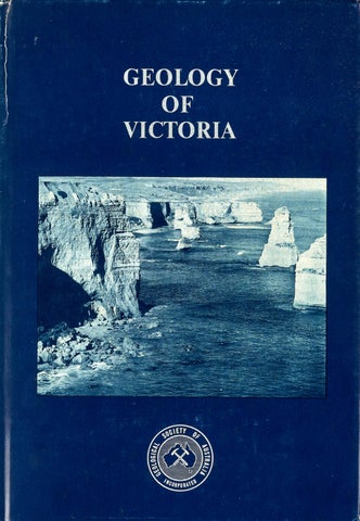
Dustjacket: The Twelve Apostles, Miocene limestone, Port Campbell National Park. Photograph by J. F. Bilney
'
MAKE
THE
WITH THE GRAMPIANS
F GRAMPIAN SANDST NES.
THEM
KNOW THEM
PHYSIOGRAPHICAL DEVELOPMENT OF GRAMPIANS.
PYRENNEES
STREAM EROSION
PORTION ''A.A" SLIPPED DOWNWARDS ALO G OLD FAULT LINE CAUSING '< STEEP INCLINE OF STRATA BEDS, AS • SHOWN AT ''cc~ 10
l'J/
TONEY
( .~
<:__l'lEE
VAL
~
\'-
11
SEDIMENTARY BED AT BB WORN AWAY BY EROSION, UNCOVERING OLDER AND SOFTER ORDOVICIAN ROCK-LATER TO SUFFER EROSION AS AT''DD" WITH MORE RESISTA NT GRAMPIAN SANDSTONES STANDING HIGH ABOVE EASTERN PLAINS
- r .;;;--
Z:5 - - :bb
~ .,~'
I I
11
LATER WHOLE AREA UPLIFTED CAUSING FRACTURING
I ~• ,
.
_..._, ~
_
..•._~t;,,f ~
..-. _,. _..,,,,_
;.- . ·. .
:~7-f~.· ·\,'/.
RATHER THAN TERTIARY BLOCK FAULTING.1..,_.:;-__;_...L.f...:..:.:.i:'L.:,;..;.l..t...,;....:-=-.'
~~DIFFERENTIAL EROSION SEEMS THE CAUSE OF '\.vFORMATION OF THE VICTORIAN GRAMPIAN MOUNTAINS' PHYSIOGRAPHY.
LO Hairs Gap Area showing Soft Stroto worn away , Resistant Strata Volleys and Mountoins
r:;.::•;i'_'
,,,_. .... -~ ,.1 i"l ~
_1!.-£._, \ I
-
I
~
_).l-.
,-:'r.-,.
\I ,
}),J ~/
J ,,, ,,
( -·-,
..
,r
0,f.
.....
-~
•~
....,..~
.'
/
fO-<~
-..~.,.r:t'!
,:,,41r· -(0
,.."' ,,,
I
I
._o
l
I
-, \
-
L1
,c-1
0
.:- Cl(... T~'1f1 '
I
w
I
t.<Or,1E!S ~ J _,F ~11,.T!f ., ' .r WSIIHJ ~
I
I
\
E.
I
i'
I
• ,'.\'~
4-·i MA,. HO.
I
~:rON ,,.B.. .. -,
• /(I
-- .. ., ..r-~- -
lfn
)
I
.-
-
-
-
- -~
-
\:::-::.. -=--=-=- ~OJU."' MN\COLov, __::--=- --=--~ -- ~ -- =--=- _:__ -- 7- -......_ 1$1./1/ttll - -=~ f:!S~CC __ - - _: -
-°"
/
/
--~ : " ' i•!_r --=--:::~ -
...___ J
~~~
~,, "'!.._~~
-
- ~,~__:::_:_~~-. - - - =--::..
{t= -·=-'=-:~ ~ ~~ _:: - -=-- -__..._-:. ~ -:: ::--==-= -=--==- ::::__ / \.---~ - -
11/CTO/ff :I,
\
'\~' : ~~~::Yi' -=- --...:=- :WM-;0~r,,, .l\
/
/ ._..--~-"".:--------
f<:-ui...--,.
:;..~;;;.,,f[rti/<..~ftE~~;,oi [!A~ 4~.►-... -~f1rifrrrfi7,t;?h,ffr,if' -~
·--~-~." 1{i
~ DVW~ELD
•
FLORA AND FAUNA Grampian, formed a rocky promontory wit early Miocene Seas to the North, West and South. ROCKS : ~ n t a r y Ouarho,e Sandstone.
-~} I
:1 tl ,
READING-GEOLOGY · Phy,iogrophy of Victoria. By Prof. E. S. Hill,. Physiographic History of the Victorion Grampian,. By Prof. E. S. Hill,. The Evidence of Post-Lower Carboniferous Plutonic and Hypabysul Intrusions Into the Grompian Sandstones of Western Victorin. By Prof. E. W. Skeah. DISCOVERED-1836 } By ~ Named "The Grampians" MITCHELL FIRST SETTLER : C . 8. Hall , 1840. H•II ', G•p n•med •ftpr him -GRAMPIANS . 55 MILES LONG BY 27 MILES WIDE MAINLY STATE FOREST AND WATER RESERVE. SOME SAWG.QW (No Longer Worked) . READING : Th~mpians, by Charles Daley.
™
GRAMPIANS AS WATER SUPPLIER
),.
:
\suNDIA,/.. PX,
o fir;,~{((((((frRrr,
Lake Wartook } Appro1. Cacapity, Lake Lonsdale 250,000 Acre Ft. Water Channel , 10,000 Lake Fyan 's Lake Taylors Miles, Approx. Pine Lake Supplies 11,000 Sq . Moora Moor a Res. Miles, 45 Towns, Rockland's Dam 100,000 People W ith Stock and Domestic Suppliu. Wimmera and Maliee Scheme connected by Waranga Channel since 1929 with water, from Eutern Victoria . Further development of the Grampian Mountains Water Scheme is proceeding. Water, free from all lime and minerals, is excellent for treatment of woollen,.
READING ·
COMPILED AND DRAWN BY H. GOODWIN TAYLOR COPYRIGHT
MAPS 1, 2, and 3
WALKS an d CAR TRIPS
READING: The Native Flowers of Victoria , by L.f. Pescott. O~ature's Wonderlands, by fr.of._
~ Victorian Orchids, by H. P. Dickins. Flora of Victoria, by Prof A J Ewart Flowering Earth, by Donald Culrou Peattie. A Census of the Plants of VictoriaField Naturalist, Club of Victoria .
PICKING OF WILDFLOWERS STRICTLY PROHIBITED WILD LIFE : SANCTUARY FOR ALL. Birds, Emu , Wallaby, Kongaroo and Deer abound , A Colony of Koalas has been placed on Island in Lake Wartook .
LEGEND SKETCH MAPS ONLY-NOT TO SCALE. DISTANCES AS FROM HALL'S GAP P.O . SHOWN THUS-7 M. IN MAPS I, 2 and 3. LOCALITY PLAN DISTANCES RELATE BETWEEN TOWNS MAIN 1 ~ ROADS: OTHER ·.• ~
N
~.FOOT,- ----- .•,._.~,STREAMS
~~
RAILWAYS~
The Romance of the W immera -Mallee Water Supply System , by R. F. McNab. Irrigation and Water Supply Development of Victoria . by H. L. Boorman Wimmera-Mallee Water Supplies , Pipe Lines Versus Channels, by Lewis R. East. AVERAGE RAINFALL : 34 ins. VERY LITTLE PERIODIC SNOW. Much rod surfa ce in Catchment Area , thus need for Fire Pre vention to protect all vegetation.
Of Lichens, Mosses, Ferns, Grasses, Orcnid,, Shrub, and Trees in the Grompians Area there exist some 900 varieties. A Botanist's paradise. In Springtime presenting a rare and colourful galaxy of Wildflowers.
CONVENIENCES SHELTER
O
LAUNDRY EEi
~ KITCHEN
II]
CAMPING GROUNDS OIi IN THE GRAMPIANS ARE AMONGST THE FINEST IN AUSTRALIA.
INFORMATION
APPROACHES
TO
THE
GRAMPIAN S
/
GEOLOGY OF VICTORIA
Tertiary cliffs at Bird Rock, Torquay. A wet plate photograph by Richard Daintree, 1861. A lithograph was made from this photograph, and inserted on the margin of the 'Quarter Sheet' geological map 28SE of 1863. Photo courtesy of National Museum of Victoria
GEOLOGY OF VICTORIA J. G. Douglas and J. A. Ferguson Editors
Geological Society of Australia Special Publication No. 5
Melbourne June 1976
1976 GEOLOGICAL SOCIETY OF AUSTRALIA INCORPORATED This volume is published in the Special Publication series of The Geological Society of Australia Reference: Geology of Victoria: J. G. Douglas & J. A. Ferguson, Eds. Spee. Puhl. geol. Soc. Aust. 5
Printed by Graphic Services Pty Ltd, Adelaide Issued June 1976 Registered in Australia for transmission by post as a book
National Library of Australia card number and ISBN 0 909869 07 3
Copyright
Available from The Assistant Secretary, Geological Society of Australia, 39 Hunter Street, Sydney, and Mines Department Publication Sales, 1st Floor, State Offices, 107 Russell Street, Melbourne 3000
Editorial enquiries to Dr J. G. Douglas, Mines Department, 107 Russell Street, Melbourne. Phone 63 2331
V
CONTENTS Page
Page
Preface
xiii
CHAPTER 1
History of geology in Victoria
CHAPTER 2
Cambrian Regional description Palaeontology and age Petrology Structure and deformation
11 11 18 19 22
CHAPTER 3
Ordovician Palaeontology and biostratigraphic zonation Detailed stratigraphy Petrology Structural geology Tectonics
25 26 30 34 38 43
CHAPTER 5
Upper Devonian-Carboniferous Middle Devonian igneous activity Upper Devonian to Lower Carboniferous Provinces Central Victorian Cauldron Volcanic Province Marysville Igneous Complex Dandenongs Igneous Complex Strathbogie Igneous Complex Tolmie Igneous Complex Mount Macedon Complex Arthurs Seat Late Devonian granitic complexes Mount Howitt Sedimentary and Volcanic Province Stratigraphy Depositional environments Structure Tectonic evolution of the Central Victorian and Mount Howitt Provinces . East Gippsland Sedimentary Province Stratigraphy Palaeontology of the Late Devonian and Early Carboniferous Vertebrates Plants
77 79 81 81 83 93 96 96 96 97 97 98 99 110 110 113 115 116 121 121 124
CHAPTER4
Silurian- Middle Devonian Melbourne Trough Stratigraphy Stratigraphic correlation Sedimentary petrology and structures . Sedimentation and environments of deposition Structure and orogeny Eastern Victoria Stratigraphy Stratigraphic correlati0n and age Sedimentation and environments of deposition Structure and deformation Grampians Group of Western Victoria Stratigraphy Age Sedimentation and environment of deposition Structure and deformation Intrusive igneous rocks
45 45 45 58 58 60 61 62 64 67 69 70 71 72 74 74 75 76
CHAPTER 6
Permian Distribution Age assessment Palaeogeography
125 125 141 141
CHAPTER 7
Mesozoic Triassic Jurassic Lower Cretaceous Murray Basin Otway Basin, western part Stratigraphy Lithology Structure
143 143 146 146 146 147 148 149
151
vi Page
Otway Basin, eastern part Stratigraphy Structure Gippsland Basin Stratigraphy Structure Depositional environment Palaeontology Upper Cretaceous Stratigraphy Biostratigraphic zonation and correlation Fossils and age Depositional environment Tectonic development in the Cretaceous
152 154 157 158 160 161 162 164 169 170 172 173 17 4 17 5
CHAPTER 8
Tertiary Introduction Tectonic setting and nomenclature Stratigraphic sequence and sedimenta' tion Volcanic and minor intrusive rocks Rock unit nomenclature Biostratigraphic zones, local stages and correlation Tectonic development and depositional history Murray Basin Stratigraphy Tectonic development and depositional history Otway Basin Tectonic setting and structure .. Stratigraphy Tectonic development and depositional history Central Coastal Basins Torquay Basin Port Phillip Basin and Ballan Graben Western Port Basin Tectonic development and depositional history Gippsland Basin Stratigraphic sequence Tectonic divisions Structure Southeast Gippsland Latrobe Valley Depression and Moe Swamp Basin
177 177 177 177 179 180 180 189 191 191 197 198 198 199 226 229 229 237 244 245 248 248 249 251 252 263
Page
Offshore Gippsland Tectonic development tional history Sediments of the Highlands
267 and
deposi269 273
CHAPTER 9
Quaternary Murray Basin Regional stratigraphy Chronology and palaeontology Structure and deformation Loddon Plains Southwestern Victoria Warrnambool-Port Fairy district Lakes of the Western District Volcanic Plains Port Phillip Sunkland Yarra Delta Western Port and Southern Gippsland Snowy River Delta
275 276 276 287 288 288 290 299 305 305 309 315 325
CHAPTER 10
329 329 330 342 345
Geomorphology Geomorphic evolution Major aspects of geomorphology Newer Volcanic landforms The coastline
CHAPTER 11
Petrology of igneous rocks Plutonic rocks Volcanic rocks, and minor intrusives Snowy River Volcanics Volcanics of the Dundas Tableland Cainozoi~ volcanic rocks Basic dykes of Central Victoria and South Gippsland Intrusive rocks of Melbourne
349 349 362 362 363 364 37 J 373
CHAPTER 12
Economic geology . Fuels: Black coal, Brown coal, Oil and gas
375
375-403
vii Page Non-metallic minerals: Barite, Industrial clay, Diatomite, Feldspar, Fluorite, Gemstones, Groundwater, Gypsum, Limestone, Magnesite, Phosphate, Potash, Salt, Sand, Crushed and broken stone, Talc Metallic minerals: Antimony, Bauxite, Beach sand, Chromium, Copper, Gold, Iron and manganese, Lead and silver, Molybdenum, Tin, Uranium Geological conservation References Locality index Structural and stratigraphical index Palaeontological index List of contributors
Page CHAPTER 8 Columnar jointing, Basalt Hill Clypeaster gippslandicus, Tambo River Globorotafia mayeri, Port Campbell ....
180 249 249
403-431 CHAPTER 9
431-453 454 455 493 507 519 528
Quaternary cliffs, Stanhope Bay Coastal dunes, Gunnamatta Beach
301 309
CHAPTER 10 Aeolianite cliffs, Aire River mouth
348
CHAPTER 11
ILLUSTRATIONS 1 : 1 000 000 Full colour geological map of Victoria
Zoned iron rich cordierite, Rubicon rhyolite Maramingo Granite, Wingan River mouth
355 359
Map pocket, rear of book CHAPTER 12 Brown coal, Morwell open cut Bedded tuft', Tower Hill
HALF TONES
382 430
CHAPTER 1 Geological Survey party, Walhalla
4
FIGURES CHAPTER 3 Tetragraptus fruticosus, Chewton
CHAPTER 2 30
CHAPTER 4 Baragwanathia longifolia, Matlock Folding, Cape Liptrap
55 59
CHAPTER 5 Tetrapod trackway, Genoa River
117
CHAPTER 6 Dunns Rock, Knowsley
11 12 13 15 16 23
CHAPTER 3
136
CHAPTER 7 Fauna and flora , Koonwarra fish beds
Index map of figures (including Chapter 3) 2.1 Cambrian axes, Ordovician troughs and metamorphic areas 2.2 Ordovician and Cambrian outcrops of central Victoria 2.3 Geology of the Heathcote Axis 2.4 Geology of the Mount Wellington Axis 2.5 Dolodrook River area
3.1
3.2 166
Variation in number of species in major graptolite groups throughout the Victorian Ordovician Ordovician stratigraphy ElaineSteiglitz area
28 39
viii Page
Page CHAPTER4
Index map of figures .... 4.1 4.2 4.3 4.4 4.5 4.6 4.7 4.8
4.9 4.10
Geological map of the Melbourne Trough Geological map of the Heathcote district Geological map of the Upper Yarra-Upper Thomson district Geological map of the Telbit Crossing area Geological map of the Coopers Creek area Geological map of Eildon .... Geological map of the Cowombat Plain area Geological map of the BuchanMurrindal area Geological map of the Tabberabbera area Distribution of the Grampians Group
5.12 45 *46
5.14
46 50
5.15
111 116
118 120
52 52 54 63 65 68 73
CHAPTER 5
Index map of figures 5.1 Igneous complexes, Central Victorian Province and Mount Howitt Province .... 5.2 The Marysville Igneous Complex 5.3 Structural relationships, Cerberean Cauldron Geology, northern part of the Cer5.4 berean Cauldron Geology and structure, Danden5.5 ongs Igneous Complex ... 5.6 Contact relationships, Lysterfield Granodiorite 5.7 Geology of the Macedon Igneous Complex . 5.8 Geology of the Mount Howitt Province 5.9 Cross sections, Gippsland region, Mount Howitt Province 5.10 Sections, northern region, Mount Howitt Province 5.11 Stratigraphic and tectonic relationships Mount Howitt Province
5.13
Structure of the Mount Howitt Province Geology of the Genoa River Beds, East Gippsland Province Structure of the Buldah- Club Terrace Belt and geology of the Bemm River Beds, East Gippsland Province Geology of the Cann River Beds and Combienbar River Beds
CHAPTER 6
Index map of figures 6.1 Permian-locality map . 6.2 Permian of Bacchus Marsh area . 6.3 Composite Permian section, Bacchus Marsh 6.4 Correlation of Permian sections, Bacchus Marsh 6.5 Sections, glacial deposits, Bacchus Marsh area 6.6a Permian of Derrinal area Sections of Permian rocks in Der6.6b rinal area
125 126 127 128 129 13 2 134 134
77
78 82 85 86
CHAPTER 7
Index map of figures 143 7 .1 Distribution of Mesozoic sediments 144 7 .2 Otway Basin and western Gippsland Basin configuration and major *148 structural features 7.3 Strzelecki Group 159
94 96 CHAPTER 8
97 *98 *98 100 104
Note * indicates tip-in, following page indicated.
Index map of figures 177 8.1 Tertiary basins in southeastern Australia 178 Murray Basin structure 8.2 190 Murray Basin cross sections 192 8.3 8.4 Murray Basin rock correlation 193 8.5a-c Murray Basin. Formation isopachs and extent 194 8.6 Otway Basin cross sections *198 8.7 Otway Basin rock correlation 200 8.8 Port Campbell Embayment rock correlation 201
ix Page
Gambier and Tyrendarra Embayments rock correlation 8. lOa-c Otway Basin. Formation isopachs and extent 8.11 Northeastern part of Port Campbell Embayment rock correlation 8.12 Aire district rock correlation 8.13 Torquay Basin rock correlation 8.14 Port Phillip and Ballan Graben rock correlation 8.15 Western Port Basin and Mornington area rock correlation 8.16 Gippsland Basin tectonic setting 8.17 Gippsland Basin structure map 8.18 Onshore Gippsland Basin structure map 8.19 Gippsland Basin cross sections 8.20 Southeast Gippsland cross section 8.21 Southeast Gippsland rock correlation 8.22 Onshore Gippsland Basin. Formation isopachs and extent 8.23 Latrobe Valley Depression cross section 8.24 Latrobe Valley Depression rock correlation 8.25 Offshore Gippsland Basin rock correlation 8.26 Offshore Gippsland Basin depositional history
202
11.1
Distribution of igneous rocks *350 (a) Intrusives (b) Cainozoic volcanics Alkalies-silica diagram, Older Volcanics, Newer Vokanics, and phonolites 369
204 11.2 220 224 232 240 243 250 251 252 253 254 255 258 265 265 268 270
CHAPTER 9
Index map of figures 275 9.1 Quaternary units, Murray Basin 277 9.2a-c Cross sections, Quaternary units 282 9.3a-b Quaternary geology, Warrnamboo lPort Fairy area 302 9.4 Port Phillip Sunkland 306 Geological map of the Yarra Delta 310 9.5a 9.5b Cross sections Yarra Delta 312 9.6 Pre-Quatern ary surface, Yarra Delta 315 9.7 Quaternary geology, Mornington Peninsula and southern Gippsland 318 9.8 Quaternary geology, Snowy River Delta 326 CHAPTER 10
10.lb 10.2
Page CHAPTER 11
8.9
Geomorphic regions and land surfaces *330 Main streams and lakes 332 Newer Volcanics volcanoes 343
CHAPTER 12
Index map of figures 12.1 The Wonthaggi coalfield 12.2 Latrobe Valley coalfields 12.3a Geology of the Latrobe Valley 12.3b Latrobe Valley sections 12.4 The Gelliondale coalfield 12.5 Brown coal areas, Otway Ranges 12.6 Bacchus Marsh coalfield 12.7 Otway Basin, cross sections . 12.8 Water distribution, Latrobe Group 12.9 Oil and gas fields, Gippsland Basin 12.10 Marlin gas and ·oil field 12.11 Groundwate r resources 12.12 Size analyses, Springvale and Cranbourne sand 12.13 Gold production, and proportions from reefs and alluvials 12.14 Gold sub-provinces and major goldfields 12.15 Transverse section, Stawell goldfield 12.16 Longitudina l projection, Consols and Guiding Star reef systems 12.17 Transverse g e o I o g i c a I section through North British mine ... 12.18 Longitudma l section t h r o u g h Cohens line of lode 12.19 Geometric projection of Al dyke and reefs
375 376 379 380 381 384 387 388 389 40-0 401 402 412 428 434 436 439 440 442 446 446
TABLES CHAPTER 2
2.1 2.2 2.3 2.4
Main stratigraphic units Cambrian, Victoria Analyses of minerals in greenstones Analyses of andesites from Heathcote Axis Analyses of igneous rocks from Heathcote
14 20 20 21
CHAPTER 3
3.1 3.2 3.3
Victorian Ordovician zonal graptolite species and their ranges . Thickness of graptolite stages in Victoria Micrometric analyses of arenite
27 34 35
X
Page
3.4 3.5 3.6
Chemical analyses of a slate and greywacke Arenite: non-arenite ratios Sedimentation, Victorian sector, Lachlan Geosyncline
35 36
4.2 4.3 4.4
7.12
43
CHAPTER4
4.1
Page
7.11
CHAPTER 5
5.2 5.3 5.4
5.5
Stratigraphic sequences, Cerberean and Acheron Cauldrons Phenocrystic mineralogy, Marysville Igneous Complex Stratigraphy of the Avon River Group Post-orogenic tectonic phases in Central Victorian and Mount Howitt Provinces Plant fossil assemblages - Late Devonian to Early Carboniferous ..
168
171
CHAPTER 8
Correlation chart, M e l b o u r n e Trough and East Gippsland . 48,49 Faunal list of the Buchan Group 66 Correlation chart, Grampians Group 71 K-Ar determinations on Mafeking and McKenzie River Granodiorites 74
8.1 8.2
9.2 84
9.3
88
9.4
100
114
Biostratigraphic zonation and correlation K-Ar datings, western Victorian basalts
181 217
CHAPTER 9
9.1
5.1
Vertical distribution of key spore and pollen species ... Rock units, geochronologic subdivision, and micro-fossil zonal schemes, Upper Cretaceous beds, Otway Basin
9.5
9.6 9.7
123 9.8
Quaternary stratigraphy, Murray Basin 277 Subdivision of Shepparton Formation 279 Kow Swamp, aggradational chronology 289 Correlation diagram, Pliocene and Quaternary rocks, Casterton-Portland area 291 Quaternary stratigraphy, Warrnambool- Port Fairy area 299 Sequence at Lake Keilambete 305 Quaternary stratigraphy, Yarra Delta 311 Quaternary events and deposits, 316,317 Gippsland
CHAPTER 7
7.1 7.2 7.3 7.4
7.5 7.6 7.7 7.8 7.9 7.10
K-Ar datings, Victorian Mesozoic rocks Stratigraphic subdivisions at Killara Bluff Correlation chart, Mesozoic Era in Victoria Correlation of subsurface Otway Group beds, western part of Otway Basin Table of heavy minerals from Victorian feldspathic sandstone . Proximate analysis of black coal from the Merino area .... Thickness of Otway Group beds, eastern part of Otway Basin Chemical analyses of Otway Group sediments Thickness of Strzelecki Group beds Megafloral and microfossil biostratigraphical units
CHAPTER 10
145 149
10.1 10.2
Principal land surfaces .. 331 Geomorphic regions of Victoria 334-339
150 CHAPTER 11
151
11.1 11.2
153 11.3 154 11.4 154 156
160 165
Analyses, plutonic rocks Isotope and fission track dates, plutonic rocks Analyses of Newer and Older Volcanics Comparison of Older and Newer Volcanics
350 361 366 371
CHAPTER 12
12.1 12.2
Mineral production, 1971-72 Proximate analyses of black coal
375 378
xi Page
12.3 12.4 12.5 12.6 12.7 12.8 12.9 12.10 12.11 12.12 12.13a 12.13b 12.14 12.15 12.16
Reserves of black coal . Analyses of Wonwron brown coal Analyses of samples, Gelliondale coalfield Latrobe Valley brown coal quality Coal and overburden quantities, Latrobe Valley Analyses of brown coal other than Latrobe Valley Location of shows, Otway Group Selected Otway Group shows Shows in Waarre Formation, Sherbrook Group Gippsland Basin gas pools Gippsland Basin, commercial fields Gippsland Basin shows not yet commercial Analyses of Victorian diatomite Composition of feldspar Values, horizontal hydraulic conductivity of aquifer materials
378 384 384 385 3 86 389 391 392
Page
12.17 12.18 12.19 12.20 12.21 12.22 12.23 12.24
399 400 403
12.25 12.26
403 407 408 411
Production of gypsum 417 419 Analyses of limestone 425 Analyses of magnesite Production figures, common salt . 427 Physical properties, aggregate ma~ terials 429 Types of rock for crushed stone production 429 Composition, South Gippsland bauxite 433 Mineral association, some Victorian goldfields 435 Characteristics of gold sub-provinces 436 Size and production of reef goldfields 437
12.27
Production records, some dredging operations
448
12.28
Production, some major deep lead systems
449
PREFACE The original work on this volume began in the early 1960s when an editorial sub-committee was set up by the Victorian Divisional Committee and conveners selected. Several chapters and parts of chapters were prepared and a great deal of effort put in by many authors. Unfortunately the project lapsed until the late 1960s, when the editorial committee was reconstituted, and eventually in 1973 it was decided that the volume should be completed for the International Geological Congress in Sydney in August 1976. The aim of the editorial sub-committee has been to produce an integrated account of the geology of Victoria, with an adequate coverage of both the detailed observations and the alternative deductions which can be made from them. To achieve this integration, contributions from authors have been blended together by one or more co-ordinators appointed for each section, and then edited by the editorial sub-committee. Sections thus represent a consensus, rather than expressing the concepts of individual authors. For each geological period, an attempt has been made to discuss the tectonic setting, distribution of deposits, palaeontology, facies relationships, stratigraphical correlation, and structure. Facets of Victorian geology considered to be of special interest are emphasized in greater detail. These include graptolite faunas and the zonation of the Ordovician, the Late Devonian volcanic ring complexes, Early Cretaceous Koonwarra fauna, Tertiary palaeontological zonation, facies relationships and depositional environments, volcanology of the Newer Volcanics, and, in economic geology, detailed accounts of gold reef structures, the Latrobe Valley coalfield, and the Gippsland shelf oil and gas fields. Chapter 1 gives an account of our geological predecessors, who did much to unravel the geological history of the State. The committee offers its grateful thanks to all who helped in the production of the volume and the names of those who supplied manuscript are included on page 528. Particularly important assistance was given by the Mines Department, Victoria, in supplying the new 1: 1 000 000 geological map, draughting over 100 figures and tables, and helping in many other ways. We are also grateful to private companies and other government organizations for supply of information, and approval to publish. The early committees were fortunate in securing the financial support of firms and individuals listed below. Arco Limited Australian Portland Cement Ltd Australian Ceramic Society Australian Clay Products Association Australian Paper Manufacturers Limited Dr G. Baker ( deceased) Bayview Quarries Pty Ltd The Broken Hill Proprietary Co. Ltd Conzinc Riotinto of Australia Limited Darley Firebrick Co. Pty Ltd Division of Applied Mineralogy, C.S.I.R.O. Frome-Broken Hill Company Proprietary Limited University of Melbourne Minerals (Vic.) Pty Ltd Mobil Oil Australia Ltd Monash University Newbold General Refractories Ltd Planet Exploration Company Pty Ltd Reids' Quarries Ltd
Richfield Oil Corporation The Shell Company of Australia Limited State Electricity Commission of Victoria State Rivers and Water Supply Commission Victorian Portland Cement Co. Ltd Western Mining Corporation Limited Woodside (Lakes Entrance) Oil Co. The Geological Society is very grateful for this support. It regrets that the project has taken such a long time to come to fruition but hopes that it will be a basis for many more intensive and revealing studies on the geology of the State. J. A. Ferguson Chairman Editorial Committee Victorian Division Geological Society of Australia
My part in the production of this volume has been confined to a little rather carping criticism, borne, generally, with fortitude by the authors and editors; and the formal editing necessary to align the volume with the style adopted by the Society. I have tried at all times to reduce the bulk of the volume-with only indifferent success in some places, and the placing of some portions in a smaller typeface is at my suggestion. The thanks of the Society go to the editors, Drs J. G. Douglas and J. A. Ferguson, who have, with the help of an editorial committee, managed to bring to completion what looked like being permanently incomplete, and thereby to produce a book which will remain a standard reference for many years. My personal thanks go to both editors for their patience, good humour, and hospitality, and also to Dr D. Spencer-Jones, Director of the Geological Survey of Victoria, for making it possible for me to see something of the geology of which I was reading so much. K. A. Townley, Hon. Editor, Geological Society of Australia
EDITORIAL SUB-COMMITTEE C. Abele J. G. Douglas J. A. Ferguson J. J. Jenkin
J. McAndrew M. A. H. Marsden D. Spencer-Jones C. M. Tattam
CHAPTER 1
HISTORY OF GEOLOGY IN VICTORIA By T. A. Darragh with contributions from J. L. Knight and C. M. Tattam The earliest geological observations in Australia Felix or the Port Phillip district, as the settled areas were first called, were references in the journals of the early explorers. The first appear to be those of Bass, who in 1797 recorded granite at Wilsons Promontory, and Freycinet, who in 1802 recorded granite at Cape Woolamai. Hume and Hovell on their overland journey from Sydney to Corio Bay in 1824-25 noted granite in the Strathbogie Ranges and in the vicinity of King Parrot Creek and Mount Disappointment. On a return visit in 1826 Hovell discovered coal at Cape Paterson. Sturt in 1828-31 drew attention to cliff sections along the Murray River (see Lawrence & Goldbery, 1973). More substantial observations were made by Mitchell throughout his journey through northern and western Victoria in 1836. He recorded granite, basalt, sandstone, slate, and limestone, and gave a good description of Mount Na pier, recognizing it and several other hills as volcanoes. In the limestone near the mouth of the Glenelg River he recorded 'pectens, spatangi, echini, ostrea and foraminifera', the first list of fossils in the State. Strzelecki trekked through northeastern Victoria into Gippsland and across to Western Port in 1841 , and noted various rock types. He prepared the first geological map of part of Victoria, attempted to place ages on the rock types encountered, and provided the first detailed description and analysis of coal from Western Port. In an appendix to this work G. B. Sowerby described Terebratula compta from Port Fairy, which was the first formal description of a fossil species from Victoria. Hobson in 1845 reported the discovery of Diprotodon remains near Mount Macedon and provided the first illustrations of vertebrate fossils from Victoria. In 1846 Westgarth published a description of the volcanic plains with observations on the extinct volcanoes and the stony rises . In 1850, Jukes published an outline of the geology of the Port Phillip district based on a 2
short visit, descriptions given to him by the local settlers, and published descriptions of the explorers, particularly Mitchell. Accompanying his work was a geological map of Australia, scale approximately 230 miles to 1 inch, with 'colours dabbed on roughly about the place the rock indicated by it was observed'. Victoria had seven colours for various rock types including Tertiary rocks, Palaeozoic rocks, metamorphic rocks, basalt, and granite. The discovery of gold in July 1851 caused a huge influx of diggers into Victoria seeking alluvial gold. Looking to the possibility of gold as a source of revenue for the Crown, and possibly in part fearful of the consequences if the gold ran out, Governor La Trobe obtained the services of a mineral surveyor. In May 1852, Alfred R. C. Selwyn, an officer of seven years' experience in the Geological Survey of Great Britain, was appointed. He arrived in Victoria in December 1852 and immediately began to acquaint himself with the local geology. The Mount Alexander and Western Port districts, the Mornington Peninsula, and the Yarra basin were mapped in reconnaissance, and maps were published at a scale of 2 miles to 1 inch. His establishment was enlarged in 1856 and he organized the scheme of systematic grid mapping at a scale of 2 inches to 1 mile. In the same year Frederick McCoy, Professor of Natural Science in the University of Melbourne and later Director of the National Museum of Victoria, was appointed to the post of palaeontologist to the Geological Survey. Specimens collected by the survey were deposited in the National Museum, and McCoy reported on the fossils , supplying the age determinations necessary for completing the geological maps, a service which he provided until shortly before his death in 1899. The Board of Science was established in 1858 and Robert Brough Smyth was appointed secretary. The Board was responsible among other things for survey on the goldfields and initiated the publication of goldfields reports and statistics. In effect it was the forerunner of
2
T. A. DARRAGH
the Department of Mines. Brough Smyth was appointed Secretary for Mines in December 1860 under the Colonial Secretary, though the Mines Department as such was not formally constituted under a Minister of the Crown until 1863, following recommendations of the Goldfields Royal Commission of Enquiry 1862-63. The Commission also recommended that the Geological Survey be placed under the Minister for Mines, which confirmed an arrangement instituted in 1861 when the Survey was associated with the Mining Department under the Colonial Secretary. The first systematic account of Victorian geology arising from the work of the Geological Survey was written by Selwyn and published in 1859 in Fairfax's Handbook of Australasia. The main rock types were described , and their relative ages indicated. Victoria is described as being principally composed of Palaeozoic and Tertiary rocks, with the gold derived from the former. However, the presence of Mesozoic rocks had been established by McCoy's recognition of an Oolitic flora from the coal-bearing rocks of the Barrabool Hills and Western Port. A more comprehensive account of progress in geology and palaeontology was given in the Intercolonial Exhibition Essays of 1861, which were written by Selwyn and McCoy. These two essays show that much of the basic data on Victorian geology had already accumulated. McCoy refuted the theory that the Australian fauna was unchanged from Oolitic (Jurassic) times, an idea put forward by Jukes and accepted by many European workers. McCoy identified the Lower Silurian (Ordovician) on the basis of the typical graptolites of the Northern Hemisphere. The first Silurian graptolites had been found at Keilor in May 1856 by Selwyn and Aplin , and the first from the Ordovician by Thureau at Bendigo in 1857. The Upper Silurian (Ludlovian) was recognized on the basis of trilobites, the Upper Palaeozoic by the occurrence of Lepidodendron in Gippsland, and the Mesozoic by the discovery on the Bellarine Peninsula of Zamites and Taeniopteris, which McCoy compared with species from the Jurassic of Yorkshire. In the Tertiary the upper Eocene at Mornington and lower Miocene at Torquay were recognized on the basis of comparison of mollusca, principally volutes, with European analogues. However, McCoy inverted the Tertiary sequence, and this mistake had far-reaching consequences well into the first half of the twentieth century. He also postulated a warmer
climate in the Tertiary, gradually cooling from the Eocene and Miocene. In his essay Selwyn noted that the Lower Silurian (Ordovician) rocks were the source of all the gold and recognized a gradually descending sequence to the west of Melbourne, with a group of rocks in the west which he thought might be of Cambrian age. He distinguished between the lithology of the Lower Silurian (Ordovician) and the Upper (Silurian) and noted that the granite associated with rocks of these ages was younger and did not affect their structure. He gave an outline of the distribution of the Upper Palaeozoic rocks and suggested a marine glacial origin for certain conglomerates at Bacchus Marsh and Wild Duck Creek near Heathcote. In his description of the Mesozoic coal-bearing rocks he suggested that they were deposited in shallow water and that the coal was of drift origin. In the middle of 1861 J. B. Hummfray, Commissioner of Mines, requested Selwyn to produce a sketch map showing the main geological features and principal rock masses of the colony. Compilation started in August 1861 and was completed by June 1863. The Legislative Assembly voted £350 for printing, and on the advice of Survey Lithographer Richard Shepherd it was printed in colours from metal blocks. A thousand copies were printed for sale at 10/ - each and the map was issued in eight sheets, probably in August 1863. The scale of the map was 8 miles to 1 inch and the base was a corrected version of the census map completed in 1858-59 by Brough Smyth. On sheet 8 the area to the east of the Snowy River was left blank, and in February 1866 an amended sheet was issued with the area geologically coloured. In 1865 the original map was published at a scale of 1: 2 000 000 in Peterman's Geographische Mittheilungen and the revised map was included in the 1866 Intercolonial Exhibition Essays at a scale of 32 miles to 1 inch. In 1866 a further series of essays was commissioned for the Intercolonial Exhibition and once again Selwyn and McCoy contributed. Selwyn's essay was an enlargement of his 1861 essay. 'The labours of the past years have considerably increased our knowledge without materially altering anything previously stated ... ', but an important addition was an article by George Ulrich on the mineral species of Victoria. Though this was not the first list of Victorian minerals, Selwyn having given a bare list in his 1861 report, it was a comprehensive account, with notes on the mode of occurrence
HISTORY OF GEOLOGY IN VICTORIA
of all known minerals, their special characteristics, associations, and analyses, and provided illustrations of crystal forms, the first published in Victoria. Ulrich wrote an additional mineralogical paper in 1870 including description of new minerals, and later published several important papers dealing with the occurrence of gold and other minerals in quartz reefs. The 1866 Essays are impressive for the clear and concise account given of Victorian geology, and it is apparent that by this time Selwyn and his team had well and truly laid the foundations of Victorian geological knowledge. Selwyn's essay is a classic of Victorian geology, and was the standard reference until the appearance of Murray's Geology and Physical Geography in 1887. In mid or early 1869 the Geological Survey was disbanded on the grounds of economy, though the Secretary for Mines, Brough Smyth, is said to have played a large part in its termination because of his ambition and animosity to Selwyn. The termination of the Survey resulted in the the loss to Victoria of several talented geologists. Selwyn succeeded Sir William Logan as Director of the Geological and Natural History Survey of Canada in 1869. C. S. Wilkinson went to New South Wales and later was appointed Director of the Geological Survey; Ulrich joined the Technological Museum under J. Cosmo Newbery as Lecturer and Curator of the Mineralogical Collections and ultimately became Professor of Geology in the University of Otago, New Zealand ; C. D . H . Aplin became Government Geologist for Southern Queensland in 1868-9, then in 1873 Government Resident at Somerset, Cape York; R. Daintree was appointed Government Geologist for Northern Queensland, also in 1869 ; H. Y. L. Brown went to Western Australia as Government Geologist in 1870 and in 1882 became Government Geologist of South Australia; and R. Etheridge Jnr. later joined the Geological Survey of New South Wales. Of the original survey team only Reginald Murray, who was appointed a mining surveyor at Alexandra, and Norman Taylor, employed on contract to the Mines Department, remained. Perhaps, though , Victoria's loss was Australia's gain, for Selwyn's pupils and disciples carried his methods to all the other Colonies ( except Tasmania) , and the Geological Surveys that they founded were all indebted to the high and rigorous standard demanded by Selwyn in the Geological Survey of Victoria. In 1870 Brough Smyth proposed to the
·3
Minister for Mines that the Geological Survey should be re-formed according to his own scheme. He disagreed with the systematic mapping program of Selwyn and proposed that the survey should not be in line of strike of the Palaeozoic rocks, but that the country should be surveyed east-west across the strike. The important goldfields would be mapped 'carrying from one area to the other such necessary connections as might serve the geologist and assist his investigations'. Brough Smyth also proposed that only one party would need to be maintained in the field and that assistance could be sought from 'competent observers in all parts of the colony', principally the mining surveyors. Field work recommenced in 1871 with Norman Taylor, F. M. Krause, and Reginald Murray, Mining Surveyors, mapping selected goldfields, and A. W. Howitt, Warden and Police Magistrate at Bairnsdale, who 'laboured gratuitously' in Gippsland. Geological mapping continued, and 12 large-scale maps and 3 smaller-scale maps were produced between 1871 and 1884. Later geologists owe a debt to Brough Smyth because of his institution of several important geological publications. He was responsible for the Reports of Mining Surveyors and Registrars which record so much about the Victorian goldfields, and a voluminous compilation, the Goldfields and Mineral Districts of Victoria, published in 1869 in an edition of 1500 copies, now a sought-after item of Australiana. This contains an immense amount of information which otherwise would have been lost, but few new geological data. Before 1870 geological reports were published in the Parliamentary Papers. In 1873 Brough Smyth established the Reports of Progress of the Geological Survey of Victoria, which contained more comprehensive geological reports. They were issued intermittently up to 1899, when they were superseded by the Monthly Progress Reports. Two important palaeontological works also owe their origin to Brough Smyth's support. The first , by Ferdinand von Mueller, Government Botanist, entitled Observations on New Vegetable Fossils from the Auriferous Drifts, was issued in two parts in 1874 and 1883. The second, by Frederick McCoy, entitled Prodromus of the Palaeontology of Victoria, was issued in seven parts between 1874 and 1882. Three more partly completed parts were never published. The Prodromus had its origins in a plan by McCoy to issue Memoirs of the Na-
T. A. DARRAGH
4 ,,. f ' p,· P.·. t --~-t.'I. ,. ; .,, . ... ~ ,,. ,: I
4'
W .
i
-~: ., ... ., . ,
...
__ ...,:-~
0t Geological Survey party, Walhalla, March 1898. From left: V. R. Stirling, T. S. Smith, J. Easton, J. Hamilton, W. Baragwanath. Photo courtesy of Mines D epartment, Victoria.
tional Museum, and many plates for this were printed between 1859 and 1870. The text, however, was not printed and plates were stored until the Prodromus was issued. This work is one of the finest Australian palaeontological publications. Brough Smyth published a new geological map of Victoria at a scale of 16 miles to 1 inch in 1872 and also a geological sketch map of Australia at 110 miles to 1 inch. The latter, published in 1875, involved the co-operation of all the Australian colonies and several ex-
plorers, who provided up-to-date data on the interior of the continent. Because of the controversy between W. B. Clarke and McCoy over the age of the New South Wales coal measures, co-operation with New South Wales was minimal. Another fine geological map of Australia in six sheets was produced by the Mines Department in 1887 at a scale of 50 miles to 1 inch. In February 1876, in response to a petition by members of the Mines Department, Brough Smyth was suspended from duty, and an in-
HISTORY OP GEOLOGY IN VICTORIA
quiry into his administration of the department was held. Most of the charges against him , though somewhat exaggerated, were proved and the members of the board of inquiry found that he 'has acted with excessive severity, has used unwarrantable language to his officers, and ha displayed an imperious irritability of disposition and want of self-control'. As a result of the enquiry Brough Smyth resigned his post in May 1876 and took up a position in mining in India . He returned to Victoria in 1883 to take up the position of Director of the School of Mines at Bendigo. He resigned after staff trouble in March 1887 and died in Melbourne in October 1889. The departure of Brough Smyth meant the loss of a great deal of the drive behind the more scientific aspects of the work of the Mines Department. Though the various statistical reports of the department continued uninterrupted, the Reports of Progress became very irregular. On Black Wednesday, 9 January 1878, following the rejection of a supply bill by the Legislative Council, the Berry Ministry dismissed a large number of civil servants, among whom was Murray, the only field geologist permanently employed on the Geological Survey. However, in May he was reinstated and resumed field work. In 18 87, Murray's book, The Geology and Physical Geography of Victoria, appeared and was so popular that it was reissued in 1895. T his handbook remained the only comprehensive account of Victorian geology until the issue of the 1935 ANZAAS Handbook for Victoria, although Krause in 1896 produced An Introduction to the Study of Mineralogy far Australian Readers which contains much information on Victorian mineral localities. The depression of the late eighties and early nineties coincided with a decline in gold production , and following public criticism of the role of the Mines Department, a Royal Commission was appointed to inquire into gold mining. The commission sat between August 1889 and July 1891 and its report recommended that the Geological Survey of the colony be expedited. Howitt, the Secretary of Mines, was then able to employ more field staff and re-introduced the quarter-sheet mapping program along with rapid surveys, which were published in the form of geologically coloured parish plans. The latter continued to be produced up to 1960. Outside the Geological Survey or the Mines Department, few people made any significant contribution to geological studies between 1851
5
and 1890. Many articles were published in pamphlets and the columns of newspapers by persons connected with mining, but most have little value today. In the 1850s W. Blandowski published geological notes in his accounts of his various collecting trips and described and figured specimens of Palaeozoic fossils from the Upper Yarra district, Heathcote, and Melbourne. He also provided a large-scale plan of the structure of the Silurian strata in Collins Street, Melbourne, between Swanston and Russell Streets. L. Becker, who died on the Burke and Wills expedition, included geology among his many interests and some of his papers have references to local geology. J. Bonwick, a school inspector, was an important influence at this time. His narrative of a tour of inspection through the Western District is filled with comments on the geology of the areas through which he passed, and his geography textbooks, which went through many editions, had sections devoted to the geology of Victoria and other areas of Australia. He also describes himself as the author of the Geological Map of Victoria, which may have been published in 1856. However, no copy seems to have survived and it has never been referred to by any contemporary or later workers. The best known of the early contributors was the Rev. J. Tenison Woods, who, when stationed at Penola, made frequent visits to western Victoria and wrote a series of papers describing the geological features of that area. His work was of importance since he studied the marine Tertiary rocks of Victoria in detail. Most of the emphasis was placed by others on Central Victoria and areas of economic interest. Tenison Woods aim made significant contributions to palaeontology, particularly in his studies of Tertiary molluscs and corals. It seems, however, that the presence of professional geologists in the Geological Survey, whose main task was mapping and reporting on the local geology, stifled attempts by others to enter the field. The most notable exception was A. W. Howitt, who was encouraged by Brough Smyth to submit maps and reports on the areas in East Gippsland through which he travelled in the course of his duties as police magistrate and warden of the goldfields. From 1869 to 1902 he regularly submitted reports and pioneered the use of the petrological microscope in the study of the igneous and metamorphic rocks of Victoria. Howitt was appointed Acting Secretary for Mines at a time in 1889 when the Geological Survey and the
6
T . A . DARRAGH
Mines Department as a whole were under intense criticism for failing to carry out their functions adequately, and was able to re-organize geological work in the department on a more scientific basis. He gained immense publicity for the science as leader of the Burke and Wills relief expedition, and like Brough Smyth became a noted expert on the aborigines. Despite the fact that early in the settlement of Victoria not enough people were interested in geology to sustain a viable specialist society, an attempt was made to found a body called the Geological Society of Victoria. The inaugural meeting was held on 4 October 1852 at the Government Office in Lonsdale Street. The society pressed for the fouriding of a Geological and Mineralogical Museum. It was partly responsible for · the move which ended in the founding of the National Museum of Victoria early in 1854 and W. Blandowski, a member of the Society, was the first staff member of the Museum. Newspaper reports of the Society continue until August 1853, when it apparently faded away. Further details can be found in Townley (1960) and Paszkowski (1967). Another body existing during the mid-1850s was the Portland Geological Society. Bonwick (1858) stated that he was shown the geology of the coastal area around Portland by members of this Society and noted that it 'boasts of a museum of specimens'. A list of 'specimens of fossils and rocks from the coalfields of New South Wales by W. Keene, Government Examiner of Coalfields' sent to this society in April 1857 is in the archives of the National Museum of Victoria, but nothing more is known about it. In 1854 the Victorian Institute for the Advancement of Science and the Philowphical Society of Victoria were founded, and amalgamated the following year under the title of the Philosophical Institute of Victoria, becoming the Royal Society of Victoria in 1859. The establishment of the Royal Society catered for the scientific interests of Victorians and prevented further moves for a specialist geological society. Geologists have always been prominent in the affairs of the 'Royal' and a perusal of the volumes of the Transactions and Proceedings shows that the society has proved a valuable outlet for the publication of geological papers. However, a further attempt was made to inaugurate a specialist body towards the end of the 19th century, when the Geological Society of Australasia was founded on 13 March 1885.
This body, which published a journal entitled Transactions of the Geological Society of Australasia Vol. 1, parts 1-6, 1886-1892, continued until 1905, when it expired, principally because of competition from the newly formed Australian Institute of Mining Engineers, later to become the Australasian Institute of Mining and Metallurgy. The major portion of the library of the society was retained by the Mines Department, and correspondence and papers were handed over to the Royal Historical Society of Victoria. Further information can be obtained from Dickins & Finlay (1959) and Branagan & Vallance ( 1967) . From about 1890, workers not associated with the Geological Survey became prominent, particularly in fields which had hitherto been neglected. Though the University had been in existence since 1854 and McCoy as its representative had made substantial contributions to Victorian geology, there appear to have been few of its graduates who took more than a passing interest in the subject. However, in the early 1890s graduates of Melbourne University made substantial contributions, particularly in the field of stratigraphy and palaeontology. T. S. Hall, G. B. Pritchard, T . S. Hart, E. Hogg, G. Officer, and E. 0. Thiele were the first of a long line of distinguished geological research workers. Hall and Pritchard were members of the University Science Club, which organized fossil-collecting excursions. These excursions stimulated an interest in both graptolites and Tertiary stratigraphy and palaeontology and Jed to collaboration in a series of papers on the Tertiary stratigraphy of areas around Port Phillip and to the southwest, which were published between 1892 and 1904. Their ideas on the Tertiary succession, though now known to be correct, were at variance with the older and established workers, particularly R. Tate of South Australia and F. McCoy, and were not accepted by Frederick Chapman, who worked on the Tertiary in the first decades of this century. Other Victorian workers who made important contributions in the field of Tertiary palaeontology at this time were P. H. MacGillivray and C . M. Maplestone on polyzoa and J. Dennant on corals. Pritchard left the study of graptolites to his friend Hall and published papers between 1892 and 1913 principally dealing with Tertiary mollusca. Hall's reputation principally stems from his work on graptolites and the zonation of the
HISTORY OF GEOLOGY IN VICTORIA
Ordovician, but he continued his interest m Tertiary fossils. Between 1890 and 1893 he was Director of the Castlemaine School of Mines, and it was here that he showed that the Ordovician rocks could be subdivided on the basis of graptolites. He found that these fossils were not uniformly distributed throughout the whole series as previously thought, but that certain forms were characteristic of particular localities; and he determined a succession of forms. In several papers between 1893 and 1909 he developed the zonation of the Lower Ordovician rocks of Victoria and described a large graptolite fauna. After the death of Frederick McCoy in 1899, J. W. Gregory occupied a new chair of geology in the University of Melbourne in February 1900. In the following year he was appointed to a Board reporting on the work of the Geological Branch of the Mines Department. In November 1901 he was temporarily appointed Director of the Geological Survey in order to re-organize the survey along the lines suggested by the Board. Therefore his influence had a profound effect both in the University and the Geological Survey, despite the fact that he spent less than five years in Australia. He accepted the Chair of Geology in the University of Glasgow and left Victoria in September 1904. During his short stay he wrote several books and papers, of which the most important are The Geography of Victoria published in 1903 and papers on metamorphic rocks and the geology of the Heathcote district, also published in 1903. In the latter he confirmed the presence of Cambrian rocks in Victoria and demonstrated their stratigraphic relationships with younger rocks, confirming the work of E. J. Dunn and E. Lidgey of the Geological Survey, which had not been accepted by A. W. Howitt and others. Gregory re-organized the publications of the Survey and initiated the Records, Memoirs, and Bulletins, the latter two of which are still published. After the departure of Gregory, D. J. Mahony, who became Geological Survey petrologist, and later (1931) Director of the National Museum of Victoria, took charge of the geology school. The death of McCoy also left the National Museum without a palaeontologist and in March 1902 Frederick Chapman arrived from London to fill the vacancy. Chapman, one of the last all-round palaeontologists and a man of considerable enthusiasm and energy, published several hundred papers on practically every aspect of palaeontology. Unfortunately his confidence in placing a name on any frag-
7
ment of a fossil was not matched by an appreciation of his limitations of accuracy, and as a consequence much of his work has been downgraded by later workers. E. W. Skeats arrived in Melbourne early in 1905 to succeed Gregory at the University and with H. S. Summers embarked on a series of projects in which petrological studies were most important. The academic approach of Skeats and Summers balanced the economic emphasis in the work of the Survey. Skeats' main contributions were an account of the petrology of the Heathcote greenstone and, in conjunction with Summers, the rocks of the Mount Macedon district, particularly the trachyte and alkali basalt. He occupied the Chair until 1941, when Summers took over for three years after a long period as Associate Professor. Many of the students of the SkeatsSummers era became prominent in academic work and research . Among those who graduated before World War I was H. C. Richards, who, after working on the minerals of the Mount Dandenong dacite, went to Brisbane, where he became first Professor of Geology at the University of Queensland in 1910. F. L. Stillwell was a member of Mawson's 1911-14 Antarctic Expedition, and from a study of the metamorphic rocks of Adelie Land he put forward the concept of metamorphic differentiation, unknown to the Finnish petrologist Eskola, who some years later was generally given credit for being the originator. Later, Stillwell made detailed studies of the Broken Hill, Bendigo, and Kalgoorlie mining fields. This led him to pioneer in Australia the newly developing techniques of mineragraphy. G. A. Cook, a fellow student of Stillwell , was the first secretary of C.S.I.R. (now C.S.I.R.O.). C. Fenner contributed papers on Victorian regional geology with emphasis on physiography. He became principal of the Ballarat School of Mines and later Director of Education in South Australia. F. A. Singleton was an authority on Tertiary mollusca and his publications on Tertiary stratigraphy and palaeontology present some of the most valuable work emanating from the Melbourne University Geology Department. His cataloguing, labelling, and display in that department's museum caused it to become well known in geological circles. After World War I A. B. Edwards studied the petrology and chemistry of Victorian basalt at Imperial College, and returned to Melbourne to join Stillwell in the Mineragraphic
8
T.A.DARRAGH
Section of C.S.I.R. He became an expert on the economic geology and mineral resources of Australia, and continued petrological research on basalt, the Mount Dandenong dacite, and other rock suites. His classic work on the Mount Wellington dolerite at Hobart was probably his finest contribution to petrology. His book on the textures of ore minerals remains valuable and he edited the volume on ore deposits for the 5th Empire Mining and Metallurgical Congress. Edwards, N. R. Junner, and E. S. Hills, also students of Skeats, all won the highly competitive Exhibition of 1851 Research Scholarship. Hills became Professor at the Melbourne University Geology Department, a member of the Academy of Science, and a national figure in the geological sciences after World War II. Many of the geologists of this period found employment abroad, particularly in Africa. In 1906 A. E. Kitson, of the Survey, took up a post in the Protectorate of Southern Nigeria under the Imperial Institute in London. A year or so later E . 0. Thiele, one of Skeats' outstanding students, who had worked on the Dolodrook River serpentine, joined him. Thiele returned to Australia and did further work on the greenstone of the Howqua River and the sediments and rhyolite of the Mount Wellington distriet. To avoid hostility during the war he anglicized his name to Teale, and published also under this new name. In 1925 he became Director of the Geological Survey of Tanganyika and was later knighted. Kitson organized and became director of the Gold Coast Geological Survey and during the war he located an economic deposit of highgrade manganese ore and shipped a sample load to Britain for armament manufacture. He was also knighted, and Melbourne geologists thereafter were of good repute in the Colonial Office. N. R. Junner joined Kitson in the Gold Coast, later became Director of the Geological Survey of Sierra Leone, and returned after the retirement of Kitson to become Director of the Geological Survey of the Gold Coast. 0. A. L. Whitelaw, of the Victorian Survey, also joined Kitson, and R. C. Wilson became Director of the Geological Survey of Nigeria in 1928. Two more Melbourne graduates of the SkeatsSummers era joined the Nigerian Survey: R. R. E. Jacobson, who became Director after World War II, and C. M. Tattam, who returned to become Associate Professor and then Professor of Geology at Melbourne University. J. A. Dunn and A. L. Coulson joined the Geological Survey of India after World War I
and gained promotion to high positions. Dunn was in charge when all posts were finally filled by Indians. In the Geological Survey E. J. Dunn replaced Gregory as Director in 1904 and though work on the goldfields still received priority, other economic aspects such as the search for black and brown coal were continued. This work also led to an extensive knowledge of groundwater. The State Coal Mine was established at Wonthaggi in 1909 after S. B. Hunter's successful drilling program. The Survey was rewarded with a new headquarters, the Geological Museum in Macarthur Street, demolished for new State offices in 1964. H. Herman was Director of Geological Survey from 1912 to 1920. In 1917 he was appointed Chairman of the Brown Coal Advisory Committee, which reported on the prospective use of brown coal. In 1920 he was appointed Engineer-in-Charge of Briquetting Research in the newly formed State Electricity Commission. Under his directorship H. S. Whitelaw and R. A. Keble correlated the Lower Ordovician rocks of the Bendigo area. Keble later prepared the well-known Memoir on the Mornington Peninsula, which was not published until after his retirement in 1949. When F. Chapman joined the Commonwealth Government as palaeontologist in 1927, Keble became palaeontologist at the National Museum. A most important event during World War I was the reopening of the brown coal mine at Yallourn North. The coalfield was controlled by the Mines Department until 1922. J. P. L. Kenny, later ( 1943-46) Chief Government Geologist, was prominent in research and survey development of the brown coals. The Geological Survey between the wars was, however, dominated by the long career of W. Baragwanath. After working at the turn of the century on the Walhalla goldfield he moved to the central goldfields. He later complemented the work of Kenny on the brown coal surveys, and made a mammoth contribution to the literature with 4 Memoirs, 8 Bulletins, and about 70 other published papers. He was famous for his intimate knowledge of mines and the mining industry. In 1920 he became Director and after retirement in 1943 continued in a consultant capacity to advise the Government until 1950. Of great economic significance early in his directorship was the discovery of oil in Lake Bunga No. 1 in Gippsland in 1924. This be-
HISTORY OF GEOLOGY IN VICTORIA
came the first Australian producing field , and more significantly the precursor of the great oil and gas fields offsh0fe to the southeast. The great depression of the late twenties and thirties inhibited development, but steady progress was made in mining, field geology, and palaeontological knowledge. H. S. Whitelaw, J. G. Easton, J. J. Caldwell, J. Foster, H. Foster, A. F. Chambers, and 0. A. L. Whitelaw made significant contributions in the mining and mapping spheres. Palaeontological advances were made by J. T. Jutson, W. J. Parr, Irene Crespin, and 0. A. L. Whitelaw. E. D. Gill succeeded Keble and commenced palaeontological work that was to achieve prominence in many fields. D. E. Thomas, later (1946) to
9
become Chief Government Geologist, combined structural and palaeontological studies to define the Ordovician zonation. A number of his papers were produced with the graptolite expert, W. J. Harris, as co-author. Irene Crespin has been mentioned above, but women have not played a major part in Victorian geology. However, Elizabeth Ripper and Kathleen Sherrard achieved prominence in palaeontological fields and Isabel Cookson in association with W. H . Lang gained world renown by the description of Baragwanathia longifolia, one of the earliest vascular land plants. Subsequently she became equally famous for her Tertiary floral and micropalaeontolo gical studies.
CHAPTER 2 0
100 l(ILO METRES
L..............
CAMBRIAN By D. E. Thomas, D. Spencer-Jones and C. M. Tattam with contributions from C. R. Lawrence, I. A. Nicholls, 0. P. Singleton, J. A. Talent, and B. E. Wells
Rocks of Cambrian age are the oldest recorded in Victoria and represent the initial phase of development of the Tasman Geosyncline, which evolved along the eastern margin of the Australian continent during the Palaeozoic Era. The rocks are confined mainly to 1ong narrow belts of great structural complexity trending northeast to northwest (Thomas, 1939, 1959), which exerted strong structural and stratigraphic control over the later evolution of the geosyncline (see Chapter 3) . The two most important belts are the Heathcote Axis (Mount William - Heathcote Colbinabbin Belt) and the Mount Wellington Axis (Dookie - Howqua - Mount Wellington Belt), which divide the Tasman (Lachlan) Geosyncline in Victoria into three sectors of differing tectonic history (Fig. 2.1) . These two axes define the western and eastern margins of the Melbourne Trough, which is infilled with Lower Silurian to Lower Devonian sedimentary rocks and Upper Devonian intrusives and extrusives. Other significant structures are the Mount Stavely - Mount Drummond Belt outcropping east of the Grampian Ranges, and one to the west of che Grampians through the middle of the Black Ranges. Cambrian rocks outcrop in the Hummocks and Wando Vale district north of Casterton in western Victoria, in the Barrabool Ranges west of Geelong, and at Waratah Bay west of Wilsons Promontory. The Tasman (Lachlan) Geosyncline was initiated in the Early Cambrian with extensive submarine igneous activity resulting in the accumulation of at least 1500 m of predominantly basic lava, intrusives, and
associated pyroclastics. These rocks have subsequently been altered to greenstone of a typical spilite-keratophyre association (Tattam, unpubl. ms). Lenticular radiolarian chert is associated with the greenstone. By the Middle Cambrian igneous activity had ceased, and a sequence of shale and mudstone was deposited during Middle to Late Cambrian. Deposition continued into the Early Ordovician with a conformable series of detrital sediments, including material of terrigenous origin. REGIONAL DESCRIPTION Heathcote
Axis (Mount William-HeathcoteColbinabbin Belt)
The Heathcote Axis extends as a narrow belt from Monegeetta, north-northeast of Melbourne, to Rochester, 25 km south of Echuca on the River Murray, except where it is broken between Lancefield and Tooborac by the Cobaw granodiorite massif of Late Devonian age (Fig. 2.2). The rocks outcrop over a distance of 110 km, but rarely is the belt more than 5 km wide. To the north and south, the Heathcote Axis plunges beneath younger geological formations. The Cambrian rocks have been surveyed in detail in the parishes of Crosbie, Redcastle, Knowsley East, Heathcote, and Dargile, and in less detail to the north. The interbedded lava and chert extend much farther north until lost beneath the alluvial flats of the Murray Plains. Good sections can be examined along road cuttings between Rushworth and Elmore. The outcrops of greenstone in the Barrabool Hills at Ceres and on the eastern margin
N
~
1.
Dookie
2. 3. 4.
Howqua Valley
5.
Dolodrook River
!
6.
Waratah Bay
'
7. 8.
Heathcote
METAMORPHIC
AREA
-
CAMBRIAN
I
\I I
II I
~
'
~
CHARLTON METAMORPHIC AREA e-
~
\ I
-t
~
\
•, GLENELG R'\ METAMORPHIC I AREA
I I
,
12' ~
I
I i3 • ~)
,
>-1 (/l
11
~<
\
\ r1 .;\Jl l.<_ r1
GLENELG TROUGH (Ordovician or Cambrian)
~
(
§~
•« X
THOUGH
S ~ <l'.
(Earl y and Middle Ordovician)
STAWELL TROUGH
v
~
Barrabool Hills
9.
Lancefield
10 .
Mt Stavely
11 . 12.
Mt Drummond
13 .
Hummocks
Block Ranges
uJ
'l1'~ ENDIGO
~
9,/ MELBOURNE
's ~ \. ,..,
lo V
0
Barkly and Mccalister Rivers
~ .S
f--~ (}GJ~, ~
~
Ta tong
(Ordovician or? Cambrian)
TROUGH (Silurian over Ordovician)
NO~~~/).EAST METAMORPHIC '</////>\
COMOMEO TROUGH
'V(1._ .
( Lat e Ordovician)
I!
KUARK METAMORPHICS d--_ _ __ , ,_ __ ,
>'-
~
0
z
CJ 0
Fig. 2. t. Cambrian axes, Ordovician troughs and metamorphic areas.
50
100
150 KILOMETRES
CAMBRIAN
~ Siltstone, sandstone, mudstone
SILURIAN EARLY DEVONIAN
t==:=j
L ate
Middle
13 ORDOVICI AN
~ Monotonous sequence of thinly ~ bedded shale and sandstone ~ Darriwil ian -
Ir~:~1,t~1~:::.:;:;·"Earl y -
I
Bendigonian
lfflIII]]
Lan cefieldian
Not differentiated
Lat e -
Go ldie Shale
Early -
Heathcote Greensto
CAMBRIAN
~ Yapcen,an
ORDOVICIAN
~t___~j
Monotonou s sequence of th i nly bedded shale (slate) and sandstone
MA X
Mai Antic li
/,
(Wer Syncl
SCA L E OF KIL OMETR ES 10
20
30
Fig. 2.2. Ordovician and Cambrian outcrops of central Victoria showing structural elements and graptolite zones.
D. E. THOMAS, D. SPENCER-JONES, AND C. M. TATT AM
14
TABLE
2.1
Main stratigraphic units, Lancefield-Heathcote area Lancefield district
HeathcoteKnowsley East district
?Middle-Upper Cambrian
Goldie Sh ale
Goldie Shale
Middle Cambrian
Mount William Group
Knowsley East Formation
Lower-?Middle Cambrian
Heathcote Greens tone
(After Thomas & Singleton , 1956)
of the Dog Rocks Granite near Batesford may be a southwesterly continuation of the Axis (Thomas, 1959). The main stratigraphic units mapped in detail by Thomas (1956a , 1960a) are set out in Table 2.1. Heathcote area Heathcote Greenstone. The Heathcote Greenstone is predominantly igneous, and consists of at least 1500 m of basic lava, ash, tuff, and agglomerate, with associated minor intrusives (Fig. 2.3). Lenticular beds of chert are interbedded with the volcanics and contain Protospongia sp. and radiolarians. The base of the greenstone is not exposed in the area, or indeed anywhere in Victoria. There are amygdaloidal lava flows and successions of coarse and fine lava. The texture of the rock units varies rapidly both laterally and vertically. Intrusive rocks, which are associated with the volcanics, are of ten more acidic than the lava and consist of a suite of albite porphyry, keratophyre, hornblende porphyrite, and granitic rocks ( Chapter 11). Two small areas of albitized granite outcrop near Heathcote; they may represent a late phase of the Early Cambrian igneous activity or possibly are younger. Around the margins of both are aureoles of quartzcarbonate rock which weathers to a limonitic sinter. Many of the associated chert beds are lenticular and strongly contorted. At some locations the chert is interbedded with the greenstone, but at others there is a faulted relationship. In general the Heathcote Greenstone consists of lava, agglomerate, fine ash bands, and thin chert beds in the northern and southern parts of the Heathcote belt; but near Heathcote the geology is more complex, and pyro-
elastic rocks and intrusives are present. The rocks are dynamically metamorphosed, with strong foliation parallel to the direction of the boundary faults. The rocks in the sheared zones have been reconstituted into talcchlorite and actinolite schist. At Heathcote there are several lenses of contorted chert which were mined on a small scale for deposits of manganese ore. Occasionally Protospongia sp. can be found in them; for example, south of the former Heathcote railway station. To the north of Heathcote township (9.5 km), the Heathcote Greenstone is conformably overlain by the Knowsley East Formation (Fig. 2.3) . Knowsley East Fonnation. This formation consists of approximately 150 m of shale (weathering to a grey colour) interbedded with thin ash beds and some tuff. The shale contains a rich 'dendroid' fauna and two trilobite layers about 30 m apart in stratigraphic section . These layers have been referred to as the 'Dinesus Band' (lower) and the 'Amphoton Band' (higher) and are regarded as Middle Cambrian in age (Thomas & Singleton, 1956). Goldie Shale. The Goldie Shale, consisting of 6000 m of unfossiliferous finely bedded black shale and mudstone, conformably overlies the Knowsley East Formation to the north of Heathcote, but elsewhere in the belt it conformably overlies the Heathcote Greenstone. In outcrop the shale is usually bleached and silicified to white or buff rock, which readily breaks into thin laminae. Lancefield area Mount William Group. In the Lancefield area the Heathcote Greenstone is overlain by a succession of interbedded chert, black shale, and thin ash beds. The black shale contains a rich 'dendroid' fauna. The Mount William Group is conformably overlain by the thick sequence of unfossiliferous black shale and mudstone of the Goldie Shale. The succession passes conformably from the Goldie Shale into the Lower Ordovician (Lancefieldian), and the Cambrian - Ordovician boundary is placed at the first appearance of greywacke, which indicates a terrigenous source for the detrital material. Barrabool Hills area Greenstone (epidiorite - Coulson, 1930a) outcrops on Georges Hill and Gleesons Hill in the Barrabool Hills west of Geelong. It is
CAMBRIAN
15
Wellington Axis (Dookie -HowquaMount Wellington Belt) The Mount Wellington Axis consists of a discontinuous belt of Cambrian rocks extending from Dookie in north central Victoria through Tatong to near Mount Wellington in the Eastern Highlands. South-southeast from the Howqua River the axis consists of two sub-parallel structural belts defining the eastern margin of the Melbourne Trough. In the Howqua River valley the Cambrian belt appears as two inliers; one trends southsoutheast across the Jamieson River valley into the Barkly River and Macalister River valleys; the other strikes southeast beneath the Upper Devonian successions of the Avon River Group and reappears in the Dolodrook River valley near Mount Wellington. Mount
-
36° 45'
-36°50'
~ Granodiorire. dyke 1 ~}~t~A~EVONIAN B s i /rstone, sandstone. mudstone
Fig. 2.3. Geology of the Heathcote Axis.
associated with small outcrops of granite, and the field relationships are obscure (SpencerJones, 1967a). On the eastern side of the Dog Rocks Granite, northwest of Geelong, small discontinuous outcrops of greenstone are surrounded by the granite. Coulson (1930a) suggested that at both localities the granite intruded the greenstone, because there was evidence of alteration at the contact. The correlation with the Heathcote Greenstone is based on lithological similarities.
Dookie and Tatong areas At Dookie a large area of Cambrian rocks forms low hills protruding through the riverine plain of the Murray and Goulburn Rivers. The rocks, which have an east to west trend , consist of an undetermined thickness of greenstone interbedded with ash beds, tuff, and chert. Similarly at Tatong there is a sequence of greenstone, pyroclastics, and chert faulted against Lower Palaeozoic rocks (Brown, 1961; Marsden, 1967). Howqua River The eastern inlier near the Howqua River (Fig. 2.4) consists of greenstone, agglomerate, ash, and chert (Teale, 1920a; Harris & Thomas, 1938a), faulted to the east against greywacke and siltstone of Early Ordovician age. The west side of this belt is faulted against Lower and Upper Ordovician rocks. The westernmost inlier consists of greenstone, which on the faulted western margin is represented by talcose rock in a wide crush zone. The talcose rocks were originally basic tuff, but relict textures remain (Marsden, 1967). In the eastern belt the greenstone is faulted against a thick succession of chert (Ho wqua Chert) which contains Protospongia sp. and which in turn is faulted against sediments containing Early Ordovician (Lancefieldian) graptolites. The western inlier continues south across the Jamieson River valley, where the greenstone is interbedded with agglomerate, some tuff, ash , and interbedded chert. Barkly River and Macalister River (Fig. 2.4) The Barkly River inlier consists of massive greenstone associated with sheared tuff, ash,
D. E. THOMAS, D. SPENCER-JONES, AND C. M. TATTAM
16
TERTIARY /\
/\
I Older Volconics Sub-basaltic sand and grovel
..____ _ ____J_
MT MT
TIMBERTOP
BULLER
EARLY
@
.·· -
CARBONIFEROUS
· ··1 Sandstone muds tone ( 'rc dbed s ')
I cc o " 0 c. 0 Bos e/ con~lomerote L A TE
DE V ONIAN
Sandstone, mudstone ( 'redb eds') Rhyodoci te B oso/ congl om erate EARLY
DEVONIAN
Walhollo Group. Sandstone, silt'-------'·I s tone, cloys tone, slat e MIDDLE· LATE
ORDOVICIAN
Mt Easton Shale. Bloc/.: shale, block slate
DA y
EARLY
ORDOVICIAN
Donnellys Creek Beds. Grey-green slate, siltstone
••
Serpentine Creek Sandstone. (Mt Useful Beds, Selma Sandstone) Sandstone, siltstone, slate
•
=
I-""./~
CAMBRIAN
Block chert, block slate
._.....,.,__....__. Greenstone, tuff, shale, slate
t
0
:z:
Kl LOMETR ES
0
5
15
Note With the exception of contacts within the Late Devonian • Early Carboniferous . sequence, all contacts ore faulted.
Fig. 2.4. Geology of the Mount Wellington Axis.
CAMBRIAN
17
and shale (Harris & Thomas, 1954). Whitelaw (1916) mapped small limestone occurrences in the Barkly-Macalister district, believed to be recrystallized limestone of Cambrian age (Harris & Thomas, 1954). The limestone is intensely altered by the faulting, but is probably equivalent to the limestone in the Dolodrook River.
thomoson-Wickliffe-Chatsworth area, extending s~uth-southeast from Mount Stavely. The rocks on Mount Drummond and Mount Dryden are mainly medium-grained greenstone with chert. Mount Stavely is composed of chert, with medium-grained greenstone coming in to the south. Protospongia sp. fragments have been found in the chert.
Dolodrook River In the Dolodrook River valley there is a thin inlier of Cambrian rocks associated with Ordovici:rn and Silurian rocks (Fig. 2.5). The Cambrian rocks consist of sheared and faulted greenstone lava, agglomerate, tuff, and ash, altered for the most part into talcose-serpentine rocks. The greenstone (Mount Wellington Greenstone-Thomas & Singleton, 1956) is overlain conformably by the Garvey Gully Tuff, a succession of tuff and ash. Included within the tuff is a massive but lenticular limestone, the Dolodrook Limestone (Thomas & Singleton, 1956), which contains a rich Middle Cambrian trilobite fauna. Black cherts of probable Cambre-Ordovician age (Howqua Chert) occur on both flanks of the greenstone.
Black Ranges A thin inlier of Cambrian rocks trends northerly, then northwesterly, through the middle of the Black Ranges ( Spencer-} ones, 1965). The rocks are greenstone, chert, and shale, with steeply-plunging fold axes. The greenstone is altered to talc-chlorite schist near the faulted contacts with the massive Grampians Group sandstone, but there are some relict textures of medium-grained greenstone in the lateritized capping along the Cambrian belt. Unfossiliferous black slate is exposed in old mine workings to the southeast of Cherrypool. These sediments may be equivalent to the Goldie Shale of central Victoria.
Waratah Bay Greenstone outcrops in the coastal sections on the western shore of Waratah Bay (Lindner, 1953), striking northeast. This may be a southwesterly extension of the Mount Wellington Axis (Thomas, 19 59) . The greenstone, consisting of altered lava and pyroclastics, contains some remnants of sheared limestone and shale. To the east the inlier is faulted against Lower Ordovician (Tremadocian) rocks and to the west is unconformably overlain by the Lower Devonian Bell Point Limestone ( Singleton, 1967 b). The greenstone consists of altered basic lava with interbedded tuff and agglomerate and lenticular chert and shale containing sponge spicules (Lindner, 1953).
Hummocks and Wanda Vale area Greenstone outcrops in the valleys of Steep Bank Rivulet and Mitchell Creek north of Casterton on the eastern margin of the Dundas Tableland. These rocks have been metamorphosed and occur in the chlorite zone of the metamorphic complex ( described in Chapter 3) (Wells, 1956). In Steep Bank Rivulet, dykes of peridotite intrude the black slate of the bedrock. If the slate is Cambrian, as suggested below, the peridotite may belong to the greenstone suite. At Wando Vale, Wells mapped the zones of metamorphism from greenschist facies to amphibolite facies and reported that in the metamorphic complex the original igneous rocks had included dolerite and peridotite. A small outcrop of metagabbro 5 km south of Dergholm is surrounded by Quaternary sediments (Caldwell, 1932). At the Hummocks there is ::i ridge of serpentinite (Wells, 1956). The Wando River has cut n gorge through the mass, and the centre consists of antigorite serpentinite extending out to talc serpentinite and talc schist at the edges. Wells (1956) suggested that the mass was intruded into the bedrock. Bedded chert recorded by Skeats ( 1909) at the Hummocks was not found by Wells.
Western Victoria Mount Stavely-Mount Drummond belt The Mount Stavely-Mount Drummond belt, described by Thomas (1939, 1959), extends from the south side of Mount Drummond, northeast of the Grampian Ranges, southeast through Mount Dryden and Jallukar. Another small area of outcrop lies east of Lake Muirhead. A continuous greenstone belt cuts through the Palaeozoic rocks in the Glens
18
D. E. THOMAS, D. SPENCER-JONES, AND C. M. TATTAM
THE PROBLEM OF UNFOSSILIFEROUS BEDROCK IN WESTERN VICTORIA No fossils have been found in the Palaeozoic rocks west of a line between Wedderburn and East Ballarat. The Cambrian age given to the outcropping greenstone, chert, and shale is based on lithological comparison with the Heathcote Greenstone and Goldie Shale of central Victoria. Broad tracts of unfossiliferous Lower Palaeozoic slate and greywacke persist through the old goldfield areas between the Avoca and the Wimmera Rivers; the Stawell and Ararat Goldfields; the Glenthompson , Chatsworth, Wickliffe areas; and limited areas of the Dundas Tablelands west of the Grampian Ranges . The significant lithological change in central Victoria from the Upper Cambrian Goldie Shale to the terrigenous-type sediments of the Lower Ordovician is not obvious in the bedrock of western Victoria. Differences in mineralogical content between Lower Palaeozoic rocks of Ballarat, Bendigo, and Castlemaine in central Victoria and those from Stawell, St Arnaud, Wedderburn, Ararat, and Glenthompson have been determined by an examination of the ceramic properties of weathered 'shale' from the two regions (Cole & Neilson, 1959). In addition the presence of calc-silicate and dolomitic rocks within and adjoining the Glenelg River Metamorphic Complex north of Casterton (Wells, 1956) is not typical of the Lower Ordovician rocks of the Central Goldfield area. Amphibolite in the eastern metamorphic aureole of the Ararat Granite indicates that the original sedimentary rocks were calcareous in part. Southeast of Mount Stavely, a succession of greywacke and shale east of the faulted contact between greenstone and sediments includes tuffaceous rocks comparable to those associated with the greenstone suite (Singleton, 1965). In the Northern Plains the Leaghur Fault (Macumber, 1969b) may define the western limit of the fossiliferous Lower Palaeozoic (Fig. 2.1). On the southerly projection of this line altered quartz diorite ('greenstone facies?') was found in the floor of the No. 2 shaft, 'Talbot Alluvials', Caralulup. Although the area east and northeast of the Grampian Ranges included many important goldfields such as the St Arnaud, Stuart Mill, Red bank, Moonambel, Percydale, A voca, Landsbo:ough, Navarre, _ Barkly, Ararat, Beaufort, and Moyston goldfields, little is known of the rock stratigraphy. Whitelaw
(1898) described the sediments of the Ararat Goldfield as blue-black, blue-grey, and olivegreen micaceous and feldsp athic silty sandstone, mudstone, and carbon aceous and chloritic shale. Sediments were described as highly pyritized and were stron gly contorted and metamorphosed in some areas. The early mapping of Taylor (1874, 1876) and recent detailed diamond drilling and structural interpretation of the Stawell Goldfield by Clappison ( 1965) have defined the following m ain rock formations: slate and fine-grained sandstone (youngest) , Mine Schist, Magdala Footwall Sandstone, Lower Schist (oldest) . Greenstone has been penetrated by water bores in the Murray Basin north-northwest of the Grampian Ranges, and in the Dimboola-Pimpinio areas a group of three bores ( Gerang Gerung 1 at 200 m, Wail 1 at 180 m, and Watchegatcheca 1 at 113 m) penetrated into greenstone beneath the Cainozoic sedimentary cover. The Cainozoic sediments either side of the line defined by these bores showed marked facies changes, and Johns & Lawrence ( 1964) determined the presence of a basement fault trending north-south beneath Lake Hindmarsh (Hindmarsh Fault, Mines Dep., 1974). The presence of the greenstone at depth probably denotes a northerly projection of one of the greenstone belts such as the Mount Stavely-Mount Drummond Belt or the belt cutting through the axis of the Black Range. The bedrock of western Victoria is intruded by granite and granodiorite varying in age: isotopic dates range from Middle Ordovician to Early/ Late Devonian . The metamorphic rocks are described in Chapter 3. PALAEONTOLOGY AND AGE Reference has already been made to the 'dendroid' fauna in the black shale within the Mount William Group and the Knowsley East Formation. The species collected from Monegeetta, south of Lancefield, and Knowsley East have been listed in Thomas & Singleton (1956) and described in Chapman & Thomas (1936). Among the dendroids identified are: 'Acanthograptus' candelabrum Chapman & Thomas, Acrotreta antipodwn Chapman, Archaeocryptolaria fiabelloides Chapman & Thomas, A . recta Chapman, A. recta fiexilis Chapman & Thomas, A. skeatsi Chapman, Archaeolafoea fruticosa Chapman & Thomas, A. longicornis Chapman, A . monegeettae Chapman, A . serialis Chapman, Cactograptus crassus Ruedemann , C. fiexispinosus Chapman & Thomas, C.
CAMBRIAN
plumigerus Chapman & Thomas, Mastigograptus arundinaceus Hall, M. circinalis Reudemann, M. cf. gracillimus Lesquereux, M. tenuiraniosus Walcott, Protohalecium hallianum Chapman & Thomas, cf. Chaunograptus gemmann , M. cf. gracillimus Lesquereux, M. tenuiChapman, S. discoidalis Chapman & Thomas. However, the most significant fossils found are trilobites in the Knowsley East Formation and the Dolodrook Limestone. The rich trilobite fauna of the 'Dinesus Band' and the 'Amphoton Band' has been given a Middle Cambrian age ( bpik, 1949; Thomas & Singleton, 19 56), and the 'Dinesus Band' is correlated with the European Ptychagnostus gibbus Zone. The following fauna is listed in Thomas & Singleton (1956). 'Dinesus Band' : 'Am.photon' sp. , Dinesus ida Etheridge, Kootenia fergusoni Gregory, ( = Notasaphus fergusoni), Peronopsis sp., Centropleura neglecta bpik (fragment only). 'Amphoton Band': 'Amphoton' sp., Dinesus sp., Dorypyge n.sp., Fuchouia n.sp., Nepea narinosa Whitehouse, Peronopsis cf. normata Whitehouse, Solenoparia n.sp. Chapman (1917 b) described a brachiopod fauna from the 'Dinesus' band. The shelly fossils require detailed study and revision. Singleton (in Thomas & Singleton, 19 5 6) listed two trilobite faunas from the Dolodrook limestone, one from the Dolodrook RiverThiele Creek section and another from Roan Horse Gully. These were originally described by 0. P. Singleton (Ph.D. thesis, Cambridge University):
Dolodrook River: Blountia sp., Bynumia sp. , Corynexochus sp., Crepicephalus etheridgei Chapman, Eugonocare sp. , H y pagnostus sp. , Phoidagnostus sp., Pseudagnostus sp., Pseudagnostus vastulus Whitehouse, Ptychagnostus australiensis Chapman, 'Ptychoparia' minima Chapman, 'Ptychoparia' thielei Chapman. Roan Horse Gully: Aphelaspis n .sp. The first listed fauna contains genera characteristic of European Middle Cambrian, but Thomas & Singleton (1956) suggested that the Dolodrook Limestone may be near the Middle/ Late Cambrian boundary. As both the Knowsley East and Dolodrook River trilobite faunas are indicative of a Middle Cambrian age, the Heathcote Greenstone and other greenstone suites in Victoria are regarded as Early Cambrian and the Goldie Shale and equivalents as Late Cambrian .
19
PETROLOGY The petrology of the Mount WilliamHeathcote-Colbinabbin belt from Mount Pleasant to Tooboorac and in the Mount William area is known in some detail. It is taken as being broadly representative of other areas, though all have their distinguishing features . Contributions have been made by Howitt (1896), Gregory (1930b), Skeats (1908) , Singleton (1949), Thomas & Singleton (1956), Tattam (unpubl. ms), and Nicholls ( 1965) Nicholls' work included series of chemical analyses, generalized results of which are incorporated in this account. The original igneous rocks have undergone alteration in which minerals of the greenschist metamorphic facies have partly or wholly replaced the primary minerals. The alteration in some cases was essentially isochemical, but in others composition was profoundly changed. They appear to have been normal ultramafic and calc-alkaline types; the dominant group, which gave rise to typical greenstone, was mainly products of lava including pyroclastics, with dykes and small intrusions, ranging from ultramafic to andesitic but indifferentiates. feldspathic minor cluding Augite was the principal femic constituent. Olivine and orthopyroxene seem to have been rare and hornblende not common. Feldspathic dyke rocks characterized by hornblende constitute a probably younger group to which may be related the two small intrusions of the Heathcote Granite. The primary feldspar of all the rocks has largely been replaced by albite, but where feldspars survived they are confirmatory evidence bearing on the nature of the rocks. The growth habit of the secondary minerals is extremely varied. It may be by direct replacement, as albite preserving the shape of pre-existing minerals or textures, entirely obliterating them, or leaving only ghost-like traces. Examples are interlocking feathery growths of granular mosaics of albite and meshes of small actinolite crystals. Successive replacements by different minerals are common: silicification was often the final process, an interesting example of which is a completely silicified andesite in which ghostlike outlines of augite and feldspar phenocrysts distributed through the microcrystalline quartz reveal the identity of the original rock. Albite, actinolite, and chlorite are the main silicates. Albite may contain a little potassium and calcium. Compositions of actinolite vary, but approximate average percentages are:
20
D. E. THOMAS, D. SPENCER-JONES, AND C. M. TATTAM
Si0~:54, Al 2 0 3 :6, Fe 2 0 3 +Fe0:13, Mg0:13, Ca0:9, Na 2 0:2, K 2 0: 1. Chlorite is mainly iron-bearing and. non-oxidized . A slightly chromiferous ferro an talc is of ten the sole replacing mineral of ultrama:fic rocks and is common in ma:fic rocks. Serpentine is rare. Sericite, often developing into muscovite flakes, is universal, even replacing the more common alteration products of ma:fic rocks . Epidote, clinozoisite, and particularly zoisite are sporadic and much less abundant than the main silicates. Sphene, though not prominent, is widespread. A blue sodic amphibole of variable composition but most closely conforming to the variety crossite (Table 2.2, No. 1) occurs in many rocks, usually developing from actinolite, probably at a late stage. Stilpnomelane is widespread and commonly though not invariably associated with it. The amphibole often develops from actinolite, chlorite, or magnettite, but may crystallize independently in rocks containing quartz or albite. A typical analysis (Table 2.2, No. 2) shows richness in ferric iron as its chief characteristic. Quartz and carbonate are universal; the carbonate includes calcite, usually with some magnesium and iron, and dolomite. Magnesite concretions in talcose rocks may be of recent origin. In the following outline of the petrology, rocks are ref erred to by their assumed original identity.
TABLE 2.2 Analyses of minerals in greens/ones 2 3 43.3 48.1 62.3 SiO 2 7.1 9.6 6.7 Al2O3 4.6 2.1 0.2 TiO 2 5.0 22.4 4.6 F~O 3 9.3 0.9 6.6 FeO 14.4 7.7 6.3 MgO 0.2 0.4 0.2 MnO 10.7 0.7 4.6 CaO 1.4 1.3 5.3 Na2O 0.5 0.2 1.3 K2 O n.d. n.d. n.d. H 2O l. Crossite. *KE4 + Sheoak Gull y, parish of Knowsley East. 2. Stilpnomelane. R52, north of Photograph Knob , Heathcote. 3. Kaersutite. R7 , Mclvor Creek near northern boundary of Heathcote township. Analyst: I. A. Nicholls. * Prefixes in Tables 2.2, 2.3 , & 2.4 refer to localities of rocks indicated on geologically coloured parish plans, Geological Survey of Victoria. (Plan of parish of Goldie, Table 2.4, Nos. 2 & 3, not published.)
TABLE 2.3 Analyses of andesites from Heathcote Axis SiO') Ati:>a TiO" Fe 2 6 3 FeO MgO MnO CaO Na')O K ')O H;o
66.4 11.2 0.9 0.8 4.3 6.3 0.1 3.4 3.8 0.8 n.d.
2 63.2 12.3 0.8 0.9 4.1 6.8 0.6 3.4 3.4 1.2 n.d.
3 52.2 9.6 0.8 1.1 7.3 11 .5 0.5 9.6 3.2 0.2 n.d .
1. Andesite. KE27, Allotment 24E, parish of Knowsley East. 2. Andesite. Road cutting, Ladys Pass, south of Echuca-Rushworth. 3. Andesite. KE28, Allotment 24E, parish of Knowsley East. Analyst: I. A. Nicholls.
Ultramafic rocks rich in augite, some almost monomineralic, were completely steatized and, where sheared by later fault movements, converted to talc schist. Of the few known peridotites one contains unaltered olivine, and another was serpentinized, with serpentine subsequently replaced by talc. Mafic rocks were the most abundant, including medium-coarse to fine-grained dolerite, often ophitic and sometimes with microgranophyric intergrowth, and fine-grained porphyritic basalt rich in phenocrysts of augite. Analyses Nos. 1, 2, and 3 of Table 2.4 are of dolerite in various stages of alteration but with composition probably close to that of the original rocks. Porphyritic augite andesite had both augite and feldspar phenocrysts and its groundmass was generally more feldspathic than that of the basalt. The analyses of Table 2.3 are of rocks which have been completely altered but without great change in composition. They show a wide range of silica content. Porphyritic rocks mapped as dykes, with abundant feldspar phenocrysts and feldspathic groundmass, are considered to have been porphyrite, as some had augite phenocrysts suggesting similarity to the feldsp athic andesite. They have been thoroughly albitized, so the composition of their original feldspar remains conjectural. Analysis No . 4 of Table 2.4 is of a highly feldspathic rock containing some quartz. Pyroclastic rocks were m ainly fine-grained bedded ash. They have been completely altered and are characterized by fine-meshed actinolite, usually with chlorite and other secondary minerals which can seldom be resolved under the microscope. The darker bands, richer in actinolite and chlorite, have sheared easily under stress; the lighter feldspathic bands are harder and more resistant. Two outcrops of agglomerate are known, one highly
CAMBRIAN TABLE 2.4 Analyses of igneous rocks from Heathcote
SiO2 Al 2O3 Fe 2 O 3 FeO MgO CaO Na2O
K2 0
H ')O-
H; o + Ti02 FeS 2 MnO CO2
S0 3 P2O5 Cl
1 49.46 16.64 1.84 9.46 4.05 11.21 3.87 0.07 0.08 1.59 1.08 0.07 tr. tr. tr. 0.13
2 47.48 16.32 0.19 13.48 5.18 9.40 3.11 0.31 0.03 2.41 2.25
99.55
100.42
tr. tr. 0.05 0.21 tr.
3 49 .70 14.09 0.30 14.16 6.23 8.48 3.39 tr. 0.04 1.84 1.96 0.15 tr. tr.
5 67 .54 17.19 1.49 1.40 0.69 0.46 7.19 1.50 0.29 1.54 0.44
0.20 tr.
4 72.15 14.88 tr. 2.36 1.01 0.64 5.78 1.23 0.03 0.82 0.35 0.16 tr. 0.25 0.03 0.13 tr.
100.54
99 .82
100.03
0.03 tr. 0.27
1. Dolerite. Rl5R, Geological Survey Museum No . 9382, near summit of Mount Camel, parish of Crosbie. 2. Dolerite. Rock 44, Allotment A of lOA, parish of Goldie, southwest slope of Mount William. 3. Dolerite. Rock 31, Geological Survey Museum No. 8979, Allotment B of llF, parish of Goldie, near summit of Mount William . 4. Porphyrite. R51, Geological Survey Museum No. 9210, near Box Knob , South Heathcote. 5. Felsite. RSA, Geological Survey Museum No. 9139A, Mcivor Creek, near northern boundary of Heathcote township . Analyst: F. F. Field.
silicified and its original rocks unrecognizable, the other made up of fragments of all sizes up to about 20 cm among which fine grained porphyritic basalt is prominent. The matrix would have been tuffaceous, but the present tuff-like texture is the result of complete recrystallization. Rocks containing pale spheroids have been regarded as amygdaloidal, but there is evidence that the majority of the spheroids are replacement phenomena. Common minerals are albite, often as a single spherulite, quartz, chlorite aggregate, carbonate, and occasionally stilpnomelane. In places the greenstone has been extensively sheared. The feldspathic rocks developed cataclastic textures. In mafic rocks consisting mainly of actinolite and phyllosilicate these have strong preferred orientation and augite pseudomorphs streak out and disappear. The hornblende-bearing rocks occur as dykes. Some are fine grained, feldspathic, with prisms of brown or green hornblende, often euhedral, and resemble lamprophyre. A coarse grained quartz contains prisms up to 2 cm long of kaersutite, a brown titaniferous variety of hornblende (Table 2.2, No. 3). The original feldspar was zoned andesine and orthoclase in granophyric intergrowth with quartz; quartz also occurs in discrete grains. There is also hornblende porphyrite. Fine grained feldspathic leucocratic rocks, some
21
porphyritic with quartz and feldspar phenocrysts, were probably quartz porphyry and felsite. Some quartz phenocrysts have the sub-rectangular rounded and embayed outlines common in alkalic flow and dyke rocks. The rocks are completely albitized and have been regarded as keratophyre (Table 2.4, No. 5), but they may not originally have been highly sodic. The Heathcote Granite is actually a sodic biotite microgranodiorite, the primary feldspar being zoned oligoclase and orthoclase. Throughout most of the outcrops minerals other than quartz have been replaced by albite, sericite, and carbonate, but there is no marked difference between the chemical composition of the original and altered rocks. A porphyritic marginal variant with similar composition contains mainly hornblende instead of biotite. Approximate percentages relevant to classification are: SiO2 :70, CaO:2.8, Na2O:4.2, K2O : 2.5. Evidence, though not conclusive, favours its being a late phase of the Cambrian igneous activity and possibly related to the hornblende-bearing dyke rocks. Microgranodiorite of this type does not occur elsewhere in this or other greenstone belts. Along the margin of the microgranodiorite are replacement rocks consisting of carbonates, and vein and microcrystalline quartz enclosing fine flakes of the chromiferous muscovite fuchsite and chlorite. There are also sparse minute octahedra of chromite. Occasionally quartz shows ghost pyroxene shapes outlined by fuchsite. Some rocks almost lack carbonate, in others magnesian ferroan calcite and dolomite are in excess of quartz. The replaced rocks were ultramafic and mafic greenstone; the metasomatism probably resulted from an influx of silica and carbon dioxide from the intrusion. A small isolated rock of presumed replacement origin resulted from an unusual concentration of aluminium. It contains an extremely fine-grained compact fuchsite aggregate, once considered a distinct mineral species and named selwynite, together with corundum and diaspore. Chert with occasional jasper forms an important component of the belt. Both consist of microcrystalline to cryptocrystalline quartz with cross veins and small amounts of other minerals, commonly minute flecks of micaceous material, but sometimes distinct flakes of a dull pale green mica, chlorite or stilpnomelane, and magnetite, or jasperous hematite. Radiolaria and sponge spicules indicate original marine deposition; close intricate folding seems to demand flexibility. Possible origins are volcanic ash silicified after folding and chemically deposited silica mixed with small amounts of fine ash. Contact metamorphism of the greenstone by Devonian granitic intrusions has not been systematically studied. The Crosbie Granite caused some biotite to develop in altered dolerite. On the flanks of Mount William within the Cobaw aureole coarse grained albitized dolerite with rem-
22
D. E. THOMAS, D. SPENCER-JONES, AND C. M. TATT AM
nant augite developed dark green-brown hornblende, colourless diopside, and occasional green spine!, and albite reverted to a fine-grained aggregate of calcic plagioclase. Rocks consisting of small interlocking crystals of tremolite or more rarely anthophyllite were probably derived from fine grained mafic greenstone. They are extremely tough and were the source of aboriginal stone implements.
STRUCTURE AND DEFORMATION The belts of Cambrian rocks are inliers of great structural complexity, which have influenced the depositional and structural history of the Tasman Geosyncline through the Palaeozoic to the Middle Carboniferous. Regional trends vary from northeast to northwest. The fold axes and strike faults of the Lower to Middle Palaeozoic sedimentary successions east and west of the Cambrian belts reflect the trends of the nearby Cambrian axes. The Cambrian belts are delineated marginally by high-angle faults, often with a reverse component. The Heathcote Axis, north of the Cobaw Granodiorite, is bounded on the east side by the Mclvor and Mount Ida Faults (Fig. · 2.3), which bring the Cambrian rocks into contact with Upper Silurian to Lower Devonian sequences. This represents a stratigraphic displacement of 13 500 m. The western flank of the belt is controlled by the Knowsley East Fault and the Heathcote Fault, which bring the Cambrian rocks into contact with Lower Ordovician slate. North of Heathcote township the Cambrian belt swings to a dominant northerly trend between the Knowsley Fault to the west and the Mount Ida Fault to the east. In the Knowsley East area the geology is very complex, with wedges of Lower Ordovician faulted in with the greenstone and Knowsley East Formation (Fig. 2.3) . A thin slice of altered greenstone is faulted against Lower Ordovician (Lancefieldian) along the western edge of the belt, but to the east there are other wedges of Early and Middle Ordovician age infaulted against the Knowsley East Formation. Within the Cambrian rocks there are also small faulted inliers of Upper Ordovician rocks less than 20 m wide. Some of these inliers are found along the eastern margin near the Mount Ida Fault and in Mclvor Creek just north of Heathcote. East of Mount Camel there are two thin inliers of slate and sandstone which contain Early Ordovician (Bendigonian and Chewtonian) graptolites; and at Ladys Pass there is a lenticular mass of closely folded and steeply plunging chert within the greenstone.
The ashbeds and doleritic beds within the greenstone illustrate the changes of strike within the main axial belt (Fig. 2.3). South of the Cobaw Massif, the Cambrian rocks are bounded on the east by the Mount William Fault, which brings them into contact with the Upper Ordovician to Lower Silurian succession. However, the western margin of the belt is conformable from Middle-Upper Cambrian through to Lower Ordovician. From Mount William the main Cambrian belt strikes slightly east of south, but east of Romsey it swings sharply to the southwest (Fig. 2.2) . The trend is maintained to just west of Monegeetta, where Emu and Duck Holes Creeks have exposed greenstone and chert beneath the Tertiary basalt flows. In the Heathcote and Knowsley East areas oblique faults dissect the belt between the major boundary faults, producing complex structural and stratigraphical relationships. Within the Cambrian rocks there are small infaulted wedges of Lower to Upper Ordovician sediments which have been delineated by detailed mapping (Thomas, 1956a, 1960a). The chert and tuff associated with the greenstone are intensely folded and contorted, with steeply-plunging fold axes. Generally the more massive greenstone has resisted deformation, and most of the stress release has been absorbed by the incompetent formations. The Mount Wellington Axis is similar structurally to the Heathcote Axis. The Cambrian rocks within the Mount Wellington Axis are bounded marginally by reverse faults associated with intense folding and shearing on one or both sides of the inlier. The upstream or eastern belt of the Howqua River valley is delineated on the western margin by an intense crush zone with talcose rock (Harris & Thomas, 1938a). The dominant trends in the Mount Wellington Axis are northwest to northnorthwest, but in the Dookie area the trends swing to east-west. The Dolodrook River inlier is flanked by sinuous, arcuate faults which also intersect the Cambrian rocks (Fig. 2.5). To the south the Cambrian rocks are faulted against richly fossiliferous Upper Ordovician slate, to the north against Lower and Upper Ordovician successions. Major thrust faults and transverse faulting cut the Cambrian outcrops in the Jamieson, Barkly, and Macalister River areas into blocks. Thin lenses of marmorized limestone, apparently interbedded with the greenstone, are partly emplaced by thrust faults. In the Tiger
CAMBRIAN
23
Wombat Plain
Wellington Plateau
•
GABLE
MT
END
•
0 0
<J
4
0
C
:',}/
Kl LOMET RES
-1
MIDDLE - LATE
RECENT
~ Alluvial and colluviol sediment L. DEVONIAN -
LJ
ORDOVICIAN
Mt Easton Shale . Block shale, slate
EARLY
E. CARBONIFEROUS
ORDOVICIAN
Sno w y Plains Formation . Red siltstone,
Serpentine Creek Sandstone. Sandstone,
sandstone, conglomerate
siltstone, slate
LATE
CAMBRO - ORDOVICIAN (und i ffe ren ti ated)
DEVONIAN
Wellington Rhyalite. Rhyodocite, rhyolite
Black sh al e, slate, chert. Mostly Mt Easton Shafe, but probably includes thin belts of Howquo Chert
Moroka Glen Formation . Conglomerat e ,
sandstone, red siltstone
EARLY
LA TE CAMBRIAN EARLY ORDOVICIAN
PALAEOZOIC (undifferentiated)
~ Sandstone, siltstone; probably mostly
Howqua Chert. Block chert, block shale
~ Lower Ordovician
CAMBRIAN
SILURIAN McAdam Sandstone. Sandstone, siltstone
[IlJJ
Wellington Greenstone. Greenstone
(Serpentinite lava); tuff, limestone
Fig. 2.5. Dolodrook River area.
24
D. E. THOMAS, D. SPENCER-JONES, AND C. M. TATTAM
Creek area, south of the Fullarton Spur, and in the Jamieson River, thick Lower Ordovician (Lancefieldian) sandstone and slate sequences have been thrust-faulted over Cambrian greenstone at a very low angle. The fault plane at Tiger Creek is marked by a mylonite zone 1.5 km wide (Harris & Thomas, 1954). The eastern margins of the Barkly River and Macalister River inliers are controlled by large high-angle faults that bring the Cambrian into contact with the massive sandstone and conglomerate of the Upper Devonian Avon River Group. The younger rocks are intensely deformed and show steep and reverse dips. The Mount Stavely-Mount Drummond belt of western Victoria is poorly exposed, but a major fault obviously separates the greenstone from the sandstone and siltstone of the Grampians Group. In the Terraces and the ranges near Golton Gorge along the northeastern margin of the Grampian Ranges, strong overturning indicates overriding to the west (Spencer-Jones, 1965). In the southern part of the Mount Stavely-Mount Drummond belt, where exposures occur in washouts, a fault is exposed along the eastern edge of the greenstone, and in a watercourse southeast of Mount Stavely a high-angle fault was exposed between the greenstone and greywacke, mudstone, and basic tuff. Probably here too both sides of the greenstone rocks are faultcontrolled. In the Black Ranges, west of the Grampian Ranges, the greenstone is faulted against the Grampians Group sandstone, and near the fault the greenstone is represented by
talc-chlorite schist. Close to the contact the Grampians Group sandstone shows evidence of drag and reversal of regional dip directions. The Cambrian or (?) Lower Ordovician rocks which constitute the bedrock west of the Wedderburn-East Ballarat line maintain a dominant northwest to north-northwest trend. The greywacke, siltstone, and slate successions are tightly folded and faulted, but, unlike the central Victorian Lower Palaeozoic rocks, have not been stratigraphically mapped because of lack of fossils. It is probable that the bedrock areas of western Victoria are folded into brachyanticlinoria and synclinoria like those of central Victoria mapped by Thomas ( 1939, 1959). In the Stawell area Clappison (1965) mapped a broad synclinorium on the east, separated by a major strike fault, the Stawell Fault, from an anticlinorium, with the east limb sheared off to the west. East of the Stawell Fault is the Magdala Anticline, which forms a dome on the west side of the main synclinorium. In the Pyrenees Ranges the trends are mainly northwest, with a predominance of westerly dips. In the Lower Palaeozoic sequences north of Casterton the fold axes have a dominant northwest trend and plunge. Strong dragfolding is apparent in some areas , but there is no evidence of overturning. The general structural picture is difficult to elucidate because of the intense metamorphism and strike faulting (Wells, 1956).
CHAPTER 3
ORDOVICIAN By F. C. Beavis with contributions from J. A. Ferguson, J. A. Talent, C. M. Tattam and D. E. Thomas
Ordovician rocks and their metamorphic derivatives are the most widespread of all preTertiary rocks in the State. The largest outcrop areas lie between Stawell and the Heathcote Axis in west central Victoria ( mostly Early and Middle Ordovician), and in the eastern highlands. Other areas are on the Mornington Peninsula and at Waratah Bay. In the Woods Point district fault slices of Ordovician rocks protrude through Silurian. In western Victoria, large unfossiliferous areas near Casterton and Glenthompson mapped in the past as Ordovician because they resemble fossiliferous Ordovician sediments are now regarded as possibly Cambrian (see Chapter 2, p. 18). Ordovician 1,rocks were deposited fo the Lachlan Geosyncline, a segment of the complex Tasman Geosyncline. The geosyncline extended from the South Australian Precambrian foreland beyond the east coast of the continent, and from western Tasmania to central New South Wales . In Victoria the geosyncline consisted of a series of sub-basins between north-northwesterly axes. These axes are narrow belts of Cambrian rocks, and the three most prominent are the Mount StavelyMount Drummond Axis, the Heathcote Axis, and the Mount Wellington Axis (see Chapter 2, p. 11; Fig. 2.1) . Ordovician sediments are thick sequences of silty quartz sandstone and greywacke, argillaceous and sandy siltstone, and silty claystone in varying proportions, with chert and quartz grits conspicuous locally. Thin limestone bands are present at Waratah Bay. There are occasional thin-bedded limestone bands with cone-in-cone structure, up to 38 mm thick, in the sequences at Castlemaine, Bendigo, and Ballarat. Volcanic rocks, tuffaceous sediments, and conglomerate are generally regarded as absent. The greywacke shows graded bedding and was described as turbidity current deposits by Hills & Thomas ( 1954). Small-scale cross-bedding is widespread; ripple marking occurs occasionally and structures due to penecontemporaneous
flowage are common. The environment of deposition is thought to have been anaerobic bathyal and below the photic zone. Dark shaly layers accumulated in the quiescent periods between deposition by turbidity currents. Neritic faunas are rare, but there is a rich sequence of graptolites. These are assumed to have been pelagic, to have been killed by turbid water in the upper parts of turbidity currents, and then captured by the flow and settled out with the finer fraction. Estimates of thickness of the Ordovician range up to 3000 m. The thick sequence of sandstone and siltstone is hard to map lithologically. Mapping has accordingly relied on an elaborate system of graptolite zones which has proved a remarkable tool in deciphering the detailed and regional structure of Victoria. Grapto!ite zonation was chiefly due to T. S. Hall, R. A. Keble, W . J. Harris, and D. E. Thomas, and is summarized by , Harris & Thomas ( 193 8c). Thomas ( 1960b) systematized the zones, listed time ranges, extensively illustrated the important species, and presented a bibliography of Australian graptolites, including synonymy. His basis for the subdivision of the Victorian Ordovician sequence was the waxing and waning of the five main graptolite faunas - Anisograptid, Dichograptid, Isograptid, Diplograptid, and Leptograptid (Fig. 3.1) . Faunal stages and the ranges of zone fossils are given in Table 3.1. At the end of the Ordovician the Benambran Orogeny affected eastern Victoria, and possibly far western Victoria also. However, essentially conformable sedimentation continued in the Silurian, in a restricted central Victorian trough stretching from the Heathcote Axis to the Mount Wellington Axis. Intense metamorphism of Ordovician sediments in northeast Victoria has been attributed to the epi-Ordovician Benambran Orogeny. This formed schist, gneiss, and granulite is a wide belt from Ensay through Omeo to Albury and into New South Wales. Granite and granodiorite ( often gneissic)
26
F. C. BEAVIS
were intruded concurrently. Eastwards the metamorphic belt grades into unaltered Ordovician rocks. The western metamorphic boundary is formed by massive shear zones. Similar high-grade metamorphic rocks occur around Casterton. In the Charlton area regional metamorphism has raised the sediments to the biotite zone. Over much of the rest of the Ordovician outcrop three orogenies-Benambran, Bowning and Tabberabberan-and folding penecontemporaneous with deposition have converted the sediments into low-grade metamorphics, especially changing shale into slate. The beds have also been compressed into closely spaced meridional anticlines and synclines, which provided a major structural control on quartz reef location and gold deposition.
PALAEONTOLOGY AND BIOSTRATIGRAPHIC ZONATION Benthonic fossils The crustacean phyllocarids are the commonest of the benthonic fossils. The brachiopods Siphonotreta, Acrotreta, Dinobolus, Lingulella, Palaeoglossa, and some indeterminate forms are known. The gastropod H elicotoma has been recorded from the Chewtonian beds of Gisborne, and nautiloids from Bendigo (Thomas & Teichert, 1947) and from Chewton. The coarsely arenaceous Upper Ordovician Riddell Grits contain gastropods, corals, brachiopods, bryozoa, and crinoid stems. Fossiliferous grit and coarse sandstone at Castlemaine, closely associated with slate bands containing Castlemainian graptolites, have a fauna which includes brachiopods and agnostid trilobites (Wilkinson, 1972a). At Waratah Bay, Lindner (1953) recorded a number of fossils from the Digger Island Limestone, of which the most important were trilobites identified by Singleton (1967 b) including Geragnostus sp., Kainella sp., Leiostegium sp., Hystricurus sp., Onchonotus sp., Archaeharpes sp., Protopliomerops sp., and Plumocephalus sp. Graptolites In the Victorian Ordovician, Thomas (1960b) recognized five faunal groups : anisograptid, dichograptid, isograptid, diplograptid , and leptograptid (including dicellograptid). Anisograptid fauna The anisograptids are restricted to the lowest zones of the Ordovician sequence-the Lancefieldian . The assemblages are not as complete as in
Sweden (Tjernvik, 1958) and in Victoria are above the typical Dictyonema flabelliforme beds. The lowest graptolite bed in Victoria contains Staurograptus diffisus, Dictyonema scitulum, and D . campanulatum . This is the typical Lancefieldian Lal assemblage (refer to T able 3.1 for stage and zone subdivision). The typical La2 assemblage is found about 300 m higher in the sequence: Dictyonema pulchellum, D. macgillivrayi, Clonograptus rigidus, C. tenellus, C. magnificus, Adelograptus victoriae, A . clarki, A . antiquus, the primitive Didymograptus species D. pritchardi and D . taylori, and the earliest Tetragraptus, T. decipiens. This assemblage, which is of Late Tremadocian age, contains many transitional forms. The highest zone of the Lancefieldian, La3, is marked by the appearance of large Tetragraptus species, 1.. approximatus and T. acclinans, together with persistent La2 species. Dichograptid fauna Although the dichograptid fauna is most prominent in the Bendigonian and Chewtonian , its range extends from late Lancefieldian to late Gisbornian. The base of the Bendigonian is marked by a most significant sudden development of new forms (see Fig. 3.1). In contrast to successions in Britain, there is no concentration of Dichograptus followed by Tetragraptus and Didymograptus, nor does Didymograp tus with narrow proximal partitions succeed those with thick proximal partitions: the only forms approaching Didymograptus hirundo are D. lotus and varieties at the base of the Bendigonian. In the earliest zone of the Bendigonian, Bel, Tetragraptus fruticosus ( 4-branched form) and T. approximatus occur together, but in Be2 the latter is absent. In Be3 and Be4 the three-branched T. f ruticosus becomes dominant; the fourbranched form becomes extinct by the top of Be3. In the younger zones Didymograptus vfractus occurs, which Thomas ( 196Ob) suggests may be a two-branched form of Tetragraptus fruticosus. In the lower beds, Goniograptus thureaui is abundant, and in the higher, G. macer. Also in the higher beds new Didymograptus species appear: D. nitidus, D. cf. balticus, D. mundus, and their variants. The base of the Chewtonian is marked by the incoming of pendent Didymograptus species such as D. protobifidus. This form appears first with Tetragraptus f ruticosus ( 3-branch), together with other species abundant in the upper Bendigonian . This association with Bendigonian forms , constituting Chl zone, is short, and the total thickness of beds forming Chl does not exceed about 20 m . In Ch2, Didymograptus protobifidus dominates the fauna and persists through a thickness of 600 m. In the upper part of the zone some of the early variants of Isograptus primulus appear (Beavis & Beavis, 1968; Cooper, 1973). Harris & Thomas (19 38c) initially recognized a Ch3 zone with D. protobifidus and D. cf. balticus, but Thomas ( 1960b) dropped this subdivision.
TABLE 3.1 Victorian Ordovician zonal graptolite species and their ranges
ORDOVICIAN Arenig
Llandeilo
Ashgill
British Stage
Tremadoc
Victorian Stage
Lancefieldian
Zone Fossil
Lal La2 La3 Bel Be2 Be3 Be4 Chl Ch2 Cal Ca2 Ca3 Yal Ya2 Dal Da2 Da3 Da4 Gil
Gi2 Eal Ea2 Bol Bo2
L-1_1
I
Bendigonian
Chewtonian Castlemainian
Llanvirn Yapeenian
Darriwilian
Caradoc Gisbornian
I I I
Eastonian
I
Staurograptus diffisus Adelograptus antiquus I I I Tetragraptus approximatus I I I I Tetragraptus fruticosus 4 br. Tetragraptus jruticosus 3 br. -------- -------- :::::::=:::=: Didymograptus protobifidus I I I ------------------------~ I I I I Isograptus victoriae lunatus -------------- ------ ---- -==____J Isograptus victoriae victoriae lsograptus victoriae maximodivergens I I I Oncograptus upsilon I I Cardiograptus morsus -- - - - - - - - - - - - - I I Glyptograptus austrodentatus Glyptograptus intersitus -- -- - - -- -- - - - - - --- - - - - - - - -- - - - - - - - - - - - -- - --==== I Diplograptus decoratus I Glyptograptus teretiusculus Nemagraptus gracilis -- - -- - -- --- -- - - - i----. Climacograptus peltifer -- -Climacograptus baragwanathi ---------------------- ----------------------------------Dicranograptus hians Pleurograptus linearis Dicellograptus complanatus -= -
I
-- -- - ---- - - - -- - -- -- - - - - - - --- - - - ---~=== - - --- - -- -- - -- - - -
- --- - -
- -
~====~~~~===== === ==~ ==-
I
I
I I I
I I I
I
I
I
I
I
-
- - - - - - - - - - - - - - - - - - - - - --
--=~:~= =~=~=-~~~===========~- === =
Bolindian
I I I
I
I I
I I
--
===i_
0
~
t,
-0
< (")
> z
N 00
FIG. 3.1 Variation in number of species in lllajor grapto lite groups throughout th e Victorian Ordovician ORDOVICIAN
British Stage Victorian Stage
Tremadoc
SILURIAN
I Ll anvirn I
Arenig
Lancefieldian
Bendigonian
Chewtonian
Lal La2 La3
Be l Be2 Be3 Be4
Chl Ch2
Llan deil o
Caradoc
Ash gi ll
I
Castlemainian
Yapeenian
Gisbornian
Eas tonian
Bolindian
Cal Ca2 Ca3
Ya l Ya2 Da i D a2 Da3 Da4 Gil Gi2
Ea l Ea2
Bo ! Bo2
Darriwilian
Dendrograp tid ae :=:: :::::~---=---=j Anisograptidae
- - . l- - -
.,
I
Ph~-~ ,_
---
Dichograptidae
lsograptidae 1-.-- -
Cryptograptidac Corynoididae
1-----,-----"
'3;. c:::···, ; '
I I
r-- •
L
Lep tograptidae
~~ ~
Diplograptidae Lasiograptidae Retiolitid ae
---- . •, • •
·".-:.
.
, --·•-· . __.._._ _ _ __ --r_____ _
'
t=====r---, --,
.---_ D ata from Thomas (1960b)
ORDOVICIAN /sograptid fauna H arris ( 1933) used the progressive development of Isograptus caduceus and allied species as a basis for the subdivision of the Castlemainian and Yapeenian. Cooper (1971, 1973) assigned to lsograptus v ictoriae most of the Victorian subspecies previously referred to as I. caduceus. The Castlemainian is characterized by the abundance of / . victoriae and the scarcity of other species. Except for the extensiform Didynwgraptus, allied to D. nitidus, only a few Phyllograptus specimens of the form P. cf. typus and, in younger zones, Loganograptus logani are found . Isograptus primulus occurs late in the Chewtonian; Cal beds are characterized by I. victoriae lunatus; Ca2 by I .v. victoriae and Ca3 by I.v. maximus and l.v. maximodivergens. The Yapeenian beds are marked by variants of I. victoriae, several other species of Isograptus, and 0ncograptus upsilon (Yal) and Cardiograptus morsus (Ya2). Although dichograptids from lower horizons still persist, for example Didymograptus nitidus, D. nicholsoni, and D. uniformis, others, such as Didymograptus vdefiexus, first appear in the Yapeenian. In the Yapeenian, biserial graptolites make their first appearance in Skiagraptus and primitive forms of Glossograptus, for example Apiograptus (Cooper & McLaurin, 1974). Diplograptid fauna The appearance of the diplograptids, the earliest representative of which is Glyptograptus austrodentatus, marks a very important evolutionary advance. The fauna is uniquely Australian in the abundance of diplograptids, associated with an equally strong dichograptid element, and the absence of Didymograptus bifidus and D. murchisoni. Glyptograptus austrodentatus is the zonal fossil of the Darriwilian, D al, beds. These are followed by Da2 with G. intersitus, Da3 with Diplograptus decoratus, and finally Da4 with Glyptograptus teretiusculus. The zone of G. teretiusculus is of considerable importance, since it marks the passage between the extinction of the dichograptids and the incoming of the leptograptids. Forms associated with the zone fossil in D al beds are Paraglossograptus tentaculatus (replaces the widely used name, Lasiograptus etheridgei) and Glossograptus acanthus. In the Da2 beds Holmograptus spinosus, D. compressus, a:nd Pterograptus are relatively abundant. Forms characteristic of the next highest zone (Da3) are Paraglossograptus proteus, Cardiograptus crawfordi, Didymograptus cognatus, D. cuspidatus, Atopograptus woodwardi, Brachiograptus etaformis, Amplexograptus confertus, A. differtus, and A. modicellus. In beds of the zone of Glyptograptus teretiusculus, Glossograptus hincksi and Pterograptus lyricus are abundant. At the base of the zone, Tetragraptus clarkefieldi, Isograptus ovatus, and /. victoriae tenuis are characteristic. Climacograptus
29
appears in force in this zone, where it is represented by Climacograptus riddellensis. R etiograptus? speciosus is also characteristic. Leptograptid fauna The entry of the leptograptids, with the climacograptids, marks the base of the Late Ordovician in Victoria. The Late Ordovician is distinguished by L eptograp tus, Dicranograptus, and Dicellograptus, associated in the lower beds with Nemagraptus and in the upper with Pleurograptus. The only dichograptid present is Didymograptus, which occurs in the Gisbornian. Diplograptids tend to be more abundant than in the D arriwilian and are represented by large 0rthograptus. Two bursts of branched leptograptids occur: Nemagraptus at the base of the Gisbornian and Pleurograptus at the base of the Bolindian. Dicranograptus became extinct before the appearance of Pleurograptus. The Gisbornian is divided into the zones of Nemagraptus gracilis and of Climacograptus peltifer. The zonal fauna of the former comprises the zone fossil as well as Glyptograptus teretiusculus and 0rthograptus calcaratus, 0. truncatus, and 0. whitfieldi. Climacograptus is represented by C. antiquus and C. bicornis. Cryptograptus tricornis and Dicellograptus sextans are abundant and are associated with Dicellograptus intortus, D. di varicatus, Dicranograptus nicholsoni, D. ramosus, L eptograptus validus, and L. grandis. The zone of Climacograptus peltifer is marked by the zone fossil, Diplograptus multidens, Dicranograptus ziczac, D. rectus, D. nicholsoni, D. ramosus, Dicellograptus sextans (and D. s. exilis) , and D. divaricatus. Large forms of 0rthograptus calcaratus are present, but Nemagraptus is absent. The Eastonian can be separated into the C limacograptus baragwanathi Zone and the Dicranograptus Zone. The assemblage of the former includes 0rthograptus vulgatus, 0. truncatus intermedius, and Diplograptus ingens. That of the D. hians Zone consists of Dicellograptus morrisi, D. elegans, D. caduceus, Climacograptus caudatus, C. tubuliferus, 0rthograptus calcaratus, 0. truncatus, L eptograptus fiaccidus, L. eastonensis, and Diplogra ptus ingens. The uppermost stage, the Bolindian, consists of the Pleurograptus linearis Zone and Dicellograptus cf. complanatus Zone. The lower zone has an assemblage that includes Dicellograptus elegans, D. forchammeri, Leptograptus capillaris, L. fiaccidus, L. eastonensis, Climacograptus caudatus, C. tubuliferus, C. bicornis, 0rthograptus pageanus, and 0. truncatus pauperatus. Generally, the youngest zone is marked by changes in lithology as well as fauna. Most 0rthograptus species are absent; the common forms are 0. trwzcatus abbreviatus and 0.t. socialis. Climacograptus scalaris, C. normalis, and C. miserabilis are characteristic. Glyptograptus appears in the forms Glyptograptus tamariscus and G. sinuatus. ?Retiograptus pulcherrimus is abundant.
30
F. C. BEAVIS
In 1938 Harris & Thom as published a zon al classification of nine stages : 1. T he incoming of graptolites with Staurograptus and Dictyonema : the base of the Ordovician Lancefieldian , Lal. 2. The 'burst' of Adelograptus, Clonograptus, primitive Didy mograptus and T etragraptus (Adelograptus victoriae, A. hunnebergensis, Didymograptus pritchardi, D. tay lori, T. decipiens) : the second zone of the Lancefieldian, La2. 3. The 'burst' of horizontal T etragraptus (T. approximatus, T . acclinans) : La3. 4. The sudden development of pendent and reclined T etragraptus, horizontal Didymograptus, Phy llograptus, and Dichograptus: the base of the Bendigonian. 5. The incoming of the short-lived Didym ograptus protobifidus marking the Chewtonian. 6. The evolution of lsograptus : Castlemainian. 7. The incoming of Oncograptus and Cardiograptus : Yapeenian. 8. The 'burst' of Diplograptus: Darriwilian. 9. The incoming of Dicranograptus: Late Ordovician. Thomas (1935a ) proposed that the Upper Ordovician sequence be divided into three stages, each of two zones, but Harris & Thomas (1938c ) recognized the three stages, without zonal subdivision. Thomas, in 1960, adopted his origin al zonal subdivision, which is remarkably similar to the succession in Great Britain. The zonal subdivision adapted from Thomas is shown in T able 3.1. The variation in the number of graptolite species in the chief graptolite families i shown in Fig. 3.1. DETAILED STRATIGRAPHY The Ordovician sediments of the Bendigo Trough, along the tectonic axes, in the Mornington Peninsula, and in isolated outcrops in the Melbourne Trough, are richly fossiliferous . Those west of the Bendigo Trough, so far as is known, are completely unfossiliferous, while in the Omeo Trough fossils have been recorded from many localities, but are so sporadic as to have little stratigraphic value. In the far east of the State few fossils have been recorded. As a result, the stratigraphy
Te tragraptus f ruticosus ( 4 branched form) of Bendigonian age from Chewton. Natural size. Photo by G . Bell.
of the Ordovician rocks of Victoria is known in detail from the Bendigo Trough and the Mornington Peninsula. Distribution of graptolite zones W est of the M uckleford F ault Graptolite-bearing sediments are not known west of a line 5 km west of Wedderburn southwards through Bealiba and Maryborough to Ballarat East. At Wedderburn , doubtful graptolites and a tabulate coral were recorded by H all (1912a ) . Immediately east of this line scattered graptolite localities occur, all of which are Lancefieldian La2, or possibly La3 (Hall, 1907a, b, 1908, 1912b ): Goldsborough (A delograp tus victoriae, Dictyonema sp.); Painswick (Dicty onema macgillivrayi, T etragraptus decipiens ) ; Tarnagulla (Clonograptus m agnificus, C . tenellus, C. fiexilis, T etragraptus decipiens, Didymograptus pritchardi, A delograptus
ORDOVICIAN victoria e, Dictyonema sp .); Llanelly (Adelograptus victoriae, C lonogra ptus rigidus, C. f/exi lis, Didymograptus pritchardi, Tetragrapt 11s decipiens); Dunolly (Adelograptus sp. , C /onograptus tenel/us, C. m agnificus, T etragraptus decipiens, Didy n~ograpt 11 s pritchardi, Dichograptus sp. ); Ba rp _ ~D1ctyon ema sp. ); Wareek (C lonograptu s grac1lts, C:· rigidus, A delograptus v ictoria e, T etragrap lllS dec1piens).
Similar coll ections have been made at Waanyarra, Bromley, Maryborough , Bet Bet, and Bealiba. Apart from doubtful records of D ictyonema, La 1 fossils have not been found at these localities. To the west, the rocks are unfossiiiferous and Lal is absent, so the Avoca Hiatus may be an unconformity (see al o p. 43). West of Creswick, east of Eddington , east of Tarnagulla, and at Inglewood, Bendigonian graptolites have been found, suggesting that the regional dip is easterly, and th at the beds to the west may be Cambrian. The relationship of the Maryborough-Wedderburn belt to fossiliferous Ordovician sediments to the south and east is obscured by the cover of Newer Volcanic basalt. South of Ballarat and Sebastapol the only fossils found are sponge spicules and brachiopod s (Hall, 1912b) which do not permit zoning, but in the parish of Clarendon, south of Ball arat, Bendigonian beds with Tetragraptus fruticosus and T. ap proximatus are followed easterly by Lancefieldian beds (Hall, J 912b; Harris & Thomas, 1949b) on the hinge of the Elaine Anticlinorium. At Campbelltown , Chewtonian beds are fa ulted on the east against Lancefieldian: they are the highest zone in Victoria west of the Muckleford Fault. The Campbelltown Fault forms the western boundary of the Chewtonian beds. The area is strongly folded ; two southplun oin o anticlinoria result in a rising successi~n e from Lancefieldian to Chewtonian. The Bendigonian beds here are well developed and are notable for the large number of species of Didymogra ptus and Tetragraptus, but especially of rnultiramous forms many known only from this a rea (Harris & Thomas, 1938b, 1942b). These include Clonograptus, Goniograptus, Schizograptus, Loganograptus, Sigmagraptus, Trochograptus, Dichograptus, and Trichograptus. South of Campbelltown , Bendigonian beds are flanked by Lancefieldian beds in the Dean Anticlinorium (Harris & Thomas, 1934). North of Newstead, the belt of Lancefieldian
31
bro aden s i nto the Maldon Anticlinorium at Maidon and is intruded by th e Harcourt Batholith. North of the batholith , Lancefieldian beds are known at Woodstock and Shelbourne, west of a major strike fault line revea led by recent m apping (H. E. Wilkinson , pers . comm .). This fa ult lin e is 2.5 km west of the po tulated continuation of the Muckleford Fault and appears to have had little effect on the distribution of the upper Bendiooni an ::i.nd C hewto nian beds of Shelbourne Eat, Marong, and Leichardt (H all , 1912b). Bendigo and Heathcote districts East of the Whitelaw F ault is the complex Strathfieldsaye Synclinorium , with high Darriwilian beds; to the west is the Bendigo Anticlinorium with Lancefieldian and Bendigonia n beds (see Fig. 2.2). The Bendigo Goldfield is a synclinorium on the east-dipping limb of the Bendigo Anticlinorium, in which the oldest beds, Lance:fieldian, outcrop against the Whitelaw Fault. Away from the crest of the Bendigo Anticlinoriurn, Bendigonian, Chewtonian, and Castlemainian beds are found , and in the Sebastian district Yapeenian and D arriwili an beds occur in a synclinal structure, abutting a oainst older rocks to the west along the line t; the Sebastian Fault. F arther north again at Raywood, a reversal of regional plunge brings upper Bendigonian beds to the surfa ce (Wilkinson, pers. comm. ) . The Strathfieldsaye Synclinori um contains the stratigraphically highest beds of the district on the east side of the Whitelaw Fault. There is a normal succession of zones from hioh Darriwilian at the fa ult to Lancefieldian 01~ the Campaspe River. The area may be one of intense, closel y spaced, faulting. The synclinorium is bounded to the east by Lancefieldian beds, known mainly from scattered graptolite localities in E pp alock an d Axedale. In the parish of Wellsford , the Yankee C reek gold-mining area, formerly believed to be Lancefieldian, has been shown to be on the fa ulted bound ary between Bendigonian and Chewtonian-Castlemainian (G. J. Medwell , pers. comm .). The La ncefieldian beds of the Campaspe River area are succeeded westerly into the Strathfieldsaye Synclinorium by Be3 beds: Bel a nd Be2 beds are apparentl y absent or very thin . The Be4 zone is also extremel y thin ( abo ut 60 rn) , but is succeeded normally in the parishes of Lyell, Eppalock, Axedale, and
32
F. C. BEAVIS
Wellsford by Chewtonian. The Castlemainian succeeds the Chewtonian westwards as a narrow belt, very tightly folded in places, and bounded on the east and west by local faulting which, near the Eppalock-Bendigo pipeline, has produced an inverted succession of the Castlemainian zones (Medwell, pers. comm.) . The Castlemainian is thicker in Wellsford, and extends northwards to Bagshot and Huntly. Yapeenian extends as a broad belt through Sedgwick, Strathfieldsaye, Wellsford, and Huntly. The broad belt of Lancefieldian on the east limb of the Strathfieldsaye Synclinorium is joined near the Carnpaspe River by the northwest-trending Lancefieldian lying south and west of Heathcote. East of Axedale, Permian glacials obscure the Ordovician rocks. Farther north near Toolleen, Chewtonian beds are surrounded by Bendigonian m a minor syncline. South of Axedale, plunge is to the south and fingers of Bendigonian are followed to the south by Chewtonian and Castlemainian which extend to the Cobaw Batholith. Chewtonian and Castlemainian beds are developed particularly well in the parish of Glenhope and are limited on the east and west by older beds delineating a northerly extension of the Riddell Synclinorium. Thomas (1956a) has shown the presence of slices of Ordovician rocks ( Lancefieldian to Upper Ordovician) enclosed in the Cambrian rocks in the parishes of Crosbie, Knowsley East, and Heathcote. From west to east, Bendigonian is faulted against Darriwilian, which is faulted against Chewtonian (Chl and Ch2), Castlemainian ( Ca 1, Ca 2, Ca3), and Yapeenian. In the most easterly slice, the normal succession suggests a condensed sequence, although faulting may occur. To the north of this main enclave there is a slice c,f Lancefieldian-Bendigonian; to the south, Darriwilian and Castlemainian slices are present. In Mclvor Creek, 2.5 km north of Heathcote, a small outlier of Upper Ordovician has been faulted into Cambrian ash beds. Where complete sequences are present in the fault slices, the individual graptolite zones are much thinner than average; sandstone, typical of the Lancefieldian, is absent, while black slate and chert are commoner than normal. This suggests the possibility that a structural high received a condensed sequence during Ordovician depostiion and was modified by later faulting.
Area between Muckleford and Djerriwarrh Faults
Bendigonian is exposed on the hinge of part of the Dean Anticlinorium east of the Muckleford Fault, near Daylesford, and is flanked by Chewtonian and Castlemainian to the north, east, and south (Hall, 1906, 1907a, b, 1908; Hart, 1908a; Harris & Thomas, 1934). The sequence extends easterly to Bullarto, where a small trough with Yapeenian (Yal) forms the Bullarto Synclinorium, a southerly extension of the Muckleford Synclinorium, in which Castlemainian beds are succeeded by Yapeenian and low Darriwilian. Towards Castlemaine there is a descending sequence to the Chewton-Blackwood Anticlinorium. Lam (1968) showed a sequence from low Bendigonian to Y apeenian, extending into the Lerderderg Gorge. On the west, the Chewton-Blackwood Anticlinorium is succeeded by the Expedition Pass Synclinorium, in which the highest beds are Yapeenian (Yal). To the east, there is a downward sequence to a broad belt of Lancefieldian in the centre of the Lauriston-Taradale Anticlinorium. Near the Divide, the fold loses its prominence. South and east from the Divide a succession from Y apeenian to Darriwilian forms a rim about the Pyrete Anticlinorium, until the structure is cut by the Djerriwarrh Fault. North of the Macedon Igneous Complex, exposures are poor, but Y apeenian and Darriwilian beds are known in the Woodend Synclinorium. From the Blackwood Anticlinorium a dome of Lancefieldian, flanked by Bendigonian, extends southwards from Glenlyon to Blackwood and Korweinguboora. In the Brisbane Ranges, post-Ordovician rocks tend to mask the structure. Castlemainian (Ca3) to Darriwilian sediments were recorded by Ripper (1932) at Ingliston; isolated patches of Darriwilian and Y apeenian beds are also known here. To the west, on the Moorabool River between Ballan and Morrisons, there is a sequence from Bendigonian through to Yapeenian towards the south, separated from Lancefieldian of the Elaine Anticlinorium by the Muckleford Fault. In the Steiglitz-Maude area (Harris & Thomas, 1949a; Beavis & Beavis, 1968), Ch2 beds occupy the hinge zone of the Steiglitz Anticlinorium, and there is a complete sequence through to Darriwilian on the Moorabool Synclinorium. The Hanover Fault separates this sequence from the extensive belt
ORDOVICIAN
of Darriwilian of the Anakie and Darriwil Synclinoria. Pyrete Anticlinorium and Riddell Synclinorium South of Gisborne, the Pyrete Anticlinorium has a hinge of Bendigonian which passes up on the east and west limbs into Chewtonian and Castlemainian. The Castlemainian passes up into an unusually complete sequence of Yapeenian beds which form the margin of the Woodend Synclinorium. The Djerriwarrh Fault truncates the Pyrete Anticlinorium and brings the Gisbornian of the Riddell Synclinorium against the Lower Ordovician. The Riddell Synclinorium contains a sequence of Gisbornian sediments, included in which are the Riddell Grits with shelly fossils. Bulla-Sunbury area Upper Ordovician sediments are exposed west of Sunbury as inliers in creeks which drain an area in which basalt almost completely obscures the bedrock. Thomas & Keble (1933) showed that the southerly continuation of the Heathcote Axis is flanked by the highest Darriwilian and Gisbornian beds. To the east is the Clarkefield Synclinorium with Eastonian beds in the south, and the Sunbury Anticlinorium with Gisbornian. Bolindian has been recorded from Emu Creek, and Bolindian and Eastonian beds occupy the Bulla Synclinorium. Mornington Peninsula and South Gippsland On the Mornington Peninsula, Lancefieldian beds (La2, La3) on and adjacent to the hinge of the Mornington Peninsula Anticlinorium are succeeded to the east and west by Bendigonian, Chewtonian, Castlemainian, and Yapeenian. The Devilbend Fault separates them from further outcrops to the east of Chewtonian, Castlemainian, Y apeenian, Darriwilian, and Upper Ordovician beds. The Bolindian form Climacograptus scalaris has been reported from a pebble in Silurian conglomerate between Langwarrin and Baxter (Keble, 1950), and Jenkin (1967b) mapped Upper Ordovician rocks in this area. At Billd Hill, in the parish of Waratah North, Upper Ordovician (Bolindian) graptolites are present (Hall, 1904; Cooney, 1967) in Mount Easton Shale (see p. 34) equivalents. There are Gisbornian beds northeast of Bald Hill in the Hoddle Ranges (Cooney, 4
33
1967). Together with a small inlier of Serpentine Creek Sandstone (Lancefieldian) on Sassafras Creek at Boolarra (Keble, 1920), they are the basis for the Waratah-Boolarra Anticlinorium of Thomas (1939). The Digger Island Limestone of Lindner (1953) is a restricted limestone unit near Bell Point, Waratah Bay, bounded on the east and west by faults . It is unfossilif erous in the lower part, but trilobites from higher beds are listed on p. 26. East central Victoria Apart from the Mornington Peninsula, no exposures of graptolite-bearing Ordovician rocks are known for about 100 km east from the Heathcote Axis. A series of inliers occurs, however, along the Mount Useful and Mount Easton fold axes. At Mount Matlock and Mount Easton (Whitelaw, 1916; Baragwanath, 1925a; Harris & Thomas, 1947) a series of fault-bounded slices of Upper Ordovician rocks with Gisbornian, Eastonian, and Bolindian graptolites are surrounded by Silurian and Devonian sediments. Similar structural complexity occurs farther north at Enochs Point, where a tiny patch of Darriwilian occurs together with belts and patches of Upper Ordovician. There are similar slices farther north on the Mount Easton fold axis at the head of Horse Gully, and near the Bonnie Doon railway station (Thomas, 194 7a). A small enclave of Darriwilian occurs at Edwards Hill, Knockwood, east of the Walhalla Synclinorium. Eastwards from the Walhalla Synclinorium the sequence in the axial zone is : 1. Howqua Chert, which consists of inter-
bedded chert and black shale with La2 fossils. These beds are found as fault slivers only. 2. Serpentine Creek Sandstone, which contains La3 and Bendigonian fossils at Howqua, Mount Sunday, Licola, and Boolarra (South Gippsland). There is a thick sequence of thick-bedded, poorly sorted, often coarse graded flysch sandstone with large muscovite flakes and interbedded green and grey siltstone. The formation probably spans nearly all Early Ordovician time. 3. Mount Easton Shale, which has thinbedded sandstone and black shale at the base and black paper shale above. It outcrops in numerous fault slices on the
34
F. C. BEAVIS
Mount Easton Axis, along the Howqua River, Mount Skene, Mount Shillinglaw, Glenmaggie, Dolodrook River, and Waratah Bay. Its age ranges from Darriwilian to Bolindian (A. H. M. VandenBerg, pers. comm .). Harris & Thomas (1954) described one of the richest Late Ordovician faunas in the State from the Wellington River area. At Phosph ate Hill, near Mansfield, complex faulting associated with large-scale downfaulting of Upper Palaeozoic against SiluroDevonian rocks has preserved slices of Cambrian and Lower Ordovician (the Howqua Chert) nod Upper Ordovician Mount Easton Shale. Outcropping over a distance of 2.5 km (Howitt, 1923), black Lancefieldian slate, rich in phyllocarids and graptolites, is associated with chert and phosphatic rocks. Faulted c1gainst them, with east-west strike, are blue and grey Darriwilian and Gisbornian Mount Easton Shale beds. East of the Mount Wellington Axis, fossils are rare. Late Ordovician graptolites have been recorded from the Rose River (Harris & Thomas, 1941); Edi (Hall, 1906); Myrtleford (Hall, 1907a, b, 1908, 1912a); Whitfield, Thoona, Bobinawarrh, Ryans Creek, Myrhee (Hall, 1898, 1906); and junction of the Crooked and Wonnangatta Rivers. Talent collected late Darriwilian graptolites from Tabberabbera. The most northerly occurrence in the belt west of the metamorphic complex is at Tungamah (Hall , 1897, 1899a). In the area immediately east of the metamorphic complex, Late Ordovician graptolites have been recorded from Cravensville and Dart River (Hall, 1899a); the Gibbo River (Thomas, 1935a); Walwa (Hall, 1897); Wombat Creek (Hall, 1897, 1898; Ferguson, 1899b), and Mount Nunniyong. East of the Snowy River, Late Ordovician graptolites have been recorded from Cabanandra, Cape Conran (Hall, 1899a); Accommodation Creek, Deddick (McCoy, 1874a); Cattamurrh Creek; McLaughlins Creek (Hall, 1899a); Nowa Nowa (Hall, 1912a; Teale, 1920b); South Buchan (Teale, 1920b); Broadbent River; Barrabilly Creek; and Butchers Creek. Steiner ( 1966) named the beds outcropping from Eden, New South Wales, to Mallac9ota Inlet the M allacoota Beds, and regarded them as 'undifferentiated Ordovician'. Douglas (197 4a) applied the name to outcrops east of the Bega Batholith.
TABLE 3.2 Thickness of graptolite stages in Victoria (in metres)
2 4 5 6 Upper Ordovician 300+ 750 Darriwilian 450 150 300+ 300+ Yapeenian 360 350+ 500 Castlemainian 240 400+ 450 180 430 Chewtonian 350 600 140 180 200+ Bendigonian 180 360 150+ 600 Lancefieldian 350+ 3000+ 450+ 1500
1. Chewton 2. Bendigo; 3. Ballarat; 4. Mornington; 5. Lancefield; 6. Steiglitz. After F. C. Beavis.
Thickness of graptolite sequence In spite of the considerable amount of work which has been done on the mapping of graptolite zones, thickness is difficult to estimate because of lack of detailed knowledge of the fine structure. Estimates made by Hills & Thomas (1954), and of the Steiglitz area by Beavis & Beavis (1968), are shown in Table 3.2. The Mornington and Lancefield sequences are condensed. The Mornington Peninsula sequence may have formed in an isolated basin (Beavis, 1967). Near structural highs like the Heathcote Axis, reduced thicknesses of sediment accumulated . It has been suggested by VandenBerg (pers. comm.) and others that the Ballarat 'Lancefieldian' stage includes unfossiliferous (?pre-Ordovician sediment, and that the thickness of the Lancefield section is overstated because of faulting and folding. The thickness of a given stage probably varies widely from place to place. The total thickness of the Lower Ordovician sequence 1s almost certainly more than 3000 m. PETROLOGY
Sedimentary rocks Various aspects of the petrology of the Ordovician sedimentary rocks have been described by Howitt (1892), Howitt (1936), Dunn ( 1921), Hills & Thomas ( 1954), Cole & Neilson (1959), Beavis (1962a), and Talent (1963). Joplin (1965) collated analyses. The original sediments, the constituents of which for the most part ranged from medium sand to clay size, silt being predominant, are
ORDOVICIAN
thought to have been shelf deposits subsequently redeposited in subsiding geosynclinal troughs by turbidity currents which carried them into bathyal or archibenth al environments. The rocks display graded bedding and other primary structures characteristic of this mode of deposition. However, some sharply defined more or less uniform beds do occur. Graded bedding may be simple, from sandstone to slate, or complex, in which case the base is a coarse sandstone or conglomerate grit with oriented clasts of siltstone, and the main bed a siltstone grading into a slate top. Within the siltstone there may be a distinct middle section of interlaminated sand and silt, the laminations thinning and dying out upwards. In the slate, dominantly black, the graptolites of a particular bedding plane may show preferred orientation. During quiescent periods between turbidity currents, carbonaceous and sulphurous clay slowly accumulated and now appears as bands of black pyritic slate. In these a bedding plane may contain many species of graptolites in random orientation, in contrast to the slate of the graded beds. Arenite is mainly silty and argillaceous sandstone. The term greywacke is applied to it and to the abundant argillaceous siltstone which, though not strictly arenite, possesses similar textures but on a finer scale. In all these rocks the relatively larger grains, mainly quartz, are set in a matrix which is largely composed of phyllosilicates. The quartz grains are angular to subangular, equidimensional or slivers, clnd many are surrounded by authigenic sericite. Feldspar may constitute up to 20% of the rock (Table 3.3 , No. 1) . Sodic plagioclase exceeds calcic plagioclase and potash feldspar. Lithic fragments, characteristic of classic greywacke, are absent except in some rocks 3.3 Micrometric analyses of arenite 1 2 3 4 Quartz 32.3 63.1 81.6 83.8 Albite-oligoclase 15.9 10.1 1 39 0.2 Potash feldspar 3.5 tr. f • Mica 0.9 2.1 0.6 0.6 Matrix 46.0 22.5 13 .9 14.8 Accessories 1.4 1.6 0.8 1. Greywacke, Alpine Highway, Bright. 2. Quartz Sandstone, Bon Accord Spur, Mount Feathertop. 3. Greywacke, Wentworth River. 4. Greywacke, Wentworth River. Analyses 1 & 2, F. C. Beavis (1962a); 3 & 4, J. A. Talent (1963) . TABLE
35
in the Heathcote-Lancefield district which contain fragments of chert probably derived from the Cambrian rocks. Flakes of muscovite and biotite, usually partly bleached, are common. The matrix contains variable amounts of fine qu artz and feldspar as well as the dominant phyllosilicates. Recorded accessory minerals are zircon , tourmaline, sphene, apatite, almandine, magnetite, and andalusite. Sandstone with much quartz and little matrix is not abund ant, and pure quartzite is rare. The pelite has almost universally been converted to slate with well developed slaty cleavage. Cole & Neilson ( 1959) , using X-ray diffraction methods on samples from western Victoria, identified quartz, feldspar, muscovite, chlorite, kaolinite, smectite, vermiculite, and interstratified clay minerals; the three lastnamed , however, are the result of deep weathering. Up to 2 % of carbon is present in unweathered slate, evenly distributed or in soft black elliptical bodies up to 1 cm long. Porphyroblasts of calcite and pyrite are not uncommon. Chemical analyses are relatively few . The slate of the northeastern region , of which analysis Table 3.4, No. 1 is typical, has a relatively high potassium and a low calcium content. The matrix of the greywacke has the same mineral assemblage as the slate and thus comparable composition . The composition of the greywacke is largely determined by the proportion of matrix to coarser grains, slightly modified where there is an appreciable amount of plagioclase. This is illustrated by the analysis, Table 3.4, No. 2, of the greywacke also analysed in T able 3.3, No. 1. TAB LE 3.4 Chemical analyses of a slate and a grey wacke
SiO 9 All)3 Fe 2 O 3 FeO TiO?
ca6
MgO Na 9O
K?b MnO P2Oii H 9O-
H;o+
1 50.64 25.45 2.32 4.44 0.83 0.25 2.61 0.30 5.95 0.03 0.05 0.32 6.65
2 62.95 18.35 4.28 0.56 0.65 0.98 1.65 0.42 3.85
98.84
100.68
0.15 0.50 6.34
1. Slate, Alpine Highway, Mount Hotham. 2. Greywacke, Alpine Highway, Bright. An alyses: V. Biskupsky (Beavis, 1962a).
36
F. C. BEAVIS TABLE
3.5
(1950a), Singleton (1949), Wells (1956), and Beavis (1962a).
Arenite : N on-arenite ratios Lancefield
Da 3 Da 2 Da 1 Ya 2 Yal Ca3 Ca2 Ch 2 Ch 1 Be 4 Be 3
0.83 0.57 0.74 0.15
0.95
Steiglitz
BendigoHeathcote
0.60 0.29 0.22 0.32
0.30 0.33
0.65 1.32
0.86
Chewton
0.30
0.92 1.00
1.00 1.89
Be2 Be 1 La3 La 2 La 1
2.00
2.03 2.00 2.44 1.47
In most of the analyses from other regions calcium and sodium are relatively low, though in some quartz-rich rocks from Bendigo their contents, though low, show a marked increase relative to the other elements, and sodium is in excess of potassium. From measurements of well exposed sections in the fossiliferous sequences in the central region Beavis concluded that there is an overall 'formational gradation', arenite dominating in the older horizons, non-arenite ( slate and siltstone) in the younger. This trend is demonstrated in Table 3.5. The 'Riddell Grits', a local development of thick sandstone late in the Ordovician, with rare graptolites and comminuted shelly fossils, is a reversion of this trend. Metamorphic derivatives of the sediments Ordovician rocks from central and eastern Victoria, Cambrian rocks from the Glenelg River area, and unfossiliferous Cambrian or Ordovician rocks west of the Leaghur Fault were all metamorphosed by the epi-Ordovician Benambran Orogeny. Two belts of high-grade metamorphic rocks were formed-the northeast metamorphic complex and the Glenelg River Complex ( see Fig. 2.1). In the Charlton area the regional metamorphism raised sediments to the biotite zone. The Kuark metamorphics developed near Murrungowar in eastern Victoria and consist of schist, schistose sandstone, hornfels, gneiss, and quartzite. Aureoles of contact metamorphism formed in Ordovician sediments around Ordovician, Silurian, and Devonian granite batholiths. Metamorphic rocks have been described by Howitt (1892), Tattam (1929), Crohn
Metamorphic complex of northeast Victoria Phyllite, schist, and gneiss are present, but metamorphic zones are hard to map because of poor exposure, dense vegetation, and later intrusion. Phyllite is produced by incipient recrystallization of slate. Muscovite and chlorite are abundant, with minor quartz and albite, and rarely biotite. Low-grade schist is known at Wombat Creek, Mitta Mitta Valley, and Tawonga South. Layers of quartz-albite alternate with chlorite layers that also contain a little biotite, quartz, and albite. Lamination is due to axial plane cleavage. Medium-grade schist is strongly foliated quartzbiotite rock, in which calcic feldspar and epidote may be present. As biotite increases the rock passes into cordierite-bearing rock with 'knotted' texture. The porphyroblasts have a rim of pinite and a core of coarser pinite, muscovite, biotite, quartz, and cordierite. The two last often have recrystallized pressure fringes. Higher-grade schist, also porphyroblastic, has biotite partly replaced by sillimanite and almandine, and sillimanite inclusions in quartz. Cordierite, quartz, muscovite, and biotite occur in both porphyroblasts and matrix, with plagioclase in the latter. Fine to medium-textured quartzhornblende-almandine schist is interbedded with this knotted schist. The highest grade of schist consists of quartz, feldspar, sillimanite, cordierite, almandine, and biotite. The dominant feldspar is usually oligoclase, but occasionally potash feldspar. Where post-metamorphic granite intruded the schist, biotite is replaced by felted masses of sillimanite. Near Mount Nelse knotted cordierite schist has been completely recrystallized and large crystals of red andalusite and potash feldspar developed . Near Mount Wills tourmaline and sulphides have been introduced into high-grade schist and bands of poikiloblastic muscovite developed (Crohn, 1950a). The High Plains Gneiss marks the highest grade of metamorphism and may have an igneous component. It is usually banded and strongly foliated, but in places lacks marked directional features and has a uniform granoblastic texture. Segregations of biotite or pegmatitic quartz-microcline reach a metre in length. Sillimanite and cordierite (often pinitized) are always present, together with quartz, biotite, and feldspar, which may be orthoclase, orthoclase perthite, microcline, or andesine. There are two generations of biotite; one is light brown and unaltered and the other dark with inclusions of zircon, and partly sillimanitized. Thermal metamorphism of some of the gneiss, by later granite, has produced mauve cordierite porphyroblasts and more sillimanite after biotite. Cataclastic belts associated with thrust and wrench faults are extensive, particularly along the western margin of the northeast metamorphic complex (Beavis, 1961) . Near the surface inco-
ORDOVICIAN herent gouge and fault breccia formed; at depth, under higher confining pressure, cataclasite, mylonite, and ultramylonite. In mylonitized greywacke quartz is crushed and feldspar sericitized ; the matrix is completely sericitic. Biotite schist shows strained quartz and feldspar and sericitization. Almandine and high-grade schist is partly replaced by magnetite and cordierite. In gneiss, mica is elongated and isotropic material grows along the edges and cleavage planes. Feldspar and sillimanite are sericitized, although feldspar may be converted to pyrophyllite. In general, thermal processes have been dominant in the northeast metamorphic complex, whereas stress metamorphism is more characteristic of the Glenelg River Complex. Glenelg River Complex Slate, some dolomitic, argillaceous limestone, greywacke, and a variety of igneous rocks have been stress metamorphosed to rocks of the biotite, almandine, and staurolite zones (Wells, 1956}. The argillaceous slate passes with increasing grade into muscovite-biotite phyllite. Metamorphic equivalents of the greywacke have not been definitely identified , but may be muscovite-biotite-quartz schist associated with the phyllite. Andalusite appears sporadically in the biotite zone. Almandine-quartz-biotite schist containing basic plagioclase and chlorite is the typical metapelite of the almandine zone, and andalusite-biotite-muscovite schist with large porphyroblasts of andalusite also occurs. Staurolite-almandine-biotite-quartz schist typifies the staurolite zone, but locally andalusitesericite and andalusite-staurolite schist occur. The dolomitic rocks pass into dolomitic phyllite. Higher in the biotite zone calc-biotite schist is interbedded with pelitic quartz-biotite schist, and there is layered schist consisting of alternating bands of quartz-biotite and quartz-actinolite with associated hornblende-clinozoisite-quartz schist. At the base of the almandine zone are hornblendeplagioclase-garnet-biotite schist and plagioclase amphibolite. The highest grade rocks, equivalent to the staurolite schist, consist of diopside, quartz, calcite, and plagioclase, with orthoclase, biotite, hornblende, and sometimes scapolite. Igneous rocks which were later metamorphosed appear to have been dykes or small intrusions and include quartzo-feldspathic types, dolerite, and peridotite. The quartzo-feldspathic rocks, which have sharp junctions with the pelitic schist, consist of muscovite, biotite, and garnet, with inclusions of quartz and plagioclase in a granoblastic matrix of quartz and sericitic feldspar. These belong to the almandine zone and are traceable into higher grades in which garnet is only accessory. Chlorite-epidote-albite amphibolite is thought to be derived from olivine-free dolerite. Actinolite surrounds ophitic intergrowths of augite and albite, which is an original igneous texture. Albite is the stable feldspar. Peridotite has been serpentinized and in places changed into talc schist. The Hummocks serpen-
37
tinite consists almost entirely of antigorite and contains veins of magnesite, asbestos, and talc, and narrow dyke-like bodies of chlorite enclosing magnetite octahedra. Pre-metamorphic rocks of the Glenelg River Complex, consisting of mafic and ultramafic igneous and dolomitic sedimentary rocks, may have been a Cambrian assemblage metamorphosed in Ordovician time ( see also Chapter 2) . Contact metamorphism about granitic batholiths There are two types of contact aureoles, hornfelsic and schistose; the latter is restricted to western Victoria. Foliation is probably the result of regional metamorphism which preceded the intrusion of the granitic rocks. Only a few of the many hornfelsic aureoles have been studied in detail. The most common has an outer-zone in which the minerals of pelite have recrystallized to sericite and chlorite aggregates, sometimes with well developed muscovite, constituting the spots of 'spotted slates'. The recrystallized matrix includes sericite, chlorite, muscovite, fine-grained quartz, feldspar, and sometimes graphite. In the second zone, andalusite appears as cores in the spots together with larger muscovite plates, but with rising metamorphic grade it forms euhedral or irregular porphyroblasts. Biotite is abundant and cordierite increases as the grade rises. Biotite and cordierite in well developed porphyroblasts characterize the inner zone, where andalusite is scarce or absent. The mineral assemblages in the respective zones and the elastic quartz grains show solution round the margin . Beavis (1962b, 1963) described in full detail the zonal assemblages of the aureole of the Harcourt Batholith, which is representative of the type. The rocks in this aureole possessed an axial plane foliation before the intrusion, which was not emphasized, except locally, by the metamorphism. There are other aureoles of the same type in the Beech worth district (Leggo, 1965) and at Mount Buffalo, where apparent foliation is an emphasis of pre-existing slaty cleavage, and at Anakie, Ingliston, and Kingower. The hornfels at Kingower is unique in that the spots of the lower grades and the porphyroblasts of the higher have a preferred orientation parallel to the B lineation defined by microcrenulations. At Tooborac on the northern margin of the Cobaw Batholith (Singleton, 1949) , sericitic slate with pale brown biotite, quartz, and iron oxides develops biotite-cordierite hornfels. The cordierite later alters to pinite. Cherty slate consisting largely of quartz and iron oxides first develops needles of tremolite or hornblende. Cordierite and biotite appear in the higher grades. The aureoles around the syenite near Benambra in the Omeo district (Crohn , 1950a) are mainly low grade, and cordierite-biotite hornfels occurs only close to the contact. At Mount Deddick in east Gippsland (Ringwood, 1955) cordierite is not developed and the rock is a muscovite-sericite hornfels.
38
F. C. BEAVIS
The schistose aureoles west of the Avoca Hiatus appear to have been regionall y metamorpho ed before being therm ally metamorphosed, though stress ing and intrusion may have been closely related. In the Charlton area the rocks were raised to the biotite zone. Bedding is recognizable but in the pelite was transposed along the foliation. Thermal metamorphism produced biotitecordierite schist against the contact. The schist of Mount Ararat is strongly lamin ated parallel to the foli ation expressed by the mica. In some cases lamin ation is the relic of origin al bedding. Qu artzose laminae contai n also albite, calcite, zoisite, epidote, an d rare scapolite, chloritic bands, brown mica, and qu artz. The rocks from which this schist was formed were clearly different from those of the central and eastern regions and may have belonged to a more calcareous Ordovician sedimentary facies or to the Cambrian. The rocks of the Bu shy Creek area near Glenthompson are coarsely foli ated qu artz-albitechlorite and qu artz-biotite schist and qu artz-feldspar-biotite gneiss, and were strongly metamorphosed before the intrusion of the Bushy Creek granite.
STRUCTURAL GEOLOGY Primary structures
Bedding characteris tically lacks continuity -beds wedge out and change texture or composition within a few tens of metres . Thinning of beds is sometimes accompanied by slumping, usually down dip away from anticlinal hinges. This suggests that still plastic rocks slumped during folding, and that folding started during or soon after deposition. Bedding may persist during metamorphism into high-grade schist, although commonly lithological layering in schist is a combin ation of transport and metamorphic segregation. Both sharply bounded non-graded beds and graded bedding occur frequently (Hi lls & Thomas, i1 954). Graded bedding may be single or oscillatory and involves sand, silt, and clay-size particles. Current bedding of sandy beds often produces over-steepened foresets and may be disrupted by slumping after deposition. It indi cates the direction of the depositing current and the slumping. In 'pseudoboudinage' (Beavis, 1967), thick sandstone laminae have been rounded after fragmenting. Convoluted bedding of clayey sandstone and argillite also points to high moisture content after deposition . Flow casts and basal deformation , where primary, are due to subsidence of sand into
underlying plastic silt and clay. Internal adjustments to compaction and initial folding produce asymmetric forms. Graptolite rhabdosomes and phyllocarid remains often orient sensitively to palaeocurrent directions (N. W. Schleiger, pers. comm.). Asymmetric ripple marks occur on the top of sand laminae. Many coarse pseudoripple marks on both the top and bottom of sandstone beds are tectonic linear structures associated with cleavages (Beavis, 1967). Others, unrelated to cleavage, are parallel to fold axes. There are clasts of sandstone, siltstone, and shale in both greywacke and slate. The larger ones are tapered up-current, and indicate that high-velocity currents eroded and transported partl y lithified sediment. Turbidity current action is assumed to have been frequent. At Lancefield directional primary structures indicate a source to the east on the Heathcote Axis. Slumping westward may be due to uplift of the axis during deposition. In the Brisbane Ranges currents came from the west and northwest; slumping, thickening of beds, and deformation of basal casts were away from anticlinai hinges towards synclinal troughs. Around Coim adai currents were from the east and southeast. Faulting (see Fig. 2.2) Gold workings revealed many small faults: 'backs' were bedding plane fau lts either mineralized or filled with gouge ( 'pug' ); 'crosscourses' were small oblique and dip faults. They formed during and after folding (McAndrew, 1965) . Large-scale faults disrupt major folds , and cut out zones in the fossil sequence. The most important are the Muckleford, Whitelaw, Djerriwarrh , Sebastian, Rowsley, Campbelltown, and Hanover Faults. The lvluckleford Fault was first recognized by Harris & Thomas ( 1934) and has now been traced for over 130 km from west of Bendigo south to Maude. It transects the Harcourt Batholith, where it is marked by a zone of brecciated and mylonitized granodiorite. In common with most major faults , late graptolite zones occur on the east side, and early zones on the west. It is regarded as a highangle thrust. Detailed work near Guildford (Thomas, 1935b) showed that the total verti cal movement on the fault was 1200 m, with Late Tertiary high-angle thrusting displacing
ORDOVICIAN
Cainozoic gravel by 30 m and Newer Volcanic basalt by 15 m. With the exception of a small outlier of Chewtonian on the hinge of the Werona Synclinorium, only Lancefieldian and Bendigonian beds occur west of the Muckleford Fault. It has been suggested (Beavis, 1967) that the fault was active during deposition and folding and that it formed the western boundary of the Bendigo Trough from the end of the Chewtonian. After thi s, sedimentation was restricted to a trough stretching from the fault to the Heathcote Axis on the east. The western boundary of Upper Ordovician sediments of the Riddell Synclinorium, south of Gisborne, is formed by the Djerri warrh Fault, which can be traced along its strike, 190°, from Gisborne to near Bacchus Marsh. The fault was first recorded by Harris & Crawford (1921) , who found Chewtonian and Darriwilian graptolites on the west, and Gisbornian on the east. The slate and sandstone along the fault are intensely crushed, but displacement does not appear to be great. There is no evidence of the age of movement except that it is older than the Newer Volcanics. The Sebastian Fault was first recorded by Hall (1904) , who noted that there appeared to be a displacement downwards to the west of deep leads at Sebastian. Recent mapping supports the existence of a major strike fault extending from Sebastian south through Maiden Gully to Big Hill. A crush zone near No. 7 Reservoir closely corresponds to the postulated fault line (H. E . Wilkinson, pers. comm.) . At Sebastian it separates Bendigonian / Chewtonian beds from Yapeenian / Darriwilian , suggesting that it also may have been a high-angle thrust, although Cainozoic movement has resulted in downfaulting to the west. The Bendigo Goldfield is confined between the Sebastian and Whitelaw Faults. There are only minor gold occurrences immediately west of the Sebastian Fault. The Whitelaw Fault was first mapped in Bendigo East by H arris (1934). He found that a belt of ironstone breccia, 3 m thick, separated Lancefieldian and Bendigonian beds from Darriwilian. A well-defined escarpment along the fault may be due to Late Tertiary movements, involving Cainozoic gravel of Huntly-Whipstick, or it may merely reflect differential erosion, the more resistant Lancefieldian sandstone standing above the softer Darriwilian shale. The fault terminates against the northern margin of the Harcourt Batholith, and no evidence of it has been found in
39
or south of the batholith (Beavis, 1963). Harris estimated the vertical movement on the fault as about 1500 m; he regarded it as a high-angle thrust, but no evidence of deform ation of the wall rocks, which usually accompanies thrusting, has been found. The fault has considerable economic significance: it forms the eastern boundary of the Bendigo goldfield. It lacks, however, the tectonic significance of the Muckleford Fault. The Hanover Fault, first mapped by Ferguson, was subsequently studied by Harris & Thomas (1949a) and Beavis & Beavis (1968) . It has considerable economic importance since it forms the southern and eastern bound aries of the Steiglitz goldfield, and is itself, in part, highly mineralized and auriferous. Outcrop is marked by a narrow zone of breccia and gouge; small faults occur parallel to the main zone, and the wall slate has a superimposed crenulation cleavage. Drag of beds and fold axes adjacent to the fault is considerable. From the Moorabool River, the fault has a northeasterly strike. Near the Steiglitz Anticlinorium it curves round to the east and then sharply to the north (see Fig. 3.2). The northerly strike persists until the fault is
Middl e ~ Don iw;\ion- 7
I~
ORDOVICIAN
'
Early
Yopeen,on
I C o s t l e m o i ni on Chewd_toni~n 8 en ,gon,on
L
Monotonous sequ e nce of shal e (slate)
~hnii:a~d~1::e j
_J
Lanccfield ion
Fig. 3.2. Ordovician stratigraphy and structure in the Elaine-Steiglitz area.
40
F. C. BEAVIS
obscured by Tertiary sediments. Harris & Thomas (1949a) postulated a throw of over 1000 m. More recent work has shown an important strike-slip component, and suggests much less vertical throw than postulated by Harris & Thomas. The Rowsley Fault has generally been regarded as a normal fault of Quaternary age. It is marked by a strong east-facing escarpment. Detailed study of the Ordovician sediments forming the west wall of the fault indicates thrusting, and it is considered that the Rows1ey Fault is an ancient high-angle thrust on which Quaternary normal faulting occurred. Harris & Thomas (1948a) recognized and mapped the Campbelltown Fault, which forms the western boundary of the Werona Synclinorium. Along the fault there is a marked topographic change, with steep slopes and narrow gullies on the west in the resistant Lancefieldian sandstone. The quartz reef belt of the west wall terminates abruptly on the fault. Lancefieldian and Chewtonian beds are in contact with each other. At Kiewa (Beavis, 1962a) and Beechworth (Leggo, 1965) , over 1000 faults were recorded in an area of about 370 km 2 . They are all marked by crush zones, the thickness of which averages 3 m, but ranges from 2 cm to more than 1.5 km. Major trends are eastnortheast, east, and northwest. Physiographic anomalies first suggested the existence of the Tawonga Fault (Easton, 1937); it was mapped by Beavis in 1948 and named by him in 1960. It is an ancient dextral wrench fault marked by a belt of mylonite 300 m thick. In Late Cainozoic time, lowangle thrusting took place, the average dip of the fault plane being 14 °, and the vertical component of movement was over 600 m. Quaternary gravel was involved in the thrusting, and forms the footwall, with the hangingwall High Plains Gneiss overlying it. The western boundary of at least part of the northeast metamorphic complex is formed by the West Kiewa Thrust, a zone of mylonitized schist and gneiss (Beavis, 1962a). This fault, interpreted as a high-angle thrust, has been traced from near Mount Phipps north to the Tawonga Fault at Mount Beauty. The crush zone is remarkably wide, reaching a maximum of 1.7 km in the Cobungra Gap area. The Nelse Fault is exposed as a belt of mylonite about 15 m thick, with vertical dip. It has been traced for about 22 km from the
Big River near Glen Wills to the Spion Kopje Fault at Bogong. It is a sinistral wrench, and displaced the schist-gneiss transition on the Bogong High Plains by 13 km; within the Kiewa area it forms the southern boundary of the schist. The Tallangatta 1: 250 000 geological map (Mines Dep. , 1966a) shows a number of faults, including the Granite Flat, Sawpit Gully, and Indigo Creek Faults, mostly based on geomorphic lineaments. The Granite Flat Fault is a member of the Tawonga Fault en echelon system, and controls the contact between the Banimboola Granodiorite and the slate, phyllite, and schist of Snowy Creek. Several kilometres' outcrop width of contact hornfels, with northeasterly strike, has been faulted out along this structure. The Sawpit Gully and Indigo Creek Faults of Leggo ( 1965) form the contact between schist and Ordovician sediments in the YackandandahBeechworth district. They are probably part of the Western Boundary Fault complex. Major wrench structures have been delineated in the Snowy River and western Croajingalong areas. These include the Yalmy Fault, Combienbar Wrench, and Tombong Wrench (Talent, 1969). Douglas ( 1974a) discussed the Thurra Wrench. All have important associated faults. Tongues of Ordovician, some very large, have been down-faulted in slices against granite in the north-northeasterly direction of the major wrenches. Major folds
All the major folds in the fossiliferous belt west of the Heathcote Axis have been mapped on the basis of graptolite zones supplemented by mesoscopic data. The most westerly fold known is the Werona Synclinorium, succeeded to the south by the Elaine Anticlinorium and to the east by the Maldon Anticlinorium. All these have as their eastern boundary the Muckleford Fault. The hinges of the macrofolds have a trend slightly west of north; all, however, show a slight curvature, concave west; this is characteristic of both the Heathcote and Mount Wellington Axes. Within the macrofolds , plunge is regionally reversed to produce domes and basins, or brachyanticlinoria and brachysynclinoria (Thomas, 1939). The axial surfaces of the folds have a sharp easterly dip , with the exception of the Mucklefold Synclinorium, which has a west-dipping axial surface.
ORDOVICIAN
The eastern limb of the Bendigo Anticlinorium is sheared out on the Whitelaw Fault. The structure is dome-like, the axis of plunge revearsal lying east-west across the city of Bendigo. South of this axis the plunge is about 10°S; to the north it is 8°-15°N. To the west is a synclinorium in the Sebastian area, the west limb of which is cut out by the Muckleford Fault. The Strathfieldsaye Synclinorium east of the Whitelaw Fault has inverted sequences owing to faulting and en eche.'on arrangement of some of the zones. To the east of this is the Axedale Anticlinorium with a regional plunge of 15 ° north-northwest and major plunge reversal on the northern margin. The Werona Synclinorium is fault-bounded: on the east by the Muckleford Fault, and on the west by the Campbelltown Fault (Harris & Thomas, 1948a). There is repeated regional reversal of plunge. Because of the complexity of plunge reversal, the Chewtonian of the hinge zone extends up along the Campbelltown Fault on the westerly limb. The Werona Synclinorium gives way to the northeast to the Maldon Anticlinorium and to the southeast to the Dean Anticlinorium, giving an en echelon pattern. Both folds are severely displaced by the Muckleford Fault, although there is evidence for continuity of the Dean Anticlinorium across the fault. Both are dome-like structures with well-defined east-west axes of plunge reversal. The Muckleford Synclinorium can be traced from Bullarto in the south to the Harcourt Batholith and farther north. The hinge line is gently curved, concave westerly. Plunge is 12°N , with reversal to south immediately south of the batholith. The Expedition Pass Synclinorium is on the east. Its hinge ter~ minates on the Harcourt Batholith at Faraday. Thomas (1939) distinguished the Castlemaine and Trentham Anticlinoria as separate folds, but they are clearly a single brachyanticlinorium, the Trentham Anticlinorium, the hinge of which lies between the Muckleford and Expedition Pass Synclinoria, and which can be traced south to the Greendale Fault. The hinge line has a gentle sinusoidal curvature, concave to the west in the south, and to the east in the north. The plunge reverses near Trentham, where the oldest zones, Lancefieldian, are exposed. On the east, a synclinal hinge, probably a southerly extension of the Expedition Pass Synclinorium, separates the Trentham from the Lauriston Anti-
41
clinorium, much of which is obscured by overlying basalt. The hinge appears to have uniform northerly plunge. The Pyrete Anticlinorium is terminated on the southeast by the Djerriwarrh Fault, and is modified on the south and southwest by the Greendale and Rowsley Faults. The Goodmans Creek and Lerderderg Gorge Anticlinoria, mapped by Lam (1968), are minor structures separating the Pyrete and Trentham Anticlinoria. The Woodend Synclinorium is a broad open basin, the eastern boundary formed by the Djerriwarrh Fault. It is not a well defined structure and may be considered a part of the Riddell Synclinorium. The Riddell fold is one of the most important and persistent of the macrofolds. Its hinge can be traced from the Axedale Anticlinorium south to Riddell, where it is covered by younger rocks and abuts against the Heathcote Axis. Plunge is uniformly south (10 °-1 8°) . The fold has been intruded by the Cobaw Batholith without distortion of the main structural trends. The Elaine Anticlinorium is not well known: Harris & Thomas ( 1949a) mapped p art of the structure ( the hinge) marked by the exposure of Lancefieldian beds. To the east is the Steiglitz Anticlinorium and the Darriwil Synclinorium, which are separated by the Hanover Fault ( Beavis & Beavis, 1968). In these folds, east-northeast axes of plunge reversal are well defined. The absence or near absence of fossils , the apparently uniform lithology, and hence the absence of any stratigraphic or lithological marker, have prevented any definition of macrofolds in the Ordovician of eastern Victoria. Recumbent folding occurs in the Snowy Creek valley 13 km south of Granite Flat. F2 folds have developed on the limbs. The main folds-the large anticlinoria and synclinoria-began their development in response to the main external compressive stress. At an early stage, the inducement of a shearing couple resulted in the development of the smaller folds, and the couple increased in intensity to dominate fold development. The smaller folds could develop only in so far as they conformed to the trend of the host fold . Consequently, the series of small, short folds took up all further deformation, and in so doing increased the overall development of the host fold while maintaining its basic geometry. As folding progressed, the combined effect of the compressive stress and shear couples was to rotate the axes of the
42
F. C. BEAVIS
en echelon folds progressively closer to the trend of the main fold. M esoscopic fold structures West of Heathcote Axis. Mesoscopic folds are close to ideal 'similar' in style, although sandstone forms more rounded fold s th an slate, and occasion all y anticlinal hinges are sharper than adj acent synclinal hinges. Major mesoscopic fold s are asymmetric, with the western limb steepened as at Lancefield, Kangaroo Flat, and Meredith. Axial surfaces dip easterly. Consideration of all fold elements reduces the sy mmetry to triclinic. They are inclined non-plane, non-cylindrical, in the terminology of Turner & Weiss (1963). Hinge lines are curvilinear, axial surfaces curved, and axes plunging. Hinges in folded sandstone are well rounded, or even fl at ( e.g. Napoleon Anticline, Bendigo ), but the hinge in a sandstone may be modified by cleavage and mullions. In oscillatory graded siltstone, hinges of major mesoscopic fo!d s show a complex of minor mesoscopic fold s, kink bands, and domains of laminate cleavage. Hinges in slate can be acutely angul ar. Flowage causes folded beds, even of sandstone, to reach maximum thickness in the hinge zone. The plunge of hinge lines of mesoscopic folds is variable, even over short distances; so an anticline may give way to a syncline. Beavis (1964b) recognized seven styles of minor mesoscopic fold s ( mostly restricted to laminated siltstone) : chevron, sinusoidal, microcoulisse, genicul ate, conjugate, asymmetric crenulation s, and sigmoidal curvature. Lobate bedding and cuspate structure may result from movement on fissuring of sandstone. The minor folds indicate that the rocks were relatively plastic at the onset of folding but became progressively Jess plastic as folding continued. Within schistose aureoles of western Victoria there is clear evidence of two folding deformations, and minor folds of both generations are present. Some are Fl in the hinge zones of major Fl folds ; but at Ararat and Charlton crenulation cleavage and kink bands forming axial planes of minor folds deform S 1, the cleavage of the first F 1 folding, and thus represent a second folding. In Werribee Gorge, at Anakie, and around the Harcourt Batholith, granitic intrusion has superimposed minor folds and kink bands in
contact aureoles and their axial planes are parallel to the contact. In general, Ordovician rocks west of the Heathcote Axis have been folded only once except locally in contact and schistose aureoles. East of the M aunt Wellington A xis. Here Ordovician rocks have been folded by two, sometimes three, events ( not necessarily in separate orogenies). In Fl folds chevron-style folds are abundant and mesoscopic recumbent folds occur. In eastern Victoria there are well defined belts of both easterly dipping and westerly dipping axial surfaces. Beavis (1967) recognized six styles of F2 folds , each usually characteristic of one rock type, and four styles of F3 folds, usually restricted to contact zones around granite. Cleavages and foliations Fracture cleavage is a series of closely spaced fractures associated with major faults such as the Knowsley East, Rowsley, Tawonga and Spion Kopje Faults. Slaty cleavage, with preferred orientation of mica minerals, involves elongation in a and b and rotation about b. Hills & Thomas ( 1944) showed compression of up to 60 % normal to cleavage, and elongation of 25 % in Ordovician slate. Cleavage is parallel to axial planes. In sandstone and siltstone, domains of intense shearing, mineral reorientation, and fracturing of quartz grains show laminate cleavage. Crenulation cleavage is a second or later generation foliation superimposed on preexisting cleavage. It is widespread in the Ordovician of eastern Victoria. In late Fl folding kink bands develop as p arallel sets in sl ate at points of plunge reversal of fold hinges. They are parallel to Bl hinge axes and form a well defined lineation on bedding. They deform slaty cleavages and seem to be late-phase structures developed in brittle rock. Kink bands also occur as small-scale F2 folds in sl ate adjacent to the Rowsley Fault and to the lngliston Granodiorite and in lowgrade schist, phyllite, and slate in eastern Victoria. Schist at T awonga (Beavis, 1968) shows a lithological layering Sl in which microscopic Fl folds are preserved. Sl has been folded into F2 structures by both segregation and shear kink bands. Kinks are restricted to chloritic ( formerly pelitic) layers. In biotite schist of western Victoria microkinks have been induced in larger biotite crystals.
ORDOVICIAN
At Mount McKay, on the Bogong High Plains, kink bands post-date metamorphism and cut the foliation of the gneiss at a sharp angle. In schist and gneiss of eastern Victoria gross lithological layering is in part remnant bedding which is cut by a biotite foliation. The finer lithological layering, however, is a transposed bedding lying in the plane of the original daty cleavage, modified and emphasized by metamorphic segregation. In limbs of original Fl folds primary features such as gradation have been preserved, but in the hinges they have been destroyed during transposition. TECTONICS During the Ordovician, the Stavely, Heathcote, and Mount Wellington tectonic axes remained as structural highs dividing the Victorian section of the Lachlan Geosyncline into five basins (there are two in the StavelyHeathcote interval: see Fig. 2.1). Downwarping, sometimes influenced by faulting, occurred on either side of the axes. Sedimentation was not continuous in all basins throughout the Ordovician. Its possible duration and an interpretation of the time of folding is given in Table 3.6. Terrigenous and some calcareous sediments were deposited in the most westerly Glenelg Trough in Late Cambrian or Early Ordovician time. These were metamorphosed during deep burial with greater shearing stresses than elsewhere in the Ordovician. Great thicknesses of unfossiliferous flyschlike sediments were deposited by turbidity currents in the Stawell Trough, with a little
TABLE 3.6 Troughs of sedimentation in Victorian sector, Lachlan Geosyncline
Trough Glenelg Stawell Bendigo
Duration of sed imen ta tion
Cambrian-?Lancefieldian Cambrian-?Lancefieldian LancefieldianDarriwilian ( 1) Melbourne Silurianmid-Devonian (2) Omeo Late Darriwilian?Late Ordovician
Folding ?epi-Cambrian ?epi-Cambrian Early Ordovician Tabberabberan Benambran
1. Some sedimentation on eastern margin in Late Ordovician. 2. Sedimentation perh aps widespread in Late Ordovician but local earlier, e.g. Mornington.
43
calcareous material (now calc-silicate schist and calcareous amphibolite). The age of this sedimentation was also Early Ordovician or earlier. Aureoles around granite with schistosity deformed by superimposed folding are unique to this area. East of the A voca Hiatus, which could be a major unconformity or a low-angle thrust zone, lies the very fossiliferous Bendigo Trough, where sediments contain much less lime than those in the west, more carbon ( now graphite in slate), and possibly had a different original clay mineralogy (Cole & Neilson, 1959). The area of deposition in this trough seems to have narrowed progressively during the Ordovician. The oldest Lancefieldian and Bendigonian beds are on the west and east margins and anticlinal hinges throughout the trough. West of the Muckleford Fault Chewtonian beds are restricted to a small outlier in the hinge zone of the Werona Synclinorium. Only east of the M uckleford Fault does the full sequence of Lower Ordovician rocks occur, and only in the far southeast of the trough, against the Heathcote Axis, are there Upper Ordovician beds ( except for small enclaves on Mount Camel and in Mount Ida Creek). Emergence may therefore have begun in the far west of the trough during the Bendigonian and progressed easterly, so that by Chewtonian time the western boundary of the trough coincided with the present position of the Campbelltown Fault. The Muckleford Fault was initiated during the Chewtonian, and from the end of the Chewtonian formed the effective western boundary of the Bendigo Trough. Emergence of the sediments easterly from the Muckleford Fault was renewed in the Darriwilian and progressed at an increasing rate so that, by the close of the Darriwilian, the trough had been restricted to a narrow basin , in the present Gisborne district, occupying the hinge zone of the Riddell Synclinorium. This basin was steadily filled , and shallowing is reflected by the Riddell Grits. On stratigraphic evidence, a progressive but intermittent easterly emergence of the sediments of the Bendigo Trough, combined with a narrowing of the trough, can be pictured as taking place from Bendigonian times. It is possible that some of the Lower Ordovician sediments formed the source material for younger Ordovician sediments. The Muckleford Fault first moved in the Bendigonian or Chewtonian, forming a
44
F. C. BEAVIS
western margin of the Bendigo Trough, and making sedimentation and folding contemporaneous. Cleavage and deformation are characteristic of folding of plastic sediments with a high moisture content in a rapidly subsiding trough under low confining pressures. Beds thin on anticlines and thicken in synclines, and slump structures are oriented from anticlinal hinges to synclines. In the Bendigo Trough alone, sediments have been folded only once as a result of simple stresses in a narrowing and rapidly subsiding trough. As a consequence, over the whole trough anticlines and synclines are equally developed, with a uniform trend, and have the same style and degree of complexity. Late in the folding history early deformation effectively changed the rock to a brittle material, at which stage B and Bl kink bands and shears in the hinge zones of mesoscopic folds developed in response to continuing compressive stresses. On the western margin of the Melbourne Trough, Ordovician sediments are overlain by Silurian more or less conformably. They probably extend beneath the thick Siluro-Devonian sediments of the trough, although this has not been proved by any sub-surface intersection. The Omeo Trough accumulated sediments from Darriwilian through Upper Ordovician, which were deformed ( and the trough virtually destroyed) by the Benambran Orogeny before marine Silurian was deposited. Omeo Trough deposits were extensively metamorphosed, and underwent multiple folding and development of recumbent folds and intense low-angle thrusting. Both Fl and F2 folds antedate the Banimboola intrusion (latephase Bcnambran). Regional metamorphism also seems to be Benambran; so the various generations of folds in the schist and gneiss must also be Benambran. F3 folds in the Omeo Trough are very localized, have a chevron or kink-band style, and formed in brittle rocks, associated with post-Benambran faults and intrusives. Joint systems in the metamorphic rocks and some igneous rocks, and some of the faults, developed in brittle rocks and are due to Bowning and Tabberabberan movements (Beavis, 1962a) .
The deformation of the Ordovician rocks
in the Omeo Trough was much more complex than in the Bendigo Trough. F2 folds are found on the limbs of recumbent folds. Intensity of deformation increased with depth of burial. As the margins of the Metamorphic Complex are approached, transposition of bedding in to the foliation plane becomes more complete, so that, in the low-grade schist, the schistosity is a lithological layering lying in SL and it is this foliation which generally constitutes the form surface of folds in the schist and gneiss. The petrology of the schist and gneiss (Tattam, 1929) and the nature of the structures point to more or less synchronous deformation and recrystallization of the metamorphics. The metamorphism is essentially thermal owing to deep burial, with some anatexis. Stress was not a significant factor in the metamorphism. Faulting, which to a large extent bounds the complex, is to be regarded as a late phase of the Benambran tectonic activity, or even younger. That the boundary faults are characteristically represented by mylonite belts demonstrates flowage under high confining pressures, when the metamorphics were still confined at depth and relatively plastic. There is evidence that before the Bowning Orogeny the metamorphic rocks were in a brittle state, and hence it is concluded that the western Boundary Fault Complex was a late-phase fracture of the Benambran Orogeny. It is clear that neither the Benambran nor the Bowning episode was effective in central and western Victoria, but both had a profound affect on the Omeo Trough. The effects of the Tabberabberan Orogeny were felt only in east and east-central Victoria, although the intrusive activity of central Victoria may have been associated with these movements. This synthesis suggests that palaegeographically the Bendigo Trough was restricted by a land mass encroaching from the west and that currents had generally an easterly and southeasterly trend. The Melbourne Trough, possibly deepened by the Benambran Orogeny, was flanked to the east and west by land masses of Ordovician rocks which formed the source materials for the Siluro-Devonian sediments.
CHAPTER 4 0
100 KILOMETR ES
.____.____i
SILURIAN-MIDDLE DEVONIAN By A. H. M. VandenBerg, M. J. Garratt, and D. Spencer-Jones
During the Silurian and Early and Middle Devonian the Victorian part of the Tasman Geosyncline consisted of three distinct areas of deposition with contrasting depositional and tectonic histories: the central basin or Melbourne Trough, eastern Victoria, and the Grampians area in the west. The Melbourne Trough contains the thickest and largest succession of SilurianDevonian in Victoria. It conformably overlies Ordovician sediments, and consists of mudstone and sandstone with subordinate conglomerate and limestone; it is marine except for some non marine sediments in the uppermost part. During the epi-Middle Devonian Tabberabberan Orogeny, the succession was folded into relatively open folds with axes trending northeast, north, and northwest, and was intruded by granite. In eastern Victoria, Silurian rocks crop out in discrete grabens, and are markedly unconformable on the Ordovician. Silurian acid volcanicity is indicated by the thick sequence
of Mitta Mitta Volcanics underlying conglomerate, sandstone, and siltstone north and northwest of Omeo. The Silurian rocks were folded by the Bowning Orogeny (Late Silurian) and intruded by large granite masses. Lower Devonian non-marine sequences outcrop north and northwest of Buchan, and are overlain by the widespread Snowy River Volcanics. These are followed by uppermost Lower Devonian limestone, dolomitic limestone, and mudstone (Buchan Group), preserved in small grabens. In western Victoria, predominantly nonmarine quartzose sandstone, red siltstone, and mudstone (Grampians Group), with basal acid volcanics ( Rocklands and Wickliffe Rhyolites), overlies with strong unconformity the Cambrian or Early Ordovician basement. It is folded into broad open structures and strongly dragged along the faulted boundaries. The sediments are intruded by granite, granodiorite, and associated sills and dykes. The granodiorite has been isotopically dated as Early to Middle Devonian.
MELBOURNE TROUGH By A. H. M. VandenBerg & M. J. Garratt,* with contribution from N. W. Schleiger The Melbourne Trough (Fig. 4.1) is a structural trough of triangular outline in central Victoria, bordered on the west by the Heathcote Axis and the Djerriwarrh Fault and on the east by the Mount Wellington Axis. It apparently contains a complete and conformable Lower Cambrian to Middle Devonian marine succession overlain by nonmarine sediments. Within the trough, preSilurian rocks are exposed in a large anticlinorium on the Mornington Peninsula, * Co-author, stratigraphy section.
and in numerous fault belts in the eastern part of the trough, for example in the Mount Easton, Barkly River, and Waratah Bay Axes. STRATIGRAPHY: SILURIAN The most complete and best known Silurian sequences outcrop in four main structures: the Deep Creek belt between Springfield and Keilor; the Costerfield Dome near Heathcote; the Warrandyte -Templestowe Anticlinorium from Hurstbridge to Camberwell and Ring-
46
A. H. M. VANDENBERG, M. J. GARRATT, and D. SPENCER-JONES
wood; and the Mount Easton Axis extending from Bonnie Doon to Coopers Creek. There are also poorly documented Silurian sequences on the Mornington Peninsula, in the Macclesfield Anticlinorium at Monbulk, and in the Tanjil River Anticlinorium between the Tanjil and Tyers Rivers. The nomenclature of the Lower to Middle Silurian sequences of the Costerfield Dome, Deep Creek belt, and Warrandyte Anticlinorium varies from place to place (Table 4.1) and is summarized below. The Upper Silurian rocks, which outcrop more or less continuously between these belts, are described separately. Deep Creek belt The boundaries of the Deep Creek, Springfield, and Chintin beds placed by Thomas (1956b, 1960b) at thin conglomerate and sandstone 'marker' beds are problematical, first because they were placed in an otherwise uniform sequence, and second because different outcrops of the same bed were mapped by Thomas as two distinct 'marker' horizons ( the 'Springfield Conglomerate' and 'Chintin Sandstone') in two important sections. As type localities and sections were not defined, the very sandy upper half of the Deep Creek beds and the Chintin beds have here been combined with the Springfield Formation. Deep Creek Siltstone. About 1000 m of siltstone and minor thin-bedded sandstone extends from near Springfield to Jacksons Creek. Its lower boundary is marked by the change from black shale, which predominates in the underlying Bolindian beds (Upper Ordovician), to green siltstone. A shale directly below the formation at Darraweit Guim contains a rich shelly fauna including Dalmanitina (D.) darraweitensis Campbell, indicating a late Ashgillian (youngest Ordovician) age for these beds. The underlying Bolindian beds contain graptolites of the early Ashgillian complanatus Zone (Thomas & Keble, 1933; Thomas, 1960a), so that the base of the Deep Creek Siltstone probably lies within the Ashgillian. A slightly higher bed at Darraweit Guim contains Akidograptus cf. A. acuminatus (Nicholson) (D. E. Thomas, pers. comm.). N. W. Schleiger has collected a large graptolite fauna including Pseudoclimacograptus hughesi (Nicholson), Monograptus cf. M. triangulatus Harkness, and Rastrites maximus Barrande, from a still higher horizon at Darraweit Guim, indicating an early Llandoverian age. From various localities along Deep Creek near Konagaderra, an early
Llandoverian age is indicated by the presence of Akidograptus cf. A. acuminatus, Climacograptus scalaris Risinger, C. miserabilis Elles & Wood, and C. bicornis Hall. Graptolites of the late Llandoverian turriculatus Zone, including Glyptograptus tamariscus Nicholson, Monograptus communis Nicholson, and M. turriculatus Barrande, occur at the top of the formation at Jacksons Creek (Thomas & Keble, 1933).
Springfield Formation. This overlies the Deep Creek Siltstone and outcrops along the entire Deep Creek belt from Springfield to Keilor. Its base is marked by the appearance of thickbedded sandstone, which in the overlying 2000 m alternates with laminated and 'fucoidal' siltstone. The formation includes a number of slump-folded siltstone, pebbly siltstone, and conglomerate beds, some of which
[=:J EARLY DEVONIAN
Humevale Formation
~ Mt Ida Formation
7 Mud•tone, shale and conglomerate _J
~ Mc lvor Formation Late
Middle SILURIAN Early
•B
7
Dorgile Formation
i===l W t===:j
k
openta •
F
.
ormot1on
Sondsrone, mudstone
and conglomerate
~ Costerfield Formotion J KILOMETRES 10
Fig. 4.2. Geological map of the Heathcote district.
la
+
COBAW
+
+
+ +
M
M
38°00'--
- - - --;;,,---..,,."------- - - - -- - - -+ ~ ~- - - - ---.----,--:..::..;;..,;;_;_=--:~
+ +
PHILLIP
+ +
+ +
+
-:}PORT
l Boolarra•
POST PALAEOZOIC
l ,
~
BOOLARRA IN LIER
□ Sediments. vo/canics
(thin depo sits omitted)
LATE DEVONIANEARLY CARBONIFEROUS
LATE DEVONIAN Ring dykes and associated intrusions MIDDLE DEVONIAN
Cathedral Group Kerrie Conglomerate
EARLY-MIDDLE DEVONIAN SILURIAN-DEVONIAN undifferentiated SILURIAN
KI LOMETRES 20
40
Marine sediments
MIDDLE-LATE ORDOVICIAN EARLY-MIDDLE ORDOVICIAN CAMBRIAN
'Gre enston e', chert, shale
Fig. 4. l. Geological map of the Melbourne Trough showing the distribution of the various Palaeozoic rocks .
SILURIAN-MIDDLE DEVONIAN
contain occasional quartz porphyry pebbles. Its top is truncated along the Moormbool Fault. The graptolite fauna from several beds low in the formation at Jacksons Creek and Keilor indicates a late Llandoverian age (turriculatus to crispus Zones) , and includes Stomatograptus australis (McCoy) , Mon ograptus turriculatus, M. marri Perner, M. spiralis perm ensus Keble & Harris, M . crispus Lapworth, M . priodon Bronn, and M. exiguus (Nicholson) (Hall, 1914b; Thomas & Keble, 1933; Harris & Thomas, 1949b). Harris & Thomas (1937) also recorded Monograptus runcinatus Lapworth from near Springfield, and M. exiguus and M. spiralis permensus from Darraweit Guim. A rich undescribed shelly fauna including the brachiopods Visb y ella, Plectodonta, and L eptaena occurs in several pebbly mudstone and sandstone beds near Springfield (Talent et al. , 1975).
Costerfield Dome (Fig. 4.2) Costerfield Siltstone (Thomas, 1937a). This is confined to the Costerfield Dome near Heathcote. It consists of at least 600 m of thinbedded burrowed siltstone and thin sandstone, but the base is not exposed . The formation has yielded a trilobite fragment (Opik, 1953). Wapentake Formation (Thomas, 1937a). This overlies the Costerfield Siltstone and consists of about 1500 m of medium to thick-bedded sandstone, alternating with thin-bedded siltstone and sandstone. The basal 'lllaenus band', which outcrops in one locality only, is a thin, richly fossiliferous, apparently slumpfolded siltstone with small sandy pockets, containing the graptolites Pseudoclimacograptus hughesi and Monograptus cf. jaculum Lapworth, and a rich shelly assemblage including the brachiopods Leangella ino bpik, Lissatrypa tyro (Opik) , and the trilobites Thomastus thomastus bpik and ?Dalmanitina aborigenum bpik (Opik, 1953). The fauna indicates a late Llandoverian age. Warrandyte and Macclesfield Anticlinoria Anderson Creek Formation. As described by VandenBerg ( 1971) this outcrops in major anticlinoria in the Greensborough-Templestowe-Warrandyte and Macclesfield districts, northeast and east of Melbourne. The formation, the base of which is not exposed, is divisible into two subunits: a 700 m sequence characterized by an abundance of very thick sandstone and minor conglomerate, and a 1600 m sequence of laminated and burrowed siltstone with occasional thick sandstone. The lowest known part of the lower sandy sequence has yielded 'Climacograptus' and 'Diplograptus' (Junner, 1913) near Diamond Creek.
47
Late Llandoverian forms including Monograptus marri, M. priodon , and M. cf. M. spiralis Geinitz occur at Macclesfield (Hall 1914b; VandenBerg, 1971), and higher beds at Warrandyte contain M. cf. M. priodon and an undescribed shelly fauna (Gill, 1952a). The lower part of the Anderson Creek Formation thus correlates with the Springfield and Wapentake Formations. Garratt (1975) recorded three graptolite faunas from the upper siltstone sequence. The lowest, about 450 m below the top of the formation at Cottles Bridge, contains the late Wenlockian Monograpt11s testis inornatus Elles (Thomas, 1960a) .A higher horizon at Warrandyte contains Got/iograptus nassa (Holm), M. fiemingi Salter, Monograptus cf. ludensis (Elles & Wood) , and Pristiograptus cf. jaegeri Holland, Richards, & Warren , indicative of the youngest Wenlockian (Ludensis Zone). The highest beds in the topmost 100 m of the formation , contain Saetograptus colonus (Barrande) at Eltham, and S. chimaera (Barrande) at Wonga Park, indicative of an early Ludlovian age (nilssoni Zone) . The trilobite Thomastus jutsoni (Chapman) occurs low in the siltstone unit at Templestowe and Balwyn (Opik, 1953; VandenBerg, 1971).
Dargile Formation. The limits of the Dargile Formation (Thomas, 1937a) are differently defined in different areas. It conformably overlies the Wapentake Formation at Heathcote, and the Anderson Creek Formation in the Warrandyte-Templestowe Anticlinorium, and is faulted against the Springfield Formation along the Moormbool Fault. It outcrops in a broad belt from Heathcote to Melbourne and Ringwood , and reappears in several anticlines farther east. Thomas divided the formation into four units: Unit 4 (youngest): 200 m of mudstone and rare conglomerate (the 'AegiriaEncrinurus beds' of Talent, 1965b); Unit 3: 120 m of sandstone and minor siltstone ( the 'Dargile sandstone'); Unit 2: 600 m of sandstone and mudstone (the 'graptolite beds'); Unit 1 (oldest): 1300 m of mudstone. The lower part of the Dargile Formation (Unit 1 of Thomas) is not recognized in the area between Heathcote and Yan Yean. The 'Yan Yean Formation' of the Wandong-Yan Yean area consists of about 1500 m of alternating sandstone and siltstone, with the 'Aegiria-Encrinurus beds' in its upper part, overlain by a prominent bed of micaceous sandstone, the Mount Phillipa Sandstone Member (Williams, 1964). Garratt (1972) referred most of the Yan Yean Formation to the Dargile Formation. In the MelbourneRingwood district farther south , beds corresponding to Thomas' lowermost mudstone unit are included in the Anderson Creek
48
A. H. M. VANDENBERG, M . J. GARRATT, and D. SPENCER-JONES
MELBOURNE
STRATIGR.APHI ( RA NG E
OF IM PORT ANT
DEE P CREEK BELT COST ERFIE LO DO~.
FOSSILS
YAN YEA NCLONBINAN E -
K!NG L AK E LILY DALE -
FLOWEROA LE - YEA
ME LBOURNE
BONt<IE DOONEILOON -
LOYOLA
MARYSVI LLE
Uf1'ERYARRA MAILOCK
COOPER S CREE K -
WAL HALLA
Corrtlo lion of lht _.., ,arious lo!t0tvc>niOJ'I~
~,~:~~!t
not
f
7 111lrus1onof Ml D1 sappomtmenl G1anod1or1 te
mlrns1on of CobawGranile ( 361 -3 47 m.y.)
lnl1cs1oa of SlrathOOg1e, /
1;1{1:~:;~::/;1~a:~:~;~:l~~:n~l:e, on R~~~cl~~s~~~•~lfi:;w ~aw and
t!:t B1.1ller and Baqarg
G::1utes (359:; Jm.y.)
"""'~"""""""""°""""°-,,,,,~;;;;;:;;;;· • mtes
:~.::[:~ 11ndi ff
3f:~~~-- :~~~~~~~~,:,c---- -·.·.·.~:0~i~±~:i~::.:_ :_ ~->:77i~.- •• ••••
Cyp,tfv/q
pe/q.9/co
OARGILE fORMATION
.
PRIOOLIM~
LUOLOVl;;/1 LU OLOVIArl
&,roplvsbon,mkvs S(qnkvs Zone N,lssoni Zone Lvdens,s lM ltfomyroplusleslis •
=
-:-=~=-= =-~L-;:;;N?s~;~~~~=:~"-" ~: ==::~...c:
-----
~?~~
. . Black shale
re~
Siltstone with thin nodular limestone
-
t~~~~ Siltstone with r;;ue or minor thin sandstone
- ~i:~~~=- :e-:l-:p:~=
~ Thin-~edded alternating sandstone ~ and siltstone
Table 4.1 Correlation chart of the Silurian to Middle Devonian of the Melbourne Trough and East Gippsland.
Formation. VandenBerg (1971) described the Dargile Formation of that area as a monotonous 1700 m sequence of interbedded thin sandstone and siltstone. Early Ludlovian graptolites are known from numerous localities in the Dargile Formation. The rich fauna in 'Unit 2' at Heathcote includes Monograptus cf. uncinatus Tullberg, 'M. cf. M. nilssoni', Saetograptus chimaera, S. colonus compactus Wood, and Bohemograptus bohemicus (Barrande). There are similar assemblages in and around Melbourne, with the addition of Pristiograptus cf. P. tumescens (Wood), and Saetograptus roemeri (Barrande) (Jones, 1927; Thomas & Keble, 1933; Harris & Thomas, 1937). Pristiograptus jaegeri, P. ludensis, and Saetograptus varians have been identified (R. B. Rickards, pers. comm.) from the Summer Hill Quarry at Craigieburn. A fragment of S. colonus has been found at Yea. Garratt (197 5) noted Lobograptus scanicus (Tullberg) at Wonga Park. Although shelly faunas are k:nown from a number of localities, only a few forms have heen identified. 'Unit 2' at Heathcote contains Victoriacys:is wilkinsi Gill & Caster, Urosoma glabridiscus Talent, and Encrinurus simpliculus Talent, and 'Ur.it 4' contains Aegiria thomasi Talent and E. simpliculus (Talent, 1965b). The fauna in the
Melbourne area includes Victoriacystis aff. V . wilkinsi, Chonetoidea sp., Sowerby ella cf. plebia Talent, Encrinurus spryi Chapman, and Trimerus harrisoni (McCoy) (Talent, 1967a) . Withers & Keble ( 1934a, b) described twelve asteroid and nine ophiuroid species from Melbourne, Yan Yean, and Kilmore.
The 'Aegiria-Encrinurus beds' have not been located in the Melbourne-Ringwood sequence, but the Dargile Formation of this area as defined by VandenBerg ( 1971) is thought to include both the Mount Phillipa and Clonbinane Sandstone Members (i.e. the lateral equivalents of the Mclvor Sandstone). The rich graptolite faunas of the Dargile Formation at Heathcote and Melbourne indicate an early Ludlovian age ( nilssoni and scanicus Zones). In areas to the east, only the longer ranging Bohemograptus bohemicus has been identified from the Dargile Formation. Mclvor Sandstone (Thomas, 1937a) . This conformably overlies the 'Aegiria-Encrinurus beds' of the Dargile Formation at Heathcote and consists of 1600 m of quartz-rich sandstone and interbedded siltstone. Its poorly preserved fauna includes Sowerbyella plebia
49
SILURIAN-MIDDLE DEVONIAN EASTERN
TROUGH WARATAH
BAY
CORRYONG
TYER S RIV ER WARATAH AX IS
DISTRICT
AD JAC ENT TO AXI S
VICTORIA TE CTONI C PHASE S
COWOMBAT GEL ANTIPY REEOY RIV ER
BINDI-
MITT A MITTA RIVER
REE DY RIV ER
STAGES
BUCHAN NOWA NOW A
TABBERABS£RAN OE.FORMATION
LI PTRAP FO RMATION
ROARING MAG
~~==·
SI LTSTONE MEMBER
ERABBERA RMATION
I
[ AO GULL TONE ME'~BER
older ,ocks \'l
•
BINOIOROGEN IC- - , ~ = ~~'-'-'-'--'"""-',.,.,.,.,,_,_,,,=-.vv!-PHAS E (UPUFT) ~
=:g:: _:'== :o~>,_,•, ,'·. • ...," _.
WILDH ORSE FORM ATION Silurian-Devonian sequen ce of area adjacent to Waratah Axis no t documented
IYALHALLAUPLIFT
WER SANOSTONE MOI BER
STUART TOWN :z OERRIPilGULLEN ~ CREE K) OROGE NI C t!'.i
{?
SELDOMSEEN CO NGLOME
in trusion of Oed~ick Gr anite ( 344 m.y.) ?
_j_ : \ E~:~:SHm~~\I T~E: unconfo1mily with ate Ordovician slate and sandstone in trusion of Pine Mountain Granite ( 4l3,1 1m.y. )
PHASE
?
" rNRtE\UMLA
and :osci;,~k~A~~l;~~jfffiff"--- -
ROGEN IC PHASE _J
[;~i~:;. ~~~:-~~7~~; ~~ -
-
-
-
TO~ANGA ;R~ T; N;
? break in sedimentation
~ in terval faulted out
ig
~
c~!t
1 I
. d ~·
- - " ~ :;::~·
intrnsion of Banimboola Granite
[~ I
?
Limestone megaclast
Table 4.1-continued.
Talent, Maoristrophia sp. , Notoconchidium thomasi Gill, Molongia aff. M. elegans Mitchell, and Lissatry pa lenticulata Philip (Talent, 1965b). Southeast of Heathcote, the Mclvor Sandstone is represented by the Mount Phillipa and Clonbinane Sandstone Members, which overlie the 'A egiria-Encrinurus beds' (Williams, 1964). These members consist of quartz-rich sandstone and outcrop in the cores of the Strath Creek and Yea Spur Anticlines. They have been mapped farther east as the No. 1 plant-graptolite horizon of Couper (1965) near Yea. It would appear therefore that Couper's 'Unit A' of the Yea sequence is partly equivalent to the Mclvor Sandstone and D argile Formation. The equivalents of the Mclvor Sandstone (and probably of the Dargile Formation) outcrop also in the core of the Kulaba Anticline, east of Seymour, where a predominantly silty sequence contains two prominent sandstones, the Roberts and Coulson Sandstone Members (Schleiger, 1964a). The Coulson Member is the approximate stratigraphic equivalent of the Clonbinane Member. The Mount Phillipa and Clonbinane Sandstone Members contain a poorly preserved
QuARRYCR EEK - ~ OROGENICPHASE ~
! ;!
?
L
~
OBBLE RSCRE[K ;i OROGE NICPHASE_ ~
lffl
Lim estone
~ Acid v? lc anics and mi nor ~ andes1te , basalt
A.H.M .V. C ompiler
undescribed shelly fauna. Monograptus aequabilis aequabilis (Pribyl) and M. thomasi occur at the top of the Clonbinane Sandstone Member at Clonbinane (with Pristiograptus dubius) and at Coulsons Crossing near Broadford. Mount Easton Axis and Tanjil River Anticlinorium An almost complete Silurian sequence is exposed in a long, narrow belt along the Mount Easton Axis between Bonnie Doon and Mount Easton and in the Tanjil River Anticlinorium between the Tanjil and Tyers Rivers. It forms the lower part of the Jordan River Group (Baragwanath, 1925a; VandenBerg, 1975). A possibly conformable Ordovician-Silurian sequence is exposed near the northern extremity of the Delatite Arm of the Eildon Reservoir, where the Upper Ordovician Mount Easton Shale is overlain by ?Lower Silurian siltstone. Elsewhere, the contacts of the Silurian and younger rocks with the Mount Easton Shale are faulted. McAdam Sandstone (VandenBerg, 1975). This is the oldest recognized Silurian unit, and consists of at least 500 m of poorly sorted medium to thick-bedded dark sandstone, banded siltstone, and rare shale. It con-
E:=;J Basalt
TER TI ARY
\J)
0
4 KILOMETRES
DEVONIAN
L ate
Sinc lai r Vall ey Sa nd stone
Mi dd le ~ Bullung Si lt stone Early
M c Adam Hill San d stone
__.__ Normal fa ult ----t._
Reverse fau l t
-1-- Anticline
-+- Syncline
r:r.,
"O
m
z (')
m
~ .....
0
z
m r:r.,
Fig. 4.3. Geological map of the Upper Yarra-Upper Thomson district.
SILURIAN-MIDDLE DEVONIAN tains the late Llandoverian graptolites Monograptus exiguus, M . pandus Lapworth, M . spiralis perm ensus, M . turriculatus, M . priodon, ?Rastrites sp., and Stomatograptus australis (Keble & Thomas, 1934; Harris & Thomas, 194 7). The formation is best exposed along the Mount Easton Axis, but occurs also in the Dolodrook River area, where Harris & Thomas ( 1954) recorded Glyptograptus tamariscus, G. cf. G. persculptus (Salter), and Monograptus spp.; and in the Waratah Bay district, where poorly exposed sandstone contains Monograptus marri (Douglas & Paton, 1972). Bullung Siltstone (VandenBerg, 1975) . Conformably overlying the McAdam Sandstone, this outcrops along the Mount Easton Axis from Bonnie Doon to Mount Easton, and in the Tanjil River Anticlinorium. It consists of about 600 m of finely banded to structureless or burrowed siltstone interbedded with rare thick sandstone and massive siltstone with abundant shell grit. The shell grit comprises a comminuted shelly fauna, including Pleurodictyum megastoma McCoy ( earliest known occurrence), /sort his spp., Plectodonta cf. P. bipartita (Chapman) , Aegiria sp., Leptestiina sp., Lissatrypa sp., ?Hedeina sp. , Encrinurus sp., and rare Pristiograptus cf. P. dubius. The age of the formation is either Wenlockian or early Ludlovian. (VandenBerg, Sandstone Valley Sinclair 1975) (Figs. 4.4, 4.5). This overlies the Bullung Siltstone with a similar distribution. It consists of 300 m of thick-bedded finegrained sandstone and interbedded banded siltstone and thin sandstone. Occasional shale beds near Bonnie Doon, Upper Thomson, and Telbit Crossing contain the Ludlovian graptolites Bohemograptus boheniicus, Monograptus cf. M. uncinatus, and 'M. crinitus' , which indicate broad correlation with the Dargile Formation farther west.
STRATIGRAPHY: DEVONIAN Lower Devonian sediments conformabl y overlie Silurian, and outcrop extensively throughout the Melbourne Trough. A complete Lower to Middle Devonian sequence occurs in the Marysville-Upper Yarra district, where the youngest sediments have been protected by Upper Devonian volcanics, but elsewhere most of the younger Devonian rocks have been removed by erosion. Many of the Devonian units are laterally continuous over large areas, and are therefore described separately, rather than in the usual grouping followed above, except for the sequence of the
51
Waratah Bay district, which is not readily comparable to the rest of the trough. Humevale Formation (Williams, 1964). This overlies the Mcivor Sandstone equivalents (Mount Phillipa and Clonbinane Members of Williams, 1964; uppermost Dargile Formation of VandenBerg, 1971) and extends over most of the western Melbourne Trough. In its type area near Kinglake, it consists of more than 2700 m of siltstone with subordinate thin sandstone. About 2000 rn above the base of the formation is a prominent unit of sandstone and conglomerate, the Flowerdale Sandstone Member (Williams, 1964). This member is continuous with the 'No. 2 plant-graptolite horizon' of Couper (1965) at Yea. VandenBerg (1971) and Garratt (1972) showed that the 'Ruddock Siltstone' of the Lilydale-Seville district (Gill, 1965; Moore, 1965b) is largely synonymous with the Humevale Formation. VandenBerg ( 197 5) suggested that the thin sequence of black pyritic shale, within the 'Ruddock Siltstone' at Seville East, is the Wilson Creek Shale (see below), and that the overlying beds, which he called the Cave Hill Formation, should be excluded from the Humevale Formation. Only few graptolites are known from the Humevale Formation. N. W. Schleiger has identified Monograptus aequabilis aequabilis (Pribyl) from just above the base of the formation (i.e. just above the top of the Clonbinane Sandstone Member) at Clonbinane, and M. thomasi Jaeger from the 'No. 2 plant-graptolite horizon' in the Yea area. Garratt (1975) recorded Bohemograptus bohemicus from 1000 m above the base of the formation at Strath Creek. In the Kinglake district, Williams ( 1964) subdivided the formation into three units each 600 m thick, primarily as a guide to the stratigraphic position of the more important fossils. The lowest unit contains a shelly fauna of bivalves, gastropods, corals, trilobites, and brachiopods, including Hedeina densilineata (Chapman), Notoconchidium sp., Eatonia sp., Salopina sp., and Lissatrypa lenticulata Philip. The middle unit includes 'Chonetes' ruddockensis Gill, Notoleptaena sp., Boucotia australis (Gill), B. withersi (Gill), L. lenticulata, and Notoconchidium sp. The highest
unit, including the Flowerdale Member, contains Protochonetes cresswelli (Chapman), B. australis, B. withersi, lsorthis festiva Philip, L. lenticulata, Eospirifer parahentius Gill, and Baragwanathia longif olia Lang & Cookson. The fauna at Lilydale includes lsorthis allani (Shirley), Fascicostella cf. F. batonensis Walmsley & Boucot, B. australis, B. withersi, 'Chonetes' ruddockensis, Gypidula victoriae Chapman, L. lenticulata, and Acastella frontosa Shergold (Chapman, 1913; Gill, 1940,
52
A. H. M. VANDENBERG, M. J. GARRATT, and D. SPENCER-JONES
l KILOMETRE
RECENT
Alluvium
TERTIARY
Older Volcanics Norton Gully Sandstone Wilson Creek Shale
!)EVON I AN
Coopers Creek Formation - s1~~tgf{one Whitelaw Siltstone
Limestone megaclasts ---A...-
RECENT
[==::J Alluvium
TERTIARY
GJ
II I DEVONIAN Eorl yl
} .
Older
Volcanics
Late
Fig. 4.5. Geological map of the Coopers Creek area.
Norton Gully Sandstone Wilson Creek Shale Coopers Creek Whitelaw
SILURIAN
Fault
-+- Anticline
Formation - silistone.
sandstone
Siltstone
ki:W:,uNl Sinclair Valley Sandstone
Middle ~ Bullung Siltstone
~Fault
--+- Anticlin"e Fig. 4.4. Geological map of the Telbit Crossing area near Erica.
1942, 1945; Philip, 1962; Shergold, 1968; Savage, 1974). The shelly fauna suggests correlation with the Gedinnian Maradana Shale of New South Wales (Savage, 1974). VandenBerg (1975) identified the dacryoconarid Nowalcia acuaria (Richter) in the Humevale Formation below Ruddocks Quarry. This could indicate a Praguian age for the lower beds of this formation (lower Yeringian, Strusz et al., 1972).
SILURIAN-MIDDLE DEVONIAN
Two units (Mines Dep., 1970) have been distinguished within the Humevale Formation in the northwestern part of the trough. These are the Puckapunyal Formation above and the Broadford Formation below. Mount Ida Formation. The Mclvor Sandstone in the Heathcote district is overlain by the Mount Ida Formation. Thomas (1937a) subdivided the Mount Ida Formation into four units, apparently largely on faunal criteria. 'Units 1 and 2' are largely siltstone with minor interbedded thin sandstone. The lowest of four well-defined sandstone beds near the base of 'Unit 2' forms the prominent strike ridge on which Mount Ida lies. This displays large-scale cross-bedding, with small pebbles concentrated along the cross-laminae, and appears to be absent from the Redcastle area 'farther north. 'Unit 3' includes very thick, coarse-grained, well-sorted sandstone and gritstone, and there is conglomerate in 'Unit 4' (VandenBerg & R. L. King, pers. comm.). The lower 1000 m of the Mount Ida Formation ('Unit l' and Unit 2') contains a small, poorly preserved shelly fauna, including Salopina sp. and Notoconchidium tlwmasi Gill, but the fauna of the upper 500 m ('Unit 3') is much richer. It contains Notoleptaena linguifera Gill, Stropheodon.ta limbimura Talent, Strophonella manta Talent, Maoristrophia aff. M. banksi Gill, and Eospirifer parahentius Gill. Maoristrophia sp., and Lissatrypa lenticulata Philip occur throughout the formaton (Gill, 1951c; Talent, 1965b; Savage, 1974). This assemblage suggests correlation with the middle and upper parts of the Humevale Formation and with the Boola Beds.
The Heathcote sequence is truncated to the east by the Costerfield and Moormbool Faults. East of these, the equivalent interval is lithogically more comparable to the Humevale Formation, but it contains well-defined and continuous thick-bedded sandstone and conglomerate. Lack of outcrop continuity and stratigraphically useful fossils has prevented correlatioc with the Humevale Formation or with the sequence outcropping in the Seymour district. In the Seymour sequence, the SilurianDevonian boundary lies close to the Coulson Sandstone Member (Schleiger, 1964a), which is overlain by about 4000 m of siltstone and thin-bedded sandstone with three units of thick-bedded sandstone and conglomerate: the Freeman, Burlington, and Wallis Sandstone Members (Schleiger, 1964a). Apart from Monograptus aequabi!is aequabilis (Pribyl) and M. thomasi n. subsp., low in the sequence,
53
which indicate a Lochkovian age, the sediments contain undescribed shelly fossils and indeterminate plant remains. In the eastern part of the Melbourne Trough, four units have been correlated with the Humevale Formation: The Whitelaw and Boola Siltstones, the Eildon Sandstone, and the Coopers Creek Formation. Whitelaw Siltstone (VandenBerg, 1975). Along the Mount Easton Axis and in the Tanjil River Anticlinorium (Figs. 4.4, 4.5) the Whitelaw Siltstone overlies the Upper Silurian Sinclair Valley Sandstone. It is unfossilif erous and consists of 600 to 1000 m of finely banded siltstone with occasional burrows, a little very thin sandstone, and rare thick-bedded sandstone. Boo/a Beds. Siltstones of the Tyers River area discussed by Philip (1962) underlie the Coopers Creek Formation and consist of more than 200 m of massive, sometimes burrowed siltstone. The base is not exposed. Philip listed a fauna of bivalves, trilobites, corals, and brachiopods, including lsorthis festiva, I. allani, Lissatrypa lenticulata, Eospirifer parahentius, and Protochonetes cresswelli. The shelly fauna of the Boola Beds is similar to that of the Maradana Shale in New South Wales, regarded as Gedinnian by Savage ( 1974b). Coopers Creek Formation. The Coopers Creek Formation outcrops along the Tyers 'Anticline' ( = Mount Easton Axis) at Coopers Creek (Fig. 4.5) and Tyers River; in the Tanjil River Anticlinorium (Fig. 4.4); and in a fault zone along Deep Creek, east of Walhalla. In the type section at Coopers Creek, it lies conformably between the Whitelaw Siltstone and Wilson Creek Shale, and comprises two members: the Tel bit Sandstone Member and Platina Siltstone Member (VandenBerg, 1975). In the Tyers River section of Philip (1962), its contact with the underlying Boola Beds is very poorly exposed. Philip (1965, 1968) regarded the contact as a major unconformity. The Telbit Sandstone Member is characterized by an abundance of often thickbedded chert-greenstone sandstone, gritstone, and some conglomerate and pebbly siltstone, and contains a number of limestone lenses. The overlying Platina Siltstone Member comprises dark, well-bedded shale with rare chertgreenstone sandstone beds, and contains one limestone lens.
A. H. M. VANDENBERG, M . J. GARRATT, and D. SPENCER-JONES
54
Cooper, 1973a, b; Savage, 1974). A small shell y fauna in the Toongabbie limestone quarries includes Dicaelosia biloba (Linn aeus) , Gypidula pelagica (Barra nde) , Pugnax brevicostatus Talent, and ?Uncinulus globosus Talent, and a number of mollu scs (Talent, 1956b; Talent & Philip, 1956; Philip, 1962). A Loc hkovian age is inferred from this assemblage. Eildon Sandstone. T hom as ( 1947a) described
RECENT
c==JAl!uvium
DEVONIAN
--Ao-Fault -t--Anticline
--+- Syncline 4 KILOMETRES
Fig. 4.6. Geological map of Eildon. The Telbit Sandstone Member contains all Philip's 'Coopers Creek Formation fauna': the corals Metriophyllum devexicarinatum Pedder, Martinophylfum approximans (Chapman), Trapezophyllum elegantulum (Dun) , Acanthophylfum (Neostringophyllum) implicatum Strusz, A . (N.) mansfieldense (Dun) , and Lyrielasma chapmani Pedder; the brachiopods lsorthis allani, Maoristrophia sp., Lissatrypa lenticulata, and Eospirifer parahentius; the dacryoconarid Nowakia acuaria; and the conodonts Eognathodus sulcatus Philip, E. cf. E. trilinearis (Cooper) , and 'l criodus cf. bilatericrescens' subsp. Klapper (as I. cf. bilatericrescens of Philip, 1965). (See Philip, 1962, 1965; Pedder, 1965, 1967a, b; Jell & Hill, 1969;
the Eildon Sandstone, which conformab]y overlies the Whitelaw Siltstone but is confined to the northern end of the Mount Easton Axis. It consists of at least 500 m of medium to very thick-bedded flysch sandstone (see below) acd interbedded siltstone, and includes severa l slumped beds, one of which contains limestone boulders. A small graptolite fauna described by Harris & Thomas (1948b) includes Monograptus sp. Limestone boulders from the formation contain a small tabulate coral fauna (Hill , in Thomas, 1947a). Wilson Creek Shale. The Wilson Creek Shale (Thomas, 1953a) is one of the most important stratigraphic units in the Melbourne Trough. It appears to extend over almost the entire trough , in most of the well documented sequences, thus providing an invaluable datum for correlation. It overlies the Eildon Sandstone at Eildon (Fig. 4.6) , the Whitelaw Siltstone in the Upper Thomson district (Fig. 4.3), the Coopers Creek Formation at Coopers Creek (Fig. 4.5) , and the Hurnevale Formation at Seville (VandenBerg, 1975). In the western limb of the Seymour East Syncline, it overlies the Wilkie Sandstone Member (Schleiger, 1964a). Near Mansfield, it underlies sediments that contain limestone lenses at Loyola. In almost all outcrops, the formation is associated with large-scale strike faults. It typically consists of thick-bedded black paper shale and siltstone, with siltstone predominating in the transitional lower and upper intervals. The maximum known thickness of 150 m occurs in the Thomson-Yarra Tunnel , Upper Thomson district. The formation contains two monograptids : M . thomasi thomasi Jaeger, which ranges throughout, and M. aequabilis notoaequabilis Jaeger & Stein, which is in the upper half only. The impoverished shelly fauna includes nautiloids, thin-shelled bivalves, a eurypterid, and several brachiopods. Ringed dacryoconarids occur at the base of the formation at Coopers Creek. The flora includes Baragwanathia longifo lia Lang & Cookson, Y arravia ob longa Lang & Cookson, Y. subsphaerica Lang & Cookson, Hostimella, and several undescribed forms. VandenBerg (1975) regarded the formation as entirely of Praguian age.
55
SILURIAN-MIDDLE DEVONIAN
Baragwanathia longifolia. Impression of moderately large stem with leaves. Wilson Creek Shale, Frenchmans Spur Track, near Matlock. Natural size. Photo by J. O'Dwyer.
T he description of B. longifolia in 1935 by Lang & Cookson created worldwide interest because at that time the Wilson Creek Shale was regarded as early Ludlow (Silurian) in age. Thus these leafy shoots with sporangia were considered to be the oldest known vascular land plants. The type locality of the species is the 19 Mile Quarry , on the Yarra Track, but it is also present in other parts of th e Melbourne Trough ( see pp. 51 , 5 6). All these localities are now regarded as Early Devoni an.
In the eastern half of the Melbourne Trough, the Wilson Creek Sh ale is overlain by the very thick and extensive Walhalla Group. Farther west, VandenBerg ( 1975) suggested th at equivalents of the lower part of the Walhalla Group are represented by the Cave Hill Formation at Lilydale and Seville East, and by an unnamed unit at Seymour, which are the youngest known Lower Devonian sediments in the western half of the trough. At Seymour, the Wilson Creek Shale is overlain by a sequence of siltstone and thin sa ndstone, which contains two prominent bands of thick-bedded sandstone, the Wilkie and O'S ullivan Sandstone Members (Schleiger, 1964a). Jaeger ( 1967) recorded Monograptus aequabilis notoaequabilis J aeger & Stein from severa l localities in this sequence. The shelly faun a includes H ercynella and poorly preserved dacryoconarids. Cave Hill Formation. The Cave Hill Formation (sensu VandenBerg, 1975) is best exposed in a series of road cuttings in the Seville area, where contacts with the Wilson Creek Shale are faulted. Exposure in the Lily-
dale area is limited to a dozen or so small, deeply weathered outcrops. In the Seville ection, the formation consists of a lower subunit of thick-bedded coarse siltstone and rare calcareous qu artz sandstone; a middle subunit of richly fossiliferous thin-bedded siltstone ; and an upper subunit of medium to thick-bedded sandstone with interbedded siltstone, pebbly siltstone, and rare shale. Most of the 'upper Yeringian' fossil localities at Lilydale appear to be situated in the middle siltstone subunit, while the type Cave Hill Formation of the Lilydale Limestone quarry, the Lilydale Limestone Member, and the Yerinberg Sandstone Member correspond to the upper sandstone subunit. VandenBerg did not regard the discordant and irregular contact between the Lilydale Limestone Member and Cave Hill Formation at Lilydale as an unconformity, but considered the limestone to be a large, slightly tilted megaclast, the top of which was eroded before it was emplaced in the Lilydale sequence. He regarded the sequence as conformable, and redefined the Cave Hill Sandstone to include all sediments overlying the Wilson Creek Shale in the Seville East Syncline. Thus he included the uppermost 'Ruddock Siltstone' and Lilydale Limestone Member of the Lilydale area, as well as the 'unnamed sandstone member' (VandenBerg, 1971) and Yeringberg Sandstone Member (Garratt, 1972) in the redefined formation. Garratt follows previous workers, e.g. Gill (1 965) , Talent (1965b) and Crohn ( 1950a), who interpreted the Lilydale Lime-
56
A. H. M. VANDENBERG, M. J. GARRATT, and D . SPENCER-JONES
stone as autochthonous. There is no structural discontinuity between the limestone and the underlying and lateral equivalent siltstone. He regards the contact between the limestone and the overlying Cave Hill Sandstone (sensu Gill, 1965) as unconformable (Crohn, 1950a) and consequently retains the stratigraphic nomenclature of the Lilydale sequence as described by Gill and later modified by VandenBerg (1971) and Garratt (1972). Owing to the uncertainty about the position of the base of the Cave Hill Formation only the 'upper Yeringian' localities ( 1 and 13 of Gill, 1940) may be assigned to this formation on the basis of the similarity of their flora to that of the Norton Gully Sandstone (see below). This flora includes Sporogonites sp., Zosterophyllum australianum Lang & Cookson, H edeia corymbosa Cookson, and Y arravia cf. Y. oblonga Lang & Cookson (Cookson, 1949). The fauna from these localities includes Boucotia australis, B. withersi, Protochonetes cresswelli, Notoleptaena otophera Gill, Leptostrophia affinilata, Maoristrophia keblei, Cymostrophia sp., Hipparionyx sp., Megakozlowskiella cooperi (Gill), Acrospirif er lilydalensis (Chapman), bivalves, and trilobites including Acastella frontosa Shergold; and from Seville the dacryoconarids Nowakia acuaria, Styliolina cf. S. fissurella (Hall), and S. minuta Boucek (Chapman, 1903, 1913; Gill, 1940, 1945, 1949, 1950a, 1951a, b, c, 1952a; Talent et al., 1972; VandenBerg, 1975). The fauna of the Lilydale Limestone Member includes brachiopods, gastropods, corals, conodonts, and stromatoporoids. The more important are Roemeripora progenitor (Chapman), Lyrielasma chapmani, Cyathophyllum (Sterictophyllum) cresswelli (Chapman), Eognathodus sulcatus, and 'Spathognathodus philipi' Druce (Hill, 1939; Pedder, 1965, 1967a; Philip & Pedder, 1967a; Cooper, 1973b).
As a consequence of the disputed stratigraphy, the age of the Cave Hill Formation ancl Lilydale Limestone Member is also in dispute. Talent (in Talent & Banks, 1968), and Boucot et , al. ( 1969) regarded the brachiopod fauna of the Hull Road locations as early Emsian (late Praguian). Philip & Pedder (1967a, 1968) regarded the Lilydale Limestone Member with Eognathodus sulcatus, stratigraphically above the Hull Road localities, as ,early Siegenian (i.e. probably early Praguian). Cooper (1973 b) rnfined this determination to early to middle Siegenian. The age discrepancy may be due to differences inherent in datings using highly provincial benthonic faunas and more restricted conodonts (Boucot et al, 1969; Telford, in Talent, 1972). VandenBerg (1975) attempted
to reconcile both age determinations by suggesting that the limestone is a megaclast. The dacryoconarid fauna of the Cave Hill Formation and Norton Gully Sandstone comprises an unusual mixture of such typically Praguian forms as N owakia acuaria and forms such as Styliolina minuta and Striatostyliolina striatula which elsewhere are not known from pre-Eifelian rocks (Boucek, 1964, 1968). N. acuaria may range above the Praguian outside Europe (Jaeger et al., 1969). Therefore the two formations either lie above or straddle the Praguian-Zlichovian (i.e. early to late Emsian) boundary. Norton Gully Sandstone (Thomas, 1953d). This forms the lower half of the Walhalla Group, and outcrops over much of the eastern Melbourne Trough (Fig. 4.5). VandenBerg (1975) extended the formation to include the 'Walhalla Beds' of most authors, and the Tanjil Formation and most of the Upper Yarra Formation of Moore ( 1965a). The formation overlies the Wilson Creek Shale in the Upper Yara district; elsewhere its lower boundary with the shale is faulted. It is at least 1800 m thick in the Upper Y arr a district, and consists of thin-bedded shaly claystone, siltstone, and sandstone sequences alternating with sequences of thick-bedded feldspathic sandstone and gritstone. There are at least five conglomerate beds in the formation at Eildon and Loyola, but only one conglomerate has been found in the Upper Yarra district,, and none in the Walhalla area. Limestone occurs together with conglomerate and sandstone beds at Loyola. The Tanjilian fauna of bivalves, dacryoconarids, and nautiloids is present in numerous beds in the lower 600 m of the formation at Upper Yarra (Matlock), and over an even greater thickness at McMahons Creek. The flora and fauna is very similar to that of the Cave Hill Formation. Important differences are the presence of Baragwanathia longifolia and Monograptus aequabilis notoaequabilis in the lowest part of the Norton Gully Formation in the Matlock district. Limestone lenses at Loyola contain a coralconodont fauna which includes Lyrielasma chapmani, Acanthophyllum mansfieldense (Dun), Trapezophyllum elegantulum (Dun), Cyathophyllum (Sterictophyllum) cresswelli, Thamnophyllum reclinatum Hill, Phillipsastraea speciosa Chapman, Roemeripora progenitor, Eognathodus trilinearis (Cooper), Ozarkodina? buchanensis (Philip), and a polygnathan platform element (Chapman, 1925; Hill, 1939; Pedder, 1967a, b; Strusz, 1968; Hill &
SILURIAN-MIDDLE DEVONIAN Jell, 1970; Cooper, 1973b). The presence of the polygnathan element in the allochthonous limestone at Loyola indicates an age no older than early Emsian (late Praguian).
Montys Hut Formation (VandenBerg, 1975) . This constitutes the upper half of the Walhalla Group. Its limits have been mapped in the Upper Yarra district only, where it overlies the Norton Gully Sandstone, and consists of more than 1000 m of unfossiliferous thinbedded claystone, siltstone, and sandstone. Cathedral Beds. The Cathedral Beds form the uppermost part of the Melbourne Trough sequence. They are unfossilif erous and are preserved in two relatively small areas flanking the Cerberean Cauldron, at MarysvilleTaggerty and at Koala Creek and Armstrong Creek. Contacts with the underlying Walhalla Group are either faulted ( as at Koala Creek) or covered by thick scree and soil. The lower p art of the beds consists of massive siltstone, overlain by quartz sandstone and siltstone. The upper part consists of red siltstone and red and white sandstone, parts of which display large-scale cross-bedding (Hills, 1929; Dale, 1964). No fossils have yet been found in the Montys Hut Formation and Cathedral Beds, so their age cannot be directly assessed. In view of the age of the basal Norton Gully Sandstone it is possible that the overlying units are at least partly Middle Devonian. Wara tah Bay The sequence exposed at Waratah Bay consists of two limestone units, the Waratah and Bell Point Limestones, and a thick sandstone and mudstone sequence, the Liptrap Formation. W aratah Limestone (Talent, 1965c). This is exposed at Walkerville between The Bluff and Bird Rock, and at Bell Point and Point Grinder. At Point Grinder and near Bird Rock, it rests uncomformably on Cambrian greenstone and includes a basal gritty phase with chert fragments ( Singleton, 19 67 b) . The formation consists of usually well bedded, sometimes dolomitic detrital limestone, muddy limestone, and minor siltstone. The fauna includes Syringopora fiaccida Hill, Thamnopora angusta Lecompte, Lyrielasma chapmani, Martinophylluni approximans (Chapman), Tryplasma wellingtonense, Chalcidophy llum discorde Pedder; brachiopods, and the conodont Eognathodus trilinearis (Hill , 1954; Talent, 1959a; Philip, 1962; Pedder, 1965; Philip & Pedder, 1968). The conodont is indicative of
57
an early Emsian (probably late Praguian) age. Bell Point Limestone (Lindner, 1953). This rests with slight unconformity on the Waratah Limestone and contains boulders of that unit in its basal part (Talent, 1965c). The formation consists of some 40 m of well bedded dark muddy limestone and minor lighter grey limestone, and includes a black shale with abundant ostracodes. The fauna includes Sy ringopora fiaccida, Chalcidophyllum campanense, C. discorde, Spinella buchanensis Talent, Athyris waratahensis (Talent), and Buchanathyris westoni Talent (Hill, 1954; Talent, 1956a; Pedder, 1965). This fauna is very similar to that of the late Praguian Buchan Caves Limestone of eastern Victoria. Liptrap Formation (Lindner, 1953). Separated from the limestone by large-scale strike faults, the Liptrap Formation consists of perhaps 1000 m of thin-bedded quartz-rich siltstone and sandstone with minor thick-bedded sandstone and gritstone, and rare slump-folded conglomerate which contains chert and limestone pebbles. Apart from unidentified plants, the only recorded fossils are Phillipsastraea maculosa Hill, Heliophyllum pinguiseptatum Hill, and rare brachiopods, all of which occur in remanie limestone pebbles in the conglomerate (Hill, 1954; Singleton, 1967 b). Correlation with the Walhalla Group (Norton Gully Sandstone) is suggested. Singleton (1967 b) recorded Early Devonian 'Monograptus' from the Liptrap Formation in the Turtons Creek inlier, but its stratigraphic position is uncertain. The structural complexity within the inlier is shown by the close juxtaposition of the McAdam Sandstone (which here contains monograptids with hooked thecae of the M. priodon type) and Liptrap Formation, and possibly other units as well. The Liptrap Formation has yielded no stratigraphically useful fossils. The coral carbonate debris found in rare conglomerate beds suggests that it was derived from the Waratah Limestone, which led Talent (1965b) to postulate that the formation correlates with the unconformity between the Waratah and Bell Point Limestones. VandenBerg (1975) rejected this, for it would imply that the formation also correlates with the Coopers Creek Formation, which largely consists of axisderived elastics. Such elastics are notably absent from all but the rare conglomerate beds of the Liptrap Formation, although it is
58
A. H. M. VANDENBERG, M. J. GARRATT, and D. SPENCER-JONES
much closer to the axis. VandenBerg correlated the Liptrap Formation with the lithologically similar Norton Gul ly Sandstone, thereby implying that it post-dates the Bell Point Limestone. STRATIGRAPHIC CORRELATION Seven series or stages, all based primarily on fauna! criteria, have been proposed for the Silurian and Lower Devonian of the Melbourne Trough. The Keilorian was first defined as the interval between the first incoming of monograptids and the early Wenlockian Zone of M . riccartonensis Lapworth (Thom as & Keble, l 933). The identification of M. riccartonensis from Keilor by Chapman (1913) has since been proved erroneous , and Thomas ( 1960a) subsequently equated the Keilorian with the Llandoverian of Britain. The Eildonian (Thomas, 1947a) was first used for the Ei ldon Sandstone, then thought to be Wenlockian , but now known to be of Early Devonian age. Thomas (1960a) preferred to retain the Eildonian as the local equivalent of the Wenlockian , which is represented by two fossil localities. Gregory (1903a) used the term Melbournian for the sediments outcropping near Melbourne, but the term was later restricted to the lower Ludlovian graptolite-bearing sediments of the trough. The Yarravian (Thomas & Keble, 1933) is synonymous with the Melbournian. The Yeringian, first used by Gregory (1903a) for the richly fossiliferous rocks of Lilydale and elsewhere, was later subdivided; the lower Yeringian is typified by the horizon of Ruddocks Quarry, and the upper by that of Hull Road , Lilydale (Gill , 1945). Chapman (1914a) applied the term Tanjilian to the dacryoconarid-bivalve-nautiloid faunas of the 'Paneka Shales' (Norton Gully Sandstone) of the Tanjil , Matlock, and McMahons Creek districts. The term Jordanian (Gill, 1941) applies to the same fauna and localities. All the faunas and units to which the local stage names were applied are separated by unfossiliferous intervals, some of considerable thickness. The limits of the various stages therefore cannot be accurately defined, so that it is preferable to use the more universally accepted British and Bohemian stage nomenclature. The zonation of the Silurian follows the widely accepted graptolite zonation of Elles & Wood ( 1913). Large parts of the Silurian have not yielded graptolites, but several zones which enable accurate correlation are repre-
sented in the more important sequences. The late Llandoverian turriculatus and crispus Zones are recognized in the Springfield and Anderson Creek Formations and McAdam Sandstone, and graptolites of the early Lud lovian nilssoni and scanicus Zones are widespread in the Dargile Formation . The presence of the restricted Ludlovian Bohemograptus boh emicus in the Sinclair Valley Sandstone indicates broad correlation with the Dargile Formation. Correlation of the Devonian has proved more difficult, for it has often depended on age assessments derived from benthonic faunas , many of which are provincial. The problems of correlation of the Lower Devonian are amply demonstrated by comparing the various correl ation schemes of recent workers (Philip, 1960, 1968 ; Talent, 1965c; Philip & Pedder, 1968; Boucot et al., 1969 ; Strusz et al., ] 972; VandenBerg & Schleiger, 1972; VandenBerg, 1975). Monograptus aequabilis aequabilis, a restricted Lochkovian form, is known from three localities lying at similar stratigraphic levels. The Praguian monograptid M . aequabilis notoaequabilis occurs in an arrow interval just above and below the top of the Wilson Creek Shale, and dacryoconarids of youngest Praguian or Zlichovian age in overlying beds. In contrast, conodonts, which might be expected to provide a valuab le key to age assessment, are of limited value because most occur in limestone regarded by VandenBerg (1975) as megaclasts. SEDIMENTARY PETROLOGY AND STRUCTURES The terrigenous sediments of the Melbourne Trough are, with rare exceptions, quartz-rich sandstone and si ltstone of hi gh mineralogical and low textural maturity. Most sa ndstone may be ctescribed as protoquartzite (Pettijohn, 1957) , altho ugh many coarser-grained beds contain a considerable amount of rock fragments and feldspar, and may be termed lithic or feldspathic greywacke (subarkose and sublitharenite of Folk, 1968). Description of silttone and sandstone of the 'Yan Yean Formation' and Humevale Formation (Wi lliams, 1964) are representative of most other units. Williams noted that the si ltstone consists predominantly of angular quartz with occasional feldspar grains and mica flakes , set in a greenbrown slightly pleochroic groundmass. In finegrained sandstone of the Clonbinane Sandstone Member, angular quartz predominates,
SILURIAN-MIDDLE DEVONIAN
but some grains of feldspar occur. Muscovite and biotite plates are common , and lie parallel to the lamin ation. Coarse-grained sandstone and gritstone of the Flowerdale Sandstone Member are poorly sorted, and consist of a small proportion of large ( 1 mm) wellrounded quartz grains, abundant angular to ubrounded quartz sand , and a little feldsp ar and fragments of quartzite and slate, set in a fine quartz groundmass with senc1te and second a ry calcite. Primary calcite occurs in most sandstone beds as fossil fragments. The coarse-grained sediments of the Coopers Creek Formation consist chiefly of chert and greenstone, with smaller amounts of quartz and calcite. B. Golding (pers. comm.) has found that sheared greens tone pebbles in the conglomerate beds consist of albite-rich diorite and andesite, considerably metamorphosed , and considers them to be derived from a Cambrian greenstone source. Primary sedimentary structures displayed
59
by sandstone beds of the trough sequence are of the type which VandenBerg & Schleiger (1972) accepted a indicating deposition from turbidity currents. Complete T,1 _c sequences (Bouma, 1962) , in which there is an upward succession from a basal graded interval (T 11 ) through plane-parallel lamination (Tb) to ripple-drift lamination , sometimes also with convolute lamination (Tc) , are present only in thick sandstone beds ( e.g. in the Springfield , Wapentake, and Anderson Creek Formations, McAdam, Ei ldon , Norton Gully, and Cave Hill Sandstones, and the various sandstone members of the Humevale Formation and its equivalents) . Sandstone beds of medium thickness generally lack the basal graded interval , and thin beds usually show ripple-drift lamination only. Sole marks (flute and groove casts of various types) are com mon in some parts of the sequence. Thick beds sometimes show strongly erosional basal contacts, in which case they may contain
Complex folding in the Liptrap Formation of Early Devonian age exposed on shore platform, Cape Liptrap. Photo by R . King ,
60
A. H. M. VANDENBERG, M. J. GARRATT, and D. SPENCER-JONES
abundant angular siltstone and fine sandstone clasts. Ripple marks are best developed on the tops of thin sandstone beds. Sandstone beds of the upper Cathedral Beds and in some parts of the Mount Ida Formation display large-scale cross-bedding. The numerous conglomerates of the Melbourne Trough sequence typically consist of roundstone, usually of resistant rocks ( quartz, quartzite, chert, sandstone, indurated siltstone), set in a matrix of sandy silt. Greenstone and limestone pebbles are common in the Coopers Creek Formation, pebbles of quartz porphyrite occur in conglomerate in the Springfield Formation, and granitic pebbles in conglomerate beds in the Seymour district ( Schleiger, 1964b). The roundstone content in the conglomerate may vary from more than 50 percent to less than 1 percent, and roundstones are rarely in contact. The silt matrix commonly exhibits chaotic slump folding. Some conglomerate horizons include imbricated framework conglomerate with a sand matrix, and exhibit upward grading from boulder or cobble to pebble grade. Intrusive contacts have been noted in some beds, indicating that they contained a considerable amount of water when laid down (Moors & Schleiger, 1971). Except for the Waratah Bay sequence, all Devonian limestone in the Melbourne Trough occurs as relatively small lenticles surrounded by non-calcareous elastics. The Lilydale Limestone Lens is a well-bedded bioclastic calcarenite with minor calcirudite and apparently contains oolite beds (Crohn, 1953a). The limestone lenses of the Coopers Creek Formation consist either of poorly bedded or unbedded bioclastic calcirudite and calcarenite ( e.g. in White Rock Quarry), or of wellbedded detrital calcilutite, calcarenite, and calcirudite, for example, in the Boola and Tyers Quarries, where the calcirudite consists of angular calcilutite fragments set in a calcarenite matrix. The 'Loyola' lenses of the Norton Gully Sandstone consist of massive bioclastic calcirudite and calcarenite. SEDIMENTATION AND ENVIRONMENTS OF DEPOSITION Several workers (Talent, 1965b; Singleton, 1965) have suggested that the shelly faunas and limestone in various parts of the Melbourne Trough indicate deposition from shallow water; but VandenBerg (1975) thought that the limestones of the Coopers Creek Formation, Cave Hill Formation , and
Norton Gully Sandstone display a variety of features characteristic of slump-emplaced megaclasts - not indicative of shallow water sedimentation. He considered that a dearth of autochthonous shelly faunas suggests that most of the sequence was deposited in relatively deep water. Except for the Waratah Bay carbonate se quence, part of the Mount Ida Formation, and the Cathedral Beds, the sequence is an alternation of monotonous units in which either flysch sandstone or pelagic siltstone predominates. The flysch sandstone shows sedimentary structures which indicate deposition from turbidity •currents. Conglomerate often shows slump-folding and paraconglomeratic fabric which indicate emplacement by slumping ('wildflysch') (Schleiger, l964a,b; Moors & Schleiger, 1971; VandenBerg, 1971). VandenBerg & Schleiger ( 1972) noted that flysch deposition occurred in well-defined pulses, and spread over the entire trough during each pulse. They ascribed this phenomenon to peaks of tectonism which affected the trough margins and source areas of the sediments. More localized tectonism occurred in the Heathcote and Waratah Bay districts during the Praguian. Schleiger considers that the marked differences in lithology, faunas, and fold styles between the Mount Ida Formation at Heathcote and the Humevale Formation equivalents farther east are due to syndepositional faulting along the Moormbool and Sunday Creek Faults east of Heathcote. This faulting may explain the large-scale cross-bedding and other sedimentary structures indicative of shallow-water sedimentation in sandstone of the Mount Ida Formation. Upfaulting of the Waratah Bay Axis in Early Devonian time is demonstrated by the fact that the Waratah Limestone, a shallow-water bioclastic limestone, rests directly on Cambrian rocks. The upfaulting culminated during the Lochkovian, when detritus eroded from the axis was deposited farther north as the Coopers Creek Formation (VandenBerg, 1975). VandenBerg considered that the Wilson Creek Shale, deposited in an euxinic environment, represents a period of widespread subsidence during which the Waratah Bay Axis, and parts of the source areas surrounding the trough, became the site of carbonate accumulation (Bell Point Limestone, and the source area for the 'Loyola' limestone). This subsidence parallels widespread late Praguian transgression in eastern Victoria. The entry of flysch and slumped
SILURIAN-MIDDLE DEVONIAN
sediments, sometimes carrying limestone megaclasts, in the Norton Gully Sandstone and Cave Hill Formation marks the re-emergence of the trough margins, and rejuvenation of the source areas. The Cathedral Beds represents the final filling of the Melbourne Trough and contains the only non-marine sediments in the entire Lower Palaeozoic sequence. The Coopers Creek Formation contains the only sediments that can be traced to their source . Mos~ other sandstone is petrologically mature and chiefly comprises quartz, mica, and clay minerals, although an appreciable amount of granitic feldspar occurs in many sandstones of the Walhalla Group. Pebbles of acid igneous rock in conglomerate in the Springfield Formation and near Seymour are derived from outside the trough, principally from its western margin. STRUCTURE AND OROGENY Two periods of deformation are discernible in the evolution of the Melbourne Trough. The first took place at about the OrdovicianSilurian boundary, and resulted in the creation of the trough, and uplift of the Omeo Block to the east and Ballarat Block to the west; the latter became the principal source area for the trough sediments. This event is probably connected with the Benambran Orogeny in eastern Victoria. The orogeny was followed by prolonged subsidence, which was most pronounced in the western part of the trough, and probably took place along major faults. Gradual faulting occurred also within the trough along the Waratah Bay Axis faults , and culminated in the exposure of the axis in the Early Devonian. The second period is the Tabberabberan Orogeny, in Middle to early Late Devonian time, during which the trough sediments were folded, faulted, and intruded by granite. The main folding of the Tabberabberan Orogeny antedates the cauldron subsidences of Central Victoria, in which Upper Devonian acid volcanics overlie the Cathedral Beds and older sediments with marked angular unconformity. The Melbourne Trough is broadly divisible into five main structural belts: (a) A belt of four major anticlinoria with prominent regional plunge, which extends along the western margin of the trough from Heathcote to Springfield, Keilor, Warrandyte, and Macclesfield. All four expose Lower Silurian strata; they are: The Costerfield Dome near Heathcote; the Darraweit Guim Anticlinorium (which may be the northerly con-
61
tinuation of the Sunbury-Diggers Rest Anticlinorium, in which Gisbornian beds are exposed) ; the Warrandyte-Templestowe Anticlinorium east of Melbourne; and the Macclesfield Anticlinorium at Macclesfield. The Costerfield Dome is truncated to the east by the Costerfield and Moormbool Faults, which appear to be high-angle thrusts, and which merge to the south, where they truncate the Darraweit Guim Anticlinorium. The Macclesfield Anticlinorium is truncated to the north by the Yellingbo Fault. (b) A belt of folding which borders the Moormbool Fault in the Puckapunyal-Rushworth district. Folds show rapid changes in strike direction, and culminate in hinges in the Rushworth district, most of which are aligned east-west. ( c) A belt of widely and regularly spaced simple anticlines and synclines of high amplitude which borders, and often merges with, the belt of major anticlinoria. It is best developed in the area between Broadford, Yea, and Warburton. Most of the anticlines expose Upper Silurian strata. ( d) A belt of complex, often tightly folded anticlinoria and synclinoria, extending from Yea and Warburton to the Mount Easton Axis. None of the anticlinoria expose Silurian strata, and slaty cleavage is developed in most fold hinges. ( e) A ~tructurally complex belt extending from the Mount Easton Axis to the Mount Wellington Axis. The Mount Easton Axis is bordered to the east by the Walhalla Synclinorium, in which tight folding is complicated by major strike faults, and which is bordered to the east by a wide belt of slate and sandstone (including the Serpentine Creek Sandstone) of probable Early Ordovician age. The Mount Easton, Waratah Bay, Barkly River, and Mount Wellington Axes and the Heathcote Axis at Heathcote are structural highs of great complexity, in which narrow, elongate faulted slivers of rocks of different ages occur in close juxtaposition. The Woods Point Dyke Swarm was intruded after the Tabberabberan Orogeny, and before the Late Devonian volcanism. The dyke swarm is best known from a belt stretching from Eildon to Walhalla (Whitelaw, 1905, 1916; Baragwanath, 1925a; Junner, 1920), but extends much farther west than was previously thought. It includes a great variety of rock types, ranging from ultrabasic peridotite to ~1cid quartz porphyry and granophyre (Hills, 1952) . The dyke swarm forms the host
62
A. H. M. VANDENBERG, M. J. GARRATT, and D. SPENCER-JONES
of some of the richest gold deposits found in central Victoria. Most of the high-level granite of central Victoria (Strathbogie, Cobaw, Gembrook, and Baw Baw Batholiths and other smaller intrusions) were also emplaced after the Tabberabberan Orogeny. Fold hinge alignment is markedly deflected in some areas, for instance
along the southern margins of the Strathbogie Batholith between Broadford and Yea and north of Bonnie Doon, and along the eastern margin of the Baw Baw Batholith. These deflections may be connected with the intrusion of the various granites, rather than with basement wrench faults as was suggested by Williams ( 1964) .
EASTERN VICTORIA By A. H. M. VandenBerg The geological history of eastern Victoria during Silurian to Middle Devonian times is much more complex than that of the Melbourne [rough, and includes several periods of deformation, extrusion of acid volcanics, and deposition of marine sediments. The Silurian and Lower Devonian rocks are preserved in a broad meridional belt stretching from the headwaters of the Mitta Mitta and lndi Rivers south to N owa N owa. Small outliers occur near Cudgewa ( Jemba Rhyolite), at Mount Elizabeth near Tambo Crossing, and at Errinundra near Club Terrace. The Wentworth Group is confined to a synclinal structure at Tabberabbera. Because of poor outcrops and faulted contacts, the relationship between the Ordovician and Silurian rocks has not been clarified, but the profound effects of the Benambran Orogeny are evident from the markedly different fold styles, and from the occurrence of detritus derived from granite and Ordovician slate in the Silurian units. The first Silurian event was the extrusion of the Mitta Mitta Volcanics, apparently followed by deposition of a marine shelf limestone which is not preserved. Limestone breccia and megaclasts are abundant in the Wombat Creek Group, which consists of a thick sequence of marine elastics of Late Silurian age, folded , intruded, and partly eroded during the Bowning Orogeny. Widespread extrusion of volcanics and deposition of non-marine conglomerate and tuff (Jemba Rhyolite, Snowy River Volcanics) in Early Devonian time was followed by a period of block faulting and planation, and later by widespread deposition of marine sediments (Buchan and Wentworth Groups) late in the Early Devonian and perhaps extending into the Middle Devonian.
STRATIGRAPHY: SILURIAN Mitta Mitta Volcanics. The Mitta Mitta Volcanics of Singleton (1965) outcrop in a 40 km belt in the valley of the Mitta Mitta River north of Benambra, and consist of a thick sequence of rhyolite, tuff, and ignimbrite, with xenoliths of Ordovician sediment and granite. Wombat Creek Group Although Talent (1965c) regarded the Cowombat and Wombat Creek Groups as two distinct units, the latter term is used here for the lithologically similar sequences at Cowombat Plain and Wombat Creek. The group outcrops in a narrow meridional belt along the Mitta Mitta River from Mount Benambra to Wombat Creek and Benambra, in a broad triangular belt from near Tom Groggin to Bindi and Reedy River, and along the Y almy Fault near Sardine Creek, and occurs subsurface at Nowa Nowa (Stirling, 1888; Whitelaw, 1954; Crohn, 1950a; Relph & Wynn, 1957a, b; Talent, 1959a, b, 1965c; Talent et al., 1965, 1968). Talent (1965b) recognized four subdivisions: the Suggan Buggan Schists, and the Towanga, Mount Walterson, and Cowombat Formations. Suggan Buggan Schists. Unfossiliferous outcrop of this formation between the Ingeegoodbee and Snowy Rivers consists of schist, phyllite, quartzite, slate, and gneiss of unknown age. They may be metamorphosed Towanga Formation (Talent, 1965c), or Cowombat Formation (Talent, pers. comm.) , or Upper Ordovician sediments (Relph & Wynn, 1957 b; Talent et al., 1965). Towanga Formation . The oldest sedimentary unit of the Wombat Creek Group outcrops in a broad east-west zone along the Reedy River, and in narrow fault-bordered belts along the lndi Fault system. Along the Reedy
63
SILURIAN-MIDDLE DEVONIAN
CJ
RECENT
Alluvium
I ~ Buchan Caves Limestone DEVONIAN
Early
L5J
D
SILURIANDEVONIAN
'!!
Middle? SILURIAN Late
L
Snowy River Volcanlcs
Kosciusko Granite
---~
Cowombat Formati~ _ __...,,..
,
\
Towanga Formation __ _
.
+
MT COBBERAS No 2 ORDOVICIAN
Late
,,,
,,,
+
+
MT COBBERAS
•
\
4 KILOMETRES
Fig. 4.7. Geological map of the Cowombat Plain area.
River, it consists of a basal quartzitic sandstone, followed by a monotonous sequence of sandstone and siltstone. Cobble conglomerate in the Indi Fault belt includes pebbles of chert, slate, and low-grade schist. Three limestone lenses (Farquhar, Caladenia, and Lobelia 'members') are included in the formation (T alent, 1965a). The Farquhar 'member' contains halysitids, Propora, Phaulactis, H eliolites, and favositids, and the Lobelia 'member' contains Phaulactis, H eliolites, and favositids (Talent, Bischoff, pers. comms.) . Mount Walterson Formation. This is the oldest exposed unit in the Wombat Creek belt and outcrops also east of Bindi at Mount Walterson. In the Wombat Creek area it consists of 350 m of conglomerate with pebbles of Ordovician sediment, rhyolite, and granite, faulted against the Mitta Mitta Volcanics and Ordovician slate (Singleton, 1965; P. F. Bolger, pers. comm.) . A series of small limestone lenses occurs in conglomerate at the top of the formation (Whitelaw, 1954). At Mount Walterson, the formation is apparently much thicker, and includes the Old Hut limestone 'member', as well as a number of smaller lenses (Talent, 1965c). The Old Hut 'mem-
ber' has yielded poorly preserved favositids and stromatoporoids, but no conodonts (Talent, pers. comm.) . Cowombat Formation (Fig. 4.7). This outcrops along the lndi Fault system at Limestone Creek, at Cowombat and Native Dog Plains, and at Wombat Creek in the Mitta Mitta River belt. At Wombat Creek it conformably overlies the Mount Walterson conglomerate, and consists of an unknown thickness of siltstone with subordinate sandstone and conglomerate containing granite pebbles. The siltstone contains numerous small lenticles of limestone (Whitelaw, 1954). In the Cowombat Plain area the formation is faulted against Ordovician rocks, and consists of more than 1000 m of siltstone with lesser sandstone, calcareous grit, and pebbly or brecciated calcareous mudstone, and includes numerous small lenses of limestone and marble. This is followed by perhaps 1800 m of unfossiliferous siltstone and occasional sandstone (Talent, 1959a). The terrigenous sediments contain a shelly fauna from which Barrandina wilkinsoni Etheridge, Atry poidea australis (Dun), Carinatina australis (Chapman) , Spirinella caecistriata Johnson , and
64
A. H. M. VANDENBERG, M. J. GARRATT, and D. SPENCER-JONES
Encrinurus sp. have been identified. The rich coral and conodont fauna of the limestone lenses includes Fletcheria dendroidea (Etheridge), Mucophyllum liliforme (Etheridge), M. crateroides Etheridge, and conodonts. They indicate correlation with the Upper Silurian Hattons Corner Group of Yass, New South Wales. STRATIGRAPHY: DEVONIAN Jemba Rhyolite (Edwards & Easton, 1938). This forms Mount Burrowa near Cudgewa. It overlies Ordovician sediments, and granite, with marked unconformity, and comprises about 600 m of rhyolite and ignimbrite, sometimes containing abundant hornfels xenoliths. Snowy River Volcanics The Snowy River Volcanics (Howitt, 1876, see also Chapter 11) outcrop in a broad belt extending from the New South Wales border to Nowa Nowa and from Bindi to the Snowy River. A large outlier forms Mount Elizabeth near Tambo Crossing, and a smaller outlier outcrops 40 km east of the main belt at Boulder Flat, Errinundra. Unconformable contacts with the underlying Cowombat Siltstone are exposed in the Cowombat Plain district. Elsewhere, the group either overlies unconformably, or is faulted against, granite and Ordovician sediments and metamorphics. The group includes the Timbarra Formation, Deddick Rhyodacite, Black Mountain Rhyodacite, Gelantipy Rhyodacite, Boundary Creek Conglomerate, and Wulgulmerang Tuffs. The oldest unit consists of an unknown thickness of sheared and brecciated conglomerate and minor sandstone and siltstone, outcroppmg at Mount Seldom Seen, near Wulgulmerang. The sequence overlies a granite that intrudes the Wombat Creek Group, and underlies the extrusive phase of the Snowy River Volcanics with apparent conformity (E. A. Woodford, pers. comm.). The conglomerate contains quartz, quartzite, sandstone, slate, and occasional granite boulders, but no volcanic detritus. Timbarra Formation (Fletcher, 1963). This is typically exposed at Timbarra, west of Buchan, and overlies granite or is faulted against Ordovician slate and sandstone. It comprises a lower unit of more than 750 m of conglomerate and subordinate sandstone with pebbles of Ordovician sediment, rhyodacite, and granite, and thin rhyodacite 'flows'. This unit is overlain by the Mount Johnson Siltstone Member, consisting of 200 m of thin-
bedded shaly siltstone and a little ignimbrite, and an vpper unit of more than 1000 m of thick-bedded green siltstone, sandstone, and subordinate conglomerate and ignimbrite. The Mount Johnson Siltstone Member contains unidentified vascular plants (Fletcher, 1963). Ringwood (1955) subdivided the extrusive plase of the Snowy River Volcanics into three main units: The Deddick Rhyodacite is the lowest unit, confined to the Gelantipy area, and comprises 60 m to 900 m of fine-grained or porphyritic rhyodacite, including a latite flow, and subordinate thin siltstone, sandstone, and conglomerate. The Black Mountain Rhyodacite overlies the Deddick Rhyodaclte, and is more extensive, stretching from north of The Cobberas to Gelantipy. In the Gelantipy area, it comprises 750 m of homogeneous porphyritic dark rhyodacite, with small xenoliths of Ordovician sediment and Deddick Rhyodacite. The Gelantipy Rhyodacite overlies the Black Mountain Rhyodacite, is 800 m thick at Gelantipy and extends to N owa N owa. It differs from the Black Mountain Rhyodacite in the almost complete absence of ferromagnesian phenocrysts and magnetite. The Boundary Creek Conglomerate is confined to the Gelantipy area, where it overlies, and is chiefly derived from, the Gelantipy Rhyodacite. It comprises an unknown thickness of conglomerate, coarse at the base, but becoming finer upwards, and grades into a thick sequence of well bedded rhyodacite tuff, the Wulgulmerang Tuffs. The volcanics of the Buchan-Nowa Nowa district are faulted against the Timbarra Formation and older rocks. West of Buchan, a complex series of medium to coarse-grained porphyritic rhyodacite and minor porphyritic medium-grained andesite, sandy tuff, and sandstone has been referred to the Gelantipy Rhyodacite by Fletcher ( 1963). Sediments interbedded in this sequence contain conchostracans, ostracodes, gastropods, fish teeth, and plant fragments. A similar sequence outcropping east of Buchan also includes thin rhyolite and dacite flows (Bradley, 1969). South of Buchan, the sequence grades upward from bedded pyroclastics ( tuff, shale) with marine fossils ( brachiopods and others) to porphyritic rhyodacite, which at Nowa Nowa is apparently overlain by a sequence of quartz keratophyre, andesite, rhyolite, rhyodacite, and sandy tuff and purple shale ( Cochrane & Samson, 1950; Bell, 1959).
SILURIAN-MIDDLE DEVONIAN
RECENT
B
PLIOCENE
I<<:< :::I
? EOCENE
~ Older Volcanics
~
------... I I -----,, I I I
-EARLY CEVONIAN
65
Alluvial flats and terraces
Sand and gravel
Rocky Camp Memher}
Murrindal Limestone
Mclarty Member Taravale Mudstone Buchan Caves Limestone
D
Snowy River Volcan1cs
Fault
Buchan
KILOMETRES
Fig. 4.8. Geological map of the Buchan-Murrindal area. 6
66
A. H. M. VANDENBERG, M. J. GARRATT, and D . SPENCER-JONES
Buchan Group (Fig. 4.8). The Buchan Group consists of three units: Buchan Caves Limestone, Taravale Formation, and Murrindal Limestone. The most complete sequences are at Buchan and Bindi; elsewhere only a small part of the Buchan Caves Limestone is preserved. The rich shelly fauna of the group is summarized in Table 4.2.
TABLE
Buchan Caves Limestone (Talent, 1956a). This overlies the Snowy River Volcanics, and reaches a thickness of 200 m at Bindi ano 370 m at Buchan. At Buchan the sequence consists of thin basal tuff, tuffaceous sandstone, calcareous sediment, and rare conglomerate, followed by 30 to 40 m of lightcoloured dolomite and dolomitic limestone, overlain by mid-grey to black, fine to medium-
4.2
Faunal list, Buchan Group Buchan Caves Limestone
Favosites duni Etheridge Thamnopora alterivalis (Chapman) Thamnopora tumu/osa Hill Thamnopora angulata Hill Syringopora fiaccida Hill Roemeripora progenitor (Chapman) Acanthophyl/um aequiseptatum Hill Acanthophyllum aequiseptatum buchanense (Pedder) Acanthophyllum clermontense (Etheridge) Acanthophyllum mundum (Pedder) N eostringophyllum implicatum Strusz Chalcidophyllum recessum (Hill) Chalcidophyllum angulare (Hill) Disphyllum spe[eanum Hill Haptophyllum erisma (Hill) Fasciphyllum murale (Hill) Metriophyllum solidum Pedder Metriophyllum solidum murrindalense Pedder Xystriphyllum mitchelli (Etheridge) T aralasma radiatum (Hill) Tropidophyllum n. sp. Aulacella sp. Calceola sandalina (Linnaeus) Gurievskiella sp. Isorthis spedeni Chatterton Muriferella hillae Chatterton Protochonetes australis (McCoy) Parachonetes spooneri (TaJent) 'Chonetes' buchanensis Gill 'Chonetes' teicherti Gill Malurostrophia fiabellicauda Campbell & Talent Malurostrophia basilica Campbell & Talent 'Uncinulus' sp. Coelospira dayi Chatterton Anatrypa erectirostris (Mitchell & Dun) Buchanathyris westoni Talent Athyris waratahensis (Talent) Spinella buchanensis Talent Spinella maga Talent Howittia howitti Talent Polygnathus perbonus (Philip) ( = P. foveo latus Philip & Jackson) Polygnathus lenzi Klapper (? = P. dehiscens) 'Spathognathodus' exiguus Philip Eognathodus linearis Philip
Tara vale Mudstone
Buchan
Bindi
Buchan
X X
X
X X X
X
X
Murrindal Limestone
Bindi X X X X
X
X X X
X X
X
X X X X
X
X X X
X X X
X X
X X X
X X X
X X
? X
X
X
X
X X
X X X X X
X X X
X
X
X
X
X X
X X
X
X X X
From Hill (1950); Talent (1956a, 1965b); Teichert & Talent (1958); Philip (1966); Pedder (1967a, b); Philip & Jackson (1967); Campbell & Talent (1967) ; Pedder, Jackson & Philip (1970); Jell & Hill (1970) ; Hill & Jell (1970); Strusz et al. (1972); Chatterton (1973).
SILURIAN-MIDDLE DEVONIAN
grained calcarenite, with a high proportion of black calcilutite in the upper part of the formation (Talent, 1956a, 1959a; Teichert & Talent, 1958). Taravale Formation . Conformably overlying the Buchan Caves Limestone, the Taravale Formation consists of 550 m of siltstone (750 m at Bindi) with bedded thin nodular limestone and occasional thicker limestone beds. Murrindal Limestone (Talent, 1956a). This is a small lenticular limestone within the Taravale Formation at Murrindal. A lower McLarty Member contains up to 190 m of well-bedded limestone and minor mudstone, and an upper Rocky Camp Member consists of up to 100 m of coarse-grained calcarenite with coralline boulders (Teichert & Talent, 1958). Wentworth Group (Fig. 4.9) The Wentworth Group (Talent, 1963) is restricted to a long and narrow synclinal belt at Tabberabbera. Talent recognized two formations: the Wild Horse and Tabberabbera Formations, the latter subdivided into three members. The Wild Horse Fonnation overlies Upper Ordovician sediments with marked unconformity. It consists of 30 to 360 m of coarse quartz sandstone, lithic sandstone, and conglomerate derived from Ordovician sediments, and contains unidentifiable shelly fossils. The basal Dead Bull Siltstone Member of the overlying Tabberabbera Formation is lenticular and outcrops near Tabberabbera. It comprises up to 100 m of poorly outcropping siltstone, claystone, and impure limestone. The Kilgower Sandstone Member includes a basal sequence of up to 270 m of sandstone, siltstone, claystone, and minor thin limestone and calcareous sediments which conformably overlie the Dead Bull Siltstone Member or the Wild Horse Formation, or overlie the Ordovician sediments with marked unconformity. This basal sequence is overlain by up to 200 m of richly fossiliferous calcareous siltstone with rare thin impure limestone, followed by 90 to 800 m of poorly sorted, sometimes graded coarse sandstone and pebbly sandstone with rare limestone. The overlying Roaring M ag Siltstone Member consists of dark claystone, siltstone, sandstone, calcareous siltstone, and impure limestone, with some conglomerate. The rich shelly fauna of the Tabberabbera Formation is mostly confined to the Kilgower Sandstone Member. It contains Rhizophyllum calceoloides Talent, Syringopora fiaccida Hill, Reeftonia alpha (Gill), Muriferella punctata (Talent), Noto-
67
leptaena undulifera Talent, Nadiastrophia superba Talent, Leptostrophia affinalata (Gill), Cymostrophia be/larugosa Talent, 'Hipparionyx' major Gill, Parachonetes baragwanathi (Gill), P. suavis (Talent), ?Allanetes foedus (Talent), Spinatrypa perfiabellata Talent, S. undosa Talent, Hysterolites spp., ?Adolfia glypta Talent, Megakozlowskie/la cooperi, ?Eospirifer eastoni Gill, Eospiriferina adunca Talent, Spinella cf. buchanensis Talent, Cyrtina heteroclita gr egale Talent, ?Buchanathyris pulchra Talent, B. westoni Talent, and other fossils (Gill, 1949; Talent, 1963).
STRATIGRAPHIC CORRELATION AND AGE The eastern Victorian sequences contain few graptolites; consequently, their age has been assessed from coral and shelly faunas (Talent, 1965b), and more recently, from conodonts (Philip, 1965; Strusz et al., 1972). The ages of the various volcanic sequences are inferred from their stratigraphic relationship with fossiliferous rocks. The Mitta Mitta Volcanics appear to be of Early Silurian age, for they post-date the folding and intrusion of the Ordovician sediments during the Tabberabberan Orogeny, and predate the Wombat Creek Group; their precise relationship is obscured by faulting. Because of the lack of palaeontological and stratigraphic control of parts of the Wombat Creek Group, correlation of its various units is still debatable. Talent (pers. comm.) considers that the Towanga Formation and Mount Walterson Conglomerate are correlatives, but that part of the sequence included in the Towanga Formation may be much older. The shelly fauna of the Cowombat Siltstone is very similar to the fauna of the middle Ludlovian Silverdale Formation of the Yass district in New South Wales (Packham et al., 1969; Link & Druce, 1972). The conodonts of the various limestone 'members' of the Wombat Creek Group are all long-ranging forms, but are consistent with a late Wenlockian or younger age. The isotopic age of the J emba Rhyolite is 409 ± 8 m.y., i.e. Early Devonian (Brooks & Leggo, 1972). The Snowy River Volcanics have not been isotopically dated , but an Early Devonian age is suggested by their unconformable relationship with the underlying Wombat Creek Group. Talent (1965b) correlated the conglomerate sequence outcropping at Mount Seldom Seen with the Timbarra Formation, but it underlies the oldest extrusives of the Snowy Volcanics, and con-
68
A. H. M. VANDENBERG, M. J. GARRATT, and D. SPENCER-JONES
PLEISTOCENE RECENT
LA TE DEVONIAN EARLY CARBONIFEROUS
LATE DEVONIAN
Alluvium
~ Avon River Group
-
Dykes
Roaring Mag Membe r } Kilgower Member
EARLY DEVONIAN Dead Bull Member
T~~~~~at~~~r} Wentworth Group
Wild Horse Formation
Kl LOMETRES
LATE ORDOVICIAN
□ Not differentiated Fig. 4.9. Geological map of the Tabberabbera area.
SILURIAN~MIDDLE DEVONIAN
tains no volcanic detritus or 'flows', whereas the Timbarra Formation clearly post-dates the onset of volcanism in the area. Strusz et al. (1972) suggested that the first appearance of Polygnathus perbonus (P. foveolatus Philip & Jackson) and Calceola sandalina is a convenient marker for the boundary between early and late Emsian (Praguian and Zlichovian). P. perbonus, however, occurs in the lower Emsian Zorgensis Limestone in Europe ( as P. linguiformis, Ziegler, 1956) and is thought to range from late early to early late Emsian (Ziegler, 1971). P. perbonus is also an index fossil of Klapper's fauna 9, occurring in the upper pinyonensis Zone in Central Nevada (Klapper et al., 1971) . Polygnathus lenzi Klapper occurs together with P. perbonus in the lower to upper Emsian Schonauer Limestone in Europe ( as P. webbi sensu Ziegler, 1956) and in rocks of similar age in Spain ( as P. web bi excavatus sensu Carls & Gandl, 1969). In Nevada, P. lenzi first appears in the kobehana Zone (regarded as Emsian by Johnson et al., 1968) and disappears before the entry of P. perbonus (Klapper et al., 1971). In the Buchan Group, Polygnathus lenzi Klapper was identified from the uppermost Buchan Caves Limestone at Bindi (Bischoff, in Strusz et al. , 1972, but Philip (pers. comm.) disagrees with this identification), and P. perbonus (Philip) occurs in the Taravale Formation at Buchan and Bindi, and in the Murrindal Limestone. The brachiopod fauna of the Buchan Caves Limestone at Bindi is very similar to that of the Emsian Taemas Limestone of New South Wales (Chatterton, 1973). The Taravale Mudstone probably straddles the early to late Emsian (Praguian to Zlichovian) boundary. The Wentworth Group lacks significant conodonts. Strusz et al. regarded its Tabberabberan shelly fauna as intermediate in age between the upper Yeringian Cave Hill Sandstone fauna and the Buchanian fauna of the Buchan Group. It is suggested that the differences between the three shelly faunas are entirely due to environmental factors. The Tabberabberan fauna shows broad similarities with the upper Yeringian fauna: Leptostrophia 'Hipparionyx', Cymostrophia, affinalata, Sphaerirhynchia, Hysterolites, and Megakozlowskiella cooperi occur in both. The Wentworth Group fauna also includes the typically Buchanian genera Spinella, Buchanathyris and probably Howittia (as ?Adolfia glypta Talent). An early Emsian age is therefore probable.
69
SEDIMENTATION AND ENVIRONMENTS OF DEPOSITION The earliest Silurian event after the erosion of the folded and intruded Ordovician rocks was the extrusion of the Mitta Mitta Volcanics, presumably in a non-marine environment. The events that gave rise to the deposition of the Wombat Creek Group are incompletely understood. The relationship of the Towanga Formation with other units of the group is obscure, and how much of the group is faulted out in the Mitta Mitta River belt is unknown. It seems probable that the Towanga Formation includes the oldest sediments of the group. According to Talent (pers. comm.), the Towanga Formation represents a thick :flysch sequence, deposited in the southern continuation of the Cowra Trough, and the Mount Walterson Formation forms an extensive fan deposit derived from the west. He believes that, with the sole exception of a limestone breccia outcropping at Annabelle Creek, all carbonates in the group are autochthonous. However, detailed mapping of the limestone lenses by Whitelaw (1954) and unpublished work by VandenBerg in the Cowombat Plain area show that limestone 'breccias' (pebbly mud stone) are common, and that the various limestone lenses are enclosed in terrigenous sediment ( siltstone, conglomerate). The attitude of some lenses is different from the bedding of the surrounding sediments. It seems probable, therefore, that most of the limestone of the group is allochthonous, implying that a widespread platform carbonate accumulated before or during the deposition of the calcareous part of the Wombat Creek Group. The Wombat Creek Group was probably deformed during the Bowning Orogeny in latest Silurian to earliest Devonian time. Terrigenous sediments which were deposited during the erosion of the folded terrain are preserved at Mount Seldom Seen, but elsewhere the thick Snowy River Volcanics directly overlie the eroded terrain. Volcanic activity appears to have begun earlier in the Wulgulmerang area than elsewhere. In the Buchan area, conglomerate and tuff were deposited before extrusion of the Gelantipy Rhyodacite, the youngest volcanic unit in the Gelantipy area. Most of the volcanics appear to be non-marine ignimbrite. Volcanic activity was frequently interrupted, as is shown by the numerous intercalations of
70
A. H. M. VANDENBERG, M. J. GARRATT, and D. SPENCER-JONES
sediments, especially in the Gelantipy Rhyodacite. The occurrence of brachiopods and other marine fossils low in the sequence at Mount Tara, and in the 'Fairy Member' of the Gelantipy Rhyodacite west of Buchan, proves that some sediments, and perhaps some volcanics, were laid down in a marine environment. Talent ( 1965b) recognized that block faulting and planation occurred after the extrusion of the Snowy River Volcanics, and led to the formation of an extensive shelf, the BuchanIndi-Combienbar Shelf. Subsidence of this planar shelf in the early Emsian paralleled a similar subsidence in the Melbourne Trough, and led to the deposition of the Buchan Group over a large part of eastern Victoria. The dark, fine-grained Buchan Caves Limestone is marked by the almost complete absence of non-pelagic terrigenous detritus. The overlying Taravale Mudstone, in contrast, is largely terrigenous, and the change may have been caused by uplift of the BuchanIndi-Cornbien bar Shelf and surrounding areas, perhaps paralleling the uplift of the Melbourne Trough after the deposition of the Wilson Creek Shale. Teichert ( in Teichert & Talent, 1958) regarded the Rocky Camp Member of the Murrindal Limestone as true bioherm, but excellent exposures at Rocky Camp show the member to be a bedded calcarenite and calcirudite. It appears to be a carbonate bank formed in very shallow water. The Wentworth Group is probably contemporaneous with the Buchan Caves Limestone. The abundance of coarse-grained elastics and the rapid changes in lithology suggest that the group was laid down in shallow water, close to a shore-line. STRUCTURE AND DEFORMATION Talent (1965b) documented four periods of deformation affecting the Lower Palaeozoic rocks of Victoria: the epi-Ordovician Benambran Orogeny; the epi-Silurian Bowning Orogeny; an Early Devonian period of block faulting (the Bindi Orogenic Phase of Packham, 1969); and the Late Devonian Tabberabberan Orogeny. The marked effect of the Benambran Orogeny is best shown by the difference in fold styles in the Ordovician and Silurian, and by the presence of granitic detritus in the Wombat Creek Group. Regional metamorphism of the Ordovician sediments gave rise to the schist and gneiss belt which extends as far south as Ensay. The Banimboola
Granite and granite in the Corryong, Omeo, and Ensay areas were emplaced during the Benambran Orogeny (Talent, 1965b; Brooks & Leggo, 1972). The Wombat Creek Group was folded and intruded by granite during an early phase of the Bowning Orogeny. Folding in the sediments varies from gentle to tight and closelyspaced, with slaty cleavage. In contrast to the generally sub-meridional alignment of fold hinges in the Ordovician the fold hinges in the Wombat Creek Group are variable. East-west hinges predominate in the Reedy River belt between Bindi and Mount Seldom Seen. High-grade metamorphic rocks ( Suggan Buggan Schists) occur in a belt of possible Wombat Creek Group east of the Ingeegoodbee River, but more convincing evidence of highgrade metamorphics ( schist, slate) in Wombat Creek Group sediments has been documented by Relph & Wynn ( 19 57 a) from north of Cowombat Plain. Granite intruded during the Bowning Orogeny include the Kosciusko Granite, the granite of the Reedy Creek belt, and probably some granite in the Timbarra area west of Buchan (Talent, 1965b). Evidence for the Bindi Orogenic Phase of the Bowning Orogeny is best seen at Bindi, where undisturbed Buchan Group sediments overlie faulted Snowy River Volcanics and Wombat Creek Group sediments. Evidence for block faulting elsewhere is not as conclusive as Talent (1965b) claimed. Talent et al. (1965) show an intricate pattern of block faults near Native Dog Plain, most of which follow the stream pattern. Their existence is not supported by stratigraphic evidence, and the drainage pattern could reflect jointing in the volc:mics. Evidence for the Tabberabberan Orogeny is best exposed at Tabberabbera, where the folded and intruded Wentworth Group is overlain by Upper Devonian sediments and volcanics with marked angular unconformity (Talent, 1963). The deformation caused gentle folding in the Buchan Group sediments along meridional hinges, and was the main period of block faulting in eastern Victoria. Major displacement occurred along the Indi and Yalmy Fault Systems, and along the Combienbar Wrench, in which a narrow belt of sheared and metamorphosed Snowy River Volcanics and Buchan Caves Limestone outcrops adjacent to relatively undisturbed Upper Devonian non-marine sediments (Talent, 1965b).
SILURIAN-MIDD LE DEVONIAN
71
GRAMPIANS GROUP OF WESTERN VICTORIA By D. Spencer-Jones mountain rising above the Wimmera Plains; at McKenzie Creek, where a buried strike ridge outcrops in the valley of the McKenzie River (Spencer-Jones, 1957-58); and near Hexham and Woorndoo in the valleys of the Hopkins River and Salt Creek respectively. These outcrops consist predominantly of quartzose sandstone, but there is some polymictic conglomerate north of Hexham . The Mount Dundas Sandstones (Table 4.3) form the Dundas Range, northwest of Cavendish, where about 300 m of easterly dipping quartzose sandstone crops out in a northnorthwesterly ridge. In the valley of Frenchmans Creek and tributaries north of the Dundas Range, small remnants of coarse quartzose sandstone overlie acid lava (Rocklands Rhyolites) and Ordovician slate ( Condon, 1948). A basal section of the Grampians Group, the Willaura Sandstones, outcrops in the valley of the Hopkins River between Willaura and
The sedimentary rocks of the Grampians Group form a thick sequence ( 6100 m) of quartzose sandstone, red siltstone, and mudstone, with subordinate conglomerate, and outcrop in a broad north-northweste rly belt in western Victoria. The sediments are predominantly of freshwater ongm, although certain thin layers within the main succession of the Grampian Ranges contain a restricted fauna with marine affinities (Spencer-Jones, 1965; Talent & Spencer-} ones, 1963) . The sediments usually overlie basal acid lava and pyroclastics ( Rocklands Rhyolites and Wickliffe Rhyolites) , but in some areas rest with marked angular unconformity on tightly folded and sheared Cambrian and Ordovician(?) basement rocks. The sequences within the main Grampian Range are intruded by porphyritic sills, dykes, and granitic batholiths. There are isolated outcrops of the sediments at Mount Arapiles, a broad mesa-type
TABLE 4.3 Correlation chart, Grampians Group sediments. B L ACK
GRAMPIA N RANGES
Formation Victoria Range Sandstones ?
i
i
RANGES
DUNDAS RANGE
WIL LA URA -W ICKLI FF E AREA
H EX HAM
WOORNDOO
MT ARA Pi LES
McKENZIE CK
Conglomerate and Sandstone
Sandstone
Sandstone
Sandstone 60m +
Average Average Average Average Unit thickness Formation Un it thickness Form ation thickness Formation Unit thi ckness 2
1067m
+
1
16 76m
+
9 14m
+
?
Mt Difficult Sandstones 3
55m
2
24m
1
700m
5
122m
?
Si lverband Formation
4
Red Man Bluff Sandstones
122m
350m
3
t
?
I
?
I 3
~~ g}__E
2
if)
~~ a::i
?
~ i
122m
1
1097m
7
914m + 91m
~~
-~
0-0
2
"'a,
~~l~
914m +
30m
?
~~
+
152m
?
+
244m
?
+
?
='"O
= 305 m
~~
1
= 45m
:a;; V,
v:,
2
f
i 1
7
518m
s
klands R ~ cRhyolites Cambrian and Ordovician (Seen only in I Cambrian and !au led Ordovician contact
Roc kland! Rhyolites
?
Wick liffe Rhyoli tes
~;'-./~
60m
~
--
Ordovician
Ordovician
72
A. H. M. VANDENBERG, M. J. GARRATT, and D. SPENCER-JONES
Wickliffe and includes 915 m of basal conglomerate, quartzose sandstone, red siltstone, and sandstone, overlying acid lava and pyroclastics (Wickliffe Rhyolites). These sediments are unfossiliferous and are folded into a broad southeasterly-plunging syncline. West of the main Grampian Ranges the Black Range Sandstones form the strike ridges of The Black Range, where there are approximately 1550 m of sediments. They comprise coarse to medium-grained yellow to grey white quartzose sandstone and red finegrained sandstone and siltstone, are unfossiliferous, and have not been correlated with horizons within the main Grampians Group :mccession. The formation is divided into three mappable units; the middle unit is a persistent 'red bed' about 900 m thick. The main sequence of the Grampians crops out in the Grampian Ranges, which include the Victoria, Mount Difficult, Wonderland, Serra, and Mount William Ranges. The base of the succession is not exposed; no basal rhyolite is exposed and the only contact with basement rocks is a presumably faulted relationship with Lower Palaeozoic bedrock north of Dunkeld. The sediments are intruded by hornblende and quartz porphyrite sills, dykes and hornblende granodiorite, granophyre and soda granite plutons.
comm.) considers that they are of organic ongm, possibly Nematophycus, a problematical alga. Silverband Formation. The Silverband Formation (800 m thick), consisting of predominantly red micaceous siltstone, sandstone, mudstone, and purplish to yellow grey quartzose sandstone, crops out in the strike valleys of Fyans Creek, Wannon River, and Troopers River, and in the core of the Asses Ears Anticline. The formation has been subdivided into three units (Table 4.3), the upermost two being important marker beds. Unit 3 consists of 55 m of purplish red, yellow or grey micaceous siltstone with some mudstone, contains 'clay galls', mudcracks, and animal burrows, and is the only persistent fossil-bearing unit within the Grampians Group.
STRATIGRAPHY Four formations have been recognized, three of which are exposed in continuous sequence, as follows: Victoria Range Sandstones (youngest) Mount Difficult Sandstones Silverband Formation Red Man Bluff Sandstones (oldest) Red Man Bluff Sandstones. It is estimated ~hat 1800 m of yellow grey, medium to coarse quartzose sandstone, some pebbly, and red micaceous soft sandstone, siltstone, and mudstone crop out without the base of the formation being exposed. The formation is subdivided into five units (Table 4.3); Units 2 and 4 are persistent 'red bed' sequences. There is evidence that the units thin to the north and south. The only reported evidence of fossils is animal(?) burrows (Talent & Spencer-Jones, 1963) and a reported crustacean track (Ferguson, 1917) from Unit 4. In 1972, P. Smith (pers. comm.) drew attention to log-like structures weathered out of sandstone in a gully south of Mount William trigonometric point. J. G. Douglas (pers.
Mount Difficult Sandstones. The Mount Difficult Sandstones constitute the Mount Difficult and Mount Victory Ranges, which surround the Wartook Basin, and cap the Serra Range from Mount Rosea to Mount Sturgeon. They consist predominantly of medium to coarse yellow to grey quartzose sandstone, with some pebbly sandstone near the base. The reddish purple siltstone and sandstone at the top of the Silverband Formation changes abruptly to the generally clean, well-sorted quartzose sediments of the Mount Difficult Sandstones. Approximately 910 m of these beds crop out, but because of the monotonous lithology, no marker beds have been recognized. Victoria Range Sandstones. These sediments form the Victoria Range and consist of 2700 m of coarse to fine yellow-grey quartzose sandstone and quartzite with subordinate fine red sandstone and purplish green siltstone. The stratigraphic relationship between the Mount Difficult Sandstones and the Victoria Range Sandstones is not apparent because of the absence of outcrop in critical areas.
Talent & Spencer-Jones (1963) recorded Lingula borungensis (Chapman); two smooth ostracodes; 'Physonemus' micracanthus (Chapman) ; elasmobranch dermal denticles; and teeth of apparent elasmobranch affinities. Lingula borungensis (Chapman) occurs within thin purplish siltstone beds cropping out beneath the cliffs of the Wonderland Range from the Sundial to Mackey Peak. South of Middleton Peak, in the Serra Range, no Lingula have been found, but fish spines, dermal denticles, and ostracodes occur in Unit 3 beds at least as far south as the Mirranatwa Gap. Ostracodes have been found beneath Briggs Bluff and in the core of the Asses Ears Anticline.
SILURIAN-MIDDLE DEVONIAN
73
,. Sed,menr s
Ci\lNOZOIC
V
Basalr s
V1ctor1J R.)n(e SJ:alstmes
Ml 0l!f1 cul t SJndst one s
V
,ck hffe
~
-----7( lak, 8,/f
V
v Srlverband ro 1m a11011
:
v v
~
/
'
I
~ DEVONIAN '
V
~
:,,'<I , ,
I
Red f.'1Jn 81uf1 S:mdstonc s
PALAEO ZOIC
Black Range Sand stones l.i1Dund;i sS :111d sro11e s
V
V
\'.'1J IJ urJ S.1nd stonc s V V
SILU RIAN D[ VC NIAN ' "ORDOVICIAN CAMBRI AN
:
l~Jncou::.
l ARI.Y
ro<., k s
L',l~CL l C[ VO NIA:I
PO Sf ORCOVI CIMI
Gran 1t1 c
10( f.. ,
{
G::::::D
V
y V
V
V V
V V
V
~
V
V
V
V
V
\I
V :
V :
V :
y :
V :
y: y: , \ : y c
V
V
V
V
V
V
V V
V
v
v
v
v
V
••
l5.:_ ' V ir l-lexha
IT::2J
Fig. 4.10. Distribution of the Grampians Group in western Victoria.
'
v
v
74
A. H. M. VANDENBERG, M. J. GARRATT, and D . SPENCER-JONES
The structure and lithology of the sediments suggest that the succession could be continuous beneath the alluvium of the Glenelg River in the Victoria Gap. If the Victoria Range Sandstones overlie the Mount Difficult Sandstones in a continuous sequence, then an estimated total of 6200 m crops out in the Grampian Ranges area. AGE Since Chapman (1917a) suggested an Early Carboniferous age for the Grampians Group sediments in which Ferguson (1917) found the first fossils, the bulk of the succession has been regarded as Early Carboniferous. Talent (Talent & Spencer-Jones, 1963) set a lower age limit of Middle Devonian because of the presence of elasmobranch dermal dentic!es . Doubt was expressed concerning the early determination of Physonemus attenuatus Davis and P. micracanthus Chapman, and consequently much of Chapman's evidence for an Early Carboniferous age is refuted. The Lingula was re-identified as borungensis, a species not closely related to the Late Devonian and Carboniferous brachiopod L. squamiformis Philip. Generally the fossil evidence is not sufficient to establish an age, but the Late Devonian-Early Carboniferous age was retained by Spencer-Jones (1965) because of apparent strong lithological and structural affinities with other successions of established Late Devonian to Early Carboni£ erous age elsewhere in southeast Australia. In 197 1/73, the Australian Mineral Development Laboratories carried out a series of K -Ar determinations on the Mafeking and Mackenzie River Granodiorites. The results are shown in Table 4.4. The Mafeking Granodiorite intrudes the lowermost units of the Red Man Bluff Sandstones southeast of the Major Mitchell Plateau. The intrusion has caused some modification to the regional dip of the sediments and proTABLE 4.4 K-Ar determinations on Ma/eking and Mackenzie River Granodiorites
Rock
Mineral used in determinations
Age (m .y.)
Mackenzie River Granodiorite Mackenzie River Granodiorite Mafeking Granodiorite Mafeking Granodiorite
biotite biotite hornblende hornblende
392 395 387 ± 8 368 ± 7
nounced metamorphism around the contact. A massive porphyrite sill outcrops around the southern and eastern margins of the circular batholith and has been intruded and metamorphosed by the granodiorite. The Mackenzie River Granodiorite outcrops in the Mackenzie River near Zumsteins and intrudes and metamorphoses quartzose sandstone of the Mount Difficult Sandstones. Massive porphyrite sills and dykes outcrop in the Mackenzie River valley and are cut by the granodiorite. Hard, fractured quartzite occurs in the metamorphic aureole around the southern and eastern edge of the granodiorite. The K-Ar dates raise considerable problems in assessing the age of the Grampians Group sediments. At the present time the Siluro - Devonian boundary is generally accepted as 395 m.y. and the DevonianCarboniferous boundary as 345 m.y. On the basis of the AMDL determinations, the Late Devonian-Early Carboniferous age for the Grampians Group would no longer be tenable. The succession would have to be regarded as Early Devonian or even older.
SEDIMENTATION AND ENVIRONMENT OF DEPOSITION The sediments of the Grampians Group, from pebbly sandstones to red siltstones, contain 80-90% quartz, usually less than 5 % feldspar, and less than 0.1 % rock fragments. As would be expected a higher percentage of rock fragments and detrital feldspar characterizes basal sediments at Willaura and Hexham. The detrital quartz grains are well rounded to subrounded in the medium and fine-grained sandstone, but angular in the siltstone. Overgrowths are common in the cleaner sandstone. The heavy mineral suite of tourmaline, zircon, rutile, ilmenite, and leucoxene as well rounded grains is randomly distributed within the succession. The finer-grained sediments are well bedded, but cross-bedding is common in most of the sandstone. Mudcracks and 'clay galls' are common in the fine-grained red-bed sequences. Polymict conglomerate crops out only at the base of the Willaura Sandstones and north of Hexham, and contains clasts of local provenance, such as banded and porphyritic rhyolite, greywacke, sandstone, greenstone, and chert. Higher in the sequence oligomict pebble beds consist predominantly of reef quartz and quartzite.
SILURIAN-MIDDLE DEVONIAN
The yellow-grey quartzose sandstone, which constitutes about nine-tenths of the total succession, is medium to fine-grained. The sorting is variable in the lower beds, but in the main succession it improves progressively from the top of Unit 1 of the Red Man Bluff Sandstones to the top of the Silverband Formation. The Mount Difficult Sandstones are generally well sorted. There is evidence that the main formations within the Grampian Ranges sequence thin out to the north and south, and in units in the Red Man Bluff Sandstones, groups of beds wedge out completely (Fig. 4.10). The Red Man Bluff Sandstones and the Silverband Formation are thickest near the northern end of the Serra Range. The variation in thickness suggests that the trough was subsiding differentiall y during deposition and that the present outcrop boundaries are those of maximt1m sedimentation. The eastern edge of the Grampian Ranges is bounded by a narrow belt of Cambrian rocks (Mount Stavely - Mount Drummond belt; see Chapter 2, p. 17). Another belt outcrops along the axis of The Black Range, and it is possible that the two may have defined the trough of sedimentation . Their uplift may have determined the deeper parts of the basin; the other outcrops of Grampians Group may represent either overlap from the main trough or separate basins of sedimentation. The degree of roundness of the quartz grains and the grainsize, roundness, and restricted species of the heavy mineral suite suggest that the main source of the Grampians Group sandstone was the Lower Palaeozoic basement. About 10% of the sediments are red-beds ( red sandstone and siltstone) with subordinate mudstone. The red-beds are thickest in the Silverband Formation; they may represent periods of slower sedimentation in a humid to semi-arid climate. Nearly all the sediments were deposited in a fluviatile-lacustrine environment. Within the main Grampian Ranges sequence, beds become thinner and cross-bedding, mudcracks, and clay galls less frequent, overall grainsize decreases, and degree of sorting increases from the top of Unit 1 of the Red Man Bluff Sandstones to the top of the Silverband Formation. Studies by students from the Ballarat Institute of Advanced Education show that palaeocurrent trends in the Red Man Bluff Sandstones are northerly, roughly parallel to the axis of the trough (P. Day, pers. comm.).
75
Near the top of the Silverband Formation shallow-marine organisms appear in the only persistent fossiliferous interval (Unit 3 Silverband Formation) found in the group. The Lingula shells are mostly broken and all disarticulated (Talent & Spencer-Jones, 1963); the fragments, with pieces of fish spine, are often associated with sediment in mudcracks: presumably, therefore, the conditions of sedimentation permitted periodic desiccation resulting in the mudcracks and clay galls. Shells and fish remains were then swept into the area, possibly by tidal action . Renewed tectonic activity in the source area resulted in a return to more elastic sedimentation and freshwater conditions when the Mount Difficult Sandstones and the Victoria Range Sandstones were deposited. STRUCTURE AND DEFORMATION The sediments of the Grampians Group are folded and tilted into broad open structures, with steeper dips near some marginal faults . Intraformational faulting is not prominent except in The Black Range and the southern Wonderland Range. The folding and faulting appear to be closely related genetically and probably took place during the Tabberabberan Orogeny (Middle Devonian). Later earth movements, during the Late Palaeozoic, Mesozoic, and Cainozoic Eras, were smaller, spasmodic, broad, epeirogenic warpings. Except in the Wartook Syncline, the Willaura-Wickliffe Syncline, and near the faults, the Grampians Group rocks have a predominantly westerly to southwesterly regional dip. Strong trends in the regional strike of the sediments, northnorthwest and north-northeast to north , are also dominant in the fault and joint patterns. The Willaura-Wickliffe Syncline is a broad southeasterly-plunging structure and is exposed as a half basin round the margin of which the basal Wickliffe Rhyolites outcrop. Minor fold structures in the northern half of The Black Range are related to drag along faults that produced easterly dips opposed to the prevailing westerly and southwesterly dips. Broad rolls in the strata within the Grampian Ran ges produce plunging fold structures and also some modification to prevailing strike direction near the granitic batholiths. Sharp asymmetric folds occur north of the Chimney Pot Gap. The Wartook Syncline is the dominant fold structure within the Grampians area. The syncline is asymmetric with a pronounced south-
76
A. H. M. VANDENBERG, M. J. GARRATT, and D. SPENCER-JONES
easterly plunge from Mount Zero to Briggs Bluff, and forms an almost completely enclosed topographic basin. The southwesterly limb passes into a southeasterly-plunging anticline (Asses Ears Anticline, Fig. 4.10). The only intraformational faults of any size are in the Wonderland Range and between it and the northern end of the Serra Range. There are also faults between Cambrian greenstone and Grampians Group sandstone within The Black Range. The present Grampian Ranges, once attributed to tilted block faulting (Hart, 1908b), originated by the differential erosion of gently folded , resistant, quartzose sandstone, which caps ranges, and the softer fine-grained red siltstone and sandstone, which outcrops in the larger valleys (Hills, 1936b). The faults within the range areas are highangle reverse faults and have dragged and tilted adjacent sandstone strata to a small degree. The Dairy Creek Fault, between the Wonderland and Serra Ranges, has a stratigraphic displacement of 260 m, downthrow to the north. This and the other faults in the Wonderland Range are hinged, the displacement decreasing to the west. Only one of the marginal faults, which limit the main outcrop areas , is exposed, but their existence is inferred from the strong linear trends of the boundaries, stratigraphic relationships, and the deformation apparent in the sandstone beds. The strongest drag effects are along the northeast margin of the Grampian Ranges from east of Mount William to Mount Zero. The existence of a major fault along this edge was postulated by Hills (1936b). Some 1500 m of the Red Man Bluff Sandstones has been dragged to vertical and overturned dips in The Terraces near Halls Gap. North of Halls Gap the Red Man Bluff Sandstones and the Silverband Formation have been completely cut off by the fault, which brings the Mount Difficult Sandstones into contact with the Cambrian greenstone of Mount Dryden beneath the scree and alluvial cover. Northwest of Briggs Bluff, at the northern end of the Mount Difficult Range, the northeast limb of the Wartook Syncline has been sheared and dragged to near-vertical dips. East of Mount Abrupt, at the southern end of the Serra Range, Ordovician slate is faulted against Grampians Group sandstone. This is the only contact between basement rocks and Grampians Group observed within the Gram-
pian Ranges: other contacts are obscured by scree and outwash. The sediments of the Grampians Group are strongly jointed, the dominant sets being north-northeast, north-northwest, west-northwest, and east-northeast. These directions are repeated by faults, lineaments, and regional strikes within the outcrop areas, so they are probably part of a common stress pattern ( Spencer-} ones, 1963c). INTRUSIVE IGNEOUS ROCKS The main Grampians Group sequence is intruded by three main granite masses-the Mackenzie River Granodiorite, the Ma/eking Granodiorite, and the Victoria Valley Granitic Complex (Spencer-Jones, 1965). Two small granite stocks crop out at the head of Stony Creek and south of Wartook Reservoir. Large porphyrite sills and many small dykes that intrude the sediments antedate the main batholiths. The dyke and sill rocks range in composition from quartz to hornblende porphyrite. Some small lamprophyre dykes are present in the Serra Range and west of the Mafeking Granodiorite. The two granodiorites are equigranular and medium-grained; they consist of plagioclase ( An 27 to An 3 5 ), orthoclase, quartz, biotite, hornblende, and iron oxides. The Victoria Valley Granite Complex includes several rock types: granodiorite, granophyre, granite, and soda granite. The granodiorite is medium-grained, and consists of plagioclase (An 2 8 ) , orthoclase, quartz, biotite, and hornblende; it is occasionally porphyritic. Other rocks contain more orthoclase and microperthite and range to granite in composition. The granodiorite granophyre, which makes up the greater part of the mass, is pinkish grey when fresh but is usually found as a crumbly red porphyritic rock. The phenocrysts are plagioclase (An 3 0 ) set in a granophyric groundmass of plagioclase, quartz, and feldspar. In the southeastern part of the Victoria Valley Granite Complex there are patches of soda granite, a holocrystalline rock consisting of large quartz crystals occasionally in micrographic intergrowth with feldspar. The feldspar consists of microperthite, orthoclase, and antiperthite. The f erromagnesian mineral is aegirine with occasional patches of riebeckite. The boundary between the soda granite and the granodiorite-granite appears to be gradational.
CHAPTER 5 O
100 KILOME T RE S
L........1-....
UPPER DEVONIAN CARBONIFEROUS By M. A. H. Marsden with contributions from R. J. W. McLaughlin ( Central Victorian Province), J. L. Neilson (Gippsland Region, Mount Howitt Province), and W. D. Birch, M. C. Brown, J. G. Douglas, A. G. Gleadow, D. SpencerJones, J. W. Warren
Upper Devonian to Lower Carboniferous rocks in Victoria are essentially the postorogenic non-marine sediments, acid volcanics, and granitic rocks which were formed in the waning stages of activity of the Lachlan Geosyncline in southeastern Australia. The postorogenic cycle started in the Middle Devonian, following the major Tabberabberan folding. Three tectonic provinces are recognized: 1. Central Victorian Cauldron Volcanic Province, essentially volcanic, with minor nonmarine sedimentation (Fig. 5.1). 2. Mount Howitt Sedimentary/ Volcanic Province, with extensive non-marine sedimentation and intercalated volcanics (Fig. 5.1). 3. East Gippsland Sedimentary Province, nonmarine sedimentation, associated with volcanics and a marine intercalation (Figs 5.13 , 5.14, 5.15). The other major Victorian sedimentary province traditionally placed in the Late Devonian and Early Carboniferous is the Grampians Group, in western Victoria, but recent isotopic dating has indicated that this may be of Early Devonian age (Chapter 4, p. 74). Several volcanic units previously correlated with the Upper Devonian on lithological grounds have now been assigned other ages as a result of isotopic dating. The Jemba Rhyolite in northeastern Victoria ( Chapter 4, p. 67) is regarded as Lower Devonian; trachyte near Coleraine is dated as Jurassic (Chapter 7, p. 146); and the Rocklands Rhyolites are not definitively dated, but underlie the Grampians Group. Tectonic setting Events of the Middle Devonian to Early Carboniferous were the culmination of prolonged crustal development in the Lower Palaeozoic, and the tectonic setting is of par-
ticular importance in understanding the evolution of the Central Victorian and Mount Howitt Provinces. Cambrian rocks occur in two sub-parallel belts 'in a narrow zone trending north-northwest from Gippsland as far north as Dookie, and demarcate the tectonically important Mount Wellington Axis (Singleton, 1965). The axis has a history of persistent tectonic movement and delineates the eastern margin of the marine Silurian-Devonian Melbourne Trough, to the east of which, on the western flank of the Wagga Arch and the Snowy Mountains Block, the bedrock is dominantly Upper Ordovician, having been stabilized much earlier (Webby, 1972). To the west of the Mount Wellington Axis, however, Ordovician rocks only outcrop where brought up by faulting along nearby parallel structures, such as the Mount Easton and Mount UsefulPhosphate Hill Axes (Fig. 5.1). The Melbourne Trough was folded during the Tabberabberan Orogeny in late Eifelian to early Givetian time (Webby, 1972), reinforcing the dominant north-northwest structural parallelism of the basement rocks. Deformation was most intense in the region of the tectonic axes and in the eastern part of the Melbourne Trough. Post-orogenic Phases in the Central Victorian and M aunt Howitt Provinces Four phases of post-orogenic history have been recognized, extending probably from late Middle Devonian to Early Carboniferous (Table 5 .4). First came a phase of widespread igneous activity, including the Woods Point Dyke Swarm in the eastern part of the Central Victorian Province, and the Tabberabbera Dyke Swarm farther east, both intruded into newly-folded Lower to Middle Devonian sedi-
--.J 00
IGNEOUS COMPLEXES
20
40
60 KILOMETRES
flood s Point Dyke Swa1 :n Tabbe1alillera Dyke Swarm M1mmbah G1anodio1i te Mount Stirling Granodio11te COMPLEXES WITH ASSOCIATED VOLCANICS
3 Ce1berean Cauldron - Ma1y sv llle Igneo us Complex Ache1on Cauld1on Black Range Ring Oyke .J 6 Danclenongs Igneous Compl ex (i nclu ding Lysterfielcl G1anocl1011!e l 1 St1a ll1bogie Igneous Complex Tolmie lgueous Complex Mount Macedou Comp lex and l< e111 e Conglomerate 10 A1ll1u1 s Seat Complex
w
.
Shepparlon
f-
GRANITIC INTRUSIONS WITHOUT ASSOCIATED VOLCANICS
i
Tynong G1au1te Wa1bu1tou G1anodio11le Baw Baw Granod ioril e 14 Coba w Ball1o lill1 15 Harcourt Granodior rte 16 Mount Di sappoint ment G1anocl1011te 11 Bulla Granodiorite 18 You Yangs Granite 11
Bri~ht
Bendigo
Nagambie
12
13
,"' \ .
@ VIC Sunbury
{ < ,,~,.
P R O v__1N ~ E<ti
f l \(::;:Y
r:\
~
Poin wa1111 \
Tabberabbera Dyke Swar lli ,;,'
. :~ Tobberabbera
'. •,;,\ ' ...
Q
"J'
[?
• Bairn sdale
·\1wa1haUa ~ I
;
~-:
-~ Late Devonian volcanics
~ Grani ti c co mplex es. Dykes Lat e Devo nian-Early Carboniferous sedime nt s
~ Earl y Palaeozoic bed rock 1-1s oo·
I
14 7°00'
Ila
Cambrian
Fig. 5.1. Distribution of igneous complexes, and structure of the Central Victorian Province and Mount Howitt Province.
UPPER DEVONIAN-CARBONIFEROUS
ments. In contrast, a number of small scattered plutons were intruded into the more stabilized Ordovician bedrock east of the Mount Wellington Axis, on the flank of the Snowy Mountains Block. During succeeding phases, broad downwarping along the eastern margin of the Melbourne Trough controlled the progressive development of deposition in the Mount Howitt Province, elongated parallel to and athwart the zone of the tectonic axes. The province was at least 40 to 50 km wide at its maximum development. Thick sedimentary and widespread intercalated volcanic sequences accumulated in a number of tectonic units within the province. The m assive igneous activity of the Central Victorian Province correspo!1ded to the maximum volcanicity in the Mount Howitt Province, but closely spaced acid volcanic cauldrons were associated with high-level granitic plutons. Onl y very minor sedimentation occurred in the Central Victorian Province. The final phase of fluviatile sedimentation, mainly of red-bed facies , was essentially restricted to the Mount Howitt Province. This extended into the Early Carboniferous in places and was followed by minor tectonic movements before this region of the Lachlan Geosyncline was stabilized. As fa r as is known, post-orogenic deposition in both provinces was entirely non -marine. The stratigraphy of the contrasting sequences of the two tectonically inter-related provinces is discussed separately. East Gippsland Province The stable Snowy Mountains Block was an important Devonian tectonic control (Webby, 1972) , and fl anking sequences were deposited within Victoria and in the southernmost part of New South Wales, near Eden . Within Victoria, there are only isolated remnants of the Upper Devonian non-marine sediments deposited on the southern flank of the block, and their exact relationship to the non-marine and marginal marine sequences on the eastern flank is unresolved. The latter include a marine intercal ation of Frasnian age in the Eden
79
region, and also volcanics. Tectonically the East Gippsland Province may represent a marginal zone to the mobile New England Geosyncline (Marsden, 1972). Westward links to the Mount Howitt Province may well have existed. Evidence of age Post-orogenic volcanicity and sedimentation in Victoria has previously been regarded as occurring towards the end of the Late Devonian, with the implication of a break in geological activity following the Middle Devonian Tabberabberan folding. One important consequence of the recognition of a sequence of stratigraphic and tectonic events, particularly shown in the northern part of the Mount Howitt Province, has been to reduce this somewhat anomalous apparent break. The succession of four phases indicates that, regardless of the date adopted for the Devonian-Carboniferous boundary, a considerable part of the sequence is probably early Upper Devonian, possibly even extending to the Middle Devonian. The wide extent of the igneous activity that immediately followed folding (Phase 1) has particular significance as the forerunner of the whole post-orogenic cycle. The only palaeontological age control comes from the rare fish and terrestrial plants, most of which appear to have relatively long time ranges. The possible Frasnian age of the Mount Howitt fish fauna (p. 122), together with indications that none of the common elements of the fish faunas are restricted to the late Late Devonian , not only suggests that the local Devonian-Carboni£ erous boundary occurs higher in the succession than was previously defined (Hills, 1935), but also indicates that the boundary may be younger than the 362 m.y. suggested by McDougall et al. ( 1966) . That value was based on the uppermost volcanics in the Cerberean Cauldron , which now appear likely to lie well below the Devonian-Carboniferous bound ary. The date of 345 m.y. (Friend & House, 1964) may be a better estimate. Dates of time scale boundaries and isotopic dates are shown in Figure 5.11.
MIDDLE DEVONIAN IGNEOUS ACTIVITY The widespread intrusive activity of Phase 1-the Woods Point Dyke Swarm (Central Victorian Province); a group of plutons east of the Mount Wellington Axis, near Mans-
field; and the Tabberabbera Dyke Swarm (Fig. 5.1) -followed the main Tabberabberan folding, probably with very little time gap. Correlation with other small granitic bodies
80
M. A. H. MARSDEN
lying ea3t of the Mount Howitt Province, and also with the G abo Island Granite and the Eden Rhyolite, may also eventually be validated (Webby, 1972). The magma may have gradually developed in the crust, with perhaps considerable progressive lateral movement. Woods Point Dyke Swarm Magma was intruded as a dyke swarm generally with a north-northwest strike, in conformity with the regional trend of the Lower Palaeozoic sediments that form the basement of the Central Victorian Province. The dykes were intruded by flash-injection ( Hills, 19 59) into steeply dipping fractures which cross-cut the sediments in depth. They are generally narrow (less than 5 m) but have occasional ellipsoidal bulges up to several hundred metres wide. The region injected covers some 6400 km 2 in a belt running from south of Walhalla northwest for 150 km to the Eildon area, where intersecting east-west trends occur. Dykes with north-northwest trends may extend until the belt is truncated by the younger Strathbogie Granite (Green, 1974). The eastern margin of the swarm is approximately delineated by the axis of the Walhalla Synclinorium. The composition of the rocks in the swarm varies considerably; intermediate hornblendediorite porphyrite is the most common. The swarm represents a highly differentiated calcalkaline rock series derived by fractional crystallization of a single parent magma, possibly of peridotitic composition ( Green, 1974). The rock types range from hornblende peridotite through hornblende pyroxenite, hornblendite, melamonzonite and meladiorite, hornblende monzonite and hornblende diorite, to biotite monzonite and hornblende-free leucodiorite. Minor hornblende-free basalt and associated monzonite show tholeiitic tendencies. Acidic types are subordinate and include residual granophyre. Many of the rocks have typical porphyritic to fine-grained hypabyssal textures. Rock types are generally gradational according to variation in mineral abundance. The hornblende-bearing rocks follow the normal reaction series and reflect the changing composition of the magma fractions due to progressive crystallization. Olivine, pyroxene, hornblende, biotite, and plagioclase all show successive chemical and textural changes, both within and between the different dykes. The major and minor elements in the rock series
show smooth vanation trends, which support hypothesis. crystallization fractional the Flowage differentiation, crystal accumulation, and chilling were also important factors, whereas assimilation in situ was not. Zonation is common: ultramafic dykes have basic interiors but bulges of basic to intermediate composition have more basic margins. The presence of platinoid-bearing magmatic coppernickel sulphides suggests an ultimate mantle origin for the magma. Most of the dykes underwent extensive post-magmatic hydrothermal alteration and many of the rocks have been called lamprophyres. Alteration products include serpentine, talc, chlorite, epidote, carbonates, sericite, and secondary silica. The abundance of lamprophyric types indicates significant water content in the magma, possibly derived from the host sedimentary rocks. Subsequent tectonic deformation, possibly associated with a single later phase of postorogenic history, caused considerable fracturing and minor faulting, particularly of the relatively brittle dykes. Quartz and carbonate veining along these fractures introduced the notable gold mineralization of this belt. Green ( 1974) suggested that major lineations near the centre of the Walhalla Synclinorium may represent deep-seated fractures which controlled the upward migration of gold-bearing hydrothermal solutions from depth. The source of the gold may have been rocks present at depth, for example Lower Palaeozoic sediments ( Hills, 19 52), and also coppernickel sulphides of the dykes. The Upper Devonian igneous activity of the later phases has virtually no associated gold mineralization. Tabberabbera Dyke Swarm The Tabberabbera Dyke Swarm was also intruded into newly-folded sediments-the Lower to Middle Devonian (Eifelian) Wentworth Group. The dykes are in a relatively small area near the southeastern extremity of the Mount Howitt Province, and generally parallel the structural trend of the host rocks. Very few have been injected into the surrounding areas of Ordovician basement. Petrologically the dykes are quartz diorite, hornblende porphyrite, and quartz feldspar porphyrite; the Angusvale Diorite (Talent, 1963) is the largest; lamprophyric types are not common. This swarm is less well known than the Woods Point Dyke Swarm.
UPPER DEVONIAN-CARBON IFEROUS
Mirrimbah Granodiorite and Mount Stirling Granodiorite. Immediately east of the Mount Wellington Axis, plutons were stoped into folded Ordovician sediments in the western margin of the previously stabilized Wagga Arch-Snowy Mountain Block . There were apparently no fracture systems to facilitate major dyke intrusion. The three small plutons east of Mansfield are closely related (Mirrimbah Granodiorite, Mount Stirling Granodiorite, and a small pluton in the Howqua River: Marsden, 1967). Others may also belong to this phase, in particular the granite porphyry at Mount Taylor and the New Place Creek porphyritic granite north of Briagolong. In composition the Mansfield plutons are dominantly hornblende granodiorite, but have a wide range of composition. Lateral variation is pronounced and the rocks follow the normal reaction series. The most basic rock is olivinc-orthopyroxene gabbro which grades to dioritic types. Associated acidic rocks include aplite and microgranite, as dykes and as an intrusion in the Mirrimbah Granodiorite, occupying about 10 km 2 . The general lack of alteration and of pegmatite and vein quartz may indicate that volatiles were less abundant than in the Woods Point Dyke Swarm magma. The plutons contain no gold, and it has been suggested (Marsden, 1967) that this may be a reflection of the different basement sedimentary rock. Evidence of age Stratigraphic evidence restricts these igneous rocks to a limited time range early in postorogenic Devonian history (Phase 1, Fig. 5.11) , but it has not been demonstrated that
81
they are exactly equivalent. The Tabberabbera Dyke Swarm is Eifelian or younger, but is older than the unconformably overlying Upper Devonian Avon River Group. The maximum stratigraphic age of the plutons east of Mansfield is demonstrated by the Upper Ordovician host rocks, but petrological affinities and isotopic dates (Fig. 5.11) indicate that they are associated with the early post-orogenic period. They are older than the Phase 2 sediments, which in turn are regarded as older than the Frasnian sediments overlying the plutons near Mount Howitt. The Woods Point Dyke Swarm intrudes beds of Middle Devonian age and is truncated by the ring dyke associated with the Upper Devonian Marysville Igneous Complex. Although no actual unconformity has been observed between the Woods Point Dyke Swarm and the volcanic units of the igneous complex, the regional relationships and isotopic dates are consistent with a time break before the major acid eruptions of Phase 3. The few isotopic dates available for the Woods Point Dyke Swarm can neither assign an accurate age to the swarm nor decide on its exact age relations with the plutons, although it may appear slightly older. One K-Ar date of 380 m.y. has been reported from the Morning Star Dyke (Marsden, 1967), and Green (1974) recorded fission track dates from other dykes of 412 ± 15 m.y. and 373 ± 15 m .y. The upper age limit of Middle Devonian of the host rock for all these intrusives, and the indications of a considerable time-break before the Frasnian deposition, indicate a probable late Middle Devonian age for the Phase 1 post-orogenic activity in Victoria.
UPPER DEVONIAN TO LOWER CARBONIFEROUS PROVINCES CENTRAL VICTORIAN CAULDRON VOLCANIC PROVINCE By R. J. W. McLaughlin The Central Victorian Province is charac- these igneous complexes is the ring dykes, terized by extensive igneous activity, particu- which are believed to represent feeders for the larly with cauldron subsidence, outpouring of volcanics. Sinking of blocks of overlying counconsiderable amounts of volcanics, and asso- try rock could well give the massive volume of ciated intrusion of granodioritic plutons. The effusives observed. activity appears to have been restricted to the The Marysville Igneous Complex is not only Late Devonian (Phase 3, Table 5.4), with a the most varied and complete but also is time break separating this phase from the probably the best documented complex (Hills, Woods Point Dyke Swarm. The distribution 1959; Valiullah, 1964; Birch, Gleadow, Nottle, of the igneous rocks is shown in Fig. 5 .1 . Ross, & Whately, 1971; Dudley, J., 1971; There is clear evidence of extrusion on a Dudley, R. , 1971; Rossiter, 1971 ; Howard, massive scale, in many cases ignimbritic in 1972). The next most thoroughly documented style (Marshall, 1932; Vladovetz, 1966; Ross region is the Dandenongs Igneous Complex, & Smith, 1961). A notable feature of some of lying immediately to the southwest of the
82
M. A. H. MARSDEN
KI L OME T RES
I
/
I
/
I
\ I
I
:?"~/:
HILL:·:·:· CAULD
E.
..c 0
z
___t:,.___ F au lt
m
m
Zone of metamorphism
Porph y ritic granite Black Range + I ~ Porphyritic granodiorite Ring Dyke L + Granodiorite
I (,?.',] Donna Buang Hypersthene Rhyodocite
Acheron Volcani c l _ QUATERNARY Ring and radial dyke.s -
§
LATE DEVONIAN
I
LATE DEVONIAN
Cerberean Volcanicsu·:::· :·:::·:/
r•
Cerberean and Acheron Cauldrons High level ac id intrusive s
Taggerty Su bgroup -
~ Quart z , _hypersthene, biatite,
~ porphyr,te Central lntrusives ~ Granodiori te
l
ivxl Porphyritic
~ m, crogranodiorite
Warburton Quartz Rhyodacite
1[2] Lake Mounta i n Biot i te Rhyodoc i te
l~
Rub i con Cordier i te Rhyol i te Robleys Spur Volcanics T orb reck Range Andesite Snobs Cree k Volcanics Wight man H i 11 C ong lome rote
MIDDLE DEVONIAN
~ Cathedral end Koala Cree~ Bedra
LATE SILURIAN EARLY DEVONIAN
si Its tone, shale, LJ Sandstone, minor
Fig. 5.2. The Marysville Igneous Complex.
conglomerate
UPPER DEVONIAN-CARBONIFEROUS
Marysville Complex. Spaced in arcuate fashion around these complexes are other, less well-known igneous regions, but they have so many features in common that a similar origin and emplacement mechanism is accepted. The arcuate distribution of the Woods Point Dyke Swarm is partly matched by the later northern and eastern igneous complexes (Strathbogie, Tolmie Complexes), suggesting that structure, may have had a controlling influence on the method and position of igneous emplacement.
MARYSVILLE IGNEOUS COMPLEX The Marysville Complex has three main components-the Cerberean Cauldron, the Acheron Cauldron, and the Black Range Ring Dyke (Fig. 5.2). The two cauldrons are intimately associated and have a number of features and volcanic formations in common. They meet in a region extending southeast from Marysville, and there is evidence that activity began in the Acheron Cauldron slightly later than in the Cerberean, and continued longer. The Acheron Cauldron is tilted to the south, hinging near the junction between the cauldrons. This type of tilting is also seen in the Dandenongs Igneous Complex, but there no ring dykes have been identified. The Black Range Ring Dyke is a composite body, with one portion clearly related to the Cerberean and the other to the Acheron Cauldron. Apart from its southern part, the Cerberean Cauldron is easier to interpret structurally than the Acheron Cauldron, which bas a downwarp and a large intruded pluton in the south. The Cerberean ring dykes yield the clearest evidence of multiple fracturing and also of their role as feeders for the major effusive units. Many of the flows, especially large ones, are regarded as welded ash-flows. Some are similar in appearance to Marshall's (1932) type ignimbrite from Owharoa, New Zealand. The indications of such an origin include lenticulites, fragmented phenocrysts, and clear evidence of flattening under pressure. Without invoking the phenomenon of welding of composite units, it is most difficult to explain the field relationships. Cerberean Cauldron
The Cerberean Cauldron has a minimum diameter of approximately 27 km, but is elliptical, with its north-south axis longer. Its southern limits are confused because of overlap by the Acheron Cauldron. The main volcanics now form a highland plateau on which
83
at least two former erosion surfaces may be traced and which is bounded by sharp escarpments that separate the volcanics from the country rock. Contributions on the complex include Ferguson (1899a), Gregory (1912), Whitelaw (1954) , Hills (1929, 1932, 1959), Thomas (1947a), Bell (1961), Dale (1964), Valiullah (1964), McDougall, Compston, & Bofinger ( 1966), and Green & Ringwood ( 1968). The age is well established: not only is there an intercalated fish fauna (Hills, 1929), but also isotopic ages suggest that 362 ± 6 m.y. is a reliable minimum estimate of the age of the major volcanic phase of the cauldron (McDougall et al., 1966). The Cerberean Cauldron has been emplaced through a tightly folded sequence of terrigenous elastic sediments of Late Silurian to Early Devonian age. The Cathedral Beds on the west and the Koala Creek Sandstone on the east occur within the ring fracture area. These are regarded as Middle Devonian (late Emsian to early Eifelian) and geophysical evidence (Clarke et al. , 1970) indicates continuity beneath the cauldron. The structural relationships are shown in Fig. 5.3. The stratigraphic sequence adopted by Birch et al. (1971) is given in Table 5.1. The five divisions within the Taggerty Subgroup represent the pre-collapse phase, and outcrop in an irregular, discontinuous manner around the cauldron. The volcanics resulting from the collapse phase are much thicker and overlap the thinner pre-collapse material. A noteworthy feature of all these volcanics is the frequent occurrence of lenticulites 1935). The most complete (Marshall, sequence is shown in the northern part of the cauldron, in the Eildon area, west of Snobs Creek (Fig. 5.4). Wightmans Hill Conglomerate. This is a lenticular unit, laid down under typical high-energy fluviatile conditions on an irregular surface, and is everywhere strongly unconformable on basement. It consists mainly of rounded pebbles of quartz sandstone up to 30 cm but usually averaging 3-8 cm, and locally grades to a well sorted sandstone. The formation is variable in thickness and dip. Dip averages 25 °, occasionally reaching 45° -50°, and is inwards, suggestive of progressive basining. In some areas the formation is strongly metamorphosed by later plutonic injection. Snobs Creek Volcanics. Volcanic activity began with the basal rhyolite of the Snobs Creek Volcanics, which shows well preserved ignimbritic textures in the form of lenticulites. The rock is typically pale greenish or greyish, and contains occasional phenocrysts of quartz and feldspar and in
TABLE
00 .i:,..
5.1
Generalized stratigraphic sequences of the Cerebean and Acheron Cauldrons. ,:,Approximate maximum thickness in metres.
ACHERON CAULDRON
CERBEREAN CAULDRON
INTRUSIVE PHASE
c..
;:J
0
0::
0
CENTRAL INTRUSIONS Granodiorite Porphyritic microgranodiorite RING DYKES, RADIAL DYKES Granodiorite porphyry (equivalent to the Lake Mountain Rhyodacite) Granite porphyry (equivalent to the Rubicon Rhyolite)
ACHERON VOLCANICS Donna Buang Hyp ersthene Rhyodacite Warburton Quartz Rhyodacite
NOT REPRESENTED
CERBEREAN VOLCANICS Lake Mountain Biotite Rhyodacite Rubicon Cordierite Rhyolite
* Collapse phase Ignimbritic rhyodacite (uppermost unit in caul- 900 m dron) lgnimbrite rhyolite, grading to rhyodacite at top. 390 m Lenticulite at the base, some non-welded tuff 150 m
ROBLEYS SPUR VOLCANICS
Porphyritic andesite, andesitic basalt, minor basalt in sou th , some intercalated with underlying lgnimbritic rhyodacite flows. Interbedded nonwelded tuff, tuffaceous sediments. Minor agglomerate lgnimbritic rhyolite flows , associa ted tuff
TORBRECK RANGE ANDESITE
Andesitic basalt, andesite, minor basalt, basic and intermediate tuff, minor agglomerate
360 m
Shale and fine sandstone, with fish and plant remains. Some tuffaceous sediments, minor quartzite and hornfe!s
120 m
BLUE RANGE FORMATION
285 m
SNOBS CREEK VOLCANICS
Phenocryst-rich tuff Non-welded biotite-rich tuft, bands of welded rhyodacite Ignimbritic rhyodacite with biotite apparently grading into Basal ignimbritic rhyolite
WIGHTMANS HILL CONGLOMERATE
Basal quartzose conglomerate, minor quartzite, unconformable with basement
30 m
PLUTONS Granodiorite
DYKES Hornblende porphyrite Quartz-hypersthene-biotite porphyrite
Very thick ash flows marking collapse phase of cauldron subsidence Limited mainly to Warburton area
1000 m
lgnimbritic rhyodacite, very extensive in north of cauldron lgnimbritic rhyolite; may grade progressively into rhyod acite
SOO m?
Rhyodacite overlies rhyolite, both ignimbritic. Volcanic diamictite of lahars, pyrocl astics , and breccia Andesitic basalt and basaltic andesite
200m
NOT REPRESENTED
100m
300m
~
?' ~
s::
>-
:::0
VJ
C,
ztil
85
UPPER DEVONIAN-CARBON IFEROUS 146° oo'
L{bj ~::;~:::o::~::;;:;~:,~:~:nous Comple• 5
DEVONIAN
Early SILURIAN DEVONIAN
l(}}}J Cathedral Beds, Koala Creek Beds Sandstone, claystone
D
Basement sediments
__1__
Dip
- ...L. -
Fault
-
-
Thickening of volcanics
*
Eruption point
EB
Eruption point interpreted from gravity survey
Fig. 5.3. Structural relationships within the Cerberean Cauldron.
M.A. H. MARSDEN
86
RANGES
J..._
KILOMETRES
0
2
SECTION
RECENT
Alluvium xxxxxx X X X X X xxxxxx
Ring dyke.
Granodiorite, porphyrite
Lake Mountain Rhyodacite
Ouartz-biotite-
hypersthene rhyodacite
LATE DEVONIAN
Rubicon Rhyolite lgnimbritic cordierite rhyolite Robleys Spur Volcanics Rhyolite, rhyodacite, andesite, tuff, tuffaceous sediments T orbreck Range Andesite
Basaltic andesite,
tuff, agglomerate Snobs Creek Volcanics
Tuff, rhyodacite, rhyolite
Wightman s Hi 11 Cong I omerate
Conglomerate,
minor quartzite
EARLY DEVONIAN
Sandstones, mudstones Fig. 5.4. Geology of the northern part of the Cerberean Cauldron.
UPPER DEVONIAN-CARBONIFEROUS places fragments of carbonized plant material near its base. Glass shards of various shapes are aligned sub-parallel in a finer microcrystalline groundmass, showing evidence of devitrification. The rhyolitic material grades upwards into rhyodacite, in which biotite gradually becomes more abundant, culminating in a band of biotite-rich non-welded tuff. The rhyodacite consists of abundant phenocrysts and fragments of plagioclase, quartz, and biotite, set in a fine-grained groundmass. There is no evidence of vitroclastic or flow textures, but rare lenticular elements have been observed. As biotite content increases upwards it becomes strongly aligned, especially in the welded part of the sequence, which is a similar but compact dark grey to greenish rock with a microcrystalline groundmass. A few small hornfels xenoliths are present in some areas. Blue Range Formation. This is a sedimentary unit, intercalated between the volcanic sequences. It is a most important marker, and also yields evidence of age (Hills, 1929) from a fossil plant cf. Cordaites australis and a Devonian fish fauna including the ostracoderms Bothriolepis gippslandiensis and Phyllolepis sp. and the dipnoan Dipterus microsoma. The formation is typically of shale and fine sandstone, is variable in thickness up to 120 m, and is discontinuous. It represents a break in the extrusive activity, with deposition in lakes formed on the volcanic surface. It is characterized by abundant tuff, especially towards the top of the sequence, heralding the onset of further volcanic activity. Torbreck Range Andesite. This is another important marker unit, lying on the Blue Range Formation, and differing from the later, predominantly acid, succession. The formation consists of a large number of flows of lava varying from andesite almost to basalt, intercalated with tuff and agglomerate. Some occurrences of agglomerate are associated with strong magnetic anomalies, and may represent points of extrusion. The formation is best developed along the eastern side of the cauldron. These rocks are fine-grained, dark bluish or greenish grey, and some contain vesicles and amygdaloidal zones with secondary minerals including zeolites, zoisite, chlorite, and carbonate. In thin section the rocks show small prismatic phenocrysts of pale green augite, some in glomeroporphyritic clusters, and occasional phenocrysts of labradorite, set in a fine groundmass of plagioclase, augite, and iron oxide. Occasional trachytic texture may be observed. The tuffaceous rocks are very common and variable, and many are very altered, epidote being common. In places they are preserved by a later silicification. Robleys Spur Volcanics. These volcanics are widespread but of variable outcrop width. The rock types vary, but there are two major, fairly persistent ash-flow units, as well as abundant tuff, and in one region andesitic basalt. Some of the thinner beds show flow banding and probably represent true lava flows.
87
The lower of the major ash-flow units (Middle Rhyolite of Thomas, 1947a) is a dark rhyolitic rock, with occasional phenocrysts of quartz and feldspar. Although dark when fresh it rapidly weathers to a pale brown or even purplish rock. In thin section eutaxitic texture may be observed. The quartz is embayed and often shows fine-scale fracturing. Other phenocrysts are rare feldspar, usually sericitized, and chloritic material probably after biotite. Lenticular fragments are often encountered, showing both axiolitic and spherulitic devitrification phenomena. There are two types of knticles, one of which is best interpreted as flattened pumice fragments, and the other as original glass shards because of its angular edges. The flattened lenticles are interpreted as indicating dense welding. The upper main ash-flow unit is a dark rhyodacite with abundant phenocrysts and fragments (Fragmental Toscanite of Hills, 1932). Hand specimens vary markedly because of varying size and proportion of phenocrysts and fragments. In thin section the rock shows numerous shattered phenocrystic fragments of quartz, orthoclase, and plagioclase, abundant small sub-parallel biotite fla~es, and common xenoliths, set in a microcrystallme groundmass. The plagioclase is andesine to labradorite and strongly zoned and twinned. Iron oxides and rare almandine and apatite are accessory minerals. In both units, xenoliths of andesite at all stages of alteration are present. Original lenticular glassy elements are now outlined by sericitic material, and streaks and bands in the microcrystalline groundmass resemble discontinuous flow-banding. The remaining rock types of the Robleys Spur Volcanics consist of acid lava, possibly flowbanded, tuff, and volcanic breccia. Another type, not everywhere present, is a dark grey to black generally porphyritic andesite, which is locally basaltic. In thin section it is variable in texture. Porphyritic plagioclase shows well developed oscillatory zoning and the ferromagnesian is a pale urc.ilttic amphibole after augite, which is variable in grainsize. The groundmass is typical of andesite and andesitic basalt. There are indications of metamorphism, as well as propylitization (Hills, 1932).
Cerberean Volcanics The Cerberean Volcanics are the most widespread of the volcanic rocks, overlapping and covering the other formations in places, and are associated with collapse of the central area along the elliptical ring dyke. The rocks can be subdivided on field evidence, but the total pile represents almost continuous effusive activity. Rubicon Cordierite Rhyolite. This is the lowest member and is equivalent to the nevadite of Hills (1929) and Thomas (1947a) . It is most extensive along the western edge of the cauldron, where it forms prominent cHffs. The lenticulite along the
M. A. H. MARSDEN
88
base is strong evidence for an ash-flow mode of origin (Ross & Smith, 1961). In some regions a second lenticulite phase has been noted and the unit is regarded as a series of rapidly emplaced ash flows which cooled and welded as a single compounded unit. An increase in biotite towards the top of the unit makes it difficult to distinguish the succeeding rhyodacite, especially in the southern region, where there is overlap from the Acheron Cauldron. The base of the unit contains a concentration of hornfels and andesite xenoliths. The dip is always into the cauldron centre but is less than that of the earlier formations. The rock is porphyritic, and is light bluish-grey when fresh. This unit, perhaps more than any other, displays the welding and recrystallization characteristic in these cauldron regions. The lenticulites at the base had an originally pumiceous texture, still slightly preserved. Higher up, the lenticles are steadily replaced by a quartzo-feldspathic mixture, gradually increasing in grainsize with distance from the base. Spherulitic material disappears, grainsize coarsens to microgranular, and
groundmass is well crystallized. There is lateral as well as vertical mineralogical variation, the latter similar to the changes seen in the Acheron Cauldron (Table 5.2). Biotite increases in quantity upwards, and shows flexing, kinking, and bending, but with an overall sub-parallel arrangement. There is also a slight tendency for plagioclase ( oligoclase-andesine) to increase in quantity towards the top of the flow, but it does not become prominent until the overlying unit. Orthoclase is always microperthitic. Almandine phenocrysts are more common towards the top of the unit, but cordierite, usually altered, shows no marked overall trend. Accessory minerals are small almandine crystals, pale blue tourmaline, iron oxides, apatite, zircon, and very rare pleonaste. Lake Mountain Biotite Rhyodacite. This is the upper unit of the Cerberean Volcanics. It is the thickest formation in the cauldron and shows specific differences from the Rubicon Rhyolite, in particular in having abundant biotite. Lenticulite is observed at the base only rarely, and it appears that the material was expelled in rapid succession,
T ABLE
5.2
Ph enocrys tic mineralogy of major igneous units of the Mar_vsvil!e Igneous Complex
Donna Bu ang Rhyodacite
Biotitc
Hypersthene
Pl agioclase
1' I I I
1' I
Quartz hypersthene biotite porphyrite
I
, I'
1' I
I I
Cordierite I
I
I
I
I
I
I
I I
Lake Mountain Rhyodacite
Alkali feldspar
Quartz
Almandine
I I
,1,
I
,v
-!,
Rubicon Rhyolite ,11
, 11
,J
'"'
UPPER DEVONIAN-CARBONIFEROUS and may have cooled in parts as a single compounded unit. A characteristic is the presence of schlieren with chemical composition similar to that of the host rock. The schlieren may represent xenolithic material, but it seems better to regard them as similar to the pumiceous lenticles described previously. They are not sufficiently attenuated to be explained as flow phenomena, and their sub-parallel and horizontal attitude makes them strongly reminiscent of lenticulites. Because of its great volume, the material has been totally recrystallized, and an ash-flow /welding origin seems most likely. The entire unit is remarkably uniform. Various xenoliths of underlying rocks are found at all levels. The typical rock is medium to dark grey and porphyritic, with abundant phenocrysts of quartz, plagioclase, and biotite, set in a finegrained groundmass. Grainsize increases slightly upwards, and is coarsest in the central area of the cauldron. In thin section, the fragmentary nature of the phenocrystic material becomes evident; split fragments are often separated by groundmass. Additional minerals are hypersthene, almandine, rare orthoclase, and very rare cordierite, set in the microgranular quartzo-feldspathic groundmass, as in the Rubicon Rhyolite. Biotite is aligned subparallel, but is more intensely kinked and bent, and may even show laciniate borders. Hypersthene is evenly distributed throughout, and is not concentrated in the base as would be likely for the chilled base of a normal lava flow. Often secondary biotite is developed from hypersthene, and almandine is altered to biotite and penninite, or cordierite and hypersthene. Common accessory minerals are apatite, zircon, and ilmenite; very rare picotite and blue tourmaline have been observed.
Ring dykes and radial dykes The rocks in the various ring and radial fractures are either rhyolitic or rhyodacitic and are completely equivalent to . the two members of the Cerberean Volcanics. The main ring dyke varies in width but averages 150 m. The eastern zone is more complex, since in addition to the outer ring dyke there are two inner zones, one of which crosscuts earlier volcanics (Fig. 5.3). Where measurable, the dip of the ring dykes is steeply outwards, and subsidence of the central block has been estimated at 900 m (Thomas, 1947a) on the basis of displacement of basement rocks. Drag on the fault would make this a low estimate, since the volcanics in the centre of the cauldron are at least 1200 m thick. The radial dykes are associated with faulting, and consist of granodiorite porphyry. Granite porphyry is restricted to the outer ring dyke; it corresponds to the Rubicon Cordierite Rhyolite in chemical composition, with occasional, partly altered almandine. The main dyke rock is an
89
almandine - bearing granodiorite porphyry, corresponding to the Lake Mountain Biotite Rhyodacite. Myrmekitic intergrowths are common in the coarse groundmass of both this and the granite porphyry. Central Intrusions The final stage of igneous act1v1ty is represented by plutonic intrusion of a granodioritic magma. There are two distinct types: a porphyritic microgranodiorite followed by a normal granodiorite. The former occurs as a small boss southeast of Buxton and as small dyke-like bodies intruding the Cerberean effusives. A point of note is occasional large almandine crystals and rare very large sillimanite crystals, as well as melanocratic xenoliths with garnet, biotite, fresh cordierite, and myrmekitic intergrowths. The granodiorite is common to both Cerberean and Acheron Cauldrons and causes extensive metamorphism along a sharp contact which is apparently fault-controlled. Although no almandine has been observed there are melanocratic aggregates and sillimanite is a rare accessory. Acheron Cauldron Lying immediately south of the Cerberean Cauldron, the Acheron Cauldron is kidneyshaped and occupies an area of about 500 km 2 . As in the Cerberean area, the region of volcanics forms a plateau, representing at least two erosion surfaces, but Cainozoic warping has tilted both surfaces to the west. The stre3.m pattern is rectilinear, controlled by jointing, whereas on the Palaeozoic sediments it is more dendritic. At Warburton, the Y arr a River occupies a narrow gorge between volcanics to the north and the Warburton Granodiorite to the south. Much of the region is thickly forested and difficult of access. Many of the authors cited for the Cerberean Cauldron have also made contributions on the Acheron Cauldron. In addition Junner (1915) described the petrology of some of the rocks, and Edwards (1932 a,b,c) mapped portions of the cauldron and proposed an extrusive sequence. Isotopic dating indicates that volcanic activity ceased in the Acheron Cauldron 355 ± 10 m.y. ago and plutons were intruded very shortly afterwards (I. McDougall, pers. comm.). This is consistent, as additional extrusive units in the Acheron Cauldron overlie the units common to both cauldrons. There is strong evidence for an origin by ash-flow and welding, as lenticulites are
90
M. A. H. MARSDEN
observed here as well as in the Cerberean Cauldon. The sequence of eruption is given in Table 5.1. The lower part of the Taggerty Subgroup of the Cerberean Cauldron is missing and evidently activity in the Acheron Cauldron began later and continued longer. Robleys Spur Volcanics. This unit forms the base of the volcanic pile, but varies considerably in nature and areal outcrop. The volcanics are generally similar to their counterparts in the Cerberean Cauldron and hence only their differences will be emphasized. Andesite and basalt are represented, but the porphyritic andesite does not outcrop, though xenoliths are found at higher levels. A feature of the Robleys Spur Volcanics here is the volcanic diamictites overlying the basal andesite, which have been interpreted as lahars, pyroclastics, and sedimentary breccia. They indicate that strong relief existed during the early stages of volcanism. Of limited outcrop, they consist of angular to rounded fragments of andesite as well as sedimentary country rock up to 10 cm across, set in a fine-grained matrix. Both rhyolite and rhyodacite higher in the sequence show the textural features indicative of welded ash-flow . Their discontinuous distribution indicates central vent eruption and their fragmental nature suggests explosion. Tuff and isolated sediments are intercalated; the sediments resemble the fish-bearing beds to the north, and indicate the existence of lakes on the volcanic surface during quiescence. The volcanics are thickest in the northern region of the cauldron. C erberean Volcanics The Cerberean Volcanics are thicker and more continuous than the lower group. Of the two main types, the Rubicon Rhyolite is thinner than in the Cerberean Cauldron, an indication that cauldron collapse had not yet started here. The rhyolite is mineralogically and texturally similar to that of the northern cauldron, with a marked lenticulite at the base again giving support for an ash-flow origin. In places, the rhyolite passes gradually into the overlying Lake Mountain Rhyodacite, by gradual variation of mineral content. The rhyodacite is fairly continuous, but interrupted by faulting along the western and southern edges. It is more than 1000 m thick at the northern end but is much thinner in the south. The Cerberean Cauldron at this stage was at maximum collapse, and the unsupported rim of the Acheron Cauldron could be expected to sag, and undergo further radial cracking. The extru-
sives at the hinge zone are much altered by metamorphism and propylitization, as the later plutons probably underlie this zone of weakness . Recrystallization in some regions has been so thorough that the rhyodacite simulates a plutonic rock. Acheron Volcanics The Acheron Volcanics overlie the Cerberean Volcanics and consist of two members. Warburton Quartz Rhyodacite. This is the lower, being thin and having very limited outcrop, mainly in the Warburton area. It possibly represents a true lava flow, and is less crystalline than the overlying unit. In thin section large, usually unbroken, phenocrysts of andesine and some labradorite, small embayed quartz, and large aggregates of secondary biotite are set in a finegrained groundmass. A little iron oxide, hornblende, and chlorite are associated with the biotite. Accessory minerals are zircon and apatite, and various secondary minerals in the metamorphosed areas. The fine-grained groundmass shows evidence of devitrification, and alignment of small biotite flakes gives a pronounced foliation. Donna Buang Hypersthene Rhyodacite. This is up to 1000 m thick and remarkably uniform in both petrography and chemistry. The only discernible variation is a coarsening of the groundmass towards the top, comparable with that of the top of the pile in the Cerberean Cauldron. The rock varies from light to dark grey, according to degree of crystallization of the groundmass. Phenocrysts of plagioclase, biotite, hypersthene, and rare quartz and alkali feldspar, are often fractured. Accessory minerals are iron oxides, zircon, and apatite, and secondary biotite, uralite, and tourmaline are alteration products. Because of the thickness of the unit, it is difficult to obtain undoubted evidence of an ash-flow origin, but fragmented crystals, long schlieren which are a feature of the rock, and very large xenoliths of underlying formations indicate an analogous origin to other units in which there are undoubted lenticulites. The unit may have been compound, but it has crystallized or welded as a single entity. Intrusive Rocks Dykes at various points about and intruding the volcanics of the cauldron are interpreted as feeders for the effusives, as their chemistry is very similar, even though the mineralogy may differ. There are two main types. Quartz-hypersthene-biotite porphyrite intrudes and metamorphoses Rubicon Rhyolite in a fracture parallel to the northern edge of the cauldron. Chemically and mineralogically it shows affinities to the Donna Buang Hypersthene Rhyodacite. It is dark grey, containing quartz, feldspar, biotite, and hypersthene phenocrysts with occasional large pink almandine and rare cordierite. The groundmass is very fine-grained, indicative of rapid chilling, and varies in crystallinity. It shows a type of
UPPER DEVONIAN-CARBONIFEROUS flow banding, but the elongate recrystallized pumice fragments typical of ash-flows are absent from the dykes. Hornblende porphyrite dykes are numerous and can be of considerable extent, filling pre-existing fractures and therefore either linear (radial) or arcuate (ring). They appear to have been the feeders for the Donna Buang Hypersthene Rhyodacite. They also appear to be more abundant in the north, probably as a result of greater crustal fracturing and more extensive subsidence. The hornblende porphyrite is usually greenish. Large phenocrysts of andesine to labradorite and aggregates of green hornblende are set in a part glassy groundmass. Rarer minerals are embayed quartz and biotite flakes, with the usual accessory and alteration minerals. The hornblende is secondary, and rare remnants of hypersthene can be found within the aggregates. The groundmass shows variations in texture, dependent upon chilling and position in the dyke.
The final phase of igneous activity ended with injection of plutons of granodiorite and associated pegmatite and aplite. The plutons are very similar in mineralogy and petrography, and are quite normal, except for rare augite, usually altered and probably xenocrystic. They caused contact metamorphism and propylitization, but disrupted the country rock only slightly, suggesting structural control and gentle stoping. Some of the outcrops must have been unroofed comparatively recently, as large roof pendants of volcanics outcrop in the granodiorite. Black Range Ring Dyke and related intrusions The Black Range Ring D yke intrudes the northwestern part of the Acheron Cauldron and extends in outcrop for about 30 km. There are three main phases-porphyritic granodiorite, granodiorite, and porphyritic granite (Howard, 1972). Minor intrusives thought to be related include quartz porphyry, aplite, and rarer pegmatite. Porphyritic granodiorite outcrops in an inverted U, the eastern arm intruding the cauldron, and the western arm extending along the western cauldron boundary (Fig. 5.2). It may be regarded as filling a ring fracture and a corresponding arcuate fracture slightly removed from the boundary. The boundary fracture outcrops less well than the outer arcuate fracture. The rock throughout is chemically uniform, and the typical rock is markedly porphyritic, with large zoned andesine, quartz, biotite, and occasional almandine and hypersthene, set in a finer-grained matrix of similar composition. It is noticeable that garnet and hypersthene are more common in the intrusions along
91
the fractures than in the larger mass of the eastern arm . Texture grades from a quartz-biotite porphyrite, texturally indistinguishable from the Lake Mountain Quartz-Biotite Rhyodacite, to a course-grained rock very similar to the main granodiorite. To the northeast and east of the porphyritic granodiorite a granodiorite is found which is chemically, mineralogically, and texturally the same as the main pluton of the Cerberean Cauldron. In this area there is rare cordierite. Porphyritic granite is the smallest intrusion, and intrudes the southern part of the main granodiorite body. It is different from the other plutonic rocks , and although andesine is present, there is much more orthoclase. It probably represents an advanced differentiate from the granodiorite; hence the greater content of orthoclase and muscovite. A local variation of this rock is a tourmaline granite. Structural history and magma origin Emplacement of magma has been influenced by the general north-northwest fold and fault trends developed during deformation of the thick Palaeozoic geosynclinal fill. Broad zones of plunge reversal, forming structurally high and low bedrock zones, may also have been important The initial magma generation in Central Victoria is represented by the Woods Point D yke Swarm, generally to the east of the Marysville Igneous Complex. The dykes were rich in volatiles and range from ultrabasic to acid in composition. Their emplacement was strongly controlled by basement structure, particularly by strike trends. The major phase of generation of acid to basic magmas followed , and is represented by the volcanic rocks in the Central Victorian areas of cauldron subsidence. A continued feature of the eruptive sequence is welded ashflows , which require abundant gaseous material for their mobilization. Partial melting of the basement Melbourne Trough sediments is thought to have generated the magmas, and water loss from clay minerals possibly assisted by carbonization of organic-rich sediments may have provided a final driving mechanism. Structurally, the Cerberean Cauldron is more symmetrical than the Acheron, and although some of the volcanic units are common to both, the complex junction between the two cauldrons apparently remained at a relatively high and stable level, possibly related to a structural high caused by plunge reversal in the bedrock (Moore, 1964). The Cerberean Cauldron is remarkable for its ring and radial frac-
92
M . A. H. MARSDE
ture patterns, which are apparently not influenced by the structural trends in the Palaeozoic basement (Fig. 5.3) ( except the Snobs Creek Fault, which parallels the north-north\·✓ est structural trend and along which movement began before the first volcanic episode in the cauldron). The Acheron Cauldron. in contrast, is characterized by a series of sub-parallel fractures whose general trend is parallel to basement structures. There is no clearly defined ring structure, and the major collapse apparently occurred as a wedge-shaped block, hing~d in the region of tl:e juf!ction between the two cauldrons. The initial volcanism was in the region of the future Cerberean Cauldron, where the Snobs Creek Volcanics were erupted onto an undulating erosion surface. There may have been feeders along the Snobs Creek F ault, although geophysical evidence (Clarke et al., 1970) suggests the presence of isolated vents elswhere beneath the later Cerberean Volcanics. There is also evidence for an early small caldera, with associated ring dyke, on the eastern side of the cauldron (Birch et al. , 1971). These early volcanic units are absent in the Acheron Cauldron. The Taggerty Subgroup volcanic units are irregularly distributed; they filled low-lying areas in the undulating terrain, which was not yet collapsing to any great degree. Regional basining before the eruptions cannot be demonstrated , although fairly high-energy streams are indicated by the basal conglomerate. Localized disruption of drainage by the earliest vokanics m ay have caused the deposition of lacustrine sediments and tuff (Blue Range Formation) during the following quiescent phase. The succeeding volcanic phase was more intense, causing considerable fissuring, and the tapping of relatively deep-seated material to produce basic andesitic basalt and related types (Torbreck Range Andesite) . This may have weakened the nearby crustal segments, as volcanism extended after this to the Acheron Cauldron to the south (Robleys Spur Volcanics, ranging from rhyolite to andesite, the oldest unit represented in both cauldrons). The fractures radiating from the focus of the ring dyke of the Cerberean Cauldron (Fig. 5.3) suggest that, immediately before the eruption of the Cerberean Volcanics, pressure was released by a 'point' explosion at depth , when water pressures in the upper levels of the magma chamber exceeded load pressure. Continuous explosive ash-flow eruption of the volu-
minous Rubicon Rhyolite and Lake Mountain Rh yodacite followed from feeders along the ring and possibly from some radial fractures , and the central block collapsed into the continuously-emptying magma chamber. Activity ceased at this stage in the Cerberean Cauldron, which may have become structurally rigid , but pressure build-up and volcanism continued in the Acheron Cauldron. Along the originally subsiding junction where the two cauldrons interfingered, a hinge-line developed , permitting subsidence along arcuate ring-dykes, and the effusion of the great volume of the final Acheron Volcanics. The greater importance of basement structural control in the Acheron Cauldron may indicate that fracturing and collapse were essentially due to removal of support, as a result of the evacuation of the magma chamber supplying the Cerberean Cauldron. Further extrusion in the Acheron Cauldron finally tapped the lowest and most basic magma type, the Donna Buang Rhyodacite, which is absent in the Cerberean Cauldron. The magmas belong to a calc-alkaline province. In the Cerberean Cauldron there are three pulses of acid volcanism, associated with basalt and andesite (Torbreck Range Andesite; Robleys Spur Volcanics) , or separated by terrestrial deposits of the more quiescent periods. The basic magmas are generally high-potassium shoshonitic types, characteristic of postorogenic regions. Chemically, the three acid cycles are very similar, although they represent a successive increase in volume of magma generated. The volumes are too great to invoke differentiation from basaltic material. Trace element contents and initial Sr S7 -Sr S6 ratios (McDougall et al., 1966) indicate an origin by crustal anatexis. This is further supported by the largely xenocrystic origin of the hypersthene, garnet, and biotite in the Lake Mountain Rhyodacite and the Donna Buang Rhyodacite, and of the cordierite in the Rubicon Rhyolite (Birch & Gleadow, 1974; Dudley, R ., 1971; Rossiter, 1971). The sequence of magma development probably began with the regional metamorphism of the largely pelitic Melbourne Trough sediments to upper amphibolite to lower granulite facies, with gneiss and granulite, characterized by an assemblage including garnet, hypersthene, biotite, and cordierite. Sillimanite, and sillimanite-bearing garnet which do not match experimentally determined garnet compositions, are also found ( Green & Ringwood ,
UPPER DEVONIAN-CARBONIFEROUS
1968). Continued metamorphism probably led to the breakdown of much of the biotite and to melting of the quartzo-f eldspathic component, the refractory ferromagnesian minerals being suspended in the melt. Fractional crystallization, chiefly of plagioclase and potash feldspar, contributed to the observed chemically and mineralogically zoned sequence. Rapid , continuous eruption led to the inversion in the surface accumulation of this rhyolite-dacite sequence, confined within the collapse structures. The earlier acid volcanism may represent magma derived by more localized, smallerscale crustal anatexis, associated with the intrusion of basic magma into the base of the crust and eventually reaching surface as the basalt and basaltic andesite of the Torbreck Range Andesite and Robleys Spur Volcanics. The close similarity in chemistry and mineralogy (in particular with regard to the ferromagnesian minerals) between the Cerberean and Acheron Cauldrons, and also other cauldron subsidence o~currences in Central Victoria, suggests that this hypothesis of magma origin may be applicable to the whole province. DANDENONGSIGNEOUSCOMPLEX The Dandenongs Igneous Complex covers about 330 km 2 , and includes a volcanic phase followed by intrusion of granitic rocks (Fig. 5.5). Previous workers on the area include Morris (1914), Hills (1941a), and Edwards (1956). The volcanics are resistant to erosion and form a high surface dissected by radial drainage. The succession of rock units of the Mount Dandenong Volcanics is as follows (VandenBerg, 1971), with the intrusives in the order given by Edwards (1956). The widelyused nomenclature of Morris ( 1914) is shown in parenthesis. Porphyritic dykes (youngest) Granodiorite Porphyrite intrusions Ferny Creek Rhyodacite ('Upper dacite' ) Kalorama Rhyodacite ('Middle dacite') Mount Evelyn Rhyodacite ('Lower dacite') Coldstream Rhyolite ('Toscanites') ( oldest) Coldstream Rhyolite. The first extrusive unit consists of rhyolite of two types, which were originally termed toscanite. It occurs in the north and along the western margin of the complex. The first type was extruded onto an irregularly dissected unconformity surface, and provided a smoothed base for the later flow. Flow-banding is discernible and the dip is 10°-15 ° south. Farther south the dip of this
93
and other volcanic units steepens rapidly to about 70 °, indicating strong post-extrusion warping. The lower unit of the Coldstream Rhyolite is dark greenish to bluish grey, with occasional partly sericitized phenocrysts of andesine in a fine cryptocrystalline matrix of oligoclase and orthoclase, chloritized biotite, and a little quartz. A characteristic fine platy flow texture is well develop ed at the base but is less strongly defined higher in the flow , where the microtrachytic texture of feldspar laths is still present despite increased vesicularity. The rock is therefore considered to be a tru e lava. Some lateral variation in composition towards andesite has been observed and origin as a hybrid lava is possible. The upper unit is essentially similar in composition to the lower, but is fragmental, with numerous angular or smeared xenoliths of both Palaeozoic basement and of the lower unit. Flow texture is rare and the general appearance is typical of a welded ash-flow.
Mount Evelyn Rhyodacite. This overlies the Coldstream Rhyolite, and consists of both lava and pyroclastics. Rhyolite similar to that of the Robleys Spur Volcanics occurs at the base, and grades upwards into a grey rhyodacite with dominant phenocrysts of quartz. At higher levels phenocrysts of oligoclase and orthoclase outnumber those of quartz, and almandine is common. In the highest part, plagioclase phenocrysts predominate and the f erromagnesian minerals have been converted to chlorite, which imparts a grey-green colour from which the white feldspar crystals stand out. Almandine tends to increase in quantity upwards. The lowest rhyolite has the appearance of a welded ash-flow, but in the higher phases it is difficult to determine whether the rocks are true lava or ash-flow. As in the Coldstream Rhyolite, wherever attitude can be determined , for example by tuff bands, gentle dips are found north of Olinda Creek, but rapidly steepen up to 55 ° to the south. The total thickness of the unit does not exceed 300 m. There is a demarcating tuff bed (Hills, 1941a) at the top of the Mount Evelyn Rhyodacite, with fairly abundant fragments of indeterminate plant detritus, mainly carbonized stems. This has been interpreted as a lacustrine deposit formed during a quiescent period. Kalora,na Rhyodacite. This unit lies immediately above the tuff bed, and shows flow textures, parallel to the sedimentary tuff bedding, which now dip to the southeast at high angles up to 75 °. The Kalorama Rhyodacite is a dark rock with large phenocrysts of quartz and feld -
M. A . H. MARSDEN
94
r:-1 L ysterfie ld L...:!:_J Granodio rit e
rxl Other graniti c ~ rocks
LJ
Hornfels
Q v Fern y Creek}~ Rhyodocite ~~ ~ Ko lo ram a
o -
~ Mt E ve lyn
°~
~ Rhyodac ite
~~
~ ~
Rhyodacite
[II] Coldstream Rhyolite
D A'
:::l
~
Si luro-Devonian sedimentory rocks D ip and strike
~ Monocline
A(' F ault
~ Syncline
V V V
V V
V
V
OLINDA TIL T BLOCK V V V
4
KILOMETRES
+ 10
15
KM
• COLD STREAM
Fig. 5.5. Geology and structure of the Dandenongs Igneous Complex.
UPPER DEVONIAN-CARBONIFEROUS
spar. It has a maximum thickness of 300 m, and there is a strong though indirect indication that it may be a complex cooling unit originating as an ash-flow. The ground mass with abundant biotite and fine-grained quartz and feldspar is similar to that of rocks from the Acheron and Cerberean Cauldrons, where lenticulites have been observed at the base of the flow . At the top of the Kalorama Rhyodacite is another tuft' band, extending into weathering cracks in the rock below, and this is succeeded by the Ferny Creek Rhyodacite. Ferny Creek Rhyodacite. Other than a chilled base, showing 'flow structure' parallel to the tuft' band below, and now dipping at a high angle, there is no sign of structure within the Ferny Creek Rhyodacite, which is at least 300 m thick and possibly was originally 1500 m. It is virtually identical petrographically with the Donna Buang Hypersthene Rhyodacite, and displays similar upward textural changes, with the glassy base becoming increasingly crystalline and the proportion of phenocrysts also increasing. A reaction of hypersthene and orthoclase to give biotite is also found. There is a slight drop in silica content towards the top, but this does not rule out an ash-flow origin. By analogy with the Acheron Volcanics, the unit is regarded as a welded ash-flow, probably originally composite but cooling as a single unit. Intrusive rocks Later igneous action is plutonic. To the south, the volcanic pile has been intruded by the Lysterfield Granodiorite, which is a typical biotite-rich pluton, in places with a hornblenderich variant. The plagioclase of the pluton resembles that of the effusives, but generally the outermost zones tend to be more sodic, as might be expected. Generally the contact zones seem almost vertical, as judged by lineation in the adjacent schistose rhyodacite and country rock. The Silvan Granodiorite has limited outcrop in the northern area of the complex and has been regarded as a cupola, although VandenBerg (1971) suggested that it may represent part of a ring dyke. There are various porphyritic phases of the main plutons, and the distinct, later N arree Warran Dyke Swarm was intruded into the effusives and the main plutons. The general trend of the dykes conforms to that of the underlying country rock and suggests faulting
95
and injection along zones of weakness. Final phases of igneous activity are aplitic and often bear tourmaline. Structure and metamorphism The volcanics occupy a triangular trough like structure with its apex in the north (Fig. 5.5) . They are mainly bounded by faults or steeply-dipping monoclines, and dip generally steeply to the southeast in much of the cauldron subsidence area (Olinda Tilt Block: VandenBerg, 1971). Flanking the eastern and western margins of the volcanics, the Lower Palaeozoic basement sediments show effects of thermal metamorphism, thought by VandenBerg to represent northward extensions of the aureole of the Lysterfield Granodiorite. The southern contact of the volcanics with granodiorite lies along the east-west Selby Fault. The warping movements affecting the volcanics were at least in part later than their extrusion, and subsidence may have been due to collapse of the roof of the magma chamber following magma withdrawal. The high-level granodiorite was then emplaced by a mechanism of stoping involving subterranean cauldron subsidence (Hills, 1959). The hypersthene-bearing Ferny Creek Rhyodacite has been metamorphosed, first by faulting and shearing due to subsidence, then by the intrusion of the Lysterfield Granodiorite, particularly along the line of the Selby Fault ( Berger, 1961). The dynamic effects of shearing are now expressed as foliated rhyodacite, schistose rhyodacite, and schist with augen, in a zone up to 450 m wide (Fig. 5.6) . The extent of the contemporaneous or younger recrystallization is largely a function of the degree of shearing. Subsequent intrusion caused relatively weak thermal metamorphism in both sheared and unsheared zones. The rocks are quartzo-feldspathic and the foliation is strongly shown by biotite, largely developed by reaction of hypersthene with orthoclase. Although there are no proven ring dykes or arcuate fractures, the structure is analogous with that of the Acheron Cauldron, including distinct subsidence to the south. The Dandenongs and Marysville Complexes are probably closely related-the Dandenongs Complex is only 16 km from the Acheron Cauldron. The Coldstream Rhyolite may be correlated with the very base of the Robleys Spur Volcanics, and the Mount Evelyn Rhyodacite with the rhyolite and rhyodacite in the same unit. The Ferny Creek Rhyodacite is exactly similar to the Donna Buang Hypersthene Rhyodacite,
M. A. H. MARSDEN
96
Fig. 5.6. Contact relationships, Lysterfield Granodiorite.
and the Kalorama Rhyodacite which lies between is probably equivalent to the Cerberean Volcanics. STRATHBOGIE IGNEOUS COMPLEX The Strathbogie Igneous Complex lies some 40 km north of the Cerberean Cauldron. The Violet Town Volcanics commence with a rhyolite of very limited outcrop. The only other effusive member is an extensive quartz-biotitehypersthene rhyodacite 450 m thick, and exactly similar to the top member of the Acheron Cauldron, and thought by D. A. White (pers. comm.) to be ignimbritic. White ( 19 54) showed that the rhyodacite occupies a sub-elliptical downwarp with a sharply upturned edge where the base of the volcanics has been strongly dragged by the granitic rocks intruded to the south. Although evidence is incomplete, there does seem to be some subsidence, this time tilting northwards. The granitic rock may be part of a larger region associated with ring fracture, since occasional porphyrites outcrop on the eastern side of the complex. Striking linear fractures have controlled other intrusive margins of the granite. The normal late-stage aplitic intrusions reach considerable proportions. TOLMIE IGNEOUS COMPLEX The Tolmie Complex lies immediately to the east of the Strathbogie Complex and is less well known than other cauldrons with similar rock types. In particular it is difficult to estimate thickness. Brown (1961) obtained the following succession: 1 Barjarg Granite (youngest) Tolmie {Granodiorite Porphyrite Toombullup Rhyodacite 1800 m? Igneous Complex Ryans Creek Rhyolite 600 m? Basal Conglomerate 0-60 m
Unconformity Hollands Creek Rhyodacite, conglomerate, etc.
1200 m (oldest)
There is stratigraphic evidence that the Hollands Creek succession is both older and related to a different tectonic regime; therefore
it has been distinguished from the volcanics of the main complex which overlie it unconformably, and is treated separately (p . 105). The thick volcanics of the Tolmie Complex dip inwards at up to 40° and this, by analogy with other areas, is taken to represent collapse, though no definite fracture pattern has been demonstrated. Because of the gradational features within both the rhyolite and the rhyodacite, it is likely that they represent compounded cooling units. The last phase, intrusion of granite, has caused contact effects where it abuts against the volcanics . Ryans Creek Rhyolite. This rhyolite shows gradational variations to rhyodacite, without any major discontinuities, suggesting one general phase of extrusion. It is strongly porphyritic, with phenocrysts of potash feldspar and quartz. The groundmass varies upwards from a chilled dark base to flow-banded and partly microcrystalline to light grey and crystalline. Folding of flow bands, and rotation and deformation of biotite and other phenocrysts, may indicate viscous flow in part ( Brown, 1961) . Toombullup Rhyodacite. This is a distinctive coarse rhyodacite with abundant phenocrysts of quartz, feldspar, biotite, and garnet in a microcrystalline groundmass, usually grey or blue. Many biotite crystals are strongly deformed and brittle crystals show brecciation and pulling apart. The microcrystalline groundmass developed subsequently and generally obscures small-scale structures. Schlieren of granodiorite porphyrite are included. Granodiorite porphyrite. Porphyrite occurs as widely separated small intrusions, and has abundant coarse phenocrysts of plagioclase, quartz, garnet, and biotite in a fine to mediumgrained groundmass. It is similar to the Toombullup Rhyodacite, but more calcic and basic. Structural evidence is lacking to determine whether or not the intrusions were feeder vents. Barjarg Granite. This is similar petrologically to the main Strathbogie Granite. Although mineralogically fairly uniform, it shows variations from equigranular to porphyritic to aplitic types.
MOUNT MACEDON COMPLEX A hypersthene rhyodacite massif forms the Macedon Ranges (Fig. 5.7). Only one effusive rock type has been found, which is equivalent to the last volcanic phase in the Acheron and Dandenongs Complexes. A granodiorite was intruded later to the southwest of the volcanic
UPPER DEVONIAN-CARBONIFEROUS
TERTIARY
DEVONIAN
L a t e ~ Basalt
~ I
Grcnodiori te
\ ,, I . ~ Rhyodac,te
Late~
l
t/: : : :C: :::' Sandstone I Kerr ie Conglomerate ··-:-:-:-:-·-:-:: • : •: Cong/omerat:..J
ORDOVICIAN
~ Sandstone, shale
Fig. 5.7 . Geology of the Macedon Igneous Complex, and distribution of the Kerrie Conglomerate.
pile, and caused quite extensive propylitization of the dacite to give a recrystallized rock, which in hand-specimen is remarkably like a fine-grained granodiorite. In thin section myrmekitic intergrowths are a feature of the altered rock. The structural relationships of the complex are not known, as much of the surrounding region is covered by Upper Tertiary volcanics. The volcanic plug, and minor lava flow, at Camels Hump are Late Tertiary in age and not Devonian. K errie Conglomerate This sequence consists of 300 m of brownish unfossiliferous quartzose sandstone and conglomerate outcropping east and south of Mount Macedon. The main areas of outcrop are Mount Robertson-Riddell Creek; Mount Teneriffe-Mount Charlie; and Black RangeEmu Creek (Fig. 5.7). The sediments overlie the Upper Ordovician basement rocks with marked angular unconformity. The basal conglomerate is massive
97
and lenticular, containing boulders (up to 0.6 m across), cobbles, and pebbles of quartzite, quartzose sandstone, and brown coarse to medium-grained sandstone. Some pebbles contain Late Ordovician shelly fossils (Thomas, 1931). The sandstone and conglomerate vary laterally and vertically in texture and composition and constitute a synclinal basin trending northsouth. The sediments are intruded by the granodiorite, which also intrudes the rhyodacite of Mount Macedon. Within the contact zone, the siliceous matrix of the conglomerate has been recrystallized in some instances to the stage where the boundaries of the constituent pebbles have been obscured (Skeats & Summers, 1912). Where clay was present, secondary mica has developed. The presumed age of the Kerrie Conglomerate is based on the comparison of lithological and structural relationships with Upper Devonian-Lower Carboniferous successions elsewhere, but no reliable evidence exists. It could be older. ARTHURS SEAT The most southerly and smallest occurrence of Upper Devonian volcanics is at Arthurs Seat near Dromana. Two rock types have been recognized-a hornblende rhyodacite in the east and a biotite rhyodacite in the west (Baker, 1938) . The outcrop lies within the outcrop area of the Dromana Granite, which presumably has stoped upwards into the volcanics and hence caused them to recrystallize. The hornblende has crenulate boundaries, sieve structure, and abundant inclusions of iron oxide, and may be the product of reaction, perhaps arising from original hypersthene. The structural relationships of the volcanics cannot be determined. LATE DEVONIAN GRANITIC COMPLEXES In the Central Victorian Province there is a striking number of high-level granitic complexes of Late Devonian age, which lack surface volcanic expression. Intrusion has frequently been controlled by either linear, arcuate or ring fractures in the bedrock which have allowed emplacement by stoping, with development of hornfels aureoles. They are correlated with the volcanics on the basis of chemical, mineralogical, and structural evidence, especially as there is abundant evidence of similar high-level plutons associated with the volcanic complexes. The distribution of the granitic complexes is shown in Figure 5.1.
98
M. A. H. MARSDEN
Isotopic dating also confirms their relationship with the Late Devonian activity. Stewart ( 1971) obtained a K-Ar age of 360 ± 7 m.y. for the Cobaw Granite, and Gleadow (1974) showed that the Cobaw and You Yangs Granites and the Harcourt Granodiorite have consistent Late Devonian ages, based on both sphene and apatite fission-track dating. The granitic complexes and volcanic complexes are particularly closely spaced within the Central Victorian Province, and represent a
large volume of calc-alkaline magma. They are concentrated within the eastern half of the province, but the Tolmie Complex and volcanics of the Mount Howitt Province immediately east of the Mount Wellington Axis, and the Harcourt and Cobaw granitic complexes, and the Mount Maeedon Complex immediately west of the Heathcote Axis, are clearly related. The province as a whole is remarkable for the intensity and consistency of style of Late Devonian igneous activity.
MOUNT HOWITT SEDIMENTARY AND VOLCANIC PROVINCE In 1866 Selwyn described the sediments of drons of the Central Victorian Province and the Upper Devonian belt running north from the essentially sedimentary province of East Gippsland as 'sandstones of the Avon'. A fruit- Gippsland. Post-orogenic downwarping progressively ful era of exploration and of superbly illustrated recording was initiated by the protracted developed a trough which attained a maximum work of A. W. Howitt (1874, 1876, 1877a, b, width of at least 40 to 50 km, elongated paral1878, 1879, 1891) and the less well-known lel to and athwart the Tectonic Axial Zone work of R. A. F. Murray (1877b, 1878b, (Fig. 5.1). Thick sequences accumulated, and 1884, 1887). This was the pioneering work the present eastern and western boundaries, in Victoria on rocks of this age, pro- marked by faults or monoclines, are probably gressing northwards from the earlier-settled closely related to the original depositional areas of the Gippsland Plains, and stimulated boundaries. Extensions beyond the present by discoveries of gold in nearby areas of Lower boundaries undoubtedly existed, but must have Palaeozoic rocks. Reconnaissance mapping and been relatively thin and rapidly wedging; they section measuring by Howitt and Murray was have all been eroded. Extension to the north assisted by the work of McCoy (1874a, b, and northeast, possibly to link with New South 187 6) and developed by further reconnais- Wales occurrences, is suggested by isolated sance traverses by Dunn (1890a), Ferguson sedimentary remnants which may be of this (1894, 1899a), Hardwicke (1899), Hunter age. These include a small area near Greta; (1898), Kitson (1899, 1900), Stirling (1899a), samples from Laceby 2 (Kenley, 1952) and other bores; and outcropping conglomerate at and Whitelaw (1899). Mount Talgarno, east of Albury (Young, Most of the subsequent work concerned spe- 1969). cific problems and local areas, of particular The distribution is therefore controlled by importance being that of Thiele (later Teale: north-northwest structures. Crosscutting antisee Chapter 1, p. 8) (1906, 1907a, 1920a, b) clinal zones with meridional to north-northeast in both the northern and southern parts trends disrupt the essential continuity of the of A. M. Howitt (1906), Summers (1908a, b), province, where erosion has exposed the underand Woodward (1906a). Apart from stra- lying bedrock. At least one of these, the Howtigraphic contributions on the southern part qua-Rose High, shows evidence of contemporaof the belt by Easton (1931, 1938, 1942) neous uplift during sedimentation, and deveand brief reconnaissance traverses by Harris lopment of contrasting sequences on either & Thomas (1938a, 1940, 1954), no regional flank, at least during the earlier phases of mapping was carried out specifically on rocks the trough's history. Thick cauldron volcanics of this age until the work of Neilson (1964) to the north contrast with the thick sedimentin the south and Brown ( 1961) and Marsden dominated sequences immediately to the south, (1967) in the north. which were largely derived by contemporaIn the Mount Howitt Province, Upper Devo- neous erosion of the high. On the Howquanian volcanics occur within a thick Upper Rose High itself, the equivalent sedimentary Devonian-Lower Carboniferous sequence of and volcanic successions are thin and transinon-marine sediments, on bedrock ranging tional. Subsequently red-bed facies sedimentain age from Cambrian to Early or Middle tion overlapped the high but with the developDevonian. The province is transitional in ment of somewhat different sequences on either character between the volcanic-granitic caul- flank ( Mansfield Group, 1800 rn , to the north;
EJ TERTIARY
Alluvium
~ Clay, silt, sand, gravel ~ Basalt
u:i
:::,
~ Conglomerate, sandstone siltstone
C)
c:::
>LU - I u.. c::: z
c:c C)
C'- •
LU CO
c::: <!
~ Mt Kent Conglomerate
Snowy Plains Formation
u
Bindaree/Howqua-Rose High
s[l)Illl Rhyodacite, rhyolite Muds/one; upper sandstone,
3- 5\~~ olive-green mudstone
2Q
Lower conglomera te
sandstone
l ~ Rhyolite (Mt Timbertop) Wll1I Rhyolite, rhyodacite
Tolmie Igneous Complex Barjarg Granite and Strathbogie Granite Granodiorit e porphyrite
z
Toombullup Rhyodacite (and Mt Samaria Volcanics)
c:c
z
C)
>
LU
c::J
II,,,,~ Ryans Creek Rhyolite (and ~ 11
equivalents in King Valley)
I J..J
t-
c:c -
I
Tectonic Axial Zone Rhyodacite, rhyolite wiih underlying conglomera te
7
South Blue Range
Conglomera te, mudstone, sandston:..J
-
Holland Creek Rhyodacite and Conglomera te
Basalt /lows intercalated in Late Devonian Early Carbonifero us sequence
~ Wellington Rhyolite
LlLl ffiE
Moroka Glen Formation
Hornblende granodiorite etc.
MIDDLE - LATE- Aplite DEVONIAN
~ Granorliorit e ORDOVICIAN
E. DEVONIAN- □ Sands tone, mudstone, greywacke CAMBRIAN
10
Greens/one , chert etc.
15 KILOMETRES
ylor
'-------~,
Fig. 5.8. Geology of the Mount Howitt Province.
A Horizonta l scale for sections A, B, C, D
METRES
See fig. 5·8 for legend and locat ion of sections
1 000 0 0
5 Kilometre s
0
I
I
1 000
HOWQUA -ROSE HIGH
e•
B
C METRES
METRES
1 000
e,'V--
ci
o e,
FERN HILLS
0 .,.c,
SYNCLINE
1 000 0
0 0
-.....c--,
1 000 1 000 2000
fl
- - - - - - - - - - - - HOWQUA -ROSE HIGH
D
0 0
M ETRES
2000 4000
1 000
8 000
0
1 000 2000
E METRES
2000
0
AVON SYNCLINO R/UM
WELLINGT ON ANT/CL/NO R/UM 2000
0
4000
6 000
I Fig. 5.9. Cross-sections Mount Howitt Province.
MITCHELL SYNCLINE
AVON SYNCL/NO RIUM
0
5
10 Kilometre s
5
10
15 Kilometre s
XX X
UPPER DEVONIAN-CARBONIFEROUS
Mount Kent Conglomerate, Snowy Plains Formation, 2400 m, to the south). The four intervening, broadly synclinal, areas are respectively the Mansfield Basin, Macalister Synclinorium, Avon Synclinorium, and the Mitchell Syncline (Fig. 5.1) . STRATIGRAPHY Markedly less geological work has been done in the Macalister Synclinorium region , and accordingly it is convenient to discuss the stratigraphy of the southern and northern parts of the province separately, namely: Gippsland Region (induding the Mitchell Syncline, Avon Synclinorium, and Macalister Synclinorium) in which the volcanics are distributed as a lesser, intercalated component, relatively low in the Avon River Group. No major unconformities have been demonstrated in the succession, which has only yielded Late Devonian fossils. Northern Region (including the Mansfield Basin, the Tolmie Igneous Complex, and the northern edge of the Macalister Synclinorium) in which a more complex sequence of tectonic, depositional, and volcanic phases can be demonstrated. Rocks of both Late Devonian and Early Carboniferous age are known, the latter in the Mansfield Basin, which is still the only authenticated area of rocks of this age in Victoria. The possible extension of Lower Carboniferous rocks into the Gippsland areas is unresolved. The apparent similarity of the Lower Carboniferous red-bed facies of the Mansfield Basin to the Snowy Plains Formation farther south has led to their correlation, but this is by no means certain. GIPPSLAND REGION by J. L. Neilson Post-orogenic non-marine sediments dominate the Avon River Group in Gippsland, and include conglomeratic rocks ; quartzose, lithic, and feldspathic sandstone; and red to purple siltstone and mudstone. Conglomeratic beds occur only in the lower portion, and sandstone is the predominant rock type. Acid and basic volcanics are intercalated throughout the belt, but vary greatly in thickness. Rhyolite dominates but sporadic basalt ranges much higher than the rhyolite. The maximum thickness of the Avon River Group is about 4200 m . The unconformity underlying the relatively flat-lying Avon River Group represents an ero-
99
sion surface of moderate relief, produced by rapid denudation after the late Middle Devonian igneous activity and uplift. In the Mitchell Syncline, Upper Devonian rocks outcrop in the triangle from Mount Taylor to Tabberabbera and Iguana Creek. This is connected by a narrow strip, across the denuded remnant of the south-plunging Freestone Creek Anticline, to the main Gippsland occurrences, which extend northwest from Briagolong towards the Howqua-Rose High. Cainozoic sediments of the Gippsland Basin overlie the Avon River Group to the south. In the Southwest Bairnsdale 1 Bore (Arca-Woodside, 1963), a vertical thickness of 732 m lies unconformably on a biotite granite. The sediments are red shale, siltstone, and sandstone, with increased sandstone and some conglomerate near the base. Volcanics are absent. The stratigraphy of the Avon Synclinorium has been established in the Moroka area by Neilson ( 1964) in the thickest part of the succession. It can be extended to the whole Gippsland region (Figs 5.8, 5.9). Talent (1963) designated the total thickness of Upper Devonian ?Lower Carboniferous rocks of the Gippsland region as the A van River Group, and Neilson's (1964) subdivisions are shown in Table 5.3. The Avon River Group is thus equivalent to the Avon Sandstones or Avon Sandstone Series of Howitt (187 4, 1879), with the addition of the volcanics. Because of lack of definition, the terms 'Avon Sandstones', 'Iguana Creek beds' (Howitt, 1874, 1876), and 'Snowy Bluff beds' (Howitt, 1876, 1877a) are not used as formation names. In the past these names have been used in differing ways, and are partly equivalent. The Avon River Group is divided into four formations, each of which is widespread, though all four are not always present together. Each formation varies markedly in thickness. Moroka Glen Formation. This formation is exposed around the margins of the sequence. It is characterized by conglomeratic beds, varying from boulder conglomerate to more common pebbly sandstone. Quartzose sandstone and siltstone, red and grey mudstone, and shale are locally more abundant than conglomerate. The composition of the sediments indicates derivation mainly from Lower Palaeozoic sediments. Clasts, usually well rounded, consist of quartzite, sandstone, quartz, and chert, generally with a quartzose or clayey matrix but sometimes arkosic.
100
M. A. H. MARSDEN
SOUTH BLUE RANGE JAMIESON SYNCLINE
TOLMIE IGNEOUS COMPLEX
Dia chronous
,f
of
base ~, _I_ 1 _I_
MOUNT TIMBERTOP
_1__
eith&r
Mansfi eld Group,
Rhyolite ignimbrite
_1___
Rhyoda cite
-; !_' ;, !- Rya ns Creek Rhyolite ? 600 m
Quartz, sandstone
Angular unconformit y
Unit 1
Un conformity to Cambrian, Early Palaeozoic and granodiorite
BINDAREE THE BLUFF
disconformable
, j Toomb ullup
~ Rhyodacite _1__ :_;: I ? 1 soo m
Unit 2
MOUNT COBBLER
I 0
unconformable
or
t
Unit 6 Rhyodacite, rhyolite
0
Rhyoda cite
Gr een rwdstone, Unit 5 sandstone
Rhyo lite
Upper sandstone Unit 4 cong lomerate
I
'
Unit 3 Black shale
Unconformity to Early Palaeozo ic and granodiorite
Red muds/one Basa l conglomerate Un con formity to Early Palaeozoic
Holl and Creek Rhyodacite and
•}B
r
Unconformity to Early Palaeozoic and granodiorite
lomem>e
METRES 300
Unconformity to Cambrian, and Early Palaeozoic
ZOOi APPROXIMATE SCALE 100
-
Fish fossil
0
Fig. 5.10. Columnar sections of northern region, Mount Howitt Province. TABLE
5.3
Stratigraphy of the A van River Group
Group
Formation Snowy Pl ains Formation Mount Kent Conglomerate
Avon River Group
Wellington Rhyolite Moroka Glen Formation
Typical lithology
Maximum thickness
Fine to co arse quartzose sandstone , feldspathic sandstone, siltstone , red mudstone, mudstone Very coarse to fine conglomerate and breccia-conglomerate, pebbly sandstone, fine to very coarse quartzose and feldspathic sandstone, siltstone, red mudstone, shale Rhyolite, porphyritic, glassy, flow-banded , agglomeratic. Minor tufI. Intercalated sediments Very coarse to fine conglomerate and breccia-conglomerate, conglomeratic sandstone, fine to very co arse quartzose sand stone , siltstone, red mudstone, shale
2400 m 600 m
900 m 300 m
Note: There is sporadic basalt throughout except in the upper part of the Snowy Plains Formation.
Along the main western boundary of the Macalister Synclinorium, the Moroka Glen Formation has been faulted out by overthrusting of Cambrian and Ordovician basement. It only outcrops south of Licola in the Hickeys Creek area (Teale, 1920b) , where there is steeply dipping conglomerate beneath the Wellington Rhyolite. The eastern margin of the Macalister Synclinorium shows more continuous outcrop.
South from Mount D arling 60 m of conglomeratic beds wedge out against Ordovician slate exposed in the Wellington Anticline. On the south side of this basement high, from Mount Arbuckle towards the Wellington River, a contrasting sequence of grey and buff shale and red sandstone occurs, with an included basalt. Steeply dipping conglomerate overlying Cambrian rocks of the Mount Wellington Axis was regarded by Harris & Thomas ( 19 54) as
UPPER DEVONIAN-CARBONIFEROUS
Cambrian, but rhyolite clasts support the Late Devonian age suggested by Teale ( 1920b), and it is included in the Moroka Glen Formation. The Avon Synclinorium contains the type section about 150 m thick along the Moroka River. A coarse basal conglomerate is succeeded by red mudstone, conglomeratic sandstone, pebbly sandstone, red mudstone, and quartzose sandstone; and below the Moroka Gorge basalt occurs in the axis of the Cromwells Nob Anticline. The sequence thickens eastwards to 240 m but rapidly thins on the east flank of Snowy Bluff to 21 m. On the western limb of the Avon Synclinorium from the Dry Hills towards Mount Wellington, the formation is generally thicker (up to 135 m) than on the other side of the Wellington Anticline, and is also more conglomeratic. Thin basalt flows are intercalated . From Lake Tali Karng the formation is absent until The Razorback ( on the Dolodrook-Avon divide). Murray (1887) recorded conglomerate, sandstone, and basalt flows in the vicinity of Mount Hump Creek, but the formation is overlapped at the Glenmaggie Reservoir by Wellington Rhyolite. Along the eastern edge of the Avon Synclinorium from Mount Kent southwards to about 13 km north of Briagolong the Moroka Glen Formation is overlapped by the Wellington Rhyolite. The sediments in the Freestone Creek Anticline exhibit rapid lateral variation , and the intercalated basalt flows are impersistent. Along Freestone Creek, the formation is 240 m thick and contains four conglomerate beds with interbedded sediments and basalt. On Gladstone Creek the latter was regarded as a dyke by Howitt (187 6). On the west flank of the Mitchell Syncline, towards Cobbannah Creek the Moroka Glen Formation becomes thinner and consists of pebbly sandstone, red siltstone, red mudstone, sandstone, and spasmodic basalt, and at Iguana Creek is 54 m thick. It is faulted out from Yellowmans Nob on the Dargo-Fernbank road until Tabberabbera, where it is recorded by Talent (1963). The Moroka Glen Formation is absent in the easternmost part of the Mitchell Syncline. Wellington Rhyolite. These volcanics, named by Thiele (1907a, 1920b) from Mount Wellington, are very widespread and conformably overlie the Moroka Glen Formation, sometimes overlapping on to Ordovician bedrock, and following with no appreciable break.
101
As the volcanics are similar throughout, both in stratigraphic position and composition, they are readily mappable and are thought to represent one major phase of eruption. The number of flows, the thickness of interbedded sediments, and the thickness of the volcanics all vary considerably. Basalt flows have been found in contact with the rhyolite at Mount Darling, the Big Plain of Mount Wellington, and Iguana Creek. Howitt (1876, 1877a) described the rocks as felstone or felsite, porphyry, and agglomerate, but petrologically they are virtually all rhyolite (Thiele, 1907a). They vary in texture between flow-banded rhyolite, porphyritic rhyolite, rhyolite agglomerate, glassy rhyolite, spherulitic ( chalcedonic) rhyolite, and on occasion tuff and fragmental ignimbrite. The dominant types are porphyritic rhyolite and flow-banded rhyolite with very fine-grained matrix, often of devitrified glass. Phenocrysts are mainly of quartz and orthoclase, often anhedral or subhedral and fragmented. The rhyolite is extensive in the Macalister Synclinorium, although like the Moroka Glen Formation it is typically faulted out along the main western boundary, except in the south at Glenmaggie and Hickeys Creek (Teale, 1920b), and in the north on the Jamieson River near Mount McDonald, where there is also some dacite (Harris & Thomas, 1940). It is thickest near Mount Arbuckle (900 m), at Mount Darling, and in the Dry Hills, and is rarely less than 300 m thick. The rhyolite outcrops continuously around the Avon Synclinorium. In the Mount Wellington area Teale ( 1920b) described over 600 m of flow-banded rhyolite grading southwards to porphyritic rhyolite, which forms the prominent jointed columns on the Gable End escarpment of Mount Wellington. At the Glenmaggie Reservoir, there are porphyritic and agglomeratic varieties, and ignimbrit~,s. The important Freestone Creek section has two main rhyolite units (Fig. 5.9). The lower, about 105 m thick, is overlain by 90 m of sandstone and mudstone, followed by the upper volcanic unit of 60 m thickness. A Late Devonian fish fauna has been obtained from grey mudstone directly overlying the lower volcanic unit. A second fish-bearing bed is known in the basal part of the overlying Mount Kent Conglomerate. These localities are respectively about 300 m and 1480 m above the unconformity with the Ordovician (Ferguson, 1937a). The fish beds have been traced eastwards to
102
M. A. H. MARSDEN
the 'Insolvent Track' and westwards to Georges Creek. In the Mitchell Syncline, the rhyolite is faulted at Yellowmans Nob, and from there to Tabberabbera, is either absent or thin. It outcrops in the Mitchell River Gorge (Howitt, 1877a) and the lower reaches of Cobbannah Creek, often as spherulitic rhyolite with chalcedonic geodes, but thins to the east and fails to reach Mount Taylor. Mount Kent Conglomerate. This formation forms the prominent escarpments at Mount Kent and overlies the Wellington Rhyolite apparently without a time break. Red-purple conglomerate and conglomeratic, partly feldspathic sandstone contain pebbles up to 8 cm, but commonly about 3 cm across, set in a generally sandy matrix. Most pebbles are wellrounded, mostly of sandstone and quartzite, but some of quartz, rhyolite, and siltstone. Basalt flows are prominent at Snowy Bluff. The top of the Mount Kent Conglomerate is marked by the termination of pebbly sediments and it passes without a break into the Snowy Plains Formation. The Mount Kent Conglomerate is restricted to the eastern and western margins of the Upper Devonian belt, but like the older formations is often absent, or steeply-dipping, along the main western boundary, because of faulting. Within the Avon Synclinorium, the formation is thickest (600 m) in the Mount Kent Syncline, and outcrops extensively. In the Snowy Bluff Syncline, it is thinner where it caps Snowy Bluff itself, and wedges out rapidly to the south. It reappears in the Freestone Creek Anticline, where the grey fish-bearing mudstone is succeeded by 165 m of sandstone and pebbly sandstone. In the Mitchell Syncline, the Mount Kent Conglomerate is thick along Iguana Creek. From Tabberabbera, the formation forms the rugged Mitchell River Gorge, to about 1.5 km below Cobbannah Creek. East of the Mitchell River it extends towards Bullumwaal, and is represented by the pebbly and coarse sandy beds at Mount Taylor. Snowy Plains Formation. Continuous with the Mount Kent Conglomerate, the Snowy Plains Formation is named from the thick sequence in the region of the Snowy Plains on the eastern flank of the Macalister Synclinorium. It is by far the thickest formation ( 2400 m) in the -Avon River Group and outcrops over most of the Gippsland region.
The Snowy Plains Formation is distinguished from the Mount Kent Conglomerate by the virtual absence of pebbly sandstone and conglomerate beds, and by a general trend from coarse to fine sandstone. Purple fine quartzose sandstone, micaceous sandstone, red feldspathic sandstone, silty sandstone, and red mudstone are most common. Some of the sandstone is fissile. Basalt is prominent in the lower half along the eastern edge of the Macalister Synclinorium. Basalts ('melaphyres') were first recognized by Howitt (1876, 1877a) at both Snowy Bluff and Gladstone (Maximilian) Creek. They are surprisingly uniform petrographically despite their considerable stratigraphic range. Dark brown to black and often slightly greenish, they are commonly amygdaloidal and jointed, with fillings of chalcedony, quartz, epidote, and, less commonly, carbonates. They are much altered and chloritized. Primary plagioclase laths are usually much less altered than the nearly unrecognizable enclosing augite crystals. Amphibole is rare and the recognition of olivine by Howitt ( 1876) has not been confirmed. Basalt is found throughout the Avon River Group. In the Mitchell Syncline it is unknown , but in the Freestone Creek Anticline it is widespread within the Moroka Glen Formation, and even in the Wellington Rhyolite: in Calajero Creek and Iguana Creek flows range from a few to 80 m thick. North of Freestone Creek individual flows are narrow and vary considerably in thickness. In the Avon Synclinorium basalt ranges up into the Mount Kent Conglomerate, and the maximum thickness in Gippsland is at Snowy Bluff, where cliffs show about 120 m of basalt with only minor sedimentary intercalations. The total thickness must be about double this, but less than the 300 to 360 m estimated by Howitt ( 1877 a). There are minor flows in the Wellington Rhyolite, and near the base of the Snowy Plains Formation. In the Macalister Synclinorium, basalt is only prominent along the eastern margin, interbedded with sandstone in the lower part of the Snowy Plains Formation. The most extensive flows are on the flank of the Snowy Plains and they are thickest above the Mount Darling Saddle, but only thin flows occur southward to Mount Tamboritha. The Wellington Rhyolite (Mount Darling Ridge) , and the Moroka Glen Formation also contain thin basalt. The only flow on the western side of the Macalister Syn-
UPPER DEVONIAN-CARBONIFEROUS
clinorium is from the Snowy Plains Formation 7 km west of Mount Clear. Truncation of the Avon River Group by faulting is probably responsible for this absence. Palaeontological evidence for age The Moroka Glen Formation has yielded only sparse plant fossils. At Tabberabbera, Douglas ( 1960b) identified a sphenopsid stem and probable fragments of Asterocalamites, and also (pers. comm.) Archaeopteris, Sphenopteris, and Rhacopteris. About 1 km north of Gladstone Creek and about 3 km above Freestone Creek, a lepidodendroid plant distinct from Lepidodendron australe was found immediately above the unconformity. On Freestone Creek itself, small plant fragments probably referable to Sphenopteris and Archaeopteris, were found in laminated shale about 18 m above the base. The flora has a Late Devonian aspect, but is not diagnostic. The Freestone Creek fish fauna occurs in the Wellington Rhyolite and also in the basal part of the Mount Kent Conglomerate. It includes Bothriolepis and was described by Hills (1931). It supplies the only definite Late Devonian age for the Avon River Group. Douglas (1958) identified Taeniocrada langi (Stockmans) from the fish bed in the Wellington Rhyolite. There are fragmentary plant remains, including Cordaites, Sphenopteris, and Archaeopteris, in the Mount Kent Conglomerate at Cobbannah Creek. Near Mount K@t, at Dingo Hill, Cordaites is found in tuffaceous shale directly overlying the rhyolite. Close to the junction of the Wellington River and the Dolodrook River, Thiele (1907a) recorded a fish scale, regarded by Chapman as probably belonging to Strepsodus. The plant assemblage, the fish at the base, and the absence of breaks make a Late Devonian age reasonable. The exact age of the Snowy Plains Formation is unresolved, even though the first fossils found in the Gippsland region were plants from Iguana Creek (Iguana Creek Beds; Howitt, 187 4). The flora was described by McCoy (1876) as Archaeopteris howitti McCoy, Sphenopteris (Eremopteris) iguanensis McCoy, and Cordaites australis McCoy, and he assigned it to the Late Devonian (McCoy, 1874b) . Howitt's Iguana Creek locality is about 720 m above the base of the Avon River Group at Tabberabbera (Talent, 1963), and about 1320 m above it along Iguana Creek. At the Freestone Creek quarries, about 1200 m above the base of the Avon River Group, Murray (1877 b) found Cordaites aus-
103
tralis and therefore correlated these beds with those at Iguana Creek. Fragmentary remains of this flora are widespread ( Easton, 1931, 1938, 1942) . On the Avon River, near Valencia Creek, Lepidodendron australe (McCoy) was found high in the Snowy Plains Formation (McCoy, 187 4a, Howitt, 187 4). These beds were called the 'Avon Sandstone proper' by Howitt (1879), and on the basis of L. australe, were given an Early Carboniferous age by McCoy. This age · cannot be substantiated, as L. australe ranges well down into the Devonian. Lepidodendroid plants were also recorded by Teale ( 1920b) and Easton ( 1938). Cordaites, Sphenopteris, and Archaeopteris are found throughout the Avon River Group, but cannot by themselves distinguish between Late Devonian and Early Carboniferous (J. G. Douglas, pers. comm.). These genera are recorded in the Genoa River Beds (Dun, 1897), which are regarded as equivalent to nearby Upper Devonian rocks (p. 117). In the absence of diagnostic Early Carboniferous fossils and of any major break in sedimentation, the Snowy Plains Formation is taken as Upper Devonian, at least in its lower part. Volcanicity continued during deposition of the Snowy Plains Formation, a point of contrast with the Lower Carboniferous Mansfield Group (p. 109). NORTHERN REGION The northern region of the Mount Howitt Province is more complex, and comprises a number of tectonic units. The later post-orogenic history has been deduced from these (Table 5.4, Fig. 5.11) , although the details are obscured by lack of palaeontological control. Instability persisted along the e?.stern margin of the Melbourne Trough through the Middle and Late Devonian to the Early Carboniferous. Episodes of sedimentation and acid igneous activity were interspersed with four breaks, some associated with deformation. Deformation became progressively less severe, and mild warping terminated the Palaeozoic crustal instability in southeastern Australia. The focus of activity shifted with time. The zone between the Phosphate Hill and Mount Wellington Axes (Tectonic Axial Zone) is a particularly significant tectonic unit, between the Central Victorian Cauldron Province to the west, and a les5 deformed Eastern Zone east of the Mount Wellington Axis (Fig. 5.1). The Eastern Zone contains the Tolmie Igneous Complex on the north flank of the Howqua-
M . A. H. MARSD EN
104 CENTRAL VICTORIAN PROVINCE
Geological · ::rime Scale Isotopic dates from Friend and House, 1964
Postorogenic
REGION
West of Ph osphate Hill Axis
Phase
EASTERN
TECTONIC Southern (South Blue Range)
Strath bogie Cauldron
Cerberean Caul dron
North Flank (Tolmie Complex)
DEFORMATION MORE INTENSE INCLUDING LOCAL OVERTURNING EARLY ARBONIFEROU S
Phase 4
Broken River fauna
-
345m.y.-?
~
Howqu a- Rose High FOLDING,
BROAD
G I PPSLAND REG IO N
ZONE South Flank (Bindaree)
Avon Rive r Group
TILTING
SNOWY PLAI NS FOr.MATION
GROUP MANSFIELD Red bed sedimentation Fluvial facies
UNCONFORMITY EROSION AND DE-ROOFING OF GRANITES BAR JARG GRANITE
~-
1§
PROVINCE
HOWITT
MOUNT
Famennian
+ +
2 V LAKf
Phase 3
'~
MOUIHAIN RHYOOACITE
I
EROSION ! NO RECORD OF DEPOSITION
CAULDRON COLLAPSE PHASE V v_
V
Ly __ _
Frasnian
V
THIN SEQUENCES ONLY
TOOMBULLUP RHYOOAC ITE RYANS CREEK RHYOLITE v
? TECTONIC BREAK
Firs t influx
~ :'" EROSION
Phase 2
-
~
-
EROSION
MOROKA GLE N FORUATION
Blue
~a~1~1;c
35Bm.y.-?
\
Phase 1
UPLIFT AND DE - ROOF ING OF GRANITIC ROC KS TAB BERABBERA DYKE SWARM
Fi,sl graniticclasts
Givelian
=Eden Phase
V V
Eifelian Main Tabberabberan Phase JlOm.y --+--C-en-tra~IEARLY DEVONIAN
South
WOODS POI NT DYKE SWARM
373 ± 15 38 1 ! 7 4 12 ±. 15
MAJOR FOLDING AND CESSATION OF MARINE DEPOSITION
Victorian Phase (Late Em sian)
Fig. 5.11. Stratigraphic and tectonic relationships in the Mount Howi tt Province, and relationships to the Central Victorian Province.
Rose High. On the south flank the succession is dominated by sediment and becomes less complex to the south in the Avon River Group. No comparable differentiation by the Tectonic Axial Zone is found in the Gippsland part of the province, although the axial zone is broader and more complex. Interpretation is partly based on correlation of the widespread Wellington Rhyolite with its equivalents in the north. The rhyolite can be traced from the Mount Wellington region , where its stratigraphic position, continuity, and petrographic uniformity indicate a single major period of eruption. Exact petrographic equivalents can be traced laterally around the northern margin of the Macalister Synclinorium (Figs 5.8, 5.11) and can be linked with volcanics flanking the Howqua-Rose High (south flank-Upper Jamieson and Howqua Rivers; north flank-King River valley) and with volcanic sequences on the Howqua-Rose High itself (Mount Cobbler area; remnants on the King River-Rose River Divide; Mount Timbertop) . Along the western boundary of the downfaulted Mansfield Basin, there are equivalents above a thick Upper Devonian sedimentary sequence in the South Blue Range.
The volcanics are also consistent in petrographic characteristics. Porphyritic rhyolite and flow -banded rhyolite are always dominant, but plagioclase- and biotite-bearing rhyodacite, gradational with the rhyolite, becomes more important. This contrasts with the Wellington Rhyolite to the south, and indicates development of a different tectonic regime within the Mount Howitt Province northwards from the vicinity of the Howqua-Rose High, with volcanics more akin to the types found in the early phases of cauldron volcanicity elsewhere. This is further indicated by the continuity of the volcanics of the King River valley with the Ryans Creek Rhyolite, which also is variable and includes rhyodacite as the precursor to the thick rhyodacite collapse-filling of the Tolmie cauldron. The latter is intruded by the Barjarg Granite and is very similar to cauldron occurrences in the Central Victorian Province. The isotopic dates support this general correlation (Fig. 5.11). The stratigraphy in the northern region varies from one tectonic unit to another (Fig. 5.10) , and it is convenient therefore to discuss these separately, particularly those associated with Phase 2 and 3 (Table 5.4) , regarded deft-
UPPER DEVONIAN-CARBONIFEROUS
nitely as Upper Devonian. Deposition during Phase 2 occurred in the Tectonic Axial Zone. The Phase 3 sequences are far more widespread and contain more volcanics. The Central Victorian cauldron volcanics are probably equivalent. During Phase 4, the widespread Mansfield Group was deposited, overlapping the earlier sequences with unconformable, disconformable, or possibly transitional relationships. It shows much less regional variation than earlier sequences, and hence occurrences of the Mansfield Group in individual tectonic units have not been differentiated here. This phase represents relatively uniform, fluviatile red-bed facies sedimentation, and volcanics are unknown. It is a facies-controlled lithological unit, and probably diachronous. Age relation to the lithologically equivalent Snowy Plains Formation is uncertain (p. 103). It ranges into the Early Carboniferous but may be Late Devonian in part. Rocks of Phases 2, 3, and 4 generally lie unconformably on a wide range of Lower Palaeozoic bedrock. They overlie the Phase 1 granitic rocks in the Howqua-Rose High. Mansfield Group sediments (Phase 4) overlie the Upper Devonian Barjarg Granite. Rapid erosion to expose these plutons is indicated, presumably reflecting regional instability due to tectonic or intrusive upwarping.
Tectonic Axial Zone (on or between the Phosphate Hill and Mount Wellington Axes) Two major Phase 2 depositional areas are known within the Tectonic Axial Zone: the Tatong area (Hollands Creek Rhyodacite and Conglomerate) ; and the South Blue RangeJamieson Syncline sedimentary sequence. Hollands Creek Rhyodacite and conglomerate. This occurs in the Tatong area and is probably the oldest volcanic succession in the Mount Howitt Province. It overlies Cambrian greenstone and chert and Ordovician sediments, and may even date back to the late Middle Devonian. It is unconformably overlain by cauldronlike volcanics, and for this reason it is separated here from the Tolmie Igneous Complex as originally defined by Brown (1961) (p. 96). At least four thick lenticular sedimentary zones are intercalated with relatively thin ignimbritic rhyodacite which increases in importance upwards. The total thickness is 1200 m (Brown, 1961) . Massive and poorly sorted conglomerate contains clasts up to 25 cm across, but mainly pebbles of greywacke and quartzose sandstone, with lesser reef quartz, chert, and jasper, normally in a sandy
105
matrix. There is also less common interbedded sandstone and pebbly sandstone and red siltstone and mudstone. Antiarchan fish plates occur low in the sequence. Re-crystallization phenomena and conspicuous irregular dark lenticles with planar orientation, representing compacted and flattened lava fragments, led Brown (1961, 1962) to describe it as ignimbrite. Phenocrysts in the lenticles are larger and more euhedral than the unprotected, shattered phenocrysts of varying size in the bulk of the rock, which are asociated with volcanic glass fragments that indicate the original fragmental texture. Associated vents of agglomerate contain bedrock and rhyodacite fragments, up to 1 m across, in a tuffaceous matrix. Deposition in a relatively broad, intermittently subsiding basin allowed sediments to predominate. Extrusion of thin rhyodacite into low-lying areas confined to the Tectonic Axial Zone accounts for the absence of its pebbles in the conglomerate, which has a Lower Palaeozoic provenance instead. Subsequent diastrophic folding, rather than drag due to collapse, has caused dips frequently greater than 45 °, with beds sometimes vertical and overturned.
South Blue Range-Jamieson Syncline sequence. This occupies a belt south of Mansfield and contains two major units-a predominantly red-bed unit containing no volcanics (Unit 1) , followed by a more restricted, essentially volcanic unit (Unit 2). Unit 1 has a maximum thickness of 900 m and outcrops from Mansfield along the western margin of the Mansfield Basin, continuing south into the Jamieson River watershed. Three gradational sub-units are recognized. The oldest is a basal conglomerate which overlies folded Lower Devonian marine sediments near Phosphate Hill and also to the south along the tectonic margin, where the unconformity has been strongly deformed. In the Jamieson Syncline, some underlying slate and sandstone, exposed in fold axes, may be of Ordovician age. The basal conglomerate generally is not more than 30 m thick, with conglomerate as bands up to 7 to 8 m thick, interbedded with red to brown mudstone. Pebbles are typically up to 3 cm, but locally are much larger, for example just north of the Howqua River, where massive thick channel conglomerate has clasts up to 45 cm across. The conglomerate is characterized by profuse angular pebbles of reef quartz; by flat, very angular pebbles and sand-size clasts of green-brown Silurian or Lower Devonian mudstone and sandstone; and by a matrix of red mud. Other clasts include quartzose sandstone, jasper, chert, greenstone, and hornblende granodiorite. This indication that the source areas were the Lower Palaeo-
106
M. A. H. MARSDEN
zoic sediments to the west, and the Cambrian of the Mount Wellington Axis and the already-exposed Phase 1 granodiorite areas to the east is important in defining this Phase 2 depositional zone. Also important is the absence of clasts of acid volcanic rocks. The basal conglomerate grades to a thick subunit of red-brown mudstone with minor poorlysorted lithic sandstone. This passes in turn, with increasing abundance of sandstone, to the upper sub-unit of medium to coarse quartz sandstone, interbedded mudstone, and minor mature pebbly sandstone and conglomerate, with clasts of reef quartz and quartzitic sandstone. Feldspathic sandstone may represent the first influx of re-worked volcanic material. Unit 1 is essentially fluviatile and includes channel and flood plain deposits. Late Devonian fish remains (p. 122) from the upper sandstone were described by Hills (1936a). An erosion break followed and the essentially volcanic Unit 2 reflects changed tectonic conditions. The unit is restricted to a lenticular outcrop about 4 km long in the South Blue Range, south of Mansfield. It is at least 150 m thick. The polymict conglomerate at the base has abundant acid volcanic clasts-the first in the succession. Clasts of chert, jasper, and greenstone from the Mount Wellington Axis are also prominent. The volcanic clasts are probably derived from the Hollands Creek Rhyodacite; they are unlike the volcanics from other areas, such as the cauldrons to the west. Derivation from the north and/or the east, following uplift, is indicated. A separate younger volcanic episode followed. The volcanics are different from those forming the clasts of the underlying conglomerate. They resemble closely the lower volcanic unit at Mount Timbertop and other volcanics on or near the Howqua-Rose High, which are equated to the Wellington Rhyolite. Thin porphyritic rhyolite is succeeded by thick rhyodacite, in which phenocrysts of quartz, feldspar, altered biotite, and occasional garnet (Edwards, 1936) make up to half of the rock. Shattered phenocrysts of variable size and irregular to planar glassy lenticules suggest an ignimbritic origin. Associated agglomerate, and diffuse, welded and possibly intrusive, contacts with conglomerate suggest the possibility that this was an extrusive centre. Folding also occurred in this area and after erosion the prominent basal conglomerate of the Mansfield Group was deposited with angular unconformity on Units 1 and 2, overlapping on to Ordovician bedrock in the Howqua valley. Hills (1935) placed the Devonian-Carboniferous boundary between Unit 2 and the Mansfield Group in this section. Eastern Zone (east of the Mount Wellington Axis)
Three tectonic units are differentiated east of the Tectonic Axial Zone: the Tolmie Igneous Complex; the Howqua-Rose High; and the south flank of the Howqua-Rose High. Tolmie Igneous Complex. A characteristic Late Devonian cauldron style of rhyolite-rhyodacitegranite development indicates that this is the only tectonic unit east of the Mount Wellington Axis that can be linked with the Central Victorian Cauldron Province. The Phase 3 volcanic succession and the Hollands Creek Rhyodacite were separated by tectonic folding, which produced a strong angular unconformity. This, together with the predominance of sediments in association with the Hollands Creek Rhyodacite, suggests a distinct change in tectonic style. The very thick cauldron volcanics (Ryans Creek Rhyolite and Toombullup Rhyodacite) were mostly emplaced to the east of the Mount Wellington Axis, but the rhyodacite at Mount Samaria shows a close relationship to the Strathbogie cauldron to the west, as does the associated Barjarg Granite. Consequently these rocks are discussed with the Central Victorian Province (p. 96). The cauldron volcanics thin significantly in the King River valley area, the Toombullup Rhyodacite being absent south of a point east of Powers Lookout. This indicates thinning against the Howqua-Rose High. The southward extension of the Ryans Creek Rhyolite is seen in thick ignimbritic porphyritic rhyolite and rhyodacite and relatively thin, glassy, banded rhyolite at the base, now faulted against the northern edge of the Howqua-Rose High. The porphyritic types, with negligible mica, grade into biotite-rich rhyodacite. Similar sequences on and south of the high link the Ryans Creek Rhyolite stratigraphically with the Wellington Rhyolite and indicate the southward compositional trend to dominant rhyolite. Intrusion of the Barjarg Granite into Toombullup Rhyodacite near Mount Samaria ended the Late Devonian igneous activity. The Lower Carboniferous Mansfield Group overlaps the granite unconformably. The Rb-Sr date of 369 ± 11 m.y. for the Barjarg Granite (McDougall et al., 1966) appears a little old compared with ages for the late volcanics of the Cerberean Cauldron and for the Ryans Creek Rhyolite, but may be comparable if the statistical limits are considered (Fig. 5.11) . Rapid erosion to expose the high-level granite could be expected under such conditions of igneous and tectonic activity.
UPPER DEVONIAN-CARBONIFEROUS
107
The Howqua-Rose High. This underwent River valley types. Sporadic thin sediments persistent relative uplift, first to expose the 0-6 m) separate it from a distinctive red-brown Phase 1 granitic rocks, and second to provide rhyolite ignimbrite, about 100 m thick, with the source area for the onlapping thick Phase 3 no equivalent in the region of the Mansfield sedimentary sequence to the south of the high Basin-Tolmie Igneous Complex, but similar to ( Bindaree) . The configuration of the structure some ignimbritic rocks of the Wellington during the Late Devonian is not known, but it Rhyolite. separated the flanking downwarps to the north The south fiank of the Howqua-Rose High. and south, and may reflect movements asso- This forms the northern boundary of the ciated with the Tolmie cauldron. The resultant Macalister Synclinorium. For about 15 km, thin, transitional sequences on the high were from the upper King River east of Mount Stireventually overlapped by Mansfield Group ling, past Bindaree to The Bluff, the Upper equivalents. Two areas illustrate the sequence, Devonian sequence thickens significantly ( to near Mount Cobbler and at Mount Timbertop about 1000 m) and is more varied than in the (Fig. 5.10). contiguous Mount Cobbler area. Beyond The A thin sequence of volcanics and sediments Bluff, the sequence thins and wedges out beextends from Mount Cobbler southwards along tween the Snowy Plains Formation and the the northern margin of the Macalister Syn- western boundary fault. clinorium for 13 km. It lies on Upper OrdoA sequence of six lithological units can be vician bedrock and the Mount Stirling Grano- recognized, in which the sedimentary units 2 diorite, and its original northward continuity to 5 are predominant. The sequence, shown with the King River valley sequence is shown below, is complicated by the diachronous by small outliers of volcanics on the King nature of the conglomeratic facies marginal River-Rose River divide. Also, the sequence of to the Howqua-Rose High: volcanics is similar, with up to 180 m of the 6. Biotite rhyodacite, rhyolite basal flow-banded glassy rhyolite overlain by 5. Green mudstone and fine sandstone, up to 150 m of porphyritic to glassy rhyolite passing up to red beds and rhyodacite. The overlying fine-grained 4. Upper sandstone-conglomerate unit lithic and feldspathic sandstone and red and brown mudstone are 240 m thick. Coarse and 3. Black shale, mudstone, fine sandstone massive conglomerate is virtually absent, in 2. Lower conglomerate-sandstone unit contrast to lateral equivalents south of the 1. Rhyolite, rhyodacite. Howqua-Rose High in the Bindaree area. The sequence is important in containing A similarly thin sequence is preserved at Mount Timbertop and along the adjacent dominantly acid volcanic material derived by downfaulted eastern margin of the Mansfield erosion of Wellington Rhyolite equivalents, Basin. Its volcanic character indicates its rela- particularly in the lower half of the sequence, tionship to Unit 2 of the South Blue Range- and also in having interbedded, although thin, Jamieson Syncline. Equivalents are absent volcanics throughout. It is therefore temporaround the southern margin of the Mansfield ally correlated with the Wellington Rhyolite Basin, where the Mansfield Group has over- and the Tolmie cauldron volcanics. It is also of particular importance because unit 3 conlapped on to Ordovician rocks. A thin and variable basal conglomeratic tains the Mount Howitt fish fauna (p. 122), unit, typically up to 30 m thick, includes regarded as possibly Frasnian in age. Volcanics occur throughout but are laterally quartzose and lithic sandstone, arkose, mudstone, and massive red siltstone. The conglo- impersistent. The prominent rhyolite and rhyomerate contains abundant pebbles and some dacite found at the base of the sequence near boulders of glassy flow-banded rhyolite, Mount Cobbler, are generally absent, presumderived locally from the Howqua-Rose High ably as a result of contemporaneous erosion, area. Other clasts are from Lower Palaeozoic and re-appear near The Bluff ( unit 1). Within sedimentary sources, together with greenstone, the sequence, volcanics are lenticular and include a rhyodacite, a rhyolite, and a basalt, jasper, and chert of Cambrian origin. Two volcanic units follow; the first is a none being more than 6 m thick. Towards the highly porphyritic but variable rhyodacite up top of the sequence, thicker and more extento 150 m thick, indistinguishable petrologically sive volcanics occur in the 16 Mile Creek area from the volcanic of Unit 2 in the South Blue ( unit 6) where there may be three flows, inRange, and from the Mount Cobbler-King cluding biotite rhyodacite, totalling 270 m.
108
M.A. H. MARSDEN
Similar dacitic volcanics are also found in the upper part of the sequence farther south in the Jamieson River area near Mount Macdonald . Many of the rocks thought by Harris & Thomas (1938a) to be pyroclastics are sediments. Characteristically the conglomerate clasts are almost exclusively of volcanic material, particularly of porphyritic and glassy flowbanded rhyolite and also of rhyodacitic rocks with abundant biotite. Clasts from Lower - - - - Palaeozoic sources include hornfels, and there is also hornblende granodiorite. The sandy matrix has a similar range of composition, like the units of massive lithic sandstone, which additionally contain quartz and feldspar grains. The fresh lithic sandstone is typically bluegreen, but when weathered it is commonly buff, accentuating the white lithic and feldspathic grains, and giving the rock a pseudo-igneous appearance. This together with the dominant angular rhyolite scree from the boulders of the conglomerate led Harris & Thomas (1938a) to over-emphasize the igneous component of the sequence. Because rounded pebbles were of the same composition as the matrix, they concluded that the sediments were agglomerate. However, they recognized that the Jamieson River sequence contains a significant proportion of included sedimentary material (Harris & Thomas, 1940). Unit 2, the lower conglomerate-sandstone, is up to 300 m thick, and notable for massive boulder b~ds, s::>me almost matrix-free. Conglomerate is more or less continuous vertically for 80 m. Boulders up to 1 m in diameter occur, but generally the maximum clast diameter is 20-25 cm, with modal diameters of 8 to 10 cm typical. Conglomerate with sandy matrix grades into pebbly sandstone, and to sandstone, poorly sorted but seldom with clay matrix. Mudstone units are not common and are generally very thin. Alluvial fan and shallow braided stream deposition is indicated by massive units of conglomerate, pebbly sandstone, and lithic sandstone with local sources; by the repetition of fining-up depositional units containing irregularly distributed pebbly bands, which generally lack mud except as thin topmost bands; and by the dominant plane lamination and lowangle large-scale cross-lamination. Unit 3, black shale and mudstone, contrasts with the underlying and overlying units in being predominantly fine-grained , with up to six beds of finely laminated black shale, individually up to 3.5 m thick. Mudstone and sandstone are interbedded, the latter thin and fine-grained but of similar provenance to the sandstone of unit 2. The whole unit has a maximum known thickness of 60 m.
Unit 3 contains the Mount Howitt fish fauna (p. 122) , by far the richest and most diverse known in Victoria. It is preserved in the black shale of lacustrine phases, separated by phases of intermittent or gradual influx of fine sand into the basin. The black shale is occasionally pyritic; bioturbation structures and invertebrate fossils are very rare. The fish lie parallel to the fine laminae, commonly as complete individuals, and scavenging or significafit physical disintegration is not evident. Th~se characteristics indicate anaerobic bottom conditions. Associated more massive, relatively oxidized mudstone has root casts and other structures indicative of swamp deposits. The environment envisaged is a slowly migrating inter-distributary system of lakes and backswamps. Occasional coarser sandstone represents sudden influxes , perhaps from crevasse-splays. Unit 4, the upper sandstone-conglomerate, is similar to unit 2, but is only 100 m thick. Boulder beds are less common; pebbly sandstone and sandstone are characteristic, often in units 1 m or less thick. Plane lamination and cross-lamination are typical. Braided stream deposition, but of markedly lower energy than in unit 2 is indicated. Lower Palaeozoic provenance is more evident. Olive green-brown mudstone and siltstone is interbedded with fine to medium sandstone in unit 5. The well-developed lamination is commonly less than 1 cm thick, with occasional small-scale ripple laminations. A low-energy environment is indicated, possibly lacustrine, with most sediment derived from Lower Palaeozoic sedimentary rocks. Only plant debris has been found. About 60 m above the base of unit 5, the onset of flood plain deposition from meandering streams is indicated for the first time. Sandstone with large-scale cross-bedding, and interbedded mudstone beds, suggest point-bar and overbank deposition respectively. Red beds suddenly appear, virtually for the first time in the whole sequence, and become dominant. This does not simply reflect influx of red detritus to the basin, as post-depositional oxidation of some olive-green unit 5 beds was sufficiently rapid for reddened material to be re-worked into immediately overlying channel deposits. Unit 5 is at least 200 m thick at Bindaree, but is difficult to measure through lack of outcrop, and because its red beds are difficult to distinguish from those of the overlying Mansfield Group equivalents. The Mansfield Group is readily marked near The Bluff by the incoming of a thick sequence of red sandstone and pebbly sandstone (Fig. 5 .8) , but in the Thorn Range near Bindaree massive resistant red-purple sandstone and mudstone occur at the base, with only sporadic, thin conglomerate. These appear to overlap the upper units of the Bindaree sequence east of Mount Stirling. In the absence of other evidence, the top of unit 5 is placed immediately beneath this sandstone and mudstone in the Thorn Range.
UPPER DEVONIAN-CARBONIFEROUS
Phase 4 sequences of the Northern Region (Mansfield Group) Rocks of Early Carboniferous age have long been known from the Broken River in the Mansfield Basin (Woodward , 1906a) and are now known to occur throughout. No proven Carboniferous has been found outside the basin. The Mansfield Group unconformably overlies Upper Devonian rocks in the South Blue Range, and Upper Devonian volcanics and the Barjarg Granite of the Tolmie Igneous Complex; its top ( at Mount Battery) is eroded. It also overlies Lower Palaeozoic rocks. Its maximum thickness in the Mansfield Basin is 1800 m , but on the south flank of the HowquaRose High its equivalents are 2400 m thick and appear to overlap the Upper Devonian of Phase 3 with very little angular discordance . In general, it overlaps the more varied local sequences, and its lithology is laterally much more consistent. The rocks are fluviatile and vary from conglomerate and coarse sandstone to the dominant mudstone and fine sandstone. Volcanics are absent. In the Mansfield Basin, five lithological units have been recognized. The oldest unit begins with coarse massive conglomerate, passing up into red sandstone and minor red mudstone, which in turn revert to finer conglomerate or pebbly sandstone. It varies from the typical 120 m thickness to a maximum of 350 m. Conglomeratic rocks outcrop more or less continuously around the basin, but sandstone, and even mudstone, occurs at the base, particularly around the northern margin. The conglomerate is mature, with clasts dominantly of quartzose sandstone, chert, and jasper, of Lower Palaeozoic provenance, together with occasional volcanics. They range up to 30 cm, but average 6 to 8 cm across. Individual bands of massive conglomerate may be up to 6 m thick. Its lithological equivalent in the Gippsland region is the Mount Kent Conglomerate. Along the southern flank of the Howqua-Rose High coarse massive conglomerate is generally lacking. The lower part of the sequence forms the prominent physiographic escarpment from The Bluff to Mount Howitt to Mount Cobbler, and also the Thorn Range, and consists of coarse to medium quartzose (pebbly) sandstone, with typical plane lamination and large-scale trough cross-bedding. This marked contrast with the basal part of the Mansfield Basin succession may reflect continuing tectonic or morphological influence of the Howqua-Rose High. The four younger units essentially lack conglomeratic material. White coarse to medium wellsorted quartzose sandstone typically 100 m thick overlies the conglomerate in the western part of
109
the Mansfield Basin. It is rarely pebbly and small amounts of clay represent original rock fragments or feldspar. The two succeeding lithological units, red sandstone-mudstone and lithic micaceous sandstone, are both about 100 m thick. Increased mud content and lithic fragments and the characteristic abundant mica in the upper unit correspond with a decrease in quartzose detritus from Upper Devonian igneous rocks, and represent an increased external Lower Palaeozoic provenance, probably including the Ordovician metamorphic rocks of East Gippsland. The uppermost unit is a uniform red mudstonefine sandstone sequence, lithologically similar to the Snowy Plains Formation. It is by far the thickest unit (1200 m) with the sandstone more prominent in the lower part. It is a flood-plain sequence deposited from a meandering river system, and limited palaeocurrent measurements indicate derivation from northeast to southeast directions. Lenticular medium to coarse sandstone up to 4 m thick with planar and large-scale cross-lamination, and intraformational conglomerate, represent point-bar and channel deposits; thin ripple crosslaminated fine sandstone interbedded with mudstone with dessication cracks represents levee deposits; and some discrete sandstone units have been interpreted as crevasse-splays. The thick mudstone and siltstone are overbank deposits, within which occasional impure limestone and caliche caliche zones are found. The rare fossils are freshwater fish, plant material, and trace fossils. The well-known Broken River fish locality is about half way up the Mansfield Group. The reported marine asteroid Aganaster gregarius (Withers & Keble, 1934b) is a problematic trace fossil. The Early Carboniferous age of at least the upper part of the Mansfield Group is not in doubt, but the lower part may well be Late Devonian. Hills (1935) recognized that the non-volcanic red-bed facies of the Mansfield Group was distinctly different from the underlying Upper Devonian sediments and volcanics of the South Blue Range. On the basis of the ages of the respective fish faunas, Hills placed the Devonian-Carboniferous boundary at the base of the Mansfield Group for convenience. However, the present recognition that the South Blue Range fish fauna lies below a tectonic break, which may be even older than the ?Frasnian Mount Howitt fish fauna (Fig. 5.11 ). together with the implication that the general volcanicity occurred well before the end of the Late Devonian, suggests that there was adequate time to allow onset of flood-plain redbed sedimentation before the end of the Devonian. The Devonian-Carboniferous boundary may therefore lie above the base of the Mansfield Group .
110
M. A. H. MARSDEN
Red-beds developed at different times and places within the Late Devonian, and are generally related to flood-plain environments. In the Gippsland region, the lack of Early Carboniferous fossils, and the contemporaneous basaltic volcanicity suggest the red-bed sedimentation may have begun earlier, and may even be confined there to the Late Devonian. To the north of the Gippsland region, the red-bed sedimentation at the top of the Upper Devonian sequence at Bindaree is followed by red-beds of the Mansfield Group equivalents, which suggests the possibility of a transition without any great time break.
DEPOSITIONAL ENVIRONMENTS The lithology, primary structures, vertical profiles, and the freshwater plants and fish, indicate that the Mount Howitt Province was essentially terrestrial, mainly fluviatile but lacustrine on occasions. Tectonic and acid igneous activity produced unstable conditions and uplift of adjacent areas allowed a variety of sequences to form. Alluvial fan, braided stream, and meandering stream deposition and overbank flood-plain environments have been recognized. The Upper Devonian Bindaree sequence illustrates the progressive development of these facies, including an intervening lacustrine phase, and culminating in the development of an extensive flood-plain red-bed facies. Red-beds elsewhere in the Upper Devonian, and in the Mansfield Group, also show flood-plain characteristics. Reddening by post-depositional oxidation with associated incipient pedogenetic ferruginization can also be seen. Re-working of rapidly oxidized material also contributed to red-bed formation. Thick sequences generally lacking redbeds suggest that only minor and intermittent hematitic debris was derived directly from deeply-weathered upland soils. The sediments generally lack organic matter; plant remains are not plentiful, but are persistent. This suggests relatively scanty vegetation, but not an arid climate. Indicators of aridity are lacking: evaporitic deposits are not known, impure limestone and caliche deposits are rare and thin, although some sandstone has carbonate cement. Aeolian and rock-waste deposits have not been recognized. These characteristics suggest a markedly seasonal climate, periods of semi-aridity, intermittent overbank sedimentation, and generally oxidizing conditions. Erosion of Lower Palaeozoic sediments contributed most of the detritus, particularly the
stable material. Labile sediment, particularly during the Late Devonian, was contributed from older granitic rocks and penecontemporaneous volcanics. The latter sources were largely overlapped by Carboniferous time, and the uniformity of the later Mansfield Group and Snowy Plains Formation is a function of meandering stream deposition from a uniform Lower Palaeozoic terrain. Continuous floodplain deposition of fine mud and silt resulted in individual red mudstone units over 30 m thick, suggesting relatively stable drainage patterns.
STRUCTURE The original eastern and western limits of the depositional trough are unknown: many of the present north-northwest-trending boundaries are major faults or monoclines. To accommodate such a thick sequence within the trough, movements probably date at least from the initiation of sedimentation, and the controlling role of the Tectonic Axial Zone throughout the Palaeozoic has already been stressed. The distribution of intermittently downwarped, discrete accumulation areas (cauldrons) in Central Victoria suggests that regional downwarping did not occur there, and therefore that subsequent erosion is not alone responsible for the complete absence of outliers of sediments beyond the present trough boundaries. Any sequences deposited farther west or east were probably thin and rapidly wedged out: there are indications of westward thinning of the Mansfield Group in the Mansfield Basin. Although large-scale folding is lacking, dips are steep to overturned in places, particularly along marginal structures, some of which are faults. Commonly the basal units, together with the underlying unconformity, have been folded into monoclines, in some cases with local compressive stresses. The western bounding structure has been called the Mansfield-Barkly Fault (Teale, 1920b; Harris & Thomas, 1954), extending northward to the Barjarg Fault (Fig. 5.12). Variable relationships along this boundary show that it is not a single continuous fault line, and, especially toward Mansfield, it has been a zone of repeated tectonic movement. Toward its southern end, true fault relations are clear, including steep dips and truncation of the lower parts of the sequence by highangle structures, with some thrusting. The eastern boundary of the province is a monocline at the northern end and develops as a fault sys-
Mt Typo Syncline
A Cambr ian of Mt Weil1 ngton Axis B Ho lland Creek 'Cau ldron'
c Toombullup Basin
-
Red beds -
Early Carboniferous
~ Granite
c =J
Acid volcan ics Sediments
2 Toombu llup North Syncline 3 Stockyard Creek Fau It 4 Jamie son Syncline 5 Ba rjar g Fault 6 Mansfield - Barkly Fault 7 (North) Blue Range Fault 8 Pinn ac le Fault 9 Eastern Boundary Faul t 10 Bindaree Mono cl in e 11 Ma in axis of Maca li ste r Synclino riu m 12 Wellington Anticlinorium 13 Main ax is of Avon Synclinorium 14 Snowy Bluff Sync line 15 Cromwel l Knob Ant icl in e 16 Mt l<ent Sync li ne 17 Freestone Creek Anticline 18 Mitchel I Syncline 19 Major Fau It 20 Yellowman Kno b Fault
l J
Tabberabbera
Late Devonian
~ Cambrian
c=J
Early Palaeozoic (and alluvi um) Fau lt
Baimsdale •
----t- Monoc line
-+- An tic lin e I - -,- Sync line
low
Dip and st rike
-{~
mode rate
--d-
D ip and strike overturned
15
30 KILOMETR ES
......
steep
......
Fig. 5.1 2. Structure of the Mount Howitt Prov ince.
112
M. A. H. MARSDEN
tern southwards to Mount Typo. A major fault crosses the Barry Mountains near The Viking and continues southeast close to Mount Darling, although farther south its effects cannot be seen because of erosion retreat of the Avon River Group. Major cross-cutting structures interrupt the continuity of the Mount Howitt belt, and now expose the underlying basement. In the Gippsland region four broad folds with meridional to north-northeast trend, have affected the Avon River Group. The dominant fold is the Wellington Anticline (Teale, 1920b; Harris & Thomas, 1954) , along the axis of which subsequent erosion has virtually divided the belt. To the west, in the Macalister Synclinorium (Harris & Thomas, 1954) , the Avon River Group usually dips at less than 20°, until the rocks are dragged up steeply along the western fault boundary. The fault, with other secondary faults, cuts off the Macalister Synclinorium south of Licola at Hickeys Creek (Teale, 1920b). Northwards, the fault continues with marked drag, passing through the Main Divide close to the Low Saddle southwest of Mount McDonald, but at the Jamieson River its effects have died out. The eastern edge of the Macalister Synclinorium rarely has steep dips, except close to the eastern bounding fault near Mount Darling. From the Snowy Plains to the Macalister River, steepening westward dips are probably due to a local fault. The Avon Synclinorium (Harris & Thomas, 1954) to the east of the Wellington Anticline, also has low dips. The western edge of the fold can be traced from Snowy Bluff along the Dry Hills, immediately to the west of Mount Wellington and Ben Cruachan, to the Glenmaggie Reservoir, where the boundary is faulted and dips are steep. Three minor folds occur in the Moroka River area, which quickly die out farther south. The Crom wells Nob Anticline is flanked by the Mount Kent Syncline on the east, and the Snowy Bluff Syncline on the west. Though dips are usually less than 20°, they reach 40 ° to 50 °. Varying plunge along the axis of the Snowy Bluff Syncline gives it a pound-like character. Steep dips on the Avon River near its point of emergence onto the Gippsland Plains are probably due to minor faulting. The broad Freestone Creek Anticline lies farther east, and dips rarely exceed 20°. The axis is meridional along Freestone Creek, and shows a southward plunge. Farther east dips become very low. Along Iguana Creek the beds
still dip gently to the southeast, but along Cobbannah Creek are essentially horizontal, and minor structures bring the Wellington Rhyolite to the surface in two places. The triangle from Tabberabbera to Iguana Creek and Mount Taylor is formed by the very open, shallow south-plunging Mitchell Syncline. Between Tabberabbera and Iguana Creek, dips along the Mitchell River average 5° to the south. Between the Mitchell River and Mount Taylor, the beds are almost horizontal, and at Mount Taylor they dip gently to the southwest. Steep dips between Tabberabbera and Cobbannah Creek are attributed to faulting, and south of Cobbannah Creek an east-west fault through Yellowmans Nob abruptly dislocates the boundary of the Avon River Group. In the Avon River Group, minor intraformational faults are known only at Mountain Ash Top; near the Barkly River; on the Macalister River west of the Snowy Plains; north of Stockdale and at two localities on Iguana Creek, the first of which was found by Easton (1942). In the northern region of the Mount Howitt Province, the structural relationships vary according to the complexities of the various tectonic units. However, the overlapping Mansfield Group sequence, in general, continues the style of the Avon River Group farther south, of relatively low dips and broad folds. The meridional trend in the Gippsland region gives way to dominant north-northwest and northeast structural p atterns. The major structures shown by the Mansfield Group are the breached anticlinal Howqua-Rose High, the Mansfield Basin, the Mount Typo Syncline, and the King Anticline. These are broad, but strongly asymmetric, and the structure is best attributed to low-angle tilting of two blocks, along the margins of which deformation is more concentrated. Tilting of the Mansfield Basin is to the southwest, expressed in regional dips of between 5° and 10°, whereas the tilt of the Howqua-Rose High is to the southeast, towards the Macalister Synclinorium. This is expressed by the low to moderate southeast dip of Mansfield Group equivalents, giving the well-known dip-and-scarp physiography from The Bluff to Mount Howitt to Mount Cobbler. The southeastern slopes of Mount Stirling represent an exhumed unconformity . The line of interaction between the two tilted blocks is a high-angle monocline with a net north-northwest trend near Mount Timber-
UPPER DEVONIAN-CARBONIFEROUS
top, and a zig-zag fracture pattern in detail. It swings eastwards where the volcanics of the King River valley are downfaulted against the Howqua-Rose High. The strike of the steeplydipping beds, on the downthrown Mansfield Basin side, locally swings sharply to conform to this pattern. The sympathetic trend of this fault system to that of the Blue Range Fault on the northwestern side of the Mansfield Basin, and of the trend of the Pinnacle Fault to that of the Barjarg Fault, probably relate to the tilted origin of the basin. The southeast dip of the Howqua-Rose High is further shown by the dip of the upthrown remnant at Mount Timbertop, preserved by step-faulting along the Pinnacle Fault. Minor plunging folds between the Thorn Range and Mount Speculation, associated with a monocline along the upper Howqua valley, are probably also related. The monoclinal character of these highangle marginal structures is excellently illustrated by the knee-fold at Mount Timbertop (Fig. 5.9), where basal Upper Devonian beds on the downthrown Mansfield Basin dip steeply to the west but are still in continuity with the same beds dipping gently southeastward on the upthrown side. However, displacement in the underlying basement rocks may be as much as 600 m, because of incompetence of the bedrock, which includes sheared and talcose Cambrian greenstone. Some compression may have existed but local overturning or small-scale thrusting, as on the southwestern margin of the Mansfield Basin, would have been inhibited by the competent Upper Devonian volcanics. The Mansfield Group is strongly deformed along the southwestern margin of the Mansfield Basin, with very rapid upturning along a The axis. synclinal north-north westerly youngest beds of the Mansfield Group lie just
113
east of the axis, at Mount Battery, where they are nearly horizontal. Along the western boundary structure, inward dips range from 80° near the Barjarg Fault to 40 ° against the South Blue Range rhyodacite. Both north and south of the rhyodacite, however, the Mansfield Group beds become vertical and overturned ( up to 130°), indicating the buttressing role of the volcanic. Extensive drag and bedding-plane slip are evident. This later deformation may have been responsible for the south-southeast plunge of the folded Upper Devonian southeast of Phosphate Hill. In the acute-angled southwestern corner of the Mansfield Basin unusual folds in the Mansfield Group have steep inward north-northwest plunges. These may result from accentuated compression in this corner during downwarping, and are apparently confined to the zone between the Phosphate Hill Axis and the Mount Wellington Axis. The unconformity with the Ordovician basement was also folded by a combination of movement along northnorthwest cleavage and by development of small and large-scale kinking in the slate. Strike variations in the Upper Devonian in the northern part of the Jamieson Syncline may also be related. All these marginal structures die out rapidly within the basin, often within 1 km. The northeastern margin of the Mansfield Basin is not faulted, and the sequence dips gently to the southwest. The broad, northnorthwest trending King Anticline is breached, and gentle eastward dip-slopes continue almost to the main eastern boundary of the belt. Sudden upturning produces steep westerly dips, to form the strongly asymmetric Mount Typo Syncline. The Toombullup North Syncline is probably a continuation of this structure.
TECTONIC EVOLUTION OF THE CENTRAL VICTORIAN AND MOUNT HOWITT PROVINCES The post-orogenic volcanic activity and sedistabilized was Australia Southeastern through successive phases of tectonic activity mentation in the Central Victorian and Mount in the Early and Middle Devonian, referred Howitt Provinces has generally been regarded collectively to the Tabberabberan Orogeny as late Late Devonian to Early Carboniferous (Webby, 1972). The late Emsian 'Central Vic- (for example, Hills in McDougall et al., 1966). torian phase' generally ended marine deposi- This apparent hiatus between the folding and tion in the Melbourne Trough, and widespread the post-orogenic events has been significantly folding occurred in the late Eifelian to early reduced by the evidence, especially from the Givetian 'Main Tabberabberan phase'. Webby Mount Howitt Province, that there were furalso recognized a late Givetian 'Eden phase' ther phases of decreasing intensity leading to based on the emplacement of granite ( Gabo the Early Carboniferous stabilization in VicIsland) into the Devonian Eden Rhyolite in toria. Moreover, the indications that the major acid volcanicity may have been of southeastern New South Wales.
M.A. H. MARSDEN
114
TABLE
5.4
Post-orogenic tectonic phases in Central Victorian, and Mount Howitt Provinces-Middle Devonian to Early Carboniferous DEPOSITIONAL PHASE
INTERVENING BREAK 4B Final tectonism: broad gentle warping, more intense deformation locally
? -
Early Carboniferous Phase 4 4A Fluvial deposition: widespread, diachronous in to Mount Howitt Province Famennian 3B Erosion: leading to deroofing granitic intrusions
Late Devonian
Frasnian
of
Phase 3 3A Main acid igneous phase: Central Victorian Province; cauldrons and granites Mount Howitt Province (Eastern Zone especially); volcanics and sediments 2B Tectonic Axial Zone: folding followed by erosion Phase 2 2A Tectonic Axial Zone: sedimentadown warping, tion, some acid volcanicity (Hollands Creek)
-?-
Givetian
1B Erosion: leading to deroofing of intrusions
Phase 1 1A Widespread intrusion: dykes · and small plutons ( cf. Eden Phase) Devonian - - - - - - - - - - - - - - - -- - -- -- - - -- - - - - - - - - - - - early Givetian Main Tabberabberan Orogenic Phase-Folding and cessation of marine deposition to late Eifelian
Middle
Frasnian age suggests that most of the post-orogenic deposition and the phases of tectonic activity followed in relatively rapid succession. The final, minor tectonic activity in the Early Carboniferous occurred in a different tectonic context to the 'Kanimblan Orogeny', and is therefore separated here from that event. The effects of Late Devonian tectonism were felt as far west as The Grampians, as granites dated as Ordovician by fission-track methods using sphene yield apparent Late Devonian ages when dated using apatite (A. J. Gleadow, pers. comm.). The four post-orogenic phases of deposition and tectonic activity shifted focus with time, but were controlled by tectonic patterns, particularly the Tectonic Axial Zone transitional between the Central Victorian and Mount Howitt Provinces. The generalized sequence of phases and corresponding breaks shown in Table 5 .4 is illustrated in Figure 5 .11. Tabula-
tion of phases tends to obscure continuous and overlapping events and processes, and the sequence should be interpreted accordingly. The varied and widespread igneous activity of Phase 1 should be regarded as an early but integral part of the whole post-orogenic succession. Variations in magma type and style of intrusion relate in part to the tectonic and host rock conditions. The intrusions may have been quickly deroofed, and erosion east of the Mount Wellington Axis continued long enough to expose a considerable area of granitic rocks by the beginning of Phase 3. The only sedimentation which may be related to this erosional phase is within the Tectonic Axial Zone, where progressive downwarping during Phase 2 occurred at least from the Tatong area to the Jamieson River, a distance of some 60 km. This allowed the thick South Blue Range sediments and Hollands Creek sediments and volcanics to accumulate.
UPPER DEVONIAN-CARBONIFEROUS
Lithology of the South Blue Range unit 1 suggests contributions from the newly-folded Melbourne Trough to the west, and granodiorite pebbles, understandably rare, confirm supply from the east. Volcanic clasts are notably absent from this unit, and also from the sediments interbedded with the Hollands Creek Rhyodacite, as the latter was probably extruded into the relatively low-lying downwarp. The Hollands Creek area was probably the only volcanic focus at the time. If the Moroka Glen Formation represents a time-equivalent, it may have been deposited in a broader, more quiescent trough developed in the Gippsland region from the earliest stages. There is no evidence of differential tectonic behaviour of the Tectonic Axial Zone in the Gippsland region comparable to that of the northern region. Both the Hollands Creek and South Blue Range sequences were diastrophically folded within the Tectonic Axial Zone towards the end of Phase 2, and an erosional break followed. Conglomerate at the base of unit 2 in the South Blue Range shows the first influx of acid volcanic clasts, probably from the Holland Creek sequence. It also contains abundant Cambrian material from the Mount Wellington Axis, indicating accompanying uplift in the axial zone. Acid extrusive activity in the South Blue Range ( unit 2) may have followed quickly and was associated with the main post-orogenic acid volcanicity in Victoria. During Phase 3 in Central Victoria, major acid volcanic cauldrons developed from prolonged small-scale activity to a final major collapse stage, with rhyodacite and dacite and associated granitic intrusions. In the northern region of the Mount Howitt Province, volcanicity and sedimentation became extensive east of the Tectonic Axial Zone for the first time. On the north of the Howqua-Rose High, rhyodacite as well as rhyolite occurs, with the cauldron of the Tolmie Complex as the focus. Within the Tectonic Axial Zone, the only known rhyodacite-rhyolite is unit 2 in the South Blue Range, which is probably the west-
115
ernmost expression of the more prominent developments at Mount Timbertop and of other Wellington Rhyolite equivalents. On the south flank of the Howqua-Rose High, the important Bindaree sequence was largely derived by erosion of acid volcanics, but has intertonguing volcanics including rhyodacite. The folding in the Tectonic Axial Zone, the onset of acid volcanicity, the development of the Tolmie Cauldron, and relative uplift of the Howqua-Rose High area as a source for thick flanking sediments, may all be closely inter-related. Farther south from the cauldron area, in the Gippsland region, extensive thick rhyolite dominates in the Wellington Rhyolite, but rhyodacite is rare. It is presumed that these were fissure eruptions. Basaltic activity was persistent and significantly more voluminous here. In the Gippsland region, the onset of fluviatile red-bed sedimentation of Phase 4 was contemporaneous with the basaltic volcanicity (Snowy Plains Formation), but may be strongly diachronous. It spread across the nowstabilized northern region (Mansfield Group), but with a sufficient time lapse to allow deroofing of the Barjarg Granite. Sedimentation also returned to the northern part of the Tectonic Axial Zone, where deposition continued through to the Early Carboniferous. Palaeocurrent and composition data suggest that the main supply was probably from the east and northeast, but the probable westward thinning of the Mansfield Group and the lack of general downwarping in the Central Victorian Province suggest some supply from the west. Sedimentation was widespread and became progressively finer grained, indicating steadily decreasing relief and developing quiescence. Progressive downwarping during sedimentation was followed in the Early Carboniferous by strong local deformation, particularly along marginal structures, and by regional tilting and broad folding. This stabilized the whole region, and represents the final episode in the Lower to Middle Palaeozoic history of instability in southeast Australia.
EAST GIPPSLAND SEDIMENTARY PROVINCE The East Gippsland Sedimentary Province lies on the southern and eastern flanks of the Snowy Mountains Block (Wehby, 1972) , where there are several small isolated remnants, known or reputed to be Late Devonian (Figs. 5.13, 5.14). The Buldah-Club Terrace Belt is the westernmost, with three separate but
closely spaced outcrop areas. A second extensive outcrop occurs in the Genoa River valley, with a small outlier at Wangarabell. Additional occurrences suggest that Upper Devonian rocks were much more widely distributed. To the west, between this and the Mount Howitt Province, the lithologically simi-
116
M.A. H. MARSDEN L a t e ~ Genoa River Beds.
Sandstone,
Earl ~ Maromingo Granite.
Granite,
~ shale, conglomerate
DEVONIAN
t
y ~ dykes ( dolerite, aplite)
t
a
ORDOVICIAN
Slate, sandstone
--Fault
t
-
-
Possible fault
~
Dip and strike
+
t
+
4 KILOMETRES
Fig. 5.13. Geology of the Genoa River Beds, East Gippsland Province.
lar Mount Tambo Group may be Upper Devonian. To the east, non-marine and shallow marine Upper Devonian sediments of the Merimbula Group are found in the Eden region of the New South Wales, with equivalents in Victoria along the coast near Cape Howe and in the Mount Victoria-Mount Carlisle area. There are more small outcrops just within Victoria near Duncans Road (Douglas, 1974a). The Merimbula Group is included within the East Gippsland Sedimentary Province, as it provides important tectonic and palaeogeographic data which suggest affinities with the volcanic New England Geosyncline (Marsden, 1972). The remnants owe their preservation to faulting, and their inter-relationships are poorly known. STRATIGRAPHY Genoa River Beds The Genoa River Beds occur in the upper part of the Genoa River valley, northwest of Wangarabell, and extend a further 10 km across the border into the Nungatta Mountain and Yambulla Ranges area of New South Wales (Fig. 5.13). The belt is about 7 to 10 km wide and occupies about 150 km 2 . About 300 m of non-marine conglomerate, sandstone, and mudstone overlies Ordovician sedimentary rocks and the Lower Devonian Bega Granite, with a major unconformity. Much of the area has nol been mapped in detail , but has been known since 1896, when a combined New South Wales-Victoria prospecting party under-
took a geological survey of the border from Cape Howe to the head of the Murray River ( Carne, 1897). Plant fossils collected during this survey indicate a Late Devonian age (Dun, 1897), particularly important since the recent discovery in these beds of amphibian trackways which are the earliest known from any continent (Warren & Wakefield, 1972). Other recent work by Hall (19 59), Spencer-Jones (1967b), Talent (1969), and Hawke (1972) and mapping by Douglas (1974a) form the basis for this section . The Genoa River Beds in Victoria are an upward-fining succession of conglomerate, quartzose sandstone, and conspicuous mudstone. Their eastern margin is a prominent abrupt escarpment; the dip slopes are strongly dissected by southwesterly tributaries of the Genoa River, some apparently controlled by fault lines. Conglomeratic units, well exposed along the eastern scarp, predominate at the base, but may be replaced by rocks of granule to coarse sand sizes, with which they are also interbedded. The conglomerate varies markedly, both in the ratio of clasts to matrix, and in size and sorting of the framework , although in some bands clasts are remarkably uniform in size. Boulders up to 30 cm occur, pebbles 8-16 cm are common, but smaller pebbles are more typical. Grey and red quartzose sandstone is common throughout and predominates in the
UPPER DEVONIAN-CARBONIFEROUS
117
southern exposures and near the border. Medium to very fine sandstone is typical, although there is pebbly coarse sandstone, with less common granule-sized rocks. The latter have granite sources, shown by mica in the predominantly quartzose matrix. Bands of redpurple mudstone are conspicuous, sometimes more than 15 m thick. They are normally massive and unfossiliferous. Depositional environment is not known in detail. Many features such as abundant crossbedding, common channelling and lenticular deposition, and indications of subaerial exposure all suggest dominant fluviatile conditions. Some red sandstone and mudstone bands are rich in poorly-preserved comminuted plant debris, from which Dun identified Pecopteris obscura Dun, Archaeopteris howitti (?) McCoy, Sphenopteris carnei Dun, and Cordaites australis McCoy. The collection was made in New South Wales, but its exact location is unknown. Other localities (Douglas, 1973) only rarely yield identifiable material, but near the amphibian trackway locality, Archaeopteris howitti and sphenopsid material have been recognized, the latter for the first time in the East Gippsland Province. Douglas (1960b) previously identified sphenopsid material from Tabberabbera in the Mount Howitt Province, which is consistent with Dun's comparison of the Genoa River beds material with that from the Upper Devonian at Iguana Creek and the Mitchell River. The plant remains indicate an age certainly no older than Middle Devonian (Douglas, 1973) , and probably Late Devonian. The underlying Lower Devonian Granite (Bowen, 197 4) confirms the maximum age limit, but the younger limit is more difficult to establish. On their relationship to other Victorian sequences and floras, and also since they are probably non-marine equivalents of the Merimbula Group (Hall, 1959) , they appear to be no younger than Late Devonian. Faulting is the major structural control, the western boundary of the belt being a major fault along which the strata are steeply tilted and fractured. Elsewhere the beds strike typically north-northwest with gentle westward dips, commonly less than 15 °. The eastern boundary shows little evidence of faulting, and demonstrates a normal unconformity with granite in several places. Thus the general strucTrackway of tetrapod vertebrate in fine grained sandstone, Genoa River Beds, Genoa River. Photo courtesy of Monash University.
RECENT
-
Alluvium
00
KILOMETRES
[•· .·•: ·. ·.: ..• 1 Gravel and sand TERTIARY
□ Basalt
Late
li
Combienbar, Cann and Bemm River Beds
3
Red-brown sandstone and silts/on~
1
Yellow, grey quartzose sandstone, conglomerate __
jBemm River Beds
I ~ Limli!stone
DEVONIAN
Middle ~
~ [DJ]
Snowy River Volcanics
'-
Early L' ~
,J.
~ Noorinbee Granodiorite
ORDOVICIAN
D
Slate, sandstone, phyl/ite
~~~
AH X / .Y
BULDAHTERRACE BE LT
X
-....... t
- - - - - 1 - Reverse fault
--~
- - ?- - Possible fault
''•,,,,
- t - - Syncline Dip and strike
E
Zone of metamorphism
F
E
ITTIW~
X
I I I<=: I X 1+!/ x
----'--- Normal fault
m
I
I' I I
CLUB
_j_
i,' x
/2 "f'<.\
KILOMETRES
CROSS SECTIONS
Fig. 5.14. Geology of the Bemm River Beds, East Gippsland Province, and structure of the Buldah-Club Terrace Belt (right).
12
UPPER DEVONIAN-CARBONIFEROUS
ture of the Victorian part is that of a westerlytilted fault block, rather than a synclinal trough as suggested by Hall (1959). Within the block, fracturing and associated minor contortion may be associated with faulting, especially along a northeasterly direction . Murmuring, Yambulla, and Watervine Creeks and Black Jack Gully may be controlled by larger structures along this trend. Buldah-Club Terrace Belt The rocks of the Buldah-Club Terrace Belt have many features in common with the Genoa River Beds, and Wehby (1972) in discussing their regional relationships grouped them all together. Within the belt are three outcrop areas with similar sequences: the Buldah area (Cann River Beds) in the north, the Combienbar area (Combienbar River Beds), and the Bemm River area near Club Terrace (Bemm River Beds) (Douglas, 1974a). Northerlyelongated synclinal basins, partly faultbounded, are arranged en echelon (Fig. 5.14). The Cann and Combienbar Rivers have eroded valleys into comparatively soft sediments in the basement rocks forming the higher country. This contrasts with the Genoa River area and elsewhere, where positive relief is normal. The Bemm River upstream from its junction with the Goolengook River is cut in bedrock, with the Upper Devonian rocks capping the divides. Downstream it has eroded a valley in Upper Devonian sediments. The detailed geology of the belt was discussed by Spencer-} ones ( 1967 b) and although the areas are described separately here, each sequence shows some, or all, of the three lithologically distinct units which he recognized: Unit 3 (youngest)-Red-brown sandstone and siltstone ( mud stone) Unit 2 -Yellow-brown to green fine sandstone to siltstone Unit 1 (oldest) - Yell ow, grey quartzose conglomerate and sandstone. Bemm River Beds. These occupy the southernmost area, lying west of Club Terrace, and are about 300 m thick, overlying decomposed granodiorite in the south and folded Ordovician sediments elsewhere. West of the junction of the Errinundra and Combienbar Rivers, infaulted Snowy River Volcanics and Middle Devonian limestone occur in the basement. Lithological Units 1 and 3 are found in the Bemm River Beds (Fig. 5.14) , Unit 1 being overlapped in places in the southern part of the
119
area. The structure is synclinal, with dips mainly to the east, but to the west along the faulted eastern margin. Combienbar River Beds. The central area is occupied by the Combienbar River Beds, which are about 750 m thick. Here the full lithological sequence occurs, with the younger units again overlapping Unit 1 in places, on to Ordovician bedrock (Fig. 5.15). There are poorly preserved plant remains south of Combienbar, including a Lepidodendrales stem, and also fish plates and spines ( p. 122). The structure is again an asymmetric syncline with predominant easterly dips which are steep along the northeast and northwest margins, and overturned in places along the latter. The general northerly strike trend swings to the northwest in the southern part of the area. Cann River Beds. The Cann River Beds occupy the northernmost of these areas and are about 600 m thick, all three lithological units being present (Fig. 5.15). Unit 1 is well-developed and persistent, overlying Ordovician slate and sandstone and granitic rocks. The pebbly quartzose sandstone forms massive outcrops such as the cuesta topography of the Three Sisters. The alluviated Cann River valley near Buldah has been eroded into the overlying sequence, much of which is less resistant and thinly to slabby-bedded. Unit 3 is massive purplish-red micaceous mudstone with rubbly outcrop. No fossiliferous beds have yet been found. The graben-like structure in which the sequence is preserved is over 6 km wide at the southern end, but tapers to 0.8 km in the north, in the headwaters of the Cann River. As with the other areas an asymmetric syncline is formed by the predominant gentle easterly dips (10° -20 °) steepening at the margins. Along the faulted eastern margin overturning is associated with shearing of the Ordovician bedrock and mylonized granodiorite. Omeo Region Mount Tambo Beds. Extending some 15 km from a point east of Benambra southwards towards Bin di, the Mount T ambo Beds overlie Ordovician metamorphic rocks to the east, and on the west are intruded by granitic rocks regarded as Triassic (p. 143). Elsewhere, they have faulted boundaries (Talent, 1969), and the sequence dips steeply to the west, or is near vertical. In the 3000 m sequence, well bedded red and purple sandstone dominates, with conglomerate units up to 12 m thick, especially near the base, subordinate shale, and one 9 m rhyo-
120
M. A. H. MARSDEN
RECENT
Alluvium
IIII/1 1~ L
1
3v Red-brown sandstone and ~~~~~~~ siltstone. Red rubbly mudstone
Late
DEVONIAN
2
1
Early
ORDOVICIAN
Yellow-brown to green fine sandstone, siltstone
Combienbar River Beds and Cann Rive r Bed s
E===J Yellow, grey quartzose
~ sandstone, conglomerate
D D
!ff
Noorinbee Granodiorite
Slate, sandstone
Sheared granodiorite
Ck Dip oy photo-interpretation
c(l1111
X
X
f, ...... - .......... ___ . . /
..... ..,
X
,x ,el l\x
''l~\ e\ \ I
\ --,,:¾
/L
// __- -====-=--:':._-=_-::__-:,.;,.-1......,'JI
EI I
J - •I_ - - - - ---;--
X
I
I I X
6 --..::--C~~~ek:___ t : THR }::. SISTERS
I
~x
~
I
~t~---~ /
,/ <'//
Jlive.,. x I
I
<II ,,,,,,,,I 1" ✓ /
/,,,...-,..... X / ,$'/ ///
((°',/'
/"
A ~
A X X
B
CROSS SECTIONS
~ 1·11~ r/J;j
4 KILOME TRES
Fig. 5.15 Geology of the Cann River Beds and Combienbar River Beds.
X
UPPER DEVONIAN-CARBONIFEROUS
lite flow. No determinable plant or fish material has been discovered, and the suggestion of a Late Devonian age is based on lithological similarity. Conglomeratic sediments nearby at Mount Walterson are Silurian, and are no longer included in the Mount Tambo Beds (Talent, 1965c). Eden Region M erimbula Group. This is an important comparative sequence for the East Gippsland occurrences. It comprises arkosic cobble conglomerate, pebble conglomerate, arkose, red and brown shale, purple and brown sandstone, and quartzite (Hall, 1959) . Its importance lies in the presence of a shallow marine facies, which supplies the only known palaeogeographic limit of the terrestrial facies of Victoria. It is associated with volcanic rocks, notably absent elsewhere in the East Gippsland Sedimentary Province (Wehby, 1972). The Lochiel Formation lies unconformably on the (?) late Middle Devonian Eden Rhyolite, the Bega Granite, and older rocks. Volcanics with interbedded sediments appear to pass conformably to the Merimbula Group and therefore are taken to be Late Devonian in age. The Merimbula Group was discussed by Wehby (1972) with particular reference to its subdivision by Steiner (1966) into three units, totalling 600 m or more in thickness. These units record a terrestrial - marine - terrestrial cycle given by Crook (1967) as: W orange Point Formation (youngest) - lithic sandstone, red siltstone with Bothriolepis; of fluviatile point-bar origin.
121
Bellbird Creek Formation-drab grey-green sandstone, shale, with a marine fauna including Cyrtospirif er sp. of Frasnian age (Talent, 1969), and of tidal flat to shallow neritic origin. Twofold Bay Formation-red conglomerate (at base), lithic sandstone and siltstone; of braided stream origin.
Merimbula Group equivalents inside Victoria appear to represent the Twofold Bay Formation. In general, the East Gippsland Province appears to have been fluviatile, with perhaps some lacustrine phases. Marine and volcanic facies comparable with the Merimbula Group along the New South Wales coast have not been found in Victoria. However, lithological similarities with the terrestrial parts of the Merimbula Group, and also with the sediments of the Mount Howitt Province to the west, suggest similar environments of deposition, and also the possibility that the East Gippsland outcrops are faulted remnants of a larger depositional area. If the lithologically similar Mount Tambo Beds between the East Gippsland and Mount Howitt Provinces are of Late Devonian age, their large thickness (3000+ m) would also suggest extensive deposition. The Late Devonian age assigned to the East Gippsland rocks is based on the plant remains of the Genoa River Beds, and on Late Devonian ages determined for the Merimbula Group (brachiopod marine fauna, terrestrial fish) and for the similar Mount Howitt Province ( terrestrial fish and plants).
PALAEONTOLOGY OF THE LATE DEVONIAN AND EARLY CARBONIFEROUS No marine fossils are known in the post- been reported, though they are known from orogenic sequence within Victoria. The marine the Ordovician and Devonian elsewhere in beds of The Grampians are now regarded as Australia (A. Ritchie, pers. comm.). Hills (1958) summarized Victorian faunas. older, and the reputed ophiuroid starfish from Mansfield is a problematical trace fossil (p. Recent discoveries have added greatly to 109) . There is a striking general lack of inver- fauna! lists but require further study. tebrates, and only occasional trace fossils and Late Devonian bioturbation structures are seen. Terrestrial Amphibians plants and freshwater fish with relatively long The Genoa River Beds in the East Gippstime ranges are the only significant components, and are found sparsely. Preservation, land Province are notable for the discovery in 1971 of amphibian trackways, which are the especially in the red-beds, is often poor. earliest known terrestrial trackways from any VERTEBRATES continent, and also represent the earliest With the exception of three amphibian track- record of tetrapods on the Australian landmass ways from the Genoa River Beds, all vertebrate (Warren & Wakefield, 1972). The footprints remains from Upper Devonian and Lower Car- are preserved in small depressions on fine boniferous sediments represent fish of several purple-red sandstone, as two columns 8 cm classes, all gnathostomes. Agnathans have not apart, with variable separation but usually
122
M. A. H. MARSDEN
about 5 to 8 cm. They were made by shortlimbed animals between 50 and 100 cm long. These dimensions are similar to those of the earliest Amphibia, the Ichthyostegalia of the Upper Devonian Old Red Sandstone of Greenland. See half-tone, p. 117. Fish Most of the Late Devonian fish in Victoria are present as isolated fragments and, when determinable, represent cosmopolitan genera that are unsatisfactory for precise correlation. The most common and adequately known elements of the Late Devonian fauna are Phyllolepis and the antiarch Bothriolepis. Both occur widely in the Australian Devonian and are cosmopolitan, with Phyllolepis probably restricted to the Famennian in Europe and North America. Bothriolepis occurs throughout the Middle and Late Devonian. The presence of Phyllolepis at some Victorian localities may be indicative of a Famennian age, but in the Mount Howitt fauna in the Bindaree sequence, Phyllolepis occurs with dipnoans that resemble Canadian genera of Frasnian age. For this reason the value of Phyllolepis as a Famennian indicator in Australia is not certain. In Europe Phyllolepis and Remigolepis have been used as temporal indicators, but doubt surrounds earlier descriptions and possibly these genera occur together elsewhere as they do in Australia. All known records of Late Devonian fish in Victoria are included in the following faunal lists: Genoa River Beds. Large, isolated plates of bone resembling crossopterygian skull elements ( collected by N. A. Wakefield). Douglas (1974b) reported fragmented fish bone material in a tuffaceous band above red-beds at the junction of Yambulla Creek and Genoa River. Combienbar River Beds. Isolated porolepiform crossopterygian scales most probably representative of the family Holoptychidae, reported by Spencer-Jones (1967 b), and held by the National Museum of Victoria. Freestone Creek (Briagolong Area). Bothriolepis gippslandiensis Hills and Striacanthus sicaeformis were reported by Hills (1931, 1936a) from sediments within the Wellington Rhyolite and Mount Kent Conglomerate of the Avon River Group (p. 101). Later collections from two beds, when fully analysed, may extend the faunal list. There is a further record of a fish scale from the Mount Kent Conglomerate (p. 103). South Blue Range (Mansfield). Two vertebrate sites are known (p. 106). One, reported by Hills ( 1936a) contains Bothriolepis sp. and Phyllolepis sp. The other is lower in the sequence and
contains isolated plates and articulated portions of arthrodires and isolated scales and skull elements of osteolepiform crossopterygians. These are held in the Geology Department, University of Melbourne. Blue Hills (Taggerty). In the Cerberean Cauldron ( Blue Range Formation), Hills (193 6a) recorded: Bothriolepis gippslandiensis Hills; (?) Remigolepis sp.; Phyllolepis sp.; Dipterus microsoma (Hills) (p. 87). Mount Howitt. A rich diverse fish fauna, including complete and articulated skeletal material, has been recovered from a single site in the Bindaree sequence, near the headwaters of the Howqua River at the base of the Howitt Spur. Crossopterygians are represented by isolated teeth and scales of porolepiforms. Acanthodians are abundant and of three distinct types, most probably all belonging to the order Acanthodiformes (Miles, 1966). Two forms of palaeoniscids are both of the 'Cheirolepis' type, and are similar to Middle and Late Devonian palaeoniscids from North America and Europe. Dipnoans of two types are commonly preserved as entire specimens. Both are short-snouted with cranial resemblances to Scaumenacia, but in details of the body and fins resemble Fleurantia, a long-snouted dipnoan that occurs with Scaumenacia in the Escuminac Formation of Scaumenac Bay, Canada, which is considered as Frasnian (Orvig, 1957). Neither is closely associated with the genus Dipterus recorded from Taggerty. Several placoderms are present, some representing new forms of arthodires. Of previously known types, Bothriolepis sp. and Phyllolepis sp. are common and occur as isolated plates as well as complete, articulated specimens of both juveniles and adults. Isolated scales and bone fragments occur in other scattered outcrops at the same general stratigraphic level within 6 km of the Mount Howitt site. Tatong. Unidentifiable, isolated fragments of placoderm armour were collected from sandstone within the Hollands Creek Rhyodacite (Brown, 1961). Mount Tambo Beds. A small tuberculated fish plate has been reported (Hills, in Skeats, 1935).
Early Carboniferous Fish remains have been recovered from scattered localities in the red sandstone and mudstone of the Mansfield Group, in the Mansfield Basin. Woodward (1906a) reported the following from the Broken River, 10 km north of Mansfield. Acanthodii: Gyracanthides murrayi Smith Woodward, Acanthodes australis Smith Woodward, Eupleurogmus creswelli McCoy Dipnoi: Ctenodus breviceps Smith Woodward
TABLE
5.5
Plant fossil assemblages Late Devonian-Early Carboniferous
Mansfield
Avon River
Freestone Creek
Ptilopsida
Taeniocrada langi
Sphenopsida
Unidentified sp. (1)
Lycopsida Cordaitales Pteridophyta
Lepidodendron mansfieldense
Lepidodendron australe
Iguana Creek
Tabberabbera
Genoa River Barinophyton citrulliforme
?Asterocalamites sp. Stem Phyllotheca sp.
Lepidodendron sp. Cordaites australis
Combienbar
Unidentified sp. (2) Unidentified sp. (3) Lepidodendron sp.
Cordaites australis Archaeopteris howitti
Cordaites australis Archaeopteris sp.
Archaeopteris howitti
Rhacopteris sp. Sphenopteris iguanensis
Sphenopteris sp.
Sphenopteris carnei
124
M. A. H. MARSDEN
Crossopterygii: Strepsodus decipiens Smith Woodward Actinopterygii: Elonichthys sweeti Smith Woodward , E. gibbus Smith Woodward There has been no redescription and assessment of these fish , and the palaeoniscids described as Elonichthys are very different from the European members of that genus. However, the Early Carboniferous affinity of the fauna is not in question. PLANTS Most of the plant material is poorly preserved, fragmentary, and generally sparse, though widespread through the Upper Devonian and Lower Carboniferous sequences. Although the Late Devonian floras of Victoria have not been assessed palaeobotanically, some general features are apparent from the distribution of assemblages shown in Table 5.5. There appear to be two major assemblages: an Archaeopteris - Sphenopteris assemblage, with several associated species including Cordaites sp. and some unidentified species; and a lycopod assemblage with rarely more than one or two species, essentially Lepidodendron sp. This situation is common in Upper Devonian beds, and may reflect environmental rather than floral changes. The lycopod assemblage, however, is prominent in the upper part of the section, and in the Lower Carboniferous Mansfield Group, and appears to persist longer. Lepidodendron australe McCoy is known from both the Avon River Group (p. 103) and elsewhere, and L. (Leptophloeum)
mansfieldense McCoy occurs in the Mansfield Basin. Lepidodendron (Leptophloeum) australe, although characteristically found in Upper Devonian rocks, is now generally regarded as having a possible range in Australia between Middle Devonian and Early Carboniferous (e.g. Woods, 1962). Although Lepidodendron australe has been ref erred to as Leptophloeum Dawson (Walton, 1926), the Victorian material does not show the leaf base pattern characteristic of the latter (Douglas, 1960b). The assemblages are too incomplete to discriminate authoritatively between a Late Devonian and Early Carboniferous age. However, the Archaeopteris-Sphenopteris assemblage is typical of Late Devonian floras, and its association with Late Devonian fish and its general stratigraphic relationships strongly confirm this age. The presence of the psilophyte Taeniocrada at Freestone Creek and the reidentification of Pecopteris obscura Dun from the Genoa River Beds as a species of the psilophyte Barinophyton (Douglas, 1960b) raise points of interest. Taeniocrada Langi is an Early Devonian species elsewhere, and the presence or absence of Barinophyton has been used to distinguish assemblages in eastern North America. Whereas the Early Devonian Baragwanathia flora has no counterpart in southern hemisphere fossil floras, by the Late Devonian there had been changes in plant distribution, and there is little to distinguish these Victorian floras from those overseas.
CHAPTER 6 O 100KILOMETRES ~
PERMIAN . By R. L. Bowen and G. A. Thomas
BEIIOIGO ·
BALLAR AT.
□ '·' • sEv:.lOUR
06.2 .MELBO:JRflE
__J
Late Palaeozoic rocks of glacigene origin were first recorded in Victoria by Selwyn ( 1861), from the Bacchus Marsh and Heathcote districts. Although commonly referred to as glacial, they are now known to include fluvioglacial , lacustrine, and marine deposits. Among published reviews those of Mahony (1937), Kenley (1952), Spencer-Jones (1969), and Crowell & Frakes ( 1971 a, b) are the most important. An unpublished Ph.D. thesis (Bowen, 1959) is the most extensive study of the Late Palaeozoic glacigene rocks of Victoria. Recently, two marine horizons have been reported by Thomas (1969) and Garratt (1969), and the marine influence may be more extensive than was previously suspected. An interpretation of glacial sedimentological features by Crowell & Frakes (1971a, b) is also included where this is at variance with Bowen's views. DISTRIBUTION The extent of the scattered isolated outcrops and known subsurface occurrences is shown in Figure 6.1. This distribution has long given the impression that much of Victoria was covered by glacial deposits in Late Palaeozoic time. Most outcrops consist of thin poorly indurated tillite-like rocks and some fluvioglacial sandstone and mudstone, often poorly exposed. As pointed out by Spencer-Jones (1969), it has been assumed that the deposits were eroded away except where preserved by downfaulting, preserved in stable areas at low elevation, or covered by younger formations in epeirogenic downwarps. Harris & Thomas ( 1948a) grouped the major occurrences in three regions and postulated preservation in three grabens hypothetically bounded by meridional faults . The gra-
with contributions from P. J. Arden, J. B. Hocking, C. R. Lawrence, P. G. Macumber, W. A. J. Saunders, D. Spencer-Jones, and H. E. Wilkinson
bens are: ( 1) west of the Grampians in the Coleraine district, ( 2) in central Victoria between the meridians of Pitfield and Derrinal, and ( 3) in the northeast (Wangaratta area) approximately between the meridians of Dookie and Beechworth. All known deposits except the subsurface section of Duck Bay 1 bore in East Gippsland are within the belts defined by Harris & Thomas. Whether there are major grabens or not, there is abundant evidence of local preservation of glacials in down-faulted structures, for example the Ovens River Graben in the Wangaratta district and the downthrown east side of the Campbelltown Fault (Harris & Thomas, 1948a). In the Bacchus Marsh district, the north-south Rowsley Fault and the east-west Ballan Graben are of significance in the preservation of the deposits. However, another example, often cited as preservation between faults-the Derrinal area-seems to be in a glacial valley, the course of which may have been influenced by pre-existing faults and resistant rocks. It seems possible also that the Loddon deep lead occurrences occupy a glacial valley, perhaps influenced by faults. In consequence Permian glacial rocks may not have been distributed as a sheet from western Victoria to northeastern Victoria: a complex of small ice caps and glacial valleys may have left uneven residues of glacial deposits. The extent · of marine influence in glacial times is another uncertain factor. Undoubted marine beds are present at Coimadai near Bacchus Marsh, and post-glacial sediments, marine near the base and possibly deltaic higher, are known from Bald Hill, Bacchus Marsh. The Permian beds in the Duck Bay bore may possibly be of deltaic-near marine -origin.
126
R. L. BOWEN and G. A. THOMAS
9
Outc r op area of Perm ian roc k
o
Bor e
\ I I
\ I
IOROIG I
I
I
O
NETHERBY I
IUIDOONA \ O
~\
wi: ~g~attt
Deve n ish □
c:\
t!ld~~~orragee
~~ \
□ Beechworth
Glenrowanr._Ev~ton
11
Ne wbridge Leichar<lt Ta rnagulla o 0 c□ ,• Eddington LJ Morang •Derrinal a Heathcote Caris brook c Campbe ll town o o Kyneton
I
I ),\
C: 1
0
Kadnook
"\
~\ ),\
d
~ 'Wan da Val. \ I
Cole ra ine YALIMBA l
I
Penshurst
cl'
LACEBY 1
Creswick o Greendale Balla ~ Coimadai Myrnio11~ Darley Morrisons o Bacch us MELBOURNE P it field □ S teig li tz □ Ma rsh
!
0
30
6 0 KILOM ETRE S
L...___.L..__.J
Fig. 6.1. Permian of Victoria-locality map.
Bacchus Marsh district Permian rocks are widespread in the Bacchus Marsh area but are partly covered by younger sediments and volcanic rocks . They are largely confined to the Ballan Graben, bounded by the east-west Greendale and Spring Creek Faults and forming part of a block uplifted by movement on the north-south Rowsley Fault. Permian rocks also lie east of Rowsley Fault, notably in the Lerderderg Creek valley and at Coimadai Creek on the downfaulted Werribee Plains block. Numerous other faults are present, and movement was in part of Tertiary or younger age, though Jacobson & Scott (1937) suggested earlier movement. Singleton ( 1967/) reviewed the geology of the area and suggested Permian movements along the same east-west trends as the Ballan Graben. These contemporaneous movements may explain in part the unusually thick sedimentation. The sequence in the Korkuperrimul Creek valley, where over 1100 m of glacigene and post-glacial Permian rocks are exposed, is by far the thickest in Victoria. Exposures occur at numerous localities, for example in the upper Korkuperrimul Creek valley, Bald Hill, the
lower Lerderderg River, Myrniong Creek and the lower Werribee River Gorge, Pykes Creek, and Coimadai Creek (now largely submerged). The Permian rocks overlie with marked unconformity older Palaeozoic bedrock, mostly the strongly folded Ordovician sediments and Devonian granitic rocks. The bedrock surface is commonly grooved and striated; prevailing directions are south to southwest. Bedrock relief varies up to at least 183 m in the lower Werribee Gorge area. Korkuperrimul Creek and Bald Hill Sections at Korkuperrimul Creek and Bald Hill provide the best known succession, including glacial beds with overlying sandstone. The sequence in Korkuperrimul Creek was described by Scott (in Jacobson & Scott, 1937) and Kenley ( 19 52), and was originally recorded by David ( 1896) . A more detailed composite section including the exposures at Bald Hill, modified from Bowen (19 59), is shown in Figure 6.3. Faulting is present in the upper Korkuperrimul Creek and Bald Hill areas (Bowen, 1959). Scott recorded average dips of 35 ° (range 27° to 64°) in the upper Korkuperrimul Creek exposures in directions between 194° and 210°. He noted easterly and
Q:=J
TRIASSI C PERMIAN
Striations on 9/aci,1/ beds Stria tions on bedrock Bedrock valley trends Plan t fossil Marine fossil
·''1!-!$". i_",":.' \.
A
11.1':i• t
S40'E
:,
}¥
~
0
" '\.':!$" .. i"":.'"-
i ,~•\
B
~'"~~\.
~ ,._.,'l• \. ,. 1':i' t
C
-~ LOCATION OF SECTIONS IN Fig 6·4 l Anderson's quarry 2 Korkuperrimul C1eek 3 Mei r Cliff 4 Main quarry 5 Bal d Hill Gulch 6 Mo1lon's quarry
LOCATION Of SECTIONS IN Fig 6-5 7 Dailey aiea 8 Lower Werribee Gorge 9 Myrniong C1eek
CJ
--
,.,,,.,,,
q;,,__~1-, <::lo
~~
( 4
6 KILOMETRES
Fig. 6.2. Permian of Bacchus Marsh area, with glacial and sediment movement indications.
R. L. BOWEN and G. A. THOMAS
128 1 Covered
::::~.:":}:;eer•fri.~~t ie~11:'."9
"m:~f~
6
471
12
),t
• S•ndslones, pebbly :s.Jnds!oncs and conglome,.,fes
'Ero,ion Surface
•:::•.
Sandstones. mauh•e
19
~
Sandsfones, variegated pllrlly thin-bedded
ii
:t i~,~f
13
t:.: Till, day-rich, grey
200 24 25
400
s:and~s. sills, conglomerales and tilfs
"' "
57 .6.LJ.t:i.Ti/1,clayey,grey
f:fl: ::~:e~~ ;!:~er. tan
C onglomerales, sandsfone and fills Sandstones, silly, laminated Conglomerales. cobb/y, w ilh poorly sorted sand:;/ones
~~!;J:~~~:,8~*i sillstones 1 4
SOO
900
Un it
Notes
~~~d';;~!!, medium lo coarse
I
Clays, sills, sands, fills, wW1 Permian Sandslone, 1/aggy spo~s in Unil 40 Till, clayey lo silty Sandstones and cfayslones Till, clayey to sandy, brown Siflstones and Ii/ls, inlerbedded Si/lstones, sandy and clayey Maui.,,.e sa ndstones line focoarse, parl/y Siflsfone break cro:ubedded Till . silly, g~y Sandstones, mass i.,,.e, wilhlillal base Sandstone, mcdiumwilh wme sHlsfones Sa nds!ones ~nd cong/omerales andy
52
ltO FAULT '-..
nS~s~d~?:n~;d sills/ones,
91
4 I0 -
• brown to orange al fop, grey ot base andy Sandslones, coarse, grey Till. clayey lo sandy, brown
f~t
I C3 8
Cong/omerale1, cross-bedded Sandstones, thin-bedded Conglomerates, cross-~ddcd
dsfone, coarse wilh con!orlions in upper
30
i::;::;;:::
m i s _ '-.,_ Send,tonc, •nd ,i/Mon•~ ........_Till, cl•yey to sandy, Till?, silty A Erosion Surl•ce "" Till, clayey, lighl grey 137 138 ...._ Till, silty to sandy, 139 A b.. ~ Sandstones, sJHy, lenlicvlor
JJ4 !35 JJ6
I, sandy 700
J
..:5
11
27 ~;: • •• ~~':;;s4;:~:•.:uis::glomerafe lens.as 129 130 .s-... Conglomer•fe, pcbb/ytooohbly 13 1 [/.~" and sJHs, l•min•t.d Torred?
g1 ~~~!iin~::f:i
97
3
! ~
1
83 ••:•=• Sandslone,or•ng• nglomerafes and :;andsfones ,silly. brown nglomcrafes and san dstones I, sandy ndstones and conglomerates
Co:ere d lnlerv.11 Sands/ones and conglomerates
300
1000
Includes Ii/ls, conglomerafos, and sands/ones , bul lhlclcneues are not delerminabl&
Till, silly to sandy, brown
~ -~-~ ~~/~;:',~~:";;,,, ,orled (/en ,?)
Ii/I
C;vered Interval, Est. 61m
600
A
26 -28-
~,;;::n::•:o~1st:~1~J:::::,:
122
79 LJ.:.d Tlfl,sillytoclayey,brownishr;rcy 80
;,;;~I:::;'.one, inle,bedde d
b. hb.
.6.
Till, ,i/fy to c/•yey. wah /en_, ol ,iH$1one, •nd .,.nd$1one, Erosion S.,rlece inNsal part Sandstones, co:dorl.J with WI al base Sandstones:, with cong/omerafe/enses, conforlod, with fill Erosion Surlace at bue 123 Till, sandy, sfony, brown 124 T/11,tanlogrey 125 Covered Interval, Est. 12m
119 120- 121
68 l:J. Till, sandy to pebbly 69 • Sandsfones. c:ontorlttd 6 70 .61!, Till, sandy 7 1 Co.,,.ered Interval 72 ,. Sandstones, medium fo coan:e 73- 75 }.\.••~ Tills, sandy. medium undsfones, and 76 • •• Sandstone, medium lo coarse, conglcmer:s!e s 77 ill.clayey 78 6 6 Cong/omerafe
15
IS
i~
500
;foncs 1Jnd sillstones ,evenly ~dded
: ~" ~:: :': : ·: : : ~: ~::filfi~!?i~: ;·
969
64 ;•••.S.nd$1one,,. coo,..., o,.nooconolome,•lic LJ..t:i. efbHe 65 tJ. TIii, sandyl1ghl grey
Conglomerllle
Shale, and mudsfone stones and mudsfones lhin -bedded slones, wifh graded beddinp Silfyafbue Sandstones, mau 've slones alfernalivefy medium and line Sandslones, c:onlorled
i:t~;~:;: ;;,:::,::::••
lh;n,bed~~t~
same as f igure 6·4
plant
unit
4
Perm ian
ma rine fossils in unit
rema ins in
14
unit 15
Permian
plant
Per m ian
mi crof lo ra in unit
A
Covered
interval, estimated
C
Covered
~:~~~~;:.,::~'~11~ :::;lomerale lenses T;/1, sandygrey Sandstones and varved sands and silts Sandstone, pebbly or WI, undy
109 "~- ' \
number s
T ri assic
remains in
40
6 ·1 m -
with
~;.d:::m:~:,:
Siltstones,
till basal in terval.
estimated 4 -6 -
1O·7m -
Possib/e faulting "'- Erosional surface and unconformities
110 Cover.d lnterv.11 1 fat. 30-38m
~~Sandsfones, thin -bedded, wilh silt •nd shale breaks, orange ::~ ~
113
lom,1rooncolours
Covered Interval, Est. 38 -53 m
11' ~·l, f Tilf, ora nge-grey, with sand lenses ! 15 ~-.;, 4· Till, s~ndy, with sand end gravel lenses -• Till, silly, oliYe 117 Covered Interval Includes these lills, at unknown posilion Est. 38 m
116
~t~~: ~;;;:;,bg':'e;n , with sand lenses 471
Covered Interval 118 LJSandsfone, cross-bedded, grey
969
Fig. 6.3. Composite Permian section in Korkuperrimul Creek and Bald Hill areas, Bacchus Marsh.
Fig. by R.L.B.
northerly dips in the Bald Hill area averaging 30°, and ranging from 23 ° to 40°. Bowen recorded in more or less continuous dip section 915-945 m of basal (lodgement) and supraglacial (ablation) tillitel , outwash conglomerate and sandstone, and dominantly lacustrine sandstone, siltstone, and claystone. The base of the section is faulted , and the thickness of the missing section is indeterminable. At least 51 tillite beds more than 30 cm thick, representing at least 42 glacial advances, crop out, and in 8 places in the sequence, ablation tillite apparently overlies lodgement tillite of the same glacial advance. 1 Terminology
Within the stratified drift conglomerate, sandstone, and lacustrine beds, contortions caused by later glacial passage sometimes appear. The lacustrine deposits contain laminae, some of which are varves ( with diadactic structure) . A possible fossil soil near the top of the glacial beds ( unit 40) contains spores of Early Permian aspect (Douglas, 1969b) . Bowen interpreted the section from units 140 to 22 as of glacial origin and unit 21 and above as non-glacial. Comparative sections of the upper 31 units reveal erosion surfaces and also a Permian fold (Fig. 6.4) with about 43 m amplitude.
used by Bowen follows Flint (1957), Charlesworth (1957), and Pettijohn (1957) till being an unconsolidated deposit of glacially-laid debris and tillite its lithified, diagenetically altered equivalent. In this volume the term tillite is used.
PERMIAN f- 0.3 km - j - - 0 8 km
NNW
129
- + - - - - - - - - 1 ·8 k m - - - - - - - , - - 0 . 5 km-+--0 .5 km-----1
SSE
10 ' 13 14 :::;::~
13 ~~.:_=-~
14
-,4
<··_·/_; <
1
1s
:-·_. ·.':··:
10
20
16 :; :.·- :·••:·
._ _ ..:_
co;;;;,
--4--
11 • • • •
-----
lB
~i~
).··:< X C-;;\~,:;· 6
w
* Q:'.
f-
30 40 19
so 60
70
80
5 Unit numbers refer to Korkuperrimul Creek composite section
~ Conglomer•fes and conglomer•fic sandstones X Plan/ fossils
Fig. 6.4. Correlation of Permian sections in Korkuperrimul Creek and Bald Hill areas, Bacchus Marsh. Fig. by R.L.B.
Both the thickness of the glacial deposits and the number of tillite units within the sequence exceed any recorded for the Pleistocene (Charlesworth, 1957), even though few individual tillites are more than 19 m thick. No natural divisions corresponding to interglacial episodes of the Pleistocene are clearly recognizable; deposition corresponding to frequent glacial fluctuations effectively continued throughout the interglacial intervals. Bowen (1959) discussed the origins of the glacigene units of the section in much greater detail. Erratics are abundant; many are faceted. Jacobson & Scott (1937) reported that most were derived from local Ordovician sandstone and quartzite. Less common are igneous and metamorphic rocks-granite, pegmatite, greisen, quartz, and feldspar porphyry, rhyolite, reef quartz, gneiss, schist, cordierite hornfels, slate, and phyllite. Heavy minerals are largely of local origin. Some erratics are exotic and not matched in Victoria, though they may of course have come from pre-Permian terrain in possible source areas to the southwest now 2 Diamictite
mantled by younger rocks. Kenley (1952) and Spencer-Jones (1969) also discussed the provenance of the erratics in Victoria. Crowell & Frakes ( 1971 a, b) discussed this and other Bacchus Marsh sections. They considered that the bulk of the glacigene rocks were largely laid down by subaqueous currents and are mostly fluviatile. Laminated shale with thin sandstone layers may have been lacustrine: an outwash environment near lakes and at times adjacent to the sea is envisaged. The tillites ( referred to as diamictites) 2 are varied. Some are massive, many show internal stratification, which was also recognized by earlier workers such as Sweet & Brittlebank ( 1893). Thin diamictites are conceded as identical with tillites. The tillitic character of some Bacchus Marsh sediments was earlier substantiated by Hamilton & Krinsley (1967) using electron microscopic and other lines of evidence. Crowell & Frakes rejected the view that each thin diamictite was laid down directly from wasting glaciers, and interpreted them as remobilized tillite emplaced by distal portions of
(Flint, Sanders, & Rodgers, 1960a, b) was proposed for terrigenous sedimentary rocks containing a wide range of particle sizes. The term embraces till and till-like rocks without the genetic connotation of 'tillite'. Jago (1974) discussed unsatisfactory aspects of the now widely used form diamictite.
10
130
R. L. BOWEN and G. A. THOMAS
mudflows, sometimes into lakes. The thicker diamictites were thought to have a proximal mass-movement mudflow origin, as many contain contorted sandstone lenses. They pointed out various sedimentary structures suggestive of soft sediment movement. The units from 21 to 15 (in Fig. 6.3) form a succession of thin-bedded sandstone and siltstone followed by thicker-bedded medium-grained sandstone. Unit 15 is of interest as the sequence from which McCoy (1875) described species of Gangamopteris (angustifolia, obliqua, and spatulata). He had earlier noted the plants when establishing Gangamopteris in 1861. Pritchard (1909) described but did not figure Calamites macnabi from the same locality. Unit 15, well exposed on the southeast side of Bald Hill, notably at Mortons Quarry, comprises about 9 m of medium-grained cross-bedded sandstone. Complex small folds and step-like small faults are exposed. Diamictite occurs in small dyke-like bodies. Scott interpreted the structural features as the result of glacial overriding; Bowen regarded them as tectonic; Crowell & Frakes suggested down-slope sliding resulting from 'the impact and drag of strong traction currents, periglacial and solifluction activities or from ice-over-riding'. W. A. J. Saunders (pers. comm.) has recently mapped the Permian exposures at Bald Hill in detail and has proposed formational names for the various beds. He has noted an interesting 'chasm'-like fault-bounded sedimentary dyke about 420 m north of Mortons Quarry. Exotic blocks of higher beds have apparently moved downward. Unconformably overlying unit 15 above Mortons Quarry and elsewhere in the Bald Hill area are marine conglomeratic beds-unit 14. This is the 'winnowed tillite' of David (1896). Saunders describes it as massive cross-bedded sandstone, soft contorted sandstone, and one or two bands of conglomerate, totalling up to 7.6 m. P. J. Arden ( pers. comm.) has lately made morphometrical studies of the pebbles. The analyses suggest a composite origin, with both marine (beach) and warm fluviatile indications but ultimate derivation from a glacial source. The very varied rock types include granite, rhyolite, low and medium grade metamorphosed sediments, and metasomatized rocks, possibly derived from western Victoria or South Australia. The presence of Notoconularia inornata (Dana) indicates a shallow marine environment for unit 14 (Thomas, 1969). The age is probably that of the Maitland Group of New South Wales-late Artinskian to early Kazanian. Unidentified wood fragments are fairly common also. Conformably overlying unit 14 (Fig. 6.3, units 13-5) at Bald Hill is about 150 m of interbedded mudstone,~ with a thin quartzitic conglomerate about 5 m from the top. Saunders has collected a plant probably referable to Glossopteris from 2 m below the conglomerate. He has noted cross-bed-
ding, flow rolls, convolute laminations, flute casts, and concretions, and suggests a deltaic origin. Ferguson ( 1920) reported 'worm trails' and possible bivalves (determined by F. Chapman) from these beds. The Permian beds dip east at 40° and are truncated by the meridional Rowsley Fault.
Fragmentary Triassic plants in silicified mudstone are associated with thin (probably fluviatile) sandstone and conglomerate at the Council Trench, south of Bald Hill (units 2-4, Fig. 6.3), where they appear to overlie the Permian conformablv. An east-west fault may separate the Triassic -beds and the thin Permian exposures below them near the Council Trench from the main Permian sandstone sequence to the north (Saunders, pers. comm.; A . G. Muir, pers. comm.). Lower Myrniong Creek-Werribee Gorge Southwest of the thick Korkuperrimul Creek section, glacial sequences and subglacial topography are well exposed along the lower portion of Myrniong Creek and the gorge of the Werribee River (Fig. 6.5). Minimum bedrock relief here is at least 180 m ( see also Kenley, 1952) and glaciated pavements are common. In this area deposits of at least five glacial advances are preserved. Units 19-40 (122 m of sandstone) occur below the tillite of the Myrniong Creek Section; they may correlate with units 83-108 of the Korkuperrimul Creek Section. If so, bedrock relief would have been at least 600 m in the Bacchus Marsh district in the glacial time. These sandstones and the tillite sequences here and in the Werribee Gorge apparently accumulated in a complex of valleys trending northeasterly (Bowen, 1959). Distribution of the remnants of glacial deposits in the district accords with this concept (Fig. 6.2). Lerderderg River About 3.6 km northwest of Darley, a nearly continuous 145 m section of glacial deposits crops out on the banks of the Lerderderg River (Fig. 6.5, Darley Section). In addition to tillite and glacial outwash sandstone and conglomerate, there are erratics rafted by ice and dropped into well-sorted lacustrine sandstone and siltstone, lenses of sand or pebbles within the tillite, thin till-like beds (perhaps in part due to subaqueous mudflow), and erosion surfaces. In the lower middle part of the sequence, mixtures of till-like beds with sometimes contorted lacustrine deposits apparently indicate glacier-front sedimentation with minor glacier fluctuations producing marked changes in deposition.
PERMIAN
This sequence, which rests on Ordovician bedrock, contains nine tillite beds, some of which show basal and supraglacial character. In the two highest (near the Morven Farm footbridge) , imbricated boulder pavements with striated surfaces indicate glacial movements at 050°. These pavements show repetition of ice movement and boulder concentration between glacial advances and show that more than one advance is represented by each tillite unit. Thus, at least twelve glacial passages are demonstrable in this sequence. Large concretions are common in the higher tillite. At the ford over the Lerderderg River ( 1.4 km north of the Morven bridge), where it emerges from its gorge, a section of glacial deposits (7 m exposed) shows the uncommon feature of a glacial pavement cut into an earlier till by a glacial re-advance. Crowell & Frakes ( 1971 a) discussed the upper beds of the succession near Morven Bridge. They interpreted the imbricated boulders with pavements as indicative of deposition of diamictite as till from the wasting of heavily laden ice in place or by gentle movement downslope for a short distance. After emplacement running water flowed northerly with sufficient velocity to imbricate the boulders and remove fine material. Later ice over-rode the now tightly frozen boulders to facet and striate them. Highly deformed sandstone layers in the associated diamictite indicate lifting, suggesting down-slope movement of debris or mudflows. Crowell & Frakes considered the possibility of ice-shoving and over-riding. 'Freezing and thawing near glacier margins where ice alternately advanced and retreated is implied.' Coimadai Creek area In the valley of Coimadai Creek, 8 km northeast of Bacchus Marsh, numerous outcrops of glacigene Permian sediments resting unconformably on grooved and striated Ordovician sediments were formerly exposed. They represent thin residual sequences of Permian on the downthrown side of the Rowsley Fault. The best exposures have now been submerged by Lake Merrimu Dam. First described by Officer, Balfour, & Hogg (1896 and in later papers), they were reviewed by Summers ( 1923) and Kenley (1952) , and described in more detail by Bowen ( 19 59). The grooved and striated pavements in the Ordovician rocks show north and northeasterly trends, with remnants of tillite attached. Bowen considered that Early Permian spores described by Virrki (1939) , Pant (1949, 1955), and Pant & Mehra (1963), and
131
discussed by Douglas (1969 b) , probably came from basal tillite near Alkemades Spa (now submerged). The glacigene outcrops were discontinuous and are probably not much more than 30 m thick. They comprise tillite, diamictite, and cyclically bedded poorly sorted sandstone, the latter with dumped boulders. Basement relief of 45 m or more was reported by Bowen ( 1959). A conglomerate lens with marine fossils was described by Garratt (1969) and Thomas (1969) from near the former road bridge across the creek at Coimadai. The lens, about 12 m across by 1.8 m thick, consists of rounded and subangular pebbles of Ordovician shale, slate, and quartzite in a finegrained silty to sandy matrix. It is interbedded with fine diamictite containing scattered pebbles of shale, quartzite, and igneous rocks. The Ordovician bedrock is probably close below but is not exposed. The conglomerate lens contains a small but fairly well preserved marine fossil assemblage. The brachiopod Trigonotreta narsarhensis occidentalis Thomas, which suggests an Early Permian (Sakmarian) age, Fenestella sp., and Paraconularia sp. are present. No other marine fossils have been recorded from the Upper Palaeozoic glacigene deposits in Victoria, but marine influence may be more extensive than has been suspected. The isolated Coimadai Creek occurrences cannot be confidently correlated with other sections in the Bacchus Marsh area. As they are close to Ordovician bedrock, they are probably near the base of the Permian succession. Pykes Creek area Around the southern end of Pykes Creek Reservoir and along Pykes Creek to the south is a fairly extensive area of Permian outcrop which lies unconformably on an uneven surface of Ordovician metasediment. Crowell & Frakes (1971a) described the sedimentary succession. At the base is about 10 m, variably of diamictite or a succession of sandstone, gritty mudstone, pebble conglomerate, and diamictite layers with rolled-up sandstone bodies, apparently transported in masses of mud. Over it is 200 m of interbedded diamictite, mudstone, shale, pebbly shale, and sandstone showing sedimentary structures suggestive of subaqueous, perhaps fluviatile or lacustrine conditions. Sparse pebble diamictite layers from 5 to 30 cm thick were interpreted as mudfl.ows, some subaqueous. Some sandstone beds show indication of vigorous currents and large channels, infilled with sandstone cut into the bedded sequence. These trend northeasterly and show
R. L. BOWEN and G. A. THOMAS
132
DARLEY
1
SECTION
LOWER
WERRIBEE SECT ION
MYRNIONG CREEi< SECTION
GORGE
Covered
Covered
1;.'i, ,:-:.. Till, with boulder pavements
2 ~ -6:.!!_I!!.. and sandstone lenses
4-7
3 6 6 ... 6 "}• -··/;. Till, with sandstone lenses andstones and silts/ones
20
Sandstones, grits.
5
stones, with some pebbles
onglomerates,
6
7
enlargement below
Till
8
tones, sandstones,
·:' Sandstones and grits
40
, and conglomerates Sandstones, with some till(?) lenses glomerates and grits
'\;'L Till, with thin 10
6:~::/;..~ sandstone lenses
~~ot~_i>f Sandstones, grits, and
72 A
. with sandstone and e conglomerate lenses
A
/;.
6 /;.
~
A! Till
A
"' A
~-
0
dstones
14 15 16
it and p'!bble conglomerate nglomer~te with grit lenses
17
11 :~·:.<ioo: conglomerates, cross-bedded
60
stones and sandstone,
9
10- 12
nd thin tills (?) ill, with sandstone lenses andstone, grits, nd conglomerates
18 19
20
Erosion Surface
, with sandstone and
13 ~~.'· ~i~;,5~~ne~:•1:;:t~~d ,;,~::.. muds/ones, with thin tills(?) and erratics
"~lK
VI
80
w
14 Covered Interval
Ge:
24
8
I-
w
~ 25 VI VI
w
z u
:,,: · 100
'i;;-}f.
15
Sandstones, siltstones, -~ ;~ :o: mudstones, grits , and .:.9...' ( ·.: •. conglomerates, with thin ;-.?.~?.: tills(?) and erratics
16
ill rosion Surface
17
andstones and siltstones, ith thin tills (?) and erratics
:i: I-
120
ble conglomerate, sandy
27
dstones, with some pebbles
28 29
dy pebble conglomerate dstone dstone, conglomeratic dstone, with basal conglomerate ble conglomerate with dstone lens at top
30 31 32
33 19
iltstones and cl~ystones andstones and conglomerates, ith thin tills (?) and erratics rosion Surface
20
ill, with gritty and pebbly lenses
35 °0 °0 °0°0 Pebble conglomerate 36 °.~~-" Sandstone 37 Covered lnt<>rval
21
andstone, grits, and conglomerates · Till, with sandstone and grit lenses
38
18
140
26
22
34 : : : ·: :: ·: • Sandstones
.·.•·· ··
Ordovician bedrock
\~_\ :)./ Sandstone, with some gritty ,:.-o:o:o:- and pebbly lenses
::/:·?·.o.o.:
7
39 <> -~ -~ ." Pebble conglomerate
::;_-~~{-
•·.·.·.: 40 :b'i,' o:.::: Sandstone, with some gritty and •. •. : ...: :-: pebbly beds, some silty and clayey
160
/~ff
beds in lower parl
: 6 oood
Mi
180
~.o:~o._·
·.:.: ....·.:..:
9 Note ,
See Fig
6 ·2
for loc ation
of
sec tion s
Unit number s refer to the parti cular section onl y and are tak en from Bowen (1959 )
Fig. 6.5. Representative sections of glacial deposits in Bacchus Marsh area .
Fig , by R .L.B .
PERMIAN
indication of northerly transport of sediment. Deposition in channels (possibly eskers) on the floor and near the margin of a glacial lake was suggested. Summers (1923) recorded that a pavement in Permian sandstone had been found , which Bowen stated showed grooves at 046 °. Other areas near Bacchus Marsh Other areas in the Bacchus Marsh district include the headwaters of Parwan Creek; the headwaters of South Gully, Yaloak Creek, and Cut Hill Gully, all west-southwest of Bacchus Marsh; the area in and around Greendale ( north of Pykes Creek Reservoir); and an area 3 km north of Coimadai. A little farther west, outcrops in the Moorabool River valley at Morrisons and Steiglitz were noted by Harris & Thomas (1949 b). Erratics are common, with some sandstone, but tillite is rare in these areas. Direction of glacial movement. Striae on bedrock pavements and within the glacial sequences dominantly trend between 010 ° and 090 °. Various indications of transport of sediments-imbrication of boulder pavements, cross-bedding, and imbrication in conglomerate-show current movement from south west to northeast (Fig. 6.6). Crowell & Frakes ( 1971 a) confirmed these general trends and pointed out that the roches moutonnees at Coimadai Creek show stoss sides on the south and southwest and lee sides on the northeast; striae generally trend northerly but may curve round the roches moutonnees and locally trend latitudinally. Their map shows sedimentation trends to the northeast in the Pykes Creek, Korkuperrimul Creek, and Lerderderg Creek (Morven) outcrop areas. Subglacial topography. The mildly irregular bedrock topography beneath the glacial deposits in the Coimadai area appears to have a relief of 45 to 71 m. Along the Lerderderg River, relief probably exceeds 86 m (Bowen, 1959); in the Myrniong Creek-Werribee Gorge area, it is more than 183 m; and in the Korkuperrimul Creek area it is possibly more than 700 m. From the Pykes Creek Reservoir south and west, subglacial relief apparently diminishes. Special conditions are required for the collection and preservation of the 1300 m+ of glacial and post-glacial Permian and Triassic beds on Korkuperrimul Creek. Cainozoic movement along the Rowsley Fault (Fig. 6.2) uplifted the Korkuperrimul Creek-Werribee
133
Gorge portion of the district relative to the Bacchus Marsh-Darley-Coimadai portion. The northeasterly subglacial valleys of the Myrniong Creek-Werribee Gorge area apparently converge upon that part of Korkuperrimul Creek in which the thick deposits collected and were preserved. The contrast between high subglacial relief west and low relief east of the Rowsley Fault suggested to Bowen (1959) that it was active in the Late Palaeozoic, causing an ancestral gorge to be cut back southwesterly, much like the Werribee Gorge today. The merging of glacial streams that followed the ancestral gorge and its tributary valleys in the Korkuperrimul Creek area perhaps caused overdeepening and excavation of a basin similar to those known from rugged regions crossed by Pleistocene glaciers. Its closure possibly considerably exceeded 305 m. Alternatively, Permian movements in the east-west Ballan Graben may have influenced the thick sedimentation. Scott (in Jacobson & Scott, 1937) listed a variety of erratics of rocks not recorded from this part of Victoria, apparently derived from the southwest and west. Should Late Palaeozoic movement along the Rowsley Fault have caused formation of an extensive plateau west of Bacchus Marsh, channelling of glacial streams spilling along pre-glacial stream courses could account for the known subglacial topography in the Bacchus Marsh district. Glacier movement across a wide plateau area would account for the varied erratic suite, and contemporaneous and later tectonic events for the preservation of these sequences. Derrinal (Heathcote) district The Derrinal district shows a well preserved glacigene sequence in a north-south belt about 3 8 km long and 8 km wide, extending from Toolleen in the north through Derrinal to Spring Plains in the south. Glacigene rocks were first recognized at Derrinal by Selwyn ( 1861) and subsequently confirmed by Dunn (1889, 1890b, 1892, 1899) and David (1895, 1896). Lidgey, Whitelaw, and particularly Caldwell (1930, 1956) and Thomas (1941a, b) contributed to the mapping of the boundaries of the Permian rocks. Bowen (1959) made stratigraphic studies and fabric analyses, and more recently H. E. Wilkinson has remapped the deposits. F. Robbins (pers. comm.) has established the presence of numerous glacial pavements and mapped the directions of the striations and grooves. Very few of these pavements had been recognized by
A
Cuttings - Mc lvo.r Highway
B
The Stronger
Cl Prodpice Gully } cZ Salt Gully
Kilmuir Property
ol Dunns Rock aZ Kellams Rock E
Moorobbee
F
Meodow Volley Dom
G
Lorge Roche Moutontfe of Spring Plains
COMPOSITE SECTION DERRINAL AREA
Approximate location of .Selwyn's original record of glacial sediments
SECTION ON TRIBUTARY OF WILD DUCK CREEK AT HEATHCOTE
Till; silty, with large e,,..flet 6 Covered lnterv-,1
~-~-~l nu. clayey lo ,;/ty, w;th pebble,
10 Clayey in lower porllon
Covered Interval
Till, sandy
Si/tsfones
Sandstones, grading down Info conglomerafes
20
Tilt, silty fo sandy
Scour and Ii/I
Ordovician sandstones
30 Tillitic lenses
w
"'f--w
KILOMETRES
TUI
::E
40
SECTION OF HEADWATERS AREA OF MEADOWS VALLEY CREEK
Sandstones, grading westerly info conglomerates
Sandstones Till, silty to sandy, with pebble fo cobble erratics
Shows di rection of ice movement as determined by measuring glacial striae
Varves, sandstones, si/tsfones,and mudstones
Till, with occasional sandstone and cong/omerafe lenses
50
Ti/1,clayeyfosi/fy
Sandstones and conglomerates
60
Till, sandy, supraglac/al 6
6
6
6
4··· Wifh sandstone lenses
Ordovician sandsfone:
2 Till, clayey, basal
70
6 ...,.:~.:·:_:: sandstone lens 6
6
6
QUATERNARY {
6
6
BA/luv,um
80
Ple1stocenelv7 Pl1ocene ~ Basalt
TERTIARY {
l?/?/il Sar,a, gravel
8
DEVONIAN
and fluviog/acial sediment: conglomerate, sandstone
PERMIAN ORDOVICIAN
Granodiorite
Ea,ly
[7"77 5_late, siltstone, sandstone and LL..L'.] fme conglomerate
Fig. 6.6a. Permian of Derrinal area, and glacial movement indications. Fig. 6.6b. Sections of Permian rocks in Derrinal area.
Sections by R.LB, Map by H,E, W,
PERMIAN
earlier workers. The glacigene rocks are noteworthy for their fresh appearance and lack of induration. No fossils have been recorded from them, but they may be correlated on general stratigraphic grounds with the Bacchus Marsh and other Upper Palaeozoic glacial deposits. Stratigraphy. Bowen (1959) recorded the best exposures in Wild Duck Creek, Mount Ida Creek, and their tributaries and in the headwaters of Meadows Valley Creek; Wilkinson (pers. comm.) has noted other good exposures at Spring Plains and Knowsley. Bowen estimated a section of about 75 m and considered from the weakly consolidated nature of the tillite that the total thickness may not have exceeded 150 m. Some units appear to show lithological consistency for several kilometres. Five tillites are present with interbedded lenticular outwash conglomerate, sandstone, and siltstone. Contortions and high dips, noted in tillite along Precipice Gully and around Dunns Rock, indicate post-glacial movements. Bowen noted that in Meadows Valley varved rocks are present and the basal tillite contains more stones of local origin than the higher tillite. The predominant tillitic lithology is well displayed in the road cuttings on the Mcivor Highway at Derrinal. The matrix is a bluegrey clayey silt with a wide variety of embedded rock pebbles, mosty oriented at random but crudely stratified at higher levels. Crowell & Flakes (1971a) reported an imbricated boulder pavement in these cuttings and referred to the rock as diamictite. Numerous large boulders up to 2 m in diameter are present nearby, including 'The Stranger', a faceted and striated erratic pink granite. Wilkinson (pers. comm.) has noted that the sandstone and conglomerate are best exposed at Moorabbee and at Salt and Precipice Gullies. The sandstone is fine-grained and in places current-bedded and commonly tilted at high angles, suggestive of slumping. At Moorabbee it grades upwards from and interdigitates with the underlying conglomerate, which contains striated pebbles in a sandy lithified matrix. By contrast the tillite above the sandstone and below the conglomerate is unlithified and has a clayey matrix. Wilkinson considers that the basal tillites at Derrinal and at Spring Plains may be correlated, as locally derived erratics preponderate in both; a difference in relief of 100 m may indicate the gradient of the glacier or may be the result of differential uplift. He has not located fluvioglacial sandstone or conglomerate at Spring Plains but has found large
135
granite erratics in the upper tillite comparable with the upper tillite at Derrinal. Structure. The Derrinal Permian rocks have until recently been interpreted as a downfaulted remnant of a much more extensive deposit. Fault boundaries or postulated fault boundaries are shown on published geological parish plans. Thomas (1941a) named the western boundary fault the Meadows Valley Fault, leaving the eastern boundary fault unnamed. A prominent narrow tongue of glacial beds trending southeast from the main deposit about 4 km south of Derrinal, at Wild Duck Creek, was also interpreted as fault-bounded. Wilkinson (pers. comm.) considers that the Meadows Valley Fault is a major strike fault but that its main movement was before the Permian; the resulting escarpment has been a controlling factor in the location of Permian glacial activity. The supposed eastern boundary fault cannot be substantiated as a regional feature. There is an apparent steep fault contact in the railway cutting east of 'Kilmuir' homestead and in Mount Ida Creek immediately north, between Ordovician rocks to the east and Permian rocks dipping west at 30°. Elsewhere on the eastern boundary, Robbins (pers. comm.) has demonstrated many excellent glaciated pavements formed on the Ordovician surface. Wilkinson states that the boundary is irregular, with thin veneers of tillite overlying Ordovician east of the postulated fault boundary. The contact is unconformable and not faulted along most of the eastern boundary. The tongue of Permian at Wild Duck Creek is evidently a tributary glacier with very well marked grooves, gouges, pluckings, and striations in various directions, on a steep wall of Ordovician basement at its southern boundary. There is evidence of a pavement also on the northern boundary. In general, the Permian is nearly flat-lying except against faults and in the sandstone, where slumping may be involved. Exhumed subglacial topography. Robbins (1973b) demonstrated by extensive excavation that Dunns Rock (Dunn, 1892, see Plate, p. 136) is a glacial pavement with grooves, convergent striations (direction 003 °), plucking, small gouges, and ice polishing on the Ordovician sandstone, which shows uniform west dips. Kellams Rock (Robbins, 1973a), slightly south of Dunns Rock, is inundated when Lake Eppalock is full; it shows deep grooves, striations in 3 sets of directions
136
R. L. BOWEN and G. A. THOMAS
.
......
;. - -~ ~ ~
~
.4/f~ ;
'".,,~ ~
-
-
'
"
. ,,.
+
,,,
· '
Dunns Rock, Knowsley. Excavated surface of Ordovician bedrock showing grooves, striae and plucking, attributed to Permian glaciation.
Photo courtesy of F. R obbi ns.
PERMIAN
varying from 005 ° to 335 °, concentric gouges, and other features. This pavement was referred to, but not named, by Talent & Thomas (1967) and by Crowell & Frakes (1971a). Robbins and colleagues have located numerous other pavements along most of the Permian boundaries in the Derrinal area, mainly by excavation. The prevailing general direction of striation is north-northeast. Wilkinson (pers. comm.) has located a large well exposed roche moutonnee at the southern end of the Permian belt at Spring Plains as well as numerous other glaciated pavements, some beyond the area of Permian outcrop. Wilkinson considers that the Permian rocks occupy a glaciated trough, a view earlier advanced by David (1895) but subsequently ignored by later authors. Feeder tributary glacial valleys are still preserved, for example the tongue at Meadows Valley Creek. The glacial beds spread out north of Derrinal. The Toolleen area has not yet been mapped in detail , but the tillites appear to be thinner (Hogg, 1898) and the erratics smaller than at Derrinal. This area may have been beyond the main glacial trough and the erratics were possibly dumped by icebergs into lacustrine or marine sediments. The Permian sediments at Derrinal may occupy a basin which resulted from glacial over-deepening. The depth to Permian basement at Derrinal is unknown , but the lowest exposure of Permian is at least 50 m lower than exposures of Ordovician underlying Permian rocks to the north. The glacier may have exploited a pre-existing graben between the Knowsley East Fault, which forms the western boundary of the Cambrian axis, and another major fault in the west, the Meadows Valley Fault or the Fosterville Fault or a combination of both . Hard resistant strike ridges of Ordovician sandstone, grit, and metasediment may have also played a role in controlling ice movement. At Spring Plains the average Ordovician strike is 320°, and at Derrinal about 340 °, both parallel to the Heathcote Cambrian axis. Direction of ice movement. Bowen (1959 ) made till fabric studies at three localities in the upper Meadows Valley area. One reliable measurement showed a strong trend at 3 3 5 ° ; the other less strong trends were at 025 ° and 090 °. Crowell & Frakes (1971a) claimed that striated imbricated boulder pavements in 'diamictite' in the road cutting at Derrinal showed south to north transport with directions of striation from 020 ° to 335 °.
137
Wilkinson ( pers. comm.) states that the basal tillite at Derrinal and Spring Plains contains erratics derived locally from the Ordovician rocks. The upper tillite units contain exotic pebbles and erratics, including coarsegrained pink granite such as 'The Stranger'. The largest erratics are mostly of coarsegrained pink granite, the next largest and most common consist of quartzite and other hard metasediments. Erratics of acid and intermediate rocks such as rhyolite, rhyodacite, and various porphyritic and exotic metamorphic rocks are generally smaller. Talent & Thomas ( 1967) reported a single large erratic from the Mount Ida Formation near Mount Ida Creek, which has since been removed during road construction. This indicates a source from the east. Wilkinson suggests that the trend of the southern end of the Permian belt indicates a source area to the south-southeast. This corresponds with Bowen's till-fabric direction . Loddon Valley area Permian glacigene rocks are known from a number of small outcrops and from the Loddon deep lead . Below Upper Tertiary basalt, there are scattered tillitic rocks in a line extending from Creswick in the south to beyond Tarnagulla in the north (Mahony, 1937). Herman (1914) noted that 'glacial conglomerate, probably "Permo-Carboniferous", occurs in the Loddon Valley, under the basalt, at the surface at Newbridge and at intervals for many miles to the south'. P. G. Macumber (pers. comm.) has reviewed the reputed occurrences, from mine records, bore records, and examination of mine dumps. He reports that from south of Carisbrook to Newbridge 30.6 km to the north, there is an almost continuous line of glacial deposits. Thus in the Carisbrook, Moolort, and Eddington parishes, tillitic rocks occur in the Chalks deep lead mine south of Carisbrook, the Chalks No. 3 mine near the town, and northwards to the New Havillah , Charlotte Plains, and Junction deep lead mines, a distance of 11.3 km. Mullock dumps display grey tillitic rock with rounded pebbles of red and grey granite, chert, gneiss, and sandstone, with occasional striations. Southwest of Carisbrook there is tillite in the Moolort Goldfields lease, and Mahony (1937) recorded outcrops of tillite at glacial Hill near Carisbrook, with boulders up to abou t 60 cm in diameter. Wilkinson (pers. comm.) has remapped these outcrops. The minimum thickness is about 20 m . Erratics are abundant and as varied as at Derrinal, but the largest granite boulders are smaller and of various types. The Ordovician bedrock appears to be glaciated. Ti1-
138
R. L. BOWEN and G. A. THOMAS
lite was intersected in bores drilled in 1881 west of the main Carisbrook lead. Carisbrook 7 bore penetrated 81.6 m of 'glacial conglomerate'. Tillite was encountered in 8 bores on the Junction deep lead lease and in 5 in the north of Eddington parish, where one was abandoned after intersecting 92.7 m of tillite. West of Eddington, 'glacial boulder clay' was reported in the lower part of the Duke lead. The next northward record is east of Laanecoorie, with 12.3 m of tillite in a bore. North of Laanecoorie there is tillite at the Poseidon Mine and in small scattered outcrops near Llanelly and Newbridge, which is the northern limit of known tillite. Glacial conglomerate was also reported in the Midas mines near Creswick (Dunn, 1890b).
Most of the tillitic rocks lie within the rather narrow confines of the Loddon deep lead valley. Macumber suggests that the Late Tertiary valley followed a course partly determined by reactivated fault lines which may have influenced the formation of a fairly narrow Permian glacial valley. Harris & Thomas (1948a) earlier suggested tectonic control of the distribution of glacial deposits in West Central Victoria. They postulated a hypothetical fault passing from west of Pitfield, north beyond Tarnagulla, with the Permian glacial deposits preserved in a graben structure east of the postulated fault. Other occurrences in Central Victoria Probable glacigene rocks are known from various isolated areas, including Pitfield where tillite was reported underlying Tertiary basalt (Mahony, 1937) in the Glenfine mine. Harris & Thomas ( 1948a) reported tillite with erratics ( including pink gneiss, not known in situ in Victoria) in the Campbelltown area, notably at Yandoit Hill. The glacial deposits were confined to the downthrown side of the Campbelltown Fault. Mahony (1937) recorded glacial conglomerate from Leichardt and Marong (24 km west of Bendigo) in deep lead mines. Wilkinson (pers. comm.) has noted faceted and striated quartzite erratics in the mine dump at Dry Creek near Leichardt. The probable maximum depth to pre-Permian bedrock is less than 30 m, indicated in Leichardt 1 bore, a short distance south. The Leichardt and Marong occurrences are on the downthrown side of the most recent movement on the Leichardt Fault. Mahony (1937) briefly noted possible isolated tillite at Kangaroo Flat near Bendigo. This was described by Skeats (1914a) as a volcanic agglomerate probably of the same age as the Older Basalts. Wilkinson has re-examined the deposit, which is exposed in Kangaroo Gully about 1
km south of Kangaroo Flat railway station. It has a matrix of partly oxidized blue-grey clay similar to typical Permian tillite, extends for 400 m north-south, and is exposed for a width of up to 65 m and is over 35 m thick (from bore data in Skeats). It is crudely stratified , with numerous rock fragments, mainly locally derived Ordovician bedrock including slate, and also reef quartz. The fragments range from sharp and angular to smoothly faceted and striated. A vertical monchiquite dyke of Jurassic age (P. Wellman, pers. comm.) cuts the beds. Wilkinson considers that the deposit may be faulted as stated by Skeats and perhaps is in a collapsed structure above the magmatic source of the monchiquite. Mahony (1937) recorded extensive areas of glacial beds in the Tylden-Lauriston area along the valleys of the Coliban and Kangaroo Creeks, partly covered by basalt. Harris & Thomas (1948a) cited W. Baragwanath as reporting glacial deposits in the Goulburn River near Hughes Creek, north of Seymour. Wangaratta District and Murray Basin There are small patches of glacial deposits on the surface and in mine workings, as well as buried below later deposits, in valleys in the region around Wangaratta in northeastern Victoria (Fig. 6.1). Twenty-nine occurrences have been reported (Mahony, 1937; Ferguson, 1937b; Kitson, 1903a), from the Baddaginnie in the west-southwest to Wooragee in the eastnortheast and from Greta in the south to Wilby (formerly called Pelluelba) in the northwest. M. C. Brown (pers. comm.) has recently recognized glacial deposits near Whitfield and Hansonville. Agricultural development and collapse of the mine workings prevent examination of most of them. The principal evidence now available is faceted and sometimes striated erratics left as float. Such remnants as remain are mostly preserved in hollows in the bedrock. Bore data Buried beneath alluvium in the Ovens Graben, an Upper Cainozoic feature, are glacial deposits along with granite, Lower Carboniferous sandstone, and Silurian sediments. The glacials are usually slightly indurated grey clay containing rounded and rarely striated pebbles and cobbles of exotic rock types, among which granite and slate are usually dominant. Sandstone also alternates with the clay in the glacial sequence. The following bores in the Ovens Graben (C. R. Lawrence, pers. comm.) have partly pene-
trated glacial deposits: Wangaratta North 5 ( 44.2-
PERMIAN 45.1 m), Carraragamungee 1, 9.6 km due east of Wangaratta (115.5-140.5 m), Boorhaman 1 (82.0226.4 m), Brimin 1 near Esmond (109 .1-121.0 m), and Norong 1 near Rutherglen (128 .9-146.3 m). The few other bores that have struck basement rock other than glacial deposits suggest that there is no distinctive topographic reflection of the boundary between glacial deposits and other rocks. One bore in the Ovens Graben, Laceby 2 bore, 8 km south of Wangaratta, penetrated the Upper Palaeozoic glacial deposits and has been studied in detail. Cores at 1.5-3 m intervals (missing between 219.8 and 239.0 m) show glacial beds from 96.6 to 264.9 m . Kenley (1952) regarded the chocolate to rusty brown siltstone in the interval 267.0-310.6 m as resembling the Lower Carboniferous mudstone at Mansfield. Six distinct tillite beds (3 or more cores) and four other possible tillites ( one core only) occur in the 168.2 m of glacial deposits. There is also a sequence of thin varved claystone and siltstone at least 14.0 m thick (191.7-205.7 m), representing interglacial lacustrine conditions.
At least six glacial passages affected the Wangaratta district, but indications of the directions of movement are meagre. SpencerJones (1969) recorded that erratics in the Wangaratta district, particularly at Eldorado, Byawatha, Chiltern, Greta, and Baddaginnie near Benalla, include boulders of richly fossiliferous Lower Devonian siltstone. He quoted J. A. Talent as identifying the faunas in the siltstone with characteristic fossils in the Mount Ida Formation, known to outcrop in the Redcastle-Heathcote-Puckapunyal district of Central Victoria. It is unlikely that the Mount Ida Formation existed elsewhere in Victoria in Permian time and Talent considered that it was the only source. This would imply transport in a direction 070° for about 110 km. Kitson ( 1903a) in a review of erratic types considered movement from the west or southwest as probable. There are buried Upper Palaeozoic glacial deposits in the Victorian part of the Murray Basin, where they have been encountered in only 4 of about 40 bores drilled to basement. Mahony (1937, p. 515) mentioned the presence of glacial deposits in a bore near the margin of the basin at Devenish. Mundoona 1 bore at Wunghnu bottomed in grey clay from 193.9 - 263.0 m, which was disconformably overlain by the Lower Tertiary Wangerrip (Knight) Group. The clay is remarkably uniform, being medium light grey throughout the section, with some sub-rounded silt-sized grains of colourless quartz. In the cores the bedding, which was barley discernible, is flat-
139
lying. J. G. Douglas (pers. comm.) has concluded from palynological studies that the clay is none-marine; and from the presence of Nuskoisporites spores assigns an age of Late Palaeozoic-probably Permian. Although the clay encountered in the bore at Wunghnu is regarded as Permian the environment of deposition is not clear, because unlike the Permian sediments from elsewhere in Victoria it lacks the coarse fraction characteristic of glacial deposition. It is probable, however, that the clay was deposited from streams of meltwater. Echuca North 1 bore bottomed in a grey clay from 192.0 - 215.8 m. This clay was disconformably overlain by the Knight Group as at Wunghnu. In the western part of the Murray Basin in Victoria glacial deposits have only been encountered in Warraquil 1 bore 5 km west of Netherby. Kenley (1952) stated that glacial sediments occur in this bore ( Fig. 6.1) between 298.1 and 662.9 m. Three definite and three possible tillites are present within the interval examined. Another bore, Warraquil 3, in Netherby township, passed through tillite, clearly revealed in the core. Bore 2, which was drilled by a percussion drill and sited 30 m away from bore 3, terminated in white clay containing slate fragments . This material was interpreted as bedrock by Johns & Lawrence ( 1961 ) , but the new evidence suggests that the slate was from erratics in a tillite. Evans ( 1962a) noted that a bore 40 km north of Wentworth, New South Wales, passed through Permian marine mudstone. It is possible (C. R. Lawrence, pers. comm.) that the contact between these Permian sediments and the glacials lies beneath the Murray Basin in Victoria. Western District Coleraine-Mooree area Permian glacial, fluviatile, and lacustrine sediments outcrop in valleys eroded in the Dundas Tableland of Western Victoria. The outcrops are confined within a north-northwesterly belt about 16 km wide. The maximum thicknesses are in the valleys of the Koroite and Konong Wootong Creeks near Coleraine and in the valleys of the Glenelg and Chetwynd Rivers west of Mooree Bridge (Spencer-Jones, 1956). There are also isolated outcrops of glacial sediments in the Pigeon
140
R. L. BOWEN and G. A. THOMAS
Ponds Creek valley east of Tarrayoukyan and west of Pigeon Ponds. Small outcrops in the Wando Vale district were recorded by Hogg (1898) and Wells (1956). The Coleraine succession consists of about 75 m of glacial and fluvioglacial sediments. The lowest 30 m is varved and unvarved claystone, with thin interbedded siltstone and impure limestone showing cone-in-cone structure. These sediments are overlain by lacustrine or fluviatile sandstone, siltstone, and claystone. At the top of these beds is an erosion surface (Bowen, 1959) on which is the only tillite (12.2 m). The Mooree outcrops amount to some 70 m of tillite, varved claystone, siltstone, and sandstone. There are two tillites, one thin ( 4.6 m) and sand-rich at the base, and another higher in the sequence. Between them is a succession of poorly sorted, cross-bedded sandstone and pebbly conglomerate with varicoloured varved claystone and impure limestone. The upper tillite is overlain by 18.3 m of poorly sorted fluvioglacial pebbly sandstone and sandstone. The Permian sediments rest on a moderately undulating surface eroded in Ordovician metamorphic rock, post-Ordovician granitic rock, and Upper Devonian lava. The irregular surface is evident north of Coleraine, where granite and trachyte protrude through the glacial sediments. There is no evidence of folding within the successions and gentle dips are related to minor intraformational faulting or initial dips. The presence of these comparatively unconsolidated sediments in an area of more competent metamorphic rocks and granite is strongly suggestive of a graben in which the Permian sediments have been preserved. All contacts observed are unconformable, but the marginal faults may be beneath the Tertiary lateritized marine and terrestrial sediments which cap the peneplaned surface of the Dundas Tableland. The Permian sediments are undoubtedly faulted against Mesozoic sediments along the southern margin of the Tableland. The unconsolidated condition of the Permian rocks may indicate that they were not part of a much thicker succession. Sections in bores in the Mallee (Warraquil 1) and in the Western District near Penshurst (Yalimba 1, glacial sediments, varved claystone, and tillite 189.0- 251.1 m, overlying rhyodacite), indicate the variation in thickness. The boulders, cobbles, and pebbles within tillite and conglomerate are representative of
types found within 150 km of the district. Common rocks are red granite ( Dergholm type) , grey granodiorite, rhyolite, porphyry, trachyte, quartzite, sandstone, mudstone, carbonaceous slate, schist, marble, and Grampians Group sandstone. Some of the granite boulders are 1.5 - 2 m in diameter. Presence of boulders of Grampians Group sandstone and rhyolite indicates that some of the material was transported from the east, while large marble boulders could be derived from the Cambre-Ordovician of South Australia or the thin Cambrian (?) limestone in the Nolans Creek area. Conditions of deposition The sediments were deposited over an area of moderate relief and the presence of two tillite beds indicates at least two glacial advances. Bowen ( 19 59) suggested that the high percentage of claystone in the successions is indicative of periods of quiescence when sedimentation took place in large lakes. He attributed the impure limestone to periods of aridity when evaporite deposits could have formed. East Gippsland Permian sediments were discovered in 1964 in Arce-Woodside Duck Bay 1 well in East Gippsland, 30 km west of Lakes Entrance. The well was drilled on the north platform of the Gippsland Basin and penetrated 1073 m of Cainozoic and Lower Cretaceous sediments and basal Lower Cretaceous volcanics ( see Chapter 7 below) before entering Permian sediments. The latter are 184 m thick and unconformably overlie tightly folded Ordovician bedrock. Two core samples from the Permian section were palynologically examined and found to be of Early Permian age, primarily on the evidence of abundant Nuskoisporites triangularis (Evans & Hodgson, 1964; Douglas, 1964). The sequence is represented by 61 m of muddy sandstone overlying 123 m of shale and siltstone with interbedded muddy sandstone. The sandstone is light to medium grey, predominantly very fine to fine-grained but occasionally coarse-grained to gravelly, and is quartzose with common carbonaceous material and traces of muscovite, feldspar, and rock fragments which include shale, metaquartzite and chert. Rare glauconite and cellophane in the sandstone, and burrowing structures near the base of the upper muddy sandstone section, suggest
PERMIAN
that the Permian sediments were deposited in a marginal marine, possibly deltaic environment (J. B. Hocking, pers. comm.). The lateral extent of the Permian sediments is not known . Nor is the tectonic association of the section clear, although, other than the presence of a network of fine joints in one core sample, there appears to be little or no structural disturbance. AGE ASSESSMENT The marine fauna at Coimadai comes from low in the Permian succession in that area. The spiriferid Trigonotreta sp. referred to by Garratt (1969) and Thomas (1969) is probably conspecific with Trigonotreta narsarhensis occidentalis Thomas, which occurs in the upper part of the Lyons Group and the basal bed of the Callytharra Formation in the Carnarvon Basin, Western Australia-assigned to the late Sakmarian on the basis of ammonoids. The Coimadai Creek beds cannot at present be correlated with the Korkuperrimul Creek section, but as they are in a thin succession overlying glaciated pavements they probably are low in the glacigene succession of the Bacchus Marsh area. No other marine fossils are known in the Victorian glacial rocks. Douglas (1969a) reviewed the evidence of the sporomorphs. Spores are known from Coimadai Creek ( see above) and according to Pant & Mehra (1963) suggest an Early Permian age. Bowen (1959) recorded spores determined by Mrs K. McWhae as Nuskoisporites dulhuntyi Potonie & Klaus from unit 40 in the Korkuperrimul Creek section. Bowen also quoted B. E. Balme as determining a 'monosaccate form common in the Sakmarian of Western Australia' from the same unit. Other spores identified by Douglas from various localities also suggest an Early Permian age. Remanie spores from Old Nuggetty Gully in Triassic conglomerate were regarded by Douglas as from Evans' Stages 2 and 3 (Early Permian). Gangamopteris species from Mortons Quarry at Bald Hill in unit 15 indicate a general Permian age for that unit of the Korkuperrimul Creek section. The unconformably overlying unit 14 contains Notoconularia inornata (Dana) which is indicative of a probable Artinskian to Kazanian Age (late Early to early Late Permian). The overlying Permian beds with Glossopteris sp. near the top are followed conformably by the beds at the Council Trench which are of Triassic age (Douglas, 1969a) .
141
PALAEOGEOGRAPHY Bowen (1959) considered that there was evidence for an extensive highland plateau west of Rowsley Fault in preglacial times. When frigid conditions developed over much of Australia in late Palaeozoic time, Victoria became covered by glaciers and the upland areas may have served as original nuclei of glacial development. In the Bacchus Marsh area he envisaged a merging of several glaciers to explain, in part, the thick complex succession. The presence of numerous erratics apparently coming from outside Victoria indicates that the glaciers partly originated elsewhere. Spencer-Jones (1969) summarized Bowen's data on the directional trends of glaciated pavements and glacial sedimentation directions. Trends in Crowell & Frakes (1971 a) are in general agreement. The additional data from the Derrinal area confirm that movement there was dominantly from south and southeast. The available data can be summarized: Bacchus Marsh area - movement from southwest or west. Derrinal-movement from southeast and south. Western Victoria (Dundas Highland)movement from southwest and/ or east to south east. Wangaratta District - movement from southwest or west. For all except the Derrinal glacier, the dominant direction appears to be from the southwest. Bowen and earlier workers suggested ice movement from a landmass to the south or southwest of Victoria. Crowell & Frakes (1971 a) presented a reconstruction of Gondwana with an ice sheet developing over much of Victoria and Tasmania in Early Permian time and extending over part of the contiguous landmass of Antarctica. They summarize: 'during these times continental glaciers occupied Victoria and moved from the south and southwest toward the north and northeast across undulating terrain that locally had a relief of over 100 m, but was very near sea level. Pavements were formed during waxing, and upon waning, sand, s~ale .and diami_cti~e were deposited from wastmg ice and w1thm lakes and upon outwash plains and very locally within the sea. Boulder pavements and perhaps some deformed horizons, ~ark ti_m~s when glaciers moved forward agam, but 1t 1s not yet possible to ascertain how many episodes of advance and retreat took place'.
142
R. L. BOWEN and G . A. THOMAS
They omit reference to the thick Korkuperrimul succession in this summary. The palaeogeography in glacial times may be more complex than has been previously envisaged. Recent work in South Australia indicates Permian glaciers developing on uplifted highlands as ice-cap glaciers (Wopfner, 1970). The Permian deposits accumulated in intracratonic troughs which developed by syngenetic tectonic movements in late Palaeozoic time. Marine mudstone, with arenaceous foraminifera, is interbedded with the glacials in many of the troughs, including the Renmark Trough which is adjacent to northwest Victoria below the Cainozoic Murray Basin deposits. The full extent of marine Permian in glacial times has not been established in Victoria; it is demonstrated only at Coimadai Creek. Wilkinson has suggested that the Derrinal glacier may have debouched into a lake
or sea to the north. It is possible, but not established, that the glacial deposits of the Wangaratta area could be under marine influence in part and have been ice rafted. Other occurrences in the Murray Basin, for example at Netherby Bore, might also be marine. The presence of a glacier at Derrinal and possibly in the Loddon valley, both controlled by pre-existing topography and tectonics, suggests that the ice may have advanced from the south by ice tongues rather than as a continuous sheet. Post-glacial Permian rocks are known only at Bald Hill, Bacchus Marsh, and Duck Bay 1 bore in Gippsland. The precise age of the latter is not known. The Bald Hill succession is a thin marine conglomerate at the base with possibly deltaic sediment above, and its original extent is unknown.
CHAPTER 7 0
JO O KI L OMET R E S
L.......-....J
MESOZOIC By J. G. Douglas, C. Abele, S. Benedek, M. E. Dettmann, P. R. Kenley, and C. R. Lawrence
Thin Triassic beds overlie Permian deposits in some parts of central Victoria, but the most important Mesozoic sequence is of Cretaceous age, in three major basins extending along the southern margin of the State. These basins, formed by rifting in the mid Mesozoic, are, from west to east, the Otway Basin, the Bass Basin, and the Gippsland Basin (Fig. 7.2). The King Island-Mornington Peninsula Ridge separates the Otway and Gippsland Basins. The Bass Basin is less clearly defined, and largely in Tasmanian waters. The Torquay and southern Port Phillip areas included by Hopkins ( 1970) and James & Evans
(1971) in the Bass Basin are here included in the Otway Basin. In the northwest of Victoria, Cretaceous beds also underlie part of the Murray Basin. Largely because units are difficult to recognize, there has not been detailed lithological subdivision of the major sequences, but biostratigraphic schemes based principally on pollen and spore assemblages are widely used. For many years the outcrop sequence was regarded as Jurassic, but after revision of the palaeontological evidence an Early Cretaceous age is now accepted.
TRIASSIC By J. G. Douglas The Triassic in Victoria was largely a period in very small pieces of fine grey mudstone of non-deposition, although there are small from an adit near Yandoit Hill, central Vicpockets or sedimentary remnants in central toria, and suggested a Triassic age ( see Victoria. There was igneous activity near Harris & Thomas, 1948a). Although Harris & Benambra in the northeast, where trachyte, Thomas stated that the age of the beds was syenite, and granite porphyrite have been accepted as Permian, they included a proviso dated as Triassic by isotopic methods (Table that a Triassic age was acceptable because similar beds were associated with Permian 7.1). at Bacchus Marsh. glacials The best-known beds regarded as Triassic The plant fossils occur in an apparent are in the Council Trench, near Bacchus tillite, but according to Bowen (1959) they Marsh, where they overlie a Permian marine may originate from Permian tillite mixed with section. At Old Nuggetty Gully and Parkers post-glacial remnants, or may all be postGully near Yandoit, plant fragments and well material that has been so crushed and glacial preserved plant microfossils of Triassic age reconstituted by faulting as to resemble tillite. have been found. These localities are all north Douglas (1969a) isolated well preserved of the younger Mesozoic deposits of the Otway Xylopteris cuticle from the original collection, Basin, and may be remnants of earlier more and Rienitsia? lobata, first described from the widespread continental deposits. Ipswich (Queensland) coal measures by Jones & de Jersey (1947). In this connection Yandoit Old Nuggetty Gully. Chapman (in Mahony, it is interesting to- note that Browne (in David, 1937) identified impressions of Taeniopteris, 1950) considered that the flora of these (Queensland) beds is the closest Australian Sphenopteris?, Araucarites?, Phoenicopsis, Equisetites, and 'a Gangamopteris-like plant' equivalent to the Bacchus Marsh flora.
J. G. DOUGLAS ET AL.
144
R
Triassic beds
148°
I:\~-,-~ I Outcrop of Early Cretaceous beds Approximate limits of subsurface Late Cretaceous beds Approximate limits of subsurface Early Cretaceous beds Southern boundary of subsurface Early Cretaceous beds in Murray Basin
0
YANDOIT
100Km
Counci I trench at Bacchus Marsh
{ R
MELBOURNE • DANDENONG ,
___ .,..,.---
TRARALGON
• .. -
-
-
-
-
-4:;;,.
148°
142°
Fig. 7.1. Distribution of Mesozoic sediments, Victoria.
Several small seeds with cuticles and an important sporomorph assemblage, including Allisporites spp., were also described. Parkers Gully. Three km southwest of Old Nuggetty Gully, grey mudstone, containing fragmentary plant fossils including sphenopsid fragments and cone scales, is also regarded as Triassic in age. Council Trench At the Council Trench (Fig. 7.1), plant remains, 'quite distinct from the fossil fern Gangamopteris', were discovered by Ferguson ( 1891) in a highly weathered 6 m section of very fine grained yellow sandstone, interbedded with barren coarser sandstone and thin conglomerate bands containing small rounded quartz pebbles. These beds are near the top of a partly exposed section (see Fig. 6.3) about 90 m thick, underlain by massive Permian sandstone. The lowest part of the sequence is a weathered conglomerate thought to be a winnowed or redistributed tillite by David ( quoted in Jacobson & Scott, 1937), who regarded it as marking an erosion interval between Permian and Triassic sedimentation. However, Garratt ( 1969) and Thomas ( 1969) showed the succeeding blue-grey mud-
stone to be marine Permian, and the Triassic is represented only by the 6 m sequence at the top. Bowen (1959) considered that the Triassic-Permian boundary was a fault. The plant remains in the Council Trench were described by Chapman (1927), who reviewed the literature, distinguished several new species, and determined the age as Triassic, adding that there was a strong Jurassic element in the flora. However, because of the extremely fragmentary state of the fossils , which are preserved as impressions in highly weathered yellow siltstone, many of his determinations are open to doubt. Douglas (1969a) re-examined the flora, and noted that most of the fossils described by Chapman are species with long time ranges throughout the Mesozoic, principally imperfectly preserved sphenopsid stems, fragments of fern-like foliage, a bennettitalean leaf, and possible ginkgoalean and conifer fragments. Few specimens are sufficiently well preserved to allow comparison with overseas or other Australian forms. Probably the best is part of a bennettitalean leaf determined as Ptilophyllum pecten Phillips. Chapman ( Williamsonia) listed this from the Jurassic of Queensland,
TABLE
7.1
K-Ar datings, Victorian Mesozoic rocks
Locality
Bacchus Marsh
Mines Department, Victoria, 1 :250 000 geological map
K:--Ar date (m.y.)
Geological age
Melbourne
78.5 l + 1 9 78.8 f - • 85 .5 ± 1.5 *120 ± 10 *153 ± 5 163 ± 3
Late Cretaceous
Poowong Casterton 1 2395-2396 m Coleraine The Brothers, Benambra
Hamilton Tallangatta
Yallourn
Warragul
Warragul Hamilton
S 202 l l 207 S 227 ± 5 85.2 ± 3
* Datings on single core section by different laboratories.
Rock type
Olivine basalt
Reference
Wellman (1974)
~
m
Late Cretaceous Early Cretaceous Late Jurassic Jurassic Triassic
{
Early Triassic Late Cretaceous
Olivine gabbro andesine basalt s Porphyritic (Hawaiite)
l
Trachyte Granite porphyry or Quartz syenite Porphyritic syenite Olivine basalt
Bowen (1974) Harding (1966). See also Douglas (1969a) Bowen (197 4) Singleton (1970) Bowen (1974) Bowen (1974)
(/)
0 N 0
'""'
()
146
J. G. DOUGLAS ET AL.
Graham Land, England, and India, and the Lower Cretaceous of Greenland. Other fossils suggesting post-Triassic sedimentation are those identified by Chapman as Elatocladus conferta Oldham & Morris, and Stachypitys cf. annularioides Shirley. Subsequent ' collections have yielded very little identifiable material apart from sphenop-
sid stems, of little value for age determination. As expected, the highly weathered beds have not yielded fossils. Thus the Triassic age assignment is still only tentative: the best evidence is the presence in the central Victorian localities earlier discussed of sediments containing definite Triassic spores and plants.
JURASSIC The presence of Jurassic rocks in Victorian Wootong reservoir. In the Wennicott Creek sedimentary basins • has not been definitely valley and near Carapook the trachyte is unestablished. In Casterton 1 bore at 2395-2396 conformable on the Lower Palaeozoic basem, K-Ar datings of basalt (Table 7.1) show ment rocks. North of Coleraine trachyte overthat the base of the Mesozoic here may be lies granitic rocks. The relationships suggest that the present exposures are the remnants of latest Jurassic age. of massive lava flows. The rocks are greenish to blue-black, Trachyte from near Coleraine, southwestern Victoria, has recently (Bowen, 1974) been weathering to light brown rocks resembling a dated as Middle Jurassic. The largest outcrop sediment, and are medium to fine grained, area is between Carapook and the Konong dense and free from vesicles. LOWER CRETACEOUS proceeded Thomas (1952), and Medwell (1954a). The subsidence and Deposition rapidly throughout the Early Cretaceous in Murray Basin Lower Cretaceous sequence in Victoria, resulting in great thicknesses of sedi- Victoria was called the Millewa Group by ment in the major basins, and rocks of this Lawrence ( 1972). The beds are principally feldspathic sandage outcrop over large subsequently uplifted areas. These Lower Cretaceous beds are stone, mudstone, and shale, with conglomerate known as the Otway Group in the Otway occasionally prominent at the base. Plant reBasin and as the Strzelecki Group in the mains are the most common fossils and deGippsland Basin, after Hills, Teichert, & position was predominantly fluviatile. MURRAY BASIN By C. R. Lawrence Lower Cretaceous sediments are known in the Zone 'C' assemblage of Douglas ( 1969a). the Victorian portion of the Murray Basin There is no subsurface evidence of Lower Cretaceous sedimentation between Kadnook from two widely separated localities: and the deposits several hundred kiloCreek of 1. Restricted outcrops in the valley Kadnook Creek, a south-flowing tributary of metres to the north, and the Kadnook deposit the Glenelg River near the southern margin seems better related to Otway Basin deposition in the south. of the basin (Spencer-Jones, 1956); In northwestern Victoria the Murray Basin 2. Subsurface in the northwestern corner of Cretaceous sediments appear to occupy Lower AusSouth into Victoria, where they continue tralia and New South Wales (Lawrence, a trough at least 80 km wide trending north1966). The sediments at both localities in- east. Drilling nearby in other States shows that clude fissile fine-grained elastics containing a maximum thickness of 500 m of non-marine and possibly marginal marine sediments acculeaf remains and spores. mulated, although the maximum known thickThe Lower Cretaceous sediments at Kadness in the Victorian part of the basin is nook are lenticular and about 6 m in thick300 m in the Sunset 1 bore. ness. They are unconformable on ?Cambrian Lawrence ( 1972) named the sequence the metasediments, and unconformably overlain by sand and sandstone of the Parilla Sand Millewa Group with two formations. The upper (p. 196). Plant fossils include Taeniopteris and more widespread, principally of interdaintreei McCoy, Sphenopteris warragulensis bedded siltstone and mudstone, with minor McCoy, and Cladophlebis sp. and are part of sandstone, was named the Morkalla Formation.
MESOZOIC
147
The lower, consisting of a white medium to coarse-grained quartzose sandstone, slightly pyritic and slightly carbonaceous, was named the Taparoo Sandstone . Thornton (1972) proposed a lithological subdivision of western Murray Basin Lower Cretaceous beds based on two South Australian bores.
and is assigned to the Cyclosporites hughesi subzone of the Dictyotosporites speciosus Zone. The overlying Morkalla Formation includes the upper Cyclosporites striatus subzone of the Dictyotosporites speciosus Zone, and the Coptospora paradoxa Zone. These zones range in age from Albian-Aptian.
Most of the sediments were deposited under fluvial and lacustrine conditions and marine sediments are rare. Foraminifera were found in shale of the Morkalla Formation in the Renmark North bore (South Australia) and in siltstone of the Morkalla Formation in the Olney 1 bore. Plant microfossils are common and it is possible to subdivide the Millewa Group into floral zones following the classification used for the Cretaceous of Australia by Dettmann & Playford ( 1969). The Taparoo Sandstone is characterized by Cyclosporites hughesi and Dictyotosporites speciosus
The Early Cretaceous deposition within the Murray Basin areas has been interpreted as a southern extension of deposition in the Great Artesian Basin. Drilling indicates that Lower Cretaceous sediments continue northward from the central-west part of the Murray Basin and suggests (Lawrence, 1966) that the inundative phase of the depositional cycle in the Great Artesian Basin, responsible for the Rolling Downs Group, also affected the Murray Basin area, depositing terrestrial and marginal marine equivalents of the Roma and Tambo Formations.
OTWA Y BASIN, WESTERN PART By P. R. Kenley The Otway Basin in Early Cretaceous time was an intracratonic trough extending westnorthwest across western Victoria and southeastern South Australia (Wopfner et. al., 1971); it cuts across the major Palaeozoic structural trends, which generally have a strong northerly component. The southern margin of the basin has not yet been clearly defined offshore. The Dundas-Padthaway Ridge, consisting mainly of Lower Palaeozoic sediments and metamorphic and igneous rocks of the Glenelg River Complex, forms the northern margin of the western part of the basin. From west to east the major structural units recognized within the basin (see Fig. 7.2), are: Gambier Embayment; Merino High; Tyrendarra Embayment; Warrnambool High; Port Campbell Embayment; Otway Ranges High ; Torquay Basin. Reynolds (1967, 1971) recognized different structural provinces on either side of the Warrnambool High, which is here taken as separating the western and eastern parts of the basin. Lower Cretaceous sediments outcrop over 1100 km 2 in the Merino-Casterton-Coleraine area, and occupy broadly triangular tablelands bounded by the Kanawinka Fault on the southwest, the Hotspur and Grassdale Monoclines on the south and southeast, and the Coleraine
Fault on the north. The main exposures are in the valleys of the Glenelg, Wannon, and Stokes Rivers and their tributaries. These rocks were originally known as the Wannon Beds (Murray, 1887), but the name was not widely adopted and was later supplanted by the name Merino Group (Hills, Teichert, & Thomas, 1952; Sprigg & Boutakoff, 1953; Kenley, 1954; Medwell, 1954a). Drilling later proved that they continued subsurface westwards into southeastern South Australia, offshore, and eastwards to the Otway Ranges, the type area of the Otway Group. The name Otway Group was preferred in Wopfner & Douglas (1971) , and has been adopted here. In the western part of the basin the Otway Group passes beneath thick Tertiary deposits of the Gambier Embayment to the southwest of the Kanawinka Fault (Fig. 7.2). Bores at Dorodong 0.4-3.6 km southwest of the fault reached Otway Group sediments at 110-17 5 m. Heathfield 1 drilled Otway Group from 511 m to total depth of 2286 m, Tullich 1, 22 km west-northwest of Casterton, from 127 m to total depth of 163 5 m, Casterton 1 from 18 m to 2445 m, and Casterton 2 from 435 m to total depth of 1526 m. The Glenelg 1 (Nelson) bore did not reach Otway Group at total depth of 2227 m.
J. G . DOUGLAS ET A L.
148
To the southeast, fragments of Otway Group have been reported as ejectamenta from Western District volcanoes (Skeats, 1935) and numerous intersections in deep bores and oil exploration wells confirm that the sediments are continuous in the subsurface in this area. The positions of wells drilled for petroleum and Victorian Mines Department deep bores are shown on table 2.1 and enclosure 1.2A of Wopfner & Douglas (1971). In the north the Otway Group may straddle a low gap in the Dundas-Padthaway Ridge to link up with the isolated outcrop at Kadnook (see p. l 46). Until 1954, these sediments were regarded as being of Jurassic age. Medwell (19 54b) placed the Runnymede Formation and Mocamboro Member from the top of the group in the Lower Cretaceous and Upper Jurassic respectively. She regarded all beds between these units and the unconformable contact with the Palaeozoic bedrock as Lower Jurassic. Subsequently, Cookson (1954) , Cookson & Dettmann (1958a, b) , Dettmann (1963), Dettmann & Playford ( 1969) , and Douglas (1969a) referred almost the entire section to the Lower Cretaceous. The exposures are generally small and discontinuous, and systematic work is impeded by a dearth of field criteria for determining stratigraphic position. STRATIGRAPHY The top part of the Otway Group at Killara Bluff, 11 km south of Casterton, has been subdivided lithologically (Table 7.2).
The Runnymede Formation and 'Mocamboro M ember' have been traced in the Killara Bluff and Bahgallah Bluff areas, but have not yet been identified in outcrop at other localities. The only other lithological units which are potentially mappable are the coarse quartz grit and pebbly sandstone exposed in the Wannon valley near Hilgay, 10 km south west of Coleraine, and a moderately well sorted sandstone in road cuttings northeast of Casterton. Several loosely defined stratigraphic units have been used in different parts of the subsurface section. The name 'Casterton Beds' (Unit 'T' of Reynolds, 1971 ) was given to basal beds first intersected in the Casterton 1 well (Wopfner et al. , 1971): it comprises lithic sandstone, siltstone, shale, minor coal, and associated basaltic lava and pyroclastic rocks, and has also been recognized in the Moyne Falls 1, Pretty Hill 1, and Woolsthorpe 1 wells. The 'Pretty Hill Sandstone' is a name given to the thick basal sandstone in the Pretty Hill 1 and nearby wells (Unit 'R' , Reynolds, 1971), and the 'Eumeralla Formation' (Unit 'M') was described from Port Campbell 2 by Dellenbach & Hawkins (1964) and subsequently recognized in deep wells throughout the basin. This formation comprises uniform chloritic mudstone (and shale with minor thinly bedded lithic sandstone and coal and was subdivided into two sub-units, 'Ml' and 'M2'. The n ame Eumeralla Formation appears to be a junior synonym of
DATA FOR FIG. 7.2
FAULTS AND MONOCLINES 1 KANAWIN KA FAU LT 2 WEE CURRA FAU LT 3 COLE RAINE FAULT 4 MIA KITE CR EE K FAU LT
5 T AHA RA FAU LT 6 HO TS PUR MO NOC L IN E
7 GRA SS DALE - WANN ON MONOC L INE 8 CURDIE FAULT 9 CORANG AMITE FAU L T
10 COL AC FA UL T 11 CARL ISLE FA U LT 12 CHAPP LE VA LE FAUL T 13J OHAN NA FAULT 14 CASTLE COV E FA UL T 15 BARON GARO OK CREE K FAU LT 16 LO VES CREE K • BAR WON FAU LT 17B I RREGU RRA FAULT 18BAMBRA FA ULT 19 WURDI BO L UC F AU L T 20 BA RRA BOOL F AU L T 21 N EWT OWN FAU LT 22 LO VEL Y BAN KS MONO CL IN E 23 ROW SL EY F AUL T
24 SPRING CR EEK FAUL T 25 GRE ENDA L E F AU L T
26 CO IMADAI FAU L T 27 CUR L EW IS MONOC LINE 28 B E L LA RIN E F A UL T 29 MELB OURN E WARP 30 B E AUMA RIS MONOCL IN E 31 SEL WYN F-A UL T 32 F L IND ERS F AU L T 33 MA I N SP UR F A UL T 34T YA BB FAULT 35 CLY DE MONOC LI N E 36 T A NK E RT ON F AU L T 37 WE L L IN GTO N FA U LT 38 BRE L L A F A UL T 39 RHY L L FA ULT 40 CORIN E L LA F A ULT 41 BA SS FAULT 42 KONGW AK FA UL T 43 A L MU RT A F AUL T 44 LANG LANG FAULT 45 HEATH HIL L FAULT
STRUCTURAL HIGHS AND LOWS A BARON GA ROOK HIGH B BARWON DOWNS GRABEN C BARRABOO L HIGH D BELL AR INE HIGH E BASS BLOCK F HE ATH HILL BL OCK GWARRAGUL BLOCK
OIL WELLS M VO LUTA I N NAUTILU S I OPECTE N IA P MUSS EL I QNERITA I R SNAIL I
142 °
143 °
144°
146°
Lower Cretaceous outcrop Limit of marine Tertiary sediments Limit of Upper Cretaceous sediments
37 °
Limit of thick Lower Cretaceous
I
to Tertiary sediments Limit of Palaeozoic (Pz) outcrop Boundary of structural high
GAMBIER
38 °
O•
P•
Al R E
39 °
39 °
/
Depositional a x is - Tertiary Depositional oxi s - Upper Cretaceous to Tertiary Depositional axis - Upper Cretaceous Depositional axis - Lower Cretaceous .,--r-T"
Fault
--t- Monocline -t-- Antic/ ine KING ISLAND
-t-- Syncline •
Oil well 0
0.....____._____ 5 10 km 142°
143°
144''
Fig. 7.2. Otway Basin and western Gippsland Basin configuration and major structural features.
40 °
20 145 °
40
60
KILOMETRES 146 °
149
MESOZOIC
Otway Group and has not been widely adopted in the literature. Subsurface the sequence is more than 3000 m thick and lithologically monotonous, consisting mainly of mudstone, shale, and sandstone. Reliable correlations have only been achieved by the application of palynological and electric log methods. Megafloral and microfloral evidence was used in subdividing the group in the 1: 250 000 Hamilton geological map (Mines Dep., 1971c). The sediments of the Otway Group are succeeded unconformably by the marine to estuarine equivalents of the Upper Cretaceous Sherbrook Group in the Tyrendarra Embayment. In the Casterton 2 and Heathfield 1 wells, near the northern margin of the Garnbier Embayment, the Otway Group is overlain by unfossiliferous sand and minor coal with pyritic sandstone and shale at the base. These sediments are probably of Late Cretaceous age (Cundill, 1964, 1968). In the Tullich 1, Dorodong, and Penola 1 (South Australia) wells to the north and northwest the Otway Group is overlain unconformably by the Dilwyn Formation. North of the Kanawinka Fault and Hotspur Monocline, the Otway Group is overlain directly by onlapping Tertiary sediments including the Pebble Point Formation, Dilwyn Formation, Sandford Limestone, Dorodong Sand and Pliocene laterite. Near Muntham and Coleraine the laterite profile is developed in the upper 5 to 10 m of the Otway Group sediments. LITHOLOGY The outcropping sediments consist predominantly of mudstone, including soft light TABLE
grey and greenish grey f eldspathic siltstone and light grey, grey, blue-grey, and dark brown claystone. They weather to light grey, buff, or white. Carbonized plant remains are almost invariably present, frequently in abundance. The mudstone may be laminated (shale) or nonlaminated and tends to break with a conchoidal fracture. Many of the argillaceous sediments are bentonitic: most contain calcium-rich bentonite with low swelling properties, but there is one thin layer of strongly swelling material near Paschendale. Some of the mudstone contains calcareous concretions or has been completely cemented by secondary carbonate. Probable mud cracks in the claystone at the top of the Mocamboro Member (Kenley, 19 54) are associated with thin tubular fossil plants oriented normal to the bedding. The sandstone, which makes up about 20% of the unit, is typically soft, fine to medium feldspathic sandstone and has been described as arkose (Edwards & Baker, 1943). Its colour ranges from grey or greenish grey when fresh to buff or light grey when weathered. It is similar petrologically to other Lower Cretaceous sandstone in Victoria and in thin section is seen to consist of angular grains of quartz, acid feldspar, and biotite, and rounded to subrounded particles of intermediate (?) volcanic rock, cemented by abundant pale green chlorite. Edwards & Baker ( 1943) regarded the chlorite as a cement deposited from connate waters during diagenesis; much of it is replaced by secondary carbonate, giving rise to irregular beds of hard calcified sandstone or sandy limestone and subspherical 'cannon-ball' concretions. 7.2
Stratigraphic subdivisions of the uppermost Otway Group, at Killara Bluff
Thickness
Age
Rock unit
Lithology
Palaeocene
Pebble Point Formation UNCONFORMITY
Ferruginous clay, sand etc. with marine fossils
16m
Blue-grey to white laminated claystone and siltstone containing fossil dicotyledonous leaves; grading to:-
7m
Runnymede Formation
19 m
Late Cretaceous
MINOR DISCONFORMITY ·Mocamboro Member'
Light-grey to white friable fine-grained feldspathic sandstone
12 m
Blue-grey to white laminated claystone, siltstone and dark-grey to reddish-brown carbonaceous mudstone containing fossil leaves. Base not seen
7m
After Kenley, 1954.
TABLE 7.3. Correlation chart, Mesozoic Era in' Victoria Fig. by J. G. Douglas, with data from Dettmann & Playford (1969), Douglas (1972), Evans (1971), Taylor (1971b).
..... V,
OTWAY BASIN MURRAY BASIN
AGE
ONSHORE SOUTH-WEST
PORT CAMPBEL L
GA MB I ER
EMBAYMENT
rYRENDARRA EMBAYMENT
OTWAY RANGES
BASS BASIN
GIPPSLAND BASIN
TORQUAY BASIN
ONSHORE
CENTRAL VICTOR IA
NORTH · EAST
OFFSHORE
SPOREPOLLEN ZONES (I)
SPORE POLLEN UNITS (2)
MEGAFLORAL ZONES
TIMBOON SANO MEMBER
MAESTRICHTIAN
FORAMMICROPLANKTOijo INIFERAL ZONES ZONES
0
!}ef/ondreo pellucido
EASTERN V IEW
FORMATION
Nol!lofo;idiles microf/oro :::, 0
Cl.
"" "" LATE
, y
Cl.
CAMPANIAN
:::, 0
(>'. <.:)
(>'. <.:)
lenikoon ous/ro/is
,z
PAA RA TTE FORMA TION
SANTONI AN
II
CRETACEOUS CONIACIAN
n
TURONIAN
!rico/piles Poc/J1milus
~
...J ...J
>
0 0
(>'.
ea
w
(>'.
0
C!ovifero /rip/er
I-
Zone
ea
w
~
(>'.
<
lle/soniel/o oceros
XA-1
!}ef/ondreo creloceo
XA-2
XC
Zone
WAARRE SANDSTONE
0
C 0
rppendicispor1les dislocorinolus
FORMATION
'.""'
9 ~
X'l
...J
FLAXMAN
CENOMANIAN
Poorotte Floro
Zone
<
'"'
Woorre Floro
Ascod1ilium porvum
'XO
~ C/J tr:i
~
~ RUNNYMEDE FORMATION
(>'. <.:)
MOC AM BO RO MEMBER
:::, 0
ALBIAN MORKALLA FORMATION
EARLY
Cl.
<
~
...J ...J
AP TIAN TAPAROO SANDSTONE
CRETACEOUS
:i
K2b K20
MOONLIGHT HEAD BEDS
K 1d Cl.
Cl.
:::,
:::, 0
"a. ::,
(>'. <.:)
0
"
Q.
KOONWARRA
FISH
J_
BEDS
SANDSTONE-~
NEOCOMIAN
_
PRETTY HI LL SANDS T ONE
-~
~
0
~
~
~i§_
;;;:
EUMERALLA FORMA ION l HEATHFIELD~
~
o(>'. ~
::.:: ::, >--' < TYERS GROUP
3:: I0
Rhyll Arkose
u3 " N
(>'.
~
~
~
Trachyle Syen ite Granite Porphyrite
Klb·c
~
~ Middle
{
~Lower ~ -§!
0
-
l;;
LATE JURASSIC
TRIASS IC
'i:;
~
K lo
~
MESOZOIC The chlorite and carbonate cements are evidently the cause of the generally low porosity and permeability of the arkose. Uncemented sand with good porosity and permeability was encountered in the Heathfield 1, Tullich 1, and Casterton 1 wells, and in outcrop northeast of Casterton. Apart from the calcified rocks, the outcropping sandstone is less lithified than the Lower Cretaceous sandstone elsewhere in the State, and is generally friable. The heavy minerals of an arkose from 6 km north of Casterton were recorded by Edwards & Baker ( 1943) and are shown on Table 7.5. Those from a calcareous sandstone and soils at Coleraine have been listed by Brewer ( in Blackburn & Leslie, 1958). To the southwest of Coleraine, weakly cemented porous sandstone, grit, and gravelly sandstone are widely distributed. They are strongly cross-bedded and consist essentially of angular grains of milky quartz and feldspar with occasional rock fragments. They are associated with thin layers of conglomerate. Near tableland level a laterite profile has locally developed in these sediments and the resulting rocks are difficult to distinguish from a Tertiary capping. The strata are typically lenticular and impersistent, but in places individual beds can be traced over several square kilometres. Lensing and crossbedding are common in the coarser sandstone, and scour-and-fill structures have been observed at several localities. Cundill (1964) reported many slump structures in the Heathfield 1 and Tullich 1 wells. Epigenetic 'cannon ball' concretions are common throughout the sequence. J;>ebble beds 0.6 to 1.2 m thick, consisting of abundant tabular pieces of slate and greywacke, pebbles of milky quartz, and pieces of carbonized wood, occur at the base of the Otway Group near Nangeella. This marginal conglomerate consists largely of rocks derived from the underlying Cambrian-Ordovician Glenelg River Complex. Similar conglomerate is widespread along the dissected contact with the basement, for example at Robertsons Creek, and locally contains a variety of metamorphic rocks. Pebble lenses comprising small pebbles of quartz, slate, and spotted slate in sandstone are exposed about 45 m from the top of the Otway Group near Runnymede homestead, 10 km south of Casterton. Bands of gravel and conglomerate consisting of angular to subrounded milky quartz pebbles up to 15 cm in diameter with occasional pebbles of greywacke, slate, and granitic rock are associated with pebbly sandstone between Coleraine and Paschendale.
151
TABLE 7.4 Correlation of subsurface Otway G roup beds, western part of Otway Basin (Letters denote units of Hawkin s & Dellenbach, 1971)
EUMERELL A
FORM ATION
(M)
EARLY c; RE TACEOUS
Intraformational breccia beds 15 to 50 cm thick containing pebbles of Otway Group mudstone and fragments of coalified wood occur at Casterton and Tahara Bridge. Isolated mudstone pebbles are fairly common in sandstone throughout the section. Lenticular sub-bituminous black coal seams 15 to 30 cm thick outcrop at Merino and Dwyers Creek, west of Merino; other thin seams were intersected in bores in the parishes of Hilgay, Coleraine, Muntham, and Merino. Three to five general levels of impersistent coal deposition appear to be represented in these bores, the coal being distributed at depths of 180 to 300 m. Analyses of some coal samples are given in Table 7 .6. Twenty-four black coal seams ranging from 0.3 to 1.5 m thick (average 80 cm) were found in the Penola 1 well (South Australia). Their stratigraphic relationship with the Victorian seams is not known. STRUCTURE The contact of the Otway Group with the Palaeozoic rocks of the Dundas-Padthaway Ridge has an overall west-northwest trend due to control by major en echelon faults such as the Coleraine and Kanawinka Faults (Fig. 7.2). Large indentations in this northern boundary correspond to valleys in the mountainous pre-Otway Group terrain. There are Palaeozoic inliers several kilometres south of this margin, 3 km northeast of Casterton, where chlorite schist and Jurassic trachytic rocks are exposed, and in the Wannon valley 8 km south of Coleraine, where there are small outcrops of mica schist and pegmatite. Bore and outcrop data indicate thickening of the group to the south, and gentle southerly dips prevail between Coleraine and Merino. At the southern margin of the outcrops these sediments are faulted down to the south by a system of faults and mo11oclines.
152
J. G. DOUGLAS ET AL.
The sediments are generally flat-lying or gently dipping, except where they are locally steepened to 10-40° near faults or monoclines. Dips of the order of 2-4 ° prevail over a considerable area between Casterton, Coleraine, and Merino. In the Heathfield 1 well dips of up to 30° were measured in cores from 1263 m to 1535 m (Cundill, 1964). No folding other than that directly associated with faults has been recognized in outcrop. Faults Normal faults appear to be fairly common in the western area, but because of the poor exposures little is known of their spacing or magnitude. Most of the faults described below have prominent physiographic expression thought to be due to rejuvenation in Quaternary time. Coleraine Fault. Bores at Carapook, Muntham, and Coleraine close to the topographically elevated Palaeozoic outcrops of the Dundas-Padthaway Ridge intersected 128-215 m of Otway Group sediments without reaching identified basement. This rapid thickening is believed to be due to faulting or monoclinal warping near the edge of the basin, probably initiated in Mesozoic time (see also Kenley, 1954; Marker, 1959). Kanawinka Fault. Total throw on the top of the Otway Group due to the Kanawinka Fault is 60 to 70 m down to the southwest at Dorodong, about 90 m where it crosses the Glenelg River, and probably of the same order elsewhere along the Kanawinka-Weecurra fault line. Several movements including some reversals in direction have taken place on this fault during Cainozoic time (Kenley, 1962, 1971).
Hotspur Monocline. The displacement on the top of the Otway Group due to the Hotspur Monocline and associated monoclines to the west is of the order of 150-240 m with downthrow to the south-southwest. Miakite Creek Fault. A fault striking northwest which passes about 4 km east of Casterton displaces the tableland surface and top of Otway Group by about 25 m. The beds are downthrown to the southwest and movements appear to have been related to movements on the Kanawinka Fault. Tahara Fault. A fault of unknown displacement is exposed in a quarry and adjacent road cutting near Tahara Bridge. It appears to be downthrown to the south and strikes northwest parallel with marked lineations in the stream pattern. In places the sediments have been hardened by silicification adjacent to the fault zone. Minor faults. Faults of small or unknown vertical displacement are exposed in road cuttings at Muntham, and about 3 km south of Coleraine. Closely spaced sub-parallel minor faults striking north-northwest are exposed in the bed of Dwyers Creek, about 6 km west of Merino. Most exposures of Otway Group sediments show one or two sets of sub-vertical joint planes. In the exposures on Dwyers Creek the main joint directions trend 50-70° and 280-290°. Interpretations of seismic and other geophysical data from areas south of the main outcrops generally show an open system of subparallel pre-Tertiary faults, many of which are considered to be of substantial vertical displacement.
OTWAY BASIN, EASTERN PART By S. Benedek and J. G. Douglas Mesozoic sediments in the eastern part of the Otway Basin outcrop along the coast from near Pebble Point to Eastern View, and inland from Carlisle to Deans Marsh, and form the rugged terrain of the Otway Ranges. The Barrabool Hills, near Geelong, are an outlier of similar sediments known as the Barrabool Sandstone. These rocks crop out again on the Bellarine Peninsula, and on the western side of Mornington Peninsula at Sunnyside Beach. Subsurface the beds extend west of the Otway Ranges into the Port Campbell Embayment. The Warrnambool Ridge is used as an arbi-
trary western boundary of this part of the basin. To the east of the Otway Ranges the beds occur subsurface over most of the Bellarine Peninsula, and very probably under the southern part of Port Phillip, as they flank the granite 5 km south of McCrae on the Mornington Peninsula. They underlie Tertiary sediments in the Torquay area and offshore to limits shown in Fig. 7 .2. To the north they thin out rapidly, but underlie the basalt plains in the Lake Corangamite region. Depth and thickness of Otway Group in bores in the
TABLE
7.5
Heavy minerals frorn Victorian feldspathic sandstone
<Jl
C
·e Oil
E
<Jl <Jl
District
Locality
Rock
I..
~
('Cl Cl)
s::s C
-~
I
I
-~ -~ 'c,:
.5
-0::X:
-0::X:
-0::X:
-0
g
::s
0 .5
>< Cl)
~
>,
~
u -0
.£l
u ~c.. a.
0u
-E
-~ -~ ·E0
0 2 i:o u u ('Cl
~
I
Cl)
·a -00 vE ('Cl
>,
·5.
('Cl
0
r
u u.l 0
<Jl
C ~
~
~
2 ·5. .£l C
Cl)
l l ~ -~
Cl)
Cl)
E E s
('Cl
('Cl
Cl)
0
0
::i::
-0 C Cl)
C
~
<I)
><
·a 0u E
:0
-0
Cl)
Cl)
::s Cl)
·a0 -~vC
<I)
~
s
Oij
I~
-E
0
~ ...i
;J :::E p..
V
r
r
C
0
r
0
C
>,
~
c .5 u
v>, I
::i::
('Cl
..9
Cl)
Cl)
«l
N
I
§ 0C
0
~
Cl)
~
«:
I
"§
~
u
C
~:::: '5 ..c:: a. ~ ~ (/)
a. ::s 0 0 f-< f-<
N
N N ~
0
V C
0
r
r
V ..
0
.. V
0
0
V
r
r
C
Cl)
('Cl
~
0
~
~
·o :c -~
Merino
6 km north of Casterton
Brown sandy mudstone
0.1
V
a
0
a
0
Otways
Pebble Point, Princetown
Greyish-green calcareous
0.6
V ..
..
r
V r
0
r
0
V
0
A C
0
V
Point Hayley, Apollo Bay
Green
1.0
o .. C
.. C
r
r
r
o
o
r
V o
... .
0
V
r
r
Carisbrook Creek , Great Ocean Rd.
Greyish-green
0.6
.. o
V
C .. o
0
r
0
r
V
o
r
o .. V
r
o
V
r
r
V
V
r
Barrabool Hills
Ceres, near Geelong
Green
1.3
.. o
V
o V o
r ..
0
o
r
r
o .. r
V
o
C
o
o
r
South Gippsland
Griffiths Point, San Remo
Greyish-green
1.0
V
V
o .. A
V .. r
o
r
r .. V
r
V
r
o
. . V ..
Mirboo East
Brown
0.2
V
0
0
r V
Midd le Creek
Greyish-green mottled
0.08
o
r
o
V
Stony Creek
Brown
0.08
Brookleigh, Tara Valley
Green
0.3
o
V
o V
r
0
a
V
o V
o V o
V
o
C
r
r
V
C
C
o
0
0
r
V V
o
r
r
V r
o
V o
o
V
V
A r
r
V
r
..
r
r
r V
V
o V V
Key.-A-very abundant; a-abundant; C-common; o-occasional; r-rare; V-very rare.
r
o
After Edw ards & Baker , 1943 .
v ,.
w
J. G. DOUGLAS ET AL.
154
beds, it is assumed that the contact of Otway Group with basement is in this vicinity. However, in view of the dating of nearby Otway Group outcrop as Albian ( Cookson & Dettmann, 1958b) and the allocation of other sediments in the Barrabool Hills to the Aptian - Valanginian Speciosus Assemblage Zone (Dettmann, 1963, and Table 7.11), it is probable that this contact represents the final stage of a transgressive overlap. The contact of oldest exposed Otway Group outcrop with older rocks may be near the southern margin of the outcrop (Douglas, 1969a). Isolated lenticles of grit and fine conglomerate containing fragments of relatively fresh granite 1-2 cm across, and an occasional cobble (5-10 cm across) of fresh granite and pegmatite, together with water-worn fragments of Palaeozoic greywacke and vein quartz in the shore platforms south of Lorne (Edwards, 1962), support the contention that there may be a contact of Otway Group with older rocks in this vicinity. Lithologic subdivision of outcropping Otway Group beds in the eastern part of the Otway Basin has been very restricted. Daintree
eastern part of the basin are shown on Table 7.7. The geology of the Otway Ranges was first described by Wilkinson ( 1865) and other early accounts were given by Krause (1874) and Murray (1877a). J. Stirling published several papers on the Otway Ranges at the turn of the century. Edwards (1962) made a detailed study of the geology of the Lorne district. Dettmann ( 1963) in a study of eastern Australian Mesozoic microfloras included material from the area, and Douglas (1969a) included a biostratigraphical subdivision of Otway Ranges and associated Mesozoic sediments. Medwell (1971) mapped and described outcrop structures. STRATIGRAPHY Basal beds of the Otway Group on the north side of the Barrabool Hills, including conglomerate and boulder beds containing pebbles of Cambrian greenstone, Lower Palaeozoic granite, Ordovician slate, quartzite, and spotted slate, were described by Coulson (19 3 Ob) . As there is Cambrian greenstone within a few hundred metres of these basal TABLE
7.6
Proximate analyses of black coal from the Otway Group, Merino area
Bore Merino 3 Merino 3 Muntham 2
Depth sample
Moisture
Volatile hydrocarbon
Fixed carbon
Ash
Lab. No.
124m 194 m llm
17.85 % 21.15% 16.60%
32.60% 27.80% 25.40%
29 .65% 35.75% 29.35%
19.90% 15.30 % 28.65%
381 414 669
Analyst: State Laboratories, Victoria. TABLE
7.7
Thickness of Otway Group beds, eastern part of Otway Basin
Bore
Depth to Otway Group (m)
Nerita 1 Hindhaugh 1 Anglesea 1 Carpendeit 1 Cundare 1 Latrobe 1 Sherbrook 1 Fergusons Hill 1
1462 116 586 350 381 620 1234 766
Port Campbell 2 Port Campbell 4 Nullawarre 3 Mepunga 7 Wangoom 2
285 1600 1500 1010 953
Total depth (m) 2042 2371 3068 565 459 626 1656 3502 (3509, base of Otway Group) 2696 2597 1673 1181 1288
Overlying beds Eastern View Formation Eastern View Formation Eastern View Formation Paaratte Formation Demons Bluff Formation Waarre Sandstone Waarre Sandstone Waarre Sandstone Waarre Sandstone Waarre Sandstone Waarre Sandstone Waarre Sandstone Flaxman Formation
MESOZOIC ( 1863) used the term 'Cape Otway Beds', but this became confused with a nearby Tertiary sequence, and is best ignored. In outcrop the only name which has gained any acceptance is 'Moonlight Head Beds' proposed by Baker (1950a) for the westernmost coastal outcrop and exposure along the Great Ocean Road on the Chapple Vale Fault scarp (Fig. 7.2). In the absence of satisfactory definition, the subdivision of the subsurface section based largely on wells in the western part of the Basin (Table 7.4) has also not been widely accepted in this eastern area. 1 The Moonlight Head Beds contain the Paradoxa Assemblage of Dettmann (1963) and Zone 'D' flora of Douglas (1969a), and have been distinguished from older beds in the Otways containing the Speciosus Assemblage and Zone 'C' flora. The older beds These are composed of alternating dark mudstone and feldspathic sandstone with some thin coal seams. The sandstone is grey to greenish grey, and fine to medium grained. Major components are rock fragments, feldspar, quartz, chlorite, and biotite. Samples collected from Apollo Bay and Lorne were composed of the following constituents: Lorne Apollo Bay % % 45 42 Rock fragments 24 24 Feldspar 13 14 Quartz 3 4 Matrix 15 15 Cement? (chlorite, zeolite) Trace 1 Minor detrital material 100
100
The rock fragments are angular to subangular, and some rounded, grains of igneous rock, consisting of glassy rock types and microporphyritic plagioclase or chloritized remains of ferromagnesian minerals. They are regarded as derived from a fine-grained andesite or an andesitic tuff (Edwards & Baker, 1943). The feldspar is dominantly oligoclase, with some orthoclase, and a little perthite and microcline. Mica is principally biotite, as large flakes; the small amount of white mica is bleached biotite. Some mica flakes contain enclosed apatite crystals and many are part altered to cblorite. Apple green cryptocrystalline chlorite often fills the interstices
155
and is associated with zeolite and epidote. There is also a little sericite and clay. Very conspicuous red garnet grains are scattered throughout many arenites. The chlorite was considered (Edwards & Baker, 1943) to be authigenically derived from interaction between fine-grained detrital material and connate water. A little calcareous cement is present, mainly in the form of rounded accretionary growths from 1 cm to 10 cm in diameter. The feldspathic sandstone is poor in carbonaceous material, unlike the mudstone, in which thin seams of carbonaceous material are common: Baker (1963) measured 0.4% free carbon from a sandstone sample and 3.7% from a mudstone sample. The mudstone is often dark grey to black, dense and compact. Analysis shows that the mudstone resembles, but is not identical with, the sandstone in chemical composition. Joints and calcite veins are common. In two samples from Flaxmans 1 well there are well formed drusy quartz crystals in cavities. Bedding is regular and rhythmical, with sandstone grading into mudstone. There is small scale cross-bedding, with beds thickening towards the top of the sequence. A mudstone-sandstone ratio of 2.3 to 1 was estimated from the Flaxmans l well. There are a few lenticles of grit and fine conglomerate containing fragments of fresh granite and pegmatite, mixed with Palaeozoic sandstone and vein quartz, along the coast immediately east of Cape Otway. The weathered sandstone is friable, and changes colour from green to brownish buff. Hard calcareous cemented accretions stand out conspicuously from the weathered rock surface as 'cannon balls'. These also occur in the Moonlight Head Beds. Continuous dipmeter surveys indicate a possible unconformity subsurface between the younger and older units, but none has been noted in outcrop. The average dip of the older beds is 15 ° to a bearing of 286 °, compared with an average dip of l 8° to a bearing of 170 ° for the overlying Moonlight Head Beds. In the Flaxmans 1 well , there were fairly good and consistent dips to 2900 m, but below that depth no measurable dip was logged. In the Anglesea 1 well, dips were recorded only from below the postulated unconformity. Here the position of the unconformity corresponds with observed palaeontological changes in the wells. The thickness of the older beds in Fergusons Hill 1 well is over 1500 m ( 2002 to
validly defined unit, the Waarre Sandstone (Glenie, 1971) has been placed in the Otway Group by some authors, but is here regarded as part of the Upper Cretaceous Sherbrook Group (see p. 170). Biostratigraphical subdivision has been used where available , for example on the Colac 1 :250 000 geological map (Mines Dep., 1973).
1 One
TABLE
7.8
Chemica l analyses of Otway Group sedimen ts Older beds
Moonlig ht Head Beds
(/)
'O Q)
.D
~
'O
0
SiO,,
Tio; Al 2 6 3 Fe2 O 3 FeO MnO MgO CaO Na?O
Kl) H?O + H ~O-
p;o,.
co/ S0 3 C
63.53 0.61 16.03 2.13 3.19 Trace 2.06 1.85 2.93 2.26 3.97
63.45 0.19 16.10 1.46 4.05 Trace 2.05 2.51 2.95 1.44 4.09
0.05 0.54 0.33
0.05 0.81
77.8 0.6 9.5 0.9 2.6 0.2 1.6 1.2 2.0 1.5 1.6 0.1 0.2 0.5
76.37 0.41 10.63 2.12 1.22 0.25 0.23 1.3 1.84 4.99 0.83
68.1 0.7 15.4 3.4* 3.4 0.2 1.8 2.3 2.6 2.2 2.1
0.21 0.54
0.2
64.7 0.5 14.8 1.5 3.9 0.1 2.1 3.1 3.1 1.9 2.4 0.7 0.2 1.3 0.4
0.2
* Probably an error. Fe 2 0 3 probably should be 1.4 and
the total should be 100.0.
60.4 0.79 14.91 3.01 2.9 3.35 2.24 4.4 3.0 4.24 0.2 0.6
66.3 0.54 12.14 1.65 3.43 Trace 1.26 3.14 2.3 2.6 2.16
66.37 0.78 16.54 2.53 4.33 Trace 2.11 1.41 1.7 0.8 2.76
62.11 0.79 18.28 1.98 4.18
0.08 2.34 1.78
0.17 0.21
0.13 0.1 0.23
1.97 0.85 2.1 3.3 4.05
64.0
62.18
15.88 1.9 3.86 Trace 1.81 2.02 3.42 1.86 3.02 1.18
17.13 0.87 4.05 2.60 2.19 2.15 1.57 0.96 3.31 1.32
64.18 0.59 15.29 1.62 4.25 Trace 1.75 3.34 3.3 0.9 3.81 0.16 1.12
MESOZOIC
3509 m). The Flaxmans and Anglesea wells did not reach the base of the older beds, but in Flaxmans 1 well, 327 m (3187-3514 m) are known; in ODNL Anglesea 1 well thickness is 1230 m (1837-3067 m). Hawkins & Dellenbach ( 1971) regarded these intersections as subunit M2 of the Eumeralla Formation. Palaeontological and lithological correlation indicates that exposures along the Skenes Creek Road, east of Apollo Bay, may be a good type section for the purposes of formally defining this older unit of the Otway Group. Moonlight Head Beds and equivalents These overlie the older beds with possible unconformity in the Port Campbell Embayment and the Anglesea area, and overlie Palaeozoic sedimentary and igneous rocks at the northern margin of the basin. The Moonlight Head Beds as defined by Baker represent only part of the upper biostratigraphic unit shown on the Colac 1: 250 000 geological map (Mines Dep., 1973), which includes outcrop farther east along the coast past Ryans Den, and north to include much of Gellibrand and Bunker Hill. The sediments are thickly bedded light grey feldspathic sandstone interbedded with light coloured mudstone. The chemical and mineral composition of the beds is similar to that of the older beds. The major mineral components are feldspar, rock fragments, quartz, chlorite, and mica. The feldspar content is 25-35%, mainly oligoclase, with some perthite and microcline. The feldspar is angular, and in unweathered rocks remarkably clear and unaltered. Quartz constitutes 10-15% of the mineral content. The mica is biotite, in large flakes, some bleached to white mica. Andesitic rock fragments are less common than in the older beds. Chlorite is also present and, in places, calcium carbonate is the cementing material. Heulandite was observed as cement in a subsurface sample (Baker & McAndrew, 1961). The mudstone of the. Moonlight Head Beds is similar in chemical composition to the sandstone with which it is interbedded. The arenites are fine to medium grained and fairly well sorted in individual beds, but grainsize often changes considerably between beds. Beds over 30 m thick are not unusual, and cross-bedding and lensing are common. Accretionary growths of the 'cannon ball' type are present throughout the sequence, and ellipsoidal accretions up to 3 m long are corn-
157
mon in the lower part. Pyritic concretions and authigenic pyrite crystals are scattered throughout. There are also small intra-formational mudstone conglomerate lenses. There is grit close to the unconformable contact with Palaeocene sediments at Pebble Point. The sandstone-mudstone ratio increases from 1.5: 1 at the base of the beds to 4: 1 towards the top of the section. The outcropping sediments are much altered by weathering. Feldspar has been converted to clay, decomposition of chloritic cement has resulted in the rocks becoming very friable, and oxidation of ferrous iron has produced a colour change to very pale brown. By comparison with the older beds, the Moonlight Head Beds have: 1. higher ratio of feldspar to rock fragment; 2. more precipitated calcareous cement, reflected in a generally lighter colour; 3. mudstone light coloured and friable, contrasting with the very dark and strongly cemented mudstone in the older beds; 4. bedding less uniform than the fairly regular bedding in the older beds. The Moonlight Head Beds are exposed on the northern and western flanks of the Otway Ranges, and equivalents are exposed in the Bellarine Peninsula. Sections have been penetrated in wells in the Port Campbell Embayment and the Anglesea 1 well. Drilled thickness is 1236 m (766-2002 m) in Fergusons Hill 1 well; 954 m (2234 to 3188 m) in Flaxmans 1 well; and 1249 m (589 to 1838 m) in ODNL Anglesea 1 well. This corresponds to the M 1 subunit of the Eumeralla Formation of Reynolds (1971). A representative section is exposed on the Great Ocean Road on the Chapple Vale Fault scarp. STRUCTURE Gunn ( 197 4) considered that there are three predominant structural trends in the Colac area: a northeast trend inherited from Palaeozoic lines of weakness; north-northeast trends initiated in association with the formation of the Early Cretaceous rift system; and northwest trends resulting from crustal creep towards the continental shelf. Mapping by Thompson (1973), Blake (1974a), and on Colac 1 :250 000 geological map (Mines Dep., 1973), strongly supports the importance of the northeast and northwest trends. Faults trending northeast with prominent physiographic expression are the Bambra
158
J. G. DOUGLAS ET AL.
Fault and the Chapple Vale Fault along the inland margin of the Otway Ranges. Also trending northeast are the Carlisle Fault-Loves Creek Fault-Barwon Fault from west of Gellibrand to Birregurra, the Colac Fault, and the Castle Cove and Johanna fault system. Along the southern margin of the Newer Volcanics, the Curdie Fault, and part of the Birregurra Fault, also trend northeast (Fig. 7.2). In the Port Campbell Embayment and Warrnambool High, northwesterly-trending faults break up the major lineaments into horsts and grabens. In the northern part of the Port Campbell Embayment, small Otway Group outliers have been preserved in this manner. Prominent northwest faults in the Colac area are the Barongarook Creek Fault and part of the Corangamite Fault. In the Port Campbell Embayment the Tertiary beds covering the Otway Group have not been mapped in detail, but the Paaratte Fault, with a prominent scarp, runs northwest. Aeromagnetic survey and the parallelism of valleys south of Cobden suggest further extensive faulting in this area, where the Otway Group is masked by Tertiary basalt and sediments, though Thompson (1971) suggested an alternative strand-line derivation for the valleys. In the Otway Ranges High, faulting has not
clearly resulted in horst-graben formation, with the probable exception of a downthrown block bounded on the west by the Benwerrin Fault. Very few of the faults with surface expression are aligned north-northeast. Medwell ( 1971) regarded the structure of the Otway Ranges as domal , with major anticlinal fold or folds running northeast, and associated flanking folds (Mines Dep. , 1973). The best known folds are the Crowes Anticline, the axis of which closely follows the Ocean Road in its Wattle Hill--Weeaproinah section; the Johanna Syncline, with associated Tertiary sediments; and the Boonah Anticline along the northeast flank. Other folds have been mapped along the coast (Edwards, 1962) , notably the Lorne Syncline, although many are regarded as a result of faulting. On the Barrabool Hills faulting is also the predominant structural feature. The Barrabool Fault and the Newtown Fault form the northern margin of the Barra.boo! Hills, and are marked by a prominent scarp, On the Bellarine Peninsula, the Bellarine Fault runs along the east of an upthrown block with Otway Group outcrop on the northern flanks. The Selwyn Fault and associated Manyung Fault are responsible for preservation of a small area of outcrop at Sunnyside Road Beach on the Mornington Peninsula.
G IPPSLAND BASIN By J. G . Douglas The first Mesozoic beds geologically investigated in Victoria belong to the Strzelecki Group, which outcrops and extends over a large area in the Gippsland Basin. Well exposed, easily accessible sections, including coastal cliffs at Kilcunda and Cape Paterson with coal seams, were considered from the earliest days of settlement to be possible sources of economic coal, and as early as 1849 the Melbourne Coal Search Committee sank shafts in the Griffiths Point area. Although controversy centred on the late Palaeozoic or Mesozoic age of these and other beds outcropping to the east, the views of McCoy ( 1860) , supported by palaeontological evidence, prevailed, and a Mesozoic age has long been accepted . Description of the Strzelecki Group is included in David ( in Browne, 1950) and Edwards & Baker ( 1943) , and a literature
summary and short historical review is contained in Medwell (1954a). Subsequent major contributions are referred to below. Strzelecki Group beds outcrop over two main elevated areas which trend northeast and form the South Gippsland Highlands. The first is centred on Korumburra with a southwest extremity in the Kilcunda area and northwest margin near Moe; the term 'Narracan Lobe' was used by Thomas & Baragwanath ( 1949) for the northern corner of the structure. The second centred on Balook, with its southwest extremity near Fish Creek and northeast margin near Carrajung, has been variously named 'Balook Lobe' (Thomas & Baragwanath, 1949, for the northern portion of the structure only), 'Carrajung Structure' (Boutakoff, 1955) , and 'Balook Dome' (Edwards, 1942a). Outlying outcrop is found on the coast of Phillip and French Islands, and north of the Latrobe
MESOZOIC
River near Traralgon. In the Tarwin Valley between the two major areas of outcrop there is a further large area culminating in isolated small outcrops in the Inverloch district. The outcrop area of the Strzelecki Group beds is about 3900 km2 . Subsurface the beds extend to the west, where they underlie volcanics and Upper Tertiary beds on French Island. A reference by Keble (1950) to 'Jurassic' beds at 60 to 90 m in Tyabb bores is regarded by many as a misinterpretation of data. In much of the Koo-wee-rup basin the Strzelecki Group underlies Quaternary and Tertiary beds. Offshore the Gippsland Basin is confined in the west by the Bassi an Rise (James & Evans, 1971) and it is in the southeast that deposition is most extensive. In Moray 1 on the northern edge of the South Platform (p. 161) the maximum thickness of Strzelecki Group may be 745 m. Earlier suggestions of depth to Strzelecki Group in the offshore and near inshore areas are also shown on the Sale 1: 250 000 geological map (Mines Dep., 1972b).
159
Thickness of Strzelecki Group in key bores is shown in Table 7 .9 and their location is shown in Figs 7.3 and 12.9. Along the northern and northeastern margins, and in the Tarwin Valley, Tertiary Haunted Hills Gravel and Tertiary volcanics overlap the outcrop. In the southeast there is unconformable contact with Upper Ordovician and Lower Devonian beds of the Hoddle Range. The northern margin of the Tyers outcrop ( see below) is faulted against Lower Devonian beds, and there is faulted contact with Silurian beds in Western Port and in the Wonthaggi, Kirrak, and Korumburra coalfields. Devonian granite may form the basement north of Wilsons Promontory. The Strzelecki Group is particularly well exposed along the coast from Inverloch to Cape Paterson and Kilcunda to Griffiths Point. Dudley ( 19 59) estimated that there is more than 6000 m of Mesozoic sediment in the Balook Block, but this has not been drilled. Offshore the principal overlying beds are of Late Cretaceous age ( Stover & Evans, 1973).
\ Seal Island~
t.
39°00 '
WIL SO~TORY
39° 00'
STRAIT
20
40 KILOM ETRES
- - - - - - - - - - - - - - - - - - - - - - - - -- - - - - - ..
0HogJn Island
REFERENCE W E L LS 1. WELSHPOOL 1 2. W00051DE 1 3. ROSEOALE 1 4 . WELLINGTON PARK I
5. OUCK BAY 1 6 . BOOLE POOLE 1 7 NORTH SEASPRAY I
145°00 ·
8. GOLDEN BEACH IA
9. PERCH 1 10. EMPEROR 1 11. GANNET I 12. FLATHEAD 1 13 WAHOO 1
146°00 '
147°00 '
~
Strzelecki Group ou tcrop
D
Strzelecki Group subsurlace
~
Palaeozoic outcrop
148° 00 '
F ig, b y J. B . H ocking ,
Fig. 7.3. Strzelecki Group, outcrop and subsurface extent.
J. G. DOUGL AS ET AL.
160 TABLE
7.9
Thicknes s of Strzeleck i Group beds, Gippslan d Basin
Bore* Onshore 1 Welshpoo l 1 2 Woodsid e Oil 1 3 Rosedale 1 4 Wellington Park 1 5 Duck Bay 1 6 7
Boole Poole 1 North Seaspray 1 Offshore Golden Beach 1 Perch 1 Empewr 1 Gannet 1 Flathead 1 Wahoo 1
Depth to top Total depth of bore of Strzelecki (m) Group** (m) 82 1111 658 1157 818 903 1291
640 2701 1778 3657 1287 (Permian 986) 984 1633
subsurfa ce intersection, and that of Douglas (1969a) has been applied to outcrop (Mines Dep., 1971a, b). Most of the outcrop beds have been allocate d to Zone 'C' (Table 7.10); a basal part in the Tyers area has been correlated with Zone 'B' beds in bore intersections (Tullich 1, Casterto n 1) in the western part of the Otway Basin. Principa l rock types are f eldspathic sandstone ( arkose) and interbed ded mudston e, with greywac ke (Philip, 1958), grit, conglomerate, carbona ceous layers and coal in minor quantity . Edward s & Baker (1943) discussed these rocks in detail.
The feldspathic sandstone is most abundan t, and constitutes about 40% of the total rock in the outcrop area. Uninterr upted thicknesses of 140 m have been drilled, and beds 60 m thick are common , and are often lenticula r and current bedded. Fresh sandstone is blue-green grey, and weathering becomes friable, then changes on 7.3. Fig. see location * For to buff-brown. A medium to fine grainsize wells. all in colour Group Valley Latrobe by Overlain ~'* (0.25 to 0.5 mm) is most common . The minerals are oligoclase and orthocla se STRATIGRAPHY feldspar with minor perthite and microcline, Selwyn ( 1856) introduc ed the term Cape quartz, biotite partly altered to chlorite, occaPaterso n Beds, but this lapsed because it was sional hornblen de, andesite fragments, and minor not common ly accepted. After Medwel l calcite. The calcite is sometimes associated with particula rly pro( 1954a) the name Strzelec ki Group became calcareous concretions, which are ns from weathere d surfaces established. A further name, 'Korum burra minent as projectio as cliff faces along the sea shore. Group' ( Stirling, 1899c) was revived by such mudston e with shale and siltstone is also The Talent (1965c) , and has been used in some thick in places (up to 130 m), but generally is papers. much thinner than the sandstone. Colour is blueDespite the widespr ead distribu tion of the grey to black, and again buff in the weathere d conStrzelecki Group, lithological subdivision has dition. Edwards & Baker (1943) noted that the been almost completely restricte d to beds mudstone of the Strzelecki Group resembles the connorth of the Latrobe Valley called the Tyers sandstone with certain differences. The Si0 2 is content AbO3 the and same, in the much is included tent now Group by Philip (1958) but a, and iron oxides are simithe Strzelecki Group, and to Phillip Island, similar. Lime, magnesi in amount, but Na- O is the dominan t alkali in where Jenkin ( 1962a) applied the name Rhyll lar sandstone, and K2 O in the mudstone. They 2 the A rkose to arkose, feldspathic, grit, and rarer also noted that the dominan tly potassic mudston e mudston e. is much closer to its Palaeozo ic equivalents than is Most beds, althoug h well exposed by the dominan tly sodic sandstone. streams and a network of roads, are regarde d The appearan ce of the finer grained beds also as lithologically uniform and difficult to sub- varies more. Carbona ceous, hard, well bedded , divide. Mudsto ne lensing is most promine nt 'shale', and equally hard but lighter coloured common two are e mudston aggi, fractured (Wonth hackly group in the lower part of the Korumb urra, Rintouls Creek). Sandsto ne be- forms.
8 9 10 11 12 13
2297 1516 1826 680 466 581
2906 2870 1984 1459 1055 735
comes finer grained as the section is ascended, and Dudley (1959) distinguished fine grained siltstone of the more elevated areas of the Balook Block from the coarser sandsto ne of the flanks. The only successful subdivision has been based on biostrat igraphic evidence (p. 165). The scheme of Dettma nn ( 1963) and Dettmann & Playfor d ( 1969) using miscrofossils from unweath ered beds has been applied to
Philip (1958) described conglom erate and greywacke from the basal part of the 'Tyers Group'. The Tyers Conglom erate consists of well rounded cobbles with occasional boulder s up to 40 cm, and forms cliffs over 100 m in height. Pebbles predom inate near the top of the beds which are polymictic. Near the Tyers River type section the conglom erate contains interbed ded lenses of fine-grained sandston e showing crossbedding.
MESOZOIC
The mudstone and shale containing the distinctive Zone 'B' flora (Douglas, 1969a) is included in a restricted section considered by Philip (1958) to be principally greywacke. Philip showed that the greywacke and the Siluro-Devonian greywacke in the highlands immediately to the north are remarkably similar in mineral composition. Black coal, present in most Strzelecki Group outcrop areas, and especially prominent in basal sections, is discussed in Chapter 12. In Duck Bay 1 well (Fig. 7.3), basic volcanic rocks between 968 and 1067 m underlie Strzelecki Group sediments and were originally considered to overlie Permian beds (Ingram, 1964). However, subsequent reexamination (Hocking, 1972) of a mudstone sidewall core sample immediately below the volcanics at 1069 m showed the age to be Early Cretaceous. The volcanics consist of very fine-grained olivine basalt intensively chloritized and altered, together with minor vitric tuff, volcanic breccia, and possible volcanic ash. Hocking suggested that the basalt is more widespread, and a possible major provenance for the chloritic and volcanolithic Strzelecki Group sediments. STRUCTURE In the western onshore part of the Gippsland Basin, most major structural features trend northeasterly, paralleling trends in the eastern part of the Otway Basin. A change in trend towards east-west is apparent in the eastern, offshore part. Outcrop is delimited by major faults, many with prominent scarps, and consists essentially of two major horsts ( see p. 159 above) or uplifted blocks in the Strzelecki Ranges, separated by the Tarwin Sunkland. These were subdivided into structural units by Jenkin (1971). In the western part, which has a gentle southerly tilt (Neilson, 1963), major boundary faults are the Heath Hill, Bass, and Yarragon Faults to the north, the Tanjil Fault in the east, and the Allambee South, Hallston, and Kongwak Faults in the southeast (Fig. 7 .3). In addition to the Strzelecki Group, Tertiary sediments and basalt of the Older Volcanics outcrop in the Tarwin Valley Sunkland, where one small uplifted block bounded in the south by the Koorooman and Tarwin Faults is particularly prominent. Small exposures of Strzelecki Group in the Inverlochr2
161
Wonthaggi area may also be related to faulting. The boundaries of the Balook Block are also well marked by major faults. The Doomburrim, Budgeree, and Carrajung Faults form prominent scarps on the west; and the Waratah and Yarram Faults, also physiographically marked, define the eastern margin. Several of the major faults on the margin of the Balook Block are reflected in the overlying Tertiary beds as monoclines rather than faults. Strzelecki Group outcrop in the Tyers area is separated from the main Balook Block by the Tertiary sediments of the Latrobe Valley Depression. The Y allourn Monocline forms the southern and eastern boundaries, and on the west and northeast there is faulted contact with Lower Devonian Walhalla Group beds on the Haunted Hill and Eaglehawk Creek Faults. There is also probably a major unnamed fault along the northern contact with the Walhalla Group. Elements of the Waratah Bay-Walhalla Palaeozoic axis are exposed as upfaulted inliers. Lower Devonian exposures at Turtons Creek and in the Foster Hills are bounded on the west by the prominent Fish Creek Fault. Farther north, near Boolarra, a small inlier of Ordovician beds (Thomas & Baragwanath, 1951) is bounded by faults. In the Balook structure there are fine examples of faulting, indicated by brecciation, springs, disruption of bedding, and prominent linear scarps. Subsurface Strzelecki Group beds are affected in the west by the Lang Lang and Koo-wee-rup Faults, in the northeast by the Rosedale Monocline, and in the east by the Won Wron, Darriman, and Napier Monoclines. Offshore, the Gippsland Basin, confined in the south by the South Platform and in the north by the Lakes Entrance Platform (Hocking & Taylor, 1964) was separated (James & Evans, 1971) into three areas separated by fault complexes. A central graben between the North Platform ( Lakes Entrance Platform) and the South Platform was called the Central Deep Basin. The east-west continuations of major onshore fault systems were called the North Bounding Fault and the South Bounding Fault. Intrabasinal faulting was also distinguished ( see Fig. 8.1 7). Folding is apparently of little importance to the basic structure. The Baragwanath Anticline in the Latrobe Valley, south of Traral-
162
J. G. DOUGLAS ET AL.
gon, is regarded as an expression in Tertiary beds of faulting in the Strzelecki Group, and the domal structure attributed to the Balook Block (Edwards, 1942a; Dudley, 1959; Mines
Dep., 1971b) may have been produced by block faulting. Minor folding of outcrop beds is rare, and often the product of slumping and landslip.
DEPOSITIONAL ENVIRONMENT Edwards & Baker (1943) examined the Lower Cretaceous beds of Victoria, except in the Murray Basin, and concluded that they were laid down in shallow water with strong and changing currents. They cited current bedding, mudstone pellets, and coal washouts as evidence for periodic exposure of parts of the basin surface. They also implied, and most workers agree, that the environment was nonmarine. Douglas (1969a) added palaeontological support: 'the nature of the plants, including their preservation, modes of fossilization, species content, frequent representation as in situ rootlets, and their extremely widespread geographical and geological distribution, indicate deposition in a large non-marine basin'. The fauna (p. 164) also is very strongly indicative of non-marine sedimentation. There is some evidence for marine influence. Microplankton have been recorded from basal beds in the Duck Bay 1 bore (Evans & Hodgson, 1964) and from at least five Otway Group bore intersections (Evans, 1963a, b; Hodgson, 1964; Douglas, 1964). No accompanying undoubted marine fossils have been recorded and the microplankton could have lived in brackish water ( cf. Taylor, 1964). Douglas ( 1969a) further suggested that alluvial, fluviatile, riverine, lacustrine, deltaic, and estuarine environments were present, all 'dominantly . . . non-marine'. Edwards & Baker (1943) discussed the form of the major basins and pointed out that there are indications that in many places, for example Griffiths Point, Kongwak, and Foster in the Gippsland Basin, and Apollo Bay in the Otway Basin, their sides were steep. Elsewhere there is evidence for a gently sloping floor. Slow continued subsidence apparently kept pace with deposition. In the Merino area the basal conglomerate of the Otway Group rests with sharp angular unconformity on a highly irregular surface of relatively unweathered Palaeozoic rocks, indicating rapid erosion of a youthful terrain and rapid deposition in the basin at the beginning of sedimentation. The repeated immature feldspathic sandstone and siltstone in the sequence indicates recurrent stages of fairly rapid sedimentation. The initial basal and early intra-
formational conglomerate and associated beds in many parts of the basins were characterized by a distinctive flora and by limited transport of detritus including plant remains. These beds were regarded (Douglas, 1972) as the most likely source of upland or extra-basinal plants. The feldspathic sandstone, including much of the Otway Ranges and Strzelecki Group outcrop, was envisaged by Douglas (1969a) as 'largely deposited on extensive flood plains with braided streams contributing homogeneous sands and clays, possibly . . . supplemented by volcanism'. Edwards (1942a) contended, and was supported by Darragh & Bowen ( 1965), that the arkose· was partly derived from the settling of tuffaceous fragments. There are indications that the rate of deposition slowed considerably towards the end of the Aptian. In the Otway Basin the Moonlight Head Beds and Runnymede Formation and the upper unit of the Eumeralla Formation are characterized by fine-grained beds, which may have been deposited in large swamplands. In situ rootlets and other plant remains, seat earths, and fossil soils are evidence for progressive shallowing. This is further indicated by the increasing cross-bedding and increased frequency of intraformational conglomerate.
PROVENANCE Philip (1958) showed that the conglomerate and associated basal beds of the Tyers area were derived from the Palaeozoic highlands to the north. Edwards & Baker ( 1943) noted the preponderance of Palaeozoic igneous rocks and sediments from neighbouring outcrop in the basal conglomerate of the Barrabool Hills. Granite in the Phillip Island area was a major contributor to the conglomerate and grit of San Remo and the Rhyll Arkose. In the Merino area the pebbles in the conglomerate are derived from the adjacent Palaeozoic rocks outcropping in the Dundas Ridge. The sand-shale ratio map of Kenley (1971, fig. 21.11) indicates a provenance from the north for feldspathic sandstone in the Merino area.
MESOZOIC
The components of the Otway Group sediments can be divided into four categories based on their respective sources. These are rock fragments, feldspar, quartz, and matrix material. Edwards & Baker ( 1943) described the rock fragments as andesite or andesitic tuff, consisting of microlites of plagioclase, microphenocrysts of andesine, and chloritized remains of f erromagnesian minerals, set in a glassy groundmass. Edwards ( 1956) described similar rocks from the lower part of the extrusive sequence cropping out in the Dandenong Ranges. It is possible that similar flows and tuff were widely distributed and associated with the granitic intrusions to the north of the basin. Some of the subsurface Otway Group beds have been identified as tuff (Pander, 1964), consisting of greenish vitri~ material, in part devitrified, containing microlite, and rock fragments of trachytic or andesitic ongm, in general regarded as derived from an intermediate igneous province. Darragh & Bowen ( 1965) recorded four bentonite beds of about 5 m total thickness regarded as altered in situ from volcanic ash 2 km south of Gellibrand. Acid igneous rocks are widely distributed north of the basin, and a comparison of the feldspar-quartz content of these and Otway Group sediments shows the proportion to be similar in each case. If the feldspar and quartz of the Lorne and Apollo Bay rock analyses (see p. 155 above) are converted to a percentage, the proportions are very similar to figures obtained by Baker (1938) from analysis of igneous rocks. Comparison indicates that this feldspar and quartz were probably derived from granitic rocks, like those along the northern margin of the basin. Apollo Bay Lorne Feldspar 62.1 % 64.5 % Quartz 38.8 % 35.5 % Feldspar/ quartz ratio 1.57: 1 1.81 : 1
The matrix of the Otway Group sediments is mainly chloritic, with small amounts of authigenic minerals formed during deposition and by diagenesis from the ve:ry fine-grained material filling the interstices. Mpst of this fine material was probably derived from the Palaeozoic sedimentary terrain. Edwards & Baker (1943) also regarded Palaeozoic igneous rocks, including granite now hidden by Bass Strait, as the main source of the feldspar in the Strzelecki Group sandstone. Some of the feldspar was thought to have come from dacite and rhyodacite of the Mornington Peninsula and the Dandenong
163
Ranges, and andesite fragments were thought to have been derived from associated extrusive rocks or tuff beds. Singleton (1967 b) thought that andesitic rocks were not present in sufficient quantity in the rhyodacite suites to be the principal source. Basalt represented by a flow in the Duck Bay 1 bore was regarded by Hocking ( 1972) as a further source of chloritic and tuffaceous components. Similarity in size and colour of garnets was used by Edwards & Baker when suggesting Permian sediments as an additional source for the • Lower Cretaceous beds. They also used the predominance of biotite mica to further emphasize the role of igneous rock, particularly granitic rock, in the formation of the feldspathic sandstone. In summary, they thought that the feldspathic sandstone reflects chiefly the igneous aspect of the Lower Cretaceous terrain, the mudstone chiefly its sedimentary aspect. Most palaeoclimatic comment has been based on palaeontological evidence. The flora associated with the oldest known outcrop beds contains many species with specialized xeromorphic structures and may (Douglas, 1972) be indicative of climates different from those pertaining during the deposition of the greater part of the sequence. Douglas ( 1969a) considered that during this latter period 'there was a temperate climate, and a moderately high rainfall (perhaps 760-1140 mm), with a seasonal dry period'. He considered that plant remains were the best available palaeoclimate indicators, especially when the complete section is considered. On the other hand faunal evidence has been used to postulate cold climate. Gill (1972a) suggested that extremely cold conditions were responsible for the absence of large reptilian fossils, and perhaps stimulated advances in development of bird feathers. Waldman ( 1971 ) considered in detail many theories for the recurrent mass mortality of faunas in the Koonwarra fish beds (see also p. 164) and postulated anoxic winter conditions beneath an ice cover, known as 'winter kill'. He applied this only to the specialized and extremely restricted environment represented by the fish beds. There is little scope for speculation on the pre-Early Cretaceous climate, although by analogy with that postulated for Tasmania by Town row ( 1964), Douglas ( 1969a) suggested a cool temperate climate during deposition of Victorian Triassic beds.
164
J . G. DOUGLAS ET AL.
PALAEONTOL OGY By M. E. Dettmann & J. G . Douglas sent a major advance in knowledge of bird Fauna Until the discovery of the Koonwarra fish evolution. Several papers, for example Dougbeds in 1959, little was known concerning the las (1969c) and Gill (1972a) , are reviews, or partly concerned with the locality. Early Cretaceous fauna in Victoria. Krause (18 86) recorded portions of a fish Flora from Casterton, and Hall ( 1899a) described Although the richness of the Koonwarra Leptolepis crassicauda and Psilichthys selwyni upsurge of interest from the same area. P. selwyni was subse- fish beds has caused an fossils are widespread most the faunas, the in quently re-examined by Waldman (1971). throughout the Woodward (1906a) described a lung fish the plant remains found correlation tooth and a dinosaur claw related to M egalo- sequence. The only successful schemes are based on these plants and their saurus from Cape Paterson. Chapman (1912) figured a fish scale from microreproductiv e organs. The plants are preserved as transported or Kirrak. A chelonian (tortoise) from Carasitu impressions and compressions; as microin the to 1919a) ( Chapman by pook, ascribed fertile organs (pollens and spores); as scopic Tertiary, was redescribed by Warren (1969) tissue. For as Chelycarapookus arcuatus, and shown to coalified wood and casts of woody the purposes palaeobotanic and stratigraphic Early Cretaceous. almost certainly be the microfloras McMichael ( 1956) described Unio dacombii most important remains are from Coleraine, and additional Unio-like and the compressions and impressions. Assemblages are principally from intrainvertebrates were described by Chapman environments, and collections are basinal recorded been have (1907), and subsequently comprehensive to show major sufficiently from other localities. Enigmatic casts perhaps evolution during Early Crefloral in changes from recorded been have fish derived from time. taceous Lorne and Bulga Park, and insect wings from The most significant early study was made the Devils Kitchen (Douglas, 1975). Seward ( 1904), who suggested correlation by The Koonwarra discovery, however, brought floras and the to light ' many fish and insect remains asso- with the Yorkshire Jurassic India. Formation, Rajmahal the of floras terms In ciated with bird feathers and plants. a reappraisal of of numbers of new species, excellence of pre- Medwell (1954a, b) made arrived at an servation, and impact on palaeoecological all available material and also sequence. the for age Jurassic Early knowledge, it is one of the great fossil localiIn 1954, however, Kenley recorded Creties of the Mesozoic Era. Many authors have sediments from southwestern Victaceous contributed to its literature. Carroll (1962) (1958b) examined was the first, with a preliminary description toria. Cookson & Dettmann and showed areas several from microfloras of two insects. Douglas (1963a, 1969a, 1973) during different described many of the plants. Talent ( 1967 b) that the beds were deposited Douglas ( 1969a, described a new conchostracan, Cyzicus ban- ages of the Early Cretaceous. major groups except chocarus. Riek & Gill ( 1971) described a new 1973) monographed all with this age xiphosuran (crab) and Waldman (1971) pub- the Coniferales, and concurred major biofour postulated He determination. lished the major work on the locality to date, 7.10): Zone 'A', (Table zones stratigraphic Ceradescribed He fish. the on monograph a spinosum-P. castertonensis todus sp., Coccolepis woodwardi, W adeich- or Ptilophyllum 'B' or Ptilophyllumthys oxyops, Koonwarria manifrons, and Zone, the oldest; Zone Zone; Zone 'C' or austropapillosa Pachypteris the Leptolepis koonwarria, and discussed and Zone 'D' or palaeoenvironme nt, geology, and theories on Ginkgoites australis Zone; Zone. dentata Phyllopteroides the formation of the deposits. Zone 'A', known only in deep bores, is No monograph has yet been published on between Jurassic and Cretaceous transitional but fauna, insect interesting the perhaps more Waldman listed orders present, and com- age. The only plants identified are Bennettitales which are unlike those in the subsequent mented on some of them. Feathers, described by Talent, Duncan, & assemblages, and very fragmented sphenop• Handby (1966) and Waldman (1970) , repre- terid fern foliage.
MESOZOIC
165
TAB LE 7.10 Megafioral and microfioral biostratigraphical units, and range of key plant remains. M egafioral zonation based on D ouglas (1969), m icrofioral wnation based on D ettmann & Play ford (1 969)
Sen oni an
Paaratte Fl ora
I
I
Nothotagidite s
I I
I
Trico lpites pachyex inus
I I I I I I I I I I
~ - - - - - - - - - - -- - - ~
I - - -- - - <
Ctavitera triplex
Turonian
I I
Cen omanian
Ap p endicisporite s distocarinatu:;;
Waa rre Flora
I I
Phylfopteroides d en tata Zone
I I I I
I
I I
I
I
I
I
I I
Al bian
I I I
Ph imopo lfen ites pannosus 0,1 - - - - -- -----< Coptospora paradoxa
I
I
I I
::
I
I
I I
I
I I
I
I I I
I I I
r- -
~1----------1 0
I
Apti an
Ginkgoites australis Zone
-
I
C
I
Dic tyotospo;ites sp eciosus
o r - - - - - - 1 - - - - P t-if-op_h_y_f/_um-_----l i Neocomi an Pa chypteri~ ~~; tropapiffosa B1--- - ------,,- _ w
- - r - - r---
Jurassi cCretaceo us trans ition
Ptifophyifum spinosum Pachypteris cas tertonensis Zone
Age
Megafloral zo nati on
A
Cryb efosporites stylo sus
r-----
~--
I I
1
I
I
I
I
I I
Microfloral zonati on
Zone 'B' contains the oldest outcrop assemblages. Pteridospermae, Bennettitales, and Filicales predominate, with extensive Ginkgoales and Con if er ales elements. Several pteridosperms, for example Xylopteris, Rienitsia?, and Pachypteris, are not found in younger assemblages. Sphenopsids are rare and Lycopodiales even rarer, except in sporomorph assemblages, where they show a decline which apparently continued until the present day. No angiosperms have been found. The succeeding Zone 'C' is the best known as it is found over most of the outcrop area. The key species Ginkgoites australis and Taeniopteris daintreei are not known in younger sediments. Ferns and other cryptogams are present in only a few localities, and pteridosperms, sphenopsids, and Coniferales predominate. The presence of the first angiosperm-like plants is of major palaeobotanic importance. These include H emitrapa sp., as small fruit-like bodies, and unnamed small stems with leaves in nodal arrangement. Douglas ( 1969a) envisaged forests in the higher areas at this time, with thickets in
depressions and a less mesophytic flora associated with stream courses, lakes, and pools. Zone 'D ' contains the first well-documented angiosperms, including cuticles of net-veined leaves, lanceolate leaf impressions and compressions, and fruits with cuticular remnants. These co-existed with the last prominent pteridosperms, characterized by the delicate leaf Phyllopteroides dentata. There was an incoming of new ferns including several hydropterideans, and great development of hepatics. Coniferales began a burst that continued well into the Early Tertiary. The best area for collection in the western part of the Otway Basin is at Killara Bluff, where a Zone 'D' assemblage including angiosperm leaves of evolutionary interest is preserved. A fine fern assemblage (Douglas, 1973) is also present at Deep Creek near Casterton. At the Devils Kitchen locality on the Otway coast the Moonlight Head Beds are rich in ferns and gymnosperms. In the tidal zone at Sunnyside Beach on the Mornington Peninsula mudstone has yielded particularly fine cuticular remnants from several pteridosperms. The sites from which many of the Strzelecki Group type specimens were obtained are now lost,
166
J. G. DOUGLAS ET AL. (·. . r ._,
~:,. ~t. )
I
, -. ' .•i t;
... ·,.., ~ .ff I,,.
\.
,,.,'~
..,·\~r•' t.'
" . .,,.,
/~-.~.;i_,;/,
••
••
...
·:.>.~\ ~-·: t' ';;i\&:..:···. ;~ ,. I•
Fossil fauna and flora, Koonwarra Fish Beds, Koonwarra. Impressions in laminated Lower Cretaceous siltstone. 1, Siphlonurinaen (mayfly nymph) xclO; 2, Feather, xclO; 3, Fern-like foliage, xc2 ; 4, Fish. Leptolepis sp., xc3; 5, Cantharidaen (soldier beetle) , xclO. Photo by Mines Department, Victoria.
MESOZOIC but the Tyers area (Zone 'B'), Whitelaw-Korumburra (Zone 'C' ) , and the coast between Cape Paterson and Inverloch (Zone 'C') are still good areas for collecting. Microfiora
Plant microfossils are abundant and wellpreserved in much of the non-marine Mesozoic sequence of Victoria. Spores and pollen were first recorded by Edwards, Baker, & Knight (1944) in coal seams at Wonthaggi and have since been recovered from many localities by Cookson ( 19 54) , Cookson & Dettm ann ( 1958a, b, 1959a, b) , Dettmann ( 1959, 1963) , Dettmann & Playford (1969), Evans ( 1962b, 1963b, 1964, 1966a, b, 1971) , Evans & Hodgson ( 1964) , and Hodgson ( 1964). These authors have demonstrated that sedimentary units constituting the Victorian Mesozoic may be correlated by their palynological floras alone. Dettmann ( 1963) and Dettmann & Playford ( 1969) determined the stratigraphic ranges of many of the spore and pollen species in the Victorian succession and related them to sequences elsewhere in Australia, and in Europe, Canada, and USSR. Thus upon microfloral evidence it has been shown that the Otway and Strzelecki Groups and their equivalents are mostly if not all of Early Cretaceous age (Dettmann , 1963; Dettmann & Playford, 1969) . Moreover, qualitative vertical changes in the spore and pollen floras have provided a meaningful basis for biostratigraphic zonation of the strata (Evans, 1966a, b; 1971; Dettmann & Playford, 1969) , and indeed for correlation within and without Victoria. Zonal schemes for the Victorian nonmarine Lower Cretaceous have been developed by Evans ( 1966b, 1971) and Dettmann & Playford (1969) (Table 7.11). The strata recognized as oldest in the Victorian non-marine Cretaceous are in the Otway Basin in Casterton 1 well at 2251-2253 m. The sediments yielded poorly preserved microfloras including abundant Tsugaepollenites, a feature consistent with Australian Oxfordian-Kimmeridgian assemblages (see Balme, 1964). However, the precise age of the sediments remain in doubt; on macrofloral evidence Douglas ( 1971) suggested a transitional Late Jurassic-Early Cretaceous age. Succeeding strata in the Otway sequence are referable to Dettmann & Playford's (1969) Crybelosporites stylosus Zone. They contain a preponderance of gymnospermous grains together with abundant lycopodiaceous and osmundaceous derivatives. The C. stylosus Zone, which is equivalent to the basal portion of Evans' Unit Kla (Table 7 .11) , is further characterized by the pre-
167
sence of C. sty losus Dettmann (confined to the zone) in association with Murospora fiorida ( Balme) , Cyclosporites h ughesi ( Cookson & Dettmann) , Cooksonites variabilis Pocock, and Cicatricosisporites spp., all of which extend into younger sediments. The zone is believed to be of earliest Cretaceous (Valanginian or older) or latest Jurassic age (Dettmann & Playford, 1969). Elsewhere in Victoria the zone incorporates basal beds of the Strzelecki Group in the Kirrak region and has been tentatively identified in subsurface sections of the Otway Group in Pretty Hill 1 (2039 m) and Woolsthorpe 1 (1945 m). The Dictyotosporites speciosus Zone incorporates the upper portion of Evans' (1966b, 1971) Unit Kla and his Unit Klb-d . It is characterized by a continued but decreasing predominance of gymnospermous, lycopodiaceous, and osmundaceous grains together with the introduction of increasingly diverse pteridophytic and hepatic elements. The zone is characterized by Dictyotosporites speciosus Cookson & Dettmann (which appears near the top of the Crybelosporites stylosus Zone) and lacks the nominate species of the latter zone. Several species make their final appearances in the zone ; these include Murospora fiorida, Cyclosporites hughesi, Cooksonites variabilis, Biretisporites spectabilis Dettmann , Contignisporites cooksonii (Balme) , and Kraeuselisporites linearis (Cookson & Dettmann). Species newly introduced within the zone include Triporoletes reticulatus (Pocock), Foraminisporis asymmetricus (Cookson & Dettmann) , Dictyotosporites filosus Dettmann , Crybelosporites striatus ( Cookson & Dettmann) , and Coptospora striata Dettmann. Dettmann & Playford (1969) recognized two subdivisions of the zone, the Cyclosporites hughesi Subzone and the succeeding Crybelosporites striatus Subzone. The Cyclosporites hughesi Subzone is characterized by the combined occurrence of Dictyotosporites speciosus and Cyclosporites hughesi. The subzone is equivalent to Evans' Units Kla (upper part) and Klb-c. Its age has been regarded as Neocomian-Aptian (Dettmann & Playford, 1969; Evans & Hawkins, 1967) , and it is well developed in the Otway and Gippsland sequences. In the Otway Basin the subzone has been recognized in subsurface sequences up to 1067 m thick, and in outcrops in the Otway Ranges. In the Gippsland Basin the C. hughesi Subzone is delineable in outcrop in the Wonthaggi-Cape Paterson region and has wide subsurface distribution in other areas of the basin. Recent microfloral studies on Victorian sediments attributable to the Cyclosporites hughesi Subzone have provided a basis for a threefold subdivision of the subzone in the Otway and Gippsland Basin sequences. Burger ( 1973) proposed a zonation of approximately equivalent sediments in the Great Artesian Basin. The lowest subdivision is characterized by Murospora fiorida together with the diagnostic subzonal species D . speciosus
J. G. DOUGLAS ET AL.
168
TABLE
7.11
within Vertical distribution of key spore and pollen species
palynological biostratigraphic units
"'::,
"'::, "'0
E
-;_ <ii Spore-P ollen Zones
C1l
"' -g .~
-Q -~
ui OJ .c
0,
::,
.:::
"'0
u iii"'::, (I)
5;- ::i
.:,?
.c
"'::,
(.)
"'::,
ui
E: E:
~ C1l
"'::, "'~ ~
.9 :.::
0
C1l
Q
0
"'0
~
Q)
~
c ~
.:cc
::,._
~
0
~
0 ()
.Q
::,
0
.~
0
~ 0
0::,._ ()
0
5;0 0::,._
u
(I)
ui 0
0 Q
a ~
0
~
Q
0 c "'0 Q)"'0 E ::,._ ::,._ 0 u () C1l
'-l.
)(
C1l
"' ~ "' ~ <ii 0
"' ~ ~ 2? "' "' ·! -~ "' C1l ::,.
<ii
C1l
Q
.Q
a
0 "tl
~
C1l Q
"' i3
C: C1l
c3i
"'
~
~
-~
~
0
0
Q
Q
0
0
Q_ 0
()
"'0 "'ui
Q_ 2 0
()
ci
"'0C:
"'::,
"'
::,
C: C1l Q
co ~ ~"' E: (I)
(.)
~
"' "'
~
c
Pa lynologic a l Age Units
~
20 C:
Q
0
2 0Qi i:E: (I)
Q
Q
Q
Cenoma nian - - ?· - -
Phimop ollenite s pannosu s zone
Coptosp ora
l
upper
paradox a zone lower Crybelo sporites stria/us subzone
"'~
K2b
Alb1 an K2a
K1d
0
u
(I)
~
"' -~ 0
~
8
ui (I) .c
"'
~
~
~
a
"'0
u
K1b-c
::,
.c
0::,._
0
upper
0,
Q
0::,._ ()
~ ~
Aptia n
middle
~
?-
N eocomia n
lower f<1a
Crybelo sporites sty/osus zone
I
and C. hughesi. Thus its base corresp onds to the base of the subzone and its upper limit to the last appear ance of Murosp ora fl,orida . The lowest subdivision is therefo re equivalent to the upper portion of Evans' (1966b, 1971) unit Kla. At its reference section in the Otway Basin (Wools thorpe 1, 1525-1899 m) the lowest C. hughesi subzone overlies strata tentatively assigned to the Crybelosporites stylosus Zone. Elsewhere in the Otway Basin the lowest subdivision has been intersected with Heathfield 1, Castert on 1, and Garvoc 1 wells. In the Gippsl and Basin it crops out at Paradis e Creek (basal Tyers Group ) and occurs also subsurface in southe rn parts of the basin. The middle subdivision embodies strata contain ing Triporoletes reticulatus in association with D. speciosus and C. hughesi; Murospora fl,orida is absent. T . reticulatus extends into upper horizons of the lower subdivision, and its presence with M. fl,orida may provide a basis for the recognition of a further biostra tigraph ic unit. The middle subdivision is equivalent to the basal portion of
t----- ?L Jura ss ic
Evans' (1966b, 1971) Units Klb-c. Its reference section is in the Otway Basin in Garvoc 1, 11101368 m . The middle unit is known also in other subsurf ace sections in the Otway Basin, including Castert on 1 and Eumer alla 1 wells, where it attains a thickness of 487 m . However, in the nearby Pretty Hill 1 well the middle unit is considerably thinner or may be absent. Its vertical and areal extents in the Gippsl and Basin are not well documented, but it is known in the Rosedale and Tarwin Meado ws wells. The upper subdivision is charact erized by the presence of Foraminisporis asymm etricus , which makes its initial appear ance at the base of the subdivision, togethe r with D. speciosus . and C. hughesi. Cookso nites variabilis dies out near the base of the subdivision and Dictyo tospori tes filosus appears for the first time within the subdivision. The top of the upper subdivision is marked by the incoming of Crybelosporites striatus, which characterizes the succeeding Crybelosporites striatus Subzone. The upper subdivision is equiva lent to the upper portion of Evans' (1966b, 1971) Unit
MESOZOIC Klb-c. In the Otway Basin the upper subdivision has extensive areal distribution showing considerable variation in thickness. It appears to be represented in its entirety at the reference section Purrumbete 1 well, 1161-1545 m and in ODNL Anglesea 1, Fergusons Hill 1, and Eumeralla 1 wells. However, in other wells, for example Garvoc 1 and Pretty Hill 1, the upper subdivision is represented by less than 60 m of section. The upper subdivision is known from the Gippsland Basin in Rosedale and Tarwin Meadows wells. The Crybelosporites striatus Subzone is characterized by the incoming of Crybelosporites striatus in association with Dictyotosporites speciosus. Microfloras of the subzone are further characterized by a decrease in gymnospermous and lycopodiaceous elements and an increase of pteridophytic and hepatic derivatives. The Crybelosporites striatus Subzone is equivalent to Evans' ( 1966b, 1971) Unit Kld and is of early Albian age (Evans & Hawkins, 1967; Dettmann & Playford, 1969). The subzone has been recognized over wide areas of the Otway Basin, attaining a thickness of over 300 m in Purrumbete 1 well. However, in the nearby Garvoc 1 well the subzone is not developed between beds of the highest subdivision of the Cyclosporites hughesi Subzone and the Coptospora paradoxa Zone. The Crybelosporites striatus Subzone occurs in the Barrabool Hills and at Blanket Bay. In the Gippsland Basin the subzone is known only subsurface in wells along the southern coast of Gippsland. The Coptospora paradoxa Zone is characterized by the incoming of Coptospora paradoxa (Cookson & Dettmann) and lacks angiospermous grains. Microfloras of the zone are further characterized by an increased diversity of pteridophytic and hepatic derivatives and a decline in lycopods. Dictyotosporites speciosus and D. fi[osus complete their ranges in the lower portion of the zone, and Pilosisporites grandis Dettmann, Perotrilites majus (Cookson & Dettmann), and P. laceratus (Norris) (al. Kraeuselisporites jubatus Dettmann & Playford) appear for the first time within the zone. The zone is equivalent to Evans' (1966b, 1971) Units K2a and K2b (lower part) and is of middlelate Albian age (Evans & Hawkins, 1967; Dettmann & Playford, 1969). The zone is divisible into two subdivisions.
169
The lower subdivision is defined by the association of Coptospora paradoxa, Dictyotosporites speciosus, D. filosus, and Coptospora striata. The first-named species makes its initial appearances at the base of the subdivision, and C. striata, D. speciosus, and D. filosus all conclude their ranges at the top. The lower Coptospora paradoxa Zone is equivalent to Evans' (1966b, 1971) Unit K2a. It is known only from a thin sequence in both eastern and western portions of the Otway Basin. Reference section for the lower C. paradoxa Zone is Port Campbell 4 well, 2404-2411 m. The upper subdivision is characterized by the presence of Coptospora paradoxa together with Pilosisporites grandis. Perotrilites majus and P. laceratus appear initially in horizons of the upper subdivision which lacks D. speciosus, D. filosus, and C. striata. The upper C. paradoxa Zone is equivalent to the lower portion of Evans' (1966b, 1971) Unit K2b, and is widespread in both the Otway and Gippsland Basins. At its reference section in the Otway Basin (Port Campbell 4 well, 1850-2350 m) it includes more than 450 m of sediments. Equivalent developments are delineable in other wells in the basin. The upper C. paradoxa Zone is also known in outcrop on the Bellarine Peninsula and in the Casterton area. The Phimopollenites ( Tricolpites) pannosus Zone is the youngest Early Cretaceous zone and is delineable by the initial appearance of the angiospermous form Phimopollenites pannosus (Dettmann & Playford) in association with Coptospora paradoxa, whose range terminates at the top of the zone. Microfloras of the zone are further characterized by a continued abundance and diversity of pteridophytic forms together with abundant gymnospermous derivatives; lycopods are subordinate. The zone is equivalent to Evans' (1966b, 1971) Unit K2b (upper portion) and is of late Albian-?Cenomanian age (Dettmann & Playford, 1969). The Phimopollenites pannosus Zone has been detected in both the Otway and Gippsland Basins. In the former it includes a thin sequence of sediments comprising uppermost beds of the Otway Group and basal beds of the Waarre Sandstone. In the Gippsland Basin the zone has been recognized in sediments below the Mesozoic / Tertiary unconformity in southern coastal wells to the west of Lakes Entrance.
UPPER CRETACEOUS* Upper Cretaceous sediments have not been recognized in outcrop, but they occur subsurface along a narrow coastal strip and the continental shelf of the Otway Basin and also in the Torquay and Gippsland Basins. The first discovery of these rocks in Victoria was by Baker & Cookson (1955), who
recognized Late Cretaceous microplankton in the Nelson Bore ( Glenelg 1). Subsequently a rich Late Cretaceous molluscan fauna was described by Kenley (1959) from the Belfast 4 bore at Port Fairy. Later Victorian Mines Department and private bores in the southern part of the Otway Basin have intersected Upper Cretaceous sediments in many places.
* Based on unpublished report by D. J. Taylor (1974).
170
J. G. DOUGLAS ET AL.
In the Port Campbell Embayment the maximum thickness of Upper Cretaceous beds is 1928 m, in Port Campbell 2. Over the Warrnambool High they thin to less than 150 m (132 m at Wangoom 6), whereas sedimentation increased in the Tyrendarra Embayment, where total thickness may exceed 500 m (477+ in Gorae 2). White (1968) illustrated a dramatic thickening of the series in the Gambier Embayment with over 2630 m in Voluta 1. This trend increased westward into South Australia (Wopfner et al., 1971, fig. 21.16) , with 29 80 m + reported, offshore, in Argonaut 1. White regarded the lower part of the Eastern View Formation in the Nerita 1 well in the Torquay Basin, and James & Evans (1971) and Stover & Evans (1973) the lower part of the Latrobe Valley Group in the Gippsland Basin, as of Late Cretaceous age. These predominantl y Tertiary rock units are discussed in greater detail in Chapter 8. STRATIGRAPHY transgressiveCretaceous Upper The regressive sequence of sand, silt, and mud represents the first of four Late Cretaceous to Tertiary depositional cycles recognized in the Otway Basin by Bock & Glenie (1965). During Late Cretaceous time marine influence was not strong and is reflected by shallow water to intertidal deposits. The stratigraphic classification and nomenclature adopted here largely follow Bock & Glenie except that the rocks are placed in the Sherbrook Group (Reynolds et al., 1966) rather than the lower part of the Wangerrip Group as proposed by Bock & Glenie. Regional unconformitie s have been recognized on the basis of seismic evidence at or near the base and the top of the Sherbrook Group (Reynolds et al., 1966; White, 1968; Falvey, 1974; Boeuf & Doust, 1975). The time interval of non-deposition ( or erosion) represented by the unconformity between the Sherbrook Group and the underlying Otway Group in offshore sections appears to be quite brief. Landwards, it increases as the Sherbrook Group wedges out and the unconformities at its base and top merge. It is difficult to recognize the unconformity at or near the top of the Sherbrook Group on the basis of biostratigraphic or lithological evidence. It may not correspond exactly with the Upper Cretaceous/ Tertiary boundary as recognized here and may lie within the regressive-trans-
gressive Timboon Sand Member as suggested by Bock & Glenie (1965), who regarded the Paaratte Formation (p. 171) as at least in part transitional with the overlying Tertiary Pebble Point Formation. Although some authors, for example Leslie (1966), Reynolds et al. (1966), and Hawkins & Dellenbach (1971), have postulated the presence of an unconformity between the Waarre Sandstone and Flaxman Formation ( see below), all the units constituting the Sherbrook Group are here regarded as mutually conformable. W aarre Sandstone. The first phase of the Late Cretaceous depositional cycle is represented by the Waarre Sandstone, which is a predominantly sandstone unit in the Port Campbell Embayment. Named and defined by Bain & McQueen (1960) it is here regarded as the basal unit of the Sherbrook Group, following White (1968) and Glenie (1971). Reynolds et al. ( i 966) and Hawkins & Dellenbach ( 1971), included it in the underlying Otway Group. The formation consists of a lower sequence of chloritic protoquartzite cemented by calcite, with carbonaceous siltstone, mudstone, and coal and an upper sequence of orthoquartzite and carbonaceous siltstone and mudstone. The sandstone ranges from fine-grained to conglomeratic, with a significant absence of volcanic rock fragments. It is often difficult to distinguish the lower chloritic part of the unit from the chloritic lithic sandstone of the Lower Cretaceous Otway Group, from which the overlying beds are obviously derived. Glenie redefined the type section as the interval 2494 to 2675 m in the Port Campbell 2 bore, and thickness is near the maximum in this area. Flaxman Formation. This is the initial undoubtedly marine transgressive unit in the Port Campbell Embayment and at least part of the Tyrendarra Embayment. It was named and defined by Bain & McQueen ( 1964), and the type section was redefined by Glenie ( 1971) as the interval 2340-2664 m in Port Campbell 2 bore. A basal mudstone member is well developed at 1590-1599 m in Nullawarre 3 bore. Hawkins & Dellenbach (1971) described the lithology as: . . . 'sandstone and sandy mudstone. The sandy mudstone contains f erruginous chlorite ooliths and pellets with related siderite and minor phosphate, all of which are diagnostic for the Formation'.
171
MESOZOIC
TABLE 7.12 Rock units, geochronologic subdivision, and microfossil zonal schemes. Upper Cretaceous beds, Otway Basin
.G EOCHRONOLO GIC SUBDI V I SION
~:tE1ci~
SPORE_ POLLEN
~
::::> (.'.)
\ FORMATION
\
I
()J"'y
i,---
C:
~
w
-
\
,z
X A-1
-
-
-
-
- -
-
-
-
-
-
-
XA-2
86 -
Cl avifera triple x
- -
TU RON I AN
t%
\,;,i \
-Oef/ondreo cretoceo
-;_;:l
OJ
V)
--
; \ t
0 0
y
-- --
CONIACI AN
.,,.
-1\
:::c
81
,---
,---
Cl:'.'.
-
Tr icalpites pachye xi nus Ne/sonie//o oceros
SA NTONI AN
I
(30- 1800m)
Cl:'.'.
-
?
76 -
PAARATTE
~
Oe f/ondreo pellucida
Nolhofagidites senectus Xenikoon austra l is
CAMP AN I AN
I
Cl:'.'.
-
FORAMINIF E RAL ZONES
7.0 -
'1/
0
-
MAESTRICHTIAN
o-<-'-0¼:~/ '-00'<,~c:r; ~~~ A.
MIC ROP L ANKTON ZONES
Tr icolpites li/l iei
,__,'<
(L
ZONES
YEARS
"'~.,,.
\ ~ "t,
\ i~
92 -
-
-
XB
-
Appendi ci sporite s dis tocarinatus
XC
Ascadinium parvum
CENOMANIAN
-
---
?X D
Ph imapallen ites pannosus 100 -
OTWAY GROUP
EARL Y CR ETACE OUS
Baker ( 1963) described a ferruginous oolitic rock from Flaxmans 1 bore. The ooliths are mainly ovoid and consist of yellow-brown to dark brown almost opaque goethite. Siderite may also be present. Round to subround grains of quartz and rock fragments are common. The green matrix is composed of greenalite. The total iron oxide content is 43.46%. Large fragments of coal reported in the Port Campbell wells are believed to be vegetable matter coalified within the sediment, and not extensive coal seams. Paaratte Formation. After the deposition of the Flaxmans Formation a marine and marginal marine regime was established within the basin. The sediments were sand, sandy silt, and mud; the type of sediment depended on position within the basin relative to the phase of the transgressive-regressive cycle. The more marginal sand intertongues, with the sandy silt of very shallow water origin, which in turn intertongues with the marine mud. This has made stratigraphic nomenclature very difficult to maintain, leading Bock & Glenie (1965) to incorporate the sediments within one stratigraphic unit, the
Paaratte Formation, with a number of members which represent the different phases and positions of the marine transgression and subsequent regression. predominantl y regressive The paralic, Paaratte Formation includes the Belfast Mudstone, Nullawarre Greensand, and Timboon Sand Members and constitutes the upper part of the Sherbrook Group. The formation was named and defined by Bain & McQueen (1964) and the type section in Port Campbell 1 was redefined by Glenie ( 1971 ) as the interval 886-1685 m, of which the Paaratte Formation sensu stricto is the section between 1295 and 1501 m. Reference sections are 1071-1984 m in Flaxmans 1 and 10081549 m in Nullawarre 3. The Paaratte Formation sensu stricto consists essentially of sandstone and siltstone. The sandstone is mainly composed of 'angular to subrounded, fine to very coarse-grained quartz, lithic and minor feldspar fragments . The sorting is variable' (Hawkins & Dellenbach, 1971), and the sandstone varies in matrix proportions of silt and clay. Glauconite and chlorite pellets are sporadically dispersed throughout the unit,
172
J. G. DOUGLAS ET AL.
though they are less common towards the top; coal fragments and coal seams emphasize its regressive nature. Depending on the situation within the basin, the sandstone and siltstone of the Paaratte Formation sensu stricto can be on top of, intercalated with, or lateral to, the marine Belfast Mudstone Member or the lagoonal Nullawarre Greensand Member. In Port Campbell 2 and Pecten 1 there is a sharp lithological change between the underlying Belfast Mudstone Member and the overlying Paaratte regressive unit. Landwards the Paaratte is intercalated within the more marine units. On structural highs ( e.g. the Warrnambool High) the unit rests directly on the Flaxman Formation or even on the Lower Cretaceous Otway Group. Belfast M udstone Member. The oldest unit of the Paaratte Formation in the deeper parts of the basin is a marine mudstone, named the Belfast M udstone and defined by Bain & McQueen (1964) . Glenie (1971) redefined the type section as the interval 1501-1685 m in Port Campbell 1 bore and listed reference sections. Hawkins & Dellenbach (1971) describe the unit as a massive dark grey mudstone with abundant glauconite ( authigenic), fine disseminated pyrite, and some organic matter. Baker ( 1963) described an extremely fine micaceous mudstone from the member, and commented on the significant quantity of macerated plant debris, which contributes to the dark colour of the sediment. Both Baker (1963) and Taylor (1964) noted that the pyrite in the mudstone is often congregated around organic remains. Nullawarre Greensand Member. Intertonguing with and landward of the Belfast Mudstone Member is a littoral marine to paralic greensand unit called the Nullawarre Greensand Member (Bock & Glenie, 1965). Glenie (1971) defined the type section as the interval 1344-1514 m in Nullawarre 3 bore. There are reference sections in Nirranda 6 and Brucknell 2 bores. Bock & Glenie regarded the greensand as glauconitic, whereas Hawkins & Dellenbach (1971) classed it as a chloritic sandstone. Timboon Sand Member (Curdies Formation) . The uppermost unit of the Sherbrook Group, comprising continental coarse quartz sand and gravel, with minor coal, is called the Timboon Sand Member (Bock & Glenie, 1965). This regressive-transgressive unit is · clearly recog-
nized subsurface only in the landward part of the basin. No evidence has been forthcoming to support the suggestion of Glenie ( 1971) that it may be represented in outcrop along the northwestern margin of the Otway Ranges. Glenie ( 1971) selected sections in Port Campbell 1 and 2 bores, and regarded the 886-1295 m interval in Port Campbell 1 as suitable for nomination as type section. He nominated other reference sections in the Port Campbell Embayment and also in the Tyrendarra Embayment. The term 'Curdies Beds' ( Leslie, 1966) , and 'Curdies Formation' (Reynolds et al., 1966) were used subsequently for beds at the top of the Paaratte Formation, but were rejected by Glenie because of priority of the term 'Timboon Sand Member', and confusion in the definition of the 'Curdies Formation'.
BIOSTRATIGRAPHIC ZONATION AND CORRELATION The first attempt at biostratigraphic zonation was made by Douglas (1960a), who established two 'zones' utilizing the occurrence of dinoflagellates. Subsequently biostratigraphic schemes were evolved utilizing three separate microfossil groups. These are ranked below in order of usefulness: 1. Spore-pollen zonation by Dettmann & Playford (1969), Stover & Evans (1973), and Stover & Partridge (1973) . dinoflagellate mainly 2. Microplankton, zonation by Evans (1971, and in earlier unpublished BMR reports). 3. Foraminiferal zonation by Taylor (1964, expanded in 1971 b). As mentioned above there are rapid facies changes in a transgressive-regressive sequence in a structurally complex basin. Palynological zonation gives lateral continuity, and foraminiferal zonation provides time control for the spore-pollen zones. The relationship of these three zonal schemes is shown on Table 7.12. Spore-pollen zonation The spore-pollen zonation is basically as proposed by Dettmann & Playford (1969), although Stover & Evans (1973) refined the top assemblage by proposing a lower Natho!agidites senectus Zone and an upper Tricolporites lilliei Zone which correspond approximately with Dettmann & Playford's Nothofagidites microflora. The Cretaceous/ Tertiary boundary is accepted to correspond with the
MESOZOIC
boundary between the Tricolporites lilliei Zone and the Tricolporites longus Zone of Stover & Evans (1973) . Stover & Partridge (1973) commented that the Palaeocene T. longus Zone is characterized by the absence or rarity of Nothofagidites spp. and the presence of Gambierina spp. There is no faunal or dinoflagellate evidence to support this boundary placement as there is no known continuous marine sequence between the Upper Cretaceous and the Tertiary in the southern Australian floral province. The Phimopollenites pannosus Zone is shown by Dettmann & Playford (1969) to straddle the Early/ Late Cretaceous boundary. There is lithological evidence of reworking of the Otway Group into the basal part of the Waarre Sandstone and reworking of spore-pollen is quite common; for example, Permian microflora is present throughout the Cretaceous and Lower Tertiary of the Otway Basin. In the Nerita 1 bore in the Torquay area the Upper Cretaceous strata represent the Tricolporites lilliei Zone and are conformably overlain by Palaeocene sediments. Similarly in the Gippsland Basin, no unconformity has been generally recognized at or near the Cretaceous/ Tertiary boundary, and the Upper Cretaceous sediments form a continuous sequence extending down to the Appendicisporites distocarinatus Zone. Microplankton zonation This was established by Evans (1971) *, and Dettmann & Playford ( 1969) fitted it within the framework of their spore-pollen zonation. Correspondence of the top of Evans' scheme with the Cretaceous/ Tertiary boundary is not clearly established. The base corresponds with the Early/ Late Cretaceous boundary in that the Ascodinium parvum Zone extends from the base of the spore-pollen C. triplex Zone. Above this, including most of the C. triplex Zone, there is an 'unclassified' microplankton interval which also corresponds to Taylor's foraminiferal Zone XB. Foraminiferal zonation The Upper Cretaceous sequence lacks the planktonic foraminifera of the genera Praeglobotruncana and Globotruncana which permit precise zonation, but zones based on the distribution of benthonic foraminifera and designated by letters have been established. * Originally circulated as unpublished report.
173
Taylor ( 1971) expanded his 1964 scheme to extend down into the Late Cretaceous and added zones Y and Z above the earlier 'Zonule A'. 'Zonule A' then became Zone XA and 'Zonule B' became Zone XB. Taylor postulated an additional Zone XC and possibly also a Zone XD. Apthorpe (in Shell Development, 1967a, c), and Taylor (1968b) also contributed to subdivision. This foraminiferal biostratigraphy verified most of the ages given by Dettmann & Playford ( 1969) to their spore-pollen zones. An almost continuous biostratigraphic sequence has been established from the Cenomanian at the base of the Upper Cretaceous, to the Maestrichtian at the top of the Upper Cretaceous . FOSSILS AND AGE Taylor's (1964) suggestion that the Upper Cretaceous rock units in the Otway Basin are diachronous was accepted by Bock & Glenie ( 1965) and substantially verified by Dettmann & Playford (1969). See Table 7.3. The Waarre Sandstone is regarded as essentially Cenomanian. It lacks any fauna, although Evans ( 1971 ) reported a fairly rich dinoflagellate assemblage and a spore-pollen assemblage. Douglas ( 1969a) named a plant assemblage in Port Campbell bore cores the 'Waarre Flora'. Fifteen conifers dominate the assemblage, and angiosperms are also prominent. The leaf Ginkgoites waarrensis had been described previously (Douglas, 1965). The Flaxman Formation probably ranges from earliest Cenomanian to Turonian or younger. A rich microplankton assemblage in these beds was used by Evans (1962a) in refining the zonation of the Late Cretaceous. Foraminifera are sparse, although a fairly rich fauna was reported from Pecten 1 well. The regression responsible for the initiation of deposition of Paaratte Formation sensu stricto commenced at or near the beginning of the Coniacian Stage and continued until the Maestrichtian. In this formation rare arenaceous foraminiferal faunas decrease up the section until there is a 'barren zone' (Taylor, 1964). Dinoflagellates and pollens are present throughout. Taylor ( 1964) reported moulds of a small Inoceramus near the top of the section.
174
J. G. DOUGLAS ET AL.
The Belfast Mudstone Member represents flood plain to lagoonal environments developed a Cenomanian to Santonian time interval. A in the Late Cretaceous. fairly diverse fauna first reported by Kenley Bock & Glenie (1965) regarded the Waarre (1959) is present in the upper part of the Sandstone as shallow marine to non-marine, member and fish remains are found sporadi-- and Leslie (1966) postulated sporadic marine cally throughout. Molluscs include belemnites, incursions. There is evidence for deltaic scaphopods, gastropods, and pelecypods, in- origin in the repetition of sand and shale and cluding one large thick-shelled species of in some cases the sorting of sand; hence the Inoceramus. Glaessner ( 1964) described the suggestion that the Waarre Sandstone is delammonite Hauericeras cf. augustum Yabe. taic, in part representing a pro-delta. Over 80 species of principally benthonic foraThe environment of deposition of the Flaxminifera were reported by Taylor ( 1964). man Formation was shallow marine, probably Planktonic foraminif era are usually confined to to some extent intertidal in fairly low-energy the upper part of the unit, but occur also in conditions allowing the deposition of iron the lower beds in both Voluta 1 and Nautilus from a nearby weathered landmass. The iron1 bores. Ostracods and radiolaria have also rich oolites may have been authigenic or been observed. Dinoflagellates and spore- diagenic; however, similar iron-rich oolites pollen are common to abundant throughout ( especially goethite) are deposited today in the unit. tropical shallow intertidal areas (Porrenga, Douglas (1972) called a fragmented flora 1967). found in Mepunga 7 and Flaxmans 1 bores The Belfast Mudstone is of marine origin. the 'Paaratte Flora'. It was distinguished from The mineralogical contents suggest anaerobic the earlier Waarre Flora by preponderance conditions, but the oscillations in the arenaof angiosperms. ceous to calcareous foraminiferal ratios (TayThe Nullawarre Greensand Member is lor, 1964) suggest that there were aerobic usually regarded as entirely Coniacian in age, intervals. Taylor postulated a barred-basin but no fauna is known, and only sparse micro- type of environment. Drilling offshore has reflora. The Timboon Sand Member represents vealed more open marine conditions, and such a time interval ranging from Campanian into sections as Pecten 1, Voluta 1, and Nautilus 1 the Tertiary, and has sporadic microflora and have calcareous foraminiferal faunas throughdinoflagellate assemblages. out the unit, without intercalations of predominant arenaceous faunas. This led White DEPOSITIONAL ENVIRONMENT (1968, fig. 8.6) to evoke a barrier between The earliest marine incursion recorded the more open sea demonstrated in Pecten 1 was in a basin deep offshore in the Gambier and the restricted marine sediments in FlaxEmbayment, where restricted sedimentation mans 1. In the onshore sections the arenaceous probably began in the Cenomanian and foraminiferal faunas are dominated by Hapchanged to more open marine in the late lo phragmoides, but in offshore sections these Turonian. Deposition continued into the San- are gradually replaced by the arenaceous genus Trochammina. Following the criteria of tonian and probably into the Campanian. In the Port Campbell Embayment a delta Walton ( 1964) based on these genera, the developed during the Cenomanian and very onshore Belfast Mudstone Member may be shallow marine or lagoonal sedimentation regarded as a delta front or salt marsh detook place. Open marine conditions reached posit while offshore it is in fairly shallow the Port Campbell Embayment in the Turonian water. Proximity to the shoreline is also illusas the sea invaded the deeper parts of the trated by the concentration of disseminated embayment and then transgressed up a slope. vegetable matter. The Nullawarre Greensand Member is a The Late Cretaceous sea was very shallow in the Otway Basin, and there was a barrier shoreward equivalent of the Belfast Mudstone (White, 1968)) which cut off the open sea Member and was probably deposited in from the greater part of the embayment. lagoons near a landmass. It contains no fauna Marginal marine sedimentation began in the and was probably deposited under extreme early Senonian and gradually prograded sea- anaerobic conditions with flocculation of iron ward, occupying the whole basin by the Cam- gels. In some sections the greensand rests panian. Coal swamps associated with deposi- directly on the Flaxman Formation. That it tion of coarse quartz sand in a non-marine was laid down in extremely shallow water is
MESOZOIC verified by the fact that it has not been recognized in offshore wells such as Voluta 1, Nautilus 1, and Pecten 1. Bock & Glenie (1965) regarded the Timboon Sand Member as non-marine, flood plain to lagoonal in origin. Sedimentation was structurally controlled. The degree of marine influence was dependent on the structural configuration and the distance from sediment source areas. The deeper parts of the Port Campbell Embayment (e.g. at Port Campbell 2) have thick marine sections of fine-grained mudstone, indicating a distant sediment source. There is evidence of sediment starvation in offshore wells, such as Pecten 1, where the Belfast Mudstone is thinner than in the onshore Flaxmans 1 (White, 1968). This and faulting may account for the absence of uppermost Cretaceous and Lower Tertiary sediment in Nautilus 1. In the Gambier Embayment, marine influence diminished westwards towards the sediment source area, and total sediment thickness increased in the structural deeps (Wopfner et al., 1971). The absence of warm-water planktonic foraminifera and the predominance of arenaceous foraminifera led Taylor (1964) to believe that the Upper Cretaceous sediments were deposited in fairly cold water. Oxygen isotope measurements on macrofossils by Dorman (1966) showed that one specimen from the Turonian Zone XB gave a reading of 28 °C, while specimens from the Santoni an XA gave much lower readings of 19.5°C and 16.5 °C. Dorman stated that the Turonian reading could be 'spuriously, though not impossibly, high'. Dettmann & Playford (1969) felt that at present 'it is hazardous to attach any climatic significance to the distribution of the oldest angiosperm types' in the Late Cretaceous. However, by analogy with present floral distribution, there appears to have been a cooling during the Turonian, up into the Santonian. The N othofagidites microflora marks the establishment of the brassii type of Nothofagus in southeastern Australia, which implies a moist climate, though the evidence is insufficient to invoke firm climatic parallelism with its contemporary New Guinea and New Caledonia habitat. A summary of the available data indicates that the climate up to the Santonian was probably fairly cool, followed by temperature and humidity increase in the latest Cretaceous.
175
TECTONIC DEVELOPMENT IN THE CRETACEOUS The tectonic development of the Otway, Bass, and Gippsland Basins has been discussed by numerous authors, including McQueen (1962), Leslie (1966), Weeks & Hopkins (1967) , Reynolds (1967), White (1968), Richards & Hopkins (1969), Hocking (1972) , and Robinson (1974). It is postulated that the general east-west alignment of the three basins resulted from taphrogenic breakdown across the north-south Palaeozoic orogenic trends. During the Early Cretaceous basement faulting accompanied considerable subsidence and some tilting. In mid-Cretaceous there was a brief period of marked tectonic activity. Differential uplift and subsidence, associated largely with block faulting, were responsible for dividing the Otway Basin into several structural units. The Otway Ranges High and the Merino High became tectonically positive areas, and the Torquay Basin began to subside. In at least the western part of the Gippsland Basin and along its northern and southern margins, Lower Cretaceous strata were similarly uplifted and deformed. Faulting, resulting in further subsidence of more restricted areas of the basins, continued throughout Late Cretaceous time. Carey (1970), von der Borch, Connolly & Dietz (1970), Jones (1971), Griffiths (1971) , and Elliott (1972) discussed the development of the basins along the southern margin of Victoria in terms of seafloor spreading, plate tectonics, and continental rifting and drifting. It has been generally accepted that Australia and Antarctica began to break up in the Jurassic, and evidence for even earlier incipient rifting was discussed by McGowran (1973a). Carey (1970) considered that initial Jurassic rifting produced a trough between the two continents, which forked into a rift valley between Tasmania and Victoria and another between Antarctica and western Tasmania. According to Griffiths (1971), however, a continuous 'Otway rift valley' developed along the southern margin of Australia and western margin of Tasmania. Elliott (1972) considered that in the Early Cretaceous a rift valley extended from the Otway Basin through the Gippsland Basin, while a south-southeasterly trending fault formed west of King Island ar.d Tasmania. Rifting began in the west and spread eastward. After continental rifting started, taphrogenic breakdown resulted in down-to-basin grabens between normal faults.
176
J. G. DOUGLAS ET AL.
Faulting continued during the Cretaceous as the rift valleys widened and in Late Cretaceous the sea transgressed from the west. The Bass and Gippsland Basins developed as the result of differential movement between the main Australian plate and a partly detached Tasmanian subplate. The Gippsland Basin opened towards the evolving Tasman Sea in Late Cretaceous to Palaeocene time (Hayes & Ringis, 1973). Burke & Dewey (1973) suggested that the Gippsland Basin represents a failed arm (aulacogen) of a triple junction formed in relation to the opening of the Tasman Sea. Falvey (1974) considered that rifting between Australia and Antarctica began in early Late Cretaceous time. He regarded the continental Lower Cretaceous Otway Group as an intracratonic, pre-rift basin sequence, and the marine Upper Cretaceous Sherbrook Group as a rift valley succession, unconformable with both underlying and overlying strata. Falvey considered that volcanic activity characterized the rift valley stage, not the prerift basin; however, the relative abundance of volcanic detritus in the Otway Group as compared with the Sherbrook Group indicates that volcanic activity declined at the end of the Early Cretaceous (Reynolds, 1967). The 'prerift sequence' is regarded here as part of the rift valley stage, following Boeuf & Doust (1975).
The regional unconformities bounding the Sherbrook Group have been discussed previously. It was noted that it is difficult to recognize the unconformity at or near the top of the group on the basis of biostratigraphic and lithologic evidence. Falvey's observation that the breakup unconformity is more localized than the rift-onset unconformity may be applicable here. Gunn (1975) agreed with Burke & Dewey's ( 1973) hypothesis on the origin of the Gippsland Basin and suggested that the Torquay Basin in combination with the Sorrento Graben may have developed similarly as a failed arm of the Otway rift system formed during the separation of Australia and Antarctica. He noted that Falvey's (1974) analysis leaves the pre-Late Cretaceous igneous activity in the Otway Basin unexplained, and accepted Bott's (1971) hypothesis in respect to development of continental margins. Earlier concepts of a continuous rift valley extending from the Otway Basin through the Gippsland Basin and of the former existence of a Tasmanian subplate are not in agreement with Falvey's (1974) model for continental margin development, since a rift valley sequence, corresponding to the Sherbrook Group in the Otway Basin, has not been recognized in the Gippsland Basin. They also do not agree with Burke & Dewey's concepts of Gippsland Basin formation during the separation of Australia and New Zealand.
CHAPTER 8 0
lOO KI LO MET RES
'--"----.J
TERTIARY By C. Abele, C. S. Gloe, J. B. Hocking, G. Holdgate, P.R. Kenley, C.R. Lawrence, D. Ripper and W. F. Threlfall
INTRODUCTION By C. Abele
TECTONIC SETTING AND NOMENCLATURE Tertiary deposits outcrop or extend below relatively thin Quaternary sediments and volcanic rocks over two-thirds of Victoria. Thick sequences are confined to basins along the southern coastal margin of the State and the large but comparatively shallow intracratonic Murray Basin, part of which lies within northwestern Victoria (Fig. 8.1). Thin Tertiary deposits patchily cover small areas of the intervening Palaeozoic highlands. Three major Mesozoic-Tertiary basins, the Otway, Bass, and Gippsland Basins, adjoin along the southern margin of Victoria. Their overall east-west alignment cuts across the north-south trend of the Palaeozoic Tasman geosynclinal zone. The offshore Bass Basin lies largely beneath Tasmanian waters and is not discussed in detail here. In the mid-Cretaceous there was uplift of large areas covered by Lower Cretaceous deposits and the Otway and Gippsland Basins were marginally differentiated into smaller tectonically positive and negative units which persisted during the Tertiary. In addition, Tertiary sediments overlapped the Palaeozoic basement to the north of the limit of Cretaceous deposition. Several areas of subsidence, including the Torquay, Port Phillip, and Western Port Basins, are distinguished in the central coastal region (Fig. 7.2) between the Tertiary Otway and Gippsland Basins, which are smaller than their Early Cretaceous predecessors. Established tectonic names have been generally retained here at the expense of uni13
formity in nomenclature. Thus what are called 'embayments' in the Otway Basin are essentially the same as 'depressions' in the Gippsland Basin (Figs 7.2, 8.16), and 'highs' within the Otway Basin and the central coastal region do not differ significantly from the 'blocks' bordering the Gippsland Basin. Areas of subsidence in the central coastal region previously called 'sunklands', 'embayments', or 'subbasins' are here referred to as 'basins'. The Torquay Basin may be regarded as part of either the Otway Basin ( e.g. Spencer-} ones et al., 1971 ) or the Bass Basin ( Richards & Hopkins, 1969; Robinson, 197 4). Intermittent faulting, though on a smaller scale than during the Cretaceous, accompanied subsidence and deposition throughout the Tertiary. Many of the faults are expressed as monoclines in Tertiary sediments. In some regions the strata are gently folded.
STRATIGRAPHIC SEQUENCE AND SEDIMENTATION Tertiary sediments in Victoria can be generally assigned to one of three lithologic associations, which differ according to environment of deposition - continental, paralic (largely marginal marine) , and marine. Such differences are reflected in rock unit nomenclature. In some areas (e.g. Torquay Basin) a continental is followed by a paralic, and that by a marine, association. Elsewhere sequences can be ref erred to two or even only one such association. During much of the Tertiary, continental and marine deposition continued contemporaneously, although the
178
C. ABELE ET AL.
■ DU BBO
WALES
CANBERRA
•
-I~
Deposition al axis - Tertiary
~
Deposition al axi s - Upper Cretaceous to T ertiary
Limit of Tertiary sediments
--8----
Deposition al axis - Upper Cretaceous Deposition al axis - Lo wer Cretaceous
Limit of thick Lo wer Cretaceous sedimen ts Inferred limit of continental crust
--,--
Fault
3 000--
50
After Wopfner & Douglas, 1971; Hodgson & Mellins, 1973;
Bathymetry in metres
100
150
200
KILOMETRE S
Jenkin , 1974; Robinson, 1974; Boeuf & Doust, 1975.
Fig. 8.1. Tertiary basins of southeastern Australi a.
TERTIARY
bounds did not, of course, remain constant, owing to marine transgressions and regressions. Consequently the boundaries between rock units are commonly diachronous with lateral intergradation. Two major Tertiary depositional cycles have been recognized in the Otway Basin (Bock & Glenie, 1965; Glenie et al., 1968). In the other basins only one major transgressiveregressive cycle has been recognized. The lower part of the Tertiary sequence generally consists of terrigenous elastics, ranging from gravel to clay, and brown coal, laid down on alluvial plains or in deltas. Quartz predominates in the coarser fraction, and plant remains, including spores and pollen, are abundant in the finer. Continental deposition prevailed during the Palaeocene and Eocene, and continued during the Oligocene and Miocene in several inland areas; it gave rise to most of the Renmark Group in the Murray Basin, the Eastern View Formation in the Torquay Basin and the northeastern part of the Otway Basin, the Werribee Formation in the Port Phillip Basin and adjoining areas of subsidence, and the Latrobe Valley Group in the Gippsland Basin. Through most of the Otway Basin, the lower part of the Tertiary sequence is ref erred to the Palaeocene-Eocene Wangerrip Group. The largely terrigenous elastic sediments are commonly carbonaceous and pyritic. Arenaceous foraminifera (Cyclammina; Haplophragmoides according to Taylor, 1965) predominate in the restricted faunas, which are characterized by low faunal variability and high faunal dominance (as defined by Walton, 1964). Planktonic foraminif era and shelly macrofossils are scarce. Deposition took place in shallow marine to continental environments and may be described as paralic (Tercier, 1940; Glaessner, 1953; Krumbein & Sloss, 1963). Most of the sediments accumulated in marginal marine environments: coastal marshes, tidal flats, shore lagoons, estuaries, shallow bays, and shelf seas, characterized by restricted water circulation, more or less brackish water, and anaeorobic conditions. The abundant traces of burrowing organisms indicate, however, that the seafloor was by no means completely stagnant. Thin calcareous and more richly fossiliferous layers were deposited during short transgressive intervals of more open sea. Paralic, largely marginal marine sediments similar to those of the Wangerrip Group
179
accumulated during the Eocene and Oligocene in the Torquay Basin and the northeastern part of the Otway Basin ( Demons Bluff Formation) , and to a lesser extent in the Murray and Gippsland Basins. The Murray, Heytesbury, Torquay, and Seaspray Groups consist predominantly of calcarenite ( grading into calcirudite), marl, calcareous silt and clay. Coarse terrigenous elastics are confined largely to the basal and marginal parts of the sequences and biogenic constituents are abundant throughout. The calcarenite is usually bryozoal and contains characteristic echinoid, brachiopod, and pectenid assemblages (Singleton, 1965). Pelecypods, gastropods, and bryozoans predominate in the marl and calcareous clay. Most of these sediments accumulated during the Oligocene and the Miocene, although in some areas their deposition began during the Eocene and elsewhere persisted after the end of the Miocene. Sedimentation took place in open marine ( normal marine) environments: calcarenite in shallow water under high energy conditions; most of the marl and calcareous clay onshore in inner to mid-neritic environments 100 m or less deep. In the deeper offshore parts of the Otway and Gippsland Basins fine-grained sediments, including pelagic limestone, were laid down at considerably greater depth. In the Murray Basin and the onshore parts of the Otway and central coastal basins, the Murray, Heytesbury, and Torquay Groups are disconformably overlain by thin upper Miocene to Plio-Pleistocene marine and continental deposits, Plio-Pleistocene basalt, or Quaternary sediments. In the Gippsland Basin, deposition of the Seaspray Group continued into the Pliocene and offshore marine sedimentation persisted until the Holocene. Onshore, the Seaspray Group is overlain by Pliocene continental sediments of the Sale Group.
VOLCANIC AND MINOR INTRUSIVE ROCKS Volcanic activity appears to have been fairly continuous throughout the Cainozoic, with peaks in the Palaeocene/ Eocene and PlioPleistocene, and little or no activity during the early Eocene and middle Miocene (Singleton & Joyce, 1969 ; Wellman, 197 4). The Older Volcanics, Palaeocene to early Miocene in age, are widespread in eastern Victoria and present subsurface in western Victoria, whereas
180
C. ABELE ET AL.
Columnar jointing, Older Volcanics , Basalt Hill, near Falls Creek. Ph o to by J. O ' Dwye r.
the Pliocene to Recent Newer Volcanics are largely confined to the western part of the State (Fig. 10.2). In the Gippsland and central coastal basins, the Older Volcanics attain a thickness of more than 400 m ( at Flinders) and are generally associated with continental sediments of the Latrobe Valley Group or the Werribee Formation and its equivalents. D yke swarms trend northwesterly in southern Gippsland and eastwest in the Ballan Graben. L1 the Eastern Highlands the Older Volcanics are represented by scattered small lava fields and valley flows.
ROCK UNIT NOMENCLATURE Disagreement concerning Tertiary rock unit nomenclature in Victoria has been partly caused by the introduction of numerous informal , se miformal , and formal names for isolated outcrop and subsurface sections. Subsurface inform ation shows th at in several cases different names have been applied to lithologically similar parts of the same laterally continuous rock unit. Not all the named units have beer1 properly defined and nomenclatorial problems cannot always be resolved by simple priority. Even where there is agreement con-
cerning the definition and naming of rock units in their type sections, different concepts of the nature, status, mappability, and extent of the units away from their type localities have contributed to the lack of uniformity in use of rock unit names. Some rock unit names, regarded as synonyms of other previously proposed names, are discarded here. Several units recognized only in limited areas are downgraded in rank, and others are not considered to merit formal distinction. The nomenclature adopted represents an attempt to avoid excessive alteration of the nomenclature in current use. The terms 'Older Volcanics' and 'Newer Volcanics', although not formal rock unit names, are retained. In some areas the Older Volcanics, which are laterally discontinuous and differ considerabl y in age, have been separately named , and elsewhere are regarded as parts of formally named rock units . BIOSTRA TIGRAPHIC ZONES, LOCAL ST AGES, AND CORRELATION Biostratigraphic zonation and correlation of Victorian Tertiary strata (Table 8.1 , Figs 8.4,
TABLE 8.1
mainly after Berggren & Van Couvering (1974), Blow (1969), McGowran et al. (1 971 ) AGE
EPOCHS,
EUROPEAN
m.y.
SERI ES
STAGES
PLEISTOCENE
1.8 3.3 5.0
•w
PLANKTONIC STAGE S FORAM INIF ERAL ZON ES N 23 22 -W~ kQQi a~ 21 ---191.__2_Q_ Kalimnan 18 Cheltenham ian 17 Mitchellian 16 15 14 13 12 Bairnsdali an 11 10
Calabri an
Qz
L A TE
Pi acenzian
n.u
EARLY
Zanclian Me ssinian
_JW
LAT E
Tortoni an
10.5 Serravalli an w
z
MIDDLE
w
u
0 ~
Langhian
-
15.0
Aquitan ian
p Chattian
LATE
u
:::i 0
Rupelian Lattortian
EARLY
37.5 LATE
I~ :::::
n
43 .0 w
zw u
MIDDLE
56.0
Lutetian
0 w
EARLY
53.5
-
Globigerina woodi s. s. Globoquadrma deh,scens s. s.
6
Yp resian
Globiger,na
I
-
-
-
Aldingan
15 ~
-
~
-
--
-
u
0 w
62 .0
<(
6\0
n.
_J
<(
LA TE
Th aneti an
MIDDLE
-
Danian EARLY
--
'Turboro ralia •
-
14 13 12 11 10
-,
- - Subborina- linaperra -
I
'-
I
Hrwlkenina pnmitiva
aculeara
3 2
I index
1
.___::r 1
-
j
L M _
N
Truncorotaloides primitiva
-
-
-
Truncoro taloides pnmitiva
Q
R
s T
5 4 3 -- 2
1
..,, Triporopollenites
1G ~ j o.;
ii
~ l ~ 41 _,iL ~
G
if1
G ~
bel!us
{:
.!,
{; ~
g-
-<,
G
l ¾I
~
l2~ 1
Cya theac,d,tes
P.-oteac,dites
annulatus
tubercula tus
'ipargan,aceae -
1l ~
""
->!
<'.l
a.
pollemres
,).
r j j i ~ ~ j z ~
I
G
._ P!!!!_oro.E!!_tes_!!__str.!!!!!_or'E!!_ ~
{:
·15
~
~
Truncorota!o,des collactea Globigerapsis index s. s.
G
-
I
I
-
ii
11] j I
-
-
u
- -
~ ];]
Tnorires f'.!!1._nil'!!!! _
~
I
:::,
~
barungens,s
ii
"'
~ -s
§
~
Pro1eacid11es pachypo!us Proteacidites confragosus
~
-
Proteac1d1tes asperopolus
-
-
-
Malvac,polhs
Cupanieithtes
d1versus
orrhore,chus
-
-
-
'-
Gamb,enna
-
-
-
Jj
2
'- K ~
"'
] ~
1
~ 4- -
Globigeraps,s
'Turborotalia • aculeata
- -
I
- -
Subbo rina angiporo,des s. s
~
-
'Wangerripi an·
---
Globigerina lab,acrassa ra
H
5,
Guembe/itna stavens,:r
~d l :-::: ~'§ 8-il"'l
19 1s 17 16
6 w zw
Globorotalia ( Turborotalia/ kugleri s I.
Glob1geni1a euapertura
angulisuturalis
-
~
o.; o.;
!
G
'= ¾ =~ 7 G
curva
Globigerinoides trilobus s. s.
22
9 8 7
l-..1.ll-
!)!
Jill1
D
11
Praeorbulina glomerosa
~
ljh
~
~
1
..:: '<:" I
f...---
Globigerinoides sicanus
Longtordian
,____£_
-
~
~
~
B
...___ 12
~
~ .i ~
f...---
Orbulina universa
20
Partridge (1973)
!)!
!)!
Orbulina suturalis
0
IHi !j
A
13
21
l'.)
49.0
14
Janjukian
w
after Stover &
(1971): etc.
!)!
Balcombian 8 .__!3a~t~ia~
w
z
SPORE-POLLEN ZONES after Harris
~~1~ ·j
4
23 .5
32 .0
AU STRALIAN FORAMINIFERAL ZONES based on after RANGES OF SELECTED PLANKTONIC FORAMINIFERA Carter after McGowran (1958a,b) Taylor IN SOUTHEASTERN AUSTRAL//\ (1973b) Nicholls (1971a), (1971 ) etc. (1968)
after Ludbrook & Lind say (1969), McGowran et al.
9
7 6 5
Burdigalian
EARLY
AUSTRALIAN
Te rtiary biostratigra phic zonation and correlation.
-
-
-
-
b,1/me,
edwards11
-
-
lygistepollefllles
- -
-
-
Tr,colp,tes longus
-
00
C. ABELE ET AL.
182
8.7-9, 8.11-15, 8.21, 8.24, 8.25) are based largely on the distribution of foraminifera, especially planktonic species, in marine and marginal marine sediments, and of spores and pollen in marginal marine and continental deposits. Foraminif era are most valuable in zonation and intercontinental correlation of upper Eocene to Pliocene, and to a lesser degree of Palaeocene to middle Eocene, strata, whereas spores and pollen are most important in zonation and local correlation of Palaeocene and Eocene beds. Calcareous nannoplankton zones have been recognized in some Otway Basin sections (Shafik, 1973). Sequences of numbered, biostratigraphically significant macrofaunal assemblages, which are characterized by bryozoans, echinoids, brachiopods, and pectenid pelecypods in calcareous strata and molluscs in clayey sediments, have been recognized (Singleton, 1967 d), but detailed information has not been published. Other workers ( e.g. Singleton, 1941a; Cockbain, 1971; Darragh, 1965a, b, 1969, 1971; Darragh & Kendrick, 1971; Gill & Darragh, 1963; Ludbrook, 1973; Philip, 1963, 1964, 1965, 1969; Philip & Foster, 1971; Richardson, 1973a, b; Wilkins, 1963) have shown that representatives of these fossil groups and microplankton ( e.g. Deflandre & Cookson, 1955; Cookson & Eisenack, 1965a, b, c, 1967, 1974; Stover, 1973) have limited stratigraphic ranges and are hence useful in local correlation. Foraminiferal zones
Following the pioneering attempts at foraminiferal zonation by Crespin ( 1943) and Glaessner (19 51), Carter (19 5 8a, b) established a scheme of numbered foraminiferal 'faunal units' and subsequently assigned formal names to zones characterized by them ( Carter, 19 59, 1964). Other workers, for example Jenkins (1960), Wade (1964), Taylor (1966, in Singleton, 1967d, 1971a), proposed different schemes of zonation and zonal nomenclature for application in southeastern Australia. Jenkins' (1960) scheme has only been applied in the Gippsland Basin. The other schemes were compared with each other and correlated with the intercontinentally recognized sequence of P- and N- zones (Banner & Blow, 1965; Blow, 1969; Berggren, 1969a, b, 1972; Berggren & Van Couvering, 1974), based essentially on tropical planktonic foraminiferal associations, by McGowran et al. (1971).
Biostratigraphic zonation and local correlation of Victorian marine Tertiary strata are expressed largely in terms of three schemes, shown in Table 8.1. Although many of the corresponding zones in the different schemes can be equated or correlated fairly accurately, the conclusions reached by different workers in various areas are here stated in terms of the schemes originally used. Ludbrook & Lindsay's ( 1969) scheme, modified by McGowran et al. (1971) and McGowran (1973b), comprises the most adequately defined and formally named zones, and is most readily comparable with the scheme applied in New Zealand by Jenkins ( 1966a, 1967, 1971), but, unlike the other Victorian schemes, embraces only the middle Eocene to middle Miocene. Most of the zone boundaries have been defined on the basis of first or last appearances of planktonic foraminifera (including the Miocene Orbulina lineage) whose ranges in southeastern Australia are shown in Table 8.1. Although no undoubted middle Eocene foraminif eral assemblages have been recorded from Victoria, the middle Eocene zones recognized in South Australia are also shown. Mallett (in Singleton et al., 1973; in press) recognized the intercontinentally applied Nzones in Victorian upper Miocene to Pleistocene sediments. In most of the Tertiary sequences, however, P- and N-zones have not been reliably identified. Even in open marine sequences containing rich foraminif eral faunas, zone boundaries cannot commonly be precisely recognized, although the presence of a zone or zones can often be reliably inferred. Diagnostic foraminifera, including planktonic species, are not always present where they might be expected; and most of the subsurface sections are inadequately sampled. Under such circumstances, precise definition of the palaeontological criteria distinguishing the zones is less crucial in practical application than may appear. The foraminiferal zones, including those strictly defined as biostratigraphic units, are commonly regarded as regional chronostratigraphic units, that is as less strictly defined Oppel-zones (International Subcommission on Stratigraphic Classification, 1972) or as chronozones (Hedberg, 1965; Stormer, 1966; ISSC, 1972). Numbered zones This scheme comprises informal numbered zones based on Carter's (1958a, b) numbered late Eocene to middle Miocene 'faunal units' 1 to 11 and the additional middle Miocene to Pliocene ( or
TERTIARY younger) 'faunal units' 12 to 14 established by Nicholls (1968). Use of the confusing term 'fauna! unit', which was applied by Carter to both zones and associations of foraminifera, is avoided as far as possible. The boundaries of Carter's zones 4 5 8, and 9 are difficult to recognize precisely, eithe; because the original definitions were somewhat equivocal or because they were based on the ranges of benthonic foraminifera whose distribution is certainly influenced by variation in facies. Also, the ranges and concepts of some of the species used by Carter have been subsequently modified. Hence the boundaries of the numbered zones shown in Table 8.1 do not always coincide with Carter's original definitions. Zones 3 and 4 were not observed in a continuous sequence by Carter, and are separated by a gap, as implied by Ludbrook & Lindsay (1969) and discussed by Abele & Page (1974). The top of zone 3 is here equated with the last appearance of Subbotina angiporoides (Hornibrook) rather than that of S. linaperta (Finlay). As noted by Lindsay (1967), the last appearance of Chiloguembelina cubensis (Palmer) is the most useful characteristic of zone 4, and commonly zone 4 has been definitely distinguished from zone 5 only on the basis of presence of C. cubensis, which does not range as high as the top of the stratigraphic interval assigned to zone 4 by Carter. Thus the boundary between zones 4 and 5 as recognized in practice may be lower than was originally intended. The b<?undary between zones 5 and 6 is here equated with the first appearance of Globoquadrina dehiscens (Chapman, Parr, & Collins) rather than with the disappearance of Victoriella conoidea (Rutten). In some areas the ranges of the two species are mutually exclusive; elsewhere they overlap. Carter characterized zone 8 by the appearance of Globigerinoides ruber (recte G. subquadratus Bronnimann) later than the base of the zone. qthe_r workers (e.g. Wade, 1964) observed this species m older strata, and the base of zone 8 is here equated with the first appearance of G. sicanus de Stefani (G. bisphericus auct.). Carter (1958a) noted that zone 9 is characterized by the appearance of a 'form of Globigerinoides triloba with two large arched apertures at the base of the last chamber', but in practice equated the base of the zone with the first appearance of Lepidocyclina, and the top with the disappearance of the genus and the first appearance of Globigerinoides transitorius Blow. Carter (1959) stated that G. transitorius and Praeorbulina glomerosa curva (Blow) appear in zone 10 before 0rbulina suturalis Bronnimann, but in his range charts Carter invariably equated the first appearance of 0. suturalis with the base of zone 10. According to Lindsay & Giles (1973), G. transitorius and P. g. curva are present within strata containing Lepidocyclina in the western Murray Basin in South Australia. Although G. transitorius and P. g. curva have not ~een reported from the Lepidocyclina-bearing limestone at Batesford, it appears that the base of zone 9 lies only slightly below the first appearance of P. g. curva (as shown by Wade, 1964) and it is preferred here to equate the base of zone 10 with the first appearance of 0. suturalis rather than that of G. transitorius. Several benthonic species, including Ammonia aoteana (Finlay) (Rotalia beccarii auct.), first
183
appear at or near the base of zone 14 which is defined by the initial appearance of G[oborotalia (Nicholls ( Turborotalia) infiata ( d'Orbigny) ' 1968). Lettered zones Taylor ( 1966, in Singleton, 1967d, 1971a) proposed_ a scheme of '.zo~ules', designated by letters, especially for application to subsurface sections commonly represented by 'down-hole' contaminated samples. These biostratigraphic units are here regarded as informal zones. Zones A to N represent a continuous sequence extending down to the upper Eocene. Zones Q to T are lower Eocene and zone U middle Palaeocene. The letters O and P, referring t~ a gap between zones N and Q, the rarely recogmzed zone V (characterized by arenaceous foraminifera), and the letter W, denoting a lower Palaeocene interval, are not shown in Table 8.1. . Although _Taylor (1966) utilized as far as possible the pomts of fragmentation and bifurcation of evolving planktonic and benthonic foraminiferal species groups in establishing his lettered zones in practice the boundaries of most of zones A t~ N have been recognized on the basis of last, less commonly of first, appearances of planktonic foraminifera. Some of the zones (e.g. I and J) have been further subdivided by Taylor (1968a, b). Zones Q to U, recognized in strata within a continuous sequence but separated by sparsely fossiliferous beds, have been less adequately defined than zones A to N. The boundaries between zones H and I and between J1 and J2 are difficult to relate precisely to the boundaries between zones in the other schemes. The top of zone I is generally equated with the last appearance of Globigerina euapertura Jenkins (e.g. Taylor, 1966). Ludbrook & Lindsay (1969) and Ludbrook (1971) considered that this species ranges into the Globigerina woodi woodi Zone-well above the first appearance of Globoquadrina dehiscens. According to Taylor (pers. comm. in Apthorpe, 1972), Globorotalia (Turborotalia) kugleri Bolli is present in the lower part of zone H, but not in zone I. Other workers ( e.g. McGowran et al., 1971; McGowran, 1973b), however have recorded G. kugleri or G. kugleri s.l. from strata assigned to the G. euapertura Zone, that is older than the first appearance of Globoquadrina dehiscens. Taylor (1968b) noted that in offshore sections Subbotina angiporoides ranges almost as high as Chiloguembelina cubensis, that is almost to the top of zone Jl, whereas in landward sections S. angiporoides becomes less abundant and more nondescript. In the other two schemes a stratigraphic interval containing C. cubensis but not S. angiporoides has been recognized; it corresponds to the Globigerina labiacrassata Zone and in part to zone 4. In New Zealand, C. cubensis ranges higher than S. angiporoides according to Jenkins (1971), but the last appearances of the two species are shown in a reversed order by Hornibrook & Edwards (1971). Taylor (1968b) recognized the boundary between zones J1 and J2 as corresponding with the last appearances of Globigerina brevis Jenkins and Globorotalia (Turborotalia) gemma Jenkins, well below the top of the range of S. angiporoides, and correlated zones J1 and J2, respectively, with the S. angiporoides and G. brevis
184
C. ABELE ET AL.
zones in New Zealand (Jenkins, 1971). Following McGowran et al. (1971) and Apthorpe (1972), zones J 1 and J2 are here tentatively equated with the G. labiacrassata and S. angiporoides zones in the scheme of Ludbrook & Lindsay (1969). The correlation of zone C is discussed on p. l 87.
to 'faunal unit' 3 by Carter (1958a, b). The Truncorotaloides collactea Zone of McGowran ( 1973b) corresponds in definition to a lower subzone of the 'T.' aculeata Zone informally recognized by Ludbrook & Lindsay ( 1969).
Named zones Lindsay ( 1967) found the 'faunal units' established by Carter (1958a, b, 1959, 1964), despite their past usefulness, unsuitable or difficult to recognize, and proposed four alternative informal planktonic foraminiferal zones in the upper Eocene to Oligocene Port Willunga Beds in the St Vincent Basin in South Australia. Some of Lindsay's concepts and zones were incorporated in the scheme of formally named middle Eocene to middle Miocene planktonic foraminiferal zones defined and applied to South Australian strata by Ludbrook & Lindsay (1969) . Both authors attempted to make the zones conform with zones established in New Zealand by Jenkins (1966a, 1967), which are closely comparable in respect of definition with the zones established by Jenkins (1960) in the Gippsland Basin. Ludbrook & Lindsay's (1969) scheme was slightly modified by McGowran et al. (1971), with the addition of the alternative Chiloguembelina cubensis and Guembelitria stavensis zones proposed by Lindsay (1967) and the Hantkenina primitiva Subzone previously recognized by several authors. Zonation of the Eocene to Oligocene interval was more extensively modified by McGowran (1973b). The definitions of the boundaries between all the zones and subzones in this scheme can be inferred from the ranges of planktonic foraminifera shown in Table 8.1. McGowran's (1973b) modifications were intended for application in the Otway Basin, in particular the South Australian part of the Gambier Embayment. The Globorotalia kugleri s.l. and Globigerina angulisuturalis zones, whose common boundary corresponds to the last appearance of common and typical G. angulisuturalis Balli, were tentatively proposed as refinements of the G. euapertura Zone. The Subbotina linaperta Zone was discarded because McGowran considered that S. linaperta cannot be clearly distinguished from S. angiporoides. McGowran's Globigerapsis index and Truncorotaloides primitiva zones, though similar in name to zones recognized by Ludbrook & Lindsay (1969) and McGowran et al. (1971), differ significantly in definition. Though he agreed that the last appearance of 'Turborotalia' aculeata (Jenkins) in some regions (e.g. the St Vincent Basin) is above that of Hantkenina, McGowran ( 1973b) noted that in the South Australian part of the Gambier Embayment and in strata exposed near the mouth of Browns Creek in the Aire district in Victoria, 'T.' aculeata disappears before occurrences of Hantkenina primitiva Cushman & Jarvis. Thus McGowran's 'lower' 'T.' aculeata Zone lies below the 'upper' 'T.' aculeata Zone of Ludbrook & Lindsay (1969), although the tops of both zones are defined by the same criterionthe last appearance of 'T.' aculeata. McGowran suggested that this species may not be a globigerinid or globorotaliid, and may have survived longer in some intracratonic areas than in other regions. 'T.' aculeata is also present in the Castle Cove section in the Aire district in strata assigned
Local stages Correlation with the standard European Tertiary series and stages is still controversial, at least in the exact placement of boundaries. European standard nomenclature is used as far as possible, but in detailed discussion, especially of upper Oligocene to middle Miocene strata, the use of local southeastern Australian stage names is more convenient. For example, the top of the Janjukian Stage can be more precisely recognized than the top of the Oligocene. Abandonment of the local stages, proposed by Singleton ( 1967 d), would be somewhat premature, as pointed out by McGowran et al. (1971). Previously named stages, notably those of Hall & Pritchard (1902), were discussed and some redefined by Singleton (1941a), who also proposed several new stages. More stages were defined by Crespin ( 1943) and established stages redefined by Carter (19 59), Wilkins (1963), and Ludbrook & Lindsay (1966). Only the stages in current use are shown in Table 8.1. They have been defined from widely separated localities, and even in the Janjukian to Kalimnan sequence, shown as consecutive, only the Bairnsdalian and Mitchellian ( also the Mitchellian and Kalimnan, if the Cheltenhamian is discarded) stages share a common boundary-stratotype. Thus it is very likely that in a strict chronostratigraphic sense gaps or overlaps are present between most of the stages. In practice, following Carter (19 59), stages in the Janjukian to Bairnsdalian sequence are generally recognized as corresponding to foraminifer;nl zones 4 to 11. Although this approach il not fully consistent with widely accepted stra_tigraphic principles and places much emphasis on foraminiferal zonation, it has made the Janjukian to Bairnsdalian stages relatively easy to recognize and to use. The Mitchellian, Cheltenhamian, and Kalimnan stages, which are characterized by molluscan rather than foraminiferal assemblages, are considerably more difficult to relate and distinguish. The 'Wangerripian', Aldingan, and Werrikooian stages, separated by stratigraphic gaps from other stages ( although a Y atalan Stage is recognized between the Kalimnan and Werrikooian stages in South Australia: Ludbrook, 1963, 1973), are rarely or only locally recognized in Victoria.
TERTIARY
185
The term 'Wangerripian', informally pro- (19 59, 1964) interpreted the base of the posed by 0. P. Singleton for the stratigraphic Bairnsdalian Stage as coinciding with the first interval represented by the Wangerrip Group appearance of Orbulina universa d'Orbigny in its type section in the Otway Basin, has and thus with the base of zone 11 , and this been used in this sense by some authors ( e.g. is now generally accepted. The top of the Ludbrook, 1967a, 1973) and may be a useful Bairnsdalian Stage, equated with the top of term for middle Palaeocene to lower Eocene the Bairnsdale Limestone Member (Carter, strata representing foraminiferal zones U to Q. 1959; Wilkins, 1963) , corresponds with the The Aldingan Stage (Hall & Pritchard, 1902) top of zone 12 (Nicholls, 1968). The upper Miocene to Pliocene Mitchellian was redefined by Ludbrook & Lindsay ( 1966) and Lindsay (1967) as representing the time and Kalimnan stages were proposed for the interval of deposition of strata between the Gippsland Basin; the intervening Cheltenbase of the Tortachilla Limestone and a hamian Stage was defined from the Port horizon about 14 m above the base of the Phillip Basin. The Mitchellian Stage (Crespin, Port Willunga Beds at Aldinga and Maslin 1943) was defined from near Bairnsdale as bays in the St Vincent Basin. The base of the comprising strata subsequently referred to the Aldingan Stage lies close to the base of the Tambo River Formation and as directly underHantkenina primitiva Subzone and the top of lying the Kalimnan Stage; Crespin regarded the stage is equated with the top of the Sub- the Cheltenhamian as equivalent to the lower part of the Kalimnan. The type section of the botina linaperta Zone. Stage (Singleton, 1941a) comCheltenhamian (Hall Stage Janjukian the of The definition the lower part of the Black in strata prises & Pritchard, 1902) was restricted by Raggatt at Beaumaris, southeast of & Crespin (1955) to correspond with that of Rock Sandstone Kalimnan Stage (Hall & The Melbourne. the Jan Jue Formation in the Bells Headland, as redefined by Singleton Torquay area in the Torquay Basin, where Pritchard, 1902) by outcropping and the formation represents foraminiferal zones (1941a) , is represented Point Forma4 and 5 (Carter, 1959). A stratigraphic gap subsurface strata of the Jemmys 1963). (Wilkins, Point Jemmys at tion separates the Janjukian and the Aldingan After investigating the molluscan assemstages (Lindsay, 1967; Abele & Page, 1974). blages, Wilkins ( 1963) redefined the MitchelThe Longfordian Stage ( Crespin, 1943) was lian and Ka1imnan stages in Gippsland as defined from near Longford in the Gippsland separated by a stratigraphic interval regarded Basin, the Batesfordian Stage (Chapman & as equivalent to the Cheltenhamian Stage. The Singleton, 1925; Singleton, 1941a) from near intervening sequence corresponds largely or Batesford close to the western margin of the entirely to the lower part of the Kalimnan Port Phillip Basin, and the Balcombian Stage Stage of Singleton ( 1941a) . (Hall & Pritchard, 1902; Singleton, 1941a) The Werrikooian Stage (Hall & Pritchard, from Balcombe Bay near the eastern margin 1902) , as redefined by Singleton (1941 a), is of the basin. Both the top of the Longfordian represented by the lower part of the Whalers Stage and the base of the Batesfordian Stage Bluff Formation at Caldwells Cliff on the (as redefined by Singleton, 1941a) coincide Glenelg River in southwestern Victoria. with the first appearance of Lepidocyclina. The other boundaries of the three stages canIntercontinental correlation not be precisely recognized outside their type The Pebble Point Formation at its type areas. In practice, following Carter (1959), locality and hence foraminiferal zone U are the Longfordian Stage is equated with fora- correlated with the intercontinentally recogminiferal zones 6 to 8, Batesfordian with 9, nized Zone P3 (McGowran, 1965, 1968; and Balcombian with 10 (although Orbulina McGowran et al., 1971), largely on the basis suturalis has not been observed in the type of the presence of Planorotalites chapmani section of the Balcombian Stage: Carter, ehrenbergi (Bolli), and are regarded as middle 1959; G0stin, 1966). Palaeocene in age. A species referred to as The Longfordian, Batesfordian, and Bairns- Pseudohastigerina pseudoiota (Hornibrook) or dalian were regarded as substages of the Bal- P. wilcoxensis (Cushman & Ponton) is present combian Stage by Crespin (1943), who de- in the 'Rivernook A' bed representing zone T , fined the base of the Bairnsdalian as marked which thus lies at or above the Pseudohastiby the last appearance of Lepidocyclina near gerina Datum (McGowran, 1970; McGowran Bairnsdale in the Gippsland Basin. Carter et al., 1971). Following Berggren (1969a, b,
186
C. ABELE ET AL.
1972), this datum is here accepted as lying within the lower part of Zone P6 and as corresponding to the Palaeocene-Eocene boundary. However, McGowran (1970) and McGowran et al. (1971) considered that the Pseudohastigerina D atum could well lie in the lower part of Zone PS. Zone S is regarded as no younger than Zone P6 (McGowran et al., 1971). There is no reliable evidence for correlating zones R and Q, but they are presumably not much younger than zone S. The Planorotalites australiformis Zone is correlated with the middle Eocene Zone Pl0 (Ludbrook & Lindsay, 1969; McGowran et al., 1971). The upper Eocene Hantkenina primitiva Subzone was considered to lie in the vicinity of the boundary between zones P15 and P16 by McGowran et al. (1971) and placed against Zone P15 by McGowran (1973b). The less reliable evidence for correlating the zones between the P. australiformis Zone and the H. primitiva Subzone was discussed by McGowran et al. (1971). The oldest biostratigraphically significant foraminiferal assemblages recorded from Victoria above zone Q indicate the 'Turborotalia' aculeata Zone ( sensu McGowran, 1973 b) or zone N (Taylor, 1971a). Zone N, characterized by Hantkenina australis Finlay, is regarded as early late Eocene, perhaps in part very late middle Eocene in age. The disappearance of Subbotina linaperta has been regarded as the best approximation to the Eocene-Oligocene boundary in southeastern Australia by various authors ( e.g. Ludbrook & Lindsay, 1969; McGowran et al., 1971; Ludbrook, 1973). However, following Glaessner (1959) and McGowran (1973b), the slightly earlier disappearance of Globigerapsis index (Finlay) is here equated with the top of the Eocene, as in New Zealand, where the tops of the ranges of the two species coincide (Jenkins, 1971; Hornibrook & Edwards, 1971). Following common practice, the Eocene-Oligocene boundary is placed at the contact between zones Pl 7 and Pl 8, although the two boundaries may not coincide (Clarke & Blow, 1969; McGowran, 1973b) and G. index may range upwards into the lower part of Zone P18 (Blow, 1969). The Aldingan Stage is regarded as late Eocene to very early Oligocene in age. Subbotina angiporoides ranges above Zone P19 (Blow, 1970; McGowran, 1973b), and the top of the S. angiporoides Zone is correlated here with a horizon within Zone P20
(Blow, 1970, proposed the amalgamation of zones P19 and P20). The somewhat variable relationship between the last appearances of S. angiporoides and Chiloguembelina cubensis in southeastern Australia and New Zealand has been discussed (p. 183). Following McGowran et al. (1971), the top of the C. cubensis Zone is equated with a horizon in the lower part of Zone P21. This agrees well with Berggren's ( 1972) Chiloguembelina ( extinction) Datum, dated as 28 m.y., but not with the top of the range of 'Chiloguembelina ex group cubensis', which was placed by Blow (1969) at least as high as the top of Zone P22. Precise recognition of the Oligocene-Miocene boundary is difficult. The Globigerinoides Datum and the base of Zone N4 are now placed below the base of the stratotype Aquitanian, that is the base of the Miocene (Theyer & Hammond, 1974; Berggren & Van Couvering, 1974). Rare specimens of Globigerinoides have been recorded from strata as old as local zone 5, but the Globigerinoides Datum is not reliably recognizable in southeastern Australia (Abele & Page, 1974). Globorotalia (Turborotalia) kugleri s.l. (including G. (T.) kugleri s.s., G. (T.) pseudokugleri Blow, and G. (T.) mendacis Blow) has been recorded from strata representing zone 5 (i.e. Globigerina euapertura Zone), less commonly zone 6. Correlation with overseas sequences on the basis of the first appearance of Globoquadrina dehiscens is complicated by reports of the earliest occurrences of this species at apparently different stratigraphic horizons in different regions as discussed by various authors ( e.g. Jenkins, 1970; McGowran et al., 1971). McGowran et al. (1971) placed the boundary between the G. euapertura and G. dehiscens dehiscens zones, that is the boundary between local zones 5 and 6, high in Zone N4, and the Oligocene-Miocene boundary somewhat below the top of local zone 5. This may well be more correct than equating the top of zone 5 ( i.e. the top of the Janjukian Stage) with the top of the Oligocene, as has been commonly done, and agrees well with the 21.4 m.y. age of the very early Longfordian Maude Basalt Member (Abele & Page, 1974). The Janjukian Stage is thus regarded as late Oligocene to very early Miocene in age. Following Blow (1969) and McGowran et al. (1971), the first appearance of Globigerinoides trilobus trilobus (Reuss), which marks a stratigraphically more useful horizon
TERTIARY
in southeastern Australia than the Globigerinoides Datum, is placed within Zone N6. The first appearances of more advanced forms in the evolutionary series leading to Orbulina universa are placed at horizons which agree with the estimates of Blow ( 1969), with the initial appearance of 0. suturalis marking the base of the middle Miocene. Thus the Longfordian Stage is early Miocene, the Batesfordian late early Miocene and the Balcombian very early middle Miocene in age. According to Blow (1969), Globorotalia ( Turborotalia) mayeri Cushman & Ellisor first appears in the upper part of Zone N9, and the base of local zone 12 is placed here at a corresponding horizon. The top of zone D was equated by Taylor ( 1966) with the last appearances of G. barisanensis (recte G. (T.) peripheroronda Blow & Banner) and G. ( T.) conica Jenkins, and the top of zone C with the last appearance of G. ( T.) mayeri. According to Blow ( 1969), G. ( T.) peripheroronda ranges up to Zone N 11, perhaps into Zone N12, and the top of the range of G. (T.) mayeri lies within Zone N13. McGowran et al. (1971) noted that the overlap of G. (T.) lenguaensis Bolli ( recorded from the upper part of zone C by Taylor, 1966) and G. ( T.) mayeri in zones N12 and Nl3 suggests that zone C lies within this interval. This suggestion is accepted here, although records of overlap of the ranges of G. (T.) mayeri and G. (T.) acostaensis Blow (Taylor, 1966; Nicholls, 1968) appear to favour a higher placement of the top of zone C. The base of zone 13, marked by the first appearance of G. (T.) acostaensis, is equated here with the base of Zone N16, which is slightly higher than the middle-upper Miocene boundary. Thus the Bairnsdalian Stage is almost entirely middle Miocene in age. The boundary between the Kapitean and Opoitian stages in New Zealand and the base of zones 14 and A in southeastern Australia have been regarded as marked by the first appearance of G. ( T.) in fiat a ( d'Orbigny) and equated with the Miocene-Pliocene boundary (Jenkins, 1966b, 1967, 1971; Nicholls, 1968; Taylor, pers. comm. in McGowran et al., 1971). Subsequently the relevant early occurrences of this form in New Zealand have been referred to G. ( T.) puncticulata (Deshayes), for example by Hornibrook & Edwards (1971) and Kennett • & Watkins (1974). According to Blow (1969), G. (T.) infiata first appears in zone Nl 7 and G . (T.) puncticulata
187
in N19, whereas Berggren & Van Couvering ( 197 4) dated their initial appearances in temperate latitudes in a reversed order as 3 m.y. and 4.5 m.y. C. W. Mallett (pers. comm.) considers that the planktonic foraminifera in Kalimnan strata representing the lower part of zone 14 indicates a Zone N 17, that is late Miocene, age. However, the base of the Opoitian Stage was dated by palaeomagnetic correlation as 4.3 m.y. by Kennett & Watkins (197 4), that is younger than the generally accepted 5 m.y. age of the Miocene-Pliocene boundary, and Berggren & Van Couvering ( 1974) considered that the underlying Kapitean Stage straddles the boundary as defined in Western Europe. Thus the evidence is equivocal, but for practical purposes the equation by previous authors of the base of zones 14 and A with the Miocene-Pliocene boundary, which is placed at the contact between zones Nl 7 and Nl 8, is retained here. The Kalimnan Stage as redefined by Wilkins ( 1963) and at least the upper part of the stratigraphic interval in Gippsland considered to be equivalent to the Cheltenhamian Stage by Wilkins, were assigned to zone 14 by Nicholls (1968), who referred the Mitchellian Stage to zone 13. Hence the Mitchellian Stage is here regarded as late Miocene, the Cheltenhamian as straddling the MiocenePliocene boundary, and the Kalimnan as Pliocene (probably largely early Pliocene) . However, the problem of the age of the stratotype Cheltenhamian is not yet satisfactorily resolved (see Ludbrook, 1973). The Pliocene-Pleistocene boundary is equated with the first appearance of Globorotalia truncatulinoides ( d'Orbigny) which marks the base of Zone N22. The Werrikooian Stage is very late Pliocene to early Pleistocene in age (Singleton et al., 1973; in press). Spore and pollen zones Cookson ( 19 54) distinguished two spore and pollen assemblages in the Tertiary section of the Birregurra 1 bore in the northeastern part of the Port Campbell Embayment, and named them Microflora B (Palaeocene to early Eocene), and Microflora C (Eocene, at least in part). Harris (1965) recognized three spore-pollen zones in the middle Palaeocene to lower Eocene Wangerrip Group strata outcropping along the coast southeast of Princetown in the Port Campbell Embayment. Subsequently Harris (1971) referred to these biostratigraphic units as 'zonules' and pro-
188
C. ABELE ET AL.
the Cupanieidites orthoteic hus Zone lies within the lower part of the Dilwyn Formatio n below the 'Rivernoo k A' bed representing foraminif eral zone T, and is here, as by Harris (1973b), tentatively equated with the top of the Lygistepo llenites balmei Zone of Stover & Partridge (1973), although according to Harris (1965, 1971), but not to Stover & Partridge (197 3), G. edwardsii ( Cookson & Pike) ranges above this horizon. The C. orthoteich us Zone has not been recognized in beds younger than the Princetow n Member or forarniniferal zone Q. The Proteacidites confragosus Zone and the foraminif eral P/anorotalites australif ormis Zone are represent ed by the Burrungu le Member of the Tartwaup Formatio n in the South Australia n part of the Gambier Embayme nt. Harris (1971) regarded the C. orthoteic hus and P. confragosus zones as separated by a hiatus in the Otway Basin and elsewhere in southeast ern Australia. The Proteacidites pachypol us Zone and the foraminif eral Truncoro taloides primitiva Zone (sensu Ludbrook & Lindsay, 1969) have been recognized in the lower part of the Lacepede Formation in the South Australia n part of the Garnbier Embayme nt. McGowra n et al. (1971) noted that the contact between the P. pachypol us Zone and the overlying Triorites magnificus Zone cannot be well correlated , and tentativel y placed this boundary within the foraminif eral Globigerapsis index index Zone (sensu Ludbrook & Lindsay, 1969); it may be slightly higher. Harris (1971) defined the base of the T. magnificus Zone as marked by the first appearanc e of T. magnificus Cookson but later (1973b) recorded this palynomorph from the P. pachypol us Zone. Both the T. magnificus and the Sparganiaceaepollenites barungensis zones are represent ed in the richly foraminif eral Browns Creek Clay in the Aire district, and the boundary between the two zones was placed by McGowra n et al. ( 1971) within the upper part of the foraminif eral 'Turborot alia' aculeata Zone (sensu Ludbrook & Lindsay, 1969), above the Hantkeni na primitiva Subzone. The top of the S. barungensis Zone has not been defined, but may be regarded as coinciding with the base of the Cyatheac idites annulatus Zone. The latter zone has been noted as low as in the basal part of the Jan Jue Formatio n in its type area in the Torquay Basin (Harris, 1973b), and by analogy with the Proteacidites tubercula tus Zone of Stover & Partridge (1973), the base of the C. annulatus Zone may be equated with the boundary between foraminif eral zones Jl and J2. The top of the C. annulatus Zone, marked by the first appearanc e of Acacia pollen, correspon ds to a stratigrap hic horizon near the base of the Muddy Creek Marl Member at Clifton Bank in the Tyrendar ra Embayrnent and probably lies not far below the base of foraminif eral zone 10. The placemen t of Harris' zones against the local foraminif eral zones is based on the recognitio n of Stover & Partridge 's (1973) scheme involves character istic palynomo rphs in association with ive Upper Cretaceo us to upper Mioconsecut sestratigrap hically significant foraminif era in cene (possibly Pliocene ) zones, but only the quences largely in the Otway Basin and the South Australia n part of the Murray Basin (Harris, Tertiary zones are shown in Table 8.1. The 1971; McGowra n et al., 1971). Harris' scheme ages of the Palaeoce ne to Eocene zones were Palaeomiddle a covers, though discontinuously, estimated by Stover & Evans (1973) by comThe interval. hic cene to lower Miocene stratigrap parison with other areas, where similar sporebase of the lowest Gambieri na edwardsii Zone has not been defined, but the zone, as well as forapollen assemblages and micropla nkton are miniferal zone U, is represent ed by the type secassociated with plankton ic foramini fera ( e.g. tion of the Pebble Point Formatio n. The base of
posed additiona l Tertiary 'zonules' on the basis of observations elsewhere in southeastern Australia. Harris' scheme of palynological 'zonules' was compare d with several schemes of local foramini f era I zones and the intercont inental P- and N- zones by McGowr an et al. (1971). Later Harris (in Wopfner et al., 1974) referred to his palynological units as zones and this term is used here. A different scheme of spore-pollen zones has been established and extensively applied in the Gippslan d Basin. This scheme is largely the result of work by Stover & Evans ( 1973) on the predomin antly continen tal Upper Cretaceo us to Eocene Latrobe Valley Group in offshore sections and by Partridge (1971) on Eocene to Miocene strata in the onshore part of the basin. These investigations were integrate d by Stover & Partridge ( 1973). The schemes of Harris ( 1971), including some modifications in part suggested by Harris (1973b), Harris & Foster (1974) and Harris (in Wopfner et al., 1974), and of Stover & Partridge ( 1973) are shown in Table 8.1. The boundari es between all the zones in Stover & Partridge 's ( 1973) scheme have been clearly defined on the basis of first or last appearan ces of selected spores and pollen, but the boundari es of some of Harris' zones are less definite. In some cases the same palynom orphs have been selected to define zone boundari es, for example the base of both Cyatheacidites annulatus and Proteacidites tuberculatus zones coincides with the first appearan ce of C. annulatus Cookson, and the base of both Proteacidites pachy polus and N othofagidites asperus zones is marked by the first appearan ce of N. asperus (Cookso n) and N. falcatus (Cookso n). Because the stratigrap hic ranges of spores and pollen are not as well established as those of plankton ic foramini f era, and significant discrepancies between ranges indicated by different authors are apparent , the ranges of importan t spores and pollen are not shown in Table 8.1.
TERTIARY
the Otway Basin) or where microplankton characteristic of certain zones in the Gippsland Basin are present in well dated strata ( e.g. New Zealand) . The age determination of the Oligocene to Miocene zones (Partridge, 1971; Stover & Partridge, 1973) is based on their relationships to the lettered foraminiferal zones recognized in the Gippsland Basin. Neither the top nor the base of the Tricolpites longus Zone are firmly dated, but, following Stover & Evans ( 1973), the base of the zone is tentatively equated with the Cretaceous-Tertiary boundary. The Lygistepollenites balmei Zone (and foraminiferal zone U) are represented by the Pebble Point Formation in its type section in the Otway Basin. Stover & Evans' (1973) correlation of the top of the L. balmei Zone with the top of the Palaeocene is tentatively accepted here, although the stratigraphic position of the top of this zone within the sequence between the top of the Pebble Point Formation and the Rivernook Member (representing foraminiferal zone S) of the Dilwyn Formation is not known and may not coincide with the top of the Palaeocene. The Mal vacipollis diversus Zone is represented by the Rivernook Member and the upper part of the Dilwyn Formation in its type section and thus includes at least the foraminiferal zones S, R, and Q, but the top has not been firmly dated. On the basis of correlation with strata representing the Mangaorapan and Heretaungan but not the Porangan Stage in New Zealand , Stover & Evans (1973) equated the top of the Proteacidites asperopolus Zone with the lower-middle Eocene boundary. If Harris' P. confragosus Zone is a correlative of the P. asperopolus Zone, as appears to be the case, the latter extends into the lowermost middle Eocen e. The boundary between the Lower and Upper N othofagidites asperus zones appears to lie within foraminiferal zone L, that is within the uppermost Eocene, and the base of the Proteacidites tub erculatus Zone, equated with the boundary between foraminiferal zones J 1 and J2, near the base of the upper Oligocene. Thus the Upper N. asperus Zone is largely early Oligocene, and the P. tub erculatus Zone, with its top corresponding to the boundary between foraminiferal zones E and F , late Oligocene to early Miocene. The Triporopol/enites bel/us Zone includes uppermost lower Miocene strata, but is largely middle to late Miocene (possibly Pliocene).
TECTONIC DEVELOPMENT AND DEPOSITIONAL HISTORY The Otway, Torquay, Bass and Gippsland Basins and probably also the Sorrento Graben began to develop in the Mesozoic (Chapter 7). The Murray Basin and the much smaller Port Phillip Basin , Ballan Graben, and Western Port Basin are essentially areas of Tertiary subsidence. The Gippsland Basin represents a failed arm (aulacogen) of a triple junction (Burke & Dewey, 1973; Gunn , 1975) , which became open towards the evolving Tasman Sea in the
189
Late Cretaceous to early Palaeocene (between 60 and 80 m.y., Hayes & Ringis, 1973) as the Australian continent separated from the Lord Howe Rise and New Zealand continental land mass. The basin subsided along northwesterly trending normal faults which were active until the early Eocene. Continental deposition (Latrobe Valley Group) predominated during the Late Cretaceous and Early Tertiary. Basalt was extruded in the western part of the basin and marginal marine sediments accumulated in a limited area along the eastern coastline during the Palaeocene. The rift valley stage of the Otway Basin persisted into the Early Tertiary. A mid-ocean ridge formed between Australia and Antarctica and rapid separation ( drifting) began in the late Palaeocene (about 55 m.y. ago; Weissel & Hayes, 1972). According to Falvey ( 1974) and Boeuf & Doust (197 5), this event is marked by a breakup or drift unconformity in the sedimentary sequence. Such an unconformity at or near the top of the Sherbrook Group, usually at the base of the marine transgressive Pebble Point Formation, has been recognized on the basis of seismic evidence, but biostratigraphic and lithologic confirmation is difficult. The lower part of the Pebble Point Formation has been dated as early Palaeocene and Late Cretaceous in some subsurface sections. Subsidence, accompanied by less intensive faulting than during the Late Cretaceous, continued in the Otway Basin. Paralic sedimentation (Wangerrip Group) representing the first of two major Tertiary transgressive-regressive depositional cycles (Bock & Glenie, 1965 ; Glenie et al., 1968) prevailed during the Palaeocene and early Eocene. The Torquay Basin and the Sorrento Graben appear to represent a failed arm of the Otway rift system ( Gunn , 197 5) , in which, as in the adjoining Bass Basin, predominantly continental deposition (Eastern View Formation) continued from Late Cretaceous into the Early Tertiary. Continental deposition commenced in the Murray Basin (Renmark Group) and in the Ballan Graben (Werribee Formation), where it was accompanied by basalt extrusion, during the Palaeocene. A time interval corresponding to part of the early and middle Eocene appears to be characterized by widespread non-deposition and erosion in the sedimentary basins, but the size and distribution of the hiatus are not well known . Basalt was extruded in the south-
C. ABELE ET AL.
190
ern part of the Mornington Peninsula and adjacent areas. As the sea encroached slowly upon the Gippsland Basin, marginal marine sediments (Flounder and Turrum Formations) were deposited in eroded channels during the Eocene. Valley (Latrobe deposition Continental Group), however, continued to predominate in the basin and onlapped farther towards the western margin. Tectonic movements during the late Eocene and early Oligocene produced large anticlines in the northern part of the basin. As the sea continued to advance, marine deposition ( Gurnard Formation) became more widespread during the early Oligocene. In the Otway Basin, the beginning of the second major depositional cycle in the middle Eocene was marked by a marine transgression which advanced eastward. By this time a substantial ocean had developed between much of Australia and Antarctica (Kennett et al., 1974) . During the late Eocene, a period of warm climate (Devereux, 1967; Frakes & Kemp, 1972, 1973) , calcareous sediments (Nirranda Subgroup) with rich faunas were deposited in open · marine environments in the deeper part of the Otway Basin contem-
poraneously with restricted and marginal marine sedimentation (Demons Bluff Formation) in most of the Torquay and Bass basins, and continental deposition (Werribee Formation) in the smaller basins to the north. Continental and paralic sedimentation (Renmark Group) prevailed in the Murray Basin. A mid-Oligocene time interval is characterized by non-deposition in various marginal or structurally high areas in the coastal basins, while elsewhere sedimentation continued. The Oligocene climate was colder than that of the late Eocene (Devereux, 1967; Frakes & Kemp, 1972, 1973; Foster, 1974), and a hiatus in the coastal areas may have been partly caused by glacioeustatic lowering of sea level (Kennett et al., 1972). At about this time the Circum-Antarctic Current developed when the continental South T asman Rise separated completely from Antarctica (30 m.y. ago; Kennett et al., 1974). Subsequently, in the late Oligocene, the sea advanced strongly towards the basin margins and neritic deposition of calcarenite, marl, calcareous silt, and clay (Murray, Heytesbury, Torquay, and Seaspray Groups) with rich faunas predominated in most of the basins from late Oligocene to middle Miocene. During this time little coarse 147°
145°
143°
50
34°
150 KI L OMETRES
100
sou,.,y 35°
iV4LEs
36° ALBURY
■ BENDIGO
Fault Con tou r of buried
bedrock surface
37°
Bore
ME L BOURNE 143°
Fig. 8.2. Murray Basin structure map.
147°
TERTIARY
191
elastic material was shed from the bordering · Progradation of the continental shelf was land, although continental deposition con.: active in the offshore Otway and Gippsland tinued in limited marginal areas ( e.g. Latrobe Basins during the Miocene. Tectonic moveValley Depression and northeastern part of ments in the Gippsland Basin caused massive the Western Port Basin). Shortly before or submarine slumping and channelling. after the end of the Oligocene, basalt was extruded locally near the margins of the cenIn the middle Miocene the sea began to tral coastal basins. retreat from the margins of the basins and by In some areas very late O1igocene to very the late Miocene, as the climate became cooler early Miocene ( J anjukian to early Long- (Dorman, 1966; Devereux, 1967; Gill, 1968), fordian) marine deposits extend farthest had regressed from all except the Gippsland inland, but generally the transgression appears Basin. The sea advanced slightly towards the to have reached its maximum extent near the basin margins at different times during the end of the early Miocene (Batesfordian). This very late Miocene to early Pleistocene, while was a time of warm climate, as indicated by marine sedimentation continued without interoxygen isotope measurements (Dorman & ruption in the deeper part of the Gippsland Gill, 1959; Dorman, 1966) and the presence Basin. Tectonic movements (Kosciusko Upof the larger foraminifera Lepidocyclina and lift) were probably initiated as early as the Cycloclypeus. The climate was not, however, middle Miocene and culminated during the tropical; planktonic foraminiferal faunas in late Pliocene to early Pleistocene. The highVictorian Tertiary sediments indicate tem- lands bordering the sedimentary basins were perate or at the most subtropical conditions uplifted and extensive basalt flows (Newer (Wade, 1964; Scheibnerova, 1971). Volcanics) covered much of western Victoria. MURRAY BASIN By C. R. Lawrence and C. Abele The Murray Basin, rimmed by Proterozoic to Lower Cretaceous rocks, occupies parts of South Australia, Victoria, and New South Wales (Fig. 8.1 ). Only the southeastern part lies within northwestern Victoria. To the east and south, the basin-filling Tertiary strata overlap the Palaeozoic Tasman geosynclinal zone; the southern margin of the basin is formed by the Western Highlands of Victoria, which are continuous to the west with the DundasPadthaway Ridge. During at least part of Tertiary time, the Murray Basin was connected with the Otway Basin to the south across a lower-lying part of this ridge in the vicinity of N aracoorte in South Australia, but the sedimentary sequence is thin in the intervening area. The margins of the Murray Basin have not been significantly affected by faulting, except along its western limit in South Australia. However, several north-south faults (the Hindmarsh , Leaghur, and Cadell Faults), the northwest-trending Murrayville Fault, and the northeast-trending Danyo Fault have been recognized within the Victorian part of the basin (Fig. 8.2). Tertiary strata outcrop poorly, and are known largely from subsurface information
(see, e.g., Gloe, 1947, and Figs 8.3, 8.4). Generally the beds dip very gently and thicken towards the northwestern corner of Victoria, where the Cainozoic sequence is more than 600 m thick. Some of the rock units recognized here have been defined and named in South Australia. The type subsurface sections of others lie within Victoria. STRATIGRAPHY Renmark Group The Renmark Group (Renmark Beds of Harris, 1966; formerly referred to as the Knight Group) comprises the Warina Sand, consisting largely of quartz sand, and the conformably overlying Olney Formation, predominantly siltstone and carbonaceous clay. The contact between the two formations is gradational, and they cannot always be clearly distinguished. The Renmark Group is the most widespread Tertiary unit in the Murray Basin and rests unconformably on pre-Tertiary basement rocks. In the western part of the basin the group is conformably overlain by the marine sediments of the Ettrick Marl and Geera Clay, with a gradational contact which is sometimes
C. ABELE ET AL.
192
1 SECTION A - A
200
~ -200 E
-400
HORI Z ONT A L SCALE
20
60
40
100 km
80
-600
1
SECTION B - B
200
.~
I
.c
;:,-"
t:: 0
(/J
§."
$'"
~
l'
f..."'-.
~
~
;;z:
$ <§-
~
Q:)~
-200
-400
LOCALITY MAP Parillo Sand Silt, siltstone, sand, sandstone,
cm
Shepporton Formation
rarely fossiliferous
Cloy, silt, gravel , often mottled
Bookpurn ong Beds Clay, silt, marl , grey, often
Cloy, white
T orrumbarry Cloy
glauconitic fossiliferous
Colivil Sand Sand grovel s ometimes clayey Olney Fo rmation Siltstone, claystone, carbonaceous sometimes dolomitic , lignite Warino Sand Sand, sometimes carbonaceous
E tt r ick Mori
P,e .. T ertiory Basement
Mo ri , g rey, fossiliferous
Pre - Pe rmion metasediments , sediments, and granite rocks L ower Permion glacial sediments , Lower C retaceous sediments
sometimes glouco n itic Ge ero Cloy Cloy, rarel y si lt, sometimes
[7ZJ
100
200 km
glauconitic
140°
Fig. 8.3 . Murray Basin cross sections.
145°
193
TERTIARY
EPOCH
AUSTRALIAN STAGES AND FORAMINIFERAL
SERIES K
14
L A TE
C M
13
Br
zw MIDDLE u
BI
E A RL Y
L
0 ~
lJJ
YE LLAN GIP
Shepparto n Formation
Parilla Sand Torrumbarry Clay
12
11
8 7
5
w
z
WARRAQUI L
ZONES
PLIOCENE
w
EASTERN PART OF MURRAY BASIN
OLNE Y
0. universa
0. sutura/is P. g. curva G. sicanus G. trilobus s. s.
G. euapertura G. stavensis
u
0 ~
_J
0
E A RL Y
Renma rk Group
LATE
w z w
u
MIDDLE
0
w EAR LY
w
z w u 0
LATE MI D DLE
w <{ _J <{
E A RL Y
a.
Fig. 8.4 Murray Basin rock correlation.
hard to recognize. In the eastern part of the Murray Basin the Renmark Group is disconformably overlain by continental, less carbonaceous sediments of the Wunghnu Group. The Renmark Group thickens towards an area west of Mildura, near the northwestern corner of Victoria, where it is more than 300 m thick (Fig. 8.5a). Variation in thickness reflects buried basement topography and faulting contemporaneous with deposition. Renmark Group sediments are absent from bedrock highs, such as the buried ridge of Cambrian rocks northwest of Horsham, the Robinvale-Winn ambool area, and an area extending northwest from Elmore to near Kerang and including the granite monadnock forming the Terrick Terrick Range. The group is thicker west of the Hindmarsh Fault extending north of Horsham, is thin or absent in an area northwest of the highlands at Charlton and Wedderburn and west of Swan Hill, and thickens to the east on the downthrown side of the Leaghur Fault. Similarly, the group is thicker on the eastern side of the north-trending Cadell Fault near Echuca. 14
There are spores and pollen, also dinofl.agellate cysts (Harris, 1973a), in the finegrained, carbonaceous sediments. Foraminifera, usually arenaceous but occasionally also calcareous benthonic and rarely planktonic, are locally present in the uppermost strata. In South Australia, where the group is overlain by marine sediments, Renmark Group strata range from Palaeocene to Oligocene in age (Ludbrook, 1973). Middle to upper Palaeocene strata, recognized in the Morkalla 1 bore section near the northwestern corner of Victoria (Harris, 1973a), may be present only in the deeper part of the basin; elsewhere the basal beds of the group may be Eocene or possibly even younger. The uppermost strata of the Renmark Group in western Victoria represent the Guembelitria stavensis Zone ( early J anjukian, i.e. late Oligocene). In the eastern part of the basin, where they are overlain by continental sediments, the uppermost beds of the group are probably Miocene in age (Fig. 8.4). W arina Sand. The type section of the Warina Sand (Lawrence, 1972, 1975) is in the Olney
C. ABELE ET AL.
•1 bore, near the northwestern corner of Victoria, where the formation is present between 417.6 and 609 m. The unit consists of light grey to light brownish grey quartz sand, which is mostly medium to coarse-grained, moderately to well sorted, slightly micaceous, and loose to friable. Some thin sand beds are highly carbonaceous and contain wood fragments, partly replaced by pyrite. The strata dip and thicken towards the northwestern corner of Victoria; departures from this trend are mainly due to irregularity in the upper surface of the basement. Olney Formation. The type section of the Olney Formation (Lawrence, 1972, 1975) is in the Olney 1 bore, between 259.4 and 417.6 m. The formation is lithologically more variable and finer-grained than the underlying strata, and comprises siltstone, clay and claystone, brown coal, and sand. The siltstone is commonly laminated, slightly carbonaceous and micaceous, occasionally cemented by calcite or dolomite. The clay and claystone layers are usually carbonaceous and pyritic. Murray Group The Murray Group was defined by Ludbrook ( 19 57) as compnsmg stratigraphic units between the top of the Ettrick Marl and the base of the Bookpurnong Beds in the South Australian part of the Murray Basin. Lawrence (1966) extended the concept of the group to include all Tertiary marine sediments overlying the Renmark Group in the Victorian part of the basin. Although the downward extension of the Murray Group to the top of the Renmark Group is accepted here, the Bookpurnong Beds and the Parilla Sand are excluded. Thus the Murray Group in Victoria comprises the Ettrick Marl, Geera Clay, Duddo Limestone, and Winnambool Formation, is late Oligocene to middle Miocene in age, and essentially equivalent to the Heytesbury Group in the Otway Basin. The Murray Group does not extend as far eastwards as the Renmark Group ( cf. Figs 8.5a and b). Significant changes in lithology, reflected in rock unit nomenclature, occur across the north-south Hindmarsh Fault. To the west of the fault, the Ettrick Marl is overlain by the Duddo Limestone; to the east, the marl grades laterally into the Geera Clay, and the Duddo Limestone into the marly, glauconitic Winnambool Formation (Figs 8.3 , 8.4). The boundaries between the Ettrick Marl and the Duddo Limestone, and between the Geera Clay and the Winnambool Forma-
---~ 100
lSO KIL OMEIR l:S
WALES
_,... 50 _,,. Con1011r/11/crval
WALES
,,,- 50 __....,.Coniourlntcrval
DISTRIBUTION O.F BOOKPURNONG BEDS. PARI L L A SA ND & CALIVIL SAND
--~100
ISOKtLOMElRE S
CJ Parilla Sand ~ Callwl Sand
,,,
filIT.] Bookpurnong &eds
Fig. 8.5. Murray Basin, isopachs and extent. a. Renmark Group, b. Murray Group, c. Bookpurnong and Parilla Formations and Calivil Sand.
tion, are conformable and, especially in the latter case, diachronous; farther east of the Hindmarsh Fault the Winnambool Formation is laterally replaced by the Geera Clay. Ettrick Marl. The Ettrick Marl (Ettrick Formation of Ludbrook, 1957; referred to as the N etherby Marl by Lawrence, 1966) conformably overlies strata of the Renmark Group and is usually overlain by the Duddo Limestone in the western part of the Murray Basin. To the east, the formation grades laterally into the Geera Clay. The beds of the Ettrick Marl range from dark grey marly clay to clayey, silty, or marly limestone, but are mainly light grey marl. The limestone is usually fine-grained, and contains
TERTIARY
glauconite grains and small pyrite spheres. In Victoria the Ettrick Marl is usually between 25 and 40 m thick; near the southern margin of the basin, between Coynallan and Gymbowen, the unit attains a thickness of 90 m in the absence of the Duddo Limestone. The Ettrick Marl becomes more calcareous and less clayey towards the northwestern corner of Victoria. Bryozoans, molluscs, and echinoids are present in the formation. The foraminifera include miliolids and indicate Janjukian (late Oligocene to very early Miocene) age. In the Victorian part of the basin, the basal strata of the Ettrick Marl represent the Guembelitria stavensis Zone. Near the northwestern corner of the State, the whole formation belongs to this zone, whereas towards the southern margin of the basin the upper beds of the thickened unit represent the Globigerina euapertura Zone, that is, the boundary between the Ettrick Marl and the Duddo Limestone is diachronous. Geera Clay. The type section of the Geera Clay (Lawrence, 1966) is in the Geera 1 bore, 50 km south of Robinvale, where the formation is present between 149.3 and 179.8 m. The Geera Clay conformably overlies the Renmark Group east of the Hindmarsh Fault; because of lithologic similarities, especially the dark colour and fine grain size of the sediments, the boundary between the two units is not readily recognizable. Over the western part of its extent, including the type locality, the Geera Clay is conformably overlain by the Winnambool Formation; towards its southern and eastern limits it disconformably underlies the Parilla Sand or Calivil Sand. In its type section the Geera Clay consists largely of olive grey to dark grey, glauconitic clay. Generally the formation is represented by dark grey to black, slightly calcareous and poorly fossiliferous clay; calcareous clay, dolomitic siltstone and sand, and dolomite are also present. Occasionally the clay beds contain burrows. Foraminifera, including common to abundant miliolids and indicating a Janjukian to Bairnsdalian age, and ostracods are present in the Geera Clay. The boundary with the overlying Winnambool Formation is diachronous, becoming younger to the east; the lower part of the Geera Clay grades laterally to the west into the Ettrick Marl (Figs 8.3 , 8.4). Duddo Limestone. The type section of the Duddo Limestone (Lawrence, 1966) is north
195
of Murrayville in the Duddo 8 bore, between 76 .8 and 185.6 m. The formation is stratigraphically equivalent to three units recognized in the South Australian part of the Murray Basin-the Mannum Formation, Morgan Limestone, and Pata Limestone (Ludbrook, 1957, 1958, 1961, 1969), which have been regarded as members of the Duddo Limestone (Lawrence, 1966, 1975). The lower part of the Duddo Limestone is also equivalent to the tongue of Gambier Limestone extending into the Murray Basin (Ludbrook, 1969). Whereas the South Australian equivalents of the Duddo Limestone are well exposed along the banks of the Murray River, only minor exposures of the formation are known in Victoria along the middle Glenelg River and in some of its northern tributaries, for example Kadnook Creek ( Spencer-Jones, 1956) , in Mosquito Creek, and in sink holes in the Poolaigelo-Langkoop-Apsley area. The Duddo Limestone rests conformably on the Ettrick Marl; the boundary is gradational and diachronous. The limestone is disconformably overlain by the Bookpurnong Beds except near the southern margin of the basin, where the limestone is locally directly overlain by the Parilla Sand. The Duddo Limestone consists largely of grey to white, poorly stratified, bryozoal calcarenite; calcisiltite and calcirudite layers are also present and the strata, though occasionally marly, are generally porous and highly permeable. The basal beds commonly contain dark grey chert concretions, whereas glauconitic marl occurs within the upper part of the formation in some areas ( e.g. the Murrayville-Walpeup district). The limestone attains a thickness of 127.4 m in the Olney 1 bore in the northwestern corner of Victoria, but thins to the east and south. To the east, across the Hindmarsh Fault, it grades laterally into the Winnambool Formation; to the south, it becomes progressively more marly and its lower part grades laterally into the Ettrick Marl. Lenses of limestone are present locally near the southern margin of the basin. Bryozoans are ubiquitous and molluscs, brachiopods, and echinoids common to abundant; foraminifera and ostracods predominate in the microfauna. Miliolid foraminifera are common only near the base of the formation and in glauconitic marl near the top. The formation is J anjukian to Bairnsdalian in age. Its basal strata in the deeper part of the basin
196
C. ABELE ET AL.
near the northwestern corner of Victoria probably represent the uppermost part of the Guembelitria stavensis Zone, whereas near the southern margin of the basin the lowermost beds belong to the Globoquadrina dehiscens dehiscens Zone, Longfordian in age. The uppermost strata of the Duddo Limestone near the southern margin of the basin (in the Warraquil 3 bore section) are Bairnsdalian in age and are separated from the overlying Bookpurnong Beds by a disconformity; a similar relationship between the Pata Limestone and the Bookpurnong Beds in the South Australian part of the Murray Basin was recognized by Ludbrook ( 1969, 1973). Near the north western corner of Victoria, however, in the Olney 1 bore, foraminifera (Abele, 1970b) indicate that the boundary, as recognized by Lawrence (1975), between the Duddo Limestone and thick Bookpurnong Beds is conformable and late Longfordian ( or early Batesfordian) in age. Lawrence ( 1966, 1975) considered that the Bookpurnong Beds conformably overlie the Duddo Limestone and Winnambool Formation except for possible disconformities towards the southern margin of the Murray Basin. While such an interpretation cannot be decisively rejected, it is considered here to be more likely that the lower part of the Bookpurnong Beds as recognized in the Olney 1 bore section by Lawrence (1975) conformably overlies the Duddo Limestone and should be assigned to that formation and that these lower beds are ~eparated 'from lithologically similar overlying strata (Bookpurnong Beds sensu stricto) by a disconformity at an unrecognized stratigraphic horizon. Winnambool Formation. The type section of the Winnambool Formation is in the Geera 1 bore (Lawrence, 1966), between 103.6 and 149.3 m. Over most of its extent, the formation conformably overlies the Geera Clay and is overlain, probably disconformably, by the Bookpurnong Beds. The Winnambool Formation comprises marly clay, marl, and marly limestone, usually glauconitic, olive-coloured and indistinctly stratified. To the west; the formation grades laterally into the Duddo Limestone, and thins to the south and east, being less than 45 m thick over most of its extent. The Winnambool Formation contains gastropods and pelecypods, less commonly echinoids and bryozoans; foraminifera, including common to abundant miliolids, and ostra-
cods are also present. Near its eastern limit, the unit is Bairnsdalian in age. To the west, the lowermost strata are probably older, as the boundary with the Geera Clay is regarded as diachronous. Bookpurnong Beds. Over most of their extent (Fig. 8.5c) the Bookpurnong Beds (Ludbrook, 19 57) are considered to overlie the Dud do Limestone and the Winnambool Formation disconformably. Near their eastern limit, the Bookpurnong Beds overlie the Geera Clay, also, probably, disconformably, although the boundary between the two units cannot always be clearly recognized owing to lithological similarities. The Bookpurnong Beds are overlain, usually conformably, by the Parilla Sand. In South Australia, the Bookpurnong Beds consist largely of red-green and green micaceous and glauconitic marl, up to 30 m thick ( Ludbrook, 19 5 8) . Similar though litholo gicall y more variable strata extend over most of the Victorian part of the basin (Lawrence, 1966, 1975) and attain a thickness of 71.6 m in the Yatpool 1 bore south of Mildura, near the northwestern corner of the State. The sediments, commonly glauconitic, comprise clayey marl, marly clay, clayey calcareous silt, clayey sand, and sand. The lower part of such relatively thick sequences is more likely to belong to the Duddo Limestone than to the Bookpurnong Beds. Generally the strata thin to the south and east, although they are thicker on the downthrown eastern side than on the western side of the Danyo Fault; the Bookpurnong Beds persist as a lithologically homogeneous, clayey glauconitic marl unit, 1.5 to 3 m thick, over much of the Wimmera region, but are absent from the southern part of the Murray Basin. The Bookpurnong Beds contain molluscs, echinoids, bryozoans, and foraminifera, and have been regarded as Cheltenhamian in age ( Ludbrook, 1961, 1973). They contain the benthonic foraminifer Ammonia aoteana (Finlay) indicating the Pliocene zone 14. Lithologically similar strata of Bairnsdalian and earlier age are here regarded as belonging to the Duddo Limestone. Parilla Sand. The Parilla Sand (Firman, 1965b; Diapur Sandstone of Lawrence, 1966) forms a series of topographically prominent, subparallel ridges, separated by swales. Individual ridges are up to 50 m high, several kilometres wide, and extend for several hundred kilometres in a north-northwesterly direc-
TERTIARY
tion. This pattern of alternating ridges and swales is concordant with and to the southwest grades laterally into a similar pattern exhibited by the Quaternary Bridgewater Formation. Although usually covered by a thin veneer of Quaternary sediments, the Parilla Sand is exposed in cliffs along the Murray River and at the top of ridges towards the southern margin of the basin and in the Gredgwin area. Over most of its extent (Fig. 8.5c) the formation conformably overlies the Bookpurnong Beds; towards the southern and eastern margins of the basin, it rests unconformably on older Tertiary formations and Palaeozoic rocks, or is conformably underlain by the Calivil Sand, with which it intertongues. The Parilla Sand is widespread in the Murray Basin and usually ranges between 40 and 150 m in thickness. It consists largely of well sorted silt and fine to coarse-grained quartz sand, with rare gravel. In the weathered zone of 1.he formation , usually less than 15 m thick, the quartz grains are cemented by kaolinite, gibbsite, and limonite. This zone resembles a lateritic profile and may be referred to as the Tim boon Pedoderm ( Gill, 1973 b). Marine molluscs and bryozoans have been locally recorded from the formation in the Gredgwin area (Macumber, 1969b); marine fossils have also been noted from the Stawell area (Taylor, 1876). Foraminifera, including Ammonia aoteana, have been observed subsurface. Ludbrook ( 1969) considered the Parilla Sand in South Australia to be partially equivalent to the Northwest Bend Formation, overlying the Loxton Sands with a slight discordance; both these formations were defined in South Australia by Ludbrook ( 19 57) and regarded as Pliocene in age (Ludbrook, 1969, 1973). Lawrence (1966) regarded the 'Diapur Sandstone' as a lateral facies variant of the Loxton Sands. Subsequently Lawrence (1975) included the Victorian equivalents of the Loxton Sands in his concept of the Parilla Sand, and considered that near the eastern limit of its extent the Parilla Sand may be in part a correlative of the Bookpurnong Beds to the west. Thus the Parilla Sand in Victoria is regarded as Pliocene in age, and is a correlative of the Dorodong Sand in the Otway Basin (Kenley, 1971). Wunghnu Group The Wunghnu Group (Lawrence, 1966) comprises the Pliocene Calivil Sand and Torrumbarry Clay, and the Quaternary Coonam-
197
bidgal and largely Quaternary Shepparton Formations ( Chapter 9). These continental sediments are almost entirely restricted to the eastern part of the Murray Basin. Calivil Sand. The Calivil Sand (Calivil Formation of Macumber, 1972; perhaps synonymous with the Lachlan Formation defined in New South Wales by Williamson, 1964) comprises sediments filling the deepest parts of river valleys excavated in the highlands along the southeastern margin of the Murray Basin and laterally continuous sediments extending into the adjoining part of the basin. The type section of the unit is between 86 and 105 m in the Calivil 2 bore. Generally the formation unconformably overlies Palaeozoic rocks or Renmark Group strata; the latter contact is regarded as disconformable and is usually recognized at the top of the highest richly carbonaceous bed in the sequence. Towards its western limit ( Fig. 8.5c) the Calivil Sand intertongues with and in part conformably underlies the Parilla Sand; but it is generally overlain by the largely Quaternary Shepparton Formation or by Newer Volcanics. The Calivil Sand consists predominantly of grey poorly sorted quartz sand and gravel, with a white kaolinitic clay matrix. Within the highland river valleys the unit is often auriferous (forming 'deep leads' overlain by more than 100 m of younger sediments). Away from the basin margin the formation is represented mainly by sand and gravel, forming broad buried fans up to 45 m thick. Plant remains, especially the fruit and stems of sclerophylls, and diatoms have been observed in the Calivil Sand. The formation is considered as Pliocene in age. Torrumbarry Clay. The type section of the Torrumbarry Clay (Lawrence, 1973b, 1975) is between 58 and 77 m in the Echuca North 1 bore, where the formation is represented by white kaolinitic clay overlying the Calivil Sand and overlain by the Shepparton Formation. The concept of the unit is expanded here to include similar clay beneath the Calivil Sand (Fig. 8.4). The Torrumbarry Clay is up to 30 m thick and is regarded as Pliocene in age. TECTONIC DEVELOPMENT AND DEPOSITIONAL HISTORY Although Lower Cretaceous and older sediments were deposited in parts of the area covered by the Murray Basin, the basin began to form as a distinct tectonic and depositional
198
C. ABELE ET AL.
unit in Early Tertiary. Subsidence continued until the middle Miocene and resumed after a brief period of stability and, perhaps, gentle uplift, in the late Miocene or early Pliocene. In some parts of the basin, but not along its margins, epeirogenic downwarp was accompanied by faulting. Intermittent movement, in some cases with reversal in direction , took place along some faults throughout Tertiary time. During the Palaeocene, quartz sand (lower part of Renmark Group) and associated sediments were deposited in fluvial, lacustrine, and paludal environments near the northwestern corner of Victoria. In the Eocene, continental sedimentation (upper part of Renmark Group) extended over most of the Murray Basin. The finer grain and greater carbon content of the sediments indicate that paludal and lacustrine environments increased in importance Thickest sequences accumulated in broad valleys eroded by ancient river systems. Some movement along the Hindmarsh, Leaghur, and Cadell Faults took place during Renmark Group deposition. Late Eocene to early late Oligocene time was characterized by paralic sedimentation. Marine influence during the late Eocene in the South Australian part of the basin is clearly indicated by the Buccleuch Beds (Ludbrook, 1957), but was weaker in Victoria, where the oldest dated marine faunas indicate an early late Oligocene age. Subsequently in the late Oligocene, marine influence increased considerably and marl deposition (Ettrick Marl) commenced in a shallow sea to the west of the Hindmarsh Fault. To the east of the fault, clay ( Geera Clay) accumulated in a shallow marine to lagoonal, low energy, reducing environment. Still farther east, paralic and continental deposition (Renmark Group) continued. Towards the end of the Oligocene, the sea deepened near the northwestern corner of Victoria and deposition of bryozoal calcarenite commenced. Such deposition in a neritic environment extended during the early
Miocene over a considerable area to the west of the Hindmarsh Fault. To the east of the fault, glauconitic marl and clay (Winnambool Formation) accumulated in a shallow, nearshore marine environment; apparently movements along the Hindmarsh Fault continued to influence the pattern of sedimentation. Farther to the east, clay ( Geera Clay) and, during probably at least part of the early Miocene, paralic and continental sediments (Renmark Group) continued to accumulate. In early middle Miocene, the sea began to shallow and to retreat from the Murray Basin. Before the regression, glauconitic marl (upper part of Duddo Limestone, or lower part of Bookpurnong Beds as recognized by Lawrence, 1966, 1975) replaced bryozoal calcarenite near the northwestern corner of Victoria. A period of non-deposition or erosion followed. In very late Miocene or early Pliocene, the sea advanced again into the Murray Basin, and glauconitic marl (Bookpurnong Beds) was deposited in a shallow marine environment over a large part of the basin in Victoria. Possibly in part at the same time and certainly later in the Pliocene, clay (Torrumbarry Clay) accumulated in lakes, and sand and gravel ( Calivil Sand) were deposited in river valleys excavated in the highlands bordering the Murray Basin to the south and east. Finer-grained sediments accumulated in fans and on alluvial plains near the basin margin, while farther from the margin the Parilla Sand was deposited in littoral to nearshore marine environments. Marine influence extended somewhat farther east than during the preceding period of glauconitic marl deposition. The bordering highlands, elevated by movements associated with the Kosciusko Uplift, acted as the source area for both the continental and marine sediments. As epeirogenic uplift affected an increasingly larger area and the sea retreated from the basin, a series of subparallel stranded coastal ridges were successively formed during periods of high sea levels (Blackburn, 1962; Lawrence, 1966, 1975) on the surface of the Parilla Sand.
OTWAY BASIN By C. Abele, P.R. Kenley, G. Holdgate, and D. Ripper Otway Ranges High (which is continuous subTECTONIC SETTING AND surface with the smaller Barrabool High to STRUCTURE The Tertiary Otway Basin, in contrast to its the northeast) and a high extending northwest ancestral Early Cretaceous basin, is separated from King Island towards Cape Otway (Fig. from the Torquay Basin to the east by the 7.2). The southeastern limit of the Otway
A1
A GAMBIER EMBAYMENT
DARTMOOR RIDGE
TYRENDARRA EMBAYMENT
PORT CAMPBELL EMBAYMENT
WARRNAM BOOL HIGH
S.L.
400
800
i
1200
1600
15
20
2200
B
B1
~ Quatern ary sediments
m
[Will Whalers Bluff and Bridgewater Form ations
U Pember Mud stone Memb er
Dilwyn Form ation sensu stricto
[ ] Pebble Point Fo rmation
[QYnl Newer Volcani cs
Qs
[IQ] Pli ocene sediments
S.L.
@
400
800
i
1200
Pa r\ Campbell Limeston e
~ Gellibrand Marl and Clifton Form ation
:;.?::.•.Y/:M}iM,fJJr.·
~ Puebla Formation
~ Nullawarre Greensand Memb er □ Belfast Mud stone Me mber
Jan Ju e Form ation sensu stricto
1111 Maude Form ati on
...!,--
1600
KILOMETRES 5
10
15
~ Timboon Sand Member
~ Paaratte Formati on sensu stricto
~ Point Add is Limestone Member
0
--.
D 'Boonah fo rmation ' I& Eastern Vi ew Formation
■ Flaxman Form ation ~ Waarre Sandstone
Narrawaturk Marl
~ Otway Group
Mepunga Form ation
[II] Pal aeozoic rocks
Demons Bluff Formati on 2200
~ Older Vol canics and intru sives
Vertical Exaggeration 10 :1
T.0. 3974m
D1 200 S. L.
400
400
800
800
2 1200
1200
~ 1600
KILOMETRES 10
2000
15
1600
:!'~
2000
~:;::~~~~
2400
l
5
ICILOMETRES 10
•
CASTE.RTON
38'
15
GEELONG
2600
T ORQUAY BAS IN
ANGLESEA
2800
Fig. 8.6. Otway Basin
Nerita1
A. West-east cross section ; B. Western part, north-south cross section;
C. Eastern part, north-south cross section; D. Central coastal region, north-south cross section.
TERTIARY
Basin beneath Tasmanian waters is uncertain. The basin extends in a west-northwesterly direction across southwestern Victoria into South Australia (Fig. 8.1). The northern margin of the basin is defined by Palaeozoic rocks of the Tasman geosynclinal zone, which constitute the Western Highlands of Victoria. The highlands are continuous to the west with the Dundas-Padthaway Ridge and separate the Otway Basin from the Murray Basin to the north. Thick Tertiary sediments extend offshore to the south over basement of both continental and oceanic origin as far as the continental rise (Boeuf & Doust, 1975). The following discussion is concerned primarily with the onshore part of the Otway Basin and the few offshore well sections. The structure, stratigraphy, and development of the offshore part of the basin were discussed by von der Borch et al. (1970) and Boeuf & Doust on the basis of interpretation of seismic and other geophysical data. In the onshore part of the Otway Basin several major tectonic units are recognized, and the nomenclature adopted here is modified after Leslie (1966) and Spencer-Jones et al. ( 1971). From northwest to southeast the units are: the Gambier Embayment, Merino High and adjoining Dartmoor Ridge, Tyrendarra Embayment, Warrnambool High, and Port Campbell Embayment (Fig. 7.2). Offshore these divisions lose their identity. Two main structural provinces separated by the Warrnambool High were recognized by Reynolds (1967). In the western province, faulting is the main structural influence, folding is subordinate, and trends are mainly northwesterly. In the eastern province, foldlike features are more common and, together with the faulting, show predominant northeasterly trends. Most of the oil wells drilled in the Port Campbell Embayment were sited on top of such anticlinal structures, informally referred to as 'highs' ( e.g. Flaxmans, Fergusons Hill, Port Campbell , and Pecten highs). Most of the Gambier Embayment lies within South Australia, and only its Victorian part is discussed here in detail. The northeastern boundary of the embayment is marked by the northwesterly - trending Kanawinka Fault, whose southern end merges with the northsouth Weecurra Fault (Fig. 7.2). These faults separate the Gambier Embayment from the Merino High and are continuous to the south
199
with a system of northeasterly or northwesterly faults extending to the coast and separating the embayment from the Dartmoor Ridge. The southern margin of the Merino_:;High is marked by the Hotspur Monocline. The margins of the Tyrendarra Embayment are less clearly marked by faulting except along the Grassdale-Wannon Monocline near the northwestern extremity, where the embayment borders the Merino High. The boundary between the Warrnambool High and the Port Campbell Embayment is not prominently faulted, whereas the northeasterly-trending Chapple Vale and Colac Faults separate the coastal part of the embayment from the Otway Ranges High and the adjoining smaller Barongarook High to the northwest. The tectonic setting and structure of the northeastern part of the Port Campbell Embayment and the Aire district on the southwestern margin of the Otway Ranges High are discussed subsequently.
STRATIGRAPHY The subsurface stratigraphy of the onshore Otway Basin is fairly well known from numerous groundwater and petroleum exploration bores. Geology of the offshore Victorian part of the basin is knowri from data obtained from Shell Development (Australia) Pty Ltd Voluta 1, Pecten lA, and Mussel 1 wells, Esso Exploration Australia Inc. N autilus Al well, and geophysical surveys. Much geological information was compiled in Wopfner & Douglas (1971) and Reynolds (1971). Detailed discussion of Otway Basin stratigraphy and depositional history is complicated by discrepancies between subsurface stratigraphic 1ntervals referred to the same formation by different authors and inconsistencies between lithostratigraphic, biostratigraphic, and seismic data. For example, in several bore sections strata referred to the upper part of the Dilwyn Formation (p. 205) have been regarded as equivalent in age to the Nirranda Sub-group p. 209), although the two units are commonly considered to be separated by an unconformity on the basis of seismic evidence. Over most of the northern part of the Otway Basin, Tertiary strata are covered by the Plio-Pleistocene Newer Volcanics. Good exposures are confined largely to the Port Campbell coastal area and to the valleys of the Glenelg River and its tributaries. In each of these areas different names have been applied to lithologically similar rock units
C. ABELE ET AL.
200
which have since been shown to be laterally continuous subsurface. Only one set of group and formation names is used here for the major part of the Otway Basin, in which the Tertiary sequence consists largely of shallow marine to continental sand, silt, and clay of the Palaeocene to Eocene Wangerrip Group, and the more widespread marine limestone and marl of the Eocene to Miocene Heytesbury Group. The Wangerrip Group attains a thickness of 1500 m on the continental shelf, but wedges out southwards under the continental slope (Boeuf & Doust, 1975). The Heytesbury Group exceeds 1500 m in thickness offshore in the Victorian part of the Otway Basin, where it comprises large foreset cycles, but is thin and appears to have been partly eroded from the South Australian continental shelf and upper slope. The lower, less widel_y distributed part of the Heytesbury Group ~s referred to as the Nirranda Sub-group. It 1s Eocene to Oligocene in age, locally attains a thickness of almost 400 m, and is somewhat intermediate in lithology between the two major groups. Thin Tertiary sediments overlie
EPOCH SERIES
T Y RENDARRA EMBAYMENT AU STRALIAN STAGES, FORAM INIFERAL AND HEYWOOD SPORE-POLLEN ZONES 10
K
14
L A TE
C M
13
B
12 11 10
C D
~
MIDDLE
w
BI BI
u
Q ~
EARLY
L
9 8 7 6 5
w
zw u
LA TE
The Wangerrip and Heytesbury Groups represent major transgressive-regressive cycles, the Nirranda Sub-group a subcycle of the Heytesbury Group cycle (Bock & Glenie, 1965; Glenie et al., 1968). Regional unconformities, increasing in magnitude towards. the margins of the basin, have been recogmzed at the boundaries of these major rock units on the basis of seismic and other evidence (Shell Development, 1966a, b; Leslie, 1966; White, 1968; Hawkins & Dellenbach, 1971; Boeuf & Doust, 1975). However, the areal extent and the magnitude of time intervals represented by the unconformities in different areas are not accurately known. The boundaries of formations within the Wangerrip and Heytesbury Groups are commonly diachronous (Figs 8.7-9). Inland from the coastal area of the Port Campbell Embayment, strata of the Wangerrip Group (in particular the Dilwyn Fo_rmation) and the Nirranda Sub-group (m
WARRNAMB00L HIGH
P O RT CAMPBELL EMBA YMENT
NARRAWATUAK
LATROBE
2
1
A
PLIOCENE
Br
the Heytesbury Group in some parts of the basin.
~
~
'-'
Po rt Campbell Limestone
E F G
~
~
H
j
11
<>.:
2
0 l?
:J 0
EARLY
?
disconformity
?
?
discon torm ity
?
LATE
w
z w M IDDLE u
~
---e-
0
w EARL Y
QR
?
~ ~t--- - -- - - - - - -- - - -~
s
'ii
T
~
u
...;
0..:
Pembe r Mudstone Me mber
w
L ATE z w u MIDDLE
0 w <t: _J <t: a.
EARL Y
Pe bble Po int Formation Timboo n Sand Member
? disconformity ?
Fig. 8.7. Otway Basin rock correlation.
Dilwyn Form ati on
disconto rmity
20t
TERTIARY EPOCH SERIES PLIOCENE LATE
w zw
AU STRALIAN STAGES, FORAMINIFERAL AND SPORE-POLLEN ZONES K C M Br
MIDDLE
14
B
12
C D
BI
u
Q ::E
E A RLY
L
8
F
7
G
u
5 LA TE
4
l9
u
EARLY
1le!
11
o_:
3 2 1
K L M N
Clifton Form ation
~~ ~
;,;
~ J!
Q R
MIDDLE
w
---~ ~ ~ ~
"I 'iS
o_:
~
·;;;
LATE
..§
u
.l5 ....; ~
<( <(
i
1
T
..J
]
H
s
0
Port Campbell Limestone
MIDDLE
w
u
i-.:
Gellibrand Marl
0
w z w
TANDAROOK
J 2 EARLY
LATE
w zw
TIMBOON 5
2
0
:J 0
NARRAWATURK
1A
i
E
6
w zw
PECTEN
A1
A
13
11
NAUTILU S
EARLY
a..
g,
.Q
Fig. 8.8. Port Campbell Embayment rock correlation.
particular the Narrawaturk Marl) change gradually in lithology as marine influence decreased during their deposition. The corresponding sequence in the northeastern part of the Port Campbell Embayment is lithologically similar to the Eastern View and Demons Bluff Formations in their type areas in the adjoining Torquay Basin. It is preferred here to restrict the concepts of the Dilwyn Formation and the N arrawaturk Marl to strata similar to the beds representing these units in their type areas, and to reflect lateral changes in lithology by changes in rock unit nomenclature where suitable names are available. In the isolated Aire district on the southwestern margin of the Otway Ranges High the stratigraphic sequence differs from that in the Port Campbell Embayment and a different, local scheme of rock unit nomenclature (Fig. 8.12) has been applied, although most of the rock units in the Aire district are probably laterally continuous offshore with formations recognized in the Port Campbell Embayment. W angerrip Group
The Wangerrip Group comprises the Pebble Point and Dilwyn Formations, typically out-
cropping along the coast southe2st of Princetown in the Port Campbell Embayment. Baker ( 1950a) referred to these strata as the Wangerrip Formation, and did not include the 'Princetown Beds' (uppermost part of the Dilwyn Formation in the type section) in the unit; later (1953) he changed the name to Wangerrip Group, which included strata to the top of the Dilwyn Formation as recognized here. Subsequently most authors have recognized the Wangerrip Group in the sense of Baker (1953). Bock & Glenie (1965) and Glenie (1971) , however, included Upper Cretaceous formations here referred to the Sherbrook Group (Chapter 7) in the Wangerrip Group and regarded them as belonging to the same sand-shale suite representing two depositional cycles, separated at least locally by an unconformity. It is considered best to retain Baker's (1953) restricted concept of the group, although the boundary between the Pebble Point Formation of the Wangerrip Group and the Timboon Sand Member of the Sherbrook Group cannot always be clearly recognized in
C. ABELE ET A L .
202
EPOCH
AND SPORE-POLLEN ZONE S
SERIES P LI OCENE
D ARTMOOR
AU STRALIAN STAG ES, FORAMIN IFERAL . S O UT H EASTERN
K
WM/WIN 1
SOUT H A U STRALIA
GR A N G E BUR N
GLENA ULI N
DRIK DRIK
HEYWOOD
GLENAULIN 2
10
TO W A NNO N RI V E R ARE A
A
14
C L A TE
w zw
MIDDLE
M
13
B
j
Br
12 11
C D
i--:
BI
u
EA RL Y
L
7 6
w zw
u
LATE
:J 0
u
G. trilobus s. s. G. dehiscens s. s.
1
G. euapertura
i
E A RL Y
3
1
] t:
2 Sub-group
2
K L M N
MIDDLE
T aculeara collacrea rT. primitiva P. ~trEfjfof!l!is
ng sa(\O ?
E A RLY
Dil wyn
/
Formation
rtwa up rm atio n
0
w
Gamb ier Lim estone
0.:
1 j
LA T E
w zw
G. sicanus
G H
4
l9
P. g. curva
F
I
0
0. universa
0. suturalis
E
0 ~
Q
R
s
Pem ber
T
w zw
u 0
MIDDL E
w <I:
c.
.!§ .Jg
Member
u
Pe bble Po int Form ati on
\3
<I:
..J
Mudstone
·;;:;
LAT E
g, EAR L Y
-'2
? d iscontor mity
?
Ti mboo n Sand M embe r
Fig. 8.9. Gambier and Tyrendarra Embayment rock correlation.
lithologically transitional sequences. One or more regional unconformitie s have been recognized at or near the base of the Wangerrip Group on the basis of seismic evidence. It appears that unconformities may be present at the top , within, or at the base of the Timboon Sand Member, as suggested by Bock & Glenie (1.965), and perhaps also within strata assigned to the Pebble Point Formation. They may not coincide with the Cretaceous- Tertiary boundary, and the Timboon Sand Member ( Chapter 7 ) appears to be in part Tertiary in age (Bock & Glenie, 1965; Boeuf & Doust, 1975). The Wangerrip Group (Fig. 8.10a) extends considerably farther towards the basin margins than the Sherbrook Group; this was recognized by Glenie ( 1971), who constructed isopach and structure contour maps for 'Lower Wangerrip Group' (Sherbrook Group) and 'Upper Wangerrip Group' ( Wangerrip Group). Such a difference in distribution may be less striking than has been suggested since towards the eastern margin of the basin the generally marine to paralic Pebble Point and Dilwyn Formations grade laterally into
predominantl y or entirely continental deposits, lithologically similar to the Timboon Sand Member. In the northeastern part of the Port Campbell Embayment such strata are referred to the Eastern View Formation ; similarities between this unit, Late Cretaceous to late Eocene in age in the Torquay Basin, and the Timboon Sand Member ('Curdies Formation') were noted by Leslie (1966) and Hawkins & D ellenbach (1971). Strata near Mount Gambier in South Australia were referred to as 'Knight sands and clays' by Sprigg (1952a). Boutakoff & Sprigg (1953) applied the term Knight Group to these beds and to sediments representing the Bahgallah and Dartmoor Formations in western Victoria. Harris (1966, 197 1) assigned these formations to the Wangerrip Group and restricted the term Knight Formation to the outcrops described by Sprigg (1952a) and similar nearby subsurface strata. Ludbrook (1969, 1971) renamed the Knight Formation of H arris (1966) the Tartwaup Formation, and considered the Knight Group to comprise the Bahgallah , Dartmoor, and Tartwaup Formations. The Knight Group in the sense
TERTIARY of Boutakoff & Sprigg (1953) and probably also in the sense of Ludbrook (1969, 1971) is here regarded as a junior synonym of the Wangerrip Group. Strata equivalent to the Tartwaup Formation are probably present in Victoria, but have not been distinguished from the Dilwyn Formation. The Wangerrip Group is disconformably or conformably overlain by the Heytesbury Group.
Pebble Point Formation. This unit, typically outcropping along the coast southeast of Princetown in the Port Campbell Embayment, was described and named the Pebble Point Beds by Baker (1943, 1950a), and Pebble Point Formation (Baker, 1953). Similar strata outcropping at Killara Bluff and elsewhere in the Victorian part of the Gambier Embayment were described and mapped by Kenley ( 1951, 1954, 1971) and named the 'Bahgallah Formation' by Boutakoff & Sprigg (1953); this term is here regarded as a junior synonym of the Pebble Point Formation. In its type area the Pebble Point Formation dips west at 5° and transgressively overlaps the eroded, somewhat undulating surface of the Lower Cretaceous Otway Group, which slopes at 10° to the west. The contact is exposed at beach level 1.2 km northwest of Pebble Point, and ascends in the cliff sections to the southeast. The Pebble Point Formation is transitionally overlain by the Dilwyn Formation. Originally Baker (1950a) applied the name Pebble Point to 15 m of ferruginous sandstone and conglomerate, including a fossiliferous bed about 10 m above the base, accessible in cliff sections at Buckleys Point, 0.8 km northwest of Pebble Point. Later (1953) he included in the unit the overlying 18 to 21 m of similar sandstone interbedded with finer-grained strata. Raggatt & Crespin (1955) described a section exposed in cliffs on the southeastern side of Dilwyn Bay, 0.4 km southeast of Pebble Point, where the formation comprises almost 38 m of fine conglomerate to fine sandstone, with a 0.5 m thick lenticular shelly fine conglomerate 8 m from the top. The lower, in part fossiliferous, strata of the Pebble Point Formation extend as far as Devils Kitchen, 1.2 km southeast of Pebble Point; the uppermost extend farther southeast. In general, the Pebble Point Formation in its type area consists of quartz sandstone and fine conglomerate, commonly ferruginous, but in part (notably in a thin bed in the middle part of the unit) glauconitic (as pellets), calcareous, and fossiliferous. Thin lenticular beds of coarse conglomerate, including well rounded pebbles from the underlying Otway Group and unexposed acid igneous rocks, are present near the base. Dark carbonaceous clay forms thin layers in the lower part of the unit and becomes more prevalent towards the top . In the Gambier Embayment, the Pebble Point Formation outcrops in a narrow discontinuous belt extending from west of Casterton through Hotspur to Grassdale and Wannon. The distribution of the
203
outcrops is closely controlled by the faults and monoclines bounding the Merino High. At Killara Bluff (the type locality of the 'Bahgallah Formation' ), 11.5 km south-south west of Casterton, the Pebble Point Formation is 16 m thick and consists of 9 m of yellow-brown ferruginous sand with thin layers of white silt and rounded quartz gravel and occasional burrows and other fossils, overlain by 7 m of brown and reddish granular clay, sandy clay, and sand, abundantly fossiliferous. The formation overlies Lower Cretaceous strata with minor angular discordance and is overlain u □ conformably by limestone of the Heytesbury Group. It is gently tilted to the northeast, as a result of backtilting on the Kanawinka Fault, and outcrops along the western edge of the upfaulted block for about 13 km to the northwest. On the downthrown block of the fault, fresh greensand and ferruginous sandstone extend down the Glenelg River from 1 to 5 km below Killara Bridge. Here the strata locally dip at 4 to 5° northwest and are conformably overlain, with a transitional zone 1 m thick, by the Dilwyn Formation. Dark green to reddish brown poorly bedded quartz sand containing shark teeth and burrows outcrops for about 9 km in the Stokes River valley on either side of the Weecurra escarpment, and south-dipping ferruginous sand and gravel outcrop along the Hotspur Monocline in and adjacent to the valley of the Crawford River. In both areas the Pebble Point Formation overlies Otway Group and is conformably overlain by laminated micaceous silt and fine sand of the Dilwyn Formation. Massive, highly ferruginous fine gravel, coarse and fine sandstone, pebbly sandstone, and limonitic siltstone, up to 60 m thick along the GrassdaleW annon Monocline contain Palaeocene shelly fossils (T. A. Darragh in Soencer-Jones, 1971) and are here included in the Pebble Point Formation. The formation rests with slight angular unconformity on Otway Group sediments. Some of the micaceous fine sand and siltstone between 41 and 76 m (total depth) in the Yulecart 1 bore and in outcrops downstream from Wannon Falls are referable either to the Pebble Point or Dilwyn Formation . The overlying limestone and marl of the Heytesbury Group are generally concordant with these sediments. Subsurface, the Pebble Point Formation is present in the coastal part of the onshore Otway Basin, extending about 50 km farther inland in the Gambier Embayment, and is widespread offshore. The unit has been recognized in all the offshore wells in the Victorian part of the Otway Basin, with the possible exception of Nautilus Al. According to Glenie (1971), it is more than 150 m thick in the coastal part of the Port Campbell Embayment, but is usually less than 100 m thick. The formation consists predominantly of limonitic quartz sandstone or sand, which ranges from poorly to well sorted, and is commonly pebbly, silty or clayey, and in part glauconitic or dolomitic. Oolitic or pelletal chamosite greensand and greenish-grey micro-oolitic shale are more common in the western part of the basin. Less commonly, the formation is represented by conglomerate, carbonaceous siltstone, and clay. An unnamed basal mudstone member was recognized by Bock & Glenie (1965) and Glenie (1971).
C. ABELE ET AL.
204 142°
..,,
144°
WANGERRIP GROUP, EASTERN VIEW AND WERRIBEE FORMATIONS- ISOPACHS
0 C -I :i: )>
S; I -I Al
cl
)> I
38 °
~
.... ,,.
Conto urs in metres
so 1 42°
142 °
KI LO ME TRE S
144°
144 °
NIRRANDA SUB-GROUP AND DEMONS BLUFF FORMATION -ISOPACHS
38 °
Con tours in metres
142 '
SO
K ILOMETRE S
SO
KILOM E TRE S
144 °
144°
Limit of Port Camp be II L im es ton e Contours in metres 142
14 4 '
Fig. 8.10. Otway and central coastal basins; isopachs and extent. a. Wangerrip Group, Eastern View and Werribee Formations. b. Nirranda Sub-group and Demons Bluff Formation. c. Heytesbury Group and Torquay Group.
TERTIARY The considerable discrepancies between the stratigraphic intervals assigned to the Pebble Point Formation in various onshore subsurface sections by different authors (e .g. Glenie, 1971 ; Hawkins & Dellenbach, 1971) indicate that the formation cannot always be clearly distinguished from underlying and overlying units. Over most of its extent, the Pebble Point Formation overlies the Timboon Sand Member (Fig. 8.6), less commonly undifferentiated Paaratte Formation, and in some offshore areas (e.g. Mussell 1 well) the Belfast Mudstone Member. The contact with the Timboon Sand Member may be conformable or disconformable. Towards the Otway Ranges High and the northern margin of the Otway Basin, especially in the Gambier Embayment where the formation overlaps the Timboon Sand Member northward, it overlies the Otway Group with slight angular unconformity. The Pebble Point Formation is generally conformably overlain by the Dilwyn Formation, usually by its Pember Mudstone Member; but towards the northern margin of the Gambier Embayment, it is locally unconformably overlain by the Heytesbury Group. To the north and northeast of the coastal area of the Port Campbell Embayment, the Pebble Point and Dilwyn Formations grade laterally into continental deposits, and lose identity as rock units. In the northeastern part of the Port Campbell Embayment such strata are referred to as the Eastern View Formation. Palaeontology and age. Characteristic molluscs in the Pebble Point Formation are the pelecypods Cucullaea psephea Singleton, Lahillia australica Singleton, and Nuculana paucigradata Singleton, the scaphopod Dentalium (Fissidentalium) gracilicostatum Singleton, and the nautiloids Aturoidea distans Teichert and Eutrephoceras victorianum (Teichert) (Ludbrook, 1973). Other fossils include gastropods, corals, shark teeth, and burrows of the decapod crustacean Callianassa. (See Singleton, 1943; Teichert, 1943, 1947; Glaessner, 1947; Baker, 1950a; type locality, and Kenley, 1951 , 1954, 1971; western Victoria.) The foraminiferal fauna at the type locality was monographed by McGowran (1965). Eighty-five species were recorded; planktonic foraminifera constitute only 3 % of the total number of specimens. Spores and pollen were investigated by Harris (1965), microplankton by Cookson & Eisenack (1965c, 1974). Largely on the basis of the presence of Planorotalites chapmani ehrenbergi (Bolli), the Pebble Point Formation at its type locality is correlated with the Globorotalia pusilla pusilla-Globorotalia angulata Zone-Zone P3 (McGowran, 1965, 1968; McGowran et al., 1971) , and regarded as middle Palaeocene in age. In terms of local biostratigraphic zones, these strata represent the foraminifeiral zone U (Taylor in Singleton, 1967d; Taylor, 197 la) and the alternative palynological Gambierina edwardsii (Harris., 1971) and Lygistepollenites balmei (Stover & Evans, 1973) zones. In subsurface sections strata assigned to the formation show considerable variation in age (Figs 8.7-9). The lower part of the unit as recognized by Glenie (1971) in the Narrawaturk 2 bore in the Port Campbell Embayment was regarded as Cretaceous by Harris (1971) and
205
the whole formation as older than zone U by Taylor (1971a) . Similarly, the Pebble Point Form ation in the Heywood I O bore in the Tyrendarra Embayment is older than zone U; its lowermost strata were assigned to a preceding zone V , characterized by arenaceous foraminifera, by Taylor (1971a) , who also recognized zone V in the lower part of the formation in the Latrobe 1 bore near the type locality. In some areas, for example the North Eumeralla 1 well in the Tyrendarra Embayment, the lower part of the formation represents the lower Palaeocene Tricolpites longus Zone (Wilschut, 1974) , and strata referred to the upper part of the formation in the offshore Mussel 1 well appear to belong to the Upper Cretaceous Tricolporites lilliei Zone. At the other extreme, the whole formation ( Glenie, 1971) in the Yangery 1 bore on the Warrnambool High and the Eumeralla 1 bore in the Tyrendarra Embayment was regarded as younger than the Eocene zone S by Taylor (1971a) . Hawkins & Dellenbach (1971), however, assigned a considerably deeper stratigraphic interval, older than zone S, in the Eumeralla 1 bore to the Pebble Point Formation. The formation is regarded here as generally early to middle Palaeocene in age. The Rotten Point Sand in the Aire district is probably a correlative.
Dilwyn Formation. This unit, typically outcropping along the coast southeast of Princetown in the Port Campbell Embayment, was described by Baker (1943, 1950a) and named the Dilwyn Clay (Baker, 1953). Bock & Glenie ( 1965) changed the name to Dilwyn Formation and introduced the term Pember Mudstone Member for the lower part. The name 'Dartmoor Formation', here regarded as a junior synonym of Dilwyn Formation, was applied by Boutakoff & Sprigg (19 53) to strata outcropping in the Glenelg River valley in the Gambier Embayment. The use of this name as 'Dartmoor Sand Member' (Bock & Glenie, 1965; Glenie, 1971) to refer to a coarser-grained, less marine influenced, upper and more marginal part of the formation throughout the Otway Basin is confusing (Kenley, 1971) and is not accepted here; such predominantly continental deposits in the northeastern part of the Port Campbell Embayment are referred to as the Eastern View Formation. In the type area the transitional contact between the Dilwyn Formation and the underlying Pebble Point Formation is exposed at beach level 2.4 km southeast of the mouth of the Gellibrand River, northwest of Point Margaret. Successively younger strata of the Dilwyn Formation, dipping 5° to the west, descend to beach level until outcrops are covered by Pleistocene aeolianite and Holocene sediments about 1 km southeast of the Gellibrand River mouth. To the southeast, the contact between the Pebble Point and Dilwyn Formations ascends in the cliff sections, and the Dilwyn Formation extends high in the cliff face past Moonlight Head as far as Crayfish Bay. As the Pebbl!:!
206
C. ABELE ET AL.
Point Formation wedges out, the Dilwyn Formation becomes nearly horizontal and rests unconformably on the Lower Cretaceous Otway Group. Baker (1943, 1950a, 1953) estimated that the exposed part of the Dilwyn Formation in its type area is more than 240 m thick; other authors have considered the sequence to be considerably thinner. Estimates of approximately 150 m by Singleton (1967d) and 145 m, based on a plane table survey by A. McGain (pers. comm. in Glenie, 1971), who stated that greater estimates did not take into account repetition of strata due to faulting, are probably more correct. They agree well with information from the nearby Latrobe 1 bore, in which the Dilwyn Formation, including an upper part not exposed in the type area, is 273.4 m thick. In its type section the Dilwyn Formation consists largely of carbonaceous sandy clay and silt, brownish grey to brownish black when fresh, but pale yellowish and greyish when weathered. These beds are conspicuously burrowed, commonly micaceous and pyritic; in weathered outcrop copiapite and gypsum are common. lnterbedded within this sequence are several more richly fossiliferous beds. The lowest of these, about 50 m above the base of the formation, comprises 6 m of glauconitic and limonitic sand and clay, and is referred to as the Rivernook Member (Baker, 1950a, 1953). A slightly lower bed, usually concealed by beach sand, has been informally designated as 'Rivernook A' (D. J. Taylor in McGowran, 1970); this biostratigraphically important bed consists of green glauconitic and micaceous silty clay. About 30 m above the Rivernook Member is a 1.5 m calcareous sandstone (Turritella Bed), and 12 m higher in the sequence a 1.5 m limonitic calcareous sandstone (Trochocyathus Bed) . This is overlain by about 18 m of carbonaceous clay and silt. The strata next in the sequence, about 30 m thick, are referred to as the Princetown Memb er (Baker, 1950a, 1953): a lower 10 m of reddish and yellowish limonitic sandstone, which shows chemical banding, 8 m of dark grey carbonaceous sandy clay with burrows, and about 12 m of sandy clay, black clay, limonitic sand and clay. Only the Rivernook Member has been recognized away from the type section; its top was tentatively placed at 287.4 m in the nearby Latrobe 1 bore section by Glenie (1971) . Taylor (1965) considered a horizon at 228.6 m in this bore as equivalent to the Princetown Member. Leslie (1966) used the term 'Rivernook Member' in a much wider sense to refer to a distinctive stratigraphic interval of brown micaceous, carbonaceous siltstone constituting the lower part of the Dilwyn Formation in subsurface sections and including strata equivalent to the Rivernook Member sensu stricto. As Glenie (1971) pointed out, it is less confusing to apply the term Pemb er Mudstone M ember to the distinctive lower part of the Dilwyn Formation. Bock & Glenie (1965) stated that the character and relations of the Pember Mudstone Member in the type section of the Dilwyn Formation are disguised by masking of outcrops, but recognized the member in the Latrobe 1 bore, where its top was equated with that of the Rivernook Member sensu Baker (1953) by Glenie., (1971), and in other subsurface sections. In the type section of the Dilwyn Formation, beds below and above the Rivernook Member do not appear to differ significantly; so the top of the Pember:
Mudstone Member as recognized by Bock & Glenie (1965) and Glenie (1971) may not be equivalent to the top of the Rivernook Member sensu Baker ( 1953) . Nevertheless, in subsurfac~ 3ections the Pember Mudstone Member appears to be a useful, persistent and readily recognizable unit (Fig. 8.6.). In the Gambier Embayment the Dilwyn Formation outcrops along the margins of the embayment flanking the Merino High, where the lower beds of the unit are associated with the Pebble Point Formation, and in the valleys of the Glenelg and Stokes Rivers, where these streams have been superimposed on the crest of the Stokes River Anticline. A type section for the 'Dartmoor Formation' was selected by Kenley ( 1971) in the Glenelg valley 1.8 km west of Killara Bridge and 7.6 km north of Myaring Bridge. Here the formation is about 210 m thick and consists of dark grey to black, interlaminated, micaceous silt and fine sand passing up into interbedded dark grey clay or mudstone and quartz sand. The upper part of the section is poorly exposed, but in nearby wells consists predominantly of sand. The beds in the lower part of the section contain abundant Cyclammina and bear a strong lithological resemblance to the Dilwyn Formation in its type area, typically weathering to purple or fawn shale in outcrop; they are probably equivalents of the Pember Mudstone Member. The Dilwyn Formation conformably overlies the Pebble Point Formation with a basal transitional zone about 1 m thick. The relationship with the overlying clay and marl of the Heytesbury Group is obscured, but Plio-Pleistocene sediments rest directly on the formation in the northern part of the area. The formation outcrops on the crest of the Stokes River Anticline in the Glenelg and Stokes River valleys north of Dartmoor. Outcrops are small and discontinuous, consisting of laminated micaceous silt and siltstone with thin beds of finegrained sandstone, and black carbonaceous shale outcropping in the bed and banks of the river, and coarse ferruginous sandstone, quartz sand and minor carbonaceous mudstone in the cliffs. Most of these sediments contain carbonized plant fragments. The nearby Dartmoor 1 bore, 4.3 km northwest of Dartmoor, intersected the formation between 7 and 172 m ( total c;lepth). The base of the section is poorly exposed in the Stokes River valley 8.7 km northeast of Dartmoor, where the Dilwyn Formation directly overlies the Pebble Point Formation. The top is also poorly exposed near Dartmoor, but evidence from the Dartmoor bores indicates a disconformable or unconformable passage to calcareous sand, clay, and marl of the Heytesbury Group. Plio-Pleistocene lime~tone of the Whalers Bluff Formation truncates the oldest beds near the crest of the anticline. In the Crawford River valley 7 .2 km northeast of Greenwald the ferruginous sand of the Pebble Point Formation passes conformably upwards through a thin transitional zone into light brown to fawn laminated micaceous siltstone of the Dilwyn Formation. The Dilwyn Formation attains a thickness of about 76 m in this area, but exposures are generally poor.
TERTIARY
207
The Dilwyn Formation outcrops intermittently km of Heywood in the western part of the Otway in the Crawford River valley, its known easterly Basin. Both lava and intrusive rocks are replimit being about 4.7 km west of Hotspur. Similar resented by a variety of basalt, dolerite, and isolated outcrops occur in the Stokes River valley lamprophyre. The thicker sections (201 m in Cobboboonee 2, 161 m in Annya 2) are near Tea Kettle Creek. regarded as formed by intrusive rocks, either Subsurface, the Dilwyn Formation is widespread in the Otway Basin. It extends farther inland than dykes or plugs. Other sections, less than 50 m the underlying Pebble Point Formation, except thick, seem to be single or multiple flows interaround the margins of the Merino High, and has calated with sediments. been recognized in all the offshore wells in the The basalt in the Codrington 1 bore has been Victorian part of the basin, except Nautilus Al. In dated by the K-Ar method as 37 m.y. (Bowen, the Port Campbell Embayment the unit only 1974), that is close to the Eocene-Oligocene bounlocally exceeds 300 m in thickness, but in the dary. The intrusive rocks are probably significantly coastal parts of the Tyrendarra and Gambier Emyounger and may be contemporaneous with pyrobayments it attains a maximum recorded thickness clastic sediments in the Heytesbury Group in the of 1250 m in the Cobboboonee 2 bore northwest same area. The lamprophyre in the Portland 3 of Portland. The Pember Mudstone Member does bore, which includes both fine and coarse phases, not extend as far inland in the Port Campbell Em- has been dated as 17.1 m.y. (Harding, 1966), that bayment as the undifferentiated Dilwyn Forma- is early Miocene. tion and only locally exceeds 100 m in thickness. Subsurface basalt, within or above the Dilwyn The Dilwyn Formation consists predominantly Formation, is known from the northern part of the of quartz sand, commonly silty or clayey, sandy Tyrendarra Embayment (South Hamilton 3 bore) silt and clay, mudstone, and shale. The sand is and the northern part of the Port Campbell usually pale, comprising clear to smoky quartz Embayment (Glenormiston 2 bore, Koort-Koortgrains. The fine-grained sediments are commonly N ong 3 bore). Older volcanics in the north eastern dark (brownish grey to brownish black), carbona- part of the Port Campbell Embayment are disceous, micaceous, and pyritic, and often conspicucussed on page 221. ously burrowed. The sequence becomes less clayey, Palaeontology and age. Apart from the conupwards coarser-grained, and more carbonaceous spicuous burrows and common palynomorphs in (Hawkins & D ellenbach, 1971); such changes fine-grained strata, the most common fossils in the the between difference characterize in part the Dilwyn Formation are the arenaceous foraminifera basal Pember Mudstone Member and the rest of Cyclammina (Haplophragmoides, Taylor, 1965). Mudstone Pember The Formation. the Dilwyn Gastropods (Athleta wangerrip D arragh, 'TurriMember consists largely of carbonaceous, mica- tella'), pelecypods (Nuculana paucigradata Singleceous, sandy siltstone, mudstone and shale, com- ton), scaphopods, corals (Trochocyathus), bryomonly containing pyrite and locally glauconite. zoans, and sharks' teeth are rare; records from the There are occasional thin layers of carbonate ( cal- type section were listed by Baker (1950a). The cite, dolomite, siderite) cemented sandstone, and shelly fossils and calcareous foraminifera are thicker sand and clayey sand beds. In the rest of generally restricted to certain thin stratigraphic the D ilwyn Formation, sand and sandstone gene- intervals in the formation. rally predominate over siltstone and other fineThe foraminiferal fauna from one such interval, grained rocks; there are occasional thin gravel, the Rivernook Member, at the type locality was coal, and dolomitic beds. Eighty-two Over most of its extent the Dilwyn Formation, monographed by McGowran (1965). represented by the Pember Mudstone Member, species were recorded; planktonic offoraminifera rests conformably and commonly transitionally on constitute 37% of the total numberthe specimens. Rivernook the Pebble Point Formation (Fig. 8.6). Towards Planktonic foraminifera in both A' bed the margins of the Otway Basin it overlies the Member and the underlying 'Rivernook were discussed by McGowran (1970) . Otway Group with slight angular unconformity. In addition to Subbotina aff. linaperta (Finlay), To the north and northeast of the coastal area of the Port Campbell Embayment the formation Planorotalites planoconica (Subbotina), Truncogrades laterally into continental deposits; such rotaloides (Acarinina) esnaensis (Le Roy), T. (Morozovella) wilcoxensis (Cushman & Ponton), strata in the northeastern part of the Port Campbell Embayment are referred to the Eastern View T. (M.) aequa (Cushman & Renz) and Chiloguembelina spp., common in the Rivernook MemFormation. The Dilwyn Formation is overlain by the ber, the 'Rivernook A' bed also contains TrunNirranda Sub-group or, towards the margins of the corotaloides (Morozovella) aff. acuta (Toulmin) and more common Pseudohastigerin.a pseudoiota basin, by the Heytesbury Group sensu stricto, and (Hornibrook), also referred to as P. wilcoxen.sis locally by younger sediments. Various authors (Cushman & Ponton). (p. 200) have considered that a regional disconformity separates the Dilwyn Formation from Zones Q, R, S, and T were established by Taylor overlying strata. However, it appears that the con(in Singleton, 1967d; Taylor, 1971a) on the basis tact may be conformable or disconformable, as of foraminiferal faunas in the Princetown Member suggested by Bock & Glenie (.1965). The upper (Planorotalites cf. pseudomenardii (Bolli)), Tropart of the Dilwyn Formation in some areas is chocyathus Bed (Planorotalites chapmani chapequivalent in age to the Nirranda Sub-group elsemani (Parr)), Rivernook Member, and 'Riverwhere (Fig. 8. 7), indicating lateral intergradation; nook A' bed, respectively. Pseudohastigerina a disconformity may be present within the Dilwyn pseudoiota is present in zone T, which therefore Formation rather than at its top. lies at or above the Pseudohastigerina D atum (McGowran, 1970; McGowran et al., 1971), here Basic igneous rocks are · present near the top of the Dilwyn Formation in ten bores within 35 accepted as lying within the lower part of zone
208
C. ABELE ET AL.
P6 and corresponding with the Paiaeocene-Eocen e boundary. Zone S is no younger than zone P6 (McGowran et al., 1971) and the overlying zones Q and R are probably not much younger than zone S. Therefore the Dilwyn Formation in the type section, where its upper part is not exposed, is regarded as middle Palaeocene to early Eocene in age. The Pember Mudstone Member, except for its uppermost part, is Palaeocene. Spores and pollen from the type section were investigated by Harris (1965). Cookson & Eisenack (1965b, 1967) and Stover (1973) studied microplankton from the type area and elsewhere in the Otway Basin. In terms of local palynological zones, the lower part of the Dilwyn Formation in the type section represents the alternative Gambierina edwardsii and Lygistepollenites balmei zones, whereas the upper part represents the Cupanieidites orthoteichus and Malvacipollis diversus zones (Harris, 1971; Stover & Evans, 1973; Stover, 1973). Strata near the base of the Dilwyn Formation outcropping in the parish of Drajurk in the Gambier Embayment were assigned to the M. diversus Zone by Stover (1973). In exposures in the vicinity of Dartmoor, the Dilwyn Formation represents the C. orthoteichus Zone (Harris, 1971). In subsurface sections, strata assigned to the Dilwyn Formation by Glenie ( 1971) were dated as Palaeocene to late Eocene, locally perhaps very early Oligocene, by Taylor (1971a), and the formation shows considerable variation within this age range in different sections (Figs 8.7-9). In the Latrobe 1 bore near the type locality, the lower part (207.3-343.5 m) of the formation, corresponding to the stratigraphic interval exposed in the type section, represents the Palaeocene to lower Eocene zones U (uppermost part of), T, S, R, and Q. Strata at 228.6 m, referred to the Princetown Member by Taylor ( 1965), belong to zone Q, and the top of the Pember Mudstone Member at 287.4 m practically coincides with the top of zone S. The upper part (70.1-207.3 m) of the formation, separated from the lower part by a disconformity according to Taylor (197 la), represents the upper Eocene to lowermost Oligocene zones N to K, and is thus equivalent in age to the Nirranda Sub-group in subsurface sections slightly to the northwest in the Port Campbell Embayment. A similar conclusion, without the postulation of a disconformity within the Dilwyn Formation, was reached by Singleton (1967d) on the basis of earlier work by Taylor. However, Stough ( 1969) assigned the Dilwyn Formation in the Latrobe 1 bore to the Palaeocene to lower Eocene G. edwardsii and C. orthoteichus zones, and placed the disconformable contact between the C. orthoteichus Zone and the overlying Proteacidites pachypolus Zone between 62.5 and 86 m, implying that the Dilwyn Formation is no younger than early Eocene and there is no disconformity within its middle part. In the Narrawaturk 2 bore, to the northwest in the Port Campbell Embayment, zone Q has been recognized in the upper part and zone U in the lower part of the Dilwyn Formation. Although most of the Pember Mudstone Member may be somewhat older than zone . U and the uppermost strata of the Dilwyn Formation somewhat younger than zone Q, the whole of the formation in the Narrawaturk 2 bore corresponds broadly in age
to the lower part of the unit in the Latrobe 1 bore. Taylor (1971a) recognized a disconformity at or near the top of the formation in the Narrawaturk 2 bore. In the Wangoom 6 bore farther to the northwest, the uppermost strata of the Dilwyn Formation represent zones K and L, as in the Latrobe 1 bore. The whole formation as recognized by Glenie (1971) in the Yangery 1 bore on the Warrnambool High and Eumeralla 1 bore in the Tyrendarra Embayment was regarded as younger than zone S by Taylor (1971a); however, in the near:by North Eumeralla 1 bore the Dilwyn Format10n represents the lower Eocene M. diversus Zone (Wilschut, 1974). Most of the formation appears to be younger than zone S or zone R in a number of subsurface sections, including the Heywood 10 bore in the Tyrendarra Embayment; in this bore the Pember Mudstone Member represents zones R, S, T, and U. In various subsurface sections in the Dartmoor, Drajurk, and Kanawinka areas in the Gambier Embayment, strata assigned to the Dilwyn Formation represent zone U and the C. orthoteichus Zone (Harris, 1971; Kenley, 1971; Taylor, 1971a). Thus, in subsurface sections, the base of the Dilwyn Formation ranges in age from equivalent to zone U, or somewhat older, to perhaps younger than zone S. The top of the Pember Mudstone Member varies from equivalent to zone U (in Narrawaturk 2 bore) to zone R (in Timboon 5 bore), whereas the top of the Dilwyn Formation ranges in age from equivalent to zone S, or somewhat younger ( in Laang 1 bore), to zone K. The Johanna River Sand in the Aire district is a correlative of the Dilwyn Formation.
Heytesbury Group The Heytesbury Group was defined by Baker (1950a, 1953) as comprising strata here referred to the Clifton Formation, Gellibrand Marl, and Port Campbell Limestone, typically exposed in coastal sections in the vicinity of Port Campbell in the Port Campbell Embayment. The Nirranda Group (Bock & Glenie, 1965), comprising the Mepunga Formation and Narrawaturk Marl, is best developed subsurface in the coastal part of the Port Campbell Embayment. Since it is difficult to distinguish these strata from the Heytesbury Group (sensu Baker, 1953, and most subsequent authors) in the western part of the Otway Basin, the suggestion (Glenie et al., 1968; Glenie, 1971) that they are best regarded as representing the Nirranda Subgroup of the Heytesbury Group sensu lato is accepted here. Bock & Glenie's (1965) and Glenie's ( 1971) expansion of the concept of the Heytesbury Group to include younger sediments, regarded as regressive equivalents of the Moorabool Viaduct Sand (p. 241), is not accepted. Although in some areas it is difficult to distinguish such sediments from the upper, strongly leached part of the Heytesbury
TERTIARY Group, in other areas, including the type locality, the Moorabool Viaduct Sand is clearly transgressive and separated from the underlying beds by a disconformity. Strata in the western part of the Otway Basin, laterally continuous with those constituting the Heytesbury Group in the Port Campbell Embayment, were included in the Glenelg Group by Boutakoff & Sprigg (1953) and Kenley (1971). The Glenelg Group is here regarded as a junior synonym of the Heytesbury Group. Nirranda Sub-group The Nirranda Sub-group is known only from subsurface sections (Fig. 8.6) although strata similar in age but differing in lithology and hence known under different rock unit names outcrop in the Aire district and elsewhere. The name 'Nirranda Group' was applied by Bock & Glenie (1965) to the stratigraphic interval comprising the Mepunga Formation ('Browns Creek and Narrawaturk Marl Group' of Leslie, 1966) , between the Wangerrip and Heytesbury Groups sensu Baker (1953) in the Port Campbell Embayment. Bock & Glenie ( 1965) stated that the subgroup is well developed in the bores drilled by the Frome-Broken Hill Co. in the Port Campbell area, that is the Port Campbell 1 to 4 wells, but did not designate a type section. In a report by Shell Development (1967 a), the Narrawaturk 2 bore section between 557.8 and 710.2 m, with the boundary between the Mepunga Formation an d the Narrawaturk Marl at 67 0.6 m , was nominated as the type section of the Nirra nda Sub-group and its constituent units, and was cited as such by W h ite (1968) . T he Nirranda Sub-group is well developed in the coastal part of the Port Campbell Embayment and the adjoining offshore area. It is generally less than 200 m thick (Fig. 8.10b), but attains 379 .8 m in th e Mussel 1 well, where the Mepunga Formation is 257.9 m thick. The Narrawaturk Marl only locally exceeds 120 m. The relative thickness of the two varies considerably, and in a number of sections (e.g. Nirranda 3 bore) Mepunga and Narrawaturk rock types interfinger repeatedly. The Mepunga Formation compris~s reddishbrown limonitic quartz sand, calcareous limonitic sand, and limonitic sandy limestone; when cemented, the strata are usua·lly dolomitic. Limonite coats th~ quartz sand grains and also occurs as pellets. Less commonly, gravel and pyritic carbonaceous mudstone are present. The unit is sparsely fossiliferous. The overlying Narrawaturk Marl consists of olive grey to brownish grey marl, silty marl, calcareous mudstone and muddy limestone, and thin beds of calcareous sandstone and calcarenite. The 1G
209
strata are commonly glauconitic and limonitic, and richly fossiliferous. The Nirranda Sub-group mostly overlies the Dilwyn Formation and is overlain by the Heytesbury Group sensu stricto, usually by the Clifton Formation (Fig. 8.6) . It appears that the contacts may be conformable or disconformable, as suggested by Bock & Glenie ( 1965), and in some areas are characterized by lateral interfingering. Locally, near the Otway Ranges High, strata referred to the Nirranda Sub-group rest unconformably on the Otway Group. To the north of the central coastal area of the Port Campbell Embayment, the Nirranda Subgroup wedges out or becomes inseparable from basal strata of the Heytesbury Group sensu stricto. To the northeast, it grades laterally into less marine influenced strata referred to the Demons Bluff Formation in the northeastern part of the Port Campbell Embayment. To the east and southeast, towards the Otway Ranges High, it wedges out or perhaps grades laterally into the upper part of the Dilwyn Formation (e.g. in the Latrobe 1 bore section) . Similarly, the lower part of the Nirranda Sub-group appears to grade laterally into the uppermost part of the Dilwyn Formation towards the Wangoom 6 bore section to the northwest of the deepest coastal part of the Port Campbell Embayment. Glenie et al. (1968) and Glenie (1971) regarded the Nirranda Sub-group as grading laterally into the Heytesbury Group west of Koroit. Strata referable to the Niranda Sub-group are present between the Dilwyn and Clifton Formatio ns in a coastal belt in the Tyrendarra and Gambier Embayments, but their recognition depends largely on reliable identification of the Clifton Formation: they are 224 m thick in the Gorae 4 section (Mepunga Formation 136 m, Narrawaturk Marl 88 m), but thin rapidly to the north. Where the Clifton Formation is not distinctly developed, it is difficult to distinguish the Nirranda Sub-group from the Heytesbury Group sensu stricto. The Nelson Formation (Sprigg & Boutakoff, 1953), typically represented between 247.5 and 302 m in the Glenelg 1 (Nelson) bore near the southwestern corner of Victoria, comprises limonitic and chamositic quartz sand, commonly cemented by dolomite, and a 1.8 m thick basal conglomerate (Hawkins & Dellenbach, 1963) . This unit overlies the Dilwyn Formation and is perhaps equivalent to the Mepunga Formation rather than to th~ Clifton Formation. The Mepunga Formation and Narrawaturk Marl are lithologically somewhat similar to, and perhaps grade laterally into, th e Kongorong Sand and Lacepede Formation, respectively, in the South Australian part of the Gambier Embayment (Ludbrook, 1969, 1971). The Kongorong Sand is middle Eocene and the Lacepede Formation generally middle to late Eocene in age (Ludbrook, 1971 , 1973), extending upwards into early Oligoce ne in some areas (M cGowran, 1973b). and age. Foraminifera and Palaeontology molluscs, especially turritellid gastropods, are pres~nt in the Mepunga Formation. In the considerably more fossiliferous Narrawaturk Marl, foraminifera, bryozoans, brachiopods, and molluscs predominate (Bock & Glenie, 1965) .
210
C. ABELE ET AL.
In the deeper, coastal part of the Port Campbell Embayment, where the Narrawaturk Marl is conformably overlain by the Clifton Formation, for example the Narrawaturk 2 bore section, the Nirranda Sub-group represents foraminiferal zones N to J and is late Eocene to Oligocene in age (Figs 8.7, 8.8). Although no middle Eocene faunas have been recorded from the sub-group, it is not unlikely that at least in some sections the lowermost Mepunga Formation is middle Eocene. The lowermost strata assigned to the Mepunga Formation in the Panmure 2 and Laang 1 bores by Glenie ( 1971) represent the lower Eocene zones Q and S, respectively, according to Taylor (1971a), who recognized disconformities above these zones. It appears that the lowermost part of the stratigraphic interval assigned to the Nirranda Sub-group in these sections probably belongs to the Dilwyn Formation. Inland, northeast of Port Campbell, the Nirranda Sub-group generally represents the upper Eocene to lowermost Oligocene zones M, L, and K, and is commonly separated from the overlying Clifton Formation by a disconformity. Northwest of Port Campbell, the sub-group also exhibits a restricted age range, representing the Oligocene zones K, J, and I ( e.g. in the Wangoom 6 and Yangery 1 bores), but is overlain conformably by the Clifton Formation. The situation appears to be similar farther to the northwest in the Tyrendarra and Gambier Embayments. The Browns Creek Clay, Castle Cove Limestone, and Glen Aire Clay in the Aire district are correlatives of the Nirranda Sub-group. Clifton Formation. The Clifton Formation, typically exposed along the coast 1 km northwest of the mouth of Gellibrand River in the Port Campbell Embayment, was described by Baker (1944, 1945b) and named the Clifton Beds, later modified to Clifton Formation (Baker, 1950a, 1953). At the type locality the unit, 12 m thick and dipping 2 ° to the west, comprises 4.5 m of limonitic sandstone, calcareous and fossiliferous in its upper part, a limonitic phosphate nodule bed, 0.3-1 m thick, and at the top 4.5-6 m of sandy limonitic bryozoal calcarenite. The underlying strata are covered by beach sand and the base of the formation is not exposed. Baker (1950a, 1953) postulated a conformable relationship between it and the underlying 'Point Ronald Beds' or 'Point Ronald Clay', exposed along the coast 0.8 km northwest of the mouth of Gellibrand River, but, as pointed out by Glenie (1971), the 'Point Ronald Clay' is a unit of doubtful validity and may in part represent slumped weathered marl from above the Clifton Formation. At the type locality, the bryozoal calcarenite is conformably overlain by 6 m of fossiliferous clay, which was included in the Clifton Formation by Baker, but, following Singleton ( 1967 d) and Glenie (1971) , is here
regarded as representing the basal part of the Gellibrand Marl. Strata equivalent to the Clifton Formation are locally exposed in the northeastern part of the Port Campbell Embayment, in the Aire district, and at the base of the Heytesbury Group in the Sandford-Mocamb oro area. Stratigraphically equivalent calcareous quartz sand underlying marl at Dartmoor and Glenaulin (Kenley, 1971) have been regarded as representing the Clifton Formation. Lithologically similar but distinctly younger calcarenite outcrops elsewhere near the margins of the basin are best excluded from the Clifton Formation. Subsurface, the Clifton Formation is a widespread though discontinuous basal unit of the Heytesbury Group sensu stricto. It is generally about 20 m thick, but in places exceeds 60 m. Lithology ranges from limonitic bryozoal calcarenite to limonitic calcareous quartz sand or sandstone. Occasionally the calcarenite is glauconitic rather than limonitic, and locally the unit is represented by marl or similar fine-grained sediment rather than calcarenite. In the deeper parts of the Otway Basin the formation conformably overlies the Narrawaturk Marl, whereas towards the margins the contact with the Nirranda Sub-group is commonly disconformable. Still nearer the margins it overlies strata referred to the Wangerrip Group or rests unconformably on older rocks. The formation is conformably overlain by or interfingers with the Gellibrand Marl, except in the westernmost part of the Otway Basin in Victoria, where it is directly overlain by or becomes indistinguishable from the Port Campbell Limestone. It is uncertain whether the Nelson Formation (p. 209) is equivalent to the Mepunga Formation or to the Clifton Formation. The Compton Conglomerate (Ludbrook, 1957), conformably underlying the Gambier Limestone north of the Tartwaup Fault in the South Australian part of the Gambier Embayment, is late Oligocene in age and a correlative of the Clifton Formation. Palaeontology and age. Bryozoans, molluscs, corals, and echinoids are common; some of the fossils from the type section were listed by Baker ( 1944). The molluscan fauna is similar to those at the top of the Jan Jue Formation in the Torquay Basin and in the basal bed at Table Cape, Tasmania (Singleton, 1967d). Foraminifera present at the type locality include Globigerina angulisuturalis Bolli, G. ciperoensis ciperoensis Bolli, Globigerinoides primordius Blow & Banner, Globorotalia (Turborotalia) kugleri Bolli, and G . (T.) pseudokugleri Blow (Wade, 1964; McGowran et al., 1971). In the absence of Globoquadrina dehiscens dehiscens ( Chapman, Parr, & Collins), these beds are regarded as representing zone 5 or the Globigerina euapertura Zone; the listed species indicate that these zones and the Clifton Formation at its type locality correspond at least partly with the lower part of zone N4. In most subsurface sections the formation is late Oligocene to early Miocene in age. Generally the Clifton Formation lies within zone 5 or I; locally the basal strata represent zone 4 or J, and its upper part occasionally passes into zone 6 or H.
TERTIARY
211
largely of bluish grey to yellowish, fossiliferous, commonly burrowed, calcareous clay, but include conspicuous 1.8 m contorted clay bed near the Gellibrand Marl. The Gellibrand Marl, typi- abase and thin concretionary limestone beds especally exposed in coastal sections northwest of cially in the upper part of the sequence. These Princetown in the Port Campbell Embayment, strata are overlain by the Port Campbell Limewas described by Baker (1944), who referred stone and form the lower part of cliff sections from southeast of Gibsons Steps to near the mouth to it as the Gellibrand Clays. Subsequently of the Sherbrook River to the northwest, where Baker (1950a) divided the sequence into two they dip gently below beach level. parts, which he later (1953), after shifting Rare inland outcrops of the Gellibrand Marl in the boundary between them downwards, re- the southwestern part of the Port Campbell Embayment include yellowish (bluish-grey when garded as two formations-the Gellibrand fresh), richly fossiliferous, calcareous clay exposed Clay and the overlying Glenample Clay. Bock under Newer Volcanic basalt in Lake Bullenmerri & Glenie ( 1965) and Glenie ( 1971) were and Lake Gnotuk about 50 km north of the type unable to distinguish the two formations in area (Gill, 1953a) . In the western Otway Basin richly fossiliferous subsurface sections and considered them as a sediments exposed at the base of the Heytesbury single unit, the Gellibrand Marl. These Group near Myaring Bridge and at Dartmoor were authors also regarded the Rutledge Creek referred informally to the lower member of the Marl Member, interbedded within the basal Gambier Limestone by Kenley ( 1971) and were later named the Wilkins Beds (Cockbain, 1971). part of the overlying Port Campbell Lime- These beds are about 46 m thick and consist of stone, as a tongue and hence a member of the light to dark grey, frequently glauconitic, bryozoal Gellibrand Marl. For construction of Gelli- clay and marl, with thin layers of marly limestone brand Marl isopach and structure contour and limestone; echinoids, brachiopods, pelecypods, and gastropods are common. The beds overlie the maps, however, Glenie (1971) used the top Dilwyn Formation north of Myaring Bridge and of the Gellibrand Marl sensu stricto rather calcareous sand probably referable to the Clifton than the top of the Rutledge Creek Marl Formation at Dartmoor. They are overlain by the Member in subsurface sections. The Rutledge Myaring Beds (Kenley, 1971), here regarded as a of the Port Campbell Limestone. Creek Marl is regarded here as a member of m ember The Glenaulin Clay Memb er (Kenley, 1971) the Port Campbell Limestone. As noted by and Koonalunda Lens (Cockbain, 1971) are local Bock & Glenie (1965), the Heywood Marl richly fossiliferous units exposed in a number of Member (Glenie & Reed, 1961) of the Garn- large landslips in the Crawford valley 5.6 km northeast of Greenwald. They consist of 52 m of bier Limestone, defined from the western part deeply weathered white to yellowish-grey bryozoal of the Otway Basin, is laterally continuous marl and calcareous clay, and are characterized by with and here regarded as a junior synonym abundant ovoid carbonate concretions. Brachioof the Gellibrand Marl. Several other rock pods, echinoids, and molluscs are common. Thin, nodular, marly limestone and calcareous units have been delimited locally in the west- sand at the base of the Glenaulin Clay Member, ern part of the Otway Basin. They are here probably equivalents of the Clifton Formation, rest on the Dilwyn Formation. Near disconformably regarded as members of the Gellibrand Marl, though previously they have been regarded as the top of the sequence a local unconformity the Glenaulin Clay Member from the parts of the Mt Gambier Formation (Bouta- separates Koonalunda Lens which is up to 8 m thick. The koff & Sprigg, 1953; Boutakoff, 1963) or the Koonalunda Lens is disconformably overlain by the Wataepoolan Limestone Member, which is here Gambier Limestone (Kenley, 1971). regarded as a marginal unit of the Port Campbell Fossiliferous clay forming the basal 6 m of the Gellibrand Marl outcrops along the coast 1 km Limestone. To the east the Glenaulin Clay passes laterally into bryozoal limestone near Hotspur. northwest of the mouth of the Gellibrand River. Orange to white, bedded bryozoal limestone The clay rests conformably on the Clifton Formaabout 18 m thick outcrops in the Glenelg valley tion, dipping 2 ° to the west, and is overlain by at several places south of Casterton, where it was Pleistocene aeolianite which gradually thins to the named the Sandford Limestone M ember (Kenley, northwest. After a gap of no outcrops, the lowest 1971). Brachiopods, echinoids, and molluscs are beds of the Gellibrand Marl type section are exposed 1.2 km northwest of the Gellibrand River common. Similar limestone occurs to the northwest in the Glenelg valley at R ed Cap Creek and mouth. Dipping at up to 5° to the southwest, sucDerglwlm and on the escarpment of the Kanacessively younger strata outcrop at beach level winka Fault at Corndale and Dorodong (Kenley, along the coast to the northwest; dips decrease and 1971) . A cemented nodular limestone 0.3-4 m the beds become almost horizontal near Gibsons thick, grading laterally to a 0.3-1.2 m thick friable Steps. The lower 200 m, the Gellibrand Clay of Baker reddish-brown sand which contains abundant polished limonite pellets, commonly occurs at the (1953), is a uniform sequence of bluish grey, fossiliferous clay and disappears at beach level about base of the limestone and may be an equivalent 3 km northwest of the Gellibrand River mouth. of the Clifton Formation. The Sandford Limestone Member is markedly The overlying beds, 150 m thick, correspond to the Glenample Clay of Baker (1953); they consist lenticular and grades both laterally and vertically The Calder River Limestone in the Aire district is a correlative of the Clifton Formation.
212
C. ABELE ET AL.
to marl and clay, generally deeply lateritized. In bores near Dorodong, marl and clay predominate, with limestone in thin impersistent layers. This sequence is laterally continuous with marl and limestone in the Langkoop-Apsley area near the southern margin of the Murray Basin. The Sandford Limestone Member and the associated marl rest unconformably on sediments of the Wangerrip Group or Lower Cretaceous strata of the Otway Group. They are unconformably overlain by the Dorodong Sand. Subsurface, the Gellibrand Marl is the most widespread Tertiary rock unit in the Victorian part of the Otway Basin (Fig. 8.10c). In the onshore part of the Port Campbell Embayment it attains a thickness of 405 m in the Mepunga 10 bore, greatly exceeded by the 1342 m in the offshore Nautilus Al well (Fig. 8.6). In the western part of the Otway Basin, the formation is at least 457 m thick in the Portland 3 bore, but thins rapidly to the northwest. Near the southwestern corner of Victoria the marl is locally absent (e.g. Glenelg l or Nelson bore) and the Heytesbury Group is represented largely by the Port Campbell Limestone ( equivalent to the Gambier Limestone) . The Gellibrand Marl may grade laterally into the basal glauconite marl member, of very late Eocene age of the Gambier Limestone south of the Tartwaup Fault in the South Australian part of the Gambier Embayment (Ludbrook, 1961, 1969, 1971). The Gellibrand Marl consists predominantly of greyish marl, varying to calcareous clay and silt and clayey limestone. Thin beds of glauconitic or limonitic limestone are occasionally present, especially near the base of the unit, with thicker lenses of bryozoal and shelly calcarenite near the northern margin of the Gambier Embayment. In the very thick offshore Nautilus Al section the lower 897 m of the formation comprises white to dark grey, micritic to micritic-skeletal limestone and grey shale, overlain by 152 m of light grey marl and limestone and 293 m of light grey to buff calcareous and clayey siltstone. The Gellibrand Marl generally conformably overlies the Clifton Formation; where this formation is absent, the marl rests on Nirranda Subgroup, Wangerrip Group, or older rocks. The marl is conformably overlain by the Port Campbell Limestone or, where the limestone is absent, as in the eastern part of the Otway Basin, disconformably by younger sediments or Newer Volcanics. Palaeontology and age. The Gellibrand Marl contains rich and varied fossil assemblages in which bryozoans, pelecypods, and gastropods are predominant. The faunas are similar to those in the Fyansford Formation in the Port Phillip Basin (p. 239). A number of species recorded from outcrops in the Port Campbell Embayment coastal area were listed by Baker (1944) and from the Gambier Embayment by Kenley (1971). Bryozoans from outcrops along the Glenelg and Crawford Rivers were investigated by Brown (1957) and Cockbain (1971), foraminifera from the Heywood 10 bore section by Reed (1965). The foraminifera (Wade, 1964; Reed, 1965; Taylor in Singleton, 1967d; Taylor, 1971a, b; various well completion reports) include representatives of the Orbulina lineage and indicate that the Gellibrand Marl is early Oligocene to middle Miocene in age (Figs 8.7-9 ). The maximum age
range is seen only in thick offshore sections adjoining the Port Campbell Embayment (e.g. Nautilus Al well); elsewhere in the Port Campbell Embayment the formation is generally late Oligocene to middle Miocene, and in the Gambier Embayment is late Oligocene to very early Miocene. Where the Clifton Formation is absent, the basal beds of the Gellibrand Marl represent foraminiferal zone J2 (Nautilus Al well), undifferentiated zone J or 4 (Voluta 1 well, Dartmoor and Dorodong areas in western part of the Otway Basin; northeastern part of Port Campbell Embayment). In the Pecten lA well, where the Gellibrand Marl disconformably overlies the Nirranda Sub-group, basal beds of the formation represent zone I. Where the Clifton Formation is present, the lowermost strata of the Gellibrand Marl generally represent zone 6 or H, as in the type section, less commonly zone 5 or I. At least locally towards the northern margin of the Otway Basin the base of the marl is younger than zone H. The diachronous contact between the Gellibrand Marl and the overlying Port Campbell Limestone increases in age to the west and to a lesser degree towards the northern margin of the basin. In the coastal part of the Port Campbell Embayment and the adjoining offshore area, the uppermost strata of the Gellibrand Marl are generally regarded as representing zone 11 or D, with the notable exception of the Pecten lA well, where they are considerably older, belonging to zone H. However, Globorotalia (Turborotalia) mayeri Cushman & Ellisor first appears near the boundary between the 'Gellibrand Clay' and 'Glenample Clay' (C. W. Mallett, pers. comm.), that is in the upper part of the Gellibrand Marl, and Wade's ( 1964) record of G. (T.) lenguaensis Bolli from the 'Glenample Clay' suggests that these beds are at least as young as zone Nl2 (according to Blow, 1969, G. (T . ) lenguaensis first appears in this zone). Thus the upper part of the Gellibrand Marl in the type section represents the local foraminiferal zone 12 and the uppermost strata appear to be younger than zone D. To the west the top of the formation lies within zone 8 in the Heywood area and within zone 6 or even lower in the D artmoor and Myaring areas. A stratigraphic horizon equatable with the top of the formation lies within zone I in the Voluta 1 well. Towards the northern margin of the basin and towards the Otway Ranges beyond the extent of. the Port Campbell Limestone, the uppermost strata of the Gellibrand Marl become older due to erosion or non-deposition, but are still middle Miocene in the relatively deeper areas in the northeastern part of the Port Campbell Embayment. The Fishing Point Marl in the Aire district is a correlative of the Gellibrand Marl.
Port Campbell Limestone. This unit, typically exposed in coastal sections southeast and west of Port Campbell in the Port Campbell Embayment, was first described by Baker ( 1944), who subsequently ( 1950a) divided the sequence into the Rutledges Creek Beds, Port Campbell Beds, and Peterborough Beds. Later (1953) he applied the name Port Campbell Limestone to the entire sequence, within the lower part of which he recognized the
TERTIARY
Rutledges Creek Member and in the uppermost part the Peterborough Member. The Peterborough Member has been recognized only in the coastal sections in the type area. The Rutledges Creek Member, renamed the Rutledge Marl Member, has been identified in a number of subsurface sections in the Port Campbell Embayment by Bock & Glenie (1965) and Glenie (1971). As noted by Bock & Glenie (1965), the Portland Limestone Member ( Glenie & Reed, 1961) of the Gambier Limestone, in the western part of the Otway Basin, is laterally continuous with and here regarded as synonymous with the Port Campbell Limestone. Several rock units, here regarded as members of the Port Campbell Limestone, have been recognized locally in the western part of the Otway Basin. Previously the strata constituting some of these units were regarded as parts of the Mt Gambier Formation (Boutakoff & Sprigg, 19 53; Boutakoff, 1963) or the Gambier Limestone (Kenley, 1971). The Port Campbell Limestone grades laterally into the Gambier Limestone, recognized in the South Australian part of the Gambier Embayment ( Sprigg & Boutakoff, 19 53; Ludbrook, 19 57, 1961, 1969, 1971). The composite type section of the Port Campbell Limestone comprises coastal exposures extending from southeast of Rutledges Creek, 5 km southeast of Port Campbell, to an unspecified locality west of Peterborough. The limestone, generally horizontal, locally dipoing gently to the west, is exposed in coastal cliffs as far as Childers Cove, 23 km northwest of Peterborough (Gill, 1947); the northwestern exposures were not discussed by Baker (1944, 1950a, 1953). The formation first aopears, conformably overlying the Gellibrand Marl and overlain by Pleistocene aeolianite, shortly southeast of Gibsons Steps, 12 km southsoutheast of Port Campbell. Northwest of Gibsons Steps the limestone is overlain by post-Miocene clay. The base dips gently below beach level near the mouth of the Sherbrook River. The unpermost Peterborough Member occupies the axial part of a gentle syncline near Curdies Inlet. Baker (1950a) estimated the thickness of the formation in the type coastal exposures to be slightly more than 100 m; in the Narrawaturk 2 bore at Peterborough it is about 150 m thick. It comprises limestone, clayey limestone, marl, and calcareous clay, with limestone predominant towards the top, as is apparent in spectacular but often inaccessible cliff sections. Partial sections at various accessible localities were briefly described by Baker (1944). At the mouth of Rutledges Creek, 1.8 m of cemented yellowish to cream limestone is overlain by 9 m of bluish grey, richly fossiliferous, calcareous clay, marl, and clayey limestone, succeeded by 16.5 m of yellowish to whitish limestone. These are the Rutledges Creek Beds of Baker (1950a). Baker's (1953) revised concept of the Rutledges Creek Member appears
213
to agree with the Rutledge Marl Member of Bock & Glenie (1965) and Glenie (1971) in being confined to the clayey interbed. Yellowish friable limestone, about 12 m thick, in the vicinity of Curdies Inlet represents the Peterborough Member . Outcrops in western Otway Basin referred to the upper member of the Gambier Limestone or M yaring Beds by Kenley (1971) are in th~ Glenelg valley along the axis of the Myaring Syncline and between Dartmoor and Nelson. The unit comprises blue-grey to buff bryozoal chalky limestone ( calcisiltite) and limy marl with thin beds of marly limestone. Brachiopods, echinoids, and molluscs are common. Well cemented limestone and dolomite are present near Nelson, where the unit attains a thickness of 250 m. In the Myaring Bridge and Dartmoor areas, the Myaring Beds member of the Port Campbell Limestone represents foraminiferal zones 6 to 8, conformably overlies the Wilkin Beds member of the Gellibrand Marl, and is succeeded disconformably by flaggy limestone of the Whalers Bluff Formation. A large landslip on the east side of the Crawford valley about 6.4 km northeast of Greenwald is the type section of the W ataepoolan Limestone Member. It comprises 20 m of bedded orangebrown bryozoal limestone containing thin intercalations of bryozoal clay, and has a distinctive massive nodular limestone at the base (Kenley, 1971). Molluscs and echinoids are abundant; the foraminifera indicate zone 8. The Wataepoolan Limestone Member rests disconformably on marl of the Koonalunda Lens or the Glenaulin Clay Member, units of the Gellibrand M arL and is overlain unconformablv by Pliocene sub-basaltic sand, basaltic tuff, and basalt. Discontinuous outcrops of Port Campbell Limestone are widespread in the vicinity of Portland, Tvrendorra, H eywood, and Condah (Boutakoff, 1963). Most of the strata, as in the coastal cliffs at Portland, consist of whitish chalky limestone ( calcisiltite) . The Boe hara Liniestone and Muddy Creek Marl, parts of the 'Muddy Creek Formation' of Boutakoff & Sprigg (1953), were named by Gill (1957), who designated a type section on the southern bank of Grange Burn at Pats Gully, north of Yulecart, 8 km west of Hamilton near the northern margin of the Tyrendarra Embayment. These units are here regarded as marginal members of the Port Campbell Limestone. Both members outcrop along Grange Burn and its tributary Muddy Creek upstream from their junction; exposures of the Bochara Limestone Member continue along Grange Burn downstream from the junction. The Bochara Limestone Member is a porous yellow-brown to red-brown, bedded, bryozoal calcarenite usually containing limonite pellets and nodules. Only the upper1J}ost part is exposed in the type section; in the Yulecart 1 bore on the bank of Muddy Creek near its junction with Grange Burn, the unit is 23 m thick (Spencer-Jones, 1971). Near its northern margin, the flat-lying or gently dipping Bochara Limestone Member rests unconformably on the Devonian Rocklands Rhyolite or the Lower Cretaceous Otway Group, but overlies fossiliferous silty marl assigned to the Gelli-
214
C. ABELE ET AL.
brand Marl in the Yulecart 1 bore and weathered Palaeocene strata outcropping to the west. Apart from the ubiquitous bryozoans, the limestone contains abundant large foraminifera (Lepidocyclina), echinoids, and pectenids, and largely represents foraminiferal zone 9 (Fig. 8.9). The Muddy Creek Marl Member, 23 m thick at Pats Gully, consists of grey to dark grey silty marl. The member is richly fossiliferous, with molluscs predominating. Its stratigraphic relationships and variation in age at different localities require further elucidation. Over most of its extent it appears to conformably overlie, locally with lateral intergradation (T. A. Darragh, pers. comm.), the Bochara Limestone Member and to represent foraminiferal zone 10, characterized by the presence of 0rbulina suturalis Bronnimann and the absence of 0. universa d'Orbigny. Spores and pollen from near the base of the Muddy Creek Marl Member at Clifton Bank on Muddy Creek were listed by Harris (1971); Acacia pollen are present and hence the member lies above the top of the Cyatheacidites annulatus Zone. Locally strata assignable to the member contain 0 . universa, that is, are younger than zone 10, and overlie thin limonitic quartz sand, phosphate nodule and clay layers, and rest disconformably on the Bochara Limestone Member (Glaessner et al., 1960) . Beds as young as zone N16 were reported by Singleton et al. (in press) . The Muddy Creek Marl Member is generally disconformably overlain by the Grange Burn Formation. Subsurface, the Port Campbell Limestone is widespread in the Otway Basin, but does not extend as far towards the eastern margins as the Gellibrand Marl (Fig. 8 .6), and is absent from the northeastern part of the Port Campbell Embayment. In the onshore part of the embayment, the limestone attains a thickness of 268 m in the Mepunga 10 bore, but thins rapidly to north and east. Slightly greater thicknesses, 284 and 296 m, have been recorded in the offshore Pecten lA and Mussel 1 wells. In the western part of the Otway Basin, the Port Campbell Limestone is 292 m thick in the Portland 3 bore and at least 576 m thick in the offshore Voluta 1 well. Near the southwestern corner of Victoria, the Heytesbury Grom, is represented largely by the Port Campbell Limestone ( Gambier Limestone) . Here it consists predominately of white to yellowish limestone; greyish marly and clayey limestone and marl are less common. The li;nestone varies from uncommon and thin shelly calcirudite through bryozoal calcarenite to calcisiltite ( chalky limestone) and possibly minor calcilutite. Calcisiltite and fine calcarenite appear to predominate, except towards the South Australian border, where coarse calcarenite becomes more common, and dolomite and concretionary chert are locally present. In the eastern part of the Otway Basin, the Rutledge Marl Member in a number of subsurface sections is usually less than 30 m thick, about 30 m above the base of the Port Campbell Limestone (Bock & Glenie, 1965; Glenie, 1971). The Port Campbell Limestone conformably overlies the Gellibrand Marl, except near the South Australian border, where it rests on strata referable to the Nirranda Sub-group or the Clifton
Formation. The limestone is unconformably overlain by upper Miocene or younger sediments or Newer Volcanics. Palaeontology and age. Bryozoans and molluscs are abundant, and echinoids and brachiopods common. Species from outcrops in the Port Campbell Embayment coastal area were listed by Baker (1944) and from the Gambier Embayment by Kenley (1971) . Singleton (1967d) noted that, in the type exposures, the molluscan fauna in the Rutledge Marl Member is significant for the coexistence of Eotrigonia semiundulata (Jenkins) and N eotrigonia acuticostata (McCoy); characteristic echinoids in the limestone include Eupatagus laubei Duncan and Schizaster sphenoides Hall, with Lavenia woodsi (Etheridge) common towards the top. Bryozoans from outcrops along the Glenelg and Crawford rivers were investigated by Brown (1957) and Cockbain (1971), and foraminifera from the Heywood 10 bore by Reed (1965). The foraminifera (Wade, 1964; Reed, 1965;. Taylor in Singleton, 1967d; Singleton et al., 1973 and in press; various well completion reoorts) indicate that the Port Campbell Limestone is late Oligocene to late Miocene in age (Figs 8.7-9). No single section represents the full age range. The lower part of the formation is late Oligocene (zone 5, perhaps 4) only near the South Australian border, where the uppermost strata are generally no younger than early Miocene (zone 8). The decrease in age of the diachronous contact with the underlying Gellibrand Marl in an easterly direction has already been discussed ; to a lesser degree the contact increases in age towards the north. In the Heywood area, the Port Campbell Limestone is early to middle Miocene ( zones 8 to 11 or younger) in age. To the south, in the cliffs at Portland, Globorotalia merotumida Blow & Banner is joined near the top of the formation by G. tumida plesiotumida Blow & Banner,indicating that the section represents the upper part of zone Nl 6 and the basal part of zone Nl 7, late Miocene ( Singleton et al., 1973; in press). In the Port Campbell Embayment the limestone is generally middle to late Miocene in age; a notable exception is the Pecten lA well, where the lowermost beds of the unit are early Miocene (zone H). In its type section the Port Campbell Limestone reoresents zones C and B (Taylor in Singleton, 1967d); G. ( T.) acostaensis Blow, indicating the upper Miocene zone 13 and zone Nl 6, is present in the Peterborough Member ( C. W. Mallett, ners. comm.). In subsurface sections to the north of the coastal areas of the Port Campbell and Tyrendarra Embayments, the uppermost strata of the Port Campbdl Limestone have been generally assigned to the middle Miocene zone D or 11.
Pyroclastic rocks. Fossiliferous tuff and tuffaceous marl, 75 to 101 m thick, constitute the upper part of the Heytesbury Group in the Cobboboonee 2 and Annya 2 bores in the vicinity of Heywood. They are perhaps related to basic intrusive rocks in the Dilwyn Formation in this area, are early to middle Miocene (zones 6 to 11) in age, and are unconformably overlain by Newer Volcanics.
TERTIARY
Post-Heytesbury Group sediments and Pliocene volcanics Upper Miocene to Plio-Pleistocene sediments disconformably overlying the Heytesbury Group have been assigned to the Moorabool Viaduct Sand in the northeastern part of the Port Campbell Embayment, and to the Grange Burn Formation, Dorodong Sand, and Whalers Bluff Formation in the Tyrendarra and Gambier embayments. These formations represent short-lived transgressions, in part differing in age. The Plio-Pleistocene Whalers Bluff Formation in the western part of the Otway Basin is treated here in its entirety, and will not be dealt with in Chapter 9. The Newer Volcanics in the HamiltonPortland area near the western limit of the Western District volcanic plains have been investigated in sufficient detail to permit distinction between Pliocene and Quaternary rocks. Although the volcanics covering the major part of the volcanic plains to the east are also partly Pliocene in age (McDougall et al., 1966; Aziz-ur-Rahman & McDougall, 1972) , the extent of Pliocene as contrasted with Qmtternary volcanics is not well known. 'Moorabool Viaduct Formation'. The Moorabool Viaduct Sand (Bowler, 1963) extends from its type area near the southwestern corner of the Port Phillip Basin into the adjoining northeastern part of the Port Campbell Embayment. Bock & Glenie (1965) regarded much of the silt and sand overlying the Gellibrand Marl in the eastern part of the Otway Basin as probably equivalent to the Moorabool Viaduct Sand and extended the concept of the unit to include them under the name 'Moorabool Viaduct Formation'. Such deposits, described as sand, ferruginous and calcareous sand, limestone, gravel, and laterite, are widely though thinly and discontinuously distributed in the Port Campbell Embayment (Mines Dep., 1973). Both in outcrop and subsurface, it is sometimes difficult to distinguish these sediments from strongly leached uppermost strata of the Heytesbury Group, and, in the absence of intervening Newer Volcanics, from Quaternary sediments . Most of the sediments included in the 'Moorabool Viaduct Formation' were regarded as regressive and, at least in part, as transitionally overlying the Gellibrand Marl by Bock & Glenie (1965). Their equivalence with the transgressive strata disconformably overlying the Torquay Group ( equivalent to the Heytesbury Group) in the type area of the Moorabool Viaduct Sand is uncertain and the validity of the concept of the 'Moorabool Viaduct Formation' is doubtful.
Grange Burn Formation. The Grange Burn Formation (Boutakoff & Sprigg, 1953) was
215
referred to as 'Grange Burn Coquina' by Gill (1957) , who designated a type section on the southern bank of Grange Burn at Pats Gully, 8 km west of Hamilton near the northern margin of the Tyrendarra Embayment. The formation outcrops along Grange Burn, where it is up to 5 m thick, and its tributary Muddy Creek upstream from their junction. It consists of E>hell beds and shelly marl which on Grange Burn pass up into fossiliferous, flaggy and cross-bedded, pebbly sandy limestone, with a basal pebble bed. Fossiliferous ferruginous conglomerate occurs on and adjacent to Devonian rhyolite where the formation locally laps on to the basement. On Muddy Creek the upper limestone is absent and the formation becomes more clayey towards the top, where it contains basaltic tuff minerals ( Gill, 1957, 1964b). The base of the formation is generally marked by a phosphatic nodule bed about 5 cm thick ; locally another nodule bed, overlying clay with sand lenses and cross-bedded sand, is present 1.5 m above the base. Generally the unit disconformably overlies the Muddy Creek Marl Member of the Port Campbell Limestone. The formation is overlain by a fossil soil, lacustrine deposits, and basalt on Grange Burn, and by tuff, fossil soil, and basalt on Muddy Creek (Gill, 1957, 1964b). The Grange Burn Formation contains a rich molluscan assemblage; a number of characteristic species were listed by Ludbrook ( 1973). This assemblage has been generally regarded as Kalimnan and early Pliocene in age (e.g. Ludbrook, 1967a, 1973). The basalt overlying thin continental deposits above the formation on Grange Burn was isotopically dated as 4.35 m.y. (Turnbull et al. , 1965) and the uppermost strata of the underlying Muddy Creek Marl Member represent foraminiferal Zone N16 (Singleton et al., in press). Thus the Grange Burn Formation may be regarded as very late Miocene to very early Pliocene. Strata at Minhamite. Gill (1957, 1964b) recorded an outcrop of richly fossiliferous green to grey marly fine sand about 1 m thick from Spring Creek near Minhamite about 40 km southeast of Hamilton. The base is not exposed. The sand is disconformably overlain by basaltic tuff, and contains molluscs, including Aturia coxi Miller, which are regarded as indicating a late Cheltenhamian age (Gill & D arragh, 1963; Gill, 1964b; Beu, 1973). The strata lie close to the Miocene-Pliocene boundary.
Dorodong Sand. Flat-lying, brown to white, micaceous fine sand and ferruginous sandstone with minor basal quartz sand and gravel referred to the Dorodong Sand (Kenley, 1971) unconformably overlie the Heytesbury Group in a belt northeast of the Kanawinka Fault system extending from the South Australian border to the Crawford River valley. The type section is the interval from 4 to 31 m
216
C. ABELE ET AL.
in the Dergholm 1 bore, 10 km northwest of Dergholm. The formation is typically from 6 to 15 m thick but exceeds 30 m in the Dorodong and H eath Point areas. In outcrop the sediments are generally deeply ferruginized and are locally the main host rock of the extensive Dundas laterite capping. Poorly preserved casts of marine pelecypods, gastropods, echinoids, and barnacle plates have been recorded from the base of the sequence in the Red Cap Creek, Corndale, and Weecurra areas. These strata pass upwards into unbedded fine sand and sandstone containing rare plant fragments. At the surface are typically a series of low ridges subparallel to the Kanawinka escarpment; they are regarded as the most southerly of the sandstone ridges of the Murray Basin, which were reforred to the Pliocene Pari lla Sand by Lawrence (1966). Sediments contiguous with the Dorodong Sand in South Australia were included in the early Pliocene Loxton Sands by Ludbrook ( 1963, 1967 a). The Dorodong Sand is here regarded as early Pliocene or possibly very late Miocene in age.
Dundas laterite. Tableland remnants throughout the Dundas Tablelands and Merino Dissected Tablelands, extending westward to the escarpments of the K anawinka Fault system, are capped by resistant laterite up to 10 m thick. The laterite is ch aracterized by massive ironstone subzones underlain by typical mottled and leached (pallid) subzones and differs both pedologically and morphologically from the soils developed on the basalt to the south (Gibbons & Downes, 1964; Gibbons & Gill, 1964). In the central part of the tablelands the laterite has formed on various Palaeozoic rocks and Lower Cretaceous Otway Group sediments, but towards the west the host rocks are flat-lying Tertiary sediments, principally former marl and limestone of the Heytesbury Group and the Dorodong Sand. Lateritization is thought to have extended over a long period ending in early Pliocene time (Gill, 1958, 1964b) before extrusion of the Hamilton-Bra nxholme basalts. Pliocene(?) sediments below the N ewer Volcanics. Terrestrial sediments lie below Newer Volcanic basalt at several localities in the southwest. At Wannon, ironstone containing plant remains outcrops about 300 m downstream from Wannon Falls. Leaf impressions and an imprint of a fossil feather, reported by Chapman (1911) , probably came from this bed. On Grange Burn, about 7 km west of Hamilton, Newer Volcanic basalt dated isotopically as 4.35 ± 0.1 m.y. (Turnbull et al., 1965) is underlain by a duplex soil with abundant carbonate nodules in the 'B' horizon. The grey to blue silty sand 'A' horizon has yielded fossil teeth and rare bone fragments representing 18 mammalian taxa, all of which belong to marsupial subfamilies known also from the Pleistocene and Holocene (the 'Hamil-
ton fauna', Turnbull & Lundelius, 1970) . Gill (1957, 1964b; Gibbons & Gill, 1964) recorded softwoods, including Phyllocladus logs in growth position . Bores in the Cavendish-Dun keld area intersected ligneous clay, clayey sand, and sand, with local impure brown coal (Spencer-Jones, 1967c). These rocks predate N ewer Volcanic basalt in that area and contain a Pliocene microflora comparable with th at of the sub-basaltic sediments of the Yulecart area (Harris, 1971). Quartz sand, ferruginous sand, and sandstone underlie the basalt at s-;veral localities near Lower Crawford (Kenley, 1971) .
N ewer Volcanic rocks (Plioc en e phase). Basalts, with agglomerate, scoria, and tuff outcrop in the Hamilton-Por tland area, at the western end of the Victorian basaltic plains. The rocks range in age from early Pliocene to Holocene; the Pliocene representatives are the most extensive. The early lavas were extruded onto a late Miocene to early Pliocene erosion surface of low relief disrupting the previous drainage. The basalt sheet is more than 60 m thick near centres of eruption and in valley flows . The Pliocene basalts u nconformably overlie Miocene limestone and marl of the Heytesbury Group, or thin terrestrial sediments throughout most of the area. At Muddy Creek and Grange Burn they rest on the Grange Burn Formation of very late Miocene to very early Pliocene age, and at Portland on the Whalers Bluff Formation, early Pliocene in age. They have been extensively modified by weathering and erosion, and are overlain by Plio-Pleistocene beds of the Whalers Bluff Formation at Keegans Bend on the Glenelg River and elsewhere by Quaternary sediments. Gibbons & Gill ( 1964) grouped the basalts into land-systems and groups of land-systems, each of which is ch aracterized by a distinctive pattern of topography, rock weathering, and soil development. These characteristics reflect the climatic and pedological history and hence provide an indication of the general contemporaneity of basalts and associated pyroclastic rocks within a particular region and the relative ages of the rocks in different regions . Gibbons & Gill recognized six groups of basalts differing in age, two of which are now placed in the Pliocene; the four Quaternary units are considered in Chapter 9. K -Ar age evidence (Table 8.2) supports Gibbons & Gill's relative age sequence but indicates late Pliocene age for the basalts of the Cobboboonee-Green wald group . Hamilton-Bran xholme basalts. Undissected areas carry kaolinitic soil profiles more than 10 m thick
217
TERTIARY TABLE
8.2
K-Ar datings, Western Victorian basalts
Locality
1:250000 map
K-Ar date (m.y.)
Age
Rock type
Cobboboonee-Gree nwald basalts Olivine basalt late 2.15 ± 0.06 Pliocene 2.25 ± 0.04 2.31 ± 0.03
Reference Singleton, McDougall & Mallett (in press)
Jones Ridge lookout cliff, E. bank Glenelg R. (interbedded w i t h Whalers Bluff Fm)
Portland
Jones Ridge escarpment, summit
Portland
2.22 ± 0.06 2.35 ± 0.04
1. Pliocene
Olivine basalt
Singleton et al. (in press)
Drik Drik, track 3.3 km SSW of township
Portland
2.46 ± 0.03
1. Pliocene
Olivine basalt
Aziz-ur-Rahman & McDougall (1972)
Mt Kincaid, N. slope
Portland
2.42 ± 0.04
1. Pliocene
Olivine basalt
Singleton et al. (in press)
N. Portland, Elder Smith Woolstore
Portland
2.48 ± 0.04
1. Pliocene
Olivine basalt
Singleton et al. (in press)
2 km west of N. Portland
Portland
2.48 ± 0.04
1. Pliocene
Olivine basalt
Singleton et al. (in press)
Portland, near Maretimo Homestead
Portland
2.52 ± 0.06
1. Pliocene
Olivine basalt
Singleton et al. (in press)
N . Portland, Southern Farmers Woolstore
Portland
2.56 ± 0.05
1. Pliocene
Olivine basalt
Singleton et al. (in press)
Cape Sir William Grant, Portland Harbour Trust Quarry, (a) W. face, (b) S. face
Portland
(a) 2.76 ± 0.03 (b) 3.12 ± 0.04
1. Pliocene early Pliocene
Doleritic basalt Olivine basalt
Aziz-ur-Rahman & McDougall ( 1972)
Menzels Quarry, 15 km E. of Hamilton
Hamilton
Olivine basalt
McDougall, Allsopp, & Chamalaun (1966)
Grange Burn, 5.5 km W. of Hamilton
Hamilton
Olivine basalt
Turnbull, Lundelius, & McDougall (1965)
Hamilton-Branxhol me basalts e. Pliocene 3.91 ± 0.15 4.35 ± 0.1
which resemble laterite but have a reddened friable upp::r subzone. Only a few of th e volca noes which gave rise to Pliocene lava in this area have been identified; they were apparently mainly of the low lava shield type. Some of the flows came from hills within the city of Hamilton and near Tarrington and perhaps also from early stages of Mount Bainbridge and Mount Pierrepoint (Spencer-Jones, 1971; F. R. Gibbons, pers. comm.). K-Ar dates (Table 8.2) of samples from Grange Burn and Menzels Quarry indicate that they are substantially of early Pliocene age. Cobboboonee-Gre enwald basalts. Soils generally lack the deep kaolinite zone of the HamiltonBranxholme basalts and are characterized by a zone, less than 0.6 m thick, of loosely cemented ortstein resting on thin mottled clay and weathered basalt. Basalts with a cover of younger sediments near the coast, and probably time equivalents of the Cobboboonee-Gre enwald basalts, have been included here. The volcanoes and associated lavas and pyroclastic rocks of this group were described by Coulson ( 1941) and Boutakoff (1963). Volcanic plugs and associated dykes recorded from Cape Nelson, Cape Bridgewater, and Kee-
e. Pliocene
gans Bend on the Glenelg River (Coulson, 1941; Boutakoff, 1952, 1963) are probably contemporaneous with these basalts. K-Ar dates of basalts of this group (Table 8.2) span the interval 2.22-3.12 m.y. (late Pliocene). The oldest are at Cape Grant in the southeast and the youngest at Jones Ridge in the northwest.
Whalers Bluff Formation. Pliocene-Pleistoc ene sediments in coastal cliffs at Portland (Boutakoff & Sprigg, 1953; Boutakoff, 1963) and similar but much more extensive sediments forming cliffs in the Lower Glenelg valley (Singleton, 1941a; Boutakoff & Sprigg, 1953; Kenley, 1971) were included by Boutakoff in a single stratigraphic unit which he named the Whalers Bluff Formation, designating a type section at Whalers Bluff, Portland. He recognized three members: a basal Maretimo (Clay) Member in the Portland area; a middle Werrikoo (Limestone) Member, common to both areas; and a top Crawford (Limestone) Member, in the Lower Glenelg area. The
218
C. ABELE ET AL.
Werrikooian Stage (Hall & Pritchard, 1902; Singleton, 1941a) and the Werrikoo Member (Boutakoff & Sprigg, 1953) were named from the lower 5.6 m of the Pliocene-Pleistocene section at Caldwells Cliff on the Glenelg River. Because distinction between the Werrikoo and Crawford Members in the Glenelg cliffs between Caldwells Cliff and Dartmoor is arbitrary and they cannot be recognized subsurface, Kenley (1971) proposed that they should lapse. Singleton et al. ( in press) also considered that recognition of separate members at Portland was not justified and demonstrated that these sediments are generally older than those on the Lower Glenelg. They proposed that the term Whalers Bluff Formation be restricted to the Portland area and renamed the entire formation on the Glenelg River the Werrikoo Limestone. The extension of the name 'Werrikoo' to include strata conformably overlying the type Werrikooian Stage and 'Werrikoo Member' is undesirable, as these terms have been widely used in their original sense. The beds on the Lower Glenelg appear to be laterally continuous with the lithologically similar Coomandook Formation (Firman, 1967, 1973; Rochow, 1969) in southeastern South Australia and are probably best referred to that formation if the term Whalers Bluff Formation is restricted to the beds at Portland. Although the Portland and Lower Glenelg outcrops are discontinuous and are separated horizontally and at least in part vertically by the late Pliocene Cobboboonee-Greenwald basalts, they do not differ greatly in age and occupy a similar stratigraphic position; the name Whalers Bluff Formation is here retained for both the Portland and the Lower Glenelg strata. In the Portland cliffs ( type section) the formation outcrops for about 3.5 km in coastal cliffs north of Portland Harbour, but has been recognized subsurface for only a short distance inland . It comprises up to 7.6 m of flat-lying fossiliferous clay, oyster beds, and sandy limestone which rest on a karst surface dissected in the Port Campbell Limestone, and are unconformably overlain by basalt. Shelly clay and associated oyster beds, 2.4 to 3.7 m thick, filling hollows in the subjacent topography, were referred by Boutakoff to the 'Maretimo Member', whose type section is in a roadside cliff on Dutton Way below 'Maretimo' homestead. The 3-4 m of sandy limestone forming the upper part of the formation was considered to disconformably overlie the 'Maretimo Member' and was referred to the "Werrikoo Member' by correlation of the shelly fossils and lithology with the type section in the Lower Glenelg area.
The shelly fossils of the 'Maretimo Member' (T. A. Darragh in Singleton et al. , in press) include the gastropods Bankivia fascia ta (Menke) and Polinices conicus (Lamarck) , and the pelecypods Glycy meris radians (Lamarck), Scaeoleda crassa (Hinds), and Ostrea spp. Many of the molluscs are still living in Portland Bay today or are common to the Werrikooian fauna at its type section; Darragh recognized several species absent from the lower Glenelg sections but present in the Kalimnan Stage ( early Pliocene). The gastropods Leiopyrga quadricingulata (Tate), Belloliva nymphalis (Tate), and Marginella sp . and the pelecypod Ostrea manubriata (Tate) are Kalimnan species, and Zenatiopsis ultima Darragh & Kendrick an extinct Plio-Pleistocene species. The planktonic foraminifera (Mallett in Singleton et al., in press) include Globorotalia hirsuta praehirsuta Blow, Globigerina rubescens Hofker, and Pulleniatina obliquiloculata praecursor Banner & Blow in association with Globigerina nepenthes Todd, Globoquadrina dehiscens dehiscens (Chapman, Parr, & Collins), and G. altispira altispira ( Cushman & Jarvis), and the strata are regarded as largely, if not entirely, of zone N19 (early Pliocene). Four samples from the basalt above the formation at Portland gave concordant K-Ar ages averaging 2.51 ± 0.04 m.y. (Singleton et al., in press). Flat-lying, laminated, differentially cemented, orange-brown sandy limestone with oyster beds, minor quartz sand and calcareous silt forms nearvertical cliffs in the gorge-like valleys of the lower Glenelg River and its tributaries, the Crawford and Stokes Rivers. The formation underlies most of the Victorian part of the Mount Gambier coastal plains west and southwest of the KanawinkaKentbruck fault system. Subsurface, it varies widely in degree of cementation and locally consists of yellow to orange carbonate sand. It attains a maximum recorded thickness of 25 m in both the Nangeela 2 bore and the cliffs at Dartmoor, and wedges out towards the marginal escarpments and in the Glenelg gorge near the South Australian border. The formation lies on a flat or gently undulating surface bevelled in various units of the Heytesbury, Wangerrip, and Otway Groups. It is succeeded transitionally, or locally unconformably, by cross-bedded dune limestone of the Bridgewater Formation. In the inter-dune corridors it is overlain by Quaternary sediments up to 12 m thick. Stratigraphic breaks marked by evidence of terrestrial or freshwater conditions have been recorded from several localities. They are difficult to correlate between localities, but at least three are recognized; none appears to be widespread. Quartz sand, generally containing shells, occurs near the base of the formation at Dartmoor, and in the upper part of the section at Goffs Pit 1.7 km northeast of Myaring Bridge. Farther north the sand becomes coarser and appears to merge laterally with the unfossiliferous sand and gravel of the fossil delta of the Glenelg River. Lenses 0.3-6.4 m thick of blue-grey to brown foraminiferal clay, shelly clay, and marl are present in bores near Dartmoor, in a belt trending southward from the former mouth of the Glenelg River. Molluscan coquina, shelly mud, silt, and sand also occur in the lower part of the formation in bores near Mumbannar and Wanwin.
219
TERTIARY Singleton et al. (in press) regarded basalt in the cliff on the east side of the Glenelg River below Jones Ridge Lookout as a thin flow at the base of the unit. Kenley (1971 , and pers. comm.) regards this basalt as a stratum of basalt boulders locally overlying up to 1.5 m of cemented shelly limestone at the base of the formation. The 'Werrikoo Member' comprises the lower 5.6 m of shelly sandy limestone with occasional oyster beds and a basal molluscan coquina ( the 'Werrikooian shell bed') 20-30 cm thick at Caldwells Cliff, 3.7 km south of Myaring Bridge. Conformably on it is the 'Crawford Member', 16.3 m thick at its type section in the cliff and adjoining quarry face south of the mouth of the Crawford River at Dartmoor. It includes at least two extensive oyster beds at Dartmoor which contain intact valves of Ostrea sinuata glenelgensis Singleton, Pecten albus Tate, and Mytilus sp. Cross-bedded beach or littoral deposits are common in the upper part. The basal bed is a distinctive limestone containing numerous sinuous tube-like concretions. Laminated calcarenitic limestone 2.1 to 3.4 m thick, containing abundant abraded and cornminuted shells typical of the surf zone (e.g. Subninella sp.), unconformably overlies the Port Campbell Limestone at the top of the cliff sections at Nelson. These beds are tentatively regarded as late-stage ocean-beach facies of the Whalers Bluff Formation. The basal 'Werrikooian shell bed' at Caldwells Cliff contains more than 200 species of molluscs ( Singleton, 1941 a, b), including the pelecypods Ennucula kalimnae (Singleton), Scaeoleda killara Singleton, Chlamys asperrimus dennanti Gatliff & Singleton, Placamen placidum (Philippi), and Zenatiopsis ultima D arragh & Kendrick, and the gastropods Bankivia fasciata (Menke), Ctenocolpus australis (Lamarck), and Polinices conic us (Lamarck). Many of these species, and forms such as Limopsis werrikooensis Singleton and Hormomya suberosa (Singleton) , have also been recorded from the overlying 'Werrikoo Member'. Both single and articulating valves of Ostrea sinuata glenelgensis Singleton, Pecten albus Tate, Mytilus sp., and Balanus sp. are abundant in the coquina of the 'Crawford Member'. Mallett (in Singleton et al. , in press) recorded Globorotalia truncatulinoides ( d'Orbigny), indicating Zone N22 ( early Pleistocene), in samples from 1 to 10 m above the base of the formation , but below the first appearance of Pecten albus, in various cliff and bore sections from Jones Ridge Lookout in the south to Wilkin in the north. Its absence from the 'Werrikooian shell bed' is interpreted as indicating a probable Zone N21 (late Pliocene) age ( Singleton et al., in press). A sample of the basalt from near the base of the formation at Jones Ridge Lookout yielded K-Ar age with a mean of 2.24 ± 0.08 m.y., equivalent to Zone N21 (Singleton et al., in press). Thin Whalers Bluff Formation sediments beneath the basalt at Jones Ridge Lookout are thus equivalent to Zone N21 or older, if the basalt is a flow or coarse pyroclastic deposit. They could o~ly be younger than 2.24 m .y. as proposed by Smgleton et al. (in press) if the basalt has been entirely redistributed by erosion ( cf. Kenley, 1971). The Whalers Bluff Formation in the Lower Glenelg area is thus substantially of early Pleisto-
cene age, with beds in some sections extending down into the late Pliocene. Plio-Pleistocene deposits of the Glenelg River. At the maximum extent of the Whalers Bluff sea the mouth of the Glenelg River was about 2 km east of Killara Bridge, where the river crosses the Kanawinka escarpment, and 6 m of poorly bedded deltaic sediments, consisting of a thin basal conglomerate, micaceous sand, and gravel, were deposited on the truncated surface of the Otway and Wangerrip Groups. The deltaic deposits outcrop at the top of the cliff sections at a few localities on the south side of the river for about 5 km. To the northeast and west these sediments give way over a short distance to limestone of the Whalers Bluff Formation. To the southwest they appear to grade laterally to shelly sand.
Northeastern part of Port Campbell Embayment The Port Campbell Embayment is separated from the Torquay Basin by the Otway Ranges and Barrabool Highs (Fig. 7.2). Thin Tertiary sediments cover the intervening area mainly to the north of the east-west Wurdiboluc Fault. The northwestern margin of the Otway Ranges High is marked by northeasterly trending faults, the most prominent of which is the Bambra Fault. The northern margin of the Barrabool High is defined by the east-west Barrabool Fault. Either or both of these faults are possibly continuous with a monocline extending south from Mount Pollock. The boundary between the Port Campbell Embayment and the Port Phillip Basin is formed by the basement ridge extending north of the Barrabool High. This ridge is expressed by isolated outcrops of Palaeozoic granite and greenstone ( epidiorite), separated from Ordovician rocks outcropping shortly to the northwest by the Rowsley Fault. To the north, sediments of the Port Campbell Embayment wedge out against Palaeozoic basement rocks. The Barwon Downs Graben (Blake, 197 4a, b) lies between the Otway Ranges High and the Barongarook High. Northeasterly and easterly structures predominate. The southeastern and northwestern boundaries of the Barwon Downs Graben are formed by the Bambra and Loves Creek Faults; the northern margins of the graben and the Barongarook High coincide with the Birregurra Fault, similar in its east-west trend and reversal of movement to the Wurdiboluc Fault. The Colac Fault delineates the northwestern boundary of the Barongarook High; the less prominent Barongarook Creek Fault cuts northwest across the high near its northern extremity.
C. ABELE ET AL.
220 AUSTRALIAN STAGES,
EPOCH
FORAM INIFERAL AND SPORE-POLLEN ZONES
SERI ES
K C
PLIOCENE
M
LAT E
W
zw u
12 11 10
~
9
zl Ll
u
0 l'J ::J 0
M AUDE
WABDALLAH 1
I
C D
F
7
G
- -
-
H
6 5
I
E
8
L A TE
DOROQ 2
A
L
I Li
WARRION
13
BI
E ARLY
GRAB E N
·- -B
Br MI D DLE
0 ~
14
BARWON DOWNS
1 I 2
Gellibrand Marl !,l
l~
EARL Y
LATE
w z w
u 0
-M IDDLE
--
w
Eastern View EARLY
w zw
LATE
--
u
M ID DLE
w
--
0
<{ .J
<l'.
Formation
] -El
EARLY J___J__j___j___ _i___j_j____J_ __J__l__L_j__ n c.__J__J_-_L_j_
.n ~ _l_L_J o.__ _ _ L . _ _ J _ _ _ J _ ~ !-:____i___ L
J___.J.__L__ j_J____.L_J_ _L_J__J__J-l
Fig. 8.11. Northea stern part of Port Campbell Embaym ent rock
Tertiary deposits attain a thickness of more than 570 m in the Barwon Downs Graben and locally approac h similar thickness north of The stratigra phic the Birregu rra Fault. sequenc e (Fig. 8.11) exhibits similarities, reflected in part by nomenc lature, with the sequences in the adjoinin g Torquay and Port Phillip basins, and differs from the succession exposed along the coast in the Princeto wn and Port Campbe ll areas and subsurfa ce in the coastal part of the Port Campbe ll Embayment. The sequence commen ces with the Eastern View Formati on, which is well developed in the Barwon Downs Graben, but is thin or absent north of the Birregu rra Fault except near the northea stern extremi ty of the embayment. It is succeeded by the Demons Bluff Formati on and the more widespr ead Heytesbury Group, largely represen ted by the Gellibrand Marl. The Moorab ool Viaduct Sand and partly equivale nt sediments, mostly overlain by Newer Volcanics north of the Birregu rra Fault, complet e the Tertiary sequence. Stratigr aphicall y importa nt sections are exposed along the Moorab ool River between
.-1.-•--'----''-~ -' - -
--~
J
__
correlati on.
Geelong and M aude, where the river flows across the ridge separati ng the Port Campbe ll Embaym ent and the Port Phillip Basin. Less importa nt exposures occur along the Barwon and Leigh Rivers, the Warram bine Creek and along the northwe stern margin of the Otway Ranges. Eastern View Formati on. The Eastern View Formation (see also p. 230) comprises sand and gravel, silt, clay, and brown coal. It extends from the Anglesea area around the northeas tern extremity of the Otway Ranges, where outcrops are poor, into the Port Campbe ll Embaym ent. It is thinly covered along the northwe stern margin of the ranges. Near Wensleydale a lenticula r coal seam up to 45 m thick and underlai n by sand, gravel, and a thinner coal seam is exposed in the Wensley Brae open-cut mine (see Chapter 12). These beds are in a small synclinal basin, elongate d northeasterly. From a clay bed within the coal, Cookson (1954) recorded an assembla ge of spores and pollen which she tentatively assigned to her Microflo ra C, regarded as Eocene. About 8 km to the southwest, a coal seam up to 9 m thick has been mined at less than 30 m depth near Deans Marsh. To the southeas t, at Benwerr in, up to 90 m of sand and clay with thin sub-bitu minous coal seams have been preserve d by
TERTIARY downfaulting as a small outlier on the crest of the Otway Ranges. The coal contains spores and pollen, including Gambierina edwardsii (Cookson & Pike) and L ygistepollenites balmei (Cookson) (Cookson, 1954, 1957), indicating a Palaeocene age . Marine fossils, mostly gastropods, were reported by Whitelaw (1900) from sand overlying the basal coal seam. Carbonaceous clay and brown coal seams outcrop locally along Loves Creek and the Gellibrand River southwest of Kawarren (Kenny, 1938). Subsurface, the Eastern View Formation is more than 100 m thick only in the Barwon Downs Graben, where it unconformably overlies the Otway Group, and near the northeastern end of the Port Campbell Embayment, where it rests on Palaeozoic rocks. In the Barwon Downs Graben, where the formation comprises strata referred to the Dilwyn Formation ('Dartmoor Sand Member') and in part to the Mepunga Formation by Blake (1974a , b), its maximum recorded thickness is 159.7 m, in the Gerangamete 13 bore, but it is considerably thinner or absent north of the Birregurra Fault. In the Birregurra 1 bore, slightly north of the fault, the formation includes a basal 2.4 m of fine sand and gravel, 10 m of basalt, a 1. 8 m thick coal seam, and 5 .2 m of brown and white sandy clay with plant remains (A. N. Carter in Cookson, 1954). A sparse foraminiferal assemblage in the basal sand and G. edwardsii in the coal (Cookson, 1954) indicate a Palaeocene age. Near the northeastern edge of the Port Campbell Embayment, the unit is represented in the Doroq 2 bore by 116 m of light grey and light brownish grey clay, clayey silt, sand, and gravel , with less common interbedded coal. These strata are regarded as laterally continuous subsurface with the Eastern View Formation to the southwest. Still farther northeast, in the Wabdallah 1 bore, the formation comprises a lower 30 m of whitish kaolinitic clayey fine and medium sand, 12 m of brownish grey clay, including coal fragments, and fine sand , and 37 m of fine to coarse sand and gravel. To the west of the Barwon Downs Graben, across the thinly covered Barongarook High, and to the southwest, the predominantly continental Eastern View Formation grades laterally into more marine-influenced strata of the Wangerrip Group, largely the Dilwyn Formation. The Eastern View Formation in the Port Campbell Embayment may be regarded as generally Palaeocene to Eocene; in the northeast the uppermost strata are probably largely Oligocene (Fig. 8.11 ) .. The formation appears to be conformably overlam by the Demons Bluff Formation and their :elationship to be characterized in part by lateral mterfingermg. Older Volcanics. Basalt, 140.5 m thick in the Struan 2 bore, is present subsurface below Gellibrand Marl strata representing the lower Miocene foraminiferal zone 6 km north of Lake Corangamite (Thompson, 1971 , 1972b). The basalt has been dated by the K-Ar method as 57.7 m .y. (Bowen, 1974), middle Palaeocene. To the east in th~ Cressy 1 bore, 35 m of basalt, between Pa1a'eozo1c ~·ocks and Heytesbury Group strata rep:esentmg zone 5, may be of similar age. Basalt ir1tercalated within Palaeocene strata assigned to the Eastern View Formation has also been recorded from the Birregurra 1 bore.
22.1
Olivine basalt flows, resting unconformably on the Otway Group, and basalt and dolerite volcanic plugs and dykes (Kenny, 1938; Medwell, 1971) intersecting sand and clay referred to the Eastern View Formation, are exposed near Gellibrand at the southwestern end of the Barwon Downs Graben. Basalt from a volcanic plug northeast of Gellibrand has been dated by the K-Ar method as 27.8 m.y., late Oligocene (Bowen, 1974). Tuff is intercalated within upper Eocene to perhaps lower Oligocene strata here referred to the Demons Bluff Formation in the nearby Yaugher 19 bore. Demons Bluff Formation. The D emons Bluff Formation extends from the Anglesea area across the 'saddle' between the Otway Ranges and Barabool Highs into the northeastern part of the Port Campbell Embayment, where it is widespread subsurface. _It consists largely of brownish grey to browmsh black, carbonaceous, burrowed silt to fine sand, characteristic of the Anglesea Member. Occasionally the strata are calcareous and marly, locally with thin layers of calcareous sandstone. The formation exceeds 170 m in thickness in the central part of the Barwon Downs Graben, but wedges out towards the Otway Ranges High. These strata were assigned largely to the Narrawaturk Marl by Blake (197 4a, b). In the Yaugher 19 bore, near the southwestern end of the graben th::: unit is represented by 52.4 m of more tha~ usually calcareous and fossiliferous strata overlain by 42. 7 m of tuff and weathered beds ~t least in part assignable to the Demons Bluff Formation. North of the Birregurra Fault, the formation is generally less than 100 m thick. It is represented by 73 m of strata resting on the Otway Group in the Warrion 5 bore. Towards the northeastern end of the Port Campbell Embayment, the formation is 85 m thick in the Doroq 2 bore, but is absent from the W abdallah 1 bore farther to the north_east, where the Heytesbury Group directly overlies strata referred to the Eastern View Formation. In the vicinity of the Barrabool High, however, the Demons Bluff Formation extends farther towards the margin of the embayment than the Eastern View Formation and rests unconformably on Lower Cretaceous or Palaeozoic rocks. Southwest from the Lake Colac-Lake Corangamite region, the Demons Bluff Formation grades laterally into more marine-influenced strata of the Nirranda Sub-group, largely the Narrawaturk Marl. The Demons Bluff Formation is generally sparsely fossiliferous, but occasionally contains richer. !ossil assemblages, including planktonic forammrfera. Globigerapsis index (Finlay) is present in the lower part and in places ranging to the top of the formation, in subsurface sections in and adjoining the Barwon Downs Graben. Throughout most of the northeastern part of the Port Campbell Embayment the formation appears to be late Eocene to Oligocene in age (Fig. 8.11) and conformably overlain by strata of the Heytesbury Group. Near the bo rders of the Otway Ranges and Barongarook Highs, this contact appears to be marked by a disconformity and the D emons Bluff Formation is represented by upper Eocene strata. Heytesbury Group The Gellibrand Marl exposed in the coastal area of the Port Campbell Embayment is laterally continuous subsurface with strata referred to the
222
C. ABELE ET AL.
Fyansford Formation in the Geelong area. Near Maude, northwest of Geelong, marginal bryozoal calcarenite and associated strata underlying the Fyansford Formation are referred to the Maude Formation. Lithologically similar, laterally discontinuous basal beds of the Heytesbury Group sensu stricto in the Port Campbell Embayment are assigned to the Clifton Formation. Thus the Heytesbury Group sensu stricto, comprising the Clifton Formation and the Gellibrand Marl where the Port Campbell Limestone is absent, is equivalent to the Torquay Group, comprising the Maude and Fyansford Formations in the Maude area (Abele, 1970a). For the sake of uniformity, only the terms Heytesbury Group and Gellibrand Marl are used here. Certain distinctive features and lateral discontinuity with the Clifton Formation make it useful to recognize the Maude Formation in the vicinity of its type locality. In other parts of the Port Campbell Embayment basal coarsegrained strata of the Heytesbury Group sensu stricto are best referred to the Clifton Formation. Clifton Formation. Bryozoal calcarenite outcrops near the southwestern extremity of the Barwon Downs Graben (Kenny, 1938). It contains Victoriella conoidea (Rutten) and is regarded as Janjukian in age. The presence of basalt pebbles in the basal beds of the calcarenite (Coulson, 1938) is compatible with the 27.8 m.y. age of basalt from a nearby volcanic plug. The calcarenite was informally referred to as 'Kawarren limestone' (Kenny, 1938) or 'Kawarren Formation' ( Mines Dep., 1966b) , but, together with similar subsurface beds along the margins of the Barwon Downs Graben, was assigned to the Clifton Formation by Blake (1974a, b). It is up to about 30 m thick, but becomes lithologically indistinct and grades laterally into undifferentiated Gellibrand Marl away from the margins of the graben and to the northeast. Maude Formation. The Tertiary sequence in the Maude area was described by Bowler ( 1963) and Doust (1968). The rock unit nomenclature was revised by Abele (197 6). The Maude Formation comprises the Lower Maude Limestone Member, the . Sutherland Creek Sand Member, the Maude Basa\t Member, and the Upper Maude Limestone Member. In the type section on the eastern bank of the Moorabool River below the Maude school, 9 m of coarse sand and gravel, grading upwards into well sorted ferruginous medium to fine sand, rest on Ordovician slate. These continental deposits ( 'Lower Maude Sand and Gravel Member' of Bowler, 1963) are conformably overlain by the Lower Maude Limestone M ember, 9 m of sandy calcarenite and calcareous sand, succeeded by the 23 m thick Maude Basalt Member. Although the contact between the basalt and the underlying limestone is not well exposed, it may be regarded as essentially conformable. The Upper Maude Limestone Member, 12 m thick and comprising microcrystalline limestone near the base and sandy calcarenite, interbedded with calcareous sand, silt, and silty marl, disconformably overlies the basalt, and is conformably overlain by poorly exposed strata here referred to the Gellibrand Marl. The basal sand and gravel grade laterally into the lower part of the Lower Maude Limestone Member south of Maude. They thicken to the
north, and are stratigraphically equivalent to gravel and sand south of Steiglitz, outside the limit of Tertiary marine sedimentation. Similar gravel and sand, overlying Ordovician rocks, are widespread though discontinuous in the MeredithSteiglitz area, but most are probably considerably younger (Harris & Thomas, 1949a; Bowler, 1963). The northernmost exposure of the Lower Maude Limestone Member is 3 km northwest of Maude, where the member is 11 m thick; 3 km south of Maude it attains its maximum recorded thickness of 21 m. The skeletal components of the locally cross-bedded calcarenite are mainly fragments of bryozoans, echinoids (including Fibularia), pelecypods (including Eotrigonia intersitans (Tate)), foraminifera and the calcareous algae Lithothamnion. The Lower Maude Limestone Member is regarded as late Janjukian, possibly in part very early Longfordian (Abele & Page, 1974); that is it straddles the Oligocene-Miocen e boundary. The Sutherland Creek Sand Member (Bowler, 1963) comprises almost 30 m of well sorted and well rounded, very pure coarse quartz sand, regarded as a beach deposit. It lies between Ordovician slate and the Maude Basalt Member. To the west, it grades laterally into the basal sand and gravel and the Lower Maude Limestone Member outcropping in the Moorabool River valley. The Maude Basalt Member includes both olivine basalt and titanaugite basalt (Edwards, 1939). Varying from 15 to about 30 m in thickness, it extends from Steiglitz along the valleys of Sutherland Creek and Moorabool River to the Rowsley Fault. The basalt has been isotopically dated as 21.4 m.y. (Abele & Page, 1974); such a very early Miocene age agrees well with biostratigraphic evidence. The Upp er Maude Limestone Member rests disconformably, often infilling crevices, on the Maude Basalt Member. Basalt cobbles and pebbles occur in the 0.9-1.8 m thick basal beds of microcrystalline limestone, in which Lithothamnion and rockdwelling gastropods are abundant. Throughout the overlying beds, which are commonly cross-bedded and ripple-marked, bryozoans predominate; pelecypods, echinoids, and foraminifera are common, but Lithothamnion becomes less so towards the top. The type section at Maude is the thickest known section; the age is early to mid-Longfordian (early Miocene) (Abele & Page, 1974). Subsurface, the Maude Formation is represented by 37 m of Janjukian to Longfordian sandy calcarenite and calcareous sand in the Wabdallah 1 bore at Bannockburn, 3 km southwest of the nearest exposures in the Moorabool River valley. The Maude Basalt Member is absent, no disconformity is evident within the sequence, and the lower and upper limestone members cannot be distinguished (Fig. 8.11) . The basal sand and gravel exposed along the Moorabool River is probably laterally continuous with at least part of the fine to coarse sand and gravel underlying the calcareous strata and assigned to the uppermost part of the Eastern View Formation in the Wabdallah 1 bore. About 20 km to the northwest, at the junction of Woodbourne Creek and Leigh River, 15 m of sandy bryozoal calcarenite, Janjukian or early Longfordian, rests on Ordovici an slate. These beds are probably continuous subsurface with the Maude Formation.
TERTIARY Gellibrand Marl. The Gellibrand Marl outcrops poorly in the Maude area northwest of the Rowsley Fault, where it conformably overlies the Maude Formation and is 50 m thick near the fault. In better exposures along the Barwon River northwest of the Barrabool Hills, and along the Leigh River from Inverleigh to north of Shelford, the unit consists of marl, calcareous silt, clay, and sand, with minor calcarenite layers. Sections near the confluence of the Barwon River and Native Hut Creek are 19 m thick, at Red Bluff 4 km south of Shelford 40 m, and on the eastern bank of the Leigh River 5 km north of Shelford 50 m. The base of the formation is not exposed. Isolated outcrops of marl and bryozoal calcarenite also occur to the west, between Cressy and Rokewood (Dennant, 1899), and to the south and southwest, along the Warrambine Creek and near Birregurra. Subsurface, the Gellibrand Marl consists mainly of calcareous clayey silt, less commonly calcareous fine sand, calcareous silty clay and marl, with occasional thin calcarenite interbeds. The sediments are commonly glauconitic and somewhat micaceous, and may be leached towards the top. Near the northeastern end of the Port Campbell Embayment, the formation is 110 m thick in the Wabdallah 1 bore; it thickens rapidly to the southwest, attaining 296 m in the Doroq 2 bore and 365 m in the Warrion 5 bore, but is rarely more than 250 m thick in the Barwon Downs Graben. In the northeastern part of the Port Campbell Embayment, the Gellibrand Marl is late Oligocene to middle Miocene in age (Fig. 8.11). Chiloguembelina cubensis (Palmer), indicating zone 4, has been observed near the base where it conformably overlies the Demons Bluff Formation, and strata near the base elsewhere in the deeper part of the embayment are also probably early late Oligocene. The base of the formation is younger in marginal areas, where the lower part of the Heytesbury Group is represented by the Clifton or Maude Formations, or where the Gellibrand Marl rests disconformably on the Demons Bluff Formation. In outcrops west of Geelong, and subsurface in the deeper part of the Port Campbell Embayment to the southwest and locally in the Barwon Downs Graben, the top of the Gellibrand Marl is Bairnsdalian. It represents zone 11 , characterized by the presence of Orbulina universa d'Orbigny, less commonly zone 12, characterized by Globorotalia (Turborotalia) mayeri Cushman & Ellisor (in the outcrop at Warrambine Creek and subsurface in the Gnarwarre 1 and Warrion 5 bores). Towards the margins of the embayment the uppermost strata of the formation are older because of erosion or non-deposition. The top is marked by a disconformity, although sometimes it is difficult to distinguish the leached uppermost strata of the formation from overlying sediments. Moorabool Viaduct Sand. The Moorabool Viaduct Sand (Bowler, 1963) disconformably overlies the Gellibrand Marl near the northeastern end of the Port Campbell Embayment. It is best exposed along the Leigh and Barwon rivers, where it is generally represented by clayey sand, commonly ferruginous and sometimes calcareous; its maximum recorded outcrop thickness is 5 km northwest of Inverleigh, where it is 23.5 m thick on the eastern bank of the Leigh River (Bowler, 1963). In the vicinity of Shelford, it is represented by
223
ferruginous sandstone with abundant moulds of Chlaniys antiaustralis (Tate); Tylospira coronata (Tate) is also present and the unit is regarded as Cheltenhamian (T. A. Darragh, pers. comm.). Near Murgheboluc the sand contains leaf remains, but it is generally unfossiliferous, as in the Maude area. Sediments at least in part equivalent to the Moorabool Viaduct Sand are present subsurface and outcrop occasionally elsewhere in the northeastern part of the Port Campbell Embayment.
Aire district Tertiary strata outcrop along the coast and inland in two small areas on the southwestern margin of the Otway Ranges High (Fig. 7.2). The stratigraphic sequence differs from that in the Port Campbell Embayment, and a different local scheme of rock unit nomenclature, established by 0. P. Singleton, outlined by Thomas ( 1957), and discussed in greater detail by Carter ( 19 5 Sa) and Singleton (1967d), is applied (Fig. 8.12). In the smaller northwestern area on the down throw side of the northeasterly Johanna Fault, a 108 m sequence (Raggatt & Crespin, 1952) of Palaeocene to lower Oligocene ageRotten Point Sand, Johanna River Sand, Browns Creek Clay, and Castle Cove Limestone- is exposed along the coast between Rotten Point and the mouth of the Johanna River. Inland exposures are very poor. Ferruginous sand and gravel resting unconformably on the Otway Group have been mapped as Dilwyn Formation (Mines Dep., 1973), a correlative of the Johanna River Sand. On the downthrown southeastern side of the Castle Cove Fault, Tertiary strata are exposed along the coast at several localities between Castle Cove and Sentinel Rock, and near Point Flinders to the southeast. The late Eocene to early Miocene sequence is more than 120 m thick. Northwest of the mouth of the Aire River the Tertiary strata are unconformably overlain by Pleistocene aeolianite, sou theast of the river mouth by aeolianite and Holocene sediments. The most complete section, the Johanna River Sand, Browns Creek Clay, Castle Cove Limestone, Glen Aire Clay, Calder River Limestone, and Fishing Point Marl, is exposed at Castle Cove (0. P. Singleton, A. N. Carter & W. Esplan in Carter, 1958a). Near the Castle Cove Fault, the Tertiary strata are almost vertical, but dips decrease rapidly to about 30 ° SE a short distance from the fault. An anticline, probably faulted , intervenes between the outcrops at Castle Cove and Sentinel Rock. Inland, horizontal or gently dipping strata are poorly
C. ABELE ET AL.
224 AUSTRALIAN STAGES, roRAM INIFERAL AND SPOR E- POLLEN ZONES
EPOCH SEnlES P LIOC E NE
I<
14
A
1:J
B
ROTTE N P OINT
C ASTL E COV E
T o JOH ANNA
R1vrn Mourn
C L ATE
M B1
12 C 11
D
Fi shing Poin t EARLY
L
G
t--~
I - --
w z w
u
>--- ~
0
l'.)
:J
0
EA RL Y
L A TE
u
1
1
I 2
s.:
1 J 2~ i<
3
M l DDLE
IJI[[i il:
<: !ii ;:
w
zw
LATE
u 0
MI DD L E
Caslie Cove Lime s1one
Browns Creel, Clny
~~ c----J◊-ha n-na-Ri-ve-.r-Sa_n_cl--~
Q
~
~
~
__I_~ l;J
I G!en Aire Cl~y
is,._,. ? disconformily ?
0
E A RLY
Caider River Li mestone
-r-s- F N
w
zw
~
H
5
~
L A TE
r,tar\
1?
~ J ohan na Rive r Sa.nd
Rotten Poin t Sand
Lu
< < re ..J
!;l
EA R L Y
~
~--~-~~-~.,?-~~~~-~~-~~-~~_.] Fig. 8.12. Aire district rock correlation.
exposed along the shores of Lake Craven and Lake Costin, along Duck Creek, Calder River and Hamilton Creek. Rotten Point Sand. The Rotten Point Sand unconformably overlies the Otway Group northwest of Rotten Point. It is poorly exposed, especially in the lower part. In a washout above a headland between Rotten Point and the mouth of Browns Creek, the formation, 26 m thick, comprises light grey silty sand with quartz pebbles in the lower half, and yellow to brown and reddish, weakly cemented, cross-bedded , medium to coarse sand in the upper half (Raggatt & Crespin, 1955). No fossils have yet been found, but it may be generally correlated with the Pebble Point Formation in the Port Campbell Embayment (Raggatt & Crespin, 1955; Singleton, 1967d) and regarded as middle Palaeocene in age. Johanna River Sand. Southeast of Browns Creek, the Johanna River Sand conformably overlies the Rotten Point Sand and consists of pale purple to grey, commonly copiapitic ( dark and carbonaceous, when fresh), fine sand and silt, with coarser-grained strata at the base and near the top. Raggatt & Crespin ( 1955) recorded almost 25 m of strata referable to the Johanna River Sand in a washout above a headland between Rotten Point and the mouth of Browns Creek. The base is marked by a thin quartz pebble conglomerate, slightly above which is a layer of purplish brown shale with Cyclammina; the uppermost 5 m consist of ferruginous medium to coarse sandstone. They did not observe the contact between the
Johanna River Sand and the overlying Browns Creek Clay, and estimated that the intervening covered interval represented a thickness of 9 m . The youngest beds assigned to the Johanna River Sand are dark purple to black carbonaceous pyritic silt, sand and clay with Cyclammina, exposed in a washout on the western bank of Browns Creek (Taylor, 1965; Harris, 1971) . They apparently correspond to the lower part of the covered interval mentioned by Raggatt & Crespin ( 1955). Singleton (1967d) estimated the Johanna River Sand to be 37 m thick. At Castle Cove, the formation is represented by 3 .5 m of black, pyritic, carbonaceous (pale and copiapitic, when weathered), clayey sand with Cyclammina, and 60 cm of ferruginous sandstone . The strata are almost vertical and abut unconformably against the Otway Group. Outcrops of the Johanna River Sand are separated by a 15 m gap from those of the Browns Creek Clay. Cyclammina complanata Chapman and C. paupera Chapman, indicating a Palaeocene to early Eocene age, are present near the base of the Johanna River Sand in the Rotten Point- Browns Creek section (Chapman, 1904; Taylor, 1965). The youngest exposed strata at Browns Creek contain poorly preserved Cyclammina spp ., probably indicating a late Eocene age (Taylor, 1965) . Harris ( 1971) assigned these beds to the Proteacidites pachypolus Zone. At Castle Cove, the formation contains Cyclammina incisa (Stache) , C. cf. paupera, and C. rotundata Chapman & Crespin . It was considered to be late Eocene by Taylor ( 1965) and was assigned to the Lower Nothofagidites asperus Zone by Stover ( 1973). Thus the Johanna River Sand may be regarded as Palaeocene to late Eocene; foraminifera in the overlying Browns Creek Clay suggest that the top of the Johanna River Sand lies not far from the middle-upper Eocene boundary. Harris ( 1971) considered that a disconformity may be present within or at the bas::: of the formation in the Rotten Point-Browns Creek section. The Johanna River Sand is lithologically similar to and may be correlated with the Dilwyn Formation in the Port Campbell Embayment. Browns Creek Clay . The Browns Creek Clay is typically exposed in gullies on the western bank of Browns Creek near its mouth and along the coast towards the mouth of the Johanna River. Overlapping stra tigraphic sections with a combined thickness of about 43 m have been measured at these localities by Raggatt & Crespin (1955) , and J . B. Hocking, B. McGowra n, & D. J . Taylor ( in Cookson & Eisenack, 1965a) . The total thickness of the formation between the mouths of Brown Creek and Johanna River was estimated as 50 m by Raggatt & Crespin (1952) . The contact with the underlying Johanna River Sand has been generally reported as covered by dune sand (Raggatt & Crespin, 1955; Hocking et al. in Cookson & Eisenack, 1965a; Taylor, 1965) , but it is occasionally exposed (T. A. Darragh, pers. comm.) and Taylor (1971a) showed a continuous foraminiferal fa cies sequence from one to the other. The lo west recorded exposed str ata of the Browns Creek Clay (Hocking et al. in Cookson & Eisenack, 1965a) comprise 1 m of brown sandy clay, overlain by 4.3 m of brown-grey sandy clay with iron-stained quartz sand and containing abundant Spirocolpus ( = 'Turritella') aldingae
TERTIARY (Tate) and Limopsis chapmani Singleton (T. A. Darragh, pers. comm.) . These beds partly correspond to the upper part of the covered interval mentioned by Raggatt & Crespin (1955) as separating outcrops of the Browns Creek Clay and the Johanna River Sand. Next in the sequence are 7 .6 m of dark grey clay, glauconitic near the top and containing 'Turritella', 0.15 m of brown limonitic clayey sand, and 1 m of glauconitic sand (greensand). The glauconitic sand contains a specialized macrofauna including the brachiopod Stethothyris pectoralis (Tate), and the molluscs Notostrea lubra Finlay and Aturia clarkei Teichert & Cotton ( Singleton, 1967 d). These strata are succeeded by 22.5 m of dark to light grey clayey marl, with minor black carbo~aceous clay. Above these beds Raggatt & Crespm (1955) recorded 1.2 m of grey micaceous sandy clay, overlain by 5.5 m of well bedded pebbly brown sandstone. The uppermost strata of the formation, consisting of light brownish grey bryozoal marl, are exposed at the mouth of the Johanna River, where they are conformably overlain by the Castle Cove Limestone (Carter, 19 5 8a). At Castle Cove, 25 m of the Browns Creek Clay is exposed, separated by an interval of no outcrop from the Johanna River Sand. The strata dip at about 45 ° southeast. The lower exposed part of the formation comprises dark grey clay and grey glauconitic marl, but mostly the unit consists of yellowish brown clay with thin limestone interbeds. It is transitionally overlain by the Castle Cove Limestone. Inland, the Browns Creek Clay outcrops along Hamilton Creek and, very weathered, in a cutting along the Great Ocean Road near the head of the valley of Browns Creek. Other characteristic or common molluscs in the Browns Creek Clay are the gastropods Seniitrivia pompholugota (Tate), Cypraeidia clathrata Tate, Ampullina effusa Tate, Friginatica aldingensis (Tate), and N otovoluta pagodoides (Tate), and the pelecypods Notocorbula pixidata (Tate) and Salaputium communis (Tate) (Darragh, pers. comm.). In the Browns Creek section, Hantkenina australis Finlay has been reported from the basal part, assigned to zone N, of the formation (Taylor in Singleton, 1967 d) and H. primitiva Cushman & Jarvis ( = alabamensis compressa Parr) is present in the overlying glauconitic sand (Parr, 1947; Carter, 1958a; McGowran, 1973b). Globigerapsis index (Finlay) ranges above the top of the formation, which was referred to zone 1 and the lower part of zone 2 by Carter (1958a). Globorotalia (Turborotalia) centralis Cushman & Bermudez and 'Turborotalia' aculeata (Jenkins) have been recorded from the lower part of the Browns Creek Clay, and Globigerina gortanii praeturritilina Blow & Banner and Globorotalia ( Turborotalia) increbescens (Bandy) from the upper part (Ludbrook & Lindsay, 1969; McGowran, 1973b). Microplankton were described by Cookson & Eisenack (1965a , 1974) . Strata below the glauconitic sand were assigned to the Triorites magnificus Zone by Harris ( 1971) and to the Lower Nothofagidites asperus Zone by Stover ( 1973); Harris also referred a bed 16 m above the glauconitic sand to the Sparganiaceaepollenites barungensis Zone. The Browns Creek Clay is regarded as late Eocene in age; the base of the formation appears 16
225
to lie not far from the middle-upper Eocene boundary. Similarities in age and lithology between the Browns Creek Clay, Castle Cove Limestone, and Glen Aire Clay in the Aire district and the Nirranda Sub-group in the Port Campbell Embayment have been noted by several authors; Leslie (1966) used the term 'Browns Creek Group' for these formations. Castle Cove Limestone. The type section at Castle Cove comprises 26 m of thin cemented limonitic sandy limestone layers alternating with less resistant sandy clay and marl beds. Both the lower and upper contacts are transitional. The Castle Cove Limestone is represented at the mouth of the Johanna River by 9 m of sandy limestone conformably overlying the Browns Creek Clay. In the Castle Cove section, Globigerapsis index is present in the lower part of the limestone. Other planktonic foraminifera include Subbotina linaperta (Finlay), S. angiporoides (Hornibrook), 'Turborotalia' aculeata and Globorotalia (Turborotalia) gemma Jenkins (Ludbrook & Lindsay, 1969). The formation was considered to represent the upper part of zone 2 and the lower part of zone 3 by Carter (19 5 8a), and is here regarded as very late Eocene to very early Oligocene. Glen Aire Clay. As recommended by Carter (1958a), the name is best restricted to the lower part of the 'Glen Aire Clay' of Singleton (in Carter, 19 58a; Singleton, 1967 d), that is to the unit provisionally named the 'Lower Glen Aire Clays' by Carter. It is typically represented at Castle Cove by 20 m of strata overlying the Castle Cove Limestone. The lower third of the Glen Aire Clay is brown and grey clay and marly clay, interbedded with thin sandy limestone layers and overlain by dark grey pyritic bryozoal clay. The upper two thirds are less well exposed, but two thin ironstone layers outcrop prominently. The upper third, consisting largely of dark grey carbonaceous sandy clay and brown limonitic sandy clay, is less fossiliferous than the underlying brown sandy bryozoal clay. A thin tongue of the Calder River Limestone disconformably overlies the Glen Aire Clay. The Glen Aire Clay also outcrops on the beach 1.7 km southeast of Castle Cove. The base is not exposed, and the outcrop consists of 12 m of dark grey to brown clay with thin limestone interbeds (Hall & Pritchard, 1899), overlain disconformably by the Calder River Limestone. The southeasternmost outcrop is of poorly exposed clay near Point Flinders. Similar strata, overlain by the Calder River Limestone, outcrop inland along the western bank of Duck Creek. The pelecypods Limopsis chapmani Singleton and Saccella chapmani (Finlay), and the gastropods Spirocolpus aldingae (Tate), Borsonia otwayensis Tate, N otovoluta pagodoides (Tate), and Semitriton dennanti (Tate) are common in the Glen Aire Clay (Darragh , pers. comm.). Subbotina angiporoides, referred to as 'roundchambered form of Globigerina linaperta' by Carter (1958a) , is characteristic. Other planktonic foraminifera include 'Turborotalia' aculeata and Pseudohastigerina micra (Cole) (Ludbrook & Lindsay, 1969); the presence of 'T.' aculeata is apparently anomalously high (McGowran, 1973b). The upper third of the formation at Castle Cove contains little besides Cyclammina. Carter (1958a) assigned the entire formation to the upper
226
C. ABELE ET AL.
part of zone 3. The Glen Aire Clay is here regarded as largely early Oligocene, with the top perhaps extending into the late Oligocene. The formation may be correlated with the upper part of the Narrawaturk Marl in the Port Campbell Embayment. Calder River Limestone. The Calder River Limestone is a sandy bryozoal calcarenite with a thin discontinuous basal layer of phosphatic nodules and quartz pebbles. The base is not exposed at the type locality along the southeastern bank of the Calder River, northwest of Hordern Vale, but the formation disconformably overlies the Glen Aire Clay on the coast 1.7 km southeast from Castle Cove. At this locality the limestone, at least 16 m thick, dips 20° southeast (Hall & Pritchard, 1899). The unit thins greatly farther northwest and is represented at Castle Cove by a 60 cm tongue of sandy bryozoal limestone, which rests disconformably on the Glen Aire Clay and is overlain conformably by the Fishing Point Marl. The Calder River Limestone also outcrops inland at Spud Point, 1 km northeast of Castle Cove, and along the western bank of Duck Creek, where it overlies the Glen Aire Clay. At both the type locality and along Duck Creek, the limestone is conformably overlain by the Fishing Point Marl. Planktonic foraminifera are rare in the Calder River Limestone. At Spud Point, the formation contains the benthonic Victoriella conoidea (Rutten), and Carter (1958a) assigned the unit to zone 5. The limestone is regarded as largely late Oligocene; its top probably extends into the early Miocene. It is a correlative of the Clifton Formation in the Port Campbell Embayment. Fishing Point Marl. The type section, at and southwest of Fishing Point, consists of 15 m of brown to grey marl and clay grading upwards into coarser-grained bryozoal marl and calcarenite with thin cemented limestone layers. The base is not exposed, and the lower strata outcrop poorly. The unit is also exposed in road cuttings near Guerards Hill. In other inland exposures, along the southeastern banks of the Calder River and along the western bank of Duck Creek, clay older than the outcrops at Fishing Point conformably overlies the Calder River Limestone. The clayey beds were correlated by Carter (1958a) with the upper part of the stratigraphic interval referred to as 'Glen Aire Clays' in the Castle Cove section by Singleton (in Carter, 1958a; Singleton, 1967d). Carter provisionally named these beds the 'Upper Glen Aire. Clays'; his recommendation that they be eventually included in the Fishing Point Marl is accepted here. At Castle Cove a thin tongue of the Calder River Limestone is conformably overlain by more than 33 m of Fishing Point Marl dipping at 30 ° southeast. Dark grey to yellow clay is intercalated with marl and thin bryozoal calcarenite beds in the lower part; and small isolated outcrops of younger beds in the formation have been observed along the beach for 200 m southeast of the uppermost outcrops of the continuous section. The formation also outcrops at Sentinel Rock, 2.5 km southeast along the coast from Castle Cove. Here it is overlain by dark clay with plant r~mains, sometimes referred to as Sentinel Rock Clay (Singleton in Carter, 1958a; Singleton, 1967 d), a unit of uncertain age, stratigraphic rela-
tions, and status. These strata are unconformably overlain by Pleistocene aeolianite. The upper part of the formation at Fishing Point includes the pelecypods Crassatella dennanti Tate and Limopsis maccoyi Chapman, and the gastropods Serratif usus bovarius Darragh and Biplex maccoyi (Pritchard), whereas older beds elsewhere contain the gastropods Umbilia platyrhyncha (McCoy), Athleta (Ternivoluta) subcrenulif era Darragh, and Serratifusus scabrosus D arragh, and the pelecypod Limopsis morningtonensis Pritchard (Darragh, pers. comm.). In the Castle Cove section, Globorotalia (Turborotalia) pseudokugleri Blow, G. (T.) kugleri Bolli, and Globoquadrina dehiscens (Chapman, Parr & Collins) are present at or near the base of the formation, and Globigerinoides sicanus de Stefani has been noted from discontinuous, stratigraphically higher outcrops. The uppermost strata at Fishing Point contain G. sicanus, Lepidocyclina howchini Chapman & Crespin, and Cycloclypeus victoriensis Crespin. Carter (1958a, 1964) assigned the 'Upper Glen Aire Clays' and the Fishing Point Marl to the stratigraphic interval representing zones 6 to lower part of 9. The formation is early Miocene in age and a correlative of the Gellibrand Marl in the Port Campbell Embayment.
TECTONIC DEVELOPMENT AND DEPOSITIONAL HISTORY Faulting has predominated throughout the tectonic development of the Otway Basin (Leslie, 1966, and other authors), and the limited close folding appears to be intimately associated with faults. Elsewhere broad fold structures and flexures reflect accommodation of younger sediments to fault movements at depth or draping over pre-existing structural highs. Major faulting ceased soon after the end of the Cretaceous, but smaller, intermittent faulting, sometimes with reversal in direction has taken place throughout the Tertiary. The Merino and Otway Ranges Highs and, to a lesser extent, the Warrnambool High were characterized during the Tertiary by non-deposition and erosion or by thinner accumulation than in the adjacent subsiding embayments. Less prominent structural features within the embayments, for example the Voluta 1 and Pecten lA highs, also remained relatively elevated at least during the Early Tertiary, a.nd in these areas deposition showed less marine influence, with more frequent and longer intervals of non-deposition. The Palaeozoic basement north of the limit of Lower Cretaceous sediments was downwarped. Tectonic movements referred to as the Kosciusko Uplift culminated during the Pliocene. Regional uplift of the basin was associated with faulting, minor gentle folding, and volcanic activity. The Dartmoor Ridge was added to the southern end of the Merino
TERTIARY
High by rejuvenation and extension of the Kanawinka fault system. Palaeocene to early Eocene Although large regions within the basin were characterized by non-deposition and erosion during a time interval approximating the beginning of the Tertiary, in other areas, for example the present coastal and offshore part of the Port Campbell Embayment, quartz sand with minor gravel and fine-grained sediments (Timboon Sand Member) continued to accumulate in alluvial plain and associated continental environments from Late Cretaceous into the Tertiary. Marine influence was very weak before the sea advanced towards the basin margins in middle Palaeocene; then ferruginous quartz sand, in part glauconitic or dolomitic (Pebble Point Formation), was deposited in shallow to marginal marine (including littoral, lagoonal, and tidal flat) environments in a belt paralleling the present coastline and extending deeper inland in the Gambier Embayment. Oolitic or pelletal chamositic greensand was more widely deposited under high energy conditions in the western part of the basin (Hawkins & Dellenbach, 1971). Provenance of the terrigenous elastics was largely from the north, although an area of Palaeozoic, including acid igneous rocks, was also exposed south of Cape Otway, and the Otway Ranges and Merino Highs were partly emergent. As the sea continued to advance, carbonaceous mud, commonly micaceous and pyritic (Pember Mudstone Member), and more widespread, less clayey and coarser-grained sediments including much quartz sand (undifferentiated Dilwyn Formation), were deposited in shallow marine to continental environments. The concept of episodic marine ingressions in a marginal marine regime (Taylor, 1967, 1971a; McGowran, 1970) is applicable to the deposition of a major part of this paralic sequence, especially in the type area. Marine influence was strongest during the early phase of sedimentation (Pember Mudstone Member). The predominance of arenaceous foraminifera (Cyclarnmina) in the faunas and the abundance of carbonaceous matter and pyrite indicate marginal marine environments (lagoonal, estuarine, tidal flat, coastal marsh) characterized by restricted water circulation and reducing conditions. However, extensive burrowing of the sediments suggests that the seafloor was not fully anaerobic. Richer shelly faunas represent occasional brief periods of
227
less restricted ( open marine) circulation in shallow seas. In the western part of the basin, on structural highs and especially towards the basin margins, marine influence was weaker and deposition was paralic or predominantly continental. A thick paralic sequence (Dilwyn Formation) accumulated in a west-northwest trough northwest of Portland. Sand and gravel, clay, silt, and coal (Eastern View Formation) were deposited in continental environments in the Barwon Downs Graben and its vicinity, and basalt was extruded in the adjoining northeastern part of the Port Campbell Embayment. Thin continental to paralic sediments (Rotten Point Sand and lower part of Johanna River Sand) accumulated in the Aire district. The sea retreated during the early Eocene, and continental deposition became more widespread. Middle to late Eocene As the sea continued to regress, a large part of the basin received no sediment during the late early and early middle Eocene, although in other areas sedimentation probably continued. The subsequent notably diachronous transgression marks the beginning of the second major Tertiary depositional cycle in the Otway Basin. Middle Eocene planktonic foraminiferal faunas are known from the South Australian part of the Gambier Embayment. Although no such faunas have been recorded from Victoria, the transgression probably reached the Port Campbell Embayment in the late middle Eocene. Limonitic quartz sand, calcareous sand, and sandy calcarenite (Mepunga Formation) began to accumulate in high-energy littoral to shallow shelf environments in the present coastal part of the embayment. As the sea deepened, this was followed by deposition of marl and calcareous mud (Narrawaturk Marl) with rich faunas in a neritic environment. Owing to local shallowing, deposition of limonitic sand and sandy calcarenite alternated with marl sedimentation in some areas. The transgression reached the Aire district in early late Eocene. Carbonaceous pyritic mud (upper part of Johanna River Sand) accumulated in a marginal marine environment, followed by deposition of calcareous mud and marl (Browns Creek Clay) and more calcareous sediments ( Castle Cove Limestone) in deeper neritic water.
228
C. ABELE ET AL.
Marine influence was less marked during the late Eocene in other parts of the basin. Carbonaceous pyritic silt and fine sand accumulated along the northwestern margin of the Otway R anges High, including the Princetown area ( upper part of Dilwyn Formation), the Barwon Downs Graben and the adjoining northeastern part of the Port Campbell Embayment (Demons Bluff Formation). marginal predominantly was Deposition marine, with sporadic intervals of open marine circulation. Oligocene A similar pattern of sedimentation continued during early Oligocene in the eastern landward part of the basin. Offshore, the continental shelf was prograded, for example towards the Nautilus Al well area, where finegrained pelagic limestone and terrigenous mud were deposited throughout the Oligocene at a depth which gradually shallowed from more than 1000 m (Taylor, 1968b). The Nirranda Sub-group transgression advanced into the western fandward part of the basin. In mid-Oligocene the sea became shallower or retreated from various marginal or structurally high areas. Elsewhere, including the deeper part of the northeastern Port Campbell Embayment, deposition appears to have continued. In the late Oligocene the sea advanced strongly towards the basin margins. Bryozoal calcarenite (Clifton Formation, Calder River Limestone, Lower Maude and Sandford limestone Members) was deposited in littoral to shallow, high-energy environments, while calcareous silt, clay, and marl (lower part of Gellibrand Marl) accumulated in deeper water. During this time beach sand ( Sutherland Creek Sand Member) and continental sand were deposited in a limited area near Maude at the northeastern end of the Port Campbell Embayment. Minor uplift of marginal areas in the Gambier Embayment resulted in local unconformities such as that between the Glenaulin Clay Member and the Koonalunda Lens. Early to middle Miocene The sea continued to advance towards the basin margins. In some areas, for example the Gambier Embayment and the northeastern part of the Port Campbell Embayment, the transgression appears to have been at a maximum near the beginning of the Miocene (Janjukian to early Longfordian); elsewhere,
as in the Tyrendarra Embayment, near the end of early Miocene ( Batesfordian). Bryozoal calcarenite was deposited at different times in widely separated marginal areas . Such coarse calcareous sediments (upper part of Clifton Formation and its equivalents; Port Campbell Limestone, including Wataepoolan Limestone Member, in far western Victoria; Bochara Limestone Member) accumulated in shallow, high-energy environments. Near Maude in the northeast of the Port Campbell Embayment, very early Miocene basalt flows were covered after a brief interval of erosion by limestone (Upper Maude Limestone Member) deposited on wave-cut platforms and intertidal flats ( Doust, 196 8) . Throughout most of the basin, however, deposition of marl, calcareous silt and clay, and fine-grained limestone predominated. The marl and calcareous mud ( Gellibrand Marl, Fishing Point Marl) were deposited in neritic environments in the landward part of the basin. The fine-grained limestone (Port Campbell Limestone) accumulated farther offshore in deeper water. Along the northern margin of the basin, in the northeastern part of the Port Campbell Embayment and along the margin of the Otway Ranges High, contemporaneous marl and coarser calcareous sedimentation prevailed. Still farther offshore, progradation of the continental shelf continued on a larger scale than during the Oligocene. The sea began to retreat from the basin margins in the middle Miocene. Late Miocene to Pliocene By the end of early late Miocene the sea had regressed, and there was a brief period of non-deposition and minor erosion, followed by minor oscillations in several areas during the very late Miocene to early Pleistocene. Calcareous shallow marine and associated continental sediments were deposited in the western part of the basin ( Grange Burn Formation, strata at Minhamite, Dorodong Sand, and Whalers Bluff Formation), where extrusion of Newer Volcanic basalt began in the early Pliocene, and in the northeastern part of the Port Campbell Embayment (Moorabool Viaduct Sand), into which the sea advanced from the Port Phillip Basin. The Whalers Bluff Formation sediments at Portland accumulated in shallow marine environments ( Crespin, 1963; T. A. Darragh in Singleton et al., in press). The Plio-Pleistocene sediments in the Lower Glenelg area were deposited in an extensive shallow bay which
TERTIARY
was protected by a headland to the east and a low-lying peninsula or island to the southwest, and had a narrow entrance to the ocean between Nelson and Kentbruck (Kenley, 1971). The Glenelg River originally discharged into this bay where it crosses the Kanawinka escarpment, depositing deltaic sand and pro-delta silt and clay in the direction of Myaring Bridge and Dartmoor. The interplay of deltaic build-up, marine transgression , and epeirogenic movements occasionally raised parts of the area above sea level, giving rise
229
to local disconformities, dune development, and encroachment of terrestrial fauna. The subaqueous faunas in this area are indicative of more brackish conditions than have been recognized in other parts of the bay. The bay was probably connected with the shallow sea in which the Coomandook Formation was deposited by narrow straits between Penola and Comaum. High-energy ocean littoral conditions prevailed in the Nelson area, south of the low-lying land mass protecting the western side of the bay.
CENTRAL COASTAL BASINS By C. Abele In the northeast of the Otway Basin, four main Tertiary depressions can be distinguished: Torquay Basin, Sorrento Graben, Port Phillip Basin, and Ballan Graben (Fig. 7.2) . They border uplifted areas of Lower Cretaceous ( Otway Ranges, Barrabool and Bellarine Highs) or Palaeozoic rocks (Mornington Peninsula-King Island Ridge and outcropping basement to the north of the central coastal region). The Western Port Basin lies east of the Mornington Peninsula-King Island Ridge near the western extremity of the Gippsland Basin. The Torquay Basin is separated from the Port Campbell Embayment to the west by the Otway Ranges High which is continuous under thin Tertiary beds with the Barrabool High. The shallow Moolap depression, separating the Barrabool and Bellarine Highs, and the much deeper Sorrento Graben to the east straddle the boundary between the Torquay and Port Phillip Basins. The northern and southern limits of the Sorrento Graben are not clearly defined. The Selwyn Fault along the northwestern side of the Mornington Peninsula-King Island Ridge marks the eastern margin of both the Torquay Basin and the Sorrento Graben; the western margin of the Sorrento Graben corresponds to the Bellarine Fault. The northeastern border of the Port Phillip Basin is partly marked by the Melbourne Warp; the Rowsley Fault delineates the boundary between the basin and outcropping Palaeozoic rocks and the Ballan Graben to the west and northwest. The Port Phillip Basin is separated from the Port Campbell Embayment by a basement ridge, marked by isolated outcrops of Palaeozoic granite and greenstone ( epidiorite) extending north of the Barrabool High. The Greendale
Fault is the northern, and the Spring Creek Fault the southern, margin of the Ballan Graben . The western boundary of the Western Port Basin coincides with the Tyabb Fault along the southeastern side of the Mornington Peninsula. The eastern margin of the basin is formed by the Heath Hill and Bass Faults, to the east of which Lower Cretaceous rocks of the Bass, Heath Hill, and Warragul Blocks are exposed. There are continental paralic and marine strata in the Torquay Basin and probably also in the Sorrento Graben, where only the upper part of the sequence has been penetrated by bores. The Port Phillip and Western Port Basins also contain continental and marine strata. Only continental deposits are present in the Ballan Graben. These Upper Cretaceous to Miocene sediments are covered by a generally thin and somewhat discontinuous layer of upper Miocene to Pliocene marine and continental sand, silt and clay, Pliocene to Pleistocene basalt, or Quaternary sediments.
TORQUAY BASIN In the northwestern onshore part of the Torquay Basin excellent coastal sections are exposed between Torquay and Aireys Inlet, with poorer exposures along the coast westward to Eastern View. Inland, outcrop is poor and beds are best seen in artificial exposures. The geology of the much larger offshore part of the basin is known only from data obtained from the N erita 1 ( Shell Development, 1967 b) and Snail 1 (Hodgson & Mellins, 1973) wells, and from geophysical surveys. The Torquay Basin has an overall grabenlike structure, downfaulted along the margin
230
C. ABELE ET AL.
of the Otway Ranges High and along the Mornington Peninsula-King Island Ridge (Fig. 7.2). A less prominent ridge, bearing two en echelon anticlinal structures, in the central part of the basin, is apparently a southwestern continuation of the Bellarine High and is bordered on both sides by troughs. The main faults, as well as the folds within the basin, show a predominant northeasterly trend. More than 1350 m of Upper Cretaceous and Tertiary rocks were penetrated by Nerita 1 well (Fig. 8.6, D), 19 km southeast of Aireys Inlet on top of the southern of the two anticlines on the mid-basin ridge. The trough southeast of the ridge appears to be continuous with the Sorrento Graben, and may contain up to 3000 m of Upper Cretaceous and Cainozoic sediments (White, 1968). The Snail 1 well, 51 km southeast of Aireys Inlet on an anticline near the southeastern margin of the Torquay Basin, penetrated almost 800 m of Tertiary strata. The southern margin of the basin appears to be formed by a high extending northwest from King Island towards Cape Otway (Hodgson & Mellins, 1973). In the onshore part of the basin ( the 'Torquay embayment'), Stach (1962) distinguished a southwestern Anglesea trough and a northeastern Barwon trough, separated by the Torquay horst. These features trend southeasterly, normal to the dominant trends in the basin. East-west trends are represented by the Wurdiboluc Fault near the northeastern end of the Otway Ranges High (Abele, 1968a) and several monoclines near the southern margin of the Barrabool High (Coulson, 1939, 1960; Spencer-Jones, 1963a). The Anglesea trough contains more than 600 m of Palaeocene to Eocene and the Barwon trough more than 360 m of Eocene to Miocene sediments. Tertiary strata dip at less than 10° except near the Otway Ranges, where dips locally exceed 30° and are probably associated with faults. The beds are gently folded along the coast, where several gentle anticlinal and synclinal structures are superimposed on the general southeasterly dip. Eastern View Formation. The Eastern View Formation was defined by Raggatt & Crespin (1952, 1955) as the 'Eastern View Coal Measures'. Two sections near Eastern View, with a combined thickness of about 90 m, were designated as the type sections. One of these was measured along the beach between Spout Creek and Coalmine Creek; the other,
near the mouth of Coalmine Creek, includes beds described by Krause ( 187 4). The sediments comprise interbedded ferruginous sandstone and sand, carbonaceous sandy clay and clay, and brown coal. Raggatt & Crespin also defined 'Boonab Sandstone' as a formation between the 'Eastern View Coal Measures' and the overlying Demons Bluff Formation, and including about 370 m of strata poorly exposed along the coast between Coalmine Creek and Maggs Creek. They placed the base of the 'Boonah Sandstone' at the top of the highest coal seam. However, coal seams are by no means confined to the lower part of the sequence, and there is no proper basis for recognition of two formations. Hence, as suggested by Edwards (1962) , the 'Eastern View Coal Measures' and the 'Boonah Sandstone' are regarded as a single unit, the Eastern View Formation (Abele, 1968a, b). The formation outcrops very poorly inland, but is exposed in quarries, road cuttings, and open-cut coal mines. The contact with the Lower Cretaceous strata is not visible at the type locality but is exposed near Wensleydale as a low angular unconformity. Onshore, the Eastern View Formation comprises clay and silt (commonly more than 50% ), crossbedded sand and gravel, and brown coal; locally silica-cemented siltstone and sandstone are present. The clay and silt are usually light brownish grey. carbonaceous, with discontinuous coal laminae and plant remains; the silt is pale yellowish brown and micaceous. Whitish kaolinitic clay, silt, sandy clay and clayey sand, sometimes micaceous, are less common. Coal seams are mostly less than 10 m thick, though they may exceed 30 m, and constitute more than 20 % of the total thickness only in a small area around the Anglesea open-cut mine. Near the type locality they are mainly near the base of the formation, but at Anglesea they are most frequent in the upper part. North-northwest of Anglesea, near Gum Flat and the Old Gherang Camp, sand and gravel form more than 40 % of the total thickness. Coarse gravel, prominent in quarries in the Gherang area and near Angles::a, is uncommon elsewhere either in outcrop or sul.:)surface. The formation is more than 450 m thick in the Oil Development Anglesea 1 well and probably exceeds 600 m in the deepest part of the Anglesea trough (Fig. 8.10a). It wedges out northeast of Anglesea over the Torquay horst, but is represented by up to 60 m of clay and sandy clay, with thin coal interbeds, in the Paywit 5, 7, and 8 bores along the southeastern margin of the Bellarine High. Northwest of Anglesea, the formation continues around the extreme northeastern tip of the Otway Ranges and passes into the Port Campbell Embayment, though it is probably less than 60 m thick in the intervening area. Offshore, in the Nerita 1 well, the formation is present between 637.3 and 1462.5 m. Below 778.8 m
TERTIARY it comprises coarse quartz sand and sandstone, interbedded with claystone, carbonaceous claystone, brown coal and siltstone, and minor dolomite, dolomitic siltstone and sandstone. The lithologically similar strata between 637.3 and 778.8 m, assigned to the 'Boonah formation' by Shell Development (1967 b), consist mainly of very coarse quartz sand, interbedded with brown coal in the lower 60 m and with sandy claystone, locally slightly glauconitic and dolomitic, in the upper part. In the Snail 1 well, between 783.9 and 885.1 m, the formation is much thinner and comprises poorly consolidated clayey glauconitic sandstone, carbonaceous claystone and clayey sand, less common shale and dolomite, and very rare coal. Fossil leaves and rich assemblages of spores and pollen are widespread. Microplankton are rare, except in the Snail 1 section. The type section contains Gambierina edwardsii ( Cookson & Pike), Lygistepollenites balmei (Cookson), and Phyllocladidites reticulosaccatus Harris (Cookson, 1954; Harris, 1971), and represents the middle to late Palaeocene L. balmei or G. edwardsii zones. Subsurface, the lower part of the formation near the margins of the Anglesea trough is similar in age, whereas the upper part there and the entire formation near its northern limit ( e.g. in the Gherang Gherang 3 bore) were assigned to the Triorites magnificus Zone by Harris (pers . comm.) and may be regarded as representing the lower Nothofagidites asperus Zone. In the Nerita 1 well the lower, thicker part of the formation rests unconformably on the Otway Group and comprises a continuous sequence representing the Late Cretaceous Tricolporites lilliei Zone to at least the early Eocene Malvacipollis diversus Zone. The upper part (the 'Boonah formation') represents the middle to late Eocene Proteacidites asperopolus and lower Nothofagidites asperus Zones. A slight angular unconformity at the base of the 'Boonah formation' was recognnized by Shell Development (19 67 b) on the basis of seismic evidence. In the Snail 1 well, the lower part of the Eastern View Formation was assigned to the G . edwardsii or L. balmei Zone and the upper part to the P. pachypolus or lower N. asperus Zone by Harris (1973b), who considered the two parts to be separated by a disconformity. An unconformity representing a time interval corresponding largely to the M. diversus Zone is recognized within the Eastern View 'Group' in the Bass Basin (Robinson, 1974). White (1968) regarded the unconformity at the base of the 'Boonah formation' as most prominent offshore. The relationship between the beds in the poorly exposed onshore type section of the 'Boonah Sandstone' and the strata offshore is not clear. Thus the Eastern View Formation in the Torquay Basin ranges from late Cretaceous to late Eocene in age (Fig. 8.13). Isolated patches of thin ferruginous gravel, sand, and clay, in part equivalent to the Eastern View Formation, cap the northeastern part of the Otway Ranges. They lie at different elevations but are most prevalent near the margin of the ranges, for example near Lorne. Marine fossils have been reported from sand at Cape Patton (Stirling, 1901; Dennant, 1902).
231
Demons Bluff Formation. The Demons Bluff Formation and its constituent membersAnglesea Siltstone Member, Addiscot Greywacke Member, and Angahook Memberwere defined by Raggatt & Crespin ( 19 52, 1955) . A different type locality was selected for each member. Raggatt & Crespin distinguished the Addiscot Greywacke Member from the underlying Anglesea Siltstone Member on the basis of minor lithological differences, predominantly a lighter colour, and a postulated disconformable contact. The differences are here considered to be mainly due to more intense weathering of the higher beds, and the contact between the two members is almost always conformable. Hence, as suggested by Edwards (1962), Singleton (1967d) and Abele (1968a, b), the Anglesea Siltstone Member and the 'Addiscot Greywacke Member' are grouped as the Anglesea Member, typically exposed in the Demons Bluff coastal cliffs northeast of Anglesea. The type section of the Angahook Member is along the coast at Anglesea, from Soapy Rocks to the south. Excellent partial sections of the Demons Bluff Formation are exposed in coastal cliffs between Bells Headland and Aireys Inlet and, to a lesser degree, farther west to the mouth of Maggs Creek. The formation outcrops very poorly inland. The contact with the underlying Eastern View Formation is not exposed, but has been penetrated by bores. It appears to be conformable and may be gradational. Generally the boundary between the two formations onshore may be placed at the top of the highest thick gravel or coarse sand bed, or at the top of the highest coal seam in the sequence. Locally sediments typical of the Anglesea Member are present below the highest coal seam and the base of the Demons Bluff Formation is then placed at their base, which is commonly marked by downward disappearance of burrows, decrease in abundance of pyrite, marcasite and minerals of the jarosite and copiapite group, and a change to paler clay and silt with plant remains. Onshore, the Anglesea Member is a lithologically homogeneous, poorly stratified unit. It comprises brownish black to brownish grey, carbonaceous, pyritic clayey silt to fine sand and silty clay, with abundant paler burrows filled with silt or fine sand, and darker, more carbonaceous and clayey streaks. Where more intensely weathered, it is greyish red to pale brown; the carbonaceous matter has been largely destroyed and the pyrite altered to copiapite or jarosite, gypsum and limonite.
C. ABELE ET AL.
232 AUSTRALI AN STAGES, FORAMINIFERAL AND
EPOCH SERIES
SPORE-POLLEN ZONES
P LI OC EN E LATE
w z w
14 f--
M
13
B
12 11 10
C
BI Bt
0
:si EARLY
L
9
F
Member
H
j
11
--
::J 0
J 2
EARLY
3 _fS___ ::::, 2 L ~~ 1 M N
w z w
u
0 w
MIDDLE
EARLY
Fo rmati o n
~
l'.)
LATE
/✓ ----'\ ll y \ V ,LimZ eaestone
1
i.--' ~
1
I
Po int Addis Lim estone M e mber
0.:
2
__i_
Jan Ju e
~
~
Demons .Bluff Formation
-
0 w <(
__J
<(
o._
LATE
MIDDLE
~~ ~~
-
EARLY
] ~
~
i
.Q
>--
_/
~>
-
~ /
I Blufff✓/ De m o ns / Formation
/
/
An g lese a Memb e r Format io n
Bluff
/
' Bo onah fo rm ation ' d isco n formit y
?
?
0.:
';;
w
J an Jue Form ation
/v
~
~
~ '---
Wa urn Po nds Lim es to ne M e mbe~
okM~
Demon s
~i I:!
\._
Pu eb la Formation '-----
I
~
z w u
0UNEED 1,2
CREEK
?
__ vPuebl a \
--
LATE -
NEAR WAURN PONDS
THOMPSON
,,---\
z w u
~
BIRD ROCK TO JAN Jue CREEK
>-.: ?
G
5
J
HEADLAND
E
8
f--- f--
BELLS
INLET
i
D
7
6
w
-
AIREYS
A
K C
Br
MIDDLE
u
0
NERITA 1
Eas te rn View Fo rmatio n
/
/
/
/
I
_,, / -----
I
A Fig. 8.13 Torquay Basin rock correlation.
Occasional thin coarse quartz sand and gravel beds occur throughout, but are thicker and commoner near the top. Subsurface, the strata are occasionally calcareous and glauconitic (Dellenbach, 1965) . Near the base, coal, clayey sand and gravel, and brownish black clay interlaminated with pale yellowish brown micaceous silt are locally present. The lithologically varied Angahook Member consists of basalt, tuff, lapilli tuff and tuff breccia, tuffaceous sediments, quartz sand and gravel, sandy clay and clay. At the type locality, Soapy Rocks at Anglesea, the basal 1 m of whitish to black laminated clay, commonly pyritic and jarositic and in part highly carbonaceous, rests conformably on the Anglesea Member and is overlain by a mudflow (Singleton, 1967d) or slump breccia: a 0.3-1.8 m bed of angular pyroclastic fragments and contorted slabs of laminated clay (as in the directly underlying bed) in a light grey clay matrix. Its upper surface is highly irregular, showing flume -like load cast structures. It is succeeded by 2. 7 m or more of volcanic breccia and stratified sandy tuff and tuffaceous sand; then, above a ripple-marked surface, comes 2.7 m of mottled clay and laminated clayey sand with thin layers of carbonaceous clay, overlain by 4.6 m of yellowish finely cross-bedded tuffaceous sand, the top of which is marked by a thin basalt and quartz pebble conglomerate. The top part of the member consists of 10 m of reddish brown ferruginous poorly sorted clayey sand and sandy clay.
At Aireys Inlet (Split Point), the Angahook Member is represented by olivine basalt, but to the west, as far as Fairhaven, it is poorly exposed ferruginous sand and clay. Northeast of Aireys Inlet, as far as Urquharts Bluff, coastal sections are excellent, although its base is not exposed. It consists largely of tuff, in part sandy and grading into tuffaceous sediment, with less common lapilli tuff and tuff breccia. The pyroclastics are overlain by ferruginous sand and clay. At Point Addis, the northeasternmost exposure, the member is represented by poorly exposed slumped brown clayey sand and sandy clay, about 11 m thick. The Angahook and Anglesea Members were regarded as different formations by Singleton ( 1967d), but the Angahook Member is not laterally extensive and is readily mappable only along some parts of the coast. The Demons Bluff Formation is present, in outcrop or below thin superficial deposits, in a coastal belt up to 3 km wide between the mouth of Moggs Creek and Bells Headland, along the northeastern side of the valley cut by the Anglesea River, and near the head of the valley of Spring Creek. It is thickest near the coast (Fig. 8.10b); at Anglesea where it is represented mostly by the Anglesea Member, it is more than 180 m thick. The maximum estimated thickness of the Angahook Member is 37 m at Urquharts Bluff (Raetz, 1970) . The formation thins rapidly inland, but extends subsurface across the Otway Ranges-Barrabool High into the Port Campbell Embayment. It wedges out,
TERTIARY changing in lithology, towards the Barrabool High. South of Waurn Ponds it is represented by 9 m of greyish orange clay and clayey fine sand, without burrows or marine fossils. At Mount Duneed , in the Duneed 1 bore, the top 42 m of the formation consists of basalt. Both the basalt and the clay beds south of Waurn Ponds may be regarded as unnamed members ( or as a single unit, analogous to the Angahook Member) of the Demons Bluff Formation. Near Barwon Heads, 90 m of strata representing the Anglesea Member overlie basalt intercalated with tuffaceous sediments and clay in the Connewarre 4 bore. The formation extends farther east along the southern and southeastern margins of the Bellarine High, but thins to 20 m in the Paywit 5 bore and wedges out slightly to the north. Offshore, in the Nerita 1 well, the Demons Bluff Formation conformably overlies the Eastern View Formation and comprises the interval 359.7637.3 m (Anglesea Member 389.5-637.3 m). At the base of the member is 2. 7 m of reddish brown silty and sandy shale, slightly glauconitic and pyritic, overlain by dark brown silty and sandy clay and carbonaceous clayey siltstone, locally with pyrite-filled burrows. The uppermost part of the formation is coarse quartz sand interbedded with dark grey to brownish clay and rare dolomitic calcarenite. In the Snail 1 well (648-783.9 m), the formation consists of homogeneous glauconitic silty claystone, comparable with the Anglesea Member. The Demons Bluff Formation is also present in the Bass Basin (Richards & Hopkins, 1969; Robinson, 1974) , where it conformably overlies the Eastern View 'Group'. Apart from the almost ubiquitous burrows, the Anglesea Member contains abundant Cyclammina, including C. incisa (Stache), C. cf. paupera Chapman, and C. rotundata Chapman & Crespin ( Crespin, 1950; Taylor, 1965). Other foraminifera present in onshore strata are the similarly arenaceous Ammodiscus, Bathysiphon, and Dorothia (Raggatt & Crespin, 1955); calcareous species, including planktonic forms, are rare. Globigerapsis index (Finlay) and Subbotina linaperta (Finlay) were noted in subsurface samples from near Anglesea by Reed (1963), whereas strata assigned to the uppermost part of the unit at Torquay (Jan Jue 51 bore) contain Chiloguembeliiw cubensis (Palmer) and Guembelitria stavensis Bandy. Rare ostracods, bryozoans, gastropods, pteropods, echinoids, holothurian spicules, and shark teeth have been recorded from the member (Raggatt & Crespin, 1955; Singleton, 1967d). It also contains rich assemblages of spores and pollen, and microplankton; the recorded palynomorphs ( e.g. Harris, 1971) indicate that beds exposed at Demons Bluff represent the Lower Nothofagidites asperus Zone. In the Nerita 1 well, arenaceous foraminifera, ~nd several calcareous benthonic species, includmg miliolids, predominate in the lower part of the formation. The upper part contains more varied foraminiferal assemblages, which include common planktonic species. Globigerapsis index is confined to strata below 500 m, whereas Subbotina angiporoides (Hornibrook), S. linaperta and Chiloguembelina cubensis are present in the upper part. The formation in the Snail 1 well was regarded as older than zone K by Taylor ( 1973).
233
In the Angahook Member there are rare gastropod and foraminiferal moulds in the basalt and quartz pebble layer at Soapy Rocks (Raggatt & Crespin, 1955). The basalt at Aireys Inlet has been isotopically dated as 26.5-27 m.y. (Abele & Page, 197 4). Thus the Demons Bluff Formation is upper Eocene to upper Oligocene (Fig. 8.13). In parts of the offshore area the uppermost strata appear to be no younger than upper Eocene. The Angahook Member is upper Oligocene; apparently the unconformity between the basalt and the overlying Point Addis Limestone Member at Aireys Inlet, though spectacular, represents only a brief interval of non-deposition. Dark grey g]auconitic clay outcropping on the seafloor at Apollo Bay (Carter, 1958a) contains Globigerapsis index and Hantkenina primitiva Cushman & Jarvis, indicating a late Eocene age. It is a correlative of both the Demons Bluff Formation and the Browns Creek Clay (p . 224).
Torquay Group The Torquay Group and its constituent Jan Jue and Puebla Formations were defined by Raggatt & Crespin (19 52, 19 5 5), as were the Point Addis Limestone Member of the Jan Jue Formation and the Zeally Limestone Member of the Puebla Formation . The concepts of both formations were expanded by Abele (1970a) , with inclusion of the Waurn Ponds Limestone Member in the Jan Jue Formation, and the definition of the Zeally Limestone Member restricted. The Jan Jue Formation is generally more calcareous and contains more abundant shelly fossils than the Puebla Formation; it is also coarser, more glauconitic, and more resistant to weathering. The Point Addis, Waurn Ponds. and Zeally Limestone Members, consisting of bryozoal calcarenite, are exceptionally calcareous coarse-grained units. The Torquay Group is excellently exposed in coastal sections between Torquay and Bells Headland. Farther southwest there are isolated coastal exposures at Point Addis and at Aireys Inlet. Inland, these beds outcrop poorly in the valleys of Jan Jue and Spring Creeks, and locally along Thompson Creek. The group outcrops along the southeastern margin of the Barrabool High between Waurn Ponds and Belmont, and is poorly exposed along the northeastern bank of Lake Connewarre and at Ocean Grove. Jan Jue Fonnation. At Bird Rock near Torquay, the type locality, 9.8 m of olive grey and brownish grey (yellowish brown, when weathered) silty glauconitic marl interbedded with clayey sandy glauconitic calcarenite is exposed. Towards Fishermans Steps, these beds are successively underlain by 1.2 m of clayey glauconitic calcarenite and calcirudite (with Glycymeris), 2.7 m of clayey glauconitic calcarenite and marl, and 5.5 m of silty
234
C. ABELE ET AL.
glauconitic marl with burrows and glauconite 'pipes'. Pelecypods, bryozoans and gastropods predominate in the faunas. In coastal sections at Fishermans Steps and Dead Mans Gully to the southwest, the formation consists of similar glauconitic marl and calcarenite. All these strata belong to the upper part of the Jan Jue Formation sensu stricto. These beds are replaced farther to the southwest by the Point Addis Limestone Member, which first outcrops at Rocky Point ( at Bells Beach). At Bells Headland and slightly to the southwest, the lowermost beds of the Jan Jue Formation, underlying the Point Addis Limestone Member are exposed. The basal 2 m consists of silty sandy calcareous clay, somewhat glauconitic and pyritic and with burrows, separated by a 5_0 _cm cemented limestone bed from 2.4 m of similar clay and marl containing copiapite and gypsum when weathered. Gastropods (chiefly 'Turritella') and pelecypods predominate in the faunas; bryozoans are also present. After an unexposed thickness of about 6 m comes 6 m of silty marl, calcareous silt and clay, with two cemented bryozoal calcarenite interbeds. The marl and silt locally contain carbonate concretions and burrows. Bryozoans, gastropods, and pelecypods are common. The lowest 9 m of the Point Addis Limestone Member comprises sandy bryozoal calcarenite interbedded with sandy marl containing burrows and clay streaks in places. The overlying 12 m consist of sandy bryozoal calcarenite and calcirudite, with a prominent erosion surface 7 m below the top. The Jan Jue Formation is represented exclusively by the Point Addis Limestone Member at Point Addis. More than 12 m of sandy bryozoal calcarenite is separated by an erosion surface from the overlying 7.3 m of silty marl and clayey calcareous silt with carbonate concretions, clay streaks, and interbeds of more strongly cemented bryozoal calcarenite. At Aireys Inlet the member consists of about 23 m of sandy bryozoal calcarenite containing echinoids. The Waurn Ponds Limestone Member, typically represented by 10 m of bryozoal cal~arenite inte_rbedded with grey marl and clay, 1s exposed m several quarries along the monoclines at Waurn Ponds near the southern margin of the Barrabool High. The basal beds contain pebbles of basalt and rare pebbles of Lower Cretaceous sandstone. The strata have been referred to as the Waurn Ponds beds or limestones by various authors since Hall & Pritchard (1896) and Chapman (1914b) and, together with similar beds near Belmont and overlying strata here referred to the Puebla Formation, were mapped as the Waurn Ponds Limestone by Spencer-Jones (1963a, 1967a, 1970) . Subsurface, the Jan Jue Formation is 88 m thick in the Jan Jue 51 bore near Torquay, where it is represented by olive grey glauconitic silty marl, but is probably thicker in the deepest part of the Barwon trough shortly to the northeast. It thins to the west and loses its identity over the 'saddle' of the Otway Ranges~Barrabool High. Near the southern margin of the Barrabool High the undifferentiated formation grades laterally into the Waurn Ponds Limestone Member, at least 24 m thick and represented in the Duneed 5 bore by 4.3 m of glauconitic calcarenite and calcareous clay and the overlying 19.5 m of calcarenite. To
the east, near Barwon Heads, the Jan Jue Formation consists of 52 m of glauconitic marl in the Connewarre 4 bore, but thins farther east. It has not been recognized in the Sorrento Graben. Offshore, between 227.4 and 359.7 m in the Nerita 1 well, the formation comprises grey marl interbedded with calcarenite. The sediments are glauconitic, except in the lowermost 18 m, where dark brown pyritic silty shale is common. The faunas are characterized by pelecypods, gastropods, bryozoans, echinoids, and foraminifera. The Point Addis Limestone Member (188.4-227.4 m) consists of calcarenite, composed mainly of fragments of bryozoans, pelecypods, gastropods, and echinoids; and a little calcareous clay, silt, and marl. In the Snail 1 well ( 454.8-648 m), the formation comprises glauconitic claystone and marl with interbedded siltstone, sandstone, and calcarenite. Over most of its extent the Jan Jue Formation conformably overlies the Demons Bluff Formation, usually the Anglesea Member; such a contact is exposed only at Bells Headland. Where the Point Addis Limestone Member overlies the Angahook Member, the boundary is locally unconformable: at Aireys Inlet calcarenite fills deep fissures in the underlying basalt, and large basalt boulders are present in the basal beds of the calcarenite. At Point Addis, however, bryozoal calcarenite interfingers with brown sand assigned to the Angahook Member. Basalt pebbles in the basal beds of the Waurn Ponds Limestone Member indicate that a disconformity separates the member and very likely also the Jan Jue Formation sensu stricto from the underlying basalt representing the upper part of the Demons Bluff Formation south of the Barrabool Hills . Characteristic molluscs in the Jan Jue Formation sensu stricto include the pelecypods Glycymeris (Grandaxinea) ornithopetra Chapman & Singleton, Spissatella maudensis (Pritchard), Cucullaea corioensis McCoy, Eotrigonia semiundulata Jenkins, Trachycardium pseudomagnum (McCoy), and Proxichione etheridgei (Pritchard) , and the gastropods Spirocolpus ( = 'Turritella') aldingae (Tate) , Athleta (Ternivoluta) anticingulata (McCoy), Ericusa halli (Pritchard), E. macroptera (McCoy), and Austroharpa pachycheila (Tate) (Ludbrook, 1973; T. A. Darragh, pers. comm.). The undifferentiated formation is also characterized by the echinoids Duncaniaster (Duncan), Eupatagus murrayensis australiae Laube and rather small specimens of Lavenia forbesi (Tenison Woods), whereas the Point Addis Limestone Member contains Monostychia australis Laube, Cassidulus fiorescens Gregory, and large Lavenia forbesi (Singleton, 1967d). The foraminifera indicate that in the onshore part of the Torquay Basin the Jan Jue Formation represents the Janjukian zones 4 and 5, and is late Oligocene to very early Miocene in age (Fig. 8.13). Chiloguembelina cubensis (Palmer) is present in the lowermost strata of the formation at Bells Headland and subsurface in the deeper part of the Barwon trough; towards the Otway Ranges and Barrabool Highs the basal beds of the Formation pass into zone 5. The Point Addis and Waurn Ponds Limestone Members both represent zone 5. Offshore, in the Nerita 1 well, Subbotina angiporoides (Hornibrook) and S. linaperta (Finlay) are present in the lower part of the Jan Jue Forma-
TERTIARY tion, indicating early Oligocene age. In the Snail 1 well, the lowermost strata of the formation were regarded as older than zone K by Taylor (1973) and appear to be very late Eocene. Puebla Formation. The type section of the Puebla Formation comprises coastal exposures between Bird Rock and the mouth of the Jan Jue Creek. At Bird Rock bluff, the lower part of the forma tion consists of 8.5 m of grey (yellowish brown, when weathered) clayey calcareous silt; the lowest 5 m is poorly exposed. Ferruginous burrows, pyrite concretions, gypsum, gastropods, and pelecypods are present. These strata are overlain by a prominent 0.6 m thick limestone bed which is succeeded by 9.4 m of calcareous silt and clay, commonly mottled or including burrows. Several thin more resistant calcareous beds or discontinuous layers of carbonate concretions were recognized as marker-beds by Raggatt & Crespin (1955). Next in the sequence are more than 12 m of clay and silt with numerous thin discontinuous calcareous beds and carbonate concretion layers. Strongly weathered ferruginous silt and clay are expos~d higher in the section. Shortly northeast of Bird Rock bluff, outcrops of Puebla Formation are covered by slumping for 80 m along the beach, after which they are continuous to the mouth of Jan Jue Creek. The lowest 5 m of calcareous silt and clay is very poorly exposed; it is overlain by 4 m of calcareous clayey silt, locally with carbonate concretions, burrows, pelecypods, and bryozoans. Above these beds there is 8.5 m of calcareous silt, clay, and silty marl with burrows, carbonate concretions. and interbeds of clayey calcarenite and calcirudite containing Cellepora . Bryozoans and pelecypods predominate in the faunas. A thin whitish sandy limestone l~yer, designated marker 'O' by Raggatt & Crespin , lies at the top . The upper part of the sequence comprises 9 m of sandy bryozoal calcarenite interbedded with calcirudite; these beds contain echinoids, brachiopods and pelecypods. The strata exposed between the mouth of Jan Jue Creek and the covered interval near Bird Rock correspond at least in oart to the Cellepora Beds of Singleton (1967d). The lower 9 m and perhaps part of the middle 8.5 m of this sequence are apparently laterally equivalent to the uoper part of the Puebla Formation exposed at Bird Rock bluff. As defined by Raggatt & Crespin (1955), the Zeally Limestone Member included the 8.5 m of calcareous silt and clay interbedded with CellePO!'a-bearing calcarenite, and the bryozoal calcaremte above marker 'O', together with the similar calcarenite at Jan Jue Point and towards Point Danger. Only the calcarenite at Jan Jue Point was referred to as the Zeally Limestone by Singleton (1967 d) . Abele (1970a) restricted the definition of the Zeally Limestone Member to the bryozoal calcarenite south of the mouth of Jan Jue Creek, at Jan Jue Point, and towards Point Danger, and reg~rded the underlying 8.5 m as part of undifferentiated Puebla Formation. The Zeally Limestone !\~ember outcrops only along the coast between Bird Rock and a little north of Jan Jue Point and ' has not been recognized subsurface. .At Yellow Bluff, 8 m of calcareous silty clay with carbonate concretions is interbedded with b_ry?zoal calcarenite, and overlain by 5.5 m of s1m1lar clay, topped by another 0.5 m calcarenite
235
bed. Farther n?rtheast, at the mouth of Thompson Creek, yellowish grey calcareous silty clay is exposed. The beds at Yellow Bluff and at the mouth of Thompson Creek are stratigraphicallv above the Zeally Limestone Member, but are here included in the Puebla Formation. Southwest of the type locality, coastal exposures, locally more than 17 m thick, are lithologically similar to the lower part of the unit at Bird Rock. At Point Addis, the southernmost exposure, the formation consists of more than 9 m of calcareous clay and silt interbedded with thin discontinuous beds of calcarenite and carbonate concretion layers. Upwards, the strata become more weathered and less calcareous. Inland, the Puebla Formation outcrops poorly in the valleys of Jan Jue and Spring Creeks, in a belt south of Waurn Ponds and continuing east to Grovedale, and along the northern and eastern shores of Lake Connewarre. Subsurface, the maximum recorded onshore thickness is in the Geelono Flow 1 well in the Barwon trough, where th~ formation is represented by 17 6 m of calcareous silty clay and marl with thin calcarenite interbeds. It wedges out to the northwest towards the Barrab00! High, where it overlies the Waurn Ponds Limestone Member, and thins westward towards the Otway Ranges-Barrabool high. To the east, the formation is represented by 70 m of calcareous clay and clayey silt in the Paywit 7 bore near Queenscliff, but along the southeastern margin of the Bellarine Hi?h and in the Sorrento Graben, it grades laterally mto the Fyansford Formation. Offshore, at Nerita 1 well, grey silty marl outcrops on the seafloor (at 108.8 m). No samples were obtained between the seafloor and 188 4 m· the boundary between the Puebla and Jan Jue· For~ mations lies within this interval. In the Snail 1 well, the Puebla Formation between the seafloor (at 90.8 m) and 454.8 m consists largely of claystone and marl. The Puebla Formation conformably overlies the Jan Jue Formation and the contact is marked by an erosion surface or an unconformity. In the more calcareous beds of the Puebla Formation below the Zeally Limestone Member, Cellepora gambierensis Busk is the dominant bryozoan. Molluscs were listed by Ludbrook ( 1973). The echinoid Scutellina patella Tate and the brachiopod Nebouchardia minima (Thomson) are characteristic of the Zeally Limestone Member (Singleton, 1967d). The foraminifera indicate that the Puebla Formation represents the Longfordian to Bairnsdalian zones 6 to 11 and is early to early middle Miocene in age (Fig. 8.13). Globoquadrina dehiscens (Chapman, Parr, & Collins) is present in the lower part of the formation, and onshore most of the formation represents zone 6. Globigerinoides trilobus trilobus (Reuss) and G. sicanus de Stefani first appear in the Zeally Limestone Member, whereas Orbulina universa d'Orbigny is present in the outcrops at the mouth of Thompson Creek. Zone 11 is represented onshore in the central southeastern part of the Barwon trough; offshore, zone 11 beds are absent from Nerita 1 well but present at Snail l.
Pliocene deposits Ferruginous clayey quartz sand and gravel, sandy clay, and clay cover the remnants of a
236
C. ABELE ET AL.
plateau-like surface which rises to the southwest and west from 60 m near Torquay to more than 200 m near Wensleydale and Pinchgut Hill. These sediments, poorly exposed in road cuttings, are less than 30 m and usually less than 12 m thick. Rather similar sediments, less than 18 m thick, cover the elongate plain to the north along the southern side of Thompson Creek. The deposits capping the tilted surface rest on Lower Cretaceous to Miocene strata, and are regarded as Pliocene for physiographic and tectonic reasons. Those covering the plain to the north are in part equivalent to the Moorabool Viaduct Sand, and in part Quaternary. Bellarine Peninsula and Sorrento Graben The Bellarine High is marked by Lower Cretaceous outcrops southwest of Portarlington, and a much larger outcrop area of Older Volcanics extends to the south. The boundary between the high and the Sorrento Graben to the southeast (Fig. 7.2) is marked by the Bellarine Fault; the Curlewis Monocline extends along the northwestern side of the high (Coulson, 1939; Spencer-Jones, 1963a, b).A less prominent fault probably marks the boundary between the Bellarine High and the Moolap depression to the west. The southeastern margin of the Sorrento Graben is defined by the Selwyn Fault. In the deepest part of the graben, Tertiary beds are probably more than 1000 m thick; the upper part of the sequence near Sorrento is known from bores, the deepest of which penetrated slightly more than 600 m. Older V olcanics and associated sediments Basalt (Edwards, 1939; Coulson, 1938; see Chapter 11), tuft', and agglomerate, about 100 m thick (Hall & Pritchard, 1894; Coulson, 1933), outcrop southwest of Portarlington and form Mount Bellarine, the highest point on the peninsula. There are smaller outcrops along the coast north of Curlewis. Subsurface to the east, on the downthrow side of the Bellarine Fault, 60 m of clayey sand, gravel, and sandy clay, in part tuffaceous and intercalated with basalt, are present in the Paywit 2 and 3 bores; in Paywit 3 the top 18 m is brown coal. South of Mount Bellarine, on the upthrow side of the fault, basalt and tuff are intercalated with and still farther south replaced by sand and clay locally interbedded with coal. In the Paywit 6 bore, the sequence comprises more than 60 m of clay, sandy clay, and clayey sand. To the west, near Barwon Heads, more than 25 m of basalt and intercalated tuffaceous sand, silt, and clay underlie the Demons Bluff Formation in the Connewarre 4 bore. These sediments and intercalated volcanics are referable to the Werribee Formation; the coal in the Paywit 3 bore may be equivalent to the Altona Coal Seam southwest of Melbourne. South and
southeast of the Bellarine High, these deposits grade laterally into the Demons Bluff (Anglesea Member) and Eastern View Formations. The Anglesea Member is lithologically distinct, but distinction between the Werribee and Eastern View Formations is arbitrary in the absence of the characteristic intercalated basalt and pyroclastic sediments of the former. The Werribee Formation and the Older Volcanics on the Bellarine Peninsula may be regarded as Eocene. The basalt may be similar in age to the basalt in the southern part of the Mornington Peninsula and on Phillip Island, dated as middle to late Eocene (Wellman, 1974). Torquay Group and overlying sediments The Bellarine High is completely surrounded by strata of the Torquay Group, but outcrops are poor and small. An isolated outcrop of bryozoal calcarenite, J anjukian or early Longfordian in age, rests on Older Volcanics just south of Bellarine. The calcareous clay along the northern and eastern shores of Lake Connewarre and the calcareous sand at Ocean Grove are early Longfordian and are referred to the Puebla Formation. The calcareous clay and marl with thin bryozoal calcarenite interbeds exposed along the coast north of Curlewis and estimated to be about 30 m thick (Coulson, 1933) are late Longfordian or Batesfordian and are referred to the Fyansford Formation. The strata at Lake Connewarre and north of Curlewis are almost certainly laterally continuous and grade into each other subsurface in the Moolao depression, where almost 90 m of clay, in part fossiliferous , was recorded from Moolap 1 bore. The Jan Jue and Puebla Formations. recognized subsurface south of the Bellarine High. grade laterally along the southeastern margin of the high into a 60-75 m sequence consisting in ascending order of calcareous sand, marl, calcarenite and calcareous clay in the Paywit 5, 2, and 3 bores. These J anjukian to Longfordian strata are referred to the Fyansford Formation. Sand and sandy clay, commonly ferruginous, disconformably overlie the Torquay Group over much of the Bellarine Peninsula. Pelecypods, including Chlamys antiaustralis (Tate), have been recorded from a bed of calcareous sand at Fishermans Point on the northern shore of Lake Connewarre (Coulson, 1935) . These deposits, less than 30 m thick, are regarded as equivalent to the Moorabool Viaduct Sand in the Geelong area and as Pliocene. The deepest bore in the Sorrento Graben, Nepean 29, penetrated 619.7 m without reaching the base of the Torquay Group. The lower 392.3 m, Longfordian at the base, consists of marl, calcareous silt and calcareous clay, and is overlain by 227.4 m of fine to medium, less commonly coarse sandy calcarenite and calcareous sand, with minor dark clay. A similar sequence is present in the nearby Nepean 1 bore ( = Sorrento bore; Chapman, 1928), where Nicholls (1968) recognized foraminiferal zones 11 (middle Miocene) to 14 (Pliocene), placing their lower boundaries at 457.2, 356.6, 274.9, and 145.1 m respectively. In the Wannaeue 13 bore, less than 1 km west of the Selwyn Fault, a similar but more sandy sequence, 437 m thick, was penetrated; the lowermost coarse calcareous sand is Longfordian.
TERTIARY
The lower part of the sequence in these borescalcareous silt, clay, and marl-is referable to the Fyansford Formation, which apparently grades laterally into the Puebla Formation to the west and southwest. The upper calcareous sand and sandy calcarenite, upper Miocene to Quaternary, may be correlated in part with the Brighton Group in the Port Phillip Basin.
PORT PHILLIP BASIN AND BALLAN GRABEN Continental and marine Tertiary sediments are more than 3 00 m thick in the deepest southwester n part of the Port Phillip Basin northwest of the Bellarine High, where subsidence has taken place along faults parallel to the east-west Curlewis Monocline. To the west, the basement ridge separating the basin from the Port Campbell Embaymen t is bordered along its eastern side by the Lovely Banks Monocline; farther north, the western margin of the Port Phillip Basin is marked by the Rowsley Fault (Fig. 7.2). The Ballan Graben, downfaulte d between the Greendale and Spring Creek Faults, extends west of Bacchus Marsh and contains up to 27 5 m of Tertiary continental sediments and volcanics. Along the northern margin of the Port Phillip Basin, Tertiary deposits wedge out against the Palaeozoic basement, without notable faulting. The northeaster n boundary of the basin is marked by the Melbourne Warp, at right angles to which is the Beaumaris Monocline. To the south, the basin merges with the Sorrento Graben. Tertiary strata outcrop only along the margins of the Port Phillip Basin, dipping very gently inwards. Except for the coastal exposures near Mornington (p. 242), the most important marine Miocene to Pliocene sections are exposed in the Geelong-Ba tesford area, where the Moorabool River flows obliquely across the ridge separating the basin from the Port Campbell Embaymen t. Upper Miocene to Pliocene sediments are also exposed along the coast southeast of Melbourne, and Older Volcanics outcrop northwest and west of Melbourne. In the Bacchus Marsh area, continental lower Miocene and older strata are exposed in brown coal opencuts. To the west, in the Ballan Graben, similar beds outcrop along the Parwan Creek and Older Volcanics in the northern part of the graben. Werribee (Ya/oak) Formation and Older Volcanics Thomas & Baragwana th ( 1950b) named 'the grey clays with fossiliferous ferruginous
237
bands, gravels and thin coal seams exposed in the valley of the Upper Parwan in the parish of Yaloak' the 'Yaloak Formation' and included in it similar deposits near Bacchus Marsh. They also defined the Werribee Formation as 'composed mainly of the sands underlying the coal, as shown in the bores at Altona, Werribee and Newport'. The coal, referred to as 'Altona coal' by Herman ( 1922) , they formally named the Altona Coal Seam. A similarly thick coal seam in the Bacchus Marsh area was named the Maddingley Seam by Edwards ( 1950). It is now apparent that the Y aloak and Werribee Formations are laterally continuous subsurface between Melbourne and Bacchus Marsh, and are regarded as a single formation. Although the name 'Yaloak Formation' has page priority over 'Werribee Formation' , it is preferable to retain the latter name because of its much more common usage. If continued use of the two names is pref erred, 'Yaloak Formation' should be restricted to the strata in the Ballan Graben, which do not include thick coal seams, but are thicker in total than the beds at Bacchus Marsh east of the Rowsley Fault. The Altona and Maddingley coal seams are also probably laterally continuous: both names are used, and they are regarded as members of the Werribee Formation. Sand and gravel between clay assigned to the 'Yaloak Formation' and the Maddingley Coal Seam in the Bacchus Marsh area were named the 'Lerderderg Formation' by Thomas & Baragwana th (1950b). Their lateral extent as a distinct unit is unknown, and they are here regarded as part of the Werribee Formation, which thus includes all the continental Tertiary below the marine Torquay Group as well as equivalent strata beyond the limits of the Tertiary marine transgression. The Older Volcanics outcropping in the northern part of the Ballan Graben were named the Pentland Hills Volcanics by Thomas & Baragwana th (1950b). They are the oldest Tertiary rocks in this part of the graben apart from thin river gravel with obscure leaf impressions underlying the basalt near Trig Hill, 4 km west of Bacchus Marsh ( Summers, 1923). The volc<1nics include several types of basalt (Jacobson & Scott, 1937; Edwards, 1939; Chapter 11) and are more than 170 m thick in the Korkuperri mul Creek area. An associated east-west swarm of dykes has intruded pre-Tertiary rocks and
238
C. ABELE ET AL.
occasionally the Early Tertiary basalt, but not the overlying sediments of the Werribee Formation. Grey to white clay, carbonaceous clay and sandy clay, with thin brown coal seams and, less commonly, sand and gravel, represent the Werribee Formation and overlie the Pentland Hills Volcanics or pre-Tertiary rocks in the southern part of the Ballan Graben. They contain basalt pebbles in places, but the oldest sediments are probably older than at least the younger lava flows of the Pentland Hills Volcanics. In outcrop, mainly along the valley of Parwan Creek, the sediments are usually strongly ferruginized and commonly contain leaf impressions (Launts, Cinnamomum) and casts of fruit. The formation attains a maximum thickness of about 27 5 m in this area (Fig. 8.10a) . More than 120 m of strata similar to those constituting the Werribee Formation in the Ballan Graben but including coal seams locally more than 30 m thick are present subsurface in a small isolated basin at Lal Lal. This basin, elongate in a northwesterly direction, is regarded as a western extension of the Ballan Graben. The Tertiary deposits rest on Ordovician strata or Palaeozoic granite; in the deepest part of the basin they overlie Older Volcanic basalt. East of the Rowsley Fault, near Bacchus Marsh, the Werribee Formation includes grey, brown, and white clay, sandy clay, and carbonaceous clay, with less common interbedded sand. South of Bacchus Marsh, the Maddingley Coal Seam, 43.3 m at its thickest and commonly overlain by a thin bed of pyritic sand, is the upper part of the formation. The coal seam thins rapidly to the north and west, passing laterally into clay and sand. The Werribee Formation is up to 90 m thick in this area and is partly exposed in several open cut coal mines. A similar sequence is present subsurface in the closely bored area about 15 km south and southwest of Bacchus Marsh. Here the formation is more than 50 m thick, but thins towards the western margin of the Port Phillip Basin. Around the eastern and southern margins of the You Yangs the formation is more sandy, including coarse sand and gravel, and less carbonaceous. It appears to be very thin or absent west of the Lovely Banks Monocline. The formation thickens and becomes more carbonaceous east of the You Yangs. In the Mambourin 1 bore, 79 m of fine to very coarse sand, locally clayey and pyritic, are interbedded with carbonaceous clay and brown coal. Farther northeast towards Melbourne, the formation is represented in the Deutgam 3 bore by 75 m of sand and gravel, carbonaceous sandy clay and clay, and the overlying 24 m thick Altona Coal Seam. The coal seam thins to the southwest and south. In the area southwest and west of Melbourne, the formation consists of sand, commonly pyritic, and brown coal, with less common clay and carbonaceous clay and occasional lenses of gravel. The Altona Coal Seam attains its maximum thickness of 43 m and lies at or near the top of the Werribee Formation, which thins rapidly . to the northeast. Sand, sandy clay, and gravel, up to 6 m thick and commonly ferruginous , outcrop below Older Volcanics at Pascoe_ Vale, Flemington, and elsewhere near Melbourne; they contain fossil leaves (Paterson, 1934), and are equivalent to and per-
haps laterally continuous with the lower part of the Werribee Formation . Older Volcanics, mainly olivine basalt, outcrop in a belt trending northwest from Melbourne towards Keilor. Subsurface to the west, several lava flows are intercalated downdip with sediments of the middle part of the Werribee Formation. The Older Volcanics rest on lower Werribee Formation or, towards the margin of the basin, on Silurian bedrock, and attain a thickness of 37 m subsurface in the Y arr a delta area. The Werribee Formation and Older Volcanics are virtually absent from the triangular area southeast of Melbourne, between the coastline, the Melbourne Warp, and the Beaumaris Monocline, but are present, though thin, southeast of the monocline. The formation contains fossil leaves, wood, spores and pollen. The microflora in the coal at Lal Lal includes Gambierina edwardsii (Cookson & Pike) and Lygistepollenites balmei (Cookson) (Cookson, 1954, 1957), indicating a Palaeocene age. A basalt flow near the base of the Korkuperrimul Creek section was dated by the K-Ar method as 60 m.y. and 63 m.y., a basalt boulder from slightly higher in the section as 79 m.y., and basalt 8 km to the northwest as 53 m.y. (Wellman, 1974). The dates, though discrepant, suggest that basalt flows in the eastern part of the Ballan Graben are early Palaeocene, whereas basalt to the west is younger. The Maddingley Coal Seam in the Bacchus Marsh area was assigned to the early Miocene upper part of the Proteacidites tuberculatus Zone by Partridge (1971). Basalt in the vicinity of Melbourne, at Tullamarine and Greensborough, has been dated as 20 m.y. and 22 m.y. (Bowen, 1974). The Older Volcanics associated with the Werribee Formation in the area to the southwest are probably of a similar age. Thus the Werribee Formation may be regarded as Palaeocene to lower Miocene (Fig. 8.14); its uppermost strata in the Ballan Graben, outside the limit of the succeeding marine transgression, may be even younger. The basal beds of the formation in the Port Phillip Basin have not been dated and may be younger than Palaeocene. The lowermost strata of the overlying Torquay Group range in age from late Oligocene (Janjukian) in the deeper southwestern part of the basin to late early Miocene (Batesfordian) towards the margins. The contact between the Werribee Formation and the Torquay Group appears to be at least partly conformable; where a disconformity is present, it represents a relatively brief time interval of non-deposition. Torquay Group
The Batesford Limestone and the Fyansford Formation, constituting the Torquay Group in the southwestern part of the Port Phillip Basin (Abele, 1970a), outcrop along the Moorabool River northwest of Geelong and along the western shore of Corio Bay north of Geelong. Outcrops near Curlewis on the northern shore of the Bellarine Peninsula have been discussed ( p . 23 6). These exposures are along the western and southern margins of the deepest part of the basin, where the Torquay
TERTIARY
Group attains a thickness of over 240 m (Fig. 8.10c) in the Murtcaim 1 and Moorpanyal 29 bores. Beds previously referred to the Newport Formation are poorly exposed near Melbourne. The formation name Batesford Limestone has been used since Hall & Pritchard ( 1892) and Chapman (1910). Strata overlying the Batesford Limestone in the Geelong area have been informally known as the Fyansford beds or Fyansford clay since Chapman & Cudmore (1924) and Singleton (1941a) , and formally as Fyansford Clay since Carter (1959). The unit is here referred to as the Fyansford Formation since it comprises sediments varying from clay to calcarenite and calcareous sand. The Batesford Limestone and the Fyansford Formation in outcrop were described in detail by Bowler (1963) and, from a palaeoecological viewpoint, by Doust (1968) and Foster (1970). Thomas & Baragwanath ( 1950b) proposed the name 'Newport Formation' for the 'limestones and marls overlying the Altona seam and beneath the sands overlain by the Newer Volcanics. [These strata] are typically developed in the Altona shaft and Altona and Newport bores'. It is now apparent that the Fyansford and Newport Formations are laterally continuous and grade into each other subsurface. Although the 'Newport Formation' as originally defined is less clayey and more calcareous than the Fyansford Formation at its type locality, the lithological differences are not great when other outcrops and subsurface strata assigned to the Fyansford Formation are considered. Since the two formations are difficult to distinguish, all the strata of the Torquay Group in the Port Phillip Basin, except the Batesford Limestone, are here referred to the Fyansford Formation (Abele, 1970a) which, in contrast to the 'Newport Formation', has an outcropping type section. Geelong area outcrops Batesford Limestone. The type locality of the Batesford Limestone is at the Australian Cement Co. quarry south of Batesford on the western bank of the Moorabool River, where 33 m of calcarenite is exposed. It rests on Palaeozoic granite exposed west of the quarry (Bowler, 1963) and passes upwards conformably into the Fyansford Formation. The limestone is at least 60 m thick in the vicinity of the quarry, and outcrops along the Moorabool River for a short distance to the southeast. Near the base of the formation the sediments contain abundant quartz and feldspar grains, and are poorly sorted; the basal beds commonly con-
239
sist of only slightly calcareous sand and gravel. In the quarry, the limestone is a biocalcarenite, composed of mostly sand-sized fragments of bryozoans, echinoids, pelecypods, and foraminifera, with traces of the calcareous algae Lithothamnion and some larger fossils. In the lower 21 m, bryozoal fragments predominate; in the top 12 m, the calcarenite consists mostly of Lepidocyclina ho wchini Chapman & Crespin and Cycloclypeus victoriensis Crespin. Quartz, feldspar, and biotite grains are present in the lower 21 m, but are rare in the upper 12 m, where clay content increases markedly. Laterally, the lithology of the formation changes rapidly away from the granite at Dog Rocks; the overall grainsize and amount of quartz and feldspar decrease, whereas carbonate content and degree of sorting increase. At the type locality the lower 21 m are Longfordian; the L epidocyclina-bearing upper 12 m constitute the type section of the uppermost lower Miocene Batesfordian Stage (Singleton, 1941a). Fyansford Formation. The type section is exposed along the side of Inverleigh Road at Fyansford near the junction of the Moorabool and Barwon Rivers, where 34 m of dark grey calcareous clay (pale grey or yellowish when weathered), interbedded with thin, more resistant, ferruginous and usually more calcareous layers, disconformably underlie the Moorabool Viaduct Sand (Bowler, 1963) . The lower part of the Fyansford Formation is not exposed at the type locality and is best seen in the quarry south of Batesford, where clay, marl, and calcarenite are interbedded in a transition zone above the top of the Batesford Limestone. The clay above the contact is dark, with little silt, sand, or carbonate, and contains pyrite and gypsum. L epidocylina continues for about 3 m in the clay, but generally the faunas consist of abundant gastropods, with bryozoans, brachiopods, and pelecypods. A similar 9 m thick transitional zone above the Batesford Limestone is exposed in a cliff section on the northern side of the Moorabool River near the quarry. In exposures along the coast of Corio Bay, the Fyansford Formation is more calcareous and sandy than at the type locality. At Western Beach it is represented by 9 m of sandy or silty marl interbedded with calcareous silty clay. At North Shore the outcropping strata are equivalent to the upper 3 m of the Western Beach section, and consist of a basal sandy calcarenite passing upwards into calcareous silt and clay with sandy calcarenite interbeds; pelecypods, including Hinnites corioensis McCoy, and bryozoans are abundant. These beds are younger than those exposed in the type section. Commonly both carbonate and sand contents increase towards the top of the formation. The lowest part of the formation, exposed in the vicinity of the Batesford quarry, is Batesfordian. The overlying strata near the quarry and elsewhere along the Moorabool River southeast of the Rowsley Fault contain Orbulina suturalis Bronnimann and 0 . universa d'Orbigny, and are Balcombian to Bairnsdalian, whereas the beds at the type locality and along the western shore of Corio Bay are entirely Bairnsdalian . The youngest strata, at Western Beach and North Shore, contain Globorota/ia (Turborotalia) mayeri Cushman & Ellisor and represent zone 12.
C. ABELE ET AL.
240 AUSTRALIAN STAGES, FORAM INIFERAL AND SPORE-POLLEN ZONES
EPOCH SERIES PLIOCENE LATE
w
z w u
A
K
14
C
~-
M
13
B
- - i - - - - 12 C Br
MIDDLE
BI Bt
Q ::E
11
10
i----
~
L
8 7
E A RLY
D
BATESFORD
MOORPANYAL MURTCAIM 1 29
MAMBOURIN
OEUTGAM
1
1
h-.--,--.-1--r--,--.--.-B-i--r-iigrh,to_n1G7ro_u-i-p-,-i---,-----i,-r, ----- ::, 71
lillil~JJ
E
<=,~ ,--r-orBr0ig_h0to,n_G0 ro_urp--.-.---1
~_J_J__J__LJ_j_J
·----
Fyansford Formation
?
discontormity
?
::J 0
EARLY
4
-----------r-
? ?
----
=~--;_=_=_=_""_~'":~---:::'.::c..Y
Altona Co(, Seam
w
LATE
B A LLA N GR A BEN
I I
6
z w u
WEST OF MELBOURNE
"7->
__...
/
Older Volcanics I
0 l9
Werribee Formation
Werribee Formation
LATE
w z w
u
0 w
MIDDLE
-EARLY
w
LATE
0 w
MIDDLE --
z w u
-
<I: _J
<I:
EARLY
a._
Fig. 8.14. Port Phillip Basin and Ballan Graben rock correlation . Subsurface . The Batesford Limestone can be traced in several bores to the northeast and at least 20 km to the east (Murtcaim I bore) of the type locality. It is coarser-grained and more calcareous than the Fyansford Formation, and in places is more than 100 m thick. The basal beds, up to 25 m thick, consist of calcareous sand, silt, and clay. The contact with the Fyansford Formation is conformable, but strongly diachronous (Fig. 8.14) . The lower part of the limestone in the deepest southwestern part of the Port Phillip Basin is as old as Janjukian. In this area the Fyansford Formation attains a thickness of 230 m and consists largely of silty marl, in part glauconitic and micaceous, calcareous silt and clay, Longfordian to Bairnsdalian in age. To the north, near the southern and eastern margins of the You Yangs, the Torquay Group as a whole is more calcareous and sandy, and the two formations are difficult to distinguish . Near the northwestern corner of the Port Phillip Basin, in the area between the You Yangs and Bacchus Marsh, the Fyansford Formation, locally more than 30 m thick, wedges out towards the basin margin. It consists predominantly of clay, commonly dark grey in the lower part, and yellowish, sandy, and with thin limestone interbeds in the upper part. A bed of impure coal up to 3. 7 m thick within this sequence has been regarded as composed of material eroded from older coal
seams (Baragwanath in. Thomas & Baragwanath, 1949) probably redeposited in a marine environment. Lepidocyclina is present near the top of the formation (Parr, 1942), whose age here probably ranges from late Longfordian to Batesfordian. East of the You Yangs, towards Melbourne, the Torquay Group becomes less sandy and calcareous, and more clayey. In Deutgam 1 bore the lower 67 m consist of silty and sandy marl, with 14 m of fine calcarenite near the base, whereas in the upper 50 m fine calcarenite predominates. In Deutgam 3 bore, the Fyansford Formation is represented by 78 m of sandy and silty marl and calcareous clay. Southwest of Melbourne, the formation consists of calcareous micaceous silt, calcareous clay, and marl, in part glauconitic, with thin interbedded limestone and calcareous concretion layers; near the base dark carbonaceous siltstone and a thin bed of impure coal are present in places. The coal bed is similar to the bed south of Bacchus Marsh (Kenley, 1967). Southeast of Melbourne, the formation is generally more sandy, especially towards the Melbourne Warp to the northeast. It consists mostly of calcareous silt and clay, usually with only a few thin limestone beds, though locally calcarenite is more prevalent (e.g. at Clarinda). Near the base thin beds of carbonaceous silt and clay, locally impure coal, and calcareous sand or sandy calcarenite are present. In the area bordered by the coast, Melbourne Warp, and Beaumaris Mono-
TERTIARY
241
Geelong, and the Baxter Sandstone on the Mornington Peninsula and in the Western Port Basin. At least partly equivalent strata at Bacchus Marsh have been referred to as the 'Rowsley Formation' (Thomas & Baragwanath, 1950b). Melbourne area outcrops Moorabool Viaduct Sand. This formation was deOutcrop of the Fyansford Formation is poor in fined by Bowler ( 1963) to include all the arenaceous sediments between the Fyansford Formation the vicinity of Melbourne. At Green Gully near Keilor, 13 km northwest of Melbourne, and along .and the overlying Newer Volcanics in the Geelong area. The type locality, where exposure is poor, at the Maribyrnong River downstream from Green Gully, there are several isolated exposures of bryo- •the railway viaduct on the Geelong-Ba llarat line where it crosses the Moorabool River 2.5 km north zoal calcarenite. These beds (Hall & Pritchard, 1897a; Crespin, 1926; Kenley, 1967) overlie Older of Batesford, was selected mainly for historical reasons. Volcanic basalt, attain a thickness of only 1.5 m, Here the formation is about 21 m thick. On the and contain Lepidocyclin a, indicating Batesfordian separated is Gully Green at eastern bank of the river it is represented by more age. The calcarenite than 3 m of fine white sand under the Newer by a local disconformit y from the overlying thin Volcanics, and, below it, by iron-stained calcareous fossiliferous ferruginous sand, probably Balcomsandstone and sandy calcarenite, best exposed a bian (Hall & Pritchard, 1897a; Singleton, 1941a). few hundred metres north of the viaduct. No fosSimilar thin beds underlie Brighton Group sedisils, apart from a single leaf impression recorded ments at Royal Park (Singleton, 1923). Molluscs by Hall & Pritchard ( 1897 b), have been found in present at these localities include the gastropods the upper white sand; the calcareous shale conNotohaliotis naevosoides (McCoy) and Cerithium tains gastropods (Zeacumant us diemenensis (Quoy fiemingtonense McCoy, the pelecypod Cucullaea & Gaimard) ) , pelecypods (Chlamys antiaustralis corioensis McCoy, and the cephalopod Aturia (Tate), Pholas australasiae Sowersby, and Ostrea cubaensis Lea (Kenley, 1967). At Beaumaris, on the coast 19 km southeast of spp.) and foraminifera (Ammonia aoteana (FinMelbourne, the top of the Fyansford Formation is lay)) . On the western bank of the river, red ferruginous sandstone containing gastropod and peleexposed at exceptionally low tide. It is represented by calcareous sandy silt with Cucullaea (Wilkins, cypod moulds is exposed. The ferruginous sandstone was regarded as Kalimnan, whereas the 1963), Bairnsdalian in age and overlain disconcalcareous strata on the eastern bank of the river formably by a nodule bed marking the base of the were doubtfully considered to be Werrikooian in Black Rock Sandstone. age by Singleton (1941a) and by Bowler (1963). Brighton Group the presence of the gastropod Tylospira However, Ferruginou s sand and gravel outcropping cf. coronata (Tate) in the calcareous strata sugin the eastern and southeaster n suburbs of gests a Cheltcnham ian to Kalimnan age (T. A. Melbourne overlie the Fyansford Formation Darragh, pers. comm.), and the Moorabool ViaSand is here regarded as very late Miocene and are overlain by thin Quaternary deposits duct to early Pliocene in age. by Melbourne, of west or, northwest and A good exposure in the cliff along the MooraNewer Volcanics. Gill (1950b) named these bool River slightly north of the Batesford quarry strata the Sandringha m Sand, selecting Red is of 4 m of yellow limonitic sand, with discontinuous calcareous layers containing Ostrea angasi Bluff on the coast at Sandringha m as the type Sowerby and other pelecypods, grading upwards 'Brighterm the use to proposed He locality. into 4.6 m of white sand. Doust (1968) distinbeds' ton Group', modified from the 'Brighton guished a lower calcareous member and an upper has of early authors, to refer to all the beds out- sandy and silty member. The lower member Shore and North at exposures in recognized been Elwood cropping in the cliff sections between along the Moorabool River for about 10 km northand Mordialloc, including both the Sandring- west of Batesford. The upper member, rarely fossiliferous, extends over a considerably larger area ham Sand and unnamed Quaternary sediments. where the Later Gill (1957) divided the Sandringha m to the north and south. It appears that lower part is not present, the member calcareous and Member Rock Black Sand into a lower of the upper member is its lateral equivalent. an upper Red Bluff Member. The Moorabool Viaduct Sand rests disconformKenley (1967) elevated the Black Rock and ably on the Fyansford Formation. In the cliff section north of the Batesford quarry, the contact Red Bluff Members to formational status and is marked by a very low angular unconformit y, restricted the concept of the Brighton Group elsewhere by a sharp lithological change and comto the two formations, discarding the name monly by a thin discontinuous layer of phosphatic 'Sandringha m Sand'. This usage was followed nodules and quartz pebbles. The nodules frequently include chelae or carapaces of the crab by VandenBer g (1971, 1973). Ommatocarcinu.s corioensis (Cresswell), and repThe Brighton Group is here considered to resent phosphate-en riched crab burrows and their the and Sandstone Rock comprise the Black surrounding sediment (Coulson, 1932; Keble, Red Bluff Sand in the Melbourne area, the 1932; Doust, 1968). According to Doust, such a Moorabool Viaduct Sand in the vicinity of nodule layer is present where the upper member
dine, the formation is less than 30 m thick and mostly late Longfordian to Balcombian in age; Bairnsdalian strata are present only near the southwestern tip. Farther southeast, on the downthrow side of the Beaumaris Monocline, the formation exceeds 60 m near the coast and is late Longfordian to Bairnsdalian.
1i
242
C. ABELE ET AL.
of the Moorabool Viaduct Sand rests directly on strata of the Fyansford Formation, from which the nodules have been eroded. In outcrop, the Moorabool Viaduct Sand is generally thinner than at the type locality, but extends from the western shore of Corio Bay into the northeastern part of the Port Campbell Embayment. Black Rock Sandstone. Only the top 3 m, consisting of fine sandstone, are exposed at Red Bluff. Exposure is similarly incomplete at Black Rock and the formation is best exposed at Beaumaris, 6.5 km southeast, where it is slightly more than 15 m thick. The base is marked by an 8 cm layer of ferruginous and phosphatic nodules in a matrix of quartz sand and gravel, which rests disconformably on the Fyansford Formation and is occasionally exposed at low tide. The succeeding 6.7 m comprises fossiliferous calcareous sandstone and sandy marl constituting the type section of the Cheltenhamian Stage (Singleton, 1941a). The top 8.5 m consist of sparingly fossiliferous ferruginous sandstone. Fossiliferous Black Rock Sandstone outcrops in a narrow northwest belt from Beaumaris to Royal Park. A series of low parallel ridges in the upper part of the formation, formerly regarded as being of tectonic origin (Kenley, 1967), are now considered to be syndepositional ridges resembling sand waves in morphology (Kenley in VandenBerg, 1971). Subsurface, the formation is represented by glauconitic, commonly shelly, calcareous silty sand. The Black Rock Sandstone contains pelecypods (Limopsis beaumariensis Chapman, Neotrigonia acuticostata (McCoy), Eucrassatella eupontica Darragh), the cephalopod Aturia coxi Miller, echinoids (Lavenia woodsi Etheridge) and foraminifera ( Orbulina universa d'Orbigny, Ammonia aoteana (Finlay)); other molluscs were listed by T. A. Darragh in VandenBerg (1971). The nodule bed at the base and the immediately overlying strata contain remains of whales, sharks, rays, dolphins, birds, and marsupials (Woodburne, 1969; Wilkinson, 1969; Simpson, 1970). Plant remains are present in places near the top. The formation is Cheltenhamian to Kalimnan in age. Red Bluff Sand. At Red Bluff, 24 m of clayey sand and gravel, locally with clay balls and lenses, and with a thin bed of carbonaceous sand at the base, disconformably overlies the Black Rock Sandstone. The sediments are occasionally crossbedded and variably iron-stained, though much less ferruginous than the underlying strata. They contain fossil wood and other plant remains, and freshwater sponge spicules; rare hystrichosphaerids have been recorded from near the base of the unit, which is regarded as Pliocene. Unlike the Black Rock Sandstone, the Red Bluff Sand extends northeast of the Melbourne Warp, where it is represented by thin ferruginous sand and gravel capping Palaeozoic rocks. The two formations cannot be clearly recognized subsurface southwest and west of Melbourne. Subsurface equivalents. In the central part of the Port Phillip Basin the Brighton Group is represented largely by clayey sand and sandy clay, less than 30 m and commonly only 10-20 m thick. They are laterally continuous with the Moorabool Viaduct Sand in the Geelong area and the
Brighton Group strata in the v1cm1ty of Melbourne, but cannot be definitely assigned to any one of the formations recognized in outcrop. The Brighton Group cannot always be distinguished subsurface from the leached upper part of the Fyansford Formation, and where the Newer Volcanics are absent it is sometimes difficult to separate from overlying Quaternary sediments. Calcareous clay and limestone overlying the Fyansford Formation in the Woornyalook 7 and Deutgam 1 bores are regarded as Quaternary in age, comparable with the Lara Limestone (Pritchard, 1895; Wilkinson, 1972b) rather than with the Brighton Group.
Mornington area The Tertiary strata exposed in coastal sections between Frankston and Mount Martha (northeast and southwest of Mornington), and in Grices and Dennants Creeks, rest on Ordovician rocks, Palaeozoic granite, and. locally, Lower Cretaceous rocks on the upthrow side of the Selwyn Fault along the eastern margin of the Sorrento Graben . They exhibit similarities with the sequences in the Port Phillip and Western Port Basins. W erribee Formation equivalents and Older Volcanics. The lowest part of the Tertiary sequence consists of discontinuous, variable, poorly sorted sub-basaltic sediments, usually less than 10 m thick and with a conglomerate at the base overlain by sand, sandy silt, and minor carbonaceous clay (Gostin, 1966). Plant remains from these and similar deposits at Berwick, 24 km northeast of Frankston, were described by Deane (1902). The Older Volcanics are not prominent in the Mornington coastal exposures. Sediments similar to those below the basalt, but usually finer and more carbonaceous, are locally intercalated between successive lava flows or rest on top of the Older Volcanics. The continental sediments and Older Volcanics may be regarded as Eocene to lower Miocene and correlated with the Werribee Formation in the Port Phillip Basin. Mt Martha and Harmon Rocks Sand Beds. These names were applied by Gostin ( 1966) to thin rock units exposed for about 1.5 km along Balcombe Bay, southwest of Mornington. The Mt Martha Sand Beds comprise 6-12 m of well sorted fine quartz sand, regarded as a marine near-shore deposit. The base is transitional from post-Older Volcanic continental sediments; its upper contact with the Harmon Rocks Sand Bed is usually sharp. The latter consists of up to 2.7 m of poorly sorted, very coarse sand, with less common finer sand, silt and clay, regarded as fluviatile in origin. Both are probably Batesfordian in age. Fyansford Formation. These strata include the beds constituting the type section of the Balcombian Stage (Singleton, 1941a) and were named the 'Balcombe Clay' by Gostin (1966). They are lithologically similar to and are considered to be laterally continuous subsurface with the Fyansford Formation. The formation is best exposed at Fossil Beach in Balcombe Bay, and south of Manyung Rocks northeast of Mornington. At Fossil Beach 21 m
243
TERTIARY AUSTRALIAN STAGES, EPOCH
K C
14
Br MIDDLE
BI
u
Bt
7
G H
J LATE t---
0 w
1 I 2
,-.£
EARLY
J 2 3
-
1
? disconformity ?
EARLY
.__,.__...--
~
I
Baxter Sandstone
?
I
Baxter
Jll?
Sherwood Marl
@ JJ
.\l
Formation
~ ?
Older Volcanics
i
"'
K
., :::,
M N
~
?
Older Volcanics and associated sediments
r---
?
//
__.,..,,
a:;
~
?
continental sediments ?
~al-
MIDDLE
-
ID
1~
1
2 T LATE
u
E
~ 5
Marina Cove Sand Fyansford Fm
L
w
Irr-.-
'"'
t---
EARLY
w zw
i
8
:i
:J 0
B
C D
F
0
8l?
Baxter Sandstone
13 12 11 10 9
I
I
I
I I
A
, - -r - -
M
LATE
zLI.I
LANG LANG
TOORADIN
FUNDERS
AREA
SPORE-POLLEN ZONES
PLIOCENE
w zw
MORNINGTON
FORAMINIFERAL AND
SERIES
Flinders Basalt
.,
-,!
~~
t - r - ? -,--
I!
?-.-
-~
? ~ ~ - ? .-:::::: .-...-
7 ·-r----r-
?
.-...---
?
?
------
'iS
::,j r---
w zw
LATE
·a;
0 w
M IDDLE
.._;
u
< < a..
...J
-
-EARLY
~
l;l ~
;:
Fig. 8.15. Western Port Basin and Mornington area rock correlation. resting on Harmon Rocks Sand Bed is exposed on the downthrow side of the Fossil Beach Fault. Near Manyung Rocks the Fyansford Formation overlies post-Older Volcanic continental sediments and attains 50 m on the downthrow side of the Manyung Fault. The formation is less well exposed near the mouths of Grices and Dennants Creeks. Rare isolated outcrops of f erruginous fossiliferous sediments referable to the Fyansford Formation occur at several localities inland to the northeast (Gostin, 1966; Jenkin, 1974). The formation consists mostly of grey calcareous clayey silt, locally glauconitic and pyritic, and with ovoid carbonate concretions in discontinuous layers parallel with the bedding. The upper strata, commonly leached, are of clayey silt. Molluscs, in particular gastropods, and foraminifera predominate in the faunas, which also include bryozoans, siliceous sponges, corals, brachiopods, echinoids and fish. Characteristic gastropods in the lower part of the formation include Torvamurex lophoessus (Tate), Micantapex rhomboidalis (Tenison Woods) , Serratifusus foliaceus (Tate), S. craspedotus (Tate), Lithoconus dennanti (Tate), and Athleta ( Ternivoluta) antiscalaris antiscalaris (McCoy); the upper strata contain Zemira praecursoria Tate, Paramoria absidata (Cotton), Micantapex decomposita (Tate), Athleta ( Ternivoluta) antiscalaris levior (McCoy), Serratifusus squamulatus Darragh, and the pelecypod Arca capu/opsis Pritchard (T. A. Darragh in Gostin, 1966, and pers. comm.).
The foraminifera (Carter, 1959, 1964; Gostin, 1966) indicate that the Fyansford Formation is Batesfordian to Bairnsdalian in age (Fig. 8.15) south of the Manyung Rocks. Marina Cove Sand. The Marina Cove Sand (Gostin, 1966) is typically exposed at Fossil Beach and consists of up to 5 .2 m of very well sorted, very fine sand, conformably overying the Fyansford Formation. The sand locally contains pelecypods, echinoids, and rare gastropods, and is burrowed. It is regarded as middle Miocene. The Marina Cove Sand can be traced in coastal exposures for about 15 km north of Mount Martha, but its inland extent is unknown. Subsurface, it is difficult to distinguish from the overlying Baxter Sandstone, and the two units may have to be regarded as a single formation. Baxter Sandstone. The name was applied by Keble (1950) to 'the Tertiary fluviatile ferruginous sandstones' covering most of the central and northern parts of the Mornington Peninsula. The formation, a representative of the Brighton Group, outcrops poorly at the type locality (a road cutting) and in other inland areas, but is better exposed along the coast in the vicinity of Mornington. Gostin (1966) described it as consisting of commonly crossbedded, coarse, moderately to poorly sorted sand, with variable amounts of gravel, finer sand and clay. The Baxter Sandstone rests in part conformably on the Marina Cove Sand, in part unconformably on this or older formations. For mapping
244
C. ABELE ET AL.
purposes, Gostin tentatively defined the upper limit of ferruginization as the top of the formation. It is usually 12 m thick along the coast, but attains 24 m north of Grices Creek. The beds locally contain ferruginized wood fragments and may be regarded as generally upper Miocene to lower Pliocene; where they conformably overlie the Marina Cove Sand, the lowermost strata perhaps extend into the middle Miocene.
WESTERN PORT BASIN The Western Port Basin is characterized by a physiographically expressed, tectonically complex mosaic of downfaulted and elevated, in part tilted, blocks (Jenkin, 1962a, 1974; Spencer-Jones et al., 1975). The western boundary coincides with the Tyabb Fault, which is continuous with the Clyde Monocline to northeast (Fig. 7.2). The eastern margin is defined by the Heath Hill and Bass Faults. to the east of which Lower Cretaceous rocks of the Bass, Heath Hill, and Warragul Blocks are exposed. To the north , Tertiary deposits wedge out against basement rocks consisting of Silurian sediments and granite. Most of Phillip and French Islands constitute a northeasterly central ridge (Jenkin, 1962a, 1971; French Island Horst of Jenkin, 197 4) , expressed by outcropping Lower Cretaceous strata and Older Volcanics. The northwestern and northern part of French Island is downfaulted along the Tankerton and Wellingon Faults, the southeastern part along the Brella Fault. Other faults are inferred near the eastern margin of the basin, for example the Lang Lang and Koo-wee-rup Faults (Jenkin, 1962a; Thompson, 1974). The southern part of the Mornington Peninsula is downfaulted along the Flinders Fault, which probably extends to the southwestern extremity of Phillip Island, and the Main Spur Fault. Tertiary rocks are thickest in the southwest, where more than 400 m of Older Volcanics are present at Flinders. In the northeast, the sediments, downthrown along the Heath Hill and Lang Lang Faults, are more than 270 m thick. They thin towards the central ridge and the basin margins. Older Volcanics outcrop over large areas in the southern half of the basin, in particular on Phillip Island and the southern part of the Mornington Peninsula. Upper Tertiary continental sediments are exposed widely on French Island and along the western and eastern basin margins. Older Volcanics and associated continental sediments. The oldest Tertiary sediments in the basin overlie Palaeozoic and Lower Cretaceous rocks, and are overlain by the Older Volcanics. They con-
sist of gravel, sand and clay, frequently carbonaceous and with minor thin brown coal seams (Jenkin, 1962a, 1974) . Sursurface, the sediments attain a thickness of 83 m in the northeast near Yallock (Spencer-Jones et al. , 1975) , but are thin or absent from tectonically positive areas. The Older Volcanics are widespread over the southern part of the Mornington Peninsula, Phillip Island, southern margin of French Island, and Corinella. There are smaller outcrops near the northwestern and northern margins of the basin ( e.g. near Cranbourne) . The rocks comprise basalt (Edwards, 1939; Chapter 11), agglomerate and tuff. Intercalated with the lava flows are gravel, sand, and clay, in part mffaceous or carbonaceous and commonly containing plant remains and locally thin coal beds. The proportion of sediments varies up to about one third of the total thickness (Jenkin, 1962a, 197 4). Subsurface, the Older Volcanics extend over most of the basin, but do not cover the central ridge on French Island . They are thickest south of the Flinders Fault, where almost 400 m of volcanics, referred to as the Flinders Basalt (Jenkin, 1962a) were penetrated at Flinders 1 bore without reaching the base of the sequence. In the north, the volcanics are commonly less than 30 m thick, but attain 103 m near Longwarry (Drouin West 16 bore) at the northeastern extremity of the basin. The Older Volcanics are generally overlain by carbonaceous clay, sand, and gravel, with brown coal seams. In the west, the beds between the volcanics and the Sherwood Marl are up to 30 m thick. In the northeast, beyond the lateral limit of the marl, similar but much thicker deposits referred to the Baxter Formation by Thompson (1974) are present. Part of this sequence appears to grade laterally into the Sherwood Marl and the beds below it; where the marine strata are abs~nt, it is difficult to distinguish between older, contemporary, and younger continental sediments. Lava flows near the top of the thick basaltic sequence near Flinders have been dated by the K-Ar method as 42 m.y., a probably stratigraphically lower flow on Phillip Island as 47 m.y. (Wellman, 1974). K-Ar ages of basalt from the Neerim Province adjoining the northeastern extremity of the Western Port Basin vary between 19 m.y. and 24 m.y. Thus the Older Volcanics in the southern part of the basin may be regarded as middle to late Eocene in age, whereas the volcanics near the northern margin appear to be younger and may be mostly late Oligocene to early Miocene. The continental sediments below the volcanics have been equated (Thompson, 1974; Spencer-Jones et al., 1975) with the Oligocene Childers Formation (p. 266) in the Gippsland Basin, but may be in part older. Only the younger volcanics in the Western Port Basin appear to be generally contemporaneous with the Thorpdale Volcanics (p. 266) , which overlie the Childers Formation. Older Volcanics and continental sediments overlie Lower Cretaceous in a small area between the parallel Bass and Almurta Faults southeast of the H eath Hill Block, and in a much larger downfaulted area sometimes referred to as the Tarwin or Woorayl basin southeast of the Bass Block. Between the Bass and Almurta Faults. up to 70 m of sediments are present near Kernot (SpencerJones et al., 1975). Southeast of the Bass Block,
TERTIARY the Tertiary sequence is thin and discontinuous, but exceeds 100 m in the vicinity of Leongatha (Hancock, 1962); a basalt plug and a flow in this area were dated as 39 m.y. and 49 m.y. by Wellman (1974). Sherwood Marl. The type section of the Sherwood Marl (Jenkin, 1962a), a representative of the Torquay Group, is in the Koo-wee-rup 4 bore at Tooradin between 50.3 and 96 m. The formation consists of 38.1 m of grey sandy marl, succeeded by 3 m of marly fine sand and 4.6 m of calcareous clayey fine sand, locally containing shells. It is represented poorly in outcrop by beds overlying the Older Volcancs at Flinders, and on Reef Island and the nearby Stony Point 4 km west-northwest of Bass (M . A. H. Marsden, pers. comm. in Jenkin, 1974; Spencer-Jones et al., 1975). The bryozoal calcarenite at Flinders is up to 5 .5 m thick and contains Lepidocyclina, indicating Batesfordian age. A similar age is suggested by the poorly preserved faunas in the ferruginous sand outcropping near Bass (T. A. Darragh, pers. comm. in Spencer-Jones et al., 1975). Subsurface, the Sherwood Marl rests disconformably, in part perhaps conformably, on continental sediments, or unconformably on Older Volcanic basalt and locally on Palaeozoic rocks. It is 65 m thick 3 km west of Tooradin (Sherwood 49 bore). Near the northwestern tip of French Island, it comprises 56 m of calcareous sand, sandy and silty marl (French Island 7 bore) , near Tyabb up to 40 m of silty marl with calcareous sand near the base, and southwest of Corinella up to 20 m of calcarenite. Near the northern margin of the basin, the formation consists mostly of shelly calcareous sand and gravel. The Sherwood Marl contains abundant foraminifera, bryozoans and molluscs, and is Batesfordian to Bairnsdalian in age (Fig. 8.15) . Baxter Sandstone (Baxter Formation). Ferruginous gravel, sand and clay referred to the Baxter Sandstone cover large areas of the Mornington Peninsula near the western margin of the Western Port Basin, and are widespread over French Island and in the vicinity of Lang Lang and Corinella (Jenkin, 1962a, 1974). The concept of the unit, renamed the Baxter Formation, was extended by Thompson ( 197 4) to include all the Tertiary continental sediments overlying the Older Volcanics in the northeastern part of the basin and above the Sherwood Marl in the western part. Subsurface, the strata are generaly non-ferruginous, clayey, often carbonaceous and include coal seams, but become coarser and commonly cross-bedded to the east and northeast. In the northeastern part of the basin, they attain a thickness of 146 m near Yannathan (Spencer-Jones et al., 1975); in the western part, the strata overlying the Sherwood Marl are up to 30 m thick. The Baxter Sandstone has been generally regarded as late Miocene to early Pliocene, whereas the Baxter Formation includes strata contemporaneous with and perhaps older than the late early to middle Miocene Sherwood Marl. Carbonaceous sand and silty sand containing foraminifera (Jenkin, 1962a, 1974) have been penetrated by shallow bores at Warneet in the northwestern part of the basin, but their thickness and lateral extent are not known. They have been regarded as upper Miocene or Pliocene, and as
245
equivalent to the Baxter Sandstone or younger strata (Jenkin, 1962a) or to the Marina Cove Sand (Gostin, 1966). The Warneet Beds, typically overlying the fossiliferous sand near Warneet, and the Grantville Gravel, outcropping along the Heath Hill and Bass fault scarps, were described as Plio-Pleistocene units by Jenkin (1962a, 1974) , but were referred to the Baxter Formation by Thompson (1974) and Spencer-Jones et al. (1975). The Heath Hill Silt (Thompson, 1974), disconformably overlying the Baxter Formation, was regarded as Pleistocene by Spencer-Jones et al. (1975). TECTONIC DEVELOPMENT AND DEPOSITIONAL HISTORY The newly formed Otway Ranges High, which is essentially continuous with the Barrabool High, the Lower Cretaceous blocks east of the Western Port Basin, and the older Mornington Peninsula-King Island Ridge remained tectonically positive during the Late Cretaceous and Tertiary, although they did not attain their present elevation and were in part conred by sediments. The Bellarine High and the ridge comprising parts of French and Phillip Islands persisted as imall tectonically positive features throughout the Tertiary. The Palaeozoic basement to the north of the limit of Lower Cretaceous rocks was downwarped along its southern margin and was strongly downfaulted in the Ballan Graben. Intermittent faulting, in some cases with reversal of direction, occurred throughout the Tertiary, but varied in intensity at different times. Tectonic activity resulted in uplift of some parts of the Torquay Basin during the early to middle Eocene, mid-Oligocene, and late Miocene. Greatest subsidence has taken place along northeasterly faults along the margins and within the Torquay Basin and the Sorrento Graben; the best known of these is the Selwyn Fault. Other prominent faults characterized by Tertiary and perhaps older movements are the east-west Greendale and Spring Creek Faults bordering the Ballan Graben. Most of the faults in the onshore part of the central coastal region, however, are associated with downthrow of less than 100 m, and commonly only the age of the latest movements (late Miocene to Pleistocene) can be satisfactorily determined. The Kosciusko Uplift culminated during the late Pliocene to early Pleistocene. The highs and ridges bordering the basins were uplifted to their present elevation, Tertiary strata in the Torquay Basin were gently folded, and Newer Volcanic basalt was extruded in the northern part of the central coastal region.
246
C. ABELE ET AL.
Subsidence was accompanied by deposition of sand and clay (lower part of Eastern View Formation) in the Torquay Basin. Continental sedimentation prevailed although slight marine influence is suggested by the presence of glauconite and microplankton in the basal part of the Upper Cretaceous section in the N erita 1 well ( Shell Development, 196 7 b) . An area of Palaeozoic rocks between King Island and Cape Otway appears to have been emergent during most of the Late Cretaceous (Richards & Hopkins, 1969) and, together with the Mornington Peninsula-King Island Ridge, provided a source for much of the terrigenous elastics. During the Tertiary, however, Palaeozoic rocks outcropping to the north and uplifted Lower Cretaceous strata provided the main provenance for the elastic sediments. Palaeocene Predominantly continental sedimentation continued and onlapped towards the margins of the Torquay Basin. Sand, clay, carbonaceous clay, and coal, with minor dolomitic sediments (Eastern View Formation) were deposited, attaining great thickness in the graben along the southeastern margin of the basin and covering the northeastern extremity of the Otway Ranges, as indicated by the remnant deposits at Benwerrin. The presence of glauconite and microplankton and the virtual absence of coal in the Snail 1 well section suggest that the sea advanced over the King Island-Cape Otway high, and paralic deposition, largely in marginal marine environments, took place along the southern margin of the Torquay Basin. Subsidence and continental deposition began in the Ballan Graben and the small Lal Lal Basin to the west. A thick sequence of basaltic lavas (Pentland Hills Volcanics) was extruded in the northern part of the graben, whereas clay, sand, gravel, and thin coal seams (Werribee Formation) were deposited to the south. In the Lal Lal Basin deposition of similar sediments followed earlier extrusion of basalt. Eocene Minor tectonic movements appear to have resulted in uplift and interruption of deposition in parts of the Torquay Basin during the early to middle Eocene, but this interval of non-deposition is not well documented, and in many areas sedimentation may have continued. In late middle Eocene to early late Eocene, continental deposition of sand, clay and coal ( upper part of Eastern View Forma-
tion, i.e. 'Boonah formation') was widespread and extended farther north near the northwestern extremity of the basin than during the Palaeocene. During the late middle Eocene to early late Eocene, marginal marine sedimentation took place along the southern margin of the basin. In early late Eocene the sea advanced from the southwest farther into the Torquay Basin and across the Mornington Peninsula-King Island Ridge into the Bass Basin. Deposition of silty clay and fine sand (Anglesea Member) commenced in a large inland sea, mainly m shallow marine to marginal marine environments. The abundance of carbonaceous matter and pyrite, and the predominantly arenaceous foraminiferal (Cyclammina) faunas indicate restricted water circulation and reducing conditions. However, extensive burrowing of the sediments suP.gests that the seafloor was not fully anaerdbic. More open marine circulation in the southwestern and central parts of the Torquay Basin is indicated by planktonic foraminifera in sediments at Apollo Bay and in the upper part of the Anglesea Member in the Nerita 1 well. Near the northwestern margin of the basin marine sedimentation graded into paralic deposition. Subsidence and continental deposition continued in the Ballan Graben and commenced in the Port Phillip and Western Port Basins. Basalt was extruded in the southern part of the Western Port Basin, over the adjoining part of the Mornington Ridge (Flinders Basalt), and in the Bellarine High area. Similar lava flows may have extended for a considerable distance to the south of the Western Port Basin and probably also along the eastern margin of the Sorrento Graben. Gravel, sand, and clay accumulated in the northeastern part of the Western Port Basin and in the Port Phillip Basin (Werribee Formation). Oligocene Deposition of glauconitic marl and clay (Jan Jue Formation), characterized by rich faunas indicating open marine circulation, began in the southern part of the Torquay Basin ( e.g. Snail 1 well area) shortly before the beginning of the Oligocene. The area of marl sedimentation gradually expanded northward, replacing deposition under conditions of restricted circulation. Before the open sea reached the central part of the basin, it became shallower over the central ridge, probably due to uplift, and coarse quartz sand ( uppermost
TERTIARY
part of Demons Bluff Formation) was deposited. Subsequently in the early Oligocene, marl and calcareous clay began to accumulate in the central part of the basin ( e.g. Nerita 1 well area) , and in early late Oligocene in the Bells Headland area and the deeper part of the Barwon trough near the northwestern margin of the basin. Probably as a result of local uplift during this time, the sea retreated from an area including Aireys Inlet and Point Addis. Basalt was extruded from a volcano near Aireys Inlet, and farther away pyroclastic and epiclastic sediments (Angahook Member) accumulated in predominantly continental, in part subaqueous, environments farther away from the volcano. Basalt was also extruded near the southern margin of the Barrabool High. Paralic sedimentation continued in the northwest and across the 'saddle' between the Otway Ranges and Barrabool Highs, partly as a result of reversed movement on the Wurdiboluc Fault. After a brief period of erosion of the basalt at Aireys Inlet and south of the Barrabool High, bryozoal calcarenite (Point Addis and Waurn Ponds Limestone Members) began to accumulate in these and adjacent areas as the sea adv:1.nced strongly towards the northwestern margin of the Torquay Basin and across the 'saddle' between the Otway Ranges and Barrabool Highs. The depositional environment of the calcarenite was characterized by shallow depth and vigorous water movement; locally brief periods of non-deposition resulted in diastems. To the northeast of Bells Headland, deposition of calcarenite graded away from the shoreline into glauconitic marl (Jan Jue Formation sensu stricto) sedimentation. The marl was also deposited in a rather shallow sea, as indicated by abundant miliolid foraminifera, but wave and current action was less intense. During the Oligocene, continental sediments continued to accumulate in the Ballan Graben, Port Phillip Basin, and the northern part of the Western Port Basin. In the late Oligocene the sea advanced into the southern part of the Port Phillip Basin via the Sorrento Graben and the Moolap depression. Bryozoal calcarenite and calcareous sand ( Batesford Limestone) were deposited north and northwest of the Bellarine High. In the very late Oligocene and very early Miocene, basalt was extruded in the vicinity of Melbourne and near the northwestern extremity of the Western Port Basin.
247
Miocene In very early Miocene the sea deepened, and calcarenite and marl were replaced by calcareous clay and silt (Puebla Formation) throughout most of the Torquay Basin. The Barrabool and Bellarine Highs were at least partly submerged and the sea advanced farther north in the Port Phillip Basin. Continental deposition, however, continued in the northern part of the basin-where thick coal accumulated-probably also in the Ballan Graben, and in the northeastern part of the Western Port Basin. In late early Miocene the sea appears to have retreated from the northwestern margin of the Torquay Basin, probably owing to uplift of the Otway-Barrabool high. Deposition continued in the Barwon trough, where calcareous clay, marl and locally bryozoal calcarenite (Zeally Limestone Member) accumulated, and elsewhere in deeper parts of the basin. The transgression reached its maximum extent in the Port Phillip Basin and for the first time entered the Western Port Basin. Sandy bryozoal calcarenite was deposited near the margins of the Port Phillip Basin, for example south and east of the You Y angs granitic promontory and near Keilor, while marl and calcareous clay (Fyansford Formation) sedimentation prevailed farther offshore at depths of up to 80, perhaps 100, m (Doust, 1968). At the southwestern margin of the basin the sea advanced against granite islands marking the basement ridge north of the Barrabool High. An island at Dog Rocks just south of Batesford was partly fringed by a reef. Bryozoal calcarenite, and later Lepidocyclina-bearing calcarenite ( Batesford Limestone), were deposited as talus-slope sediments at depth shallower than 30 m. The depositional environment was characterized by moderate to strong currents, with spatangoid echinoids and Lepidocyclina, whereas other constituents of the largely biogenic sediment were derived from the reef (Doust, 1968; Foster, 1970). Near the end of the early Miocene the granite island was completely submerged by the sea, and calcarenite was succeeded by calcareous clay and silt. In the Mornington area, the sea transgressed onto the Mornington Peninsula ridge, where deposition of calcareous silt (Fyansford Formation) began. The sea entered the Western Port Basin from the southwest (possibly also from the west, across lower parts of the Mornington Peninsula ridge). Marine sedi-
248
C. ABELE ET AL.
mentation followed a similar pattern to that in the Port Phillip Basin: sandy bryozoal calcarenite and calcareous sand accumulated near the shoreline ( as at Flinders) , and marl and calcareous clay (Sherwood Marl) farther offshore. Continental deposition continued in the north east. During the middle Miocene the sea retreated from the Western Port Basin and from the margins of the Port Phillip and Torquay Basins. Shallowing of the sea in the vicinity of Geelong resulted in deposition of sandy marl and calcarenite (uppermost part of Fyansford Formation) in water less than 30 m deep (Doust, 1968). Fine, well sorted sand (Marina Cove Sand) was deposited in a shallow marine environment in the Mornington area. Late Miocene to Pliocene By the late Miocene, gradual uplift had forced the sea to retreat from most of the central coastal region. Sedimentation in a shallowing and shrinking sea continued in the deeper part of the Sorrento Graben, with deposition of marl , succeeded by calcareous sand and calcarenite. The Tertiary strata exposed elsewhere underwent erosion and planation, which locally resulted in concentration of quartz pebbles and phosphatic nodules at the surface. Continental deposition continued in the northern part of the Western Port Basin and began over the adjoining part of the Mornington Peninsula ( Baxter Sandstone). In very late Miocene and early Pliocene, the sea advanced over land in the neighbour-
hood of Lake Connewarre, in the vicinity of Melbourne, and westward in the Geelong area, from where it extended at least as far as Shelford in the northeastern Port Campbell Embayment. Wave and current action locally completed the formation of a basal phosphatic nodule and quartz pebble bed. In the Melbourne area this was followed by deposition of shallow marine calcareous sand and sandy marl (Black Rock Sandstone). In the vicinity of Geelong calcareous sand and calcarenite (Moorabool Viaduct Sand) were deposited in an east-west strait in subtidal and intertidal waters less than 5 m deep ( Doust, 1968) . To the north and south of this strait fluviatile sedimentation began. Continental deposition also took place in the northwestern part of the Port Phillip Basin and continued in the northern part of the Western Port Basin. Towards the end of the early Pliocene, the sea retreated from the Melbourne and Geelong areas, and marine sedimentation was followed by continental deposition of sand, gravel, silt, and clay ( Red Bluff Sand in the Melbourne area). In the Sorrento Graben the early Pliocene was characterized by a regressive, shallowing sea with marginal marine faunas (Nicholls, 196 8) , and marine sedimentation was insignificant during a period commencing in the Pliocene and extending into the Pleistocene. As uplift of the central coastal region, especially in the vicinity of the Otway Ranges, continued, continental deposition became increasingly localized.
GIPPSLAND BASIN By J . B. Hocking, with contributions from C. S. Gloe and W. F. Threlfall The western boundary of the Late Cretaceous-Tertiary Gippsland Basin, unlike its Early Cretaceous predecessor, coincides with the margins of uplifted, generally faulted, Lower Cretaceous blocks (Balook, Gelliondale, Tarwin, Narracan, and Warragul blocks) forming the South Gippsland Highlands (Fig. 8.16). The basin is wedge-shaped, widening and cteepening to the east, and about fourfifths of its total area is offshore. The eastern margin is open to the Tasman Sea and is arbitrarily taken as the continental slope, which broadly reflects the limit of middle to late Miocene sedimentation. The basin is bounded to the north by the Palaeozoic Eastern Highlands, and to the south and south-
west by the Bassian Rise, which extends from Wilsons Promontory southeast to Flinders Island and separates the Gippsland from the Bass Basin. STRATI GRAPHIC SEQUENCE Lower Cretaceous deposits of the ancestral Gippsland Basin ( Strzelecki Basin of Hocking, 1972) are overlain, generally unconformably, but perhaps conformably in the deeper central pan of the basin, by up to 6000 m of Upper Cretaceous to Recent sediments and volcanic rocks mostly representing a major transgressive-regressive cycle. In the offshore part of the basin, the Latrobe Valley Group comprises up to 5000 m of Upper Cretaceous
TERTIARY
Cly peaster gippslandicus (McCoy) x cl , from Gippsland Limestone, Tambo River. Photo by J. O 'Dwyer.
Globorotalia (Turborotalia) mayeri Cushman & Ellisor x 250, from near base of the Port Campbell Limestone. Ph oto by C. W . Malle tt.
249
to Eocene predominantly continental sandstone, siltstone, and claystone, with minor coal and volcanic rocks, and above it an Eocene marginal marine to marine sandstone, siltstone, and shale, considerably thinner and less widespread. Deposition was essentially continuous from the Late Cretaceous into the Tertiary and the sediments are not significantly different across this boundary; for convenience the Upper Cretaceous strata are discussed in this chapter rather than Chapter 7. In the Latrobe Valley Depression near the northwestern margin of the basin, Eocene to Miocene sediments of the Latrobe Valley Group include thick brown coal seams and are unconformably overlain by Pliocene or younger continental deposits. Elsewhere the group is overlain, either conformably or unconformably, by the Seaspray Group, which comprises more than 1800 m of marine limestone, marl, calcareous claystone, siltstone, and sandstone, and is transgressive except for its uppermost regressive part. The Seaspray Group ranges from Oligocene to Pliocene in age onshore, but offshore appears to extend upwards without break to lithologically similar sediments of Recent age. The regressive Sale Group comprises upper Miocene to PlioPleistocene continental sand, silt, and clay, and is confined largely to the onshore part of the basin . The stratigraphy of the Gippsland Basin is discussed in terms of three regions-southeast Gippsland, the Latrobe Valley Depression, and offshore Gippsland-each of which has been investigated using different approaches and methods depending on the economic resources present in each. Southeast Gippsland is discussed first because many of the stratigraphic terms used were defined from this region. TECTONIC DIVISIONS Three major areas, separated by fault complexes, are recognized in the Gippsland Basin -the Lakes Entrance Platform (Hocking & Taylor, 1964) , the graben-like Central Deep, and the South Platform (Fig. 8.16) . These coincide with the North Platform, Central Deep Basin and South Platform respectively of James & Evans ( 1971). The faulted southern margin (Foster Fault system of Milliken, 1968 ; Hocking, 1972) of the Central Deep is more distinct than the northern margin (Figs 8.17, 8.19) and was produced by a system of down-to-basin normal faults arranged en
C. ABELE ET AL.
250
B'
REFERENCE WELLS
J 4
i,><:I''' -- ~
21
:'
Ha libut Field
M;,~~;reJI ( 250 0 26
i
~-,ii~,,,_-~,' A'
39°00 '
<S> • Seal Islands ""9\J'I •••• u'
'--,1,
-9,,
_____________u'(-" _
a 9
10 11 12 13 1, IS 16 17 18 19 20 21 22 23 ',, 24 25 26
VIC TC kl A. -
0
-
-
-
-
-
-
-
-
-
-
-
-
T A 5 M II.N/ ,l
-
-
-
27
COON GU LAIE RANG 4 LAK E BUNGA 1 ROS EDALE I WURRUK WURRUK I NUNTIN 2 BEN GWORDEN SOUTH I BOO LE POOLE I HOLEY PLAINS 14 0 YAR RAM I FROME • LAKES GIPP SL AND 2 WOODSIDE I DA RR/MAN I GOLDEN BEACH WEST I GOLDEN BEACH IA BARRACOU TA I EMPEROR I SNAPPER I SUN FISH I TURRUM I TUNA I FLOUNDER I PERCH I BREAM 2 GURNARD I ALBACORE I
39°00'
BONITA I I
MORAY
Hogan Island
B 146°00 '
14 7°00 '
148°00 '
149°00 '
Fig. 8.16. Gippsland Basin tectonic setting.
echelon (Weeks & Hopkins, 1967; Richards & Hopkins, 1969). Lower and Upper Creta-
ceous rocks are largely confined to the central trough, whereas Tertiary deposits overlap basement on the platforms to north and south. Five main regional structural subdivisions, each characterized by a broadly representative stratigraphic section, are recognized in the onshore part of the basin (Figs 8.16, 8.21): ( 1) Lakes Entrance Platform (Hocking & Taylor, 1964). Immediately south of the Eastern Highlands the Palaeozoic basement forms an east-west platform sloping gently southwards and unconformably onlapped by Oligocene to lower Pliocene sediments of the marine Seaspray Group and thin upper Pliocene to Quaternary sediments of the continental Sale Group. (2) Lake Wellington Depression (Lake Wellington Trough of Hocking & Taylor, 1964) lies to the south of the Lakes Entrance Platform. The stratigraphic section typically comprises rocks of the upper part of the Latrobe Valley Group resting unconformably upon Lower Cretaceous basement and overlain by
sediments of the Seaspray and Sale Groups. The depth to basement east of Lake Wellington is more than 1200 m. The Lake Wellington Depression merges to the west with the Latrobe Valley Depression, the boundary between them being placed at the western limit of marine Tertiary sediments. To the east it merges with the Central Deep. (3) Latrobe Valley Depression (Gloe, 1967) lies between the Palaeozoic Eastern Highlands to the north and the Lower Cretaceous Balook Block to the south. To the west it is separated from the small Moe Swamp Basin ( Gloe, 1975) by the Haunted Hill Block. The Latrobe Valley Depression contains up to 700 m of continental Latrobe Valley Group sediments, including thick brown coal seams, and volcanic rocks. ( 4) Baragwanath Anticline (Ghapman & Crespin, 1932) is a large east-plunging anticlinal feature separating the Lake Wellington Depression to the north from the Seaspray Depression to the south. The core of the structure is the Lower Cretaceous Baragwanath Block (Lonsdale, 1963), which is a buried, down-
TERTIARY
251
38°00'
-++-
.........
Antic li ne Monocline Normal Fault Basin - Forming
'--4..___ Normal Faull
(Cretaceous Early Tertia ry)
~
•• Seal Islands "1u'\.
u>
TASMAN
/-</1,
39°00'
SEA
-?.,,,
- -- - - - - - - - .- - u>
-('-
_
._ _
_
_ _
_
_ _
_
_ _
_
_ _
0
Hogan Island
_
_ _
V I C TOR I A TAS MAN I A
20
40 KILOMETRE S
146°00'
147°00'
148°00'
149°00 '
Fig. 8.17. Gippsland Basin structure map.
faulted, eastern extension of the outcropping Balook Block of the South Gippsland Highlands. This is overlain unconformably by Cainozoic sediments which on the crest of the structure are restricted to thin Latrobe Valley Group strata succeeded unconformably by a veneer of Sale Group sediments (Fig. 8.20). Seaspray Group sediments present on the northern, southern and eastern flanks of the structure wedge out towards the crest by onlap at the base and erosion at the top of the sequence (Hocking, 1970). (5) Seaspray Depression, corresponding to the Woodside-Seaspray Deep of Hocking & Taylor ( 1964) and the eastern Alberton Depression and Stradbroke Block of Jenkin ( 1968), occupies the southern onshore part of the basin where the most complete stratigraphic sequence is represented. The sequence is the same as that in the Lake Wellington Depression with the addition of sediments of the lower part of the Latrobe Valley Group (Palaeocene). The maximum depth to the Strzelecki Group basement is about 1700 m near Seaspray. The Seaspray Depression also merges offshore with the Central Deep.
To the west of the Seaspray Depression, beyond the limit of marine Oligocene to Miocene sediments, Tertiary strata locally exceed 500 m in thickness in the western part of the Alberton Depression of Jenkin (1968). South of the Lower Cretaceous Gelliondale Block the Latrobe Valley Group includes thick brown coal seams and is unconformably overlain by isolated remnants of the upper part of the Jemmys Point Formation (upper part of the Seaspray Group) and widespread Sale Group sediments. North of the Gelliondale Block in the Y arram area, the Latrobe Valley Group is overlain, probably unconformably, by thin Sale Group sediments.
STRUCTURE Numerous northwest basin-forming normal faults of Late Cretaceous to Early Tertiary age have been recognized in the offshore part of the Gippsland Basin but are poorly expressed onshore (Figs 8.17, 8.18). They parallel faults with similar trends in the neighbouring Bass Basin. In the western onshore part of the Gippsland Basin - major Middle to Late Tertiary faults and anticlines mostly trend northeast to
252
C. ABELE ET AL.
TASMA N
SEA
-+- Anticlinlinee
Sync -+- Mono c line -+-
lO
--'--
Normal Fault
~
Highland Area
20 KI LOMETRES
Fig. 8.18. Onshore Gippsland Basin structure map.
east and are commonly arranged en echelon. Slightly older folds and faults of similar trends have been recognized offshore. The en echelon folds in the northern part of the offshore area are closely associated with easttrending faults. SOUTHEAST GIPPSLAND The term 'southeast Gippsland' is applied to the onshore northwestern part of the Gippsland Basin, excluding the Latrobe Valley Depression (Fig. 8.16). The region lies to the south of the Eastern Highlands and east of the South Gippsland Highlands (Strzelecki Ranges) , and includes almost one-fifth of the total area of the basin. The Tertiary sediments and volcanic rocks of southeast Gippsland have been studied in outcrop sections around the northern and western margins of the basin, and in numerous subsurface sections revealed by extensive drilling for coal, petroleum, groundwater, and limestone. Structure The western margin of the Gippsland Basin in southeast Gippsland coincides with the margins of the Lower Cretaceous Balook and
Gelliondale Blocks, which are defined by the Yarram, Tap Tap, Toora and Gelliondale Monoclines. The Tertiary sequence along the boundaries of these blocks has been upwarped and eroded from the crests of the monoclines. The major structural features of the area are shown in Fig. 8.18. They comprise anticlinal structures and monoclines with trends ranging from northeasterly to easterly (Thomas & Baragwanath, 1949; Boutakoff, 1955; Jenkin, 1968; Hocking, 1970, 1972)some structures, such as the Baragwanath Anticline, show both directions. The Tertiary sediments have been gently deformed into a series of broad, widely spaced folds commonly arranged en echelon. Dips on the flanks of folds are generally less than 10°, but steepen on the limbs of asymmetric folds affected by monoclinal warping. The largest Tertiary anticline within the onshore part of the Gippsland Basin is the northeast to east trending Baragwanath Anticline, which is 40 km long and an average of 10 km wide and consists of Tertiary sediments draped across a south-tilted Lower Cretaceous
253
TERTIARY
A
MERRIMAN
DOLPHIN
BREAM
GURNARD
KINGFISH
2
1
I
1
A' SL
Seo level
UJ
0 0
:::E
X
V'l
~~
KINGFISH
B
V'l
UJ
HALIBUT FLOUNDER
3
1
FLATHEAD
1
B'
0 0
:= 0 UJ
:::E
X
1111
t•
l:\ : ::::J
PI iocene to Recen t
rr:rJ
G i ppsland Limestone
C=:J
Lak es Entrance Format i on
illilIIIIII F launder Formation
~
Gurnard Format i on T urrum Formation
Basalt
1·-,,,..\ir,:;H Latrobe Va l ley Group ~
Strzeleck i Group
[2J Palaeozo i c Modified from James & Evans, 1971.
Fig. 8.19. Gippsland Basin cross sections (see Fig. 8.16 for locations).
fault block. It represents an easterly extension of the Balook Block. The structure is asymmetric and is controlled mainly by the Rosedale Monocline on its north flank, which dips to the north at angles of up to 35 ° (Carter, 1964); vertical displacement on the Tertiary sediments is up to 750 m (Fig. 8.20). The monocline extends across most of the northern part of the Gippsland Basin, though it is broken into a number of en echelon components offshore (Fig. 8.17). There are isolated exposures of lower Miocene strata of the Gippsland Limestone along the monoclinal scarp west and east of Longford and a similar section is also exposed on the subdued south flank of the anticline (Won Wron Monocline of Thomas & Baragwanath, 1949; Jenkin, 1968; Reeking, 1970), where dips are 5° or less. The Baragwanath Anticline is represented at the surface by a long ridge with a topographic relief of 210 m at Holey Hill,
decreasing eastward to less than 60 m southeast of Longford. Between Holey Hill and Honeysuckle Hill the apex of the anticline is split by a structural and topographic depression containing small erosional remnants of lower Miocene Limestone (Hocking, 1970). Other smaller and less important Tertiary structures in southeast Gippsland, many of them similarly superimposed on north or south tilted fault blocks, include the Snake Ridge, Monkey Creek, Darriman, Woodside South, Wellington Park, North Seaspray, and Merriman anticlines and the intervening unnamed synclines. Anticlines nearest the western margin of the basin have present-day topographic expression. Stratigraphy Latrobe Valley Group The term 'Latrobe Valley Coal Measures' was introduced by Thomas & Baragwanath
C. ABELE ET AL.
254
METRES
SEASPRAY DEPRESSION
BARAGWANAT H ANTICLINE
LAKE WELLINGTON DEPRESSION
C
C'
100
500
1000 SEE FIG . 8· 16 FOR
SECTION LO CATION ~ Haunt ed Hill Gravel
t·::•,::•:~·:··'::J Boisdal e Formation 1500
-
Lake Re eve Sand M ember
[ ::;:::;:::;:;::J Jemmys Point Formation
Dm
Fi@=:'':©1Jil Traralgon Formation [ j. .•;, • •j ~~;;;~!~~~~ 1 Yarram _jl atrobe Valley Group
~ Strzel ec ki Group
Tamb o River Form ati on
eiS:S] Gippsland Lim estone ~ Lake s Entrance Formation
10 KILOMETRES
2000
Fig. 8.20. Southeast Gippsland cross section.
(1972) (1949) to refer to both the entire coal-bearing slightly modified version of Hocking's 8.21). Tertiary sequence of the Latrobe Valley area scheme is adopted here (Fig. Until recently, one of the major unresolved and the associated volcanic rocks. The stratigrap hy sequence was divided into groups, each with issues of Latrobe Valley Group measures coal the between ip relationsh the was forinter-seam and seam representative coal thick the and Valley Latrobe the of section mations, and the volcanic rocks and preeast. One farther sequence Tertiary marine group. a as combined also were rocks volcanic were The stratigraph ic nomencla ture has since been view was that the type coal measures sequence revised and augmente d by Gloe (1960, 1967, a partial equivalent of the marine 1945). The 197 5). Use of the name was extended to the (e.g. Sussmilch , 1937; Crespin, measures coal measures sequence beneath the marine opposing view was that the coal the below ically stratigraph re everywhe were Gippsland southeast of Tertiary sediments Car1941a; Singleton, (e.g. sequence (Carter, 1964) and to similar sediments off- marine in Wurruk shore (Esso Exploratio n, 1966) even though, ter, 1964). It was observed that e sandnon-marin Sale, near bore 1 Wurruk with the possible exception of the volcanic is interGroup Valley Latrobe the of stone reprethe , sediments ic pre-volcan and rocks marl of the sentative formation s could not be identified. bedded with Oligocene marine & TayOffshore, the coal measures sequence later Lakes Entrance Formation (Hocking subseevidence ical Palynolog 1964). lor, Complex' 'Latrobe became known as the Forma( Richards & Hopkins, 1969) and as the quently suggested that the Yallourn tion, the uppermos t unit of the group, might 'Latrobe Group' (James & Evans, 1971). (W. K. Harris In order to rationalize the nomencla ture on be as young as middle Miocene of the timeion Confirmat 1967). Gloe, in priority the retaining while a basin-wide basis and marine measures coal the of ce equivalen and meaning of the original units, Hocking palynodetailed by provided was sequence Group' Valley 'Latrobe term the used (1972) lithoand 1971) , (Partridge studies logical Coal as a synonym of 'Latrobe Valley 1972). Measures' for regions outside the type area. stratigraph ic correlatio n (Hocking, Up to 1600 m of Latrobe Valley Group The type coal measures were also reduced Group from super-group to group status and the sediments underlie the marine Seaspray of the part lower The . Gippsland southeast of became s formation representative groups and of basic formations and members respectively. A Latrobe Valley Group consists either
AUSTRALIAN STAGES,
EPOCH
FORAMINIFERAL AND LLEN ZONES SPORE-PO_
SERIES
EASTERN LAKE. WELLINGTON
LATROBE VALL EY
LAKES ENTRANCE
BARAGW ANATH
LATE
w
z
w
u 0
:::i 0.
EARLY
T bel/us
K
14
A Yallourn
C LATE
M
13
B
Br
12
C
6
Tambo Rive r Formation
Form ation
MIDDLE f---B=l-f---,~~-+----"-0-----l
w z w
Bt
9
u
E Gippsland
F G
0
:E
>w
L
Limestone
_J _J
EARLY
6
Morwell
H
<(
>
P. tuberculatus
Form ation
5 w z w U
LATE
0
4
l9
:::i 0
w
zw u
0 w
EARLY
LATE
MIDDLE
EARL Y
w
zw
J 1 2 K
P. asperopolus
M. diversus
LATE
u
l . balmei
0 w
MIDDLE
0.
EARLY
<I'. .J <I'.
PRE-TERTIARY·
T longus
STRZELECKI
GROUP
Lower
Cretaceous
Fig. 8.21. Southeast Gippsland rock correlation.
PALAEOZOIC
Grani te and meta sedi menl
256
C. ABELE ET AL.
mation. They are lithologically similar to the Yarram Formation in the type area but are largely lacking in pebble beds and may include coal seams up to 9 m thick (Haskell, 1972). The Yarram Formation differs from the underlying Barracouta Formation in consisting predomina ntly of sandstone, with subordinat e claystone and siltstone. Yarram Formation claystone subsurface in the Alberton West area contains Gambierin a edwardsii (Cookson & Pike) (Cookson & Dettmann, 1959a) Barracouta Formation . A thick sequence of sandrepresents the alternative middle to upper and first coal, minor stone, siltstone, claystone, and G. edwardsii and Lygistepoll enites Palaeocene was well, 1 identified in the offshore Barracouta (Partridge, 1971; Stover & Partridge, zones balmei (1968), Traill by named the Barracouta Sandstone age is assigned to the formation similar A 1973). by Formation Barracouta to subsequently amended and Seaspray-G olden Beach areas Lake Salt the in ' Formation Beach 'Golden The Hocking ( 1976). (Traill, 1968; Haskell, 1972; Woodside Oil N.L., (Haskell, 1972) is a junior synonym of the Barra- pers. comm.). . couta Formation Volcanics. Basic volcanic rocks of the The Barracouta Formation can be mapped in Older Latrobe Valley Group are widespread in Gippsthe onshore and nearshore parts of the Gippsland land and have long been referred to as the Older Basin, but is not recognized farther offshore Volcanics or Older Basalts. One unit, the Thorp(Traill, 1968; James & Evans, 1971). Onshore it dale Volcanics, was defined in the Narracan Block is represented in several subsurface sections of area south of Moe by Thomas & Baragwana th the Seaspray Depression within a 10 km coastal ( 1949) and the name has also been applied in the zone (Fig. 8.22a). The maximum onshore thick- Latrobe Valley (Gloe, 1960, 1967). Similar volness is more than 510 m in the Golden Beach canics have been mapped around the northern West 1 well. and eastern margins of the Balook Block (Kitson, The sandstone is generally light grey, very fine 1902) and extend onto the crest of the structure signifito very coarse, and quartzose, and differs a series of remnants across its eastern end. as Strzelecki cantly from that of the underlying considered inadvisable to apply the name is It texbut mature Group in being mineralogically Volcanics to the Older Volcanics of Thorpdale are claystone and turally immature. The siltstone as the two areas are widely Gippsland southeast us. carbonaceo partially grey to brown and often volcanic rocks in them differ the and separated the represent to considered The formation is appreciabl y in age (Figs. 8.21, 8.24). Lygistepoll enites balmei Zone of middle to late The subsurface distribution of the Older VolPartridge, & Stover 1968; (Traill, age Palaeocene canics in southeast Gippsland is comparabl e with 1973). of the underlying Yarram Formation Yarram Formation . Clayey coarse-grained to that (Hocking, 1965; Traill, 1968) (Fig. 8.22a) and pebbly sandstone with minor interbedde d claystone they are also present in the Holey Plains 140 bore and rare coal overlies the Strzelecki Group and near Honeysuck le Hill on the Baragwana th Antiunderlies the Older Volcanics in the western part cline. They attain a maximum thickness of 106 m of southeast Gippsland (Fig. 8.22a). These pre-vol- in the Yarram 1 and Darriman 1 wells. Southcanic sediments were previously referred to the west of Woodside the volcanic rocks sometimes Childers Formation (p. 266), now regarded as rest directly upon Strzelecki Group basement but . Oligocene (Partridge, 1971), but have recently they are absent in many of the Alberton West been assigned to the Palaeocene Yarram Formabores where the upper Latrobe Valley Group sedition of Hocking (197 6) . directly overlie the Yarram Formation ments the The formation outcrops in places along & Dettmann, 1959a) . In most subsurface (Cookson Yarram Yarram Monocline, for example west of are several lava flows with interthere sections (Murray, at Jack River and near Won Wron zones including fossil soils. weathered vening sandgravel, of 1876; Kitson, 1902). A sequence are olivine and iddingsite Volcanics Older The d downfaulte a in stone, claystone, and minor coal subordinat e dyke and pyroclastic with lava basalt of ' Formation ('Agnes inlier north of Toora rocks (Edwards, 1939; Chapter 11). Spencer-Jones, 1955) is a possible equivalent of Outcrop samples of the Older Volcanics from . the Yarram Formation north of Yarram were dated by the K-Ar method Older the underlies formation the Subsurface as 55 m.y. to 57 m.y. (Wellman, 1974), that is as Volcanics in the Yarram, Alberton, Woodside, middle to late Palaeocene . This age is supported 1965; (Hocking, areas Lake Salt and Darriman, by the relationships of the volcanic rocks which Traill, 1968). The maximum recorded thickness is generally overlie the Palaeocene Yarram Forma47 m in the Woodside 1 well, where the section tion and are unconform ably or ( disconform ably) consists of two units of very coarse to gravelly overlain by middle to upper Eocene coal of the and pebbly sandstone with intervening grey clay- upper part of the Latrobe Valley Group (Partstone with sandy streaks and occasional very thin ridge, 1971; Stover & Partridge, 1973). coal. Traralgon Formation . Sandstone, siltstone, clayThe formation can be correlated with similar conglomer ate, subsurface sediments in the Seaspray-G olden stone, and coal, with a thin basal underlying the marine Seaspray Group in southeast Beach area, beyond the limit of the overlying volGippsland are equivalent to the Traralgon Formacanic rocks. In this area the equivalent beds tion of the type 'Latrobe Valley Coal Measures' (referred to the Childers Formation by Haskell, (Gloe, 1967; Hocking, 1969, 1972; Partridge, 1972) conformab ly overlie the Barracouta For1971) and were assigned to the formation by mation (Haskell's 'Golden Beach Formation ') and are unconform ably overlain by the Traralgon For- Hocking (197 6) .
volcanic rocks and pre-volcanic sediments (Older Volcanics and Yarram Formation ) or thick sediments farther east ( Barracout a and Yarram Formation s). It is unconform aby overlain by the more widespread upper part, represented by the Traralgon , Morwell, and Yallourn Formation s.
TERTIARY The formation outcrops intermittently along the Yarram and perhaps Carrajung Monoclines of the Balook Block margins and is thinly covered along the crest of the Baragwanath Anticline. Subsurface it is largely absent from the Lakes Entrance Platform but unconformably overlies the Strzelecki Group in the Lake Wellington Depression on the eastern part of the Baragwanath Anticline, and rests unconformably on the Yarram Formation or Older Volcanics in the Seaspray Depression where a maximum thickness of approximately 1100 m has been recorded in the Golden Beach area (Figs 8.21, 8.22a). In southeast Gippsland the formation has been subdivided into three units (Hocking, 1965, 1969, 1972). The lower unit is characterized by very fine to very coarse kaolinitic and micaceous quartz sandstone, pebbly at the base, with interbedded siltstone, claystone and thin coal seams. It outcrops sporadically along the Yarram Monocline, for example at Won Wron (Kitson, 1902) and farther north in the Carrajung South area (Hocking, 1976), and rests unconformably on the Older Volcanics. Shallow subcrops along the apex of the Baragwanath Anticline include the 'Honeysuckle Hill Gravels' of Gloe (1975). The middle unit, consisting of brown-black lignitic coal, carbonaceous claystone and subordinate quartz sandstone ( occasionally dolomitic), is considered to be equivalent to the type Traralgon Seam of the Latrobe Valley Depression (Gloe, 1960), or the Coolungoolun Seam of the Baragwanath Anticline (Gloe, 1967) and the Won Wron Seam of the Yarram Monocline area (Kitson, 1902; Knight, 1957). The upper unit consists of very fine to fine quartz sandstone (locally dolomitic) and is a basinward facies equivalent of the upper part of the thick Traralgon Formation coal. In the Seaspray area coal beds are present in the uppermost 15 m. The sandstone wedges out to the northwest, beyond which the Lakes Entrance Formation rests unconformably on the middle unit of the Traralgon Formation (Hocking, 1972). The Traralgon Formation in southeast Gippsland represents the Nothofagidites asperus Zone (Partridge, 1971; Stover & Partridge, 197 3) and is generally middle Eocene to lower Oligocene. In the eastern part of the Lake Wellington Depression it is overlain transitionally by the Lakes Entrance Formation (Hocking & Taylor, 1964) and probably extends into the upper Oligocene. Morwell and Yallourn Formations. Along the western margin of southeast Gippsland there is a regional facies change from the type Morwell and Yallourn Formation coal-measures sequence to the marine Seaspray Group sequence farther east (Partridge, 1971; Hocking, 1972) (Figs 8.21, 8.24). In the intervening area the two major facies are interbedded, or there is a transitional marginal marine coal-sandstone facies which is here included in the Latrobe Valley Group. There are examples in the Rosedale-Sale area (Rosedale 1 and Wurruk Wurruk 1), where the sequence represents the Oligocene to Miocene Proteacidites tuberculatus and Triporopollenites bellus Zones (Partridge, 1971), and near Yarram (Yarram 1) and Port Albert (Frome-Lakes Gippsland 2). Time-equivalent marginal marine sandstone along the northern basin margin is more conven-
257
iently described as a component of the Seaspray Group. Seaspray Group
A major marine transgression which began during the early Oligocene extended across much of southeast Gippsland, where marine sedimentation continued until the major regressive phase during the late Miocene to early Pliocene. The marine sediments of this cycle are collectively named the Seaspray Group (Hocking, 1972) and are divided into four formations: the initial-transgressive Lakes Entrance Formation ( Oligocene), the maximum - transgressive Gippsland Limestone (lower to middle Miocene) and the regressive Tambo River (upper Miocene) and Jemmys Point ( lower Pliocene) Formations ( Fig. 8.21). The maximum thickness of the group onshore is more than 1000 m (Fig. 8.22b). Lakes Entrance Formation. The name 'Lakes Entrance Formation' was introduced by Crespin (1943) to refer to the sediments of the Lakes Entrance area correlated with the Janjukian Stage. A basal sequence of sandstone and gravel at Lakes Entrance, regarded by Crespin as 'Anglesean' ancl later named the 'Colquhoun Gravels' (Boutak_off, 19 55), has since been added to the formation (Hocking & Taylor, 1964). The Lakes Entrance Formation is widespread across southeast Gippsland but does not outcrop, although it approaches the surface near the Baragwanath Anticline (Hocking, 1970). The maximum thickness onshore is approximately 225 m, in the eastern part of the Lake Wellington Depression. The formation can be subdivided into a lower sandy part-the basal transgressive unit-and an upper part-the onlapping shelf mud sequence. On the Lakes Entrance Platform, and specifically in the Lakes Entrance area, the basal sandstone is thickest ( Colquhoun Sandstone and Cunninghame Greensand Members) ; elsewhere in southeast Gippsland it is represented by the Giffard Sandstone Member. The upper marl sequence, which forms the thickest part of the formation, is represented on the Lakes Entrance Platform by a distinctive micaceous marl and mudstone unit (Metung Marl Member) and elsewhere in southeast Gippsland by marl and calcareous mudstone (Seacombe Marl Member) . The basal Tertiary rock unit of the Lakes Entrance Platform, previously referred to as 'Anglesean' (Crespin, 1943) , the 'Colquhoun Gravels' (Bouptakoff, 1955), and the 'Colquhoun Gravel Member' of the Lakes Entrance Formation (Hocking & Taylor, 1964), was renamed the Colquhoun Sandstone Member by Hocking (1976). Although recognized in subsurface sections scattered along the length of the Lakes Entrance Platform , it is best known in the Lakes Entrance area, where there is the maximum subsurface control. The thickness is 40 m east of Lake Tyers and up to 30 m near Lakes Entrance (Lake Bunge 1 bore). The member was deposited upon a planated Palaeozoic bedrock surface and at Lakes Entrance consists of light grey to light green-grey silty very fine to fine micaceous sandstone with thin beds of
258
C. ABELE ET AL.
FORMATION LIMITS
Barracoula Formation Older Volcanics (and underlying Yarram Fm) Traralgon Formation
FacieschangelromMorweU and Yallourn Fms (west) to Seaspray Group (east ) S BA
- 750_..,. Contour lnttr111J : 250m ,
VALLEY GROUP 148°00'
FORMATION LIMITS Gippsland limestone (and underlying Lakes Entrance Formation) Jemmys Point and Tambo River Formations Lake Reeve Sand Member.
-750- Contour lntrrva/ : 250m : 33°30·
GROUP 148°00.
FORMATION LIM ITS
Boisdale Formation mnnrmm
Coongulmerang Formation
wm
HauntedHillGravel
-100...., Contour lnttrval : 50m
TASMAN 38°30'
SEA
SALE GROUP
Fig. 8.22. Onshore Gippsland Basin: isopachs and extent (a. Latrobe Valley Group, b. Seaspray Group, and c. Sale Group). gravelly sandstone and sandy bryozoal calcarenite at the base (Croll, 1940; Hocking & Taylor, 1964). Glauconite, pyrite, and siderite are common accessory minerals ; foraminifera, molluscs, and fish remains are also present. At Lakes Entrance and Metung the top of the Colquhoun Sandstone Member is defined by the incoming of the Cunninghame Greensand Member, but towards the northern basin margin the sandstone thickens, becomes coarser-grained and grades imperceptibly into the overlying marginal sandstone equivalents of the Gippsland Limestone. With the exception of the northern marginal lithofacies which may range into the lowermost Miocene, the Colquhoun Sandstone Member is substantially Oligocene in age, representing foraminiferal zones 3, 4, and 5, and the Upper Natho-
fag idites asperus and the lower part of the Proteacidites tuberculatus spore-pollen zones. Near Lakes Entrance the Colquhoun Sandstone Member is conformably overlain by the Cunning/zame Greensand Memb er. It has been variously referred to as the 'glauconite series' (Chapman & Crespin, 1932), the 'glauconitic sandstone' (Crespin, 1943), and the 'Greensand Member' of the Lakes Entrance Formation (Carter, 1964), but was renamed the Cunninghame Greensand Member by Hocking (1976). The greensand extends from the Tambo River to Lake Tyers and from north of Lakes Entrance to a short distance offshore. The maximum thickness is 22 m in Lakes Entrance Development 2 bore, but generally averages 10 m. The member consists of green to green-brown, clayey, fine to very coarse, glauconitic and limonitic sandstone or sandy claystone with a chloritic clay matrix and variable calcite or siderite cement (Croll, 1940; Edwards, 1945b; Tan, 1959). Oil was encountered in the greensand in two thin illdefined beds with local porosity (Thyer & Noakes, 1955). The fauna of the Cunninghame Greensand Member is sparse but contains a considerable variety of species including the remains of molluscs, corals, brachiopods, bryozoans, echinoids, and foraminifera as well as sharks, whales, fish , and crabs (Crespin, 1943 , 1947a, b; Glaessner, 1945; Carter, 1964). The member is regarded as early late Oligocene. The thin basal sandstone of the Lakes Entrance Formation south of the Lakes Entrance Platform has been informally called the 'sand unit' (Hocking & Taylor, 1964), the 'sandy unit' (Hocking, 1965), or 'Unit 1' of the Lakes Entrance Formation (Hocking, 1969), and is now referred to as the Giffo rd Sandstone Member (Hocking, 1976) . It occupies a comparable stratigraphic position to the Colquhoun Sandstone Member but their precise relationship is not clearly understood. The offshore Gurnard Formation of James & Evans (1971) may be at least a partial equivalent of this unit. The Giffard Sandstone Member consists of brown to light greenish grey muddy sandstone, marly sandstone, sandy m arl and sandy mudstone with glauconite and pyrite (Hocking, 1963, 1965). On the limbs of th~ Baragwanath Anticline and in the western parts of the Seaspray and Lake Wellington Depressions, where the member overlies the coal of the middle unit of the Traralgon Formation, the basal beds contain reworked coal fragments. F arther east the member conformablv overlies, sometimes with a transitional contact," the upper sandstone unit of the Traralgon Formation (Hocking & Taylor, 1964) . The thickness of the member ranges from 5 to 7.5 m in the Seaspray Depression and averages 10 m in the eastern part of the Lake Wellington Depression. The fauna of the Giffard Sandstone Member includes molluscs, echinoids, calcareous worm tubes, foraminifera, and ostracods. The muddy s~diments are burrowed . The unit is generally early to early late Oligocene (zones 3 and 4) in age, but on structural highs it represents zone 5 and on the flanks of the Baragwanath Anticline, near the western transgressive limit, the very early Miocene zone 6 (Hocking & T aylor, 1964) .
TERTIARY A thick sequence of micaceous marl conformably overlies the Cunninghame Greensand Member on the Lakes Entrance Platform. It has previously been named the 'micaceous series' (Chapman & Crespin, 1932), the 'micaceous marls' (Crespin, 1943) and the 'Micaceous Marl Member' ( Carter, 1964) and is now referred to as the Me twig Marl Member (Hocking, 1976). It is best known from the Lakes Entrance area, where its thickness averages 75 m and rises to about 100 m. To the north the unit grades laterally into sandstone of the Colquhoun Sandstone Member. The Metung Marl Member is characterized by brown-grey to olive grey fossiliferous micaceous and slightly carbonaceous marl, but locally grades into sandy marl, mudstone, sandy mudstone, and muddy sandstone. Fine-grained quartz sand is more abundant near the base and also nearer the northern margin of the basin, whereas calcareous material is more common in the upper part and farther from the margin. Thin interbeds of cemented fossiliferous sandy limestone of probable concretionary origin are common throughout the member (Crespin, 1947a; Croll, 1940; Tan, 1959). The marl contains a rich fauna of foraminifera, ostracods, and small molluscs (Crespin, 1943; Carter, 1964) . Burrows and mud grains of suspected faecal pellet origin are common. The member represents foraminiferal zone 5 (Hocking & Taylor, 1964), late Oligocene to very early Miocene. Beyond the Lakes Entrance area the distinctive Metung Marl Member grades into an equally distinctive unit of yellow-grey to green grey fossiliferous calcareous mudstone and marl, the Seacombe Marl Member (Hocking, 1976), conformably overlying the thin Giffard Sandstone Member. It has previously been informally named the 'marl unit', 'marly unit' or 'Unit 2' of the Lakes Entrance Formation (Hocking & Taylor, 1964; Hocking, 1965, 1969). The maximum thickness on-shore is about 225 m in the eastern part of the Lake Wellington Depression but the average thickness is about 75 m. The upper boundary of the Seacombe Marl Member is not clearly defined, and in the past has been taken as the Janjukian-Longfordian boundary, between zones 5 and 6 (Carter, 1964; Hocking & Taylor, 1964). Although it frequently approximates this time-stratigraphic boundary, the top of the member is in part diachronous as in the Sale-Yarram area, where it corresponds to the base of the Holey Plains Marl Member of the Gippsland Limestone (Hocking, 1970) . The fauna is similar to that of the Metung Marl Member and includes abundant foraminifera and ostracods, with frequent molluscs; burrows occur throughout. Echinoid spines, calcareous sponge spicules, and bryozoans are present in the uppermost beds. The member is predominantly Oligocene (zone 5) , locally passing into the basal Miocene near the basin margins. Gippsland Limestone. 'Gippsland Limestone' is a name given by Crespin ( 1943) to a thick sequence of lower to middle Miocene fossiliferous limestone, marly limestone and marl which conformably overlies the Lakes Entrance Formation across most of southeast Gippsland but unconformably onlaps the Latrobe Valley Group near the western margin and the Palaeozoic basement along the northern
259
margin of the basin. The maximum onshore thickness is about 500 m in the eastern part of the Lake Wellington Depression and slightly less in the Seaspray area. The complete Gippsland Limestone sequence is represented by outcrops in the Sale-Yarram region near the western margin of the basin and the Bairnsdale-Orbost region along the northern margin (Crespin, 1943; Wilkins, 1962; Carter, 1964; Hocking, 1970) . Marginal sandstone equivalents in the latter area, both in outcrop and subsurface (Wilkins, 1962; Carter, 1964), are here included in the formation. The Gippsland Limestone is a complex association of lithofacies, some of which have been defined as members (Carter, 1964; Hocking, 1970). In a typical basinal section the formation consists of basal marl overlain by marl, marly limestone, and limestone, with a thick sequence of limestone, sandy limestone, and marly limestone at the top. The proportion of limestone increases towards the basin margins including the Baragwanath Anticline. Because of the limitations in extent or definition of the members, the Gippsland Limestone is here subdivided into lower and middle Miocene units; the marginal sandstone is discussed separately. The lower Miocene (Longfordian to Batesfordian) part of the Gippsland Limestone consists predominantly of basal marl overlain by interbedded limestone, marly limestone, and subordinate marl. It was assigned to the Longfordian and Batesfordian substages (Crespin, 1943) and later to the Longfordian Stage or Longford Limestone and the Batesfordian Stage or Glencoe Limestone (Carter, 1964). Hocking (1970) proposed that the term 'Longford Limestone' should be discontinued and that the Glencoe Limestone be redefined. The lower Miocene sequence outcrops intermittently along the escarpment of the Rosedale Monocline, extending for 20 km from southeast of Rosedale to east of Longford (Crespin, 1943; Carter, 1964; Hocking, 1970). There are further outcrops on the gently sloping southern flank of the Baragwanath Anticline (Won Wron Monocline) for 12 km along the banks of Merrimans Creek between Willung and Stradbroke. Two small outcrops are also present in a structural and topographic depression on the crest of the Baragwanath Anticline between Holey Hill and Honeysuckle Hill (Hocking, 1970). Farther south there are exposures along the Darriman Monocline in Brothen Creek north-northwest of Woodside, in Morris Creek north-northeast of Woodside (Hocking, 1970), and 11 km northeast of the Morris Creek outcrop (Ferguson, 1936), possibly associated with the Monkey Creek Anticline. The basal unit of the Sale-Yarram region has been named the Holey Plains Marl Membe r (Hocking, 1970). The unit is also recognised subsurface in the Seaspray Depression and is probably present elsewhere in southeast Gippsland. It conformably overlies the Lakes Entrance Formation with a partly diachronous boundary and consists of mid-grey to light brown grey fossiliferous calcareous mudstone and muddy marl with occasional interbeds of marly limestone. The subsurface thickness is about 31 m in the Merrimans Creek area and 18 m in the Longford area. Marl with interbedded cemented marly limestone layers at
260
C. ABELE ET AL.
Dowds quarry near Longford probably represents the uppermost part of the unit. The Holey Plains Marl Member is burrowed and contains a partially restricted fauna of bryozoans, foraminifera, ostracods, siliceous sponge spicules and minor echinoid spines and fish fragments. It represents zone 6, very early Miocene in age. The overlying undifferentiated lower Miocene sequence, excluding the uppermost lower Miocene Glencoe Limestone and basal Wuk Wuk Marl Members, consists of very light to light grey fossiliferous marly limestone and interbedded limestone and marl which are well exposed in the Gippsland Cement quarry on Merrimans Creek (Hocking, 1970). They are also present subsurface near Longford where they are up to 150 m thick. The upper lower Miocene sequence along the western margin of the Gippsland Basin varies in lithology and includes the marl and marly lime:,tone of Bruthen Creek, the calcarenitic limestone and marly limestone of Morris Creek, the calcarenite of the Glencoe Limestone Member at Longford, and the marl subsurface at Sale (Wurruk Wurruk 1) . The Glencoe Limestone Member (Carter, 1964; Hocking, 1970), known only in outcrop and subsurface near Longford, is a distinctive unit up to 75 m thick. Along the northern basin margin near Bairnsdale beds of comparable age include the basal part of the Wuk Wuk Marl Member (Carter, 1964), sandy limestone in the Bete Bolong area north of Orbost, and the limestone and marly limestone which are widespread subsurface. The fauna of the lower Miocene sediments overlying the Holey Plains Marl Member is richer and more robust and consists of abundant bryozoans and subordinate molluscs, brachiopods, echinoid fragments, foraminifera, ostracods, and calcareous worm tubes. Larger foraminifera such as Lepidocyclina and Cycloclypeus, indicating zone 9, and Amphistegina lessonii d'Orbigny are common in the upper lower Miocene (Batesfordian) limestone. The middle Miocene (Balcombian to Bairnsdalian) part of the Gippsland Limestone is conformable upon the lower Miocene sediments, from which it differs in being more homogeneous, with limestone and marly limestone predominant in all but the Lake Wellington Depression, where marl predominates. Limestone and sandy limestone are generally most common in the uppermost part of the sequence and the top of the Gippsland Limestone has been defined as the top of the uppermost limestone bed. The maximum thickness of the middle Miocene strata is close to 240 m in the eastern part of the Lake Wellington Depression. Outcrops of the middle Miocene sequence along the northern margin of the basin between Lindenow and Orbost occupy a belt 70 km long and up to 6 km wide. The lower middle Miocene (Balcombian) outcrops include those along the northern side of the Mitchell River Valley west of Bairnsdale, where 25 m or more of brown to grey marl or marly limestone was named the Wuk Wuk Marl (Carter, 1964). The Wuk Wuk Marl Member is overlain by the Bairnsdale Limestone Member in that area, and equivalents have also been identified immediately beneath the Bairnsdale Limestone Member 3 km north of Swan Reach on the Tambo River and at McCraes Kiln on the
Toorloo Arm northeast of Lakes Entrance (Wilkins, 1962) . The Wuk Wuk Marl Member represents zones 9 to 11 (Carter, 1964), and is late early Miocene (Batesfordian) to early middle Miocene (early Bairnsdalian) in age. The majority of the northern margin outcrops are assigned to the Bairnsdale Limestone Member of the Gippsland Limestone (Howitt, 1874; Crespin, 1943 ; Wilkins, 1962, 1963; Carter, 1964). The type sequence at Pound Swamp, Bairnsdale, can be subdivided into an upper, generally more widespread, unit of partially ferruginized limestone containing large echinoids and pelecypods, and a lower unit of friable bryozoal limestone in which macrofossils are uncommon (Crespin, 1943; Wilkins, 1962, 1963). Where the Wuk Wuk Marl Member is not identified, the base of the Bairnsdale Limestone Member is uncertain. An exception is an outcrop north of the Colquhoun Granite quarry, 13 km north-northeast of Lakes Entrance, where the member rests directly upon an eroded surface of kaolinized Palaeozoic granite (Wilkins, 1963). The middle Miocene sediments of southeast Gippsland contain a rich fauna of bryozoans, molluscs, brachiopods, echinoids, calcareous worm tubes, foraminifera , and ostracods (Crespin, 1943; Carter, 1964). The upper shelly unit of the Bairnsdale Limestone Member, which locally approaches a coquinoid limestone, is typified by Spondylus, Ostrea, Clypeaster and terebratellid brachiopods. Orbulina universa d'Orbigny is present throughout the member and Globorotalia (Turborotalia) mayeri nympha Jenkins appears in the upper part (Carter, 1964; Nicholls, 1968). The Bairnsdale Limestone Member thus represents the middle Miocene zones 11 and 12. There are marginal Miocene sandstone equivalents in southeast Gippsland and the limestone is commonly sandy. The quartz sand content increases towards the basin margin, with a corresponding lateral lithofacies change from sandy limestone, through calcareous sandstone, to non-calcareous sandstone. The change is gradual and the boundaries of the individual lithofacies units are difficult to define. The thickness of the undifferentiated Miocene marginal sandstone sequence probably exceeds 100 m in the Nowa Nowa area at the northern margin of the basin. Wilkins (1962) defined two outcropping sandstone units in the Mitchell valley area west of Bairnsdale, namely the 'Glenaladale Sand', a fine quartz sandstone of suspected early Miocene (Longfordian) age, and the 'Calulu Formation', a calcareous silty sandstone of suspected late early Miocene (Batesfordian) age, with the latter known only from one outcrop, where it represents the lower part of Carter's (1964) Wuk Wuk Marl. Hocking (1976) assigned all the northern marginal sandstone equivalents of the Gippsland Limestone, both calcareous and non-calcareous, to a single unit named the Lindenow Sandstone Member. Exposures of the Lindenow Sandstone Member in the Mitchell River cliffs at Saunders Bluff, Perrys Bluff, and near Moitun Creek, originally figured by Howitt (1874) and described by Wilkins (1962), consist of well sorted fine quartz sandstone. Comparable ferruginized sandstone outcrops elsewhere along the northern margin, for example near Nowa Nowa and north of New-
TERTIARY meralla. It contains casts and moulds of marine fossils, especially molluscs, and is characterized by low angle cross-bedding and less common ripplebedding and burrows. The age of the Lindenow Sandstone Member is predominantly early Miocene, according to the foraminiferal assemblages in the calcareous sandstone beds and correlative sandy limestone. Marginal sandstone and ironstone, characterized by extensive ferruginization and outcropping in the Bairnsdale area, have been referred to as the 'Moitun Creek Beds' (Howitt, 187 4; Carter, 1964). On the basis of the molluscs at Bellevue, Carter ( 1964) regarded these ferruginous beds as belonging to a lower Pliocene (Kalimnan) depositional unit, but the ironstone at Bellevue is merely the youngest of ferruginized sediments which extend down to the lowermost Miocene. According to Wilkins (1962) the distinctive character of these sediments is a result of early Pleistocene basin margin uplift during which the exposed lower Miocene to lower Pliocene sequence was truncated and lateritized. Hocking (1976) proposed that the name 'Moitun Creek Beds' be discarded as invalid. Thin unnamed Miocene calcareous sandstone is also interbedded with sandy limestone along the western margin of the Gippsland Limestone sequence in southeast Gippsland, particularly in the Woodside area (Hocking, 1963). Tambo River Formation. Glauconitic marl and marly limestone, representing transition beds between the Bairnsdale Limestone Member and the younger Jemmys Point Formation, were referred by Crespin ( 1943) to the Mitchellian Stage and subsequently named the Tambo River Formation (Boutakoff, 1955). Because the formation is part of a transitional regressive sequence, there is some confusion as to its definition, thickness and extent. It is best known on the Lakes Entrance Platform, where it is exposed in the Mitchell and Tambo River valleys (Wilkins, 1962, 1963 ; Carter, 1964). Probable equivalents are widespread subsurface, where they are broadly coextensive with the underlying Gippsland Limestone except where they have been removed from the flanks of the Baragwanath Anticline by uplift and erosion. The subsurface thickness averages 33 m in the coastal Seaspray Depression (Hocking, 1965) and is perhaps as much as 100 m in Nuntin 2 bore in the western part of the Lake Wellington Depression (Crespin, 1943) . The type section at Swan Reach and the type Mitchellian Stage section at the Bairnsdale Pumping Station consist of fairly uniform, poorly bedded brown marl and marly limestone, commonly glauconitic, locally shelly, and sometimes ferruginized (Carter, 1964). The formation has been distinguished from the underlying Bairnsdale Limestone Member of the Gippsland Limestone by the upward increase in both terrigenous content and glauconite, often partly oxidized to limonite (Wilkins, 1962, 1963). Within the formation itself the terrigenous fraction changes upwards from more silty to more sandy, the fauna from dominantly bryozoal to dominantly shelly, and the glauconitic content diminishes. In subsurface sections the upper boundary with the Jemmys Point Formation, although transitional, is generally taken to coincide with the first upward appearance of abundant quartz sand.
261
A basal marginal gravelly facies of the Tambo River Formation, named the Wy Yung Gravel Member by Wilkins (1962), has been identified over a distance of at least 32 km north of Bairnsdale, although it is not recognized in the Lakes Entrance area. It is almost 10 m thick in the northernmost outcrop. Where exposed at Bellevue, the Wy Yung Gravel Member consists of gravelly shelly marl and calcareous silt containing well rounded and well sorted quartz granules. In subsurface sections throughout southeast Gippsland the Tambo River Formation generally comprises light grey fossiliferous marly limestone with common fine-grained glauconite ( Crespin, 1943; Hocking, 1963 , 1965). The fauna of the Tambo River Formation (Mitchellian)-is transitional between that of the Bairnsdale Limestone Member (Bairnsdalian) and the Jemmys Point Formation (Kalimnan) and contains a mixed assemblage of bryozoans and molluscs in addition to echinoid spines, calcareous worm tubes, foraminifera , and ostracods (Crespin, 1943; Wilkins, 1963 ; Carter, 1964). Benthonic foraminifera predominate; the planktonics include Globorotalia (Turborotalia) acostaensis Blow, indicating zone 13 (Nicholls, 1968). The formation is partly diachronous, becoming slightly younger in a basinward direction, but is mostly upper Miocene. Jemmys Point Formation. The Jemmys Point Formation is conformable upon the Tambo River Formation and is the youngest formation of the Seaspray Group. As defined by Crespin (1943), it represents the shelly sandy beds referable to the Kalimnan Stage. The formation outcrops in the creek and coastal cliff sections of the Lakes Entrance area, at Red Bluff, on the lower reaches of Lake Tyers, and farther east, near the mouths of Hospital and Wombat Creeks (Crespin, 1943; Singleton, 1941a; Wilkins, 1963; Carter, 1964; Jenkin, 1968). At the type locality at Jemmys Point (Lakes Entrance), 12 to 14 m of strata is exposed, and another 40 m lies below sea level. The formation is widespread subsurface, covering roughly the same area as the Tambo River Formation, and attains a thickness of almost 110 m in the Golden Beach area of the Seaspray Depression. The formation is conformably overlain by the Boisdale Formation (Sale Group; or, at Lakes Entrance, the 'Nyerimalang Formation' of Wilkins, 1963). Widespread marine beds interbedded with the lower member of the Boisdale Formation were assigned by Jenkin (1968) to the Boisdale Formation but are here considered to be late transgressive phases of the otherwise regressive Jemmys Point Formation (Hocking, 1972, 1976). The marine tongues constitute the Lake Reeve Sand Member of the Jemmys Point Formation (Hocking, 1976) . The thickness of this unit is about 30 m in the Bengworden South 1 and Boole Poole 1 bores (Jenkin, 1968). In the Alberton Depression the Lake Reeve Sand Member has transgressed beyond the limit of the major part of the J emmys Point Formation and is the only representative of the Seaspray Group (Fig. 8.22b). In some bores it unconformably overlies eroded coal of the Latrobe Valley Group. The Jemmys Point Formation is lithologically varied (Wilkins, 1963). The type section comprises fawn to grey calcareous silty sandstone with minor
262
C. ABELE ET AL.
sandy calcarenite and cemented concretionary layers, and two prominent shell beds. In subsurface sections the formation consists, in ascending order, of grey to brown shelly and sandy marl, marly or calcareous sandstone, succeeded by shelly sand and minor gravel which is partly carbonaceous ( Crespin, 1943; Hocking, 1965). Glauconite or limonite are typically present though not common. The Lake Reeve Sand Member differs little; it consists of friable grey to brown shelly silty sand with carbonaceous fragments and locally developed greenish grey sandy marl (Hocking, 1965; Jenkin, 1968). The Jemmys Point Formation fauna , first documented in detail by Crespin ( 1943), is dominated by molluscs which are especially abundant in the so-called 'Lower and Upper Shell Beds' of the Lakes Entrance area (Singleton, 1941a; Wilkins, 1963). Other fossils include echinoids, for example Arachnoides incisa Tate at Red Bluff (Jenkin, 1968), and marsupial remains at Bunga Creek (Warren, 1965) and Lake Tyers (Plane, 1972). In addition to several diagnostic species of benthonic foraminifera, the planktonic Globorotalia (Turborotalia) infl,ata (d'Orbigny), indicating zone 14, is present in at least the outcropping part of the formation (Crespin, 1943; Carter, 1964; Nicholls, 1968). The marine fauna of the Lake Reeve Sand Member appears to be similar to that of the rest of the formation. The formation, although partly diachronous, is regarded as predominantly lower Pliocene.
Sale Group The marine regression across southeast Gippsland during the late Miocene and early Pliocene was accompanied and succeeded by the deposition of continental elastics in the northern onshore part of the basin. These have been collectively named the Sale Group (Hocking, 1972), which has a maximum thickness of about 200 m (Fig. 8.22c) . The sedimentary characteristics and lithostratigraphy of the representative formations were thoroughly described by Jenkin (1968), and Wilkins (1963) reported on these beds in the Lakes Entrance area. A widespread late Pliocene unconformity associated with the Kosciusko Uplift crustal movements separates two major subdivisions of the Sale Group. The lower sequence is represented by the Boisdale Formation and its equivalents and the higher by the locally developed Coongulmerang Formation and the widespread Haunted Hill Gravel (Fig. 8.21). Boisdale Formation. Conformable on the Jemmys Point Formation over much of southeast Gippsland or laterally equivalent to its upper unit (Lake Reeve Sand Member) nearer the coast is a sequence of interbedded sand, silt, and clay, with minor gravel and coal beds. This sequence, named the Boisdale Beds by Jenkin (1968) and renamed the Boisdale Formation by Hocking (197 6), has its type section in the Wurruk Wurruk 1 bore at Sale, where the maximum thickness is almost 200 m (Jenkin, 1968).
North of Sale in the Briagolong area the Boisdale Formation onlaps Palaeozoic basement. West of Sale the formation becomes thinner and overlies the Latrobe Valley Group, although in this and other western margin localities the relationship between the two is not clearly defined. South of Sale the formation thins considerably across the Baragwanath Anticline, and pinkish brown fine silty sand filling the scoured surface of the Glencoe Limestone Member (Gippsland Limestone) at Brocks Quarry near Longford ('Lake Wellington Formation' of Boutakoff, 1955 , 1958), is considered to be an erosional remnant. Farther south the formation wedges out towards the coast and is replaced by beds of the marine Lake Reeve Sand Member (Jemmys Point Formation). A thin equivalent of the Boisdale Formation which conformably and transitionally overlies the Jemmys Point Formation at Lakes Entrance was named the 'Nyerimalang Formation' by Wilkins ( 1963). The top of the Boisdale Formation is represented north of Lake Victoria by red ferruginized layers associated with subaerial weathering (Jenkin, 1968). Here the tilted upper boundary of the formation is unconformably overlain by the Coongulmerang Formation, but elsewhere it may be overlain by the Haunted Hill Gravel or, in the low-lying areas, by Pleistocene deposits. The Boisdale Formation comprises two units , the lower Wurruk Sand Member and the upper Nuntin Clay Member, recognized by Jenkin (1968) and named by Hocking (1976). The Wurruk Sand Member is 143 m thick in Wurruk Wurruk 1 bore and is best exposed along Freestone Creek and the Avon River near Bushy Park. On Freestone Creek, upstream of its junction with the Avon River, the section consists of grey to brown clay and silty clay with carbonaceous plant fragments and fossil leaf impressions (Jenkin, 1968). In subsurface sections clay and silt are prevalent near the top, but light grey to light brown very fine to fine silty sand predominates overall, with less common medium to coarse poorly sorted sand and occasional gravel beds. Carbonized plant fragments and thin beds of lignitic coal are characteristic. In the coastal parts of the Seaspray and Lake Wellington Depressions the Wurruk Sand Member is interbedded with the Lake Reeve Sand Member (Jemmys Point Formation). The 'Nyerimalang Formation' at Lakes Entrance (Wilkins, 1963) is considered to be part of the Wurruk Sand Member. The Nuntin Clay Member is 69 m thick in Nuntin 2 bore and is exposed in cliffs north of the Avon River southeast of Stratford, and possibly also along the old sea cliff at Seaspray and on Merrimans and Monkey Creeks. It is dominated by mottled and partly ferruginized clay and silt except near the northern basin margin, where medium to very coarse sand and gravel are predominant. The regressive Wurruk Sand Member of the Rosedale-Sale area was assigned to the upper part of the Triporopollenites bellus Zone of very late Miocene age by Partridge (1971) . It contains several microplankton-bearing intervals and is considered to be a time-equivalent of the marine regressive upper Tambo River Formation and Jemmys Point Formation. In the same area Partridge noted a distinct change in the spore-pollen content and presumably facies of the overlying
TERTIARY
Nuntin Clay Member and regarded it as Pliocene. Basinward from the marginal Rosedale-Sale area the entire Boisdale Formation, including the Wurruk Sand Member, is of Pliocene age. Coongulmerang Formation. The name 'Coongulmerang Beds' was tentatively proposed by Jenkin ( 1968) for a unit of yellow micaceous silt and fine quartz sand with occasional coarser sandy beds that extend over a substantial area north of Lake Wellington and Lake Victoria (Fig. 8.22c). The name was formalized to Coongulmerang Formation by Hocking (197 6). The unit is lenticular; its maximum thickness is 40 m subsurface west of Bairnsdale. It is exposed along the Mitchell River valley east-southeast of Coongulmerang, and possibly also in the Nicholson valley near Sarsfield and the Tambo valley between Tambo Upper and Brothen. The formation appears to have been deposited after the initial crustal movements of the Kosciusko Uplift and in the north progressively overlaps the truncated up-dip edge of the Nuntin Clay Member, Wurruk Sand Member and Jemmys Point Formation (Hocking, 1976). It appears to be separated unconformably from the Nuntin Clay Member by a thin but widespread ferruginous weathering zone or lateritic surface, and the strongly oxidized upper surface of the formation is overlain disconformably by the Haunted Hill Gravel. No palaeontological data are available for the Coongulmerang Formation; it is inferred to be of Pliocene age. Haunted Hill Gravel. Widespread gravel, sand, and clay forming a veneer across much of southeast Gippsland have been variously termed 'torrent gravels' (Hall, 1914a), 'Bairnsdale gravels' (Chapman, 1918) and 'Gippsland Gravels' (Boutakoff, 1955), but are currently assigned to the Haunted Hill Gravel, slightly modifying the name given by Thomas & Baragwanath ( 1949) to the overburden of the Latrobe Valley Group at Haunted Hill between Moe and Yallourn (Carter, 1964; Jenkin, 1968). The formation extends as sheet deposits adjacent to the Eastern and South Gippsland Highlands and reaches a maximum thickness of almost 30 m in the Coongulmerang 4 bore west of Bairnsdale, decreasing southwards to average 12 to 15 m. A .<;andy facies of the Haunted Hill Gravel exposed as a cliff section at Eagle Point, near the mouth of the Mitchell River, was named the Eagle Point Sands (Wilkins, 1963) and subsequently the Eagle Point Sand Member (Jenkin, 1968). The formation is characterized by a wide range in particle size, generally poor sorting, variable bedding, and widespread lensing with numerous local erosional breaks. Lithologically it ranges from finely laminated clay, prevalent in the type area, to cross-bedded quartz sand and gravel with associated massive boulder beds, which are more prevalent farther east, for example near Bairnsdale. Generally, gravel beds are relatively uncommon and the thickest and most continuous beds are sandy clay and clayey sand. The formation is commonly strongly oxidized and generally yellow, brown, red, or mottled, with ironstone near the top and at other levels within the section. Fossil wood (Chapman, 1918) has been recorded from the Haunted Hill Gravel. Jenkin ( 1968) considered the age of the formation to be late Pliocene, perhaps reaching early Pleistocene.
263
LATROBE VALLEY DEPRESSION AND MOE SWAMP BASIN The Latrobe Valley Depression and Moe Swamp Basin occupy the northwestern lobe of the onshore Gippsland Basin (Fig. 8.16). Eocene to Plio-Pleistocene continental elastic sediments and thick coal seams, with associated basic volcanic rocks fill these depressions and cover the intervening Haunted Hill Block. They also occur as erosional remnants on the N arracan Block of the South Gippsland Highlands, notably near Thorpdale. The Latrobe Valley Depression contains up to 700 m of Tertiary on Lower Cretaceous basement. It is an elongated, asymmetric, gently east-plunging syncline, the axis of which is just south of the Latrobe River and extends from Y allourn to beyond Rosedale. Its northern boundary is the Y allourn Monocline, which separates it from the Palaeozoic rocks of the Eastern Highlands to the north. To the south the boundary is defined by the Budgeree Fault and the Carrajung Monocline, together constituting the northern margin of the Balook Block of the South Gippsland Highlands. The eastern end of the Latrobe Valley Depression merges with the western part of the Lake Wellington Depression, whereas the western boundary is marked by the north-trending Haunted Hill Fault, which defines the eastern edge of the uplifted Haunted Hill Block. The relatively small Moe Swamp Basin lies west of the Haunted Hill Block, at the northwestern extremity of the Gippsland Basin (Fig. 8.16). To the west the margin is defined by the Warragul Block, which is largely covered by Older Volcanics. The basin sequence includes thin seams of brown coal interbedded with and overlying several thick basalt flows, and overlain by clay, sand, and gravel. The Tertiary sequence is more than 469 m thick in bores near Trafalgar. Much geological information in the Latrobe Valley Depression has been obtained from drilling and open cut excavations for the important coal deposits. Coal seams, with the thin overburden removed, are shown in Fig. 12. 3 a and cross-sections in Figs 8. 23 and 12.3b. Structure The structural elements of the northwestern part of the Gippsland Basin were described by Thomas & Baragwanath (1949) and Gloe (1960, 1967, 1975). Within the Latrobe Valley Depression a series of en
264
C. ABELE ET AL.
echelon structures are recognised, the more i!nportant being the Y allourn, Morwell, and Rosedale Monoclines and the Baragwanath Anticline (Fig. 8.18). Others include the Loy Yang Dome and the Traralgon and Gormandale Synclines. Between these structures are broad open anticlines and synclines which pitch gently north, northeast or southeast. Only minor faulting appears to have affected the Yallourn-Morwell and Loy Yang areas, and vertical movements are primarily by means of monoclinal warping: for example displacement on the Yallourn Monocline near Hernes Oak is about 150 m. No faulting has been observed in the Yallourn open cut coal mine, but numerous small faults have been mapped in the Morwell open cut and lesser numbers in the Y allourn North and Y allourn North Extension open cuts. Most are normal faults associated with adjacent monoclinal flexures but there are also reverse faults. The coal seams in both the Y allourn and Morwell open cuts are strongly jointed. At Yallourn these fractures are up to 800 m long and penetrate the full 60 m thickness of the seam; many are up to 50 cm wide and are filled with sand washed in from the overburden. In the Morwell open cut individual joints also penetrate the entire 120 m seam; they are far more numerous but the width of opening rarely exceeds 5 cm. In both open cuts the infilling sand is cemented by secondary marcasite and silica. The orientation of the joints indicates that they are of tectonic origin. Stratigraphy The major part of the Tertiary sequence in the Latrobe Valley Depression was given the name 'Latrobe Valley Coal Measures' by Thomas & Baragwanath ( 1949) and is here referred to as the Latrobe Valley Group (Hocking, 1972). Its age ranges from Eocene to Miocene. The remaining sequence, a relatively thin overburden above the coal measures, consists of the Plio-Pleistocene Haunted Hill Gravel, which is a representative of the Sale Group. Latrobe Valley Group The 'Latrobe Valley Coal Measures' were further subdivided by Gloe (1960, 1967, 1975). Gloe's (1975) stratigraphic scheme is shown in Fig. 8.24, but with a change in name to Latrobe Valley Group and modification in status of the units as proposed by Hocking (1972). The revised scheme indicates that the 'Lower' and 'Upper' subdivisions of the
'Latrobe Valley Coal Maesures' proposed by Thomas & Baragwanath (1949), the former of which was known as the 'N arracan Group', are no longer applicable. 1t is generally considered that conifers form the greater part of the plant material, in particular of the wood, from which the brown coal in the Latrobe Valley Group was derived (Edwards, 1945b). The brown coal flora in the Y allourn area was discussed by Duigan (1966). The gymnosperms Agathis, Araucaria, Dacrydium, Phyllocladus and Podocarpus have been identified. Little well preserved angiosperm wood has been found and only Casuarina has been described in detail. The dominance of angiosperm pollen, especially ll/othofagus, has been recorded by Baragwanath & Kiss (1964). Traralgon Formation. The Traralgon Formation (Homking, 1972; formerly Traralgon Group of Gloe, 1960) is the basal unit of the Latrobe Valley Group in the Loy Yang, Gormandale, and Coolungoolun coalfields. The formation was first recognized subsurface in the Loy Yang area, which may be designated as the type area (Gloe, 1967). Overlying the Lower Cretaceous basement in the Loy Lang, Gormandale, and Coolungoolun areas are clay, sand, and minor gravel and coal, 120 m thick in the Coolungoolun area. The lower unit of the Traralgon Formation in southeast Gippsland appears to be equivalent to these beds. The lower 50 to 100 m of the Coolungoolun section consists of clean coarse quartz sand and gravel with pebbles up to 6 cm in diameter and was given the name 'Honeysuckle Hill Gravels' by Gloe (1975). Above the basal elastic sediments is the coal of the original Traralgon Sea, now subdivided into the Traralgon 1 and 2 seams (Gloe, 1975). The Traralgon 2 Seam is regarded as the oldest coal seam in the Latrobe Valley Depression and is up to 70 m thick in the Gormandale area, but is not recorded from the Loy Yang area. The younger Traralgon 1 Seam is separated from it by clay and sand, 30-40 m thick in the Coolungoolun area. The Traralgon 1 Seam is up to 120 m at Gormandale, where it tends to split into two or three seams. Above the Traralgon Seam is an upper elastic sequence of clay, sand, and minor coal, 60 m thick in the Loy Yang area. A 35 m coal seam is locally developed above the Traralgon 1 Seam in the Gormandale area and has been referred to the Traralgon Formation. Basalt of the Older Volcanics outcrops along the southern edge of the Latrobe Valley Depression in the Loy Yang area, but the flows do not appear to extend far into the basin. A bore in the southwestern part of the area penetrated 120 m of basalt below the Traralgon Seam and another thin flow above the seam. The Traralgon Formation represents the Lower and Upper Nothofagidites asperus Zones and the lower part of the Proteacidites tuberculatus Zone (Partridge, 1971; Stover & Partridge, 1973), middle Eocene to late Oligocene in age.
265
TERTIARY
O'
0 WARRAGUL BLOCK
MOE SWAMP BASIN
HAUNTED HILL BLOCK
YAllOURN MONOCl/NE
METRES • OARNUM FAULT
LATROBE VALLEY DEPRESSION
MORWEll MUNOCLINE
BARAGWANATH ANTICLINE
LOY YANG OOMf
ROSEOALE MONOCl/NE
~
.
M==•
'i'"'
~ w//// / ~
:0'7M ~ Haunted Hill Gravel
"/)1/
~ Seaspray Group -Coal
I ~ Clay, gravel etc. 10
20
KILOMETRES l l ! I I I Basalt
7 Latrobe Valley Group
J
E'.2::ZZJ Strze lecki Group ~ Palaeozoic
SEE FIG. 8·16 FOR SECTION LOCATION
Fig. 8.23. Latrobe Valley Depression cross section.
EPOCH
SPORE-POLLEN ZONES (after Partridge, 1971; Stover & Partridge, 1973)
YA LLOURN TO
THORPDALE
Haunted Hill Gravel PLIOCENE
GORMAN DALE
COOLUNGOOLUN
Haunted Hill Gravel
Haunted Hill Gravel
Haunted Hill Gravel
Haunted Hill Gravel
,
f: .O
Yallourn Seam
=E
Yallourn Seam
Yallourn Clay
>-~
Yallourn Clay
Post-Yallourn Seam Clay
---E.5
:::,-
T. bel!Hs
0"'
~§ >-~
Post-Yalloufn Seam Clay C
gm
"'~
Morwel l 1A Clay, Morwell 1A Seam
MIOCENE
C
11111 V
V V
P. tuberculatus
V
Thorpdale '~
V
V
V
V
V
V V
V
I Upper
~
?
;.,;
Lower
Morwell 1A Seam
Gippsland
Morwell 1A Clay
Limestone
E
Morwell 18 Seam
ai L a t r o b ~ ~ ai Seam <C:I> ~
Morwell 1B Clay
j~ Morwell 18 Clay
MorweU 2 Seam
~~
Morwell 1B Clay Morwell 2 Seam
~
<Z2> -0 C
Oo
~~
~ clay&sand
ai E N~
Chi ld ers Formation
-- -
~ Morwell 1B Seam
ls
~
V
clay
V
Morwell1 Seam
~ clay ~
v<f
Volcanics V
OLIGOCENE
"'§
V lL
V
I
C
0
EOCENE
LOY YANG
MORWELL
(00
:r:lL V
gravel
E
& ~ sand
Lakes Entrance Formation
Morwell 2 Seam
clay , san-d C
ls
E
~
lL
C
C
0 Ol
Morwen 1B Seam
o§
clay C
0 :;:;
V
C
and thin coal
0
Traralgon 1 Seam
j[)>
clay & sand
clay & sand C
ls
g, Traralgon 1 Seam E Traralgon 1 Seam ~ Traralgon 1 Clay lL0 Traralgon 1 Clay
i=
C
Traralgon 2 Seam
>
Fig. 8.24. Latrobe Valley Depression rock correlation.
0 Ol
Traralgon 2 Seam
ni
clay
<ii
& sand
i= ~
Traralgon 2 Clay
V
V
'Honeysuckle Hill Gravel'
266
C. ABELE ET AL.
Hazelwood Formation. The Hazelwood Formation (initially defined as the Hazelwood Group by Gloe, 1975) is present subsurface in the YallournMorwell area and consists of about 150 m of sediments interbedded with basalt flows which increase in number and thickness towards the west. The sediments comprise clay and sand overlying up to 45 m of friable silty gravel. The Hazelwood Formation was referred to the 'Yinnar Group' by Thomas & Baragwanath (1949); previously, the informal names 'ferruginous conglomerates' for the basal gravel and 'Delburn sandstones' for the upper sediments were us~d by Wright ( 1894). The formation is laterally equivalent to the upper part of the Traralgon Formation of the Loy Yang and more easterly areas and to the Childers Formation (an equivalent of the lower gravel) and the lower part of the Thorpdale Volcanics of the Thorpdale area. Its age is considered to be Oligocene. Childers Formation. The Childers Formation (Thomas & Baragwanath, 1949) occurs in outcrop and subsurface in the Thorpdale and adjacent areas of the Narracan Block, where it overlies Lower Cretaceous basement and is overlain by the ThorpdaleVolcanics. In the type area near Childers it consists of 35 m of siliceous conglomerate, quartzite, gravel, sand, clay, and brown coal (Stirling, 1890; Thomas & Baragwanath, 1949, 1951). Similar deposits were described from west of the Morwell River by Wright ( 1894), and thick sand and gravel above Lower Cretaceous basement in the Moe Swamp Basin probably also represent the Childrens Formation (Blake, 1972b). Comparable pre-volcanic sediments overlie Palaeozoic bedrock to the north of the basin in the Tanjil River and Moondarra Plateau areas (Murray, 1916). The formation represents the lower part of the Proteacidites tuberculatus Zone (Partridge, 1971), which is of early late Oligocene age. Thorpdale Volcanics . Representatives of the Older Volcanics, known as !he Thorpdale Volcanics (Thomas & Baragwanath, 1949), overlie the Childers Formation in the Thorpdale area and across much of the northern part of the Narracan Block (Stirling, 1890; Wright, 1894; Thomas & Baragwanath, 1951; Bell, 1961). The volcanics are up to 60 m thick and consist of fresh to altered olivine basalt with tuff and minor interbedded sediments. Probable equivalents of the Thorpdale Volcanics are interbedded with coal measure sediments within the Hazelwood Formation of the YallournMorwell area and the lower Morwell Formation of the Moe Swamp Basin, and across the Warragul Block to the west. Other remnants occur on the Eastern Highlands to the north of the basin. The age of the volcanics is regarded as late Oligocene on the basis of palynological zonation of the underlying sediments (Partridge, 1971). They may extend into the early Miocene; probable equivalents on the Warragul Block and the adjacent part of the Eastern Highlands gave late Oligocene to early Miocene K-Ar ages of 19 to 24 m.y. (Wellman, 1974). Monvell Formation. Overlying the Hazelwood Formation in the Yallourn-Morwell area, and the Traralgon Formation farther east, is a complex
unit of thick coal seams, with subordinate interseam sediments, named the Morwell Formation (Hocking, 1972; formerly the Morwell Group of Thomas & Baragwanath, 1949). Towards the western margin of the Latrobe Valley Depression the coal seams thin, and thin basalt flows equivalent to late phases of the Thorpdale Volcanics are associated with the lower part of the formation. Basalt is also interbedded with sediments in the adjacent Moe Swamp Basin. The Morwell Formation is widespread in the Latrobe Valley Depression, Haunted Hill Block, and Moe Swamp Basin. The thickness near the Morwell open cut, which may be designated as the type area, is 150 to 180 m, increasing to 210 m near Gormandale. The oldest coal seam, the Latrobe Seam (Edwards, 1945a; Beavis, 1959; Gloe, 1960) outcrops in the bank of the Latrobe River at Yallourn North and attains a maximum thickness of 145 m in the Latrobe Syncline. In places it is underlain by clay and gravel resting unconformably on Lower Cretaceous basement. Near Morwell the Latrobe Seam splits into the Morwell 2 Seam below and the Morwell lB Seam above, and the Morwell lB Seam in turn joins a younger seam , the Morwell 1A, to form the thick Morwell 1 Seam which is mined in the Morwell open cut (Fig. 12.3b). The individual Morwell coal seams are also present in the Loy Yang area, but in the Moe Swamp Basin, Haunted Hill Block, and Gormandale areas only the Morwell lB and 2 seams are recognized. The Morwell Formation inter-seam sediments are relatively thin and consist of clay and sand. Sand intervenes, for example, between the Morwell lB and 2 seams beneath Morwell open cut (Barton, 1971). Outcrops of plant-bearing sand and siliceous sandstone ( Chapman, 1926) beneath altered basalt near Ten Mile Creek, 13 km west of Morwell, are considered to be equivalents (C. M. Barton, pers. comm.). The Morwell Formation represents the middle and upper parts of the Proteacidites tuberculatus Zone (Partridge, 1971) of late Oligocene to early Miocene age. Y allourn Formation. Overlying the Morwell Formation in the Latrobe Valley Depression, although not in the southern part of the Yallourn-Morwell area or along the southern flank (including the Gormandale area) , is the youngest unit of the coal measures sequence, the Yallourn Formation (Hocking, 1972; formerly the Yallourn Group of Thomas & Baragwanath, 1949). The Yallourn open cut, where the Yallourn Seam is mined, may be designated as the type area. The lower part consists of up to 120 m of clay, sand and, near Morwell, local thin coal seams known as the Morwell seam. The overlying Yallourn Seam, the youngest in the Latrobe Valley, is up to 97 m thick and near the Latrobe River is closely underlain by another unnamed seam up to 16 m thick. Post-Yallourn Seam sand and clay are present in the deeper synclinal areas where they may attain 100 m in thickness. The Yallourn Formation represents the Triporopollenites bellus Zone (Partridge, 1971), largely of middle to late Miocene age.
TERTIARY
Sale Group Neither the marine Seaspray Group nor the lower Sale Group (Boisdale Formation) is present in the Latrobe Valley Depression and the Moe Swamp Basin, where the upper Sale Group (Haunted Hill Gravel) unconformably overlies the coal measures of the Latrobe Valley Group. Haunted Hill Gravel. The name refers to the gravel , sand , and clay 'overburden' of the coal measures in the type Haunted Hill Block, Latrobe Valley Depression, and Moe Swamp Basin. The deposits vary in thickness and locally exceed 90 m. The age of the formation is considered to be largely late Pliocene to early Pleistocene (Jenkin , 1968).
OFFSHORE GIPPSLAND Almost four-fifths of the area of the Gippsland Basin is offshore beneath the eastern part of Bass Strait (Figs 8.1, 8.16), where up to 6000 m of Upper Cretaceous to Recent sediments have accumulated. The major rock units defined from the onshore part of the basin have also been recognized in subsurface sections offshore (Fig. 8.25) but many of the smaller subdivisions have only been identified onshore. The offshore area contains a number of important oil and gas fields and knowledge of the geology mainly results from the numerous petroleum exploration and development wells and geophysical investigations by Esso Exploration Australia Inc. and Hematite Petroleum Pty Ltd. The most comprehensive accounts of the offshore geology are those of James & Evans (1971) and Threlfall, Brown, & Griffith ( 1975). The stratigraphic column of the first offshore well, Barracouta 1, was described by Esso Exploration ( 1966). Structure Two distinct structural styles are represented offshore: basin-forming normal faults active principally from Early Cretaceous to early Eocene, and en echelon anticlines and associated faults generated during the late Eocene and early Oligocene and reactivated during the late Miocene (Richards & Hopkins, 1969; Threlfall, Brown & Griffith, 197 5) ( Figs 8 .1 7, 8 .1 9) . Both types of structure have only been recognized within the Central Deep. The basin-forming normal faults, which are poorly expressed onshore, trend northwesterly and are downthrown towards the basin centre. Tensional faults with the same trend have also been mapped in the middle to upper Eocene section across some of the oil and gas
267
fields ( Griffith & Hodgson , 1971) and are thought to represent older faults rejuvenated during the later period of anticlinal development. The en echelon elongated anticlines trend northeasterly to easterly, like those onshore. The oil and gas field structures include simple anticlines such as Barracouta, and breached anticlines such as Marlin and Halibut which represent eroded remnants of the initial structures ( Griffith & Hodgson, 1971; Franklin & Clifton, 1971; Bein et al., 1973). A major east - trending fault system is present north of the Barracouta-Snapper and Marlin-Tuna anticlinal trends. The faults are downthrown to the north and appear to represent an easterly extension of the onshore Rosedale Fault/Monocline (Hocking, 1972). The origin of the offshore structures is discussed on p. 271. Stratigraphy Latrobe Valley Group The Latrobe Valley Group, which has been referred to offshore as the 'Latrobe Group' (James & Evans, 1971), is estimated from seismic data to be 4750 m thick and extends across most of the basin. The maximum drilled thickness is 2805 m in Snapper 1. Apart from the Barracouta Formation, which has been recognized in wells near the coast, and thin representatives of the Older Volcanics, only three formations in the upper part of the sequence have been differentiated. These units, the Flounder, Turrum, and Gurnard Formations, were assigned to the 'Latrobe Group' by James & Evans (1971). Hocking ( 1972) suggested they might be the first representatives of the Seaspray Group, especially the Gurnard Formation. The age of the Latrobe Valley Group offshore is Late Cretaceous to late Eocene (James & Evans, 1971; Stover & Evans, 1973; Stover & Partridge, 1973). Upper Cretaceous strata are confined to the Central Deep, where they rest unconformably upon the Lower Cretaceous Strzelecki Group. In the deepest part of the basin it is possible that the relationship is conformable, and in both the Tuna 1 and Golden Beach lA wells the Late Cretaceous spores and pollen exhibit Early Cretaceous affinities. The youngest Upper Cretaceous strata rest directly upon eroded Strzelecki Group in the Emperor 1, Perch 1, and Moray 1 well~. The succeeding Palaeocene and Eocene sediments progressively onlap the eroded Palaeozoic rocks of the Lakes Entrance
C. ABELE ET AL.
268
EPOCH, SERIES
AUSTRALIAN STAGES, FORAMINIFERAL AND SPORE -POLLEN ZONES
PLIOCENERECENT
A
BASIN
GIPPSLAND
OFFSHORE
Point
(Jemmys
Formation)
T bellus
w z w u
Gipps land
0
I
Limes tone
i
w z w u
\
SEASPRAY GROUP
P. tubercula tus
Lakes
Forma ti on
En trance
0
L? :::i
0
L AT E
w
z w u
0
w
E A RL Y
w w z <( .J w I
<(
0..
N. asperus
MIDDLE
u
P. asperopolus
M. divers11s
L A TE MIDDLE
0
l. balmei
T /ongus T lilliei
\ I
\
If)
:J
0 w
u<(
N senectus
LATROBE VALLEY GROUP
LATE
1--
w
0::
u
T pachyex,nus C. triplex A. diStocarinatus
Modified from James & Evans, 1971.
Fig. 8.25. Offshore Gippsland Basin rock correlation.
Platform and South Platform. A widespread unconformity, representing a very early Eocene time interval (lower part of the M alvacipollis di versus Zone), is developed within the Palaeocene to Eocene sequence ,offshore and coincides with the early Eocene unconformity recognized onshore (Figs 8.21, 8.25). Undifferentiated sediments. The major part of the offshore Latrobe Valley Group comprises continental to marginal marine sandstone, siltstone, mudstone, shale, coal, and minor volcanics. The lithological proportions vary appreciably and in Halibut field, for example, the sequence consists of 70 % sandstone, 25 % siltstone and shale, and 5 % coal (Franklin & Clifton, 1971; Bein et al., 1973; Svalbe, 197 5) . Coarse-grained sandstone makes up 30 % of the offshore Latrobe Valley Group. The sandstone of the undifferentiated Latrobe Valley Group consists essentially of very fine to very coarse or granular, well rounded to angular quartz grains. Massive medium-grained to pebbly sandstone units, as in Kingfish field, are thought to represent braided stream deposits (Bein et al., 1973). The common matrix constituent of the sandstone is either illite or kaolinite, and dolomite cement may also be significant (Svalbe, 1975) . Glauconite and pyrite characterizes some finergrained marginal marine sandstone (Bien et al. , 1973) .
The proportion of coal in the sequence diminishes to the southeast (Hocking, 1972; Brown, 1975) and in Halibut field the maximum coal seam thickness is only 2.5 m and the proportion of coal 5 % ; farther south coal is essentially absent. Older Volcanics. Relatively thin flows of partly to strongly altered olivine basalt, at least in part representing the Older Volcanics, are interbedded with sediments of the undifferentiated Latrobe Valley Group within the Central Deep. The volcanics are mostly Upper Cretaceous (SnapperTuna and Perch-Dolphin areas) or Palaeocene (Emperor-Sunfish area), although a middle to upper Eocene basalt is present near the top of the Latrobe Valley Group in Bream 2 well. Flounder Formation. The type section of the Flounder Formation was designated by James & Evans (1971) as the stratigraphic interval between subsea depths of 1899.6 and 2173.5 m in the Flounder 1 well. The formation is up to 500 m thick and fills the Tuna-Flounder Channel (Fig. 8.26b). It generally consists of medium greybrown shaly siltstone, which is micaceous and pyritic, and contains varying amounts of coarse elastics, principally at the base and top of the unit. The formation rests unconformably on undifferentiated strata of the Latrobe Valley Group and is separated by an unconformity from overlying strata. Both benthonic and planktonic foraminifera are present at several levels within the
TERTIARY formation, which is regarded as principally lower to middle Eocene. Turrum Formation . The type section of the Turrum Formation was designated by James & Evans (1971) as the stratigraphic interval between subsea depths of 1911.4 and 2015 .1 m in the Turrum 1 well. The formation, up to 350 m thick, fills the Marlin Channel. It consists of dark greybrown shale, which is slightly calcareous, slightly pyritic and micaceous, and has rare coarse elastic interbeds. The formation unconformably overlies either undifferentiated Latrobe Valley Group or Flounder Formation and is unconformably overlain by the Gurnard Formation or Lakes Entrance Formation. It contains benthonic and rare planktonic foraminifera, and is late Eocene in age. Gurnard Formation . The type section of the Gurnard Formation was designated by James & Evans (1971) as the stratigraphic interval between subsea depths of 2184.8 and 2213.8 m in the Gurnard 1 well. The formation is up to 40 m thick and is distributed sporadically over the eastern two thirds of the Gippsland Basin. It consists of grey-brown to brown glauconitic very fine sandstone, siltstone, and mudstone, with included assorted pebbles. The unit rests unconformably on undifferentiated Latrobe Valley Group, Flounder Formation, or Turrum Formation, and is separated by a disconformity or diastem from the overlying Lakes Entrance Formation. The Gurnard Formation is lower Oligocene.
Seaspray Group Lakes Entrance Formation. The Lakes Entrance Formation is up to 500 m thick in offshore Gippsland and comprises light olive green, sometimes grey mudstone with variable argillaceous and calcareous content (James & Evans, 1971). It contains abundant pyrite and glauconite. The formation extends from the Central Deep onto both the Lakes Entrance and South Platforms. Generally, but not everywhere, it is separated from the underlying Latrobe Valley Group by an unconformity or disconformity. Its boundary with the overlying Gippsland Limestone is gradational and notably diachronous (Fig. 8.25). Foraminifera, bryozoans, and other invertebrate skeletal fragments are present in the Lakes Entrance Fogpation, which ranges from Oligocene to early middle Miocene age in the central part of the basin (James & Evans, 1971). Gippsland Limestone. The Gippsland Limestone, up to 1500 m thick offshore, consists largely of limestone, bryozoal calcarenite, and marl , with marl more common in the lower part. The formation includes intraformational submarine channelfills not known onshore; near channel heads these consist of a mixture of skeletal fragments and coarse sand grains ( as in Barracouta 1; Esso Exploration , 1966) , whereas elsewhere calcareous mudstone and micritic limestone predominate. The channel fill sequence is up to 1000 m thick in Halibut field (Franklin & Clifton, 1971). Offshore the Gippsland Limestone is lower to upper Miocene; the top is somewhat arbitrarily equated with the boundary between foraminiferal zones A and B (James & Evans, 1971), regarded as coinciding with the top of the Miocene. lemmys Point Formation. The type Jemmys Point Formation sandstone is not known offshore. How-
269
ever an equivalent has been reported in the Halibut field where it consists of 290 m of silty marl (Franklin & Clifton, 1971). Elsewhere the Pliocene to Recent sediments, which are up to 350 m thick and consist mainly of calcarenite, have been tentatively assigned to the formation (Hocking, 1972).
TECTONIC DEVELOPMENT AND DEPOSITIONAL HISTORY After mid-Cretaceous deformation and erosion of the Lower Cretaceous Strzelecki Group in all but the deepest central part of the basin ( where subsidence and deposition may have been continuous), basin subsidence resumed along northwest - trending normal faults. Periodic extrusion of basic volcanics accompanied the Late Cretaceous fault movements near the basin centre. Continental mud, poorly sorted sand, and minor coal (lower part of Latrobe Valley Group) accumulated in the central basin and progressively onlapped Lower Cretaceous strata towards the margins. Palaeocene to early Eocene Basin subsidence continued throughout the Palaeocene and early Eocene; many northwesttrending normal faults show pronounced vertical growth. Extrusion of basic volcanics persisted locally near the basin centre, and was widespread farther west in onshore Gippsland during the middle to late Palaeocene and possibly early Eocene. In offshore Gippsland non-marine deposition was continuous in the basin centre and a thick sequence accumulated. Encroachment of the shoreline produced a zone of progradation and palaeoslope development in the southeast of the basin (Fig. 8.26a) beyond which little or no sediment accumulated. The sedimentary facies varied from predominantly alluvial and possibly deltaic in the western and northern part of the basin to a marine near-shore facies of limited distribution in the southeastern part. The alluvial and coastal or delta plain deposits showed pronounced areal variation in the distribution and relative abundance of individual braided stream and point-bar facies; to the northeast thick carbonaceous mud, coal, and sporadically distributed point-bar sandstone were deposited , and elsewhere massive braided-stream and point-bar sandstone interbedded with carbonaceous mud and coal accumulated. The main direction of stream flow and sediment movement was from the northwest to the southeast. The large supply of sediment associated with the high bra.ided-stream and point-bar content led to greater progradation of the
270
C. ABELE ET AL.
}OV- \)V.e,~ 11-► <,O ~'G,
t
TUNA-FLOUN DER CHANNEL
33000•
-~·~ : / / mg by deposition Erosion
39°00 '
~
39°00' IJ 4.r.r1.
'44- ,?/ 147°00'
PALAEOCENE
a
b
C
d
LATE EOCENE TO VERY EARLY OLIGOCENE
·,_1<>:,~ KI LOMETRES
,
\;_ O
MINof/ CL,is
;r("
souflce r,c •
•
••
v,c r o R ,A
•
T A S I,; A ~ I ~
148°00'
20
40
(
••
\i . .
.. ..
'( 149°00 '
EARLY EOCENE
MIOCENE Modified from Threlfall, Brown, & Griffith , 1975.
Fig. 8.26. Offshore Gippsland Basin depositional history (sedimentary pattern) maps. a. Palaeocene, b. Early Eocene, c. Late Eocene to very early Oligocene, d. Distribution of major submarine channels and slump zones of the Miocene.
shoreline in the central and southern part of the basin than in the northeast. Stacked sequences of beach, shoreface, and offshore sediments developed in the southeast in the Kingfish-Mackerel area with probable accretion along a linear near-shore trend. Onshore in the northwestern part of the basin sand, gravel, silt, clay, and minor coal ( Barracouta Formation) accumulated in a flood plain environment during the Palaeocene, and, farther west, sand (Yarram Formation) was deposited by braided streams in an alluvial valley system. In these areas the major provenance was the Palaeozoic bedrock to the south west. Early to late Eocene Offshore the relatively simple sedimentary patterns of the Palaeocene and very early
Eocene were interrupted by struct ·•ral uplift of the northeast of the basin and general slowing of subsidence elsewhere due to diminished normal fault movement. These events began early and finished late in Malvacipollis di versus Zone time ( early Eocene) producing a complex system of contemporaneous erosion and deposition (Fig. 8.26b). Because of nondeposition or erosion lower Eocene sediments were not preserved in onshore Gippsland. In the uplifted northeastern offshore area a channel, the Tuna-Flounder Channel, was incised into Latrobe Valley Group sediments. The channel trends approximately southerly and has a maximum relief of about 650 m. The channel was partl y filled with a massive sand body which is interpreted as a 'grainflow ' deposit that simultaneously cut and
TERTIARY
filled the channel. To the south the channel opened onto the shallow shelf and palaeoslope of the Palaeocene and early Eocene. Here erosion was more general and not confined to a distinct channel. Massive marine sandstone overlying truncated Palaeocene shallow marine sediments in the Albacore and Bonita wells is considered to be the equivalent of the grain-flow deposits at the base of the Tuna-Flounder Channel. To the west non-marine deposition was essentially similar to that of the Palaeocene, and the erosional surface of the channel passes laterally into the non-marine Latrobe Valley Group as a hiatus. Although deposition was relatively continuous from the early into the late Eocene, in this area rates of sedimentation and fault movement decreased and only 700 m of sediment was deposited. The proportion of braided-stream deposits, pointbar sandstone, and coal increased, particularly in the northeast, and the sea encroached onto the basin margins. Continued drowning of the offshore part of the basin during the middle and late Eocene gradually forced the shoreline farther west, overlapping the older non-marine and shallow marine deposits. Erosion of the Tuna-Flounder Channel ceased and the channel was filled with prograding estuarine silty mud (Flounder Formation). Farther northwest in the onshore Gippsland Basin, sand, silt, clay, and coal (Traralgon Formation) accumulated during the late middle to late Eocene. The earliest Traralgon Formation sediments were deposited on an alluvial floodplain, with both northerly and southwesterly Palaeozoic provenances supplemented b~1Strzelecki Group and altered Older Volcanic detritus. The floodplain swamps expanded and led to widespread coal development which in the more basinward parts of the Seaspray and Lake Wellington Depressions was interspersed with alluvial sand and thin dolomitic sandstone of possible coastal plain origin. The coal-bearing sequence in these areas was succeeded by thick fine-grained sand and occasional coal deposited on a coastal plain by meandering streams, whereas coal swamps persisted nearer the western margins of the basin ( e.g. the eastern Latrobe Valley Depression). The offshore Barracouta-Snapper, MarlinTuna, Halibut-Flounder, and KingfishMackerel Anticlines originated in the late Eocene. Their origin has been variously attri-
271
buted to differential vertical movement and tilting of basement blocks accompanied by drape adjustment of the overlying less competent Tertiary strata (Hocking, 1972) and to compression associated with right lateral movements on major east-trending shear zones initiated in the late Eocene and reactivated during the late Miocene (Elliott, 1972; Threlfall, Brown & Griffith, 197 5) . Some of the pre-ex1stmg basin-forming tensional faults were rejuvenated during the late Eocene, and basic igneous rocks were locally extruded and possibly intruded, as for example on the Bream structure. Erosion of the crests of uplifted anticlines and of basin margins followed in the late Eocene, and the supply of sediment to the deep basin centre diminished considerably. Once again deposition and erosion were interrelated in a complex manner (Fig. 8.26c). Drainage systems trapped in the MarlinHalibut areas at the time of folding cut the Marlin Channel, probably in part by subaerial erosion in the upper reaches, but by submarine erosional processes in the middle and lower reaches. Unlike the Tuna-Flounder Channel, the elastic material that cut the Marlin Channel was not preserved, but a thin sequence of marine silty mud (Turrum Formation) slowly accumulated in the channel base as the sea level rose and erosion ceased.
Oligocene The sea continued to advance during the early Oligocene. As the shoreline encroached over the eroded Latrobe Valley Group, a destructional shallow marine facies of silty sandy glauconitic mud ( Gurnard Formation) accumulated; 1nost of the present offshore area has been under sea ever since. Onshore, the thin poorly preserved remnants of the destructive marine transgression consist of muddy sand, sandy marl, and mud ( Giffard Sandstone Member) that accumulated in marginal marine to shallow marine environments. Reworking of the underlying Latrobe Valley Group produced much of the terrigenous sediment, including coal fragments. During the early to mid-Oligocene most of the available sediment was trapped along the margins of the basin with only a veneer of pelagic mud in the deep basin centre. Close to the northern margin on the Lakes Entrance Platform, coarse sand,· sandy calcarenite, and fine micaceous sand (Colquhoun Sandstone Member) were deposited as part of a marginal marine to shallow marine shoreline corn-
272
C. ABELE ET AL.
plex including beach and offshore bar environments. The provenance was dominated by Palaeozoic granitic rocks and associated metasediments that underlie the area and outcrop to the north. Glauconitic sand and sandy clay ( Cunninghame Greensand Member) were deposited in a lagoonal or protected bay environment associated with the beach-barrier bar complex, with much of the quartz sand reworked from the Colquhoun Sandstone Member. According to Wellman (1974) a second stage of uplift of the Eastern Highlands (the first being in mid-Mesozoic) took place during the mid-Cainozoic and had produced a relief of over 1000 m by the Oligocene. The Balook and N arracan Blocks and other onshore structures including the Baragwanath Anticline probably developed in the late Oligocene ( between zone 11 and 12 time). The uplift was followed by erosion of the early Oligocene marine sand and mud near the basin margins and over the crests of most anticlines. Erosion may also have been rejuvenated in the Marlin Channel with partial removal of earlier fill. Subsequently the marine transgression continued and calcareous mud and marl onlapped the structural highs and the basin margins. Across most of southeast Gippsland, the calcareous mud and marl were deposited under deeper neritic conditions ( Seacombe Marl Member). Nearer the northern margin, on the Lakes Entrance Platform, shallower neritic marl supplemented by terrigenous sand, silt, and mica (Metung Marl Member) were deposited while coarse-grained sand continued to accumulate along the adjacent transgressive shoreline ( Colquhoun Sandstone Member). While the marine sediments were being deposited in southeast Gippsland and offshore, the deposition of continental sediments, which had begun in the Eocene, continued without obvious interruption in the northwesternmost part of the basin ( Latrobe Valley Group). Abundant coal and minor sand, silt, and clay of alluvial floodplain origin (upper Traralgon Formation, Hazelwood Formation, and lower Morwell Formation) were deposited in the Latrobe Valley Depression, the Alberton Depression, and the Y arram area. The slow uniform rate of subsidence necessary for the development of thick coal seams was periodically interrupted by more rapid movements marked by the deposition of sand and gravel and the extrusion of basalt. Coal swamps
migrated in response to small changes in the relative rates of subsidence. Farther west in the area of the present N arracan Block and the Moe Swamp Basin alluvial sediments containing abundant coarse sand accumulated (Childers Formation). These sediments were succeeded during the late Oligocene by the extrusion of basalt (Thorpdale Volcanics). Miocene In the early Miocene the deposition of limestone, marly limestone, marl, and marginal sand ( Gippsland Limestone) began throughout much of the Gippsland Basin, although calcareous mud and marl (Lakes Entrance Formation) were still deposited in the central offshore area, where marine deposition continued in gradually deepening water. Two major depositional features, a massive linear slump zone on the South Platform and complex submarine channelling in the Central Deep, developed during the Miocene (Fig. 8.26d). The slump zone extended over more than 130 km. Marl and limestone prograded from the south to form a relatively unstable sediment wedge which slumped towards the basin centre when structural movements during the Miocene reactivated the Foster Fault system along the southern basin margin. Structural movements and associated sea level changes within the Miocene produced a multiplicity of sub.marine channels. Generally the fill in the channel heads was composed of a coarse mixture of skeletal fragments and sand grains, while in the middle and distal portions of the channel it was predominantly micritic limestone. The sediments deposited via these channels in deep water, and later shelf accumulations of upper Mi@cene limestone, form the present shelf and slope of the basin. During the early Miocene neritic sediments were deposited in southeast Gippsland; basal marl (Holey Plains Marl Member) is followed conformably by limestone, marly limestone, and minor marl, with marl predominating in the deeper parts of the basin. Later during the early Miocene bryozoal calcarenite ( Glencoe Limestone Member) accumulated across the Baragwanath Anticline on a high-energy carbonate platform. During the middle Miocene similar dep6sition continued, but with marl less and terrigenous sand more common near the, northwestern basin margin. Bryozoal and shelly limestone (Bairnsdale Limestone Member)
TERTIARY
was deposited on the Lakes Entrance Platform in an inner neritic environment. At the same time as thick carbonate sediments were being laid down over most of the basin during the early to middle Miocene, terrigenous elastics were being deposited near the northern margins. Across the northern Lakes Entrance Platform, shoreline to nearshore sand and calcareous sand were deposited ( Lindenow Sandstone Member), representing a transgressive continuation of the Oligocene Colquhoun Sandstone Member. Farther west, in the Latrobe Valley Depression and probably the Alberton Depression and Yarram areas, continental sand, silt, clay, and abundant coal (Morwell and Yallourn Formacions) continued to accumulate. The final stage of uplift of the Eastern Highlands (Kosciusko Uplift) may have begun in the middle Miocene (Wellman, 1974). By the late Miocene the sea began to regress from southeast Gippsland, and glauconitic marl and marly limestone (Tambo River Formation) were deposited in a shallow marine environment, with gravelly sediments representing a localized nearshore or shoreline facies (Wy Yung Gravel Member). Nearer the northwestern margin of the basin, for example in the Sale area, sand, clay, silt, and minor coal deposition (Wurruk Sand Member of the Boisdale Formation) began on an adjacent coastal plain. P!iocene Marine regression continued into the Pliocene, interrupted only by minor incursions. Although calcarenitic limestone continued to accumulate under neritic conditions in the
273
offshore part of the Gippsland Basin, calcareous sand, sandy limestone, shell deposits, and other associated shoreline to nearshore marine sediments (Jemmys Point Formation) were deposited across much of southeast Gippsland. As the sea regressed farther, alluvial or coastal plain sand, clay, silt, and minor coal deposits (Wurruk Sand Member) spread across most of southeast Gippsland, intertonguing with shelly glauconitic sand and clay of nearshore marine origin ( Lake Reeve Sand Member) near the present Gippsland coast. Continental deposition then became fully established in southeast Gippsland with widespread deposition of clay, silt, and sand (Nuntin Clay Member) under lacustrine conditions. Differential crustal movements of the Kosciusko Uplift became pronounced during the late Pliocene and Pleistocene, shaping the present structural and topographic framework of the onshore and nearshore Gippsland Basin. The Eastern and South Gippsland highland areas were elevated and existing basin structures were rejuvenated by basinward tilting. As a result both the onshore parts of the basin and the highlands were subjected to extensive erosion and surface oxidation. Deposition subsequently recommenced with micaceous silt and sand (Coongulmerang Formation) in one or more shallow lakes north of the present Gippsland Lakes, followed disconformably by widespread clay, clayey sand, and gravel (Haunted Hill Gravel) shed from the uplifted highlands and deposited as rapidly migrating, coalescing alluvial fans and more distal floodplain deposits.
SEDIMENTS OF THE HIGHLANDS By P. R. Kenley Thin Tertiary deposits, almost entirely of sporadically outcrop ongm, continental throughout the Western and Eastern Highlands. At a number of localities the sediments contain fossil leaves (including Cinnamomum and associated genera) , fruits, or wood (Hunter, 1909; Singleton, 1935, 1941a), but their precise age is often uncertain except where they are associated with basalt flows which have been dated isotopically (Wellman, 1974). They generally occur as cappings, regarded as residuals of former more widespread deposits, or as alluvial deposits (including the 'deep leads') occupying the valley tracts of 19
ancient streams. Both types are commonly overlain by, or interbedded with, basalt of either the Older Volcanics or Newer Volcanics. The deposits of the auriferous and tinbearing deep lead systems have been described by Hunter ( 1909) and are considered in Chapter 12. Tertiary deposits of highland areas not considered here are discussed briefly elsewhere in this chapter. Western Highlands Extensive laterites, up to 10 m thick, capping the Dundas and Merino tablelands at the western extremity of the Western High-
274
C. ABELE ET AL.
lands have been developed in host rocks of Cambra-Ordovician to early Pliocene age and are substantially of late Tertiary age (p. 216) . Sand, gravel, clay, and thin brown coal seams in the Wannon and Glenelg River valleys adjacent to the Grampians Ranges include both Lower and Upper Tertiary rocks (Spencer-Jones, 1967c; Harris, 1971). The Tertiary deposits of the Midlands subdivision of the Western Highlands include widespread high level gravel and sand, usually strongly ferruginized and locally silicified, and unconsolidated alluvial sand, silt, and gravel, which, in the major north-flowing valleys, average about 100 m in thickness and are in part laterally continuous with the Calivil Sand of the Murray Basin. The old valley deposits lie at significantly lower levels, and have generally been regarded as younger, than the high level cappings, but in places sedimentation appears to have been continuous from one to the other (Baragwanath, 1923; Macumber, pers. comm.) . Four separate basalt flows with intervening sand, gravel, and day have been recognized in a buried vailey at Ballarat (Baragwanath, 1923). Along the northern and southern flanks of the Western Highlands the alluvial sediments of the old valley system pass laterally into marine Tertiary sediments as for example near Charlton (P. G. Macumber, pers. comm.) and at Pitfield Plains (Hunter, 1901, 1909). At Welcome Rush , near Stawell, marine beds of ?Miocene age overiie the auriferous deep leads (Brough Smyth, 1874; Taylor, 1876; Walcott, 1920) . Sedimentary clay deposits of probable P]iocene age occur at Axedale, Enfield, and Ballarat. Some of these were deposited in lakes dammed by basalt flows of late Miocene to Pliocene age (Wellman, 1974) as were also many of the diatomite deposits ( Chapter 12) which are scattered throughout the Midlands.
About 40 m of Pliocene (?) ligneous and diatomaceous clay, overlain by sandy clay with quartz boulders, is present in the downfaulted Stony Creek basin at Daylesford (Coulson, 1950). Sand, gravel, and clayey conglomerate of similar age underlie basalt at Daylesford (Lawrence, 1969). Eastern Highlands The valleys of the major streams draining the northern slopes of the Eastern Highlands also contain alluvial boulder beds, gravel, sand, silt, and clay, which are more than 100 m thick in the Ovens valley at Wangaratta. The deposits of the Ovens valley contain several persistent hard surfaces or 'false bottoms' which probably represent stratigraphic discontinuities. Gravel, sand, silt, clay, and thin brown coal of :fluviatile or ]acustrine origin are preserved beneath isolated remnants of upper Eocene to upper Oligocene basalt (Wellman, 1974) capping parts of the Bogong, Hotham, and D argo High Plains and the Mount Useful, Connors Plain, Nunniong, and Wulgulmerang-Gelantipy tablelands (Murray, 1878a, 1887, 1895 ; Hunter, 1909; Crohn, 1950a; Talent, 1969). High level gravel occurs on the sides of the larger valleys and caps the lower slopes of interfluves near the southern margin of the Eastern Highiands; many sediments contain silicified wood. They appear to merge southwards with the Haunted Hill Gravel of the Gippsland Basin. Extensive alluvial deposits near Benambra, including those of Lake Omeo, consist of clay with minor sand and gravel and exceed 40 m in thickness. They appear to have been deposited in a former lake system damned by basalt flows between Benambra and the confluence of Morass Creek and the Mitta Mitta River (Thomas, 193 7 b). The basa1t flows gave a K-Ar age of 2.3 m.y. (Wellman, 1974).
CHAPTER 9 0
100 KILOMETRES
L..............
QUATERNARY By C. R. Lawrence, P. G. Macumber, P. R . Kenley, E . D. Gill, J. J. Jenkin, J. L. Neilson and R. M. McLennan
The State has been divided into a number of clearly defined areas, the Quaternary geology of which differ in many respects. Not all have been studied in their entirety nor in the same amount of detail. In some cases relatively small but significant areas hav; been described in detail. The areas described are 1. Th e Murray Basin, including the Riverine Plain of northern Victoria and the main valley re-entrants within the Central Highlands. The Late Quaternary history of the Loddon Plain is also described. 2. Southwestern Victoria, including the Mount Garn bier coastal plains, the N ormanby Platform , and contiguous areas. 3. Th e W estern District, including the Warrnambool-Port Fairy area, which covers part of the Port Campbell co astal plains and the southernmost part of the Western District volcanic plains, and the lakes of the volcanic plains. 4. Port Phillip Sunkland, including the Yarra Delta, which is considered in detail. 5. Gippsland, including Western Port, the country south of the Eastern Highlands eastw~rds to Lakes Entrance, and the Snowy River Delta. Earth movements associated with the Kosciusko tectonic episode, which culminated during the later Tertiary, continued into the Pleistocene. There is evidence over most of the . State of strong movements in the early ~le1stocene, which became gradu ally less mtense and more local ized in the mid and late Pleistocene. Holocene movements probably occurred in East Gippsland, Western Port, Port Phillip, and elsewhere. Quaternary earth
movement is not apparent in the Warrnambool-Port Fairy area. In southern Victoria, evidence is widespread of Pleistocene shorelines now at +36 m and above. Most have been warped or tilted and cannot be used as indicators of specific sea levels. Strandlines at about +36 m +13 m and +7.5 m occur in both western a~d easter~ Victoria, but other levels apparently confined to one area have also been recorded . Correlation across the State using levels alone is tenuous, particularl y in view of the continuing tectonic activity. There is general agreement that the sea dropped well below its present level between 100 000 and 7000 years ago , coinciding with the last glacial period of the Pleistocene. There is also abundant evidence of a +2 to +3 m sea level which field relationships and radiocarbon dates place in the mid-Holocene with slightly lower levels in the late Holoce~e. It is generally assumed that higher sea levels indicate warmer climates. Other than this, few climatic data concerning the early and midPleistocene have emerged. More specific climatic inferences are possible for the late Pleistocene and Holocene. The studies of lakes on the volcanic plains (p. 305) , lakes, stream patterns, and alluvial stratigraphy of the riverine plain (p. 276) , an d cave deposits in southwestern Victoria (~- 296) have indicated patterns of changin g climate, but neither the data from different areas nor the inferences based on different criteria can at present be full y reconciled . Lunettes are a widespread and di stinctive feature of the Victori an lacustrine landscape (pp. 286 , 289) and their study has contributed
276
C. R. LA WR ENCE ET AL.
significantly to the elucidation of local Quaternary history. The original definition (Hills, 1940a) has been extended to include crescentic
lake ridges composed of materials other than loam. Their genesis is varied and still not fully understood.
MURRAY BASIN By C. R. Lawrence Quaternary sediments form an almost continuous veneer over the older flat-lying Tertiary sediments of the Murray Basin. They are classified here partly according to geomorphic forms, and partly as rock units (Table 9 .1). Each formation is subdivided into locally identifiable members whose upper boundary is often marked by a palaeosol. The two dominant environments of deposition are fluvial and aeolian, and their distribution has varied periodically with climatic change throughout the Quaternary. However, for the Late Quaternary at least, widespread fluvial deposition has been restricted to the eastern part of the Murray Basin (the Riverine Plain), and widespread aeolian deposition to the western part. Lacustrine deposition is also widespread.
REGIONAL STRATIGRAPHY Pluvial and lacustrine sediments The Quaternary alluvial sediments were derived from the adjacent highlands, and the stream systems within the basin are characterized by large lateral changes in position. Butler (1950) considered that during one stage of the Late Quaternary all streams entering the basin terminated within it, and did not flow to the sea through an integrated drainage system as they do today. The alluvial sediments of the Riverine Plain province of the Murray Basin are subdivided into the older and more extensive Shepparton Formation and the younger Coonambidgal Formation. The two formations constitute the upper part of the Wunghnu Group, which extends down into the Tertiary. Shepparton Formation. The upper surface of the Shepparton Formation is an extensive depositional plain, the Riverine Plain, with a gradient ranging from 2 m l km near the highlands to less than 0.5 m l km out in the basin. It is bounded to the south, east, and north by folded Palaeozoic sediments and intrusives. To the west, the boundary coincides with aeolian landforms developed in the Woorinen Formation.
Butler ( 1950) attributed the Riverine Plain of southeastern Australia to the action of a system of 'prior streams' independent of the present streams. The 'prior streams' morphology preserved on the plain consists of shallow meandering depressions, flanked by low paired levees, which radiate from the same gaps in the mountain front as those through which the modern streams issue. Many of the levees are eroded, so that the final paired natural levee relationship is not always discernible. Sometimes only a single low ridge of channel sand remains and, with very few exceptions, no point-bar pattern is preserved. The Murray system of leveed stream traces is rather complex. It appears to have several distributary fans of leveed streams, unlike the systems associated with the other catchments, where there appears to be only one distributary fan of leveed streams with its apex close to the stream gap in the mountain front. A minor leveed stream trace leaves the present Murray River course near Yarrawonga and continues westward, while a distributary fan of leveed stream traces passes into Victoria near Cobram, branching further near Numurkah. These latter traces are lost beneath the Coonambidgal Formation in the Barmah Forest area, but reappear farther westward in New South Wales on the upthrown block adjacent to the Cadell Fault. Another important Murray distributary fan rises near Turrumbarry, with stream traces continuing sub-parallel to the northwest, one branch almost reaching Swan Hill. The Ovens system of leveed stream traces is limited to two main traces in the Ovens Graben downstream from Wangaratta and east of the modern Ovens River. The Broken Creek and Broken River have leveed stream systems. They are less conspicuous in the Broken River system, where soil mapping by Skene & Freedman ( 1944) and the location of sand and gravel pits show that there is a distributary fan of leveed streams whose apex is south of Pine Lodge near the modern Broken River. The Goulburn leveed stream system includes several main traces. The most important up-
QUATERNARY
277
TABLE 9.1 Quaternary stratigraphy of the Murray Basin
APPRO XIM ATE YEARS B. P. 3000
2500
Gtfti\ETmN (DERBYSHIRE 1967)
CLIMATI C CHANGES
neoglacial
slighlincrease inprecipilalion
ENVIRONMENT OF DEPOSITION
HYDROLOGI C INFERENCES
PIAN GIL MEMBER KYALITE MEMBER decrease in surface runoff and appearance of numerous saline discharge poinls
posl• glacial 8000
I
AEOLIAN
ALLUVIAL
LACUSTRI NE
flood plain deposits YAMBA FORMATION 1-----?-
Cl
13000 deglaciation
decre ase in precipitalion
z:
decreasing surface runoff
< z: §SPEEWA MEMBER ::e <
<
~
g§
l---]_6_00_0_ - - l r - - - - - - - t - - - - - ---1- - - -- -j Cl 2 ~ ~ BYMUE MEMBER 20000 : !:: vigorous westerlies high surface runoff ~ glacial maximum bringing higher and more reliab le ~ precipitation 26000 lo begins glacialion 26000 continued decrease in develop fluctuating "surface runoff, precipitation numerous saline MIRALIE MEMBER groundwater discharge 32000 points
g "'
32000
8 ~ _____ 7 _ t;:; YAMBA FORMATI ON
5
MAY RUNG MEMBER
...J
z:
1
number of glacial and inlerglacial phases
7
s~~f~ ~~ ~:n&f~,it~t
TR3
0
L~~m~~r& BLANCHETOWN CLAY I
1
---r- ___ 7
1
~~ QUIAMONG MEMBER
CHOWILLA SAND
I
KATANDRA MEMBER KIALLA MEMBER
IRYMPLE MEMBER 7 ~
decreasin.g as indicated by incre ase in salinity approx I 000 000
-
6] Lowen Send
AEOLIAN {
-
Woorinen Formation
Lunettes
QUATERN ARY {
ALLUVIAL { AND EVAPORITES
□ Wunghnu Group
~ Yombo Formation
D D
PLIOCENE PRE.TERTIARY
35°
QUATERNARY· SUCCESSION NOT IN CHRONOLOGICAL ORDER
WALES
37
50
Fig. 9.1 Main Quaternary units of the Murray Basin
KILOMETRES
2.78
C. R. LAWRENCE ET AL.
stream trace diverges from the existing Goulburn River course opposite Mangalore and continues to north of Murchison, where the existing Goulburn River and associated Coonambidgal Formation cross its course. Several other leveed stream systems diverge from the course of the Goulburn River near Murchison and Toolamba, and continue northwestward, displaying further branching. These leveed stream traces are lost at a depression coinciding with the position of an ancestral iake east of Echuca (Cockroft, 1965; Bowler & Harford, 1966; Bowler, 1967). For the Campaspe system, leveed stream traces diverge eastward from the existing river course near Rochester, trending northeast, then northward to terminate in the same depression, near Echuca, as the Goulburn traces. Leveed stream traces are less numerous west of the modern Campaspe River. The longest trace leaves the present Campaspe course near Elmore, continues north\vard and is lost beneath the Coonambidgal Formation associated with the Murray River. The leveed stream traces belonging to the Loddon system diverge easterly from the course of the existing Loddon at Janiember, and there is geomorphic evidence of only one of these persisting as far north as Kerang. To the west of the Loddon system and outside the Riverine Plain, leveed stream traces are very rare and poorly developed. In the Avoca system, leveed stream traces leave the course of the existing A voca River near Teddywaddy and continue for only a short distance in a northwesterly direction. No leveed stream traces are known to the west of the A voca River. The Shepparton Formation has been subdivided into a number of members on the basis of geomorphic forms and soils. Each member is capped by a soil and buried disconformably by the succeeding member. The sediments associated with the exposed leveed traces are the two uppermost members of the formation-the Quiamong and Mayrung Members (Lawrence, 1966), following the scheme presented by Butler (1958) . The lithology of the Shepparton Formation ranges from clay to gravel. Within the formation there are patterns in texture related to each generation of leveed streams. Knowledge of the gradation in texture of sediments, both downstream and vertically, is based principally upon three drilled sections across the deposits of a Goulburn leveed stream at Toolamba, Kyabram, and Koyuga. At Too-
lamba (Fig. 9.2a) the incision is 4 km across and up to 7.5 m deep , allowing for about 3 m of overbank deposition above the level of the well defined bank of the channel. The sediments occupying the incision are medium to coarse-grained sand grading upward into silt, clayey silt, and sandy clay. This upward fining is interrupted in places by sand lenses. The sediments occupying the incision zones of the leveed stream deposits are regarded as lateral accretion deposits, the relatively flat base being attributed to lateral planation resulting from prolonged constancy of channel depth. Overlying them and extending several kilometres away from the final channel position are overbank deposits of clayey silt and, rarely, very fine-grained sandy silt and clay. They display a gradation in grainsize and the maximum thickness is about 3 to 4 m in the levees. In places sinuous or lobate splay deposits consisting of clayey silt and sand are found over the lower slopes of levees. Sand and gravel deposits representing bedload deposited by the last phases of the stream occasionally come very close to the surface along narrow belts, usually several hundred metres \Vide. This narrow zone of persistent sand and gravel is not closely related to surface features. It is not necessarily associated with the final stream position and is more common at the inside of meanders of the final stream position, where bar deposits would be expected. In the Shepparton-Cobram district, samples from eight sand pits showed the following size characteristics: median grainsize 0. 25 -7 mm, sorting fair ( co-efficient usually less than 2), skewness positive for the finer deposits, but usually negative for the coarser deposits. Texture and thickness vary along the leveed stream deposits. For the Goulburn leveed stream, the average gradient of the body of deposits is 0.35 m/ km. They thin slightly and also become finer-grained downstream. This applies particularly to the coarse unit at the base of the incision zone, which in the most upstream section is composed of medium to coarse-grained sand with some gravel, but in the most downstream section, lacks gravel and contains little coarse-grained sand. Close to the highlands, the sand and gravel consist of fresh fragments of Palaeozoic rocks in a loose matrix of mineral grains, whereas farther away the rock fragments are absent and only the mineral grains are present, mainly quartz and feldspar and a suite of heavy minerals.
QUATERNARY TABLE 9.2 Subdivision of Shepparton Formation at Kialla
Depth (m) 0- 1.0 Widgelii Pedoderm : Red-brown ea rth, 'Nith a B horizon containing weakly developed blocky structure and some sm all nodt:les of calcium carbon ate. Clay, then 'unwcathered'-possible Quiamong M ember. 1.0- 1.5 Quiamong Member : Clay, slightly micaceous, brown, structureless. l.5- 5.5 Katandra ivlember: 1.5-2.3 Silty clay, fai nt mottlin g at top from light grey to brownish yellow 2.3- 5.3 Clay, yellowish brown; some organization from 2.3 to 2.4 m with small pale peds developed . 5.3-5 .5 Sand y clay, mottled; yellowish red to light grey. 5.5-10.0 K ialla Member: Silty clay, sligh tly micaceous, mottl ed ; yel!cv.:ish red to reddi sh yeliow, becoming grey with depth.
Most rock fragments and mineral grains are subangular to angular. Because of the lack of suitable fossils and material for isotopic dating, soil stratigraphic units ( pedoderms-Brewer et al., 1970) and sedimentary patterns are used to subdivide the Shepparton Formation . The type section of the Shepparton Formation is a bank of the Goulburn River about 6.5 km south of Shepparton at Kialla (Lawrence, 1966). This sequence, capped by the Widgelli Pedoderm and broken by two Palaeosols, is subdivided into the Kialla, Katandra, and Quiamong Members (Table 9.2). Leveed stream deposits visible on the plain belong to both the Mayrung and Quiamong Members. According to Butler (1958) , the Quiamong Member is blanketed by the Widgelli parna, whereas the Mayrung Ivlember postdates the Widgelli parna. Widgelli Pedodenn ( = Widgelli parna (Butler. 1958); Widgelli Member (Lawrence, 1966)), Butler (1956) and Butler & Hutton (1956) showed that a sheet of calcareous clayey mate rial 1 to 3 m thick covers rn.uch of the Riverine Plain, but is absent from the area north of Kerang. The soii developed on this unit is, with few exceptions, well differentiated. It extends to a maximum depth of about 1.8 m. Usually its A hori zon is reddish brown to dark grey, den se to loose, self-mulching, and lacking calcium carbonate, but the B horizon has a higher clay content, is reddish brown to dark grey, and contains appreciable amounts of calcium carbonate. Butler (1956) and Butler & Hutton (1956) concluded that the deposit, which they call ed 'parna', was dust blown from the dune field in the Mallee area to the west. However, Pels (1964) and Biackburn (1966 ) concluded that the
279
calcareous clayey sheets are aeolian, but were derived from nearby deflatioa centres. This does not explain the presence of calcareous da y and caliche in topographic basins in the Eastern Highiands, for example at Benambra and Bindi, where they lie at an altitude of over 600 m , resting on metamorphics and Lower Devonian mudstone respectively. Another hypothesis (Lawrence, 1975) is that the components of 'parna' came from several sources. The clay minerals may have been derived from weathered basement rocks, the deflation of allu vial or lacustrine deposits, or from wind-blown dust derived from the dune fields of the Mallee Region. The sand fraction, constituting only a small percentage of the 'parna', must have been shifted by saltation or by water. The calcium carbonate component was considered to be of aeolian origin. Caliche zones are prominent in the aeolian Woorinen Formation to the west and the strong association between aeolian landforms and caliche horizons is also present in the Riverine Plain. Crocker (1946) contended that the calcareous loess was derived from shell debris exposed on the South Australian coastline at times of low sea level. Calcium could also be transported in rainwater. The Widgelli Pedoderm is used as a marker unit in the stratigraphic subdivision of the alluvial sediments of the Riverine Plain. The Mayrung Member (Lawrence, 1966) is a rock unit adapted from Butler (1958) . It postdates the Widgelli Pedoderm and consists of deposits of leveed streams whose form is still visible on the surface of the Riverine Plain. The soil developed on this unit is a red-brown earth, similar in some profiles to that of the Widgelli Pedoderm. Butler (1958), in describing the catena of soils away from the levees, noted that the A horizon thins away from the levees and that the lime in the B horizon also decreases in that direction. In the Victorian part of the Riverine Plain th e Mayrung Member is rarely represented. The Quiamong Member (Lawrence, 1966) is a rock unit adapted from the 'Quiamong' of Butler (1958). It refers to alluvial deposits of defunct leveed streams, whose upper surface is unweathered and buried beneath the Widgelli Pedoderm. The deposits of most of the leveed stream traces in Victoria have been assigned to the Quiamong Member. The K atandra Member (Lawrence, 1966) was adapted from the 'Katandra' of Butler ( 1958) for a unit of deeply ·weathered alluvial sediments lying beneath the Quiamong Member. It is only rarely exposed on the Riverine Plain in stream banks. The soil developed on the Katandra Member is diagnostic because of its mature development and acidity (Butler, 1958). Some of the river bank exposures of the Katandra Member include sand stringers and it is assumed that the member was
280
C. R. LAWRENCE ET AL.
deposited under alluvial conditions from a system of leveed stream courses similar to those exposed at the surface of the Riverine Plain. The Kialla Member. Like the Katandra Member, the Kialla Member is occasionally exposed in stream-bank sections in the Riverine Plain. It is composed of sediments whose grainsize ranges from clay to gravel. The type locality is the same as for the Shepparton Formation at Kialla, where the member consists of sandy clay. Vertical changes in certain characteristics are similar to those of a palaeosol. The unit gradually changes from mottled silty clay to pale yellowish grey silty sand with depth, and stratification is absent.
Coonambidgal Formation. The Coonambidgal Formation (Lawrence, 1966), adapted from the 'Coonambidgal' of Butler (1958), includes the deposits of existing streams or their recent ancestors in the Murray Basin and postdates the alluvial Shepparton Formation. Consequently, the degree of soil development is less than on the Shepparton Formation. Usage of the term Coonambidgal Formation has varied. The usage followed here is that of Lawrence (1966, 1972, 197 4a, b), which is similar to that of Bowler ( 1967) and Pels ( 1966), but differs from that of Firman ( 1971) and Gill ( 1973a), who referred to the coarse sand and gravel unit at the base of the Coonambidgal Formation as the Monoman Formation. The Coonambidgal Formation is represented by a variety of geomorphic forms. The most common are inset terraces with surfaces marked by scrolls and oxbow lakes, broad areas of anastomosing, fine ephemeral channels, and low-lying areas subject to sheet flooding.
The inset terrace-floodplain combinations have been referred to by Pels (1964) as 'ancestral rivers', to distinguish them from the generally older 'prior streams' (Butler, 1958), which terminate in the Riverine Plain. These inset terraces are usually closely associated with the existing streams entering the Murray Basin. The main exceptions are reaches of the Murray and Goulburn Rivers affected by the tectonic movement on the Cadell Fault (Harris, 1939), about 20 000 y. ago (Bowler, 1967). Pels (1966) recognized and mapped four major stages in the history of the Murray River, separated by movement on this fault. In the earliest, the Murray River flowed across the western and uplifted block of the Cadell Fault via Green Gully, where it was joined by the Goulburn River. Then movement of the Cadell Fault caused the Murray River to flow
northward around the uplifted block and then westward, while the Goulburn River was deflected around the southern part of the block, the confluence of the two rivers being a little east of Swan Hill. The next phase is represented by terraces deposited by streams of smaller meander wavelength, and the final phase is that of the present river. Both Butler (1958) and Pels (1966) implied that rivers entering the Murray Basin at present are incising and not leaving any alluvial deposits. For example, the Murray River immediately south of Mathoura, is merely a gutter incised into older deposits. However, there is evidence elsewhere along the Murray River, and other streams, that they are at present leaving lateral accretion deposits, as evidenced by the meander scrolls concordant to the existing meanders. Away from this tectonically disturbed zone, sets of inset terraces are present. Pels (1966) recognized three terraces, but it is suggested here that, particularly on the Murray and Goulburn Rivers, there are two terraces instead of three. The scrolls of the older terrace indicate a much larger meander wavelength, also noted by Schumm ( 1968) for the Murrumbidgee River system. For the Murray River, the Coonambidgal Formation is represented upstream from Cobram by a set of paired inset terraces whose combined average width is nearly 6 km , whereas much farther downstream, west of Mildura, the combined width of the terraces is as much as 13 km. The Coonambidgal Formation is also found in broad areas of anastomosing fine channels, associated with the easternmost streams entering the Victorian part of the Murray Basin. These include: on the Murray River, a large triangular area immediately upstream from the Cadell Fault, with the apex on the Murray River near Tocumwal, and another farther downstream beginning near Torrumbarry and continuing into New South Wales to near Swan Hill; on the Leddon, Avoca, and Wimmera Rivers, large lozenge-shaped areas away from the mountain front. Most of these channelled plain areas have a veneer of Coonambidgal Formation blanketing the older Shepparton Formation, with occasional small inliers of Shepparton Formation. The Coonambidgal Formation in the Riverine Plain coincides with drainage systems reflecting the influence of tectonics and earlier landforms. The most common earlier landforms consist of alluvial ridges built up by
QUATERNARY leveed streams, forming a barrier to subsequent drainage and hence the deposition of the Coonambidgal Formation, for example the unilateral contributive net of Pranjip Creek east of the Goulburn River, where the alluvial ridge of a Goulburn leveed stream has caused streams flowing to the northeast to be abruptly deflected to the north. In some cases an existing stream now follows the depressions of a leveed stream, for example the Broken Creek, which occupies a Goulburn leveed stream course west of Waaia. The Coonambidgal Formation is also associated with the gently sloping alluvial fans along the mountain front. Although most of the alluvial fans at the margin of the basin have little deposition corresponding with the Coonambidgal Formation, there are some, for example those adjoining the Strathbogie Range near the southeastern part of the basin, where a veneer of bedded sediments may be assigned to this formation . Belts of the Coonambidgal Formation, which are associated with streams (many ephemeral) and lakes, occupy meridional valleys dissected into the Parilla Sand to the west of the Riverine Plain. The three-dimensional shape and sedimentary facies of bodies of sediment belonging to the Coonambidgal Formation are discussed by Pels (1966) and Gutteridge et al. ( 1970). Linear bodies of sediment, up to about 20 m thick and composed of coarsegrained sand and gravel towards the base, grading upward to sandy and silty clay, occur beneath the terraces. A similar body of sediment is associated with the Murray River west of the Riverine Plain. The soils developed on the Coonambidgal Formation range from prairie soils to minimal red-brown earths; soil is lacking where bedding is still present. Pluvial and colluvial deposits of highland valleys The late Pleistocene to Recent history of the rivers entering the Murray Basin is preserved in a sequence of terraces in the alluvium-filled part of their highland tracts. On the basis of reconnaissance mapping it has been possible to establish tentative correlation between the terraces in the valleys and also with the stratigraphy of alluvial deposits beyond the mountain front in the Murray Basin . The Kiewa River valley is known in detail (Rowe, 1972; Lawrence, 1974a). The Kiewa River rises at about 1800 m in the Bogong
281
High Plains, and flows north-northwest to join the Murray River east of Wodonga. The valley has been incised mainly in Upper Ordovician metasediments and acid intrusives. Mapping by Beavis (1962a) and by the Victorian Mines Department (1968) has demonstrated that the location and form of the valleys have been influenced by faulting. Alluvial benches of piedmont, polymict fanglomerate deposited by small tributaries of the Kiewa River, are prominent on the walls of the valley. Within the piedmont deposits there is evidence of at least four cycles of deposition and soil development. Together these are known as the Tawonga Gravels (Beavis, 1962a) and the unit has been extended to include sand and clay. The deposits have the piedmont or alluvial bench form , ranging from those in which no soil is currently being formed to those which are deeply dissected and on which there are residuals of higher interfluves with red podzolic soil. The alluvial terrace system is at a lower level. On the basis of surface mapping alone the Kiewa River valley can be classified as a 4-fill, 3-terrace alluvial valley (following the nomenclature of Leopold & Miller, 1954) ( Fig. 9. 2b) . Each of these fills appears to be of the inset type. Terraces 1 and 2 have been distinguished by mapping two bands of different and discordant scroll patterns, while terrace 3 is preserved merely as remnants , lacks the scrolled pattern, and is consequently difficult to map. The present stream is mostly less than 3 m deep and about 30 m wide, has a meander wavelength of about 300 m , and a bed mainly in the silt to cobble range. The floodplain, which may include a terrace less than 1 m higher, is mostly composed of sandy silt, bedding is preserved and very little soil is developed ( alluvial soil or minimal prairie types). Terrace 1, like the floodplain , is composed, at least in the upper part, of sandy silt. It differs from the floodplain in often being slightly higher, has a point-bar pattern indicating a larger meander wavelength than the present stream, and soil development is slightly greater than that developed on the floodplain ( usually a prairie soil) . Terrace 2, unlike terrace 1, is fairly broad, and is usually restricted to small remnants 1 m above terrace 1; presumably therefore the stream discharge associated with both terraces was similar. The point-bar pattern is no
C. R. LAWRENCE ET AL.
282
A
1I tki•1l~,,I. r Lastpos1t1onollcveeJs 11ea .
6
5 4
3 2 1/
9
1011 _ 12
13
15
14
1·
/ "·'----
't •.
Base of levced stream deposi ts
J_
I
~
Cfily
~ Sill
~
1
~Sandstone □ S,1nd
B
D Older alluvial sediment latc011foviciail '
~ Schist and gneiss
/
C 1&2 Wuodil!:n Fcrr,1aiiu,1
~ Santi .ir.d cakretc
I B J,1nd clay. grey ;md yal!ow Alh;~•:21 s;:di:ne:its I N Sar.d. gtey and ~"IMte Q Clay, v,:ryi11g shades of grey Glar.chctownClo:y
LJ Sar.dy clay. grey ye/foi,,sh pink Purilla Send '!aie1i:ized' ~ Sandstof!e, yellow C=r.::-3lh '!a:erii!:ej' zcmi
\\
\,
1:~
-
~;
~=
',,_ ' '---------
D Sand. ref/ow
~.i
Fig. 9.2 a, Cross section of leveed stream deposits belonging to the Quiamong Member at Toolamba ; b, Cross section of the Kiewa River valley; c, Quaternary alluvial and lacustrine sediments occupying inter-ridge corridor east of Walpeup.
QUATERNARY longer preserved on this terrace, and the soil is a red-brown earth developed on a sandy clayey silt. The A horizon is about 0.25 m thick and the change to the B horizon is clear. The B horizon is poorly structured and lacks carbonate segregations. Terrace 3 is prominent, broad, and 3 to 4.6 m higher than terrace 2. The upper part, like that of the lower terraces, is composed of a sandy and clayey silt. Again a point-bar pattern is no longer preserved. However, in places it has truncated the piedmont deposits to give a scalloped pattern in plan, which, if it coincided with meanders, would indicate a larger meander wavelength than that known to be associated with the floodplain and terrace 1. The soil developed on terrace 3, visible in many road and rail cuttings, is a red-brown earth; the well-structured B horizon includes small calcium carbonate nodules. Rising to nearly 100 m above terrace 3 are the piedmont deposits. Several generations of deposition and dissection are recognizable. Most in profile are gently concave changing to convex at the base. Lithologically they range from clay, silt, and sand to fanglomerate. The bulk appear to predate the preserved terrace system of the major stream. The soils are mainly truncated red and yellow podzols with deep profiles. Similar terrace sequences have been recorded by Rowe ( 1967) for the Mitta Mitta and Upper Murray river valleys, and by Newell (1970) for the Ovens River valley. Similar flights have been observed for the valleys of the Goulburn, Campaspe, Loddon, A voca, Avon, and Wimmera Rivers to the west, as well as some of their tributaries (Butler, et al., 1974). The alluvium of the highland stream tracts has been linked with the alluvials of the basin, primarily on the basis of geomorphic form, soils, and stratigraphic characteristics. The terraces on which a red-brown soil is developed usually lack the point-bar pattern, and are therefore assigned to the Shepparton Formation . The lower terraces and floodplain characterized by a discernible point-bar pattern and no or thin soils, such as minimal prairie to prairie soils, are assigned to the Coonambidgal Formation. There is evidence from the terraces and their point-bar patterns of a change in meander wavelength and decreasing discharge of streams during the time of deposition of the Coonambidgal Formation, although discharge
283
is higher than that of the corresponding streams from which the Shepparton Formation was deposited. The most comprehensive study on the hydrological regimes and pa!aeoclimates during deposition of the inset terrace system of the Coonambidgal Formation and the leveed streams of the Shepparton Formation is by Schumm ( 1969). The study was restricted to the Murrumbidgee River and its palaeochannels, but many of the conclusions apply to the whole region. Schumm concluded that the stream responsible for the upper terrace of the Coonambidgal Formation had an annual discharge several times that of the existing Murrumbidgee River and that the leveed streams carried relatively low annual discharges, although discharge could be relatively high during flood. There now seems to be general agreement that when the leveed streams functioned the climate was dry (Butler, 1958; Pels, 1964; Bowler, 1967; Schumm, 1968) , although contrary opinions were expressed by LangfordSmith (1960, 1962) and Stannard (1962). The water-table would have been low, with influent seepage from streams . In contrast it has been concluded, on geomorphic grounds, that the climate was humid during the time of deposition of the Coonambidgal Formation, with greater groundwater intake and discharge. Moorna Formation. The Moorna Formation (Gill, 1973a) is typically exposed in far western New South Wales in the banks of the Murray River at Moorna Station, where it is 16.3 m thick. It is represented there by unoxidized silt and gravel lying beneath the Blanchetown Clay. Gill ( 1973a) recognized its presence in Victoria at Merbein. However, it may be equivalent to the sandy Irymple Member of the Blanchetown Clay (Lawrence, 1972, 1973a). In the Murray River bank exposures of the Moorna Formation in New South Wales, Marshall ( 1973) identified waterworn bone fragments and teeth as Neoceratodus sp., Emydura macquarri, species of Glaucodon, LagostroOsphranter, Macropus, phus, Petrogale, Sthenww;, Bettongia, Diprotodon, Lasiorhinus, and Rattus. Lacustrine sediments and evaporites Blanchetown Clay and Bungunnia Limestone. Firman (l 965 b) introduced the term Blanchetown Clay for olive-grey clay-silt and finegrained sand, overlying the 'lateritized' surface of the Pliocene Parilla Sand. It is widely
284
C. R. LAWRENCE ET AL.
distributed in the South Australian part of the Murray Basin, where, together with the Bungunnia Limestone, it was deposited in a huge Pleistocene lake. Both units occur extensively throughout the adjoining parts of the Murray Basin in New South Wales and Victoria. They are best known from exposures in banks of the Murray, Darling, and Wimmera Rivers and in the eroded western shores of some modern lakes, for example Lake Crosby north of Underbool, and from numerous interceptions in bores. The Blanchetown Clay and Bungunnia Limestone are restricted to the inter-ridge zone of the Parilla Sand and occur as a series of strips oriented north-northwest in the same direction as the ridges. The maximum thickness of the Blanchetown Clay at Nhill, Goroke, and Walpeup is about 18 m. Near Walpeup the clay has a concave base resting disconformably on the weathered surface of the Parilla Sand and is overlain by a thin calcareous and clayey-sand unit assigned to the aeolian Woorinen Formation (Fig. 9.2c). The Blanchetown Clay, almost continuous along the Murray valley from Robinvale to the South Australian border, indicates that the Murray River now occupies a Pleistocene depression. The formation varies considerably in thickness, from 15 m in the Rufus River area, N.S.W., to 1 m near Merbein. The variation reflects the buried morphology: the Blanchetown Clay fills depressions to produce a level surface, now mostly buried beneath an aeolian cover. The Blanchetown Clay varies from white to olive-grey, and is often sandy at depth. A lower sandy unit was differentiated as the lrymple Member (Lawrence, 1972). At the type locality, the Irymple Member is represented by clayey, mottled, brown to red sandstone 10 m thick, lying 7 m below the top of the bank section, conformable with the clayey upper member and resting disconformably on the weathered Parilla Sand below. The upper member is thickest in the Rufus River section, an ancient western bank of the Murray River adjacent to a terrace. There the Irymple Member is absent and the Blanchetown Clay is represented by 3.7 m of laminated white shale overlying olive-grey clay lacking bedding, gleyed throughout, and identified by X-ray diffraction as iron-rich chlorite and illite. Near the base is a thin bed of sand containing calcareous serpulid tubes, fragments of crustaceans and N eocera-
todus. Ostracods from Moorna (N.S.W.) were identified by McKenzie & Gill (1968). In Victoria sand beds are relatively uncommon in the upper member. The relationship of the Blanchetown Clay to members of the Shepparton Formation is not clear, although the two formations are continuous at the edge of the mountain front in western Victoria, and as yet no boundary has been mapped. The conditions under which the Blanchetown Clay and the Bungunnia Limestone were laid down can be broadly referred to as lacustrine, their geomorphic form being that of a series of relict playas. The presence of abundant sand in the Irymple Member suggests that much of the material was carried by streams, and the reddish colour may indicate deposition under oxidizing conditions. The clay in the Irymple Member is probably kaolinite derived from the weathered zone of the Parilla Sand. The upper member, consisting of iron-rich chlorite and illite, is regarded as the product of fairly stagnant conditions, presumed to be alkaline because of the absence of kaolinite. The presence of evaporites in places, ranging from microscopic crystals to rosettes of gypsum and also including thin beds of evaporites at Warrakoo, N.S.W., suggests that the lake water was highly saline. The sporadic thin sand beds and freshwater ostracods indicate freshwater conditions at times. The Bungunnia Limestone, at the top of the Blanchetown Clay sequence, is represented by thin bedded calcian dolomite of micritic and oomicritic texture, sometimes alternating with clay. The carbonates were probably chemically precipitated. Ostracods, first described by Chapman (1936), are present. Yamba Formation. The Yamba Formation (Firman, 1966) refers to Late Quaternary to Recent gypsum beds extending beneath gypsum playas. It represents evaporite deposits derived from groundwater and is present in low-lying parts of the Murray Basin, where it often overlies the Blanchetown Clay. These low-lying areas are the result of Quaternary tectonism and are present on the downthrown side of the Danyo Fault in the CowangieU nderbool district, the Raak Plain-Yatpool district, in the Lake Tyrrell-Piangil district, where there has been regional subsidence,
QUATERNARY and in the Wimmera River valley, where the Hindmarsh Fault has been active in recent times. Aeolian sediments Lowan Sand. The term Lowan Sand (Lawrence, 1966) refers to the extensive areas of loose siliceous sand in the form of dune fields in the western part of the Murray Basin. In Victoria it is mainly localized in three 'tongues' (from north to south the Sunset Desert, Big Desert, and Little Desert), extending eastward from South Australia, where they coalesce as the Ninety Mile Desert. Other important areas of Lowan Sand occur immediately south and north of the Little Desert as broad north-northwest belts crossing the ridges of Parilla Sand. The Lowan Sand characteristically occurs as extensive dune fields and sand plains. Within the dune fields, there are various types and patterns of dunes, contrasting with the regular east-west tear-drop dunes of the Woorinen Formation. The Lowan Sand has been mapped according to dune type, the main aeolian landforms being parabolic dune chains, densely packed low longitudinal dunes of the tear-drop type, and sand plains with sparse dunes. The areas of tear-drop pattern and parabolic chain pattern are east-west belts within the Sunset Desert and the Big Desert, whereas the Little Desert is an extensive sand plain in which dunes are relatively scarce, except in the east, where parabolic dune chains are common. The parabolic or U-shaped dunes rarely occur alone, but in chains whose height varies from 4 to 20 m. The noses of some are blunt, terminating in slip faces, while in others they have been part blown out to resemble an eastwest seif dune of the tear-drop type. Typically the southern arms of the parabolic dunes are directed to the west-southwest, while the northern arms are directed a little more to the west. The orientation is in close harmony with the existing wind regime, in which the southwestern quarter is dominant. Another important form is the longitudinal dune of the tear-drop type. The pattern is often closely packed, for example in the Big Desert, to the west of Lake Agnes. The dunes have a dominant east-west trend, usually are less than 9 m high, and are asymmetrical in profile, with a steeper northern slope. This asymmetry is also in harmony with the existing sand regime, where, for the sand-shifting
285
velocities, the southwestern vector dominates over the northwestern. The Lowan Sand is a fine to medium siliceous sand with a high degree of sorting, most pronounced near the crest of dunes, low kurtosis, and positive skewness. Quartz is the dominant mineral, usually more than 98 percent by weight, the grains being frosted and of high sphericity. The most common accessory minerals are tourmaline, zircon, muscovite, and iron oxide. Because of the mobility of the upper surface of the Lowan Sand, soils are rarely developed, but, where present are usually represented by non-calcareous leached sand, many of which are yellowish white at the surface to orange yellow at depth. Occasionally pistolitic iron oxide is present. The Lowan Sand is not overlain by other units. In places at the margins of the Sunset Desert, Big Desert, and Little Desert, it overlies small areas of calcareous red clays presumably belonging to the Woorinen Formation. In places it also overlies lacustrine and alluvial deposits, for example north of Lake Albacutya, where the encroachment of Lowan Sand from the west has impeded and diverted the course of Outlet Creek as well as controlling the positions of ephemeral freshwater lakes. Elsewhere, particularly in the Big and Little Deserts, the Lowan Sand rests disconformably on the Parilla Sand. Hills (1939) and Lawrence (1966) considered the Lowan Sand to be derived by wind erosion from the underlying Parilla Sand, and not, as suggested by Crocker ( 1946) and Sprigg (1952a) , by stripping during an arid period of the quartzose A horizon developed on the calcareous coastal dunes of the Bridgewater Formation in South Australia. The former hypothesis is supported by the lack of regional textural or compositional trends which would be expected if the sand had been distributed by wind action from a distant source. The age is considered to range through much of the Quaternary, although there was a considerable hiatus with humid conditions while 'lateritized' soils were developed on the underlying Parilla Sand. As denned here, the Lowan Sand is part equivalent to the Molineaux Sand of Firman (1966), which also includes the Piangil Member of the Woorinen Formation. Woorinen Formation. The aeolian Woorinen Formation is widespread west of the Riverine
286
C. R. LAWRENCE ET AL.
Plain, and consists of pale to dark reddishbrown calcareous sandy clay and clayey sand (Lawrence, 1966). Within the unit there is a sequence of aeolian accretions, each of which, except the uppermost, has a degree of soil development. The Woorinen Formation exhibits several geomorphic forms. The most characteristic is dunefields consisting of chains of east-west tear-drop dunes, best developed in the far northwest of Victoria and the adjoining parts of South Australia and New South Wales. Towards the south, these features become gradually more subdued, and are eventually replaced by a featureless sheet. The Woorinen Formation has been divided from north to south into three geomorphic zones: a zone of uninterrupted east-west dunes, one in which the east-west dunes are less common, and a third where the unit occurs as a sheet with 'dunes', where present, represented by low mounds. The east-west dune chains (Lawrence, 1966) consist of aligned dunes, typically less than 100 m wide, 200 to 1000 m long, and 3 to 10 m high. Their profile is asymmetrical, with the southern slope steeper than the northern slope. They are classified as teardrop dunes and are thought, following Bagnold (1941), to result from winds blowing through an arc of more than 90 °. In the past the arc centred on westerly winds, as is indicated by the east-west trend of the dune system of older members of the Woorinen Formation, but the upper members shift towards the west-southwest, the centre of the present dominant arc. Lawrence ( 1966) , following Churchward (1960, 1961, 1963a, b) , subdivided the Woorinen Formation into five members, distinguished mainly on pedological criteria. The members, from youngest to oldest, are named the Piangil, Kyalite, Speewa, Bymue, and Miralie Members. Soil has developed on all but the Piangil Member, obliterating depositional bedding and texture. The soil profile is progressively better differentiated on the older members. In many dunes in which all members are represented, each crest is displaced to the east and south of that of the next oldest dune (member). This skewed relationship is most pronounced in the west and central part of the Murray Basin, where erosional truncation of several members, especially on the north
and west slopes of dunes, has exposed caliche horizons. Bowler & Polack (1971) listed isotopic ages for members of the Woorinen Formation: Kyalite Member 15 550 ± 230 y, Speewa Member 24 000 ± 900 y, Bymue Member 29 750 ± 1200-1450 y. The alluvial Coonambidgal Formation is associated with a drainage system incised into and in many places truncating the Woorinen Formation. Generally, the Woorinen Formation rests disconformably on the Blanchetown Clay or Bungunnia Limestone; elsewhere it rests disconformably on the lateritized surface of the Parilla Sand. Lunettes. Lunettes are present on the eastern sides of existing and ancestral lakes of the Murray Basin, and represent deflation products from the lake floor or shore. The general form of lunettes is constant, although they vary in size and composition. They are concave to the west, with the windward slope steeper than the lee. Lunettes may be single or multiple; if multiple their radii converge on a common point. Multiple lunettes occur adjacent to Lake Albacutya and Lake Buloke near Donald. Several superimposed units representing building cycles may be present in what appears in plan to be a single lunette. Lunettes are associated with ( 1) terminal lakes, for example Lake Buloke at the end of the Richardson River, Lake Albacutya and Lake Hindmarsh near the end of the Wimmera River, and the lakes at the terminus of the Yarriambiack Creek near Hopetoun; (2) large numbers of small lakes confined to corridors between ridges of Parilla Sand in the southwestern part of the Murray Basin in Victoria; (3) a dense population of large lakes in a triangular area embracing part of the western Riverine Plain and about the confluence of a number of major tributaries and anabranches of the Murray River including the Loddon, Avoca, Wakool, and Murrumbidgee Rivers and Moulamein Creek. Lunette lithology ranges from clay to sandsized material which consists mainly of clay, quartz, or gypsum, with calcite often an important constituent. The lunette sequence is often broken by palaeosols and changes in lithology which may represent different palaeohydrological conditions. It is now accepted that lunettes may form when the lake is either full or dry. The theory for 'dry' lake formation of lunettes was discussed by Stephens &
QUATERNARY Crocker (1946) , who, along with Price ( 1963) , considered that the clay of the lunettes was not carried as particles, but as aggregates shifted by saltation and surface creep. Laminated aggregates similar to the dry lake aggregates found on the lake floor are found in clayey lunettes. Macumber (1970) studied the initiation of lunettes by this process in the Kerang district. These form in areas of selective deflation, where the water table is sufficiently shallow for the surface to lie within the capillary fringe. Under these conditions salts are precipitated at the surface, causing thinning of vegetation and breakdown in soi l structure, with the result that clay and salt are moved by the westerly winds to build up the lunette. In the lake-full process (Hills, 1940a; Bowler, 1968, 1971; Bowler & Harford, 1966; Thorne & Macumber, 1972) , sand concentrated along the lake's shoreline by wave action is moved by wind to build up the lunette. Stratigraphic sequences have been described for a number of lunettes in the Victorian and New South Wales parts of the Murray Basin. Different nomencl ature has been proposed for Menindee Lakes (Tedford , 1967), lakes of \Villandra Creek (Bowler, 1971) , Kow Lake (Thorne & Macumber, 1972) , and Lake Victoria (Gill, 1973a). With the exception of the Kow Lake lunette, there is a similar sequence, which also applies to the lunettes associated with the larger lakes of Hindmarsh, Albacutya, Tuchewop, and Buloke, of a sandy unit followed by a gypsum-bearin g more cl ayey unit. This sequence may only occur once, for example at Lake Tuchewop, or be repeated several times, for example at Lake Hindmarsh. With the exception of the younger Lake Kow lunette, radio-carbon dates indicate that lunettes were initiated over 35 000 y B.P., and that their development had substantially ceased by 15 000. Stratigraphic evidence indicates that during this time there were climatic changes resuiting in alternating full and dry periods. Many of the lunettes have been modified by gullying and deflation, especially of the sandy lunettes, to produce a series of migrating blowout dunes. So urce-bordering dunes ( Cobra,n Sand). Sand dunes occur throughout the Riverine Plain in close a~sociation with the Coonambidgal Formation, and leveed stream traces of the
287
Shepparton Formation. These strings of dunes, derived from the stream bedload sand, are close to, and usually on the southern or western side of, defunct stream traces. Many have the form of low mounds, ranging up to a maximum height of about 12 m, and a length of several kilometres, but are usually less than 1.5 km across. They are here referred to as Cobram Sand.
Except for the soil zone, the internal structure of dunes is preserved. The soils developed on the source-bordering dunes, generally redbrown earths, have been described by Butler et al. ( 1942) in the Murray Valley, Skene & Poutsma ( 1962) in the Goulburn Valley, and Baldwin et al. (1939) in the Kerang area.
CHRONOLOGY AND PALAEONTOLOGY The time equivalence assigned to the Quaternary lithological and geornorphic units in Table 9.1 is speculative. Field studies have provided a stratigraphy without reference to time. Its relation to the isotopic time scale has been facilitated for the upper Pleistocene and and Recent sediments by dates published by Tedford (1967), Bowler (1967, 1971), Pels (1964), Thorne & Macumber (1972), Gill (1973b), and Lawrence (1974a). Pollen is rare and other fossils consist of the longranging bivalve H y ridella sp. and marsupial bones. The lacustrine deposits contain ostracods, crustaceans, and vertebrate remains. Vertebrates are also present in some of the lunettes, particularly in New South Wales in the Menindee lakes. Artefacts and human skeletons are also present in the burial grounds located on lunettes and source-bordering dunes. Two species or varieties of man have been identified from skeletal remains, the older dating from about 9000 B.P. (Thorne & Macumber, 1972). In sympathy with a change in world circulation patterns, there is evidence of one major glaciation, which began before 35 000 B.P., reached a maximum at about 26 000 to 20 000 B.P., and then waned. There is also evidence of several minor cycles superimposed on this major cycle. Inferences concerning climate in southeastern Australia during the last glacial have been based mainly on Quaternary landforms and have laid stress on low magnitude shifts in the present atmospheric circulation as a means of explaining these features. Palaeoclimatic data has been considered with regard to: ( 1 ) the
288
C. R. LAWRENCE ET AL.
formation of lunettes in the Murray Basin (Hills, 1940b; Bowler, 1971; Macumber, 1970; Stephens & Crocker, 1946); (2) longitudinal sand dunes (Hills, 1939; Lawrence, 1966; Galloway, 1965); (3) the high-discharge streams which contributed to the leveed deposits and the Shepparton Formation and glaciation in southeastern Australia, particularly Tasmania ( e.g. Lewis, 1945; Browne, 1952; Dalhunty, 1945; Davies, 1962; Derbyshire, 1963; Derbyshire et al., 1965); ( 4) faunal and floral history (e.g. Gill, 1961a; Gentilli, 1961); and (5) archaeology (Keble, 1947; Bowler, 1971). Many of these papers imply that during the glacial maximum the climate was cool and wet. Galloway (1965), on the other hand, deduced from low water levels in Lake George and from the development of the longitudinal dune systems in the Australian interior that the climate at this time was not only cool, but also dry and windy. This view is further supported by the longitudinal dune and parabolic dune systems, the transverse dunes of gypsite developed on gypsum playas, the source-bordering dunes adjacent to ancient stream courses, and the lunettes of the Murray Basin. However, there is no conclusive evidence from the Murray Basin of reduced precipitation at that time. Most of the leveed stream courses, on the basis of isotopic dating by Bowler ( 1967), appear to be older than 30 000 B.P., while most of the deposits of the Coonambidgal Formation appear to be younger than 26 000 B.P. Stream morphological characteristics, according to Schumm (1968, 1969), Bowler (1967), Pels (1966), and Butler (1958) , suggest that there was a change in the hydrological regime about 30 000 B.P. Older streams, at least for part of their history, were characterized by high flood peaks. but a total
runoff from the headwaters probably less than at present, perhaps indicating a drier climate than now. By contrast, the inset terrace sequence of the Coonambidgal Formation, which reflects higher peak discharges and higher total runoff, indicates conditions probably wetter than at present and also than during the deposition of the sediments of the leveed streams. The evidence of wetter conditions is not as strong from the longitudinal dunes of the Woorinen Formation. This type of morphology was initiated before 35 000 B.P., and they are truncated by the leveed streams which developed later on the Riverine Plain. Also they have not been since reshaped to any extent.
STRUCTURE AND DEFORMATION Within the Murray Basin, Cainozoic movements along ancient basement faults have influenced sedimentation during the Quaternary. On the southern and downthrown block of the Danyo Fault (Johns & Lawrence, 1964) gypsum playas are widespread, and the Hindmarsh Fault, downthrown to the east during Late Cainozoic time, has caused the Wimmera River to be diverted abruptly to the north (Johns & Lawrence, 1964). This fault zone is also the site of a string of lakes and gypsum playas. Upward movement of the western block of the Leaghur Fault (Macumber, 1966) during Late Cainozoic time created a barrier east of which the fluvial deposition of the Riverine Plain occurred. There was also movement on the Cadell Fault (Harris, 1939) about 20 000 B.P. (Bowler, 1967) , causing the Murray River to be diverted to the north, and a larger lake to form near Echuca ( Bowler & Harford, 1966; Pels, 1964).
LODDON PLAINS By P. G. Macumber The Loddon River is the most westerly river flowing northwards from the Central Highlands into the Murray River. Throughout the Quaternary Period, the Northern Plains were aggraded during climatically controlled cycles of sedimentation (Butler, 1958). During this time the Loddon Plains were essentially a basin of internal drainage as the streams flowing from the Central Highlands spread out into distributary
systems. Downstream the distributaries continued to subdivide before finally spreading into complex terminal systems of anastomosing distributaries called playettes (Macumber, 1966) . as a result any high stream flow from the highlands caused sheet flooding on the plains. The loss of stream energy accompanying the distributary development caused the dumping of coarser material nearer the highlands, and the carriage of finer material far
QUATERNARY out on to the plain as a suspended and soluble load to build up a predominantly saline clay plain. TABLE 9.3 Kow Swamp-aggradational chronology
Radiocarbon Age Years B.P.
Event
Water Regimeclimatic interpretation
13 200
Deposition of Cohuna Silt in a position well above and inland of present artificially high lake level
10 930
Slight decrease in lake level KS* 14 buried in emergent Continuing high lacustrine silt, probably lake levels not far from shoreline, since shell bed of similar age almost at same level KS 1, buried in silt to north of main site Lunette aggradation well Continuing high under way. High deposi- lake levels tional rates Burial of KS 9 in lunette, continuing high rate of dune accretion. Lake advances slightly in Continuing h i g h area of main burial site; lake levels gritty silt deposited well above present lake level. Lunette aggradation rate still high. Carbonate infusion of silt and grit from a high water table Decrease in rate of dune Falling lake level, accretion; fall in lake water table high, level; initiation of soil increasing aridity formation Carbonate encrustation of bones, profile differentiation in lunette Low to very low rate of Very low lake level. Increased aridity at dune accretion Kow Swamp Increased dune accretion, Low lake level. low lake level with occa- Low stream flow . sional lake-full periods. Decreased aridity. Pedogenesis continues. Low water table ?Afforestation by eucalypts of dry lake floor Dune accretion much Low lake level. slower than earlier but Low stream flow. faster than at about 6,500 Low water table B.P. Semi - permanent water restricted to minor hollows in lake bed Pedogenesis continues. Occasional 1 a k e - f u 11 periods but usually dry
10 870
10 070 9 590
9 300
9 260
8 190
7 500 6 030
5 200
5 150
2 270
* Aboriginal burial. 20
High lake level. High stream flows . Low temperatures or high rainfall in the catchment
289
Periods of high stream discharge filled the many terminal lake systems at the ends of the distributaries and resulted in high water tables under the plains, and cycles of salinization. Surface salinization arose from the evaporation of waters rising to the surface by capillary action. The last natural cycle of high water tables in the Kerang district lasted from about 12 000 to 8000 B.P. (Macumber, 1974). Clay lunettes are perhaps the most distinct landform in the lower Loddon Plains (Macumber, 1970), forming an almost continuous line flanking the Gredgwin Ridge from Boort to the Murray River. Aeolian layering in lunettes was first discussed by Butler (1958), who described the Boort lunette as consisting of three parna layers - the Colongulac parna at the top, the Widgelli parna, and an older parna layer at the bottom. Two phases of aeolian accumulation are more common in the lunette systems along the Loddon Valley and are perhaps best seen at Lake Tutchewop, where a strongly gullied grey lunette overlies an older red clay lunette. The two lunettes do not fully coincide. At the north end of the lake they are superimposed, but in the south are distinct (Bowler & Macumber, 1967). The phases probably coincide with those described by Bowler for southeast Australia. At the northernmost limits of the Loddon Plains, marked by a line joining the Terrick Terrick Range and the Gredgwin Ridge, the north-flowing low-energy Loddon stream systems come under the influence of the more dynamic west-flowing Murray River systems. The boundary between the two fluvial provinces is approximately marked by the Pyramid Creek, flowing partly along the course of the Mead Stream, an ancient but now defunct river system of the Murray province (Macumber, 1966). Upstream of its junction with the Pyramid Creek, the Mead course was partly obliterated by later Gunbower Creek ancestral stream activity, but remnants can be traced onto the upfaulted Cadell Tilt Block at Pericoota and then eastwards towards Echuca. Its course across the tilt block and its bisection by the ancestral Gun bower Creek ( Goulburn River) show it to predate that system and correlate with the pre-diverted phase of Murray River activity, over 30 000 years ago according to Pels (1968) but perhaps as late as 20 900 B.P. (Bowler, 1967). Midway between Echuca and Kerang is Kow Swamp, an artificially filled reservoir
290
C. R. LAWRENCE ET AL.
occupying the depression of a late Pleistocene to early Holocene lake system formed m a back levee position to the Mead Stream. From the lake and associated lunette sediments an extensive collection of human remains displaying a complex of archaic characteristics not seen in recent Aboriginal crania has been recovered. In general, the crania have uniformly thick vault bones, marked recession of the frontal bone ('which preserves an almost unmodified eastern erectus form'), the development of a supraorbital taurus, and a high degree of post-orbital constriction. The mandibles are very large, 'all
being too large to fit a cast of the Rhodesian cranium'. Further 'analysis of cranial morphology of more than thirty individuals reveals the survival of Homo erectus features in Australia until as recently as 10 000 years ago' (Thorne & Macumber, 1972) . Carbon dates indicate that the Kow Swamp people occupied the shores of Lake Kow from about 13 000 to beyond 9300 B.P. They also revealed a history of lake fluctuations and lunette aggradation ranging from late Pleistocene almost to the present. This has enabled an evaluation of the changes in aridity at Kow Swamp throughout this period (Table 9.3).
SOUTHWESTERN VICTORIA By P. R. Kenley A variety of shallow marine Plio-Pleistocene sediments and sub-coastal terrestrial Quaternary sediments mantles the Mount Gambier (Follett) coastal plains between the State border and the youthful escarpments of the Kanawinka fault system. In the elevated country east of these escarpments aeolian and alluvial Quaternary deposits are widespread but are generally thin, becoming thicker and more continuous on the N ormanby Platform, where they generally overlie Pliocene basalt, agglomerate, and tuff. In the coastal plains around Heywood, Pliocene (?) and Holocene basalt flows dammed the Crawford, Fitzroy, and Surry Rivers and lacustrine sediments were deposited in the resulting lakes. There is flatlying sub-coastal terrestrial calcarenitic limestone in the cliffs at Nelson Bay and similar, though more cemented, rocks at 'The Springs' on the west side of Cape Bridgewater. Youthful 'stony rises' and valley basalt flows extruded mainly from Mount Eccles and Mount Na pier, and associated swamp deposits, occur in the east and northeast. Stratigraphy The stratigraphy of the area is summarized in Table 9.4. Whalers Bluff Formation. This formation is thought to straddle the Plio-Pleistocene boundary and, although substantially of early Pleistocene age in the Lower Glenelg area, has been considered as a unit in Chapter 8. H otspur high-level alluvial deposits. Alluvial silt and clay form a broad terrace 12-15 m above the present flood plain of the Crawford River east of Hotspur. These sediments were deposited upstream from the gorge cut during
the slow uplift of the Hotspur Monocline which, although failing to defeat the river, caused extensive aggradation. Along their northern edge these deposits merge with colluvial (fault apron) deposits derived from the escarpment of the Hotspur Monocline. The Crawford River now flows in a disproportionately broad swampy tract through this section of its course. The high-level alluvial deposits are probably of Pliocene to early Pleistocene age. Nelson Bay Formation and equivalents. The Nelson Bay Formation (Boutakoff, 1963) includes more than 30 m of sub-horizontal sediments outcropping in the cliffs in the northern part of Nelson Bay. The formation occupies a broadly synclinal depression in the surface of the basalt and basaltic tuff which form Cape Nelson and Cape Sir William Grant. The depression is regarded as the northern flank of a former circular volcanic or caldera lake which was broadly coincidental with the present-day Nelson Bay (Boutakoff, 1963). Boutakoff recognized a lower gently folded unit (the Lower Nelson Bay beds), the base of which is seen only at the western and eastern extremities of the outcrop. It is separated by an undulating lapied surface from the overlying horizontal unit (the Upper Nelson Bay beds) which overlaps the lower unit to the east and west, where it rests directly on the basalt and tuff. The formation is unconformably overlain by cross-bedded dune limestone of the Bridgewater Formation. The maximum exposed thickness of the lower beds is about 9 m. The lowest unit recognized is a pink clay soil 0.9-1.2 m thick containing abundant shells of the land snail Paralaoma halli; it is succeeded by 2.4 m of thin-bedded calcarenite,
QUATERNARY
291
TABLE 9.4 Correlation diagram of Pliocene and Qua ternary rocks, Casterton-Portland area MOUNT GAMBIER (FOLLETT ) COASTAL PLAINS
AGE
CH DEPOSITS, FOREDUNES , SY.'AMP & LAKE DEPOSITS
1
DUNDAS & MERINO TABLELANDS NORMANBY PLATFORM
WESTERN VICTORIAN VOLCANIC PLAINS & COASTAL PLAINS SANDS'}
+ I
BEACH DEPOSITS, FOREOUNES
BRIDGEWA TER BAY ALLUVIUM, SWAMP & LAKE DEPOSITS
ALLUVIUM, SWAMP t LAKE DEPOSITS, CRAWFORD LAKE
JN[ t. SALT LAKE DEPOSITS
•
CALCAREOUS SINTER DEPOSITS
I
E SANDS
~Z::==~
I
c,,,VE
I
DEPOSITS
I
UNETTES
DIATOMITE
CONDAH, LOUTH, WHITTLEBURY, HOMERTON & GORRIE SWAMPS 6235 : l°LOy
DEPOSITS
I
TYkENOARRA BASALT FLOW & CAVES
BYAOUK-HARMAN VALLEY
BASALT FLOW t. CAVES
CALCAREOUS SINTER DEPOSITS
>0:: <I:
z
0::
w
,.
NELSON-BRIDGEWATER LAKES HIGH SEA LEVEL ( ANADARA HIGH SEA LEVEL' )
4 5 - 6m MARET IMO-NARRAWONG HIGH SEA LEVEL'l<
FORMATION
CAVES MALANGANEE SANDS
0
~
LIMESTONE
I-
:J
<{
MALANGANEE SANDS
OF
BRIDGEWATER FO,SATION
I
~
BRIDGEWATER FORMATION FORMAT ION OF LIMESTONE CAVES
>-
0:: <I:
i==
0::
w
GRANGE BURN FORMATION
I-
PORT
CAMPBELL
1.8 m of blue-black sandy clay, and 3.4 m of bedded calcarenite. Several minor folds or drape structures have been mapped, with dips ranging from 2-10 °. The upper unit ranges from 19.8-30.5 m in thickness. It consists of 1.5- 3.7 m of massive friable yellow sand resting directly on the karstic surface of the lower beds, succeeded by 18.3-29 m of horizontally bedded sandstone composed of fine even-grained well-polished calcareous sand containing abraded foraminifera, ostracods, and numerous fragments of freshwater snails. The sandstone contains occasional irregular lenses of peat and well-bedded white-cream fireclay towards the top which have yielded a fauna of freshwater snails, bivalves, and fish otoliths, and land snails, together with rare marine shells thought to have been transported by wind (Macpherson, and Carter in Boutakoff, 1963). Of these, the freshwater gastropods Austropyrgus buccinoides and Lenameria acutispira are by far the most abundant. Plant fragments, monocolpate and tricolp·ate pollen, calcareous algae, and diatoms are present in the peaty material (Douglas in Boutakoff, 1963). Flat-bedded, well-cemented calcarenitic limestone occupies a similar stratigraphic position in The Springs' area on the west side of Cape Bridgewater. This is presumably a lateral equivalents of the Nelson Bay Formation.
LIMESTONE
PORT
CAMPBELL
LIMESTONE
The formation is probably of early Pleistocene age. It post-dates the Cape Grant basalt, which has a K-Ar minimum age of 2.76 ± 0.03 m .y. (Aziz-ur-Rahman & McDougall, 1972) and is overlain by Pleistocene dune limestone of the Bridgewater Formation. Boutakoff (1963) regarded the entire unit as having been deposited in the Nelson caldera lake, which was sheltered from but close to the sea. Deposition was predominantly in calm deep waters, but the sediments were periodically exposed, when soils were formed under cool temperate conditions. Bridgewater Formation. The term Bridgewater Formation (Boutakoff & Sprigg, 1953; Boutakoff, 1963) applies to the dune limestone that forms a series of parallel west-northwest to northwest ridges separated by interdune flats, throughout the Mount Gambier coastal plains. The surface on which the dunes rest rises from sea level at the coast to about 64 m near the Kanawinka escarpment. The~·e are similar dune limestone ridges on the coastal strip east of Portland and at the southern margin of the Normanby Tablelands, where the base of the Hedditchs Hill-Mount Richmond dune is
292
C. R. LAWRENCE ET AL.
now at about 122 m above sea level ( Coulson, 1940). The type section of the formation is at Bridgewater Lakes, Tarragal (Boutakoff, 1963). The rock consists of well-sorted fine to medium-grained bioclastic carbonate sand which is commonly laminated and cemented to varying degrees by calcite cement. It bears a strong lithological resemblance to the limestone of the Whalers Bluff Formation, but is characterized by large-scale dune cross-bedding. The limestone typically contains 72-84% CaCO 3 (Coulson, 1940; Firman, 1973). The maximum thickness of the formation is about 45 m, generally where a number of dunes of different age are superimposed, but thicknesses of 15 to 25 m are more common. Pink, grey, and red calcareous fossil soil horizons are an integral part of the formation in some sections and five stratigraphically distinct soils have been recognized in the headlands west of Portland (Boutakoff, 1963) . In outcrop the limestone generally carries thin soils of dark brown to reddish-brown sandy loam or sand overlying a hard white layer of calcrete, and similar layers have been recognized within the sequence, generally in association with the fossil soil horizons. Throughout the Mount Gambier coastal plains the formation rests directly on beach or barrier sediments of the Whalers Bluff Formation. On the uplifted area associated with the Gambier Axis, and east of Portland, the dunes rest on the truncated surface of the Port Campbell Limestone. On the Normanby Platform and the promontory west of Portland the formation rests on the truncated surface of the basalt and pyroclastic rocks of the Newer Volcanics ( Cobboboonee-Greenwald basalt) or the limestone of the Nelson Bay Formation and similar coastal limestone at Cape Bridgewater. The Bridgewater Formation is generally exposed or is covered by thin calcrete and soil layers. At the coast it is overlain by cream to white Holocene calcareous sand of the modern coastal dune complex (Discovery Bay and Bridgewater Bay sands) (see p. 295). Inland it is covered in some places by varying thicknesses of grey to white siliceous sand (Malanganee Sands), largely winnowed from dune limestone farther south. The dune limestone ridges mark positions of still-stand of the sea where a barrier beach, or in some places a beach ridge, was first formed and provided a foundation for the later aeolian phase. Generally the dune was a single
continuous foredune or backshore dune, but in some places sub-parallel dune ridges or a dune complex developed. Multiple ridges are typically higher and wider than the single dune ridges. Dunes of the Ardno and Strathdownie type, which consist of high dune remnants connected by a low bench of horizontally bedded beach or barrier deposits, were probably breached and truncated during glacioeustatic rises of sea level. Although the relative ages of adjacent dunes can often be deduced from geomorphic or other evidence, there is as yet no reliable means of determining the 'absolute' ages of individual coastlines or dunes. In the absence of such control data it is arbitrarily assumed that the series of stranded coastlines and the associated dune ranges of the Bridgewater Formation, between the Kanawinka escarpment and the edge of the continental terrace, span most of Pleistocene time. For further discussion see Boutakoff ( 1963) and Kenley (1971). Fragments of calcareous macro-and microfossils are abundant in the dune limestone, but are generally indeterminable. Singleton, McDougall, & Mallett ( 1973) recorded the Pleistocene planktonic foraminifer Globorotalia truncatulinoides (d'Orbigny) from 'coastal limestone' at various localities west of Portland. Fossil land snails have been recorded from some of the fossil soils which intersect the dune limestone outcropping in the headlands west of Portland. Charopa tamarensis, Charopa sp., and Flammulina sp. were identified by Chapman ( in Coulson, 1940) . On the western side of Cape Bridgewater and at many points on the coast of Discovery Bay the calcified remains of roots and trees up to 100 mm in diameter have been exhumed by erosion. Many of these features, which have been referred to as petrified trees ( Boutakoff, 1963) , retain undoubted wood structure resembling some of the existing coastal species, but none has been identified. Offshore Pleistocene deposits During the Pleistocene periods of eustatic low sea level a range of sedimentary deposits and erosional features similar to those now found on-shore extended for considerable distances onto the continental shelf. Drowned remnants of the calcarenite dunes (Bridgewater Formation), suggestions of former marine terraces, and possible drowned channels and associated deltaic deposits of the Glenelg River are among the few features that
QUATERNARY can now be recognized. These have been discussed in detail by Boutakoff (1963). Newer Volcanic rocks Gibbons & Gill ( 1964) divided the areas of basalt in the western part of the volcanic plains into broad groups, based on the landsystems of Gibbons & Downes (1964), each of which is characterized by a consistent pattern of topography, rock weathering, and soil types. Each group consists predominantly of basalt extruded during a particular time interval, with only small areas of younger rocks. Of the six groups of basalt recognized, the first two are now placed in the Pliocene (p. 216); the other four are probably of Pleistocene to Holocene age. They are: Girringurrup basalt southwards from Mount Rouse towards Port Fairy. These are stony rises basalt flows slightly modified by weathering and erosion. Strathkellar basalt - northeast of Hamilton. Dunkeld basalt - south of Cavendish, around Dunkeld and west of Penshurst. Volcanicity here continued from earlier established points of eruption, giving rise to local flows and cones younger than the surrounding lava field. Examples are provided by the basalt of Bald Hill near Macarthur and the cones of Mounts Bainbridge and Pierrepoint. The thick valley flow extending 3 8 km from an unnamed vent near Yulecart down the Grange Burn and Wannon valleys to near Paschendale (Spencer-Jones, 1971) also considerably postdates the surrounding Pliocene lava. Subsequent dissection by these streams has cut deep lateral valleys and the Wannon Falls. The final pyroclastic phases of Mount Vandyke, Mount Deception, and the Eckersley group of cones are probably also of Quaternary age. Eccles basalt this group comprises the youthful stony rises basalt flows from Mount Na pier and Mount Eccles. It corresponds to Boutakoff's ( 1963) third phase of volcanicity. Gill & Elmore ( 1973) reported a radiocarbon date on peat from Buckley Swamp of 7240 ± 140 y. This swamp was formed when early(?) volcanicity at Mount Napier blocked the pre-existing drainage. The last stage of activity at Mount Napier is represented by the Harman Valley or Byaduk flow, a valley basalt flow more than 24 km long and varying from 0.2 to 3 km in width . Its thickness at the Byaduk Caves is at least 21 m and may be more than 30 m. It extends for some distance beneath the sediments of Condah Swamp . The
293
flow has been very little modified by weathering or erosion and many of its original features, including caves formed by collapse of lava tunnels, have been preserved (Skeats & James, 1937; Ollier, 1964a; Oilier & Brown, 1964; Ollier & Joyce, 1964, 1967). The final eruption at Mount Eccles gave rise to the extensive Tyrendarra flow, which also retains many characteristics of a recent flow . Highly fluid basalt blocked the valleys of Darlots Creek and the Eumeralla River, and Condah, Whittlebury, Homerton, and Gorrie Swamps were formed . The lava flowed more than 34 km down the former valley of Darlots Creek to a point near the coast south of Tyrendarra. It then negotiated narrow erosional gaps in the N arrawong calcarenite dune (Bridgewater Formation) and continued offshore for a further 16 km; its seaward limit now lies 3 7 m below sea level ( Boutakoff, 1963). The flow is older than peat from the base of the sediments deposited in Condah Swamp which gave a radiocarbon age of 6235 ± 120 y (Gill & Gibbons, 1969), and Boutakoff ( 1963) concluded that the flow occurred during a period of low sea level associated with the last major Pleistocene glaciation. Volcanic ash showers at Mount Gambier which have been dated at 4830 and 1410 ± 90 y (Blackburn, 1966; Firman, 1973) appear to be the final volcanic events in this region. Sediments of the interdune corridors. In the Mount Gambier coastal plains, the flats 2-11 km wide between the calcarenite dunes are generally underlain by thin deposits of fine sand and silt which rest directly on the horizontal limestone of the Whalers Bluff Formation. These sediments, which are unconsolidated and rarely exposed in section, are thin or absent in areas affected by the Gambier Upwarp. Where not veneered by siliceous sand (e.g . at Ardno and Strathdownie) the sediments are generally pink to light chocolate in colour and are not known to exceed 4 m in thickness; they are directly overlain by the deposits of the existing swamps and their associated lunettes. Generally, however, they are blanketed by, or merge upwards into, siliceous sand which ranges from a thin discontinuous sprinkling to a continuous cover of sand dunes and sheets. Some of this sand is probably derived from former sub-aqueous sediments redistributed by wind action . The topography of the corridors is invariably flat, with numerous small swamps aligned and elongated north-northwest parallel to the regional grain of the coastal plains. The flatne ss of these areas suggests that the sediments are largely subaqueous, having been deposited in lagoons, tidal
294
C. R. LAWRENCE ET AL.
flats, and swamps formed behind successive coastal barriers. In some areas, however, marine regres'iion was more gradual and a series of parallel beach ridges were formed before stillstand and the construction of the next dune range. The corridor sediments are considered to vary in age, like the dune ranges which separate them , from early Pleistocene in the most inland corridors to late Pleistocene near the coast.
Malanganee Sands. The Malanganee Sands (Malanganee Formation, Boutakoff & Sprigg, 1953; Boutakoff, 1963) consist of unconsolidated grey to white siliceous sand which forms extensive dunefields and sheets, and the closely associated swamp deposits (see p. 295). It is regarded as a lateral equivalent of the Lowan Sand (Lawrence, 1966; see p. 285) and probably ranges from late Pliocene to Holocene in age. The type area is the parish of Malanganee near the South Australian border. The formation generally varies in thickness from less than a metre to about 15 m, but is best developed immediately to the southwest of the Kanawinka escarpment, where for more than 50 km it forms a belt up to 10 km wide and 30 m thick. Throughout the coastal plains the sand overlies the deposits of the interdune corridors and the dunes of the Bridgewater Formation. In the river valleys it locally spills down the slopes, veneering the various Tertiary formations exposed. The Malanganee Sands extend onto the elevated tablelands to the east, where they generally overlie sediments ranging in age from Palaeocene to early Pliocene but die out rapidly beyond the limit of these rocks. The sand is typically fine, even grained, and unconsolidated. and evidence of bedding is generally lacking. The Malanganee Sands are most commonly expressed topographically as low discontinuous sand ridges 1.5-5 m high, aligned north-northwest parallel to the fixed dunes of the Bridgewater Formation, with intervening swales and depressions commonly containing swamps elongated parallel to the dunes. In some areas they form a jumble of low dunes and hollows; in others they are thinly draped over the calcarenite dunes or the deposits of the interdune corridors. In the parishes of Palpara and Wanwin the parallelism, spacing, and height of the sand ridges suggest a series of former beach ridges modified and partly engulfed by later sand movement. About 3 km southwest of the Kanawinka escarpment, in the parishes of Kanawinka and Roseneath, both the dunes, which are 6-9 m high, and the swales with
their associated swamps, tend to be larger and more continuous and form a narrow linear feature extending southeast for more than 18 km. The dunes of the elevated tablelands are generally low and hummocky and lack a consistent orientation. The leached siliceous sand is thought to have been derived by winnowing and deflation from the calcarenite dune ranges (Crocker, 1946) and from other sources such as the newly exposed sea floor and the lagoonal sediments of the interdune corridors. Their close association with the Tertiary sediments in the tablelands indicates a local provenance in these areas. The Malanganee Sands are stable and well vegetated under present climatic conditions. It is evident therefore that they were laid down during (probably several) arid periods. Sand layers and fossil soil horizons alternate in some compound lunettes, and other evidence of changes in the amount of deflation with time is provided by the stripping of sand from some interdune corridors ( e.g. Battery Hill-Strathdownie and Strathdownie-Ardno corridors), whereas most others retain extensive sandy areas. However, the middle layer of sediments in McEacherns Cave, north of Nelson, contains wind-blown detritus and the remains of semidesert animals, which suggests that one period of aridity affected that area (Wakefield, 1972). Available stratigraphic evidence suggests that the Malanganee Sands were first formed in the wake of retreating seas of the Murray and Otway Basins during mid Pliocene-Holocene time. Some or all deposits were probably redistributed during each subsequent stage of aridity. Late Quaternary high-sea levels The fossil cliffs at Nelson, Long Swamp, Lake Moniboeng (Bong Bong), Swan Lake, and the Bridgewater Lakes are continuous with diffs cut in Gambier Limestone at Piccaninny Ponds in South Australia. These are probably equivalent to cliffs developed at the base of the MacDonnell calcarenite dune which have been correlated by Sprigg ( 1952a, b) with the Anadara or 'Twenty Foot' sea level, characterized by shell beds in the KingstonRendlesham area, South Australia. In Victoria ~uch of this former coastline has been obscured by burial beneath Discovery Bay Sands. Remnants of marine terraces, cliffs, and caves have been reported at elevations of 3-
QUATERNARY 6 m above sea level at many points in the capes and bays of the Portland promontory. The former coastline extending from the fossil cliff at 'Maretimo', through shell and pebble beds at Narrawong, to Tyrendarra was regarded by Boutakoff (1963) as having been formed by a 4.6-6.1 m high sea level. The beach ridges and present-day foredune of this coastal strip rest on the resulting marine terrace which was locally cut in the Tyrendarra basalt. Shell beds associated with these coastal features have been reported only from the tidal flats of the Glenelg River near Nelson (Caldwell, 1928) and the base of the beach ridges at Narrawong (Coulson, 1940; Boutakoff, 1963). Neither fauna has been studied in detail, but both consist entirely of living species. Shell beds at Narrawong, which contain Ninella torquata, are tentatively regarded as being equivalent to the Port Fairy Calcarenite (p. 300), which has been dated at 125 000 y (Gill, 1974a).
Boutakoff ( 1963) also recorded raised beaches and terraces at 0.9-1.8 m above sea level as well as local marine benches at 12-15 m and 27-30 m in the cliffs of the promontories west of Portland.
Tidal fiats, salt lakes, and marshes. Below Nelson the Glenelg River opens into a broad tidal estuary flanked on the east by a large salt lagoon which is largely barred at low tide. Salt marshes, occasionally submerged at high tide, and a few small salt lakes isolated by low sand dunes surround these areas.
The deposits of the estuarine area are mainly dark grey clay and silt, locally with a sporadic veneer of fine sand. Calcareous sand forms extensive banks on the floor of the estuary for about 0. 8 km from the river mouth. Discovery Bay Sands and Bridgewater Bay Sands . Vast quantities of unconsolidated calcareous sand form the foredune and adjacent dune complex along the shores of Discovery Bay and Bridgewater Bay. Three land-units of different age, distinguished by different original vegetation and stages of soil development, have been recognized on this sand (Gibbons & Downes, 1964). The youngest, next to the coast, covers an area of 4500 ha and is substantially without vegetation. Near Portland dunes of this unit have advanced at average rates of 0.2-16 m a year since settlement. The sand largely obliterates the dune and swale topography of the high calcarenite dunes, and small ephemeral swamps occupy occasional deeper hollows.
295
The sand is cream to white, fine and even grained, and is similar to the nearby beach sand from which it is derived, although more rounded and better sorted. Representative samples collected by Coulson (1940) contained 77-80% CaCO 3 . The dune complex in these areas consists mainly of irregular transverse dunes with crests up to 60 m high, but areas of arcuate dunes and blow-outs are common ( Coulson, 1940; Boutakoff, 1963). Aboriginal kitchen middens, shell accumulations, and stone (flint) industry sites of varying antiquity are widespread among the Discovery Bay Sands. Modern beach deposits The ocean beaches of Discovery Bay, Bridgewater Bay, and Portland Bay and their associated foredunes consist substantially of cream fine-grained bioclastic carbonate sand. Representative samples analysed by Coulson ( 1940) contained 75-98% CaCO 3 , with the remainder consisting mainly of quartz. Small tabular pebbles of well-cemented Miocene bryozoal limestone and weathered flint are a consistent but minor component of the beach sand of Discovery Bay. Shingle beaches containing rounded pebbles of basalt are restricted to a few sites on cliffed parts of the coast ( e.g. Pebbly Beach between Black Nose Point and Point Danger). Swamp and lake deposits Fresh and brackish swamps and lakes are widespread near the coast and on the broad plains of the interdune corridors. They are also common on parts of the tablelands and the basaltic plains. In the coastal plains and tablelands many of the swamps are elongated west-northwest parallel to the calcarenite ridges, but others tend towards a circular or sub-circular outline. Various Quaternary (mainly Holocene) sediments were deposited in these swamps and lakes; they are generally included in the Malanganee 'Formation' (Boutakoff & Sprigg, 1953; Boutakoff, 1963). The most abundant lithological type is probably humic sand, but sand, silt, peat, and limestone are also common. Some of this limestone contains abundant fresh to brackish-water gastropods, particularly Coxiella. Holocene diatomite 75 mm to 2 m thick was recorded by Gibbons & Gill (1964) from lakes and former lakes associated with the Harman Valley and Tyrendarra lava flows.
An extensive lake known as the Heywood Lake was formed when a basalt flow dammed a former course of the combined Crawford, Surry and Fitzroy Rivers near Heathmere
296
C. R. LAWRENCE ET AL.
( Boutakoff, 1963). The lacustrine sediments form a plain about 16 km long and 8 km wide south of Heywood. North of Heywood the Crawford River formerly flowed south from Lower Crawford to link with the Fitzroy and Surry Rivers. Basaltic lava extruded from Mount Vandyke and Mount Deception on the west and the Eckersley group of volcanoes on the east led to the defeat of the former river between Lyons and Drumborg and the formation of lakes and swamps. Boutakoff regarded the deposits of these lakes as being of Pleistocene age, but recent evidence of the Pliocene age of the Cobboboonee - Greenwald basalt (see p. 217) suggests that the sediments may be partly or entirely Pliocene. Aligned chains of swamps on the basalt barrier indicate the former course of the Crawford River (Boutakoff, 1963). Later a swamp was formed along the northern part of the former valley of the river, which is now known as Spring Creek. Buckley Swamp was formed after blockage of a pre-existing drainage line by lava from Mount Na pier. A sample from the base of a peat bed deposited at a depth of 1.4 m gave a radiocarbon age of 7240 ± 140 y ( Gill & Elmore, 1973). Condah, Louth, and Whittlebury swamps were formed when the Tyrendarra basalt flow from Mount Eccles blocked Darlots Creek and its tributaries (Hills, 1938; Boutakoff, 1963). A sample from a peat resting on basalt at the base of the Condah Swamp deposits gave a radiocarbon age of 6235 ± 120 y (Gill & Gibbons, 1969). The Tyrendarra flow also blocked the former Fitzroy River near Homerton, forming an extensive lake which backed up beyond Heywood. This lake was contemporaneous with the Condah Swamp ( Boutakoff, 1963) but deposited a greater variety and thickness of sediments: at Heywood they are more than 3.7 m thick, and include sandy clay, clay, and a thin bed of limestone. Gorrie Lake and Swamp were also formed by blocking of the Eumeralla River by the Tyrendarra flow south of Macarthur. Recent landslips blocked the Crawford River at Glenaulin, forming a lake which backed up for more than 3 km. Humic muds were deposited until the dam was breached. Spring limestone and calcareous sinter Freshwater limestone, containing abundant Coxiella, occurs in the Glenelg valley where groundwaters from limestone aquifers discharge at the surface. The chief localities are
on Cawker Creek near Killara Bridge, Limestone Creek near Myaring Bridge, 0.4 km south of Dartmoor, and at several places between Keegans Bend and the South Australian border. Several mushroom-like sinter terraces have formed at 'The Springs' on the west side of Cape Bridgewater, where many freshwater springs issue from the base of the coastal limestone. Lunettes Swamps and lakes with arcuate shores and crescentic dune ridges along their eastern sides are common in the interdune corridors, particularly the Battery Hill Strathdownie, Strathdownie - Ardno, and Ardno - Puralka corridors. The aeolian sediments range from pink to brown silt and fine sand in the low lunettes of the Ardno area to light grey siliceous sand in the higher lunettes. Cross-bedded layers containing abundant freshwater gastropods are interbedded with sandy limestone and calcareous sand in a lunette about 5 m high associated with Gordons Swamp, Tullich. There are several superimposed sandy soils and clayey sand to sandy clay subsoils in well-developed lunettes in the parishes of Ardno and Kaladbro. These may indicate alternating dry and humid conditions. Some swamps have only a single lunette ridge, whereas others are multiple, with two to four separate concentric lunettes of varying height, separated by arcuate swales or swamps. In multiple lunettes the most easterly ridge is invariably the oldest. The size of these swamps and the height, morphology, internal structure, and composition of the associated lunettes tend to be characteristic of a particular interdune corridor.
Alluvium. Alluvial flats are well-developed and fairly extensive in the middle reaches of the Glenelg and Wannon Rivers near Casterton. Despite the extensive rejuvenation of these streams there is no clear evidence of high-level terraces. Below the Kanawinka escarp!llent the Glenelg River enters a gorge and the alluvial flats are narrow except where soft Tertiary sediments have favoured rapid lateral corrasion, for example above Myaring Bridge and above Dartmoor. The lower courses of the Stokes and Crawford Rivers are similar to that of the Glenelg. Caves and cave deposits Solution depressions, sink holes, swallow holes, and caves are widespread throughout the extensive areas of mid-Tertiary and PlioPleistocene limestone. Caves in the Port
QUATERNARY Campbell Limestone have been formed above, at, and below the water table. They are commonly large and well-developed, and especially numerous in the borderland regions of South Australia. The best Victorian examples are found north of Nelson, where the Port Campbell Limestone has been warped above the water table, for example Princess Margaret Rose Cave and McEacherns Cave; there are others west of Heywood. Caves in this formation are generally oriented along major joint planes associated with flextures in the limestone. Sink holes are abundant near Portland (Boutakoff, 1963). Bone deposits have been recorded from several caves in the Port Campbell Limestone: those of McEacherns Cave yielded large numbers of individual animals and more than 45 species (Wakefield, 1967, 1969, 1972; Ollier, 1964b). Three layers have been recognized in this cave. The lowest layer contains remains of large extinct Pleistocene marsupials (Zygomaturus, Protemnodon , Sthenurus spp., Thylacoleo, and Sarcophilus laniarius) together with a small-mammal fauna of wet-sclerophyll forest type. A radiocarbon date on bones from the top few inches of thi~ layer gave an age of 15 200 ± 320 y. The middle layer rests disconformably on it and consists of thin-bedded silt and fine sand overlain by coarse sand containing remains of semi-desert animals-Onychogalea fraenata , Bettongia lesueuer, and a smail form of lsoodon. The top layer contains mammals similar to the modern dry sclerophyll forest and woodland fauna (Wakefield, 1972). Caves in the older dunes of the Bridgewater Formation and Whalers Bluff Formation are generally small, narrow, and irregular, having developed exclusively in the vadose zone. Cave deposits containing fossil vertebrate bones have been reported from the dune limestone at Strathdownie, Puralka, Fern Cave, Bridgewater Cave, and Batts Cave. Thirty-five subfossil species of mammals have been recorded from the Fern Cave, near the junction of Moleside and Little Moleside Creeks (Wakefield, 1972). This fauna is very similar to that of the top layer in McEacherns Cave and is considered to r~nge from about 3000-4000 y to the present (Wakefield, 1972). Partly collapsed lava tunnels are associated with the most recent flows from both Mount Napier and Mount Eccles. The morphology of these caves has been described by OIiier ( 1964b), Oilier & Brown (1964, 1965), and Ollier & Joyce (1967), and the mammalian subfossils by Wakefield (1964 ).
Chronology of denudation and progradation Glenelg River and Mount Gambier Coastal Plains 1. Earth movements associated with the Kosciusko Uplift rejuvenated pre-existing faults
297
(such as the Kanawinka and Dundas Faults) and a system of new faults developed to the south, establishing the tectonic and palaeogeographic framework of the Quaternary. By about the end of the Pliocene the sea had retreated to the foot of the Kanawinka Fault system, and the shallow Whalers Bluff Bay occupied most of the coastal plains. The Glenelg and its tributaries were rejuvenated and cut deep valleys, coarse deltaic sediments being deposited at the mouth of the river near Killara Bridge. 2. Epeirogenic uplift and retreat of the sea in pulses progressively modified the shape of the bay and produced a succession of new shorelines. At each stage the Glenelg River extended its course onto the newly exposed coastal plain, and one by one the Stokes River, Crawford River, and Moleside Creek were engrafted to the trunk stream. Small-scale warping and faulting determined the precise course taken by the Glenelg over the newly exposed sea floor ( Boutakoff, 19 52) . Progressive rejuvenation caused the rivers to become deeply entrenched and gorges were dissected. 3. After about eight stages of regression of varying magnitude the mouth of the Glenelg lay a few kilometres west of Keegans Bend, with a well developed foredune (Palpara dune) backing the co astline to the west. 4. After the next minor regression the river was diverted about 26 km westward to a new mouth near Donovans Landing, probably as a result of the onset of a strong northwesterly longshore drift. Several minor regressional steps followed , the river extended its course generally southward through Nelson. The sea eventually dropped well below its present level and the river extended far onto the continental shelf. The Glenelg gorge at Nelson was overdeepened to 18.6 m below sea level at this time and limestone cave formation reached its peak. 5. During the late Pleistocene the sea advanced to above its present level, drowning or truncating many late Pleistocene calcarenite dunes. Cliffs were formed at about 3-6.1 m above sea level between Nelson and Bridgewater Lakes. Estuarine and lagoonal deposits partly filled the newly formed Glenelg estuary. 6. In late Holocene time the sea retreated to its present level. Small cliffs were cut in higher remnants of the Montesquieu calcarenite dune. The modern beaches, foredunes, and mobile sand dunes developed. A system of
298
C. R. LAWRENCE ET AL.
freshwater lakes and swamps was formed along the foot of the old Nelson-Bridgewater Lakes cliff line. Crawford River 1. The ancestral Crawford flowed west through Hotspur and then turned south at Lower Crawford, joining the Fitzroy River west of Heywood. At one stage these rivers were probably linked with the Surry, flowing to the sea via Heathmere (Boutakoff, 1963). 2. Slow uplift on the Hotspur Monocline failed to defeat the Crawford but caused extensive aggradational deposition of alluvium upstream (Hotspur high level alluvial deposits). A gorge was cut through the upfaulted section of the stream. 3. Basalt flows (Pliocene) between Lyons and Drumborg blocked the river, forming a lake. 4. The headwaters of the present lower section of the river, then a separate stream linked with the Glenelg River, were rejuvenated by displacement on the Weecurra Fault and cut back rapidly, capturing the ponded waters of the Crawford. 5. Continued dissection led to entrenchment of the stream on its present course. The highlevel alluvial deposits at Hotspur were dissected to a depth of 12-15 m. A swampy water gap on Spring Creek south of Lower Crawford marks the former southward course of the river. 6. Recent landslipping blocked the river at Glenaulin forming the Crawford Lake which is now draining. Darlots Creek and Eumeralla River These streams formerly joined southwest of Mount Eccles, but were blocked by the Tyrendarra flow, forming the extensive Condah and Gorrie Swamps. Darlots Creek re-established itself as a lateral stream flowing first on the west side of the flow and then the east. The Eumeralla River was diverted by the basalt and established a new course southward over the coastal plains to Codrington, whence it flowed more than 12 km east southeast parallel with the coast, before entering the sea at Yambuk. Tectonic and glacioeustatic setting The N ormanby Platform lies at the elevated western extremity of the Western District volcanic plains. The distribution of the Quaternary sediments is governed by the complex interaction of epeirogenic uplift, glacioeustatic oscillations of sea level, and local warping and faulting. Epeirogenic uplift, which commenced
in late Miocene time and initiated the spasmodic retreat of the Tertiary seas from the Murray and Otway Basins, was the dominant factor. Superimposed on this continental arching and partly at least contemporaneous with it was the broad upwarping on the Gambier Axis (Hossfeld, 1950; Sprigg, 1952b, 1959) and the associated downwarping on either side of the axis. In Victoria this downwarping was to the east and reached a maximum just west of the Jones Ridge Fault. The Kanawinka Fault system controlled positive movements on the fault blocks of the Dartmoor Ridge (Kenley, 1971) and the elevated tablelands to the north. Fault blocks south of the Hotspur Monocline (the Normanby Platform) are thought to be tilted gently to the east, where they eventually merge with the volcanic plains of Western Victoria and the coastal plains to the south ( Boutakoff, 1952). The Mount Clay block is a separate, probably contemporaneous elevated fault block south of Heywood. The shape and extent of the shallow Pliocene - Pleistocene sea (Whalers Bluff Bay) were determined by the distribution of low and high land created by these warping and faulting movements. The epeirogenic movements appear to have been spasmodic, with renewed movements leading to further retreat of the sea and differential elevation of the land. A series of stranded coastlines and coastal features such as barriers and foredunes (now dune limestone ridges) mark the positions of the shore during each of the periods of stillstand. Oscillations of sea level due to glacioeustatic changes were superimposed on these regressive pulses and drowning or partial drowning of some of the former strandlines probably accounts for the widely differing state of preservation of the stranded coastal features. The effects of partial drowning of forrr,.er dune lines may be observed along the coast of Discovery Bay. Boutakoff (1963) regarded Bridgewater, Nelson, and Grant Bays as the sites of former calderas and considered that freshwater sediments of the Nelson Bay Formation were deposited in the former Nelson Bay caldera. The lower part of the Nelson Bay Formation has been mildly deformed by movements thought to have been associated with late-stage volcanicity.
299
QUATERNARY
WARRNAMBOOL-PORT FAIRY DISTRICT By E. D . Gill The Quaternary sequence in the Warrnambool - Port Fairy district, which occupies an embayment excavated by the sea into the edge of the coastal plain, is characterized by successive dune ridges with related marine deposits, and incorporates fluviatile sediments and pyroclastics. Stratigraphy The stratigraphy was described by Gill (1967 b) and Gill & Gill (1973), and is summarized and updated in Table 9.5. Early aeolianite This unnamed formation has as its typical locality the large council quarry at the east of Albert Park, Warrnambool, in a dune which rises to 50 m. On the west wall of the council quarry, the following section was measured: m 0.6
Brown loam Aeolianite Palaeosol with soil pipes up to 1 m deep Aeolianite 1.0 Palaeosol with soil pipes 0.1 Aeolianite 7.3 0.1 + Palaeosol (base not visible)
2.1 0.1
All the aeolianites have secondary crystalline calcite. Sunnyside Sand. The Sunnyside Sand is known from bores at Killarney 15 km west of Warrnambool, but farther east rises very high above sea level. It is thought to be analagous to the Port Fairy Calcarenite, but one major cycle earlier. TABLE
Moyne Alluvium Armstrong Sand
At Steeres Quarry in Warrnambool, the seaward sloping coarse shelly beach sand under the Warrnambool Aeolianite is referred to as Sunnyside Sand, as is also the shelly sand below the Warrnambool Aeolianite in the Hopkins Estuary cliff. In addition to the open ocean mollusc shells at the latter site, some guards of squids were found , which also are typical of the open ocean beaches. U-Th assay of the molluscs (Gill & Amin , 1975) gave a date of c. 400 000 y. Warrnambool Aeolianite. The Warrnambool Aeolianite forms a platform 21 m above sea level, on which is situated the City of Warrnambool. Three analyses of the rock, which exhibits characteristic dune dips and crossbedding, average 92.7% carbonates . The Pertobe Road cutting was taken as the type locality because it shows the dip, palaeosol development, and karst features typical of the formation. Fossil snails occur within the formation and the palaeosols contain charcoal (as distinct from humified wood) taken as evidence of wildfires. Certain palaeosols can be followed for kilometres along the coastal cliffs, and therefore are not local developments but represent stadials within the stages. Stranded dunes such as the Warrnambool Aeolianite represent the time of retreat of the sea from interglacial high sea levels. The limit reached by the marine bed under such a dune is therefore the height of the interglacial shore, and the time of retreat can only be dated by material from that site. Younger dates ( Gill, 197 4a) could be related to stages in the retreat 9.5
Stratigraphy of Quaternary beds, Warrnambool-Port Fairy area Age (y) 2 500Swamp alluvium mid and late Holucene 5 120 Calcareous dune sand 7 300 3 9006 500
"'O
~
~ ;--
Piton Scoria Tower Hill Tuff Pertobe Coquina
Scoria and cinders Tuff and lapilli Marine shell beds
Dennington Sand Po-rt Fairy Calcarenite
Calcareous dune sand with calcrete Shell beds, shelly and pebbly sand
110 000 110 000
mid Holocene mid and late Holucene (last glacial) late Pleistocene (last interglacial)
Woodbine Basalt Warrnambool Aeolianite Sunnyside Sand Early aeolianite
Olivine basalt flow Aeolianite with palaeoso ls Shelly sand Aeolianite with palaeosols
125 000 300 000 400 000 ?700 000
(Glacial) mid Pleistocene (interglacial) (Glacial) early Pleistocene (interglacial)
0
[
300
C. R. LAWRENCE ET AL.
of the sea or oscillations during the high stand. As aeolianite adjusts rapidly to sea level (Gill, 1973b), some of the lower platforms ( 3-4 m) dated from the last interglacial may represent lower levels of the sea as it retreated . The Warrnambool Aeolinaite on the east side of the Hopkins River estuary north of the bridge becomes an unusually high ridge about 60 m high farther east. A roadcut at the top of the hill east of the bridge (Lake Gillear road) shows not the well-cemented rock of this formation , but loose rock with calcrete like the Dennington Sand. Woodbine Basalt. The Woodbine Basalt flowed south in an 8 km wide shallow valley reaching 30 m below sea level at the present coast, and has been dated at 300 000 y. (K-Ar method: McDougall & Gill, 1975). The lava spread from the valley of the ancestral Moyne River in front of the Crossley Scarp (Fig. 9.3a) and thinned out towards Tower Hill. The surf ace of the basalt is very irregular and at the coast where the sea has stripped away the superficial deposits there are tumuli , collapsed tunnels, and stony rises as well as flat surfaces. On the coast, Port Fairy Calcarenite is still commonly found in the joint planes of the basalt that outcrops in the supratidal zone, showing that since the return of the sea to its present level ( 6000 y), in spite of erosion in channels and joints, the gross geometry of the flow has not altered. No shore platform has been cut. The older Woodbine Basalt retains more or less its original flow level , while the younger aeolianite has been eroded to form ciiffs up to 60 m high , and a succession of shore platforms has been evolved and destroyed. The various stages of this process can be seen on the present coast. Port Fairy Calcarenite. The Port Fairy Calcarenite conformably underlies the Dennington Sand and overlies a variety of older rocks. It occurs extensively along the coast, and varies in facies. During the last interglacial interval an embayment penetrated the Warrnambool Aeolianite between Warrnambool and Dennington. Excavations on the north side of Princes Highway between Laverock and Morriss Roads revealed a shore platform about 7.5 m above sea level and a fossil cliff, both cut in Port Campbell Limestone. On the cliff top in Tait Crescent above this section, there is an aeolianite, regarded as Warrnambool Aeolianite because of its degree of cementation and position in relation to dune lines of known age. The shore platform was veneered
by sand, small aeolianite pebbles, and marine shells. At the corner of Morriss Road 1.5 m of large calcrete pebbles with sand and shells is exposed. In the same area on the south side of the Princes Highway excavations have revealed an extensive sandflat with dispersed shells. This shell bed extends under Dennington to Moulden Quarry. A shell bed was also encountered at the Nestle factory in Dennington. There are shellbeds, probably of the same age, in the estuary of the Hopkins River and, opposite Belvedere Cave, marine shells in situ were traced to 6 m above river low water, that is, a little higher than present coastal low water. At Port Fairy similar beds have been noted in excavations on the east bank of the Moyne River estuary, and across the area on which the town is built. On the northeast corner of Princes Highway and Bank Street a beach deposit of basalt boulders, shell grit, and shells (now cemented) overlies a solid basalt pavement 7.5 m above low water level. The fossils include Ninella torquata, a gastropod now found only farther north in warmer waters. A chiton still extant in Western Australia and some warmer water foraminifera are also present in the Port Fairy Calcarenite. Shell from this formation were dated as 125 000 y by U-Th (Gill , 1974a). Excavations have shown that the 3 m terrace along the Moyne River in the township is in part oxidized last interglacial Port Fairy Calcarenite with Ninella torquata, and partly unoxidized postglacial Pertobe Coquina. Farther west near Cape Reamur, outcrops of Port Fairy Calcarenite in the Goose Lagoon drain and other exposures contain an open-ocean high-energy facies with species the same as those occurring now at the cape (Gill, 1971c). Port Fairy Calcarenite is also present in another embayment between N arrawong and Portland (Boutakoff, 1963), and on the south side of the Princes Highway on the west side of the Surry River bridge this formation (with Ninella torq11ata) outcrops in a roadcut. Similarly, southeast of Warrnambool there are sporadic occurrences of the formation. At Sandy Bay (a former debouchement of the Hopkins River) there are shore platforms at about 4 m cut in Port Campbell Limestone with veneers of Port Fairy Calcarenite on each side of the old river outle t, where they are overlain by the Dennington Sand. Similar fossil platforms with shelly sand occur at Flat Rock (Gill, 1947) and Two Mile Bay, near Port Campbell (Baker & Gill, 1957 ). Shells from the platform at the southeast end of Sandy Bay dated 110 000 y by U-Th (Gill & Amin, 197 5) m ark a stage in the marine retreat fro m the 7.5 m level.
D ennington Sand. The type locality for the Dennington Sand is Moulden Quarry, Dennington , where the last interglacial marin e
QUATERNARY
301
Stanhope Bay, east of Childers Cove. Dennington Sand with surface calcrete overlies Pliocene Hesse C lay, which overlies Port Campbell Limestone. Photo by E. D. Gill.
shallow-water shelly sand (Port Fairy Calcarenite) passes up without interruption into a dune (Dennington Sand). The dune morphology is depressed and the surface consists of calcrete dating from the last glacial period. A full profile is preserved under Tower Hili Tuff in Harrington Road, Dennington, south of the railway. Moulden Quarry is on the west bank of the Merri River where it enters Kelly Swamp, and the latter separates it from the mobile barrier of Armstrong Sand at the coast. To the southeast the Dennington Sand reaches the coast, and at Thunder Point the horizontal beds in the lower part of the cliff are Port Fairy Calcarenite while the dune rock above is Dennington Sand . At Moulden Quarry Dennington Sand and Port Fairy Calcarenite consist of loose or lightly cemented calcareous sand, but at the coast cementation is greater. Besides forming a stranded dune inland and coastal cliffs, Den nington Sand forms clifftop dunes southeast of Warrnambool from near Lake Gillear to Three Mile Bay. The poorly cemented sand with
calcrete cover is closely analagous to the type site. At Mernane Bay the remains of an extinct kangaroo were found in a palaeosol. Little or no karst topography is found in the Dennington Sand, whereas it is a common feature of older dune formations such as the Warrnambool Aeolianite. Pertobe Coquina. Postglacial emerged marine shell beds are characteristic of sheltered areas on the Warrna.mbool Port Fairy coast. At Warrnambool under the part of Lake Pertobe traversed by the Merri Canal there is an extensive well-stratified and fairly well compacted shell bed dated 6500 ± 200 y. At the north end of the lake under Cannon Hill there is a muddy, less compacted bed where shells of the same species (Homalina deltoidalis) were dated at 5850 ± 320 y. This shell bed overlies a shore platform cut in Warrn ambool Aeolianite which also forms the fossil cliff behind. Another such platform occurs south of Dennington (Gill, 1967a) and at the south end of Lake Pertobe flat there is an oyster bed. Similar emerged shell beds of postglacial age occur
C. R. LAWRENCE ET AL.
302 TOWER HILL N ESTED
KI LOMETRES
5
10
~
TOWER HILL LATE PLEISTOCENE
CALDERA ?,JOOy
--
--
,\C' ''
SHELL BED
) Swamp
\ UARRY
'-POST-G LACIA L HOLOCEfl E PLATFORM AN D SH ELL BED WOODBINE BASALT c. 300,000 y FILL S GLACIAL VA LLE Y
LAT E PLEISTOCENE PLA TF ORM, CLIFF, SHELL BED AND BOU LDE R BED HOLOC ENE SHEL L BEDS
/
HOLOCENE PLATFORM
MIDDLE PLEISTOCENE SHELL BED / ( OPEN OCEAN FACIES ~ 400 , 000y )
- - WARRNAMBOOL EMBAYM ENT ·-··· .. •••• HOLOCENE TRANSGRESSION - - LATE PLEISTOCENE TRANSGRESSION
LATE PLEISTOCENE AEOLIANITE DUNES FORMING PRESENT CLIFFS
LATE PLEISTOCENE PLATFORM ( 110,000 y)
CROSS SECTION FROM GOOSE LAGOON TO TOWER HILL Extension of basalt flow Ancestral Mayne River valley -, along foot of Crossley Scarp ~ -- - - . . J . . . __ _ __ .,_ - - - - ~ - - ..,. 30m below sea leve l PORT FAIRY
Marginal stream· Goose Lagoon
Port Fairy bore
E;) Alluvial ~ Port Fairy colcorenite
ROSEBROOK
Glaxo Marginal stre am: bore Moyn{ Rwer
[2J Tower Hi II luff
D
Woodbine basalt
LJ Middle Pleistocene c alcore nite e:2J Mio cene marine limestone 10
15
20
KILOMETRES
Fig. 9.3 a, Quaternary geology, Warrnambool-Port Fairy area; b, East-west cross section.
m the lower part of the Moyne River estuary at Port Fairy, and under the alluvial flat (former marine lagoon) behind the dunes capping a basaltic barrier at the South Beach caravan camp. In the latter area an extensive shell bed with Katelysia shells dated ( C 14) at 3 880 ± 90 y was exposed in excavations. Tower Hill Tuff. The tuff ring consists of a 65 m sequence of tuff and lapilli indicative of continuous though varied volcanic activity. The eruption obliterated part of the local coast, including beach, sand ridges, and swamps. A high localized outcrop of Port Campbell Limestone buried in the southeast wall of the caldera is interpreted as a small island. The Crossley Scarp to the south and the wall of the Warrnambool Embayment to the east define the line of the original coast. M arine shells forming part of an aboriginal midden contained within the Tower Hill Tuff dated the eruption at 7300 y ( Gill, 1973c). Layered tuff occupies hollows in the terrain many kilometres from the volcano and is a useful stratigraphic marker. At the west end of Kelly Swamp bedded tuff underlies Moyne Alluvium. Even where there is no bedded tuff,
hackly olivine and other tuff minerals make useful markers. Piton Scoria. Some 20 centres of eruption that interfere geomorphically with one another constitute the central complex in the crater of the Tower Hill nested caldera or maar. The ejectamenta are typically scoria and cinders, which contrast with the more highly cornminuted tuff and lapilli in the crater rim. There is also a limited amount of conglomerate consisting of Lower Cretaceous Otway Group sediments, Tertiary calcareous sediments, and basaltic rocks. A very small lava flow is also present.
A sample of fresh Piton Scoria yielded 16% by weight of free carbonate, showing that a great deal of carbonate bedrock has been included in the ejectamenta. Some pieces of Tertiary marine marl and limestone have been found in the ejected materials. This abundance of calcareous sediment accounts for the anomalous band of secondary carbonate below the youthful soil. Armstrong Sand. The Armstrong Sand comprises the present coastal dunes and sand
QUATERNARY ridges, many of which are mobile, especially on the seaward faces. Radiocarbon dates of aboriginal middens within the original surface soil range from 2500 to 3000 y. A soil layer with mottled B horizon under the coastal sand ridge at Tower Hill Beach was dated at 5120 y on materials from an extensive aboriginal midden, which included bones of Sarcophilus, a genus now limited to Tasmania. A sand flat separates this palaeosol from the underlying Tower Hill Tuff (7300 y). Mayne Alluvium. Mayne Alluvium includes both the mid and late Holocene alluvium in the Tower Hill Marsh. To it should be referred also the alluvium above volcanic deposits in Kelly Swamp, Lake Pertobe, etc. Eustacy and palaeogeography Two million years ago the ancestral Merri River flowed through the Warrnambool area after the retreat of the late Pliocene sea and, about 1.95 m.y. ago, the Yangery Basalt established the present lava plain. At the beginning of the Pleistocene this basalt was fresh and little dissected, but is now very dissected (Gill, 1943, map p. 137). The first high sea level of the Pleistocene undercut the sub-basaltic clayey sand and gravel, causing retreat of the basalt margin and the formation of the Warrnambool Embayment. The oldest dune ridge so far recognized is that on which Albert Park stands, but interstadial erosion planated the dune crest at least twice before the final dune ridge was built. This aeolianite complex was constructed during an interglacial period, perhaps 700 000 y ago. The east end of the ridge is planated at c. 36 m, a level recorded for a number of old ridges (Boutakoff, 1963). During the next interglacial period 400 000 y ago, the sea advanced once more, and the marine bed deposited still survives in places, but the dune overlying it (the Warrnambool Aeolianite) is far more prominent. In this formation, a seawardfacing platform was cut at about 21 m. The rise from the inner edge of this platform, oversteepened in places, is interpreted as an eroded cliff. The following glacial period was marked by a low sea level and down-cutting of the river valleys. At Port Fairy the valley of the ancestral Moyne River was infilled about 300 000 y ago with the Woodbine Basalt. At the present coast the floor of this valley is 30 m below present sea level. When the sea advanced again, the Warrnambool Aeolianite was cliffed and shore platforms cut in it. The Port Fairy Calcarenite deposited by that sea included in its fauna Ninella torquata and Anadara trapezia, two molluscs which no longer live on that coast The latter appears to be a last interglacial migrant because it is not known from any earlier rocks in Australia. The 21 m level of the sea is usually attributed to an early phase of the last interglacial period, and the 7 .5 m level (Port Fairy
303
Calcarenite) is certainly of last interglacial age, as is shown by a U-Th dating of 125 000 y. During the last interglacial high sea level the rivers were betrunked-the Moyne least of all because of the lava infill (Woodbine Basalt). The Merri was betrunked at least as far as the Nestle factory at Dennington, and probably as far as Wollaston, where it leaves the basalt plain. The presence of Port Fairy Calcarenite in the Hopkins estuary shows that the sea penetrated there also. East of the Hopkins estuary there are high cliffs of aeolianite (probably Dennington Sand) to near Lake Gillear, where Port Campbell Limestone once more forms the cliffs but with clifftop dunes of Dennington Sand. Where the Port Campbell Limestone ends can be taken as the east margin of the Warrnambool Embayment (Fig. 9.3a). Continuous clifftop dunes extend as far as Three Mile Bay. The only break in this long stretch of cliffed coastline is at Sandy Bay east of Childers Cove. This is the widest of a series of bays in this area, and it is the only one that cuts right through to the low country behind. On each wall is a fossil platform with sand, shells, and pebbles. That on the east side has a wave-cut nip with marine solution features. The platform cut in Port Campbell Limestone is covered with Dennington Sand (see above). Between the platforms the bedrock lies below sea level and presumably was dissected out by a river during the last glacial period. The small ephemeral stream which flows out at Sandy Bay at present could not have been responsible, and the low country behind the dunes leads back to where the Hopkins River leaves the basalt plain at Allansford. At the takeoff point the river bank consists of riverine clayey sand. It is suggested that the Hopkins River, which at present flows west from Allansford for about 5 km before flowing south to the sea, flowed east at the end of the last interglacial interval, then during the last glacial overdeepened the valley (Fig . 9.3a). At the east end of Kelly Swamp at Dennington on the south bank of the Merri River ( Gill, 1967 b) there are about 9 m of soft carbonaceous fluviatile sediments with fossil plants. Boring at Dennington and farther upstream at Cassidys Bridge indicated overdeepening of the Merri River bed. Another event of the last glacial period was the formation of a soil on the Dennington Sand with a calcrete B horizon. The calcrete is usually 0.11.0 m thick, but in places up to 3 m thick, and west of Cape Reamur masses of compact calcite rhizomorphs descend from its base. The rhizomorph material gave a C 14 age of 20 350 ± 450 y, which is the maximum of the last glacial. Except in very sheltered places, the A horizon of the soil has been stripped away so that the calcrete is now at the surface of the ground or near it. In a number of places there is a layer of 1-2 cm thick of laminated mammillary calcite (Gill, 197 4b) on top of the calcrete hardpan. Deposits above it include Tower Hill Tuff (7300 y).
304
C. R. LAWRENCE ET AL.
During the Holocene the final transgression of the sea flooded the estuary at Port Fairy creating a lagoon behind the South Beach Barrier (sandcapped basalt ridge), and penetrated old channels along the coast. The sea invaded Kelly Swamp at Dennington and the Lake Pertobe area at Warrnambool. This area once formed part of Lady Bay, which is a re-entrant behind the Dennington Sand dune line. When the sea first rose to its present position this dune line would have been complete extending some 200 m farther seaward, and Lady Bay was much more protected than now. At the time of the Holocene Transgression platforms were cut under what is now Lake Pertobe and Kelly Swamp. In addition to the erosion features at both Lake Pertobe and Kelly Swamp, shells were deposited over platforms, suggesting rapid advance of the sea (Gill, 1953c). At Lake Pertobe the overlying shell bed is of a muddy facies, unlike the older sandy facies. Erosion was superseded by deposition , which extends above present high water level. Evidence indicates that the Holocene sea level oscillated. There may have been high peaks at 6000, 4000, and 2800 y ( date of channel-fill of boulders and shells in basalt at Port Fairy), and between 400 and 1400 years ago ( dates for layers in vegetated shell grit terraces behind beaches on basalt coast).
The principal features of the Quaternary sequence in the Warrnambool - Port Fairy district of western Victoria are: 1. Apparent tectonic stability. On the present order of accuracy, the tectonic factor can be neglected for the Quaternary formations. 2. At Warrnambool the Quaternary sequence occupies an embayment wherein dune lines of successive ages have been stranded with each major retreat of the sea. The embayment was excavated by the sea into the edge of the coastal plain, which is capped by Yangery Basalt dated 1.95 m.y. by K-Ar (MacDougall & Gill, 1975). The latter is separated from the Miocene limestone bedrock by a suite of riverine sediments of varying proportions of clay, sand, and gravel. If the Plio-Pleistocene boundary of 1.8 m.y. is accepted, then the younger formations infilling the embayment can all be accepted as of Quaternary age. 3. The Warrnambool Embayment calcarenite sequence includes shallow marine and beach sediments as well as the dominating dune structures. Relative ages are established by superimposition, and chronometric ages by Cl4 and U-Th dating. Overall, the degree of lithification is a function of age (Gill, 1967b). 1n addition to cementation by percolating rain
water, lithification by sea water occurs along the coast. 4. In the Port Fairy area, Holocene calcarenite dunes, beach deposits, and shallow marine beds of a range of facies overlie a similar suite of last interglacial sediments. The former have been dated by radiocarbon and the latter by U-Th ( c. 125 000 y) . Below the Port Fairy Calcarenite is a basalt dated at 300 000 y. It fills a valley extending 30 m below sea level at the present coast which is incised in an earlier interglacial marine calcarenite nsmg high above present sea level, correlated with an interglacial bed at Warrnambool dated c. 400 000 y by U-Th. A superposed series of beds dated isotopically and indicating major oscillations of sea level is thus present. The fossils indicate that the climates of the periods of higher sea level were a little warmer than at present. 5. The cliffs of the Hopkins River estuary on the east side of Warrnambool provide a section 1 km long showing the Port Campbell Limestone and Quaternary calcareous formations. The aeolianite at the river mouth dates from the last interglacial according to mapping continuity and lithology. On the east bank of the river 0.4 km north of the bridge is a cliff of aeolianite ( dune facies) with horizontal shallow marine calcarenite at the base. Just above river level, there is a lenticle of siliceous gravel with shell grit and shells of open ocean marine (high-energy environment) molluscs. U-Th dating (Gill & Amin, 1975) gave an age of about 400 000 y. The dune formation above this is considered to be Warrnambool Aeolianite. Under this formation at Steeres Quarry in Warrnambool there is a layer of coarse beach sand with broken shells, and this is probably the same horizon. 6. In the highest part of the City of Warrnambool (Albert Park) there is an aeolianite ridge (Early Aeolianite) inland from and older than the Warrnamboo] Aeolianite. 7. Between Warrnambool and Port Fairy near Koroit is the Tower Hill volcanic centre (Oilier & Joyce, 1967; Gill, 1972b) which erupted with maar-like rapidity and violence so that a sequence of up to 60 m of ash and lapilli ( olivine basalt) built up without interruption. The eruption has been dated by C 14 at about 7300 y (Gill, 1972b). The tuff from the original eruption is widespread, and can be used to date the local sequence.
QUATERNARY
305
LAKES OF THE WESTERN DISTRICT VOLCANIC PLAINS By J. J. Jenkin The numerous lakes of the volcanic plains either lie in shallow depressions in the lava plain surface, and are called the Colongulac type, or occupy maars, the Bullenmerri type (Grayson & Mahony, 1910). The larger lakes are mostly concentrated within the area formerly occupied by a much enlarged Lake Corangamite (Currey, 1964), which extended 85 km west from Winchelsea to beyond Camperdown, and 35 km north from Colac to Cressy. The former lake shore is represented by a terrace at consistent elevation which is 3 m or more above the beds of the present lakes. The shrinking of the lake is marked by a sequence of terraces and lunette-like ridges at successively lower levels. The materials in the terraces are lake silt and clay with bands containing or consisting almost entirely of Coxiella shells ( = Chocolyn Silts of L. Colongulac: Gill, 1953c). The lunettes consist of materials derived from the lake floor and also contain abundant entire or fragmented Coxiella shells. Gill (19 53c) called this aeolian material the Colongulac Loess (subsequently 'Pama') from the dunes along the southeastern shores of Lake Colongulac. Marsupial remains are widespread in the Chocolyn Silts and their equivalents. They include extinct as well as living forms ( Gill, 1953c). The Chocolyn Silt fauna at Lake Colongulac is extinct except for the dingo and includes Diprotodon optatum, Thylacoleo carnifex, Procoptodon goliah, ?Palorchestes, Macropus titan, M. cangaru, M. magister, M. pan, Thylacinus rostralis, and Vombatus pliocenus.
Radiocarbon dating of charcoal from the Colongulac Pama above the bone bed, which is a little older, gave an age of 20 100 ± 500 y (Gill, 1971a). Terrace successions also occur around the edges of the maar lakes Gnotuk and Bullenmerri. According to OIiier & Joyce (1967) lake levels have fallen steadily by about 19 cm/ y since 1850 owing to climatic change. Tree stumps emerging from the water indicate that there have been even lower levels in the past, and a recently emerged stump has been dated at 1865 ± 85 y (Gill, 1971a). Coxiella is also abundant in these lakes and their peripheral deposits. Lake Keilambete, another maar lake, was studied in detail by Bowler & Hamada ( 1971). Partly lithified lake deposits unconformably overlie Miocene calcarenite around the lake margins. About 6 m of coarse reworked volcanic detritus containing Coxiella and Limnea and alternating fine white marls occurs near the water's edge. This is regarded as a shallow lake deposit. The sequence offshore is shown in Table 9.6. TABLE 9.6 Sequence at Lake Keilambete
y. B.P. 610 ± 110 Marl, sand and shell bands in dark to 7 850 ± 165 soft mud 1 890 ± 115 (Tree in growth position near top.) Disconformity 14 300 ± 300 Organic soil horizon Gleyed lacustrine clay 20 340 ± 500 Marl bands with lake shells in reworked volcanic detritus 29 100 ± 1 250 Unconformity Miocene limestone (Based on Bowler & Hamada, 1971)
PORT PHILLIP SUNKLAND By J. J. Jenkin The Port Phillip Sunkland is a broad lowlying area between two major lineaments, the Rowsley and Selwyn Faults. The major topographic units within it are due to tectonics, which consequently affected Quaternary sedimentation. The Bellarine Peninsula The Bellarine Peninsula is a horst-like block consisting mainly of Tertiary sediments and volcanics with a core of Mesozoic rocks, around which Quaternary sediments of various 21
types have been deposited. The western end of the Peninsula was once a seaway, which has been partly closed by Plio-Pleistocene basaltic flows (Coulson, 1935). Further enclosure is due to Pleistocene dunes ( aeolianites) and Recent sandy barriers. The remainder of the area between the Newer Volcanics on the west and the uplifted block on the east is occupied by extensive tracts of salt marsh and reed swamp silt, which are divided into northern and southern sections by Lake Conne-
C. R. LAWRENCE ET A L.
306
Picni c
Rickett
/'() /ff
~
I'll/LUI'
MUD ISLANDS
Kl LOMETRES
15
Fossiliferoos marine sand ; barrier, beach and dune sand RE CENT
Siliceous aeolian sa nd -
~ S_wamp , estuarine and /agoonal deposits : clay. ~ silt, black mud. m inor sand and shell beds
LATE PLEI STOC EN E LATE REC ENT
Alluvial deposits : sand, silt , clay and minor grave(
MIDD LE PLEISTOC ENEMIDD LE REC ENT
□ Deltaic deposits: silt sand, c lay and minor gravel
PLEI STOCEN E
-
rn
Siliceous dune sand Low sandy ridg es Aeolianite and calcareous sand High - level alluvial, tan and fault apron deposits : gra vel, sand and silt
EAR LY PLEI STOC EN E
--
Fresh-wa ter lim estone. sand and gravel
Fig. 9.4. Port Phillip Sunkland .
----L-
+
Faul t Monoclirle
QUATERNARY warre, and by Pleistocene lacustrine sand. The low-lying swamp tracts are underlain in many places by shell beds containing living species of mollusca, foraminifera, and bryozoa (Coulson, 1933, 1935). Remnants of the Pleistocene aeolianite dunes are found along the southern sic!e of the peninsula from Black Rock to Queenscliff where marsupial remains have been found (Arctocephalus williamsi and Phascolomys pliocenus) . From Barwon Heads to Queenscliff, Recent barriers have enclosed tracts of swampy country, originally lagoons, which contain extensive shell beds, and Swan Bay has been partly cut off by the barriers developing within Port Phillip. Beach ridges are common around the edge of most of the peninsula and Point Richards is a low sandy cuspate foreland. Jutson & Coulson (1937, 1940) described marine shelly ferruginous and calcareous gravel and sand from Portarlington which they considered to be early Pleistocene in age. The sandy clay and clay with nodular carbonate at Point Henry and Limeburners Point is thought to be Pleistocene and may be equivalent to the calcareous deposits of Hovells Creek. flovells Creek valley Freshwater limestone, sand, fine gravel, and clay occur in the valley of Hovells Creek, at Lara overlying the Newer Volcanics, and at Limeburners Bay between basaltic flows. Bivalves ( V nio australis), gastropods, and marsupial remains occur in the Lara area and Diprotodon longiceps (palate and molar teeth) has been found at Limeburners Point (Pritchard, 1895; Spencer-Jones, 1967a, 1970; Wilkinson, 1972b). These deposits are probably early Pleistocene. They are flanked on the east by high-level alluvium which is continuous with sand, gravel, and clay outwash flanking the You Yangs and the Rowsley scarp to the north and northwest. Lower W erribee River Alluvium and outwash similar to those just mentioned occur to the south along the Moorabool River and to the north along the Lower Werribee valley. Condon (1951) described four groups of sediments in and next to the Werribee River valley. These include high-level alluvium, in the area from Exford to Melton, which consists of up to 5 m of coarse gravel, sand, and sandy clay loam. The sand, which is generally above the gravel, is usually a clean quartz sand and is covered by a dark red-brown sandy
307
clay loam. The suggestion of Condon that these deposits are lacustrine is not supported here. A second group has been designated 'older alluvium' and consists of up to 30 m of sediments in the Werribee River and Toolern Creek valleys. The lower part of the section, up to 20 m thick, consists of sand and coarse gravel, and these are overlain by up to 10 m of red-brown sandy loam. These deposits become more clayey downstream and form the bulk of the Werribee River delta. Grey gravelly sandy loam, clay, and sand up to 7 m thick, designated 'newer alluvium', occur in a valley cut in the older alluvium, as scrolls in the delta area and more continuously farther upstream. On the volcanic plain there is a thin but extensive sheet of sediment designated the 'lava plain clay loam' by Condon ( 19 51). It consists of grey (largely tuffaceous) clay mostly overlain by red-brown sandy clay loam and according to Condon is part tuffaceous and part loessal. Much of this material is parna as defined by Butler (1956). Al:ona-Point Cook area The small embayment extending from Point Cook to Williamstown is partly filled by emerged shell beds, small sandy barriers, beach ridges, and swamps representing former lagoons. The shell beds reach a maximum height above sea level of 2.9 m at Williamstown (Grant & Thiele, 1902; Pritchard, 1909) and contain only present day species, including Anadara trapezia, which was much more abundant then than it is now. Gill (1961a) considered that the shell beds were deposited in a normal marine environment, emergence being due to a Holocene eustatic fall in sea level. The Altona sand ridges reach a maximum height above present low-water mark of 3.7 m ( Hills, 1940c) and overlie the shell beds. They are probably wind-modified beach ridges. Stratified shell beds, covered by thin black mud, are found near the mouth of Skeleton Water Holes Creek and shell beds are also found in black mud behind beach ridges at Point Cook (Jenkin, 1962a; Neilson & Jenkin, 1967). Maribyrnong and Moonee Ponds Creek valleys There are well-defined alluvial terraces in the Maribyrnong River valley around Keilor. Following the discovery of the Keilor cranium ,in 1940, Mahony (1943) attempted to establish its antiquity and Keble & Macpherson
C. R. LA WR.ENCE ET AL.
308
(1946) traced three terraces which they named the Keilor, Braybrook, and Maribyrnong terraces in order of decreasing altitude. Gill (1953c, 1955, 1962) studied the stratigraphy of the alluvial deposits in relation to terrace form and absolute chronology. This work was briefly reviewed by Neilson & Jenkin (1967) , and Gill (1973c) summarized the results as follows:
Youngest
Oldest
Planar Surface Maribyrnong Terrace Keilor Terrace Arundel Terrace
Geological Fo rmation Maribyrnong Alluvium Doutta G alla Silt Arundel Formation
The Arundel Formation consists of darkbrown clay with thin sandy and gravelly lenses. Near the base it generally contains numerous pebbles and boulders of basalt and Silurian bedrock. The Doutta Galla Silt unconformably overlies the Arundel Formation and consists of uniform, light-coloured silt, and the Maribyrnong Alluvium consists of grey to black sandy and clayey silt. In 1965, more human bones were found at Green Gully about 3.2 km downstream from the Keilor cranium site. Bowler (1970) studied the Green Gully site in detail. Although both fossils occur in the Doutta Galla Silt, the Keilor cranium is older. Gill (1973c) considered that the age range of the Doutta Galla Silt may be of the order of 25 000 to 6000 y. Radiocarbon dates indicate that deposition began before 18 000 y and continued after 8500 y. The Keilor cranium is older than 7360 y, possibly about 15 000 ± 2000 y; the Green Gully remains are about 8000 y old. Farther down the Maribyrnong River valley at Essendon a marine deposit containing molluscs, barnacles, and wood bored by marine borers, which gave a radiocarbon date of 4820 ± 200 y, was recorded by Gill ( 1955). Stillwell (1911) described freshwater limestone at Broadmeadows in tributaries of the Moonee Ponds Creek. The limestone is irregular in distribution and very variable in composition and contains shells of living species. At the lower end of Moonee Ponds Creek a fragment of the lower jaw of Diprotodon australis ( = optatum) was found in sandy clay 7.6 to 9 m below the surface (Pritchard, 1899). Recent marine shells, presum abl y overlying the Diprotodon bed, were found in the sa me excavation.
Bones of extinct marsupials have also been found in clay overlying the basalt in Merri Creek at Coburg and also beneath the basalt (Hanks, 1934). Brighton-Beaurnaris area Extending inland almost to the line of the Melbourne Warp is a series of parallel low northwest-trending sandy ridges (Fig. 9.4). Whincup ( 1944) interpreted these ridges as lon gitudinal dunes whereas Kenley (1967) considered m any to be due to draping of late Pliocene and Quaternary sediments over preexisting ridges in the Tertiary sediments. At Picnic Point, H ampton, there is evidence of an emerged shore platform 2.6 m above mean low water spring tide level on which there appears to have been a beach deposit or shell bed with a rich pelecypod and gastropod fauna (Gill , 1950b). Mordialloc-Frankston area The extensive swamp tract, roughly triangular, between Mordialloc and Frankston is termin ated at the coa t by a continuous arcuate double barrier capped by dunes. Another parallel dune ridge lies 1.5 to 2 km inland, but is not as continuous as the outer barrier. More localized, lunette-like ridges occur on the eastern sides of swamps (Whincup, 1944). Shell beds between the two main sand ridges in the Carrum Swa mp area contain living species only, although Anadara trapezia is far more abundant th an it is in Port Phillip at present. N epean Peninsula A complex feature, called the Nepean Bay Bar by Keble (1950) , extends northwest from the Mornington Peninsul a, enclosing Port Phillip except for the relatively narrow entrance between it and the Bellarine Peninsula. The Sorrento bore penetrated 146 m of Pleistocene sediments, ( Chapman, 1928) but Nicholls (1968) placed the Miocene-Pliocene boundary at 145 m . Keble ( 1950) interpreted thi s section as starting with estuarine clay at the base followed by alternating marine, beach, and dune ( aeolianite) deposits, and attempted to correlate them with the European glacial stages. Keble's chronology was questioned by Jenkin (1968) , who showed that, in the vicinity of Selwyn Fault, the aeolianites and sand ridges consist of a series of warped parallel ridges which extend up the scarp of the fault, which suggests that the aeolianites were formed as successive dune ridges or foredunes along a progressively retreating shoreline. The ridges consist mainl y of aeolianite althou gh non-
QUATERNARY
Recent coastal dunes, Gunnamatta Beach.
calcareous, often ferruginous sand is present in places. Aeolianite with thin , discontinuous fossil soils is exposed in cliff sections and shore platforms on both sides of the peninsula, and on the Bass Strait side there is a belt of moving dunes about 0.5 km wide. Immediately southwest of the Tootgarook Swamp there is an area of closed aeolian depressions and knolls known as 'The Cups' (Keble, 1950) superimposed on mainly northwest-trending sand ridges of similar orientation to those farther east in the vicinity of Selwyn F ault, and indicating extensive aeolian reworking. Peat overlies shell beds with present day species in the Tootgarook Swamp (Chapman, 1919c) , probably a former entrance to Port Phillip (Keble, 1950). Other shell beds occur at Sorrento, Rye, and Rosebud and r ange from
309
Photo by J. O 'Dwyer.
about 0.9 to 1.2 m above high water level. They are overlain by poorly consolidated Recent dunes or aboriginal kitchen middens. Hills ( 1940c) considered that the emergence of the shell beds was due, at least in part, to tectonic movements. Mud Islands, about 7 km north or Sorrento, consist of a platform of Pleistocene aeolionite about 1.5 m above low-water mark with Recent dunes around the margins. The aeolianite is overlain in places by shelly limestone containing living species, sandy mud , and guano (Keble, 1950). Freshwater limestone up to 23 m thick and containing abundant gastropods, in Burrabong Creek, east of Cape Schanck rests on Older Volcanic basalt and is overlain by Pleistocene aeolianite. Keble (1950) assigned an early Pleistocene age to the deposit.
YARRA DELTA By J. L. Neilson T he Yarra Delta (Fig. 9.5a), at the head of Port Phillip, evolved through phases of sedimentation and erosion associated with Quaternary sea level changes. The final phase of sedimentation caused the filling of an embayment before the sea retreated to its present position. As the sea retreated , the lower reaches of th e Yarra River, the Maribyrnong River, and Moonee Ponds Creek became engrafted.
The delta rests on an uneven pre-Quaternary terrain of flat-lying or gently warped Tertiary sediments and volcanics approximately 43 m thick, and Silurian siltstone (Table 9.7). The Melbourne Warp (Gill, 1961a), a minor northwest-trending downwarp to the west, was important in the form ation of the depres ion in which the Yarra Delta ediments were deposited and is the only Qu aternary
C. R. LAWRENCE ET AL.
310
0
2 KILOMETRES
J-!OBSO NS BAY
TERTIARY
SILURIAN
{i i ): i::~::::o:::-::s ~ Dargile Formation _ _ _ _ _ __ _
- •9.5a. Geological map of the Yarra Delta . For cross sections see Fig. 9.5b. Fig.
QUATERNARY TABLE 9.7 Quarternary stratigraphy of the Yarra Delta
Port Melbourne Sand
Aeolian and beach ridges Stratified sand with shells
Yarra
Coode Island Silt
Soft dark grey-brown silty clay with marine molluscs
Delta
Jolimont Clay
Variegated greybrown stiff silty clay
Group
Newer Volcanics, Burnley Basalt Flow
Basalt, fresh vesicular and dense
Fishermens Bend Silt
Stiff yellow-grey silty clay; in parts sandy clay
Moray Street Gravels
Sand, gravel and irregular clay beds
tectonic event that influenced the genesis of the Y arra Delta. The delta surface is planar, mostly 2-4 m above mean sea-level, but it has been much disturbed by man. Construction of the Coode Canal removed a bend from the Y arra, and the once extensive West Melbourne Swamp and a lagoon at Port Melbourne have been filled with waste. Selwyn ( 1854) recorded sand ridges up to 2 m high overlying 'shelly beds of sand' south of the Yarra and extending to the coast. Lucas (1887) stated that the sand ridges were parallel with the coast. The sand ridges have been completely removed and the sand and shell beds are now largely obscured beneath artificial filling. Stratigraphy Four widely distributed formations constiute the essential part of the Yarra Delta. These are, the Port Melbourne Sand (youngest), the Coode Island Silt, the Fishermens Bend Silt and the Moray Street Gravels (oldest). The first three were recognized by Lucas (1887) and later named by Gill (1962); the Moray Street Gravels was named and traced over the delta by Neilson ( 1967). Near Kings Bridge in the central City area and at Jolimont are two further rock units between the Coode Island Silt and the Fishermens Bend Silt. These are the Jolimont Clay and below it the Burnley Basalt Flow (Newer Volcanics) . Collectively, these units are known as the Yarra Delta Group (Table 9.7), whose maximum thickness is 47 m. Its geotechnical pro-
311
perties have been studied by Donald & Ellwood (1962). Moray Street Gravels. This formation, the oldest Quaternary unit present, consists of gravel and sand with included minor silt and clay. The sequence frequently begins with coarse gravel and lenses of silt or clay. Included are clayey sand and some stiff sandy clay. Lateral variation is pronounced, and it is generally impossible to trace individual beds of any given grainsize for more than 30 m. There is no discernible pattern of variation laterally or with depth, except near the Yarra at Spotwood, where there is coarse gravel at depth and fine gravel and sand in the upper portion. The pebbles are well rounded, and both sand grains and pebbles are almost entirely quartz. Permeability is high, and water in bores rises almost to ground level. The formation has a maximum thickness of 15-21 m. It is a typically fluviatile deposit, deposited by the ancestral streams which cut channels into the pre-Quaternary surface, then filled them with detritus at high-energy levels during a glacial low sea level. The Moray Street Gravels lie upon a mixed terrain of Silurian bedrock and Tertiary formations. The upper surface is commonly irregular, and often shows a sudden change to silty clay of the overlying Fishermens Bend Silt. Not uncommonly, however, the passage is gradual, sand and gravel passing into clayey sand then sandy clay and finally the Fishermens Bend Silt, which is of marine origin. Sedimentation was in parts continuous between the two formations, as rising sea level changed the environment from high-energy fluvial to marine, but frequently concomitant erosion interrupted the transition. This sealevel change was almost certainly eustatic, as a low level of a glacial period rose with the onset of an interglacial phase. The Moray Street Gravels rest disconformably upon the Brighton Group (lower upper Miocene - lower Pliocene) and the Newer Volcanics ( upper Pliocene) near Spotswood. In the central City area at Flinders Street and Jolimont, the gravel passes beneath the Burnley Basalt Flow (Newer Volcanics), dated as 0.81 m. y. (early Pleistocene) by Page (1968). Fishermens Bend Silt. The Fishermens Bend Silt is composed of silty clay, fine sandy clay, and fairly pure clay, stiff to very stiff in consistency. It is pale brown, yellow, and pale grey, frequently mottled, commonly fissured,
C. R. LAWRENCE ET A L.
312
o E
400
PORT MELBOURNE CHArEL
800
METRES
COOK STREET RISE
METRES
S
10 0
o N
400
800 METRES
SECTION 3
l
HIVf: R
5
S.W.
o·
0
N.E.
- 10
- 20
"
-JO
40
80
METRES
SECTION 4 Spe nce r Stree t
K i ngswoy
I
I
METRES
I
I
5
s.w. 0
o N.E. HORIZONTAL 0
40
80
METRES
SECTION 5
l-
[lJil]]]Ilil]j] F il l ing -
Rece nt river mu d
I\Mif~j Port Me lbourn e Sand
QUATERNARY
F====3 Coode I s land Sil t
L
f _ ~_: : _·:7
j;._,~.-.-._ ~-:;.J
Jolimont Cl oy F ishermens Bend S_il t Moray Street Gro vels
, J~
L~
TERTIARY
V : ~ ~::; 0 ~ o~::: ~cs
to<!.J;i}CJ;q Newport F orma ti on
Bores drilled by Mines Department and vari ous State Instrumentalit ies
Older Volconics
~ Werribee Forma tion
DEVONIAN? SILURIAN
Dyke
cs:::sJ Dorgi l e Format ion
Fig. 9.5b. Cross sections, see Fig. 9.5a. Section 1 from Spotswood eastwards; Section 2 from Footscray to North Melbourne ; Section 3 from North Melbourne southwards to South Melbourne ; Section 4 from the Yarra River to Brunton Avenue, Jolimont; Section 5 along the south side of railway viaduct to Melbourne City area.
QUATERNARY and relatively imcompressible. Marine fossils are uncommon. Near Spotswood, calcareous nodules within a yellow silty clay are, with their irregular shapes, suggestive of a weathering phenomenon. This formation has a maximum thickness of 21 m, but is usually rather less, mainlv • because of post-depositional erosion. Origin in a sheltered marine embayment during an interglacial high sea level is indicated. The colour, mottling, fissuring, and carbonate nodules are all indications of exposure to atmospheric weathering after deposition, and hence subsequent lowering of sea level. The fissuring suggests partial desiccation. In addition to weathering, the formation was eroded considerably at lowered sea level, and the over-consolidation - in part from desiccation - confirms that it was once substantially thicker. Fossil evidence of age is confined to the pelecypod Anadara trapezia, which, according to T. A. Darragh (pers. comm.), still lives in Hobsons Bay off Williamstown, though it has declined markedly in Port Phillip during Holocene time. Anadara trapezia could date from the early Pleistocene and is of little value for precise dating. Relationships with the Burnley Basalt Flow of the Newer Volcanics delimit the age of the Fishermens Bend Silt. Close to Flinders Street near Kings Bridge and at J olimont a stiff clay correlated with the Fishermens Bend Silt passes directly beneath this basalt. In these two areas a very similar clay named the Jolimont Clay directly overlies the basalt. Though the basalt fills hollows eroded into the Fishermens Bend Silt, no appreciable time interval appears to be represented by this erosion and the outpouring of the basalt, because near Kings Bridge, where the Burnley Basalt Flow is absent from the railway viaduct section (Fig. 9.5b, Section 5), the Jolimont Clay overlies the Fishermens Bend Silt with no apparent break in sedimentation. The Fishermens Bend Silt is accordingly regarded as not appreciably older than 0.81 m.y. This, however, is much older than the 100 000 years suggested by Gill ( 1961 b), from palaeotemperature and glacio-eustatic considerations. Relationship with the underlying Moray Street Gravels has already been discussed. The overlying Coode Island Silt filled hollows in
313
the Fishermens Bend Silt, probably during at least one glacial period of eustatic low sea level. The erosion left the upper surface of the Fishermens Bend Silt irregular, and this, together with the weathering undergone by the formation , indicates a time interval between this formation and the Coode Island Silt. Burnley Basalt Flow. The Burnley Basalt Flow consists of olivine basalt, both vesicular and dense, and is mostly fresh but in parts slightly to moderately weathered. It originated in the north and flowed down the ancestral Yarra River valley, displacing the river to its east and south margin. Its average thickness is about 16 m at Burnley, 10 m at J olimont, and 8 m at the Flinders Street overpass in the central City area. The basalt follows a meandrine course beneath the river between Princes Bridge and Spencer Bridge, which marks its known western limit. Brown silty clay immediately beneath the basalt at Burnley yielded spores, almost entirely of ferns , which were dated as Pliocene - Pleistocene (J. G. Douglas, pers. comm.). This agrees with Pritchard's ( 1944) observation of Quaternary marine fossils from beneath the basalt at Richmond and Burnley. Isotopic age determinations on 5 samples of the basalt, from Alphington , about 12 km away, were 0.81, 0.81 , 0.83 , 0.81, and 0.77 m.y. (Page, 1968). Jolimont Clay . The Jolimont Clay is a stiff to very stiff silty clay and sandy clay, which is yellow, brown or pale grey and commonly mottled. It is known only in the J olimont area and the railway viaduct near Kings Bridge, at both of which it directly overlies the Burnley Basalt Flow. Like the Fishermens Bend Silt, from which in the absence of this basalt it cannot be distinguished , it is overconsolidated and in parts fissured. It is unfossiliferous, and is overlain by the Coode Island Silt. The maximum thickness is 10 m. Coode Island Silt. The Coode Island Silt is a soft to firm black to dark grey-brown silty clay, or to a lesser extent clayey silt. It is the most widespread formation of the Y arra Delta Group. At the southeast margin of the delta near Port Melbourne, it shows a facies change to a grey silty sand with thin bands of dark silty clay, but elsewhere is constant in lithology. In the neighbourhood of Kings Bridge, the formation includes a 1.5 m ligneous member. Maximum thickness of the Coode Island Silt is 15 m.
314
C. R. LAWRENCE ET AL.
The generally abundant marine fossils include foraminifera, pelecypods including Anadara trapezia, gastropods, and barnacles. Barnacles were found still attached to the surface of the Burnley Basalt Flow at the base of the formation. A rich assemblage of spores is present, as detailed by Learmonth (1957a). Lucas (1887) recorded a rich shelly fauna and wood from the Coode Canal excavations and lists abundant diatoms from the West Melbourne Swamp. In equivalent beds at Arden Street, North Melbourne, Pritchard (1899) found Diprotodon optatum. Diatoms have been traced up the Yarra Valley as far as the Church Street Bridge ( Gill, 19 53 b) . A red-gum stump was found from the Spencer Street Bridge foundations ( Gill, 19 5 5), at a level equivalent to the ligneous member nearby at Kings Bridge, from which long flat-lying red-gum logs were recorded. A protected shallow marine to estuarine environment of deposition is indicated. Radiocarbon dates on the Spencer Street red-gum stump are 8780 ± 200 y and 8300 ± 210 y (Gill, 1955, 1957). These dates place the Coode Island Silt within the mid-Holocene thermal maximum (Gill, 1953c), when sea level rose about 3 m. This is confirmed by the occurrence of the formation up to 3 m above present mean sea level. The Coode Island Silt varies considerably in thic kness, chiefly because of the irregular topography in the Fishermens Bend Silt which it disconformably overlies, and the age evidence reveals a substantial time gap between them. The Coode Island Silt also overlies both the Jolimont Clay and the BurnlP,y Basalt Flow at Jolimont and in the Central City area. The upper surface of the Coode Island Silt is subhorizontal and without signs of erosion. Passage to the overlying Port Melbourne Sand appears to be without break in sedimentation, in parts through .1 transition zone of dark sandy clay and clayey sand. Port Melbourne Sand. The Port Melbourne Sand consists of fine to medium sand, mostly well bedded and in parts cross-bedded, moderately silty and in parts moderately clayey, loose or of moderate cohesion. The sand is confined to the area south of the Yarra River, including Coode Island, and its thickness is 6-12 m. * Reduced level.
In some areas, the sand contains abundant shelly fossils oriented parallel to the bedding. These include paired bivalves and gastropods. Some shells are fractured, but many are intact and unabraded. These features are seen in a sand pit north of Williamstown Road, and confirm observations by Selwyn ( 1854) and Lucas (1887) (seep. 311). The stratified sand beds are a shallow marine deposit, and represent the final phase of marine transgression which began with the Coode Island Silt. The overlying sand ridges are either dunes or beach ridges formed at the edge of the sea as it retreated from the maximum of the Holocene transgression to the present level. The shell beds and sand ridges of Altona, described by Gill (1961 a, 1962), Hills (1940b), Grant & Thiele (1902) , and Pritchard (1909), appear to be identical with the bedded sand and the unbedded ridges of the Y arra Delta. The shells from the Port Melbourne Sand have not been studied, but they include Anadara trapezia and are probably only present day species. The shell beds accumulated during the 8000 years since deposition of the Coode Island Silt. The Pre-Quaternary surface The pre-Quaternary surface on which the Y arra Delta Group rests shows a slight general fall to the west and southwest, for example from R.L. * -30.0 m at Kings Bridge to R.L. -42.0 m at Fishermens Bend near Spotswood. It is, however, an uneven surface crossed by hills and depressions, as shown on Fig. 9.6 . (All levels are shown relative to the Australian Height Datum of mean sea level.) In the centre of the delta there is a divide where Older Volcanics basalt rises as a broad summit 500 m wide to R.L. -7 .0 m and R.L. -14.0 m. West of this summit there is a broad depression in the pre-Quaternary surface which for 1 km is at R.L. -24.0 m then falls to R.L. -45.0 m near the Yarra River close to Spotswood, where the Older Volcanics basalt is covered by a veneer of Fyansford Formation. This depression extends northeast across the present river course as a saucer-like concavity, until north of the divide it links with a deep southwest-trending channel which lies immediately east of the divide. This channel cuts through the Older Volcanics to the Silurian bedrock near the river and to the Werribee
QUATERNARY
315
through this arm to the sea via Albert Park Lake and St Kilda, as postulated by Hall (1909) and Pritchard (1910), is not substantiated by this evidence.
AND BRIGHTON GROUP LYING UPON PARTS
OF THE OLDER VOLCANICS, AR E NOT SHOWN
KILOMETRES
1
Sand and cloy
SILURIAN
CJ
Dargi le F ormation
M uds cone and sandstone
Fig. 9.6. Pre-Quaternary surface beneath the Yarra Delta.
Formation closer to Port Melbourne. Its maximum known depth, near the Port Melbourne railway at Boundary Road, is R.L. -41.5 m. Connecting with the depression and the channel are two broad pre-Quaternary valleys extending northwards beneath the present Maribyrnong River and Moonee Ponds Creek. A high shelf of basalt ( Older Volcanics), generally veneered by Tertiary deposits of the Brighton Group or the Fyansford Formation, forms the southeastern margin of the channel. It is fairly flat and has a western edge at depths of R.L. -7.0 m to R.L. -16.0 m; farther east, 1.2 km east from the Port Melbourne railway and 340 m from the coast, it is at R.L. -4.0 m depth. Figure 9.5a shows an arm of Quaternary deposits extending from the central City area southeast towards Albert Park Lake. Near the Yarra River, the pre-Quaternary surface is at about R.L. -30.0 m, but 0.8 km southeast it is only at about R.L. -8.0 m and the arm terminates 1.6 km southeast of the river. A former course of the Y arr a
Distribution of formations The topography of the pre-Quaternary surface beneath the Y arra Delta Group has had a controlling influence on the distribution of the oldest formation, the Moray Street Gravels, which is confined to depressions (Fig. 9 .Sb), is widespread through the deeper parts of the delta, and is found at depth in the Y arra Valley as far upstream as Jolimont (Fig. 9.5b, Sections 4 & 5) . The Fishermens Bend Silt is widespread, but extensive erosion has completely removed it from some areas. In the Yarra Valley, it has been traced beneath the Burnley Basalt Flow past Kings Bridge to Jolimont (Fig. 9.5b, Sections 4 & 5) . The Jolimont Clay lies only directly above or marginal to the Burnley basalt flow in the central City-J olimont area. The Coode Island Silt is ubiquitous in the delta, and is thickest where erosion had cut depressions in the underlying Fishermens Bend Silt. Its upper surface is flat, and forms the land surface north of the Y arra River and Coode Island west of the central City area, and south towards Albert Park Lake, reaching about 3 m above mean sea level. South of the Yarra River to the coast including Coode Island, the Coode Island Silt is covered by the Port Melbourne Sand (Fig. 9.5b, Sections 1 & 3) . To the east of Port Melbourne, the Coode Island Silt extends up the Yarra Valley to Jolimont (Fig. 9.5b, Sections 4 & 5) and to South Yarra (Gill, 1953c) . It is also present in the Moonee Ponds Creek at Arden Street, and along the Maribyrnong as far as Essendon, where it has yielded marine fossils. The Port Melbourne Sand is found as a surface sheet mainly south of the Y arra River. From 1.2 km east of Port Melbourne Station it continues eastwards as a thin veneer over Tertiary sedimentary formations to St Kilda and has formed a coastal barrier behind which is a swamp now known as Albert Park Lake.
WESTERN PORT AND SOUTHERN GIPPSLAND By J. J. Jenkin The area described extends eastwards from In Gippsland, the position of the Plio-PleisWestern Port to Lake Tyers and inland to the tocene boundary is unknown. The top of the edge of the South Gippsland and ,.,Eastern Haunted Hill Gravels is taken as the boundary Highlands. for the purposes of this discussion, although
316
C. R. LAWRENCE ET AL. TABLE 9.8
LATE HOLOCENE
Quaternary events
Marine
Aeolian
Lacustrine
Adjustment to present S.L. Sand and gravel of ocean and bay beaches, barriers, spits and beach ridges. Sand and mud of tidal deltas and coastal marshes
Foredunes and secondary dunes of sea and lake coasts
Isolation of embayments by closing of outer barrier. Subaqueous sand, mud and gravel. Sand and gravel of beach ridges, spits and contraction ridges. Mud and sand of associated salt marsh and swamps
c. 2000 B.P.
S.L. 3-3 m above present
c. 4500 B.P. MIDHOLOCENE c. 7000 B.P.
H.W.M.
Barrier and beach ridge sand and gravel. Marsh and tidal flat sand, silt and clay. Bay deposits with shell beds
EARLY HOLOCENE
Rising S.L. Marine intercalations in estuarine deposits. Near-shore sand and shelly sand
LATE PLEISTOCENE
Regression to 35 m below present S.L.
101 000 B.P.
+
+
Still-stands at ? 2-3 m; 6-7.6 m; 12-13.5 m. Marine terraces with sand barriers, bars, sand sheets, relict tidal forms and deposits. Shell beds
+
Foredunes, dune ridges and secondary forms
Regressionsea below present level
+
As above
High S.L. (36 m) ? several stillstands; sand b:irriers and bars.
As above
Still-stands at 27-30 m and 33-36 m. Sand barriers and bars.
+
Regression
EARLY PLEISTOCENE PLIOCENE
Regression
deposition may have continued into the Pleistocene and the gravel may not be everywhere contemporaneous. The deposition of the Haunted Hill Gravels is associated with the Kosciusko tectonic episode, which reached its climax in the late Pliocene. The early Pleistocene was strongly influenced by its waning phases. These earth movements had a profound influence on the morphology of the area through differential movement of blocks bounded by faults or monoclines, and on subsequent Quaternary events (Table 9.8).
Pleistocene Lower Pleistocene marine, aeolian, and fiuviatile sediments Features that developed between the end of Haunted Hill Gravels deposition and terracing (33.5 to 36.5 m) later in the Pleistocene, are included in this grouping. The initial surface was probably a floodplain sloping gently south, gradually steepening towards the highlands, where it merged with the alluvial fans along their flanks. Partial inundation of the initial surface by the sea resulted in the deposition of barrier
QUATERNARY
317
and deposits-Gippsland
Estuarine, Deltaic
Delta and delta plain sand, silt, clay and gravel Sand and mud of tidal inlets
Flu via tile
Alluviation: Floodplain sand, silt, clay, and gravel (Slight entrenchment)
Paludal
Earth movements
Carbonaceous sand, silt, ? clay, peat, and occasional gravel of swamps in Tectonic depressions; swales and blowouts in beach ridge and dune fields; former tidal channels, lagoons, and lakes; flood plain depressions Slight, localized tectonic movements. Differential compaction, particularly in deltaic areas
Alluvhtion: As above Estuarine sand, silt, clay, and gravel in lower reaches of existing m ain streams
Alluvial deposits in main valleys
Entrenchment
Levee silt and sandy silt, channel sand. Intervening marine intercalation W. of L. Wellington
Alluvial silt, clay, sand, and gravel with cobble and boulder beds lower in section. W. & N.W. of Sale; Bairnsdale
Warping and subsidence associated with Darriman and Rosedale Monoclines Sandy clay and silt, originally carbonaceous, of back-swamps and abandoned channels
Entrenchment Alluvial deposits similar to above. Mitchell, Avon Valleys
As above
Widely distributed warping and tilting of varying intensity related to major structures
Entrenchment Alluvial deposits similar to above. Mitchell, Avon Valleys
As above
Gravel, sand, silt, and clay of extensive fan and flood-plain alluviation
Carbonaceous sandy and silty clay
sand with lagoonal swamp deposits on the inland side. Farther inland, dunes and sand sheets were formed. This inundation probably incorporates several stages of relative stillstand, but whether these were the result of eustatism, tectonics, or both is unkown (Jenkin, 1968), although Ward & Jessup ( 1965) have proposed a succession of five still-stands ranging from 39.6 to 128 m, interrupted by three regressions. The deposits occur mainly between the Avon and Tambo valleys and between the Rosedale and Darriman Monoclines (Fig. 9.7). West of Wilsons Promontory information is
Widespread earth movements of considerable magnitude
sparse but similar features near Lang Lang and Cranbourne are likely. Following a marine regression, deep valleys were cut in the initial coastal plain to depths below the level of the present flood-plain. During the subsequent transgression, the sea achieved a maximum height of about 36.5 m above its present level. This was followed by a drop of about 6 m to a maximum height of about +30 m and resulted in marked marine and fluviatile terracing. The initial deposits filling the deeply incised valleys consist of coarse gravel, often with a preponderance of cobbles and boulders. The
w
00
147•
EASTERN
HIGHLANDS
PORT
EAALY MIDOLE PLEISTOCENE PLIOCENE EARLY PLEI STOCENE
_
20 ...__.....__.....__...._
LJ
~~~;i:,1i;:s~1;,a~i~:e~e~:;~t~~:!~~: fidc~!~·(i~i~t~;i~~d :::li:~~~:1 west of Wilson Promontory
-Altuvialfanandfloodplaindeposits: Clay , sill , sandandabundant1ravel
...L~ Tectonicsca1p- Fau1land/01monocline
__,40 KILOMETRES
~ ~ E rosionscarp- LatePleisJocene -Recent
\
...A ......1"-E 1osionscarp - MiddlePlei stocene
•••••• Sand rid1e - Pleistocene dune and/or bwier
14s•
147•
Fig. 9.7 Quaternary geology, Mornington Peninsula and southern Gippsland.
141'
QUATERNARY sediments become progressively finer towards the top of the sequence, where they consist of sand, silt, and clay, with occasional lenses of fine gravel. The alluvial terraces carry occasional patches of hummocky dunes and some isolated dunes which probably resulted from the reworking of the alluvial materials. These terraces are well developed along the Avon and Mitchell valleys and merge downstream with marine terraces carrying former sand barriers or foredunes. Similar terraces in the Stradbroke area carry extensive barrier and dune sands but have been warped, and correlation with those north of the Gipspland Lakes is difficult. A further series of marine terraces in the Alberton - Woodside area ranges in elevation from about 15 m to 43 m (Fig. 9.7). However, they have also been warped, particularly near Woodside. The coastal terraces carry sand ridges and swamps which often exhibit characteristic forms and associations and are backed by a distinct cliff or break of slope. The cliffs backing the higher terraces are generally more subdued than those of the lower terraces. The terrace flats are typically underlain by sandy clay, sand, and occasional gravel, but there are many areas of sand ridges of varying prominence above the general terrace level. The trends of many of the sand ridges are consistent within a particular area but vary systematically across the area as a whole, maintaining an approximate parallelism with the former coastline (Jenkin, 1968). The bedding in the lower parts of many of the sand ridges is horizontal or dips at a low angle. The sand tends to be fairly coarse, and lenses and extensive beds of fine gravel are widespread. Coarser sandy gravel is also present. Towards the top of the ridges gravel is absent and the sand becomes finer, and shows steep foresets typical of aeolian deposition. Areas of more subdued sand ridges and undulating sand sheets occur on the inland side of the older sand ridge fields, and may be due to reworking of older sand ridges or sand blown inland from the former coast. Sand, clayey sand. fine clayey gravel, and, occasionally, coarser gravel occur in the broad flat areas between and on the seaward side of the main sand ridge fields. There are similar but smaller deposits within the groups of sand ridges. The sediments are light grey or fawn to yellow, red and brown, and commonly mottled. Texturally they closely resemble the lagoonal, tidal flat, and marsh deposits of the
319
present coast. Many thin peat beds were laid down later. The flats on the seaward side of the main ridge fields carry many isolated ridges and rises of sand and silty sand. They tend to be oriented in the same direction as, or at a slight angle to, the trend of the adjacent main ridges. The depressions on the coastal terraces are mostly swampy; they are isolated and of variable shape, elongate depressions in the swales and blow-outs of the sand ridge fields, lowlying flats within the ridge fields, and narrow sinuous depressions which are either unrelated to, or have produced anomalous features in, the present drainage system. Little is known of the sediments in the depressions beneath the younger veneer. However, the isolated depressions appear to contain mainly fine sediments - clay silt, and sandy clay - while the larger, elongate depressions contain some coarse sand and fine gravel which may emerge as crescentic ridges at the eastern ends of the depressions. The blowouts and swales usually contain fine to medium sand which may be silty or clayey. The sinuous depressions appear to contain silt and clay with at least some sand. Upper Pleistocene deposits The high sea level of the earlier Pleistocene, which produced the 33.5 m terrace north of the Gippsland Lakes, was followed by a regression to below present sea level and a subsequent rise to about 13 .7 m. Sea level then fell again in several stages to a position well below its present level at the end of the Pleistocene. The fall in sea level after the 33.5 m stand caused the main streams to entrench. Between Heyfield and Sale the valley of the Thomson River was excavated as much as 15 m below its present level. During the subsequent rise in sea level the main valleys were appreciably alluviated, and extensive sand barriers developed in coastal areas, particularly after the 7.6 m stand. Fluviatile deposits. The upper Pleistocene alluvium is now represented in clearly defined terraces 3 to 40 m above the present floodplain along the Avon and Mitchell valleys and in the broad confluence plain of the Latrobe, Thomson, and Macalister Rivers. Near the surf ace the sediments are characteristically redbrown clay, silt, and sand with occasional gravel lenses. Usually at a shallow depth the colour changes to yellow or sometimes light grey, and coarse components increase mark-
320
C. R. LAWRENCE ET AL.
edly towards the base, where some of the gravel beds, often containing cobbles and boulders, are up to 9 m thick. West of Lake Wellington these fluviatile deposits are about 21 m thick, and at Sale, Stratford, and Bairnsdale the top 6 m is exposed in river cliffs at the edges of the present floodplains. The surface features of the alluvial deposits are often well preserved and include straight and sinuous alluvial ridges, groups of abandoned meandering channels, and swampy lower-lying areas lateral to the old stream courses. The sinuous ridges are well developed between Heyfield and Snake Ridge, where individual ridges extend from the Thomson River valley to the Latrobe River valley through a gap in Snake Ridge. The ridges represent abandoned levees, and their state of preservation and relative elevations indicate that the stream course moved successively from west to east. The sediments in the ridges consist of sandy and clayey silt and sometimes sand and are generally coarser than those in the adjacent flats. The ridge sediments are reddish-brown whereas the more clayey sediments of the flats are often yellow to grey. The straight ridges between Sale and Lake Wellington cross mainly swampy country, above which they rise as much as 6 m. They are sometimes forked , with distributary-like prongs, and in an upstream direction are continuous with sinuous abandoned stream traces. The ridges consist of red-brown silt and silty sand, with occasional patches of cleaner sand which tends to be lighter in colour, and farther inland merge with broader spreads of redbrown alluvium. They are regarded as former levees traversing the delta plain of the AvonThomson-Latrobe river system and not dunes or coastal barriers. The adjacent low-lying areas were formerly back swamps. Many of the abandoned channels of meandering streams are very well preserved and some contain deeper depressions representing former scour holes. The channels are in groups on broad strips of red-brown alluvium with intervening slightly lower swampy areas. Marine deposits. There is an extensive marine terrace in the Welshpool-Woodside area. It is backed in many places by a distinct scalloped cliff, the foot of which is consistently at 13.7-14 m above present high water mark over a distance of about 35 km. Near Woodside an increase in elevation indicates warping.
On this terrace sand ridges are more localized than usual, but conspicuous sinuous swampy depressions suggest the existence of many tidal fiats and channels. Following a further fall in sea level, probably with still-sands at about 7.6 m and 3 m, coastal barriers formed again, including long sandy beach barriers in the Corner Inlet and Gippsland Lakes area. Deltaic sediments, already referred to in connection with alluviation, were deposited at the western end of the Gippsland Lakes. and probably in other main streams as well. Shell beds, dated about 100 000 y. (Gill, 1973c; Schornick, 1973), and situated in the low-lying area between the abandoned levees, probably belong to this phase. The barrier deposits, in the Gippsland Lakes area, are yellow to orange coarse to fine sand, in places strongly cross-bedded, with lenses and irregular beds of fine to medium gravel. The gravel beds grade upwards into regularly-bedded medium to coarse sand which continues to a maximum height of about 7.6 m above lake level. It is overlain by aeolian sand which appears to represent the uppermost part of the original barrier, although parts are later additions. Within the regularly-bedded barrier sand are occasional thin dark beds which contain carbonaceous fragments and dark mica. The sand in places contains many vertical burrows of marine organisms. Barrier sand in the Corner Inlet area tends to be finer and gravel is rare. The lower beds, to about 1.5 m above high water, also contain burrows of marine organisms. Lagoonal sand and gravel was deposited behind these barriers and finer-grained peripheral marsh deposits usually developed. The positions of some of the main entrances through the barriers are indicated by the recurving of ridges on either side and some of the smaller entrances have been displaced laterally by later barriers forming seawards from the entrance mouth. Towards the end of the Pleistocene the sea continued to recede to well below its present level. The valleys of the main streams became deeply entrenched, the Nicholson at Nicholson and the Mitchell at Bairnsdale to at least -24 m and the Thomson at Sale to at least -18 m. This and other evidence (Jenkin, 1968) is consistent with a fall in sea level to at least -110 m. In the absence of appropriate isotopic dates, deposits lying within these entrenched
QUATERNARY
valleys, as well as their lateral equivalents, are regarded as Holocene.
Holocene Holocene deposits are widely distributed in the Gippsland lowlands and in valleys within the higher country. Lower Holocene deposits, which occur at depth in the late Pleistocene entrenched valleys, have not been studied in detail but are known to consist of clay, some of which is carbonaceous, silt, sand, and gravel, and, in the Gippsland Lakes area, to contain marine shell-bed intercalations. The near-shore sand and shelly sand underlying the outer barrier at Seaspray may also be Holocene. Middle to upper Holocene marine, aeolian, lacustrine-paludal, estuarine-deltaic, and fluviatile deposits are widely represented and form a complex of interfingering and gradational units. In some cases deposition appears to have been continuous throughout the Holocene; in others there is a distinct erosional break after the middle Holocene. The marine deposits consist of barrier and beach ridge sand, bay deposits with shell beds, marsh, tidal flat, and beach deposits (Jenkin, 1968). Barrier deposits. The coastal barriers appear to belong to two main generations, a middle Holocene group related to a sea level somewhat higher than that at present and an upper Holocene group related to the present sea level. There is an appreciable erosional break between them, and the younger barriers lie against or grow out from remnants of the older barriers. The middle Holocene barrier and beach ridges consist of horizontally bedded medium to fine sand, with many bands of shells and shell debris and occasional lenses of fine quartz gravel extending to 1.5 to 2.1 m above high water mark, and, above this level sand with low-angle cross-bedding in which gravel and heavy shells are absent. The thickness of the upper sand is about 1.5 m on the ridges and less in the swales. The ridges are capped by aeolian sand whose thickness varies according to situation (p. 322). The beach ridges form extensive and often highly complex barriers. They are parallel or slightly divergent, the trends varying from group to group, while the junctions between groups are often marked by subdued cliffs or lines of dunes. Deposits of this type occur at many places along the coast including Sandy Point in Western Port but are particularly well developed in the Corner Inlet and Gippsland Lakes areas. Complex spits with ridges of similar composition and size, but with orientations different from 22
321
those of the main barriers, occur on the west side of Snake Island and between Lakes Wellington and Victoria. They formed by locally generated wind waves rather than ocean swell. Smaller spits occur at the mouth of the Tambo River and at the western end of Lake Wellington, along with northsouth crescentic beach ridges of fine sand. Gravelly and coarse sandy beach ridges parallel to the shore on the north side of Lake Wellington and a crescentic north-south inter-barrier ridge of similar composition at Gelliondale are probably of the same age. Bay Deposits. The mid-Holocene outer barrier, in the Ninety Mile Beach area, consisted of a chain of islands, the embayments behind which were partly open to the sea. The deposits behind the barrier islands vary lithologically and faunistically in response to different conditions. There is moderately well sorted sand in Lakes Reeve and Denison, whereas many of the Jack Smiths Lake deposits are gravelly and those at McGaurans Beach tend to be silty. At the mouth of the Merrimans Creek near Seaspray the marine sediments range from gravel to clay and are intercalated with purely terrestrial beds. Shell beds with a rich bivalve-gastropod fauna are present in Lakes Reeve and Denison. The fauna in the lower part of the shell beds, with Anadara trapezia conspicuous, is typical of sheltered bays and inlets. The beds grade upwards into sand containing abundant smaller shells typical of sand and mud flats a little above or below low water. Anadara is rare and about half its normal size. Overlying the shell beds are grey sandy clay and clayey sand containing abundant decomposing plant remains; they are usually 10-20 cm thick and the top 5 cm contains shells of gastropod species which are still living on the marshes. The silty sand at McGaurans Beach contains a more restricted fauna of Mactra australis and a few small gastropods. A silty clay at Seaspray contains only Zeacumantus. The sequence from sandy beds with a prolific and varied fauna to finergrained sediments with a restricted euryhaline fauna probably reflects progressive shallowing of the embayments and isolation from direct marine influence; and the beds with a restricted fauna contain a greater proportion of finer elastics directly attributable to streams entering the lagoons from the coastal plateau. The Lake Reeve Anadara beds have provided C14 dates of 6810-4510 y (Gill , 1971a), but sedimentation has probably been continuous to the present time, although changing in aspect with the progressive exclusion of the sea. Much of the inner margin of the middle Holocene marine deposits is marked by a distinct cliff, in part recently formed and in part inherited from the late Pleistocene. Also, the middle Holocene beach ridge sequence is interrupted, particularly in the Corner Inlet area, by discordant beach ridge junctions, and intra-barrier cliffs and dunes.
322
C. R. LAWRENCE ET AL.
Upper Holocene coastal deposits Beach deposits. The types of beach represented in the area, and consequently their associated deposits, vary according to their situation, the source material available, and the nature and intensity of the processes acting upon them. On indented, cliffed sections of the coast, pocket beaches at the heads of most embayments consist of cobbles and boulders from a local source often fronted by an apron of sand and shells. Basalt (Phillip Island, French Island), arkose (San Remo Peninsula, Cape Paterson), granite (Cape Woolamai) are the most common rock types represented, although some beaches consist almost entirely of quartz sand. The most extensive beaches form the outer face of sandy beach barriers, principally the Ninety Mile Beach, which consists of medium to coarse quartz sand and comminuted shells exposed over an average width of about 18 m. In places the beach is gravelly, for example near a stream outlet such as Merrimans Creek at Seaspray. The beach is backed by dunes (see p. 321) or a crumbling sand cliff in front of which are one or sometimes two terrace or ridge-like berms. Seaward of the berms the beach is marked by a series of cusps of varying regularity, below which is a narrow strip of uniformly sloping beach and, offshore, usually two submarine bars. Sedimentary structure and texture of the beach deposits vary in relation to water level. Up to about the tidal mean, conspicuous but relatively small-scale scour-and-fill structures are superimposed on an overall gently seaward dip. From this level to a little above high water mark the beds are more continuous and include bands of large shells. The still higher beds are finer grained and contain fewer and smaller shells. Wind-blown sand is redistributed in these beds by swash which occasionally overtops the berm and accumulates in the swale behind. Individual beds initially are continuous over the berm, but many become truncated. The seaward-dipping beds are removed and are subsequently replaced by a new set, also dipping seawards and resting on the truncated landward-dipping beds. Within embayments and the maritime coastal lakes the beaches tend to be narrower and less continuous than the barrier beaches. Bay-head beaches are common and cliff-base beaches occur where there is an adequate local source of material. In places on the east side of Western Port basalt core-stones form a sparse beach resting on a rock platform (west of Corinella), and some beaches in this area contain abundant ironstone pebbles and sand. Boulder, gravel, and sand beaches containing material from adjacent eroding cliffs are common in the Gippsland Lakes. Aeolian deposits. Middle Holocene aeolian sand is represented by coastal foredunes, with typical secondary forms , and dunes formed by the reworking of older sands. The foreduncs occur as single lines
of irregular dunes or as a succession of parallel dunes, lying directly behind groups of beach ridges whose trends are parallel to or only slightly divergent from the dune trend. The dunes, however, may be backed by a beach ridge field with markedly divergent trends, by one or two lower, roughly parallel dune ridges, by small, irregular hummocky dunes, or by former marsh deposits. Dunes formed by the reworking of older deposits range from single isolated U-dunes to complex blowout fields; numerous examples can be seen on the late Pleistocene barrier sand in the Seacombe-Sperm Whale Head area. Upper Holocene aeolian fine to medium quartz sand, often containing shell debris, is associated with the barriers and sandy beaches throughout the area. Many beach ridges near the coast are covered by a veneer of very recent windblown sand. The foredunes of the present coast vary in age, as shown by different stages in colonization, and range from small embryonic dunes to those 7 .5 m or more in height carrying a thick scrub cover (Turner et al., 1962; Jenkin, 1968). Lacustrine deposits. The lakes, including the Gippsland Lakes system, Lakes Reeve and Denison, and Jack Smiths Lake, occupy former estuaries, bays, and shallow coastal areas substantially cut off from the direct influence of the sea by the formation of the Ninety Mile Beach barrier. Sediments deposited in the lakes include: fluviatile sand and mud brought in by the main streams, and gravel, sand, and mud washed into the lakes and marginal swamps by local flash floods; redistributed marginal gravel, sand, and clay shed from lake edge cliffs under wave attack; washover sand carried over low points in the outer barrier by high seas; beach ridge, spit, and concentric ridge deposits; and salt-marsh and freshwater swamp deposits. Many small sandy and gravelly beach ridges and spits, some capped by low dunes, occur near the lake shores. Concentric ridges, produced during the progradation of the margins of intermittent salt lakes, occur around Lake Reeve and also at Seacombe, 'Lake View', and Lake Kakydra, near Lake Wellington. The ridges consist of sand and silty sand and the crests are usually less than 0.7 m, sometimes only 5-10 cm, above the adjacent swales. The swales are swampy and contain sandy or silty carbonaceous clay. Salt marsh occurs extensively in intermittent lakes and isolated marginal depressions subject to occasional flooding. Freshwater swamps, with or without a central area or fringe of salt marsh, are often very extensive. The marsh and swamp sediments are usually peaty or carbonaceous clay, silt, or sand, underlain by mottled or lighter-coloured clay. Tidal fiat and marsh deposits. In the mid-Holocene, tidal influence extended much farther inland along the main valleys than it does at present, for
QUATERNARY example to beyond Sale. The Gippsland Lakes also were more open to the sea, and extensive salt marshes formed at a higher level than the contemporary marsh. As sea level fell similar features were formed at successively lower levels and, in some places, merge with their present-day equivalents. In those areas behind the barriers which are open to the sea and in other shallow sheltered embayments, tidal influence is particularly signifi't:ant even though the tidal range is not great, for example 2.4 m at Port Albert and 1 m at Lakes Entrance. Extensive tidal flats, giving way landwards to mangrove swamp and salt marsh, occur in Western Port and Corner Inlet, and smaller ones at Shallow Inlet and Andersons Inlet. In the Gippsland Lakes relict tidal features are common, although tidal effects have been reintroduced with the opening of the artificial entrance. In the Corner Inlet area are several tidal passes flanked by barrier islands or spits; each is associated with four contiguous tidal deltas (Jenkin, 1968) . Sand banks are disposed in a roughly deltashaped pattern fanning outwards from the entrances while inside the barriers the extensive sand and mud flats, within which lie numerous marshy islands in various stages of development, are traversed by a network of tidal channels. Many of the larger tidal channels are continuous with streams from the mainland along which tidal influence penetrates, with the result that material from fluviatile and marine sources interfingers and mixes. Most tidal flats within Corner Inlet consist of fine quartz sand, some of which is micaceous, garnetiferous near granite outcrops, carbonaceous, and foetid . Near the marsh edge the flats tend to be muddy. Laminations are not conspicuous and the sediments are extensively burrowed by marine organisms. The sediments in all the Gippsland tidal flats and in the contiguous marshes appear to be broadly similar though they have not yet been studied in detail. The mangrove substrate is a grey foetid sand or clayey sand sometimes terminated to landward by a low nip cut in the salt marsh sediments. Occasionally there is a narrow beach between the mangroves and the nip, consisting of a thin veneer of yellow sand lying on the grey sand of the mangrove swamp. The salt-marsh sediments around Corner Inlet consist of grey carbonaceous clay or sandy clay, in the top 5-45 cm, over grey fine to medium sand. Occasionally the clay is gravelly with the coarser particles distributed evenly throughout the deposit. There is usually a sharp break between the sand and the overlying clay , but lamination is absent or ill-defined. The Western Port salt marshes also consist of grey sandy clay and sand, but differ from the Corner Inlet marshes in the common presence of overlying brown peat and peaty clay up to 30 cm thick.
323
Very recently deposited sediment, trapped by the vegetation, covers the surface of the marsh as a thin veneer. Generally this consists of mud on the landward side merging into sand-mud mixtures and finally into fine sand on the seaward side. Salt marsh also occurs in sheltered situations around the Gippsland Lakes and in the former lagoons now occupied by Lakes Reeve and Denison and Jack Smiths Lake and in the area between Lakes Wellington and Victoria . Mangroves are absent from these because they do not receive the necessary tidal flooding. Former tidal channels and flats above the level of the present flats are common in the Corner Inlet-Gippsland Lakes area. They are now represented by coastal and lake margin terraces which occur at successively lower levels from a height of about 2 m above high water mark, sometimes merging with their present-day equivalents. The terraces are traversed by shallow depressions marking the positions of abandoned channels some of which are continuous with the present active channels and a few, landwards, with former channels of Pleistocene age. The salt marsh commonly grades into brackish and finally freshwater swamp, which occurs as a strip of variable width behind the coastal marshes or in the central part of low islands, where it is completely surrounded by marsh. Other coastal swamps are common in depressions in barrier and lagoonal deposits such as inter-ridge swales, dune blowouts, and isolated sections of lagoons. Deltaic deposits. Two phases of Holocene deltaic deposition are evident in Gippsland, an earlier phase no longer directly associated with contemporary deltaic phenomena, and a later phase which incorporates modern deposition. The two are superimposed in some areas . Also, the contemporary deltas developed in two contrasting environments, in relatively sheltered, but tidal, marine embayments and in tideless, essentially freshwater, lakes. In the older deltas of the Gippsland Lakes area conditions changed progressively from marine to tidal to fluviatile. In the Cardinia area north of Western Port, on the other hand, there is no evidence of a marine component in the extensive Koo-wee-rup Swamp. Distinctive deltaic features in this area include broadly arcuate sand ridges traversing low-lying swampy terrain. The ridges probably represent levee and channel deposits connected with streams larger than those existing at present (Jenkin, 1962a). Hills (1942) has also postulated the presence of a former large stream in the Dalmore area to account for the change from peat to black clay deposition. The ridges reach a maximum height of about 6 m above the general level of the surrounding plain but fade out in a southerly direction. The sediments in the largest of these ridges consist of up to 3 m of clean medium to coarse quartz sand with occasional thin lenses of clayey sand. Fragments of feldspar and small pieces of granite are sometimes present in the sand.
324
C. R. LAWRENCE ET AL.
The sediments on the flats adjacent to the ridges consist of clayey sand, usually light brown and often cemented, overlain by grey and orange mottled sandy and silty clay followed by occasional lenses of light brown sand, the whole mantled by grey carbonaceous clay, and peat or grey sandy soil or both. In the Gippsland Lakes area generally, the lower Holocene estuarine deposits, some of which contain marine shell beds, were later covered by fluviatile sediments which, at least initially, were influenced by tidal conditions, for example at the head of the former Latrobe-Thomson estuary (Jenkin, 1968), where an abandoned incised tidal channel is now occupied by carbonaceous swamp deposits with channel sand beneath. The fluviatile sediments, forming the delta plain, eventually spread over the estuarine sediments for some distance beyond the present mouths of the rivers. This was followed by the partial drowning of the delta plains, leaving the Ievees projecting into the lakes as silt jetties, according to Clifford (1949) and Jen kin (1968). Bird (1962) and Gregory (1903a), on the other hand, consider that the jetties grew into the open lakes and Bird has shown that there has been some recent extension of the Latrobe jetties aided by a Phragmites-Melaleuca succession. The delta flood plains are essentially of levee, levee breach, and back swamp deposits. The levee and levee breach deposits consist of grey to yellowish grey silt and sandy silt, the channels being occupied by silt, sand, and occasional lenses of fine gravel. The extensive back swamp deposits generally consist of grey carbonaceous silt and clay (Jenkin, 1968). Deltas forming under tidal conditions occur at the mouth of the Bass River in Western Port, on the Tarwin River in Andersons Inlet, and on the Franklin, Agnes, Albert and Tarra Rivers, where they merge with the four contiguous tidal deltas of the Corner Inlet area . The Bass delta lies on the seaward side of the older high-level alluvium of the Bass plain and is essentially a tract of subdued beach ridges and swamp deposits. These give way at a slightly lower level to salt marsh, which is separated from the sea by a beach ridge and sandy beach. Sand and mud banks form the seaward extension of the delta, those closer inshore being exposed at low water and carrying some fringing mangroves. The inner part of the delta contains many cut-off meanders into which tidal influence extends (Jenkin, 1962a). The Corner Inlet deltas, like the other GippsIand deltas, occupy estuaries produced during the Recent marine transgression. The river flood plain, with highly meandrine channels and the usual point bar and back swamp deposits, gives way downstream to the delta flood plain in which the channel widens and follows broad sweeping curves. Tidal influence extends to the head of the delta flood plain and the associated back swamps be-
come progressively more saline towards the sea, being occupied in the lower reaches by salt marsh often flanked on the channel side by a belt of mangroves. The inner sides of channel bends carry meander scrolls, which farther downstream are represented by regularly inundated crescentic sand and mudbanks. These eventually become continuous and merge with the tidal banks and flats of the appropriate tidal delta (Jenkin, 1968). The delta sediments are mainly fine-grained, with silt and clay, usually carbonaceous, predominating. The sediments in and next to the channel, however, are often sandy, usually fine-grained but sometimes with coarser sand and more rarely fine gravel. The delta on Merrimans Creek near Seaspray has locally infilled the lagoon behind the outer barrier but has been cut back to some extent by wave erosion. It is now terminated behind the berm of the Ninety Mile Beach, which is only occasionally breached by the creek. Exposed in the eroded face of the delta is carbonaceous shelly clay overlain by carbonaceous terrestrial sand and peat and, except where it is broken at the creek mouth, by the dune sand of the barrier which has migrated inland over the outer part of the delta. Swampy depressions in the delta represent both back swamps and remnants of the coastal lagoons, with which they are laterally continuous. Flood plain deposits The general pattern of Holocene alluviation in Gippsland (Jenkin, 1968) exhibits three components which are, in stratigraphic order: 1. Gravel, including boulder and cobble beds, and sand with varying admixtures and intercalated beds of silt and clay filling the valleys cut during the late Pleistocene marine regression. 2. The upper part of the same depositional sequence consisting of silt and clay with sand and gravel lenses representing a flood plain which achieved a level 2 to 3 m above the present flood plain. 3. Deposits of the present flood plain, similar in composition to the preceding higher alluvium and differing from it in being grey or yellowish-grey rather than light reddish-brown. There is usually a well-marked break of slope between the two alluvia, the earlier deposits forming a distinct terrace lateral to all the main streams. The floodplain components, namely channel , natural levee, and back swamp, can usually be clearly distinguished morphologically and often lithologically. The channel deposits consist of sand, silty sand, and gravel, and the levee deposits of silt and sandy silt, and the back swamp deposits of grey carbonaceous silt and clay. The Avon River and its tributary Freestone Creek have, since settlement, lost these original characteristics and, owing to severe erosion, now have broad braided channels deeply incised into the former flood plain.
QUATERNARY The flood plains of many east Gippsland streams are constricted in their lower reaches by older resistant rocks such as the Bairnsdale Limestone and a ferruginous conglomerate near Sale. The transition between river flood and delta plain often lies near the constriction , which also indicates approximately the upstream limit of former estuarine conditions. Extensive Recent alluviation in South Gippsland is related, broadly, to two drainage types: 1. Major streams flowing on structurally depressed blocks or in fault angle depressions ( Singleton, 1967 b). The Bass, Powlett, and Tarwin Rivers are examples. 2. More numerous, generally smaller streams which on leaving the higher country produce coalescing low-angle fans dominantly of various sand-silt-clay mixtures and deposited as sheets and lenses; channel sand and gravel, although less common , are widespread. Occasional carbonaceous and lignitic beds also occur. These alluvial deposits are widespread in the north and northeast of the Western Port Sunkland and give way towards the south to the deltaic and swamp deposits already described (Jenkin, 1962a).
Tectonics Tectonic factors have had an important bearing on the Quaternary geology of Gippsland, first in being largely responsible for the framework in which the Quaternary events took place, and secondly in the direct effects
325
of earth movements on Quaternary, particularly Pleistocene, features ( Fig. 9. 7). The area is essentially a differentially blockfaulted terrain in which the large-scale embayments and prominences have been tectonically produced (Hills, 1960; Jenkin, 1962a, 1968, 1974) . Evidence of large and widespread earth movements during the late Pliocene and early Pleistocene is provided by the displacement and warping of the Haunted Hill Gravels, and their equivalents in Western Port and east Gippsland. Some movements continued well into the Pleistocene, as indicated by the warping and tilting of marine terraces, particularly in South and East Gippsland (Boutakoff, 1955; Jenkin, 1968) and possibly in Western Port. Evidence of Recent movement is less certain, but the disappearance of late Pleistocene deltaic deposits beneath existing swamps near Lake Wellington may be due to tectonic subsidence along the Rosedale Monocline. The presence of swamps unrelated to stream courses and lying on late Pleistocene alluvium at the foot of the Snake Ridge Monocline also suggests the possibility of Recent subsidence (Jenkin, 1968).
SNOWY RIVER DELTA By R. L. McLennan Throughout much of its length of 500 km, the Snowy River flows in a deep valley or gorge, but in the 30 km before entering the Southern Ocean , the river occupies a wide valley filled with lagoonal and alluvial deposits of silt, sand, and gravel. Miocene and Pliocene sediments outcrop in cliffs to the southwest and northeast (Fig. 9.8). During eustatic sea level changes in the Pleistocene the Snowy River valley became deeply incised and subsequently filled by large quantities of sediment. A delta of fluvial sediments encroached from the landward end of the estuary accompanied by tidal flat, salt marsh, and swamp deposition and, in the Holocene, by coastal sand barrier formation. Stratigraphy Very coarse material forms the base of the present valley fill, the large textural range of which is typical of alluvial fan deposits. A sand or clay layer, however, separates the gravel from the underlying Ordovician basement.
The coarse sediments, here named the Curlip Gravels, consist of gravel, siltstone, quartz sandstone, and some clay, and vary from 9 to 13 m in thickness. The gravel grades upward into sand, and sometimes silty sand, clayey sand, or silt here called the Jarrahmond Formation. The gravel, which becomes deeper towards the south , contains co fossils. In the overlying silt and sand of the J arrahmond Formation, sediment distribution is variable and transitional. Thin but hard layers of silt, sand, and in places limestone with seismic velocities of the same order of magnitude as the hard Ordovician bedrock, are present within a thicker, more extensive layer of seismically 'softer' material. Below is a wood-bearing layer containing Melaleuca, which indicates a swamp environment. The unit is 2.5 to 48 m thick and outcrops at the surface, with either Miocene limestone, Curlip Gravels, or Ordovician bedrock beneath. The uppermost beds indicate a wide range of environments; for example the top 1.8 m
C. R. LAWRENCE ET AL.
326
llZl D B Vegetated outer barrier ~
~i~~~:u~c::a:~:agm ites and
D
Stream alluvium, flood pla in and low /eve I terrace deposits
[22]
P/ia-Ple istocene (sands and to a lesser degree sandy cla ys, clays , grave Is and minor leaf beds . At 3 metres depth limestone is encountered in bore )
□
Recrystallized granite
Tertiary
!i)
500
1000 1500 2000
METRES
EAST
WEST
30
., 30
i _j
90
QUATERNARY
H
{!
PLIOCENE E;;J MIOCENE
I-
~
Stream alluvium, (food plain ond low /eve I terrace deposits
Jorrohmond Formotion: Sand, s i lt, cloy Curl i p Grovels : Grovel, sand Soft limestone layers between silt, grove .'
ond hard limestone foyers. (Doto mainly
ORDOVICIAN fln .,
Metamorphosed siltstone Shells Fossil Wood
W. T. Water table
from geophysical sources and minor boring)
Haunted Hi II Grovels: Grovel, sand, silt, cloy Tombo R i ver Format i on: Limestone , marl, sand; fossi/;ferous
1000
2000
Fig. 9.8. Quaternary geology and cross section, Snowy River Delta.
3000 METRES
QUATERNARY of an auger hole, put down at Lake Curlip, consisted of freshwater Phragmites and M elaleuca swamp peat. This passed into a marine organic mud, possibly representing a quiet estuarine environment, which contained marine shells, saltwater diatoms, and foraminifera (Elphidium, Ammonia aoteana = Rotalia beccarii). The marine mud is 7.3 m thick and is underlain by yellow clay and sand containing marine shells. Gill (pers. comm.) reported a 0.9 m layer of freshwater peat dated at 450 y lying 0.76 m below the surface at Lake Wat Wat. Palaeogeography Inner and outer barriers, extensions of those of the Ninety Mile Beach, form the seaward termination of the Snowy flats. The inwardly recurved spit is equivalent to the inner barrier of the Gippsland Lakes. This most probably continued across the estuary, and was truncated during a Pleistocene low sea level. The outer barrier was possibly initiated offshore, during a rise in sea level in the late Pleistocene and Holocene, as a chain of barrier islands uniting as the intervening gaps were sealed off by deposition. This barrier is backed by a narrow lagoon, now the redrained Ewings Morass. The dune ridge rises to 36+ m, and has been modified by the formation of blowouts trending northeast and east, some of
327
which are now stabilized. Aerial photographs indicate that blowouts are increasing in number and size. During every large flood, the Snowy River breaks through the sand bar opposite Marlo. This opening becomes gradually sanded up and moves eastward; a period of stormy weather from the west restricts or closes the mouth. In the past sixty years the unstable Snowy River mouth has moved, not in a single slow unidirectional movement, but to and fro, over a distance of about 4 km, at one stage nearly to Point Ricardo, 6.4 km east of Marlo. Elongated lagoons occur between the old sea cliff and the sand barrier, and are presumably parts of the inlet, stranded now by encroaching dunes. The former larger extent of Lake Curlip is shown by the wide expanse of Phragmites and M elaleuca swamp which has reclaimed the present land by building up the lake edges with dead organic matter and trapped silt. The lakes are continually becoming shallower and the increasing area of Phragmites swamp indicates freshening of the lakes. Lake Curlip has a bench shoreline, 2.4 to 3. 7 m high, on its east side. This may have been cut by waves, as it is oriented at right angles to the dominant westerly winds, but could also have been formed by tidal channel erosion.
CHAPTER 10
GEOMORPHOLOGY By J. J. Jenkin with a contribution from C. D. Ollier and E. B. Joyce GEOMORPHIC EVOLUTION The oldest recognizable geomorphic elements in the Victorian landscape are erosional relicts dating from the Late Palaeozoic or Early Mesozoic. The geological history of Victoria during Palaeozoic time was one of geosynclinal development followed by progressive restriction of depositional troughs with periodic orogeny and igneous activity and finally widespread glaciation and denudation. Denudation continued during much of the Permian and Triassic Periods and most, if not all, of the Jurassic Period, and extensive erosion surfaces were produced, fragments of which are still represented in the present landscape. The flat accordant summits of some of the higher ranges, such as Mount Macedon, the Healesville-Warburton Ranges, and The Cobberas are probably the remnants of these land surfaces. This was also largely a period of tectonic quiescence, terminated probably in the Early Cretaceous by east-west epeirogenic uplift of fundamental significance in the geomorphic evolution of Victoria. Concurrently, troughs developed to the south in which thick lacustrine, deltaic, and flood-plain deposition occurred (Douglas, 1969a). The change in tectonic style from the broadly meridional trend of the Palaeozoic has had far-reaching geomorphic effects. During the Mid Cretaceous to early Palaeo~ene the Lower Cretaceous sediments were upwarped, faulted, and tilted, and the distribution of Upper Cretaceous marine sediments west of the Otways (Taylor, 1964) suggests that the tectonic activity commenced soon after Albian time. Subsequent erosion produced a subdued terrain on which broad shallow depressions developed. These coincide with areas of later Cainozoic subsidence in central and western Gippsland and may have been tectonic in origin (Jenkin, 1968). The Cainozoic terrestrial sediments deposited in
the depressions and in the broad valleys in the higher country to the north were overlain by basic volcanics which sometimes inundated divides to form local lava plains, for example the Darga High Plains. In the southern Mornington Peninsula-Phillip Island area, the Early Tertiary volcanics were probably poured into an intermittently subsiding trough, as the flows extend to at least 300 m below present sea level and contain red horizons, possibly fossil soils, between some of the flows (Jen kin, 1962a). Contemporaneously, and following the main period of volcanic activity, extensive areas with swamp, fluviatile, deltaic, and normal marine environments developed (Barton, 1971; Gloe, 1960; Singleton, 1967 a). The marine transgression reached its maximum in the early Miocene. The main developments of Tertiary sediments ( and Upper Cretaceous in western Victoria) are confined to the Murray, Otway, Torquay, and Gippsland Basins, indicating that these areas had begun to subside at least in Late Cretaceous and Early Tertiary times. The presence of non-glacial Permian sediments in Gippsland suggests that in this area the subsidence may have begun even earlier. In Western Port an Early Tertiary trough was filled with basic volcanics, and marine conditions were not established until late in the early Miocene. Although fault and monoclinal movements occurred intermittently around the margins of what are now the Southern Uplands, particularly during the Early and Late Tertiary, land areas at the time of the maximum marine transgression were probably comparatively stable and erosion minor, as shown by the lack of coarse elastics in the marine sediments (Jenkin, 1962a, 1968; Singleton, 1967b). The subsequent Late Tertiary marine regression was accompanied by a marked increase in the proportion of coarse elastics and the spread of fluviatile and related freshwater conditions over the landward margins
330
J. J. JENKIN
of the marine deposits. In south central Victoria, adjacent to the higher country, the terrestrial Baxter Sandstone (Keble, 1950; Jenkin, 1962a) was deposited as coalescing alluvial fans which merged into flood-plain and lacustrine deposits. In the Geelong area the marine and non-marine sand of the Pliocene Moorabool Viaduct Formation was deposited (Bowler, 1963; Spencer-Jones, 1967a). In East Oippsland the lower Pliocene regressive marine beds were followed seaward and finally overlain by fluviatile, swamp, and local lacustrine deposits (Jenkin, 1968). In the Murray Basin, the retreat of the sea is marked by parallel arcuate ridges, presumably of Piiocene age (Blackburn et al., 1967), although ridges may range from Miocene in the east to Pleistocene in the west. A second event of significance in the geomorphic evolution of Victoria was the PlioPleistocene tectonic episode, sometimes known as the Kosciusko Uplift, which reached a maximum in the east but whose effects were almost State-wide. These movements, which have continued in diminished form up to the present, finally established the contemporary morpho-tectonic framework. They were accompanied by rejuvenation of streams in the highlands, deep dissection, and extensive peripheral elastic deposition. Other geomorphic modifications were connected with the extensive volcanic activity in western Victoria (p. 342), fluctuations in sea level, and climatic changes affecting drainage, weathering, and soil formation. MAJOR ASPECTS OF GEOMORPHOLOGY Structure and tectonics The main physiographic provinces of Victoria were directly initiated by tectonism. The subdivisions of the provinces and many individual geomorphic features are also frequently determined by tectonism. Although there are indications of upwarping of the Central Highlands along an east-west axis as far back as the Permian, the influence of tectonism first became pronounced in the mid-Mesozoic Era, and elevations became progressively higher towards the east. There may also have been concurrently renewed movement on pre-existing Palaeozoic meridional structures. There are indications of further downwarping south of the Central Highland region in the Laie Cretaceous to Early Tertiary. These subsiding areas are confined to present-
day tectonic lows and probably represent early movements during the formation of the Southern Uplands. In the Eocene and Oligocene the boundary structures became more clearly defined and movement continued intermittently, perhaps into the mid-Miocene (Thomas & Baragwanath, 1949; Jenkin, 1968). There appears to have been in southern Victoria 2 tectonic hiatus until the late Pliocene and early Pleistocene, when extensive tectonism was largely responsible for producing the clearly defined boundaries and relative elevations of the existing physiographic units. As the Central Highlands were elevated, streams were rejuvenated, the surface deeply dissected, and outwash fans containing conspicuous gravel produced ( the piedmont fringe in part-see Table 10.1, Fig. 10.1). Differential movement occurred at this time on pre-existing structures within the Central Highlands; examples are the Tawonga and other faults in the Kiewa area (Beavis, 1962a, 1968), and faults in the Dundas Tableland. New faults, such as the Rowsley Fault near Bacchus Marsh, also developed (Singleton, 1967/). The most notable example of the direct influence of faulting is in the Southern Uplands (Table 10.2, Fig. 10.1), which consist essentially of differentially elevated and sometimes tilted blocks produced by movement on pre-existing and new structures (Hills, 1959; Boutakoff, 1955, 1963; Coulson, 1940; Jenkin, 1962a, 1968, 1974; Singleton, 1967b). Direct control of the drainage pattern by these structures is well displayed in the South Gippsland Highlands, where the main streams tend to follow faults (Jenkin, 1968). The effect of earth movement is also discernible as broadly upwarped or tilted lowland areas and as identifiable lineaments. In the Woodside area of the South Gippsland coast, Quaternary strandlines are updomed , while farther north there is marked tilting towards the southeast (Boutakoff, 1955; Jenkin, 196 8) . Strandlines extending from Portland into South Australia have been strongly tilted towards the west ( Boutakoff, 1963; Kenley, 1971). There are lowland lineaments representing late Pliocene to Pleistocene movement to the west of Portland, in the country peripheral to the Otway Ranges, in the Port Phillip and Western Port Sunklands, and in southeast Gippsland.
142° ~
Palaeozoic structures of geomo rphic significance
-
Post - Palaeozoic structures of geomorphic significance
M
-"-. M
M
~
Metamorphic contact ridges
11111111
K ingloke Surface and pre - Older Volcanic Terrain Niffumbik Terrain
V
AEOLIAN TERRAIN
HIGHLANDS
WESTERN
Newer Vo/conics within the Western Highlands
HIGHLANDS
Md Midlands GM Grom,oions M P N,o;or Mitchell Plateau D T Dundas Tobie/and MT Merino Tobi e /and
~~°W~ Piedmont downs, Dundas Surface and equivalents
340
MURRAY BASIN PLAINS
EASTERN
HP Pl ate aus, tablelands , 'h igh plains ' D L Highly dissected landscape SB Sandstone belt K Korst IM lntermontone basins PD Piedmont downs
High plot~ous and tablelands ; 'high plains'
'l////,,
CENTRAL HIGHLANDS
Stranded co astal sand ridges Main deltoic areas
HIGHLAND OUTLIERS
K
Korst topography
SOUTHERN UPLANDS
L
Areas with numerous lakes
s
E xisti ng and ancestral saline lakes (ployos )
OTWAY
RANGES
BARRABOOL
HILLS
MORNINGTON
PENINSULA
SO UTH
SC
Sunset Country B D Big Desert L D L ittle Desert
RIDGED
PLAIN
RIVERINE
PLAIN
ND Northern District M V Murray Vo/fey
WESTERN DISTRICT PLAINS VOLCANIC
PLAINS
COASTAL
PLAINS
M P fAo unt Gombier Coastal Plains PP Port Compbe/1 Coastal Plains T P Torquay Coastal Plains BP Befforine Peninsula
PORT PHILLIP SUNKLAND
GIPPSLAND HIGHLANDS
W B Worrogul Block N B Norrocon Block
GIPPSLAND PLAINS (GIPPSLAND SUNKLANDS)
TB Torwin Block GB Bo look and Ge// iondole Blocks H B Heath Hi// Block B B B_o ss Block BA Borogwonoth Anticline
EAST
WI LSONS
PROMONTORY
GIPPSLAND
PLAINS
L D Latrobe Depression SB Strodbroke Block AD Alberton Depression T S Tor win Sunk/and WEST
GIPPSLAND
PLAINS (WESTERN
PORT
SUNKLAND)
Koo-wee-rup Plain L L Long Long_ Lowlands F L French Island Lowlands CR Centro/ Ridge KP
36°
36°
38°
38°
Kl LOMETRES 50
142 °
144°
146°
Fig. 10. la. Geomorphic regions and land surfaces.
148°
100
150°
150
331
GEOMORPHOLOGY
TABLE
10.1
Principal land surfaces in Vic toria
Ex tensive sheets of fluvi aAlluvial pl ains - - - - - - i ti le, swamp and lacustrine [ de posits
RECENT
PLEISTOCENE
Complex sheet of basaltic Volcanic plains- - - - - < · flows and pyroclastics with
G
:
numerous eruption points
: I
- - - - - {Variably dissected coastal
I I
1 1
plateaus
with venee r of residual , fluviat1le or dune
Coastal plains
• ,•
ndge and lagoonal deposits o n marine sediments Extensive area tra ve rsed by
Ridged plam - - - - - - - i NNW-SSE rid ges of va n ~ able d1mens1ons T<1blelands and subdued PIEDM ONT DOWNS ranges fl ankin g Ce nt ra l - {Highlands
f
I DUNDAS SURFACE - .. I ~
PL!OCENE
fLatente
capped
surface,
va rio usly dissec ted
I
I 11 11
I
UPPER MIOCENE
MID -T ERTIARY
EARLY TERTIARY
CRETACEOUS JURASSIC TRIASSIC PERMJAN
I
I
Riverine plain of the Murray River rn d tributaries Western Port ~S.E. Gippsland xtensive S. of Western Highlands rom
Melbo urne
[ Localized plains High lands
to D artmoor. within Western
orquay area; Warrnambool to the Otway R anges [ S.W. Victoria W. of Cape Bridgevater
Hills ( 1959). Butler ( 1958. 196 1), Bowler ( 1967). Lawre nce ( I 973b), Mac um ber (1967) [ Hills (1942) , Jenkin ( 196:>d) Jenkin ( 1968) kea ts & James ( 1.937) . Hills (1959), Bouta kolT ( 1963). OIiier & Joyce ( 1964), OIiier ( 1967)
U
Hills (1959), Boutakolf (1963), Kenley ( 1975). Singleton (1967a).
Gibbons & Downes ( 1964 ) U
The Mallee and Wimmera of N.W. Victori a. Considerable aeoli an re~ vorking in 'desen· area s
URowan
! East Gippsland LWeddcrburn-Stawell area
! Talent ( 1969) [J . N. Rowa n (pe rs. comm.)
Between the G rampians and the Glenelg River (Dundas Tableland ) Otway region ?E. of Melbou rne - lateritized Brighton Gp . and weathered Siluri an sediments ?S.E. of Melbourne - Iateritized Bax ter Sandstone ?E. Gippsland (P iedmont downs in ~part)
Hills ( 1939, 1959) , Bl ackburn & Gib bo ns ( 1956) , Bl ac kburn ( 1962), & Downes ( 1963)
Hills ( 1959) Singleton ( 1967d) Kenley (1967), 1970)
Neilson
(1967.
[ Keble ( I 950), Je nki n ( I 962d) Talent ( 1969)
Hills (1934, 1959) , Neilson ( 1967. 1970). Garrall ( I 973). Vand en Berg ( 1973) = Yarra Platea u (G regory. 1903a) [ = Nillumbik Peneplain (Jutson. 1911) Hills ( 1934, 1959). Singleton Stawell, Ball ara t and Gisborne PRE-OLDER VOLCANl ~W1desp 1ead - maturely dos( 1967/) areas; Bl ack wood and Brisbane T ERRAIN sected inland areas and = Great Peneplain (Fen ner 19 1Rh, fl at ter co untry lo the S Ranges, Macedon Dargo High Plai ns, Aberfeld y and 1925) Neilson ( 1962-Cobberas a rea) Tanjil areas (beneath Older Vol= Second peneplain (Baragwanath. canic lava flows) 1925a). ?= Low level peneplain [ (Skeats, I 909) [ VandenBerg ( 1973 ), Kinglake and Gregory Pl ateaus Extensive plateaus Including K ING LAKE = Triassic Erosio n Surface ( eilSURFACE so n. 1970) Hills (1934, 1959. 196 1). Neilson MESOZOI C PENEPLAJ P N Level summits on residua ls ( 1962), Singleton ( 1967e), Garrall of resistant rocks Ml Baw Baw, Mt Torbreck, Mt (1973), Vanden Berg ( 1973) = BAW BAW SURFACE Donna Buang, Mt Macedon. Bo= Older penerlain (Baragwa nath , gong High Pl ains, Hotham Table1929 ) Denudation [ lands, Wellington Plateau, Bennison Glaciation = Pre-M . Cainozoic surface lo Bryces Plains, The Cobberas (Skeats, 1909) NILLUMBIK TERRAIN
Extensive eros ion surface developed on . Si lurian and - {Lower Devo nian sed iments
~E. & N .E. of Melbourne Gembrook, Neerim South , Moo ndar ra and furth er east
r
14(, 0
_ _ _ _. s □____ 1ol.. □ ---....J150 KILOMETRES
36°
36•
\ Lal,c Bu/ullc
I
I I
I I
I I'
·, . •.,. •.:~•:"
I I
·,.,
I I
---
I
IJ//tl
litt:,!11111
146
Fig. 10.lb. Main streams and lakes.
38
GEOMORPHOLOGY
The tectonic ongm of lineaments in the Northern Plains is shown by the warping of prior stream courses (Bowler & Harford, 1966) over a structure which separates two sections of the plain south of Echuca. The elevation of the western section is 3 m higher than the easterly section to which post-tectonic alluvials are confined. The importance of differential erosion, indirectly controlled by structure, particularly in the Central Highlands, has been emphasised by Hills ( 1960). The scale of this influence varies from entire geomorphic subdivisions such as mountain ranges, or groups of ranges, and intermontane basins to the control of topographic detail including stream pattern and stream trace. In the Eastern Highlands massive Upper Devonian and Lower Carbonaceous sandstone, conglomerate, and acid lava display a distinctive plateau and dip slope/ escarpment topography (Hills, 1960; Marsden, 1967). Massive sandstone in the Grampians Ranges of the Western Highlands also stands out as prominent strike ridges and alternates with soft rocks which have been dissected out. Here structure is reflected in the topography to a remarkable degree (Hills, 1936b; SpencerJones, 1965). The Mount Buffalo (Dunn , 1908a), Mount Baw Baw (Baragwanath & Kitson, 1905) , Mount Erica (Baragwanath, 1925a), Mount Martha and Arthurs Seat (Keble, 1950), and Mount Buangor granitic masses are particularly prominent after weathering. Others like the Murmungee Basin Granite and the Yackandandah Basin Granite (Leggo & Beavis, 1967) are topographically subdued. Prominent contact ridges occur in association with some granitic masses, and are particularly well-developed around the Harcourt and Cobaw Granodiorites (Singleton, 1949; Beavis, 1962a). Hills and ridges of resistant porphyry and porphyrite on a smaller scale occur in the Corryong district (Leggo & Beavis, 1967). The prominent accordant summits of Central Victoria representing old erosion surfaces have been previously mentioned. Intermontane basins are widely distributed in the Central Highlands, frequently resulting from the erosion of soft rocks whose distribution is structurally controlled. Talent ( 1969) described examples in East Gippsland on Devonian limestone, granitic rocks, and Silurian and Upper Devonian sediments.
333
Low relief land surfaces The Victorian landscape is dominated by remnants of horizontal or gently sloping surfaces of vast area, over the whole range of elevation from the mountains to sea level. The surfaces recognized are set out in Table 10.1 and indicated in Fig. 10.la. The Kinglake Surface, pre-Older Volcanic Terrain, Nillumbik Terrain, Dundas Surface, and the piedmont downs are far more widespread than shown but have not been documented beyond the areas indicated. There are many surface remnants, some of considerable extent in the Central Highlands, but their identification is frequently uncertain; also these surfaces may be multicomponent features. The laterite-capped Dundas Surface (Kenley, 197 5) , probably has lateral equivalents around the fringes of the highlands as far as the New South Wales border and may be part of a complex of coastal tablelands, subdued ranges, swamps, and generally weakly incised streams with a discontinuous cover of Cainozoic sand and gravel called in East Gippsland 'piedmont downs' by Talent (1969). This piedmont fringe may be widespread around the margins of the Central Highlands, Southern Uplands, and Stawell-Wedderburn area (J.N. Rowan, pers. comm.) and, in some respects, can be regarded as continuous with the Dundas Surface. It can be traced eastwards into central Gippsland, where the younger gravel component becomes dominant and the piedmont coincides with the distribution of the Haunted Hill Gravels (Hills, 1960; Jenkin, 1968). The main lateritization affecting the piedmont appears to be post-early Pliocene to about mid-Pliocene; that is older than the Haunted Hill Gravels. This is indicated by the deep lateritization of the marginal Gippsland Basin Tertiary beds including those of early Pliocene age. There is also evidence of later periodic, although less intense, lateritization extending into the early Pleistocene in Gippsland (Jenkin, 1968) and western Victoria (Boutakoff, 1963; Lawrence, 1966; Gibbons & Gill, 1964). The western part of the Murray Basin Plains is characterized by parallel sandstone ridges, broadly convex to the east, and running north-northwest (Hills, 1939). The ridges are generally 6-30 m high and usually less than 2 km wide; the inter-ridge corridors are usually 1 to 3 km wide with their lower side
J. J. JENKIN
334
TABLE 10.2 Geomorphic regions of Victoria
Physiographic Divisions (Hills, 1960)
rJ)
Plateaus, tablelands, 'high plains' (Hills, 1960; Neilson, 1962; Talent, 1969)
Flat to undulating residual and ridge crests at several levels to 1850 m
z
0
Sandstone belt (Hills, 1960)
:s::r: @
Cl
Landforms
Highly dissected landscape (Hills, 1960; Talent, 1969)
Cl
rJ)
Physiographic and morphotectonic subdivisions (with selected references)
z tilf--< r:r.i
z ~
:s::r:
Karst (Hills, 1960; Teichert & Talent, 1958; Talent, 1969) Intermontane basins (Talent, 1969). Joel. Croydon Sunkland (Jutson, 1911; Hills, 1934; Garratt, 1973)
0
@
~~ Q u z <i:
,-l
::r:
Deeply incised valleys and intricate stream patterns strongly influenced by structure and lithology Plateaus, hogbacks, razorbacks and dip slope - escarpment forms Hilly with numerous swallow holes and sinkholes Undulating to hilly country surrounded by more rugged terrain
Piedmont downs (Talent, 1969)
Tablelands and low ranges, comparatively weak stream incision
Midlands incl. ranges, corridors, and intermontane basins (Hills, 1960,; Singleton, 1967a)
Corridors with plains and undulating country, between N-S ranges (to 900 m) . Ring-like contact ridges
Grampians, incl. Major Mitchell Plateau (Hills, 1936b; SpencerJones, 1965)
Prominent ranges of cuesta type to 1200 m. Intervening subdued terrain
Dundas and Merino Tablelands, incl. Dergholm Platform (Kenley, 1971; Spencer-Jones, 1965)
Dissected tablelands
0
@
z
~ {.1.l
f--<
rJ)
{.1.l
::::
HIGHLAND OUTLIERS OTWAY RANGES Medwell, 1971 )
Hilly to undulating
(Edwards,
BARRABOOL HILLS 1970)
1962;
(Spencer-Jones,
rJ)
Cl
~
_
MORNINGTON PENINSULA (Keble, 1950; Jenkin, 1962a, 1974)
'1..
:::i
z
~ {.1.l
~
:::i 0rJ)
W arragul Block Narracan Block Balook and Gelliondale Blocks Heath Hill and Bass Blocks
(Boutakofl, 1955; Jenkin, 1962d, 1968, 1971, 1974)
Deeply dissected uplifted area of initial subdued relief
Geology
Palaeozoic intrusives, volcanand sediments some ics, capped by L. Tert. basic volcanics Palaeozoic sediments, metamorphics, volcanics, and intrusives, some residuals of L. Tert. basic volcanics Dev.-Carb. sandstone, conglomerate and mudstone with acid volcanics near base Dev. limestone Palaeozoic sediments and granitic rocks; basin boundaries often structurally controlled Mainly Palaeozoic sediments and granite with incomplete cover of Tert. sand and gravel Range form and continuity related to structure and lithology. Palaeozoic sediments, granitic rocks, contact and regional metamorphics, Camb. diabase and sediments. PlioPleist. basalt mainly in corridors Sandstone with siltstone and claystone; granitic rocks locally Laterite on Tert. and L. Cret. sediments. Palaeozoic sediments, igneous and metamorphic rocks Palaeozoic sediments, granite and diabase L. Cret. arkose sandstone and mudstone with flanking Tert. sediments. Boundaries mainly structurally defined
Maturely dissected ridge SSW-NNE ridge, undulating, weak to strong dissection, several prominences on W side. Elevation 300 m to 30 m in N
Maturely dissected blockfaulted area of initi al subdued relief. Elevation 150 to 760 m
Baragwanath Anticline
Broadly arched, lower and narrower towards E (300-40
WILSONS PROMONTORY
Rugged, peaks reach 755 m
m)
Spine of Palaeozoic sediments and granitic rocks flanked by Tert. basic volcanics and sediments. Bounded on E and W by faults / monoclines L. Cret. arkosic sandstone and mudstone. Palaeozoic sediments along major structural axes. Cappings of L. Tert. sediments and basic volcanics: in places; flanked by PlioPleist. elastic sediments Tert. and Plio-Pleist. marine and terrestrial sediments Granite with alluvium swamp deposits
and
335
GEOMORPHOLOGY
Dominant soils (Mainly after Northcote, 1962)
Organic loamy soils
Hard acidic duplex soils with red clay subsoils; brown and locally red friable porous earths
Dominant native vegetation (Mainly after Cochrane et al., 1968)
Alpine sub-apline commumties; woodlands, grasslands; alpine ash, mountain ash forests
Highly varied wet and dry sclerophyll forests. Rain forest with some sub-tropical spp. in E. Gippsland ( disjunct communities) Mountain ash and stringybark forests Strongly stratified small tree-shrub-fern community beneath tall eucalypt canopy
Hard acidic duplex soils with yellow clay subsoils
Hard acidic duplex soils with yellow clay subsoils, hard neutral and alkaline duplex soils with red clay subsoils, brown gradational soils; grey cracking clay (locally)
Mainly dry sclerophyll: stringybark, box, ironbark and messmate-manna gum forests
Various sand soils
Dry sclerophyll forest and heathy understorey-more luxuriant in sheltered gullies
Hard acidic duplex soils with yellow clay subsoils. 'Laterite'
Savannah woodland (stringybark) forests
Hard neutral and alkaline duplex soils with red clay subsoils; various sand soils
Dry sclerophyll forest, often sparse; ironbark, stringybark, Casuarina
Hard acidic duplex soils with yellow clay subsoils
Mainly wet sclerophyll forest, dense understorey; messmate, blue gum. manna gum, mountain grey gum. Dry sclerophyll forest on N flanks
(redgum)
and dry sclerophyll
Dark cracking clay Hard acidic duplex soils with yellow clay subsoils; red friable porous earths
Dry sclerophyll (stringybark) forests
As above; also brown friable porous earths
Wet and dry sclerophyll forests: mountain ash, shining gum and stringybark
Sandy neutral duplex soils with yellow clay subsoils
Dry sclerophyll forest: stringybark and Banksia
Various sand soils
Wet and dry sclerophyll forest; heathland
J. J. JENKIN
336
TABLE 10.2 Geomorphic regions of Victoria-contin ued
Physiographic divisions (Hills, 1960)
VJ
z
<
Physiographic and morphotectonic subdivisions
Landforms
Geology
Aeolian sediments and landforms dominant (Rowan & Lawrence, 1963; Downes, 1973b)
Teardrop dunes 3-9 m high Parabolic dunes to 30 m high Sand sheets Lakes ( existing and ancestral), lunettes
Quat. quartz sand, sandy clay, palaeosols ( caliche)
Ridged plain (Blackburn & Gibbons, 1956; Blackburn et at., 1967; Lawrence, 1973b)
NNW-SSE ridges 6-40 m high with broad inter-ridge containing often flats chains of small lakes and swamps. Flat with complex drainage
lateritized Cross-bedded sand (Plio.) with intervening swamp and lake deposits
Extensive depositional plain traversed by shallow wandering depressions between low levees (prior streams); also by traces of ancestral streams with point bars; source-bordering dunes, lunettes and former lakes
Quat. alluvial clay, silt, sand and gravel (Shepparton Fm)
Plains, shallow lakes, luhummocks. and nettes River flats at 245-915 m 3-9 terraces with elevation m high
Recent alluvium (Coonambidgal Fm), parna and sand. aeolian localised Older alluvium in terraces
Boutakoff (1963) Gill (1967b) Hills (1960) Oilier (1964~b; 1967) Oilier & Brown (1964, 1965) Oilier & Joyce (1964) Singleton (1967a, d) Skeats & James (1937)
Flat to undulating, sometimes deeply dissected near S margin. Numerous eruption points including lowangle lava cones, steep scoria cones and maars. Many existing or dry lakes, some of considerable extent. Original surface features often retained, injumbled cluding rough, flows of the stony rises
Plio. to Recent basic lava and pyroclastics; Quat. lake and swamp deposits
Follett coastal plains (Kenley, 1971)
Sand ridges including barriers and dunes, sandy and swampy flats. Flat to undulating in SW, more deeply dissected in N and E. Includes karst areas with numerous sink hole swamps Undulating
Tert. & Quat. marine to freshwater and terrestrial sediments, highly varied Tert. marine sediments with veneer of residual sandy clay, Quat. fluviatile and aeolian sediments Tert. & Quat. sediments; Older volcanics
barriers, plain, Coastal dunes, swamps and marshes
Tert. & Quat. marine, deltaic, fluviatile, aeolian and swamp deposits
...:I i:i...
~
VJ
< NORTHERN ~ DISTRICT < ~ ~
:::i
systems stream Leveed (Murray, Ovens, Goulburn, Campaspe, Loddon and (LawZ Avoca systems): rence, 1973b)
< ...:I
::E
~
i.Ll
z
MURRAY VALLEY
2 i.Ll Entrenched flood plain with >
2
terraces, etc.
Port Campbell coastal plains Torquay coastal plains Bellarine Peninsula PORT PHILLIP SUNKLAND
NOTE ON TABLE 10.2
I
~
j
Silty clay, sand, gypsum, halite
Quat. alluvium on E
Volcanics veneer. Tert. marine and freshwater sediments
The geomorphic evolution of Victoria, involving the interaction of tectonics, erosion, deposition, and volcanicity, has resulted in the development of natural regions which are essentially morphotectonic as defined by Hills ( 1961). The divisions were initially topographically defined, though each unit had a unique tectonic history. Further subdivision is based on internal
337
GEOMORP HOLOGY TABLE 10.2 Geomorphic regions of Victoria-con tinued
Dominant soils (Mainly after Northcote, 1962)
Dominant native vegetation (Mainly after Cochrane et al., 1968)
Sandy neutral duplex soils with yellow clay subsoils, calcareous loamy to sandy earths, brown and leached sand
Woodlands: mallee (various Eucalypt associations, yellow mallee with porcupine grass most common); pine, belar, buloke; heath; shrub steppe (halophytes)
Hard neutral and alkaline duplex soils with red clay subsoils; grey cracking clay
Savannah woodland: red gum, yellow gum, grey box; grassland
Hard alkaline duplex soils with red clay subsoils; grey cracking clay
Savannah woodland: yellow and grey box
Grey cracking clay Brown earths
Woodland: red gum, black box Savannah woodland: red gum
Hard alkaline or neutral soils with yellow clay subsoils; various friable earths and loamy soils
Relatively deficient in species. savannah woodland, light forest
Sandy neutral duplex soils and hard acid duplex soils with yellow clay subsoils; various sand soils
Stringy bark forests: messmate, brown stringybark; heathland and swamp communities
Various sand soils; grey cracking clay locally
tectonic features, structure, lithology, or erosional and depositional forms. Furthermore , each subdivision has characteristi c soils and vegetation, although these may be highly varied and overlap geomorphic boundaries. The regional classification, first systematized by Hills (1940a), and main characteristi cs of each unit are summarized . 23
Tussock
grassland,
J. J. JENKIN
338
TABLE 10.2 Geomorphic regions of Victoria-continued Physiographic divisions (Hills, 1960)
Physiographic and morpho tectonic subdivisions [/) Latrobe DeCl pression, in-
z cluding Moe
<I; ...:I
~
Swamp
z ::J
[/)
Cl Stradbroke z Block <I; ...:I Alberton [/) Depression 0... i:i... Tarwin SunkG land
(Jenkin, 1968, 1971)
Koo-wee-rup Plain (Hills, 1942) if,)
Cl
z
:s Lang Lang ~
Z Lowlands ~ Bass Plain E-<
~
~ Z
~
(Jenkin, 1962a, 1968, 1974)
French Island Lowlands
E-<
[/)
~
~
Central Ridge
Geology
Landforms
Broad aJJuviated vaJJey with lateral terraces and remnants of earlier surfaces. Coastal terraces with sand ridges rising to c 150 m. C o a s t a I barriers, swamps Coastal terraces with sand ridges As above with coastal sand barriers and lagoons; alluvial flats along main streams
Plio-Pltist. fluviatile sediments. Quat. marine, deltaic, lacustrine, swamp and fluviatile sediments
Low-lying (3-30 m); alluvial aprons, flood plains, sand ridges to c 8 m, extensive swamps (drained) in central area, salt marsh and mangrove fringe Undulating to slightly hilly, mostly 7-45 m elevation Flood plain and delta of Bass R. channel entrenched c12 m , terrace at c6 m. Subdued progradation ridges in delta area Predominantly low - lying (7.5-15 m, locally to 60 m). Sand ridges with intervening swamps and lakes. Salt marsh and mangrove fringe Rel atively high (to c90 m), variably dissected r i d g e broken by E arm of Western Port
always to the west and contammg chains of small lakes. East-west seif dunes and parabolic dunes obscure the north-northwest ridges. There is no through drainage on the plain and all watercourses end in lakes and swamps. Dennant (1886) regarded the ridges as strike ridges of Palaeozoic sandstone ( cf. Grampians), Fenner ( 1918a) considered the inter-ridge swales to be old river courses, but Hills (1939) showed that the sandstone is of Tertiary age and considered that the ridges reflect buried strike ridges of Grampians Sandstone. This opinion has not been confirmed by subsequent drilling ( Johns & Lawrence, 1964). Blackburn (1962) and Blackburn et al. (1967) considered that the ridges represent former strandlines, the higher members being coastal dunes. Most agree that their age is late Pliocene or younger.
Quat. sand, clay, and gravel, incl. barrier, dune and bar sand
Quat. alluvial and deltaic sand and clay, aeolian sand, peat and peaty clay, marsh deposits Cainozoic sediments and volcanics. Three tilt blocks bounded by faults and/or monoclines Quat. alluvial, swamp, deltaic of estuarine deposits Quat. fluviatile and lacustrine sand and clay, aeolian sand, beach ridge, swamp and salt marsh deposits L. Cret. arkosic sediments, Older volcanics veneer of U. Tert. sediments on French Island
The derivation of quartzose sand m the dunes and sheets of the 'desert' areas is discussed in Chapter 9 (p. 285). Calcareous clay occurs in the inter-ridge flats except in the 'desert' areas, where noncalcareous clay lies in some places 5 m or more below the surface. Blackburn et al. ( 1967) considered that the clay was deposited behind the stranded beach ridges as the coast retreated. Usually there are one or more lunettes, 6-24 m high, on the eastern side of lakes and swamps. Lunettes are discussed in Chapter 9 (pp. 286, 289, 296). Abutting the southern flank of the Western Highlands is the western Victorian volcanic plain, with extensions of local lava plains and mesa-like interfluves into the Highlands. The many eruption points provide relief in an otherwise remarkably flat plain. Lakes and
GEOMORPHOLOGY
339
TABLE 10.2 Geomorphic regions of Victoria-continued
Dominant soils (Mainly after Northcote, 1962)
Hard acid, neutral or alkaline duplex soils with yellow clay subsoils; sandy neutral duplex soils with yellow clay subsoils; various sand and swamp soils
Dominant native vegetation (Mainly after Cochrane et al., 1968) Stringybark forests Savannah woodland: forest red gum
Stringybark-Banksia and heath commumties mainly near coast. Salt marsh and mangrove swamp associations
Peaty clay; various sand soils; hard acid or neutral duplex soils with yellow clay subsoils
Heath and swamp communities, tussock grassland, dry sclerophyll forest Stringybark-Banksia and heath communities near coast. Salt marsh and mangrove swamp associations
Red fri able porous earths and acid duplex soils as above
swamps of varying origin (maar, lava depressions, lava barrier, etc.) are common. For a description of the various volcanic landforms and lakes see p. 342 below and Chapter 9. The alluvial plains associated with the Murray River and its tributaries (the Riverine Plain) are very extensive and consist essentially of two formations. The older, the Shepparton Formation ( Pleistocene), consists of clay, silt, and gravel, and its surface is marked by leveed stream traces and often red-brown soils. The younger, the Coonambidgal Formation (late Pleistocene-Recent) also consists of clay, silt, and gravel, usually in an entrenched flood-plain and terrace system. Lakes are common and point-bar pattern conspicuous (Lawrence, 1974b; Butler et al., 1974). The alluvial plains in the Western Port area, particularly in the northern part of the
sunkland, consist of fluviatile outwash fans from the Eastern and South Gippsland Highlands, and deltaic and extensive swamp deposits (Hills, 1942; Jenkin, 1962a). In southeast Gippsland the alluvial history has been complicated by fluctuating sea levels with alternating entrenchment and alluviation resulting in well-defined flights of terraces. Deltaic conditions in the lower reaches of valleys in the late Pleistocene persist to some extent at the present time (Jenkin, 1968) .
Drainage The most conspicuous feature of the Victorian drainage system is its separation by the Great Dividing Range into northerly-flowing and southerly-flowing sections. The northerly-flowing streams eventually join the Murray River, or, in the northwest, terminate in intermittent lakes or marshy
340
J. J. JENKIN
flats. Most southerly-flowing streams reach the sea, some through the coastal lakes. This pattern is supplemented in the south by three smaller but significant drainage distribution centres-the Otway Ranges, Mornington Peninsula, and the South Gippsland Highlands. Streams in these areas radiate from upland structures but eventually reach the sea. In addition, in parts of far northwestern Victoria, runoff is almost completely lacking, although around Edenhope and Apsley, for example, there are numerous small basins of internal drainage. The drainage system was probably first separated into north-flowing and south-flowing sections in the Late Jurassic or Early Cretaceous by the upwarping of the proto-Central Highlands. Possibly the south-flowing streams were of steeper gradient than those flowing north . This is suggested by the close proximity to the southern flanks of the Highlands of thick sequences of Lower Cretaceous freshwater sediments, whereas in the north similar deposits are much further away from the divide. The terrain beneath the Older Volcanic lava indicates broad alluvial valleys in the Central Highlands, and extensive flatter areas to the south (Hills, 1934, 1960). Intensification of warping in the Early Tertiary was accompanied by extensive terrestrial deposition, including coal measures, with contemporaneous lateral, and later partly overlapping, marine deposits. The outlines of the Southern Uplands were first clearly defined at this stage, although the topography was probably still subdued and drainage ill-defined. Some higher valley walls and terraces preserved in the Central Highlands may also date from this time. Earth movements continued into the Miocene with reduced intensity and became more localized, but in the Pliocene there was renewed activity, which reached its maximum in the late Pliocene and early Pleistocene. These movements profoundly influenced the broad-scale morphology and consequently the drainage over the State. Elevation of the Central Highlands, which was greatest in the east, resulted in the rejuvenation of streams and the production of deep, steep-sided valleys, frequently with distinct valley-in-valley forms. There was movement along pre-existing fault lines in the Central Highlands (Beavis, 1962a; Singleton, 1967n). The margins of the highlands are
also controlled by faults or monoclines, and deep, narrow gorges are common upstream from such structures, for example, the Werribee and Lerderderg Gorges (Fenner, l 925) and the Thomson and Tyers Rivers. Differential erosion in response to structural development and varying lithology was responsible for the drainage pattern and valley form in the Central Highlands (Hills, 1960). In the Grampians and Black Ranges, valleys have been eroded in soft formations between the harder sandstone that forms the ranges . The cuesta shape is determined by the dip of the beds (Spencer-Jones, 1965). The metamorphic aureoles around granitic intrusions are also resistant :to erosion and form prominent ridges, and in many cases streams are confined to the contact zone; for example, in the Cobaw and Harcourt Granodiorites. Basaltic flows of both the Older and Newer Volcanics have also exerted a profound influence on drainage in the highlands by ponding and diverting streams, inundating valleys, sometimes with the development of single or twin laterals, and obliterating the original drainage (Hunter, 1909; Keble, 1918; Baragwanath, 1925a; Hills, 1934, 1939, 1949; Oilier & Joyce, 1964). There are several areas of karst topography in the Eastern Highlands, principally in the Buchan-Murrindal area and also at Bindi (Teichert & Talent, 1958; Talent, 1969). The Late Cainozoic earth movements, which so profoundly affected the Central Highlands, were also pronounced in the Southern Uplands, with movements on pre-existing faults and monoclines as well as the probable development of new structures. Many streams are confined within graben-like depressions or along faults (Jenkin, 1968; Singleton, 1967b). Fluviatile deposits in the form of coalescing alluvial fan-flood plain complexes, dating from Late Tertiary to early Pleistocene, are widespread around the flanks of the highlands and are contemporaneous with the earlier differential uplifts, although these may not be the same age everywhere. Movements continued after the main depositional phase, as the fluviatile deposits themselves are warped and dissected. The source of these sediments appears to have been in the existing uplands, the Central Highlands (Jenkin, 1968; Hills, 1960), the South Gippsland Highlands (Jenkin, 1968), and the Otway Ranges ( Singleton, 1967 d). Equivalent 'piedmont downs' deposits in East Gippsland and elsewhere are discussed on p. 333 above.
GEOMORPHOLOGY
The general drainage pattern, therefore, was in the highland areas similar to that existing at present. The lowlands were also affected by the Plio-Pleistocene earth movements and in many cases contain distinct structural units which have had a pronounced influence on drainage. In southern Victoria the two sunklands, Port Phillip and Western Port, collect drainage entering them radially from a wide area, but contain lineaments and differentially depressed or elevated units which control drainage trends and on which local drainage originates (Keble, 1946; Hills, 1960; Jenkin, 1962a, 1971 ) . In western Victoria the uplifted coastal plain has been gently warped and certain drainage lines, near the coast, lie in the troughs of broad synclines; for example, the Sherbrook and Curdies Rivers . The distir:ct parallelism of valleys southeast of Cobden is probably structurally controlled (see Chapter 7, p. 158). Since the waning of the early Pleistocene earth movements, the drainage has been largely influenced by three factors: 1. oscillation of sea level; 2. changes in climate; 3. extensive volcanism (in western Victoria only). 1. The fluctuating sea levels of the Quaternary ( see Chapter 9) have influenced the drainage, in the southern part of the State, by producing specifically oriented landforms at several levels and by producing changes in base level. In the first case coastal barriers and dunes, lagoons, cliffs, and marine terraces with offshore bars, tidal channels, and variously shaped depressions are involved. Coastal barriers have been responsible for major stream diversions ; for example, the Glenelg near Kentbruck (Boutakoff, 1963) and the Mitchell near Lindenow (Jenkin, 1968) and the swales between dune ridges have directed the drainage to interdune depressions or lateral channels. Many streams crossing old coastal cliffs have cut deep V-shaped valleys on the upstream side and deposited a fan on the lower side of the cliff. Drainage on the marine terraces, by small streams, is controlled by the initial topography exposed by retreat of the sea. Many depressions form local internal drainage basins, sandbars divert streams, and former tidal channels control the direction and form of watercourses (Jenkin, 1968). Changes in base level during the Quaternary, due mainly to eustatic oscillation of sea level and partly to earth movement, have caused alternate valley excavation and partial or corn-
341
plete alluvial :filling accompanied by estuarine and deltaic deposition in lower reaches of streams. River terraces due to this cause are also well developed along the main streams reaching the Victorian coast: see Boutakoff (1963, Portland area), Gill (1961a, 1971c, Warrnambool-Port F airy area), Neilson & Jenkin (1967), Neilson (1967, Yarra and M arib yrnong areas) , and Jen kin ( 1968, southeast Gippsland). Three aspects of the effect of clim atic change on drainage have received much attention: possible glaciation and periglaciation in the Eastern Highlands, discharge fluctuations on the Northern Riverine Plain, and lake level fluctuations on the Western District Volcanic Plain . Carr & Costin, 1955; Costin, 1957 cited glacial deposits and cirques, to support Pleistocene glaciation in northeastern Victoria . Others (Beavis, 1959; Hills, 1940b; Talent, 1965a) considered that the supposed glacial features are more likely to be due to periglacial processes, a view which is accepted here. 2. The climatic implications of fluvial geomorphic forms on the northern plains were discussed by Lawrence (1966) , Bowler (1967) , and Macumber ( 1969a) . Surface features of the Pleistocene Shepparton Formation ( c. 25 000 years) indicate that streams were highly sinuous, with conspicuous point bars and over-bank deposition. Lawrence compared these features with those of the present streams and suggested that during the deposition of the younger Coonambidgal Formation there were three phases of degradation alternating with periods of aggradation indicating vanations in discharge in response to climatic oscillation. In the Goulburn Valley Bowler dated periods of high discharge alternating with low discharge and the formation of source-bordering dunes: 5 000 y 8 000 y 13 000 y 16 000 y 20 000 y 25 000 y
Development of present hydrological regime Source-bordering dunes-low discharge Lakes formed-high discharge Source-bordering dunes Source-bordering dunes-high discharge Defunct prior stream-low discharge: red clay (? parna) deposited.
Macumber (1969a) suggested that in the Loddon Valley past climatic cycles coincided with cycles of salinization. Periods of increased discharge resulted in higher water tables, producing local salinization.
342
J. J. JENKIN
In the northwest, salinas are common and are fed by either influent surface drainage or by groundwater. There are also sheets of gypsum to depths of 6 m, which may represent ancestral lakes (Lawrence, 1966). 3. The effect of lava flows on the drainage of highland regions has already been mentioned. South of the Western Highlands the vokani cs have almost completely covered the pre-existing terrain, providing a surface on which a new and almost completely independent drainage system developed. Hills (1960) pointed out that the new courses are determined by minor irregularities on the new surface, frequently situated along the margins of individual flows. Lakes also are common on the volcanic plains and may be due to subsidence of broad areas, localized collapse over cavernous limestone, blocking of streams by later flows, depressions between flows ( common in the stony rises), or highly explosive activity with the production of maars ( see Skeats & James, 1937; Hills, 1949; Ollier, 1967; also p. 343). The volcanics are deeply dissected in places, particularly near faulted highland margins and the southern edge of the plain where differential erosion has left distinctive flat spur cappings; for example, downstream from the Rowsley scarp near Bacchus Marsh (Fenner,
1918b; Singleton, 1967a) and in the Cobden area. The levels of lakes on the Western District volcanic plains have fluctuated during the Late Quaternary in response to climatic changes (Gill, 1964a; Bowler, 1971; Ollier & Joyce, 1967) particularly in the smaller lakes with local catchments; for example, Lakes Bullenmerri, Gnotuk, Keilambete, Colongulac, where terraces are conspicuously displayed, and at Bullenmerri, where drowned trees dated at c. 1865 BP have recently emerged. Bowler ( 1971) dated these changes for Lake Keilambete as follows: Years B.P.
Lake level Falling 1 000 High Rising 1 900 2 000 Low 3 100 Rise 3 100-5 000 Falling 10 000 Rising 10 000-1 7 000 Lake dry (soil formation) 17 000-30 000 Levels generally high.
The contraction of larger lakes like Corangamite, which have been associated with wellestablished streams, may have been due partly to other geomorphic factors such as overflow, channel cutting, and consequent drainage (Currey, 1964).
NEWER VOLCANIC LANDFORMS By C. D. Ollier and E. B. Joyce The Newer Volcanics of Victoria are of Pliocene to Recent age and occupy about 15 000 km'2 in the west of the State, on the Western District Plains and on the Western Highlands. They make up a distinct petrographic/ geomorphic province characterized by extrusion of large quantities of basalt and the formation of hundreds of small volcanoes. A few scattered eruptions of Newer Volcanics are found in eastern Victoria, including Morass Creek near Benambra, Seven Creeks near Euroa, and, probably, at Gelantipy (Hills, 1938). In the western plains the volcanics veneer a pre-existing plain. In the highlands lava was often poured on to fairly rugged togography, and frequently flowed down valleys hundreds of metres deep. The Newer Volcanic Province is remarkable in having very many small eruption points. Almost all the volcanoes are less than 150 m above their base and most are less than 100 m.
It is difficult to count the points of eruption because they grade down to insignificant humps, but over 300 volcanoes are named. Types of volcanoes Basalt cones. These are low-angle hills, made up of several flows, with no apparent scoria. The outer slopes have gentle gradients of only 4 ° and merge into the surrounding plain. Mount Hamilton is a good example, with an unbreached crater 400 m across and 30 m deep. Scoria cones. These are steeper than the lava cones, and a distinct crater is usually present at the top. The even height of many craters makes the cone look flat-topped from a distance. Mount Elephant (250 m), Mount N oorat, and Mount Franklin are very good examples. There is a wide range of ejecta from coarse bombs and blocks to fine ash, and the coarser the fragments the steeper the resulting hill. Bombs are common on some volcanoes, including Porndon, Noorat, Leura, and Anakie.
343
GEOMORP HOLOGY
~
Lava and Scoria Volcanoes o
Tuff Ring Vo/can o es
Bendigo
D Basa lt
~ \
Stowell
50
BASS
100 KI L OMETRES
STRA IT
141 o
Fig. 10.2 Newer Volcanics volcances.
These may contain cores of basalt, peridotite, or local country rock. An ejected block of granite weighing several tonnes is reported from Anakie, and remelted granite at Na pier. Maars or tuff-rings. These are explosion craters extending below the general ground level and surrounded by a low rim of pyroclastics, including some country rock. The pyroclastic rim is steep on the inside and very gentle on the outside, merging into the surrounding plain. The craters are 500 m to 2 km across with walls up to about 20 m high, or higher in exceptional cases such as Bullenmerri. Ash is often asymmetrically distributed by wind , with high walls on the east side, and low walls or no walls at all on the west. Many maars contain lakes or swamps. The pyroclastic material is distinctly bedded, and dips outwards from the crater at the same low angle as the ground surface. Some, for example Purrumbete and Tower Hill , are cross-bedde d in the outward-dip ping ash, and have inward-dipping bedding in the ash on the inside of the crater rim. This is steeper th an the bedding on the outside, with much scourand-fill and landsliding. Commonly the outward dipping ash beds are truncated at the inner edge.
Calderas. Boutakoff described Bridgewater Bay, Nelson Bay, and Grant Bay as collapse calderas 4 km or more in diameter. These are of early Pleistocene age and are much older than the maars. Complex volcanoes. There are parasitic cones, for example Mount Napier, but they are rare; multiple eruption usually leads to a group of cones of uniform size. Mount Porndon has a large shield with a diameter of about 3 km , in the centre of which are a number of scoria hills, partly arranged in concentric arcs. Staughtons Hill consists of a scoria cone, a lava cone, and a maar overlapping each other. Features of the lava fiows There were several types of lava flow . Sheet fiows. These gave rise to the flattest of the lava plains, and were formed by very liquid lava. Large areas are covered, but boring records show that an average flow is only about 8 m thick. Constricted fiows. Some lava flows followed valleys . The youngest flows of this type, such as the Harman valley flow at Byaduk, still occupy their valley and are little affected by erosion. Elsewhere there are deep leads which are essentially fossil valleys, and their courses
344
J. J. JENKIN
are often well known because the covered alluvium was auriferous. Major flows, such as those associated with the Campaspe and Loddon Deep Leads, may be several kilometres wide and 100 m thick. The original rivers in these valleys were displaced, and most flow as lateral streams along the edge of the lava flow. Some twin laterals developed, and some, as in the case of the Campaspe, flow in approximately their old course across the lava. The rivers often eventually cut below the old valley bottom, leaving the basalt as a capping to an interfluve. Where the post-basalt course meanders across the basalt, isolated hill tops and spurs sometimes result. Stony rises. Some areas of broad plains have hummocks and depressions, ridges and channels, making a confused topography with a relative relief of 10-15 m which is called 'stony rises' in Victoria. This is probably equivalent to some 'aa' type of blocky lava or the 'Malpais' of the USA. Other features of the fiows. Pillow lava occurs at Toolern Creek, Exford; columnar jointing is found at many places at Sydenham, and at Hopkins Falls on the Hopkins River. Tumuli ( small humps on a lava plain) are found near Mount Gellibrand (west of Winchelsea) and Donnybrook, and the 'lava blisters' at Wallacedale are exaggerated tumuli. Near Portland, Boutakoff ( 1963) found egg-shaped depressions about 10 m across which he called 'steam bubble' structures. Larger depressions, completely enclosed, near Exford, may have formed by withdrawal of liquid lava from beneath a solid skin. Lava caves are present in several flows , and at Mount Eccles there are lava canals comparable to lunar rilles. Elongate pressure ridges, pushed up by movement of the underlying lava, are usually lateral to flows. Others are transverse, the 'Great Barrier' of the Harman valley being the best example. It is curved downstream, indicating differential flow between the centre and the sides of the lava stream. Sequence of eruption In general, the local sequences of eruption is first an outpouring of lava to give a lava plain or confined flow, followed by formation of a scoria cone at the end of volcanicity. There are, however, many complications and exceptions. Some lava flows may have erupted along with the ash and scoria, as at Mount Rouse. Some hills such as Mount Hamilton and
Mount Cottrell are simple lava cones without later pyroclastics. The scoria cones probably arise from one continuous eruption rather than numerous eruptions. Some of the tuff-rings, such as Wangoom, may represent single explosive events neither preceded nor followed by extrusion of lava. Mount Warrnambool is a tuff-ring, with a complex scoria cone built up later on the same centre of eruption. At Leura a maar preceded the lava flow, which was followed by late scoria. Weathering, soils, and erosion of the volcanoes In the youngest volcanoes even small-scale features such as ropy lava and lava stalactites are preserved intact. Young flows are also fresh, with little soil cover, as in the northern flow from Mount Eccles. Stony rises are usually little weathered, and so are believed to be fairly young. Older flows develop deep soils and include spheroidal weathered boulders. Soil relationships am complex, anct red-brown earths, krasnozems, and black earths may all be found on the same flow. Laterite i~ found on the older volcanoes of Portland and Hamilton districts (Boutakoff, 1963; Gibbons & Gill, 1964). Scoria cones have little run-off and so tend to be well preserved, and many of the lava cones are little eroded. Several volcanoes in the Gisborne district, including Mount Holden, are capped by lava sheets which possibly occupied craters originally, indicating considerable erosion. On the plains and along the edges of confined lava flows, streams have incised their courses, often down to bedrock; the degree of dissection depends on many factors including rainfall, size of catchment, and time. Inversion of relief is common, especially in the highlands. In the Geelong and Bacchus Marsh areas lateral streams were filled by later flows which then gave rise to even younger lateral streams. Age of the volcanoes It has been suggested that the volcanicity in Victoria moved to the west as time progressed. The Portland group consists of well rounded and weathered pre-aeolianite, lower Pleistocene volcanics. Within the same area in the west is Mount Eccles, a fresh volcano, probably the youngest in the State. Other very young volcanoes are found even farther west at Mount Gambier and Mount Schanck in South Aus-
GEOMORPHOLOGY
tralia. Not far away from Portland are Mount Rouse and Mount Napier, which are both comparatively young, although perhaps older than Mount Eccles. These in turn are younger than nearby Mount Pierrepoint and Mount Bainbridge, which are old weathered remnants, possibly comparable in age with the Eckersley group. The maars appear to be young, and many scoria cones of the plains appear to be slightly older, but the relative ages are hard to deduce. Mount N oorat and Mount Elephant are not very old, but Robertsons Hill, Mount Gellibrand (Winchelsea), and The Cap appear older. In the Melbourne-Geelong region there are no very young volcanoes, and most of them are rather old. Comparison with the volcanoes of the uplands is difficult, but most of the vo!canicity in the Ballarat and Daylesford regions is perhaps of the middle periodyounger than the Eckersley group, but older than the maars or the Mount Eccles volcanoes. The eroded volcanoes of the Mount Holden group are fairly old, comparable with the Melbourne group. Principal references concerning the geomorphology of the volcanic areas of Victoria are: General: Hills ( 1938, 1960); Ollier ( 1967); OIiier & Joyce ( 1964); Singleton ( 1967a); Skeats & James (1937). Lava fiow features: Ollier ( 1964a, b); Oilier & Brown, 1964, 1965). Deep leads: Hunter (1909). Portland: Boutakoff ( 1963) ; Coulson ( 1941) . Warrnambool-Tower Hill: Gill (1967b). Macedon: Singleton (1967e). THE COASTLINE The highly varied form of the Victorian coastline is governed by: gross morphology of the coastal region, essentially tectonically controlled; the nature, intensity and direction of the constructional and destructional forces impinging upon the coast; local lithology and structure; and the geomorphic history of the coastal region, particularly during the Quaternary. Gross morphology The broad-scale characteristics of the coast are related to morphologically expressed tectonic units which have resulted in low-lying areas, occupied by embayments, alternating with elevated blocks with predominantly cliffed coastal margins.
345
The major embayments are either partly enclosed and irregular or open and broadly arcuate in plan. The form of the partly enclosed embayments is directly related to the marginal tectonic lineaments. Port Phillip, Western Port, and Corner Inlet, although modified by other processes, are of this type (Fig. 10.la). The arcuate embayments are in depressions, usually of considerable extent, with a gentle fall to seaward; the arcuate form is due to the formation of virtually continuous sandy beach barriers usually terminated along shore by headlands, more rarely by spits in open water. Such embayments are common: for example, Encounter Bay in the Gambier Embayment, Portland Bay in the Tyrendarra Embayment, Venus Bay in the Tarwin Depression, and the Ninety Mile Beach embayment cutting across several morpho-tectonic units (Alberton and Latrobe Depressions, Stradbroke Block). Coastal forces The effects of ocean swell, wind, tides, currents, and fluviatile processes on the geological framework are represented by coastal landforms of considerable variety and variable dimensions. Ocean swell impinges on the Victorian coast from two directions (Bird, 1961a, 1963, 1965a; Fryer, 1973) . West of Wilsons Promontory southwesterly swell is dominant, and to the east of the promontory southerly, easterly, and southeasterly swells are prominent, although the influence of the southwester]y swell remains appreciable. The swell is refracted as it approaches the coast and largely determines the outline of the major sandy barrier beaches. The refracted swell either breaks regularly on the curving shore or is slightly oblique, in which case it generates a long-shore movement of sand. The southwesterly swells dominant west of Wilsons Promontory on refraction produce barriers broadly aligned northwest, but range from arcuate to zeta-form depending on the original configuration of the coast. The swell tends to impinge obliquely on the coast, producing a strong drift towards the east (Baker, 1956). East of Wilsons Promontory, where the coast is influenced by swell approaching from different directions, the broad arcuate Ninety Mile Beach barrier appears to be in a state of dynamic equilibrium, with considerable but more or less equal drift in opposite directions (Fryer, 1973; Jenkin, 1968).
346
J. J. JENKIN
Refracted swell, breaking on rocky shores, is largely responsible for wave erosion on the cliffs and promontories of the open coast. The action of wind in modifying or gen erating waves and in moving sand is significant on the Victorian coast, although in East Gippsland waters (Fryer, 1973) swell waves convey to the coast about six times the energy of local wind-generated seas. Seas at Wilsons Promontory and Gabo Island are mainly either from southwest or northeast, and presumably have some effect on littoral drift. In partly enclosed waters, however, local wind waves are of considerable importance, particularly where the fetch is appreciable, such as in Port Phillip and Western Port, where the effects of swell are restricted. The effect of prevailing westerlies is seen in both these areas, where sandy barriers are best developed and cliffs actively eroded on the eastern sides of the bays (Jenkin, 1962a). The most obvious effect of the wind is in the development of extensive foredunes on the barrier coasts and their subsequent modification by blowouts. Remobilized sand has moved many kilometres inland from the extensive foredunes of Discovery Bay (Boutakoff, 1963). Blowouts have also affected the Ninety Mile Beach foredunes , but not as extensively as those west of Portland. An unusual group of blowout forms occurs at The Cups on Nepean Peninsula, where there is a marked concentration of inverted cone-like depressions (Keble, 1950). There are also many blowouts in stranded barrier and dune deposits, and their study may indicate prevailing wind directions through the Quaternary ( Bird, 1961 a, 1963 ; Jenkin, 1968). Tidal range ( springtides) on the Victorian coast is small ; for example, Portland 0.6 m, Cape Otway 1.3 m, Port Phillip Heads 1.1 m, Waratah Bay 2 m, Corner Inlet 2.4 m, Lakes Entrance 0.9 m. The greater ranges at Waratah Bay and Cornet Inlet are due to constriction of the flood in embayments. The most conspicuous geomorphic effects of tidal influence are in Corner Inlet, Western Port, and Port Phillip, where, in sheltered situations, tidal flats, mangrove swamps, and salt marshes , traversed by intricate networks of tidal channels, are extensively developed. In Corner Inlet several contiguous tidal deltas are present, and with the progressive development of barrier islands have extended seawards, the main channels having been maintained in approximately their present positions (Bird, 1961a; Jenkin, 1968).
Smaller inlets such as Andersons and Shoal Inlets are also under regular tidal influence, and others such as Jack Smiths Lake and Lake Tyers in East Gippsland and Curdies Inlet in western Victoria are intermittently open. The Gippsland Lakes were formerl y intermittently open, but a new artificially maintained entrance introduces regular tid al fl uctuation to part of the Gippsland Lakes system ( Bird, 196 la, b) . On open sandy beaches, such as Ninety Mile Beach, berms are often well developed, at or near high water level (Jenkin, 1968) . Pronounced rips sometimes accompany ebb tides. Bird ( 1961 b) suggested that stream sediment reworked by the sea is the main source of the sand in the Gippsland Lakes barriers. Streams also contribute sediment directly to deltaic complexes such as the Yarra, Bass, and Corner Inlet deltas, and many other inlets and lagoons. River flows assist in maintaining channels and entrances, e.g. Gellibrand River, and floods periodically break through bars formed at the mouths of inlets such as Lake Tyers, Merrimans Creek, and Curdies Inlet. The effects of wave-generated currents in the Portland area were studied by Baker (1956) . Waves parallel to the shore produce mass transport towards the shore. This is accompanied by a seaward return flow or rip current which carries sand out beyond the breaker zone. Oblique waves and water level variations along the coast produce longshore drift, the effect being greatest on steep beaches with weak wave action. Tidal currents are important in Port Phillip (Keble, 1946), Western Port (Keble, 1950; Jenkin, 1962a) , Corner Inlet (Turner, et al., 1962; Jenkin, 1968) , and at Lakes Entrance (Bird, 1961a, b, 1965b; Fryer, 1973). Local lithology and structure Lithology and structure are the dominant factors determining the form of cliffed profiles along the central Victorian coast, although exposure and vegetation (Hills, 1971) are also important. Variations in tidal range, climate, and water temperature along the Victorian coast are regarded by Hills as being insufficient to produce marked geomorphic differences. The profiles described by Hills ( 1971 ) are listed below: 1. Calcareous aeolianite: level shore platform undercut at seaward edge; wave notch with subsidiary plinth and a visor on headlands; wave ramp leading to the cliff base. Examples are Point Roadknight (An glesea) , Point Lonsdale.
GEOMORPHOLOGY
2. Feldspathic sandstone and mudstone: greater variation than in aeolianite; highest water-levelled surfaces on promontories; broadest and most regular shore platforms and wave ramps on more sheltered stretches; differences in profile detail related to differences in lithology. Examples are lnverloch to Cape Paterson, San Remo Peninsula, Lorne-Moonlight Head area. 3. Older Volcanics basalt: cliff vertical with surfaces of individual flows forming ledges ; an irregular ledge, not a wave notch, developed several feet above the intertidal platform; abundant rounded pebbles removed to adjacent beaches. Examples are Cape Schanck to Flinders, Phillip Island. 4. Tertiary sand: vertical cliff face extending from beneath beach sand to cliff top ( controlled by vertical joints); no wave notch. Example is Anglesea. 5. Clay: shore platform with low-tide cliff and prominent rampart; bare, sloping cliff face. Examples are Aireys Inlet, Balcombe Bay. 6. Weathered granite: wave ramp, but no horizontal shore platform; cliff face steep but irregular. Examples are Mount Martha, Wilsons Promontory, Cape Woolamai. 7. Fresh granite: whalebacks to vertical joint-controlled cliffs; no shore platforms; local abrasion ramps in small bays. Examples are Glennies Islands, Wilsons Promontory, Cape Woolamai. 8. Lower Palaeozoic greywacke, limestone, etc.: high level shore platforms, steep cliffs ( greywacke) ; level intertidal platform and solution notch without visor (limestone) . Examples are Cape Liptrap to Waratah Bay. The mainly vertical Miocene limestone cliffs up to 60 m high between Princetown and Peterborough have a repeated succession of narrow headlands, bays, and gorges, with few straight sections of cliffs. The cliff faces and indentations are controlled by vertical joints and maintained by the undercutting and slumping of large blocks. Solution along joints has produced numerous caves and sinkholes, which markedly influence the form of the profile in some areas, particularly near Peterborough and Loch Ard Gorge. There are also similar limestone cliffs to the west of Peterborough. The presence of more than one formation, with different rock types in the section often complicates the cliff profile. Examples include aeolianite over basalt at Cape Schanck (Keble, 1950), basalt over limestone with intervening
347
clay at Portland (Boutakoff, 1963), aeolianite and sand over horizontally bedded limestone at Stanhope Bay (Gill, 1947), basalt over granite at Pyramid Rock, Phillip Island (Edwards, 1945a; Jenkin, 1962a), Tertiary clay, sand, and ironstone over Otway Group sandstone and mudstone at Moonlight Head (Baker, 1950a), and aeolianite over Tertiary calcareous clay west of Princetown. Westwards from Moonlight Head the cliff tops are marked by a succession of arcuate slump terraces due to the presence of lubricating clay (Baker, 1950a), and near Princetown the aeolianite has slumped repeatedly over the calcareous clay to produce a series of ridges composed of chaotically disposed aeolianite blocks, with intervening swales, aligned more or less parallel to the coast. The cliff line in unconsolidated barrier sand in the Corner Inlet area is retreating rapidly. Storms cut into the cliffs, then the over steepened face slumps and the slumped material is rapidly eroded away (Jenkin, 1968). Hills (1971, 1972) related the shore platforms to contemporary sea level, whereas Gill (1967a) related them to previous higher sea levels and regarded them as the 'ultimate profile', which is a smooth curve merging with the near-shore submarine slope. Hills explained both ramp and terrace-like profile without recourse to sea-level changes. The mechanisms involved in shore platform genesis are discussed by Edwards (1951), Gill 1967a), and Hills (1949, 1971, 1972). The following platforms have been described: Lorne-Feldspathic sandstone and mudstone ( Jutson, 1949) ; Point Lonsdale-aeolianite (Jutson, 1949); Anglesea, Aireys Inletaeolianite, clay (Hills, 1971); Sorrentoaeolianite (Hills, 1949); Flinders and Phillip Island-basalt (Edwards, 1951; Hills, 1949); Mount Martha-weathered granite (Hills, 1940a; Jutson , 1949); Cape Paterson-Inverloch-feldspathic sandstone and mudstone (Edwards, 1951; Hills, 1949, 1971). The Cape Otway-Torquay and DrornanaFrankston coasts are fault-line scarps developed by structures which were reactivated in the Late Tertiary. The scalloped form of the coast between Cape Bridgewater and Cape Sir William Grant near Portland is due to the flooding of calderas which formed during the Pliocene ( Boutakoff. 1963). Pleistocene and younger sandy barriers influence the present coastal configuration by retaining their original form, although somewhat modified, as in the Nepean Peninsula; by continuing to
348
J. J . JENKIN
Aeolianite, showing typical cross bedding, Aire River mouth. Photo by J. G. Douglas .
grow in the inherited pattern, the Corner Inlet islands for example; and by providing nuclei in the form of erosion remnants, from which new barriers develop, as in the Ninety Mile Beach barrier (Bird, 1961a; Jenkin, 1968). Other inherited landforms along the coast are remnants of higher level platforms. Examples are at Two Mile Bay (Baker & Gill , 1957 ) , Flaxmans Beach (Gill, 1947 ) , and on the south coast of Phillip Island (Edwards,
1945a) . There are also forms of terrestrial origin such as the dismembered streams of the San Remo Peninsula (Edwards, 1942b) , the Loch Ard Gorge area (Baker, 1943) , and the numerous caves and sinkholes of the Loch Ard-Port Campbell-Peterborough coast. There are brief general accounts of the Victorian coastline in Hills (1960) and Jenkin ( 1967a) .
CHAPTER 11
PETROLOGY OF IGNEOUS ROCKS By C. M. Tattam with contributions from R. J. W. McLaughlin, D. J. Fullarton, D. J. Ellis, A. K. Ferguson, and K. G. Bowen This chapter presents the petrology of some of the igneous rocks of Victoria, which is treated only briefly in previous chapters. Discussion of the plutonic rocks is mainly descriptive; petrogenetic concepts are briefly mentioned but not critically discussed. Dyke rocks or volcanics related to particular plutonic
rocks are described in this section where appropriate. The considerable amount of data on the Cainozoic volcanic rocks accumulated over the years has been added to by contributors and reviewed in conformity with presentday concepts of origin and classification.
PLUTONIC ROCKS By R. J. W. McLaughlin and C. M. Tattam There are more than two hundred outcrops of plutonic rock in Victoria: many whose outlines are intrusive boundaries, others inliers protruding through younger rocks, often in groups which may belong to a single body. Many bodies, particularly the larger, are composite. Their areas range from less than 1 to about 15 000 km·2 , and some which occupy large areas in both Victoria and New South Wales are much larger. Most of the rocks are granitic in the broad sense, ranging from siliceous potassic granite to quartz-mica diorite. They are mainly Palaeozoic, with an upper limit at about the Devonian - Carboniferous boundary, except for syenite and related rocks near Benambra, for which K-Ar dates are Triassic. They have been divided into central, western, and eastern regions, based on their petrology, geochemistry. and structural relationships with country rock (Rossiter, 1973). The central region approximately coincides with the Melbourne Trough. Within it are unfoliated discordant high-leve l plutons associated with rhyolite and rhyodacite (Chapter 5) and others whose straight or arcuate outlines suggest that major stoping guided by fault zones, partial ring structures, and in some cases folds, followed by collapse of the stoped block, was the major factor in their emplacement. Their metamorphic aureoles are typically hornfelsic and relatively narrow . Plutons of the western region commonly have
schistose aureoles several kilometres wide. Those of the far west, in the area of the Glenelg River system, have been distinguished from those of the mid-west on difference in age and the fact that only the former are in places foliated. The discordant plutons intruded into the Grampians Group sediments form an enclave belonging to a later igneous cycle, hitherto regarded as Ear ly Carboniferous but on K -Ar dates possibly Early-Middle Devonian (Chapter 4, p. 74). In this review the boundary between the central and western regions is taken as the longitude of Ballarat and the central region is extended eastward beyond the Mount Wellington Axis to the western margin of the Omeo-Albury Metamorphic Complex, termed the Kiewa Line (Harrington et al., 1974). The plutons in this additional area are discordant and possibly the same age as those of the Melbourne Trough . The eastern region includes the complex and plutons east of it, several of which have broad schistose aureoles and in places are fo liated. Irrespective of the degree of petrogenetic significance of these regions, they are here used as convenient divisions for descriptive purposes. General petrology Various names have been given by different authors to many of the outcrops. The numbered outcrop map (Fig. 11. la) is partly based on Harrington et al. ( J 974) , who assigned
vJ V,
0
TABLE 11.1 Analyses, plutonic rocks 2
3
4
5
6
7
8
9
10
11
12
13
14
15
16
17
18
SiO') 71.81 Tio; 0.18 14.30 Al2O3 Fe 2O 3 0.43 FeO 1.19 MnO 0.05 MgO 0.40 CaO 0.99 Na.-, O 3.06 5.59 Kl> H 2o + H ') OP2-O5 0.16 Ignition loss 0.88
70.63 0.39 14.62 1.07 1.63 0.07 1.02 1.72 3.69 4.01
74.65 0.12 13.41 0.36 0.79 0.05 0.16 0.93 3.81 5.22
73.41 0.29 12.95 0.17 2.08 0.06 0.75 1.75 3.39 3.96
73.51 0.22 13.26 0.24 1.72 0.06 0.26 1.92 3.53 3.76
67.89 0.71 14.60 0.62 3.77 0.09 1.62 3.40 3.13 3.00
73.33 0.34 13.13 0.25 2.69 0.07 1.19 1.59 2.51 3.31
66.90 0.54 14.47 0.59 3.35 0.07 1.61 2.49 2.93 4.23
76.20 0.09 12.59 0.09 1.26 0.05 0.30 0.62 3.67 4.43
75.05 0.21 12.63 0.44 1.33 0.04 0.47 1.03 2.57 4.23
65.36 0.38 15.52 0.61 3.80 0.11 1.95 4.28 3.27 2.32
64.71 0.42 16.48 1.69 2.90 0.09 2.25 5.15 3.90 1.86
65.81 0.54 14.37 1.11 3.74 0.10 2.33 4.79 2.02 2.86
70.99 0.44 14.28 0.37 2.85 0.04 1.04 2.43 3.41 3.13
0.08 0.54
0.03 0.36
0.07 0.58
0.11 1.44
0.22 1.36
0.28 0.94
0.21 1.32
0.13 0.51
0.10 1.25
0.10 1.59
0.19 1.52
0.11 1.41
0.23 1.06
70.95 0.53 14.23 0.77 2.88 0.06 1.38 1.36 2.05 4.82 1.00 0.08 0.24
77.42 0.04 12.49 0.50 0.54 0.04 0.01 0.48 3.83 4.43 0.68 0.05 0.00
75.11 0.13 13.07 0.54 1.07 0.05 0.22 1.02 4.33 3.87 0.58 0.02 0.02
77.94 0.08 11.62 0.40 0.57 0.04 0.09 0.90 3.40 4.73 0.42 0.03 0.03
99.04
99.47
99.89
99.46
100.03
100.41
99.63
98.71
99.94
99.35
99.29
101.16
99.19
100.27
100.35
100.51
100.03
100.25
ppm Rb Sr Zr Ba y
350 101 88 554 20
177 231 137 858 6
1. Granite 2. Granite 3. Granite 4. Granite 5. Granite 6. Granodiorite 7. Granite 8. Granodiorite 9. Granite Analyses 1- 14 15-18
182 107 68 436 9
219 147 144 748 52
204 178 122 816 40
139 248 239 1072 43
226 111 164 531 48
222 181 170 788 38
Mount Korong, Wedderburn pluton (25) Beaufort or Pyrenees pluton (14) Beaufort or Pyrenecs pluton ( 14) Tynong (North) pluton ( 63) Baw Baw pluton (65) Baw Baw pluton (65) Euroa, Strathbogie pluton (50) Harcourt pluton (38) Pilot Range pluton (86) Rossister (1973). Analyst: A. G. Rossiter. Leggo (1968). Analyst: M . D. Leggo.
361 36 80 75 73
176 89 107 703 21
86 358 125 716 19
10. Granite 11. Quartz diorite 12. Quartz diorite 13. Granodiorite 14. Granite 15. Granite 16. Granite 17. Granite 18. Rhyolite
0 ~
>-l
>>-
>-l >-l 72 403 109 497 24
149 218 143 530 26
192 160 131 380 31
243 105 184 437 27
Anglers Rest Pluton (123a) Dargo pluton (94) Ensay pluton (138) Cann River pluton (152) Yabba pluton (111) Corryong (110) Pine Mountain pluton (107 ) Mount Mittamatite pluton (109) Jemba (105)
353 33 54 1003 69
197 89 204 622 51
149 200 22 1 854 31
~
Q
NEW E R VOLCAN I CS
-
OLDER VOLCAN/CS
0
100
LOCALITY 2 3 4 5 6 7 8 9 10 11 12 13 14
Kl LOMETRES
....
15
015
16
19 BETWEEN WYCHEPROOF AND BOORT 20 NORTHWEST OF CHARL TO N 21 DONALD, WOORONOOK 22 BUCKRABANYULE 23 BORUNG SOUTH 24 YOWANG HI L L 25 WEDDER BURN , MT KORONG 26 MT KOOYOORA, INGLEWOOD, KINGOWER, RHEO LA
LIST
DERGHOLM, CAPAUL HARROW, BALMORAL, MOR EE WANDO VAL E ROCK LANDS TRACHYTE KONONG WOOTONG, COLERA INE ROCKLANDS RHYOLITES MACKENZIE RIV E R, ZUMSTEINS CROSSING VICTORIA VALLEY MT WILLIAM RANGE, MAFEKING CHATSWORTH , BUSHY CREEK STAWEL L ARARAT HOPKINS RIVER BEAUFORT, BEN NEVIS, LANGI-GHIRAN, MT COLE, ELMHURST, AMPHITH E ATR E, LEX T ON, MT LONARCH LAKE BOGA
~;
18
8
04 21 Q
112
c! • 1140
..& 0
OU TCROP S IN MOLIAG UL, BEALIBA, ST ARNAUD DISTRICT
30 31 32 33 34
VACANT } SEE HARR I NG T ON ET AL, 1974 VACANT WYCHE PR OOF
0
}
29
TARNAGULLA, MOLIAGUL MT HOOGH LY TULLAROOP, MOLIAGUL CLUNES, MT BECKWORTH, MT BOLTON, LA K E BU RRUMB EET , LEARMONTH, MT MISERY, WAUBRA 35 SNAK E VA LLE Y, MT BUTE, MT EMU (WESTE RN ), LINTON, MANNIBADAR 36 MT K IN ROSS, LI SMOR E, MT POOLONGORK 37 TE RRICK TERRICK, KOW SWAM P, TERRICKS RANGE , PYRAMID HILL, MT HOPE 38 H ARC OURT, MALDON, BARINGHUP, BIG HILL 39 MOORABOOL, BALLARAT, GONG GONG, LAL LA L 40 WERRI BEE GORGE, ING LI STON 41 Y OU YANGS, ANAK IE S, BUNG IL, DARRIWIL, YOWANG 42 DOG ROCKS , BARRABOOL HILLS 43 SHEEP ST ATI ON CR EEK , CROSBIE 44 MT BLACK 45 CO B AW, BAYNTON; LANCEFIELD , MT WILLIAM 46 PYALONG 47 MT MACEDON COMPLEX 48 BARRINGO
44
43
/J
C?
0
{}7 I)
40 I)
49' 0
\\\5'v
55 0
t;l
41 OQ ~ . "" 4200 '
0
A
50
100
:~ 165
Fig. I I. l. Distribution of igneous intrus ive rocks .
KILOMETRES
SO 51 52 53 54 55 56 57 58 59
STRATHBOGIE, EUROA , LONG WOOD , TERIP TERIP K ING PARROT C REEK , KERRISDALE, TRAWOOL MT DISAPPOINTMENT FLO WE RDA LE MT ROBERTSON QUARRY HILLS, MORANG, SOUTH MORANG BLA CK RANGE CERBEREAN RING DYK E, } BUX TON, MARY SV I LLE CERBEREAN CAULDRON ACHERON CAULDRON SEE CHAPTER 5
DANDENONGS IGNEOUS COMPLEX 61 L YS TERF I ELD, SELBY, SILVAN, NARRE WARR EN, UPPER BEACONSFIE LD 62 SOUTH GIPPSLAND DYK ES 63 TYNONG, BEENAK, BUNYIP , GAR F I E LD, GEMBROOK, NAYOO K WEST , P WELL TO WN 64 WO OD S POINT DYKE SWARM SEE PAGE 80 65 MT BAW BAW, MT ERICA, TOO RONGO , WARB URTON 66 KATANDRA 67 V A C ANT 68 WAGGARANDALL, KATAMATIT E 69 BUNGEET 70 WA RBY RANGE, FUTTER S RA NGE , G LENRO WAN 71 BUNGEET WEST 72 CHESNEY VAL E 73 VIOLET TO WN VO LC ANICS SEE PAGE 96 74 BLIND CREEK, TATONG 75 GLEN RO WAN WEST 76 TOLM I E IGNEOUS COMP LE X SEE PAGE 96 77 BARJARG 78 VACANT 79 VACA NT 80 MT EMU 81 Ml RIM BAH, MT BULLER, MERRIJIG 82 MT STIRLING, HOWQUA RIVER 83 EA STERN UPPER P A LAEOZOI C BELT (C ENTRAL PART) RHYOLITES 84 EASTERN UPPER PALA EO ZOI C BELT (M T WE LLINGTON, AVON RIVE R, T ABBERABB E RA ) 85 BARNAWARTHA 86 PI LOT RANGE, BEECHWORTH, SPR!NGHUR ST 87 E V ERTON 88 MURMUNGEE BA SIN 89 MT ST AN LEY 90 YAC KA NDAND A H BA SIN , COMM ISS IONER S CREEK 91 MT BUFFALO 92 MT Mc!VER 93 MT SELWYN 94 DARGO 95 MT BLOMFORD, BUDGEE BUDGEE 96 CASTLEBURN, COBBANNAH 97 TABBERABBERA DYKE SWARM SEE PAGE 80 98 OUTLIERS OF MT BALDHEAD 99 MT BALDHE AD 100 MT TA Y LOR 101 CLIFTON CREEK, BAIRNSDAL E, SAR SFI E LD 102 VAC ANT 103 KOETONG, GRANYA 104 TOWON G, TINTALDRA 105 JEMBA SEE PAGE 64 106 CORRYONG, WALWA, CUDGEW A, BURROWYE 107 PINE MOUNTAIN 108 CORRYONG 109 MT MITTAMATITE 60
110 CORRYONG, THOWGLA 111 T ALLANGA TT A, YABBA 112 CRAVENSVI LLE 113 GIBBO RIVER, NARIEL (a ) G LE N DART 114 (a ) MT BOEBUCK NORTH (b) MT BOEBUCK SOUTH (c) MT YOUNGAL 115 MT PINNIBAR 116 T OM GROGGIN 117 BANIMBOOLA, GRANITE FLAT, GRANITE PEAK 118 MITT A MITTA VOLCANICS SEE P A GE 64 119 BANIMBOOLA (EAST OF 118 ) 120 (a) MT BEAUTY, BIG HILL (b ) KIEW A EAST KIEWA , FALLS C REEK , NI GGERH EAD S, ROCKY VALLEY, PR ETTY VAL L EY 121 MT WILL S 122 BIG RIVER (MT BOGO N G ) 123 NINE MILE CREEK, EIGHT MI L E C REEK , ANGLERS REST, COBUNGRA 124 FOUR MILE CREEK 125 BENAMBRA, MT BROTHERS, MT LEIN STE R, MT SIS TER S 126 MT MIS E RY , MT MURPHY 127 NO T NAMED 128 NOT NAM ED 129 MARENGO , MT LEINSTER 130 MT T AMBO B EDS 131 SNOWY RI VER VOLCANICS SEE PAGE 64 132 MT LIVINGSTONE 133 NOT NAMED 134 DEDDICK, BONANG, SHEEP STATION CR E EK, SUG GAN BUGGAN 135 MT NUNNIONG, MT STEWART , NUNN I ON G P LAINS 136 MT BIND! 137 TONGIO GAP 138 ENSAY SOUTH , SWIFTS CREEK 139 TIM BARRA FO RMAT ION SEE PAGE 64 140 BAS IN CREEK 141 VACANT 142 SNOWY RIVER VOLCAN I CS}(MT ELIZABET H AREA) SEE PAGE 6 4 143 144 145 146 147 148 149 150 151 152 153 154 155 156 157 158 159 160 161 162 163 164 165
TAMBO CROSSING, NOYONG NOT NAMED COLQUHOUN, DEAD H ORSE C REEK , BRUTH EN BETE BOLONG DELEGETE RIVER , IONA (N.S . W. ), (a ) BONA NG MT ELLE RY, ELLERY GUNMARK RANGE MURRUNGOWAR ORBOST CAN N RIVER, NOORINBEE, DRUMMER CAPE CONRAN VACANT THURRA RIVER CAPE EVERARD GENOA, GENOA PE AK, MARAM INGO HOWE RANGE MT ELIZA, FR ANKSTON MT MARTHA D RO MAN A CAPE WOO LA MAI ST OCKY ARD HIL L WILSON PROMONTOR Y SEAL ISLANDS
PETROLOGY OF IGNEOUS ROCKS
names, some already in existence, others new. The locality list in Fig. 11.1 gives these and various other names, which have been applied to outcrop or parts of outcrop. Published analyses of many of the rocks mentioned are in original publications or collated (Joplin, 1964) and are not reproduced here. Analyses in Table 11.1 are selected from Rossiter (1973) and Leggo (196 8). The nomenclature of earlier authors is generally followed. The term pluton is used here in its original meaning of any body of plutonic rock instead of terms connoting size or form, such as cupola and batholith-both of which have been applied to bodies of about 500 km'2-or of the rock term in a name. Batholith is retained when referring to the Kosciusko or Bega Batholiths of New South Wales. Adamellite is retained because it serves a useful purpose in indicating that a rock so named has a middle range composition which granite and granodiorite, unqualified, do not. Such rocks are common in Victoria and the name is of long standing. Quartz diorite and quartz-mica diorite are retained, although their u~e in preference to granodiorite for the majority in which quartz is a major constituent is questionable. They do, however, indicate relative abundance of hornblende. The mineralogy of Victorian plutonic rocks conforms to that of granitic rocks in general. Feldspar follows the normal trends. Microcline and orthoclase appear to have been distinguished according to the presence or absence of microscopically visible cross-hatch twinning. Some potash feldspar identified as orthoclase may be submicroscopically twinned microcline, particularly the large perthite phenocrysts of coarsely porphyritic rocks in which twinning may not be microscopically visible, or visible only around inclusions and fringing the plagioclase component of the perthite. Biotite is the most abundant mica and ferromagnesian mineral and accordingly is not generally used to qualify a rock name. Greenish-brown biotite tends to be associated with hornblende but is not restricted to hornblendic rocks. Red-brown biotite is particularly characteristic of rocks which contain cordierite and associated aluminous silicates. Rossiter (1973) ascribed the differences in colour to differences in oxygen fugacity and considered that the greenish brown variety was more common in the eastern and western regions than in the central.
351
Granite plutons, especially the more alkaline, appear to have more variants in both kind and quantity. Besides the usual aplite dy~es common to granitic rocks of all compos1t10ns they include pegmatite, leucogranite, muscovite granite, microgranite, and aplitic types, which may grade into the main rock and each other or form discrete intrusions. Coarsely porphyritic rocks are common among the highly potassic granite, but constitute some of the more alkaline granodiorite. Cordierite granite or granodiorite is common in the central and eastern regions. Cordierite occurs as single crystals or in aggregates associated with quartz, biotite, and less frequently garnet. Sillimanite needles or fibrous patches may deve!op within it. It is usually partly or wholly replaced by its characteristic micaceous and serpentine-like alteration products collectively termed pinite. Sillimanite seems to be uncommon in siliceous alkaline granite, but otherwise occurs through a wide range of granitic rocks and may be abundant in their aplitic variants and related aplite dykes. Andalusite granite, on the other hand, is rare. Tourmaline is the principal pneumatolitic mineral and is abundant in certain granite plutons, mostly but not exclusively highly alkaline. Topaz is rare, but a little fluorite is recorded in a number of usually pink potassic granites. Apart from magnetite and ilmenite, accessory minerals are mainly zircon, in various crystal habits, and apatite, most abundant in hornblendic rocks (Baker, 1942). Ilmenite, relatively, is not abundant and occurs mainly in granite, whereas magnetite is found mainly in granodiorite and quartz diorite. They tend to be mutually exclusive. Orthite, crystallized directly or as xenocrysts from basic rocks, is present in several plutons. Primary sulphides, mainly pyrrhotite, pyrite, chalcopyrite, and molybdenite, are sparsely but widely distributed. There is rare gold in the Dromana ( 161, see Fig. 11 .1), Broadmeadows ( 49) , and Colquhoun (145) plutons. Xenoliths vary greatly in concentration; they appear to be less plentiful in siliceous alkaline granite. True xenoliths, derived from country rock unrelated to the host, include those unequivocally identifiable by their content of minerals characteristic of metamorphosed argillaceous sediments, particularly cordierite, and some recognizable as Cambrian greenstone. The great majority are those which consist of the common minerals of granitic rocks ('common-type xenoliths'). They have been meta-
352
C. M. TATTAM
morphosed and metasomatized to produce a mineral assemblage in equilibrium with the host magma. Some are of sedimentary origin, as indicated by their flat shape, the presence of relict structures, or high content of biotite and quartz, but most are ellipsoidal, range from a few centimetres to nearly a metre in diameter, and have textures from fine intergranular to granitic. Feldspar is often a major constituent, frequently as porphyroblasts similar to crystals of the host. The common-type xenoliths have been regarded variously as having originally been sediments, earlier solidified comagmatic rocks including roof volcanics which are sometimes identifiable as such, or 'basic segregations', assemblages of the normal minerals, especially ferromagnesian, crystallized earlier from the magma and hence autoliths, not xenoliths.
Regional petrology Western region The rocks exposed in the valleys of the Glenelg River and tributaries are intruded into schist, some of staurolite grade, and in places are themselves foliated (Wells, 1956). The Dergholm Granite ( 1) * to the west is a pink coarse-grained potassic rock which is poor in biotite, contains rare fluorite, and is similar to South Australian granite to the northwest. East of Capaul it grades into hornblende gneiss. The Wanda Vale Granodiorite (3) occurs as two plutons consisting mainly of muscovite - bearing sodic leucogranodiorite, probably better classed as granite except where they become relatively rich in biotite and hornblende. The Konong Wootong outcrops (5) near Coleraine are similar. The major outcrops east, west, and south of Harrow (2) are granodiorite. Granite in the sector southwest to northwest of Ballarat occurs as inliers surrounded by Newer Volcanics. Yates (19 54) grouped them into what he termed cupolas, the northernmost of which, the Burrumbeet-Learmonth-Beckworth ( 34), comprises outcrops about Mount Beckworth near Clunes, Mounts Bolton and Misery, f-nd a presumed extension underneath basalt to Lake Burrumbeet, where tuff contains boulders of rocks similar to the outcrops. These include most varieties of alkaline granite, coarsely porphyritic at Mount Beckworth and Mount Bolton, and aplitic at Learmonth where a vugh in pegmatite contained a graphic intergrowth of quartz and spessartite garnet with * Numbers in parenthesis refer to Fig. 11.1 a.
25 % Mn 0, considered a final crystallization product. Boulders of a fine-grained two-mica granite occur in the Lake Burrumbeet tuff. The Mount Emu Cupola (35) comprises the main outcrop west of Linton, a cream granite with associated biotite pegmatite, aplite, and reef quartz, and smaller outcrops including Mount Emu to the north. The Mount Cole Cupola (Yates, 1954) north of the Western Highway between Beaufort and Ararat, includes Mounts Cole, Buangor and Langi Ghiran (Lar-ne-Gerin or Langhi Gerin) (14) . The typical rock is pink granite in which feldspar is mainly microcline (Table 11.1, Anal. 2 & 3). The Stawell pluton ( 11) and several in the Wedderburn-A voca district (19-3 2) are mainly granite, often muscovitic, but some are granodiorite. The main rock at Mount Kooyoora west of lnglewood (26) (Spencer-Jones & Bell, 1955) is a two-mica granite. Small amounts of torbernite in a surface manganiferous ironstone are thought to have been precipitated from groundwater containing uranium derived from the granite. At Mount Korong ( 25) at the southern end of the Wedderburn pluton a coarsely porphyritic two-mica granite (Table 11 .1, Anal. 1) was intruded by a finer evengrained two-mica tourmaline granite, both intruded by quartz porphyry and subordinate diorite dykes (Whitelaw, 1911). The Terricks Range group of outcrops (37) and that at Lake Boga (15) near Swan Hill, the northernmost outcrop of granite in Victoria, are residuals protruding above the Murray Plains (Hills, 1941b). The Terricks Range rocks are mainly coarse porphyritic granite in which the phenocrysts show preferred orientation commonly parallel to eastwest vertical joints. Their concentration is variable over short distances. An evengrained muscovite granite at Pyramid Hill, the most westerly of the outcrops, contains andalusite as inclusions in muscovite. Andalusite is also present in an aplite, as single crystals or in aggregates a few centimetres wide associated with quartz and muscovite. Hills (1938) considered that it had crystallized from a residual hydrous magma supersaturated with alumina and that there was no evidence that this excess resulted from incorporation of argillaceous sediments. The Lake Boga Granite is very heterogeneous, the typical rock being coarsely porphyritic with the usual large potash feldspar phenocrysts but also smaller phenocrysts
PETROLOGY OF IGNEOUS ROCKS
of oligoclase, muscovite, biotite, and quartz in a base of the same minerals. Leucocratic patches lacking phenocrysts contain veins and vughs of tourmaline pegmatite. Outcrops fringing the Murray Basin include among others the coarse-grained two-mica Wyche proof Granite ( 18), a fine-grained granodiorite near Borung ( 23), and the Buckrabanyule group (22), a complex pluton of granodiorite showing evidence of considerable contamination and containing many veins of barren quartz and patches of tourmalinequartz and pegmatite (Hills, 1941b). Granodiorite makes up at least part of the plutons of the Ararat District ( 12, 13), which have some features concordant with the surrounding schist, and the Bushy Creek or Chatsworth pluton south of Glen Thompson ( 10). Outcrops protruding above Newer Volcanics or along streams which have cut through them, extending from near Derrinallum through Lismore and Mount Kinross to Mannibadar ( 36), may be a single granodiorite pluton. The small pluton at Mount Lonarch ( east of 14) south of Amphitheatre is hornblendic granodiorite, and its neighbour southwest of Lexton a grey adamellite (Yates, 1954), both distinct from the Mount Cole granite to the west. Taking into consideration that only parts of most of the known plutons are exposed and that there are probably others completely buried it appears that there is rather more alkaline granite than other granitic rocks in the western region. The petrology of the granitic rocks of the Grampians area (Spencer-Jones, 1965) is described in Chapter 4. The main plutons are the McKenzie River ( 7), Mafeking ( 9), and Victoria Valley ( 8). Central region Plutons intruded into or closely associated with the rhyolite-rhyodacite volcanics are mainly granodiorite, sometimes hornblendic as exemplified by the Lysterfield Granodiorite ( 61), where in the more calcic variants hornblende is abundant (Edwards, 1956). The Warburton Granodiorite (65) (Edwards, 1932a) along its margin against the Acheron Cauldron contains xenoliths some of which are recognizable as hypersthene rhyodacite in which hypersthene has been partly or wholly converted to cummingtonite. At Powelltown all xenoliths were considered to be of sedimentary origin including the abundant 'common type' (Baker et al., 1939) .
353
The larger Tynong pluton ( 63) which intruded the Warburton Granodiorite (Baker et al., 1939) consists mainly of granite (Table 11 .1, Anal. 4) and contains few 'common type' xenoliths. The Mount Baw Baw pluton ( 65) predominantly granodiorite (Table 11.1, Anal. 6), with some granite (Table 11.1, Anal. 5), is at least partly separated from the granodiorite of the Toorongo Plateau by a narrow corridor of Devonian sediments. The large Strathbogie pluton (50), asso, ciated with the Violet Town Volcanics (73) along its northeast margin (White, 1954), is a coarse-grained granite (Table 11.1, Anal. 7) with porphyritic and aplitic phases, the latter often marginal, as for example along the contact with the Violet Town Volcanics. Aplite dykes are abundant. The whole pluton, including aplitic phases and dykes, contains cordierite (Baker, 1940) as single crystals or in patches intergrown with quartz. Baker considered that the cordierite had crystallized from the granite magma. Its presence in the Barjarg Granite (77) to the east (Brown, 1961), and in the rather more basic Trawool-Kerrisdale Granodiorite ( 51) in the south west, is evidence that they are extensions of the main pluton. Garnet is associated with cordierite but is less plentiful. The pluton is characterized by tourmaline, sparsely distributed as single crystals or stellate groups throughout the main granite but plentiful in aplitic phases and dykes. The aplitic phase on the northeast margin contains a small amount of topaz. The Mount Disappointment pluton (52) (Williams, 1964) is approximately oval. Its almost straight southeast side was possibly determined by pre-intrusion faults and its northeast end by a partial ring fracture. It is a typical discordant high-level pluton but lacks evidence of having had a volcanic roof. It consists of a major annular body of medium evengrained granodiorite with few xenoliths, enclosing a coarsely porphyritic potassic granodiorite with phenocrysts up to 10 cm long, containing abundant common-type xenoliths for which a sedimentary origin is inferred. The contact of the two phases is nowhere exposed. Williams (1964) considered that partial collapse of the roof of Siluro-Devonian sediments may have produced a crop of xenoliths in the centre of a single intrusion, causing enrichment of the magma in potassium and consequent crystallization of the phenocrysts, but put forward an alternative that the porphyritic phase was a younger separate intrusion.
354
C. M. TATTAM
The Cobaw pluton ( 45, 46) (Singleton , 1949; Stewart, 1966) was em placed across the Mount William-Heathcote Greenstone Belt, most of it intruded into Ordovician sediments to the west but a small part into Silurian sediments to the east. Stewart mapped and described it in great detail. The longer sides, trending south of west, are relatively straight but made up of a series of small arcs. Its ends are roughly semicircular. It consists of four main intrusions, the first a small arcuate body of hypersthene porphyrite ( G 1 , Stewart, 1966) on the northern margin near Tooborac. The second was a ring of granite ( G 2 ), wide at the corners but narrow along the sides, coarse-grained with phenocrysts up to 25 mm in places showing preferred orientation parallel to the margin of the ring. It contains scattered xenoliths mainly of sedimentary origin. It surrounds the third and largest, a central body (G 3 ) of medium even-grained somewhat hornblendic granodiorite, in which the biotite of the eastern half is reddish-brown and that of the western greenish-brown. Common-type xenoliths are abundant and considered to be largely of igneous origin and cognate, but certain hornblendic varieties, concentrated along a north-south zone aligned with the disrupted greenstone belt, are thought to have been derived from greenstone. Orthoclase is generally absent from the igneous xenoliths, in which euhedral porphyroblasts of andesine and oligoclase are considered to have been formed by metasomatic introduction of sodium and silicon from the magma. The fourth intrusion was porphyritic granodiorite (G 4 ) em placed mainly in the ring granite and sediments, with a sharp contact against both. The contact against G 3 granodiorite is transitional, as though G 3 had some fluidity when G 4 was intruded. Many smaller bodies and dykes were intruded in the intervals between and after these four. The general process of emplacement is envisaged as intrusion aided by the development of fracture zones which enabled magma to rise into the upper crust and make room lby piecemeal and major stoping and collapse of invaded rock. The two main episodes were the emplacement and solidification of the ring granite in an annular fracture zone, followed by development of a horizontal fracture zone in the upper part of the central block of country rock and another steep annular fracture entirely within the granite but close to its inner margin. These allowed collapse of the central block and emplacement of G 3 . There is no evidence to indicate if the ring
granite magma reached the surface and gave rise to rhyolite. The Harcourt pluton contains at least three types of granodiorite (Wilkinson, 1974); one coarse-grained and often slightly porphyritic, another coarse-grained and more strongly porphyritic, marginal to a fine to mediumgrained rock which intrudes both near Maldon. The typical Harcourt Granodiorite (Table 11.1 , Anal. 8) contains abundant common-type xenoliths of all kinds and sizes from the small biotite-rich sedimentary varieties up to ellipsoids, half a metre across, of granodiorite much like the host. Several other plutons classed as granodiorite or adamellite are distributed through the central and western areas of the central region. Most are small, though the intrusive margins in some cases are partly or wholly hidden under younger rocks. The Crosbie pluton ( 43) was intruded into Lower Ordovician sediments and Cambrian greenstone at Mount Camel north of Heathcote. The farthest west is the Tullaroop or Majorca pluton (33) south of Maryborough. The group of outcrops east and southeast of Ballarat separated by Newer Volcanics are probably of one pluton, as implied by the name Gong GongLal Lal Cupola (Yates, 19 54). The Gong Gong outcrop on the eastern outskirts of Ballarat has grains of pyrite, chalcopyrite, and molybdenite along the contact planes of aplite dykes and the main rock. The Lal Lal outcrop is porphyritic and includes a large mass of pegmatite. The name Moorabool (Harrington et al., 1974) is rather misleading: although the outcrops are in the upper Moorabool valley the name is associated with Geelong, not Ballarat. The Ingliston or Werribee Gorge pluton to the east ( 40) is classed as adamellite. The partly buried Bulla-Broadmeadows pluton ( 49) some 20 km north-northwest of Melbourne, which extends from Bulla near the Tullamarine Airport to Somerton (Stillwell , 1911; James, 1920; Tattam, 1925) , has been classed as adamellite, granodiorite, and granite. The Bulla outcrops contain aggregates of recrystallized cordierite and biotite a few millimetres wide distributed throughout at distances of a few centimetres, also single crystals of cordierite, all of which Tattam considered to be recrystallized and desilicated quartz-biotite-cordierite hornfels, which composes the aureole. The idea that cordierite and its associated reddish-brown biotite had crystallized from the magma was dismissed , as the biotite was easily distinguished from the
PETROLOGY OF IGNEOUS ROCKS
355
The You Yangs pluton ( 41) north of Geelong is a coarsely porphyritic potassic granite (Eaker, 1936). Xenoliths are abundant, some with biotite and corundum which is altering to mt:scovite, others with hornblende, actino lite, augite, diopside, and greenish brown and blood-red biotite derived from Cambrian greenstone which outcrops in the Geelong district. Some show relict ophitic texture. Actinolite and most hornblende are secondary after augite. Minerals of the xenoliths are strewn into the granite. Baker ( 1936) identified orthite as an accessory in the granite and xenoliths and later (Baker, 1937) detected it in many other granitic rocks . Similar porphyritic granite forms several small outcrops west and southwest of the You Yangs, the most southerly being the Dog Rocks ( 42) at Batesford on the northern outskirts of Geelong, which metamorphosed Cambrian greenstone (Coulson, 1930a). The Cape Woolamai Granite (162) forming the southeast tip of Phillip Island is a coarse porphyritic potassic type. The Dromana Granite ( 161) on the Mornington Peninsula is even-grained and not strongly potassic. A limited outcrop of partly recrystallized hornblende dacite overlies the granite on the summit of Arthurs Seat (Baker, 1938). Zoned, twinned iron rich cordierite xenocryst x c40, in the Rubicon Rhyolite, (Snobs Creek Road) . Photo by W . D. Birch.
coarser magmatic biotite with a slight greenish element in its colour. Abundant common-type xenoliths were considered to be cognate. The Morang or South Morang Granodiorite (55) (Edwards & Baker, 1943), about 22 km north-northeast of Melbourne, is exposed as two small outcrops surrounded by a contact aureole. It is wrongly listed with the BullaBroadmeadows pluton by Harrington et al. , who adopted the name Quarry Hills Granite for the outcrops. Locally it has a more potassic coarsely porphyritic marginal phase in which the phenocrysts have inclusions of andalusite and garnet, and the granitic base contains these minerals and corundum and diopside. The phenocrysts were ascribed to enrichment of the marginal magma in potassium through assimilation of xenoliths of sericite-rich sediments. The Mount Eliza ( 59) and Frankston outcrops, probably parts of the same pluton, and Mount Martha pluton (160) on the Mornington Peninsula are hornblendic granodiorite Keble ( 1950).
The Mirimbah ( 81), Mount Stirling ( 82), and small Howqua River plutons (Marsden, 1967) just east of the Mount Wellington Axis in the Mansfield district are similar and distinctive in that they have features analogous to the Woods Point Dyke Swarm (Chapter 4). The main rock is hornblende granodiorite, but intermediate and basic rocks, most prominent in the Howqua River and northern part of the Mirimbah plutons, are intermingled with it and with each other without sharp boundaries. They have mineral assemblages comnarable with those of various dykes of the ;warm. Their ferromagnesian minerals, combinations of augite, diopside, abundant amphiboles, biotite, occasional hypersthene, and rare olivine, show the same reaction phenomena as in the dykes. Quartz if present is interstitial and potash feldspar is rare. Xenoliths in the granodiorite are almost all cognate and similar to these rocks. Aplite occasionally grading into microgranite occurs as dykes and veins and in the Mirimbah pluton as a homogeneous body about 10 km 2 in area. Marsden (1967) considered that the plutons and dyke swarms were fed from similar inhomogenous magma at depth, which as the initial phase of
356
C. M. TATTAM
post-Tabberabberan igneous activity had not differentiated into bodies of homogeneous magma. The Pilot Range ( 86), Murmungee Basin (~8), and Stanley ( 89) plutons in the Beechworth district (Leggo, 1965) are related. They consist mainly of quartz-rich alkaline granite, mostly even-grained, rather poor in biotite and with sodic oligoclase subordinate to perthite. The main granite of the Pilot Range pluton (Table 11.1, Anal. 9) is a grey rock in which quartz occurs as clusters. It contains quartztourmaline nodules over a considerable area in the western part between Byawartha and Springhmst. Quartz-feldspar dykes make up at least a tenth of the pluton. Minor intrusions are the Golden Ball Adamellite along the southern margin near Everton and the Byawartha Aplite. The hornblendic Everton Granodiorite ( 87), in which molybdenite has been mined, forms small bodies south of the pluton. The Murmungee Basin pluton south of Beechworth is known only from a limited exposure, near its northern margin, as the basin, encircled by a rim of resistant hornfels, is fl at and floored with a cover of alluvium and colluvium. To the north its aureole unites with that of the Pilot Range. The Mount Buffalo pluton (91), which occupies much of the Mount Buffalo National P ark, is granite similar to that of the Pilot Range . It rises some 1500 m above the Ovens River valley, extensive bare steep rock faces culminating in a rocky plateau. The Warby Range (70) and other plutons to the west of Wangaratta are granite. There appears to be little information on the sm aller plutons to the south. The D argo pluton (94) (Howitt, 1887) consists of quartz diorite (Table 11.1, Anal. 11) and calcic granodiorite, though an analysis of a more basic phase quoted by Howitt with 52% Si0 2 and almost 8% CaO is that of a diorite. The Bruthen or Colquhoun (145) and Bairnsdale (101) plutons are granite and the Mount Taylor pluton (100) is coarse biotite-poor granite porphyry with a fine groundmass and contains fluorite . The Wilsons Promontory pluton ( 164) , forming the southern extremity of the Australian mainland , is within a N ational P ark, and consists of variable grey granite, coarse and in parts coarsely porphyritic. It has occasional dark streaks rich in biotite and garnet. Tourmaline is common and it carries a little cassiterite. Common-type xenoliths are abundant, some of which have potash feldspar por_phyro-
blasts similar to phenocrysts in the surrounding granite. Rossiter ( 1973) considered this coarsely porphyritic granite to be metasomatic, the result of potash metasomatism of xenoliths effected by a liquid of quartzo-feldsp athic eutectoid composition.
Eastern region The region is treated in three sections, the Omeo-Albury Metamorphic Complex, the area of the Koetong and Corryong Granites, and the rem ainder, mainl y East Gippsland. The Omeo-Albury Metamorphic Complex is an assemblage of schist, gneiss, and granitic rocks forming a north-northwesterly trending belt from about Ensay in the south to the Murray River and continuing on in New South Wales. It is generally considered to have formed during the late stages of the Benambran Orogeny, though subsequent intermittent plutonic activity occurred. Its structural and pe~rological relationships to the surrounding Middle to Upper Ordovician sediments, and the petrology of schist, gneiss, and cataclastic rocks have been described in Chapter 3. Its western limit is a well defined tectonic line interrupted by later faults and granitic plutons. Its eastern limits, mostly sediment-schist transitions, are irregul ar. G ranite and granodiorite orthogneiss, much of it sheared and including augen gneiss, outcrops extensively in the Omeo district (Crohn, 1950a). Granite gneiss with schlieren consisting largely of biotite and muscovite, with sillimanite developing in and replacing biotite, are the main rocks in the Tallangatta district (Tattam, 1929) . There are many small bodies of orthogneiss or weakly foliated granitic rocks throughout the complex, their outcrop often elongated in the general north-northwesterly direction of foliation. Such are the Barnawarth a Gneissic Granodiorite ( 85) intruded into schist and interleaved with or cut by later pegmatite (Leggo, 1965) , and gneissic qu artzmica diorite along Commissioners Creek (near 90) and other localities in the Y ackand andah district. Gneissic, granulitic, and schistose rocks ranging from granitic to migm atitic occupy large areas. They contain variable amo unts of cordierite-commonly completel y altered to pinite-sillimanite, reddish brown biotite, muscovite, and less commonl y garnet. Their feldspars, some certainly metamorphic but others apparently not significantly different from those of plutonic rocks, suggest that whatever the sources of the rocks and th eir manner of
PETROLOGY OF IGNEOUS ROCKS
crystallization may have been, they attained temperatures comparable with those at which plutonic rocks crystallize. On these grounds they can be thought of as plutonic. Those with granit ic aspect are not clearly distinguishable from orthogneiss containing only small amounts of metamorphic minerals. The quartz-feldspathic components of migmatite, in which tourmaline is common, have the forms of streaks or bulges ranging in length from centimetres to metres and may or may not possess gneissic texture. These rocks are known over much of the northern part of the belt within Victoria from Wodonga (Leggo, 1965) southward along the ranges flanking the Kiewa River (Tattam , 1929), to its headwaters on the Bogong High Plains after which they are named (Crohn, 1950a; Beavis, 1962a). The Mount Wills pluton (121) (Crohn , 1950a) is a distinctive pegmatitic granite in which muscovite is the principal and in some parts only mica. It intrudes schist, and encloses many roof pendants up to almost a kilometre Jong, the total area of which is about equal to that of the granite itself. The rock is generally coarse-grained, quartz-rich , and highly alkaline, but patchy in texture and composition. In the northwest Jess coarse types predominate. They contain biotite and orthoclase in excess of sodic plagioclase. In the Glen Wills district in the southeast pegmatitic rocks in which biotite is absent are prominent. Albite, Ab95, is the main feldspar and potash feldspar has been partly replaced by bluish and greenish grey tourmaline or occasional topaz or calcite. The pegmatite contains pyrite and the magma here was presumably the source of sulphide-bearing auriferous quartz veins, in a belt within the schist close to and parallel to the granite contact, and of cassiterite in pockets and lenses of greisen within the granite and associated pegmatite dykes . Garnet is scattered throughout the pluton. The Mitta Mitta Dyke £warm (Whitelaw, Kennv. & Easton. 1916) appears to be petrologically similar to the Mount Wills Granite. The dykes intruded schist and Whitelaw r,onsidered that their source was an underlying body of magma. The swarm occupies an area mainly west of the Mitta Mitta River extending southward from Tallandoon through Eskdale to ranges west of the town of Mittq Mitta. Westward it aooears to extend be,'ond the mapped area to the Kiewa Valley. The dvke,;;. which mu st number many hundred, are closelv spaced and sometimes bulge into small mas,;;ec:;. Almost all are tourm~line-bearing alkal ic
357
granite and quartzo-feldspathic differentiates, some containing garnet. Distinct from these are stanniferous dykes, amounting to only a few percent of the swarm and confined to a zone about 1.5 km wide along its eastern margin, which here is the eastern transitional limit of the complex. They consist of quartzmuscovite greisen and rocks which may loosely be termed pegmatite, though not necessarily coarse-grained, and which consist of quartz, muscovite, and virtually pure albite, with or without potash feld spar. Cassiterite occurs in all these rocks but is richer in the greisen . Tourmaline appears to be absent and, conversely, cassiterite has not been recorded iri the main dykes. The stanniferous dykes appear to be petrologically similar to a stanniferous body in the Corryong Granite at Walwa (Bowen, 1970a). The Yackandandah Basin pluton (90) was emplaced across the western boundary of the complex. It is generally a coarsely porphyritic granite in which the phenocrysts in places have preferred orientation parallel to the grain of the complex. The related East Kiewa, Rocky Valley, and Niggerheads plutons (120b) are granodiorite. They intruded High Plains Gneiss; the Niggerheads also intruded the mylonite of the West Kiewa Thrust Zone (Beavis, 1962a). The East Kiewa, the largest, is hornblendic in the north and muscovitic in the south and contains schlieren of cordierite and its usual associated minerals. The Pretty Va11ey Gneissic Granodiorite, a coarse-grained calcic rock, is exposed in two small outcrops. It has an unusual northeast foliation transverse to that of the surrounding High Plains Gneiss. Beavis considered that the granodiorite was connected with the Bowning Orogeny. The Big Hill Quartz Diorite (120) with which poorly exposed granite and quartz syenite are associated, is exposed through a vertical range of 1000 rn. Schlieren richer in biotite and hornblende than the main rock occur at high levels. The Anglers Rest pluton ( 123), named the Red Granite by Crohn ( 1950a), is elongated northeast. It is a medium-grained quartz-rich alkaline granite (Table 11.1, Anal. 10) in which quartz and orthoclase tend to form a coarse micrographic intergrowth. Biotite, brownish green, is relatively sparse. Its contacts are poorly exposed, but in places it has caused some metasomatism of gneiss. It is thought to be much younger than the complex. Plutons in the Ensay- Swifts Creek area ( 138) consist of quartz-mica diorite (Table
358
C. M. TATTAM
l ] . J, Anal. 11) and granite (Howitt, 1880, 1886). They display gneissic texture. The Tambo Crossing pluton outh of this complex is similar quartz mica diorite (Howitt, 1884) . Dykes generally intrude all rocks of the complex but are concentrated as swarms in the upper Kiewa area (Baker, 1950b; Crohn , 1950a; Beavis, 1962a) and about the southern end of the Anglers Rest pluton and southward to Omeo (Crohn, 1950a). They include quartz porphyry and porphyrite, feldspar porphyrite, microdiorite, intermediate to basic lam prophyre, dolerite, and a few ~ne-grained basaltic rocks, this last group promment along Days and Bingo Creeks near Omeo and along the Mount Wills-Mount Bogong ridge. Two long dykes of quartz porphyry and one of quartz-augite diorite transgres the dykes of the Mitta Mitta Swarm (Whitelaw et al., 1916). The ages of the dykes and their genetic reiationships to other rocks of the complex are not known. Crohn considered that the qu 3.rtz porphyry and porphyrite dykes of the Omeo district were related to the Anglers Rest pluton , which some of them intruded. Those of the Kiewa area trend roughly east-west and Beavis considered that they were intruded in the period of crustal relaxation following the T abberabberan Orogeny. The Koetong Granite ( l 03) and Corryong Granite (106, 108, 110) (Table l l.l , Anal. 15) form a composite body of a type termed reoional aureole granite (Leggo, 1968 ; 0 Brooks & Leggo, 1972). They and others like them are surrounded by extensive aureoles of mica schist similar to that of the metamorphic complex, to which they might be regarded as belonging. They consist mainly of mediumgrained quartz-rich granite, in places grading into alkaline granodiorite. Muscovite, apparently primary, is common in parts and cordierite enclosing sillimanite is in small amounts. Two-mica granite occurs within the Koetong Granite at Granya, and a sodic muscovite granite lacking biotite forms dykes up to 1.6 km long. The Yabba Granite (l 11) south of Tallangatta is a similar regional aureole type (Table 11.l , Anal. 14). The Mount Mittarnatite (109) and Pine Mountain (107) plutons and the Corryong Dyke Swarm intruded the Corryong Granite. They and the Jemba Rhyolite (105) are consaneuineou s (Ed wards & E qston. 1938; Leggo, 1968; Brooks & Leggo, 1972). The dykes were intruded first, into Ordovician sediments as well as the granite. The plutons obliterated
part of them and were followed by extrusion of th e rhyolite. The dykes strike mainly northeast corresponding to the direction of pronounced joints in the Corryong Granite. They range from bas ic to acid but basic members are in ignificant when total volume of rock is considered. Leggo classed most basic types as dolerite. They have ophitic to porphyritic intergranular texture and a few contain olivine. Quartz where present is secondary. More or less equigranular diorite and microdiorite are the principal intermediate rocks. The acid rocks are granophyres and quartz feldspar porphyries containing usu ally small amounts of muscovite, biotite, hornblende, or tourmaline. One type has the texture of a banded rhyolite. The Pine Mountain pluton (Table 11.1, Anal. 16) is a medium-grained biotite-poor quartz-rich pink potassic granite. Extensive aplitic phases occur in its southern part and quartz porphyry dykes in the northern. Purple fluorite is a common accessory in a red granite porphyry. The Mount Mittamatite Granite (Table 11. l , Anal. 17) is similar chemically and mineralogically but when fresh is grey. It contains rare hornfelsic xenoliths but no dyke rocks. Both plutons support a very distinctive vegetation unlike any in the surrounding country. The Jemba Rhyolite (Table 11.1, Anal. 18) stands out as a precipitous rocky mass rising about 1000 m above the level of the Murray Valley. On the north, arcuate outcrops of porphyry outside its margin appear to be a partial ring dyke and the rhyolite thus probably occupies a cauldron (Hills, 1959). Ignimbrite forms most of the base, but in places recrystallized ash flow and tuff underlie it. From about 15 m upwards to the summit the rock is uniform, with no lithological breaks or flow structures, and resembles quartz-feldspar porphyry. Detailed accounts of the petrology of most other granitic rocks of the eastern region are few. The Marengo pluton (129) at Mount Leinster is a hornblendic granodiorite (Broadhurst & Campbell, 1933). The Banimboola pluton between the Mitta Mitta River and Snowy Creek is described as quartz diorite, in which hornblende encloses augite and hypersthene (Edwards, 1937). The large composite Kosciusko Batholith ( 134) extends into Victoria through Deddick and the Suggan Buggan Ranges southwestward underneath the Snowy River Volcanics to the Nunniong Plains (135). The Deddick out-
PETROLOGY OF IGNEOUS ROCKS
359
Maramingo Granite, eastern bank, mouth of Wingan River. Pho to by J. G . Douglas.
crops (Ringwood, 1955) are granodiorite, grading into adamellite, and granite, and contain cordierite and sillimanite which Ringwood considered had cry tallized from the magma at a late stage. The Iona (NSW) or Delegate River Granodiorite (147) , which is hornblendic, extends into Victoria for about 10 km along the Delegate River. The Genoa (157) and Cann River (152) mas es are extensions of the large Bega Batholith. The former includes the pink alkaline Genoa Peak Granite and , surrounding it on the north south, and west, the grey M aramingo Granite in which an aplite phase is common. Northeast of the Genoa River several dyke swarms are present and on the contact with Ordovician sediment near Yandown there is a ring dyke of dolerite (Dougla , 1974a) . The Cann River mass is mainly granodiorite (Table 11.1 , An al. 17) with quartz diorite. Its outcrop is broken by large faulted wedge of Ordovician sediments aligned north or northea t along which the granodiorite is sheared and altered. It has been named the Noorinbee Granodiorite (Douglas, 1974a). The hornblendic Drummer Granodiorite forms an
almost isolated outcrop on the eastern side, expo ed along the Princes Highway. In the Mount Ellery area (148) two plutons, previously shown as one but separated by Ordovician sediments along the Brodribb River, consist mainly of granodiorite. Douglas ( 197 4a) restricted the name Ellery Granodiorite to the more easterly of the two, along which north of Mount Ellery gneissic granite and gneis form the contact with Ordovician sediments. A belt of schistose rocks, the Kuark Metamorphics, extends southward from the Ellery Granodiorite to and beyond the Murrungowar Granodiorite (150). The Gabo Island Granite (158) , a red alkaline type, forms the island and the Howe Range extending into New South Wales. There is a mall outcrop of grey granite on the island and prominent black lamprophyre dykes outcrop· along the eastern shore and on Tullaberga Island . Small outcrops at Cape Everard (156), Cape Conran (153), and Orbost (151) are inliers of granite. The Bete Bolong plutons northwest of Orbo t are diorite. The rocks of the Mount Leinster Igneous Complex (125) are restricted to an area east
360
C. M. TATTAM
of Ben am bra except for a very small outcrop near Omeo. They comprise a distinctive comagmatic intrusive and volcanic group (Broadhurst & Campbell, 1933; Crohn , 1950a) . The syenite and granite porphyry plutons are onlv a few kilometres wide and the trachyte, both lava and pyrocl astics. exists onl y as remn an ts, but Crohn considered that it may have covered an area up to 260 km'2 and have had a thickness up to 650 m. It is commonly porphyritic and trachytic in texture and the minerals present are orthoclase, anorthoclase, andesine, quartz, pale green augite, aegirine augite, brownish green hornblende, and reddish brown biotite. Among the pyroclastics are occasional a,gglomerates in which many of the boulders are granodiorite, presumably from the Maren go Granodiorite. At Mount Brothers the cl asts are almost all slate and sandstone. The syenite in general is sodic, though p~rthite may be in excess of sodic andesine or oligoclase. The name pul askite assigned to the typical rock of Mount Leinster (Broadhurst & Campbell, 1933) does not comply with the definition of the type rock, which is unsaturated in silica. A little qu artz is commonl y present, and the proportion may increase to the extent that the rock is soda granite. The ferromagnesian minerals are the same as in the trachyte, with the addition in some rocks of zoned aegirine and bluish amphibole. The typical rock is rather coarse and even-grained, but coarsely porphyritic variants occur, one of which at Mount Brothers has phenocrysts of translucent cryptoperthite with a pale blue schiller effect like that of Ceylon moonstone, intergrown with pink orthoc]ase. The same cryptooerthite but without orthoclase occurs in the Mount Bung outcrop. Metasomatism of the Marengo Granodiorite by syenite at Mount Leinster brought about replacement of qu artz and nl agioclase bv orthoclase and introduction of pale green augite. Dyke rocks related to the trachyte and svenite include monzonite pornhvrv, soda-feldspar porphyry ( solvsbergite of Broadhurst & Campbell) , sodic granophyre, and glassy keratopbyre. The granite porphyry varies in texture but typically has perthite phenocrysts from 2 to 10 mm , quartz, and sodic oli goclase, in a groundmass of qu artz and perthite. Biotite is the usual ferromagnesian mineral , but minor though widespread variants containing greenish brown hornblende and bluish green amphibole relate the porphyry to the syenite and trachyte. Narrow aureoles of cordierite hornfel s occur along contacts of syenite or granite porphyry
against Ordovici an mica schist or sediments of the Mount T ambo Beds (Chapter 5). Age Stratigraphic evidence on the age of the granitic rocks of the western region is indefinite, as the date of folding of the Lower P alaeozoic rocks, which sets the lower limit, is unknown . The age of the Rocklands Rhyolite ( 6), probabl y older than Early Devonian, sets an upper limit for those of the Glenel g area. Plutons associated with the Cerberean Volcanics are younger than early Late Devonian (Hills, 1929) and if the Barjarg Granite is contemporaneous with them , older than Early Carboniferous. All plutons of the central region west of the Mount Wellington Axis are probably later than the main movements of the major faults which followed the Tabberabberan Orogeny, and by inference contemporaneous with those associated with the Cerberean Volcanics. In the eastern region the Banimboola pluton was intruded after the Benambran Orogeny but before the outpouring of the Mitta Mitta Volcanics which underlie the Lower or Middle Silurian Wombat Group (Talent, 1965c). A lower limit to the extensions of the Kosciusko Batholith is set by the Middle to Upper Silurian Cowombat Formation which they intruded. Their upper limit can be inferred as not later than earliest Early Devoni an, as they were exposed before the extrusion of the Snowy River Volcanics (l 3 l) , which was followed by major faulting and extensive erosion before the deposition of the Middle Devonian Buchan Group. Farther east the nearest upper Jimit that can be set is Late Devonian. Presently accepted K-Ar dates (see Table l l.2) for the Cerberean and neighbourin g volcanics range from about 355 to 367 m.y. The younger end of the range would apply with no great error to the associated plutonic rocks . The dating of the Mirimbah and Mount Stirling plutons as sligh tly older than the Cerberean Volcanics is consistent with geological probability. Late Devonian dates obtained for the Pilot Range and Bairnsdale plutons may be onl y approximate, as the samples were weathered. Unpublished fission track dates (Gleadow, 1974) were obtained on sphene and apatite. Gleadow concluded th at the sphene dates were reliable within the indicated limits, in some cases wide, but that the apatite. were numerically low, except for those of the central region, which are in the order of corresponding
PETROLOGY OF IGNEOUS ROCKS TABLE 11.2 Isotope and fission track dates, plutonic rocks Outcrop
K-Ar
Fission track
Far-west (Glenelg):
Sphene
Dergholm Capaul Moree Wando Vale Harrow Coleraine Grampians: Mafeking McKenzie R. Mid-west: Stawell Ararat Langi Ghiran Mouat Cole Elmhurst Lexton Linton Mount Bolton Mount Beckworth Mount Hooghly Moliagul Mount Korong Buckrabanyule Wycheproof Pyramid Hill Mount Kooyoora Lake Boga Lake Boga Central: Ballarat Harcourt Maldon Cobaw (G3) You Yangs Lake Mountain Mirimbah Mount Stirling Pilot Range Bairnsdale
473 ± 12 476 ± 20
Barjarg Eastern: Bethanga Bridge Mount Stewart Sheep Station Ck. (Bonang) Deddick Ensay South Tambo Crossing Mount Ellery Murrungowar Genoa Peak Corryong Mt Mittamatite Pine Mountain Jemba Rhyolite Benambra Syenite (The Brothers) Benambra Syenite (The Brothers) Benambra Syenite (The Brothers)
475 ± 92
478 ± 17 459 ± 8
387 ± 82 3952
456 ± 22 435 ± 21 413 ± 8 444 ± 12 424 ± 9 357 ± 15
442 ± 14 474 ± 15 440 ± 19 447 ± 16 431 ± 9
391 ± 82
Apatite
436 ± 19 441 ± 15
360 ± 72 394 ± 82 398 ± 82 353 ± 72
337 ± 10 381 ± 16 344 ± 13 351 ± 11 362 ± 12 355 ± 16 374 ± 14 398 ± 11 384 ± 12 372 ± 18 380 ± 11 420 ± 18 428 ± 19 382 ± 18
375 ± 16 358 ± 15 36 82 3584
363 ± 15 357 ± 15
3663 3695 362-372;; 3651 3581 Rb-Sr 369 ± 11 3861 4151 408 ± 82 3941 3961 3881 381 ± 82 380 ± 82 388 ± 82
227 ± 52 2028 2078
430 ± 86 427 ± 326 413 ± 126 409 ± 86
366 ± 19 357 ± 13
361
1. Evernden & Richards (1962) 2. Bowen (1974) 3. McDougall, Compston & Bofinger (1966) 4. Stewart (1971) 5. McDougall , in Marsden (1967) 6. Brooks & Leggo (1972) 7. Gleadow (1975) 8. McDougall, in Singleton (1965)
K-Ar dates for Lake Mountain Rhyodacite and the Harcourt-Maldon and Cobaw G 3 Granodiorites. The sphene date for Cobaw G~ also accords with these, from which it may be assumed that the sphene date for the You Yangs pluton is acceptable. Gleadow accepts 450 m.y. (Bofinger et al., 1970) for the Ordovician-Silurian boundary and this would mean that the rocks of the far west are Ordovician and those of the mid-west are close to this boundary. The agreement between the sphene and K-Ar dates for the Wando Vale Granodiorite is surprising in view of the probability of argon loss from a rock of this age. Gleadow attributes the large and erratic differences between apatite and sphene dates obtained on the same: rocks in the mid-west to changes induced by adjacent Late Devonian igneous activity. This may also have caused argon loss, as suggested by the K-Ar date for the Mount Hooghly rock, which is comparable with the apatite date but much younger than the sphene. K-Ar dates for the Mafeking and McKenzie River plutons intruded into the Grampians Group indicate an age not younger than Middle Devonian. If K-Ar dates can never be greater than true ages (Evernden & Richards, 1962) the apatite date for Mafeking, though in reasonably close agreement with the hitherto accepted Late Devonian to Early Carboniferous age, must be rejected as too low. K-Ar dates for the eastern region appear to be consistent with stratigraphic relationships, with one exception. Referred to the time scale of Evernden & Richards in which the SilurianDevonian boundary is at 405 m.y. the Kosciusko Batholith extensions have a probability range of Late Silurian to Early Devonian, and the Tambo Crossing, Murrungowar, Mount Ellery, and Genoa Peak rocks late Early to Middle Devonian, though Talent (1965c) considered the Mount Ellery pluton post-Tabberabberan. The exception is the Bethanga Bridge gneiss, a typical rock of the Omeo-Albury Metamorphic Complex, the date of which is comparable with those of the younger group and so considerably younger than the Early
362
C. M. TATTAM
or Middle Silurian age assumed for the com- rocks exist east of the Kiewa Line, as postulated by Beavis (1962a) in the Kiewa area. plex. Rb-Sr dates for the Corryong and Koetong Origin Granites, which may be contemporaneous with There is general agreement that Victorian but probably not older than the complex, are 30 m.y. or so greater th an th e K-Ar date for granitic rocks were emplaced as magma. The the Bethanga Bridge gneiss and close to th e chemical and physical relationships between Ordovician-Silurian boundary on the scales of rhyolite-rhyodacite volcanics and their assoEvernden & Richa rd s 0 962 ) a nd Fullager & ciated plutonic rocks have been a strong inBottino (1968) • This is wi th in th e age range fluence in rejecting an essentially metasomatic assigned to the complex a nd in reasonable origin for all the granitic rocks. That subcrustal agreement with the geologically established age balsaltic magma was a source of granitic of the Banimboola Granodiorite. On the scale magma had been implicitly accepted; but that of Bofinger et al., however, th e Corryong a nd it was the only source and that aU granitic Koetong Granites would be about the Silurian- magma was produced from it by crystal-liquid Devonian boundary, which would suggest that fractionation was not. the dates are less than true age. Irrespective Edwa rd s (1937), with the space problem in of scales there is a discrepancy between the considered that the magmas from which mind, give K-Ar and Rb-Sr dates, and as the latter a better fit with geological evidence the con- virtually aU the Palaeozoic igneous rocks of clusion that argon loss has vitiated these older th e eaS tern half of Victoria crystallized, parK-Ar dates is inescapable. AK-Ar date of only ticularly quartz diorite and hornblendic rocks 340 m.y. for Albury Gneiss (Evernden & of the dyke swarms, had formed by fusion and absorption of Palaeozoic sediments bv Richards. 1962) confirms this. The Rb-Sr dates for the Corryong Granite, tholeiitic basaltic magma, as defined by KenPine Mountain Granite, and Jemba Rhvolite nedy (1933)' followed by crystal-liquid fracare internally consistent. That for the Mount tionation. His concepts have been amplified Mittamatite Granite is indefinite but might be wi th modifications for the rhyolite-rhyodacite expected to be closer to that of the Pine Moun- volcanic and associated plutonic rocks (Chapter 5), though intrusion through development tain than of the Corryong Granite. Field descriptions of the granitic rocks of ring dykes and cauldron subsidence no which on isotopic dating and geological relr1- longer demands absorption of large quantities tionships are younger than the regional aureole of country rock. Leggo (1968) from petrological and geogranites indicate that in places they are _gnei.,11ic chemical studies proposed anatexis of Ordoand have traPsitional ~neiss-schist contacts with Ordovician sediments. The Mount Nunniong vician sediments, with some Cambrian basic Granite illustrates problems of correlation. rocks to provide the calcium and sodium deGneiss and schist which flank it near Mount ficient in the sediments, as the source of the Bindi have been regarded as belonging to simi- magma of the regional aureole granite. and (Brooks & Leggo, 1972) supported this theory Jar rocks along the margin of the metamorphic complex east of Omeo ( Gaskin, 1943), though on strontium isotope data. Rossiter ( 1973) postulated an anatectic not connected to them. Had loss of argon been origin for all Victorian plutonic rocks and only moderate its K-Ar date of 415 m.y. could be interpreted as indicating an Early Silurian based his regional subdivision of them on reage, yet if it is continuous under the Snowv gional differences in the composition of lower River Volcanics with the Deddick outcrop and Palaeozoic sediments and Cambrian green the Kosciusko Batholith, as believed, it post- stone. However, this hypothesis would reauire a statistically valid evaluation of the differences dates the Cowombat Formation. Isotopic coverage is insufficient to show whch could not be obtained from the limited whether post-Tabberabberan plutonic or dyke outcrops of the greenstone.
VOLCANIC ROCKS AND MINOR INTRUSIVES SNOWY RIVER VOLCANICS By C. M. Tattam The main outcrop area of the Snowy River Volcanics is a north-south belt within the drainage systems of the Snowy and Buchan
Rivers (Fig. 11.1 a, outcrop 131) , extending from the New South Wales border at Limestone Creek to N owa N owa. There is an outlier
PETROLOGY OF IGNEOUS ROCKS
at Mount Elizabeth (142), east of Tambo Crossing, and a small isolated outcrop at Errinundra east of the main belt (see Chapter 4). The acid volcanics were named the Snowy River Porphyries by Howitt (1876), who regarded them as mainly intrusive. Gaskin ( 1943) described the Bindi rocks as rhyodacite and proposed the name Snowy River Series. Teichert & Talent (1958) referred to them as Snowy River Volcanics. Their stratigraphically established age is Early Devonian ( Chapter 4). They have been extensively faulted (Talent, 1965c) and the correlation of rock units within the various fault blocks is uncertain. The volcanic rocks attain a thickness of at least 3000 m and consist of mainly rhyodacite flows and pyroclastics, with intercalated tuffaceous and terrigenous sed iments and with some basalt. The maximum thickness of volcanics recorded is in the Deddick-Wulgulmerang area to the north (Ringwood, 1955) . The main units are the Deddick, Black Mountain, and Gelantipy Rhyodacites, each made up of a number of flows. The rocks are porphyritic, with phenocrysts of feldspar-usually predominent-and qu artz. In the Deddick Rhyodacite feldspar is mainly albite, but in the Black Mountain and Gelantipy Rhyodacites it is andesite to oligoclase, partly replaced by albite. Ferromagnesian minerals, mainly biotite and hornblende, originally present as phenocrysts, particularly in the Deddick and Black Mountain rocks, have been altered to chlorite, with lesser amounts of epidote, sphene, magnetite, and carbonates. The groundmass is cryptocrystalline devitrified glass or microcrystalline quartz and feldspar. Rocks called latite by Ringwood occur near the top of the sequence in the Wulgulmerang Tuffs and Boundary Creek Conglomerate. They contain phenocrysts of albite and rare altered ferromagnesian minerals.
363
In the Nowa Nowa-South Buchan area (Cochrane & Samson, 1950) the principal rock type is partly silicified rhyodacite in which the original feldspars are mostly oligoclase. Hornblende characterizes a minor series of andesites, the quartz-rich members of which grade into rhyodacite. The basal member of this series, first described by Teale ( 1920b) as diabase, is augite andesite in which unaltered augite is still present. Andesitic ash beds and red jasper are associated with the flows. Rocks described as quartz keratophyre have phenocrysts of quartz and acid oligoclase to albite, with the original ferromagnesian minerals replaced by amphibole. The N a 2 0 content varies from about 4.5 % to 7 % but K 9 O content is less than 0.2 % . Similar rocks tro'm the Mount Elizabeth area described by Howitt ( 1884) as quartz porphyrite were renamed quartz keratophyre by Skeats (1909) . West of Buchan coarse-grained and tuffaceous pyroclastics occur near the top of the sequence. Unusual sheared sericitic rocks, probably originally acid flows and pyroclastics, were described by Teale (1920b) as 'porphyroids', a term at one time applied in Europe to sheared felsites. In the area west of Buchan the volcanics are mainly rhyodacite of the Gelantipy type, which in places grades towards quartz andesite (Fletcher, 1963). True andesite appears to be limited to one flow. In the area of the Murrindal and Yalmy Rivers east of Buchan (Bradley, 1969) both rhyolite and dacite are present. Again in places the rhyodacite contains hornblende both as phenocrysts and in the groundm ass, and approaches quartz andesite. Some of the tuff in this area has tuff balls, indicative of subaerial deposition. The isolated outcrop at Errinundra (Thomas, 1949) , is rhyodacitic ignimbrite with pyroclastics. Ringwod (1955), and Cochrane & Samson (1950) ascribed local albitization of original intermediate plagioclase phenocrysts to latestage soda-rich magmatic fluids.
VOLCANICS OF THE DUNDAS TABLELAND By D. J. Fullarton and C. M. Tattam Trachytic and basaltic rocks form scattered outcrops in the Coleraine district of the Dundas Tableland in southwestern Victoria. Dennant ( 1893) recorded the Mesozoic cycad Otozamites in a 'feldspathic tufa' near the summit of Mount Koroite associated with volcanics. Referring to the volcanics in general he stated that 'the sedimentary strata, amongst which
these igneous rocks appear, are of acknowledged Mesozoic age'. It is not clear whether he meant that the igneous rocks were interbedded with the sedimentary strata, but the inference is that he did. Summers (1911) recognized the tufa as Mesozoic sandstone, of which there were outcrops lower down the hillside, but did not relate it to the volcanics,
364
C. M. TATTAM
which he considered to be Tertiary. Ferguson (1894), Hogg (1899), and Skeats (1909) had regarded other outcrops in the area as Tertiary. Edwards ( l 939) and Beavis (1947) considered that the basaltic rocks probably belonged to the Cainozoic Older Volcanics. Beavis ( l 94 7) and Spencer-Jones (1965) considered that field evidence indicated that at least some trachyte antedated Permian glacigene sediments in the area. On the Hamilton 1: 250 000 map (Mines Dep. , l 971 c), basaltic rocks are shown as Older Volcanics and the trachyte as belonging to the Devonian Rocklands Rhyolite. An hawaiite associated with sediments of the Otway Group from the Planet Casterton l bore gave discrepant K-Ar age determinations of 153 ± 5 m.y. (Jurassic), and 120 ± 10 m.y. (Cretaceous). A trachyte from Coleraine gave a Jurassic age of 163 ± 3 m.y. (Table 7.1). Trachytic and basaltic rocks have been encountered in bores beneath rocks of the Otway Group at Penola in South Australia and to the southeast in the WoolsthorpeHawkesdale area. It now seems that these volcanics are extensive and that all are Mesozoic in age. Many of the existing outcrops are residuals lying on the eroded surface of Palaeozoic rocks. The rocks are mainly members of a mildly undersaturate d relatively potassic and ironrich series which ranges from alkali-olivine basalt through trachybasalt, trachyandesite , and tristanite to trachyte, with phonolite and quartz-trachyt e as end-products. There is also a strongly undersaturate d nephelinite suite. The potassic character is evident in the alkali trachyte, in which the feldspar is usually clear sanidine with low optic axial angle, although anorthoclase is present in some rocks. The ferriferous character is likewise emphasized in the feldspathic members, in which clinopyroxene approaches hedenbergite and olivine approaches fayalite. Fayalite in a phonolite has, in round figures, FeO 63%, MnO 3 % , MgO 3%, CaO 1½%. Alkali-olivine-basalt is the most common basic rock. Trachybasalt, hawaiite, and trachyandesite are less common . Nepheline basanite and lim-
burgite, which contain interstitial nepheline and glass and grade into olivine nephelinite, are uncommon, and limburgitic and ankaramitic basalt are rare. They are glassy hypocrystalline rocks characterized by abundant cl inopyroxene with a little nepheline in the groundmass. In a strongly porphyritic example zoned euhedral clinopyroxene phenocrysts, probably cumulative, form 55 % of the rock. In olivine nephelinite the nepheline is interstitial in the groundmass and may amount to 30 % of the rock. lddingsite and bowlingite are the common alteration products of the olivines of all these basic rocks. Alkali-trachyte , with 70 % to 90 % of alkali feldspar, dominantly potassic, is the most abundant rock type. Green hedenbergitic clinopyroxene is the common ferromagnesian mineral , but fayalitic olivine, alkali amphibole, or magnetite-pyro xene pseudomorphs after biotite m ay be present. Some trachyte contains sodic plagioclase as well as the dominant alkali feldspar. Embayed and corroded quartz phenocrysts in the quartz-bearing trachyte may be xenocrysts from granitic basement, though one example contains primary quartz in the groundmass. The basalt and olivine nephelinite contain the common 4-phase ultramafic inclusions and inclusions of a different origin, one type of which is rich in orthopyroxene and sometimes almost monomineralic , and another type with clinopyroxene forming up to 80% of the rock, and minor olivine. Some olivines and pyroxenes of the host rocks appear to be xenocrysts from these various ultramafic inclusions. Kaersutite occurs as megacrysts in various rocks.
Hypersthene basalt which has tholeiitic affinities outcrops in the valley of Koroite Creek east of Coleraine. It contains phenocrysts of hypersthene about 1 mm long, some of them reacting to form clinopyroxene , in a relatively medium-grain ed groundmass of labradorite laths, colourless clinopyroxene, some of which is pigeonitic, and a mesostasis of alkali feld spar. Modal quartz is absent but silica is possibly present in the groundmass. Trachyte is most common in the central and southern parts of the tableland, basaltic and nepheline-bea ring rocks in the west and northwest parts in the valley of the Glenelg River. The sequence near Coleraine is mainly basaltic and up to 100 m thick.
CAINOZOI C VOLCANIC ROCKS By D. J. Ellis and A. K. Ferguson Rocks of two major periods of Cainozoic volcanism have been recognized in Victoria: Older Volcanics and Newer Volcanics (Fig. 11.1 b), distinguished spatially, chemically and
by their physiographic expression. The Older Volcanics are Palaeocene to early Miocene in age. They are distributed eastwards from the Geelong and Bacchus Marsh districts through
PETROLOGY OF IGNEOUS ROCKS
the south-central and southeast regions, and also subsurface to the west, but there are many outcrops, most of them relatively small, throughout a large part of the eastern half of Victoria. They range from silica-undersaturated basalt to phonolite. The Newer Volcanics are mainly PJiocene to Holocene; a few rocks placed in the suite have been dated as very late Miocene. They cover large areas westward from Melbourne to Mount Gambier in South Australia. They are less undersaturated than the Older Volcanics and range from nepheline basanite to alkali olivine basalt and olivine tholeiite. Older Volcanics The largest areas of Older Volcanics are in the Drouin-Warragul district of Gippsland and in South Gippsland (Baragwanath, 1925a; Mahony, 1931; Edwards, 1934; Baker, 1945a). Other large outcrops are those on the Bellarine Peninsula east of Geelong (Coulson, 1933; Ladd, 1971), the Mornington Peninsula and French and Phillip Islands (Keble, 1950; Edwards, 1945a), the Pentland Hills northwest of Bacchus Marsh in the Ballan Graben (Jacobson & Scott, 1937; Mazzoni, 1972), and areas in the northeast, including the Dargo High Plains (Skeats, 1923) and Bogong High Plains (Beavis, 1962a), and the Gelantipy district in East Gippsland (Hills, 1938). There are smaller outcrops at Curlewis, Maude, and the valley of the Moorabool River near Geelong (Coulson, 1933, 1938; Bowler, 1963), at Aireys Inlet, in the Melbourne area (Chapman & Thiele, 1911; Jutson, 1913; McCance, 1932; Edwards, 1938), and at Lilydale and the Silvan-Wandin-Emerald area on the eastern edge of the Dandenong Ranges (Edwards, 1938; Williams, 1964). The Older Volcanic rocks are usually preserved in downthrown fault blocks, for example the Ballan Graben, or on uplifted and dissected blocks, as in South Gippsland and the Dargo and Bogong High Plains. Most of the flows are less than 50 m thick. Coulson (1938) estimated that the tuff exposed on the beach at Curlew is may be up to 100 m thick and Keble ( 1950) concluded that the basaltic sequence at Flinders, which includes basalt, tuff, ash, clay and coal, may be greater than 400 m. Keble considered that this thickness resulted from extrusion of lava from a fissure somewhere north of French Island flowing into an area of subsidence south of Flinders. The Older Volcanics comprise crinanite, titanaugite basalt and dolerite, olivine basalt,
365
limburgite, nephelinite and occasional camptonite, and dykes of crinanite, titanaugite basalt and dolerite, olivine basalt, monchiquite, rare nephelinite, occasional camptonite, phonolite, and tinguaite. Many dykes are associated with the flows, but some occur where there is no longer evidence of flows, for example at Ballarat, Bendigo (Stillwell, 1913), Daylesford, Castlemaine, Maldon, in South Gippsland (Edwards, 1934; Baker, 1945a), and Omeo (Skeats, 1912; Crohn, 1950a). Some of these dykes, however, may be older than Cainozoic. Petrography The basaltic rocks range from nepheline and analcime-bearing rocks, usually rich in mafic constituents, mainly olivine and pyroxene, to olivine and augite basalt and rarely to differentiated types containing abundant aluminosi licates. Most show some secondary alteration, indicated by veins of serpentine and serpentinization of interstitial glass of the groundmass and of olivines. In some places secondary zeolites, including analcime, natrolite, phillipsite, gmelinite, stilbite, sphaerostilbite, and cbabazite, and calcite, aragonite, halloysite and magnesite have been deposited in vughs and joints, as at Flinders (Mitchell, 1931; Rew, 1969). The nomenclature of the Older Volcanic basaltic rocks needs revision, and use is here made of the classification of Macdonald & Katsura (1964), modified by Coombs & Wilkinson (1969). Wherever appropriate the old nomenclature is given in brackets. Olivine-analcime-basalt (Table 11.3, Anal. 10), ('crinanite and crinanite basalt') occurs as flows and dykes in South Gippsland and in bores on the Dargo High Plains. It is coarsely ophitic and contains phenocrysts of olivine, titanaugite, and labradorite, with a little ilmenite and interstitial analcime. Edwards ( 1939) noted that much of the pyroxene in contact with analcime is greenish, and may be aegirine-augite. A little biotite has also been noted in these rocks. Olivine-nephelinite and nephelinite (Table 11.3, Anal. 11 & 12) ('nephelinite, monchiquite, limburgite') are found as dykes and flows in the Ballan Graben, at Drouin West, on the Bogong High Plains, and in the You Yangs north of Geelong (Baker, 1937 ). They contain 5-25% nepheline; plagioclase is generally less than 5%. The bulk of the rock is composed of olivine and augite phenocrysts, rare kaersutite, and accessory magnetite, in a
<.,.>
0\ 0\
TABLE 11.3 Analyses of Newer and Older Volcanics 2
3
4
5
6
7
8
9
10
11
12
13
14
15
16
Si02 TiO 2 Al2 O 3 Fe2O 3 FeO MnO MgO CaO Na 2 O K 20 P2O5 H 2O +
49.86 1.62 14.35 :::2.00 9.01 0.18 8.25 8.45 2.80 1.23 0.38
49.76 1.29 15.76 *2.00 8.80 0.21 6.37 8.61 3.19 1.49 0.36
49.54 2.07 13.95 2.99 8.49 0.17 8.92 8.63 3.06 1.22 0.44 0.39
48.55 2.03 13.49 2.47 8.41 0.16 9.50 8.81 3.31 1.08 0.40 1.95
66.46 0.20 17.05 2.54 1.48
60.40 0.56 18.08 3.31 2.38
0.19 0.67 6.13 4.30
0.76 1.82 5.28 4.88 0.25
45.0 3.2 13.0 3.3 9.3 0.2 9.9 8.5 4.1 2.2 1.1
43.06 3.60 13.06 4.68 8.10 0.43 9.92 9.30 2.14 2.14 0.96 2.53
47.02 2.60 12.52 4.81 5.83 0.1 2 9.92 8.38 3.23 3.23 1.23 0.70
46.42 2.85 15.29 2.80 10.25 0.18 9.28 8.42 2.79 1.47 0.16
41.53 2.73 12.60 4.05 8.41 0.19 12.31 10.59 3.41 1.14 0.89 1.48
42.30 3.21 14.22 4.46 7.52 0.20 8.96 10.80 4.45 1.33 1.56 0.89
45 .31 2.59 14.17 4.39 7.39 0.18 10.77 9.46 2.81 1.44 0.55 0.74
48.12 2.38 16.01 3.74 7.54 0.17 7.66 8.87 2.99 1.40 0.43 0.46
52.68 3.02 17.50 ,:,2.00 8.27 0.09 3.23 5.56 4.02 2.81
56.84 0.31 20.31 2.66 1.36 0.30 0.17 0.91 8.78 4.45
Total
98.13
97.84
99.87
100.16
99 .02
97.72
99.8
99.92
99.59
99.91
99.33
99.90
99.80
99.77
99.18
99.56
7.27 23.69 22.96
8.81 26.99 24.29
7.21 25.89 20.73
6.38 28.01 18.77
12.50 25.42 51.87 3.32
6.36 28.84 44.67 7.40
13.0 14.5 10.6 11.0
12.79 14.67 19.46 1.99
18.90 18.34 10.01 4.83
8.69 21.44 24.86 1.18
6.74 5.97 15.71 12.39
7.86 11.03 14.90 14.42
8.51 18.68 21.80 2.76
8.27 25.30 26.13
16.61 34.01 21.41
26.30 45.40 2.87 15.65
1.10
1.40 19.6
16.55
19.01
12.87
24.72
22.66
17.12
2.60 17.04 6.73
13 .08 6.96
21.04 4.06
19.19 5.87
11.96 6.47
17.63 6.36
12.10 6.67 9.89 5.42
5.12 11.07 2.32 2.90
1.35
0.76
0.08 3.85
6.84 2.35
4.86 3.02
5.41 0.38
5.18 2.10 1.44
6.10 3.68 0.82
4.92 1.30 0.72
4.52 1.01 0.44
5.74
0.59
Q Or Ab An Ne C Di Hy
01
13.42 16.91 7.02 2.90
13.21 8.03 10.33 2.90
15.51 10.70 10.15 4.33
Mt Hm 3.93 2.45 3.08 Ilm 1.04 Ap 0.85 0.90 0.37 H 2o + * Fe2O3 recalculated to 2.0 wt%.
18.01 1.39 17.28 3.58 3.86 0.94 1.93
3.47
0
3.68
4.80
17.8 4.8
0.38
1.06 0.59
6.1 2.6
1. Average olivine tholeiite (Footscray and Trentham types) (Edwards, 1938, p. 309, Anal. 12). 2. Average alkali olivine basalt (Malmsbury type) (Edwards, 1938, p . 309, Anal. 11). 3. Average h awaiite, Stony Rises Mt Porndon. 4. Average hawaiite, Mt Rouse. 5. Average anorthoclase trachyte (solvsbergite) (Edwards, 1938, p . 308, Anal. 1). 6. Average trachyte (Edwards, 193 8, p. 308, Anal. 3) . 7. Nepheline basanite, Mt Leura (Green, 1973).
3.47
8. Limburgite, Kings Quarry, Macedon (Edwards, 1938, p. 291, Anal. 6). 9. Woodendite, Old Racecourse, Woodend (Edwards, 1938, p. 293, Anal. 1). 10. Crinanite, Bayview Quarry, Berwick (Wong, 1966, Anal. 45) . 11. Average of 9 olivine nephelinites. 12. Average of 11 nephelinites. 13. Average of 28 alkali olivine basalts and basanitoids. 14. Average of 37 olivine tholeiites. 15. Average of 4 hawaiites. 16. Average of 2 phonolites (Edwards, 1938, p . 308, Anal. 6) . 10-16 all Older Volcanics.
~
>-l
>~ >-
~
PETROLOGY OF IGNEOUS ROCKS
fine-grained matrix consisting mainly of augite and magnetite. Most of the rocks previously described as limburgite, which occur as dykes and flows, are fine-grained nephelinite and basanite, usually with nepheline plus plagioclase less than 15 % , the rest of the rocks being composed of pyroxene, olivine, and glass, with a little hornblende or biotite or both. Alkali olivine basalt to basanitoids (Table 11.3, Anal. 13): (i) Nepheline normative types ('limburgite, monchiquite, basalt, olivine-basalt, titanaugitebasalt'). This group shows no modal nepheline but contains up to about 10% normative nepheline (Table 11.3, Anal. 13) and is the second most common petrographic type of the Older Volcanics. It was encountered in bores in South Gippsland and at Flinders and Cape Schlanck, and as outcrops on the Dargo and Bogong High Plains, on the Bellarine Peninsula, in the Ballan Graben and at Maude. Titanaugite and olivine are the predominant phenocrysts in a matrix of fine-grained augite and labradorite. Glassy varieties are also known . Edwards (1938) distinguished an 'iddingsite-bearing basalt' which differs only in that olivine has been altered to iddingsite to varying degrees; it is rarer in the Older than in the Newer Volcanics (Edwards, 1939). It is known at Port Arlington on the Bellarine Peninsula, the Ballan Graben, Flinders, Cape Schanck, Evelyn east of Melbourne, and near Mirboo in Gippsland. (ii) Hypersthene-normative types (Table 11.3 , Anal. 14) (titanaugite-basalt, basalt, olivine-basalt, doleritic basalt, and dolerite). This group of olivine tholeiites is probably the commonest basaltic type of the Older Volcanics and is found in all outcrops. Petrographically and chemically it most closely resembles basalt of the Newer Volcanics. The hypersthenenormative basalt contains phenocrysts mainly of olivine but with some of augite in a matrix of plagioclase, augite, and secondary magnetite. Some varieties contain minor glass altered to serpentine, but where only a little augite is present glass and plagioclase are usually abundant and all phenocrysts are olivine. (iii) Hawaiite (Table 11.3, Anal. 15) ('mugearite, andesine basalt'): Outcrops have been described from Aberfeldy (Baragwanath, 1925a), from a dyke and a flow near West Head, Flinders (Wong, 1966) and from a dyke on the Bogong High Plains (Edwards, 1939).
367
The rocks consist of phenocrysts of feldspar, augite and olivine in a matrix of oligoclase to andesine, augite, glass and accessory magnetite. The analysis (Table 11.3) is an average of four and the original Fe 2 O 3 content of 7.02 % has been recalculated to 2.0%. ( d) Differentiated types (Table 11.3, Anal. 16) ('phonolite, tinguaite') are relatively rare but are represented by phonolite dykes near Omeo (Skeats, 1912; Crohn, 1950a), phonolite and tinguaite pipes near Harrietville (Skeats, 1921), and a phonolite dyke from Mount Smythe near Mount Hotham (Beavis, 1962a) . The Omeo phonolite sometimes shows distinct flow structures. Aegirine occurs as phenocrysts and very small crystals, alkali feldspar usually in radiating or sub-parallel aggregates of lath-shaped crystals, and nepheline in small prisms. The Harrietville phonolite (Edwards, 1938) is distinguished by phenocrysts of basaltic hornblende which has reacted with the groundmass to form aegirine and iron oxide, and in other instances remains only as a core in green hornblende, presumed to be sodic. P etrochemistry Edwards (1939) concluded that the parent magma of the Older Volcanics approximated the olivine-basalt magma type of Kennedy (1933) and was comparable with that of the Newer Volcanics, although the latter showed distinct tholeiitic tendencies. Mazzoni (1972) recognized two main types of basalt in the Older Volcanics of the Ballan Graben; a strongly undersaturated group of olivine-nephelinite and nephelinite, and a nearly silicasaturated group of basanitoid, alkali-olivine basalt and olivine-tholeiite (Fig. 11.2). The chemical trend in each series could be accounted for by removal of various amounts of olivine and pyroxene. Considered as a whole the Older Volcanics range from strongly undersaturated nephelinite to nearly saturated normative hypersthene olivine tholeiite. The two phonolites for which analyses are available are strongly undersaturated and are considered as possible differentiates of the more primitive olivinenephelinite. Compositions of hawaiite are those of rocks resulting from slight differentiation of alkali-olivine basalt. Inclusions The Older Volcanics contain a variety of mafic to ultramafic inclusions. Mazzoni ( 1972) described megacrysts and a range of mafic to ultramafic nodules in the Ballan Graben vol-
368
C. M. TATTAM
canics. The most abundant type of xenolith is the common four-phase lherzolite consisting of olivine, enstatite, chrome diopside, and spinel, which occurs both in flows and dykes. Mafic pyroxenite and gabbroic xenoliths, including kaersutite-bearing types, are also common. They consist of kaersutite, aluminous sahlite, bytownite, rare olivine, and accessory spinel. There are similar inclusions in rocks from the High Plains, Flinders, South Gippsland, and Mount Useful. Megacrysts in the Ballan Graben rocks include anorthoclase, aluminous augite, kaersutite up to 8 cm long, and titaniferous biotite. Anorthoclase, amphibole, and biotite megacrysts are in flows and dykes at Flinders and pyroxene megacrysts in flows on the High Plains. Mazzoni (1972) described two unusual types of inclusions. The first were pyroxenite to gabbroic rocks characterized by aluminous sahlite ('sodic pyroxene' of Mazzoni) which had exsolved lamellae of ilmenite, other minerals being bytownite, apatite, and magnetite. The second was an alkali pegmatoidal clot containing alkali feldspar, sodic pyroxene to aegirine, and zeolites.
One example of eclogite, recorded as· a nodule in a volcanic neck exposed at low tide at Cape Paterson in South Gippsland (Baker, 1945a), consisted of almandine-pyrope garnet, omphacite and minor spinel.
Age On stratigraphic evidence the Older Volcanics have been recognized as being not younger than Miocene. Hills (1938) and Singleton (1941 a) considered they were Oligocene to lower Miocene, Singleton & Joyce (1969) mainly Palaeocene and Eocene. Abele & Page ( 197 4) showed a close correlation between the stratigraphic age of the basalt at Maude, at about the Oligo-Miocene boundary, and the K-Ar mean date of 21.4 m.y., and between the late Oligocene upper limit of the basalt of Split Point (Aireys Inlet) and the K-Ar date of 26.5 m.y. Wellman (1974) showed that volcanism was active in different areas from Palaeocene to early Miocene and that the longest quiescent period was from early to late Miocene, after which activity recommenced with the extrusion of the small flow of limburgite at Seven Creeks near Euroa, and the basalt and trachyte flows and trachyte plugs of the Woodend-Macedon district which preceded the Newer Volcanics. He proposed fourteen provinces for all Cainozoic volcanic rocks, of which eleven were Older Volcanics. The rocks of the Bacchus Marsh Province (Ballan Graben) gave highly
discrepant dates but appeared to be the oldest and were assigned an indefinite Palaeocene age, though they possibly ranged down to Late Cretaceous. Rocks of the Thorpdale Province, which covered all outcrops in South Gippsland, were late Palaeocene to early Eocene. However, the type Thorpdale Volcanics on stratigraphic evidence are dated as Oligocene and it has been recommended ( Chapter 8) that this name should not be applied to rocks of the Balook Block to the east, from which two of the three dated samples came. Rocks of the Flinders Province were dated as mid to late Eocene. The Thorpdale and Flinders Provinces together accounted for most of the Older Volcanics and were estimated to have had a volume of 1400 km 3 out of a total of 1609 km 3 . The Gelantipy and small Bonang outcrops in East Gippsland were dated as late Eocene, and those of the Toornbullup Province, between Mansfield and Wangaratta, early Oligocene. The rocks of the Bogong Province, which includes the outcrops on the Dargo and Bogong High Plains, estimated to have had a volume of 140 km 3, were dated as early to middle Oligocene, as were the small scattered outcrops on the central part of the Upper Palaeozoic belt forming the Howitt Province. The Aberfeldy outcrop is middle Oligocene, and the rocks. of the Neerirn Province in central Gippsland on and just below the Oligocene-Miocene boundary. Rocks of the Melbourne Province were the youngest, with an early Miocene age of about 17 rn.y.
Newer Volcanics The Newer Volcanics form an almost continuous lava field covering the Werribee and Western District plains. They lie mainly on Cainozoic sediments but overlap on to Palaeozoic bedrock in the higher country to the north . Limited valley flows occur in eastern Victoria at Morass Creek north of Benarnbra and east of the Hurne Highway near Euroa. Tectonism and volcanic activity Singleton & Joyce ( 1969) considered that available evidence suggested that volcanism and mild earth movements were associated and that the maxima of volcanic activity were apparently initiated by and followed maxima of tectonic activity. During the early Pliocene a general marine regression preceded volcanicity. The highlands were arched along an eastwest axis and in southern Victoria the South Gippsland Hills and Otway Ranges were uplifted.
PETROLOGY OF IGNEOUS ROCKS
There is evidence of post-volcanic tectonism west and southwest of Melbourne. Movement on the Rowsley Fault post-dates the extrusion of basalt near Bacchus Marsh (Fenner, 1918b). The basalt was dated at 4.03 m.y. (Aziz-ur-Rahman & McDougall, 1972). Lava in the ancestral Barwon and Moorabool River valleys near Geelong was warped by Pliocene earth movements (Coulson, 1938) and flows from the Anakies were warped on the Lovely Banks Monocline at the Moorabool Viaduct (Hills, 1938). There are no obvious relationships between the distribution of volcanic centres and Late Cainozoic structures in the Western District. However, in the Western Highlands, centres are concentrated in an oval region 120 km long between Kilmore and Lexton, and 60 km wide between Castlemaine and Ballan (Fig. 10.2) . Singleton & Joyce ( 1969) considered that this concentration was related to a domal uplift centred on Trentham which was superimposed on the general arching of the Highlands. Types of volcanoes and physiography of the field have been described in Chapter 10. The outstanding character of the field is that it was built from great numbers of outpourings of fluid lava from vents some 450 of which have been recognized (Ollier & Joyce, 1964). Flows have been mapped in detail in the plains forming the catchment of the Lower Werribee River west of Melbourne (Condon, 1951), the Daylesford area ( Coulson, 19 54), and the plains athwart the Hume Highway north of Melbourne (Hanks, 1955). Petrology The Newer Volcanics are closer to saturation than the typically undersaturated Older Volcanics. Rock types chemically range from trachyte and trachybasalt through nepheline basanite to alkali olivine basalt and olivine tholeiite (Fig. 11.2). Unlike other PlioceneHolocene volcanics in Australia salic differentiates are rare and confined to trachyte plugs and small flows in the Woodend-Macedon and Trentham districts, and a trachyphonolite at Mount Wilson 5 km south of Bullarto. The most abundant rocks are alkali olivine basalt and olivine tholeiite. Nepheline basanite is less abundant. Chemical analyses of the Newer Volcanic rocks were published by Stanley (1909) , Grayson & Mahony (1910), Skeats & Summers (1912), Skeats & James (1937), Edwards & Crawford (1940), Yates (1954), Bahat (1971), and· Green (1973) . The first major 25
369
petrological study ( Edwards, 19 3 8) was largely restricted to rocks from central Victoria. Edwards subdivided them into various types on petrographic criteria, but in several cases grouped chemically distinct rock types together because of petrographic similarities. The labradorite basalt was divided into four types, the Footscray and Malmsbury types characterized by abundant iddingsite and grading into each other, and the Trentham and Gisborne types which lack iddingsite and are generally similar. The Trentham and Footscray types chemicall y are practically identical. The presence or absence of iddingsite is an unsatisfactory criterion for classification. Rocks transitional between alkaline and subalkaline predominate in the Newer Volcanics. The total alkali-silica diagram of Macdonald & Katsura ( 1964) , though satisfactory for distinguishing alkaline from tholeiitic rocks, is inadequate in discriminating these transitional types. Two main groups of labradorite basalt can be distinguished chemically, although gradations exist between them. They are olivine tholeiite (Table 11.3, Anal. 1), to which the Footscray and Trentham types belong, and the alkali-olivine or transitional basalts (Table 11.3, Anal. 2). Both groups contain normative hypersthene, but the olivine tholeiite has more •
N ewer volca n ics
• • •
N ephel in i tes A lk a li basa lt Phonolites
7 Older volcan ics
_J
16
12
LO
50
60
70
Fig. 11.2. Total alkalies-silica diagram for rocks of the Newer Yolcanics ( X) and the Older Volcanics (nephelinites .._, alkali basalt • , and phonolites ■) . Line separates alkaline from tholeiitic basalt. (After Macdonald & Katsura, 1964.)
370
C. M. TATTAM
magnesium and less sodium, reflected in its normative mineralogy, in which olivine and hypersthene are in excess of diopside. In the transitional basalt there is less hypersthene relative to diopside (Wilkinson, 1968). Petrographically the olivine-tholeiite consists of olivine, clinopyroxene, plagioclase, opaque oxides, and glass. Olivine is generally absent from the groundmass, as Edwards ( 193 8) noted in the Trentham type. Modal hypersthene has not been recorded. These rocks form extensive plains southwest of Melbourne from Footscray to the Werribee district, and to the west and northwest. The olivine tholeiite and transitional basalt are characterized by relatively high potash content (about 1.3%) and low lime (about 8.5%) compared with tholeiite from other parts of the world. They most closely resemble the Columbia River basalt (Waters, 1961) and a type olivine tholeiite from the Tweed shield volcano in northern New South Wales (Wilkinson, 1968, table 1, no. 2), although this contains less K 2 0 than the Victorian rocks. The higher potash content, a feature characteristic of continental rather than oceanic tholeiite, might result in the presence of modal alkali feldspar in the groundmass, but none has been recorded. The transitional basalt consists of olivine, clinopyroxene, plagioclase, opaque oxides, and glass. Olivine is a common constituent of the groundmass. These rocks are found throughout the whole field and together with olivine tholeiite form extensive plains. More evolved members of the series are represented by hawaiite with 10% normative hypersthene. These form the 'Stony Rises' surrounding the scoria cones of Mount Porndon (Table 11.3, Anal. 3) and Mount Rouse (Table 11.3, Anal. 4) east of Camperdown. Anorthoclase trachytes of the WoodendMacedon area (Table 11.3, Anal. 5 & 6) may be salic differentiates of transitional basalt. Variations in their mineralogy, evinced by the presence or absence of anorthoclase in the groundmass, indicate slightly different histories. Nepheline basanite (Table 11.3, Anal. 7) forms a third group of rocks. It occurs in the western part of the field, particularly in the Camperdown district, where many of the scoria cones are built of it; the rocks of the surrounding plains are often hypersthene-normative transitional basalt and hawaiite. Normative nepheline basanite was described as limburgitic basalt by Edwards (1938) , who did not study
those in the Camperdown area but used descriptions by Grayson & Mahony (1910) of rocks in the Mount Elephant district in establishing the type, which he named Camperdown. It occurs in central Victoria at Gisborne, Baynton, Springfield, and the plains north of Melbourne (Edwards, 1938; Hanks, 1955). N epheline basanite contains less silica and more alkali than alkali-olivine basalt. The rocks are fined-grained and hypocrystalline, and composed of olivine, labradorite, titanaugite, and granular magnetite in a glassy matrix. Modal interstitial nepheline is present only in rare holocrystalline examples but interstitial analcime occurs in several flows in central Victoria. N epheline hawaiite from Lake Keilambete and nepheline mugearite from Mount Anakie may have evolved under pressures of 20-30 kb and relatively hydrous conditions by fractionation mainly of kaersutite from parental basanitic magma. Trachyphonolite from Mount Wilson (Mahony, 1931) may be an end member of the lineage. Rocks more undersaturated are not abundant in the Newer Volcanics. They include limburgite (Table 11.3, Anal. 8) and woodendite (Skeats & Summers, 1912; Edwards, 1938) and are known from Woodend, Western Hill, Kings Quarry about 2 km east of Hanging Rock, Melbourne Hill south of Lancefield, Springfield and Chintin on the eastern side of the Romsey-Mount William ridge of Cambrian rocks (Edwards, 1938, p. 262), Snowdon Hill 10 km west-southwest of Kyneton, along Djerriwarrh Creek west of Melton, Gisborne, Hepburn, and Mount Ridley just west of the Hume Highway about 44 km north of Melbourne. Edwards ( 193 8) distinguished between limburgitic basalt and limburgite largely on whether the material interstitial to olivine and pyroxene was plagioclase, as in the basalt, or glass as in the limburgite. Though some limburgite is definitely more basic than limburgitic basalt, some with Si0 2 about 45% can be closely matched in all constituents with limburgitic basalt of similar Si0 2 percentage. It appears that no clear distinction can be made between the two. The potash-rich woodendite (Skeats & Summers, 1912) is a dense hypocrystal!ine rock composed of phenocrysts of olivine, clinopyroxene, and plagioclase and xenocrysts of enstatite, in a glassy groundmass from which, in parts, patchy alkali feldspar and pleochroic green pyroxene have crystallized. The feldspar also fills rare vesicles. It is chemically similar
371
PETROLOGY OF IGNEOUS ROCKS
to analcime basalt described by Wilkinson (1962) but contains no analcime. Potash-rich trachybasalt with up to 3.2 % K 2 0 occurs in small flows in the Ballarat and Daylesford districts. Anorthoclase trachybasalt from Turpins Falls near Kyneton also belongs to this group. It consists of numerous anorthoclase phenocrysts up to 1 cm, corroded olivine, and subordinate brown clinopyroxene, in a groundmass of oligoclase to andesine and granular clinopyroxene. The anorthoclase phenocrysts form corroded aggregates enclosing olivine. Rocks near Trentham consist of phenocrysts of labradorite in a subtrachytic groundmass of plagioclase laths (Ab 65 ), alkali feld spar, iron ore, clinopyroxene and green glass. More evolved potash-rich hawaiite, though not abundant, is found at Daylesford and Sailors Falls to the south, Woodend, Trentham, Bullarto, and Turpins Falls. Inclusions Inclusions in the Newer Volcanic flows are rare but abundant in some of the scoria cones, for example Mount Leura, Mount Noorat, and Mount Shadwell in the Western District, the Anakies north of Geelong, and Mount Franklin north of Daylesford. They commonly form the cores of volcanic bombs. Ellis (1974) classified them into those formed under high pressure and those derived from the crust. The high-pressure types include the common fourphase lherzolite, considered to come from the upper mantle and by far the most abundant, and rare variants containing amphibole or biotite or both. Cognate rocks are wehrlite, which consists of olivine and clinopyroxenes, and sometimes kaersutite, but lacks orthopyroxene; or less commonly pyroxenite, consisting mainly of orthopyroxene and clinopyroxene with some olivine and which in rarer varieties may contain plagioclase, anorthoclase, amphibole, or phlogopite. Cognate megacrysts are aluminous subcalcic augite, which differs in composition from the augite of the host rock, glassy anorthoclase in which sodium predominates over potassium and minor calcium, and kaersutite. Crustal xenoliths are sediments and granitic rocks which often show reaction with the host
TABLE 11.4 Comparison of Older and Newer Volcanics
Newer Older Both predominantly alkali-olivine basalt to olivine tholeiite Contain a strongly nepheline normative series Iddingsite local Augite-rich basalt rather more abundant than in Newer Evolved wcks rare Dykes common Secondary alteration widespread
Silica - unsaturated series only mildly nepheline normative lddingsite common Analcime basalt rare Evolved rocks minor Dykes rarely seen Secondary alteration local
rock, recrystallization, and incipient melting. Two-pyroxene granulite and garnet-plagioclase rocks with pyroxenes and alkali feldspar are more deep-seated types. Age On stratigraphic and geomorphic evidence most Newer Volcanic activity took place during the Pliocene and Pleistocene. K-Ar dating (McDougall et al., 1966; Aziz-ur-Rahman & McDougall, 1972; Turnbull et al., 1965) confirms this. The dates range from about 4.5 to 0.6 m.y. Radiocarbon dating (Gill, 1971a) indicated that the Tower Hill eruption took place some 5500 to 6000 BP. There is no evidence of a pattern of migration of activity with time. In eastern Victoria a Pliocene age of 2.3 m.y. confirms that the flow situated along Morass Creek north of Benambra belongs to the Newer Volcanics. The Gelantipy outcrops, once thought to belong to the Newer Volcanics, are late Eocene (Wellman, 1974). Late Miocene ages between 6 and 7 m.y. were obtained for the three soda trachyte plugs and two limburgite flows in the WoodendMacedon district and for the Seven Creeks limburgite flow near Euroa (Wellman, 1974). These can probably be regarded as the initial phases of Newer Volcanic activity, though there appears to have been a quiescent interval of about 1.5 m.y. between them and the earliest of the major basaltic flows.
BASIC DYKES OF CENTRAL VICTORIA AND SOUTH GIPPSLAND, By C. M. Tattam Ultramafic and basaltic dykes in west Central Victoria and in South Gippsland are generally regarded as belonging to the Cainozoic Older Volcanics and are briefly referred to in
the previous section. In the Ballan Graben dykes intrude and merge into flows. Others in this area which intruded Permian sediments were probably
372
C. M. TATTAM
feeders of flows which have been eroded. Many of the dykes and plugs of South Gippsland intrusive into Mesozoic sediments were likewise possible feeders of Older Volcanics. The only available isotopic age of a dyke, however, is 85.5 ± 1.5 m.y. (Late Cretaceous) for .an olivine dolerite or gabbro from Poowong in the western part of South Gippsland (Table 7 .1). This is more than 30 m.y. older than three ages obtained on flows in the region (Wellman, · 1974). Flows of Older Volcanics are unknown in the Bendigo and· neighbouring goldfield areas, where the dykes now appear intrusive only into Ordovician sediments. The dykes of the Bendigo Goldfield were intruded parallel to the strike of the folded Ordovician sediments in the axial regions of the anticlines (Chapter 12). Stillwell (1913) classed most of them as monchiquite, and Wellman (pers. comm.) made K-Ar determinations of 146 ± 4 m.y. on a Carshalton reef sample, and 155 ± 4 m.y. on a True Blue reef sample (Jurassic). The principal minerals are augite and olivine, augite commonly in two generations, olivine usually only as phenocrysts but sometimes also as small crystals. Small augite crystals and the outer zones of phenocrysts are titanif erous. Other constituents are a little brown hornblende and biotite which is usually in very small flakes but occasionally larger. Grains and microliths of ilmenite are abundant, and sporadic glass forms a mesostasis. In some rocks it has partly crystallized into ill-defined feldspar; in others the mesostasis is wholly alkali feldspar. Rocks in which plagioclase is present in appreciable amount were classed as camptonite by Stillwell. Olivine in all these rocks is often serpentinized. Other alteration products are carbonates, analcime, and zeolites, mainly natrolite. A monchiquite dyke in the Wattle Gully mine at Chewton contained disintegrated inclusions of lherzolite as fragments, streaks, and xenocrysts of the constituent minerals distributed through the host rock. Edwards (1938) described a camptonite associated with dykes of monchiquite and olivine basalt intruded into Permian sediments at Greendale. It was similar to camptonite of Bendigo, which appears to be little different from the monchiquite. All are nepheline normative and have lamprophyric texture. Coulson (1954) described a biotite monchiquite from the United Freehold mine between Daylesford and Hepburn. Slightly corroded red-brown biotite plates up to 2 cm across have
a preferred planar orientation on which the rock, especially when weathered, splits. The amount of biotite thus tends to be overestimated, which may account for Coulson's reporting augite phenocrysts to be rarer than biotite plates. Examination of large fresh samples has shown that the phenocrystal augite is much commoner than biotite. This augite is almost colourless except for a narrow fringe of titanaugite. Fairly numerous but smaller corroded crystals of enstatite with narrow reaction rims are present, some of them completely altered to a relatively strongly birefringent chlorite. Olivine w.is not detected. The macroscopically medium-grey groundmass makes up rather more than half the rock. It consists of small augite crystals with proportionately more titaniferous component than the phenocrysts and subhed_ral crystals of primary analcime up to 0.2 mm across, in a very fine-grained base of augite, iron oxide grains, and sparse brown hornblende. Edwards (1934) described the petrology of the South Gippsland dykes and plugs. These were mapped and their field appearance described by Stirling (1892), Kitson (1903b, 1917), and Ferguson (1909), whose collections were made available to Edwards. With two known exceptions the dykes strike about northwest. Some plugs exposed along the shore between Kilcunda and Andersons Inlet were described as elastic. The plug at the old jetty at Cape Paterson was described as a dense tuff composed of fragments of basic igneous rocks. Its tuffaceous appearance, however, is an erosional effect of seawater. In thin section the rock shows no trace of a tuffaceous or other fragmentary nature. From their description, plugs at Andersons Inlet would seem to be definitely elastic. Others along the shoreline and a group inland, northwest of the Kongwak Fault, are generally free of clasts. Among ultramafic rocks in the parish of Drouin West only one dyke of olivine nephelinite was recorded. Nepheline, almost microporphyritic, formed up to about one third of the rock. Monchiquite dykes and plugs which Edwards described as very similar to those of Bendigo ( Stillwell, 1913) are numerous. The Cape Paterson rock is of this type, but megacrysts of red-brown basaltic hornblende must have been absent from the samples examined. Kitson ( 1917) reported scattered crystals of hornblende and black mica in some of the plugs near the Kongwak Fault, and masses of olivine were recorded in monchiquite plugs.
PETROLOGY OF IGNEOUS ROCKS
Edwards described a mass from the Cape Paterson plug as dunite consisting of 70 % olivine, 5% picotite, and 25 % opaque ironstained material around the edges of olivine. Later examination of several ultramafic inclusions of the plug has shown them to be the four-phase Iherzolite type in which almost colourless enstatite is often more abundant and in larger grains than olivine. Minor chrome diopside and translucent picotite are invariably present. Most of the inclusions appeared to be this type and no further examples of eclogite described by Baker (1945a) have been found . Rocks which Edwards termed monchiquitebasalt are transitional between monchiquite and olivine basalt and contain variable amounts of plagioclase. Olivine-analcime basalt is similar in composition but contains abundant analcime, interstitial to other minerals and in patches. Analcime-olivine dolerite ( crinanitic dolerite) is the most widespread rock type of the dykes ,md forms the larger inland plugs. Oli-
373
vine is corroded but not serpentinized and is often enclosed in single crystals or aggregates of augite. Analcime, up to 15% of the rock, is interstitial between labradorite laths. Where it is in contact with violet augite it reacts with it to form green sodic pyroxene. Potash feldspar is also interstitial. Small amounts of barkevicite and biotite are associated with analcime, the biotite often forming rings around iron oxide grains. Edwards does not record normal olivine dolerite, but a plug at Cape Paterson, slightly west of the one by the old jetty, is this type. The main rock is composed of labradorite laths up to 3.5 mm long (about 60%), uniform augite in crystals up to about 2 mm, and partly serpentinized olivine crystals, most of them less than 1 mm. Coarser-grained inclusions consist of more equidimensional plagioclase, zoned from labradorite to oligoclase, and augite up to 4 mm. Olivine is absent. Veins of finegrained feldspathic aplitoid rock penetrate the main dolerite.
INTRUSIVE ROCKS OF MELBOURNE By K. G. Bowen A swarm of dykes and a few small igneous masses intruding the Siluro-Devonian bedrock of Melbourne are exposed in many road and railway cuttings and brick pits. Most of them are completely decomposed down to the levels at which they are exposed and consist of clay and quartz. Many have been concreted to prevent erosion. Except for a few their petrography is indeterminate. There are small granitic intrusions in South Y arra and Toorak, one of which, in Chapel Street, was worked for clay for many years. A granitic mass is known to underlie thin Tertiary sediments in the St Kilda JunctionPrahran area (Kenley in Bell et al., 1967, p. 53). A roughly circular plug at Tally Ho in the eastern suburb of Glen Waverley is considered to have been quartz diorite. It consists of quartz and feldspar, partly as intergrowths, partly or wholly bleached biotite, and calcite. Altered porphyry dykes, one of them mineralized and containing pyrite, stibnite, and possibly arsenopyrite, occur in the Diamond Creek district (Junner, 1913), now an outer northeastern suburb. These granitic rocks and porphyries are assumed to be of Devonian age.
Hills (1941a) described dykes ranging in width from less than 30 cm to over 3 m in cuttings along The Boulevard overlooking the Yarra at Studley Park, Kew. One, fresh enough for petrographic study, consisted of phenocrysts of simple-twinned anorthoclase, occasional oligoclase rimmed by anorthoclase, a few red-brown biotite plates and pseudomorphs after pyroxenes, the crystal habit of which suggested aegmne, in a trachytic groundmass of sanidine, iron oxides, and chloritic or serpentinous material. Other more decomposed dykes showed vague similarity. Hills regarded them as probably of Tertiary age and possibly related to the trachyte of the Macedon district. These and other dykes consisting of clay free of gritty particles and associated with limonite, probably originally fine-grained basic types, appear to be representative of the swarm. Identifiable basic rocks are a mica lamprophyre on Alexandra A venue near the Church Street bridge in South Yarra and a limburgite ( Chapman & Thiele, 1911), either a plug or remnant of a flow, between Sweyn and Clifton Streets, North Balwyn. They may well be related to the Cainozoic Older Volcanics. Junner
374
PETROLOGY OF IGNEOUS ROCKS
(1913) described a basic dyke about 1.5 km south of Diamond Creek railway station, seen only in a shaft, as having panidiomorphic texture and consisting of olivine and titaniferous augite phenocrysts in a groundmass of feldspar microliths, granular augite, olivine, mag-
netite, and apatite. It is probably related to the volcanic flows of the district, one of which from Plenty has given a K-Ar early Miocene age of 17.5 m.y., which indicates that these rocks are the youngest of the Older Volcanics (Wellman, 1974).
CHAPTER 12 0
100 IC IL OMETRE S
L........J.....
ECONOMIC GEOLOGY
The value of Victorian mineral products was close to $400 000 000 in 1971-72, having increased threefold in a decade. The largest component is fuel (brown coal and petroleum products) followed by construction materials ( crushed stone, gravel, sand, clay, and limestone). Metallic products are much less than 1% of the total value, with gold still the most important. Brown coal production has increased substantially, but black coal mining has ceased . Oil and natural gas from Bass Strait are now major elements in the State's fuel production. A percentage breakdown by weight and value of mineral commodities other than fuels produced in 1971-2 is given in Table 12.1. Value per tonne is low ($1.56 excluding fuels) and the industry overwhelmingly employs open cut quarrying methods to produce large volumes at low unit cost. For many years gold was the main source of mineral wealth, and its occurrence is presented below in detail. Several minor metallic and non-metallic minerals of commerce are also reviewed . No monetary value is placed on groundwater in government statistics, but many communities and industries throughout the State rely on this geological resource. Localities of most of the deposits described below are shown on Mineral Deposits Vic-
toria, 1 : 1 000 000 map, Department of Mines 1970. TABLE 12.1 Mineral production (excluding fuels) in Victoria, 1971-721
Product Construction materials Stone products Crushed and broken stone Other stone Gravel Salamander2 and scoria Earth soil and filling Dimension stone Sand Clay Brick clay and shale Other clay Other non-metallics Gypsum Fluorspar Diatomite Metallic minerals Gold Bauxite Iron ore Antimony concentrate Tin concentrate Silver
% by weight
% by value
46.5 8.8 10.6 6.3 2.8 < 0.01 17.0
56.5 12.6 4.1 3.9 0.8 0.4 16.1
5.8 2.0
3.1 1.7
0.1 <0.01 <0.01
0.2 0.1 0.01
<0.01 0.2 <0.01 <0.01 <0.01 <0.01
0.4 0.1 <0.01 <0.01 <0.01 <0.01
In 1971-72 approximately 33 million tonnes of these minerals, valued at $51.7 million, were produced. 1 Based on information supplied in Annual Report, Mines Department, 1972. 2 Salamander is weathered basalt and is used for foundations and filling.
FUELS BLACK COAL By J . L. Knight Productive black coal measures are confined to Lower Cretaceous beds in west Gippsland. The principal areas mined have been Won-
thaggi, Korumburra, Jumbunna, Outtrim, Kilcunda, Woolamai, and Coalville, with smaller producing areas at Berrys Creek, Boolarra, and Cape Paterson. The main seams were thought by Edwards, Baker, & Knight (1944) to be drift coals, but seams exposed near Korum-
J. L. KNIGHT
376
In the Dudley basin eight seams were recorded in bores in a vertical section of 300 m, but only two were subsequently worked. The lower seam splits locally into 'top' and 'bottom' seams, which were extensively worked in the Western Area pit. The 'Top Seam' may be correlated with the lower seams of the Kirrak basin and attains a maximum thickness of 3 m near the Dudley shafts. It was mined over 650 ha in eight separate areas, each defined by major bounding faults with throws exceeding 30 m. The 'Bottom Seam', commonly with shaly bands, is 75-105 m below the upper seam, and rarely thicker than 1 m ; near the western limit of the coalfi6ld it splits . The upper seam varies from massive coal 0.45 m thick to a banded seam up to 1.25 m thick, half of which is mudstone bands. The lower contains up to 1.1 m of coal with a persistent mudstone parting varying from 0.15 to 1.25 m in thickness. It was mined over 530 ha in six areas. Structure: The coal measures are strongly faulted,
burra, Rintouls Creek, and on the Midland Highway east of Boolarra have underclay and show other evidence of deposition in situ. All the seams of any size are near the base of the section. Evidence for an Early Cretaceous age is presented in Chapter 7. State Coal Mine, Wonthaggi Most of the coal recovered was from the State Coal Mine, Wonthaggi, which was worked from 1909 to 1968. Here an eastern or Kirrak basin is separated by a northeasterly ridge of Silurian basement rock from a western or Dudley basin (Fig. 12.1). The coal measures generally strike east-west and dip southerly. There are two persistent seams separated by 150 m of feldspathic sandstone in the Kirrak basin. The upper seam is thin, but the lower seam is up to 2.2 m thick and has been mined over an area of 400 ha. Three large mines were operated in the Kirrak basin, commencing with the Eastern Area tunnel driven in 1915-18. The deepest workings were in the south section of No. 18 shaft, where a steeply dipping seam was worked to a depth of 440 m.
and there appear to have been two periods of faulting during Tertiary time.
- - Extent of mine workings - - - Limit of coal :::..0 •3m thick ~ Silurian ridge WER SEAM
:--;, (~.,..__
E."!T & N0RTH '\ WO0 LAMAI
k.
...._"
i ::
·:n $'
co.
.\
~
ENCH
t·
[ : l ·~
,,/
"
~RRAK . AREA •
1 & 2 BENCH
~
aWontha
•
•
O
BASS REA BENCH
~ S
A
H
T'
McBRIDE TUNNEL
5
14
16
~3
~;
r=r,=,i.::
500 metres
0
L---J
B
EASTERN AREA TUNNEL 15
- - Coal
- - Stone drive
II Shaft (15)
18
'\. Major fault
Fig. 12.1. The Wonthaggi coalfield and related sections.
' \ Minor fault
2 km
ECONOMIC GEOLOGY East-west faults predominate at Wonthaggi. They dip to the north at about 65 °, in opposition to the prevailing southerly dip of the coal seam (Fig. 12.1), and the major Kongwak Fault. The sediments between the top and bottom seams in the Dudley basin thicken to the north, towards the Kongwak Fault, which may therefore have been active during sedimentation. As well as faults, washouts and wants are common in the Kirrak basin. Tension faults are represented by a swarm of northwesterly basaltic dykes equivalent to the Older Volcanics. Later faulting has affected all the coalfield to some extent and normal faults with throws ranging from a few centimetres to 230 m and no physiographic expression has been encountered in the mines. Faults with throws of 30 m or more are in groups with northerly and easterly strikes, breaking the coal basins into rectangular blocks.
Powlett and North Woolamai workings. Soon after the opening of the State Coal Mine the pioneer Daly family opened two tunnels about 60 m east of where the Dudley Area shafts were later sunk. The seams were the same as in the adjacent Dudley mine, but the coal was of poor quality. The mine worked on and off from 1912 to 1926 and produced 135 400 tonnes of coal. The Korumburra coalfield The Korumburra coalfield produced just over 2 million tonnes of coal from 1893 to 1962. Five distinct seams were recorded by test bores which reached the underlying Silurian rocks. The top (No. 1) and main seams (No. 2), stratigraphically 25 m apart and about 1 m and 1.4 m thick, were extensively worked. There was limited production from the middle seam (No. 3), 82 m below the main seam, and minor production from the deep seam (No. 4), about 55 m below the middle seam. This seam was located by the Coal Creek shaft in 1891 and was reported to be 1.8 m thick with clean coal, but contained methane gas. Later diamond drilling revealed at least 1 m of carbonaceous mudstone bands in this seam. The deepest seam (No. 5) is about 15 m below the so-called deep seam and is about 60 cm thick. The coal dips mainly to the northwest, and was worked over 200 ha by three main companies, Coal Creek Co., Sunbeam Collieries, and Austral Co. The Jumbunna-Outtrim coalfield The southwesterly extension of the Korumburra coalfield has a main seam varying from 1 to 1.5 m in thickness and was worked at
377
intervals between 1894 and 1962, producing nearly 3 million tonnes from 300 ha (Jumbunna Colliery and Outtrim Howitt produced 93 % of this). The seam dipped to the northwest and thinned out rapidly towards the margins of the basin. Near the eastern margin is an upper seam 0.5 m thick and 21 to 30 m above the main seam, which has not been extensively mined. The Kilcunda-Woolamai coalfield Coal seams crop out on the cliffs and along the wave-cut platforms between San Remo and Cape Paterson. They were exploited between 1910 and 1966, and two principal companies (Victorian and Kilcunda) operated on a single seam up to 0. 7 m in thickness, producing 522 27 5 tonnes from an area of 60 ha. Coalville From 1884 to 1897, the Coalville, North Coalville, and Moe companies worked a seam about 0.7 m thick in the valley of Narracan Creek by tunnels and a 30 m shaft. The seam appears to dip to the northwest and was similar in quality to the Korumburra coals. A total production of 62 7 45 tonnes is recorded. Minor coalfields At Boolarra a northward-dipping seam 0. 7 m thick produced 500 tonnes in 1887-90. In 1928-9, 3260 tonnes were won from a steep northwest-dipping seam near Berrys Creek at Mirboo North. Richard Daintree discovered coal 1 m thick 2 km northeast of Kernot near the Bass Fault, but there has been no production. Seams thinner than 1 m are known at Billys Creek near Hazelwood, Stockyard Creek near Foster, and the upper Powlett River near Kongwak. Coal quality The coal is a banded bituminous type with medium moisture and volatile hydrocarbon content and medium to high ash content (Table 12.2). Although less efficient than New South Wales coal, it is of good steaming quality and was used for power stations and in locomotive boilers, but was unsuitable for gas and coke production. Reserves Several areas with coal production potential adjoin former mines, and within some existing mines pillars were not removed or workings did not reach areas with proven reserves. Records of 1600 bores drilled on the Wonthaggi coalfield between 1908 and 1957 are available in the Geological Survey archives.
J. L. KNIGHT, C. S. GLOE
378
TABLE 12.2 Proximate analyses of black coal from W onthaggi and other mines
Volatile Moisture % Matter % 9.1 30.6 32.12 8.06 10.7 32.7 6.3 35.0 8.38 30.13 5.93 31.83 7.84 30.32 9.8 34.4 7.2 35.4 32.3 9.4 9.5 34.9 31.9 11.0 27.2 5.0 5.8 30.3 32.8 4.5 4.6 33.8 3.8 33.50 4.70 33.95
Wanthaggi Dudley area, top seam Dudley area, bottom seam 20 Shaft, top seam 20 Shaft, bottom seam McBride Tunnel No. 3 bench, top seam McBride Tunnel No. 4 bench, bottom seam 9 and 10 shafts Western area, top seam Western area, bottom seam Eastern area 18 Shaft Kirrak area Jumbunna Korumburra Outtrim Kilcunda Woolamai Cape Paterson
Mirboo North-Berrys Creek Boolarra
6.95 4.56
TABLE 12.3 Reserves of black coal
Locality Wonthaggi East area Kirrak area Western area Area northeast of Western area Area southeast of Western area Area west of Western area
Seam thickness m
No. of bores
Reserves in tonnes
0.76-0.91 0.91-1.72 0.40-1.0 0.60-1.0
148 115 100 27
610 000 1 880 000 1 200 000 2 500 000
0.75-1.20
45
235 000
0.60-0.75
9
375 000 6 800 000
Other areas Korumburra Jumbunna Outtrim KilcundaWoolamai Cape Paterson Mirboo NorthBerrys Creek Coalville
0.50-1.40 0.60-1.0 0.50-1.0 0.45-0.66
160 50 70 152
1 630 000 150 000 100 000 150 000
0.40-0.80 0.96-1.20
15 39
40 000 500 000
0.60-0.80
8
100 000 2 670 000
Total
9 470 000
29.55 35.21
Fixed Carbon % 47.9 52.80 50.0 47.7 52.15 50.95 55.08 49.4 48.1 50.0 47.2 49.7 62.9 53.3 54.7 47.4 52.05 51.55
Ash% 12.4 7.02 6.4 11.0 9.34 11.30 6.76 6.4 9.3 8.3 8.4 7.4 4.9 10.5 8.0 14.2 11.65 9.80
55.55 52.25
7.95 6.97
MJ/kg gross 26.0 28.2 27.49 27.5 27.4 27.7 28.5 27.6 27.7 27.5 27.6 26.4 30.3 28.5 29.4 27.6 28.6 Not determined 29.4 Not determined
Table 12.3 shows the amount of coal indicated by bores in the various coalfields. Production Up to 1864 a total of 193 5 tonnes of coal was recorded. Production reached 230 650 tonnes in 1902. A general strike in 1903 halved production, which remained low until 1909, when the Wonthaggi mine was opened. Here peak production of 67 5 240 tonnes was achieved in 1930, declining to under 50 000 tonnes during the years before it closed in 1968. Altogether 17 070 780 tonnes from 12 pits was raised and reserves are estimated at 6.8 million tonnes (gross). Frequency of faulting and difficulties in mechanization made mining uneconomic once the thicker seams were worked out. The overall deficit of the undertaking was $12 100 000. Total Victorian black coal production has been put at 22 807 000 tonnes.
BROWN COAL By C. S. Gloe, with contributions from P. F. Bolger, J. G. Douglas, A. M. George Large deposits of brown coal accumulated during Tertiary time in slowly subsiding basins. The climatic and geological conditions necessary for the continuous formation of peat, in sufficient quantities for subsequent consolida-
ECONOMIC GEOLOGY
tion and upgrading into thick seams of brown coal, occurred at several localities in southern and western Victoria (Thomas & Baragwanath, 1949-1951). Slow subsidence continued in some areas and the freshwater deposits were covered by marine marl and limestone. Elsewhere, as a result of stillstand or even slight uplift, the ground surf ace remained above sea level and the coal seams were not deeply buried. The largest deposits of brown coal in Victoria are located in the Latrobe Valley (Fig. 12.2) with smaller but valuable deposits at Bacchus Marsh, Anglesea, Gelliondale, Wonwron, Deans Marsh, Benwerrin and other areas. Gippsland Basin Virtually all the brown coal deposits east of Melbourne are in the Gippsland Basin, which extends eastwards from Warragul to the offshore oil and gas fields, with distinct coals in several structural units. Moe Swamp Basin Brown coal seams up to 20 m thick have been proved in the Moe Swamp Basin. The seams overlie or are interbedded with the upper flows of the Thorpdale Volcanics ( see p. 266) and are correlated with the Morwell 1B and Morwell 2 seams ( Blake, 1972b) . The seams are irregular and discontinuous and no attempt has been made to determine reserves. Thorpdale area On the N arracan Block of the South Gippsland Highlands up to 35 m of Childers For-
379
mation is overlain by basalt flows and tuff of the Thorpdale Volcanics. Brown coal seams up to 10 m thick in the Childers Formation were mined for a number of years by adit. Coal from the Moolamoona mine, 5 km southwest from Thorpdale (Fig. 12.2) , was of good quality (Table 12.6) , but was uneconomic compared with the cheaper coal available from adjacent open cuts. Reserves have not been calculated but the coal is unlikely to make an important contribution to the future fuel requirements of Victoria. Haunted Hill Block
The uplifted Haunted Hill Block separates the Moe Swamp Basin from the Gippsland plains. Over most of the block thin seams of the Morwell 1B and Morwell 2 seams occur beneath thick overburden. However, just south of the Latrobe River there is 30 000 000 tonnes of coal at shallow depth. Gippsland plains
The central section of the Gippsland plains which extends from Yallourn to near Sale, a distance of 55 km, and averages about 15 km wide, was named the Latrobe Valley Depression by Gloe (1967). Within this area the major seams of brown coal are close to the surface. Farther east the coal seams, which extend offshore, are covered by thick marine marl and limestone. North of the depression the coal seams tend to split, become thinner and are replaced by ligneous clay. Relatively
.....___.____8 KILOMETRES
T rafalgar
■ N a rr o can
■ Thor pdale
• Moo l omoono Mine
Bounda ry of kn own
Yallourn , Ya llourn North 2 Yallourn North Extn 1
M~~~~~ :
1Ill
--depos its with in the bas i n
E xi s ting open cut sites
Maryva le B} ~ exi st ing open cu t si tes
L~~r~~~; ~ Flynn ,
Lim it of bro wn cool deposi t s
.· P l anned extensions to
~ Proposed open cut sites ,
Fig: 12·;·2 . -Latrobe Valley coalfields.
••••• ••.. - P l anned rive r devi at ions ~
Po we r sta t i on
®
B riquette fac to ry
vJ 00
0
?--Cl
•
•
/
0CL/N4 - _ _
~ ~;\'\I'i ~ e,\.\\'\'<t>-\'\'' ~
0 C')
r' 0 trl
~ Yal/ourn Seam 0
D 8 KILOMETRE S
.___L------1-......L-- -1
Morwe/1 No. 1 Seam
[TI Thorpdal e Volcanics
-
Morwe/1 No . 2 Seam
-
Traralgon Seam
0
-
Pre-Tertiary Basement
Latrobe Seam
Fi g. 12.3a. Geology of the L a trobe Valley-ove rburd en removed .
+-
Syncline
-+-
Monocline
-t- Anticline --r--
Fault
ECONOMIC GEOLOGY A'
A YALLOUR N
MORWELL MOR WE LL ANTIC LIN E MONOCLINE
MONOCLINE
R. L .
TRARALGON SYNC LIN E
LEGEND
!
(METRES )
W
381
-
COAL SEAMS
,ool
~
CLAY . SANO
~
THORPOALE VOLCANICS
300
~
MESOZOIC
0
100
500
B'
B R. L. (METRES I
,oo
s
_
MORWELL OPEN CUT
MORWELL RIVER
l ~~--
LA TRO B£ RIVER
10~i 2~~~~;~ - . ....:,~ P1 ~
GRA \' HS
300
500
c'
C
L Latrobe Seam M Morwe\l Seam T Trara\gon Seam Y Ya\\ourn Seam
E'
E D
D'
R.L. (METRES ) 200
S
O
100 300
~
LOY YANG DOME
~~~
Tv_•_ ~ ~ ~ - - - 0
rf
' <:::,·~ ',.
N
Ml~
~ MlB
F'
F ROSEDALE MONOCLINE
BARAGWANATH
I
ANTICLINE
S.E.
700
HORIZONTAL
SCALE
0
2
Fig. 12.3b. Latrobe Valley sections.
3
4
5 KILOMETRES
382
C. S. GLOE
few bores have been drilled in this area and it is not possible to calculate reserves. The stratigraphy and structure of the Latrobe Valley Coal Measures, in the Latrobe Valley Depression, are described in Chapter 8. The southern and western boundaries of the depression are the basalt-covered, block-faulted Mesozoic sediments which make up the South Gippsland Highlands. A strong monoclinal structure also marks the northern boundary of the bas in and here the coal measures rest unconformably on Lower Creaceous basement. As a result of widespread erosion which followed the Late Tertiary folding and faulting of the coal measures, the once flat-lying coal seams now make up separate coalfields, which not only vary in size and depth but may contain different coal seams. The more important are described below and the quality of coal from existing and some potential open cuts is listed in Table 12.6. The Yallourn- Morwell coalfield Each of the four open cuts so far developed in the Latrobe Valley lies within the YallournMorwell field (Fig. 12.2). The coal excavated
is from seams of the Y allourn and Morwell Formations ( p. 266). The Latrobe seam, which is a combination of the Morwell lB and Morwell 2 seams, 'outcrops' on the upthrow side of the Y allourn Monocline, along the northern edge of the basin (Fig. 12.3). Sufficient coal has been preserved from erosion at three separate locations to warrant development by an open cut. The most westerly of these is Yallourn North , where brown coal was first mined by open cut in the Latrobe Valley. Coal production ceased in 1963 and similar quality coal is now being won from the Yallourn North Extension open cut, 5 km farther east. The maximum thickness of the seam north of the Yallourn monocline is 105 m, but in the Latrobe Syncline its thickness reaches 145 m at a depth of 255 m. The third deposit, still undeveloped, is near Tyers. The value of the coal in these comparatively small deposits is due to its low moisture content ( 48-52 %) and relatively high net wet calorific value of 10.5 to 12.4 MJ/ kg. South of the Latrobe River are a number of areas suitable for development as open cuts.
Photo by C. S. Gloe.
Morwell open cut, with 130 m of brown coal beneath 10 m of overburden.
ECONOMIC GEOLOGY
Those involving the Yallourn seam include the Yall ourn open cut, which was first mined in 1924, and the East, Bridge, and Maryvale fields. Farther south are the Morwell open cut and the Narracan field , both of which are in the drier Morwell 1 seam coal. The Y allourn seam is the youngest in the Latrobe Valley and has a maximum thickness of 97 m. Over most of the area of the Yallourn open cut the seam averages about 60 m in thickness and has a m ining coal-to-overburden ratio of about 3.5: 1. Up to 1974, 320 million tonnes of coal have been won from this open cut and economic reserves remaining are about 400 million tonnes. The Morwell open cut lies just south of Morwell township in an area where, as a result of tilting and subsequent erosion, all the Yallourn Formation sediments have been removed, leaving the thick Morwell 1 seam beneath a relatively thin cover of younger overburden. The maximum thickness of the Morwell 1 seam is 165 m, but within the area of the planned development of the open cut will range from 135 m in the north to 50 m in the south. Since coal was first mined in 1957, 160 million tonnes have been won and about 550 million tonnes with a coal-to-overburden ratio of 4.1: 1 remain. In the area of the Morwell open cut the Morwell 1 seam is underlain at depths of 15 m to 25 m by the Morwell 2 seam, which is up to 55 m thick. Beneath both seams are coarse sand beds containing water under artesian pressures (Gloe, 1967). In order to ensure stability of operating faces and permanent batters, the pressure levels of both aquifers have had to be considerably lowered, requiring pumping at rates up to 1300 lps. Loy Yang coalfield The Loy Yang coalfield includes the major Loy Yang and Flynn open cut sites and several fringe areas which could be developed separately or in conjunction with larger open cuts. In this area the Yallourn and Morwell Formations are underlain by the Traralgon Formation, which includes major coal seams unrepresented in the Y allourn- Morwell area. The Traralgon 1 seam attains a thickness of 60 m and is of good quality, but there is no suitable extraction site in the Loy Yang area. The main deposits of coal at Loy Yang lie north of the broad, flat dome structure which is the dominant structure in the field. Both the Yallourn and Morwell Formations are repre-
383
sented by thick seams and , in certain areas, the interseam sediments are either thin or missing. As a result it is possible to find up to 300 m of coal with only minor clay breaks. Proven economic deposits of coal at Loy Yang are 3400 million tonnes, most of which could be recovered at the Loy Yang and Flynn open cut sites with coal-to-overburden ratios of about 4: 1. Gormandale coalfield The main development of the Traralgon Formation is east of the Rosedale Monocline (Fig. 12.3a) and includes two thick and one thin coal seams. Near Gormandale the coal measures are 240 m thick. The Gormandale open cut site is on the flat-dipping northwestern limb of the Gormandale Syncline, and in this block 1000 million tonnes of coal are overlain by 7 50 million m 3 of overburden. About 400 million tonnes, with a slightly less favourable coal-to-overburden ratio, occur to the south of the Gormandale Syncline. Rosedale coalfield Rosedale is a long narrow field in which seams of the Yallourn and Morwell Formations dip at 5 ° to 30 ° across the Rosedale Monocline (Fig. 12.3). Coal reserves have been estimated at 13 80 million tonnes with a vertical coal-to-overburden ratio of about 2: 1. Holey Plains and Coolungoolun coalfields The broad uplifted block east of the Rosedale Monocline is known as the Baragwanath Anticline. There are coal seams of the Traralgon Formation in most of this area, but potential open cuts only in the eastern portion. Both the Traralgon 1 and Traralgon 2 seams are present in the Holey Plains field, where a total of 1000 million tonnes occur under a vertical cover of about 1400 million m 3 of overburden. However, this field is less well defined than other fields in the Latrobe Valley. In the Coolungoolun field the Traralgon 2 seam is up to 45 m thick, and, on a vertical basis, contajns 330 million tonnes of coal under 400 million m 3 of overburden. Th e Wonwron coalfield About 15 km north of Yarram there is a small deposit of good quality brown coal in the steep valley of Middle Creek, which probably extends southward into the flood plain of the creek. The main seam is about 73 m thick, striking at 65 ° and dipping to the southeast at 16 °. It thins out to the north and has some clay intercalations to the south. Another seam 15 to 20 m thick overlies the main seam and is
C. S. GLOE
384 TABLE 12.4 Analyses of Wonwron brown coal
Ultimate
Proximate Moisture Volatile matter Fixed Carbon Ash
% 48.5 27. 8 22.6 1.1
100.0
Carbon Hydrogen Nitrogen Sulphur Oxygen Ash
% 66.1 4.8 0.6 0.2 25.7 2.6 100.0
separated from it by some 15 to 20 m of clayey sediments ( Knight, 19 57 ). Reserves are estimated at about 2 million tonnes. However, it would be necessary to remove the same amount of overburden to recover all this coal. Analyses are shown in Table 12.4. The calorific value of the coal is 13.2 MJ/ kg as received and 25 .96 MJ / kg on dry basis, similar to the better Yallourn North coal in the Latrobe Valley. The Gelliondale coalfield The Gelliondale coalfield is 50 km south of the main Latrobe Valley coalfield and has been proved over an area of 11 km long by 1.5 km wide (Fig. 12.4). It is bounded on the north by the low foothills of the South Gippsland Highlands. The southern limit of the basin is believed to extend well offshore, as brown coal has been found at depth in some of the offshore oil wells. Coal which could be economically worked is confined to the coastal plains with an elevation of 15 m within the parishes of Welshpool and Alberton West. Drilling shows that the floor of the coal seam is between 20 and 40 m above bedrock. On the bedrock is a 5 m bed of blue-grey sandy or puggy clay which contains abundant white weathered feldspar grains. Overlying this bed are varying thicknesses of sandy clay and ligneous clay or sand. The coal seam contains bands of ligneous clay or woody material, but there is no evidence of a second coal interval. The thickness of the seam varies from a few metres to 118 m ( at bore 167). It averages 40 m over about 850 ha. The top is an erosion surface on which sand, clay, gravel, and ligneous sand 3 to 5 m thick were deposited. This sequence forms the overburden and presents no problem for extraction. Ash content of 5-7 % is common, and there is strong evidence that it rises to 13 % near the margins of the basin.
¥
t';_
'\.c::i
'o"> ,"'"',...,,~
o..">
o..'>
B~
:z,;JL~-y·~,~, ~; " >J . •. --"-~-- , . ~
\...O\~c1etaceous Bed,ocl(
1_
O
-!00 metre s
0 HORIZONTAL
,_
1
VERTIC :..L
200me1·es
L-..J..........
Fig. 12.4. The Gell ion dale coalfield.
Drilling indicates reserves of about 420 million tonnes and a coal-to-overburden ratio varying between 4. 7: 1 and 2.9: l in the central area. In adjacent areas in situ reserves of at least 500 million tonnes are indicated; economic reserves are likely to be much less, particularly if coal is won near the coast or high-ash coal has to be discarded. TABLE 12.5 Analysis of samples from 30 bores in central portion of Gelliondale coalfield Ultimate Proximate % % 62.1 Carbon 67.1 Moisture 4.5 Hydrogen 15.7 Volatile matter 0.6 Nitrogen 14.7 Fixed carbon 26.1 Oxygen 2.5 Ash 5.6 Ash
100.0 Gross calorific value ( as received) Dry basis
100.0 8.3 MJ/kg 25.0 MJ/ kg
Coal properties The brown coal is extremely complex in composition ( Baragwanath, 1962). It consists
ECONOMIC GEOLOGY
basically of a groundmass of fine-fragmented plant debris impregnated with humic substances in which partially-preserved plant remains are embedded . It is strongly banded, owing to variations in depositional conditions. Using procedures adopted by the International Commission for Coal Petrology, five lithotypes, based on colour, presence of coarse plant remains, degree of gelification, compactness or friability of groundmass, etc., have been distinguished in the Latrobe Valley brown coal. It has been established that there are minor but significant physical and chemical differences, some of which may affect burning properties, between the various lithotypes. Ash content The incombustible inorganics are low, and alumino-silicate minerals are almost absent (Urie, Garner, & Holmes, 1968). Most coal seams have average ash contents ranging from 1 to 4 % on a dry basis (Table 12.6). Values occasionally exceed 5% but in some areas drop below 0.5%. Despite such low values, certain inorganic constituents may be present in proportions or concentrations affecting not only the burning properties of the coal but also the tendency to slagging or fouling of heating surfaces in boilers. In some areas, both in the Morwell and Loy Yang fields, enough sodium is present for the coal to be classified as a 'salty' coal (Lehmann, 1952) . Moisture content The moisture contents partly reflect the degree of consolidation of the coal due to the
385
depth of burial or to folding (Edwards, 1949; Gloe, 1960; Rosengren, 1963) . As a result, moisture content generally falls with increasing depth, but far from uniformly, and locally even rises . Average moisure contents of coal in the Latrobe Valley range between 48 and 70%. The lower values are found in the Latrobe seam, particularly where it has been influenced by the folding along the Yallourn Monocline, and in the originally deeply-buried Traralgon 1 and Traralgon 2 seams. There are intermediate values in the Morwell Formation coal, and the highest values are found in the Yallourn seam . Coal exposed in operating faces of open cuts is dried by winds, and the 'as mined' moisture contents are 1% lower than that of bore samples in the same area. This small reduction has economic significance. Calorific value The low net wet calorific value of the Latrobe Valley brown coal is a reflection not only of the high moisture content of this coal but also of its low rank. Such fuels can be economic only where there are large reserves at shaliow depth which can be mined at low cost. The gross dry calorific value of most Latrobe Valley brown coal ranges between 23.5 and 28.0 MJ/ kg. Lowest values are found in the Yallourn seam coal, particularly where moisture contents are abnormally high ( Gloe, 1960). All seams show an increase in calorific value with increasing depth beneath the surface ( Edwards, 1945 b), both within individual
TABLE 12.6 Latrobe Valle y brown coal quality
Moisture % Ash (dry bas-is) % Volatile (d.b.) % Fixed carbon (d.b.) % Carbon (d.b.) % Hydrogen (d.b.) % Sulphur (d .b.) % Chlorine (d.b.) % Calorific value (MJ/ kg) Gross dry Gross wet Net wet
Thorpdale 48.5 7.8 48.4 43.8
0.2
23.6 12.1 10.4
Yallourn 66.1 1.1 51.2 47 .7 67 .3 4.8 0.3 0.1
Morwell 60.3 3.4 47.9 48.7 68.1 4.8 0.4 0.1
Yallourn North Extension 52.0 4.1 48.7 47.2 66.6 4.7 0.6 0.1
Loy Yang 62.8 1.4 51.5 47.1 68.4 4.9 0.4 0.1
Gormandale 56.6 2.6 51.8 45.6 66.1 4.9 0.9 0.1
Coolungoolun 54.0 2.9 45.9 51.2 68.2 4.8 4.8 0.1
26.2 8.9 6.9
26.7 10.6 8.7
26.2 12.6 10.7
26.5 9.9 7.9
25.8 11.2 9.3
28.4 13.1 11.3
Note-Values listed for Yallourn , Morwell, and Yallourn North Extension are weighted averages of shift dredger samples taken between January and July, 1973. The remaining values are weighted averages of bore samples. 26
C. S. GLOE
386
seams and between successive seams. The values reflect a slight but definite increase in rank with depth, due to the effects of deeper burial, or increased temperatures, or both. The high moisture content of the brown coal is reflected in the low net wet calorific values which range from 5.8 to 11.5 MJ/ kg. Th~ higher values for the Latrobe and Traralgon seam coal influence the economics of mining this type of coal. Reserves Reserves may be calculated on a geological or a mining basis and the latter in particular must be clearly defined as to limiting factors such as batter slopes, coal-to-overburden ratios, depth of open cut, location of towns, rivers, etc. The results of a recent reassessment of reserves on a geological basis are summarized in Table 12.7. The values listed were calculated on a vertical basis with seams less than 3 m thick and coal with ash contents exceeding 10% ( dry basis) included in the overburden and interseam sediment quantities. The reserves have been separated into proved and inferred ( the latter relating to areas where seams have been penetrated only in widely spaced bores), and are further divided according to the depth of overburden overlying the uppermost seam. Of the 64 900 million tonnes of proved coal, 3 5 000 million tonnes is in areas with less than 30.5 m of overburden over the uppermost seam. The bulk of this coal is in the YallournMorwell and Loy Yang coalfields (16 400 and 12 450 million tonnes respectively). Selecting the most favourable areas, sufficient coal to satisfy modern power station requirements could be won by large-scale open cut operations at about present-day costs, and subject to the limiting factors listed above, readily minable reserves are estimated at approximately 11 600 million tonnes. Of this quantity 7900 million tonnes, plus 2900 million tonnes which is regarded as marginal to these deposits, is in the two major coalfields, while the remainder is in smaller, separate areas. TABLE 12.7 Coal and overburden quantities in Latrobe Valle y
Thickness Overburden over(million m3) burden (m) Proved Inferred Total 23 391 1 846 21 545 0-30 .5 22 422 5 216 17 206 30 .5-61 20 746 8 461 12 285 61-91.4 More than 38 337 34 259 4 078 91.4 49 782 104 896 55 114 Total
Coal (million tonnes) Proved Inferred Total 26 388 1 186 35 202 20 331 3 207 17 124 15 413 5 716 9 697 2 900 64 923
37 814 42 923
35 714 107 846
Western and Central Victoria Anglesea coalfield The Anglesea field is the highest-grade large brown coal deposit in Victoria. The centre of the field is about 3 km northwest of the township of Anglesea (Fig. 12.5). Drilling in 1958 revealed brown coal seams, and, in 1960, a small open cut commenced production. This coal is part of a Tertiary sequence of terrestrial sand, clay, gravel, and coal seams named the Eastern View Formation, of Palaeocene to Eocene age, and which rests unconformably on Mesozoic sediments. To the east and south the formation is overlain by the marine Eocene Anglesea Formation, and to the northwest is overlain directly by marine Miocene formations ( see Chapter 8). The coal measures have a stratigraphic thickness of up to 300 m, mainly in the Eocene part of the formation, and are unconformably overlain by Plio-Pleistocene sediments 8 to 30 m thick. There are up to eight seams more than 3 m thick in the sequence, but economic coal is confined to two groups of seams. The 'A' group is the uppermost and contains only one major seam, the 'Al' seam, which is the thickest (25-40 m) and provides the bulk of t?e coal mined. The lower or 'B' group consists generally of three to six seams over 3 m thick which are close to the surface along the western margin of the field. The structure of the seams is controlled by a shallow irregular syncline plunging at a low angle to the south and southeast with the regional dip to the south east. The high grade of the Anglesea coal and its position in western Victoria makes the field economically attractive for power generation at the nearby ALCOA refinery, but the coal to overburden ratios and coal reserves are not as favourable as those of the Latrobe Valley. The mo-isture content of the coal generally falls within the range 44-48 % and averages about 46 % . Ash content, as a percentage of dry weight, ranges from 2 to 7 % and averages 4.5 % . The coal has a gross dry calorific value of about 26.5 MJ /kg, and a net wet calorific value of about 12..4 MJ /kg. It has a high sulphur content averaging 3.8 % dry weight, and ranging generally from 3 to 5 % . Analyses of the ash show that individual constituents are very variable. Median values are : SiO2 0.48 % , Al2O3 0.57 %, Fe2O3 0.37 %, CaO 0.64 % , MgO 0.59 % , Na2O 0.10 % , expressed as a percentage of dry coal. The remainder of the ash is composed of sulphate.
Total reserves are in the order of 450 million tonnes, but the greater part of this is at present uneconomic. The 'A 1' seam contains
ECONOMIC GEOLOGY
387
.c: 0
::z:
DEAN
LATE TERTIARY. HOLOCENE Sand, clay, gravel, alluvium
EARLY
... SCALE OF
TERTIARY
c:=J
Newer .basalt
□
Feldspathic sandstone, mudstone
~ Sand, gravel, brown coo/, clay
KILOMETRES
EARLY CRETACEOUS 10
Fig. 12.5. Brown coal areas, northeastern Otway Ranges.
35 million tonnes with a coal-to-overbu rden ratio of better than 1: 1, and it appears that the field contains about 100 million tonnes of recoverable coal. Holdgate (1974a) regarded the southwest corner, and the upper Marshy Creek-Gum Flat areas of the Alcoa special Mineral Lease, as potential future coalfields. Altona-Bacch us Marsh coalfield Coal seams from 1 to 40 m thick have been intersected in bores or wells at many locations between Newport and Bacchus Marsh, west of Melbourne (Fig. 12.7). It seems likely from drilling information that an area of 50 000 ha between Altona and Bacchus Marsh is coalbearing. Altona. Kenley (1967) showed the base of the Tertiary sequence to be 183 m below sea level near Altona, rising gently to the north. Resting on the eroded surface of the Silurian basement is a series of medium to coarse sand, brown coal and clay, carbonaceous clay, gravel, and conglomerate . The sand, which is generally angular, contains abundant pyrite and was named the Werribee Formation by Thomas & Baragwanath ( 1950a).
The Altona coal seam is in the upper part of the Werribee Formation and has been located in bores and shafts at Newport, Williamstown, and Laverton. Where worked the seam was 22 m thick and total recorded production was 33 780 tonnes from 1910-1919. The coal has a maximum thickness of 43 m, with a 43 m clay split, in the Truganina 3 bore on Skeleton Water Holes Creek. It thins out into 5 thin seams, the thickest of which is 2.4 m in an overall thickness of 34 m.
Bacchus Marsh. In 1884 the Railway Department, during construction of a viaduct over the Werribee River, intersected 8 m of brown coal at 14 m, separated by a bed of clay 8 m thick from a second bed of coal 6 m thick. Subsequent bores showed that thick seams of coal overlie and are sometimes interbedded with clay, sand, and gravel of the Werribee Formation. The coal seam is overlain by sandy beds of the Rowsley Formation, with Newer Volcanics covered by Pleistocene loam and gravel at the top of the sequence. The earliest mine opened in 1929 at Parwan, where the seam is over 30 m thick, and coal was obtained from several levels. The mine was abandoned because of flooding, and sub-
C. S. GLOE, I. McPHEE
388
sequent extraction has been by open cut. The Lucifer, Star, Boxlea, and Maddingley No. 2 open cuts (Fig. 12.6) each has more than 30 m of grade coal overlain by approximately 10 m of overburden. A 25 m seam of brown coal is overlain by 25 m of overburden at the Maddingley No. 1 open cut. The coal thins rapidly in a northerly direction, which suggests warping and erosion of the surface. Thomas & Baragwanath ( 1949) suggested that some of this redistributed coal has been deposited above the main seam in the Parwan Coal mine area. Kenley ( 1967) suggested that the upper parts of both the Altona and Bacchus Marsh coals were redistributed in a marine environment represented by the Newport Formation. Large tree trunks and abundant woody material have been found in the coal at Bacchus Marsh. Part of one large tree was successfully made into paper by the APM research laboratories. Both the Altona and Bacchus Marsh seams are regarded as early Oligocene in age.
Quality. The Altona and Bacchus Marsh coals, in common with other Victorian brown coal, are steam or briquetting coal. Their ash content is higher than the Latrobe Valley coal but less than that of Gelliondale and Lal Lal (see below) . Reserves. Reserves in the Bacchus Marsh area are estimated at 100 million tonnes. Included in this figure is about 25 million tonnes of coal that lies below valuable irrigated land which is unlikely to be worked. There are inferred reserves of 7500 million tonnes between Bacchus Marsh and Altona , but drilling has not been sufficient to make this estimate definitive. Lal Lal coalfield A brown coal seam 12 m thick was found in a shaft at a depth of 20 m, 20 km southeast of Ballarat in 1857. By 1891 a seam of coal over 45 m thick was being worked at a depth of 21 m. Further attempts were made to mine the coal at intervals between 1914 and the 1950s, but it was found to be exceedingly variable in ash content and composition. Total recorded production amounted to 57 500 tonnes. Reserves are estimated at about 2 million tonnes contained within a small geologically complex basin. Wensleydale coalfield The Wensleydale open cut is 8 km south of Winchelsea in the valley of Wormbete Creek. During 1923/32, 17 000 tonnes of brown coal was produced from a seam up to 45 m thick, and transported 5 km eastward by aerial ropeway to the Wensleydale railway siding. After 1943 the coal was trucked to Winchelsea station. An analysis is shown in Table 12.8. The latest company to work the area extracted 2 945 200 tonnes to 1959. There are reserves of a few million tonnes.
0 HORIZONTAL
0
400 m etres
L....-......-J
VERTICAL
100 metres
L----J
Fig. 12.6. The Bacchus Marsh coalfield. open cut areas.
Benwerrin coalfield A seam of coal 2-3 m thick rests on underlying Lower Cretaceous beds in the Otway Ranges 9 km southeast of Deans Marsh at Benwerrin. The coal has been preserved in a downfaulted block with the Benwerrin Fault as the southern margin. During 1899/ 1903 , about 7000 tonnes was extracted, and from 1943 to 1948 another 4620 tonnes. Kenny ( 1947) estimated mineable reserves to be only 75 000 tonnes. This coal has a lower moisture content and a higher calorific value than any other Victorian brown coal.
389
ECONOMIC GEOLOGY TABLE 12.8 Analyses of Victo rian brown coal other than Latrobe Valle y
Proximate Moisture Volatile matter Fixed carbon Ash Calorific value MJ/ kg (gross dry)
Altona shaft
MadParwan dingley shaft No.2
58.7 19.5
50.5 23 .5
16.6 5.2 100.0 22.5
Wensleydale
Benwerrin
Deans Marsh
Anglesea
50-63 15-21
50.8 22.5
33.4 26.8
54.5 20.4
46.0 26.2
17.6 2.8
11- 18 1.5- 28
25.1 1.6
38.2 1.6
20.8 4.3
26.2 1.6
100.0 25 .2
100.0 23.8
100.0 25.8
100.0 29.1
100.0 23.7
100.0 26.5
Star No.2
Lal Lal
Lucifer
59.5 20.3
60.0 20.8
59.2 20.4
21.4 4.6
17.6 2.6
16.5 2.7
100.0 24.9
100.0 25.2
100.0 25.1
Ultimate dry basis Carbon Hydrogen Nitrogen Sulphur Oxygen Ash
Bore 32 45 / 62 m
Bore 44 14/ 50 m dafl 67.9 4.6 0.6 2.8 24.1
dafl 67.7 4.7 0.5 2.5 24.6
100.0
100.0
68.6 4.9 0.8 2.6 23.1 2.0 100.0
63.8 4.6 0.6 2.8 21.9 6.3
59.25 4.31 0.44 0.34 26.34 9.32
100.0
100.0
dafl 68.6 4.8 0.6 2.7 23 .3
dafl 72.0 4.7 1.0 0.5 21.8
100.0
100.0
dafl 69.1 4.9 0.7 3.9 21.4
59.15 3.95 0.58 1.22 21 .97 13.13 100.0
100.0
1 D ry ash-free basis.
Deans M arsh- Bambra coalfield About 3 km northeast from Deans Marsh, coal has been obtained from a small apparently separate basin 5 km west of the major Bambra Fault. The coal is 9 m thick, and overburden about 20 m thick. 5875 tonnes was produced during 1901/ 1905 and 5360 tonnes from 1950 to 1952. An analysis is shown in Table 12.8. Probable reserves of a few million tonnes are known and there may be other (undrilled) seams along strike southwest of D eans Marsh (Holdgate, 1974b). ~ o km
OIL AND GAS By I. McPhee, including contributions from W. F . Threlfall in the Gippsland Basin section In the 20 years 1955- 1974, 145 exploration wells, of which 68 were offshore, were drilled in Victoria, testing sediments ranging in age from Devonian to Tertiary. The search for oil has made a major contribution to the understanding of the geology of Victoria and especially of the sedimentary basins. The four main sedimentary basins in Victoria ( Gippsland, Bass, Otway, and Murray)
Fig. 12.7. Otway Basin. cross sections.
vary considerably in their petroleum potential. In the Gippsland Basin the Upper CretaceousEocene Latrobe Valley Group has proved to be prolific in gas and oil. Only the northern marginal part of the Bass Basin lies within Victorian waters and exploration to date has not been encouraging. The Otway Basin has thick sedimentary sequences and is considered to have reasonable prospects. The Murray Basin covers a considerable portion of the State but is not very prospective.
390
I. McPHEE
MURRAY BASIN The Murray Basin is an intracratonic basin, the Victorian portion of which covers about one quarter of the land area of the State in the north and northwest. Over a large part of the area the sediments are a thin veneer of little or no interest to petroleum explorers as they are too shallow to mature hydrocarbons. Permian sediments underlying Tertiary in the northeastern part of the basin in Victoria are not considered prospective. In the far northwest in the Paringa 'embayment' a total section about 1000 m thick includes a pre-Tertiary section (Derrington & Anderson, 1970) and prospects may exist in sand of Early Cretaceous age where Miocene and younger Tertiary sediments blanket them and overlap onto Palaeozoic or older basement. Two wells have been drilled in the Victorian portion of the basin. In one, sand within the Lower Cretaceous produced saline water on test, but no hydrocarbons. No structural closures were revealed by seismic surveys. Prospects seem to depend on possible hydrocarbon generation in the Renmark Trough in South Australia and updip migration into stratigraphic pinchout traps in the Lower Cretaceous sand sealed by Tertiary clay. The sand in the Lower Cretaceous is porous and permeable, has satisfactory reservoir character, and contains salt water, indicating protection from freshwater flushing. If petroleum was produced elsewhere in the basin, the pinchout prospects (tested by only one well) would be worthy of further investigation.
OTWAY BASIN The sedimentary sequence of the Otway Basin ranges in age from Late Jurassic or earliest Cretaceous to Recent (Fig. 7.2). The basin comprises three distinct basin units, each with differing hydrocarbon potential. The petroleum potential of the Otway Basin was discussed by Wopfner, Kenley, & Thornton (1971), who included detailed information on all known occurrences of hydrocarbons in the basin. New concepts on the origin of the basin were put forward by Falvey (1974), based on plate tectonics. Since the mid 1950s the basin has been intensively explored by geological, aeromagnetic, gravity, and seismic surveys, and exploration wells. Seismic work onshore is beset by problems brought about by the presence of Cainozoic basalt at the surface over a large part of the basin, and by near-surface Tertiary lime-
stone in some areas. Close seismic grids cover much of the onshore part of the basin, in particular the Port Campbell and Tyrendarra Embayments, and provide the basis for basin-wide correlation and structural interpretation. Extensive surveys have also been conducted offshore, where several thousand kilometres of seismic shooting have been carried out in reconnaissance and semi-detail grids over the whole basin. In the Victorian portion of the basin, 22 oil exploration wells have been drilled onshore and 6 offshore. Additional onshore subsurface control is provided by Victorian Government water bores. Basin Unit 1 The east-west intracratonic trough, which is the oldest tectonic unit of the Otway Basin, began to form in Late Jurassic time with the deposition of terrestrial sediments and volcanics. The trough developed throughout the Early Cretaceous and received about 5000 m of non-marine sediments (Kenley, 1971). Falvey (1974) referred to this trough as the intracratonic pre-rift-basin stage of the Atlantic-type continental margin basin. The northern limit is fairly well established (Fig. 7.2), but the southern limit is not. Otway Group The initial sediments in the trough, the Casterton Beds ( Chapter 7, p. 148), are not considered to have any hydrocarbon potential. The Pretty Hill Sandstone, deposited early in the development of the trough (Kenley, 1971), is a porous and permeable sandstone known only in the subsurface; it is 582 m thick in Pretty Hill 1 and 349 m in Woolsthorpe 1. The clean, mature, well sorted quartz sandstone suggests a source in the Grampians Group sandstone which outcrops to the north of the rift valley. However, the Pretty Hill Sandstone, or its equivalent the Geltwood Beach Formation, is recognized in wells far removed from this sediment source, and is 107 m thick in Tullich 1, and 593 m in Casterton 1 and more than 1600 m in Crayfish 1 in South Australia. In these wells the sandstone contains lithic material and some fresh feldspar and clearly has a different provenance from that in the type area, which is relatively mature and has good to excellent reservoir potential. The reservoir potential and wide extent of the Pretty Hill Sandstone, together with the minor oil shows encountered in some · wells (Table 12.9) , have led to further search for
ECONOMIC GEOLOGY
391
TABLE 12.9 Location of shows, Otway Group (Pretty Hill Sandstone)
Well
Interval (m)
Gross Thickness (m)
Pretty Hill 1 Hawkesd ale 1 Woolsthorpe 1 Casterton 1
1818-2400 953-1204 1460-1823 1472-2065
582 251 363 593
Tullich 1 Garvoc 1
1503-1609 1362-1515
106 153
Ross Creek 1
3395-3659
264+
Porosity
Permeability (md)
(%)
20-25 15-32 17- 22 10-20 (log interpretation) Poor 13- 22 Very tight, silica cemented
petroleum reserves in this formation in the Otway Basin, without success so far. Sandstone with good reservoir aspect may be present at or near the base of the sedimentary pile throughout the trough. In the Torquay Basin the Hindhaugh Creek 1 well was drilled to test whether Pretty Hill type sandstone was present, but was abandoned at rig capacity without reaching its target. The main sedimentary fill of the trough accumulated throughout the Early Cretaceous as a sequence, probably as much as 4500 m thick in places, of mainly first cycle, immature, feldspathic, lithic sandstone, and siltstone with interbeds of shale and thin coal. The sandstone is usually tight and without reservoir potential. An exception is the thin Heathfield Sandstone encountered at 1254 m in Heathfield 1, and neighbouring wells in the Penola Trough, described in the Heathfield 1 completion report as 28.8 m of dominantly well sorted angular unconsolidated sand which yielded a large recovery of gassy salt water on drill stem test. Net porosity totals 7.6 m and permeability and porosity are excellent; nevertheless, only traces of hydrocarbons have been recovered from this sandstone. Reservoir potential is also developed in the upper part of the Otway Group in the Port Campbell Embayment, where sandstone porosities up to 20 % have been recorded in the Ross Creek 1 well and a little gas and oil were recovered from drill stem tests of the Port Campbell 4 well, and a little gas on tests of Port Campbell 3 and Fergusons Hill l. The Port Campbell 4 tests showed very small quantities of free oil and small flows of gas from thin sandstone. Gas flows diminished over the test period and the accumulations were small. Flaxmans 1, in the Port Campbell Embayment, tested a small gas flow with some condensate from fracture porosity in the Otway Group, but production could not be sustained. Hydrocarbon shows, mostly very small, have been reported throughout the Otway Group. In
Shows
197-2756 up to 5000 54-9784 Not available
None Fluorescence and odour Fluorescence None
Low 2-661
Gassy water Rare fluorescence and traces of oil None
T able 12.10 the more significant Otway Group shows have been listed (for a full list see Wopfner & Douglas, 1971). Their geographic spread indicates that hydrocarbons were generated in the Lower Cretaceous sediments throughout the trough.
Source and migration. The sediments in the trough are non-marine, but the coal seams, carbonaceous shale, and plant fragments throughout the section have been preserved in environments considered favourable for the generation of hydrocarbons (Brooks, 1970) . The trough may never have received sufficient organic material to have generated hydrocarbons in commercial quantities. Minor shows are common and the volume of sediment in the trough is sufficient to have generated sizeable reserves even if it has a low source rating. The sediments extend about 300 km from east to west in Victoria, are thought to attain a thickness of 4500 m, and the trough is at least 80 km wide in the Otway Ranges. Hydrocarbons probably formed early as the more prospective sediments of the lower part of the Otway Group were quickly buried in the rapidly filling trough, and a suitable geothermal gradient may have been reached if there was associated volcanism. They would have had to migrate quickly to be able to accumulate in quantity, as the porosity and permeability of the sandstone is now largely destroyed by the diagenesis of the volcanic content (White, 1968; Kenley, 1971), which may have begun soon after deposition. Though the bulk of the Otway Group sand now has no reservoir aspect, the underlying Pretty Hill Sandstone, where it is present, would be a good reservoir, and there is local potential, for example in the Heathfield Sandstone.
I. McPHEE
392
TABLE 12.10 Selected Otway Group shows
Well
Interval tested (m)
Fergusons Hill 1 Flaxmans 1
1657-1665 3195-3514
Hindhaugh Creek 1
710-724
Heathfield 1 Port Campbell 3 Port Campbell 4
1243-1263 1510-1513 1789-1792
Tullich 1
1134-1154
Show
Gas composition
0.1-1.5 X 10³ m3/day gas 7 X 10³ m3/ day gas (max.). Small quantity of 51.2 ° API condensate Very small flow combustible gas with water Gas-cut salt water Small flow of free gas with salt water Approximately 0.7 m3/ day of 34.7° API free oil plus some emulsion and 2.4 X l03 m3/ daygas Gas and salt water flared briefly
CH4 76.6 % , C 2 H 6 8.5%, Air 11.5 % CH4 76.9%, CzH o 13.2 %, C3H 6.9 %
Structure. Tensional stresses forming the trough resulted in east-west normal faults with considerable throws in basement and the formation of a major downfaulted graben. Movement and subsidence continued throughout the deposition of the Lower Cretaceous sediments : thus fault traps would be ideally timed to receive migrating hydrocarbons soon after generation. Middle and Late Cretaceous movements so dominate the present structural style of the basin that the older Early Cretaceous trends are not always clear, particularly in the west. Deposition ceased at the end of Early Cretaceous time, probably in late Aptian, when the thick pile of sediments was subjected to new stresses. The evidence seems to favour major rightlateral basement shears in mid-Cretaceous along the line of the Lower Cretaceous trough, which deformed the sediments into en echelon structural trends. These trends have persisted and may have provided a major control for hydrocarbon accumulations. Middle Cretaceous structures would have been timely for the accumulation of petroleum provided porosity and permeability of the sandstone had not already been destroyed . Any petroleum in the Pretty Hill Sandstone may have migrated at this time into structural highs. Features of this age constitute the best prospects in the trough. They have been complicated by subsequent structural movements, particularly in the western parts of the basin. The Otway Ranges High is anticlinal (Medwell, 1971) , and 80 km long, with a considerable structural relief. Petroleum potential. Hydrocarbons have been generated in this trough and any future exploration should map Early and Middle Cretaceous structures which may include Pretty
CH 4 72.0 %, N 2 24.2 % CH4 91.5 %, C 2 H 6 4.9 % CH 4 84.4 % , C 2 H6 5.7 % CH 4 91.0 %
Hill Sandstone reservoirs and may have retained petroleum despite subsequent structural complexities. The large structures of the Otway Ranges have not yet been drilled. There are other structural trends parallel to the Otway Ranges, such as the Nerita trend in the Torquay Basin, and Pecten and Flaxman in the Port Campbell Embayment. The absence of reservoir sand in wells recently drilled (such as Ross Creek 1) has been disappointing. However, there are closed structures and good reservoirs worth prospecting. Basin Unit 2 This unit of the Otway Basin includes Upper Cretaceous and younger sediments in the Port Campbell, Tyrendarra, and Gambier Embayments (Fig. 7.2) and in the offshore portion of the basin, but does not include the Torquay Basin (see Basin Unit 3 below). After Lower Cretaceous sediments were laid down in the intracratonic trough, there was an abrupt change in the tectonic setting of the Otway Basin presumably associated with the Australia-Antarctica break-up (Falvey, 1974; Boeuf & Doust, 1975). An Atlantic-type continental margin (Beck, 1972) was initiated and a margin al platform and deep basin were formed. faulting down-to-basin Synsedirnentary, accompanying the deposition of marine and paralic elastics resulted in the preservation of a thick wedge of Upper Cretaceous sediments which is likely to be a source of hydrocarbons. Thicknesses of 4500 rn of restricted marine shale, rnudstone, and sandstone may have accumulated in the deeper parts of the basin. On the northeast platform, thinner Upper Cretaceous sequences have been penetrated by several wells .
ECONOMIC GEOLOGY The end of the Cretaceous is marked by a widespread unconformity. The overlying Tertiary sediments are seen on seismic sections to prograde seawards to a thickness of 2000 m at the continental shelf edge. Though marine shale and marl with possible source potential are present in this Tertiary section, it is unlikely to be buried deeply enough to generate hydrocarbons . Stratigraphy. Upper Cretaceous and Tertiary lithostratigraphy of the transgressive-regressive cycles on the basin margins, in particular the Port Campbell Embayment, has been well documented by many authors (Bock & Glenie, 1965; Leslie, 1966; Reynolds, 1971; and Glenie, 1971). (See also Chapters 7 and 8.)
Drilling has been largely restricted to the platform , with sand in the transgressive Waarre Sandstone at the base of the Upper Cretaceous Sherbrook Group as the prime objective. This sand has good porosity and permeability and in it are the only significant shows in the basin. Waarre Sandstone sand may extend into the deeper part of the trough, and would be a prime target for any exploration wells. The thick wedge of Upper Cretaceous sediments seen on seismic sections is of uncertain facies . In this deep trough, which can be followed for 300 km in South Australia, Victoria, and Tasmania, there are only 3 wells. Voluta 1, drilled offshore into the deeper part of the basin in Victoria, penetrated 2637 m of Upper Cretaceous (Shell Dev., 1967 c) , considered to have been deposited in a restricted marine environment in a subsiding graben. The upper 828 m, of sandstone with minor shale, siltstone, and coal, is correlated with the Timboon Sand Member, and the lower 1810 m, of siltstone with minor shale and sandstone, with the Belfast Mudstone Member of the Paaratte Formation. The well was still in this formation at the total depth of 3974 m and had not encountered any clearly identifiable Waarre Sandstone. Both of the other wells drilled into the deep troughArgonaut 1 in South Australia and Prawn 1 in Tasmania-penetrated a sandy Upper Cretaceous section with minor amounts of shale. The greater thickness of fine elastics encountered in Voluta 1 suggests that this may be widespread in the Victorian part of the basin. Two wells drilled offshore in Victoria penetrated the full thickness of the Upper Cretaceous on the platform (Pecten 1 and Mussell 1). Pecten 1 drilled 609 m of Upper Cretaceous, of which 132 m were attributed to the Belfast Mudstone Member (Shell Dev., 1967a) and Mussell 1 drilled 825 m of which 610 m were attributed to the Belfast Mudstone Member (Esso, 1969). As the proportion of siltstone or mudstone to sandstone in these two wells is high, it seems likely that the central part of the basin in Victoria was far from
393
the sediment source and may be predominantly fine-grained. On the platform, the Belfast Mudstone Member forms a seal over the Waarre Sandstone at drillable depths. In the deeper basin, drilling depths to the Waarre Sandstone may be uneconomic except where it is uplifted on structural highs. The Paaratte Formation sensu stricto and Timboon Sand Member are also potential reservoirs, given suitable conditions for migration and entrapment of petroleum and, in onshore and nearshore locations, protection from freshwater flushing. Suitable cap rocks are present. Excellent reservoir rocks in the Lower Tertiary Wangerrip Group are capped by marl of the Heytesbury Group. They carry fresh water and are the main aquifers in the basin, with intakes on the basin margins. They would be excellent reservoirs for hydrocarbons under favourable conditions. It is not likely that hydrocarbons have been generated within the Tertiary, but the sand of the Wangerrip Group at Mussell 1 (Esso, 1969) rests unconformably on the Belfast Mudstone Member, which is likely to have source potential. Petroleum could have migrated along the unconformity into Tertiary traps, but no shows have been recorded. The basinward limit of the prograding Lower Tertiary sand of the Wangerrip Group is near Nautilus 1 (Esso, 1968), where a very thin sand exists at the base of the Tertiary section, which consists of Oligocene and Miocene shale, marl, and limestone. Structure. In Late Cretaceous time a deep basin trended northwest and had a marginal platform with thinner sedimentary cover on its northeastern side. Two distinct structural trends were identified by Leslie ( 1966) and Reynolds ( 1967, 1971); a northeast trend in the Port Campbell Embayment and a northwest trend west of the Warrnambool High. The northeast trending Pecten faulted anticline (Shell Dev., 1967a) is the most likely type of structural trap for petroleum accumulations on the northeast platform. Normal faulting along the northwest trend was active throughout the deposition of the Upper Cretaceous Sherbrook Group, which would have influenced migration and entrapment of petroleum. No simple anticlinal folds have been recognized in seismic surveys in the deep basin. Traps are dependent on fault closure or drag features on faults, or perhaps drape structures over old fault blocks. Pull-apart movements ceased at the end of the Cretaceous, and the overlying Tertiary sediments were deposited on a subsiding shelf as a wedge of open marine sediments thickening seawards by progradation to the edge of the present-day continental shelf. They appear to be largely without structure, except in the Port Campbell Embayment.
394
I. McPHEE
Source and migration. The most likely petroleum source is the Upper Cretaceous Belfast Mudscone Member. A restricted marine environment was recognized in Voluta 1 (Shell Dev., 1967c), with reducing conditions favourable to the generation of petroleum. No free hydrocarbons have been recovered from this formation, but no wells have fulJy penetrated it in the deep basin where sufficient depth of burial was attained and an adequate geothermal gradient existed. The bottom hole temperature in Voluta 1 was recorded by Schlumberger as 104 °C at 3780 m, which indicates that the geothermal gradient in the basin is relatively low. According to Klemme (1972) a low geothermal gradient would require thicknesses of about 3000 m of sediment before petroleum generation and migration could begin. In Voluta 1 minor methane readings were recorded in the Belfast Mudstone Member, and traces of ethane and propane below 3307 m (Shell Dev., 1967c). Generation of petroleum may have started in Late Cretaceous as soon as sufficient thicknesses of sediment had built up, and would have continued in younger sediments as they also received the necessary overburden. This would allow early migration into reservoir rock and fault traps, and up-dip migration out of the deep basin into structures on the marginal platform. The only significant shows are in the Waarre Sandstone in the Port Campbell Embayment in Port Campbell 1 and Pecten lA. Port Campbell 1 had a strong but short lived gas flow with a small amount of condensate from a 6 m clean sand. In Pecten lA a smaller amount of gas was recovered, together with water from a thicker sand (Table 12.11). These hydrocarbons may have migrated from the underlying Lower Cretaceous which has numerous shows in this vicinity, or from the Upper Cretaceous Belfast Mudstone Member. Prospects. Suitable conditions for generation of hydrocarbons probably existed in the deep trough in Upper Cretaceous sediments. Migration was possible into fault traps or up-dip into structures on the platform. There is a good seal for sand at the base of the Upper Cretaceous Sherbrook Group but not at the top of the section. The margins of the basin have been explored for some years without success. Future search should also include the unexplored deeper parts. The structural style, tensional faulting without any compressional folding, presents
major problems in interpretation; and the relatively poor seismic results in the Cretaceous coupled with the very sparse well control makes mapping of drillable targets very difficult. Synsedimentary faults where sand is within economic drilling depths should be pinpointed. Large parts of the prospective trough lie in water depths beyond the limits of present technology. Basin Unit 3 (Torquay Basin) The Torquay Basin has similar tectonic origins to the Port Campbell Embayment, which was initiated at the same time on the other side of the Otway Ranges High, but the petroleum potential of the two is quite different. The Torquay Basin was a structural and topographic depression formed between the Otway Ranges High and the Mornington PeninsulaKing Island Ridge after tectonic activity at the end of the Early Cretaceous. It was almost landlocked throughout the Late Cretaceous and Early Tertiary, during which time predominantly non-marine sediments were deposited in a subsiding basin. Open marine conditions began in late Eocene, and the maximum marine transgression was in the Miocene. Sediments prospective for petroleum may be present beneath the southern part of Port Phillip and throughout the offshore portion of the basin in Bass Strait. Stratigraphy. During Late Cretaceous to Eocene times the Eastern View Formation was deposited in fluvial, lacustrine, and paludal environments with some minor marine intercalations (Hodgson & Mellins, 1973). Dominant rock types are sand, shale, and brown coal. Lignite is mined onshore and is known subsurface in quantity in the Anglesea 1 and Nerita 1 wells, but in only minor amounts in the Snail 1 well on the southeastern flank of the basin. Three petroleum exploration wells have penetrated the Eastern View Formation. Oil Development Anglesea 1, drilled onshore in 1962, penetrated 473 m of Eastern View Formation consisting of coarse sand and gravel with thin interbeds of brown coal and clay. The sand was water-saturated and no shows were recorded . Nerita 1, drilled offshore in 1967 by Shell on a closed seismic structure in the centre of the basin, penetrated 825 m of Eastern View Formation, a mainly continental sequence of sand, sandstone, siltstone, claystone, and coal. No significant shows were encountered, the gas detector recording only minor readings of methane and traces of ethane and propane from coal beds. Tests recovered only fresh to brackish water from sandstone with good reservoir properties which log evaluation showed to be completely water-saturated (Shell Dev., 1967b).
ECONOMIC GEOLOGY Snail 1, drilled by Hematite Petroleum in 1973 on a seismic closure on the eastern flank of the basin, penetrated 101 m of sandstone and claystone with minor shale and dolomite and rare traces of coal, attributed to the Eastern View Formation (Hodgson & Mellins, 1973). No shows were encountered. Sand of good porosity and permeability was interpreted on electric logs as watersaturated and was of marginal marine origin. Overlying the Eastern View Formation are the marine silt and shale of the Demons Bluff Formation of late Eocene to Oligocene age, and over this formation is the marine Torquay Group of very late Eocene to Miocene age, consisting of limestone, siltstone, and shale. Tertiary Older Volcanics are present on the onshore margins of the basin and have been identified on seismic sections on the southeastern margin. Impermeable beds of these younger Tertiary sediments provide caprock for sandstone of the Eastern View Formation. Structure. The dominant structural trend of the Torquay Basin is northeast. It was established at the end of the Early Cretaceous and has since controlled deposition and structure, and any migration of hydrocarbons. A number of northeast anticlines form a midbasin ridge, a high point on which was tested by the Nerita 1 well. This structural closure persists through the sedimentary section right to the sea floor, and is therefore young (Shell Dev., 1967 b). The mid-basin ridge may have been established in mid-Cretaceous time and rejuvenated by later movements, particularly in late Eocene and postMiocene. Structures of the Eastern View Formation formed in early to mid-Eocene, in time to trap hydrocarbons if any were generated within the coal measures. Oligocene-Miocene is considered to be the most likely time of generation after maximum burial by the younger Tertiary sediments. Snail 1 was drilled on the southeastern flank of the basin on a closed anticline which Hodgson & Mellins ( 1973) interpreted as drape over a Lower Cretaceous ridge, an old feature ideally situated to receive any up-dip migration of hydrocarbons from the deep parts of the sub-basin. Both Nerita 1 and Snail 1 were dry holes with no significant hydrocarbon shows.
Source and migration. The Eastern View Formation is the most prospective unit in the basin. The lithology and environment are similar to those of the Latrobe Valley Group of the Gippsland Basin (see below). However, the maximum thickness of sediment younger than the Otway Group is about 1200 m, and it is likely that there has never been sufficient depth of burial to generate petroleum. Hydrocarbons generated in the basin would almost certainly have migrated into one of the traps which have been drilled. Lack of hydrocarbons in the N erita and Snail structures suggests they
395
were never generated in significant quantities. The younger sediments are not in themselves considered a likely source of hydrocarbons. Petroleum potential. The Torquay Basin has little potential. The underlying Otway Group sediments are known to have generated petroleum and migration from these beds into younger reservoirs is a possibility. Not all the basin has been explored. Untested structures and stratigraphic traps may still exist on the basin margins. In particular the Port Phillip area has been excluded from exploration on environmental grounds. BASS BASIN Only a small part at the northern margin of the Bass Basin lies under Victorian waters (Fig. 7 .2) . Oil and gas could be found in the thin marginal sedimentary section if migration has taken place from deeper in the basin, and also in the underlying Lower Cretaceous beds. About 1500 m of sediments younger than Early Cretaceous is present in the deepest part of the basin in Victoria. The Strzelecki Group is known to have generated some petroleum (see Gippsland Basin) and petroleum may have migrated into overlying Tertiary reservoirs.
GIPPSLAND BASIN The Gippsland Basin (Figs. 8.16-19) contains three distinct sedimentary sequences separated by unconformities, each with its own sedimentary and structural history and hydrocarbon potential: the Strzelecki Group, the Latrobe Valley Group, and the Seaspray Group (Hocking, 1972). The main hydrocarbon potential of the basin is within the Latrobe Valley Group and the most prospective portion of the basin lies offshore. Onshore exploration has been unsuccessful in finding commercial hydrocarbon accumulations: production between 1925 and 1950 was only 8000 barrels of heavy crude from Lakes Entrance. The Gippsland Basin oil and gas fields Commercial quantities of oil have been discovered by Esso-B.H.P. in the offshore Gippsland Basin in eight separate commercial discoveries: four of oil, namely Halibut, Kingfish, Tuna, and Mackerel; two of gas, Snapper and Marlin; and Barracouta, oil and gas. For location see Fig. 12.9. These discoveries, commencing with Barracouta in 1965 are the major result of over 50 wildcat or extension wells and over 15 000 line kilometres of marine seismic surveys to September 1973.
396
I. McPHEE
Additional offshore exploration has resulted in the discovery of gas in Golden Beach lA, drilled by a consortium of Woodside, B.O.C. , Continental, Planet, and Australian Oil and Gas Corporation. The Albatross 1 and Gannet 1 wells drilled by Endeavour Oil N.L. were dry, as were the Sailfish 1 and Flying Fish 1 wells drilled by the partnership of N.S.W. Oil and Gas Pty Ltd and Magellan Petroleum Ltd. The Sole 1 well drilled by Shell Development Australia Ltd only found a very minor show of gas. In the onshore areas, Woodside (Lakes Entrance) Oil N.L., Arco Australia Ltd and smaller organizations have between them drilled 19 major tests but without success. The basic geology of the basin was presented by James & Evans ( 1971) and its regional setting in southeast Australia by Griffiths (1971) and Elliott (1972). The onshore stratigraphy was described by Traill (1968), Haskell (1972), and Hocking (1972). The geochemistry, hydrocarbon maturation, and migration history have been covered in part by Brooks (1970) and Hocking (1972). As individual fields were developed, details of their history and geology were published: Halibut (Franklin & Clifton, 1971); Marlin, Halibut, Kingfish, and Barracouta ( Griffith & Hodgson, 1971); Kingfish (Bein et al., 1973). In this basin, source and reservoir rocks are present in abundance; there is optimum depth of burial with requisite geothermal gradients; traps with good seals are strategically located to receive and retain migrating hydrocarbons, and the timely combination of geological events resulted in large accumulations. Stratigraphy Strzelecki Group Strzelecki Group sediments are of the same type and age as the Otway Group: non-marine lithic sandstone with interbedded siltstone, mudstone, and minor black coal (see Chapter 7). Sandstone lacks porosity and has poor reservoir character, possibly due to chlorite weathered from volcanic debris, as in the Otway Basin. About 35 petroleum exploration wells have drilled into the Strzelecki Group, but the base has been reached only in Duck Bay 1, where the group is only 249 m thick. This well, on the basin margin, is not representative of the thick section in the centre. The thickest interval drilled is in the Wellington Park 1 well, which penetrated 2634 m without reaching the base of the group (Arco, 1962). Estimates of total thickness range up to 6000 m, but 3000 m is most likely (James & Evans, 1971).
The Strzelecki Group has not been explored as fully as equivalent sediments in the Otway Basin despite the similar depositional history. The paucity of significant shows and the lack of reservoir rock in wells has led to its being considered economic basement. Latrobe Valley Group Overlying the Strzelecki Group in the eastern part of the Gippsland Basin is the Latrobe Valley Group, deposited in a subsiding basin along the same regional east-west trend as the Strzelecki Group. The non-marine undifferentiated Latrobe Valley Group sand is usually clean quartz sandstone with excellent reservoir character. Under fluvial and extensive paludal and lacustrine conditions shale and thick coal formed. Great amounts of land-derived organic matter were preserved within the basin, providing source material for petroleum (Brooks, 1970). The thickness of the group is estimated as 4500 m (James & Evans, 1971) . Coal seams decrease in importance away from the northwestern margin, are relatively thin at Kingfish (Bein et al., 1973), and are probably entirely absent on the southern margin. There are indications of marine deposition in the Kingfish Field on the southeastern margin (Bein et al., 1973). In Eocene time the eastern part of the basin was eroded, and deep channels were cut into the top of the Latrobe Valley Group, though sedimentation appears to have continued in the western part of the basin (Hocking, 1972). Marine elastics of the Flounder and Turrum Formations were deposited in the channels and on the outer edge of the basin in successive periods of erosion and deposition ( James & Evans, 1971). Subsequently the Seaspray Group was deposited in a widespread marine transgression that has continued to the present day. The top of the Latrobe Valley Group is readily identified both in well-site sample examination and in electric log character by the marked change in lithology from the overlying Lakes Entrance Formation shale. Seaspray Group The Seaspray Group does not have any immediate petroleum potential. Except for the Lakes Entrance Field, no significant hydrocarbon shows have been encountered offshore or onshore. Shale of the Lakes Entrance Formation, Seaspray Group, provides an excellent seal for the oil and gasfields at the top of the Latrobe Valley Group. Successive periods of submarine channelling and channel fill have created velocity gradients which caused major problems in interpretation of seismic data and the mapping of structure in the underlying Latrobe Valley Group (Bein et al., 1973). Structure The formation of the Gippsland Basin is related to the movement of the Tasmanian continental block relative to Australia and Antarctica during the break-up of Gondwanaland. The earliest sedi-
ECONOMIC GEOLOGY ments known in the Polda and Robe-Penola Troughs are Jurassic, and together with the Jurassic dolerite in Tasmania are thought to mark the start of the break-up. The relative movement of the Tasmanian block to the southwest created a tensional system in which two separate depressions, the Gippsland and Bass Basins, were formed by crustal thinning. The effect of the break-up of Australia from the New Zealand-Lord Howe Rise continental mass is not particularly evident from the data available in the Gippsland Basin. However, the structural complexities of the Lower Cretaceous Strzelecki Group may be linked to this break-up. In Late Cretaceous and Early Tertiary times subsidence continued in the eastern part of the basin, and the trough continued to be elongated east-west. It was bounded on the north and south by major tensional faults . Sedimentary deposition appears to have been confined to the central part of the trough until late in the Eocene, when the Latrobe Valley Group spread across the north and south platforms (Hocking, 1972). A major phase of movement in later Eocene time was accompanied by uplift of a large part of the northern flank of the basin and erosion of the en echelon folds by deep channels. Open marine conditions were then established in the basin and a wedge of Middle Tertiary to Recent sediments was deposited on a subsiding shelf. The basin was no longer subjected to tensional tectonic forces, but movement continued on the earlier fault system until at least the end of the Miocene, but was most active during late Eocene and early Oligocene. Northeasterly to easterly anticlines, many en ech elon, formed at this time are the most important petroleum traps. Complementary to the formation of anticlines is the development of tensional faults normal to the fold axes (Harding, 197 4). It seems likely that on some structures the faults are sealed and individual fault blocks on the same structure behave as separate reservoirs containing different fluids. This does not apply to fields at the top of the Latrobe Valley Group, where communication is possible along the unconformity surface. Fault traps, independent of the anticlines discussed above, are possible along the major basinbounding faults and other faults which formed as a result of tensional stresses associated with the basin formation and subsidence.
Source Four sedimentary sequences could be considered as having source potential: ( 1) the Oligocene to Miocene Lakes Entrance Formation; (2) the Eocene to lower Oligocene marine formations at the top of the Latrobe Valley Group ;
397
( 3) the Upper Cretaceous to Miocene undifferentiated Latrobe Valley Group; ( 4) the Lower Cretaceous Strzelecki Group. The Lakes Entrance Formation is a marine mudstone and shale sequence up to 500 m thick which provides the main seal for the reservoirs at the top of the Latrobe Valley Group. The small onshore Lakes Entrance accumulation is within equivalents of the offshore shale, but is not considered to be indigenous to this formation. Source potential may exist in the deeper parts of the basin, where these rocks are buried to depths of 2500 m near the edge of the continental shelf, and reducing conditions could have existed, but no shows have been reported. A possible source lies within the Eocene to lower Oligocene marine formations at the top of the Latrobe Valley Group (Flounder, Turrum, and Gurnard Formations) which are in unconformable contact with both the underlying undifferentiated Latrobe Valley Group and the overlying Lakes Entrance Formation. These sediments are fine to coarse marine elastics. Equivalents farther out at greater depth of burial could generate petroleum. The most likely source is found within the predominantly nonmarine undifferentiated Latrobe Valley Group. This sequence of sand, silt, shale, and coal laid down in fluvial, lacustrine paludal and deltaic environments contains abundant land-derived organic material. Brooks ( 1970) discussed how plant material could be carried by wind and water into lakes or the sea and there decay to produce carbonaceous muds. He suggested that both coal and petroleum stem from the same nonmarine 'organic' source. Oil with a high wax content, such as we find in the Gippsland Basin ( Stewart, 1969) , is considered to have a nonmarine or marginal marine origin (Hedberg, 1968). The way shows and accumulations are distributed throughout the undifferentiated Latrobe Valley Group suggests an indigenous ongm: migration of petroleum from an external source into traps deep within the formation seems unlikely. The Strzelecki Group, with numerous minor shows in both the Gippsland and Otway Basins, could be considered as a possible source of the Latrobe Valley Group hydrocarbons. Hydrocarbon shows have been recorded within the Strzelecki Group, for example in Flathead 1, Woodside 1 and 2, Tarwin Meadows 1, and other wells, and there is no doubt that source rock is present. Poro-
398
I. McPHEE
sity in these older rocks had been destroyed by diagenesis of the volcanic detritus, and migration was unlikely by the time suitable traps were available in the Latrobe Valley Group.
Generation and migration The Latrobe Valley Group is about 4500 m thick in the central part of the basin (James & Evans, 1971), and is overlain by up to 2500 m of younger Tertiary rocks. It is therefore buried deeply enough for hydrocarbon generation (see Hedberg, 1964; Landes, 1967; Brooks, 1970; Cordell, 1972). The Gippsland Basin has a higher geothermal gradient than average (Klemme, 1972), for example 110 °C at 2650 m in Barracouta 1, measured by Schlumberger. Burial sufficient to generate petroleum probably existed as early as Palaeocene and certainly by Eocene time. Generation would have begun in the deeper beds of the group and would have become possible in the shallower beds when the Seaspray Group was laid on them. Late Eocene anticlines and topographic features form the major traps in the basin. Pooling of oil and gas in the Gippsland Basin is due to a unique combination of the following factors: 1. An interconnecting system of porous and permeable sandstone laid down by stream channels trending northwest. 2. Northwest trending normal faults with anticlines superimposed approximately at right angles. 3. Regional west dip of the Latrobe Valley Group due to the combined effects of the early Eocene uplift and isostatic adjustment due to sediment loading in the west. 4. Blanket seal of Oligocene and Miocene shale and marl. The porous and permeable sand bodies of the Latrobe Valley Group provide a highly efficient lateral drainage capacity, and the normal faults generally allow vertical migration by offsetting intra-Latrobe seals. Thus, hydrocarbons are able to move laterally and vertically with ease into the anticlinal culminations and accumulate at the first barrier to vertical migration, which, in most cases, is the overlying Oligocene or Miocene shale and marl. Where interbedded shale of the Latrobe Valley Group becomes extensive and thick enough to prevent vertical and lateral migration between fault blocks, intra-Latrobe accumulations may be found, for example at Flounder and Tuna. The regional west dip of the Palaeocene and Upper Cretaceous source beds provides a natural drainage path for oil to the top of the Latrobe Valley Group. Migration may be continuing at present, as indicated by the variable oil properties in the Kingfish Field.
That migration to the northern margin of the basin has taken place is evident from the Lakes Entrance Field and the shallow gas fields of Golden Beach and Sole, and shows such as Flathead. Timely generation soon after structuring, with ideal migration paths (largely along the unconformity) to excellent reservoir sand in large traps, is the key to the accumulation of hydrocarbons in the very large fields at the top of the Latrobe Valley Group. Reservoir and cap rocks All the known fields in the basin are in sandstone reservoirs of the Latrobe Valley Group. Reservoir rocks abound in the nonmarine part of this sand-shale sequence. Sandstone is usually of braided stream or point bar type, although marine influence is reported in the Kingfish Field. Reservoir sandstone in the younger formations of the Latrobe Valley Group is of marine origin. At the top of the Latrobe Valley Group in the major fields, excellent porosities of 25% or better and permeabilities of 2 darcies or greater are common ( Griffiths & Hodgson, 1971). Porosities and permeabilities decrease with depth, for example 17% porosity and 300 md permeability is reported at 2913 m depth in Barracouta 1 (Esso, 1966). Very thick hydrocarbon columns are present in the major fields at the top of the Latrobe Valley Group. The Barracouta Field has a gross pay of 146 m and net of 108 m and the Halibut Field has a gross pay of 155 m and net of 64 m (Beddoes, 1973) . Producibilities from these fields are also very high . The average production per well for 1974, on the basis of an annual average daily production of 400 000 bbl, was about 7000 bbl/ d. In some fields the formation of secondary dolomite has partly destroyed the reservoir (Svalbe, 1975), and this problem is one of importance to ultimate recovery. Reservoirs are present throughout the Latrobe Valley Group. A number of wells which have discoveries or shows in younger beds of the group have also encountered hydrocarbons in deeper horizons. There is production from multiple pays in the Barracouta Field, which is producing gas from the main upper Eocene reservoir at 1021 m and also oil from an upper Eocene reservoir at 1356 m. The Tuna Field will produce oil from an Upper Cretaceous pool and gas from an Eocene pool. Deep gas and oil shows are present in Palaeocene sand beneath the upper Eocene Marlin Gas Field.
399
ECONOMIC GEOLOGY TABLE
12.11
Shows in basal Waarre Formation of Sherbrook Group Sherbrook Group Top Thickness (m) (m)
Top (m)
Voluta 1
1302
2637 +
not reached
Flaxmans 1
1406
761
2028
138
22
130
Pecten lA
1061
609
1340
25
22
NA
Mussel 1
1369
825
2053
141
19-25
85-3300
Port Campbell 1
1188
524+
1618
94+
26
2985
Well
Waarre Formation Thickness Porosity Permeability (rn) (%) (md)
None of the fields and pools within the Latrobe Valley Group approaches the reserves of the fields at the unconformity at the top of it. The latter have better porosity and permeability, greater topographic relief and closure, and a thicker hydrocarbon column . No reservoir sand has yet been located in the Strzelecki Group. Sandstone of the same type as the good reservoir sand of the Pretty Hill Sandstone of the Otway Group may occur in the Gippsland Basin at the base of the Strzelecki Group. Haskell (1972) ref erred to sandstone in Wellington Park 1 at a depth of 3648 m as sufficiently compacted to break across constituent grains. He also mentioned fractures healed by calcite infilling and related the degree of compaction and fracture infilling to depth of burial. These may also be caused by pressure effects associated with faulting. Seal over the reservoirs at the top of the Latrobe Valley Group is provided by the marine shale of the Lakes Entrance Formation which is cap rock for all hydrocarbon accumulations beneath the unconformity. Seal over intra-Latrobe Valley Group reservoirs is provided by shale and coal within the Group. Distribution of hydrocarbons in basin The major accumulations of oil and gas in the Gippsland Basin fall into 3 distinct regional groups (Fig. 12.9). Gas province The north and northwest part of the Gippsland Basin is primarily a gas province, and encompasses Barracouta, Snapper, and Marlin Fields, and the Emperor and Bream accumulations. The location of these major gas accumulations can be directly related to the distribution of Eocene Latrobe Valley Group
Show
Ethane and propane traces below 3307 m Fluoresence and gas cut water in Waarre 4.2 thousand m3/ day gas and water in Waarre Traces methane and ethane on gas detector in Waarre 0.2 million m3/ day (max.) plus .95 m3/ day condensate from Waarre. Flow rapidly diminished
sediments. The gas province boundary closely follows the regional extent of the nonmarine Eocene. The widespread coal in this unit, with individual seams up to 30 m thick, is considered to be the major source of gas. Gas was probably generated and began migrating very soon after burial of the Eocene section. Migration must have been continuous to the present day because the Snapper Structure is filled to spill point, gas being added as con tinued burial compressed the gas cap. Similarly, the other structures must still be trapping gas. Oil province The southwest of the basin includes the Kingfish, Mackerel, and Halibut oil fields, and the small accumulations at Cobia, Perch, and Dolphin. All contain paraffinic oils except Perch and Dolphin, which are naphthenic . Comparison of source rock analyses to oil compositions indicates that the nonmarine shale and coal of the Palaeocene and Upper Cretaceous Latrobe Valley Group are the primary source for the major oil accumulations. The Oligocene and Miocene marine shale and marl overlying the Latrobe Valley Group are poor source rocks because they lack organic matter and if oil was produced it would be naphthenic. The naphthenic oils in the Perch and Dolphin structures are considered to be either derived from a marine source or to have been paraffinic oil subsequenty altered by the flushing action of fresh meteoric waters. Oil and gas province The northeast of the basin encompasses the Tuna and Flounder fields and the minor accumulations of Sole and Batfish. This province is quite distinct. Uplift during the early Eocene
I. McPHEE
400
TABLE 12.12 Gippsland Basin gas pools Lakes Entrance
Golden Beach
Barracouta
Marlin
Depth to reservoir Methane % Ethane % Propane+% Nitrogen% Oxygen% CO 2 % Condensate
366m 78.5 Nil Nil 18.68''' 1.96 0.82 Nil
640m 93.3 Nil Nil 6.3 0.2 0.01 Nil
Oil
Nil
Nil
1021 m 86.0 5.3 5.3 2.7 Nil 0.7 c 0.1 m3 condensate/ 1000 m3 gast Nil
1372m 82.6 6.8 8.6 Nil Nil 2.0 c 0.3 m3 condensate/ 1000 m3 gas t Thin column in part of field Fresh? Stewart, 1969 t Beddoes, 1973
Water Reference
Fresh Boutakoff, 1964
Fresh Beddoes, 1973
Fresh Stewart, 1969 t Beddoes, 1973
* Most recent (1948) analysis. Other older analyses have nitrogen ranging up to 71 % .
and the blocking effect of the Marlin channel effectively created a unique hydrocarbon system. The Tuna and Flounder Fields have paraffinic oil trapped within the Latrobe Valley Group which, like that of the major oil fields described above, is thought to be derived from the non-marine sediments of the group. The gas accumulation and the thin oil leg at the top of the Latrobe Valley Group in Tuna were most probab ly derived from the estuarine shale of the Tuna-Flounder channel fill which immediately underlies the reservoir sand . The Sole and Batfish structures both contain small volumes of gas trapped within the Palaeocene of the Latrobe Valley Group. Sediments immediately adjacent to the structures are thought to be sources of these gas accumulations. Hocking (1972) pointed out that the Gippsland Basin gas is in shallow fields near the basin margin and oil in deeper fields, contrary to the normal distribution (Hedberg, 1964).
Figure 12.8 shows the regional extent of fresh water within the Latrobe sediments as mapped from well control, and demonstrates freshwater influx from the west through Latrobe Valley Group sediments. The Perch, Dolphin, and Emperor structures contain evidence of residual oil which suggests flushing by fresh water. The structure on the base of the fresh water demonstrates progressive shallowing to the east, indicating the probable direction of water flow. Top-Latrobe Valley Group fields deeper in the basin, at depths where generation is likely, contain oil with low gas:oil ratios. Intra-Latrobe Valley Group pools and shows can be either oil or gas; for example, oil is being produced from a reservoir beneath the Barracouta Gas Field at a depth of 1356 m. The oil at Lakes Entrance (Boutakoff, 1964; Hocking, 1972) and the oil show in Flathead 1 are heavy tarry oils in tight sandstone, of Oligocene age at Lakes Entrance and of Early Cretaceous age at Flathead. Alteration of these oils by fresh water has removed the light fractions.
Sand reservoirs at the top of the Latrobe Valley Group, immediately beneath the unconformity, contain dry gas at uasin margins with associated high percentages of nitrogen, but wet gas with low nitrogen percentages is present in fields farther into the basin (Fig. 12.8 and Table 12.13) . This pattern is not repeated in fields within the Latrobe Valley Group. All these top-Latrobe gas pools seem to have accumulated by migration from deeper horizons, as none are deep enough for generation in situ. The hydrocarbons have probably been subjected to alteration in the reservoir by fresh meteoric waters carrying air from intake beds on the basin margin -probably a combination of oxidation, solution, and attack by aerobic and anaerobic bacteria.
--
--
-
, '
1'
:'
1- 1600 Co ntour ( metres)
LATROB E- VALLEY GROUP FLUSHED
OH BASE F FRE SH WATE R
I
20
40 km
Fig. 12.8. Water distribution within the Latrobe Valley Group.
ECONOMIC GEOLOGY
20
40 km
filllIIIII Gas field Cs] O,I l,e/d
C=:J Product ion licence
Fig. 12.9. Oil and gas fields, Gippsland Basin. Probably shallow accumulations near the basin marg in will contain only dry gas or, if tight sand is present, heavy tarry oils. If there is protection from fresh water, for example in intra-Latrobe reservoirs, the hydrocarbons present may be wet gas or oil.
The Marlin Field (Fig. 12.10) is an example of an anticline breached by an erosional channel before the deposition of sealing shale. The combination of structure, which provides closure to the southwest, and topography, which provides closure to the northeast, has resulted in much greater relief than structure alone would have afforded. Gas is at a depth of 13 70 m in fluvial sand of late Eocene age which dips regionally to the southwest. Gross gas column is 180 m and net is 107 m ( Beddoes, 1973). A common hydrocarbon-water contact across the field demonstrates communication between sand bodies along the unconformity . Excellent porosities up to 27% and permeabilities up to 2 darcies or more are present. A thin oil column has been encountered in some wells, but is not present across the field. Beneath the main gas field, gas and oil are in a faulted anticline in a sand reservoir of Palaeocene age. This deposit is in the same structure as the Marlin G as Field at depth , but is not influenced by the late Eocene erosion. The limits of the pool to the northeast are therefore different. The Barracouta Field is an anticlinal structure modified only slightly by erosion before the deposition of the Oligocene sealing shale. This closed anticline trends northeast, being ,:, MMB, Million barrels. ·;· LPG, Liquefied petroleum gas. +Bm3, Billion (109) cubic metres. 27
401
part of the en echelon structural pattern induced by the wrench-fault movements. Gas is at a depth of 1021 m in upper Eocene fluvial sand of braided stream origin with excellent porosities up to 30% and permeabilities up to 2 darcies or more ( Griffiths & Hodgson, 1971). Barracouta 1 drilled a 106 m gross gas column with a net of 95 m . The field has a gross column of 146 m and net of 108 m (Beddoes, 1973). Several shows were encountered throughout the Latrobe Valley Group in Barracouta 1, which was drilled to Upper Cretaceous beds. Oil is present in a 15 m sand at a depth of 1356 m. This is a small reserve which may not have been commercial in its own right but is being produced from the gas platform. Future prospects On the basis that a field with recoverable reserves in excess of half a billion barrels of oil or gas equivalent is a giant field, the Gippsland Basin has three giant gas fields and two giant oil fields, all at the top of the Latrobe Valley Group immediately beneath the unconformity. It is unlikely that further giant fields will be discovered on the continental slope. Prospects for future discoveries can be divided into four categories: 1. Top-Latrobe Valley Group fields of smaller dimensions or more subtle topographic and structural control. Main prospects are offshore but may be onshore as well. 2. Intra-Latrobe Valley Group structures, both folds and fault traps, and stratigraphic pinch outs. These prospects are also present both onshore and offshore. 3. Deep water continental slope and rise prospects, drilling and development of which must await technological advances. 4. Strzelecki Group prospects. Reserves Initial estimated recoverable reserves of petroleum in commercial fields in the Gippsland Basin are: crude oil 1972 MMB *, condensate 17 4 MMB, LPG t 469 MMB, dry gas 222 Bm3 :j:. The reserves of crude oil and dry gas in the variou s fields are: Barracouta ( oil 25 MMB, gas 53 Bm3) , Halibut (oil 653 MMB, gas 0.8 Bm3) , Kingfish (oil 952 MMB, gas 6 Bm3), Marlin (oil 2 MMB, gas 78 Bm 3), Mackerel (oil 256 MMB, gas 0.6 Bm 3), Tuna (oil 84 MMB, gas 14 Bm 3 ), Snapper (gas 70 Bm3 ).
Spontaneous Potential
148°10' Contours in feet
•
Oil well
◊
Gas well
LAKES ENTRANCE FOR M ATION (OLIGOCENE )
0
Resistivity
E
1.£)
M
* oil Gas well with show
* Gas wel I - abandoned Field development well location ............. Gas - water contour
~
("")
'"C
:::c
tTI
rn 148°10'
0 to
A
2
* V)
A'
/
AH
LAKES ENTRANCE FM . GURNARD FM .
◊
~
w
A9
◊
Al
◊
Sand
A5 ◊
F ?>
□ Shale
'"Ii
tTI
-Coal
n:: - 1350
~
C
~ -1400 ~ -1450
(/J
~ -1500 ~ -1550 o -1600 ~ -1650 ~ -1700 => V)
-,tt~~:_~~rll1 Gas/Water 1564m
N
Modified from Bed does ( 1973) , Svalbe (1975 ).
tTI
LATROBE VALLEY GROUP ( EOCENE )
Nothofagidites goniatus palynological Zone
Fig. 12.10. Marlin gas and o il fie ld.
gas/o i I • • 17m gross ~oil/water
f
MARLIN Nol
0
z
403
ECONOMIC GEOLOGY TABLE 12.13a Gippsland Basin, commercial fields Depth Field
Type of trap
(m)
Age
Gas pools
Golden Beach*
610
Structural
Eocene
Barracouta
1021
Structural
Eocene
Marlin
1369
Structural and topographic
Eocene
Tuna
1301
Structural and topographic
Eocene
Snapper
1201
Structural
Eocene
Barracouta .
1356
Structural
Eocene
Halibut
2240
Structural and topographic
Eocene
Kingfish
2224
Structural and topographic
Eocene
Mackerel
2300
Structural and topographic
Eocene
Tuna
1916
Structural
Late Cretaceous
Oil pools
* Golden Beach is a small accumulation which is only marginally commercial. TABLE 12.13 b Gippsland Basin discoveries and important shows Non-commercial or not yet declared commercial Name
Age
Nature of show
Batfish Bream Cobia Dolphin Emperor Flathead Flounder Perch Sole Sunfish Turrum
Eocene Eocene Eocene Eocene Eocene and Palaeocene Eocene and Early Cretaceous Palaeocene Eocene Eocene Eocene, Palaeocene and Late Cretaceous Palaeocene
Gas and condensate Gas and oil Oil Oil Gas Residual oil Oil and gas Oil G as Gas and oil Gas and oil
NON-METALLIC MINERALS BARITE By G . Bell Barite occurs as a 'gangue' mineral in quartz-sulphide veins in several areas. The most important is Butchers Ridge in the Snowy River Volcanics (Lower D evonian). This deposit, which is 1.5 m wide and 9 m long, is 2.5 km east of the Buchan-Gelantipy Road and 8 km south of Gelantipy, and 68 tonnes were mined in 193 7. Other small deposits whose exploitation has been attempted include the Goodhope silver mine at South Buchan, and one near the GlenShiel silver mine at Gelantipy East. Minor
finds have been recorded from Mount Major (Dookie), Errinundra, Walwa, Cape Otway, D eddick River, and Gellibrand River.
INDUSTRIAL CLAY By J. A. Ferguson (with contribution from G. Bell) Brick-making is the largest industrial use of clay in Victoria, followed by pipe, roofing tile, refractories, and whiteware manufacture in that order. Small quantities of clay are also used for paper filler, drilling mud, rubber and plastic filler, medicinal and sundry other uses. Some clay with special properties is imported, for example: 1. Bentonite-as a bond-
404
J. A. FERGUSON
ing clay in foundries and as a drilling mud; 2. Ball clay-as a special component in pottery and whiteware; 3. Paper-coating clay. Although there is suitable clay for the production of lightweight aggregate (Hill & Crook, 1960), none is currently used for that purpose. Clay suitable for structural clay products (bricks, pipes, and tiles) is widespread. The main factor in the choice of a site for clay winning is transport cost of raw materials and finished articles; so clay is worked around the main cities such as Melbourne, Ballarat, Bendigo, Shepparton, Yallourn-Traralgon, and Colac. Many other and possibly better clay deposits are known throughout the State, but are unlikely to be utilized in the near future because of high transport costs. In recent years there has been a trend to large centrally located plants and a decline in small production units. Clay from several sources is transported to the larger plants and blended on the basis of fired colour and plastic or strength properties to give a variety of products. Clay of Early Palaeozoic origin Because of the clustering of plants around the main market areas, most structural clay plants draw on clay from the Siluro-Devonian areas (Melbourne) and Ordovician beds in western Victorian towns such as Ballarat, Bendigo, Wedderburn, Glen Thompson, Stawell, St Arnaud, and Ararat (Cole & Neilson, 1959). However, only the raw materials in the deeper pits around Melbourne and Ballarat are intrinsically Palaeozoic in age. The rest are weathering derivatives produced by leaching and oxidation during the Cainozoic and their clay mineralogy is partly or wholly transformed from that of the parent materials. During the Cainozoic three main types of deep weathering profile have developed on Ordovician and Silurian shaly rocks: a deep white kaolinized profile; a lateritic profile with a deep plastic mottled zone; and a deep brown weathering zone. Deep white kaolinized profile This seems to be the oldest of the weathering stages still existing. It was fully developed and already partly eroded by the time of the Older Volcanics ( Oligocene) . It probably represents the deep pallid zone of a lateritic profile. If so, the upper ferruginous layer is rarely seen in place in Victoria, but there are numerous deposits of alluvial iron-stained sand that probably came from its breakdown. The process affected Ordovician and Silurian sediments and Devonian granite over wide areas, probably on a surface of low relief. White
weathered sections are commonly 20-30 m deep and the original complete profile must have been substantially deeper. In the Silurian shale, chlorite is completely destroyed and the iron content falls from 5-8 % (expressed as Fe2O3) to 1 % or less. Muscovite does not seem to be much affected and kaolinite is increased in quantity. Bedding structures persist, but the material becomes softer and more porous. The clay cement in interbedded sandstone is also bleached and kaolinized . Granite is first converted to a loose aggregate of mineral particles (an 'Arene'). Biotite is oxidized and the iron leached out, leaving small flakes of sericite. Feldspar is altered to kaolinite and a little halloysite. Quartz remains unaltered apart from considerable fragmentation. Over large areas the relativeiy soft weathering product has been preserved by a variety of geological processes: 1. Formation on a peneplain surface where erosion would be a minimum; 2. Protection of the white material by its own ferruginous upper layers; 3. Protected by Older Volcanic flows which frequently overlie it; 4. Protection by alluvial red sand deposits, most of which have since been eroded; 5. Persistence until protected by Newer Volcanics, which covered it during the Pliocene. In some areas, however, the white bleached layer, which may have been very widespread at the end of the Eocene, has been completely removed by erosion. Below the white kaolinitic weathered layer, a transition to fresh Silurian or Ordovician rock may occur within only a metre or two, as at Campbellfield, or through a great thickness of brown weathered material (see below). This deep white kaolinized weathering product of Palaeozoic sediment and granite, either in place or eroded and redeposited, is the source of nearly all the white firing clay used in Victoria for lightcoloured face bricks, refractories, and whitewares such as electrical insulators, glazed tiles, china, sanitary ware, and pottery. Residual deeply leached granite clay is important in several industries. Where iron has been completely leached out, clay of exceptional whiteness is present (for example, at Lal Lal), and is used as a paper filler. In the upper sections feldspar has been completely kaolinized, giving an alumina content of 25 % , which makes useful fireclay (for example at Hallam and Broadmeadows). Washing to remove quartz yields clay used for paper, rubber, and paint, and for medicinal purposes (for example at Bulla). Similar deposits exist at Linton, Pittong, Warrenheip, and Pyalong. As discussed below, this clay was the provenance of useful white plastic alluvial deposits. Numerous dykes of intermediate composition cut Silurian and Ordovician rocks around Melbourne and Ballarat. They dip steeply and are 0.5
ECONOMIC GEOLOGY to 3.0 m wide. These were kaolinized to depths of 200 m, probably during the Early Cainozoic, when the water table favoured deep drainage. At Mount Egerton a kaolinized tinguaite yidds clay of high reflectivity, used as a paper and rubber filler and in ceramic whiteware. At South Yarra a dyke was mined for fireclay (Bell, 1959-60a). Others are known at Gordon , Lal Lal, Clunes, Stawell, Castlemaine, Elaine, Northcote, Ringwood, Croydon, and Lilydale. The deep white kaolinized weathering profile has been interpreted in different ways: l. As present-day weathering with impeded drainage (Keble & Watson, 1952). Such clay is not widespread on the present surface, whereas the strong leaching implied by chemical and mineralogical changes can be related to an Early Cainozoic surface and climate. 2. As present-day weathering with enhanced drainage to nearby scarp edges (Bell, 1966). This mechanism may have accounted for deep weathering in some sections, but this clay exists not as strips aligned near present drainage, but as widespread sheets underneath the protecting Newer Volcanics. 3. As due to hydrothermal leaching associated with Newer Volcanics. Gaskin ( 1944) suggested this mechanism for the white kaolinitic phase at Bulla. 4. As the deep pallid zone of a lateritic profile occurring in Early Tertiary. Lateritic profile with a deep plastic mottled zone Intensive weathering continued after the outpouring of the Older Volcanics, which often has substantial thicknesses (10-15 m) completely decomposed to clay and iron oxides. Gill ( 1964b) suggested that this weathering occurred under a high rainfall which persisted to the beginning of the Pliocene, after which it became seasonally pluvial. Under this influence laterite was formed over much of Victoria, particularly on peneplained areas such as Nillumbik Terrain (Neilson, 1970). This produced a well developed iron-rich upper zone and a deep mottled zone below, which is the source of most of the more plastic ceramic clay used around Melbourne for pipe and tile manufacture. The plastic component used in brick manufacture by extrusion is also taken from the same deposits. These profiles are particularly well developed on a peneplain remnant at Tally Ho (Howitt, 1927) and at Scoresby in a down-faulted peneplain remnant. Although the characteristic iron-rich and mottled zones of the laterite were produced at this time, clay mineral alteration due to leaching was not as profound as in the white kaolinitic profiles described above. In the lateritic profile the chloritemica-kaolinite assemblage of the unweathered shale ( Cole et al., 1968) altered to a kaolinite-illite or hydrous mica assemblage in the mottled zone, accompanied by considerable release of iron which
405
leached upwards. In the ferruginous upper layer this decomposition persisted further, yielding metahalloysite. Iron is stabilized in this zone as goethite concretions. In both mottled and iron-rich zones the original bedding structures are destroyed, and textures predominating are related to swelling and shrinkage of clay and to the illuviation of clay and iron minerals. For ceramic production the metahalloysite zone has high shrinkage and treacherous cracking during drying. If used it must be limited to minor component status. Then it will give plasticity during forming, a warm fired colour, and a widened firing range. The kaolinitic-illitic mottled zone is the essential ingredient for plasticity and dried strength in the pipe, tile, and brick bodies. This is due to the high content of fine grainsize clay component. The - 0.5 µm fraction can reach 30-40 % in the mottled zone, compared with 4-8 % in the brown weathered and blue unweathered zones below. This difference is due to widespread clay mineral transformations during weathering. Below the mottled zone there is a kaolinized pallid zone 1-5 m thick which is similar in mineral content and texture to the deep white kaolinized profile, but apparently leaching did not continue as long in the Middle Tertiary as in the Early Tertiary, when very deep bleached profiles were formed . D eep brown weathering zone Below the pallid zone, there is always a substantial thickness of brown and grey-blue weathered shale with all the original bedding features intact. This may reach depths of 15-20 m, and differs from unweathered rock in that: 1. All chlorite has been decomposed at the point of change from blue to grey or brown colour. 2. The iron released from the chlorite impregnates the rock above as goethite but is particularly concentrated along the joints and more permeable sandy beds and laminae, which increases the mechanical strength of the rock and makes it much harder to dig. 3. Sulphides which are present in unweathered rock are oxidized and mobilized as sulphates especially in the grey part of the zone. This deep brown weathering zone appears to be the initial stage of weathering at the base of the earlier profiles. Wherever these Early Tertiary profiles became subject to increased erosion, the softer upper layers were quickly denuded. In their place an A and B layer of plastic clay 1-2 m thick has developed over a substantial depth of the preexisting brown oxidized weathering profile. This great depth of weathering is inherited from earlier in the Tertiary. The limited weathering and mineral transformations which have affected the top of the deep brown profiles in post-Pliocene time are not nearly as severe or as deep as earlier. The deep brown weathering phase is well exposed on the north end of the Nillumbik Terrain
406
J. A. FERGUSON, D. SPENCER-JONES
from the Yarra River to the foot of the Kinglake escarpment. Here, erosion has been accelerated by the Kosciusko Uplift and the lateritic and earlier weathering phases have been eroded down to the brown weathered zone. Farther south, where uplift was not so severe, lateritic-phase weathering products survived at Tally Ho and Scoresby. In both these locations there are plastic lateritic profiles with a maximum depth of 10 m, but downslope from them only the brown weathering profile is to be found. The deep brown weathering phase makes up the largest fraction of the brick clay mixes in Melbourne, and is also used in sewerpipe bodies. Ceramically it contributes low drying shrinkage due to its low content of fine particles (usually less than 6% of -0.5 µm) and high fired strength. Melting of the mica component over a small temperature range makes fired size and colour control difficult in older kilns, and this is accentuated if the unweathered blue shale containing chlorite is included in the body.
Clay of Mesozoic origin Clay of Mesozoic origin is not common or much used in Victoria . At Elliminyt and Yeo, south of Colac, chloritic arkose under Tertiary gravel weathered to kaolinitic semi-refractory materials during the Middle Tertiary. They are used for brickmaking. Similar deposits exist in south Gippsland, in the Otway Ranges, and at Wannon. A different weathering derivative comes from alteration of tuff to montmorillonite under impeded drainage. Thus bentonite has formed from Lower Cretaceous tuff at Gellibrand and Coleraine. Bentonitic and illitic sediments also occur near Wonyip and Poowong in south Gippsland.
Cainozoic clay As described above, most industrial clay of Palaeozoic and Mesozoic origin was mineralogically reconstituted in the Cainozoic by weathering agencies. However, huge volumes of clay weathering products were eroded and redeposited as Cainozoic marine, alluvial, or lacustrine clay. Marine Cainozoic clay is not well known industrially but may ultimately be of value where sand content is low and nodular carbonate absent. Unfortunately Tertiary marine sediment in the Melbourne area is mostly clayey sand rather than clay. Some of this Miocene marine clay was again subjected to lateritic weathering in the early Pliocene, for example at Cranbourne. Early Cainozoic valley alluvium Early Cainozoic freshwater clay is usually kaolinite enriched, sometimes carbonaceous, and is frequently white-burning and semi-refractory. It was
formed by erosion and redeposition of the white bleached weathering layer widespread at the end of the Eocene. Plast ic white clay deposits along prior stream courses were derived from bleached weathered layers on granite. Three of these are well known industrially: l. At Axedale, where white clay from the Cobaw Granite was transported down an ancestor of the Campaspe River and deposited in lagoons on the Riverine Plain. The clay is underlain and interfingered with gravel and sand, and covered in part by Newer Volcanics (Chambers, 1949). The less sandy clay may contain up to 30 % of -0. 5 µm material. 2. At Maude, erosion products of 'white weathering' of the Lal Lal granite were deposited in a high older alluvium of the Moorabool River. At both Axedale and Maude, alluvial sand trains can be traced back to the granite source rocks. Several kilometres of river transport was involved in the separation of larger quartz grains from the white clay. 3. At Campbellfield plastic white clay associated with granitic quartz gravel is present beneath basalt along a buried stream course that probably had its source in the Somerton granite . This Early Tertiary white plastic clay was deposited in a river channel cut through white bleached Silurian shale. There are occasional small patches of carbonaceous clay, and the largest quantity of plastic clay is on the inside of a large meander. Near the main channel there is coarse granite sand below and above the clay. Elsewhere it is covered by fine clayey sand. There is a completely kaolinized Older Basalt flow on the eastern edge of this sequence. Campbellfield clay is cream-burning, semi refractory, quartz-kaolinite-mica clay with 40 to 50 % -2 µm and up to 20 % -0.5 µm . Early Cainozoic freshwater basin deposits White clay stripped from the upper parts of watersheds accumulated under freshwater conditions, in piedmont deposits as in East Gippsland, and in erosion and fault basins such as Parwan Valley, Darley, and Lal Lal. These sedimentary bodies are more widespread than the valley deposits described above and reach considerable thickness. Mostly they are white clayey sand and silt, reflecting their predominantly Silurian and Ordovician ancestry, but some beds have high clay content. These deposits are frequently associated with brown coal. At Heyfield clay of varying quality occu1"s at a number of levels within a succession of crossbedded and lenticular gravel and sand (Kenley & Neilson, 1956). Two white firing seams have been worked, the lower one carbonaceous, the upper one very fine-grained ( 49 % -0.5 µm) and capable of producing high viscosity slips. In the Parwan valley a graben has preserved a thick sequence of the Eocene-Oligocene Yaloak Formation, covering over 70 km2. In the lower
ECONOMIC GEOLOGY part of the sequence at the head of the valley there is dark carbonaceous clay and silty clay, associated with brown coal. Good ball clay has been reported (Callister, l 924). Above this is fawn to white silty clay (associated with fine lenticular sand), which is used for cream face brick manufacture. The upper part of the sequence is derived from granitic rock, and is largely coarse sand. Associated quartz-mica-kaolinite clay is refractory (P.C.E. 29-30 Seger). It is used for fi,re -brick manufacture and ceramic whiteware, and as a rubber filler. These sediments have been covered and protected by the Older and Newer Volcanics. Weathering of the latter has leached soluble salts into the underlying clay. At Darley, Yaloak Formation silty clay outcrops and has been used for electric porcelain manufacture. The younger Rowsley formation has refractory clay seams interbedded with gravel and sand. These are used for fire-brick and large refractory shapes (Bell, 1958-9). Near Lal Lal, deposits of white and ligneous clay with thick brown coal have a total depth of over 200 m. They are derived from surrounding Ordovician sediments and granite. Some of the clay is suitable for whiteware, vitrifying around 1300 °C . Late Cainozoic freshwater clay Climatic changes in late Pliocene and Pleistocene times brought lower and more intermittent rainfall and lower temperatures (Gill, 1964a). This, and accelerated erosion due to the Kosciusko Uplift, had profound effects on the clay minerals produced by weathering. Degradation to deep kaolinitic profiles was no longer widespread, but much more illitic and mixed-layer clay minerals formed, together with montmorillonitic clay where leaching was impeded. Iron was not leached and segregated; hence most of the later clay is red-burning, and therefore suitable for structural clay products but not refractories or whitewares. In the Ballarat area prebasaltic deep lead clay and gravel was submerged in shallow lakes by damming of valleys by flows of Newer Volcanics. Plio-Pleistocene clay accumulated in the lakes formed in the parishes of Lynchfield, Yarrowee, Enfield, and Scarsdale south of Ballarat, and northward towards Creswick (Baragwanath, 1913, 1918a, 1923). Much of this clay is both plastic and whitefiring, and still reflects stripping of earlier bleached and lateritic profiles. It is used for sewerpipe, face brick, roofing tile and pottery. At Talbot there are valley deposits of grey plastic halloysite-kaolinite-montmorillonite clay of high shrinkage in poorly drained areas. They have been used as the plastic component of sewerpipe mixes. There are Pleistocene alluvial deposits along the valleys of all the major north-flowing rivers (Wimmera, A voca, Loddon, Campaspe, Goulburn, Ovens, and Mitta Mitta). These thicken northwards and become very extensive along the Murray plains. They are mostly fine sandy and
407
silty clay, and mineralogy ranges from disordered kaolinite to illite and montmorillonite, depending partly on the weathering environment and partly on the environment of deposition. In general they are plastic, somewhat difficult to dry, red-firing, and vitrify around 1I00 °C. They have been used for brickmaking at Shepparton, Wodonga, Euroa, and Swan Hill. Similar small Pleistocene and Recent alluvial deposits have been worked at Officer and Lilydale for agricultural pipes.
DIATO MITE By D. Spencer-Jones There are records of diatomite deposits from near Newham, Redesdale, Moran ding, Happy Valley (Linton), Glengower, Talbot, Lillicur, Portland (parish of Bolwarra), and Mickleham . There are isolated occurrences at Bunkers Hill (Ballarat), Lancefield, GisborneCoimadai, Daylesford, Fairfield, Brunswick, and Bundoora. Many of these deposits have been worked out, but there are probably others under thin basalt cover. The diatomite is of freshwater ongm and often associated with basaltic lava and pyroTABLE
12.14
Analyses of Victorian diatomite
Loss on igniMoisture tion % %
Locality Newham White diatomite Grey diatomite Iron stained diatomite Dark grey diatomite
Free silica %
Residue
6.54 6.76
6.64 5.84
78 .03 79.67
8.79 7.73
6.04
5.76
78.54
9.66
6.52
7.26
73.45
12.77
Moranding
7.32 39.46 31.50 32.04
4.58 2.28 3.57 2.89
83.17 53.58 55.45 58.74
4.93 4.68 9.48 6.33
Lillicur
12.18 9.43 6.89
8.62 6.87 4.87
68.62 74.77 85.32
10.58 8.93 2.92
Glengower
7.44
5.40
81.63
5.53
Redesdale
8.32 9.96
6.73 4.66
61.81 73.54
23.14 11.84
Happy Valley
8.40 7.44
4.39 4.58
81.75 85 .67
5.46 2.31
(After Crohn, 1952)
408
D. SPENCER-JONES, S. H. TAN, K. G. BOWEN, D. M. STONE
elastics of the Newer Volcanics ( upper Pliocene to Pleistocene), and varies in purity depending upon the amount of contamination by elastic sedimentary material and organic matter. The deposits are lenticular and small, averaging 1 to 6 m in thickness, and probably were laid down in lakes on or adjacent to basaltic lava or pyroclastic sediments during periods of volcanic quiescence. There is impure diatomite of marine or estuarine origin at South Yarra, West Melbourne, and Port Melbourne. The best quality diatomite is pure white when dry, but it may be white, pale grey, or cream when first dug. Impure varieties are banded with varying amounts of organic matter and elastic sedimentary material. Iron-staining is frequent, and some deposits are spoilt by bands and areas of common opaline silica. Analyses from several Victorian localities are given in Table 12.14.
FELDSPAR By S. H. Tan Feldspar has been obtained from feldspathic dykes and pegmatite at several localities. All the known deposits are small and production has been small. Production to 1965 was reported to be at least 7 40 tonnes, most of which came from northeastern Victoria (McLeod, 1965) . The major occurrences are associated with granitic intrusions of Silurian and Devonian age, in four distinct regions: the north east; Maldon-Dunolly; the south west around Balmoral; and the Upper Latrobe Valley around Powelltown and Bunyip. Feldspar has also been reported from Lal Lal, Tallangalook, Omeo, and Campbells Knob near Gelantipy.
crystals of feld spar, tourmaline, and muscovite. Reserves were about 7 50 tonnes ( Callister, 1924). Mount Lady Franklin . Exposures in a road cutting show several dykes of qu artz, feldsp ar, and muscovite, with tourmaline common, dipping to the north ( Callister, 1924). Tallangatta. Pegmatite occurs in a railway cutting at Tallangatta East. The outcrop is about 80 m wide, and can be traced in a southerly direction for 270 m. Mining has not been attempted because it is close to roads and a railway line ( Callister, 1924). Granya. Two separate lenticular pegmatite bodies of feldspar , quartz, and biotite are set in a leucocratic granite. Biotite is bleached at the surface, and feldspar is slightly iron-stained. Maldon-Dunolly Dunolly. Feldspar is segregated in a small granite outcrop 8 km west of Dunolly railway station. Na2O content is 4.39 % and K2O content is 11.50 % (Medwell; 1957). Bullabul Creek. 3 km west of Llanelly railway station a pegmatite dyke 1-2 m wide runs for several hundred metres along the contact of granite and metamorphosed Ordovician sediments. Crystals of feldspar more than 10 cm long have been found (Wilkinson, 1973b) . Th e south west Balmoral-Mooree. Several pegmatite bodies consist of graphic intergrowth of quartz and microperthitic microcline. The dykes are in granodiorite, with occasional aggregates of muscovite. Their small size and the intimate association of feldspar and quartz make the deposits difficult to mine (Keble & Watson, 1952; Kenley, 1953). Th e Upp er Latrobe Valley Nayook . Horizontal quartz-feldspar bodies were recorded in granite by Owen (1921). TABLE
The northeast Koetong. Only surface detritus has been worked. The feldspar contains 14.5 % potash. 690 tonnes were produced between 1936 and 1945 (McLeod, 1965). Huons Hill, Wodonga. Graphically intergrown microcline and quartz, with muscovite and tourmaline, occur in a number of dykes intruded into schist. One major dyke up to 150 m wide can be traced for about 300 m (Callister, 1924; Learmonth, 1957 b). Beechworth. Orthoclase in association with about 30 % quartz is present as a dyke in leucocratic granite. Reserves of 200-300 tonnes were estimated in 1925 (Grieve, 1936). Production was 40 tonnes until 1945. Kookaburra Creek near Barnawartha. Two parallel outcrops 27 m apart are composed of large
12.15
Chemical composition of feldspar
SiO 2 Al 2O3 Fe2 O3 FeO MgO CaO Na 2O K 20
Huons Hill
Beechworth
Kooka- Tallanburra Ck gatta Balmoral
71.52 15.14 0.25 0.35
65.40 19.10 0.32
71.60 15.12 0.29
n.d.
n.d .
n.d.
n.d.
nil
0.30 0.47 3.49 10.79 0.26 0.18
0.09 0.67 4.24 7.68 0.00 0.35
0.05 0.16 1.46 8.24 0.75 0.70
0.13 0.37 1.24 13.47 0.20 0.05
nil n.d. n.d.
nil
nil
0.42 0.02
0.38
tr.
nil nil nil
100.31
100.48
99.60
99.67
0.20 2.39 10.41 0.33 0.06
H 2O+ H 2Onil TiO 2 n.d. P2O5 n.d . MnO 2 Total 100.65
71.96 15.57 0.33
65.81 18.11 0.29
ECONOMIC GEOLOGY
Bunyip River. About 7 tonnes of poor quality feldspar were won in 1936 from a small deposit. Taflanga!loo k. There is an isolated lenticular patch or dyke of massive orthoclase in granite at Tallangallook. FLUORITE By K. G. Bowen Fluorite has been produced in Victoria only from the Pine Mountain fluorite mine near Walwa in the northeast. The mine is situ ated on Pine Mountain Creek 7 km south of the Murray River (Fisher & Owen , 1943). The mine was prospected in 1907 by the Tintaldra Silv~r Lead Mining Co. (Dunn , 1909c) , but no production of silver, lead, or fluorite was reported. It has been worked intermittently from 1918 for a total production of 5240 tonnes of fluorite. Fisher & Owen reported that a parcel of several hundred tonnes produced in 1921-22 contained 72-80 % CaF 2 , 11-18 % SiO 2 , and 1-2% C aCO 3 . During 1937 and 1938 the average of a similar amount was reported to be 80-90% CaF 2 , 6-20 % SiO 2 , and tr-2% Pb. The fluorite occurs along a shear zone dipping steeply south along the contact between Ordovician schist and a quartz porphyry dyke that has intruded along the contact between the schist and grey biotite granite. The grey granite, part of the Corryong Batholith, has in turn been intruded by the Pine Mountain red granite, which outcrops conspicuously on the steep slopes of Pine Mountain north of the mine (Edwards & Easton, 1938; Fisher & Owen, 1943). There are three separa te shoots over a distance of 0.8 km, but only the longest has been worked. This is a siliceous zone 8 m wide and 120 m long which carried fluorite in trace to medium concentration. Only the footwall portion, 90 m long and 1 m wide, is of high grade. The ore consists of fairly pure white or purple fluorite, quartz, silicified country rock, and minor galena and sphalerite. The ore is very variable in grade, but the overall is 40~50 % CaF2. The mine has been worked from three adits, and the ore shoot, which probably plunges steeply east, has a maximum length of 60 m. Further ore has been intersected in diamond drill holes. Other fluorite localities are Sandy Creek, about 6 km northwest from the Pine Mountain (Easton, 1925) , and north of Buchan, where thin fluorite veins are associated with Middle Devonian limestone (Teichert & Talent, 1958). GEMSTONES By D. M. Stone Gemstones were often reported associated with gold in alluvial wash in early Mines
409
Dep artment publications. The best known locality was the Wool shed valley. Dunn (1913) described a dish of wash-dirt from the original gutter of the Woolshed Creek: 'when panned off (it) left a most beautiful and varied assortment of small coloured gemstones with the gold. Occasionally there was a diamond present, but every dish showed top az, blue, green , yellow, and white sapphire, black tourm aline, purple corundum, garnet, zircon , quartz crystal and some heavy black sand . These were all crystalline or rounded'. The deep lead mines of central Victoria also produced a variety of precious stones; but when the leads were mined in the 1880s interest was exclusively in gold and only rarely were the gemstones extracted and described. Reports of semi-precious stones, including jasper, agate, petrified wood, carnelian, and chert, gradually accumulated. The Cambrian rocks of the Heathcote area with bands of dark black chert also enclosed reefs of beautiful mottled red and green jasper. Agates and topaz have been found associated with glacial erratics at Derrinal, Wangaratta, and Beechworth. The agates are beautifully banded in black and white and sometimes exhibit blue and red colourings. Small deposits of precious opal have also been documented from northeast Victoria but no commercial deposits have been located. Common opal is associated with the Snowy River Vo!canics at Gelantipy and Butchers Ridge. Geodes of agate and jasper derived from the Snowy River Vo!canics have been found in the alluvial gravels of the Mitchell and Snowy Rivers .
Northeastern Victoria The W oolshed Valley commences at the junction of Wooragee Creek, rising in granitic rocks, and Reids Creek, which has its source near Stanley in Ordovician sediments. From the beginning of mining operations in this valley a great variety of beautiful ornamental stones was found in the wash dirt. Rock crystal, citrine, cairngorm, and amethyst are still common in the granitic sand of Reids Creek. Well rounded specimens of grey agate have also been found along the Woolshed Valley; they range in size from 2-30 cm across, with occasional specimens showing red and pink markings. Beechworth. Baragwanath (1948) in his article 'Diamonds in Victoria' described in detail the number and size of diamonds discovered in the Beechworth area. The precious stones were
D . M. STONE, C. R. LAWRENCE
410
regarded by Dunn ( 1913) as being derived from glacial erratics in which large crystals of limpid blue topaz have been found. Topaz is also common in the Upper Cainozoic alluvium. Springhurst. Small transparent and strongly coloured crystals of amethyst occur in decomposed granite at Specimen Hill near Springhurst. Rough angular coarse agates weighing several kilograms have also been found near Springhurst and Eldorado. Glenrowan - Taminick - Greta. Between the King River and the Fifteen Mile Creek there are 14 Permian glacial outliers ranging in area from 1 ha to 5 km2 (Kitson, 1903a). They contain large pebbles of quartzite, lydian stone, banded and brecciated chert, black and white quartz crystal, and agate. Edi turquoise field. Sky-blue turquoise occurs in dark grey Upper Ordovician slate between the Black Range and Sheep Station Creek (Dunn, 1908b). Toombullup goldfield. A well defined shallow lead overlain by 1-2 m of stiff bluish clay was found to follow the approximate course of Webbs Creek. The lead wash contains various kinds of gemstones including sapphire, topaz, zircon, and quartz crystal. Many of the sapphires and red zircons are brightly coloured and free from flaws, and weigh up to 2.5 carats. Puzzle Gully, about 1.5 km long, is dotted with mine shafts, which exposed a shallow lead containing sapphires, zircon, and topaz. East Gippsland W-Tree. Common opal occurs 111 the rhyodacite of the Snowy River Volcanics at W-Tree. A thick band of opal is exposed in a partly collapsed excavation. The weathered surface of the opal is flawed and jointed, but becomes solid towards the interior. The colours range from milky white, yellow, brown, to black and are beautifully streaked and mottled. Similar deposits of common opal have been found at Butchers Rid ge, Gelantipy, and Wulgulmerang. Nowa Nowa. Many of the fluviatile conglomerates exposed in the Nowa Nowa district enclose large rounded pebbles of red and green jasper. A typical exposure of the conglomerate can be seen in cuttings about 2 km northeast of the township. Avon-Mitchell and Snowy Rivers. Grey-bluish agate and chalcedony occur in the gravel beds of the Avon River between Weirs Crossing
and Stratford . Along the Snowy River between Buchan and Deddick the porphyry rocks enclose veins of jasper, quartz, and calcite, and geodes of agate which can also be found in the river alluvium. Easton ( 1938) reported agate and jasper in the stream gravel of the Mitchell River above and below Tabberabbera. South Gippsland Wilsons Promontory . Along the coast between Mount Hunter and Mount Singapore coarsegrained granite encloses round and irregular masses of tourmaline. Green tourmaline has also been reported from Waratah Bay. Yanakie . Small garnet, zircon, sapphire, and topaz crystals have been found in granite at Y anakie Landing. Toora- Foster. Ferguson ( 1906b) recorded pebbles of quartzite, agate, quartz of various colours, black chert, and red-green jasper in conglomerate on the Toora-Foster road 7 km east of Foster. Many of the stones were polished and striated and they ranged in size from 2-40 cm. Western Port Basin Phillip Island. Agate is found on several beaches along the south coast of Phillip Island. The most accessible is Kitty Miller Bay, between The Nobbies and Pyramid Rock. The agates are small, but are brightly coloured with pink, red, and grey bandings. Cardinia Creek. The alluvial sand and gravel of Cardinia Creek is rich in nodules and pebbles of chalcedony. Rubies and sapphires are often associated with the less valuable varieties of chalcedony. The stones are found concentrated in crevices between large granite boulders forming the bed of the stream but the construction of the Cardinia Creek Reservoir has limited gemstone fossicking. William Wallace Creek. Ulrich (1869a) described the variety of gemstones found in the headwaters of William Wallace Creek 30 km northeast of Berwick. Afornington Peninsula. Small sapphires and zircons have been found along Tubbarubba Creek and Bulldog Creek. This locality is about 3 km north of Merricks North. West-central Victorian gold fields Heathcote. The jaspers of the Heathcote area are associated with Cambrian diabase. There is a large outcrop of jasper on Sheep Station Creek at Ladys Pass, and another 1 km east of Toolleen on the Rushworth Ro ad. Jasper up to 10 m wide can be traced for 2 km alon g
ECONOMIC GEOLOGY
the ridge of hills at this locality. The colours range from yellow, green, red to pink. Bands of black chert traverse the Heathcote district and chert and jasper are commonly found amongst the stream gravel in the district. Agate has been reported from the glacial conglomerate at Derrinal. Deep leads of Central Victoria. Garnet, sapphire, and zircons have been found in goldmine dumps in the Ballarat area and varieties of coloured quartz are present. The main Berry-Moolort-Loddon deep lead in its course from Guildford received tributaries from Muckleford, Franklinford, Green Gully, and Snowy Creek, and finally passes under the basalt of Moorlort Plains, near Joyces Creek. The mine dumps in this area are well known for garnet, topaz, amethyst, emerald, peridot, ruby, sapphire, and zircon. Blackwood-Trentham. According to Ferguson (1906a): 'Gemstones occur very freely in the alluvial deposits of Blackwood, Newbury, Garlick and Blue Creeks; they consist of blue and greenish sapphires, and red zircons and stones locally known as 'black gins' (pleonaste). Several zircons showing doubly terminated tetragonal prisms were noted. These stones suggest a granitic origin, or possibly derivation from a granitic and sedimentary contact zone. ' Western District Olivine crystals enclosed in volcanic bombs are associated with the volcanic landscapes of Western Victoria. The olivine crystals are usually small and light green but are rarely large enough to be of gem quality. Otway coast. A variety of agate and other semi-precious stones have been found in the beach gravel around Cape Otway. Moonlight Head, and Pebble Point a few kilometres west, are the best known gem localities. The conglomerate in the Pebble Point beds contains rounded pebbles of green, dense, flow-banded rhyolite, patinated flint, dense dark hornf els, lydian stone, and various porphyries. Agate pebbles with bright colouring are also common.
GROUNDWATER By C. R. Lawrence In 1856-57 the first groundwater investigation was undertaken by Selwyn (see Chapter 1). Not only was lack of water a problem to the community, but groundwater flow into gold mines was a handicap which had to be overcome by pumping (Brough Smyth, 1869;
411
Hunter, 1909). Therefore, development and investigation of the groundwater has always been of major importance, and has greatly increased since World War 2. Gloe (1947) published a systematic appraisal of groundwater resources of northwestern Victoria. In 1962 the Australian Water Resources Council (AWRC) was formed, leading to a Review of Water Resources (A WRC, 1965) which included a map of Australia's groundwater resources, followed by a comprehensive report and maps on the groundwater of Australia ( A WRC, 197 4). In 1969 the Victorian Groundwater Act was passed. It is administered by two authorities, the Mines Department and the State Rivers and Water Supply Commission. Summaries of groundwater investigations are now given annually in the 'Groundwater Investigation Program Report'. During the early 1970s groundwater investigations changed from data inventory and exploratory drilling to widespread monitoring and assessment. Predictions are made of the 'safe' withdrawal from groundwater basins, and problems arising from man's interference with the groundwater flow are investigated (see Lawrence, 1969, 1973a; Thompson, 1971). Measurements are made of parameters such as groundwater chemistry, the transmissivity, storativity, and cation exchange capacity of aquifers, and vertical hydraulic conductivity of aquitards. Data is stored in an automatic data processing system (Lawrence, 1973a). In Victoria there are over 100 000 operating bores, of which about 5000 are irrigation or town supply bores, and about 1000 observation bores. Total annual withdrawal from these is estimated to be 2.0 X 10 8 m3 , a small percentage of the total storage of groundwater in TABLE
12.16
Typical values of horizantal hydraulic conductivity of aquifer materials (ml day) Horizontal hydraulic conductivity range (m/ day) Sand, very fine-grained Sand, fine-grained Sand, medium-grained Sand, coarse-grained Sand, very coarse-grained Gravel Mid-Tertiary limestone Cainozoic basalt Granite Palaeozoic sediments and metasediments
0.1-0.6 0.6-2.5 2.5-6 6-25 25-100 100-400 0.3-50 0.1-50 very low very low
144°
148°
144°
UNCONSOLIDATED ROCKS: UPPER CRETACEOUS AND LOWER TERTIARY SAND
148°
UNCONSOLIDATED ROCKS: MIDDLE TERTIARY LIMESTONE AND MARL
38° BASIN
148°
144°
148°
148°
148°
UNCONSOLIDATED ROCKS: UPPER CAINOZOIC SAND, GRAVEL AND COASTAL DUNE DEPOSITS
( FRACTURED ROCKS )
148°
SALINITY ~
-=:::::
1 000mg / litre T.D .S.
~ 1000-3000
ia 3000 - 7000
PALAEOZOIC SEDIMENTS, METASEDIMENTS, INTRUSIVES AND EXTRUSIVES, LOWER CRETACEOUS SEDIMENTS AND TERTIARY BASALT
148°
BORE YIELD
m
7 000 - 14 000mg/litre T.D.S
~:::::::,...
14000
II
~ ~
200 KILOMETRES
5 litres/second
Fig. 12.11. Groundwater resources of Victoria.
ECONOMIC GEOLOGY
the State, estimated to be about 1014 m3 for groundwater with a salinity less than 3000 mg/ litre TDS. Groundwater originates from rainwater that seeps underground. It flows downward and away from the intake areas in response to a hydraulic potential field, before emerging at a discharge area. Rate of flow is directly proportional to the hydraulic conductivity. Table 12.16 contains typical values for the main aquifer materials in Victoria. Groundwater varies in chemical composition in response to the influences of: 1. The composition of the intake water, which in turn depends on the composition of the rainwater and the subsequent concentration by evapotranspiration; 2. Solutions of ions from minerals comprising the transmitting rocks; 3. Chemical reactions within the transmitting rocks such as cation exchange, carbon dioxide generation and sulphate reduction; 4. Connate water entrapped in the transmitting rock. For the purpose of the following summary, aquifers have been classified into unconsolidated rocks, of Upper Cretaceous and Cainozoic age, which possess primary or intergranular porosity, and consolidated rocks, Lower Cretaceous and older, with acid intrusives, and Cainozoic volcanics, which possess secondary porosity of jqints and fractures. Reports covering the groundwater resources of Victoria include Anon (1973), AWRC (1965, 1974), Esplan (1962), Hancock (1966), Shea (1962), and Thomas (1955). Unconsolidated rocks (Upper Cretaceous and Cainozoic) Unconsolidated sediments occupy regional sedimentary basins which act as regional groundwater basins. Main aquifer materials are quartzose sand derived from erosion of the highlands, and marine limestone, mainly of mid-Tertiary age. Murray Basin The Murray Basin, a physiographic and sedimentary basin occupying 320 000 km 2 of northern Victoria and the adjoining parts of New South Wales and South Australia, acts as a closed groundwater basin. It consists of unconsolidated Cainozoic sediments up to 640 m thick, which, in Victoria, dip gently towards its northwestern corner. These sediments rest on a relatively impermeable basement of Cambrian to Permian rocks.
413
Groundwater flow generally enters near the basin margin, often in alluviated valleys. The natural discharge zones are towards the centre of the basin in salt lakes and gypsum playas and along the lower reaches of the Murray River, where it acts as a drain. One estimate of natural groundwater discharge is 3 X 10 s m3/yr. The Murray Basin may be divided into the Riverine Plain, where the Cainozoic marine sediments are usually absent, and the western Murray Basin, where marine Cainozoic sediments form a prominent part of the sequence. There are four main aquifer systems in the Victorian portion of the Murray Basin: sandbeds of the Renmark Group, which extend across the entire basin; the Duddo Limestone-Winnambool Formation and the Parilla Sand, which are restricted to the western Murray Basin; and the Wunghnu Group, which is almost entirely restricted to the Riverine Plain (Gloe, 1947; Lawrence, 1967, 1975; O'Driscoll, 1960). The sand beds of the Renmark Group, and especially the Warina Sand Unit, form semi-confined to confined aquifers. The salinity of the groundwater increases basinward, but invariably is less than 12 000 mg / 1 TDS. The relatively low salinity of the groundwater associated with the aquifer system suggests flushing. Hydraulic gradients indicate that groundwater movement is mainly from east to west within the Renmark Group and that in the northwestern part of Victoria there is upward leakage into the Duddo Limestone. Because of the depth of the Renmark Group, it has not been developed, but discharges of up to 37 1/s have been pumped from exploration bores. The Duddo Limestone and its sourceward shallow marine litho-facies, the less permeable Winnambool Formation, act as a semi-confined to confined aquifer system. The decrease in horizontal hydraulic conductivity from an average of about 14 m / day for the Duddo Limestone to an average of 1.8 m / day for the Winnambool Formation has resulted in considerably slower flows within the Winnambool Formation than in the Duddo Limestone. Connate seawater has been substantially flushed out of the Duddo Limestone where the salinity of the groundwater is, for the southern part of the basin, invariably less than 3500 mg/1 TDS, compared with higher salinities often greater than 15 000 mg / 1 TDS for groundwater in the Winnambool Formation. Moreover, the groundwater associated with the Winnambool Formation has a closer chemical affinity to seawater than that associated with the Duddo Limestone (Johns & Lawrence, 1964). The Duddo Limestone is the most highly developed aquifer in the Murray Basin and, for an area of almost 40 000 km 2 in Victoria and South
414
C. R. LA WR ENCE
Australia, it is almost the sole source of water for town, industrial, irrigation, and stock purposes. The clustering of large-yielding bores, for example at Nhill, has led to significant interference between bores and the growth of depressions in the potentiometric surface. The Parilla Sand is an unconfined aquifer of fine to medium-grained , mostly well sorted sand. The water table, lying at depths down to 50 m, slopes towards the Murray River. Groundwater salinity shows wide variation, but generally increases towards the centre of the basin. Upward leakage from deeper aquifers and influent seepage from streams and lakes are known to cause local variations in the salinity. Early exploitation of groundwater was from dug-wells, with discharges of less than 1 1/s. The advent of drilling resulted in neglect of this aquifer for higher yielding deeper aquifers. The Wunghnu Group is mainly restricted to the Riverine Plain. This Group consists of interchanging and alternating gravel, sand, silt, and clay. Prominent sand and gravel aquifers (Macumber, 1969a), of which the most important is the Calivil Sand, intercepted at depths ranging from 70 to 130 m, persist as belts or fans beyond the valleys of major streams entering the Murray Basin. This aquifer can have very high transmissivity values, for example 5000 m 2 day-1, with corresponding bore yields up to 125 1/s. Groundwater salinity of aquifers of the Wunghnu Group varies widely and generally increases basin ward (Johns & Lawrence, 1961; Lawrence, 1975). The salinity of groundwater found in the alluvial fill of valley tracts is usually less than 500 mg / 1 TDS, but to the northwest ranges up to 20 000 mg / 1 TDS. Irrigation with surface water has resulted in groundwater mounds in the water table beneath irrigation districts, and waterlogging and salinization problems. This effect is most pronounced in the Kerang-Cohuna and Shepparton districts (Macumber, 1969a; Webster, 1957; Webster & Webster, 1965; Lawrence, 1971; SRWSC, 1969). Otway Basin The unconsolidated sediments of the Otway Basin wedge out to the north and east on Palaeozoic rocks and on upfaulted blocks of Lower Cretaceous sediments (Otway Group). Away from these basement highs they thicken to 1800 m. Much of the unconsolidated sediment is covered by basalt of the Newer Volcanics usually less than 60 m thick. Groundwater movement is away from the basement highs, and standing water level within the unconsolidated sediments, particularly for the deep aquifer systems, is in many places above natural surface. Upward flow results with the main natural groundwater dis-
charge zones represented by a number of lakes, for example Lake Corangamite (Thompson, 1971 ) , by lower reaches of streams, for example the Glenelg River, and by submarine springs, for example those off Cape Nelson (Boutakoff, 1963). The sedimentary sequence above the Lower Cretaceous includes four main aquifer systems: the Sherbrook and Wangerrip Groups, Nirranda Group, Heytesbury Group, and Bridgewater Formation. These aquifer systems consist of regional aquifers, as follows: Aquifer system Bridgewater Formation Heytesbury Group Nirranda Sub-group
Wangerrip Group and Sherbrook Group
Bridgewater Formation Port Campbell Limestone Mepunga Formation Dilwyn Formation (Dartmoor Sand) Pebble Point Formation Paaratte Formation (Timboon Sand Member) Waarre Sandstone
The W angerrip Group and the Sherbrook Group consist of sand and carbonaceous siltstone and mudstone of Late Cretaceous and Palaeocene age, with a maximum known thickness of 223 8 m. Within them are four main quartzose sand-gravel units which act as semi-confined to confined aquifers. They are, from the oldest to youngest, the Waarre Sandstone, the Timboon Sand Member of the Paaratte Formation, the Pebble Point Formation, and the D artmoor Sand Member of the Dilwyn Formation. Each is extensive and contains groundwater o.f low salinity, except the Waarre Sandstone, which is more limited and contains groundwater of high salinity. The salinity progressively increases along the flow paths from 1000 to 3000 mg/1 TDS while changing to a sodium bicarbonate type water due to generation of carbon dioxide and cation exchange (Johns, 1968, 1971). Large yields of up to 125 l/s have been obtained, and a number of towns, including Portland (Bain, 1958; Glenie & Reed, 1961) and Port Fairy, obtain water from this source. The Nirranda Sub -group includes the Mepunga Formation, which acts as an aquifer, where it is a calcareous sandstone. The salinity of the groundwater ranges from 500 to 7000 mg / 1 TDS. The Port Campbell Limestone of the Heytesbury Group is a soft limestone with high interstitial porosity. The salinity of the groundwater is mostly less than 1000 mg / I TDS, but in the northwest of the basin, where the hydraulic conductivity is low, the connate water has been only partly removed and the salinity ranges up to 7000 mg / 1 TDS. The groundwater, although
ECONOMIC GEOLOGY 'hard', is used in the Port Campbell area for domestic and stock supplies and irrigation. In South Australia, close to the Victorian border, Holmes & Colville (1970a, b) showed that groundwater recharge was negligible beneath forests, but for grasslands ranged from about 50 to 134 mm / yr.
Gippsland Basin The Gippsland Basin has an Upper Cretaceous to Recent sequence similar to that of the Otway Basin. The maximum thickness is 1500 m onshore, but thickens considerably offshore to at least a maximum of 6700 111. Recharge areas lie near the northern margin of the basin and movement is from there towards the sea. Connate water has been largely flushed from the onshore part of the basin except for some units of low hydraulic conductivity. Coastal lakes are discharge zones, but there is also presumed to be significant natural groundwater discharge offshore. Drilling for oil and gas shows that groundwater of low salinity occurs up to 25 km offshore. Farther offshore, hydrocarbons are trapped in sand of the Latrobe Valley Group in structural traps 'capped' by the marine Lakes Entrance Formation (Seaspray Group). The sedimentary sequence includes three main aquifer systems: the Latrobe Valley Group, Gippsland Limestone, and Boisdale Beds. The sedimentary sequence of the Latrobe Valley Group is broken in places by the Thorpdale Volcanics, beneath which, in the southwestern and western part of the basin, is the Childers Formation of gravel and sand. This aquifer has been little developed but is known to contain water of excellent quality. The transmissivity is high, for example at Trafalgar, where the sand of the Childers Formation is 10 m thick and the transmissivity is 193 m 2 day-1 (Blake, 1972a). The rest of the Latrobe Valley Group consists of intertonguing and interbedded lignite, carbonaceous clay, sand and gravel. Units of sand and gravel act as semi-confined to confined aquifers. Groundwater is of low salinity, usually less than 1000 mg / 1 TDS. The water is frequently hot (up to 70 °C) owing to oxidation of the carbonaceous material (Jenkin, 1962c). Groundwater has been a problem in the excavating of open cuts for brown coal. The relative increase in upward pressure with excavation causes instability in the floor of the open cuts. Such conditions exist at the Morwell Open Cut and it has has been necessary to lower the potentiometric surface progressively by means of flowing bores as the open cut is deepened. It had been lowered 60 m by late 1966 (Gloe, 1967). The volume of water extracted is high: for example in 1971 it was 9.56 million m3.
415
The Gippsland Limestone is composed of limestone, marly limestone, and marl at a depth between 100 and 150 m. It occurs as a continuous unit to the east of Woodside and Maffra, but is absent to the northwest. Bores yield 10 1/s or less, and the salinity ranges between 1000 and 2500 mg / 1 TDS. Yields from the Boisdale Beds and the Haunted Hill Gravels vary considerably, but the salinity is invariably less than 500 mg / 1 TDS.
Torquay Basin The Torquay Basin contains a Cainozoic sequence, and sand units of the Eastern View Formation form an aquifer system (Hancock, 1967) . The main intake areas are in the upper catchment of Anglesea River and Salt Creek, where the Eastern View Formation is exposed. The hydraulic gradient, dipping southward away from the intake areas, averages 0.006. At Anglesea 26 000 m 3 day-1 of groundwater is withdrawn for use in power generation for the refining of aluminium. Port Phillip Basin The Port Phillip Basin is occupied by Cainozoic sediments with an average thickness of 60 m. In general they thicken and dip towards and beneath Port Phillip. Two main aquifers are present: Sand of the lower part of the Werribee Formation, and marine silt, sand, and gravel of the overlying Newport Formation (Kenley & Hancock, 1967; Thompson & Harris, 1972) . The sand of the Werrib ee Formation is almost entirely buried. It forms an extensive aquifer across the western part of the basin and as far inland as Bacchus Marsh. In the eastern part of the basin it is restricted to a small area around Carrum and to the Nepean Peninsula. The salinity of the groundwater in the Werribee Formation ranges up to 6000 mg / 1 TDS, with yields ranging from 0.6 to 60 1/s. The N ewport Formation has variable lithology, but is locally represented by sandy units as in the southeastern suburbs of Melbourne, where it acts as an aquifer and is developed for irrigation. However, on the Bellarine Peninsula groundwater is too saline for any use except stock supply. The aquifers of the Port Phillip Basin are in risk of pollution from industrial waste. In one intensive investigation at Clayton it has been found that the leachate from domestic garbage is of high salinity. Western Port Basin The Cainozoic sequence of the Western Port Basin has an average thickness of 150 m. Before this basin was developed, groundwater movement was towards the sea, with considerable onshore discharge to swamps. Ground-
416
C.R. LAWRENCE
water has been intensely developed since the late 1960s and has been investigated by Carrillo-Rivera (1974); Esplan (1962); Jenkin (1961, 1962a, b); Thompson (1974) . Apart from the volcanic rocks, which are discussed elsewhere, there are two main aquifer systems within the Western Port Basin. They are the sand of the Childers Formation and the Baxter Sandstone-Sherwood Marl . Little is known of groundwater in the Childers Formation equivalent. Groundwater in the Baxter Sandstone ranges in salinity from 500 to 2000 mg/ l TDS and in the Sherwood Marl from 750 to 3000 mg/ I TDS. There are now over 200 irrigation bores, each with yields up to 3 5 1/ s, and 1400 stock and domestic bores tapping the confined aquifers. Withdrawal from these bores has resulted in major depressions in the potentiometric surface at Dalmore and Cora Lynn. The risk of dewatering of the aquifer and salt-water intrusion resulted in the area being declared a Groundwater Conservation Area in 1971 . Withdrawal from the area is now controlled and limited to 740 000 m3 / yr, and this has led to a partial recovery in water levels. Localized areas of unconsolidated rocks Alluviated highland valleys. Alluvial sand and gravel deposited in valleys by streams rising in the Eastern Highlands are important aquifers. Groundwater yields range up to 125 1/ s and salinity is normally less than 1000 mg/1 TDS. In addition to the alluviated highland valleys having a high potential for groundwater development, there are intake areas for aquifers within the basins themselves. These aquifers are more extensive in valleys of the Murray, Mitta Mitta, Kiewa, Ovens, and Goulburn Rivers flowing northwards into the Murray Basin than those associated with the southerly flowing streams. Water is withdrawn from trenches and bores up to 100 m deep at yields up to 125 1/ s for irrigation and stock purposes. Potential for development is high and for the basal fluvial gravel (Calivil Sand described by Hunter, 1909; Gloe, 1947; Lawrence, 1975; Brough Smyth, 1869; Macumber, 1969a) development is so far mainly restricted to the Ovens River valley. Salinity of water is between 100 and 1000 mg/ l TDS, with higher salinities in the more westerly valJeys. Salinity also increases down each valley and for most alluvial aquifers is too saline for irrigation about 80 km beyond the highland front. Coastal dunes. Coastal dunes, either siliceous or calcareous, often occur parallel and close to
the present coastline. Within these dunes the groundwater is usually unconfined, is derived from local infiltration, and is usually of good quality. Numerous shallow bores tap water in these dunes in the southeastern suburbs of Melbourne, where it is used on gardens. Deltaic sedinients. Small deltas have developed near the mouth of some streams, for example Yarra and Werribee Rivers. Salinity of the groundwater mostly is in the range 1000 to 5000 mg/ l TDS, but can be higher. Yields are highly variable, but are highest in the channel sand and gravel. Consolidated rocks Lower Cretaceous and older sediments Strongly folded Cambrian to Lower Devonan geosynclinal sediments, gently folded Upper D evonian to Lower Carboniferous sediments, and flat-lying Permian sediments outcrop throughout the Eastern Highlands. The weathered mantle, less than 45 m thick, where joints have been opened by weathering constitutes the main aquifer and is often transected by streams. Natural discharge of groundwater into these streams provides the base flow component which, for many highland streams, persists throughout the summer. A similar pattern exists for the Lower Cretaceous rocks of the Otways and Gippsland. Groundwater sa linities are dominated by the effects of rainfall. In eastern Victoria, where rainfall is more than 1000 mm/ yr, groundwater salinities are less than 3000 mg/ l TDS, but in western Victoria, where rainfall is less than 635 mm/ yr and the topography gentle, salinity is often greater than 7000 mg/ l TDS. Yields are variable within short distances, but are generally less than 3 1/ s. Occasionally higher yields of up to 12 1/ s are obtained in deeply weathered sediments, either exposed, for example Kinglake district, or buried beneath Cainozoic volcanics, for example Western Port. Within Lower Ordovician slate of the Daylesford-Hepburn district of central Victoria, carbonated mineral water issues at the surface via diffuse springs (Skeats, 1914b; McLaughlin & Macumber, 1968; Rulikowska, 1971; Lawrence, 1969). The mineral water is tapped by shallow bores and is used for drinking and bathing. The origin of the carbon dioxide in the groundwater is a controversial subject-association with Tertiary volcanism and breakdown of the Lower Ordovician carbonaceous slate have both been suggested.
ECONOMIC GEOLOGY
Acid intrusives Yields from acid intrusive and associated hornfels aureoles are usually small (less than 0.5 II s) , and the salinity, although variable, is lower than that of the groundwater in the neighbouring Palaeozoic sediments. Basic volcanics Extensive sheets of basalt and pyroclastics are divided into the Older Volcanics (Early Tertiary) , often buried beneath younger Cainozoic sediments, and the Newer Volcanics (Pliocene to Recent) which outcrop over much of the Otway Basin and parts of the highlands, both of which contain important aquifer systems, although they are characterized by marked variation in hydraulic conductivity. Permeable zones include interflow deposits, pyroclastic materials, lava joints, and vesicular zones near the upper and lower surfaces of lava beds. Zones of high hydraulic conductivity within the basalt are due to interconnecting vesicles, contraction joints, stress fractures, and voids left between successive flows. In general, the hydraulic conductivity is less in the Older Volcanics than in the Newer Volcanics. Older Volcanics. The Older Volcanics are buried within, or outcrop around, the western part of the Gippsland Basin and part of the Western Port and Port Phillip Basins. In the subsurface the Older Volcanics can have a high transmissivity, but the transmissivity is lower in outcrops due to weathering. Salinity is var_iable, ranging from 300 to over 8000 mg/ 1 TDS. This variability appears to be mainly related to the salinity of the groundwater inherited from overlying units; for example, salinity of groundwater in the Older Volcanics of the Latrobe Sunklands is as low as that of groundwater derived from the overlying Latrobe Valley Group. Newer Volcanics. The Newer Volcanics cover about 26 000 km 2 and range up to 120 m in thickness where the lava has completely infilled old valleys. They are mostly less than 70 m thick and outcrop widely as sheets in western Victoria across much of the Otway Basin, but in the highlands are often constricted to flows following valleys. The hydrogeology of the Newer Volcanics is discussed by Newton (1954), Lawrence (1969), and Thompson (1972a, 197 4) . Compared with the Older Volcanics the basalt of the Newer Volcanics is relatively unweathered , but yields range widely, up to about 60 I/ s. The salinity ranges from 50 to 8000 mg/ 1 TDS. In earlier basalt of the 28
417
Newer Volcanics groundwater is of the calcium-magnesium bicarbonate type in the intake areas, but changes to sodium chloride type along the flowpath as the salinity increases. Groundwater in the later basalt is invariably of low salinity, but is characterized by a high nitrate content ( Johns & Lawrence, 1973).
GYPSUM By C. R. Lawrence All the economic deposits of gypsum in Victoria are restricted to the northwestern part of the State. They occur beneath Quaternary playas and as associated gypsite dunes (Thomas, 1947c; Lawrence, 1970) and were grouped in the Y amba Formation by Firman (1966) . There are minor amounts of disseminated gypsum in Tertiary paralic and marine sediments, but the mineral is unknown in older sediments in Victoria. The gypsum playas are in the form of a wide expanse of dried grey or brown mud covered by an efflorescence of evaporite salts. A distinguishing feature is the botanical association of halophytic phreatophytes living on the playas. North-south transverse dunes of gypsite cross the surface of many playas. The gypsum deposits are unconsolidated porous layers of crystals lying several centimetres below the surface of the playas. Only one layer is normally present, usually about a metre thick. Crystals are often largest (2-5 cm long) at its base, where they are present in the selenite form; towards the top of the layer the fine-grained gypsite form is more common. The gypsum precipitates from groundwater where the supply does not exceed evapotranspiration and the water table always lies about a metre beneath ground surface. The groundwater, which is rich in sodium chloride, is drawn toward the surface by capillary action, where the gypsum is fractionally crystallized. Gypsum deposits are extensive throughout northwestern Victoria. There are open cut mines at Nypo, in the Raak Plains at Nowinga West and Hattah West, at Cowangie and near TABLE
12.17
Production of gypsum in Victoria
(tonnes) 1958 1959 1960 1961 1962 1963 1964
73 165 82 403 103 013 81 511 79 992 77 604 105 885
1965 1966 1967 1968 1969 1970 1971
171 295 113 079 227 660 78 715 43 377 40 624 39 357
418
C. R. LAWRENCE, I. W. McHAFFIE
Lake Hindmarsh, and the adjoining part of South Australia, south of Renmark (Johns, 19 52). Gypsum mined from the Raak Plains is used exclusively for plaster manufacture. It is washed on site over a screen to remove the impurities and to retain the large pure crystals. Elsewhere, smaller deposits of less pure gypsum are mined for agricultural purposes. This gypsum is close to the area of use, is not refined, and is simply spread over the soil as a conditioner. The production of gypsum has risen considerably over the past decade, mainly in response to an increase in demand by agriculturalists in the Mallee and Wimmera regions, who now use it as a soil conditioner on the solonized soils. This is not well illustrated by Table 12.17, which gives the production figures of gypsum used for plaster manufacture, but omits much of the gypsum mined for agricultural purposes. LIMESTONE By I. W. McHaffie Limestone deposits of Devonian and Cainozoic age are widespread throughout Victoria. Massive high-grade Devonian limestone deposits occur at Buchan and Bindi in eastern Victoria, but production is now restricted almost entirely to the Lilydale quarry east of Melbourne. Of greater economic importance is the Tertiary limestone of the Otway and Gippsland Basins of southern Victoria. The limestone quarried at Waurn Ponds and Batesford near Geelong and at Merrimans Creek near Traralgon is used in cement manufacture. Agricultural lime is obtained from several localities. There are also extensive Quaternary dune limestone deposits along the southwestern and eastern coasts. In 1973/74 production of limestone for use in cement manufacture was 2 21 7 000 tonnes; construction 191 000 tonnes; agriculture 104 000 tonnes; and flux, quicklime, hydrated lime, and paper manufacture 88 000 to nnes. Cambrian Dolodrook River and Barkly-Macalister River areas. There are several massive limestone lenses, interbedded with Upper Cambrian tuff, 13 km southwest of Mount Wellington (Teale, 1920b; Harris & Thomas, 19 54). The largest lenses are at the mouth of the Dolodrook River, and at its junction with Roan Horse Gully. The limestone is grey, crystalline, partly silicified, and fossiliferous, and an attractive ornamental stone.
To the west, in the Barkly-Macalister River area, similar but smaller lenses up to 30 m thick are interbedded with diabase, ash and tuff. At Boxwood, 6 km east of Dookie, a large pure calcite vein traverses Cambrian diabase. The vein is about 3.5 m thick at the surface (Grieve, 1937) and was worked as a series of cuts opened to depths of a few metres along a north-south line for about 360 m. Lime was produced from a kiln at the quarry site and used for agriculture and plaster. Silurian Indi and Mitta Mitta Rivers. Limestone of the Silurian Wombat Creek Group is present in the valleys of the lndi and Mitta Mitta Rivers and their tributaries in northeastern Victoria. It occurs as lenses interbedded with thick conglomerate, sandstone, and siltstone (Talent, 1965c). Several lenticular bodies of marble outcrop along tributaries of Limestone Creek. Deposits near the junction of Painters and Limestone Creeks and at Stony Creek are possible dimension stone quarry sites (Whitelaw, 1954). They occupy areas exceeding 12 ha and contain large quantities of massive marble of excellent texture, colour, and pattern. Similar marble, slightly inferior as building stone, is situated near the junction of the Gibbo River and Wombat Creek with the Mitta Mitta. Small quantities have been burnt for lime for local use. Bindi. Along Marble Gully, about 5 km east of Bindi, a blue-grey, pink, and white, pure, strongly sheared and crystalline limestone body probably of Late Silurian age strikes to the east. Large reserves of high-grade limestone are present (Roberts, 1971). Devonian Lilydale. Lower Devonian limestone has been quarried near Lilydale, 35 km east of Melbourne, since late last century. The limestone is an isolated well bedded lens (see Chapter 4, p. 55) about 220 m thick, extending along strike for at least 1200 m and in the quarry area dipping east at about 60 ° (Crohn, 1953a). It is composed of comminuted shell fragments and calcite veins with some oolitic beds. It is hard, dark grey, and partly recrystallized; the more crystalline bands are generally suitable for lime manufacture. It has an average calcium carbonate content of about 78 % and is dolomitic in places. At present, about 45 % of material quarried is used for agriculture, flux , and processing to quicklime
TABLE 12.18
Analyses of Victorian limestone
Rock unit
Age L. Cambrian Silurian
E-M Devonian
f
Locality
Reference
No. of analyses averaged
Al 2 0 3
+
CaCO3 MgCO 3 Fe2 O 3
SiO2
65.0
6.0
6.0
23 .0
96.8 81.6
2.8 trace
0.6
0.1 15.0
Dolodrook Lst (p. 418)
Roan Horse Gully
Mines Dep. Viet. Assay 4/ 2/ 1907
Cowombat Gr (p. 418) Cowombat Gr (p. 418) Lilydale Lst Member (p. 418) Walhalla Gp (p. 420)
Limestone Ck Gibbo R.
Geol. Surv. Viet. Prog. Rep. 7, 1884 Mines Dep. Viet. Ann. Rep. 1906
Lilydale Tyers Quarry Coopers Ck (2 quarries) Marble Ck (2 quarries) Howes Ck (2 quarries)
Crohn, 1953a Australian Paper Manufacturer s Ltd Talent, 1967 a Kitson, 1925 Bell, 1955; Talent, 1973
36 15 2 2 2 78
77.6 83.0 93.2 97.4 93.7 77.3
14.1 0.9 0.8 1.4 3.4 13.5
1.2 1.5 0.9 0.6 2.3 1.7
7.1 13.5 3.3 0.7 1.5 5.7
Buchan-Murr indal
Jenkin & Baxter, 1968
9 4
86.2 91.3
8.7 3.1
0.9 1.1
2.5 2.9
Talent, 1963 Mitchell R. Talent, 1973 Walkerville Bell Pt. Spencer-Jones, 1970 Waurn Ponds Quarry Bryozoal Limestone Marl Spencer-Jones, 1970 Batesford Quarry Gippsland Cement and Lime Co. Pty Ltd Merriman Ck Quarry Soft rocks Hard bands Mines Dep. Viet. Assays Longford (3 quarries) Ferguson, 1936 Darriman Talent, 1973 Toorloo Arm Talent, 1973 Hospital Ck Boutakoff, 1963 Portland Cliff
3 2
86.3 95.4
1.2 trace
3.1 2.9
8.9 2.3
89.0 41.0 79.5
1.5 2.1 1.8
2.6 14.0 3.5
5.0 37.0 16.7
76 83 84.4 87.5 85 .7 78.0 96.2
2.1 0.8 1.6 1.5 2.2
3.2 1.7 6.7 6.8 1.0
7.4 5.9 3.3 10.5 0.4
Tyrendarra area Heywood Bald Hill Bain, 1950 Moyne Curdie River, Tallents Hill Dunn, 1914 Kenny, 1938 Kawarren Dunn, 1914
7 8 2 5 1 9
2.5 2.1 1.0 trace
2.1 2.5 1.2 2.6
2.6 2.2 1.6 3.6 4.0
Buchan Caves Lst (p. 420) McLarty Member Murrindal Lst (p. 420) ~ Rocky Camp lMember Tabberabbera Fn (p. 421) Waratah Lst (p. 421) Waurn Ponds Lst (p. 421) Batesford Lst (p. 421) Gippsland Lst (p. 422)
Tertiary Port Campbell (Gambier) Lst (p. 423)
Port Campbell Lst (p. 423)
tr1
()
0
z0
-a
~
()
tr1
4 2 1 2
93 .0 92.8 95 .5 90.7 90.5 88.2
0 ~ 0
0 ><:
t\0
420
I. W. McHAFFIE
and slaked lime. The remainder, including dolomitic limestone and shale, is crushed for aggregate and screenings.
Tyers River, Coopers Creek, and Marble Creek. There are limestone lenses at various stratigraphic levels within the Lower Devonian Coopers Creek Formation at Coopers Creek, along the Tyers River 8 km northwest of Tyers, and at Marble Creek 8 km east of Coopers Creek. The limestone varies from pure to impure and silty, medium to very dark grey, fine to coarse grained, and consists essentially of ' comminuted coral and stromatoporo id debris. A north-south limestone belt extends along the Tyers River for 2.4 km (Philip, 1962). At Tyers Quarry, conglomerate and overlying limestone are exposed on a dip slope on the east bank of the river. The limestone varies between 2 m and 12 m thick. At Boola Quarry, 1.2 km to the north, quarrying was complicated by the presence of sediment fillings in sinkholes and by faulting of sediments against limestone. Limestone from the quarries was used in paper manufacture by Australian Paper Manufacturers Ltd at Maryvale. Reserves in the vicinity of the Tyers and Boola quarries (Bell, 1967; Barnes, 1968) and in several outcrops south of Tyers Quarry (Kenny, 1937) are small. Estimates by Cameron (1940) and Bain (1949a) indicated several million tonnes in the northern section of the limestone belt. At Coopers Creek, 16 km to the north of Tyers, limestone lenses have been worked from several quarries at different stratigraphic levels within conglomerate (Thomas, 1942). This limestone, which was burnt for lime, is now worked out. Two lenses of crinoidal limestone outcrop at Marble Creek near its junction with the Thomson River (Kitson, 1925; Talent, 195 6b). They were quarried for ornamental stone in the early part of the century. The limited size of the lenses and their steep dips restrict their potential. An estimate of reserves to a depth of 15 m is 17 000 tonnes (Barnes, 1968). How es Creek, Loyola. There are four small limestone lenses within and close to the base of the Lower Devonian Walhalla Group, about 10 km southwest of Mansfield. The limestone is recrystallized, fossiliferous, and interbedded with conglomerate, grit, sandstone, and shale (Bell, 1955). Two of the larger lenses have been quarried for quicklime. Reserves to a depth of 15 m are 45 000 tonnes (Whiting, 1962a). Dense dark blue limestone from the now worked-out Griffiths Quarry, with abundant corals and crinoid stems, has been used for building and ornamental purposes. The deposits are probably only of value as sources of lime for local agricultural use.
Buchan, Bindi, Limestone Creek, and Errinundra River. There are massive limestone for-
mations in the Lower-Middle Devonian Buchan Group sediments of East Gippsland. They have been preserved as isolated blocks by a combination of faulting and folding. The two largest blocks are in the Buchan and Bindi areas, with probable equivalents at Limestone Creek and Errinundra River. In the Buchan-Mun' indal area, two formations, the Buchan Caves Limestone and the Murrindal Limestone are of importance as sources of limestone. In the Buchan Basin they outcrop over approximately 26 km 2, with equivalents of the Buchan Caves Limestone nearby in small fault blocks at Gillingall, Jacksons Crossing, Butchers Ridge, and The Basin. The Buchan Caves Limestone consists almost entirely of limestone and dolomitic limestone 180 to 210 m thick (Teichert & Talent, 1958). The limestone is mainly midgrey to black calcarenite and calcilutite with subordinate algal pisolite, coquina, and coral limestone. There is pure dolomite at the base of the formation. The Murrindal Limestone is a sequence of bedded biostromal limestone and calcareous mudstone. It has a maximum thickness of 246 m and is divided into two members. It is well bedded, contains impurities and grades into pure coralline biostromes. Hard crystalline limestone was quarried for building stone from two quarries at Buchan South, and at Rocky Camp 5 km north of Buchan, where it is still worked intermittently. These 'marbles' range in colour from black to pale grey and gold and contain corals and large stromatoporoid masses. Limestone from Buchan South has also been used in paper manufacture at Maryvale, and the Rocky Camp limestone is currently quarried for this purpose. Some limestone from south and east of Buchan has been crushed and used as agricultural lime. In general, the Buchan limestone would be suitable for use by most lime-consuming industries. The calcarenite of the Buchan Caves Limestone and the Rocky Camp Member of the Murrindal Limestone has the greater potential as it is relatively free of insolubles, muddy intercalations, and carbonaceous material, and dolomitization is rare except near the base of the Buchan Caves Limestone. Potential quarry sites were outlined by Teichert & Talent (1958) . Total reserves of massive, high grade, quarryable limestone exceed 200 million tonnes in the Buchan Caves Limestone and 35 million tonnes in the Murrindal Limestone. The second largest area of Buchan Caves Limestone occurs at Bindi, 48 km northwest of Buchan (Talent, 1965c). It strikes north-northwes t for 13 km and dips west at about 65 ° in the northern section. A ridge of hard, massive, blue-grey limestone outcrops over a width of about 0.5 km and is
ECONOMIC GEOLOGY flanked on the west by the soft sediments and chalky limestone of the Taravale Formation. The thick massive limestone is rich in stromatoporoids and corals (Gaskin, 1943). Chemical, physical, and mechanical properties indicate that the limestone at Bindi is suitable for all high-grade limestone consumers (Roberts, 1971) . It is relatively free of clay, quartz sand, and magnesium carbonate, but in places is slightly flinty and may contain chert. Reserves of limestone north of Old Paddock Creek and above creek level are estimated at 280 million tonnes with an approximate grade of 95 % calcium carbonate, 3% silica, and 1.7 % magnesium carbonate. Several outcrops of limestone occur along Limeston e Creek near its junction with the Indi or Upper Murray River (Mines Dep. , 1964). Three of these limestone bodies which overlie Snowy River Volcanics are considered to be remnants of the Buchan Caves Limestone and the faunas and rock types are indistinguishable from those of ·this formation to the south (Talent, 1959a). Limestone on the Errinundra River, a few kilometres upstream from its junction with the Combienbar River, is probably Middle Devonian in age and equivalent to the Buchan Limestone. It is between 180 and 240 m thick (Thomas, 1949) and is conformable with steeply dipping interbedded tuff, agglomerate, acid igneous rock, shale, mudstone, grit, and sandstone.
Waratah Bay . On the western shores of Waratah Bay near Walkerville, Lower Devonian limestone formations of two distinct ages are separated by an unconformity (Talent, 1965c). The lower formation , the Waratah Limestone, rests unconformably upon Cambrian rocks at Grinder Point. The two uppermost members, the Kiln and Bluff Members, were quarried from cliffs in the Walkerville area and burnt for lime in the early part of the century. The Bluff Member is hard, thick-bedded, richly fossiliferous dark grey limestone, 80 m thick, and the Kiln Member is generally poorly fossiliferous light grey limestone 110 m thick. The lowest or Bird Rock Member consists of well bedded generally unfossilif erous grey limestone and dolomite. The Bell Point Limestone overlaps the Waratah Limestone with a low angle of unconformity at Bell Point. It consists of well bedded fossiliferous dark grey to black limestone and shaly limestone (Rees, 1970). Mitchell River, Tabberabbera. Thin limestone beds are associated with marine siltstone and sandstone of the Tabberabbera Formation (Talent, 1963). A limestone belt with an outcrop width of 40 m runs westward from Angusvale to the Rocks Creek Gap. Consider-
421
ing the other larger and more accessible Gippsland deposits, these have little commercial value at present. Tertiary Geelong area. The Waurn Ponds Member of the Jan Juk Formation outcrops over several square kilometers southwest of Geelong in the valley of the Waurn Ponds Creek and along ridges north and south of the valley (SpencerJones, 1970). The formation is Oligocene to Miocene in age and in the old limestone quarries along the Princes Highway it overlies unconformably the Lower Cretaceous Otway Group. Farther south it overlies sandstone, siltstone, and mudstone of Oligocene age. The limestone dips gently southeast and is progressively covered to the south by an increasing thickness of marl, clay, and basalt. It thickens in this direction and grades laterally into marl. Monoclinal flexuring north and south of Waurn Ponds Creek has given rise to an easterly plunging synclinal trough less than 1 km wide. The limestone is brownish-yellow, impure, and rich in bryozoa. It is mostly soft and friable, but certain beds in contact with the bedrock are indurated and hard. These harder beds were used as a source of building stone in Melbourne and Geelong late last century. Lime was produced at Waurn Ponds on a small scale for many years and used for agricultural and building purposes and as a flux in some Melbourne iron foundries. In recent years the Victorian Portland Cement Company Pty Ltd commenced large scale . extraction from two open cuts on the south side of the creek. Marl and limestone are blended to produce a satisfactory kiln feed. The area north of Waurn Ponds Creek between Waurn Ponds and Belmont is a further possible source of useful limestone. The Batesford Limestone of Miocene age outcrops 6.5 km northwest of Geelong in the valley of the Moorabool River, and dips gently southeast. It wedges out against the Dog Rocks granite to the northwest and grades laterally into sandy limestone, marl, silty clay, and silt to the south and southeast where it underlies the Fyansford Formation. The limestone is white and friable when fresh, yellowish and hard when weathered, and is a shallow marine deposit of accumulated skeletal fragments of bryozoa, echinoids, pelecypods, foraminifera , and other organisms (Bowler, 1963). In the open cut of Australian Portland Cement Ltd the formation has been
422
I. W. McHAFFIE
proved by boring to a depth of at least 60 m. The purity of the limestone decreases progressively from 95% calcium carbonate at the surface to 65% at the base. The Batesford Limestone has provided the bulk of raw material for cement manufacture in Victoria since 1890 ( Spencer-} ones, 1970) . It has also been used for lime manufacture and as a building stone. At present the upper 24 m of the deposit is quarried, after removal of an average of 30 m of overburden consisting of interbedded calcareous clay, marl, and basalt. The upper limestone member of the Maude Formation is Longfordian ( early Miocene) in age (Abele & Page, 1974). It is exposed in the valleys of the Moorabool River and Sutherlands Creek for several kilometres south and southeast of Maude. It is overlain by Gellibrand Marl (Fyansford Formation) and Newer Basalt and the maximum recorded thickness is 12 m at Maude. Dense pink microcrystalline limestone occurs in the basal part, and the insoluble content increases rapidly towards the surface. Gippsland. The Gippsland Limestone is a thick sheet of bryozoal marl and limestone representing the middle part of the marine Tertiary sequence in Gippsland (lower to middle Miocene) (Nicholls, 196 8) . It reaches a maximum thickness of 500 m onshore and extends over 3900 km2 of southeast Gippsland. Outcrops are restricted to the areas between Sale and Y arr am and between Lindenow and Orbost. The deposits (Hocking, 1970) of the Saley arram area were formed along the early Miocene coastal margin and continental shelf. They are elastic in origin and consist of the calcareous remains of benthonic organisms, associated with terrigenous mud and sand. Hocking referred to most of the lower Miocene sequence as 'undifferentiated deposits', dominated by fossiliferous marly limestone. The distribution of outcrops of limestone in the Sale-Yarram region is structurally controlled by the Baragwanath and Darriman Anticlines, expressions of Late Cainozoic movement along the Rosedale and Darriman Monoclines. Erosion of the uplifted areas has removed much of the Middle and Upper Tertiary sediments. The lower Miocene sediments are truncated in the crest of the Baragwanath Anticline except in the locally depressed Holey Hill area. On the flanks of the anticline, they occur as narrow belts at shallow depth along monoclinal axes in the Rosedale-Longford and Merrimans Creek areas. There is a similar belt in the Bruthen Creek-Darriman area. The limestone belts are exposed where streams have cut the PlioPleistocene capping.
Calcareous deposits extend for about 12 km along the hillslopes on both sides of Merrimans Creek between Willung and Stradbroke. They are quarried from the Gippsland Cement and Lime Company quarry, on the axis of the Won Wron Monocline ( a subdued feature on the south flank of the Baragwanath Anticline). Maximum dips in the area are 5° to the southeast. Near the quarry the limestone is 25 to 30 m thick and overlain by sand and gravel 9 m thick. Hard beds containing about 85 % calcium carbonate alternate with soft marl beds containing 70-75% calcium carbonate. The beds are commonly 0.3 to 0.6 m thick. In the Rosedale-Longford area, calcareous deposits along the axis of the Rosedale Monodine are exposed in quarries along Boggy Creek and in the parish of Glencoe. There are three further exposures near Rosedale. Undifferentiated deposits reach a thickness of about 150 m in Glencoe 2 bore near Longford, and at outcrops along the monoclinal axis dips average 20°. In all the Longford quarries there are marked bands of harder limestone with a relatively high lime content and softer marl. Overburden consists of sand, gravel, and silt. The quarries have provided lime for agriculture and cement manufacture. In the Bruthen Creek-Darriman area, outcrops occur on the upthrown block associated with the Darriman Monocline. Uplift and erosion is less pronounced than in the RosedaleLongford area, and dips are very low. Consequently the exposures represent the upper section of the lower Miocene deposits. A small outcrop of marl with minor concretionary marly limestone is exposed in cliff sections along Brothen Creek, 3.6 km north-northwest of Woodside. In the Darriman area, limestone outcrops along Morris Creek for 2 km (Ferguson, 1936). At the Darriman agricultural lime quarry, a total thickness of 10 m of marly limestone and occasional marl is exposed above creek level. Marine Tertiary rocks, deposited in the gradually shallowing northern part of the Gippsland Basin, are exposed along the banks of the Mitchell River between Lindenow and Baimsdale. The Gippsland Limestone in this area has been subdivided into the Wuk Wuk Marl and the Bairnsdale Limestone Members (Carter, 1964). They are largely middle Miocene in age and considered to be younger than the deposits of the Sale-Yarram area. They have a gentle persistent southeasterly dip. The Wuk Wuk Marl consists of 25 m or more of poorly bedded brown and grey bryozoal marl, the base of which is not exposed. The main out-
ECONOMIC GEOLOGY crops are on the north side of the Mitchell River valley, a few kilometres upstream from Bairnsdale. The Bairnsdale Limestone Member lies conformably above the marl and consists of finegrained well bedded yellowish brown limestone with many megafossils. At Hillside, 12 km west of Bairnsdale, and Wy Yung, 3 km northwest, small quantities of nearsurface limestone are quarried, crushed, and used locally by farmers . Calcium carbonate content of the upper 5 m at Hillside is about 67 % . The Bairnsdale Limestone Member is also exposed along most of the deeper streams and lake ~rms _betwe~n Bairnsdale and Orbost, for example m cliff sections on the Nicholson River north of the Princes Highway, on the Tambo River north of Swan Reach, on the arms of Lake Tyers, and Stony Creek south of Nowa Nowa. At Toorloo ~rm, just north of the Princes Highway, the deposits are worked on a small scale for agricultural limestone. Southwestern Victoria. In southwestern Victoria, limestone is widespread in neritic sediments laid down during the Oligocene-Miocene marine transgression. Facies varied widely over the Gambier, Tyrendarra, and Port Campbell Embayments and intervening highs in the Tertiary sea. The major marine Glenelg Group (see Heytesbury Group, Chapter 8), rich in biogen_ic c~rbonate, is restricted in outcrop to the maJor nver valleys and escarpments. The Port Campbell (Gambier) Limestone is marly and chalky with occasional bryozoal limestone similar to that at Mount Gambier. There is extensive bryozoal limestone of high purity, easily quarried and close to rail transport, in the Heywood, Ardonachie, Tyrendarra, and W oolwash areas north and northeast of Portland (Boutakoff, 1963). The calcium carbonate content usually exceeds 90% . In the low hills west of Heywood, the thickness of limestone exposed in steep faces commonly exceeds 20 m. In many places it is covered by dune sand and swamp deposits, and is soft, cream coloured, and composed of a mass of bryozoa, with some shells and corals. At the surface it is hard and semicrystalline and is quarried for agricultural use. . In cliff sections at Portland, limestone of very high purity is overlain by clay and shell beds, and 12 to 15 m of Pliocene basalt. Quarrying would be possible on the banks of Wattle Hill Creek where in places the overburden is thin. Simila; limestone is available at the Woolwash, near Por~land. At Tyrendarra West, limestone with a calcmm cnrbonate content of 96 % outcrops in the banks of Darlot Creek and Fitzroy River. Large
423
high-grade deposits at Bald Hill in the Ardonachie area are farther from the railway. Massive bryozoal limestone occurs to the east and west of Hotspur. Chalky limestone occurs west of Greenwald on the banks of Glenaulin Creek, and loosely compacted high-grade bryozoal limestone 12 m thick (Bain, 1950) forms an escarpment at Moyne, north of Port Fairy. There are several deposits suitable for agricultural use, in the Casterton area (Kenley, 1971) and quarries are located near Bahgallah, west of Corndale, west of Red Cap Creek and at 'Runnymede' southwest of Sandford. Ther; are other quarries at the Glenelg River 2.5 km north of Nelson, and at Moleside Creek north of Kentbruck, where limestone blocks have been cut and removed. In the Port Campbell Embayment the Port Campbell Limestone overlies the Gellibrand Marl. Outcrops are widespread along coastal sections between Princetown and Warrnambool (Baker, 1944) and the marl extends inland up to 40 km. On the banks of Curdies River, 5 km northnorthwest of Timboon, there is useful limestone of variable character. In the old quarries, worked for lime and building stone, alternating bands of hard boulders and earthy limestone (Binney, 1936) averaging 7 m in thickness are overlain by soil and marl 5 m thick. The limestone worked from these varied in grade between 70 and 82 % calcium carbonate. The Victorian Agricultural Lime Company has quarried limestone in this area for 40 years, and continues to produce crushed high grade limestone for agricultural use. Small outcrops further south have also been worked for building stone. Massive Tertiary limestone (Clifton Formation) outcrops at four localities in the Kawarren-Gellibrand area (Kenny, 1938). The largest, just north of Kawarren railway station, is on the steep north bank of Loves Creek. It can be traced for 800 m east along the creek before it dips below creek level. Results of three bores show an average thickness of 16 m and an easterly dip of 6 °. The li~estone is friable, pale yellow, and of fairly umform quality with occasional harder semicrystalline bands. It consists mainly of fragments of bryozoa with abundant shells. It was quarried during the first half of the century and burnt in kilns originally for building lime and later for agricultural use. There are shallow subsurface extensions of the Kawarren deposit northwest in the Yahoo Creek basin and possibly also to the southwest. The othe; three outcrops, the longest of which is 200 m long, are on the banks of the Gellibrand River and Loves Creek northeast of Gellibrand.
424
I. W. McHAFFIE, D. SPENCER-JONES, M. HILL
In the Aire district, the Castle Cove Limestone and the Calder River Limestone are separated by clay. The Castle Cove Limestone outcrops at the mouth of the Johanna River and on the coast at Castle Cove, where it reaches a thickness of 26 m. It is composed of hard limestone beds with intercalations of sand containing quartz, limonitic and calcareous grains, and little clay. The younger Calder River Limestone outcrops on the bank of the Calder River northwest of Hordern Vale, at Duck Creek, Spud Point, and southeastwards from Castle Cove. It is at least 16 m thick and is mainly composed of coarse comminuted particles of organic calcium carbonate, largely bryozoal, with some quartz sand. Considering the other more massive and accessible limestone deposits of southwestern Victoria, these deposits are probably of little economic importance. At Torquay and Aireys Inlet the Oligocene to middle Miocene Torquay Group comprises bryozoal limestone, calcareous sand, marl, calcareous clay, and clay. The sediments are well exposed only along coastal cliffs and river valleys and quarries, but have a wide subsurface extent. Locally they are more than 200 m thick. From 5 to 25 m of flaggy, sandy limestone and lime sand (bioclastic calcarenite) containing oyster beds of the Whalers Bluff Formation, blanket the older formations throughout the coastal plains of southwestern Victoria (Kenley, 1971). In the Glenelg River valley these beds rest on a slightly eroded surface. Similar limestone is present in the Portland cliffs. This limestone of neritic and littoral origin consists principally of carbonate sand ( shell grit) cemented by calcium carbonate (Kenley, 1972). It is used extensively as a base course for road making. There are quarries where zones of moderately weathered limestone are associated with uncemented or weakly cemented sand in the Glenelg valley near Myaring Bridge, and at Dartmoor. Quaternary Bridgewater Formation. The Pleistocene dune limestone of the Bridgewater Formation is largely derived from the Tertiary bryozoal limestone, siliceous sand having been removed by wind action and lime fixed by groundwater percolation (Boutakoff, 1963). It resembles the sandy limestone and carbonate sand of the Whalers Bluff Formation, but is better sorted. The limestone is mainly found in dur:e ridges
in the Nelson-Kentbruck-Mount Richmond area, at Bridgewater Lakes, Bridgewater Bay, Cape Nelson, the Mumbannar-Dartmoor area, Ardno, Puralka, Strathdownie, Aringa-Port Fairy, Warrnambool, and other coastal and inland areas. The composition and hardness of the rock vary from place to place, with the carbonate content ranging from 70-98%. Some dune limestone, particularly the consolidated massive type, is at least as suitable for lime manufacture as the bryozoal limestone. The Portland Limestone Company quarries limestone at Trewalla, west of Portland, for agricultural lime. The pure limestone at Aringa, west of Port Fairy, has been used for cement and glass manufacture. In the early days of settlement at Warrnambool and Port Fairy, dune limestone was sawn into blocks and used as a building stone. Large quantities are quarried on public land and used for roadmaking. There are quarries at Strathdownie, Dartmoor, Marp, Mumbannar, Battery Hill (Lake Mundi), Ardno, Puralka, Moleside, and Kentbruck. Lime sand of the Recent dunes, and freshwater limestone. The extensive mobile dunes fringing Discovery and Bridgewater Bays contain large quantities of unconsolidated calcareous sand of 60-95% calcium carbonate, mainly of organic origin, with silica as the main impurity. This sand represents a potential inexpensive source of lime for agriculture, glass-making, or other uses. It has been worked from a small pit at Lake Bongbong, 14 km southeast of Nelson. Similar sand west of Port Fairy has been used for glass-making. West of Warrnambool, it has been quarried for agriculture. Pleistocene calcareous dune rock covers almost the whole of the N epean Peninsula between Cape Schanck, Point Nepean, and Rosebud. The dune rock has been consolidated by the downward passage of meteoric waters which have dissolved and redeposited the calcareous matter (Keble, 1950). It commonly reaches a thickness of 30 m and its average calcium carbonate content is about 7 5 % . Lime produced from several kilns on the Nepean Peninsula was shipped to Melbourne and used for building before the Lilydale and other deposits were worked. The limestone was also used as a building stone on the Mornington Peninsula. Freshwater limestone occurs in the valley of Burrabong Creek, east of Cape Schanck. It is several metres thick and its average calcium carbonate content exceeds 80%. Freshwater limestone of Pleistocene age outcrops over. several square kilometres in the valley of Hovell Creek near Lara, 15 km northwest of Geelong, and also at sea level on Limeburners
ECONOMIC GEOLOGY Point (Spencer-Jones, 1970). It is associated with aranitic sand and gravel derived from the You Yangs Granite to the north. These sediments overlie the Newer Volcanics and were deposited in lakes dammed up by basalt flows . The limestone is a yellow, friable rock in which marsupial bones and freshwater molluscs have been found. In places it is 6 m thick and is covered by loam. Limestone bas been worked since 1939 from several small shallow pits adjacent to Hovell Creek. It has been used mainly as a source of agricultural lime, and also as hot mix filler. The quality of the limestone varies widely. There is a freshwater magnesian limestone deposit in the Coimadai area, 8 km northwest of Bacchus Marsh . It represents the eroded remnant of a Pleistocene lake deposit ( Coulson, 1924), possibly formed by damming of Bullengarook River by a basalt flow . Later streams have removed most of the deposit and its remnants are now covered by higher level stream gravel. The deposits have been worked for agricultural lime from small quarries since the early part of the century. Quarrying continued until recently when the area was flooded by the waters of Lake Merrimu. Recent shell beds near Queenscliff are excavated for shell grit and fine carbonate sand which is used in glass manufacture. Dune limestone is widespread along the South Gippsland coast between Wilsons Promontory and Tar win Lower. It has been worked on a small scale in several localities mainly for local agricultural use. A deposit quarried 10 km south of Yanakie is 5 m thick and has calcium carbonate content of about 67 % . Calcareous nodules are common in the lower soil horizons of the aeolian deposits of the Woorinen Formation. (See 'Calcrete', p. 430 below.) In the northwest part of the Mallee region, Pleistocene lacustrine deposits of the Bungunnia Limestone occur between ridges of Parilla Sand. Dolomitic limestone of this formation is interbedded with clay and sand. A superficial limestone deposit, probably a kunkar horizon, 13 km southwest of Edenhope has been worked for agricultural lime. The deposit is over 1 m thick in places, and the average calcium carbonate content of 6 samples is 83 % .
MAGNESITE By D. Spencer-Jones Small deposits of magnesite have been worked near Heathcote, Redesdale, and Rowsley, and recorded from the Whipstick (near Bendigo), Costerfield, Hard Hills near the junction of Jim Crow Creek and the Loddon River, at Bulla (in clay deposits) , and Tongio West. Nodular magnesite is found 1.3 km southeast of Heathcote in the contact zone of ser-
425
pentinized Cambrian greenstone and a microgranite. Decomposition of the greenstone has resulted in deposition of magnesite near the contact and in joints and fractures in the microgranite. The magnesite contains up to 99 % magnesium carbonate. There are sporadic lenticular bodies and nodular masses of magnesite in weathered Ordovician slate and sandstone in a belt 400 m wide from Redesdale to Axedale; they occur in the oxidized zone above the water table, and are often found beneath decomposed basalt. At Spring Creek, 10 km west of Rowsley, magnesite nodules are found in a Tertiary lacustrine clay overlain by basalt. The nodules are irregular m shape and sporadically distributed. TABLE 12.19 Analyses of magnesite
Magnesium carbon ate Calcium carbonate Alumina and iron Silica 110 ° Water Water - 110 °
+
Spring Creek 2 3 % % % 96.44 80.5 9 95.45 1.65 5.67 3.10 0.06 0.23 0.0 5 0.09 11 .27 0.15 0.62 0.65 2.24 0.9 8 0.20
Redesdale 4 % 94.70 2.86 1.04 1.18
PHOSPHATE By M. Hill Primary phosphorite in Victoria occurs in geosynclinal sediments of Ordovician and Lower Devonian age near Mansfield, Killawarra, and Waratah Bay. It is comparatively low in phosphate content and, apart from the deposit at Phosphate Hill, Mansfield, has not been found in sufficient tonnage or grade to merit mining. Secondary low-grade phosphorite has been reported in a thin nodule bed in upper Miocene sediments at Beaumaris on Port Philip and at Princetown west of Cape Otway. Primary phosphorite The best known phosphorite deposit in Victoria is at Phosphate Hill, near Mansfield (Howitt, 1923). A total of 16 270 tonnes of rock of 16% P 2 O5 was mined between 1916 and 1926, when the operation was discontinued because of poor beneficiation grades and general unsuitability for superphosphate manufacture. The rock where excavated is a phosphatic shale sequence about 3 m thick. It is dense, grey to white and friable where exposed, grey-
426
M. HILL, K. G. BOWEN, C. R. LAWRENCE
mental arthropod and shelly material recovered from this section is highly phosphatized. Apart from its occurrence in phosphatized fossil debris, apatite contributes to the interstitial matrix of the shale, commonly assaying 2-5 % P 2 Oi'i, with enrichment up to 8-15 % in zones of brecciation or where fossil debris is particularly common. There is no indication that phosphate enrichment is confined to the chloritic shale / siltstone facies of probable Early Ordovician age. The association is rather with organic and fossil debris content of the sh ale, including Upper Ordovician shale in slickensided zones, giving the overall impression that phosphatization at this location is a secondary phenomenon, resulting from surface weathering and enrichment in the vicinity of fault zones. Although the presence of Lower Ordovician rocks in the bores is inferred, rather than proven, the iniersected width of the zone at depth has been reduced to 12 m as a consequence of the identification of Late Ordovician graptolites in the cores, and the sequence appears to be more an isolated wedge than an isoclinal fold. Apart from the cored sequence on Phosphate Hill, three bands of phosphate with cherts were recorded in auger holes along Howes Creek Road up to 256 m northeastwards, and three similar bands up to 198 m southwestward s in black and green shale (Late Ordovician to Early Devonian age?) (I.M.C., 1967). Phosphatic shale and chert beds outcropping 1.5 km southeast of Phosphate Hill are enclosed by, and apparently tightly infolded with, Walhalla Group marine beds and Upper Devonian red beds. At Howes Creek, 7 km south of Phosphate Hill, a phosphatic breccia in Lower Devonian sediments, probably Wilson Creek Shale (A. H. M . VandenBerg, pers. comm.), crops out over 5 km, and at Frys, in the Howqua Valley, 32 km southTwo diamond drill holes sited by the Mines east of Phosphate Hill, an intermittent outcrop of Department south of Hermans Cut, on Phosphate phosphatic rock occurs as an intraformation al Hill, were inclined at 40 ° on a northerly heading breccia interbedded with Upper Ordovician shale, (Hill, depth at beds to intersect the phosphate slate, and chert. 197 3) . The drilling confirmed the existence of a At Red Hill, 6 km north of Frys, there is turphosphatic zone up to 28 m thick, associated with quoise in quartz veins and as joint coatings on a strongly sheared and brecciated black shale and deeply weathered fine-grained sediments (I.M.C., green siltstone-shale sequence that has so far failed 1967). to yield identifiable fossils, but might be expected At Whitfield , 50 km northeast of Phosphate to correlate stratigraphicall y with the outcrop of Hill, the Upper Ordovician phosphatic sequence Lower Ordovician rocks. Graptolites taken from consists of green shale, and micaceous sandstone, the first bore at 48 m, beneath the phosphatic secenclosing a number of belts of black shale, 79 between and age Gisbornian early of are tion, between 6 and 360 m wide, containing primary and 114 m, late Gisbornian (M . J. Garratt, pers. collophane nodules, and veined by turquoise and comm.), confirming that the beds become younger northwards. Graptolites from the second bore dufrenite in quartz (J.M.C., 1967). Turquoise was also recorded (Howitt, 1906) between 29.5 and 34 m, coresponding to the posWhitfield and Myrrhee as an extension between of are fold, isoclinal an of limb southern tulated of the belts referred to in the previous paragraph. Gisbornian, possibly middle Gisbornian, age. The Near Killawarra, 14 km northwest of Wangachert and cherty shale present in both bores are ratta, a minor band of wavellite-bearing rock is within the Upper Ordovician section of the core. associated with faulting in Upper Ordovician sediChloritization, extensive pyritization, shearing, and ments (Howard, 1966). some secondary silicification, in addition to phosPhosphate rock and wavellite assaying 10 % phatization, characterize the section of core believed to be of Early Ordovician age. Frag- phosphate of alumina occurs near Waratah Bay
green to brown and pyritic at depth, and includes a fragmental phosphatized neritic fauna considered to be of Early Ordovician age (Chapman, 1923). The phosphate bed is overlain by black radiolarian chert which forms a prominent outcrop. and underlain by unfossiliferous green shale and chert. Fine veins and aggregates of wavellite and turquoise, quartz veinlets, and disseminated pyrite are visible in open cuts. Bulk samples assayed up to 10.6 % P 2 O,1 and 12% R 2 O 3 (mixed oxides of iron and aluminium). The samples consisted of a mixture of shale and phosphorite which is predominantly apatite and wavellite with minor cacoxenite. Selected mineral specimens assayed up to 25% P 2 0 3 (I.M.C., 1967). The phosphorite-c hert sequence appears to o~cupy the core of a tight anticlinal fold, with much crumpling and minor faulting. Although the stratigraphic thickness of the sequence exposed in open cuts is about 3 m, the outcrop width of Lower Ordovician rocks ranges from 40 to 80 m. Where measurable, dips are generally 50 ° or more, to south and east, and the mined outcrop of the phosphate rock bed has created a pattern of two ( occasionally three) parallel meandering cuts that supports a concept of isoclinal folding, or alternatively of two or more phosphate horizons. Since the cuts are commonly discontinuous , however, and minor faulting and overfolding is common, together with abrupt and tortuous variations of strike, an anticlinal fold is inferred rather than apparent.
ECONOMIC GEOLOGY (Kenny, 1943). Isolated intraformational (?) phosphatic breccia of probable Late Ordovician age, with a poorly preserved fauna bearing some res~mblance to the Phosphate Hill fauna, gave channel-sample values of 8.5 % P2O 5 over 0.6 m (Cooney, 1967) . One specimen of phosphatic Cambrian tuff (Harris & Thomas, 1954) on the Fullarton Spur above the Barkly River in the Mount Shillinglaw area assayed 11 % P2O 5 , but other specimens collected over this section assayed below 1 % . A report of phosphatic rock in the vicinity of Cambrian diabase on the Howqua River was investigated by Howitt ( 1908b), but the source of the specimens was not traced . Secondary phosphorite A remanie phosphatic nodule bed overlying Miocene limestone in the Geelong district was described by Coulson (1932) and Keble (1932). A similar bed underlying Miocene limestone near Princetown was recorded by Baker (1945 b), and a nodule bed containing phosphatic concretions occurs beneath upper Miocene sandstone at Beaumaris on Port Phillip (Singleton, 1941a). The Geelong bed was further studied by Bowler (1963), who supported Coulson's remanie theory, but considered that the nodule bed was formed as a lag deposit during a period of submarine erosion following uplift and shallowing of the seabed in late Miocene time. The phosphate potential of the Otway basin westwards from Geelong was investigated in 1966 by dredging in deep water, examining oil-well bores, and many thousands of qualitative tests of well cuttings. This phase of exploration is documented by Grasso (1967) , Eddington (1967), and Howard (1966), but results were discouraging.
POTASH By K. G. Bowen Seams and large masses of jarosite ( basic sulphate of iron and potassium) are exposed in steep coastal cliffs between Rocky Point and Point Addis near Anglesea (Ulrich, 1866; Anon., 1921; Singleton, 1967 d). The jarosite formed as a result of the oxidation of pyrite in carbonaceous sand of the Eocene-Oligocene Demons Bluff Formation. The jarosite-bearing beds are up to 3 m thick and can be traced for 3 km. The 19 tonnes of basic iron sulphate recorded as produced near Anglesea in 1871 was most probably jarosite. The deposits were also worked during 1926 and 1927, when the jarosite was roasted for the recovery of 100 tonnes of product which was used as a red oxide pigment. As far as is known no potassium compounds have been produ ced from the jarosite, which contains 4.06 % K2O. J arosite minerals are also recorded from Cainozoic sediments at Mornington, Ouyen, and Wara-
427
tah Bay. Alunite is recorded from a decomposed dyke near Diggers Rest 32 km northwest of Melbourne and in basalt and pyritic shale near Gisborne 51 km northwest of Melbourne.
SALT By C. R. Lawrence The largest source of common salt or halite in Victoria is from the evaporation of seawater in artificial ponds. The remainder comes from the inland salinas, by natural evaporation of escaping salty groundwater (Bain, 1949b; Lawrence, 1970). In both situations the annual potential evaporation exceeds the annual rainfall, resulting in precipitation of salt which is harvested annually. The artificial ponds are close to the market centre of Melbourne on the western shores of Port Phillip. They have been made by scraping and rolling the silt and clay underlying the area. Seawater is pumped into them and calcite and gypsum precipitate first; the brine then flows into crystallizing ponds where the halite precipitates. The magnesium-rich solution is taken elsewhere for further fractional crystallization, leaving the halite to be harvested by a mechanical scraper. The salinas from which salt is mined are restricted to northwestern Victoria. They include Lake Tyrrell (McLaughlin, 1966), Pink or Linga Lakes near Underbool (Cane, 1962; McLaughlin, 1966); Lake Kunat, Lake Kelly, Lake William, Little Lake, McMullens and Spencers Lakes between Kerang and Swan Hill, and a string of small lakes running north east from Douglas and including Lake Lochiel and Salt Lake, near Dimboola. All salinas have a definite shoreline, and are bordered by a lunette on their eastern side. The salinas are fed by groundwater escaping via springs and seepages, mostly from Parilla Sand outcrops. Water moves into the lakes during the winter, but given a sufficiently dry summer it completely evaporates, and the precipitated halite is harvested by scraping. TABLE 12.20 Production figures, common salt
From salinas (tonnes)
From seawater (tonnes)
1968/ 69
14 000
57 000
1969/70
27 000
80 000
1970/ 71
27 000
48 000
1971/72
39 999
48 000
1972/ 73
30 000
86 000
K. G. BOWEN
I
C 100 ~ - - - - - -- - ~ - - - , - - - - - -----, 0
~
CONCR ElE SANU SPRINGVALE as mrned af\erw ashmg - -
< tu ;
so
'i ~a..<
CRANBOURNE OU NE SAND - -
~ ;';j 60
-1-
TYLER MESH
Fig. 12.12. Size analyses before and after washing of sand from Springvale and of typical dune sa nd from Cranbourne.
SAND By K. G. Bowen Sand is extracted almost exclusively from Cainozoic deposits. Tertiary sand Sand from within the Red Bluff Sand of the Brighton Group is extensively worked in the Springvale-Clayton area, and represents about 65% of production within the Melbourne Statistical Division . The sand is generally pale yellow and varies considerably both laterally and vertically in grainsize and amount of clay and silt present, which may be 20 % or more (Fig. 12.12). The sand, probably fluviatile, is locally overlain by the eroded remnants of a Pleistocene dune system. The maximum depth of working is about 20 m, although the average is much less. The floor of many pits is a layer of black carbonaceous sand. Most of the sand is washed and classified to remove clay and silt and marketed with a fineness modulus of 2 or more. The main use is in concrete and concrete products. Poorly sorted sand and gravel of the Lower Tertiary Yaloak Formation is worked at Darley, 3 km north of Bacchus Marsh. The sand is up to 30 m thick and rests on Permian glacial sediments. The wide particle size-range in the parent material enables a variety of sand and gravel products to be marketed. Quaternary sand Extensive areas of dune sand of Quaternary age in the Frankston-Cranbourne-Langwarrin area currently supply about 20% of the sand used within the Melbourne Statistical Division. It is fine-grained, well sorted (Fig. 12.12), and yellow, and consists of quartz with small amounts of heavy minerals. The fineness
modulus varies from 1.0 to 2.0 and averages about 1.4. The sand reaches a maximum thickness of about 30 m at the crests of the major dunes. These rest on an undulating surface of Tertiary volcanics, Tertiary Baxter Sandstone, and Silurian shale and sandstone. The sand is used either alone or blended with coarser material as an aggregate for mortar, plaster, asphalt, and concrete, and as bedding and foundry sand. Except when used for foundry sand it is sold after a minimum of processing. Similar dune sand at Lang Lang is used in glass manufacture after a flotation process. Extensive coastal dune systems supply local needs at several localities. In country districts various materials are worked for sand: Recent river gravel and sand, terrace deposits, Tertiary sand, and weathered granitic material. Among the most important river gravel deposits are those in the Murray valley near Wodonga, where sand and gravel up to 30 m thick are worked. Sand production and reserves
Annual sand production for the year 1970/71 was 5.7 million tonnes, of which 3.8 million was from the Melbourne Statistical Division. The Clayton-Springvale-Dingley area currently produces about 2.5 million tonnes annuall y, of which more than 90 % is washed and used in concrete or concrete products. The next most important producing area is Cranbourne-Frankston, from where an estimated 0.9 million tonnes are produced annually and used predominantly in asphalt, mortar, and packing. Sand production increased at the rate of 10.2% per annum in the period 1961-8 (Bowen, 1970d). Since 1968, when there was a change in the method of collection of quarry statistics, production has increased at about 5% per annum. Reserves within the Melbourne Statistical Division are estimated to be about 50 million tonnes (Barnes et al., 1972). Unlike stone, sand resources ( deposits for which no planning permit has been granted) are very limited and it is highly unlikely that the shortfall between reserves and anticipated demand can be met from within the Division. The nearest large deposits outside the Division are near Anglesea and Lang Lang, both of which would involve haulage of 60 km or more.
ECONOMIC GEOLOGY
CRUSHED AND BROKEN STONE By K. G. Bowen It is estimated that 60 % of the stone crushed in Victoria is produced and used in the Melbourne Statistical Division. Because transport costs are a large part of the total delivered cost it will always be quarried as close to markets as permitted . Basalt of the Newer Volcanics is by far the largest source of stone (56% in 1970-71). Older Volcanics ( Cainozoic), Palaeozoic volcanics, granite, and hornfels are also important sources (see Table 12.22). Cainozoic N ewer Volcanics. The extensive flows of PlioPleistocene basalt of the Newer Volcanics west and north of Melbourne have formed the basis of Melbourne's crushed rock industry since last century. Basalt from Footscray and Malmsbury, which was soft and easily worked, was extensively used as a building stone. Newer basalts are about 50 m thick in most areas, but can reach 150 m. Several flows are usually present, each about 10 m thick, usually exhibiting columnar jointing with columns 1 m or more across. Flows tend to be quarried separatel y because of variation in hardness, number and size of vesicles, degree of weathering, and physical properties. T he commonest basalt (Edwards, 1938) is greyish labradorite basalt containing either olivine or iddingsite and a groundmass consisting of labradorite laths, augite, and iron oxides. In many basalts interstitial green chloritic material is extensively developed: too much chlorite may lead to rapid deterioration of the stone, and for Class 1 materials the Country Roads Board specification has a maximum second ary mineral content of 20 % (see Table 12.21) . TABLE
12.21
Physical properties of aggregate 111a1erials 'O C:
C: C:
.8.52 00 ...., C
Cs:!
· - 'O
~~
V)
V
V)
....,
V
]~ V . ..,.
~
~~ 00 C: C: 0
<i: ·;;:;
:$ .g
...., ::l X C, ~ V
f: 3~ ~
65-80 75- 85 70-85 70-85 70-75 70-85
30- 55 40- 55 35-45 50-60 40- 50 40-55
16-25 10-15 12- 18 10- 15 20- 40 10-15
~
Basalt (Newer) Basalt (Older) Dacite Toscanite Granite Hornfels
Cs:!
'O C:
en
V)
>,
@ en
9tj ~
C: .... 0 V U C
Js"§ ~ 5- 25 5- 25
Figures by courtesy of Country Road s Board.
429 TABLE
12.22
T ypes of ro ck used for crushed stone production,
1970-71 Melbourne Statistical Division
All Victoria
106 tonnes
%
7.1
Basalt Newer Volcanics Older Volcanics Toscanite and dacite Granite Hornfels, sa nd stone, shale, etc.
1.5
55.9 l 10.2 f 13.4 11.8
1.1
8.7
Total
12.7
1.3
1.7
106 tonnes
%
11.4
64.0
1.7 1.9
9.6 10.7
2.8
15.7
17.8
M ain metropolitan production centres are Brooklyn, Epping, and Bulla. Although the lava field is very extensive, rapid variation in physical properties both laterally and vertically between flows makes the location of suitable quarry sites containing large reserves difficult. One of the characteristic features of the Newer Volcanic plains is the very many points of eruption. Scoria cones and tuff rings provide an estimated 1 million tonnes of material annually which is used largely for road base and surfacing secondary roads. Scoria from the Anakies, a group of three scoria cones 60 km southwest of Melbourne, is widely used in lightweight concrete. Depending upon the aggregate size, the material has a loose pour density between 610 and 1040 kg/ m 3. Older Volcanics. The most extensive Older Volcanics are the lava field s of the Mornington Peninsula ( 400 m or more thick) and South Gippsland . There are also eroded remnants of valley flows and dykes, and volcanic necks intruding Lower Cretaceous sediments in the South Gippsland Highlands. The Older Volcanics are usually titanaugite basalt, frequently containing analcite, and olivine basalt (Edwards, 1939). Iddingsite is rare but green or brown glass is common . In contrast to the generally grey vesicular Newer Volcanics, the Older Volcanics are usually black, glassy, and non-vesicular, with closely spaced columnar joints. The basalt ranges in age from Palaeocene or perhaps older, to early Miocene. Individu al flows tend to be thicker and more uniform in quality than the Newer Volcanics. In some areas the basalt is very deeply weathered to a clay up to 20-40 m thick.
430
K. G. BOWEN, M. HILL
The Mount Evelyn Rhyodacite is grey, greenish-grey, or green, and contains abundant quartz phenocrysts, angular rock fragments, and occasional pink almandine garnet. Granitic rocks. Granitic rocks are quarried for aggregate at several localities in Victoria. The main producing centre is near Dromana, where a pale green granite formerly used as a building stone is quarried . Other production centres are Pyramid Hill and Lake Boga. M etamorphics. Contact-metamorphosed SiluroDevonian sediments are extensively quarried in the Lysterfield Hills, 30 km southeast of Melbourne. Hornfels occurs in a belt about 0.6 km wide and extends along the contact with the Lysterfield Granodiorite for about 4 km. Contact metamorphosed Ordovician sediments are also quarried, for example at Maldon and Shelbourne. Sedimentary rocks. Sandstone, quartzite, shale, and mudstone are used for base course materials and for surfacing secondary roads, particularly in country areas. These are mostly Palaeozoic but less frequently Mesozoic and Cainozoic. Calcrete (by C. R. Lawrence)
Bedded tuff at Tower Hill, formerly quarried for road making.
The main production centre is the BerwickN arre Warren area, though the outcrops in this area will probably be worked out completely in the next ten years. Palaeozaic Acid lava. Acid volcanic rocks of Late Devonian age are quarried in the foothills of the Dandenong Ranges 30 km east of Melbourne, where there is a 1500-m sequence of rhyolite and rhyodacite (Edwards, 1956; VandenBerg, 1971). Quarrying has been restricted to the two lowest formations of the sequence, the Coldstream Rhyolite and the Mount Evelyn Rhyodacite (Chapter 5, p. 93). The upper formations of the sequence, the Kalorama Rhyodacite and the Ferny Creek Rhyodacite, are equally suitable for aggregate. The Coldstream Rhyolite is dark greenish to bluish grey when fresh and weathers to various shades of buff and cream. It is characterized by fine platy flow structure. Microscopically it consists of phenocrysts of andesine set in a cryptocrystalline groundmass of feldspar, chloritized biotite, and quartz.
Calcrete, also known as kunkar or caliche, and calcareous B soil horizon, is commonly found in semi-arid to arid regions. Calcrete sheets composed of white to pale brownish-grey concretionary calcite and minor amounts of dolomite extend through much of northwestern Victoria as part of the Pleistocene to Recent aeolian Woorinen Formation. There are as many as four such superposed sheets, each ranging up to 1 m in thickness and usually separated by non-calcareous sandy or clayey material. Frequently on the northern and western slopes of dunes the calcrete sheets are fused and then their combined thickness may reach 2 m. Because of the scarcity of consolidated rock in nortbwestern Victoria, calcrete is used in the construction of all-weather roads and also as an aggregate for concrete. Over 200 000 tonnes of calcrete is excavated annually by open cut methods.
Reserves and future trends Production of crushed and broken stone for 1970/71 was 17.8 million tonnes, of which 12. 7 million tonnes was produced from the Melbourne Statistical Division. A breakdown of the production for the different rock types is given in Table 12.22. Of particular note in recent years is the marked increase in granite production and the relative decline in production of Older Basalt. In the decade 1961-71 the contribution of
ECONOMIC GEOLOGY
Older Basalt declined from 22 to J 0% of Me lbourne's output. In the same period granite production increased from a negligible amount to 12 % of all production within the Melbourne Statistical Division. The Newer Basalt's contribution also declined (61 % in 1961 , 56 % in 1970-71) in the Melbourne Statistical Division. This decline may be due to difficulties in meeting specifications and the recognition by the industry that oranitic rocks and acid lava are more uniform in quality both laterally and vertically and the quantity of stone obtainable from a particular site is limited largely by geometrical considerations. It is expected that this trend will continue, with greater emphasis on production from granite, acid lava, and hornfels. The fact that these rock types are more likely to occur in areas of high conservation interest may have a dampening effect on the trend. The increase in production has generally been achieved by increased productivity of quarries rather than an increase in the number of quarries. In 1970/71 , 40 quarries within the Melbourne Statistical Division had an average production of 0.32 million tonnes and produced a total of 12.8 million tonnes. In 1961. 46 quarries averaged 0.18 million tonnes and produced a total of 8 million tonnes. This gradual decline in the number of quarries. coupled with increased production, is expected to continue. For the period 1961-1968, crushed and broken stone production increased at an annual rate of 6.4 % and was projected to continue at an annual rate of 5% (Bowen , 1970d). In the Melbourne Statistical Division, planning permits were issued over reserves of 425
431
million tonnes up to 1971 (Barnes et al. , 1972). There are very large quantities of stone in the Dandenong Ranges, Lysterfield Granodiorite, Tynong and Arthurs Seat gran ites and their metamorphic aureoles, and the basa lt plains. Whether these resources make up the deficit between existing reserves and anticipated use depends largely on whether the community is prepared to accept quarrying in areas in which there is also a high conservation interest. TALC By K. G. Bowen Talc is recorded in Victoria from the Cambrian greenstone belts and in schist from the metamorphic belt in northeastern Victoria. The deposits all appear to be small and of inferior quality. At Heathcote small pyroxenite intrusives associated with the early Cambrian greenstone ( diabase) have been converted to talc containing magnesite (Singleton, 1967a). Production from the area was 48 tonnes during 1916. In the Howqua Hills, talc has developed along the crushed and faulted margins of the Cambrian diabase (Teale, 1920a) . Production from the area is recorded as 83 tonnes during 1948 and 1949. Thin veins of impure talc 5 to 60 cm wide occur in granite about 20 km north of Omeo (Bartlett & Learmonth, 1955). Talc schist is also recorded from Cambrian rocks near Dookie and from Limestone Creek in northeastern Victoria .
METALLIC MINERALS ANTIMONY By M. Hill Antimony su lphide ores, in the form of fissure lodes, shear, and reef fillings, are prominent in the Silurian-Lower Devonian sediments of the Melbourne Trough. The ores are regarded as being epithermal deposits, with quartz-stibnite, minor pyrite and arsenopyrite, and traces of lead, copper, and zinc . Gold is present in variable amount, but, in the Costerfield area, gold values are generally high in the sulphide zone. There are over 40 records of antimony ore, mainly in the sediments of the Melbourne Trough, but including an isolated occurrence in the probably Lower Carboniferous redbeds
near Jamieson (Bell, 1959; Knight, 1970). Antimony was also recorded as a minor constituent in lead/ silver ores in eastern Victoria. Despite this widespread distribution, the number of successful mines was small. Two mines, Costerfield (approximately 22 400 tonnes antimony metal) and Ringwood ( 1530 ton nes) produced 98 % of recorded ou tput . At the Costerfield mine (Whitelaw, 1926) , Silurian mudstone forms the core of a broad low anticline, centred on Costerfield. Quartz-stibnite reefs, 1-600 mm thick and averaging 100 mm, dip steeply east and west. Important features of the Costerfield reefs have been the persistence of mineralization along strike, and at depth the high gold content. Discovered in 1860, the mine had
432
M. HILL, G. BELL, S. H. TAN
at least two periods of prosperity before closing in 1940. The main lode consisted of many interconnecting small high grade shoots within the ore channel, and in open cut yielded about 125 g gold / tonne of ore, with crushing losses up to 70 g/tonne. Results on the southern extension of the reef, discovered in 1860, were similar. From 1865-1883 estimated production was 13 494 tonnes antimony metal equivalent and 457 kg of gold from mining and development operations extending to a depth of 183 m. Operations were suspended in 1883 because of the low price of antimony, but up to that date gold content had defrayed the whole cost of mine operation. During the second successful period of operation commencing in 1903, the main shaft was deepened to 309 m, and parallel reef systems were discovered with variable but progressive westerly displacement below westerly dipping strike faults. Between 1905 and 1925 about 12 771 tonnes of antimony metal equivalent containing 968 kg of gold was mined from Kendals reef and associated veins. A survey was conducted by Whitelaw (1926), who evaluated mine reserves in 1922 to be 29 547 tonnes, concentrates containing 904 kg of gold. Between 1934 and 1940 the mine was acquired and re-opened by a subsidiary of Gold Mines of Australia (Thomas, 1974) , who concentrated on the northern extension of the levels above 244 m, carrying out over 1500 m of driving and 900 m of underground diamond drilling, and delineating the Connolly, Donald, and New lodes, north of the Kendal orebody. In this period, the recorded mine production was 853 tonnes concentrates and 121 kg of gold. The antimony / gold shoots were small and part of the gold production was obtained from slag and tailing dumps. In 1939, development of the Connolly lode was planned, but operations were soon suspended and the mine finally closed. The reef line is persistent for 2.5 km to the south, and a number of mining operations were conducted at South Costerfield in the 1860s and from 1935 to 1952. Following the rediscovery in 1968 of the Brunswick reef west of the main line of reef, a new mining operation developed. Reserves of the mine are 1320 tonnes of antimony and 280 kg of gold. The second largest antimony producing area, Ringwood, yielded about 3500 tonnes of highgrade ore between 1869 and 1892 (Wilkinson, 1971) from a westerly dipping north-south lode in Silurian mudstone which strikes north-northeast and dips southeast off the flank of a well defined anticline . Gold apparently was also produced. Assays up to 70 g of gold per tonne of stibnite concentrates, and 26 g of gold per tonne of pyrite concentrates are recorded. A third producing area, Coimadai (Fisher, 1953a; Bowen, 1970e), about 15 km north of Bacchus Marsh, consists of two lodes 150 m apart
along shear zones in Lower Ordovician sediments. Up to 1944 about 800 tonnes of concentrates were produced.
Since 1951 Victorian production of antimony has been negligible, and although there have been new reports from central Victoriafor example, the Jamieson antimony minethe shows are small and have not merited intensive investigation. Antimoniferous ores recorded from eastern Victoria include jamesonite from the Silver King lode near Omeo, and the Back Creek mine near Buchan, pyrargyrite from the Meerschaum mine near Glen Wills, stibnite with chalcopyrite, galena, and sphalerite from the Welcome lode near Bethanga, and with pyrite and gold from Tallandoon. BAUXITE By G. Bell There are small reserves of residual bauxite formed from the Lower Tertiary Older Basalt in 40 localities near Boolarra and Mirboo North in south Gippsland. Various theories for the origin of bauxite have been proposed. Raggatt & Owen suggested Early Tertiary lateritization, and Hills sub-sand bauxitization of tuff (Raggatt, Owen, & Hills, 1945) . Bell (1959-60b) suggested that basalt, fractured by faulting, had been down-faulted against permeable sand and that subsequent leaching through the basalt into the sand had altered the basalt to bauxite. Bauxite has developed from both basalt and tuffaceous material as the original texture is recognizable in thin section. In a number of pits, incomplete bauxitization or kaolinization is apparent in the patchy distribution of kaolinite, or as a kaolinized layer on the surface of basalt. The two largest deposits were Napiers No. 1, 2.5 km northeast of Mirboo North, with an original estimated reserve of 170 000 to 180 000 tonnes, and Watkins, 5.5 km north of Mirboo North, with initial reserves of over 200 000 tonnes. No other deposit exceeds 50 000 tonnes (Owen, 1954). The bauxite consists essentially of gibbsite, with 5% boehmite, 15-25 % kaolinite, and ilmenite, hematite, and goethite up to 10 % (Cole, 1959). Secondary chemical changes have had a marked effect on composition ( Owen, 1954) , resulting in iron-rich, rekaolinized, or halloysitized material.
BEACH SAND By S. H. Tan The only beach sand that has attracted any economic interest is in East Gippsland, in small deposits of low-grade ilmenite sand, at Point Hicks (1.1% ilmenite), Point Pearl (16.7 % ilmenite), Cape Conran ( 1.9 % ilmenite), and
ECONOMIC GEOLOGY
433
TABLE 12.23 Chemical composition, South Gippsland bauxite
Deposit Napiers 1 Watkins Napiers 2 Greens Wood Boolarra Paynes (W)
Si0 2 %
Al 2 0 3 %
Fe2 O 3 %
Ti0 2 %
Parish of Mirboo, Allotments 120B, C & E Parish of Allambee East, Allotments 96, 97, 98B
5.6 10.0
51.6 50.8
10.0 7.6
6.0 4.8
Parish of Budgeree, Allotment 16B Parish of Narracan South, Allotments 116C & D Parish of Allambee East, Allotment 99
7.3 5.0 8.0
50.0 53.0 52.8
8.8 6.5 5.5
6.0 4.5 6.1
Location
A bauxite clay from the 1':fornington Peninsula (Allotment 23, parish of Wannaeue) contains 44.8% Al 2 O 3, 16.5% Fe2O3, and 4.6% T1O 2 (Keble, 1950) . No detail of the mineralogical composition was included.
Betka River ( 0.3 % ilmenite) . Total ilmenite reserves are estimated at 5070 tonnes. Cr 2 0 3 contents range from 0.15 to 0.45% of ilmenite concentrate. Other economic minerals reported include monazite, rutile and zircon, all in very low concentrations. Topaz and epidote are commonly present, indicating that a large proportion of the heavy minerals has been derived from the granitic rocks outcropping along the coast. There have been other reports of transient heavy mineral seams on beaches. Sand from between Soapy Rocks and Point Roadknight at Anglesea contained 4 to 6 % zircon and 1 % rutile. CHROMIUM By M. Hill Chromite, disseminated, in bands, or as residual weathered out boulders, is associated with shear zones in magnetite-bearing serpentinite at Dolodrook River, 45 km north of Heyfield, in an Upper Cambrian sediment-greenstone sequence. Early reports ( Dunn, 1909 b) that blocks of relatively high-grade material were scattered over an area of some 20 ha were confirmed by later work (Bell, 1968). After pitting and costeaning about 200 tonnes were recovered. The Cambrian rocks of the Dolodrook inlier are intensely sheared, and are faulted against Upper Ordovician or Silurian slaty and phyllitic sediments on all sides (see Chapter 2). Elsewhere in Victoria chromite octahedra were recorded from a number of streams (Atkinson, 1896), and chromates and sulphate were reported by Ulrich ( 1869a) . COPPER By M. Hill The chief Victorian copper deposit is in a shear zone in Lower Devonian sediments at the Thomson River Copper mine, Coopers 29
Creek, and disseminated copper-nickel sulphides in an adjacent pyroxenite dyke (Cozens & Rangott, 1972; Keays & Kirkland, 1972). Copper has also been mined, with gold, from fissure lodes traversing metamorphic strata at Bethanga (Mines Dep., 1933). At Accommodation Creek, Croajingolong, 2640 tonnes of 2.6 % copper ore was recovered during prospecting operations in 1969 and 1970 from fissure-type lodes in Ordovician hornfels and quartzite (Bell, 1964). Exploration has focused upon investigations of recently discovered copper-molybdenum occurrences associated with porphyry and granitoid intrusives in East Gippsland, and recently towards a search for syngenetic copper mineralization in the Upper Devonian to Lower Carboniferous red-bed sequences of Gippsland. Prospects indicated by geochemical sampling include Sunday Creek, about 30 km east of Buchan, in an area of folded Ordovician sediments intruded by granodiorite of at least two ages (McGee, 1970a) , Double Bull Creek, 16 km southeast of Buchan, on the same intrusion, the Bete Belong granodiorite at Sunday Creek (McGee, 1970b), and Tiger Creek, 25 km northwest of Buchan (McGee, 1970c). At the Mammoth lode, Gibbo River, 3 8 km north of Benambra, chalcopyrite and lead-zinc-silver minerals are associated with a 30-m wide quartz porphyry dyke intruding Ordovician sediments, traceable over 1.6 km (Burrill, 1967). Vein, lode, and fissure copper have been recorded from Corryong, Mount Deddick, Sardine and Wallaby Creeks, Halls Peninsula (McGee, 1969), and from a number of mines in the Buchan district (Teichert & Talent, 1958) . Redbed-type copper mineralization within the Upper Devonian-Lower Carboniferous sediments of Gippsland was described by Porter (1973).
434
R. G. WHITING AND K. G . BOWEN
GOLD
Gold production
By R. G. Whiting and K. G. Bowen
Total recorded gold production from Victoria up to the end of 1973 was 2 447 534 kg. Annual production reached a peak in 1856 of 94 950 kg and has generally declined since then to 101 kg in 1973 (see Fig. 12.13) . After 1910, production declined very rapidly, with only a minor revival in the late 1930s and early 1940s. In 1973 only two mines were working, the Al at Gaffneys Creek and the Wattle Gully at Chewton. Of the total production, 0.96 million kg or 40% came from quartz reefs and 1.44 million kg or 60% from alluvial workings (Bowen & Whiting, 1976). Of the 6500 or 7000 reef mines, it is estimated that only 164 produced more than 1000 kg, and that they contributed 68 % (0.6 million kg) of the total. By far the greatest concentration of both reef and alluvial mines is within the Bendigo-Ballarat sub-province.
The value of gold production in Victoria has been far greater than that of all other metallic minerals. The first major discoveries, leading to the great gold rushes, were in early July 1851 at Clunes and Warrandyte. Then came the discovery of the exceptionally rich shallow placer or alluvial deposits of Ballarat, Bendigo, Mount Alexander ( Castlemaine), and elsewhere. Shallow alluvial deposits were followed downstream beneath a cover of younger sediments and basalt and led ultimately to the working of buried placer deposits known as deep leads. Gold-bearing quartz veins ('reefs') were discovered beneath the alluvial deposits and in bedrock outcrops. Working of quartz reefs began in 1854 when a public battery was installed at Bendigo. The first successful attempt at the deep mining of a quartz reef was by the Port Phillip Co. at Clunes in 1857. The literature on the goldfields is extensive. Accounts of the geology were given by Junner (1921), Baragwanath (1929), Thomas (1951 , 1953b, c) McAndrew (1965), and Bowen & Whiting (1976).
PRIMARY DEPOSITS The primary deposits consist mainly of quartz reefs, almost exclusively confined to sediments or intrusions into sediments of Cambrian to Middle Devonian age. Most of the gold ores are free-milling and often contain a few percent of sulphide, mostly
90000
80000 - - TOTA L
-
-
PRODUCTION 2 45 MILLION
ALLUVIAL
kg
PRODU CTION 1 46 Mill/ON kg
70000 - - - - - - QUARTZ
PRODUCTION 096 MILLION kg
60000
50000
4000 0
3000 0
20000
10000
1850
1860
1880
189 0
1900
192 0
1930
19 7C
Fig. 12.13 . Graph showing annual gold production of Victori a and proportion from alluvial and quartz reef resources.
ECONOMIC GEOLOGY
pyrite, arsenopyrite, and pyrrhotite. Ores containing about 50% sulphides occur at Stawell and Bethanga. At Glen Wills the reefs contain a similar sulphide content to the reefs elsewhere in Victoria, but the sulphides contain from 15 to 60% of the gold content. Gangue minerals other than quartz are carbonates (usually ankerite) and albite, which is common in some reefs. The mineral associations of several goldfields are shown in Table 12.24. Small amounts of gold finely disseminated through sediments were produced from the Amherst, Kamarooka, Wedderburn, and Chiltern fields (Bowen & Whiting, 1976; Henley, 1974). The Golden Mountain mine, where the gold occurs in pyritic hornfeis near the contact with the Strathbogie Granite, near Tallangalook, was the largest producer from a disseminated deposit-56 000 tonnes of ore yielded 142 kg of gold. Except in the Walhalla-Woods Point subprovince, relatively narrow mineralized zones a few hundred metres wide and 2 km or more long in each goldfield have provided the bulk of the yield. Many fields consi_st of one such zone, some of two or three. The reason for this localization, and indeed the reason for the differences in reef structures in different fields, probably relates to the intensity of the deformation and the relative amounts of the different rocks types present in the sequence (Singleton, 1965; Beavis, 1967). Bowen & Whiting (1976) grouped Victorian goldfields into a number of sub-provinces, the boundaries of which generally lie along major structural axes ( Fig. 12.14). The differences between the sub-provinces (Table 12.25) suggest several different periods of mineralization. Data on length, depth, output, and grade of Victorian reef goldfields is given in Table 12.26. Traditionally the gold deposits have been regarded as genetically related to the various Devonian granitic intrusives. The lack of any zonal distribution or preferential location near granite makes a hydrothermal origin from a granitic source difficult to accept. Mobilization of quartz and gold from within the sedimentary succession during folding, and localization within structural traps, must be considered a possible origin (Bowen & Whiting, 1976; Knight, 1974). The age of mineralization can only be set with any certainty for deposits in the Walhalla-Woods Point sub-province. The reefs here are within dykes which post-date the early Middle Devonian Tabberabberan Orogeny but
435
do not intrude the overlying Upper Devonian sediments and volcanics. The age of the major deposits in the Bendigo-Ballarat sub-province is not clear. They occur particularly in Lower Ordovician sediments which are traditionally regarded as having been folded during the Tabberabberan Orogeny. The gold deposits have generally been regarded as being associated with Upper Devonian intrusives. Beavis (1967) suggested that the deposition and folding of the Ordovician may have been contemporaneous, whereas Spencer-Jones & VandenBerg (1976) suggested that the deformation may be related to the epi-Ordovician Benambran Orogeny. If either of these views is correct, the gold may be much older than the Devonian age generally attributed. At Gladstone or Maxmillian Creek near Briagolong, an auriferous quartz reef occurs in Upper Devonian sediments. There is wire gold in sandstone at Roses Gap in the Upper Silurian or Lower Devonian Grampians Group and in quartz veins in the Mafeking Granodiorite, which has been dated as Middle or TABLE 12.24 Mineral association of some Victorian goldfields
·E
.~ 0 '§
>,
>,
0.
0.
Stawell St Arnaud Maryborough Clunes Ballarat West Ballarat East Maldon
X X X X X X X X X X
Bendigo
X
Chewton
X
Woods Point
X
Bethanga Glen Wills Cassilis
X X X
X
X
-E
>,
0. 0
ell
·E
.8 ·;:::
>,
0. 0
.8
ea eau ·a .D ~ ea ,.c:~ ,.c: u -~
c::
ell
c::
(l)
(l)
bJ)
<ll ..... (l)
-5 0
X X X X X X X X X X X X X
X
X silver X X X X X X X X X X X X marcasite X X X molybdenite maldonite bismuthinite X X X X
X
X
X
X
X
X
X X X
X X
X X X X
boulangerite tetrahedrite bournonite boulangerite
X
X
436
R. G. WHITING AND K. G. BOWEN
Fig. 12.14. Gold sub-provinces and major gold mines.
TABLE 12.25 Characteristics of Victorian gold sub-provinces
Sub-province Stawell
Mineralization
Host rocks
gold-quartz
Cambrian (?) -
gold-quartz-sulphides
Lower Ordovician sediments
BendigoBallarat
gold-quartz
Warrandyte
Probable age of mineralization
'~K-Ar age of granites
Ordovician
Early Devonian
Lower Ordovician sediments
Late Ordovician
Late Devonian
gold-quartz-stibnite
Silurian-Lower D evonian sediments
Late Middle-early Upper Devonian
Late Devonian
WalhallaWoods Point
gold-quartz
Uppermost Middle Devonian dykes
Late Middle-early Upper Devonian
No granite
HarrietviUe
gold-quartz
Upper Ordovician sediments
Late Ordovician or younger
Late Devonian
Glen Wills
gold-quartz-sulphides
Upper Ordovician metamorphics
Late Ordovician
Early Devonian
Bendoc
gold-quartz
Upper Ordovician sediments
Late Ordovician or younger
Silurian-Devonian
* See also Table 11.2.
ECONOMIC GEOLOGY Early Devonian (Table 4.4). Quartz veins were recorded by Stirling ( 1899d) in Mesozoic sediments in the parish of Wangerrip, Otway Ranges, but have not been found since. Stawell Sub-province Ararat-Moyston Goldfield The Ararat field was mainly alluvial, the nearest quartz workings being at Moyston (Anon ., 1898; Stirling, 1898) 14 km west of Ararat. It has only one main line of workings. The reefs are generally in faults which dip steeply east, strike north , and are about 60 cm wide. St Arnaud Goldfield The Lord Nelson mine produced about 85% of the gold on the St Arnaud field ( Baragwanath , 1921; Herman, 1921). The main fault reef dips southwest at about 70 °, and is approximately conformable with the enclosing Ordovician sediments. In places it splits into three reefs, all of which were stoped. Stoping extended over a length of about 150 m with an average width of about 2 m, widening to 12 m near reef junctions. Reef width and grade fell off with depth. The ore from the St Arnaud goldfield is characterized by the presence of galena, sphalerite, and a high silver content. Stawell Goldfield Stawell ranks as a major Victorian goldfield. The Cambrian or Ordovician host rocks are the Magdala Footwall sandstone, the Mine Schist, and upper slate and sandstone ( Clappison, 1960, 1965; see Chapter 3). The sequence is tightly folded. The Mine Schist has behaved incompetently, and repeated minor folding of the west limb of the Magdala Anticline resulted in a thickness of about 300 m, but on the east limb the thickness is reduced to about 100 m. The orebodies are within the Mine Schist on the western flank of the Magdala Anticline. Clappison (1960, 1965) described four types of orebody; vertical reefs, flat reefs, the Magdala reef, and Mundie lodes. The reef systems occupy different positions m relation to the contact between the Mine Schist and Magdala Footwall Sandstone, and differ in the amount of sulphide minerals present and ore grade. The vertical reefs dip steeply west and follow shears broadly parallel in dip and strike to the Mine Schist. Most are about 2 m wide and consist of quartz, schist inclusions, and a few percent of sulphides, mainly pyrite and pyrrhotite. The reefs are 120 m or more above the contact between the Mine Schist and Magdala Footwall Sandstone.
437
The flat reefs have a similar composition and are found on the eastern or footwall side of the vertical reefs. They terminate on the vertical reefs, strike east, and dip north at 20 ° to 30°. Ore shoots occur mainly on the flat reefs at the junction with TABLE 12.26 Size and production of reef goldfields
Maximum Length depth
Stawell Sub-province Moyston St Arnaud Stawell Bendigo-Ballarat Sub-province DunollyGoldsborough Tarnagulla Maryborough Clunes Berringa-Scarsdale Ballarat East Ballarat West Egerton-Gordon Bendigo Maldon Daylesford BlackwoodTrentham Castlemaine, Chewton-F ryerstown Lauriston-Taradale Steiglitz Warrandyte Sub-province Costerfield mine Diamond Creek mine Balaclava mine
Total gold output Grade (kg) g/ tonne
(m)
(m)
1 500
140 750
2 360 11 660 39 930
22 17 22
140
3 100
19
120 290 510 -~600 485 950
230
12 450 3 100 37 200 15 850 34 000 23 900 15 550 539 900 54 425 18 500 4 230
16 13 10 9 10 12 16 28 13 25
9 000
345
23 325
10
13 000 4 000
365 335
6 000 6 000
21
520
240
2300 1 870
150 3 000 3 000 6 000 1 500 19 999
1 407 600
1 600
1 240
Walhalla-Woods Point Sub-province Walhalla-Aberfeldy
1130
30 98 000
760
Matlock-Woods Point-Jamieson Harrietville Sub-province H arrietville
365
Bright-Wandiligong
105
12 300
Glen Wills Sub-province Bethanga mine Glen Wills Cassilis
245 6 000
260 300 395
2 430 6 250 3 275
39 23 25
418
R. G. WHITING AND K. G. BOWEN
the vertical reefs and pitch flatly north parallel to the plunge of the folding for up to 900 m. Production from the flat and vertical reefs 1s approximately 32 140 kg at an average grade of 32 g/tonne. The Magdala reef is near the base of the Mine Schist and dips west at about 45°. It consists of a mixture of quartz, schist, and sulphides-, is heavily mineralized . and has been mined over an average width of about 8 m. Estimated production of Magdala ore is about 7270 kg at an average grade •of 11 g/ tonne, but tailings losses were high. The Mundie lodes are near the contact between the Mine Schist and the Magdala Footwall Sandstone along bedded shears on the west limbs of minor anticlines, and extend from the crest of the anticline down the limb for 100 m or more. Maximum width of the lodes is about 10 m. They consist of a mixture of schist, quartz, and sulphides (15 to ·40%, mainly pyrrhotite and pyr:ite with minor chalcopyrite and arsenopyrite). Ore reserves within the • Mundie lodes are estimated to be bet~een 0.75 and 1 million tonnes with an average grade of 8 g/ tonne .The existence of these lodes has been known .since the early mining days, but attempts tQ . treat the highly mineralized ore have not. been successful. . •
Clappison (1965) suggested that the deposits are of hydro.thermal origin and genetically related to Jhe nea,rby Stawell Granite. :l_ocalization of the .o re was due to structural control. <£
t • Bendigo-Ballarat Sub-proviri.c_ e
The J3endigo-Ballarat sub-province contains the largest number of major Victorian goldfields, and accounted for 75% of total · State production. Of the 164 reef g0'1o"Hiine·s with a production greater thaiJ. 1000 kg listed :,: by Bowen & Whiting (1976), 143 are ;') w'i-thin it, and it was also a notable producer' bf' alluvial gold froi:ri · both>deep lead and -~titf3lce occurrences. ·.':• • ~he :i;eef gold deposits are cl1,;vact~risti9,llly free-milling ores containing a Wtle ...sulphid,e., mainly pyrite and arsenopyrit~;. ::~:_,~';,'. •. - • • ~ I
•
'"~""
,.
Dunolly-Gqldsborough Goldfield The Dunolly--:Goldsborough . goldfield _w as famous for nuggets in rich alluvial deposits. -At the Queens Birthday mine (Dunn, 1~09a), at Goldsborough, two near-vertical fault- reefs intersected Lower Ordovician quartzite,- sandstone, and slate characterize~. by 1th_~ presen~e of abundant pyrite cubes. The reefs'· varied ••in width from 1.5 m to 10 m, and the bulkof the gold wa,s obtain~d from near their' ·jundion. The re_efa . continued below the junction, but were c'i.it_off at a depth of 140 m by ? fault _dipping west at a low angle. :· •
· Tarnagulla Goldfield Yields from reefs in the Tarnagulla gold.field exceeded 12 450 kg, of which an estimated 10 880 kg came from the Poverty Reef. This reef was found in Cambra-Ordovician sediments with quartz widths between 1 m and 6 m. The reef dipped west and was intersected by two or three faults dipping east at 40-50° (Dunn, 1890c). Other reefs of some significance were the Cambrian and Yorkshire, which were westdipping reefs with associated flat spurs intersecting east-dipping Cambra-Ordovician sediments. Maryborough Goldfield The reefs occur in Lower Ordovician slate and sandstone. In the Mariners mine a fault reef dipping steeply west was worked to a depth of 245 m. In the lower levels the reef intersected east-dipping beds. Quartz widths of up to 3 m were worked. In the Leviathan mine the reef dipped west at about 70 ° and intersected east-dipping beds down to a depth of about 110 m. Below this level the dip gradually steepened and in the lower levels the reef dipped east at about 85 °. The reef and associated quartz spurs were up to 10 m in width. Mining was most profitable where the reefs intersected east-dipping beds. On the Maryborough goldfield there are many lamprophyre dykes, which were regarded by Howitt ( 1913) as having a distinct connection with gold. In both of the main mines, however, the dykes cut the reefs and do not appear to have any effect on gold values. or ore localization. Clunes Goldfield On the Clunes goldfield quartz reefs were mined from 1857 to 1894, and were among the earliest reefs worked in the State. The orebodies are in Lower Ordovician sediments within a belt 3 km long and 0.3 km wide. The reefs are associated with an anticline and ·were regarded by contemporary geologists :as ·saddle reefs with well developed leg reefs. They are· much larger than the Bendigo reefs, ancf:"do not have the classical saddle-reef shape. Coldham (1953) showed that the reefs are not bedded -and probably occupy complementary shears transgressing the bedding at low angles. The' maximum ore development was associated with plunge change on the anticline. Quartz widened to 40 m at reef intersections, ·but the overall average was about 6 m. The · average. grade declined gradually from
ECONOMIC GEOLOGY
439
about 17 g/ tonne in the north to about 7 g/ tonne in the south.
wanath (1923) to represent the same stratigraphic horizon.
Berringa-Scarsdale Goldfield The Berringa goldfield is a narrow belt of country a few hundred metres wide and about 3 km long traversed by a number of parallel fault reefs. Baragwanath (1907a, 1920) suggested that the reefs are saddle reefs, but his plans and sections and later work by Whiting (1954) do not support this view. The reefs are in Lower Ordovician sediments tightly folded into a series of north-south anticlines and synclines with a wavelength of 15 to 30 m. The reefs strike north and dip west at 50-80 °. The reefs tend to roll or flatten where they cross the fold axes, and these points were sometimes zones of enrichment. The reefs were generally about 2 m wide; the rolls were considerably wider. In the Royal Birthday mine, the intersection between the reefs and the fold crests plunges flatly north parallel to the main ore shoot (Whiting, 1954). The reefs are displaced by transverse faults striking northeast and usually dipping steeply north; the north block usually moved east up to 45 m. About 3 km north of Berringa are the workings at Staffordshire reef. Production is not adequately recorded, but was estimated by Baragwanath ( 1949) to be about 1000 kg. The Jubilee reef (Baragwanath, 1914), 6 km north of Berringa, is unusual in that the reef strikes at right angles to the strike of the enclosing Lower Ordovician sediments: the sediments strike north and dip steeply east, whereas the reef strikes east and dips south at 50°. The reef follows an extremely tortuous path, probably as a result of many small displacements along bedding-plane faults.
Ballarat East Goldfield. At Ballarat East goldfield quartz reefs are on west-dipping faults where they intersect east-dipping beds. The faults, which originate on the bedding planes in the west limbs of anticlines, pass upwards across the bedding of the eastern limbs, where quartz is extensively developed. Shoots extend along strike for about 200 m, and have numerous sub-horizontal spurry extensions resulting in quartz widths of up to 30 m.
Ballarat Goldfield The Ballarat goldfield has been the subject of reports by Allan (1889, 1890, 1897) , Lidgey ( 1894) , Gregory ( 1907) , Baragwanath (1923, 1953a), and Whiting (1962b). It comprises three separate goldfields, Ballarat East, Ballarat West, and Little Bendigo or Nerrena about 3 km northeast of Ballarat East. Although very close together, each field has distinctive characteristics. The two most important goldfields are the Ballarat East and Ballarat West. There was only minor production from the Little Bendigo goldfield. In both the East and West fields most of the gold production came from slate belts about 30 m thick, which were considered by Barag-
The faults dip west at about 45 ° and have a west block up-movement of 8 m to 20 m. Unlike other similar Victorian fields the reefs
Reef - / - / - Fault ™Slate I
I
!:>._:_:::_:_;;:_-·>]
Schist Magda/a Footwa/1 Sandstone
~ Mundie lodes 0
100
200 METRES
Fig. 12.15. Transverse section of the Stawell gold: field showing position of the different reef systems in rel ation to the contact between the Mine Schist and the Magdala Footwall Sandstone.
440
R. G . WHITING AND K. G. BOWEN
s. CONSOLS
I I I
l-20
~ r GUIDING
STAR
Fig. 12.16. Longitudinal projection of the Consols and Guiding Star reef systems, Ballarat West. The projections are shown in their correct relative position to each other.
recurred at vertical intervals of 80 m to 100 m. The most notable example was the New Normanby mine, in which there were six repetitions. Locally the reefs were known as 'leather jackets'. Reefs developed along the First Chance Anticline over a distance of about 6 km, and to a lesser extent along the Sulieman Anticline to the west. The intersections of thin laminated quartz veins, and beds of pyritic or carbonaceous slate (known locally as 'indicators'), with spurs of the 'leather jackets' were marked by notable enrichment, and the gold was often very coarse. The coarse gold was usually within a metre of the intersection, and gold slugs up to 18 kg in weight were recorded. The large alluvial gold nuggets were undoubtedly derived from intersections of this type. In the shallow workings and in some of the deeper mines, prospecting was directed at driving along the 'indicators' in the hope of encountering
enriched quartz intersections. Although the intersections of the 'indicators' with quartz spurs gave many spectacular yields, the greater part of the production came from the leather jacket reefs. Ballarat West Goldfield. On the Ballarat West goldfield the reefs are beneath 150 m of Pliocene to Pleistocene basalt, and were discovered while deep leads were being worked. The principal reef systems from east to west are the Consols, Guiding Star, and Albion. According to Baragwanath (1923), they are confined to a black slate zone 20 to 30 m thick on the west limbs of anticlinal folds of the same names. He considered the reefs to be essentially parallel to the bedding of the slate zone, which was repeated across the three folds. The Consols reef system has three distinct ore shoots (Fig. 12.16). One plunges steeply and extends over a vertical distance of about 500 m from near the crest of the Consols Anti-
ECONOMIC GEOLOGY
cline to near the trough of the Consols Syncline. A second, plunging south at about 20°, extends for about 1.5 km. A third and smaller north-plunging ore shoot occurs east of the anticlinal axis. Baragwanath ( 1923) interpreted the reef as being essentially bedded, with the flat southplunging ore shoot extending diagonally from the crest of the Consols Anticline towards the Consols Syncline. The evidence shown in his plans and sections permits a different structural interpretation. The Consols reef occurs along a west-dipping fault which, although dipping in the same direction as the bedding, is generally slightly flatter. The fault plane therefore intersects the axial plane of the Consols Anticline along a line which plunges somewhat more steeply than the crest of the fold. The long south-plunging Consols ore shoot lies just below this line of intersection. The small northplunging shoot is on the same fault-plane, but in the east-dipping beds on the east side of the anticline. Two west-dipping ore shoots occurred on the Guiding Star reef system ( Fig. 12.16) . One, near-vertical, extended over a vertical distance of about 300 m from the bedrock surface beneath the basalt in the vicinity of the Guiding Star Anticline to the Guiding Star Syncline. The other, flatly plunging, extended south from this point, following the plunge of the syncline, and extended up the eastern limb 100 m from the trough of the Guiding Star Syncline. The positions of the shoots contrast with those of the Consols system in that the relationship of the flat south-plunging shoot to the steep plunging shoot is reversed. Workings on the Albion system were small and it is not known whether the ore shoot~ resemble either the Consols or Guiding Star system. Egerton-Gordon Goldfield The quartz reefs dipped steeply west and ran parallel to the strike of the enclosing Lower Ordovician sediments. They were displaced by east-dipping faults which broke the orebody into a series of south-plunging blocks (Murray, 1890). Sub-horizontal spur reefs or 'flat makes' were probably also present. At the Gordon gold mine (Kenny, 1939) a bedded reef striking 3 0 ° west of north and dipping east at 84 ° was worked. The ore shoot had a maximum length of about 25 m and plunged south at about 70 °. In the upper levels the reef was a solid mass of quartz up to 3 m
441
wide. In the lower levels the reef twisted towards the east and the gold values decreased. Bendigo Goldfield
The Bendigo goldfield, with a recorded production of at least 539 900 kg of reef gold, produced more than half of the reef gold in Victoria. Over half the Victorian mines listed by Bowen & Whiting (1976) as having production in excess of 1000 kg are Bendigo mines. Mining was continuous for more than a century: the last mines closed in 1954. At Bendigo the gold characteristically occurs in saddle reefs at the crest of anticlines in a tightly folded Lower Ordovician sequence of slate, sandstone, and greywacke (Thomas, 1953b; McAndrew, 1965). Some are simple saddle reefs bounded above and below by unfaulted beds; most are found where two strike faults intersect at an anticlinal crest. One of the faults is stronger than the other and the reef is asymmetrical in cross section, with quartz extending up the stronger fault plane to form a neck. Many of these faults displace the anticline by a few metres and die out before reaching the next syncline. Some displace the anticline by up to 30 m and may continue to the next syncline, where they again become bedding plane faults. Quartz spurs commonly extend into the footwall sediments from the neck and leg reefs. The reefs are generally 6 to 15 m across the cap and extend vertically up to 35 m above the cap if a welldeveloped neck is present. The reefs sometimes extend down 'legs' for similar distances. The saddle reefs recur one below another and presumably may be found below the deepest levels worked ( the deepest workings were 1407 m in the Victoria Quartz mine) . In the Great Extended Hustlers mine, 24 reefs were intersected on the one anticline over a derth of 630 m. Saddle reefs occur along 13 adJacent parallel anticlinal lines over a width of ~ km and a length of 19 km; but most product10n was from two lines, the Garden Gully and New Chum and , to a lesser degree, the Hustlers and Sheepshead. Several writers have advanced theories for the control of ore shoots within the saddle reefs. Nicholas (1884) and Dunn (1896) considered that certain horizons were favourable for gold occurrence. Herman ( 1923) maintained that such a favourable bed hypothesis could not be sustained. Stillwell (1953) consi~ered that the reefs formed by a process of vem growth and replacement and that the point of entry of gold-bearing solutions into the reef
442
R . G . WHITING AND K. G . BOWEN
channels and the existence of carbonaceous lamin ae were factors influencin g the location of ore shoots. Thomas (1953b) pointed out that the distribution of gold in the shoots was very irregular, the shoots in the saddles generally being much larger than those in the legs. On the Garden Gully line, the '300 ft' reef, which rivalled Cohens reef, Walhall a, as the largest single ore shoot in Victoria, was mined along strike for 2 km, and the Great Northern lode was mined for 1.6 km. Shoots in the legs were usually less than 35 m long and about the same depth. Thomas interpreted this as indicating a tendency for gold to be concentrated in the upper portions of the lodes and suggested that domal structures had some influence on the location of gold and that generally north plunges were more favourable than south plunges.
offshoots of the main mass. His descriptions and figures clearly show that the reefs were cut by the dykes, and so are older. However, he observed that biotite and feldspar had crystallized with the reefs for a metre or so in the dykes and that gold and accompanying ore minerals had penetrated a few centimetres into the dykes, though not to their centre. He described this transition zone as 'not at all unlike a zone of impregnation'. Stillwell (1918 ) interpreted Ulrich's observations as proving th at the reefs were contemporaneous with , and directl y derived from , the granodiorite. Thomas (1953b) stated that 'the so-called passage of quartz reef to granite is utterly at variance with the sections'. Thomas ( 1953a)
NORTH BRITISH MINE
Ma/don Goldfield (with contributions by C. M . Tattam)
The Malden goldfield occurs in overfolded Lower Ordovician sediments near the contact with the Upper Devonian Harcourt Granodiorite. The sediments have been intensel y contact-metamorphosed and now consist of quartzite and argillaceous and arenaceous hornfels. Many reefs have been worked up to the contact with granodiorite but not within it. Two main reef types, 'plumb' and 'spur' reefs, are present (Moon, 1897; Bradford, 1904; Caldwell & Whitelaw, 1926; Mason & Webb, 1953) . Plumb reefs are near vertical and are associated with steeply dipping shears in the attenuated overturned west limb of an anticline (Mason & Webb, 1953). The shears may cross the axial plane into the east limb of the anticline and there is maximum development of quartz where the reef transgresses the bedding. Spur reefs dip east at between O and 50 °; they have generally been regarded as bedded, but as they sometimes displace the vertical reefs, it is more likely that they occupy faults approximately parallel to the bedding. Ore is commonly found in flexures or places of fl attening in the dip. The gold and accompanying minerals of the Bendigo, Castlemaine, Malden, and neighbouring fields have generally been regarded as derived from the Harcourt Granodiorite magma, and the Malden gold deposits are of special interest as they lie within the contact metamorphic aureole. Ulrich (1869b) described and figured the intersection of the gold-bearing reefs with granite (granodiorite) dykes at Malden which are
WESTERN REEF
RL
00
F- 503 METRES
-
METRE S 40
FAULT 80
Fig. 12.17. Transverse geological section through the North British mine, Maldon.
ECONOMIC GEOLOGY
and Singleton (1965) regarded the evidence as showing that granodiorite truncates the reefs, which therefore existed before the final emplacement of the granodiorite. Alternatively, mineralization may be considerably earlier than granodiorite intrusion and unrelated to it. Moon ( 1897) and Caldwell & Whitelaw ( 1926) recorded that reefs terminated at the main granodiorite. were cut off by it, and evidently antedated it. Evidence from a petrographic and mineragraphic study of drill cores from sites close to the granodiorite supports this conclusion. The drill holes passed through the innermost zone of the metamorphic aureole (which consists of variable quartz-biotite-cordierite-andalusite hornfels, often containing considerable amounts of granoblastic potash (feldspar) , intersected reefs, and finally penetrated the granodiorite at depths around 170 m. Most of the mineralization is in the marginal parts of the reefs, where patches and streaks of hornfels of various textures, compositions, and fabric orientations are intricately mixed with coarse-grained quartz. There is little mineralization in the massive reef quartz, but the cores here may be incomplete and not representative. The readily identifiable ore minerals are pyrrhotite, which is by far the most abundant, arsenopyrite, loellingite (FeAs 2 ), magnetite, and chalcopyrite. Gold, reported in the assay logs, was not detected. Pyrite is absent except for occasional thin films filling fissures and is most probably later and unrelated to the main assemblage. The minerals are discrete grains a fraction of a millimetre in diameter distributed through the hornfels, and irregular, usually flat polycrystalline units which range in size up to and presumably beyond the diameter of the cores, and often consist of more than one mineral and enclose grains of the hornfels minerals. Intergrain and external boundaries are generally irregular. Arsenopyrite and loellingite are intergrown, with curved and embayed boundaries. Loellingite and pyrrhotite are very seldom in contact and a number of small units show a loellingite core surrounded by a shell of arsenopyrite which separates it from an outer shell of pyrrhotite. This relationship of the three minerals has been observed in orebodies elsewhere. Chalcopyrite, of which only a little is present, is commonly associated with pyrrhotite. Magnetite is in independent grains. Experimental investigations of closed phase systems indicate that these ore minerals could have attaine:a temperatures approaching those at which granitic magma solidifies. The absence of pyrite is
"443
significant. In the phase system Fe-S (Kullerud & Yoder, 1959) pyrite cannot exist above 743 °C, at which it decomposes to pyrrhotite and a sulphurous liquid. In rocks, systems are not closed and liquid and vapour can migrate and react with other constituents, in this case with magnetite to form -pyrrhotite. In systems of several components, the temperatures of phase changes will be lower than in binary systems. In the Fe-As-S system (Clark, 1960) arsenopyrite cannot exist above 702 °C, at which it decomposes to loellingite and pyrrhotite, liquid and vapour also being present in the closed system. As all three minerals occur in association they must have been at a temperature no higher than the corresponding lower reaction temperature of their natural environment. This does not preclude temperatures high enough for arsenopyrite to be unstable at an earlier stage. The system also showed that pyrite in association with arsenopyrite is unstable above 491 ° C, which fixes an approximate lower limit to the formation of the assemblage and accounts for the absence of pyrite at much higher temperatures but below the pyritepyrrhotite reaction. It seems probable that the assemblage formed at temperatures high in the 600 °-700° range and remained stable thereafter. Pyrite has been recorded as a common mineral in the Maldon reefs, but whether or not it occurred in the inner zone of the aureole is not certain. Its absence in the cores suggests that it did not.
Tattam considers that the ore mineral assemblage is the result of contact metamorphism of the reefs, which were there before the emplacement of the granodiorite and originally may have been similar to those elsewhere in the province. He believes that the transition between dykes and reefs observed by Ulrich is a local and limited granitization of the reefs affected by the dykes, which may not have been intruded until the main magma body had heated the surrounding rocks, enabling the dykes to crystallize slowly. The process involved mobilization of the gold and ore mineral constituents, some of which entered the margin of the dykes. The conditions were evidently such as to cause the alloying of gold and bismuth to produce the rare mineral maldonite, which Ulrich described as present mainly in these transition zones. The study of the ores has thrown no light on the question of whether their constituents were derived from the granitic magma when it was deeper in the crust or had an earlier origin unrelated to Late Devonian igneous activity. Daylesford Goldfield
The Daylesford goldfield (Whitelaw & Baragwanath, 1914, 1923; Baragwanath, 1953b) is structurally similar to the Ballarat
444
R. G. WHITING AND K. G. BOWEN
East goldfield in that quartz reefs recur at depth along west-dipping faults . Like Ballarat the goldfield was a large producer from shallow alluvial and deep lead sources as well as reefs. The host rocks consist of Lower Ordovician slate and sandstone ranging in age from Bendigonian through Chewtonian to Castlemainian. The sediments are closely folded into a series of north-northwest-trending anticlines and synclines. The distance between anticlines ranges from 60 m to 400 m, and eleven anticlines are present within a width of 2.5 km near the centre of the field. The quartz reefs occupy reverse faults striking slightly obliquely to the sediments and dipping west at about 60 ° . Displacement along the faults ranges up to 30 m. The faults extend upwards from the anticlinal axis towards the next syncline and the reefs occur immediately east of the anticline. Quartz is generally 2-3 m wide, but ranges up to 12 m. The ore shoots plunged flatly south and were mined over lengths of about 350 m and vertical heights of about 150 m. Locally these reefs were known as 'verticals'; they dipped more steeply than the structurally similar 'leather jacket' reefs at Ballarat. Sub-horizontal quartz spurs locally called 'flat reefs' extended from either the footwall or hangingwall of the steeply dipping reefs, though they rarely connected two reefs. These spurs, which were located along faults with a lateral displacement of a few metres (Whitelaw & Baragwanath, 1923) , were well developed in the Nuggetty and North Nuggetty Ajax mines, where they were worked over a length of 400 m and a width of 100 m. The ore shoots plunged flatly south. As in the Ballarat East goldfield, the presence of certain favourable slate beds appears to have had a marked bearing on the location of ore shoots (Whitelaw & Baragwanath, 1914). Most of the gold production came from the Ajax and Cornish axial lines; the Rising Star mine was the only substantial producer not on them. Production from mines on the Cornish line was about 7000 kg from a length of about 0. 8 km, and on the Ajax line about 10 000 kg from a length of about 1.6 km. Blackwood-Trentham Goldfield The main quartz reef workings in the district are near Blackwood in Lower Ordovician slate and sandstone. The principal reefs were Simmons reef west of Blackwood township, and the Sultan reef about 1.5 km north of Simmons
reef near Barrys Reef township (also known as Bayup). The reefs are in steeply-dipping fissures striking west of north. In the Sultan mine, the reef was displaced by faulting below 230 m. Trentham was mainly noted for alluvial leads, and very rich alluvium was worked also in the Lerderderg River valley near Blackwood township. Castlemaine and Chewton-Fryerstown Goldfields Quartz reefs on these goldfields are estimated to have yielded 23 000 kg of gold. The exceptionally rich alluvial deposits, on the other hand, yielded more than 100 000 kg of gold in the first 10 years after they were discovered ( Baragwanath, 1903) . The host rocks are Lower Ordovician sediments ranging in age from late Bendigonian through Chewtonian to Castlemanian (Thomas, 1953c). The sediments consist of slate and sandstone tightly folded into a series of asymmetrical north-south anticlines and synclines; the east limb of the anticline is nearly vertical or slightly overturned. The axial lines are spaced about 200 m apart. Several different reef types are present on the field (Thomas, 1953c). By far the most important are the large masses of quartz on west-dipping reverse faults intersecting eastdipping beds. The faults extend from the anticline towards the syncline and are similar to the leather jacket reefs of the Ballarat East goldfield. Reefs of this type were worked in the Garfield, Francis Ormond, Wattle Gully, and possibly New Era mines. The bulk of the production came from Chewton and Fryerstown, and in particular from a long narrow belt of country defined by the West Wattle Gully and Chewton anticlines, which can be traced for more than 9 km from the northern end of the Chewton field south to Fryerstown. Within this belt four main areas have produced more than three quarters of the gold production: from north to south, ( 1 ) Garfield - Argus Hill - Francis Ormond, (2) Wattle Gully, (3) New Era, and ( 4) Rowe Bros. The Garfield -Argus Hill - Francis Ormond area extends for about 2 km along the east side of the Chewton Anticline. In the Garfield mine a west-dipping orebody intersecting eastdipping beds and similar to the 'leather jacket' lodes of Ballarat was worked. Several fault reefs dipping east at about 45 ° and intersecting beds also dipping east, but more steeply, were also worked. The Francis Ormond mine
ECONOMIC GEOLOGY
also contained a similar 'leather jacket' lode, although most of the production came from west-dipping spurs formed in the footwall of an east-dipping lode. At Argus Hill a system of spurs was worked to a depth of 60 m. The Wattle Gully group of mines (Thomas, 1953c; Clarke & Thompson, 1965) extends for about 1 km along the east side of the West Wattle Gully Anticline. Early production came from Phillips reef, which is a bedded reef on the east side of the Wattle Gully Syncline. Workings on Phillips reef extended along strike for about 300 m and to a depth of 110 m. The Wattle Gully reef was discovered in 1935. The ore occurs on a shear zone dipping west at about 45 ° , which intersects east-dipping or overturned beds on the east limb of the West Wattle Gully Anticline. The shear crosses from the Wattle Gully Syncline in the east to the West Wattle Gully Anticline. The shear is complex, consisting of a hangingwall fault with subsidiary footwall faults which split off from it at successively lower levels to the north. Stoping, on the hanging wall fault and three footwall faults, extends to a depth of 330 m and along the strike for 500 m. At the junction of the main and subsidiary faults the orebody is often over 30 m wide. The orebody is associated with a domal structure on the West Wattle Gully Anticline and continues down the northerly plunge on the north side of the dome. The 30 m wide 'Wattle Gully slates' appear to have had some influence on the localization of gold shoots. Gold mining ceased at Fryerstown before 1890 and little is known of the geological structure. The deepest workings reached 335 m in the New Era mine, although Thomas (1953c) reported that the bulk of the production came from above 120 m. Surface mapping indicates the presence of westdipping faults in the vicinity of the New Era mine, suggesting the possibility of a west-dipping reef similar to the Wattle Gully reef. The Spring Gully mine, west of the main belt, worked saddle reefs in the shallower levels and a west-dipping reef intersecting east-dipping beds in the lower levels. The only substantial gold producer at Castlemaine was the Ajax or Bolivia reef, which was worked between 1857 and 1886. The reef was 3 to 6 m wide and dipped west at about 70 ° in beds dipping east at between 65 ° and 80 °. It was worked over a length of 400 m and was payable to a depth of about 100 m although explored to 345 m.
Lauriston-Taradale Goldfield The goldfield was one of the few places where there was substantial production from
445
inverted saddle or trough reefs (Baragwanath, 1907 b). Other production came from saddle and fault reefs in Lower Ordovician sediments. Saddle and trough reefs were worked along four axial lines. The most productive area was the north-plunging portion of Russells Syncline, where six trough reefs at vertical intervals of 60 to 7 5 m were worked. West of the saddle reef belt was a localized one of fault reefs. The reefs dipped east at about 60 ° to 70° and many contained stibnite. Quartz widths of up to 1.5 m were present. The most important mines were O'Connors and the Queens Birthday. Steiglitz Goldfield Production was from two main areas centred on Steiglitz township and Mariners Gully. Ore localization is controlled by the hinge zone of the Steiglitz Anticlinorium and in the Mariners Gully area by the intersection of the anticlinorium and the Hanover Fault (Beavis & Beavis, 1968) . Warrandyte Sub-province Costerfield is the only goldfield of any significance within the Warrandyte sub-province. The host rocks are Silurian and Lower Devonian and stibnite is commonly associated with gold in the quartz reefs. In fact, many reefs were worked primarily for stibnite. Quartz reefs are often associated with propylitized quartz porphyry dykes. Costerfield Goldfield The quartz-gold-stibnite reefs are associated with a broad anticline in Silurian mudstone. The main reef dips east at about 60° to 70 ° and cuts sediments dipping east at about 35 °. In the lower levels a system of west dipping reefs is present. Highest values are reported to be associated with zones of north pitch on the anticline. The main workings extend to a depth of 240 m and along strike for a distance of 520 m. Costerfield was Australia's major antimony producer ( see p. 431 above). Other Goldfields At the Balaclava mine near Whroo , three separate vein systems in Silurian sandstone were worked to a depth of 120 m below the floor of a large open cut. In the lower levels stibnite was also present. Production is estimated to be 1240 kg of gold. At the Toolleen mine a mineralized westdipping shear zone in Cambrian diabase has been worked to a depth of 50 m (Thomas,
446
R. G. WHITING AND K. G. BOWEN
magmatic copper-nickel sulphides by hydrothermal transport into the centre of the copper orebody. It is possible that a similar mechanism could be responsible for the formation of gold deposits with dykes, as Junner (1920) suggested. Reefs associated with the dykes are highgrade-30 g/ tonne for the sub-province.
40 0 me1ru 200 O i----.J..-...,1
,._
...
,; 1.)0~
Fig. 12.18. Longitudinal section through Cohens line of lode showing stoped areas.
,oo~
1947 b). This gold mine is one of the few examples of gold mineralization in Cambrian rocks in Victoria. The Warrandyte field is claimed to be the locality of the first gold discovery in Victoria. Production was quite small. W alhalla~Woods Point Sub-province A more or less continuous belt of gold mineralization about 10 km in width extends 80 km from Walhalla north to Jamieson. The Woods Point dyke swarm (Hills, 1952) is within this belt. The dykes consist predominantly of diorite and lamprophyre which intrude Lower Devonian Walhalla Group sediments within the Walhalla Synclinorium. The goldbearing quartz reefs commonly occur along or sub-parallel to the dyke walls or in shears or fractures cutting across dyke bulges. This subprovince is the only one in Victoria where the age of the gold mineralization can be set within fairly close limits. The dykes post-date the Tabberabberan Orogeny (late Middle Devonian) but do not intrude the overlying Upper Devonian sediments and volcanics. Mineralization can therefore be regarded as late Middle or early Late Devonian in age. Although there is a strong association between the gold deposits and dykes, the origin of the deposits remains conjectural. Hills (19 52), following early workers, suggested that the gold-bearing solutions may have been derived from the intruded sediments and not the dyke magma as suggested by Junner ( 1920). In a study of the Thomson River Copper Mine, Keays & Kirkland ( 1972) suggested that the gold was not introduced from an outside source but was redistributed from
;
...
<l?o,i,
...,._
loo,i, 0o
Joos
~ -?oos
1\.~ \'>O"'
;,<
~ \,
ls;,_,,
e< q\.1
I
r
9<
,o \.1
1'10<
.,
-'0o It< ~ I
"'"< '-'< '~<
' "\.,
,<fl"' ls<
\b\.
~So,,,
,1\.
'6< I;,<
, ~ \,
,q\.
[ 'e<
,.o\. l9< ,., \,
boo"'
[ "o<
,.,.\,
t"'< I -'-'/ 600
,.,\. <l?o,i,
"-'<
Fig. 12.19. Isometric projection of Al dyke and reefs.
ECONOMIC GEOLOGY
W alhalla-A berfeldy Goldfield The most important mines on this goldfield were the Long Tunnel group at Walhalla. The mines worked Cohens reef, which was generally confined to the sediments alongside either wall of a steeply dipping diorite dyke about 2 m wide. All the workings on Cohens reef were substantially on the same shoot of gold and extended to a depth of 1130 m (Fig. 12.18). The reef was still carrying good values in the bottom level, but had become small and the shoot short, rendering mining uneconomical. The reef averaged about 2 m in width and the length of the shoot varied from 240 m in the lower levels, where its plunge was steep, to 700 m in the upper levels, where it had a flat northerly plunge. Although there was a close association between the reef and the dyke, Baragwanath (1918b) showed that the ore shoot followed in part at least the intersection between the reef and a particular belt of slate. Production from this ore shoot amounted to 46 600 kg of gold from about 1.4 million tonnes of ore, making it probably the highest yielding ore shoot in Victoria; the only other comparable one was the '300-foot' reef in the Garden Gully mine, Bendigo. The Toombon mine (Kenny, 1941) is one of the few important mines in the sub-province in which the reefs were not associated with dyke rocks. In this mine a quartz reef dipping east at about 65 ° was worked to a depth of about 300 m. The reef was up to about 6 m in width and the ore shoot extended for a length of about 110 m. The ore shoot plunged flatly south down to the 185 m level, where the angle increased to nearly vertical. Matlock-Woods Point-Jamieson Goldfield This goldfield, which also includes Jericho at the head of the Jordan River just south of Matlock, is notable for its 'ladder vein' reefs in dyke bulges. Classically the veins occur as alternate flat easterly and westerly dipping veins in diorite or lamprophyre dykes which have increased from a normal width of about 4 m to bulges up to 100 m wide and 500 m long (Fig. 12.19). The best known of these bulges are the Morning Star (Clappison, 1953), Al (Whiting & Bowen, 1970), and Loch Fyne (Whitelaw, 1923). In these mines the reefs are 1 to 2 m thick and occupy flat-dipping reverse faults with displacements on the dyke walls up to 15 m or more. The faults , which strike parallel to the dyke, dip either east or west at ·angles of 30 °
447
or more and are conjugate shears. They appear to have resulted from lateral compression. The upper portions of the reefs are almost invariably the richest, particularly where the hangingwall of the reef is dyke and the footwall sedimentary rock. The reefs occur at irregular intervals of 30 to 60 m. In the Al mine there is a more or less regular alternation of east and west-dipping reefs down to a vertical depth of 425 m, but below this level west-dipping reefs are absent. In the lower levels of the A 1 mine there is a further set of reefs which strike across the dyke and dip flatly south at about 30°. They occupy faults which generally displace the longitudinal reefs. In the Morning Star and A 1 mines workings extend to depths of 760 m and 700 m respectively. Both mines worked for about 100 years. Some, though relatively little, gold has been won from fault and saddle reefs not associated with dykes. Harrietville Sub-province The most important goldfield within the Harrietville sub-province extended from south of Harrietville north towards Bright and included mines at Freeburgh and Wandiligong. These areas were undoubtedly the source of the alluvial gold in the Ovens Valley, which was extensively dredged. Total reef production was estimated by Bowen & Whiting (1976) as 6850 kg, but this is now regarded as an underestimate, and 12 300 kg more correct. At Harrietville most of the production has been from east-dipping fault reefs in Middle to Upper Ordovician sediments. In addition, Kenny (1953) recognized bedded reefs, reefs associated with dykes, and spurry formations. In the Sambas mine (Bowen, 1967b) the ore shoots are on a branching system of east-dipping faults. Most are relatively short, perhaps only 10 m, but extend over 100 m vertically. An exception was Procters Reef, the largest producer, with a 45 m shoot. In the Rose Thistle and Shamrock mine a bedded reef was traced over several folds plunging about 30° to 40 ° southeast. The saddle formed where the reef crossed the Landtax Anticline was worked down the plunge to a depth of about 365 m (Kenny, 1953). In the Bright-Wandiligong area the most important mine was the Oriental mine (Kenny, 1925). The surface workings extended for 400 m along a reef up to 15 m wide which dipped steeply west and was associated with a
448
R. G. WHITING AND K. G. BOWEN
diorite dyke. To the north and at a depth of about 30 m the reef split into 4 or 5 separate reefs. Glen Wills Sub-province Within the metamorphic belt extending from Ensay northwards into New South Wales, goldfields are characterized by a high sulphide content in the quartz reefs. Bethanga Goldfield At Bethanga several steeply dipping reefs strike east of north in gneissic bedrock. They occupy faults and can be traced on the surface for up to 2 km. Widths average about 0.5 m and range up to 3 m. The ore contains up to 60% of sulphides, including pyrite, pyrrhotite, arsenopyrite, chalcopyrite, and a little galena and sphalerite, in a gangue of quartz and calcite. A typical assay was 30 g/tonne of gold, 60 g/tonne of silver, 3% copper and 6% arsenic. Despite the high copper content, little copper was produced. Mining penetrated below the oxidized zone only on the Gift lode. Glen Wills Goldfield On the Glen Wills goldfield (Crohn, 1953b) quartz reefs are confined to a narrow belt about 6 km long and up to 1 km wide, about 25 km north of Omeo. The reefs are in schist adjacent to the Mount Wills granite and within the granite itself. The reefs occupy complex east-dipping shear systems which traverse both the schist and igneous rocks without apparent change, but are mainly confined to the schist. Two shear systems, with north and northeast strikes, can be recognized. The mineralization has followed them alternately to give an overall zig-zag pattern. The sulphide content of the quartz reefs averages 3 to 4%, and in this respect they are similar to other quartz reefs in Victoria. They differ, however, in the sulphides containing 15 to 60% of the totai gold content (Crohn, 1953b). The main sulphides present are pyrite, arsenopyrite, chalcopyrite, and galena. Cassi/is Goldfield At Cassilis, near the southern end of the metamorphic belt, a number of complex sulphide reefs produced an estimated 3275 kg of gold. The most important producer was the Cassilis Gold Mining Co., which worked a steeply east-dipping lode up to 2.5 m wide in schist. Workings extended to a depth of 395 m and the ore shoot was up to 80 m long. The sulphide minerals present include pyrite, arsenopyrite, galena, and sphalerite.
Bendoc Sub-province None of the goldfields in the Bendoc subprovince is of importance. Reefs are simple quartz reefs along faults in Upper or Middle Ordovician sediments. The goldfields include those at Bendoc, Mount Ellery, Club Terrace, and Boulder.
SECONDARY DEPOSITS Three categories of secondary deposits are recognized: 1. shallow deposits in present-day gullies and eluvial deposits which merge into them; 2. high-level gravel deposits, generally considered to be Pliocene; 3. the deep leads, which were formed during the Cainozoic in an ancient drainage system. Shallow alluvial and eluvial deposits The shallow alluvial deposits, particularly in the Bendigo-Ballarat sub-province, were largely responsible for the goldrushes in the 1850s. Important fields were Ballarat, Castlemaine (Mount Alexander), Bendigo, Dunolly, Moliagul, Wedderburn, Tarnagulla, and Inglewood. Deposits were all shallow and very quickly worked out. West-central Victoria is an area of gentle topography and deep weathering and much of the production probably came from eluvial deposits. These merge into alluvial deposits in present-day gullies. It is known from the gold export figures while these deposits were being worked that yields were extremely rich and that probably more gold was taken from them than from the whole of the subsequent deep lead and quartzmining operations. High-level deposits In a number of areas in the Stawell and Bendigo-Ballarat sub-provinces, gravel, some of which is auriferous and may be cemented as TABLE 12.27 Production records of some Victorian dredging operations
Victorian Gold Dredging Co. N.L., Newstead Central Victorian Dredging Co. N.L., Jim Crow Creek, Amphitheatre Cocks Eldorado Gold Dredging Co. Harrietville (Tronoh) Pty Ltd
Quantity treated (m3) 14 944 439
.
Gold Grade (kg) (mg/m3) 3 646 244
5 283 659 5 063 996
947 834
180 165
27 811 873
2 198
79
14 976 571
1 706
114
449
ECONOMIC GEOLOGY
at Landsborough, is found at various elevations above present stream levels. Some of these terraces are related to existing streams, others are not. On geological plans, they are arbitrarily referred to as Pliocene. Production from these sources was small. Deep Leads The deep leads are buried auriferous placer deposits which formed at various times during the Cainozoic and were later buried under alluvium or basalt or both. Some leads are preserved under Eocene? Older Volcanics, some are under Pliocene-Pleistocene basalt and contain Miocene to Pliocene fossils. Most of the deep lead systems formed along valleys draining inland from the main divide, but later Cainozoic uplift and consequent stream rejuvenation has shifted the present-day main divide away from that of the deep leads. Because of this and the breadth of basalt-filled valleys, extensive drilling was necessary to locate the deep leads. The largest and best known deep leads are in the Avoca and Loddon valleys, around Ballarat, and in northeastern Victoria near Chiltern and Rutherglen. The gold-bearing gravel or wash was commonly up to 1 m thick ( and occasionally up to 10 m) and generally rested directly on the bedrock, although auriferous sections sometimes occurred on diastems or 'false bottoms' higher in the sequence. The auriferous section, which is commonly overlain by sand and clay, generally followed a sinuous course and was of the order of 100 m wide in a lead which carried wash over a width of 300 m or more. Values were of the order of 10 to 20 g/ m 2 of wash ( values were expressed on the basis of area of wash, not volume). Shallower, dry portions of leads were worked to depths of 15 to 30 m by individuals or small parties in the early days of mining. Leads not covered by basalt were sluiced and dredged to depths of 30 m (Swift, 1950). Most deep leads were mined underground, using specialized techniques to cope with enormous quantities of water and weak ground conditions (Wilkinson , 1907; Hunter, 1909; Baragwanath, 1923). Some of the leads were disrupted by faulting, related to uplift. Minor faults with displacements of up to 15 m are reported in the Madame Berry mines near Creswick and in the Castlemaine-Newstead district (Hunter, 1937). The reversal in gradient of the northern portion of the Langi Logan lead at Ararat was due to faulting. 30
The most extensive development of deep leads is in the Loddon Valley, particularly north of Creswick, where the Madame Berry and other mines (Gregory, 1903c; Wilkinson, 1907; Hunter, 1909) produced 46 600 kg of gold. No reef deposits which could be a source of gold in the lead have been worked in the area, although geophysical exploration and follow-up drilling during the 1960s (Clappison, 1969) located low-grade auriferous quartz reefs. At Ballarat ( Baragwanath, 1923) the leads were mined to 150 m beneath four separate basalt flows and yielded approximately 62 200 kg of gold. Mining of the deep leads led often to the discovery of rich quartz lodes in the bedrock, as at Ballarat West goldfield. In the Chiltern-Rutherglen district in northeast Victoria an extensive deep lead system was mined beneath a cover of 100 m or more of younger sediments (Hunter, 1903). A feature of the Chiltern leads was their great width, up to 450 m in places, and the presence of cassiterite (Cochrane, 1971). Production is estimated to have been 22 000 kg of gold and 108 tonnes of tin concentrates. The Ovens valley between Harrietville and Bright, Reedy Creek at Eldorado, and Newstead were the scenes of extensive dredging. A summary of production information from deep leads is given in Table 12.28. Nuggets The Victorian goldfields are notable for the large number of gold nuggets found: 1327 weighing more than 0.62 kg are recorded (Anon., 1912). The largest include the 'Welcome Stranger' found near Moliagul (71.07 kg net), and the 'Welcome' from Ballarat (68.27 kg net). Most nuggets came from the Ballarat, Dunolly, Moliagul, Bealiba, Tarnagulla, Inglewood, and Wedderburn goldfields, which are characterized by very coarse gold at the intersection of quartz reefs and indicators. TABLE 12.28 Production of some major deep lead systems
Ballarat Berry Chiltern, Rutherglen Duke and Main, Maryborough Glenfine-Pitfield Cathcart, Ararat Horne bush, A voca
Gold (kg) 62 200 52 900 27 000 9 000 5 600 5 100 3 200
450
R. G. WHITING AND K. G. BOWEN, M. HILL
to exceed about 4 or 5 times that of the limbs. The great majority of saddle reefs are bounded by faults on their upper sides and bedding planes on their lower sides (Herman , 1923; Thomas, 1953a). If vein growth or a combination of vein growth and replacement was the major process operating in the formation of quartz reefs, some of which are in excess of 30 m wide, then there should be undoubted evidence of the enormous lateral pressures exerted by the outward growing quartz reefs in the form of distortion and crush zones in the adjoining sediments. There is almost a complete Origin of the quartz lodes absence of such zones. Nearly all of the evidence As quartz reefs do not metamorphose their indicates that the pressures resulted in movements host sediments and as such geological thermo- along the direction of the planes of the reefs and meters as are available indicate temperatures not normal to them. of emplacement not exceeding 600°C, the reefs Tuttle & England (1955) found that for silica have generally been pictured as being deposited containing small amounts of dissolved water the from aqueous solutions presumed to be late- melting point fell under pressure. They speculated stage differentiates of acid intrusions. As the on the possibility that quartz veins and the quartz injections of quartz solubility of silica in water is quite low under cores of pegmatite might be fluids. The addition of CO2 and metallic sulany known conditions, it is generally envisaged phides to the melt together with higher pressures that vast quantities of these solutions found might result in further appreciable lowering of the their way along fissures and deposited quartz melting point and it is possible that the auriferous by replacement, deposition in open spaces, vein quartz reefs may have been injected as melts. growth, or a combination of these mechanisms Nearly all quartz reefs occupy positions of stress relief such as crests of anticlines, flexures and (Stillwell, 1953; Chace, 1949). Vughs in reefs are usually lined with hexa- changes of pitch on folds, and changes of strike gonal idiomorphic crystals which are generally on faults. It is envisaged that earth movements and concurrently somewhat cloudy at the base and become pro- created zones of pressure relief supplied the necessary injection pressures to force gressively clearer toward their pyramidal ends. quartz fluids into those zones, forming reefs. Some cavities in the crystals contain aqueous Some small fissure reefs and some of the 'backs' solutions of carbonates, believed to be the con- which are downward extensions of the legs of densed remnants of the vapours that filled the saddle reefs are laminated, with striae of dark vughs at the time of crystallization. The tem- sedimentary material in the quartz. Stillwell (1953) regarded this material as 'representing the peratures at which these fluids evaporate within the cavities are therefore regarded as indicative insoluble carbonaceous residues of replaced slate'. of the temperatures existing when part if not Close examination of a number of these laminated quartz veins showed them to consist of welded all of the reefs formed. laminae with the dark carbonaceous Deposition in open :fissures is verified by the slickensided material commonly dispersed irregularly over a fissures occurrence of partly quartz-filled open slickensided plane, and having all the appearance up to 3 cm wide, and evidence of replacement of having been introduced mechanically rather textures is recorded in many quartz reefs than as residues of chemical replacement. These (Stillwell, 1953). welded slickensides indicate successive introducThe only 'wants' normally found in large tions of quartz during a period of earth movereefs are vughs of maximum dimensions of the ments. The association of gold with fragments of order of a metre and more commonly about 10 cm. There is no evidence that large open carbonaceous sediments in the reefs was fissures existed for siliceous fluids to fill. Re-· regarded by Stillwell (1953) and others as placement textures described by Stillwell may being indicative of chemical precipitation of not be representative of the main quartz the gold. The favourable bed hypothesis promasses. On the replacement theory the saddle posed by Baragwanath ( 1923) , Whitelaw ( 1923) , and others, in which gold is said to be reefs must represent replacements of individual beds. This would require that some of the associated with slate belts, supports this view. replaced beds had thickening over the anti- The association of gold with 'indicators' also clinal crest 20 times or more than that of the appears to be a case of chemical precipitation. limbs. However, such thickening is never seen The ubiquitous occurrence of carbonaceous
Of the 118 slugs of gold weighing more than 0.62 kg recorded from quartz reefs, 80 • were found within 50 cm of the intersection of a quartz reef and an indicator; the location of the remainder is not recorded. Most came from the Ballarat East goldfield, and in particular the North Woah Hawp and Woah Hawp Canton mines. The largest weighed 18.85 kg, and there is little doubt that the large alluvial nuggets were derived from similar intersections .
ECONOMIC GEOLOGY
material without associated gold and the frequency of gold not associated with any apparent precipitant suggest that the presence of precipitants is by no means general. Favourable bed associations could also be explicable on structural rather than chemical grounds. Stillwell also said that ankerite appeared to act as a precipitant for gold; but as each commonly occurs without the other this mechanism is probably of little significance. During reef crystallization, residual liquids enriched in gold could be remobilized into areas of local fracture and pressure relief within largely crystallized bodies of quartz, forming richer gold shoots. Age relationships of reefs and structures
It is evident from the mode of occurrence of Victorian quartz reefs that the greater part of the movements resulting in the tight folding of the Lower Palaeozoic sediments had been completed before the reefs were emplaced; the larger longitudinal faults and many of the transverse faults referred to as 'cross courses' in the literature were also probably older than the reefs and genetically related to the main folding movements. When folding had become so 'tight' that further yielding by this means became impossible, it gave way to steeply dipping reverse faults. The 'cross courses' are seen as late-stage transverse adjustments to a measure of irregularity in fold geometry, necessary as folding became tighter. Evidence of post-reef movements is seen in a number of mines where bedding 'slides' have displaced reefs, but most of the faults appear to be older than the reefs, as evidenced by the fact that most of them, including the 'crosscourses' contain vein quartz. Many reef fissures and cross-courses formed at the same time, as is shown by the commop abrupt ending of fissures against cross-courses: in many Victorian mines reefs were 'lost on a fault' and never found beyond it in spite of diligent searching. It would seem to be evident-and indeed it is to be expected-that fold and fault movements took place before, during, and after reef emplacement, the extent of movement during and after reef formation being mainly a relatively minor 'tightening' of the structures. IRON AND MANGANESE By M. Hill There are several low-grade residual iron deposits, mainly limonite, in Victoria. The best
451
known, highest-grade, and largest are in the Buchan area (Bell, 1959). For 11 km north of N owa N owa, mineralization in the form of hematite-magnetite-jasper-quartz lodes is emplaced along major shear zones in Snowy River Volcanics and underlying sediments. The largest of the magnetite orebodies, the Five Mile deposit, contains over 6 million tonnes of high-grade ore, apparently having replaced limestone and shale. The orebody dips eastwards beneath a rhyodacite cap to at least 82 m and bears an undetermined structural relationship to the boundary strata which has not been resolved by drilling. Additional reserves extending northwards are indicated. A small annual production, about 350 tonnes, of limonite is mined at Buchan from an orebody known as McRaes, the largest of several limonite deposits known in the Buchan area. The deposit is considered to be a gossan developed over a pyrite orebody bedded in Middle Devonian limestone (Bowen, 1970c). The ore is highly siliceous and about 8 million tonnes, averaging 45.8% Fe2O3 and 32 % SiO2 , was proved by drilling. Manganese ore is recorded in Victoria as segregations within volcanic rocks, and a number of locations have been recorded and mined in small areas from the Heathcote district (Crohn, 1951), and the Buchan area (Thompson, 1965). At Buchan the manganese occurs as lenses in tuff of the Snowy River Volcanics. The deposits are small and consist of psilomelane and pyrolusite with siliceous and ferruginous contaminants. They are probably bog-ores precipitated in shallow lakes formed on the exposed tuff beds.
LEAD AND SILVER By M. Hill Victorian production of lead totals 413 tonnes, and of silver 496 000 kg, the latter mainly from gold refining. In eastern Victoria, barite-lead-silver mineralization is associated with Lower Devonian acid volcanics and later intrusives, and goldcopper mineralization indicated earlier. At Mount Deddick over 80 quartz-galena lodes associated with dykes of epi-Middle Devonian age occur within granodiorite (Ringwood, 1955) and parallel a major arcuate fault. In a granodiorite stock, Campbells Nob, 16 km to the south, there is a similar relationship in small near-vertical fissure veins of quartz-galena-sphalerite-chalcopyrite apparently controlled by an extensive northeast-trending fracture zone (McGee, 1970d) ; separate and distinct gold-copper mineralization occurs less commonly in massive quartz veins in the granodiorite.
452
M. HILL, D. A. McKENZIE, K. G. BOWEN
Lead-zinc-silver mineralization also occurs within the east Buchan fault zone of post Middle Devonian age (Bradley, 1969; McGee, 1970d), and within the Buchan Caves Limestone of Middle Devonian age, at Murrindal, 2 km north of the junction of the M urrindal and Buchan Rivers, and at Back Creek, 7 km east of Buchan (Howitt, 1876, 1878; Rosales, 1898), where stratiform lead-zinc disseminations and lead-zinc-iron massive sulphides occur in a zone near the base of the limestone. At Back Creek the mineralization parallels an adjacent dyke (Dunn, 1907a). Recent investigations by Forrest & McGee ( 1970) failed to identfy specific geological controls of ore emplacement, and they suggested a sedimentary-volcanic environment of in situ ore deposition of late Middle Devonian or early Late Devonian age. A further suggestion (McGee, 1970d) was that mineralization within the granodiorite at Campbells Nob represents a deeper part of this system. There are a number of galena lodes in the basal unit of the Buchan Caves Limestone (Teichert & Talent, 1958) but none is reported from the overlying Taravale Formation or Murrindal Limestone. Mineralization in the underlying Snowy River Volcanics is relatively rare, and the Tara Crown mine, which worked a pyrite-chalcopyrite-galena-cerussite lode, and the Monarch were the only two gold mines in Snowy River Volcanics. Gold was present also at Glen Shiel mine, Gelantipy, along with quartz-barite-pyrite-hematite and native silver assaying up to 7.58 kg/ tonne, in a well defined lode 1 to 2 m wide, traceable in outcrop for nearly 600 m ( Dunn, 1907 b). Lead-silver ores are not confined to the volcanics, but occur also within the metamorphic belt along a line Omeo-Cassilis-Swifts Creek and probably associated with fracture zones trending obliquely to a major shear zone (Crohn, 1950a). Silver is dominant in the Omeo area (Silver King and Comstock lodes), with minor gold, pyrite, galena, and jamesonite. Swifts Creek and Cassilis lodes (Stillwell, 1933, 1937) contain pyrite, arsenopyrite, chalcopyrite, sphalerite, galena, and pyrrhotite. Although production from open cuts exceeded 3 kg/ tonne on a number of occasions (Easton, 1936), ore pockets are of limited extent (Kenny ,1948a). Several antimonal silver ores have been reported from the metamorphic belt, including pyrargyrite at the Meerschaum mines, Glen Wills, which assayed up to 87.5 kg/ tonne of silver.
At Pine Mountain near Tintaldra in northeast Victoria a galena-bearing fluorite lode, currently the site of a fluorite mine, occurs at the contact of porphyritic granite, and altered Ordovician sandstone and shale (Dunn, 1907b).
MOLYBDENUM By D. A. McKenzie Production of molybdenum in Victoria ceased in 1944 when the Standard molybdenite mine at Everton closed. This was the most important field and produced 325 tonnes of concentrate, which averaged about 90% molybdenite, from 21 936 tonnes of ore. Very small production is also recorded from Mount Douglas, Mount Moliagul, Wangarabell, and Thologolong. Most molybdenum occurs as molybdenite (MoS 2 ). It is invariably found near the margins of Palaeozoic granite rocks, but it is not restricted to any particular area; it is commonly associated with intrusions of small outcrop area such as at Everton and Mount Moliagul. Four types of occurrence of molybdenite are known in Victoria: ( 1) As bundles and lenses of flakes in quartz veins up to 2 m wide. The veins are usually in granite or granodiorite, but also occur in contact metamorphic rocks near a granitic intrusion, as at Linton. At Mount Moliagul and Wangarabell, the adjacent country rock has been altered and considerable muscovite formed . Within the veins, the molybdenite is often associated with voids lined with euhedral quartz crystals. Associated minerals include wolfram, pyrite, bismuthinite, and chalcopyrite. Occurrences of this type, for example Simmonds Gap, Yea, Genoa Peak, Mount Douglas, and Mount Stanley, are by far the most common in Victoria, but are mainly of small size and very low grade. (2) As disseminated flakes and rosettes in aplite and pegmatite dykes, quartz and feldspar porphyry, granite, and granodiorite. At Mount Moliagul, molybdenite occurs in aplite dykes which may be up to 5 m wide; its concentration is usually small, but locally reaches 3 % . At Mount Douglas molybdenite occurs next to and in quartz veins within a muscovite granite. (3) The only example of a 'pipe deposit' of molybdenite known in Victoria is at Everton (Kenny, 1948b; Fisher, 1953b), where two pipes have been found. The molybdenite occurs as disseminated patches in granodiorite, and in quartz veins. The zones of mineralization are annular, and surround barren cores of pipelike intrusions of quartz porphyry into grano-
ECONOMIC GEOLOGY
diorite. The first, No. 1 pipe, yielded 296 tonnes of concentrate from 16 778 tonnes of ore. It is bell-shaped, and varies in diameter from 15 m at the adit level, where a flat fault cuts it and represents the upper limit of mineralization, to 34 m at the 46 m level. The No. 2 pipe has a diameter of 40 m and has been mined to a depth of 11 m, producing 5158 tonnes of ore averaging 0.41 % MoS 2 . Both are near the margin of the granite, and have poorly defined boundaries. Minerals associated with the molybdenite include pyrite, chalcopyrite, and calcite. ( 4) At Dromana, Mafeking, Gong Gong, and probably many other localities, specks and films of molybdenite and molybdite occur on joint planes in granite and granodiorite. TIN
By M. Hill Most tin deposits in Victoria occur within a roughly triangular area bounded by Walwa, Corowa, Wangaratta, and Mount Wills-the Victorian end of a stanniferous belt of predominantly Palaeozoic rocks that extends 400 km north-northwest as far as Ardlethan and Mount Tallebung in New South Wales ( Cochrane, 1971). Although dating evidence is limited, it is considered that the main period of granite development and associated mineralization was during the Bowning Orogeny (Joplin, 1962; Hills, 1965). In Victoria the tin belt encompasses the Ordovician metamorphics. Cassiterite in Victoria either occurs alone, or in association with wolfram as at Koetong, or with tantalite-columbite as at Walwa (Bowen, 1970a, 1971) . A little gold is also associated with tantalite-columbite as at Walwa (Bowen, Eldorado district. The bulk of Victorian tin production has been obtained from placer deposits, the largest field being the Beechworth-Eldorado tinfield, which up to 1971 had produced 9144 tonnes of concentrate out of the recorded State production of 11 405 tonnes. Practically all has been won along Reedy Creek and its tributaries, by underground mining of deep leads, hydraulic sluicing, gravel pumping, and dredging. Between 1935 and 1954 Cox Eldorado Gold Dredging N.L. operated a 2100 tonne dredge handling 9000 m 3/ day from 30 m depth. Production
453
from 1941 to 1954 was 1245 kg of gold and 799 tonnes concentrates from 20.6 million m 3 of gravel ( Cochrane, 1971). Comparatively small production of concentrates is recorded from other tinfields in the belt: Koetong (192 tonnes), Walwa ( 175 tonnes) , Mount Wills (158 tonnes), Chiltern ( 80 tonnes), Mount Cudgewa ( 67 tonnes), Mitta Mitta ( 34 tonnes), Rutberglen ( 28 tonnes) , Surveyors Creek (20 tonnes), Burrowye (2 tonnes), Bright, and Mount Alfred. At Toora, near Wilsons Promontory, an alluvial tinfield occupying the uppermost portion of a dissected Tertiary gravel lead produced 413 tonnes of concentrates before 1939 (Spencer-Jones, 1955). The cassiterite is believed to have been derived from the granite on Wilsons Promontory. Drilling in 1952 recorded from several hundred samples a highest value of only 76 g/ m3. Cassiterite has also been worked at Beenak, Bunyip, the Upper Latrobe River, Wilsons Promontory, Buxton, and Maindample. URANIUM By K. G. Bowen A little torbernite is present in granitic rocks at Sunnyside near Glen Wills, at Mount Kooyoora near Inglewood, and at Lake Boga. Small flakes of autunite are present in adamellite at Wycheproof. At Sunnyside torbernite occurs as scattered flakes in pneumatolytically altered granite from the mullock heaps of the Meerschaum and Gentle Annie gold mines. Crohn (1950b) estimated the grade to be of the order of 0.01 % U 30 8.
At Mount Kooyoora (Spencer-Jones & Bell, 19 5 5) torbernite is in a surficial ironstone deposited by groundwaters overlying granite. Extensive drilling failed to reveal any further signs of radioactivity apart from slight increases associated with joint planes in the granite. The ironstone contained less than 0.01 % U30 8.
At Lake Boga (Thomas, 1958; Chambers, 1958) torbernite occurs in the joint planes of granite. A detailed scintillometer survey of the area failed to show any marked radioactive anomalies. Any anomalies present, however, may have been masked by overlying sand and nodular limestone.
GEOLOGICAL CONSERVATION The Geological Society of Australia has set up a Committee, with a Divisional Subcommittee in each of the States, for the preservation of geological and conservation monuments and sites. These include natural outcrops of note, as well as man-made exposures such as road and railway cuttings, and quarries. Fossil and mineral localities are particularly vulnerable, as once despoiled they cannot be regenerated. In populous overseas countries many localities have been overwhelmed by overzealous collectors, with the result that the surviving remnants have been closed to public access. To avoid this in Victoria readers are urged to foster an awareness of our geological heritage, and help ensure preservation of new localities as well as the better known sites. If an area of significance is found to be under threat of destruction or interference, the convener of the Victorian Subcommittee should be contacted via the Geological Survey or geology departments in institutes of tertiary education.
455 REFERENCES ABELE, C. , 1968a : Anglesea 1 :63 360 geological map. Min es Dep. Viet. ABELE, C. , 1968b: Explanatory notes on the Anglesea 1: 63 360 geological map. R ep. geol. Sur v. Viet ., 1968/1. ABELE, C. , 1970a : Tertiary geology of the central coastal region of Victoria . Unpub . Rep. geol. Surv. Viet., 1970 / 56. (Unpub.). ABELE, C., 1970b : Tertiary biostratigraphy of the Murray Basin in Victoria (Olney 1, Warraquil 3 and Yellangip 1 bore sections) . Unpub. Rep. geol. Surv. Viet., 1970/52. (Unpub.) ABELE, C. , 1976: Revision of Tertiary rock unit nomenclature in the Maude area, Victoria, Australia . R ep. geol. Surv. Viet., 1976/2. ABELE, C., & PAGE, R. W., 1974: Stratigraphic and isotopic ages of Tertiary basalts of Maude and Aireys Inlet, Victoria, Australia. Proc. R . Soc. Viet ., 86, pp. 143-150. ALLAN, R., 1889: Short report on the Ballarat East mines. Rep. Minin g Surveyors and Registrars, Sept ., 11. ALLAN, R., 1890: Report on the Ballarat East mines. Rep. Mining Survey ors and Registrars, March, 17. ALLAN, R., 1897: Report in connection with the underground plans of Ballarat West mines. Spee. Rep. Min es Dep. Viet., 1-3. ANON. , 1898: Neglected goldfields, Moyston, Victoria. Mining Standard, 3065. ANON. , 1912: List of nuggets found in Victoria. M em. geol. Surv. Viet. , 12. ANON., 1921: A Victorian jarosite deposit. Ch em . Engng Min. R ev. , 23, p. 150. ANON. , 1967: Completion report M.E.L. 53 Mans:field-Whitfield-Howqua district for I.M.C. Dev. Corp. 1967. Open file, Mines D ep. Viet. (Unpub.) ANON., 1973: Development and use of Victoria's groundwater resources. Viet. R esources Dec. 1973-Feb. 1974, pp. 6-9. APTHORPE, M. , 1972 : Palaeontological report in Shell Development (Aust.) Pty Ltd Rowans No. 1 well completion report. SDA report 131. (Unpub.) ARCO LTD/WOODSIDE (LAKES ENTRANCE) OIL Co. N .L., 1962: Well completion report, Wellington Park No. 1. (Unpub .) ARCO LTD/ WOODSIDE (LAKES ENTRANCE) OIL Co. N .L., 1963: Well completion report Southwest Bairnsdale No. 1 bore. (Unpub.) ATKINSON, J. A., 1896: A locality list of all the minerals hitherto recorded from Victoria. Proc. R. Soc. Viet., 9, pp. 68-119 . A.W.R.C. , 1965: Review of Australia's water resources, 1963._ Dep. Nat. Dev. A.W.R.C., 1974: Groundwater resources of Australia, including four maps. Dep. Envir. and Conserv.
AZIZ-UR-RAHMAN, & McDOUGALL, I., 1972: Potassium-argon ages on the Newer Volcanics of Victoria. Proc . R. Soc . Viet. , 85, pp. 61-69 . BAGNOLD, R. A. , 1941 : The physics of blown sand and desert dunes. Methuen, London. BAHAT, D. , 1971: On several trends of crystallization in intermediate magmas from Victoria, Australia. Proc. R . Soc. Viet. , 84, pp. 93-97. BAIN, A. D. N., 1949a : Tyers River Limestone. Unpub. R ep. geol. Surv. Viet. , 4. (Unpub.) BAIN, A. D. N. , 1949b: Salt production in Victoria. Min. geol. J. Viet., 3(6), pp. 4-7. BAIN, A. D . N., 1950 : The Aringa and Moyne limestone deposits, Port Fairy. Min. geol. J. Viet., 4(2) , pp. 30-32. BAIN, A. D. N., 1958: Portland underground water investigation. Min. geol. J. Viet ., 6(3) , pp. 18-21. BAIN, J. S., & McQuEEN, A . G., 1960: Well completion report, Port Campbell 1, Victoria. Frome-Broken Hill Co. , Pty Ltd. (Unpub.) BAIN, J. S., & McQuEEN, A. G., 1964 : Port Campbell 1 and 2 wells, Victoria, Australia. Pub/. Petr. Search Subs. Acts, Bur. Miner. R esour. Geol. G eophys. Aust., 18. BAKER, G., 1936: The petrology of the You Yangs granite-a study of contamination. Proc. R . Soc. Viet., 48, pp. 124-159. BAKER, G ., 1937: Orthites in some Victorian granitic rocks. Proc. R. Soc. Viet., 50, pp. 47-58 . BAKER, G ., 1938 : Dacites etc. at Arthurs Seat, Dromana. Proc. R. Soc. Viet. , 50, pp. 258278. BAKER, G., 1940: Cordierite granite from Terip Terip, Victoria . Am. Min eralogist, 25 , pp. 543-548. BAKER, G ., 1942: The heavy minerals of some Victorian granitic rocks. Proc. R. Soc. Viet ., 54, pp. 196-223 . BAKER, G., 1943: Features of a Victorian limestone coastline. J. Geol., 51 , pp. 359-386. BAKER, G., 1944: The geology of the Port Campbell district. Proc. R . Soc. Viet., 56, pp. 76108. BAKER, G., 1945a: Eclogite inclusions from the Cape Paterson volcanic neck in South Gippsland, Victoria. Am. Mineralogist, 30, pp. 505509. BAKER, G. , 1945b: Phosphate deposit near Princetown, Victoria. J. Sed. Pet., 15, pp. 88-92. BAKER, G ., 1950a : Geology and physiography of the Moonlight Head district. Proc. R . Soc. Viet. , 60, pp. 17-44. BAKER, G., 1950b: Petrology of the No. 3 tunnel, Kiewa Hydro-electric Scheme, Bogong, Victoria. Proc. R . Soc. Viet. 60, pp . 173-188. BAKER, G ., 1953: The relationship of Cyclammina bearing sediments to the older Tertiary deposits southeast of Princetown, Victoria . M em. Nat. Mus. Viet. , 18, pp. 125-134.
456
GEOLOGY OF VICTORIA
BAKER, G., 1956: Sand drift at Portland, Victoria. Proc. R. Soc. Viet., 68, pp. 151-197. BAKER, G., 1963: Oil well samples from Mesozoic sediments in the region west of the Otway Ranges, southwest Victoria. Petrological examination of samples from Port Campbell wells Nos. 1-3 and Flaxmans No. l. Mineragr. Invest. Rep. C.S.l.R.O. Aust., 860. BAKER, G., & COOKSON, I. c., 1955: Age of Nelson bore sediments. Aust. J. Sci., 17 ( 4), pp. 133-143. BAKER, G., & GILL, E. D., 1957: Pleistocene emerged marine platform, Port Campbell, Victoria. Quaternaria, 4, pp. 55-68. BAKER, G., GORDON, A., & ROWE, D . D., 1939: Granite and granodiorite at Powelltown, Victoria, and their relationships. Proc. R. Soc. Viet., 51, pp. 31-44. BAKER, G., & MCANDREW, J., 1961: Zeolite bearing sedimentary rocks from the Mesozoic portion of Flaxmans 1 borehole, western Victoria. Mineragr. Invest. Rep., C.S.I.R.O. Aust., 850. BALDWIN, J. G., BURVILL, G. H., & FREEDMAN, J. R., 1939: A soil survey of part of the Kerang Irrigation District, Victoria. Bull. C.S.I.R.O. Aust., 125. BALME, B. E., 1964: The palynological record of Australian pre-Tertiary floras, in Ancient Pacific Floras, pp. 49-80. BANNER, F. T., & BLOW, W. H., 1965: Progress in the planktonic foraminiferal biostratigraphy of the Neogene. Nature, 208(5016), pp. 11641166. BARAGWANATII, G. E., 1962: Some aspects of the formation and nature of brown coal, and of the behaviour of brown coal ash in water tube boilers, with special reference to Victorian deposits. Proc. Australas. Inst. Min. Metal!., 202, p. 131. BARAGWANATII, G. E., & KISS, L. T., 1964: Palynological investigation of Victorian brown coals. S.E.C. Viet., Sci. Investig. Br. Proj. & lnvestig. Dep. BARAGWANATII, W., 1903: The Castlemaine g_oldfield. Mem. geol. Surv. Viet., 2. : BARAGWANATH, W ., 1907a: The Berringa goldfield. M em. geol. Surv. Viet., 5. BARAGWANATII, W., 1907b: The Lauriston-Drummond North goldfield. Bull. geol. Surv. Viet., 19. BARAGWANATI-1, w., 1913: China clay at Lintons. Ree. geol. Surv. Viet., 4, p. 114. BARAGWANATI-1, W., 1914: The Jubilee Mines, Scarsdale. Bull. geol. Surv. Viet., 35. BARAGWANATII, W., 1918a: Clay deposits of the Ballarat district. Ree. geol. Surv. Viet., 4, pp. 456-463. BARAGWANATII, W., 1918b: The Long Tunnel and adjacent mines, Walhalla. Bull. geol. Surv. Viet., 39.
BARAGWANATII, W., 1920: The Birthday Tunnel and William's Fancy mines, Berringa. Bull. geol. Surv. Viet., 43. BARAGWANATII, W., 1921: Lord Nelson mine, St Arnaud. Ree. geol. Surv. Viet., 4, pp. 210-224. BARAGWANATII, W., 1923: The Ballarat goldfields. Mem. geol. Surv. Viet., 14. BARAGWANATII, W., 1925a: The Aberfeldy district. Mem. geol. Surv. Viet., 15. BARAGWANATII, W., 1925b: Balaclava Hill mine, Whroo. Ree. geol. Surv. Viet., 4, pp. 331-333. BARAGWANATII, W., 1929: Gold resources of Victoria, in The Gold Resources of the World, Int. geol. Congr., 15, 48, pp. 415-425. BARAGWANATH, w., 1948: Diamonds in Victoria. Min. geol. J. Viet., 3 (3), pp. 12-16. BARAGWANATH, w., 1949: Some Victorian goldfields, No. 3, Bendigo district. Min. geol. J. Viet., 3(5), pp. 14-20. BARAGWANATH, W., 1953a: The Ballarat goldfield, in Geology of Australian Ore Deposits (Ed. A. B. Edwards), pp. 986-1002 (5th Emp. Min. Me tall. Congr.). BARAGWANATH, W., 1953b: The Daylesford goldfield, in Geology of Australian Ore Deposits (Ed. A. B. Edwards), pp. 1054-1060 (5th Emp. Min. Metal!. Congr.). BARAGWANATII, W., 1953c: The Geological Survey 1852-1952. Min. geol. J. Viet., 5(1), pp. 4-12. BARAGWANATI-1, W., & KITSON, A. E., 1905: The source of Yarra River and the geography of the Mount Baw Baw district. Viet. Nat. 22, pp. 86-88. BARNES, C. P., 1968: Economic value of limestones at Tyers River, Coopers Creek and Marble Creek, Thompson River. Unpub. Rep. geol. Surv. Viet., 1968/39. (Unpub.) BARNES, C. P., BOWEN, K. G., MCHAFFIE, I., PATON, R., & TAN, S. H., 1972: Extractive industries resources in the Melbourne metropolitan area. Unpub. Rep. geol. Surv. Viet., 1972/2. (Unpub.) BARTLETT, A. H., & LEARMONTI-1, A. P., 1955: Report on talc (steatite) veins near Omeo. Unpub. Rep. geol. Surv. Viet., 1955/30. (Unpub.) BARTON, C. M., 1971: The Morwell interseam sands. J. geol . Soc. Aust., 17, pp. 191-204. BEAVIS, F. C., 1947: Preliminary report on the geology of the Coleraine-Casterton district. Unpub. Rep. geol . Surv. Viet ., 1947 /20. (Unpub.) BEAVIS, F. C., 1959: Pleistocene glaciation on the Bogong High Plains. Aust. J. Sci., 21, p. 192. BEAVIS, F. C., 1961: Mylonites of the Upper Kiewa Valley. Proc. R. Soc. Viet., 74, pp. 55-67. BEAVIS, F. C., 1962a: The geology of the Kiewa area. Proc. R. Soc. Viet., 75, pp. 349-510. BEAVIS, F. C., 1962b: Contact metamorphism at Big Hill, Bendigo. Proc. R. Soc. Viet. , 75 , pp. 89-100.
REFERENCES BEAVIS, F. C., 1963: Structural analysis of the Harcourt Batholith contact aureole. Proc. R. Soc. Viet ., 77, pp. 149-175. BEAVIS, F. C., 1964a: Superposed folding in the Beechworth contact aureole. Proc. R. Soc. Viet., 77, pp. 265-272. BEAVIS, F. C., 1964b: Strain clip cleavage in Ordovician sediments from central Victoria. Geol. Mag., 101 , pp. 504-511. BEAVIS, F. C., 1967: Structures in the Ordovician rocks of Victoria. Proc. R. Soc. Viet., 80, pp. 147-182. BEAVIS, F. C., 1968: Structures in schist, Tawonga, Victoria, Australia. Proc. R. Soc. Viet. , 81, pp. 119-126. BEAVIS, F. C., & BEAVIS, J. H., 1968: Structural geology and graptolite faunas of the Ordovician rocks of Steiglitz, Victoria, Australia. Proc. R. Soc. Viet., 81, pp. 97-118. BECK, R. H., 1972: The Oceans. The new frontier in exploration. J. Aust. Petrol. Explor. Assoc. 12(2), pp. 7-28. BEDDOES, JNR. , L. R., 1973: Oil and gas fields of Australia, Papu a New Guinea and New Zealand. Published by Tracer Petroleum & Mining Publications Pty Ltd. BEIN, J., GRIFFITH, B. R., & SVALBE, A. K. , 1973: The Kingfish Field-offshore Gippsland Basin. J. Aust. Petrol. Explor. Assoc. 13( 1), pp. 68-72. BELL, G., 1955: Howes Creek limestone deposits. Unpub. Rep. geol. Surv. Viet., 1955/51. (Unpub.) BELL, G., 1958-59: The Darley Fire-Brick Co. Pty Ltd., Bacchus Marsh. Min. geol. J. Viet., 6 ( 3), pp. 23-32. BELL, G., 1959-60a: The South Yarra Fire-Brick Co. Pty Ltd. Min. geol. J. Viet., 6(4), pp. 9-16. BELL, G. , 1959-60b: Notes on the bauxite deposits of Mirboo North district, South Gippsland. Min. geol. J. Viet., 6(4), p. 51. BELL, G., 1959: The iron ore deposits of Nowa Nowa, east Gippsland. Bull. geol. Surv. Viet. , 57. BELL, G., 1961: Jamieson geological map 1 :63 360. Mines Dep. Viet. BELL, G., 1964: The Black Snake Copper Mine , Accommodation Creek, parish of Deddick. Unpub. Rep. geol. Surv. Viet. , 1964/62. (Unpub.) BELL, G., 1966: Notes on the geology of clays used in Melbourne. Unpub. Rep. geol. Surv. Viet., 1966/4. (Unpub .) BELL, G., 1967: Tyers River Limestone. Unpub. Rep. geol. Surv. Viet., 1967 /49. (Unpub.) BELL, G., 1968: Chromite: Unpub. memo., geol. Surv. Viet ., 29/4/68. (Unpub.) BELL, G., et al., 1967: Geology of the Melbourne district, Victoria. Bull. geol. Surv. Viet. , 59.
457
BERGER, A. R., 1961: Studies on dacite-granodiorite contact relationships in the Dandenong Ranges and Warburton areas, Victoria. Univ. Melb., B.Sc. Hons. Rep. (Unpub.) BERRGREN, W. A., 1969a: Rates of evolution in some Cenozoic planktonic foraminif era. Micropaleontology, 15(3), pp. 351-365. BERRGREN, W. A., 1969b: Cenozoic chronostratigraphy, planktonic foraminiferal zonation and the radiometric time scale. Nature, 224(5224) , pp. 1072-1075. BERRGREN, W. A. , 1972: A Cenozoic time scalesome implications for regional geology and paleobiogeography. Lethaia, 5, pp. 195-215. A., & VAN COUVERING, J. A., 1974: The Late Neogene: biostratigraphy, geochronology, and paleoclimatology of the last 15 million years in marine and continental sequences. Palaeogeogr., Pala eoclimatol., Palaeoecol., 16, pp . 1-216.
BERRGREN, W.
BEU, A. G., 1973: Nautiloids of the genus Aturia from the Uppermost Miocene of Australia and New Zealand. Sci. R ep. Tohoku Univ., 2nd ser. (Geol.) Spee. Vol. 6 (Hatai Memorial Volume), pp. 297-308. BINNEY, J. W., 1936: Limestone area near Curdie railway station. Ree. geol. Surv. Viet., 5, pp. 273-274. BIRCH, W. D. , & GLEADOW, A. J. W., 1974: The genesis of garnet and cordierite in acid volcanic rocks. Evidence from the Cerberean Cauldron, central Victoria, Australia. Contr. Miner. & Petrol., 45, pp. 1-13. BIRCH, w. D., GLEADOW, A. J. w., NOTTLE, B. , Ross, J., & WHATELY, R., 1971: Cerberean Cauldron. Univ. Melb., B.Sc. Hons. Rep. (Unpub.) BIRD, E. C. F., 1961a: The coastal barriers of east Gippsland, Australia. J. Geog., 127, pp. 460468. BIRD, E. C. F., 1961b: Landform changes at Lakes Entrance. Viet. Nat. , 78, pp. 137-146. BIRD, E. C. F. , 1962: The river deltas of the Gippsland Lakes. Proc. R. Soc. Viet., 75, pp. 65-74. BIRD, E. C. F. , 1963: The physiography of the Gippsland Lakes, Australia. Zeit. fiir Geomorph., 7, pp. 233-245. BIRD, E. C. F., 1965a: The geomorphology of Australian coastal lagoons . Essays in Australian Geomorphology , Aust. Nat. Univ. , Canberra. BIRD, E. C. F., 1965b: A geomorphological study of the Gippsland Lakes. Dep. Geog. Pub. Aust. Nat. Univ. , Gil. BLACKBURN, G., 1962: Stranded coastal dunes in northeastern Victoria. Aust. J. Sci., 24, pp. 388-389 .
458
GEOLOGY OF VICTORIA
BLACKBURN, G., 1966: Recent investigations concerning the southwest margin of the Riverine Plain. Symposium on geomorphology and palaeohydrology of Riverine Plain. Griffith, pp. 10-12. BLACKBURN, G., BOND, R. D., & CLARKE, A. R. P., 1967: Soil development in relation to stranded beach ridges of county Lowan, Victoria. Soil Pub!. C.S.l.R.O. Aust., 24 BLACKBURN, G., & GIBBONS, F . R., 1956: A reconnaissance survey of the soils of the shire of Kowree, Victoria. Soils and Land Use, C.S.l.R.O. Aust. Series 17. BLACKBURN, G., & LESLIE, T. I., 1958: The characteristics and origins of soils in the Coleraine district, Victoria. Soil Publ., C.S.l.R .O. Aust., 12, pp. 1-47. BLAKE, W. J. R., 1972a: An investigation of a groundwater supply for the township of Trafalgar, parish of Moe. Unpub. Rep. geol. Surv . Viet., 1972/3. (Unpub.) BLAKE, W. J. R., 1972b: A feasibility study for a groundwater supplementary supply for the Moe township-including aspects of the stratigraphy, structure and hydrogeology of the Moe Basin. Unpub. Rep. geol. Surv. Viet., 1972/49. (Unpub.) BLAKE, W. J. R., 1974a: Preliminary report on the geology and hydrogeology of the Barwon Downs area. Unpub . Rep. geol. Surv. Viet., 1974/21. (Unpub.) BLAKE, W. J. R., 1974b: Notes on the geology of the Barwon Downs area. Appendix to 1974/21. Unpub. Rep. geol. Surv. Viet., 1974/29. (Unpub.) BLOW, W. H., 1969: Late Middle Eocene to Recent planktonic foraminiferal biostratigraphy, in Proc. 1st Inter. Conf. Plank. Microfossils, Geneva, 1967 (Ed. P. Bronniman & H. H. Rens), 1, pp. 199-422. BLOW, W. H., 1970: Validity of biostratigraphic correlations, based on the Globigerinacea. Micropaleontology, 16, pp. 257-268. BocK, P. E., & GLENIE, R. C., 1965 : Late Cretaceous and Tertiary depositional cycles in southwestern Victoria. Proc. R. Soc . Viet., 79, pp. 153-163. BOEUF, M. G., & DousT, H., 1975: Structure and development of the southern margin of Australia. J. Aust. Petrol. Explor. Assoc., 15, pp. 33-43. BOFINGER, V. M., COMPSTON, w., & GULSON, B. L., 1970 : A Rb-Sr study of the Lower Silurian State Circle Shale, Canberra, Australia. Geochim. Cosmochim., Acta 34, pp. 433-445. BoNWICK, J., 1858: Western Victoria; its geography, geology and social conditions, in A narrative of an educational tour in 1857. BOTT, M. H. P., 1971: Evolution of young continental margins and formation of shelf basins. Tectonophysics, 11, pp. 319-327.
BoucEK, B., 1964: The Tentaculites of Bohemia. Czech. Acad. Sci., Prague, pp. 5-215. BouCEK, B., 1968: Significance of dacryoconarid Tentaculites and graptolites for the stratigraphy and palaeogeography of the Devonian System. lnt. Symp. Dev. Syst. (Ed. D. H . Oswald), Calgary, Alberta 2, pp. 1275-1281. BoucoT, A. J., JOHNSON, J. G., & TALENT, J. A., 1969: Early Devonian brachiopod zoo geography. Spee. Pap. geol. Soc. Amer., 119, pp. 1-107. BOUMA, A. H., 1962: Sedimentology of some flysch deposits. A graphic approach to facies interpretation. Elsevier, Amsterdam, pp. 1-168. BouTAKOFF, N., 1952: The structural pattern of southwest Victoria. Min. geol. J. Viet., 4(6), pp. 21-29. BOUTAKOFF, N., 1955: A new approach to petroleum geology and oil possibilities in Gippsland. Min. geol. J. Viet., 5 ( 4), pp. 39-56. BouTAKOFF, N., 1963: The geology and geomorphology of the Portland area. Mem. geol. Surv. Viet., 22. BouTAKOFF, N., 1964: Lakes Entrance oil and continental shelf. J. Aust. Petrol. Exp/or. Assoc., 4, pp. 99-110. BoUTAKOFF, N., & SPRIGG, R. C., 1953: Summary report on the petroleum possibilities of the Mount Gambier Sunklands. Min. geol. J. Viet., 5 (2), pp. 28-42. BOWEN, K. G., 1967a: Aggregates, in Bell et al. Bull geol. Surv. Viet., 59, pp. 64-65. BOWEN, K. G., 1967b: Sambas Mine, Harrietville. Unpub. Rep. geol. Surv. Viet., 1967 /10. (Unpub.) BOWEN, K. G., 1970a: Mount Alwa and the Bounce tin mine. Min. geol. J. Viet., 6(6), pp. 3-15 . BOWEN, K. G., 1970b: Further report on bentonite at Gellibrand, Victoria. Min. geol. J. Viet. , 6(6), pp. 33-39. BOWEN, K. G., 1970c: Limonite at Buchan. Min. geol. J. Viet., 6(6), pp. 71-79. BOWEN, K. G., 1970d: Growth trends in the Victorian quarrying industry. Min. geol. J. Viet., 7(1), pp. 22-32. BOWEN, K. G., 1970e: The Coimadai antimony mine. Unpub. Rep. geol. Surv. Viet., 1970/40. (Unpub.) BOWEN, K. G., 1971: Results on investigations of tin, tantalum bearing dykes at Walwa. Unpub. Rep. geol. Surv. Viet. , 1971/17. (Unpub.) BOWEN, K. G., 1974: Potassium-argon datesdeterminations carried out for the Geological Survey of Victoria. Unpub. Rep. geol. Surv. Viet., 1974/79. (Unpub.) BOWEN, K. G., & WHITING, R. G., 1976: Gold in the Tasman Geosyncline, Victoria, in Economic Geology of Australia and Papua New Guinea. Australas. Inst. Min. Metal/. 1. Metals.
REFERENCES BoWEN, R. L., 1959: Late Palaeozoic glaciation of eastern Australia. Univ. Melb., Ph.D. Thesis. (Unpub.) BOWLER, J. M., 1963: Tertiary stratigraphy and sedimentation in the Geelong-Maude area, Victoria. Proc. R. Soc. Viet., 76, pp. 69-137. BOWLER, J. M., 1967: Qu aternary chronology of Goulburn valley sediments and their correlation in southeastern Australia. J. geol. Soc. Aust., 14, pp. 287-292. BOWLER, J. M., 1968: Australian landform example No. 11-lunette. Aust. Geogr. , 10, pp. 402-404. BOWLER, J. M. , 1970: Alluvial terraces in the Maribyrnong valley, near Keilor, Victoria. M em . Nat . Mus. Viet., 30, pp. 15-59. BOWLER, J. M., 1971: Pleistocene salinities and climatic change: evidence from lakes and lunettes in southeastern Australia, in Aboriginal Man and Environment in Australia (Eds D. S. Mulvaney & J. Colson). Aust. Nat. Univ. Press, Canberra. BOWLER, J. M ., & HAMADA, T., 1971: Late Quaternary stratigraphy and radiocarbon chronology of water level fluctuations in Lake Keilambete, Victoria. Nature, 232, pp. 330-332. BOWLER, J. M. , & HARFORD, L. B., 1966: Quaternary tectonics and the evolution of the Riverine Plain near Echuca, Victoria . J. geol. Soc. Aust. , 13, pp. 339-354. BOWLER, J. M. , & MACUMBER, P. G. , 1967: The Riverine Plain in northeas ter □ Victoria. Excursions Handbook, 39th Congr. Aust. N.Z . Assoc. Advmt Sci., Sect. C, pp. 133-144. BOWLER, J. M. , & POLACH, H. A., 1971: Radiocarbon analyses of soil carbonates: an evaluation from palaeosols of southeastern Australia, in Paleopedology, Origin & nature of dating paleosols (Ed. D . H. Yaalon) , pp. 97108. BRADFORD, W. , 1904: The Maldon goldfields. Bull. geol. Surv. Viet. , 14. BRADLEY, K. , 1969: Geology of the Murrindal River-Yalmy River area east of Buchan, Victoria. Proc. R . Soc. Viet ., 82, pp . 277-285. BRANAGAN, D . F., & VALLANCE, T . G. , 1967: The Geological Society of Australia (1885-1905) . J. geol. Soc. Aust., 14, pp. 349-351. BREWER, R., CROOK, K. A. w., & SPEIGHT, J. G. , 1970: Proposal for soil-stratigraphic nomenclature. J. geol. Soc. Aust., 17, pp. 103-109. BROADHURST, E ., & CAMPBELL, J. D. , 1933 : The geology and petrology of the Mount Leinster district, northeast Victoria. Proc. R . Soc. Viet., 45, pp. 219-240. BROOKS , C., & LEGGO, M. D. , 1972: The local chronology and regional implications of a Rb-Sr investigation of granitic rocks from the Corryong district, southeastern Australia. J. geo l. Soc . Aust. , 19, pp. 1-19. BROOKS, J. D., 1970: The use of coals as indications of the occurrence of oil and gas. J. Aust. Petrol. E x plor. Assoc., 10, pp. 35-40.
459
BROUGH SMYTH, R. , 1869: Th e goldfields and the mineral districts of Victoria. John Ferris, Govt Printer. BROUGH SMYTH, R., 1874: Report of progress. Progr. Rep. geol. Surv . Viet., 1, pp. 35-39. BROWN, B. R. , 1975 : Coal deposits in the offshore Gippsland Basin, in Economic geology of Australia and Papua New Guinea. 2. Coal. pp. 360-363 . Australas. Inst. Min . Metall. BROWN, D. A. , 1957: Fossil cheilostomatous Polyzoa from southwest Victoria. M em. geol. Surv. Viet. , 20 . BROWN, M. C., 1961: The geology of the TatongTolmie area. Univ. Melb ., M.Sc. Thesis. (Unpub.) BROWN, M. C., 1962 : Some ignimbrites of Upper Devonian age from Victoria, Australia. Bull. Vulcanol. , 24, p. 42a. BROWNE, W. R. , 1952: Pleistocene glaciation in the Kosciusko region, in Sir Douglas Mawson Anniversary Volume (Eds. M. F . Glaessner & E. A. Rudd) , Univ. Adel. , pp. 25-41. BURGER, D ., 1973: Spore zonation and sedimentary history of the Neocomian, Great Artesian Basin, Queensland , in Mesozoic and Cainozoic Palynology (Eds J. E. Glover & G. Playford) . Spee. Publ., geol. Soc. Aust., 4, pp. 87-118. BURKE, K., & DEWEY, J. F. , 1973: Plume generated triple junctions: Key indicators in applying plate tectonics to old rocks. J. Geol., 81 , pp. 406-433. BURRILL, G. H. , 1967: Final report on Gibbo copper prospect No. 2, M.E.L. 43 to Conwest (Aust.) N.L. 12/4/ 67. Open file , Mines Dep. Viet. (Unpub.) BUTLER, B. E. , 1950: Theory of prior streams as a casual factor in the distribution of soils in the Riverine Plain of southeastern Australia. Aust. J. Agric. R es., 1, pp. 231-252. BUTLER, B. E. , 1956: Parna- and aeolian clay. Aust. J. Sci., 18, pp. 145-151. BUTLER, B. E., 1958 : Depositional systems of the Riverine Plain in relation to soils. Soil Pub!. C.S.I.R.O. Aust., 10. BUTLER, B. E. , 1961: Ground surfaces and the history of the Riverine Plain. Aust. J. Sci. , 24, pp. 39-40. BUTLER, B. E., BALDWIN, J. G. , PENMAN, F. , & DOWNES, R. G., 1942: Soil survey of part of county Moira, Victoria. Bull. C.S.I.R.O. Aust., 152. BUTLER, B. E ., BLACKBURN, G ., BOWLER, J. M. , LAWRENCE, C. R. , NEWELL, J. W., & PELS, S. , 1974: A geomorphic map of the Riverine Plain of southeastern Australia. Aust. Nat. Univ. Press, Canberra. BUTLER, B. E. , & HUTTON, J. T. , 1956: Pama in the Riverine Plain of southeastern Australia and the soils thereon . Aust. J. Agric. R es., 7, pp. 536-553 . CALDWELL, J. J. , 1928: Parish of Glenelg, 1 :31 680 geological map. M ines D ep. Viet.
460
GEOLOGY OF VICTORIA
CALDWELL, J. J., 1930: Parish of Weston, 1: 31 680 geological map. Mines Dep. Viet. CALDWELL, J. J., 1932: P arish of Roseneath, 1: 31 680 geological map. Mines Dep. Viet. CALDWELL, J. J., 1956: Parish of Knowsley, 1: 31 680 geological map. Mines Dep. Viet. CALDWELL, J. J. , & WHITELAW, H. S., 1926: Some mines at Maldon. Bull. geo l. Surv. Viet. , 49. CALLISTER, R. C., 1924: Australian clays in the manufacture of white pottery wares. Bull. Inst. Sci. and Indust. (C'weath of Aust.) 27 (Melb.). CAMERON, A. K., 1940: Report on limestone deposit near Tyers River, Gippsland, for Australian Paper Manufacturers Ltd. (Unpub .) CAMPBELL, K. S. W., 1973: A species of the trilobite Dalmanitina (Dalmanitina) from Australia. Ceo!. Faren. Stockh., 95, pp. 69-77. CAMPBELL, K. S. W., & TALENT, J. A., 1967: Malurostrophia, a new genus of Stropheodontid brachiopod from the Devonian of Australia. Proc. R. Soc. Viet., 80, pp. 309-329. CANE, R. F., 1962: Salt Lakes of Linga, Victoria. Proc. R. Soc . Viet., 75, pp. 75-88. CAREY, S. W., 1970: Australia, New Guinea and Melanesia in the current revolution in concepts of the evolution of the earth. Search, 1, pp. 178-189. CARLS, P., & GANDL, J., 1969: Stratigraphie und condonten des Unter-Devons des ostlichen iberischen Ketten (NE-Spanien). Neues Jahrb. Geol. Palaontol., Abh., 132, 2, pp. 155-211. CARNE, J. E., 1897: Geology of the southeast border of New South Wales. Progr. Rep. A. Rep. Mines Dep. N.S.W., 1896, p. 107. CARR, S. G. M., & COSTIN, A. B., 1955: Pleistocene glaciation in the Victorian Alps. Proc. Linn. Soc. N.S.W., 80, pp. 217-228. CARRILLO-RIVERA, J . J., 1974 : Hydrogeological maps of Western Port Basin. Unpub. Rep. geol. Surv. Viet. 1974/ 4. (Unpub.) CARROLL, E. J. , 1962: Mesozoic fossil insects from Koonwarra, south Gippsland, Victoria. Aust. J. Sci., 25, pp. 264-265. CARTER, A. N., 1958a: Tertiary Foraminifera from the Aire district, Victoria. Bull. geol. Surv. Viet., 55. CARTER, A. N., 1958b: Pelagic Foraminifera in the Tertiary of Victoria. Geol. Mag., 95, pp. 297304. CARTER, A. N. , 1959: Guide to Foraminifera of the Tertiary stages in Victoria. Min. geol. J. Viet., 6(3), pp. 48-54. CARTER, A. N., 1964: Tertiary Foraminifera from Gippsland, Victoria, and their stratigraphical significance. Mem. geol. Surv. Viet., 23. CHACE, F. M., 1949: Origin of the Bendigo saddle reefs with comments on the formation of ribbon quartz. Econ. Geol., 44(7) , pp. 561597. CHAMBERS, A. F., 1949: Axedale clay deposits. Min. geol. J. Viet., 3(6), p. 20.
CHAMBERS, A. F., 1958: Report on scintillometer survey, Lake Boga (Lightfoots Quarry). Unpub. Rep. geol. Surv. Viet., 1958 / 90. (Unpub.) CHAPMAN, F., 1903: New or little known Victorian fossils in the National Museum. Part 2Some Silurian molluscoides. Proc. R. Soc. Viet. , 16, pp. 60-82. CHAPMAN, F., 1904: On some Cainozoic Foraminifera from Browns Creek, Otway Coast. Ree. geol. Surv. Viet ., 1, pp. 227-230. CHAPMAN, F., 1907: On the occurrence of Yeringian fossiliferous mudstones at Croydon. Viet. Nat., 23, pp. 237-239. CHAPMAN, F., 1910: A study of the Batesford limestone. Proc. R. Soc. Viet., 22, pp. 26331 4. CHAPMAN, F., 1911: New or little-known fossils in the National Museum. Part 11-On an impression of a bird's feather in the Tertiary ironstone of Redruth, Victoria. Proc. R. Soc. Viet., 23 , pp. 21-26. CHAPMAN, F., 1912. Report on Jurassic and Carboniferous fish remains. Ree. geol. Surv. Viet ., 3, pp. 234-238. CHAPMAN, F., 1913: New or little-known Victorian fossils in the National Museum. Part 16-Some Silurian brachiopoda. Proc. R. Soc. Viet., 26, pp. 99-113. CHAPMAN, F., 1914a: On the palaeontology of the Silurian of Victoria. Rep. Aust. N.Z. Assoc. Advmt Sci., 14th Meeting, pp. 207-235. CHAPMAN, F., 1914b: On the succession and homotaxial relationships of the Australian Cainozoic system. Mem. Nat. Mus. Viet., 5, pp. 5-52. CHAPMAN, F., 1917a: On the occurrence of fish remains and a Lingula in the Grampians. Ree. geol. Surv. Viet., 4, p . 83. CHAPMAN, F. , 1917b: The Heathcote fauna. Ree. geol. Surv. Viet., 4, pp. 89-102. CHAPMAN, F., 1918: On the age of the Bairnsdale Gravels, with a note on the included fossil wood. Proc. R. Soc. Viet. , 31, pp. 166-175. CHAPMAN, F., 1919a: New or little-known Victorian fossils in the National Museum, Melbourne. Part 24-On a fossil tortoise in ironstone from Carapook, near Casterton. Proc. R. Soc. Viet. , 32, pp. 11-13. CHAPMAN, F., 1919b: A sketch of the geological history of Australian plants-the Mesozoic flora. Viet. Nat., 35, pp. 148-156. CHAPMAN, F., 1919c: On an Ostracod and shell marl of Pleistocene age from Boneo Swamp west of Cape Schanck. Proc. R. Soc. Viet. , 32, pp. 24-32. CHAPMAN, F., 1923: Report on fossils from an Upper Cambrian horizon at Loyola, near Mansfield. App. 1 to Howitt, 1923. Bull. geol. Surv. Viet., 46.
REFERENCES CHAPMAN, F ., 1925: New or little-known fossils in the National Museum. Part 28-Some Silurian rugose corals. Proc. R. Soc. Viet., 31, pp. 104-118. CHAPMAN, F., 1926: The Cretaceous and Tertiary Foraminifera of New Zealand. Pal. Bull. geo l. Surv . N.Z., II, 119 pp. CHAPMAN, F., 1927: Monograph of the Triassic flora of Bald Hill, Bacchus Marsh, Victoria. Mem. Nat. Mus. Viet., 7, pp. 121-155. CHAPMAN, F., 1928 : The Sorrento Bore, Mornington Peninsula. Ree. geol. Surv. Viet., 5, pp. 1-195. CHAPMAN, F ., 1936: Cypridiferous limestone from the Mallee. R ee. geol. Surv. Viet., 5, pp. 296298. CHAPMAN, F., & CRESPIN, I., 1932: The Tertiary geology of east Gippsland, Victoria, as shown in borings and quarry sections. Pal. Bull. Dep. Honie A.ff-., Aust., I , pp. 3-15. CHAPMAN, F ., & CUDMORE, F. A., 1924: New or little-known fossils in the National Museum. Part 27-Some Cainozoic fish remains, with a revision of the group. Proc. R. Soc. Viet ., 36, pp. 107-162. CHAPMAN, F., & SINGLETON, F. A., 1925: The Tertiary deposits of Australia . Proc. Pan-Pacific Sci. Congr. Aust. 1923, I , pp. 985-1024. CHAPMAN, F ., & THIELE, A. 0., 1911: On a limburgite rock occurring as a volcanic plug at Balwyn, near Doncaster. Proc. R. Soc. Viet. , 24, pp. 124-134. CHAPMAN, F., & THOMAS, D. E ., 1936: The Cambrian Hydroida of the Heathcote and Monegeeta districts. Proc. R. Soc. Viet., 48, pp. 193-219. CHARLESWORTH, J. K., 1957: The Quaternary Era. Edward Arnold: London 2 vol. CHATTERTON, B. D. E., 1973: Brachiopods of the Murrumbidgee Group, Taemas, New South Wales. Bull. Bur. Min er. Resow·. Geol. Geophys. Aust., 137. CHURCHWARD, H. M., 1960: Soils of the Woorinen settlement, Victoria. C.S.l.R.O. Aust., Soils and Land Use Series, 36. CHURCHWARD, H. M., 1961: Soils of the Lower Murrakool district, N.S.W. C.S.l.R .O. Aust., Soils and Land Use Series, 39. CHURCHWARD, H. M ., 1963a: Soil studies at Swan Hill, Victoria, Australia. 2. Dune moulding and parna formation. Aust. J. Soil Res. , I, pp. 103-116. CHURCHWARD, H. M., 1963b : Soil studies at Swan Hill, Victoria, Australia. 4. Ground surface history and its expression in the array of soils. Aust. J. Soil Res., I , pp. 242-255 . CLAPPISON, R. J. S., 1953: The Morning Star Mine, Woods Point, in Geology of Australian Ore Deposits (Ed. A. B. Edwards), pp. 10771081. (5th Emp. Min. Metall. Congr.)
461
CLAPPISON, R. J. S., 1960: The relationship of structure and ore deposition at Stawell goldfields. Proc. Australas. Inst. Min. Metall., 195, pp. 1-11. CLAPPISON, R. J. S., 1965: Gold deposits at Stawell, in Geology of Australian Ore Deposits (Ed. J. McAndrew) , pp. 457-460. ( 8th Comm. Min . Metall. Congr.) CLAPPISON, R. J. S., 1969: Western Mining Corp. Ltd. final report Victorian gold exploration licences 3, 4, 5. Open file, Mines Dep. Viet. (Unpub.) CLARKE, G. F., et al., 1970: Geophysical studies of Cerberean Cauldron. Univ. Melb., B.Sc. Hons. Rep. (Unpub.) CLARKE, L. A., 1960: The Fe-As-S system: phase relations and applications. Econ. Geol., 55, pp . 1345-1381, 1631-1652. CLARKE, P. E., & THOMPSON, I. E., 1965: Operating experience at Wattle Gully in relation to the central Victorian goldmining area. 8th Comm. Min. Metal! . Congr., Reprint 6, pp. 27-41. CLARKE, W. J., & Bww, W. H., 1969: The interrelationship of some late Eocene, Oligocene, and Miocene larger Foraminifera and planktonic biostratigraphic indices. Proc. 1st Inter. Conf. Plank. Microfossils, 2, pp. 82-97. CLIFFORD, H. T. , 1949: The Mitchell River delta. Viet. Nat., 65, p. 278. COCHRANE, G. R. , FURRER, B. A ., ROTHERHAM, E . R., & WILLIS, J. H., 1968 : Flowers and plants of Victoria. Reed, Sydney. COCHRANE, G. W. , 1971: Tin deposits of Victoria. Bull. geo l. Surv. Viet., 60. COCHRANE, G. W., & SAMPSON, H. R. , 1950: The geology of the Nowa Nowa-South Buchan area, Victoria. Proc. R. Soc. Viet ., 60, pp. 93-122. CoCKBAIN, A . E., 1971: Tertiary cheilostomatous bryozoa from Victoria-a revised stratigraphical distribution. Proc . R . Soc. Viet., 84, pp. 173-181. COCKROFT, B., 1965: Pedology of the Goulburn Valley area, Victoria . Tech . Bull. D ep. Agric. Viet., 19. CoLDHAM, J. C., 1953: Clunes goldfield, in Geology of Australian Ore Deposits (Ed. A. B. Edwards), pp. 1003-1010. (5th Emp. Min. Metall. Congr.) COLE, W. F. , 1959: C.S.I.R.O. Report to Viet. Mines D ep. C.S.I.R.O. Aust., D ivn . Build. Res. Highett, Viet. COLE, w. F., LANCUCKI, C. J., & NICKSON, N. M., 1968: Ceramic clays and shales from the Melbourne area. Tech. Pap . Divn. Build. Res. C.S.I.R .O. Aust., 22. CoLE, W. F., & NEILSON, M. E., 1959: Industrial shales of the Ordovician series from western Victoria. Min. geol. J. Viet ., 6(3), pp. 35-47. CONDON, M. A., 1948: Rocklands Dam-report on sources of concrete aggregate. S.R.W.S.C. Rep. 13.2.48.
462
GEOLOGY OF VICTORIA
CONDON, M. A., 1951: The geology of the Lower Werribee River, Victoria. Proc . R. Soc. Viet., 63, pp . 1-24. COOKSON, I. C., 1949: Yeringian (Lower Devonian) plant remains from Lilydale, Victoria, with notes on a collection from a new locality in the Siluro-Devonian sequence. Mem. Nat . Mus. Viet. , 16, pp. 117-131. COOKSON, I. C., 1954 : A palynological examination of No. 1 bore Birregurra, Victoria. Proc . R. Soc. Viet., 66, pp. 119-128. COOKSON, I. C., 1957: On some Australian Tertiary spores and pollen grains that extend the geological distribution of living genera. Proc. R. Soc. Viet., 69, pp. 41-52. COOKSON, I. c., & DETTMANN, M. E. , 1958a: Cretaceous 'megaspores' and a closely associated megaspore from the Australian region. Micropaleontology, 4, pp . 39-49. COOKSON, I. C., & DETTMANN, M. E., 1958b: Some trilete spores from Upper Mesozoic deposits in the eastern Australian region . Proc. R . Soc. Viet ., 70, pp. 95-128. COOKSON, I. C., & DETTMANN, M. E ., 1959a: Microfloras in bore cores from Alberton West, Victoria. Proc. R . Soc. Viet. , 71, pp. 31-38. COOKSON, I. C., & DETTMANN, M. E., 1959b: On Schizosporis, a new form genus from Australian Cretaceous deposits. Micropaleontology, 5, pp. 213-216. COOKSON, I. c., & EISENACK, A., 1965a: Microplankton from the Browns Creek Clays, southwest Victoria . Proc. R. Soc. Viet ., 79, pp. 119-131. COOKSON, I. c ., & EISEN ACK, A., 1965b: Microplankton from the Dartmoor Formation, southwest Victoria. Proc. R. Soc . Viet., 79, pp. 133-137. COOKSON, I. c., & EISENACK, A. , 1965c: Microplankton from the Palaeocene Pebble Point Formation, southwestern Victoria. Proc. R. Soc. Viet., 79, pp. 139-146. COOKSON, I. c., & EISENACK, A., 1967: Some microplankton from the Paleocene Rivernook Bed, Victoria. Proc. R. Soc. Viet., 80, pp . 247-258. COOKSON, I. C. , & EISENACK, A ., 1974: Mikroplankton aus Australischen Mesozoischen und Tertiaren sedimentation. Palaeontographica, Abt. B, 148, pp. 44-93 . COOMBS, D. S., & WILKINSON, J. F. G., 1969: Lineages and fractionation trends in undersaturated volcanic rocks from the East Otago Volcanic Province (New Zealand) and related rocks. J. Petrol., JO, pp. 440-501. COONEY, A. M., 1967: Completion report, Exploration Licence No. 48, Waratah Bay. l.M.C. Development Corp., Melbourne , Australia. (Unpub.) COOPER, B. J., 1973a: Discovery of T entaculites in the limestone at Tyers, Gippsland. Viet. Nat., 90, pp. 192-194.
CooPER, B. J., 1973b: Lower Devonian conodonts from Loyola, Victoria. Proc. R . Soc. Viet., 56, pp . 77-84. COOPER, R. A., 1971: The identity of Isograptus caduceus (Salter) sensu stricto. J. Paleontology, 45 , pp. 902-909. COOPER, R. A., 1973: Taxonomy and evolution of Isograptus Moberg in Australia. Palaeontology, 16, pp . 45-115. CooPER, R. A., & MCLAURIN, A. N., 1974: Apiograptus gen. nov. and the origin of the biserial graptoloid rhabdosome. Spee. Pap. Palaeont., I 3, pp. 75-85. CORDELL, R . J., 1972: Depths of oil origin and primary migration-a review and critique. Bull. Amer. Assoc. Petrol. Geol. , 56( 10), pp. 2029-2082. CosTIN, A. B., 1957: Further evidence of Pleistocene glaciation in the Victorian Alps. Proc. Linn. Soc. N.S.W ., 82, pp. 233-238. COULSON, A. L., 1924: The geology of the Comadai area, Victoria, with special reference to the limestone series. Proc. R. Soc. Viet., 36, pp. 163-174. COULSON, A. L., 1930a: On the relationship of epidiorite and the granite at Barrabool Hills and Dog Rocks near Geelong, Victoria . Proc. R. Soc . Viet., 42, pp. 99-109. COULSON, A. L., 1930b: Notes on the Jurassic rocks of the Barrabool Hills, near Geelong, Victoria. Proc. R. Soc. Viet., 43, pp. 36-41. COULSON, A. L. , 1932 : Phosphatic nodules in the Geelong district. Proc. R. Soc. Viet., 44, pp. 129-133. COULSON, A. L., 1933: The Older Volcanic and Tertiary marine beds at Curlewis, near Geelong. Proc. R. Soc. Viet., 45, pp. 140-148. CoULSON, A. L., 1935 : Geological notes on Lake Connewarre near Geelong. Proc. R. Soc. Viet. , 50, pp. 1-12. COULSON, A. L. , 1938: The basalts of the Geelong district. Proc. R. Soc. Viet., 50, pp. 251-257. COULSON, A. L., 1939: Notes on the physiography of the Geelong district. Proc. R. Soc. Viet., 51, pp. 45-60. COULSON, A. L., 1940: The sand dunes of the Portland district and their relation to PostPliocene uplift. Proc. R. Soc. Viet ., 52, pp. 315-322. COULSON, A. L., 1941: The volcanoes of the Portland district. Proc. R . Soc. Viet., 53, pp. 394-402. COULSON, A. L., 1950: The origin of the Stony Creek Basin, Daylesford, Victoria. Proc. R . Soc. Viet., 60, pp. 156-162. COULSON, A. L., 1954: The volcanic rock of the Daylesford district. Proc. R. Soc. Viet. , 65, pp. 113-124. COULSON, A. L., 1960: Some structural features in the Barrabool Hills. Proc. R. Soc. Viet., 72, pp. 45-52.
REFERENCES CouPER, J., 1965: Late Silurian to Early Devonian stratigraphy of the Yea-Molesworth district, Victoria. Proc. R. Soc. Viet., 79, pp. 1-8. COZENS, B., & RANGOTT, M. F., 1972: Ore control in the Thomson River Copper Mine. Min. geol. J. Viet., 7(2), pp. 23-30. CRESPIN, I. , 1926: The geology of Green Gully, Keilor, with special reference to the fossiliferous beds. Proc. R . Soc. Viet., 38, pp. 100124. CRESPIN, I., 1943 : The stratigraphy of the Tertiary marine rocks in Gippsland, Victoria. Pal. Bull. D ep. Supp. Shipp. Aust., 4. CRESPIN, I., 1945: Note on the palaeogeography of the brown coal deposits of Gippsland, Victoria. Proc. R. Soc. Viet., 57, pp . 49-56. CRESPIN, I., 1947a: A summary of the stratigraphy and palaeontology of the Lakes Entrance oil shaft, Gippsland, Victoria. R ee. Bur. Miner . Resour. Geol. Geophys. Aust., 1947 /69. (Unpub.) CRESPIN, I., 1947 b: A fossil crab from the Lakes Entrance oil shaft, Gippsland, Victoria. Proc . R. Soc. Viet. , 59, pp. 20-22. CRESPIN, I., 1950: Some Tertiary foraminifera from Victoria, Australia. Contr. Cushman Fdn. foramin. Res., 1, pp. 70-75. CRESPIN, I., 1963: Lower Cretaceous arenaceous Foraminifera of Australia. Bull. Bur. Miner. R esour. Geol. Geophys. Aust., 66. CROCKER, R. L., 1946: Post Miocene climatic and geologic history and its significance in relation to the genesis of the major soil types of South Australia. Bull. C.S.l.R.O. Aust., 193. CROHN, P. W., 1950a: The geology of the Omeo district. Proc. R. Soc. Viet., 62, pp. 1-70. CROHN, P. W., 1950b: Uranium mineral discovery. Min. geol. J. Viet., 4(2) , pp. 22-23. CROHN, P. W., 1951: Review of metals and minerals produced in Victoria. Min. geol. J. Viet. , 4(4) , pp . 58-60. CROHN, P. W., 1952: Victorian diatomite deposits. Bull. geol. Surv. Viet., 53, pp. 1-35. CROHN, P. W., 1953a: Lilydale limestone deposit. Min. geol. J. Viet., 5(1), pp. 37-41. CROHN, P. W., 1953b: The Glen Wills-Sunnyside goldfield, in Geology of Australian Ore Deposits (Ed. A. B. Edwards), pp. 1090-1095. (5th Emp. Min. Metall. Congr.) CROLL, I. C. H., 1940: Notes on Gippsland oil bores. Min. geol. J. Viet., 2(3), pp. 159-163. CROOK, K. A. W., 1967: Upper Devonian (Lambian) , in Devonian of eastern Australia. lnt . Symp . Dev. Syst., Calgary, Canada. CUNDILL, J. R., 1964: Planet Heathfield 1 completion report for Planet Exploration Co. Pty Ltd. Bur. Miner. Resour. Geol. Geophys. Aust. Petr. Search Subs. Acts Rep. 31 pp. (Unpub.) CUNDILL, J . R,. 1968: Planet Casterton No. 2 well completion report for Planet Exploration Co. Pty. Ltd. (Unpub.)
463
CURREY, D. T., 1964: The former extent of Lake Corangamite. Proc. R. Soc. Viet., 77, pp . 377-386. CROWELL, J. c., & FRAKES, L. A., 1971a: Late Palaeozoic glaciation of Australia. J. geol. Soc. Aust., 17, pp. 115-155. CROWELL, J. C., & FRAKES, L. H.: 1971b: Late Palaeozoic glaciation: Part IV, Australia. Bull. geol. Soc. Amer., 82, pp. 2515-2540. DAINTREE, R., 1863: Quarter Sheet 24 NE. G eol. Surv. Viet. DALE, G. R., 1964: The geology of the Cathedral Range area (Victoria). R.M.I.T. Fellowship Thesis. (Unpub.) DALHUNTY, J. A., 1945: On glacial lakes in the Kosciusko region. J. Proc. R. Soc. N.S.W., 79, pp. 115-156. DARRAGH, P. J., & BOWEN, K. G., 1965: The occurrence of bentonite at Gellibrand. Min. geol. J. Viet ., 6(5), pp. 32-36. DARRAGH, T. A., 1965a: Revision of the species of Eucrassatella and Spissatella in the Tertiary of Victoria and Tasmania. Proc. R. Soc . Viet., 78, pp. 95-114. DARRAGH, T. A., 1965b: Proxichione (Pelecypoda : Veneridae) from the Tertiary of southeastern Australia. Proc. R. Soc. Viet., 79, pp. 165-174. DARRAGH, T. A. , 1969: A revision of the family Columbariidae (Mollusca: Gastropoda). Proc. R. Soc. Viet. , 83, pp. 63-114. DARRAGH, T. A., 1971: Revision of the Australian Tertiary Volutidae (Mollusca: Gastropoda). 1. The subfamily Athletinae. Malac. Soc. Aust. J., 2, pp. 163-185. DARRAGH, T. A., & KENDRICK, G. W., 1971: Z enatiopsis ultima sp. nov., terminal species of the Zenatiopsis lineage (Bivalvia: Mactridae). Proc. R . Soc. Viet., 84, pp. 87-92. DAVID, T. W. E., 1895: Ill Evidence of glacial action in Australia and Tasmania. President's address. Aust. Assoc. Advmt. Sci. 6th meeting, Sect. C., pp. 60-98. DAVID, T. W. E., 1896: Evidence of glacial action in Australia in Permo-Carboniferous time. Quart. J. geol. Soc. , 52, pp. 289-301. DAVID, T. W. E., 1950: The Geology of the Commonwealth of Australia. (Ed. W. R. Browne.) Arnold. DAVIES, J. L., 1962: Geomorphology and glaciation, in The geology of Tasmania (Ed. A. Spry & M. R. Banks). J. geol. Soc. Aust., 9, pp. 243-248. DEANE, H., 1902: Preliminary report on the fossil flora of Pitfield, Mornington, Sentinel Rock (Otway Coast), Berwick, and Won Wron. Ree. geol. Surv. Viet., 1, pp. 13-14. DEFLANDRE, G., & COOKSON, I. c ., 1955: Fossil microplankton from Australia Late Mesozoic and Tertiary sediments. Aust. J. Mar. Freshwat. Res. , 6(2) , pp. 242-313.
464
GEOLOGY OF VICTORIA
DELLENBACH, J., 1965: A petrological study of sediments from Beach Petroleum N.L. Geltwood Beach Well No. 1, Otway Basin, South Australia. Ree. Bur. Miner. Resow·. Geol. Geophys. Aust., 1964/77. (Unpub.) DELLENBACH, J., & HAWKINS, P. J., 1964: A petrological study of sediments from FromeBroken Hill Port Campbell No. 1 and No. 2 wells, Otway Basin, Victoria. Ree. Bur. Miner. Resow·. Geol. Geophys. Aust., 1965 / 41. (Unpub.) DENNANT, J., 1886: Geologic sketch of southwestern Victoria. Viet. Nat. (ii), pp. 70-74, 102-103, 114-124. D ENNANT, J., 1893: Notes on the igneous rocks of south-western Victoria. Aust. Assoc. Advmt. Sci., 5th Meeting, Sect. C., pp. 389-398. DENN ANT, J., 1899: Notes on Tertiary fossils. Progr. Rep. geol. Surv. Viet., 11, pp. 28-29. DENNANT, J ., 1902: Report on fossiliferous ironstone conglomerate from Cape Patton. Ree. geol. Surv. Viet., 1, p. 36. D ERBYSHIRE, E., 1963: Glaciation of the Lake St Clair district, west central Tasmania. Aust. Geogr., 9(2), pp. 97-110. DERBYSHIRE, E., 1967: Pleistocene glaciation of southeastern Australia. Monash Univ., Ph.D. Thesis. (Unpub.) DERBYSHIRE, E., BANKS, M. R., D AVIS, J., & JENNINGS, J. M., 1965: Glacial map of Tasmania. Spee. Pub!. R. Soc. Tas., 2, 11 pp. DERRINGTON, S. S., & ANDERSON, J.C., 1970: Well completion report A.A.0. Sunset No. 1. (Unpub .) DETTMANN, M. E., 1959: Upper Mesozoic microfloras in well cores from Woodside and Hedley, Victoria. Proc. R. Soc. Viet., 71, pp. 99-105. D ETTMANN, M. E., 1963: Upper Mesozoic microfloras from southeastern Australia. Proc. R. Soc. Viet., 77, pp. 1-148. DETTMANN, M. E., & PLAYFORD, G., 1968: Taxonomy of some Cretaceous spores and pollen grains from eastern Australi a. Proc. R. Soc. Viet., 81, pp. 69-93. D ETTMANN, M. E., & PLAYFORD, G., 1969: Palynology of the Australian Cretaceous: A review, in Stratigraphy and Palaeontology: Essays in Honour of Dorothy Hill (Ed. S. W. Campbell), Canberra. DEVEREUX, I., 1967: Oxygen isotope paleotemperature measurements on New Zealand Tertiary fossils. N.Z. J. Sci., 10, pp. 988-1011. DICKENS, J. M., & FINLAY, c., 1959: Geological Society of Australasia (1885-?). An historical note. J. geol. Soc. Aust., 6, pp. 53-54. DONALD, I. B., & ELLWOOD, R. B., 1962: Geotechnical investigation for the proposed road crossing of the Lower Yarra River, Melbourne. Aust. Road Res. Board Proc., 1 (ii) , pp. 1173-1212.
DORMAN, F. H., 1966: Australian Tertiary palaeotemperatures. J. geol., 74, pp. 49-61. DORMAN, F. H., & GILL, E. D., 1959: Oxygen isotope palaeotemperature measurements on Australian fossils. Proc. R. Soc. Viet., 71, pp. 73-98. DOUGLAS, J. G., 1958: Upper Devonian plant fossils from Victoria, Part 1. Min. geol. J. Viet., 6(3), pp. 14-16. DOUGLAS, J. G., 1960a: Microplankton of the Deflandreidae Group in Western District sediments. Min. geol. J. Viet. , 6(4), pp. 17-32. DOUGLAS, J. G., 1960b: Upper Devonian plant fossils from Victoria. Part 2-a sphenopsid stem from Tabberabbera. Min. geol. J. Viet., 6 ( 4), pp. 63-65. DOUGLAS, J. G., 1963a: Nut-like impressions attributed to aquatic dicotyledons from Victorian Mesozoic sediments. Proc. R. Soc . Viet., 76, pp. 23-28. DOUGLAS, J. G., 1963b: New Bennettitalean leaves from the Mesozoic of Eastern Australia. Proc. R. Soc. Viet., 77, pp. 197-206. DOUGLAS, J. G., 1964: Microfossils and plant remains, Tullich 1 bore. Unpub. Rep. geol . Surv. Viet., 1964/ 58. (Unpub.) DOUGLAS, J. G., 1965: The Mesozoic leaves Ginkgoites australis (McCoy) Florin, and Ginkgoites 1vaarrensis n. sp. Min. geol. J. Viet., ,6 ( 5), pp. 20-26. DOUGLAS, J. G., 1969a: The Mesozoic floras of Victoria, Parts 1 and 2. Mem. geol. Surv. Viet., 28. DOUGLAS, J. G., 1969b: An assessment of the geological age of some Victorian glacial beds. Spee. Rep. geol. Soc. Aust., 2, pp. 57-60. DOUGLAS, J. G., 1969c: The world's oldest feather. Pursuit, 1, p. 1. DOUGLAS, J. G., 1971: Biostratigraphical subdivision of Otway Basin Lower Cretaceous sediments, in The Otway Basin of southeastern Australia (Eds H. Wopfner & J. G. Douglas). Spee. Bull. geol . Survs. S. Aust. & Viet., pp. 187-191. DOUGLAS, J. G., 1972: Biostratigraphy and floral development in the Cretaceous of southeastern Australia. lnt. geol. Congr., 24(7), pp. 375-397. DOUGLAS, J. G., 1973: The Mesozoic floras of Victoria, Part 3. Mem. geol . Surv. Viet., 29. DOUGLAS, J. G., 1974a: Explanatory notes on Mallacoota geological map, Victorian portion. Rep. geol . Surv. Viet., 1974/ 2. DOUGLAS, J. G., 1974b: Geological traverse down Genoa River, east Gippsland, Nov. 19-21, 1974. Unpub. Rep. geol. Surv. Viet. , 1974/73. (Unpub.) DOUGLAS, J. G ., 197 5: An insect wing and possible fish remains from Lower Cretaceous beds of the Otway Ranges. Unpub. Rep. geo l. Surv. Viet. 1975/71. (Unpub.)
REFERENCES DOUGLAS, J. G., & PATON, R. J., 1972: New record of beds of Lower Silurian age in the Liptrap area. Min. geol. J. Viet., 7(2) , p. 33 . DousT, H. , 1968: Palaeoenvironment studies in the Miocene of Australia . Univ. London, Ph.D. Thesis. DUDLEY, J. , 1971: Acheron Complex. Univ. Melb., B.Sc. Hons. Rep. (Unpub .) DUDLEY, P. H ., 1959: Oil possibilities of petroleum prospecting Licence 212 in the South Gippsland Highlands. Rep. for Victorian Oil N.L. (Unpub.) DUDLEY, R. J., 1971 : The geology of the Acheron Cauldron, Victoria. Univ. Melb., B.Sc. Hons. Rep. (Unpub.) DuIGAN, S. L., 1966: The nature and relationships of the Tertiary brown coal flora of the Y allourn area in Victoria, Australia . Palaeobotanist, 14, pp. 191-201. DUN, W. S., 1897: The occurrence of Devonian plant-bearing beds on the Genoa River, county of Auckland. R ee. geol. Surv. N.S.W., 5, pp. 117-123. DUNN, E. J. , 1889: Notes on the geological features of Heathcote. Rep. Min . Reg. for quarter ended 31st Dec. 1888, pp. 76-77. DUNN, E. J., 1890a: Notes on the geological formation of the country east and west of the Mitchell River, Gippsland . Quart. Rep. Mines D ep. Viet., March 1890, pp. 22-26. DUNN, E. J ., 1890b: The glacial conglomerates of Victoria. Rep. 2nd meeting, Aust. Assoc. Advmt Sci., pp. 452-456. DUNN, E. J., 1890c: Report on the Prince of Wales and Old Poverty Reef gold mining company, Tarnagulla. Rep. Mining Survey ors and R egistrars, D ec ., pp. 33-35. DUNN, E. J. , 1892: Notes on the glacial conglomerate at Wild Duck Creek, and plan. Spee. R ep . Mines D ep. Viet ., 1892. DUNN, E. J., 1896: Reports on the Bendigo goldfield. Spee. R ep. Mines D ep. Viet., 1896. DUNN, E. J., 1899: Geological notes on the counties of Rodney and Dalhousie. Mon. Progr. R ep. geol. Surv. Viet., 8 & 9, pp. 43-46. DUNN, E. J., 1907a: The Back Creek silver-lead mine, near Buchan, east Gippsland. Ree. geol. Surv . Viet ., 2, pp. 35-36. DUNN, E. J., 1907 b : The Glen Shiel silver lode, Gelantipy East, eastern Gippsland. Ree. geol. Sur v. Viet ., 2, pp. 36-37. DUNN, E. J. , 1908a: The Buffalo Mountains. Mem. geol. Surv. Viet., 6. DUNN, E. J. , 1908b: The Edi turquoise field, King River. Ree. geol. Surv. Viet., 2, pp. 170-174. DuNN, E. J. , 1909a : The Dunolly goldfield and the New Birthday mine, Goldsborough. Ree. geol. Surv. Viet ., 3, pp. 11-13. DUNN, E. J ., 1909b: The Serpentine area, Wellington River, Gippsland. R ee. geol. Surv. Viet., 3, p . 65 . DUNN, E. J., 1909c: Some mines at Bonegilla and Bethanga. R ee. geol. Surv. Viet., 3, pp. 87-90. 31
465
DUNN, E. J., 1909d: Tin ore at Koetong and Cudgewa. Ree. geol. Surv . Viet., 3, pp. 90-97. DUNN, E. J ., 1910: Biographical sketch of the founders of the Geological Survey of Victoria with portraits.. Bull. geol. Surv. Viet ., 23. DUNN, E. J., 1913 : Woolshed Valley, Beechworth. Bull. geol. Surv . Viet., 25. DUNN, E. J. , 1914: Limestone at Tallents Hill, Curdies River, near Timboon and at Kawarren near Colac. Ree. geol. Surv. Viet., 3, pp. 253-254. DUNN, E. J., 1921: The petrology of the Ordovician sediments of the Bendigo district. Proc. R. Soc. Viet., 34, pp. 65-70. EASTON, J. G ., 1925: Fluorspar at Sandy Creek, near Walwa. Ree. geol. Surv. Viet., 4, pp. 434-435. EASTON, J. G., 1931: Geological coloured parish plans, Wamba, Wuk Wuk. Geol. Surv. Viet. EASTON, J. G., 1936 : Forsyths silver lodes, Omeo. Ree. geol . Surv. Viet ., 5, pp. 224-229. EASTON, J. G., 1937: Geological notes on the Kiewa hydroelectric scheme. R ee. geol. Surv. Viet., 5, pp. 553-555. EASTON, J. G., 1938: The geology and physiography of the Mitchell River Gorge. Min. geol. J. Viet., 1(3), pp. 73-75 . EASTON, J. G. , 1942 : Geological coloured quarter sheet, Bairnsdale. Geol. Surv. Viet . EDDINGTON, s. M., 1967: Results of test drilling in the Otway Basin, M.E.L. Nos. 64, 65, 72 for Esso Minerals (Australia). Open file , Mines D ep. Viet . (Unpub .) EDWARDS, A. B., 1932a: The geology and petrology of the Black Spur area, Healesville. Proc. R. Soc . Viet., 44, pp. 49-76. EDWARDS, A. B., 1932b: The geology and petrology of the Warburton area, Victoria. Proc. R. Soc. Viet., 44, pp. 163-181. EDWARDS, A. B., 1932c: On the dacite-granodiorite contact relations in the Warburton area. Proc. R. Soc. Viet ., 44, pp. 182-194. EDWARDS, A. B., 1934: Tertiary dykes and volcanic necks of South Gippsland, Victoria. Proc. R. Soc. Viet ., 47, pp. 112-132. EDWARDS, A . B., 1936: On the occurrence of almandine garnets in some Devonian igneous rocks of Victoria. Proc. R. Soc. Viet., 49, pp. 11-16. EDWARDS, A. B., 1937: Quartz-diorite magma in eastern Victoria. Proc. R. Soc. Viet., 50, pp. 97-109. EDWARDS, A. B., 1938: The Tertiary volcanic rocks of central Victoria. Quart. J. geol. Soc. , 44, pp. 243-320. EDWARDS, A. B., 1939 : Petrology of the Tertiary Older Volcanic rocks of Victoria. Proc. R. Soc. Viet., 51, pp. 73-98. EDWARDS, A. B., 1942a: A dome-like structure in the Jurassic rocks of south Gippsland. Proc. R. Soc . Viet., 54, pp. 224-228. EDWARDS, A. B., 1942b: The San Remo Peninsula. Proc . R. Soc. Viet ., 54, pp. 59-78.
466
GEOLOGY OF VICTORIA
EDWARDS, A. B., 1945a: The geology of Phillip Island. Proc. R. Soc. Viet., 57, pp. 1-21. EDWARDS, A. B., 1945b: The composition of Victorian brown coals. Proc. Australas. Inst. Min. Metal!., 140, p. 205. EDWARDS, A. B., 1949: Some effects of folding on the moisture content of brown coal. Proc. Australas. Inst. Min. Metal!., 150-151, pp. 101-112. EDWARDS, A. B., 1950: Rank and type of some Australian brown coals. Fuel, 21, pp. 125-133. EDWARDS, A. B., 1951: Wave action in shore platform formation. Geol. Mag., 88, pp. 41-49. EDWARDS, A. B., 1956: The rhyolite-dacite-granodiorite association of the D andenong Ranges. Proc. R. Soc. Viet., 68, pp. 111-149. EDWARDS, A. B., 1962: Notes on the geology of the Lorne district, Victoria. Proc. R. Soc. Viet., 75, pp. 101-119. EDWARDS, A. B., & BAKER, G., 1943: Jurassic arkose in southern Victoria. Proc. R. Soc. Viet., 55, pp. 195-228. EDWARDS, A. B., BAKER, G., & KNIGHT, J. L., 1944: The geology of the Wonthaggi Coalfield. Proc. Aust. Inst. Min. Engrs., 134, pp. 1-54. EDWARDS, A. B., & CRAWFORD, W., 1940: The Cainozoic volcanic rocks of the Gisborne district, Victoria. Proc. R. Soc. Viet. 52, pp. 281-311. EDWARDS, A. B., & EASTON, J. G., 1938: The igneous rocks of northeastern Benambra. Proc. R. Soc. Viet., 50, pp. 97-109. ELLES, G. L., & Woon, E. M. R., 1913: A monograph of British graptolites. Part X. Mon. Palaeontogr. Soc., 67, pp. 487-526. ELLIOTT, J. L., 1972: Continental drift and basin development in southeastern Australia. J. Aust. Petrol. Explor. Assoc., 12(3), pp. 46-51. ELLIS, D. J., 1974: The petrology of high-pressure inclusions and their host lavas within the Victorian Newer Volcanics. Univ. Melb. M.Sc. ' Thesis. (Unpub.) EsPLAN, W. A., 1962: Underground water survey, Lang Lang. Underground water investig. Rep. geol . Surv. Viet., 9. Esso EXPLORATION AUSTRALIA INC., 1966: East Gippsland Shelf No. 1 well (Barracouta No. 1). Bur. Miner. Resow·. Geol. Geophys. Aust. Pub[. Petr. Search Subs. Acts, 76. Esso EXPLORATION AND PRODUCTION AUST. INC., 1968: Well completion report Nautilus l. (Unpub.) Esso EXPLORATION AND PRODUCTION AUST. INC., 1969 : Well completion report Mussell l. (Unpub.) ETHERIDGE, R., & JACK, R. L., 1881: Catalogue of 1-vorks, papers, reports and maps on the geology, palaeontology, mineralogy, mining and metallurgy, etc. of the Australian Continent and Tasmania. London. Edward Stanford.
EVANS, P. R., 1962a: A palynological report on A.O.G. Wentworth No. 1 bore N.S.W., with observations on the Permian of the OaklandsCoorabin area of the Murray Basin. Rep. Bur. Miner. Resour. Geol. Geophys. Aust., 1963/4. EVANS, P. R., 1962b: Palynological observations on F.B.H. Flaxmans Hill No. 1 well. Ree. Bur. Miner. Resow·. Geol. Geophys. Aust., 1962/57. (Unpub.) EVANS, P. R., 1963a: A palynological report on 0.D.N.L. Penola No. 1 well, South Australia, Completion Report. Bur. Miner. Resow·. Geol. Geophys. Aust. Pub!. Petr. Search Subs. Acts, 42. EVANS, P. R., 1963b: The microflora of F.B.H. Pretty Hill No. 1 and F.B.H. Eumeralla No. 1 wells, Victoria. Ree. Bur. Miner. Resow·. Geol. Geophys. Aust., 1963/53 (Unpub.) EVANS, P. R., 1964: A palynological report on Port Campbell No. 1 and No. 2 wells, Victoria. Bur. Miner. Resour. Geol. Geophys. Aust. Petr. Search Subs. Acts, 18, pp. 62-71. EVANS, P. R., 1966a: Mesozoic stratigraphic palynology in Australia. Australas. Oil & Gas J., 12, pp. 58-63. EVANS, P. R., 1966b: Mesozoic stratigraphic palynology of the Otway Basin. Ree. Bur. Miner. Resow·. Geol. Geophys. Aust., 1966/170. (Unpub.) EVANS, P. R., 1971: Palynology, in A review of the Otway Basin, compiled by M. A. Reynolds. Rep. Bur. Miner. Resour. Geol. Geophys. Aust., 134. EVANS, P. R., & HAWKINS, P. J., 1967: The Cretaceous below the Murray Basin. Ree. Bur. Miner. Resour. Geol. Geophys. Aust., 1967 I 137. (Unpub.) EVANS, P. R., & HODGSON, E. A., 1964: A palynological report on Arco-Woodside Duck Bay No. 1 well. Ree. Bur. Miner. Resow·. Geol. Geophys. Aust., 1964/50. (Unpub.) EVERNDEN, J. F., & RICHARDS, J. R., 1962: Potassium-argon ages in eastern Australia. J. geol. Soc. Aust., 9, pp. 1-50. FALVEY, D. A., 1974: The development of continental margins in plate tectonic theory. J. Aust. Petrol. Explor. Assoc., 14, pp. 95-106. FANDER, H. W., 1964: Report on M.P. 883-64. The Australian Mineral Development Laboratories. (Unpub.) FENNER, C., 1918a: The physiography of the Glenelg River. Proc. R. Soc. Viet., 30, pp. 99-120. FENNER, C., 1918b: The physiography of the Werribee River area. Proc. R. Soc. Viet., 31, pp. 176-313. FENNER, C., 1925: The Bacchus Marsh basin. Proc. R. Soc. Viet., 37, pp. 144-169. FENNER, C., 1934: The Murray River Basin. Geogr. Rev., 79. FERGUSON, W. H., 1891: Report on the rocks and fossils of Bacchus Marsh. Rep. Stats. Mines Dep. Viet., Ju ne 1891, pp. 31-32.
REFERENCES FERGUSON, W . H., 1894: Geological notes on the county of Dundas. R ep. Progr. geol. Surv. Viet., 8, pp. 58-59. FERGUSON, W. H., 1899a : Report on country adjacent to mining track from Mount St Bernard to Mount Howitt. Mon. Progr. R ep. geol. Surv. Viet., 2, pp. 3-4. FERGUSON, W. H., 1899b: Fossils from Wombat Creek. Mon. Progr. R ep. geol. Surv. Viet., 3, p. 17. FERGUSON, W. H. , 1906a : The BlackwoodTrentham goldfield. Bull. geol. Surv. Viet ., 18, pp. 7-8. FERGUSON, w. H., 1906b: Report on glacial conglomerate of supposed Jurassic age in parish of Wonga Wonga, near Foster, southern Gippsland, with plan. R ee. geol. Surv. Viet., 1, pp. 249-256. FERGUSON, W . H., 1909 : Report on the Lower Powlett, Cape Paterson and Inverloch Quarter Sheets. Mem . geol . Surv . Viet., 8. FERGUSON, W. H. , 1917: The discovery of fossils in the Grampians Sandstones with general notes on the formation. Ree. geol. Surv. Viet., 4, pp. 5-9. FERGUSON, W. H., 1920: Notes on the Bacchus Marsh district. Ree. geol. Surv. Viet., 4, pp . 123-126. FERGUSON, W. H., 1936: Limestone at D arriman, near Woodside, south Gippsland. Ree. geol. Surv . Viet., 5, pp. 272-273. FERGUSON, W. H. , 1937a: Fossil fish, Briagolong district. Ree. geol. Surv. Viet., 5, pp. 506-507 . FERGUSON, W . H., 1937b: Glacial deposits, Glenrowan. Ree. geol. Surv. Viet., 5, p. 520. FIRMAN, J. B., 1965a: Geological atlas of South Australia, Special Series, Surface geology, Pinnaroo-Karoonda sheet. Geol. Surv. S . Aust. FIRMAN, J. B., 1965b: Late Cainozoic lacustrine deposits in the Murray Basin, South Australia. Geol. Notes, geol. Surv. S. Aust., 16, pp . 1-2. FIRMAN, J. B., 1966: Stratigraphy of the Chowilla area in the Murray Basin. Quart. Notes, geol. Surv . S . Aust., 20, pp. 3-7. FIRMAN, J. B., 1967: Stratigraphy of late Cainozoic deposits in South Australia. Trans. R. Soc. S . Aust., 91, pp. 165-180. FIRMAN, J. B., 1971: Riverine and swamp deposits in the Murray tract. Quart. Notes geol. Surv. S. Aust., 40, pp. 1-4. FIRMAN, J. B., 1973: Regional stratigraphy of surficial deposits in the Murray Basin and Garnbier Embayment. Rep. Investig. geol. Surv. S. Aust., 39, pp. 6-69. FISHER, N. H. , 1953a: The Coimadai antimony mine, in Geology of Australian Ore D eposits (Ed. A. B. Edwards), pp. 1101-1103. (5th Emp. Min. Metall. Congr.)
467
FISHER, N. H., 1953b: The Everton molybdenite mine, in Geology of Australian Ore Deposits (Ed. A. B. Edwards), pp. 1104-1107. (5th Emp. Min. Metall. Congr.) FISHER, N. H., & OWEN, H . B., 1943: Geological report on the Pine Mountain fluorite lode. Dep. Supp . Shipp ., Min. Res. Surv. Branch Rep., 1943 / 38. FLETCHER, K. , 1963 : The Snowy River Volcanics west of Buchan, Victoria. Proc. R. Soc. Viet., 76, pp. 169-179. FLINT, R. F., 1957: Glacial and Pleistocene geology . Wiley-New York, 553 pp. FLINT, R. F., SANDERS, J. E., & RODGERS, J., 1960a: Diamictite, a substitute term for symmectite. Bull. geol. Soc. Amer., 71, p . 1809. FLINT, R. F., SANDERS, J. E ., & RODGERS, J., 1960b: Symmectite: a name for non sorted sedimentary rocks that contain a wide range of particle sizes. Bull. geol. Soc. Amer., 71, pp. 507-510. FOLK, R. L., 1968: Petrology of sedimentary rocks. Hemphill's, Austin (Texas). FORREST, R. J., & McGEE, W. A., 1970: Report on Back Creek area, M.E.L. 115, for Picklands Mather Int., July 1970. Open file, Mines Dep. Viet. (Unpub.) FOSTER, R. J., 1970: Origin of Batesford Limestone (Miocene), Victoria. Proc. R. Soc. Viet., 83, pp. 191-198. FOSTER, R. J., 1974: Eocene echinoids and the D rake Passage. Nature, 249(5459), p. 751. FRAKES, L. A. , & KEMP, E . M. , 1972: Influence of continental positions on early Tertiary climates. Nature, 240(5376), pp. 97-100. FRAKES, L. A., & KEMP, E. M., 1973: Palaeocene continental positions and evolution of climate, in Implications of continental drift to the earth sciences (Eds. D. H. Tarling & S. K. Runcorn) , 1, pp. 539-558. FRANKLIN, E. H. , & CLIFTON, B. B., 1971: Halibut Field, southeastern Australia. Bull. Am. Assoc. Petrol. Geol. , 55, pp. 1262-1279. FRIEND, P. F ., & HousE, M. R., 1964: The Devonian period, in The Phanerozoic Time Scale (Eds. W. B. Harland, A. Gilbert Smith, & B. Wilcock), pp. 233-236. Geol. Soc. London. FRYER, J. J., 1973: D evelopment of the Gippsland Lakes since 1851. Proc. R. Soc. Viet., 85, pp. 125-132. FULLAGER, P. D ., & BOTTINO, M. L., 1968: Rb-Sr whole rock ages of Silurian-Devonian volcanics from Eastern Maine. Trans. Am. geophys. Un., 49, p . 346. GALLOWAY, R. W., 1965: Late Quaternary climates in Australia. J. Geol ., 73, pp. 603-618. GARRATT, M. J., 1969: The discovery of a new Permian marine fauna from Coimadai, central Victoria, and a discussion of the palaeogeography of the glacial deposits of the area. Aust. J. Sci., 32(3), p. 108. GARRATT, M. J., 1972: Yan Yean 1:63 360 geological map. Mines Dep. Viet.
468
GEOLOGY OF VICTORIA
GARRATT, M. J. , 1973 : Faulting and the physiography of the Croydon Sunkland, Victoria. Proc. R. Soc. Viet. , 86, pp. 15-18. GARRATT, M. J., 1975 : Notes on the geology of the Yan Yean and Kinglake 1 :63 360 geological maps. Unpub. Rep. geol. Surv. Viet., 1975 / 57. (Unpub.) GARRATT, M. J. , 1975 : Wenlockian graptolites of central Victoria. Unpub. R ep. geol. Sur v. Viet., 1975 / 58. (Unpub.) GASKIN, A. J ., 1943: The geology of Bindi, Victoria. Proc. R. Soc. Viet. , 55, pp. 81-105. GASKIN, A. J., 1944 : Kaolinized granodiorite in the Bulla-Broadmeadows area. Proc. R. Soc. Viet. , 56, pp. 1-18. GENTILLI, J ., 1961 : Quaternary climates of the Australian region. Ann. N.Y. Acad. Sci. , 95, pp. 465-501. GIBBONS, F. R., & DowNES, R. G., 1964: A study of the land in southwestern Victoria. Soil Cons. Auth. Viet. , T .C. 3. GIBBONS, F. R., & GILL, E . D., 1964 : Terrains and soils of the basaltic plains of far western Victoria. Proc. R. Soc. Viet., 77, pp. 387-395. GILL, E. D., 1940: The Silurian rocks of Melbourne and Lilydale-a discussion of the Melbournian-Y eringian boundary and associated problems. Proc. R . Soc. Viet., 52, pp. 249261. GILL, E. D. , 1941: The place of the genus Styliolina in the Palaeozoic palaeontology and stratigraphy of Victoria. Proc. R. Soc. Viet. , 53 , pp. 145-164. GILL, E. D., 1942: On the thickness and age of the type Yeringian strata, Lilydale, Victoria. Proc. R. Soc. Viet. , 54, pp. 21-52. GILL, E. D., 1943 : The geology of Warrnambool. Proc. R . Soc. Viet., 55, pp. 131-154. GILL, E. D., 1945: Chonetidae from the Palaeozoic rocks of Victoria and their stratigraphic significance. Proc. R. Soc. Viet ., 57, pp. 125150. GILL, E. D. , 1947: Some features of the coastline between Port Fairy and Peterborough. Proc. R. Soc . Viet., 58, pp. 37-42. GILL, E. D ., 1949: Devonian fossils from Sandys Creek, Gippsland, Victoria. Mem. Nat. Mus. Viet., 16, pp. 91-115. GILL, E. D., 1950a: Geology of Picnic Point, Port Phillip Bay, Victoria. Proc. R. Soc. Viet., 62, pp. 121-127. GILL, E. D., 1950b: Nomenclature of certain Tertiary sediments near Melbourne, Victoria. Proc. R. Soc. Viet ., 62 , pp. 165-171. GILL, E. D., 1951a: Revision of McCoy's 'Prodromus' types from the Lilydale and Killara districts of Victoria. Proc. R. Soc . Viet., 63, pp. 31-39. GILL, E . D. , 1951b: Further studies in Cho.petidae (Palaeozoic brachiopoda) from Victoria. Proc. R. Soc. Viet. , 63, pp. 57-72.
GILL, E. D ., 195 lc: Two new brachiopod genera from Devonian rocks in Victoria. Mem. Nat. Mus. Viet. , 17, pp. 187-205. GILL, E. D. , 1952a: On the age of the bedrock between Melbourne and Lilydale. Viet. Nat., 69, pp. 41-47. GILL, E. D., 1952b : Palaeogeography of the Australian-New Zealand region in Lower Devonian time. Trans. R. Soc. N.Z. , 80, pp. 171185. GILL, E. D., 1953a: Geological evidence in western Victoria relative to the antiquity of the Australian aborigines. M em . Nat . Mus. Viet., 18, pp. 25-92. GILL, E. D., 1953b: Palaeoecological interpretation of some Victorian fossil di atom floras. M em. Nat. Mus. Viet., 18, pp. 141-154. GILL, E. D. , 1953c: Current Quaternary studies in Victoria, Australia. Actes du IV Congr. Internal. du Quaternaire. GILL, E. D ., 1955 : Radiocarbon dates for Australian archaeological and geological samples. Aust. J. Sci. , 18, pp. 49-51. GILL, E. D., 1957: Report of the Aust. N.Z. Ass. Advmt. Sci. Committee for the investigation of Quaternary strandline changes. Aust. J. Sci., 20, pp. 5-10. GILL, E. D ., 1958: The Pliocene-Pleistocene boundary in Australia. Int. geol. Congr. , 20(7) , pp. 389-395. GILL, E. D., 1961a : Aust. N.Z. Ass. Advmt. Sci. Committee for the investigation of Quaternary shoreline changes. Aust. J. Sci., 24, pp. 121124 • GILL, E. D. , 1961b: Cainozoic climates of Australia. Ann. N.Y . Acad. Sci., 95, pp. 461-464. GILL, E. D., 1962: Report on Victoria, for the Aust. N . Z. Ass. Advmt. Sci. Committee for the investigation of Quaternary strandline changes (Sections C and P). Aust. J. Sci. , 25, pp. 203-204. GILL, E . D ., 1964a: Quaternary shorelines in Australia. Aust. J. Sci. , 26, pp. 388-391. GILL, E. D., 1964b: Rocks contiguous with the basaltic cuirass of western Victoria. Proc. R. Soc. Viet., 77, pp. 331-355. GILL, E. D ., 1965: The Devonian rocks of Lilydale, Victoria. Proc. R. Soc. Viet. , 82 , pp. 119-122. GILL, E. D. , 1967a: The dynamics of the shore platform process and its relation to changes to sea level. Proc. R. Soc. Viet. , 80, pp. 183-192. GILL, E. D., 1967 b: Evolution of the Warrnambool-Port Fairy coast and the Tower Hill eruption, western Victoria, in Landform Studies from Australia and New Guinea (Eds. J. N. Jennings & J. A. Mabbutt), Aust. Nat. Univ., pp. 340-364. GILL, E. D. , 1968: Quaternary shorelines research in Australia and New Zealand. Aust. J. Sci., 31 , pp. 106-111.
REFERENCES
469
GILL, E. D. , 1970: Current Quaternary shorelines GLAESSNER, M. F., 1959: Tertiary stratigraphic research in Australasia. Aust. J. Sci., 32, pp. correlation in the Inda-Pacific region and 426-430. Australia. J. geol. Soc. India, 1, pp. 53-67. GILL, E. D., 1971a: Applications of radiocarbon GLAESSNER, M. F., 1964: An ammonite from the dating in Victoria, Australia. Proc. R. Soc. Upper Cretaceous of Victoria. Proc. R. Soc . Viet., 84, pp. 71-85. Viet., 77, pp. 517-519. GILL, E. D., 1971b: The far-reaching effects of GLAESSNER, M. F., McGowRAN, B., & WADE, M., Quaternary sea level changes on the flat con1960: Discovery of Kangaroo bone in the tinent of Australia. Proc. R. Soc. Viet., 84, Middle Miocene of Victoria. Aust. J. Sci. , 22, pp. 189-205. pp. 484-485. GILL, E. D., 1971c: Latest research on Quaternary GLEADOW, A. J. W., 1974: Fission track dating. shorelines of Australia. Search, 2 (2), pp. Univ. Melb., Ph.D. Thesis. (Unpub.) 58-63. GLENIE, R. C., 1971: Upper Cretaceous and TerGILL, E. D. , 1972a : Palaeoclimatology and dinotiary rock-stratigraphic units in the Central saurs in southeast Australia. Search, 3(11-12), Otway Basin, in The Otway Basin of southpp. 444-445. eastern Australia (Eds H. Wopfner & J. G. GILL, E. D., 1972b: Eruption date of Tower Hill Douglas). Spee. Bull. geol. Survs. S. Aust. & volcano, western Victoria, Australia. Viet. Viet., pp. 193-215. Nat., 89, pp. 188-192. GLENIE, R. C. , & REED, K. J. , 1961: Bores 2 and GILL, E. D., 1973a: Geology and geomorphology 3 Portland, Victoria-subsurfa ce geology and of the Murray River region between Mildura engineering data. Min. geol. J. Viet., 6(4), and Renmark, Australia. Mem. Nat. Mus. pp. 37-46. Viet., 34, pp. 1-98. GLENIE, R. c., SCHOFIELD, J. c., & WARD, T. w., GILL, E. D., 1973b: Palaeopedology of the Murray 1968: Tertiary sea levels in Australia and River region between Mildura and Renmark, New Zealand. Palaeontr. , Palaeoclimaticat, Australia. Mem. Nat. Mus. Viet ., 34, pp. Palaeoecol., 5, pp. 141-163. 241-251. GLOE, C. S., 1947: The underground water GILL, E. D., 1973c: Second list of radiocarbon resources of Victoria. S .R.W.S.C. Viet. , 1. dates on samples from Victoria, Australia. GLOE, C. S., 1960: The geology of the Latrobe Proc. R. Soc. Viet., 86, pp. 133-136. Valley coalfield. Proc. Australas. Inst. Min. GILL, E. D., 1974a: C 14 Uranium-thorium check Metall., 194, pp. 57-125. on suggested Interstadial high sea level GLOE, C. S., 1967: The lowering of the artesian -30 000 years ago. Search, 5, p. 211. water pressure surface in the vicinity of the GILL, E. D., 1974b: Calcrete hard pans and rhizoMorwell Open Cut. Inter. Assoc. H ydrogeol. morphs in western Victoria, Australia. Pacific Congr., Hanover, 1965, 11, p. 193. geol., 9, pp. 1-16. GLOE, C. S., 1975: Latrobe Valley coalfield, in GILL, E. D., & AMIN, B. S., 1975: Interpretation Economic geology of Australia and Papuaof 7 .5 and 4 metre last interglacial shore platNew Guinea. 2. Coal. Australas. Inst. Min. forms in southeast Australia . Search , 6(9) , Metall., pp. 345-359. pp. 394-396. GosnN, V. A., 1966: Tertiary stratigraphy of the GILL, E. D., & DARRAGH, T. A., 1963: Evolution Mornington district, Victoria. Proc. R. Soc. of the Zenatiinae (Mactridae: LamellibranchiViet., 79, pp. 459-512. a ta). Proc. R. Soc. Viet., 77, pp. 177-190. GRANT, F. E., & THIELE, E. o., 1902: Notes on GILL, E. D ., & ELMORE, L. K. M ., 1973: Radiosome recent marine deposits in the neighbourcarbon dating of Mount Napier eruption. hood of Williamstown. Proc. R. Soc. Viet., 15, Viet. Nat., 90, pp. 304-306. pp. 36-40. GILL, E. D. , & GIBBONS, F. R., 1969: Radiocarbon' GRASSO, R., 1967: Report on drilling operations date related to volcanism and lake deposits in for phosphate, Princetown area, Otway Basin, western Victoria. Aust. J. Sci. , 32, p. 109. M.E.L. 56 to 60, for Continental Oil Coy. GILL, E. D., & GILL, K. W., 1973: The geology (Australia). Open file, Mines Dep. Viet. of Port Fairy, western Victoria, Australia. (Unpub.) Viet. Nat., 90, pp. 251-255. GRAYSON, H. J., & MAHONY, D. J., 1910: The geoGLAESSNER, M. F., 1945: Principles of micropalaelogy of the Camperdown and Mount Elephant ontology. Melb. Univ. Press, 269 pp. districts. Mem. geol. Surv. Viet., 9. GLAESSNER, M. F ., 1947 : Decapod Crustacea GREEN, A. H ., 1974: Geology of the Woods Point ( Callianassidae) from the Eocene of Victoria. Dyke Swarm. Univ. Melb., M.Sc. Thesis. Proc. R. Soc. Viet. , 59, pp. 1-7. (Unpub.) GLAESSNER, M. F. , 1951: Three foraminiferal GREEN, D. H., 1973: Conditions of melting of zones i n the Tertiary of Australia. Geol. basanite magma from garnet peridotite. Earth Mag. , 88(4), pp. 273-283. Planet Sci. L ett., 17, pp. 456-465. GLAESSNER, M. F., 1953: Conditions of Tertiary GREEN, T. H ., & RINGWOOD, A. E. , 1968: Genesis sedimentation in southern Australia. Trans. R. of the calc-alkaline igneous rock suite. ConSoc. S. Aust., 76, pp. 141-146. trib. Mineral. Petrogr., 18, pp. 105-162.
470
GEOLOGY OF VICTORIA
GREGORY, J. W., 1903a: Geography of Victoria. Whitcombe & Tomb, Melb. GREGORY, J. W., 1903b: The Heathcotian-a preOrdovician series-and its distribution in Victoria. Proc. R. Soc. Viet., 15, pp. 148-175. GREGORY, J. W., 1903c: The geology of the Berry Lead at Spring Hill and Central Leads. Bull. geol . Surv. Viet., 1. GREGORY, J. W. , 1907: The Ballarat East goldfield. Mem. gecl . Surv. Viet., 4. GREGORY, J. W., 1912: The geography of Victoria. Whitcombe & Tomb, Melb. GRIEVE, J. C., 1936: Felspar: Udall and Party's deposit on Sheep Station Creek, parish of Beechworth. Ree. geol. Surv. Viet., 5, pp. 268-269. GRIEVE, J. C., 1937: Dookie limestone deposit. R ee. geol. Surv. Viet., 5, pp. 482-484. GRIFFITH, B. R., & HODGSON, E. A., 1971: Offshore Gippsland Basin fields. J. Aust. Petrol. Expl. Assoc., 11 ( 1), pp. 85-94. GRIFFITHS, J. R., 1971: Continental margin tectonics and the evolution of southeast Australia. J. Aust. Petr. Explor. Assoc., 11 (2), pp. 75-79. GUNN, P. J., 1974: Fault patterns in the Colac Trough. Unpub. Rep. geol . Surv. Viet., 1974/ 18. (Unpub.) GUNN, P. J., 1975: Mesozoic-Cainozoic tectonics and igneous activity-southeastern Australia. J. geol. Soc. Aust., 22(2), pp. 218-222. GUTTERIDGE, HASKINS & DAVEY, 1970: Murray Valley salinity investigation. River Murray Commission. HALL, L. R., 1959: Explanatory notes for the Mallacoota 4 mile geological map. Mines D ep. N.S.W. HALL, T. S., 1897: On the occurrence of graptolites in northeast Victoria. Proc. R. Soc. Viet., 9, pp. 183-186. HALL, T. S., 1898: Report on graptolites. Rep. Progr. geol. Surv. Viet., 9, pp. 126-128. HALL, T. S., 1899a: The graptolite bearing rocks of Victoria, Australia. Geol. Mag., 4, pp. 439-451. HALL, T. S., 1899b: A new genus and a a.ew species of fish from the Mesozoic rocks' of Victoria. Proc. R. Soc. Viet., 12, pp. 147-151. HALL, T. S., 1904: Reports on graptolites. Ree. geo l. Surv. Viet., 1, pp. 217-221. HALL, T. S., 1906: Reports on graptolites. Ree. geol. Surv. Viet., 1, pp. 266-278. H ALL, T. S., 1907a: Reports on graptolites. Ree. geol. Surv. Viet., 2, pp. 63-66. HALL, T. S., 1907b: Reports on graptolites. Ree. geol. Surv. Viet., 2, pp. 137-143. HALL, T. S., 1908: Reports on graptolites. Ree. geol. Surv. Viet., 2, pp. 221-227. HALL, T. S., 1909: Victorian Hill and Dale. Lothian, Melb. HALL, T. S., 1912a: Reports on graptolites. Ree. geol. Surv. Viet., 3, pp. 188-211.
HALL, T. S., 1912b: The ages of the rocks at Marong and Dunolly. R ee. geol . Surv. Viet. , 3, pp. 185-188. HALL, T. S., 1914a: Some notes on the Gippsland Lakes. Vic. Nat., 31, pp. 31-35. HALL, T. S., 1914b: Victorian graptolites, Part IV. Some new or little-known species. Proc. R. Soc. Viet., 27, pp. 104-11.8. HALL, T. s., & PRITCHARD, G. B., 1892: Notes on the Lower Tertiaries of the southern portion of the Moorabool valley. Proc. R. Soc. Viet., 4, pp. 9-26. HALL, T. S., & PRITCHARD, G. B., 1894: Notes on the Eocene strata of the Bellarine Peninsula with brief references to other deposits. Proc. R. Soc. Viet., 6, pp. 1-23. HALL, T. S., & PRITCHARD, G. B., 1896: Remarks on the proposed subdivision of the Eocene rocks of Victoria. Proc. R. Soc. Viet ., 8, pp. 151-168. HALL, T. S., & PRITCHARD, G. B., 1897a: A contribution to our knowledge of the Tertiaries in the neighbourhood of Melbourne. Proc. R. Soc. Viet., 9, pp. 187-229. HALL, T. S. , & PRITCHARD, G. B., 1897b: Geology of the Lower Moorabool. Proc. R. Soc. Viet., 10, pp. 43-56. HALL, T. S., & PRITCHARD, G. B., 1899: The Tertiary deposits of the Aire and Cape Otway. Proc. R. Soc. Viet., 12, pp. 36-59. HALL, T. S., & PRITCHARD, G. B., 1902: A suggested nomenclature for the marine Tertiary deposits of southern Australia. Proc. R. Soc. Viet., 14, pp. 7 5-81. HAMILTON, w., & KRINSLEY, D. , 1967: Upper Palaeozoic glacial deposits of South Africa and southern Australia. Bull. geol. Soc . Am., 78, pp. 783-800. HANCOCK, J. S., 1962: Preliminary geological report on shire of Woorayl. Unpub. R ep. geol. Surv. Viet. , 1962/28. (Unpub.) HANCOCK, J. S., 1966: The quality of groundwater in Victoria. Rep. Wat. Res. Found. Aust., 24, pp. 29-60. HANCOCK, J. S., 1967: Hydro geology of the Anglesea area, Victoria. Unpub. Rep. geol. Surv. Viet. , 1967 / 12. (Unpub.) HANKS, W., 1934: The Tertiary sands and Older Basalt of Coburg, Pascoe Vale and Campbellfield. Proc. R. Soc. Viet., 46, pp. 144-152. HANKS, W., 1955: Newer Volcanic vents and lava fields between Wallan and Yuroke, Victoria. Proc. R. Soc. Viet., 67, pp. 1-16. HARDING, R. R., 1966: Catalogue of age determinations carried out by the K-Ar, Rb-Sr, Re-Os and Pb- methods on Australian rocks between June 1962 and December 1965. R ee. Bur. Miner. Resow·. Geol. Geophys. Aust., 1966/22. (Unpub.) HARDING, T. P., 1974: Petroleum traps associated with wrench faults. Bull. Amer. Assoc. Petr. Geol., 58, pp. 1290-1304.
REFERENCES HARDWICKE, C. B., 1899: Jamieson River and district. Physical and geological features. Mon. Progr. R ep. Mines Dep. Viet., 2, pp. 12-16. HARRINGTON, H. J., BURNS, K. L., THOMPSON, B. R., & OZOLINS, A. P ., 1974: Regional geology of Victoria in relation to satellite imagery. A preparatory study. Invest. Rep. Div. Miner. Phys. C.S.I.R .O. & geol. Surv. Viet., 106. HARRIS, W. J., 1933: lsograptus caduceus and its allies in Victoria. Proc. R. Soc. Viet., 46, pp. 79-114. HARRIS, W. J. , 1934: The eastern boundary of the Bendigo Goldfield. Proc. R. Soc. Viet ., 46, pp. 200-206. HARRIS, W . J., 1939 : The physiography of the Echuca district. Proc. R. Soc . Viet., 51, pp. 45-60. HARRIS, W. J. , & CRAWFORD, W., 1921: The relationships of the sedimentary rocks of the Gisborne district. Proc. R. Soc . Viet., 33, pp. 39-78. HARRIS, W. J., & THOMAS, D. E., 1934: Geological structure of the Ordovician rocks of East Talbot. Proc. R . Soc. Viet ., 46, pp. 143-178. HARRIS, w. J., & THOMAS, D. E., 1937: Victorian graptolites (new series), Part IV. Min. geol. J. Viet., 1 (1), pp. 68-79. HARRIS, w. J., & THOMAS, D . E., 1938a : Notes on the geology of the Howqua Valley. Min. geol. J. Viet., 1(2), pp. 81-84. HARRIS, W. J., & THOMAS, D. E., 1938b: Victorian graptolites (new series), Part V. Min . geol. f. Viet., 1(2), pp. 70-81. HARRIS, w. J., & THOMAS, D. E. , 1938c: A revised classification and correlation of the Ordovician graptolite zones of Victoria. Min. geol. f. Viet., 1 ( 3), pp. 62-72. HARRIS, w. J., & THOMAS, D. E., 1940: Notes on the geology of the Upper Goulburn Basin. Part I-The Jamieson Valley. Min . geol. f. Viet., 2(3), pp. 191-197. HARRIS, w. J., & THOMAS, D. E ., 1941: Upper Ordovician graptolites from the Rose River. Min. geol. f. Viet., 2(3), pp. 207-208. HARRIS, W. J., & THOMAS, D. E., 1942a: Geology of the Upper Goulburn Valley. Part II.Notes on the geology of the Enoch's Point district. Min. geol. f . Viet., 2(6), pp. 353-360. HARRIS, W. J., & THOMAS, D . E., 1942b: Victorian graptolites ( new series), Part X . Min. geol. f. Viet., 2(6), pp. 365-366. HARRIS, w. J ., & THOMAS, D. E., 1947: Notes on the geology of the Yarra Track. Min. geol. f. Viet., 3 (1), pp. 42-49 . HARRIS, W. J., & THOMAS, D. E., 1948a: The geology of Campbelltown. Min. geol. f. Viet., 3 (3), pp. 46-54. HARRIS, W. J., & THOMAS, D. E., 1948b: Victorian graptolites (new series), Part XI (Some dendroidea from the Ordovician and Silurian rocks of Victoria). Min. geol. f. Viet., 3(3), pp. 43-45.
471
HARRIS, w. J., & THOMAS, D. E., 1948a: Geology of the Meredith area. Min. geol. f. Viet., 3(5), pp. 43-51. HARRIS, w. J., & THOMAS, D. E., 1949b: Victorian graptolites, Part XI. Silurian graptolites from Jackson's Creek, near Sydenham, Victoria. Min. geol. f. Viet., 3(5), pp. 52-55. HARRIS, w. J., & THOMAS, D. E ., 1954: Notes on the geology of the Wellington-Macalister area. Min. geol. f. Viet., 5(3), pp. 191-197. HARRIS, W. K., 1965: Basal Tertiary microfloras from the Princetown area, Victoria, Australia. Palaeontographica B, 115, pp. 75-106. HARRIS, W. K., 1966: New and redefined names in South Australian Lower Tertiary stratigraphy. Quart. geol. Notes, geol. Surv. S. Aust., 20, pp. 1-3. HARRIS, W. K., 1971: Tertiary stratigraphic palynology, Otway Basin, in The Otway Basin of southeastern Australia (Eds H. Wopfner & J. G. Douglas). Spee. Bull. geol. Survs. S. Aust. & Viet., pp. 67-87. HARRIS, W. K. , 1973a: Tertiary non-marine dinoflagellate cyst assemblages from Australia. Spee. Pubis geol. Soc. Aust. 4, pp. 159-166. HARRIS, W. K., 1973b: Hematite Snail No. 1Torquay Embayment, Otway Basin, Victoria. Palynological examination of cores and side wall cores, in Snail No. 1 well completion report. H ematite Petroleum Pty Ltd. (Unpub .) HARRIS, W. K. , & FOSTER, c. B., 1974: Stratigraphy and palynology of the Polda Basin, Eyre Peninsula. Miner. Res. Rev., S. Aust., 136, pp . 56-78. HART, T. S., 1908a: The graptolite beds of Daylesford. Proc. R. Soc. Viet., 21, pp. 270-284. HART, T. S., 1908b: The Highlands and Main Divide of Victoria. Proc. R. Soc. Viet., 20, pp. 250-273. HASKELL, T. R., 1972: Hydrocarbon potential of the Mesozoic and basal Tertiary of the Gippsland Basin-a stratigraphic analysis. f. Aust. Petrol. Explor. Assoc., 12, pp. 138-143. HAWKE, J. M ., 1972: Geology of the New South Wales area of the Mallacoota 1 :250 000 geological sheet. Rep. geol. Surv. N.S.W., 1972 / 426. HAWKINS, P. J., & DELLENBACH, J., 1971: Stratigraphy, in A review of the Otway Basin, M. A. Reynolds, Compiler. Rep. Bur. Miner. R esow·. Geol. Geophys. Aust. , 134, pp. 7-22. HAYES, D. E ., & RINGIS, J., 1973: The early opening of the central Tasman sea. Am. Geophys. Union Trans., 53 , p. 413. HEDBERG, H. D., 1964: Geological aspects of origin of petroleum. Bull. Amer. Assoc. Petrol. Geol., 48, pp. 1755-1803. HEDBERG, H. D., 1965: Chronostratigraphy and biostratigraphy. Geol. Mag., 102, pp. 451-461. HEDBERG, H . D., 1968: Significance of high wax oils with respect to genesis of petroleum. Bull. Amer. Assoc. Petr. Geol., 52, pp. 736750.
472
GEOLOGY OF VICTORIA
HENLEY, K. J ., 1974: Gold ore mineralogy and its relation to metallurgical treatment, in Papers presented at conference on gold deposits in Victoria. R ep. geol. Surv. Viet. , 1974 / 12. HERMAN, H., 1914: Excursion to Bendigo and district. Handbook to Victoria, Brit. Assoc. Advmt. Sci. (Aust. Meeting, 1914), p. 20. HERMAN, H., 1921 : Note on the Lord Nelson Mine. R ee. geol. Surv. Viet. , 4, p. 225. HERMAN, H., 1922: Utilization of Victorian brown coal. Bull. geol. Surv. Viet. , 45. HERMAN, H., 1923: Structure of the Bendigo goldfield. Bull. geol. Surv. Viet., 47. HILL, D. , 1939: The Devonian rugose corals of Lilydale and Loyola, Victoria. Proc. R . Soc. Viet. , 51, pp. 219-264. HILL, D., 1950: Middle Devonian corals from the Buchan district, Victoria. Proc. R. Soc. Viet., 62, pp. 137-164. HILL, D. , 1954: Devonian corals from Waratah Bay, Victoria. Proc. R. Soc. Viet., 66, pp. 105-118. HILL, D., & JELL, J. S. , 1970: The tabulate coral families Syringolitidae Hinde, Roemeriidae Potta, Neoroemeriidae Rad.ugin and Chonostegitidae Lecompte and Australian species of Roemeripora Kraicz. Proc. R. Soc. Viet. , 83, pp. 171-190. HILL, M ., 1973: Provisional report on the diamond drilling at Phosphate Hill, near Mansfield , for Mines Dep. Victoria. Unpub. Rep. geol. Surv. Viet., 1973 / 82. (Unpub.) HILL, R. D ., & CROOK, D. N. , 1960: Some causes of bloating in expanded clay and shale aggregates. Aust. lour. Appl. Sci. , 11, pp. 374-384. HILLS, E. S., 1929: The geology and palaeontography of the Cathedral Range and the Blue Hills, in north-western Gippsland. Proc. R. Soc. Viet., 41, pp. 176-201. HILLS, E. S., 1931: The Upper Devonian fishes of Victoria, Australia. Geol. Mag., 68, pp. 206230. HILLS, E. S. , 1932: The geology of Marysville, Victoria. Geol. Mag., 69, pp. 145-165. HILLS, E. S. , 1934: Some fundamental concepts in Victorian physiography. Proc. R. Soc . T(ict. , 47, pp . 158-174. . HILLS, E . S., 1935: Outline of physiography and ecology of Victoria. Aust. N.Z. Ass. Advmt. Sci., Melbourne. HILLS, E . S. , 1936a: Records and descriptions of some Australian Devonian fishes. Proc . R. Soc. Viet., 48, pp. 161-171. HILLS, E. S. , 1936b: The physiographic history of the Victorian Grampians. Proc. R . Soc. Viet. , 49, pp. 1-10. HILLS, E. S., 1938: The age and physiographic relationships of the Cainozoic volcanic rocks of Victoria. Proc. R. Soc. Viet., 51 , pp. 112139. HILLS, E. S., 1939 : The physiography of northwestern Victoria. Proc. R. Soc . Viet. , 51 , pp. 297-323.
HILLS, E. S., 1940a: The lunette, a new landform of aeolian origin. Aust. Geogr., 3(7) , pp. 15-21. HILLS, E . S. , 1940b: Th e physiography of Victoria. 1st Ed. Whitcombe & Tomb, Melb. HILLS, E. S., 1940c: The question of Recent emergence of the shores of Port Phillip Bay. Proc. R. Soc. Viet ., 52, pp. 84-102. HILLS, E. S., 1941a : Note on the occurrence of fossiliferous tuffs in the Dandenong Ranges. Proc . R. Soc. Viet. , 53, pp. 416-422. HILLS, E. S., 1941 b: The granites of the Terricks Range of Lake Boga, in northern Victoria. Proc. R. Soc. Viet. , 53, pp. 206-221. HILLS, E. S., 1942: The physiography of the Koowee-rup swamp. Proc. R. Soc. Viet., 54, pp. 79-92. HILLS, E. S. , 1949: Shore platforms. Geol. Mag ., 86, pp. 137-152. HILLS, E. S., 1952: The Woods Point dyke swarm, Victoria, in Sir Douglas Mawson Anniversary Volume, pp. 87-100. (Univ. Adelaide.) HILLS, E. S. , 1958: A brief review of Australian fossil vertebrates, in Studies on fossil vertebrates, (Ed. T. S. Westall). London. HILLS, E. S., 1959: Cauldron subsidence, granitic rocks and crustal fracturing in southeast Australia. Sonderdruck Geol. Runds., 47, pp. 543561. HILLS, E. S., 1960: The physiography of Victoria. 4th Ed. Whitcombe & Tomb, Melb. HILLS, E. S., 1961: Morphotectonics and the geomorphological sciences with special reference to Australia. Quart. J. geol. Soc., 117, pp. 77-89. HILLS, E. S., 1965: Tectonic setting of Australian ore deposits, in Geology of Australian ore deposits (Ed. J. McAndrew), 1, pp. 3-12. HILLS, E. S., 1971: A study of cliffy coastal profiles based on examples in Victoria, Australia. Zeitschr. G eomorph. , 15(2), pp. 137-180. HILLS, E. S., 1972: Shore platforms and wave ramps. Geol. Mag., 109(2), pp. 81-192. HILLS, E. S. , T EICHERT, c., & THOMAS, D. E ., 1952: Summary of Victorian stratigraphic names and stratigraphy. (Unpub.) HILLS, E. s., & THOMAS, D. E., 1944: Deformation of graptolites. Geol. Mag. , 81 , pp. 216222. HILLS, E. S., & THOMAS, D . E. , 1954 : Turbidity currents and the graptolite facies in Victoria. J. geol. Soc. Aust., 1, pp. 119-133. HOBSON, E. C., 1845: On the fossil bones from Mount Macedon, Port Phillip. Tas. J. Nat. Sci. , 2(10), pp. 344-347. HOCKING, J. B., 1963: Subsurface geology of marine Tertiary sediments of southwestern Gippsland Basin, Victoria. Univ. Melb. , B.Sc. Hons. Rep. (Unpub.)
REFERENCES HOCKING, J. B., 1965: Characteristics of the Tertiary formations of southern and southeastern Gippsland. Unpub. Rep. geol. Surv . Viet. , 1965 / 5. (Unpub.) HocKING, J . B., 1969: A summary of the stratigraphy and petrology of the Lower Tertiary sediments of the Lake Wellington Depression, east Gippsland. Unpub. Rep. geol. Surv. Viet. , 1969 / 59. (Unpub .) HocKING, J. B., 1970: Geology of the lower Miocene calcareous deposits in the Sale-Yarram region, South Gippsland. Min. geol. J. Viet., 6(6), pp. 80-90. HOCKING, J. B., 1972: Geological evolution and hydrocarbon habitat, Gippsland Basin. J. Aust. Petrol. Exp!. Assoc., 12 (1), pp. 132137. HOCKING, J. B., 1976: Definition and revision of Tertiary stratigraphic units, onshore Gippsland Basin. Rep. geol. Surv. Viet ., 1976/ l. HOCKING, J. B., & TAYLOR, D., 1964: The initial marine transgression in the Gippsland Basin, Victoria. Paps. Aust. Petrol. Expl. Assoc., 1964. HODGSON, E. A. , 1964: A palynological report on Planet Heathfield No. 1 well. Ree . Bur. Miner. Resow·. Geol. Geophys. Aust., 1964/74. (Unpub.) HODGSON, E . A. , & MELLINS, I., 1973: Snail No. l well completion report. Hematite Petroleum Pty Ltd. (Unpub.) HoGG, E . G. , 1898 : On the glacial beds of Toolleen, Coleraine and Wanda Vale. Rep. Aust. Assoc. Advmt Sci. , 7, pp. 356-361. HOGG, E. G ., 1899: On the occurrence of trachyte in Victoria. Proc. R. Soc. Viet., 12, pp. 87-99. HoLDGATE, G ., 1974a: Report on Alcoa of Aust. Ltd. Special Mineral and Reserve Lease No. 6829-Brown Coal, Anglesea. Unpub. R ep. geol. Surv. Viet., 1974/ 56. (Unpub.) HoLDGATE, G., 1974b: Brown coal prospects in the area of the Otway Ranges. Unpub. Rep. geol. Surv. Viet. , 1974 / 58. (Unpub.) HOLMES, J. w., & COLVILLE, J. s., 1970a: Grassland hydrology in a karstic region of southern Australia. J. H ydrology, 10(1) , pp. 38-58 . HoLMES, J. W ., & COLVILLE, J. S. , 1970b : Forest hydrology in a karstic region of southern Australia . J. Hydrology, 10(1) , pp. 59-74. HOPKINS, B. M., 1970: Exploration in the Gippsland, Bass and Otway Basins. Australas. Inst. Min . Metal . Ann . Conf., 1970, Viet. paper JO. HORNIBROOK, N. de B. , & EDWARDS, A. R. , 1971: Integrated planktonic foraminiferal and calcareous nannoplankton datum levels in the New Zealand Cenozoic, in Proc. II Planktonic Conf. (Ed . A. Farinacci), I, pp. 649-657. HossFELD, P. F., 1950: The Late Cainozoic history of the Southeast of South Australia. Trans. R. Soc. S. Aust. , 73 , pp. 232-279.
473
HOWARD, P. E., 1966: Completion report Killawarra area, M.E.L. 37, for I.M.C. Dev. Corp. Nov. 1966. Open file , Mines Dep. Viet . (Unpub.) HOWARD, R. T. , 1972: Acheron Cauldron and Black Range. Univ. Melb., B.Sc. Hons. Rep. (Unpub.) HOWITT, A. M., 1906: Report on the EdiMyrrhee turquoise belt, and the chert and jasper beds near Tatong, county of Delatite, with plan. R ee. geol. Surv. Viet ., I, pp . 239241. HOWITT, A. M. , 1908a: Orthoclase felspar and cassiterite in the parish of Tallangallook, county of Delatite. Ree. geol. Surv . Viet., 2, pp. 167-168. HOWITT, A. M. , 1908b: Report of alleged discovery of phosphate of alumina near the Great Rand Mine, Howqua River, county of Wonnangatta. R ee. geol. Sur v. Viet., 2, pp. 169-170. HOWITT, A. M. , J913 : The Mary borough goldfolds . Mem. geol. Surv. Viet. , 11. HOWITT, A. M ., 1923: Phosphate deposits of the Mansfield district. Bull. geol. Surv . Viet., 46. HOWITT, A. M., 1927: Clay deposits, Tally Ho. Ree. geol. Surv . Viet., 5, pp. 450-451. How1TT, A. M ., 1936: Potash content of some Victorian slates. R ee. geol . Surv. Viet. , 5, pp. 262-264. HOWITT, A. W., 1874: Notes on the geology of part of the Mitchell River Division of the Gippsland Mining District. R ep. Progr. geol. Surv. Viet ., 2, pp. 59-73. HOWITT, A. W., 1876: Notes on the Devonian rocks of north Gippsland. Rep. Progr. geol. Surv. Viet., 3, pp. 181-249. HowrTT, A. W. , 1877a: Notes on the geological structure of North Gippsland. Rep. Progr. geol. Surv. Viet. , 4, pp. 75-117. HOWITT, A. W., 1877b : Notes on the geology of part of the Mitchell River Division of the Mining District of Gippsland. Rep. Progr. geol. Surv. Viet ., 4, pp. 118-126. HOWITT, A. W. , 1878: Notes on the Devonian rocks of north Gippsland. Rep. Progr. geol . Surv. Viet ., 5, pp. 117-147. HowrTT, A. W., 1879 : Notes on the physical geography and geology of north Gippsland, Victoria. Quart. J. geol. Soc. London, 35, pp. 1-41. HOWITT, A. W., 1880: The diorites and granites of Swifts Creek and their contact zones, with notes on auriferous deposits. Proc. R. Soc. Viet. , 16, pp. 11-88. HOWITT, A. W. , 1884: The rocks of Nayong. Proc. R. Soc. Viet. , 20, pp. 18-70. HOWITT, A. W. , 1886: The sedimentary, metamorphic and igneous rocks of Ensay. Proc. R . Soc. Viet., 22 , pp. 64-124. HOWITT, A. W. , 1887: Notes on the area of igneous rocks at Dargo. Proc. R. Soc. Viet. , 23 , pp. 127-169.
474
GEOLOGY OF VICTORIA
HOWITT, A. W., 1891: Notes on Lake Karng. Quart. R ep. Mines D ep. Viet., Sept. 1891 , pp. 26-30. HOWITT, A. W. , 1892: Note on the contact of metamorphic and sedimentary rocks of the Upper Dargo River. Spee . R ep. Mines D ep. Viet ., 2. HOWITT, A. W. , 1896: Notes on the diabase and adjacent formations of the Heathcote district. Spee. R ep. Mines D ep. Viet ., 1896. HUNTER, S. B., 1898: Report on portion of the Iguana Creek beds. R ep. Progr. geo l. Surv. Viet. , 9, p. 70. HUNTER, S. B., 1901: Report on the Pitfield Plains goldfield . Spee. Rep. Mines D ep. Viet., 1901. HUNTER, S. B., 1903: The Chiltern goldfield. Mem . geol. Surv. Viet ., 1. HUNTER, S. B., 1909: The deep leads of Victoria. Mem. geol. Surv. Viet., 7. HUNTER, S. B., 1937: Deep leads of Victoria . Mines Dep. Viet. I.M.C. DEv. CORP ., 1967 : Completion Report M.E.L. 53. Mansfield-Whitfield-Ho wqua district, July 1967. (Unpub.) INGRAM, F., 1964: Duck Bay No. l well completion report. Arco Ltd. / Woodside (Lakes Entrance) Oil Co. N.L. (Unpub.) INTERNATIONAL SUBCOMMISSION ON STRATIGRAPHIC CLASSIFICATION, 1972: Introduction to an international guide to stratigraphic classification, terminology and usage. Report No. 7a (Ed. D. H. Hedberg). Lethaia, 5, pp. 283295. JACOBSON, R., & SCOTT, T. R., 1937: The geology of the Korkuperrimul Creek area, Bacchus Marsh . Proc. R. Soc. Viet., 50, pp. 110-150. JAEGER, H., 1967: Preliminary stratigraphical results from graptolite studies in the Upper Silurian and Lower Devonian rocks of southeastern Australia. J. geol. Soc. Aust., 14, pp. 281-286. JAEGER, H., STEIN, V. , & WOLFART, R. , 1969: Fauna (Graptolithen, Brachiopoden) der unterdevonischen Schwarzschiefer Nord-Thailads. N. lb. G eol. Pali:iont. , Abh ., 133, pp. 171-190. JAGO, J. B., 1974: The origin of Cottons Breccia, King Island, Tasmania. Trans. R. Soc. S. Aust., 98(1) , pp. 13-28. JAMES, A. V. C., 1920: The physiography and geology of the Bulla-Sydenham area. Proc. R. Soc. Viet., 32, pp. 323-349. JAMES, E. A., & EVANS, P. R., 1971 : The stratigraphy of the offshore Gippsland Basin. J. Aust. Petrol. Explor. Assoc., 11, pp. 71-74. JELL, J. S., & HILL, D ., 1969 : Devonian corals from the Ukalunda district, North Queensland. Palaeont. Pap. geo l. Surv. Qd., 16, pp. 1-27. JELL, J. S., & HILL, D. , 1970: The Devonian coral fauna of the Point Hibbs Limestone, Tasmania. Pap. Proc . R. Soc. Tas. , 104, pp. 1-16.
JENKIN, J. J. , 1961 : The underground water resources of Phillip Island. Underground Wat. Inv est. R ep. geol. Surv. Viet ., 3. JENKIN, J. J. , 1962a: The geology and hydrogeology of the Western Port area. Underground Wat. Inv estig. R ep. geol . Surv. Viet., 5. JENKIN, J. J., 1962b : Underground water problems at B-works, Cheetham Salt Limited, Laverton . Underground Wal. Investig. Rep. geol. Surv. Vier., 8. JENKIN, J. J. , 1962c: The geology and underground water resources of the Tooradin area. Underground Wat. In vestig. R ep. geol. Surv. Viet., 4. JENKIN, J. J ., 1962d: Underground water in east Gippsland. Underground Water Investig. Rep. geol. Surv. Viet., 6. JENKIN, J. J., 1967a: The coastline of Victoria. R eprint of Coastal Physiography, from Victorian Yearbook 1967, pp. 32-36. JENKIN, J. J., 1967b: Cranbourne 1 :63 360 geological map. Mines Dep. Viet. JENKIN, J . J., 1968: The geomorphology . and Upper Cainozoic geology of southeast G1ppsland, Victoria. Mem. geol . Surv. Viet., 27. JENKIN, J. J. , 1971: Geological history of the west Gippsland region. Proc. R. Soc. Viet., 84, pp. 19-28. JENKIN, J. J., 1974: Geology of Mornington Peninsula and Western Port. Rep. geol. Surv. Viet ., 1974 / 3. JENKIN, J. J., & BAXTER, G . W., 1968: Limestones and dolomites of the Buchan-Murrindal area. B.H.P. Co. Ltd Exploration Department Rep. No . 744. JENKINS, D. G., 1960: Planktonic Foraminifera from the Lakes Entrance oil shaft, Victoria, Australia. Micropaleontology, 6(4), pp. 345371. JENKINS, D. G. , 1966a: Planktonic foraminiferal zones and new taxa from the Danian to lower Miocene of New Zealand. N.Z. J. Geol. G eophys., 8(6), pp. 1088-1126. JENKINS, D . G. , 1966b: Position of the MiocenePliocene boundary in New Zealand. N.Z. J. Geol. Geophys. , 8(6), pp. 1240-1242. JENKINS, D. G., 1967: Planktonic foraminiferal zones and new taxa from the lower Miocene to the Pleistocene of New Zealand. N.Z. J. G eol. Geophys. , 10(4), pp. 1064-1078. JENKINS, D. G., 1970: Foraminifera and New Zealand Tertiary biostratigraphy. Rev. Espaiiola Micropal., 2, pp. 13-26. JENKINS, D. G., 1971: New Zealand Cenozoic planktonic Foraminifera. Pal. Bull. N.Z. geol. Surv., 42, 278 pp. JOHNS, M. W., 1968: Geochemistry of groundwater from Upper Cretaceous-Lower Tertiary sand aquifers in southeastern Australia. J. Hydrology, 6, pp. 337-357.
REFERENCES JOHNS, M. W., 1971: Geochemistry of groundwaters in the Otway Basin of southwestern Victoria, in The Otway Basin of southeastern Australia (Eds H . Wopfner & J. G. Douglas) . Spee. Bull. geo l. Survs. S. Aust. & Viet ., pp. 363-375. JOHNS, M. W ., & LAWRENCE, C. R., 1961: Underground water resources of the northern plains of Victoria. Underground W at. ln vestig. R ep. geol. Surv. Viet., I. JOHNS, M. w., & LAWRENCE, C. R. , 1964: Aspects of the geological structure of the Murray Basin in northwestern Victoria. Underground Wat. Jnv estig. Rep . geo l. Surv. Viet., JO. JOHNS, M. w., & LAWRENCE, c. R. , 1973: Nitraterich groundwater in Australia: a possible cause of methaemoglobinaemia in infants. M ed. J. Aust., 2, pp. 925-927. JOHNS, R. K., 1952: Gypsum deposits southeast of Renmark. Min . R ev., Adelaide, 96, pp. 45-50 . JOHNSON, J. G., BoucoT, A . J., & MURPHY, M. A., 1968 : Lower Devonian faunal succession in central Nevada. lnt. Symp. D ev. Syst., 2, Calgary, Alberta. JONES, J . G. , 1971: Australia's Caenozoic drift. Nature, 230(5291), pp . 237-239. JONES, 0. A., 1927: Silurian graptolites from Studley Park, Melbourne, Australia. Geol . Mag., 44, pp. 101-105. JONES, 0 . A., & D EJERSEY, N. J ., 1947: Flora of the Ipswich Coal Measures-morphology and floral succession. Univ. Qd. D ep. geol., 3(3), pp. 1-88. JoPLIN, G. A., 1962: An apparent magmatic cycle in Tasman Geosyncline. J. geol. Soc. Aust. 9, pp. 51-69. JoPLIN, G. A., 1964 : A petrography of Australian igneous rocks. Angus & Robertson , Sydney. JOPLIN, G. A., 1965 : A petrography of Australian sedimentary rocks. Angus & Robertson, Sydney. JUKES, J. B., 1850 : Sketch of the Physical Structure of Australia, so far as it is at present known. 8vo, London. JUNNER, N. R. , 1913: General and mining geology of the Diamond Creek area. Proc. R. Soc. Viet., 25, pp. 323-353. JUNNER, N. R., 1915: The petrology of the igneous rocks near Healesville and Narbethong. Proc. R. Soc. Viet., 27, pp. 261-285 . JUNNER, N. R., 1920: The geology and ore deposits of the Walhalla-Woods Point auriferous belt. Proc . Australas. Inst. Min. Metal!., 39 . JUNNER, N. R ., 1921: The geology of the gold occurrences of Victoria, Australia. Econ. Geol., 16, pp . 72-123. JurnoN, J. T. , 1911: A contribution to the physiography of the Yarra River and the Dandenong Creek Basins, Victoria. Proc. R . Soc. Viet., 23, pp. 469-585 .
475
JUTSON, J. T., 1913: On the age and physiographic relations of the Older Basalts of Greensborough and Kangaroo Ground, and of certain basalts at Bundoora and Ivanhoe. Proc. R. Soc. Viet., 26, pp. 13-45. JUTSON, J. T., 1949 : The shore platforms of Lorne. Proc. R. Soc . Viet., 61, pp. 43 -59. JUTSON, J. T., & COULSON, A., 1937: On the age of certain marine deposits of Portarlington, Victoria (with a proposed subdivision of the Post Tertiary rocks of the Port Phillip Bay district). Proc. R . Soc . Viet., 49, pp. 314-328. JUTSON, J. T., & COULSON, A., 1940: Further notes on certain marine deposits at Portarlington , Victoria . Proc. R. Soc. Viet ., 52, pp. 342-344. KEAYS, R. R., & KIRKLAND, M. C ., 1972: Hydrothermal mobilization of gold from coppernickel sulphides and ore genesis at the Thomson River Copper Mine, Victoria, Aust. Econ. Geol., 67, pp. 1263-1275. KEBLE, R. A ., 1918 : The significance of lava residuals in the development of the Western Port and Port Phillip Drainage Systems. Proc. R . Soc. Viet., 31, pp. 129-164. KEBLE, R. A., 1920: Some subzonal forms of the Lower Bendigo and Upper Lancefield zones. R ee. geo l. Surv. Viet., 4, pp. 195-202. KEBLE, R. A., 1932: Notes on the faunas of the Geelong nodule beds. Proc. R. Soc. Viet., 44, pp. 129-133. KEBLE, R. A., 1946 : The Sunklands of Port Phillip Bay and Bass Strait. Menz. Nat. Mus. Viet., 14, pp . 69-122. KEBLE, R. A., 1947: Notes on Australian Quaternary climates and migration. Mem. Nat . Mus. Viet., 15, pp . 28-81. KEBLE, R. A., 1950: The Mornington Peninsula. M em . geol. Surv. Viet., 17. KEBLE, R. A ., & MACPHERSON, J. H ., 1946: The contemporaneity of the river terraces of the Maribyrnong River, Victoria, with those of the Upper Pleistocene in Europe. Mem. Nat. Mus. Viet., 14, pp. 52-68. KEBLE, R. A., & HARRIS, W. J., 1934 : Graptolites of Victoria; New species and additional records. Mem. Nat . Mus. Viet., 8, pp. 166183. KEBLE, R. A., & WATSON, J. C., 1952: Clay and shale deposits of Victoria . Mem. geol. Surv. Vic., 18. KENLEY, P. R. , 1951: Marine Eocene sediments near Casterton , Victoria. Aust. J. Sci., 14(3), pp. 91-92. KENLEY, P. R., 1952 : The Upper Palaeozoic glacial deposits of Victoria. lnt. geol. Con.gr ., 19, pp. 56-62. KENLEY, P. R., 1953: Pegmatites at Mooree. Min. geol. J. Viet., 5(1), pp. 35-36. KENLEY, P. R. , 1954: The occurrence of Cretaceous sediments in southwestern Victoria. Proc . R. Soc. Viet., 66, pp. 1-16. KENLEY, P. R. , 1959: The occurrence of marine Cretaceous sediments in the Belfast No . 4
476
GEOLOGY OF VICTORIA
bore, Port Fairy. Min. geol. J. Viet., 6(3), pp. 55-56. KENLEY, P. R., 1962: Geology and underground water resources of the Dorodong area, parishes of Kanawinka and Dergholm. Unpub. Rep. geol. Surv. Viet., 1962/ 59. (Unpub .) KENLEY, P. R., 1967: Geology of the Melbourne district-Tertiary. Bull. geol . Surv . Viet., 59, pp. 34-46. KENLEY, P. R., 1971: Cainozoic geology of the eastern part of the Gambier Embayment, southwester□ Victoria, in The Otway Basin of southeaster□ Australia (Eds H. Wopfner & J. G. Douglas). Spee . Bull. Geol. Survs. S. Aust. & Viet., pp. 89-153. KENLEY, P. R., 1972: Minerals, in South Western Study Area (district 1) Land Conservation Council, Victoria . KENLEY, P. R., 1975: Geology and geomorphology of western Victoria. A .I.H.S. Symposium, Horsham. Geol. Surv. Viet. KENLEY, P. R., & HANCOCK, J. S., 1967: The underground water resources. Bull. geol. Surv . Viet., 59, pp. 79-82. KENLEY, P. R., & NEILSON, J. L. , 1956 : Preliminary report on clay deposits in Heyfield area. Unpub. Rep. geol. Surv. Viet., 1956 / 53. (Unpub.) KENNEDY, W. Q., 1933: Trends in differentiation of basaltic magmas. Am. J. Sci., 25, pp. 239256. KENNETT, J. P., et al., 1972: Australian-Antarctic continental drift, paleocirculation changes and Oligocene deep-sea erosion. Nature, Ph ys. Sci. , 239, pp. 51-55. KENNETT, J.P., et al., 1974 : D evelopment of the circum-Antarctic current. Science, 186, pp. 144-147. KENNETT, J. P., & WATKINS, N. D ., 1974: Late Miocene-early Pliocene paleomagnetic stratigraphy, paleoclimatology, and biostratigraphy in New Zealand. Bull. geo l. Soc. Amer., 85, pp. 1385-1398. KENNY, J. P. L., 1925: Bright, Wandiligong, and Freeburgh goldfields. Bull. geol. Surv. Viet., 44. KENNY, J. P. L. , 1937: Tyers River limestone. Ree. geol. Surv. Viet ., 5, pp. 702-704. KENNY, J. P. L., 1938: Geology of the KawarrenGellibrand district. Min. geol. J. Viet., 1(3), pp. 76-79. KENNY, J. P. L., 1939: Gordon gold mine, Gordon. Min. geol . J. Viet ., 2(1), pp. 5-7. KENNY, J .P. L., 1941: Toombon mine, Aberfeldy. Min. geol. J. Viet., 2(5), pp. 274-277. KENNY, J. P. L., 1943: Phosphate of alumina from Hoddle Ranges. Unpub. Rep. geol. Surv. Viet., 1943 / 7. (Unpub.) KENNY, J. P. L., 1947: The Bacchus Marsh brown coal mine, Parwan. Min . geol . J. Viet. , 3(1), pp. 13-17. KENNY, J. P. L. , 1948a: Comstock silver lode, Omeo. Min . geol. J. Viet., 3(4) , pp. 47-49 .
KENNY, J. P. L., 1948b: The Everton molybdenite mine, Everton. Min. geol . J. Viet ., 3(4), pp. 44-45. KENNY, J. P. L., 1953: The Harrietville goldfield , in Geology of Australian Ore Deposits (Ed . A. B. Edwards) pp. 1082-1089. (5th Emp. Min. Metall. Congr.) KITSON, A. E., 1899 : Notes on the geology of the main range from Tolmie to Mount Howitt, county of Delatite. Mon. Prog,·. Rep. geol. Surv. Viet., 2, pp. 5-10. KITSON, A. E., 1900: Report on the rapid geological survey of portions of the basins of the Upper King and Broken Rivers, county of Delatite. Mon. Progr. Rep. geol. Surv . Viet., 11, pp. 9-18. KITSON, A . E., 1902: Remarks on the brown coal beds and associated deposits of the Werribee Plains, Victoria. Trans. Aust. Inst. Min. Eng., 8(2) , pp. 255-267. KITSON, A. E ., 1903a: Glacial deposits at Taminick, Glenrowan and Greta, northeaster□ district, Victoria. Proc . R. Soc. Viet. , 16, pp. 148-153. KITSON, A. E., 1903b : Volcanic necks at Andersons Inlet, South Gippsland, Victoria. Proc. R. Soc. Viet. , 16, pp. 154-176. KITSON, A. E., 1917: The Jumbunna and Powlett Plains district, South Gippsland. Bull. geol. Surv. Viet. , 40 . KITSON, A. E., 1925: Silurian limestone at Marble Creek, Thomson River. Ree. geol . Surv. Viet ., 4, pp. 443-446. KLAPPER, G., et al., 1971: North American Devonian conodont biostratigraphy. Mem . geol. Soc . Amer., 127, pp. 285-316. KLEMME, H . D., 1972: Heat influences size of oil giants. Oil & Gas J. , July 17 & 24, 1972. KNIGHT, C. L., 1974: Metallogenesis in the Tasman Geosyncline, in The Tasman Geosyncline, a symposium (Eds A. K. Dencline mead, G. W. Tweedale, A. F . Wilson). Geol. Soc. Aust. Qd. Div. , pp. 247-256. KNIGHT, J. L., 1957: South Gippsland brown coal field at Won Wron. Min. geol. J. Viet ., 6(2), pp. 38-40. KNIGHT, J. L., 1970: Gannons antimony prospect, near Jamieson. Unpub . R ep. geol. Surv. Viet., 1970/ 48. (Unpub.) KRAUSE, F. M., 1874: Report, Cape Otway district. Appendix A. Rep. Progr., geol. Surv. Viet ., 1, pp. 99-107 . KRAUSE, F. M., 1886: Catalogue of specimens of rocks and mineral ( collected in Western Victoria). Rep. Min. Reg. Viet ., Quarter ended March 31, 1886, Appendix E, pp. 78-82. KRAUSE, F. M., 1896: An introduction to the study of mineralogy for Australian readers. George Robertson & Co. KRUMBEIN, w. c., & SLOSS, L. L., 1963: Stratigraph y and sedimentation . 2nd Edition, Freeman.
REFE RENCES Ku LLERUD, G. , & YODER, H. S. , 1959: Pyrite stability relations in the Fe-S system . Econ . Geol. , 54, pp . 533 -572. LADD, P., 1971: Some aspects of the geology of Bellarine Peninsula . Univ. Melb. , B.Sc. Hons . Rep. (Unpub.) LAM, P ., 1968: The structural geology of the Lerderderg Gorge. Univ. Melb., M.Sc. Thesis. (Unpub.) LANDES, K. K. , 1967: Eometamorphism, and oil and gas in time and space. Bull. Amer. Assoc. Petrol. G eol., 51 (6) , pp. 828-841. LANG, w. H., & COOKSON, I. c., 1935 : On a flo ra, including vascular land plants, associated with Monograptus, in rock of Silurian age from Victoria, Australia. Phil. T rans. Roy . Soc. Land. , B, 224, pp. 421 -449. LANGFORD-SMITH, T., 1960: The dead river systems of the Murrumbidgee. Geogr. R ev. , 50, pp. 368-369. LANGFORD-SMITH, T. , 1962 : Riverine plains geochronology. A ust. J. Sci., 25 (3) , pp. 96-97 . LAWRENCE, C. R., 1966: Cainozoic stratigraphy and structure of the Mallee region, Victori a. Proc. R . Soc . Viet., 79, pp. 517-553. LAWRENCE, C. R. , 1967: Hydrogeology of the Murray Basin, southeastern Australia. M em . Assoc. Inter. des H ydrogeologues, 7, pp. 300312. LAWRENCE, C. R. , 1969 : Hydrogeology of the Daylesford district-with special reference to the mineral springs. Underground W at. lnvestig. R ep. geol. Surv. Viet ., 12 . LAWRENCE, C. R., 1970 : Occurrence and production of halite and gypsum in Victoria. Min . geol. J. Viet. , 7(1) , pp. 17-19. LAWRENCE, C. R ., 1971: Influence of hydrogeology on the occurrence of ground salinity in the western Murray Basin- the M allee. Proc. Salinity Symposium, Mildura, 3-37-46. LAWRENCE, C. R. , 1972 : Mildura 1 :250 000 geological map. Min es Dep. Viet. LAWRENCE, C. R., 1973a: Interrelationship of geology, hydrodynamics and hydrochemistry of the southern Murray Basin. R ep. geol. Sur v. Viet. , 1973 / 3. LAWRENCE, C. R. , 1973b: Notes on the groundwater data storage and retrieval system (abstract). Groundwater Jn vestig. R ep. geol. Sur v. Vie t., 1973 . LAWRENCE, c. R., 1974a : Ouyen 1 :250 000 geological map. Mines D ep. Viet. LAWRENCE, C. R. , 1974b : Swan Hill 1:250 000 geological map. Min es Dep. Viet. LAWRENCE, C . R. , 1975 : Interrelationship of geology, hydrodynamics and hydrochemistry of the southern Murray Basin. M em . geol. Surv. Viet. , 30. LAWRENCE, C. R., & GOLDBERY, R. , 1973 : Explanatory notes to accompany Mildura 1 :250 000 geological map . Rep. geol. Surv. Viet ., 1973 / 3.
477
LEARMONTH, A. P., 1957a : Geological groundwork for Melbourne's King Street Bridge. Min. geol. J. Viet. , 6 (2) , pp. 7-10. LEARMONTH, A. P. , 1957b : Felspar deposit, Huons Hill, Wodonga. Unpub . R ep. geol. Surv. Viet. , 1957 / 34. (Unpub .) LEGGO, M. D. , 1965 : Geology of the Beechworth area. Univ. Melb ., M.Sc. Thesis. (Unpub.) LEGGO, M . D., 1968: Geochemical studies in the Corryong district, northeast Victoria . Univ. Melb ., Ph.D . Thesis . (Unpub.) LEGGO, M. D ., & BEAVIS, F . c., 1967: Northeast Victoria. Excursions Handbook, 39th Congr. Aust. N.Z . A ssoc. Advmt. Sci. , Sect. C, pp . 43-53 . LEHMANN, H ., 1952: Formation and distribution of salty coal, in Salzhaltige Braunkohle. Schrif teureih e des Ve ilages Technik, 42, p. 7. LEOPOLD, L., & MILLER, J. P. , 1954: A post-glacial chronology for some alluvial valleys in W yoming. Wat. Supp. Paper, U.S . geol. Surv., 1261. LESLIE, R. B., 1966 : Petroleum exploration in the Otway Basin. Proc . 8th Comm. Min. M etall . Congr., Aust. & N.Z., 5, pp. 203-216. LEWIS, A. N. , 1945 : Pleistocene glaciation in Tasmania. Pap. Proc. R . Soc. Tas. (1944) , pp . 41-56. LIDGEY, E. , 1894: The Ballarat East goldfield. Spee. R ep. Min es D ep. Viet., pp. 5-16. LINDNER, A . W. , 1953: The geology of the coastline of Waratah Bay. Proc. R . Soc. Viet ., 64, pp. 77-92. LINDSAY, J. M ., 1967 : Foraminifera and stratigraphy of the type section of Port Willunga Beds, Aldinga Bay, South Australia. Tran s. R . Soc. S. Aust. , 91, pp . 93-110. LINDSAY, J . M., & GILES, S. D ., 1973: Notes on the L epidocyclina zone in Morgan Limestone along the River Murray, South Australia . Quart. geol. Not es, geol. Surv. S . Aust. , 45 , pp. 1-7. LINK, A . G. , & DRUCE, E. C., 1972: Ludlovian and Gedinnian conodont stratigraphy of the Yass Basin, New South Wales. Bull. Bur. Miner. R esow·. Geol. Geoph ys. Aust., 134, pp . 1-136. LONSDALE, G . F. , 1963: Longford gravity survey, Victoria, 1960. R ee. Bur. Min er. R esow·. G eol. G eophys. Aust. , 1963/106. (Unpub .) LucAs, A. H . S., 1887: On the sections of the delta of the Yarra, displayed in the Fishermens Bend cutting. Trans. Proc. R . Soc . Viet. , 23 , pp. 165-173 . LUDBROOK, N . H. , 1957: A reference column for the Tertiary sediments of the South Australian portion of the Murray Basin. J. Proc . R. Soc. N.S .W. , 90, pp. 174-180. LUDBROOK, N. H., 1958 : The Murray Basin in South Australia, in The geology of South Australia (Ed. M. F . Glaessner). J. geol. Soc . Aust., 5(2) , pp. 102-114.
478
GEOLOGY OF VICTORIA
LUDBROOK, N. H ., 1961: Stratigraphy of the Murray Basin in South Australia. Bull. geol . Surv . S. Aust., 36, 96 pp . LUDBROOK, N. H., 1963: 0.D.N.L. Penola No. 1 Well. Subsurface stratigraphy and micropalaeontological study. Appendix 2. Bur. Miner. Resow·. Geol. Geophys. Aust. Petr. Search Sub. Acts, 42 , pp. 1-62. LUDBROOK, N. H., 1967a: Correlation of the Tertiary rocks of the Australasian region, in 11 th Pacific Science Congress, Tokyo, 1966. Symposium No. 25, Tertiary correlation and climatic changes in the Pacific (Ed . Kotora Hatai), pp. 7-19. Sasaki Printing and Publishing Co. Ltd, Sendai, Ja pan. LUDBOOK, N. H., 1967b: Stratigraphy and correlation of the marine sediments of the Gambier Embayment. S. Aust. D ep. Mines R ep. S.R. 11/5 / 123, pp. 1-29. (Unpub .) LUDBROOK, N. H., 1969: Tertiary, in Handbook of South Australian geology (Ed. L. W. Parkin) , Govt. Print., Adelaide, pp. 172-203. LUDBROOK, N. H., 1971: Stratigraphy and correlation of marine sediments in the western part of the Gambier Embayment, in The Otway Basin of southeastern Australia (Eds. H. Wopfner & J. G. Douglas). Spee. Bull. geol . Survs. S. Aust. & Viet., pp. 47-66. LUDBROOK, N . H., 1973: Distribution and stratigraphic utility of Cenozoic molluscan faunas in southern Australia. Sci. Rep. Tohoku Univ., 2nd ser. (Geol.) Spee . Vol. 6 (Hatai Memorial Vol.), pp . 241-261. LUDBROOK, N. H., & LINDSAY, J. M., 1966: The Aldingian Stage. Quart. geol. Notes, geo l. Surv. S. Aust., 19, pp. 1-2. LUDBROOK, N. H., & LINDSAY, J. M., 1969: Tertiary foraminiferal zones in South Australia, in Proc. 1st Inter. Conf. Plank. Microfossils, Geneva, 1967, II, pp. 366-374. MCANDREW, J., 1965: Gold deposits of Victoria; in Geology of Australian ore deposits (Ed. J. McAndrew). McCANCE, D. M., 1932 : Weathering of the 'Older Basalt' of Royal Park. Proc. R. Soc. Viet., 44, pp. 243-25 6. McCOY, F., 1860 : Minutes. Trans. Proc . R . Soc . Viet., 5, pp. 42, 96-107, 215-217. McCOY, F., 1861: On the ancient and recent natural history of Victoria. Catalogue of the Victorian Exhibition 1861: with Prepatory Essays. Melb. 8vo. Also lntercolonial Exhibition Essays. McCOY, F., 1867: On the Recent zoology and palaeontology of Victoria. Intercolonial Exhibition Essays 1866-67 No. 7. (Also published in French, 1866.) McCOY, F., 1874a: Prodromus of the Palaeontology of Victoria, l , pp. 5-20. G eol. Surv . Viet. McCOY, F., 1874b: Report (on plants from Iguana Creek), in Howitt, A. W., 1874. Rep. Progr. geol. Surv . Viet., 2, pp. 72-73.
McCoy, F., 1875: Prodromus of the Palaeontology of Victoria, pp . 11-13. Geol. Surv. Viet. McCOY, F., 1876: Prodromus of the Palaeontology of Victoria. Geol. Surv. Viet. , 4, pp . 21-23. MACDONALD, G. A. , & KATSURA, T., 1964: Chemical composition of Hawaiian lavas. J. Petrol . 5, pp . 82-133. McDouGALL, I., ALLSOP, H. L., & CHAMALAUM, F. H., 1966: Isotopic dating of the Newer Volcanics of Victoria, Australia, and geomagnetic polarity epochs. J. Geophys. Res., 71 (24), pp. 6107-6118. McDOUGALL, l., COMPSTON, W., & BOFINGER, V. M., 1966: Isotopic age determinations on Upper Devonian rocks from Victoria, Australia. A revised estimate of the Devonian-Carboniferous boundary. Bull. geol . Soc. Amer., 77, pp. 1075-1088. McDOUGALL, I., & GILL, E. D., 1975: Potassiumargon ages from the Quaternary succession in the Warrnambool-Port Fairy area, Victoria, Australia . Proc. R. Soc . Viet., 87, pp. 175-178. McGEE, W. A., 1969: Report on Halls Peninsula prospect, M.E.L. 115, for Picklands Mather lnt., Sept. 1969. Open file, Mines Dep. Viet. (Unpub.) McGEE, W. A., 1970a: Report on Sunday Creek prospect, east Gippsland, M.E.L. 139, for Picklands Mather Int., Aug. 1970. Open file, Mines D ep . Viet. (Unpub.) McGEE, W. A., 1970b: Report on Double Bull Creek prospect, M .E.L. 115, for Picklands Mather Int., Sept. 1970. Open fil e, Mines D ep. Viet. (Unpub.) McGEE, W. A., 1970c : Report on Tiger Creek prospect, M.E.L. 160, for Picklands Mather lnt. , 1970. Open fil e, Mines D ep. Viet. (Unpub.) McGEE, W. A., 1970d: Report on the Campbells Nob area for Picklands Mather Int., Oct. 1970. Open file, Mines D ep. Viet. (Unpub.) McGOWRAN, B., 1965: Two Paleocene foraminiferal faunas from Wangerrip Group, Pebble Point coastal section, western Victoria. Proc. R. Soc. Viet., 79, pp. 9-74. McGowRAN, B., 1968: Late Cretaceous and early Tertiary correlations in the lndo-Pacific region. Mem. geo l. Soc . India, 2, pp. 335-360. McGOWRAN, B., 1970: Late Paleocene in the Otway Basin: biostratigraphy and age of key microfaunas. Trans. R. Soc. S. Aust., 94, pp. 1-14. McGOWRAN, B., 1973a: Rifting and drift of Australia and the migration of mammals. Science, 180(4087), pp. 759-761. McGoWRAN, B., 1973b : Observation bore No. 2, Gambier Embayment of the Otway Basin: Tertiary micropalaeontology and stratigraphy. S. Aust. Min. R es. Rev. , 135, pp. 43-55.
REFERENCES
479
MARKER, M. E ., 1959 : Soil erosion in relation to McGowRAN, B., LINDSAY, J. M. , & HARRIS, W. K. , the development of landforms in the Dundas 197 l : Attempted reconciliation of Tertiary area of western Victoria, Australia. Proc. R. biostratigraphic systems, in The Otway Basin Soc. Viet., 71, pp. 125-136. of southeastern Australia (Eds H. Wopfner & J. G . Douglas). Spee. Bull. geo l. Survs. S. MARSDEN, M. A. H., 1967: East-central Victoria. Aust. & Viet., pp. 273-281. Excursions Handbook, 39th Congr. Aust. N.Z. Assoc. Advmt. Sci., Sect. C, pp. 87-116. McKENZIE, K. G ., & GILL, E. D., 1968: Ostracods from Murray River Valley, west of WentMARSDEN, M. A. H. , 1972 : The Devonian history worth, N.S.W. Aust. J. Sci., 30(11), pp. 463of northeastern Australia. J. geol. Soc. Aust., 464. 19, pp. 125-162. McLAUGHLIN, R. J. W., 1966: Geochemical conMARSHALL, L. G., 1973: Fossil vertebrate faunas centration under saline conditions. Proc. R. from the Lake Victoria region, southwest Soc. Viet ., 79, pp . 569-577. New South Wales, Australia. Mem. Nat. Mus. Viet., 34, pp. 151-171. MCLAUGHLIN, R. J. W., & MACUMBER, J. J., 1968: MARSHALL, P., 1932: Notes on some volcanic Mineral springs of D aylesford district. Proc. rocks of the north island of New Zealand. R. Soc. Viet., 81, pp. 143-148. N.Z. J. Sci. & Tech ., 13, pp. 198-202. McLEOD, J. R., 1965: Australian Mineral Industry: MARSHALL, P., 1935: Acid rocks of TaupoThe mineral deposits. Bull. Bur. Miner. Rotoru a volcanic district. Tran. R. Soc. N.Z., Resow·. Geol. Geophys. Aust., 72, p. 220. 64(3), pp. 323-366. MCMICHAEL, D. F. , 1956 : A review of the fossil MASON, A. A., & WEBB , B. P., 1953: The Maldon freshwater mussels (Mollusca, Pelecypoda) of goldfield, in Geology of Australian Ore DepoAustralasia. Proc. Linn. Soc. N.S.W ., 81, pp. sits (Ed. A. B. Edwards) , pp. 1034-1041 (5th 222-224. Emp. Min. Metall. Congr.) . McQuEEN, A. F., 1962 : The geology of the Otway MAZZONI, P. P., 1972: The Older Volcanics of the Basin. Aust. Oil & Gas J., 8(2), pp. 8-12. Ballan Graben. Univ. Melb., B.Sc. Hons MABBUT, J. A ., WOODING, R. A., & JENNINGS, Rep. (Unpub.) J. N. , 1969: The asymmetry of Australian MEDWELL, G. J., 1957: Feldspar in Victoria. desert sand ridges. Aust. J. Sci., 32(4), pp. Unpub . Rep. geol. Surv. Viet., 1957 /7. 159-166. (Unpub.) MACUMBER, P. G., 1966: Depositional patterns on MEDWELL, G . J ., 1971: Structures of the Otway the Northern Plains and their influence on Ranges, in The Otway Basin of southeastern salinization. Symposium on the geomorphoAustralia (Eds H. Wopfner & J. G . Douglas) logy and palaeohydrology of the Riverine Spee. Bull. geol. Survs. S. Aust. & Viet., pp. Plain. Griffiths. 339-362. MEDWELL, L. M., 1954a: A review and revision of MACUMBER, P. G., 1969a: Interrelationship bethe flora of the Victorian Lower Jurassic. tween physiography, hydrology, sedimentation Proc. R. Soc. Viet., 65, pp . 63-111. and salinization of the Loddon River Plains, Australia. J. Hydrology, 7 (1), pp. 39-57. MEDWELL, L. M., 1954b: Fossil plants from Killara, near Casterton, Victoria. Proc. R. Soc. MACUMBER, P. G., 1969b: The inland limits of the Viet ., 66, pp. 17-23. Murravian marine transgression in Victoria. MERRILEES, D., 1973: Fossiliferous deposits at Aust. J. Sci., 32(4), pp. 165-166. Lake Tandou, New South Wales, Australia. MACUMBER, P. G. , 1970: Lunette initiation in the Mem. Nat . Mus. Viet., 34, pp. 177-182. Kerang district. Min. geol. J. Viet., 6(6), pp. MILES, R. S., 1966: The Acanthodian fishes of the 16-18. Devonian Plattenkalk of the Paffrath Trough MACUMBER, P. G., 1972: Progress report on the in the Rhineland; with an appendix containgroundwater survey of the A voca and Loddon ing a classification of the Acanthodii and a valleys. Groundwater lnvestig. Prog. Rep. revision of the genus Homalacanthus. Ark. f. geol. Surv. Viet., p. 7. Zool. , 18, pt. 2, No . 9, pp. 147-194. MACUMBER, P. G., 1974: Geology and geoMILLIKEN, J. W ., 1968: Final subsidy report of the morphology of Kow Swamp. Unpub . Rep. off-shore Gippsland Basin marine seismic surgeol. Surv . Viet., 1974/ 4. (Unpub.) vey EH-68. Esso Explor. Prod. Aust. Inc . (Unpub.) MAHONY, D. H., 1943: The Keilor fossil skull: MINES D EPARTMENT, 1933: Copper in Victoria geological evidence of antiquity. Mem. Nat. from Copper Resources of the World. lnt. Mus. Viet., 13, pp. 79-81. Geol. Cong,·., 16, Washington, 1933. MAHONY, D . J., 1931: Alkaline Tertiary rocks MINES DEPARTMENT, 1964: Cobberas, 1 :63 360 near Trentham and at Drouin, Victoria. Proc . geological map. Mines Dep. Viet. R. Soc. Viet., 43, pp. 123-129. MINES D EPARTMENT, 1966a: Tallangatta (proMAHONY, D. J., 1937: Glacial deposits of Vicvisional) 1 :250 000 geological map. Mines toria. Ree. geol. Surv. Viet., 5, pp. 513-520. Dep. Viet.
480
GEOLOGY OF VICTORIA
MINES DEPARTMENT, 1966b: Colac (provisional) 1 :250 000 geological map. Mines Dep. Viet. MINES DEPARTMENT, 1968: Wangaratta (provisional) 1 :250 000 geological map. Mines Dep. Viet. MINES D EPARTMENT, 1970: Melbourne 1 :250 000 geological map. Mines Dep. Viet. MINES DEPARTMENT, 1971a: Queenscliff 1 :250 000 geological map. Mines D ep. Viet. MINES DEPARTMENT, 1971b: Warragul 1:250000 geological map. Mines Dep. Viet. MINES DEPARTMENT, 1971c : Hamiiton 1 :250 000 geological map. Mines Dep. Viet. MINES DEPARTMENT, 1972a: Mildura 1:250000 geological may. Mines Dep. Viet. MINES DEPARTMENT, 1972b : Sale 1: 250 000 geological map. Mines Dep. Viet. MINES DEPARTMENT, 1973: Colac 1 :250 000 geological map. Mines Dep. Viet. MINES DEPARTMENT, 1974: Horsham 1 :250 000 geological map. Mines Dep. Viet . MITCHELL, S. R., 1931: Zeolites from Flinders, Victoria. Nature, 47 (June), pp. 26-28. MooN, R. A., 1897: The Maldon goldfield. Spee. R ep. geol. Surv. Viet., 1897. MOORE, B. R. , 1964: The geology of the Upper Yarra region, central Victoria. Univ. Melb. , M.Sc. Thesis. (Unpub.) MOORE, B .R., 1965a : The geology of the Upper Yarra region, central Victoria. Proc. R. Soc. Viet., 78, pp. 221-245. MOORE, B. R., 1965b: The structure and stratigraphy of the Middle Yarra Basin, central Victoria. Proc. R. Soc . Viet., 79, pp. 205-213. MOORS, H. T., & SCHLEIGER, N. W., 1971: The sedimentary structures of an intrusive conglomerate in the flysch sequence of Seymour East, Victoria, Australia. J. geol. Soc. Aust., 17, pp. 157-170. MORRIS, M., 1914: On the geology and petrology of the district between Lilydale and Mount Dandenong. Proc. R. Soc. Viet ., 26, pp. 331366. MURRAY, R. A. F., 1876: Report on the geology and mineral resources of southwest Gippsland. Rep. Progr. geol. Surv. Viet ., 3, pp. 134-174. MURRAY, R. A. F ., 1877a: Report on the geology of portions of the Cape Otway district. R ep. Progr. geol. Surv . Viet., 4, pp. 11-12. MURRAY, R. A. F., 1877b: Progress report on geology of portion of country between the Thomson and Wonnangatta Rivers, North Gippsland. Rep. Progr. geol. Surv . Viet., 4, pp. 52-57. MURRAY, R. A. F. , 1878a: Geological sketch map, Sheet No. 2, southeast Gippsland-Report. Rep. Progr. geol. Surv. Viet., 5, pp. 44-70. MURRAY, R. A. F., 1878b: Geology of Dargo and Bogong. R ep. Progr. geol. Surv. Viet., 5, pp. 95-115. MURRAY, R. A. F., 1884: Sketch map, geological survey of Gippsland, Sheet No. 2, S.E., 1: 126 720, Mines Dep. Viet.
MURRAY, R. A. F ., 1887: Geology and physical geography, Victoria. Govt. Printer, Melb. MURRAY, R. A. F., 1890: Report on the Egerton and Black Horse mines, Egerton. Rep. Mining Surveyors and Registrars, Dec., 33 . MURRAY, R. A. F., 1895: Victoria. Geology and physical geography. 2nd Edition, 1895. MURRAY, R. A. F ., 1916: The Tanjil or Russells Creek goldfield. Bull. geol. Surv. Viet., 38 . NEILSON, J. L., 1962: Notes on the geology of the high plains of Victoria. Proc . R. Soc. Viet. , 75, pp. 277-284. NEILSON, .T. L., 1963: West Gippsland region physiography. Contribution to R egional R esources, W est Gippsland region. NEILSON, J. L., 1964: Moroka 1 :63 360 geological map. Mines Dep. Viet. NEILSON, J. L., 1967: The physiography of the Melbourne area. Bull. geol. Surv. Viet., 59, pp. 12-18. N EILSON, J. L., 1970: Notes on weathering of the Silurian rocks of the Melbourne district. J. Inst. Eng . Aust., 42, pp. 1-2, 9-12. NEILSON, J. L., & JENKIN, J. J., 1967: Quaternary, in Geology of the Melbourne district, Victoria. Bull. geol. Surv. Viet., 59, pp. 47-52. NEWELL, J. W., 1970: Soils and land use in the Ovens and Buffalo River valleys, Victoria. Tech. Bull. Dep. Agric. Viet ., 21, 51 pp. NEWTON, H. L., 1954: Underground water resources of Victoria. Corangamite. S.R.W.S.C. Viet . NICHOLAS, W., 1884: The golden quartz reefs, Australia. Min. lour. London , 1082. NICHOLLS, D. R., 1968: Studies in Victorian foraminifera above the Orbulina universa datum. Univ. Melb., M.Sc. Thesis. (Unpub.) NICHOLLS, I. A ., l 965: Studies on the mineralogy, petrology and chemistry of the greenstone of the Heathcote district. Univ. Melb., M.Sc. Thesis. (Unpub .) NORTHCOTE, K. H., 1962: Atlas of Australian soils -explanatory data for Sheet 2, MelbourneTasmania area. C.S.I.R.O. Pub/ . in assoc. with M.U.P. O'DRISCOLL, E. P. D., 1960: The hydrology of the Murray Basin in South Australia. Bull. geol. Surv. S. Aust., 35 . OFFICER, G., BALFOUR, L., & HOGG, E. C., 1896: The glacial geology of Coimadai. Aust. Assoc. Advmt. Sci. (] 895 meeting), pp. 323-330. OLLIER, C. D., 1964a: Tumuli and lava blisters of Victoria, Australia. Nature, 202 , pp. 12841286. OLLIER, C. D., 1964b: Caves and associated features of Mount Eccles. Viet. Nat., 81, pp. 64-71. OLLIER, C. D. , 1967: Land forms of the Newer Volcanic Province of Victoria, in Landform studies from Australia and New Guinea. A.N.U. Press, Canberra, pp. 315-319.
REFERENCES OLLIER, C. D. , & BROWN, M. C., 1964: The Byaduk lava caves. Viet. Nat., 80, pp. 279290. OLLIER, C. D. , & BROWN, M . C., 1965: Lava caves of Victoria. Bull. Volcanologique, 28, pp. 1-15. OLLIER, C. D., & JOYCE, E. B., 1964: Volcanic physiography of the western plains of Victoria. Proc. R. Soc. Viet., 77, pp. 357-376. OLLIER, C. D. , & JOYCE, E. B., 1967: Geomorphology of the Western District volcanic plains, lakes and coastline. Excursions Handbook, 39th Congr. Aust. N.Z. Assoc. Advmt. Sci., Sect. C, pp. 55-68. OPIK, A. A., 1949: A Middle Cambrian trilobite from Victoria-Centropleura neglecta n. sp. Min. geol. J. Viet., 3(5), pp. 55-58. OPIK, A. A., 1953: Lower Silurian fossils from the 'lllaenus band', Heathcote, Victoria. Mem. geol. Surv . Viet ., 19, pp. 9-42. ORVIG, T. , 1957: Remarks on the vertebrate fauna of the Lower Upper Devonian of Escumenac Bay, P.Q. , Canada, with special reference to the Porolepiform Crossopterygians. Ark. Zoo!. , 10(6), pp. 367-426. OwEN, H. B., 1954: Bauxite in Australia. Bull. Bur. Miner. Resow·. Geol. Geophys. Aust., 24. OWEN, L. H., 1921: Felspar at Nayook. Ree. geol. Surv. Viet., 4, pp. 272-273. PACKHAM, G . H., 1969: Tectonics and sedimentation, in The Geology of New South Wales (Ed. G. H. Packham). J. geol. Soc. Aust., 16, pp. 216-226. PACKHAM, G. H., CARTER, E. K., MOYE, D. G. , SHAPP, K. R., & STAPLEDON, D. H., 1969: Silurian System, in The Geology of New South Wales. (Ed. G . H . Packham.) J. geol. Soc. Aust., 16, pp. 104-128. PAGE, R. W., 1968: Catalogue of radiometric age determinations carried out on Australian rocks in 1966. Ree. Bur. Miner. Resow·. Geol. Geophys. Aust., 1968 / 30. (Unpub .) PANT, D. D., 1949: On the occurrence of Pityosporites Seward in a Lower Gondwana tillite from Australia and its possible relationships with Glossopteris. Proc. 36th Ind. Sci. Congr. Allahabad, pp. 10-11. PANT, D. D ., 1955: On two new disaccate spores from the Bacchus Marsh tillite, Victoria (Australia). Ann. & Mag. Nat. Hist., ser. 12, 8, pp. 757-764. PANT, D. D ., & MEHRA, B., 1963: On the occurrence of glossopterid spores in the Bacchus Marsh tillite, Victoria, Australia. Grana palynol., 4, pp. 111-120. PARR, W. J. , 1942: The age of the lignite deposits at Parwan. Min. geol. J. Viet., 2(6), pp. 363364. PARR, W . J., 1947: An Australian record of the foraminiferal genus Hantkenina. Proc. R. Soc. Viet., 58, pp. 45-47.
481
PARTRIDGE, A. D., 1971: Stratigraphic palynology of the onshore Tertiary sediments of the Gippsland Basin, Victoria. Univ. Melb., M .Sc. Thesis. (Unpub.) PASZKOWSKI, L., 1967: William Blandowski-the first government zoologist of Victoria. Aust. Zoo!. , 14(2), pp. 147-172. PATERSON, H. T., 1934 : Notes on some Tertiary leaves from Pascoe Vale. Proc. R. Soc. Viet., 46, pp. 264-273. PEDDER, A. E. H., 1965: A revision of the Australian Devonian corals previously referred to Mictophyllum . Proc. R. Soc. Viet., 78, pp. 201-220. PEDDER, A. E. H., 1967a: Lyrielasma and a new related genus of Devonian tetracorals. Proc. R. Soc. Viet ., 80, pp . 1-29. PEDDER, A. E. H. , 1967b: Lower Devonian Streppossible and Lindstroemiid, telasmatid, Amplexocariniid corals from Victoria. Proc. R. Soc. Viet., 80, pp. 107-130. PEDDER, A. E. H., JACKSON, J. H ., & PHILIP, G . M., 1970: Lower Devonian biostratigraphy in the Wee Jasper region of New South Wales. J. Paleont. 44, pp. 206-251. PELs, S., 1964: The present and ancestral Murray River system. Aust. geogr. Stud. , 2, pp. 111119 . PELs, S., 1966: Late Quaternary chronology of the Riverine Plain of southeastern Australia. J. geol. Soc . Aust., 13, pp. 27-40. PETERSON, J. A., 1971: The equivocal extent of glaciation in the southeastern uplands of Australia. Proc. R. Soc . Viet ., 84, pp. 207-211. PETTIJOHN, F., 1957: Sedimentary Rocks. Harper, New York. PHILIP, G . M., 1958: The Jurassic sediments of the Tyers Group, Gippsland, Victoria. Proc. R. Soc. Viet., 70, pp. 181-199. PHILIP, G. M., 1960: Victorian Siluro-Devonian faunas and correlations. Int. geol. Congr. 21 (7), pp. 143-157. PHILIP, G. M., 1962: The palaeontology and stratigraphy of the Siluro-Devonian sediments of the Tyers area, Gippsland, Victoria. Proc. R. Soc. Viet., 75, pp. 123-246. PHILIP, G . M., 1963: The Tertiary echinoids of southeastern Australia. I. Introduction and Cidaridae (1). Proc. R. Soc. Viet., 76, pp. 181-226. PHILIP, G. M., 1964: The Tertiary echinoids of southeastern Australia. II. Cidaridae (2). Proc. R. Soc. Vic., 77, pp. 433-474. PHILIP, G . M., 1965: Lower Devonian conodonts from the Tyers area, Gippsland, Victoria. Proc. R. Soc. Viet ., 75, pp. 95-117. PHILIP, G. M., 1966: Lower Devonian conodonts from the Buchan Group, eastern Victoria. Micropalaeontology, 12, pp. 441-460.
482
GEOLOGY OF VICTORIA
PHILIP, G. M., 1968: Late Silurian-early Devonian relationships in the central Victorian and western Tasmanian elastic sequences, Australia, in Int. Sym. Dev. Syst. (Ed. D. H. Oswald), Calgary, Alberta, 2, pp. 913-920. PHILIP, G. M., 1969: The Tertiary echinoids of southeastern Australia. IV. Camarodonta (2). Proc. R. Soc. Viet., 82, pp. 233-275. PHILIP, G. M. , & FOSTER, R. J., 1971: Marsupiate Tertiary echinoids from southeastern Australia and their zoogeographic significance. Palaeontology 14, pp. 666-695. PHILIP, G. M., & JACKSON, J. H., 1967: Lower Devonian subspecies of the conodont Polygnathus linguiformis Hinde from southeastern Australia. J. Paleont., 141, pp. 1262-1266. PHILIP, G. M., & PEDDER, A. E. H., 1967a: The age of the Lilydale Limestone (Devonian) , Victoria. J. Paleont., 141, pp. 795-798. PHILIP, G. M., & PEDDER, A. E. H., 1967b: The correlation of some Devonian limestones of New South Wales and Victoria. Geol. Mag., 104, pp. 232-239 . PHILIP, G. M., & PEDDER, A. E. H. , 1968: Stratigraphical correlation of the principal Devonian limestone sequence of eastern Australia, in lnt. Symp. Dev. Syst. (Ed. D. H. Oswald) , Calgary, Alberta, 2, pp. 1025-1041. PLANE, M., 1972: A New Guinea macropodid (Marsupialia) from the marine Pliocene of Victoria, Australia. Mem . Nat . Mus. Viet., 33, pp. 33-36. PoRRENGA, D. H., 1967: Glauconite and chamosite as depth indicators in the marine environment. Marin e Geology , 5(5 16), pp. 495-501. PORTER, T. M., 1973: M.E.L. 429 Jamieson River, M.E.L. 452 Caledonia River, and M.E.L. 453 Barkley River, Eastern Victoria. Open file, Mines Dep. Viet. (Unpub.) PRICE, W. A., 1963: Patterns of flow and channeling in tidal inlets. J. Sed. Pet., 33(2), pp. 279-290. PRITCHARD, G. B., 1895: Notes on the freshwater limestones of the Geelong district. Geelong Nat., 4(3), pp. 37-40. PRITCHARD, G. B., 1899: On the occurrence of Diprotodon australis (Owen) near Melbourne. Proc. R. Soc . Viet ., 12, pp. 112-114. PRITCHARD, G. B., 1909 : The Recent shell beds of Williamstown. Viet . Nat., 26, pp. 20-24. PRITCHARD, G. B., 1910: The Geology of Melbourne. 8 vol. Tait, Melb. PRITCHARD, G. B., 1944 : Old Yarra history, as told by the geology of Burnley, Heyington, Tooronga. 8 vol. Cheshire, Melb. RAETZ, M. C., 1970 : Stratigraphy and sedimentology of the Angahook formation of the Victorian Tertiary. Thesis, Roy. Melb. Inst. Tech. (Unpub.) RAGGATT, H. G., & CRESPIN, I., 1952: Geology of Tertiary rocks between Torquay and Eastern View, Victoria. Aust. J. Sci., 14(5), pp. 143147.
RAGGATT, H. G., & CRESPIN, I., 1955: Stratigraphy of Tertiary rocks between Torquay and Eastern View, Victoria. Proc. R. Soc. Viet., 67, pp. 75-142. RAGGATT, H . C., OWEN, H. B., & HILLS, E. s., 1945 : The bauxite deposits of the BoolarraMirboo North area, South Gippsland. Bull. Min. Res. Surv ., 14. REED, K. J., 1963: Micropalaeontological examination of samples, Torquay-Anglesea area. Unpub. R ep. geol. Surv. Viet., 1963/71. (Unpub.) REED, K. J., 1965: Mid-Tertiary smaller foraminifera from a bore at Heywood, Victoria, Australia. Bull. Am. Paleont., 49(220), pp. 39-104. REES, V. L., 1970: Geological mapping near Walkerville, western Gippsland, Victoria. Cundill, Meyers and Assoc. Pty Ltd for Alliance Oil Development N.L. Open file, Mines D ep. Viet . (Unpub.) RELPH, R. E., & WYNN, D. W., 1957a: Snowy Mountains Progress Report, No. 12, Wallace Military Sheet. Tech. R ep. Dep. Mines N.S.W., 5, pp. 117-122. RELPH, R. E., & WYNN, D. W., 1957b: Snowy Mountains Progress Report, No. 13, Cobberas Military Sheet. Tech. Rep. Dep. Mines N.S .W. , 5, pp. 123-125. REW, P. M., 1969 : Zeolites from Flinders and secondary minerals in the Older Basalt, Flinders, Victoria. Univ. Melb., B.Sc. Hons Rep. (Unpub .) REYNOLDS, M. A., 1967: A comparison of the Otway and Gippsland Basins. J. Aust. Petrol. Explor. Assoc., 7 (2), pp. 50-58. REYNOLDS, M. A. (compiled by), 1971: A review of the Otway Basin. R ep. Bur. Min er. Resour. Geol. Geophys. Aust., 134. REYNOLDS, M. A., EVANS, P. R., BRYAN, R., & HAWKINS, P. J., 1966: The stratigraphic nomenclature of Cretaceous rocks in the Otway Basin. Aust. Oil & Gas J., 13(3) , pp. 26-33. RICHARDS, K. A., & HOPKINS, B. M., 1969: Exploration in the Gippsland, Bass and Otway Basins, Australia . ECAFE Nat. Resour. Symp. D ev. Petrol. Resow·. Asia Far East, Canberra , Aust., 144 pp. (Unpub .) RICHARDSON, J. R., 1973a: Studies on Australian Cainozoic brachiopods. 2. The Family Laqueidae (Terebratellidae). Proc. R. Soc. Viet., 86, pp. 117-126. RICHARDSON, J. R., 1973b: The Subfamily Bouchardiinae (Terabratellidae). Proc. R. Soc. Viet., 86, pp. 127-136. RIEK, E. F., & GILL, E . D., 1971: A new Xiphosuran genus from Lower Cretaceous freshwater sediments at Koonwarra, Victoria, Australia. Palaeontology, 14(2), pp. 206-210. RINGWOOD, A. E., 1955: The geology of the Deddick-Wulgulmerang area, east Gippsland. Proc. R. Soc. Viet., 67, pp. 19-66.
REFERENCES RIPPER, E. A., 1932: Distribution of the zones of the Castlemaine and Darriwil Series near lngliston. Proc. R. Soc. Viet., 44, pp. 200-211. ROBBINS, F., 1973a: Can we save Kellam's Rock? The Bendigo Naturalist, 6(1), pp. 13-17. ROBBINS, F., 1973b : Dunn's Rock; is it a glacial pavement? The Bendigo Naturalist, 6(2), pp. 30-32. ROBERTS, H. D., 1971: Report on M.E.L. 156 including the Bindi limestone prospect. Gippsland Minerals. Open file, Mines Dep. Viet. (Unpub.) ROBINSON, V. A., 1974 : Geological history of the Bass Basin. J. Aust. Petrol. Exp/or. Assoc., 14(2), pp. ROCHOW, K. A ., 1969: Naracoorte geological map, 1 :250 000. Geol. Surv. S. Aust. ROSALES, H., 1898: Report on silver-lead mines, Buchan district. Rep. Progr. geol. Surv. Viet., 9, pp. 102-104. ROSENGREN, K. J., 1963: Consolidation of some Victorian brown coals. Proc. Australas. Inst. Min. Met., 208, p. 157. Ross, C. S., & SMITH, R. L., 1961: Ash-flow tuffs; their origin, geologic relations and identification. Prof. Pap. U.S. geol. Surv., 366. ROSSITER, A. G ., 1971: The geology of the Acheron complex, central Victoria. Univ. Melb,. B.Sc. Hons Rep. (Unpub.) Ross1TER, A. G., 1973: The geology, petrology and geochemistry of the granitic rocks of Victoria. Univ. Mel b., M.Sc. Thesis. (Unpub.) ROWAN, J. N., & DOWNES, R. G ., 1963: A study of the land in northwestern Victoria. Soil Cons. Auth. Viet. T.C., 2. RowE, R. K., 1967: A study of the land in the Victorian catchment of Lake Hume. Soil Cons. Auth. Viet. T.C. 8. RowE, R. K., 1972: A study of the land in the Kiewa River. Soil Cons. Auth. Viet. T.C., 8. RULIKOWSKA, J ., 1971: Mineral springs of Victoria. Underground Wat. Investig. Rep. geol. Surv . Viet., 13. SAVAGE, N. W., 1974: The brachiopods of the Lower Devonian Maradana Shale, New South Wales. Palaeontographica, A, 146, pp. 1-51. SCHEIBNEROVA, V., 1971: Implication of deep sea drilling in the Atlantic for studies in Australia and New Zealand-some new views on Cretaceous and Cainozoic palaeogeography and biostratigraphy. Search, 1, pp. 125-126. ScHLEIGER, N. W., 1964a: Primary scalar bedd\ng features of the Siluro-Devonian sediments of the Seymour district, Victoria. J. geol. Soc. Aust., 11, pp. 1-31. SCHLEIGER, N. W. , 1964b: Some quantitative studies of coarse-bedded conglomerates of Late Silurian-Early Devonian age in the Tallarook and Seymour East Synclines, Victoria. J. geol. Soc. Aust., 11, pp. 217-233.
483
SCHORNICK, J. C., JNR., 1973: Th-230/U-234 Geochronology of marine shells from near Sale, east Victoria, Australia. Proc. R. Soc. Viet., 85, pp. 35-38. SCHUMM, S. A., 1968 : Speculation concerning palaeohydrologic controls of terrestrial sedimentation. Bull. geol. Soc. Am., 79, pp. 1573-1588. SCHUMM, S. A., 1969: River adjustment to altered hydro logic regime: Murrumbidgee River and paleochannels, Australia. Prof. Pap. U.S. geol. Surv., 598. SELWYN, A. R. C., 1854-1855: Report on the geology, palaeontology and mineralogy of the country situated between Melbourne, Western Port Bay, Cape Schanck and Point Nepean. Notes and Proc. Leg. Coun ., 1. SELWYN, A. R. C., 1856: On the geological structure of the Colony of Victoria, the basin of the River Yarra, and part of the northern, northeastern and eastern drainage of Western Port. Notes and Proc. Leg. Coun. , Vol. 2. SELWYN, A. R. C., 1859: Short description of the Geology of Victoria, in Handbook of Australasia, by J. Fairfax, pp. 59-65. SELWYN, A. R. C., 1861: Geology of the Colony of Victoria . Cata!. Viet. Exhib. Govt. Printer, Melbourne. SEWARD, A. C., 1904: On a collection of Jurassic plants from Victoria. Ree. geol. Surv. Viet., 1, pp. 155-211. SHAFIK, S., 1973: Eocene-Oligocene nannoplankton biostratigraphy in the western and southern margins of Australia. Abstracts, 45th Congr. Aust. Assoc. Advmt. Sci. , Sect. 3, pp. 101-103. SHEA, P. F ., 1962: Underground waters in Victoria; their occurrence and suitability for irrigation. Victoria's Resources, 4 (3), p. 179. SHELL DEVELOPMENT (AUST.) PTY LTD, 1966a: Report on the marine seismic survey, Otway Basin, Victoria, P.E.P. 22. R eport No. 63 (R. Smith). (Unpub.) SHELL DEVELOPMENT (AUST.) PTY LTD, 1966b: Port Fairy-Nelson seismic survey, Otway Basin, Victoria, Australia, by C. J. Frankovitch of United Geophysical Corporation. (Unpub.) SHELL DEVELOPMENT (AUST.) PTY LTD, 1967a: Pecten Nos. 1 and IA, offshore, Victoria, well completion report. (Unpub.) SHELL DEVELOPMENT (AUST.) PTY LTD, 1967b: Nerita No. 1, offshore, Victoria, well completion report. (Unpub.) SHELL DEVELOPMENT (AUST.) PTY LTD, 1967c: Well completion report, Voluta I. (Unpub.) SHERGOLD, J. H ., 1968: On the occurrence of the trilobite genera Acaste and Acastella in Victoria. Proc. R. Soc. Viet., 81, pp. 19-30. SIMPSON, G. G., 1970: Miocene penguins from Victoria, Australia, and Chubut, Argentina. Mem. Nat. Mus. Viet., 31, pp. 17-23.
484
GEOLOGY OF VICTORIA
SINGLETON, F. A., 1923: The geology of Royal Park. Pan-Pacific Sci. Congr., Aust. 1923, Melb ., Handbook, pp. 93 -96. SINGLETON, F. A., 1935: Cainozoic, in Outline of the Physiography and Geology of Victoria. Handbook Aust. N.Z. Assoc. Advmt. Sci., pp. 128-135. SINGLETON, F. A., ]94la: The Tertiary geology of Australia. Proc. R. Soc . Viet., 53, pp . 1-125. SINGLETON, F. A., 1941b: Studies in Australian Tertiary Mollusca, Part II. Proc. R. Soc. Viet ., 53, pp. 423 -428. SINGLETON, F. A., 1943 : An Eocene Molluscan fauna from Victoria. Proc. R . Soc. Viet. , 55 , pp. 267-278. SINGLETON, 0 . P., 1949: The geology and petrology of the Tooboorac area. Proc. R. Soc . Viet ., 61, pp. 75-104. SINGLETON, 0. P., 1965: Geology and mineralization in Victoria, in Geology of Australian Ore Deposits (Ed. J. McAndrew), pp. 440-449 . SINGLETON, 0. P., 1967a: Outline of the geology and physiography of Victoria. Excursions Handbook, 39th Congr., Aust. N.Z. Assoc. Advmt. Sci., Sect. C, pp. 1-14 . SINGLETON, 0 . P ., 1967b: South Gippsland. Excursions Handbook, 39th Congr., Aust. N.Z. Assoc. Advmt. Sci., Sect. C, pp. 15-24. SINGLETON, 0. P., 1967c: D andenong Ranges. Excursions Handbook, 39th Congr., Aust. N .Z. Assoc. Advmt. Sci., Sect. C, pp. 181 -188. SINGLEroN, 0. P., 1967d: Otway Region. Excursions Handbook, 39th Congr., Aust. N.Z . Assoc . Advmt. Sci., Sect. C, pp. 171-181. SINGLETON, 0. P., 1967e: Macedon district. Excursions Handbook, 39th Congr. Aust. N.Z. Assoc. Advmt. Sci., Sect. C, p. 34. SINGLETON, 0. P ., 1967!: Bacchus Marsh district. Excursions Handbook, 39th Congr., Aust . N.Z. Assoc. Advmt. Sci., Sect. C, pp. 189194.
SINGLETON, 0. P., 1970: Geology and mineralization of Victoria, in Geology of Australian ore deposits (Ed. J. McAndrew), pp. 440-449 . SINGLETON, 0. P., & JOYCE, E. B., 1969: Cainozoic volcanicity in Victoria. Spee. Publ. geo_l. ~oc. Aust., 2, pp. 145-154. SINGLETON, 0. P., McDOUGALL, I., & MALLET, C. W., 1973: The Pliocene-Pleistocene boundary in southeastern Australia. Avstracts, lnqua Conference, Christchurch, N.Z., 1973. SKEATS, E. W ., 1908: Notes on the geology of the You Yangs, Victoria. Rep. Aust. Assoc. Advmt. Sci., 11, pp. 387-396. SKEATS, E. W., 1909: Volcanic rocks of Victoria. Rep. Aust. Assoc. Advmt. Sci., 12, pp. 173235. SKEATS, E.W., 1912: The occurrence of nepheline in phonolite dykes at Omeo. Rep. Aust. Assoc. Advmt. Sci., 13, pp . 126-131.
SKEATS, E. W., 1914a: On a volcanic conglomerate containing glaciated pebbles at Kangaroo Gully, near Bendigo. Proc. R. Soc. Viet., 26, pp. 373-385. SKEATS, E.W., 1914b: Mineral springs at and near Hepburn. Bull. geol. 'Surv. Viet ., 36. SKEATS, E . W. , 1921: Report of alkaline rocks Committee. Aust. Assoc. Advmt. Sci., 15, pp. 305-306 . SKEATS, E. W., 1923: Report of alkaline rocks Committee. Aust . Assoc. Advmt. Sci., 16, pp. 105-107 . SKEATS, E. W., 1935: Jurassic, in Outline of the physiography and geology of Victoria. Handbook Aust. N.Z. Assoc. Advmt. Sci., pp. 125127. SKEATS, E. W., & JAMES, A. V. G., 1937: Basaltic barriers and other surface features of the Newer Basalts of western Victoria. Proc . R. Soc. Viet., 49, pp. 245-278. SKEATS, E . W., & SUMMERS, H. S., 1912: The geology and petrology of the Macedon district. Bull. geol. Surv. Viet ., 24. SKENE, J. K. M., & FREEDMAN, J. R ., 1944: Soil survey of part of Shepparton irrigation district, Victoria . Tech. Bull. Dep . Agric. Viet. , 3. SKENE, J. K. M., & PouTSMA, T. J., 1962 : Soils and land use in part of the Goulburn Valley, Victoria. Tech . Bull. D ep. Agric. Viet ., 14. SKWARKO, S. K., 1969: A correlation chart for the Cretaceous system in Australia. Bull. Bur. Miner. Resour. Geol. Geophys. Aust., 126, pp. 55-88. SPENCER-JoNES, D., 1955: Geology of the Toora Tinfield. Bull. geol . Su,rv. Viet., 54. SPENCER-JoNES, D., 1956 : Permo-Carboniferous and Jurassic sediments in the KadnookMooree area, western Victoria. Min. geol. J. Viet., 6 (l), pp. 3 6-3 8. SPENCER-JoNES, D., 1957-58: Humicite in the Grampians Sandstones at McKenzie Creek, western Victoria. Min. geol. J. Viet ., 6(2) , pp . 42-45 . SPENCER-JONES, D., 1963a: Geelong 1: 63 360 geological map. Mines Dep. Viet. SPENCER-JoNES, D., 1963b: Portarlington 1 :63 360 geological map. Mines Dep. Viet. SPENCER-JONES, D ., 1965: The geology and structure of the Grampians area, western Victoria . Mem. geol. Surv. Viet., 25. SPENCER-JONES, D ., 1967a: Geelong district. Excursions Handbook, 39th Congr., Aust. N.Z . Assoc. Advmt. Sci. , Sect. C, pp. 159-164. SPENCER-JoNES, D., 1967b: Upper D evonian sediments of the Cann, Combienbar and Bemm River area, eastern Victoria. Proc . R. Soc. Viet ., 80, pp . 51-59. SPENCER-JONES, D., 1967c: Underground water in Cavendish-Dunkeld area. Underground Wat. Investig. Rep. geol. Surv . Viet .. 11, pp. 3-15.
REFERENCES SPENCER-J ONES, D ., 1969: Permian deposits of Victoria-a review. Spee . Puhl. geol. Soc. Aust., 2, pp. 47-56. SPENCER-JONES, D ., 1970: Explanatory notes on the Geelong 1: 63 360 geological map. Unpub. R ep. geol. Surv. Viet ., 1970/ 1. (Unpub.) SPENCER-] ONES, D., 1971: Marginal Tertiary deposits of the Tyrendarra Embayment-Grassdale and Hamilton district, in The Otway Basin of southeastern Australia (Eds H . Wopfner & J. G. Douglas). Spee. Bull. geol. Survs. S. Aust. & Viet., pp. 241-249. SPENCER-JoNES, D ., & BELL, G., 1955: Radioactive deposit near Mount Kooyoora, Inglewood. Min . geol. J. Viet., 5 ( 4-5) , pp. 24-32. SPE.NCER-JONES, D., KENLEY, P. R., ROCHOW, K. A., & WoPFN ER, H. , 1971 : Area and regional setting, in The Otway Basin of southeastern Australia (Eds H . Wopfner & J. G. Douglas). Spee. Bull. geol. Survs. S. Aust. & Viet., pp. 17-25. SPENCER-JONES, D ., MARSDEN, M . A. H. , BARTON, C. M., & CARRILLO RIVERA, J. J., 1975: Geology of the Westernport Sunkland. Proc. R. Soc. Viet., 87, pp. 43-68. SPENCER-JONES, D ., & VANDENBERG, A. H. M., 197 6: The Tasman Geosyncline in Victoria, in Economic Geology Australia and Papua New Guinea . l. Metals. Australas. Inst. Min. Metall., pp. 637-646. SPRIGG, R. C., 1952a: The geology of the southeast province, South Australia, with special reference to Quaternary coastline migrations and modern beach development. Bull. geol. Surv . S . Aust., 29. SPRIGG, R. C., 19 52b: Stranded Pleistocene seabeaches of the southeast of South Australia and aspects of the theories of Milankovitch and Zeuner. Rep. Int. Geol. Congr., 18(13) , pp. 226-237. SPRIGG, R. C., 1959: Stranded sea beaches and associated sand accumulations of the Upper South-East. Trans. R. Soc. S. Aust., 82, pp. 183 -193. SPRIGG, R. c., & BoUTAK:OFF, N., 1953: Summary report on the petroleum possibilities of the Gambier Sunklands. Min . Rev., Adelaide, 95, pp. 41-92. STACH, L. W. , 1962: Subsurface geology of the Torquay Embayment, Port Phillip Basin, Victoria . Aust. Petrol. Expl . Assoc., 1961 Con/. Papers, pp. 89-94. STANLEY, E. R., 1909: Complete analysis of the Mount Gambier Basalt with petrographic descriptions. Trans. R. Soc. S. Aust. 33, pp. 82-100. STANNARD, M. E., 1962: Prior stream deposition. Aust. J. Sci., 24, pp. 324-325 . STATE RIVERS AND WATER SUPPLY COMMISSION, 1969 : Land drainage, reclamation, and groundwater utilization in the Riverine Plain of northern Victoria. Con/. Proc. and discussions. Viet. R es. Advis. Comm.
485
STEINER, J ., 1966: Depositional environments of the Devonian rocks of the Eden-Merrimbula area, New South Wales. Aust. Nat. Univ. , Ph.D. Thesis. (Unpub.) STEPHENS, G. G., & CROCKER, R. L., 1946: Compyosition and genesis of lunettes. Trans. R. Soc. S. Aust., 70, pp. 302-313. STEWART, A . J., 1966: The petrography, structure and mode of emplacement of the Cobaw Granite, Victoria. Proc. R. Soc. Viet., 79, pp. 275-318. STEWART, A. J. , 1971: Potassium-Argon dates from the Cobaw Granite, central Victoria. Proc. R. Soc . Viet., 84, pp. 213-215. STEWART, J. W. , 1969: The physical properties of Gippsland Basin hydrocarbons. J. Aust. Petrol. Exp/or. Assoc., 9, p. 149. STILLWELL, F. L., 1911: Notes on the geology of Broadmeadows. Proc. R. Soc. Viet ., 24, pp. 156-178. STILLWELL, F. L., 1913: Preliminary notes on the monchiquite dykes of the Bendigo goldfields. Proc. R. Soc. Viet., 25, pp . 1-14. STILL WELL, F. L., 1918: The factors influencing gold deposition in the Bendigo goldfield. Bull. Comm. Aust. Adv. Coun. Sci. & Ind. , 8(2), 47 pp. STILLWELL, F. L., 1933: The occurrences of gold in King Cassilis ore. Proc. Australas. In st. Min . Metal!., 90, pp. 227-23 6. STILLWELL, F. L., 1937: Auriferous sulphide ore from Swifts Creek. R ee. geol. Surv. Viet., 5, p. 400. STILLWELL, F. L., 1953: Formation of Bendigo quartz reefs, in Geology of Australian Ore Deposits (Ed. A. B. Edwards), pp. 10281032. (5th Emp. Min. Metall. Congr.) STIRLING, J., 188 8: Preliminary notes on the geology of the Wombat Creek valley, its caves and silver lodes. R ep. Min. Reg., Mines Dep. Viet., Sept. 30, 1888, pp. 78-80. STIRLING, J ., 1890: Notes on the brown coal deposit, Mount Lookout Road, near Bairnsdale. Rep. Min. Reg., Viet., March Quart., p. 30. STIRLING, J ., 1892: Special report on Victorian coalfields. Spee. Rep. Mines Dep. Viet. STIRLING, J., 1898: Report on the district of Moyston. Rep. Progr. Mines Dep. Viet ., 9, pp. 32-33. STIRLING, J ., 1899a: Further report on geological survey of Mount Deddick silver-lead field . Mon. Progr. Rep. geol. Surv. Viet ., 4 & 5, pp. 3-5. STIRLING, J., 1899b : Preliminary report on Mt Deddick silver-lead field. Mon. Progr. Rep. geo l. Sun•. Viet., 4 & 5, pp. 5-8. STIRLING, J., 1899c: Report on the brown coals and lignites of Victoria. R ep. Progr. geol. Surv. Viet ., 10, pp. 73-83. STIRLING, J. , 1899d: Report o'n gold discoveries, Wangerrip, Gellibrand River. Rep. Progr. geol. Surv. Viet., 8 & 9, p. 3.
486
GEOLOGY OF VICTORIA
STIRLING, VICTOR R., 1901: Report on geological sheet No. A47 (Apollo Bay). Spee. Rep. Mines Dep. Viet. STONE, R. 0., 1967: A desert glossary. Earth-Sci. R ev ., 3(4), pp . 211-268. STOUGH, J . B., 1969: Palynomorphs from the VMD Latrobe No. 1, Otway Basin, Australia. Essa Production R esearch Company, Special R eport. (Unpub.) STORMER, L., 1966: Concepts of stratigraphical classification and terminology. Earth Sci. Rev., 1, pp. 5-28. STOVER, L. E., 1973: Paleocene and Eocene species of Deflandrea (Dynophyceae) in Victorian coastal and offshore basins, Australia. Spee. Pub[. geol. Soc. Aust., 4, pp. 167-188. STOVER, L. E. , & EVANS, P. R., 1973: Upper Creshore Gippsland Basin, Australia. Spee. Pub[. geol. Soc. Aust., 4, pp. 55-72. STOVER, L. E., & PARTRIDGE, A. D., 1973: Tertiary and Late Cretaceous spores and pollen from the Gippsland Basin, southeastern Australia. Proc. R. Soc. Viet., 85, pp. 237-286. STRUSZ, D. L., 1968: On Cyathophyllum mansfieldense Dun 1898, Lower Devonian, Loyola, Victoria. Proc. R. Soc . Viet., 81, pp. 11-17. STRusz, D. L., et al., 1972: Correlation of the Lower Devonian rocks of Australasia. J. geol. Soc. Aust., 18, pp. 427-455. STRZELECKI, P ., 1845: Physical description of New South Wales and Van Diemans Land, accompanied by a geological map, sections, diagrams, and figures of the organic remains. 8vo, London. SUMMERS, H. S., 1908a: The cherts and diabase rocks of Tatong. Proc . R. Soc. Viet., 21 , pp. 240-246. SUMMERS, H. S. , 1908b : Geology of the proposed Nillahcootie Water Conservation area. Proc. R. Soc. Viet., 21, pp. 285-301. SUMMERS, H . S., 1911: Preliminary note on the • alkaline rocks of Dundas (Victoria). Proc. Aust. Assoc. Advmt. Sci., 13, pp. 132-139. SUMMERS, H. s., 1923: The geology of the Bacchus Marsh and Coimadai district. Proc. Pan. Pacific Sci. Congr. (Aust.), pp. 16·321648. ~~ SussMILCH, C. A., 1937: The geological history of the Cenozoic era in New South Wales. Proc. Linn. Soc. N.S.W., 62, pp. 8-33 . SvALBE, A. K., 1975: Dolomitised sandstones-A Marlin field gas reserves assessment problem. J. Aust. Petro. Expl. Assoc., 15 (1), pp. 111115. SWEET, A., & BRITTLEBANK, C. G., 1893: The glacial deposits of the Bacchus Marsh district. Rep. Aust. Assoc. Advmt. Sci., 5, pp. 376-389. SWIFT, D ., 1950: Dredging for gold. Min. geol. J. Viet., 4(2), pp. 12-19. TALENT, J. A., 1956a: Devonian brachiopods and pelecypods of the Buchan Caves Limestone, Victoria. Proc. R. Soc. Viet., 68, pp. 1-56.
TALENT, J. A., 1956b: Siluro-Devonian brachiopods from Marble Creek, Thomson River, Victoria. Proc. R. Soc. Viet., 68, pp. 73-84. TALENT, J. A., 1959a: Contributions to the stratigraphy and palaeontology of the Silurian and Devonian of Gippsland. Univ. Melb., Ph.D. Thesis. (Unpub.) TALENT, J. A., 1959b: Subsurface Silurian sedim ents, parish of Nowa Nowa South, Victoria. Bull. geol. Surv. Viet., 57, pp. 45-48. TALENT, J. A., 1963: The Devonian of the Mitchell and Wentworth Rivers. Mem. geol. Surv. Viet., 24. TALENT, J. A., 1965a: Geomorphic forms and processes in the highlands of eastern Victoria. Proc. R. Soc. Viet., 78, pp. 119-135. TALENT, J. A., 1965b: The Silurian and early Devonian faunas of the Heathcote district, Victoria. Mem. geol. Surv. Viet., 26. TALENT, J. A., 1965c: The stratigraphic and diastrophic evolution of central and eastern Victoria in middle Palaeozoic times. Proc. R. Soc. Viet., 79, pp. 179-195. TALENT, J. A., 1967a: Silurian, sedimentary petrology and palaeontology, in Geology of the Melbourne district, Victoria. Bull. geol. Surv. Viet., 59, pp. 24-29. TALENT, J. A., 1967b: East Gippsland. Excursions Handbook , 39th Congr. Aust. N.Z. Assoc. Advmt Sci. , Sect. C, pp. 69-85. TALENT, J. A., 1969: Geology of East Gippsland. Proc. R. Soc. Viet., 82, pp. 37-60. TALENT, J . A., 1973: Selected analyses of Victorian limestones and dolomites. Unpub. Rep. geol. Surv. Viet., 1973 / 36. (Unpub.) TALENT, J. A., with contributions from CAMPBELL, K. S. W., DAVOREN, P. J., PICKETT, J. W., & TELFORD, T. G., 1972: Provincialism and Australian Early Devonian faunas. J. geol. Soc. Aust., 19, pp. 81-97. TALENT, J. A., & BANKS, M. R., 1968: Devonian of Victoria and Tasmania, in Int. Symp. Dev. Syst. (Ed. D. H. Oswald), Calgary, Alberta, 2, pp. 147-163. TALENT, J. A., BERRY, w. B. N., & BOUCOT, A. J., 197 5: Correlation of the Silurian rocks of Australia, New Zealand and New Guinea. Spee . Pap. geol. Soc. Amer., 150, pp. 1-108. TALENT, J. A., BOCK, P. E., & GLENIE, R. c., 1965: Cobberas 1: 63 3 60 geological map. Mines Dep. Viet. TALENT, J. A., BOCK, P. E., GLENIE, R. C., & REED, K. J., 1968: Jacobs River 1:63 360 geological map. Mines Dep. Viet. TALENT, J. A., DUNCAN, P. M., & HANDBY, P. L., 1966: Early Cretaceous feathers from Victoria. Emu, 66, pp. 81-86. TALENT, J. A., & PHILIP, G. M., 1956: SiluroDevonian mollusca from Marble Creek, Thomson River, Victoria. Proc. R. Soc. Viet., 68, pp. 57-72.
REFERENCES TALENT, J. A. , & SPENCER-JONES, D., 1963: The Devono-Carboniferous fauna of the Silverband Formation, Victoria. Proc . R . Soc. Viet. , 76, pp. 1-11. TALENT, J. A. , & THOMAS, D. E ., 1967: Central Victoria. Excursions Handbook, 39th Cong,·. Aust. N.Z. Assoc . Advmt. Sci. , Sect. C, pp. 25-42. TAN, S. H. , 1959: The marine Tertiary sediments of Lakes Entrance. Univ. Melb., B.Sc. Hons. Rep. (Unpub.) TATTAM, C. M., 1925: Contact metamorphism in the Bulla area and some factors in differentiation of the granodiorite of Bulla, Victoria. Proc. R. Soc. Viet. , 37, pp. 230-247. TATTAM, C. M. , 1929: The metamorphic rocks of northeast Victoria. Bull. geol. Surv. Viet. , 52. TAYLOR, D. J., 1964: Foraminifera and the stratigraphy of the western Victoria Cretaceous sediments. Proc. R. Soc. Viet ., 77, pp. 535602. TAYLOR, D. J. , 1965: Preservation , composition and significance of Victoria Lower Tertiary 'Cyclammina faunas'. Proc. R. Soc. Viet ., 78, pp. 143-160. TAYLOR, D. J., 1966: Esso Gippsland Shelf No. 1 the Mid-Tertiary foraminiferal sequence. Bur. Miner. Resour. Geol. Geophys. Aust. Pub[. Petrol. Search Subs Acts Aust., 76, pp. 31-46. TAYLOR, D. J., 1967: Marine transgressive patterns in Victoria. Abstracts, 39th Con gr. Aust. N.Z . Assoc. Advmt. Sci., Sect. C, pp. A3-A4. TAYLOR, D. J. , 1968a: Foraminiferal sequence, Prawn A-1 well, Otway Basin, in Esso Prawn A-1 well, Tasmania, fin al well report. Esso. (Unpub.) TAYLOR, D. J., 1968b: Foraminiferal sequence, N autilus Al well, Otway Basin, Victoria. In Esso Nautilus Al final completion report. Esso Exploration and Production Aust. Inc. (Unpub.) TAYLOR, D. J. , 1971a: Foraminifera and the Cretaceous and Tertiary depositional history in the Otway Basin in Victoria, in The Otway Basin of southeastern Australia (Eds. H. Wopfner & J. G. Douglas). Spee . Bull. geol. Survs. S. Aust. & Viet. , pp. 217-234. TAYLOR, D . J. , 1971b: Foraminiferal biostratigraphy of a marginal area of the Otway Basin, in The Otway Basin of southeastern Australia (Eds. H . Wopfner & J. G . Douglas). Spee. Bull. geol. Survs. S. Aust. & Viet. , pp. 235-239. TAYLOR, D. J. , 1973: Foraminiferal biostratigraphy, H ematite Snail-I well, Otway Basin, in Snail No. 1 well completion report. Hematite Petroleum Pty Ltd. (Unpub.) TAYLOR, D. J. , 1974: The Upper Cretaceous of Victoria. Unpub . R ep. geol. Sci. Uni v. Sydney , 1974 / 1. (Unpub.) TAYLOR, N., 1874: Geological survey of Stawell. R ep. Progr. geol. Surv. Viet. , 2, pp. 84-92.
487
TAYLOR, N., 1876: Geological Survey of Stawell. Final report. R ep. Progr. geol. Surv. Viet., 3, pp. 250-272. T EALE, E. 0 ., 1920a : The diabase and associated rocks of the Howqua River near Mansfield with reference to the Heathcotian problem in Victoria. Proc. R. Soc. Viet. , 32, pp. 33-66. TEALE, E. 0., 1920b : A contribution to the Palaeozoic geology of Victoria, with special reference to the districts of Mount Wellington and Nowa Nowa respectively. Proc. R. Soc. Viet., 32 , pp. 67-146. TEDFORD, R. N. , 1967: The fossil Macropididae from Lake Menindee, New South Wales. Univ. Cali/. Pub. in Geol. Sci., 64, 156 pp. TEICHERT, C., 1943: Eocene nautiloids from Victoria. Proc. R . Soc. Viet., 55, pp . 257-264. T EICHERT, C., 1947: Notes on Eocene nautiloids from Victoria. Min . geol. J. Viet. , 3(1), pp. 40-43. TEICHERT, c., & TALENT, J. A., 1958: Geology of the Buchan area, east Gippsland. M em. geol. Sur v. Viet ., 21. TERCIER, J ., 1940: Depots marins actuels et series geologiques. Eclog. geol. H elvet., 32, pp. 47100. THEYER, F., & HAMMOND, s. R., 1974: Cenozoic magnetic time scale in deep sea cores: completion of the Neogene. Geology, 2, pp. 487492. THIELE, E. 0 ., 1906: Notes on the Upper Macalister Valley, north Gippsland. Viet. Nat. , 23, pp. 8-18. THIELE, E. 0. , 1907a: Physiographical and geological notes on the Mount Wellington district, north Gippsland. Viet. Nat. , 24, pp. 23-25. THIELE, E. 0. , 1907b : An example of stream capture near Melbourne. Viet. Nat. , 23 , pp. 101104. THOMAS, D. E., 1931: The Kerrie Series. Proc. R. Soc. Viet. , 44, pp. 257-288. THOMAS, D. E., 1935a: Ordovician, in Handbook for Victoria, Aust. N.Z. Assoc. Advmt. Sci. THOMAS, D. E., 1935b: The Muckleford Fault in the Guildford-Strangways area. Proc. R. Soc. Viet. , 47, pp. 213-224. THOMAS, D . E ., 1937a: Some notes on the Silurian rocks of the Heathcote area. Min . geol. J. Viet ., I (1), pp. 64-67 . THOMAS, D. E., 1937b: Lake Omeo. R ee. geol. Surv. Viet., 5, pp. 567-575. THOMAS, D. E., 1939: The structure of Victoria with respect to the lower Palaeozoic rocks. Min. geol. J. Viet., I ( 4), pp. 59-64. THOMAS, D. E., 1941a: Parish of Knowsley East 1: 31 680 geological map. Mines Dep. Viet. THOMAS, D. E., 1941b: Parish of Langwornor 1 :31 680 geological map . Mines Dep. Viet. THOMAS, D. E., 1942: The conglomerates in the Gould-Platina districts, Gippsland, Victoria. Min. geol. J. Viet., 2(6), pp. 357-360.
488
GEOLOGY OF VICTORIA
THOMAS, D. E., 1947a: The geology of the Eildon Dam Project. M em. geol. Surv. Viet., 16. THOMAS, D. E., 1947b: Toolleen gold mine, Toolleen. Min. geol. J. Viet., 2(6), pp. 329-332. THOMAS, D. E., 1947c: Some gypsum deposits of Victoria. Min . geol. J. Viet. , 3(2) , pp. 23-24. THOMAS, D . E., 1947d: Brown coal deposits of Bacchus Marsh. Min. geol. J. Viet., 3(2), pp. 17-18. THOMAS, D. E ., 1949: Limestone at Errinundra. Min. geol. J. Viet., 3(5), pp. 24-26. ToHMAS, D. E., 1951: Gold. R ep. 28th Me eting, Aust. N.Z. Assoc. Advmt. Sci., pp. 27-38. THOMAS, D. E ., 1953a: Mineralization and its relationship to the geological structure of Victoria, in Geology of Australian Ore deposits (Ed. A. B. Baker), pp. 971-985. (5th Emp. Min. Metall. Congr.) THOMAS, D. E., 1953b: The Bendigo goldfield, in Geology of Australian Ore Deposits (Ed. A. B. Baker), pp. 1011-1027. (5th Emp. Min. Metall. Congr.) THOMAS, D. E., 1953c: The Castlemaine-ChewtonFryerstown goldfield, in Geology of Australian ore deposits (Ed. A. B. Baker), pp. 10421053. (5th Emp. Min. Metall. Congr.) THOMAS, D. E ., 1953d: Tanjilian fossils. Min. geol . J. Viet., 5 (2), p. 27. THOMAS, D . E., 1955: Underground water. Min. geol. J. Viet., 5 ( 4), pp. 5-12. THOMAS, D. E. , 1956a: Heathcote-geological and topographical map. Mines Dep. Viet. THOMAS, D. E., 1956b: Physiography, geology and mineral resources. Res. Surv . Centr. Highlands region, pp. 24-34. Viet. Centr. Plann. Auth. THOMAS, D. E., 1957: Physiography, geology and mineral resources: Corangamite region. Res. Surv., Centr. Plann. Auth., pp. 26-35. THOMAS, D. E., 1958: Lake Boga uranium. Unpub. Rep. geol . Surv. Viet ., 1958 / 80. (Unpub.) THOMAS, D. E ., 1959: The geological structure of Victoria. Proc. R. Soc. N.S.W. , 92, pp. 182190. THOMAS, D. E., 1960a : Lancefield 1:63 360 geological map. Mines Dep. Viet. THOMAS, D . E. , 1960b: The zonal distribution of Australian graptolites. J. Proc. R. Soc. N.S.W ., 94, pp. 1-58. THOMAS, D. E., 1974: Costerfield antimony goldfield (original report dated 4.7 .68). Unpub. Rep. geol. Surv. Viet. , 1974/24. (Unpub .) THOMAS, D. E., & BARAGWANATH, w., 1949: Geology of the brown coals of Victoria, Part 1. Min. geol. J. Viet. , 3(6), pp. 28-55. THOMAS, D . E., & BARAGWANATH, w., 1950a: Geology of the brown coals of Victoria, Part 2. Min. geol . J. Viet ., 4 ( 1), pp. 36-52. THOMAS, D. E., & BARAGWANATH, W., 1950b: The geology of the brown coals of Victoria, Part 3. Min. geol. J. Viet., 4(2) , pp. 149-163.
THOMAS, D. E. , & BARAGWANATH, w., 1951: Geology of the brown coals of Victoria, Part 4. Min. geol. J. Viet., 4(3) , pp. 36-50. THOMAS, D. E., & KEBLE, R. A ., 1933: The Ordovician and Silurian rocks of the Bulla-Sunbury area. Proc. R. Soc. Viet., 45, pp. 33-42. THOMAS, D. E., & SINGLETON, 0. P., 1956: The Cambrian stratigraphy of Victoria. Int. geol . Congr. , 20(2) , pp. 149-163. THOMAS, D. E., & T EICHERT, C., 1947: A lower Ordovician nautiloid from Bendigo, Victoria. Min. geol. J. Viet., 3(1), pp. 50-51. THOMAS, G. A., 1969: Notoconularia , a new conularid genus from the Permian of eastern Australia. J. Paleont., 43(5), pp. 1283-1290. THOMPSON, B. R., 1965 : Report on a manganiferous showing near Buchan. Min. geol. J. Viet., 6(5), p. 27. THOMPSON, B. R., 1971: The geology and hydrogeology of the Corangamite region. Univ. Melb., M.Sc. Thesis. (Unpub.) THOMPSON, B. R., 1972a: A review of aquifer systems near Melbourne and the possibility of using treated effluent for artificial recharge. Unpub . R ep. geol. Surv. Viet., 1972/ J. (Unpub.) THOMPSON, B. R., 1972b: Summary of drilling in the Straun-Derinallum area. Unp.ub. Rep. geol . Surv. Viet., 1972/12. (Unpub.) THOMPSON, B. R., 1973: The geology and hydrogeology of the Mitchell River flats and a study of artificial recharge. Unpub. Rep. geol. Surv. Viet. , 1973/2. (Unpub.) THOMPSON, B. R. , 1974: Geology and hydrogeology of Westernport Basin. Rep. geol. Surv. Viet ., 1974/ 3. THOMPSON, B. R., & HARRIS, I. F., 1972: A survey of the groundwater resources of southeastern suburbs of Melbourne. Rep. geol . Surv. Viet., 1972/ 7. THORNE, A. G. , & MACUMBER, P. G. , 1972: Discoveries of Late Pleistocene man at Kow Swamp, Australia. Nature, 238, pp. 316-319. THORNTON, R. C. N., 1972: Lower Cretaceous sedimentary units beneath the western Murray Basin. Quart. geol. Notes, geol . Surv. S. Aust., 44, pp. 5-11. THRELFALL, w. F., BROWN, B. R., & GRIFFITH, B. R., 1976: Petroleum geology of the offshore Gippsland Basin, in Economic geology of Australia and Papua New Guinea. 3. Petroleum. Australas. Inst. Min. Metall. THYER, R. F., & NOAKES, L. C., 1955: Oil in glauconitic sandstone at Lakes Entrance, Victoria. Ree. Bur. Miner. Resour. Geol. Geoph ys. Aust., 1955/22. (Unpub.) TJERNVIK, T . E., 1958: The Tremadoc beds at Flagabro in southeast Scania. Geol. Faren. Stockh., Forh. 80, p . 43. TOWNLEY, K. A., 1960: A Geological Society in Victoria (1852-53). J. geol. Aust., 6, p. 201.
REFERENCES
489
TowNROW, J. A., 1964: A speculation of the VIRRKI, C., 1939 : On the occurrence of similar Rh ae to-Liassic climate of Tasmania. Pap . spores in a Lower Gondwana glacial tillite Proc. R. Soc. Tas. , 98, pp. 113-118. from Australia and in a Lower Gondwan a shale in India. Proc. Indian Acad. Sci., 9, TRAILL, T. R., 1968: Some as pects of the Upp-er Sect. B, pp . 7-12. Cretaceous-Lower Tertiary section in the VLADOVETZ, V. I. , 1966: The problem of tuff Gippsland Basin of Victoria. J. Aust. Petrol . lavas and ignimbrites, in Tuff lavas and igEx p!. Assoc., 8, pp. 67-77 . nimbrites: a survey of Soviet studies (Ed . TURNBULL, W. D. , LUNDELIUS, E. L., JNR. , & E. F. Cook), pp . 1-15. Am. Elsevier. M c DOUGALL, I. , 1965: A potassium-argon dated Pliocene m arsupial from Victoria, AusVoN DER BoRcH, G. C., CONNOLLY, J. R., & tralia. Nature, 206, p. 816. DIETZ, R. S. , 1970: Sedimentation and strucTURNBULL, W. D ., & LUNDELIUS, E. L., JNR. , ture of the continental m argin in the vicinity 1970: The H amilton fa un a: a late Pliocene of the Otway Basin , southern Australia. mammalian fauna from the Grange Burn, Marine Geol. , 8, pp . 59-83. Victoria, Australia. Fieldiana: Geology , 19, MUELLER, F. , 1874, 1883: Observations on VON pp. 1-163. new vegetable fossils from the auriferous TURNER, J. S. , CARR, S. G . M ., & BIRD, E. c. F ., drifts. Parts 1 & 2. 1962: The dune succession at Corner Inlet, WADE, M ., 1964: Application of the lineage conVictoria. Proc. R. Soc. Viet. , 75, pp. 17-33 . cept to biostratigraphic zoning based on TURNER, F. H ., & WEISS, L. E., 1963: Structural planktonic foraminifera. Micropal., 10 ( 3 ), analysis of metamorphic tectonites. McGrawpp. 273-290. Hill, N.Y. WAKEFIELD, N. A., 1964: Recent mammalian subTUTTLE, 0. F., & ENGLAND, J. L. , 1955 : Preliminfo ssils of the basalt plains of Victoria. Proc. ary report on the system SiO 2 H 2 o. Bull. geol. R. Soc. Viet., 77, pp . 419-425. Soc . Amer., 66, pp . 149-152. WAKEFIELD, N. A., 1967: Preliminary report on ULRICH, G. H. F. , 1867 : Mineral Species of VicMcEacherns Cave, southwest Victoria . Viet. toria, in Selwyn, A. R. C., & Ulrich, G. H. F. N at ., 87, pp. 363-383 . Notes on the Physical Geography, Geology WAKEFIELD, N. A., 1969: Interpretation of data and Mineralogy of Victoria, pp. 40-83. Interfrom McEacherns Cave, southwest Victoria. colonial Exhibition Essays, 1866-67, No. 3, H elictite, 7, pp. 17-20. 8vo. Melbourne, 1867. WAKEFIELD, N. A. , 1972 : P alaeoecology of fos sil ULRICH, G . H. F., 1869a : Contributions to the mammal assemblages from some Australian mineralogy of Victori a. Min. Stat. Viet., App. caves. Proc. R . Soc. Viet., 85, pp. 1-26. E , pp. 52-67. WALCOTT, R. H., 1920 : Evidence for the age of ULRICH, G . H. F. , 1869b: Observations on the some Australian gold drifts with special referNuggetty Reef, Mount Tarrengower goldfield . ence to those containing mammalian remains. Quart . J. geol. Soc. Aust. , 25, pp. 326-335. R ee. geol. Surv. N.S.W. , 9, pp. 66-97 . URIE, R. w., GARNER, L. J. , & HOLMES, D. s., WALDMAN, M., 1970: A third specimen of a 1968: The evaluation of Victorian brown coal Lower Cretaceous feather from Victoria, Ausresources for future power station projects. tralia. Condor , 72, p. 377. A1ech. chem. En gng. Trans. Inst. En grs. WALDMAN, M. , 1971: A re-examination of PsilichA ust. 1968, p . ] 97. th ys selwyni Hall, from the Lower Cretaceous VALUILLAH, M ., 1964: A study of Upper D evonian of Victoria . Proc . R. Soc. Viet., 84, pp. 263volcanic complexes in central Victoria. Univ. 266. Melb., Ph.D . Thesis. (Unpub.) WAL'f\ON, J. , 1926: On some Australian fossil VANDENB ERG, A. H. M. , 1971: Explanatory notes plants referable to the genus Leptophloeum on the Ringwood 1: 63 360 geological map . Dawson. Manchester Mem., 70, pp . 113-118 . R ep. geol. Surv. Viet., 1971 / l. VANDENBERG, A. H . M., 1973: Geology of the WALTON, W . R ., 1964: Recent foraminiferal ecoMelbourne district, in Region al guide to Viclogy and palaeoecology, in Approaches to torian geology (Eds J. McAndrew & M. A. H. P alaeoecology (Eds Imbrie & Newell), pp. M arsden ), pp . 14-30. 151-237. Wiley, New York. VANDENBERG, A. H. M., 1975: Definitions and WARD, W. T., & JESSUP, R. W. , 1965 : Changes of description of Middle Ordovician to Middle sea level in southern Australia. Nature, 205 , Devonian rock units of the Warburton dispp. 791 -792. trict, East Central Victoria. R ep. geol. Surv. WARREN, J. W., 1965 : Description of a fossil Viet ., 1975 / 6. humerus (Marsupalia) from the Lower PlioVANDENBERG, A. H. M., & SCHLEIGER, N . w., cene of Victoria, Australia . Proc . R. Soc. 1972: Palaeogeographic and tectonic signifiViet., 79, pp. 147-152. cance of diachronism in Siluro-Devonian age WARR EN, J . W ., 1969 : A fossil chelonian of proflysch sediments, Melbourne Trough, southbable Lower Cretaceous age from Victoria, eastern Australia: Discussion. Bull. geol. Soc. Australia. Mem. Na t. Mus. Viet. , 29, pp . Am.er., 83, pp. 1565-1570. 23-28.
490
GEOLOGY OF VICTORIA
WARREN, J . w., & WAKEFIELD, N. A., 1972 : Trackways of Tetrapod vertebrates from the Upper Devonian of Victoria, Australia. Nature , 238 pp. 469-470. WATERS, A. C., 1961 : Stratigraphic and lithologic variations in the Columbia River basalt. Am. J. Sci. , 259, pp. 583-611. WEBBY, B. D. , 1972: Devonian geological history of the Lachlan Geosyncline. J. geol. Soc. Aust., 19, pp. 99-123 . WEBSTER, A., 1957: Drainage in the riverine plains of northern Victoria, Australia, with special reference to groundwater hydrology. Trans. Third Congr. lnt. Comm . lrrig. & Drainage, N ew Delhi, 5, pp. 1027-1042. WEBSTER, A., & WEBSTER, R. G., 1965 : Reclamation of salt affected land by groundwater pumping . J. Inst. Engnrs. Aust., 37(9) , p. 251. WEEKS, L. G ., & HOPKINS, B. M., 1967: Geology and exploration of three Bass Strait Basins, Australia. Bull. Am. Ass. Petrol. Geol., 51 (5), pp. 742-760. WEISSEL, J. K., & HAYES, D. E., 1972: Magnetic anomalies in the southeast Indian Ocean. Antarctic Research Series, 19, pp. 165-196. WELLMAN, P. , 1974: Potassium-argon ages on the Cainozoic volcanic rocks of eastern Victoria, Australia. J. geol. Soc. Aust., 21, pp. 359-368. WELLS, B. E., 1956 : Geology of the Casterton district. Proc. R. Soc. Viet. , 68, pp. 85-110. WESTGARTH, w., 1848: Australia Felix or a historical and descriptive account of the settlement of Port Phillip. 8vo. Edinburgh 1848, Geol. & Palaeont., 134-138. WHINCUP, S., 1944: Superficial sand deposits between Brighton and Frankston, Victoria. Proc. R. Soc. Viet. , 56, pp. 53-76. WHITE, A. H., 1968: Exploration in the Otway Basin. J. Aust. Petrol. Explor. Assoc., 8(2), pp. 78-87. WHITE, D. A. , 1954: The geology of the Strathbogie Igneous Complex, Victoria. Proc. R. Soc. Viet. , 66, pp. 25-32. WHITELAW, H. S. , 1898: Report on the St Arnaud goldfield. Spee. R ep,; Mines Dep. Viet. , 1898. WHITELAW, H . S., 1904: Geological quarter sheet 54 SE. Scale 1 :63 360. (Unpub.) WHITELAW, H. S., 1923: The Morning Star, Victorian Al, New Loch Tyne, and Star of the West mines, Woods Point district. Bull. geol. Surv. Viet., 48. WHITELAW, H. S., 1926 : Costerfield auriferous antimony veins. Bull. geol. Surv. Viet., 50. WHITELAW, H. S., 1954: Some limestone and marble deposits in east Gippsland. Min. geol. J. Viet., 5(3), pp. 23-33. WHITELAW, H. S., & BARAGWANATH, W., 1914: Some Daylesford mines. Bull. geol. Surv. Viet., 29. WHITELAW, H. S., & BARAGWANATH, W., 1923: The Daylesford goldfield. Bull. geol. Surv. Viet., 42.
WHITELAW, 0. A. L. , 1899: Notes on the Devonian rocks of Gippsland. Mon . Progr. Rep. geol. Surv. Viet., 2, pp. 16-22. WHITELAW, 0. A. L., 1900: Geological survey of parishes of Murroon, Bambra, Wensleydale, Whoorel, Lorne and Boonak, county Polwarth. Mon. Progr. R ep. geol. Surv. Viet. , 12, pp. 14-16. WHITELAW, 0. A. L. , 1905: The Woods Point Goldfield. M em. geol. Surv. Viet. , 3, pp. 5-37. WHITELAW, 0. A . L., 1911 : The Wedderburn goldfield . M em. geol. Surv. Viet. , 10. WHITELAW, 0. A. L., 1916: The topography, geology and mines of the Woods Point district. M em . geol. Surv. Viet ., 13. WHITELAW, 0. A. L., KENNY, J. P. L., & EASTON, J. G., 1916: The Mitta Mitta tin and goldfield. Bull. geol. Surv. Viet., 52. WHITING, R. G. , 1954: The Royal Birthday Syndicate, Berringa. Unpub. R ep. geol. Surv. Viet. , 1954/29. (Unpub.) WHITING, R. G., 1962a: Report on examination of limestone deposits at Howes Creek, near Mansfield. Unpub. Rep. geol. Surv. Viet. , 1962/30. (Unpub.) WHITING, R. G., 1962b: Geology and future economic prospect of the Ballarat goldfield. Min. & Chem. Engin. Rev., 54(9), pp. 54-59. WHITING, R. G., & BOWEN, K . G., 1970 : Al Mine, Gaffneys Creek, Victoria. Min. geol. J. Viet ., 6(6), pp. 40-52. WILKINS, R. W. T ., 1962: Stratigraphy, sedimentation and weathering of Tertiary rocks along the northern boundary of the Gippsland Basin. Univ. Melb., M.Sc. Thesis. (Unpub.) WILKINS, R. W . T ., 1963: Relationships between the Mitchellian, Cheltenhamian and Kalimnan stages in the Australian Tertiary. Proc. R. Soc. Viet., 76, pp. 39-59. WILKINSON, C. S., 1865: Report on the Cape Otway country. (From Par!. Papers 1864-65.) Rep. geol. Surv. Viet. WILKINSON, H. E., 1969: Description of an Upper Miocene albatross from Beaumaris, Victoria, Australia, and a review of fossil Diomedeidae. Mem. Nat. Mus. Viet ., 29, pp. 41-51. WILKINSON, H. E., 1971: Antimony mining at Ringwood. Min. geol. J. Viet., 7(1), pp. 2-10. WILKINSON, H. E., 1972a: Lower Ordovician ( Castlemainian) shelly fossils at Castlemaine. Min. geol. J. Viet., 7(2) , pp. 21-22. WILKINSON, H . E ., 1972b: The Duck Ponds fossil marsupial fauna, Hovells Creek, Lara, Victoria, Australia. Mem. Nat. Mus. Viet. , 33 , pp. 41-46. WILKINSON, H . E ., 1973: Brief preliminary report on felspar at Irishtown, parish of Tarnagulla. Unpub . Rep. geol. Surv. Viet., 1973/42. (Unpub.) WILKINSON, H . E., 1974: Bendigo 1: 100 000 geological map (provisional). Mines Dep. Viet.
REFERENCES WILKINSON, H. L. , 1907: Deep leads of Victoria in the Cainozoic buried auriferous river deposits. Trans. Inst. Min. Met ., 17, pp. 210-262. WILKINSON, J. F . G., 1962: Mineralogical, geochemical and petrogenetic aspects of an analcite-basalt from the New England district of New South Wales. J. Petrology, 3, pp. 192214. WILKINSON, J. F. G., 1968: The magmatic affinities of some volcanic rocks from the Tweed Shield Volcano, southeast Queensland-northeast New South Wales. Geol. Mag., 105, pp. 275-289. WILLIAMS, G. E. , 1964: The geology of the Kinglake district, central Victoria. Proc . R . Soc. Viet., 77, pp. 273-327. WILLIAMSON, w. H., 1964: The development of groundwater resources of alluvial formations, in Water Resources: ·use and management, M.U.P. Proc . Symp. Aust. Acad. Sci., Canberra, pp. 195-211. WILSCHUT, J. G., 1974: Palynological report, in North Eumeralla-1 well completion report (Otway Basin, PEP5). Shell Development (Australia) Pty Ltd. (Unpub.) WITHERS, R. B., & KEBLE, R. A., 1934a. The Palaeozoic starfish of Victoria. Proc. R. Soc. Viet., 46, pp. 220-249. WITHERS, R. B., & KEBLE, R. A., 1934b: The Palaeozoic brittlestars of Victoria. Proc. R . Soc . Viet., 47, pp. 196-212. WoNG, N ., 1966: A study of the basalts of the Older Volcanic Series, Victoria. Univ. Melb., M.Sc. Thesis. (Unpub.) WoODBURNE, M. 0., 1969: A lower mandible of Zygomaturus gilli from the Sandringham Sands, Beaumaris, Victoria, Australia. Mem. Nat. Mus. Viet. , 29, pp. 29-39. WooDs, J. T., 1962: Notes on the occurrence of Leptophloeum australe (McCoy) in Queensland. Unpub. Rep. geol. Surv. Qld. (Unpub.)
491
WOODWARD, A. S., 1906a: On a Carboniferous fish fauna from the Mansfield district, Victoria. M em . Nat. Mus. Melb., 1, pp. 1-32. WOODWARD, A. S., 1906b: A tooth of Ceratodus and a dinosaurian claw from the Lower Jurassic of Victoria, Australia. Ann. Mag . Nat. Hist., 7(18). WOPFNER, H., 1970 : Depositional history and tectonics of the South Australian sedimentary basins. Min. Res. Rev., S. Aust. 133, pp. 32-50. WOPFNER, H., CALLEN, R., & HARRIS, w. K., 1974: The Lower Tertiary Eyre Formation of the southeastern Great Artesian Basin. J. geol. Soc . Aust. , 21, pp. 17-51. WoPFNER, H. & DouGLAS, J. G. (Eds.), 1971: The Otway Basin of southeastern Australia. Spee. Bull. geol. Surv. S. Aust. & Viet. WoPFNER, H ., KENLEY, P. R., & THORNTON, R.C.N., 1971: Hydrocarbon occurrences and potential of the Otway Basin, in Otway Basin of southeastern Australia (Eds H. Wopfner & J. G. Douglas). Spee. Bull. geol. Survs S. Aust. & Viet ., pp. 385-435. WRIGHT, J. H., 1894: Notes on the geological features of an area in South Gippsland. Rep. Progr. geol. Surv. Viet., 8, p. 31. YATES, H., 1954: The basalts and granitic rocks of the Ballarat district. Proc. R. Soc. Viet., 66, pp . 63-102. YOUNG, G. C.: The geology of the Burrinjuck-Wee Jasper area, New South Wales. Aust. Nat. Univ., B.Sc. Hons. Rep. (Unpub.) ZIEGLER, W., 1956: Unterdevonische Conodonten, insbesondere aus dem Schonauer und dem Zorgensis-Kalk. Notizbl. hess. L.-Amt Bodenforsch., 84, pp. 93-106. ZIEGLER, W., 1971: Conodont stratigraphy of the European Devonian. Mem. geol. Soc. Amer. , 127, pp. 227-284.
493
LOCALITY INDEX Compiled by J. A. Ferguson Localities are indexed to the nearest minute of latitude and longitude, e.g. 3741/14735 is 37 ° 41 'S, 147° 35 'E. Features such as streams and unspecified areas have been indexed to some point on the stream or in the area, usually near the place discussed in the text. Large areas, e.g. Gippsland , are referred to by text references only. 'f' after a page number refers to figure or table on that page. 'f *' after a page number refers to tip-in following that page. Aberfeldy 3742/14622 331£, 367-368, 437f, 447 Accommodation Creek 3706/14830 34, 433 Acheron 3716/14542 353 Agnes River 3840/14521 318f, 324 Aire 3846/14329 148f*, 184, 188, 199, 201 , 208 , 210-212 , 223 , 224f, 225 , 227, 424 Aire River 3846/14329 223 Aireys Inlet 3827 /14406 229, 230, 232f, 232234, 247 , 347, 365 , 368, 424 Albert Park 3751/14458 310f, 315 Albert River 3836/14639 310f, 324 Alberton 3837/14641 256, 318f, 319 Alberton West (Parish) 3836/14637 384 Albury 3605/14655 25 Alexandra 3711/14543 3 Allambee East (Parish) 3821/14608 433f Allambee South 3821 / 14606 161 Allansford 3823/14235 303 Altona 3752/14450 239, 306f, 307 , 314, 387388 , 389f Amherst 3708/14340 435 Amphitheatre 3711/14324 350f* , 353 Anakie 3755/14415 37, 39f, 42 , 342, 350f*, 369, 370-371, 429 Andersons Inlet 3839/ 14547 323-324, 346, 372 Anglesea 3824/ 14412 157, 220-221 , 230-233 , 346-347, 378, 386, 387f, 389f, 415 , 427-428 , 433 Anglesea River 3824/14411 232, 415 , 427 69 Annabelle Creek Apollo Bay 3845/14357 153f, 155, 157, 162163 , 233, 246 Apsley 3658/14105 195, 212, 340 Ararat 3717 /14256 18, 42, 350P , 352-353 , 36lf, 404, 437, 449f Arcino 3845/14103 292-294, 296, 424 Ardonachie 3801/14154 423 Aringa 3821/14210 424 Armstrong Creek 3738/14552 57 Arthurs Seat 3821/14458 97 , 333, 355 Asses Ears Range 3705/14219 73f Avoca 3705/14328 18, 352, 449f, 449 Avoca River 3705/14329 18, 278, 280, 283 , 332f, 336f, 407 Avon River 3758/14705 101 , 103, 112, 123f, 262, 283 , 317f, 317, 318f, 319, 320, 324, 332f, 350f* Axedale 3647/14430 13f, 31-32, 134f, 274, 406 , 425
Bacchus Marsh 3740/ 14425 2, 13f, 39, 125 , 126f, 127f, 128f, 129f, 129, 130-131 , 132f, 133 , 135, 141-143 , 144f, 237-238 , 240, 330, 342, 345, 364-365 , 369, 378 , 387, 388f, 388, 415, 425, 428 Back Creek 3733/14813 452 Baddaginnie 3635/14553 138-139 Bagshot 3639/ 14425 32 Bahgallah Bluff 3740/ 14120 148, 423 Bairnsdale 3750/14737 159f, 185, 250f, 251£, 258f, 259 , 260-261 , 263 , 317f, 320, 350f*, 356, 361£, 422-423 Balcombe Bay 3814/14502 185, 242, 347 Bald Hill 3845/14557 33 , 419f, 423 Bald Hill 3739/ 14424 125-126, 127f, 128f, 129f, 130, 141-142 Ballan 3736 / 14414 13f, 32, 125, 126f, 127f, 369 Ballarat 3734/14352 18, 25 , 31, 34, 274, 33 Jf, 345 , 349, 350f*, 352, 354, 361£, 365 , 371 , 388 , 404, 407 , 434, 439, 440, 444, 449f, 449 Ballarat East 3735/14353 18, 24, 30, 435f, 437f Balmoral 3715/14149 73f, 350f*, 408f, 408 Balook 3826/ 14634 158, 160-161 Balwyn 3749/14505 47 Bambra 3822/14357 387f, 388 Bannockburn 3803/14410 222 Barjarg 3656 / 14600 350P, 353 , 36lf Barkly 3655/14312 18 Barkly River 3733/ 14632 12f, 15 , 16f, 17, 22, 24, 112, 418, 427 Barnawartha 3606/14640 350P , 356, 408 Barp (Parish) 3654/ 14341 31 Barrab illy Creek 3701/ 14748 34 Barrabool Hills (Ranges) 3809/14414 2, 11, 12f, 14, 152, 154, 158, 162 , 169, 223 , 234, 330£*, 350f* Barracouta 3815/ 14737 250f, 400f, 401£, 403f Barry Mountains 3705/14750 112 Barrys Reef 3727 / 14418 444 Barwon Heads 3817 / 14429 233-234, 236 , 239 , 306f, 307 Barwon River 3809/ 14419 220, 223 , 332f, 369 Basalt Hill 3653/14718 180 Bass 3829/14528 161 , 245 Bass River 3826/ 14533 324-325 , 332f, 338f, 346 149f, 163 , 267 , 309, 375, 394-395 Bass Strait Batesford 3806 / 14417 14, 182, 185, 237, 239 , 240f, 241, 247 , 418, 419f Battery Hill 3824/14215 294, 296 , 424 Baxter 3811/14510 33 Baynton 3710/14432 350f*, 370 Bealiba 3647 / 14333 30-31 , 350f*, 449 Beaufort 3725/14322 18 , 350f* , 352 Beaumaris 3759/14503 185, 241-242, 425 , 427 37, 40, 125 , 126f, 3623/14642 Beechworth 350f*, 356, 408f, 408, 453 Beenak 3753/14542 350f*, 453 Bell Point 3853/14600 33 , 57, 319f, 421 Bellarine 3808/14436 236
494
GEOLOGY OF VICTORIA
Bellarine Peninsula 3812/14435 154, 158, 236, 238, 305, 306f, 308, 330f*, 336f, 365, 367, 415 Bells Beach 3822/ 14417 234 Bells Headland 3822/14417 185 , 231, 232f, 232234, 247 Bellevue 3748/14735 261 Belmont 3811/14420 233-234, 421 Bemm River 3745/ 14858 118f, 119, 332f Ben Cruachan 3746/ 14648 112 Benalla 3633/ 14559 139 Benambra 3657 /14743 37, 62, 119, 143, 145f, 274, 279, 342, 350f*, 360, 368, 371 , 433 Bendigo 3645/14416 2, 7-8 , 13f, 18 , 25-26, 31-32, 34, 36, 38, 41-42, 138, 365, 372, 404, 434, 435f, 437f, 441-442, 447-448 Bendoc 3709/14853 448 Benwerrin 3829/14356 220, 246, 387f, 389f Berringa 3746/14342 437f, 439 Berry 3721/14355 449f Berrys Creek 3824/14533 375 , 377, 378f, 379f Berwick 3802/ 14521 242, 366f, 430 Bet Bet 3655/14445 31 Bete Bolong 3742/14823 260, 350f* Bethanga 3607 /14706 361f, 432-433, 435f, 437f, 448 Betka River 3735/14944 433 Big Desert 3530/14130 285, 330f* Big River 3723/14634 40, 350f* Bindaree 3710/14633 3710/14633 lOOL 104L 107-108, 110, 122 Bindi 3707 /14749 49f, 62, 64, 66-67 , 69, 70, 119, 279, 363 , 418, 420-421 Bingo Creek 3703/14733 358 Bird Rock 3821/14418 232f, 235 Birregurra 3821/14347 158 Black Jack Gully 3718/14918 117 Black Nose Point 3823/14138 295 Black Range (Macedon) 3725/14440 97 , 350f* Black Ranges (Grampians) 3706/14207 11 , 12f, 17-18 , 24, 7lf, 72, 73f, 75-76, 340 Black Rock 3800/14502 242, 307 Blackwood 3729/14418 32, 33 If, 437f, 444 Blanket Bay 169 Blue Hills 3723/14549 122 Bobinawarrh 3631/ 14630 34 Boggy Creek 3812/14704 422 Bogong 3648/14713 40 Bogong High Plains 3655/14714 40, 43 ., 274, 281 , 33lf, 357, 365, 367-368 Bonnie Doon 3702/14552 33, 46, 48f, 49 , 51 , 62 , 177, 182, 194 Boola 3805/14627 60 Boolarra 3822/14616 33, 161, 375-376, 378f, 379f, 432 Boort 3607 /14343 289, 350£* Borung 3618/14345 353 Boulder Flat 3725/14855 64, 448 Boxwood 3619/14548 418 Branxholme 3752/14148 216-217 Bream 3931/14748 262, 271 , 401f, 403f Briagolong 3751/14704 81, 99 , 104f, 122, 435 Bridgewater Bay 3822/14126 295, 298 , 343, 424
Bridgewater Lakes 3819/14124 292, 294, 297 , 424 Briggs Bluff 3659/14299 72, 73f, 76 Bright 3644/14657 35f, 35, 437f, 447 , 449, 453 Brisbane Ranges 3748/14417 32, 38 , 33lf Broadbent River 3715/14826 34 Broadford 3713/14503 49, 61-62 Broadmeadows 3741/14455 308, 350£*, 354, 404 Brodribb River 3742/14834 359 Broken Creek 3603/14512 276, 281 Broken River 3630/14557 109, 122, 276, 332f Bromley 3653/14345 31 Brooklyn 3749/14449 429 Browns Creek 3846/14324 184, 224-225 Brunswick 3746/14458 407 Bruthen 3742/14750 263, 350f*, 356 Bruthen Creek 3823/14646 259, 260, 422 Buchan 3730/14811 45, 49f, 64, 65f, 66, 69 , 70, 340, 363, 403 , 411 , 418 , 419f, 420, 432-433, 451-452 Buchan River 3730/14811 65f, 332f, 362, 452 Buckley Swamp 3750/14207 293, 296 Buckleys Point 3844/14310 203 Buckrabanyule 3616/14331 350f*, 353, 36lf Budgeree (Parish) 3825/14620 161, 433f Buldah 3716/14909 118f, 119, 120f Bulga Park 3825/14634 164 Bulla 3738 / 14448 33 , 350£*, 354, 404, 425 , 429 Bullabul Creek 3642/14352 408 Bull arto 3723/14413 32, 41 , 369, 371 Bullengarook River 3737 /14429 425 Bullenmerri 3815/14306 305, 343 Bullumwaal 3739/14732 102 Bundoora 3742/14504 407 Bunga Creek 3750/14800 262 Bunker Hill 3831/14328 157 Bunyip River 3804/14545 318f, 350f*, 408-409, 453 Burnley 3750/14501 311, 313 Burrabong Creek 3829/14453 309, 424 Burrowye 3602/14734 350f*, 453 Burrumbeet 3728/ 14340 352 Bushy Creek 3745/14238 38 , 350f*, 353 Butchers Creek 3721/14816 34 Butchers Ridge 3716/14815 403 , 420 Buxton 3725/14543 89, 350f*, 453 Byaduk 3757 /14157 293, 343 Byawatha 3618/14629 139, 356 Cabanandra 3708/ 14840 34 Calajero Creek 3743/14715 102 Calder River 3847 /14329 224, 226 Caldwells Cliff 3751/14116 218-219 Camberwell 3750/14534 45 Camels Hump 3722/14436 97f, 97 Campaspe River 3648/14431 31-32, 134f, 278, 283. 332f, 336f, 344, 406-407 Campbellfield 3741/14458 404, 406 Campbelltown 3712/14357 31 , 126f, 137 Campbells Knob 3713 / 14821 408 , 451-452 Camperdown 3814/14308 305, 370 Cann River 3734/14909 118f, 119, 120f, 332f, 350f*, 358 Cap, The 3813/14354 345
LOCALITY INDEX Capaul 3716/14115 350f*, 352, 361f Cape Bridgewater 3824/14125 217 , 290-292, 296, 298 , 330, 33 lf Cape Conran 3749/14844 34, 350f*, 359, 432 Cape Everard 3848/14916 350f*, 359 Cape Grant 3825/14137 217, 291 Cape Howe 3731/15001 116 Cape Liptrap 3854/ 14554 59f, 347 Cape Nelson 3826/ 14132 217, 290, 414, 424 Cape Otway 3852/14330 144f, 155 , 198, 227 , 230, 246 , 347, 403 Cape P aterson 3841/14535 1, 158, 167, 318f, 322, 347, 368, 372-373 , 375, 377, 378f, 379f Cape Patton 3842/14451 231 Cape Reamur 3823/14209 303 Cape Schanck 3831/14452 306f, 309, 347, 367, 424 Cape Sir William Grant 3825/14137 290, 347 Cape Woolamai 3835 / 14521 1, 318f, 322, 347, 350f*, 355 Caralulup 3712/15339 18 Carapook 3733/14133 146, 152, 164 Cardinia 3809/14526 323 C arisbrook (Parish) 3703/14345 l 26f, 137 Carlisle 3834/ 14323 152 Carrajung 3822/14642 158, 161, 257 Carrum (Swamp) 3804/14510 306f, 308, 318f, 415 Cassilis 3713/14736 435f, 437f, 448 , 452 Casterton 3736/14125 11 , 17-18, 24-26, 144f, 147-148, 151-152, 153f, 165 , 203 , 211 , 291f, 296, 423 Castle Cove 3846/14324 223 , 224f, 224-226 , 424 Castlemaine 3704/14413 13f, 18, 25-26, 365 , 369, 434, 437f, 442, 444-445, 448 Cattamurrh Creek 3656/14827 34 Cavendish 3732/14203 71, 73f, 216, 293 Cawker Creek 3739/14116 296 Cerberean Ranges 3719/14553 86f Ceres 3810/14416 11 , 153f Charlton 3616/14321 26, 36, 38, 42, 193, 274, 350f* Chatsworth 3752/14239 17-18, 350£*, 353 Cherrypool 3707 /14211 17 Chetwynd River 3717 /14125 139 Chewton 3705/14416 8, 26, 30, 34, 36, 434, 435f, 437f, 444 Childers 3817 /14606 266 Childers Cove 3829/14240 213 , 301f, 303 Chiltern 3609/14637 139, 435 , 449f, 449, 453 Chimney Pot Gap 3723/14215 75 Chintin 3734/14450 370 Clarendon (Parish) 3741/14358 31 Clayton 3756/ 14506 415 , 428 Clonbinane 3719/14505 48f, 49, 51 Club Terrace 3733/14856 62, 118f, 119, 448 Clunes 3718 / 14347 350f*, 352, 434, 437f, 438 Coal Creek 3827 /14550 377 Coalmine Creek 3828/14402 230 Coalville 3814/14614 375, 377 , 379f Cobbannah Creek 3737 /14712 101-103 , 112, 350f* Cobaw 3716/14438 350f*, 354, 361f Cobboboonee 3808/14128 216-218
495
Cobden 3820/14304 341-342 Cobberas 3652/14807 64, 329, 33 lf Cobram 3555/14539 276, 278, 280 Cobungra Gap 3657 /14711 40, 350f* Coburg 3745 / 14458 308 Codrington 3816/14158 298 Cohuna 3548/14420 414 Coimadai 3736/14426 38, 125, 126f, 126, 127f, 131 , 133, 141-142, 407 , 425 , 432 Colac 3822/14334 144f, 157, 305, 404, 406 Colbinabbin 3636/14449 11 Coleraine 3736/14142 77, 125, 126f, 139, 140, 145f, 146-147, 149, 151-152, 154, 164, 350f*, 352, 361f, 364, 406 Coliban Creek (River) 3718/14424 138 Colquhoun 3746/14737 350f*, 356 Coma um 3714 / 14057 229 Combienbar River 3723/14901 118f, 119, 120f, 421 Commissioners Creek 3618/14650 350f*, 356 Condah 3757/14144 213 , 293 Condah Caves 3757 /14144 293 Condah Swamp 3756/14149 293 , 296, 298 Connors Plain 3733/14630 274 Coode Island 3749/14454 310f, 314-315 Coolungoolun 3813/14700 264, 265f, 383, 385f Coongulmerang 3747 /14723 263 Coopers Creek 3759/14625 46, 48f, 52f, 53-54, 419f, 420, 433 Cora Lynn 3808/ 14536 416 Corinella 3820/14531 244-245 , 318f, 322 Corio Bay 3807 / 14423 1, 238-239, 242 Corndale 3732/14120 216, 423 Corner Inlet 3845/14615 318f, 320-321 , 323324, 345-346, 348 Corowa 3600/14623 453 Corryong 3612/14755 49f, 70, 333, 350f*, 356357, 361f, 433 Costerfield 3653/14448 48f, 425 , 431-432, 437f, 445 Cottles Bridge 3738 / 14513 47 Coulsons Crossing 3715/14503 49 Cowombat Plain 3648/14810 49f, 62 , 63f, 63-64, 69 , 70 Cowangie 3515/14127 417 Coynallan 3629/14147 195 Craigieburn 3736/14456 48 Cranbourne 3806/14517 317, 318f, 406 , 428f, 428 Cravensville 3634/14734 34, 350f* Crawford River 3759/14128 203 , 206-207 , 211215 , 218-219, 289, 290, 295-298 Crayfish Bay 3846/14314 205 Cressy 3802/14339 223 , 305 Creswick 3725/14353 31, 126f, 137, 407, 449 Croajingalong 3730/ 14900 40, 433 Crooked River 3724/14706 34 Crosbie (Parish) 3646/14441 11 , 21 , 32, 350f* Cudgewa 3611/14737 62, 64, 350f* Curdies Inlet 3836/14253 213 , 346 Curdies River 3827 /14257 341 , 384, 419f Curlewis 3811/14430 236, 238 , 365 Dalmore 3811/14525 323 , 416
496
GEOLOGY OF VICTORIA
Dandenong Ranges 3750/14520 163 , 365 , 430431 Dargile (Parish) 3652/ 14444 11 Dargo 3728/ 14715 101 , 350P, 356 Dargo High Plains 3728 / 14715 274, 329, 331£, 365, 367-368 Darley 3737 /14427 126f, 127f, 130, 133 , 406, 428 Darlots Creek 3813 / 14146 293 , 296, 298 , 423 Darraweit Guim 3724/ 14454 46 Darriman 3828/14655 161 , 256 , 419f, 422 Dart River 3634/14740 34 Dartmoor 3755/14116 206, 208, 210-213 , 218219, 229, 33 lf, 424 Daylesford 3721 / 14409 13f, 32, 274, 345, 365, 369, 371, 407, 416, 443 Days Creek 3707 /14738 358 Deans Marsh 3823/14352 152, 220, 378, 387f, 389f, 389 Deddick 3705 / 14825 34, 350P, 358, 361f, 362· 363 Deddick River 3705/ 14825 403 Deep Creek 3733 / 14122 45-46 , 48f, 53 , 165 Delatite Arm 3710/14600 49 Delegate River 3703/14849 350£*, 359 Demons Bluff 3824/14413 231 , 233 Dennants Creek 3811/14505 242-243 Dennington 3822/14227 300-301 , 303 Dergholm 3722/14115 17, 211, 216, 350P , 352, 361£ Derrinal 3653/14438 125, 126f, 133, 134f, 135 , 137, 141 -142 Derrinallum 3756/14315 353 Devenish 3620/14554 126f, 139 Devils Kitchen 3845/ 14313 164-165, 203 Diamond Creek 3741/14510 47 , 373-374, 437f Dilwyn Bay 3844/14311 203 Dimboola 3627 /14202 18, 428 Dingley 3759/14508 428 Discovery Bay 3810/ 14110 292, 295, 298, 346, 424 Djerriwarrh Creek 3741/14431 370 Dog Rocks 3806/14415 239, 247, 350£*, 355 Dolodrook River 3733/14643 8, 12f, 15 , 17 , 19 , 22, 23f, 34, 51, 101 , 103 , 422, 433 Dolphin 3833/14724 268, 401f, 403f Donnybrook 3733/14458 344 Donovans Landing 3804/14115 297 Dookie 3620/14541 11 , 12f, 15, 22, 77, 125 , 403 , 418, 428 , 431 Doomburrim 3840/ 14662 161 Dorodong 3720/14104 211 -212, 216 Double Bull Creek 3734/14819 433 Douglas 3702/14144 428 Drajurk (Parish) 3738/14113 208 Dromana 3820/14459 97 , 347, 350£*, 355 , 430, 453 Drouin 3808/14551 365 Drouin West (Parish) 3808/14551 372 Drumborg 3804/14135 296, 298 Dry Hills 3727 /14650 112 Duck Bay 3757/14741 126f Duck Creek 3848/14330 224-226, 424 Duck Holes Creek 3725/14444 22
Dundas Range 3727 / 14155 7lf, 71 , 73f Dundas Tableland 3725 / 14154 17-18, 140-141 , 273 , 29lf, 330P, 330, 33 lf, 334f, 349, 363 Dunkeld 3739 / 14221 72, 216 , 293 Dunns Rock 3652/14535 134f, 136f Dunolly 3652 / 14344 31, 408 , 437f, 438 , 449 Dwyers Creek 3743/14127 152 Eagle Point 3753/14741 263 Eastern View 3829/14402 152, 229, 230 Echuca 3608/14446 11 , 192f, 193, 194f, 277f, 278 , 288 -289, 333 Eddington (Parish) 3657 /14346 31 , 126f, 137138 Eden 3704/14954 34 Edenhope 3702/ 14118 340, 425 Edi 3639/14625 34 Egerton 3738/14406 437f, 441 Eildon 3714/ 14555 48f, 49, 54f, 54, 61 , 80, 83 Eildon Reservoir 3712/14555 49 Eldorado 3619 / 14632 126f, 139, 449, 453 Elliminyt 3822/14336 406 Elmore 3629 / 14437 11 , 13f, 193 , 241 , 278 Eltham 3743/14509 47 Elwood 3753/14459 241 Emerald 3756/14527 94f, 365 Emperor 3808 / 14801 268, 401f, 403f Emu Creek 3725/14444 22, 33, 97 Enfield 3745/14347 274 Enfield (Parish) 3745/14350 407 Enochs Point 3725/14606 33 Ensay 3723/14750 25 , 70, 350£*, 356-357, 36lf, 448 Eppalock 3651/ 14432 31-31. Epping 3739/14502 429 Errinundra 3722/14854 62, 64, 363, 403 Errinundra River 3722/14854 118f, 119, 420421 Eskdale 3628 / 14716 357 Essendon 3745/14505 308 Eumeralla River 3818/14201 293 , 296, 298 , 332f Euroa 3645 / 14735 342, 350£*, 368, 371 , 407 Evelyn 3747 / 14523 367 Everton 3626/14632 12f, 350£*, 356, 452 Ewings Morass 3748 / 14821 327 Exford 3745 / 14434 306f, 307, 344 Fairfield 3747 / 14501 407 Fairhaven 3828/14403 232 Faraday 3703 / 14417 41 Fernbank 3752/14719 101 Fish Creek 3843 / 14605 158 Fishermans Point 3814/ 14425 236 Fishing Point 3847/14328 226 Fitzroy River 3813 / 14145 289 , 295-296, 298 , 423 Flat Rock 3832/14245 300 Flathead 3802/14830 40lf, 403f Flaxmans Beach 3833/14245 348 Flemington 3748/ 14454 238 Flinders 3822/14512 243f, 244-245 , 248 , 347 , 365, 367-368 Flounder 3820/14830 401f, 403f Flowerdal e 3720 / 14519 48f, 3 5OF Footscray 3748/14453 310f, 315f, 366f, 429
LOCALITY INDEX Fossil Beach 3815/14502 242 Foster 3840/14612 149f, 161-162, 251f, 252f, 377 Franklin River 3840/14615 318f, 324 Frankston 3808/14508 242, 306f, 308, 347, 350f*, 355 , 428 Frankston 3808/14508 242, 306f, 308 , 347 , 350f*, 355, 428 Freeburgh 3646/ 14702 447 Freestone Creek 3742/14709 101-103 , 112, 122, 123f, 262, 324 French Island 3823/14520 158 , 159f, 159, 244245, 318f, 322, 330f*, 338f, 365 Frenchmans Creek 3733/14603 71 Fryerstown 3708/14415 437f, 444-445 Frys 3712/14620 426 Fullarton Spur 3734/14632 24, 427 Fyans Creek 3704/14235 72 Fyansford 3808/14419 239 Gabo Island 3734/ 14956 113 , 346 G affneys Creek 3728/14611 16f, 434 Geelong 3809/ 14421 11 , 14, 144f, 152, 220, 222-223, 236-239 , 241-242, 248 , 306f, 330, 344-345, 354-355, 364-365 , 369, 371 , 418 , 421 , 424, 427 Gelantipy 3713/14816 49f, 64, 69, 274, 342, 363 , 365, 368, 371, 403, 408 , 452 Gellibrand 3832/14332 221 , 406 , 423 Gellibrand River 3832/14332 205 , 210-211 , 221222, 332f, 346, 403 , 423 Gelliondale 3837 /14636 321 , 378 , 384f, 384, 388 Genoa Peak 3732/14938 350f* , 361f, 361 , 452 Genoa River 3728/14936 115 , 116f, 116-117 , 119, 122, 123f, 359 Georges Creek 3610/ 14717 101 Gherang Camp 3818/ 14405 230 Gibbo River 3616/14742 34, 350f* , 418 , 419f, 433 Gibsons Steps 3840/14306 211 , 213 Gillingal 3720/14809 420 Gippsla nd 2-3 , 77 , 98-99, 102-103, 109, 112, 115, 169, 185, 187, 252, 256, 267 , 269, 270, 275 , 315 , 321 , 323-325 , 329, 333 , 340, 365 , 368, 416 , 422, 433 Gippsland East 5, 37 , 98, 109, 115, 121 , 275, 325 , 330, 33 lf, 333 , 340, 346, 365, 368 , 406, 420, 432-433 Gippsland Lakes 3755/14748 273 , 319, 320-324, 327, 346 Gippsland South 33 , 252-253 , 254f, 254, 255f, 256-257 , 259 , 260-264, 272, 330, 339, 341 , 349, 365, 368, 372, 406 , 425 , 429, 432 Gippsland western 329, 375 Gisborne 3730/14435 26 , 33 , 39, 43 , 331f, 344, 370, 407 , 427 Gladstone Creek 3746/14709 101-102 Glen Waverley 3753/14511 373 Glen Wills 3651 / 14731 40, 357 , 432 , 434, 435f, 437f, 448 , 452-453 Glenaulin 3757/14127 206, 210-211 , 213 , 296, 298 Glencoe (Parish) 3810/14711 422 33
497
Glenelg River 3736/ 14135 1, 36, 73f, 74, 139, 146-147, 152, 185, 195, 199, 203, 205-206, 211-214, 216-219, 229, 274, 290, 291f, 292, 295-298, 33 lf, 332f, 341, 357, 364, 414, 423424
Glengower 3713/14353 407f, 407 Glenaulin Creek 3757 /14117 423 Glenhope (Parish) 3705 / 14437 32 Glenlyon 3718/14415 32 Glenmaggie 3754/14745 34 Glenmaggie Reservoir 3755/ 14747 101 , 112 Glennies Group 3905/14617 347 Glenrowan 3628/14614 126f, 350f* Glenthompson 3739/14233 17-18, 25 , 38 , 73f, 353 , 404 Golden Beach 3813/14725 256-257, 261 , 400f, 401f, 403f Goldie (Parish) 3714/14449 20 Goldsborough 3649/14340 30, 437f, 438 Golton Gorge 3655/14226 24 Gong Gong 3733/14356 350f*, 354, 453 Goolengarook River 3730/14851 118f, 119 Gordon 3735/14406 437f, 441 Gordons Swamp 3744/ 14103 296 Gormandale 3817 /14643 265f, 266, 379f, 383, 385f Goroke 3643/14129 284 Gorrie Swamp 3806/14159 293 , 296, 298 Goulburn River 3702/14508 15, 16f, 54f, 138, 276, 278-279, 280-281 , 283 , 287 , 332f, 336f, 341
Grampian Ranges 3715/14230 11, 17-18, 24, 45 , 71f, 71-72, 75-77 , 114, 121 , 125 , 274, 330f* , 33 If, 333 , 334f, 340, 353 , 361f Grange Burn 3744/14155 213 , 215-216 , 293 Granite Flat 3635/14727 41 , 350f* Grant Bay 3821/14138 298 , 343 Granya 3606/14719 350f*, 358, 408 Grassdale 3748/ 14138 203 Great Dividing Range 339 Gredgwin 3558/14336 197 Green Gully 3549/14453 280 Green Gully 3744/14449 241 , 308 Greendale 3734/14417 126f, 126, 133 Greensborough 3744/15407 47 , 238 Greenwald 3758/14122 206 , 211, 213, 216-218, 423 Greta 3633/14617 138-139 Grices Creek 3812/14504 242-243 Griffiths Point 3834/14529 158, 162 Grovedale 3812/14420 235 Guerards Hill 3 849 / 143 29 226 Guildford 3709/14410 38 Gum Flat 3821 / 14409 230, 387 Gunbower Creek 3556/14422 289 Gunnamatta Beach 3825/14448 309f Gymbowen 3644/14136 195 Halibut 3827/14819 250f, 269, 271 , 401f, 403f Hallam 3759/14241 404 Halls Gap 3708/14231 73f, 76 Halls Peninsula 3724/ 14832 433 Hamilton 3744/14202 149, 215-216, 291f, 293 , 344 Hamilton Creek 3846/14330 224-225
498
GEOLOGY OF VICTORIA
H ampton 3758 / 14501 308 Hanging Rock 3720/ 14436 370 Hansonville 3636/14617 138 Happy Valley 3440/ 14245 407f Harcourt 3700/14415 350f*, 354, 361f Hard Hills 3709 / 14405 425 H arm an Valley 3855 / 14155 293 , 295, 343-344 Harmon Rocks 3815/1 4501 242 Harrietville 3653 / 14704 367, 437f, 447 , 449 Hattah West 3444/14215 417 H aunted Hill 3812/ 14617 263 Hawkesdale 3807 /14219 364 Hazelwood 3818 / 14619 377 Healesville 3739/14532 329 Heath Hill 3815/14542 161 Heath Point 3741 / 14123 216 Heathcote 3655 / 14442 2, 5, 7, 11 , 12f, 14, 20, 22, 31-32, 35-36, 45, 47-49, 53, 60-61 , 125 , 126f, 134f, 139, 354, 425 , 428 , 431 , 451 Heathmere 3813/14137 295 , 298 Hedditchs Hill 3810/14118 291 Hepburn 3719/14409 370, 416 Hernes Oak 3811 / 14621 264 Hexham 3759/14241 71f, 71, 72, 73f, 74 Heyfield 3759/14648 319, 320, 406, 433 Heywood 3808/14137 207 , 212-214, 289, 291f, 296,298, 419L 423 Hickeys Creek 3743/14641 100-101 , 112 Hilgay 3737 /14135 148, 151 Hillside 3750/ 14730 423 Hobsons Bay 3751/14455 310f, 313, 315f Hoddle Range 3841 / 14609 33 Holey Hill 3814/ 14656 253 , 259 , 422 Holey Plains 3813/14658 383 Holland Creek 3644/ 14606 96, 114-115 Hollston 3822/14602 161 Homerton Swamp 3808 / 14147 293 , 296 Honeysuckle Hill 3812/14654 253 , 256, 259 Hopkins River 3824/ 14234 71, 73f, 299 , 300, 302f, 303 -304, 332f, 344, 350f* Hordern Vale 3846/ 14331 226 , 424 Horsham 3643/14212 73f, 190f, 192f, 193 , 194f, 277f Hospital Creek 3746/14813 261 , 419f Hotham High Plains 3659/14710 274, 33 lf Hotspur 3755/14134 203 , 207 , 211 , 290, 298 , 423 Hovells Creek 3800/14423 307, 425 Howes Creek 3708 / 14603 419f, 420, 426 Howqua 3713/14608 11 , 12f, 15, 33 Howqua Hills 3713 / 14723 428 Howqua River 3712/14620 8, 16f, 22, 34, 81 , 104-106, 113 , 122, 350f*, 355, 426-427 Hughes Creek 3653 / 14511 138 Hummocks 3731/14127 11 , 12f, 17, 37 Huntly 3641/14420 32, 39 Hurstbridge 3739/14512 45 Iguana Creek 3742/14717 101-103 , 112, 117, 123f Indi River 3642/14810 62, 63f, 418 , 421 lngeegoodbee River 3652/ 14819 62, 70 Inglewood 3635 / 14352 31 , 350f*, 352, 449, 453 lngliston 3739/14417 32, 37, 127f, 359f* Inverleigh 3806/14403 223
Inverloch 383 8/ 14543 159, 161 , 167, 359, 360 Jack River 3833 / 14629 256 J ack Smiths Lake 3830/ 14700 321-323 , 346 Jacksons Creek 3735 / 14444 46-47 Jackson s Crossing 3724/ 14820 420 Jallukar 3714/ 14242 17 Jamieson 3718 / 14608 43 , 437f, 446-447 Jamieson River 3721 / 14623 15 , 16f, 22, 24, 101 , 104-105 , 108, 114 Jan Jue Creek 3821 / 14417 232f, 233 , 235 Jan Jue Point 3820/ 14419 235 Jemmys Point 3753 / 14758 185 , 261 Jericho 3738/ 14616 447 Jim Crow Creek 3709/ 14405 425 Johanna River 3845 / 14323 223, 224f, 224-225 , 424 Jolimont 3749/14458 311, 312f, 313 , 315 Jones Ridge 3803/14117 217 , 219 Jordan River 3739/14615 447 Jumbunna 3828/14546 375 , 377, 378f, 379f Kadnook Creek 3709/14123 126f, 146, 148 , 195 Kaladbro (Parish) 3742/ 14104 296 Kamarooka 3628 / 14421 435 Kanawinka 3720/ 14101 152, 208 Kanawinka (Parish ) 3720/ 14103 294 Kangaroo Creek 3716/14420 138 Kangaroo Flat 3648/14415 42, 138 Kawarren 3829/ 14336 221 -222, 421f, 423 Keegans Bend 3804/ 14116 216-217 , 296-297 Keilor 3743/14450 45 -47 , 58, 61 , 241, 247 , 306f, 307-308 Kelly Swamp 3822/ 14225 302f, 302-304 Kentbruck 3810/14117 229, 341, 423-424 Kerang 3544/ 14356 193 , 277f, 287 , 289, 414, 428 Kernot 3825 / 14536 244, 377 Kerrie 3723 / 14441 97f Kerrisdale 3709/ 14516 350f*, 353 Kew 3749/14503 373 Kialla 3627 / 14523 279f, 279, 280 Kiew a 3615 / 14700 40, 330, 350f'-', 358, 362 Kiewa River 3615/14701 281 , 282f, 332f, 357358, 416 Kilcunda 3834/ 14528 158-159, 372, 375, 377, 378f, 379f Killara 3742/ 14122 296-297 Killara Bluff 3742/14122 148 , 149f, 165, 203 Killara Bridge 3742/14119 203 , 206, 219 Killarney 3821 / 14219 299 Killawarra 3615 / 14514 425-426 Kilmore 3718 / 14457 48, 369 King P a rrot Creek 3720/14517 1, 350£* King River 3636/14624 104, 106-107 , 113 , 332f Kingfish Field 3840/ 14809 250f, 253f, 268 , 270, 401f, 403f Kingl ake 3728/14509 48f, 33 lf, 416 Kingower 3637 /14345 37 , 350f* Kirrak 3837 /14540 159, 164, 167 Knockwood 3726/1 4614 33 Knowsley 3648 / 14436 134f, 135 , 137 Knowsley East 3650/ 14440 18-19, 22 Knowsley E ast (Parish ) 3650/ 14439 11 , 20, 32 Koala Creek 3731 / 14556 57 Koetong 3609 / 14729 350P, 356, 408 , 453
LOCALITY INDEX Konagaderra 3733/ 14451 46 Konong Wootong 3732/14141 146, 350f*, 352 Konong Wootong Creek 3735/14141 139 Kongwak 3831/3844 161-162, 377 Kookaburra Creek 3607 / 14844 408f, 408 Koonwarra 3833/14557 164, 166f Koo-wee-rup 3812/14529 323, 330f*, 338f Korkuperrimul (Creek) 3738/14424 126, 127f, 128f, 128, 129f, 130, 133, 141, 237-238 Koroit 3818/14222 209, 304 Koroite Creek 3735/14145 139, 364 Korumburra 3827 /14548 158, 159f, 159, 160, 167, 375, 377, 378f, 379f Korweinguboora 3727 /14408 32 3557 /14415 287, 289, Kow Lake (Swamp) 290f, 332f, 350f* Koyuga 3613/14454 278 Kyabram 3618/14503 278 Kyneton 3715/14427 13f,, 126f, 370-371 Laanecoorie 3648/14354 138 Lady Bay 3824/14230 304 Ladys Pass 3649/14443 20, 22, Lake Agnes 3526/14157 285 Lake Albacutya 3544/14158 277f, 285, 287, 332f Lake Boga 3528/14340 350f*, 352, 361f, 430, 453 Lake Bong Bong 3808/14111 424 Lake Bullenmerri 3815/14306 211, 305, 342 Lake Buloke 3615/14258 287, 332f Lake Burrumbeet 3731/14339 350f*, 352 Lake Colac 3818/14336 221, 332f Lake Colongulac 3810/14309 305, 342 Lake Connewarre 3814/14427 233 , 235-236, 248, 305, 306f Lake Corangamite 3810/14325 154, 221, 305, 332f, 342, 414 Lake Costin 3847 /14329 224 Lake Craven 3847 /14329 224 Lake Crosby 3504/14146 284 Lake Curlip 3745/14834 326f, 327 Lake Denison 3824/14710 321-323 Lake Eppalock 3652/14432 134f, 135 Lake Gillear 3826/14236 300-301 , 303 Lake Gnotuk 3813/14306 211, 305, 342 Lake Hindmarsh 3600/14155 18, 277f, 287, 332f, 418 Lake Hume 3601/14706 288 Lake Kakydra 3805/14712 322 Lake Keilambete 3812/14253 305f, 305, 342, 370 Lake Kelly 3533/14349 428 Lake Kunat 3532/ 14335 428 Lake Lochiel 3624/14158 428 Lake Merrimu 3738/14430 127f, 131 , 425 Lake Moniboeng (Bong Bong) 3808/14111 294 Lake Mountain 3730/14553 82f Lake Muirhead 3729/14236 17 Lake Mundi 3732/14100 424 Lake Pertobe 3824/14229 301, 303-304 Lake Reeve 3810/14727 159L 252L 318L 321323 Lake Tali Karng 3733/14648 101 Lake Tuchewop 3530/14345 287 , 289
499
Lake Tyers 3751/14806 257-258, 261-262, 346, 423 Lake Tyrrell 3520/14250 294, 332f, 428 Lake Victoria 3758/14739 159f, 251f, 262-263, 287, 318f, 321, 323, 327, 332f Lake Wat Wat 3746/14832 326f Lake Wellington 3805/14720 159f, 251f, 252f, 263, 271, 317f, 318f, 320-323, 325, 332f Lake William 3532/14347 428 Lakes Entrance 3754/14758 140, 159f, 250f, 251f, 257, 258f, 258-262, 270f, 275, 323, 346, 395, 400f, 400, 401f Lal Lal 3741/14401 238 , 246, 350f*, 354, 388, 389f, 404, 406-408 Lancefield 3716/14444 11, 12f, 14, 18, 34-36, 38, 42, 350f*, 370, 407 Landsborough 3701/ 14308 18, 449 Lang Lang 3816/14534 243f, 317, 330f*, 338f, 428 Langkoop 3706/14102 195, 212 Langwarrin 3810/14513 33, 428 Lara 3801/14424 306f, 307, 424 Latrobe River 3810/14620 158, 159f, 159, 160, 251f, 252f, 254f, 263, 266, 319, 324, 332f, 378-379, 380f, 382, 453 Latrobe Valley 3810/14735 161, 254, 256, 266, 379f, 381f, 382-385, 386f, 408 Lauriston 3715/14422 138, 437f, 445 Laverton 3752/14455 387 Learmonth 3725/14443 350f*, 352 Leichhardt 3643/14404 31, 126f, 138 Leigh River 3806/14404 220, 222-223 Leongatha 3828/14556 245, 252f Lerderderg (River) 3738/14426 32, 126, 127f, 130, 133, 340, 388f, 444 Leura 3815/14309 343-344 Lexton 3716/14331 350f*, 353, 361f, 369 Licola 3738/14638 16f, 33, 100, 112 Lillicur 3710/14335 407f, 407 Lilydale 3745/14521 48f, 51, 55-56, 58, 94f, 365, 407, 418, 419f, 424 Limeburners Point 3805/14424 306f, 307, 424 Limestone Creek 3651/ 14803 63 , 63f, 296, 363, 418, 419f, 420, 428, 431 Lindenow 3748/14727 260, 341 Linga Lakes 3504/14145 428 Linton 3741/14334 350f*, 352, 361f, 404, 407 Lismore 3757 /14321 350f*, 353 Little Desert 3635/14148 285, 329f* L~tle Lake 3551/14349 428 Llanelly 3643/14352 31, 138, 408 Loch Ard Gorge 3739/14303 347-348 Loddon River 3645 / 14355 278, 280, 283, 289, 332f, 336f, 407, 425 Loddon Valley 3645/14355 125, 137-138, 142, 341 , 343, 449 Long Swamp 3806/14106 294 Longford 3810/14705 185, 253, 259, 260, 262, 419f, 422 Longwarry 3807 /14546 244 Lorne 3832/14357 154-155, 163-164, 231 , 347, 387f Louth Swamp 3808/14155 296 Loves Creek 3829/14334 221-222, 423
500
GEOLOGY OF VICTORIA
Melbourne 3749/14457 5, 47, 48f, 48-49, 58, 61 , Lower Crawford 3759/14128 206 236-239, 240f, 240-242, 248 , 331f, 345, 349, Loy Yang 3811/ 14638 264, 265f, 266, 379f, 365, 369, 370, 373 , 404-406, 415-416 , 418 , 383, 385f, 385-386 421 , 424, 428 , 429f, 429, 431 Loyola 3707 /14604 48f, 54, 56-57, 60, 420 Melton 3741/14435 307f, 307, 370 Lyell (Parish) 3654/14427 31 Merbein 3408/14209 283-284 Lynchfield (Parish) 3745/14345 407 Meredith 3751/14404 42, 222 Lyons 301/14128 296 , 298 Merino 3743/14133 147 , 151-152, 154, 154f, Lysterfield 3756/14520 350P, 353 , 430 162 Macalister River 3737/14636 12f, 15, 16f, 17, Merino Tableland 3744/14132 273 , 29lf, 330F, 22, 24, 112, 318f, 319, 332f, 418 334f Macarthur 3802/14200 293 , 296 Mernane Bay 3830/14241 301 McGuarans Beach 3830/14706 321 Merri Creek 3740/ 14458 308 Mcivor Creek 3654/14441 21-22, 32 Merri River 3819/14231 301 , 302f, 303 McKenzie Creek 3706/14223 71f, 71, 73f Merrimans Creek 3817/14700 ,250f, 259, 260, McKenzie River 3705/14222 71 , 73f, 74, 350f*, 262, 265f, 318f, 321-322, 324, 346, 380f, 383 , 353 , 361f 407, 418 , 419f, 422 McLaughlins Creek 3701/14845 34 Metung 3753/14751 358 McMahons Creek 3742/14550 56, 58 Mickleham 3734/14452 407 McMullens Lake 3535/14350 428 Middle Creek 3724/14314 153f Macclesfield 3753/14530 47, 61 Middleton Peak 3714/14230 72 Macedon 3725/14434 33 lf, 366f, 368-369, 370Mildura 3410/14210 190f, 192f, 193 , 194f, 196, 371, 373 277f, 280 Macedon Ranges 3723/14435 96 Minhamite 3800/14221 215 , 228 Mackerel 3733/14819 250f, 270, 401f, 403f Mirboo 3824/14609 153f, 367, 377, 378f, 379f, Mafeking 3723/14234 350f*, 353, 36lf, 453 432, 433f Maffra 3758/14659 415 Mirimbah 3707 /14624 350f* , 355, 361f Maindample 3702/14357 453 Mirranatwa Gap 3724/14225 72 Major Mitchell Plateau 3719/14236 73f, 74, Mitchell Creek 3726/14124 17 330P, 334f Mitchell River 3737 /14721 68f, 102, 112, 117, Malanganee (Parish) 3751/14101 294 260, 263 , 317f, 318f, 319, 320, 332f, 341 , Maldon 3700/14404 13f, 31 , 350f*, 361f, 365 , 419f, 423 408, 430, 435f, 437f, 442-443 Mitta Mitta 3633/14723 357, 453 Mallacoota Inlet 3733/14948 34 Mitta Mitta River 3632/14728 36, 49f, 62-63 , 33 lf, 336f, 418 , 425 Mallee 69 , 274, 284, 332f, 357-358 , 407 , 416, 418 Malmsbury 3711/14422 366f, 429 Mocamboro 3743/14128 210 Mangalore 3636/14511 278 Moe 3811/14615 158 , 250f, 256 , 263 , 265f Mannibadar 3746/14329 350F, 353 Maggs Creek 3827 /14402 230, 232 Mansfield 3703/14606 34, 55, 79, 81, 104f, 105106, 110, 121-122, 123f, 139, 368, 420, 425 Moitun Creek 3746/14718 260 Moleside 3804/14118 424 Manyung Rocks 3812/14504 242-243 Moleside Creek 3804/14117 297 , 423 Marble Creek 3757/14631 419f, 420 Moliagul 3645/14340 350f*, 361f, 448-449 Marengo 3847 /14340 350f*, 360 Monbulk 3752/14524 46 , 94f Maretimo 3819 / 14135 295 Monegeetta 3725/14445 11, 18, 22 Maribyrnong River 3745/14450 241 , 306f, 307Monkey Creek 3819/14700 262, 380f 309, 3 lOf, 315, 341 Moolart (Parish) 3703/14352 137 Marlin 3818/14811 250f, 271 , 400f, 401f, 402f, Moonambel 3658/14315 18 403f Moondarra Plateau 3801/14621 266, 331f Marlo 3748/14832 326f, 327 Moonee Ponds Creek 3746/14453 306f, 307-309, Marong 3644/14408 31 , 126f, 138 Marp 3752/14112 424 310f, 315 Moonlight Head 3846/14314 205 , 347 Marshy Creek 3822/14110 387 30-31 , 354, 435f, 3703/14344 Moorabbee 3652/14435 134f, 135 Maryborough 437f, 438 , 449f Moorabool River 3755/14407 32, 39, 133 , 220, 222, 237-239, 241 , 332f, 354, 365 , 369, 406 , Marysville 3731/14545 48f, 51 , 57, 82f, 83 , 350f* 421-422 Mooree 3712/14130 139, 140, 350f*, 361f, 408 Maryvale 3811/14625 420 Moranding 3716/14457 407f, 407 Mathoura 3545/14450 280 Morass Creek 3648/14742 274, 368, 371 Matlock 3736/ 14613 48f, 56, 58, 437f, 447 Mordialloc 3801/14506 241, 306f, 308 Maude 3757 /14410 32, 38, 220f. 220, 222-223 , Mornington 3813/14503 2, 34, 43 , 242, 243f, 228 , 365, 367, 406 , 422 243 , 247-248 Maximillian Creek 3746/14708 435 Mornington Peninsula 3825/14500 1, 8, 25 , 30, 33-34, 45-46, 143 , 152, 154, 158 , 163 , 165 , Meadow Valley Creek 3656/14436 134f, 135, 190, 229, 236, 241 , 243-245 , 248 , 308, 318f, 137
LOCALITY INDEX 329, 330f* , 334f, 340, 355, 424, 427 , 429, 433 Moroka River 3725/14653 101 , 112 Morris Creek 3828/14656 259, 260, 422 Morrisons 3747 /14407 32, 126f, 133 Morwell 3814/ 14622 264, 265f, 266, 379f, 383, 385f, 385-386 Morwell River 3814/14622 266, 318f, 381f Mosquito Creek 3651/14428 195 Mount Abrupt 3736/14221 73f, 76 Mount Alfred 3558/14738 453 Mount Alexander (Castlemaine) 3704/14413 Mount Arapiles 3645/14151 7 lf, 71, 73f Mount Ararat 3719/14251 38 Mount Arbuckle 3725/14647 100-101 Mount Bainbridge 3741/14200 217 , 293, 345 Mount Battery 3702/14608 109, 113 Mount Baw Baw 3750/14615 33 lf, 333 , 350f*, 353 Mount Beauty 3644/14710 40 Mount Beckworth 3719/14343 350f*, 352, 361f Mount Bellarine 3810/14435 236 Mount Bindi 3710/14754 350f*, 362 Mount Bogong 3644/14718 350f*, 358 Mount Bolton 3722/14341 350f*, 352, 361f Mount Brothers 3655/14745 350f*, 360 Mount Buangor 3717/14313 333, 352 Mount Buffalo 3643/14647 37 , 333 , 350f*, 356 Mount Buller 3709/14625 16f, 350F Mount Burrowa 3606/14742 64 Mount Camel 3645/14443 15f, 21-22, 43 , 354 Mount Carlisle 3728/14954 116 Mount Charlie 3725/14440 97f, 97 Mount Clay 3813/14142 298 Mount Clear 3737 /14353 102 Mount Cobberas 3652/ 14809 63f Mount Cobbler 3703/14636 lOOf, 104f, 104, 107, 109, 112 Mount Cole 3715 /1 4311 350f*, 352-353, 361f Mount Cotteril 3746/14437 344 Mount Cudgewa 3620/14732 453 Mount Dandenong 3753/14521 7 Mount Darling 3715/14650 100-102, 112 Mount Deception 3806/14126 293 , 296 Mount Deddick 3706/14828 37, 433 , 451 Mount Difficult Range 3704/14226 72, 73f, 76 Mount Disappointment 3724/14511 1, 350F, 353 Mount Donna Buang 3742/14541 82f, 331f Mount Douglas 3623/14327 452 Mount Drummond 3701/14235 11 , 12f, 17 Mount Dryden 3702/14233 17, 73f, 76 Mount Duneed 3814/14419 233 Mount Easton 3741/14617 33 , 49, 51 Mount Eccles 3804/14155 290, 291f, 293 , 296298 , 344-345 Mount Eckersley 3806 / 14138 293 , 296 , 345 Mount Egerton 3738/14406 405 Mount Elephant 3758/14312 342, 345, 370 Mount Eliza 3811/14506 350f*, 355 Mount Elizabeth 3729/14756 62, 64, 350f* , 363 Mount Ellery 3724/14847 350f*, 359, 361f, 361 , 448 Mount Emu 3641/14713 350f*, 352 Mount Evelyn 3747/14523 94f
501
Mount Featbertop 3654/ 14708 35 Mount Franklin 3716/14409 342, 371 Mount Gellibrand 3814/14348 344-345, 350f* Mount Gregory 3741/14608 50f Mount Hamilton 3747 /14259 342, 344 Mount Holden 3734/14441 344 Mount Hoogly 3655/14339 350f*, 361f, 361 Mount Hotham 3659/14708 35, 367 Mount Howitt 3711/14639 78f, 79, 81 , 98 , 104f, 107-109, 112-113 , 122 Mount Hump Creek 3738/14647 101 Mount Ida 3653/14442 15f, 53 Mount Ida Creek 3653/14440 43 , 134f, 135, 137 Mount Juliet 3739/14538 82f Mount Kent 3725/14658 101-103 ,104f Mount Kinross 3751/14430 350F, 353 Mount Kooyoora 3636/14342 350F , 352, 361f, 453 Mount Koroite 3737 / 14144 363 Mount Korong 3628/14345 350F , 352, 361f Mount Lady Franklin 3606/14644 408 Mount Langi Ghiran 3718/14306 350f*, 352 Mount Leinster 3655/14757 350f*, 358-359, 360 Mount Leura 3815/14309 366f, 371 Mount Lonarch 3715/14323 350F, 353 Mount McDonald 3717/14628 101 , 108, 112 Mount McKay 3652/14715 43 Mount Macedon 3733/14435 1, 7-8, 97f, 97, 329, 33 lf, 350f* Mount Margaret 3736/ 14641 16f, 23f Mount Martha 3818/14502 242-243 , 333 , 347, 350f*, 355 Mount Matlock 3735/14612 33 Mount Misery 3724/14335 350f* , 352 Mount Mittamatite 3608/14756 350f*, 358 , 361f Mount Moliagul 3643/14339 452 Mount Napier 3754/14204 1, 290, 291f, 293 , 296-297, 343 , 345 Mount Nelse 3651/14721 36 MountNoorat 3811/14256 342, 344,371 Mount Nunniong 3707 /14801 34, 350f':, Mount Phipps 3712/14727 40 Mount Pierrepoint 3746/14204 217 , 293 , 345 Mount Pleasant 3644/14444 15f, 19 Mount Pollock 3810/14404 219 Mount Porndon 3819/14317 342, 366f Mount Richmond 3816/14125 291, 424 Mount Ridley 3734/14455 370 Mount Robertson 3725/14337 97f, 97 , 350f* Mount Rosea 3712/14230 72, 73f Mount Rouse 3753/14218 293 , 344-345, 366f Mount Samaria 3651/14604 106 Mount Seldom Seen 3706 / 14811 64, 67 , 69, 70 Mount Shadwell 3803/14248 371 Mount Shillinglaw 3730/14625 16f, 34, 427 Mount Skene 3725/14623 16f, 34 Mount Smythe 3700/14704 367 Mount Speculation 3707 / 14639 113 Mount Stavely 3839/14239 11 , 12f, 17-18, 24, 73f Mount Stirling 3708/14630 107-108, 112, 350f* , 355, 361f Mount Sturgeon 3738/14219 72 , 73f
502
GEOLOGY OF VICTORIA
Mount Sunday 3720/14626 16f, 33 Mount Talgarno 3605 / 14706 98 Mount Tamboritha 3728 / 14642 102 Mount Tara 3728 / 14816 70 Mount Taylor 3742/14734 81, 99, 102, 112, 350f*, 356 Mount Teneriffe 3725/14440 97 Mount Timbertop 3708/14619 16f, l00f, 104f, 104, 106-107, 112-113 , 115 Mount Torbreck 3722/ 14556 82f, 33 lf Mount Typo 3658/14630 112 Mount Useful 3742/14631 16f, 33 , 274, 368 Mount Vandyke 3804/ 14125 293 , 296 Mount Victoria 3727 /14806 116 Mount Victory Range 3709/14228 72, 73f Mount Walterson 3710/ 14749 63, 121 Mount Warrnambool 3819/14244 344 Mount Wellington 3730/ 14651 8, 11 , 15, 101 , 104f, 104, 112, 350f*, 418 Mount William 3713 / 14448 11 , 19, 21-22, 73f, 350f*, 370 Mount William Range 3718/14236 72, 73f, 76, 350f* Mount Wills 3649/ 14728 36, 283-284, 350f*, 453 Mount Wilson 3727 / 14415 369, 370 Mount Zero 3653/14222 73f, 76 Mountain Ash Top 3722/14629 112 Moyne 3819/14216 419f, 423 Moyne River 3819 / 14214 302f Moyston 3718 / 14246 18, 437f, 437 Mud Islands 3816/14445 306f Muddy Creek 3744 / 14155 213-216 Mumbannar 3755 / 14111 424 Muutham 3735/14135 149, 151 -152 Murchison 3638/14513 278 Murgheboluc 3805/14408 223 Murmungee 3627/14641 333 Murmungee Basin 3627 / 14639 350f*, 356 Murmuring Creek 3719/14922 116f, 119 Murray Plains 11 , 336f, 407 Murray River 15, 116, 197, 276, 280-281, 283-284, 287-289, 330f*, 33 lf, 336f, 339, 356, 358, 413-414, 416, 421 Murrayville 3515/14116 195 Murrindal 3725/14813 63f, 67, 340, 363, 419f, 420, 452 Murrungowar 3733/14843 36, 350f*, 361f Myaring (Bridge) 3750/14116 206 , 211-212, 218-219, 229 , 296, 424 Myrniong Creek 3738 / 14421 126f, 126, 127f, 130, 133 Myrrhee 3645/ 14618 34, 426 Myrtleford 3634 / 14643 34 N angeela 3729/14122 151 Napier 3832/ 14655 161 Narracan Creek 3815/14613 318f, 377 Narracan South 3815/14613 379f, 433f Narrawong 3815/14142 295 Narre Warren 3802/14519 350f*, 430 Native Dog Plain 3654/ 14805 63, 70 N ative Hut Creek 3805/ 14404 223 N avaare 3654/14307 18 Nayook 3755/14557 350f*, 408
Nelson 3803/14101 213 , 229, 294-295 , 297-298 , 423-424 Nelson Bay 3834/ 14135 290-291 , 298, 343 Nepean Peninsula 3823 / 14450 306f, 346-347 , 415, 424 Nerrina 3734/ 14354 439 Netherby 3607 /14139 126f, 139 New Place Creek 3738 / 14701 81 Newbridge 3645 / 14354 126f, 137-138 Newham 3719/14435 407f, 407 Newmerella 3744/14826 260 Newport 3751/14453 237 , 239 , 310f, 315f, 387 Newstead 3707 / 14403 31 , 449 Nhill 3620/ 14140 284, 414 Nicholson River 3745 / 14743 263 , 318f, 320, 423 Niggerheads 3654/ 14712 350f*, 357 Ninety Mile Beach 3814/ 14723 254f, 318f, 321322, 324, 327, 345-346, 348 Nolans Creek 3724/ 14102 140 North Balwyn 3747 /14506 373 North Shore 3809/ 14433 239, 241 North Woolamai 3829/14530 377 Nowa Nowa 3744/ 14806 34, 49f, 62, 64, 260, 363, 423 , 451 Nowingi West 3432/14212 417 Numurkah 3606 / 14526 276 Nunniong Plains 3707 / 14801 274, 350f*, 358 Nypo 3543 / 14201 417 Ocean Grove 3816 / 14431 233 , 236 Officer 3804/ 14525 407 Old Paddock Creek 3705 / 14749 421 Olinda Creek 3750/ 14523 93 , 94f Omeo 3706/14736 25, 37, 70, 119, 356, 358 , 360, 365, 367, 408, 428 , 431 -432, 448 , 452 Orbost 3742/ 14827 149f, 250f, 251f, 258f, 259 , 260, 326f, 350f*, 359, 422-423 Otway Ranges 3835/14340 147, 154-155, 158 , 167, 172, 212, 220-221, 230-231 , 246, 248 , 329, 330f*, 330, 331f, 334f, 340, 368, 387f, 389, 391-393 , 406 , 416, 437 Outlet Creek 3536/ 14200 285 Outtrim 3830/14546 375, 377, 378f, 379f Ouyen 3504/ 14220 190f, 194f, 277f, 427 Ovens River 3622/14620 125, 274, 276 , 283 , 332L 336L 356,407, 41~ 447 , 449 Painswick 3648/14445 30 Painters Creek 3653/14803 418 P alpara (Parish) 3757 /14102 294, 297 P aradise Creek 3806/14628 168, 376 Parwan Creek 3742/14427 127f, 133 , 237, 388f P arwan Valley 3742/14422 406 Paschendale 3739/ 14136 151-152, 293 P ascoe Vale 3744/14455 238 Pebble Point 3844/ 14311 153f, 154, 158, 203 Pebbly Beach 3823 / 14138 295 Penola 3720/ 14048 5, 229 Penshurst 3752/14217 126f, 140, 293 Pentland Hills 3739 / 14423 365 Perch 3837 /14719 268 , 401f, 403f Percydale 3703 / 14323 18 Pericoota 3600/14433 289 Perrys Bluff 3747 /14722 260 Peterborough 3836/14252 213, 347-348
LOCALITY INDEX Phillip Island 3830/14515 158, 159f, 160, 162, 236, 244-245, 318f, 322, 329, 347-348, 355 Phosphate Hill 3708/14630 34, 105, 113, 425426 Piangil 3504/ 14318 284 Pigeon Ponds 3717 /14140 139 Pilot Range 3619/14644 350f*, 356, 361f Pimpinio 3635/14207 18 Pinchgut Hill 3824/ 14404 236 Pine Lodge 3624/14530 276 Pine Mountain 3601/14752 350f~', 358, 361f, 409, 452 Pitfield 3748 / 14335 125, 126f, 138, 274, 449f Piltong 3740/14330 404 Plenty 3740/ 14508 374 Point Addis 3841/14351 232-235, 247 Point Cook 3755/ 14447 306f, 307 Point Danger 3819/14419 235, 295 Point Flinders 3851/14329 225 Point Grinder 3854/14557 57, 421 Point Henry 3808/14425 306f, 307 Point Hicks 3748/14816 432 Point Lonsdale 3817 /14436 346-347 Point Margaret 3844/1 4310 205 Point Nepean 3818/14438 306f, 424 Point Pearl 3747 /14853 432 Point Ricardo 3748 / 14838 327 Point Richards 3806/14437 306f, 307 Point Roadknight 3825/14411 346, 433 Poolaigelo 3714/14106 195 Poowong 3821/14545 145f, 406 Port Albert 3840/14642 257, 323 Port Campbell 3837 / 14300 171 , 173 , 199, 208210, 212-213, 220, 275 , 300, 330f*, 336f, 348, 415 Port Fairy 3823/14215 275, 299, 300-301, 302f, 302-304, 414, 423-424 Port Melbourne 3751 / 14455 310f, 311, 312f, 314315, 408 Port Phillip 3800/1 4500 1, 6, 143 , 154, 275 , 306f, 307-309, 313 , 330, 340, 345-346, 394, 415 , 425 , 427 Portarlington 3807 /14439 236, 306f, 307, 367 Portland 3820/14136 6, 207, 213-214, 216-218, 227-228 , 292, 295, 297, 300, 330, 344-347 , 407 , 414, 423-424 Pound Swamp 3749/ 14737 260 Powelltown 3752/14545 350f*, 353 , 408 Powlett River 3835/14535 318f, 325, 376f, 377 Prahran 3751/14500 373 Pranji p Creek 3 645 / 14521 281 Princetown 3842/ 14310 153f, 187, 201 , 203 , 205 , 211, 220, 228 , 347, 423 , 425 Puckapunyal 3702/ 14505 61 , 139 Puralka 3749 / 14104 296-297, 424 Purrumbete 3822/14314 343 Pyalong 3707 / 14452 350F, 404 Pykes Creek 3737 /14418 126, 127f, 133 Pyramid Creek 3612/ 14411 289 Pyramid Hill 3604/14408 350f*, 352, 361f, 430 Pyramid Rock 3833/14514 347 Pyrenees Ranges 3705 / 14315 24, 352 Queenscliff 3816/14139 235, 306f, 307 , 425 Raak Plain 3445 / 14150 284, 417-418
503
Raywood 3633/ 14412 31 Red Bluff 3803/14359 223 Red Bluff 3756/14501 242 Red Bluff 3751/14811 261-262 Red Cap Creek 3727 /14116 211, 216 , 423 Red Hill 3821/14502 117 Redbank 3657/14320 18 Red castle 3646/ 14447 53 Redcastle (Parish) 3645/14445 11 , 139 Redesdale 3701/14432 407f, 407 , 425f, 425 Reedy Creek 3716/14508 449, 453 Reedy River 3747 /14805 49f, 62, 70 Reef Island 3828/14524 245 Richmond 3749/14500 313 Riddell Creek 3728/14440 41 , 97 Ringwood 3749/14514 45, 47-48, 432 Rintouls Creek 3807 /14630 160 Roan Horse Gully 3732/14641 19, 419f Robertsons Creek 3730/14128 151 Robertsons Hill 3819/14331 345 Robinvale 3436/14248 193, 195, 284 Rochester 3621/14443 11 , 278 Rocky Camp 3727 /14813 70, 420 Rokewood 3754/14343 223 Romsey 3721/14445 22, 370 Rose River 3700/14632 34, 104, 107 Rosebud 3821/14455 306f, 309, 425 Rosedale 3809/14645 252f, 257 , 258f, 259, 263 , 279f, 383, 422 Roseneath (Parish) 3724/14111 294 Roses Gap 3658/14227 73f, 435 Rotten Point 3847 /14324 224f, 224 Rowsley 3743/14424 425 Royal Park 3747 /14457 241-242 Rubicon 3719/14552 82f Rushworth 3636/14501 61 Rutherglen 3604/14628 449, 453 Rutledges Creek 3839/14304 213 Ryans Creek 3638/14612 34 Rye 3822/14448 309 St Arnaud 3637/14317 18, 350f*, 404, 435f, 437f, 437 St Kilda 3751/14459 315, 373 St Margarets Island 3838/14651 257 Sale 3806/14705 159f, 250f, 251f, 252f, 256257, 258f, 259, 260, 262-263 , 270f, 273 , 317f, . 318f, 319, 320, 325, 379, 400f, 422 Salt Creek 3824/14110 71, 415 Salt Lake 3829/14700 256, 428 San Remo 3832/14522 153f, 162, 347-348, 377 Sandford 3737 /14126 210, 423 Sandringham 3757 /14500 241 Sandy Bay 3830/14241 300-301 , 303 Sandy Creek 3618/14706 409 Sandy Point 3824/14514 321 Sardine Creek 3730/14833 62, 433 Sarsfield 3745/14743 263, 350f* Sassafras Creek 3822/14616 33 Saunders Bluff 3746/14728 260 Scarsd ale 3742/14340 437f, 439 Scarsdale (Parish) 3740/ 14340 407 Scoresby 3753 / 14514 405-406 Seacombe 3807 /14726 322
504
GEOLOGY OF VICTORIA
Seaspray 3822/14711 251f, 251, 252f, 256-257 , 258f, 259f, 262, 271 , 317f, 321-322, 324 Sebastapol 3736/14351 31 Sebastian 3636/14412 31 , 39, 41 Sedgwick 3653/14419 32 Sentinel Rock 3848/14327 223, 226 Serra Range 3712/14230 72, 73f, 75-76 Seven Creeks 3649/14537 342, 368, 371 Seville 3746/14527 51, 54-55 Seymour 3702/14508 49, 53 , 55 , 60, 138 Shallow Inlet 3850/14610 318f, 323 Sheoak Gully 3652/1444i 20f Shelbourne 3652/14401 31 , 430 Shelford 3801/14358 223 , 248 Shepparton 3623/14524 277f, 278-279, 404, 407 , 414 Sherbrook River 3838/14304 211, 213 , 341 Shoal Inlet 3840/14645 346 Silvan 3749/14525 350f*, 365 Simmonds Gap 3647 /14607 452 Sixteen Mile Creek 3712/14630 107 Skeleton Water Holes Creek 3752/14445 307, 387 Skenes Creek 3843/14343 157 Snake Island 3846/14632 159f, 251f, 318f, 321 Snake Ridge 3807/14649 320 Snapper 3815/14800 249f, 268, 401f, 403f Snobs Creek 3716/14552 83, 86f, 355f Snowy Bluff 3722/14655 101-102 Snowy Creek 3635/14730 40-41, 358 Snowy Plains 3721/14646 102, 112 Snowy River 3743 / 14827 2, 34, 62, 64, 149f, 275 , 325, 326f, 327, 362 Soapy Rocks 3825/14411 231-233 , 433 Somerton 3739/14456 354 Sorrento 8320/14443 236, 306f, 308-309 South Blue Range 3707 /14607 lOOf, 104f, 104107, 109, 113-115 , 122 South Buchan 3733/14807 34, 363 South Gippsland Highlands - 159 , South Morang 3737 /14505 350f*, 355 South Yarra 3750/14459 373 , 408 Spencers Lake 3536/14348 428 Sperm Whale Head 3758/14743 322 Spion Kopje 3650/14715 40 Spotswood 3750/14453 310f, 311, 312f, 314, 315f Spout Creek 3828/14401 230 Spring Creek 3820/14417 232-233 , 235, 296, 298 Spring Creek 3759/14223 215 Spring Creek 3744/14417 126, 425f, 425 Spring Plains 3701/14437 133, 135, 137 Springfield 3720/14449 45-47, 61, 370 Springhurst 3611/14628 350f*, 356 Springvale 3757 /14509 428f, 428 Spud Point 3847 /14327 226, 424 Stanhope Bay 3831/14242 301f, 347 Stanley 3624/14645 356 Stawell 3703/14246 18, 24, 73f, 274, 33 lf, 333 , 350f*, 352, 361f, 404, 435f, 435, 437f, 437, 439f Steep Bank Rivulet 3723/14123 17
Steiglitz 3752/14410 32, 34, 36, 39f, 126f, 133 , 222, 437f, 445 Stockdale 3748/14711 112 Stokes River 3750/14129 147 , 203 , 206-207 , 218, 296-297 Stony Creek 3835/14601 76, 153f, 274, 418 , 423 Stony Point 3828/14525 245 Stradbroke 3817/14702 259 , 319, 422 Stratford 3749/14737 262, 318f, 320 Strath Creek 3714/14513 51 Strathbogie Range 3655/14555 1, 106, 350F , 353 Strathdownie 3846/14101 292-294, 296-297 , 424 Strathfieldsaye 3649/14421 32 Straughtons Hill 3819/14255 343 Strzelecki Ranges 3820/14550 161 StuartMill 3647/14317 18 Suggan Buggan Range 3657/14817 350f*, 358 Sunbury 3735/ 14443 13L 33 Sunday Creek 3731/14829 433 Sunfish 3808/14814 268 , 401L 403f Sunnyside 3650/14731 453 Sunnyside Road Beach 312/14504 154, 158 , 165 Sunset Desert 3440/14120 285 Surry River 3813/14138 289, 295-296, 298 , 300 Sutherland Creek 3800/14415 222 Swan Bay 3814/14439 306f, 307 Swan Hill 3520/ 14334 190f, 193 , 194f, 276, 280, 352, 407 , 428 Swan Lake 3813/14119 294 Swan Reach 3749/14751 260-261 Swifts Creek 3716/14743 350f*, 357, 452 Sydenham 3742/14446 344 Tabberabbera 3734/14721 34, 49f, 62, 67, 68f, 70, 78f, 99, 101-103, 104f, 112, 117, 123f, 350f* Taggerty 3719/14543 57, 82f, 122 Tabara Bridge 3741/14138 150-151 Talbot 3710/14342 407 Tallandoon 3626/14713 357, 432 Tallangalook 3657 /14557 408 , 435 T allangatta 3613/14711 40, 350f*, 356, 408f, 408 Tally Ho 3750/14508 373 , 406 Tambo Crossing 3731/14750 62, 64, 361f, 361 , 363 Tambo River 3740/14754 258 , 260, 263 , 317, 318f, 321, 332f, 423 Tambo Upper 3746/14750 263 Tanjil River 3806/14614 46, 49, 58, 266, 331f Taradale 3709/14421 437f, 445 Tarnagulla 3641/14350 30-31 , 126f, 137-138, 350F, 437f, 438 , 448-449 Tarra River 3830/14740 318f, 324 Tarragal 3819/14126 292 Tarrayoukyan 3720/14133 140 Tarrington 3746/14205 217 Tarwin Lower 3842/14551 425 Tarwin River 3840/14557 159, 31f, 324-325 T atong 3644/ 14607 12f, 15, 104f, 105, 11 lf, 114, 122, 350f* Tawonga 3641/14709 36, 42 Tea Kettle Creek 3753/14127 207 , 266
LOCALITY INDEX Teddywaddy 3612/ 14321 278 Telbit Crossing 3759/14621 51 , 52f Templestowe 3746/14510 47 Ten Mile Creek 3817/14614 266 Terricks Range 3610/14415 350£*, 352 Terrick Terrick Range 3610/14415 289 , 350£* The Basin 3752/14521 420 The Bluff 3714/14630 l00f, 104f, 107-109, 112 The Hummocks 3727 /14124 11, 17 The Razorback 3737 /14648 101 The Viking 3704/14632 112 Thiele Creek 3734/ 14644 19 Thologolong 3556/ 14726 452 Thompsons Creek 3816/14422 232f, 233 , 235236 Thomson River 3749/14622 50f, 52f, 318f, 319, 320, 324, 332f, 340, 420, 433 Thoona 3620/14605 34 Thorn Range 37 09 / 1463 5 108-109, 113 Thorpdale 3817 /14610 263 , 265f, 266 , 379f, 379, 385f Three Mile Beach 3831/14243 301 , 303 Three Sisters 3722/14854 119 Thunder Point 3824/14228 301 Tiger Creek 3734/14633 24 Timbarra 3719/14804 64, 70 Timboon 3829/14258 423 Tintaldra 3603/14757 350£*, 452 Tocumwal 3549/14534 280 Tolmie 3656/14613 104, 107 Tom Groggin 3633/14808 62, 350f* Tongio West 3715/1473 350f*, 425 Tooborac 3703/14448 11, 19, 37 , 354 Toolamba 3629/14520 278 Toolern Creek 3742/ 14434 307 Toolleen 3643/14441 32, 133 , 137, 445 Toombon 3743/14628 447 Toongabbie 3804/14638 54 Toora 3840/14618 256, 453 Tooradin 3812/14522 243f, 245 Toorak 3751/14501 373 Toorloo Arm 3750/14805 260, 419f Toorongo Plateau 3750/14606 350£*, 353 Tootgarook Swamp 3824/14451 306f, 309 Torquay 3820/14420 2, 143 , 154, 173, 185, 233234, 236, 306f, 330£*, 33 lf, 336f, 347, 424 Torrumbarry 3602/14433 276 , 280 Tower Hill 3820/14222 300, 302f, 302-304, 343 , 371 Trafalgar 3812/14609 263 Traralgon 3812/14632 159, 161 , 379f, 404, 418 Trawool 3706/145313 350£*, 353 Trentham 3723/14419 41 , 366f, 369, 371 , 437f, 444 Trewalla 3821/14132 424 Troopers Creek 3701/14225 72 Tullaberga Island 3734/14950 359 Tullamarine 3740/14452 238, 354 Tullaroop 3706/14351 350£*, 354 Tullich 3744/14103 296 Tuna 3813/14827 250f, 268 , 401f, 403f Tungamah 3610/14553 34 Turpins Falls 3708/14428 371 Turrum 3812/14816 401f, 403f
505
Turtons Creek 3832/14616 57, 161 Two Mile Bay 3838 / 14258 300, 348 Tyabb 3816/14511 245 Tyers 3809/14631 52f, 60, 159, 160-162, 167, 379f, 419f, 420 Tyers River 3808/14627 46, 49f, 49, 52f, 53 , 160, 340, 420 Tylden 3718/14424 138 Tynong 3805/14538 350f*, 353 Tyrendarra 3813 / 14146 291f, 293, 295-296, 298 , 419f, 423 Underbool 3510/14152 284, 428 Upper Thompson 3742/14613 50f, 51 , 54 Upper Yarra 3741/14554 50f, 51 , 56-57 Urquharts Bluff 3826/14408 232 Valencia Creek 3750/14659 103 Venus Bay 3840/14543 345 Victoria Gap 3711/14217 74 Victoria Range 3722/14215 72, 73f Victoria Valley 3733/14220 73f, 350£*, 353 Violet Town 3638/ 14543 353 Waaia 3603/14520 281 Waanyarra 3649/14350 31 Walhalla 3756/14627 4f, 8, 48f, 53 , 56, 61 , 78f, 80, 437f, 446 Walkerville 3852/14559 57, 419f, 421 Wallaby Creek 3700/14836 433 Wallacedale 3755 / 14149 344 Walpeup 3512/14202 282f, 284 Walwa 3558/14744 34, 350f*, 357, 403 , 453 Wandiligong 3646/14659 437f, 447 Wandin 3747/14526 365 Wando Vale 3731/14127 11 , 17, 126f, 140, 350f*, 352, 361f Wandong 3721/14502 47 Wangarabell 3722/14929 115, 452 Wangaratta 3622/14620 125, 126f, 138-139, 141-142, 274, 276, 277f, 356, 368, 426, 453 Wangerrip 3843/14219 435 Wangoom 3820/ 14235 344 Wannon 3740/14150 147, 203, 216, 293, 406 Wannon Falls 3740/14157 203 , 216 Wannon River 3743/14147 72, 73f, 274, 293 , 296, 332f Wanwin (Parish) 3801/14109 294 Waratah 3845/14604 161 Waratah Bay 3853/14529 11 , 12f, 17, 25-26. 33-34, 49f, 51, 57, 60, 347, 421, 425-427 Waratah North (Parish) 3845/14603 33 Warburton 3745/14542 61, 82f, 89, 90, 329, 349, 350f* Warby Range 3620/14614 350f*, 356 Wareek (Parish) 3700/ 14338 31 Warneet 3814/14519 245 Warragul 3809/14555 159f, 365, 378 Warrambine Creek 3808/14400 220, 223 Warrandyte 3745/14512 47, 61 , 434, 437f, 446 Warrenheip 3735/14355 404 Warrnambool 3823/14229 275 , 299, 300-301 , 302f, 303-304, 33 lf, 423-424 Wartook Reservoir 3704/14227 73f, 76 Watervine Creek 3720/14925 119 Wattle Hill 3845/14316 158 Wattle Hill Creek 3821/14135 423
506
GEOLOGY OF VICTORIA
Waurn Ponds 3816/ 14439 232f, 233-235 , 418 , 419f, 421 Waurn Ponds Creek 3812/ 14416 421 Wedderburn 3625 / 14337 18, 24, 30-31, 193 , 33 lf, 333, 350f*, 352, 404, 435, 448-449 Weeaproinah 3838 / 14331 158 Weecurra 3750/ 14123 152, 203 , 216 Wellington River 3734/ 14638 16f, 23f, 34, 100, 103 Wellsford (Parish) 3646/ 14425 31-32 Welshpool 3840/ 14625 320 Welshpool (Parish) 3840/14625 384 Wennicott Creek 3733 / 14135 146 Wensleydale 3819/ 14402 220, 230, 23 6, 387f, 388, 389f Wentworth River 3730/ 14724 35, 68f Werribee 3754/ 14439 237 Werribee Plains 3753 / 14435 368 Werribee River (Gorge) 3740/ 14421 42, 126, 127f, 130, 133 , 306f, 307, 332f, 340, 350F , 354, 369, 387, 416 Werrikoo (Parish) 3745 / 14110 219 Western Beach 3808/14421 239 275, 368-369, 371 Western District Western Hill 3717 / 14342 370 Western Port 3825 / 14515 1-2, 149f, 159, 275 , 315, 318f, 321-325, 329, 331f, 338f, 339, 341 , 345-346, 416 Whalers Bluff Bay 3820/14136 217 , 297-298 Whipstick 3638 / 14415 39, 425 Whitelaw 3825 / 14546 167 Whitfield 3647 / 14624 34, 117, 138 Whittlebury Swamp 3809 / 14147 293 , 29 6 Whroo 3639 / 14501 445 Wickliffe 3741 / 14243 17-18, 71f, 73f Wightman Hill 3717 / 14551 86f Wilby 3609/14602 126f, 138 Wild Duck Creek 3656/ 14438 2, 134f, 135 Wilkin 3743/14113 219 Willandra Creek 3308 / 14406 287 Willaura 3733 / 14244 71f, 73f, 74 Williamstown 3752/ 14453 307 , 313, 315f, 387 Willung 3820/ 14641 259, 422 Wilson Creek 3746/14359 54f Wilsons Promontory 3900/ 14620 1, 144f, 159f, 159, 248 , 250f, 251f, 318f, 330f*, 334f, 345347, 350f*, 356, 425, 453 196, 33 lf, 336f, 418, 425 Wimmera Wimmera Plains 3644/ 14133 71 Wimmera River 3650/ 14235 18, 73f, 280, 283285, 288 , 332f, 407 Winchelsea 3815/14400 305, 344-345, 387f, 388 Wingan River 3743/14929 332f, 359f Winnambool 3457 / 14248 193 Winnap 3757 /14119 219 Wodonga 3608/14653 281, 357, 407-408 , 428 Wollaston 3822/ 14230 303 Wombat Creek 3646/ 14736 34, 36, 62-63 , 261 , 418
Won Wron 3828 / 14643 161 , 256-257 , 378 , 383 , 384f Wonderland Range 3710/ 14233 72, 75-76 Wonga Park 3744/ 14516 47-48 Wonnangatta River 3725 / 14707 34, 332f Wonthaggi 3837 /14535 8, 159f, 159, 160-161 , 165, 375, 376f, 376, 378f, 378, 379f Wonyip 3834/ 14623 406 Woodbine 3822/14214 300 Woodbourne Creek 3751 / 14457 222 Woodend 3722/ 14432 13f, 366f, 368-371 Woods Point 3734/ 14615 25 , 350f*, 355, 435f, 437f, 447 Woodside 3831 / 14650 256, 259, 319, 320, 330, 415 , 422 Woodstock 3733/14502 31, 182 Woolamai 3831/14530 375, 377, 378f, 379f Woolsthorpe 3811/14226 364 Woolwash 3819/14138 423 Wooragee 3618/14643 126f, 138 Woorndoo 3753 / 14248 71f, 71, 73f Wormbete Creek 3818 / 14359 388 Wulgulmerang 3705/14816 64, 69 , 274, 363 Wunghnu 3610/ 14525 139 Wy Yung 3748/14737 423 Wycheproof 3605/14314 350f*, 353, 361f Yackandandah 3619/ 14650 40, 333 , 350f*, 356, 357 Yahoo Creek 3828 / 14345 423 Yallock 3812/14540 244 Yallourn 3811 / 14620 8, 159f, 250f, 251f, 263264, 265f, 266, 379f, 379, 385f, 386, 404 Yalmy River 3725 / 14823 363 Yaloak Creek 3742/ 14418 127f, 133 Yaloak (Parish ) 3740/14415 237 Yambulla Creek 3717 /14923 119, 122 Yan Yean 3734/14506 47, 48f, 48 Yanakie 3851 / 14613 425 Yandoit 3713 / 14406 143, 144f Yandown 3726/14939 359 Yankee Creek 3642/14424 31 Yannathan 3813 / 14540 245 Yarra River 3749/14455 1, 5, 50f, 89, 238, 275 , 306f, 309, 311 , 313-315, 332f, 341, 346, 406, 416 Yarragon 3812/ 14603 161 , 252f Yarram 3834/ 14641 159f, 161, 250f, 251f, 251 , 252f, 256-257 , 258, 259, 272-273 , 383, 422 Yarawonga 3601 / 14600 276 Yarrowee (Parish) 3740/ 14347 407 Yatpool 3421/14212 284 Yea 3713 / 14526 48-49, 51 , 61-62, 452 Yellow Bluff 3819/ 14419 235 Yellowmans Knob 3741/14717 101 , 112 Yeo 3825 / 14343 406 You Yangs 3757 / 14425 238 , 240, 247, 306f, 307, 350f*, 355, 361f, 365 Yulecart 3745/14155 213, 216, 293 Zumsteins 3705/14222 74, 350f*
507
STRUCTURAL AND STRATI GRAPHIC INDEX (Compiled by J. A. Ferguson) NOTE: 'f' after page number refers to a figure or table on that page. 'f*' after page number refers to a tip-in following that page. Acheron Cauldron 78f, 82f, 83, 84f, 85f, 88-89, 90-93, 95-96, 350f* Acheron Volcanics 82f, 84f, 90, 92, 95 Addiscot Greywacke Member 231 Aegiria-Encrinurus Beds 48-49 Agnes Formation 256 Alberton Depression 250f, 251 , 257, 261, 272273, 330£*, 338f, 345 Albury Gneiss 362 Allambee South Fault 161, 252f Almurta Fault 148f, 244 Altona Coal Seam 236-238, 240f, 387-388 'Amphoton Band' 14, 19 Anakie Synclinorium 33 Anderson Creek Formation 47, 48f, 58-59 Andrews Creek Fault 82f, 85f Angahook Member 231 , 232f, 232-234, 247 Anglers Rest Pluton 350f, 358 Anglesea Formation 386 Anglesea (Siltstone) Member 221, 231 , 232f, 232234, 236, 246 Anglesea Trough 230-231 Angusvale Diorite 80 Ararat Granite 18 Armstrong Sand 299f, 301-302 Arthurs Seat Granite 78f, 431 Arundel Formation 308 Arundel Terrace 308 Asses Ears Anticline 72, 76 Avoca Hiatus 31, 38, 43 Avon River Group 15, 24, 49f, 68f, 81 , 99 , l00f, 102-103, 104f, 112, 122, 124 Avon Synclinorium 78f, 98-99 , 101-102, 11 lf Axedale Anticlinorium 41 Bacchus Marsh Province 368 Bahgallah Formation 203 Bairnsdale Limestone (Member) 185, 255f, 260, 261, 272, 325, 422-423
Bairnsdale Pluton 356, 360 Baker Synclinorium 50f Balcombe Clay 242 Ballan Fault 127f Ballan Graben 125, 126, 133, 148f'i', 180, 189, 229, 237, 238, 240f, 245, 246, 247 Ballarat Block 61 Ballarat Trough 431 Balook Block 159f, 248, 250f, 250-251, 252f, 252-253, 256-257, 263 , 272, 329£* , 334f Balook Dome 158 Balook Fault 252f Balook Lobe 158 Bambra F ault 148f, 157, 219, 389 Banimboola Granodiorite 40, 49f, 70, 358, 360, 362
Baragwanath Anticline 161, 250f, 250, 251f, 252f, 252-253 , 254f, 255f, 257-259, 261-262, 264, 265f, 272, 329f*, 334f, 380f, 38 lf, 383 , 422 Baragwanath Block 250 Barjarg Granite 48f, 96, 104f, 104-106, 109, 113 , 115, 353, 360 Barjarg Fault 110, 111 f, 113 Barkly Fault 16f Barkly River Axis 45, 61 Barnawartha Gneissic Granodiorite 3 5 6 Barnewall Plains Fault 85f Barongarook Creek Fault 148f, 158, 219 Barongarook High 148, 199, 219, 221 Barrabool Fault 148f, 158, 219 Barrabool High 148, 198, 219, 221, 229, 230, 233 , 235, 245, 247 Barrabool Sandstone 154 Barracouta Formation 254f, 255f, 256, 258f, 268, 270 Barracouta-Snapper Anticline 251f, 268 , 271 Barwon Downs Graben 148, 219, 220f, 220-223, 227-228 Barwon Fault 158 Barwon Trough 230, 234-235, 247 Bass Basin 143, 148£*, 150f, 176-177, 178f, 189, 190, 231 , 233 , 246, 248 , 251, 389, 395, 397 Bass Block 148, 159f, 229, 244, 330f*, 334f Bass Fault 148f, 161 , 229, 244-245 , 377 Bassian Rise 159, 161 , 248, 250f, 251f Batesford Limestone 238-239 , 240, 240f, 247 , 419f, 421-422, 425f Baw Baw Batholith 48f, 62, 78f, 350f Baw Baw Surface 33 lf Baxter Formation 243f, 244-245 Baxter Sandstone 241 , 244-245 , 248, 330, 331f, 416, 428 Beaufort Pluton 350f Beaumaris Monocline 148f, 237-238, 240-241 , 306f Bega Granite (Batholith) 34, 117, 121 , 359 Belfast M udstone Member 150f, 17 lf, 171-17 5, 205, 393-394 Belgrave Heights Block 94f Bell Point Limestone 17 , 57-58, 60, 421 Bellarine Fault 148f, 158, 229, 236 Bellarine High 148, 230, 233-237, 245-247 Bellbird Creek Formation 121 Bemm River Beds 119 Benambra Syenite 361f Benambran Orogeny 25 -26, 36, 44, 49f, 61-62, 70, 356, 360, 435 Bendigo Anticlinorium 13f, 31 , 41 Bendigo-Ballarat Sub-Province 434-435 , 436f, 437f, 438, 448 Bendigo Goldfield 39 Bendigo Trough 12f, 30, 39, 43-44 Bendoc Sub-Province 436f, 437f, 448 Benwerrin Fault 158, 389
508
GEOLOGY OF VICTORIA
Bete Belong Pluton 359, 433 Bethanga Bridge Gneiss 3 62 Big Hill Quartz Diorite 357 Bindaree Monocline 11 lf Bindi Orogenic Phase 70 Bird Rock Member 421 Birregurra Fault 148f, 158, 219, 220-221 Black Mountain Rhyodacite 49f, 64, 363 Black Range Ring Dyke 78f, 82f, 83, 91 Black Range Sandstones 71f, 72, 73f Black Rock Member 241 Black Rock Sandstone 185, 241-242 Blackwood Anticlinorium 32 Blanchetown Clay 277f, 283-284, 286 Blue Range Fault 11 lf, 113 Blue Range Formation 84f, 87, 92, 122 Bluff Member 421 Bochara Limestone (Member) 202f, 213-214, 228 Bo gong Province 3 68 Boisdale Beds 262, 415 Boisdale Formation 254f, 255f, 258f, 261-263 , 267,273 Bookpurnong Beds 192f, 193f, 194f, 194-198 Boola Beds 49f, 53 Boola Siltstone 53 Boolarra Fault 252f Boonah Anticline 158 Boonah Formation 231, 232f, 246 Boonah Sandstone 230 Boundary Creek Conglomerate 64 Bowning Orogeny 26, 44-45, 48f, 62, 69, 70, 357, 453 Braybrook Terrace 308 Brella Fault 148f, 244 Bridgewater Bay Sands 292, 295 Bridgewater Formation 197, 218, 290, 29 lf, 291294, 297, 414, 424 Brighton Group 237, 240f, 241-243, 3 l0f, 311 , 314, 315, 331f, 428 Broadford Formation 53 Broadmeadows Pluton 351 Browns Creek Clay 188, 210, 223, 224f, 224-225 , 227, 233 Bruthen Pluton 356 Buchan Basin 420 Buchan Caves Limestone 49f, 57, 63f, 66f, 66 , 69, 70, 419f, 420-421, 452 Buchan Group 45, 49f, 62, 66, 69, 70, 360, 420 Buchan-lndi-Combienbar Shelf 70 Budgeree Fault 161, 252f, 263 Buldah-Club Terrace Belt 115, 119 Bulla-Broadmeadows Pluton 78f, 354-355 Bullarto Synclinorium 32 Bullung Siltstone 48f, 50f, 51, 52f Bungunnia Limestone 277f, 283 -284, 286, 425 Burlington Sandstone Member 53 Burnley Basalt Flow 311f, 311, 313-315 Bushy Creek Granite 38 Byawartha Aplite 356 Bymue Member 277f, 286 Cadell Fault 190f, 191, 192f, 193, 198, 276, 280, 288 Cadell Tilt Block 289
Caladenia Member 63 Calder River Limestone 21 l, 223 , 224f, 225-226, 228, 424 Calivil Sand 192f, 193f, 194f, 195, 197-198, 274, 414, 416 Campaspe Deep Lead 343 Campbelltown Fault 31, 38, 40-41, 43, 125, 138 Cann River Beds 119, 120f Cann River Pluton 350f Cape Otway-King Island High 148£* Cape Woolamai Granite 355 Carlisle Fault 148f, 158 Carrajung Fault 161 Carrajung Monocline 250f, 256, 38 lf Carrajung Structure 15 8 Casterton Beds 148, 150f, 15 lf, 390 Castle Cove Fault 148f, 223 Castle Cove Limestone 210, 223, 224f, 225, 227 , 424 Castlemaine Anticlinorium 41 Cathedral Beds 48f, 57, 60-61, 82f, 83, 85f Cave Hill Formation 48f, 51, 55-56, 60-61 Cave Hill Sandstone 55-56, 59, 69 Central Deep Basin 161, 249, 259f, 267-268, 272 Central Highlands 275, 288, 330, 332f, 333, 334f, 340 Central Victorian Cauldron Volcanic Province 77, 78f, 79, 80-81, 97-98, 103, 104f, 106, 113, 114f, 114 Cerberean Cauldron 57, 78f, 79, 82f, 83, 84f, 85t, 89, 90-93, 95-96, 104f, 106, 122, 350f* Cerberean Volcanics 54f, 82f, 84f, 87-89, 90-92, 360 Chapple Vale Fault 148f, 155, 157, 199 Charlton Metamorphic Area 12f Chatsworth Pluton 353 Chewton Anticline 444 Chewton-Blackwood Anticlinorium 32 Childers Formation 244, 256, 265f, 266, 272, 379, 415-416 Chintin Beds 46 Chocolyn Silts 305 Clarkefield Synclinorium 3 3 Clifton Formation 200f, 20lf, 202f, 208-209, 210212, 214, 220f, 223, 226, 228, 423 Clonbinane Sandstone Member 48f, 48-49, 51, 5 8 Clyde Monocline 148f, 244 Cobaw Granodiorite 11, 13f, 21-22, 32, 37, 41, 48f, 62, 78f, 97-98, 333 , 340, 354, 361, 406 Cobram Sand 277f, 287 Coimadai Fault 148f Cohuna Silt 290f Colac Fault 148f, 158, 199, 219 Colac Trough 158 Coldstream Rhyolite 93, 94f, 95, 430 Coleraine Fault 147, 148f*, 151 Colongulac Loess 305 Colongulac Pama 289, 305 Colquhoun Gravels 257 Colquhoun Gravel Member 257 Colquhoun Pluton 351, 356 Colquhoun Sandstone Member 257-258, 271-273 Combienbar River Beds 119, 120f, 122
STRUCTURA L AND STRATIGRAP HIC INDEX
509
Dennington Sand 299f, 300, 301 f, 301 , 302f, 303Combienbar Wrench 40, 70 30 4 Conn Hill Fault 82f, 85f Dergholm Granite 352 Consols Anticline 441 Dergholm Platform 334f Consols Syncline 441 Fault 33 Devilbend 313-315 312f, , 311 31lf, 310f, Silt Island Coode Diapur Sandstone 196-197, 425 Coolungoolun Seam 257 Digger Island Limestone 26, 33 Coomandook Formation 229 Dilwyn Formation 149, 179, 189, 199, 200f, 20lf, Coonambidgal Formation 197, 276, 277f, 280202f, 202-203 , 205-209, 210-211 , 214, 221 , 281, 282f, 283, 286-288, 336f, 339, 341 223-224, 227, 291f, 414 , 263 262, Coongulmeran g Formation 255f, 258f, 'Dinesus Band' 14, 19 273 Discovery Bay Sands 291f, 292, 294-295 Coopers Creek Formation 49f, 52f, 53-54, 57, 59, Djerriwarrh Fault 13f, 32-33, 38-39, 41 , 45 60-61, 420 Dog Rocks Granite 14-15, 421 Corangamite Fault 148f, 158 Dolodrook Limestone 17, 19, 419f Corinella Fault 148f Donnellys Creek Beds 16f Corryong Dyke Swarm 358 Corryong Granite 49f, 350f, 356-358, 361-362, Donna Buang Hypersthene Rhyodacite 82f, 84f, 88, 90, 92, 95 409 Dookie-Howqu a-Mount Wellington Belt 11, 15 Costerfield Dome 45-47, 48f, 61 Doomburrim F ault 161, 252f Costerfield Fault 46f, 53 Dorodong Sand 149, 197, 212, 215-216, 228, 291f Costerfield Siltstone 4 7, 4 Sf Doutta Galla Silt 308 Coulson Sandstone Member 49 , 53 Dromana Granite (Pluton) 97, 351 , 355 Cowombat Formation 62, 63f, 63 , 360, 362, 419f Drummer Granodiorite 359 Cowombat Siltstone 49f, 64, 67 Duddo Limestone 192f, 193f, 194-196, 198, 413 Crawford (Limestone) Member 217-219 Dudley Basin 376f, 376-377 Cromwells Nob Anticline 101, 11 lf, 112 Dundas Fault 297 Crosbie Granite 21 Dundas Laterite 216 Crosbie Pluton 354 Dundas (Padthaway) Ridge 147f* , 151 , 162, 191 , Crossley Scarp 300, 302 199 Crowes Anticline 158 Dundas Surface 330f*, 331f, 333 Croydon Sunkland 334f Dunkeld Basalt 293 Cumberland Fault 85f Cunningham Greensand Member 255f, 257-259 , Eaglehawk Creek Fault 161 Eagle Point Sand Member 255f, 263 272 Early Aeolianite 299f, 304 Curdie Fault 148f, 158 East Gippsland Plains 379 Curdies Formation 172 East Gippsland Sedimentary Province 77 , 79, Curlewis Monocline 148f, 236, 237 115-117, 121 Curlip Gravels 325, 326f East Kiewa Pluton 357 Dairy Creek Fault 76 Eastern Boundary F ault 11 lf Dandenong Igneous Complex 78f, 81 , 83 , 93 , Eastern Highlands 180, 248, 250f, 250, 252, 263 , 95-96, 350f* 266, 272, 274, 329f, 333 , 334f, 339, 340-341 , Danyo Fault 190f, 191 , 192f, 196, 284, 288 416 Dargile Formation 46f, 47, 48f, 48-49, 51 , 58, Eastern View Coal Measures 204f, 230 310f, 312f, 315f Eastern View Formation 150f, 154f, 170, 179, Darga Pluton 350f, 356 190, 201-202, 205 , 207 , 220f, 220-222, 227, Darnum Fault 252f, 265f 229, 230-231 , 232f, 233 , 236, 245-246, 386, Darraweit Guim Anticlinorium 61 394-395, 415 Darriman Monocline (Anticline) 161 , 252f, 253 , Eden Rhyolite 121 317f, 317, 422 Eildon Sandstone 48f, 54f, 54, 58-59 Darriwil Synclinorium 33, 41 Elaine Anticlinorium 31-32, 40-41 Dartmoor Formation 202, 205, 298 Ellery Granodiorite 359 Dartmoor Ridge 148f*, 199, 226 Enochs Point Thrust 33 Dartmoor Sand 414 Ensay Pluton 350f Dead Bull Siltstone Member 49f, 67 , 68f Ettrick M arl 191 , 192f, 193f, 194-195, 198 Dean Anticlinorium 13f, 31-32, 41 Eumerella Formation 148 , 150f, 15 lf, 157, 162 Deddick Rhyodacite 49f, 64, 363 Evelyn Fault 94f Deep Creek Beds 46 Everton Granodiorite 356 Deep Creek Belt 45-46, 48f Expedition Pass Synclinorium 32, 41 Deep Creek Siltstone 46, 48f Fairy Member 70 Delegate River Granodiorite 359 Farm Spur Fault 82f, 85f Demons Bluff Formation 154f, 179, 190, 201, 204f, 209, 220f, 220-221, 223, 228-229, 231 , Farquhar Member 63 Ferguson Hill High 199 232f, 233-234, 236, 247 , 395, 427
510
GEOLOGY OF VICTORIA
Ferny Creek Rhyodacite 93 , 94f, 95 , 430 Fish Creek Fault 161 , 252f Fishermens Bend Silt 3ll f, 311 , 312f, 313-315 Fishing Point Marl 212, 223, 224f, 226, 228 Flaxman Formation 150f, 154f, 170, 171f, 171172, 174 Flaxmans High 199 Flinders Basalt 243f, 244, 246 Flinders F ault 148f, 244 Flinders Province 3 68 Flounder Formation 190, 267, 268f, 268-269, 271 , 396-397 Flowerdale Sandstone Member 48f, 51 , 59 Forest Hill Fault 63f Fossil Beach Fault 243 Foster Fault 249, 251f, 272 Fosterville Fault 13f, 137 Franklin Fault 252f Freeman Sandstone Member 53 Freestone Creek Anticline 78f, 99, 101-102, 11 lf, 112 French Island Horst 198 Fyansford Clay 230 Fyansford Formation 212, 222, 235-236, 238-239 , 240f, 240-242, 243f, 243, 247-248, 421-422 Gabo Island Granite 80, 359 Gambier Axis 292, 298 Gambier Embayment 147, 148f*, 149, 151f, 152, 174-175, 202f, 203 , 205-209, 210, 212, 215 , 227-228, 392, 423 Gambier Limestone 195, 211-214, 292, 294 Gambier Upwarp 293 Garvey Gully Tuff 17 Geera Clay 191, 192f, 193f, 194-196, 198 Gelantipy Rhyodacite 49f, 64, 69, 70, 363 Gellibrand Clay 211 , 212 Gellibrand Marl 200f, 201f, 202f, 207-208 , 210215, 220f, 220-223 , 226, 228, 422-423 Gelliondale Block 159f, 248, 250f, 251 , 252f, 252, 330£*, 334f Gelliondale Coal 257, 384f Gelliondale Monocline 252f, 252 Geltwood Beach Formation 15 lf, 390 Gembrook Batholith 48f, 62 Genoa Peak Granite 359 Genoa River Beds 103 , 116f, 116, ll 7f, 119, 121-122, 124 Giffard Sandstone Member 255f, 257-259, 271 Gippsland Basin 99, 143, 144f, 146, 150f, 158, 160f, 161-162, 167-169, 170, 172-173 , 175-177, 178f, 179, 180, 184-185, 188-189, 190-191, 229 , 244, 248, 249f, 249, 250f, 250-251 , 252f, 252, 253f, 253, 256, 258f, 260, 263-264, 267 , 268f, 269, 270f, 271-274, 329, 333, 378, 389, 395-399, 400f, 400, 401f, 401, 402f, 412f, 415, 417-418 , 422 Gippsland Limestone 253 , 254f, 255f, 257, 258f, 258-259, 260-262, 265f, 268f, 269 , 272, 381f, 415, 419f, 422 Girringurrup Basalt 293 Glen Aire Clay 210, 223 , 224f, 225, 226 Glen Wills Sub-Province 436f, 437f, 448 Glenample Clay 211-212
Glenaulin Clay Member 207 , 211, 213 , 22 8 Glecoe Limestone 255f, 259, 260, 262, 272 Glenelg Group 209, 423 Glenelg River Complex 12f, 18, 36-37, 151-152 Glenelg Trough 12f, 43 Golden Ball Adamellite 356 Goldie Shale 12f, 14, 15f, 17-19 Gong Gong-Lal Lal Pluton 354 Goodmans Creek Anticlinorium 41 Gordon Ridge F ault 82f Gormandale Syncline 252f, 264, 380f, 381f, 383 Grampians Group 24, 45, 71 -72, 74-77, 140, 349, 361, 390, 435 Grampians Sandstone 17, 3 38 Grange Burn Formation 202f, 214-216, 228 , 291f Granite Flat Fault 40 Grantville Gravel 245 Grassdale-Wannon Monocline 148f, 199, 203 Gredwin Ridge 289 Greendale Fault 41 , 126, 127f, 148f, 299, 237 , 245 Greenwald-Cobboboonee Basalt 291f Gregory Anticlinorium 50f Guiding Star Anticline 441 Guiding Star Syncline 441 Gurnard Formation 190, 258, 268f, 268-269 , 271 , 397 Halibut-Flounder Anticline 25 lf, 271 Hallston Fault 161, 252f H anover Fault 32, 38, 39f, 39, 41, 445 H arcourt (Granodiorite) Batholith 13f, 31, 3739, 41-42, 78f, 98, 333 , 340, 350f, 354, 361 , 442 H armon Rocks Sand Bed 242-243 Harrietville Sub-Province 436f, 437f, 447 Haunted Hill Block 250, 263, 265f, 266, 379 Haunted Hill Fault 161, 252f, 263 Haunted Hill Gravels 159, 254f, 255f, 258f, 262264, 267 , 273-274, 315-316, 325, 326f, 333, 415 Hazelwood Formation 265f, 266, 272 H eath Hill Block 148, 159f, 229 , 244, 330P , 334f Heath Hill Fault 148f, 161 , 299 , 244-245 Heath Hill Silt 245 Heathcote Axis 11 , 12f, 20, 22, 25, 33-34, 38-39, 40-43, 45, 61, 98 Heathcote Fault 13f, 22 Heathcote Granite 19, 21 Heathcote Greenstone 14, 15f, 15, 18-19 Heathfield Sandstone 150f, 151f, 391 Hedley Dome 252f H esse Clay 301f Heytesbury Group 179, 190, 194, 200, 203 , 204f, 205-209, 210-212, 214-216, 218, 220-223 , 388f, 393 , 414, 423 H eywood Marl Member 211 High Plains Gneiss 36, 40, 357 Hindmarsh Fault 12f, 18, 190f, 191 , 192f, 193195, 198, 285 , 288 Holey Plains Marl Member 255f, 259 , 260, 272 Hollands Creek Rhyodacite 96, l00f, 104f, 105106, 115, 122 Honeysuckle Hill Gravels 257 , 264, 265f
STRUCTURAL AND STRATIGRAPHIC INDEX Hotspur Monocline 147, 148f, 149, 152, 199, 203 , 290, 298 Howitt Province 368 Howqua Chert 15, 17, 23f, 33-34 Howqua River Pluton 355 Howqua-Rose High 78f, 98-99, 103, 104f, 104109, 11 lf, 112-113, 115 Humevale Formation 46f, 48f, 51-54, 59 Humevale Siltstone 60 Indi Fault 62, 63f, 63, 70 Indigo Creek Fault 40 Ingliston Granodiorite 42, 354 Irymple Member 277f, 283-284 Jamieson Syncline lO0f, 105, 107, 11 lf, 113 Jan Jue Formation 185, 188, 210, 232f, 233-236, 246-247, 421 Jarrahmond Formation 325, 326f Jemba Rhyolite 49f, 62, 64, 67, 278, 350f, 361f, 362 Jemmys Point Formation 185, 251, 254f, 255f, 257, 258f, 261-263, 268f, 269, 273 Johanna Fault 148f, 223 Johanna River Sand 208, 223, 224f, 224-225, 227 Johanna Syncline 158 Jolimont Clay 310f, 31lf, 311, 312f, 313-315 Jones Ridge Fault 298 Jordan River Group 48f, 49 Kalorama Rhyodacite 93, 94f, 95, 430 Kanawinka Escarpment 216, 219, 229, 291-292, 294, 296 Kanawinka Fault 147-149, 151, 154, 199, 203 , 211, 216, 218, 227 Katandra Member 277f, 279f Keilor Terrace 308 Kerrie Conglomerate 78f, 97f, 97 Kialla Member 277f, 279f Kiewa Line 349, 362 Kilgower Sandstone Member 49f, 67, 68f Kiln Member 421 King Anticline 112-113 King Island Ridge 148f*, 152, 394 Kingfish-Mackerel Anticline 25 lf, 271 Kinglake Escarpment 406 Kinglake Surface 330f*, 331f, 333 Kirrak Basin 376f, 376-377 Knight Group 139, 191, 202 Knowsley East Fault 13f, 15f, 22, 42, 137 Knowsley East Formation 14, 15f, 18-19, 22 Koala Creek Sandstone 48f, 82f, 83, 85f Koetong Granite 356, 358, 362 Kongwak Fault 148f, 161, 377 Koonalunda Lens 211, 213, 228 Koonwarra Fish Beds 150f, 164, 166f Koorooman Fault 161, 252f Kee-wee-rup Basin 159 Koo-wee-rup Fault 161, 244 Korkuperrimul Fault 127f Korumburra Group 150f, 160 Kosciusko Batholith 49f, 63f, 358, 360-362 Kosciusko Uplift 191 , 198, 226, 245, 262-263 , 273, 297, 316, 330, 406-407 Kuark Metamorphics 12f, 36, 359
511
Kulaba Anticline 49 Kyalite Member 277f, 286 Lachlan Geosyncline 11, 25, 43, 77, 79 Lake Boga Granite 352 Lake Mountain Biotite Rhyodacite 82f, 84f, 86f, 88-89, 90, 92, 104f, 361 Lake Reeve Sand Member 254f, 255f, 258f, 273 Lake Victoria Sand Member 262, 273 Lake Wellington Depression 250f, 250-251, 254f, 255f, 257, 259, 260-263 Lakes Entrance Formation 254f, 254, 255f, 257, 258f, 258-259, 265f, 268f, 269 , 272, 396-397, 399, 402f, 415 Lakes Entrance Platform 161, 249, 250f, 250, 257-259, 260-261, 267, 269, 271, 273 Lal Lal Granite 406 Lang Lang Fault 148f, 161, 244 Lara Limestone 242 Latrobe Seam 266, 381f, 385-386 Latrobe Sunklands 417 Latrobe Syncline 252f, 266, 380f, 382 Latrobe Valley Coal Measures 253, 256, 382 Latrobe Valley Depression 191, 249f, 249, 250, 252, 255f, 263-264, 265f, 266-267, 271-273, 330£*, 338f, 345, 379, 382, 390 Latrobe Valley Group 150£, 160f, 170, 172, 179, 180, 188-189, 190, 249 , 250-251, 253, 254f, 255-257 , 258f, 259, 261-264, 265f, 267, 268f, 268-269, 270-272, 395-399, 400f, 400-401, 402f, 415, 417 Lauriston-Taradale Anticlinorium 13f, 32, 41 Leaghur Fault 12f, 18, 36, 190f, 191, 192f, 193 , 198, 288 Leichhardt Fault 13f, 138 Lerceva Fault 288 Lerderderg Formation 237 Lerderderg Gorge Anticlinorium 41 Licola Syncline 16f Lilydale Hills Syncline 94f Lilydale Limestone (Member) 48f, 55-56, 60, 419f Lindenow Sandstone Member 260-261, 273 Liptrap Formation 57-58, 59f Little River Fault 85f Lobelia Member 63 Loddon Deep Lead 137, 344 Loddon Plain 275, 288-289 Longford Limestone 259 Lorne Syncline 158 Lovely Banks Monocline 148f, 237-238 , 306f, 369 Loves Creek Fault 148f, 158, 219 Lowan Sand 277f, 285 , 294 Lower Maude Limestone Member 220f, 222, 228 Lower Schist 18 Loy Yang Dome 252f, 264, 265f, 380f, 38 lf Lysterfield Granodiorite 78f, 94f, 95, 353, 430431 Macalister Synclinorium 78f, 98-99, 100-102, 104, 107, 11 lf, 112 McAdam Sandstone 23f, 48f, 49 , 50f, 51 , 57-59 Mclvor Fault 13f, 22, 46f Mclvor Formation 46f, 47 Mclvor Sandstone 48f, 48-49 , 53
512
GEOLOGY OF VICTORIA
McKenzie River Pluton 74f, 74, 76, 353, 361 McLarty Member 65f, 67, 419f Macclesfield Anticlinorium 46-47, 61 Macedon Igneous Complex 32, 96, 97f Maddingley Coal Seam 237-238 Mafeking Pluton 74f, 74, 76, 353, 361, 435 Magdala Anticline 24, 437, 439f Magdala Footwall Sandstone 18, 437-438 , 439f Main Spur Fault 148f, 244 Majorca Pluton 354 Malanganee Formation 295 Malanganee Sands 29 lf, 292, 294 Maldon Anticlinorium 13f, 31 , 40-41 Maldon Granodiorite 361 Mallacoota Beds 34 Mansfield Basin 78f, 98-99, 104-105, 107-109, 110, 11 lf, 112-113, 122, 124 Mansfield-Barkly Fault 110, 11 lf Mansfield Group 98, lO0f, 103, 104f, 105-109, 110, 112-113, 115, 122 Manyung Fault 158, 243 Maramingo Granite 116f, 359f, 359 Marengo Granodiorite 360 Maretimo Member 218, 29lf Marina Cove Sand 243f, 243-245 , 248 Marlin Channel 268f, 270f, 271-272 Marlin-Tuna Anticline 251f, 267, 271 Maribyrnong Alluvium 308 Maribyrnong Terrace 308 Marysville Group 84f Marysville Igneous Complex 78f, 83, 85f, 88, 91, 95 Maude Basalt Member 187, 220f, 222 Maude Formation 210, 220f, 222-223 , 422 Mayrung Member 277f, 278-279 Meadows Valley Fault 13f, 135, 137 Melbourne Province 368 Melbourne Trough 11 , 12f, 15, 30, 43-45 , 51 , 53-58, 60-62, 70, 77, 79, 92, 103, 113-114, 349, 431 Melbourne Warp 148f, 229 , 237-238, 240, 242, 306f, 308-309 Mepunga Formation 208-209, 210, 221 , 227, 414 Meredith Fault 39f Merimbula Group 116-117, 121 Merino Group 147, 151f Merino High 147P, 152, 199, 203, 206-207 , 216, 226-227 Merino Uplift 152 Merriman Anticline 252f, 253, 254f Metung Marl Member 255f, 257, 259, 272 Miakite Creek Fault 148f, 152 Millewa Group 146-147, 151f Mine Schist 18, 437-438, 439f Miralie Member 277f, 286 Mirboo Fault 252f Mirimbah Granodiorite Pluton 78f, 80-81 , 104f, 355, 360 Mitchell Syncline 78f, 98-99, 101-102, 11 lf, 112 Mitta Mitta Dyke Swarm 357-358 Mitta Mitta River Belt 69 Mitta Mitta Volcanics 45, 49f, 62-63, 67 , 69, 360
Mocamboro Member 148, 149f, 149, 151f Moe Swamp Basin 177, 250f, 250, 263 , 265f, 266-267, 272, 338f, 378 Molineaux Sand 285 Monkey Creek Anticline 252f, 253 , 259 Monoman Formation 280 Montrose Monocline 94f Montys Hut Fault 50f Montys Hut Formation 48f, 50f, 57 Moolap Depression 229, 236, 247 Moonlight Head Beds 15 lf, 155, 156f, 157, 162, 165 Moorabool Synclinorium 32 Moorabool Viaduct Formation (Sand) 208-209, 215, 220f, 220, 223 , 236, 239, 241-242, 248 , 330 Moormbool Fault 46f, 47 , 53, 60-61 Moorna Formation 283 Moray Street Gravels 3llf, 311, 312f, 313, 315 Morkalla Formation 146-147, 151f Morning Star Dyke 81 Mornington Peninsula Anticlinorium 33 Mornington Peninsula-King Island Ridge 148f, 177, 229, 246, 394 Mornington Peninsula Ridge 247 Moroka Glen Formation 23f, 99, lO0f, 100-103, 104f, 115 Morwell Formation 255f, 257, 265f, 266, 272273, 382-383, 385 Morwell Monocline 252f, 264, 265f, 380f, 38 lf Morwell Seam 380f, 38lf, 382 Mount Baw Baw Pluton 353 Mount Buffalo Pluton 356 Mount Buller Granite 48f Mount Cole Granite Cupola 352-353 Mount Dandenong Volcanics 48f, 93, 94f Mount Difficult Sandstones 7 lf, 72, 73f, 74-76 Mount Disappointment Pluton 48f, 78f, 353 Mount Drummond-Mount Stavely Axis 25 Mount Dundas Sandstone 7 lf, 71 , 73f Mount Easton Axis 34, 45-46, 49, 50f, 51 , 53-54, 61 , 77, 78f Mount Easton Shale l 6f, 23f, 33-34, 48f, 49 , 50f Mount Ellery Pluton 361 Mount Evelyn Rhyod acite 93 , 94f, 95 , 430 Mount Gambier Coastal Plains 289, 291-293 , 297 , 329f* Mount Howitt Sedimentary / Volcanic Province 77, 78f, 79, 80, 98-99, 103, 104f, 104-105, 110, 112-113, 114f, 114-115, 117, 121 Mount Ida Fault 13f, 22, 46f, 53 , 137, 139 Mount Ida Formation 46f, 48f, 60 Mount Johnson Siltstone Member 64 Mount Kent Conglomerate 98 , lO0f, 101-103 , 104f, 109, 122 Mount Kent Syncline 102, 11 lf, 112 Mount Leinster Igneous Complex 359, 360 Mount Macedon Complex 78f, 96, 98 Mount Martha Pluton 355 Mount Mittamatite Granite (Pluton) 49f, 350f, 358, 362 Mount Nunniong Granite 362
STRUCTURAL AND STRATIGRAPHIC INDEX Mount Phillippa Sandstone Member 47, 48f, 48-49, 51 Mount Stavely-Mount Drummond Belt 12f, 17-18, 24, 75 Mount Stirling Granodiorite Pluton 78f, 80-81, 104f, 107, 355, 360 49f, 115, 119, Mount Tambo Group (Beds) 121 -122, 350£'-' Mount Taylor Pluton 356 Mount Typo Syncline lllf, 112-113 Mount Useful Beds 16f Mount Useful-Phosphate Hill Axis 77 Mount W alterson Conglomerate 63 , 67, 69 Mount Walterson Formation 49f, 62-63 Mount Wellington Axis 11 , 12f, 15, 16f, 17, 22, 25, 34, 40, 42-43 , 45, 61, 77 , 78f, 79 , 80, 98 , 100, 103 , 105-106, lllf, 113-115, 349, 355 , 360 Mount Wellington Greenstone 17, 23f Mount William F ault 13f, 22 Mount William-Heathcote Greenstone Belt 354 Mount William Group 14, 18 Mount William-Heathcote-Colbinabbin Belt 11 , 19 Mount Wills Granite Pluton 357, 360, 448 Moyne Alluvium 299f, 302-3 Muckleford Fault 13f, 30-32, 38-39, 40-41 , 43 Muckleford Synclinorium 13f, 32, 40-41 Muddy Creek M arl Member 188, 202f, 213 -215 M urmungee Basin 3 3 3 Murmungee Bas in Pluton 356 Murray Basin 18, 139, 142-143 , 146-147, 151f, 162, 177, 178f, 179, 189, 190-191 , 192f, 193f, 194-198, 212, 216, 274-276, 277f, 280-281, 284-28 6, 288 , 294, 298, 330, 353 , 389, 390, 412f, 413 Murray Basin Plains 329f, 333 , 336f, 352 Murray Group 179, 190, 194f, 194 Murrayville Fault 190f Murrindal Limestone 49f, 65f, 66f, 66-67 , 70, 419f, 420, 452 Myaring Beds 211 , 213 Myaring Syncline 213 Napier Monocline 161 , 252f Napoleon Anticline 42 Narracan Block 159f, 248, 250f, 252f, 256, 263 , 266, 272, 329f*, 334f, 379 Na rracan Lobe 158 Narrawaturk Marl 201 , 208-209 , 210, 221, 226227 Narre Warren D yke Swarm 95 Native Dog F ault 63f Neerim Province 244, 368 Nelse F ault 40 Nelson Formation 209, 210, 291f Nelson Bay Formation 290-292, 298 Nepean Bay Bar 308 Newer Basalt 343f, 387f, 422, 429f, 429, 431 Newer Volcanic Province 342 34
513
Newer Volcanics 39, 158, 180, 191 , 197, 199, 211-212, 214-216, 220, 239 , 241-242, 245, 273 , 292, 305, 310f, 3llf, 311, 312f, 330f*, 340, 342, 350f* , 352-354, 365, 366f, 367-368, 369f, 369, 370, 37lf, 371, 387, 404-408 , 414, 417 , 425, 429 Newman Plains Fault 82f, 85f Newport Formation 239 , 312f, 314-315, 388, 415 Newton Fault 148f, 158 Niggerheads Pluton 357 Nillumbik Terrain 330f'J', 331f, 333, 405 Nirranda (Sub-) Group 190, 199, 200f, 200, 201f, 204f, 207-209, 210, 212, 214, 221 , 225, 228, 388f, 414 Noorinbee Granodiorite 120f, 359 Normanby Platform 161, 275, 289, 292, 298 North Bounding Fault 161 North E ast Metamorphic Complex 12f North Platform 249 North Seaspray Anticline 252f, 253, 254f Northern Plains (see also Riverine Plain) 330, 341 Norton Gully Sandstone 48f, 50f, 52f, 53, 54f, 56-59, 60-61 Nulla Synclinorium 33 Nullawarre Greensand 150f, 171f, 171-174 Nuntin Clay Member 255f, 262-263, 273 Oaks Synclinorium 50f Old Hut Limestone Member 63 Older Basalts (see also Older Volcanics) 256, 406, 429f, 430-432 Older Volcanics 52f, 65f, 180, 207 , 221, 236-238, 240f, 241-242, 243f, 243-245, 256-257, 258f, 263-264, 266-268 , 271 , 273 , 309, 310f, 312f, 314, 315f, 315, 336f, 340, 347, 350f*, 364365, 366f, 367-368, 369f, 369, 371f, 372-373 , 377, 395, 404-405, 407, 417, 429, 449 Olinda Tilt Block 94f, 95 Olney Formation 191 , 192f, 193 Omeo Block 61 Omeo (Albury) Metamorphic Complex 349, 356, 361 Omeo Trough 12f, 30, 43-44 O'Sullivan Sandstone Member 55 Otway Group 146, 148, 149f, 149, 150f, 151-152, 155f, 155, 161f, 161-162, 165, 167-169, 170, 173-177, 178f, 179, 180, 184-185, 188-189, 190-191, 194, 197, 199, 200, 203 , 204f, 204, 207-209, 210-215, 226-229 , 294, 298, 329, 388f, 389, 390, 412f Otway Group 146, 148, 149 f, 149, 151f, 151-152, 154f, 154, 155f, 155, 156f, 157-158, 160, 162163 , 167, 169, 170, 171f, 172-.L73 , 175, 203 , 206-207, 209, 212-213 , 216, 218 , 221, 223224, 231, 302, 347, 364, 390, 391f, 391 , 392f, 395-396, 399, 414, 421 Otway Ranges High 148f*, 152, 158, 198-199, 201, 205, 209, 219, 221, 223 , 226-229 , 230, 232, 234-235 , 245 , 247, 392, 394 Ovens (River) Graben 125, 138-139, 190f, 276 Paaratte F ault 158, 393, 414 Paaratte Formation 150f, 154f, 170, 171f, 171173 , 201, 205, 393, 414
514
GEOLOGY OF VICTORIA
Parilla Sand 146, 192f, 193f, 194f, 194-198, 216, 281, 283-286, 413-414, 425, 427 Paringa Embayment 390 Pebble Point Formation 149f, 149, 170, 179, 185, 189, 200£, 201f, 201, 202f, 202-203, 205-207 , 224, 227, 291f, 414 Pecten Anticline (High) 199, 393 Pember Mudstone Member 200£, 201f, 202f, 205208, 227 Penola Trough 391 Pentland Hills Volcanics 237-238, 240£, 246 Pertobe Coquina 299f, 300-301 Peterborough Beds 212 Peterborough Member 213-214 Phillip Island Fault 244 Phosphate Hill Axis 78f, 103, 104f, 105, 113 Piangil Member 277f, 285-286 Pilot Creek Fault 63f Pilot Range Pluton 350f, 356, 360 Pine Mountain Pluton 49f, 350f, 358, 362, 409 Pinnacle Fault 11 lf, 113 Piton Scoria 299f, 302 Platina Siltstone Member 48f, 53 Point Addis Limestone Member 232f, 233-234, 247 Port Campbell Embayment 148f*, 151f, 152, 154, 157-158, 169, 170, 172-175, 187, 199, 200£, 200, 201f, 201-203 , 205, 207-209, 210-212, 214-215, 219 , 220f, 230, 232, 237, 242, 248 , 390-394, 423 Port Campbell High 199 Port Campbell Limestone 200£, 201f, 202f, 204f, 208, 210-214, 218-219, 222, 228, 291f, 292, 297, 300, 301f, 302f, 302-304, 414, 419f, 423 Port Fairy Calcarenite 295 , 299f, 299, 300-301 , 302f, 303-304 Port Melbourne Sand 310f, 311f, 311, 312f, 314315 Port Phillip Basin 148f*, 175, 177, 179, 185, 189, 212, 215, 219, 220, 229, 237-239, 240, 242, 246-248 , 412f, 415, 417 Port Phillip Sunkland 275 , 305, 330f*, 329, 336f Portland Limestone Member 213 Pretty Hill Sandstone 148, 150£, 151f, 390, 391f, 391-392, 399 Pretty Valley Gneissic Granodiorite 357 Princetown Beds (Member) 201 , 206, 208 Puckapunyal Formation 53 Puebla Formation 232f, 233 , 235-237, 247 Pyrete Anticlinorium 13f, 32-33, 41 Quarry Hills Granite 355 Quiamong Member 277f, 278 , 279f, 279, 282f Red Bluff Member (Sand) 241 , 248, 428 Red Man Bluff Sandstone 71f, 72, 73f, 74-76 Renmark Group 179, 189, 190, 191 , 193f, 193 , 194f, 194-195, 197-198, 413 Renmark Trough 390 Rhyll Arkose 151f, 160, 162 Rhyll F ault 148f Riddell Grits 26, 33, 36, 43 Riddell Synclinorium 13f, 32-33 , 39, 41 , 43
Riverine Plain 275-276, 278-279, 280-281 , 285288 , 330£*, 336f, 339, 341 , 406, 413 Rivernook Member 189, 206-207 Roaring Mag Siltstone Member 49f, 67 , 68f Roberts Sandstone Member 49 Robleys Spur Volcanics 82f, 84f, 86f, 87, 90-91 , 93, 95 Rocklands Rhyolite 45 , 71f, 71, 73f, 77, 213, 350f*, 360, 364 Rocky Camp Limestone 65f, 67, 70, 419f, 420 Rocky Valley Pluton 357 Rosedale Monocline (Fault) 25 lf, 253f, 253 , 259, 264, 265f, 267, 317f, 317, 325, 380f, 38lf, 383, 422 Rotten Point Sand 205 , 223 , 224f, 224 Rowsley F ault 13f, 38, 39f, 40-42, 125-126, 127f, 131 , 133, 141, 148f, 219, 229, 237-239, 305, 306f, 330, 369 Rowsley Formation 241, 387, 407 Rowsley Scarp 342 Rubicon Cordierite Rhyolite 48f, 82f, 84f, 86f, 87-89, 90, 92, 355f Rubicon F ault 82f, 85f Ruddock Siltstone 51, 55 Runnymede Formation 148, 149f, 150f, 162 Rutledge Creek (Marl) Member 211, 213-214 Ryans Creek Rhyolite 96, l00f, 104f, 104, 106 Sale Group 179, 249, 250-251 , 255f, 258f, 261262, 267 Sandford Limestone (Member) 149, 211-212, 228 Sandringham Sand 241 Sawpit Gully Fault 40 Seaspray Depression 250f, 250-251 , 254f, 255f, 256-259, 261-262 Seaspray Group 179, 190, 249, 250-251, 254, 256-257, 258f, 261, 267f, 267 , 268f, 395-396, 398, 415 Sebastian Fault 13f, 31 , 38-39 Seacombe Marl Member 255f, 257 , 259, 272 Selby Fault 94f, 95 Selma Sandstone 16f Selwyn Fault 148£, 158, 229 , 236, 242, 245 , 305, 306f, 308-309 Sentinel Rock Clay 226 Serpentine Creek Sandstone 16f, 23f, 33, 61 Seville East Syncline 55 Seymour East Syncline 54 Shepparton Formation 192f, 193f, 197, 276, 277f, 278 , 279f, 279, 280, 282f, 283-284, 287-288, 336f, 339, 341 Sherbrook Group 149, 150f, 151f, 155, 169, 170, 171f, 171 , 175-176, 201-202, 388f, 393-394, 399f, 414 Sherwood Marl 243f, 244-245 , 248 , 416 Silverband Formation 71f, 72, 73f, 75-76 Sinclair Valley Sandstone 48f, 50£, 51 , 52f, 53 , 58 Snake Ridge Anticline 252f Snake Ridge Monocline 252f, 253 , 325 Snobs Creek F ault 82f, 85f, 86f, 92 Snobs Creek Volcanics 82f, 83 , 84f, 86f, 92, 104f Snowy Bluff Syncline 102, 11 lf, 112 Snowy Mountains Block 77, 79 , 81 , 115
STRUCTURAL AND STRATIGRAPHIC INDEX Snowy Plains Formation 23£, 98-99 , 100£, 102103, 104£, 105, 107, 109, 110, 115 Snowy River D elta 275, 325, 326£ Snowy River Porphyries 363 Snowy River Volcanics 45, 49f, 62, 63f, 64, 65£, 66-67, 69, 70, 119, 349, 350£*, 358, 360, 362, 403, 409, 410, 421, 451-452 Somerton Granite 406 Sorrento Graben 147£, 176, 189, 229, 230, 234237, 242, 245-248 South Bounding Fault 161 South Gippsland Highlands 158, 248, 250£, 251252, 330£*, 330, 334£, 339, 340, 379, 384 South Morang Granodiorite 355 South Platform 161 , 249, 250f, 268-269, 272 Southern Uplands 329, 330£*, 330, 332£, 334£, 340 Speewa Member 277£, 286 Spion Kopje Fault 40, 42 Spring Creek F ault 13f, 39f, 126, 148£, 229, 237, 245 Springfield Beds 46 Springfield Formation 46-47, 48f, 59, 60-61 Stavely Axis 43 Stawell F ault 24 Stawell Pluton 352, 438 Stawell Sub-Province 436£, 437£, 437, 448 Stawell Trough 12f, 43 Steiglitz Anticlinorium 32, 39, 41 , 445 Steiglitz Goldfield 39 Stockyard Creek F ault 11 lf Stokes River Anticline 206 Storm Creek Fault 82£, 85f Stradbroke Block 251 , 330f*, 338£, 345 Strathfieldsaye Synclinorium 13£, 31-32, 41 Strathkellar Basalt 293 Strath Creek Anticline 49 Strathbogie Cauldron 104£ Strathbogie (Granite) Pluton 48f, 62, 78£, 80, 83 , 96 , 350£, 353, 435 Strzelecki Basin 248 Strzelecki Group 146, 151£, 158, 159£, 160£, 160163, 165, 167, 251, 254£, 255£, 256-257 , 265£, 267, 269, 271 , 395-397, 399, 401 Suggan Buggan Schists 62, 70 Sulieman Anticline 440 Sunbury Anticlinorium 33 Sunbury-Diggers Rest Anticlinorium 61 Sunday Creek Fault 60 Sunnyside Sand 299£, 299 Sutherland Creek Sand Member 222, 228 Sylvan Granodiorite 95 Tabberabberra Dyke Swarm 77 , 78£, 79, 80-81 , 104£ Tabberabbera Formation 49f, 67 , 68f, 419£, 421 Tabberabberan Orogeny 26 , 44-45, 61-62, 67, 70, 75, 77 , 79, 104£, 113, 358, 360, 435 , 446 T aggerty Sub-Group 82£, 83, 84f, 90, 92 Tahara F ault 148£, 152 Tambo Crossing Pluton 358 Tambo River Formation 185, 254£, 255£, 257, 258£, 261-262, 273, 326£ Tanjil (River) Anticlinorium 46, 49, 51, 53
515
T anjil Fault 161 Tanjil Formation 56 Tankerton Fault 148£, 244 Tap Tap Monocline 252£, 252 Taparoo Sandstone 147, 151£ Taravale Formation 66-67 , 69, 421, 452 T aravale Mudstone 49f, 65f, 66£, 69, 70 Tarwin Block 248, 330£* Tarwin Depression (Basin) 244, 330£*, 338£, 345 Tarwin Fault 161, 252£ Tarwin Valley Graben 159, 161 T asman Geosyncline 11 , 22, 25, 45, 177, 191, 199 Tawonga Fault 40, 42 Tawonga Formation 49f, 63f Tawonga Gravels 281, 282£ Telbit Anticline 52f Telbit Sandstone Member 48f, 53 Thorpdale Province 368 Thorpdale Volcanics 244, 256, 265£, 266, 272, 368, 378-379, 380£, 381£, 415 Thurra Wrench 40 Timbarra Formation 49f, 64, 67, 69, 350f* Timboon Pedoderm 197 Timboon Sand Member 150£, 170, 171£, 171-175, 200£, 201£, 201 , 202£, 202, 205, 227, 393, 414 Tolmie Cauldron 115 Tolmie Complex 78f, 83 , 96, 98, l00f, 103, 104£, 105-107, 109, 11 lf, 350f* Tombong Wrench 40 Toombullup Basin 11 lf Toombullup North Syncline 11 lf, 113 Toombullup Province 368 Toombullup Rhyodacite 96, l00f, 104£, 106 Toora Monocline 252£, 252 Torbreck Fault 82f, 85f Torbreck Range Andesite 84f, 86f, 87, 92-93 Torquay Basin 147f*, 151£, 152, 169, 170, 172, 176-177, 179, 185, 188-189, 190, 198, 202, 210, 219, 220, 229, 230-231, 232£, 234, 245248, 391-392, 394-395, 415 Torquay Embayment 230 Torquay Fault 158 Torquay Group 179, 190, 202£, 215, 222, 229, 233, 236-239, 240, 245, 395, 424 Torquay Horst 230 Torrumbarry Clay 192£, 193£, 197-198 Towanga Formation 62, 67, 69 Tower Hill Tuff 299£, 301 , 302£, 302-303 Traralgon Formation 254£, 255£, 256-257, 258£, 258 , 264, 265f, 266 , 271-272, 383 Traralgon Seam 257 , 264, 380£, 381£, 386 Traralgon Syncline 252f, 264, 380£, 38 lf Trawool-Kerrisdale Granodiorite 353 Trentham Anticlinorium 13f, 41 Tullaroop Pluton 354 Tuna-Flounder Channel 268f, 270f, 270-271, 400 Turrum Formation 190, 267 , 268f, 269, 271 , 396397 Turton Creek Fault 252f Twofold Bay Formation 121 Tyabb Fault 148f, 229, 244 Tyers Anticline 52f, 53 Tyers Conglomerate 160
516
GEOLOGY OF VICTORIA
Tyers Group 150f, 160, 168 Tynong Pluton 78f, 350f, 353, 431 Tyrendarra Embayment 147f, 148-149, 151f, 152, 169, 170, 172, 188, 199, 200f, 202f, 205, 207209, 210, 213-215, 227-228, 345, 390, 392, 423 Upper Maude Limestone Member 200f, 222, 228 Upper Yarra Formation 56 Victoria Range Sandstone 71f, 72, 73f, 74-75 Victoria Valley Granitic Complex 76 Victoria Valley Pluton 353 Violet Town Volcanics 96, 104f, 350f*, 353 Waarre Formation 151f, 169, 171f, 172, 174, 399f Waarre Sandstone 150f, 154f, 155, 170, 173, 393394, 414 Walhalla Group 16f, 48f, 55-57, 61, 161, 419f, 420, 426, 446 Walhalla Synclinorium 33, 61, 80, 446 Walhalla-Woods Point Sub-Province 435, 436f, 437f, 446 Wallis Sandstone Member 53 Wando Vale Granodiorite 352, 361 Wangerrip Group 151f, 170, 179, 185, 187, 189, 200-203, 204f, 209, 210, 212, 218-219, 221, 388f, 393, 414 Wapentake Formation 47, 48f, 59 Waratah Bay Axis 45, 60-61 Waratah-Boolarra Anticlinorium 33 Waratah Fault 161, 252f Waratah Limestone 57, 60, 419f, 421 Warburton Granodiorite 78f, 89, 353 Warburton Quartz Rhyodacite 82f, 84f, 90 Warina Sand Unit 192f, 193, 413 Warneet Beds 245 Warragul Block 148, 229, 244, 248, 250f, 263, 265-266, 330f*, 334f Warrandyte Sub-Province 436f, 437f, 445 Warrandyte-Templestowe Anticlinorium 45-47, 61 Warrnambool Aeolianite 299f, 299, 300-301, 303304 Warrnambool Embayment 302f, 302-304 Warrnambool Ridge (High) 148f*, 147, 152, 154, 158, 170, 172, 199, 200f, 205, 208, 226, 393 Wartook Syncline 75-76 Wataepoolan Limestone Member 211, 213, :7,23 Wattle Gully Slates 445 Wattle Gully Syncline 445 Waurn Ponds (Limestone) Member 232f, 233235, 247, 419f, 421 Wedderburn Pluton 350f, 352 Weecurra Fault 148f, 199, 207, 298 Wellington Anticline 78f, 101, 11 lf, 1 \2, 253 Wellington Fault 148f, 244 Wellington Rhyolite 23f, lO0f, 100-103, 104f, 104, 106-107, 112, 115, 122 Wentworth Group 49f, 62, 67, 68f, 69, 70, 80 Werona Synclinorium 13f, 39, 40-41, 43 Werribee Formation 179, 180, 189, 190, 202f, 229, 236-238, 240f, 242, 246, 312f, 314, 315f, 387,415 Werribee Gorge Pluton 354
Werribee Plains Block 126 Werribee River Delta 307 Werrikoo (Limestone) Member 217-219 West Kiewa Thrust 40, 357 West Wattle Gully Anticline 444-445 Western Boundary Fault Complex 40, 44 Western District Volcanic Plain 180, 215, 298, 305, 330f*, 341-342 Western Highlands 148f*, 180, 191, 199, 330f*, 333, 334f, 338, 342, 369 Western Port Basin 148f, 177, 189, 191, 229, 241242, 243f, 244, 246-248, 412f, 415-416 Western Port Sunklands (Basin) 325, 330P, 330, 338f, 415-416 Whalers Bluff Formation 185, 202f, 206, 213, 215-219, 228, 290, 291f, 292-3, 297, 424 Whitelaw Fault 13f, 31, 38-39, 41 Whitelaw Siltstone 48f, 50f, 52f, 53, 54f, 54 Wickliffe Rhyolite 45, 71f, 71-72, 73f, 75 Widgelli Member 279 Widgelli Parna 289 Widgelli Pedoderm 277f, 279f, 279 Wightmans Hill Conglomerate 82f, 83, 84f, 86f Wild Horse Formation 49f, 67, 68f Wilkie Sandstone Member 54-55 Wilkins Beds (Member) 211, 213 Willaura Sandstones 71f, 71, 73f, 74 Willaura-Wickliffe Syncline 75 Wilson Creek Shale 48f, 50f, 51, 52f, 53, 54f, 54, 55f, 55-56, 58, 60, 70, 426 Wilsons Promontory Pluton 356 Winnambool Formation 192f, 193f, 194-196, 198, 413 Wombat (Creek) Group 49f, 62, 64, 67, 69, 70, 360, 418 Won Wron Monocline 161, 252f, 253, 259, 422 Won Wron Seam 257, 384f Woodbine Basalt 299f, 300, 302f, 303 Woodend Synclinorium 32-33 , 41 Woods Point Dyke Swarm 61, 77, 78f, 80-81, 83 , 91, 104f, 355, 446 W oodside-Seaspray Deep 251 Woodside South Anticline 252f, 253 Woorinen Formation 276, 277f, 279, 284-286, 288, 430 Worange Point Formation 121 Worayl Basin 244 Wuk Wuk Marl 255f, 260, 422 Wulgulmerang Tuff 49f, 64, 363 Wunghnu Group 193, 197, 276, 277f, 413-414 Wurdiboluc Fault 148f, 219, 230, 247 Wurruk Sand Member 255f, 262-263, 273 Wy Yung Gravel Member 255f, 261, 273 Wycheproof Granite 353 Yabba Granite 350f, 358 Yackandandah Basin Granite 333, 357 Yallourn Clay 265f Yallourn Formation 254f, 255f, 257, 258f, 265f, 266, 273, 382-383 Yallourn Monocline 161, 252f, 263-264, 265f, 380f, 381f, 382, 385 Yallourn-Morwell Coalfield 379f, 382 Yallourn Seam 265f, 266, 380f, 381f, 385
STRUCTURA L AND STRATIGRAP HIC INDEX Yalmy Fault 40, 62, 65f, 70 Yaloak Formation 237, 406-407 , 428 Yamba Formation 277f, 284, 417 Yan Yean Formation 47, 58 Yangery Basalt 303-304 Yarra Delta 275, 306f, 309, 311 , 314 Yarra Delta Group 311 , 313-315 Yarragon Fault 161 Yarragon Monocline 252f, 263 Yarram Fault (Monocline) 161, 251f
517
Yarram Formation 254f, 255f, 256-257, 258f, 270 Yarram Monocline 252f, 252, 256-257 Yea Spur Anticline 49 Yellingbo Fault 61, 82f, 94f Yellowman Knob Fault 11 lf Yeringberg Sandstone Member 55 You Yangs Pluton (Granite) 78f, 97, 355, 361, 425 Zeally Limestone Member 232f, 233, 235, 247
519
PALAEONTOLOGICAL INDEX Compiled by J. O'Dwyer abbreviatus, Orthograptus truncatus 29 aborigenum, Dalmanitina 47 absidata, Paramoria 243 Acacia 188 Acanthodes 122 Acanthodii 122 Acanthograptus 18 Acanthophyllum 54, 56, 66 acanthus, Glossograptus 29 Acastella 51 , 56 acclinans, Tetragraptus 26, 30 acostaensis, Globorotalia (Turborotalia 181 , 187, 214, 261 Acrospirifer 56 Acrotreta 18, 26 Actinopterygii 124 acuaria, Nowakia 52, 54, 56 aculeata, 'Turborotalia' 181, 184, 225 acuminatus, Akidograptus 46 acuta, Truncorotaloides (Morozovella) 207 acuticostata, Neotrigonia 214, 242 acutispira, Lenameria 291 Adelograptus 26, 27 , 30, 31 Adiantites 165 Adolfia 67, 69 adunca, Eospiriferina 67 Aegiria 48 , 51 aequa, Truncorotaloides (Morozovella) 207 aequabilis aequabilis, Monograptus 49, 51, 53 , 58 aequabilis notoaequabilis, Monograptus 54-56, 58 aequiseptatum, Acanthophyllum 66 aequieseptatum buchanense, Acanthophyllum 66 affiinalata, Leptostrophia 56, 67, 69 Aganaster 109 Agathis 165, 264 Akidograptus 46 Alamatus 165 alabamensis compressa, Hantkenina 225 albus, Pecten 219 aldingae, Spirocolpus (=Turritella) 224, 225, 234 aldingensis, Friginatica 225 Allanetes 67 allani, Isorthis 51, 53 , 54 Allisporites 144 alpha, Reeftonia 67 alterivalis, Thamnopora 66 altispira altispira, Globoquadrina 218 Amanda 165 Ammodiscus 23 3 Ammonia 183 , 196, 197, 241 , 242, 327 Amphistegina 260 Amphoton 19 Amplexograptus 29 Ampallina 225 Anadara 303, 307, 308, 313 , 314, 321 angasi, Ostrea 241 Anatrypa 66 angiporoides, Subbotina 181, 183, 186, 225, 234 anguare, Chalcidophyllum 66 angulata, Thamnopora 66
agulisuturalis, Globingerina 181, 184, 210 angusta, Thamnopora 57 angustifolia, Gangamopteris 130 annualarioides, Stachypitys 146 annulatus, Cyatheacidites 188, 214 antiaustralis, Chlamys 223, 236, 241 anticingulata, Athleta (Ternivoluta) 234 antipodum, Acrotreta 18 antiquus, Adelograptus 26, 27 antiquus, Climacograptus 29 antiscalaris antiscalaris, Athleta (Ternivoluta) 243 antiscalaris levior, Athleta (Ternivoluta) 243 aoteana, Ammonia 183, 196, 197, 241 , 242, 327 Aphelaspis 19 Apiograptus 29 approximans, Martinophyllum 54, 57 approximatus, Tetragraptus 26, 27, 30, 31 Arachnoides 262 Araucaria 264 Araucarites 143 Arca 243 Archaeharpes 26 Archaeocryptolaria 18 Archaeolafoea 18 Archaeopteris 103, 117, 123 Arctocephalus 307 arcuatus, Chelycarapookus 164 arundinaceus, Mastigograptus 19 asperrimus dennanti, Chlamys 219 asperus, Nothofa.gidites 188, 224 Asterocalamites 103 , 123 asymmetricus, Foraminisporis 167, 168 Athleta 207, 226, 234, 243 Athyris 57, 66 Atopograptus 29 Atrypoidea 63 attenuatus, Physonemus 74 Aturia 215, 225, 241, 242 Aturoidea 205 augustum, Hauericeras 174 Aulacella 66 australasiae, Pholus 241 australe, Lepidodendron 103, 123 , 124 australiae, Duncaniaster 234 australianum, Zosterophyllum 56 australica, Lahillia 205 australiensis, Ptychagnostus 19 australiformis, Planorotalites 181 australis, Acanthodes 122 australis, Atrypoidea 63 australis, Boucotia 51, 56 australis, Carinatina 63 australis, Cordaites 87, 103 , 117, 123 australis, Ctenocolpus 219 australis ( =optatum), Diprotodon 308 australis, Ginkgoites 165 australis, Hantkenina 186, 225 australis, Mactra 321 australis, Monostychia 234 australis, Protochonetes 66
520
GEOLOGY OF VICTORIA
australis, Stomatograptus 46, 51 australis, Unio 307 austrodentatus, Glyptograptus 27, 29 Austroharpa 234 austropapillosa, Pachypteris 165 Austropyrgus 291 Azolla 165 Baiera 165 Balanus 219 balmei, Lygistepollenites 221, 231, 238 balticus, Didymograptus 26 banchocarus, Cyzicus 164 Bankivia 218, 219 banksi, Maoristrophia 53 Baragwanathia 9, 51 , 54-56, 124 baragwanathi, Climacograptus 27 baragwanathi, Parachonetes 67 Barinophyton 123, 124 barisanensis, Globorotalia 187 Barrandina 63 basilica, Malurostrophia 66 Bathysiphon 23 3 batonensis, Fascicostella 51 beaumariensis, Limopsis 242 beccarii, Rotalia 182, 327 bellarugosa, Cymostrophia 67 Belloliva 218 Bettongia 283 , 297 bicornis, Climacograptus 29, 46 bifarius, Alamatus 165 bifidus, Didymograptus 29 bilatericrescens, Icriodus 54 biloba, Dicaelosia 54 bipartita, Plectodonta 51 Biplex 226 Biretisporites 167 bisphericus, Globigerinoides 183 Blountia 19 bohemicus, Bohemograptus 48, 51, 58 Bohemograptus 48, 51, 58 Borsonia 225 borungensis, Lingula 72 Bothriolepis 87, 103, 121 , 122 Boucotia 51, 56 bovarius, Serratifusus 226 Brachiograptus 29 brassi, N othofagus 17 5 breviceps, Ctenodus 122 brevis, Globigerina 183 brevicostatus, Pugnax 54 buccinoides, Austropyrgus 291 Buchanathyris 57, 66 , 67, 69 buchanense, Acanthophyllum aequiseptatum buchanensis, Chonetes 66 buchanensis, Ozarkodina 56 buchanensis, Spinella 57, 66 , 67 bulbaformis, Hausmannia 165 Bynumia 19 Cactograptus 18 caduceus, Dicellograptus 29 caduceus, Isograptus 29 caecistriata, Spirinella 63 Calamites 130
66
calcaratus, Orthograptus 29 Calceola 66, 69 calceoloides, Rbizophyllum 67 Callianassa 205 campanense, Chalcidophyllum 57 campanulatum, Dictyonema 26 caldelabrum, Acanthograptus 18 cangaru, Macropus 305 capillaris, Leptograptus 29 capulopsis, Arca 243 Cardiograptus 27 , 29, 30 Carinatina 63 carnei, Sphenopteris 117, 123 carnifex, Thylacoleo 305 Cassidulus 234 Casuarina 264 caudatus, Climacograptus 29 Cellepora 235 centralis, Globorotalia (Turborotalia) 225 Centropleura 19 Ceratodus 164 Cerithium 241 Chalcidophyllum 57, 66 chapmani chapmani, Planorotalites 207 chapmani ehrenbergi, Planorotalites 185 , 205 chapmani, Limopsis 224, 225 chapmani, Lyrielasma 54, 56, 57 chapmani, Saccella 225 Charopa 292 Chaunograptus 19 Cheirolepis 122 Chelycarapookus 164 Chiloguembelina 181 , 183 , 186, 207, 223, 233, 234 chimaera, Saetograptus 47, 48 Chlamys 219, 223, 236, 241 Chonetes 51 Chonetoidea 48 Cicatricosisporites 167 Cinnamomum 238, 273 ciperoensis ciperoensis, Globigerina 210 circinalis, Mastigograptus 19 citrulliforme, Barinophyton 123 Cladophlebis 146 clarkei, Aturia 225 clarkefieldi, Tetragraptus 29 clarki, Adelograptus 26 clathrata, Cypraeidia 225 clermontense, Acanthophyllum 66 Climacograptus 27, 29, 33 , 36, 47 Clonograptus 30, 31 Clypeaster 260 Coccolepis 164 Coelospira 66 cognatus, Didymograptus 29 collactea, Truncorotaloides 181 colonus, Saetograptus 47 , 48 colonus compactus, Saetograptus 48 communis, Salaputium 46 communis, Monograptus 225 compactus, Saetograptus colonus 48 complanata, Cyclammina 224 complanatus, Dicellograptus 27
PALAEONTOLOGICAL INDEX compressus, Didymograptus 29 compta, Terebratula 1 conferta, Elatocladus 146 confertus, Amplexograptus 29 conica, Globorotalia (Turborotalia) 187 conicus, Polinices 218, 219 conoidea, Victoriella 183 , 222, 226 Contignisporites 167 cooksonii, Contignisporites 167 Cooksonites 167, 168 cooperi, Megakozlowskiella 56, 67 , 69 Coptospora 167-169 Cordaites 87 , 103 , 117 , 123 , 124 corioensis, Cucullaea 234, 241 corioensis, Hinnites 239 corioensis, Ommatocarcinus 241 coronata , Tylospira 223, 241 corymbosa, Hedeia 56 Corynexochus 19 coxi, Aturia 15, 242 Coxiella 295, 296, 305 craspedotus, Serratifusus 243 crassa, Scaeoleda 218 Crassatella 226 crassicauna, Leptolepis 164 crassus, Cactograptus 18 crateroides, Mucophyllum 64 crawfordi, Cardiograptus 29 Crepicephalus 19 cresswelli, Cyathophyllum (Sterictophyllum) 56 cresswelli, Eupleurogmus 122 cresswelli, Protochonetes 51 , 5 3, 5 6 crinitus, Monograptus 51 crispus, Monograptus 47 Crossopterygii 124 Crybelosporites 167-169 Cryptograptus 29 Ctenis 165 Ctenocolpus 219 Ctenodus 122 cubaensis, Aturia 241 cubensis, Chiloguembelina 181, 183 , 186, 223 , 233 , 234 Cucullaea 205, 234, 241 Cupanieidites 188 curva, Praeorbulina glomerosa 183 cuspidatus, Didymograptus 29 Cyatheacidites 188, 214 Cyathophyllum 56 Cyclammina 179, 206, 207, 224, 225 , 227, 233 , 246 Cycloclypeus 191, 226, 239, 260 Cyclosporites 141 , 167, 168 Cymostrophia 56, 67 , 69 Cypraeidia 225 Cyrtina 67 Cyrtospirifer 121 Cyzicus 164 dacombii,Unio 164 Dacrydium 264 Dacryoconarids 55 daintreei , Taeniopteris 146, 165 Dalmanitina (D.) 46, 47
521
darraweitensis, Dalmanitina (D.) 46 dayi, Coelospira 66 decipiens, Strepsodus 124 decipiens, Tetragraptus 30, 31 decomposita, Micantapex 243 decoratus, Diplograptus 27, 29 dehiscens, Globoquadrina 181, 183, 186, 210 , 218, 226, 235 dehiscens, Polygnathus 66 deltoidalis, Homalina 301 dendroidea, Fletcheria 64 dennanti, Chlamys asperrimus 219 dennanti, Crassatella 226 dennanti, Lithoconus 243 dennanti , Semitriton 225 densilineata, Hedeina 51 Dentalium 205 dentata, Phyllopteroides 165 devexicarinatum , Metriophyllum 54 Dicaelosia 54 Dicellograptus 27, 29 Dichograptus 26, 30, 31 Dicranograptus 27, 29, 30 Dictyonema 26, 30, 31 Dictyotosporites 147, 167 -169 Didymograptus 26, 27, 29-31 diemenensis, Zeacumantus 241 differtus, Amplexograptus 29 diffissus, Staurograptus 26, 27 Dinesus 19 Dinobolus 26 Diplograptus 27, 29, 30, 47 Dipnoi 122 Diprotodon 1, 283 , 305 , 307, 308 , 314 Dipterus 87, 122 discoidalis, Sphenoecium 19 discorde, Chalcidophyllum 57 distans, Aturoidea 205 Disphyllum 66 divaricatus, Dicellograptus 29 Dorothia 23 3 Dorypyge 19 dubius, Pristiograptus 49, 51 dulhuntyi, Nuskoisporites 141 Duncaniaster 234 duni, Favosites 66 eastonensis, Leptograptus 29 eastoni, Eospirifer 67 Eatonia 51 edwardsii, Gambierina 221 , 231, 238, 256 effusa, Ampullina 235 ehrenbergi, Planorotalites chapmani 185, 205 Elatocladus 146 elegans, Dicellograptus 29 elegans, Molongia 48 elegantulum, Trapezophyllum 54, 56 Elonichthys 124 Elphidium 327 Emydura 283 Encrinurus 48 , 51, 64 Ennucula 219 Eognathodus 54, 56, 57, 66 Eospirifer 51 , 53 , 54
522
GEOLOGY OF VICTORIA
Eospiriferina 67 Eotrigonia 214, 222, 234 Equisetites 143, 165 erectirostris, Anatrypa 66 erectus, Homo 289 Ericusa 234 erisma, Haptophyllum 66 esnaensis, Truncorotaloides ( Acarinina) etaformis, Brachiograptus 29 etheridgei, Crepicephalus 19 etheridgei, Lasiograptus 29 etheridgei, Proxichione 234 euapertura, Globigerina 183 , 210 Eucrassatella 242 Eugonocare 19 Eupatagus 214, 234 Eupleurogrnus 122 eupontica, Eucrassatella 242 Eutrephoceras 205 excavatus, Polygnathus webbi 69 exiguus, Monograptus 47, 51 exiguus, Spathognathodus 66 exilis, Dicellograptus sextans 29 falcatus, Nothofagidites 188 fasciata, Bankivia 218, 219 Fasciphyllum 66 Fascicostella 51 Favosites 66 Fenestella 131 fergusoni, Kootenia 19 festiva, Isorthis 51, 53 Fibularia 222 filicoides, Sphenoecium 19 filosus, Dictyotosporites 167-169 fissurella, Styliolina 56 flabellicauda, Malurostrophia 66 flabelliforme, Dictyonema 26 flabelloides, Archaeocryptolari a 18 flaccida, Syringopora 57, 66 , 67 flaccidus, Leptograptus 29 Flammulina 292 flemingi, Monograptus 47 fllemingtonense , Cerithium 241 Fletcheria 64 Fleurantia 122 flexilis , Archaeocryptolari a recta 18 flexilis, Clonograptus 30, 31 flexispinosus, Cactograptus 18 florescens, Cassidulus 234 floribunda, Amanda 165 florida, Murospora 167, 168 foedus , Allanetes 67 foliaceus , Serratifusus 243 Foraminisporis 167, 168 forbesi, Lavenia 234 forchammeri, Dicellograptus 29 foveolatus, Polygnathus 66, 69 fraenata, Onychogalea 297 Friginatica 225 frontosa, Acastella 51 , 5 6 fruticosa, Archaeolafoea 18 fruticosus , Tetragraptus 26, 27, 31
207
Fuchouia 19 gambierensis, Cellepora 235 Gambierina 173 , 221, 231, 238 , 256 Gangamopteris 130, 141 , 143, 144 gemma, Globorotalia (Turborotalia) 183, 225 gemmatus, Chaunograptus 19 Geragnostus 26 gibbus, Elonichthys 124 gibbus, Ptychagnostus 19 Ginkgoites 165, 173 gippslandiensis, Bothriolepis 87, 122 glabridiscus, Urosoma 48 Glaucodon 283 glenelgensis, Ostrea sinuata 219 Globigerapsis 181, 186, 221, 225, 233 Globigerina 181, 183 , 184, 210, 218, 225 Globigerinoides 181, 183 , 186, 210, 226, 235 Globoquadrina 181, 183, 186, 210, 218, 226, 235 Globorotalia 181, 183-184, 186, 187, 210, 212, 214, 218 , 219 , 223, 225 , 226, 239, 260-262, 292 globosus, Uncinulus 54 Globotruncana 173 glomerosa, Praeorbulina 181 , 183 Glossograptus 29 G lossopteris 13 0, 141 Glycymeris 218, 233, 234 glypta, Adolfia 67, 69 Glyptograptus 27, 29, 46, 51 goliah, Procoptodon 305 Goniograptus 26, 31 gortanii praeturritilina, Globigerina 225 Gothograptus 47 gracilicostatum, Dentalium (Fissidentalium) 205 gracilis, Clonograptus 31 gracilis, Nemagraptus 27 , 29 gracillimus, Mastigograptus 19 grandis, Leptograptus 29 grandis, Pilosisporites 168, 169 gregale, Cyrtina heteroclita 67 gregarius, Aganaster 109 Guembelitria 181, 233 Gurievskiella 66 Gypidula 51, 54 Gyrocanthides 122 halli, Ericusa 234 halli, Paralaoma 290 hallianum, Protohalecium 19 Hauericeras 174 Hantkenina 181, 184, 186, 225, 233 Haplophragmoides 174, 179, 207 Hoptophyllum 66 harrisoni, Trimerus 48 Hausmannia 165 Hedeia 56 Hedeina 51 Helicotoma 26 Heliolites 63 Heliophyllum 57 Hemitrapa 165 Hepaticites 165 Hercynella 55
PALAEONTOLOGICAL INDEX heteroclita gregale, Cyrtina 67 hians, Dicranograptus 27 hillae, Muriferella 66 hincksi, Glossograptus 29 Hinnites 239 Hipparionyx 56, 67, 69 hirsuta praehirsuta, Globorotalia 218 hirundo, Didymograptus 26 Holmograptus 29 Homalina 301 Homo 289 Hormomya 219 Hostimella 5 4 howchini, Lepidocyclina 226, 239 howitti, Archaeopteris 103, 117, 123 howitti, Howittia 66 Howittia 66, 69 hughesi, Cyclosporites 147, 167, 168 hughesi, Pseudoclimacograptus 46, 47 hunnebergensis, Adelograptus 30 Hypagnostus 19 Hyridella 287 Hysterolites 67, 69 Hystricurus 26 Icriodus 54 ida, Dinesus 19 iguanensis, Sphenopteris (Eremopteris) 103, 123 implicatum, Acanthophyllum (Neostringophyllum) 54, 66 incisa, Arachnoides 262 incisa, Cyclammina 224, 233 increbescens, Globorotalia (Turborotalia) 225 index, Globigerapsis 181, 186, 221 , 225 , 233 inflata, Globorotalia (Turborotalia) 181 , 183 , 187,262 ingens, Diplograptus 29 ino, Leangella 47 Inoceramus 173, 174 inornata, Notoconularia 130, 141 inornatus, Monograptus testis 47 intermedius, Orthograptus truncatus 29 intersitans, Eotrigonia 222 intersitus, Glyptograptus 27, 29 intortus, Dicellograptus 29 Isograptus 26, 27, 29, 30 Isodon 297 Isorthis 51, 53, 54 jaculum, Monograptus 47 jaegeri, Pristiograptus 47, 48 jubatus, Kraeuselisporites 168 jutsoni, Thomastus 47 Kainella 26 kalimnae, Ennucula 219 Katelysia 302 keblei, Maoristrophia 56 killara, Scaeoleda 219 Koonwarria 164 koonwarri, Leptolepis 164 Kootenia 19 Kraeuselisporites 167, 169 kugleri, Globorotalia (Turborotalia) 183 , 186, 210,226 labiacrassata, Globigerina 183 , 184
523
laceratus, Perotrilites 168 , 169 Lagostrophus 283 Lahillia 205 langi, Taeniocrada 103 , 123 , 124 laniarius, Sarcophilus 297 Lasiograptus 29 Lasiorhinus 283 latus, Didymograptus 26 laubei, Eupatagus 214 Laurus 238 Leangella 47 Leiopyrga 218 Leiostegium 26 Lenameria 291 lenguaensis, Globorotalia (Turborotalia) 187, 212 lenticulata, Lissatrypa 47, 51, 53, 54 lenzi, Polygnathus 66, 69 Lepidocyclina 183, 185, 191, 214, 226, 239 , 240, 241, 245, 247, 260 Lepidodendron 2, 103 , 123, 124 Leptaena 47 Leptestiina 51 Leptograptus 29 Leptolepis 164 Leptophloeum 124 Leptostrophia 56, 67, 69 lessoni, Amphistegina 260 lesueuer, Bettongia 297 levior, Athleta (Ternivoluta) antiscalaris liliforme, Mucophyllum 64 lilydalensis, Acrospirifer 56 Iimbimura, Stropheodonta 53 Limnea 305 Limopsis 219, 224, 225, 226 , 242 linaperta, Globigerina 225 linaperta, Subbotina 181 , 183 , 186, 207 , 225, 233 , 234 lindsayoides, Adiantites 165 linearis, Eognathodus 66 linearis, Kraeuselisporites 167 Iinearis, Pleurograptus 27 linguifera, Notoleptaena 53 linguiformis, Polygnathus 69 Lingula 72, 74, 75 Lingulella 26 Lissatrypa 47, 49 , 51, 53, 54 Lithoconus 243 Lithothamnion 222, 239 lobata, Rienitsia 143 Lobograptus 48 logani, Loganograptus 29 Loganograptus 29, 31 longiceps, Diprotodon 307 longicornis, Archaeolafoea 18 longifolia, Baragwanathia 9, 51 , 55, 56 lophoessus, Torvamurex 243 Lavenia 214, 234, 242 lubra, Notostrea 225 ludensis, Monograptus 47 Iudensis, Pristiograptus 48 lunatus, Isograptus victoriae 27 , 29 Lycopodites 165 Lygistepollenites 221, 231 , 238
524
GEOLOGY OF VICTORIA
lyricus, Pterograptus 29 Lyrielasma 54, 56, 57 maccoyi , Limopsis 226 m acer, Goniograptus 26 m acnabi, Calamites 130 macqu arri, Emydura 283 macroptera, Ericusa 234 Macropus 283 , 305 Mactra 321 maculosa, Phillipsastraea 57 macgillivrayi, Dictyonema 26, 30 maga, Spinella 66 magister, M a,c ropus 305 magnificus, Clonograptus 26, 30, 31 magnificus, Triorites 188 major, 'Hipparionyx' 67 majus, Perotrilites 168 , 169 Malurostrophia 66 manifrons, Koonwarria 164 mansfieldense, Lepidodendron (Leptophloem) 123 , 124 mansfieldense, Acanthophyllum (Neostringophyllum) 54, 56 manta, Strophonella 53 manubriata , Ostrea 218 Maoristrophia 48 , 53 , 54, 56 Marginella 218 marri, Monograptus 47 , 51 Martinophyllum 54, 57 Mastigograptus 19 maudensis, Spissatella 234 maximodivergens, Isograptus victoriae 27 , 29 maximus , Isograptus victoriae 29 maximus, R astrites 46 181 , 187, mayeri, Globorotalia (Turborotalia) 212, 223 , 239 mayeri nympha , Globorotalia (Turborotalia) 260 Megakozlowskiella 56, 67, 69 Megalosaurus 164 megastoma, Pleurodictyum 51 mendacis, Globorotalia (Turborotalia) 186 merotumida, Globorotali a 214 Metriophyllum 54 Micantapex 243 micra, Pseudohastigerina 225 micranthus, Physonemus 72, 7 4 microsoma, Dipterus 87, 122 minima, Nebouchardia 235 minima, Ptychoparia 19 minuta, Styliolina 56 miserabilis , Climacograptus 29, 46 mitchelli, Xystrisphyllum • 66 modicellus, Amplexograptus 29 Molongia 48 monegeettae, Archaeolafoea 18 Monograptus 46 , 47 , 48 , 49 , 51 , 53 , 54, 55, 56, 57,58 Monostychia 234 mooraboolensis, Linthia morningtonensis, Limopsis 226 morrisi, Dicellograptus 29 morsus, Cardiograptus 27 , 29 Mucophyllum 64
multidens, Diplograptus 29 mundum, Acanthophyllum 66 mundus, Didymograptus 26 murale, F asciphyllum 66 murchisoni, Didymograptus 29 Muriferella 66, 67 Murospora 167, 168 murrayi, G yracanthides 234 murrayensis, Eupatagus 234 murrindalense, Metriophyllum solidum 66 Mytilus 219 N adiastrophia 67 naevosoides, Notohaliotis 241 narinosa, Nepea 19 narsarhensis occidentalis, Trigonotreta 131 , 141 nassa, Gothograptus 47 Nebouchardia 235 neglecta , Centropleura 19 Nemagraptus 27, 29 Nematophycus 72 Neoceratodus 283 , 284 Neotrigonia 214, 242 Nepea 19 nepenthes, Globigerina 218 nicholsoni , Dicranograptus 29 nicholsoni, Didymograptus 29 nilssoni, Monograptus 48 Ninella 295 , 300, 303 nitidus, Didymograptus 26 , 29 normalis, Climacograptus 29 normata, Peronopsis 19 Notosafus Nothofagidites 172, 173 , 175, 188 N othofagus 17 5, 264 notoaequabilis, Monograptus aequ abilis 54, 55 , 56,58 Notoconchidium 48 , 51, 53 Notoconularia 130, 141 N otocorbula 225 notohaliotis 241 Notoleptaena 51 , 53, 56, 67 N otostrea 225 Notovoluta 225 Nowakia 52, 54, 56 Nuculana 205 , 207 Nuskoisporites 139, 140, 141 nympha, Globorotalia (Turborotalia) mayeri 260 nymphalis, Belloliva 218 obliqu a, Gangamopteris 130 obliquiloculata praecursor, Pulleniatina 218 oblonga, Yarravia 54, 56 obscura, Pecopteris 117, 124 occidentalis, Trigonotreta narsarhensis 131, 141 Ommatocarcinus 241 Onchonotus 26 Oncograptus 27, 29 , 30 Onychogalea 297 optatum, Diprotodon 305, 314 Orbulina 181 , 183 , 185, 187, 212, 214, 223 , 234, 239,242, 260 ornithopetra, Glycymeris (Grandaxinea) 234 Orthograptus 29
PALAEONTOLOGICAL INDEX orthoteichus, Cupanieidites 188 Osphranter 283 Ostrea 218 , 219, 241, 260 otophera, Notoleptaena 56 Otozamites 363 otwayensis, Borsonia 225 ovatus, lsograptus 29 oxyops, Wadeichthys 164 Ozarkodina 56 pachycheila, Austroharpa 234 pachypolus, Proteacidites 188, 224 Pachypteris 165 pageanus, Orthograptus 29 pagodoides, Notovoluta 225 Palaeoglossa 26 Palorchestes 305 pan, Macropus 305 pandus, Monograptus 51 pannosus, Phimopollenites 168 , 169 Parachonetes 67 Paraconularia 131 paradoxa, Coptospora 168 , 169 Paraglossograptus 29 parahentius, Eospirifer 51 , 53, 54 Paraloma 290 Paramoria 243 patella, Scutellina 235 patulosus, Dicellograptus paucigradata, Nuculana 205, 207 paupera, Cyclammina 224, 233 pauperatus, Orthograptus truncatus 29 Pecopteris 117, 124 Pecten 219 pecten, Ptilophyllum (Williamsonia) 144 pectoralis, Stethothyris 225 pelagica, Gypidula 54 peltifer, Climacograptus 27 , 29 perbonus, Polygnathus 66, 69 perflabellata, Spinatrypa 67 peripheroronda, Globorotalia (Turborotalia) 187 permensus, Monograptus spiralis 47 , 51 Peronopsis 19 Perotrilites 168, 169 persculptus, Glyptograptus 51 Petrogale 283 Phascolomys 307 Phaulactis 63 philipi, Spathognathodus 56 Phillipsastraea 56, 57 Phimopollenites 168, 169 Phoenicopsis 143 Phoidagnostus 19 Pholas 241 Phyllocladidites 231 Phyllocladus 216, 264 Phyllograptus 29, 30 Phyllolepis 57, 122 Phyllopteroides 165 Phyllotheca 123 Physonemus 72, 7 4 Pilosisporites 168, 169 pinguiseptatum, Heliophyllum 57
181 ,
pixidata, Notocorbula 225 Placamen 219 placidum, Placamen 219 planoconica, Planorotalites 207 Planorotalites 181, 185, 205, 207 platyrhyncha, Umbilia 226 plebia, Sowerbyella 48 Plectodonta 47, 51 plesiotumida , Globorotalia tumida 214 Pleurodictyum 51 Pleurograptus 27, 29 pliocensus, Phascolomys 307 pliocenus, Vombatus 305 plumigerus, Cactograptus 19 Plumocephalus 26 Podocarpus 264 Polinices 218, 219 Polygnathus 66, 69 pompholugota, Semitrivia 225 praecursor, Pulleniatina obliquiloculata 218 praecursoria, Zemira 243 Praeglobotruncana 173 praehirsuta, Globorotalia hirsuta 218 Praeorbulina 181, 183 praeturritilina, Globigerina gortanii 225 primitiva, Hantkenina 181, 184, 225, 233 primitiva, Truncorotaloides 181 primordius, Globigerinoides 210 primulus, Isograptus 26, 29 priodon, Mono,graptus 47, 51, 57 Pristiograptus 47 , 48, 49, 51 pritchardi, Didymograptus 26, 30, 31 Procoptodon 305 progenitor, Roemeripora 56, 66 Propora 63 Proteacidites 188, 224 Protemnodon 297 proteus, Paraglossograptus 29 protobifidus, Didymograptus 26, 27, 30 Protochonetes 51 , 53, 56 Protohalecium 19 Protopliomerops 26 Protospongia 14, 15, 17 Proxichione 234 psephea, Cucullaea 205 Pseudagnostus 19 Pseudoclimacograptus 46, 47 Pseudohastigerina 185, 186, 207, 225 pseudoiota, Pseudohastigerina 185, 207 pseudokugleri, Globorotalia (Turborotalia) 210,226 pseudomagnum, Trachycardium 234 pseudomenardii, Planorotalites 207 Psilichthys 164 Pterograptus 29 Ptilophyllum 144, 165 Ptychagnostus 19 Ptychoparia 19 Pugnax 54 pulchellum, Dictyonema 26 pulcherrimus , Retiograptus 29 pulchra, Buchanathyris 67 Pulleniatina 218
525
186,
526
GEOLOGY OF VICTORIA
punctata, Muriferella 67 punticulata, Globorotalia (Turborotalia) 187 quadricingulata, Leiopyrga 218 radians, Glycymeris 218 radiatum, Taralasma 66 ramosus, Dicranograptus 29 Rastrites 46, 51 Rattus 283 recessum, Chalcidophyllum 66 reclinatum, Thamnophyllum 56 recta, Archaeocryptolaria 18 flex.ilis , Archaeocryptolaria 18 rectus, Dicranograptus 29 Reeftonia 67 Remigolepis 122 reticulatus, Triporoletes 167, 168 reticulosaccatus, Phyllocladidites 231 Retiograptus 29 Rhacopteris 105 Rhizophyllum 67 rhomboidalis, Micantapex 243 riccartonensis, Monograptus 58 riddellensis, Climacograptus 29 Rienitsia 143 , 165 rigidus, Clonograptus 26, 31 roemeri, Saetograptus 48 Roemeripora 56, 66 rostralis, Thylacinus 305 Rotalia 183, 327 rotunda ta, Cyclammina 224, 23 3 rotundus, Eupatagus ruber, Globigerinoides 183 rubescens, Globigerina 218 ruddockensis, Chonetes 5 1 runcinatus, Monograptus 47 Saccella 225 Saetograptus 47, 48 Salaputium 225 Salopina 51, 53 sandalina, Calceola 66, 69 Sarcophilus 297, 303 scabrosus, Serratifusus 226 Scaeoleda 218 , 219 scalaris, Climacograptus 29, 33, 46 scanicus, Lobograptus 48 Scaumenacia 122 Schizaster 214 Schizograptus 31 scitulum, Dictyonema 26 Scutellina 23 5 selwyni, Psilichthys 164 Semitriton 225 Semitrivia 225 semiundulata, Eotrigonia 214, 234 serialis, Archaeolafoea 18 Serratifusus 226, 243 sextans, Dicellograptus 29 sextans ex.ilis, Dicellograptus 29 sicaeformis, Striacanthus 122 sicanus, Globigerinoides 181, 183 , 226 , 235
Sigmagraptus 31 simpliculus, Encrinurus 48 sinuata glenelgensis, Ostrea 219 sinuatus, Glyptograptus 29 Siphonotreta 26 skeatsi, Archaeocryptolaria 18 Skiagraptus 29 socialis, Orthograptus truncatus 29 Solenoparia 19 solidum, murrindalense Metriophyllum 66 Sowerbyella 48 Spathognathodus 56 spatulata, Gangamopteris 130 speciosa, Phillipsastraea 5 6 speciosus, Dictyotosporites 147, 167, 168, 169 speciosus, Retiograptus 29 spectabilis, Biretisporites 167 speleanum, Disphyllum 66 spedeni, Isorthis 66 Sphaerirhynchia 69 Sphenoecium 19 sphenoides, Schizaster 214 Sphenopteris 103 , 117, 123 , 143 , 146, 165 Spinatrypa 67 Spinella 57, 66, 67, 69 spinosus, Holmograptus 29 spiralis, Monograptus 47 spiralis permensus, Monograptus 47 , 51 Spirinella 63 Spirocolpus 224, 225 , 234 Spissatella 234 Spondylus 260 spooneri, Parachonetes 66 Sporogonites 5 6 spryi, Encrinurus 48 squamiformis, Lingula 7 4 squamulatus, Serratifusus 243 Stachypitys 146 Staurograptus 26, 27, 30 stavensis, Guembelitria 181, 233 Stethothyris 225 Sthenurus 283, 297 Stomatograptus 47, 49 Strepsodus 103, 124 Striacanthus 122 striata, Coptospora 167, 168, 169 Striatostyliolina 56 striatula, Striatostyliolina 5 6 striatus, Crybelosporites 167, 168, 169 Stropheodonta 53 Strophonella 53 Styliolina 56 stylosus, Crybelosporites 167, 168 suavis, Parachonetes 67 Subbotina 181, 183 , 186, 207, 225, 233, 234 subcrenulifera, Athleta (Ternivoluta) 225 suberosa, Hormomya 219 Subninella 219 subquadratus, Globigerinoides 183 subsphaerica, Yarravia 54 sulcatus, Eognathodus 54, 56
PALAEONTOLO GICAL INDEX superb a, N adiastrophia 67 suturalis, Orbulina 181, 183 , 185 , 187, 214, 239 sweeti, Elonichthys 124 Syringopora 57, 66, 67 Taeniocrada 103 , 123, 124 Taeniopteris 2, 143 , 146, 165 tamarensis, Charopa 292 tamariscus, Glyptograptus 29, 46, 57 Taralasma 66 taylori, Didymograptus 26, 30 teicherti, Chonetes 66 tenellus, Clonograptus 26, 30, 31 tentaculatus, Paraglossograptus 29 tenuiramosus, Mastigograptus 19 tenuis, lsograptus victoriae 29 Terebratula 1 teretiusculus, Glyptograptus 27, 29 testis inornatus, Monograptus 47 Tetragraptus 26, 27 , 29, 30, 31 Thallites 165 Thamnophyllum 56 Thamnopora 57 thielei, Ptychoparia 19 Tbinnfeldia 165 thomasi, Aegiria 48 tbomasi, Monograptus 49, 51, 53 , 54 thomasi, Notoconchidium 48, 53 Tbomastus 47 thomastus, Thomastus 47 thureaui, Goniograptus 26 Thylacinus 305 Thylacoleo 297, 305 titan, Macropus 305 torquata, Ninella 295, 300, 303 Torvamurex 243 Trachycardium 234 transitorius, Globigerinoides 183 trapezia, Anadara 303, 307, 308, 313 , 314, 321 Trapezophyllum 54, 56 triangularis, N uskoisporites 140 triangulatus, Monograptus 46 Trichograptus 31 tricornis, Cryptograptus 29 Trigonotreta 131 , 141 trilinearis, Eognathodus 54, 56, 57 triloba, Globigerinoides 183 trilobus trilobus, Globigerinoides 181 , 186, 235 Trimerus 48 Triorites 188 Triporoletes 167, 168 Trochammina 17 4 Trochocyathus 207 Trochograptus 31 Tropidophyllum 66 truncatulinoides, Globorotalia 181, 187, 219, 292 truncatus, Orthograptus 29 truncatus intermedius, Orthograptus 29 tnmcatus abbreviatus, Orthograptus 29 truncatus pauperatus, Orthograptus 29 truncatus socialis, Orthograptus 29 Truncorotaloides 181 , 207 Tryplasma 57
527
Tsugaepollenites 167 tubuliferus, Climacograptus 29 tumescens, Pristiograptus 48 tumulosa, Tbamnopora 66 tuberculatus, Proteacidites 188 tumida plesiotumida, Globorotalia 214 Turborotalia 181, 183 , 184, 186, 187, 210, 212, 223, 225, 226 turriculatus, Monograptus 47 , 49 Turritella 207, 224, 234 Tylospira 223, 241 typus, Phyllograptus 29 tyro, Lissatrypa 47 ultima, Zenatiopsis 218, 219 Umbilia 226 uncinatus, Monograptus 48 , 51 Uncinulus 54, 66 undosa, Spinatrypa 67 undulifera, Notoleptaena 67 uniformis, Didymograptus 29 Unio 164, 307 universa, Orbulina 181, 185, 187, 214, 223, 235, 239, 242, 260 upsilon, Oncograptus 27, 29 Urosoma 48 validus, Leptograptus 29 variabilis, Cooksonites 167, 168 variabilis, Rienitsia 105 varians, Saetograptus 48 vastulus, Pseudagnostus 19 vdeflexus, Didymograptus 29 vfractus, Didymograptus 26 Victoriacystis 48 victoriae, Adelograptus 26, 30, 31 victoriae, Gypidula 51 victoriae, lsograptus 29 victoriae lunatus, lsograptus 27 , 29 victoriae maximodivergens, Isograptus 27, 29 victoriae maximus, Isograptus 29 victoriae tenuis, Isograptus 29 victoriae victoriae, lsograptus 27, 29 victorianum, Eutrephoceras 205 Victoriella 183 , 222, 226 victoriensis, Cycloclypeus 226, 239 Visbyella 47 Vombatus 305 vulgatus, Ortbograptus 29 waarensis, Ginkgoites 165, 17 3 Wadeichthys 164 wangerrip, Athleta 207 waratahensis, Athyris 57, 66 warragulensis, Sphenopteris 146, 165 webbi excavatus, Polygnathus 69 webbi, Polygnathus 69 wellingtonense, Tryplasma 57 werrikooensis, Limopsis 219 westoni, Buchanatbyris 57, 66, 67 whitfieldi, Orthograptus 29 wilcoxensis, Pseudohastigerina 185, 207 wilcoxensis, Truncorotaloides (Morozovella) 207 wilkinsi, Victoriacystis 48 wilkinsoni, Barrandina 63
MAKE
THE
WITH THE GRAMPIANS
F GRAMPIAN SANDST NES.
THEM
KNOW THEM
PHYSIOGRAPHICAL DEVELOPMENT OF GRAMPIANS.
PYRENNEES
PORTION ''AA" SLIPPED DOWNWARDS ALO G OLD FAULT LINE CAUSING I( STEEP INCLINE OF STRATA BEDS, A S • SHOWN AT ''cc~
STREAM EROSION
~/ ',j J
I
I
11
I TONEY
(--~
i\\ fr,. I \I I I.'., . ,-~'
<:__AEE
VAL
~
\'-
11
-
SEDIMENTARY BED AT 1'BB WORN AWAY BY EROSION, UNCOVERING OLDER AND SOFTER ORDOVICIAN ROCK-LATER TO SUFFER EROSION AS AT''DD" WITH MORE RESISTA NT GRAMPIAN SANDSTONES STANDING HIGH ABOVE EASTERN PLAINS
r .,.,..-
B 'lJ/ - - :bb
; ., :~'.' .•·· ., .~.. . .• , ;··
:~7:-~.· ,#
LATER WHOLE AREA UPLIFTED CAUS IN G FRACTURING
·~
. · \, ;.,
RATHER THAN TERTIARY BLOCK FAULTING.1~-_..;_...L..f...:..:..:.:L.:J..t....;....;:.__;_= -.' LO
~~DIFFERENTIAL EROSION SEEMS THE CAUSE OF Ha ir s Gap Area showing Soft '\.vFORMATION OF THE VICTORIAN GRAMPIAN Stra t o worn awoy , Re, istonl Strato MOUNTAINS' PHYSIOGRAPHY. Volley, ond Mountain s
r:;.::•:t
I
I
J
SKETCH MAP, No. 2
,
,,. "' ,,,
-,
°" 'C'llffiT£'t..'f"), . ' lillfl>S
\
-
/U•"-U1" ~
,c- -
.;. Cl(;i. TA'1f1' '
Mt. Victory, Macl1'9nzie Fall s l Via Vic! ory Road and Wartoo~ Reservoir -Car, 31 M. Via Silverband , Relurn Victory Rd. , 37 M. 70 M. Trip: Via Mt. Victory Rd . and Moor• Rd . Norlh through Victoria Volley Relurn . Via Horsham Rd.. Mackeniie's Falls and Mt . Victory Road to Hall's Ga
J
I
, r NUT
_
- ~f:IC · ~
I
.---,_~,, -~ -- -- ----=-~ ..;.;. - ~~,e,~_;.__________,
w
I
<Or,1E$ ~ ,re
I
/
E.
\
..
\
I
i'
I
,..
- , ,,"
4-·i
--
• /(I
..
lf/4
...___J
I
FLORA AND FAUNA Grampians formed a rody promontory wit early Miocene Seas to the North, West a nd South. ROCKS · Sedimentary Ouarho,e Sandstone. READING- GEOLOGY · Physiography of Victoria. By Prof. E. S. Hills. Physiographic History of the Victorian Grampian,. By Prof. E. S. Hill,. The Ev idence of Pod-Lower Carboniferous Plutonic and Hypabysul Intrusions Into the Grampian Sandstones of WH!ern Victoria . By Prof. E. W. Skeah. DISCOVERED-1836 } By ~ Name d "The Grampians" MITCHELL FI RST SETTLER : C . B. Hall, 1840. H•ll 's -G •p n•med •ftpr him GRAMPIANS . 55 MILES LO N G BY 27 MILES WIDE MAINLY STATE FOREST AND WATER RESERVE . SOME SAW~ (No Longer Worked! . READING : The Grampian,, by Charles Daley.
™
GRAMPIANS AS WATER SUPPLIER
),.
: 0
\'5(/NJ>IA.I- PI',,
f!r;,~fi(((((frM•'
Lake Wortook } Appro1. Cocapity, Lake Lonsdale 250,000 Acre Ft. Water Channel , 10,000 Lake Fyan 's Lake Taylors Miles, Approx. Pine Lake Supplies 11,000 Sq . Moore Moor• Res. Miles, 45 Towns, Rockland 's Dam 100,000 People W ith Stock and Domestic Supplies. W immera and Mollo Scheme connected by Worang• Channel since 1929 with water, from Eastern Victoria . Further development of th e Grampian Mountains Water Scheme is proceed ing. Wate r, free fr om all lime and minerals, is excell e nt for treatment of woollens. The Roman ce of the W immera -Mallee Water Supply Sylle m, b y R. F. McNab. Irri gat ion an d Wat er Supply Development of Victoria. b y H. L. Boorman Wimmero -Mollee W at er Supplies , Pipe Lines Vers us Channels, by Lewis R. East. AVERAGE RAI NFAL L : 34 ins. VERY LITTLE PERIO DIC SNOW . Much rod su rface in Ca t chme nt A rea , th us need for Fire Prevention lo prot ect all
COMPILED AND DR AWN BY H. GOODWIN TAYLOR COPY RI GHT
MAPS 1, 2, and 3
WALKS and CAR TRIP S
READING: The Native Flowers of Victoria , by L.f.. Pescott. O~oture's Wonderlands, by fr.of...
~ Victorian Orchids, by H. P. Dickins. Floro of Victoria, by Prof A J Ewart Flowering Earth, by Donald Culrou Peattie. A Census of the Plants of VictoriaField Naturoli,t.' Club of Vidorio .
PICKING OF WILDFLOWERS STRICTLY PROHIBITED WILD LIFE : SANCTUARY FOR ALL. Birds, Emu , Wallaby , Kongaroo ond Deer abound , A Colony of Koalas has been placed on Island in Lake Wartook .
LEGEND SKETCH MAPS ONLY- NOT TO SCALE. DISTANCES AS FROM HALL'S GAP P.O . SHOWN THUS-7 M. IN MAPS I, 2 and 3. LOCALITY PLAN DISTANCES RELATE BETWEEN TOWNS MAIN ; ~ ROADS: OTHER ·.•~
N
TRACKS, FOOT ,----- -.•,. _.~.,STREAMS
~~
RAILWAYS~
READING ·
vegetation.
Of Lichens, Mosses, Ferns, Grosse,, Orcnids, Shrub, and Trees in the Grompians Area there exist some 900 varieties. A Botanist's poradi,e. In Springtime presenting • rare and colourful galaxy of Wildflowers.
CONVENIENCES SHELTER
O
LAUNDRY EEi
~ KITCHEN
II]
CAMPING GROUNDS OIi IN THE GRAMPIA NS ARE AMONGST THE FIN EST IN A USTRALIA.
INFORMATION
APPROACHES
TO
THE
GRAMPIAN S
GEOLOGY OF VICTORIA
528 williamsi, Arctocephalus 307 withersi, Boucotia 51, 56 woodi woodi, Globigerina 181 woodsi, Lovenia 214, 242 woodwardi, Atopograptus 29 woodwardi, Coccoelpis 164 Xylopteris 143, 165 Xystriphyllum 66
Yarravia 54, 56 Zamites 2 Zeacumantus 241 , 321 Zemira 243 Zenatiopsis 218, 219 ziczac, Dicranograptus 29 Zosterophyllum 56 Zygomaturus 297
LIST OF CONTRIBUTORS Manuscript was contributed by the following: C. Abele P. J. Arden G. Baker (deceased) F . C. Beavis G. Bell S. Benedek W. D. Birch P. F . Bolger K. G. Bowen R. L. Bowen M. C. Brown T. A. Darragh M. E. Dettmann J. G. Douglas D. J. Ellis
A. K. Ferguson J. A. Ferguson D. J. Fullarton M . J. Garratt A. M. George E. D. Gill A. G. Gleadow C. S. Gloe M. Hill J. B. Hocking G. R. Holdgate J . J. Jenkin E. B. Joyce P.R. Kenley J. L. Knight
C.R. Lawrence P. G. Macumber M.A. H. Marsden I. W. McHaffie D. A. McKenzie R. J. W. McLaughlin R. M. McLennan I. McPhee A. E. McQueen G. J. Medwell J. L. Neilson I. A. Nicholls C. D. Ollier K. J. Reed D . T . Ripper
W. A. J. Saunders N. W. Schleiger 0. P. Singleton D. Spencer-I ones J. A. Talent S. H. Tan C. M. Tattam W. F. Threlfall D. E. Thomas G. A. Thomas A. H . M. VandenBerg J. W. Warren B. E. Wells R. G. Whiting H. E. Wilkinson G. E. Williams
SPECIAL PUBLICATIONS The Society also has available for sale earlier Special Publications, namely:
No. 1 A Survey of Geoscientists in Australia 1967 Aus$0.30 No. 2 Proceedings of Specialists' Meeting, Canberra, May 1968: Symposium 1 The Permian of Australia 2 Palaeovolcanology 3 Environmental Analysis in Sedimentology 4 Granulite Facies 1969 Aus$6.75 No. 3 Symposium on Archaean Rocks, Perth, 1970 1971 Aus$12.00 (Price to members: one copy only) $6.00 No.4 Mesozoic and Cainozoic Palynology 1973 Aus$12.00 (Price to members: one copy only) $8.50 Tectonic Map of Australia and New Guinea 1972 Aus$5.00 (folded or rolled)
All prices include postage by surface mail. Prepaid orders only, from The Assistant Secretary, Geological Society of Australia Inc., 39 Hunter Street, Sydney, N.S.W. 2000, Australia. Phone 231 4696.