Landscapes around Canberra -
a geological excursion for students of all ages
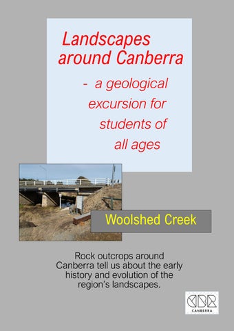
Rock outcrops around Canberra tell us about the early history and evolution of the region’s landscapes.

![]()

Rock outcrops around Canberra tell us about the early history and evolution of the region’s landscapes.

The landscapes around Canberra had their origins over 400 million years ago during the Paleozoic geological era on the margins of the supercontinent called Gondwana. Since those formative years the landscapes have been shaped and deeply eroded to reveal the rocks we now see at outcrops around Canberra.

Simplified geology extract from — Geological Map of the ACT, 2008.

This publication was compiled for the ACT Division, Geological Society of Australia, by Douglas Finlayson.
443.8 Ma
Late Ordovician

The Canberra region is in the southeastern part of the Lachlan Orogen (or Lachlan Fold Belt), a geological province that stretches from near South Australia to the Australian southeast Tasman Sea coast.
During the Paleozoic era this province was subjected to major orogenic (mountain building) events, the Benambran Orogeny
Phase 1 (444-440 Ma) and Phase 2 (431-428 Ma) and the Tabberabberan Orogeny (about 400—370 Ma).
Ma = million years ago
Paleogeography
480 million years ago

During the early part of the Paleozoic era Australia was part of the Gondwana supercontinent that also included India, Antarctica, Africa, and South America.
Australia was surrounded by warm waters north of the Equator. The Paleo-Pacific Ocean lithospheric plate was colliding with Gondwana and there were subduction zones, with associated volcanoes and earthquakes, dipping under its AustraliaAntarctica-South America margins, much like the tectonic processes happening today under Japan.
420 million years ago Silurian

During the later part of the Paleozoic era, during the Silurian geological period, Australia was still part of the Gondwana supercontinent and still at tropical latitudes with the Paleo-Pacific Ocean lithospheric plate colliding with Gondwana with consequent subduction zones, volcanoes and earthquakes.
The fossil site was first discovered by the Rev. William B. Clarke in 1844. Clarke is often referred to as the “Father of Australian Geology”. He had many scientific contacts in London and Cambridge and he sent rock and fossil samples back to UK where they were compared with others from around the world.
The brachiopod fossils from Woolshed Creek were recognised by Clarke as belonging to the Silurian geological period, an exciting discovery indicating for the first time that rocks of this age were present in Australia. A small area of fossiliferous mudstone within the Canberra Formation crops out in the bed of Woolshed Creek near Canberra Airport where the twin Fairbairn Avenue bridges cross the creek.


Vehicle access to the fossil site is through the Duntroon College and Australian Defence Force Academy campus. Enter from the Fairbairn Avenue entrance (two field guns) into General Bridges Drive/Campbell Road, then first left into Hopkins Drive that passes through playing fields and a golf course to the large Majura Parkway underpass and No.1 Cricket Oval.
There is plenty of roadside parking around the underpass. A pedestrian pathway links the car parking and information sign to the fossil site.

In 1844, Clarke, pastor and geologist, visited the area around Robert Campbell’s Duntroon property during his travels in southern New South Wales on behalf of the colonial government, and undoubtedly stayed with Campbell whom he would have known from his period as headmaster of the Kings School from 1839 to 1841, a school established partly at Campbell’s instigation.

The Woolshed Creek fossil site is now on the ACT Heritage Register and deservedly so. It gives us a window into life in the Canberra region about 425 million years ago. Its contribution to the intellectual and scientific debates of the 19th century at a local, national and international level was significant.
The figure below shows possible life in the Canberra region during the Silurian geological period (444 - 416 Ma). All life was in the sea. Eastern Australia was part of the Gondwana supercontinent near the equator and the Canberra region was offshore in a warm shallow sea with lots of marine life.


Further information on all geoheritage sites around Canberra can be downloaded from the Geological Society of Australia web site—
https://www.gsa.org.au/Public/Geoheritage/ and look for ACT Sites and Maps on the pulldown menu.