Landscapes around Canberra
- a geological excursion for students of all ages
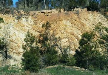
Gossan Hill
Rock outcrops around Canberra tell us about the early history and evolution of the region’s landscapes.


Gossan Hill
Rock outcrops around Canberra tell us about the early history and evolution of the region’s landscapes.
The landscapes around Canberra had their origins over 400 million years ago during the Paleozoic geological era on the margins of the supercontinent called Gondwana. Since those formative years the landscapes have been shaped and deeply eroded to reveal the rocks we now see at outcrops around Canberra.
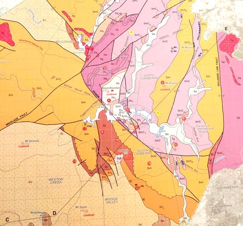

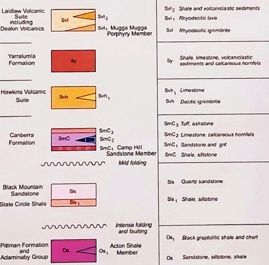
Simplified geology extract from — Geological Map of the ACT, 2008. This publication was compiled for the ACT Division, Geological Society of Australia, by Douglas Finlayson.
443.8 Ma
Late Ordovician
The Canberra region is in the southeastern part of the Lachlan Orogen (or Lachlan Fold Belt), a geological province that stretches from near South Australia to the Australian southeast Tasman Sea coast.
During the Paleozoic era this province was subjected to major orogenic (mountain building) events, the Benambran Orogeny
Phase 1 (444-440 Ma) and Phase 2 (431-428 Ma) and the Tabberabberan Orogeny (about 400—370 Ma).
Ma = million years ago
Paleogeography
480 million years ago
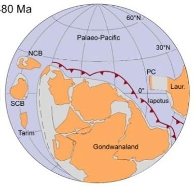
During the early part of the Paleozoic era Australia was part of the Gondwana supercontinent that also included India, Antarctica, Africa, and South America.
Australia was surrounded by warm waters north of the Equator. The Paleo-Pacific Ocean lithospheric plate was colliding with Gondwana and there were subduction zones, with associated volcanoes and earthquakes, dipping under its AustraliaAntarctica-South America margins, much like the tectonic processes happening today under Japan.
420 million years ago Silurian
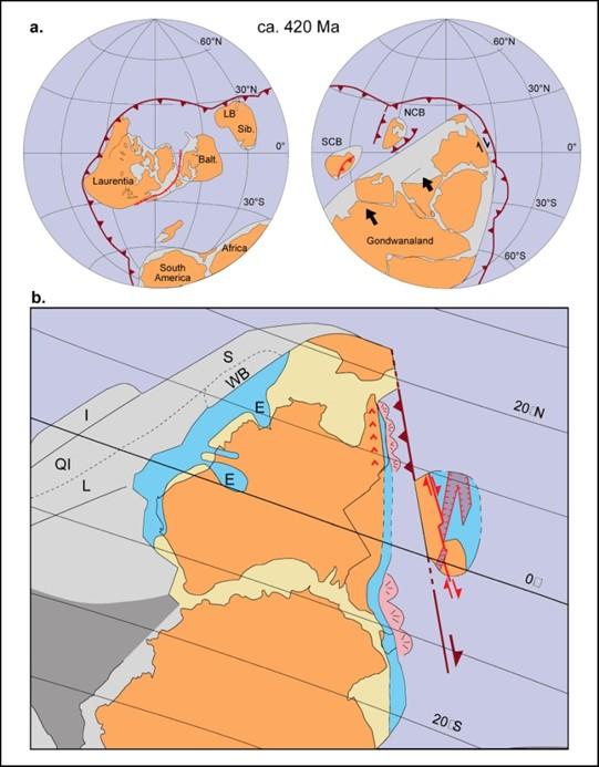
During the later part of the Paleozoic era, during the Silurian geological period, Australia was still part of the Gondwana supercontinent and still at tropical latitudes with the Paleo-Pacific Ocean lithospheric plate still colliding with Gondwana with consequent subduction zones, volcanoes and earthquakes.
Behind Radford College in the Belconnen suburb of Bruce is Gossan Hill where there are very interesting rock outcrops for a number of reasons. The hill has outcrops of the oldest rocks around Canberra, Ordovician Pittman Formation (about 460 million years old) and has an associated gossan (intruded mineralized rocks leached from underlying rock formations). Numerous walking trails go across Gossan Hill.
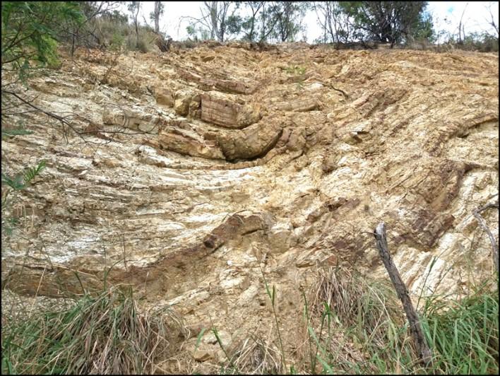
The siltstones of the Pittman Formation were formed when large river systems across the Gondwana supercontinent eroded huge amounts of turbiditic sediment into a deep ocean on its margins. The formation is now grouped within the Adaminaby Group of rocks seen in outcrop across large parts of southern NSW.
About 485 million years ago (Ma) during the Paleozoic geological era (541–252 Ma), the Australian continent’s coastline was near Broken Hill and its landmass to the west was part of a supercontinent called Gondwana that also included Africa, India, Antarctica and South America. The Broken Hill region was near the equator and a paleoPacific oceanic plate was colliding with that coastline. The region of what is now Canberra was a small part of a deep ocean basin, perhaps about 5000 metres deep, off the super-continent’s margin. Huge river systems across Gondwana were pouring enormous volumes of fine turbiditic sediment into the deep ocean basin where they built up significant thickness, perhaps up to 5 km.
At that time, there was no terrestrial vegetation to slow down erosion. These turbiditic sediments would eventually become part of a rock unit called the Pittman
Connodont reconstructed image
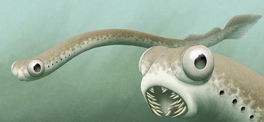
Formation that we can now see prominently in the road cutting along Caswell Drive on the western side of the Black Mountain Nature Reserve, the oldest rock unit in the Canberra region. Microfossil conodont fauna (Middle Ordovician Llanvirnian age [mid-to-late Darriwilian], 464–458 Ma) have been recovered from the Pittman Formation outcrop on Etheridge Creek in the northern part of Black Mountain Nature Reserve near Belconnen Way.
A Pittman Formation outcrop at Gossan Hill is easily accessed near the bus stop next to the road cutting on College Street, Belconnen, near the University of Canberra and Radford College.
Other outcrops can be viewed while driving along the Caswell Drive freeway on the western side of Black Mountain and at the tip of Black Mountain Peninsula.
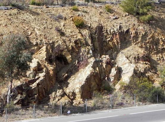
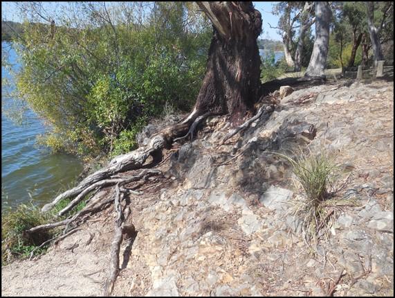
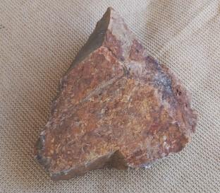
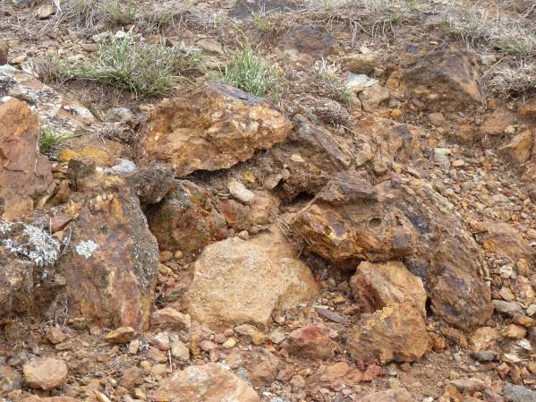
The oxides of iron were emplaced during the late Silurian geological period when hydrothermal fluids at high temperature and pressure injected various oxides of iron (magnetitie, hematite and limonite) into the overlying siltstones. The coloured ochre rocks associated with the gossan have been used by local aboriginal communities for ceremonial purposes.
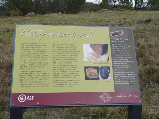
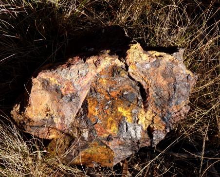
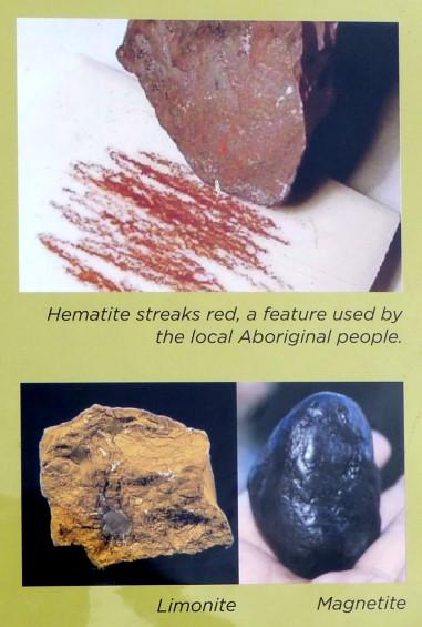
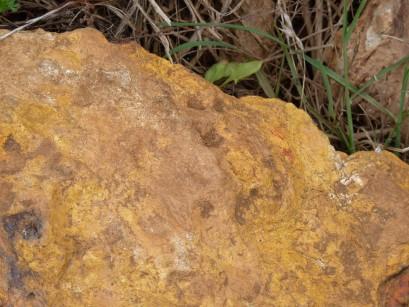
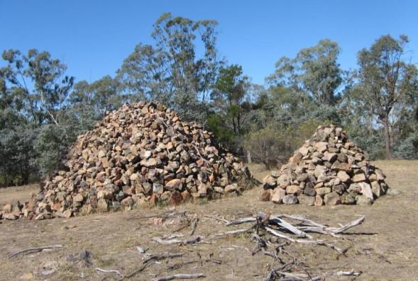
Gossan Hill is one of a small number of registered Geological Monuments in the ACT, so named for the excellent example of a mineralised gossan/ironstone preserved on the northern slope of the hill. Prominent ironstone outcrops along the northeast sloping ridge of Gossan Hill represent a true gossan, formed by chemical weathering of an underlying sulfide deposit. Blocks and fragments of gossan as well as deep reddish soils extend some distance down the slope of the ridge. Several geochemical surveys have recently been completed over the area of Gossan Hill, with the assistance of students from the University of Canberra.
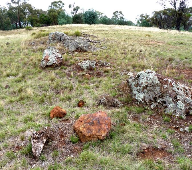
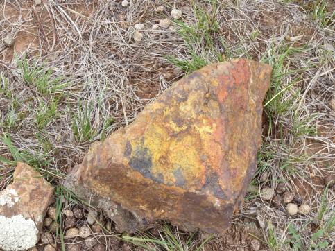
The word ‘gossan’ is a Cornish word meaning cap or wig (or possibly related to the Cornish word ‘gos’ meaning blood) and used by early Cornish miners to describe the iron oxide rich cap of an exposed and weathered ore deposit.
At this gossan geochemical sampling at depth indicated key elements present included iron, copper, lead, zinc gold and silver.
Some have suggested the area could be a mining resource.
Further information on all geoheritage sites around Canberra can be downloaded from the Geological Society of Australia web site—
https://www.gsa.org.au/Public/Geoheritage/ and look for ACT Sites and Maps on the pulldown menu.